

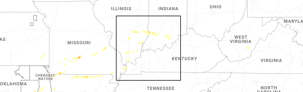
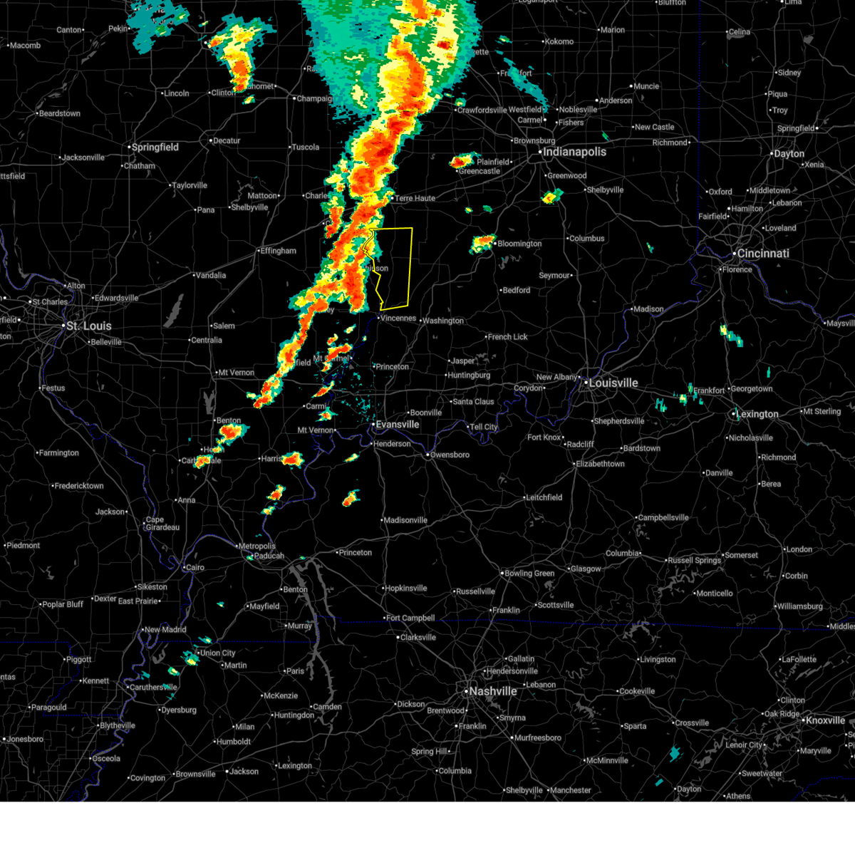
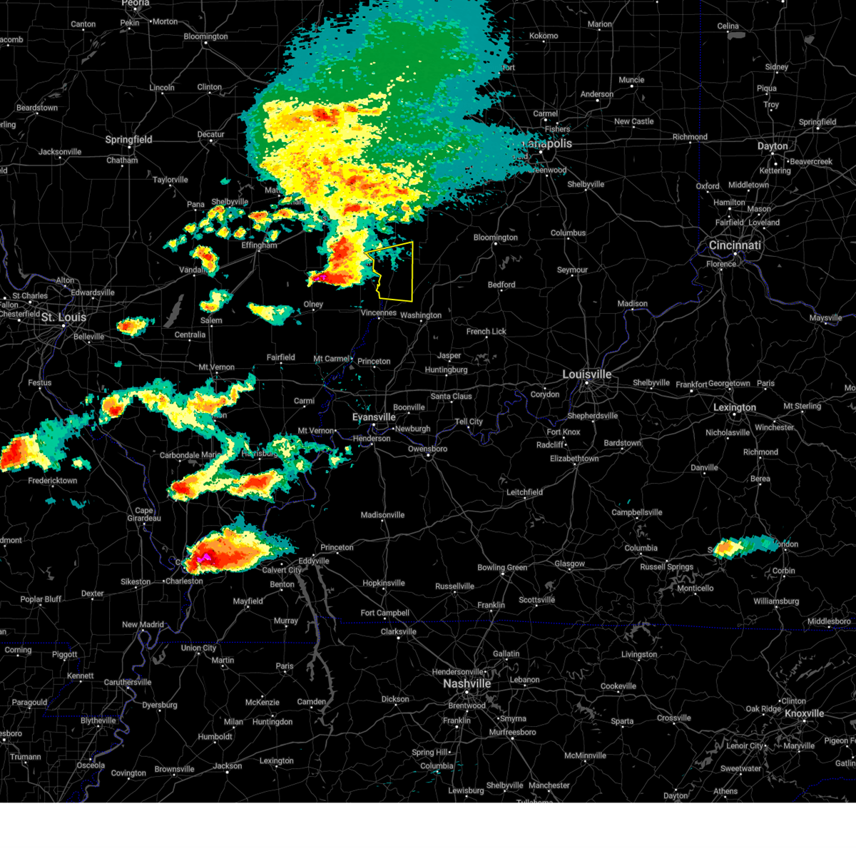
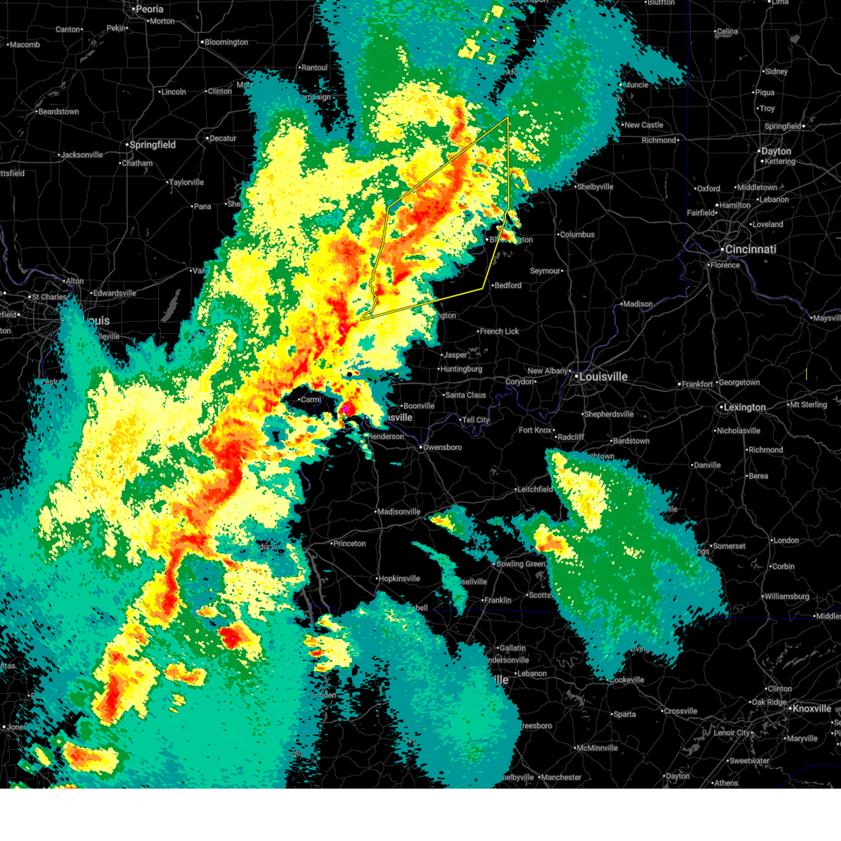
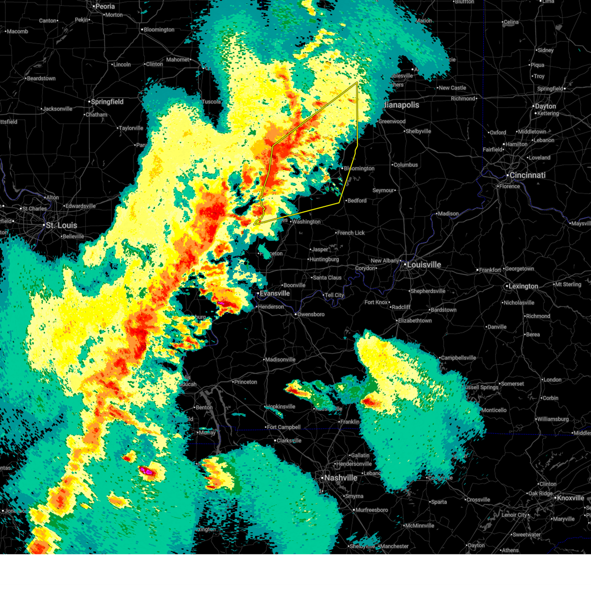
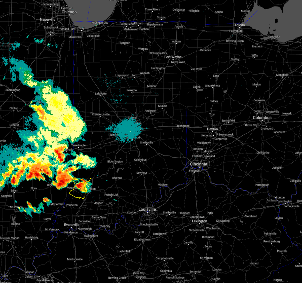
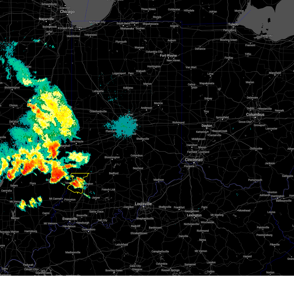
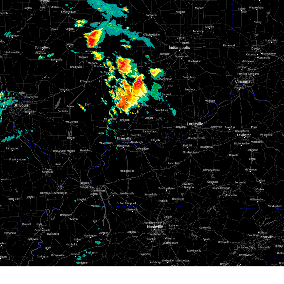
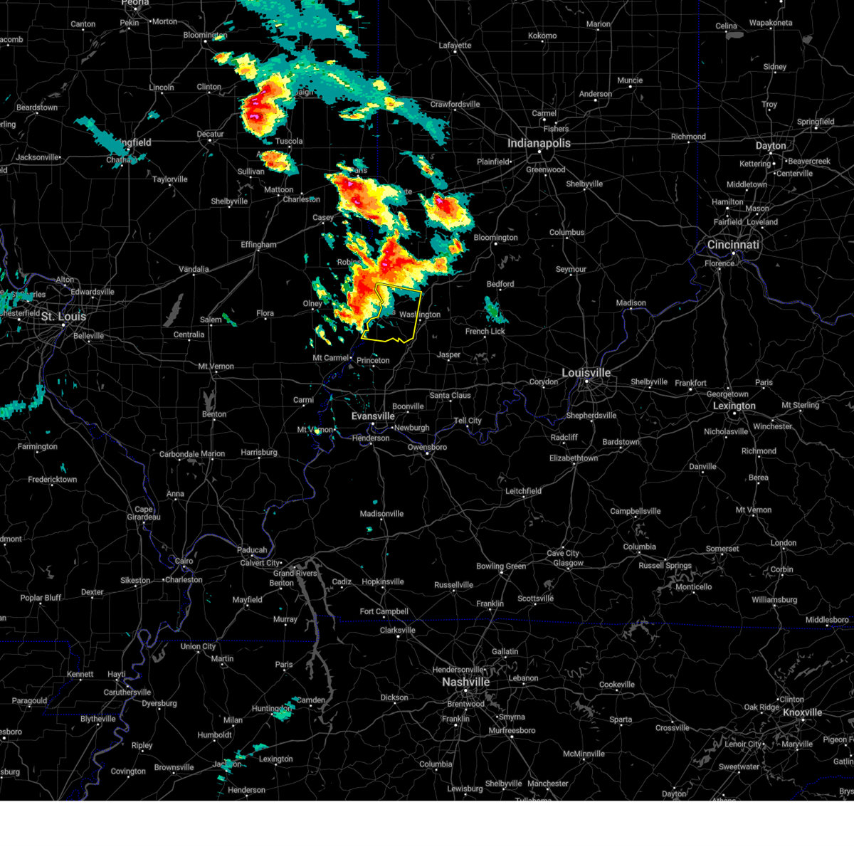
Hail Map for Oaktown, IN
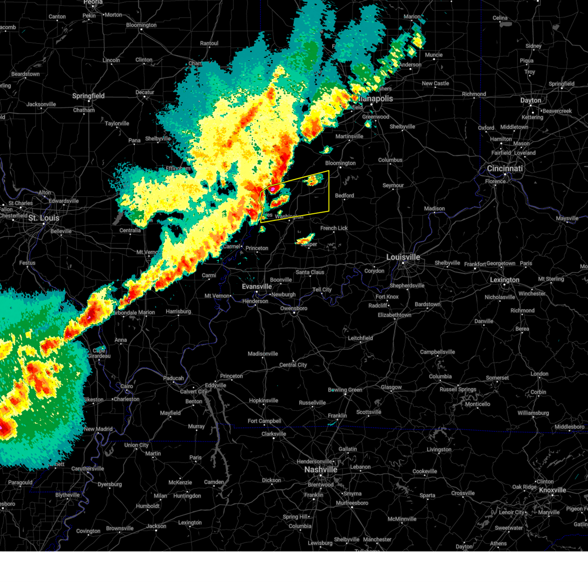
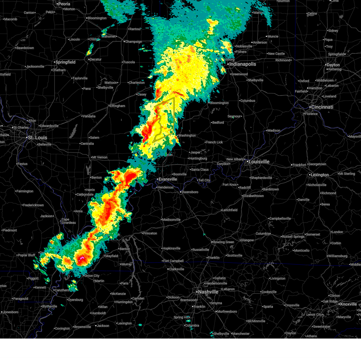
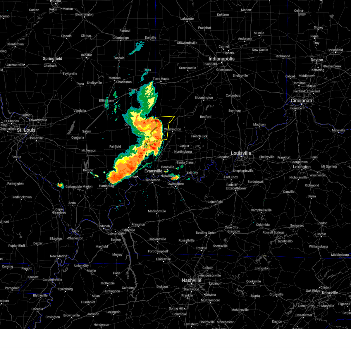
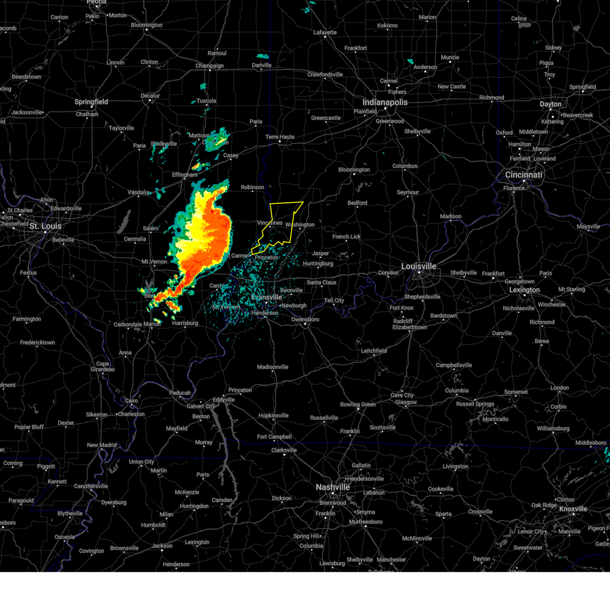
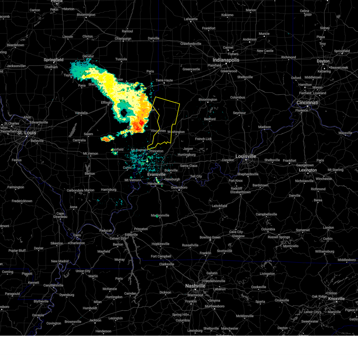
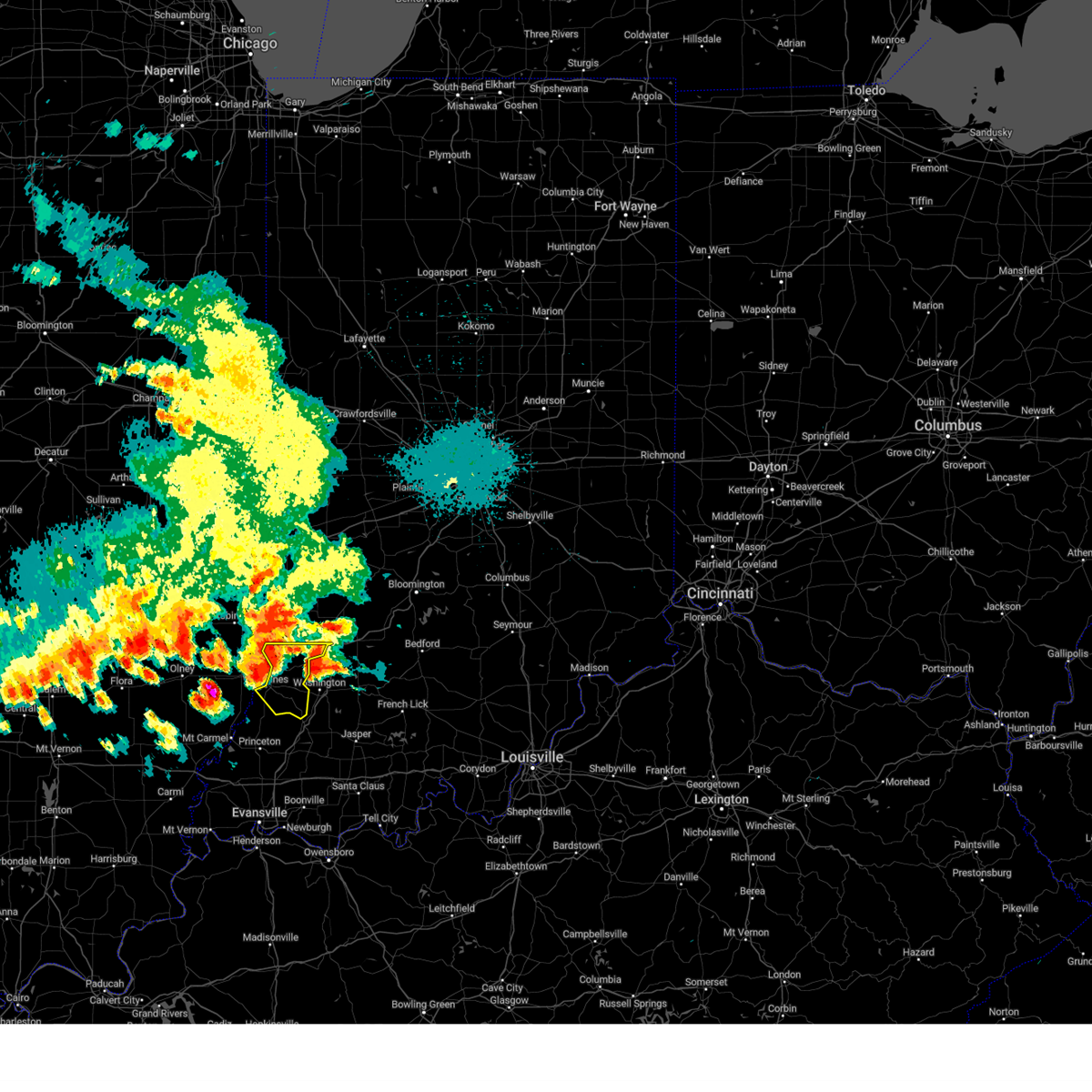
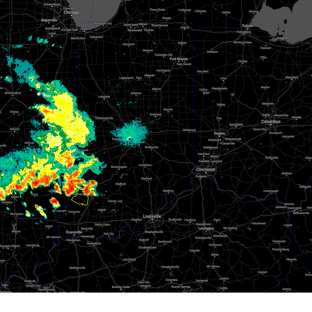
The Oaktown, IN area has had 7 reports of on-the-ground hail by trained spotters, and has been under severe weather warnings 20 times during the past 12 months. Doppler radar has detected hail at or near Oaktown, IN on 51 occasions, including 5 occasions during the past year.
| Name: | Oaktown, IN |
| Where Located: | 62.1 miles N of Evansville, IN |
| Map: | Google Map for Oaktown, IN |
| Population: | 608 |
| Housing Units: | 292 |
| More Info: | Search Google for Oaktown, IN |
2
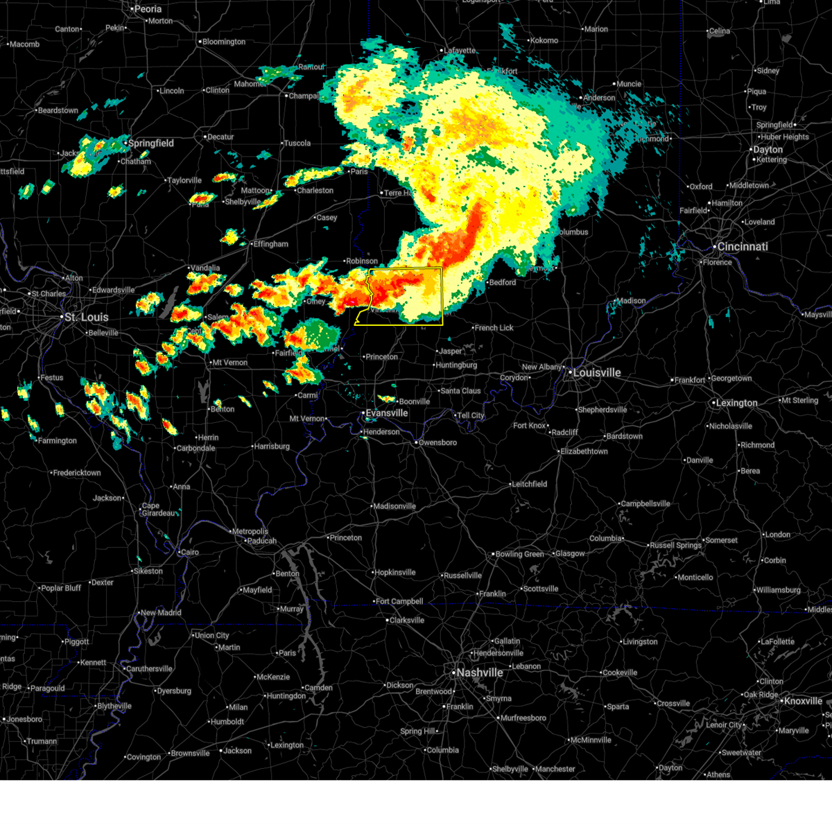
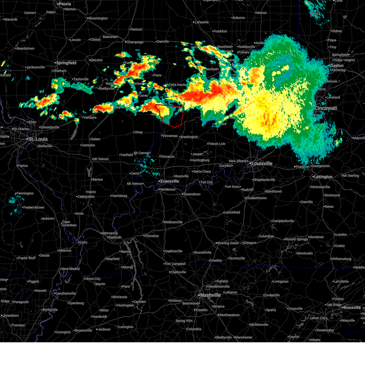
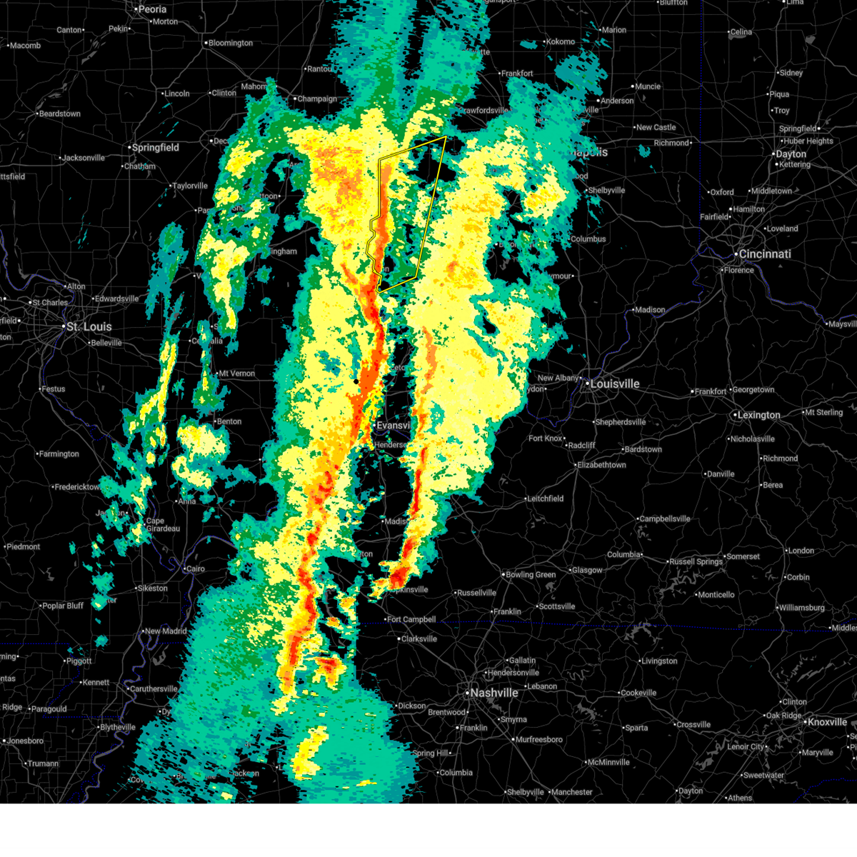
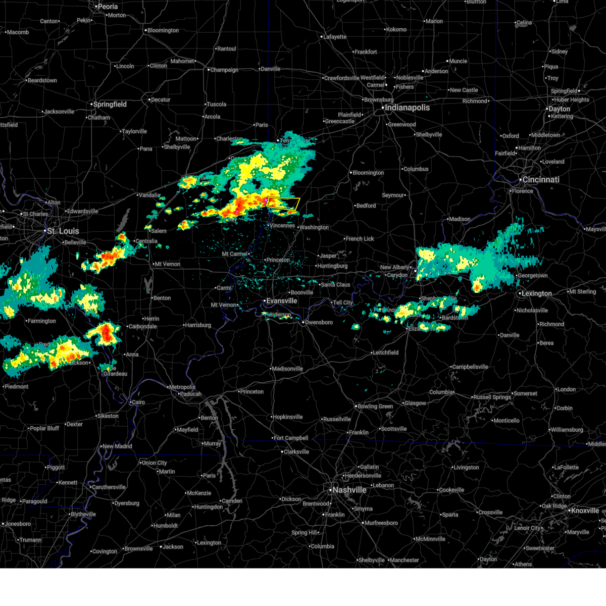
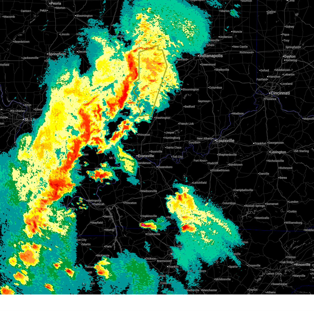
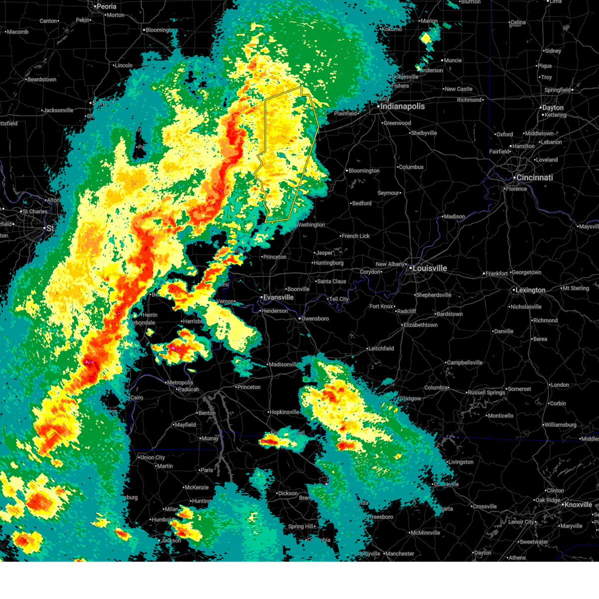
The Top Recent Hail Date for Oaktown, IN is Wednesday, March 4, 2026 (4th out of 51)
Hail and Wind Damage Spotted near Oaktown, IN
| Date / Time | Report Details |
|---|---|
| 6/21/2026 7:17 PM EDT |
 Svrind the national weather service in indianapolis has issued a * severe thunderstorm warning for, southeastern sullivan county in southwestern indiana, knox county in southwestern indiana, northwestern martin county in southwestern indiana, southwestern greene county in southwestern indiana, daviess county in southwestern indiana, * until 800 pm edt. * at 716 pm edt, a severe thunderstorm was located near russellville, or near vincennes, moving east at 30 mph (radar indicated). Hazards include 70 mph wind gusts. Expect considerable tree damage. Damage is likely to mobile homes, roofs, and outbuildings. Svrind the national weather service in indianapolis has issued a * severe thunderstorm warning for, southeastern sullivan county in southwestern indiana, knox county in southwestern indiana, northwestern martin county in southwestern indiana, southwestern greene county in southwestern indiana, daviess county in southwestern indiana, * until 800 pm edt. * at 716 pm edt, a severe thunderstorm was located near russellville, or near vincennes, moving east at 30 mph (radar indicated). Hazards include 70 mph wind gusts. Expect considerable tree damage. Damage is likely to mobile homes, roofs, and outbuildings.
|
| 6/21/2026 6:51 PM EDT |
 At 651 pm edt, a severe thunderstorm capable of producing a tornado was located near russellville, or 9 miles north of vincennes, moving east at 30 mph (radar indicated rotation). Hazards include tornado. Flying debris will be dangerous to those caught without shelter. mobile homes will be damaged or destroyed. damage to roofs, windows, and vehicles will occur. tree damage is likely. Locations impacted include, oaktown and freelandville. At 651 pm edt, a severe thunderstorm capable of producing a tornado was located near russellville, or 9 miles north of vincennes, moving east at 30 mph (radar indicated rotation). Hazards include tornado. Flying debris will be dangerous to those caught without shelter. mobile homes will be damaged or destroyed. damage to roofs, windows, and vehicles will occur. tree damage is likely. Locations impacted include, oaktown and freelandville.
|
| 6/21/2026 6:51 PM EDT |
 the tornado warning has been cancelled and is no longer in effect the tornado warning has been cancelled and is no longer in effect
|
| 6/21/2026 6:36 PM EDT |
 Torind the national weather service in indianapolis has issued a * tornado warning for, south central sullivan county in southwestern indiana, north central knox county in southwestern indiana, * until 715 pm edt. * at 636 pm edt, a severe thunderstorm capable of producing a tornado was located near flat rock, or 9 miles north of lawrenceville, moving east at 20 mph (radar indicated rotation). Hazards include tornado. Flying debris will be dangerous to those caught without shelter. mobile homes will be damaged or destroyed. damage to roofs, windows, and vehicles will occur. Tree damage is likely. Torind the national weather service in indianapolis has issued a * tornado warning for, south central sullivan county in southwestern indiana, north central knox county in southwestern indiana, * until 715 pm edt. * at 636 pm edt, a severe thunderstorm capable of producing a tornado was located near flat rock, or 9 miles north of lawrenceville, moving east at 20 mph (radar indicated rotation). Hazards include tornado. Flying debris will be dangerous to those caught without shelter. mobile homes will be damaged or destroyed. damage to roofs, windows, and vehicles will occur. Tree damage is likely.
|
| 6/17/2026 10:04 PM EDT |
 Torind the national weather service in indianapolis has issued a * tornado warning for, sullivan county in southwestern indiana, northeastern knox county in southwestern indiana, western greene county in southwestern indiana, * until 1045 pm edt. * at 1004 pm edt, a severe thunderstorm capable of producing a tornado was located near robinson, moving east at 55 mph (radar indicated rotation). Hazards include tornado. Flying debris will be dangerous to those caught without shelter. mobile homes will be damaged or destroyed. damage to roofs, windows, and vehicles will occur. Tree damage is likely. Torind the national weather service in indianapolis has issued a * tornado warning for, sullivan county in southwestern indiana, northeastern knox county in southwestern indiana, western greene county in southwestern indiana, * until 1045 pm edt. * at 1004 pm edt, a severe thunderstorm capable of producing a tornado was located near robinson, moving east at 55 mph (radar indicated rotation). Hazards include tornado. Flying debris will be dangerous to those caught without shelter. mobile homes will be damaged or destroyed. damage to roofs, windows, and vehicles will occur. Tree damage is likely.
|
| 4/27/2026 10:35 PM EDT |
 Svrind the national weather service in indianapolis has issued a * severe thunderstorm warning for, southern sullivan county in southwestern indiana, knox county in southwestern indiana, southwestern greene county in southwestern indiana, daviess county in southwestern indiana, * until 1130 pm edt. * at 1035 pm edt, severe thunderstorms were located along a line extending from near robinson to near chauncey to parkersburg, moving east at 70 mph (radar indicated). Hazards include 70 mph wind gusts and quarter size hail. Hail damage to vehicles is expected. expect considerable tree damage. Wind damage is also likely to mobile homes, roofs, and outbuildings. Svrind the national weather service in indianapolis has issued a * severe thunderstorm warning for, southern sullivan county in southwestern indiana, knox county in southwestern indiana, southwestern greene county in southwestern indiana, daviess county in southwestern indiana, * until 1130 pm edt. * at 1035 pm edt, severe thunderstorms were located along a line extending from near robinson to near chauncey to parkersburg, moving east at 70 mph (radar indicated). Hazards include 70 mph wind gusts and quarter size hail. Hail damage to vehicles is expected. expect considerable tree damage. Wind damage is also likely to mobile homes, roofs, and outbuildings.
|
| 3/22/2026 9:14 PM EDT |
 Svrind the national weather service in indianapolis has issued a * severe thunderstorm warning for, southern sullivan county in southwestern indiana, northeastern knox county in southwestern indiana, western greene county in southwestern indiana, northern daviess county in southwestern indiana, * until 1000 pm edt. * at 914 pm edt, a severe thunderstorm was located near robinson, moving east at 55 mph (radar indicated). Hazards include 60 mph wind gusts and quarter size hail. Hail damage to vehicles is expected. Expect wind damage to roofs, siding, and trees. Svrind the national weather service in indianapolis has issued a * severe thunderstorm warning for, southern sullivan county in southwestern indiana, northeastern knox county in southwestern indiana, western greene county in southwestern indiana, northern daviess county in southwestern indiana, * until 1000 pm edt. * at 914 pm edt, a severe thunderstorm was located near robinson, moving east at 55 mph (radar indicated). Hazards include 60 mph wind gusts and quarter size hail. Hail damage to vehicles is expected. Expect wind damage to roofs, siding, and trees.
|
| 3/15/2026 9:56 PM EDT |
 Svrind the national weather service in indianapolis has issued a * severe thunderstorm warning for, southeastern sullivan county in southwestern indiana, northeastern knox county in southwestern indiana, western daviess county in southwestern indiana, * until 1045 pm edt. * at 955 pm edt, a severe thunderstorm was located 8 miles east of vincennes, moving northeast at 45 mph (radar indicated). Hazards include 60 mph wind gusts. expect damage to roofs, siding, and trees Svrind the national weather service in indianapolis has issued a * severe thunderstorm warning for, southeastern sullivan county in southwestern indiana, northeastern knox county in southwestern indiana, western daviess county in southwestern indiana, * until 1045 pm edt. * at 955 pm edt, a severe thunderstorm was located 8 miles east of vincennes, moving northeast at 45 mph (radar indicated). Hazards include 60 mph wind gusts. expect damage to roofs, siding, and trees
|
| 3/15/2026 9:51 PM EDT |
 Svrind the national weather service in indianapolis has issued a * severe thunderstorm warning for, vigo county in west central indiana, sullivan county in southwestern indiana, north central knox county in southwestern indiana, clay county in west central indiana, parke county in west central indiana, northwestern greene county in southwestern indiana, southern vermillion county in west central indiana, northwestern putnam county in west central indiana, * until 1030 pm edt. * at 951 pm edt, severe thunderstorms were located along a line extending from 6 miles north of clinton to near palestine, moving northeast at 45 mph (radar indicated). Hazards include 60 mph wind gusts. expect damage to roofs, siding, and trees Svrind the national weather service in indianapolis has issued a * severe thunderstorm warning for, vigo county in west central indiana, sullivan county in southwestern indiana, north central knox county in southwestern indiana, clay county in west central indiana, parke county in west central indiana, northwestern greene county in southwestern indiana, southern vermillion county in west central indiana, northwestern putnam county in west central indiana, * until 1030 pm edt. * at 951 pm edt, severe thunderstorms were located along a line extending from 6 miles north of clinton to near palestine, moving northeast at 45 mph (radar indicated). Hazards include 60 mph wind gusts. expect damage to roofs, siding, and trees
|
| 3/15/2026 9:39 PM EDT |
 At 938 pm edt, severe thunderstorms were located along a line extending from near marshall to near owensville, moving northeast at 65 mph (radar indicated). Hazards include 60 mph wind gusts. Expect damage to roofs, siding, and trees. locations impacted include, vincennes, washington, linton, sullivan, bicknell, jasonville, shelburn, prairieton, prairie creek, farmersburg, dugger, clay city, hymera, fairbanks, carlisle, oaktown, monroe city, wheatland, bruceville, and sandborn. This includes interstate 70 between mile markers 12 and 28. At 938 pm edt, severe thunderstorms were located along a line extending from near marshall to near owensville, moving northeast at 65 mph (radar indicated). Hazards include 60 mph wind gusts. Expect damage to roofs, siding, and trees. locations impacted include, vincennes, washington, linton, sullivan, bicknell, jasonville, shelburn, prairieton, prairie creek, farmersburg, dugger, clay city, hymera, fairbanks, carlisle, oaktown, monroe city, wheatland, bruceville, and sandborn. This includes interstate 70 between mile markers 12 and 28.
|
| 3/15/2026 9:22 PM EDT |
 Svrind the national weather service in indianapolis has issued a * severe thunderstorm warning for, southern vigo county in west central indiana, sullivan county in southwestern indiana, knox county in southwestern indiana, clay county in west central indiana, western greene county in southwestern indiana, western daviess county in southwestern indiana, * until 1000 pm edt. * at 922 pm edt, severe thunderstorms were located along a line extending from 8 miles northwest of hutsonville to 6 miles southwest of new harmony, moving northeast at 55 mph (radar indicated). Hazards include 60 mph wind gusts. expect damage to roofs, siding, and trees Svrind the national weather service in indianapolis has issued a * severe thunderstorm warning for, southern vigo county in west central indiana, sullivan county in southwestern indiana, knox county in southwestern indiana, clay county in west central indiana, western greene county in southwestern indiana, western daviess county in southwestern indiana, * until 1000 pm edt. * at 922 pm edt, severe thunderstorms were located along a line extending from 8 miles northwest of hutsonville to 6 miles southwest of new harmony, moving northeast at 55 mph (radar indicated). Hazards include 60 mph wind gusts. expect damage to roofs, siding, and trees
|
| 3/11/2026 8:03 AM EDT | At 803 am edt, severe thunderstorms were located along a line extending from 10 miles northeast of sullivan to 6 miles northwest of washington, moving east at 70 mph (radar indicated). Hazards include 60 mph wind gusts. Expect damage to roofs, siding, and trees. Locations impacted include, bloomington, vincennes, linton, sullivan, bloomfield, spencer, ellettsville, bicknell, jasonville, worthington, odon, shelburn, dugger, hymera, lyons, carlisle, elnora, oaktown, bruceville, and plainville. |
| 3/11/2026 7:45 AM EDT |
 Svrind the national weather service in indianapolis has issued a * severe thunderstorm warning for, western monroe county in south central indiana, sullivan county in southwestern indiana, northeastern knox county in southwestern indiana, southwestern clay county in west central indiana, southern owen county in west central indiana, northern martin county in southwestern indiana, western lawrence county in south central indiana, greene county in southwestern indiana, northern daviess county in southwestern indiana, * until 830 am edt. * at 744 am edt, severe thunderstorms were located along a line extending from near hutsonville to near lawrenceville, moving east at 70 mph (radar indicated). Hazards include 60 mph wind gusts. expect damage to roofs, siding, and trees Svrind the national weather service in indianapolis has issued a * severe thunderstorm warning for, western monroe county in south central indiana, sullivan county in southwestern indiana, northeastern knox county in southwestern indiana, southwestern clay county in west central indiana, southern owen county in west central indiana, northern martin county in southwestern indiana, western lawrence county in south central indiana, greene county in southwestern indiana, northern daviess county in southwestern indiana, * until 830 am edt. * at 744 am edt, severe thunderstorms were located along a line extending from near hutsonville to near lawrenceville, moving east at 70 mph (radar indicated). Hazards include 60 mph wind gusts. expect damage to roofs, siding, and trees
|
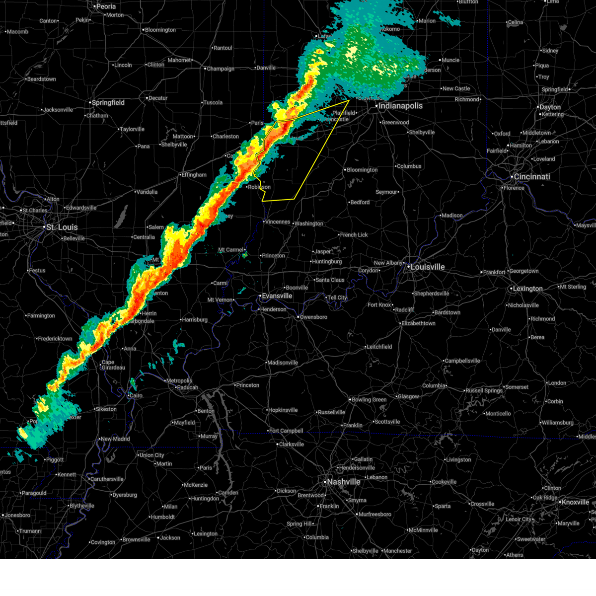
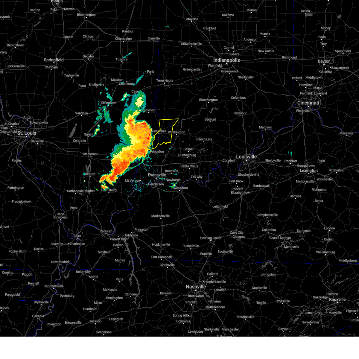
| 3/4/2026 9:45 AM EST |
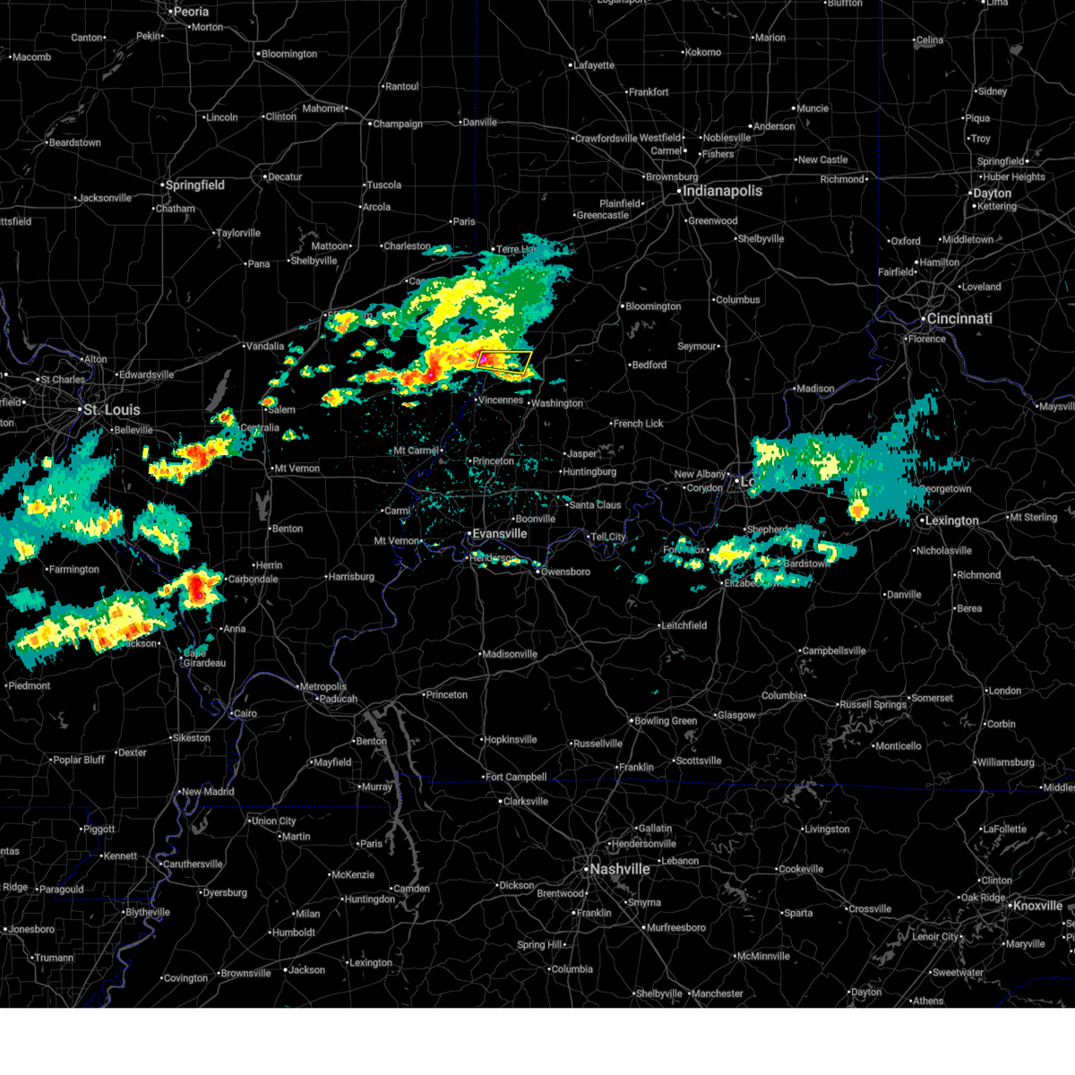 At 945 am est, a severe thunderstorm was located near russellville, or 14 miles north of vincennes, moving east at 35 mph (radar indicated). Hazards include half dollar size hail. Damage to vehicles is expected. Locations impacted include, oaktown, sandborn, and freelandville. At 945 am est, a severe thunderstorm was located near russellville, or 14 miles north of vincennes, moving east at 35 mph (radar indicated). Hazards include half dollar size hail. Damage to vehicles is expected. Locations impacted include, oaktown, sandborn, and freelandville.
|
| 3/4/2026 9:44 AM EST | Half Dollar sized hail reported 0.1 miles N of Oaktown, IN, time estimated from radar. |
| 3/4/2026 9:38 AM EST |
 Svrind the national weather service in indianapolis has issued a * severe thunderstorm warning for, southeastern sullivan county in southwestern indiana, northeastern knox county in southwestern indiana, southwestern greene county in southwestern indiana, * until 1015 am est. * at 937 am est, a severe thunderstorm was located near russellville, or 13 miles southeast of robinson, moving east at 35 mph (radar indicated). Hazards include up to quarter size hail. damage to vehicles is expected Svrind the national weather service in indianapolis has issued a * severe thunderstorm warning for, southeastern sullivan county in southwestern indiana, northeastern knox county in southwestern indiana, southwestern greene county in southwestern indiana, * until 1015 am est. * at 937 am est, a severe thunderstorm was located near russellville, or 13 miles southeast of robinson, moving east at 35 mph (radar indicated). Hazards include up to quarter size hail. damage to vehicles is expected
|
| 12/28/2025 6:59 PM EST |
 Svrind the national weather service in indianapolis has issued a * severe thunderstorm warning for, northwestern monroe county in south central indiana, southern morgan county in central indiana, sullivan county in southwestern indiana, knox county in southwestern indiana, southwestern clay county in west central indiana, southern owen county in west central indiana, greene county in southwestern indiana, central daviess county in southwestern indiana, * until 745 pm est. * at 658 pm est, severe thunderstorms were located along a line extending from 6 miles northeast of sullivan to 7 miles west of mount carmel, moving east at 60 mph (radar indicated). Hazards include 60 mph wind gusts. expect damage to roofs, siding, and trees Svrind the national weather service in indianapolis has issued a * severe thunderstorm warning for, northwestern monroe county in south central indiana, southern morgan county in central indiana, sullivan county in southwestern indiana, knox county in southwestern indiana, southwestern clay county in west central indiana, southern owen county in west central indiana, greene county in southwestern indiana, central daviess county in southwestern indiana, * until 745 pm est. * at 658 pm est, severe thunderstorms were located along a line extending from 6 miles northeast of sullivan to 7 miles west of mount carmel, moving east at 60 mph (radar indicated). Hazards include 60 mph wind gusts. expect damage to roofs, siding, and trees
|
| 12/28/2025 6:50 PM EST |
 At 650 pm est, severe thunderstorms were located along a line extending from 6 miles northwest of greencastle to near flat rock, moving east at 70 mph (radar indicated). Hazards include 60 mph wind gusts. Expect damage to roofs, siding, and trees. locations impacted include, terre haute, greencastle, danville, brazil, linton, sullivan, jasonville, cloverdale, shelburn, farmersburg, seelyville, dugger, knightsville, clay city, hymera, lyons, fairbanks, carlisle, harmony, and oaktown. This includes interstate 70 between mile markers 11 and 47. At 650 pm est, severe thunderstorms were located along a line extending from 6 miles northwest of greencastle to near flat rock, moving east at 70 mph (radar indicated). Hazards include 60 mph wind gusts. Expect damage to roofs, siding, and trees. locations impacted include, terre haute, greencastle, danville, brazil, linton, sullivan, jasonville, cloverdale, shelburn, farmersburg, seelyville, dugger, knightsville, clay city, hymera, lyons, fairbanks, carlisle, harmony, and oaktown. This includes interstate 70 between mile markers 11 and 47.
|
| 12/28/2025 6:32 PM EST |
 Svrind the national weather service in indianapolis has issued a * severe thunderstorm warning for, vigo county in west central indiana, sullivan county in southwestern indiana, southwestern hendricks county in central indiana, north central knox county in southwestern indiana, clay county in west central indiana, western owen county in west central indiana, southeastern parke county in west central indiana, western greene county in southwestern indiana, putnam county in west central indiana, * until 715 pm est. * at 632 pm est, severe thunderstorms were located along a line extending from 7 miles east of clinton to near ste. marie, moving east at 70 mph (radar indicated). Hazards include 60 mph wind gusts. expect damage to roofs, siding, and trees Svrind the national weather service in indianapolis has issued a * severe thunderstorm warning for, vigo county in west central indiana, sullivan county in southwestern indiana, southwestern hendricks county in central indiana, north central knox county in southwestern indiana, clay county in west central indiana, western owen county in west central indiana, southeastern parke county in west central indiana, western greene county in southwestern indiana, putnam county in west central indiana, * until 715 pm est. * at 632 pm est, severe thunderstorms were located along a line extending from 7 miles east of clinton to near ste. marie, moving east at 70 mph (radar indicated). Hazards include 60 mph wind gusts. expect damage to roofs, siding, and trees
|
| 7/20/2025 8:54 PM EDT |
 The storms which prompted the warning have moved out of the area. therefore, the warning will be allowed to expire. a severe thunderstorm watch remains in effect until 100 am edt for southwestern indiana. The storms which prompted the warning have moved out of the area. therefore, the warning will be allowed to expire. a severe thunderstorm watch remains in effect until 100 am edt for southwestern indiana.
|
| 7/20/2025 8:09 PM EDT |
 Svrind the national weather service in indianapolis has issued a * severe thunderstorm warning for, southeastern sullivan county in southwestern indiana, knox county in southwestern indiana, southwestern greene county in southwestern indiana, northwestern daviess county in southwestern indiana, * until 900 pm edt. * at 809 pm edt, severe thunderstorms were located along a line extending from 9 miles southeast of palestine to lawrenceville vincennes airport, moving southeast at 45 mph (radar indicated). Hazards include 60 mph wind gusts. expect damage to roofs, siding, and trees Svrind the national weather service in indianapolis has issued a * severe thunderstorm warning for, southeastern sullivan county in southwestern indiana, knox county in southwestern indiana, southwestern greene county in southwestern indiana, northwestern daviess county in southwestern indiana, * until 900 pm edt. * at 809 pm edt, severe thunderstorms were located along a line extending from 9 miles southeast of palestine to lawrenceville vincennes airport, moving southeast at 45 mph (radar indicated). Hazards include 60 mph wind gusts. expect damage to roofs, siding, and trees
|
| 6/18/2025 3:26 PM EDT |
 Svrind the national weather service in indianapolis has issued a * severe thunderstorm warning for, south central vigo county in west central indiana, sullivan county in southwestern indiana, knox county in southwestern indiana, southwestern clay county in west central indiana, southwestern owen county in west central indiana, greene county in southwestern indiana, daviess county in southwestern indiana, * until 415 pm edt. * at 325 pm edt, severe thunderstorms were located along a line extending from 12 miles north of sullivan to 7 miles northeast of vincennes, moving east at 30 mph (radar indicated). Hazards include 70 mph wind gusts and quarter size hail. Hail damage to vehicles is expected. expect considerable tree damage. Wind damage is also likely to mobile homes, roofs, and outbuildings. Svrind the national weather service in indianapolis has issued a * severe thunderstorm warning for, south central vigo county in west central indiana, sullivan county in southwestern indiana, knox county in southwestern indiana, southwestern clay county in west central indiana, southwestern owen county in west central indiana, greene county in southwestern indiana, daviess county in southwestern indiana, * until 415 pm edt. * at 325 pm edt, severe thunderstorms were located along a line extending from 12 miles north of sullivan to 7 miles northeast of vincennes, moving east at 30 mph (radar indicated). Hazards include 70 mph wind gusts and quarter size hail. Hail damage to vehicles is expected. expect considerable tree damage. Wind damage is also likely to mobile homes, roofs, and outbuildings.
|
| 6/18/2025 3:23 PM EDT | Tree limb down and numerous other downed trees across the area. time estimated from rada in knox county IN, 2.2 miles N of Oaktown, IN |
| 6/18/2025 3:00 PM EDT |
 Svrind the national weather service in indianapolis has issued a * severe thunderstorm warning for, south central vigo county in west central indiana, sullivan county in southwestern indiana, north central knox county in southwestern indiana, * until 345 pm edt. * at 300 pm edt, severe thunderstorms were located along a line extending from near hutsonville to near lawrenceville, moving northeast at 30 mph (radar indicated). Hazards include 60 mph wind gusts and quarter size hail. Hail damage to vehicles is expected. Expect wind damage to roofs, siding, and trees. Svrind the national weather service in indianapolis has issued a * severe thunderstorm warning for, south central vigo county in west central indiana, sullivan county in southwestern indiana, north central knox county in southwestern indiana, * until 345 pm edt. * at 300 pm edt, severe thunderstorms were located along a line extending from near hutsonville to near lawrenceville, moving northeast at 30 mph (radar indicated). Hazards include 60 mph wind gusts and quarter size hail. Hail damage to vehicles is expected. Expect wind damage to roofs, siding, and trees.
|
| 5/16/2025 4:45 PM CDT |
 Svrind the national weather service in indianapolis has issued a * severe thunderstorm warning for, sullivan county in southwestern indiana, north central knox county in southwestern indiana, * until 645 pm edt. * at 544 pm edt, a severe thunderstorm was located near ste. marie, or 11 miles east of newton, moving east at 50 mph (radar indicated). Hazards include ping pong ball size hail and 60 mph wind gusts. People and animals outdoors will be injured. expect hail damage to roofs, siding, windows, and vehicles. Expect wind damage to roofs, siding, and trees. Svrind the national weather service in indianapolis has issued a * severe thunderstorm warning for, sullivan county in southwestern indiana, north central knox county in southwestern indiana, * until 645 pm edt. * at 544 pm edt, a severe thunderstorm was located near ste. marie, or 11 miles east of newton, moving east at 50 mph (radar indicated). Hazards include ping pong ball size hail and 60 mph wind gusts. People and animals outdoors will be injured. expect hail damage to roofs, siding, windows, and vehicles. Expect wind damage to roofs, siding, and trees.
|
| 4/2/2025 11:00 PM EDT | Tree down over roa in knox county IN, 4.3 miles N of Oaktown, IN |
| 4/2/2025 9:34 PM EDT | Power lines taken down near 3rd/broadway in oaktow in knox county IN, 0.1 miles N of Oaktown, IN |
| 4/2/2025 9:10 PM EDT |
 Svrind the national weather service in indianapolis has issued a * severe thunderstorm warning for, southeastern sullivan county in southwestern indiana, knox county in southwestern indiana, western martin county in southwestern indiana, southern greene county in southwestern indiana, daviess county in southwestern indiana, * until 1000 pm edt. * at 909 pm edt, severe thunderstorms were located along a line extending from 7 miles southeast of russellville to near patoka, moving northeast at 60 mph (radar indicated). Hazards include 70 mph wind gusts and penny size hail. Expect considerable tree damage. Damage is likely to mobile homes, roofs, and outbuildings. Svrind the national weather service in indianapolis has issued a * severe thunderstorm warning for, southeastern sullivan county in southwestern indiana, knox county in southwestern indiana, western martin county in southwestern indiana, southern greene county in southwestern indiana, daviess county in southwestern indiana, * until 1000 pm edt. * at 909 pm edt, severe thunderstorms were located along a line extending from 7 miles southeast of russellville to near patoka, moving northeast at 60 mph (radar indicated). Hazards include 70 mph wind gusts and penny size hail. Expect considerable tree damage. Damage is likely to mobile homes, roofs, and outbuildings.
|
| 4/2/2025 8:54 PM EDT |
 At 854 pm edt, a severe thunderstorm was located 8 miles east of greencastle, or 27 miles southeast of crawfordsville, moving northeast at 75 mph (radar indicated). Hazards include 70 mph wind gusts and quarter size hail. Hail damage to vehicles is expected. expect considerable tree damage. wind damage is also likely to mobile homes, roofs, and outbuildings. locations impacted include, newberry, pittsboro, bicknell, smithville, plainfield, fillmore, crane, carlisle, freedom, farmersburg, reelsville, vincennes university, dugger, elnora, pimento, pleasantville, brazil, worthington, martinsville, and eminence. this includes the following highways, interstate 65 between mile markers 131 and 132. interstate 70 between mile markers 13 and 67. Interstate 74 between mile markers 59 and 68. At 854 pm edt, a severe thunderstorm was located 8 miles east of greencastle, or 27 miles southeast of crawfordsville, moving northeast at 75 mph (radar indicated). Hazards include 70 mph wind gusts and quarter size hail. Hail damage to vehicles is expected. expect considerable tree damage. wind damage is also likely to mobile homes, roofs, and outbuildings. locations impacted include, newberry, pittsboro, bicknell, smithville, plainfield, fillmore, crane, carlisle, freedom, farmersburg, reelsville, vincennes university, dugger, elnora, pimento, pleasantville, brazil, worthington, martinsville, and eminence. this includes the following highways, interstate 65 between mile markers 131 and 132. interstate 70 between mile markers 13 and 67. Interstate 74 between mile markers 59 and 68.
|
| 4/2/2025 8:43 PM EDT |
 Svrind the national weather service in indianapolis has issued a * severe thunderstorm warning for, southeastern vigo county in west central indiana, monroe county in south central indiana, morgan county in central indiana, northern knox county in southwestern indiana, owen county in west central indiana, northern martin county in southwestern indiana, south central boone county in central indiana, northwestern lawrence county in south central indiana, southern putnam county in west central indiana, northern daviess county in southwestern indiana, sullivan county in southwestern indiana, hendricks county in central indiana, clay county in west central indiana, greene county in southwestern indiana, * until 930 pm edt. * at 843 pm edt, severe thunderstorms were located along a line extending from 8 miles east of brazil to 14 miles north of linton to 7 miles southeast of russellville, moving east at 70 mph (radar indicated). Hazards include 70 mph wind gusts and half dollar size hail. Hail damage to vehicles is expected. expect considerable tree damage. Wind damage is also likely to mobile homes, roofs, and outbuildings. Svrind the national weather service in indianapolis has issued a * severe thunderstorm warning for, southeastern vigo county in west central indiana, monroe county in south central indiana, morgan county in central indiana, northern knox county in southwestern indiana, owen county in west central indiana, northern martin county in southwestern indiana, south central boone county in central indiana, northwestern lawrence county in south central indiana, southern putnam county in west central indiana, northern daviess county in southwestern indiana, sullivan county in southwestern indiana, hendricks county in central indiana, clay county in west central indiana, greene county in southwestern indiana, * until 930 pm edt. * at 843 pm edt, severe thunderstorms were located along a line extending from 8 miles east of brazil to 14 miles north of linton to 7 miles southeast of russellville, moving east at 70 mph (radar indicated). Hazards include 70 mph wind gusts and half dollar size hail. Hail damage to vehicles is expected. expect considerable tree damage. Wind damage is also likely to mobile homes, roofs, and outbuildings.
|
| 4/2/2025 8:19 PM EDT |
 At 819 pm edt, severe thunderstorms were located along a line extending from 7 miles south of newport to near terre haute to near sullivan, moving northeast at 70 mph (radar indicated). Hazards include 70 mph wind gusts and penny size hail. Expect considerable tree damage. damage is likely to mobile homes, roofs, and outbuildings. locations impacted include, bicknell, carlisle, farmersburg, reelsville, vincennes university, dugger, pimento, pleasantville, brazil, terre haute, knightsville, fontanet, blanford, universal, coal city, seelyville, bowling green, mecca, harmony, and shelburn. This includes interstate 70 between mile markers 1 and 35. At 819 pm edt, severe thunderstorms were located along a line extending from 7 miles south of newport to near terre haute to near sullivan, moving northeast at 70 mph (radar indicated). Hazards include 70 mph wind gusts and penny size hail. Expect considerable tree damage. damage is likely to mobile homes, roofs, and outbuildings. locations impacted include, bicknell, carlisle, farmersburg, reelsville, vincennes university, dugger, pimento, pleasantville, brazil, terre haute, knightsville, fontanet, blanford, universal, coal city, seelyville, bowling green, mecca, harmony, and shelburn. This includes interstate 70 between mile markers 1 and 35.
|
| 4/2/2025 8:00 PM EDT |
 Svrind the national weather service in indianapolis has issued a * severe thunderstorm warning for, vigo county in west central indiana, sullivan county in southwestern indiana, northeastern knox county in southwestern indiana, clay county in west central indiana, northwestern owen county in west central indiana, parke county in west central indiana, western greene county in southwestern indiana, southern vermillion county in west central indiana, western putnam county in west central indiana, northwestern daviess county in southwestern indiana, * until 845 pm edt. * at 759 pm edt, severe thunderstorms were located along a line extending from near kansas to near marshall to near olney, moving east at 60 mph (radar indicated). Hazards include 70 mph wind gusts and penny size hail. Expect considerable tree damage. Damage is likely to mobile homes, roofs, and outbuildings. Svrind the national weather service in indianapolis has issued a * severe thunderstorm warning for, vigo county in west central indiana, sullivan county in southwestern indiana, northeastern knox county in southwestern indiana, clay county in west central indiana, northwestern owen county in west central indiana, parke county in west central indiana, western greene county in southwestern indiana, southern vermillion county in west central indiana, western putnam county in west central indiana, northwestern daviess county in southwestern indiana, * until 845 pm edt. * at 759 pm edt, severe thunderstorms were located along a line extending from near kansas to near marshall to near olney, moving east at 60 mph (radar indicated). Hazards include 70 mph wind gusts and penny size hail. Expect considerable tree damage. Damage is likely to mobile homes, roofs, and outbuildings.
|
| 3/30/2025 8:18 PM EDT | Delayed report...tree down blocking old 41 south of oaktow in knox county IN, 1 miles NNE of Oaktown, IN |
| 3/30/2025 6:24 PM EDT |
 At 624 pm edt, a severe thunderstorm was located 9 miles northeast of washington, or 22 miles northeast of petersburg, moving east at 45 mph (trained weather spotters). Hazards include 70 mph wind gusts and quarter size hail. Hail damage to vehicles is expected. expect considerable tree damage. wind damage is also likely to mobile homes, roofs, and outbuildings. Locations impacted include, newberry, lyons, bicknell, west boggs lake, crane, carlisle, burns city, sandborn, elnora, pleasantville, plainville, bloomfield, indian springs, oaktown, linton, freelandville, bruceville, odon, edwardsport, and vincennes. At 624 pm edt, a severe thunderstorm was located 9 miles northeast of washington, or 22 miles northeast of petersburg, moving east at 45 mph (trained weather spotters). Hazards include 70 mph wind gusts and quarter size hail. Hail damage to vehicles is expected. expect considerable tree damage. wind damage is also likely to mobile homes, roofs, and outbuildings. Locations impacted include, newberry, lyons, bicknell, west boggs lake, crane, carlisle, burns city, sandborn, elnora, pleasantville, plainville, bloomfield, indian springs, oaktown, linton, freelandville, bruceville, odon, edwardsport, and vincennes.
|
| 3/30/2025 6:07 PM EDT |
 At 607 pm edt, a severe thunderstorm was located 10 miles east of russellville, or 12 miles northeast of vincennes, moving east at 45 mph (trained weather spotters). Hazards include 70 mph wind gusts and quarter size hail. Hail damage to vehicles is expected. expect considerable tree damage. wind damage is also likely to mobile homes, roofs, and outbuildings. spotters report trees down from this storm. Locations impacted include, newberry, lyons, bicknell, west boggs lake, crane, carlisle, burns city, sandborn, elnora, pleasantville, plainville, bloomfield, indian springs, oaktown, linton, freelandville, bruceville, odon, edwardsport, and vincennes. At 607 pm edt, a severe thunderstorm was located 10 miles east of russellville, or 12 miles northeast of vincennes, moving east at 45 mph (trained weather spotters). Hazards include 70 mph wind gusts and quarter size hail. Hail damage to vehicles is expected. expect considerable tree damage. wind damage is also likely to mobile homes, roofs, and outbuildings. spotters report trees down from this storm. Locations impacted include, newberry, lyons, bicknell, west boggs lake, crane, carlisle, burns city, sandborn, elnora, pleasantville, plainville, bloomfield, indian springs, oaktown, linton, freelandville, bruceville, odon, edwardsport, and vincennes.
|
| 3/30/2025 5:59 PM EDT |
 Svrind the national weather service in indianapolis has issued a * severe thunderstorm warning for, southeastern sullivan county in southwestern indiana, northeastern knox county in southwestern indiana, northern martin county in southwestern indiana, greene county in southwestern indiana, northern daviess county in southwestern indiana, * until 645 pm edt. * at 558 pm edt, a severe thunderstorm was located near vincennes, moving east at 40 mph (radar indicated). Hazards include 70 mph wind gusts and quarter size hail. Hail damage to vehicles is expected. expect considerable tree damage. Wind damage is also likely to mobile homes, roofs, and outbuildings. Svrind the national weather service in indianapolis has issued a * severe thunderstorm warning for, southeastern sullivan county in southwestern indiana, northeastern knox county in southwestern indiana, northern martin county in southwestern indiana, greene county in southwestern indiana, northern daviess county in southwestern indiana, * until 645 pm edt. * at 558 pm edt, a severe thunderstorm was located near vincennes, moving east at 40 mph (radar indicated). Hazards include 70 mph wind gusts and quarter size hail. Hail damage to vehicles is expected. expect considerable tree damage. Wind damage is also likely to mobile homes, roofs, and outbuildings.
|
| 3/15/2025 3:12 AM EDT |
 Svrind the national weather service in indianapolis has issued a * severe thunderstorm warning for, sullivan county in southwestern indiana, northwestern knox county in southwestern indiana, * until 400 am edt. * at 311 am edt, severe thunderstorms were located along a line extending from palestine to near flat rock to bridgeport to lancaster, moving northeast at 65 mph (radar indicated). Hazards include 70 mph wind gusts and quarter size hail. Hail damage to vehicles is expected. expect considerable tree damage. Wind damage is also likely to mobile homes, roofs, and outbuildings. Svrind the national weather service in indianapolis has issued a * severe thunderstorm warning for, sullivan county in southwestern indiana, northwestern knox county in southwestern indiana, * until 400 am edt. * at 311 am edt, severe thunderstorms were located along a line extending from palestine to near flat rock to bridgeport to lancaster, moving northeast at 65 mph (radar indicated). Hazards include 70 mph wind gusts and quarter size hail. Hail damage to vehicles is expected. expect considerable tree damage. Wind damage is also likely to mobile homes, roofs, and outbuildings.
|
| 8/1/2024 2:45 PM EDT |
 At 244 pm edt, a severe thunderstorm was located 7 miles northeast of vincennes, moving east at 40 mph (radar indicated). Hazards include 60 mph wind gusts. Expect damage to roofs, siding, and trees. Locations impacted include, vincennes, bicknell, oaktown, monroe city, wheatland, bruceville, sandborn, edwardsport, decker, vincennes university, and freelandville. At 244 pm edt, a severe thunderstorm was located 7 miles northeast of vincennes, moving east at 40 mph (radar indicated). Hazards include 60 mph wind gusts. Expect damage to roofs, siding, and trees. Locations impacted include, vincennes, bicknell, oaktown, monroe city, wheatland, bruceville, sandborn, edwardsport, decker, vincennes university, and freelandville.
|
| 8/1/2024 2:24 PM EDT |
 At 224 pm edt, a severe thunderstorm was located near lawrenceville, moving east at 45 mph (radar indicated). Hazards include 70 mph wind gusts. Expect considerable tree damage. damage is likely to mobile homes, roofs, and outbuildings. Locations impacted include, vincennes, bicknell, oaktown, monroe city, wheatland, bruceville, sandborn, edwardsport, decker, vincennes university, and freelandville. At 224 pm edt, a severe thunderstorm was located near lawrenceville, moving east at 45 mph (radar indicated). Hazards include 70 mph wind gusts. Expect considerable tree damage. damage is likely to mobile homes, roofs, and outbuildings. Locations impacted include, vincennes, bicknell, oaktown, monroe city, wheatland, bruceville, sandborn, edwardsport, decker, vincennes university, and freelandville.
|
| 8/1/2024 2:03 PM EDT |
 Svrind the national weather service in indianapolis has issued a * severe thunderstorm warning for, knox county in southwestern indiana, * until 300 pm edt. * at 203 pm edt, a severe thunderstorm was located near west salem, or 13 miles northwest of mount carmel, moving east at 45 mph (radar indicated). Hazards include 70 mph wind gusts. Expect considerable tree damage. Damage is likely to mobile homes, roofs, and outbuildings. Svrind the national weather service in indianapolis has issued a * severe thunderstorm warning for, knox county in southwestern indiana, * until 300 pm edt. * at 203 pm edt, a severe thunderstorm was located near west salem, or 13 miles northwest of mount carmel, moving east at 45 mph (radar indicated). Hazards include 70 mph wind gusts. Expect considerable tree damage. Damage is likely to mobile homes, roofs, and outbuildings.
|
| 7/30/2024 11:06 AM EDT |
 Svrind the national weather service in indianapolis has issued a * severe thunderstorm warning for, sullivan county in southwestern indiana, knox county in southwestern indiana, western greene county in southwestern indiana, * until 1145 am edt. * at 1106 am edt, severe thunderstorms were located along a line extending from 8 miles northwest of hutsonville to sumner, moving southeast at 50 mph (radar indicated). Hazards include 60 mph wind gusts and penny size hail. expect damage to roofs, siding, and trees Svrind the national weather service in indianapolis has issued a * severe thunderstorm warning for, sullivan county in southwestern indiana, knox county in southwestern indiana, western greene county in southwestern indiana, * until 1145 am edt. * at 1106 am edt, severe thunderstorms were located along a line extending from 8 miles northwest of hutsonville to sumner, moving southeast at 50 mph (radar indicated). Hazards include 60 mph wind gusts and penny size hail. expect damage to roofs, siding, and trees
|
| 5/26/2024 10:12 PM EDT |
 Svrind the national weather service in indianapolis has issued a * severe thunderstorm warning for, southeastern vigo county in west central indiana, monroe county in south central indiana, southwestern morgan county in central indiana, sullivan county in southwestern indiana, southwestern brown county in south central indiana, eastern knox county in southwestern indiana, southern clay county in west central indiana, owen county in west central indiana, martin county in southwestern indiana, lawrence county in south central indiana, greene county in southwestern indiana, daviess county in southwestern indiana, * until 1100 pm edt. * at 1012 pm edt, severe thunderstorms were located along a line extending from 8 miles northwest of sullivan to near linton to near washington to near winslow, moving east at 60 mph (radar indicated). Hazards include 70 mph wind gusts and penny size hail. Expect considerable tree damage. Damage is likely to mobile homes, roofs, and outbuildings. Svrind the national weather service in indianapolis has issued a * severe thunderstorm warning for, southeastern vigo county in west central indiana, monroe county in south central indiana, southwestern morgan county in central indiana, sullivan county in southwestern indiana, southwestern brown county in south central indiana, eastern knox county in southwestern indiana, southern clay county in west central indiana, owen county in west central indiana, martin county in southwestern indiana, lawrence county in south central indiana, greene county in southwestern indiana, daviess county in southwestern indiana, * until 1100 pm edt. * at 1012 pm edt, severe thunderstorms were located along a line extending from 8 miles northwest of sullivan to near linton to near washington to near winslow, moving east at 60 mph (radar indicated). Hazards include 70 mph wind gusts and penny size hail. Expect considerable tree damage. Damage is likely to mobile homes, roofs, and outbuildings.
|
| 5/26/2024 9:30 PM EDT |
 Svrind the national weather service in indianapolis has issued a * severe thunderstorm warning for, sullivan county in southwestern indiana, knox county in southwestern indiana, western greene county in southwestern indiana, western daviess county in southwestern indiana, * until 1015 pm edt. * at 930 pm edt, severe thunderstorms were located along a line extending from near willow hill to 6 miles southeast of oblong to near chauncey to grayville, moving east at 50 mph (radar indicated). Hazards include 70 mph wind gusts and nickel size hail. Expect considerable tree damage. Damage is likely to mobile homes, roofs, and outbuildings. Svrind the national weather service in indianapolis has issued a * severe thunderstorm warning for, sullivan county in southwestern indiana, knox county in southwestern indiana, western greene county in southwestern indiana, western daviess county in southwestern indiana, * until 1015 pm edt. * at 930 pm edt, severe thunderstorms were located along a line extending from near willow hill to 6 miles southeast of oblong to near chauncey to grayville, moving east at 50 mph (radar indicated). Hazards include 70 mph wind gusts and nickel size hail. Expect considerable tree damage. Damage is likely to mobile homes, roofs, and outbuildings.
|
| 5/8/2024 9:39 PM EDT |
 At 939 pm edt, severe thunderstorms were located along a line extending from near lawrenceville vincennes airport to 6 miles west of petersburg to haubstadt, moving east at 55 mph (trained weather spotters). Hazards include 70 mph wind gusts. Expect considerable tree damage. damage is likely to mobile homes, roofs, and outbuildings. Locations impacted include, vincennes, monroe city, wheatland, bruceville, washington, bicknell, glendale fishery, montgomery, cannelburg, alfordsville and west boggs lake. At 939 pm edt, severe thunderstorms were located along a line extending from near lawrenceville vincennes airport to 6 miles west of petersburg to haubstadt, moving east at 55 mph (trained weather spotters). Hazards include 70 mph wind gusts. Expect considerable tree damage. damage is likely to mobile homes, roofs, and outbuildings. Locations impacted include, vincennes, monroe city, wheatland, bruceville, washington, bicknell, glendale fishery, montgomery, cannelburg, alfordsville and west boggs lake.
|
| 5/8/2024 9:12 PM EDT |
 Svrind the national weather service in indianapolis has issued a * severe thunderstorm warning for, knox county in southwestern indiana, daviess county in southwestern indiana, * until 1015 pm edt. * at 911 pm edt, severe thunderstorms were located along a line extending from near olney to near mount carmel to near grayville, moving east at 60 mph (trained weather spotters). Hazards include 70 mph wind gusts. Expect considerable tree damage. Damage is likely to mobile homes, roofs, and outbuildings. Svrind the national weather service in indianapolis has issued a * severe thunderstorm warning for, knox county in southwestern indiana, daviess county in southwestern indiana, * until 1015 pm edt. * at 911 pm edt, severe thunderstorms were located along a line extending from near olney to near mount carmel to near grayville, moving east at 60 mph (trained weather spotters). Hazards include 70 mph wind gusts. Expect considerable tree damage. Damage is likely to mobile homes, roofs, and outbuildings.
|
| 5/7/2024 10:38 PM EDT |
 Svrind the national weather service in indianapolis has issued a * severe thunderstorm warning for, northeastern knox county in southwestern indiana, northwestern daviess county in southwestern indiana, * until 1115 pm edt. * at 1037 pm edt, a severe thunderstorm was located near russellville, or 7 miles northeast of vincennes, moving east at 50 mph (radar indicated). Hazards include 70 mph wind gusts and quarter size hail. Hail damage to vehicles is expected. expect considerable tree damage. Wind damage is also likely to mobile homes, roofs, and outbuildings. Svrind the national weather service in indianapolis has issued a * severe thunderstorm warning for, northeastern knox county in southwestern indiana, northwestern daviess county in southwestern indiana, * until 1115 pm edt. * at 1037 pm edt, a severe thunderstorm was located near russellville, or 7 miles northeast of vincennes, moving east at 50 mph (radar indicated). Hazards include 70 mph wind gusts and quarter size hail. Hail damage to vehicles is expected. expect considerable tree damage. Wind damage is also likely to mobile homes, roofs, and outbuildings.
|
| 4/18/2024 10:14 PM EDT |
 Svrind the national weather service in indianapolis has issued a * severe thunderstorm warning for, southeastern sullivan county in southwestern indiana, knox county in southwestern indiana, martin county in southwestern indiana, greene county in southwestern indiana, daviess county in southwestern indiana, * until 1115 pm edt. * at 1013 pm edt, severe thunderstorms were located along a line extending from sullivan to 8 miles northeast of vincennes to princeton, moving east at 50 mph (radar indicated. wind damge has been reported in knox county). Hazards include 60 mph wind gusts. expect damage to roofs, siding, and trees Svrind the national weather service in indianapolis has issued a * severe thunderstorm warning for, southeastern sullivan county in southwestern indiana, knox county in southwestern indiana, martin county in southwestern indiana, greene county in southwestern indiana, daviess county in southwestern indiana, * until 1115 pm edt. * at 1013 pm edt, severe thunderstorms were located along a line extending from sullivan to 8 miles northeast of vincennes to princeton, moving east at 50 mph (radar indicated. wind damge has been reported in knox county). Hazards include 60 mph wind gusts. expect damage to roofs, siding, and trees
|
| 4/18/2024 9:59 PM EDT |
 At 959 pm edt, severe thunderstorms were located along a line extending from 8 miles southwest of terre haute to near palestine to mount carmel, moving east at 60 mph (radar indicated). Hazards include up to 60 mph wind gusts. Expect damage to roofs, siding, and trees. Locations impacted include, terre haute, vincennes, washington, linton, sullivan, bicknell, jasonville, shelburn, prairieton, prairie creek, farmersburg, dugger, clay city, hymera, lyons, fairbanks, carlisle, elnora, oaktown, and monroe city. At 959 pm edt, severe thunderstorms were located along a line extending from 8 miles southwest of terre haute to near palestine to mount carmel, moving east at 60 mph (radar indicated). Hazards include up to 60 mph wind gusts. Expect damage to roofs, siding, and trees. Locations impacted include, terre haute, vincennes, washington, linton, sullivan, bicknell, jasonville, shelburn, prairieton, prairie creek, farmersburg, dugger, clay city, hymera, lyons, fairbanks, carlisle, elnora, oaktown, and monroe city.
|
| 4/18/2024 9:38 PM EDT |
 At 936 pm edt, severe thunderstorms were located along a line extending from martinsville to robinson to parkersburg, moving east at 40 mph (radar indicated). Hazards include up to 60 mph wind gusts and penny size hail. Expect damage to roofs, siding, and trees. Locations impacted include, terre haute, vincennes, washington, linton, sullivan, bicknell, jasonville, shelburn, prairieton, prairie creek, farmersburg, dugger, clay city, hymera, lyons, fairbanks, carlisle, elnora, oaktown, and monroe city. At 936 pm edt, severe thunderstorms were located along a line extending from martinsville to robinson to parkersburg, moving east at 40 mph (radar indicated). Hazards include up to 60 mph wind gusts and penny size hail. Expect damage to roofs, siding, and trees. Locations impacted include, terre haute, vincennes, washington, linton, sullivan, bicknell, jasonville, shelburn, prairieton, prairie creek, farmersburg, dugger, clay city, hymera, lyons, fairbanks, carlisle, elnora, oaktown, and monroe city.
|
| 4/18/2024 9:20 PM EDT |
 Svrind the national weather service in indianapolis has issued a * severe thunderstorm warning for, vigo county in west central indiana, sullivan county in southwestern indiana, knox county in southwestern indiana, southwestern clay county in west central indiana, western greene county in southwestern indiana, northwestern daviess county in southwestern indiana, * until 1015 pm edt. * at 919 pm edt, severe thunderstorms were located along a line extending from charleston to near willow hill to noble, moving east at 50 mph (radar indicated). Hazards include 60 mph wind gusts and penny size hail. expect damage to roofs, siding, and trees Svrind the national weather service in indianapolis has issued a * severe thunderstorm warning for, vigo county in west central indiana, sullivan county in southwestern indiana, knox county in southwestern indiana, southwestern clay county in west central indiana, western greene county in southwestern indiana, northwestern daviess county in southwestern indiana, * until 1015 pm edt. * at 919 pm edt, severe thunderstorms were located along a line extending from charleston to near willow hill to noble, moving east at 50 mph (radar indicated). Hazards include 60 mph wind gusts and penny size hail. expect damage to roofs, siding, and trees
|
| 3/14/2024 9:53 PM EDT |
 At 952 pm edt, severe thunderstorms were located along a line extending from 6 miles west of spencer to near bloomfield to 8 miles south of linton, moving east at 40 mph (radar indicated). Hazards include 60 mph wind gusts and nickel size hail. Expect damage to roofs, siding, and trees. Locations impacted include, linton, bloomfield, spencer, worthington, lyons, elnora, oaktown, sandborn, switz city, newberry, crane, mccormicks creek state park, freelandville, freedom, solsberry, and pleasantville. At 952 pm edt, severe thunderstorms were located along a line extending from 6 miles west of spencer to near bloomfield to 8 miles south of linton, moving east at 40 mph (radar indicated). Hazards include 60 mph wind gusts and nickel size hail. Expect damage to roofs, siding, and trees. Locations impacted include, linton, bloomfield, spencer, worthington, lyons, elnora, oaktown, sandborn, switz city, newberry, crane, mccormicks creek state park, freelandville, freedom, solsberry, and pleasantville.
|
| 3/14/2024 9:53 PM EDT |
 the severe thunderstorm warning has been cancelled and is no longer in effect the severe thunderstorm warning has been cancelled and is no longer in effect
|
| 3/14/2024 9:19 PM EDT |
 Svrind the national weather service in indianapolis has issued a * severe thunderstorm warning for, eastern sullivan county in southwestern indiana, northeastern knox county in southwestern indiana, southwestern clay county in west central indiana, southern owen county in west central indiana, greene county in southwestern indiana, northeastern daviess county in southwestern indiana, * until 1015 pm edt. * at 918 pm edt, severe thunderstorms were located along a line extending from 14 miles northwest of linton to 8 miles southeast of sullivan to near lawrenceville vincennes airport, moving east at 40 mph (radar indicated). Hazards include 60 mph wind gusts and nickel size hail. expect damage to roofs, siding, and trees Svrind the national weather service in indianapolis has issued a * severe thunderstorm warning for, eastern sullivan county in southwestern indiana, northeastern knox county in southwestern indiana, southwestern clay county in west central indiana, southern owen county in west central indiana, greene county in southwestern indiana, northeastern daviess county in southwestern indiana, * until 1015 pm edt. * at 918 pm edt, severe thunderstorms were located along a line extending from 14 miles northwest of linton to 8 miles southeast of sullivan to near lawrenceville vincennes airport, moving east at 40 mph (radar indicated). Hazards include 60 mph wind gusts and nickel size hail. expect damage to roofs, siding, and trees
|
| 2/28/2024 2:43 AM EST |
 At 242 am est, a severe thunderstorm was located 9 miles south of linton, or 22 miles northeast of vincennes, moving east at 60 mph (radar indicated). Hazards include 60 mph wind gusts and quarter size hail. Hail damage to vehicles is expected. expect wind damage to roofs, siding, and trees. Locations impacted include, elnora, sandborn, lyons and newberry. At 242 am est, a severe thunderstorm was located 9 miles south of linton, or 22 miles northeast of vincennes, moving east at 60 mph (radar indicated). Hazards include 60 mph wind gusts and quarter size hail. Hail damage to vehicles is expected. expect wind damage to roofs, siding, and trees. Locations impacted include, elnora, sandborn, lyons and newberry.
|
| 2/28/2024 2:21 AM EST |
 Svrind the national weather service in indianapolis has issued a * severe thunderstorm warning for, southeastern sullivan county in southwestern indiana, northeastern knox county in southwestern indiana, west central martin county in southwestern indiana, southwestern greene county in southwestern indiana, northern daviess county in southwestern indiana, * until 300 am est. * at 221 am est, a severe thunderstorm was located near russellville, or 8 miles northeast of lawrenceville, moving east at 65 mph (radar indicated). Hazards include 60 mph wind gusts and quarter size hail. Hail damage to vehicles is expected. expect wind damage to roofs, siding, and trees. this severe thunderstorm will be near, oaktown around 225 am est. freelandville around 235 am est. sandborn around 240 am est. Other locations in the path of this severe thunderstorm include lyons, elnora and newberry. Svrind the national weather service in indianapolis has issued a * severe thunderstorm warning for, southeastern sullivan county in southwestern indiana, northeastern knox county in southwestern indiana, west central martin county in southwestern indiana, southwestern greene county in southwestern indiana, northern daviess county in southwestern indiana, * until 300 am est. * at 221 am est, a severe thunderstorm was located near russellville, or 8 miles northeast of lawrenceville, moving east at 65 mph (radar indicated). Hazards include 60 mph wind gusts and quarter size hail. Hail damage to vehicles is expected. expect wind damage to roofs, siding, and trees. this severe thunderstorm will be near, oaktown around 225 am est. freelandville around 235 am est. sandborn around 240 am est. Other locations in the path of this severe thunderstorm include lyons, elnora and newberry.
|
| 8/25/2023 5:18 PM EDT | Tree down on old 41 at taylor rd... south of oaktow in knox county IN, 0.6 miles ENE of Oaktown, IN |
| 8/6/2023 11:38 PM EDT |
 The severe thunderstorm warning for knox, martin and daviess counties will expire at 1145 pm edt, the storms which prompted the warning have weakened below severe limits, and no longer pose an immediate threat to life or property. therefore, the warning will be allowed to expire. however small hail, gusty winds and heavy rain are still possible with these thunderstorms. a tornado watch remains in effect until 500 am edt for south central and southwestern indiana. The severe thunderstorm warning for knox, martin and daviess counties will expire at 1145 pm edt, the storms which prompted the warning have weakened below severe limits, and no longer pose an immediate threat to life or property. therefore, the warning will be allowed to expire. however small hail, gusty winds and heavy rain are still possible with these thunderstorms. a tornado watch remains in effect until 500 am edt for south central and southwestern indiana.
|
| 8/6/2023 11:17 PM EDT |
 At 1117 pm edt, severe thunderstorms were located along a line extending from 7 miles north of shoals to near vincennes, moving east at 25 mph (radar indicated). Hazards include 60 mph wind gusts and quarter size hail. Hail damage to vehicles is expected. expect wind damage to roofs, siding, and trees. locations impacted include, vincennes, washington, shoals, bicknell, loogootee, odon, elnora, oaktown, monroe city, wheatland, bruceville, plainville, sandborn, montgomery, edwardsport, decker, crane, cannelburg, alfordsville and west boggs lake. hail threat, radar indicated max hail size, 1. 00 in wind threat, radar indicated max wind gust, 60 mph. At 1117 pm edt, severe thunderstorms were located along a line extending from 7 miles north of shoals to near vincennes, moving east at 25 mph (radar indicated). Hazards include 60 mph wind gusts and quarter size hail. Hail damage to vehicles is expected. expect wind damage to roofs, siding, and trees. locations impacted include, vincennes, washington, shoals, bicknell, loogootee, odon, elnora, oaktown, monroe city, wheatland, bruceville, plainville, sandborn, montgomery, edwardsport, decker, crane, cannelburg, alfordsville and west boggs lake. hail threat, radar indicated max hail size, 1. 00 in wind threat, radar indicated max wind gust, 60 mph.
|
| 8/6/2023 11:00 PM EDT |
 At 1100 pm edt, severe thunderstorms were located along a line extending from 8 miles northwest of shoals to near st. francisville, moving east at 35 mph (radar indicated). Hazards include 60 mph wind gusts and quarter size hail. Hail damage to vehicles is expected. expect wind damage to roofs, siding, and trees. locations impacted include, shoals, burns city, west boggs lake, indian springs, monroe city, wheatland, washington, montgomery, glendale fishery, loogootee, cannelburg and alfordsville. hail threat, radar indicated max hail size, 1. 00 in wind threat, radar indicated max wind gust, 60 mph. At 1100 pm edt, severe thunderstorms were located along a line extending from 8 miles northwest of shoals to near st. francisville, moving east at 35 mph (radar indicated). Hazards include 60 mph wind gusts and quarter size hail. Hail damage to vehicles is expected. expect wind damage to roofs, siding, and trees. locations impacted include, shoals, burns city, west boggs lake, indian springs, monroe city, wheatland, washington, montgomery, glendale fishery, loogootee, cannelburg and alfordsville. hail threat, radar indicated max hail size, 1. 00 in wind threat, radar indicated max wind gust, 60 mph.
|
| 8/6/2023 10:44 PM EDT |
 At 1044 pm edt, severe thunderstorms were located along a line extending from 7 miles northeast of washington to near lancaster, moving east at 30 mph (radar indicated). Hazards include 60 mph wind gusts and quarter size hail. Hail damage to vehicles is expected. expect wind damage to roofs, siding, and trees. severe thunderstorms will be near, montgomery and cannelburg around 1050 pm edt. loogootee, west boggs lake and burns city around 1100 pm edt. other locations in the path of these severe thunderstorms include shoals, decker, indian springs, lacy, vincennes university, monroe city, wheatland and washington. hail threat, radar indicated max hail size, 1. 00 in wind threat, radar indicated max wind gust, 60 mph. At 1044 pm edt, severe thunderstorms were located along a line extending from 7 miles northeast of washington to near lancaster, moving east at 30 mph (radar indicated). Hazards include 60 mph wind gusts and quarter size hail. Hail damage to vehicles is expected. expect wind damage to roofs, siding, and trees. severe thunderstorms will be near, montgomery and cannelburg around 1050 pm edt. loogootee, west boggs lake and burns city around 1100 pm edt. other locations in the path of these severe thunderstorms include shoals, decker, indian springs, lacy, vincennes university, monroe city, wheatland and washington. hail threat, radar indicated max hail size, 1. 00 in wind threat, radar indicated max wind gust, 60 mph.
|
| 8/6/2023 10:31 PM EDT |
 At 1031 pm edt, a severe thunderstorm was located near russellville, or 8 miles northeast of vincennes, moving east at 35 mph (radar indicated). Hazards include 60 mph wind gusts and quarter size hail. Hail damage to vehicles is expected. expect wind damage to roofs, siding, and trees. this severe storm will be near, bicknell and freelandville around 1040 pm edt. other locations in the path of this severe thunderstorm include wheatland and edwardsport. hail threat, radar indicated max hail size, 1. 00 in wind threat, radar indicated max wind gust, 60 mph. At 1031 pm edt, a severe thunderstorm was located near russellville, or 8 miles northeast of vincennes, moving east at 35 mph (radar indicated). Hazards include 60 mph wind gusts and quarter size hail. Hail damage to vehicles is expected. expect wind damage to roofs, siding, and trees. this severe storm will be near, bicknell and freelandville around 1040 pm edt. other locations in the path of this severe thunderstorm include wheatland and edwardsport. hail threat, radar indicated max hail size, 1. 00 in wind threat, radar indicated max wind gust, 60 mph.
|
| 8/6/2023 10:21 PM EDT |
 At 1020 pm edt, a severe thunderstorm was located 11 miles northwest of washington, or 14 miles northeast of vincennes, moving northeast at 25 mph (radar indicated. at 1004 pm edt, quarter size hail was reported near bruceville). Hazards include 60 mph wind gusts and quarter size hail. Hail damage to vehicles is expected. expect wind damage to roofs, siding, and trees. this severe storm will be near, edwardsport around 1025 pm edt. other locations in the path of this severe thunderstorm include sandborn. hail threat, radar indicated max hail size, 1. 00 in wind threat, radar indicated max wind gust, 60 mph. At 1020 pm edt, a severe thunderstorm was located 11 miles northwest of washington, or 14 miles northeast of vincennes, moving northeast at 25 mph (radar indicated. at 1004 pm edt, quarter size hail was reported near bruceville). Hazards include 60 mph wind gusts and quarter size hail. Hail damage to vehicles is expected. expect wind damage to roofs, siding, and trees. this severe storm will be near, edwardsport around 1025 pm edt. other locations in the path of this severe thunderstorm include sandborn. hail threat, radar indicated max hail size, 1. 00 in wind threat, radar indicated max wind gust, 60 mph.
|
| 8/6/2023 10:06 PM EDT |
 At 1006 pm edt, a severe thunderstorm was located 8 miles east of russellville, or 9 miles northeast of vincennes, moving northeast at 30 mph (trained weather spotters). Hazards include 60 mph wind gusts and quarter size hail. Hail damage to vehicles is expected. expect wind damage to roofs, siding, and trees. this severe storm will be near, bicknell around 1010 pm edt. edwardsport and freelandville around 1020 pm edt. other locations in the path of this severe thunderstorm include sandborn. hail threat, observed max hail size, 1. 00 in wind threat, radar indicated max wind gust, 60 mph. At 1006 pm edt, a severe thunderstorm was located 8 miles east of russellville, or 9 miles northeast of vincennes, moving northeast at 30 mph (trained weather spotters). Hazards include 60 mph wind gusts and quarter size hail. Hail damage to vehicles is expected. expect wind damage to roofs, siding, and trees. this severe storm will be near, bicknell around 1010 pm edt. edwardsport and freelandville around 1020 pm edt. other locations in the path of this severe thunderstorm include sandborn. hail threat, observed max hail size, 1. 00 in wind threat, radar indicated max wind gust, 60 mph.
|
| 8/6/2023 10:00 PM EDT |
 At 959 pm edt, a severe thunderstorm was located near vincennes, moving northeast at 25 mph (radar indicated). Hazards include 60 mph wind gusts and half dollar size hail. Hail damage to vehicles is expected. expect wind damage to roofs, siding, and trees. this severe thunderstorm will be near, oaktown around 1010 pm edt. bicknell around 1015 pm edt. other locations in the path of this severe thunderstorm include edwardsport, freelandville and sandborn. hail threat, radar indicated max hail size, 1. 25 in wind threat, radar indicated max wind gust, 60 mph. At 959 pm edt, a severe thunderstorm was located near vincennes, moving northeast at 25 mph (radar indicated). Hazards include 60 mph wind gusts and half dollar size hail. Hail damage to vehicles is expected. expect wind damage to roofs, siding, and trees. this severe thunderstorm will be near, oaktown around 1010 pm edt. bicknell around 1015 pm edt. other locations in the path of this severe thunderstorm include edwardsport, freelandville and sandborn. hail threat, radar indicated max hail size, 1. 25 in wind threat, radar indicated max wind gust, 60 mph.
|
| 7/1/2023 7:40 PM EDT |
 At 739 pm edt, severe thunderstorms were located along a line extending from near flat rock to russellville to near vincennes to 6 miles northwest of petersburg to 6 miles north of oakland city, moving northeast at 55 mph (emergency management). Hazards include 70 mph wind gusts and penny size hail. Expect considerable tree damage. damage is likely to mobile homes, roofs, and outbuildings. locations impacted include, oaktown, wheatland, bicknell, carlisle, edwardsport, freelandville, washington, sullivan, plainville, pleasantville, paxton, dugger, elnora, sandborn and linton. thunderstorm damage threat, considerable hail threat, radar indicated max hail size, 0. 75 in wind threat, observed max wind gust, 70 mph. At 739 pm edt, severe thunderstorms were located along a line extending from near flat rock to russellville to near vincennes to 6 miles northwest of petersburg to 6 miles north of oakland city, moving northeast at 55 mph (emergency management). Hazards include 70 mph wind gusts and penny size hail. Expect considerable tree damage. damage is likely to mobile homes, roofs, and outbuildings. locations impacted include, oaktown, wheatland, bicknell, carlisle, edwardsport, freelandville, washington, sullivan, plainville, pleasantville, paxton, dugger, elnora, sandborn and linton. thunderstorm damage threat, considerable hail threat, radar indicated max hail size, 0. 75 in wind threat, observed max wind gust, 70 mph.
|
| 7/1/2023 7:18 PM EDT |
 At 718 pm edt, severe thunderstorms were located along a line extending from near sumner to near lawrenceville to near st. francisville to near mount carmel to near owensville, moving northeast at 55 mph (radar indicated). Hazards include 70 mph wind gusts and penny size hail. Expect considerable tree damage. damage is likely to mobile homes, roofs, and outbuildings. severe thunderstorms will be near, decker and vincennes university around 730 pm edt. vincennes around 735 pm edt. other locations in the path of these severe thunderstorms include oaktown, bruceville, bicknell, monroe city, carlisle, wheatland, edwardsport, paxton, freelandville, sullivan, sandborn, pleasantville, washington, linton, dugger, elnora and plainville. thunderstorm damage threat, considerable hail threat, radar indicated max hail size, 0. 75 in wind threat, radar indicated max wind gust, 70 mph. At 718 pm edt, severe thunderstorms were located along a line extending from near sumner to near lawrenceville to near st. francisville to near mount carmel to near owensville, moving northeast at 55 mph (radar indicated). Hazards include 70 mph wind gusts and penny size hail. Expect considerable tree damage. damage is likely to mobile homes, roofs, and outbuildings. severe thunderstorms will be near, decker and vincennes university around 730 pm edt. vincennes around 735 pm edt. other locations in the path of these severe thunderstorms include oaktown, bruceville, bicknell, monroe city, carlisle, wheatland, edwardsport, paxton, freelandville, sullivan, sandborn, pleasantville, washington, linton, dugger, elnora and plainville. thunderstorm damage threat, considerable hail threat, radar indicated max hail size, 0. 75 in wind threat, radar indicated max wind gust, 70 mph.
|
| 6/29/2023 3:06 PM EDT |
 At 305 pm edt, severe thunderstorms were located along a line extending from 7 miles south of terre haute to hardinville, moving east at 85 mph (radar indicated). Hazards include 70 mph wind gusts and quarter size hail. Hail damage to vehicles is expected. expect considerable tree damage. wind damage is also likely to mobile homes, roofs, and outbuildings. severe thunderstorms will be near, clay city around 315 pm edt. oaktown and coal city around 320 pm edt. bruceville, freedom and freelandville around 325 pm edt. other locations in the path of these severe thunderstorms include bicknell, wheatland, edwardsport, washington, ellettsville, plainville, solsberry, bloomington, montgomery, cannelburg, whitehall, indiana university, shoals, loogootee, alfordsville, west boggs lake, smithville, lacy and fairfax state recreation area. thunderstorm damage threat, considerable hail threat, radar indicated max hail size, 1. 00 in wind threat, radar indicated max wind gust, 70 mph. At 305 pm edt, severe thunderstorms were located along a line extending from 7 miles south of terre haute to hardinville, moving east at 85 mph (radar indicated). Hazards include 70 mph wind gusts and quarter size hail. Hail damage to vehicles is expected. expect considerable tree damage. wind damage is also likely to mobile homes, roofs, and outbuildings. severe thunderstorms will be near, clay city around 315 pm edt. oaktown and coal city around 320 pm edt. bruceville, freedom and freelandville around 325 pm edt. other locations in the path of these severe thunderstorms include bicknell, wheatland, edwardsport, washington, ellettsville, plainville, solsberry, bloomington, montgomery, cannelburg, whitehall, indiana university, shoals, loogootee, alfordsville, west boggs lake, smithville, lacy and fairfax state recreation area. thunderstorm damage threat, considerable hail threat, radar indicated max hail size, 1. 00 in wind threat, radar indicated max wind gust, 70 mph.
|
| 6/29/2023 7:37 AM EDT |
 At 737 am edt, a severe thunderstorm was located near vincennes, moving east at 40 mph (radar indicated). Hazards include 60 mph wind gusts and quarter size hail. Hail damage to vehicles is expected. expect wind damage to roofs, siding, and trees. locations impacted include, monroe city. hail threat, radar indicated max hail size, 1. 00 in wind threat, radar indicated max wind gust, 60 mph. At 737 am edt, a severe thunderstorm was located near vincennes, moving east at 40 mph (radar indicated). Hazards include 60 mph wind gusts and quarter size hail. Hail damage to vehicles is expected. expect wind damage to roofs, siding, and trees. locations impacted include, monroe city. hail threat, radar indicated max hail size, 1. 00 in wind threat, radar indicated max wind gust, 60 mph.
|
| 6/29/2023 7:17 AM EDT |
 At 717 am edt, a severe thunderstorm was located near lawrenceville, moving east at 25 mph (radar indicated). Hazards include 60 mph wind gusts and quarter size hail. Hail damage to vehicles is expected. expect wind damage to roofs, siding, and trees. this severe thunderstorm will be near, vincennes and vincennes university around 730 am edt. other locations in the path of this severe thunderstorm include monroe city and wheatland. hail threat, radar indicated max hail size, 1. 00 in wind threat, radar indicated max wind gust, 60 mph. At 717 am edt, a severe thunderstorm was located near lawrenceville, moving east at 25 mph (radar indicated). Hazards include 60 mph wind gusts and quarter size hail. Hail damage to vehicles is expected. expect wind damage to roofs, siding, and trees. this severe thunderstorm will be near, vincennes and vincennes university around 730 am edt. other locations in the path of this severe thunderstorm include monroe city and wheatland. hail threat, radar indicated max hail size, 1. 00 in wind threat, radar indicated max wind gust, 60 mph.
|
| 2/27/2023 1:21 PM EST | Report from mping: 1-inch tree limbs broken; shingles blown of in knox county IN, 0.1 miles N of Oaktown, IN |
| 7/24/2022 8:14 PM EDT |
 At 814 pm edt, a severe thunderstorm was located near washington, or 18 miles northeast of petersburg, moving southeast at 25 mph (radar indicated). Hazards include 60 mph wind gusts and quarter size hail. Hail damage to vehicles is expected. expect wind damage to roofs, siding, and trees. locations impacted include, montgomery, cannelburg, loogootee, west boggs lake and alfordsville. hail threat, radar indicated max hail size, 1. 00 in wind threat, radar indicated max wind gust, 60 mph. At 814 pm edt, a severe thunderstorm was located near washington, or 18 miles northeast of petersburg, moving southeast at 25 mph (radar indicated). Hazards include 60 mph wind gusts and quarter size hail. Hail damage to vehicles is expected. expect wind damage to roofs, siding, and trees. locations impacted include, montgomery, cannelburg, loogootee, west boggs lake and alfordsville. hail threat, radar indicated max hail size, 1. 00 in wind threat, radar indicated max wind gust, 60 mph.
|
| 7/24/2022 7:43 PM EDT |
 At 743 pm edt, a severe thunderstorm was located 8 miles east of russellville, or 13 miles northeast of vincennes, moving southeast at 25 mph (radar indicated). Hazards include 60 mph wind gusts and quarter size hail. Hail damage to vehicles is expected. expect wind damage to roofs, siding, and trees. this severe thunderstorm will be near, bicknell around 755 pm edt. edwardsport around 800 pm edt. other locations in the path of this severe thunderstorm include plainville, washington, montgomery, cannelburg, loogootee, west boggs lake and alfordsville. hail threat, radar indicated max hail size, 1. 00 in wind threat, radar indicated max wind gust, 60 mph. At 743 pm edt, a severe thunderstorm was located 8 miles east of russellville, or 13 miles northeast of vincennes, moving southeast at 25 mph (radar indicated). Hazards include 60 mph wind gusts and quarter size hail. Hail damage to vehicles is expected. expect wind damage to roofs, siding, and trees. this severe thunderstorm will be near, bicknell around 755 pm edt. edwardsport around 800 pm edt. other locations in the path of this severe thunderstorm include plainville, washington, montgomery, cannelburg, loogootee, west boggs lake and alfordsville. hail threat, radar indicated max hail size, 1. 00 in wind threat, radar indicated max wind gust, 60 mph.
|
| 7/24/2022 7:03 PM EDT |
 At 703 pm edt, a severe thunderstorm was located 9 miles northeast of russellville, or 18 miles north of vincennes, moving east at 20 mph (radar indicated). Hazards include 60 mph wind gusts and quarter size hail. Hail damage to vehicles is expected. expect wind damage to roofs, siding, and trees. locations impacted include, freelandville, pleasantville, edwardsport and sandborn. hail threat, radar indicated max hail size, 1. 00 in wind threat, radar indicated max wind gust, 60 mph. At 703 pm edt, a severe thunderstorm was located 9 miles northeast of russellville, or 18 miles north of vincennes, moving east at 20 mph (radar indicated). Hazards include 60 mph wind gusts and quarter size hail. Hail damage to vehicles is expected. expect wind damage to roofs, siding, and trees. locations impacted include, freelandville, pleasantville, edwardsport and sandborn. hail threat, radar indicated max hail size, 1. 00 in wind threat, radar indicated max wind gust, 60 mph.
|
| 7/24/2022 6:39 PM EDT |
 At 639 pm edt, a severe thunderstorm was located 7 miles south of sullivan, or 16 miles east of robinson, moving east at 20 mph (radar indicated). Hazards include 60 mph wind gusts and quarter size hail. Hail damage to vehicles is expected. expect wind damage to roofs, siding, and trees. this severe storm will be near, carlisle around 645 pm edt. other locations in the path of this severe thunderstorm include pleasantville, freelandville, linton, sandborn and lyons. hail threat, radar indicated max hail size, 1. 00 in wind threat, radar indicated max wind gust, 60 mph. At 639 pm edt, a severe thunderstorm was located 7 miles south of sullivan, or 16 miles east of robinson, moving east at 20 mph (radar indicated). Hazards include 60 mph wind gusts and quarter size hail. Hail damage to vehicles is expected. expect wind damage to roofs, siding, and trees. this severe storm will be near, carlisle around 645 pm edt. other locations in the path of this severe thunderstorm include pleasantville, freelandville, linton, sandborn and lyons. hail threat, radar indicated max hail size, 1. 00 in wind threat, radar indicated max wind gust, 60 mph.
|
| 7/24/2022 6:28 PM EDT |
 At 628 pm edt, a severe thunderstorm was located near palestine, or 12 miles east of robinson, moving east at 20 mph (radar indicated). Hazards include 60 mph wind gusts and quarter size hail. Hail damage to vehicles is expected. expect wind damage to roofs, siding, and trees. this severe thunderstorm will be near, carlisle, oaktown and paxton around 645 pm edt. other locations in the path of this severe thunderstorm include pleasantville, freelandville, linton, sandborn and lyons. hail threat, radar indicated max hail size, 1. 00 in wind threat, radar indicated max wind gust, 60 mph. At 628 pm edt, a severe thunderstorm was located near palestine, or 12 miles east of robinson, moving east at 20 mph (radar indicated). Hazards include 60 mph wind gusts and quarter size hail. Hail damage to vehicles is expected. expect wind damage to roofs, siding, and trees. this severe thunderstorm will be near, carlisle, oaktown and paxton around 645 pm edt. other locations in the path of this severe thunderstorm include pleasantville, freelandville, linton, sandborn and lyons. hail threat, radar indicated max hail size, 1. 00 in wind threat, radar indicated max wind gust, 60 mph.
|
| 5/19/2022 10:21 PM EDT |
 At 1020 pm edt, severe thunderstorms were located along a line extending from 6 miles west of sullivan to 11 miles west of linton to 8 miles northeast of russellville, moving northeast at 50 mph (radar indicated. this storm produced a 65 mph wind gust at lawrenceville illinois airport). Hazards include 60 mph wind gusts. Expect damage to roofs, siding, and trees. severe thunderstorms will be near, sullivan, dugger and fairbanks around 1030 pm edt. shelburn and pleasantville around 1035 pm edt. farmersburg and hymera around 1040 pm edt. hail threat, radar indicated max hail size, <. 75 in wind threat, radar indicated max wind gust, 60 mph. At 1020 pm edt, severe thunderstorms were located along a line extending from 6 miles west of sullivan to 11 miles west of linton to 8 miles northeast of russellville, moving northeast at 50 mph (radar indicated. this storm produced a 65 mph wind gust at lawrenceville illinois airport). Hazards include 60 mph wind gusts. Expect damage to roofs, siding, and trees. severe thunderstorms will be near, sullivan, dugger and fairbanks around 1030 pm edt. shelburn and pleasantville around 1035 pm edt. farmersburg and hymera around 1040 pm edt. hail threat, radar indicated max hail size, <. 75 in wind threat, radar indicated max wind gust, 60 mph.
|
| 5/19/2022 5:30 PM EDT |
 At 530 pm edt, a severe thunderstorm was located near vincennes, moving northeast at 30 mph (radar indicated). Hazards include 60 mph wind gusts and quarter size hail. Hail damage to vehicles is expected. expect wind damage to roofs, siding, and trees. this severe thunderstorm will be near, vincennes and vincennes university around 540 pm edt. bruceville around 550 pm edt. other locations in the path of this severe thunderstorm include oaktown. hail threat, radar indicated max hail size, 1. 00 in wind threat, radar indicated max wind gust, 60 mph. At 530 pm edt, a severe thunderstorm was located near vincennes, moving northeast at 30 mph (radar indicated). Hazards include 60 mph wind gusts and quarter size hail. Hail damage to vehicles is expected. expect wind damage to roofs, siding, and trees. this severe thunderstorm will be near, vincennes and vincennes university around 540 pm edt. bruceville around 550 pm edt. other locations in the path of this severe thunderstorm include oaktown. hail threat, radar indicated max hail size, 1. 00 in wind threat, radar indicated max wind gust, 60 mph.
|
| 5/19/2022 5:01 PM EDT |
 At 500 pm edt, a severe thunderstorm was located 8 miles east of russellville, or 13 miles northeast of vincennes, moving northeast at 40 mph (radar indicated). Hazards include 60 mph wind gusts and quarter size hail. Hail damage to vehicles is expected. expect wind damage to roofs, siding, and trees. this severe thunderstorm will be near, freelandville around 505 pm edt. edwardsport around 510 pm edt. pleasantville around 515 pm edt. sandborn around 520 pm edt. other locations in the path of this severe thunderstorm include linton, elnora and lyons. hail threat, radar indicated max hail size, 1. 00 in wind threat, radar indicated max wind gust, 60 mph. At 500 pm edt, a severe thunderstorm was located 8 miles east of russellville, or 13 miles northeast of vincennes, moving northeast at 40 mph (radar indicated). Hazards include 60 mph wind gusts and quarter size hail. Hail damage to vehicles is expected. expect wind damage to roofs, siding, and trees. this severe thunderstorm will be near, freelandville around 505 pm edt. edwardsport around 510 pm edt. pleasantville around 515 pm edt. sandborn around 520 pm edt. other locations in the path of this severe thunderstorm include linton, elnora and lyons. hail threat, radar indicated max hail size, 1. 00 in wind threat, radar indicated max wind gust, 60 mph.
|
| 5/19/2022 4:12 PM EDT |
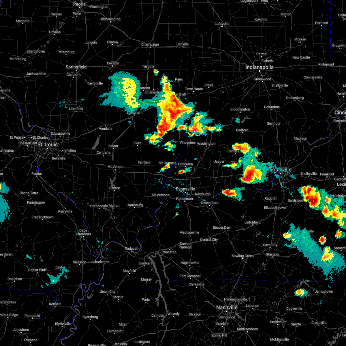 The severe thunderstorm warning for southeastern sullivan and north central knox counties will expire at 415 pm edt, the storm which prompted the warning has weakened below severe limits, and no longer poses an immediate threat to life or property. therefore, the warning will be allowed to expire. however small hail is still possible with this thunderstorm. a severe thunderstorm watch remains in effect until 800 pm edt for southwestern indiana. The severe thunderstorm warning for southeastern sullivan and north central knox counties will expire at 415 pm edt, the storm which prompted the warning has weakened below severe limits, and no longer poses an immediate threat to life or property. therefore, the warning will be allowed to expire. however small hail is still possible with this thunderstorm. a severe thunderstorm watch remains in effect until 800 pm edt for southwestern indiana.
|
| 5/19/2022 4:02 PM EDT |
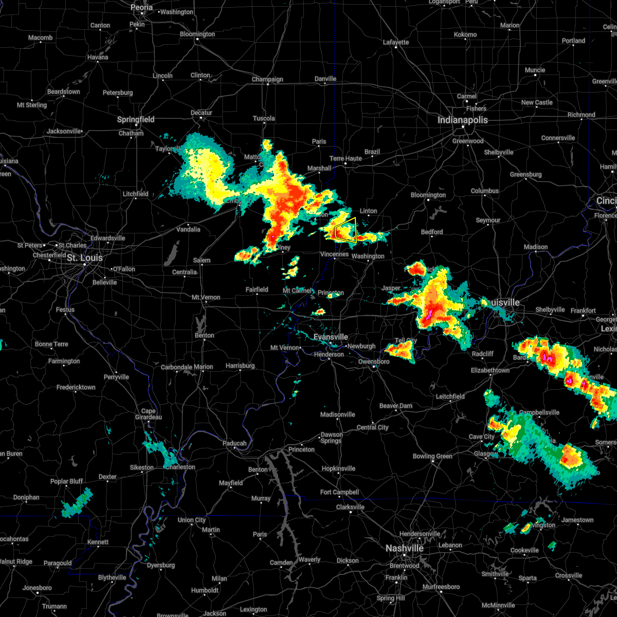 At 402 pm edt, a severe thunderstorm was located near russellville, or 15 miles north of vincennes, moving east at 25 mph (radar indicated). Hazards include quarter size hail. Damage to vehicles is expected. this severe storm will be near, carlisle around 410 pm edt. other locations in the path of this severe thunderstorm include freelandville. hail threat, radar indicated max hail size, 1. 00 in wind threat, radar indicated max wind gust, <50 mph. At 402 pm edt, a severe thunderstorm was located near russellville, or 15 miles north of vincennes, moving east at 25 mph (radar indicated). Hazards include quarter size hail. Damage to vehicles is expected. this severe storm will be near, carlisle around 410 pm edt. other locations in the path of this severe thunderstorm include freelandville. hail threat, radar indicated max hail size, 1. 00 in wind threat, radar indicated max wind gust, <50 mph.
|
| 5/19/2022 3:51 PM EDT |
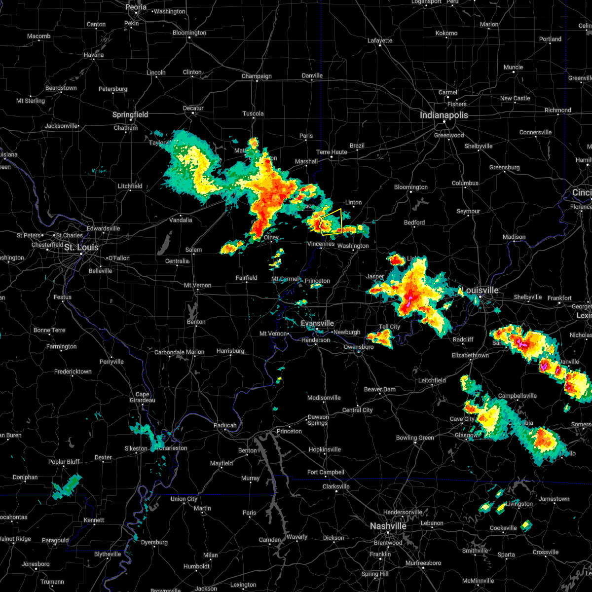 At 351 pm edt, a severe thunderstorm was located near russellville, or 13 miles northeast of lawrenceville, moving east at 30 mph (radar indicated). Hazards include quarter size hail. Damage to vehicles is expected. this severe thunderstorm will be near, oaktown around 400 pm edt. carlisle around 410 pm edt. other locations in the path of this severe thunderstorm include freelandville. hail threat, radar indicated max hail size, 1. 00 in wind threat, radar indicated max wind gust, <50 mph. At 351 pm edt, a severe thunderstorm was located near russellville, or 13 miles northeast of lawrenceville, moving east at 30 mph (radar indicated). Hazards include quarter size hail. Damage to vehicles is expected. this severe thunderstorm will be near, oaktown around 400 pm edt. carlisle around 410 pm edt. other locations in the path of this severe thunderstorm include freelandville. hail threat, radar indicated max hail size, 1. 00 in wind threat, radar indicated max wind gust, <50 mph.
|
| 8/12/2021 6:30 PM EDT |
 At 629 pm edt, severe thunderstorms were located along a line extending from 12 miles southeast of terre haute to 6 miles northeast of lancaster, moving southeast at 25 mph (radar indicated). Hazards include 60 mph wind gusts and quarter size hail. Hail damage to vehicles is expected. Expect wind damage to roofs, siding, and trees. At 629 pm edt, severe thunderstorms were located along a line extending from 12 miles southeast of terre haute to 6 miles northeast of lancaster, moving southeast at 25 mph (radar indicated). Hazards include 60 mph wind gusts and quarter size hail. Hail damage to vehicles is expected. Expect wind damage to roofs, siding, and trees.
|
| 7/12/2020 1:10 AM EDT |
 At 109 am edt, severe thunderstorms were located along a line extending from near mooresville to near bloomington to 12 miles east of bloomfield to 13 miles south of linton, moving southeast at 45 mph. the line has weakened since 1255 am (radar indicated). Hazards include 60 mph wind gusts and quarter size hail. Hail damage to vehicles is expected. expect wind damage to roofs, siding, and trees. locations impacted include, bloomington, plainfield, franklin, martinsville, mooresville, linton, bloomfield, nashville, ellettsville, new whiteland, whiteland, bargersville, bicknell, brooklyn, odon, princes lakes, trafalgar, monrovia, morgantown and lyons. this includes the following highways, interstate 65 between mile markers 89 and 93. Interstate 70 between mile markers 59 and 65. At 109 am edt, severe thunderstorms were located along a line extending from near mooresville to near bloomington to 12 miles east of bloomfield to 13 miles south of linton, moving southeast at 45 mph. the line has weakened since 1255 am (radar indicated). Hazards include 60 mph wind gusts and quarter size hail. Hail damage to vehicles is expected. expect wind damage to roofs, siding, and trees. locations impacted include, bloomington, plainfield, franklin, martinsville, mooresville, linton, bloomfield, nashville, ellettsville, new whiteland, whiteland, bargersville, bicknell, brooklyn, odon, princes lakes, trafalgar, monrovia, morgantown and lyons. this includes the following highways, interstate 65 between mile markers 89 and 93. Interstate 70 between mile markers 59 and 65.
|
| 7/12/2020 12:53 AM EDT |
 At 1252 am edt, severe thunderstorms were located along a line extending from near danville to near spencer to 7 miles north of bloomfield to 7 miles northeast of russellville, moving southeast at 45 mph (radar indicated). Hazards include 60 mph wind gusts and quarter size hail. Hail damage to vehicles is expected. Expect wind damage to roofs, siding, and trees. At 1252 am edt, severe thunderstorms were located along a line extending from near danville to near spencer to 7 miles north of bloomfield to 7 miles northeast of russellville, moving southeast at 45 mph (radar indicated). Hazards include 60 mph wind gusts and quarter size hail. Hail damage to vehicles is expected. Expect wind damage to roofs, siding, and trees.
|
| 5/17/2020 6:28 PM CDT |
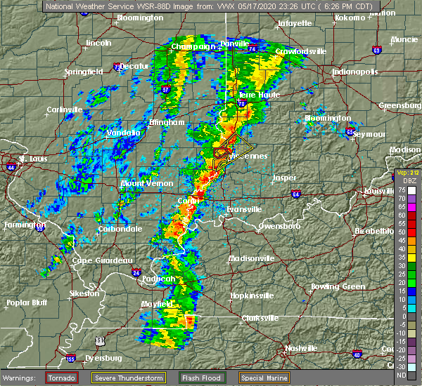 At 728 pm edt, a severe thunderstorm was located near russellville, or 10 miles north of vincennes, moving northeast at 35 mph (radar indicated). Hazards include 60 mph wind gusts and penny size hail. Expect damage to roofs, siding, and trees. Locations impacted include, vincennes, bicknell, carlisle, oaktown, bruceville, edwardsport, vincennes university, freelandville and paxton. At 728 pm edt, a severe thunderstorm was located near russellville, or 10 miles north of vincennes, moving northeast at 35 mph (radar indicated). Hazards include 60 mph wind gusts and penny size hail. Expect damage to roofs, siding, and trees. Locations impacted include, vincennes, bicknell, carlisle, oaktown, bruceville, edwardsport, vincennes university, freelandville and paxton.
|
| 5/17/2020 6:16 PM CDT |
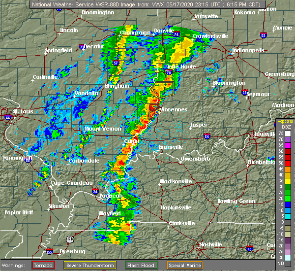 At 715 pm edt, a severe thunderstorm was located near russellville, or near vincennes, moving northeast at 30 mph (radar indicated). Hazards include 60 mph wind gusts. expect damage to roofs, siding, and trees At 715 pm edt, a severe thunderstorm was located near russellville, or near vincennes, moving northeast at 30 mph (radar indicated). Hazards include 60 mph wind gusts. expect damage to roofs, siding, and trees
|
| 4/8/2020 8:24 PM EDT |
 At 824 pm edt, a severe thunderstorm was located near sullivan, or 19 miles northeast of robinson, moving southeast at 55 mph (radar indicated). Hazards include 60 mph wind gusts and quarter size hail. Hail damage to vehicles is expected. Expect wind damage to roofs, siding, and trees. At 824 pm edt, a severe thunderstorm was located near sullivan, or 19 miles northeast of robinson, moving southeast at 55 mph (radar indicated). Hazards include 60 mph wind gusts and quarter size hail. Hail damage to vehicles is expected. Expect wind damage to roofs, siding, and trees.
|
| 3/27/2020 5:32 AM EDT |
 At 532 am edt, a severe thunderstorm was located near birds, or 7 miles northeast of lawrenceville, moving east at 40 mph (radar indicated). Hazards include quarter size hail. damage to vehicles is expected At 532 am edt, a severe thunderstorm was located near birds, or 7 miles northeast of lawrenceville, moving east at 40 mph (radar indicated). Hazards include quarter size hail. damage to vehicles is expected
|
| 8/22/2019 1:13 AM EDT |
 The severe thunderstorm warning for knox and west central daviess counties will expire at 115 am edt, the storm which prompted the warning has weakened below severe limits, and no longer poses an immediate threat to life or property. therefore, the warning will be allowed to expire. however heavy rain and frequent lightning are still possible with this thunderstorm. when thunder roars, go indoors!. The severe thunderstorm warning for knox and west central daviess counties will expire at 115 am edt, the storm which prompted the warning has weakened below severe limits, and no longer poses an immediate threat to life or property. therefore, the warning will be allowed to expire. however heavy rain and frequent lightning are still possible with this thunderstorm. when thunder roars, go indoors!.
|
| 8/22/2019 1:04 AM EDT |
 At 103 am edt, a severe thunderstorm was located near vincennes, moving east at 25 mph (radar indicated). Hazards include 60 mph wind gusts. Expect damage to roofs, siding, and trees. Locations impacted include, vincennes, bicknell, oaktown, monroe city, wheatland, bruceville, edwardsport and freelandville. At 103 am edt, a severe thunderstorm was located near vincennes, moving east at 25 mph (radar indicated). Hazards include 60 mph wind gusts. Expect damage to roofs, siding, and trees. Locations impacted include, vincennes, bicknell, oaktown, monroe city, wheatland, bruceville, edwardsport and freelandville.
|
| 8/22/2019 12:49 AM EDT |
 At 1249 am edt, a severe thunderstorm was located over vincennes, moving east at 30 mph (radar indicated). Hazards include 60 mph wind gusts. expect damage to roofs, siding, and trees At 1249 am edt, a severe thunderstorm was located over vincennes, moving east at 30 mph (radar indicated). Hazards include 60 mph wind gusts. expect damage to roofs, siding, and trees
|
| 8/20/2019 2:30 PM EDT |
 At 229 pm edt, a severe thunderstorm was located 9 miles southwest of linton, or 22 miles northeast of vincennes, moving east at 45 mph (radar indicated). Hazards include 60 mph wind gusts and penny size hail. expect damage to roofs, siding, and trees At 229 pm edt, a severe thunderstorm was located 9 miles southwest of linton, or 22 miles northeast of vincennes, moving east at 45 mph (radar indicated). Hazards include 60 mph wind gusts and penny size hail. expect damage to roofs, siding, and trees
|
| 8/13/2019 1:38 AM EDT |
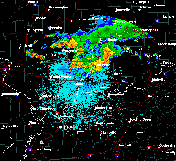 The severe thunderstorm warning for southern sullivan and knox counties will expire at 145 am edt, the severe thunderstorm which prompted the warning has moved out of the warned area. therefore, the warning will be allowed to expire. a tornado watch remains in effect until 400 am edt for southwestern indiana. The severe thunderstorm warning for southern sullivan and knox counties will expire at 145 am edt, the severe thunderstorm which prompted the warning has moved out of the warned area. therefore, the warning will be allowed to expire. a tornado watch remains in effect until 400 am edt for southwestern indiana.
|
| 8/13/2019 1:18 AM EDT |
 At 117 am edt, a severe thunderstorm was located 8 miles east of russellville, or 11 miles northeast of vincennes, moving southeast at 40 mph (radar indicated). Hazards include 60 mph wind gusts. Expect damage to roofs, siding, and trees. Locations impacted include, vincennes, bicknell, carlisle, oaktown, monroe city, wheatland, bruceville, edwardsport, vincennes university, pleasantville and freelandville. At 117 am edt, a severe thunderstorm was located 8 miles east of russellville, or 11 miles northeast of vincennes, moving southeast at 40 mph (radar indicated). Hazards include 60 mph wind gusts. Expect damage to roofs, siding, and trees. Locations impacted include, vincennes, bicknell, carlisle, oaktown, monroe city, wheatland, bruceville, edwardsport, vincennes university, pleasantville and freelandville.
|
| 8/13/2019 12:56 AM EDT |
 At 1255 am edt, a severe thunderstorm was located near palestine, or 11 miles east of robinson, moving southeast at 50 mph (radar indicated). Hazards include 60 mph wind gusts. expect damage to roofs, siding, and trees At 1255 am edt, a severe thunderstorm was located near palestine, or 11 miles east of robinson, moving southeast at 50 mph (radar indicated). Hazards include 60 mph wind gusts. expect damage to roofs, siding, and trees
|
| 7/3/2019 6:07 PM EDT | 60 mph wind gust estimated at emiso in knox county IN, 4.4 miles NNE of Oaktown, IN |
| 6/30/2019 7:45 PM EDT |
 At 743 pm edt, a severe thunderstorm was located near vincennes, moving south at 30 mph (radar indicated). Hazards include 70 mph wind gusts. Expect considerable tree damage. Damage is likely to mobile homes, roofs, and outbuildings. At 743 pm edt, a severe thunderstorm was located near vincennes, moving south at 30 mph (radar indicated). Hazards include 70 mph wind gusts. Expect considerable tree damage. Damage is likely to mobile homes, roofs, and outbuildings.
|
| 6/30/2019 7:35 PM EDT |
 At 735 pm edt, a severe thunderstorm was located 10 miles southeast of washington, or 14 miles east of petersburg, moving south at 15 mph (radar indicated). Hazards include 60 mph wind gusts. Expect damage to roofs, siding, and trees. Locations impacted include, vincennes, bedford, washington, shoals, mitchell, bicknell, loogootee, odon, oolitic, carlisle, elnora, oaktown, monroe city, wheatland, bruceville, plainville, sandborn, montgomery, edwardsport and decker. At 735 pm edt, a severe thunderstorm was located 10 miles southeast of washington, or 14 miles east of petersburg, moving south at 15 mph (radar indicated). Hazards include 60 mph wind gusts. Expect damage to roofs, siding, and trees. Locations impacted include, vincennes, bedford, washington, shoals, mitchell, bicknell, loogootee, odon, oolitic, carlisle, elnora, oaktown, monroe city, wheatland, bruceville, plainville, sandborn, montgomery, edwardsport and decker.
|
| 6/30/2019 7:18 PM EDT |
 At 717 pm edt, a severe thunderstorm was located 8 miles east of washington, or 17 miles northeast of petersburg, moving southwest at 20 mph (radar indicated). Hazards include 60 mph wind gusts. Expect damage to roofs, siding, and trees. Locations impacted include, vincennes, bedford, washington, sullivan, shoals, mitchell, bicknell, loogootee, odon, shelburn, oolitic, dugger, hymera, carlisle, elnora, oaktown, monroe city, wheatland, bruceville and plainville. At 717 pm edt, a severe thunderstorm was located 8 miles east of washington, or 17 miles northeast of petersburg, moving southwest at 20 mph (radar indicated). Hazards include 60 mph wind gusts. Expect damage to roofs, siding, and trees. Locations impacted include, vincennes, bedford, washington, sullivan, shoals, mitchell, bicknell, loogootee, odon, shelburn, oolitic, dugger, hymera, carlisle, elnora, oaktown, monroe city, wheatland, bruceville and plainville.
|
| 6/30/2019 6:56 PM EDT |
 At 656 pm edt, a severe thunderstorm was located 10 miles north of shoals, or 15 miles west of bedford, moving south at 10 mph (radar indicated). Hazards include 60 mph wind gusts. expect damage to roofs, siding, and trees At 656 pm edt, a severe thunderstorm was located 10 miles north of shoals, or 15 miles west of bedford, moving south at 10 mph (radar indicated). Hazards include 60 mph wind gusts. expect damage to roofs, siding, and trees
|
| 6/23/2019 1:46 PM EDT |
 At 146 pm edt, severe thunderstorms were located along a line extending from 6 miles southeast of palestine to near washington to 7 miles northeast of lynnville, moving northeast at 45 mph (radar indicated). Hazards include 60 mph wind gusts. expect damage to roofs, siding, and trees At 146 pm edt, severe thunderstorms were located along a line extending from 6 miles southeast of palestine to near washington to 7 miles northeast of lynnville, moving northeast at 45 mph (radar indicated). Hazards include 60 mph wind gusts. expect damage to roofs, siding, and trees
|
| 6/21/2019 5:05 PM EDT |
 At 505 pm edt, severe thunderstorms were located along a line extending from 10 miles north of sullivan to 8 miles west of petersburg, moving southeast at 40 mph (radar indicated). Hazards include 60 mph wind gusts. Expect damage to roofs, siding, and trees. Locations impacted include, vincennes, washington, linton, sullivan, bicknell, jasonville, shelburn, farmersburg, dugger, hymera, lyons, fairbanks, carlisle, elnora, oaktown, monroe city, wheatland, bruceville, plainville and sandborn. At 505 pm edt, severe thunderstorms were located along a line extending from 10 miles north of sullivan to 8 miles west of petersburg, moving southeast at 40 mph (radar indicated). Hazards include 60 mph wind gusts. Expect damage to roofs, siding, and trees. Locations impacted include, vincennes, washington, linton, sullivan, bicknell, jasonville, shelburn, farmersburg, dugger, hymera, lyons, fairbanks, carlisle, elnora, oaktown, monroe city, wheatland, bruceville, plainville and sandborn.
|
| 6/21/2019 4:42 PM EDT |
 The national weather service in indianapolis has issued a * severe thunderstorm warning for. south central vigo county in west central indiana. sullivan county in southwestern indiana. knox county in southwestern indiana. Southwestern clay county in west central indiana. The national weather service in indianapolis has issued a * severe thunderstorm warning for. south central vigo county in west central indiana. sullivan county in southwestern indiana. knox county in southwestern indiana. Southwestern clay county in west central indiana.
|
| 6/11/2018 9:21 PM EDT |
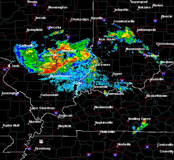 At 913 pm edt, a severe thunderstorm was located over russellville, or 11 miles north of vincennes, moving northeast at 20 mph (radar indicated). Hazards include quarter size hail. Damage to vehicles is expected. Locations impacted include, carlisle, oaktown, edwardsport and freelandville. At 913 pm edt, a severe thunderstorm was located over russellville, or 11 miles north of vincennes, moving northeast at 20 mph (radar indicated). Hazards include quarter size hail. Damage to vehicles is expected. Locations impacted include, carlisle, oaktown, edwardsport and freelandville.
|
| 6/11/2018 9:13 PM EDT |
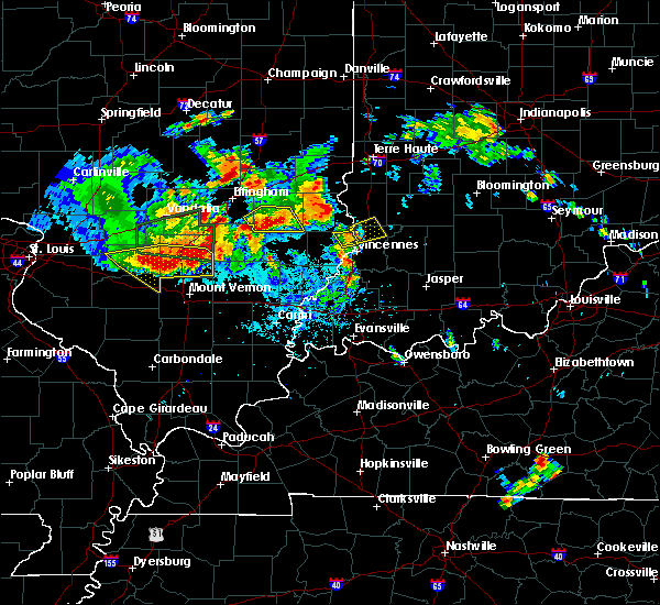 At 913 pm edt, a severe thunderstorm was located over russellville, or 11 miles north of vincennes, moving northeast at 20 mph (radar indicated). Hazards include quarter size hail. Damage to vehicles is expected. Locations impacted include, carlisle, oaktown, edwardsport and freelandville. At 913 pm edt, a severe thunderstorm was located over russellville, or 11 miles north of vincennes, moving northeast at 20 mph (radar indicated). Hazards include quarter size hail. Damage to vehicles is expected. Locations impacted include, carlisle, oaktown, edwardsport and freelandville.
|
| 6/11/2018 8:58 PM EDT |
 At 857 pm edt, a severe thunderstorm was located over russellville, or 8 miles northeast of lawrenceville, moving northeast at 25 mph (radar indicated). Hazards include quarter size hail. damage to vehicles is expected At 857 pm edt, a severe thunderstorm was located over russellville, or 8 miles northeast of lawrenceville, moving northeast at 25 mph (radar indicated). Hazards include quarter size hail. damage to vehicles is expected
|
| 5/31/2018 1:25 PM EDT |
 The severe thunderstorm warning for northeastern knox and daviess counties will expire at 130 pm edt, the storm which prompted the warning has moved out of the area. therefore the warning will be allowed to expire. a severe thunderstorm watch remains in effect until 600 pm edt for southwestern indiana. The severe thunderstorm warning for northeastern knox and daviess counties will expire at 130 pm edt, the storm which prompted the warning has moved out of the area. therefore the warning will be allowed to expire. a severe thunderstorm watch remains in effect until 600 pm edt for southwestern indiana.
|
| 5/31/2018 1:21 PM EDT |
 At 120 pm edt, a severe thunderstorm was located 10 miles northwest of shoals, or 23 miles west of bedford, moving northeast at 50 mph (trained weather spotters). Hazards include 60 mph wind gusts. Expect damage to roofs, siding, and trees. Locations impacted include, washington, bicknell, loogootee, odon, elnora, oaktown, wheatland, bruceville, plainville, montgomery, edwardsport, cannelburg, alfordsville, west boggs lake, freelandville, glendale fishery and portersville. At 120 pm edt, a severe thunderstorm was located 10 miles northwest of shoals, or 23 miles west of bedford, moving northeast at 50 mph (trained weather spotters). Hazards include 60 mph wind gusts. Expect damage to roofs, siding, and trees. Locations impacted include, washington, bicknell, loogootee, odon, elnora, oaktown, wheatland, bruceville, plainville, montgomery, edwardsport, cannelburg, alfordsville, west boggs lake, freelandville, glendale fishery and portersville.
|
| 5/31/2018 1:03 PM EDT |
 At 103 pm edt, a severe thunderstorm was located near washington, or 16 miles northeast of petersburg, moving northeast at 50 mph (trained weather spotters). Hazards include 60 mph wind gusts. Expect damage to roofs, siding, and trees. trained weather spotters reported 60 mph winds near bicknell. Locations impacted include, washington, bicknell, loogootee, odon, elnora, oaktown, wheatland, bruceville, plainville, sandborn, montgomery, edwardsport, cannelburg, alfordsville, west boggs lake, freelandville, glendale fishery and portersville. At 103 pm edt, a severe thunderstorm was located near washington, or 16 miles northeast of petersburg, moving northeast at 50 mph (trained weather spotters). Hazards include 60 mph wind gusts. Expect damage to roofs, siding, and trees. trained weather spotters reported 60 mph winds near bicknell. Locations impacted include, washington, bicknell, loogootee, odon, elnora, oaktown, wheatland, bruceville, plainville, sandborn, montgomery, edwardsport, cannelburg, alfordsville, west boggs lake, freelandville, glendale fishery and portersville.
|
| 5/31/2018 12:48 PM EDT |
 At 1247 pm edt, a severe thunderstorm was located near petersburg, moving northeast at 55 mph (radar indicated). Hazards include 60 mph wind gusts. expect damage to roofs, siding, and trees At 1247 pm edt, a severe thunderstorm was located near petersburg, moving northeast at 55 mph (radar indicated). Hazards include 60 mph wind gusts. expect damage to roofs, siding, and trees
|
| 4/3/2018 2:10 PM EDT |
 The severe thunderstorm warning for southeastern sullivan, northeastern knox, southwestern greene and northwestern daviess counties will expire at 215 pm edt, the storm which prompted the warning has moved out of the area. therefore the warning will be allowed to expire. a tornado watch remains in effect until 800 pm edt for southwestern indiana. The severe thunderstorm warning for southeastern sullivan, northeastern knox, southwestern greene and northwestern daviess counties will expire at 215 pm edt, the storm which prompted the warning has moved out of the area. therefore the warning will be allowed to expire. a tornado watch remains in effect until 800 pm edt for southwestern indiana.
|
| 4/3/2018 2:00 PM EDT |
 At 159 pm edt, a severe thunderstorm was located 12 miles south of linton, or 20 miles northeast of vincennes, moving northeast at 55 mph. this storm has history of producing up to golf ball sized hail (trained weather spotters). Hazards include 60 mph wind gusts and quarter size hail. Hail damage to vehicles is expected. expect wind damage to roofs, siding, and trees. locations impacted include, linton, bicknell, lyons, elnora, oaktown, sandborn, edwardsport, newberry, pleasantville and freelandville. A tornado watch remains in effect until 800 pm edt for southwestern indiana. At 159 pm edt, a severe thunderstorm was located 12 miles south of linton, or 20 miles northeast of vincennes, moving northeast at 55 mph. this storm has history of producing up to golf ball sized hail (trained weather spotters). Hazards include 60 mph wind gusts and quarter size hail. Hail damage to vehicles is expected. expect wind damage to roofs, siding, and trees. locations impacted include, linton, bicknell, lyons, elnora, oaktown, sandborn, edwardsport, newberry, pleasantville and freelandville. A tornado watch remains in effect until 800 pm edt for southwestern indiana.
|
| 4/3/2018 1:42 PM EDT |
 At 142 pm edt, a severe thunderstorm was located near vincennes, moving northeast at 55 mph. at 137 pm edt, quarter sized hail was reported on the vincennes university campus (public). Hazards include 60 mph wind gusts and quarter size hail. Hail damage to vehicles is expected. expect wind damage to roofs, siding, and trees. locations impacted include, vincennes, linton, russellville, bicknell, lyons, elnora, oaktown, bruceville, sandborn, edwardsport, newberry, freelandville and pleasantville. A tornado watch remains in effect until 800 pm edt for southwestern indiana. At 142 pm edt, a severe thunderstorm was located near vincennes, moving northeast at 55 mph. at 137 pm edt, quarter sized hail was reported on the vincennes university campus (public). Hazards include 60 mph wind gusts and quarter size hail. Hail damage to vehicles is expected. expect wind damage to roofs, siding, and trees. locations impacted include, vincennes, linton, russellville, bicknell, lyons, elnora, oaktown, bruceville, sandborn, edwardsport, newberry, freelandville and pleasantville. A tornado watch remains in effect until 800 pm edt for southwestern indiana.
|
| 4/3/2018 1:32 PM EDT |
 At 132 pm edt, a severe thunderstorm was located near st. francisville, or near vincennes, moving northeast at 55 mph (radar indicated). Hazards include 60 mph wind gusts and quarter size hail. Hail damage to vehicles is expected. Expect wind damage to roofs, siding, and trees. At 132 pm edt, a severe thunderstorm was located near st. francisville, or near vincennes, moving northeast at 55 mph (radar indicated). Hazards include 60 mph wind gusts and quarter size hail. Hail damage to vehicles is expected. Expect wind damage to roofs, siding, and trees.
|
| 4/28/2017 6:11 PM EDT |
 At 610 pm edt, a severe thunderstorm was located 7 miles northeast of russellville, or 16 miles north of vincennes, moving northeast at 65 mph (radar indicated). Hazards include 60 mph wind gusts and quarter size hail. Hail damage to vehicles is expected. Expect wind damage to roofs, siding, and trees. At 610 pm edt, a severe thunderstorm was located 7 miles northeast of russellville, or 16 miles north of vincennes, moving northeast at 65 mph (radar indicated). Hazards include 60 mph wind gusts and quarter size hail. Hail damage to vehicles is expected. Expect wind damage to roofs, siding, and trees.
|
| 2/28/2017 10:50 PM EST |
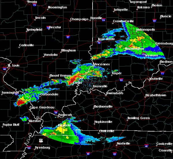 The tornado warning for southern sullivan and north central knox counties will expire at 1100 pm est, the storm which prompted the warning has weakened below severe limits, and no longer appears capable of producing a tornado. therefore, the warning will be allowed to expire. however gusty winds are still possible with this thunderstorm. a tornado watch remains in effect until 500 am est for southwestern indiana. The tornado warning for southern sullivan and north central knox counties will expire at 1100 pm est, the storm which prompted the warning has weakened below severe limits, and no longer appears capable of producing a tornado. therefore, the warning will be allowed to expire. however gusty winds are still possible with this thunderstorm. a tornado watch remains in effect until 500 am est for southwestern indiana.
|
| 2/28/2017 10:35 PM EST |
 At 1034 pm est, a severe thunderstorm capable of producing a tornado was located near birds, or 10 miles northeast of lawrenceville, moving northeast at 35 mph (radar indicated rotation). Hazards include tornado and quarter size hail. Flying debris will be dangerous to those caught without shelter. mobile homes will be damaged or destroyed. damage to roofs, windows, and vehicles will occur. tree damage is likely. this dangerous storm will be near, oaktown around 1050 pm est. carlisle around 1055 pm est. Paxton, pleasantville and freelandville around 1100 pm est. At 1034 pm est, a severe thunderstorm capable of producing a tornado was located near birds, or 10 miles northeast of lawrenceville, moving northeast at 35 mph (radar indicated rotation). Hazards include tornado and quarter size hail. Flying debris will be dangerous to those caught without shelter. mobile homes will be damaged or destroyed. damage to roofs, windows, and vehicles will occur. tree damage is likely. this dangerous storm will be near, oaktown around 1050 pm est. carlisle around 1055 pm est. Paxton, pleasantville and freelandville around 1100 pm est.
|
| 10/19/2016 4:25 PM EDT |
 At 424 pm edt, a severe thunderstorm was located 10 miles southwest of linton, or 21 miles northeast of vincennes, moving east at 35 mph (radar indicated). Hazards include quarter size hail. Damage to vehicles is expected. Locations impacted include, linton, worthington, lyons, carlisle, oaktown, sandborn, switz city, newberry, vicksburg, pleasantville and freelandville. At 424 pm edt, a severe thunderstorm was located 10 miles southwest of linton, or 21 miles northeast of vincennes, moving east at 35 mph (radar indicated). Hazards include quarter size hail. Damage to vehicles is expected. Locations impacted include, linton, worthington, lyons, carlisle, oaktown, sandborn, switz city, newberry, vicksburg, pleasantville and freelandville.
|
| 10/19/2016 4:16 PM EDT | Quarter sized hail reported 0.1 miles N of Oaktown, IN |
| 10/19/2016 4:04 PM EDT |
 At 404 pm edt, a severe thunderstorm was located 7 miles southeast of palestine, or 13 miles east of robinson, moving east at 40 mph (radar indicated). Hazards include quarter size hail. damage to vehicles is expected At 404 pm edt, a severe thunderstorm was located 7 miles southeast of palestine, or 13 miles east of robinson, moving east at 40 mph (radar indicated). Hazards include quarter size hail. damage to vehicles is expected
|
| 7/13/2016 7:16 PM EDT |
 At 716 pm edt, severe thunderstorms were located along a line extending from near newport to 7 miles northwest of petersburg, moving northeast at 55 mph (radar indicated). Hazards include 60 mph wind gusts. Expect damage to roofs. siding. and trees. locations impacted include, terre haute, vincennes, clinton, sullivan, rockville, russellville, bicknell, west terre haute, fairview park, shelburn, prairieton, prairie creek, farmersburg, seelyville, montezuma, dugger, hymera, fairbanks, rosedale and carlisle. This includes interstate 70 between mile markers 1 and 17. At 716 pm edt, severe thunderstorms were located along a line extending from near newport to 7 miles northwest of petersburg, moving northeast at 55 mph (radar indicated). Hazards include 60 mph wind gusts. Expect damage to roofs. siding. and trees. locations impacted include, terre haute, vincennes, clinton, sullivan, rockville, russellville, bicknell, west terre haute, fairview park, shelburn, prairieton, prairie creek, farmersburg, seelyville, montezuma, dugger, hymera, fairbanks, rosedale and carlisle. This includes interstate 70 between mile markers 1 and 17.
|
| 7/13/2016 7:07 PM EDT |
 At 706 pm edt, a severe thunderstorm was located 9 miles east of west union, or 15 miles southeast of marshall, moving northeast at 155 mph (radar indicated). Hazards include 60 mph wind gusts. Expect damage to roofs. siding. And trees. At 706 pm edt, a severe thunderstorm was located 9 miles east of west union, or 15 miles southeast of marshall, moving northeast at 155 mph (radar indicated). Hazards include 60 mph wind gusts. Expect damage to roofs. siding. And trees.
|
| 7/6/2016 10:08 AM EDT |
 At 1007 am edt, a severe thunderstorm was located over vincennes, moving southeast at 45 mph (radar indicated). Hazards include 60 mph wind gusts. Expect damage to roofs. siding. And trees. At 1007 am edt, a severe thunderstorm was located over vincennes, moving southeast at 45 mph (radar indicated). Hazards include 60 mph wind gusts. Expect damage to roofs. siding. And trees.
|
| 6/15/2016 5:59 PM EDT |
 At 559 pm edt, severe thunderstorms were located along a line extending from 6 miles north of washington to near vincennes, moving southeast at 35 mph (radar indicated). Hazards include 60 mph wind gusts. Expect damage to roofs. siding. and trees. Locations impacted include, vincennes, washington, russellville, bicknell, loogootee, oaktown, monroe city, wheatland, bruceville, plainville, sandborn, montgomery, edwardsport, decker, cannelburg, freelandville and vincennes university. At 559 pm edt, severe thunderstorms were located along a line extending from 6 miles north of washington to near vincennes, moving southeast at 35 mph (radar indicated). Hazards include 60 mph wind gusts. Expect damage to roofs. siding. and trees. Locations impacted include, vincennes, washington, russellville, bicknell, loogootee, oaktown, monroe city, wheatland, bruceville, plainville, sandborn, montgomery, edwardsport, decker, cannelburg, freelandville and vincennes university.
|
| 6/15/2016 5:44 PM EDT |
 At 544 pm edt, severe thunderstorms were located along a line extending from 9 miles southeast of sullivan to near russellville, moving southeast at 45 mph (radar indicated). Hazards include 60 mph wind gusts. Expect damage to roofs. siding. And trees. At 544 pm edt, severe thunderstorms were located along a line extending from 9 miles southeast of sullivan to near russellville, moving southeast at 45 mph (radar indicated). Hazards include 60 mph wind gusts. Expect damage to roofs. siding. And trees.
|
| 5/7/2016 7:47 PM EDT |
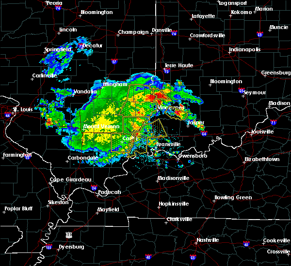 At 747 pm edt, a severe thunderstorm was located 7 miles southeast of palestine, or 13 miles east of robinson, moving southeast at 30 mph (radar indicated). Hazards include 60 mph wind gusts and quarter size hail. Hail damage to vehicles is expected. Expect wind damage to roofs, siding, and trees. At 747 pm edt, a severe thunderstorm was located 7 miles southeast of palestine, or 13 miles east of robinson, moving southeast at 30 mph (radar indicated). Hazards include 60 mph wind gusts and quarter size hail. Hail damage to vehicles is expected. Expect wind damage to roofs, siding, and trees.
|
| 5/1/2016 9:54 PM EDT |
 At 953 pm edt, a severe thunderstorm was located 9 miles northeast of russellville, or 16 miles northeast of vincennes, moving east at 50 mph (radar indicated). Hazards include 60 mph wind gusts and quarter size hail. Hail damage to vehicles is expected. expect wind damage to roofs, siding, and trees. Locations impacted include, bloomfield, russellville, bicknell, odon, lyons, carlisle, elnora, oaktown, bruceville, plainville, sandborn, edwardsport, newberry, pleasantville and freelandville. At 953 pm edt, a severe thunderstorm was located 9 miles northeast of russellville, or 16 miles northeast of vincennes, moving east at 50 mph (radar indicated). Hazards include 60 mph wind gusts and quarter size hail. Hail damage to vehicles is expected. expect wind damage to roofs, siding, and trees. Locations impacted include, bloomfield, russellville, bicknell, odon, lyons, carlisle, elnora, oaktown, bruceville, plainville, sandborn, edwardsport, newberry, pleasantville and freelandville.
|
| 5/1/2016 9:40 PM EDT |
 At 939 pm edt, a severe thunderstorm was located near russellville, or 12 miles northeast of lawrenceville, moving east at 55 mph (radar indicated). Hazards include 60 mph wind gusts and quarter size hail. Hail damage to vehicles is expected. Expect wind damage to roofs, siding, and trees. At 939 pm edt, a severe thunderstorm was located near russellville, or 12 miles northeast of lawrenceville, moving east at 55 mph (radar indicated). Hazards include 60 mph wind gusts and quarter size hail. Hail damage to vehicles is expected. Expect wind damage to roofs, siding, and trees.
|
| 5/1/2016 5:11 PM EDT |
 At 511 pm edt, a severe thunderstorm was located 12 miles south of sullivan, or 19 miles northeast of vincennes, moving east at 25 mph (trained weather spotters). Hazards include quarter size hail. Damage to vehicles is expected. Locations impacted include, carlisle, oaktown, sandborn, pleasantville and freelandville. At 511 pm edt, a severe thunderstorm was located 12 miles south of sullivan, or 19 miles northeast of vincennes, moving east at 25 mph (trained weather spotters). Hazards include quarter size hail. Damage to vehicles is expected. Locations impacted include, carlisle, oaktown, sandborn, pleasantville and freelandville.
|
| 5/1/2016 5:05 PM EDT | Quarter sized hail reported 2.6 miles S of Oaktown, IN, just north of the sullivan-knox county line. reported as 2 miles north of oaktown. |
| 5/1/2016 5:02 PM EDT |
 At 502 pm edt, a severe thunderstorm was located 8 miles northeast of russellville, or 16 miles north of vincennes, moving east at 20 mph (radar indicated). Hazards include quarter size hail. Damage to vehicles is expected. Locations impacted include, bicknell, carlisle, oaktown, sandborn, edwardsport, pleasantville and freelandville. At 502 pm edt, a severe thunderstorm was located 8 miles northeast of russellville, or 16 miles north of vincennes, moving east at 20 mph (radar indicated). Hazards include quarter size hail. Damage to vehicles is expected. Locations impacted include, bicknell, carlisle, oaktown, sandborn, edwardsport, pleasantville and freelandville.
|
| 5/1/2016 4:49 PM EDT |
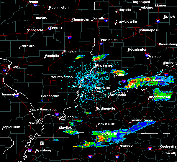 At 448 pm edt, a severe thunderstorm was located near russellville, or 13 miles southeast of robinson, moving east at 25 mph (radar indicated). Hazards include quarter size hail. damage to vehicles is expected At 448 pm edt, a severe thunderstorm was located near russellville, or 13 miles southeast of robinson, moving east at 25 mph (radar indicated). Hazards include quarter size hail. damage to vehicles is expected
|
| 4/26/2016 6:55 PM EDT |
 The severe thunderstorm warning for southwestern greene, knox, southeastern sullivan, northwestern martin and daviess counties will expire at 700 pm edt, the storms which prompted the warning have weakened below severe limits, and no longer pose an immediate threat to life or property. therefore the warning will be allowed to expire. however gusty winds are still possible with these thunderstorms. a severe thunderstorm watch remains in effect until 1100 pm edt for southwestern indiana. The severe thunderstorm warning for southwestern greene, knox, southeastern sullivan, northwestern martin and daviess counties will expire at 700 pm edt, the storms which prompted the warning have weakened below severe limits, and no longer pose an immediate threat to life or property. therefore the warning will be allowed to expire. however gusty winds are still possible with these thunderstorms. a severe thunderstorm watch remains in effect until 1100 pm edt for southwestern indiana.
|
| 4/26/2016 6:42 PM EDT |
 At 641 pm edt, severe thunderstorms were located along a line extending from near russellville to near washington, moving northeast at 25 mph (radar indicated). Hazards include 60 mph wind gusts and penny size hail. Expect damage to roofs. siding. and trees. Locations impacted include, vincennes, washington, linton, bicknell, odon, dugger, lyons, elnora, oaktown, monroe city, wheatland, bruceville, plainville, sandborn, montgomery, edwardsport, newberry, crane, pleasantville and west boggs lake. At 641 pm edt, severe thunderstorms were located along a line extending from near russellville to near washington, moving northeast at 25 mph (radar indicated). Hazards include 60 mph wind gusts and penny size hail. Expect damage to roofs. siding. and trees. Locations impacted include, vincennes, washington, linton, bicknell, odon, dugger, lyons, elnora, oaktown, monroe city, wheatland, bruceville, plainville, sandborn, montgomery, edwardsport, newberry, crane, pleasantville and west boggs lake.
|
| 4/26/2016 6:28 PM EDT |
 At 628 pm edt, severe thunderstorms were located along a line extending from near vincennes to 6 miles northwest of petersburg, moving northeast at 25 mph (radar indicated). Hazards include 60 mph wind gusts and nickel size hail. Expect damage to roofs. siding. And trees. At 628 pm edt, severe thunderstorms were located along a line extending from near vincennes to 6 miles northwest of petersburg, moving northeast at 25 mph (radar indicated). Hazards include 60 mph wind gusts and nickel size hail. Expect damage to roofs. siding. And trees.
|
| 12/23/2015 2:15 PM EST | At 214 pm est, severe thunderstorms were located along a line extending from 6 miles northeast of palestine to 6 miles northeast of patoka, moving east at 55 mph (radar indicated). Hazards include 60 mph wind gusts. Expect damage to roofs. siding and trees. locations impacted include, vincennes, washington, linton, sullivan, russellville, bicknell, jasonville, dugger, lyons, carlisle, elnora, oaktown, monroe city, wheatland, bruceville, plainville, sandborn, montgomery, edwardsport and decker. A tornado watch remains in effect until 900 pm est for southwestern indiana. |
| 12/23/2015 1:57 PM EST | At 156 pm est, severe thunderstorms were located along a line extending from robinson to near mount carmel, moving east at 60 mph (radar indicated). Hazards include 60 mph wind gusts. Expect damage to roofs. Siding and trees. |
| 6/19/2015 4:35 PM EDT |
 At 433 pm edt, a severe thunderstorm capable of producing a tornado was located 12 miles east of russellville, and moving northeast at 10 mph (radar indicated rotation). Hazards include tornado. Flying debris will be dangerous to those caught without shelter. mobile homes will be damaged or destroyed. damage to roofs, windows and vehicles will occur. tree damage is likely. Locations impacted include, linton, freelandville, edwardsport, sandborn, plainville, pleasantville, elnora, lyons, newberry, odon, switz city and vicksburg. At 433 pm edt, a severe thunderstorm capable of producing a tornado was located 12 miles east of russellville, and moving northeast at 10 mph (radar indicated rotation). Hazards include tornado. Flying debris will be dangerous to those caught without shelter. mobile homes will be damaged or destroyed. damage to roofs, windows and vehicles will occur. tree damage is likely. Locations impacted include, linton, freelandville, edwardsport, sandborn, plainville, pleasantville, elnora, lyons, newberry, odon, switz city and vicksburg.
|
| 6/19/2015 4:14 PM EDT |
 At 410 pm edt, a severe thunderstorm capable of producing a tornado was located 9 miles east of russellville, and moving northeast at 25 mph (radar indicated rotation). Hazards include tornado. Flying debris will be dangerous to those caught without shelter. mobile homes will be damaged or destroyed. damage to roofs, windows and vehicles will occur. tree damage is likely. This dangerous storm will affect mainly rural areas of northeastern knox, northern daviess, southeastern sullivan and western greene counties, including the following locations, freelandville, edwardsport, sandborn, elnora, lyons and newberry. At 410 pm edt, a severe thunderstorm capable of producing a tornado was located 9 miles east of russellville, and moving northeast at 25 mph (radar indicated rotation). Hazards include tornado. Flying debris will be dangerous to those caught without shelter. mobile homes will be damaged or destroyed. damage to roofs, windows and vehicles will occur. tree damage is likely. This dangerous storm will affect mainly rural areas of northeastern knox, northern daviess, southeastern sullivan and western greene counties, including the following locations, freelandville, edwardsport, sandborn, elnora, lyons and newberry.
|
| 6/19/2015 4:01 PM EDT |
 At 359 pm edt, a severe thunderstorm capable of producing a tornado was located 6 miles southeast of russellville, and moving northeast at 15 mph (radar indicated rotation). Hazards include tornado. Flying debris will be dangerous to those caught without shelter. mobile homes will be damaged or destroyed. damage to roofs, windows and vehicles will occur. tree damage is likely. Locations impacted include, oaktown, bicknell, freelandville, edwardsport, sandborn, plainville, pleasantville and elnora. At 359 pm edt, a severe thunderstorm capable of producing a tornado was located 6 miles southeast of russellville, and moving northeast at 15 mph (radar indicated rotation). Hazards include tornado. Flying debris will be dangerous to those caught without shelter. mobile homes will be damaged or destroyed. damage to roofs, windows and vehicles will occur. tree damage is likely. Locations impacted include, oaktown, bicknell, freelandville, edwardsport, sandborn, plainville, pleasantville and elnora.
|
| 6/19/2015 3:52 PM EDT |
 At 350 pm edt, a severe thunderstorm capable of producing a tornado was located near russellville, and moving northeast at 15 mph (radar indicated rotation). Hazards include tornado. Flying debris will be dangerous to those caught without shelter. mobile homes will be damaged or destroyed. damage to roofs, windows and vehicles will occur. tree damage is likely. This dangerous storm will affect mainly rural areas of northeastern knox, northwestern daviess, southeastern sullivan and southwestern greene counties, including the following locations, bruceville, oaktown, bicknell and freelandville. At 350 pm edt, a severe thunderstorm capable of producing a tornado was located near russellville, and moving northeast at 15 mph (radar indicated rotation). Hazards include tornado. Flying debris will be dangerous to those caught without shelter. mobile homes will be damaged or destroyed. damage to roofs, windows and vehicles will occur. tree damage is likely. This dangerous storm will affect mainly rural areas of northeastern knox, northwestern daviess, southeastern sullivan and southwestern greene counties, including the following locations, bruceville, oaktown, bicknell and freelandville.
|
| 5/30/2015 6:41 PM EDT | The severe thunderstorm warning for knox county will expire at 645 pm edt, the storm which prompted the warning has moved out of the warned area. |
| 5/30/2015 6:28 PM EDT | At 626 pm edt, a severe thunderstorm was located near russellville, and moving north at 35 mph (radar indicated). Hazards include 60 mph wind gusts. Expect damage to roofs. siding and trees. Locations impacted include, bicknell, edwardsport, oaktown and freelandville. |
| 5/30/2015 6:12 PM EDT | At 609 pm edt, a severe thunderstorm was located near vincennes, and moving north at 35 mph (radar indicated). Hazards include 60 mph wind gusts. Expect damage to roofs. Siding and trees. |
| 4/2/2015 7:25 PM EDT | A severe thunderstorm warning remains in effect for south central clay. northern daviess. greene. northeastern knox. northern martin and southeastern sullivan counties until 800 pm edt. at 723 pm edt. a severe thunderstorm was located 12 miles southwest of linton. and moving east at 45 mph. hazard. 60 mph wind gusts and quarter size hail. |
| 4/2/2015 6:12 PM EST | Ping Pong Ball sized hail reported 0.1 miles N of Oaktown, IN, size based on photo |
| 4/2/2015 7:12 PM EDT | The national weather service in indianapolis has issued a * severe thunderstorm warning for. south central clay county in west central indiana. northern daviess county in southwest indiana. greene county in southwest indiana. Northeastern knox county in southwest indiana. |
| 4/28/2012 5:46 PM EDT | Quarter sized hail reported 2.7 miles W of Oaktown, IN |
| 3/23/2012 4:29 PM EDT | Quarter sized hail reported 6.5 miles W of Oaktown, IN |
| 1/1/0001 12:00 AM | Quarter sized hail reported 0.1 miles N of Oaktown, IN |
Hail Maps for Oaktown, IN
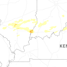

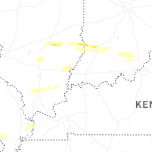


Connect with Interactive Hail Maps