

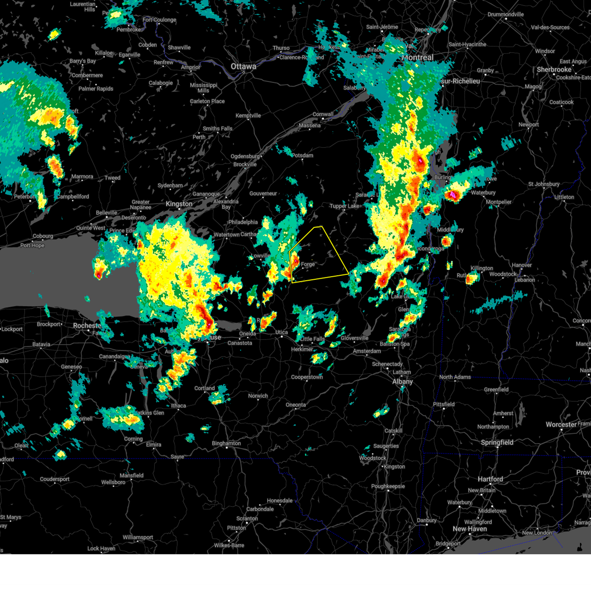
Hail Map for Old Forge, NY
The Old Forge, NY area has had 1 report of on-the-ground hail by trained spotters, and has been under severe weather warnings 1 time during the past 12 months. Doppler radar has detected hail at or near Old Forge, NY on 12 occasions, including 2 occasions during the past year.
| Name: | Old Forge, NY |
| Where Located: | 72.9 miles SSE of Ogdensburg, NY |
| Map: | Google Map for Old Forge, NY |
| Population: | 756 |
| Housing Units: | 778 |
| More Info: | Search Google for Old Forge, NY |
2
The Top Recent Hail Date for Old Forge, NY is Tuesday, April 14, 2026 (3rd out of 12)
Hail and Wind Damage Spotted near Old Forge, NY
| Date / Time | Report Details |
|---|---|
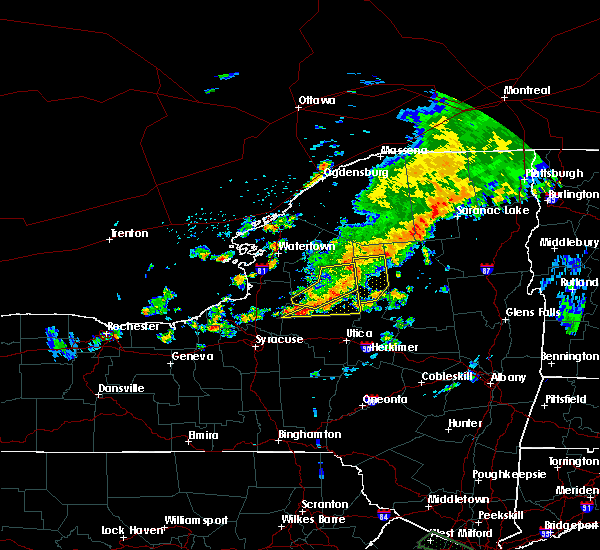
| 4/14/2026 3:25 PM EDT |
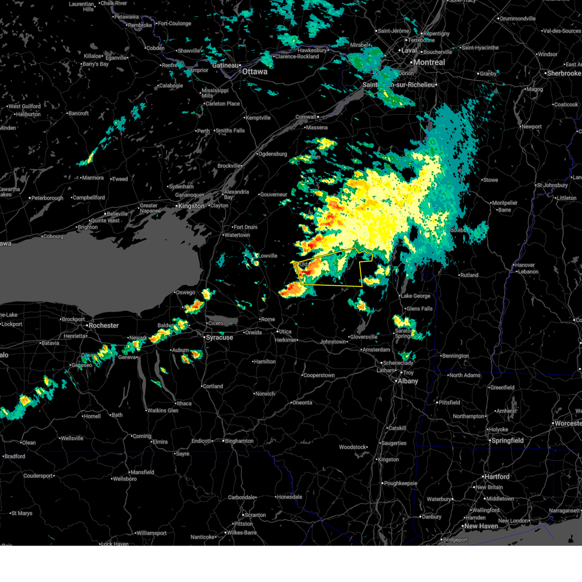 Svraly the national weather service in albany has issued a * severe thunderstorm warning for, central hamilton county in eastern new york, east central herkimer county in eastern new york, * until 415 pm edt. * at 324 pm edt, a severe thunderstorm was located near limekiln lake campground, or 8 miles southeast of old forge, moving east at 40 mph (radar indicated). Hazards include 60 mph wind gusts and quarter size hail. Hail damage to vehicles is expected. Expect wind damage to roofs, siding, and trees. Svraly the national weather service in albany has issued a * severe thunderstorm warning for, central hamilton county in eastern new york, east central herkimer county in eastern new york, * until 415 pm edt. * at 324 pm edt, a severe thunderstorm was located near limekiln lake campground, or 8 miles southeast of old forge, moving east at 40 mph (radar indicated). Hazards include 60 mph wind gusts and quarter size hail. Hail damage to vehicles is expected. Expect wind damage to roofs, siding, and trees.
|
| 5/17/2025 3:28 PM EDT |
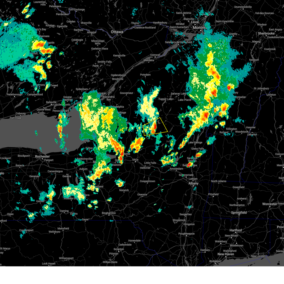 The storm which prompted the warning has weakened below severe limits, and no longer poses an immediate threat to life or property. therefore, the warning will be allowed to expire. a severe thunderstorm watch remains in effect until 800 pm edt for eastern new york. The storm which prompted the warning has weakened below severe limits, and no longer poses an immediate threat to life or property. therefore, the warning will be allowed to expire. a severe thunderstorm watch remains in effect until 800 pm edt for eastern new york.
|
| 5/17/2025 3:14 PM EDT |
 At 314 pm edt, a severe thunderstorm was located near alger island public campground, or near old forge, moving east at 30 mph (radar indicated). Hazards include 60 mph wind gusts and quarter size hail. Hail damage to vehicles is expected. expect wind damage to roofs, siding, and trees. Locations impacted include, hasbroucks, russian lake, eighth lake campground, thendara, carter station, quaker beach, brown tract pond campground, first lake, inlet, limekiln lake campground, eagle bay, sagamore, nicks lake campground, woods, old forge, raquette lake, mountain lodge, golden beach campground, sagamore lake, and alger island public campground. At 314 pm edt, a severe thunderstorm was located near alger island public campground, or near old forge, moving east at 30 mph (radar indicated). Hazards include 60 mph wind gusts and quarter size hail. Hail damage to vehicles is expected. expect wind damage to roofs, siding, and trees. Locations impacted include, hasbroucks, russian lake, eighth lake campground, thendara, carter station, quaker beach, brown tract pond campground, first lake, inlet, limekiln lake campground, eagle bay, sagamore, nicks lake campground, woods, old forge, raquette lake, mountain lodge, golden beach campground, sagamore lake, and alger island public campground.
|
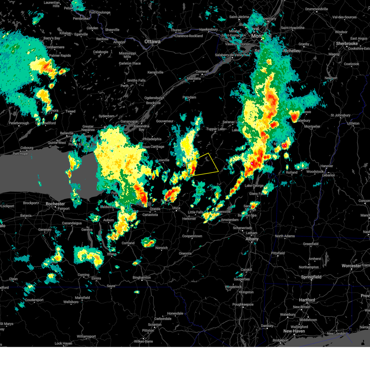
| 5/17/2025 2:55 PM EDT |
 Svraly the national weather service in albany has issued a * severe thunderstorm warning for, northwestern hamilton county in eastern new york, northern herkimer county in eastern new york, * until 330 pm edt. * at 255 pm edt, a severe thunderstorm was located near mckeever, or near old forge, moving northeast at 30 mph (radar indicated). Hazards include 60 mph wind gusts and quarter size hail. Hail damage to vehicles is expected. Expect wind damage to roofs, siding, and trees. Svraly the national weather service in albany has issued a * severe thunderstorm warning for, northwestern hamilton county in eastern new york, northern herkimer county in eastern new york, * until 330 pm edt. * at 255 pm edt, a severe thunderstorm was located near mckeever, or near old forge, moving northeast at 30 mph (radar indicated). Hazards include 60 mph wind gusts and quarter size hail. Hail damage to vehicles is expected. Expect wind damage to roofs, siding, and trees.
|
| 4/29/2025 6:10 PM EDT |
 At 609 pm edt, severe thunderstorms were located along a line extending from near mckeever to hinckley to near yorkville, moving east at 55 mph (radar indicated). Hazards include 70 mph wind gusts and quarter size hail. Hail damage to vehicles is expected. expect considerable tree damage. wind damage is also likely to mobile homes, roofs, and outbuildings. Locations impacted include, farrel corner, countryman, whitehouse, shedd corners, old city, powley place, bleecker center, atwell, lake pleasant, west canada lakes, thendara, averys place, dolgeville, wood corners, emmonsburg, paper mill corners, wilmurt, moffitt beach campground, upper benson, and ives hollow. At 609 pm edt, severe thunderstorms were located along a line extending from near mckeever to hinckley to near yorkville, moving east at 55 mph (radar indicated). Hazards include 70 mph wind gusts and quarter size hail. Hail damage to vehicles is expected. expect considerable tree damage. wind damage is also likely to mobile homes, roofs, and outbuildings. Locations impacted include, farrel corner, countryman, whitehouse, shedd corners, old city, powley place, bleecker center, atwell, lake pleasant, west canada lakes, thendara, averys place, dolgeville, wood corners, emmonsburg, paper mill corners, wilmurt, moffitt beach campground, upper benson, and ives hollow.
|
| 4/29/2025 6:05 PM EDT |
 Svraly the national weather service in albany has issued a * severe thunderstorm warning for, hamilton county in eastern new york, northwestern fulton county in eastern new york, central herkimer county in eastern new york, * until 645 pm edt. * at 604 pm edt, severe thunderstorms were located along a line extending from mckeever to remsen to near westmoreland, moving east at 55 mph (radar indicated). Hazards include 60 mph wind gusts and quarter size hail. Hail damage to vehicles is expected. Expect wind damage to roofs, siding, and trees. Svraly the national weather service in albany has issued a * severe thunderstorm warning for, hamilton county in eastern new york, northwestern fulton county in eastern new york, central herkimer county in eastern new york, * until 645 pm edt. * at 604 pm edt, severe thunderstorms were located along a line extending from mckeever to remsen to near westmoreland, moving east at 55 mph (radar indicated). Hazards include 60 mph wind gusts and quarter size hail. Hail damage to vehicles is expected. Expect wind damage to roofs, siding, and trees.
|
| 3/16/2025 6:21 PM EDT |
 The storms which prompted the warning have weakened below severe limits, and no longer pose an immediate threat to life or property. therefore, the warning will be allowed to expire. The storms which prompted the warning have weakened below severe limits, and no longer pose an immediate threat to life or property. therefore, the warning will be allowed to expire.
|
| 3/16/2025 5:46 PM EDT |
 Svraly the national weather service in albany has issued a * severe thunderstorm warning for, northwestern hamilton county in eastern new york, central herkimer county in eastern new york, * until 630 pm edt. * at 545 pm edt, severe thunderstorms were located along a line extending from 9 miles southeast of whetstone gulf state park to steuben to near westmoreland, moving northeast at 60 mph (radar indicated). Hazards include 60 mph wind gusts. expect damage to roofs, siding, and trees Svraly the national weather service in albany has issued a * severe thunderstorm warning for, northwestern hamilton county in eastern new york, central herkimer county in eastern new york, * until 630 pm edt. * at 545 pm edt, severe thunderstorms were located along a line extending from 9 miles southeast of whetstone gulf state park to steuben to near westmoreland, moving northeast at 60 mph (radar indicated). Hazards include 60 mph wind gusts. expect damage to roofs, siding, and trees
|
| 7/16/2024 3:28 PM EDT |
 Svraly the national weather service in albany has issued a * severe thunderstorm warning for, western hamilton county in eastern new york, northern herkimer county in eastern new york, * until 415 pm edt. * at 328 pm edt, severe thunderstorms were located along a line extending from 6 miles southwest of star lake to near mckeever, moving east at 40 mph (radar indicated). Hazards include 60 mph wind gusts. expect damage to roofs, siding, and trees Svraly the national weather service in albany has issued a * severe thunderstorm warning for, western hamilton county in eastern new york, northern herkimer county in eastern new york, * until 415 pm edt. * at 328 pm edt, severe thunderstorms were located along a line extending from 6 miles southwest of star lake to near mckeever, moving east at 40 mph (radar indicated). Hazards include 60 mph wind gusts. expect damage to roofs, siding, and trees
|
| 7/10/2024 1:51 PM EDT |
 At 150 pm edt, a severe thunderstorm was located 10 miles northwest of old forge, moving east at 35 mph (radar indicated). Hazards include 60 mph wind gusts and penny size hail. Expect damage to roofs, siding, and trees. Locations impacted include, big moose, alger island public campground, beaver river, moshier falls, carter station, woods lake, and little rapids. At 150 pm edt, a severe thunderstorm was located 10 miles northwest of old forge, moving east at 35 mph (radar indicated). Hazards include 60 mph wind gusts and penny size hail. Expect damage to roofs, siding, and trees. Locations impacted include, big moose, alger island public campground, beaver river, moshier falls, carter station, woods lake, and little rapids.
|
| 7/10/2024 1:38 PM EDT |
 Svraly the national weather service in albany has issued a * severe thunderstorm warning for, northwestern herkimer county in eastern new york, * until 230 pm edt. * at 137 pm edt, a severe thunderstorm was located 10 miles east of whetstone gulf state park, or 15 miles west of old forge, moving east at 30 mph (radar indicated). Hazards include 60 mph wind gusts and half dollar size hail. Hail damage to vehicles is expected. Expect wind damage to roofs, siding, and trees. Svraly the national weather service in albany has issued a * severe thunderstorm warning for, northwestern herkimer county in eastern new york, * until 230 pm edt. * at 137 pm edt, a severe thunderstorm was located 10 miles east of whetstone gulf state park, or 15 miles west of old forge, moving east at 30 mph (radar indicated). Hazards include 60 mph wind gusts and half dollar size hail. Hail damage to vehicles is expected. Expect wind damage to roofs, siding, and trees.
|
| 8/12/2023 8:25 PM EDT | Trees and wires down on route 28 between old forge and eagle bay. time estimated from rada in herkimer county NY, 3.3 miles WSW of Old Forge, NY |
| 8/4/2023 2:39 PM EDT |
 At 234 pm edt, a severe thunderstorm was located near limekiln lake campground, or 8 miles east of old forge, moving southeast at 20 mph (radar indicated). Hazards include 60 mph wind gusts and quarter size hail. Hail damage to vehicles is expected. expect wind damage to roofs, siding, and trees. locations impacted include, old forge, inlet, eighth lake campground, brown tract pond campground, limekiln lake campground, eagle bay, nicks lake campground, alger island public campground, russian lake, atwell, minnehaha, thendara, first lake, herkimer landing, caswell lake, sagamore, wolf lake landing, mountain lodge, sagamore lake and kamp kill kare. hail threat, radar indicated max hail size, 1. 00 in wind threat, radar indicated max wind gust, 60 mph. At 234 pm edt, a severe thunderstorm was located near limekiln lake campground, or 8 miles east of old forge, moving southeast at 20 mph (radar indicated). Hazards include 60 mph wind gusts and quarter size hail. Hail damage to vehicles is expected. expect wind damage to roofs, siding, and trees. locations impacted include, old forge, inlet, eighth lake campground, brown tract pond campground, limekiln lake campground, eagle bay, nicks lake campground, alger island public campground, russian lake, atwell, minnehaha, thendara, first lake, herkimer landing, caswell lake, sagamore, wolf lake landing, mountain lodge, sagamore lake and kamp kill kare. hail threat, radar indicated max hail size, 1. 00 in wind threat, radar indicated max wind gust, 60 mph.
|
| 8/4/2023 2:34 PM EDT |
 At 234 pm edt, a severe thunderstorm was located near limekiln lake campground, or 8 miles east of old forge, moving southeast at 20 mph (radar indicated). Hazards include 60 mph wind gusts and quarter size hail. Hail damage to vehicles is expected. expect wind damage to roofs, siding, and trees. locations impacted include, old forge, inlet, eighth lake campground, brown tract pond campground, limekiln lake campground, eagle bay, nicks lake campground, alger island public campground, russian lake, atwell, minnehaha, thendara, first lake, herkimer landing, caswell lake, sagamore, wolf lake landing, mountain lodge, sagamore lake and kamp kill kare. hail threat, radar indicated max hail size, 1. 00 in wind threat, radar indicated max wind gust, 60 mph. At 234 pm edt, a severe thunderstorm was located near limekiln lake campground, or 8 miles east of old forge, moving southeast at 20 mph (radar indicated). Hazards include 60 mph wind gusts and quarter size hail. Hail damage to vehicles is expected. expect wind damage to roofs, siding, and trees. locations impacted include, old forge, inlet, eighth lake campground, brown tract pond campground, limekiln lake campground, eagle bay, nicks lake campground, alger island public campground, russian lake, atwell, minnehaha, thendara, first lake, herkimer landing, caswell lake, sagamore, wolf lake landing, mountain lodge, sagamore lake and kamp kill kare. hail threat, radar indicated max hail size, 1. 00 in wind threat, radar indicated max wind gust, 60 mph.
|
| 8/4/2023 2:28 PM EDT | At least two trees down in herkimer county NY, 1.5 miles ENE of Old Forge, NY |
| 8/4/2023 1:55 PM EDT |
 At 155 pm edt, a severe thunderstorm was located near old forge, moving southeast at 20 mph (radar indicated). Hazards include 60 mph wind gusts and quarter size hail. Hail damage to vehicles is expected. Expect wind damage to roofs, siding, and trees. At 155 pm edt, a severe thunderstorm was located near old forge, moving southeast at 20 mph (radar indicated). Hazards include 60 mph wind gusts and quarter size hail. Hail damage to vehicles is expected. Expect wind damage to roofs, siding, and trees.
|
| 7/13/2023 4:04 PM EDT |
 At 404 pm edt, severe thunderstorms were located along a line extending from near piercefield to northwood, moving northeast at 40 mph (radar indicated). Hazards include 60 mph wind gusts and penny size hail. Expect damage to roofs, siding, and trees. locations impacted include, speculator, old forge, ohio, lake pleasant, poland, inlet, cold brook, blue mountain lake, lake eaton campground, brown tract pond campground, big moose, eighth lake campground, lewey lake campground, golden beach campground, moffitt beach campground, limekiln lake campground, nicks lake campground, eagle bay, forked lake public campground and northwood. hail threat, radar indicated max hail size, 0. 75 in wind threat, radar indicated max wind gust, 60 mph. At 404 pm edt, severe thunderstorms were located along a line extending from near piercefield to northwood, moving northeast at 40 mph (radar indicated). Hazards include 60 mph wind gusts and penny size hail. Expect damage to roofs, siding, and trees. locations impacted include, speculator, old forge, ohio, lake pleasant, poland, inlet, cold brook, blue mountain lake, lake eaton campground, brown tract pond campground, big moose, eighth lake campground, lewey lake campground, golden beach campground, moffitt beach campground, limekiln lake campground, nicks lake campground, eagle bay, forked lake public campground and northwood. hail threat, radar indicated max hail size, 0. 75 in wind threat, radar indicated max wind gust, 60 mph.
|
| 7/13/2023 3:22 PM EDT |
 At 322 pm edt, severe thunderstorms were located along a line extending from 8 miles south of star lake to new london, moving east at 40 mph (radar indicated). Hazards include 60 mph wind gusts and penny size hail. expect damage to roofs, siding, and trees At 322 pm edt, severe thunderstorms were located along a line extending from 8 miles south of star lake to new london, moving east at 40 mph (radar indicated). Hazards include 60 mph wind gusts and penny size hail. expect damage to roofs, siding, and trees
|
| 10/13/2022 3:42 PM EDT |
 The severe thunderstorm warning for northwestern hamilton and northern herkimer counties will expire at 345 pm edt, the storms which prompted the warning have weakened below severe limits, and no longer pose an immediate threat to life or property. therefore, the warning will be allowed to expire. however gusty winds are still possible with these thunderstorms. The severe thunderstorm warning for northwestern hamilton and northern herkimer counties will expire at 345 pm edt, the storms which prompted the warning have weakened below severe limits, and no longer pose an immediate threat to life or property. therefore, the warning will be allowed to expire. however gusty winds are still possible with these thunderstorms.
|
| 10/13/2022 3:17 PM EDT |
 At 317 pm edt, severe thunderstorms were located along a line extending from 9 miles northwest of big moose to near northwood, moving northeast at 35 mph (radar indicated). Hazards include 60 mph wind gusts. Expect damage to roofs, siding, and trees. locations impacted include, old forge, inlet, brown tract pond campground, limekiln lake campground, big moose, nicks lake campground, eighth lake campground, eagle bay, mckeever, raquette lake, alger island public campground, golden beach campground, little rapids, beaver river, nobleboro, minnehaha, carter station, quaker beach, first lake and sabattis. hail threat, radar indicated max hail size, <. 75 in wind threat, radar indicated max wind gust, 60 mph. At 317 pm edt, severe thunderstorms were located along a line extending from 9 miles northwest of big moose to near northwood, moving northeast at 35 mph (radar indicated). Hazards include 60 mph wind gusts. Expect damage to roofs, siding, and trees. locations impacted include, old forge, inlet, brown tract pond campground, limekiln lake campground, big moose, nicks lake campground, eighth lake campground, eagle bay, mckeever, raquette lake, alger island public campground, golden beach campground, little rapids, beaver river, nobleboro, minnehaha, carter station, quaker beach, first lake and sabattis. hail threat, radar indicated max hail size, <. 75 in wind threat, radar indicated max wind gust, 60 mph.
|
| 10/13/2022 2:48 PM EDT |
 At 248 pm edt, severe thunderstorms were located along a line extending from 14 miles east of lowville to stittville, moving northeast at 35 mph (radar indicated). Hazards include 60 mph wind gusts. expect damage to roofs, siding, and trees At 248 pm edt, severe thunderstorms were located along a line extending from 14 miles east of lowville to stittville, moving northeast at 35 mph (radar indicated). Hazards include 60 mph wind gusts. expect damage to roofs, siding, and trees
|
| 5/21/2022 4:10 PM EDT |
 At 410 pm edt, a severe thunderstorm was located 8 miles north of boonville, moving east at 30 mph (radar indicated). Hazards include 60 mph wind gusts and quarter size hail. Hail damage to vehicles is expected. Expect wind damage to roofs, siding, and trees. At 410 pm edt, a severe thunderstorm was located 8 miles north of boonville, moving east at 30 mph (radar indicated). Hazards include 60 mph wind gusts and quarter size hail. Hail damage to vehicles is expected. Expect wind damage to roofs, siding, and trees.
|
| 5/16/2022 3:34 PM EDT |
 At 334 pm edt, severe thunderstorms were located along a line extending from near star lake to 7 miles north of big moose to near limekiln lake campground, moving northeast at 40 mph (radar indicated). Hazards include 60 mph wind gusts. Expect damage to roofs, siding, and trees. locations impacted include, old forge, limekiln lake campground, eagle bay, big moose, nicks lake campground, alger island public campground, little rapids, beaver river, atwell, thendara, carter station, lyon lake, first lake, wolf lake landing, keepawa, mountain lodge, brandreth and woods lake. hail threat, radar indicated max hail size, <. 75 in wind threat, radar indicated max wind gust, 60 mph. At 334 pm edt, severe thunderstorms were located along a line extending from near star lake to 7 miles north of big moose to near limekiln lake campground, moving northeast at 40 mph (radar indicated). Hazards include 60 mph wind gusts. Expect damage to roofs, siding, and trees. locations impacted include, old forge, limekiln lake campground, eagle bay, big moose, nicks lake campground, alger island public campground, little rapids, beaver river, atwell, thendara, carter station, lyon lake, first lake, wolf lake landing, keepawa, mountain lodge, brandreth and woods lake. hail threat, radar indicated max hail size, <. 75 in wind threat, radar indicated max wind gust, 60 mph.
|
| 5/16/2022 3:23 PM EDT | Law enforcement reported trees down on power and cable lines on fletcher road. time estimated from rada in herkimer county NY, 0.3 miles SSW of Old Forge, NY |
| 5/16/2022 3:09 PM EDT |
 At 309 pm edt, severe thunderstorms were located along a line extending from 8 miles northeast of lowville to 9 miles northwest of mckeever to 6 miles northeast of forestport, moving northeast at 15 mph (radar indicated). Hazards include 60 mph wind gusts. expect damage to roofs, siding, and trees At 309 pm edt, severe thunderstorms were located along a line extending from 8 miles northeast of lowville to 9 miles northwest of mckeever to 6 miles northeast of forestport, moving northeast at 15 mph (radar indicated). Hazards include 60 mph wind gusts. expect damage to roofs, siding, and trees
|
| 7/20/2021 6:52 PM EDT | Trees on road... crews dispatche in hamilton county NY, 16.9 miles NW of Old Forge, NY |
| 6/21/2021 6:35 PM EDT | All lanes on route 28 in old forge are blocked between crosby blvd and adams st due to wires down in herkimer county NY, 0.3 miles SSW of Old Forge, NY |
| 6/21/2021 6:31 PM EDT | Report of trees down in herkimer county NY, 0.3 miles SSW of Old Forge, NY |
| 6/21/2021 6:18 PM EDT |
 At 617 pm edt, severe thunderstorms were located along a line extending from 7 miles north of lowville to near forestport, moving northeast at 40 mph (radar indicated). Hazards include 60 mph wind gusts and penny size hail. expect damage to roofs, siding, and trees At 617 pm edt, severe thunderstorms were located along a line extending from 7 miles north of lowville to near forestport, moving northeast at 40 mph (radar indicated). Hazards include 60 mph wind gusts and penny size hail. expect damage to roofs, siding, and trees
|
| 6/21/2021 6:17 PM EDT | Tree down on wir in oneida county NY, 10.4 miles NE of Old Forge, NY |
| 6/21/2021 4:07 PM EDT | Tree down on south shore rd in herkimer county NY, 4.7 miles WSW of Old Forge, NY |
| 6/21/2021 3:09 PM EDT |
 The severe thunderstorm warning for northwestern hamilton and northern herkimer counties will expire at 315 pm edt, the storms which prompted the warning have weakened below severe limits, and no longer pose an immediate threat to life or property. therefore, the warning will be allowed to expire. a severe thunderstorm watch remains in effect until 900 pm edt for eastern new york. remember, a severe thunderstorm warning still remains in effect for southwestern hamilton county until 345 pm edt. The severe thunderstorm warning for northwestern hamilton and northern herkimer counties will expire at 315 pm edt, the storms which prompted the warning have weakened below severe limits, and no longer pose an immediate threat to life or property. therefore, the warning will be allowed to expire. a severe thunderstorm watch remains in effect until 900 pm edt for eastern new york. remember, a severe thunderstorm warning still remains in effect for southwestern hamilton county until 345 pm edt.
|
| 6/21/2021 2:53 PM EDT |
 At 250 pm edt, severe thunderstorms were located along a line extending from near star lake to 11 miles northwest of big moose to 8 miles northwest of mckeever, moving east at 50 mph. another potentially severe thunderstorm was located 10 miles southeast of old forge, moving northeast at 30 mph (radar indicated). Hazards include 60 mph wind gusts and penny size hail. Expect damage to roofs, siding, and trees. Locations impacted include, speculator, old forge, inlet, blue mountain lake, lake eaton campground, brown tract pond campground, limekiln lake campground, big moose, nicks lake campground, eighth lake campground, eagle bay, forked lake public campground, mckeever, raquette lake, golden beach campground, alger island public campground, long lake, eagle nest, little rapids and beaver river. At 250 pm edt, severe thunderstorms were located along a line extending from near star lake to 11 miles northwest of big moose to 8 miles northwest of mckeever, moving east at 50 mph. another potentially severe thunderstorm was located 10 miles southeast of old forge, moving northeast at 30 mph (radar indicated). Hazards include 60 mph wind gusts and penny size hail. Expect damage to roofs, siding, and trees. Locations impacted include, speculator, old forge, inlet, blue mountain lake, lake eaton campground, brown tract pond campground, limekiln lake campground, big moose, nicks lake campground, eighth lake campground, eagle bay, forked lake public campground, mckeever, raquette lake, golden beach campground, alger island public campground, long lake, eagle nest, little rapids and beaver river.
|
| 6/21/2021 2:33 PM EDT |
 At 232 pm edt, severe thunderstorms were located along a line extending from 9 miles southwest of oswegatchie to 15 miles northeast of lowville to near highmarket, moving east at 55 mph (radar indicated). Hazards include 60 mph wind gusts and penny size hail. expect damage to roofs, siding, and trees At 232 pm edt, severe thunderstorms were located along a line extending from 9 miles southwest of oswegatchie to 15 miles northeast of lowville to near highmarket, moving east at 55 mph (radar indicated). Hazards include 60 mph wind gusts and penny size hail. expect damage to roofs, siding, and trees
|
| 5/26/2021 2:10 PM EDT | Trees down on big moose r in herkimer county NY, 8 miles SSW of Old Forge, NY |
| 5/26/2021 2:05 PM EDT | Tree on wires on beachview r in herkimer county NY, 0.3 miles SSW of Old Forge, NY |
| 5/26/2021 1:50 PM EDT |
 At 150 pm edt, severe thunderstorms were located along a line extending from 15 miles northwest of big moose to near alder creek to near floyd, moving east at 45 mph (radar indicated). Hazards include 60 mph wind gusts and quarter size hail. Hail damage to vehicles is expected. Expect wind damage to roofs, siding, and trees. At 150 pm edt, severe thunderstorms were located along a line extending from 15 miles northwest of big moose to near alder creek to near floyd, moving east at 45 mph (radar indicated). Hazards include 60 mph wind gusts and quarter size hail. Hail damage to vehicles is expected. Expect wind damage to roofs, siding, and trees.
|
| 3/26/2021 11:29 AM EDT |
 At 1129 am edt, severe thunderstorms were located along a line extending from near star lake to near boonville, moving east at 55 mph (radar indicated). Hazards include 60 mph wind gusts and nickel size hail. expect damage to roofs, siding, and trees At 1129 am edt, severe thunderstorms were located along a line extending from near star lake to near boonville, moving east at 55 mph (radar indicated). Hazards include 60 mph wind gusts and nickel size hail. expect damage to roofs, siding, and trees
|
| 11/15/2020 7:09 PM EST |
 At 709 pm est, severe thunderstorms were located along a line extending from near star lake to near mckeever to near stittville, moving east at 50 mph (trained weather spotters reported downed trees and powerlines in lewis county). Hazards include 60 mph wind gusts. Expect damage to roofs, siding, and trees. severe thunderstorms will be near, old forge, newport and nicks lake campground around 720 pm est. middleville around 725 pm est. limekiln lake campground around 730 pm est. dolgeville around 735 pm est. stratford around 740 pm est. lewey lake campground around 750 pm est. speculator, caroga lake and caroga lake public campground around 755 pm est. northville, northampton beach public campground and cranberry creek around 810 pm est. other locations impacted by these severe thunderstorms include girards sugarbush, sweets crossing, farrel corner, whitehouse, robinwood, tomantown, shedd corners, north broadalbin, woods lake and old city. please report hail size, damaging winds and reports of trees down to the national weather service by email at alb. stormreport@noaa. gov, on facebook at www. facebook. Com/nwsalbany or twitter @nwsalbany. At 709 pm est, severe thunderstorms were located along a line extending from near star lake to near mckeever to near stittville, moving east at 50 mph (trained weather spotters reported downed trees and powerlines in lewis county). Hazards include 60 mph wind gusts. Expect damage to roofs, siding, and trees. severe thunderstorms will be near, old forge, newport and nicks lake campground around 720 pm est. middleville around 725 pm est. limekiln lake campground around 730 pm est. dolgeville around 735 pm est. stratford around 740 pm est. lewey lake campground around 750 pm est. speculator, caroga lake and caroga lake public campground around 755 pm est. northville, northampton beach public campground and cranberry creek around 810 pm est. other locations impacted by these severe thunderstorms include girards sugarbush, sweets crossing, farrel corner, whitehouse, robinwood, tomantown, shedd corners, north broadalbin, woods lake and old city. please report hail size, damaging winds and reports of trees down to the national weather service by email at alb. stormreport@noaa. gov, on facebook at www. facebook. Com/nwsalbany or twitter @nwsalbany.
|
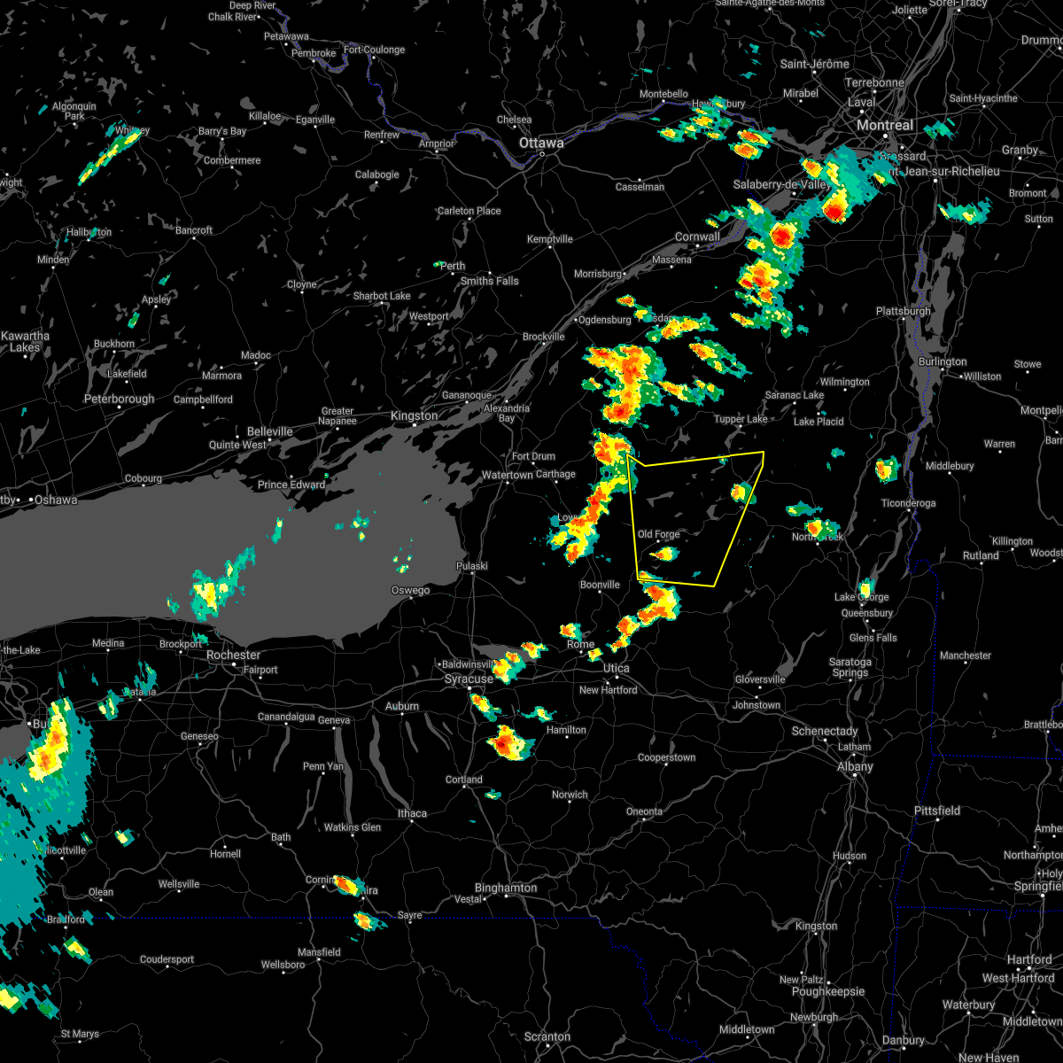
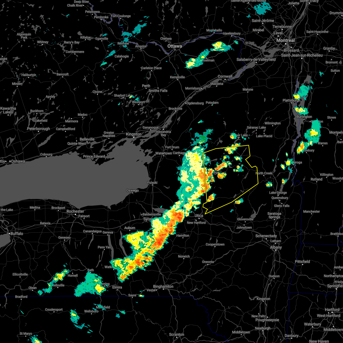
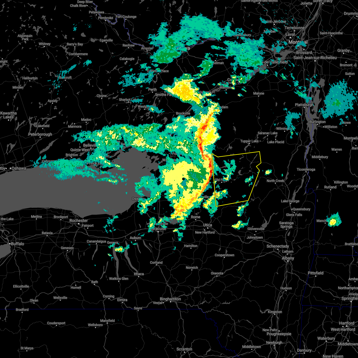
| 8/2/2020 4:05 PM EDT |
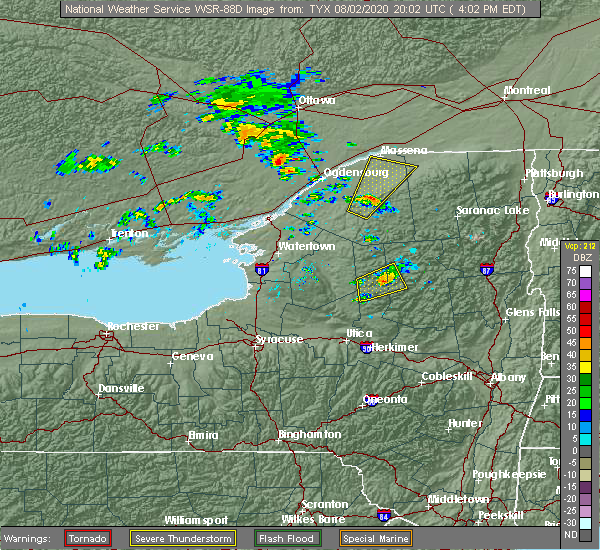 At 405 pm edt, a severe thunderstorm was located over limekiln lake campground, or 7 miles east of old forge, moving northeast at 30 mph (radar indicated). Hazards include 60 mph wind gusts. Expect damage to roofs, siding, and trees. Locations impacted include, inlet, limekiln lake campground, eagle bay, eighth lake campground, alger island public campground and mountain lodge. At 405 pm edt, a severe thunderstorm was located over limekiln lake campground, or 7 miles east of old forge, moving northeast at 30 mph (radar indicated). Hazards include 60 mph wind gusts. Expect damage to roofs, siding, and trees. Locations impacted include, inlet, limekiln lake campground, eagle bay, eighth lake campground, alger island public campground and mountain lodge.
|
| 8/2/2020 3:35 PM EDT |
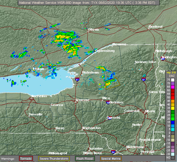 At 335 pm edt, a severe thunderstorm was located near mckeever, or 7 miles south of old forge, moving northeast at 30 mph (radar indicated). Hazards include 60 mph wind gusts and penny size hail. Expect damage to roofs, siding, and trees. Locations impacted include, old forge, inlet, eighth lake campground, limekiln lake campground, eagle bay, mckeever, nicks lake campground, alger island public campground, russian lake, minnehaha, thendara, carter station, first lake, wolf lake landing and mountain lodge. At 335 pm edt, a severe thunderstorm was located near mckeever, or 7 miles south of old forge, moving northeast at 30 mph (radar indicated). Hazards include 60 mph wind gusts and penny size hail. Expect damage to roofs, siding, and trees. Locations impacted include, old forge, inlet, eighth lake campground, limekiln lake campground, eagle bay, mckeever, nicks lake campground, alger island public campground, russian lake, minnehaha, thendara, carter station, first lake, wolf lake landing and mountain lodge.
|
| 8/2/2020 3:13 PM EDT |
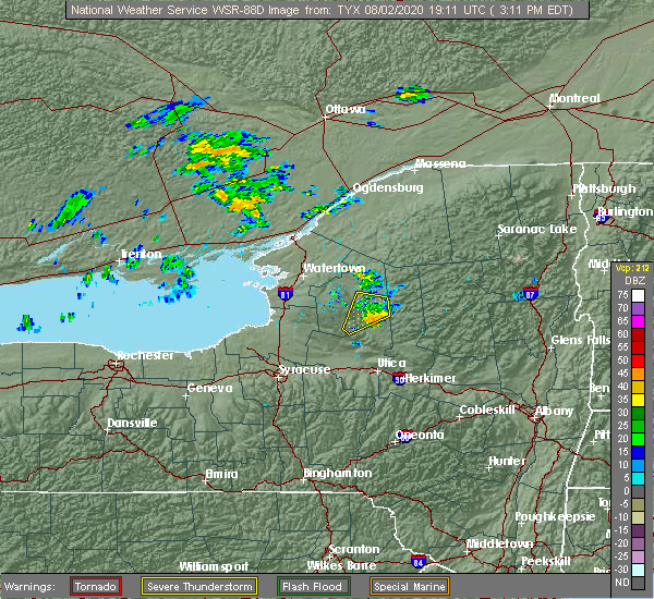 At 312 pm edt, a severe thunderstorm was located near forestport, or near boonville, moving northeast at 30 mph (radar indicated). Hazards include 60 mph wind gusts. expect damage to roofs, siding, and trees At 312 pm edt, a severe thunderstorm was located near forestport, or near boonville, moving northeast at 30 mph (radar indicated). Hazards include 60 mph wind gusts. expect damage to roofs, siding, and trees
|
| 7/19/2020 6:49 PM EDT |
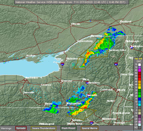 At 649 pm edt, a severe thunderstorm was located 8 miles west of big moose, or 11 miles northwest of old forge, moving east at 30 mph (radar indicated). Hazards include 60 mph wind gusts. expect damage to roofs, siding, and trees At 649 pm edt, a severe thunderstorm was located 8 miles west of big moose, or 11 miles northwest of old forge, moving east at 30 mph (radar indicated). Hazards include 60 mph wind gusts. expect damage to roofs, siding, and trees
|
| 5/29/2020 5:35 PM EDT |
 At 535 pm edt, severe thunderstorms were located along a line extending from 9 miles west of big moose to near mckeever to trenton, moving northeast at 30 mph (radar indicated). Hazards include 60 mph wind gusts and quarter size hail. Hail damage to vehicles is expected. expect wind damage to roofs, siding, and trees. severe thunderstorms will be near, mckeever around 540 pm edt. big moose around 545 pm edt. ohio and nicks lake campground around 555 pm edt. old forge around 600 pm edt. limekiln lake campground and alger island public campground around 610 pm edt. inlet and eagle bay around 615 pm edt. eighth lake campground and brown tract pond campground around 625 pm edt. golden beach campground, raquette lake and lake eaton campground around 630 pm edt. Other locations impacted by these severe thunderstorms include eagle nest, little rapids, beaver river, nobleboro, minnehaha, carter station, quaker beach, first lake, deerland and sabattis. At 535 pm edt, severe thunderstorms were located along a line extending from 9 miles west of big moose to near mckeever to trenton, moving northeast at 30 mph (radar indicated). Hazards include 60 mph wind gusts and quarter size hail. Hail damage to vehicles is expected. expect wind damage to roofs, siding, and trees. severe thunderstorms will be near, mckeever around 540 pm edt. big moose around 545 pm edt. ohio and nicks lake campground around 555 pm edt. old forge around 600 pm edt. limekiln lake campground and alger island public campground around 610 pm edt. inlet and eagle bay around 615 pm edt. eighth lake campground and brown tract pond campground around 625 pm edt. golden beach campground, raquette lake and lake eaton campground around 630 pm edt. Other locations impacted by these severe thunderstorms include eagle nest, little rapids, beaver river, nobleboro, minnehaha, carter station, quaker beach, first lake, deerland and sabattis.
|
| 3/20/2020 3:06 PM EDT | Trees and wires dow in herkimer county NY, 7 miles WSW of Old Forge, NY |
| 3/20/2020 3:00 PM EDT | Trees and wires down. power out in old forg in herkimer county NY, 0.3 miles SSW of Old Forge, NY |
| 3/20/2020 2:32 PM EDT |
 At 231 pm edt, severe thunderstorms were located along a line extending from near colton to near whetstone gulf state park, moving east at 50 mph (radar indicated). Hazards include 60 mph wind gusts. expect damage to roofs, siding, and trees At 231 pm edt, severe thunderstorms were located along a line extending from near colton to near whetstone gulf state park, moving east at 50 mph (radar indicated). Hazards include 60 mph wind gusts. expect damage to roofs, siding, and trees
|
| 10/31/2019 7:44 PM EDT |
 At 743 pm edt, severe thunderstorms were located along a line extending from inlet to near northwood to ohio to earlville, moving northeast at 40 mph (radar indicated). Hazards include 60 mph wind gusts. expect damage to roofs, siding, and trees At 743 pm edt, severe thunderstorms were located along a line extending from inlet to near northwood to ohio to earlville, moving northeast at 40 mph (radar indicated). Hazards include 60 mph wind gusts. expect damage to roofs, siding, and trees
|
| 10/31/2019 7:32 PM EDT |
 At 731 pm edt, severe thunderstorms were located along a line extending from near big moose to near boonville to holland patent to augusta, moving east at 30 mph (radar indicated). Hazards include 60 mph wind gusts. Expect damage to roofs, siding, and trees. Locations impacted include, ilion, herkimer, little falls, old forge, mohawk, frankfort, dolgeville, ohio, west winfield, newport, middleville, poland, inlet, cold brook, jordanville, brown tract pond campground, big moose, eighth lake campground, nicks lake campground and raquette lake. At 731 pm edt, severe thunderstorms were located along a line extending from near big moose to near boonville to holland patent to augusta, moving east at 30 mph (radar indicated). Hazards include 60 mph wind gusts. Expect damage to roofs, siding, and trees. Locations impacted include, ilion, herkimer, little falls, old forge, mohawk, frankfort, dolgeville, ohio, west winfield, newport, middleville, poland, inlet, cold brook, jordanville, brown tract pond campground, big moose, eighth lake campground, nicks lake campground and raquette lake.
|
| 10/31/2019 7:20 PM EDT |
 At 719 pm edt, severe thunderstorms were located along a line extending from 7 miles northwest of big moose to near boonville to near floyd to near peterboro, moving east at 40 mph (radar indicated. new york state mesonet weather stations have gusted up to 45-55mph in these storms). Hazards include 60 mph wind gusts. Expect damage to roofs, siding, and trees. Locations impacted include, ilion, herkimer, little falls, old forge, mohawk, frankfort, dolgeville, ohio, west winfield, newport, middleville, poland, inlet, cold brook, jordanville, brown tract pond campground, big moose, eighth lake campground, nicks lake campground and raquette lake. At 719 pm edt, severe thunderstorms were located along a line extending from 7 miles northwest of big moose to near boonville to near floyd to near peterboro, moving east at 40 mph (radar indicated. new york state mesonet weather stations have gusted up to 45-55mph in these storms). Hazards include 60 mph wind gusts. Expect damage to roofs, siding, and trees. Locations impacted include, ilion, herkimer, little falls, old forge, mohawk, frankfort, dolgeville, ohio, west winfield, newport, middleville, poland, inlet, cold brook, jordanville, brown tract pond campground, big moose, eighth lake campground, nicks lake campground and raquette lake.
|
| 10/31/2019 6:41 PM EDT |
 At 639 pm edt, severe thunderstorms were located along a line extending from 10 miles northeast of lowville to near kirkville, moving east at 30 mph (radar indicated. a new york state mesonet station has gusted to 56mph). Hazards include 60 mph wind gusts. expect damage to roofs, siding, and trees At 639 pm edt, severe thunderstorms were located along a line extending from 10 miles northeast of lowville to near kirkville, moving east at 30 mph (radar indicated. a new york state mesonet station has gusted to 56mph). Hazards include 60 mph wind gusts. expect damage to roofs, siding, and trees
|
| 7/30/2019 3:21 PM EDT |
 At 223 pm edt, a severe thunderstorm was located 11 miles east of lowville, or 15 miles northwest of old forge, moving northeast at 55 mph (radar indicated). Hazards include 60 mph wind gusts. expect damage to roofs, siding, and trees At 223 pm edt, a severe thunderstorm was located 11 miles east of lowville, or 15 miles northwest of old forge, moving northeast at 55 mph (radar indicated). Hazards include 60 mph wind gusts. expect damage to roofs, siding, and trees
|
| 7/30/2019 3:15 PM EDT | Tree down on north lake roa in herkimer county NY, 14.2 miles N of Old Forge, NY |
| 7/30/2019 2:24 PM EDT |
 At 223 pm edt, a severe thunderstorm was located 11 miles east of lowville, or 15 miles northwest of old forge, moving northeast at 55 mph (radar indicated). Hazards include 60 mph wind gusts. expect damage to roofs, siding, and trees At 223 pm edt, a severe thunderstorm was located 11 miles east of lowville, or 15 miles northwest of old forge, moving northeast at 55 mph (radar indicated). Hazards include 60 mph wind gusts. expect damage to roofs, siding, and trees
|
| 7/11/2019 8:46 PM EDT |
 At 846 pm edt, severe thunderstorms were located along a line extending from 10 miles northwest of big moose to near mckeever to near boonville, moving east at 30 mph (radar indicated). Hazards include 60 mph wind gusts and penny size hail. Expect damage to roofs, siding, and trees. these severe storms will be near, nicks lake campground around 900 pm edt. old forge around 905 pm edt. Alger island public campground, eagle bay and big moose around 915 pm edt. At 846 pm edt, severe thunderstorms were located along a line extending from 10 miles northwest of big moose to near mckeever to near boonville, moving east at 30 mph (radar indicated). Hazards include 60 mph wind gusts and penny size hail. Expect damage to roofs, siding, and trees. these severe storms will be near, nicks lake campground around 900 pm edt. old forge around 905 pm edt. Alger island public campground, eagle bay and big moose around 915 pm edt.
|
| 7/11/2019 8:21 PM EDT |
 At 820 pm edt, severe thunderstorms were located along a line extending from 6 miles northeast of lowville to 7 miles north of boonville to 8 miles south of highmarket, moving east at 25 mph (radar indicated). Hazards include 60 mph wind gusts and penny size hail. expect damage to roofs, siding, and trees At 820 pm edt, severe thunderstorms were located along a line extending from 6 miles northeast of lowville to 7 miles north of boonville to 8 miles south of highmarket, moving east at 25 mph (radar indicated). Hazards include 60 mph wind gusts and penny size hail. expect damage to roofs, siding, and trees
|
| 5/23/2019 7:46 PM EDT |
 At 745 pm edt, severe thunderstorms were located along a line extending from 12 miles southwest of star lake to near camden, moving east at 55 mph (radar indicated). Hazards include 60 mph wind gusts. expect damage to roofs, siding, and trees At 745 pm edt, severe thunderstorms were located along a line extending from 12 miles southwest of star lake to near camden, moving east at 55 mph (radar indicated). Hazards include 60 mph wind gusts. expect damage to roofs, siding, and trees
|
| 5/19/2019 3:40 PM EDT |
 At 340 pm edt, a severe thunderstorm was located near alger island public campground, or near old forge, moving northeast at 30 mph (radar indicated). Hazards include quarter size hail. damage to vehicles is expected At 340 pm edt, a severe thunderstorm was located near alger island public campground, or near old forge, moving northeast at 30 mph (radar indicated). Hazards include quarter size hail. damage to vehicles is expected
|
| 5/4/2018 6:22 PM EDT |
 At 621 pm edt, severe thunderstorms were located along a line extending from 7 miles east of highmarket to near verona to cuyler, moving east at 55 mph (radar indicated). Hazards include 60 mph wind gusts. Expect damage to roofs, siding, and trees. severe thunderstorms will be near, mckeever around 635 pm edt. old forge, poland and nicks lake campground around 645 pm edt. newport, cold brook, alger island public campground, northwood and big moose around 650 pm edt. ohio, inlet, limekiln lake campground and eagle bay around 655 pm edt. eighth lake campground and brown tract pond campground around 700 pm edt. west winfield and raquette lake around 705 pm edt. cedarville and golden beach campground around 710 pm edt. ilion, herkimer, mohawk, jordanville, lake durant campground and blue mountain lake around 715 pm edt. A tornado watch remains in effect until 1000 pm edt for eastern new york. At 621 pm edt, severe thunderstorms were located along a line extending from 7 miles east of highmarket to near verona to cuyler, moving east at 55 mph (radar indicated). Hazards include 60 mph wind gusts. Expect damage to roofs, siding, and trees. severe thunderstorms will be near, mckeever around 635 pm edt. old forge, poland and nicks lake campground around 645 pm edt. newport, cold brook, alger island public campground, northwood and big moose around 650 pm edt. ohio, inlet, limekiln lake campground and eagle bay around 655 pm edt. eighth lake campground and brown tract pond campground around 700 pm edt. west winfield and raquette lake around 705 pm edt. cedarville and golden beach campground around 710 pm edt. ilion, herkimer, mohawk, jordanville, lake durant campground and blue mountain lake around 715 pm edt. A tornado watch remains in effect until 1000 pm edt for eastern new york.
|
| 10/15/2017 7:07 PM EDT | Trees and wires down in herkimer county NY, 7.6 miles NNW of Old Forge, NY |
| 10/15/2017 6:28 PM EDT |
 At 628 pm edt, severe thunderstorms were located along a line extending from near star lake to whetstone gulf state park to near camden, moving east at 45 mph (radar indicated). Hazards include 60 mph wind gusts. Expect damage to trees, and power lines. severe thunderstorms will be near, mckeever around 655 pm edt. nicks lake campground around 700 pm edt. old forge around 705 pm edt. alger island public campground and big moose around 710 pm edt. inlet, limekiln lake campground and eagle bay around 715 pm edt. eighth lake campground and northwood around 720 pm edt. ohio, raquette lake and brown tract pond campground around 725 pm edt. golden beach campground around 730 pm edt. Other locations impacted by these severe thunderstorms include eagle nest, beaver river, nobleboro, quaker beach, first lake, deerland, partlow, robinwood, sagamore and hoffmeister. At 628 pm edt, severe thunderstorms were located along a line extending from near star lake to whetstone gulf state park to near camden, moving east at 45 mph (radar indicated). Hazards include 60 mph wind gusts. Expect damage to trees, and power lines. severe thunderstorms will be near, mckeever around 655 pm edt. nicks lake campground around 700 pm edt. old forge around 705 pm edt. alger island public campground and big moose around 710 pm edt. inlet, limekiln lake campground and eagle bay around 715 pm edt. eighth lake campground and northwood around 720 pm edt. ohio, raquette lake and brown tract pond campground around 725 pm edt. golden beach campground around 730 pm edt. Other locations impacted by these severe thunderstorms include eagle nest, beaver river, nobleboro, quaker beach, first lake, deerland, partlow, robinwood, sagamore and hoffmeister.
|
| 8/22/2017 4:03 PM EDT |
 At 403 pm edt, severe thunderstorms were located along a line extending from near piercefield to near eagle bay to 6 miles south of mckeever, moving east at 35 mph (radar indicated). Hazards include 70 mph wind gusts and penny size hail. Expect considerable tree damage. damage is likely to mobile homes, roofs, and outbuildings. these severe storms will be near, brown tract pond campground and eighth lake campground around 415 pm edt. raquette lake around 420 pm edt. golden beach campground around 425 pm edt. forked lake public campground and blue mountain lake around 430 pm edt. other locations impacted by these severe thunderstorms include eagle nest, little rapids, beaver river, minnehaha, carter station, quaker beach, first lake, deerland, sabattis and partlow. A tornado watch remains in effect until 900 pm edt for eastern new york. At 403 pm edt, severe thunderstorms were located along a line extending from near piercefield to near eagle bay to 6 miles south of mckeever, moving east at 35 mph (radar indicated). Hazards include 70 mph wind gusts and penny size hail. Expect considerable tree damage. damage is likely to mobile homes, roofs, and outbuildings. these severe storms will be near, brown tract pond campground and eighth lake campground around 415 pm edt. raquette lake around 420 pm edt. golden beach campground around 425 pm edt. forked lake public campground and blue mountain lake around 430 pm edt. other locations impacted by these severe thunderstorms include eagle nest, little rapids, beaver river, minnehaha, carter station, quaker beach, first lake, deerland, sabattis and partlow. A tornado watch remains in effect until 900 pm edt for eastern new york.
|
| 8/22/2017 4:00 PM EDT | Two trees and wires down in herkimer county NY, 0.3 miles SSW of Old Forge, NY |
| 8/22/2017 3:30 PM EDT |
 At 329 pm edt, severe thunderstorms were located along a line extending from near wanakena to 10 miles northwest of mckeever to 8 miles west of boonville, moving east at 35 mph (radar indicated). Hazards include 70 mph wind gusts and penny size hail. Expect considerable tree damage. damage is likely to mobile homes, roofs, and outbuildings. severe thunderstorms will be near, old forge and nicks lake campground around 350 pm edt. big moose and alger island public campground around 400 pm edt. inlet, eagle bay and limekiln lake campground around 405 pm edt. mckeever around 410 pm edt. eighth lake campground around 415 pm edt. raquette lake and brown tract pond campground around 420 pm edt. golden beach campground around 425 pm edt. forked lake public campground and blue mountain lake around 430 pm edt. A tornado watch remains in effect until 900 pm edt for eastern new york. At 329 pm edt, severe thunderstorms were located along a line extending from near wanakena to 10 miles northwest of mckeever to 8 miles west of boonville, moving east at 35 mph (radar indicated). Hazards include 70 mph wind gusts and penny size hail. Expect considerable tree damage. damage is likely to mobile homes, roofs, and outbuildings. severe thunderstorms will be near, old forge and nicks lake campground around 350 pm edt. big moose and alger island public campground around 400 pm edt. inlet, eagle bay and limekiln lake campground around 405 pm edt. mckeever around 410 pm edt. eighth lake campground around 415 pm edt. raquette lake and brown tract pond campground around 420 pm edt. golden beach campground around 425 pm edt. forked lake public campground and blue mountain lake around 430 pm edt. A tornado watch remains in effect until 900 pm edt for eastern new york.
|
| 8/12/2017 3:25 PM EDT |
 The severe thunderstorm warning for northwestern hamilton and northern herkimer counties will expire at 330 pm edt, the storm which prompted the warning has weakened below severe limits, and no longer poses an immediate threat to life or property. therefore the warning will be allowed to expire. however heavy rain is still possible with this thunderstorm. a severe thunderstorm watch remains in effect until 900 pm edt for eastern new york. The severe thunderstorm warning for northwestern hamilton and northern herkimer counties will expire at 330 pm edt, the storm which prompted the warning has weakened below severe limits, and no longer poses an immediate threat to life or property. therefore the warning will be allowed to expire. however heavy rain is still possible with this thunderstorm. a severe thunderstorm watch remains in effect until 900 pm edt for eastern new york.
|
| 8/12/2017 2:45 PM EDT |
 At 245 pm edt, a severe thunderstorm was located near mckeever, or 8 miles west of old forge, moving east at 30 mph (radar indicated). Hazards include 60 mph wind gusts and quarter size hail. Minor damage to vehicles is possible. expect wind damage to trees, and power lines. this severe thunderstorm will be near, old forge and nicks lake campground around 300 pm edt. alger island public campground and big moose around 315 pm edt. inlet, eagle bay and limekiln lake campground around 320 pm edt. brown tract pond campground, eighth lake campground, raquette lake and golden beach campground around 330 pm edt. Other locations impacted by this severe thunderstorm include hasbroucks, russian lake, beaver river, minnehaha, thendara, carter station, quaker beach, sagamore, woods and mountain lodge. At 245 pm edt, a severe thunderstorm was located near mckeever, or 8 miles west of old forge, moving east at 30 mph (radar indicated). Hazards include 60 mph wind gusts and quarter size hail. Minor damage to vehicles is possible. expect wind damage to trees, and power lines. this severe thunderstorm will be near, old forge and nicks lake campground around 300 pm edt. alger island public campground and big moose around 315 pm edt. inlet, eagle bay and limekiln lake campground around 320 pm edt. brown tract pond campground, eighth lake campground, raquette lake and golden beach campground around 330 pm edt. Other locations impacted by this severe thunderstorm include hasbroucks, russian lake, beaver river, minnehaha, thendara, carter station, quaker beach, sagamore, woods and mountain lodge.
|
| 8/4/2017 8:10 PM EDT |
 The severe thunderstorm warning for western hamilton and northeastern herkimer counties will expire at 815 pm edt, the storm which prompted the warning has weakened below severe limits, and no longer poses an immediate threat to life or property. therefore the warning will be allowed to expire. The severe thunderstorm warning for western hamilton and northeastern herkimer counties will expire at 815 pm edt, the storm which prompted the warning has weakened below severe limits, and no longer poses an immediate threat to life or property. therefore the warning will be allowed to expire.
|
| 8/4/2017 7:39 PM EDT |
 At 739 pm edt, a severe thunderstorm was located near limekiln lake campground, or 10 miles southeast of old forge, moving north at 45 mph (radar indicated). Hazards include 60 mph wind gusts and quarter size hail. Minor damage to vehicles is possible. expect wind damage to trees, and power lines. this severe storm will be near, limekiln lake campground around 745 pm edt. inlet, eagle bay and alger island public campground around 750 pm edt. eighth lake campground and brown tract pond campground around 755 pm edt. raquette lake and golden beach campground around 800 pm edt. Other locations impacted by this severe thunderstorm include eagle nest, little rapids, beaver river, quaker beach, first lake, deerland, sabattis, partlow, robinwood and sagamore. At 739 pm edt, a severe thunderstorm was located near limekiln lake campground, or 10 miles southeast of old forge, moving north at 45 mph (radar indicated). Hazards include 60 mph wind gusts and quarter size hail. Minor damage to vehicles is possible. expect wind damage to trees, and power lines. this severe storm will be near, limekiln lake campground around 745 pm edt. inlet, eagle bay and alger island public campground around 750 pm edt. eighth lake campground and brown tract pond campground around 755 pm edt. raquette lake and golden beach campground around 800 pm edt. Other locations impacted by this severe thunderstorm include eagle nest, little rapids, beaver river, quaker beach, first lake, deerland, sabattis, partlow, robinwood and sagamore.
|
| 8/4/2017 7:17 PM EDT |
 At 717 pm edt, a severe thunderstorm was located 8 miles northeast of ohio, or 22 miles south of old forge, moving north at 45 mph (radar indicated). Hazards include 60 mph wind gusts and quarter size hail. Minor damage to vehicles is possible. expect wind damage to trees, and power lines. this severe thunderstorm will be near, limekiln lake campground around 745 pm edt. inlet, eagle bay and alger island public campground around 750 pm edt. brown tract pond campground and eighth lake campground around 755 pm edt. raquette lake and golden beach campground around 800 pm edt. Other locations impacted by this severe thunderstorm include eagle nest, little rapids, beaver river, nobleboro, clockmill corners, carter station, quaker beach, first lake, deerland and sabattis. At 717 pm edt, a severe thunderstorm was located 8 miles northeast of ohio, or 22 miles south of old forge, moving north at 45 mph (radar indicated). Hazards include 60 mph wind gusts and quarter size hail. Minor damage to vehicles is possible. expect wind damage to trees, and power lines. this severe thunderstorm will be near, limekiln lake campground around 745 pm edt. inlet, eagle bay and alger island public campground around 750 pm edt. brown tract pond campground and eighth lake campground around 755 pm edt. raquette lake and golden beach campground around 800 pm edt. Other locations impacted by this severe thunderstorm include eagle nest, little rapids, beaver river, nobleboro, clockmill corners, carter station, quaker beach, first lake, deerland and sabattis.
|
| 8/2/2017 5:56 PM EDT |
 At 555 pm edt, a severe thunderstorm was located over limekiln lake campground, or 10 miles east of old forge, moving northeast at 25 mph (radar indicated). Hazards include 60 mph wind gusts and quarter size hail. Minor damage to vehicles is possible. expect wind damage to trees, and power lines. this severe storm will be near, eighth lake campground around 610 pm edt. brown tract pond campground around 615 pm edt. raquette lake around 620 pm edt. golden beach campground around 625 pm edt. Other locations impacted by this severe thunderstorm include hasbroucks, russian lake, sagamore, thendara, carter station, mountain lodge, quaker beach, sagamore lake and kamp kill kare. At 555 pm edt, a severe thunderstorm was located over limekiln lake campground, or 10 miles east of old forge, moving northeast at 25 mph (radar indicated). Hazards include 60 mph wind gusts and quarter size hail. Minor damage to vehicles is possible. expect wind damage to trees, and power lines. this severe storm will be near, eighth lake campground around 610 pm edt. brown tract pond campground around 615 pm edt. raquette lake around 620 pm edt. golden beach campground around 625 pm edt. Other locations impacted by this severe thunderstorm include hasbroucks, russian lake, sagamore, thendara, carter station, mountain lodge, quaker beach, sagamore lake and kamp kill kare.
|
| 8/2/2017 5:35 PM EDT |
 At 535 pm edt, a severe thunderstorm was located near nicks lake campground, or near old forge, moving northeast at 25 mph (radar indicated). Hazards include 60 mph wind gusts and quarter size hail. Minor damage to vehicles is possible. expect wind damage to trees, and power lines. this severe thunderstorm will be near, old forge around 545 pm edt. limekiln lake campground and alger island public campground around 555 pm edt. inlet, eagle bay and big moose around 600 pm edt. eighth lake campground around 610 pm edt. brown tract pond campground around 615 pm edt. raquette lake around 620 pm edt. golden beach campground around 625 pm edt. Other locations impacted by this severe thunderstorm include hasbroucks, russian lake, sagamore, minnehaha, thendara, carter station, mountain lodge, quaker beach, sagamore lake and first lake. At 535 pm edt, a severe thunderstorm was located near nicks lake campground, or near old forge, moving northeast at 25 mph (radar indicated). Hazards include 60 mph wind gusts and quarter size hail. Minor damage to vehicles is possible. expect wind damage to trees, and power lines. this severe thunderstorm will be near, old forge around 545 pm edt. limekiln lake campground and alger island public campground around 555 pm edt. inlet, eagle bay and big moose around 600 pm edt. eighth lake campground around 610 pm edt. brown tract pond campground around 615 pm edt. raquette lake around 620 pm edt. golden beach campground around 625 pm edt. Other locations impacted by this severe thunderstorm include hasbroucks, russian lake, sagamore, minnehaha, thendara, carter station, mountain lodge, quaker beach, sagamore lake and first lake.
|
| 7/17/2017 7:03 AM EDT |
 At 703 am edt, a severe thunderstorm was located over brown tract pond campground, or 13 miles northeast of old forge, moving northeast at 40 mph (radar indicated). Hazards include 60 mph wind gusts and quarter size hail. Minor damage to vehicles is possible. expect wind damage to trees, and power lines. this severe storm will be near, golden beach campground around 715 am edt. forked lake public campground around 720 am edt. blue mountain lake around 725 am edt. Other locations impacted by this severe thunderstorm include hasbroucks, russian lake, eagle nest, minnehaha, thendara, carter station, quaker beach, sagamore, woods and mountain lodge. At 703 am edt, a severe thunderstorm was located over brown tract pond campground, or 13 miles northeast of old forge, moving northeast at 40 mph (radar indicated). Hazards include 60 mph wind gusts and quarter size hail. Minor damage to vehicles is possible. expect wind damage to trees, and power lines. this severe storm will be near, golden beach campground around 715 am edt. forked lake public campground around 720 am edt. blue mountain lake around 725 am edt. Other locations impacted by this severe thunderstorm include hasbroucks, russian lake, eagle nest, minnehaha, thendara, carter station, quaker beach, sagamore, woods and mountain lodge.
|
| 7/17/2017 6:33 AM EDT |
 At 633 am edt, a severe thunderstorm was located over mckeever, or 7 miles southwest of old forge, moving northeast at 40 mph (radar indicated). Hazards include 60 mph wind gusts and quarter size hail. Minor damage to vehicles is possible. expect wind damage to trees, and power lines. this severe thunderstorm will be near, nicks lake campground around 640 am edt. old forge around 645 am edt. alger island public campground around 650 am edt. inlet, eagle bay, limekiln lake campground and big moose around 655 am edt. brown tract pond campground and eighth lake campground around 705 am edt. raquette lake around 710 am edt. golden beach campground around 715 am edt. forked lake public campground and blue mountain lake around 725 am edt. Other locations impacted by this severe thunderstorm include hasbroucks, russian lake, eagle nest, minnehaha, thendara, carter station, quaker beach, first lake, sagamore and wolf lake landing. At 633 am edt, a severe thunderstorm was located over mckeever, or 7 miles southwest of old forge, moving northeast at 40 mph (radar indicated). Hazards include 60 mph wind gusts and quarter size hail. Minor damage to vehicles is possible. expect wind damage to trees, and power lines. this severe thunderstorm will be near, nicks lake campground around 640 am edt. old forge around 645 am edt. alger island public campground around 650 am edt. inlet, eagle bay, limekiln lake campground and big moose around 655 am edt. brown tract pond campground and eighth lake campground around 705 am edt. raquette lake around 710 am edt. golden beach campground around 715 am edt. forked lake public campground and blue mountain lake around 725 am edt. Other locations impacted by this severe thunderstorm include hasbroucks, russian lake, eagle nest, minnehaha, thendara, carter station, quaker beach, first lake, sagamore and wolf lake landing.
|
| 6/18/2017 7:10 PM EDT |
 At 710 pm edt, severe thunderstorms were located along a line extending from near wawbeek to near lake eaton campground to near golden beach campground to alger island public campground, moving northeast at 50 mph (radar indicated). Hazards include 60 mph wind gusts and penny size hail. Expect damage to trees, and power lines. Locations impacted include, indian lake, speculator, old forge, inlet, blue mountain lake, lake eaton campground, brown tract pond campground, limekiln lake campground, big moose, nicks lake campground, lake durant campground, eighth lake campground, lewey lake campground, eagle bay, forked lake public campground, mckeever, raquette lake, golden beach campground, alger island public campground and long lake. At 710 pm edt, severe thunderstorms were located along a line extending from near wawbeek to near lake eaton campground to near golden beach campground to alger island public campground, moving northeast at 50 mph (radar indicated). Hazards include 60 mph wind gusts and penny size hail. Expect damage to trees, and power lines. Locations impacted include, indian lake, speculator, old forge, inlet, blue mountain lake, lake eaton campground, brown tract pond campground, limekiln lake campground, big moose, nicks lake campground, lake durant campground, eighth lake campground, lewey lake campground, eagle bay, forked lake public campground, mckeever, raquette lake, golden beach campground, alger island public campground and long lake.
|
| 6/18/2017 6:40 PM EDT |
 At 640 pm edt, severe thunderstorms were located along a line extending from near horseshoe lake to 9 miles north of brown tract pond campground to near nicks lake campground to near mckeever, moving east at 35 mph (radar indicated). Hazards include 60 mph wind gusts and penny size hail. Expect damage to trees, and power lines. severe thunderstorms will be near, forked lake public campground and big moose around 655 pm edt. eagle bay around 700 pm edt. inlet, limekiln lake campground, lake eaton campground and blue mountain lake around 705 pm edt. eighth lake campground around 710 pm edt. raquette lake and brown tract pond campground around 715 pm edt. golden beach campground around 720 pm edt. lake durant campground around 740 pm edt. indian lake and lewey lake campground around 745 pm edt. Other locations impacted by these severe thunderstorms include eagle nest, little rapids, beaver river, minnehaha, carter station, quaker beach, first lake, deerland, sabattis and partlow. At 640 pm edt, severe thunderstorms were located along a line extending from near horseshoe lake to 9 miles north of brown tract pond campground to near nicks lake campground to near mckeever, moving east at 35 mph (radar indicated). Hazards include 60 mph wind gusts and penny size hail. Expect damage to trees, and power lines. severe thunderstorms will be near, forked lake public campground and big moose around 655 pm edt. eagle bay around 700 pm edt. inlet, limekiln lake campground, lake eaton campground and blue mountain lake around 705 pm edt. eighth lake campground around 710 pm edt. raquette lake and brown tract pond campground around 715 pm edt. golden beach campground around 720 pm edt. lake durant campground around 740 pm edt. indian lake and lewey lake campground around 745 pm edt. Other locations impacted by these severe thunderstorms include eagle nest, little rapids, beaver river, minnehaha, carter station, quaker beach, first lake, deerland, sabattis and partlow.
|
| 5/18/2017 6:43 PM EDT |
 At 642 pm edt, a severe thunderstorm was located 9 miles southeast of nicks lake campground, or 11 miles south of old forge, moving east at 45 mph (radar indicated). Hazards include 60 mph wind gusts and quarter size hail. Hail damage to vehicles is expected. expect wind damage to roofs, siding, and trees. this severe thunderstorm will be near, lake pleasant, moffitt beach campground and lewey lake campground around 715 pm edt. speculator around 720 pm edt. Other locations impacted by this severe thunderstorm include sodom, girards sugarbush, perkins clearing, edwards hill, wevertown, holcombville, first lake, north river, byrnes corners and garnet lake. At 642 pm edt, a severe thunderstorm was located 9 miles southeast of nicks lake campground, or 11 miles south of old forge, moving east at 45 mph (radar indicated). Hazards include 60 mph wind gusts and quarter size hail. Hail damage to vehicles is expected. expect wind damage to roofs, siding, and trees. this severe thunderstorm will be near, lake pleasant, moffitt beach campground and lewey lake campground around 715 pm edt. speculator around 720 pm edt. Other locations impacted by this severe thunderstorm include sodom, girards sugarbush, perkins clearing, edwards hill, wevertown, holcombville, first lake, north river, byrnes corners and garnet lake.
|
| 5/18/2017 6:17 PM EDT |
 At 617 pm edt, a severe thunderstorm was located 7 miles west of big moose, or 9 miles northwest of old forge, moving east at 40 mph (radar indicated). Hazards include 60 mph wind gusts and quarter size hail. Hail damage to vehicles is expected. expect wind damage to roofs, siding, and trees. this severe thunderstorm will be near, big moose and alger island public campground around 630 pm edt. inlet and eagle bay around 635 pm edt. eighth lake campground around 640 pm edt. brown tract pond campground and raquette lake around 645 pm edt. golden beach campground around 650 pm edt. forked lake public campground around 655 pm edt. blue mountain lake, lake durant campground and lake eaton campground around 705 pm edt. Other locations impacted by this severe thunderstorm include hasbroucks, nehasane, russian lake, eagle nest, little rapids, beaver river, carter station, quaker beach, lyon lake and catlin lake. At 617 pm edt, a severe thunderstorm was located 7 miles west of big moose, or 9 miles northwest of old forge, moving east at 40 mph (radar indicated). Hazards include 60 mph wind gusts and quarter size hail. Hail damage to vehicles is expected. expect wind damage to roofs, siding, and trees. this severe thunderstorm will be near, big moose and alger island public campground around 630 pm edt. inlet and eagle bay around 635 pm edt. eighth lake campground around 640 pm edt. brown tract pond campground and raquette lake around 645 pm edt. golden beach campground around 650 pm edt. forked lake public campground around 655 pm edt. blue mountain lake, lake durant campground and lake eaton campground around 705 pm edt. Other locations impacted by this severe thunderstorm include hasbroucks, nehasane, russian lake, eagle nest, little rapids, beaver river, carter station, quaker beach, lyon lake and catlin lake.
|
| 5/1/2017 7:36 PM EDT | Downed tree in herkimer county NY, 0.3 miles SSW of Old Forge, NY |
| 5/1/2017 7:21 PM EDT |
 At 720 pm edt, severe thunderstorms were located along a line extending from 7 miles southwest of wanakena to 7 miles west of big moose to boonville, moving east at 45 mph (radar indicated). Hazards include 60 mph wind gusts. Expect damage to roofs, siding, and trees. severe thunderstorms will be near, big moose and alger island public campground around 730 pm edt. eagle bay around 735 pm edt. mckeever and brown tract pond campground around 740 pm edt. nicks lake campground and raquette lake around 745 pm edt. old forge around 750 pm edt. forked lake public campground around 755 pm edt. inlet, lake eaton campground, limekiln lake campground and blue mountain lake around 800 pm edt. eighth lake campground around 805 pm edt. Other locations impacted by these severe thunderstorms include eagle nest, little rapids, beaver river, minnehaha, carter station, quaker beach, first lake, deerland, sabattis and partlow. At 720 pm edt, severe thunderstorms were located along a line extending from 7 miles southwest of wanakena to 7 miles west of big moose to boonville, moving east at 45 mph (radar indicated). Hazards include 60 mph wind gusts. Expect damage to roofs, siding, and trees. severe thunderstorms will be near, big moose and alger island public campground around 730 pm edt. eagle bay around 735 pm edt. mckeever and brown tract pond campground around 740 pm edt. nicks lake campground and raquette lake around 745 pm edt. old forge around 750 pm edt. forked lake public campground around 755 pm edt. inlet, lake eaton campground, limekiln lake campground and blue mountain lake around 800 pm edt. eighth lake campground around 805 pm edt. Other locations impacted by these severe thunderstorms include eagle nest, little rapids, beaver river, minnehaha, carter station, quaker beach, first lake, deerland, sabattis and partlow.
|
| 9/11/2016 2:33 AM EDT |
 At 233 am edt, a severe thunderstorm was located near brown tract pond campground, or 17 miles northeast of old forge, moving northeast at 50 mph (radar indicated). Hazards include 60 mph wind gusts. Expect damage to roofs. siding. and trees. this severe storm will be near, forked lake public campground around 245 am edt. lake eaton campground around 250 am edt. Other locations impacted by this severe thunderstorm include keepawa, woods lake, brandreth, woods, minnehaha, partlow, beaver river, deerland, hasbroucks and catlin lake. At 233 am edt, a severe thunderstorm was located near brown tract pond campground, or 17 miles northeast of old forge, moving northeast at 50 mph (radar indicated). Hazards include 60 mph wind gusts. Expect damage to roofs. siding. and trees. this severe storm will be near, forked lake public campground around 245 am edt. lake eaton campground around 250 am edt. Other locations impacted by this severe thunderstorm include keepawa, woods lake, brandreth, woods, minnehaha, partlow, beaver river, deerland, hasbroucks and catlin lake.
|
| 9/11/2016 2:01 AM EDT |
 The national weather service in albany has issued a * severe thunderstorm warning for. northern herkimer county in eastern new york. northwestern hamilton county in eastern new york. until 300 am edt * at 200 am edt. Severe thunderstorms were located along a line. The national weather service in albany has issued a * severe thunderstorm warning for. northern herkimer county in eastern new york. northwestern hamilton county in eastern new york. until 300 am edt * at 200 am edt. Severe thunderstorms were located along a line.
|
| 9/8/2016 3:22 PM EDT |
 At 321 pm edt, severe thunderstorms were located along a line extending from big moose to near nicks lake campground to near forestport, moving east at 30 mph (radar indicated). Hazards include 60 mph wind gusts. Expect damage to roofs. siding. and trees. severe thunderstorms will be near, old forge, big moose, alger island public campground and nicks lake campground around 325 pm edt. eagle bay around 330 pm edt. inlet and limekiln lake campground around 335 pm edt. brown tract pond campground and eighth lake campground around 345 pm edt. raquette lake around 350 pm edt. golden beach campground around 355 pm edt. blue mountain lake around 410 pm edt. lake durant campground around 420 pm edt. Other locations impacted by these severe thunderstorms include woods lake, woods, perkins clearing, girards sugarbush, west canada lakes, mountain home, sabael, maple grove, clockmill corners and hasbroucks. At 321 pm edt, severe thunderstorms were located along a line extending from big moose to near nicks lake campground to near forestport, moving east at 30 mph (radar indicated). Hazards include 60 mph wind gusts. Expect damage to roofs. siding. and trees. severe thunderstorms will be near, old forge, big moose, alger island public campground and nicks lake campground around 325 pm edt. eagle bay around 330 pm edt. inlet and limekiln lake campground around 335 pm edt. brown tract pond campground and eighth lake campground around 345 pm edt. raquette lake around 350 pm edt. golden beach campground around 355 pm edt. blue mountain lake around 410 pm edt. lake durant campground around 420 pm edt. Other locations impacted by these severe thunderstorms include woods lake, woods, perkins clearing, girards sugarbush, west canada lakes, mountain home, sabael, maple grove, clockmill corners and hasbroucks.
|
| 8/16/2016 8:49 PM EDT |
 At 848 pm edt, a severe thunderstorm was located over raquette lake, or 16 miles east of old forge, moving east at 40 mph (radar indicated). Hazards include 60 mph wind gusts. Expect damage to roofs. siding. and trees. this severe storm will be near, golden beach campground around 900 pm edt. Other locations impacted by this severe thunderstorm include hasbroucks, sagamore lake, quaker beach, kamp kill kare, eagle nest, carter station, woods, russian lake, mountain lodge and sabael. At 848 pm edt, a severe thunderstorm was located over raquette lake, or 16 miles east of old forge, moving east at 40 mph (radar indicated). Hazards include 60 mph wind gusts. Expect damage to roofs. siding. and trees. this severe storm will be near, golden beach campground around 900 pm edt. Other locations impacted by this severe thunderstorm include hasbroucks, sagamore lake, quaker beach, kamp kill kare, eagle nest, carter station, woods, russian lake, mountain lodge and sabael.
|
| 8/16/2016 8:12 PM EDT | Trees down across route 2 in hamilton county NY, 9.1 miles WSW of Old Forge, NY |
| 8/16/2016 8:04 PM EDT |
 At 803 pm edt, a severe thunderstorm was located over old forge, moving east at 35 mph (radar indicated). Hazards include 60 mph wind gusts. Expect damage to roofs. siding. and trees. this severe thunderstorm will be near, alger island public campground and big moose around 815 pm edt. inlet, eagle bay and limekiln lake campground around 820 pm edt. eighth lake campground and brown tract pond campground around 830 pm edt. raquette lake around 835 pm edt. golden beach campground around 840 pm edt. forked lake public campground around 850 pm edt. blue mountain lake around 855 pm edt. indian lake and lake durant campground around 900 pm edt. Other locations impacted by this severe thunderstorm include hasbroucks, sagamore lake, quaker beach, kamp kill kare, eagle nest, thendara, carter station, woods, russian lake and mountain lodge. At 803 pm edt, a severe thunderstorm was located over old forge, moving east at 35 mph (radar indicated). Hazards include 60 mph wind gusts. Expect damage to roofs. siding. and trees. this severe thunderstorm will be near, alger island public campground and big moose around 815 pm edt. inlet, eagle bay and limekiln lake campground around 820 pm edt. eighth lake campground and brown tract pond campground around 830 pm edt. raquette lake around 835 pm edt. golden beach campground around 840 pm edt. forked lake public campground around 850 pm edt. blue mountain lake around 855 pm edt. indian lake and lake durant campground around 900 pm edt. Other locations impacted by this severe thunderstorm include hasbroucks, sagamore lake, quaker beach, kamp kill kare, eagle nest, thendara, carter station, woods, russian lake and mountain lodge.
|
| 8/16/2016 7:58 PM EDT | Tree down on route 2 in hamilton county NY, 9.1 miles WSW of Old Forge, NY |
| 8/16/2016 7:54 PM EDT | Tree down on south shore road blocking both lane in herkimer county NY, 6.1 miles WSW of Old Forge, NY |
| 8/16/2016 7:53 PM EDT |
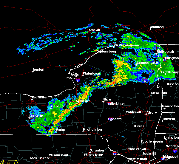 At 752 pm edt, a severe thunderstorm was located over alger island public campground, or near old forge, moving east at 30 mph (radar indicated). Hazards include 60 mph wind gusts. Expect damage to roofs. siding. and trees. this severe storm will be near, eagle bay and limekiln lake campground around 755 pm edt. inlet, eighth lake campground, brown tract pond campground and raquette lake around 800 pm edt. Other locations impacted by this severe thunderstorm include hasbroucks, sagamore lake, quaker beach, kamp kill kare, thendara, carter station, minnehaha, russian lake, mountain lodge and wolf lake landing. At 752 pm edt, a severe thunderstorm was located over alger island public campground, or near old forge, moving east at 30 mph (radar indicated). Hazards include 60 mph wind gusts. Expect damage to roofs. siding. and trees. this severe storm will be near, eagle bay and limekiln lake campground around 755 pm edt. inlet, eighth lake campground, brown tract pond campground and raquette lake around 800 pm edt. Other locations impacted by this severe thunderstorm include hasbroucks, sagamore lake, quaker beach, kamp kill kare, thendara, carter station, minnehaha, russian lake, mountain lodge and wolf lake landing.
|
| 8/16/2016 7:22 PM EDT |
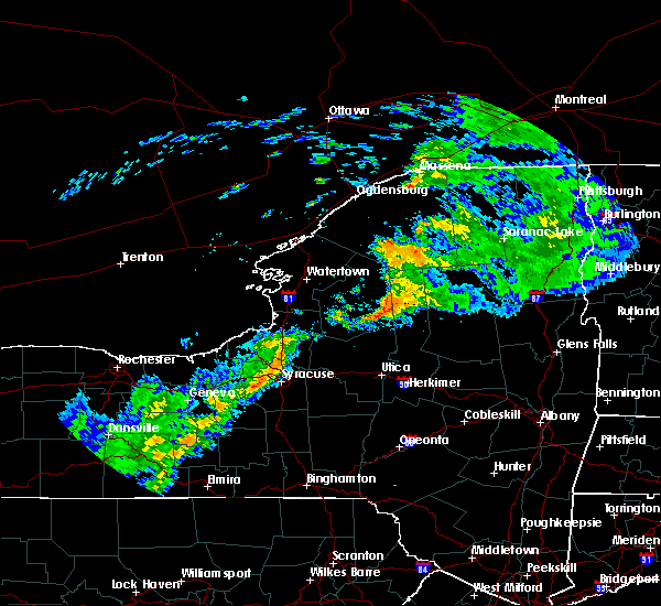 At 721 pm edt, a severe thunderstorm was located near mckeever, or 11 miles west of old forge, moving east at 50 mph (radar indicated). Hazards include 60 mph wind gusts. Expect damage to roofs. siding. and trees. this severe thunderstorm will be near, mckeever around 725 pm edt. old forge and nicks lake campground around 735 pm edt. alger island public campground and big moose around 740 pm edt. inlet, eagle bay and limekiln lake campground around 745 pm edt. eighth lake campground and brown tract pond campground around 750 pm edt. raquette lake around 755 pm edt. golden beach campground around 800 pm edt. Other locations impacted by this severe thunderstorm include hasbroucks, sagamore lake, quaker beach, kamp kill kare, thendara, carter station, minnehaha, russian lake, mountain lodge and wolf lake landing. At 721 pm edt, a severe thunderstorm was located near mckeever, or 11 miles west of old forge, moving east at 50 mph (radar indicated). Hazards include 60 mph wind gusts. Expect damage to roofs. siding. and trees. this severe thunderstorm will be near, mckeever around 725 pm edt. old forge and nicks lake campground around 735 pm edt. alger island public campground and big moose around 740 pm edt. inlet, eagle bay and limekiln lake campground around 745 pm edt. eighth lake campground and brown tract pond campground around 750 pm edt. raquette lake around 755 pm edt. golden beach campground around 800 pm edt. Other locations impacted by this severe thunderstorm include hasbroucks, sagamore lake, quaker beach, kamp kill kare, thendara, carter station, minnehaha, russian lake, mountain lodge and wolf lake landing.
|
| 7/1/2016 8:47 PM EDT |
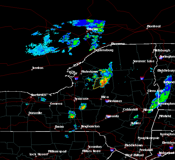 At 847 pm edt, a severe thunderstorm was located 8 miles south of nicks lake campground, or 10 miles south of old forge, moving east at 25 mph (radar indicated). Hazards include 60 mph wind gusts and quarter size hail. Hail damage to vehicles is expected. expect wind damage to roofs, siding, and trees. locations impacted include, old forge, limekiln lake campground, nicks lake campground, alger island public campground, caswell lake, atwell, thendara, herkimer landing, carter station, minnehaha, mountain lodge, wolf lake landing and first lake. A tornado watch remains in effect until 1000 pm edt for eastern new york. At 847 pm edt, a severe thunderstorm was located 8 miles south of nicks lake campground, or 10 miles south of old forge, moving east at 25 mph (radar indicated). Hazards include 60 mph wind gusts and quarter size hail. Hail damage to vehicles is expected. expect wind damage to roofs, siding, and trees. locations impacted include, old forge, limekiln lake campground, nicks lake campground, alger island public campground, caswell lake, atwell, thendara, herkimer landing, carter station, minnehaha, mountain lodge, wolf lake landing and first lake. A tornado watch remains in effect until 1000 pm edt for eastern new york.
|
| 7/1/2016 8:20 PM EDT | Trees dow in herkimer county NY, 6.3 miles ENE of Old Forge, NY |
| 7/1/2016 8:18 PM EDT |
 At 818 pm edt, a severe thunderstorm was located near mckeever, or 11 miles southwest of old forge, moving east at 25 mph (radar indicated). Hazards include 60 mph wind gusts and quarter size hail. Hail damage to vehicles is expected. Expect wind damage to roofs, siding, and trees. At 818 pm edt, a severe thunderstorm was located near mckeever, or 11 miles southwest of old forge, moving east at 25 mph (radar indicated). Hazards include 60 mph wind gusts and quarter size hail. Hail damage to vehicles is expected. Expect wind damage to roofs, siding, and trees.
|
| 6/20/2016 10:36 PM EDT |
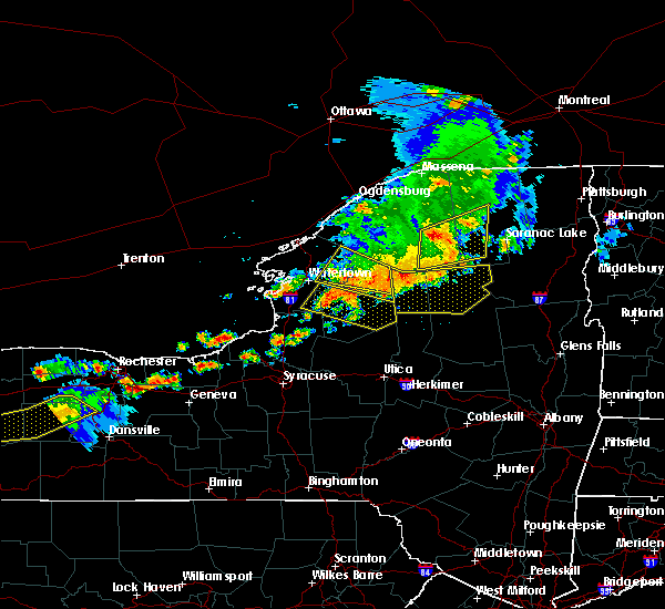 At 1036 pm edt, severe thunderstorms were located along a line extending from piercefield to near horseshoe lake to 7 miles northwest of big moose, moving east at 55 mph (radar indicated). Hazards include 60 mph wind gusts. Expect damage to roofs. siding. and trees. Locations impacted include, speculator, old forge, inlet, limekiln lake campground, lake eaton campground, lake durant campground, raquette lake, blue mountain lake, brown tract pond campground, forked lake public campground, big moose, golden beach campground, eighth lake campground, eagle bay, alger island public campground, long lake, keepawa, woods lake, brandreth and woods. At 1036 pm edt, severe thunderstorms were located along a line extending from piercefield to near horseshoe lake to 7 miles northwest of big moose, moving east at 55 mph (radar indicated). Hazards include 60 mph wind gusts. Expect damage to roofs. siding. and trees. Locations impacted include, speculator, old forge, inlet, limekiln lake campground, lake eaton campground, lake durant campground, raquette lake, blue mountain lake, brown tract pond campground, forked lake public campground, big moose, golden beach campground, eighth lake campground, eagle bay, alger island public campground, long lake, keepawa, woods lake, brandreth and woods.
|
| 6/20/2016 10:05 PM EDT |
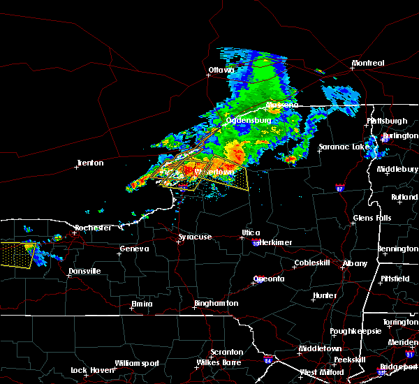 At 1004 pm edt, severe thunderstorms were located along a line extending from near degrasse to 8 miles west of star lake to near carthage, moving east at 55 mph (radar indicated). Hazards include 60 mph wind gusts and penny size hail. Expect damage to roofs. siding. And trees. At 1004 pm edt, severe thunderstorms were located along a line extending from near degrasse to 8 miles west of star lake to near carthage, moving east at 55 mph (radar indicated). Hazards include 60 mph wind gusts and penny size hail. Expect damage to roofs. siding. And trees.
|
| 6/12/2015 5:46 PM EDT |
 At 544 pm edt, severe thunderstorms were located along a line extending from near nicks lake campground to oriskany to near morrisville, moving east at 25 mph (radar indicated). Hazards include 60 mph wind gusts. Expect damage to roofs. siding and trees. severe thunderstorms will be near, nicks lake campground and mckeever around 550 pm edt. frankfort, poland and cold brook around 615 pm edt. newport around 620 pm edt. herkimer and middleville around 625 pm edt. west winfield around 635 pm edt. little falls around 640 pm edt. dolgeville and cedarville around 645 pm edt. other locations impacted by these severe thunderstorms include youngs crossing, martin corners, deck, kast bridge, birmingham corners, west schuyler, wilmurt corners, irish settlement, atwell and east creek. A tornado watch remains in effect until 1100 pm edt for eastern new york. At 544 pm edt, severe thunderstorms were located along a line extending from near nicks lake campground to oriskany to near morrisville, moving east at 25 mph (radar indicated). Hazards include 60 mph wind gusts. Expect damage to roofs. siding and trees. severe thunderstorms will be near, nicks lake campground and mckeever around 550 pm edt. frankfort, poland and cold brook around 615 pm edt. newport around 620 pm edt. herkimer and middleville around 625 pm edt. west winfield around 635 pm edt. little falls around 640 pm edt. dolgeville and cedarville around 645 pm edt. other locations impacted by these severe thunderstorms include youngs crossing, martin corners, deck, kast bridge, birmingham corners, west schuyler, wilmurt corners, irish settlement, atwell and east creek. A tornado watch remains in effect until 1100 pm edt for eastern new york.
|
| 6/17/2014 10:17 PM EDT | Wires dow in herkimer county NY, 8.8 miles WSW of Old Forge, NY |
| 6/17/2014 10:15 PM EDT | Trees and wires down in herkimer county NY, 8.5 miles SSW of Old Forge, NY |
| 6/17/2014 10:11 PM EDT | Trees and wires dow in herkimer county NY, 0.3 miles SSW of Old Forge, NY |
| 6/1/2013 9:25 PM EDT | Tree down on south shore roa in herkimer county NY, 5.1 miles W of Old Forge, NY |
| 7/23/2012 6:00 PM EDT | Golf Ball sized hail reported 10.9 miles WSW of Old Forge, NY |
| 5/29/2012 5:44 AM EDT | 1 tree down across r in hamilton county NY, 8.2 miles W of Old Forge, NY |
| 1/1/0001 12:00 AM | Tree fell on transmission line on moose river road cutting power to 5900 people in oneida county NY, 11.1 miles NE of Old Forge, NY |
| 1/1/0001 12:00 AM | Trees and wires down in herkimer county NY, 0.3 miles SSW of Old Forge, NY |
Hail Maps for Old Forge, NY
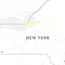
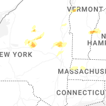


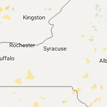


Connect with Interactive Hail Maps