

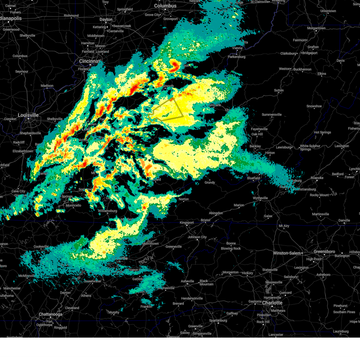
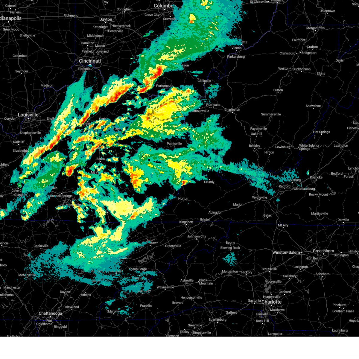
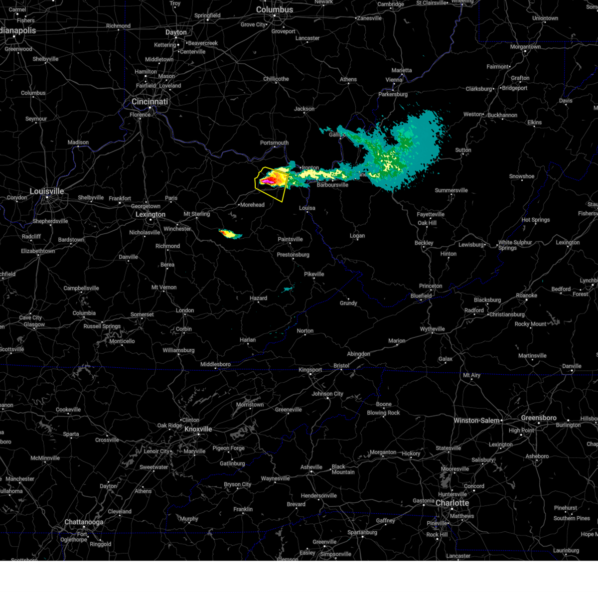
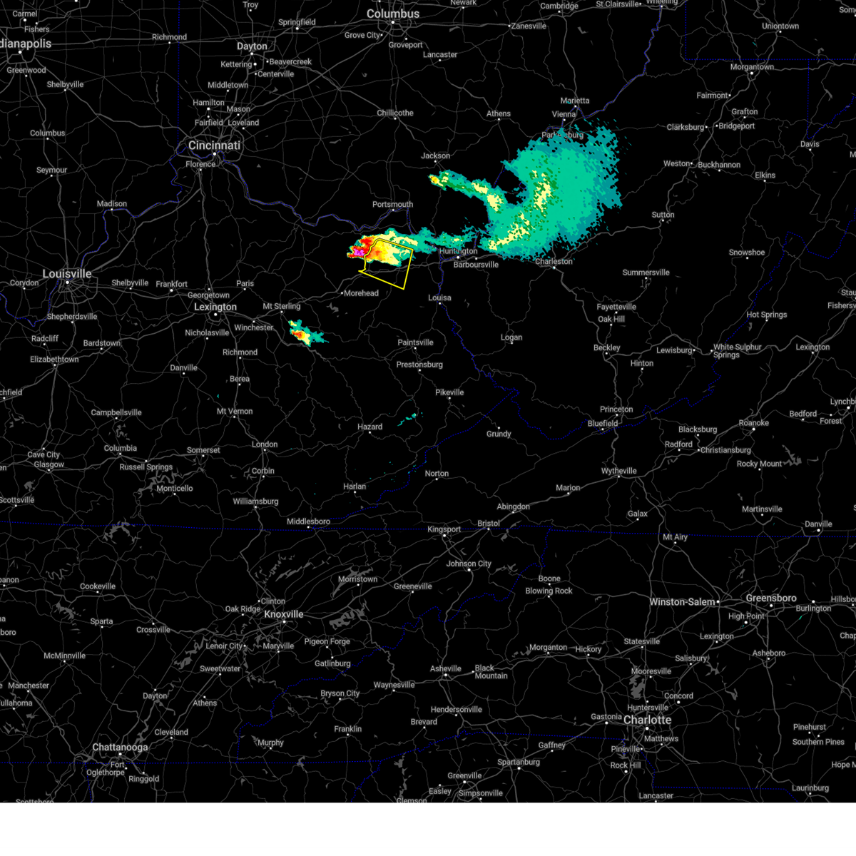
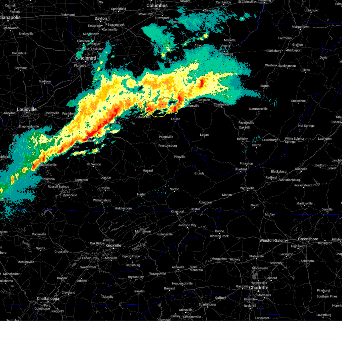
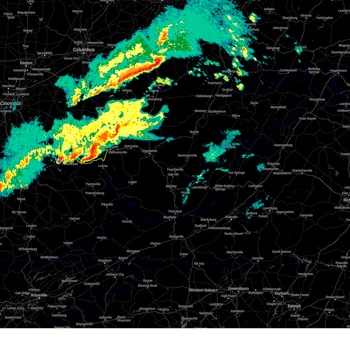
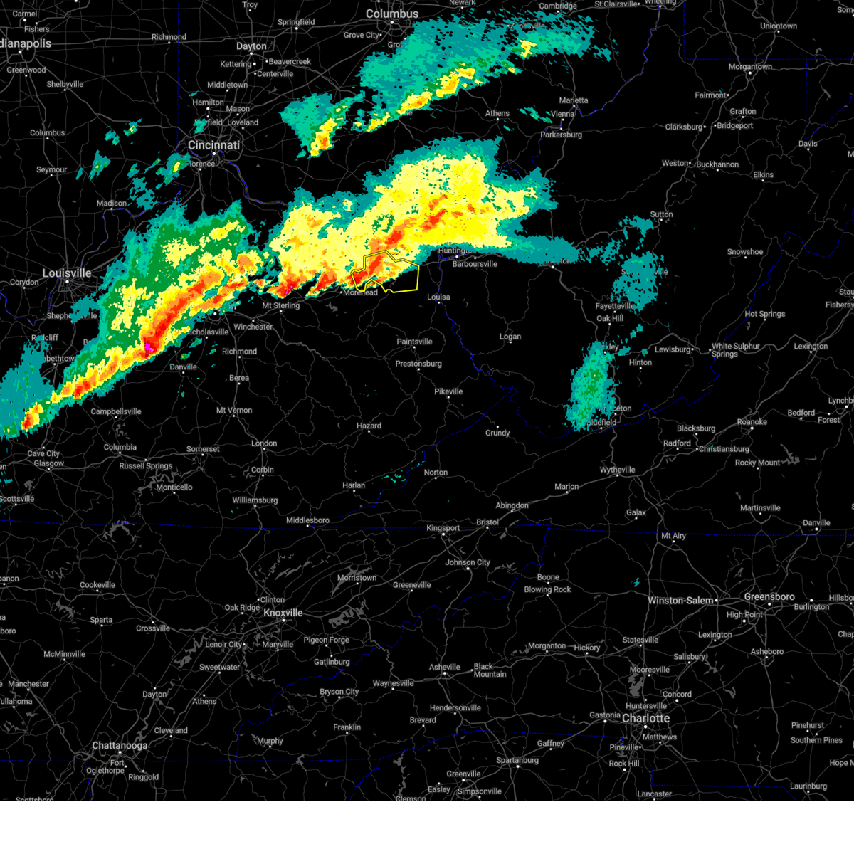
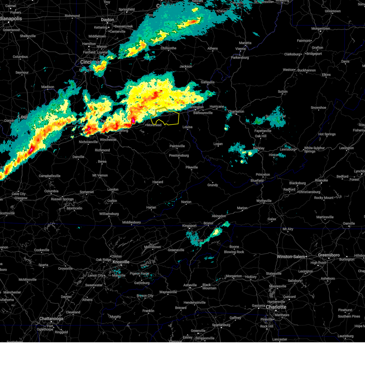
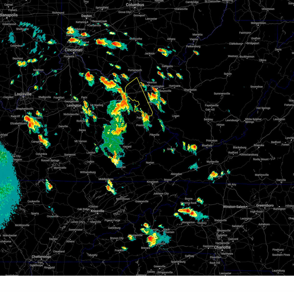
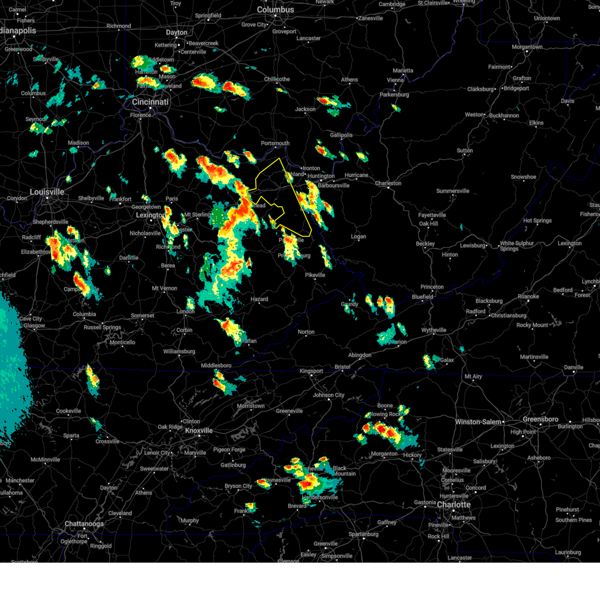
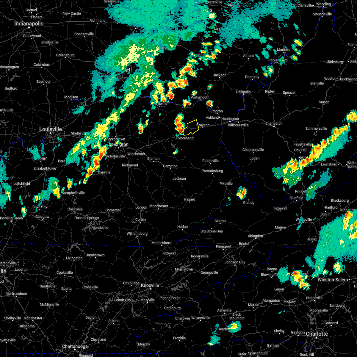
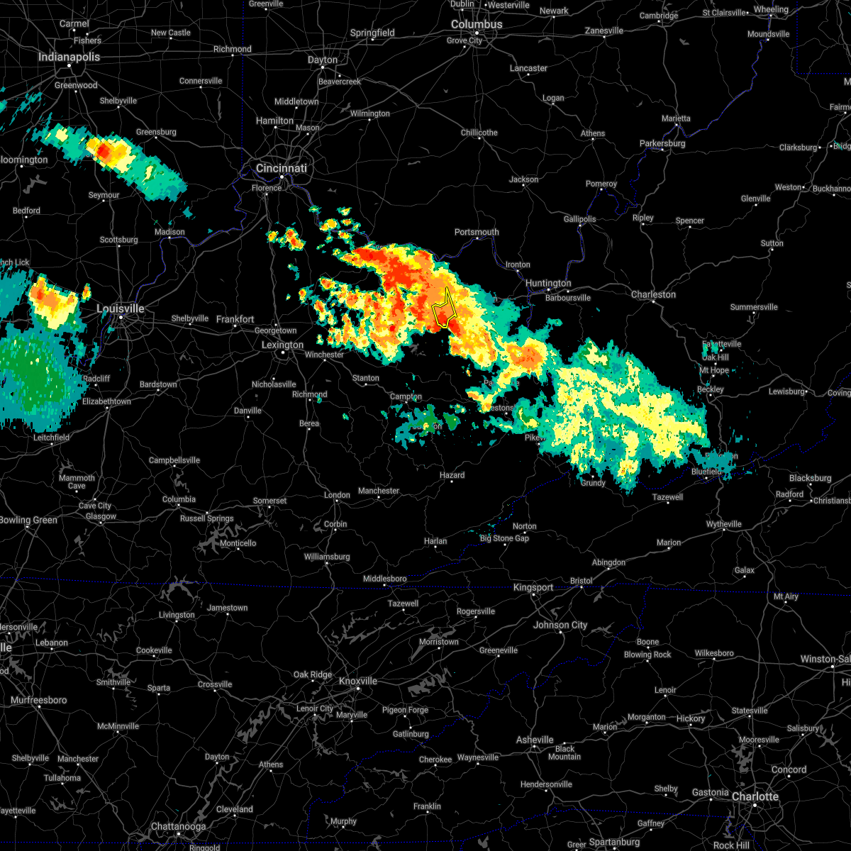
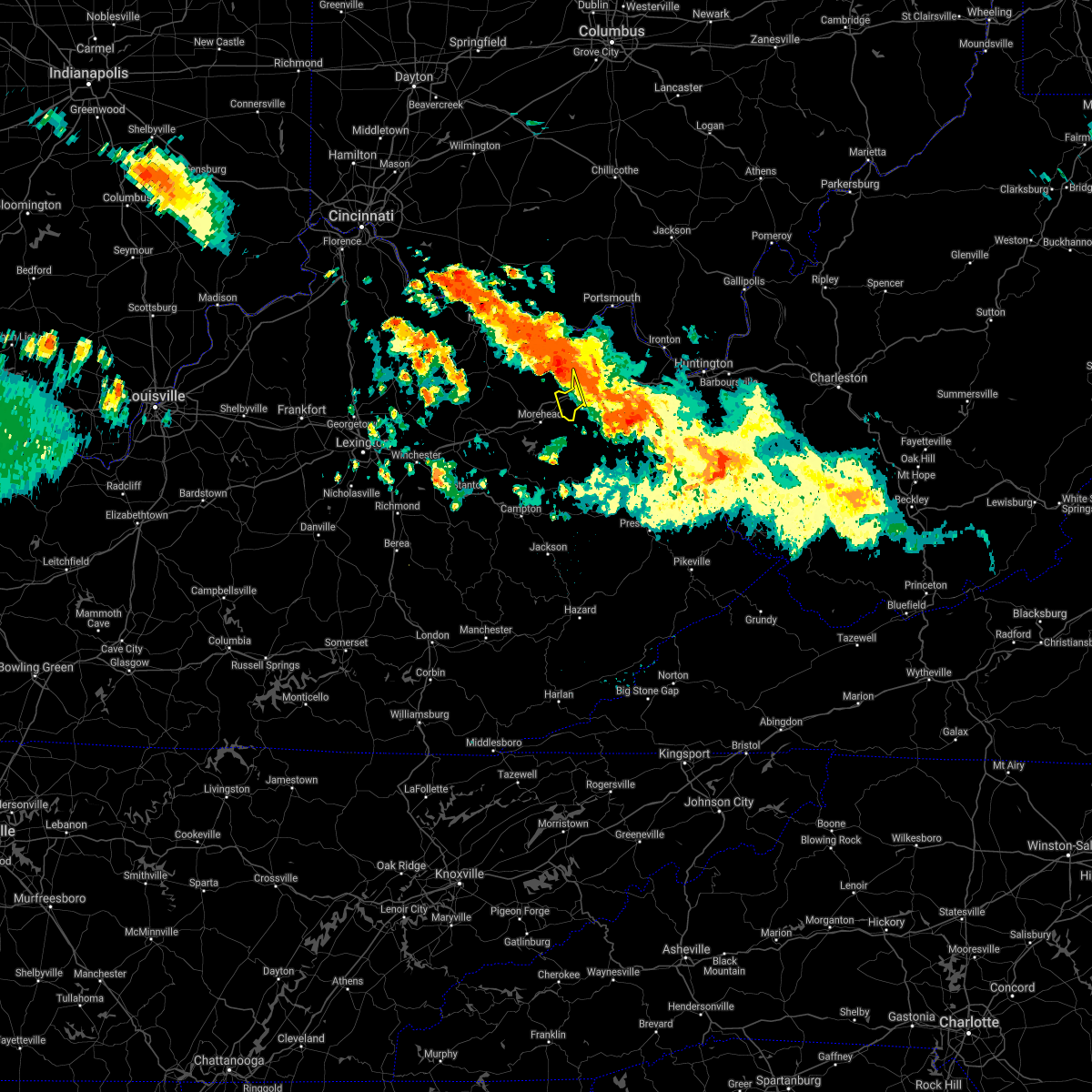
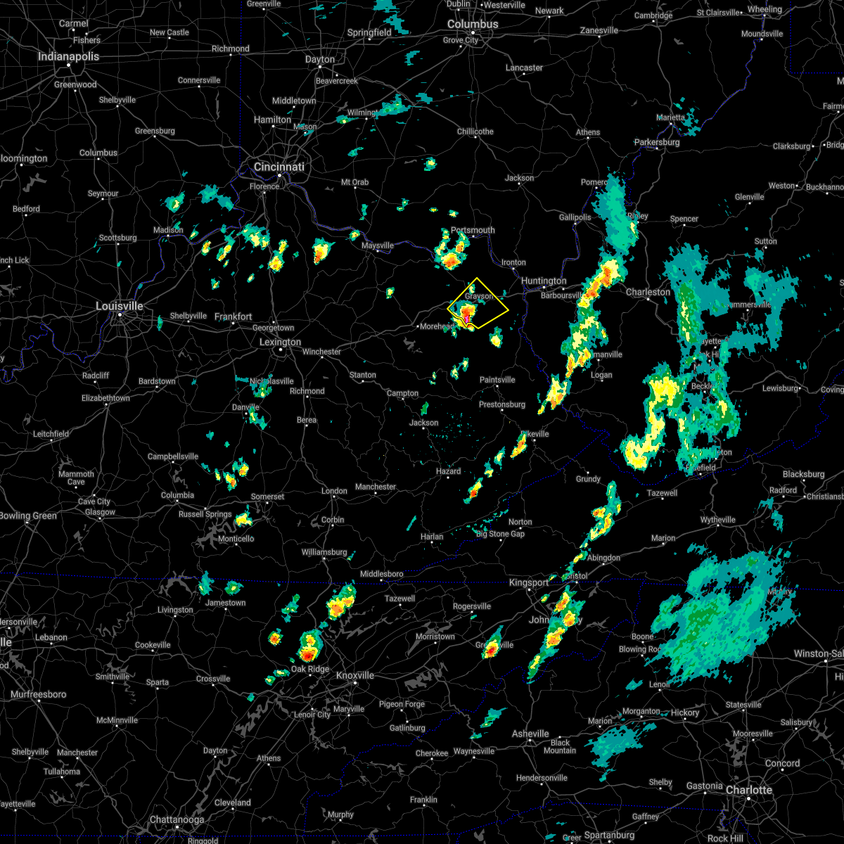
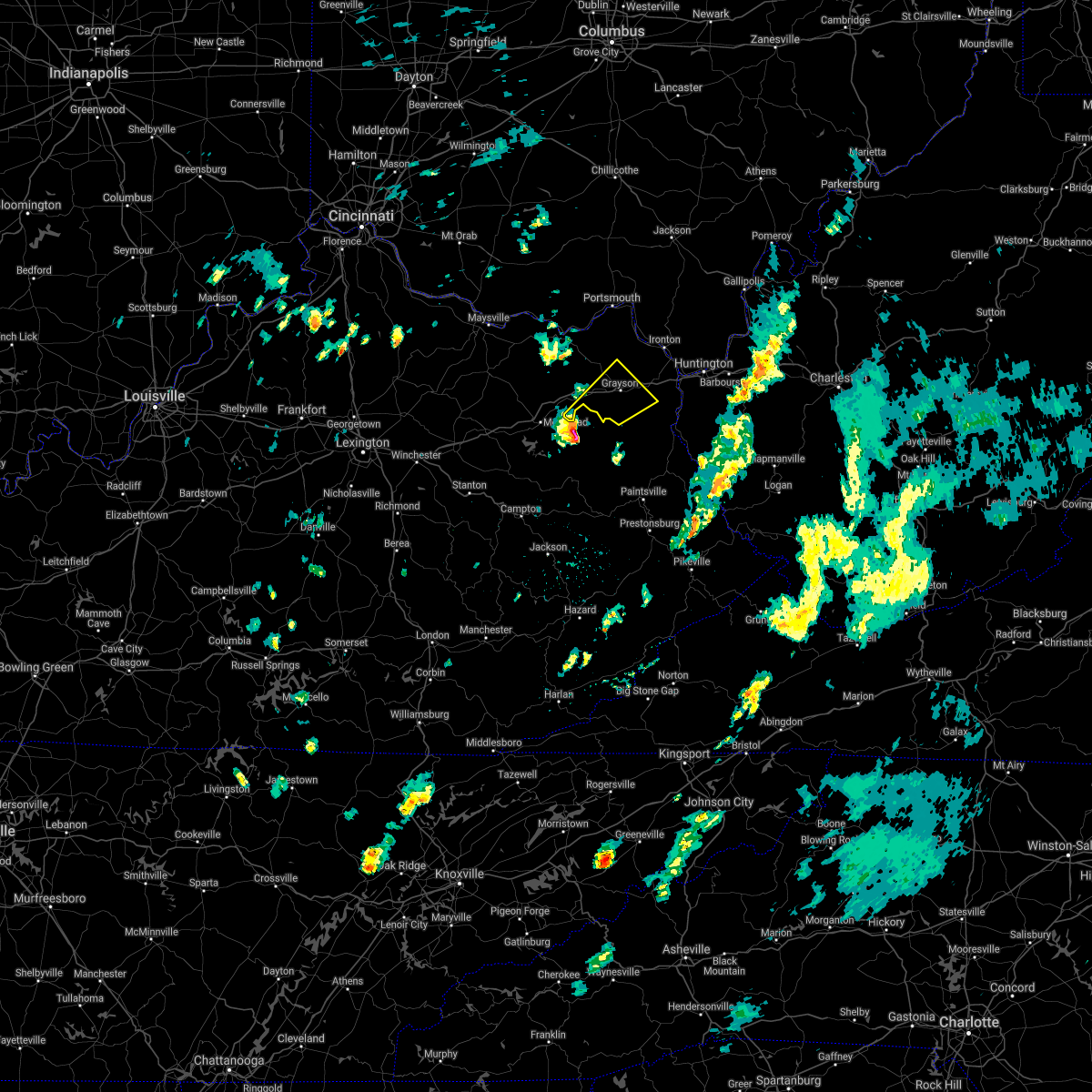
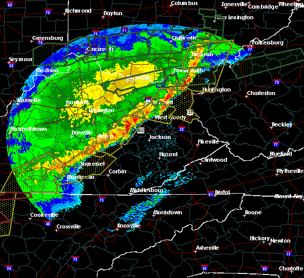
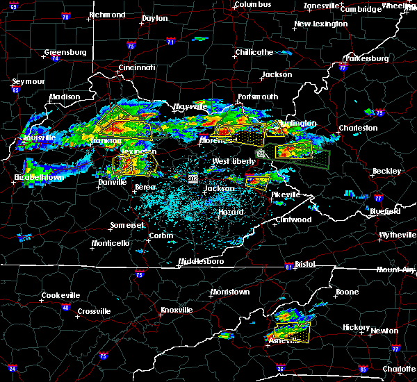
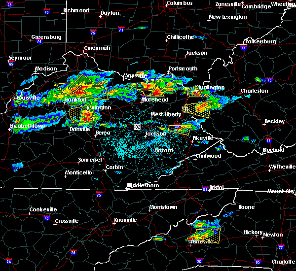
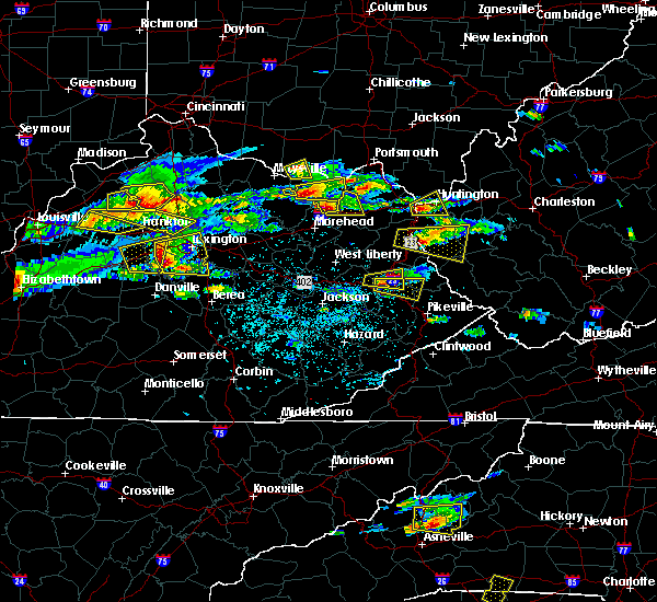
Hail Map for Olive Hill, KY
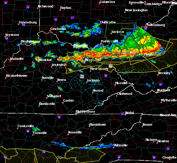
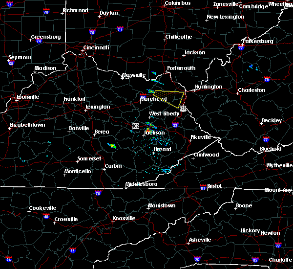
The Olive Hill, KY area has had 10 reports of on-the-ground hail by trained spotters, and has been under severe weather warnings 13 times during the past 12 months. Doppler radar has detected hail at or near Olive Hill, KY on 30 occasions, including 3 occasions during the past year.
| Name: | Olive Hill, KY |
| Where Located: | 60.5 miles NE of Irvine, KY |
| Map: | Google Map for Olive Hill, KY |
| Population: | 1599 |
| Housing Units: | 794 |
| More Info: | Search Google for Olive Hill, KY |
0
The Top Recent Hail Date for Olive Hill, KY is Thursday, March 14, 2024 (18th out of 30)

Hail and Wind Damage Spotted near Olive Hill, KY
| Date / Time | Report Details |
|---|---|
| 4/2/2024 8:39 PM EDT |
 the severe thunderstorm warning has been cancelled and is no longer in effect the severe thunderstorm warning has been cancelled and is no longer in effect
|
| 4/2/2024 8:24 PM EDT |
 Svrrlx the national weather service in charleston west virginia has issued a * severe thunderstorm warning for, southwestern boyd county in northeastern kentucky, southern greenup county in northeastern kentucky, carter county in northeastern kentucky, * until 900 pm edt. * at 823 pm edt, a severe thunderstorm was located over haldeman, or 7 miles west of olive hill, moving northeast at 45 mph (radar indicated). Hazards include 60 mph wind gusts and quarter size hail. Hail damage to vehicles is expected. Expect wind damage to roofs, siding, and trees. Svrrlx the national weather service in charleston west virginia has issued a * severe thunderstorm warning for, southwestern boyd county in northeastern kentucky, southern greenup county in northeastern kentucky, carter county in northeastern kentucky, * until 900 pm edt. * at 823 pm edt, a severe thunderstorm was located over haldeman, or 7 miles west of olive hill, moving northeast at 45 mph (radar indicated). Hazards include 60 mph wind gusts and quarter size hail. Hail damage to vehicles is expected. Expect wind damage to roofs, siding, and trees.
|
| 4/2/2024 10:07 AM EDT | Path of damage begins at olive hill and continues eastward paralleling i-64 to grayso in carter county KY, 0.6 miles ENE of Olive Hill, KY |
| 4/2/2024 10:00 AM EDT |
 At 959 am edt, severe thunderstorms were located along a line extending from letitia to brandy, moving east at 60 mph (radar indicated). Hazards include 60 mph wind gusts. Expect damage to roofs, siding, and trees. Locations impacted include, ashland, ironton, grayson, coal grove, olive hill, cannonsburg, lake vesuvius, grayson lake state park, carter caves state park, catlettsburg, greenup, princess, coalton, denton, gesling, greenbo lake, oldtown, naples, rush, and load. At 959 am edt, severe thunderstorms were located along a line extending from letitia to brandy, moving east at 60 mph (radar indicated). Hazards include 60 mph wind gusts. Expect damage to roofs, siding, and trees. Locations impacted include, ashland, ironton, grayson, coal grove, olive hill, cannonsburg, lake vesuvius, grayson lake state park, carter caves state park, catlettsburg, greenup, princess, coalton, denton, gesling, greenbo lake, oldtown, naples, rush, and load.
|
| 4/2/2024 9:49 AM EDT |
 Svrrlx the national weather service in charleston west virginia has issued a * severe thunderstorm warning for, central boyd county in northeastern kentucky, greenup county in northeastern kentucky, carter county in northeastern kentucky, southern lawrence county in southeastern ohio, * until 1030 am edt. * at 949 am edt, severe thunderstorms were located along a line extending from near vanceburg to owingsville, moving east at 60 mph (radar indicated). Hazards include 60 mph wind gusts. expect damage to roofs, siding, and trees Svrrlx the national weather service in charleston west virginia has issued a * severe thunderstorm warning for, central boyd county in northeastern kentucky, greenup county in northeastern kentucky, carter county in northeastern kentucky, southern lawrence county in southeastern ohio, * until 1030 am edt. * at 949 am edt, severe thunderstorms were located along a line extending from near vanceburg to owingsville, moving east at 60 mph (radar indicated). Hazards include 60 mph wind gusts. expect damage to roofs, siding, and trees
|
| 3/14/2024 5:14 PM EDT |
 At 513 pm edt, a severe thunderstorm was located over gesling, or over carter caves state park, moving east at 30 mph (radar indicated). Hazards include 60 mph wind gusts and quarter size hail. Hail damage to vehicles is expected. expect wind damage to roofs, siding, and trees. Locations impacted include, grayson, olive hill, carter caves state park, gesling, oldtown, carter, grahn, hopewell, brushart, hitchins, and warnock. At 513 pm edt, a severe thunderstorm was located over gesling, or over carter caves state park, moving east at 30 mph (radar indicated). Hazards include 60 mph wind gusts and quarter size hail. Hail damage to vehicles is expected. expect wind damage to roofs, siding, and trees. Locations impacted include, grayson, olive hill, carter caves state park, gesling, oldtown, carter, grahn, hopewell, brushart, hitchins, and warnock.
|
| 3/14/2024 4:55 PM EDT |
 Svrrlx the national weather service in charleston west virginia has issued a * severe thunderstorm warning for, southwestern greenup county in northeastern kentucky, carter county in northeastern kentucky, * until 530 pm edt. * at 455 pm edt, a severe thunderstorm was located over head of grassy, or 9 miles northwest of carter caves state park, moving east at 35 mph (radar indicated). Hazards include 60 mph wind gusts and quarter size hail. Hail damage to vehicles is expected. Expect wind damage to roofs, siding, and trees. Svrrlx the national weather service in charleston west virginia has issued a * severe thunderstorm warning for, southwestern greenup county in northeastern kentucky, carter county in northeastern kentucky, * until 530 pm edt. * at 455 pm edt, a severe thunderstorm was located over head of grassy, or 9 miles northwest of carter caves state park, moving east at 35 mph (radar indicated). Hazards include 60 mph wind gusts and quarter size hail. Hail damage to vehicles is expected. Expect wind damage to roofs, siding, and trees.
|
| 2/28/2024 7:20 AM EST |
 At 720 am est, a severe thunderstorm was located over catlettsburg, or near ashland, moving east at 60 mph (radar indicated). Hazards include 60 mph wind gusts and penny size hail. Expect damage to roofs, siding, and trees. Locations impacted include, huntington, ashland, grayson, olive hill, cannonsburg, grayson lake state park, carter caves state park, kenova, catlettsburg, ceredo, princess, coalton, denton, burnaugh, gesling, oldtown, naples, rush, durbin, and carter. At 720 am est, a severe thunderstorm was located over catlettsburg, or near ashland, moving east at 60 mph (radar indicated). Hazards include 60 mph wind gusts and penny size hail. Expect damage to roofs, siding, and trees. Locations impacted include, huntington, ashland, grayson, olive hill, cannonsburg, grayson lake state park, carter caves state park, kenova, catlettsburg, ceredo, princess, coalton, denton, burnaugh, gesling, oldtown, naples, rush, durbin, and carter.
|
| 2/28/2024 7:05 AM EST |
 Svrrlx the national weather service in charleston west virginia has issued a * severe thunderstorm warning for, boyd county in northeastern kentucky, southeastern greenup county in northeastern kentucky, carter county in northeastern kentucky, northwestern wayne county in western west virginia, * until 730 am est. * at 705 am est, a severe thunderstorm was located near grayson, moving east at 60 mph (radar indicated). Hazards include 60 mph wind gusts and penny size hail. expect damage to roofs, siding, and trees Svrrlx the national weather service in charleston west virginia has issued a * severe thunderstorm warning for, boyd county in northeastern kentucky, southeastern greenup county in northeastern kentucky, carter county in northeastern kentucky, northwestern wayne county in western west virginia, * until 730 am est. * at 705 am est, a severe thunderstorm was located near grayson, moving east at 60 mph (radar indicated). Hazards include 60 mph wind gusts and penny size hail. expect damage to roofs, siding, and trees
|
| 2/28/2024 6:47 AM EST |
 At 646 am est, a severe thunderstorm was located over grayson, moving east at 60 mph (radar indicated). Hazards include 60 mph wind gusts and penny size hail. Expect damage to roofs, siding, and trees. Locations impacted include, grayson, olive hill, grayson lake state park, carter caves state park, denton, gesling, rush, carter, grahn, willard, hitchins, soldier, and globe. At 646 am est, a severe thunderstorm was located over grayson, moving east at 60 mph (radar indicated). Hazards include 60 mph wind gusts and penny size hail. Expect damage to roofs, siding, and trees. Locations impacted include, grayson, olive hill, grayson lake state park, carter caves state park, denton, gesling, rush, carter, grahn, willard, hitchins, soldier, and globe.
|
| 2/28/2024 6:13 AM EST |
 Svrrlx the national weather service in charleston west virginia has issued a * severe thunderstorm warning for, northwestern lawrence county in northeastern kentucky, carter county in northeastern kentucky, * until 700 am est. * at 612 am est, a severe thunderstorm was located over sharkey, or 8 miles northwest of morehead, moving east at 65 mph (radar indicated). Hazards include 60 mph wind gusts and penny size hail. expect damage to roofs, siding, and trees Svrrlx the national weather service in charleston west virginia has issued a * severe thunderstorm warning for, northwestern lawrence county in northeastern kentucky, carter county in northeastern kentucky, * until 700 am est. * at 612 am est, a severe thunderstorm was located over sharkey, or 8 miles northwest of morehead, moving east at 65 mph (radar indicated). Hazards include 60 mph wind gusts and penny size hail. expect damage to roofs, siding, and trees
|
| 7/18/2023 5:13 PM EDT |
 At 512 pm edt, severe thunderstorms were located across eastern kentucky and southeast ohio, moving east at 35 mph (radar indicated). Hazards include 60 mph wind gusts and quarter size hail. Hail damage to vehicles is expected. Expect wind damage to roofs, siding, and trees. At 512 pm edt, severe thunderstorms were located across eastern kentucky and southeast ohio, moving east at 35 mph (radar indicated). Hazards include 60 mph wind gusts and quarter size hail. Hail damage to vehicles is expected. Expect wind damage to roofs, siding, and trees.
|
| 7/18/2023 5:04 PM EDT |
 At 503 pm edt, a severe thunderstorm was located over grayson lake state park, moving east at 55 mph (radar indicated). Hazards include 60 mph wind gusts and quarter size hail. Hail damage to vehicles is expected. expect wind damage to roofs, siding, and trees. locations impacted include, grayson, olive hill, blaine, grayson lake state park, yatesville lake state park, carter caves state park, webbville, denton, gesling, greenbo lake, oldtown, martha, rush, load, ulysses, charley, carter, brushart, hitchins and warnock. hail threat, radar indicated max hail size, 1. 00 in wind threat, radar indicated max wind gust, 60 mph. At 503 pm edt, a severe thunderstorm was located over grayson lake state park, moving east at 55 mph (radar indicated). Hazards include 60 mph wind gusts and quarter size hail. Hail damage to vehicles is expected. expect wind damage to roofs, siding, and trees. locations impacted include, grayson, olive hill, blaine, grayson lake state park, yatesville lake state park, carter caves state park, webbville, denton, gesling, greenbo lake, oldtown, martha, rush, load, ulysses, charley, carter, brushart, hitchins and warnock. hail threat, radar indicated max hail size, 1. 00 in wind threat, radar indicated max wind gust, 60 mph.
|
| 7/18/2023 4:50 PM EDT |
 At 449 pm edt, a severe thunderstorm was located over farley, or 8 miles southwest of olive hill, moving east at 55 mph (radar indicated). Hazards include 60 mph wind gusts and quarter size hail. Hail damage to vehicles is expected. Expect wind damage to roofs, siding, and trees. At 449 pm edt, a severe thunderstorm was located over farley, or 8 miles southwest of olive hill, moving east at 55 mph (radar indicated). Hazards include 60 mph wind gusts and quarter size hail. Hail damage to vehicles is expected. Expect wind damage to roofs, siding, and trees.
|
| 3/3/2023 4:25 PM EST |
 At 424 pm est, a severe thunderstorm was located near grayson, moving east at 60 mph (radar indicated). Hazards include 60 mph wind gusts. Expect damage to roofs, siding, and trees. locations impacted include, ashland, grayson, olive hill, blaine, cannonsburg, grayson lake state park, yatesville lake state park, carter caves state park, greenup, webbville, princess, coalton, denton, gesling, greenbo lake, oldtown, naples, martha, rush and load. hail threat, radar indicated max hail size, <. 75 in wind threat, radar indicated max wind gust, 60 mph. At 424 pm est, a severe thunderstorm was located near grayson, moving east at 60 mph (radar indicated). Hazards include 60 mph wind gusts. Expect damage to roofs, siding, and trees. locations impacted include, ashland, grayson, olive hill, blaine, cannonsburg, grayson lake state park, yatesville lake state park, carter caves state park, greenup, webbville, princess, coalton, denton, gesling, greenbo lake, oldtown, naples, martha, rush and load. hail threat, radar indicated max hail size, <. 75 in wind threat, radar indicated max wind gust, 60 mph.
|
| 3/3/2023 4:07 PM EST |
 At 406 pm est, a severe thunderstorm was located over grayson, moving east at 60 mph (radar indicated). Hazards include 60 mph wind gusts. expect damage to roofs, siding, and trees At 406 pm est, a severe thunderstorm was located over grayson, moving east at 60 mph (radar indicated). Hazards include 60 mph wind gusts. expect damage to roofs, siding, and trees
|
| 7/6/2022 5:07 PM EDT |
 At 506 pm edt, severe thunderstorms were located along a line extending from 7 miles north of clarktown to 6 miles southwest of letitia to goddard, and are nearly stationary (radar indicated). Hazards include 60 mph wind gusts and penny size hail. Expect damage to roofs, siding, and trees. locations impacted include, ashland, ironton, jackson, grayson, coal grove, olive hill, oak hill, rio grande, lake vesuvius, carter caves state park, grayson lake state park, greenup, coalton, gesling, greenbo lake, oldtown, naples, load, letitia and gallia. hail threat, radar indicated max hail size, 0. 75 in wind threat, radar indicated max wind gust, 60 mph. At 506 pm edt, severe thunderstorms were located along a line extending from 7 miles north of clarktown to 6 miles southwest of letitia to goddard, and are nearly stationary (radar indicated). Hazards include 60 mph wind gusts and penny size hail. Expect damage to roofs, siding, and trees. locations impacted include, ashland, ironton, jackson, grayson, coal grove, olive hill, oak hill, rio grande, lake vesuvius, carter caves state park, grayson lake state park, greenup, coalton, gesling, greenbo lake, oldtown, naples, load, letitia and gallia. hail threat, radar indicated max hail size, 0. 75 in wind threat, radar indicated max wind gust, 60 mph.
|
| 7/6/2022 4:48 PM EDT |
 At 446 pm edt, severe thunderstorms were located along a line extending from 7 miles north of clarktown to 6 miles southwest of letitia to goddard, moving southeast at 35 mph (radar indicated). Hazards include 60 mph wind gusts and penny size hail. expect damage to roofs, siding, and trees At 446 pm edt, severe thunderstorms were located along a line extending from 7 miles north of clarktown to 6 miles southwest of letitia to goddard, moving southeast at 35 mph (radar indicated). Hazards include 60 mph wind gusts and penny size hail. expect damage to roofs, siding, and trees
|
| 6/22/2022 6:52 PM EDT |
 At 652 pm edt, severe thunderstorms were located along a line extending from near clarktown to stoops, moving south at 45 mph (radar indicated). Hazards include 60 mph wind gusts. expect damage to roofs, siding, and trees At 652 pm edt, severe thunderstorms were located along a line extending from near clarktown to stoops, moving south at 45 mph (radar indicated). Hazards include 60 mph wind gusts. expect damage to roofs, siding, and trees
|
| 6/17/2022 1:04 PM EDT | Elliott county dispatch reported trees blown down along ky-50 in elliott county KY, 5.9 miles NNW of Olive Hill, KY |
| 6/17/2022 1:04 PM EDT | Elliott county dispatch reported trees blown down along ky-64 in elliott county KY, 10 miles NNW of Olive Hill, KY |
| 5/21/2022 7:42 PM EDT |
 The severe thunderstorm warning for central carter county will expire at 745 pm edt, the storm which prompted the warning has weakened below severe limits, and no longer poses an immediate threat to life or property. therefore, the warning will be allowed to expire. however gusty winds and heavy rain are still possible with this thunderstorm. The severe thunderstorm warning for central carter county will expire at 745 pm edt, the storm which prompted the warning has weakened below severe limits, and no longer poses an immediate threat to life or property. therefore, the warning will be allowed to expire. however gusty winds and heavy rain are still possible with this thunderstorm.
|
| 5/21/2022 7:35 PM EDT |
 At 735 pm edt, a severe thunderstorm was located near olive hill, moving northeast at 15 mph (radar indicated). Hazards include 60 mph wind gusts and quarter size hail. Hail damage to vehicles is expected. expect wind damage to roofs, siding, and trees. locations impacted include, olive hill, carter caves state park, gesling and grahn. hail threat, radar indicated max hail size, 1. 00 in wind threat, radar indicated max wind gust, 60 mph. At 735 pm edt, a severe thunderstorm was located near olive hill, moving northeast at 15 mph (radar indicated). Hazards include 60 mph wind gusts and quarter size hail. Hail damage to vehicles is expected. expect wind damage to roofs, siding, and trees. locations impacted include, olive hill, carter caves state park, gesling and grahn. hail threat, radar indicated max hail size, 1. 00 in wind threat, radar indicated max wind gust, 60 mph.
|
| 5/21/2022 7:31 PM EDT | Multiple pictures sent in of healthy trees uprooted and blown down as well as snapped branches along state highway 17 in carter county KY, 1.9 miles NE of Olive Hill, KY |
| 5/21/2022 7:09 PM EDT |
 At 708 pm edt, a severe thunderstorm was located over gates, or 7 miles northeast of morehead, moving northeast at 15 mph (radar indicated). Hazards include 60 mph wind gusts and quarter size hail. Hail damage to vehicles is expected. Expect wind damage to roofs, siding, and trees. At 708 pm edt, a severe thunderstorm was located over gates, or 7 miles northeast of morehead, moving northeast at 15 mph (radar indicated). Hazards include 60 mph wind gusts and quarter size hail. Hail damage to vehicles is expected. Expect wind damage to roofs, siding, and trees.
|
| 7/29/2021 10:39 PM EDT |
 The severe thunderstorm warning for southwestern carter county will expire at 1045 pm edt, the storm which prompted the warning has exited the warned area. therefore, the warning will be allowed to expire. however gusty winds are still possible with this thunderstorm. The severe thunderstorm warning for southwestern carter county will expire at 1045 pm edt, the storm which prompted the warning has exited the warned area. therefore, the warning will be allowed to expire. however gusty winds are still possible with this thunderstorm.
|
| 7/29/2021 10:03 PM EDT |
 At 1002 pm edt, a severe thunderstorm was located over head of grassy, or 7 miles northwest of olive hill, moving south at 30 mph. this is a very dangerous storm (radar indicated). Hazards include 80 mph wind gusts and ping pong ball size hail. Flying debris will be dangerous to those caught without shelter. mobile homes will be heavily damaged. expect considerable damage to roofs, windows, and vehicles. Extensive tree damage and power outages are likely. At 1002 pm edt, a severe thunderstorm was located over head of grassy, or 7 miles northwest of olive hill, moving south at 30 mph. this is a very dangerous storm (radar indicated). Hazards include 80 mph wind gusts and ping pong ball size hail. Flying debris will be dangerous to those caught without shelter. mobile homes will be heavily damaged. expect considerable damage to roofs, windows, and vehicles. Extensive tree damage and power outages are likely.
|
| 3/18/2021 1:46 PM EDT |
 At 146 pm edt, a severe thunderstorm was located over grayson lake state park, moving northeast at 40 mph (radar indicated). Hazards include 60 mph wind gusts and quarter size hail. Hail damage to vehicles is expected. expect wind damage to roofs, siding, and trees. Locations impacted include, grayson, olive hill, grayson lake state park, denton, grahn, hopewell, willard and hitchins. At 146 pm edt, a severe thunderstorm was located over grayson lake state park, moving northeast at 40 mph (radar indicated). Hazards include 60 mph wind gusts and quarter size hail. Hail damage to vehicles is expected. expect wind damage to roofs, siding, and trees. Locations impacted include, grayson, olive hill, grayson lake state park, denton, grahn, hopewell, willard and hitchins.
|
| 3/18/2021 1:27 PM EDT |
 At 126 pm edt, a severe thunderstorm was located over fannin valley, or near sandy hook, moving northeast at 40 mph (radar indicated). Hazards include 60 mph wind gusts and quarter size hail. Hail damage to vehicles is expected. Expect wind damage to roofs, siding, and trees. At 126 pm edt, a severe thunderstorm was located over fannin valley, or near sandy hook, moving northeast at 40 mph (radar indicated). Hazards include 60 mph wind gusts and quarter size hail. Hail damage to vehicles is expected. Expect wind damage to roofs, siding, and trees.
|
| 6/10/2020 7:59 PM EDT |
 At 758 pm edt, severe thunderstorms were located along a line extending from near south webster to near greenbo lake to near olive hill, moving northeast at 45 mph (radar indicated). Hazards include 70 mph wind gusts and half dollar size hail. Hail damage to vehicles is expected. expect considerable tree damage. Wind damage is also likely to mobile homes, roofs, and outbuildings. At 758 pm edt, severe thunderstorms were located along a line extending from near south webster to near greenbo lake to near olive hill, moving northeast at 45 mph (radar indicated). Hazards include 70 mph wind gusts and half dollar size hail. Hail damage to vehicles is expected. expect considerable tree damage. Wind damage is also likely to mobile homes, roofs, and outbuildings.
|
| 4/9/2020 12:12 AM EDT |
 At 1212 am edt, severe thunderstorms were located along a line extending from near jackson to near olive hill, moving east at 60 mph (radar indicated). Hazards include 70 mph wind gusts and penny size hail. Expect considerable tree damage. damage is likely to mobile homes, roofs, and outbuildings. Locations impacted include, ashland, ironton, jackson, wellston, grayson, gallipolis, coal grove, olive hill, cannonsburg, lake vesuvius, carter caves state park, kenova, catlettsburg, greenup, coalton, denton, gesling, greenbo lake, oldtown and load. At 1212 am edt, severe thunderstorms were located along a line extending from near jackson to near olive hill, moving east at 60 mph (radar indicated). Hazards include 70 mph wind gusts and penny size hail. Expect considerable tree damage. damage is likely to mobile homes, roofs, and outbuildings. Locations impacted include, ashland, ironton, jackson, wellston, grayson, gallipolis, coal grove, olive hill, cannonsburg, lake vesuvius, carter caves state park, kenova, catlettsburg, greenup, coalton, denton, gesling, greenbo lake, oldtown and load.
|
| 4/8/2020 11:52 PM EDT |
 At 1151 pm edt, severe thunderstorms were located along a line extending from 10 miles west of lucasville to 8 miles southwest of vanceburg to ewington, moving southeast at 65 mph (radar indicated). Hazards include 70 mph wind gusts and penny size hail. Expect considerable tree damage. Damage is likely to mobile homes, roofs, and outbuildings. At 1151 pm edt, severe thunderstorms were located along a line extending from 10 miles west of lucasville to 8 miles southwest of vanceburg to ewington, moving southeast at 65 mph (radar indicated). Hazards include 70 mph wind gusts and penny size hail. Expect considerable tree damage. Damage is likely to mobile homes, roofs, and outbuildings.
|
| 1/11/2020 2:43 PM EST |
 At 243 pm est, severe thunderstorms were located along a line extending from near letitia to near olive hill, moving east at 50 mph (radar indicated). Hazards include 60 mph wind gusts. expect damage to roofs, siding, and trees At 243 pm est, severe thunderstorms were located along a line extending from near letitia to near olive hill, moving east at 50 mph (radar indicated). Hazards include 60 mph wind gusts. expect damage to roofs, siding, and trees
|
| 1/11/2020 2:33 PM EST |
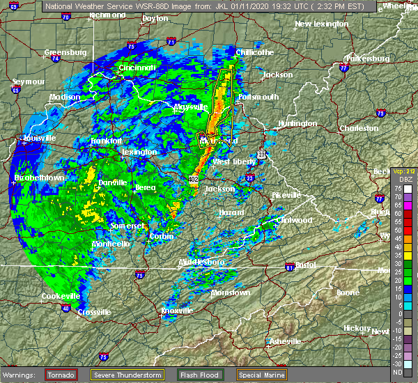 At 232 pm est, severe thunderstorms were located along a line extending from 6 miles northeast of vanceburg to haldeman, moving east at 50 mph (radar indicated). Hazards include 60 mph wind gusts. Expect damage to roofs, siding, and trees. Locations impacted include, olive hill, carter caves state park, gesling, carter, grahn, soldier, globe, brushart and south portsmouth. At 232 pm est, severe thunderstorms were located along a line extending from 6 miles northeast of vanceburg to haldeman, moving east at 50 mph (radar indicated). Hazards include 60 mph wind gusts. Expect damage to roofs, siding, and trees. Locations impacted include, olive hill, carter caves state park, gesling, carter, grahn, soldier, globe, brushart and south portsmouth.
|
| 1/11/2020 2:20 PM EST |
 At 220 pm est, severe thunderstorms were located along a line extending from rome to brandy, moving east at 45 mph (radar indicated). Hazards include 60 mph wind gusts. expect damage to roofs, siding, and trees At 220 pm est, severe thunderstorms were located along a line extending from rome to brandy, moving east at 45 mph (radar indicated). Hazards include 60 mph wind gusts. expect damage to roofs, siding, and trees
|
| 5/31/2018 5:18 PM EDT |
 At 518 pm edt, severe thunderstorms were located along a line extending from rome to zag, and are nearly stationary (radar indicated). Hazards include 60 mph wind gusts. Expect damage to roofs, siding, and trees. Locations impacted include, portsmouth, grayson, olive hill, grayson lake state park, carter caves state park, new boston, load, gesling, letitia, martha, carter, south shore, grahn, hopewell, brushart, willard, hitchins, warnock, soldier and globe. At 518 pm edt, severe thunderstorms were located along a line extending from rome to zag, and are nearly stationary (radar indicated). Hazards include 60 mph wind gusts. Expect damage to roofs, siding, and trees. Locations impacted include, portsmouth, grayson, olive hill, grayson lake state park, carter caves state park, new boston, load, gesling, letitia, martha, carter, south shore, grahn, hopewell, brushart, willard, hitchins, warnock, soldier and globe.
|
| 5/31/2018 4:57 PM EDT |
 At 456 pm edt, severe thunderstorms were located along a line extending from rome to zag, moving east at 50 mph (radar indicated). Hazards include 60 mph wind gusts. expect damage to roofs, siding, and trees At 456 pm edt, severe thunderstorms were located along a line extending from rome to zag, moving east at 50 mph (radar indicated). Hazards include 60 mph wind gusts. expect damage to roofs, siding, and trees
|
| 7/7/2017 8:46 PM EDT |
 At 846 pm edt, severe thunderstorms were located along a line extending from near racine to near rush, moving southeast at 35 mph (radar indicated). Hazards include 60 mph wind gusts and nickel size hail. expect damage to roofs, siding, and trees At 846 pm edt, severe thunderstorms were located along a line extending from near racine to near rush, moving southeast at 35 mph (radar indicated). Hazards include 60 mph wind gusts and nickel size hail. expect damage to roofs, siding, and trees
|
| 7/7/2017 8:32 PM EDT |
 At 832 pm edt, severe thunderstorms were located along a line extending from new haven to near oldtown, moving southeast at 25 mph (radar indicated). Hazards include 60 mph wind gusts and nickel size hail. Expect damage to roofs, siding, and trees. locations impacted include, ashland, ironton, point pleasant, grayson, gallipolis, coal grove, pomeroy, olive hill, rio grande, chesapeake, racine, rutland, cannonsburg, lake vesuvius, carter caves state park, kenova, catlettsburg, new haven, ceredo and greenup. This includes interstate 64 in kentucky between mile markers 151 and 190. At 832 pm edt, severe thunderstorms were located along a line extending from new haven to near oldtown, moving southeast at 25 mph (radar indicated). Hazards include 60 mph wind gusts and nickel size hail. Expect damage to roofs, siding, and trees. locations impacted include, ashland, ironton, point pleasant, grayson, gallipolis, coal grove, pomeroy, olive hill, rio grande, chesapeake, racine, rutland, cannonsburg, lake vesuvius, carter caves state park, kenova, catlettsburg, new haven, ceredo and greenup. This includes interstate 64 in kentucky between mile markers 151 and 190.
|
| 7/7/2017 8:16 PM EDT |
 At 816 pm edt, severe thunderstorms were located along a line extending from near pomeroy to near load, moving southeast at 30 mph (radar indicated). Hazards include 60 mph wind gusts and nickel size hail. Expect damage to roofs, siding, and trees. locations impacted include, ashland, portsmouth, ironton, jackson, wellston, point pleasant, grayson, gallipolis, coal grove, pomeroy, olive hill, oak hill, rio grande, chesapeake, racine, rutland, cannonsburg, lake vesuvius, carter caves state park and kenova. This includes interstate 64 in kentucky between mile markers 151 and 190. At 816 pm edt, severe thunderstorms were located along a line extending from near pomeroy to near load, moving southeast at 30 mph (radar indicated). Hazards include 60 mph wind gusts and nickel size hail. Expect damage to roofs, siding, and trees. locations impacted include, ashland, portsmouth, ironton, jackson, wellston, point pleasant, grayson, gallipolis, coal grove, pomeroy, olive hill, oak hill, rio grande, chesapeake, racine, rutland, cannonsburg, lake vesuvius, carter caves state park and kenova. This includes interstate 64 in kentucky between mile markers 151 and 190.
|
| 7/7/2017 7:47 PM EDT |
 At 747 pm edt, severe thunderstorms were located along a line extending from 8 miles south of chesterhill to near vanceburg, moving southeast at 30 mph (radar indicated). Hazards include 60 mph wind gusts and nickel size hail. expect damage to roofs, siding, and trees At 747 pm edt, severe thunderstorms were located along a line extending from 8 miles south of chesterhill to near vanceburg, moving southeast at 30 mph (radar indicated). Hazards include 60 mph wind gusts and nickel size hail. expect damage to roofs, siding, and trees
|
| 5/27/2017 6:31 PM EDT |
 At 630 pm edt, a severe thunderstorm was located near olive hill, moving southeast at 20 mph (radar indicated). Hazards include quarter size hail. Damage to vehicles is expected. locations impacted include, grayson, olive hill, grayson lake state park, grahn and hitchins. This includes interstate 64 in kentucky between mile markers 158 and 173. At 630 pm edt, a severe thunderstorm was located near olive hill, moving southeast at 20 mph (radar indicated). Hazards include quarter size hail. Damage to vehicles is expected. locations impacted include, grayson, olive hill, grayson lake state park, grahn and hitchins. This includes interstate 64 in kentucky between mile markers 158 and 173.
|
| 5/27/2017 6:25 PM EDT | Quarter sized hail reported 0.2 miles NNE of Olive Hill, KY |
| 5/27/2017 6:25 PM EDT | Golf Ball sized hail reported 0.2 miles NNE of Olive Hill, KY, report via broadcast media with picture. |
| 5/27/2017 6:15 PM EDT | Quarter sized hail reported 4.2 miles SE of Olive Hill, KY |
| 5/27/2017 6:08 PM EDT |
 At 608 pm edt, a severe thunderstorm was located near olive hill, moving east at 20 mph (radar indicated). Hazards include quarter size hail. damage to vehicles is expected At 608 pm edt, a severe thunderstorm was located near olive hill, moving east at 20 mph (radar indicated). Hazards include quarter size hail. damage to vehicles is expected
|
| 4/5/2017 10:10 PM EDT | Several trees down in carter county KY, 0.2 miles NNE of Olive Hill, KY |
| 4/5/2017 9:07 PM EDT |
 At 906 pm edt, a severe thunderstorm was located over ramey, or near morehead, moving east northeast at 55 mph (radar indicated). Hazards include 60 mph wind gusts and penny size hail. expect damage to roofs, siding, and trees At 906 pm edt, a severe thunderstorm was located over ramey, or near morehead, moving east northeast at 55 mph (radar indicated). Hazards include 60 mph wind gusts and penny size hail. expect damage to roofs, siding, and trees
|
| 3/1/2017 9:01 AM EST |
 At 900 am est, severe thunderstorms were located along a line extending from near gesling to sandy hook, moving east at 55 mph (radar indicated). Hazards include 70 mph wind gusts and half dollar size hail. Hail damage to vehicles is expected. expect considerable tree damage. Wind damage is also likely to mobile homes, roofs, and outbuildings. At 900 am est, severe thunderstorms were located along a line extending from near gesling to sandy hook, moving east at 55 mph (radar indicated). Hazards include 70 mph wind gusts and half dollar size hail. Hail damage to vehicles is expected. expect considerable tree damage. Wind damage is also likely to mobile homes, roofs, and outbuildings.
|
| 3/1/2017 8:48 AM EST |
 At 847 am est, severe thunderstorms were located along a line extending from near gesling to lytten, moving east at 55 mph (radar indicated). Hazards include 70 mph wind gusts and half dollar size hail. Hail damage to vehicles is expected. expect considerable tree damage. wind damage is also likely to mobile homes, roofs, and outbuildings. locations impacted include, ashland, grayson, louisa, olive hill, blaine, cannonsburg, grayson lake state park, yatesville lake state park, carter caves state park, catlettsburg, webbville, princess, coalton, denton, burnaugh, gesling, oldtown, naples, martha and rush. This includes interstate 64 in kentucky between mile markers 149 and 191. At 847 am est, severe thunderstorms were located along a line extending from near gesling to lytten, moving east at 55 mph (radar indicated). Hazards include 70 mph wind gusts and half dollar size hail. Hail damage to vehicles is expected. expect considerable tree damage. wind damage is also likely to mobile homes, roofs, and outbuildings. locations impacted include, ashland, grayson, louisa, olive hill, blaine, cannonsburg, grayson lake state park, yatesville lake state park, carter caves state park, catlettsburg, webbville, princess, coalton, denton, burnaugh, gesling, oldtown, naples, martha and rush. This includes interstate 64 in kentucky between mile markers 149 and 191.
|
| 3/1/2017 8:35 AM EST |
 At 835 am est, severe thunderstorms were located along a line extending from camp dix to crix, moving east at 55 mph (radar indicated). Hazards include 70 mph wind gusts and half dollar size hail. Hail damage to vehicles is expected. expect considerable tree damage. Wind damage is also likely to mobile homes, roofs, and outbuildings. At 835 am est, severe thunderstorms were located along a line extending from camp dix to crix, moving east at 55 mph (radar indicated). Hazards include 70 mph wind gusts and half dollar size hail. Hail damage to vehicles is expected. expect considerable tree damage. Wind damage is also likely to mobile homes, roofs, and outbuildings.
|
| 7/6/2016 8:22 PM EDT | Reports of trees down along aden road. time estimated from radar in carter county KY, 5.1 miles WNW of Olive Hill, KY |
| 6/23/2016 6:17 AM EDT |
 At 616 am edt, severe thunderstorms were located along a line extending from near jackson to 9 miles west of lucasville to near tollesboro, moving southeast at 50 mph (radar indicated). Hazards include 60 mph wind gusts. Expect damage to roofs. siding. And trees. At 616 am edt, severe thunderstorms were located along a line extending from near jackson to 9 miles west of lucasville to near tollesboro, moving southeast at 50 mph (radar indicated). Hazards include 60 mph wind gusts. Expect damage to roofs. siding. And trees.
|
| 5/1/2016 4:48 PM EDT |
 At 448 pm edt, a severe thunderstorm was located over carter caves state park, moving east at 35 mph (radar indicated). Hazards include 60 mph wind gusts and half dollar size hail. Hail damage to vehicles is expected. Expect wind damage to roofs, siding, and trees. At 448 pm edt, a severe thunderstorm was located over carter caves state park, moving east at 35 mph (radar indicated). Hazards include 60 mph wind gusts and half dollar size hail. Hail damage to vehicles is expected. Expect wind damage to roofs, siding, and trees.
|
| 5/1/2016 4:40 PM EDT | Golf Ball sized hail reported 5.3 miles S of Olive Hill, KY |
| 5/1/2016 4:40 PM EDT | Quarter sized hail reported 2 miles SW of Olive Hill, KY |
| 5/1/2016 4:40 PM EDT |
 At 439 pm edt, a severe thunderstorm was located over olive hill, moving southeast at 35 mph (radar indicated). Hazards include 60 mph wind gusts and quarter size hail. Hail damage to vehicles is expected. expect wind damage to roofs, siding, and trees. Locations impacted include, olive hill, carter caves state park, gesling and carter. At 439 pm edt, a severe thunderstorm was located over olive hill, moving southeast at 35 mph (radar indicated). Hazards include 60 mph wind gusts and quarter size hail. Hail damage to vehicles is expected. expect wind damage to roofs, siding, and trees. Locations impacted include, olive hill, carter caves state park, gesling and carter.
|
| 5/1/2016 4:23 PM EDT |
 At 423 pm edt, a severe thunderstorm was located near head of grassy, or 9 miles northwest of olive hill, moving east at 30 mph (radar indicated). Hazards include 60 mph wind gusts and quarter size hail. Hail damage to vehicles is expected. Expect wind damage to roofs, siding, and trees. At 423 pm edt, a severe thunderstorm was located near head of grassy, or 9 miles northwest of olive hill, moving east at 30 mph (radar indicated). Hazards include 60 mph wind gusts and quarter size hail. Hail damage to vehicles is expected. Expect wind damage to roofs, siding, and trees.
|
| 7/14/2015 5:52 PM EDT |
 At 549 pm edt, doppler radar indicated a line of severe thunderstorms capable of producing damaging winds in excess of 60 mph. these storms were located along a line extending from culloden to princess to near olive hill, moving south at 35 mph. locations impacted include, huntington, ashland, grayson, louisa, coal grove, olive hill, wayne, hamlin, chesapeake, proctorville, beech fork state park, cannonsburg, carter caves state park, grayson lake state park, yatesville lake state park, barboursville, kenova, milton, catlettsburg and ceredo. At 549 pm edt, doppler radar indicated a line of severe thunderstorms capable of producing damaging winds in excess of 60 mph. these storms were located along a line extending from culloden to princess to near olive hill, moving south at 35 mph. locations impacted include, huntington, ashland, grayson, louisa, coal grove, olive hill, wayne, hamlin, chesapeake, proctorville, beech fork state park, cannonsburg, carter caves state park, grayson lake state park, yatesville lake state park, barboursville, kenova, milton, catlettsburg and ceredo.
|
| 7/14/2015 5:11 PM EDT |
 At 509 pm edt, doppler radar indicated a line of severe thunderstorms capable of producing damaging winds in excess of 60 mph. these storms were located along a line extending from south shore to near vanceburg to near manchester, and moving southeast at 55 mph. At 509 pm edt, doppler radar indicated a line of severe thunderstorms capable of producing damaging winds in excess of 60 mph. these storms were located along a line extending from south shore to near vanceburg to near manchester, and moving southeast at 55 mph.
|
| 7/13/2015 3:40 PM EDT | Trained spotter reports numerous trees down... power lines and telephone lines down... and a tree on a house with entrapment in the olive hill area in carter county KY, 0.2 miles NNE of Olive Hill, KY |
| 7/13/2015 3:37 PM EDT |
 At 335 pm edt, doppler radar indicated a line of severe thunderstorms capable of producing damaging winds in excess of 60 mph. these storms were located along a line extending from near chesapeake to near elliottville, moving southeast at 40 mph. locations impacted include, grayson, olive hill, cannonsburg, carter caves state park, grayson lake state park, rush, gesling, garner, princess, greenbo lake, denton, oldtown, coalton, webbville, naples, flatwoods, russell, raceland, worthington and wurtland. At 335 pm edt, doppler radar indicated a line of severe thunderstorms capable of producing damaging winds in excess of 60 mph. these storms were located along a line extending from near chesapeake to near elliottville, moving southeast at 40 mph. locations impacted include, grayson, olive hill, cannonsburg, carter caves state park, grayson lake state park, rush, gesling, garner, princess, greenbo lake, denton, oldtown, coalton, webbville, naples, flatwoods, russell, raceland, worthington and wurtland.
|
| 7/13/2015 3:22 PM EDT |
 At 321 pm edt, doppler radar indicated a line of severe thunderstorms capable of producing damaging winds in excess of 60 mph. these storms were located along a line extending from near lake vesuvius to near triplett, moving southeast at 45 mph. these severe thunderstorms will remain over mainly rural areas of western boyd, northwestern lawrence, greenup and carter counties, including the following locations, brushart, soldier, globe, carter, hitchins, warnock, raceland, hopewell, worthington and willard. At 321 pm edt, doppler radar indicated a line of severe thunderstorms capable of producing damaging winds in excess of 60 mph. these storms were located along a line extending from near lake vesuvius to near triplett, moving southeast at 45 mph. these severe thunderstorms will remain over mainly rural areas of western boyd, northwestern lawrence, greenup and carter counties, including the following locations, brushart, soldier, globe, carter, hitchins, warnock, raceland, hopewell, worthington and willard.
|
| 7/13/2015 2:39 PM EDT |
 At 238 pm edt, doppler radar indicated a line of severe thunderstorms capable of producing damaging winds in excess of 60 mph. these storms were located along a line extending from 6 miles east of lucasville to near manchester, and moving southeast at 45 mph. * severe thunderstorms will be near, portsmouth around 245 pm edt. new boston around 250 pm edt. olive hill around 330 pm edt. other locations impacted by these severe thunderstorms include south shore, sciotoville, brushart, soldier, grays branch, globe, carter, hitchins, warnock and raceland. At 238 pm edt, doppler radar indicated a line of severe thunderstorms capable of producing damaging winds in excess of 60 mph. these storms were located along a line extending from 6 miles east of lucasville to near manchester, and moving southeast at 45 mph. * severe thunderstorms will be near, portsmouth around 245 pm edt. new boston around 250 pm edt. olive hill around 330 pm edt. other locations impacted by these severe thunderstorms include south shore, sciotoville, brushart, soldier, grays branch, globe, carter, hitchins, warnock and raceland.
|
| 6/25/2015 6:10 PM EDT | Half Dollar sized hail reported 5.9 miles WSW of Olive Hill, KY, fell near community of gregoryville on hwy 60. time estimated from radar. |
| 6/25/2015 5:57 PM EDT |
 At 556 pm edt, doppler radar indicated a severe thunderstorm capable of producing quarter size hail and damaging winds in excess of 60 mph. this storm was located near carter caves state park, and moving east at 30 mph. At 556 pm edt, doppler radar indicated a severe thunderstorm capable of producing quarter size hail and damaging winds in excess of 60 mph. this storm was located near carter caves state park, and moving east at 30 mph.
|
| 4/8/2015 2:02 PM EDT | Quarter sized hail reported 0.2 miles NNE of Olive Hill, KY, quarter sized hail reported at the post office in olive hill. |
| 4/8/2015 1:38 PM EDT | Quarter sized hail reported 0.2 miles NNE of Olive Hill, KY, quarter sized hail reported at the post office in olive hill...time estimated by radar |
| 4/8/2015 1:35 PM EDT | A severe thunderstorm warning remains in effect until 200 pm edt for southern greenup. carter and boyd counties in kentucky. and eastern meigs. lawrence. southern gallia and extreme southeastern athens counties in southeast ohio. and northern wayne. cabell. northern jackson and mason counties in west virginia. at 122 pm edt. National weather service doppler radar continued to. |
| 4/8/2015 1:35 PM EDT | A severe thunderstorm warning remains in effect until 200 pm edt for southern greenup. carter and boyd counties in kentucky. and eastern meigs. lawrence. southern gallia and extreme southeastern athens counties in southeast ohio. and northern wayne. cabell. northern jackson and mason counties in west virginia. at 122 pm edt. National weather service doppler radar continued to. |
| 4/8/2015 1:35 PM EDT | A severe thunderstorm warning remains in effect until 200 pm edt for southern greenup. carter and boyd counties in kentucky. and eastern meigs. lawrence. southern gallia and extreme southeastern athens counties in southeast ohio. and northern wayne. cabell. northern jackson and mason counties in west virginia. at 122 pm edt. National weather service doppler radar continued to. |
| 4/8/2015 12:56 PM EDT | The national weather service in charleston has issued a * severe thunderstorm warning for. boyd county in kentucky. this includes the cities of. cannonsburg. ashland. carter county in kentucky. this includes the cities of. olive hill. Grayson lake state. |
| 4/8/2015 12:56 PM EDT | The national weather service in charleston has issued a * severe thunderstorm warning for. boyd county in kentucky. this includes the cities of. cannonsburg. ashland. carter county in kentucky. this includes the cities of. olive hill. Grayson lake state. |
| 4/8/2015 12:56 PM EDT | The national weather service in charleston has issued a * severe thunderstorm warning for. boyd county in kentucky. this includes the cities of. cannonsburg. ashland. carter county in kentucky. this includes the cities of. olive hill. Grayson lake state. |
| 4/2/2015 7:15 PM EDT | The national weather service in charleston has issued a * severe thunderstorm warning for. boyd county in kentucky. this includes the cities of. cannonsburg. ashland. carter county in kentucky. this includes the cities of. olive hill. Grayson lake state. |
| 4/2/2015 7:01 PM EDT | A severe thunderstorm warning remains in effect until 715 pm edt for south central greenup and carter counties. at 656 pm edt. national weather service doppler radar continued to indicate a line of severe thunderstorms. these storms were located along a line extending from 7 miles northwest of soldier to soldier to 18 miles southwest of soldier. Or along a line extending from 10. |
| 4/2/2015 6:49 PM EDT | The national weather service in charleston has issued a * severe thunderstorm warning for. carter county in kentucky. this includes the cities of. olive hill. grayson lake state park. grayson. carter caves state park. South central greenup county in kentucky. |
| 6/10/2014 7:45 PM EDT | Trees down on power lines in carter county KY, 4.5 miles WNW of Olive Hill, KY |
| 6/4/2014 3:45 PM EDT | One tree down on laurel creek r in lewis county KY, 9.7 miles ESE of Olive Hill, KY |
| 7/27/2012 8:40 PM EDT | Numerous trees down around olive hill...reports of power outages as well in carter county KY, 0.2 miles NNE of Olive Hill, KY |
| 7/27/2012 8:35 PM EDT | Numerous trees down on route 60 around the town of globe in carter county KY, 4 miles ENE of Olive Hill, KY |
| 7/8/2012 4:15 PM EDT | Multiple trees down throughout tow in carter county KY, 0.2 miles NNE of Olive Hill, KY |
| 6/29/2012 6:41 PM EDT | Trees dow in carter county KY, 3.3 miles S of Olive Hill, KY |
| 3/28/2012 3:55 PM EDT | Quarter sized hail reported 9.2 miles SSW of Olive Hill, KY, damage to a car. |
| 1/1/0001 12:00 AM | Quarter sized hail reported 0.2 miles NNE of Olive Hill, KY |
| 1/1/0001 12:00 AM | One tree and several limbs down along rt 7 in carter county KY, 8.9 miles SSW of Olive Hill, KY |
| 1/1/0001 12:00 AM | Several trees down near the entrance of carter caves state park in carter county KY, 5.3 miles SSW of Olive Hill, KY |
Hail Maps for Olive Hill, KY


Connect with Interactive Hail Maps