

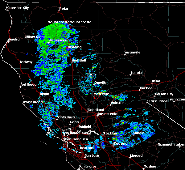
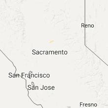
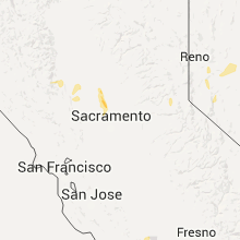
Hail Map for Olivehurst, CA
The Olivehurst, CA area has had 0 reports of on-the-ground hail by trained spotters, and has been under severe weather warnings 0 times during the past 12 months. Doppler radar has detected hail at or near Olivehurst, CA on 2 occasions.
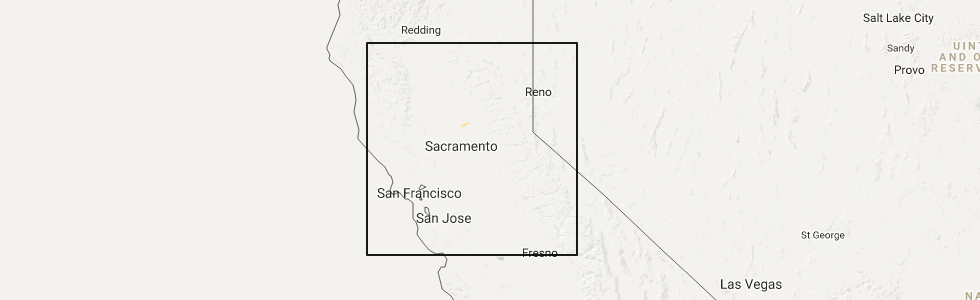
| Name: | Olivehurst, CA |
| Where Located: | 29.9 miles NNW of Citrus Heights, CA |
| Map: | Google Map for Olivehurst, CA |
| Population: | 13656 |
| Housing Units: | 4487 |
| More Info: | Search Google for Olivehurst, CA |
0
The Top Recent Hail Date for Olivehurst, CA is Thursday, April 13, 2017 (2nd out of 2)
Hail and Wind Damage Spotted near Olivehurst, CA
| Date / Time | Report Details |
|---|---|
| 3/21/2018 6:56 PM PDT |
 The tornado warning for southwestern yuba county will expire at 700 pm pdt, the storm which prompted the warning has weakened below severe limits, and no longer appears capable of producing a tornado. therefore the warning will be allowed to expire. The tornado warning for southwestern yuba county will expire at 700 pm pdt, the storm which prompted the warning has weakened below severe limits, and no longer appears capable of producing a tornado. therefore the warning will be allowed to expire.
|
| 3/21/2018 6:39 PM PDT |
 At 638 pm pdt, a confirmed tornado was located just east of olivehurst, or near marysville, moving north at 20 mph (public confirmed tornado). Hazards include damaging tornado. Flying debris will be dangerous to those caught without shelter. mobile homes will be damaged or destroyed. damage to roofs, windows, and vehicles will occur. tree damage is likely. Locations impacted include, marysville, olivehurst and linda. At 638 pm pdt, a confirmed tornado was located just east of olivehurst, or near marysville, moving north at 20 mph (public confirmed tornado). Hazards include damaging tornado. Flying debris will be dangerous to those caught without shelter. mobile homes will be damaged or destroyed. damage to roofs, windows, and vehicles will occur. tree damage is likely. Locations impacted include, marysville, olivehurst and linda.
|
| 3/21/2018 6:31 PM PDT |
 At 631 pm pdt, a severe thunderstorm capable of producing a tornado was located over arboga, or 8 miles southeast of marysville, moving north at 20 mph (weather spotters reported funnel cloud). Hazards include tornado. Flying debris will be dangerous to those caught without shelter. mobile homes will be damaged or destroyed. damage to roofs, windows, and vehicles will occur. Tree damage is likely. At 631 pm pdt, a severe thunderstorm capable of producing a tornado was located over arboga, or 8 miles southeast of marysville, moving north at 20 mph (weather spotters reported funnel cloud). Hazards include tornado. Flying debris will be dangerous to those caught without shelter. mobile homes will be damaged or destroyed. damage to roofs, windows, and vehicles will occur. Tree damage is likely.
|
| 4/13/2017 2:51 PM PDT |
 At 250 pm pdt, a severe thunderstorm was located over beale afb, or 10 miles east of marysville, moving east at 5 mph (radar indicated). Hazards include quarter size hail. At 250 pm pdt, a severe thunderstorm was located over beale afb, or 10 miles east of marysville, moving east at 5 mph (radar indicated). Hazards include quarter size hail.
|
| 1/23/2017 2:35 PM PST |
 At 234 pm pst, doppler radar indicated a severe thunderstorm capable of producing abundant quarter size hail. this storm was located near tisdale, or 8 miles southwest of marysville, and moving east at 10 mph. At 234 pm pst, doppler radar indicated a severe thunderstorm capable of producing abundant quarter size hail. this storm was located near tisdale, or 8 miles southwest of marysville, and moving east at 10 mph.
|
Hail Maps for Olivehurst, CA
Connect with Interactive Hail Maps