

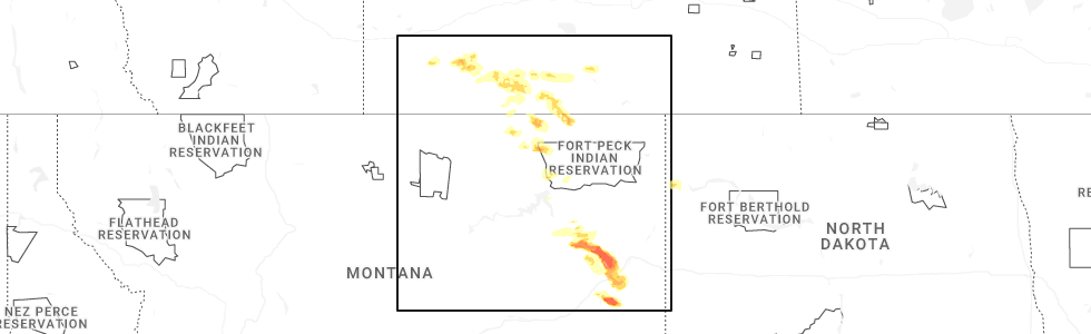
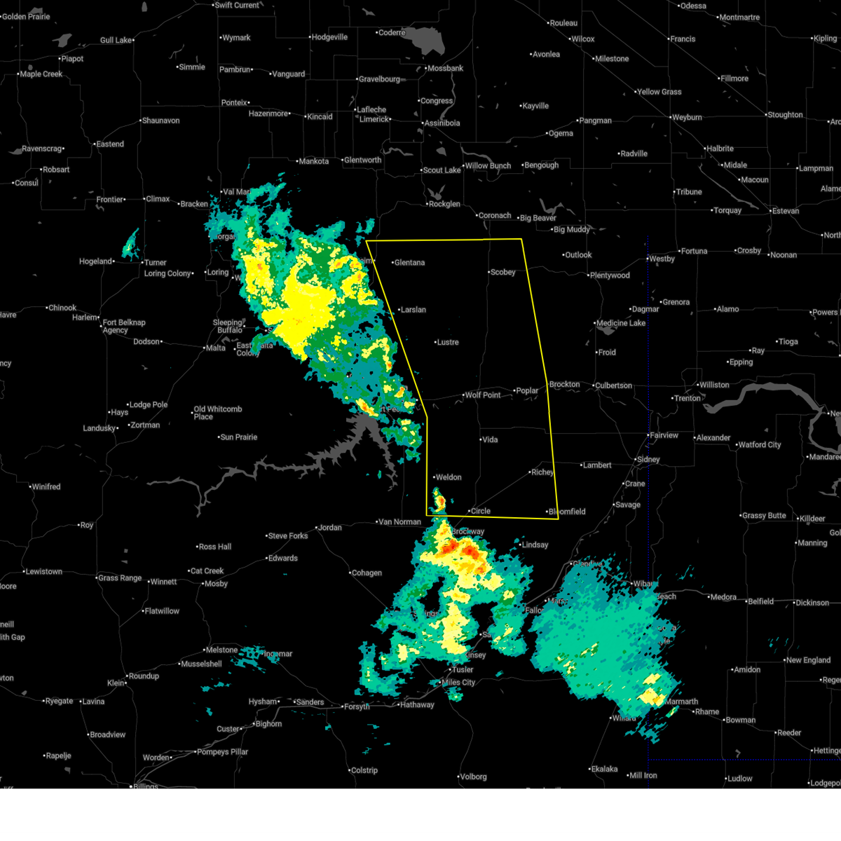
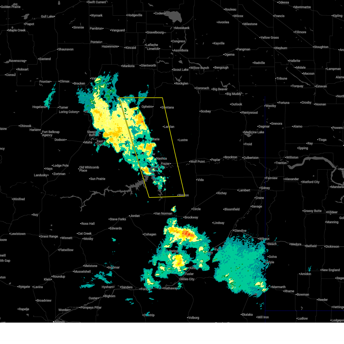
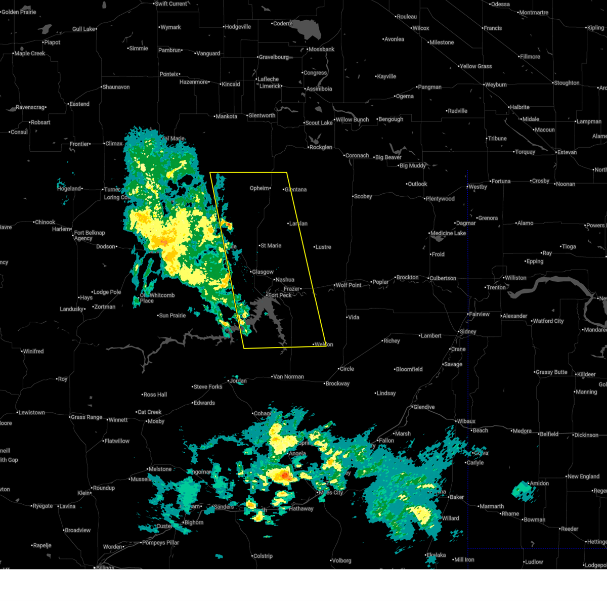
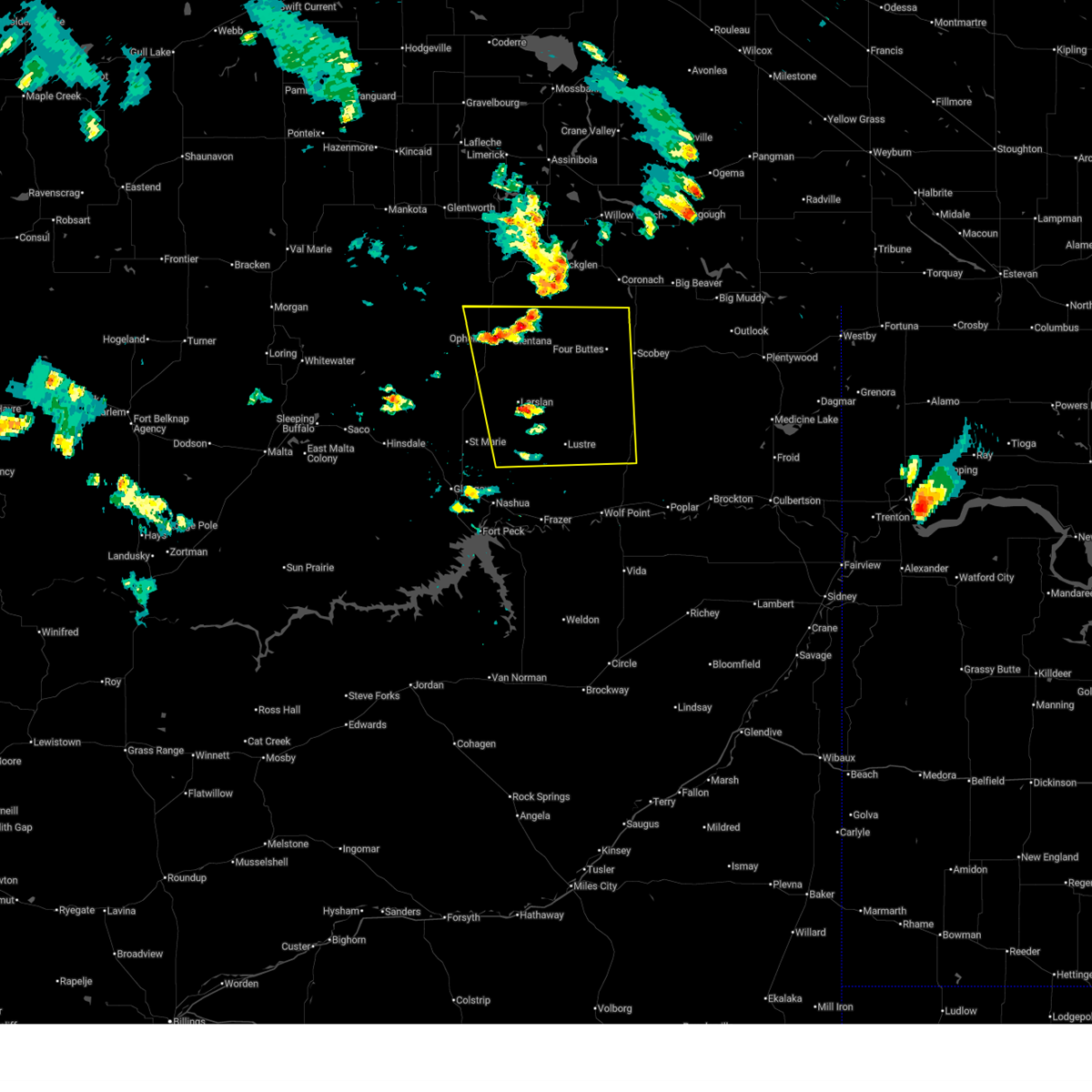
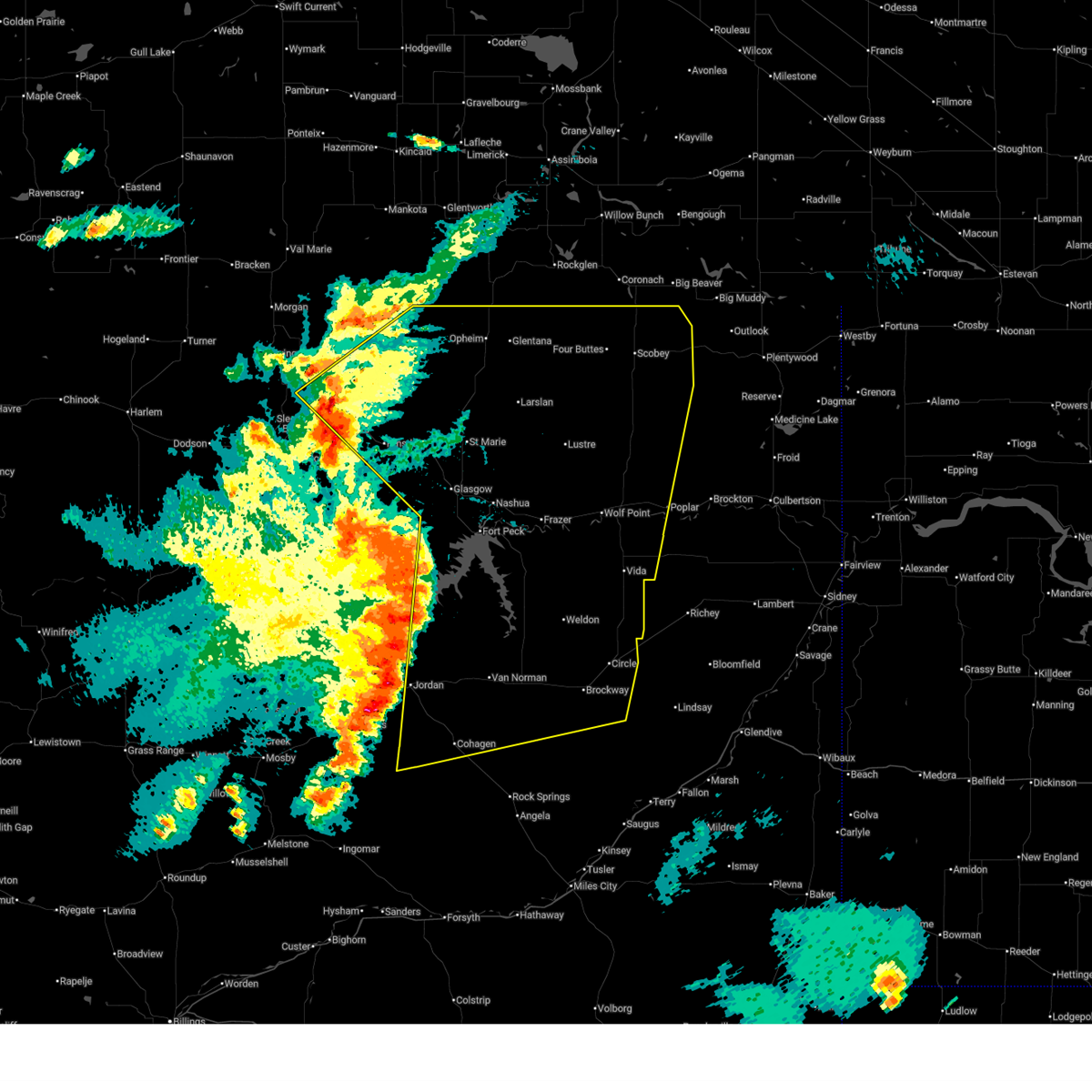
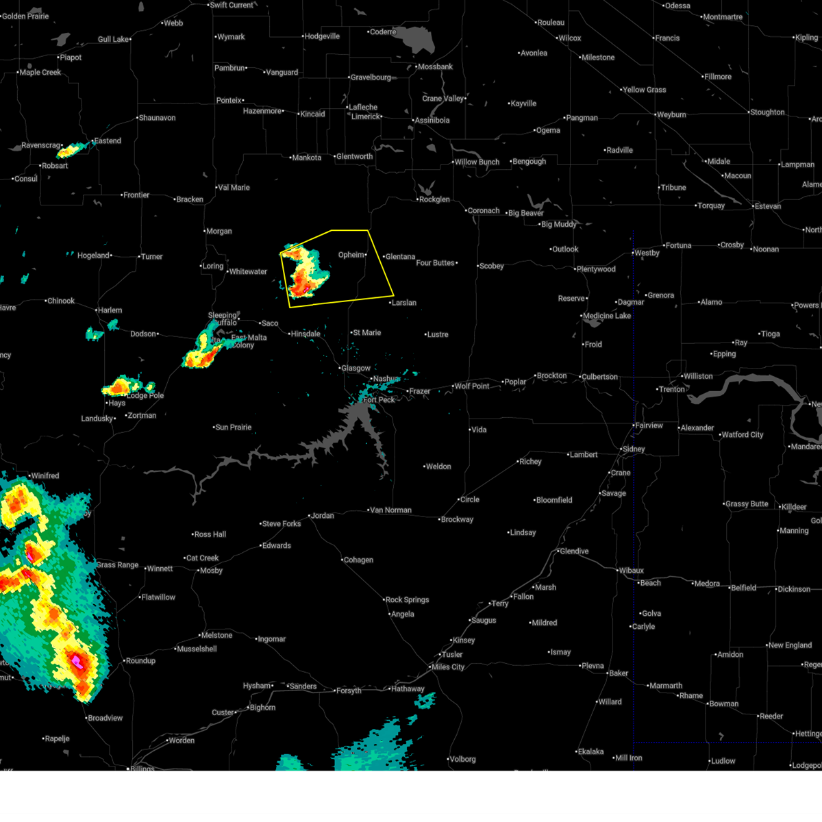
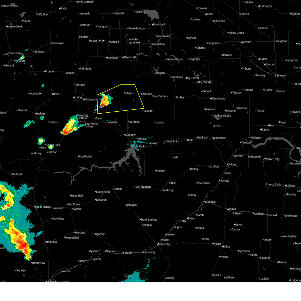
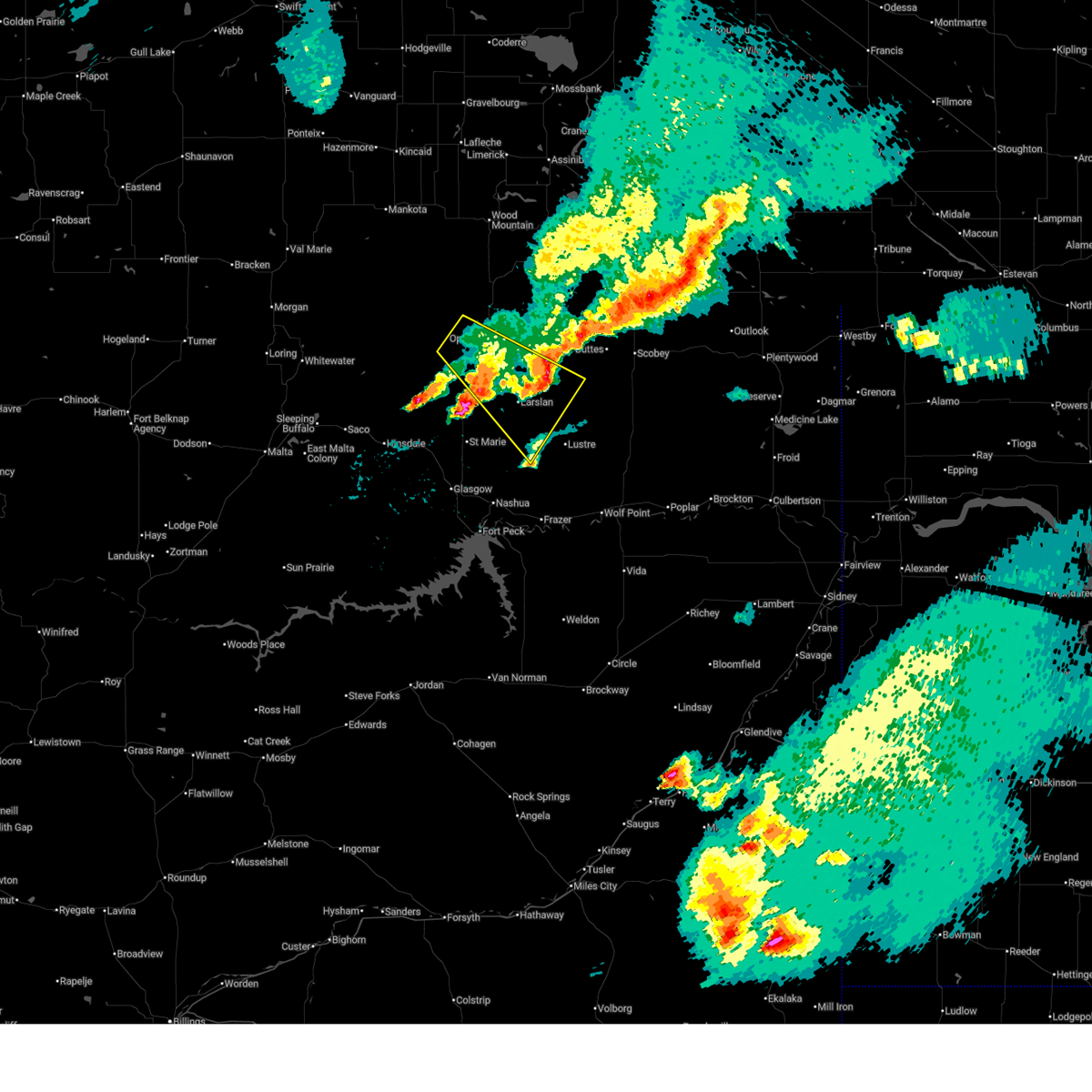
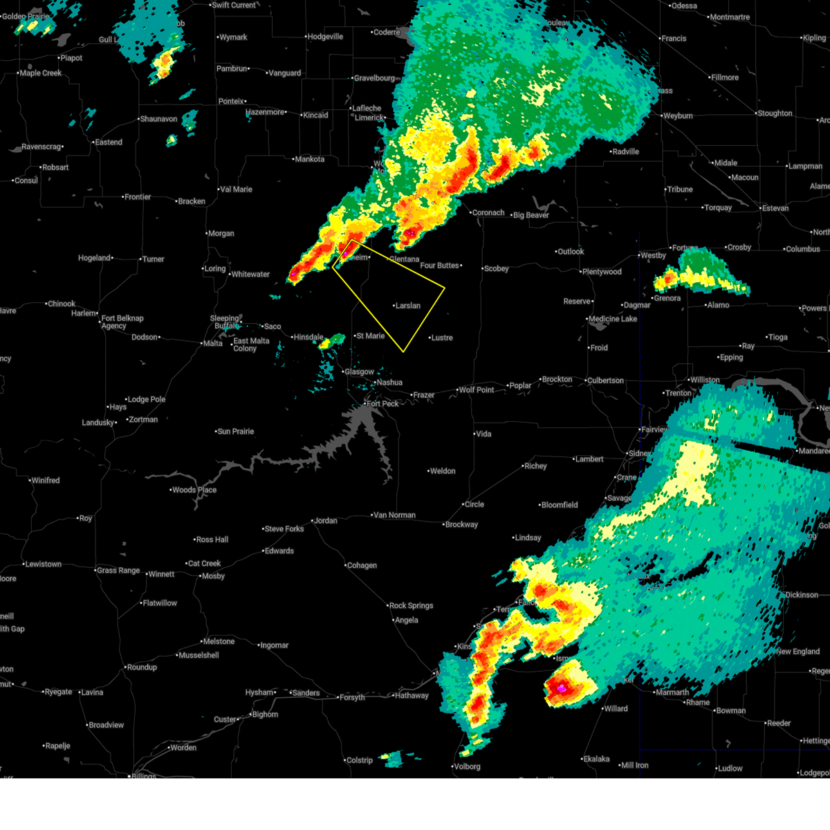
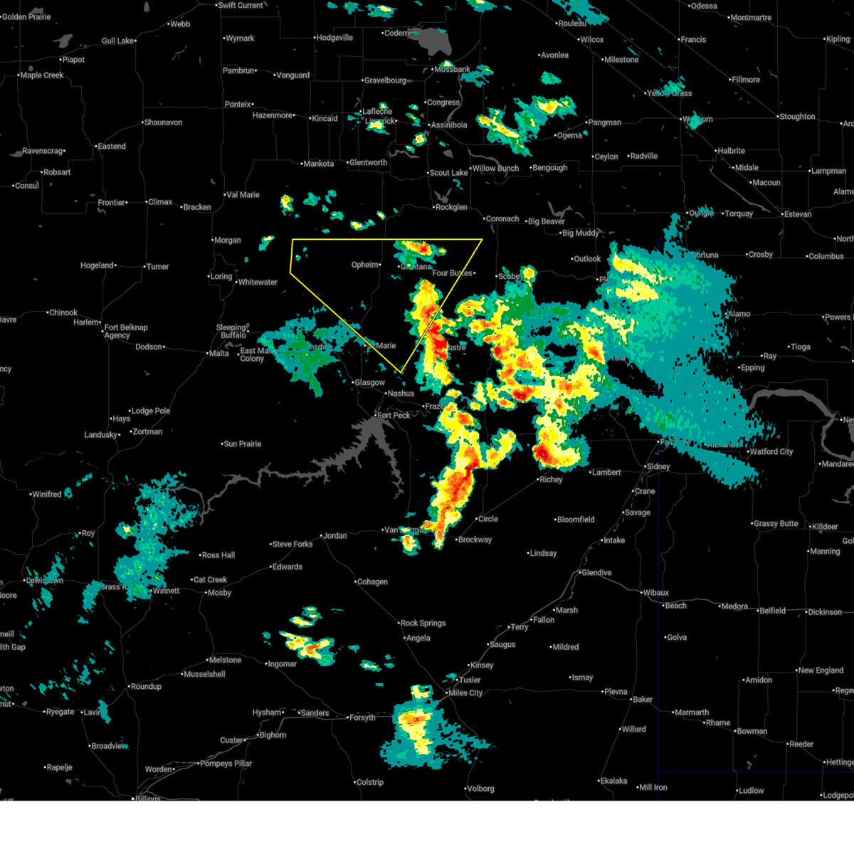
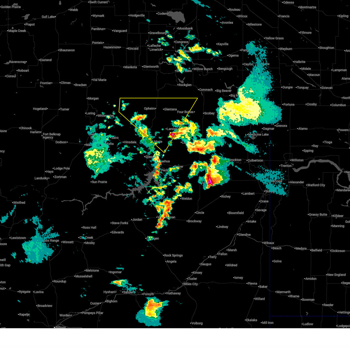
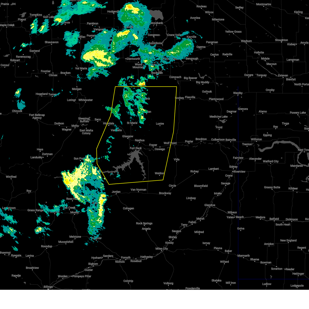
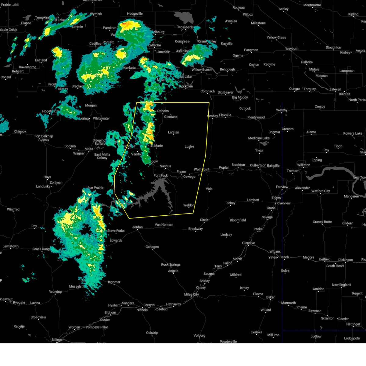
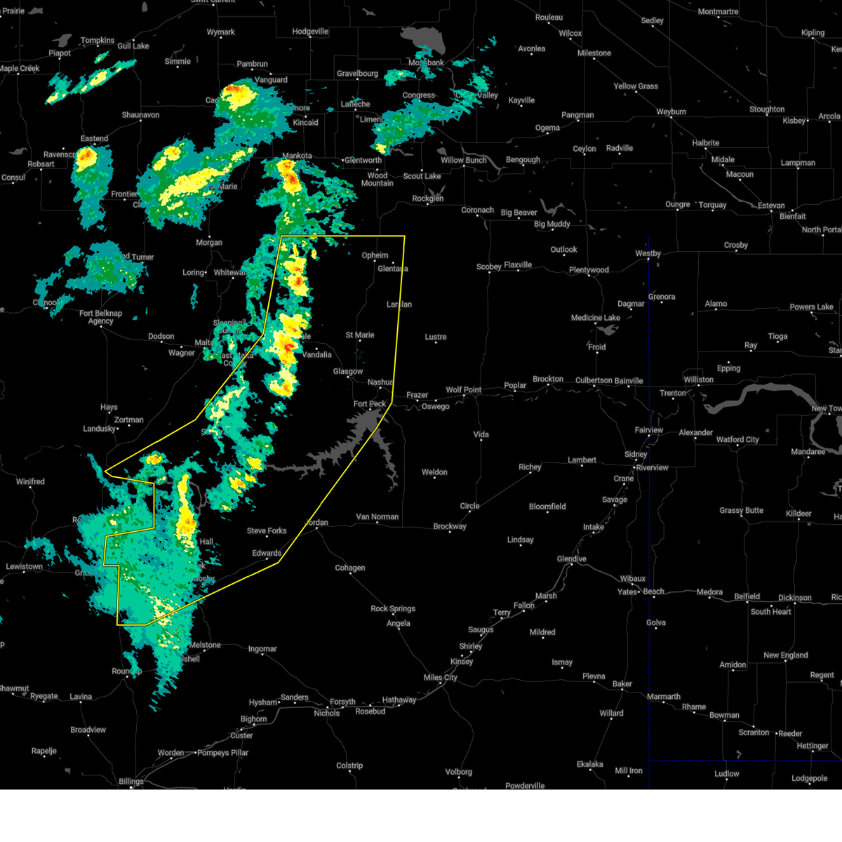
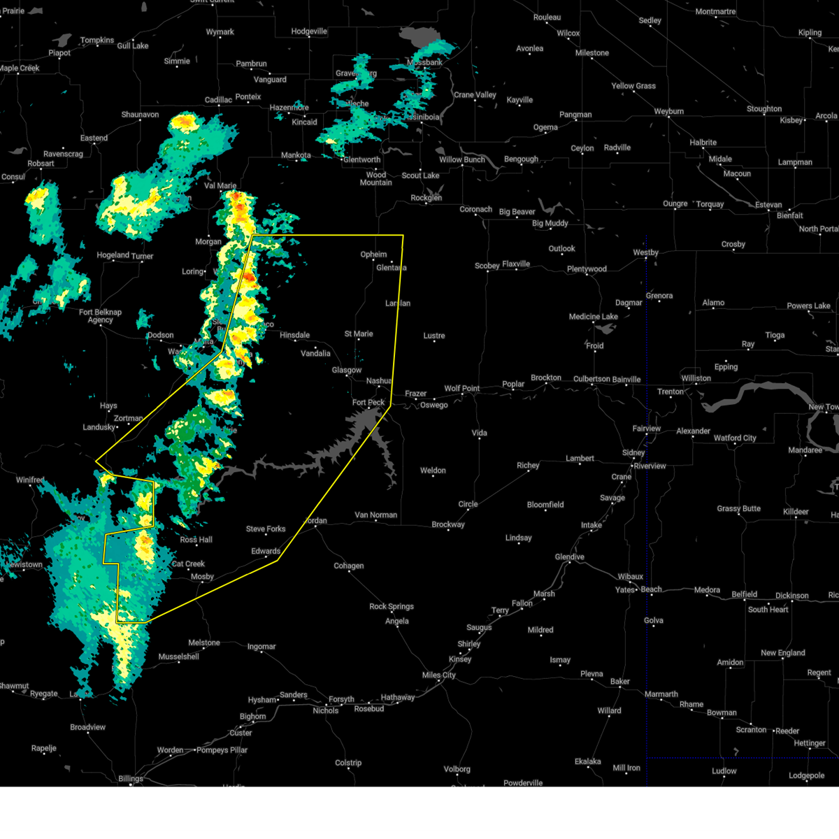
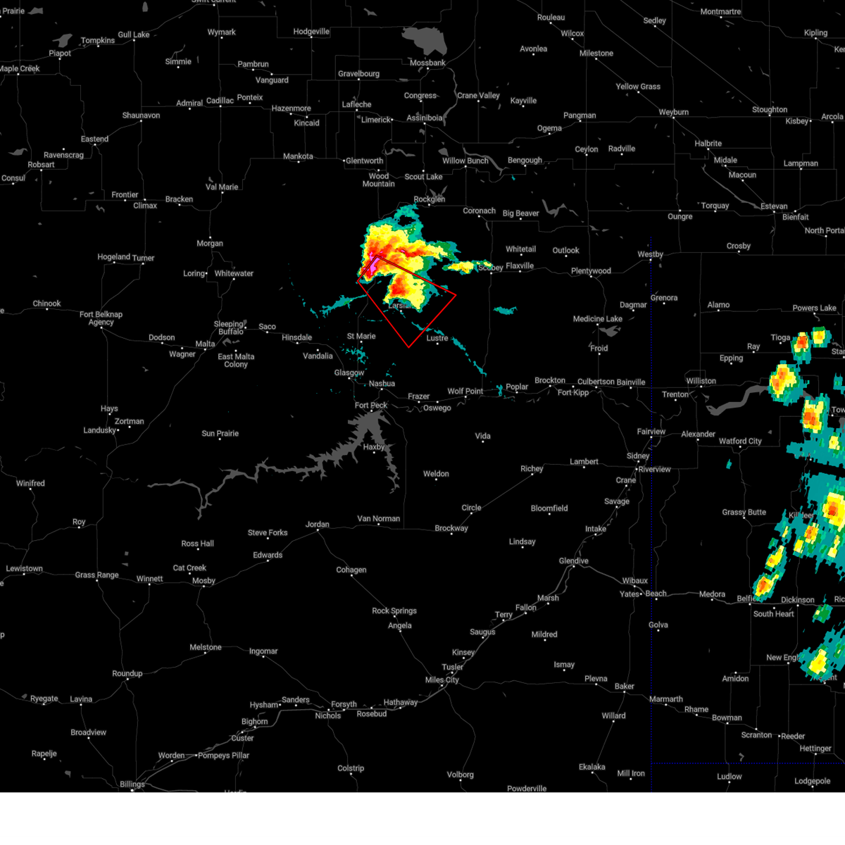
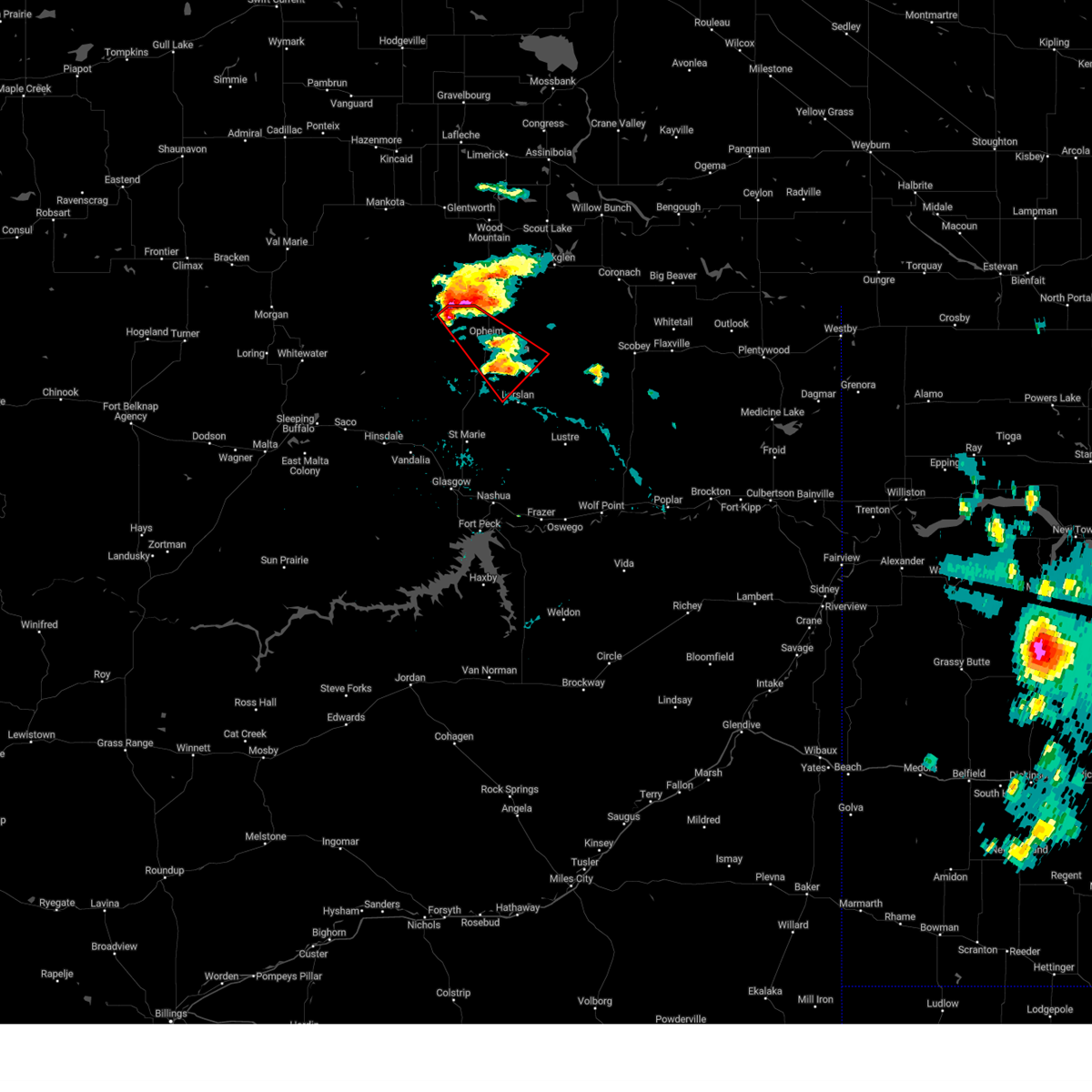
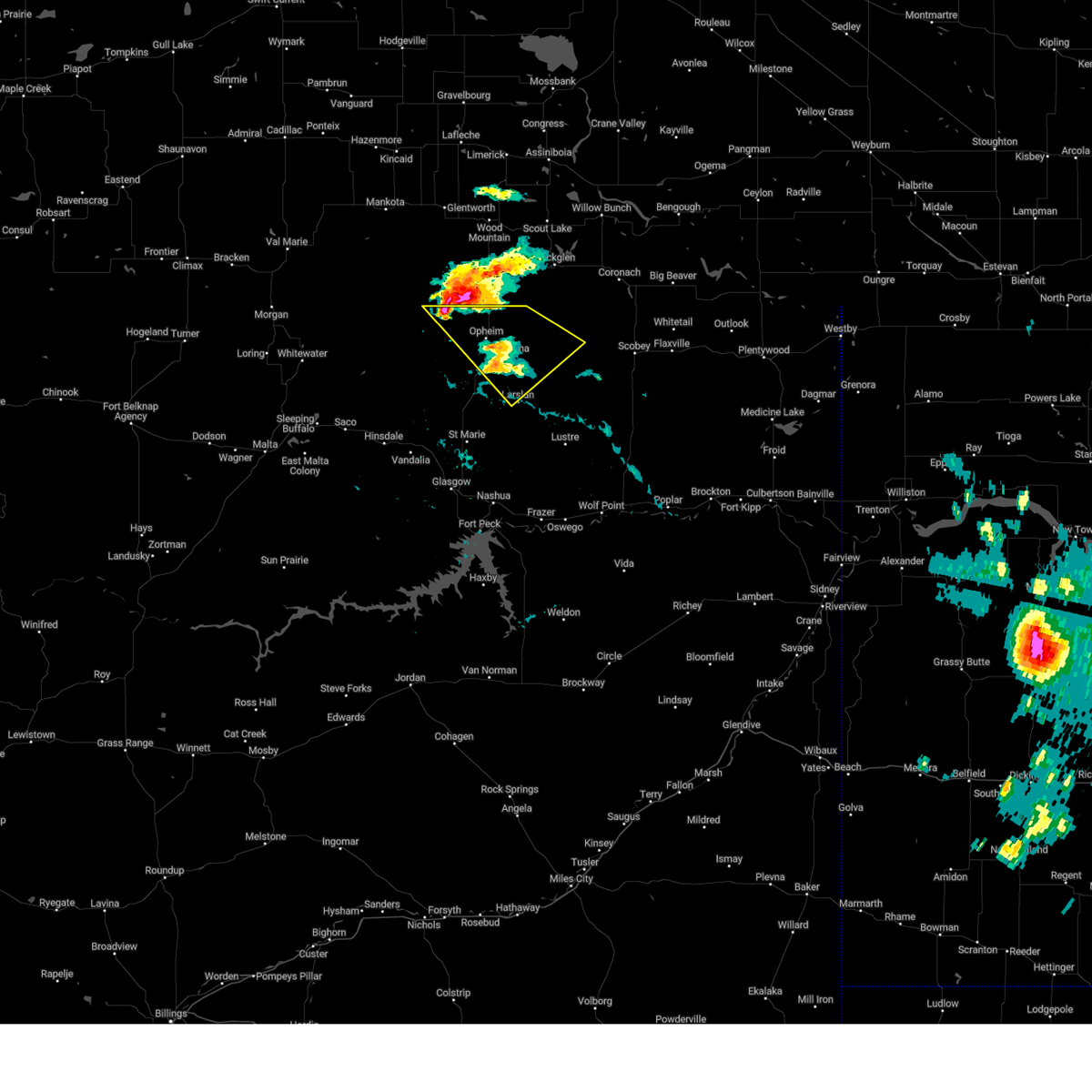
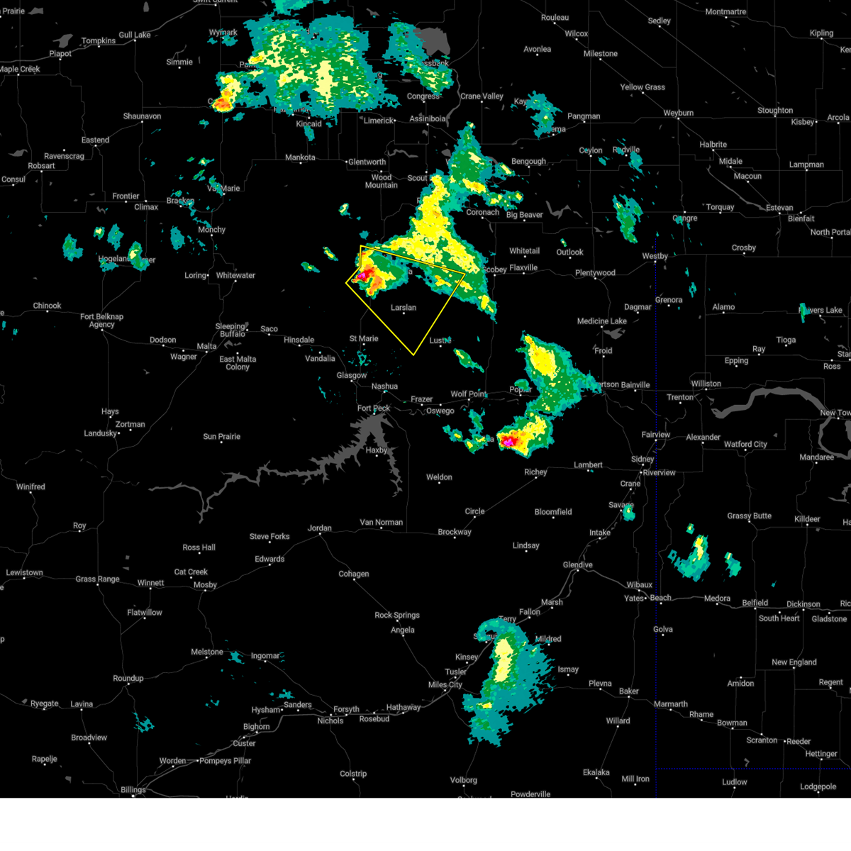
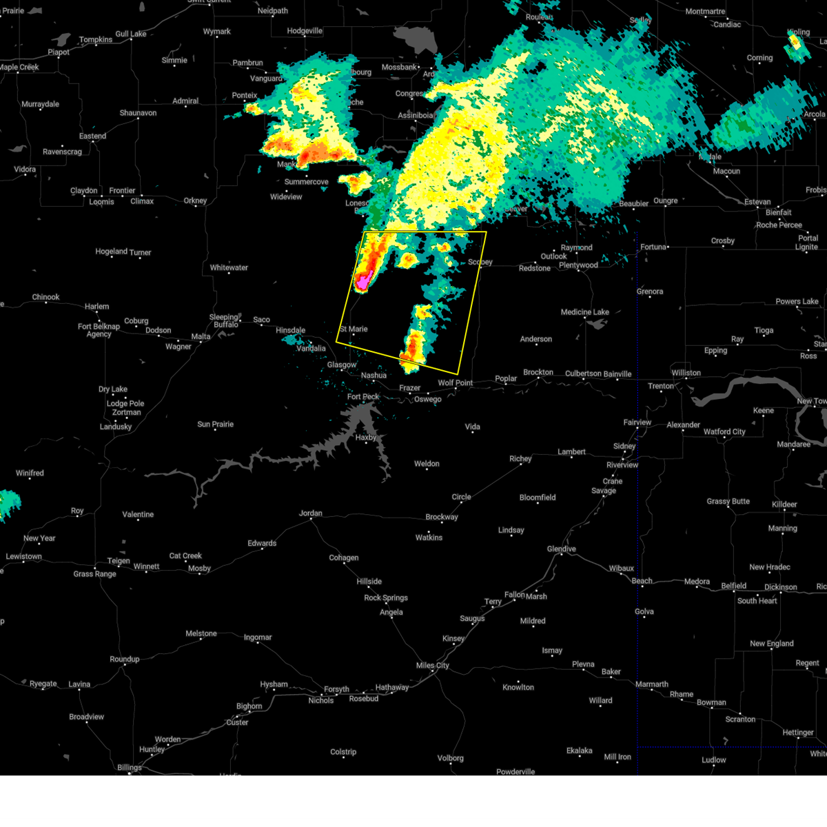
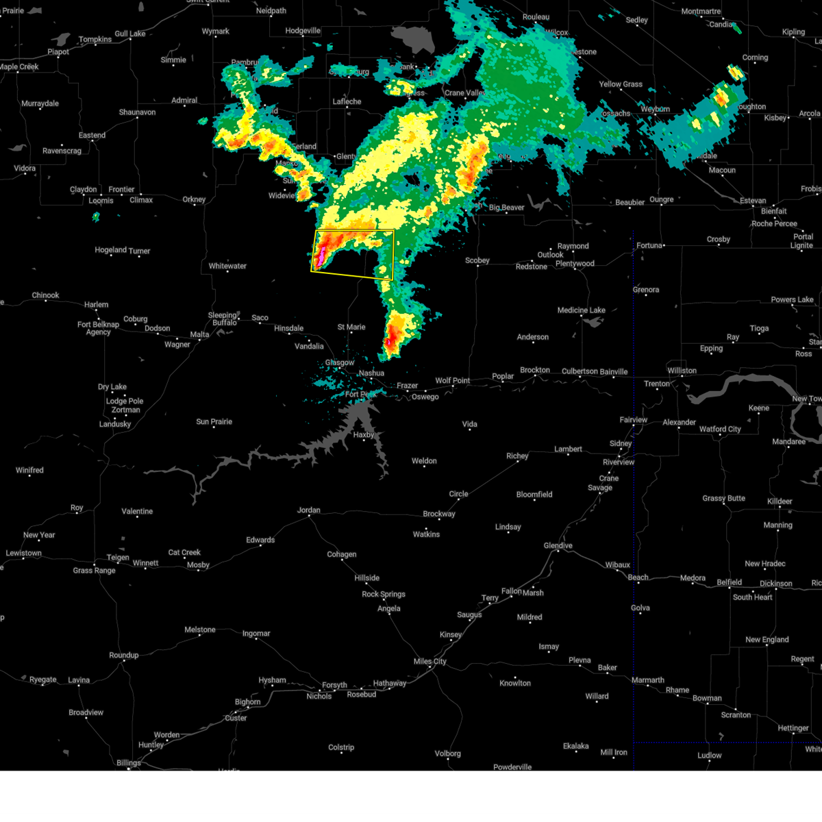
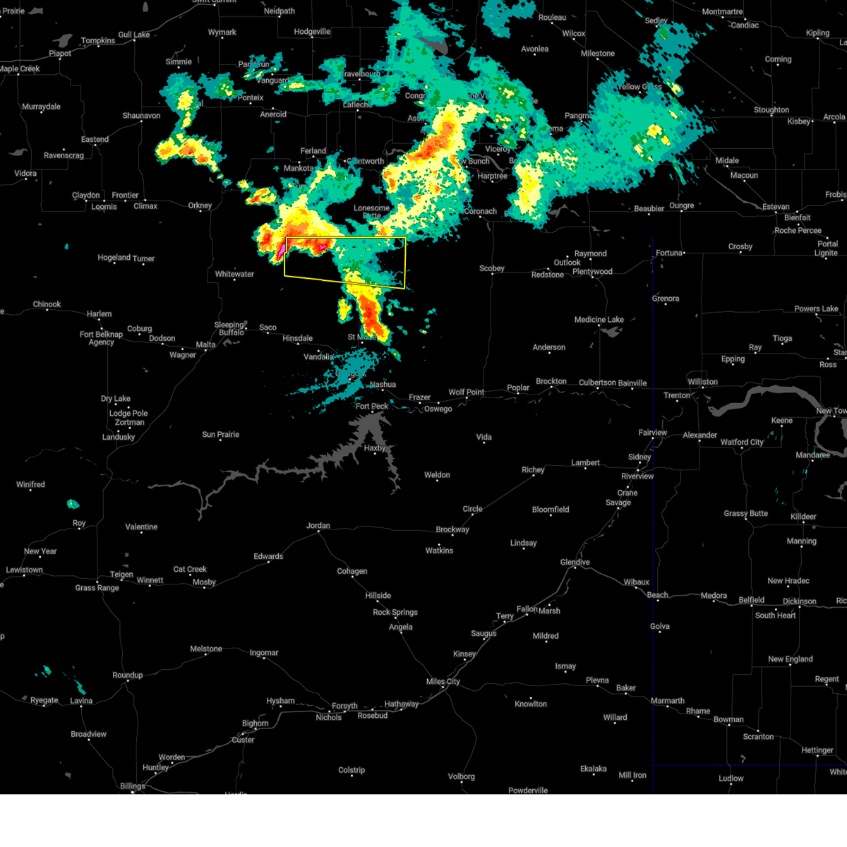
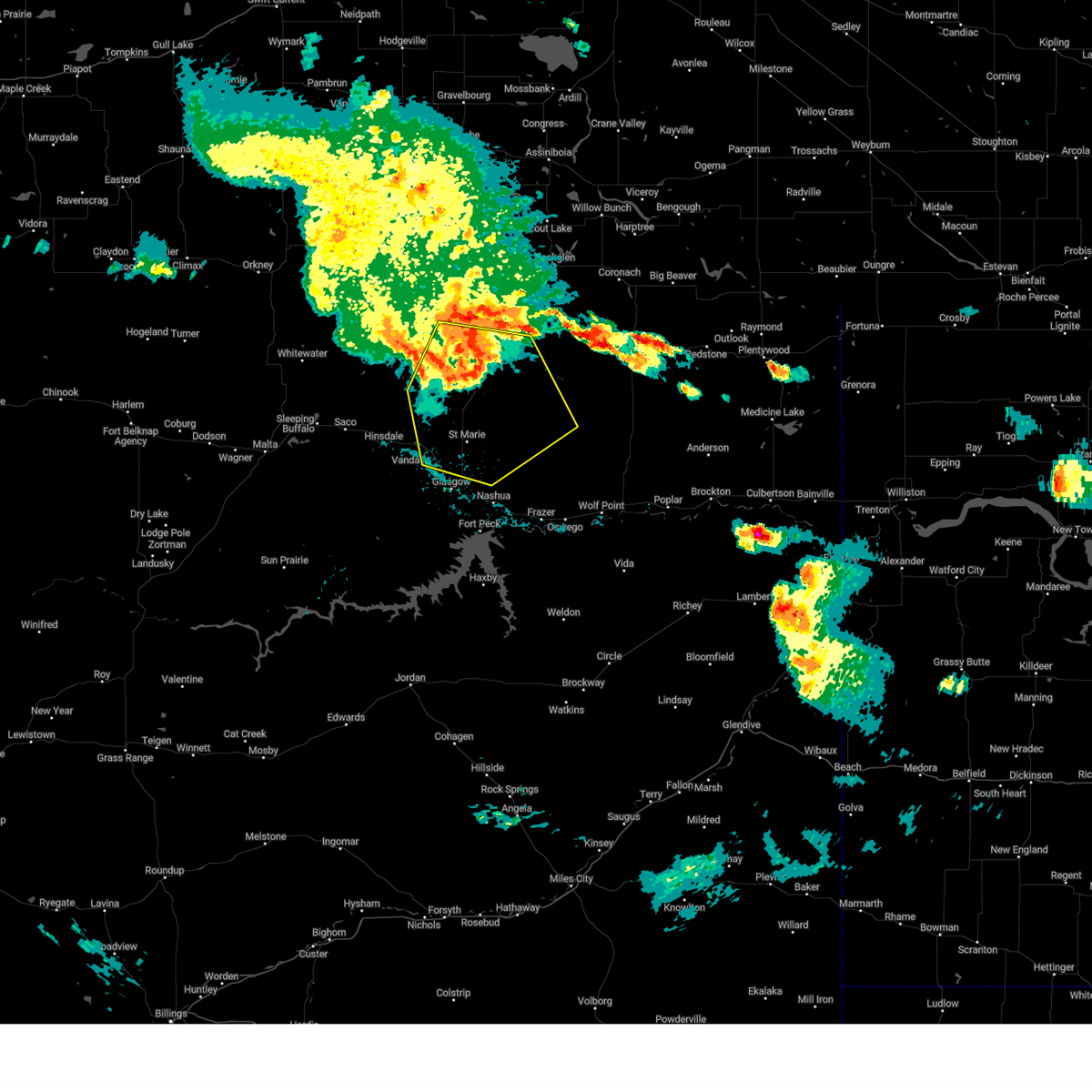
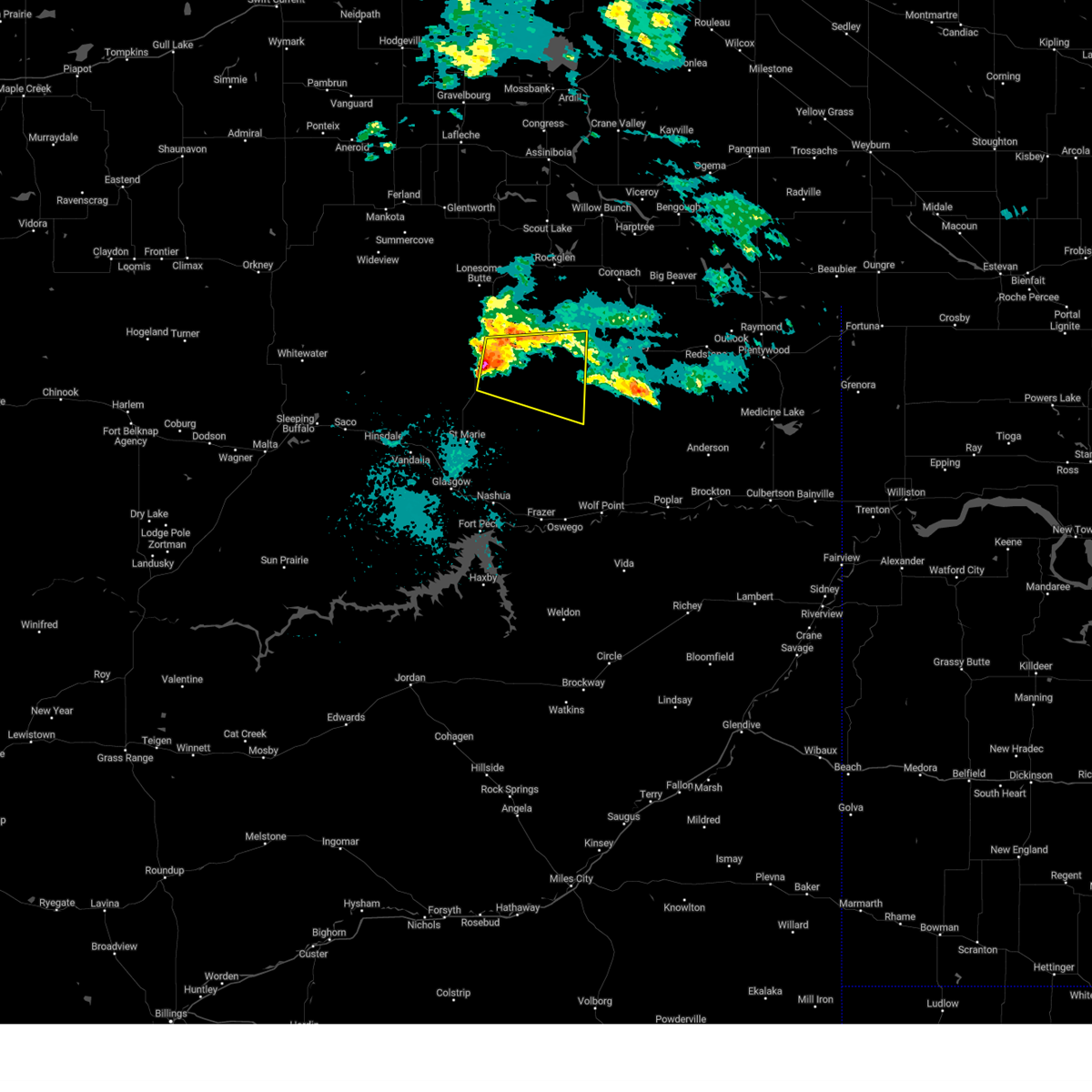
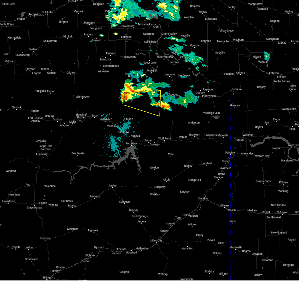
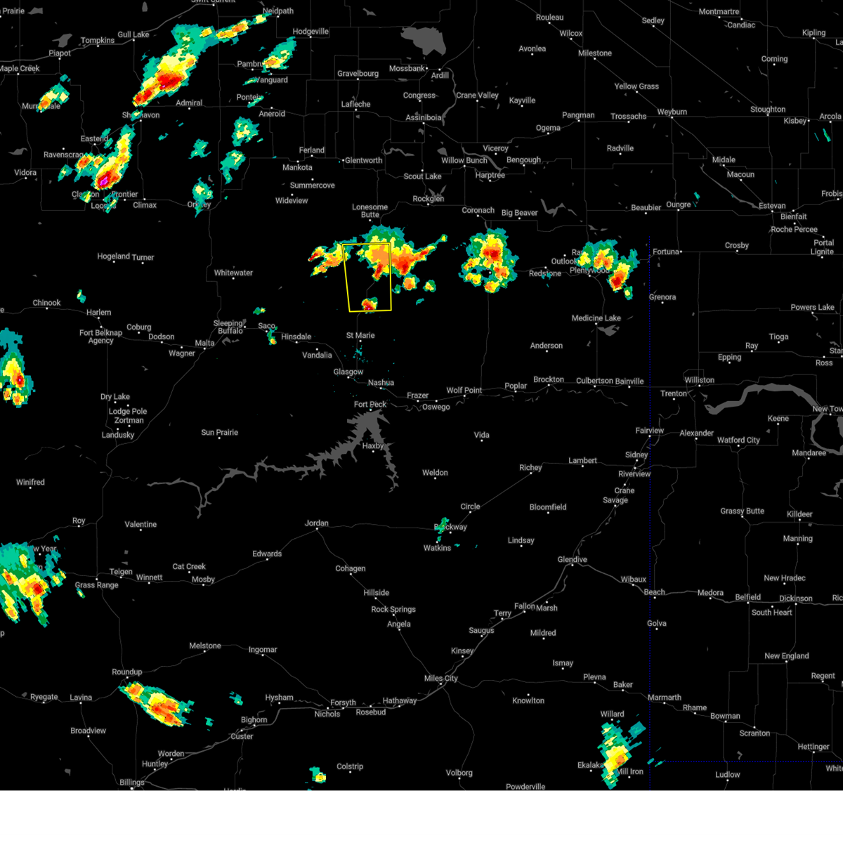
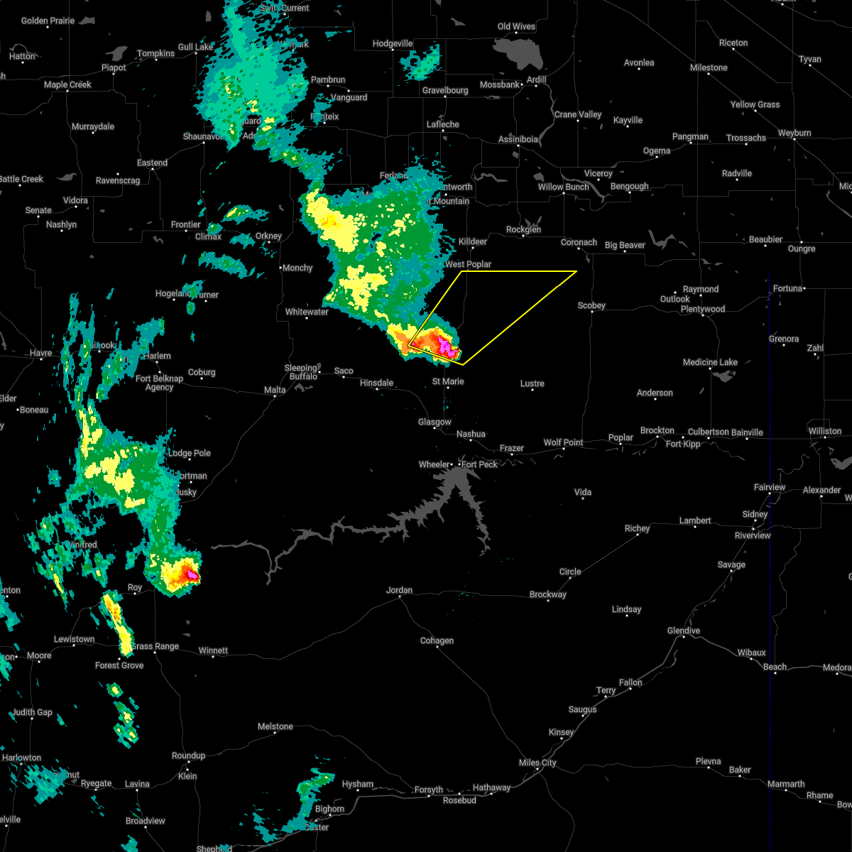
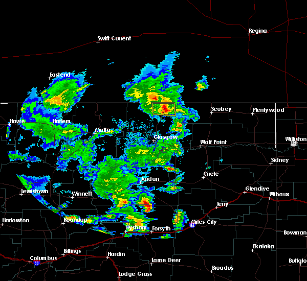
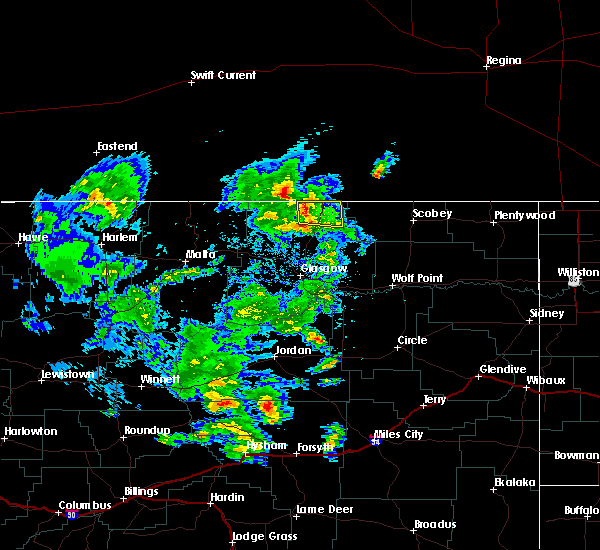
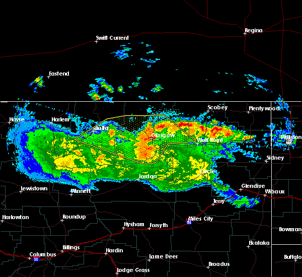
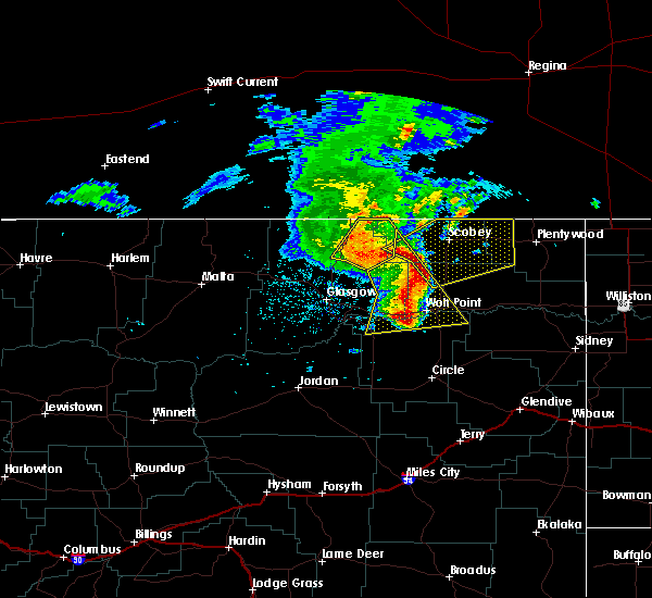
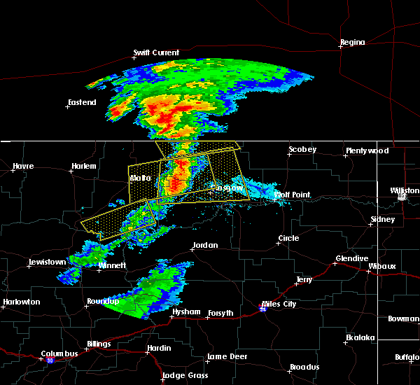
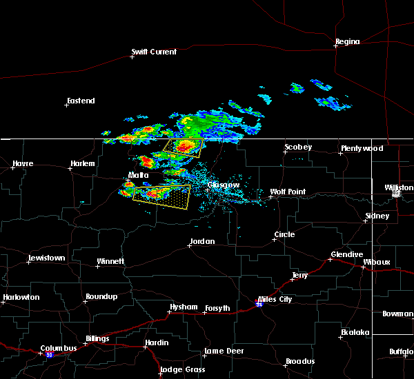
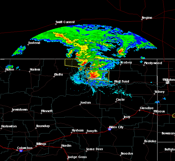
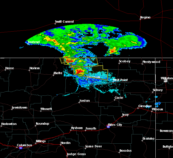
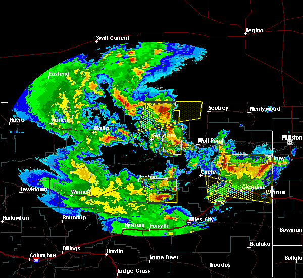
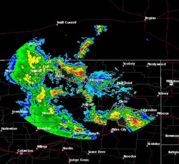
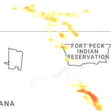
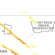
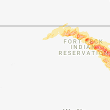
Hail Map for Opheim, MT
The Opheim, MT area has had 15 reports of on-the-ground hail by trained spotters, and has been under severe weather warnings 7 times during the past 12 months. Doppler radar has detected hail at or near Opheim, MT on 14 occasions.
| Name: | Opheim, MT |
| Where Located: | 46.9 miles NNE of Glasgow, MT |
| Map: | Google Map for Opheim, MT |
| Population: | 85 |
| Housing Units: | 69 |
| More Info: | Search Google for Opheim, MT |
2
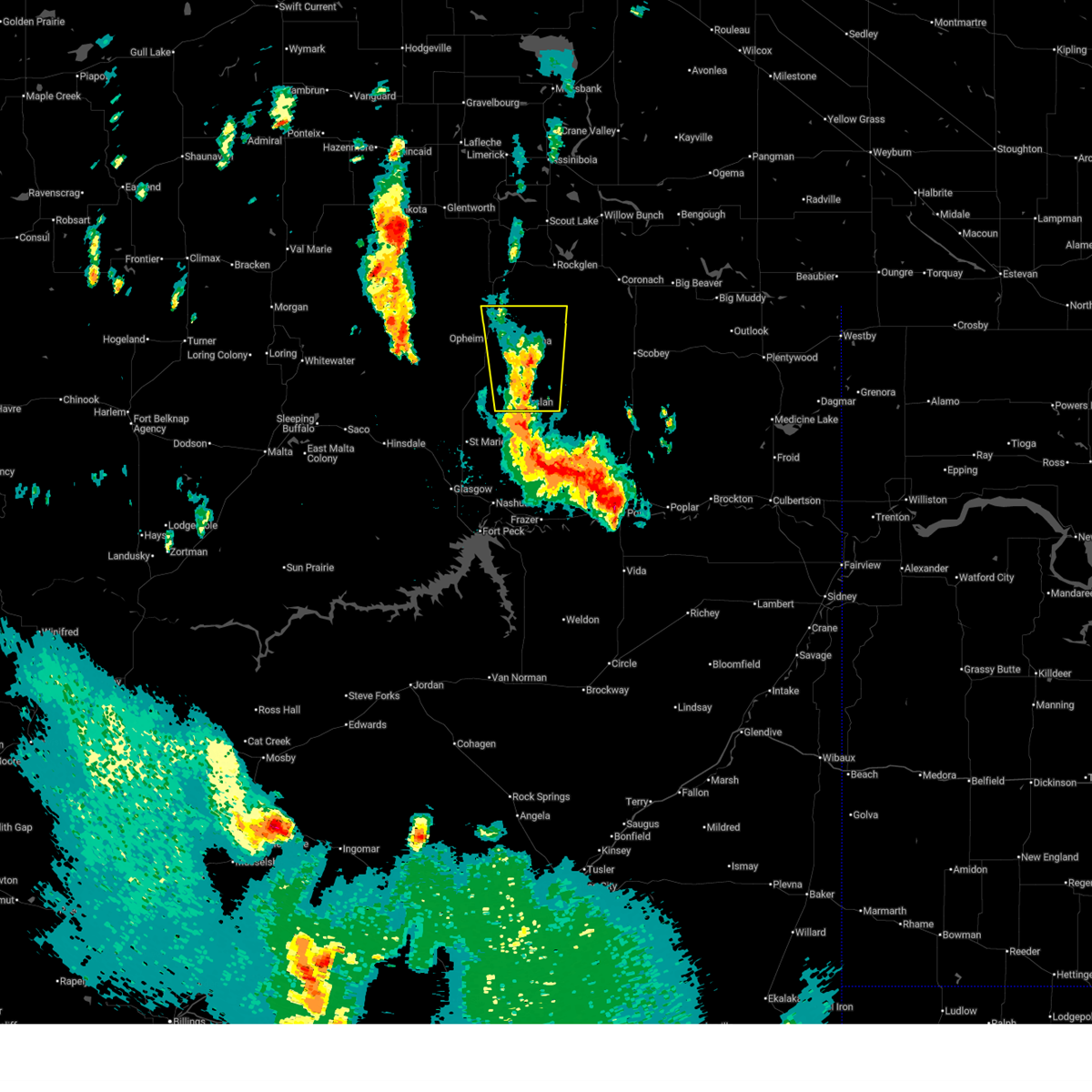
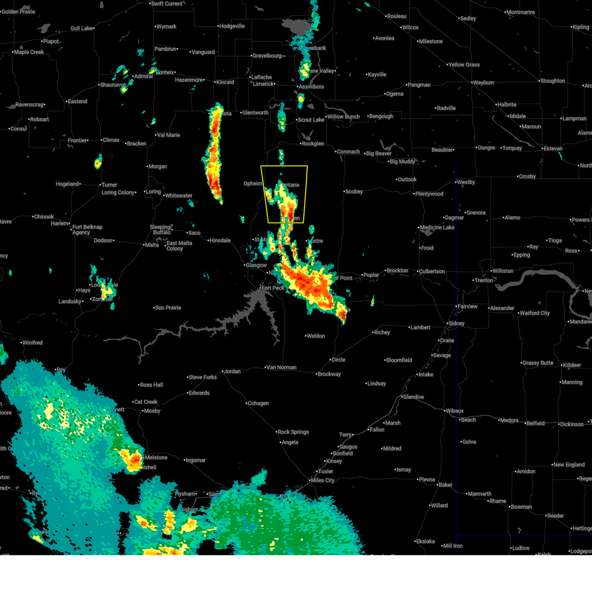
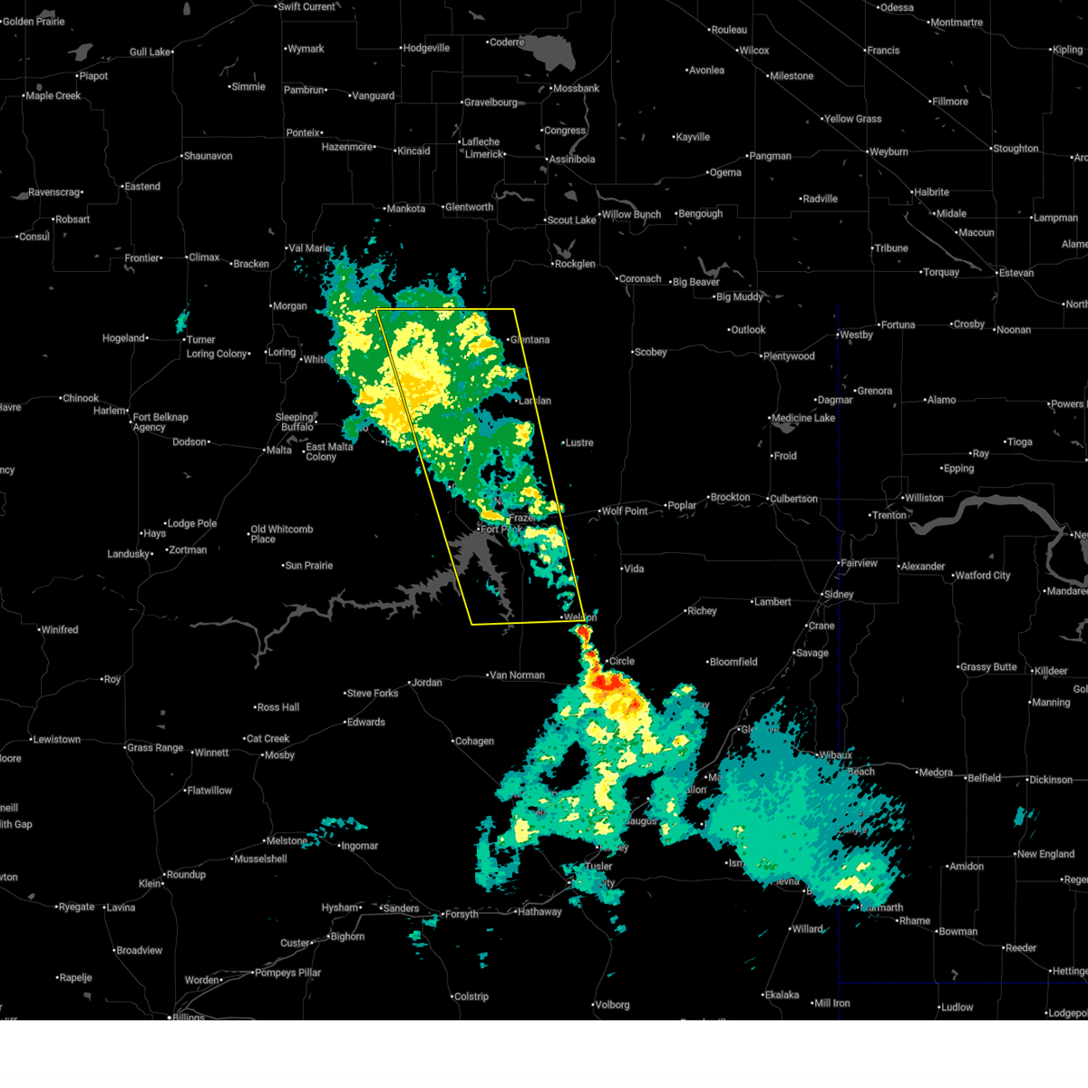
The Top Recent Hail Date for Opheim, MT is Saturday, July 19, 2025 (8th out of 14)
Hail and Wind Damage Spotted near Opheim, MT
| Date / Time | Report Details |
|---|---|
| 7/25/2026 9:05 PM MDT | Ophiem s... mt (umt - ggw) elev: 3117.0 ft; lat/lon: 48.78782/-106.3861 in valley county MT, 4.7 miles NNW of Opheim, MT |
| 6/27/2026 3:37 PM MDT |
 The storm which prompted the warning has weakened below severe limits, and no longer poses an immediate threat to life or property. therefore, the warning will be allowed to expire. however, small hail and heavy rain are still possible with this thunderstorm. The storm which prompted the warning has weakened below severe limits, and no longer poses an immediate threat to life or property. therefore, the warning will be allowed to expire. however, small hail and heavy rain are still possible with this thunderstorm.
|
| 6/27/2026 3:11 PM MDT |
 Svrggw the national weather service in glasgow has issued a * severe thunderstorm warning for, western daniels county in northeastern montana, northeastern valley county in northeastern montana, * until 345 pm mdt. * at 310 pm mdt, a severe thunderstorm was located 14 miles south of richland, or 23 miles southeast of opheim, moving north at 40 mph (radar indicated). Hazards include 60 mph wind gusts and quarter size hail. Hail damage to vehicles is expected. Expect wind damage to roofs, siding, and trees. Svrggw the national weather service in glasgow has issued a * severe thunderstorm warning for, western daniels county in northeastern montana, northeastern valley county in northeastern montana, * until 345 pm mdt. * at 310 pm mdt, a severe thunderstorm was located 14 miles south of richland, or 23 miles southeast of opheim, moving north at 40 mph (radar indicated). Hazards include 60 mph wind gusts and quarter size hail. Hail damage to vehicles is expected. Expect wind damage to roofs, siding, and trees.
|
| 4/11/2026 9:27 PM MDT |
 The storms which prompted the warning have weakened below severe limits, and no longer pose an immediate threat to life or property. therefore, the warning will be allowed to expire. remember, a severe thunderstorm warning still remains in effect for eastern valley and northeast mccone counties until 1015 pm. The storms which prompted the warning have weakened below severe limits, and no longer pose an immediate threat to life or property. therefore, the warning will be allowed to expire. remember, a severe thunderstorm warning still remains in effect for eastern valley and northeast mccone counties until 1015 pm.
|
| 4/11/2026 9:09 PM MDT |
 Svrggw the national weather service in glasgow has issued a * severe thunderstorm warning for, daniels county in northeastern montana, western roosevelt county in northeastern montana, northeastern valley county in northeastern montana, northeastern mccone county in northeastern montana, northwestern richland county in northeastern montana, northwestern dawson county in northeastern montana, * until 1015 pm mdt. * at 908 pm mdt, severe thunderstorms were located along a line extending from near opheim to 9 miles southeast of frazer to 11 miles north of brockway, moving east at 35 mph (radar indicated). Hazards include 60 mph wind gusts. expect damage to roofs, siding, and trees Svrggw the national weather service in glasgow has issued a * severe thunderstorm warning for, daniels county in northeastern montana, western roosevelt county in northeastern montana, northeastern valley county in northeastern montana, northeastern mccone county in northeastern montana, northwestern richland county in northeastern montana, northwestern dawson county in northeastern montana, * until 1015 pm mdt. * at 908 pm mdt, severe thunderstorms were located along a line extending from near opheim to 9 miles southeast of frazer to 11 miles north of brockway, moving east at 35 mph (radar indicated). Hazards include 60 mph wind gusts. expect damage to roofs, siding, and trees
|
| 4/11/2026 8:58 PM MDT |
 At 857 pm mdt, severe thunderstorms were located along a line extending from 9 miles northwest of opheim to 12 miles east of rock creek rec area, moving east at 40 mph (radar indicated). Hazards include 60 mph wind gusts. Expect damage to roofs, siding, and trees. locations impacted include, glasgow, opheim, nashua, fort peck, duck creek rec area, fort peck marina, frazer, st. Marie, rock creek rec area, park grove, thoeny, haxby, weldon, baylor, glentana, larslan, and whatley. At 857 pm mdt, severe thunderstorms were located along a line extending from 9 miles northwest of opheim to 12 miles east of rock creek rec area, moving east at 40 mph (radar indicated). Hazards include 60 mph wind gusts. Expect damage to roofs, siding, and trees. locations impacted include, glasgow, opheim, nashua, fort peck, duck creek rec area, fort peck marina, frazer, st. Marie, rock creek rec area, park grove, thoeny, haxby, weldon, baylor, glentana, larslan, and whatley.
|
| 4/11/2026 8:24 PM MDT |
 Svrggw the national weather service in glasgow has issued a * severe thunderstorm warning for, northeastern garfield county in northeastern montana, valley county in northeastern montana, northwestern mccone county in northeastern montana, * until 930 pm mdt. * at 824 pm mdt, severe thunderstorms were located along a line extending from 25 miles west of opheim to 11 miles south of the pines rec area, moving east at 40 mph (radar indicated). Hazards include 60 mph wind gusts. expect damage to roofs, siding, and trees Svrggw the national weather service in glasgow has issued a * severe thunderstorm warning for, northeastern garfield county in northeastern montana, valley county in northeastern montana, northwestern mccone county in northeastern montana, * until 930 pm mdt. * at 824 pm mdt, severe thunderstorms were located along a line extending from 25 miles west of opheim to 11 miles south of the pines rec area, moving east at 40 mph (radar indicated). Hazards include 60 mph wind gusts. expect damage to roofs, siding, and trees
|
| 9/11/2025 4:56 PM MDT | Quarter sized hail reported 16.6 miles W of Opheim, MT, heavy rain accompanied the hail (0.86 inches). still raining. hail piled up to 5 inches deep. |
| 8/5/2025 5:55 PM MDT |
 Svrggw the national weather service in glasgow has issued a * severe thunderstorm warning for, western daniels county in northeastern montana, northwestern roosevelt county in northeastern montana, northeastern valley county in northeastern montana, * until 700 pm mdt. * at 554 pm mdt, severe thunderstorms were located along a line extending from 8 miles northwest of richland to 15 miles northwest of lustre, moving east at 15 mph (trained weather spotters). Hazards include quarter size hail. damage to vehicles is expected Svrggw the national weather service in glasgow has issued a * severe thunderstorm warning for, western daniels county in northeastern montana, northwestern roosevelt county in northeastern montana, northeastern valley county in northeastern montana, * until 700 pm mdt. * at 554 pm mdt, severe thunderstorms were located along a line extending from 8 miles northwest of richland to 15 miles northwest of lustre, moving east at 15 mph (trained weather spotters). Hazards include quarter size hail. damage to vehicles is expected
|
| 7/26/2025 9:23 PM MDT |
 Svrggw the national weather service in glasgow has issued a * severe thunderstorm warning for, northeastern phillips county in northeastern montana, eastern garfield county in northeastern montana, daniels county in northeastern montana, western roosevelt county in northeastern montana, valley county in northeastern montana, mccone county in northeastern montana, northwestern prairie county in northeastern montana, * until 1015 pm mdt. * at 922 pm mdt, severe thunderstorms were located along a line extending from 21 miles east of whitewater to near glasgow to 9 miles west of cohagen, moving northeast at 70 mph (radar indicated). Hazards include 70 mph wind gusts and penny size hail. Expect considerable tree damage. Damage is likely to mobile homes, roofs, and outbuildings. Svrggw the national weather service in glasgow has issued a * severe thunderstorm warning for, northeastern phillips county in northeastern montana, eastern garfield county in northeastern montana, daniels county in northeastern montana, western roosevelt county in northeastern montana, valley county in northeastern montana, mccone county in northeastern montana, northwestern prairie county in northeastern montana, * until 1015 pm mdt. * at 922 pm mdt, severe thunderstorms were located along a line extending from 21 miles east of whitewater to near glasgow to 9 miles west of cohagen, moving northeast at 70 mph (radar indicated). Hazards include 70 mph wind gusts and penny size hail. Expect considerable tree damage. Damage is likely to mobile homes, roofs, and outbuildings.
|
| 7/26/2025 5:46 PM MDT |
 At 546 pm mdt, a severe thunderstorm was located 19 miles west of opheim, moving east at 30 mph (radar indicated). Hazards include 60 mph wind gusts and half dollar size hail. Hail damage to vehicles is expected. expect wind damage to roofs, siding, and trees. Locations impacted include, opheim, thoeny, and baylor. At 546 pm mdt, a severe thunderstorm was located 19 miles west of opheim, moving east at 30 mph (radar indicated). Hazards include 60 mph wind gusts and half dollar size hail. Hail damage to vehicles is expected. expect wind damage to roofs, siding, and trees. Locations impacted include, opheim, thoeny, and baylor.
|
| 7/26/2025 5:46 PM MDT |
 the severe thunderstorm warning has been cancelled and is no longer in effect the severe thunderstorm warning has been cancelled and is no longer in effect
|
| 7/26/2025 5:23 PM MDT |
 Svrggw the national weather service in glasgow has issued a * severe thunderstorm warning for, eastern phillips county in northeastern montana, northern valley county in northeastern montana, * until 615 pm mdt. * at 522 pm mdt, a severe thunderstorm was located 22 miles north of hinsdale, or 26 miles east of whitewater, moving east at 30 mph (radar indicated). Hazards include 60 mph wind gusts and half dollar size hail. Hail damage to vehicles is expected. Expect wind damage to roofs, siding, and trees. Svrggw the national weather service in glasgow has issued a * severe thunderstorm warning for, eastern phillips county in northeastern montana, northern valley county in northeastern montana, * until 615 pm mdt. * at 522 pm mdt, a severe thunderstorm was located 22 miles north of hinsdale, or 26 miles east of whitewater, moving east at 30 mph (radar indicated). Hazards include 60 mph wind gusts and half dollar size hail. Hail damage to vehicles is expected. Expect wind damage to roofs, siding, and trees.
|
| 7/19/2025 8:29 PM MDT |
 The storm which prompted the warning has weakened below severe limits, and no longer poses an immediate threat to life or property. therefore, the warning will be allowed to expire. however, small hail and gusty winds are still possible with this thunderstorm. a severe thunderstorm watch remains in effect until midnight mdt for northeastern montana. to report severe weather, contact your nearest law enforcement agency. they will relay your report to the national weather service glasgow. The storm which prompted the warning has weakened below severe limits, and no longer poses an immediate threat to life or property. therefore, the warning will be allowed to expire. however, small hail and gusty winds are still possible with this thunderstorm. a severe thunderstorm watch remains in effect until midnight mdt for northeastern montana. to report severe weather, contact your nearest law enforcement agency. they will relay your report to the national weather service glasgow.
|
| 7/19/2025 7:30 PM MDT |
 Svrggw the national weather service in glasgow has issued a * severe thunderstorm warning for, southwestern daniels county in northeastern montana, northeastern valley county in northeastern montana, * until 830 pm mdt. * at 730 pm mdt, a severe thunderstorm was located 7 miles west of opheim, moving southeast at 30 mph (radar indicated). Hazards include 60 mph wind gusts and quarter size hail. Hail damage to vehicles is expected. Expect wind damage to roofs, siding, and trees. Svrggw the national weather service in glasgow has issued a * severe thunderstorm warning for, southwestern daniels county in northeastern montana, northeastern valley county in northeastern montana, * until 830 pm mdt. * at 730 pm mdt, a severe thunderstorm was located 7 miles west of opheim, moving southeast at 30 mph (radar indicated). Hazards include 60 mph wind gusts and quarter size hail. Hail damage to vehicles is expected. Expect wind damage to roofs, siding, and trees.
|
| 7/2/2025 9:46 PM MDT |
 the severe thunderstorm warning has been cancelled and is no longer in effect the severe thunderstorm warning has been cancelled and is no longer in effect
|
| 7/2/2025 9:08 PM MDT |
 Svrggw the national weather service in glasgow has issued a * severe thunderstorm warning for, western daniels county in northeastern montana, northeastern valley county in northeastern montana, * until 1000 pm mdt. * at 908 pm mdt, severe thunderstorms were located along a line extending from 18 miles west of port of opheim to 11 miles east of st. marie, moving north at 50 mph (radar indicated). Hazards include 60 mph wind gusts. expect damage to roofs, siding, and trees Svrggw the national weather service in glasgow has issued a * severe thunderstorm warning for, western daniels county in northeastern montana, northeastern valley county in northeastern montana, * until 1000 pm mdt. * at 908 pm mdt, severe thunderstorms were located along a line extending from 18 miles west of port of opheim to 11 miles east of st. marie, moving north at 50 mph (radar indicated). Hazards include 60 mph wind gusts. expect damage to roofs, siding, and trees
|
| 5/10/2025 9:08 PM MDT |
 the severe thunderstorm warning has been cancelled and is no longer in effect the severe thunderstorm warning has been cancelled and is no longer in effect
|
| 5/10/2025 8:43 PM MDT |
 Svrggw the national weather service in glasgow has issued a * severe thunderstorm warning for, northeastern garfield county in northeastern montana, western daniels county in northeastern montana, western roosevelt county in northeastern montana, valley county in northeastern montana, northwestern mccone county in northeastern montana, * until 945 pm mdt. * at 843 pm mdt, severe thunderstorms were located along a line extending from near opheim to 6 miles east of glasgow to 7 miles north of hell creek rec area, moving east at 45 mph (radar indicated). Hazards include 60 mph wind gusts. expect damage to roofs, siding, and trees Svrggw the national weather service in glasgow has issued a * severe thunderstorm warning for, northeastern garfield county in northeastern montana, western daniels county in northeastern montana, western roosevelt county in northeastern montana, valley county in northeastern montana, northwestern mccone county in northeastern montana, * until 945 pm mdt. * at 843 pm mdt, severe thunderstorms were located along a line extending from near opheim to 6 miles east of glasgow to 7 miles north of hell creek rec area, moving east at 45 mph (radar indicated). Hazards include 60 mph wind gusts. expect damage to roofs, siding, and trees
|
| 5/10/2025 8:17 PM MDT |
 At 817 pm mdt, severe thunderstorms were located along a line extending from 22 miles northwest of port of opheim to 20 miles southwest of opheim to 17 miles northwest of the pines rec area to 9 miles south of mosby, moving east at 40 mph (public). Hazards include 60 mph wind gusts. Expect damage to roofs, siding, and trees. locations impacted include, sand springs, vandalia, fourchette, u l bend rec area, park grove, the bentonite plant, duck creek rec area, glasgow, frenchman reservoir, opheim, nashua, hell creek rec area, sun prairie, st. Marie, brusett, winnett, the pines rec area, petrolia lake, tampico, and hinsdale. At 817 pm mdt, severe thunderstorms were located along a line extending from 22 miles northwest of port of opheim to 20 miles southwest of opheim to 17 miles northwest of the pines rec area to 9 miles south of mosby, moving east at 40 mph (public). Hazards include 60 mph wind gusts. Expect damage to roofs, siding, and trees. locations impacted include, sand springs, vandalia, fourchette, u l bend rec area, park grove, the bentonite plant, duck creek rec area, glasgow, frenchman reservoir, opheim, nashua, hell creek rec area, sun prairie, st. Marie, brusett, winnett, the pines rec area, petrolia lake, tampico, and hinsdale.
|
| 5/10/2025 7:50 PM MDT |
 Svrggw the national weather service in glasgow has issued a * severe thunderstorm warning for, central phillips county in northeastern montana, petroleum county in northeastern montana, western garfield county in northeastern montana, valley county in northeastern montana, northwestern mccone county in northeastern montana, * until 845 pm mdt. * at 750 pm mdt, severe thunderstorms were located along a line extending from 35 miles northeast of port of morgan to 9 miles north of hinsdale to 20 miles northeast of devils creek rec area to 12 miles east of flatwillow, moving northeast at 65 mph (public). Hazards include 60 mph wind gusts. expect damage to roofs, siding, and trees Svrggw the national weather service in glasgow has issued a * severe thunderstorm warning for, central phillips county in northeastern montana, petroleum county in northeastern montana, western garfield county in northeastern montana, valley county in northeastern montana, northwestern mccone county in northeastern montana, * until 845 pm mdt. * at 750 pm mdt, severe thunderstorms were located along a line extending from 35 miles northeast of port of morgan to 9 miles north of hinsdale to 20 miles northeast of devils creek rec area to 12 miles east of flatwillow, moving northeast at 65 mph (public). Hazards include 60 mph wind gusts. expect damage to roofs, siding, and trees
|
| 8/23/2024 7:30 PM MDT | Quarter sized hail reported 11.4 miles NW of Opheim, MT |
| 8/23/2024 7:10 PM MDT | Quarter sized hail reported 18.2 miles NW of Opheim, MT |
| 7/12/2024 7:21 PM MDT |
 Torggw the national weather service in glasgow has issued a * tornado warning for, southwestern daniels county in northeastern montana, northeastern valley county in northeastern montana, * until 745 pm mdt. * at 720 pm mdt, a confirmed tornado was located near opheim, moving southeast at 20 mph (public confirmed tornado). Hazards include damaging tornado and ping pong ball size hail. Flying debris will be dangerous to those caught without shelter. mobile homes will be damaged or destroyed. damage to roofs, windows, and vehicles will occur. tree damage is likely. This tornadic thunderstorm will remain over mainly rural areas of southwestern daniels and northeastern valley counties, including the following locations, west fork and larslan. Torggw the national weather service in glasgow has issued a * tornado warning for, southwestern daniels county in northeastern montana, northeastern valley county in northeastern montana, * until 745 pm mdt. * at 720 pm mdt, a confirmed tornado was located near opheim, moving southeast at 20 mph (public confirmed tornado). Hazards include damaging tornado and ping pong ball size hail. Flying debris will be dangerous to those caught without shelter. mobile homes will be damaged or destroyed. damage to roofs, windows, and vehicles will occur. tree damage is likely. This tornadic thunderstorm will remain over mainly rural areas of southwestern daniels and northeastern valley counties, including the following locations, west fork and larslan.
|
| 7/12/2024 7:15 PM MDT | Ping Pong Ball sized hail reported 4.7 miles N of Opheim, MT, randy edwards reported hail the size of ping pong balls... as well as some broken windows. |
| 7/12/2024 7:11 PM MDT | Quarter sized hail reported 1.8 miles NE of Opheim, MT, report of hail made alongside reports of a visual of a funnel cloud. |
| 7/12/2024 6:47 PM MDT |
 Torggw the national weather service in glasgow has issued a * tornado warning for, west central daniels county in northeastern montana, northeastern valley county in northeastern montana, * until 715 pm mdt. * at 646 pm mdt, a severe thunderstorm capable of producing a tornado was located 10 miles northwest of opheim, moving southeast at 25 mph (radar indicated rotation). Hazards include tornado and ping pong ball size hail. Flying debris will be dangerous to those caught without shelter. mobile homes will be damaged or destroyed. damage to roofs, windows, and vehicles will occur. tree damage is likely. this dangerous storm will be near, opheim around 705 pm mdt. Other locations impacted by this tornadic thunderstorm include glentana. Torggw the national weather service in glasgow has issued a * tornado warning for, west central daniels county in northeastern montana, northeastern valley county in northeastern montana, * until 715 pm mdt. * at 646 pm mdt, a severe thunderstorm capable of producing a tornado was located 10 miles northwest of opheim, moving southeast at 25 mph (radar indicated rotation). Hazards include tornado and ping pong ball size hail. Flying debris will be dangerous to those caught without shelter. mobile homes will be damaged or destroyed. damage to roofs, windows, and vehicles will occur. tree damage is likely. this dangerous storm will be near, opheim around 705 pm mdt. Other locations impacted by this tornadic thunderstorm include glentana.
|
| 7/12/2024 6:38 PM MDT |
 Svrggw the national weather service in glasgow has issued a * severe thunderstorm warning for, west central daniels county in northeastern montana, northeastern valley county in northeastern montana, * until 745 pm mdt. * at 637 pm mdt, a severe thunderstorm was located 7 miles southwest of port of opheim, or 7 miles northwest of opheim, moving southeast at 25 mph (radar indicated). Hazards include 60 mph wind gusts and half dollar size hail. Hail damage to vehicles is expected. Expect wind damage to roofs, siding, and trees. Svrggw the national weather service in glasgow has issued a * severe thunderstorm warning for, west central daniels county in northeastern montana, northeastern valley county in northeastern montana, * until 745 pm mdt. * at 637 pm mdt, a severe thunderstorm was located 7 miles southwest of port of opheim, or 7 miles northwest of opheim, moving southeast at 25 mph (radar indicated). Hazards include 60 mph wind gusts and half dollar size hail. Hail damage to vehicles is expected. Expect wind damage to roofs, siding, and trees.
|
| 5/16/2024 5:50 PM MDT |
 Svrggw the national weather service in glasgow has issued a * severe thunderstorm warning for, southwestern daniels county in northeastern montana, northeastern valley county in northeastern montana, * until 645 pm mdt. * at 548 pm mdt, a severe thunderstorm was located 8 miles southwest of opheim, moving east at 30 mph (at 545 pm mdt, a member of the public reported a funnel cloud about 5 to 10 miles north of baylor). Hazards include 60 mph wind gusts and penny size hail. expect damage to roofs, siding, and trees Svrggw the national weather service in glasgow has issued a * severe thunderstorm warning for, southwestern daniels county in northeastern montana, northeastern valley county in northeastern montana, * until 645 pm mdt. * at 548 pm mdt, a severe thunderstorm was located 8 miles southwest of opheim, moving east at 30 mph (at 545 pm mdt, a member of the public reported a funnel cloud about 5 to 10 miles north of baylor). Hazards include 60 mph wind gusts and penny size hail. expect damage to roofs, siding, and trees
|
| 4/22/2024 2:51 PM MDT |
 Svrggw the national weather service in glasgow has issued a * severe thunderstorm warning for, southwestern daniels county in northeastern montana, western roosevelt county in northeastern montana, northern valley county in northeastern montana, north central mccone county in northeastern montana, * until 345 pm mdt. * at 250 pm mdt, a shower with damaging gusts was located 11 miles northeast of st. marie, or 24 miles south of opheim, moving southeast at 35 mph (radar indicated). Hazards include 60 mph wind gusts. expect damage to roofs, siding, and trees Svrggw the national weather service in glasgow has issued a * severe thunderstorm warning for, southwestern daniels county in northeastern montana, western roosevelt county in northeastern montana, northern valley county in northeastern montana, north central mccone county in northeastern montana, * until 345 pm mdt. * at 250 pm mdt, a shower with damaging gusts was located 11 miles northeast of st. marie, or 24 miles south of opheim, moving southeast at 35 mph (radar indicated). Hazards include 60 mph wind gusts. expect damage to roofs, siding, and trees
|
| 8/1/2023 4:59 AM MDT |
 At 459 am mdt, severe thunderstorms were located along a line extending from 9 miles east of port of opheim to 8 miles north of st. marie, moving east at 35 mph (radar indicated). Hazards include 60 mph wind gusts and quarter size hail. Hail damage to vehicles is expected. Expect wind damage to roofs, siding, and trees. At 459 am mdt, severe thunderstorms were located along a line extending from 9 miles east of port of opheim to 8 miles north of st. marie, moving east at 35 mph (radar indicated). Hazards include 60 mph wind gusts and quarter size hail. Hail damage to vehicles is expected. Expect wind damage to roofs, siding, and trees.
|
| 8/1/2023 4:31 AM MDT |
 At 431 am mdt, a severe thunderstorm was located 13 miles west of opheim, moving east at 30 mph (radar indicated). Hazards include quarter size hail. Damage to vehicles is expected. locations impacted include, opheim, port of opheim and glentana. hail threat, radar indicated max hail size, 1. 00 in wind threat, radar indicated max wind gust, <50 mph. At 431 am mdt, a severe thunderstorm was located 13 miles west of opheim, moving east at 30 mph (radar indicated). Hazards include quarter size hail. Damage to vehicles is expected. locations impacted include, opheim, port of opheim and glentana. hail threat, radar indicated max hail size, 1. 00 in wind threat, radar indicated max wind gust, <50 mph.
|
| 8/1/2023 3:53 AM MDT |
 At 353 am mdt, a severe thunderstorm was located 29 miles northeast of whitewater, moving east at 40 mph (radar indicated). Hazards include quarter size hail. damage to vehicles is expected At 353 am mdt, a severe thunderstorm was located 29 miles northeast of whitewater, moving east at 40 mph (radar indicated). Hazards include quarter size hail. damage to vehicles is expected
|
| 7/30/2023 2:15 AM MDT |
 At 214 am mdt, a severe thunderstorm was located 17 miles north of st. marie, or 17 miles southwest of opheim, moving southeast at 35 mph (radar indicated). Hazards include 60 mph wind gusts and penny size hail. expect damage to roofs, siding, and trees At 214 am mdt, a severe thunderstorm was located 17 miles north of st. marie, or 17 miles southwest of opheim, moving southeast at 35 mph (radar indicated). Hazards include 60 mph wind gusts and penny size hail. expect damage to roofs, siding, and trees
|
| 7/17/2023 10:53 PM MDT |
 At 1053 pm mdt, a severe thunderstorm was located 9 miles south of opheim, moving east at 35 mph (radar indicated). Hazards include 60 mph wind gusts and quarter size hail. Hail damage to vehicles is expected. expect wind damage to roofs, siding, and trees. locations impacted include, opheim, richland, peerless, west fork, glentana and larslan. hail threat, radar indicated max hail size, 1. 00 in wind threat, radar indicated max wind gust, 60 mph. At 1053 pm mdt, a severe thunderstorm was located 9 miles south of opheim, moving east at 35 mph (radar indicated). Hazards include 60 mph wind gusts and quarter size hail. Hail damage to vehicles is expected. expect wind damage to roofs, siding, and trees. locations impacted include, opheim, richland, peerless, west fork, glentana and larslan. hail threat, radar indicated max hail size, 1. 00 in wind threat, radar indicated max wind gust, 60 mph.
|
| 7/17/2023 10:39 PM MDT |
 At 1038 pm mdt, a severe thunderstorm was located 9 miles southwest of opheim, moving east at 35 mph (radar indicated). Hazards include 60 mph wind gusts and quarter size hail. Hail damage to vehicles is expected. Expect wind damage to roofs, siding, and trees. At 1038 pm mdt, a severe thunderstorm was located 9 miles southwest of opheim, moving east at 35 mph (radar indicated). Hazards include 60 mph wind gusts and quarter size hail. Hail damage to vehicles is expected. Expect wind damage to roofs, siding, and trees.
|
| 6/7/2023 2:02 PM MDT |
 At 202 pm mdt, a severe thunderstorm was located 13 miles south of opheim, moving north at 15 mph (radar indicated). Hazards include 60 mph wind gusts and quarter size hail. Hail damage to vehicles is expected. Expect wind damage to roofs, siding, and trees. At 202 pm mdt, a severe thunderstorm was located 13 miles south of opheim, moving north at 15 mph (radar indicated). Hazards include 60 mph wind gusts and quarter size hail. Hail damage to vehicles is expected. Expect wind damage to roofs, siding, and trees.
|
| 8/4/2022 7:21 PM MDT | The severe thunderstorm warning for daniels, northwestern roosevelt, northeastern valley and northwestern sheridan counties will expire at 730 pm mdt, the storm which prompted the warning has weakened below severe limits, and has exited the warned area. therefore, the warning will be allowed to expire. however gusty winds are still possible with this thunderstorm. |
| 8/4/2022 6:25 PM MDT | At 625 pm mdt, a severe thunderstorm was located 14 miles southwest of opheim, moving east at 35 mph (radar indicated). Hazards include 60 mph wind gusts. expect damage to roofs, siding, and trees |
| 7/18/2022 6:03 PM MDT |
 At 603 pm mdt, severe thunderstorms were located along a line extending from 9 miles north of peerless to 15 miles northeast of lustre to 8 miles northwest of wolf point, moving east at 65 mph (radar indicated). Hazards include 60 mph wind gusts and penny size hail. Expect damage to roofs, siding, and trees. Locations impacted include, wolf point, scobey, poplar, opheim, richland, flaxville, port of whitetail, lustre, madoc, bredette, port of scobey, redstone, whitetail, peerless, frazer, oswego, daleview, four buttes, west fork and volt. At 603 pm mdt, severe thunderstorms were located along a line extending from 9 miles north of peerless to 15 miles northeast of lustre to 8 miles northwest of wolf point, moving east at 65 mph (radar indicated). Hazards include 60 mph wind gusts and penny size hail. Expect damage to roofs, siding, and trees. Locations impacted include, wolf point, scobey, poplar, opheim, richland, flaxville, port of whitetail, lustre, madoc, bredette, port of scobey, redstone, whitetail, peerless, frazer, oswego, daleview, four buttes, west fork and volt.
|
| 7/18/2022 5:58 PM MDT | Shop leveled with many trees down. winds estimated 80-100 mp in valley county MT, 7.3 miles W of Opheim, MT |
| 7/18/2022 5:48 PM MDT |
 At 548 pm mdt, severe thunderstorms were located along a line extending from near richland to 8 miles northwest of lustre to near frazer, moving east at 65 mph (radar indicated). Hazards include 60 mph wind gusts and penny size hail. Expect damage to roofs, siding, and trees. Locations impacted include, wolf point, scobey, poplar, opheim, richland, flaxville, peerless, port of whitetail, lustre, madoc, bredette, port of scobey, redstone, frazer, whitetail, four buttes, west fork, volt, larslan and oswego. At 548 pm mdt, severe thunderstorms were located along a line extending from near richland to 8 miles northwest of lustre to near frazer, moving east at 65 mph (radar indicated). Hazards include 60 mph wind gusts and penny size hail. Expect damage to roofs, siding, and trees. Locations impacted include, wolf point, scobey, poplar, opheim, richland, flaxville, peerless, port of whitetail, lustre, madoc, bredette, port of scobey, redstone, frazer, whitetail, four buttes, west fork, volt, larslan and oswego.
|
| 7/18/2022 5:45 PM MDT | Estimated 70 mph wind gust... with dime sized hail and torrential rain of over an inc in valley county MT, 4.7 miles N of Opheim, MT |
| 7/18/2022 5:29 PM MDT |
 At 528 pm mdt, severe thunderstorms were located along a line extending from 8 miles southwest of opheim to near st. marie to near fort peck, moving east at 65 mph (radar indicated). Hazards include 60 mph wind gusts and penny size hail. expect damage to roofs, siding, and trees At 528 pm mdt, severe thunderstorms were located along a line extending from 8 miles southwest of opheim to near st. marie to near fort peck, moving east at 65 mph (radar indicated). Hazards include 60 mph wind gusts and penny size hail. expect damage to roofs, siding, and trees
|
| 7/9/2022 9:45 PM MDT |
 At 945 pm mdt, severe thunderstorms were located along a line extending from 22 miles west of opheim to 11 miles west of the pines rec area, moving east at 55 mph (radar indicated). Hazards include 70 mph wind gusts and penny size hail. Expect considerable tree damage. Damage is likely to mobile homes, roofs, and outbuildings. At 945 pm mdt, severe thunderstorms were located along a line extending from 22 miles west of opheim to 11 miles west of the pines rec area, moving east at 55 mph (radar indicated). Hazards include 70 mph wind gusts and penny size hail. Expect considerable tree damage. Damage is likely to mobile homes, roofs, and outbuildings.
|
| 7/9/2022 9:44 PM MDT | Via bluff creek raws sit in valley county MT, 24.6 miles E of Opheim, MT |
| 7/9/2022 9:30 PM MDT |
 At 930 pm mdt, a severe thunderstorm was located over hinsdale, or 22 miles northwest of glasgow, moving northeast at 45 mph (radar indicated). Hazards include 60 mph wind gusts and nickel size hail. expect damage to roofs, siding, and trees At 930 pm mdt, a severe thunderstorm was located over hinsdale, or 22 miles northwest of glasgow, moving northeast at 45 mph (radar indicated). Hazards include 60 mph wind gusts and nickel size hail. expect damage to roofs, siding, and trees
|
| 7/8/2022 11:28 PM MDT | At 1127 pm mdt, severe thunderstorms were located along a line extending from near peerless to 13 miles west of vida, moving east at 40 mph (radar indicated). Hazards include 70 mph wind gusts and penny size hail. Expect considerable tree damage. damage is likely to mobile homes, roofs, and outbuildings. locations impacted include, wolf point, scobey, poplar, opheim, richland, nashua, fort peck, flaxville, peerless, port of whitetail, lustre, madoc, fort peck marina, bredette, port of scobey, frazer, whitetail, vida, port of opheim and duck creek rec area. thunderstorm damage threat, considerable hail threat, radar indicated max hail size, 0. 75 in wind threat, observed max wind gust, 70 mph. |
| 7/8/2022 10:48 PM MDT | At 1047 pm mdt, severe thunderstorms were located along a line extending from near opheim to 10 miles northwest of rock creek rec area, moving east at 40 mph (radar indicated). Hazards include 70 mph wind gusts and penny size hail. expect damage to roofs, siding, and trees |
| 6/19/2022 2:12 AM MDT | Golf Ball sized hail reported 13.7 miles NW of Opheim, MT, quarter to golf ball sized hail. |
| 6/19/2022 1:37 AM MDT |
 At 136 am mdt, a severe thunderstorm was located 10 miles south of opheim, moving northeast at 45 mph (radar indicated). Hazards include 70 mph wind gusts and ping pong ball size hail. People and animals outdoors will be injured. expect hail damage to roofs, siding, windows, and vehicles. expect considerable tree damage. Wind damage is also likely to mobile homes, roofs, and outbuildings. At 136 am mdt, a severe thunderstorm was located 10 miles south of opheim, moving northeast at 45 mph (radar indicated). Hazards include 70 mph wind gusts and ping pong ball size hail. People and animals outdoors will be injured. expect hail damage to roofs, siding, windows, and vehicles. expect considerable tree damage. Wind damage is also likely to mobile homes, roofs, and outbuildings.
|
| 6/8/2021 9:44 PM MDT | Mesonet station blum8 thoeny 1wsw/bluff creek. time estimate in valley county MT, 24.6 miles E of Opheim, MT |
| 7/7/2020 6:13 PM MDT |
 At 612 pm mdt, severe thunderstorms were located along a line extending from near port of opheim to 7 miles southwest of richland to near lustre, moving east at 55 mph. these are very dangerous storms (mesonet reported wind gust). Hazards include 83 mph wind gusts and quarter size hail. Flying debris will be dangerous to those caught without shelter. mobile homes will be heavily damaged. expect considerable damage to roofs, windows, and vehicles. Extensive tree damage and power outages are likely. At 612 pm mdt, severe thunderstorms were located along a line extending from near port of opheim to 7 miles southwest of richland to near lustre, moving east at 55 mph. these are very dangerous storms (mesonet reported wind gust). Hazards include 83 mph wind gusts and quarter size hail. Flying debris will be dangerous to those caught without shelter. mobile homes will be heavily damaged. expect considerable damage to roofs, windows, and vehicles. Extensive tree damage and power outages are likely.
|
| 7/7/2020 6:03 PM MDT | Storm damage reported in valley county MT, 11.6 miles NNW of Opheim, MT |
| 7/7/2020 5:50 PM MDT | Personal weather statio in valley county MT, 13.3 miles NNE of Opheim, MT |
| 7/7/2020 5:50 PM MDT |
 At 550 pm mdt, severe thunderstorms were located along a line extending from 28 miles northeast of port of morgan to 14 miles southwest of opheim to 6 miles east of st. marie, moving east at 60 mph (radar indicated). Hazards include 70 mph wind gusts and quarter size hail. Hail damage to vehicles is expected. expect considerable tree damage. wind damage is also likely to mobile homes, roofs, and outbuildings. locations impacted include, glasgow, opheim, richland, tampico, hinsdale, lustre, st. Marie, port of opheim, vandalia, west fork, volt, frenchman reservoir, thoeny, baylor, glentana and larslan. At 550 pm mdt, severe thunderstorms were located along a line extending from 28 miles northeast of port of morgan to 14 miles southwest of opheim to 6 miles east of st. marie, moving east at 60 mph (radar indicated). Hazards include 70 mph wind gusts and quarter size hail. Hail damage to vehicles is expected. expect considerable tree damage. wind damage is also likely to mobile homes, roofs, and outbuildings. locations impacted include, glasgow, opheim, richland, tampico, hinsdale, lustre, st. Marie, port of opheim, vandalia, west fork, volt, frenchman reservoir, thoeny, baylor, glentana and larslan.
|
| 7/7/2020 5:46 PM MDT | Mesonet station blum8 thoeny 1wsw/bluff cree in valley county MT, 24.6 miles E of Opheim, MT |
| 7/7/2020 5:12 PM MDT |
 At 511 pm mdt, severe thunderstorms were located along a line extending from 14 miles west of port of morgan to 11 miles northwest of saco to 12 miles southwest of hinsdale, moving east at 60 mph. these are very dangerous storms (awos mesonet). Hazards include 90 mph wind gusts and half dollar size hail. You are in a life-threatening situation. flying debris may be deadly to those caught without shelter. mobile homes will be heavily damaged or destroyed. homes and businesses will have substantial roof and window damage. Expect extensive tree damage and power outages. At 511 pm mdt, severe thunderstorms were located along a line extending from 14 miles west of port of morgan to 11 miles northwest of saco to 12 miles southwest of hinsdale, moving east at 60 mph. these are very dangerous storms (awos mesonet). Hazards include 90 mph wind gusts and half dollar size hail. You are in a life-threatening situation. flying debris may be deadly to those caught without shelter. mobile homes will be heavily damaged or destroyed. homes and businesses will have substantial roof and window damage. Expect extensive tree damage and power outages.
|
| 6/27/2020 8:22 PM MDT |
 The severe thunderstorm warning for north central valley county will expire at 830 pm mdt, the storm which prompted the warning has weakened below severe limits, and no longer poses an immediate threat to life or property. therefore, the warning will be allowed to expire. The severe thunderstorm warning for north central valley county will expire at 830 pm mdt, the storm which prompted the warning has weakened below severe limits, and no longer poses an immediate threat to life or property. therefore, the warning will be allowed to expire.
|
| 6/27/2020 8:04 PM MDT |
 At 803 pm mdt, a severe thunderstorm was located near opheim, moving east at 20 mph (radar indicated). Hazards include 60 mph wind gusts and quarter size hail. Hail damage to vehicles is expected. Expect wind damage to roofs, siding, and trees. At 803 pm mdt, a severe thunderstorm was located near opheim, moving east at 20 mph (radar indicated). Hazards include 60 mph wind gusts and quarter size hail. Hail damage to vehicles is expected. Expect wind damage to roofs, siding, and trees.
|
| 5/20/2020 10:07 PM MDT |
 At 1006 pm mdt, severe thunderstorms were located along a line extending from 6 miles west of tampico to 24 miles southwest of port of opheim to near opheim to 8 miles northeast of peerless, moving north at 35 mph (radar indicated). Hazards include 60 mph wind gusts. Expect damage to roofs, siding, and trees. Locations impacted include, opheim, richland, saco, hinsdale, port of opheim, peerless, vandalia, thoeny, four buttes, frenchman reservoir and glentana. At 1006 pm mdt, severe thunderstorms were located along a line extending from 6 miles west of tampico to 24 miles southwest of port of opheim to near opheim to 8 miles northeast of peerless, moving north at 35 mph (radar indicated). Hazards include 60 mph wind gusts. Expect damage to roofs, siding, and trees. Locations impacted include, opheim, richland, saco, hinsdale, port of opheim, peerless, vandalia, thoeny, four buttes, frenchman reservoir and glentana.
|
| 5/20/2020 10:01 PM MDT | Mesonet station blum8 thoeny 1wsw/bluff creek. time estimated from rada in valley county MT, 24.6 miles E of Opheim, MT |
| 5/20/2020 10:01 PM MDT | Mesonet station fw2113 glentan in valley county MT, 15.3 miles SW of Opheim, MT |
| 5/20/2020 9:48 PM MDT | Time estimated from radar in valley county MT, 13.3 miles NNE of Opheim, MT |
| 5/20/2020 9:33 PM MDT |
 At 932 pm mdt, severe thunderstorms were located along a line extending from 18 miles southwest of glasgow to 11 miles north of tampico to 14 miles northeast of st. marie to 14 miles northeast of lustre, moving north at 35 mph (radar indicated). Hazards include 70 mph wind gusts. Expect considerable tree damage. Damage is likely to mobile homes, roofs, and outbuildings. At 932 pm mdt, severe thunderstorms were located along a line extending from 18 miles southwest of glasgow to 11 miles north of tampico to 14 miles northeast of st. marie to 14 miles northeast of lustre, moving north at 35 mph (radar indicated). Hazards include 70 mph wind gusts. Expect considerable tree damage. Damage is likely to mobile homes, roofs, and outbuildings.
|
| 7/1/2019 4:30 PM MDT | Hen Egg sized hail reported 13.4 miles NW of Opheim, MT, lime sized hail reported on social media with a photo for the corner of baylor rd and zemliska road. time estimated by radar. |
| 6/28/2019 11:08 PM MDT |
 The severe thunderstorm warning for western daniels and northeastern valley counties will expire at 1115 pm mdt, the storms which prompted the warning have moved out of the area. therefore, the warning will be allowed to expire. a tornado watch remains in effect until midnight mdt for northeastern montana. a severe thunderstorm watch remains in effect until 500 am mdt for northeastern montana. The severe thunderstorm warning for western daniels and northeastern valley counties will expire at 1115 pm mdt, the storms which prompted the warning have moved out of the area. therefore, the warning will be allowed to expire. a tornado watch remains in effect until midnight mdt for northeastern montana. a severe thunderstorm watch remains in effect until 500 am mdt for northeastern montana.
|
| 6/28/2019 10:48 PM MDT |
 At 1048 pm mdt, severe thunderstorms were located along a line extending from near port of opheim to 7 miles southeast of opheim to 9 miles southwest of richland to 17 miles northeast of st. marie, moving northeast at 40 mph (radar indicated). Hazards include 60 mph wind gusts. Expect damage to roofs, siding, and trees. Locations impacted include, opheim, richland, baylor, glentana and larslan. At 1048 pm mdt, severe thunderstorms were located along a line extending from near port of opheim to 7 miles southeast of opheim to 9 miles southwest of richland to 17 miles northeast of st. marie, moving northeast at 40 mph (radar indicated). Hazards include 60 mph wind gusts. Expect damage to roofs, siding, and trees. Locations impacted include, opheim, richland, baylor, glentana and larslan.
|
| 6/28/2019 10:14 PM MDT |
 The national weather service in glasgow has issued a * severe thunderstorm warning for. western daniels county in northeastern montana. northeastern valley county in northeastern montana. until 1115 pm mdt. At 1013 pm mdt, severe thunderstorms were located along a line. The national weather service in glasgow has issued a * severe thunderstorm warning for. western daniels county in northeastern montana. northeastern valley county in northeastern montana. until 1115 pm mdt. At 1013 pm mdt, severe thunderstorms were located along a line.
|
| 6/27/2019 9:52 PM MDT |
 At 952 pm mdt, severe thunderstorms were located along a line extending from near opheim to near frazer, moving east at 35 mph (radar indicated). Hazards include 60 mph wind gusts. Expect damage to roofs, siding, and trees. locations impacted include, wolf point, opheim, richland, nashua, fort peck, lustre, frazer, st. Marie, port of opheim, peerless, duck creek rec area, fort peck marina, oswego, park grove, four buttes, west fork, volt, baylor, glentana and larslan. At 952 pm mdt, severe thunderstorms were located along a line extending from near opheim to near frazer, moving east at 35 mph (radar indicated). Hazards include 60 mph wind gusts. Expect damage to roofs, siding, and trees. locations impacted include, wolf point, opheim, richland, nashua, fort peck, lustre, frazer, st. Marie, port of opheim, peerless, duck creek rec area, fort peck marina, oswego, park grove, four buttes, west fork, volt, baylor, glentana and larslan.
|
| 6/27/2019 9:33 PM MDT |
 At 933 pm mdt, severe thunderstorms were located along a line extending from 6 miles west of opheim to near fort peck, moving east at 30 mph (trained weather spotters). Hazards include 60 mph wind gusts. expect damage to roofs, siding, and trees At 933 pm mdt, severe thunderstorms were located along a line extending from 6 miles west of opheim to near fort peck, moving east at 30 mph (trained weather spotters). Hazards include 60 mph wind gusts. expect damage to roofs, siding, and trees
|
| 6/27/2019 9:08 PM MDT | Bluff creek raws in valley county MT, 24.6 miles E of Opheim, MT |
| 6/6/2019 9:09 PM MDT |
 The severe thunderstorm warning for northeastern garfield, valley and northwestern mccone counties will expire at 915 pm mdt, the storms which prompted the warning have weakened below severe limits, and no longer pose an immediate threat to life or property. therefore, the warning will be allowed to expire. however gusty winds are still possible with these thunderstorms. a severe thunderstorm watch remains in effect until 1000 pm mdt for northeastern montana. The severe thunderstorm warning for northeastern garfield, valley and northwestern mccone counties will expire at 915 pm mdt, the storms which prompted the warning have weakened below severe limits, and no longer pose an immediate threat to life or property. therefore, the warning will be allowed to expire. however gusty winds are still possible with these thunderstorms. a severe thunderstorm watch remains in effect until 1000 pm mdt for northeastern montana.
|
| 6/6/2019 8:46 PM MDT |
 At 843 pm mdt, severe thunderstorms were located along a line extending from near opheim to 13 miles east of st. marie to 8 miles southeast of fort peck, moving east at 60 mph (trained spotter reported. at 830 pm, a 60 mph wind gust was reported 3 miles north of vandalia). Hazards include 60 mph wind gusts. Expect damage to roofs, siding, and trees. locations impacted include, glasgow, opheim, nashua, fort peck, the pines rec area, tampico, duck creek rec area, fort peck marina, frazer, st. Marie, rock creek rec area, vandalia, park grove, the bentonite plant, thoeny, haxby, baylor, glentana, larslan and whatley. At 843 pm mdt, severe thunderstorms were located along a line extending from near opheim to 13 miles east of st. marie to 8 miles southeast of fort peck, moving east at 60 mph (trained spotter reported. at 830 pm, a 60 mph wind gust was reported 3 miles north of vandalia). Hazards include 60 mph wind gusts. Expect damage to roofs, siding, and trees. locations impacted include, glasgow, opheim, nashua, fort peck, the pines rec area, tampico, duck creek rec area, fort peck marina, frazer, st. Marie, rock creek rec area, vandalia, park grove, the bentonite plant, thoeny, haxby, baylor, glentana, larslan and whatley.
|
| 6/6/2019 8:08 PM MDT |
 At 807 pm mdt, severe thunderstorms were located along a line extending from 13 miles northeast of saco to near tampico to 11 miles northwest of hell creek rec area, moving east at 60 mph (radar indicated). Hazards include 60 mph wind gusts. expect damage to roofs, siding, and trees At 807 pm mdt, severe thunderstorms were located along a line extending from 13 miles northeast of saco to near tampico to 11 miles northwest of hell creek rec area, moving east at 60 mph (radar indicated). Hazards include 60 mph wind gusts. expect damage to roofs, siding, and trees
|
| 7/21/2018 1:12 PM MDT | Quarter sized hail reported 13.2 miles NW of Opheim, MT |
| 7/21/2018 12:54 PM MDT |
 At 1254 pm mdt, a severe thunderstorm was located 7 miles southeast of opheim, moving northeast at 35 mph (radar indicated). Hazards include 60 mph wind gusts and half dollar size hail. Hail damage to vehicles is expected. Expect wind damage to roofs, siding, and trees. At 1254 pm mdt, a severe thunderstorm was located 7 miles southeast of opheim, moving northeast at 35 mph (radar indicated). Hazards include 60 mph wind gusts and half dollar size hail. Hail damage to vehicles is expected. Expect wind damage to roofs, siding, and trees.
|
| 7/21/2018 12:46 PM MDT |
 At 1246 pm mdt, severe thunderstorms were located along a line extending from 19 miles northeast of richland to 13 miles west of opheim, moving northeast at 35 mph (trained weather spotters). Hazards include 60 mph wind gusts and quarter size hail. Hail damage to vehicles is expected. expect wind damage to roofs, siding, and trees. Locations impacted include, opheim, richland, port of opheim and glentana. At 1246 pm mdt, severe thunderstorms were located along a line extending from 19 miles northeast of richland to 13 miles west of opheim, moving northeast at 35 mph (trained weather spotters). Hazards include 60 mph wind gusts and quarter size hail. Hail damage to vehicles is expected. expect wind damage to roofs, siding, and trees. Locations impacted include, opheim, richland, port of opheim and glentana.
|
| 7/21/2018 12:34 PM MDT | Quarter sized hail reported 1 miles WSW of Opheim, MT |
| 7/21/2018 12:30 PM MDT |
 At 1229 pm mdt, severe thunderstorms were located along a line extending from 15 miles north of richland to 23 miles north of hinsdale, moving northeast at 20 mph (trained weather spotters). Hazards include 60 mph wind gusts and quarter size hail. Hail damage to vehicles is expected. expect wind damage to roofs, siding, and trees. Locations impacted include, opheim, richland, port of opheim and glentana. At 1229 pm mdt, severe thunderstorms were located along a line extending from 15 miles north of richland to 23 miles north of hinsdale, moving northeast at 20 mph (trained weather spotters). Hazards include 60 mph wind gusts and quarter size hail. Hail damage to vehicles is expected. expect wind damage to roofs, siding, and trees. Locations impacted include, opheim, richland, port of opheim and glentana.
|
| 7/21/2018 12:27 PM MDT | Quarter sized hail reported 4.7 miles N of Opheim, MT |
| 7/21/2018 12:04 PM MDT |
 At 1203 pm mdt, severe thunderstorms were located along a line extending from 10 miles north of richland to 16 miles northeast of saco, moving northeast at 20 mph (radar indicated). Hazards include 60 mph wind gusts and half dollar size hail. Hail damage to vehicles is expected. Expect wind damage to roofs, siding, and trees. At 1203 pm mdt, severe thunderstorms were located along a line extending from 10 miles north of richland to 16 miles northeast of saco, moving northeast at 20 mph (radar indicated). Hazards include 60 mph wind gusts and half dollar size hail. Hail damage to vehicles is expected. Expect wind damage to roofs, siding, and trees.
|
| 7/10/2018 6:52 PM MDT |
 The severe thunderstorm warning for northwestern daniels and northeastern valley counties will expire at 700 pm mdt, the storm which prompted the warning has moved out of the area. therefore, the warning will be allowed to expire. however gusty winds are still possible with this thunderstorm. a severe thunderstorm watch remains in effect until 900 pm mdt for northeastern montana. The severe thunderstorm warning for northwestern daniels and northeastern valley counties will expire at 700 pm mdt, the storm which prompted the warning has moved out of the area. therefore, the warning will be allowed to expire. however gusty winds are still possible with this thunderstorm. a severe thunderstorm watch remains in effect until 900 pm mdt for northeastern montana.
|
| 7/10/2018 6:25 PM MDT | Storm damage reported in valley county MT, 8.7 miles NNW of Opheim, MT |
| 7/10/2018 6:09 PM MDT |
 The national weather service in glasgow has issued a * severe thunderstorm warning for. northwestern daniels county in northeastern montana. northeastern valley county in northeastern montana. until 700 pm mdt. At 609 pm mdt, a severe thunderstorm was located 9 miles northwest. The national weather service in glasgow has issued a * severe thunderstorm warning for. northwestern daniels county in northeastern montana. northeastern valley county in northeastern montana. until 700 pm mdt. At 609 pm mdt, a severe thunderstorm was located 9 miles northwest.
|
| 7/10/2018 5:48 PM MDT |
 At 547 pm mdt, a severe thunderstorm was located 29 miles west of opheim, moving northeast at 55 mph (radar indicated). Hazards include 70 mph wind gusts. Expect considerable tree damage. Damage is likely to mobile homes, roofs, and outbuildings. At 547 pm mdt, a severe thunderstorm was located 29 miles west of opheim, moving northeast at 55 mph (radar indicated). Hazards include 70 mph wind gusts. Expect considerable tree damage. Damage is likely to mobile homes, roofs, and outbuildings.
|
| 7/10/2018 5:34 PM MDT |
 At 534 pm mdt, severe thunderstorms were located along a line extending from 7 miles northeast of saco to 15 miles southwest of hinsdale, moving east at 50 mph. these are very dangerous storms (radar indicated). Hazards include 80 mph wind gusts and quarter size hail. Flying debris will be dangerous to those caught without shelter. mobile homes will be heavily damaged. expect considerable damage to roofs, windows, and vehicles. Extensive tree damage and power outages are likely. At 534 pm mdt, severe thunderstorms were located along a line extending from 7 miles northeast of saco to 15 miles southwest of hinsdale, moving east at 50 mph. these are very dangerous storms (radar indicated). Hazards include 80 mph wind gusts and quarter size hail. Flying debris will be dangerous to those caught without shelter. mobile homes will be heavily damaged. expect considerable damage to roofs, windows, and vehicles. Extensive tree damage and power outages are likely.
|
| 8/24/2017 9:40 PM MDT |
 At 940 pm mdt, severe thunderstorms were located along a line extending from 11 miles southwest of opheim to 7 miles east of nashua, moving northeast at 40 mph (radar indicated). Hazards include 60 mph wind gusts. expect damage to roofs, siding, and trees At 940 pm mdt, severe thunderstorms were located along a line extending from 11 miles southwest of opheim to 7 miles east of nashua, moving northeast at 40 mph (radar indicated). Hazards include 60 mph wind gusts. expect damage to roofs, siding, and trees
|
| 7/10/2017 5:12 PM MDT |
 At 511 pm mdt, severe thunderstorms were located along a line extending from 20 miles north of tampico to 8 miles southeast of st. marie to 8 miles southeast of nashua to 11 miles east of rock creek rec area to 11 miles northwest of brockway, moving northeast at 60 mph (radar indicated). Hazards include 60 mph wind gusts. Expect damage to roofs, siding, and trees. locations impacted include, glasgow, wolf point, circle, opheim, nashua, fort peck, duck creek rec area, flowing wells rest area, st. Marie, the pines rec area, tampico, hinsdale, lustre, fort peck marina, frazer, nelson creek rec area, rock creek rec area, vandalia, park grove and larslan. At 511 pm mdt, severe thunderstorms were located along a line extending from 20 miles north of tampico to 8 miles southeast of st. marie to 8 miles southeast of nashua to 11 miles east of rock creek rec area to 11 miles northwest of brockway, moving northeast at 60 mph (radar indicated). Hazards include 60 mph wind gusts. Expect damage to roofs, siding, and trees. locations impacted include, glasgow, wolf point, circle, opheim, nashua, fort peck, duck creek rec area, flowing wells rest area, st. Marie, the pines rec area, tampico, hinsdale, lustre, fort peck marina, frazer, nelson creek rec area, rock creek rec area, vandalia, park grove and larslan.
|
| 7/10/2017 4:43 PM MDT |
 At 441 pm mdt, strong winds associated with a thunderstorm gust front were located along a line extending from 6 miles south of saco to 16 miles south of tampico to 7 miles west of the pines rec area to 12 miles east of hell creek rec area to 11 miles northeast of cohagen, moving northeast at 60 mph (radar indicated). Hazards include 70 mph wind gusts. Expect considerable tree damage. Damage is likely to mobile homes, roofs, and outbuildings. At 441 pm mdt, strong winds associated with a thunderstorm gust front were located along a line extending from 6 miles south of saco to 16 miles south of tampico to 7 miles west of the pines rec area to 12 miles east of hell creek rec area to 11 miles northeast of cohagen, moving northeast at 60 mph (radar indicated). Hazards include 70 mph wind gusts. Expect considerable tree damage. Damage is likely to mobile homes, roofs, and outbuildings.
|
| 7/30/2016 7:15 PM MDT |
 At 715 pm mdt, a severe thunderstorm was located 24 miles west of opheim, moving east at 55 mph (radar indicated). Hazards include 60 mph wind gusts and quarter size hail. Hail damage to vehicles is expected. Expect wind damage to roofs, siding, and trees. At 715 pm mdt, a severe thunderstorm was located 24 miles west of opheim, moving east at 55 mph (radar indicated). Hazards include 60 mph wind gusts and quarter size hail. Hail damage to vehicles is expected. Expect wind damage to roofs, siding, and trees.
|
| 7/19/2016 1:03 AM MDT |
 At 102 am mdt, severe thunderstorms were located along a line extending from 10 miles north of richland to near bredette to near poplar to 11 miles northeast of circle, moving east at 50 mph (radar indicated). Hazards include 60 mph wind gusts. Expect damage to roofs. siding. and trees. Locations impacted include, wolf point, scobey, poplar, opheim, richland, richey, flaxville, vida, bredette, peerless, madoc, frazer, lustre, whitetail, oswego, west fork, glentana, volt, weldon and four buttes. At 102 am mdt, severe thunderstorms were located along a line extending from 10 miles north of richland to near bredette to near poplar to 11 miles northeast of circle, moving east at 50 mph (radar indicated). Hazards include 60 mph wind gusts. Expect damage to roofs. siding. and trees. Locations impacted include, wolf point, scobey, poplar, opheim, richland, richey, flaxville, vida, bredette, peerless, madoc, frazer, lustre, whitetail, oswego, west fork, glentana, volt, weldon and four buttes.
|
| 7/19/2016 12:27 AM MDT |
 At 1226 am mdt, severe thunderstorms were located along a line extending from 11 miles northwest of opheim to 9 miles northwest of lustre to 8 miles east of frazer to 6 miles east of nelson creek rec area, moving northeast at 50 mph (trained weather spotters). Hazards include 70 mph wind gusts. Expect considerable tree damage. Damage is likely to mobile homes, roofs, and outbuildings. At 1226 am mdt, severe thunderstorms were located along a line extending from 11 miles northwest of opheim to 9 miles northwest of lustre to 8 miles east of frazer to 6 miles east of nelson creek rec area, moving northeast at 50 mph (trained weather spotters). Hazards include 70 mph wind gusts. Expect considerable tree damage. Damage is likely to mobile homes, roofs, and outbuildings.
|
| 7/9/2016 8:40 PM MDT |
 The severe thunderstorm warning for northeastern valley and northwestern mccone counties will expire at 845 pm mdt, the storms which prompted the warning have moved out of the area. therefore, the warning will be allowed to expire. The severe thunderstorm warning for northeastern valley and northwestern mccone counties will expire at 845 pm mdt, the storms which prompted the warning have moved out of the area. therefore, the warning will be allowed to expire.
|
| 7/9/2016 8:17 PM MDT |
 At 816 pm mdt, severe thunderstorms were located along a line extending from near opheim to near frazer, moving east at 55 mph (radar indicated). Hazards include 60 mph wind gusts. Expect damage to roofs. siding. and trees. locations impacted include, opheim, nashua, st. Marie, frazer, baylor, glentana, larslan and oswego. At 816 pm mdt, severe thunderstorms were located along a line extending from near opheim to near frazer, moving east at 55 mph (radar indicated). Hazards include 60 mph wind gusts. Expect damage to roofs. siding. and trees. locations impacted include, opheim, nashua, st. Marie, frazer, baylor, glentana, larslan and oswego.
|
| 7/9/2016 7:51 PM MDT |
 At 751 pm mdt, severe thunderstorms were located along a line extending from 25 miles northeast of saco to near the pines rec area, moving east at 45 mph (radar indicated). Hazards include 70 mph wind gusts. Expect considerable tree damage. Damage is likely to mobile homes, roofs, and outbuildings. At 751 pm mdt, severe thunderstorms were located along a line extending from 25 miles northeast of saco to near the pines rec area, moving east at 45 mph (radar indicated). Hazards include 70 mph wind gusts. Expect considerable tree damage. Damage is likely to mobile homes, roofs, and outbuildings.
|
| 6/21/2016 5:56 PM MDT |
 At 555 pm mdt, a severe thunderstorm was located 13 miles west of opheim, moving east at 45 mph (radar indicated). Hazards include 60 mph wind gusts and quarter size hail. Hail damage to vehicles is expected. expect wind damage to roofs, siding, and trees. Locations impacted include, opheim, port of opheim, glentana and thoeny. At 555 pm mdt, a severe thunderstorm was located 13 miles west of opheim, moving east at 45 mph (radar indicated). Hazards include 60 mph wind gusts and quarter size hail. Hail damage to vehicles is expected. expect wind damage to roofs, siding, and trees. Locations impacted include, opheim, port of opheim, glentana and thoeny.
|
| 6/21/2016 5:19 PM MDT |
 At 519 pm mdt, a severe thunderstorm was located 16 miles northeast of whitewater, moving east at 45 mph (radar indicated). Hazards include 60 mph wind gusts and quarter size hail. Hail damage to vehicles is expected. Expect wind damage to roofs, siding, and trees. At 519 pm mdt, a severe thunderstorm was located 16 miles northeast of whitewater, moving east at 45 mph (radar indicated). Hazards include 60 mph wind gusts and quarter size hail. Hail damage to vehicles is expected. Expect wind damage to roofs, siding, and trees.
|
| 6/18/2016 8:50 PM MDT |
 At 849 pm mdt, severe thunderstorms were located along a line extending from 10 miles northeast of richland to 6 miles southwest of peerless to near frazer, moving east at 60 mph (trained weather spotters). Hazards include two inch hail and 70 mph wind gusts. People and animals outdoors will be injured. expect hail damage to roofs, siding, windows, and vehicles. expect considerable tree damage. wind damage is also likely to mobile homes, roofs, and outbuildings. locations impacted include, glasgow, wolf point, scobey, opheim, richland, nashua, st. Marie, frazer, peerless, port of whitetail, madoc, tampico, lustre, hinsdale, baylor, whatley, glentana, thoeny, larslan and oswego. At 849 pm mdt, severe thunderstorms were located along a line extending from 10 miles northeast of richland to 6 miles southwest of peerless to near frazer, moving east at 60 mph (trained weather spotters). Hazards include two inch hail and 70 mph wind gusts. People and animals outdoors will be injured. expect hail damage to roofs, siding, windows, and vehicles. expect considerable tree damage. wind damage is also likely to mobile homes, roofs, and outbuildings. locations impacted include, glasgow, wolf point, scobey, opheim, richland, nashua, st. Marie, frazer, peerless, port of whitetail, madoc, tampico, lustre, hinsdale, baylor, whatley, glentana, thoeny, larslan and oswego.
|
| 6/18/2016 8:40 PM MDT | Storm damage reported in valley county MT, 11.6 miles NNW of Opheim, MT |
| 6/18/2016 8:40 PM MDT | Storm damage reported in valley county MT, 11.6 miles NNW of Opheim, MT |
| 6/18/2016 8:27 PM MDT |
 At 826 pm mdt, severe thunderstorms were located along a line extending from 14 miles north of richland to 7 miles south of opheim to 6 miles southeast of glasgow, moving east at 50 mph (trained weather spotters). Hazards include golf ball size hail and 70 mph wind gusts. People and animals outdoors will be injured. expect hail damage to roofs, siding, windows, and vehicles. expect considerable tree damage. wind damage is also likely to mobile homes, roofs, and outbuildings. locations impacted include, glasgow, wolf point, scobey, opheim, richland, nashua, st. Marie, frazer, peerless, port of whitetail, madoc, tampico, lustre, hinsdale, baylor, whatley, glentana, thoeny, larslan and oswego. At 826 pm mdt, severe thunderstorms were located along a line extending from 14 miles north of richland to 7 miles south of opheim to 6 miles southeast of glasgow, moving east at 50 mph (trained weather spotters). Hazards include golf ball size hail and 70 mph wind gusts. People and animals outdoors will be injured. expect hail damage to roofs, siding, windows, and vehicles. expect considerable tree damage. wind damage is also likely to mobile homes, roofs, and outbuildings. locations impacted include, glasgow, wolf point, scobey, opheim, richland, nashua, st. Marie, frazer, peerless, port of whitetail, madoc, tampico, lustre, hinsdale, baylor, whatley, glentana, thoeny, larslan and oswego.
|
| 6/18/2016 8:11 PM MDT |
 At 810 pm mdt, severe thunderstorms were located along a line extending from 7 miles east of port of opheim to 11 miles southwest of opheim to 6 miles southwest of glasgow, moving east at 70 mph. these are very dangerous storms (trained weather spotters). Hazards include 80 mph wind gusts and ping pong ball size hail. Flying debris will be dangerous to those caught without shelter. mobile homes will be heavily damaged. expect considerable damage to roofs, windows, and vehicles. Extensive tree damage and power outages are likely. At 810 pm mdt, severe thunderstorms were located along a line extending from 7 miles east of port of opheim to 11 miles southwest of opheim to 6 miles southwest of glasgow, moving east at 70 mph. these are very dangerous storms (trained weather spotters). Hazards include 80 mph wind gusts and ping pong ball size hail. Flying debris will be dangerous to those caught without shelter. mobile homes will be heavily damaged. expect considerable damage to roofs, windows, and vehicles. Extensive tree damage and power outages are likely.
|
| 6/18/2016 7:44 PM MDT |
 At 744 pm mdt, severe thunderstorms were located along a line extending from 11 miles northwest of opheim to 15 miles northeast of hinsdale to 25 miles south of saco, moving east at 85 mph (trained weather spotters). Hazards include 70 mph wind gusts and ping pong ball size hail. People and animals outdoors will be injured. expect hail damage to roofs, siding, windows, and vehicles. expect considerable tree damage. wind damage is also likely to mobile homes, roofs, and outbuildings. locations impacted include, glasgow, opheim, whitewater, saco, st. Marie, port of opheim, tampico, hinsdale, frenchman reservoir, baylor, vandalia, glentana, sleeping buffalo, bowdoin, thoeny and the bentonite plant. At 744 pm mdt, severe thunderstorms were located along a line extending from 11 miles northwest of opheim to 15 miles northeast of hinsdale to 25 miles south of saco, moving east at 85 mph (trained weather spotters). Hazards include 70 mph wind gusts and ping pong ball size hail. People and animals outdoors will be injured. expect hail damage to roofs, siding, windows, and vehicles. expect considerable tree damage. wind damage is also likely to mobile homes, roofs, and outbuildings. locations impacted include, glasgow, opheim, whitewater, saco, st. Marie, port of opheim, tampico, hinsdale, frenchman reservoir, baylor, vandalia, glentana, sleeping buffalo, bowdoin, thoeny and the bentonite plant.
|
| 6/18/2016 7:22 PM MDT |
 At 721 pm mdt, severe thunderstorms were located along a line extending from 17 miles east of whitewater to 7 miles west of saco to 18 miles south of malta, moving east at 75 mph (trained weather spotters). Hazards include 70 mph wind gusts and quarter size hail. Hail damage to vehicles is expected. expect considerable tree damage. Wind damage is also likely to mobile homes, roofs, and outbuildings. At 721 pm mdt, severe thunderstorms were located along a line extending from 17 miles east of whitewater to 7 miles west of saco to 18 miles south of malta, moving east at 75 mph (trained weather spotters). Hazards include 70 mph wind gusts and quarter size hail. Hail damage to vehicles is expected. expect considerable tree damage. Wind damage is also likely to mobile homes, roofs, and outbuildings.
|
| 6/14/2016 6:28 PM MDT |
 At 627 pm mdt, severe thunderstorms were located along a line extending from 34 miles north of port of morgan to 18 miles east of whitewater to 13 miles south of hinsdale, moving northeast at 35 mph (radar indicated). Hazards include 70 mph wind gusts and quarter size hail. Hail damage to vehicles is expected. expect considerable tree damage. wind damage is also likely to mobile homes, roofs, and outbuildings. locations impacted include, glasgow, opheim, whitewater, nashua, fort peck, saco, st. Marie, fort peck marina, duck creek rec area, tampico, port of morgan, hinsdale, the pines rec area, frenchman reservoir, park grove, whatley, baylor, vandalia, glentana and sleeping buffalo. At 627 pm mdt, severe thunderstorms were located along a line extending from 34 miles north of port of morgan to 18 miles east of whitewater to 13 miles south of hinsdale, moving northeast at 35 mph (radar indicated). Hazards include 70 mph wind gusts and quarter size hail. Hail damage to vehicles is expected. expect considerable tree damage. wind damage is also likely to mobile homes, roofs, and outbuildings. locations impacted include, glasgow, opheim, whitewater, nashua, fort peck, saco, st. Marie, fort peck marina, duck creek rec area, tampico, port of morgan, hinsdale, the pines rec area, frenchman reservoir, park grove, whatley, baylor, vandalia, glentana and sleeping buffalo.
|
| 6/14/2016 5:56 PM MDT |
 At 555 pm mdt, severe thunderstorms were located along a line extending from 25 miles northwest of port of morgan to 12 miles northwest of saco to 28 miles northeast of devils creek rec area, moving northeast at 35 mph (radar indicated). Hazards include 70 mph wind gusts and quarter size hail. Hail damage to vehicles is expected. expect considerable tree damage. Wind damage is also likely to mobile homes, roofs, and outbuildings. At 555 pm mdt, severe thunderstorms were located along a line extending from 25 miles northwest of port of morgan to 12 miles northwest of saco to 28 miles northeast of devils creek rec area, moving northeast at 35 mph (radar indicated). Hazards include 70 mph wind gusts and quarter size hail. Hail damage to vehicles is expected. expect considerable tree damage. Wind damage is also likely to mobile homes, roofs, and outbuildings.
|
| 6/11/2016 9:45 AM MDT | Quarter sized hail reported 10.4 miles SW of Opheim, MT |
| 5/21/2016 7:18 PM MDT | The national weather service in glasgow has issued a * severe thunderstorm warning for. north central valley county in northeastern montana. until 745 pm mdt * at 717 pm mdt. a severe thunderstorm was located 23 miles west of opheim. Moving north at 55 mph. |
| 7/27/2015 7:28 PM MDT |
 At 724 pm mdt, a severe thunderstorm was located 8 miles southeast of opheim, and moving northeast at 35 mph (radar indicated). Hazards include 70 mph wind gusts and quarter size hail. Hail damage to crops and plants is expected. some damage to vehicles is possible. expect considerable tree damage. Wind damage is also likely to mobile homes, roofs and outbuildings. At 724 pm mdt, a severe thunderstorm was located 8 miles southeast of opheim, and moving northeast at 35 mph (radar indicated). Hazards include 70 mph wind gusts and quarter size hail. Hail damage to crops and plants is expected. some damage to vehicles is possible. expect considerable tree damage. Wind damage is also likely to mobile homes, roofs and outbuildings.
|
| 7/27/2015 7:03 PM MDT |
 At 700 pm mdt, a severe thunderstorm was located near opheim, and moving northeast at 45 mph (radar indicated). Hazards include 70 mph wind gusts and quarter size hail. Hail damage to crops and plants is expected. some damage to vehicles is possible. expect considerable tree damage. wind damage is also likely to mobile homes, roofs and outbuildings. Locations impacted include, richland and glentana. At 700 pm mdt, a severe thunderstorm was located near opheim, and moving northeast at 45 mph (radar indicated). Hazards include 70 mph wind gusts and quarter size hail. Hail damage to crops and plants is expected. some damage to vehicles is possible. expect considerable tree damage. wind damage is also likely to mobile homes, roofs and outbuildings. Locations impacted include, richland and glentana.
|
| 7/27/2015 6:24 PM MDT |
 At 618 pm mdt, a severe thunderstorm was located 12 miles northeast of hinsdale, and moving northeast at 45 mph (radar indicated. golf ball sized hail was reported near hinsdale with this storm). Hazards include golf ball size hail and 60 mph wind gusts. People and animals outdoors will be injured. expect hail damage to roofs, siding, windows and vehicles. Expect wind damage to roofs, siding and trees. At 618 pm mdt, a severe thunderstorm was located 12 miles northeast of hinsdale, and moving northeast at 45 mph (radar indicated. golf ball sized hail was reported near hinsdale with this storm). Hazards include golf ball size hail and 60 mph wind gusts. People and animals outdoors will be injured. expect hail damage to roofs, siding, windows and vehicles. Expect wind damage to roofs, siding and trees.
|
| 7/24/2014 2:30 AM MDT | Quarter sized hail reported 5.3 miles N of Opheim, MT |
| 5/31/2014 4:00 PM MDT | Also had .95 inches of rain in 10 minute in valley county MT, 11.8 miles NNW of Opheim, MT |
| 7/7/2013 10:28 PM MDT | Measured by home weather statio in valley county MT, 13.3 miles NNE of Opheim, MT |
| 7/3/2012 3:45 PM MDT | Small tree branches down and also lost power. pea hail also reported in valley county MT, 13.3 miles NNE of Opheim, MT |
| 1/1/0001 12:00 AM | Winds were sustained between 40 to 60 mp in valley county MT, 11.8 miles NNW of Opheim, MT |
| 1/1/0001 12:00 AM | 60 ft radio tower bent in half. 4 inch diameter tree limbs broke in valley county MT, 5.3 miles N of Opheim, MT |
| 1/1/0001 12:00 AM | Quarter sized hail reported 10.2 miles SW of Opheim, MT, mostly dime sized...few quarters |
| 1/1/0001 12:00 AM | Hen Egg sized hail reported 10 miles S of Opheim, MT, peas to 2 inch hail covering ground |
| 1/1/0001 12:00 AM | Quarter sized hail reported 10 miles S of Opheim, MT |
Hail Maps for Opheim, MT


Connect with Interactive Hail Maps