

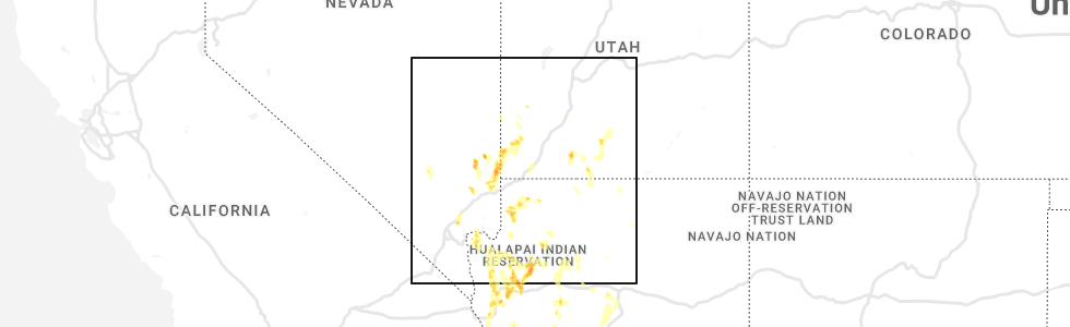
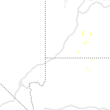
Hail Map for Orderville, UT
The Orderville, UT area has had 3 reports of on-the-ground hail by trained spotters, and has been under severe weather warnings 1 time during the past 12 months. Doppler radar has detected hail at or near Orderville, UT on 15 occasions.
| Name: | Orderville, UT |
| Where Located: | 52.3 miles E of Saint George, UT |
| Map: | Google Map for Orderville, UT |
| Population: | 577 |
| Housing Units: | 260 |
| More Info: | Search Google for Orderville, UT |
5
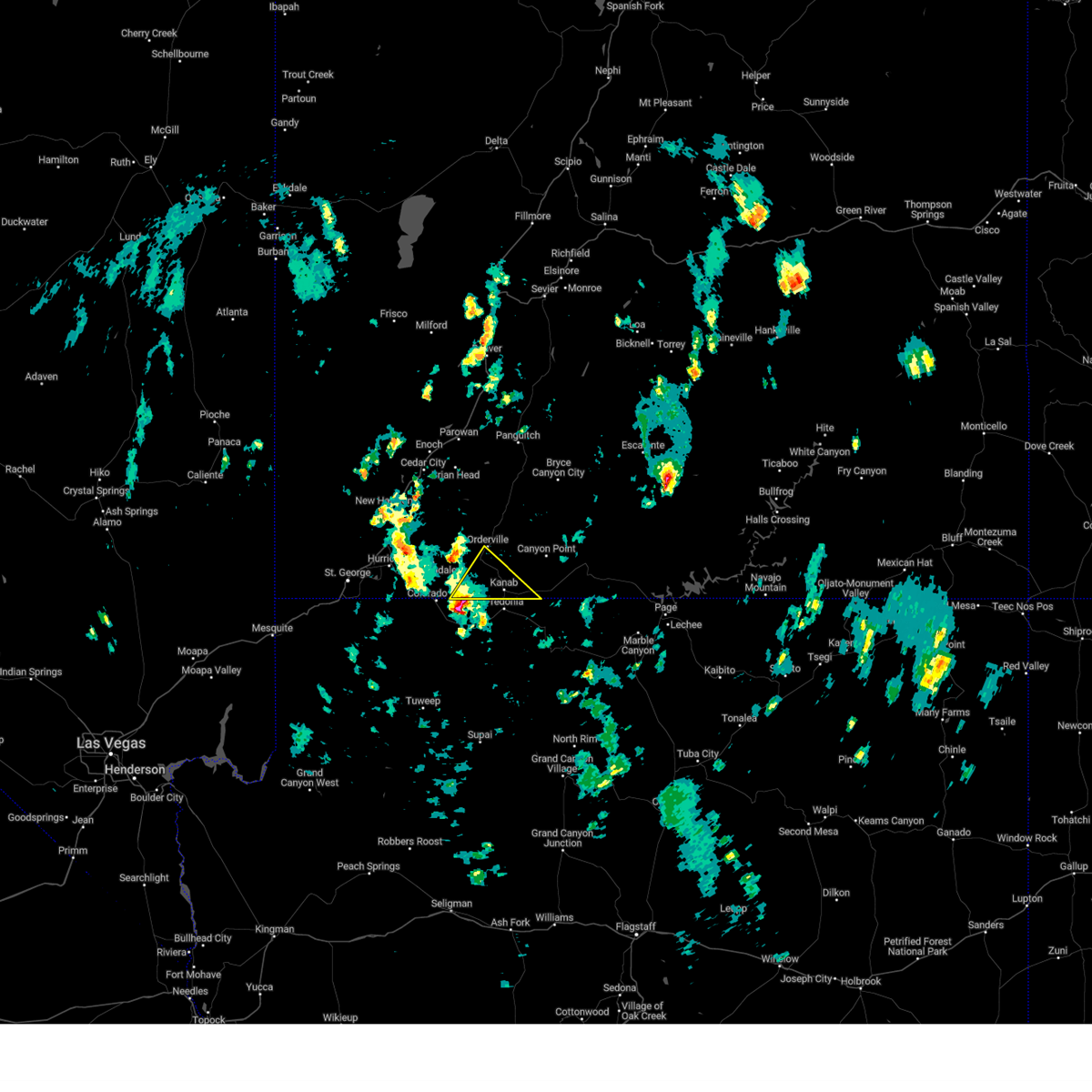
The Top Recent Hail Date for Orderville, UT is Sunday, August 21, 2022 (2nd out of 15)
Hail and Wind Damage Spotted near Orderville, UT
| Date / Time | Report Details |
|---|---|
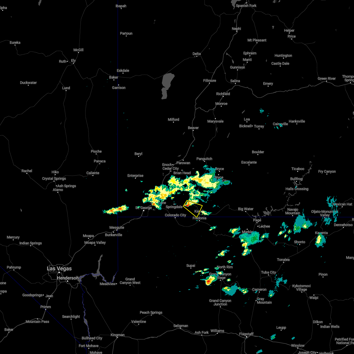
| 5/14/2023 2:33 PM MDT |
 At 233 pm mdt, a severe thunderstorm was located 8 miles north of kaibab, or 11 miles west of kanab, moving northeast at 20 mph (radar indicated). Hazards include 60 mph wind gusts and quarter size hail. Hail damage to vehicles is expected. Expect wind damage to roofs, siding, and trees. At 233 pm mdt, a severe thunderstorm was located 8 miles north of kaibab, or 11 miles west of kanab, moving northeast at 20 mph (radar indicated). Hazards include 60 mph wind gusts and quarter size hail. Hail damage to vehicles is expected. Expect wind damage to roofs, siding, and trees.
|
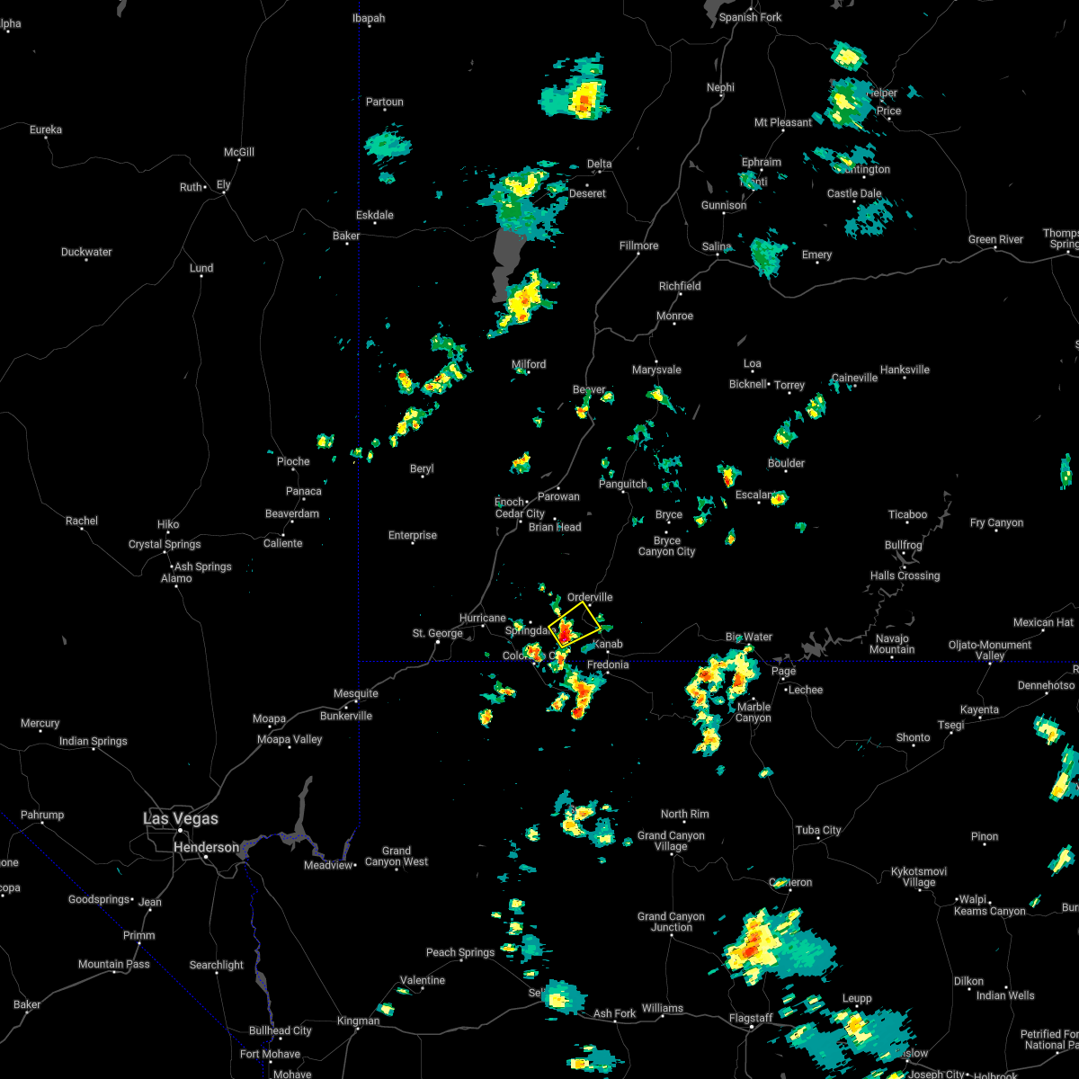
| 10/3/2022 6:39 AM MDT |
 At 638 am mdt, a severe thunderstorm was located 11 miles northwest of kanab, moving southeast at 15 mph (radar indicated). Hazards include 60 mph wind gusts and half dollar size hail. Hail damage to vehicles is expected. expect wind damage to roofs, siding, and trees. locations impacted include, kanab and orderville. this includes us route 89 between mile markers 66 and 81. hail threat, radar indicated max hail size, 1. 25 in wind threat, radar indicated max wind gust, 60 mph. At 638 am mdt, a severe thunderstorm was located 11 miles northwest of kanab, moving southeast at 15 mph (radar indicated). Hazards include 60 mph wind gusts and half dollar size hail. Hail damage to vehicles is expected. expect wind damage to roofs, siding, and trees. locations impacted include, kanab and orderville. this includes us route 89 between mile markers 66 and 81. hail threat, radar indicated max hail size, 1. 25 in wind threat, radar indicated max wind gust, 60 mph.
|
| 10/3/2022 6:30 AM MDT |
 At 630 am mdt, a severe thunderstorm was located 14 miles northwest of kanab, moving southeast at 10 mph (radar indicated). Hazards include 60 mph wind gusts and quarter size hail. Hail damage to vehicles is expected. Expect wind damage to roofs, siding, and trees. At 630 am mdt, a severe thunderstorm was located 14 miles northwest of kanab, moving southeast at 10 mph (radar indicated). Hazards include 60 mph wind gusts and quarter size hail. Hail damage to vehicles is expected. Expect wind damage to roofs, siding, and trees.
|
| 6/29/2022 12:56 PM MDT |
 At 1255 pm mdt, a severe thunderstorm was located 12 miles southeast of zion national park, moving northeast at 10 mph (radar indicated). Hazards include quarter size hail. damage to vehicles is expected At 1255 pm mdt, a severe thunderstorm was located 12 miles southeast of zion national park, moving northeast at 10 mph (radar indicated). Hazards include quarter size hail. damage to vehicles is expected
|
| 8/10/2016 2:43 PM MDT |
 The severe thunderstorm warning for northwestern kane county will expire at 245 pm mdt. the storm which prompted the warning has weakened below severe limits. and no longer poses an immediate threat to life or property. Therefore the warning will be allowed to expire. The severe thunderstorm warning for northwestern kane county will expire at 245 pm mdt. the storm which prompted the warning has weakened below severe limits. and no longer poses an immediate threat to life or property. Therefore the warning will be allowed to expire.
|
| 8/10/2016 2:29 PM MDT |
 At 228 pm mdt, doppler radar indicated a severe thunderstorm capable of producing large hail up to ping pong ball size and damaging winds in excess of 60 mph. this storm was located 16 miles north of kanab, moving east at 30 mph. locations impacted include, orderville, glendale and mt carmel. At 228 pm mdt, doppler radar indicated a severe thunderstorm capable of producing large hail up to ping pong ball size and damaging winds in excess of 60 mph. this storm was located 16 miles north of kanab, moving east at 30 mph. locations impacted include, orderville, glendale and mt carmel.
|
| 8/10/2016 2:25 PM MDT | Quarter sized hail reported 2.2 miles SW of Orderville, UT |
| 8/10/2016 2:23 PM MDT | Quarter sized hail reported 1.9 miles NNE of Orderville, UT |
| 8/10/2016 2:17 PM MDT |
 At 216 pm mdt, doppler radar indicated a severe thunderstorm capable of producing half dollar size hail and strong gusty winds to 50 mph. this storm was located 11 miles east of zion national park, or 18 miles northwest of kanab, and moving east at 25 mph. At 216 pm mdt, doppler radar indicated a severe thunderstorm capable of producing half dollar size hail and strong gusty winds to 50 mph. this storm was located 11 miles east of zion national park, or 18 miles northwest of kanab, and moving east at 25 mph.
|
| 8/10/2016 12:20 PM MDT | Quarter sized hail reported 1.9 miles NNE of Orderville, UT, nickel to quarter sized hail reported in mt carmel...accumulating to a significant depth. |
| 6/5/2015 3:33 PM MDT | At 332 pm mdt, doppler radar indicated a severe thunderstorm capable of producing quarter size hail and damaging winds in excess of 60 mph. this storm was located near kanab, moving northeast at 30 mph. locations impacted include, kanab, orderville, glendale and mt carmel. this warning includes us 89 between mt carmel and the utah and arizona border. hail may accumulate on us 89 under this storm. |
| 6/5/2015 3:22 PM MDT | At 321 pm mdt, doppler radar indicated a severe thunderstorm capable of producing quarter size hail and damaging winds in excess of 60 mph. this storm was located near kanab, and moving northeast at 30 mph. |
Hail Maps for Orderville, UT


Connect with Interactive Hail Maps