

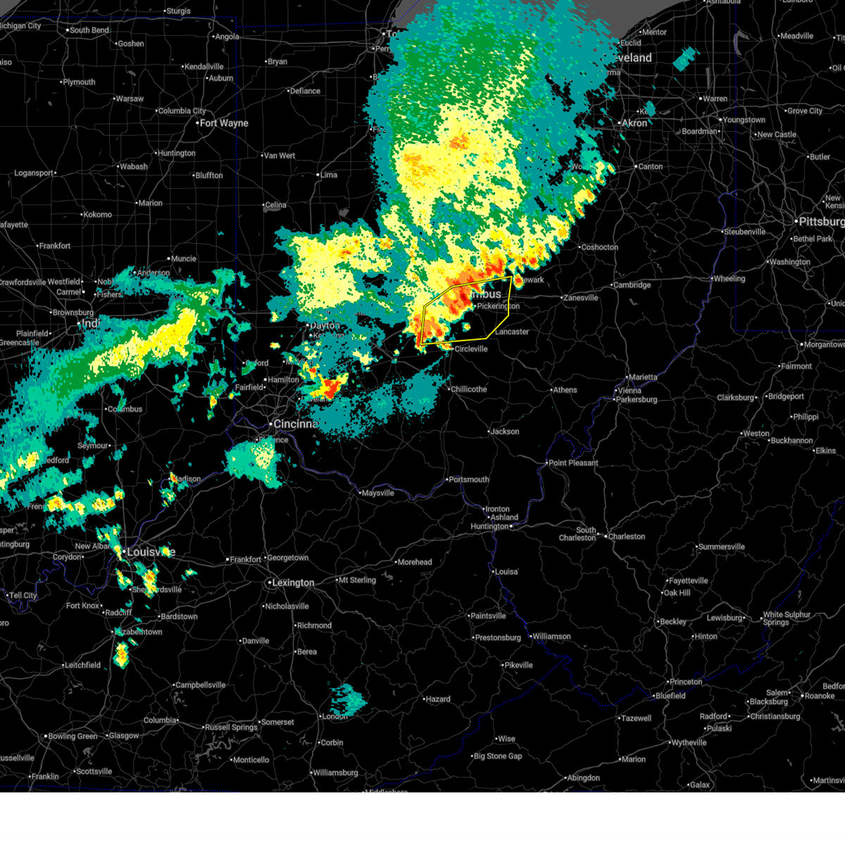
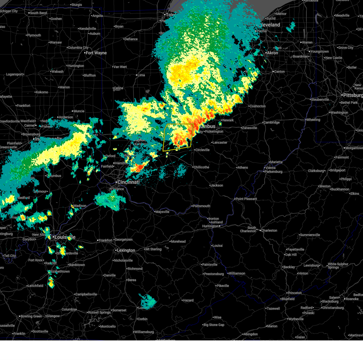
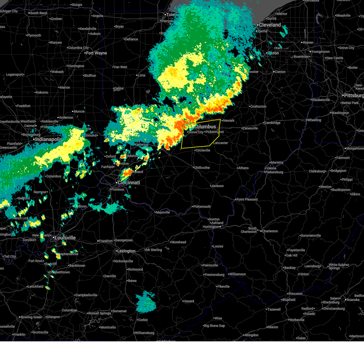
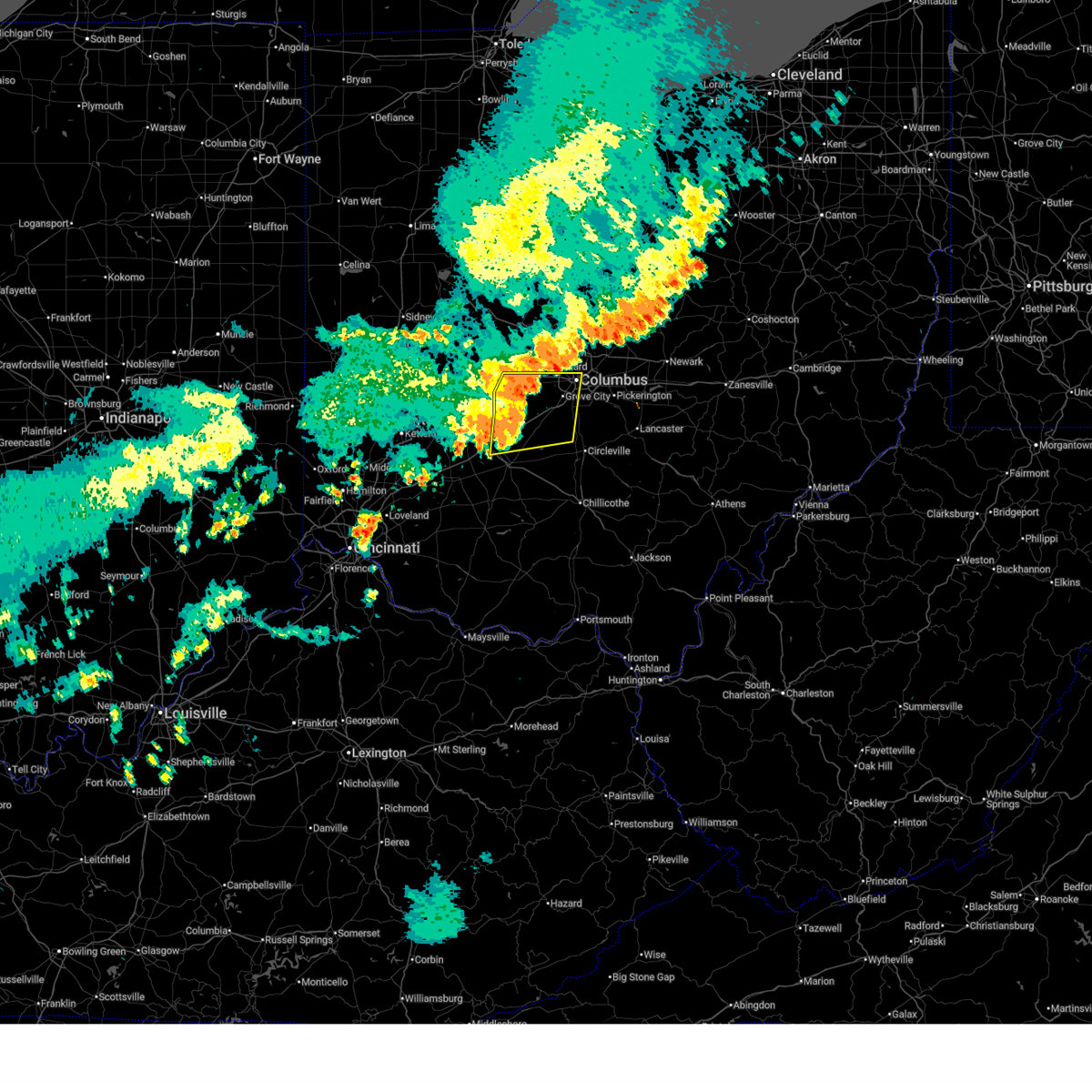
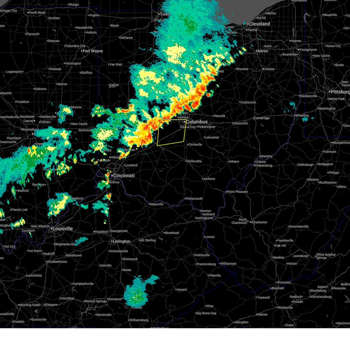
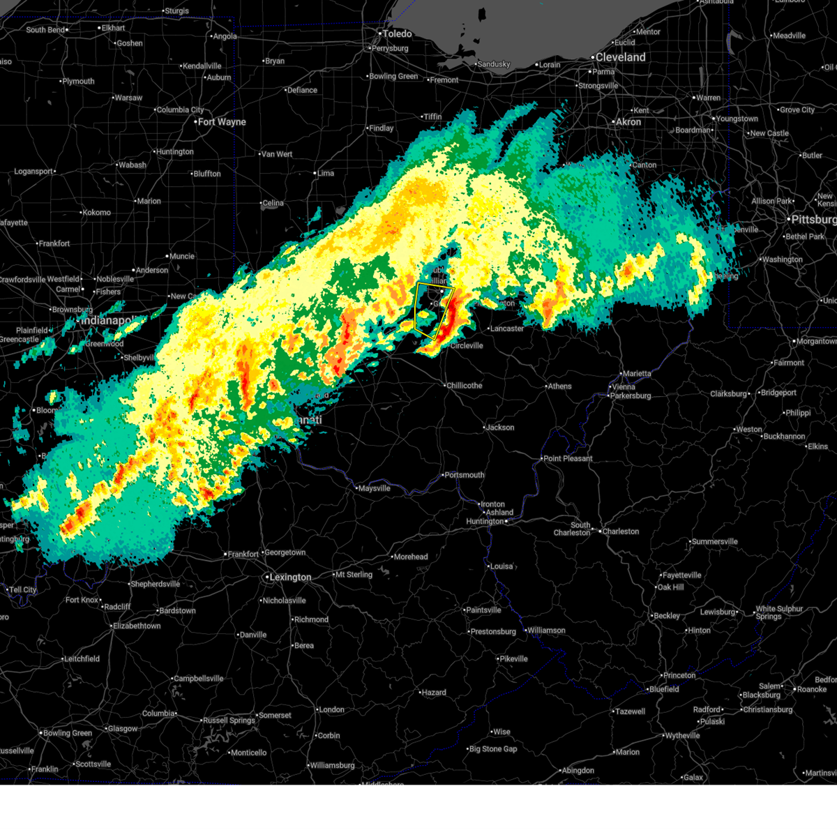
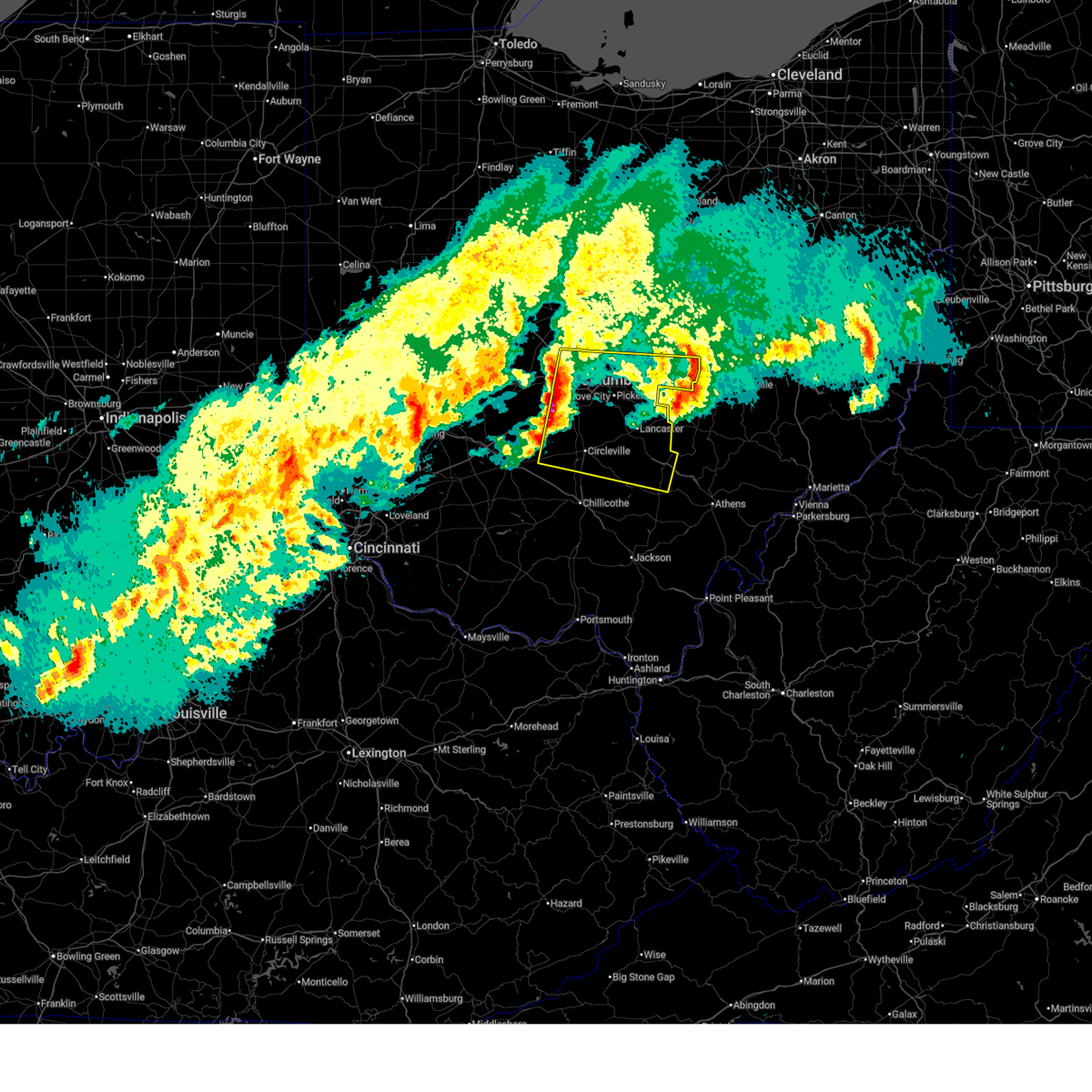
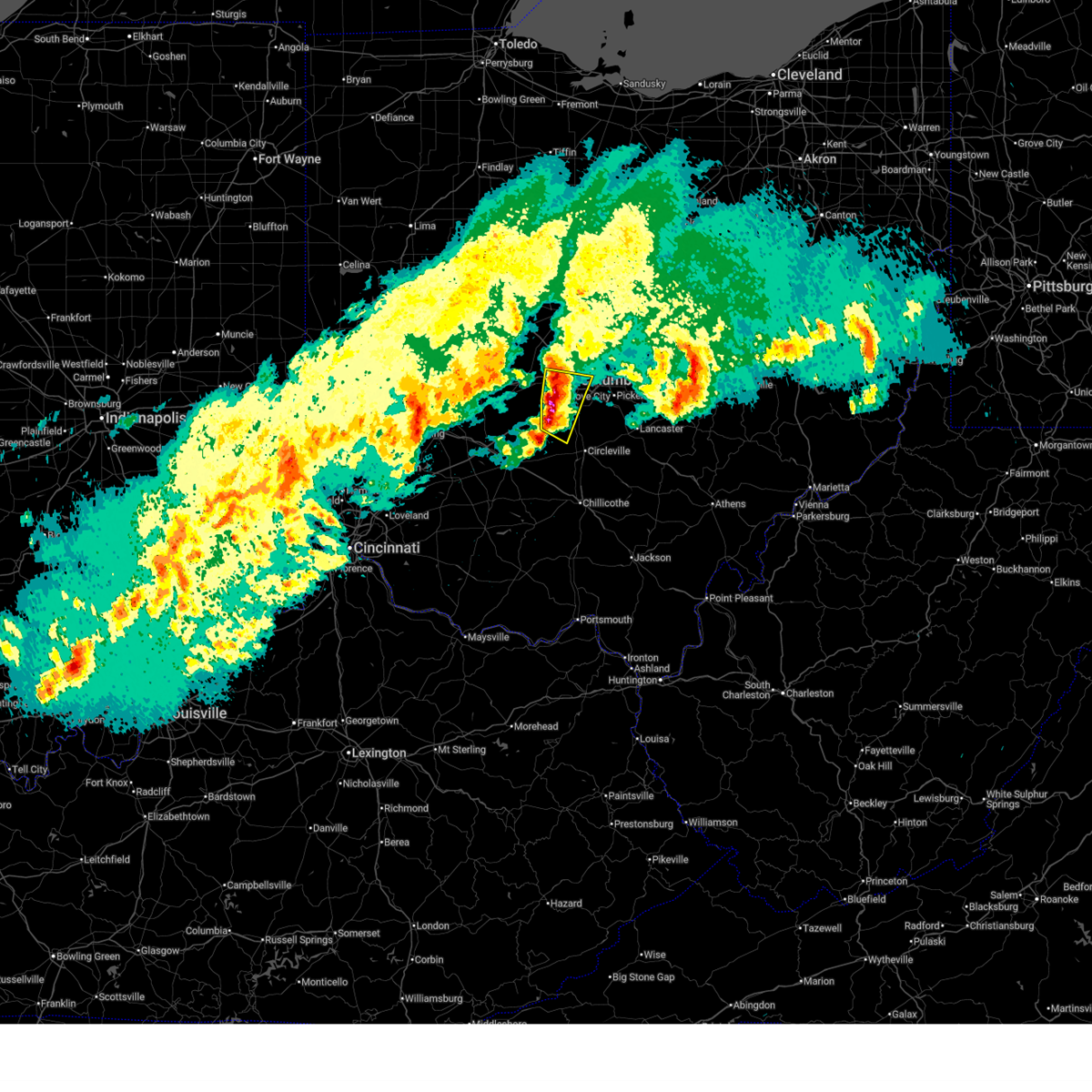
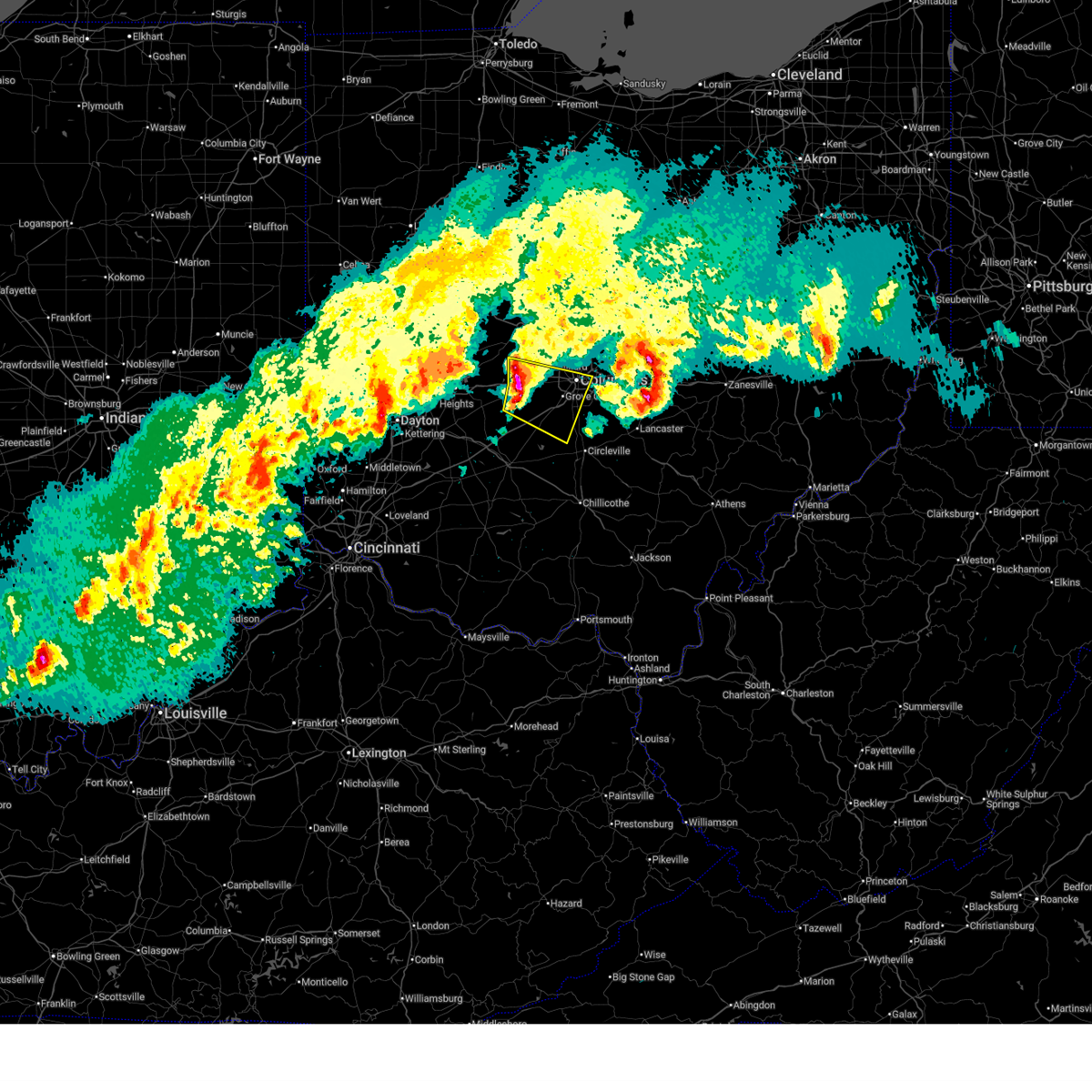
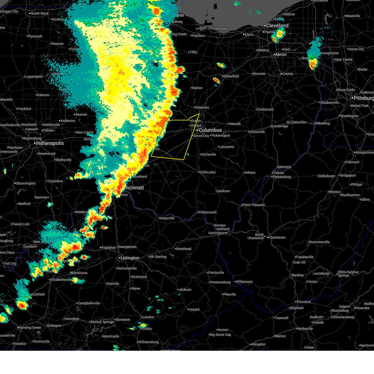
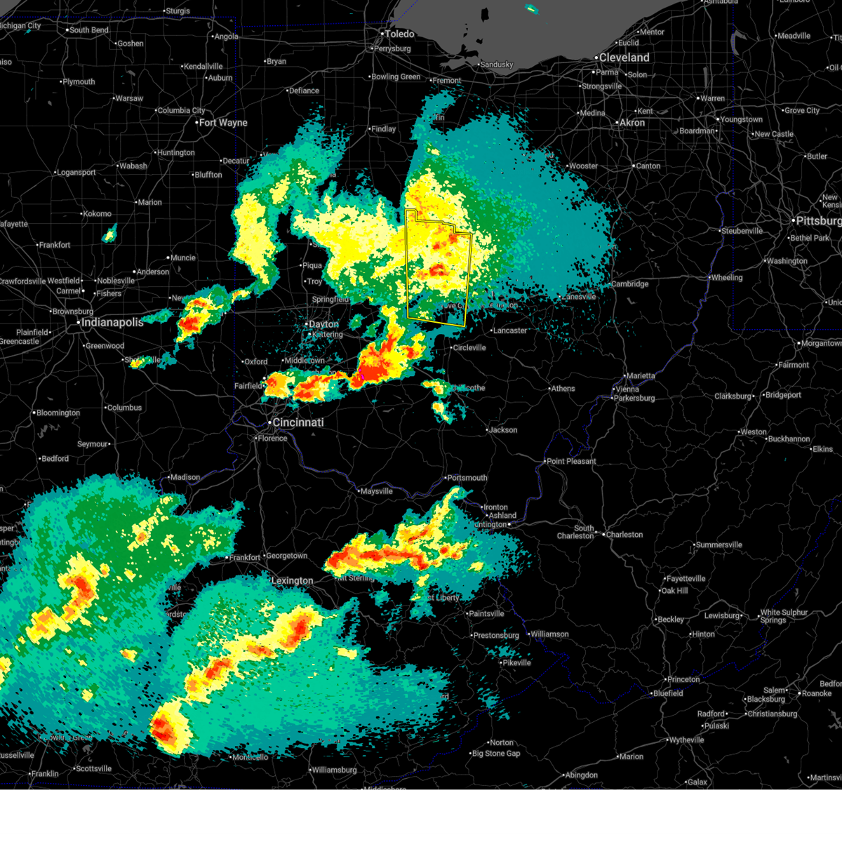
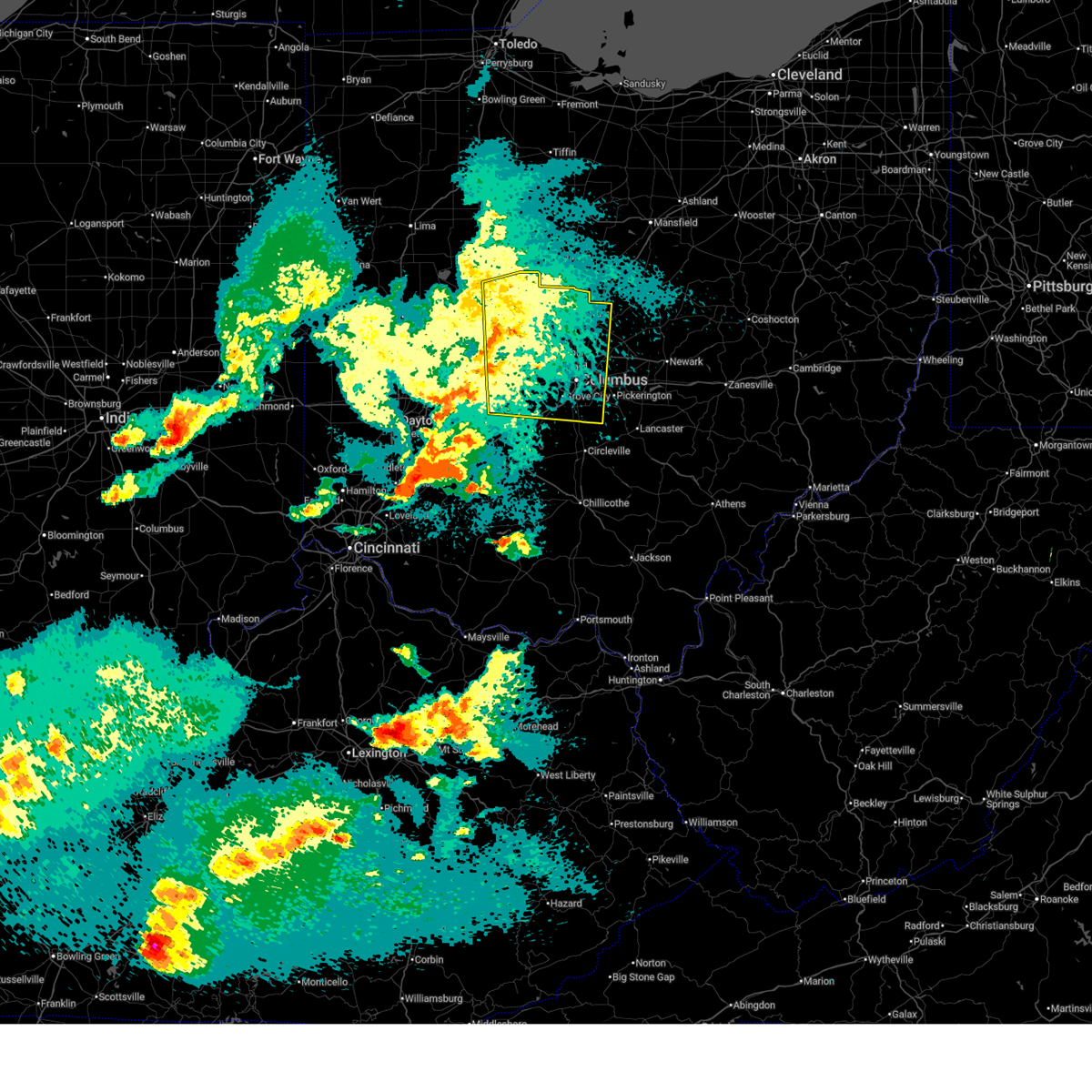
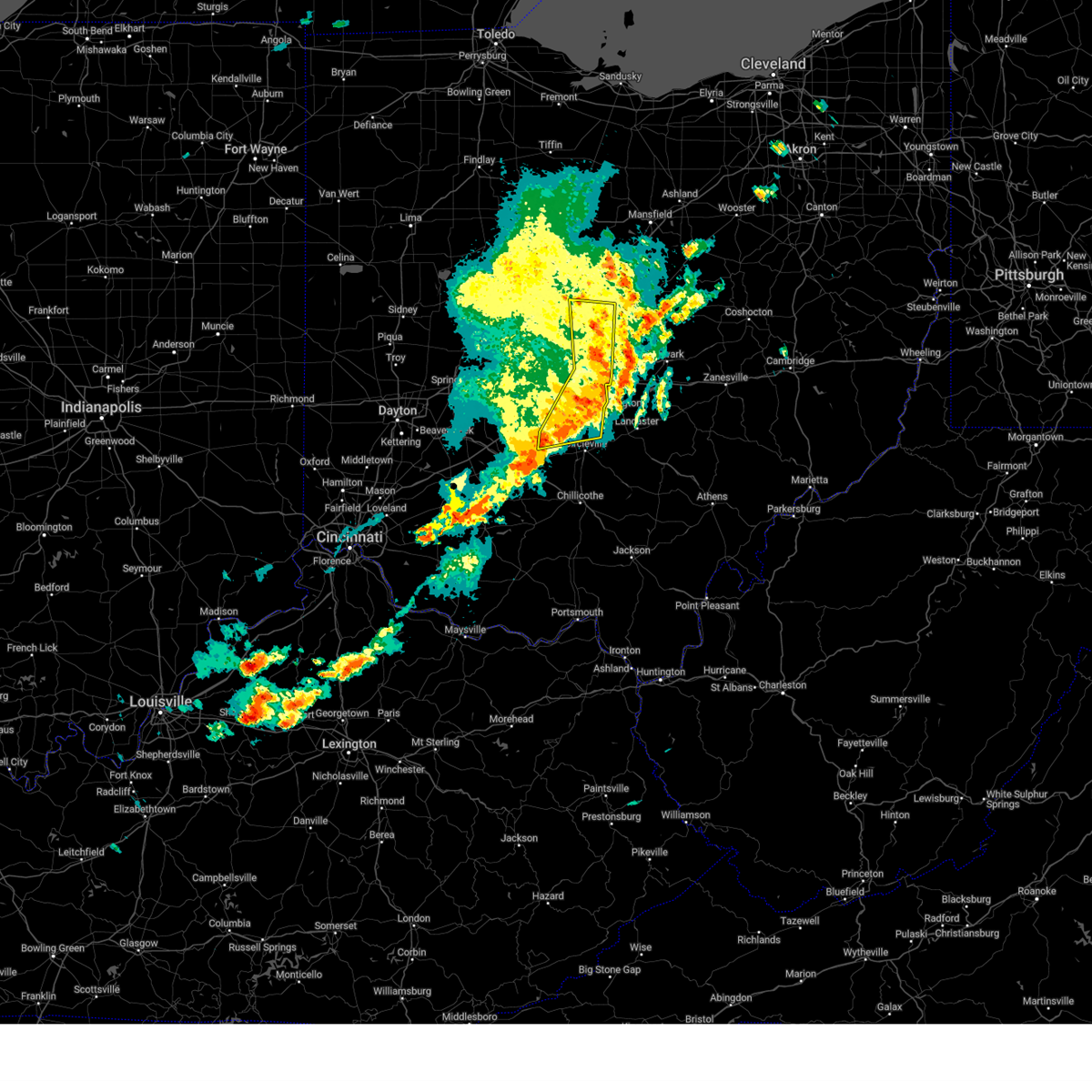
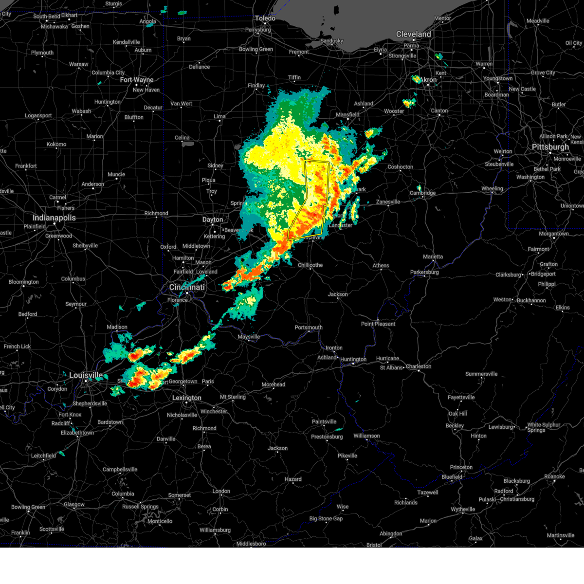
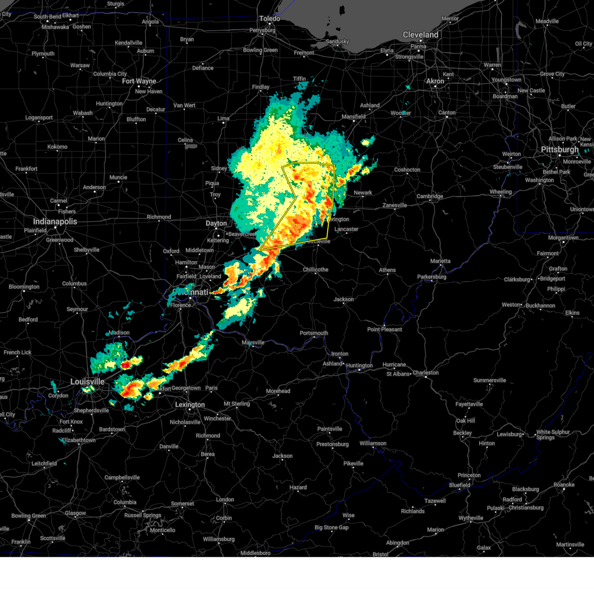
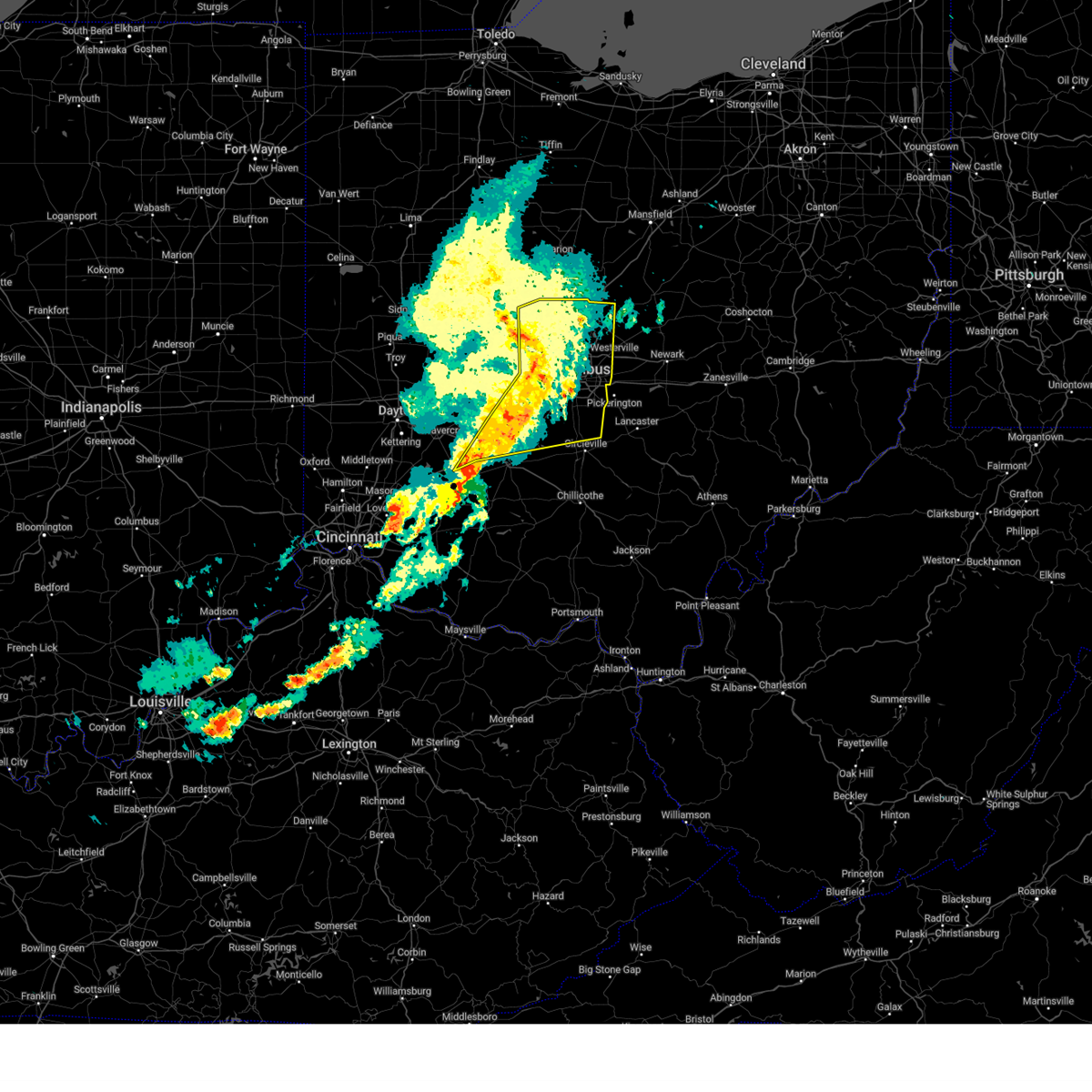
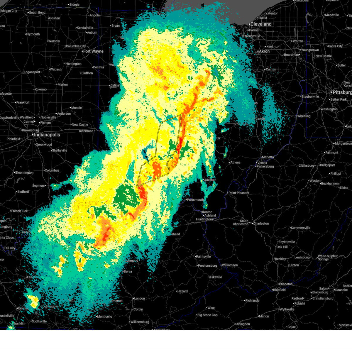
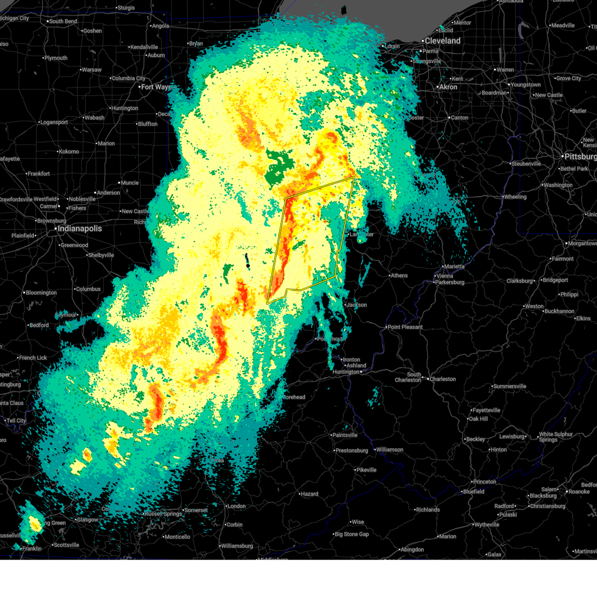
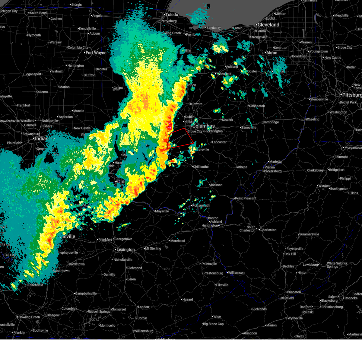
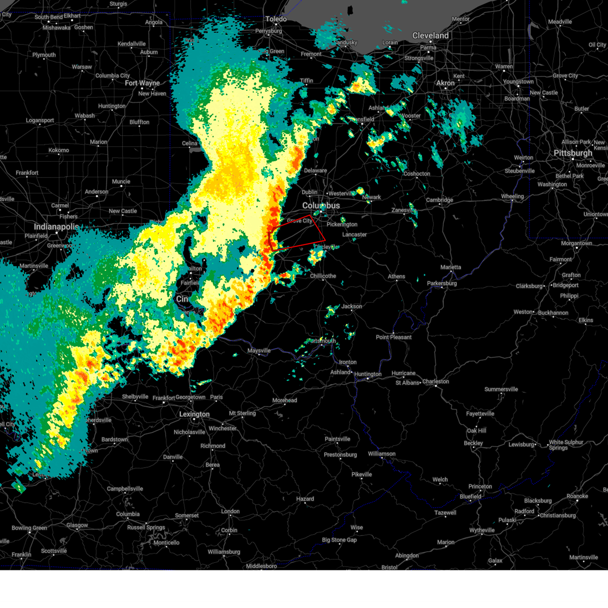
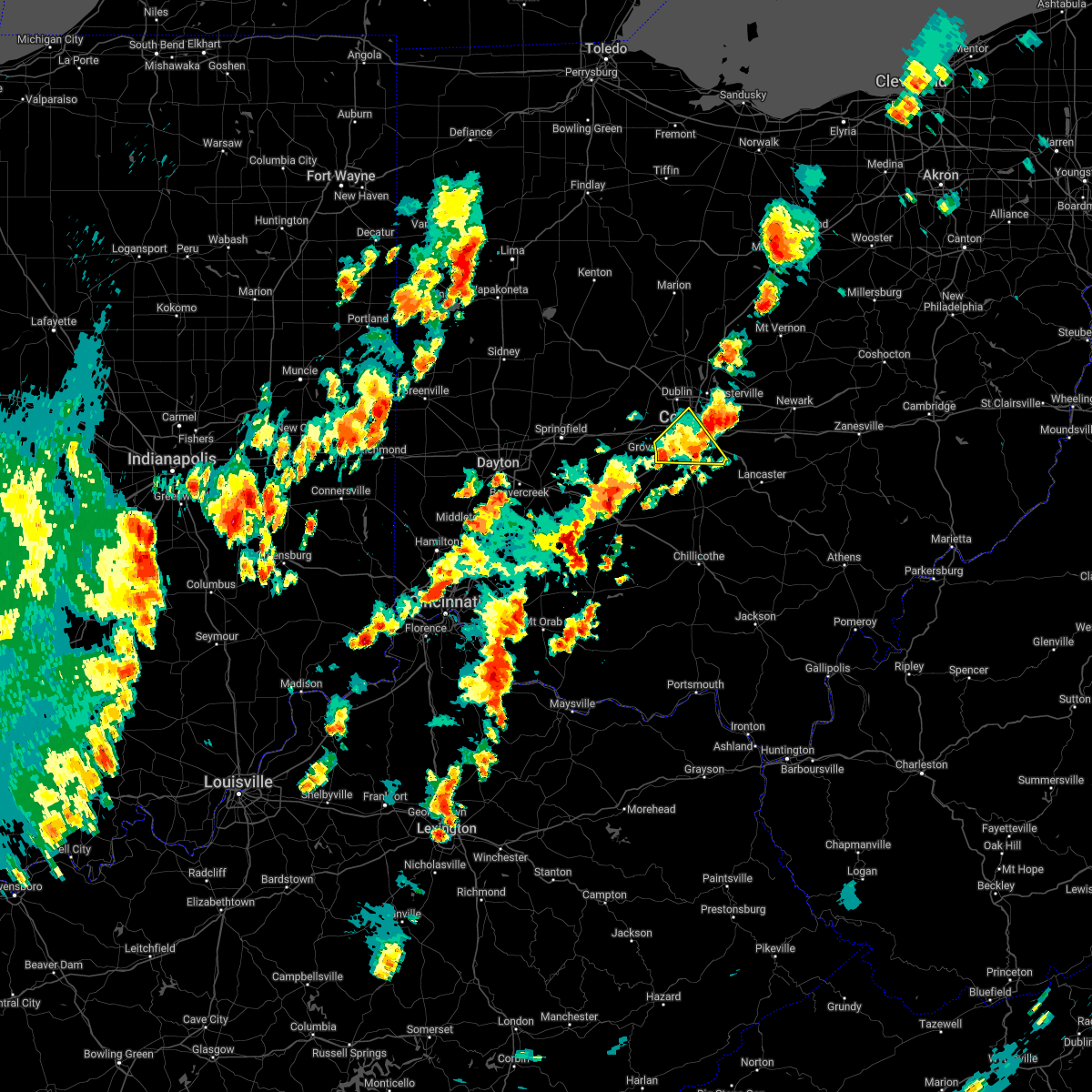
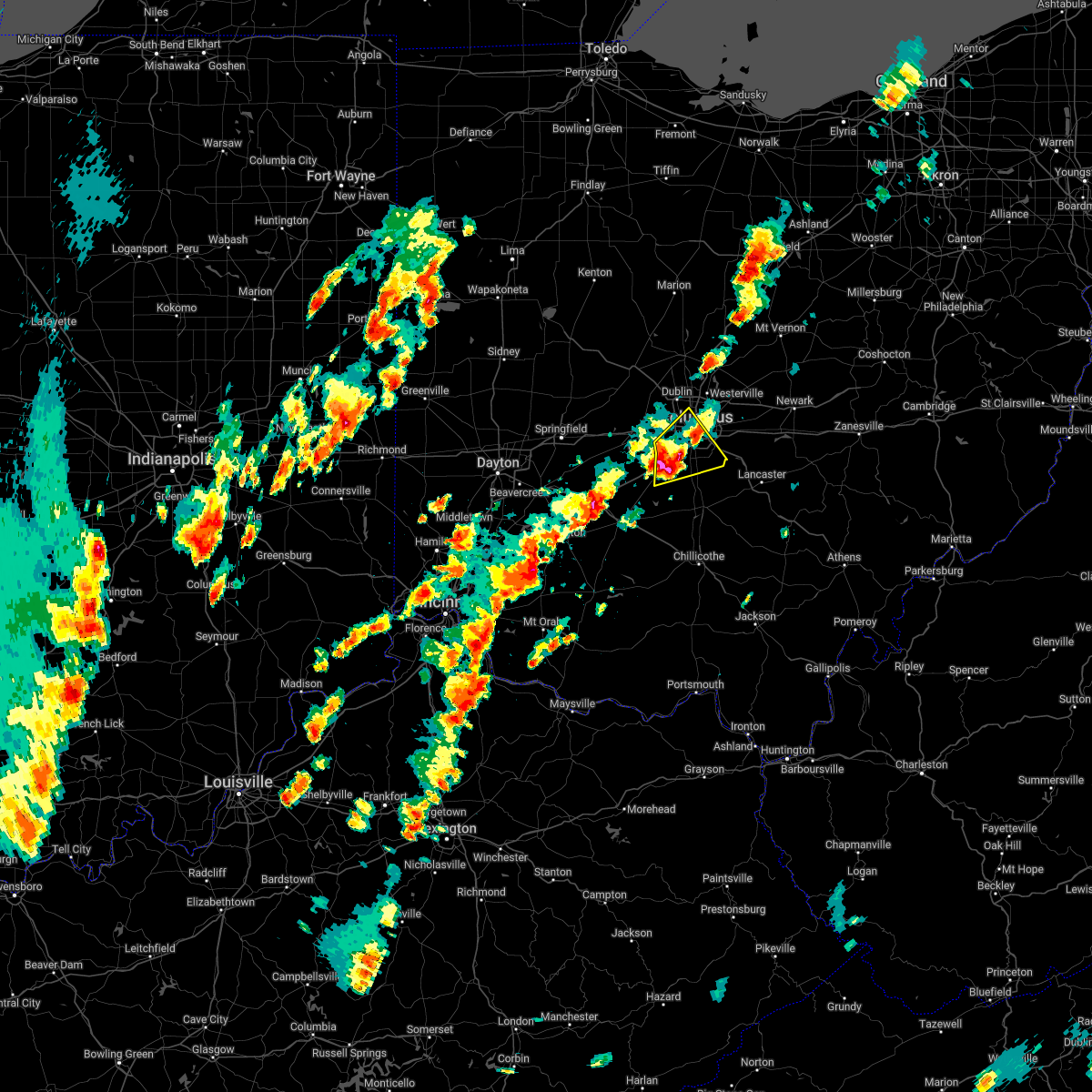
Hail Map for Orient, OH
The Orient, OH area has had 1 report of on-the-ground hail by trained spotters, and has been under severe weather warnings 16 times during the past 12 months. Doppler radar has detected hail at or near Orient, OH on 28 occasions, including 2 occasions during the past year.
| Name: | Orient, OH |
| Where Located: | 13.5 miles SW of Columbus, OH |
| Map: | Google Map for Orient, OH |
| Population: | 270 |
| Housing Units: | 100 |
| More Info: | Search Google for Orient, OH |
2
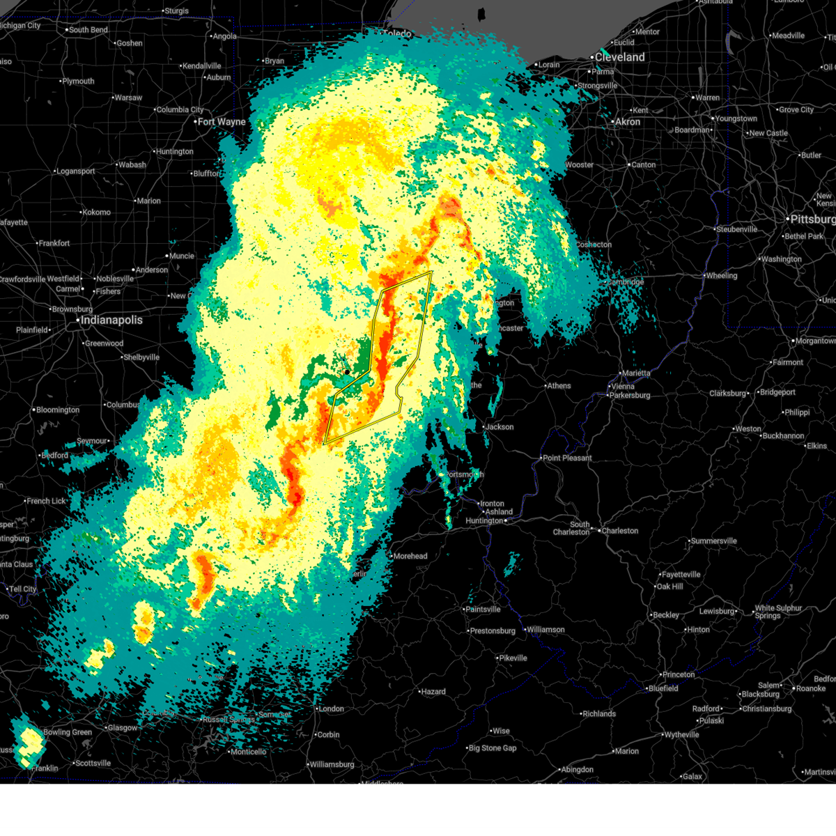
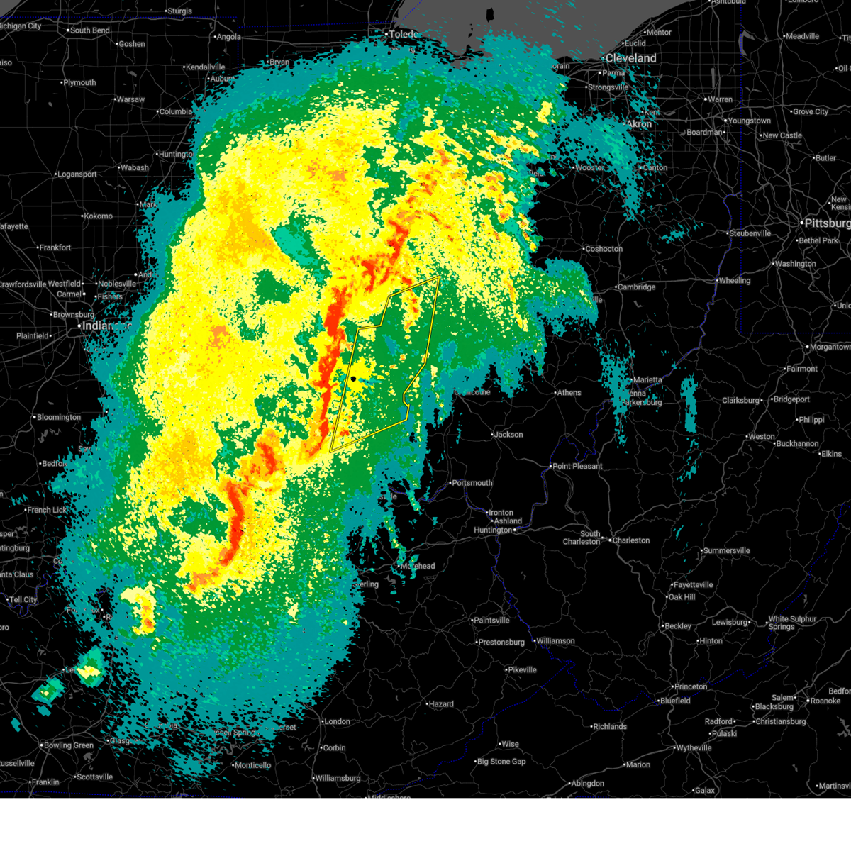
The Top Recent Hail Date for Orient, OH is Sunday, March 22, 2026 (3rd out of 28)
Hail and Wind Damage Spotted near Orient, OH
| Date / Time | Report Details |
|---|---|
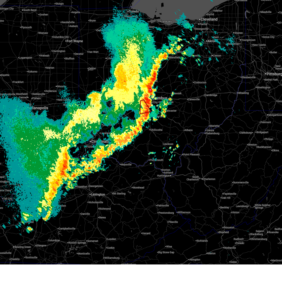
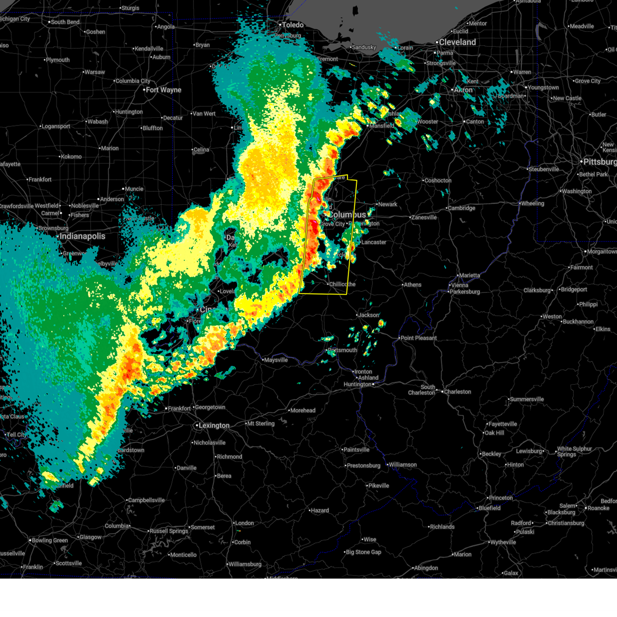
| 6/14/2026 4:17 PM EDT |
 At 417 pm edt, severe thunderstorms were located along a line extending from johnstown to grove city, moving east at 50 mph (radar indicated). Hazards include 60 mph wind gusts. Expect damage to trees and power lines. locations impacted include, columbus, newark, reynoldsburg, grove city, upper arlington, gahanna, pickerington, bexley, heath, granville, pataskala, canal winchester, groveport, baltimore, buckeye lake, hebron, millersport, fairfield beach, beechwood trails, and harbor hills. this includes the following interstates, i-70 in ohio between mile markers 95 and 132. I-71 in ohio between mile markers 91 and 113. At 417 pm edt, severe thunderstorms were located along a line extending from johnstown to grove city, moving east at 50 mph (radar indicated). Hazards include 60 mph wind gusts. Expect damage to trees and power lines. locations impacted include, columbus, newark, reynoldsburg, grove city, upper arlington, gahanna, pickerington, bexley, heath, granville, pataskala, canal winchester, groveport, baltimore, buckeye lake, hebron, millersport, fairfield beach, beechwood trails, and harbor hills. this includes the following interstates, i-70 in ohio between mile markers 95 and 132. I-71 in ohio between mile markers 91 and 113.
|
| 6/14/2026 4:03 PM EDT |
 Svriln the national weather service in wilmington has issued a * severe thunderstorm warning for, franklin county in central ohio, northwestern fairfield county in central ohio, southwestern licking county in central ohio, * until 445 pm edt. * at 402 pm edt, severe thunderstorms were located along a line extending from westerville to lake darby, moving east at 45 mph (radar indicated). Hazards include 60 mph wind gusts. expect damage to trees and power lines Svriln the national weather service in wilmington has issued a * severe thunderstorm warning for, franklin county in central ohio, northwestern fairfield county in central ohio, southwestern licking county in central ohio, * until 445 pm edt. * at 402 pm edt, severe thunderstorms were located along a line extending from westerville to lake darby, moving east at 45 mph (radar indicated). Hazards include 60 mph wind gusts. expect damage to trees and power lines
|
| 5/19/2026 9:50 PM EDT |
 The storm which prompted the warning has weakened below severe limits and no longer poses an immediate threat to life or property. therefore, the warning will be allowed to expire. please report previous wind damage or hail to the national weather service by going to our website at weather.gov/iln and submitting your report via social media. The storm which prompted the warning has weakened below severe limits and no longer poses an immediate threat to life or property. therefore, the warning will be allowed to expire. please report previous wind damage or hail to the national weather service by going to our website at weather.gov/iln and submitting your report via social media.
|
| 5/19/2026 9:33 PM EDT |
 At 932 pm edt, a severe thunderstorm was located over pickerington, moving east at 45 mph (radar indicated). Hazards include 60 mph wind gusts. Expect damage to trees and power lines. locations impacted include, columbus, newark, lancaster, reynoldsburg, grove city, gahanna, pickerington, bexley, heath, granville, pataskala, canal winchester, groveport, ashville, baltimore, buckeye lake, hebron, south bloomfield, millersport, and pleasantville. this includes the following interstates, i-70 in ohio between mile markers 98 and 129. I-71 in ohio between mile markers 91 and 110. At 932 pm edt, a severe thunderstorm was located over pickerington, moving east at 45 mph (radar indicated). Hazards include 60 mph wind gusts. Expect damage to trees and power lines. locations impacted include, columbus, newark, lancaster, reynoldsburg, grove city, gahanna, pickerington, bexley, heath, granville, pataskala, canal winchester, groveport, ashville, baltimore, buckeye lake, hebron, south bloomfield, millersport, and pleasantville. this includes the following interstates, i-70 in ohio between mile markers 98 and 129. I-71 in ohio between mile markers 91 and 110.
|
| 5/19/2026 9:26 PM EDT |
 An additional severe thunderstorm warning remains in effect for portions of franklin and pickaway counties until 1000 pm edt. a severe thunderstorm watch remains in effect until 1000 pm edt for central ohio. please report previous wind damage or hail to the national weather service by going to our website at weather.gov/iln and submitting your report via social media. An additional severe thunderstorm warning remains in effect for portions of franklin and pickaway counties until 1000 pm edt. a severe thunderstorm watch remains in effect until 1000 pm edt for central ohio. please report previous wind damage or hail to the national weather service by going to our website at weather.gov/iln and submitting your report via social media.
|
| 5/19/2026 9:10 PM EDT |
 Svriln the national weather service in wilmington has issued a * severe thunderstorm warning for, southern franklin county in central ohio, northern fairfield county in central ohio, northern pickaway county in central ohio, southwestern licking county in central ohio, * until 1000 pm edt. * at 910 pm edt, a severe thunderstorm was located 8 miles southeast of jefferson, moving east at 35 mph (radar indicated). Hazards include 60 mph wind gusts. expect damage to trees and power lines Svriln the national weather service in wilmington has issued a * severe thunderstorm warning for, southern franklin county in central ohio, northern fairfield county in central ohio, northern pickaway county in central ohio, southwestern licking county in central ohio, * until 1000 pm edt. * at 910 pm edt, a severe thunderstorm was located 8 miles southeast of jefferson, moving east at 35 mph (radar indicated). Hazards include 60 mph wind gusts. expect damage to trees and power lines
|
| 5/19/2026 8:59 PM EDT |
 At 858 pm edt, a severe thunderstorm was located 7 miles southeast of london, moving east at 45 mph (radar indicated). Hazards include 60 mph wind gusts. Expect damage to trees and power lines. locations impacted include, columbus, grove city, upper arlington, london, jefferson, west jefferson, mount sterling, jeffersonville, bloomingburg, choctaw lake, lake darby, grandview heights, commercial point, urbancrest, valleyview, marble cliff, lafayette, midway, and harrisburg. this includes the following interstates, i-70 in ohio between mile markers 71 and 101. I-71 in ohio between mile markers 68 and 111. At 858 pm edt, a severe thunderstorm was located 7 miles southeast of london, moving east at 45 mph (radar indicated). Hazards include 60 mph wind gusts. Expect damage to trees and power lines. locations impacted include, columbus, grove city, upper arlington, london, jefferson, west jefferson, mount sterling, jeffersonville, bloomingburg, choctaw lake, lake darby, grandview heights, commercial point, urbancrest, valleyview, marble cliff, lafayette, midway, and harrisburg. this includes the following interstates, i-70 in ohio between mile markers 71 and 101. I-71 in ohio between mile markers 68 and 111.
|
| 5/19/2026 8:39 PM EDT |
 Svriln the national weather service in wilmington has issued a * severe thunderstorm warning for, southwestern franklin county in central ohio, northern fayette county in central ohio, northwestern pickaway county in central ohio, madison county in central ohio, * until 930 pm edt. * at 838 pm edt, a severe thunderstorm was located near south charleston, moving east at 45 mph (radar indicated). Hazards include 60 mph wind gusts. expect damage to trees and power lines Svriln the national weather service in wilmington has issued a * severe thunderstorm warning for, southwestern franklin county in central ohio, northern fayette county in central ohio, northwestern pickaway county in central ohio, madison county in central ohio, * until 930 pm edt. * at 838 pm edt, a severe thunderstorm was located near south charleston, moving east at 45 mph (radar indicated). Hazards include 60 mph wind gusts. expect damage to trees and power lines
|
| 3/22/2026 11:13 PM EDT |
 The storm which prompted the warning has moved out of the area. therefore, the warning will be allowed to expire. however, a severe thunderstorm warning still exists in franklin and pickaway county. a severe thunderstorm watch remains in effect until midnight edt for central ohio. please report previous wind damage or hail to the national weather service by going to our website at weather.gov/iln and submitting your report via social media. The storm which prompted the warning has moved out of the area. therefore, the warning will be allowed to expire. however, a severe thunderstorm warning still exists in franklin and pickaway county. a severe thunderstorm watch remains in effect until midnight edt for central ohio. please report previous wind damage or hail to the national weather service by going to our website at weather.gov/iln and submitting your report via social media.
|
| 3/22/2026 11:02 PM EDT |
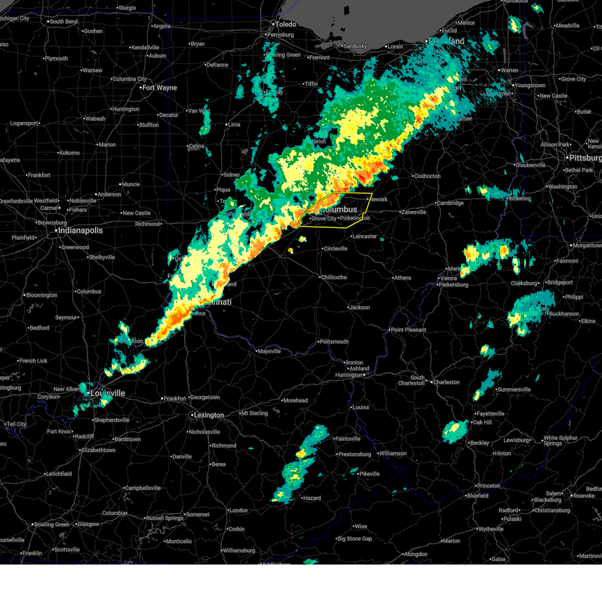
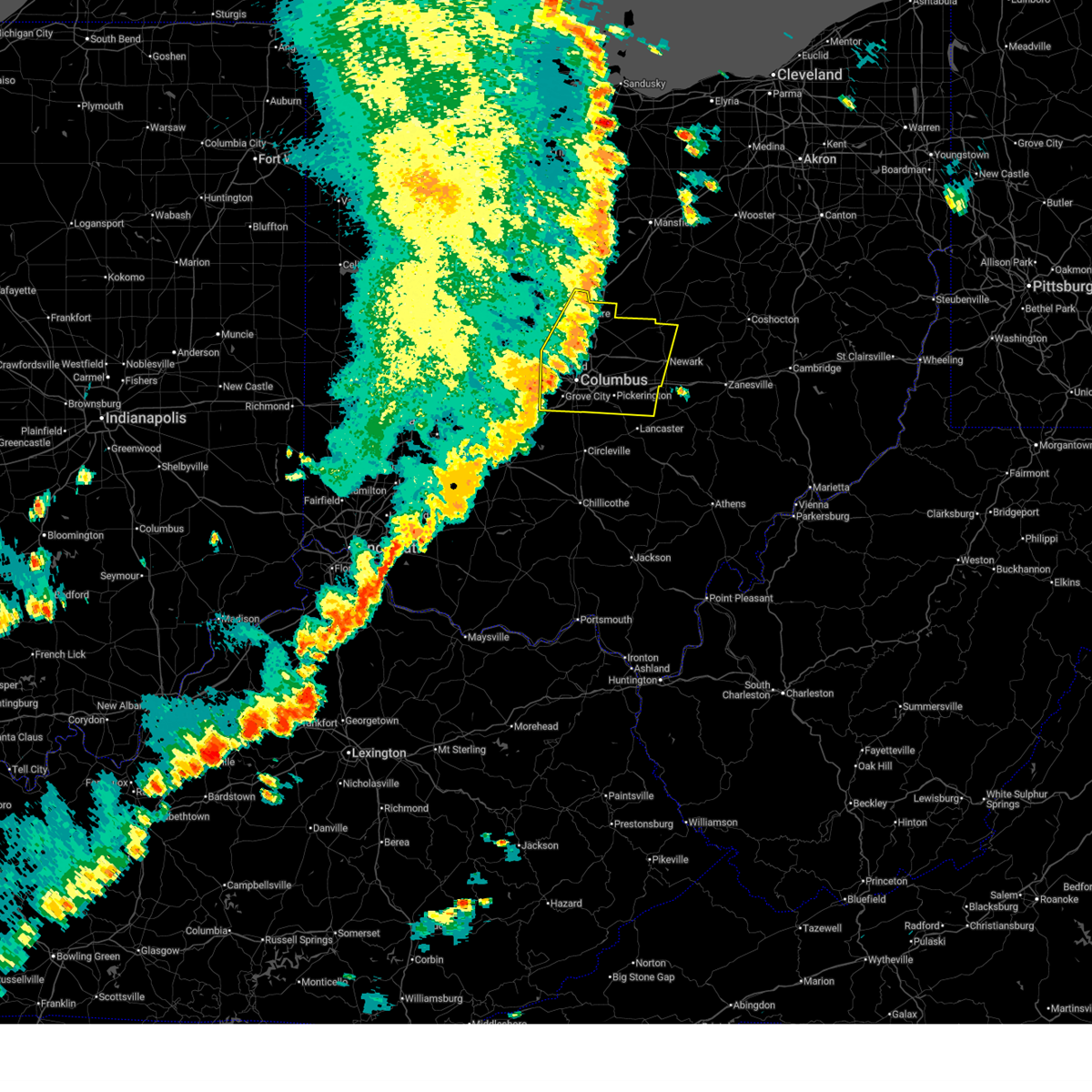
 Svriln the national weather service in wilmington has issued a * severe thunderstorm warning for, franklin county in central ohio, fairfield county in central ohio, hocking county in central ohio, pickaway county in central ohio, southern licking county in central ohio, northeastern ross county in south central ohio, * until 1145 pm edt. * at 1101 pm edt, a severe thunderstorm was located near grove city, moving east at 55 mph (radar indicated). Hazards include 60 mph wind gusts and quarter size hail. Minor hail damage to vehicles is possible. Expect wind damage to trees and power lines. Svriln the national weather service in wilmington has issued a * severe thunderstorm warning for, franklin county in central ohio, fairfield county in central ohio, hocking county in central ohio, pickaway county in central ohio, southern licking county in central ohio, northeastern ross county in south central ohio, * until 1145 pm edt. * at 1101 pm edt, a severe thunderstorm was located near grove city, moving east at 55 mph (radar indicated). Hazards include 60 mph wind gusts and quarter size hail. Minor hail damage to vehicles is possible. Expect wind damage to trees and power lines.
|
| 3/22/2026 10:59 PM EDT |
 the severe thunderstorm warning has been cancelled and is no longer in effect the severe thunderstorm warning has been cancelled and is no longer in effect
|
| 3/22/2026 10:59 PM EDT |
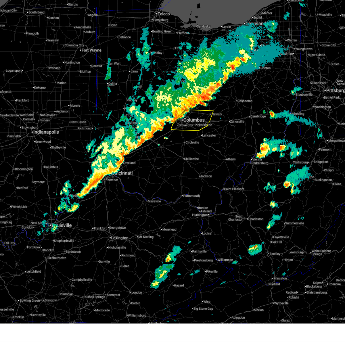
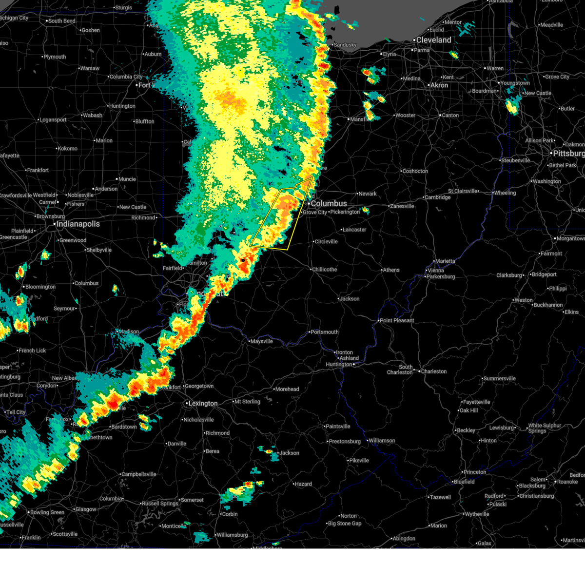
 At 1058 pm edt, a severe thunderstorm was located near lake darby, moving east at 50 mph (radar indicated). Hazards include 60 mph wind gusts and half dollar size hail. Minor hail damage to vehicles is possible. expect wind damage to trees and power lines. locations impacted include, columbus, grove city, upper arlington, hilliard, bexley, lake darby, whitehall, grandview heights, obetz, commercial point, urbancrest, valleyview, marble cliff, harrisburg, orient, lockbourne, darbyville, derby, georgesville, and darbydale. this includes the following interstates, i-70 in ohio between mile markers 88 and 104. I-71 in ohio between mile markers 89 and 110. At 1058 pm edt, a severe thunderstorm was located near lake darby, moving east at 50 mph (radar indicated). Hazards include 60 mph wind gusts and half dollar size hail. Minor hail damage to vehicles is possible. expect wind damage to trees and power lines. locations impacted include, columbus, grove city, upper arlington, hilliard, bexley, lake darby, whitehall, grandview heights, obetz, commercial point, urbancrest, valleyview, marble cliff, harrisburg, orient, lockbourne, darbyville, derby, georgesville, and darbydale. this includes the following interstates, i-70 in ohio between mile markers 88 and 104. I-71 in ohio between mile markers 89 and 110.
|
| 3/22/2026 10:45 PM EDT |
 At 1045 pm edt, a severe thunderstorm was located near west jefferson, moving east at 50 mph (radar indicated). Hazards include 60 mph wind gusts and half dollar size hail. Minor hail damage to vehicles is possible. expect wind damage to trees and power lines. locations impacted include, columbus, grove city, upper arlington, hilliard, bexley, london, jefferson, west jefferson, mount sterling, ohio state university, lake darby, whitehall, grandview heights, obetz, commercial point, urbancrest, valleyview, marble cliff, lafayette, and harrisburg. this includes the following interstates, i-70 in ohio between mile markers 75 and 104. I-71 in ohio between mile markers 83 and 110. At 1045 pm edt, a severe thunderstorm was located near west jefferson, moving east at 50 mph (radar indicated). Hazards include 60 mph wind gusts and half dollar size hail. Minor hail damage to vehicles is possible. expect wind damage to trees and power lines. locations impacted include, columbus, grove city, upper arlington, hilliard, bexley, london, jefferson, west jefferson, mount sterling, ohio state university, lake darby, whitehall, grandview heights, obetz, commercial point, urbancrest, valleyview, marble cliff, lafayette, and harrisburg. this includes the following interstates, i-70 in ohio between mile markers 75 and 104. I-71 in ohio between mile markers 83 and 110.
|
| 3/22/2026 10:36 PM EDT |
 At 1036 pm edt, a severe thunderstorm was located near choctaw lake, moving east at 50 mph (radar indicated). Hazards include half dollar size hail. Minor damage to vehicles is possible. locations impacted include, columbus, grove city, upper arlington, hilliard, bexley, london, jefferson, west jefferson, mount sterling, choctaw lake, ohio state university, lake darby, whitehall, grandview heights, obetz, commercial point, urbancrest, valleyview, marble cliff, and lafayette. this includes the following interstates, i-70 in ohio between mile markers 71 and 104. I-71 in ohio between mile markers 83 and 110. At 1036 pm edt, a severe thunderstorm was located near choctaw lake, moving east at 50 mph (radar indicated). Hazards include half dollar size hail. Minor damage to vehicles is possible. locations impacted include, columbus, grove city, upper arlington, hilliard, bexley, london, jefferson, west jefferson, mount sterling, choctaw lake, ohio state university, lake darby, whitehall, grandview heights, obetz, commercial point, urbancrest, valleyview, marble cliff, and lafayette. this includes the following interstates, i-70 in ohio between mile markers 71 and 104. I-71 in ohio between mile markers 83 and 110.
|
| 3/22/2026 10:36 PM EDT |
 the severe thunderstorm warning has been cancelled and is no longer in effect the severe thunderstorm warning has been cancelled and is no longer in effect
|
| 3/22/2026 10:27 PM EDT |
 Svriln the national weather service in wilmington has issued a * severe thunderstorm warning for, southeastern champaign county in west central ohio, southwestern franklin county in central ohio, northwestern pickaway county in central ohio, eastern clark county in west central ohio, south central union county in central ohio, madison county in central ohio, * until 1115 pm edt. * at 1027 pm edt, a severe thunderstorm was located near northridge, moving east at 50 mph (radar indicated). Hazards include quarter size hail. minor damage to vehicles is possible Svriln the national weather service in wilmington has issued a * severe thunderstorm warning for, southeastern champaign county in west central ohio, southwestern franklin county in central ohio, northwestern pickaway county in central ohio, eastern clark county in west central ohio, south central union county in central ohio, madison county in central ohio, * until 1115 pm edt. * at 1027 pm edt, a severe thunderstorm was located near northridge, moving east at 50 mph (radar indicated). Hazards include quarter size hail. minor damage to vehicles is possible
|
| 6/18/2025 8:29 PM EDT | Trees blown down... scattered across the count in pickaway county OH, 7.5 miles NNW of Orient, OH |
| 6/18/2025 8:22 PM EDT |
 At 822 pm edt, severe thunderstorms were located along a line extending from near ashley to near grove city, moving east at 30 mph (radar indicated). Hazards include 60 mph wind gusts. Expect damage to trees and power lines. locations impacted include, columbus, newark, dublin, westerville, reynoldsburg, grove city, upper arlington, gahanna, hilliard, pickerington, worthington, bexley, heath, granville, pataskala, powell, canal winchester, groveport, johnstown, and sunbury. this includes the following interstates, i-70 in ohio between mile markers 87 and 131. I-71 in ohio between mile markers 91 and 138. At 822 pm edt, severe thunderstorms were located along a line extending from near ashley to near grove city, moving east at 30 mph (radar indicated). Hazards include 60 mph wind gusts. Expect damage to trees and power lines. locations impacted include, columbus, newark, dublin, westerville, reynoldsburg, grove city, upper arlington, gahanna, hilliard, pickerington, worthington, bexley, heath, granville, pataskala, powell, canal winchester, groveport, johnstown, and sunbury. this includes the following interstates, i-70 in ohio between mile markers 87 and 131. I-71 in ohio between mile markers 91 and 138.
|
| 6/18/2025 8:22 PM EDT |
 the severe thunderstorm warning has been cancelled and is no longer in effect the severe thunderstorm warning has been cancelled and is no longer in effect
|
| 6/18/2025 8:21 PM EDT |
 the severe thunderstorm warning has been cancelled and is no longer in effect the severe thunderstorm warning has been cancelled and is no longer in effect
|
| 6/18/2025 8:21 PM EDT |
 At 820 pm edt, severe thunderstorms were located along a line extending from powell to near bloomingburg, moving east at 35 mph (radar indicated). Hazards include 60 mph wind gusts. Expect damage to trees and power lines. locations impacted include, columbus, dublin, grove city, upper arlington, hilliard, washington court house, worthington, jefferson, powell, west jefferson, mount sterling, jeffersonville, bloomingburg, new holland, lake darby, valleyview, marble cliff, riverlea, harrisburg, and orient. this includes the following interstates, i-70 in ohio between mile markers 84 and 95. I-71 in ohio between mile markers 72 and 94. At 820 pm edt, severe thunderstorms were located along a line extending from powell to near bloomingburg, moving east at 35 mph (radar indicated). Hazards include 60 mph wind gusts. Expect damage to trees and power lines. locations impacted include, columbus, dublin, grove city, upper arlington, hilliard, washington court house, worthington, jefferson, powell, west jefferson, mount sterling, jeffersonville, bloomingburg, new holland, lake darby, valleyview, marble cliff, riverlea, harrisburg, and orient. this includes the following interstates, i-70 in ohio between mile markers 84 and 95. I-71 in ohio between mile markers 72 and 94.
|
| 6/18/2025 8:13 PM EDT |
 At 812 pm edt, severe thunderstorms were located along a line extending from ashley to 6 miles southwest of grove city, moving east at 30 mph (a 56 mph wind gust was reported at columbus ohio state university aiport at 759 pm). Hazards include 60 mph wind gusts. Expect damage to trees and power lines. locations impacted include, columbus, newark, dublin, westerville, reynoldsburg, grove city, delaware, upper arlington, gahanna, hilliard, pickerington, worthington, bexley, heath, granville, pataskala, powell, canal winchester, groveport, and johnstown. this includes the following interstates, i-70 in ohio between mile markers 87 and 131. I-71 in ohio between mile markers 91 and 138. At 812 pm edt, severe thunderstorms were located along a line extending from ashley to 6 miles southwest of grove city, moving east at 30 mph (a 56 mph wind gust was reported at columbus ohio state university aiport at 759 pm). Hazards include 60 mph wind gusts. Expect damage to trees and power lines. locations impacted include, columbus, newark, dublin, westerville, reynoldsburg, grove city, delaware, upper arlington, gahanna, hilliard, pickerington, worthington, bexley, heath, granville, pataskala, powell, canal winchester, groveport, and johnstown. this includes the following interstates, i-70 in ohio between mile markers 87 and 131. I-71 in ohio between mile markers 91 and 138.
|
| 6/18/2025 8:11 PM EDT |
 At 810 pm edt, severe thunderstorms were located along a line extending from new california to jeffersonville, moving east at 35 mph (a 56 mph wind gust was reported at columbus ohio state university aiport at 759 pm). Hazards include 60 mph wind gusts. Expect damage to trees and power lines. locations impacted include, columbus, dublin, grove city, upper arlington, hilliard, washington court house, worthington, london, jefferson, powell, plain city, west jefferson, mount sterling, jeffersonville, bloomingburg, new holland, lake darby, valleyview, marble cliff, and riverlea. this includes the following interstates, i-70 in ohio between mile markers 75 and 95. I-71 in ohio between mile markers 59 and 94. At 810 pm edt, severe thunderstorms were located along a line extending from new california to jeffersonville, moving east at 35 mph (a 56 mph wind gust was reported at columbus ohio state university aiport at 759 pm). Hazards include 60 mph wind gusts. Expect damage to trees and power lines. locations impacted include, columbus, dublin, grove city, upper arlington, hilliard, washington court house, worthington, london, jefferson, powell, plain city, west jefferson, mount sterling, jeffersonville, bloomingburg, new holland, lake darby, valleyview, marble cliff, and riverlea. this includes the following interstates, i-70 in ohio between mile markers 75 and 95. I-71 in ohio between mile markers 59 and 94.
|
| 6/18/2025 8:11 PM EDT |
 the severe thunderstorm warning has been cancelled and is no longer in effect the severe thunderstorm warning has been cancelled and is no longer in effect
|
| 6/18/2025 8:05 PM EDT |
 Svriln the national weather service in wilmington has issued a * severe thunderstorm warning for, southwestern fairfield county in central ohio, southeastern fayette county in central ohio, pickaway county in central ohio, northern ross county in south central ohio, * until 900 pm edt. * at 805 pm edt, severe thunderstorms were located along a line extending from near mount sterling to near washington court house, moving southeast at 45 mph (radar indicated). Hazards include 60 mph wind gusts. expect damage to trees and power lines Svriln the national weather service in wilmington has issued a * severe thunderstorm warning for, southwestern fairfield county in central ohio, southeastern fayette county in central ohio, pickaway county in central ohio, northern ross county in south central ohio, * until 900 pm edt. * at 805 pm edt, severe thunderstorms were located along a line extending from near mount sterling to near washington court house, moving southeast at 45 mph (radar indicated). Hazards include 60 mph wind gusts. expect damage to trees and power lines
|
| 6/18/2025 7:55 PM EDT |
 Svriln the national weather service in wilmington has issued a * severe thunderstorm warning for, franklin county in central ohio, northwestern fairfield county in central ohio, delaware county in central ohio, licking county in central ohio, southeastern union county in central ohio, northeastern madison county in central ohio, * until 915 pm edt. * at 755 pm edt, severe thunderstorms were located along a line extending from near waldo to 7 miles north of mount sterling, moving east at 30 mph (radar indicated). Hazards include 60 mph wind gusts. expect damage to trees and power lines Svriln the national weather service in wilmington has issued a * severe thunderstorm warning for, franklin county in central ohio, northwestern fairfield county in central ohio, delaware county in central ohio, licking county in central ohio, southeastern union county in central ohio, northeastern madison county in central ohio, * until 915 pm edt. * at 755 pm edt, severe thunderstorms were located along a line extending from near waldo to 7 miles north of mount sterling, moving east at 30 mph (radar indicated). Hazards include 60 mph wind gusts. expect damage to trees and power lines
|
| 6/18/2025 7:35 PM EDT |
 At 735 pm edt, severe thunderstorms were located along a line extending from mechanicsburg to 6 miles southeast of xenia, moving east at 35 mph (radar indicated). Hazards include 60 mph wind gusts. Expect damage to trees and power lines. locations impacted include, columbus, springfield, dublin, grove city, upper arlington, hilliard, washington court house, worthington, london, jefferson, powell, plain city, west jefferson, cedarville, jamestown, mount sterling, south charleston, mechanicsburg, jeffersonville, and bloomingburg. this includes the following interstates, i-70 in ohio between mile markers 59 and 95. I-71 in ohio between mile markers 58 and 94. At 735 pm edt, severe thunderstorms were located along a line extending from mechanicsburg to 6 miles southeast of xenia, moving east at 35 mph (radar indicated). Hazards include 60 mph wind gusts. Expect damage to trees and power lines. locations impacted include, columbus, springfield, dublin, grove city, upper arlington, hilliard, washington court house, worthington, london, jefferson, powell, plain city, west jefferson, cedarville, jamestown, mount sterling, south charleston, mechanicsburg, jeffersonville, and bloomingburg. this includes the following interstates, i-70 in ohio between mile markers 59 and 95. I-71 in ohio between mile markers 58 and 94.
|
| 6/18/2025 7:26 PM EDT |
 Svriln the national weather service in wilmington has issued a * severe thunderstorm warning for, southeastern champaign county in west central ohio, western franklin county in central ohio, fayette county in central ohio, northwestern pickaway county in central ohio, south central delaware county in central ohio, eastern greene county in west central ohio, eastern clark county in west central ohio, madison county in central ohio, * until 830 pm edt. * at 725 pm edt, severe thunderstorms were located along a line extending from near mechanicsburg to 6 miles south of xenia, moving east at 35 mph (a 69 mph wind gust was reported at dayton airport at 654 pm). Hazards include 70 mph wind gusts. Expect considerable tree damage. Damage is likely to mobile homes, roofs, and outbuildings. Svriln the national weather service in wilmington has issued a * severe thunderstorm warning for, southeastern champaign county in west central ohio, western franklin county in central ohio, fayette county in central ohio, northwestern pickaway county in central ohio, south central delaware county in central ohio, eastern greene county in west central ohio, eastern clark county in west central ohio, madison county in central ohio, * until 830 pm edt. * at 725 pm edt, severe thunderstorms were located along a line extending from near mechanicsburg to 6 miles south of xenia, moving east at 35 mph (a 69 mph wind gust was reported at dayton airport at 654 pm). Hazards include 70 mph wind gusts. Expect considerable tree damage. Damage is likely to mobile homes, roofs, and outbuildings.
|
| 5/16/2025 9:55 PM EDT |
 At 954 pm edt, severe thunderstorms were located along a line extending from near prospect to near mount sterling, moving east at 45 mph (radar indicated). Hazards include 60 mph wind gusts. Expect damage to trees and power lines. locations impacted include, port columbus airport, alum creek state park, dublin, gahanna, upper arlington, sunbury, clintonville, westerville, warrensburg, center village, worthington, kilbourne, hilliard, new california, grandview heights, whitehall, commercial point, orient, amity, and lilly chapel. this includes the following interstates, i-70 in ohio between mile markers 82 and 110. I-71 in ohio between mile markers 89 and 138. At 954 pm edt, severe thunderstorms were located along a line extending from near prospect to near mount sterling, moving east at 45 mph (radar indicated). Hazards include 60 mph wind gusts. Expect damage to trees and power lines. locations impacted include, port columbus airport, alum creek state park, dublin, gahanna, upper arlington, sunbury, clintonville, westerville, warrensburg, center village, worthington, kilbourne, hilliard, new california, grandview heights, whitehall, commercial point, orient, amity, and lilly chapel. this includes the following interstates, i-70 in ohio between mile markers 82 and 110. I-71 in ohio between mile markers 89 and 138.
|
| 5/16/2025 9:55 PM EDT |
 the severe thunderstorm warning has been cancelled and is no longer in effect the severe thunderstorm warning has been cancelled and is no longer in effect
|
| 5/16/2025 9:26 PM EDT |
 Svriln the national weather service in wilmington has issued a * severe thunderstorm warning for, eastern champaign county in west central ohio, franklin county in central ohio, southeastern logan county in west central ohio, northern pickaway county in central ohio, delaware county in central ohio, eastern clark county in west central ohio, union county in central ohio, madison county in central ohio, * until 1030 pm edt. * at 926 pm edt, severe thunderstorms were located along a line extending from near west mansfield to near south charleston, moving east at 50 mph (radar indicated). Hazards include 60 mph wind gusts. expect damage to trees and power lines Svriln the national weather service in wilmington has issued a * severe thunderstorm warning for, eastern champaign county in west central ohio, franklin county in central ohio, southeastern logan county in west central ohio, northern pickaway county in central ohio, delaware county in central ohio, eastern clark county in west central ohio, union county in central ohio, madison county in central ohio, * until 1030 pm edt. * at 926 pm edt, severe thunderstorms were located along a line extending from near west mansfield to near south charleston, moving east at 50 mph (radar indicated). Hazards include 60 mph wind gusts. expect damage to trees and power lines
|
| 4/29/2025 2:59 PM EDT |
 The storm which prompted the warning has moved out of the area. therefore, the warning will be allowed to expire. however, gusty winds and heavy rain are still possible with this thunderstorm. a severe thunderstorm watch remains in effect until 700 pm edt for central ohio. please report previous wind damage or hail to the national weather service by going to our website at weather.gov/iln and submitting your report via social media. remember, a severe thunderstorm warning still remains in effect for part of pickaway county. The storm which prompted the warning has moved out of the area. therefore, the warning will be allowed to expire. however, gusty winds and heavy rain are still possible with this thunderstorm. a severe thunderstorm watch remains in effect until 700 pm edt for central ohio. please report previous wind damage or hail to the national weather service by going to our website at weather.gov/iln and submitting your report via social media. remember, a severe thunderstorm warning still remains in effect for part of pickaway county.
|
| 4/29/2025 2:54 PM EDT |
 At 254 pm edt, a severe thunderstorm was located near gahanna, moving east at 55 mph (radar indicated). Hazards include 60 mph wind gusts and penny size hail. Expect damage to trees and power lines. locations impacted include, port columbus airport, east ringgold, alum creek state park, gahanna, sunbury, clintonville, westerville, center village, worthington, kilbourne, grandview heights, whitehall, commercial point, orient, blacklick estates, duvall, riverlea, polaris, south bloomfield, and reynoldsburg. this includes the following interstates, i-70 in ohio between mile markers 97 and 111. I-71 in ohio between mile markers 94 and 138. At 254 pm edt, a severe thunderstorm was located near gahanna, moving east at 55 mph (radar indicated). Hazards include 60 mph wind gusts and penny size hail. Expect damage to trees and power lines. locations impacted include, port columbus airport, east ringgold, alum creek state park, gahanna, sunbury, clintonville, westerville, center village, worthington, kilbourne, grandview heights, whitehall, commercial point, orient, blacklick estates, duvall, riverlea, polaris, south bloomfield, and reynoldsburg. this includes the following interstates, i-70 in ohio between mile markers 97 and 111. I-71 in ohio between mile markers 94 and 138.
|
| 4/29/2025 2:54 PM EDT |
 the severe thunderstorm warning has been cancelled and is no longer in effect the severe thunderstorm warning has been cancelled and is no longer in effect
|
| 4/29/2025 2:49 PM EDT |
 the severe thunderstorm warning has been cancelled and is no longer in effect the severe thunderstorm warning has been cancelled and is no longer in effect
|
| 4/29/2025 2:49 PM EDT |
 At 248 pm edt, a severe thunderstorm was located over easton, moving east at 55 mph (radar indicated). Hazards include 60 mph wind gusts and penny size hail. Expect damage to trees and power lines. locations impacted include, port columbus airport, east ringgold, alum creek state park, dublin, gahanna, upper arlington, sunbury, clintonville, westerville, warrensburg, center village, madison mills, worthington, kilbourne, grandview heights, whitehall, commercial point, orient, ostrander, and blacklick estates. this includes the following interstates, i-70 in ohio between mile markers 90 and 111. I-71 in ohio between mile markers 88 and 138. At 248 pm edt, a severe thunderstorm was located over easton, moving east at 55 mph (radar indicated). Hazards include 60 mph wind gusts and penny size hail. Expect damage to trees and power lines. locations impacted include, port columbus airport, east ringgold, alum creek state park, dublin, gahanna, upper arlington, sunbury, clintonville, westerville, warrensburg, center village, madison mills, worthington, kilbourne, grandview heights, whitehall, commercial point, orient, ostrander, and blacklick estates. this includes the following interstates, i-70 in ohio between mile markers 90 and 111. I-71 in ohio between mile markers 88 and 138.
|
| 4/29/2025 2:41 PM EDT |
 At 241 pm edt, a severe thunderstorm was located over upper arlington, moving east at 55 mph (radar indicated). Hazards include 60 mph wind gusts and penny size hail. Expect damage to trees and power lines. locations impacted include, port columbus airport, east ringgold, alum creek state park, interstate 71 at state route 38, dublin, gahanna, upper arlington, sunbury, clintonville, westerville, warrensburg, center village, madison mills, worthington, kilbourne, hilliard, midway, new california, grandview heights, and whitehall. this includes the following interstates, i-70 in ohio between mile markers 85 and 111. I-71 in ohio between mile markers 66 and 138. At 241 pm edt, a severe thunderstorm was located over upper arlington, moving east at 55 mph (radar indicated). Hazards include 60 mph wind gusts and penny size hail. Expect damage to trees and power lines. locations impacted include, port columbus airport, east ringgold, alum creek state park, interstate 71 at state route 38, dublin, gahanna, upper arlington, sunbury, clintonville, westerville, warrensburg, center village, madison mills, worthington, kilbourne, hilliard, midway, new california, grandview heights, and whitehall. this includes the following interstates, i-70 in ohio between mile markers 85 and 111. I-71 in ohio between mile markers 66 and 138.
|
| 4/29/2025 2:41 PM EDT |
 the severe thunderstorm warning has been cancelled and is no longer in effect the severe thunderstorm warning has been cancelled and is no longer in effect
|
| 4/29/2025 2:35 PM EDT |
 At 235 pm edt, a severe thunderstorm was located over hilliard, moving east at 55 mph (radar indicated). Hazards include 60 mph wind gusts and penny size hail. Expect damage to trees and power lines. locations impacted include, port columbus airport, east ringgold, interstate 71 at state route 38, rosemoor, gahanna, center village, madison mills, worthington, kilbourne, hilliard, new california, grandview heights, whitehall, orient, amity, ostrander, south solon, delaware, duvall, and riverlea. this includes the following interstates, i-70 in ohio between mile markers 77 and 111. I-71 in ohio between mile markers 54 and 138. At 235 pm edt, a severe thunderstorm was located over hilliard, moving east at 55 mph (radar indicated). Hazards include 60 mph wind gusts and penny size hail. Expect damage to trees and power lines. locations impacted include, port columbus airport, east ringgold, interstate 71 at state route 38, rosemoor, gahanna, center village, madison mills, worthington, kilbourne, hilliard, new california, grandview heights, whitehall, orient, amity, ostrander, south solon, delaware, duvall, and riverlea. this includes the following interstates, i-70 in ohio between mile markers 77 and 111. I-71 in ohio between mile markers 54 and 138.
|
| 4/29/2025 2:17 PM EDT |
 At 216 pm edt, a severe thunderstorm was located over choctaw lake, moving east at 60 mph (radar indicated). Hazards include 60 mph wind gusts and penny size hail. Expect damage to trees and power lines. locations impacted include, port columbus airport, paintersville, east ringgold, interstate 71 at state route 38, rosemoor, gahanna, lumberton, center village, madison mills, worthington, kilbourne, hilliard, new california, grandview heights, whitehall, orient, amity, ostrander, south solon, and delaware. this includes the following interstates, i-70 in ohio between mile markers 71 and 111. I-71 in ohio between mile markers 47 and 138. At 216 pm edt, a severe thunderstorm was located over choctaw lake, moving east at 60 mph (radar indicated). Hazards include 60 mph wind gusts and penny size hail. Expect damage to trees and power lines. locations impacted include, port columbus airport, paintersville, east ringgold, interstate 71 at state route 38, rosemoor, gahanna, lumberton, center village, madison mills, worthington, kilbourne, hilliard, new california, grandview heights, whitehall, orient, amity, ostrander, south solon, and delaware. this includes the following interstates, i-70 in ohio between mile markers 71 and 111. I-71 in ohio between mile markers 47 and 138.
|
| 4/29/2025 2:03 PM EDT |
 Svriln the national weather service in wilmington has issued a * severe thunderstorm warning for, franklin county in central ohio, northern fayette county in central ohio, northwestern clinton county in southwestern ohio, northern pickaway county in central ohio, delaware county in central ohio, southeastern greene county in west central ohio, southern union county in central ohio, madison county in central ohio, * until 300 pm edt. * at 202 pm edt, a severe thunderstorm was located near springfield, moving east at 55 mph (radar indicated). Hazards include 60 mph wind gusts and penny size hail. expect damage to trees and power lines Svriln the national weather service in wilmington has issued a * severe thunderstorm warning for, franklin county in central ohio, northern fayette county in central ohio, northwestern clinton county in southwestern ohio, northern pickaway county in central ohio, delaware county in central ohio, southeastern greene county in west central ohio, southern union county in central ohio, madison county in central ohio, * until 300 pm edt. * at 202 pm edt, a severe thunderstorm was located near springfield, moving east at 55 mph (radar indicated). Hazards include 60 mph wind gusts and penny size hail. expect damage to trees and power lines
|
| 4/3/2025 1:56 AM EDT |
 The storm which prompted the warning has moved out of the area. therefore, the warning will be allowed to expire. a tornado watch remains in effect until 400 am edt for central, south central, southwestern and west central ohio. please report previous wind damage or hail to the national weather service by going to our website at weather.gov/iln and submitting your report via social media. The storm which prompted the warning has moved out of the area. therefore, the warning will be allowed to expire. a tornado watch remains in effect until 400 am edt for central, south central, southwestern and west central ohio. please report previous wind damage or hail to the national weather service by going to our website at weather.gov/iln and submitting your report via social media.
|
| 4/3/2025 1:40 AM EDT |
 Svriln the national weather service in wilmington has issued a * severe thunderstorm warning for, franklin county in central ohio, western fairfield county in central ohio, eastern fayette county in central ohio, pickaway county in central ohio, southeastern delaware county in central ohio, western licking county in central ohio, eastern highland county in south central ohio, eastern madison county in central ohio, ross county in south central ohio, * until 230 am edt. * at 140 am edt, a severe thunderstorm was located over mount sterling, moving northeast at 65 mph (radar indicated). Hazards include 60 mph wind gusts. expect damage to trees and power lines Svriln the national weather service in wilmington has issued a * severe thunderstorm warning for, franklin county in central ohio, western fairfield county in central ohio, eastern fayette county in central ohio, pickaway county in central ohio, southeastern delaware county in central ohio, western licking county in central ohio, eastern highland county in south central ohio, eastern madison county in central ohio, ross county in south central ohio, * until 230 am edt. * at 140 am edt, a severe thunderstorm was located over mount sterling, moving northeast at 65 mph (radar indicated). Hazards include 60 mph wind gusts. expect damage to trees and power lines
|
| 4/3/2025 1:39 AM EDT |
 At 138 am edt, a severe thunderstorm was located near bloomingburg, moving northeast at 65 mph (radar indicated). Hazards include 70 mph wind gusts and penny size hail. Expect considerable tree damage. damage is likely to mobile homes, roofs, and outbuildings. locations impacted include, interstate 71 at state route 38, new vienna, east monroe, samantha, choctaw lake, state route 32 at us route 68, madison mills, highland holiday, martinsville, hilliard, midway, new holland, highland county airport, rocky fork lake, orient, milledgeville, lilly chapel, marshall, jasper mills, and russell. this includes the following interstates, i-70 in ohio between mile markers 71 and 93. I-71 in ohio between mile markers 66 and 93. At 138 am edt, a severe thunderstorm was located near bloomingburg, moving northeast at 65 mph (radar indicated). Hazards include 70 mph wind gusts and penny size hail. Expect considerable tree damage. damage is likely to mobile homes, roofs, and outbuildings. locations impacted include, interstate 71 at state route 38, new vienna, east monroe, samantha, choctaw lake, state route 32 at us route 68, madison mills, highland holiday, martinsville, hilliard, midway, new holland, highland county airport, rocky fork lake, orient, milledgeville, lilly chapel, marshall, jasper mills, and russell. this includes the following interstates, i-70 in ohio between mile markers 71 and 93. I-71 in ohio between mile markers 66 and 93.
|
| 4/3/2025 1:39 AM EDT |
 the severe thunderstorm warning has been cancelled and is no longer in effect the severe thunderstorm warning has been cancelled and is no longer in effect
|
| 4/3/2025 1:14 AM EDT |
 Svriln the national weather service in wilmington has issued a * severe thunderstorm warning for, western franklin county in central ohio, northwestern brown county in southwestern ohio, fayette county in central ohio, clinton county in southwestern ohio, northwestern pickaway county in central ohio, southeastern greene county in west central ohio, highland county in south central ohio, madison county in central ohio, northwestern ross county in south central ohio, * until 200 am edt. * at 114 am edt, a severe thunderstorm was located near wilmington, moving northeast at 65 mph (radar indicated). Hazards include 70 mph wind gusts and penny size hail. Expect considerable tree damage. Damage is likely to mobile homes, roofs, and outbuildings. Svriln the national weather service in wilmington has issued a * severe thunderstorm warning for, western franklin county in central ohio, northwestern brown county in southwestern ohio, fayette county in central ohio, clinton county in southwestern ohio, northwestern pickaway county in central ohio, southeastern greene county in west central ohio, highland county in south central ohio, madison county in central ohio, northwestern ross county in south central ohio, * until 200 am edt. * at 114 am edt, a severe thunderstorm was located near wilmington, moving northeast at 65 mph (radar indicated). Hazards include 70 mph wind gusts and penny size hail. Expect considerable tree damage. Damage is likely to mobile homes, roofs, and outbuildings.
|
| 3/30/2025 10:14 PM EDT |
 The storm which prompted the warning has weakened below severe limits and has exited the warned area. therefore, the warning will be allowed to expire. a tornado watch remains in effect until 100 am edt for central ohio. please report previous tornadoes, wind damage or hail to the national weather service by going to our website at weather.gov/iln and submitting your report via social media. remember, a severe thunderstorm warning still remains in effect for portions of pickaway and franklin counties until 10:45 pm edt. The storm which prompted the warning has weakened below severe limits and has exited the warned area. therefore, the warning will be allowed to expire. a tornado watch remains in effect until 100 am edt for central ohio. please report previous tornadoes, wind damage or hail to the national weather service by going to our website at weather.gov/iln and submitting your report via social media. remember, a severe thunderstorm warning still remains in effect for portions of pickaway and franklin counties until 10:45 pm edt.
|
| 3/30/2025 10:06 PM EDT |
 At 1005 pm edt, severe thunderstorms were located along a line extending from near powell to 7 miles east of greenfield, moving east at 55 mph (radar indicated). Hazards include 60 mph wind gusts and penny size hail. Expect damage to trees and power lines. locations impacted include, port columbus airport, east ringgold, johnstown, gahanna, austin, lithopolis, knockemstiff, center village, williamsport, worthington, hilliard, grandview heights, whitehall, orient, clarksburg, duvall, riverlea, state route 138 at us route 22, columbus, and frankfort. this includes the following interstates, i-70 in ohio between mile markers 88 and 118. I-71 in ohio between mile markers 89 and 133. At 1005 pm edt, severe thunderstorms were located along a line extending from near powell to 7 miles east of greenfield, moving east at 55 mph (radar indicated). Hazards include 60 mph wind gusts and penny size hail. Expect damage to trees and power lines. locations impacted include, port columbus airport, east ringgold, johnstown, gahanna, austin, lithopolis, knockemstiff, center village, williamsport, worthington, hilliard, grandview heights, whitehall, orient, clarksburg, duvall, riverlea, state route 138 at us route 22, columbus, and frankfort. this includes the following interstates, i-70 in ohio between mile markers 88 and 118. I-71 in ohio between mile markers 89 and 133.
|
| 3/30/2025 10:06 PM EDT |
 the severe thunderstorm warning has been cancelled and is no longer in effect the severe thunderstorm warning has been cancelled and is no longer in effect
|
| 3/30/2025 10:05 PM EDT |
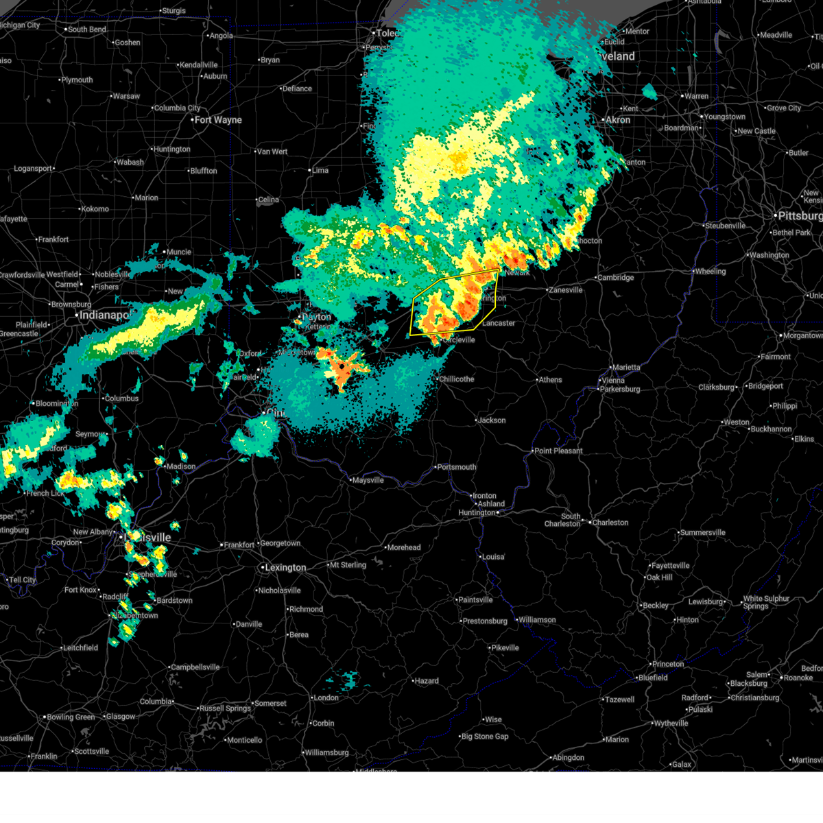
 At 1005 pm edt, a severe thunderstorm capable of producing a tornado was located near grove city, moving east at 55 mph (radar indicated rotation). Hazards include tornado. Flying debris will be dangerous to those caught without shelter. mobile homes will be damaged or destroyed. damage to roofs, windows, and vehicles will occur. tree damage is likely. locations impacted include, commercial point, orient, south bloomfield, darbyville, derby, harrisburg, darbydale, ashville, grove city, and columbus. This includes i-71 in ohio between mile markers 90 and 98. At 1005 pm edt, a severe thunderstorm capable of producing a tornado was located near grove city, moving east at 55 mph (radar indicated rotation). Hazards include tornado. Flying debris will be dangerous to those caught without shelter. mobile homes will be damaged or destroyed. damage to roofs, windows, and vehicles will occur. tree damage is likely. locations impacted include, commercial point, orient, south bloomfield, darbyville, derby, harrisburg, darbydale, ashville, grove city, and columbus. This includes i-71 in ohio between mile markers 90 and 98.
|
| 3/30/2025 10:05 PM EDT |
 the tornado warning has been cancelled and is no longer in effect the tornado warning has been cancelled and is no longer in effect
|
| 3/30/2025 9:49 PM EDT |
 At 949 pm edt, a severe thunderstorm capable of producing a tornado was located near mount sterling, moving east at 55 mph (radar indicated rotation). Hazards include tornado and quarter size hail. Flying debris will be dangerous to those caught without shelter. mobile homes will be damaged or destroyed. damage to roofs, windows, and vehicles will occur. tree damage is likely. locations impacted include, commercial point, chenoweth, orient, interstate 71 at state route 38, darbyville, derby, lilly chapel, georgesville, south bloomfield, madison mills, harrisburg, darbydale, big plain, mount sterling, wrightsville, ashville, grove city, and columbus. This includes i-71 in ohio between mile markers 75 and 98. At 949 pm edt, a severe thunderstorm capable of producing a tornado was located near mount sterling, moving east at 55 mph (radar indicated rotation). Hazards include tornado and quarter size hail. Flying debris will be dangerous to those caught without shelter. mobile homes will be damaged or destroyed. damage to roofs, windows, and vehicles will occur. tree damage is likely. locations impacted include, commercial point, chenoweth, orient, interstate 71 at state route 38, darbyville, derby, lilly chapel, georgesville, south bloomfield, madison mills, harrisburg, darbydale, big plain, mount sterling, wrightsville, ashville, grove city, and columbus. This includes i-71 in ohio between mile markers 75 and 98.
|
| 3/30/2025 9:46 PM EDT |
 Svriln the national weather service in wilmington has issued a * severe thunderstorm warning for, franklin county in central ohio, western fairfield county in central ohio, eastern fayette county in central ohio, pickaway county in central ohio, southern delaware county in central ohio, western licking county in central ohio, northeastern highland county in south central ohio, southeastern union county in central ohio, madison county in central ohio, ross county in south central ohio, * until 1045 pm edt. * at 945 pm edt, severe thunderstorms were located along a line extending from near mechanicsburg to near lynchburg, moving east at 65 mph (radar indicated). Hazards include 60 mph wind gusts and quarter size hail. Minor hail damage to vehicles is possible. Expect wind damage to trees and power lines. Svriln the national weather service in wilmington has issued a * severe thunderstorm warning for, franklin county in central ohio, western fairfield county in central ohio, eastern fayette county in central ohio, pickaway county in central ohio, southern delaware county in central ohio, western licking county in central ohio, northeastern highland county in south central ohio, southeastern union county in central ohio, madison county in central ohio, ross county in south central ohio, * until 1045 pm edt. * at 945 pm edt, severe thunderstorms were located along a line extending from near mechanicsburg to near lynchburg, moving east at 65 mph (radar indicated). Hazards include 60 mph wind gusts and quarter size hail. Minor hail damage to vehicles is possible. Expect wind damage to trees and power lines.
|
| 3/30/2025 9:38 PM EDT |
 Toriln the national weather service in wilmington has issued a * tornado warning for, southwestern franklin county in central ohio, northern fayette county in central ohio, northwestern pickaway county in central ohio, southern madison county in central ohio, * until 1015 pm edt. * at 938 pm edt, a severe thunderstorm capable of producing a tornado was located near jeffersonville, moving east at 55 mph (radar indicated rotation). Hazards include tornado and quarter size hail. Flying debris will be dangerous to those caught without shelter. mobile homes will be damaged or destroyed. damage to roofs, windows, and vehicles will occur. Tree damage is likely. Toriln the national weather service in wilmington has issued a * tornado warning for, southwestern franklin county in central ohio, northern fayette county in central ohio, northwestern pickaway county in central ohio, southern madison county in central ohio, * until 1015 pm edt. * at 938 pm edt, a severe thunderstorm capable of producing a tornado was located near jeffersonville, moving east at 55 mph (radar indicated rotation). Hazards include tornado and quarter size hail. Flying debris will be dangerous to those caught without shelter. mobile homes will be damaged or destroyed. damage to roofs, windows, and vehicles will occur. Tree damage is likely.
|
| 7/15/2024 4:56 PM EDT |
 The storm which prompted the warning has moved out of the area. therefore, the warning will be allowed to expire. please report previous wind damage or hail to the national weather service by going to our website at weather.gov/iln and submitting your report via social media. remember, a severe thunderstorm warning still remains in effect for eastern franklin and northeast pickaway counties!. The storm which prompted the warning has moved out of the area. therefore, the warning will be allowed to expire. please report previous wind damage or hail to the national weather service by going to our website at weather.gov/iln and submitting your report via social media. remember, a severe thunderstorm warning still remains in effect for eastern franklin and northeast pickaway counties!.
|
| 7/15/2024 4:42 PM EDT |
 At 441 pm edt, a severe thunderstorm was located near grove city, moving east at 35 mph (radar indicated). Hazards include 60 mph wind gusts. Expect damage to trees and power lines. locations impacted include, columbus, grove city, jefferson, west jefferson, mount sterling, south bloomfield, lake darby, grandview heights, obetz, commercial point, urbancrest, valleyview, harrisburg, orient, lockbourne, darbyville, derby, lilly chapel, georgesville, and darbydale. this includes the following interstates, i-70 in ohio between mile markers 96 and 101. I-71 in ohio between mile markers 84 and 109. At 441 pm edt, a severe thunderstorm was located near grove city, moving east at 35 mph (radar indicated). Hazards include 60 mph wind gusts. Expect damage to trees and power lines. locations impacted include, columbus, grove city, jefferson, west jefferson, mount sterling, south bloomfield, lake darby, grandview heights, obetz, commercial point, urbancrest, valleyview, harrisburg, orient, lockbourne, darbyville, derby, lilly chapel, georgesville, and darbydale. this includes the following interstates, i-70 in ohio between mile markers 96 and 101. I-71 in ohio between mile markers 84 and 109.
|
| 7/15/2024 4:25 PM EDT |
 Svriln the national weather service in wilmington has issued a * severe thunderstorm warning for, southwestern franklin county in central ohio, northwestern pickaway county in central ohio, southeastern madison county in central ohio, * until 500 pm edt. * at 425 pm edt, a severe thunderstorm was located near london, moving east at 35 mph (radar indicated). Hazards include 60 mph wind gusts. expect damage to trees and power lines Svriln the national weather service in wilmington has issued a * severe thunderstorm warning for, southwestern franklin county in central ohio, northwestern pickaway county in central ohio, southeastern madison county in central ohio, * until 500 pm edt. * at 425 pm edt, a severe thunderstorm was located near london, moving east at 35 mph (radar indicated). Hazards include 60 mph wind gusts. expect damage to trees and power lines
|
| 4/17/2024 6:19 PM EDT | Half Dollar sized hail reported 7.4 miles NNW of Orient, OH |
| 4/2/2024 7:45 PM EDT |
 The storm which prompted the warning has moved out of the area. therefore, the warning has been allowed to expire. a tornado watch remains in effect until 1000 pm edt for central ohio. please report previous wind damage or hail to the national weather service by going to our website at weather.gov/iln and submitting your report via social media. The storm which prompted the warning has moved out of the area. therefore, the warning has been allowed to expire. a tornado watch remains in effect until 1000 pm edt for central ohio. please report previous wind damage or hail to the national weather service by going to our website at weather.gov/iln and submitting your report via social media.
|
| 4/2/2024 7:27 PM EDT |
 Svriln the national weather service in wilmington has issued a * severe thunderstorm warning for, southern franklin county in central ohio, northern fairfield county in central ohio, northern pickaway county in central ohio, southwestern licking county in central ohio, * until 815 pm edt. * at 727 pm edt, a severe thunderstorm was located near south bloomfield, moving east at 40 mph (radar indicated). Hazards include 60 mph wind gusts and quarter size hail. Minor hail damage to vehicles is possible. Expect wind damage to trees and power lines. Svriln the national weather service in wilmington has issued a * severe thunderstorm warning for, southern franklin county in central ohio, northern fairfield county in central ohio, northern pickaway county in central ohio, southwestern licking county in central ohio, * until 815 pm edt. * at 727 pm edt, a severe thunderstorm was located near south bloomfield, moving east at 40 mph (radar indicated). Hazards include 60 mph wind gusts and quarter size hail. Minor hail damage to vehicles is possible. Expect wind damage to trees and power lines.
|
| 4/2/2024 7:16 PM EDT |
 the severe thunderstorm warning has been cancelled and is no longer in effect the severe thunderstorm warning has been cancelled and is no longer in effect
|
| 4/2/2024 7:16 PM EDT |
 At 716 pm edt, a severe thunderstorm was located near mount sterling, moving northeast at 40 mph (radar indicated). Hazards include 60 mph wind gusts and quarter size hail. Minor hail damage to vehicles is possible. expect wind damage to trees and power lines. locations impacted include, columbus, grove city, washington court house, mount sterling, south bloomfield, williamsport, bloomingburg, new holland, commercial point, fox, urbancrest, midway, harrisburg, orient, darbyville, deer creek lake, chenoweth, interstate 71 at state route 38, madison mills, and darbydale. This includes i-71 in ohio between mile markers 73 and 100. At 716 pm edt, a severe thunderstorm was located near mount sterling, moving northeast at 40 mph (radar indicated). Hazards include 60 mph wind gusts and quarter size hail. Minor hail damage to vehicles is possible. expect wind damage to trees and power lines. locations impacted include, columbus, grove city, washington court house, mount sterling, south bloomfield, williamsport, bloomingburg, new holland, commercial point, fox, urbancrest, midway, harrisburg, orient, darbyville, deer creek lake, chenoweth, interstate 71 at state route 38, madison mills, and darbydale. This includes i-71 in ohio between mile markers 73 and 100.
|
| 4/2/2024 6:54 PM EDT |
 Svriln the national weather service in wilmington has issued a * severe thunderstorm warning for, southwestern franklin county in central ohio, fayette county in central ohio, northeastern clinton county in southwestern ohio, northwestern pickaway county in central ohio, southeastern greene county in west central ohio, southern madison county in central ohio, * until 745 pm edt. * at 653 pm edt, a severe thunderstorm was located near sabina, moving northeast at 45 mph (radar indicated). Hazards include 60 mph wind gusts and quarter size hail. Minor hail damage to vehicles is possible. Expect wind damage to trees and power lines. Svriln the national weather service in wilmington has issued a * severe thunderstorm warning for, southwestern franklin county in central ohio, fayette county in central ohio, northeastern clinton county in southwestern ohio, northwestern pickaway county in central ohio, southeastern greene county in west central ohio, southern madison county in central ohio, * until 745 pm edt. * at 653 pm edt, a severe thunderstorm was located near sabina, moving northeast at 45 mph (radar indicated). Hazards include 60 mph wind gusts and quarter size hail. Minor hail damage to vehicles is possible. Expect wind damage to trees and power lines.
|
| 2/28/2024 5:30 AM EST |
 At 530 am est, a severe thunderstorm capable of producing a tornado was located near lake darby, moving east at 55 mph (radar indicated rotation). Hazards include tornado. Flying debris will be dangerous to those caught without shelter. mobile homes will be damaged or destroyed. damage to roofs, windows, and vehicles will occur. tree damage is likely. locations impacted include, columbus, grove city, upper arlington, gahanna, hilliard, bexley, groveport, ohio state university, easton, lake darby, whitehall, grandview heights, obetz, commercial point, urbancrest, valleyview, marble cliff, harrisburg, orient, and lockbourne. this includes the following interstates, i-70 in ohio between mile markers 88 and 108. I-71 in ohio between mile markers 88 and 115. At 530 am est, a severe thunderstorm capable of producing a tornado was located near lake darby, moving east at 55 mph (radar indicated rotation). Hazards include tornado. Flying debris will be dangerous to those caught without shelter. mobile homes will be damaged or destroyed. damage to roofs, windows, and vehicles will occur. tree damage is likely. locations impacted include, columbus, grove city, upper arlington, gahanna, hilliard, bexley, groveport, ohio state university, easton, lake darby, whitehall, grandview heights, obetz, commercial point, urbancrest, valleyview, marble cliff, harrisburg, orient, and lockbourne. this includes the following interstates, i-70 in ohio between mile markers 88 and 108. I-71 in ohio between mile markers 88 and 115.
|
| 2/28/2024 5:20 AM EST |
 At 520 am est, a confirmed tornado was located southwest of lake darby, moving east at 50 mph (radar confirmed tornado. radar shows tornado debris in the air). Hazards include damaging tornado. Flying debris will be dangerous to those caught without shelter. mobile homes will be damaged or destroyed. damage to roofs, windows, and vehicles will occur. tree damage is likely. locations impacted include, columbus, grove city, upper arlington, gahanna, hilliard, bexley, jefferson, groveport, west jefferson, ohio state university, lake darby, easton, whitehall, grandview heights, obetz, commercial point, urbancrest, valleyview, marble cliff, and lafayette. this includes the following interstates, i-70 in ohio between mile markers 78 and 108. I-71 in ohio between mile markers 81 and 115. At 520 am est, a confirmed tornado was located southwest of lake darby, moving east at 50 mph (radar confirmed tornado. radar shows tornado debris in the air). Hazards include damaging tornado. Flying debris will be dangerous to those caught without shelter. mobile homes will be damaged or destroyed. damage to roofs, windows, and vehicles will occur. tree damage is likely. locations impacted include, columbus, grove city, upper arlington, gahanna, hilliard, bexley, jefferson, groveport, west jefferson, ohio state university, lake darby, easton, whitehall, grandview heights, obetz, commercial point, urbancrest, valleyview, marble cliff, and lafayette. this includes the following interstates, i-70 in ohio between mile markers 78 and 108. I-71 in ohio between mile markers 81 and 115.
|
| 2/28/2024 5:16 AM EST |
 Toriln the national weather service in wilmington has issued a * tornado warning for, franklin county in central ohio, northwestern pickaway county in central ohio, southeastern madison county in central ohio, * until 545 am est. * at 515 am est, a severe thunderstorm capable of producing a tornado was located over london, moving east at 50 mph (radar indicated rotation). Hazards include tornado. Flying debris will be dangerous to those caught without shelter. mobile homes will be damaged or destroyed. damage to roofs, windows, and vehicles will occur. Tree damage is likely. Toriln the national weather service in wilmington has issued a * tornado warning for, franklin county in central ohio, northwestern pickaway county in central ohio, southeastern madison county in central ohio, * until 545 am est. * at 515 am est, a severe thunderstorm capable of producing a tornado was located over london, moving east at 50 mph (radar indicated rotation). Hazards include tornado. Flying debris will be dangerous to those caught without shelter. mobile homes will be damaged or destroyed. damage to roofs, windows, and vehicles will occur. Tree damage is likely.
|
| 7/29/2023 5:22 AM EDT |
 At 522 am edt, a severe thunderstorm was located near london, moving east at 45 mph (radar indicated). Hazards include 60 mph wind gusts. Expect damage to trees and power lines. locations impacted include, columbus, grove city, london, jefferson, west jefferson, mount sterling, jeffersonville, bloomingburg, lake darby, commercial point, urbancrest, valleyview, midway, harrisburg, orient, octa, newport, deer creek lake, chenoweth and interstate 71 at state route 38. this includes the following interstates, i-70 in ohio between mile markers 81 and 84, and between mile markers 96 and 97. i-71 in ohio between mile markers 66 and 101. hail threat, radar indicated max hail size, <. 75 in wind threat, radar indicated max wind gust, 60 mph. At 522 am edt, a severe thunderstorm was located near london, moving east at 45 mph (radar indicated). Hazards include 60 mph wind gusts. Expect damage to trees and power lines. locations impacted include, columbus, grove city, london, jefferson, west jefferson, mount sterling, jeffersonville, bloomingburg, lake darby, commercial point, urbancrest, valleyview, midway, harrisburg, orient, octa, newport, deer creek lake, chenoweth and interstate 71 at state route 38. this includes the following interstates, i-70 in ohio between mile markers 81 and 84, and between mile markers 96 and 97. i-71 in ohio between mile markers 66 and 101. hail threat, radar indicated max hail size, <. 75 in wind threat, radar indicated max wind gust, 60 mph.
|
| 7/29/2023 5:12 AM EDT |
 At 512 am edt, a severe thunderstorm was located near london, moving east at 45 mph (radar indicated). Hazards include 60 mph wind gusts. expect damage to trees and power lines At 512 am edt, a severe thunderstorm was located near london, moving east at 45 mph (radar indicated). Hazards include 60 mph wind gusts. expect damage to trees and power lines
|
| 2/27/2023 4:15 PM EST | Roof of garage damaged. several large branches down. possible tornad in pickaway county OH, 1.3 miles NE of Orient, OH |
| 2/27/2023 4:03 PM EST |
 At 403 pm est, a severe thunderstorm capable of producing a tornado was located 7 miles southeast of jefferson, moving northeast at 40 mph (radar indicated rotation). Hazards include tornado and quarter size hail. Flying debris will be dangerous to those caught without shelter. mobile homes will be damaged or destroyed. damage to roofs, windows, and vehicles will occur. tree damage is likely. locations impacted include, columbus, grove city, upper arlington, groveport, ohio state university, lake darby, grandview heights, obetz, urbancrest, valleyview, marble cliff, harrisburg, orient, derby, lilly chapel, georgesville, darbydale, wrightsville, lincoln village and new rome. this includes the following interstates, i-70 in ohio between mile markers 91 and 101. I-71 in ohio between mile markers 90 and 108. At 403 pm est, a severe thunderstorm capable of producing a tornado was located 7 miles southeast of jefferson, moving northeast at 40 mph (radar indicated rotation). Hazards include tornado and quarter size hail. Flying debris will be dangerous to those caught without shelter. mobile homes will be damaged or destroyed. damage to roofs, windows, and vehicles will occur. tree damage is likely. locations impacted include, columbus, grove city, upper arlington, groveport, ohio state university, lake darby, grandview heights, obetz, urbancrest, valleyview, marble cliff, harrisburg, orient, derby, lilly chapel, georgesville, darbydale, wrightsville, lincoln village and new rome. this includes the following interstates, i-70 in ohio between mile markers 91 and 101. I-71 in ohio between mile markers 90 and 108.
|
| 2/27/2023 3:57 PM EST |
 At 357 pm est, a severe thunderstorm capable of producing a tornado was located near mount sterling, moving northeast at 40 mph (radar indicated rotation). Hazards include tornado and quarter size hail. Flying debris will be dangerous to those caught without shelter. mobile homes will be damaged or destroyed. damage to roofs, windows, and vehicles will occur. Tree damage is likely. At 357 pm est, a severe thunderstorm capable of producing a tornado was located near mount sterling, moving northeast at 40 mph (radar indicated rotation). Hazards include tornado and quarter size hail. Flying debris will be dangerous to those caught without shelter. mobile homes will be damaged or destroyed. damage to roofs, windows, and vehicles will occur. Tree damage is likely.
|
| 6/14/2022 1:03 AM EDT |
 At 103 am edt, a severe thunderstorm was located over lancaster, moving southeast at 60 mph (radar indicated). Hazards include 60 mph wind gusts and penny size hail. Expect damage to trees and power lines. locations impacted include, newark, lancaster, reynoldsburg, pickerington, heath, granville, pataskala, canal winchester, johnstown, ashville, baltimore, buckeye lake, hebron, utica, south bloomfield, bremen, millersport, pleasantville, hanover and marne. this includes the following interstates, i-70 in ohio between mile markers 112 and 142. i-71 in ohio near mile marker 90. hail threat, radar indicated max hail size, 0. 75 in wind threat, radar indicated max wind gust, 60 mph. At 103 am edt, a severe thunderstorm was located over lancaster, moving southeast at 60 mph (radar indicated). Hazards include 60 mph wind gusts and penny size hail. Expect damage to trees and power lines. locations impacted include, newark, lancaster, reynoldsburg, pickerington, heath, granville, pataskala, canal winchester, johnstown, ashville, baltimore, buckeye lake, hebron, utica, south bloomfield, bremen, millersport, pleasantville, hanover and marne. this includes the following interstates, i-70 in ohio between mile markers 112 and 142. i-71 in ohio near mile marker 90. hail threat, radar indicated max hail size, 0. 75 in wind threat, radar indicated max wind gust, 60 mph.
|
| 6/14/2022 12:45 AM EDT |
 At 1245 am edt, a severe thunderstorm was located over groveport, moving southeast at 65 mph (radar indicated). Hazards include 60 mph wind gusts and penny size hail. Expect damage to trees and power lines. locations impacted include, columbus, newark, lancaster, reynoldsburg, grove city, gahanna, pickerington, bexley, heath, granville, pataskala, canal winchester, groveport, johnstown, ashville, baltimore, buckeye lake, hebron, utica and south bloomfield. this includes the following interstates, i-70 in ohio between mile markers 96 and 142. i-71 in ohio between mile markers 90 and 109. hail threat, radar indicated max hail size, 0. 75 in wind threat, radar indicated max wind gust, 60 mph. At 1245 am edt, a severe thunderstorm was located over groveport, moving southeast at 65 mph (radar indicated). Hazards include 60 mph wind gusts and penny size hail. Expect damage to trees and power lines. locations impacted include, columbus, newark, lancaster, reynoldsburg, grove city, gahanna, pickerington, bexley, heath, granville, pataskala, canal winchester, groveport, johnstown, ashville, baltimore, buckeye lake, hebron, utica and south bloomfield. this includes the following interstates, i-70 in ohio between mile markers 96 and 142. i-71 in ohio between mile markers 90 and 109. hail threat, radar indicated max hail size, 0. 75 in wind threat, radar indicated max wind gust, 60 mph.
|
| 6/14/2022 12:38 AM EDT |
 At 1237 am edt, a severe thunderstorm was located over columbus, moving southeast at 65 mph (radar indicated). Hazards include 70 mph wind gusts and penny size hail. Expect considerable tree damage. Damage is likely to mobile homes, roofs, and outbuildings. At 1237 am edt, a severe thunderstorm was located over columbus, moving southeast at 65 mph (radar indicated). Hazards include 70 mph wind gusts and penny size hail. Expect considerable tree damage. Damage is likely to mobile homes, roofs, and outbuildings.
|
| 6/13/2022 6:47 PM EDT |
 At 647 pm edt, severe thunderstorms were located along a line extending from 6 miles north of bloomingburg to near leesburg, moving east at 40 mph (radar indicated). Hazards include 60 mph wind gusts. expect damage to trees and power lines At 647 pm edt, severe thunderstorms were located along a line extending from 6 miles north of bloomingburg to near leesburg, moving east at 40 mph (radar indicated). Hazards include 60 mph wind gusts. expect damage to trees and power lines
|
| 6/6/2022 2:33 PM EDT |
 At 232 pm edt, a severe thunderstorm was located near london, moving northeast at 45 mph (radar indicated). Hazards include 60 mph wind gusts. expect damage to trees and power lines At 232 pm edt, a severe thunderstorm was located near london, moving northeast at 45 mph (radar indicated). Hazards include 60 mph wind gusts. expect damage to trees and power lines
|
| 5/21/2022 3:36 PM EDT |
 At 335 pm edt, a severe thunderstorm was located over grove city, moving northeast at 20 mph (radar indicated). Hazards include 60 mph wind gusts and quarter size hail. Minor hail damage to vehicles is possible. expect wind damage to trees and power lines. locations impacted include, columbus, grove city, upper arlington, bexley, canal winchester, groveport, ohio state university, grandview heights, obetz, lithopolis, urbancrest, valleyview, marble cliff, harrisburg, orient, lockbourne, georgesville, darbydale, lincoln village and new rome. this includes the following interstates, i-70 in ohio between mile markers 92 and 105. i-71 in ohio between mile markers 91 and 111. hail threat, radar indicated max hail size, 1. 00 in wind threat, radar indicated max wind gust, 60 mph. At 335 pm edt, a severe thunderstorm was located over grove city, moving northeast at 20 mph (radar indicated). Hazards include 60 mph wind gusts and quarter size hail. Minor hail damage to vehicles is possible. expect wind damage to trees and power lines. locations impacted include, columbus, grove city, upper arlington, bexley, canal winchester, groveport, ohio state university, grandview heights, obetz, lithopolis, urbancrest, valleyview, marble cliff, harrisburg, orient, lockbourne, georgesville, darbydale, lincoln village and new rome. this includes the following interstates, i-70 in ohio between mile markers 92 and 105. i-71 in ohio between mile markers 91 and 111. hail threat, radar indicated max hail size, 1. 00 in wind threat, radar indicated max wind gust, 60 mph.
|
| 5/21/2022 3:17 PM EDT |
 At 316 pm edt, a severe thunderstorm was located near grove city, moving northeast at 20 mph (radar indicated). Hazards include 60 mph wind gusts and quarter size hail. Minor hail damage to vehicles is possible. expect wind damage to trees and power lines. locations impacted include, columbus, grove city, upper arlington, bexley, canal winchester, groveport, ohio state university, grandview heights, obetz, commercial point, lithopolis, urbancrest, valleyview, marble cliff, harrisburg, orient, lockbourne, derby, duvall and georgesville. this includes the following interstates, i-70 in ohio between mile markers 92 and 105. i-71 in ohio between mile markers 88 and 111. hail threat, radar indicated max hail size, 1. 00 in wind threat, radar indicated max wind gust, 60 mph. At 316 pm edt, a severe thunderstorm was located near grove city, moving northeast at 20 mph (radar indicated). Hazards include 60 mph wind gusts and quarter size hail. Minor hail damage to vehicles is possible. expect wind damage to trees and power lines. locations impacted include, columbus, grove city, upper arlington, bexley, canal winchester, groveport, ohio state university, grandview heights, obetz, commercial point, lithopolis, urbancrest, valleyview, marble cliff, harrisburg, orient, lockbourne, derby, duvall and georgesville. this includes the following interstates, i-70 in ohio between mile markers 92 and 105. i-71 in ohio between mile markers 88 and 111. hail threat, radar indicated max hail size, 1. 00 in wind threat, radar indicated max wind gust, 60 mph.
|
| 5/21/2022 2:57 PM EDT |
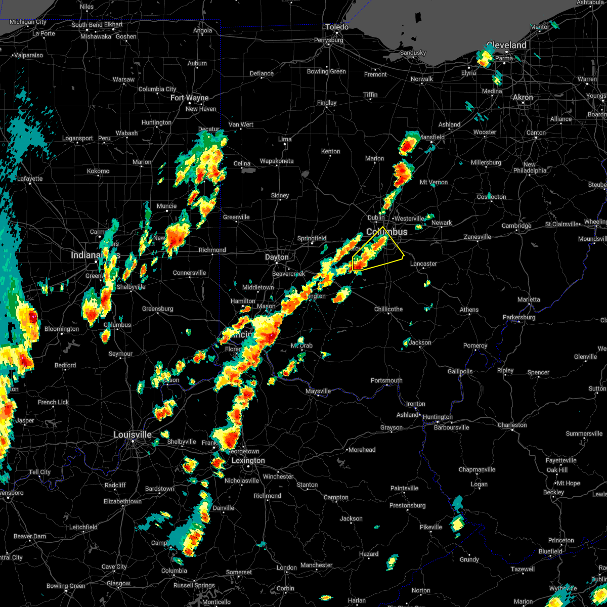 At 257 pm edt, a severe thunderstorm was located near mount sterling, moving northeast at 20 mph (radar indicated). Hazards include 60 mph wind gusts and quarter size hail. Minor hail damage to vehicles is possible. Expect wind damage to trees and power lines. At 257 pm edt, a severe thunderstorm was located near mount sterling, moving northeast at 20 mph (radar indicated). Hazards include 60 mph wind gusts and quarter size hail. Minor hail damage to vehicles is possible. Expect wind damage to trees and power lines.
|
| 5/3/2022 4:54 PM EDT |
 At 454 pm edt, a severe thunderstorm was located 7 miles southwest of grove city, moving northeast at 40 mph (radar indicated). Hazards include 60 mph wind gusts and quarter size hail. Minor hail damage to vehicles is possible. expect wind damage to trees and power lines. locations impacted include, columbus, reynoldsburg, grove city, upper arlington, gahanna, bexley, canal winchester, groveport, ashville, mount sterling, south bloomfield, ohio state university, easton, lake darby, whitehall, new albany, grandview heights, obetz, commercial point and lithopolis. this includes the following interstates, i-70 in ohio between mile markers 93 and 111. i-71 in ohio between mile markers 82 and 113. hail threat, radar indicated max hail size, 1. 00 in wind threat, radar indicated max wind gust, 60 mph. At 454 pm edt, a severe thunderstorm was located 7 miles southwest of grove city, moving northeast at 40 mph (radar indicated). Hazards include 60 mph wind gusts and quarter size hail. Minor hail damage to vehicles is possible. expect wind damage to trees and power lines. locations impacted include, columbus, reynoldsburg, grove city, upper arlington, gahanna, bexley, canal winchester, groveport, ashville, mount sterling, south bloomfield, ohio state university, easton, lake darby, whitehall, new albany, grandview heights, obetz, commercial point and lithopolis. this includes the following interstates, i-70 in ohio between mile markers 93 and 111. i-71 in ohio between mile markers 82 and 113. hail threat, radar indicated max hail size, 1. 00 in wind threat, radar indicated max wind gust, 60 mph.
|
| 5/3/2022 4:44 PM EDT |
 At 443 pm edt, a severe thunderstorm was located over mount sterling, moving east at 35 mph (radar indicated). Hazards include ping pong ball size hail and 60 mph wind gusts. People and animals outdoors will be injured. expect hail damage to roofs, siding, windows, and vehicles. Expect wind damage to trees and power lines. At 443 pm edt, a severe thunderstorm was located over mount sterling, moving east at 35 mph (radar indicated). Hazards include ping pong ball size hail and 60 mph wind gusts. People and animals outdoors will be injured. expect hail damage to roofs, siding, windows, and vehicles. Expect wind damage to trees and power lines.
|
| 5/3/2022 2:13 PM EDT |
 At 213 pm edt, a severe thunderstorm was located near mount sterling, moving northeast at 50 mph (radar indicated). Hazards include 60 mph wind gusts and quarter size hail. Minor hail damage to vehicles is possible. expect wind damage to trees and power lines. locations impacted include, grove city, washington court house, ashville, mount sterling, south bloomfield, bloomingburg, new holland, commercial point, harrisburg, orient, lockbourne, darbyville, deer creek lake, derby, duvall, madison mills, pancoastburg and darbydale. this includes i-71 in ohio between mile markers 88 and 96. hail threat, radar indicated max hail size, 1. 00 in wind threat, radar indicated max wind gust, 60 mph. At 213 pm edt, a severe thunderstorm was located near mount sterling, moving northeast at 50 mph (radar indicated). Hazards include 60 mph wind gusts and quarter size hail. Minor hail damage to vehicles is possible. expect wind damage to trees and power lines. locations impacted include, grove city, washington court house, ashville, mount sterling, south bloomfield, bloomingburg, new holland, commercial point, harrisburg, orient, lockbourne, darbyville, deer creek lake, derby, duvall, madison mills, pancoastburg and darbydale. this includes i-71 in ohio between mile markers 88 and 96. hail threat, radar indicated max hail size, 1. 00 in wind threat, radar indicated max wind gust, 60 mph.
|
| 5/3/2022 1:57 PM EDT |
 At 156 pm edt, a severe thunderstorm was located over washington court house, moving northeast at 50 mph (radar indicated). Hazards include 60 mph wind gusts and quarter size hail. Minor hail damage to vehicles is possible. Expect wind damage to trees and power lines. At 156 pm edt, a severe thunderstorm was located over washington court house, moving northeast at 50 mph (radar indicated). Hazards include 60 mph wind gusts and quarter size hail. Minor hail damage to vehicles is possible. Expect wind damage to trees and power lines.
|
| 4/25/2022 5:22 PM EDT |
 The severe thunderstorm warning for southeastern franklin and northwestern pickaway counties will expire at 530 pm edt, the storm which prompted the warning has weakened below severe limits, and no longer poses an immediate threat to life or property. therefore, the warning will be allowed to expire. however gusty winds are still possible with this thunderstorm. please report previous wind damage or hail to the national weather service by going to our website at weather.gov/iln and submitting your report via social media. The severe thunderstorm warning for southeastern franklin and northwestern pickaway counties will expire at 530 pm edt, the storm which prompted the warning has weakened below severe limits, and no longer poses an immediate threat to life or property. therefore, the warning will be allowed to expire. however gusty winds are still possible with this thunderstorm. please report previous wind damage or hail to the national weather service by going to our website at weather.gov/iln and submitting your report via social media.
|
| 4/25/2022 5:17 PM EDT |
 At 516 pm edt, a severe thunderstorm was located over grove city, moving northeast at 40 mph (radar indicated). Hazards include 60 mph wind gusts. Expect damage to trees and power lines. locations impacted include, columbus, reynoldsburg, grove city, upper arlington, gahanna, bexley, canal winchester, groveport, south bloomfield, ohio state university, easton, whitehall, grandview heights, obetz, commercial point, lithopolis, urbancrest, valleyview, marble cliff and harrisburg. this includes the following interstates, i-70 in ohio between mile markers 95 and 110. i-71 in ohio between mile markers 88 and 113. hail threat, radar indicated max hail size, <. 75 in wind threat, radar indicated max wind gust, 60 mph. At 516 pm edt, a severe thunderstorm was located over grove city, moving northeast at 40 mph (radar indicated). Hazards include 60 mph wind gusts. Expect damage to trees and power lines. locations impacted include, columbus, reynoldsburg, grove city, upper arlington, gahanna, bexley, canal winchester, groveport, south bloomfield, ohio state university, easton, whitehall, grandview heights, obetz, commercial point, lithopolis, urbancrest, valleyview, marble cliff and harrisburg. this includes the following interstates, i-70 in ohio between mile markers 95 and 110. i-71 in ohio between mile markers 88 and 113. hail threat, radar indicated max hail size, <. 75 in wind threat, radar indicated max wind gust, 60 mph.
|
| 4/25/2022 5:04 PM EDT |
 At 503 pm edt, a severe thunderstorm was located near mount sterling, moving northeast at 40 mph (radar indicated). Hazards include 60 mph wind gusts. expect damage to trees and power lines At 503 pm edt, a severe thunderstorm was located near mount sterling, moving northeast at 40 mph (radar indicated). Hazards include 60 mph wind gusts. expect damage to trees and power lines
|
| 8/12/2021 6:07 PM EDT | Multiple large tree limbs downed in roadwa in pickaway county OH, 4.6 miles E of Orient, OH |
| 8/12/2021 6:01 PM EDT |
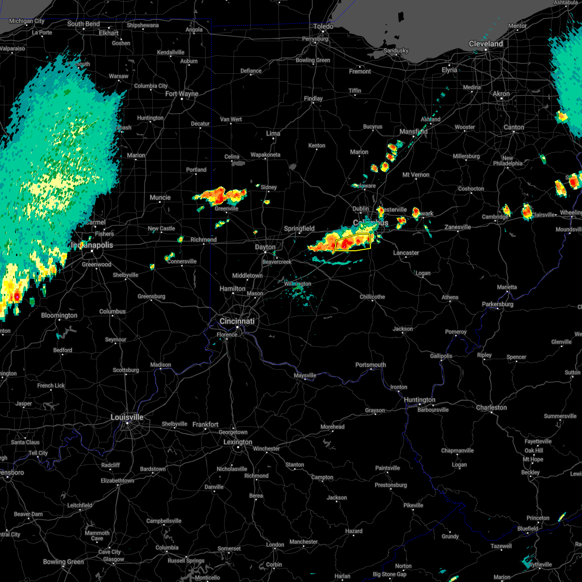 At 601 pm edt, a severe thunderstorm was located 7 miles north of mount sterling, moving east at 20 mph (radar indicated). Hazards include 60 mph wind gusts and quarter size hail. Minor hail damage to vehicles is possible. expect wind damage to trees and power lines. locations impacted include, columbus, grove city, commercial point, urbancrest, harrisburg, orient, georgesville, darbydale, big plain, wrightsville and derby. this includes i-71 in ohio between mile markers 86 and 104. hail threat, radar indicated max hail size, 1. 00 in wind threat, radar indicated max wind gust, 60 mph. At 601 pm edt, a severe thunderstorm was located 7 miles north of mount sterling, moving east at 20 mph (radar indicated). Hazards include 60 mph wind gusts and quarter size hail. Minor hail damage to vehicles is possible. expect wind damage to trees and power lines. locations impacted include, columbus, grove city, commercial point, urbancrest, harrisburg, orient, georgesville, darbydale, big plain, wrightsville and derby. this includes i-71 in ohio between mile markers 86 and 104. hail threat, radar indicated max hail size, 1. 00 in wind threat, radar indicated max wind gust, 60 mph.
|
| 8/12/2021 5:50 PM EDT |
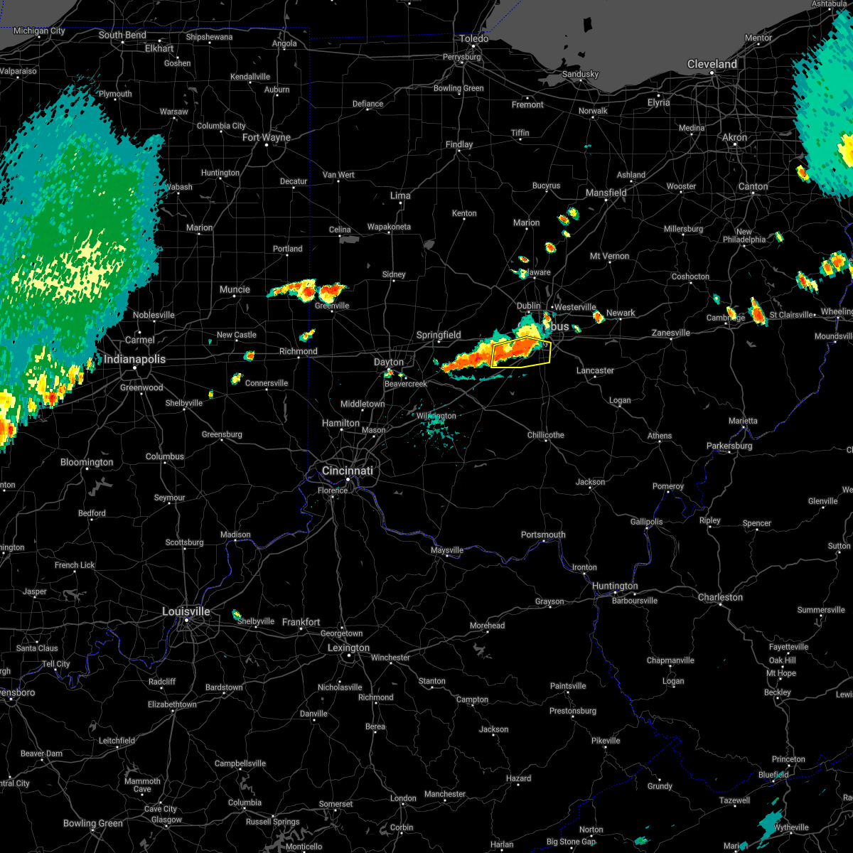 At 550 pm edt, a severe thunderstorm was located 7 miles north of mount sterling, moving east at 15 mph (radar indicated). Hazards include 60 mph wind gusts and quarter size hail. Minor hail damage to vehicles is possible. expect wind damage to trees and power lines. locations impacted include, columbus, grove city, obetz, urbancrest, harrisburg, orient, lockbourne, lilly chapel, georgesville, madison lake, darbydale, big plain, wrightsville, derby and lincoln village. this includes i-71 in ohio between mile markers 86 and 104. hail threat, radar indicated max hail size, 1. 00 in wind threat, radar indicated max wind gust, 60 mph. At 550 pm edt, a severe thunderstorm was located 7 miles north of mount sterling, moving east at 15 mph (radar indicated). Hazards include 60 mph wind gusts and quarter size hail. Minor hail damage to vehicles is possible. expect wind damage to trees and power lines. locations impacted include, columbus, grove city, obetz, urbancrest, harrisburg, orient, lockbourne, lilly chapel, georgesville, madison lake, darbydale, big plain, wrightsville, derby and lincoln village. this includes i-71 in ohio between mile markers 86 and 104. hail threat, radar indicated max hail size, 1. 00 in wind threat, radar indicated max wind gust, 60 mph.
|
| 8/12/2021 5:36 PM EDT |
 At 535 pm edt, a severe thunderstorm was located near lake darby, moving east at 20 mph (radar indicated). Hazards include 60 mph wind gusts and quarter size hail. Minor hail damage to vehicles is possible. expect wind damage to trees and power lines. locations impacted include, columbus, grove city, bexley, jefferson, west jefferson, lake darby, obetz, urbancrest, valleyview, harrisburg, orient, lockbourne, lilly chapel, georgesville, madison lake, darbydale, big plain, wrightsville, lincoln village and new rome. this includes the following interstates, i-70 in ohio between mile markers 96 and 103. i-71 in ohio between mile markers 86 and 109. hail threat, radar indicated max hail size, 1. 00 in wind threat, radar indicated max wind gust, 60 mph. At 535 pm edt, a severe thunderstorm was located near lake darby, moving east at 20 mph (radar indicated). Hazards include 60 mph wind gusts and quarter size hail. Minor hail damage to vehicles is possible. expect wind damage to trees and power lines. locations impacted include, columbus, grove city, bexley, jefferson, west jefferson, lake darby, obetz, urbancrest, valleyview, harrisburg, orient, lockbourne, lilly chapel, georgesville, madison lake, darbydale, big plain, wrightsville, lincoln village and new rome. this includes the following interstates, i-70 in ohio between mile markers 96 and 103. i-71 in ohio between mile markers 86 and 109. hail threat, radar indicated max hail size, 1. 00 in wind threat, radar indicated max wind gust, 60 mph.
|
| 8/12/2021 5:28 PM EDT |
 At 528 pm edt, a severe thunderstorm was located near jefferson, moving east at 20 mph (radar indicated). Hazards include 60 mph wind gusts and quarter size hail. Minor hail damage to vehicles is possible. Expect wind damage to trees and power lines. At 528 pm edt, a severe thunderstorm was located near jefferson, moving east at 20 mph (radar indicated). Hazards include 60 mph wind gusts and quarter size hail. Minor hail damage to vehicles is possible. Expect wind damage to trees and power lines.
|
| 11/15/2020 12:00 PM EST |
 At 1200 pm est, severe thunderstorms were located along a line extending from near cardington to upper arlington to mount sterling, moving east at 65 mph (radar indicated). Hazards include 60 mph wind gusts. Expect damage to trees and power lines. locations impacted include, columbus, dublin, westerville, reynoldsburg, grove city, delaware, upper arlington, gahanna, hilliard, marysville, worthington, bexley, jefferson, powell, canal winchester, groveport, sunbury, plain city, west jefferson and mount sterling. this includes the following interstates, i-70 in ohio between mile markers 79 and 111. I-71 in ohio between mile markers 78 and 138. At 1200 pm est, severe thunderstorms were located along a line extending from near cardington to upper arlington to mount sterling, moving east at 65 mph (radar indicated). Hazards include 60 mph wind gusts. Expect damage to trees and power lines. locations impacted include, columbus, dublin, westerville, reynoldsburg, grove city, delaware, upper arlington, gahanna, hilliard, marysville, worthington, bexley, jefferson, powell, canal winchester, groveport, sunbury, plain city, west jefferson and mount sterling. this includes the following interstates, i-70 in ohio between mile markers 79 and 111. I-71 in ohio between mile markers 78 and 138.
|
| 11/15/2020 11:45 AM EST |
 At 1144 am est, severe thunderstorms were located along a line extending from la rue to near plain city to 6 miles southeast of south charleston, moving east at 40 mph (radar indicated). Hazards include 60 mph wind gusts. Expect damage to trees and power lines. locations impacted include, columbus, dublin, westerville, reynoldsburg, grove city, delaware, upper arlington, gahanna, hilliard, marysville, worthington, bexley, london, jefferson, powell, canal winchester, groveport, sunbury, plain city and west jefferson. this includes the following interstates, i-70 in ohio between mile markers 71 and 111. I-71 in ohio between mile markers 76 and 138. At 1144 am est, severe thunderstorms were located along a line extending from la rue to near plain city to 6 miles southeast of south charleston, moving east at 40 mph (radar indicated). Hazards include 60 mph wind gusts. Expect damage to trees and power lines. locations impacted include, columbus, dublin, westerville, reynoldsburg, grove city, delaware, upper arlington, gahanna, hilliard, marysville, worthington, bexley, london, jefferson, powell, canal winchester, groveport, sunbury, plain city and west jefferson. this includes the following interstates, i-70 in ohio between mile markers 71 and 111. I-71 in ohio between mile markers 76 and 138.
|
| 11/15/2020 11:34 AM EST |
 At 1133 am est, severe thunderstorms were located along a line extending from 6 miles southwest of la rue to near mechanicsburg to cedarville, moving east at 40 mph (radar indicated). Hazards include 60 mph wind gusts. expect damage to trees and power lines At 1133 am est, severe thunderstorms were located along a line extending from 6 miles southwest of la rue to near mechanicsburg to cedarville, moving east at 40 mph (radar indicated). Hazards include 60 mph wind gusts. expect damage to trees and power lines
|
| 6/10/2020 6:41 PM EDT |
 At 640 pm edt, a severe thunderstorm capable of producing a tornado was located near grove city, moving northeast at 55 mph (radar indicated rotation). Hazards include tornado. Flying debris will be dangerous to those caught without shelter. mobile homes will be damaged or destroyed. damage to roofs, windows, and vehicles will occur. Tree damage is likely. At 640 pm edt, a severe thunderstorm capable of producing a tornado was located near grove city, moving northeast at 55 mph (radar indicated rotation). Hazards include tornado. Flying debris will be dangerous to those caught without shelter. mobile homes will be damaged or destroyed. damage to roofs, windows, and vehicles will occur. Tree damage is likely.
|
| 6/10/2020 6:34 PM EDT |
 At 634 pm edt, a severe thunderstorm was located near south bloomfield, moving east at 55 mph (radar indicated). Hazards include 70 mph wind gusts. Expect considerable tree damage. damage is likely to mobile homes, roofs, and outbuildings. locations impacted include, columbus, lancaster, reynoldsburg, grove city, pickerington, canal winchester, groveport, ashville, baltimore, buckeye lake, south bloomfield, bremen, millersport, pleasantville, fairfield beach, obetz, commercial point, royalton, lithopolis and urbancrest. this includes the following interstates, i-70 in ohio near mile marker 106, and between mile markers 108 and 113. I-71 in ohio between mile markers 89 and 103. At 634 pm edt, a severe thunderstorm was located near south bloomfield, moving east at 55 mph (radar indicated). Hazards include 70 mph wind gusts. Expect considerable tree damage. damage is likely to mobile homes, roofs, and outbuildings. locations impacted include, columbus, lancaster, reynoldsburg, grove city, pickerington, canal winchester, groveport, ashville, baltimore, buckeye lake, south bloomfield, bremen, millersport, pleasantville, fairfield beach, obetz, commercial point, royalton, lithopolis and urbancrest. this includes the following interstates, i-70 in ohio near mile marker 106, and between mile markers 108 and 113. I-71 in ohio between mile markers 89 and 103.
|
| 6/10/2020 6:28 PM EDT |
 At 628 pm edt, a severe thunderstorm was located near mount sterling, moving east at 55 mph (radar indicated). Hazards include 60 mph wind gusts. expect damage to trees and power lines At 628 pm edt, a severe thunderstorm was located near mount sterling, moving east at 55 mph (radar indicated). Hazards include 60 mph wind gusts. expect damage to trees and power lines
|
| 6/10/2020 5:48 PM EDT |
 At 548 pm edt, a severe thunderstorm was located near mount sterling, moving east at 35 mph (radar indicated). Hazards include 70 mph wind gusts. Expect considerable tree damage. Damage is likely to mobile homes, roofs, and outbuildings. At 548 pm edt, a severe thunderstorm was located near mount sterling, moving east at 35 mph (radar indicated). Hazards include 70 mph wind gusts. Expect considerable tree damage. Damage is likely to mobile homes, roofs, and outbuildings.
|
| 6/4/2020 1:44 PM EDT |
 At 143 pm edt, a severe thunderstorm was located near grove city, moving east at 25 mph (radar indicated). Hazards include 60 mph wind gusts and quarter size hail. Minor hail damage to vehicles is possible. Expect wind damage to trees and power lines. At 143 pm edt, a severe thunderstorm was located near grove city, moving east at 25 mph (radar indicated). Hazards include 60 mph wind gusts and quarter size hail. Minor hail damage to vehicles is possible. Expect wind damage to trees and power lines.
|
| 6/4/2020 1:08 PM EDT |
 At 108 pm edt, severe thunderstorms were located along a line extending from near jefferson to 8 miles south of london, moving east at 35 mph (radar indicated). Hazards include 60 mph wind gusts and quarter size hail. Minor hail damage to vehicles is possible. Expect wind damage to trees and power lines. At 108 pm edt, severe thunderstorms were located along a line extending from near jefferson to 8 miles south of london, moving east at 35 mph (radar indicated). Hazards include 60 mph wind gusts and quarter size hail. Minor hail damage to vehicles is possible. Expect wind damage to trees and power lines.
|
| 5/18/2020 4:51 PM EDT |
 At 450 pm edt, a severe thunderstorm capable of producing a tornado was located 7 miles northeast of mount sterling, moving northeast at 25 mph (radar indicated rotation). Hazards include tornado. Flying debris will be dangerous to those caught without shelter. mobile homes will be damaged or destroyed. damage to roofs, windows, and vehicles will occur. tree damage is likely. locations impacted include, columbus, grove city, jefferson, west jefferson, lake darby, urbancrest, harrisburg, orient, derby, lilly chapel, georgesville, darbydale, big plain and wrightsville. this includes the following interstates, i-70 in ohio between mile markers 82 and 84. I-71 in ohio between mile markers 87 and 101. At 450 pm edt, a severe thunderstorm capable of producing a tornado was located 7 miles northeast of mount sterling, moving northeast at 25 mph (radar indicated rotation). Hazards include tornado. Flying debris will be dangerous to those caught without shelter. mobile homes will be damaged or destroyed. damage to roofs, windows, and vehicles will occur. tree damage is likely. locations impacted include, columbus, grove city, jefferson, west jefferson, lake darby, urbancrest, harrisburg, orient, derby, lilly chapel, georgesville, darbydale, big plain and wrightsville. this includes the following interstates, i-70 in ohio between mile markers 82 and 84. I-71 in ohio between mile markers 87 and 101.
|
| 5/18/2020 4:36 PM EDT |
 At 436 pm edt, a severe thunderstorm capable of producing a tornado was located over mount sterling, moving northeast at 20 mph (radar indicated rotation). Hazards include tornado. Flying debris will be dangerous to those caught without shelter. mobile homes will be damaged or destroyed. damage to roofs, windows, and vehicles will occur. Tree damage is likely. At 436 pm edt, a severe thunderstorm capable of producing a tornado was located over mount sterling, moving northeast at 20 mph (radar indicated rotation). Hazards include tornado. Flying debris will be dangerous to those caught without shelter. mobile homes will be damaged or destroyed. damage to roofs, windows, and vehicles will occur. Tree damage is likely.
|
| 5/10/2020 5:05 PM EDT | Treee down on darby creek road. time estimated from rada in pickaway county OH, 5.8 miles N of Orient, OH |
| 5/10/2020 4:58 PM EDT |
 At 457 pm edt, severe thunderstorms were located along a line extending from westerville to near grove city, moving east at 35 mph (radar indicated). Hazards include 70 mph wind gusts. Expect considerable tree damage. damage is likely to mobile homes, roofs, and outbuildings. locations impacted include, columbus, westerville, reynoldsburg, grove city, upper arlington, gahanna, hilliard, worthington, bexley, canal winchester, groveport, ashville, south bloomfield, minerva park, ohio state university, easton, whitehall, new albany, grandview heights and obetz. this includes the following interstates, i-70 in ohio between mile markers 93 and 111. I-71 in ohio between mile markers 89 and 121. At 457 pm edt, severe thunderstorms were located along a line extending from westerville to near grove city, moving east at 35 mph (radar indicated). Hazards include 70 mph wind gusts. Expect considerable tree damage. damage is likely to mobile homes, roofs, and outbuildings. locations impacted include, columbus, westerville, reynoldsburg, grove city, upper arlington, gahanna, hilliard, worthington, bexley, canal winchester, groveport, ashville, south bloomfield, minerva park, ohio state university, easton, whitehall, new albany, grandview heights and obetz. this includes the following interstates, i-70 in ohio between mile markers 93 and 111. I-71 in ohio between mile markers 89 and 121.
|
| 5/10/2020 4:47 PM EDT |
 At 447 pm edt, severe thunderstorms were located along a line extending from powell to near grove city, moving east at 45 mph (radar indicated). Hazards include 70 mph wind gusts. Expect considerable tree damage. damage is likely to mobile homes, roofs, and outbuildings. locations impacted include, columbus, dublin, westerville, reynoldsburg, grove city, delaware, upper arlington, gahanna, hilliard, worthington, bexley, powell, canal winchester, groveport, sunbury, ashville, south bloomfield, minerva park, polaris and ohio state university. this includes the following interstates, i-70 in ohio between mile markers 93 and 111. I-71 in ohio between mile markers 89 and 135. At 447 pm edt, severe thunderstorms were located along a line extending from powell to near grove city, moving east at 45 mph (radar indicated). Hazards include 70 mph wind gusts. Expect considerable tree damage. damage is likely to mobile homes, roofs, and outbuildings. locations impacted include, columbus, dublin, westerville, reynoldsburg, grove city, delaware, upper arlington, gahanna, hilliard, worthington, bexley, powell, canal winchester, groveport, sunbury, ashville, south bloomfield, minerva park, polaris and ohio state university. this includes the following interstates, i-70 in ohio between mile markers 93 and 111. I-71 in ohio between mile markers 89 and 135.
|
| 5/10/2020 4:34 PM EDT |
 At 434 pm edt, severe thunderstorms were located along a line extending from near new california to 6 miles northwest of mount sterling, moving east at 30 mph (radar indicated). Hazards include 60 mph wind gusts. expect damage to trees and power lines At 434 pm edt, severe thunderstorms were located along a line extending from near new california to 6 miles northwest of mount sterling, moving east at 30 mph (radar indicated). Hazards include 60 mph wind gusts. expect damage to trees and power lines
|
| 3/28/2020 2:58 PM EDT |
 The severe thunderstorm warning for southwestern franklin, northwestern pickaway and madison counties will expire at 300 pm edt, the storm which prompted the warning has moved out of the area. therefore, the warning will be allowed to expire. however small hail, gusty winds and heavy rain are still possible with this thunderstorm. a severe thunderstorm watch remains in effect until 800 pm edt for central ohio. please report previous wind damage or hail to the national weather service by going to our website at weather.gov/iln and submitting your report via social media. The severe thunderstorm warning for southwestern franklin, northwestern pickaway and madison counties will expire at 300 pm edt, the storm which prompted the warning has moved out of the area. therefore, the warning will be allowed to expire. however small hail, gusty winds and heavy rain are still possible with this thunderstorm. a severe thunderstorm watch remains in effect until 800 pm edt for central ohio. please report previous wind damage or hail to the national weather service by going to our website at weather.gov/iln and submitting your report via social media.
|
| 3/28/2020 2:32 PM EDT |
 At 232 pm edt, a severe thunderstorm was located near jefferson, moving east at 55 mph (radar indicated). Hazards include 60 mph wind gusts and quarter size hail. Minor hail damage to vehicles is possible. expect wind damage to trees and power lines. locations impacted include, columbus, grove city, upper arlington, hilliard, london, jefferson, west jefferson, choctaw lake, lake darby, grandview heights, urbancrest, valleyview, marble cliff, lafayette, harrisburg, orient, newport, georgesville, madison lake and darbydale. this includes the following interstates, i-70 in ohio between mile markers 71 and 98. I-71 in ohio between mile markers 83 and 103. At 232 pm edt, a severe thunderstorm was located near jefferson, moving east at 55 mph (radar indicated). Hazards include 60 mph wind gusts and quarter size hail. Minor hail damage to vehicles is possible. expect wind damage to trees and power lines. locations impacted include, columbus, grove city, upper arlington, hilliard, london, jefferson, west jefferson, choctaw lake, lake darby, grandview heights, urbancrest, valleyview, marble cliff, lafayette, harrisburg, orient, newport, georgesville, madison lake and darbydale. this includes the following interstates, i-70 in ohio between mile markers 71 and 98. I-71 in ohio between mile markers 83 and 103.
|
| 3/28/2020 2:12 PM EDT |
 At 212 pm edt, a severe thunderstorm was located near south charleston, moving east at 55 mph (radar indicated). Hazards include 60 mph wind gusts and quarter size hail. Minor hail damage to vehicles is possible. Expect wind damage to trees and power lines. At 212 pm edt, a severe thunderstorm was located near south charleston, moving east at 55 mph (radar indicated). Hazards include 60 mph wind gusts and quarter size hail. Minor hail damage to vehicles is possible. Expect wind damage to trees and power lines.
|
| 5/27/2019 11:18 PM EDT |
 At 1118 pm edt, a severe thunderstorm capable of producing a tornado was located near mount sterling, moving east at 20 mph (radar indicated rotation). Hazards include tornado. Flying debris will be dangerous to those caught without shelter. mobile homes will be damaged or destroyed. damage to roofs, windows, and vehicles will occur. Tree damage is likely. At 1118 pm edt, a severe thunderstorm capable of producing a tornado was located near mount sterling, moving east at 20 mph (radar indicated rotation). Hazards include tornado. Flying debris will be dangerous to those caught without shelter. mobile homes will be damaged or destroyed. damage to roofs, windows, and vehicles will occur. Tree damage is likely.
|
| 3/14/2019 7:38 PM EDT |
 At 738 pm edt, a severe thunderstorm was located near south bloomfield, moving northeast at 60 mph (radar indicated). Hazards include 60 mph wind gusts and nickel size hail. expect damage to trees and power lines At 738 pm edt, a severe thunderstorm was located near south bloomfield, moving northeast at 60 mph (radar indicated). Hazards include 60 mph wind gusts and nickel size hail. expect damage to trees and power lines
|
| 3/14/2019 7:19 PM EDT |
 At 719 pm edt, severe thunderstorms were located along a line extending from near mount sterling to washington court house, moving east at 50 mph (radar indicated). Hazards include 70 mph wind gusts and penny size hail. Expect considerable tree damage. damage is likely to mobile homes, roofs, and outbuildings. locations impacted include, columbus, grove city, washington court house, mount sterling, south bloomfield, williamsport, bloomingburg, new holland, commercial point, fox, orient, lockbourne, darbyville, deer creek lake, chenoweth, derby, madison mills, state route 207 at us route 22, state route 138 at us route 22 and pancoastburg. This includes i-71 in ohio between mile markers 77 and 87. At 719 pm edt, severe thunderstorms were located along a line extending from near mount sterling to washington court house, moving east at 50 mph (radar indicated). Hazards include 70 mph wind gusts and penny size hail. Expect considerable tree damage. damage is likely to mobile homes, roofs, and outbuildings. locations impacted include, columbus, grove city, washington court house, mount sterling, south bloomfield, williamsport, bloomingburg, new holland, commercial point, fox, orient, lockbourne, darbyville, deer creek lake, chenoweth, derby, madison mills, state route 207 at us route 22, state route 138 at us route 22 and pancoastburg. This includes i-71 in ohio between mile markers 77 and 87.
|
| 3/14/2019 7:10 PM EDT |
 At 710 pm edt, severe thunderstorms were located along a line extending from near london to 6 miles southwest of washington court house, moving east at 65 mph (radar indicated). Hazards include 70 mph wind gusts and quarter size hail. Minor hail damage to vehicles is possible. expect considerable tree damage. wind damage is also likely to mobile homes, roofs, and outbuildings. locations impacted include, columbus, grove city, washington court house, mount sterling, south bloomfield, jeffersonville, williamsport, bloomingburg, new holland, staunton, commercial point, fox, midway, harrisburg, orient, lockbourne, darbyville, deer creek lake, chenoweth and interstate 71 at state route 38. This includes i-71 in ohio between mile markers 70 and 97. At 710 pm edt, severe thunderstorms were located along a line extending from near london to 6 miles southwest of washington court house, moving east at 65 mph (radar indicated). Hazards include 70 mph wind gusts and quarter size hail. Minor hail damage to vehicles is possible. expect considerable tree damage. wind damage is also likely to mobile homes, roofs, and outbuildings. locations impacted include, columbus, grove city, washington court house, mount sterling, south bloomfield, jeffersonville, williamsport, bloomingburg, new holland, staunton, commercial point, fox, midway, harrisburg, orient, lockbourne, darbyville, deer creek lake, chenoweth and interstate 71 at state route 38. This includes i-71 in ohio between mile markers 70 and 97.
|
| 3/14/2019 7:02 PM EDT |
 At 702 pm edt, severe thunderstorms were located along a line extending from near london to near sabina, moving east at 65 mph (radar indicated). Hazards include 70 mph wind gusts and quarter size hail. Minor hail damage to vehicles is possible. expect considerable tree damage. wind damage is also likely to mobile homes, roofs, and outbuildings. locations impacted include, columbus, grove city, washington court house, sabina, mount sterling, south bloomfield, jeffersonville, williamsport, bloomingburg, new holland, staunton, commercial point, good hope, fox, south solon, midway, harrisburg, orient, lockbourne and darbyville. This includes i-71 in ohio between mile markers 62 and 97. At 702 pm edt, severe thunderstorms were located along a line extending from near london to near sabina, moving east at 65 mph (radar indicated). Hazards include 70 mph wind gusts and quarter size hail. Minor hail damage to vehicles is possible. expect considerable tree damage. wind damage is also likely to mobile homes, roofs, and outbuildings. locations impacted include, columbus, grove city, washington court house, sabina, mount sterling, south bloomfield, jeffersonville, williamsport, bloomingburg, new holland, staunton, commercial point, good hope, fox, south solon, midway, harrisburg, orient, lockbourne and darbyville. This includes i-71 in ohio between mile markers 62 and 97.
|
| 3/14/2019 6:56 PM EDT |
 At 656 pm edt, severe thunderstorms were located along a line extending from near south charleston to near new vienna, moving east at 65 mph (radar indicated). Hazards include 70 mph wind gusts and quarter size hail. Minor hail damage to vehicles is possible. expect considerable tree damage. Wind damage is also likely to mobile homes, roofs, and outbuildings. At 656 pm edt, severe thunderstorms were located along a line extending from near south charleston to near new vienna, moving east at 65 mph (radar indicated). Hazards include 70 mph wind gusts and quarter size hail. Minor hail damage to vehicles is possible. expect considerable tree damage. Wind damage is also likely to mobile homes, roofs, and outbuildings.
|
| 3/14/2019 6:24 PM EDT |
 At 623 pm edt, a severe thunderstorm was located near mount sterling, moving northeast at 55 mph (radar indicated). Hazards include 60 mph wind gusts and nickel size hail. Expect damage to trees and power lines. locations impacted include, mount sterling, bloomingburg, harrisburg, orient, darbyville, deer creek lake, chenoweth, interstate 71 at state route 38, madison mills, derby and pancoastburg. This includes i-71 in ohio between mile markers 75 and 91. At 623 pm edt, a severe thunderstorm was located near mount sterling, moving northeast at 55 mph (radar indicated). Hazards include 60 mph wind gusts and nickel size hail. Expect damage to trees and power lines. locations impacted include, mount sterling, bloomingburg, harrisburg, orient, darbyville, deer creek lake, chenoweth, interstate 71 at state route 38, madison mills, derby and pancoastburg. This includes i-71 in ohio between mile markers 75 and 91.
|
| 3/14/2019 6:04 PM EDT |
 At 604 pm edt, a severe thunderstorm was located near sabina, moving northeast at 55 mph (radar indicated). Hazards include 60 mph wind gusts and nickel size hail. expect damage to trees and power lines At 604 pm edt, a severe thunderstorm was located near sabina, moving northeast at 55 mph (radar indicated). Hazards include 60 mph wind gusts and nickel size hail. expect damage to trees and power lines
|
| 9/21/2018 6:35 PM EDT |
 The severe thunderstorm warning for western franklin and northwestern pickaway counties will expire at 645 pm edt, the storm which prompted the warning has weakened below severe limits, and has exited the warned area. therefore, the warning will be allowed to expire. please report previous wind damage or hail to the national weather service by going to our website at weather.gov/iln and submitting your report via social media. The severe thunderstorm warning for western franklin and northwestern pickaway counties will expire at 645 pm edt, the storm which prompted the warning has weakened below severe limits, and has exited the warned area. therefore, the warning will be allowed to expire. please report previous wind damage or hail to the national weather service by going to our website at weather.gov/iln and submitting your report via social media.
|
| 9/21/2018 6:22 PM EDT |
 A severe thunderstorm warning remains in effect until 645 pm edt for western franklin and northwestern pickaway counties. at 621 pm edt, a severe thunderstorm was located near grove city, moving east at 45 mph. hazard. 60 mph wind gusts. source. Radar indicated. A severe thunderstorm warning remains in effect until 645 pm edt for western franklin and northwestern pickaway counties. at 621 pm edt, a severe thunderstorm was located near grove city, moving east at 45 mph. hazard. 60 mph wind gusts. source. Radar indicated.
|
| 9/21/2018 6:10 PM EDT |
 A severe thunderstorm warning remains in effect until 645 pm edt for western franklin. northeastern fayette. northwestern pickaway and southeastern madison counties. at 609 pm edt, a severe thunderstorm was located near mount sterling, moving east at 45 mph. hazard. 60 mph wind gusts. A severe thunderstorm warning remains in effect until 645 pm edt for western franklin. northeastern fayette. northwestern pickaway and southeastern madison counties. at 609 pm edt, a severe thunderstorm was located near mount sterling, moving east at 45 mph. hazard. 60 mph wind gusts.
|
| 9/21/2018 6:04 PM EDT |
 The national weather service in wilmington has issued a * severe thunderstorm warning for. western franklin county in central ohio. northeastern fayette county in central ohio. northwestern pickaway county in central ohio. Southeastern madison county in central ohio. The national weather service in wilmington has issued a * severe thunderstorm warning for. western franklin county in central ohio. northeastern fayette county in central ohio. northwestern pickaway county in central ohio. Southeastern madison county in central ohio.
|
| 9/5/2018 1:38 PM EDT |
 At 138 pm edt, a severe thunderstorm was located near mount sterling, moving northeast at 25 mph (radar indicated). Hazards include 60 mph wind gusts and quarter size hail. Minor hail damage to vehicles is possible. Expect wind damage to trees and power lines. At 138 pm edt, a severe thunderstorm was located near mount sterling, moving northeast at 25 mph (radar indicated). Hazards include 60 mph wind gusts and quarter size hail. Minor hail damage to vehicles is possible. Expect wind damage to trees and power lines.
|
| 5/21/2018 8:39 PM EDT |
 The national weather service in wilmington has issued a * severe thunderstorm warning for. southwestern franklin county in central ohio. northeastern fayette county in central ohio. northwestern pickaway county in central ohio. Southeastern madison county in central ohio. The national weather service in wilmington has issued a * severe thunderstorm warning for. southwestern franklin county in central ohio. northeastern fayette county in central ohio. northwestern pickaway county in central ohio. Southeastern madison county in central ohio.
|
| 5/21/2018 8:24 PM EDT |
 At 823 pm edt, a severe thunderstorm was located over mount sterling, moving northeast at 10 mph (radar indicated). Hazards include ping pong ball size hail and 60 mph wind gusts. People and animals outdoors will be injured. expect hail damage to roofs, siding, windows, and vehicles. expect wind damage to trees and power lines. locations impacted include, mount sterling, bloomingburg, new holland, commercial point, harrisburg, orient, deer creek lake, chenoweth, madison mills, derby, big plain and pancoastburg. This includes i-71 in ohio between mile markers 80 and 92. At 823 pm edt, a severe thunderstorm was located over mount sterling, moving northeast at 10 mph (radar indicated). Hazards include ping pong ball size hail and 60 mph wind gusts. People and animals outdoors will be injured. expect hail damage to roofs, siding, windows, and vehicles. expect wind damage to trees and power lines. locations impacted include, mount sterling, bloomingburg, new holland, commercial point, harrisburg, orient, deer creek lake, chenoweth, madison mills, derby, big plain and pancoastburg. This includes i-71 in ohio between mile markers 80 and 92.
|
| 5/21/2018 8:01 PM EDT |
 At 800 pm edt, a severe thunderstorm was located near mount sterling, moving northeast at 15 mph (radar indicated). Hazards include 60 mph wind gusts and quarter size hail. Minor hail damage to vehicles is possible. Expect wind damage to trees and power lines. At 800 pm edt, a severe thunderstorm was located near mount sterling, moving northeast at 15 mph (radar indicated). Hazards include 60 mph wind gusts and quarter size hail. Minor hail damage to vehicles is possible. Expect wind damage to trees and power lines.
|
| 5/12/2018 4:56 PM EDT |
 At 455 pm edt, a severe thunderstorm was located near jefferson, moving east at 30 mph (radar indicated. london county airport also report 55 mph wind gust). Hazards include 60 mph wind gusts and quarter size hail. Minor hail damage to vehicles is possible. expect wind damage to trees and power lines. locations impacted include, columbus, grove city, london, jefferson, west jefferson, south bloomfield, lake darby, obetz, commercial point, urbancrest, valleyview, harrisburg, orient, lockbourne, derby, lilly chapel, georgesville, madison lake, darbydale and big plain. this includes the following interstates, i-70 in ohio between mile markers 80 and 85, and between mile markers 96 and 101. I-71 in ohio between mile markers 86 and 109. At 455 pm edt, a severe thunderstorm was located near jefferson, moving east at 30 mph (radar indicated. london county airport also report 55 mph wind gust). Hazards include 60 mph wind gusts and quarter size hail. Minor hail damage to vehicles is possible. expect wind damage to trees and power lines. locations impacted include, columbus, grove city, london, jefferson, west jefferson, south bloomfield, lake darby, obetz, commercial point, urbancrest, valleyview, harrisburg, orient, lockbourne, derby, lilly chapel, georgesville, madison lake, darbydale and big plain. this includes the following interstates, i-70 in ohio between mile markers 80 and 85, and between mile markers 96 and 101. I-71 in ohio between mile markers 86 and 109.
|
| 5/12/2018 4:42 PM EDT |
 At 442 pm edt, a severe thunderstorm was located over london, moving east at 30 mph (radar indicated). Hazards include 60 mph wind gusts and quarter size hail. Minor hail damage to vehicles is possible. Expect wind damage to trees and power lines. At 442 pm edt, a severe thunderstorm was located over london, moving east at 30 mph (radar indicated). Hazards include 60 mph wind gusts and quarter size hail. Minor hail damage to vehicles is possible. Expect wind damage to trees and power lines.
|
| 4/3/2018 5:37 PM EDT |
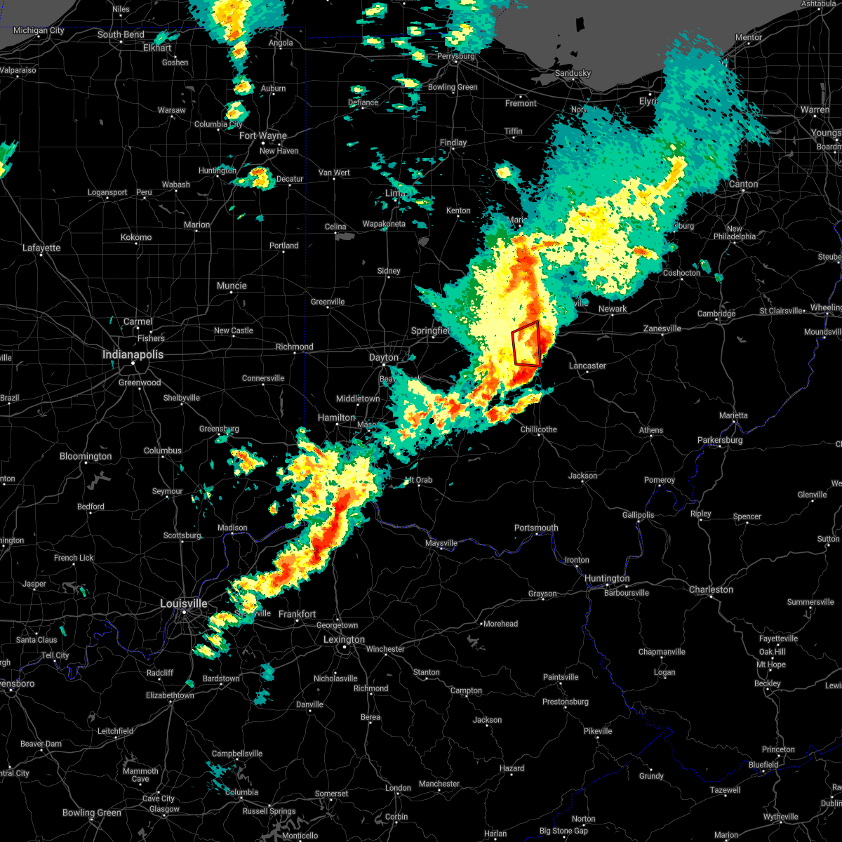 At 537 pm edt, a severe thunderstorm capable of producing a tornado was located over grove city, moving northeast at 45 mph (radar indicated rotation). Hazards include tornado and quarter size hail. Flying debris will be dangerous to those caught without shelter. mobile homes will be damaged or destroyed. damage to roofs, windows, and vehicles will occur. tree damage is likely. locations impacted include, columbus, grove city, upper arlington, ohio state university, grandview heights, obetz, commercial point, urbancrest, valleyview, marble cliff, harrisburg, orient, lockbourne, lincoln village, new rome and darbydale. this includes the following interstates, i-70 in ohio between mile markers 94 and 100. I-71 in ohio between mile markers 93 and 107, and near mile marker 112. At 537 pm edt, a severe thunderstorm capable of producing a tornado was located over grove city, moving northeast at 45 mph (radar indicated rotation). Hazards include tornado and quarter size hail. Flying debris will be dangerous to those caught without shelter. mobile homes will be damaged or destroyed. damage to roofs, windows, and vehicles will occur. tree damage is likely. locations impacted include, columbus, grove city, upper arlington, ohio state university, grandview heights, obetz, commercial point, urbancrest, valleyview, marble cliff, harrisburg, orient, lockbourne, lincoln village, new rome and darbydale. this includes the following interstates, i-70 in ohio between mile markers 94 and 100. I-71 in ohio between mile markers 93 and 107, and near mile marker 112.
|
| 4/3/2018 5:23 PM EDT |
 At 522 pm edt, a severe thunderstorm capable of producing a tornado was located 7 miles north of mount sterling, moving east at 45 mph (radar indicated rotation). Hazards include tornado and quarter size hail. Flying debris will be dangerous to those caught without shelter. mobile homes will be damaged or destroyed. damage to roofs, windows, and vehicles will occur. Tree damage is likely. At 522 pm edt, a severe thunderstorm capable of producing a tornado was located 7 miles north of mount sterling, moving east at 45 mph (radar indicated rotation). Hazards include tornado and quarter size hail. Flying debris will be dangerous to those caught without shelter. mobile homes will be damaged or destroyed. damage to roofs, windows, and vehicles will occur. Tree damage is likely.
|
| 11/5/2017 7:26 PM EST |
 The severe thunderstorm warning for eastern franklin, northwestern fairfield, northern pickaway, southeastern delaware and western licking counties will expire at 730 pm est, the storm which prompted the warning has moved out of the area. therefore, the warning will be allowed to expire. however heavy rain is still possible with this thunderstorm. a severe thunderstorm watch remains in effect until 100 am est for central ohio. please report previous wind damage or hail to the national weather service by going to our website at weather.gov/iln and submitting your report via social media. The severe thunderstorm warning for eastern franklin, northwestern fairfield, northern pickaway, southeastern delaware and western licking counties will expire at 730 pm est, the storm which prompted the warning has moved out of the area. therefore, the warning will be allowed to expire. however heavy rain is still possible with this thunderstorm. a severe thunderstorm watch remains in effect until 100 am est for central ohio. please report previous wind damage or hail to the national weather service by going to our website at weather.gov/iln and submitting your report via social media.
|
| 11/5/2017 7:08 PM EST |
 At 708 pm est, a severe thunderstorm was located near bexley, moving east at 45 mph (radar indicated). Hazards include 60 mph wind gusts. Expect damage to trees and power lines. locations impacted include, columbus, westerville, reynoldsburg, grove city, gahanna, pickerington, bexley, granville, pataskala, canal winchester, groveport, johnstown, ashville, utica, south bloomfield, granville south, beechwood trails, easton, summit station and whitehall. this includes the following interstates, i-70 in ohio between mile markers 99 and 122. I-71 in ohio between mile markers 95 and 110. At 708 pm est, a severe thunderstorm was located near bexley, moving east at 45 mph (radar indicated). Hazards include 60 mph wind gusts. Expect damage to trees and power lines. locations impacted include, columbus, westerville, reynoldsburg, grove city, gahanna, pickerington, bexley, granville, pataskala, canal winchester, groveport, johnstown, ashville, utica, south bloomfield, granville south, beechwood trails, easton, summit station and whitehall. this includes the following interstates, i-70 in ohio between mile markers 99 and 122. I-71 in ohio between mile markers 95 and 110.
|
| 11/5/2017 7:56 PM EDT |
 At 655 pm est, a severe thunderstorm was located near ohio state university, moving east at 45 mph (radar indicated). Hazards include 60 mph wind gusts. expect damage to trees and power lines At 655 pm est, a severe thunderstorm was located near ohio state university, moving east at 45 mph (radar indicated). Hazards include 60 mph wind gusts. expect damage to trees and power lines
|
| 7/22/2017 4:02 PM EDT |
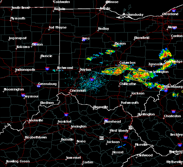 At 402 pm edt, a severe thunderstorm was located near south bloomfield, moving east at 40 mph (radar indicated). Hazards include 60 mph wind gusts and penny size hail. Expect damage to trees and power lines. locations impacted include, columbus, grove city, groveport, ashville, mount sterling, south bloomfield, obetz, commercial point, urbancrest, harrisburg, orient, lockbourne, darbyville, derby, lilly chapel, duvall, georgesville, darbydale, big plain and wrightsville. This includes i-71 in ohio between mile markers 82 and 104. At 402 pm edt, a severe thunderstorm was located near south bloomfield, moving east at 40 mph (radar indicated). Hazards include 60 mph wind gusts and penny size hail. Expect damage to trees and power lines. locations impacted include, columbus, grove city, groveport, ashville, mount sterling, south bloomfield, obetz, commercial point, urbancrest, harrisburg, orient, lockbourne, darbyville, derby, lilly chapel, duvall, georgesville, darbydale, big plain and wrightsville. This includes i-71 in ohio between mile markers 82 and 104.
|
| 7/22/2017 3:39 PM EDT |
 At 338 pm edt, a severe thunderstorm was located near london, moving east at 35 mph (radar indicated). Hazards include 60 mph wind gusts and penny size hail. expect damage to trees and power lines At 338 pm edt, a severe thunderstorm was located near london, moving east at 35 mph (radar indicated). Hazards include 60 mph wind gusts and penny size hail. expect damage to trees and power lines
|
| 7/10/2017 4:56 PM EDT |
 At 456 pm edt, severe thunderstorms were located along a line extending from near somerset to near williamsport, moving south at 30 mph (radar indicated). Hazards include 60 mph wind gusts and quarter size hail. Minor hail damage to vehicles is possible. expect wind damage to trees and power lines. locations impacted include, columbus, lancaster, reynoldsburg, grove city, pickerington, circleville, canal winchester, groveport, ashville, baltimore, south bloomfield, williamsport, pleasantville, new holland, obetz, commercial point, royalton, lithopolis, fox and thurston. this includes the following interstates, i-70 in ohio between mile markers 106 and 111. I-71 in ohio between mile markers 89 and 101. At 456 pm edt, severe thunderstorms were located along a line extending from near somerset to near williamsport, moving south at 30 mph (radar indicated). Hazards include 60 mph wind gusts and quarter size hail. Minor hail damage to vehicles is possible. expect wind damage to trees and power lines. locations impacted include, columbus, lancaster, reynoldsburg, grove city, pickerington, circleville, canal winchester, groveport, ashville, baltimore, south bloomfield, williamsport, pleasantville, new holland, obetz, commercial point, royalton, lithopolis, fox and thurston. this includes the following interstates, i-70 in ohio between mile markers 106 and 111. I-71 in ohio between mile markers 89 and 101.
|
| 7/10/2017 4:29 PM EDT |
 At 429 pm edt, severe thunderstorms were located along a line extending from newark to 7 miles west of grove city, moving east at 40 mph (radar indicated). Hazards include 60 mph wind gusts and quarter size hail. Minor hail damage to vehicles is possible. Expect wind damage to trees and power lines. At 429 pm edt, severe thunderstorms were located along a line extending from newark to 7 miles west of grove city, moving east at 40 mph (radar indicated). Hazards include 60 mph wind gusts and quarter size hail. Minor hail damage to vehicles is possible. Expect wind damage to trees and power lines.
|
| 7/10/2017 3:54 PM EDT |
 At 353 pm edt, a severe thunderstorm was located over jefferson, moving east at 40 mph (radar indicated). Hazards include 60 mph wind gusts and quarter size hail. Minor hail damage to vehicles is possible. Expect wind damage to trees and power lines. At 353 pm edt, a severe thunderstorm was located over jefferson, moving east at 40 mph (radar indicated). Hazards include 60 mph wind gusts and quarter size hail. Minor hail damage to vehicles is possible. Expect wind damage to trees and power lines.
|
| 2/24/2017 10:02 PM EST |
 At 1002 pm est, severe thunderstorms were located along a line extending from near lake darby to 6 miles northeast of mount sterling to near new holland, moving east at 50 mph (radar indicated). Hazards include 60 mph wind gusts. Expect damage to roofs, siding, and trees. locations impacted include, columbus, westerville, grove city, upper arlington, gahanna, hilliard, worthington, circleville, bexley, london, jefferson, canal winchester, groveport, west jefferson, ashville, mount sterling, south bloomfield, minerva park, bloomingburg and choctaw lake. this includes the following interstates, i-70 in ohio between mile markers 74 and 108. I-71 in ohio between mile markers 75 and 120. At 1002 pm est, severe thunderstorms were located along a line extending from near lake darby to 6 miles northeast of mount sterling to near new holland, moving east at 50 mph (radar indicated). Hazards include 60 mph wind gusts. Expect damage to roofs, siding, and trees. locations impacted include, columbus, westerville, grove city, upper arlington, gahanna, hilliard, worthington, circleville, bexley, london, jefferson, canal winchester, groveport, west jefferson, ashville, mount sterling, south bloomfield, minerva park, bloomingburg and choctaw lake. this includes the following interstates, i-70 in ohio between mile markers 74 and 108. I-71 in ohio between mile markers 75 and 120.
|
| 2/24/2017 9:48 PM EST |
 At 948 pm est, severe thunderstorms were located along a line extending from choctaw lake to near mount sterling to near washington court house, moving east at 50 mph (radar indicated). Hazards include 60 mph wind gusts. expect damage to roofs, siding, and trees At 948 pm est, severe thunderstorms were located along a line extending from choctaw lake to near mount sterling to near washington court house, moving east at 50 mph (radar indicated). Hazards include 60 mph wind gusts. expect damage to roofs, siding, and trees
|
| 1/10/2017 10:09 PM EST |
 The severe thunderstorm warning for southeastern union, northwestern pickaway and franklin counties in central ohio, southeastern clark county in west central ohio, southern delaware and madison counties in central ohio will expire at 1015 pm est, the storms which prompted the warning have weakened below severe limits, and are exiting the warned area. therefore, the warning will be allowed to expire. please report previous wind damage or hail to the national weather service by going to our website at weather.gov/iln and submitting your report via social media. The severe thunderstorm warning for southeastern union, northwestern pickaway and franklin counties in central ohio, southeastern clark county in west central ohio, southern delaware and madison counties in central ohio will expire at 1015 pm est, the storms which prompted the warning have weakened below severe limits, and are exiting the warned area. therefore, the warning will be allowed to expire. please report previous wind damage or hail to the national weather service by going to our website at weather.gov/iln and submitting your report via social media.
|
| 1/10/2017 9:55 PM EST |
 At 954 pm est, severe thunderstorms were located along a line extending from worthington to near bloomingburg, moving east at 75 mph (radar indicated). Hazards include 60 mph wind gusts. Expect damage to roofs, siding, and trees. locations impacted include, columbus, dublin, westerville, grove city, delaware, upper arlington, gahanna, hilliard, marysville, worthington, bexley, london, jefferson, powell, sunbury, plain city, west jefferson, mount sterling, south charleston and minerva park. this includes the following interstates, i-70 in ohio between mile markers 69 and 106. I-71 in ohio between mile markers 77 and 129. At 954 pm est, severe thunderstorms were located along a line extending from worthington to near bloomingburg, moving east at 75 mph (radar indicated). Hazards include 60 mph wind gusts. Expect damage to roofs, siding, and trees. locations impacted include, columbus, dublin, westerville, grove city, delaware, upper arlington, gahanna, hilliard, marysville, worthington, bexley, london, jefferson, powell, sunbury, plain city, west jefferson, mount sterling, south charleston and minerva park. this includes the following interstates, i-70 in ohio between mile markers 69 and 106. I-71 in ohio between mile markers 77 and 129.
|
| 1/10/2017 9:39 PM EST |
 At 939 pm est, severe thunderstorms were located along a line extending from near new california to near south charleston, moving east at 105 mph (radar indicated). Hazards include 60 mph wind gusts. expect damage to roofs, siding, and trees At 939 pm est, severe thunderstorms were located along a line extending from near new california to near south charleston, moving east at 105 mph (radar indicated). Hazards include 60 mph wind gusts. expect damage to roofs, siding, and trees
|
| 7/6/2016 2:39 PM EDT | Tree down in darbyville. time estimated by rada in pickaway county OH, 7.5 miles NNW of Orient, OH |
| 6/23/2016 3:28 AM EDT | The severe thunderstorm warning for central pickaway and southwestern fairfield counties will expire at 330 am edt, the storm which prompted the warning has weakened below severe limits, and no longer poses an immediate threat to life or property. therefore the warning will be allowed to expire. another severe thunderstorm warning remains in effect for southwest pickaway county until 345 am edt. a tornado watch remains in effect until 500 am edt for central ohio. please report previous wind damage or hail to the national weather service by going to our website at weather.gov/iln and submitting your report via social media. |
| 6/23/2016 3:18 AM EDT |
 At 317 am edt, a severe thunderstorm was located near circleville, moving southeast at 25 mph (radar indicated). Hazards include 60 mph wind gusts. Expect damage to roofs. siding. and trees. locations impacted include, circleville, ashville, south bloomfield, williamsport, logan elm village, commercial point, fox, stoutsville, orient, darbyville, duvall, state route 674 at state route 188, aw marion state park, state route 138 at us route 22, east ringgold, whisler and slate run metro park. A tornado watch remains in effect until 500 am edt for central ohio. At 317 am edt, a severe thunderstorm was located near circleville, moving southeast at 25 mph (radar indicated). Hazards include 60 mph wind gusts. Expect damage to roofs. siding. and trees. locations impacted include, circleville, ashville, south bloomfield, williamsport, logan elm village, commercial point, fox, stoutsville, orient, darbyville, duvall, state route 674 at state route 188, aw marion state park, state route 138 at us route 22, east ringgold, whisler and slate run metro park. A tornado watch remains in effect until 500 am edt for central ohio.
|
| 6/23/2016 2:57 AM EDT |
 At 257 am edt, a severe thunderstorm was located near grove city, moving southeast at 45 mph (radar indicated). Hazards include 60 mph wind gusts. Expect damage to roofs. siding. And trees. At 257 am edt, a severe thunderstorm was located near grove city, moving southeast at 45 mph (radar indicated). Hazards include 60 mph wind gusts. Expect damage to roofs. siding. And trees.
|
| 4/26/2016 6:56 PM EDT |
 The severe thunderstorm warning for north central pickaway, southern franklin and northwestern fairfield counties will expire at 700 pm edt, the storm which prompted the warning is weakening and is expected to continue this trend. therefore the warning will be allowed to expire. a severe thunderstorm watch remains in effect until 200 am edt for central ohio. please report previous wind damage or hail to the national weather service by going to our website at weather.gov/iln and submitting your report via social media. remember, a severe thunderstorm warning still remains in effect for southern franklin county, northern pickaway county and extreme northwest fairfield county. The severe thunderstorm warning for north central pickaway, southern franklin and northwestern fairfield counties will expire at 700 pm edt, the storm which prompted the warning is weakening and is expected to continue this trend. therefore the warning will be allowed to expire. a severe thunderstorm watch remains in effect until 200 am edt for central ohio. please report previous wind damage or hail to the national weather service by going to our website at weather.gov/iln and submitting your report via social media. remember, a severe thunderstorm warning still remains in effect for southern franklin county, northern pickaway county and extreme northwest fairfield county.
|
| 4/26/2016 6:30 PM EDT |
 At 630 pm edt, a severe thunderstorm was located near grove city, moving southeast at 30 mph (radar indicated). Hazards include 60 mph wind gusts and quarter size hail. Hail damage to vehicles is expected. Expect wind damage to roofs, siding, and trees. At 630 pm edt, a severe thunderstorm was located near grove city, moving southeast at 30 mph (radar indicated). Hazards include 60 mph wind gusts and quarter size hail. Hail damage to vehicles is expected. Expect wind damage to roofs, siding, and trees.
|
| 9/4/2015 5:10 PM EDT |
 The severe thunderstorm warning for northwestern pickaway, southern franklin and southeastern madison counties will expire at 515 pm edt, the storm which prompted the warning has weakened below severe limits. therefore the warning will be allowed to expire. please report previous wind damage or hail to the national weather service by going to our website at weather.gov/iln and submit your report via social media. The severe thunderstorm warning for northwestern pickaway, southern franklin and southeastern madison counties will expire at 515 pm edt, the storm which prompted the warning has weakened below severe limits. therefore the warning will be allowed to expire. please report previous wind damage or hail to the national weather service by going to our website at weather.gov/iln and submit your report via social media.
|
| 9/4/2015 5:01 PM EDT |
 At 501 pm edt, radar indicated a severe thunderstorm located 7 miles southwest of grove city, moving south at 5 mph. storm hazards include, winds to 60 mph, quarter size hail, locations impacted include, columbus, reynoldsburg, grove city, gahanna, bexley, canal winchester, groveport, whitehall, obetz, commercial point, urbancrest, valleyview, harrisburg, orient, lockbourne, brice, big plain, georgesville, port columbus airport and blacklick estates. this includes the following interstates, i-70 in ohio between mile markers 97 and 110. i-71 in ohio between mile markers 85 and 109. At 501 pm edt, radar indicated a severe thunderstorm located 7 miles southwest of grove city, moving south at 5 mph. storm hazards include, winds to 60 mph, quarter size hail, locations impacted include, columbus, reynoldsburg, grove city, gahanna, bexley, canal winchester, groveport, whitehall, obetz, commercial point, urbancrest, valleyview, harrisburg, orient, lockbourne, brice, big plain, georgesville, port columbus airport and blacklick estates. this includes the following interstates, i-70 in ohio between mile markers 97 and 110. i-71 in ohio between mile markers 85 and 109.
|
| 9/4/2015 4:35 PM EDT |
 At 434 pm edt, radar indicated a severe thunderstorm located 7 miles south of jefferson, moving east at 15 mph. storm hazards include, winds to 60 mph, quarter size hail,. At 434 pm edt, radar indicated a severe thunderstorm located 7 miles south of jefferson, moving east at 15 mph. storm hazards include, winds to 60 mph, quarter size hail,.
|
| 7/19/2015 3:09 PM EDT |
 The severe thunderstorm warning for southeastern madison, northwestern pickaway and southwestern franklin counties will expire at 315 pm edt, the storm which prompted the warning has weakened below severe limits. therefore the warning will be allowed to expire. small hail, .gusty winds and heavy rain are still possible with this storm. please report previous wind damage or hail to the national weather service by going to our website at weather.gov/iln and submit your report via social media. The severe thunderstorm warning for southeastern madison, northwestern pickaway and southwestern franklin counties will expire at 315 pm edt, the storm which prompted the warning has weakened below severe limits. therefore the warning will be allowed to expire. small hail, .gusty winds and heavy rain are still possible with this storm. please report previous wind damage or hail to the national weather service by going to our website at weather.gov/iln and submit your report via social media.
|
| 7/19/2015 3:00 PM EDT |
 At 259 pm edt, radar indicated a severe thunderstorm located near grove city, moving east at 35 mph. storm hazards include, winds to 60 mph, penny size hail, very heavy rain which may cause minor flooding, locations impacted include, columbus, grove city, jefferson, west jefferson, ashville, mount sterling, south bloomfield, lake darby, commercial point, urbancrest, valleyview, harrisburg, orient, darbyville, new rome, big plain, lincoln village, georgesville, lilly chapel and wrightsville. At 259 pm edt, radar indicated a severe thunderstorm located near grove city, moving east at 35 mph. storm hazards include, winds to 60 mph, penny size hail, very heavy rain which may cause minor flooding, locations impacted include, columbus, grove city, jefferson, west jefferson, ashville, mount sterling, south bloomfield, lake darby, commercial point, urbancrest, valleyview, harrisburg, orient, darbyville, new rome, big plain, lincoln village, georgesville, lilly chapel and wrightsville.
|
| 7/19/2015 2:40 PM EDT |
 At 240 pm edt, radar indicated a severe thunderstorm located near london, moving east at 35 mph. storm hazards include, winds to 60 mph, penny size hail, very heavy rain which may cause minor flooding,. At 240 pm edt, radar indicated a severe thunderstorm located near london, moving east at 35 mph. storm hazards include, winds to 60 mph, penny size hail, very heavy rain which may cause minor flooding,.
|
| 6/12/2015 5:00 PM EDT |
 At 456 pm edt, radar continued to indicate a severe thunderstorm located near commercial point, moving east at 45 mph. storm hazards include, winds to 60 mph, dime size hail, locations impacted include, ashville. in addition, south bloomfield, lockbourne, duvall, groveport, east ringgold, slate run metro park, state route 674 at state route 188 and canal winchester are near the path of this storm. this includes the following interstate, i-71 between mile markers 91 and 97,. At 456 pm edt, radar continued to indicate a severe thunderstorm located near commercial point, moving east at 45 mph. storm hazards include, winds to 60 mph, dime size hail, locations impacted include, ashville. in addition, south bloomfield, lockbourne, duvall, groveport, east ringgold, slate run metro park, state route 674 at state route 188 and canal winchester are near the path of this storm. this includes the following interstate, i-71 between mile markers 91 and 97,.
|
| 6/12/2015 4:39 PM EDT |
 At 438 pm edt, radar indicated a severe thunderstorm located near chenoweth, moving east at 45 mph. storm hazards include, winds to 60 mph, penny size hail,. At 438 pm edt, radar indicated a severe thunderstorm located near chenoweth, moving east at 45 mph. storm hazards include, winds to 60 mph, penny size hail,.
|
| 5/26/2015 8:19 PM EDT | At 818 pm edt, radar indicated that the severe thunderstorm had weakened. this storm was located near five points, moving northeast at 40 mph. storm hazards include, winds to 60 mph, locations impacted include, grove city. in addition, darbyville, derby, harrisburg, orient, commercial point, darbydale, duvall and lockbourne are near the path of this storm. this includes the following interstate, i-71 between mile markers 88 and 103,. |
| 5/26/2015 8:04 PM EDT | At 803 pm edt, radar indicated a severe thunderstorm located near plano, moving northeast at 40 mph. storm hazards include, winds to 60 mph,. |
| 5/11/2015 4:43 PM EDT | At 441 pm edt, radar continued to indicate severe thunderstorms located along a line extending from polaris to commercial point, moving northeast at 35 mph. storm hazards include, destructive winds to 80 mph, quarter size hail, locations impacted include, downtown columbus, westerville, easton, sunbury, gahanna, new albany, reynoldsburg, pickerington and pataskala. in addition, commercial point, minerva park, huber ridge, duvall, galena, bexley, lockbourne and obetz are near the path of these storms. this includes the following interstates, i-70 between mile markers 93 and 121, i-71 between mile markers 92 and 128, , 1.00in. |
| 5/11/2015 4:34 PM EDT | At 432 pm edt, radar indicated severe thunderstorms located along a line extending from worthington to five points, moving northeast at 35 mph. storm hazards include, winds to 60 mph, quarter size hail,. |
| 4/8/2015 12:13 PM EDT | The severe thunderstorm warning for pickaway and southern franklin counties in central ohio will expire at 1215 pm edt. the storms have weakened below severe limits. therefore the severe thunderstorm warning will be allowed to expire. gusty winds and heavy rain are still possible with these storms. Additional thunderstorm development is possible and a severe. |
| 4/8/2015 11:56 AM EDT | A severe thunderstorm warning remains in effect until 1215 pm edt for pickaway and southern franklin counties in central ohio. at 1155 am edt. radar indicated that the severe thunderstorms had weakened. these storms were located along a line extending from downtown columbus to commercial point to logan elm village. Moving northeast at 55 mph. |
| 4/8/2015 11:37 AM EDT | The national weather service in wilmington has issued a * severe thunderstorm warning for. pickaway county in central ohio. southeastern madison county in central ohio. southern franklin county in central ohio. Northeastern fayette county in central ohio. |
| 4/8/2015 11:37 AM EDT | The national weather service in wilmington has issued a * severe thunderstorm warning for. pickaway county in central ohio. southeastern madison county in central ohio. southern franklin county in central ohio. Northeastern fayette county in central ohio. |
| 1/1/0001 12:00 AM | Trees downed in pickaway county OH, 1.7 miles N of Orient, OH |
| 1/1/0001 12:00 AM | Trees down in pickaway county OH, 1 miles NNW of Orient, OH |
Hail Maps for Orient, OH
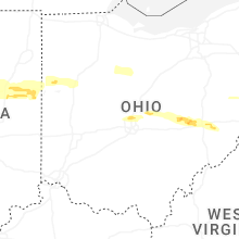
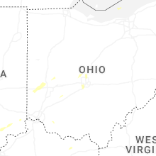


Connect with Interactive Hail Maps