

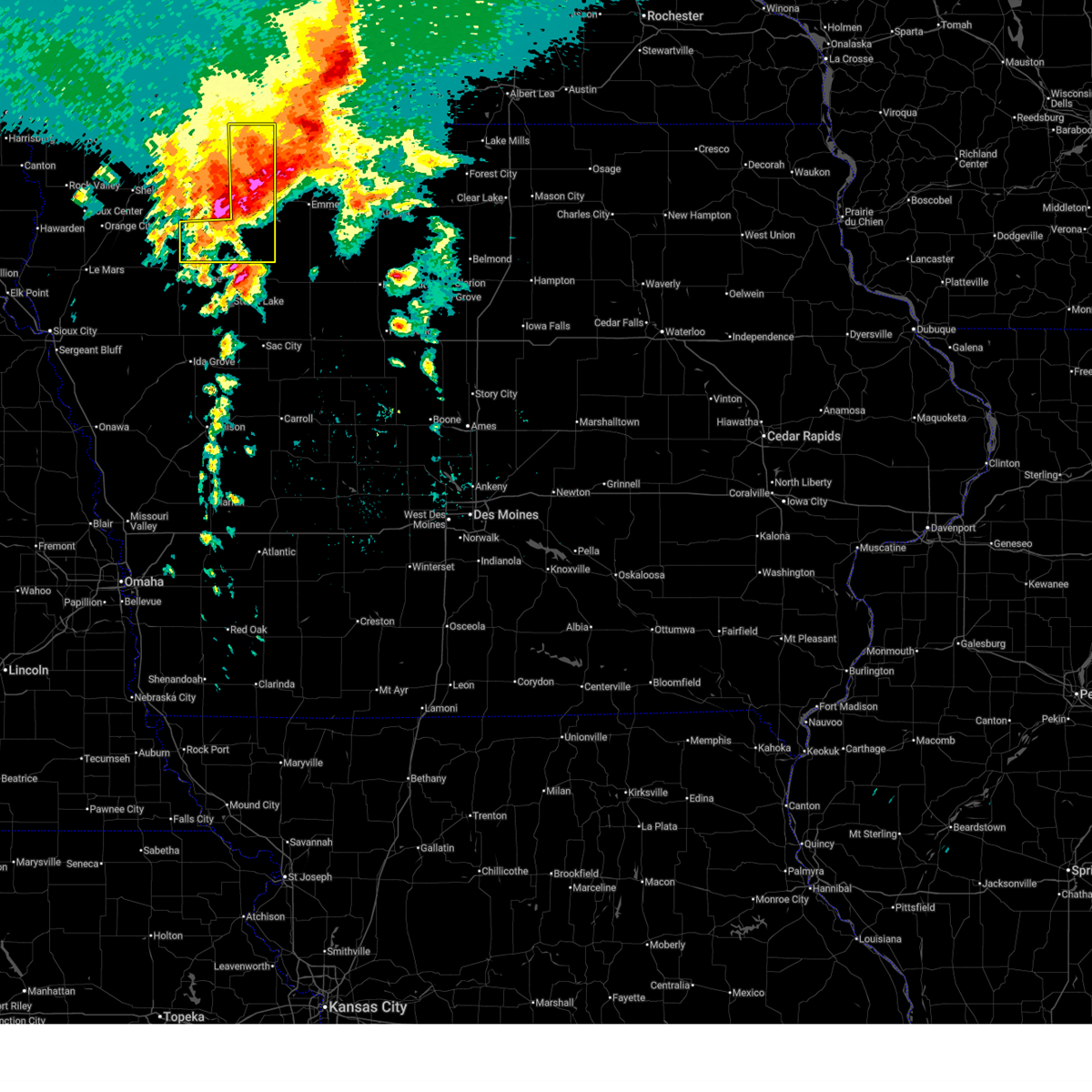
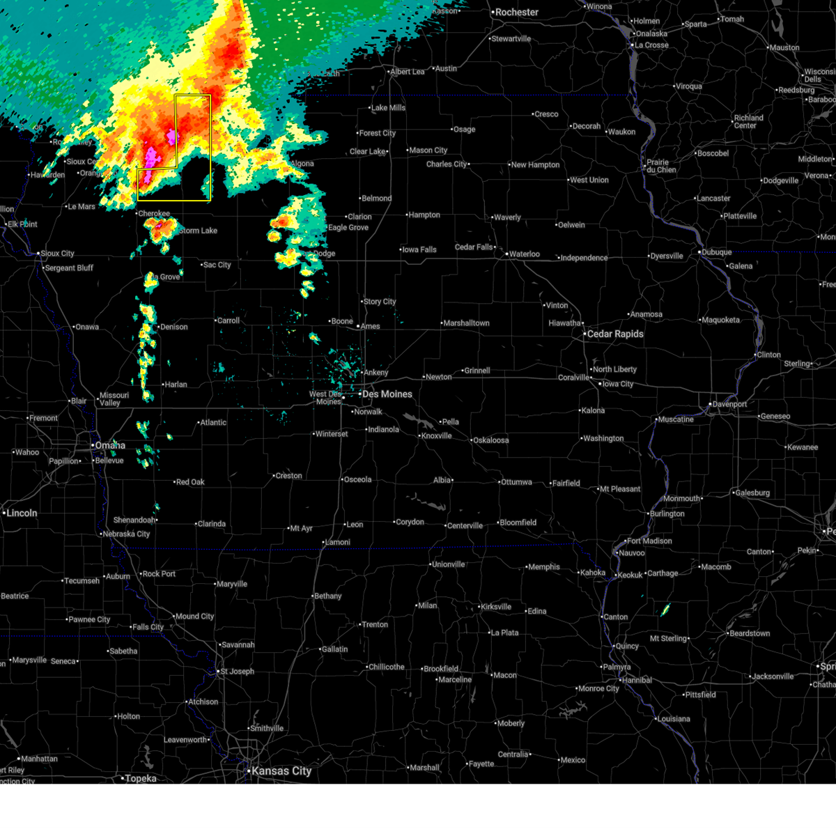
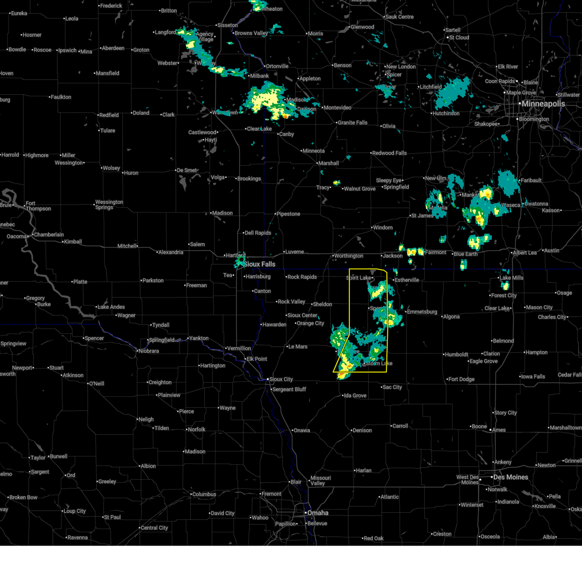
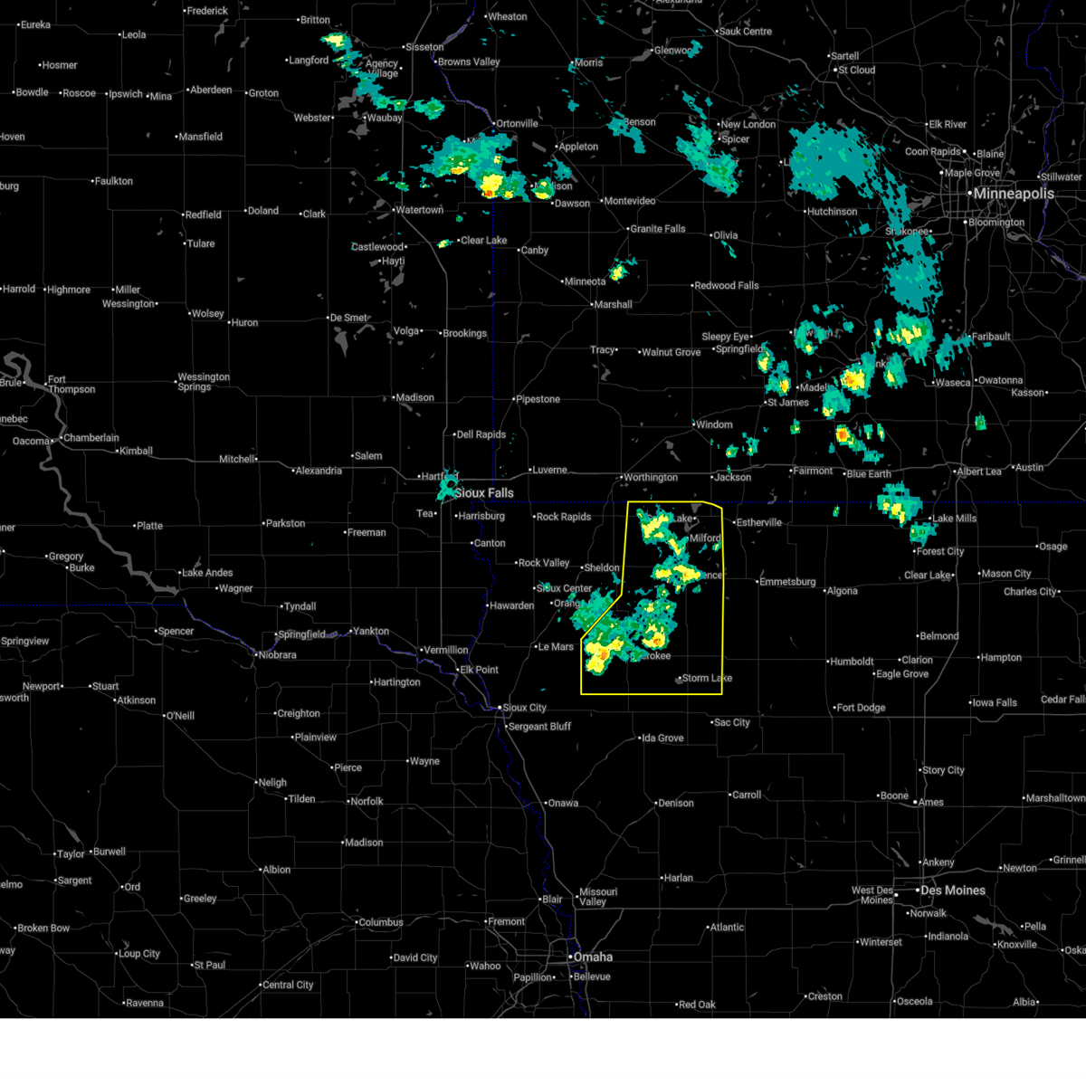
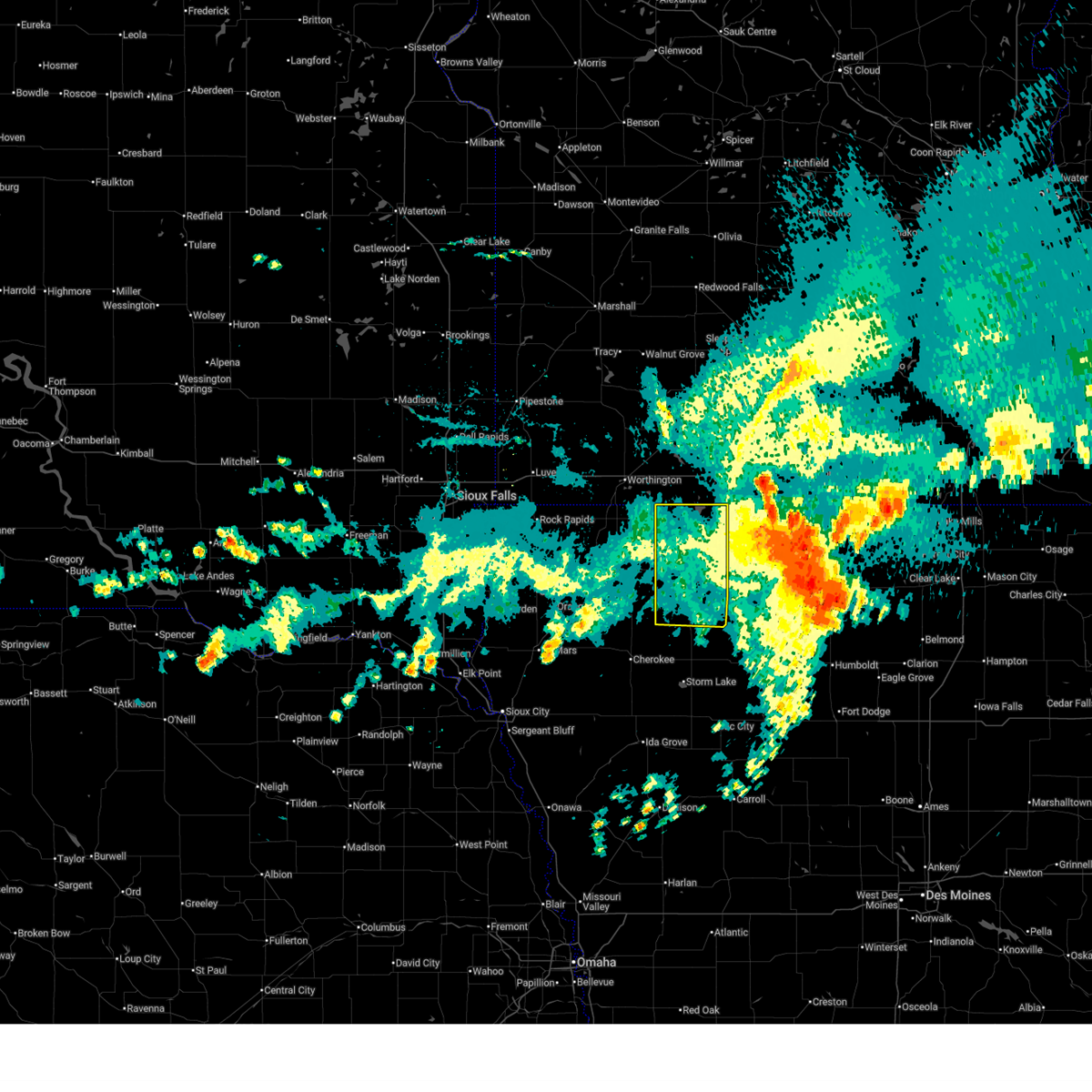
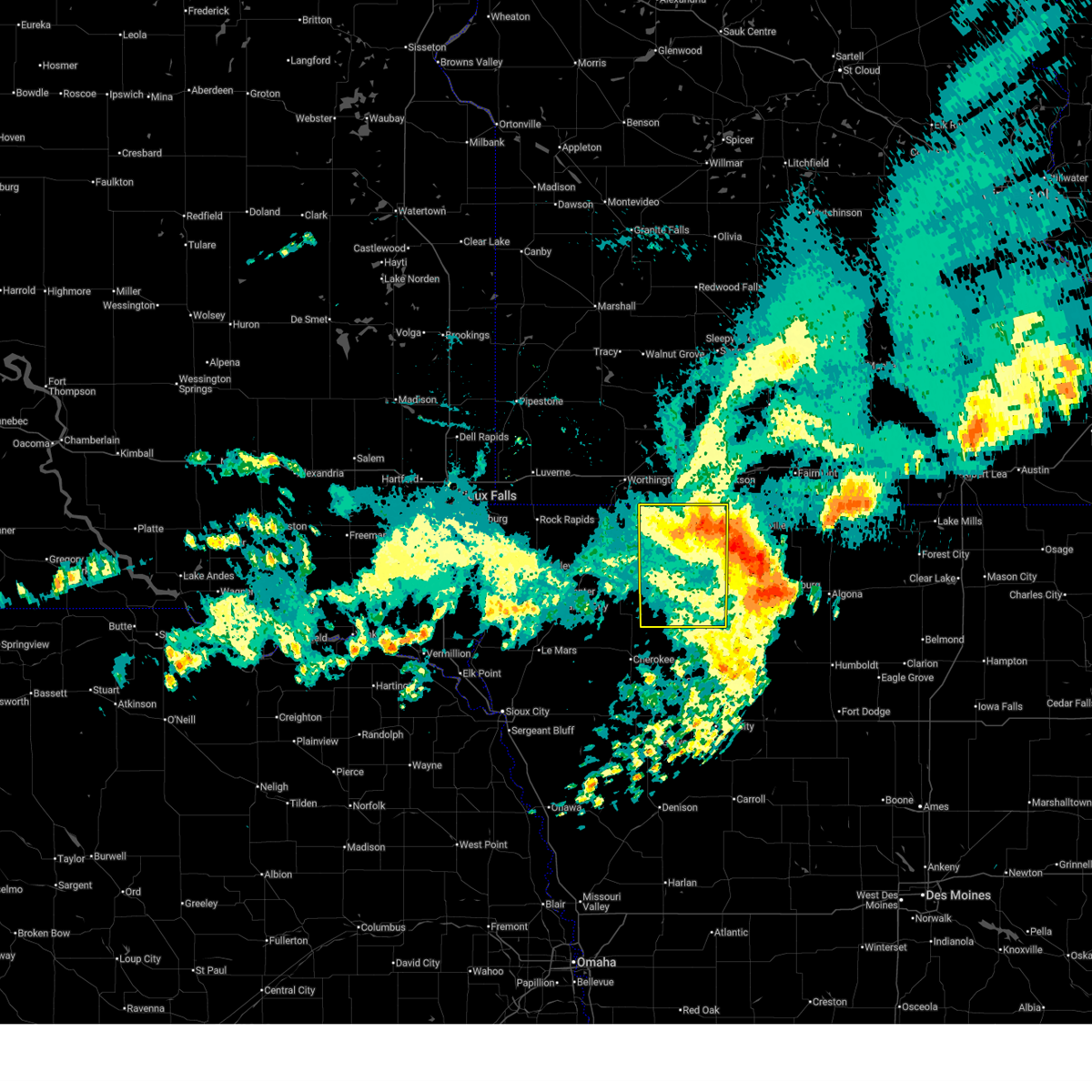
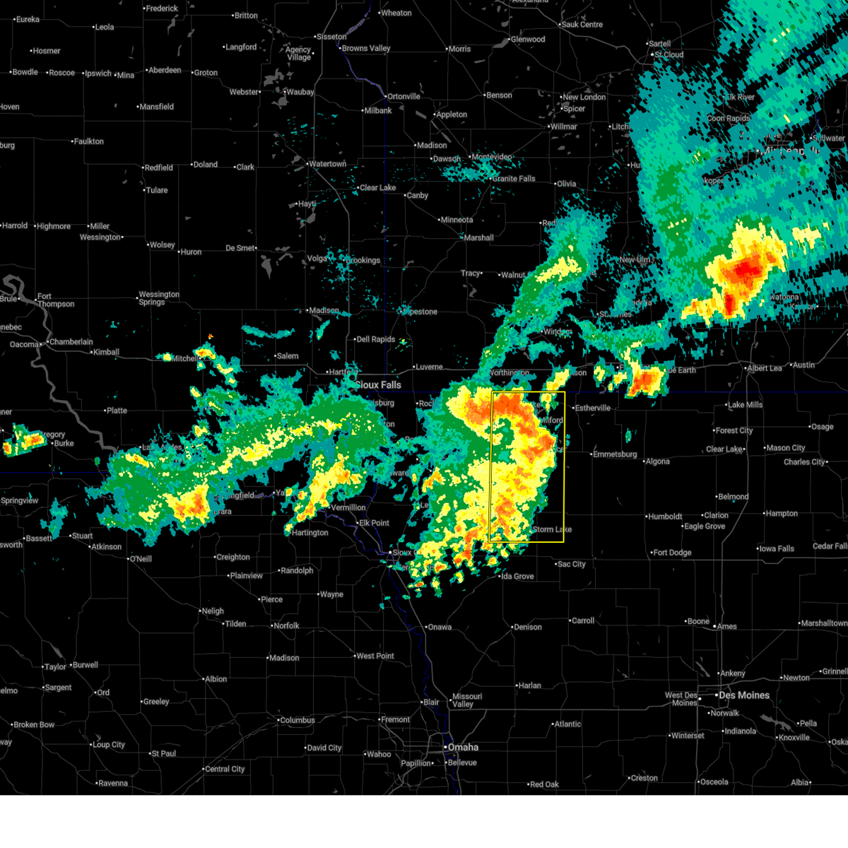
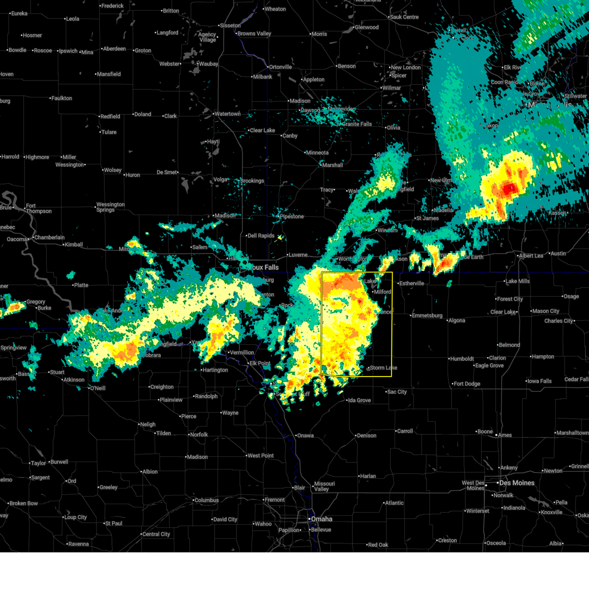
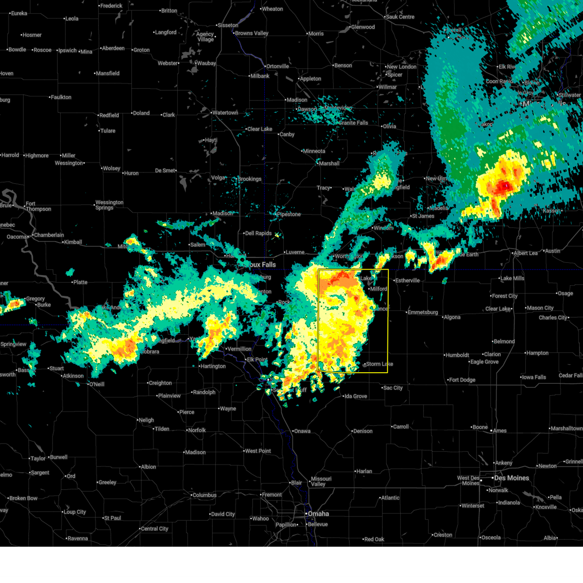
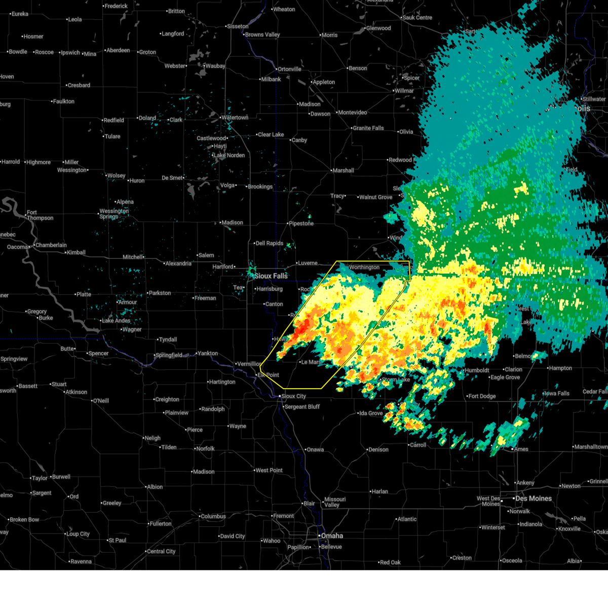
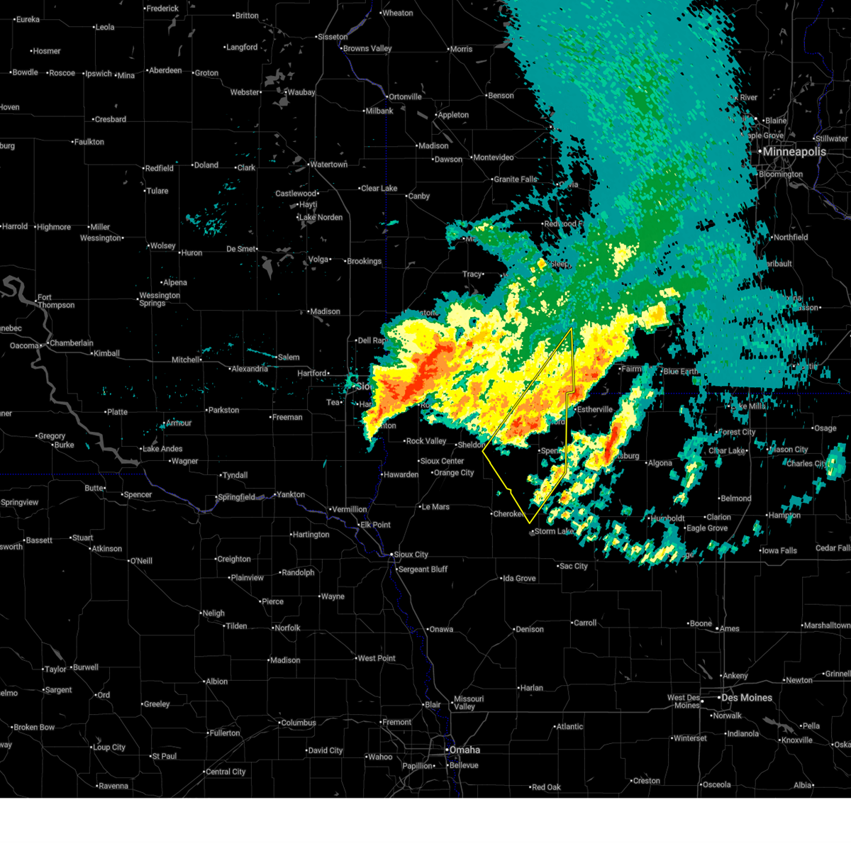
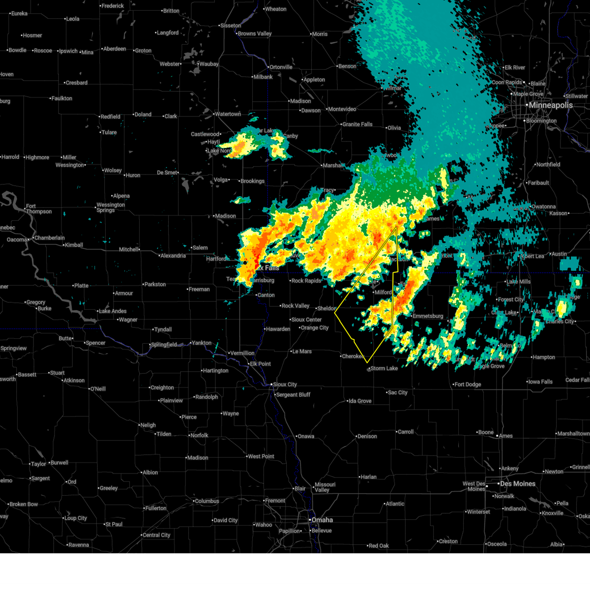
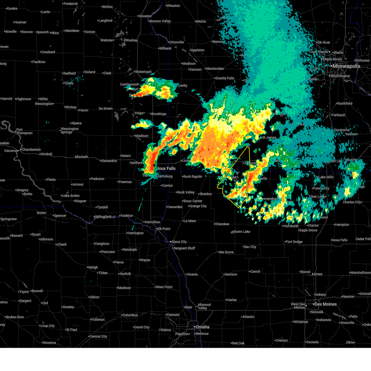
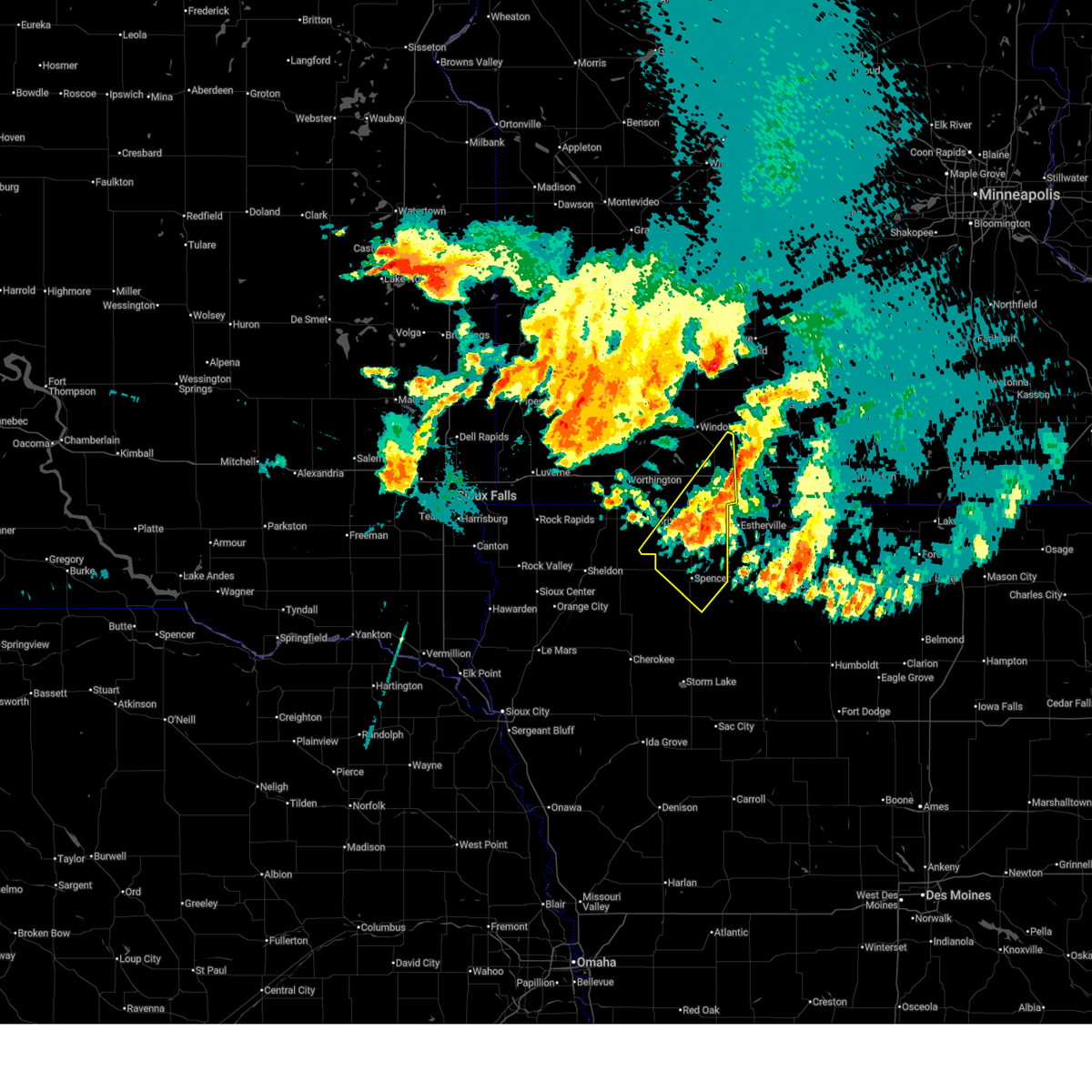
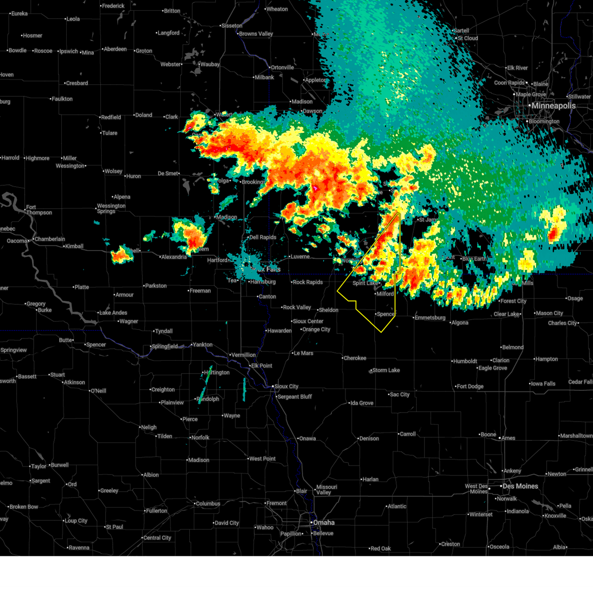
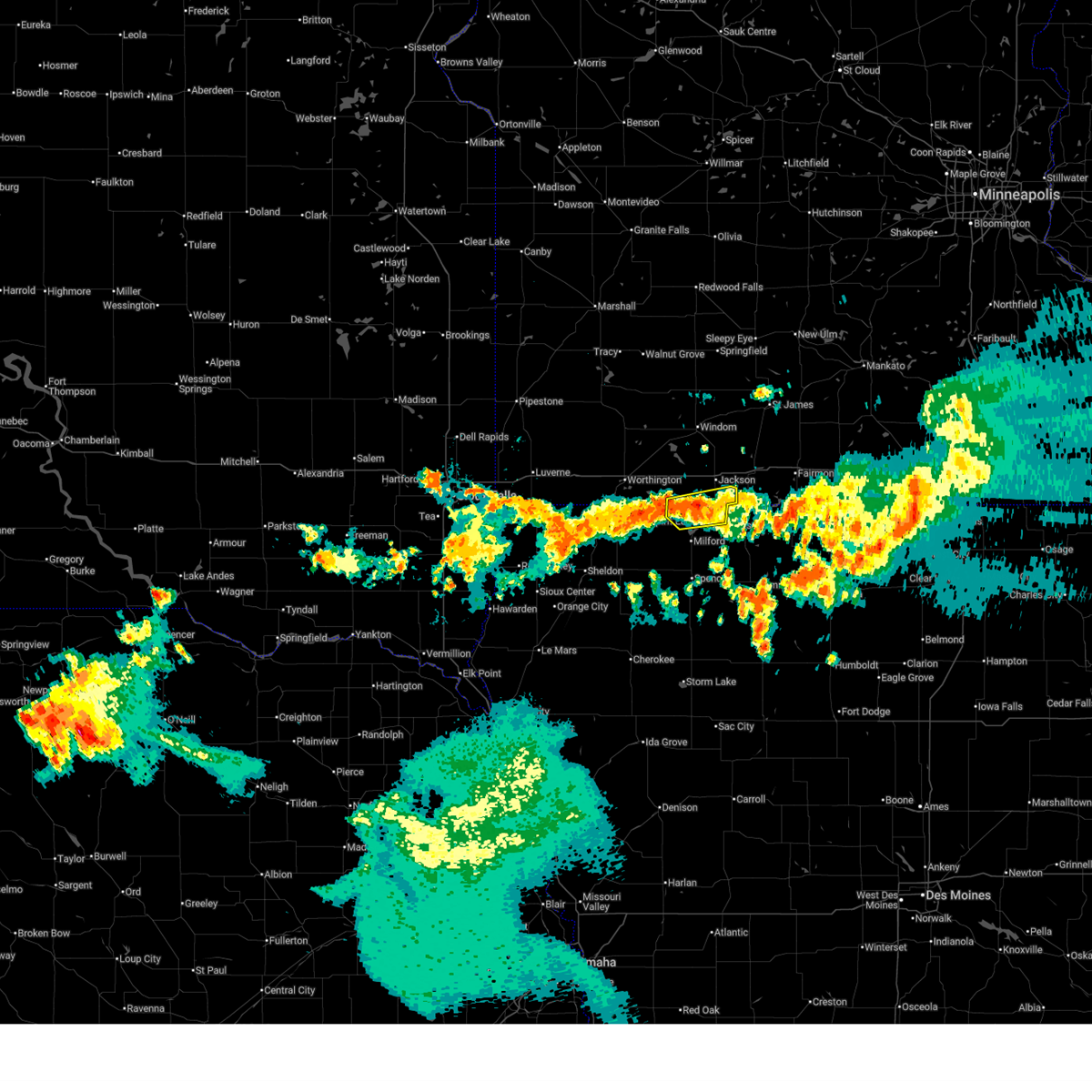
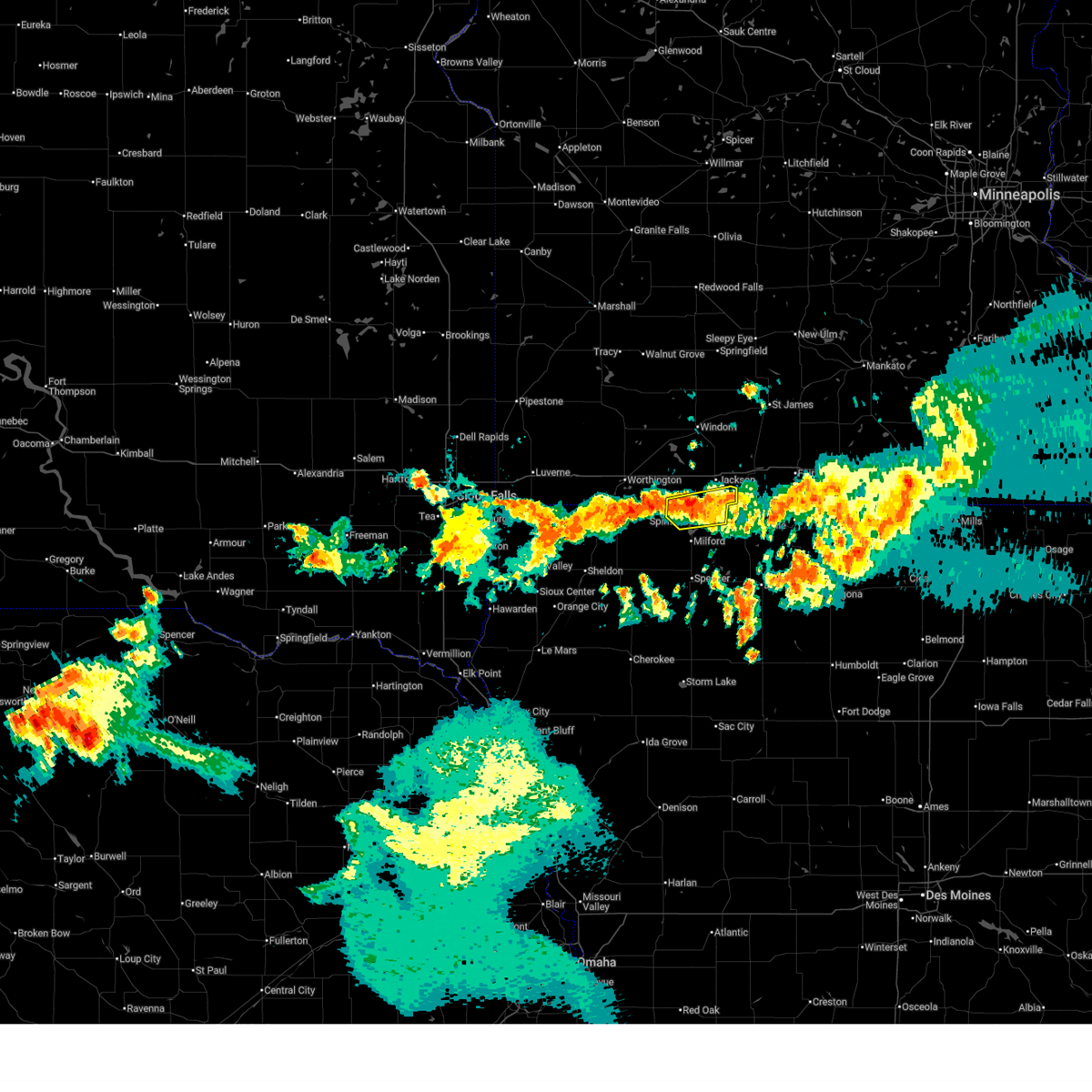
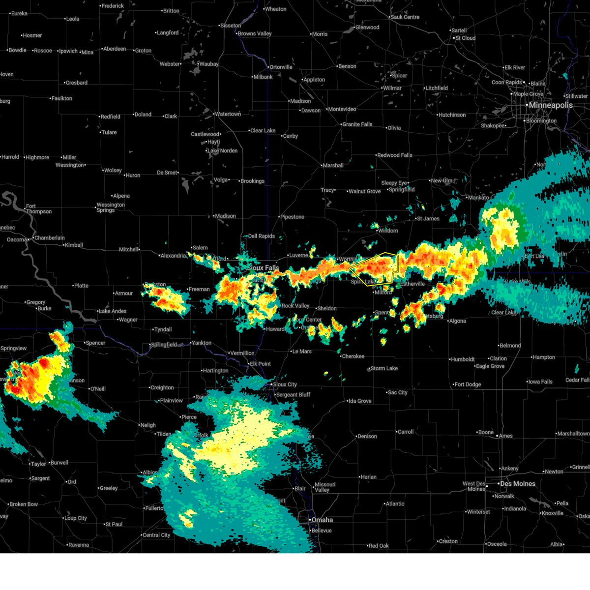
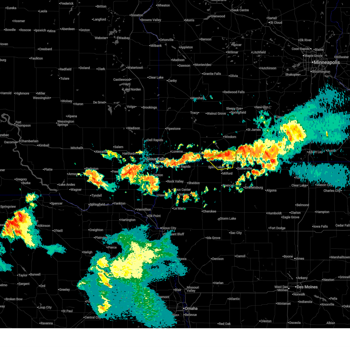
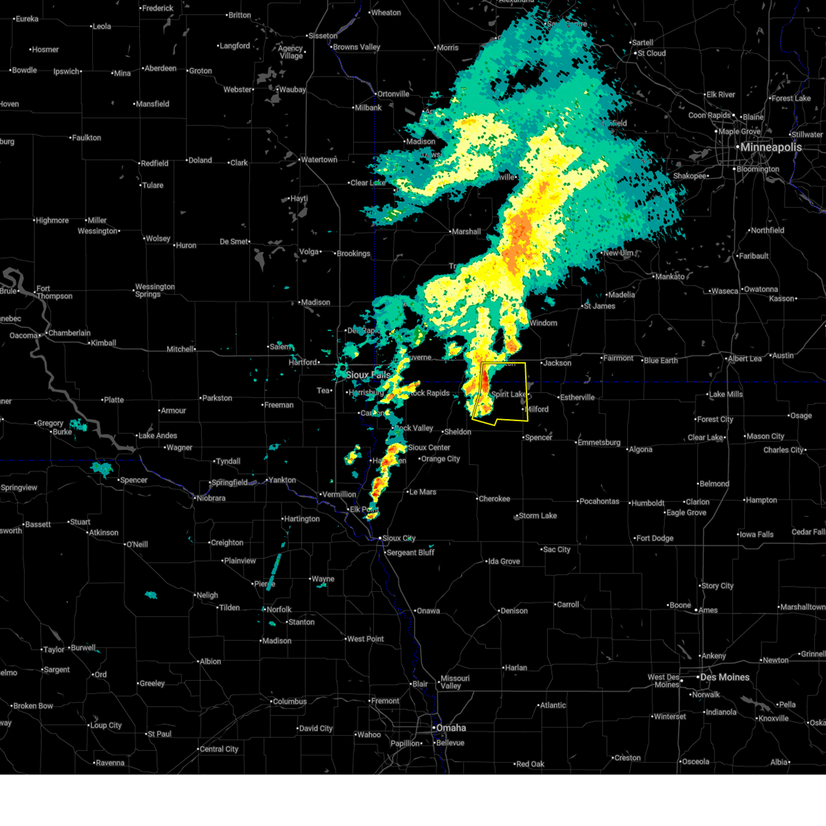
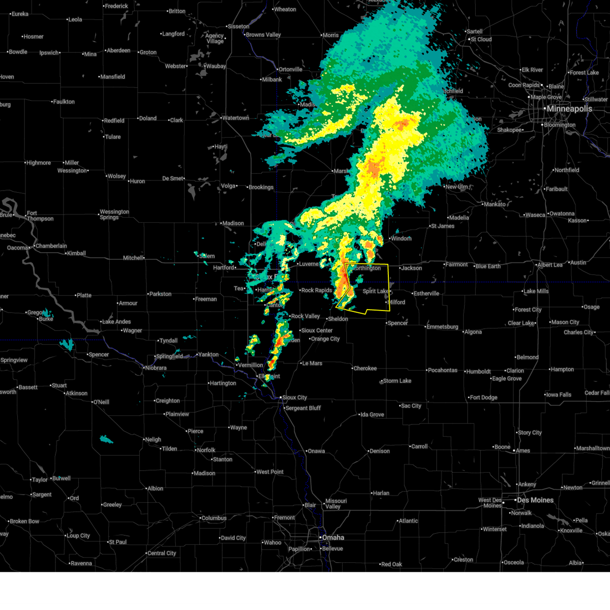
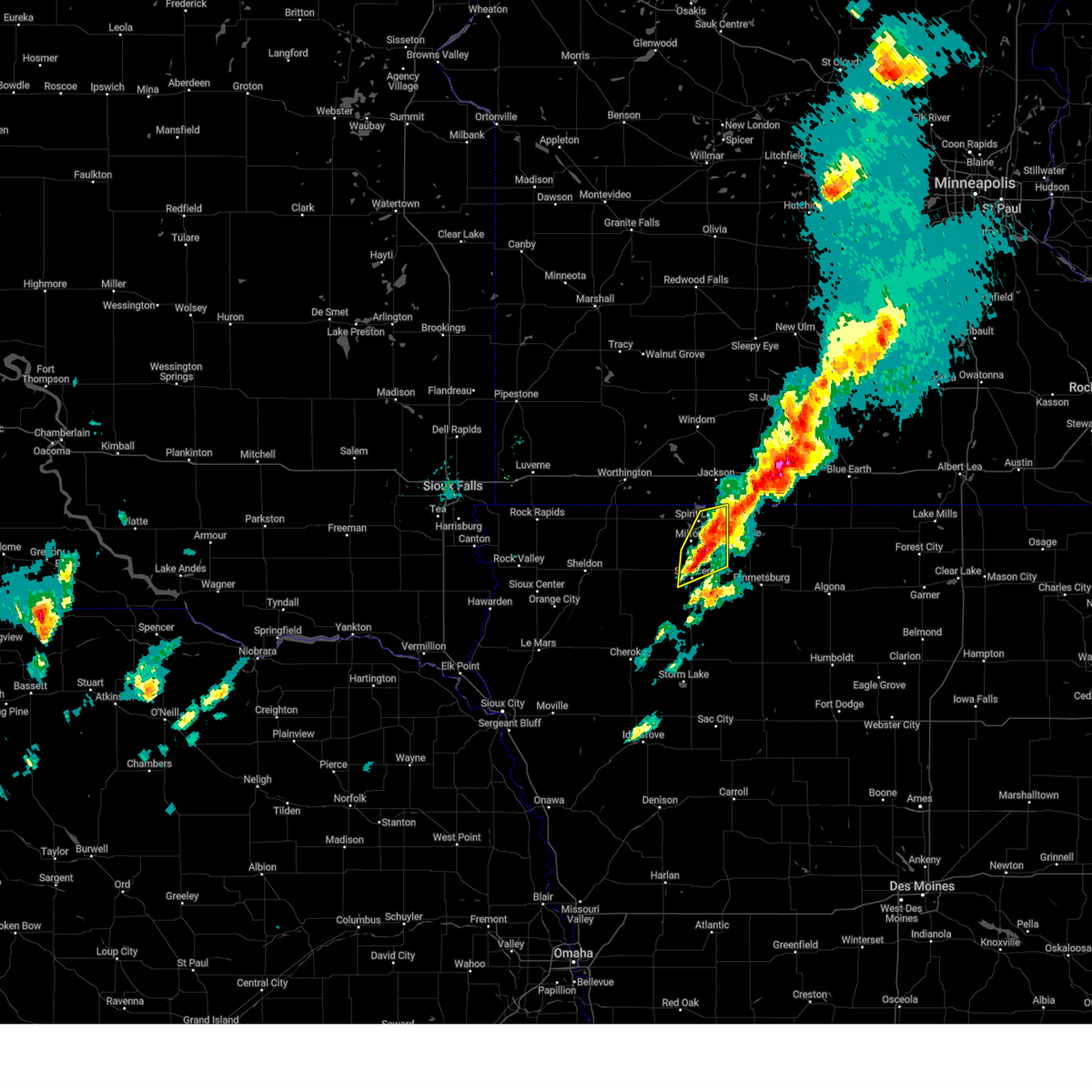
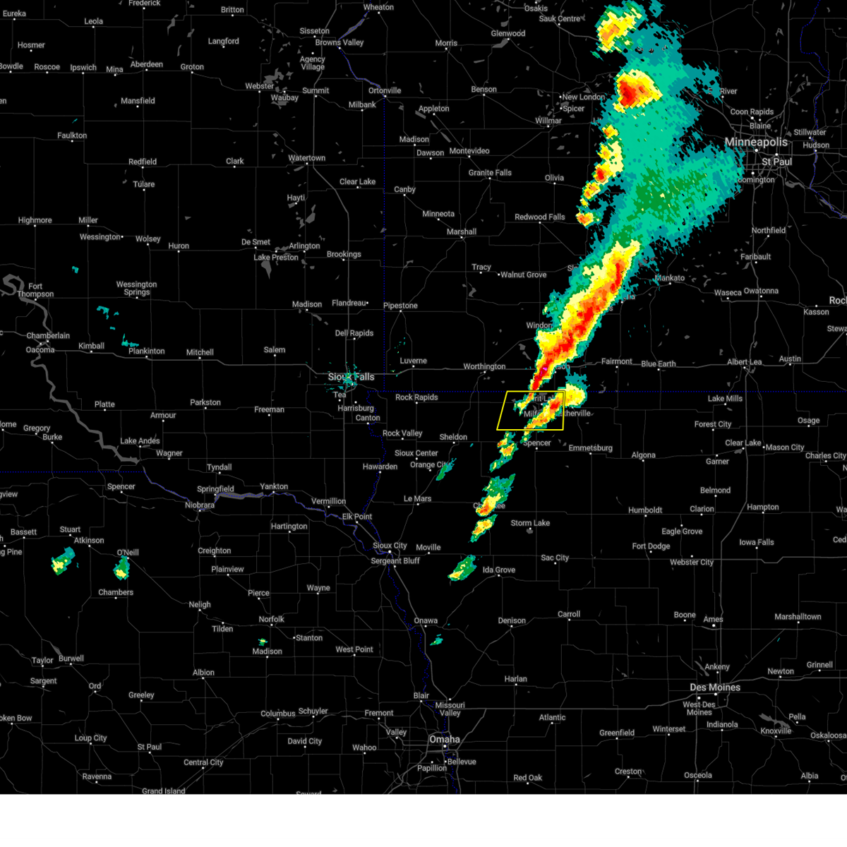
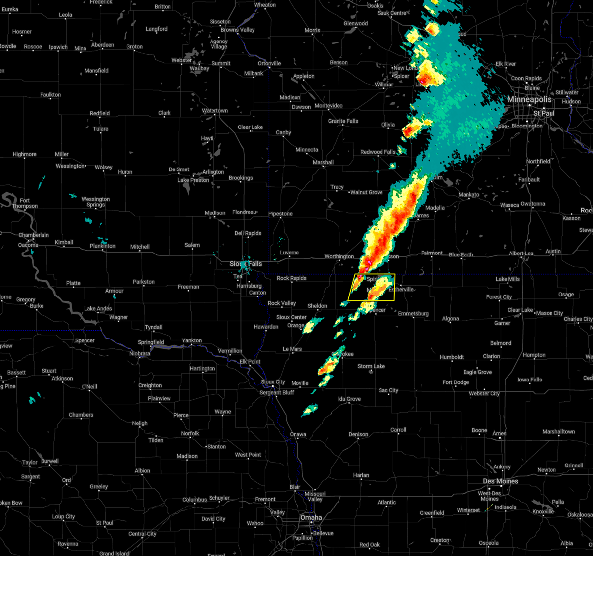
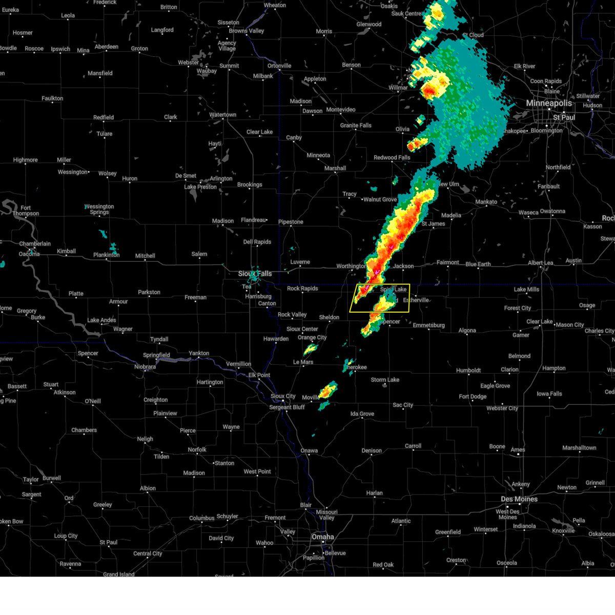
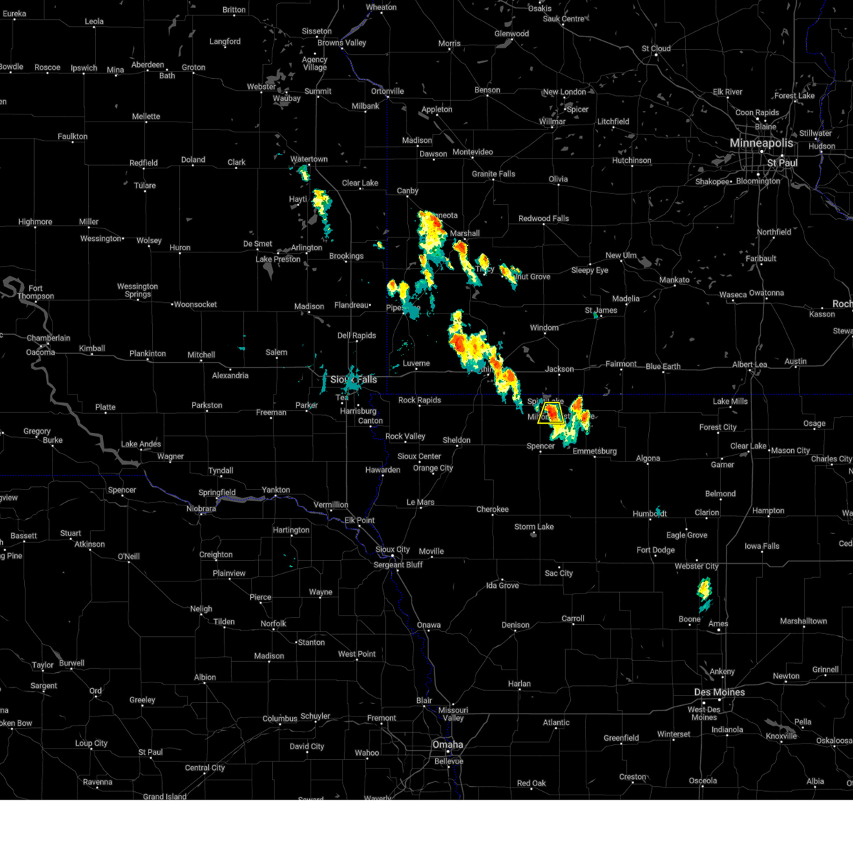
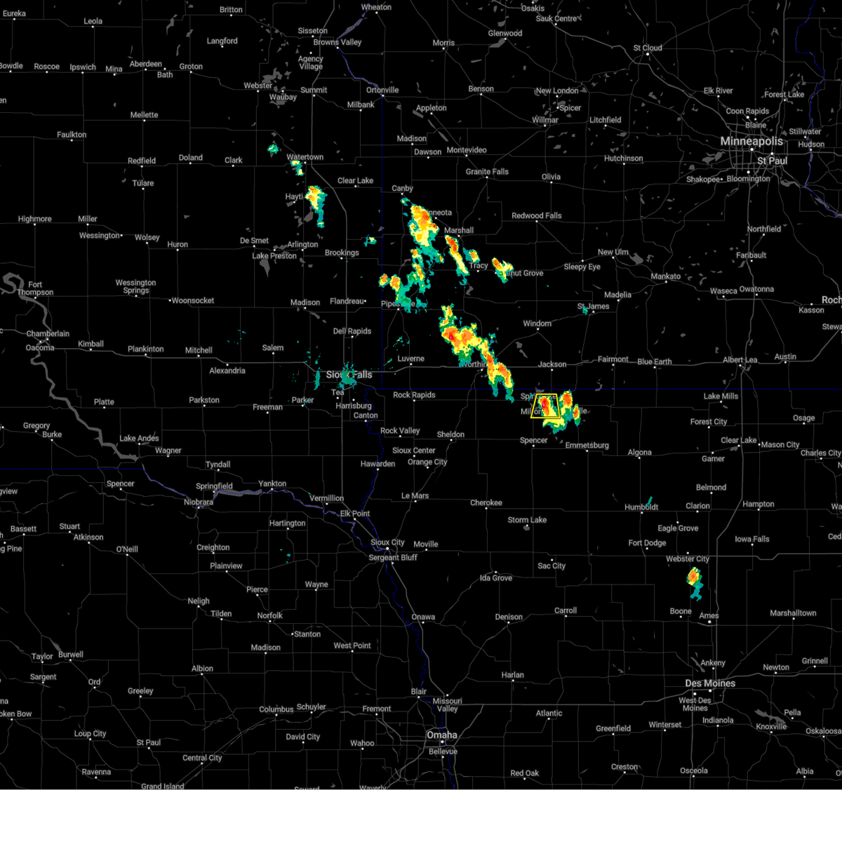
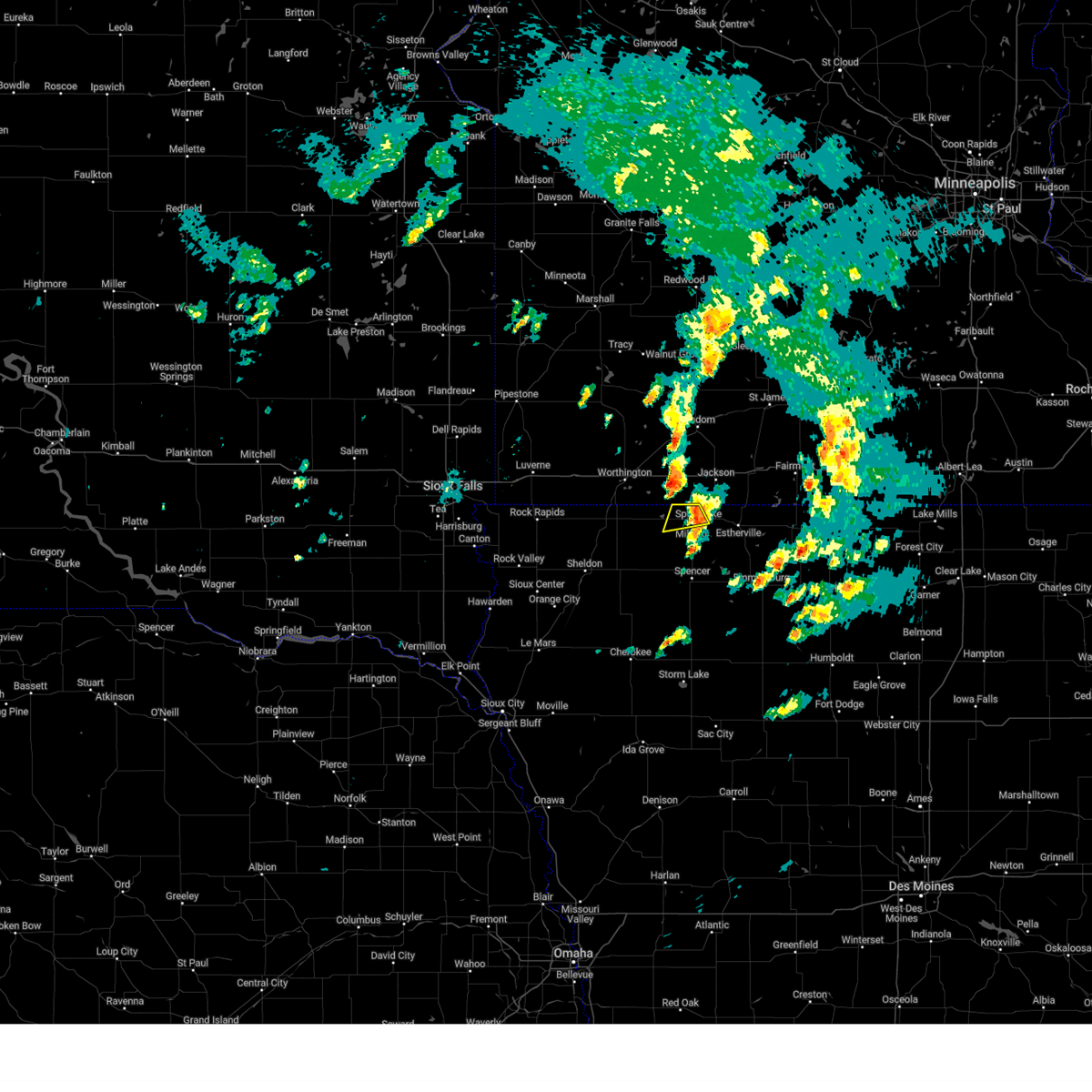
Hail Map for Orleans, IA
The Orleans, IA area has had 0 reports of on-the-ground hail by trained spotters, and has been under severe weather warnings 38 times during the past 12 months. Doppler radar has detected hail at or near Orleans, IA on 51 occasions, including 3 occasions during the past year.
| Name: | Orleans, IA |
| Where Located: | 55.9 miles N of Storm Lake, IA |
| Map: | Google Map for Orleans, IA |
| Population: | 608 |
| Housing Units: | 558 |
| More Info: | Search Google for Orleans, IA |
2
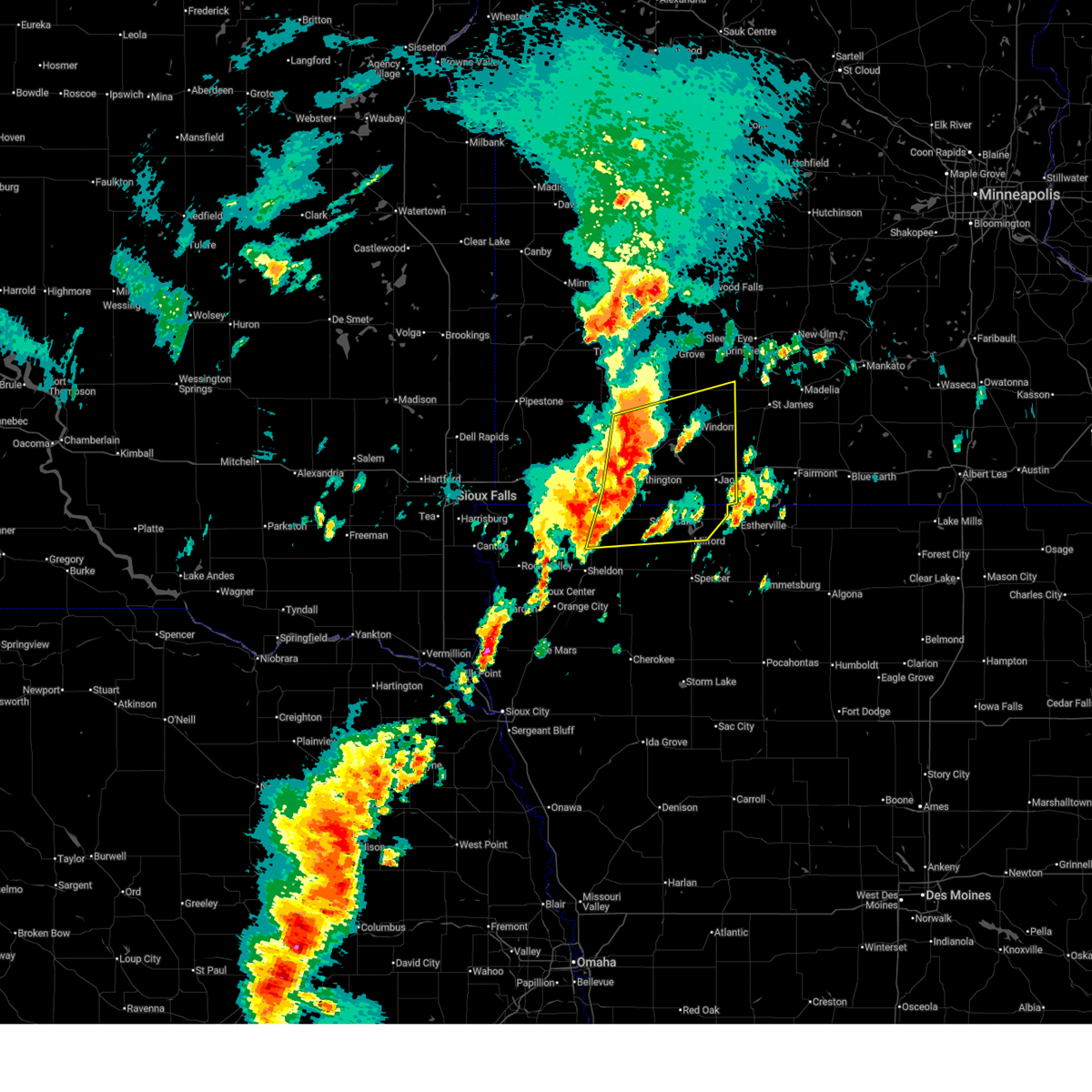
The Top Recent Hail Date for Orleans, IA is Monday, May 18, 2026 (8th out of 51)
Hail and Wind Damage Spotted near Orleans, IA
| Date / Time | Report Details |
|---|---|
| 6/30/2026 2:50 AM CDT |
 At 249 am cdt, severe thunderstorms were located along a line extending from 7 miles west of lakefield to near superior to near lost island lake, moving east at 55 mph (automated equipment. at 234 am cdt, a 66 mph wind gust was reported at the spencer airport). Hazards include 70 mph wind gusts. Expect considerable tree damage. damage is likely to mobile homes, roofs, and outbuildings. these severe storms will be near, jackson in jackson county, lakefield, terril, and superior around 255 am cdt. Other locations in the path of these severe thunderstorms include kilen woods state park. At 249 am cdt, severe thunderstorms were located along a line extending from 7 miles west of lakefield to near superior to near lost island lake, moving east at 55 mph (automated equipment. at 234 am cdt, a 66 mph wind gust was reported at the spencer airport). Hazards include 70 mph wind gusts. Expect considerable tree damage. damage is likely to mobile homes, roofs, and outbuildings. these severe storms will be near, jackson in jackson county, lakefield, terril, and superior around 255 am cdt. Other locations in the path of these severe thunderstorms include kilen woods state park.
|
| 6/30/2026 2:36 AM CDT |
 At 235 am cdt, severe thunderstorms were located along a line extending from near round lake to near wahpeton to near everly, moving northeast at 60 mph (emergency management. at 235 am cdt, a 64 mph wind gust was reported 3 miles sse of lake park. power outages were also reported). Hazards include 70 mph wind gusts. Expect considerable tree damage. damage is likely to mobile homes, roofs, and outbuildings. these severe storms will be near, spencer in clay county, spirit lake, milford, arnolds park, okoboji, orleans, wahpeton, west okoboji, and fostoria around 240 am cdt. Other locations in the path of these severe thunderstorms include terril, superior, jackson in jackson county, lakefield and kilen woods state park. At 235 am cdt, severe thunderstorms were located along a line extending from near round lake to near wahpeton to near everly, moving northeast at 60 mph (emergency management. at 235 am cdt, a 64 mph wind gust was reported 3 miles sse of lake park. power outages were also reported). Hazards include 70 mph wind gusts. Expect considerable tree damage. damage is likely to mobile homes, roofs, and outbuildings. these severe storms will be near, spencer in clay county, spirit lake, milford, arnolds park, okoboji, orleans, wahpeton, west okoboji, and fostoria around 240 am cdt. Other locations in the path of these severe thunderstorms include terril, superior, jackson in jackson county, lakefield and kilen woods state park.
|
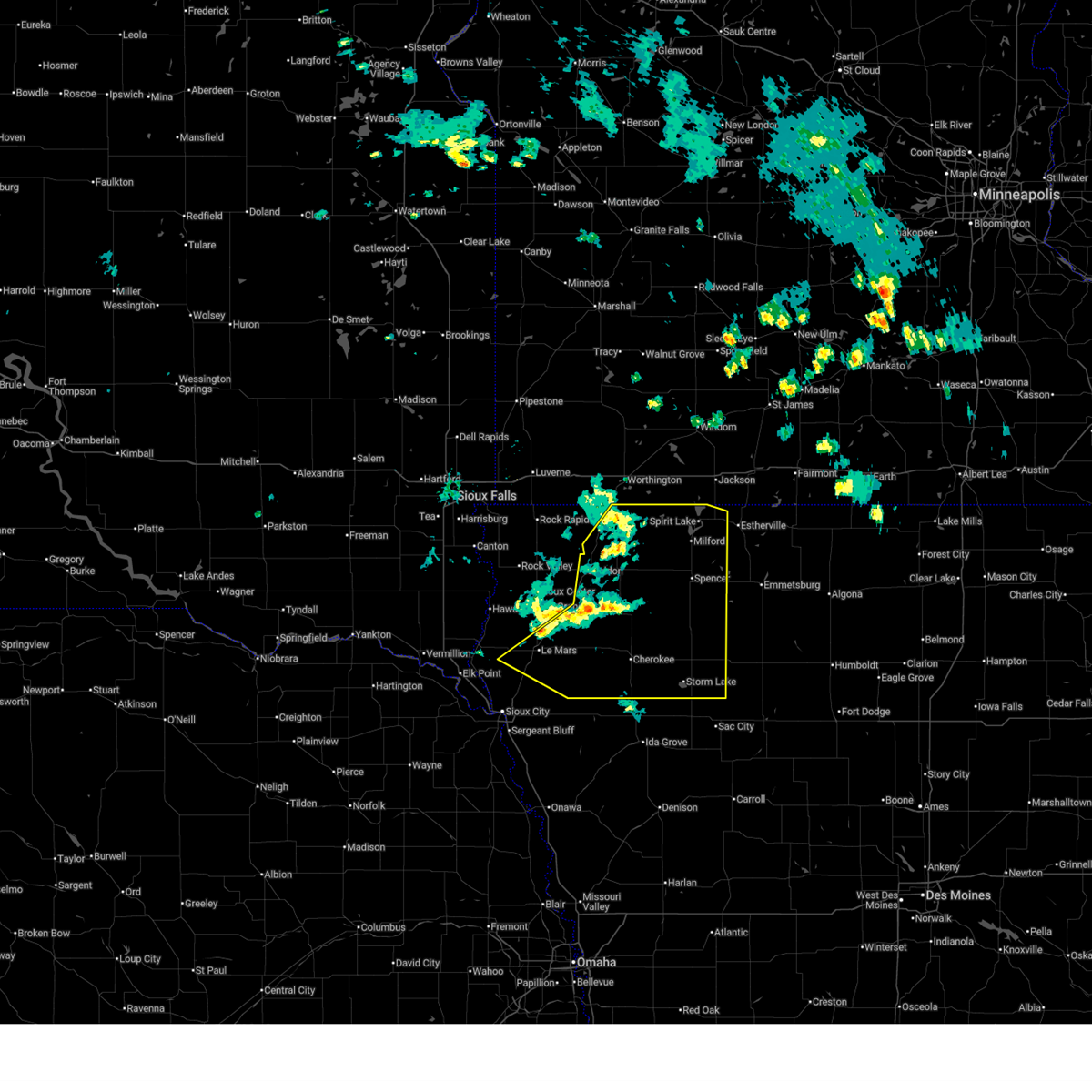
| 6/30/2026 2:21 AM CDT |
 Svrfsd the national weather service in sioux falls has issued a * severe thunderstorm warning for, osceola county in northwestern iowa, dickinson county in northwestern iowa, northern clay county in northwestern iowa, eastern o'brien county in northwestern iowa, jackson county in southwestern minnesota, southeastern nobles county in southwestern minnesota, * until 315 am cdt. * at 220 am cdt, severe thunderstorms were located along a line extending from near ocheyedan to near melvin to near hartley, moving east at 50 mph (public. this line of storms is producing gusts between 65 and 70 mph). Hazards include 70 mph wind gusts. Expect considerable tree damage. damage is likely to mobile homes, roofs, and outbuildings. severe thunderstorms will be near, hartley, everly, ocheyedan, and harris around 225 am cdt. spencer in clay county, lake park, and round lake around 230 am cdt. milford, arnolds park, wahpeton, west okoboji, and fostoria around 235 am cdt. spirit lake, okoboji, and orleans around 240 am cdt. Other locations in the path of these severe thunderstorms include terril, superior, lost island lake and jackson in jackson county. Svrfsd the national weather service in sioux falls has issued a * severe thunderstorm warning for, osceola county in northwestern iowa, dickinson county in northwestern iowa, northern clay county in northwestern iowa, eastern o'brien county in northwestern iowa, jackson county in southwestern minnesota, southeastern nobles county in southwestern minnesota, * until 315 am cdt. * at 220 am cdt, severe thunderstorms were located along a line extending from near ocheyedan to near melvin to near hartley, moving east at 50 mph (public. this line of storms is producing gusts between 65 and 70 mph). Hazards include 70 mph wind gusts. Expect considerable tree damage. damage is likely to mobile homes, roofs, and outbuildings. severe thunderstorms will be near, hartley, everly, ocheyedan, and harris around 225 am cdt. spencer in clay county, lake park, and round lake around 230 am cdt. milford, arnolds park, wahpeton, west okoboji, and fostoria around 235 am cdt. spirit lake, okoboji, and orleans around 240 am cdt. Other locations in the path of these severe thunderstorms include terril, superior, lost island lake and jackson in jackson county.
|
| 6/28/2026 6:48 AM CDT |
 At 646 am cdt, severe thunderstorms were located along a line extending from near terril to 6 miles southwest of lost island lake to near royal, moving east at 45 mph (automated equipment. at 6:34 am cdt, a wind gust to 68 mph was reported by the automated observation system at the spencer municipal airport). Hazards include 70 mph wind gusts and half dollar size hail. Hail damage to vehicles is expected. expect considerable tree damage. wind damage is also likely to mobile homes, roofs, and outbuildings. these severe storms will be near, greenville and lost island lake around 650 am cdt. Other locations in the path of these severe thunderstorms include webb. At 646 am cdt, severe thunderstorms were located along a line extending from near terril to 6 miles southwest of lost island lake to near royal, moving east at 45 mph (automated equipment. at 6:34 am cdt, a wind gust to 68 mph was reported by the automated observation system at the spencer municipal airport). Hazards include 70 mph wind gusts and half dollar size hail. Hail damage to vehicles is expected. expect considerable tree damage. wind damage is also likely to mobile homes, roofs, and outbuildings. these severe storms will be near, greenville and lost island lake around 650 am cdt. Other locations in the path of these severe thunderstorms include webb.
|
| 6/28/2026 6:30 AM CDT |
 Svrfsd the national weather service in sioux falls has issued a * severe thunderstorm warning for, northeastern cherokee county in northwestern iowa, dickinson county in northwestern iowa, northern buena vista county in northwestern iowa, clay county in northwestern iowa, southeastern o'brien county in northwestern iowa, * until 715 am cdt. * at 629 am cdt, severe thunderstorms were located along a line extending from superior to near everly to near sutherland, moving east at 40 mph (public). Hazards include 60 mph wind gusts and half dollar size hail. Hail damage to vehicles is expected. expect wind damage to roofs, siding, and trees. severe thunderstorms will be near, spencer in clay county, terril, peterson, and fostoria around 635 am cdt. linn grove and greenville around 640 am cdt. lost island lake around 645 am cdt. Other locations in the path of these severe thunderstorms include sioux rapids, webb and marathon. Svrfsd the national weather service in sioux falls has issued a * severe thunderstorm warning for, northeastern cherokee county in northwestern iowa, dickinson county in northwestern iowa, northern buena vista county in northwestern iowa, clay county in northwestern iowa, southeastern o'brien county in northwestern iowa, * until 715 am cdt. * at 629 am cdt, severe thunderstorms were located along a line extending from superior to near everly to near sutherland, moving east at 40 mph (public). Hazards include 60 mph wind gusts and half dollar size hail. Hail damage to vehicles is expected. expect wind damage to roofs, siding, and trees. severe thunderstorms will be near, spencer in clay county, terril, peterson, and fostoria around 635 am cdt. linn grove and greenville around 640 am cdt. lost island lake around 645 am cdt. Other locations in the path of these severe thunderstorms include sioux rapids, webb and marathon.
|
| 6/17/2026 6:35 PM CDT |
 At 634 pm cdt, severe thunderstorms were located along a line extending from near lost island lake to 6 miles southwest of albert city to near cushing, moving east at 55 mph (radar indicated). Hazards include 60 mph wind gusts. Expect damage to roofs, siding, and trees. Locations impacted include, spencer in clay county, storm lake, spirit lake, milford, alta, arnolds park, lake park, aurelia, newell, okoboji, sioux rapids, albert city, orleans, everly, lakeside, royal, terril, wahpeton, peterson, and west okoboji. At 634 pm cdt, severe thunderstorms were located along a line extending from near lost island lake to 6 miles southwest of albert city to near cushing, moving east at 55 mph (radar indicated). Hazards include 60 mph wind gusts. Expect damage to roofs, siding, and trees. Locations impacted include, spencer in clay county, storm lake, spirit lake, milford, alta, arnolds park, lake park, aurelia, newell, okoboji, sioux rapids, albert city, orleans, everly, lakeside, royal, terril, wahpeton, peterson, and west okoboji.
|
| 6/17/2026 6:17 PM CDT |
 At 616 pm cdt, severe thunderstorms were located along a line extending from spirit lake to peterson to 8 miles northeast of kingsley, moving east at 60 mph (radar indicated). Hazards include 60 mph wind gusts. Expect damage to roofs, siding, and trees. Locations impacted include, spencer in clay county, cherokee, spirit lake, milford, arnolds park, sioux rapids, terril, peterson, fostoria, linn grove, aurelia, quimby, washta, webb, lost island lake, alta, marathon, truesdale, storm lake, albert city, lakeside and newell. At 616 pm cdt, severe thunderstorms were located along a line extending from spirit lake to peterson to 8 miles northeast of kingsley, moving east at 60 mph (radar indicated). Hazards include 60 mph wind gusts. Expect damage to roofs, siding, and trees. Locations impacted include, spencer in clay county, cherokee, spirit lake, milford, arnolds park, sioux rapids, terril, peterson, fostoria, linn grove, aurelia, quimby, washta, webb, lost island lake, alta, marathon, truesdale, storm lake, albert city, lakeside and newell.
|
| 6/17/2026 5:54 PM CDT |
 Svrfsd the national weather service in sioux falls has issued a * severe thunderstorm warning for, cherokee county in northwestern iowa, osceola county in northwestern iowa, dickinson county in northwestern iowa, eastern sioux county in northwestern iowa, eastern plymouth county in northwestern iowa, buena vista county in northwestern iowa, clay county in northwestern iowa, o'brien county in northwestern iowa, * until 645 pm cdt. * at 554 pm cdt, severe thunderstorms were located along a line extending from near round lake to near paullina to near merrill, moving southeast at 65 mph (radar indicated). Hazards include 60 mph wind gusts. Expect damage to roofs, siding, and trees. severe thunderstorms will be near, le mars, hartley, remsen, marcus, lake park, paullina, primghar, merrill, sutherland, and ocheyedan around 600 pm cdt. everly, cleghorn, and larrabee around 605 pm cdt. spencer in clay county, cherokee, spirit lake, milford, kingsley, arnolds park, okoboji, royal, wahpeton, and peterson around 610 pm cdt. Other locations in the path of these severe thunderstorms include aurelia, sioux rapids, quimby, washta, linn grove, greenville, terril, webb, alta, marathon, truesdale, storm lake, albert city, lakeside and newell. Svrfsd the national weather service in sioux falls has issued a * severe thunderstorm warning for, cherokee county in northwestern iowa, osceola county in northwestern iowa, dickinson county in northwestern iowa, eastern sioux county in northwestern iowa, eastern plymouth county in northwestern iowa, buena vista county in northwestern iowa, clay county in northwestern iowa, o'brien county in northwestern iowa, * until 645 pm cdt. * at 554 pm cdt, severe thunderstorms were located along a line extending from near round lake to near paullina to near merrill, moving southeast at 65 mph (radar indicated). Hazards include 60 mph wind gusts. Expect damage to roofs, siding, and trees. severe thunderstorms will be near, le mars, hartley, remsen, marcus, lake park, paullina, primghar, merrill, sutherland, and ocheyedan around 600 pm cdt. everly, cleghorn, and larrabee around 605 pm cdt. spencer in clay county, cherokee, spirit lake, milford, kingsley, arnolds park, okoboji, royal, wahpeton, and peterson around 610 pm cdt. Other locations in the path of these severe thunderstorms include aurelia, sioux rapids, quimby, washta, linn grove, greenville, terril, webb, alta, marathon, truesdale, storm lake, albert city, lakeside and newell.
|
| 5/17/2026 9:11 PM CDT |
 At 910 pm cdt, a severe squall line capable of producing both tornadoes and extensive straight line wind damage was located over okoboji, or over spirit lake, moving northeast at 30 mph (radar indicated rotation). Hazards include tornado and quarter size hail. Flying debris will be dangerous to those caught without shelter. mobile homes will be damaged or destroyed. damage to roofs, windows, and vehicles will occur. tree damage is likely. Locations impacted include, spirit lake, okoboji, orleans and superior. At 910 pm cdt, a severe squall line capable of producing both tornadoes and extensive straight line wind damage was located over okoboji, or over spirit lake, moving northeast at 30 mph (radar indicated rotation). Hazards include tornado and quarter size hail. Flying debris will be dangerous to those caught without shelter. mobile homes will be damaged or destroyed. damage to roofs, windows, and vehicles will occur. tree damage is likely. Locations impacted include, spirit lake, okoboji, orleans and superior.
|
| 5/17/2026 8:54 PM CDT |
 Torfsd the national weather service in sioux falls has issued a * tornado warning for, dickinson county in northwestern iowa, north central clay county in northwestern iowa, * until 945 pm cdt. * at 853 pm cdt, severe thunderstorms capable of producing both tornadoes and extensive straight line wind damage were located near west okoboji, or 10 miles southwest of spirit lake, moving northeast at 30 mph (radar indicated rotation). Hazards include tornado and quarter size hail. Flying debris will be dangerous to those caught without shelter. mobile homes will be damaged or destroyed. damage to roofs, windows, and vehicles will occur. tree damage is likely. these dangerous storms will be near, spirit lake, milford, arnolds park, lake park, okoboji, orleans, wahpeton, and west okoboji around 900 pm cdt. Other locations in the path of this tornadic thunderstorm include superior. Torfsd the national weather service in sioux falls has issued a * tornado warning for, dickinson county in northwestern iowa, north central clay county in northwestern iowa, * until 945 pm cdt. * at 853 pm cdt, severe thunderstorms capable of producing both tornadoes and extensive straight line wind damage were located near west okoboji, or 10 miles southwest of spirit lake, moving northeast at 30 mph (radar indicated rotation). Hazards include tornado and quarter size hail. Flying debris will be dangerous to those caught without shelter. mobile homes will be damaged or destroyed. damage to roofs, windows, and vehicles will occur. tree damage is likely. these dangerous storms will be near, spirit lake, milford, arnolds park, lake park, okoboji, orleans, wahpeton, and west okoboji around 900 pm cdt. Other locations in the path of this tornadic thunderstorm include superior.
|
| 5/17/2026 6:59 PM CDT |
 At 659 pm cdt, severe thunderstorms were located along a line extending from 7 miles west of windom to near lakefield to near harris, moving east at 35 mph (radar indicated). Hazards include 60 mph wind gusts and half dollar size hail. Hail damage to vehicles is expected. expect wind damage to roofs, siding, and trees. Locations impacted include, windom, jackson in jackson county, lake park, orleans, kilen woods state park, spirit lake, bergen, okoboji, wahpeton, bingham lake, arnolds park, west okoboji, mountain lake and superior. At 659 pm cdt, severe thunderstorms were located along a line extending from 7 miles west of windom to near lakefield to near harris, moving east at 35 mph (radar indicated). Hazards include 60 mph wind gusts and half dollar size hail. Hail damage to vehicles is expected. expect wind damage to roofs, siding, and trees. Locations impacted include, windom, jackson in jackson county, lake park, orleans, kilen woods state park, spirit lake, bergen, okoboji, wahpeton, bingham lake, arnolds park, west okoboji, mountain lake and superior.
|
| 5/17/2026 6:30 PM CDT |
 Svrfsd the national weather service in sioux falls has issued a * severe thunderstorm warning for, osceola county in northwestern iowa, dickinson county in northwestern iowa, jackson county in southwestern minnesota, eastern nobles county in southwestern minnesota, southeastern murray county in southwestern minnesota, southern cottonwood county in southwestern minnesota, * until 745 pm cdt. * at 629 pm cdt, severe thunderstorms were located along a line extending from fulda to near round lake to near sibley, moving east at 35 mph (public. at 618 pm cdt, quarter sized hail was reported 5 miles southwest of worthington). Hazards include 70 mph wind gusts and half dollar size hail. Hail damage to vehicles is expected. expect considerable tree damage. wind damage is also likely to mobile homes, roofs, and outbuildings. severe thunderstorms will be near, ocheyedan, brewster, round lake, and harris around 635 pm cdt. heron lake around 640 pm cdt. lake park around 645 pm cdt. Other locations in the path of these severe thunderstorms include lakefield, windom, jackson in jackson county, kilen woods state park, spirit lake, bergen, okoboji, orleans, wahpeton, bingham lake and west okoboji. Svrfsd the national weather service in sioux falls has issued a * severe thunderstorm warning for, osceola county in northwestern iowa, dickinson county in northwestern iowa, jackson county in southwestern minnesota, eastern nobles county in southwestern minnesota, southeastern murray county in southwestern minnesota, southern cottonwood county in southwestern minnesota, * until 745 pm cdt. * at 629 pm cdt, severe thunderstorms were located along a line extending from fulda to near round lake to near sibley, moving east at 35 mph (public. at 618 pm cdt, quarter sized hail was reported 5 miles southwest of worthington). Hazards include 70 mph wind gusts and half dollar size hail. Hail damage to vehicles is expected. expect considerable tree damage. wind damage is also likely to mobile homes, roofs, and outbuildings. severe thunderstorms will be near, ocheyedan, brewster, round lake, and harris around 635 pm cdt. heron lake around 640 pm cdt. lake park around 645 pm cdt. Other locations in the path of these severe thunderstorms include lakefield, windom, jackson in jackson county, kilen woods state park, spirit lake, bergen, okoboji, orleans, wahpeton, bingham lake and west okoboji.
|
| 4/13/2026 6:36 PM CDT |
 At 636 pm cdt, a severe thunderstorm was located near lake park, or 11 miles southwest of spirit lake, moving east at 35 mph (radar indicated). Hazards include golf ball size hail and 60 mph wind gusts. People and animals outdoors will be injured. expect hail damage to roofs, siding, windows, and vehicles. expect wind damage to roofs, siding, and trees. this severe storm will be near, spirit lake, milford, arnolds park, lake park, okoboji, wahpeton, and west okoboji around 640 pm cdt. orleans around 645 pm cdt. Other locations in the path of this severe thunderstorm include terril and superior. At 636 pm cdt, a severe thunderstorm was located near lake park, or 11 miles southwest of spirit lake, moving east at 35 mph (radar indicated). Hazards include golf ball size hail and 60 mph wind gusts. People and animals outdoors will be injured. expect hail damage to roofs, siding, windows, and vehicles. expect wind damage to roofs, siding, and trees. this severe storm will be near, spirit lake, milford, arnolds park, lake park, okoboji, wahpeton, and west okoboji around 640 pm cdt. orleans around 645 pm cdt. Other locations in the path of this severe thunderstorm include terril and superior.
|
| 7/28/2025 11:40 PM CDT |
 The storms which prompted the warning have weakened below severe limits, and have exited the warned area. therefore, the warning will be allowed to expire. a severe thunderstorm watch remains in effect until 100 am cdt for northwestern iowa. The storms which prompted the warning have weakened below severe limits, and have exited the warned area. therefore, the warning will be allowed to expire. a severe thunderstorm watch remains in effect until 100 am cdt for northwestern iowa.
|
| 7/28/2025 11:27 PM CDT |
 the severe thunderstorm warning has been cancelled and is no longer in effect the severe thunderstorm warning has been cancelled and is no longer in effect
|
| 7/28/2025 11:27 PM CDT |
 At 1127 pm cdt, severe thunderstorms were located along a line extending from near superior to near rush lake, moving east at 95 mph (radar indicated). Hazards include 60 mph wind gusts. Expect damage to roofs, siding, and trees. These severe thunderstorms will remain over mainly rural areas of dickinson and clay counties, including the following locations, dickens, gillett grove, and rossie. At 1127 pm cdt, severe thunderstorms were located along a line extending from near superior to near rush lake, moving east at 95 mph (radar indicated). Hazards include 60 mph wind gusts. Expect damage to roofs, siding, and trees. These severe thunderstorms will remain over mainly rural areas of dickinson and clay counties, including the following locations, dickens, gillett grove, and rossie.
|
| 7/28/2025 11:10 PM CDT |
 Svrfsd the national weather service in sioux falls has issued a * severe thunderstorm warning for, eastern osceola county in northwestern iowa, dickinson county in northwestern iowa, clay county in northwestern iowa, eastern o'brien county in northwestern iowa, * until 1145 pm cdt. * at 1109 pm cdt, severe thunderstorms were located along a line extending from near lake park to peterson, moving northeast at 40 mph (radar indicated). Hazards include 60 mph wind gusts. Expect damage to roofs, siding, and trees. severe thunderstorms will be near, spencer in clay county, milford, lake park, everly, royal, wahpeton, and west okoboji around 1115 pm cdt. Spirit lake, arnolds park, okoboji, orleans, fostoria, and greenville around 1120 pm cdt. Svrfsd the national weather service in sioux falls has issued a * severe thunderstorm warning for, eastern osceola county in northwestern iowa, dickinson county in northwestern iowa, clay county in northwestern iowa, eastern o'brien county in northwestern iowa, * until 1145 pm cdt. * at 1109 pm cdt, severe thunderstorms were located along a line extending from near lake park to peterson, moving northeast at 40 mph (radar indicated). Hazards include 60 mph wind gusts. Expect damage to roofs, siding, and trees. severe thunderstorms will be near, spencer in clay county, milford, lake park, everly, royal, wahpeton, and west okoboji around 1115 pm cdt. Spirit lake, arnolds park, okoboji, orleans, fostoria, and greenville around 1120 pm cdt.
|
| 7/28/2025 10:43 PM CDT |
 At 1042 pm cdt, severe thunderstorms were located along a line extending from near spirit lake to near terril to lost island lake to marathon to near truesdale, moving east at 60 mph (public. at 1035 pm, a 66 mph gust was reported in spencer, iowa!). Hazards include 70 mph wind gusts and penny size hail. Expect considerable tree damage. damage is likely to mobile homes, roofs, and outbuildings. Locations impacted include, spencer in clay county, storm lake, cherokee, spirit lake, milford, alta, hartley, arnolds park, lake park, aurelia, newell, okoboji, sioux rapids, albert city, sutherland, orleans, everly, lakeside, ocheyedan, and royal. At 1042 pm cdt, severe thunderstorms were located along a line extending from near spirit lake to near terril to lost island lake to marathon to near truesdale, moving east at 60 mph (public. at 1035 pm, a 66 mph gust was reported in spencer, iowa!). Hazards include 70 mph wind gusts and penny size hail. Expect considerable tree damage. damage is likely to mobile homes, roofs, and outbuildings. Locations impacted include, spencer in clay county, storm lake, cherokee, spirit lake, milford, alta, hartley, arnolds park, lake park, aurelia, newell, okoboji, sioux rapids, albert city, sutherland, orleans, everly, lakeside, ocheyedan, and royal.
|
| 7/28/2025 10:33 PM CDT |
 the severe thunderstorm warning has been cancelled and is no longer in effect the severe thunderstorm warning has been cancelled and is no longer in effect
|
| 7/28/2025 10:33 PM CDT |
 At 1033 pm cdt, severe thunderstorms were located along a line extending from near lake park to near milford to 6 miles east of spencer in clay county to near sioux rapids to near alta, moving east at 50 mph (radar indicated). Hazards include 70 mph wind gusts and penny size hail. Expect considerable tree damage. damage is likely to mobile homes, roofs, and outbuildings. Locations impacted include, storm lake, spirit lake, milford, arnolds park, okoboji, albert city, orleans, lakeside, terril, wahpeton, newell and superior. At 1033 pm cdt, severe thunderstorms were located along a line extending from near lake park to near milford to 6 miles east of spencer in clay county to near sioux rapids to near alta, moving east at 50 mph (radar indicated). Hazards include 70 mph wind gusts and penny size hail. Expect considerable tree damage. damage is likely to mobile homes, roofs, and outbuildings. Locations impacted include, storm lake, spirit lake, milford, arnolds park, okoboji, albert city, orleans, lakeside, terril, wahpeton, newell and superior.
|
| 7/28/2025 10:12 PM CDT |
 At 1010 pm cdt, severe thunderstorms were located along a line extending from near sibley to near ocheyedan to hartley to near larrabee to 6 miles west of cherokee, moving east at 60 mph. these are destructive storms for ocheyedan, to everly, to aurelia, iowa! (radar indicated). Hazards include 80 mph wind gusts and penny size hail. Flying debris will be dangerous to those caught without shelter. mobile homes will be heavily damaged. expect considerable damage to roofs, windows, and vehicles. extensive tree damage and power outages are likely. these severe storms will be near, cherokee, lake park, aurelia, everly, ocheyedan, royal, peterson, and harris around 1015 pm cdt. Other locations in the path of these severe thunderstorms include spencer in clay county, milford, wahpeton, west okoboji, fostoria, linn grove, greenville, spirit lake, alta, arnolds park, okoboji, sioux rapids, storm lake, orleans, terril, marathon, webb, truesdale, albert city and superior. At 1010 pm cdt, severe thunderstorms were located along a line extending from near sibley to near ocheyedan to hartley to near larrabee to 6 miles west of cherokee, moving east at 60 mph. these are destructive storms for ocheyedan, to everly, to aurelia, iowa! (radar indicated). Hazards include 80 mph wind gusts and penny size hail. Flying debris will be dangerous to those caught without shelter. mobile homes will be heavily damaged. expect considerable damage to roofs, windows, and vehicles. extensive tree damage and power outages are likely. these severe storms will be near, cherokee, lake park, aurelia, everly, ocheyedan, royal, peterson, and harris around 1015 pm cdt. Other locations in the path of these severe thunderstorms include spencer in clay county, milford, wahpeton, west okoboji, fostoria, linn grove, greenville, spirit lake, alta, arnolds park, okoboji, sioux rapids, storm lake, orleans, terril, marathon, webb, truesdale, albert city and superior.
|
| 7/28/2025 9:55 PM CDT |
 Svrfsd the national weather service in sioux falls has issued a * severe thunderstorm warning for, cherokee county in northwestern iowa, eastern lyon county in northwestern iowa, osceola county in northwestern iowa, dickinson county in northwestern iowa, eastern sioux county in northwestern iowa, eastern plymouth county in northwestern iowa, buena vista county in northwestern iowa, clay county in northwestern iowa, o'brien county in northwestern iowa, * until 1115 pm cdt. * at 954 pm cdt, severe thunderstorms were located along a line extending from near little rock to ashton to near archer to near marcus to 7 miles north of kingsley, moving east at 60 mph. these are destructive storms for sibley, to paulina, to cherokee, iowa! (radar indicated). Hazards include 80 mph wind gusts and penny size hail. Flying debris will be dangerous to those caught without shelter. mobile homes will be heavily damaged. expect considerable damage to roofs, windows, and vehicles. extensive tree damage and power outages are likely. severe thunderstorms will be near, sibley, sanborn, marcus, paullina, primghar, little rock, cleghorn, melvin, and larrabee around 1000 pm cdt. cherokee, hartley, sutherland, and ocheyedan around 1005 pm cdt. everly, peterson, and harris around 1010 pm cdt. Other locations in the path of these severe thunderstorms include lake park, aurelia, royal, linn grove, spencer in clay county, spirit lake, milford, arnolds park, okoboji, sioux rapids, wahpeton, west okoboji, fostoria, greenville, orleans, terril, webb, superior, truesdale and marathon. Svrfsd the national weather service in sioux falls has issued a * severe thunderstorm warning for, cherokee county in northwestern iowa, eastern lyon county in northwestern iowa, osceola county in northwestern iowa, dickinson county in northwestern iowa, eastern sioux county in northwestern iowa, eastern plymouth county in northwestern iowa, buena vista county in northwestern iowa, clay county in northwestern iowa, o'brien county in northwestern iowa, * until 1115 pm cdt. * at 954 pm cdt, severe thunderstorms were located along a line extending from near little rock to ashton to near archer to near marcus to 7 miles north of kingsley, moving east at 60 mph. these are destructive storms for sibley, to paulina, to cherokee, iowa! (radar indicated). Hazards include 80 mph wind gusts and penny size hail. Flying debris will be dangerous to those caught without shelter. mobile homes will be heavily damaged. expect considerable damage to roofs, windows, and vehicles. extensive tree damage and power outages are likely. severe thunderstorms will be near, sibley, sanborn, marcus, paullina, primghar, little rock, cleghorn, melvin, and larrabee around 1000 pm cdt. cherokee, hartley, sutherland, and ocheyedan around 1005 pm cdt. everly, peterson, and harris around 1010 pm cdt. Other locations in the path of these severe thunderstorms include lake park, aurelia, royal, linn grove, spencer in clay county, spirit lake, milford, arnolds park, okoboji, sioux rapids, wahpeton, west okoboji, fostoria, greenville, orleans, terril, webb, superior, truesdale and marathon.
|
| 7/28/2025 1:44 AM CDT |
 At 144 am cdt, severe thunderstorms were located along a line extending from near sibley to near jefferson, moving southeast at 25 mph (radar indicated). Hazards include 60 mph wind gusts and quarter size hail. Hail damage to vehicles is expected. expect wind damage to roofs, siding, and trees. Locations impacted include, le mars, orange city, sheldon, alton, hinton, merrill, hospers, ocheyedan, ashton, struble, granville, melvin, sanborn, archer, remsen, primghar, hartley and paullina. At 144 am cdt, severe thunderstorms were located along a line extending from near sibley to near jefferson, moving southeast at 25 mph (radar indicated). Hazards include 60 mph wind gusts and quarter size hail. Hail damage to vehicles is expected. expect wind damage to roofs, siding, and trees. Locations impacted include, le mars, orange city, sheldon, alton, hinton, merrill, hospers, ocheyedan, ashton, struble, granville, melvin, sanborn, archer, remsen, primghar, hartley and paullina.
|
| 7/28/2025 1:22 AM CDT |
 At 122 am cdt, severe thunderstorms were located along a line extending from near rushmore to near elk point, moving east at 25 mph (personal weather station reported a wind gust of 60 mph at 12:40 am cdt 2 south of orange city). Hazards include 60 mph wind gusts and quarter size hail. Hail damage to vehicles is expected. expect wind damage to roofs, siding, and trees. these severe storms will be near, sioux center, hull, akron, george, boyden, ireton, little rock, and craig around 125 am cdt. sibley, maurice, and matlock around 130 am cdt. ashton around 135 am cdt. Other locations in the path of these severe thunderstorms include worthington, orange city, sheldon, struble and alton. At 122 am cdt, severe thunderstorms were located along a line extending from near rushmore to near elk point, moving east at 25 mph (personal weather station reported a wind gust of 60 mph at 12:40 am cdt 2 south of orange city). Hazards include 60 mph wind gusts and quarter size hail. Hail damage to vehicles is expected. expect wind damage to roofs, siding, and trees. these severe storms will be near, sioux center, hull, akron, george, boyden, ireton, little rock, and craig around 125 am cdt. sibley, maurice, and matlock around 130 am cdt. ashton around 135 am cdt. Other locations in the path of these severe thunderstorms include worthington, orange city, sheldon, struble and alton.
|
| 7/28/2025 1:15 AM CDT |
 Svrfsd the national weather service in sioux falls has issued a * severe thunderstorm warning for, northwestern cherokee county in northwestern iowa, eastern lyon county in northwestern iowa, osceola county in northwestern iowa, dickinson county in northwestern iowa, sioux county in northwestern iowa, plymouth county in northwestern iowa, northwestern clay county in northwestern iowa, o'brien county in northwestern iowa, southern jackson county in southwestern minnesota, southern nobles county in southwestern minnesota, * until 200 am cdt. * at 114 am cdt, severe thunderstorms were located along a line extending from near rushmore to near elk point, moving southeast at 25 mph (radar indicated). Hazards include 60 mph wind gusts and quarter size hail. Hail damage to vehicles is expected. expect wind damage to roofs, siding, and trees. severe thunderstorms will be near, sioux center, hull, akron, george, ireton, and little rock around 120 am cdt. sibley, boyden, craig, and matlock around 125 am cdt. ashton and maurice around 130 am cdt. Other locations in the path of these severe thunderstorms include orange city, sheldon, struble, alton, le mars, merrill and hospers. Svrfsd the national weather service in sioux falls has issued a * severe thunderstorm warning for, northwestern cherokee county in northwestern iowa, eastern lyon county in northwestern iowa, osceola county in northwestern iowa, dickinson county in northwestern iowa, sioux county in northwestern iowa, plymouth county in northwestern iowa, northwestern clay county in northwestern iowa, o'brien county in northwestern iowa, southern jackson county in southwestern minnesota, southern nobles county in southwestern minnesota, * until 200 am cdt. * at 114 am cdt, severe thunderstorms were located along a line extending from near rushmore to near elk point, moving southeast at 25 mph (radar indicated). Hazards include 60 mph wind gusts and quarter size hail. Hail damage to vehicles is expected. expect wind damage to roofs, siding, and trees. severe thunderstorms will be near, sioux center, hull, akron, george, ireton, and little rock around 120 am cdt. sibley, boyden, craig, and matlock around 125 am cdt. ashton and maurice around 130 am cdt. Other locations in the path of these severe thunderstorms include orange city, sheldon, struble, alton, le mars, merrill and hospers.
|
| 7/28/2025 1:02 AM CDT |
 the severe thunderstorm warning has been cancelled and is no longer in effect the severe thunderstorm warning has been cancelled and is no longer in effect
|
| 7/28/2025 1:02 AM CDT |
 At 101 am cdt, severe thunderstorms were located along a line extending from near iowa lake to near sioux rapids, moving southeast at 30 mph (radar indicated). Hazards include 60 mph wind gusts. Expect damage to roofs, siding, and trees. Locations impacted include, webb. At 101 am cdt, severe thunderstorms were located along a line extending from near iowa lake to near sioux rapids, moving southeast at 30 mph (radar indicated). Hazards include 60 mph wind gusts. Expect damage to roofs, siding, and trees. Locations impacted include, webb.
|
| 7/28/2025 12:42 AM CDT |
 Svrfsd the national weather service in sioux falls has issued a * severe thunderstorm warning for, southeastern osceola county in northwestern iowa, dickinson county in northwestern iowa, northwestern buena vista county in northwestern iowa, clay county in northwestern iowa, eastern o'brien county in northwestern iowa, eastern jackson county in southwestern minnesota, southeastern cottonwood county in southwestern minnesota, * until 130 am cdt. * at 1241 am cdt, severe thunderstorms were located along a line extending from welcome to near peterson, moving southeast at 30 mph (radar indicated). Hazards include 60 mph wind gusts. Expect damage to roofs, siding, and trees. severe thunderstorms will be near, spencer in clay county, linn grove, and greenville around 1245 am cdt. sioux rapids around 1250 am cdt. Webb around 1255 am cdt. Svrfsd the national weather service in sioux falls has issued a * severe thunderstorm warning for, southeastern osceola county in northwestern iowa, dickinson county in northwestern iowa, northwestern buena vista county in northwestern iowa, clay county in northwestern iowa, eastern o'brien county in northwestern iowa, eastern jackson county in southwestern minnesota, southeastern cottonwood county in southwestern minnesota, * until 130 am cdt. * at 1241 am cdt, severe thunderstorms were located along a line extending from welcome to near peterson, moving southeast at 30 mph (radar indicated). Hazards include 60 mph wind gusts. Expect damage to roofs, siding, and trees. severe thunderstorms will be near, spencer in clay county, linn grove, and greenville around 1245 am cdt. sioux rapids around 1250 am cdt. Webb around 1255 am cdt.
|
| 7/28/2025 12:23 AM CDT |
 At 1223 am cdt, severe thunderstorms were located along a line extending from near trimont to near sutherland, moving southeast at 30 mph (radar indicated). Hazards include 60 mph wind gusts. Expect damage to roofs, siding, and trees. Locations impacted include, spencer in clay county, royal, terril, fostoria, superior, peterson, linn grove, greenville, sioux rapids and webb. At 1223 am cdt, severe thunderstorms were located along a line extending from near trimont to near sutherland, moving southeast at 30 mph (radar indicated). Hazards include 60 mph wind gusts. Expect damage to roofs, siding, and trees. Locations impacted include, spencer in clay county, royal, terril, fostoria, superior, peterson, linn grove, greenville, sioux rapids and webb.
|
| 7/28/2025 12:01 AM CDT |
 Svrfsd the national weather service in sioux falls has issued a * severe thunderstorm warning for, southeastern osceola county in northwestern iowa, dickinson county in northwestern iowa, northwestern buena vista county in northwestern iowa, clay county in northwestern iowa, eastern o'brien county in northwestern iowa, eastern jackson county in southwestern minnesota, southeastern cottonwood county in southwestern minnesota, * until 1245 am cdt. * at 1200 am cdt, severe thunderstorms were located along a line extending from near bergen to near sanborn, moving southeast at 30 mph (radar indicated). Hazards include 60 mph wind gusts. Expect damage to roofs, siding, and trees. severe thunderstorms will be near, spirit lake, jackson in jackson county, hartley, okoboji, orleans, and wahpeton around 1205 am cdt. milford, arnolds park, everly, and west okoboji around 1210 am cdt. fostoria and superior around 1220 am cdt. Other locations in the path of these severe thunderstorms include spencer in clay county, royal, terril and peterson. Svrfsd the national weather service in sioux falls has issued a * severe thunderstorm warning for, southeastern osceola county in northwestern iowa, dickinson county in northwestern iowa, northwestern buena vista county in northwestern iowa, clay county in northwestern iowa, eastern o'brien county in northwestern iowa, eastern jackson county in southwestern minnesota, southeastern cottonwood county in southwestern minnesota, * until 1245 am cdt. * at 1200 am cdt, severe thunderstorms were located along a line extending from near bergen to near sanborn, moving southeast at 30 mph (radar indicated). Hazards include 60 mph wind gusts. Expect damage to roofs, siding, and trees. severe thunderstorms will be near, spirit lake, jackson in jackson county, hartley, okoboji, orleans, and wahpeton around 1205 am cdt. milford, arnolds park, everly, and west okoboji around 1210 am cdt. fostoria and superior around 1220 am cdt. Other locations in the path of these severe thunderstorms include spencer in clay county, royal, terril and peterson.
|
| 7/27/2025 11:48 PM CDT |
 The storms which prompted the warning have moved out of the area. therefore, the warning has been allowed to expire. however, gusty winds are still possible with these thunderstorms. a severe thunderstorm watch remains in effect until 200 am cdt for northwestern iowa, and southwestern minnesota. The storms which prompted the warning have moved out of the area. therefore, the warning has been allowed to expire. however, gusty winds are still possible with these thunderstorms. a severe thunderstorm watch remains in effect until 200 am cdt for northwestern iowa, and southwestern minnesota.
|
| 7/27/2025 11:21 PM CDT |
 At 1121 pm cdt, severe thunderstorms were located along a line extending from 6 miles south of butterfield to 9 miles northeast of hartley, moving southeast at 35 mph (trained weather spotters reported 3 inch tree limbs and trees down in spirit lake around 10:45 pm cdt). Hazards include 60 mph wind gusts. Expect damage to roofs, siding, and trees. these severe storms will be near, spirit lake, jackson in jackson county, milford, arnolds park, okoboji, orleans, wahpeton, and west okoboji around 1125 pm cdt. Other locations in the path of these severe thunderstorms include everly, fostoria, superior, spencer in clay county and terril. At 1121 pm cdt, severe thunderstorms were located along a line extending from 6 miles south of butterfield to 9 miles northeast of hartley, moving southeast at 35 mph (trained weather spotters reported 3 inch tree limbs and trees down in spirit lake around 10:45 pm cdt). Hazards include 60 mph wind gusts. Expect damage to roofs, siding, and trees. these severe storms will be near, spirit lake, jackson in jackson county, milford, arnolds park, okoboji, orleans, wahpeton, and west okoboji around 1125 pm cdt. Other locations in the path of these severe thunderstorms include everly, fostoria, superior, spencer in clay county and terril.
|
| 7/27/2025 11:21 PM CDT |
 the severe thunderstorm warning has been cancelled and is no longer in effect the severe thunderstorm warning has been cancelled and is no longer in effect
|
| 7/27/2025 11:05 PM CDT |
 Svrfsd the national weather service in sioux falls has issued a * severe thunderstorm warning for, eastern osceola county in northwestern iowa, dickinson county in northwestern iowa, northern clay county in northwestern iowa, jackson county in southwestern minnesota, southeastern cottonwood county in southwestern minnesota, * until 1145 pm cdt. * at 1104 pm cdt, severe thunderstorms were located along a line extending from near mountain lake to near ocheyedan, moving southeast at 35 mph (trained weather spotters reported 3 inch tree limbs and trees down in spirit lake at 1045 pm cdt). Hazards include 60 mph wind gusts. Expect damage to roofs, siding, and trees. severe thunderstorms will be near, jackson in jackson county, lake park, bergen, and kilen woods state park around 1110 pm cdt. spirit lake, okoboji, orleans, and wahpeton around 1115 pm cdt. arnolds park and west okoboji around 1120 pm cdt. Other locations in the path of these severe thunderstorms include milford, everly, fostoria and superior. Svrfsd the national weather service in sioux falls has issued a * severe thunderstorm warning for, eastern osceola county in northwestern iowa, dickinson county in northwestern iowa, northern clay county in northwestern iowa, jackson county in southwestern minnesota, southeastern cottonwood county in southwestern minnesota, * until 1145 pm cdt. * at 1104 pm cdt, severe thunderstorms were located along a line extending from near mountain lake to near ocheyedan, moving southeast at 35 mph (trained weather spotters reported 3 inch tree limbs and trees down in spirit lake at 1045 pm cdt). Hazards include 60 mph wind gusts. Expect damage to roofs, siding, and trees. severe thunderstorms will be near, jackson in jackson county, lake park, bergen, and kilen woods state park around 1110 pm cdt. spirit lake, okoboji, orleans, and wahpeton around 1115 pm cdt. arnolds park and west okoboji around 1120 pm cdt. Other locations in the path of these severe thunderstorms include milford, everly, fostoria and superior.
|
| 7/19/2025 2:40 AM CDT |
 The storms which prompted the warning have weakened below severe limits, and no longer pose an immediate threat to life or property. therefore, the warning will be allowed to expire. however, heavy rain is still possible with these thunderstorms. a severe thunderstorm watch remains in effect until 300 am cdt for northwestern iowa, and southwestern minnesota. The storms which prompted the warning have weakened below severe limits, and no longer pose an immediate threat to life or property. therefore, the warning will be allowed to expire. however, heavy rain is still possible with these thunderstorms. a severe thunderstorm watch remains in effect until 300 am cdt for northwestern iowa, and southwestern minnesota.
|
| 7/19/2025 2:32 AM CDT |
 At 232 am cdt, severe thunderstorms were located along a line extending from near orleans to 7 miles northeast of superior, moving east at 20 mph (radar indicated). Hazards include 60 mph wind gusts and quarter size hail. Hail damage to vehicles is expected. expect wind damage to roofs, siding, and trees. Locations impacted include, spirit lake, lake park, okoboji, orleans, wahpeton, and superior. At 232 am cdt, severe thunderstorms were located along a line extending from near orleans to 7 miles northeast of superior, moving east at 20 mph (radar indicated). Hazards include 60 mph wind gusts and quarter size hail. Hail damage to vehicles is expected. expect wind damage to roofs, siding, and trees. Locations impacted include, spirit lake, lake park, okoboji, orleans, wahpeton, and superior.
|
| 7/19/2025 2:14 AM CDT |
 At 214 am cdt, severe thunderstorms were located along a line extending from 6 miles northeast of lake park to near jackson in jackson county, moving southeast at 35 mph (radar indicated). Hazards include 60 mph wind gusts and quarter size hail. Hail damage to vehicles is expected. expect wind damage to roofs, siding, and trees. Locations impacted include, spirit lake, orleans, okoboji and superior. At 214 am cdt, severe thunderstorms were located along a line extending from 6 miles northeast of lake park to near jackson in jackson county, moving southeast at 35 mph (radar indicated). Hazards include 60 mph wind gusts and quarter size hail. Hail damage to vehicles is expected. expect wind damage to roofs, siding, and trees. Locations impacted include, spirit lake, orleans, okoboji and superior.
|
| 7/19/2025 1:56 AM CDT |
 Svrfsd the national weather service in sioux falls has issued a * severe thunderstorm warning for, northern dickinson county in northwestern iowa, southern jackson county in southwestern minnesota, * until 245 am cdt. * at 156 am cdt, severe thunderstorms were located along a line extending from 7 miles east of round lake to near jackson in jackson county, moving east at 35 mph (radar indicated). Hazards include 60 mph wind gusts and quarter size hail. Hail damage to vehicles is expected. expect wind damage to roofs, siding, and trees. severe thunderstorms will be near, jackson in jackson county around 200 am cdt. Orleans around 205 am cdt. Svrfsd the national weather service in sioux falls has issued a * severe thunderstorm warning for, northern dickinson county in northwestern iowa, southern jackson county in southwestern minnesota, * until 245 am cdt. * at 156 am cdt, severe thunderstorms were located along a line extending from 7 miles east of round lake to near jackson in jackson county, moving east at 35 mph (radar indicated). Hazards include 60 mph wind gusts and quarter size hail. Hail damage to vehicles is expected. expect wind damage to roofs, siding, and trees. severe thunderstorms will be near, jackson in jackson county around 200 am cdt. Orleans around 205 am cdt.
|
| 6/11/2025 3:24 PM CDT |
 The storms which prompted the warning have moved out of the area. therefore, the warning will be allowed to expire. a severe thunderstorm watch remains in effect until 1000 pm cdt for northwestern iowa, and southwestern minnesota. The storms which prompted the warning have moved out of the area. therefore, the warning will be allowed to expire. a severe thunderstorm watch remains in effect until 1000 pm cdt for northwestern iowa, and southwestern minnesota.
|
| 6/11/2025 3:09 PM CDT |
 At 309 pm cdt, severe thunderstorms were located along a line extending from near lakefield to near orleans to near wahpeton, moving northeast at 25 mph (radar indicated. this storm has a history of producing strong wind gusts resulting in damage to trees). Hazards include 70 mph wind gusts and penny size hail. Expect considerable tree damage. damage is likely to mobile homes, roofs, and outbuildings. these severe storms will be near, spirit lake, milford, arnolds park, okoboji, orleans, wahpeton, and west okoboji around 315 pm cdt. Other locations in the path of these severe thunderstorms include superior. At 309 pm cdt, severe thunderstorms were located along a line extending from near lakefield to near orleans to near wahpeton, moving northeast at 25 mph (radar indicated. this storm has a history of producing strong wind gusts resulting in damage to trees). Hazards include 70 mph wind gusts and penny size hail. Expect considerable tree damage. damage is likely to mobile homes, roofs, and outbuildings. these severe storms will be near, spirit lake, milford, arnolds park, okoboji, orleans, wahpeton, and west okoboji around 315 pm cdt. Other locations in the path of these severe thunderstorms include superior.
|
| 6/11/2025 2:56 PM CDT |
 At 255 pm cdt, severe thunderstorms were located along a line extending from 7 miles west of lakefield to near lake park to 9 miles southeast of harris, moving northeast at 25 mph (public report of a wind gust of 58 mph in lake park). Hazards include 70 mph wind gusts and penny size hail. Expect considerable tree damage. damage is likely to mobile homes, roofs, and outbuildings. these severe storms will be near, spirit lake, okoboji, orleans, wahpeton, and west okoboji around 300 pm cdt. arnolds park around 305 pm cdt. Other locations in the path of these severe thunderstorms include milford. At 255 pm cdt, severe thunderstorms were located along a line extending from 7 miles west of lakefield to near lake park to 9 miles southeast of harris, moving northeast at 25 mph (public report of a wind gust of 58 mph in lake park). Hazards include 70 mph wind gusts and penny size hail. Expect considerable tree damage. damage is likely to mobile homes, roofs, and outbuildings. these severe storms will be near, spirit lake, okoboji, orleans, wahpeton, and west okoboji around 300 pm cdt. arnolds park around 305 pm cdt. Other locations in the path of these severe thunderstorms include milford.
|
| 6/11/2025 2:56 PM CDT |
 the severe thunderstorm warning has been cancelled and is no longer in effect the severe thunderstorm warning has been cancelled and is no longer in effect
|
| 6/11/2025 2:45 PM CDT |
 Svrfsd the national weather service in sioux falls has issued a * severe thunderstorm warning for, eastern osceola county in northwestern iowa, dickinson county in northwestern iowa, southern jackson county in southwestern minnesota, * until 330 pm cdt. * at 245 pm cdt, severe thunderstorms were located along a line extending from 6 miles southeast of brewster to near lake park to 9 miles south of harris, moving northeast at 25 mph (emergency management has reported tree damage from these storms. also reported pea sized hail in lake park). Hazards include 70 mph wind gusts and penny size hail. Expect considerable tree damage. damage is likely to mobile homes, roofs, and outbuildings. severe thunderstorms will be near, spirit lake, lake park, okoboji, and wahpeton around 250 pm cdt. orleans and west okoboji around 255 pm cdt. arnolds park around 300 pm cdt. Milford around 305 pm cdt. Svrfsd the national weather service in sioux falls has issued a * severe thunderstorm warning for, eastern osceola county in northwestern iowa, dickinson county in northwestern iowa, southern jackson county in southwestern minnesota, * until 330 pm cdt. * at 245 pm cdt, severe thunderstorms were located along a line extending from 6 miles southeast of brewster to near lake park to 9 miles south of harris, moving northeast at 25 mph (emergency management has reported tree damage from these storms. also reported pea sized hail in lake park). Hazards include 70 mph wind gusts and penny size hail. Expect considerable tree damage. damage is likely to mobile homes, roofs, and outbuildings. severe thunderstorms will be near, spirit lake, lake park, okoboji, and wahpeton around 250 pm cdt. orleans and west okoboji around 255 pm cdt. arnolds park around 300 pm cdt. Milford around 305 pm cdt.
|
| 6/11/2025 2:37 PM CDT |
 At 236 pm cdt, severe thunderstorms were located along a line extending from 6 miles east of brewster to near lake park to 7 miles southeast of harris, moving east at 45 mph (public report at 2:29 pm of 60 mph wind gust in may city). Hazards include 70 mph wind gusts. Expect considerable tree damage. damage is likely to mobile homes, roofs, and outbuildings. these severe storms will be near, spirit lake, okoboji, orleans, wahpeton, and west okoboji around 240 pm cdt. Other locations in the path of these severe thunderstorms include milford and arnolds park. At 236 pm cdt, severe thunderstorms were located along a line extending from 6 miles east of brewster to near lake park to 7 miles southeast of harris, moving east at 45 mph (public report at 2:29 pm of 60 mph wind gust in may city). Hazards include 70 mph wind gusts. Expect considerable tree damage. damage is likely to mobile homes, roofs, and outbuildings. these severe storms will be near, spirit lake, okoboji, orleans, wahpeton, and west okoboji around 240 pm cdt. Other locations in the path of these severe thunderstorms include milford and arnolds park.
|
| 6/11/2025 2:21 PM CDT |
 Svrfsd the national weather service in sioux falls has issued a * severe thunderstorm warning for, eastern osceola county in northwestern iowa, western dickinson county in northwestern iowa, northeastern o'brien county in northwestern iowa, southwestern jackson county in southwestern minnesota, southeastern nobles county in southwestern minnesota, * until 245 pm cdt. * at 220 pm cdt, severe thunderstorms were located along a line extending from near worthington to near ocheyedan to near melvin, moving east at 45 mph (emergency management has reported damage to trees in sibley). Hazards include 70 mph wind gusts. Expect considerable tree damage. damage is likely to mobile homes, roofs, and outbuildings. Severe thunderstorms will be near, lake park, round lake, and harris around 225 pm cdt. Svrfsd the national weather service in sioux falls has issued a * severe thunderstorm warning for, eastern osceola county in northwestern iowa, western dickinson county in northwestern iowa, northeastern o'brien county in northwestern iowa, southwestern jackson county in southwestern minnesota, southeastern nobles county in southwestern minnesota, * until 245 pm cdt. * at 220 pm cdt, severe thunderstorms were located along a line extending from near worthington to near ocheyedan to near melvin, moving east at 45 mph (emergency management has reported damage to trees in sibley). Hazards include 70 mph wind gusts. Expect considerable tree damage. damage is likely to mobile homes, roofs, and outbuildings. Severe thunderstorms will be near, lake park, round lake, and harris around 225 pm cdt.
|
| 4/28/2025 4:34 PM CDT |
 Svrfsd the national weather service in sioux falls has issued a * severe thunderstorm warning for, eastern dickinson county in northwestern iowa, northeastern clay county in northwestern iowa, * until 515 pm cdt. * at 432 pm cdt, a severe thunderstorm was located over fostoria, or 7 miles north of spencer in clay county, moving northeast at 40 mph (trained weather spotters. at !4:30 pm, a trained spotter measured a 60 mph wind gust near milford, ia). Hazards include 60 mph wind gusts and quarter size hail. Hail damage to vehicles is expected. expect wind damage to roofs, siding, and trees. This severe thunderstorm will be near, west okoboji, terril, superior, okoboji, spirit lake, arnolds park, and milford around 440 pm cdt. Svrfsd the national weather service in sioux falls has issued a * severe thunderstorm warning for, eastern dickinson county in northwestern iowa, northeastern clay county in northwestern iowa, * until 515 pm cdt. * at 432 pm cdt, a severe thunderstorm was located over fostoria, or 7 miles north of spencer in clay county, moving northeast at 40 mph (trained weather spotters. at !4:30 pm, a trained spotter measured a 60 mph wind gust near milford, ia). Hazards include 60 mph wind gusts and quarter size hail. Hail damage to vehicles is expected. expect wind damage to roofs, siding, and trees. This severe thunderstorm will be near, west okoboji, terril, superior, okoboji, spirit lake, arnolds park, and milford around 440 pm cdt.
|
| 4/28/2025 3:51 PM CDT |
 The storms which prompted the warning have weakened below severe limits, and no longer pose an immediate threat to life or property. therefore, the warning will be allowed to expire. however, gusty winds and heavy rain are still possible with these thunderstorms. a tornado watch remains in effect until 800 pm cdt for northwestern iowa. to report severe weather, contact your nearest law enforcement agency. they will relay your report to the national weather service sioux falls. The storms which prompted the warning have weakened below severe limits, and no longer pose an immediate threat to life or property. therefore, the warning will be allowed to expire. however, gusty winds and heavy rain are still possible with these thunderstorms. a tornado watch remains in effect until 800 pm cdt for northwestern iowa. to report severe weather, contact your nearest law enforcement agency. they will relay your report to the national weather service sioux falls.
|
| 4/28/2025 3:36 PM CDT |
 At 336 pm cdt, severe thunderstorms were located along a line extending from 7 miles south of lakefield to near lake park to 6 miles southeast of harris, moving east at 25 mph (radar indicated). Hazards include 60 mph wind gusts and quarter size hail. Hail damage to vehicles is expected. expect wind damage to roofs, siding, and trees. these severe storms will be near, wahpeton, okoboji, spirit lake, orleans, and lake park around 340 pm cdt. west okoboji around 345 pm cdt. Other locations in the path of these severe thunderstorms include arnolds park and milford. At 336 pm cdt, severe thunderstorms were located along a line extending from 7 miles south of lakefield to near lake park to 6 miles southeast of harris, moving east at 25 mph (radar indicated). Hazards include 60 mph wind gusts and quarter size hail. Hail damage to vehicles is expected. expect wind damage to roofs, siding, and trees. these severe storms will be near, wahpeton, okoboji, spirit lake, orleans, and lake park around 340 pm cdt. west okoboji around 345 pm cdt. Other locations in the path of these severe thunderstorms include arnolds park and milford.
|
| 4/28/2025 3:25 PM CDT |
 Svrfsd the national weather service in sioux falls has issued a * severe thunderstorm warning for, eastern osceola county in northwestern iowa, dickinson county in northwestern iowa, * until 400 pm cdt. * at 324 pm cdt, severe thunderstorms were located along a line extending from 8 miles northwest of orleans to near lake park to 6 miles south of ocheyedan, moving east at 40 mph (radar indicated). Hazards include ping pong ball size hail and 60 mph wind gusts. People and animals outdoors will be injured. expect hail damage to roofs, siding, windows, and vehicles. expect wind damage to roofs, siding, and trees. severe thunderstorms will be near, west okoboji, wahpeton, okoboji, spirit lake, orleans, and lake park around 330 pm cdt. arnolds park and milford around 335 pm cdt. Other locations in the path of these severe thunderstorms include superior. Svrfsd the national weather service in sioux falls has issued a * severe thunderstorm warning for, eastern osceola county in northwestern iowa, dickinson county in northwestern iowa, * until 400 pm cdt. * at 324 pm cdt, severe thunderstorms were located along a line extending from 8 miles northwest of orleans to near lake park to 6 miles south of ocheyedan, moving east at 40 mph (radar indicated). Hazards include ping pong ball size hail and 60 mph wind gusts. People and animals outdoors will be injured. expect hail damage to roofs, siding, windows, and vehicles. expect wind damage to roofs, siding, and trees. severe thunderstorms will be near, west okoboji, wahpeton, okoboji, spirit lake, orleans, and lake park around 330 pm cdt. arnolds park and milford around 335 pm cdt. Other locations in the path of these severe thunderstorms include superior.
|
| 7/23/2024 6:52 PM CDT |
 At 652 pm cdt, a severe thunderstorm was located near spirit lake, moving south at 10 mph (radar indicated). Hazards include quarter size hail. Damage to vehicles is expected. This severe storm will be near, milford, arnolds park, and west okoboji around 700 pm cdt. At 652 pm cdt, a severe thunderstorm was located near spirit lake, moving south at 10 mph (radar indicated). Hazards include quarter size hail. Damage to vehicles is expected. This severe storm will be near, milford, arnolds park, and west okoboji around 700 pm cdt.
|
| 7/23/2024 6:43 PM CDT |
 Svrfsd the national weather service in sioux falls has issued a * severe thunderstorm warning for, northeastern dickinson county in northwestern iowa, * until 715 pm cdt. * at 643 pm cdt, a severe thunderstorm was located near spirit lake, moving south at 10 mph (radar indicated). Hazards include quarter size hail. Damage to vehicles is expected. This severe thunderstorm will be near, milford, arnolds park, okoboji, and west okoboji around 650 pm cdt. Svrfsd the national weather service in sioux falls has issued a * severe thunderstorm warning for, northeastern dickinson county in northwestern iowa, * until 715 pm cdt. * at 643 pm cdt, a severe thunderstorm was located near spirit lake, moving south at 10 mph (radar indicated). Hazards include quarter size hail. Damage to vehicles is expected. This severe thunderstorm will be near, milford, arnolds park, okoboji, and west okoboji around 650 pm cdt.
|
| 7/4/2024 2:12 PM CDT |
 The storm which prompted the warning has weakened below severe limits, and no longer poses an immediate threat to life or property. therefore, the warning will be allowed to expire. however, dime sized hail and heavy rain are still possible with this thunderstorm. frequent lightning is on-going. to report severe weather, contact your nearest law enforcement agency. they will relay your report to the national weather service sioux falls. The storm which prompted the warning has weakened below severe limits, and no longer poses an immediate threat to life or property. therefore, the warning will be allowed to expire. however, dime sized hail and heavy rain are still possible with this thunderstorm. frequent lightning is on-going. to report severe weather, contact your nearest law enforcement agency. they will relay your report to the national weather service sioux falls.
|
| 7/4/2024 1:52 PM CDT |
 At 151 pm cdt, a severe thunderstorm was located near lake park, or near spirit lake, moving east at 30 mph (public). Hazards include quarter size hail. Damage to vehicles is expected. This severe storm will be near, spirit lake, okoboji, orleans, and wahpeton around 155 pm cdt. At 151 pm cdt, a severe thunderstorm was located near lake park, or near spirit lake, moving east at 30 mph (public). Hazards include quarter size hail. Damage to vehicles is expected. This severe storm will be near, spirit lake, okoboji, orleans, and wahpeton around 155 pm cdt.
|
| 7/4/2024 1:46 PM CDT |
 Svrfsd the national weather service in sioux falls has issued a * severe thunderstorm warning for, northwestern dickinson county in northwestern iowa, * until 215 pm cdt. * at 145 pm cdt, a severe thunderstorm was located over lake park, or 10 miles west of spirit lake, moving east at 20 mph (public. at 138 pm quarter sized hail was reported in lake park). Hazards include quarter size hail. Damage to vehicles is expected. This severe thunderstorm will be near, spirit lake and okoboji around 150 pm cdt. Svrfsd the national weather service in sioux falls has issued a * severe thunderstorm warning for, northwestern dickinson county in northwestern iowa, * until 215 pm cdt. * at 145 pm cdt, a severe thunderstorm was located over lake park, or 10 miles west of spirit lake, moving east at 20 mph (public. at 138 pm quarter sized hail was reported in lake park). Hazards include quarter size hail. Damage to vehicles is expected. This severe thunderstorm will be near, spirit lake and okoboji around 150 pm cdt.
|
| 6/17/2024 3:43 AM CDT |
 The storms which prompted the warning have moved out of the area. therefore, the warning will be allowed to expire. however, heavy rain is still possible with these thunderstorms. a severe thunderstorm watch remains in effect until 1000 am cdt for northwestern iowa, and southwestern minnesota. to report severe weather, contact your nearest law enforcement agency. they will relay your report to the national weather service sioux falls. The storms which prompted the warning have moved out of the area. therefore, the warning will be allowed to expire. however, heavy rain is still possible with these thunderstorms. a severe thunderstorm watch remains in effect until 1000 am cdt for northwestern iowa, and southwestern minnesota. to report severe weather, contact your nearest law enforcement agency. they will relay your report to the national weather service sioux falls.
|
| 6/17/2024 3:24 AM CDT |
 the severe thunderstorm warning has been cancelled and is no longer in effect the severe thunderstorm warning has been cancelled and is no longer in effect
|
| 6/17/2024 3:24 AM CDT |
 At 323 am cdt, severe thunderstorms were located along a line extending from near windom to near jackson in jackson county to near superior, moving east at 40 mph (radar indicated). Hazards include 60 mph wind gusts and penny size hail. Expect damage to roofs, siding, and trees. These severe thunderstorms will remain over mainly rural areas of dickinson and jackson counties, including the following locations, alpha, wilder, and okabena. At 323 am cdt, severe thunderstorms were located along a line extending from near windom to near jackson in jackson county to near superior, moving east at 40 mph (radar indicated). Hazards include 60 mph wind gusts and penny size hail. Expect damage to roofs, siding, and trees. These severe thunderstorms will remain over mainly rural areas of dickinson and jackson counties, including the following locations, alpha, wilder, and okabena.
|
| 6/17/2024 2:58 AM CDT |
 Svrfsd the national weather service in sioux falls has issued a * severe thunderstorm warning for, eastern osceola county in northwestern iowa, dickinson county in northwestern iowa, jackson county in southwestern minnesota, eastern nobles county in southwestern minnesota, * until 345 am cdt. * at 258 am cdt, severe thunderstorms were located along a line extending from near heron lake to near lakefield to near lake park, moving east at 40 mph (emergency management reported a 56 mph wind gust near lake park at 257 am). Hazards include 60 mph wind gusts and penny size hail. Expect damage to roofs, siding, and trees. severe thunderstorms will be near, spirit lake, milford, lakefield, arnolds park, okoboji, heron lake, orleans, wahpeton, west okoboji, and kilen woods state park around 305 am cdt. jackson in jackson county around 310 am cdt. Bergen and superior around 315 am cdt. Svrfsd the national weather service in sioux falls has issued a * severe thunderstorm warning for, eastern osceola county in northwestern iowa, dickinson county in northwestern iowa, jackson county in southwestern minnesota, eastern nobles county in southwestern minnesota, * until 345 am cdt. * at 258 am cdt, severe thunderstorms were located along a line extending from near heron lake to near lakefield to near lake park, moving east at 40 mph (emergency management reported a 56 mph wind gust near lake park at 257 am). Hazards include 60 mph wind gusts and penny size hail. Expect damage to roofs, siding, and trees. severe thunderstorms will be near, spirit lake, milford, lakefield, arnolds park, okoboji, heron lake, orleans, wahpeton, west okoboji, and kilen woods state park around 305 am cdt. jackson in jackson county around 310 am cdt. Bergen and superior around 315 am cdt.
|
| 6/17/2024 2:52 AM CDT |
 At 252 am cdt, severe thunderstorms were located along a line extending from near heron lake to near lakefield to near lake park, moving east at 40 mph (radar indicated). Hazards include 60 mph wind gusts and penny size hail. Expect damage to roofs, siding, and trees. these severe storms will be near, spirit lake, lakefield, okoboji, heron lake, wahpeton, and west okoboji around 255 am cdt. milford, arnolds park, orleans, and kilen woods state park around 300 am cdt. Other locations impacted by these severe thunderstorms include kinbrae, wilder, okabena, bigelow, and dundee. At 252 am cdt, severe thunderstorms were located along a line extending from near heron lake to near lakefield to near lake park, moving east at 40 mph (radar indicated). Hazards include 60 mph wind gusts and penny size hail. Expect damage to roofs, siding, and trees. these severe storms will be near, spirit lake, lakefield, okoboji, heron lake, wahpeton, and west okoboji around 255 am cdt. milford, arnolds park, orleans, and kilen woods state park around 300 am cdt. Other locations impacted by these severe thunderstorms include kinbrae, wilder, okabena, bigelow, and dundee.
|
| 6/17/2024 2:30 AM CDT |
 Svrfsd the national weather service in sioux falls has issued a * severe thunderstorm warning for, osceola county in northwestern iowa, western dickinson county in northwestern iowa, jackson county in southwestern minnesota, nobles county in southwestern minnesota, * until 315 am cdt. * at 230 am cdt, severe thunderstorms were located along a line extending from near wilmont to near worthington to near ocheyedan, moving east at 30 mph (mesonet at rushmore, mn reported 73 mph wind gust). Hazards include 70 mph wind gusts and nickel size hail. Expect considerable tree damage. damage is likely to mobile homes, roofs, and outbuildings. severe thunderstorms will be near, worthington, ocheyedan, brewster, and round lake around 235 am cdt. harris around 240 am cdt. lake park around 250 am cdt. Other locations in the path of these severe thunderstorms include heron lake. Svrfsd the national weather service in sioux falls has issued a * severe thunderstorm warning for, osceola county in northwestern iowa, western dickinson county in northwestern iowa, jackson county in southwestern minnesota, nobles county in southwestern minnesota, * until 315 am cdt. * at 230 am cdt, severe thunderstorms were located along a line extending from near wilmont to near worthington to near ocheyedan, moving east at 30 mph (mesonet at rushmore, mn reported 73 mph wind gust). Hazards include 70 mph wind gusts and nickel size hail. Expect considerable tree damage. damage is likely to mobile homes, roofs, and outbuildings. severe thunderstorms will be near, worthington, ocheyedan, brewster, and round lake around 235 am cdt. harris around 240 am cdt. lake park around 250 am cdt. Other locations in the path of these severe thunderstorms include heron lake.
|
| 5/24/2024 4:24 AM CDT |
 The storm which prompted the warning has weakened below severe limits, and no longer poses an immediate threat to life or property. therefore, the warning will be allowed to expire. however, heavy rain is still possible with this thunderstorm. The storm which prompted the warning has weakened below severe limits, and no longer poses an immediate threat to life or property. therefore, the warning will be allowed to expire. however, heavy rain is still possible with this thunderstorm.
|
| 5/24/2024 4:05 AM CDT |
 the severe thunderstorm warning has been cancelled and is no longer in effect the severe thunderstorm warning has been cancelled and is no longer in effect
|
| 5/24/2024 4:05 AM CDT |
 At 405 am cdt, a severe thunderstorm was located near terril, or near spirit lake, moving north at 45 mph (radar indicated). Hazards include quarter size hail. Damage to vehicles is expected. this severe storm will be near, spirit lake, okoboji, orleans, wahpeton, and superior around 410 am cdt. Jackson in jackson county around 420 am cdt. At 405 am cdt, a severe thunderstorm was located near terril, or near spirit lake, moving north at 45 mph (radar indicated). Hazards include quarter size hail. Damage to vehicles is expected. this severe storm will be near, spirit lake, okoboji, orleans, wahpeton, and superior around 410 am cdt. Jackson in jackson county around 420 am cdt.
|
| 5/24/2024 3:58 AM CDT |
 Svrfsd the national weather service in sioux falls has issued a * severe thunderstorm warning for, dickinson county in northwestern iowa, northeastern clay county in northwestern iowa, southeastern jackson county in southwestern minnesota, * until 430 am cdt. * at 357 am cdt, a severe thunderstorm was located near terril, or 9 miles south of spirit lake, moving north at 50 mph (radar indicated). Hazards include quarter size hail. Damage to vehicles is expected. this severe thunderstorm will be near, spirit lake, milford, arnolds park, okoboji, orleans, wahpeton, west okoboji, and superior around 405 am cdt. Jackson in jackson county around 415 am cdt. Svrfsd the national weather service in sioux falls has issued a * severe thunderstorm warning for, dickinson county in northwestern iowa, northeastern clay county in northwestern iowa, southeastern jackson county in southwestern minnesota, * until 430 am cdt. * at 357 am cdt, a severe thunderstorm was located near terril, or 9 miles south of spirit lake, moving north at 50 mph (radar indicated). Hazards include quarter size hail. Damage to vehicles is expected. this severe thunderstorm will be near, spirit lake, milford, arnolds park, okoboji, orleans, wahpeton, west okoboji, and superior around 405 am cdt. Jackson in jackson county around 415 am cdt.
|
| 5/24/2024 3:28 AM CDT |
 The storm which prompted the warning has weakened below severe limits, and no longer poses an immediate threat to life or property. therefore, the warning will be allowed to expire. however, up to dime sized hail and heavy rain are still possible with this thunderstorm. The storm which prompted the warning has weakened below severe limits, and no longer poses an immediate threat to life or property. therefore, the warning will be allowed to expire. however, up to dime sized hail and heavy rain are still possible with this thunderstorm.
|
| 5/24/2024 3:20 AM CDT |
 At 319 am cdt, a severe thunderstorm was located over spirit lake, moving north at 45 mph (trained weather spotters. at 310 am, two inch hail was reported 3 miles south of milford). Hazards include two inch hail. People and animals outdoors will be injured. expect damage to roofs, siding, windows, and vehicles. This severe storm will be near, orleans around 325 am cdt. At 319 am cdt, a severe thunderstorm was located over spirit lake, moving north at 45 mph (trained weather spotters. at 310 am, two inch hail was reported 3 miles south of milford). Hazards include two inch hail. People and animals outdoors will be injured. expect damage to roofs, siding, windows, and vehicles. This severe storm will be near, orleans around 325 am cdt.
|
| 5/24/2024 3:13 AM CDT |
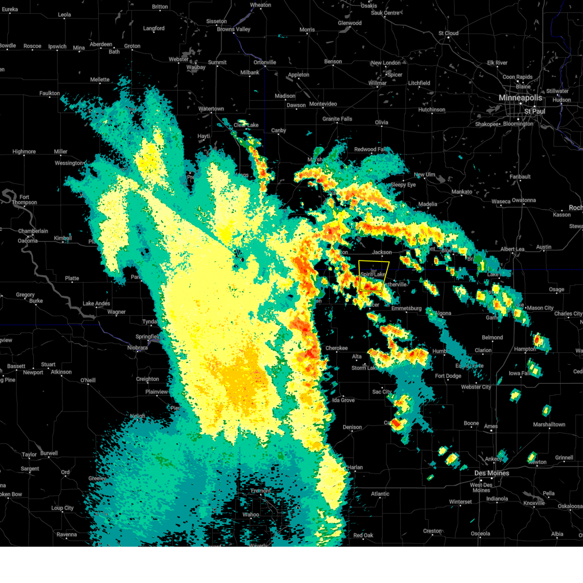 Svrfsd the national weather service in sioux falls has issued a * severe thunderstorm warning for, eastern dickinson county in northwestern iowa, southeastern jackson county in southwestern minnesota, * until 330 am cdt. * at 313 am cdt, a severe thunderstorm was located over arnolds park, or near spirit lake, moving north at 45 mph (radar indicated). Hazards include quarter size hail. Damage to vehicles is expected. This severe thunderstorm will be near, spirit lake, orleans, and superior around 320 am cdt. Svrfsd the national weather service in sioux falls has issued a * severe thunderstorm warning for, eastern dickinson county in northwestern iowa, southeastern jackson county in southwestern minnesota, * until 330 am cdt. * at 313 am cdt, a severe thunderstorm was located over arnolds park, or near spirit lake, moving north at 45 mph (radar indicated). Hazards include quarter size hail. Damage to vehicles is expected. This severe thunderstorm will be near, spirit lake, orleans, and superior around 320 am cdt.
|
| 4/16/2024 4:27 PM CDT |
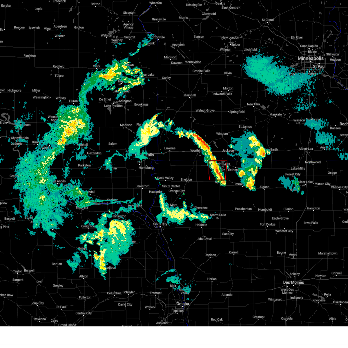 The storm which prompted the warning has weakened below severe limits, and no longer appears capable of producing a tornado. therefore, the warning will be allowed to expire. a tornado watch remains in effect until 700 pm cdt for northwestern iowa. The storm which prompted the warning has weakened below severe limits, and no longer appears capable of producing a tornado. therefore, the warning will be allowed to expire. a tornado watch remains in effect until 700 pm cdt for northwestern iowa.
|
| 4/16/2024 4:21 PM CDT |
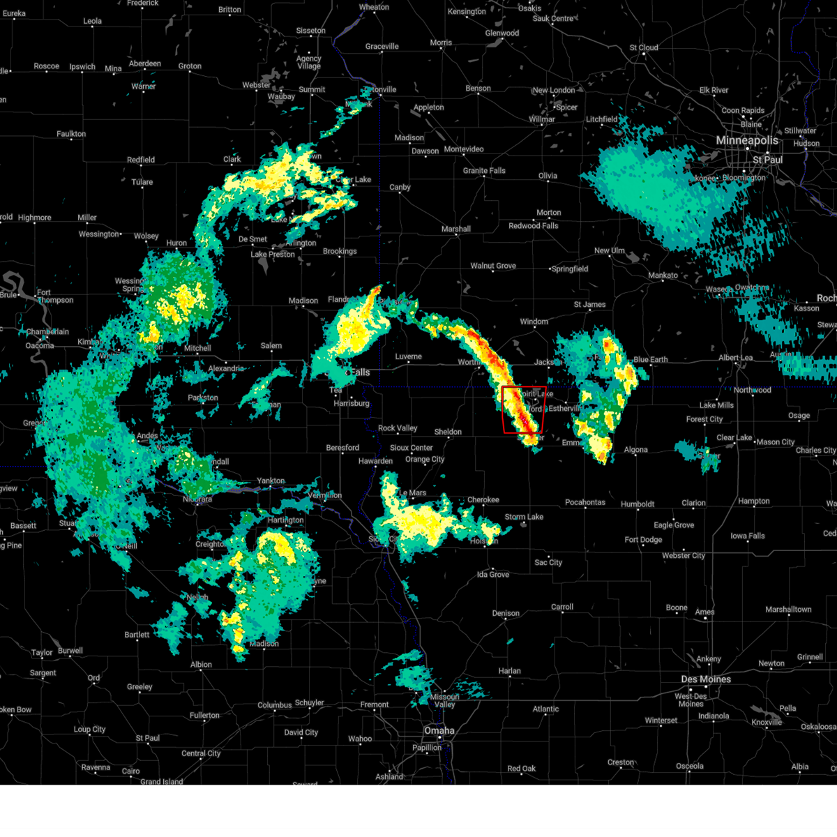 At 421 pm cdt, a severe thunderstorm capable of producing a tornado was located over wahpeton, or near spirit lake, moving north at 40 mph (radar indicated rotation). Hazards include tornado. Flying debris will be dangerous to those caught without shelter. mobile homes will be damaged or destroyed. damage to roofs, windows, and vehicles will occur. tree damage is likely. This dangerous storm will be near, spirit lake, lake park, okoboji, orleans, and wahpeton around 425 pm cdt. At 421 pm cdt, a severe thunderstorm capable of producing a tornado was located over wahpeton, or near spirit lake, moving north at 40 mph (radar indicated rotation). Hazards include tornado. Flying debris will be dangerous to those caught without shelter. mobile homes will be damaged or destroyed. damage to roofs, windows, and vehicles will occur. tree damage is likely. This dangerous storm will be near, spirit lake, lake park, okoboji, orleans, and wahpeton around 425 pm cdt.
|
| 4/16/2024 4:07 PM CDT |
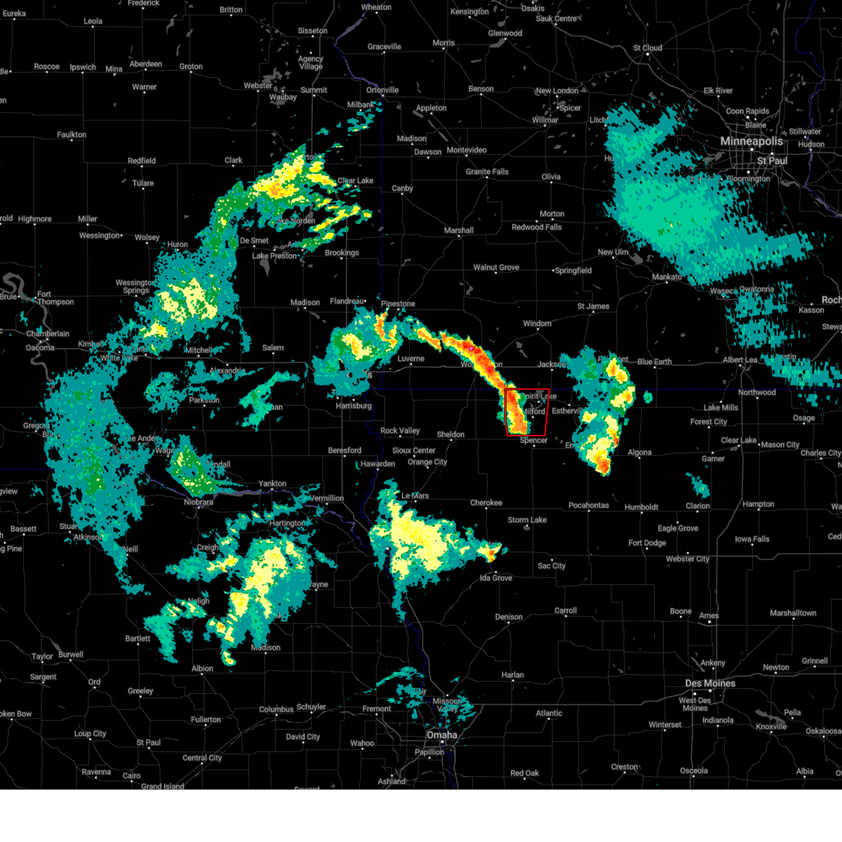 Torfsd the national weather service in sioux falls has issued a * tornado warning for, dickinson county in northwestern iowa, northwestern clay county in northwestern iowa, * until 430 pm cdt. * at 406 pm cdt, a severe thunderstorm capable of producing a tornado was located near fostoria, or 8 miles northwest of spencer in clay county, moving north at 30 mph (radar indicated rotation). Hazards include tornado. Flying debris will be dangerous to those caught without shelter. mobile homes will be damaged or destroyed. damage to roofs, windows, and vehicles will occur. tree damage is likely. this dangerous storm will be near, milford, arnolds park, okoboji, wahpeton, and west okoboji around 410 pm cdt. spirit lake around 415 pm cdt. Lake park around 425 pm cdt. Torfsd the national weather service in sioux falls has issued a * tornado warning for, dickinson county in northwestern iowa, northwestern clay county in northwestern iowa, * until 430 pm cdt. * at 406 pm cdt, a severe thunderstorm capable of producing a tornado was located near fostoria, or 8 miles northwest of spencer in clay county, moving north at 30 mph (radar indicated rotation). Hazards include tornado. Flying debris will be dangerous to those caught without shelter. mobile homes will be damaged or destroyed. damage to roofs, windows, and vehicles will occur. tree damage is likely. this dangerous storm will be near, milford, arnolds park, okoboji, wahpeton, and west okoboji around 410 pm cdt. spirit lake around 415 pm cdt. Lake park around 425 pm cdt.
|
| 7/10/2023 6:38 PM CDT |
 The severe thunderstorm warning for eastern dickinson and northeastern clay counties will expire at 645 pm cdt, the storms which prompted the warning have weakened below severe limits, and have exited the warned area. therefore, the warning will be allowed to expire. however gusty winds and heavy rain are still possible with these thunderstorms. a severe thunderstorm watch remains in effect until 1000 pm cdt for northwestern iowa. The severe thunderstorm warning for eastern dickinson and northeastern clay counties will expire at 645 pm cdt, the storms which prompted the warning have weakened below severe limits, and have exited the warned area. therefore, the warning will be allowed to expire. however gusty winds and heavy rain are still possible with these thunderstorms. a severe thunderstorm watch remains in effect until 1000 pm cdt for northwestern iowa.
|
| 7/10/2023 6:30 PM CDT |
 At 629 pm cdt, severe thunderstorms were located along a line extending from near orleans to near terril to near lost island lake, moving east at 25 mph (trained weather spotters. at 6:10 pm. a personal weather station recorded a 62 mph wind gust 3 miles southwest of terrill, ia). Hazards include 60 mph wind gusts. Expect damage to roofs, siding, and trees. locations impacted include, lost island lake. hail threat, radar indicated max hail size, <. 75 in wind threat, observed max wind gust, 60 mph. At 629 pm cdt, severe thunderstorms were located along a line extending from near orleans to near terril to near lost island lake, moving east at 25 mph (trained weather spotters. at 6:10 pm. a personal weather station recorded a 62 mph wind gust 3 miles southwest of terrill, ia). Hazards include 60 mph wind gusts. Expect damage to roofs, siding, and trees. locations impacted include, lost island lake. hail threat, radar indicated max hail size, <. 75 in wind threat, observed max wind gust, 60 mph.
|
| 7/10/2023 6:12 PM CDT |
 At 611 pm cdt, severe thunderstorms were located along a line extending from 7 miles northwest of orleans to near arnolds park to near spencer in clay county, moving east at 35 mph (radar indicated). Hazards include 60 mph wind gusts. Expect damage to roofs, siding, and trees. severe thunderstorms will be near, terril around 620 pm cdt. lost island lake around 630 pm cdt. other locations in the path of these severe thunderstorms include superior. hail threat, radar indicated max hail size, <. 75 in wind threat, radar indicated max wind gust, 60 mph. At 611 pm cdt, severe thunderstorms were located along a line extending from 7 miles northwest of orleans to near arnolds park to near spencer in clay county, moving east at 35 mph (radar indicated). Hazards include 60 mph wind gusts. Expect damage to roofs, siding, and trees. severe thunderstorms will be near, terril around 620 pm cdt. lost island lake around 630 pm cdt. other locations in the path of these severe thunderstorms include superior. hail threat, radar indicated max hail size, <. 75 in wind threat, radar indicated max wind gust, 60 mph.
|
| 7/10/2023 6:02 PM CDT |
 At 602 pm cdt, a severe thunderstorm was located over milford, or 7 miles south of spirit lake, moving east at 45 mph (radar indicated). Hazards include 60 mph wind gusts and quarter size hail. Hail damage to vehicles is expected. expect wind damage to roofs, siding, and trees. this severe storm will be near, terril around 610 pm cdt. other locations in the path of this severe thunderstorm include superior. hail threat, radar indicated max hail size, 1. 00 in wind threat, radar indicated max wind gust, 60 mph. At 602 pm cdt, a severe thunderstorm was located over milford, or 7 miles south of spirit lake, moving east at 45 mph (radar indicated). Hazards include 60 mph wind gusts and quarter size hail. Hail damage to vehicles is expected. expect wind damage to roofs, siding, and trees. this severe storm will be near, terril around 610 pm cdt. other locations in the path of this severe thunderstorm include superior. hail threat, radar indicated max hail size, 1. 00 in wind threat, radar indicated max wind gust, 60 mph.
|
| 7/10/2023 5:53 PM CDT |
 At 551 pm cdt, a severe thunderstorm was located near lake park, or 9 miles west of spirit lake, moving northeast at 45 mph (emergency management. from 5:40-5:50 pm, an emergency manager reported 10 minutes of 60+ mph gusts northwest of everly). Hazards include 60 mph wind gusts and nickel size hail. Expect damage to roofs, siding, and trees. this severe storm will be near, fostoria around 555 pm cdt. milford, arnolds park, okoboji, wahpeton and west okoboji around 600 pm cdt. other locations in the path of this severe thunderstorm include spirit lake, orleans, terril and superior. hail threat, radar indicated max hail size, 0. 88 in wind threat, observed max wind gust, 60 mph. At 551 pm cdt, a severe thunderstorm was located near lake park, or 9 miles west of spirit lake, moving northeast at 45 mph (emergency management. from 5:40-5:50 pm, an emergency manager reported 10 minutes of 60+ mph gusts northwest of everly). Hazards include 60 mph wind gusts and nickel size hail. Expect damage to roofs, siding, and trees. this severe storm will be near, fostoria around 555 pm cdt. milford, arnolds park, okoboji, wahpeton and west okoboji around 600 pm cdt. other locations in the path of this severe thunderstorm include spirit lake, orleans, terril and superior. hail threat, radar indicated max hail size, 0. 88 in wind threat, observed max wind gust, 60 mph.
|
| 7/10/2023 5:43 PM CDT |
 At 542 pm cdt, a severe thunderstorm was located 7 miles south of harris, or 16 miles east of sibley, moving east at 45 mph (radar indicated). Hazards include 60 mph wind gusts and half dollar size hail. Hail damage to vehicles is expected. expect wind damage to roofs, siding, and trees. this severe thunderstorm will be near, spencer in clay county, lake park and fostoria around 555 pm cdt. milford, okoboji, wahpeton and west okoboji around 600 pm cdt. other locations in the path of this severe thunderstorm include spirit lake, arnolds park, orleans, terril and superior. hail threat, radar indicated max hail size, 1. 25 in wind threat, radar indicated max wind gust, 60 mph. At 542 pm cdt, a severe thunderstorm was located 7 miles south of harris, or 16 miles east of sibley, moving east at 45 mph (radar indicated). Hazards include 60 mph wind gusts and half dollar size hail. Hail damage to vehicles is expected. expect wind damage to roofs, siding, and trees. this severe thunderstorm will be near, spencer in clay county, lake park and fostoria around 555 pm cdt. milford, okoboji, wahpeton and west okoboji around 600 pm cdt. other locations in the path of this severe thunderstorm include spirit lake, arnolds park, orleans, terril and superior. hail threat, radar indicated max hail size, 1. 25 in wind threat, radar indicated max wind gust, 60 mph.
|
| 6/24/2023 6:02 AM CDT |
 At 601 am cdt, severe thunderstorms were located along a line extending from near westbrook to 6 miles northwest of orleans to near everly, moving northeast at 50 mph (radar indicated). Hazards include 60 mph wind gusts. Expect damage to roofs, siding, and trees. locations impacted include, westbrook, orleans, storden, lakefield, jeffers, kilen woods state park, jackson in jackson county, bergen, terril and superior. hail threat, radar indicated max hail size, <. 75 in wind threat, radar indicated max wind gust, 60 mph. At 601 am cdt, severe thunderstorms were located along a line extending from near westbrook to 6 miles northwest of orleans to near everly, moving northeast at 50 mph (radar indicated). Hazards include 60 mph wind gusts. Expect damage to roofs, siding, and trees. locations impacted include, westbrook, orleans, storden, lakefield, jeffers, kilen woods state park, jackson in jackson county, bergen, terril and superior. hail threat, radar indicated max hail size, <. 75 in wind threat, radar indicated max wind gust, 60 mph.
|
| 6/24/2023 5:31 AM CDT |
 At 531 am cdt, severe thunderstorms were located along a line extending from near chandler to near ocheyedan to near paullina, moving northeast at 50 mph (radar indicated). Hazards include 60 mph wind gusts. Expect damage to roofs, siding, and trees. severe thunderstorms will be near, ocheyedan and current lake around 535 am cdt. slayton around 540 am cdt. fulda, round lake and harris around 545 am cdt. lake park, currie and lake shetek state park around 550 am cdt. other locations in the path of these severe thunderstorms include okoboji, everly, royal, wahpeton, dovray, spirit lake, westbrook, orleans, greenville, spencer in clay county, storden, lakefield, fostoria and superior. hail threat, radar indicated max hail size, <. 75 in wind threat, radar indicated max wind gust, 60 mph. At 531 am cdt, severe thunderstorms were located along a line extending from near chandler to near ocheyedan to near paullina, moving northeast at 50 mph (radar indicated). Hazards include 60 mph wind gusts. Expect damage to roofs, siding, and trees. severe thunderstorms will be near, ocheyedan and current lake around 535 am cdt. slayton around 540 am cdt. fulda, round lake and harris around 545 am cdt. lake park, currie and lake shetek state park around 550 am cdt. other locations in the path of these severe thunderstorms include okoboji, everly, royal, wahpeton, dovray, spirit lake, westbrook, orleans, greenville, spencer in clay county, storden, lakefield, fostoria and superior. hail threat, radar indicated max hail size, <. 75 in wind threat, radar indicated max wind gust, 60 mph.
|
| 5/29/2023 9:07 PM CDT |
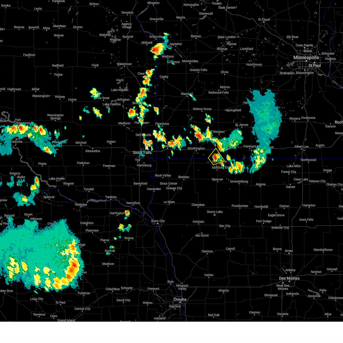 The severe thunderstorm warning for northwestern dickinson and south central jackson counties will expire at 915 pm cdt, the storm which prompted the warning has weakened below severe limits, and no longer poses an immediate threat to life or property. therefore, the warning will be allowed to expire. however small hail and heavy rain are still possible with this thunderstorm. The severe thunderstorm warning for northwestern dickinson and south central jackson counties will expire at 915 pm cdt, the storm which prompted the warning has weakened below severe limits, and no longer poses an immediate threat to life or property. therefore, the warning will be allowed to expire. however small hail and heavy rain are still possible with this thunderstorm.
|
| 5/29/2023 9:04 PM CDT |
 At 903 pm cdt, a severe thunderstorm was located near orleans, or near spirit lake, moving east at 10 mph (radar indicated). Hazards include 60 mph wind gusts and penny size hail. Expect damage to roofs, siding, and trees. locations impacted include, spirit lake and orleans. hail threat, radar indicated max hail size, 0. 75 in wind threat, radar indicated max wind gust, 60 mph. At 903 pm cdt, a severe thunderstorm was located near orleans, or near spirit lake, moving east at 10 mph (radar indicated). Hazards include 60 mph wind gusts and penny size hail. Expect damage to roofs, siding, and trees. locations impacted include, spirit lake and orleans. hail threat, radar indicated max hail size, 0. 75 in wind threat, radar indicated max wind gust, 60 mph.
|
| 5/29/2023 8:47 PM CDT |
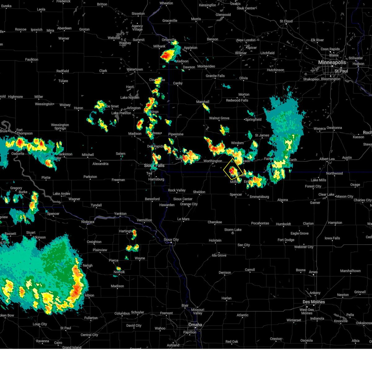 At 846 pm cdt, a severe thunderstorm was located near lake park, or 8 miles northwest of spirit lake, moving northeast at 10 mph (radar indicated). Hazards include quarter size hail. Damage to vehicles is expected. this severe thunderstorm will be near, spirit lake around 905 pm cdt. other locations in the path of this severe thunderstorm include orleans. hail threat, radar indicated max hail size, 1. 00 in wind threat, radar indicated max wind gust, <50 mph. At 846 pm cdt, a severe thunderstorm was located near lake park, or 8 miles northwest of spirit lake, moving northeast at 10 mph (radar indicated). Hazards include quarter size hail. Damage to vehicles is expected. this severe thunderstorm will be near, spirit lake around 905 pm cdt. other locations in the path of this severe thunderstorm include orleans. hail threat, radar indicated max hail size, 1. 00 in wind threat, radar indicated max wind gust, <50 mph.
|
| 8/18/2022 7:01 PM CDT |
 At 701 pm cdt, a severe thunderstorm was located over lake park, or 8 miles west of spirit lake, moving southeast at 20 mph (radar indicated). Hazards include 60 mph wind gusts and quarter size hail. Hail damage to vehicles is expected. expect wind damage to roofs, siding, and trees. locations impacted include, orleans, spirit lake, okoboji, wahpeton, milford, west okoboji, arnolds park, fostoria and superior. hail threat, radar indicated max hail size, 1. 00 in wind threat, radar indicated max wind gust, 60 mph. At 701 pm cdt, a severe thunderstorm was located over lake park, or 8 miles west of spirit lake, moving southeast at 20 mph (radar indicated). Hazards include 60 mph wind gusts and quarter size hail. Hail damage to vehicles is expected. expect wind damage to roofs, siding, and trees. locations impacted include, orleans, spirit lake, okoboji, wahpeton, milford, west okoboji, arnolds park, fostoria and superior. hail threat, radar indicated max hail size, 1. 00 in wind threat, radar indicated max wind gust, 60 mph.
|
| 8/18/2022 6:45 PM CDT |
 At 645 pm cdt, a severe thunderstorm was located near lake park, or 13 miles west of spirit lake, moving southeast at 20 mph (radar indicated). Hazards include 60 mph wind gusts and quarter size hail. Hail damage to vehicles is expected. expect wind damage to roofs, siding, and trees. this severe thunderstorm will be near, lake park around 655 pm cdt. orleans around 715 pm cdt. okoboji and wahpeton around 720 pm cdt. spirit lake, milford and west okoboji around 725 pm cdt. arnolds park, fostoria and superior around 730 pm cdt. hail threat, radar indicated max hail size, 1. 00 in wind threat, radar indicated max wind gust, 60 mph. At 645 pm cdt, a severe thunderstorm was located near lake park, or 13 miles west of spirit lake, moving southeast at 20 mph (radar indicated). Hazards include 60 mph wind gusts and quarter size hail. Hail damage to vehicles is expected. expect wind damage to roofs, siding, and trees. this severe thunderstorm will be near, lake park around 655 pm cdt. orleans around 715 pm cdt. okoboji and wahpeton around 720 pm cdt. spirit lake, milford and west okoboji around 725 pm cdt. arnolds park, fostoria and superior around 730 pm cdt. hail threat, radar indicated max hail size, 1. 00 in wind threat, radar indicated max wind gust, 60 mph.
|
| 7/5/2022 6:37 PM CDT |
 At 635 pm cdt, severe thunderstorms were located along a line extending from near spirit lake to near fostoria to royal, moving southeast at 35 mph (emergency management. at 630 pm cdt, trees were reported down west of royal). Hazards include 60 mph wind gusts. Expect damage to roofs, siding, and trees. these severe storms will be near, spencer through 645 pm cdt. greenville around 645 pm cdt. other locations impacted by these severe thunderstorms include dickens, gillett grove and rossie. hail threat, radar indicated max hail size, <. 75 in wind threat, radar indicated max wind gust, 60 mph. At 635 pm cdt, severe thunderstorms were located along a line extending from near spirit lake to near fostoria to royal, moving southeast at 35 mph (emergency management. at 630 pm cdt, trees were reported down west of royal). Hazards include 60 mph wind gusts. Expect damage to roofs, siding, and trees. these severe storms will be near, spencer through 645 pm cdt. greenville around 645 pm cdt. other locations impacted by these severe thunderstorms include dickens, gillett grove and rossie. hail threat, radar indicated max hail size, <. 75 in wind threat, radar indicated max wind gust, 60 mph.
|
| 7/5/2022 6:21 PM CDT |
 At 620 pm cdt, severe thunderstorms were located along a line extending from near orleans to near fostoria to near everly, moving southeast at 45 mph (radar indicated). Hazards include 60 mph wind gusts. Expect damage to roofs, siding, and trees. severe thunderstorms will be near, spencer in clay county, royal and fostoria around 625 pm cdt. superior and greenville around 635 pm cdt. terril around 640 pm cdt. webb around 645 pm cdt. other locations impacted by these severe thunderstorms include dickens, gillett grove and rossie. hail threat, radar indicated max hail size, <. 75 in wind threat, radar indicated max wind gust, 60 mph. At 620 pm cdt, severe thunderstorms were located along a line extending from near orleans to near fostoria to near everly, moving southeast at 45 mph (radar indicated). Hazards include 60 mph wind gusts. Expect damage to roofs, siding, and trees. severe thunderstorms will be near, spencer in clay county, royal and fostoria around 625 pm cdt. superior and greenville around 635 pm cdt. terril around 640 pm cdt. webb around 645 pm cdt. other locations impacted by these severe thunderstorms include dickens, gillett grove and rossie. hail threat, radar indicated max hail size, <. 75 in wind threat, radar indicated max wind gust, 60 mph.
|
| 7/5/2022 5:56 PM CDT |
 The severe thunderstorm warning for southeastern cherokee, eastern osceola, dickinson, buena vista, clay and northeastern o`brien counties will expire at 600 pm cdt, the storms which prompted the warning have moved out of the warned area. therefore, the warning will be allowed to expire. however gusty winds are still possible with these thunderstorms. a severe thunderstorm watch remains in effect until 700 pm cdt for northwestern and west central iowa, and southwestern minnesota. The severe thunderstorm warning for southeastern cherokee, eastern osceola, dickinson, buena vista, clay and northeastern o`brien counties will expire at 600 pm cdt, the storms which prompted the warning have moved out of the warned area. therefore, the warning will be allowed to expire. however gusty winds are still possible with these thunderstorms. a severe thunderstorm watch remains in effect until 700 pm cdt for northwestern and west central iowa, and southwestern minnesota.
|
| 7/5/2022 5:32 PM CDT |
 At 531 pm cdt, severe thunderstorms were located along a line extending from near orleans to near webb to 6 miles south of alta, moving east at 60 mph (radar indicated). Hazards include 60 mph wind gusts and quarter size hail. Hail damage to vehicles is expected. expect wind damage to roofs, siding, and trees. locations impacted include, albert city, terril, marathon, webb, superior and newell. hail threat, radar indicated max hail size, 1. 00 in wind threat, radar indicated max wind gust, 60 mph. At 531 pm cdt, severe thunderstorms were located along a line extending from near orleans to near webb to 6 miles south of alta, moving east at 60 mph (radar indicated). Hazards include 60 mph wind gusts and quarter size hail. Hail damage to vehicles is expected. expect wind damage to roofs, siding, and trees. locations impacted include, albert city, terril, marathon, webb, superior and newell. hail threat, radar indicated max hail size, 1. 00 in wind threat, radar indicated max wind gust, 60 mph.
|
| 7/5/2022 4:54 PM CDT |
 At 454 pm cdt, severe thunderstorms were located along a line extending from ocheyedan to near marcus to 7 miles south of remsen, moving east at 40 mph (radar indicated). Hazards include 60 mph wind gusts. Expect damage to roofs, siding, and trees. severe thunderstorms will be near, ocheyedan and harris around 500 pm cdt. lake park, sutherland and larrabee around 510 pm cdt. other locations in the path of these severe thunderstorms include quimby, okoboji, wahpeton, spencer in clay county, cherokee, spirit lake, milford, arnolds park, orleans, peterson, west okoboji, fostoria, aurelia, linn grove, terril, superior, alta, sioux rapids and greenville. hail threat, radar indicated max hail size, <. 75 in wind threat, radar indicated max wind gust, 60 mph. At 454 pm cdt, severe thunderstorms were located along a line extending from ocheyedan to near marcus to 7 miles south of remsen, moving east at 40 mph (radar indicated). Hazards include 60 mph wind gusts. Expect damage to roofs, siding, and trees. severe thunderstorms will be near, ocheyedan and harris around 500 pm cdt. lake park, sutherland and larrabee around 510 pm cdt. other locations in the path of these severe thunderstorms include quimby, okoboji, wahpeton, spencer in clay county, cherokee, spirit lake, milford, arnolds park, orleans, peterson, west okoboji, fostoria, aurelia, linn grove, terril, superior, alta, sioux rapids and greenville. hail threat, radar indicated max hail size, <. 75 in wind threat, radar indicated max wind gust, 60 mph.
|
| 5/30/2022 7:24 PM CDT |
 The severe thunderstorm warning for dickinson, clay, jackson, southeastern nobles and south central cottonwood counties will expire at 730 pm cdt, the storms which prompted the warning have weakened below severe limits, and no longer pose an immediate threat to life or property. therefore, the warning will be allowed to expire. however gusty winds are still possible with these thunderstorms. remember, a severe thunderstorm warning still remains in effect for jackson county until 800 pm. The severe thunderstorm warning for dickinson, clay, jackson, southeastern nobles and south central cottonwood counties will expire at 730 pm cdt, the storms which prompted the warning have weakened below severe limits, and no longer pose an immediate threat to life or property. therefore, the warning will be allowed to expire. however gusty winds are still possible with these thunderstorms. remember, a severe thunderstorm warning still remains in effect for jackson county until 800 pm.
|
| 5/30/2022 7:15 PM CDT |
 At 715 pm cdt, severe thunderstorms were located along a line extending from near brewster to near sioux rapids, moving east at 70 mph (radar indicated). Hazards include 60 mph wind gusts. Expect damage to roofs, siding, and trees. locations impacted include, worthington, spencer in clay county, spirit lake, jackson in jackson county, milford, lakefield, arnolds park, lake park, bergen, okoboji, heron lake, orleans, everly, brewster, royal, round lake, terril, wahpeton, peterson and west okoboji. hail threat, radar indicated max hail size, <. 75 in wind threat, radar indicated max wind gust, 60 mph. At 715 pm cdt, severe thunderstorms were located along a line extending from near brewster to near sioux rapids, moving east at 70 mph (radar indicated). Hazards include 60 mph wind gusts. Expect damage to roofs, siding, and trees. locations impacted include, worthington, spencer in clay county, spirit lake, jackson in jackson county, milford, lakefield, arnolds park, lake park, bergen, okoboji, heron lake, orleans, everly, brewster, royal, round lake, terril, wahpeton, peterson and west okoboji. hail threat, radar indicated max hail size, <. 75 in wind threat, radar indicated max wind gust, 60 mph.
|
| 5/30/2022 7:05 PM CDT |
 At 705 pm cdt, severe thunderstorms were located along a line extending from near worthington to near linn grove, moving east at 65 mph (radar indicated). Hazards include 60 mph wind gusts. Expect damage to roofs, siding, and trees. locations impacted include, greenville, webb, lake park, milford, lakefield, okoboji, wahpeton, west okoboji, spirit lake, arnolds park, orleans, kilen woods state park, jackson in jackson county and superior. hail threat, radar indicated max hail size, <. 75 in wind threat, radar indicated max wind gust, 60 mph. At 705 pm cdt, severe thunderstorms were located along a line extending from near worthington to near linn grove, moving east at 65 mph (radar indicated). Hazards include 60 mph wind gusts. Expect damage to roofs, siding, and trees. locations impacted include, greenville, webb, lake park, milford, lakefield, okoboji, wahpeton, west okoboji, spirit lake, arnolds park, orleans, kilen woods state park, jackson in jackson county and superior. hail threat, radar indicated max hail size, <. 75 in wind threat, radar indicated max wind gust, 60 mph.
|
| 5/30/2022 6:45 PM CDT |
 At 644 pm cdt, severe thunderstorms were located along a line extending from near ellsworth to near cleghorn, moving east at 65 mph (radar indicated). Hazards include 60 mph wind gusts. Expect damage to roofs, siding, and trees. severe thunderstorms will be near, paullina around 650 pm cdt. sutherland around 655 pm cdt. sibley and peterson around 700 pm cdt. other locations in the path of these severe thunderstorms include worthington, ocheyedan, brewster, round lake, greenville, lake park, harris, webb, milford, lakefield, okoboji, orleans, wahpeton, west okoboji, spirit lake, jackson in jackson county, arnolds park, superior and kilen woods state park. hail threat, radar indicated max hail size, <. 75 in wind threat, radar indicated max wind gust, 60 mph. At 644 pm cdt, severe thunderstorms were located along a line extending from near ellsworth to near cleghorn, moving east at 65 mph (radar indicated). Hazards include 60 mph wind gusts. Expect damage to roofs, siding, and trees. severe thunderstorms will be near, paullina around 650 pm cdt. sutherland around 655 pm cdt. sibley and peterson around 700 pm cdt. other locations in the path of these severe thunderstorms include worthington, ocheyedan, brewster, round lake, greenville, lake park, harris, webb, milford, lakefield, okoboji, orleans, wahpeton, west okoboji, spirit lake, jackson in jackson county, arnolds park, superior and kilen woods state park. hail threat, radar indicated max hail size, <. 75 in wind threat, radar indicated max wind gust, 60 mph.
|
| 5/30/2022 4:55 PM CDT |
 At 454 pm cdt, a severe thunderstorm was located near orleans, or near spirit lake, moving northeast at 75 mph (radar indicated). Hazards include ping pong ball size hail and 60 mph wind gusts. People and animals outdoors will be injured. expect hail damage to roofs, siding, windows, and vehicles. expect wind damage to roofs, siding, and trees. this severe thunderstorm will be near, jackson in jackson county around 505 pm cdt. kilen woods state park around 510 pm cdt. other locations in the path of this severe thunderstorm include bergen, mountain lake and comfrey. hail threat, radar indicated max hail size, 1. 50 in wind threat, radar indicated max wind gust, 60 mph. At 454 pm cdt, a severe thunderstorm was located near orleans, or near spirit lake, moving northeast at 75 mph (radar indicated). Hazards include ping pong ball size hail and 60 mph wind gusts. People and animals outdoors will be injured. expect hail damage to roofs, siding, windows, and vehicles. expect wind damage to roofs, siding, and trees. this severe thunderstorm will be near, jackson in jackson county around 505 pm cdt. kilen woods state park around 510 pm cdt. other locations in the path of this severe thunderstorm include bergen, mountain lake and comfrey. hail threat, radar indicated max hail size, 1. 50 in wind threat, radar indicated max wind gust, 60 mph.
|
| 5/30/2022 4:49 PM CDT |
 At 448 pm cdt, a severe thunderstorm was located near wahpeton, or 9 miles southwest of spirit lake, moving northeast at 65 mph (radar indicated). Hazards include 60 mph wind gusts and half dollar size hail. Hail damage to vehicles is expected. expect wind damage to roofs, siding, and trees. this severe storm will be near, spirit lake and orleans around 500 pm cdt. hail threat, radar indicated max hail size, 1. 25 in wind threat, radar indicated max wind gust, 60 mph. At 448 pm cdt, a severe thunderstorm was located near wahpeton, or 9 miles southwest of spirit lake, moving northeast at 65 mph (radar indicated). Hazards include 60 mph wind gusts and half dollar size hail. Hail damage to vehicles is expected. expect wind damage to roofs, siding, and trees. this severe storm will be near, spirit lake and orleans around 500 pm cdt. hail threat, radar indicated max hail size, 1. 25 in wind threat, radar indicated max wind gust, 60 mph.
|
| 5/30/2022 4:45 PM CDT |
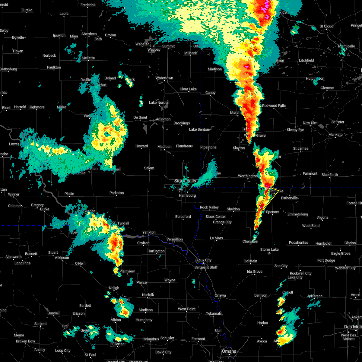 At 444 pm cdt, a severe thunderstorm was located 8 miles west of fostoria, or 12 miles northwest of spencer in clay county, moving northeast at 65 mph (radar indicated). Hazards include 60 mph wind gusts and half dollar size hail. Hail damage to vehicles is expected. expect wind damage to roofs, siding, and trees. this severe thunderstorm will be near, okoboji, wahpeton and west okoboji around 455 pm cdt. spirit lake and orleans around 500 pm cdt. hail threat, radar indicated max hail size, 1. 25 in wind threat, radar indicated max wind gust, 60 mph. At 444 pm cdt, a severe thunderstorm was located 8 miles west of fostoria, or 12 miles northwest of spencer in clay county, moving northeast at 65 mph (radar indicated). Hazards include 60 mph wind gusts and half dollar size hail. Hail damage to vehicles is expected. expect wind damage to roofs, siding, and trees. this severe thunderstorm will be near, okoboji, wahpeton and west okoboji around 455 pm cdt. spirit lake and orleans around 500 pm cdt. hail threat, radar indicated max hail size, 1. 25 in wind threat, radar indicated max wind gust, 60 mph.
|
| 5/30/2022 4:36 PM CDT |
 At 435 pm cdt, a severe thunderstorm was located near lake park, or 9 miles west of spirit lake, moving northeast at 65 mph (radar indicated). Hazards include ping pong ball size hail and 60 mph wind gusts. People and animals outdoors will be injured. expect hail damage to roofs, siding, windows, and vehicles. expect wind damage to roofs, siding, and trees. this severe thunderstorm will be near, jackson in jackson county and lakefield around 455 pm cdt. kilen woods state park around 500 pm cdt. hail threat, radar indicated max hail size, 1. 50 in wind threat, radar indicated max wind gust, 60 mph. At 435 pm cdt, a severe thunderstorm was located near lake park, or 9 miles west of spirit lake, moving northeast at 65 mph (radar indicated). Hazards include ping pong ball size hail and 60 mph wind gusts. People and animals outdoors will be injured. expect hail damage to roofs, siding, windows, and vehicles. expect wind damage to roofs, siding, and trees. this severe thunderstorm will be near, jackson in jackson county and lakefield around 455 pm cdt. kilen woods state park around 500 pm cdt. hail threat, radar indicated max hail size, 1. 50 in wind threat, radar indicated max wind gust, 60 mph.
|
| 5/30/2022 7:54 AM CDT |
 The severe thunderstorm warning for eastern osceola, dickinson and southern jackson counties will expire at 800 am cdt, the storm which prompted the warning has weakened below severe limits, and no longer poses an immediate threat to life or property. therefore, the warning will be allowed to expire. however gusty winds and heavy rain are still possible with this thunderstorm. a severe thunderstorm watch remains in effect until 800 am cdt for northwestern iowa, and southwestern minnesota. The severe thunderstorm warning for eastern osceola, dickinson and southern jackson counties will expire at 800 am cdt, the storm which prompted the warning has weakened below severe limits, and no longer poses an immediate threat to life or property. therefore, the warning will be allowed to expire. however gusty winds and heavy rain are still possible with this thunderstorm. a severe thunderstorm watch remains in effect until 800 am cdt for northwestern iowa, and southwestern minnesota.
|
| 5/30/2022 7:54 AM CDT |
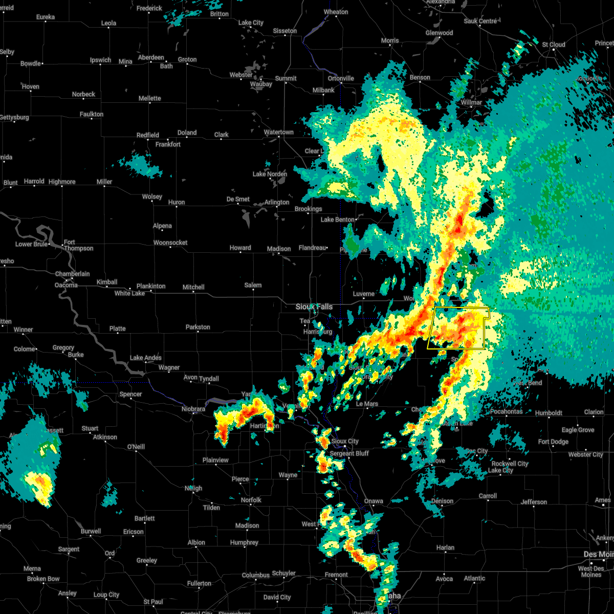 The severe thunderstorm warning for eastern osceola, dickinson and southern jackson counties will expire at 800 am cdt, the storm which prompted the warning has weakened below severe limits, and no longer poses an immediate threat to life or property. therefore, the warning will be allowed to expire. however gusty winds and heavy rain are still possible with this thunderstorm. a severe thunderstorm watch remains in effect until 800 am cdt for northwestern iowa, and southwestern minnesota. The severe thunderstorm warning for eastern osceola, dickinson and southern jackson counties will expire at 800 am cdt, the storm which prompted the warning has weakened below severe limits, and no longer poses an immediate threat to life or property. therefore, the warning will be allowed to expire. however gusty winds and heavy rain are still possible with this thunderstorm. a severe thunderstorm watch remains in effect until 800 am cdt for northwestern iowa, and southwestern minnesota.
|
| 5/30/2022 7:43 AM CDT |
 At 742 am cdt, a severe thunderstorm was located over okoboji, or near spirit lake, moving north at 60 mph (radar indicated). Hazards include 60 mph wind gusts and penny size hail. Expect damage to roofs, siding, and trees. this severe storm will be near, superior around 750 am cdt. hail threat, radar indicated max hail size, 0. 75 in wind threat, radar indicated max wind gust, 60 mph. At 742 am cdt, a severe thunderstorm was located over okoboji, or near spirit lake, moving north at 60 mph (radar indicated). Hazards include 60 mph wind gusts and penny size hail. Expect damage to roofs, siding, and trees. this severe storm will be near, superior around 750 am cdt. hail threat, radar indicated max hail size, 0. 75 in wind threat, radar indicated max wind gust, 60 mph.
|
| 5/30/2022 7:43 AM CDT |
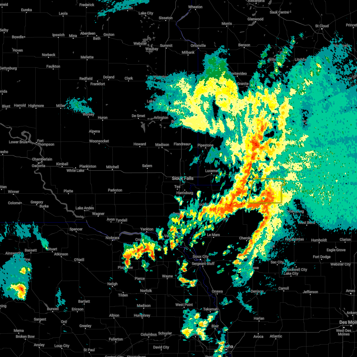 At 742 am cdt, a severe thunderstorm was located over okoboji, or near spirit lake, moving north at 60 mph (radar indicated). Hazards include 60 mph wind gusts and penny size hail. Expect damage to roofs, siding, and trees. this severe storm will be near, superior around 750 am cdt. hail threat, radar indicated max hail size, 0. 75 in wind threat, radar indicated max wind gust, 60 mph. At 742 am cdt, a severe thunderstorm was located over okoboji, or near spirit lake, moving north at 60 mph (radar indicated). Hazards include 60 mph wind gusts and penny size hail. Expect damage to roofs, siding, and trees. this severe storm will be near, superior around 750 am cdt. hail threat, radar indicated max hail size, 0. 75 in wind threat, radar indicated max wind gust, 60 mph.
|
| 5/30/2022 7:26 AM CDT |
 At 726 am cdt, a severe thunderstorm was located near everly, or near spencer in clay county, moving north at 60 mph (radar indicated). Hazards include 60 mph wind gusts and penny size hail. Expect damage to roofs, siding, and trees. this severe thunderstorm will be near, fostoria around 735 am cdt. milford, terril and west okoboji around 740 am cdt. arnolds park, lake park, okoboji, wahpeton and harris around 745 am cdt. spirit lake, orleans and superior around 750 am cdt. other locations impacted by this severe thunderstorm include gillett grove, moneta, dickens, calumet and rossie. hail threat, radar indicated max hail size, 0. 75 in wind threat, radar indicated max wind gust, 60 mph. At 726 am cdt, a severe thunderstorm was located near everly, or near spencer in clay county, moving north at 60 mph (radar indicated). Hazards include 60 mph wind gusts and penny size hail. Expect damage to roofs, siding, and trees. this severe thunderstorm will be near, fostoria around 735 am cdt. milford, terril and west okoboji around 740 am cdt. arnolds park, lake park, okoboji, wahpeton and harris around 745 am cdt. spirit lake, orleans and superior around 750 am cdt. other locations impacted by this severe thunderstorm include gillett grove, moneta, dickens, calumet and rossie. hail threat, radar indicated max hail size, 0. 75 in wind threat, radar indicated max wind gust, 60 mph.
|
| 5/30/2022 3:43 AM CDT |
 The severe thunderstorm warning for osceola, dickinson, jackson, nobles, murray and cottonwood counties will expire at 345 am cdt, the storms which prompted the warning have weakened below severe limits, and have exited the warned area. therefore, the warning will be allowed to expire. however gusty winds are still possible with these thunderstorms. a severe thunderstorm watch remains in effect until 800 am cdt for northwestern iowa, and southwestern minnesota. The severe thunderstorm warning for osceola, dickinson, jackson, nobles, murray and cottonwood counties will expire at 345 am cdt, the storms which prompted the warning have weakened below severe limits, and have exited the warned area. therefore, the warning will be allowed to expire. however gusty winds are still possible with these thunderstorms. a severe thunderstorm watch remains in effect until 800 am cdt for northwestern iowa, and southwestern minnesota.
|
| 5/30/2022 3:15 AM CDT |
 At 313 am cdt, severe thunderstorms were located along a line extending from 6 miles north of westbrook to near lakefield to near hartley, moving east at 55 mph (instrumentation. observation site near worthington, minnesota recorded a gust 66 mph at 2:58 am). Hazards include 70 mph wind gusts and ping pong ball size hail. People and animals outdoors will be injured. expect hail damage to roofs, siding, windows, and vehicles. expect considerable tree damage. wind damage is also likely to mobile homes, roofs, and outbuildings. Locations impacted include, windom, lakefield, jackson in jackson county, jeffers, bingham lake, kilen woods state park, spirit lake, milford, arnolds park, bergen, okoboji, west okoboji, terril and superior. At 313 am cdt, severe thunderstorms were located along a line extending from 6 miles north of westbrook to near lakefield to near hartley, moving east at 55 mph (instrumentation. observation site near worthington, minnesota recorded a gust 66 mph at 2:58 am). Hazards include 70 mph wind gusts and ping pong ball size hail. People and animals outdoors will be injured. expect hail damage to roofs, siding, windows, and vehicles. expect considerable tree damage. wind damage is also likely to mobile homes, roofs, and outbuildings. Locations impacted include, windom, lakefield, jackson in jackson county, jeffers, bingham lake, kilen woods state park, spirit lake, milford, arnolds park, bergen, okoboji, west okoboji, terril and superior.
|
| 5/30/2022 2:57 AM CDT |
 At 255 am cdt, severe thunderstorms were located along a line extending from lake shetek state park to worthington to sanborn, moving east at 60 mph (instrumentation. an observation site at worthington, mn gusted to 59 mph at 2:53 am). Hazards include 70 mph wind gusts and quarter size hail. Hail damage to vehicles is expected. expect considerable tree damage. wind damage is also likely to mobile homes, roofs, and outbuildings. these severe storms will be near, round lake around 300 am cdt. Other locations in the path of these severe thunderstorms include brewster, harris, dovray, lake park, westbrook, heron lake, storden, lakefield, orleans, jeffers, spirit lake, milford, arnolds park, okoboji, wahpeton, west okoboji, kilen woods state park, jackson in jackson county, bergen, terril and superior. At 255 am cdt, severe thunderstorms were located along a line extending from lake shetek state park to worthington to sanborn, moving east at 60 mph (instrumentation. an observation site at worthington, mn gusted to 59 mph at 2:53 am). Hazards include 70 mph wind gusts and quarter size hail. Hail damage to vehicles is expected. expect considerable tree damage. wind damage is also likely to mobile homes, roofs, and outbuildings. these severe storms will be near, round lake around 300 am cdt. Other locations in the path of these severe thunderstorms include brewster, harris, dovray, lake park, westbrook, heron lake, storden, lakefield, orleans, jeffers, spirit lake, milford, arnolds park, okoboji, wahpeton, west okoboji, kilen woods state park, jackson in jackson county, bergen, terril and superior.
|
| 5/30/2022 2:40 AM CDT |
 At 240 am cdt, severe thunderstorms were located along a line extending from near current lake to near rushmore to near sheldon, moving east at 55 mph (radar indicated). Hazards include 70 mph wind gusts. Expect considerable tree damage. damage is likely to mobile homes, roofs, and outbuildings. severe thunderstorms will be near, sibley and rushmore around 245 am cdt. slayton around 250 am cdt. worthington, ocheyedan, currie, melvin and lake shetek state park around 255 am cdt. brewster, round lake, harris and dovray around 300 am cdt. Other locations in the path of these severe thunderstorms include lake park, westbrook, heron lake, storden, milford, lakefield, okoboji, orleans, jeffers, wahpeton and west okoboji. At 240 am cdt, severe thunderstorms were located along a line extending from near current lake to near rushmore to near sheldon, moving east at 55 mph (radar indicated). Hazards include 70 mph wind gusts. Expect considerable tree damage. damage is likely to mobile homes, roofs, and outbuildings. severe thunderstorms will be near, sibley and rushmore around 245 am cdt. slayton around 250 am cdt. worthington, ocheyedan, currie, melvin and lake shetek state park around 255 am cdt. brewster, round lake, harris and dovray around 300 am cdt. Other locations in the path of these severe thunderstorms include lake park, westbrook, heron lake, storden, milford, lakefield, okoboji, orleans, jeffers, wahpeton and west okoboji.
|
| 5/29/2022 5:47 AM CDT |
 At 547 am cdt, severe thunderstorms were located along a line extending from near lamberton to near windom to near round lake, moving northeast at 50 mph (radar indicated). Hazards include 70 mph wind gusts and half dollar size hail. Hail damage to vehicles is expected. expect considerable tree damage. wind damage is also likely to mobile homes, roofs, and outbuildings. locations impacted include, windom, jeffers, bingham lake, mountain lake, superior, jackson in jackson county, kilen woods state park and bergen. thunderstorm damage threat, considerable hail threat, radar indicated max hail size, 1. 25 in wind threat, radar indicated max wind gust, 70 mph. At 547 am cdt, severe thunderstorms were located along a line extending from near lamberton to near windom to near round lake, moving northeast at 50 mph (radar indicated). Hazards include 70 mph wind gusts and half dollar size hail. Hail damage to vehicles is expected. expect considerable tree damage. wind damage is also likely to mobile homes, roofs, and outbuildings. locations impacted include, windom, jeffers, bingham lake, mountain lake, superior, jackson in jackson county, kilen woods state park and bergen. thunderstorm damage threat, considerable hail threat, radar indicated max hail size, 1. 25 in wind threat, radar indicated max wind gust, 70 mph.
|
| 5/29/2022 5:21 AM CDT |
 At 520 am cdt, severe thunderstorms were located along a line extending from currie to near fulda to near sibley, moving northeast at 50 mph (radar indicated). Hazards include 70 mph wind gusts and half dollar size hail. Hail damage to vehicles is expected. expect considerable tree damage. wind damage is also likely to mobile homes, roofs, and outbuildings. severe thunderstorms will be near, brewster, currie and dovray around 525 am cdt. westbrook around 530 am cdt. heron lake and storden around 535 am cdt. other locations in the path of these severe thunderstorms include windom, lake park, jeffers, bergen, spirit lake, orleans, bingham lake, mountain lake, lakefield and superior. thunderstorm damage threat, considerable hail threat, radar indicated max hail size, 1. 25 in wind threat, radar indicated max wind gust, 70 mph. At 520 am cdt, severe thunderstorms were located along a line extending from currie to near fulda to near sibley, moving northeast at 50 mph (radar indicated). Hazards include 70 mph wind gusts and half dollar size hail. Hail damage to vehicles is expected. expect considerable tree damage. wind damage is also likely to mobile homes, roofs, and outbuildings. severe thunderstorms will be near, brewster, currie and dovray around 525 am cdt. westbrook around 530 am cdt. heron lake and storden around 535 am cdt. other locations in the path of these severe thunderstorms include windom, lake park, jeffers, bergen, spirit lake, orleans, bingham lake, mountain lake, lakefield and superior. thunderstorm damage threat, considerable hail threat, radar indicated max hail size, 1. 25 in wind threat, radar indicated max wind gust, 70 mph.
|
| 5/12/2022 9:09 PM CDT |
 The severe thunderstorm warning for eastern osceola, dickinson, northeastern buena vista, clay and southeastern jackson counties will expire at 915 pm cdt, the storms which prompted the warning have moved out of the area. therefore, the warning will be allowed to expire. a severe thunderstorm watch remains in effect until 1000 pm cdt for northwestern iowa, and southwestern minnesota. The severe thunderstorm warning for eastern osceola, dickinson, northeastern buena vista, clay and southeastern jackson counties will expire at 915 pm cdt, the storms which prompted the warning have moved out of the area. therefore, the warning will be allowed to expire. a severe thunderstorm watch remains in effect until 1000 pm cdt for northwestern iowa, and southwestern minnesota.
|
| 5/12/2022 8:28 PM CDT |
 At 828 pm cdt, severe thunderstorms were located along a line extending from near round lake to near albert city, moving northeast at 40 mph (radar indicated). Hazards include 60 mph wind gusts and quarter size hail. Hail damage to vehicles is expected. expect wind damage to roofs, siding, and trees. severe thunderstorms will be near, webb around 835 pm cdt. okoboji and wahpeton around 845 pm cdt. other locations in the path of these severe thunderstorms include spirit lake, orleans, lakefield, jackson in jackson county and kilen woods state park. hail threat, radar indicated max hail size, 1. 00 in wind threat, radar indicated max wind gust, 60 mph. At 828 pm cdt, severe thunderstorms were located along a line extending from near round lake to near albert city, moving northeast at 40 mph (radar indicated). Hazards include 60 mph wind gusts and quarter size hail. Hail damage to vehicles is expected. expect wind damage to roofs, siding, and trees. severe thunderstorms will be near, webb around 835 pm cdt. okoboji and wahpeton around 845 pm cdt. other locations in the path of these severe thunderstorms include spirit lake, orleans, lakefield, jackson in jackson county and kilen woods state park. hail threat, radar indicated max hail size, 1. 00 in wind threat, radar indicated max wind gust, 60 mph.
|
| 5/12/2022 5:51 PM CDT |
 At 549 pm cdt, severe thunderstorms were located along a line extending from near rushmore to near melvin to near sutherland, moving east at 60 mph (radar indicated). Hazards include 70 mph wind gusts. Expect considerable tree damage. damage is likely to mobile homes, roofs, and outbuildings. severe thunderstorms will be near, fulda, round lake, peterson and harris around 600 pm cdt. lake park, everly, brewster, royal and linn grove around 605 pm cdt. milford, okoboji, sioux rapids, wahpeton, west okoboji, fostoria and greenville around 610 pm cdt. spencer in clay county, spirit lake, arnolds park, heron lake, orleans and webb around 615 pm cdt. lakefield and terril around 620 pm cdt. windom, jackson in jackson county, superior and kilen woods state park around 625 pm cdt. mountain lake, bergen and bingham lake around 630 pm cdt. other locations impacted by these severe thunderstorms include moneta, delft, dickens, calumet, rossie, alpha, kinbrae, wilder, gillett grove and dundee. thunderstorm damage threat, considerable hail threat, radar indicated max hail size, <. 75 in wind threat, radar indicated max wind gust, 70 mph. At 549 pm cdt, severe thunderstorms were located along a line extending from near rushmore to near melvin to near sutherland, moving east at 60 mph (radar indicated). Hazards include 70 mph wind gusts. Expect considerable tree damage. damage is likely to mobile homes, roofs, and outbuildings. severe thunderstorms will be near, fulda, round lake, peterson and harris around 600 pm cdt. lake park, everly, brewster, royal and linn grove around 605 pm cdt. milford, okoboji, sioux rapids, wahpeton, west okoboji, fostoria and greenville around 610 pm cdt. spencer in clay county, spirit lake, arnolds park, heron lake, orleans and webb around 615 pm cdt. lakefield and terril around 620 pm cdt. windom, jackson in jackson county, superior and kilen woods state park around 625 pm cdt. mountain lake, bergen and bingham lake around 630 pm cdt. other locations impacted by these severe thunderstorms include moneta, delft, dickens, calumet, rossie, alpha, kinbrae, wilder, gillett grove and dundee. thunderstorm damage threat, considerable hail threat, radar indicated max hail size, <. 75 in wind threat, radar indicated max wind gust, 70 mph.
|
| 5/11/2022 6:39 PM CDT |
 At 639 pm cdt, severe thunderstorms were located along a line extending from near comfrey to near bergen to near greenville, moving east at 45 mph (radar indicated). Hazards include 70 mph wind gusts. Expect considerable tree damage. damage is likely to mobile homes, roofs, and outbuildings. severe thunderstorms will be near, mountain lake around 645 pm cdt. terril around 655 pm cdt. thunderstorm damage threat, considerable hail threat, radar indicated max hail size, <. 75 in wind threat, radar indicated max wind gust, 70 mph. At 639 pm cdt, severe thunderstorms were located along a line extending from near comfrey to near bergen to near greenville, moving east at 45 mph (radar indicated). Hazards include 70 mph wind gusts. Expect considerable tree damage. damage is likely to mobile homes, roofs, and outbuildings. severe thunderstorms will be near, mountain lake around 645 pm cdt. terril around 655 pm cdt. thunderstorm damage threat, considerable hail threat, radar indicated max hail size, <. 75 in wind threat, radar indicated max wind gust, 70 mph.
|
| 5/11/2022 6:33 PM CDT |
 At 632 pm cdt, severe thunderstorms were located along a line extending from springfield to mountain lake to near milford, moving east at 30 mph (radar indicated). Hazards include 70 mph wind gusts. Expect considerable tree damage. damage is likely to mobile homes, roofs, and outbuildings. locations impacted include, mountain lake. thunderstorm damage threat, considerable hail threat, radar indicated max hail size, <. 75 in wind threat, radar indicated max wind gust, 70 mph. At 632 pm cdt, severe thunderstorms were located along a line extending from springfield to mountain lake to near milford, moving east at 30 mph (radar indicated). Hazards include 70 mph wind gusts. Expect considerable tree damage. damage is likely to mobile homes, roofs, and outbuildings. locations impacted include, mountain lake. thunderstorm damage threat, considerable hail threat, radar indicated max hail size, <. 75 in wind threat, radar indicated max wind gust, 70 mph.
|
| 5/11/2022 6:09 PM CDT |
 At 608 pm cdt, severe thunderstorms were located along a line extending from near lamberton to near windom to 7 miles north of everly, moving east at 30 mph (radar indicated). Hazards include 60 mph wind gusts. Expect damage to roofs, siding, and trees. severe thunderstorms will be near, windom, jeffers, bingham lake and kilen woods state park around 615 pm cdt. bergen around 620 pm cdt. other locations in the path of these severe thunderstorms include mountain lake, orleans, terril and superior. hail threat, radar indicated max hail size, <. 75 in wind threat, radar indicated max wind gust, 60 mph. At 608 pm cdt, severe thunderstorms were located along a line extending from near lamberton to near windom to 7 miles north of everly, moving east at 30 mph (radar indicated). Hazards include 60 mph wind gusts. Expect damage to roofs, siding, and trees. severe thunderstorms will be near, windom, jeffers, bingham lake and kilen woods state park around 615 pm cdt. bergen around 620 pm cdt. other locations in the path of these severe thunderstorms include mountain lake, orleans, terril and superior. hail threat, radar indicated max hail size, <. 75 in wind threat, radar indicated max wind gust, 60 mph.
|
| 5/11/2022 5:49 PM CDT |
 At 548 pm cdt, a severe thunderstorm capable of producing a tornado was located near harris, or 15 miles east of sibley, moving northeast at 55 mph (radar indicated rotation). Hazards include tornado. Flying debris will be dangerous to those caught without shelter. mobile homes will be damaged or destroyed. damage to roofs, windows, and vehicles will occur. tree damage is likely. this dangerous storm will be near, lake park around 555 pm cdt. okoboji around 600 pm cdt. spirit lake and orleans around 605 pm cdt. Other locations in the path of this tornadic thunderstorm include lakefield. At 548 pm cdt, a severe thunderstorm capable of producing a tornado was located near harris, or 15 miles east of sibley, moving northeast at 55 mph (radar indicated rotation). Hazards include tornado. Flying debris will be dangerous to those caught without shelter. mobile homes will be damaged or destroyed. damage to roofs, windows, and vehicles will occur. tree damage is likely. this dangerous storm will be near, lake park around 555 pm cdt. okoboji around 600 pm cdt. spirit lake and orleans around 605 pm cdt. Other locations in the path of this tornadic thunderstorm include lakefield.
|
| 5/11/2022 5:49 PM CDT |
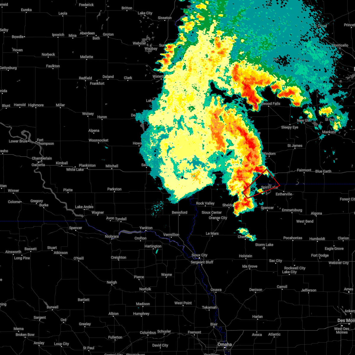 At 548 pm cdt, a severe thunderstorm capable of producing a tornado was located near harris, or 15 miles east of sibley, moving northeast at 55 mph (radar indicated rotation). Hazards include tornado. Flying debris will be dangerous to those caught without shelter. mobile homes will be damaged or destroyed. damage to roofs, windows, and vehicles will occur. tree damage is likely. this dangerous storm will be near, lake park around 555 pm cdt. okoboji around 600 pm cdt. spirit lake and orleans around 605 pm cdt. Other locations in the path of this tornadic thunderstorm include lakefield. At 548 pm cdt, a severe thunderstorm capable of producing a tornado was located near harris, or 15 miles east of sibley, moving northeast at 55 mph (radar indicated rotation). Hazards include tornado. Flying debris will be dangerous to those caught without shelter. mobile homes will be damaged or destroyed. damage to roofs, windows, and vehicles will occur. tree damage is likely. this dangerous storm will be near, lake park around 555 pm cdt. okoboji around 600 pm cdt. spirit lake and orleans around 605 pm cdt. Other locations in the path of this tornadic thunderstorm include lakefield.
|
| 4/23/2022 6:57 AM CDT |
 At 655 am cdt, a severe thunderstorm was located near superior, or near spirit lake, moving north at 65 mph (public. at 653 am cdt, public reported quarter sized hail located 5 miles east of milford). Hazards include 60 mph wind gusts and quarter size hail. Hail damage to vehicles is expected. expect wind damage to roofs, siding, and trees. this severe storm will be near, superior around 700 am cdt. jackson in jackson county and kilen woods state park around 715 am cdt. other locations impacted by this severe thunderstorm include alpha. hail threat, observed max hail size, 1. 00 in wind threat, radar indicated max wind gust, 60 mph. At 655 am cdt, a severe thunderstorm was located near superior, or near spirit lake, moving north at 65 mph (public. at 653 am cdt, public reported quarter sized hail located 5 miles east of milford). Hazards include 60 mph wind gusts and quarter size hail. Hail damage to vehicles is expected. expect wind damage to roofs, siding, and trees. this severe storm will be near, superior around 700 am cdt. jackson in jackson county and kilen woods state park around 715 am cdt. other locations impacted by this severe thunderstorm include alpha. hail threat, observed max hail size, 1. 00 in wind threat, radar indicated max wind gust, 60 mph.
|
| 4/23/2022 6:48 AM CDT |
 At 648 am cdt, a severe thunderstorm was located near fostoria, or 8 miles north of spencer in clay county, moving north at 65 mph (radar indicated). Hazards include 60 mph wind gusts and quarter size hail. Hail damage to vehicles is expected. expect wind damage to roofs, siding, and trees. this severe thunderstorm will be near, spirit lake, orleans and superior around 700 am cdt. jackson in jackson county and kilen woods state park around 715 am cdt. other locations impacted by this severe thunderstorm include alpha and dickens. hail threat, radar indicated max hail size, 1. 00 in wind threat, radar indicated max wind gust, 60 mph. At 648 am cdt, a severe thunderstorm was located near fostoria, or 8 miles north of spencer in clay county, moving north at 65 mph (radar indicated). Hazards include 60 mph wind gusts and quarter size hail. Hail damage to vehicles is expected. expect wind damage to roofs, siding, and trees. this severe thunderstorm will be near, spirit lake, orleans and superior around 700 am cdt. jackson in jackson county and kilen woods state park around 715 am cdt. other locations impacted by this severe thunderstorm include alpha and dickens. hail threat, radar indicated max hail size, 1. 00 in wind threat, radar indicated max wind gust, 60 mph.
|
| 12/15/2021 6:09 PM CST |
 The severe thunderstorm warning for dickinson and jackson counties will expire at 615 pm cst, the storms which prompted the warning have moved out of the area. therefore, the warning will be allowed to expire. however gusty winds are still possible with these thunderstorms. The severe thunderstorm warning for dickinson and jackson counties will expire at 615 pm cst, the storms which prompted the warning have moved out of the area. therefore, the warning will be allowed to expire. however gusty winds are still possible with these thunderstorms.
|
| 12/15/2021 5:29 PM CST |
 At 528 pm cst, severe thunderstorms were located along a line extending from 8 miles south of harris to near lost island lake, moving north at 70 mph (radar indicated). Hazards include 70 mph wind gusts and penny size hail. Expect considerable tree damage. damage is likely to mobile homes, roofs, and outbuildings. severe thunderstorms will be near, lake park and terril around 535 pm cst. superior around 545 pm cst. jackson around 555 pm cst. Other locations in the path of these severe thunderstorms include lakefield. At 528 pm cst, severe thunderstorms were located along a line extending from 8 miles south of harris to near lost island lake, moving north at 70 mph (radar indicated). Hazards include 70 mph wind gusts and penny size hail. Expect considerable tree damage. damage is likely to mobile homes, roofs, and outbuildings. severe thunderstorms will be near, lake park and terril around 535 pm cst. superior around 545 pm cst. jackson around 555 pm cst. Other locations in the path of these severe thunderstorms include lakefield.
|
| 9/17/2021 2:21 AM CDT |
 The severe thunderstorm warning for eastern osceola, dickinson, northern clay, northeastern o`brien and jackson counties will expire at 230 am cdt, the storms which prompted the warning have weakened below severe limits, and have exited the warned area. therefore, the warning will be allowed to expire. however gusty winds are still possible with these thunderstorms. The severe thunderstorm warning for eastern osceola, dickinson, northern clay, northeastern o`brien and jackson counties will expire at 230 am cdt, the storms which prompted the warning have weakened below severe limits, and have exited the warned area. therefore, the warning will be allowed to expire. however gusty winds are still possible with these thunderstorms.
|
| 9/17/2021 2:04 AM CDT |
 At 204 am cdt, severe thunderstorms were located along a line extending from near bergen to orleans to everly, moving east at 50 mph (radar indicated). Hazards include 60 mph wind gusts. Expect damage to roofs, siding, and trees. locations impacted include, spencer in clay county, spirit lake, jackson in jackson county, milford, lakefield, hartley, arnolds park, lake park, okoboji, orleans, everly, terril, wahpeton, west okoboji, fostoria, superior, kilen woods state park, lost island lake, okabena and dickens. hail threat, radar indicated max hail size, <. 75 in wind threat, observed max wind gust, 60 mph. At 204 am cdt, severe thunderstorms were located along a line extending from near bergen to orleans to everly, moving east at 50 mph (radar indicated). Hazards include 60 mph wind gusts. Expect damage to roofs, siding, and trees. locations impacted include, spencer in clay county, spirit lake, jackson in jackson county, milford, lakefield, hartley, arnolds park, lake park, okoboji, orleans, everly, terril, wahpeton, west okoboji, fostoria, superior, kilen woods state park, lost island lake, okabena and dickens. hail threat, radar indicated max hail size, <. 75 in wind threat, observed max wind gust, 60 mph.
|
| 9/17/2021 1:49 AM CDT |
 At 149 am cdt, severe thunderstorms were located along a line extending from near windom to lake park to near hartley, moving east at 50 mph (radar indicated). Hazards include 60 mph wind gusts. Expect damage to roofs, siding, and trees. locations impacted include, okoboji, wahpeton, kilen woods state park, spirit lake, milford, arnolds park, orleans, west okoboji, superior, spencer in clay county, fostoria and lost island lake. hail threat, radar indicated max hail size, <. 75 in wind threat, observed max wind gust, 60 mph. At 149 am cdt, severe thunderstorms were located along a line extending from near windom to lake park to near hartley, moving east at 50 mph (radar indicated). Hazards include 60 mph wind gusts. Expect damage to roofs, siding, and trees. locations impacted include, okoboji, wahpeton, kilen woods state park, spirit lake, milford, arnolds park, orleans, west okoboji, superior, spencer in clay county, fostoria and lost island lake. hail threat, radar indicated max hail size, <. 75 in wind threat, observed max wind gust, 60 mph.
|
| 9/17/2021 1:23 AM CDT |
 At 123 am cdt, severe thunderstorms were located along a line extending from 6 miles southeast of fulda to near sibley to near hospers, moving east at 50 mph (radar indicated). Hazards include 60 mph wind gusts. Expect damage to roofs, siding, and trees. severe thunderstorms will be near, brewster around 130 am cdt. heron lake and ocheyedan around 135 am cdt. sanborn, round lake and harris around 140 am cdt. other locations in the path of these severe thunderstorms include lake park, hartley, milford, okoboji, wahpeton, kilen woods state park, spirit lake, arnolds park, orleans, everly, west okoboji, spencer in clay county, fostoria and superior. hail threat, radar indicated max hail size, <. 75 in wind threat, observed max wind gust, 60 mph. At 123 am cdt, severe thunderstorms were located along a line extending from 6 miles southeast of fulda to near sibley to near hospers, moving east at 50 mph (radar indicated). Hazards include 60 mph wind gusts. Expect damage to roofs, siding, and trees. severe thunderstorms will be near, brewster around 130 am cdt. heron lake and ocheyedan around 135 am cdt. sanborn, round lake and harris around 140 am cdt. other locations in the path of these severe thunderstorms include lake park, hartley, milford, okoboji, wahpeton, kilen woods state park, spirit lake, arnolds park, orleans, everly, west okoboji, spencer in clay county, fostoria and superior. hail threat, radar indicated max hail size, <. 75 in wind threat, observed max wind gust, 60 mph.
|
| 9/17/2021 1:03 AM CDT |
 At 103 am cdt, severe thunderstorms were located along a line extending from wilmont to little rock to hull, moving east at 60 mph (radar indicated). Hazards include 70 mph wind gusts. Expect considerable tree damage. damage is likely to mobile homes, roofs, and outbuildings. locations impacted include, sibley, wilmont, sheldon, ocheyedan, brewster, round lake, archer, sanborn, primghar, heron lake, melvin, harris, hartley, lake park, lakefield, okoboji, wahpeton, spirit lake, orleans and kilen woods state park. thunderstorm damage threat, considerable hail threat, radar indicated max hail size, <. 75 in wind threat, radar indicated max wind gust, 70 mph. At 103 am cdt, severe thunderstorms were located along a line extending from wilmont to little rock to hull, moving east at 60 mph (radar indicated). Hazards include 70 mph wind gusts. Expect considerable tree damage. damage is likely to mobile homes, roofs, and outbuildings. locations impacted include, sibley, wilmont, sheldon, ocheyedan, brewster, round lake, archer, sanborn, primghar, heron lake, melvin, harris, hartley, lake park, lakefield, okoboji, wahpeton, spirit lake, orleans and kilen woods state park. thunderstorm damage threat, considerable hail threat, radar indicated max hail size, <. 75 in wind threat, radar indicated max wind gust, 70 mph.
|
| 9/17/2021 12:36 AM CDT |
 At 1235 am cdt, severe thunderstorms were located along a line extending from near sherman to near larchwood to near newton hills state park, moving east at 60 mph (radar indicated). Hazards include 70 mph wind gusts. Expect considerable tree damage. damage is likely to mobile homes, roofs, and outbuildings. severe thunderstorms will be near, hills, lester and alvord around 1240 am cdt. luverne, rock rapids, hardwick and blue mounds state park around 1245 am cdt. rock valley, doon, ellsworth and lismore around 1255 am cdt. other locations in the path of these severe thunderstorms include sioux center, hull, little rock, wilmont, sibley, boyden, matlock, sheldon, ocheyedan, brewster, round lake and archer. thunderstorm damage threat, considerable hail threat, radar indicated max hail size, <. 75 in wind threat, radar indicated max wind gust, 70 mph. At 1235 am cdt, severe thunderstorms were located along a line extending from near sherman to near larchwood to near newton hills state park, moving east at 60 mph (radar indicated). Hazards include 70 mph wind gusts. Expect considerable tree damage. damage is likely to mobile homes, roofs, and outbuildings. severe thunderstorms will be near, hills, lester and alvord around 1240 am cdt. luverne, rock rapids, hardwick and blue mounds state park around 1245 am cdt. rock valley, doon, ellsworth and lismore around 1255 am cdt. other locations in the path of these severe thunderstorms include sioux center, hull, little rock, wilmont, sibley, boyden, matlock, sheldon, ocheyedan, brewster, round lake and archer. thunderstorm damage threat, considerable hail threat, radar indicated max hail size, <. 75 in wind threat, radar indicated max wind gust, 70 mph.
|
| 8/27/2021 2:51 AM CDT |
 The severe thunderstorm warning for eastern osceola, dickinson, northern buena vista, clay, eastern o`brien and southern jackson counties will expire at 300 am cdt, the storms which prompted the warning have moved out of the area. therefore, the warning will be allowed to expire. however gusty winds are still possible with these thunderstorms. a severe thunderstorm watch remains in effect until 300 am cdt for northwestern iowa. The severe thunderstorm warning for eastern osceola, dickinson, northern buena vista, clay, eastern o`brien and southern jackson counties will expire at 300 am cdt, the storms which prompted the warning have moved out of the area. therefore, the warning will be allowed to expire. however gusty winds are still possible with these thunderstorms. a severe thunderstorm watch remains in effect until 300 am cdt for northwestern iowa.
|
| 8/27/2021 2:26 AM CDT |
 At 226 am cdt, severe thunderstorms were located along a line extending from near orleans to fostoria to near greenville, moving east at 45 mph (radar indicated). Hazards include 60 mph wind gusts. Expect damage to roofs, siding, and trees. locations impacted include, spirit lake, arnolds park, okoboji, orleans, terril, webb and superior. hail threat, radar indicated max hail size, <. 75 in wind threat, radar indicated max wind gust, 60 mph. At 226 am cdt, severe thunderstorms were located along a line extending from near orleans to fostoria to near greenville, moving east at 45 mph (radar indicated). Hazards include 60 mph wind gusts. Expect damage to roofs, siding, and trees. locations impacted include, spirit lake, arnolds park, okoboji, orleans, terril, webb and superior. hail threat, radar indicated max hail size, <. 75 in wind threat, radar indicated max wind gust, 60 mph.
|
| 8/27/2021 1:52 AM CDT |
 At 152 am cdt, severe thunderstorms were located along a line extending from near ocheyedan to near sanborn to near paullina, moving east at 45 mph (radar indicated). Hazards include 60 mph wind gusts. Expect damage to roofs, siding, and trees. severe thunderstorms will be near, hartley and ocheyedan around 200 am cdt. round lake and harris around 205 am cdt. everly around 210 am cdt. other locations in the path of these severe thunderstorms include lake park, peterson, spencer in clay county, okoboji, royal, wahpeton, fostoria, linn grove, spirit lake, sioux rapids, orleans, greenville, terril, webb and superior. hail threat, radar indicated max hail size, <. 75 in wind threat, radar indicated max wind gust, 60 mph. At 152 am cdt, severe thunderstorms were located along a line extending from near ocheyedan to near sanborn to near paullina, moving east at 45 mph (radar indicated). Hazards include 60 mph wind gusts. Expect damage to roofs, siding, and trees. severe thunderstorms will be near, hartley and ocheyedan around 200 am cdt. round lake and harris around 205 am cdt. everly around 210 am cdt. other locations in the path of these severe thunderstorms include lake park, peterson, spencer in clay county, okoboji, royal, wahpeton, fostoria, linn grove, spirit lake, sioux rapids, orleans, greenville, terril, webb and superior. hail threat, radar indicated max hail size, <. 75 in wind threat, radar indicated max wind gust, 60 mph.
|
| 8/24/2021 11:01 AM CDT |
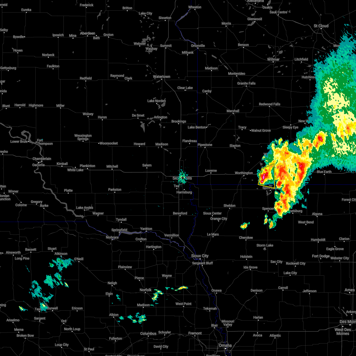 At 1100 am cdt, a severe thunderstorm was located 7 miles south of lakefield, or 10 miles west of jackson in jackson county, moving east at 35 mph (radar indicated). Hazards include 60 mph wind gusts and quarter size hail. Hail damage to vehicles is expected. expect wind damage to roofs, siding, and trees. locations impacted include, lakefield, orleans and kilen woods state park. hail threat, radar indicated max hail size, 1. 00 in wind threat, radar indicated max wind gust, 60 mph. At 1100 am cdt, a severe thunderstorm was located 7 miles south of lakefield, or 10 miles west of jackson in jackson county, moving east at 35 mph (radar indicated). Hazards include 60 mph wind gusts and quarter size hail. Hail damage to vehicles is expected. expect wind damage to roofs, siding, and trees. locations impacted include, lakefield, orleans and kilen woods state park. hail threat, radar indicated max hail size, 1. 00 in wind threat, radar indicated max wind gust, 60 mph.
|
| 8/24/2021 10:44 AM CDT |
 At 1044 am cdt, a severe thunderstorm was located over round lake, or 10 miles southeast of worthington, moving east at 30 mph (radar indicated). Hazards include 60 mph wind gusts and quarter size hail. Hail damage to vehicles is expected. expect wind damage to roofs, siding, and trees. this severe thunderstorm will be near, lake park around 1050 am cdt. other locations in the path of this severe thunderstorm include orleans. hail threat, radar indicated max hail size, 1. 00 in wind threat, radar indicated max wind gust, 60 mph. At 1044 am cdt, a severe thunderstorm was located over round lake, or 10 miles southeast of worthington, moving east at 30 mph (radar indicated). Hazards include 60 mph wind gusts and quarter size hail. Hail damage to vehicles is expected. expect wind damage to roofs, siding, and trees. this severe thunderstorm will be near, lake park around 1050 am cdt. other locations in the path of this severe thunderstorm include orleans. hail threat, radar indicated max hail size, 1. 00 in wind threat, radar indicated max wind gust, 60 mph.
|
| 10/11/2020 8:06 PM CDT |
 The severe thunderstorm warning for northeastern osceola, dickinson and jackson counties will expire at 815 pm cdt, the storms which prompted the warning have weakened below severe limits, and have exited the warned area. therefore, the warning will be allowed to expire. however gusty winds are still possible with these thunderstorms. a severe thunderstorm watch remains in effect until midnight cdt for northwestern iowa, and southwestern minnesota. The severe thunderstorm warning for northeastern osceola, dickinson and jackson counties will expire at 815 pm cdt, the storms which prompted the warning have weakened below severe limits, and have exited the warned area. therefore, the warning will be allowed to expire. however gusty winds are still possible with these thunderstorms. a severe thunderstorm watch remains in effect until midnight cdt for northwestern iowa, and southwestern minnesota.
|
| 10/11/2020 7:53 PM CDT |
 At 752 pm cdt, severe thunderstorms were located along a line extending from near lakefield to lake park, moving northeast at 35 mph (radar indicated). Hazards include 60 mph wind gusts. Expect damage to roofs, siding, and trees. these severe storms will be near, lakefield around 800 pm cdt. spirit lake and kilen woods state park around 805 pm cdt. bergen around 810 pm cdt. jackson in jackson county around 825 pm cdt. Other locations impacted by these severe thunderstorms include alpha. At 752 pm cdt, severe thunderstorms were located along a line extending from near lakefield to lake park, moving northeast at 35 mph (radar indicated). Hazards include 60 mph wind gusts. Expect damage to roofs, siding, and trees. these severe storms will be near, lakefield around 800 pm cdt. spirit lake and kilen woods state park around 805 pm cdt. bergen around 810 pm cdt. jackson in jackson county around 825 pm cdt. Other locations impacted by these severe thunderstorms include alpha.
|
| 10/11/2020 7:30 PM CDT |
 At 729 pm cdt, severe thunderstorms were located along a line extending from near brewster to near ocheyedan, moving east at 55 mph (radar indicated). Hazards include 60 mph wind gusts. Expect damage to roofs, siding, and trees. severe thunderstorms will be near, lake park around 740 pm cdt. milford, lakefield, arnolds park, okoboji, orleans, wahpeton and west okoboji around 750 pm cdt. spirit lake and kilen woods state park around 755 pm cdt. jackson in jackson county, bergen and superior around 800 pm cdt. Other locations impacted by these severe thunderstorms include okabena and alpha. At 729 pm cdt, severe thunderstorms were located along a line extending from near brewster to near ocheyedan, moving east at 55 mph (radar indicated). Hazards include 60 mph wind gusts. Expect damage to roofs, siding, and trees. severe thunderstorms will be near, lake park around 740 pm cdt. milford, lakefield, arnolds park, okoboji, orleans, wahpeton and west okoboji around 750 pm cdt. spirit lake and kilen woods state park around 755 pm cdt. jackson in jackson county, bergen and superior around 800 pm cdt. Other locations impacted by these severe thunderstorms include okabena and alpha.
|
| 7/11/2020 2:26 PM CDT |
 The severe thunderstorm warning for northeastern dickinson and southeastern jackson counties will expire at 230 pm cdt, the storm which prompted the warning has weakened below severe limits, and no longer poses an immediate threat to life or property. therefore, the warning will be allowed to expire. however small hail and gusty winds are still possible with this thunderstorm. a severe thunderstorm watch remains in effect until 800 pm cdt for northwestern iowa, and southwestern minnesota. The severe thunderstorm warning for northeastern dickinson and southeastern jackson counties will expire at 230 pm cdt, the storm which prompted the warning has weakened below severe limits, and no longer poses an immediate threat to life or property. therefore, the warning will be allowed to expire. however small hail and gusty winds are still possible with this thunderstorm. a severe thunderstorm watch remains in effect until 800 pm cdt for northwestern iowa, and southwestern minnesota.
|
| 7/11/2020 2:09 PM CDT |
 At 209 pm cdt, a severe thunderstorm was located near orleans, or 7 miles north of spirit lake, moving southeast at 40 mph (radar indicated). Hazards include two inch hail and 70 mph wind gusts. People and animals outdoors will be injured. expect hail damage to roofs, siding, windows, and vehicles. expect considerable tree damage. wind damage is also likely to mobile homes, roofs, and outbuildings. this severe storm will be near, superior around 225 pm cdt. Terril around 230 pm cdt. At 209 pm cdt, a severe thunderstorm was located near orleans, or 7 miles north of spirit lake, moving southeast at 40 mph (radar indicated). Hazards include two inch hail and 70 mph wind gusts. People and animals outdoors will be injured. expect hail damage to roofs, siding, windows, and vehicles. expect considerable tree damage. wind damage is also likely to mobile homes, roofs, and outbuildings. this severe storm will be near, superior around 225 pm cdt. Terril around 230 pm cdt.
|
| 7/11/2020 1:56 PM CDT |
 At 156 pm cdt, a severe thunderstorm was located near lakefield, or 11 miles west of jackson in jackson county, moving southeast at 40 mph (radar indicated). Hazards include two inch hail and 70 mph wind gusts. People and animals outdoors will be injured. expect hail damage to roofs, siding, windows, and vehicles. expect considerable tree damage. wind damage is also likely to mobile homes, roofs, and outbuildings. this severe thunderstorm will be near, orleans around 210 pm cdt. spirit lake around 215 pm cdt. superior around 225 pm cdt. Terril around 230 pm cdt. At 156 pm cdt, a severe thunderstorm was located near lakefield, or 11 miles west of jackson in jackson county, moving southeast at 40 mph (radar indicated). Hazards include two inch hail and 70 mph wind gusts. People and animals outdoors will be injured. expect hail damage to roofs, siding, windows, and vehicles. expect considerable tree damage. wind damage is also likely to mobile homes, roofs, and outbuildings. this severe thunderstorm will be near, orleans around 210 pm cdt. spirit lake around 215 pm cdt. superior around 225 pm cdt. Terril around 230 pm cdt.
|
| 7/11/2020 1:41 PM CDT |
 At 140 pm cdt, a severe thunderstorm was located near lakefield, or 13 miles west of jackson in jackson county, moving southeast at 40 mph (radar indicated). Hazards include two inch hail and 60 mph wind gusts. People and animals outdoors will be injured. expect hail damage to roofs, siding, windows, and vehicles. expect wind damage to roofs, siding, and trees. this severe storm will be near, lakefield around 145 pm cdt. kilen woods state park around 150 pm cdt. jackson in jackson county around 200 pm cdt. Other locations impacted by this severe thunderstorm include okabena, alpha and wilder. At 140 pm cdt, a severe thunderstorm was located near lakefield, or 13 miles west of jackson in jackson county, moving southeast at 40 mph (radar indicated). Hazards include two inch hail and 60 mph wind gusts. People and animals outdoors will be injured. expect hail damage to roofs, siding, windows, and vehicles. expect wind damage to roofs, siding, and trees. this severe storm will be near, lakefield around 145 pm cdt. kilen woods state park around 150 pm cdt. jackson in jackson county around 200 pm cdt. Other locations impacted by this severe thunderstorm include okabena, alpha and wilder.
|
| 7/11/2020 1:22 PM CDT |
 At 122 pm cdt, a severe thunderstorm was located near heron lake, or 13 miles northeast of worthington, moving southeast at 50 mph (radar indicated). Hazards include two inch hail and 60 mph wind gusts. People and animals outdoors will be injured. expect hail damage to roofs, siding, windows, and vehicles. expect wind damage to roofs, siding, and trees. this severe thunderstorm will be near, heron lake around 130 pm cdt. lakefield around 140 pm cdt. kilen woods state park around 145 pm cdt. jackson in jackson county around 150 pm cdt. Other locations impacted by this severe thunderstorm include alpha, kinbrae, wilder, dundee and okabena. At 122 pm cdt, a severe thunderstorm was located near heron lake, or 13 miles northeast of worthington, moving southeast at 50 mph (radar indicated). Hazards include two inch hail and 60 mph wind gusts. People and animals outdoors will be injured. expect hail damage to roofs, siding, windows, and vehicles. expect wind damage to roofs, siding, and trees. this severe thunderstorm will be near, heron lake around 130 pm cdt. lakefield around 140 pm cdt. kilen woods state park around 145 pm cdt. jackson in jackson county around 150 pm cdt. Other locations impacted by this severe thunderstorm include alpha, kinbrae, wilder, dundee and okabena.
|
| 6/21/2020 5:08 PM CDT |
 At 508 pm cdt, severe thunderstorms were located along a line extending from near lakefield to near terril, moving east at 50 mph (emergency management. at 447 pm a 64 mph wind was reported at 3 southeast of lake park). Hazards include 60 mph wind gusts. Expect damage to roofs, siding, and trees. These severe thunderstorms will remain over mainly rural areas of eastern dickinson, northeastern clay and southeastern jackson counties, including the following locations, alpha. At 508 pm cdt, severe thunderstorms were located along a line extending from near lakefield to near terril, moving east at 50 mph (emergency management. at 447 pm a 64 mph wind was reported at 3 southeast of lake park). Hazards include 60 mph wind gusts. Expect damage to roofs, siding, and trees. These severe thunderstorms will remain over mainly rural areas of eastern dickinson, northeastern clay and southeastern jackson counties, including the following locations, alpha.
|
| 6/21/2020 4:53 PM CDT |
 At 453 pm cdt, severe thunderstorms were located along a line extending from 8 miles southwest of lakefield to near fostoria, moving east at 55 mph (emergency management. at 442 pm a 59 mph wind was reported at 3 southeast of lake park). Hazards include 60 mph wind gusts. Expect damage to roofs, siding, and trees. severe thunderstorms will be near, terril around 505 pm cdt. jackson in jackson county around 510 pm cdt. Other locations impacted by these severe thunderstorms include alpha. At 453 pm cdt, severe thunderstorms were located along a line extending from 8 miles southwest of lakefield to near fostoria, moving east at 55 mph (emergency management. at 442 pm a 59 mph wind was reported at 3 southeast of lake park). Hazards include 60 mph wind gusts. Expect damage to roofs, siding, and trees. severe thunderstorms will be near, terril around 505 pm cdt. jackson in jackson county around 510 pm cdt. Other locations impacted by these severe thunderstorms include alpha.
|
| 6/21/2020 4:41 PM CDT |
 At 439 pm cdt, severe thunderstorms were located along a line extending from worthington to harris to 9 miles northeast of hartley, moving northeast at 45 mph (emergency management. at 437 pm cdt a 60 mph wind was reported near 3 east northeast of may city). Hazards include 60 mph wind gusts and quarter size hail. Hail damage to vehicles is expected. expect wind damage to roofs, siding, and trees. these severe storms will be near, lake park around 445 pm cdt. fostoria around 450 pm cdt. milford, wahpeton and west okoboji around 455 pm cdt. arnolds park, okoboji and orleans around 500 pm cdt. spirit lake and terril around 505 pm cdt. lakefield around 510 pm cdt. Other locations impacted by these severe thunderstorms include bigelow. At 439 pm cdt, severe thunderstorms were located along a line extending from worthington to harris to 9 miles northeast of hartley, moving northeast at 45 mph (emergency management. at 437 pm cdt a 60 mph wind was reported near 3 east northeast of may city). Hazards include 60 mph wind gusts and quarter size hail. Hail damage to vehicles is expected. expect wind damage to roofs, siding, and trees. these severe storms will be near, lake park around 445 pm cdt. fostoria around 450 pm cdt. milford, wahpeton and west okoboji around 455 pm cdt. arnolds park, okoboji and orleans around 500 pm cdt. spirit lake and terril around 505 pm cdt. lakefield around 510 pm cdt. Other locations impacted by these severe thunderstorms include bigelow.
|
| 6/21/2020 4:22 PM CDT |
 At 422 pm cdt, severe thunderstorms were located along a line extending from near little rock to near sibley to near melvin, moving northeast at 50 mph (public. at 416 pm cdt a 62 mph wind gust was reported at sheldon). Hazards include 60 mph wind gusts and quarter size hail. Hail damage to vehicles is expected. expect wind damage to roofs, siding, and trees. severe thunderstorms will be near, melvin around 425 pm cdt. hartley around 430 pm cdt. ocheyedan around 435 pm cdt. harris around 440 pm cdt. lake park and round lake around 445 pm cdt. milford, arnolds park, okoboji, wahpeton and west okoboji around 455 pm cdt. spirit lake, lakefield and orleans around 500 pm cdt. Other locations impacted by these severe thunderstorms include bigelow. At 422 pm cdt, severe thunderstorms were located along a line extending from near little rock to near sibley to near melvin, moving northeast at 50 mph (public. at 416 pm cdt a 62 mph wind gust was reported at sheldon). Hazards include 60 mph wind gusts and quarter size hail. Hail damage to vehicles is expected. expect wind damage to roofs, siding, and trees. severe thunderstorms will be near, melvin around 425 pm cdt. hartley around 430 pm cdt. ocheyedan around 435 pm cdt. harris around 440 pm cdt. lake park and round lake around 445 pm cdt. milford, arnolds park, okoboji, wahpeton and west okoboji around 455 pm cdt. spirit lake, lakefield and orleans around 500 pm cdt. Other locations impacted by these severe thunderstorms include bigelow.
|
| 6/9/2020 8:56 PM CDT |
 The severe thunderstorm warning for dickinson, northeastern buena vista and eastern clay counties will expire at 900 pm cdt, the storms which prompted the warning have moved out of the warned area. therefore, the warning will be allowed to expire. however gusty winds are still possible with these thunderstorms. The severe thunderstorm warning for dickinson, northeastern buena vista and eastern clay counties will expire at 900 pm cdt, the storms which prompted the warning have moved out of the warned area. therefore, the warning will be allowed to expire. however gusty winds are still possible with these thunderstorms.
|
| 6/9/2020 8:40 PM CDT |
 At 840 pm cdt, severe thunderstorms were located along a line extending from spirit lake to lost island lake to marathon, moving east at 30 mph (radar indicated). Hazards include 70 mph wind gusts. Expect considerable tree damage. damage is likely to mobile homes, roofs, and outbuildings. these severe storms will be near, lost island lake around 845 pm cdt. superior around 855 pm cdt. Other locations impacted by these severe thunderstorms include dickens and gillett grove. At 840 pm cdt, severe thunderstorms were located along a line extending from spirit lake to lost island lake to marathon, moving east at 30 mph (radar indicated). Hazards include 70 mph wind gusts. Expect considerable tree damage. damage is likely to mobile homes, roofs, and outbuildings. these severe storms will be near, lost island lake around 845 pm cdt. superior around 855 pm cdt. Other locations impacted by these severe thunderstorms include dickens and gillett grove.
|
| 6/9/2020 8:25 PM CDT |
 At 825 pm cdt, severe thunderstorms were located along a line extending from near wahpeton to near spencer in clay county to sioux rapids, moving east at 35 mph (radar indicated). Hazards include 70 mph wind gusts. Expect considerable tree damage. damage is likely to mobile homes, roofs, and outbuildings. severe thunderstorms will be near, webb around 835 pm cdt. marathon and lost island lake around 840 pm cdt. superior around 850 pm cdt. Other locations impacted by these severe thunderstorms include dickens and gillett grove. At 825 pm cdt, severe thunderstorms were located along a line extending from near wahpeton to near spencer in clay county to sioux rapids, moving east at 35 mph (radar indicated). Hazards include 70 mph wind gusts. Expect considerable tree damage. damage is likely to mobile homes, roofs, and outbuildings. severe thunderstorms will be near, webb around 835 pm cdt. marathon and lost island lake around 840 pm cdt. superior around 850 pm cdt. Other locations impacted by these severe thunderstorms include dickens and gillett grove.
|
| 6/9/2020 8:12 PM CDT |
 At 812 pm cdt, severe thunderstorms were located along a line extending from near lake park to spencer in clay county to linn grove, moving east at 35 mph (radar indicated). Hazards include 70 mph wind gusts. Expect considerable tree damage. damage is likely to mobile homes, roofs, and outbuildings. these severe storms will be near, spencer in clay county and fostoria around 820 pm cdt. sioux rapids around 825 pm cdt. milford, okoboji and west okoboji around 830 pm cdt. spirit lake, arnolds park, orleans and webb around 835 pm cdt. marathon and lost island lake around 840 pm cdt. Other locations impacted by these severe thunderstorms include dickens, gillett grove and rossie. At 812 pm cdt, severe thunderstorms were located along a line extending from near lake park to spencer in clay county to linn grove, moving east at 35 mph (radar indicated). Hazards include 70 mph wind gusts. Expect considerable tree damage. damage is likely to mobile homes, roofs, and outbuildings. these severe storms will be near, spencer in clay county and fostoria around 820 pm cdt. sioux rapids around 825 pm cdt. milford, okoboji and west okoboji around 830 pm cdt. spirit lake, arnolds park, orleans and webb around 835 pm cdt. marathon and lost island lake around 840 pm cdt. Other locations impacted by these severe thunderstorms include dickens, gillett grove and rossie.
|
| 6/9/2020 7:52 PM CDT |
 At 751 pm cdt, severe thunderstorms were located along a line extending from near ocheyedan to near hartley to near larrabee, moving east at 35 mph (radar indicated). Hazards include 70 mph wind gusts. Expect considerable tree damage. damage is likely to mobile homes, roofs, and outbuildings. severe thunderstorms will be near, everly around 800 pm cdt. royal, peterson and harris around 805 pm cdt. spencer in clay county, lake park, fostoria and linn grove around 815 pm cdt. sioux rapids around 820 pm cdt. spirit lake, milford, arnolds park, okoboji, orleans, wahpeton, west okoboji, marathon, webb and lost island lake around 830 pm cdt. Other locations impacted by these severe thunderstorms include gillett grove, moneta, dickens, calumet and rossie. At 751 pm cdt, severe thunderstorms were located along a line extending from near ocheyedan to near hartley to near larrabee, moving east at 35 mph (radar indicated). Hazards include 70 mph wind gusts. Expect considerable tree damage. damage is likely to mobile homes, roofs, and outbuildings. severe thunderstorms will be near, everly around 800 pm cdt. royal, peterson and harris around 805 pm cdt. spencer in clay county, lake park, fostoria and linn grove around 815 pm cdt. sioux rapids around 820 pm cdt. spirit lake, milford, arnolds park, okoboji, orleans, wahpeton, west okoboji, marathon, webb and lost island lake around 830 pm cdt. Other locations impacted by these severe thunderstorms include gillett grove, moneta, dickens, calumet and rossie.
|
| 6/5/2020 12:24 AM CDT |
 The severe thunderstorm warning for dickinson, northeastern clay and jackson counties will expire at 1230 am cdt, the storms which prompted the warning have moved out of the area. therefore, the warning will be allowed to expire. remember, a severe thunderstorm warning still remains in effect for southwestern dickinson county and northwestern clay county until 1 am. The severe thunderstorm warning for dickinson, northeastern clay and jackson counties will expire at 1230 am cdt, the storms which prompted the warning have moved out of the area. therefore, the warning will be allowed to expire. remember, a severe thunderstorm warning still remains in effect for southwestern dickinson county and northwestern clay county until 1 am.
|
| 6/4/2020 11:58 PM CDT |
 At 1157 pm cdt, severe thunderstorms were located along a line extending from near bergen to near terril, moving east at 55 mph (radar indicated). Hazards include ping pong ball size hail and 60 mph wind gusts. the largest hail with this storm is expected in southeast dickinson county. People and animals outdoors will be injured. expect hail damage to roofs, siding, windows, and vehicles. expect wind damage to roofs, siding, and trees. These severe thunderstorms will remain over mainly rural areas of dickinson, northeastern clay and jackson counties, including the following locations, alpha. At 1157 pm cdt, severe thunderstorms were located along a line extending from near bergen to near terril, moving east at 55 mph (radar indicated). Hazards include ping pong ball size hail and 60 mph wind gusts. the largest hail with this storm is expected in southeast dickinson county. People and animals outdoors will be injured. expect hail damage to roofs, siding, windows, and vehicles. expect wind damage to roofs, siding, and trees. These severe thunderstorms will remain over mainly rural areas of dickinson, northeastern clay and jackson counties, including the following locations, alpha.
|
| 6/4/2020 11:50 PM CDT |
 At 1150 pm cdt, a severe thunderstorm was located near lakefield, or 7 miles west of jackson in jackson county, moving southeast at 35 mph (radar indicated). Hazards include 60 mph wind gusts and quarter size hail. Hail damage to vehicles is expected. expect wind damage to roofs, siding, and trees. this severe thunderstorm will be near, jackson in jackson county and orleans around 1155 pm cdt. superior around 1210 am cdt. Other locations impacted by this severe thunderstorm include alpha. At 1150 pm cdt, a severe thunderstorm was located near lakefield, or 7 miles west of jackson in jackson county, moving southeast at 35 mph (radar indicated). Hazards include 60 mph wind gusts and quarter size hail. Hail damage to vehicles is expected. expect wind damage to roofs, siding, and trees. this severe thunderstorm will be near, jackson in jackson county and orleans around 1155 pm cdt. superior around 1210 am cdt. Other locations impacted by this severe thunderstorm include alpha.
|
| 6/4/2020 11:45 PM CDT |
 At 1144 pm cdt, a severe thunderstorm was located near fostoria, or 8 miles northwest of spencer in clay county, moving east at 50 mph (trained weather spotters. at approximately 1140 pm, golf ball sized hail was reported 4 miles east of hartley). Hazards include golf ball size hail and 60 mph wind gusts. People and animals outdoors will be injured. expect hail damage to roofs, siding, windows, and vehicles. expect wind damage to roofs, siding, and trees. this severe storm will be near, milford around 1150 pm cdt. arnolds park around 1155 pm cdt. terril around 1200 am cdt. Superior around 1205 am cdt. At 1144 pm cdt, a severe thunderstorm was located near fostoria, or 8 miles northwest of spencer in clay county, moving east at 50 mph (trained weather spotters. at approximately 1140 pm, golf ball sized hail was reported 4 miles east of hartley). Hazards include golf ball size hail and 60 mph wind gusts. People and animals outdoors will be injured. expect hail damage to roofs, siding, windows, and vehicles. expect wind damage to roofs, siding, and trees. this severe storm will be near, milford around 1150 pm cdt. arnolds park around 1155 pm cdt. terril around 1200 am cdt. Superior around 1205 am cdt.
|
| 6/4/2020 11:32 PM CDT |
 At 1132 pm cdt, a severe thunderstorm was located near everly, or 11 miles west of spencer in clay county, moving east at 50 mph (trained weather spotters). Hazards include ping pong ball size hail and 60 mph wind gusts. People and animals outdoors will be injured. expect hail damage to roofs, siding, windows, and vehicles. expect wind damage to roofs, siding, and trees. this severe storm will be near, spencer in clay county and fostoria around 1145 pm cdt. milford, arnolds park and west okoboji around 1150 pm cdt. terril around 1200 am cdt. Other locations impacted by this severe thunderstorm include moneta. At 1132 pm cdt, a severe thunderstorm was located near everly, or 11 miles west of spencer in clay county, moving east at 50 mph (trained weather spotters). Hazards include ping pong ball size hail and 60 mph wind gusts. People and animals outdoors will be injured. expect hail damage to roofs, siding, windows, and vehicles. expect wind damage to roofs, siding, and trees. this severe storm will be near, spencer in clay county and fostoria around 1145 pm cdt. milford, arnolds park and west okoboji around 1150 pm cdt. terril around 1200 am cdt. Other locations impacted by this severe thunderstorm include moneta.
|
| 6/4/2020 11:28 PM CDT |
 At 1128 pm cdt, a severe thunderstorm was located over hartley, or 14 miles west of spencer in clay county, moving east at 50 mph (trained weather spotters reported quarter sized hail with this storm in sanborn). Hazards include 60 mph wind gusts and quarter size hail. Hail damage to vehicles is expected. expect wind damage to roofs, siding, and trees. this severe storm will be near, spencer in clay county and fostoria around 1145 pm cdt. milford, arnolds park and west okoboji around 1150 pm cdt. terril around 1200 am cdt. Other locations impacted by this severe thunderstorm include moneta. At 1128 pm cdt, a severe thunderstorm was located over hartley, or 14 miles west of spencer in clay county, moving east at 50 mph (trained weather spotters reported quarter sized hail with this storm in sanborn). Hazards include 60 mph wind gusts and quarter size hail. Hail damage to vehicles is expected. expect wind damage to roofs, siding, and trees. this severe storm will be near, spencer in clay county and fostoria around 1145 pm cdt. milford, arnolds park and west okoboji around 1150 pm cdt. terril around 1200 am cdt. Other locations impacted by this severe thunderstorm include moneta.
|
| 6/4/2020 11:20 PM CDT |
 At 1120 pm cdt, a severe thunderstorm was located near hartley, or 14 miles east of sheldon, moving east at 50 mph (radar indicated). Hazards include 60 mph wind gusts and quarter size hail. Hail damage to vehicles is expected. expect wind damage to roofs, siding, and trees. this severe thunderstorm will be near, hartley around 1125 pm cdt. everly around 1135 pm cdt. spencer in clay county and fostoria around 1145 pm cdt. milford, arnolds park and west okoboji around 1150 pm cdt. terril around 1200 am cdt. Other locations impacted by this severe thunderstorm include moneta. At 1120 pm cdt, a severe thunderstorm was located near hartley, or 14 miles east of sheldon, moving east at 50 mph (radar indicated). Hazards include 60 mph wind gusts and quarter size hail. Hail damage to vehicles is expected. expect wind damage to roofs, siding, and trees. this severe thunderstorm will be near, hartley around 1125 pm cdt. everly around 1135 pm cdt. spencer in clay county and fostoria around 1145 pm cdt. milford, arnolds park and west okoboji around 1150 pm cdt. terril around 1200 am cdt. Other locations impacted by this severe thunderstorm include moneta.
|
| 6/2/2020 6:50 PM CDT |
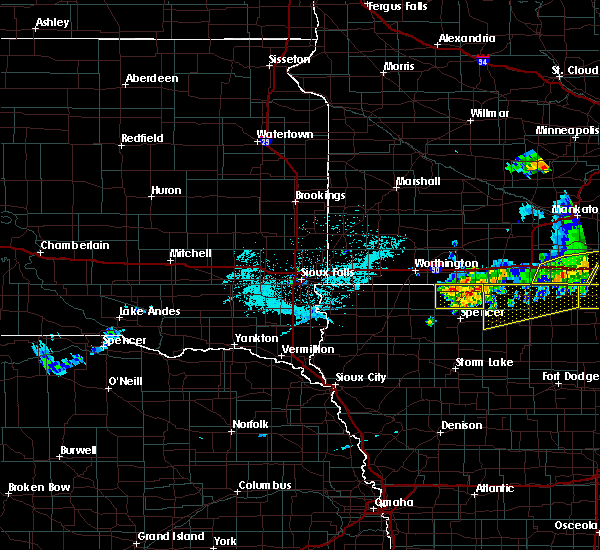 The severe thunderstorm warning for dickinson county will expire at 700 pm cdt, the storms which prompted the warning have weakened below severe limits, and no longer pose an immediate threat to life or property. therefore, the warning will be allowed to expire. a severe thunderstorm watch remains in effect until midnight cdt for northwestern iowa. The severe thunderstorm warning for dickinson county will expire at 700 pm cdt, the storms which prompted the warning have weakened below severe limits, and no longer pose an immediate threat to life or property. therefore, the warning will be allowed to expire. a severe thunderstorm watch remains in effect until midnight cdt for northwestern iowa.
|
| 6/2/2020 6:33 PM CDT |
 At 633 pm cdt, severe thunderstorms were located along a line extending from near orleans to wahpeton to 6 miles southwest of west okoboji, moving east at 35 mph (radar indicated). Hazards include 60 mph wind gusts and quarter size hail. Hail damage to vehicles is expected. expect wind damage to roofs, siding, and trees. these severe storms will be near, superior around 645 pm cdt. Terril around 700 pm cdt. At 633 pm cdt, severe thunderstorms were located along a line extending from near orleans to wahpeton to 6 miles southwest of west okoboji, moving east at 35 mph (radar indicated). Hazards include 60 mph wind gusts and quarter size hail. Hail damage to vehicles is expected. expect wind damage to roofs, siding, and trees. these severe storms will be near, superior around 645 pm cdt. Terril around 700 pm cdt.
|
| 6/2/2020 6:17 PM CDT |
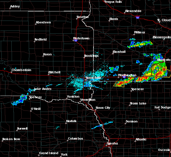 At 616 pm cdt, severe thunderstorms were located along a line extending from near lake park to near harris to near ocheyedan, moving east at 30 mph (radar indicated). Hazards include 60 mph wind gusts and quarter size hail. Hail damage to vehicles is expected. expect wind damage to roofs, siding, and trees. severe thunderstorms will be near, lake park around 625 pm cdt. spirit lake and orleans around 640 pm cdt. okoboji, wahpeton and west okoboji around 645 pm cdt. milford and arnolds park around 650 pm cdt. Terril and superior around 700 pm cdt. At 616 pm cdt, severe thunderstorms were located along a line extending from near lake park to near harris to near ocheyedan, moving east at 30 mph (radar indicated). Hazards include 60 mph wind gusts and quarter size hail. Hail damage to vehicles is expected. expect wind damage to roofs, siding, and trees. severe thunderstorms will be near, lake park around 625 pm cdt. spirit lake and orleans around 640 pm cdt. okoboji, wahpeton and west okoboji around 645 pm cdt. milford and arnolds park around 650 pm cdt. Terril and superior around 700 pm cdt.
|
| 9/11/2019 1:07 AM CDT |
 At 106 am cdt, severe thunderstorms were located along a line extending from near round lake to near melvin to near archer, moving east at 30 mph (radar indicated). Hazards include 60 mph wind gusts and penny size hail. Expect damage to roofs, siding, and trees. these severe storms will be near, ocheyedan and melvin around 110 am cdt. sanborn and harris around 120 am cdt. primghar around 125 am cdt. lake park around 130 am cdt. Other locations impacted by these severe thunderstorms include dickens, moneta and bigelow. At 106 am cdt, severe thunderstorms were located along a line extending from near round lake to near melvin to near archer, moving east at 30 mph (radar indicated). Hazards include 60 mph wind gusts and penny size hail. Expect damage to roofs, siding, and trees. these severe storms will be near, ocheyedan and melvin around 110 am cdt. sanborn and harris around 120 am cdt. primghar around 125 am cdt. lake park around 130 am cdt. Other locations impacted by these severe thunderstorms include dickens, moneta and bigelow.
|
| 9/11/2019 12:44 AM CDT |
 At 1243 am cdt, severe thunderstorms were located along a line extending from near sibley to ashton to near sioux center, moving east at 70 mph (radar indicated). Hazards include 60 mph wind gusts and quarter size hail. Hail damage to vehicles is expected. expect wind damage to roofs, siding, and trees. severe thunderstorms will be near, sanborn and melvin around 1250 am cdt. hartley and ocheyedan around 1255 am cdt. lake park, harris and archer around 100 am cdt. primghar around 105 am cdt. spencer in clay county, spirit lake, milford, arnolds park, okoboji, orleans, wahpeton, west okoboji and fostoria around 110 am cdt. everly around 115 am cdt. royal, terril and superior around 120 am cdt. Other locations impacted by these severe thunderstorms include dickens, moneta and bigelow. At 1243 am cdt, severe thunderstorms were located along a line extending from near sibley to ashton to near sioux center, moving east at 70 mph (radar indicated). Hazards include 60 mph wind gusts and quarter size hail. Hail damage to vehicles is expected. expect wind damage to roofs, siding, and trees. severe thunderstorms will be near, sanborn and melvin around 1250 am cdt. hartley and ocheyedan around 1255 am cdt. lake park, harris and archer around 100 am cdt. primghar around 105 am cdt. spencer in clay county, spirit lake, milford, arnolds park, okoboji, orleans, wahpeton, west okoboji and fostoria around 110 am cdt. everly around 115 am cdt. royal, terril and superior around 120 am cdt. Other locations impacted by these severe thunderstorms include dickens, moneta and bigelow.
|
| 8/17/2019 11:56 PM CDT |
 The severe thunderstorm warning for eastern osceola, dickinson, east central sioux, clay, o`brien, jackson, eastern nobles, southeastern murray and cottonwood counties will expire at midnight cdt, the storms which prompted the warning have moved out of the area. therefore, the warning will be allowed to expire. a severe thunderstorm watch remains in effect until 100 am cdt for northwestern iowa, and southwestern minnesota. a severe thunderstorm watch also remains in effect until 500 am cdt for northwestern iowa. The severe thunderstorm warning for eastern osceola, dickinson, east central sioux, clay, o`brien, jackson, eastern nobles, southeastern murray and cottonwood counties will expire at midnight cdt, the storms which prompted the warning have moved out of the area. therefore, the warning will be allowed to expire. a severe thunderstorm watch remains in effect until 100 am cdt for northwestern iowa, and southwestern minnesota. a severe thunderstorm watch also remains in effect until 500 am cdt for northwestern iowa.
|
| 8/17/2019 11:17 PM CDT |
 At 1117 pm cdt, severe thunderstorms were located along a line extending from near westbrook to near harris to near alton, moving east at 65 mph (radar indicated). Hazards include 60 mph wind gusts. Expect damage to roofs, siding, and trees. severe thunderstorms will be near, lake park and storden around 1125 pm cdt. spirit lake, primghar, okoboji, orleans, jeffers and wahpeton around 1130 pm cdt. sutherland and superior around 1140 pm cdt. comfrey around 1145 pm cdt. royal around 1150 pm cdt. greenville around 1155 pm cdt. webb around 1200 am cdt. Other locations impacted by these severe thunderstorms include moneta, delft, dickens, rossie, alpha, kinbrae, wilder, gillett grove, dundee and okabena. At 1117 pm cdt, severe thunderstorms were located along a line extending from near westbrook to near harris to near alton, moving east at 65 mph (radar indicated). Hazards include 60 mph wind gusts. Expect damage to roofs, siding, and trees. severe thunderstorms will be near, lake park and storden around 1125 pm cdt. spirit lake, primghar, okoboji, orleans, jeffers and wahpeton around 1130 pm cdt. sutherland and superior around 1140 pm cdt. comfrey around 1145 pm cdt. royal around 1150 pm cdt. greenville around 1155 pm cdt. webb around 1200 am cdt. Other locations impacted by these severe thunderstorms include moneta, delft, dickens, rossie, alpha, kinbrae, wilder, gillett grove, dundee and okabena.
|
| 7/20/2019 10:12 AM CDT |
 The severe thunderstorm warning for dickinson, northeastern buena vista, clay, eastern o`brien and jackson counties will expire at 1015 am cdt, the storms which prompted the warning have weakened below severe limits, and have exited the warned area. therefore, the warning will be allowed to expire. however gusty winds and heavy rain are still possible with these thunderstorms. a severe thunderstorm watch remains in effect until 1100 am cdt for northwestern iowa, and southwestern minnesota. The severe thunderstorm warning for dickinson, northeastern buena vista, clay, eastern o`brien and jackson counties will expire at 1015 am cdt, the storms which prompted the warning have weakened below severe limits, and have exited the warned area. therefore, the warning will be allowed to expire. however gusty winds and heavy rain are still possible with these thunderstorms. a severe thunderstorm watch remains in effect until 1100 am cdt for northwestern iowa, and southwestern minnesota.
|
| 7/20/2019 9:57 AM CDT |
 At 956 am cdt, severe thunderstorms were located along a line extending from near welcome to near sioux rapids, moving east at 60 mph (radar indicated. at 943 am cdt automated equipment at spencer reported a 66 mph wind gust). Hazards include 60 mph wind gusts. Expect damage to roofs, siding, and trees. These severe thunderstorms will remain over mainly rural areas of dickinson, northeastern buena vista, clay, eastern o`brien and jackson counties, including the following locations, alpha, gillett grove, moneta, dickens and rossie. At 956 am cdt, severe thunderstorms were located along a line extending from near welcome to near sioux rapids, moving east at 60 mph (radar indicated. at 943 am cdt automated equipment at spencer reported a 66 mph wind gust). Hazards include 60 mph wind gusts. Expect damage to roofs, siding, and trees. These severe thunderstorms will remain over mainly rural areas of dickinson, northeastern buena vista, clay, eastern o`brien and jackson counties, including the following locations, alpha, gillett grove, moneta, dickens and rossie.
|
| 7/20/2019 9:40 AM CDT |
 At 940 am cdt, severe thunderstorms were located along a line extending from near bergen to near sutherland, moving east at 60 mph (radar indicated). Hazards include 60 mph wind gusts. Expect damage to roofs, siding, and trees. severe thunderstorms will be near, sioux rapids and greenville around 955 am cdt. webb around 1000 am cdt. Other locations impacted by these severe thunderstorms include alpha, gillett grove, moneta, dickens, calumet and rossie. At 940 am cdt, severe thunderstorms were located along a line extending from near bergen to near sutherland, moving east at 60 mph (radar indicated). Hazards include 60 mph wind gusts. Expect damage to roofs, siding, and trees. severe thunderstorms will be near, sioux rapids and greenville around 955 am cdt. webb around 1000 am cdt. Other locations impacted by these severe thunderstorms include alpha, gillett grove, moneta, dickens, calumet and rossie.
|
| 7/20/2019 9:30 AM CDT |
 At 930 am cdt, severe thunderstorms were located along a line extending from near lakefield to near harris to near paullina, moving east at 50 mph (radar indicated). Hazards include 60 mph wind gusts. Expect damage to roofs, siding, and trees. these severe storms will be near, lakefield and lake park around 935 am cdt. bergen and kilen woods state park around 940 am cdt. spirit lake, jackson in jackson county, milford, arnolds park, okoboji, sutherland, orleans, wahpeton and west okoboji around 945 am cdt. Other locations impacted by these severe thunderstorms include alpha, moneta, okabena, calumet, rossie and wilder. At 930 am cdt, severe thunderstorms were located along a line extending from near lakefield to near harris to near paullina, moving east at 50 mph (radar indicated). Hazards include 60 mph wind gusts. Expect damage to roofs, siding, and trees. these severe storms will be near, lakefield and lake park around 935 am cdt. bergen and kilen woods state park around 940 am cdt. spirit lake, jackson in jackson county, milford, arnolds park, okoboji, sutherland, orleans, wahpeton and west okoboji around 945 am cdt. Other locations impacted by these severe thunderstorms include alpha, moneta, okabena, calumet, rossie and wilder.
|
| 7/20/2019 9:10 AM CDT |
 At 909 am cdt, severe thunderstorms were located along a line extending from near fulda to near sibley to near sioux center, moving east at 45 mph (radar indicated. at 900 am cdt automated equipment at rushmore minnesota reported a wind gust of 65 mph). Hazards include 60 mph wind gusts. Expect damage to roofs, siding, and trees. these severe storms will be near, sibley around 915 am cdt. ocheyedan and brewster around 920 am cdt. heron lake and round lake around 925 am cdt. hospers, granville and harris around 930 am cdt. lake park around 935 am cdt. archer around 940 am cdt. spirit lake, milford, arnolds park, paullina, bergen, primghar, okoboji, orleans, wahpeton and west okoboji around 945 am cdt. Other locations impacted by these severe thunderstorms include moneta, calumet, rossie, alpha, kinbrae, okabena, bigelow and wilder. At 909 am cdt, severe thunderstorms were located along a line extending from near fulda to near sibley to near sioux center, moving east at 45 mph (radar indicated. at 900 am cdt automated equipment at rushmore minnesota reported a wind gust of 65 mph). Hazards include 60 mph wind gusts. Expect damage to roofs, siding, and trees. these severe storms will be near, sibley around 915 am cdt. ocheyedan and brewster around 920 am cdt. heron lake and round lake around 925 am cdt. hospers, granville and harris around 930 am cdt. lake park around 935 am cdt. archer around 940 am cdt. spirit lake, milford, arnolds park, paullina, bergen, primghar, okoboji, orleans, wahpeton and west okoboji around 945 am cdt. Other locations impacted by these severe thunderstorms include moneta, calumet, rossie, alpha, kinbrae, okabena, bigelow and wilder.
|
| 7/20/2019 9:02 AM CDT |
 At 902 am cdt, severe thunderstorms were located along a line extending from near fulda to near little rock to near ireton, moving east at 45 mph (radar indicated). Hazards include 60 mph wind gusts. Expect damage to roofs, siding, and trees. severe thunderstorms will be near, sibley and little rock around 905 am cdt. orange city, ocheyedan and brewster around 920 am cdt. alton, heron lake and round lake around 925 am cdt. hospers, granville and harris around 930 am cdt. lake park around 935 am cdt. lakefield around 940 am cdt. spirit lake, jackson in jackson county, milford, arnolds park, paullina, bergen, okoboji, orleans, wahpeton and west okoboji around 945 am cdt. Other locations impacted by these severe thunderstorms include moneta, calumet, rossie, alpha, kinbrae, okabena, bigelow and wilder. At 902 am cdt, severe thunderstorms were located along a line extending from near fulda to near little rock to near ireton, moving east at 45 mph (radar indicated). Hazards include 60 mph wind gusts. Expect damage to roofs, siding, and trees. severe thunderstorms will be near, sibley and little rock around 905 am cdt. orange city, ocheyedan and brewster around 920 am cdt. alton, heron lake and round lake around 925 am cdt. hospers, granville and harris around 930 am cdt. lake park around 935 am cdt. lakefield around 940 am cdt. spirit lake, jackson in jackson county, milford, arnolds park, paullina, bergen, okoboji, orleans, wahpeton and west okoboji around 945 am cdt. Other locations impacted by these severe thunderstorms include moneta, calumet, rossie, alpha, kinbrae, okabena, bigelow and wilder.
|
| 7/4/2019 4:01 AM CDT |
 At 400 am cdt, severe thunderstorms were located along a line extending from near round lake to 8 miles north of everly, moving east at 30 mph (radar indicated). Hazards include 60 mph wind gusts. Expect damage to roofs, siding, and trees. severe thunderstorms will be near, lake park around 405 am cdt. wahpeton around 420 am cdt. milford, arnolds park, orleans and west okoboji around 425 am cdt. jackson in jackson county and terril around 440 am cdt. Other locations impacted by these severe thunderstorms include alpha. At 400 am cdt, severe thunderstorms were located along a line extending from near round lake to 8 miles north of everly, moving east at 30 mph (radar indicated). Hazards include 60 mph wind gusts. Expect damage to roofs, siding, and trees. severe thunderstorms will be near, lake park around 405 am cdt. wahpeton around 420 am cdt. milford, arnolds park, orleans and west okoboji around 425 am cdt. jackson in jackson county and terril around 440 am cdt. Other locations impacted by these severe thunderstorms include alpha.
|
| 6/4/2019 10:51 PM CDT |
 At 1050 pm cdt, a severe thunderstorm was located near arnolds park, or near spirit lake, moving southeast at 20 mph (radar indicated). Hazards include ping pong ball size hail and 60 mph wind gusts. People and animals outdoors will be injured. expect hail damage to roofs, siding, windows, and vehicles. expect wind damage to roofs, siding, and trees. this severe storm will be near, superior around 1055 pm cdt. Terril around 1105 pm cdt. At 1050 pm cdt, a severe thunderstorm was located near arnolds park, or near spirit lake, moving southeast at 20 mph (radar indicated). Hazards include ping pong ball size hail and 60 mph wind gusts. People and animals outdoors will be injured. expect hail damage to roofs, siding, windows, and vehicles. expect wind damage to roofs, siding, and trees. this severe storm will be near, superior around 1055 pm cdt. Terril around 1105 pm cdt.
|
| 6/4/2019 10:43 PM CDT |
 At 1043 pm cdt, a severe thunderstorm was located over arnolds park, or near spirit lake, moving east at 25 mph (radar indicated). Hazards include quarter size hail. Damage to vehicles is expected. This severe thunderstorm will be near, terril and superior around 1055 pm cdt. At 1043 pm cdt, a severe thunderstorm was located over arnolds park, or near spirit lake, moving east at 25 mph (radar indicated). Hazards include quarter size hail. Damage to vehicles is expected. This severe thunderstorm will be near, terril and superior around 1055 pm cdt.
|
| 9/20/2018 5:12 PM CDT |
 At 511 pm cdt, a severe thunderstorm was located over wahpeton, or near spirit lake, moving northeast at 65 mph (radar indicated). Hazards include 60 mph wind gusts. Expect damage to roofs, siding, and trees. this severe storm will be near, spirit lake and orleans around 520 pm cdt. superior around 525 pm cdt. other locations impacted by this severe thunderstorm include alpha. A tornado watch remains in effect until 1100 pm cdt for southwestern minnesota. At 511 pm cdt, a severe thunderstorm was located over wahpeton, or near spirit lake, moving northeast at 65 mph (radar indicated). Hazards include 60 mph wind gusts. Expect damage to roofs, siding, and trees. this severe storm will be near, spirit lake and orleans around 520 pm cdt. superior around 525 pm cdt. other locations impacted by this severe thunderstorm include alpha. A tornado watch remains in effect until 1100 pm cdt for southwestern minnesota.
|
| 9/20/2018 5:12 PM CDT |
 A severe thunderstorm warning remains in effect until 530 pm cdt for dickinson. northwestern clay and southeastern jackson counties. at 511 pm cdt, a severe thunderstorm was located over wahpeton, or near spirit lake, moving northeast at 65 mph. hazard. 60 mph wind gusts. A severe thunderstorm warning remains in effect until 530 pm cdt for dickinson. northwestern clay and southeastern jackson counties. at 511 pm cdt, a severe thunderstorm was located over wahpeton, or near spirit lake, moving northeast at 65 mph. hazard. 60 mph wind gusts.
|
| 9/20/2018 5:02 PM CDT |
 At 502 pm cdt, a severe thunderstorm was located near everly, or 12 miles northwest of spencer in clay county, moving northeast at 70 mph (radar indicated). Hazards include 60 mph wind gusts. Expect damage to roofs, siding, and trees. this severe thunderstorm will be near, fostoria around 510 pm cdt. milford, arnolds park, okoboji, wahpeton and west okoboji around 515 pm cdt. spirit lake and orleans around 520 pm cdt. superior around 525 pm cdt. other locations impacted by this severe thunderstorm include alpha and moneta. A tornado watch remains in effect until 1100 pm cdt for southwestern minnesota. At 502 pm cdt, a severe thunderstorm was located near everly, or 12 miles northwest of spencer in clay county, moving northeast at 70 mph (radar indicated). Hazards include 60 mph wind gusts. Expect damage to roofs, siding, and trees. this severe thunderstorm will be near, fostoria around 510 pm cdt. milford, arnolds park, okoboji, wahpeton and west okoboji around 515 pm cdt. spirit lake and orleans around 520 pm cdt. superior around 525 pm cdt. other locations impacted by this severe thunderstorm include alpha and moneta. A tornado watch remains in effect until 1100 pm cdt for southwestern minnesota.
|
| 9/20/2018 5:02 PM CDT |
 The national weather service in sioux falls has issued a * severe thunderstorm warning for. southeastern osceola county in northwestern iowa. dickinson county in northwestern iowa. northwestern clay county in northwestern iowa. Northeastern o`brien county in northwestern iowa. The national weather service in sioux falls has issued a * severe thunderstorm warning for. southeastern osceola county in northwestern iowa. dickinson county in northwestern iowa. northwestern clay county in northwestern iowa. Northeastern o`brien county in northwestern iowa.
|
| 8/27/2018 4:18 PM CDT |
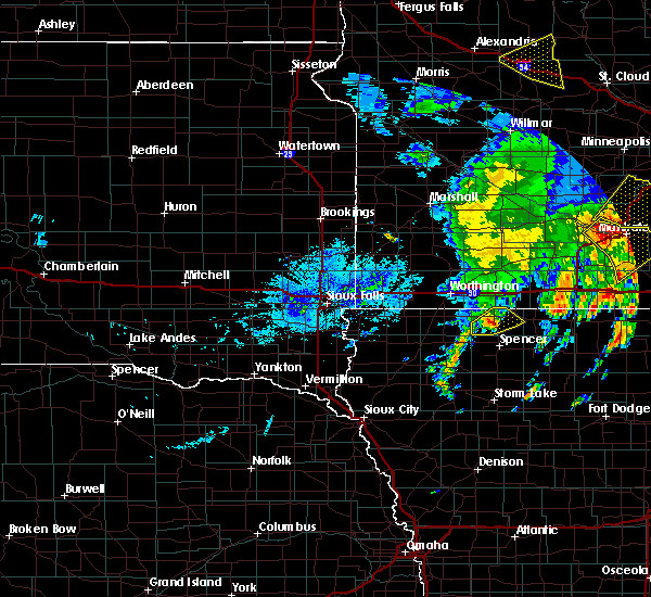 At 418 pm cdt, a severe thunderstorm was located 7 miles north of everly, or 13 miles northwest of spencer in clay county, moving northeast at 60 mph (radar indicated). Hazards include 60 mph wind gusts and quarter size hail. Hail damage to vehicles is expected. expect wind damage to roofs, siding, and trees. this severe storm will be near, milford, wahpeton and west okoboji around 430 pm cdt. Spirit lake, arnolds park, okoboji and orleans around 435 pm cdt. At 418 pm cdt, a severe thunderstorm was located 7 miles north of everly, or 13 miles northwest of spencer in clay county, moving northeast at 60 mph (radar indicated). Hazards include 60 mph wind gusts and quarter size hail. Hail damage to vehicles is expected. expect wind damage to roofs, siding, and trees. this severe storm will be near, milford, wahpeton and west okoboji around 430 pm cdt. Spirit lake, arnolds park, okoboji and orleans around 435 pm cdt.
|
| 8/27/2018 4:09 PM CDT |
 At 408 pm cdt, a severe thunderstorm was located over hartley, or 17 miles east of sheldon, moving northeast at 60 mph (radar indicated). Hazards include ping pong ball size hail and 60 mph wind gusts. People and animals outdoors will be injured. expect hail damage to roofs, siding, windows, and vehicles. expect wind damage to roofs, siding, and trees. this severe thunderstorm will be near, everly around 415 pm cdt. fostoria around 425 pm cdt. milford, arnolds park, okoboji, wahpeton and west okoboji around 430 pm cdt. Spirit lake and orleans around 435 pm cdt. At 408 pm cdt, a severe thunderstorm was located over hartley, or 17 miles east of sheldon, moving northeast at 60 mph (radar indicated). Hazards include ping pong ball size hail and 60 mph wind gusts. People and animals outdoors will be injured. expect hail damage to roofs, siding, windows, and vehicles. expect wind damage to roofs, siding, and trees. this severe thunderstorm will be near, everly around 415 pm cdt. fostoria around 425 pm cdt. milford, arnolds park, okoboji, wahpeton and west okoboji around 430 pm cdt. Spirit lake and orleans around 435 pm cdt.
|
| 8/27/2018 3:38 PM CDT |
 At 338 pm cdt, a severe thunderstorm was located near everly, or near spencer in clay county, moving northeast at 50 mph (radar indicated). Hazards include two inch hail and 60 mph wind gusts. People and animals outdoors will be injured. expect hail damage to roofs, siding, windows, and vehicles. expect wind damage to roofs, siding, and trees. this severe storm will be near, fostoria around 345 pm cdt. terril around 400 pm cdt. Other locations impacted by this severe thunderstorm include dickens. At 338 pm cdt, a severe thunderstorm was located near everly, or near spencer in clay county, moving northeast at 50 mph (radar indicated). Hazards include two inch hail and 60 mph wind gusts. People and animals outdoors will be injured. expect hail damage to roofs, siding, windows, and vehicles. expect wind damage to roofs, siding, and trees. this severe storm will be near, fostoria around 345 pm cdt. terril around 400 pm cdt. Other locations impacted by this severe thunderstorm include dickens.
|
| 8/27/2018 3:27 PM CDT |
 At 327 pm cdt, a severe thunderstorm was located near everly, or 12 miles west of spencer in clay county, moving northeast at 50 mph (radar indicated). Hazards include ping pong ball size hail and 60 mph wind gusts. People and animals outdoors will be injured. expect hail damage to roofs, siding, windows, and vehicles. expect wind damage to roofs, siding, and trees. this severe thunderstorm will be near, royal around 330 pm cdt. everly around 335 pm cdt. spencer in clay county and fostoria around 345 pm cdt. terril and lost island lake around 400 pm cdt. Other locations impacted by this severe thunderstorm include dickens and moneta. At 327 pm cdt, a severe thunderstorm was located near everly, or 12 miles west of spencer in clay county, moving northeast at 50 mph (radar indicated). Hazards include ping pong ball size hail and 60 mph wind gusts. People and animals outdoors will be injured. expect hail damage to roofs, siding, windows, and vehicles. expect wind damage to roofs, siding, and trees. this severe thunderstorm will be near, royal around 330 pm cdt. everly around 335 pm cdt. spencer in clay county and fostoria around 345 pm cdt. terril and lost island lake around 400 pm cdt. Other locations impacted by this severe thunderstorm include dickens and moneta.
|
| 7/25/2018 6:01 PM CDT |
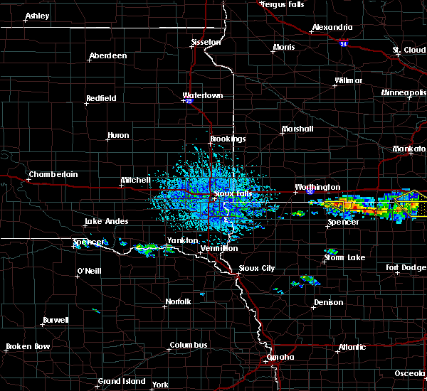 At 600 pm cdt, a severe thunderstorm was located near orleans, or near spirit lake, moving southeast at 45 mph (radar indicated). Hazards include 60 mph wind gusts and quarter size hail. Hail damage to vehicles is expected. expect wind damage to roofs, siding, and trees. Locations impacted include, orleans and superior. At 600 pm cdt, a severe thunderstorm was located near orleans, or near spirit lake, moving southeast at 45 mph (radar indicated). Hazards include 60 mph wind gusts and quarter size hail. Hail damage to vehicles is expected. expect wind damage to roofs, siding, and trees. Locations impacted include, orleans and superior.
|
| 7/25/2018 5:43 PM CDT |
 At 543 pm cdt, a severe thunderstorm was located 8 miles southwest of lakefield, or 12 miles northwest of spirit lake, moving southeast at 45 mph (radar indicated). Hazards include 60 mph wind gusts and quarter size hail. Hail damage to vehicles is expected. Expect wind damage to roofs, siding, and trees. At 543 pm cdt, a severe thunderstorm was located 8 miles southwest of lakefield, or 12 miles northwest of spirit lake, moving southeast at 45 mph (radar indicated). Hazards include 60 mph wind gusts and quarter size hail. Hail damage to vehicles is expected. Expect wind damage to roofs, siding, and trees.
|
| 7/25/2018 5:43 PM CDT |
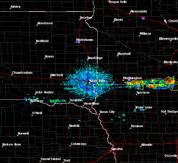 At 543 pm cdt, a severe thunderstorm was located 8 miles southwest of lakefield, or 12 miles northwest of spirit lake, moving southeast at 45 mph (radar indicated). Hazards include 60 mph wind gusts and quarter size hail. Hail damage to vehicles is expected. Expect wind damage to roofs, siding, and trees. At 543 pm cdt, a severe thunderstorm was located 8 miles southwest of lakefield, or 12 miles northwest of spirit lake, moving southeast at 45 mph (radar indicated). Hazards include 60 mph wind gusts and quarter size hail. Hail damage to vehicles is expected. Expect wind damage to roofs, siding, and trees.
|
| 7/4/2018 11:36 AM CDT |
 The severe thunderstorm warning for dickinson, northern clay and southeastern jackson counties will expire at 1145 am cdt, the storms which prompted the warning have weakened below severe limits, and no longer pose an immediate threat to life or property. therefore, the warning will be allowed to expire. however gusty winds and heavy rain over are still possible with these thunderstorms. The severe thunderstorm warning for dickinson, northern clay and southeastern jackson counties will expire at 1145 am cdt, the storms which prompted the warning have weakened below severe limits, and no longer pose an immediate threat to life or property. therefore, the warning will be allowed to expire. however gusty winds and heavy rain over are still possible with these thunderstorms.
|
| 7/4/2018 11:27 AM CDT |
 At 1127 am cdt, severe thunderstorms were located along a line extending from 7 miles northeast of round lake to near harris to near hartley, moving east at 35 mph (trained weather spotters). Hazards include 60 mph wind gusts and quarter size hail. Hail damage to vehicles is expected. expect wind damage to roofs, siding, and trees. these severe storms will be near, milford, arnolds park, okoboji, orleans, everly, wahpeton, west okoboji and fostoria around 1145 am cdt. Other locations impacted by these severe thunderstorms include alpha and dickens. At 1127 am cdt, severe thunderstorms were located along a line extending from 7 miles northeast of round lake to near harris to near hartley, moving east at 35 mph (trained weather spotters). Hazards include 60 mph wind gusts and quarter size hail. Hail damage to vehicles is expected. expect wind damage to roofs, siding, and trees. these severe storms will be near, milford, arnolds park, okoboji, orleans, everly, wahpeton, west okoboji and fostoria around 1145 am cdt. Other locations impacted by these severe thunderstorms include alpha and dickens.
|
| 7/4/2018 11:19 AM CDT |
 At 1118 am cdt, severe thunderstorms were located along a line extending from near jackson in jackson county to milford to near everly, moving east at 35 mph (trained weather spotters). Hazards include 70 mph wind gusts and quarter size hail. Hail damage to vehicles is expected. expect considerable tree damage. wind damage is also likely to mobile homes, roofs, and outbuildings. these severe storms will be near, jackson in jackson county around 1125 am cdt. terril and superior around 1130 am cdt. lost island lake around 1145 am cdt. Other locations impacted by these severe thunderstorms include alpha, gillett grove, dickens and rossie. At 1118 am cdt, severe thunderstorms were located along a line extending from near jackson in jackson county to milford to near everly, moving east at 35 mph (trained weather spotters). Hazards include 70 mph wind gusts and quarter size hail. Hail damage to vehicles is expected. expect considerable tree damage. wind damage is also likely to mobile homes, roofs, and outbuildings. these severe storms will be near, jackson in jackson county around 1125 am cdt. terril and superior around 1130 am cdt. lost island lake around 1145 am cdt. Other locations impacted by these severe thunderstorms include alpha, gillett grove, dickens and rossie.
|
| 7/4/2018 11:07 AM CDT |
 At 1106 am cdt, severe thunderstorms were located along a line extending from 7 miles south of lakefield to near west okoboji to near everly, moving east at 35 mph (trained weather spotters). Hazards include 70 mph wind gusts and half dollar size hail. Hail damage to vehicles is expected. expect considerable tree damage. wind damage is also likely to mobile homes, roofs, and outbuildings. severe thunderstorms will be near, okoboji, orleans and wahpeton around 1110 am cdt. milford, arnolds park, west okoboji and fostoria around 1115 am cdt. jackson in jackson county around 1120 am cdt. spencer in clay county and superior around 1125 am cdt. terril and greenville around 1130 am cdt. lost island lake around 1145 am cdt. Other locations impacted by these severe thunderstorms include alpha, gillett grove, dickens and rossie. At 1106 am cdt, severe thunderstorms were located along a line extending from 7 miles south of lakefield to near west okoboji to near everly, moving east at 35 mph (trained weather spotters). Hazards include 70 mph wind gusts and half dollar size hail. Hail damage to vehicles is expected. expect considerable tree damage. wind damage is also likely to mobile homes, roofs, and outbuildings. severe thunderstorms will be near, okoboji, orleans and wahpeton around 1110 am cdt. milford, arnolds park, west okoboji and fostoria around 1115 am cdt. jackson in jackson county around 1120 am cdt. spencer in clay county and superior around 1125 am cdt. terril and greenville around 1130 am cdt. lost island lake around 1145 am cdt. Other locations impacted by these severe thunderstorms include alpha, gillett grove, dickens and rossie.
|
| 7/4/2018 11:00 AM CDT |
 At 1059 am cdt, a severe thunderstorm was located over spirit lake, moving east at 35 mph (trained weather spotters). Hazards include 70 mph wind gusts and ping pong ball size hail. People and animals outdoors will be injured. expect hail damage to roofs, siding, windows, and vehicles. expect considerable tree damage. wind damage is also likely to mobile homes, roofs, and outbuildings. This severe storm will be near, terril and superior around 1115 am cdt. At 1059 am cdt, a severe thunderstorm was located over spirit lake, moving east at 35 mph (trained weather spotters). Hazards include 70 mph wind gusts and ping pong ball size hail. People and animals outdoors will be injured. expect hail damage to roofs, siding, windows, and vehicles. expect considerable tree damage. wind damage is also likely to mobile homes, roofs, and outbuildings. This severe storm will be near, terril and superior around 1115 am cdt.
|
| 7/4/2018 10:47 AM CDT |
 At 1045 am cdt, a severe thunderstorm was located over lake park, or 8 miles west of spirit lake, moving east at 35 mph (trained weather spotters. at 946 am, 60 mph winds were reported at lake park ia). Hazards include 70 mph wind gusts and ping pong ball size hail. People and animals outdoors will be injured. expect hail damage to roofs, siding, windows, and vehicles. expect considerable tree damage. wind damage is also likely to mobile homes, roofs, and outbuildings. this severe storm will be near, wahpeton around 1055 am cdt. milford, arnolds park, okoboji, orleans and west okoboji around 1100 am cdt. spirit lake around 1105 am cdt. Terril and superior around 1115 am cdt. At 1045 am cdt, a severe thunderstorm was located over lake park, or 8 miles west of spirit lake, moving east at 35 mph (trained weather spotters. at 946 am, 60 mph winds were reported at lake park ia). Hazards include 70 mph wind gusts and ping pong ball size hail. People and animals outdoors will be injured. expect hail damage to roofs, siding, windows, and vehicles. expect considerable tree damage. wind damage is also likely to mobile homes, roofs, and outbuildings. this severe storm will be near, wahpeton around 1055 am cdt. milford, arnolds park, okoboji, orleans and west okoboji around 1100 am cdt. spirit lake around 1105 am cdt. Terril and superior around 1115 am cdt.
|
| 7/4/2018 10:36 AM CDT |
 At 1035 am cdt, a severe thunderstorm was located over harris, or 15 miles west of spirit lake, moving east at 35 mph (trained weather spotters). Hazards include 70 mph wind gusts and ping pong ball size hail. People and animals outdoors will be injured. expect hail damage to roofs, siding, windows, and vehicles. expect considerable tree damage. wind damage is also likely to mobile homes, roofs, and outbuildings. this severe thunderstorm will be near, lake park around 1045 am cdt. milford, okoboji, orleans, wahpeton and west okoboji around 1100 am cdt. spirit lake and arnolds park around 1105 am cdt. Terril and superior around 1115 am cdt. At 1035 am cdt, a severe thunderstorm was located over harris, or 15 miles west of spirit lake, moving east at 35 mph (trained weather spotters). Hazards include 70 mph wind gusts and ping pong ball size hail. People and animals outdoors will be injured. expect hail damage to roofs, siding, windows, and vehicles. expect considerable tree damage. wind damage is also likely to mobile homes, roofs, and outbuildings. this severe thunderstorm will be near, lake park around 1045 am cdt. milford, okoboji, orleans, wahpeton and west okoboji around 1100 am cdt. spirit lake and arnolds park around 1105 am cdt. Terril and superior around 1115 am cdt.
|
| 6/24/2018 5:19 PM CDT |
 At 519 pm cdt, a severe thunderstorm was located over wahpeton, or near spirit lake, moving east at 20 mph (radar indicated). Hazards include 75 mph wind gusts and penny size hail. Expect considerable tree damage. damage is likely to mobile homes, roofs, and outbuildings. this severe storm will be near, okoboji and orleans around 525 pm cdt. Spirit lake and arnolds park around 530 pm cdt. At 519 pm cdt, a severe thunderstorm was located over wahpeton, or near spirit lake, moving east at 20 mph (radar indicated). Hazards include 75 mph wind gusts and penny size hail. Expect considerable tree damage. damage is likely to mobile homes, roofs, and outbuildings. this severe storm will be near, okoboji and orleans around 525 pm cdt. Spirit lake and arnolds park around 530 pm cdt.
|
| 6/24/2018 5:01 PM CDT |
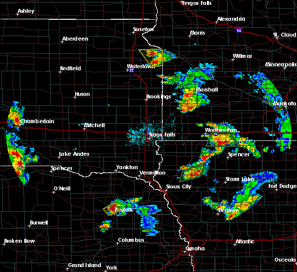 The national weather service in sioux falls has issued a * severe thunderstorm warning for. western dickinson county in northwestern iowa. until 545 pm cdt. At 501 pm cdt, a severe thunderstorm was located near lake park, or 10 miles west of spirit lake, moving east at 15 mph. The national weather service in sioux falls has issued a * severe thunderstorm warning for. western dickinson county in northwestern iowa. until 545 pm cdt. At 501 pm cdt, a severe thunderstorm was located near lake park, or 10 miles west of spirit lake, moving east at 15 mph.
|
| 6/8/2018 6:28 PM CDT |
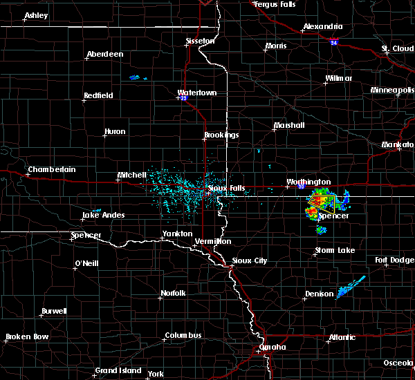 At 628 pm cdt, a severe thunderstorm was located over okoboji, or over spirit lake, moving southeast at 20 mph (radar indicated). Hazards include 60 mph wind gusts and quarter size hail. Hail damage to vehicles is expected. expect wind damage to roofs, siding, and trees. This severe storm will be near, terril and superior around 645 pm cdt. At 628 pm cdt, a severe thunderstorm was located over okoboji, or over spirit lake, moving southeast at 20 mph (radar indicated). Hazards include 60 mph wind gusts and quarter size hail. Hail damage to vehicles is expected. expect wind damage to roofs, siding, and trees. This severe storm will be near, terril and superior around 645 pm cdt.
|
| 6/8/2018 6:07 PM CDT |
 The national weather service in sioux falls has issued a * severe thunderstorm warning for. dickinson county in northwestern iowa. southeastern jackson county in southwestern minnesota. until 645 pm cdt. At 606 pm cdt, a severe thunderstorm was located near orleans, or 7. The national weather service in sioux falls has issued a * severe thunderstorm warning for. dickinson county in northwestern iowa. southeastern jackson county in southwestern minnesota. until 645 pm cdt. At 606 pm cdt, a severe thunderstorm was located near orleans, or 7.
|
| 6/8/2018 6:07 PM CDT |
 At 606 pm cdt, a severe thunderstorm was located near orleans, or 7 miles northwest of spirit lake, moving east at 20 mph (radar indicated). Hazards include 60 mph wind gusts and half dollar size hail. Hail damage to vehicles is expected. expect wind damage to roofs, siding, and trees. this severe thunderstorm will be near, okoboji, orleans and wahpeton around 620 pm cdt. spirit lake around 625 pm cdt. Superior around 645 pm cdt. At 606 pm cdt, a severe thunderstorm was located near orleans, or 7 miles northwest of spirit lake, moving east at 20 mph (radar indicated). Hazards include 60 mph wind gusts and half dollar size hail. Hail damage to vehicles is expected. expect wind damage to roofs, siding, and trees. this severe thunderstorm will be near, okoboji, orleans and wahpeton around 620 pm cdt. spirit lake around 625 pm cdt. Superior around 645 pm cdt.
|
| 5/8/2018 9:20 PM CDT |
 At 919 pm cdt, a severe thunderstorm was located near jackson in jackson county, moving northeast at 35 mph (radar indicated). Hazards include 60 mph wind gusts and quarter size hail. Hail damage to vehicles is expected. expect wind damage to roofs, siding, and trees. This severe thunderstorm will remain over mainly rural areas of northeastern dickinson and southeastern jackson counties, including the following locations, alpha. At 919 pm cdt, a severe thunderstorm was located near jackson in jackson county, moving northeast at 35 mph (radar indicated). Hazards include 60 mph wind gusts and quarter size hail. Hail damage to vehicles is expected. expect wind damage to roofs, siding, and trees. This severe thunderstorm will remain over mainly rural areas of northeastern dickinson and southeastern jackson counties, including the following locations, alpha.
|
| 5/8/2018 8:58 PM CDT |
 At 857 pm cdt, a severe thunderstorm was located near superior, or 7 miles south of jackson in jackson county, moving northeast at 20 mph (radar indicated). Hazards include 60 mph wind gusts and half dollar size hail. Hail damage to vehicles is expected. expect wind damage to roofs, siding, and trees. this severe thunderstorm will be near, jackson in jackson county around 920 pm cdt. Other locations impacted by this severe thunderstorm include alpha. At 857 pm cdt, a severe thunderstorm was located near superior, or 7 miles south of jackson in jackson county, moving northeast at 20 mph (radar indicated). Hazards include 60 mph wind gusts and half dollar size hail. Hail damage to vehicles is expected. expect wind damage to roofs, siding, and trees. this severe thunderstorm will be near, jackson in jackson county around 920 pm cdt. Other locations impacted by this severe thunderstorm include alpha.
|
| 5/8/2018 8:45 PM CDT |
 At 845 pm cdt, a severe thunderstorm was located near superior, or near spirit lake, moving northeast at 40 mph (radar indicated). Hazards include 60 mph wind gusts and quarter size hail. Hail damage to vehicles is expected. expect wind damage to roofs, siding, and trees. this severe storm will be near, jackson in jackson county around 900 pm cdt. Other locations impacted by this severe thunderstorm include alpha. At 845 pm cdt, a severe thunderstorm was located near superior, or near spirit lake, moving northeast at 40 mph (radar indicated). Hazards include 60 mph wind gusts and quarter size hail. Hail damage to vehicles is expected. expect wind damage to roofs, siding, and trees. this severe storm will be near, jackson in jackson county around 900 pm cdt. Other locations impacted by this severe thunderstorm include alpha.
|
| 5/8/2018 8:28 PM CDT |
 At 827 pm cdt, severe thunderstorms were located along a line extending from near jackson in jackson county to okoboji, moving northeast at 45 mph (radar indicated. at 821 pm, a trained spotter reported golf ball size hail in milford). Hazards include golf ball size hail and 60 mph wind gusts. People and animals outdoors will be injured. expect hail damage to roofs, siding, windows, and vehicles. expect wind damage to roofs, siding, and trees. these severe storms will be near, jackson in jackson county around 830 pm cdt. Other locations impacted by these severe thunderstorms include alpha. At 827 pm cdt, severe thunderstorms were located along a line extending from near jackson in jackson county to okoboji, moving northeast at 45 mph (radar indicated. at 821 pm, a trained spotter reported golf ball size hail in milford). Hazards include golf ball size hail and 60 mph wind gusts. People and animals outdoors will be injured. expect hail damage to roofs, siding, windows, and vehicles. expect wind damage to roofs, siding, and trees. these severe storms will be near, jackson in jackson county around 830 pm cdt. Other locations impacted by these severe thunderstorms include alpha.
|
| 5/8/2018 8:14 PM CDT |
 At 814 pm cdt, severe thunderstorms were located along a line extending from near orleans to near milford, moving northeast at 40 mph (radar indicated). Hazards include 60 mph wind gusts and half dollar size hail. Hail damage to vehicles is expected. expect wind damage to roofs, siding, and trees. severe thunderstorms will be near, jackson in jackson county and orleans around 835 pm cdt. superior around 840 pm cdt. Other locations impacted by these severe thunderstorms include alpha. At 814 pm cdt, severe thunderstorms were located along a line extending from near orleans to near milford, moving northeast at 40 mph (radar indicated). Hazards include 60 mph wind gusts and half dollar size hail. Hail damage to vehicles is expected. expect wind damage to roofs, siding, and trees. severe thunderstorms will be near, jackson in jackson county and orleans around 835 pm cdt. superior around 840 pm cdt. Other locations impacted by these severe thunderstorms include alpha.
|
| 6/21/2017 11:57 PM CDT |
 The severe thunderstorm warning for dickinson and northern clay counties will expire at midnight cdt, the severe thunderstorm which prompted the warning has weakened. therefore, the warning will be allowed to expire. to report severe weather, contact your nearest law enforcement agency. they will relay your report to the national weather service sioux falls. The severe thunderstorm warning for dickinson and northern clay counties will expire at midnight cdt, the severe thunderstorm which prompted the warning has weakened. therefore, the warning will be allowed to expire. to report severe weather, contact your nearest law enforcement agency. they will relay your report to the national weather service sioux falls.
|
| 6/21/2017 11:45 PM CDT |
 At 1144 pm cdt, a severe thunderstorm was located over milford, or near spirit lake, moving east at 30 mph (radar indicated. at 1142 pm, the dickinson county emergency manager was reporting nickel size hail 1 mile northwest of milford). Hazards include quarter size hail. Damage to vehicles is expected. This severe storm will be near, terril around 1200 am cdt. At 1144 pm cdt, a severe thunderstorm was located over milford, or near spirit lake, moving east at 30 mph (radar indicated. at 1142 pm, the dickinson county emergency manager was reporting nickel size hail 1 mile northwest of milford). Hazards include quarter size hail. Damage to vehicles is expected. This severe storm will be near, terril around 1200 am cdt.
|
| 6/21/2017 11:33 PM CDT |
 At 1132 pm cdt, a severe thunderstorm was located just west of wahpeton, or 8 miles southwest of spirit lake, moving east at 30 mph (radar indicated). Hazards include half dollar size hail. Damage to vehicles is expected. this severe thunderstorm will be near, okoboji and wahpeton through 1140 pm cdt. spirit lake, milford, west okoboji and fostoria around 1145 pm cdt. arnolds park around 1150 pm cdt. Terril around 1200 am cdt. At 1132 pm cdt, a severe thunderstorm was located just west of wahpeton, or 8 miles southwest of spirit lake, moving east at 30 mph (radar indicated). Hazards include half dollar size hail. Damage to vehicles is expected. this severe thunderstorm will be near, okoboji and wahpeton through 1140 pm cdt. spirit lake, milford, west okoboji and fostoria around 1145 pm cdt. arnolds park around 1150 pm cdt. Terril around 1200 am cdt.
|
| 6/13/2017 10:40 PM CDT |
 At 1039 pm cdt, severe thunderstorms were located along a line extending from near fostoria to marathon to near sac city, moving east at 50 mph (radar indicated). Hazards include 70 mph wind gusts and penny size hail. Expect considerable tree damage. damage is likely to mobile homes, roofs, and outbuildings. these severe storms will be near, albert city around 1045 pm cdt. terril around 1100 pm cdt. other locations impacted by these severe thunderstorms include gillett grove, dickens, rossie and rembrandt. A tornado watch remains in effect until 200 am cdt for northwestern and west central iowa. At 1039 pm cdt, severe thunderstorms were located along a line extending from near fostoria to marathon to near sac city, moving east at 50 mph (radar indicated). Hazards include 70 mph wind gusts and penny size hail. Expect considerable tree damage. damage is likely to mobile homes, roofs, and outbuildings. these severe storms will be near, albert city around 1045 pm cdt. terril around 1100 pm cdt. other locations impacted by these severe thunderstorms include gillett grove, dickens, rossie and rembrandt. A tornado watch remains in effect until 200 am cdt for northwestern and west central iowa.
|
| 6/13/2017 10:29 PM CDT |
 At 1028 pm cdt, severe thunderstorms were located along a line extending from near hartley to near sioux rapids to near odebolt, moving northeast at 45 mph (radar indicated). Hazards include 70 mph wind gusts and penny size hail. Expect considerable tree damage. damage is likely to mobile homes, roofs, and outbuildings. these severe storms will be near, sioux rapids and albert city around 1035 pm cdt. marathon and webb around 1040 pm cdt. fostoria around 1045 pm cdt. milford, wahpeton and west okoboji around 1050 pm cdt. arnolds park and okoboji around 1055 pm cdt. spirit lake, orleans, terril and superior around 1100 pm cdt. other locations impacted by these severe thunderstorms include moneta, dickens, calumet, rossie, gillett grove, meriden and rembrandt. locations from the iowa great lakes south through spencer may see the strong winds with little lightning or rain as the strong winds have surged ahead of the main area of storms. A tornado watch remains in effect until 200 am cdt for northwestern and west central iowa. At 1028 pm cdt, severe thunderstorms were located along a line extending from near hartley to near sioux rapids to near odebolt, moving northeast at 45 mph (radar indicated). Hazards include 70 mph wind gusts and penny size hail. Expect considerable tree damage. damage is likely to mobile homes, roofs, and outbuildings. these severe storms will be near, sioux rapids and albert city around 1035 pm cdt. marathon and webb around 1040 pm cdt. fostoria around 1045 pm cdt. milford, wahpeton and west okoboji around 1050 pm cdt. arnolds park and okoboji around 1055 pm cdt. spirit lake, orleans, terril and superior around 1100 pm cdt. other locations impacted by these severe thunderstorms include moneta, dickens, calumet, rossie, gillett grove, meriden and rembrandt. locations from the iowa great lakes south through spencer may see the strong winds with little lightning or rain as the strong winds have surged ahead of the main area of storms. A tornado watch remains in effect until 200 am cdt for northwestern and west central iowa.
|
| 6/13/2017 10:15 PM CDT |
 At 1015 pm cdt, severe thunderstorms were located along a line extending from near sanborn to 6 miles northeast of aurelia to near arthur, moving east at 50 mph (radar indicated). Hazards include 70 mph wind gusts and penny size hail. Expect considerable tree damage. damage is likely to mobile homes, roofs, and outbuildings. severe thunderstorms will be near, linn grove and truesdale around 1025 pm cdt. sioux rapids around 1030 pm cdt. everly around 1035 pm cdt. albert city and marathon around 1040 pm cdt. spencer in clay county and fostoria around 1045 pm cdt. terril and lost island lake around 1100 pm cdt. other locations impacted by these severe thunderstorms include moneta, dickens, calumet, rossie, gillett grove, meriden and rembrandt. A tornado watch remains in effect until 200 am cdt for northwestern and west central iowa. At 1015 pm cdt, severe thunderstorms were located along a line extending from near sanborn to 6 miles northeast of aurelia to near arthur, moving east at 50 mph (radar indicated). Hazards include 70 mph wind gusts and penny size hail. Expect considerable tree damage. damage is likely to mobile homes, roofs, and outbuildings. severe thunderstorms will be near, linn grove and truesdale around 1025 pm cdt. sioux rapids around 1030 pm cdt. everly around 1035 pm cdt. albert city and marathon around 1040 pm cdt. spencer in clay county and fostoria around 1045 pm cdt. terril and lost island lake around 1100 pm cdt. other locations impacted by these severe thunderstorms include moneta, dickens, calumet, rossie, gillett grove, meriden and rembrandt. A tornado watch remains in effect until 200 am cdt for northwestern and west central iowa.
|
| 5/28/2017 8:25 PM CDT |
 The severe thunderstorm warning for eastern osceola, western dickinson, northwestern clay and northeastern o`brien counties will expire at 830 pm cdt, the storms which prompted the warning have moved out of the area. therefore the warning will be allowed to expire. The severe thunderstorm warning for eastern osceola, western dickinson, northwestern clay and northeastern o`brien counties will expire at 830 pm cdt, the storms which prompted the warning have moved out of the area. therefore the warning will be allowed to expire.
|
| 5/28/2017 8:14 PM CDT |
 At 813 pm cdt, severe thunderstorms were located along a line extending from near lake park to near melvin, moving east at 60 mph (radar indicated). Hazards include 60 mph wind gusts. Expect damage to roofs, siding, and trees. these severe storms will be near, lake park around 820 pm cdt. spirit lake, milford, okoboji, orleans, wahpeton and west okoboji around 825 pm cdt. arnolds park around 830 pm cdt. Other locations impacted by these severe thunderstorms include moneta. At 813 pm cdt, severe thunderstorms were located along a line extending from near lake park to near melvin, moving east at 60 mph (radar indicated). Hazards include 60 mph wind gusts. Expect damage to roofs, siding, and trees. these severe storms will be near, lake park around 820 pm cdt. spirit lake, milford, okoboji, orleans, wahpeton and west okoboji around 825 pm cdt. arnolds park around 830 pm cdt. Other locations impacted by these severe thunderstorms include moneta.
|
| 5/28/2017 7:56 PM CDT |
 The national weather service in sioux falls has issued a * severe thunderstorm warning for. east central lyon county in northwestern iowa. osceola county in northwestern iowa. western dickinson county in northwestern iowa. Northwestern clay county in northwestern iowa. The national weather service in sioux falls has issued a * severe thunderstorm warning for. east central lyon county in northwestern iowa. osceola county in northwestern iowa. western dickinson county in northwestern iowa. Northwestern clay county in northwestern iowa.
|
| 5/28/2017 7:56 PM CDT |
 At 756 pm cdt, severe thunderstorms were located along a line extending from near worthington to near george, moving east at 60 mph (radar indicated). Hazards include 60 mph wind gusts. Expect damage to roofs, siding, and trees. severe thunderstorms will be near, ocheyedan and round lake around 805 pm cdt. sanborn and harris around 810 pm cdt. lake park and melvin around 815 pm cdt. hartley around 820 pm cdt. spirit lake, milford, arnolds park, okoboji, orleans, wahpeton and west okoboji around 825 pm cdt. Other locations impacted by these severe thunderstorms include bigelow and moneta. At 756 pm cdt, severe thunderstorms were located along a line extending from near worthington to near george, moving east at 60 mph (radar indicated). Hazards include 60 mph wind gusts. Expect damage to roofs, siding, and trees. severe thunderstorms will be near, ocheyedan and round lake around 805 pm cdt. sanborn and harris around 810 pm cdt. lake park and melvin around 815 pm cdt. hartley around 820 pm cdt. spirit lake, milford, arnolds park, okoboji, orleans, wahpeton and west okoboji around 825 pm cdt. Other locations impacted by these severe thunderstorms include bigelow and moneta.
|
| 5/16/2017 4:29 AM CDT |
 At 428 am cdt, an area of dieing showers producing very strong winds was located along a line extending from near brewster to near webb, moving northeast at 35 mph (radar indicated). Hazards include 70 mph wind gusts. Expect considerable tree damage. damage is likely to mobile homes, roofs, and outbuildings. severe thunderstorms will be near, heron lake around 445 am cdt. lakefield around 450 am cdt. bergen and kilen woods state park around 500 am cdt. Other locations impacted by these severe thunderstorms include dickens, rossie, alpha, wilder, gillett grove, okabena, rembrandt and kinbrae. At 428 am cdt, an area of dieing showers producing very strong winds was located along a line extending from near brewster to near webb, moving northeast at 35 mph (radar indicated). Hazards include 70 mph wind gusts. Expect considerable tree damage. damage is likely to mobile homes, roofs, and outbuildings. severe thunderstorms will be near, heron lake around 445 am cdt. lakefield around 450 am cdt. bergen and kilen woods state park around 500 am cdt. Other locations impacted by these severe thunderstorms include dickens, rossie, alpha, wilder, gillett grove, okabena, rembrandt and kinbrae.
|
| 7/13/2016 8:34 AM CDT |
 At 834 am cdt, a severe thunderstorm was located 7 miles north of hartley, or 16 miles northwest of spencer in clay county, moving east at 65 mph (trained weather spotters. at 815 am cdt a 62 mph wind gust was reported in sheldon). Hazards include 60 mph wind gusts and quarter size hail. Hail damage to vehicles is expected. expect wind damage to roofs, siding, and trees. this severe storm will be near, wahpeton and fostoria around 845 am cdt. spirit lake, milford, arnolds park, okoboji and west okoboji around 850 am cdt. terril around 855 am cdt. superior around 900 am cdt. Other locations impacted by this severe thunderstorm include moneta. At 834 am cdt, a severe thunderstorm was located 7 miles north of hartley, or 16 miles northwest of spencer in clay county, moving east at 65 mph (trained weather spotters. at 815 am cdt a 62 mph wind gust was reported in sheldon). Hazards include 60 mph wind gusts and quarter size hail. Hail damage to vehicles is expected. expect wind damage to roofs, siding, and trees. this severe storm will be near, wahpeton and fostoria around 845 am cdt. spirit lake, milford, arnolds park, okoboji and west okoboji around 850 am cdt. terril around 855 am cdt. superior around 900 am cdt. Other locations impacted by this severe thunderstorm include moneta.
|
| 7/13/2016 8:24 AM CDT |
 At 823 am cdt, a severe thunderstorm was located over melvin, or 11 miles southeast of sibley, moving east at 55 mph (trained weather spotters. at 815 am cdt a 62 mph wind gust was reported in sheldon). Hazards include 60 mph wind gusts and quarter size hail. Hail damage to vehicles is expected. expect wind damage to roofs, siding, and trees. this severe storm will be near, fostoria around 845 am cdt. milford, arnolds park, okoboji, wahpeton and west okoboji around 850 am cdt. spirit lake around 855 am cdt. terril and superior around 900 am cdt. Other locations impacted by this severe thunderstorm include moneta. At 823 am cdt, a severe thunderstorm was located over melvin, or 11 miles southeast of sibley, moving east at 55 mph (trained weather spotters. at 815 am cdt a 62 mph wind gust was reported in sheldon). Hazards include 60 mph wind gusts and quarter size hail. Hail damage to vehicles is expected. expect wind damage to roofs, siding, and trees. this severe storm will be near, fostoria around 845 am cdt. milford, arnolds park, okoboji, wahpeton and west okoboji around 850 am cdt. spirit lake around 855 am cdt. terril and superior around 900 am cdt. Other locations impacted by this severe thunderstorm include moneta.
|
| 7/13/2016 8:09 AM CDT |
 At 809 am cdt, a severe thunderstorm was located over sheldon, moving east at 65 mph (radar indicated). Hazards include 60 mph wind gusts and quarter size hail. Hail damage to vehicles is expected. expect wind damage to roofs, siding, and trees. this severe thunderstorm will be near, sanborn and melvin around 820 am cdt. hartley around 825 am cdt. fostoria around 840 am cdt. milford, arnolds park, okoboji, wahpeton and west okoboji around 845 am cdt. terril around 850 am cdt. superior around 855 am cdt. Other locations impacted by this severe thunderstorm include moneta. At 809 am cdt, a severe thunderstorm was located over sheldon, moving east at 65 mph (radar indicated). Hazards include 60 mph wind gusts and quarter size hail. Hail damage to vehicles is expected. expect wind damage to roofs, siding, and trees. this severe thunderstorm will be near, sanborn and melvin around 820 am cdt. hartley around 825 am cdt. fostoria around 840 am cdt. milford, arnolds park, okoboji, wahpeton and west okoboji around 845 am cdt. terril around 850 am cdt. superior around 855 am cdt. Other locations impacted by this severe thunderstorm include moneta.
|
| 6/17/2016 7:07 PM CDT |
 The severe thunderstorm warning for dickinson county will expire at 715 pm cdt, the storms which prompted the warning have weakened below severe limits, and no longer pose an immediate threat to life or property. therefore, the warning will be allowed to expire. a severe thunderstorm watch remains in effect until 1000 pm cdt for northwestern iowa. The severe thunderstorm warning for dickinson county will expire at 715 pm cdt, the storms which prompted the warning have weakened below severe limits, and no longer pose an immediate threat to life or property. therefore, the warning will be allowed to expire. a severe thunderstorm watch remains in effect until 1000 pm cdt for northwestern iowa.
|
| 6/17/2016 7:03 PM CDT |
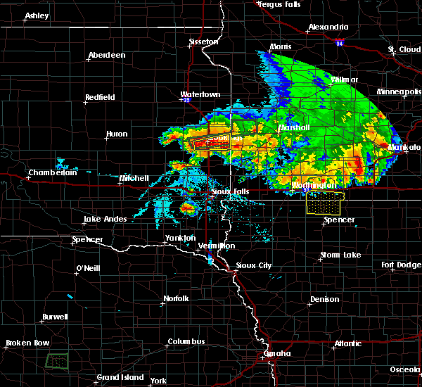 At 703 pm cdt, severe thunderstorms were located along a line extending from near ocheyedan to near lake park to near superior, moving south at 35 mph (radar indicated). Hazards include 60 mph wind gusts. Expect damage to roofs. siding. and trees. These severe storms will be near, terril around 710 pm cdt. At 703 pm cdt, severe thunderstorms were located along a line extending from near ocheyedan to near lake park to near superior, moving south at 35 mph (radar indicated). Hazards include 60 mph wind gusts. Expect damage to roofs. siding. and trees. These severe storms will be near, terril around 710 pm cdt.
|
| 6/17/2016 6:43 PM CDT |
 At 643 pm cdt, severe thunderstorms were located along a line extending from round lake to 7 miles north of lake park to 6 miles north of superior, moving south at 35 mph (radar indicated). Hazards include 60 mph wind gusts. Expect damage to roofs. siding. and trees. severe thunderstorms will be near, lake park and superior around 655 pm cdt. Terril around 710 pm cdt. At 643 pm cdt, severe thunderstorms were located along a line extending from round lake to 7 miles north of lake park to 6 miles north of superior, moving south at 35 mph (radar indicated). Hazards include 60 mph wind gusts. Expect damage to roofs. siding. and trees. severe thunderstorms will be near, lake park and superior around 655 pm cdt. Terril around 710 pm cdt.
|
| 6/14/2016 2:48 PM CDT |
 At 248 pm cdt, severe thunderstorms were located along a line extending from orleans to near lost island lake, moving northeast at 40 mph (radar indicated). Hazards include 60 mph wind gusts and penny size hail. Expect damage to roofs. siding. and trees. severe thunderstorms will be near, spirit lake, orleans and superior around 255 pm cdt. terril around 305 pm cdt. jackson in jackson county around 310 pm cdt. other locations impacted by these severe thunderstorms include dickens, gillett grove and alpha. A tornado watch remains in effect until 1000 pm cdt for southwestern minnesota. At 248 pm cdt, severe thunderstorms were located along a line extending from orleans to near lost island lake, moving northeast at 40 mph (radar indicated). Hazards include 60 mph wind gusts and penny size hail. Expect damage to roofs. siding. and trees. severe thunderstorms will be near, spirit lake, orleans and superior around 255 pm cdt. terril around 305 pm cdt. jackson in jackson county around 310 pm cdt. other locations impacted by these severe thunderstorms include dickens, gillett grove and alpha. A tornado watch remains in effect until 1000 pm cdt for southwestern minnesota.
|
| 6/14/2016 2:30 PM CDT |
 At 230 pm cdt, a severe thunderstorm capable of producing a tornado was located near lake park, or 8 miles west of spirit lake, moving northeast at 35 mph (radar indicated rotation). Hazards include tornado and quarter size hail. Flying debris will be dangerous to those caught without shelter. mobile homes will be damaged or destroyed. damage to roofs, windows, and vehicles will occur. tree damage is likely. this dangerous storm will be near, okoboji around 235 pm cdt. spirit lake around 240 pm cdt. orleans around 245 pm cdt. jackson in jackson county and lakefield around 300 pm cdt. Other locations impacted by this tornadic thunderstorm include alpha. At 230 pm cdt, a severe thunderstorm capable of producing a tornado was located near lake park, or 8 miles west of spirit lake, moving northeast at 35 mph (radar indicated rotation). Hazards include tornado and quarter size hail. Flying debris will be dangerous to those caught without shelter. mobile homes will be damaged or destroyed. damage to roofs, windows, and vehicles will occur. tree damage is likely. this dangerous storm will be near, okoboji around 235 pm cdt. spirit lake around 240 pm cdt. orleans around 245 pm cdt. jackson in jackson county and lakefield around 300 pm cdt. Other locations impacted by this tornadic thunderstorm include alpha.
|
| 6/10/2016 8:22 PM CDT |
 At 820 pm cdt, a severe thunderstorm capable of damaging winds to 60 mph was located near terril, or 7 miles southeast of spirit lake, moving east at 25 mph. another cell was located 10 miles west southwest of milford, and was capable of hail up to golf ball size and winds to 60 mph (radar indicated). Hazards include golf ball size hail and 60 mph wind gusts. People and animals outdoors will be injured. expect hail damage to roofs, siding, windows, and vehicles. expect wind damage to roofs, siding, and trees. this severe storm will be near, terril around 825 pm cdt. fostoria around 835 pm cdt. Other locations impacted by this severe thunderstorm include dickens. At 820 pm cdt, a severe thunderstorm capable of damaging winds to 60 mph was located near terril, or 7 miles southeast of spirit lake, moving east at 25 mph. another cell was located 10 miles west southwest of milford, and was capable of hail up to golf ball size and winds to 60 mph (radar indicated). Hazards include golf ball size hail and 60 mph wind gusts. People and animals outdoors will be injured. expect hail damage to roofs, siding, windows, and vehicles. expect wind damage to roofs, siding, and trees. this severe storm will be near, terril around 825 pm cdt. fostoria around 835 pm cdt. Other locations impacted by this severe thunderstorm include dickens.
|
| 6/10/2016 8:15 PM CDT |
 At 813 pm cdt, a severe thunderstorm was located over wahpeton, or near spirit lake, moving southeast at 15 mph. a second storm was located 10 miles west southwest of milford, moving southeast at 15 mph (radar indicated). Hazards include ping pong ball size hail and 60 mph wind gusts. People and animals outdoors will be injured. expect hail damage to roofs, siding, windows, and vehicles. expect wind damage to roofs, siding, and trees. this severe thunderstorm will be near, okoboji, orleans and wahpeton around 820 pm cdt. spirit lake and west okoboji around 830 pm cdt. fostoria, milford around 835 pm cdt. Arnolds park around 840 pm cdt. At 813 pm cdt, a severe thunderstorm was located over wahpeton, or near spirit lake, moving southeast at 15 mph. a second storm was located 10 miles west southwest of milford, moving southeast at 15 mph (radar indicated). Hazards include ping pong ball size hail and 60 mph wind gusts. People and animals outdoors will be injured. expect hail damage to roofs, siding, windows, and vehicles. expect wind damage to roofs, siding, and trees. this severe thunderstorm will be near, okoboji, orleans and wahpeton around 820 pm cdt. spirit lake and west okoboji around 830 pm cdt. fostoria, milford around 835 pm cdt. Arnolds park around 840 pm cdt.
|
| 6/10/2016 8:05 PM CDT |
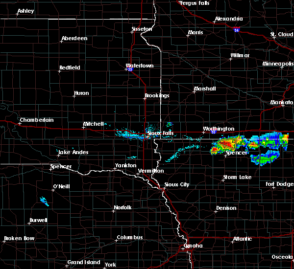 At 803 pm cdt, a severe thunderstorm was located near okoboji and spirit lake, moving southeast at 15 mph. at 8 pm cdt, a trained spotter reported golf ball size hail 4 miles west of spirit lake (radar indicated). Hazards include golf ball size hail and 60 mph wind gusts. People and animals outdoors will be injured. expect hail damage to roofs, siding, windows, and vehicles. expect wind damage to roofs, siding, and trees. this severe storm will be near, okoboji and orleans around 810 pm cdt. Spirit lake, arnolds park and west okoboji around 815 pm cdt. At 803 pm cdt, a severe thunderstorm was located near okoboji and spirit lake, moving southeast at 15 mph. at 8 pm cdt, a trained spotter reported golf ball size hail 4 miles west of spirit lake (radar indicated). Hazards include golf ball size hail and 60 mph wind gusts. People and animals outdoors will be injured. expect hail damage to roofs, siding, windows, and vehicles. expect wind damage to roofs, siding, and trees. this severe storm will be near, okoboji and orleans around 810 pm cdt. Spirit lake, arnolds park and west okoboji around 815 pm cdt.
|
| 6/10/2016 7:50 PM CDT |
 At 748 pm cdt, a severe thunderstorm was located near the northwest side of lake okoboji, or 5 miles west southwest of spirit lake, moving east at 20 mph (radar indicated). Hazards include 60 mph wind gusts and half dollar size hail. Hail damage to vehicles is expected. expect wind damage to roofs, siding, and trees. this severe storm will be near, okoboji and orleans around 755 pm cdt. spirit lake and arnolds park around 800 pm cdt. Superior around 815 pm cdt. At 748 pm cdt, a severe thunderstorm was located near the northwest side of lake okoboji, or 5 miles west southwest of spirit lake, moving east at 20 mph (radar indicated). Hazards include 60 mph wind gusts and half dollar size hail. Hail damage to vehicles is expected. expect wind damage to roofs, siding, and trees. this severe storm will be near, okoboji and orleans around 755 pm cdt. spirit lake and arnolds park around 800 pm cdt. Superior around 815 pm cdt.
|
| 6/10/2016 7:50 PM CDT |
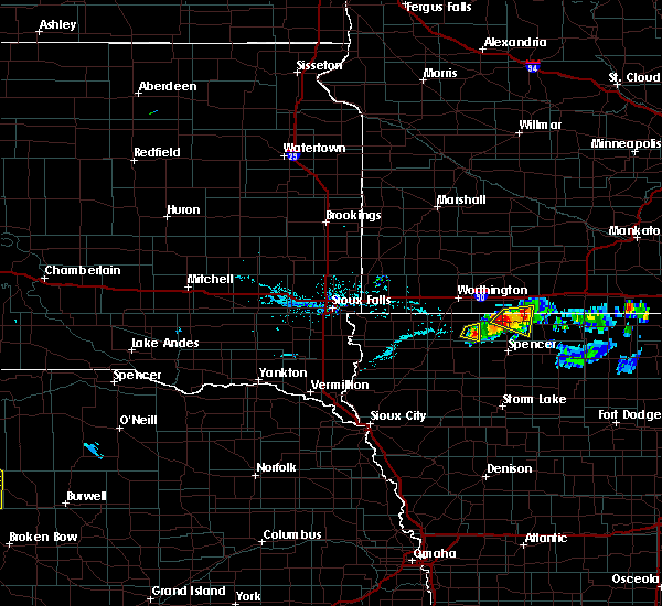 At 748 pm cdt, a severe thunderstorm was located near the northwest side of lake okoboji, or 5 miles west southwest of spirit lake, moving east at 20 mph (radar indicated). Hazards include 60 mph wind gusts and half dollar size hail. Hail damage to vehicles is expected. expect wind damage to roofs, siding, and trees. this severe storm will be near, okoboji and orleans around 755 pm cdt. spirit lake and arnolds park around 800 pm cdt. Superior around 815 pm cdt. At 748 pm cdt, a severe thunderstorm was located near the northwest side of lake okoboji, or 5 miles west southwest of spirit lake, moving east at 20 mph (radar indicated). Hazards include 60 mph wind gusts and half dollar size hail. Hail damage to vehicles is expected. expect wind damage to roofs, siding, and trees. this severe storm will be near, okoboji and orleans around 755 pm cdt. spirit lake and arnolds park around 800 pm cdt. Superior around 815 pm cdt.
|
| 6/10/2016 7:33 PM CDT |
 At 732 pm cdt, a severe thunderstorm was located near lake park, or 7 miles northwest of spirit lake, moving east at 20 mph (radar indicated). Hazards include 60 mph wind gusts and half dollar size hail. Hail damage to vehicles is expected. expect wind damage to roofs, siding, and trees. this severe thunderstorm will be near, okoboji and wahpeton around 745 pm cdt. orleans and west okoboji around 750 pm cdt. spirit lake and arnolds park around 755 pm cdt. Superior around 815 pm cdt. At 732 pm cdt, a severe thunderstorm was located near lake park, or 7 miles northwest of spirit lake, moving east at 20 mph (radar indicated). Hazards include 60 mph wind gusts and half dollar size hail. Hail damage to vehicles is expected. expect wind damage to roofs, siding, and trees. this severe thunderstorm will be near, okoboji and wahpeton around 745 pm cdt. orleans and west okoboji around 750 pm cdt. spirit lake and arnolds park around 755 pm cdt. Superior around 815 pm cdt.
|
| 5/26/2016 12:25 AM CDT |
 At 1224 am cdt, severe thunderstorms were located along a line extending from 9 miles southwest of lakefield to everly, moving east at 55 mph (radar indicated. at 1220 pm cdt...a 53 mph gust was reported in lake park). Hazards include 60 mph wind gusts. Expect damage to roofs. siding. and trees. these severe storms will be near, fostoria around 1235 am cdt. jackson in jackson county around 1240 am cdt. terril and lost island lake around 1245 am cdt. Other locations impacted by these severe thunderstorms include dickens, moneta and alpha. At 1224 am cdt, severe thunderstorms were located along a line extending from 9 miles southwest of lakefield to everly, moving east at 55 mph (radar indicated. at 1220 pm cdt...a 53 mph gust was reported in lake park). Hazards include 60 mph wind gusts. Expect damage to roofs. siding. and trees. these severe storms will be near, fostoria around 1235 am cdt. jackson in jackson county around 1240 am cdt. terril and lost island lake around 1245 am cdt. Other locations impacted by these severe thunderstorms include dickens, moneta and alpha.
|
| 5/25/2016 11:57 PM CDT |
 At 1156 pm cdt, severe thunderstorms were located along a line extending from near worthington to sanborn, moving east at 40 mph (trained weather spotters. at 1146 pm cdt...sheldon awos reported a 59 mph wind gust). Hazards include 60 mph wind gusts. Expect damage to roofs. siding. and trees. severe thunderstorms will be near, melvin around 1200 am cdt. hartley and round lake around 1210 am cdt. everly around 1220 am cdt. spencer in clay county and fostoria around 1235 am cdt. jackson in jackson county, terril and lost island lake around 1245 am cdt. Other locations impacted by these severe thunderstorms include dickens, moneta and alpha. At 1156 pm cdt, severe thunderstorms were located along a line extending from near worthington to sanborn, moving east at 40 mph (trained weather spotters. at 1146 pm cdt...sheldon awos reported a 59 mph wind gust). Hazards include 60 mph wind gusts. Expect damage to roofs. siding. and trees. severe thunderstorms will be near, melvin around 1200 am cdt. hartley and round lake around 1210 am cdt. everly around 1220 am cdt. spencer in clay county and fostoria around 1235 am cdt. jackson in jackson county, terril and lost island lake around 1245 am cdt. Other locations impacted by these severe thunderstorms include dickens, moneta and alpha.
|
| 6/22/2015 6:11 AM CDT |
 The severe thunderstorm warning for eastern lyon, dickinson, northern clay, northeastern sioux, osceola, northern o`brien, southeastern murray, jackson, southern cottonwood and nobles counties will expire at 615 am cdt, the storms which prompted the warning have moved out of the area. therefore the warning will be allowed to expire. however gusty winds are still possible. a severe thunderstorm watch remains in effect until 1000 am cdt for northwestern iowa and southwestern minnesota. The severe thunderstorm warning for eastern lyon, dickinson, northern clay, northeastern sioux, osceola, northern o`brien, southeastern murray, jackson, southern cottonwood and nobles counties will expire at 615 am cdt, the storms which prompted the warning have moved out of the area. therefore the warning will be allowed to expire. however gusty winds are still possible. a severe thunderstorm watch remains in effect until 1000 am cdt for northwestern iowa and southwestern minnesota.
|
| 6/22/2015 6:05 AM CDT |
 At 604 am cdt, severe thunderstorms were located along a line extending from near butterfield to near sherburn to fostoria, moving east at 70 mph (emergency management reported 60 mph gusts in mountain lake at 602 am). Hazards include 60 mph wind gusts. Expect damage to roofs. siding and trees. These severe thunderstorms will remain over mainly rural areas of eastern lyon, dickinson, northern clay, northeastern sioux, osceola, northern o`brien, southeastern murray, jackson, southern cottonwood and nobles counties, including the following locations, okabena, alpha, delft, dundee, dickens, avoca, bigelow, wilder, kinbrae and iona. At 604 am cdt, severe thunderstorms were located along a line extending from near butterfield to near sherburn to fostoria, moving east at 70 mph (emergency management reported 60 mph gusts in mountain lake at 602 am). Hazards include 60 mph wind gusts. Expect damage to roofs. siding and trees. These severe thunderstorms will remain over mainly rural areas of eastern lyon, dickinson, northern clay, northeastern sioux, osceola, northern o`brien, southeastern murray, jackson, southern cottonwood and nobles counties, including the following locations, okabena, alpha, delft, dundee, dickens, avoca, bigelow, wilder, kinbrae and iona.
|
| 6/22/2015 5:59 AM CDT |
 At 559 am cdt, severe thunderstorms were located along a line extending from near mountain lake to jackson in jackson county to near everly, moving east at 70 mph (radar indicated). Hazards include 60 mph wind gusts. Expect damage to roofs. siding and trees. these severe storms will be near, terril around 615 am cdt. Other locations impacted by these severe thunderstorms include okabena, alpha, delft, dundee, dickens, avoca, bigelow, wilder, kinbrae and iona. At 559 am cdt, severe thunderstorms were located along a line extending from near mountain lake to jackson in jackson county to near everly, moving east at 70 mph (radar indicated). Hazards include 60 mph wind gusts. Expect damage to roofs. siding and trees. these severe storms will be near, terril around 615 am cdt. Other locations impacted by these severe thunderstorms include okabena, alpha, delft, dundee, dickens, avoca, bigelow, wilder, kinbrae and iona.
|
| 6/22/2015 5:47 AM CDT |
 At 547 am cdt, severe thunderstorms were located along a line extending from 8 miles south of storden to 6 miles southwest of lakefield to near melvin, moving east at 75 mph (radar indicated). Hazards include 60 mph wind gusts. Expect damage to roofs. siding and trees. these severe storms will be near, lakefield around 550 am cdt. windom and kilen woods state park around 555 am cdt. jackson in jackson county, mountain lake, everly and bingham lake around 600 am cdt. spencer in clay county and fostoria around 605 am cdt. terril around 615 am cdt. Other locations impacted by these severe thunderstorms include okabena, alpha, delft, dundee, dickens, avoca, bigelow, wilder, kinbrae and iona. At 547 am cdt, severe thunderstorms were located along a line extending from 8 miles south of storden to 6 miles southwest of lakefield to near melvin, moving east at 75 mph (radar indicated). Hazards include 60 mph wind gusts. Expect damage to roofs. siding and trees. these severe storms will be near, lakefield around 550 am cdt. windom and kilen woods state park around 555 am cdt. jackson in jackson county, mountain lake, everly and bingham lake around 600 am cdt. spencer in clay county and fostoria around 605 am cdt. terril around 615 am cdt. Other locations impacted by these severe thunderstorms include okabena, alpha, delft, dundee, dickens, avoca, bigelow, wilder, kinbrae and iona.
|
| 6/22/2015 5:36 AM CDT |
 At 535 am cdt, severe thunderstorms were located along a line extending from near comfrey to near terril, moving east at 75 mph (radar indicated). Hazards include 70 mph wind gusts. Expect considerable tree damage. damage is likely to mobile homes, roofs and outbuildings. These severe thunderstorms will remain over mainly rural areas of dickinson, eastern osceola, northeastern o`brien, jackson and cottonwood counties, including the following locations, okabena, wilder, alpha, delft and sanborn. At 535 am cdt, severe thunderstorms were located along a line extending from near comfrey to near terril, moving east at 75 mph (radar indicated). Hazards include 70 mph wind gusts. Expect considerable tree damage. damage is likely to mobile homes, roofs and outbuildings. These severe thunderstorms will remain over mainly rural areas of dickinson, eastern osceola, northeastern o`brien, jackson and cottonwood counties, including the following locations, okabena, wilder, alpha, delft and sanborn.
|
| 6/22/2015 5:30 AM CDT |
 At 529 am cdt, severe thunderstorms were located along a line extending from near slayton to near rushmore to near boyden, moving east at 70 mph (radar indicated). Hazards include 60 mph wind gusts. Expect damage to roofs. siding and trees. severe thunderstorms will be near, worthington and fulda around 535 am cdt. brewster, ashton and round lake around 540 am cdt. sanborn around 545 am cdt. melvin around 550 am cdt. windom, lakefield, hartley and kilen woods state park around 555 am cdt. jackson in jackson county, everly and bingham lake around 600 am cdt. spencer in clay county, mountain lake and fostoria around 605 am cdt. milford around 610 am cdt. Other locations impacted by these severe thunderstorms include okabena, alpha, delft, dundee, dickens, avoca, bigelow, wilder, kinbrae and iona. At 529 am cdt, severe thunderstorms were located along a line extending from near slayton to near rushmore to near boyden, moving east at 70 mph (radar indicated). Hazards include 60 mph wind gusts. Expect damage to roofs. siding and trees. severe thunderstorms will be near, worthington and fulda around 535 am cdt. brewster, ashton and round lake around 540 am cdt. sanborn around 545 am cdt. melvin around 550 am cdt. windom, lakefield, hartley and kilen woods state park around 555 am cdt. jackson in jackson county, everly and bingham lake around 600 am cdt. spencer in clay county, mountain lake and fostoria around 605 am cdt. milford around 610 am cdt. Other locations impacted by these severe thunderstorms include okabena, alpha, delft, dundee, dickens, avoca, bigelow, wilder, kinbrae and iona.
|
| 6/22/2015 5:23 AM CDT |
 At 523 am cdt, severe thunderstorms were located along a line extending from 6 miles southwest of lamberton to 6 miles north of everly, moving east at 70 mph (radar indicated). Hazards include 60 mph wind gusts. Expect damage to roofs. siding and trees. severe thunderstorms will be near, jeffers around 530 am cdt. milford, arnolds park and west okoboji around 535 am cdt. comfrey and terril around 540 am cdt. Other locations impacted by these severe thunderstorms include okabena, wilder, alpha, delft and sanborn. At 523 am cdt, severe thunderstorms were located along a line extending from 6 miles southwest of lamberton to 6 miles north of everly, moving east at 70 mph (radar indicated). Hazards include 60 mph wind gusts. Expect damage to roofs. siding and trees. severe thunderstorms will be near, jeffers around 530 am cdt. milford, arnolds park and west okoboji around 535 am cdt. comfrey and terril around 540 am cdt. Other locations impacted by these severe thunderstorms include okabena, wilder, alpha, delft and sanborn.
|
| 6/20/2015 4:41 AM CDT | The severe thunderstorm warning for dickinson, northern clay, osceola, southeastern murray, jackson, cottonwood and eastern nobles counties will expire at 445 am cdt, the storms which prompted the warning have weakened below severe limits, and exited the warned area. therefore the warning will be allowed to expire. however gusty winds are still possible with these thunderstorms. a severe thunderstorm watch remains in effect until 600 am cdt for northwestern iowa and southwestern minnesota. |
| 6/20/2015 4:41 AM CDT | The severe thunderstorm warning for dickinson, northern clay, osceola, southeastern murray, jackson, cottonwood and eastern nobles counties will expire at 445 am cdt, the storms which prompted the warning have weakened below severe limits, and exited the warned area. therefore the warning will be allowed to expire. however gusty winds are still possible with these thunderstorms. a severe thunderstorm watch remains in effect until 600 am cdt for northwestern iowa and southwestern minnesota. |
| 6/20/2015 4:29 AM CDT |
 At 427 am cdt, severe thunderstorms were located along a line extending from near jeffers to near lakefield to near ocheyedan, moving east at 65 mph (radar indicated). Hazards include 60 mph wind gusts. Expect damage to roofs. siding and trees. these severe storms will be near, jackson in jackson county, bergen and kilen woods state park around 435 am cdt. comfrey around 440 am cdt. spirit lake, milford, arnolds park, okoboji, wahpeton and west okoboji around 445 am cdt. Other locations impacted by these severe thunderstorms include okabena, alpha, delft, dundee, bigelow, wilder, kinbrae and sanborn. At 427 am cdt, severe thunderstorms were located along a line extending from near jeffers to near lakefield to near ocheyedan, moving east at 65 mph (radar indicated). Hazards include 60 mph wind gusts. Expect damage to roofs. siding and trees. these severe storms will be near, jackson in jackson county, bergen and kilen woods state park around 435 am cdt. comfrey around 440 am cdt. spirit lake, milford, arnolds park, okoboji, wahpeton and west okoboji around 445 am cdt. Other locations impacted by these severe thunderstorms include okabena, alpha, delft, dundee, bigelow, wilder, kinbrae and sanborn.
|
| 6/20/2015 4:18 AM CDT |
 At 417 am cdt, severe thunderstorms were located along a line extending from near storden to near brewster to sibley, moving east at 65 mph (radar indicated). Hazards include 60 mph wind gusts. Expect damage to roofs. siding and trees. these severe storms will be near, jeffers around 425 am cdt. lakefield around 430 am cdt. jackson in jackson county, lake park, bergen, harris and kilen woods state park around 435 am cdt. comfrey around 440 am cdt. spirit lake, milford, arnolds park, okoboji, orleans, wahpeton and west okoboji around 445 am cdt. Other locations impacted by these severe thunderstorms include okabena, alpha, delft, dundee, avoca, bigelow, wilder, kinbrae and sanborn. At 417 am cdt, severe thunderstorms were located along a line extending from near storden to near brewster to sibley, moving east at 65 mph (radar indicated). Hazards include 60 mph wind gusts. Expect damage to roofs. siding and trees. these severe storms will be near, jeffers around 425 am cdt. lakefield around 430 am cdt. jackson in jackson county, lake park, bergen, harris and kilen woods state park around 435 am cdt. comfrey around 440 am cdt. spirit lake, milford, arnolds park, okoboji, orleans, wahpeton and west okoboji around 445 am cdt. Other locations impacted by these severe thunderstorms include okabena, alpha, delft, dundee, avoca, bigelow, wilder, kinbrae and sanborn.
|
| 6/20/2015 4:11 AM CDT |
 At 410 am cdt, severe thunderstorms were located along a line extending from dovray to near worthington to near george, moving east at 60 mph (radar indicated). Hazards include 60 mph wind gusts. Expect damage to roofs. siding and trees. these severe storms will be near, worthington, westbrook, brewster and dovray around 415 am cdt. storden around 420 am cdt. jeffers around 425 am cdt. lakefield, ocheyedan and melvin around 430 am cdt. bingham lake and kilen woods state park around 435 am cdt. jackson in jackson county, mountain lake and comfrey around 440 am cdt. milford, west okoboji and fostoria around 445 am cdt. Other locations impacted by these severe thunderstorms include okabena, alpha, delft, dundee, avoca, hadley, bigelow, wilder, kinbrae and iona. At 410 am cdt, severe thunderstorms were located along a line extending from dovray to near worthington to near george, moving east at 60 mph (radar indicated). Hazards include 60 mph wind gusts. Expect damage to roofs. siding and trees. these severe storms will be near, worthington, westbrook, brewster and dovray around 415 am cdt. storden around 420 am cdt. jeffers around 425 am cdt. lakefield, ocheyedan and melvin around 430 am cdt. bingham lake and kilen woods state park around 435 am cdt. jackson in jackson county, mountain lake and comfrey around 440 am cdt. milford, west okoboji and fostoria around 445 am cdt. Other locations impacted by these severe thunderstorms include okabena, alpha, delft, dundee, avoca, hadley, bigelow, wilder, kinbrae and iona.
|
| 6/20/2015 3:56 AM CDT |
 At 355 am cdt, severe thunderstorms were located along a line extending from 6 miles northwest of slayton to near lismore to near alvord, moving east at 65 mph (radar indicated). Hazards include 60 mph wind gusts. Expect damage to roofs. siding and trees. severe thunderstorms will be near, slayton, rushmore, wilmont and lake shetek state park around 400 am cdt. currie around 405 am cdt. worthington and dovray around 410 am cdt. westbrook and brewster around 415 am cdt. sibley, ashton and storden around 420 am cdt. jeffers and melvin around 425 am cdt. lakefield around 430 am cdt. bingham lake and kilen woods state park around 435 am cdt. Other locations impacted by these severe thunderstorms include okabena, alpha, delft, dundee, avoca, hadley, bigelow, wilder, kinbrae and iona. At 355 am cdt, severe thunderstorms were located along a line extending from 6 miles northwest of slayton to near lismore to near alvord, moving east at 65 mph (radar indicated). Hazards include 60 mph wind gusts. Expect damage to roofs. siding and trees. severe thunderstorms will be near, slayton, rushmore, wilmont and lake shetek state park around 400 am cdt. currie around 405 am cdt. worthington and dovray around 410 am cdt. westbrook and brewster around 415 am cdt. sibley, ashton and storden around 420 am cdt. jeffers and melvin around 425 am cdt. lakefield around 430 am cdt. bingham lake and kilen woods state park around 435 am cdt. Other locations impacted by these severe thunderstorms include okabena, alpha, delft, dundee, avoca, hadley, bigelow, wilder, kinbrae and iona.
|
| 6/16/2014 5:00 PM CDT | 65 mph wind and marble hail. tree blown down in dickinson county IA, 0.3 miles NNW of Orleans, IA |
| 1/1/0001 12:00 AM | Trees down in jackson county MN, 6.2 miles SSE of Orleans, IA |
Hail Maps for Orleans, IA
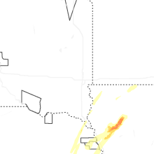
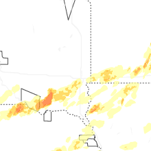
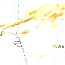
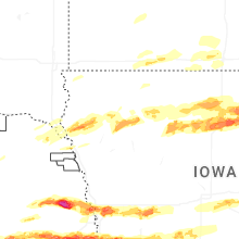


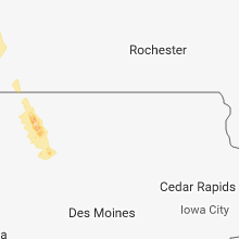


Connect with Interactive Hail Maps