

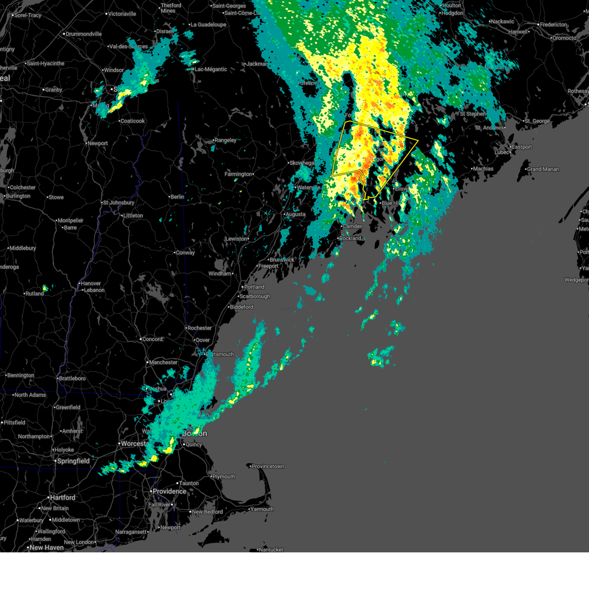
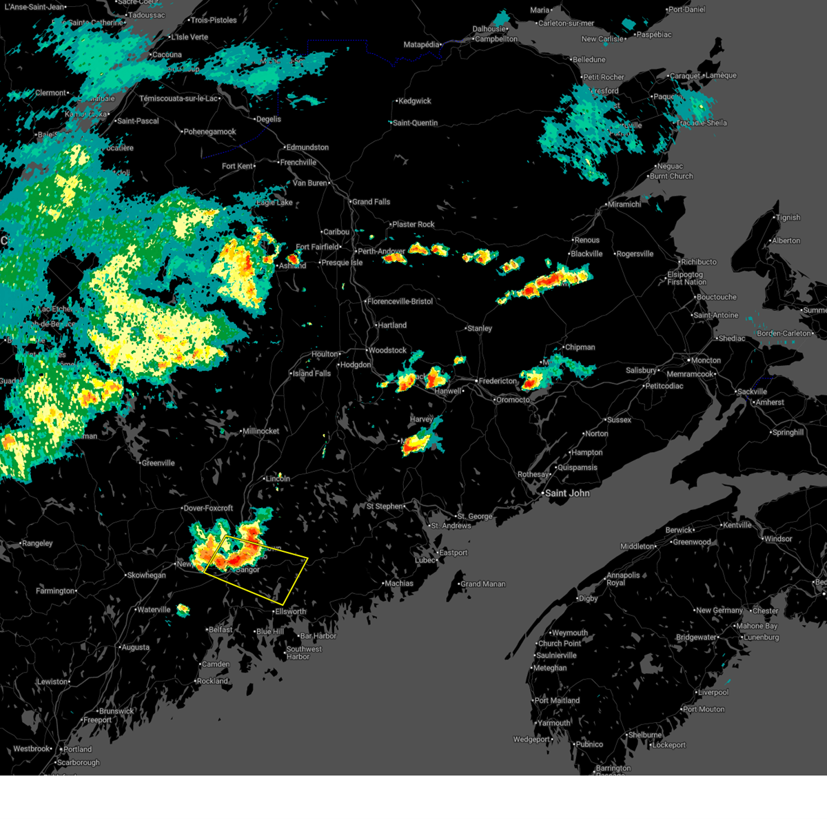
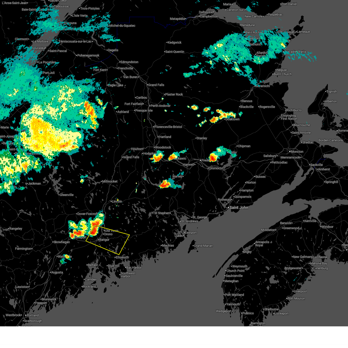
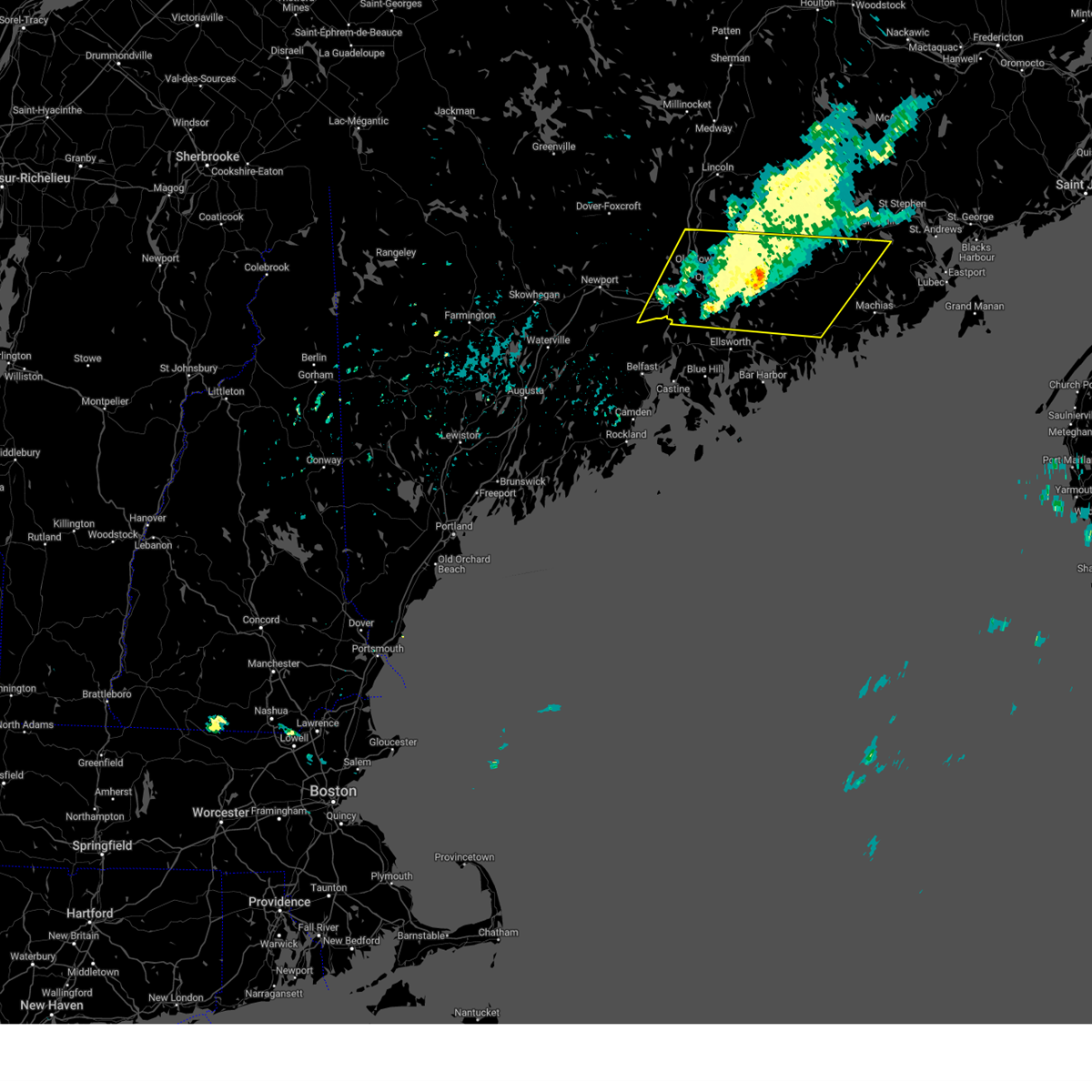
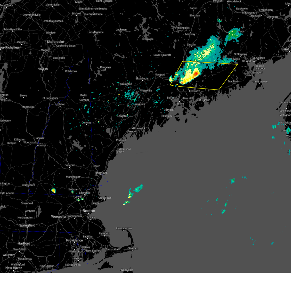
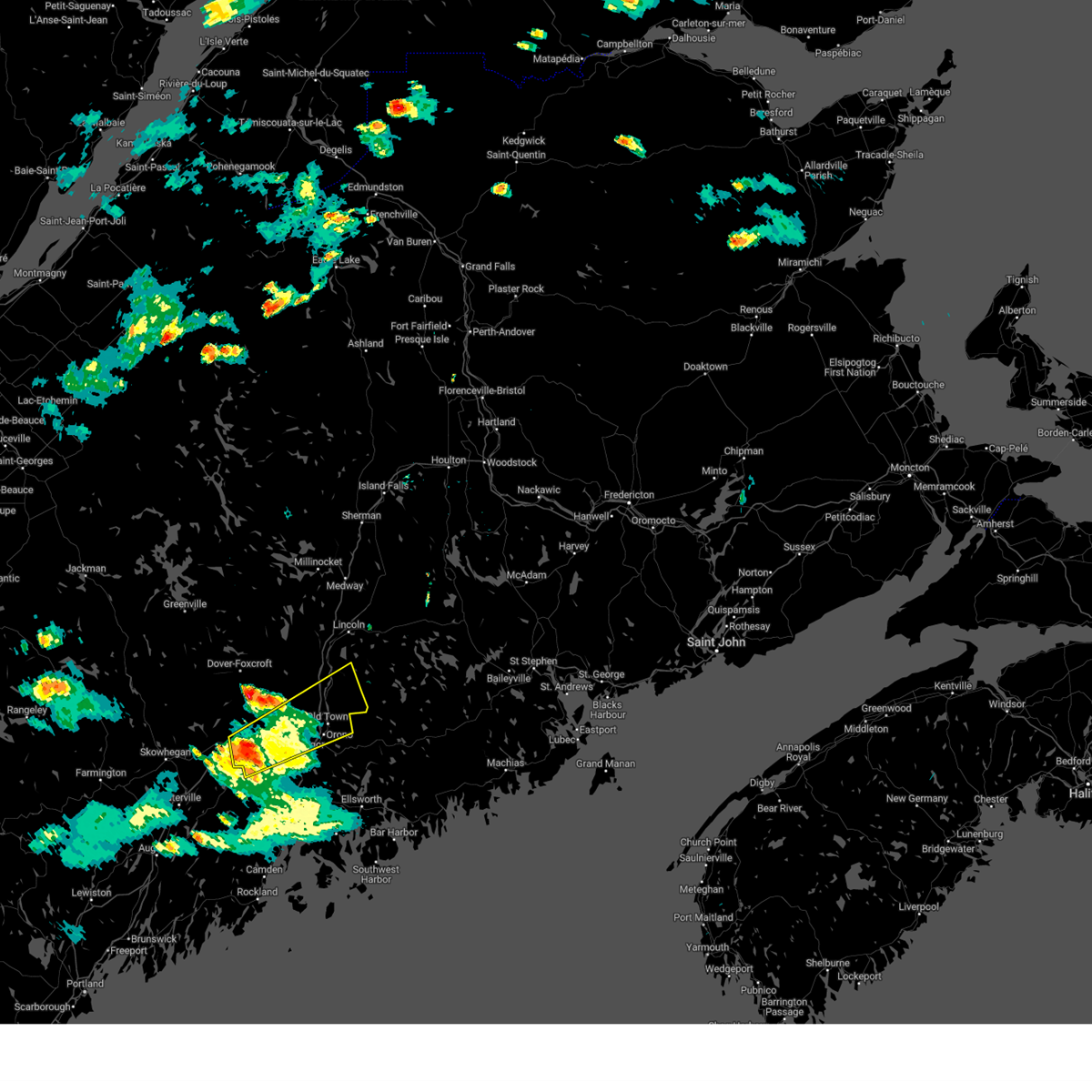
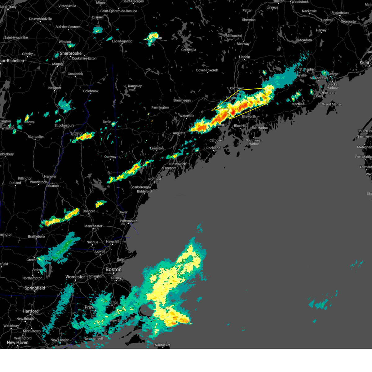
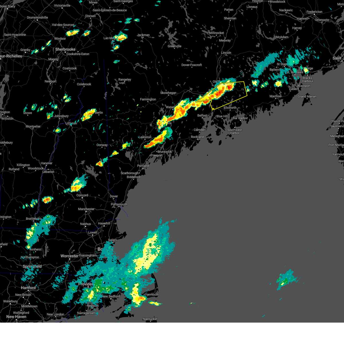
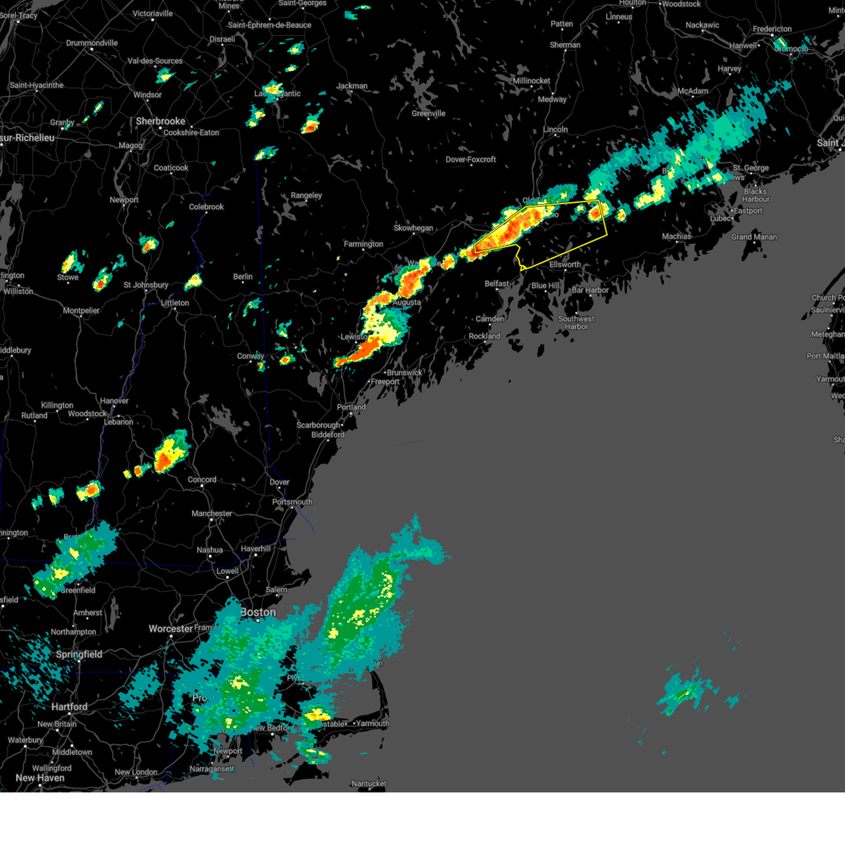
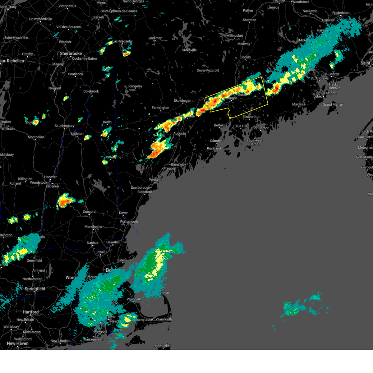
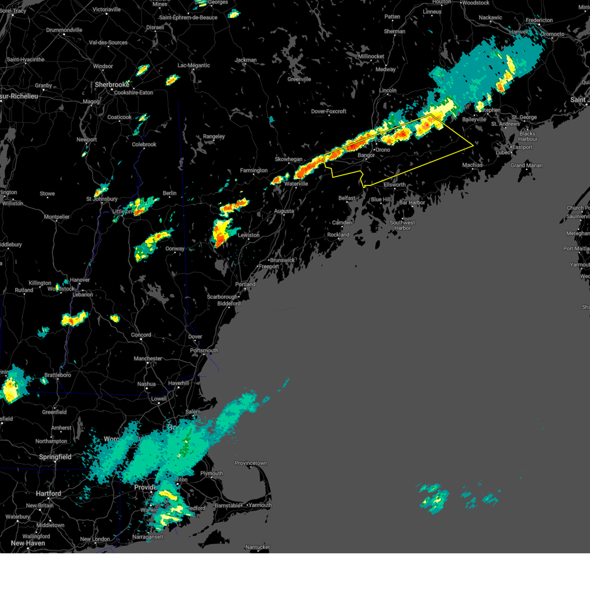
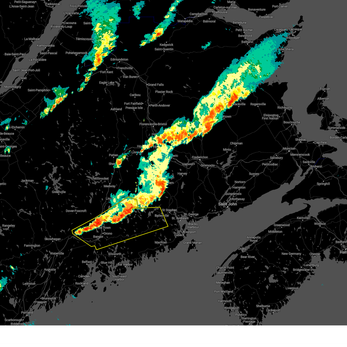
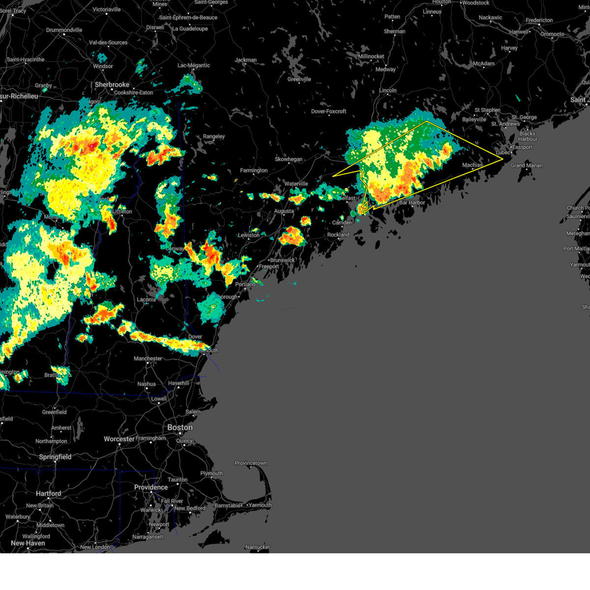
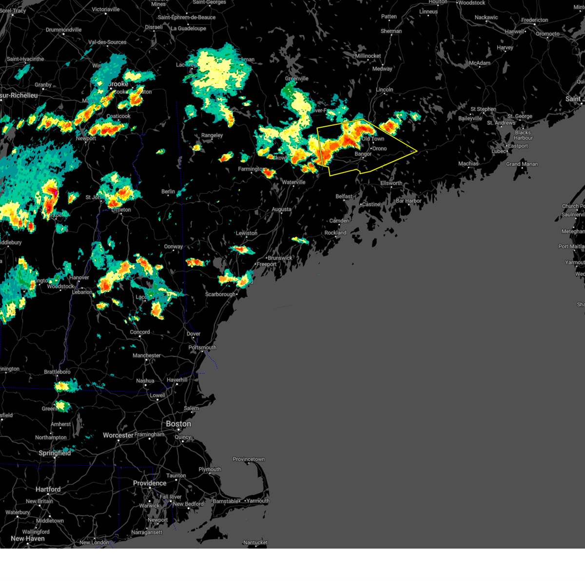
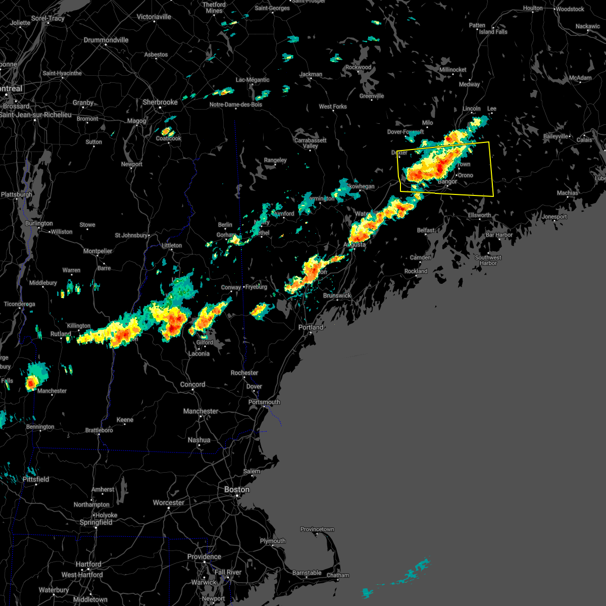
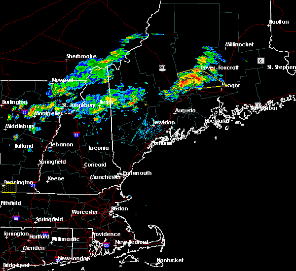
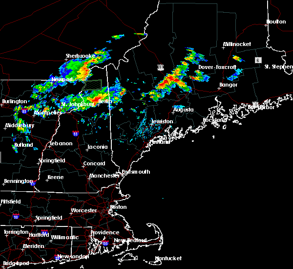
Hail Map for Orono, ME
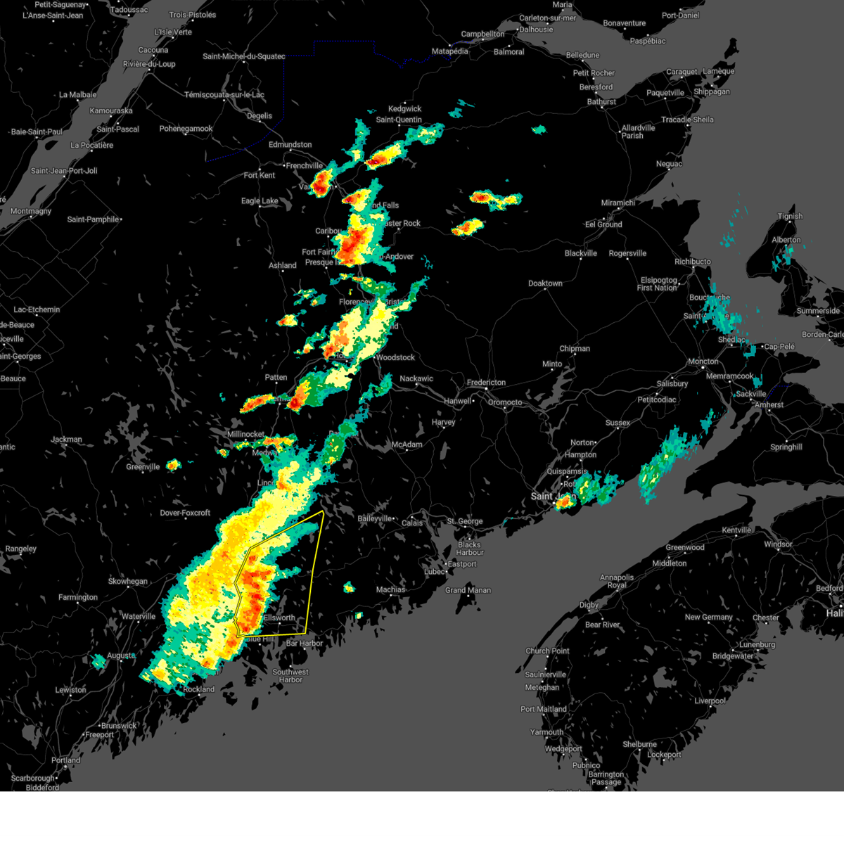
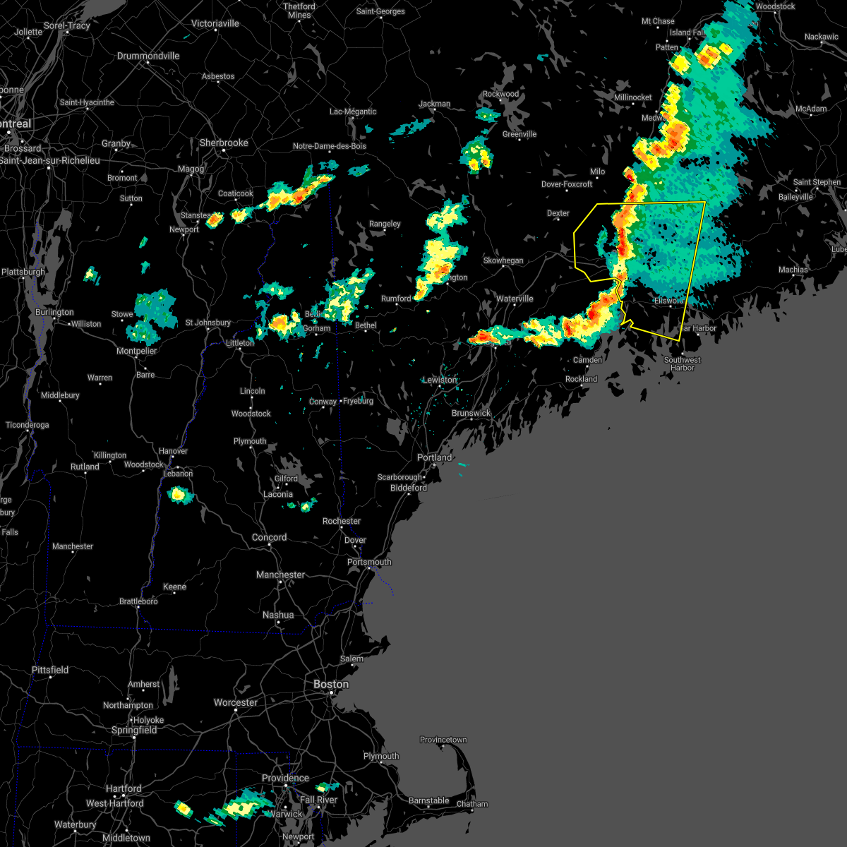
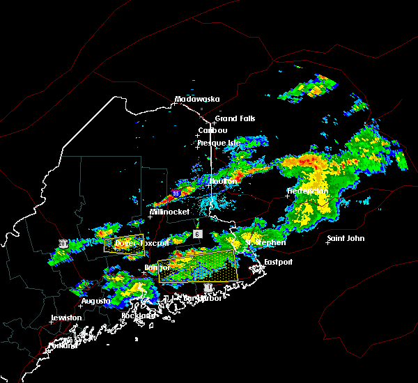
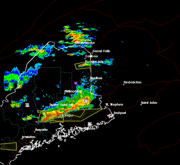
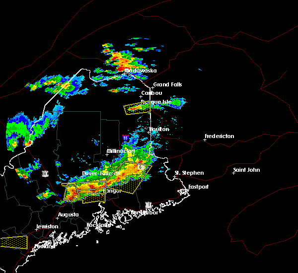
The Orono, ME area has had 0 reports of on-the-ground hail by trained spotters, and has been under severe weather warnings 3 times during the past 12 months. Doppler radar has detected hail at or near Orono, ME on 13 occasions.
| Name: | Orono, ME |
| Where Located: | 6.8 miles NE of Bangor, ME |
| Map: | Google Map for Orono, ME |
| Population: | 9474 |
| Housing Units: | 2624 |
| More Info: | Search Google for Orono, ME |
5
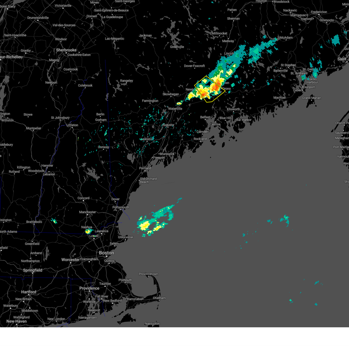
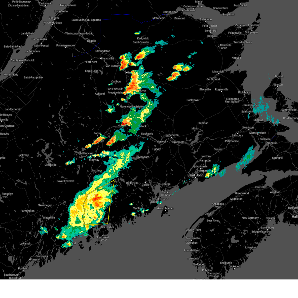
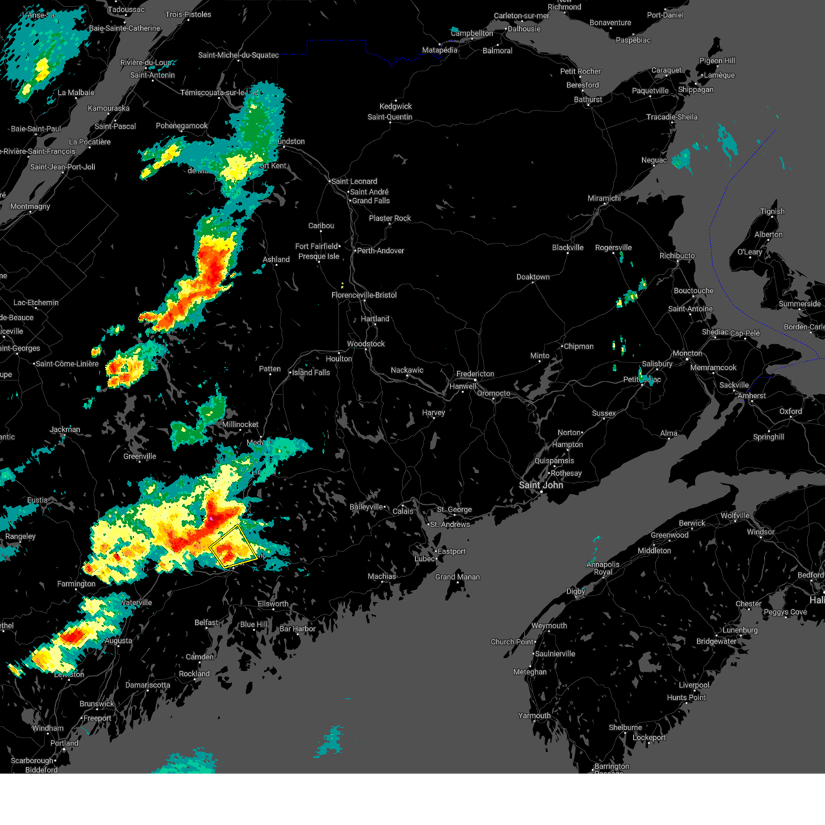
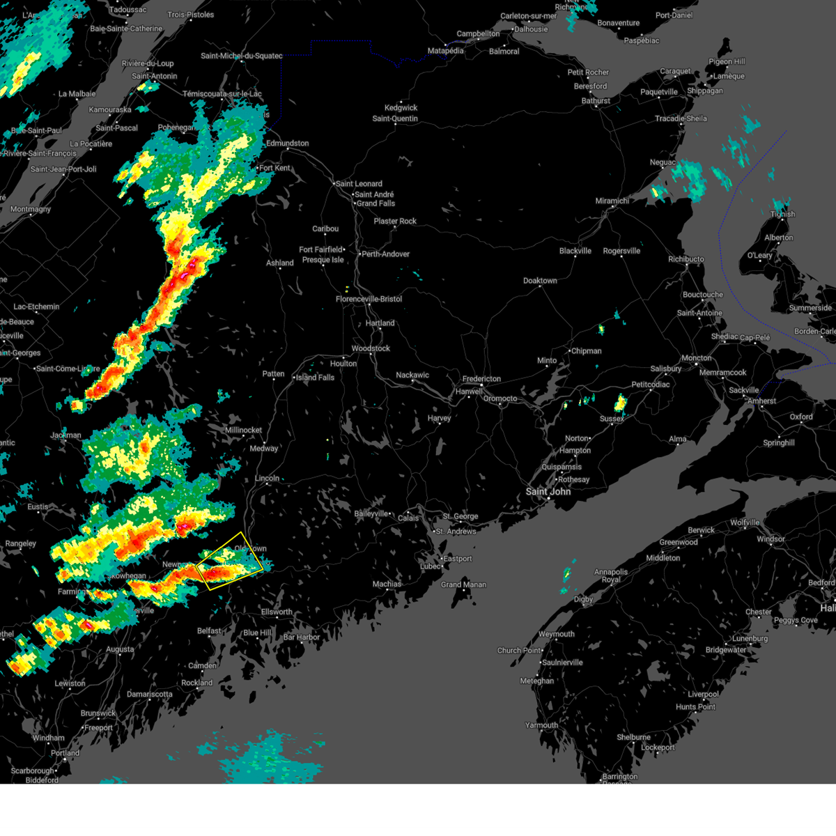
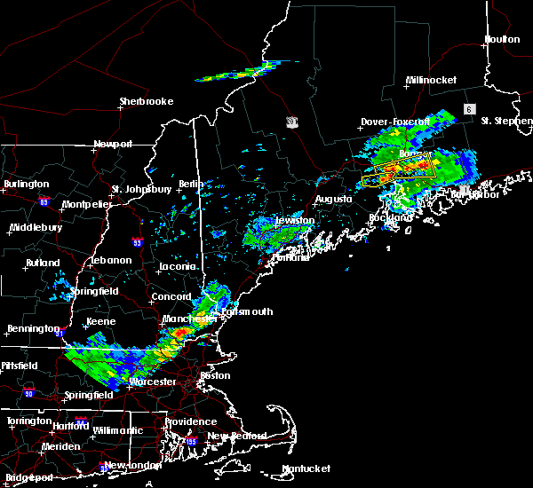
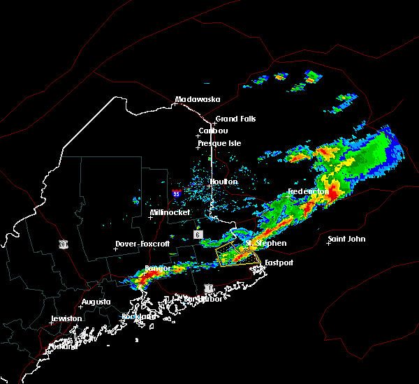
The Top Recent Hail Date for Orono, ME is Wednesday, June 5, 2024 (1st out of 13)

Hail and Wind Damage Spotted near Orono, ME
| Date / Time | Report Details |
|---|---|
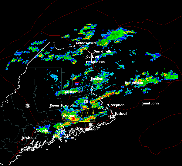
| 6/18/2026 6:38 PM EDT |
 The storms which prompted the warning have weakened below severe limits, and no longer pose an immediate threat to life or property. therefore, the warning will be allowed to expire. however, gusty winds are still possible with these thunderstorms. The storms which prompted the warning have weakened below severe limits, and no longer pose an immediate threat to life or property. therefore, the warning will be allowed to expire. however, gusty winds are still possible with these thunderstorms.
|
| 6/18/2026 6:28 PM EDT |
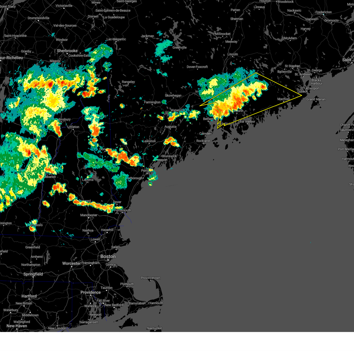
 At 627 pm edt, severe thunderstorms were located along a line extending from kenduskeag to near winterport to near belfast, moving southeast at 45 mph (radar indicated). Hazards include 60 mph wind gusts. Expect damage to trees and power lines. locations impacted include, bangor, old town, ellsworth, bucksport, blue hill, orono, brewer, hampden, hermon, corinth, veazie, dedham, castine, kenduskeag, verona island, penobscot township, indian island, east corinth, glenburn, and orrington. this includes the following highways, interstate 95 between mile markers 165 and 205. us highway 1 near orland. state highway 11 between east corinth and bradford. State highway 9 between dixmont and aurora. At 627 pm edt, severe thunderstorms were located along a line extending from kenduskeag to near winterport to near belfast, moving southeast at 45 mph (radar indicated). Hazards include 60 mph wind gusts. Expect damage to trees and power lines. locations impacted include, bangor, old town, ellsworth, bucksport, blue hill, orono, brewer, hampden, hermon, corinth, veazie, dedham, castine, kenduskeag, verona island, penobscot township, indian island, east corinth, glenburn, and orrington. this includes the following highways, interstate 95 between mile markers 165 and 205. us highway 1 near orland. state highway 11 between east corinth and bradford. State highway 9 between dixmont and aurora.
|
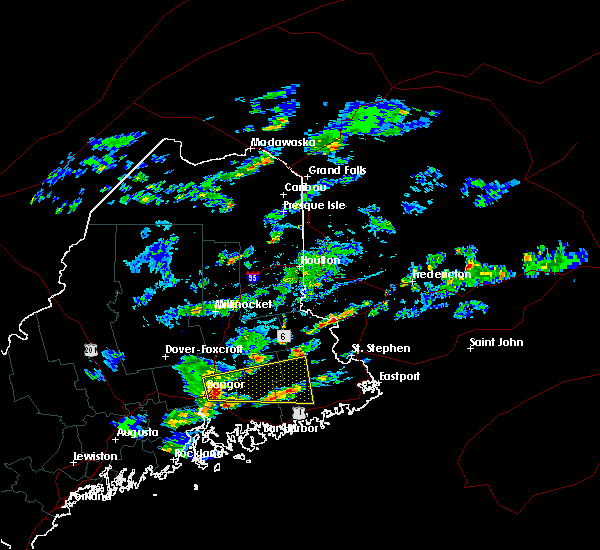
| 6/18/2026 6:14 PM EDT | Tree down into powerline in penobscot county ME, 5.3 miles E of Orono, ME |
| 6/18/2026 6:05 PM EDT |
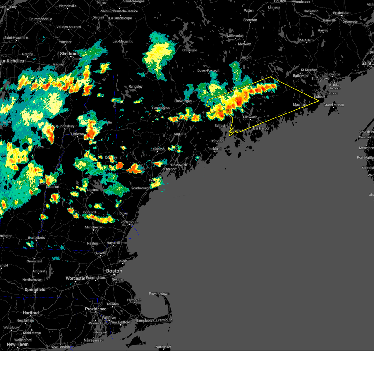
 Svrcar the national weather service in caribou maine has issued a * severe thunderstorm warning for, central hancock county in southeastern maine, southern piscataquis county in north central maine, southwestern penobscot county in east central maine, * until 645 pm edt. * at 604 pm edt, severe thunderstorms were located along a line extending from 6 miles east of dexter to newport to near unity, moving southeast at 45 mph (radar indicated). Hazards include 60 mph wind gusts. expect damage to trees and power lines Svrcar the national weather service in caribou maine has issued a * severe thunderstorm warning for, central hancock county in southeastern maine, southern piscataquis county in north central maine, southwestern penobscot county in east central maine, * until 645 pm edt. * at 604 pm edt, severe thunderstorms were located along a line extending from 6 miles east of dexter to newport to near unity, moving southeast at 45 mph (radar indicated). Hazards include 60 mph wind gusts. expect damage to trees and power lines
|
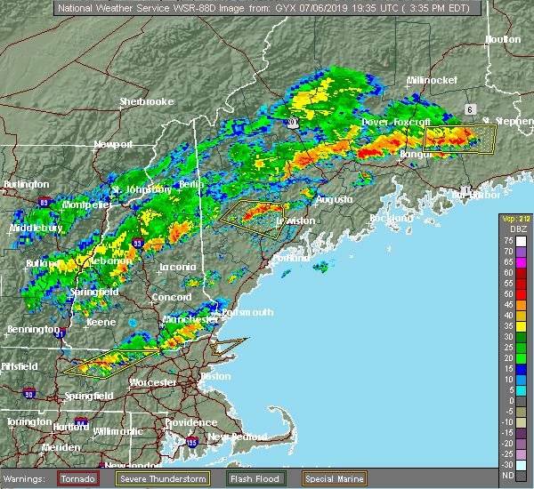
| 7/6/2025 8:13 PM EDT |
 The severe thunderstorm which prompted the warning has weakened. therefore, the warning will be allowed to expire. however, gusty winds and heavy rain are still possible with this thunderstorm. The severe thunderstorm which prompted the warning has weakened. therefore, the warning will be allowed to expire. however, gusty winds and heavy rain are still possible with this thunderstorm.
|
| 7/6/2025 7:41 PM EDT |
 At 740 pm edt, a severe thunderstorm was located near veazie, or 10 miles east of bangor, moving east at 35 mph (radar indicated). Hazards include 60 mph wind gusts and penny size hail. Expect damage to trees and power lines. locations impacted include, bangor, old town, ellsworth, bucksport, orono, brewer, hampden, hermon, veazie, dedham, kenduskeag, indian island, glenburn, orrington, holden, milford, levant, carmel, eddington, and hudson. this includes the following highways, interstate 95 between mile markers 175 and 198. State highway 9 between hampden and aurora. At 740 pm edt, a severe thunderstorm was located near veazie, or 10 miles east of bangor, moving east at 35 mph (radar indicated). Hazards include 60 mph wind gusts and penny size hail. Expect damage to trees and power lines. locations impacted include, bangor, old town, ellsworth, bucksport, orono, brewer, hampden, hermon, veazie, dedham, kenduskeag, indian island, glenburn, orrington, holden, milford, levant, carmel, eddington, and hudson. this includes the following highways, interstate 95 between mile markers 175 and 198. State highway 9 between hampden and aurora.
|
| 7/6/2025 7:20 PM EDT |
 Svrcar the national weather service in caribou maine has issued a * severe thunderstorm warning for, central hancock county in southeastern maine, south central penobscot county in east central maine, * until 815 pm edt. * at 720 pm edt, a severe thunderstorm was located near bangor, moving east at 35 mph (radar indicated). Hazards include 60 mph wind gusts and penny size hail. expect damage to trees and power lines Svrcar the national weather service in caribou maine has issued a * severe thunderstorm warning for, central hancock county in southeastern maine, south central penobscot county in east central maine, * until 815 pm edt. * at 720 pm edt, a severe thunderstorm was located near bangor, moving east at 35 mph (radar indicated). Hazards include 60 mph wind gusts and penny size hail. expect damage to trees and power lines
|
| 7/13/2024 10:26 PM EDT |
 The storm which prompted the warning has weakened below severe limits, and no longer poses an immediate threat to life or property. therefore, the warning will be allowed to expire. The storm which prompted the warning has weakened below severe limits, and no longer poses an immediate threat to life or property. therefore, the warning will be allowed to expire.
|
| 7/13/2024 10:09 PM EDT |
 At 1003 pm edt, a severe thunderstorm was located near amherst moving east at 40 mph (radar indicated). Hazards include 60 mph wind gusts and penny size hail. Expect damage to trees and power lines. Locations impacted include, bangor, old town, cherryfield, orono, brewer, hampden, hermon, veazie, dedham, harrington, columbia falls, columbia, meddybemps, deblois, indian island, centerville, grand falls, and franklin. At 1003 pm edt, a severe thunderstorm was located near amherst moving east at 40 mph (radar indicated). Hazards include 60 mph wind gusts and penny size hail. Expect damage to trees and power lines. Locations impacted include, bangor, old town, cherryfield, orono, brewer, hampden, hermon, veazie, dedham, harrington, columbia falls, columbia, meddybemps, deblois, indian island, centerville, grand falls, and franklin.
|
| 7/13/2024 9:38 PM EDT |
 Svrcar the national weather service in caribou maine has issued a * severe thunderstorm warning for, southwestern washington county in southeastern maine, central hancock county in southeastern maine, south central penobscot county in east central maine, * until 1030 pm edt. * at 936 pm edt, a severe thunderstorm was located 7 miles southeast of indian island, or 10 miles southeast of old town, moving east at 40 mph (radar indicated). Hazards include 60 mph wind gusts and penny size hail. expect damage to trees and power lines Svrcar the national weather service in caribou maine has issued a * severe thunderstorm warning for, southwestern washington county in southeastern maine, central hancock county in southeastern maine, south central penobscot county in east central maine, * until 1030 pm edt. * at 936 pm edt, a severe thunderstorm was located 7 miles southeast of indian island, or 10 miles southeast of old town, moving east at 40 mph (radar indicated). Hazards include 60 mph wind gusts and penny size hail. expect damage to trees and power lines
|
| 7/13/2024 9:28 PM EDT |
 At 927 pm edt, a severe thunderstorm was located near kenduskeag, or 9 miles west of bangor, moving southeast at 15 mph (radar indicated). Hazards include 60 mph wind gusts and penny size hail. Expect damage to trees and power lines. Locations impacted include, bangor, old town, newport, orono, brewer, hampden, hermon, corinth, veazie, kenduskeag, east corinth, glenburn, orrington, holden, levant, carmel, eddington, corinna, newburgh, and hudson. At 927 pm edt, a severe thunderstorm was located near kenduskeag, or 9 miles west of bangor, moving southeast at 15 mph (radar indicated). Hazards include 60 mph wind gusts and penny size hail. Expect damage to trees and power lines. Locations impacted include, bangor, old town, newport, orono, brewer, hampden, hermon, corinth, veazie, kenduskeag, east corinth, glenburn, orrington, holden, levant, carmel, eddington, corinna, newburgh, and hudson.
|
| 7/13/2024 8:56 PM EDT |
 Svrcar the national weather service in caribou maine has issued a * severe thunderstorm warning for, southwestern penobscot county in east central maine, * until 1000 pm edt. * at 855 pm edt, a severe thunderstorm was located near corinth, or 9 miles northeast of newport, moving southeast at 15 mph (radar indicated). Hazards include 60 mph wind gusts and penny size hail. expect damage to trees and power lines Svrcar the national weather service in caribou maine has issued a * severe thunderstorm warning for, southwestern penobscot county in east central maine, * until 1000 pm edt. * at 855 pm edt, a severe thunderstorm was located near corinth, or 9 miles northeast of newport, moving southeast at 15 mph (radar indicated). Hazards include 60 mph wind gusts and penny size hail. expect damage to trees and power lines
|
| 7/9/2024 4:44 PM EDT |
 The storm which prompted the warning has weakened below severe limits, and no longer poses an immediate threat to life or property. therefore, the warning will be allowed to expire. however, gusty winds are still possible with this thunderstorm. a severe thunderstorm warning still remains in effect for other portions of south central penobscot county until 530 pm. please refer to that statement for the latest information. The storm which prompted the warning has weakened below severe limits, and no longer poses an immediate threat to life or property. therefore, the warning will be allowed to expire. however, gusty winds are still possible with this thunderstorm. a severe thunderstorm warning still remains in effect for other portions of south central penobscot county until 530 pm. please refer to that statement for the latest information.
|
| 7/9/2024 4:26 PM EDT |
 At 425 pm edt, a severe thunderstorm was located over kenduskeag, or near bangor, moving northeast at 40 mph (law enforcement. multiple trees have been reported down in plymouth and newport). Hazards include 60 mph wind gusts. Expect damage to trees and power lines. Locations impacted include, bangor, old town, orono, hampden, hermon, corinth, veazie, kenduskeag, indian island, glenburn, milford, levant, carmel, eddington, newburgh, hudson, bradley, greenbush, bradford, and stetson. At 425 pm edt, a severe thunderstorm was located over kenduskeag, or near bangor, moving northeast at 40 mph (law enforcement. multiple trees have been reported down in plymouth and newport). Hazards include 60 mph wind gusts. Expect damage to trees and power lines. Locations impacted include, bangor, old town, orono, hampden, hermon, corinth, veazie, kenduskeag, indian island, glenburn, milford, levant, carmel, eddington, newburgh, hudson, bradley, greenbush, bradford, and stetson.
|
| 7/9/2024 4:05 PM EDT |
 Svrcar the national weather service in caribou maine has issued a * severe thunderstorm warning for, southwestern penobscot county in east central maine, * until 445 pm edt. * at 404 pm edt, a severe thunderstorm was located near newport, moving northeast at 45 mph (radar indicated). Hazards include 60 mph wind gusts. expect damage to trees and power lines Svrcar the national weather service in caribou maine has issued a * severe thunderstorm warning for, southwestern penobscot county in east central maine, * until 445 pm edt. * at 404 pm edt, a severe thunderstorm was located near newport, moving northeast at 45 mph (radar indicated). Hazards include 60 mph wind gusts. expect damage to trees and power lines
|
| 6/30/2024 5:25 PM EDT |
 The storms which prompted the warning have weakened below severe limits, and no longer pose an immediate threat to life or property. therefore, the warning will be allowed to expire. however, gusty winds are still possible with these thunderstorms. a severe thunderstorm watch remains in effect until 800 pm edt for southeastern and east central maine. The storms which prompted the warning have weakened below severe limits, and no longer pose an immediate threat to life or property. therefore, the warning will be allowed to expire. however, gusty winds are still possible with these thunderstorms. a severe thunderstorm watch remains in effect until 800 pm edt for southeastern and east central maine.
|
| 6/30/2024 5:01 PM EDT |
 At 501 pm edt, severe thunderstorms were located along a line extending from 11 miles southeast of indian island to 8 miles east of thorndike, moving east at 30 mph (radar indicated). Hazards include 60 mph wind gusts and quarter size hail. Minor hail damage to vehicles is possible. expect wind damage to trees and power lines. Locations impacted include, bangor, old town, ellsworth, bucksport, orono, brewer, hampden, hermon, veazie, dedham, verona island, orrington, holden, milford, orland, eddington, newburgh, bradley, dixmont, and clifton. At 501 pm edt, severe thunderstorms were located along a line extending from 11 miles southeast of indian island to 8 miles east of thorndike, moving east at 30 mph (radar indicated). Hazards include 60 mph wind gusts and quarter size hail. Minor hail damage to vehicles is possible. expect wind damage to trees and power lines. Locations impacted include, bangor, old town, ellsworth, bucksport, orono, brewer, hampden, hermon, veazie, dedham, verona island, orrington, holden, milford, orland, eddington, newburgh, bradley, dixmont, and clifton.
|
| 6/30/2024 4:39 PM EDT |
 Svrcar the national weather service in caribou maine has issued a * severe thunderstorm warning for, central hancock county in southeastern maine, south central penobscot county in east central maine, * until 530 pm edt. * at 439 pm edt, severe thunderstorms were located along a line extending from orono to near thorndike, moving east at 30 mph (radar indicated). Hazards include 60 mph wind gusts and quarter size hail. Minor hail damage to vehicles is possible. Expect wind damage to trees and power lines. Svrcar the national weather service in caribou maine has issued a * severe thunderstorm warning for, central hancock county in southeastern maine, south central penobscot county in east central maine, * until 530 pm edt. * at 439 pm edt, severe thunderstorms were located along a line extending from orono to near thorndike, moving east at 30 mph (radar indicated). Hazards include 60 mph wind gusts and quarter size hail. Minor hail damage to vehicles is possible. Expect wind damage to trees and power lines.
|
| 6/30/2024 4:25 PM EDT |
 At 424 pm edt, severe thunderstorms were located along a line extending from 9 miles south of grand falls to near kenduskeag to near unity, moving east at 30 mph (radar indicated). Hazards include 60 mph wind gusts and quarter size hail. Minor hail damage to vehicles is possible. expect wind damage to trees and power lines. Locations impacted include, bangor, old town, ellsworth, bucksport, newport, orono, brewer, hampden, hermon, veazie, dedham, kenduskeag, verona island, indian island, grand falls, glenburn, orrington, holden, milford, and levant. At 424 pm edt, severe thunderstorms were located along a line extending from 9 miles south of grand falls to near kenduskeag to near unity, moving east at 30 mph (radar indicated). Hazards include 60 mph wind gusts and quarter size hail. Minor hail damage to vehicles is possible. expect wind damage to trees and power lines. Locations impacted include, bangor, old town, ellsworth, bucksport, newport, orono, brewer, hampden, hermon, veazie, dedham, kenduskeag, verona island, indian island, grand falls, glenburn, orrington, holden, milford, and levant.
|
| 6/30/2024 4:25 PM EDT |
 the severe thunderstorm warning has been cancelled and is no longer in effect the severe thunderstorm warning has been cancelled and is no longer in effect
|
| 6/30/2024 3:55 PM EDT |
 Svrcar the national weather service in caribou maine has issued a * severe thunderstorm warning for, west central washington county in southeastern maine, northern hancock county in southeastern maine, southwestern penobscot county in east central maine, * until 445 pm edt. * at 354 pm edt, severe thunderstorms were located along a line extending from 12 miles south of lakeville to near clinton, moving southeast at 20 mph (radar indicated). Hazards include 70 mph wind gusts and quarter size hail. Minor hail damage to vehicles is possible. expect considerable tree damage. Wind damage is also likely to mobile homes, roofs, and outbuildings. Svrcar the national weather service in caribou maine has issued a * severe thunderstorm warning for, west central washington county in southeastern maine, northern hancock county in southeastern maine, southwestern penobscot county in east central maine, * until 445 pm edt. * at 354 pm edt, severe thunderstorms were located along a line extending from 12 miles south of lakeville to near clinton, moving southeast at 20 mph (radar indicated). Hazards include 70 mph wind gusts and quarter size hail. Minor hail damage to vehicles is possible. expect considerable tree damage. Wind damage is also likely to mobile homes, roofs, and outbuildings.
|
| 6/30/2024 3:29 PM EDT |
 Svrcar the national weather service in caribou maine has issued a * severe thunderstorm warning for, west central washington county in southeastern maine, northern hancock county in southeastern maine, southern penobscot county in east central maine, * until 400 pm edt. * at 329 pm edt, severe thunderstorms were located along a line extending from near lakeville to near grand falls to near corinth, moving east at 85 mph (radar indicated). Hazards include 70 mph wind gusts and quarter size hail. Minor hail damage to vehicles is possible. expect considerable tree damage. Wind damage is also likely to mobile homes, roofs, and outbuildings. Svrcar the national weather service in caribou maine has issued a * severe thunderstorm warning for, west central washington county in southeastern maine, northern hancock county in southeastern maine, southern penobscot county in east central maine, * until 400 pm edt. * at 329 pm edt, severe thunderstorms were located along a line extending from near lakeville to near grand falls to near corinth, moving east at 85 mph (radar indicated). Hazards include 70 mph wind gusts and quarter size hail. Minor hail damage to vehicles is possible. expect considerable tree damage. Wind damage is also likely to mobile homes, roofs, and outbuildings.
|
| 6/30/2024 3:11 PM EDT |
 At 310 pm edt, severe thunderstorms were located along a line extending from near danforth to near springfield to 8 miles southeast of orneville, moving east at 45 mph (radar indicated). Hazards include 70 mph wind gusts and quarter size hail. Minor hail damage to vehicles is possible. expect considerable tree damage. wind damage is also likely to mobile homes, roofs, and outbuildings. Locations impacted include, old town, dexter, howland, danforth, vanceboro, orono, corinth, springfield, topsfield, grand lake stream, lakeville, indian island, licoln township, fowler township, dyer township, grand falls, codyville plantation, east corinth, glenburn, and milford. At 310 pm edt, severe thunderstorms were located along a line extending from near danforth to near springfield to 8 miles southeast of orneville, moving east at 45 mph (radar indicated). Hazards include 70 mph wind gusts and quarter size hail. Minor hail damage to vehicles is possible. expect considerable tree damage. wind damage is also likely to mobile homes, roofs, and outbuildings. Locations impacted include, old town, dexter, howland, danforth, vanceboro, orono, corinth, springfield, topsfield, grand lake stream, lakeville, indian island, licoln township, fowler township, dyer township, grand falls, codyville plantation, east corinth, glenburn, and milford.
|
| 6/30/2024 3:11 PM EDT |
 the severe thunderstorm warning has been cancelled and is no longer in effect the severe thunderstorm warning has been cancelled and is no longer in effect
|
| 6/30/2024 2:50 PM EDT |
 Svrcar the national weather service in caribou maine has issued a * severe thunderstorm warning for, northwestern washington county in southeastern maine, northeastern hancock county in southeastern maine, southeastern piscataquis county in north central maine, southeastern aroostook county in northern maine, southern penobscot county in east central maine, * until 330 pm edt. * at 250 pm edt, severe thunderstorms were located along a line extending from wytopitlock to near licoln township to 6 miles southeast of dover-foxcroft, moving east at 45 mph (radar indicated). Hazards include 70 mph wind gusts and quarter size hail. Minor hail damage to vehicles is possible. expect considerable tree damage. Wind damage is also likely to mobile homes, roofs, and outbuildings. Svrcar the national weather service in caribou maine has issued a * severe thunderstorm warning for, northwestern washington county in southeastern maine, northeastern hancock county in southeastern maine, southeastern piscataquis county in north central maine, southeastern aroostook county in northern maine, southern penobscot county in east central maine, * until 330 pm edt. * at 250 pm edt, severe thunderstorms were located along a line extending from wytopitlock to near licoln township to 6 miles southeast of dover-foxcroft, moving east at 45 mph (radar indicated). Hazards include 70 mph wind gusts and quarter size hail. Minor hail damage to vehicles is possible. expect considerable tree damage. Wind damage is also likely to mobile homes, roofs, and outbuildings.
|
| 6/20/2024 5:08 PM EDT |
 The storms which prompted the warning have moved out of the penobscot county. therefore, the warning will be allowed to expire there. a severe thunderstorm warning has been reissued for hancock county and southern washington county until 545 pm. a severe thunderstorm watch remains in effect until 800 pm edt for southeastern and east central maine. The storms which prompted the warning have moved out of the penobscot county. therefore, the warning will be allowed to expire there. a severe thunderstorm warning has been reissued for hancock county and southern washington county until 545 pm. a severe thunderstorm watch remains in effect until 800 pm edt for southeastern and east central maine.
|
| 6/20/2024 4:50 PM EDT |
 At 450 pm edt, severe thunderstorms were located along a line extending from 18 miles northwest of centerville to near belgrade, moving southeast at 30 mph (law enforcement). Hazards include 60 mph wind gusts and quarter size hail. Minor hail damage to vehicles is possible. expect wind damage to trees and power lines. Locations impacted include, bangor, ellsworth, bucksport, blue hill, machias, cherryfield, orono, brewer, hampden, hermon, veazie, dedham, castine, steuben, harrington, jonesboro, columbia falls, verona island, columbia, and deblois. At 450 pm edt, severe thunderstorms were located along a line extending from 18 miles northwest of centerville to near belgrade, moving southeast at 30 mph (law enforcement). Hazards include 60 mph wind gusts and quarter size hail. Minor hail damage to vehicles is possible. expect wind damage to trees and power lines. Locations impacted include, bangor, ellsworth, bucksport, blue hill, machias, cherryfield, orono, brewer, hampden, hermon, veazie, dedham, castine, steuben, harrington, jonesboro, columbia falls, verona island, columbia, and deblois.
|
| 6/20/2024 4:34 PM EDT |
 At 434 pm edt, severe thunderstorms were located along a line extending from 18 miles south of grand lake stream to near waterville, moving east at 45 mph (law enforcement). Hazards include 60 mph wind gusts and quarter size hail. Minor hail damage to vehicles is possible. expect wind damage to trees and power lines. Locations impacted include, bangor, old town, ellsworth, bucksport, newport, blue hill, machias, cherryfield, orono, brewer, hampden, hermon, veazie, dedham, castine, kenduskeag, steuben, harrington, jonesboro, and columbia falls. At 434 pm edt, severe thunderstorms were located along a line extending from 18 miles south of grand lake stream to near waterville, moving east at 45 mph (law enforcement). Hazards include 60 mph wind gusts and quarter size hail. Minor hail damage to vehicles is possible. expect wind damage to trees and power lines. Locations impacted include, bangor, old town, ellsworth, bucksport, newport, blue hill, machias, cherryfield, orono, brewer, hampden, hermon, veazie, dedham, castine, kenduskeag, steuben, harrington, jonesboro, and columbia falls.
|
| 6/20/2024 4:23 PM EDT |
 A severe thunderstorm warning has been reissued for southwestern penobscot county and hancock county until 515 pm. a severe thunderstorm watch remains in effect until 800 pm edt for southeastern, west central and east central maine. A severe thunderstorm warning has been reissued for southwestern penobscot county and hancock county until 515 pm. a severe thunderstorm watch remains in effect until 800 pm edt for southeastern, west central and east central maine.
|
| 6/20/2024 4:20 PM EDT | Delayed report. trees and wires down on margin s in penobscot county ME, 0.5 miles NNW of Orono, ME |
| 6/20/2024 4:19 PM EDT |
 Svrcar the national weather service in caribou maine has issued a * severe thunderstorm warning for, southern washington county in southeastern maine, hancock county in southeastern maine, southwestern penobscot county in east central maine, * until 515 pm edt. * at 418 pm edt, severe thunderstorms were located along a line extending from 16 miles east of grand falls to oakland, moving southeast at 45 mph (law enforcement). Hazards include 60 mph wind gusts and quarter size hail. Minor hail damage to vehicles is possible. Expect wind damage to trees and power lines. Svrcar the national weather service in caribou maine has issued a * severe thunderstorm warning for, southern washington county in southeastern maine, hancock county in southeastern maine, southwestern penobscot county in east central maine, * until 515 pm edt. * at 418 pm edt, severe thunderstorms were located along a line extending from 16 miles east of grand falls to oakland, moving southeast at 45 mph (law enforcement). Hazards include 60 mph wind gusts and quarter size hail. Minor hail damage to vehicles is possible. Expect wind damage to trees and power lines.
|
| 6/20/2024 4:16 PM EDT | Delayed report. tree down on wires and laying on a house on union s in penobscot county ME, 0.5 miles NNW of Orono, ME |
| 6/20/2024 4:11 PM EDT | Wires down catching ground on fir in penobscot county ME, 1.1 miles SW of Orono, ME |
| 6/20/2024 4:01 PM EDT |
 the severe thunderstorm warning has been cancelled and is no longer in effect the severe thunderstorm warning has been cancelled and is no longer in effect
|
| 6/20/2024 4:01 PM EDT |
 At 400 pm edt, severe thunderstorms were located along a line extending from 8 miles north of indian island to 10 miles northeast of farmington, moving east at 30 mph (law enforcement). Hazards include 60 mph wind gusts and quarter size hail. Minor hail damage to vehicles is possible. expect wind damage to trees and power lines. Locations impacted include, bangor, old town, bucksport, dexter, newport, orono, brewer, hampden, hermon, corinth, veazie, dedham, kenduskeag, indian island, east corinth, glenburn, orrington, holden, milford, and levant. At 400 pm edt, severe thunderstorms were located along a line extending from 8 miles north of indian island to 10 miles northeast of farmington, moving east at 30 mph (law enforcement). Hazards include 60 mph wind gusts and quarter size hail. Minor hail damage to vehicles is possible. expect wind damage to trees and power lines. Locations impacted include, bangor, old town, bucksport, dexter, newport, orono, brewer, hampden, hermon, corinth, veazie, dedham, kenduskeag, indian island, east corinth, glenburn, orrington, holden, milford, and levant.
|
| 6/20/2024 3:45 PM EDT |
 Svrcar the national weather service in caribou maine has issued a * severe thunderstorm warning for, northern hancock county in southeastern maine, southeastern piscataquis county in north central maine, southwestern penobscot county in east central maine, * until 430 pm edt. * at 345 pm edt, severe thunderstorms were located along a line extending from 7 miles southeast of orneville to 8 miles south of kingfield, moving southeast at 30 mph (radar indicated). Hazards include 60 mph wind gusts and penny size hail. expect damage to trees and power lines Svrcar the national weather service in caribou maine has issued a * severe thunderstorm warning for, northern hancock county in southeastern maine, southeastern piscataquis county in north central maine, southwestern penobscot county in east central maine, * until 430 pm edt. * at 345 pm edt, severe thunderstorms were located along a line extending from 7 miles southeast of orneville to 8 miles south of kingfield, moving southeast at 30 mph (radar indicated). Hazards include 60 mph wind gusts and penny size hail. expect damage to trees and power lines
|
| 6/5/2024 5:24 PM EDT |
 At 523 pm edt, a severe thunderstorm was located over orono, or near old town, moving south at 20 mph (law enforcement reported multiple trees and wires down in the orono, glenburn ad corinth areas around 510 pm edt). Hazards include 60 mph wind gusts and quarter size hail. Minor hail damage to vehicles is possible. expect wind damage to trees and power lines. Locations impacted include, bangor, old town, bucksport, orono, brewer, hampden, hermon, veazie, dedham, kenduskeag, indian island, glenburn, orrington, holden, milford, eddington, hudson, bradley, and clifton. At 523 pm edt, a severe thunderstorm was located over orono, or near old town, moving south at 20 mph (law enforcement reported multiple trees and wires down in the orono, glenburn ad corinth areas around 510 pm edt). Hazards include 60 mph wind gusts and quarter size hail. Minor hail damage to vehicles is possible. expect wind damage to trees and power lines. Locations impacted include, bangor, old town, bucksport, orono, brewer, hampden, hermon, veazie, dedham, kenduskeag, indian island, glenburn, orrington, holden, milford, eddington, hudson, bradley, and clifton.
|
| 6/5/2024 5:09 PM EDT | Tree down on wires on forest av in penobscot county ME, 1.1 miles SW of Orono, ME |
| 6/5/2024 4:46 PM EDT |
 Svrcar the national weather service in caribou maine has issued a * severe thunderstorm warning for, south central penobscot county in east central maine, * until 530 pm edt. * at 445 pm edt, a severe thunderstorm was located near old town, moving south at 20 mph (radar indicated). Hazards include 60 mph wind gusts and quarter size hail. Minor hail damage to vehicles is possible. Expect wind damage to trees and power lines. Svrcar the national weather service in caribou maine has issued a * severe thunderstorm warning for, south central penobscot county in east central maine, * until 530 pm edt. * at 445 pm edt, a severe thunderstorm was located near old town, moving south at 20 mph (radar indicated). Hazards include 60 mph wind gusts and quarter size hail. Minor hail damage to vehicles is possible. Expect wind damage to trees and power lines.
|
| 5/23/2024 4:12 PM EDT |
 The storms which prompted the warning have weakened below severe limits, and no longer pose an immediate threat to life or property. therefore, the warning will be allowed to expire. however, heavy rain is still possible with these thunderstorms. a severe thunderstorm watch remains in effect until 700 pm edt for southeastern and east central maine. The storms which prompted the warning have weakened below severe limits, and no longer pose an immediate threat to life or property. therefore, the warning will be allowed to expire. however, heavy rain is still possible with these thunderstorms. a severe thunderstorm watch remains in effect until 700 pm edt for southeastern and east central maine.
|
| 5/23/2024 3:58 PM EDT | Tree down on powerline in penobscot county ME, 0.3 miles SSW of Orono, ME |
| 5/23/2024 3:52 PM EDT |
 At 352 pm edt, severe thunderstorms were located along a line extending from 8 miles east of indian island to near dedham to near winterport, moving northeast at 35 mph (radar indicated). Hazards include 60 mph wind gusts and quarter size hail. Minor hail damage to vehicles is possible. expect wind damage to trees and power lines. Locations impacted include, bangor, old town, ellsworth, bucksport, blue hill, orono, brewer, veazie, dedham, verona island, penobscot township, indian island, grand falls, hancock, franklin, orrington, holden, milford, orland, and eddington. At 352 pm edt, severe thunderstorms were located along a line extending from 8 miles east of indian island to near dedham to near winterport, moving northeast at 35 mph (radar indicated). Hazards include 60 mph wind gusts and quarter size hail. Minor hail damage to vehicles is possible. expect wind damage to trees and power lines. Locations impacted include, bangor, old town, ellsworth, bucksport, blue hill, orono, brewer, veazie, dedham, verona island, penobscot township, indian island, grand falls, hancock, franklin, orrington, holden, milford, orland, and eddington.
|
| 5/23/2024 3:24 PM EDT |
 Svrcar the national weather service in caribou maine has issued a * severe thunderstorm warning for, central hancock county in southeastern maine, south central penobscot county in east central maine, * until 415 pm edt. * at 324 pm edt, severe thunderstorms were located along a line extending from bangor to near bucksport to 6 miles south of thorndike, moving northeast at 35 mph (radar indicated). Hazards include 60 mph wind gusts and half dollar size hail. Minor hail damage to vehicles is possible. Expect wind damage to trees and power lines. Svrcar the national weather service in caribou maine has issued a * severe thunderstorm warning for, central hancock county in southeastern maine, south central penobscot county in east central maine, * until 415 pm edt. * at 324 pm edt, severe thunderstorms were located along a line extending from bangor to near bucksport to 6 miles south of thorndike, moving northeast at 35 mph (radar indicated). Hazards include 60 mph wind gusts and half dollar size hail. Minor hail damage to vehicles is possible. Expect wind damage to trees and power lines.
|
| 8/13/2023 4:54 PM EDT |
 The severe thunderstorm warning for south central penobscot county will expire at 500 pm edt, the storms which prompted the warning have weakened below severe limits, but frequent cloud to ground lightning and heavy downpours are still likely. therefore, the warning will be allowed to expire. however small hail is still possible with this thunderstorm. a severe thunderstorm watch remains in effect until 900 pm edt for east central maine. The severe thunderstorm warning for south central penobscot county will expire at 500 pm edt, the storms which prompted the warning have weakened below severe limits, but frequent cloud to ground lightning and heavy downpours are still likely. therefore, the warning will be allowed to expire. however small hail is still possible with this thunderstorm. a severe thunderstorm watch remains in effect until 900 pm edt for east central maine.
|
| 8/13/2023 4:39 PM EDT |
 At 439 pm edt, a severe thunderstorm was located near kenduskeag, or near bangor, moving northeast at 15 mph (radar indicated). Hazards include 60 mph wind gusts and quarter size hail. Minor hail damage to vehicles is possible. expect wind damage to trees and power lines. locations impacted include, bangor, old town, orono, hermon, corinth, veazie, kenduskeag, indian island, glenburn, milford, levant, eddington, hudson, bradley, alton and argyle. this includes interstate 95 between mile markers 185 and 201. hail threat, radar indicated max hail size, 1. 00 in wind threat, radar indicated max wind gust, 60 mph. At 439 pm edt, a severe thunderstorm was located near kenduskeag, or near bangor, moving northeast at 15 mph (radar indicated). Hazards include 60 mph wind gusts and quarter size hail. Minor hail damage to vehicles is possible. expect wind damage to trees and power lines. locations impacted include, bangor, old town, orono, hermon, corinth, veazie, kenduskeag, indian island, glenburn, milford, levant, eddington, hudson, bradley, alton and argyle. this includes interstate 95 between mile markers 185 and 201. hail threat, radar indicated max hail size, 1. 00 in wind threat, radar indicated max wind gust, 60 mph.
|
| 8/13/2023 4:06 PM EDT |
 At 405 pm edt, a severe thunderstorm was located near hermon, or 9 miles west of bangor, moving northeast at 15 mph (radar indicated). Hazards include ping pong ball size hail and 60 mph wind gusts. People and animals outdoors will be injured. expect hail damage to roofs, siding, windows, and vehicles. Expect wind damage to trees and power lines. At 405 pm edt, a severe thunderstorm was located near hermon, or 9 miles west of bangor, moving northeast at 15 mph (radar indicated). Hazards include ping pong ball size hail and 60 mph wind gusts. People and animals outdoors will be injured. expect hail damage to roofs, siding, windows, and vehicles. Expect wind damage to trees and power lines.
|
| 8/13/2023 3:30 PM EDT |
 At 330 pm edt, a severe thunderstorm was located 7 miles southwest of hermon, or 11 miles southeast of newport, moving northeast at 20 mph (radar indicated). Hazards include ping pong ball size hail and 60 mph wind gusts. People and animals outdoors will be injured. expect hail damage to roofs, siding, windows, and vehicles. Expect wind damage to trees and power lines. At 330 pm edt, a severe thunderstorm was located 7 miles southwest of hermon, or 11 miles southeast of newport, moving northeast at 20 mph (radar indicated). Hazards include ping pong ball size hail and 60 mph wind gusts. People and animals outdoors will be injured. expect hail damage to roofs, siding, windows, and vehicles. Expect wind damage to trees and power lines.
|
| 6/19/2021 4:41 PM EDT |
 The severe thunderstorm warning for central hancock and southwestern penobscot counties will expire at 445 pm edt, the storm which prompted the warning has weakened below severe limits, but frequent cloud to ground lightning and heavy downpours are still likely. therefore, the warning will be allowed to expire. The severe thunderstorm warning for central hancock and southwestern penobscot counties will expire at 445 pm edt, the storm which prompted the warning has weakened below severe limits, but frequent cloud to ground lightning and heavy downpours are still likely. therefore, the warning will be allowed to expire.
|
| 6/19/2021 4:20 PM EDT |
 At 414 pm edt, an area of severe thunderstorms extended from near bradfford to near bucksport, moving southeast at 45 mph (radar indicated). Hazards include 60 mph wind gusts and quarter size hail. Minor hail damage to vehicles is possible. expect wind damage to trees and power lines. Locations impacted include, bangor, old town, ellsworth, bucksport, blue hill, orono, brewer, hampden, hermon, corinth, veazie, dedham, castine, kenduskeag, verona island, penobscot township, indian island, east corinth, grand falls and franklin. At 414 pm edt, an area of severe thunderstorms extended from near bradfford to near bucksport, moving southeast at 45 mph (radar indicated). Hazards include 60 mph wind gusts and quarter size hail. Minor hail damage to vehicles is possible. expect wind damage to trees and power lines. Locations impacted include, bangor, old town, ellsworth, bucksport, blue hill, orono, brewer, hampden, hermon, corinth, veazie, dedham, castine, kenduskeag, verona island, penobscot township, indian island, east corinth, grand falls and franklin.
|
| 6/19/2021 3:44 PM EDT |
 At 343 pm edt, a severe thunderstorm was located near newport, moving southeast at 45 mph (radar indicated). Hazards include 60 mph wind gusts and quarter size hail. Minor hail damage to vehicles is possible. Expect wind damage to trees and power lines. At 343 pm edt, a severe thunderstorm was located near newport, moving southeast at 45 mph (radar indicated). Hazards include 60 mph wind gusts and quarter size hail. Minor hail damage to vehicles is possible. Expect wind damage to trees and power lines.
|
| 8/25/2020 3:50 PM EDT |
 At 347 pm edt, a severe thunderstorm was located 15 miles north of deblois, or 25 miles east of old town, moving east at 50 mph (radar indicated). Hazards include 70 mph wind gusts and quarter size hail. Minor hail damage to vehicles is possible. expect considerable tree damage. wind damage is also likely to mobile homes, roofs, and outbuildings. Locations impacted include, bangor, old town, bucksport, orono, brewer, veazie, dedham, columbia falls, columbia, grand lake stream, deblois, indian island, grand falls, orrington, holden, milford, eddington, bradley, greenbush and clifton. At 347 pm edt, a severe thunderstorm was located 15 miles north of deblois, or 25 miles east of old town, moving east at 50 mph (radar indicated). Hazards include 70 mph wind gusts and quarter size hail. Minor hail damage to vehicles is possible. expect considerable tree damage. wind damage is also likely to mobile homes, roofs, and outbuildings. Locations impacted include, bangor, old town, bucksport, orono, brewer, veazie, dedham, columbia falls, columbia, grand lake stream, deblois, indian island, grand falls, orrington, holden, milford, eddington, bradley, greenbush and clifton.
|
| 8/25/2020 3:28 PM EDT |
 At 327 pm edt, a severe thunderstorm was located near old town, moving east at 50 mph (radar indicated). Hazards include 70 mph wind gusts and quarter size hail. Minor hail damage to vehicles is possible. expect considerable tree damage. Wind damage is also likely to mobile homes, roofs, and outbuildings. At 327 pm edt, a severe thunderstorm was located near old town, moving east at 50 mph (radar indicated). Hazards include 70 mph wind gusts and quarter size hail. Minor hail damage to vehicles is possible. expect considerable tree damage. Wind damage is also likely to mobile homes, roofs, and outbuildings.
|
| 8/25/2020 3:20 PM EDT | Umo pd reports 2 trees down on campus blocking roads. numerous power outages in the are in penobscot county ME, 1.7 miles SSW of Orono, ME |
| 8/25/2020 3:10 PM EDT |
 At 307 pm edt, a severe thunderstorm was located near old town, moving east at 45 mph (radar indicated). Hazards include 60 mph wind gusts and quarter size hail. Minor hail damage to vehicles is possible. expect wind damage to trees and power lines. Locations impacted include, bangor, old town, dexter, newport, orono, brewer, hampden, hermon, corinth, veazie, dedham, kenduskeag, indian island, grand falls, east corinth, glenburn, orrington, holden, milford and levant. At 307 pm edt, a severe thunderstorm was located near old town, moving east at 45 mph (radar indicated). Hazards include 60 mph wind gusts and quarter size hail. Minor hail damage to vehicles is possible. expect wind damage to trees and power lines. Locations impacted include, bangor, old town, dexter, newport, orono, brewer, hampden, hermon, corinth, veazie, dedham, kenduskeag, indian island, grand falls, east corinth, glenburn, orrington, holden, milford and levant.
|
| 8/25/2020 2:46 PM EDT |
 At 245 pm edt, a severe thunderstorm was located near corinth, or 11 miles southeast of dexter, moving east at 45 mph (radar indicated). Hazards include 60 mph wind gusts and quarter size hail. Minor hail damage to vehicles is possible. Expect wind damage to trees and power lines. At 245 pm edt, a severe thunderstorm was located near corinth, or 11 miles southeast of dexter, moving east at 45 mph (radar indicated). Hazards include 60 mph wind gusts and quarter size hail. Minor hail damage to vehicles is possible. Expect wind damage to trees and power lines.
|
| 7/2/2020 6:25 PM EDT |
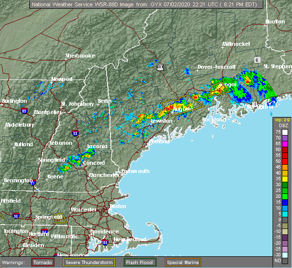 The severe thunderstorm warning for south central penobscot county will expire at 630 pm edt, the severe thunderstorm which prompted the warning has weakened and is moving out of the warned area. therefore, the warning will be allowed to expire. The severe thunderstorm warning for south central penobscot county will expire at 630 pm edt, the severe thunderstorm which prompted the warning has weakened and is moving out of the warned area. therefore, the warning will be allowed to expire.
|
| 7/2/2020 6:14 PM EDT |
 At 614 pm edt, a severe thunderstorm was located near bangor, moving south at 30 mph (radar indicated). Hazards include 60 mph wind gusts and quarter size hail. Minor hail damage to vehicles is possible. expect wind damage to trees and power lines. Locations impacted include, bangor, old town, orono, brewer, hampden, hermon, veazie, glenburn, orrington, holden, levant, eddington and bradley. At 614 pm edt, a severe thunderstorm was located near bangor, moving south at 30 mph (radar indicated). Hazards include 60 mph wind gusts and quarter size hail. Minor hail damage to vehicles is possible. expect wind damage to trees and power lines. Locations impacted include, bangor, old town, orono, brewer, hampden, hermon, veazie, glenburn, orrington, holden, levant, eddington and bradley.
|
| 7/2/2020 5:52 PM EDT |
 At 551 pm edt, a severe thunderstorm was located 7 miles northeast of kenduskeag, or 10 miles northwest of old town, moving south at 30 mph (radar indicated). Hazards include 60 mph wind gusts and quarter size hail. Minor hail damage to vehicles is possible. Expect wind damage to trees and power lines. At 551 pm edt, a severe thunderstorm was located 7 miles northeast of kenduskeag, or 10 miles northwest of old town, moving south at 30 mph (radar indicated). Hazards include 60 mph wind gusts and quarter size hail. Minor hail damage to vehicles is possible. Expect wind damage to trees and power lines.
|
| 7/28/2019 5:26 PM EDT |
 At 526 pm edt, severe thunderstorms were located along a line extending from near kingsbury plantation to 7 miles north of newport, moving east at 30 mph (radar indicated). Hazards include 60 mph wind gusts and quarter size hail. Minor hail damage to vehicles is possible. expect wind damage to trees and power lines. Locations impacted include, old town, dover-foxcroft, dexter, newport, guilford, orono, corinth, kenduskeag, kingsbury plantation, east corinth, glenburn, levant, corinna, hudson, charleston, sangerville, bradford, stetson, garland and exeter. At 526 pm edt, severe thunderstorms were located along a line extending from near kingsbury plantation to 7 miles north of newport, moving east at 30 mph (radar indicated). Hazards include 60 mph wind gusts and quarter size hail. Minor hail damage to vehicles is possible. expect wind damage to trees and power lines. Locations impacted include, old town, dover-foxcroft, dexter, newport, guilford, orono, corinth, kenduskeag, kingsbury plantation, east corinth, glenburn, levant, corinna, hudson, charleston, sangerville, bradford, stetson, garland and exeter.
|
| 7/28/2019 5:01 PM EDT |
 At 500 pm edt, severe thunderstorms were located along a line extending from 7 miles east of bingham to 8 miles north of pittsfield, moving east at 30 mph (radar indicated). Hazards include 60 mph wind gusts and quarter size hail. Minor hail damage to vehicles is possible. Expect wind damage to trees and power lines. At 500 pm edt, severe thunderstorms were located along a line extending from 7 miles east of bingham to 8 miles north of pittsfield, moving east at 30 mph (radar indicated). Hazards include 60 mph wind gusts and quarter size hail. Minor hail damage to vehicles is possible. Expect wind damage to trees and power lines.
|
| 7/6/2019 3:39 PM EDT |
 At 338 pm edt, severe thunderstorms were located along a line extending from near indian island to near newport, moving east at 40 mph (radar indicated). Hazards include 60 mph wind gusts. expect damage to trees and power lines At 338 pm edt, severe thunderstorms were located along a line extending from near indian island to near newport, moving east at 40 mph (radar indicated). Hazards include 60 mph wind gusts. expect damage to trees and power lines
|
| 8/9/2018 1:57 PM EDT |
 The severe thunderstorm warning for west central hancock and south central penobscot counties will expire at 200 pm edt, the storms which prompted the warning have weakened below severe limits, but frequent cloud to ground lightning and heavy downpours are still likely. therefore, the warning will be allowed to expire. The severe thunderstorm warning for west central hancock and south central penobscot counties will expire at 200 pm edt, the storms which prompted the warning have weakened below severe limits, but frequent cloud to ground lightning and heavy downpours are still likely. therefore, the warning will be allowed to expire.
|
| 8/9/2018 1:36 PM EDT |
 At 136 pm edt, severe thunderstorms were located along a line extending from near indian island to bangor to near winterport, moving northeast at 35 mph (radar indicated). Hazards include 60 mph wind gusts and quarter size hail. Minor hail damage to vehicles is possible. expect wind damage to trees and power lines. Locations impacted include, bangor, old town, bucksport, orono, brewer, hampden, hermon, veazie, dedham, kenduskeag, verona island, indian island, winterport, grand falls, glenburn, orrington, holden, milford, levant and carmel. At 136 pm edt, severe thunderstorms were located along a line extending from near indian island to bangor to near winterport, moving northeast at 35 mph (radar indicated). Hazards include 60 mph wind gusts and quarter size hail. Minor hail damage to vehicles is possible. expect wind damage to trees and power lines. Locations impacted include, bangor, old town, bucksport, orono, brewer, hampden, hermon, veazie, dedham, kenduskeag, verona island, indian island, winterport, grand falls, glenburn, orrington, holden, milford, levant and carmel.
|
| 8/9/2018 1:11 PM EDT |
 At 111 pm edt, severe thunderstorms were located along a line extending from near kenduskeag to 7 miles west of hermon to near thorndike, moving east at 25 mph (radar indicated). Hazards include 60 mph wind gusts and quarter size hail. Minor hail damage to vehicles is possible. Expect wind damage to trees and power lines. At 111 pm edt, severe thunderstorms were located along a line extending from near kenduskeag to 7 miles west of hermon to near thorndike, moving east at 25 mph (radar indicated). Hazards include 60 mph wind gusts and quarter size hail. Minor hail damage to vehicles is possible. Expect wind damage to trees and power lines.
|
| 8/7/2018 8:10 PM EDT | Power lines dow in penobscot county ME, 9.3 miles WNW of Orono, ME |
| 8/7/2018 7:47 PM EDT |
 At 747 pm edt, a severe thunderstorm was located near hampden, or 8 miles southwest of bangor, moving east at 40 mph (radar indicated). Hazards include 60 mph wind gusts and quarter size hail. Minor hail damage to vehicles is possible. Expect wind damage to trees and power lines. At 747 pm edt, a severe thunderstorm was located near hampden, or 8 miles southwest of bangor, moving east at 40 mph (radar indicated). Hazards include 60 mph wind gusts and quarter size hail. Minor hail damage to vehicles is possible. Expect wind damage to trees and power lines.
|
| 7/10/2018 4:07 PM EDT |
 The severe thunderstorm warning for south central penobscot county will expire at 415 pm edt, the storm which prompted the warning has weakened below severe limits, and no longer poses an immediate threat to life or property. therefore, the warning will be allowed to expire. The severe thunderstorm warning for south central penobscot county will expire at 415 pm edt, the storm which prompted the warning has weakened below severe limits, and no longer poses an immediate threat to life or property. therefore, the warning will be allowed to expire.
|
| 7/10/2018 3:58 PM EDT |
 At 358 pm edt, a severe thunderstorm was located near orono, or near bangor, moving east at 35 mph (radar indicated). Hazards include 60 mph wind gusts. Expect damage to trees and power lines. Locations impacted include, bangor, old town, orono, veazie, indian island, glenburn, milford, eddington, hudson and bradley. At 358 pm edt, a severe thunderstorm was located near orono, or near bangor, moving east at 35 mph (radar indicated). Hazards include 60 mph wind gusts. Expect damage to trees and power lines. Locations impacted include, bangor, old town, orono, veazie, indian island, glenburn, milford, eddington, hudson and bradley.
|
| 7/10/2018 3:42 PM EDT |
 At 342 pm edt, a severe thunderstorm was located over kenduskeag, or 12 miles northwest of bangor, moving east at 35 mph (radar indicated). Hazards include 60 mph wind gusts and quarter size hail. Minor hail damage to vehicles is possible. Expect wind damage to trees and power lines. At 342 pm edt, a severe thunderstorm was located over kenduskeag, or 12 miles northwest of bangor, moving east at 35 mph (radar indicated). Hazards include 60 mph wind gusts and quarter size hail. Minor hail damage to vehicles is possible. Expect wind damage to trees and power lines.
|
| 10/30/2017 2:35 PM EDT | Roof damage in marden par in penobscot county ME, 0.7 miles WSW of Orono, ME |
| 9/5/2017 8:21 PM EDT |
 At 820 pm edt, a severe thunderstorm was located 8 miles northeast of old town, moving northeast at 40 mph (radar indicated). Hazards include 60 mph wind gusts and quarter size hail. Minor hail damage to vehicles is possible. expect wind damage to trees and power lines. locations impacted include, bangor, old town, howland, orono, hermon, corinth, veazie, kenduskeag, indian island, glenburn, milford, levant, enfield, hudson, bradley, greenbush, bradford, alton, lagrange and passadumkeag. This includes interstate 95 between mile makers 181 and 218. At 820 pm edt, a severe thunderstorm was located 8 miles northeast of old town, moving northeast at 40 mph (radar indicated). Hazards include 60 mph wind gusts and quarter size hail. Minor hail damage to vehicles is possible. expect wind damage to trees and power lines. locations impacted include, bangor, old town, howland, orono, hermon, corinth, veazie, kenduskeag, indian island, glenburn, milford, levant, enfield, hudson, bradley, greenbush, bradford, alton, lagrange and passadumkeag. This includes interstate 95 between mile makers 181 and 218.
|
| 9/5/2017 7:58 PM EDT |
 At 757 pm edt, a severe thunderstorm was located near kenduskeag, moving northeast at 40 mph (radar indicated). Hazards include 60 mph wind gusts and quarter size hail. Minor hail damage to vehicles is possible. Expect wind damage to trees and power lines. At 757 pm edt, a severe thunderstorm was located near kenduskeag, moving northeast at 40 mph (radar indicated). Hazards include 60 mph wind gusts and quarter size hail. Minor hail damage to vehicles is possible. Expect wind damage to trees and power lines.
|
| 9/5/2017 7:30 PM EDT |
 At 729 pm edt, a severe thunderstorm was located near hermon, or 10 miles west of bangor, moving northeast at 40 mph. a second thunderstorm that was also likely severe was located near dixmont (radar indicated). Hazards include 60 mph wind gusts and quarter size hail. Minor hail damage to vehicles is possible. expect wind damage to trees and power lines. locations impacted include, bangor, old town, newport, orono, brewer, hampden, hermon, corinth, veazie, kenduskeag, indian island, east corinth, glenburn, orrington, holden, milford, levant, carmel, eddington and newburgh. this includes the following highways, interstate 95 between mile makers 158 and 201. state highway 11 near newport, and between east corinth and bradford. State highway 9 between dixmont and east eddington. At 729 pm edt, a severe thunderstorm was located near hermon, or 10 miles west of bangor, moving northeast at 40 mph. a second thunderstorm that was also likely severe was located near dixmont (radar indicated). Hazards include 60 mph wind gusts and quarter size hail. Minor hail damage to vehicles is possible. expect wind damage to trees and power lines. locations impacted include, bangor, old town, newport, orono, brewer, hampden, hermon, corinth, veazie, kenduskeag, indian island, east corinth, glenburn, orrington, holden, milford, levant, carmel, eddington and newburgh. this includes the following highways, interstate 95 between mile makers 158 and 201. state highway 11 near newport, and between east corinth and bradford. State highway 9 between dixmont and east eddington.
|
| 9/5/2017 7:07 PM EDT |
 At 706 pm edt, a severe thunderstorm was located near unity, or 7 miles north of thorndike, moving northeast at 40 mph (radar indicated). Hazards include 60 mph wind gusts and quarter size hail. Minor hail damage to vehicles is possible. Expect wind damage to trees and power lines. At 706 pm edt, a severe thunderstorm was located near unity, or 7 miles north of thorndike, moving northeast at 40 mph (radar indicated). Hazards include 60 mph wind gusts and quarter size hail. Minor hail damage to vehicles is possible. Expect wind damage to trees and power lines.
|
| 8/6/2016 4:10 PM EDT |
 The severe thunderstorm warning for west central hancock and south central penobscot counties will expire at 415 pm edt, the severe thunderstorm which prompted the warning has weakened. moved out of the warned area. therefore, the warning will be allowed to expire. The severe thunderstorm warning for west central hancock and south central penobscot counties will expire at 415 pm edt, the severe thunderstorm which prompted the warning has weakened. moved out of the warned area. therefore, the warning will be allowed to expire.
|
| 8/6/2016 3:52 PM EDT |
 At 352 pm edt, a severe thunderstorm was located over brewer, or over bangor, moving southeast at 20 mph (radar indicated). Hazards include 60 mph wind gusts and quarter size hail. Hail damage to vehicles is expected. Expect wind damage to roofs, siding, and trees. At 352 pm edt, a severe thunderstorm was located over brewer, or over bangor, moving southeast at 20 mph (radar indicated). Hazards include 60 mph wind gusts and quarter size hail. Hail damage to vehicles is expected. Expect wind damage to roofs, siding, and trees.
|
| 7/28/2016 5:45 PM EDT |
 At 544 pm edt, a severe thunderstorm was located over orono, or near old town, moving east at 25 mph (radar indicated). Hazards include 60 mph wind gusts and quarter size hail. Hail damage to vehicles is expected. Expect wind damage to roofs, siding, and trees. At 544 pm edt, a severe thunderstorm was located over orono, or near old town, moving east at 25 mph (radar indicated). Hazards include 60 mph wind gusts and quarter size hail. Hail damage to vehicles is expected. Expect wind damage to roofs, siding, and trees.
|
| 7/18/2016 5:00 PM EDT |
 At 500 pm edt, a severe thunderstorm was located over bangor, moving east at 50 mph (radar indicated). Hazards include 60 mph wind gusts and quarter size hail. Hail damage to vehicles is expected. Expect wind damage to roofs, siding, and trees. At 500 pm edt, a severe thunderstorm was located over bangor, moving east at 50 mph (radar indicated). Hazards include 60 mph wind gusts and quarter size hail. Hail damage to vehicles is expected. Expect wind damage to roofs, siding, and trees.
|
| 7/18/2016 4:37 PM EDT |
 At 436 pm edt, a severe thunderstorm was located 7 miles east of newport, moving east at 40 mph (radar indicated). Hazards include 60 mph wind gusts and half dollar size hail. Hail damage to vehicles is expected. Expect wind damage to roofs, siding, and trees. At 436 pm edt, a severe thunderstorm was located 7 miles east of newport, moving east at 40 mph (radar indicated). Hazards include 60 mph wind gusts and half dollar size hail. Hail damage to vehicles is expected. Expect wind damage to roofs, siding, and trees.
|
| 7/18/2016 3:38 PM EDT |
 At 337 pm edt, a severe thunderstorm was located over kenduskeag, or 11 miles northwest of bangor, moving east at 35 mph (radar indicated). Hazards include 60 mph wind gusts and quarter size hail. Hail damage to vehicles is expected. expect wind damage to roofs, siding, and trees. Locations impacted include, bangor, old town, orono, hermon, corinth, veazie, kenduskeag, east corinth, glenburn, levant, hudson, charleston, bradford, stetson, garland, exeter, alton and argyle. At 337 pm edt, a severe thunderstorm was located over kenduskeag, or 11 miles northwest of bangor, moving east at 35 mph (radar indicated). Hazards include 60 mph wind gusts and quarter size hail. Hail damage to vehicles is expected. expect wind damage to roofs, siding, and trees. Locations impacted include, bangor, old town, orono, hermon, corinth, veazie, kenduskeag, east corinth, glenburn, levant, hudson, charleston, bradford, stetson, garland, exeter, alton and argyle.
|
| 7/18/2016 3:34 PM EDT |
 At 333 pm edt, severe thunderstorms were located along a line extending from 9 miles northeast of indian island to near hermon, moving east at 40 mph (radar indicated). Hazards include 60 mph wind gusts and quarter size hail. Hail damage to vehicles is expected. Expect wind damage to roofs, siding, and trees. At 333 pm edt, severe thunderstorms were located along a line extending from 9 miles northeast of indian island to near hermon, moving east at 40 mph (radar indicated). Hazards include 60 mph wind gusts and quarter size hail. Hail damage to vehicles is expected. Expect wind damage to roofs, siding, and trees.
|
| 7/18/2016 2:58 PM EDT |
 At 257 pm edt, a severe thunderstorm was located 12 miles south of kingsbury plantation, or 13 miles west of dexter, moving east at 35 mph (radar indicated). Hazards include golf ball size hail and 60 mph wind gusts. People and animals outdoors will be injured. expect hail damage to roofs, siding, windows, and vehicles. Expect wind damage to roofs, siding, and trees. At 257 pm edt, a severe thunderstorm was located 12 miles south of kingsbury plantation, or 13 miles west of dexter, moving east at 35 mph (radar indicated). Hazards include golf ball size hail and 60 mph wind gusts. People and animals outdoors will be injured. expect hail damage to roofs, siding, windows, and vehicles. Expect wind damage to roofs, siding, and trees.
|
| 2/25/2016 4:03 AM EST |
 At 402 am est, severe thunderstorms were located along a line extending from near milo to near stonington, moving northeast at 45 mph (radar indicated). Hazards include 60 mph wind gusts. Expect damage to roofs. Siding and trees. At 402 am est, severe thunderstorms were located along a line extending from near milo to near stonington, moving northeast at 45 mph (radar indicated). Hazards include 60 mph wind gusts. Expect damage to roofs. Siding and trees.
|
| 8/5/2015 5:12 PM EDT | The severe thunderstorm warning for northeastern hancock, south central penobscot and west central washington counties will expire at 515 pm edt, the severe thunderstorm which prompted the warning has weakened. therefore the warning will be allowed to expire. |
| 8/5/2015 4:53 PM EDT |
 At 452 pm edt, a severe thunderstorm was located 13 miles east of old town (radar indicated). Hazards include 60 mph wind gusts and quarter size hail. Hail damage to vehicles is expected. expect wind damage to roofs, siding and trees. Locations impacted include, bangor, old town, orono, brewer, veazie, dedham, columbia falls, columbia, grand lake stream, deblois, indian island, centerville, glenburn, orrington, holden, milford, eddington, hudson, bradley and clifton. At 452 pm edt, a severe thunderstorm was located 13 miles east of old town (radar indicated). Hazards include 60 mph wind gusts and quarter size hail. Hail damage to vehicles is expected. expect wind damage to roofs, siding and trees. Locations impacted include, bangor, old town, orono, brewer, veazie, dedham, columbia falls, columbia, grand lake stream, deblois, indian island, centerville, glenburn, orrington, holden, milford, eddington, hudson, bradley and clifton.
|
| 8/5/2015 4:35 PM EDT |
 At 433 pm edt, a severe thunderstorm was located 11 miles east of old town, moving east at 35 mph (radar indicated). Hazards include 60 mph wind gusts and quarter size hail. Hail damage to vehicles is expected. Expect wind damage to roofs, siding and trees. At 433 pm edt, a severe thunderstorm was located 11 miles east of old town, moving east at 35 mph (radar indicated). Hazards include 60 mph wind gusts and quarter size hail. Hail damage to vehicles is expected. Expect wind damage to roofs, siding and trees.
|
| 8/4/2015 6:12 PM EDT | The severe thunderstorm warning for northern hancock, southeastern piscataquis, southern penobscot and west central washington counties will expire at 615 pm edt, the storm which prompted the warning has weakened below severe limits, and no longer poses an immediate threat to life or property. therefore the warning will be allowed to expire. a severe thunderstorm watch remains in effect until 800 pm edt for eastern maine. |
| 8/4/2015 5:48 PM EDT |
 At 545 pm edt, a severe thunderstorm was located near old town, moving east at 45 mph (radar indicated). Hazards include 60 mph wind gusts and quarter size hail. Hail damage to vehicles is expected. expect wind damage to roofs, siding and trees. Locations impacted include, bangor, old town, howland, orono, brewer, hampden, hermon, corinth, veazie, dedham, kenduskeag, springfield, east corinth, indian island, grand falls, licoln township, orneville, winterport, glenburn and orrington. At 545 pm edt, a severe thunderstorm was located near old town, moving east at 45 mph (radar indicated). Hazards include 60 mph wind gusts and quarter size hail. Hail damage to vehicles is expected. expect wind damage to roofs, siding and trees. Locations impacted include, bangor, old town, howland, orono, brewer, hampden, hermon, corinth, veazie, dedham, kenduskeag, springfield, east corinth, indian island, grand falls, licoln township, orneville, winterport, glenburn and orrington.
|
| 8/4/2015 5:09 PM EDT |
 At 507 pm edt, a severe thunderstorm was located over hermon, or 8 miles west of bangor, moving east at 45 mph (radar indicated). Hazards include 60 mph wind gusts and quarter size hail. Hail damage to vehicles is expected. Expect wind damage to roofs, siding and trees. At 507 pm edt, a severe thunderstorm was located over hermon, or 8 miles west of bangor, moving east at 45 mph (radar indicated). Hazards include 60 mph wind gusts and quarter size hail. Hail damage to vehicles is expected. Expect wind damage to roofs, siding and trees.
|
| 8/4/2015 4:30 PM EDT |
 At 428 pm edt, a severe thunderstorm was located near pittsfield, moving east at 50 mph (radar indicated). Hazards include 60 mph wind gusts and quarter size hail. Hail damage to vehicles is expected. Expect wind damage to roofs, siding and trees. At 428 pm edt, a severe thunderstorm was located near pittsfield, moving east at 50 mph (radar indicated). Hazards include 60 mph wind gusts and quarter size hail. Hail damage to vehicles is expected. Expect wind damage to roofs, siding and trees.
|
| 7/28/2015 3:27 PM EDT | The severe thunderstorm warning for central hancock and south central penobscot counties will expire at 330 pm edt, the severe thunderstorm which prompted the warning has weakened. therefore the warning will be allowed to expire. |
| 7/28/2015 3:09 PM EDT |
 At 309 pm edt, a severe thunderstorm was located 7 miles southeast of orono, or 9 miles southeast of old town, moving southeast at 35 mph (trained weather spotters). Hazards include 60 mph wind gusts and quarter size hail. Hail damage to vehicles is expected. expect wind damage to roofs, siding and trees. Locations impacted include, bangor, old town, orono, brewer, veazie, dedham, indian island, holden, milford, eddington, bradley, clifton, otis, mariaville and amherst. At 309 pm edt, a severe thunderstorm was located 7 miles southeast of orono, or 9 miles southeast of old town, moving southeast at 35 mph (trained weather spotters). Hazards include 60 mph wind gusts and quarter size hail. Hail damage to vehicles is expected. expect wind damage to roofs, siding and trees. Locations impacted include, bangor, old town, orono, brewer, veazie, dedham, indian island, holden, milford, eddington, bradley, clifton, otis, mariaville and amherst.
|
| 7/28/2015 2:45 PM EDT |
 At 244 pm edt, a severe thunderstorm was located near indian island, or near old town, moving southeast at 35 mph (radar indicated). Hazards include 60 mph wind gusts and quarter size hail. Hail damage to vehicles is expected. Expect wind damage to roofs, siding and trees. At 244 pm edt, a severe thunderstorm was located near indian island, or near old town, moving southeast at 35 mph (radar indicated). Hazards include 60 mph wind gusts and quarter size hail. Hail damage to vehicles is expected. Expect wind damage to roofs, siding and trees.
|
| 7/28/2015 5:23 AM EDT |
 At 522 am edt, a severe thunderstorm was located 8 miles southeast of grand falls, or 22 miles east of old town, and is nearly stationary (radar indicated). Hazards include 60 mph wind gusts and quarter size hail. Hail damage to vehicles is expected. expect wind damage to roofs, siding and trees. Locations impacted include, bucksport, orono, brewer, dedham, deblois, grand falls, orrington, holden, milford, eddington, bradley, greenbush, clifton, otis, mariaville, eastbrook, burlington, lowell, waltham and amherst. At 522 am edt, a severe thunderstorm was located 8 miles southeast of grand falls, or 22 miles east of old town, and is nearly stationary (radar indicated). Hazards include 60 mph wind gusts and quarter size hail. Hail damage to vehicles is expected. expect wind damage to roofs, siding and trees. Locations impacted include, bucksport, orono, brewer, dedham, deblois, grand falls, orrington, holden, milford, eddington, bradley, greenbush, clifton, otis, mariaville, eastbrook, burlington, lowell, waltham and amherst.
|
| 7/28/2015 5:01 AM EDT |
 At 501 am edt, a severe thunderstorm was located near grand falls, or 20 miles northeast of old town, moving east at 35 mph (radar indicated). Hazards include 60 mph wind gusts and quarter size hail. Hail damage to vehicles is expected. Expect wind damage to roofs, siding and trees. At 501 am edt, a severe thunderstorm was located near grand falls, or 20 miles northeast of old town, moving east at 35 mph (radar indicated). Hazards include 60 mph wind gusts and quarter size hail. Hail damage to vehicles is expected. Expect wind damage to roofs, siding and trees.
|
| 6/23/2015 9:15 PM EDT |
 At 913 pm edt, a severe thunderstorm was located 7 miles southeast of orono, or 9 miles southeast of old town, moving east at 35 mph (radar indicated). Hazards include 60 mph wind gusts. Damage is possible to siding and trees. Locations impacted include, bangor, old town, ellsworth, bucksport, orono, brewer, hampden, hermon, veazie, dedham, kenduskeag, indian island, glenburn, orrington, holden, milford, levant, eddington, orland and bradley. At 913 pm edt, a severe thunderstorm was located 7 miles southeast of orono, or 9 miles southeast of old town, moving east at 35 mph (radar indicated). Hazards include 60 mph wind gusts. Damage is possible to siding and trees. Locations impacted include, bangor, old town, ellsworth, bucksport, orono, brewer, hampden, hermon, veazie, dedham, kenduskeag, indian island, glenburn, orrington, holden, milford, levant, eddington, orland and bradley.
|
| 6/23/2015 8:47 PM EDT |
 At 846 pm edt, a severe thunderstorm was located 7 miles southwest of hermon, or 12 miles southeast of newport, moving east at 35 mph (radar indicated). Hazards include 60 mph wind gusts. radar indicated some weak rotation with this storm. Damage to roofs. Siding and trees is possible. At 846 pm edt, a severe thunderstorm was located 7 miles southwest of hermon, or 12 miles southeast of newport, moving east at 35 mph (radar indicated). Hazards include 60 mph wind gusts. radar indicated some weak rotation with this storm. Damage to roofs. Siding and trees is possible.
|
| 6/11/2015 5:47 AM EDT |
 At 545 am edt, a severe thunderstorm was located near springfield, or 15 miles east of lincoln, and is nearly stationary (radar indicated). Hazards include 60 mph wind gusts. Expect damage to trees. Locations impacted include, lincoln, bangor, old town, howland, orono, brewer, hampden, hermon, corinth, veazie, medway, kenduskeag, springfield, lakeville, reed plantation, indian island, wytopitlock, grand falls, licoln township and orneville. At 545 am edt, a severe thunderstorm was located near springfield, or 15 miles east of lincoln, and is nearly stationary (radar indicated). Hazards include 60 mph wind gusts. Expect damage to trees. Locations impacted include, lincoln, bangor, old town, howland, orono, brewer, hampden, hermon, corinth, veazie, medway, kenduskeag, springfield, lakeville, reed plantation, indian island, wytopitlock, grand falls, licoln township and orneville.
|
| 6/11/2015 5:10 AM EDT |
 At 510 am edt, a severe thunderstorm was located near howland, moving northeast at 55 mph (radar indicated). Hazards include 60 mph wind gusts. Expect damage to roofs. Siding and trees. At 510 am edt, a severe thunderstorm was located near howland, moving northeast at 55 mph (radar indicated). Hazards include 60 mph wind gusts. Expect damage to roofs. Siding and trees.
|
| 6/11/2015 5:08 AM EDT |
 The severe thunderstorm warning for central hancock, southeastern piscataquis and southwestern penobscot counties will expire at 515 am edt, the severe thunderstorm which prompted the warning has weakened. therefore the warning will be allowed to expire. The severe thunderstorm warning for central hancock, southeastern piscataquis and southwestern penobscot counties will expire at 515 am edt, the severe thunderstorm which prompted the warning has weakened. therefore the warning will be allowed to expire.
|
| 6/11/2015 5:01 AM EDT |
 At 500 am edt, a severe thunderstorm was located near indian island, or near old town, and is nearly stationary (radar indicated). Hazards include 60 mph wind gusts. Expect damage to roofs. siding and trees. Locations impacted include, bangor, old town, bucksport, dover-foxcroft, dexter, newport, howland, orono, brewer, hampden, hermon, corinth, milo, veazie, dedham, kenduskeag, east corinth, indian island, orneville and lake view plantation. At 500 am edt, a severe thunderstorm was located near indian island, or near old town, and is nearly stationary (radar indicated). Hazards include 60 mph wind gusts. Expect damage to roofs. siding and trees. Locations impacted include, bangor, old town, bucksport, dover-foxcroft, dexter, newport, howland, orono, brewer, hampden, hermon, corinth, milo, veazie, dedham, kenduskeag, east corinth, indian island, orneville and lake view plantation.
|
| 6/11/2015 4:35 AM EDT |
 At 434 am edt, a severe thunderstorm was located near kenduskeag, or 11 miles east of newport, moving northeast at 55 mph (radar indicated). Hazards include 60 mph wind gusts. Expect damage to roofs. Siding and trees. At 434 am edt, a severe thunderstorm was located near kenduskeag, or 11 miles east of newport, moving northeast at 55 mph (radar indicated). Hazards include 60 mph wind gusts. Expect damage to roofs. Siding and trees.
|
| 5/28/2015 5:25 PM EDT | The severe thunderstorm warning for central hancock. south central penobscot and west central washington counties will expire at 530 pm edt. the storm which prompted the warning has weakened below severe limits. and no longer pose an immediate threat to life or property. therefore the warning will be allowed to expire. However small hail. |
| 5/28/2015 5:05 PM EDT | At 504 pm edt, a severe thunderstorm was located 9 miles northeast of dedham, or 13 miles southeast of old town, moving east at 25 mph (radar indicated). Hazards include 60 mph wind gusts and quarter size hail. Hail damage to vehicles is expected. expect wind damage to roofs, siding and trees. Locations impacted include, bangor, bucksport, orono, brewer, hampden, hermon, veazie, dedham, deblois, winterport, orrington, holden, carmel, eddington, newburgh, bradley, clifton, otis, mariaville and eastbrook. |
| 5/28/2015 4:24 PM EDT | At 423 pm edt, a severe thunderstorm was located over hampden, or near bangor, moving east at 40 mph (radar indicated). Hazards include 60 mph wind gusts and quarter size hail. Hail damage to vehicles is expected. Expect wind damage to roofs, siding and trees. |
| 8/8/2014 4:00 PM EDT | Trees and wires down on essex stree in penobscot county ME, 0.7 miles WSW of Orono, ME |
| 8/8/2014 4:00 PM EDT | Trees down on kelly rd in penobscot county ME, 1.4 miles NE of Orono, ME |
| 7/19/2013 10:40 PM EDT | Multiple trees down in penobscot county ME, 0.7 miles WSW of Orono, ME |
Hail Maps for Orono, ME


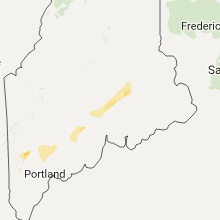
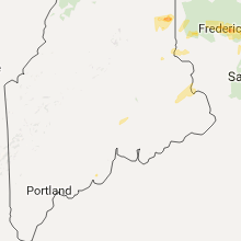
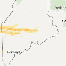
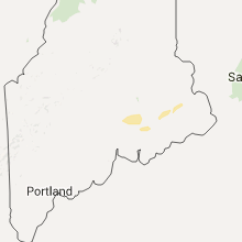
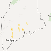

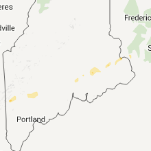
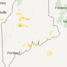
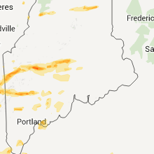
Connect with Interactive Hail Maps