

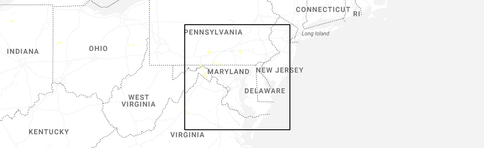
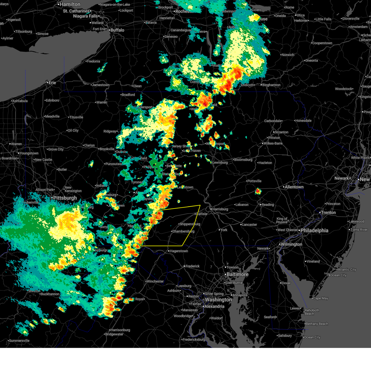
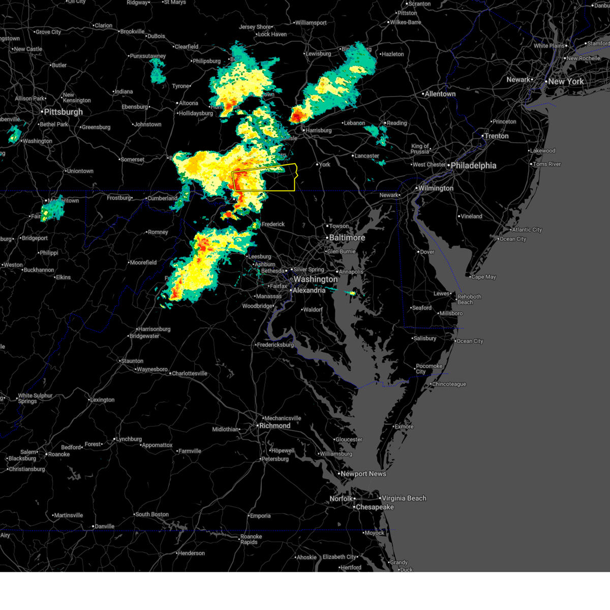
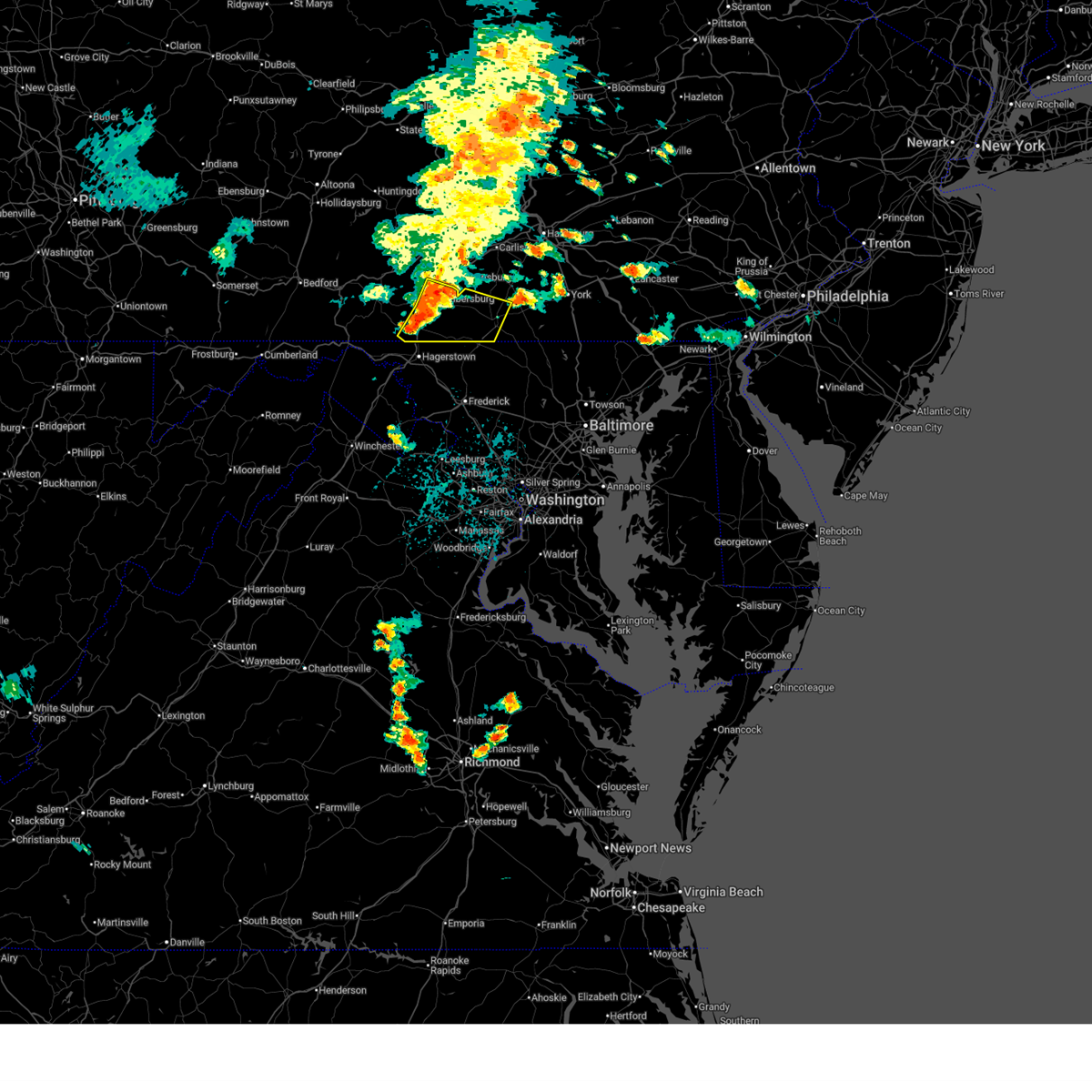
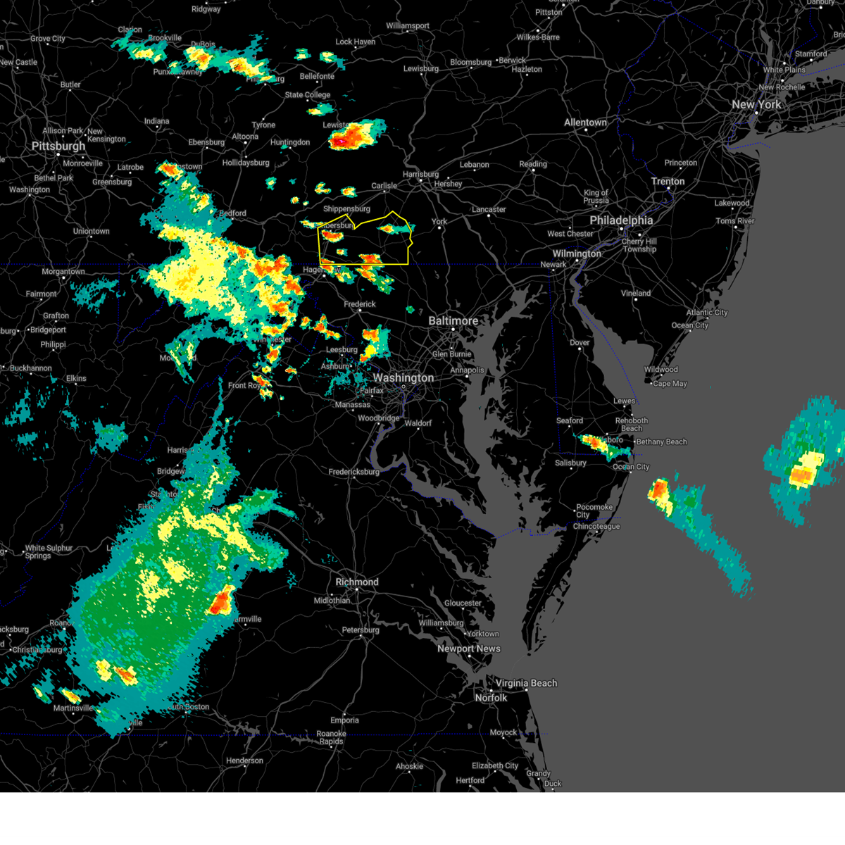
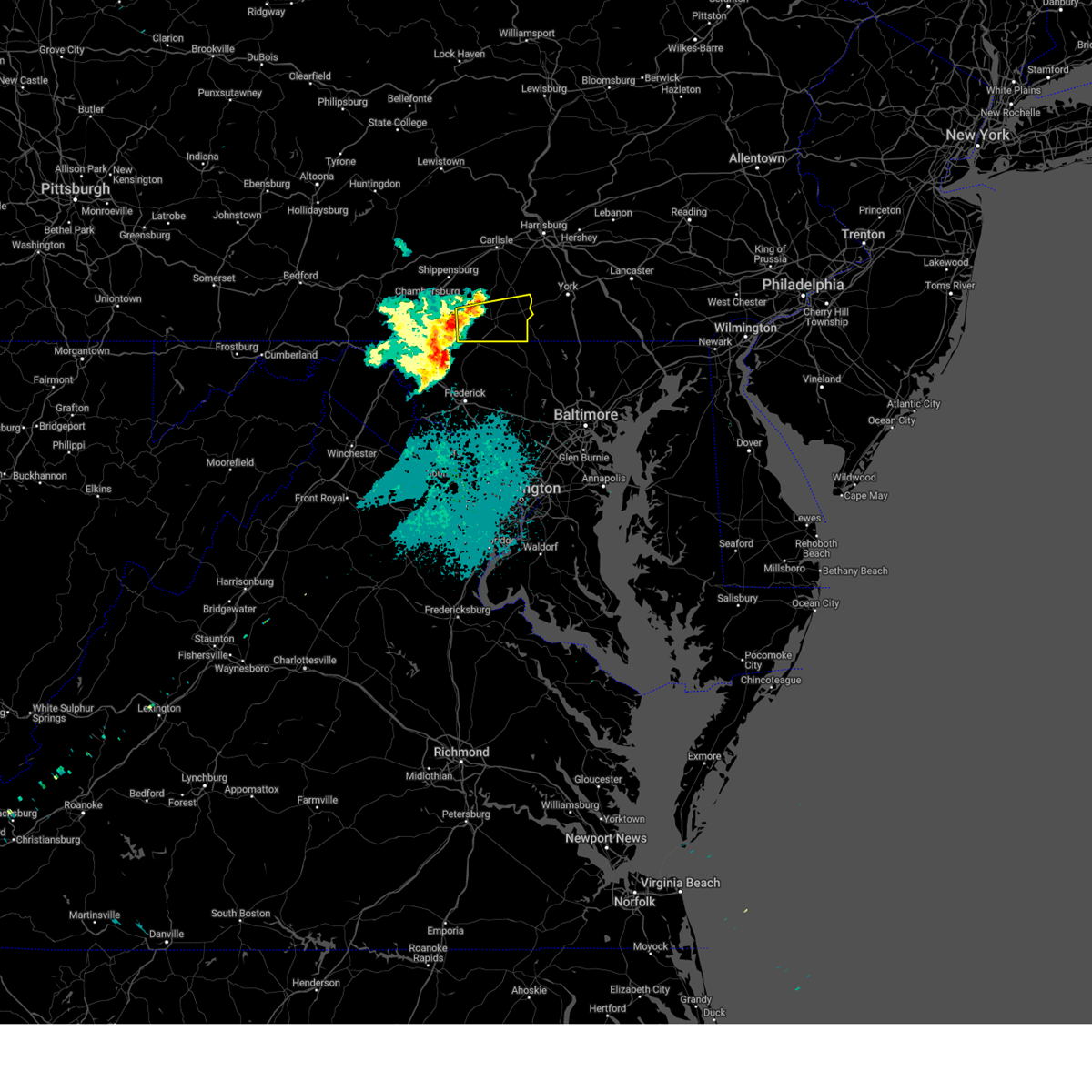
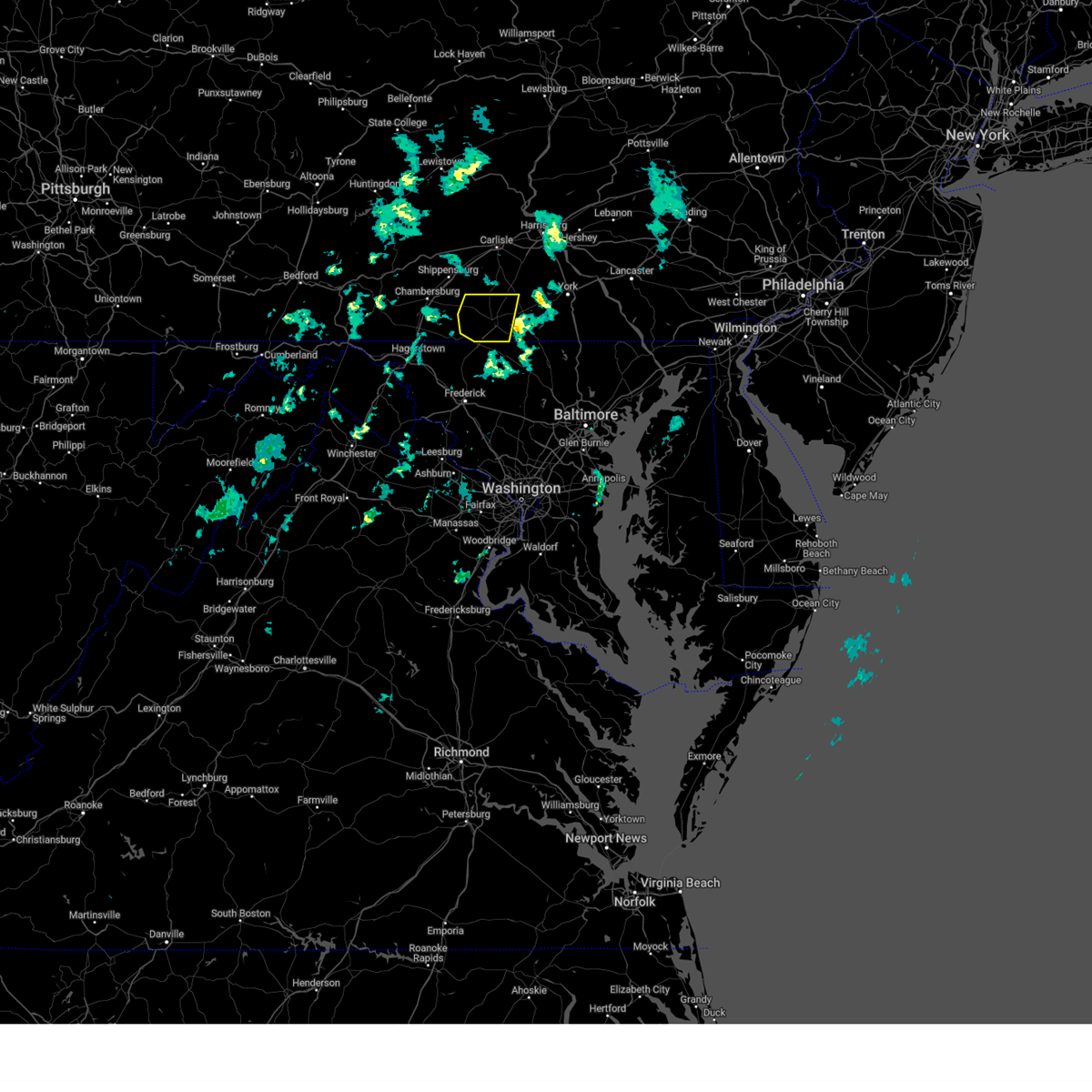
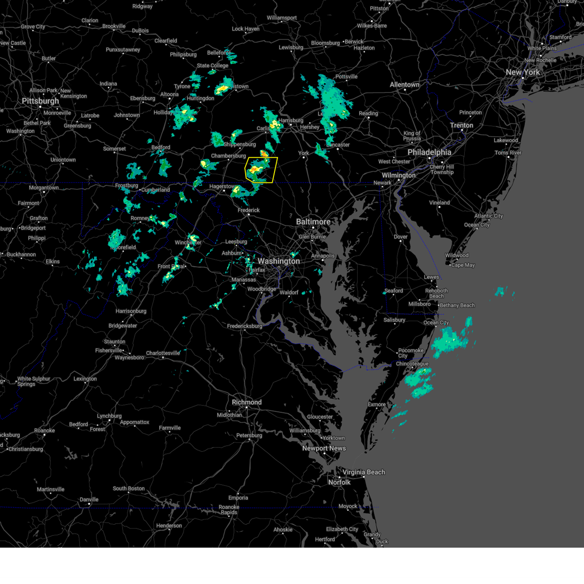
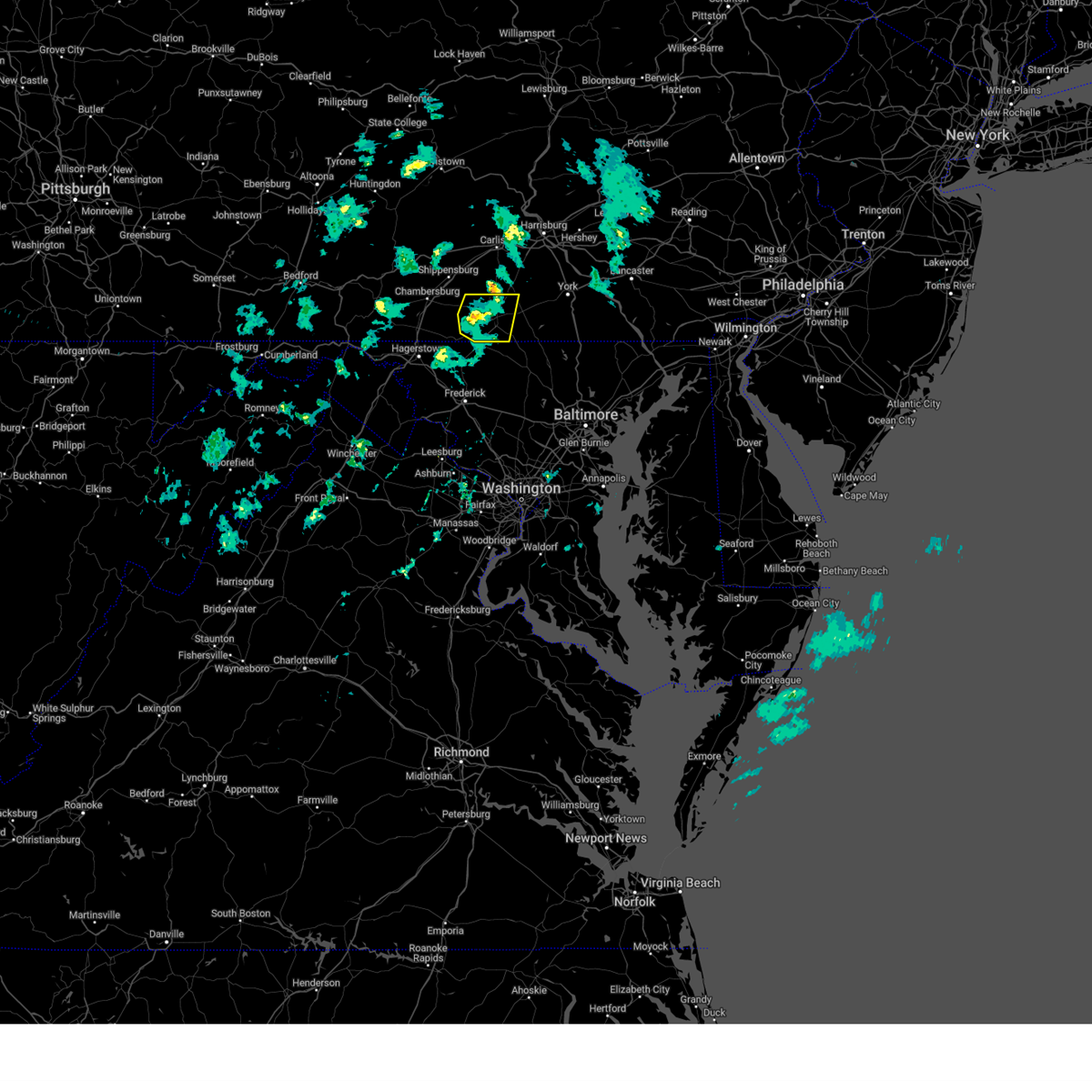
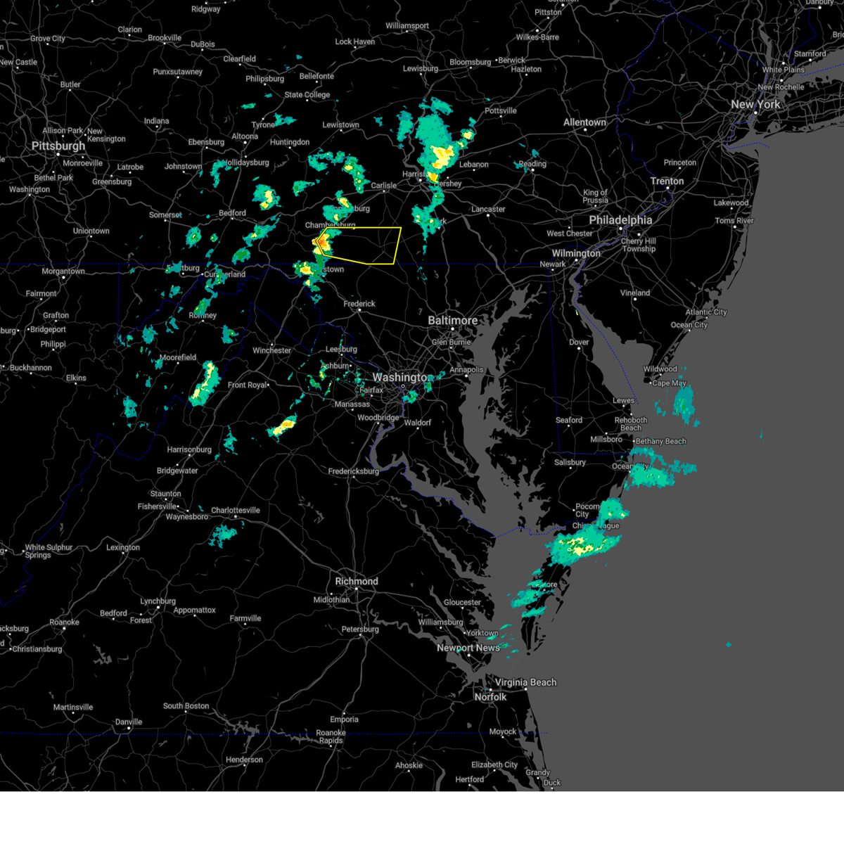
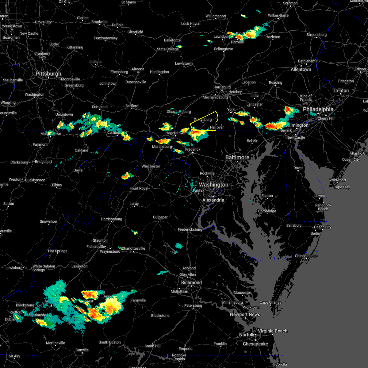
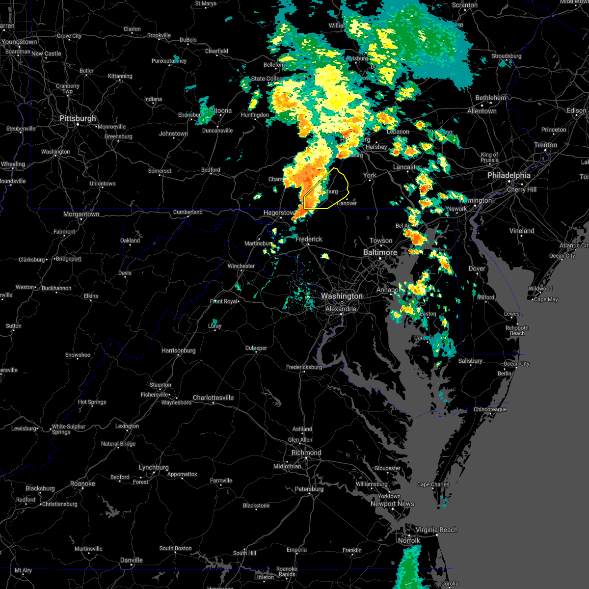
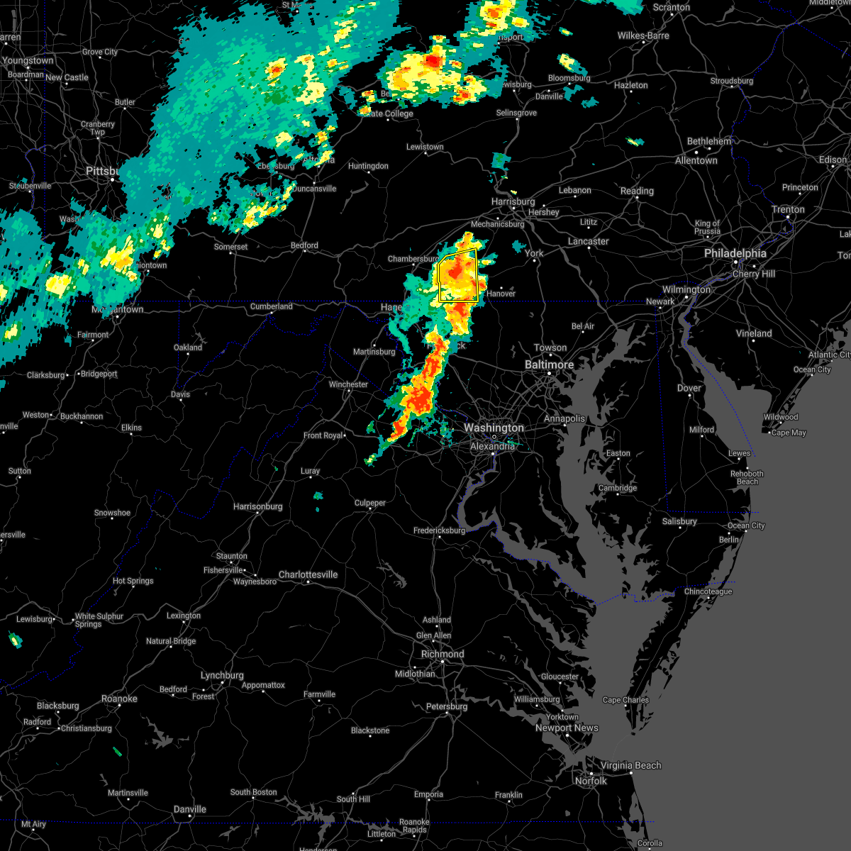
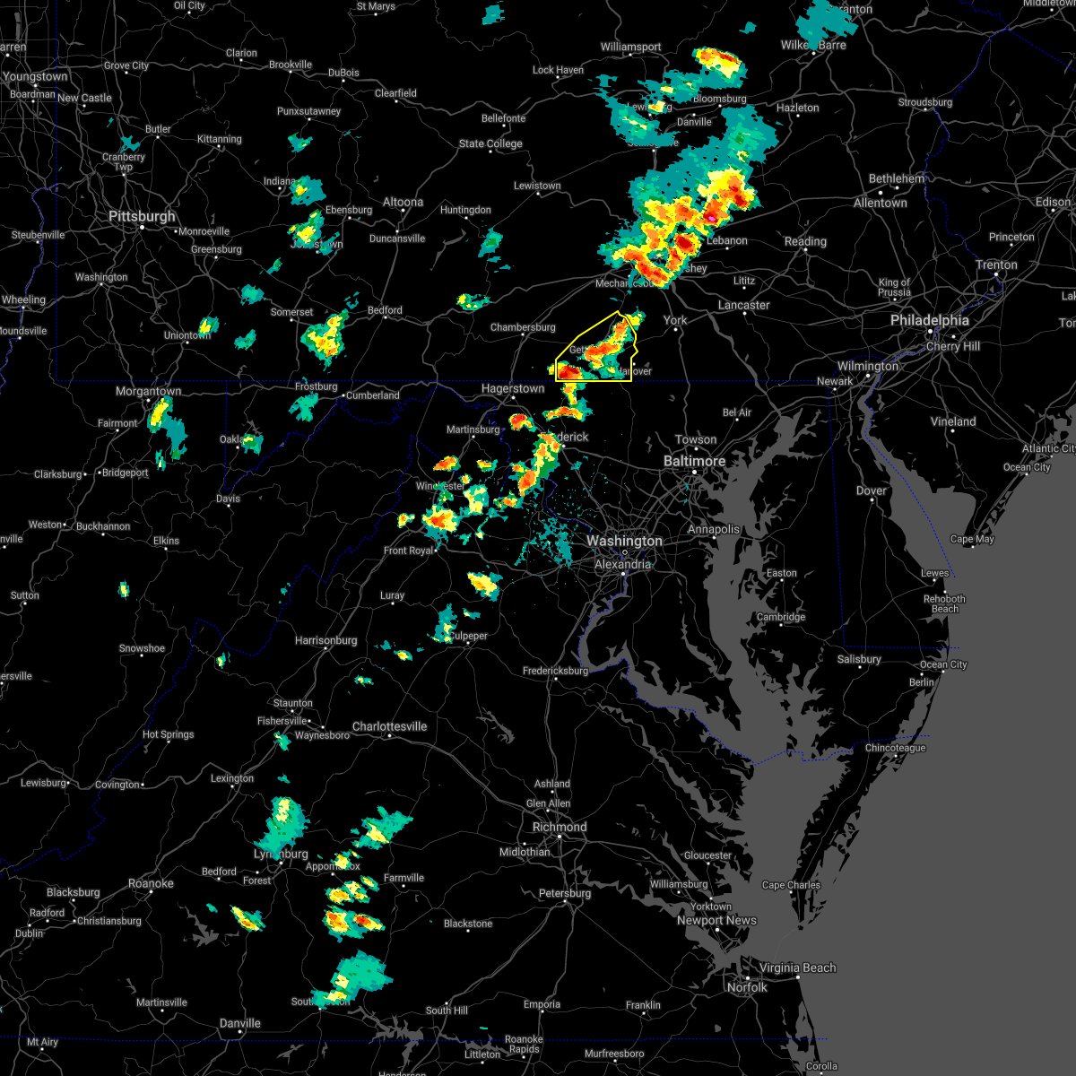
Hail Map for Orrtanna, PA
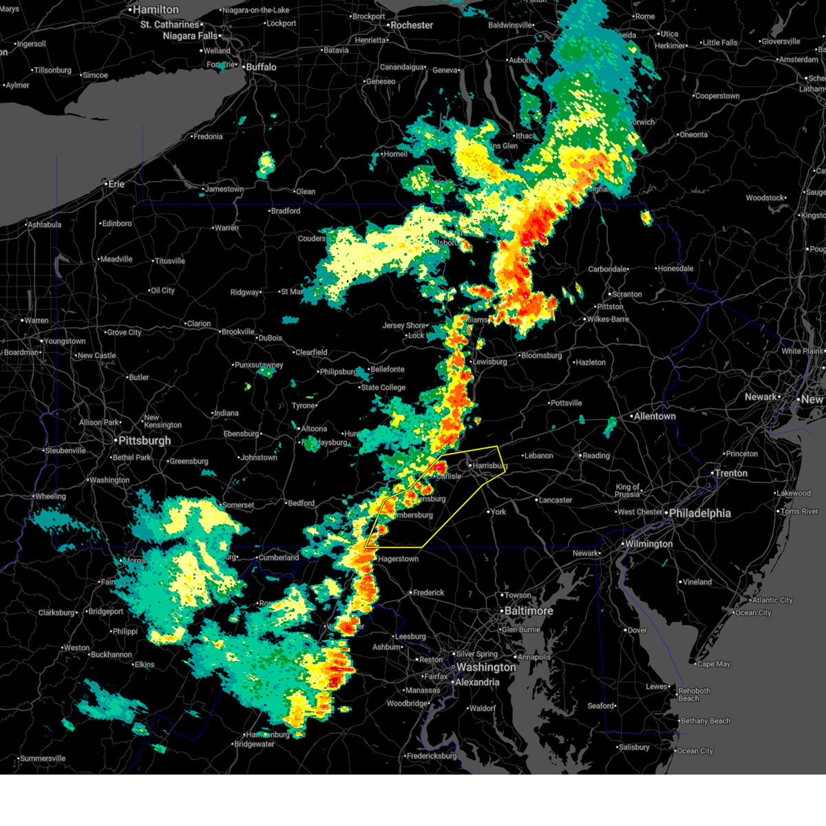
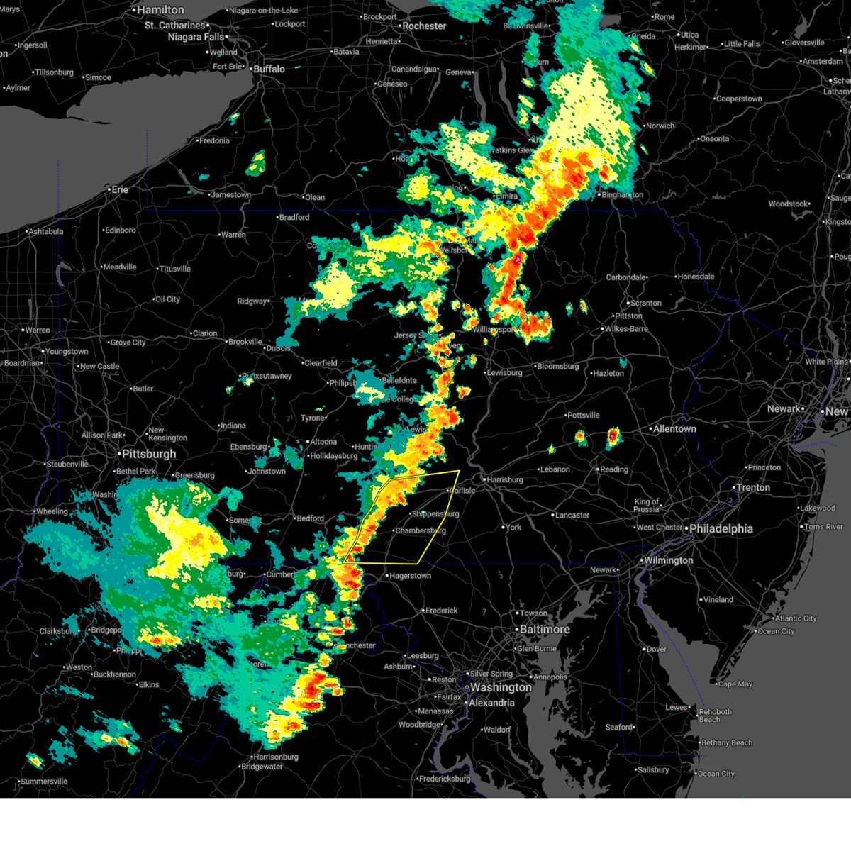
The Orrtanna, PA area has had 0 reports of on-the-ground hail by trained spotters, and has been under severe weather warnings 11 times during the past 12 months. Doppler radar has detected hail at or near Orrtanna, PA on 39 occasions, including 1 occasion during the past year.
| Name: | Orrtanna, PA |
| Where Located: | 55.4 miles NW of Baltimore, MD |
| Map: | Google Map for Orrtanna, PA |
| Population: | 173 |
| Housing Units: | 75 |
| More Info: | Search Google for Orrtanna, PA |
0
The Top Recent Hail Date for Orrtanna, PA is Saturday, July 26, 2025 (33rd out of 39)
Hail and Wind Damage Spotted near Orrtanna, PA
| Date / Time | Report Details |
|---|---|
| 6/11/2026 7:12 PM EDT |
 Svrctp the national weather service in state college pa has issued a * severe thunderstorm warning for, adams county in south central pennsylvania, cumberland county in south central pennsylvania, southern dauphin county in south central pennsylvania, southeastern franklin county in south central pennsylvania, east central perry county in south central pennsylvania, northwestern york county in south central pennsylvania, * until 800 pm edt. * at 712 pm edt, severe thunderstorms were located along a line extending from wertzville to mount holly springs to shippensburg to greencastle, moving east at 50 mph (radar indicated). Hazards include 60 mph wind gusts. expect damage to roofs, siding, and trees Svrctp the national weather service in state college pa has issued a * severe thunderstorm warning for, adams county in south central pennsylvania, cumberland county in south central pennsylvania, southern dauphin county in south central pennsylvania, southeastern franklin county in south central pennsylvania, east central perry county in south central pennsylvania, northwestern york county in south central pennsylvania, * until 800 pm edt. * at 712 pm edt, severe thunderstorms were located along a line extending from wertzville to mount holly springs to shippensburg to greencastle, moving east at 50 mph (radar indicated). Hazards include 60 mph wind gusts. expect damage to roofs, siding, and trees
|
| 6/11/2026 6:52 PM EDT |
 the severe thunderstorm warning has been cancelled and is no longer in effect the severe thunderstorm warning has been cancelled and is no longer in effect
|
| 6/11/2026 6:52 PM EDT |
 At 652 pm edt, severe thunderstorms were located along a line extending from bloserville to shippensburg to greencastle, moving east at 45 mph (radar indicated). Hazards include 60 mph wind gusts. Expect damage to roofs, siding, and trees. locations impacted include, chambersburg, carlisle, waynesboro, shippensburg, greencastle, guilford, plainfield, st. thomas, schlusser, fayetteville, wayne heights, and mount holly springs. this includes the following interstates, the pennsylvania turnpike from mile markers 187 to 227. Interstate 81 from mile markers 1 to 50. At 652 pm edt, severe thunderstorms were located along a line extending from bloserville to shippensburg to greencastle, moving east at 45 mph (radar indicated). Hazards include 60 mph wind gusts. Expect damage to roofs, siding, and trees. locations impacted include, chambersburg, carlisle, waynesboro, shippensburg, greencastle, guilford, plainfield, st. thomas, schlusser, fayetteville, wayne heights, and mount holly springs. this includes the following interstates, the pennsylvania turnpike from mile markers 187 to 227. Interstate 81 from mile markers 1 to 50.
|
| 6/11/2026 6:13 PM EDT |
 Svrctp the national weather service in state college pa has issued a * severe thunderstorm warning for, western adams county in south central pennsylvania, cumberland county in south central pennsylvania, franklin county in south central pennsylvania, central fulton county in south central pennsylvania, southeastern huntingdon county in central pennsylvania, southwestern perry county in south central pennsylvania, * until 715 pm edt. * at 613 pm edt, severe thunderstorms were located along a line extending from rockhill furnace to harrisonville to warfordsburg, moving east at 45 mph (radar indicated). Hazards include 60 mph wind gusts. expect damage to roofs, siding, and trees Svrctp the national weather service in state college pa has issued a * severe thunderstorm warning for, western adams county in south central pennsylvania, cumberland county in south central pennsylvania, franklin county in south central pennsylvania, central fulton county in south central pennsylvania, southeastern huntingdon county in central pennsylvania, southwestern perry county in south central pennsylvania, * until 715 pm edt. * at 613 pm edt, severe thunderstorms were located along a line extending from rockhill furnace to harrisonville to warfordsburg, moving east at 45 mph (radar indicated). Hazards include 60 mph wind gusts. expect damage to roofs, siding, and trees
|
| 6/6/2026 4:55 PM EDT |
 Svrctp the national weather service in state college pa has issued a * severe thunderstorm warning for, adams county in south central pennsylvania, southeastern franklin county in south central pennsylvania, western york county in south central pennsylvania, * until 600 pm edt. * at 454 pm edt, severe thunderstorms were located along a line extending from boiling springs to pine grove furnace to chambersburg to near greencastle, moving east at 40 mph (radar indicated). Hazards include 70 mph wind gusts and quarter size hail. Hail damage to vehicles is expected. expect considerable tree damage. Wind damage is also likely to mobile homes, roofs, and outbuildings. Svrctp the national weather service in state college pa has issued a * severe thunderstorm warning for, adams county in south central pennsylvania, southeastern franklin county in south central pennsylvania, western york county in south central pennsylvania, * until 600 pm edt. * at 454 pm edt, severe thunderstorms were located along a line extending from boiling springs to pine grove furnace to chambersburg to near greencastle, moving east at 40 mph (radar indicated). Hazards include 70 mph wind gusts and quarter size hail. Hail damage to vehicles is expected. expect considerable tree damage. Wind damage is also likely to mobile homes, roofs, and outbuildings.
|
| 3/16/2026 11:27 AM EDT |
 Svrctp the national weather service in state college pa has issued a * severe thunderstorm warning for, southwestern adams county in south central pennsylvania, franklin county in south central pennsylvania, * until 1215 pm edt. * at 1127 am edt, severe thunderstorms were located along a line extending from claylick to near braddock heights, moving northeast at 45 mph (radar indicated). Hazards include 60 mph wind gusts. expect damage to roofs, siding, and trees Svrctp the national weather service in state college pa has issued a * severe thunderstorm warning for, southwestern adams county in south central pennsylvania, franklin county in south central pennsylvania, * until 1215 pm edt. * at 1127 am edt, severe thunderstorms were located along a line extending from claylick to near braddock heights, moving northeast at 45 mph (radar indicated). Hazards include 60 mph wind gusts. expect damage to roofs, siding, and trees
|
| 3/11/2026 6:31 PM EDT |
 At 630 pm edt, severe thunderstorms were located along a line extending from orrtanna to emmitsburg, moving east at 40 mph (radar indicated). Hazards include 60 mph wind gusts and penny size hail. Expect damage to roofs, siding, and trees. Locations impacted include, hanover, gettysburg, hampton, littlestown, mcsherrystown, bonneauville, new oxford, east berlin, lake heritage, cashtown, orrtanna, and biglerville. At 630 pm edt, severe thunderstorms were located along a line extending from orrtanna to emmitsburg, moving east at 40 mph (radar indicated). Hazards include 60 mph wind gusts and penny size hail. Expect damage to roofs, siding, and trees. Locations impacted include, hanover, gettysburg, hampton, littlestown, mcsherrystown, bonneauville, new oxford, east berlin, lake heritage, cashtown, orrtanna, and biglerville.
|
| 3/11/2026 6:31 PM EDT |
 the severe thunderstorm warning has been cancelled and is no longer in effect the severe thunderstorm warning has been cancelled and is no longer in effect
|
| 3/11/2026 6:13 PM EDT |
 Svrctp the national weather service in state college pa has issued a * severe thunderstorm warning for, adams county in south central pennsylvania, southeastern franklin county in south central pennsylvania, * until 700 pm edt. * at 612 pm edt, severe thunderstorms were located along a line extending from mont alto to rouzerville, moving east at 40 mph (radar indicated). Hazards include 60 mph wind gusts and penny size hail. expect damage to roofs, siding, and trees Svrctp the national weather service in state college pa has issued a * severe thunderstorm warning for, adams county in south central pennsylvania, southeastern franklin county in south central pennsylvania, * until 700 pm edt. * at 612 pm edt, severe thunderstorms were located along a line extending from mont alto to rouzerville, moving east at 40 mph (radar indicated). Hazards include 60 mph wind gusts and penny size hail. expect damage to roofs, siding, and trees
|
| 9/25/2025 3:25 PM EDT | Tree down on mountain road between pine tree road and rt 234 franklin townshi in adams county PA, 7.3 miles S of Orrtanna, PA |
| 7/26/2025 11:11 PM EDT |
 At 1110 pm edt, severe thunderstorms were located along a line extending from near cashtown to near carroll valley to smithsburg, moving southeast at 20 mph (radar indicated). Hazards include 60 mph wind gusts. Expect damage to roofs, siding, and trees. locations impacted include, waynesboro, gettysburg, greencastle, carroll valley, fayetteville, wayne heights, mont alto, lake heritage, rouzerville, cashtown, orrtanna, and maugansville. This includes interstate 81 from mile markers 0 to 6. At 1110 pm edt, severe thunderstorms were located along a line extending from near cashtown to near carroll valley to smithsburg, moving southeast at 20 mph (radar indicated). Hazards include 60 mph wind gusts. Expect damage to roofs, siding, and trees. locations impacted include, waynesboro, gettysburg, greencastle, carroll valley, fayetteville, wayne heights, mont alto, lake heritage, rouzerville, cashtown, orrtanna, and maugansville. This includes interstate 81 from mile markers 0 to 6.
|
| 7/26/2025 10:47 PM EDT |
 Svrctp the national weather service in state college pa has issued a * severe thunderstorm warning for, southwestern adams county in south central pennsylvania, southeastern franklin county in south central pennsylvania, * until 1130 pm edt. * at 1047 pm edt, severe thunderstorms were located along a line extending from scotland to mont alto to greencastle, moving southeast at 20 mph (radar indicated). Hazards include 60 mph wind gusts. expect damage to roofs, siding, and trees Svrctp the national weather service in state college pa has issued a * severe thunderstorm warning for, southwestern adams county in south central pennsylvania, southeastern franklin county in south central pennsylvania, * until 1130 pm edt. * at 1047 pm edt, severe thunderstorms were located along a line extending from scotland to mont alto to greencastle, moving southeast at 20 mph (radar indicated). Hazards include 60 mph wind gusts. expect damage to roofs, siding, and trees
|
| 5/16/2025 4:18 PM EDT |
 Svrctp the national weather service in state college pa has issued a * severe thunderstorm warning for, adams county in south central pennsylvania, southeastern franklin county in south central pennsylvania, * until 515 pm edt. * at 418 pm edt, severe thunderstorms were located along a line extending from scotland to taneytown, moving east at 40 mph (radar indicated). Hazards include 60 mph wind gusts and quarter size hail. Hail damage to vehicles is expected. Expect wind damage to roofs, siding, and trees. Svrctp the national weather service in state college pa has issued a * severe thunderstorm warning for, adams county in south central pennsylvania, southeastern franklin county in south central pennsylvania, * until 515 pm edt. * at 418 pm edt, severe thunderstorms were located along a line extending from scotland to taneytown, moving east at 40 mph (radar indicated). Hazards include 60 mph wind gusts and quarter size hail. Hail damage to vehicles is expected. Expect wind damage to roofs, siding, and trees.
|
| 4/19/2025 10:06 PM EDT |
 Svrctp the national weather service in state college pa has issued a * severe thunderstorm warning for, adams county in south central pennsylvania, * until 1045 pm edt. * at 1006 pm edt, a severe thunderstorm was located over mont alto, moving east at 45 mph (radar indicated). Hazards include 60 mph wind gusts and quarter size hail. Hail damage to vehicles is expected. Expect wind damage to roofs, siding, and trees. Svrctp the national weather service in state college pa has issued a * severe thunderstorm warning for, adams county in south central pennsylvania, * until 1045 pm edt. * at 1006 pm edt, a severe thunderstorm was located over mont alto, moving east at 45 mph (radar indicated). Hazards include 60 mph wind gusts and quarter size hail. Hail damage to vehicles is expected. Expect wind damage to roofs, siding, and trees.
|
| 4/15/2025 3:57 PM EDT |
 The storm which prompted the warning has moved out of the area. therefore, the warning will be allowed to expire. The storm which prompted the warning has moved out of the area. therefore, the warning will be allowed to expire.
|
| 4/15/2025 3:31 PM EDT |
 the severe thunderstorm warning has been cancelled and is no longer in effect the severe thunderstorm warning has been cancelled and is no longer in effect
|
| 4/15/2025 3:31 PM EDT |
 At 330 pm edt, a severe thunderstorm was located over gettysburg, moving east at 50 mph (radar indicated). Hazards include 60 mph wind gusts and nickel size hail. Expect damage to roofs, siding, and trees. Locations impacted include, arendtsville, carroll valley, gettysburg national military park, liberty mountain resort, bonneauville, heidlersburg, biglerville, lake heritage, gettysburg, two taverns, mcknightstown, and orrtanna. At 330 pm edt, a severe thunderstorm was located over gettysburg, moving east at 50 mph (radar indicated). Hazards include 60 mph wind gusts and nickel size hail. Expect damage to roofs, siding, and trees. Locations impacted include, arendtsville, carroll valley, gettysburg national military park, liberty mountain resort, bonneauville, heidlersburg, biglerville, lake heritage, gettysburg, two taverns, mcknightstown, and orrtanna.
|
| 4/15/2025 3:09 PM EDT |
 Svrctp the national weather service in state college pa has issued a * severe thunderstorm warning for, adams county in south central pennsylvania, southeastern franklin county in south central pennsylvania, * until 400 pm edt. * at 309 pm edt, a severe thunderstorm was located over mont alto, moving east at 50 mph (radar indicated). Hazards include 60 mph wind gusts and nickel size hail. expect damage to roofs, siding, and trees Svrctp the national weather service in state college pa has issued a * severe thunderstorm warning for, adams county in south central pennsylvania, southeastern franklin county in south central pennsylvania, * until 400 pm edt. * at 309 pm edt, a severe thunderstorm was located over mont alto, moving east at 50 mph (radar indicated). Hazards include 60 mph wind gusts and nickel size hail. expect damage to roofs, siding, and trees
|
| 8/6/2024 7:10 PM EDT |
 The storm which prompted the warning has weakened below severe limits, and no longer poses an immediate threat to life or property. therefore, the warning will be allowed to expire. however, gusty winds and heavy rain are still possible with this thunderstorm. to report severe weather, contact your nearest law enforcement agency. they will relay your report to the national weather service state college pa. The storm which prompted the warning has weakened below severe limits, and no longer poses an immediate threat to life or property. therefore, the warning will be allowed to expire. however, gusty winds and heavy rain are still possible with this thunderstorm. to report severe weather, contact your nearest law enforcement agency. they will relay your report to the national weather service state college pa.
|
| 8/6/2024 6:47 PM EDT |
 the severe thunderstorm warning has been cancelled and is no longer in effect the severe thunderstorm warning has been cancelled and is no longer in effect
|
| 8/6/2024 6:47 PM EDT |
 At 647 pm edt, a severe thunderstorm was located over gettysburg, moving southeast at 25 mph (radar indicated). Hazards include 60 mph wind gusts and quarter size hail. Hail damage to vehicles is expected. expect wind damage to roofs, siding, and trees. Locations impacted include, hanover, gettysburg, parkville, hampton, littlestown, mcsherrystown, dillsburg, lake meade, pennville, bonneauville, new oxford, and east berlin. At 647 pm edt, a severe thunderstorm was located over gettysburg, moving southeast at 25 mph (radar indicated). Hazards include 60 mph wind gusts and quarter size hail. Hail damage to vehicles is expected. expect wind damage to roofs, siding, and trees. Locations impacted include, hanover, gettysburg, parkville, hampton, littlestown, mcsherrystown, dillsburg, lake meade, pennville, bonneauville, new oxford, and east berlin.
|
| 8/6/2024 6:30 PM EDT |
 Svrctp the national weather service in state college pa has issued a * severe thunderstorm warning for, adams county in south central pennsylvania, south central cumberland county in south central pennsylvania, southwestern york county in south central pennsylvania, * until 715 pm edt. * at 629 pm edt, a severe thunderstorm was located over pine grove furnace, moving east at 20 mph (radar indicated). Hazards include 60 mph wind gusts and quarter size hail. Hail damage to vehicles is expected. Expect wind damage to roofs, siding, and trees. Svrctp the national weather service in state college pa has issued a * severe thunderstorm warning for, adams county in south central pennsylvania, south central cumberland county in south central pennsylvania, southwestern york county in south central pennsylvania, * until 715 pm edt. * at 629 pm edt, a severe thunderstorm was located over pine grove furnace, moving east at 20 mph (radar indicated). Hazards include 60 mph wind gusts and quarter size hail. Hail damage to vehicles is expected. Expect wind damage to roofs, siding, and trees.
|
| 8/7/2023 4:05 PM EDT |
 At 404 pm edt, severe thunderstorms were located along a line extending from near big spring state park to scotland to paramount-long meadow, moving east at 35 mph (radar indicated). Hazards include 60 mph wind gusts and quarter size hail. Hail damage to vehicles is expected. Expect wind damage to roofs, siding, and trees. At 404 pm edt, severe thunderstorms were located along a line extending from near big spring state park to scotland to paramount-long meadow, moving east at 35 mph (radar indicated). Hazards include 60 mph wind gusts and quarter size hail. Hail damage to vehicles is expected. Expect wind damage to roofs, siding, and trees.
|
| 8/7/2023 3:56 PM EDT |
 At 356 pm edt, a severe thunderstorm was located over carroll valley, moving northeast at 25 mph (radar indicated). Hazards include 60 mph wind gusts and half dollar size hail. Hail damage to vehicles is expected. expect wind damage to roofs, siding, and trees. Locations impacted include, hanover, gettysburg, hampton, littlestown, carroll valley, mcsherrystown, lake meade, bonneauville, new oxford, east berlin, lake heritage and cashtown. At 356 pm edt, a severe thunderstorm was located over carroll valley, moving northeast at 25 mph (radar indicated). Hazards include 60 mph wind gusts and half dollar size hail. Hail damage to vehicles is expected. expect wind damage to roofs, siding, and trees. Locations impacted include, hanover, gettysburg, hampton, littlestown, carroll valley, mcsherrystown, lake meade, bonneauville, new oxford, east berlin, lake heritage and cashtown.
|
| 8/7/2023 3:11 PM EDT |
 At 311 pm edt, a severe thunderstorm was located over gettysburg, moving east at 30 mph (radar indicated). Hazards include 60 mph wind gusts and quarter size hail. Hail damage to vehicles is expected. Expect wind damage to roofs, siding, and trees. At 311 pm edt, a severe thunderstorm was located over gettysburg, moving east at 30 mph (radar indicated). Hazards include 60 mph wind gusts and quarter size hail. Hail damage to vehicles is expected. Expect wind damage to roofs, siding, and trees.
|
| 8/7/2023 2:14 PM EDT |
 At 214 pm edt, a severe thunderstorm was located over waynesboro, moving east at 30 mph (radar indicated). Hazards include 60 mph wind gusts and quarter size hail. Hail damage to vehicles is expected. Expect wind damage to roofs, siding, and trees. At 214 pm edt, a severe thunderstorm was located over waynesboro, moving east at 30 mph (radar indicated). Hazards include 60 mph wind gusts and quarter size hail. Hail damage to vehicles is expected. Expect wind damage to roofs, siding, and trees.
|
| 8/4/2023 7:56 PM EDT |
 At 756 pm edt, a severe thunderstorm was located over fayetteville, moving southeast at 40 mph (radar indicated). Hazards include 60 mph wind gusts and quarter size hail. Hail damage to vehicles is expected. Expect wind damage to roofs, siding, and trees. At 756 pm edt, a severe thunderstorm was located over fayetteville, moving southeast at 40 mph (radar indicated). Hazards include 60 mph wind gusts and quarter size hail. Hail damage to vehicles is expected. Expect wind damage to roofs, siding, and trees.
|
| 8/4/2023 7:42 PM EDT |
 At 742 pm edt, a severe thunderstorm was located over shippensburg, moving southeast at 30 mph (radar indicated). Hazards include 60 mph wind gusts and quarter size hail. Hail damage to vehicles is expected. expect wind damage to roofs, siding, and trees. locations impacted include, chambersburg, shippensburg, guilford, carroll valley, fayetteville, scotland, cashtown, aspers, orrtanna, roxbury, walnut bottom and doylesburg. this includes the following interstates, the pennsylvania turnpike from mile markers 188 to 204. interstate 81 from mile markers 17 to 32. hail threat, radar indicated max hail size, 1. 00 in wind threat, radar indicated max wind gust, 60 mph. At 742 pm edt, a severe thunderstorm was located over shippensburg, moving southeast at 30 mph (radar indicated). Hazards include 60 mph wind gusts and quarter size hail. Hail damage to vehicles is expected. expect wind damage to roofs, siding, and trees. locations impacted include, chambersburg, shippensburg, guilford, carroll valley, fayetteville, scotland, cashtown, aspers, orrtanna, roxbury, walnut bottom and doylesburg. this includes the following interstates, the pennsylvania turnpike from mile markers 188 to 204. interstate 81 from mile markers 17 to 32. hail threat, radar indicated max hail size, 1. 00 in wind threat, radar indicated max wind gust, 60 mph.
|
| 8/4/2023 7:18 PM EDT |
 At 718 pm edt, a severe thunderstorm was located over roxbury, moving southeast at 30 mph (radar indicated). Hazards include 60 mph wind gusts and quarter size hail. Hail damage to vehicles is expected. Expect wind damage to roofs, siding, and trees. At 718 pm edt, a severe thunderstorm was located over roxbury, moving southeast at 30 mph (radar indicated). Hazards include 60 mph wind gusts and quarter size hail. Hail damage to vehicles is expected. Expect wind damage to roofs, siding, and trees.
|
| 8/4/2023 6:11 PM EDT |
 At 610 pm edt, a severe thunderstorm was located over cashtown, moving southeast at 30 mph. this storm has a history of producing hail (radar indicated). Hazards include 60 mph wind gusts and quarter size hail. Hail damage to vehicles is expected. expect wind damage to roofs, siding, and trees. locations impacted include, hanover, gettysburg, parkville, shippensburg, littlestown, mcsherrystown, pennville, bonneauville, new oxford, lake heritage, cashtown and aspers. this includes interstate 81 from mile markers 26 to 28. hail threat, radar indicated max hail size, 1. 00 in wind threat, radar indicated max wind gust, 60 mph. At 610 pm edt, a severe thunderstorm was located over cashtown, moving southeast at 30 mph. this storm has a history of producing hail (radar indicated). Hazards include 60 mph wind gusts and quarter size hail. Hail damage to vehicles is expected. expect wind damage to roofs, siding, and trees. locations impacted include, hanover, gettysburg, parkville, shippensburg, littlestown, mcsherrystown, pennville, bonneauville, new oxford, lake heritage, cashtown and aspers. this includes interstate 81 from mile markers 26 to 28. hail threat, radar indicated max hail size, 1. 00 in wind threat, radar indicated max wind gust, 60 mph.
|
| 8/4/2023 5:48 PM EDT |
 At 548 pm edt, a severe thunderstorm was located over walnut bottom, moving southeast at 30 mph (radar indicated). Hazards include 60 mph wind gusts and quarter size hail. Hail damage to vehicles is expected. Expect wind damage to roofs, siding, and trees. At 548 pm edt, a severe thunderstorm was located over walnut bottom, moving southeast at 30 mph (radar indicated). Hazards include 60 mph wind gusts and quarter size hail. Hail damage to vehicles is expected. Expect wind damage to roofs, siding, and trees.
|
| 7/21/2023 1:05 AM EDT |
 At 104 am edt, severe thunderstorms were located along a line extending from lykens to rockville to wertzville to mount holly springs to carroll valley, moving east at 30 mph (radar indicated). Hazards include 60 mph wind gusts and penny size hail. expect damage to roofs, siding, and trees At 104 am edt, severe thunderstorms were located along a line extending from lykens to rockville to wertzville to mount holly springs to carroll valley, moving east at 30 mph (radar indicated). Hazards include 60 mph wind gusts and penny size hail. expect damage to roofs, siding, and trees
|
| 6/26/2023 7:04 PM EDT |
 At 704 pm edt, a severe thunderstorm was located over carroll valley, moving north at 25 mph (radar indicated). Hazards include 60 mph wind gusts and quarter size hail. Hail damage to vehicles is expected. Expect wind damage to roofs, siding, and trees. At 704 pm edt, a severe thunderstorm was located over carroll valley, moving north at 25 mph (radar indicated). Hazards include 60 mph wind gusts and quarter size hail. Hail damage to vehicles is expected. Expect wind damage to roofs, siding, and trees.
|
| 7/12/2022 3:04 PM EDT |
 At 304 pm edt, a severe thunderstorm was located over st. thomas, moving east at 25 mph (radar indicated). Hazards include 60 mph wind gusts and quarter size hail. Hail damage to vehicles is expected. Expect wind damage to roofs, siding, and trees. At 304 pm edt, a severe thunderstorm was located over st. thomas, moving east at 25 mph (radar indicated). Hazards include 60 mph wind gusts and quarter size hail. Hail damage to vehicles is expected. Expect wind damage to roofs, siding, and trees.
|
| 7/2/2022 4:33 PM EDT |
 At 432 pm edt, a severe thunderstorm was located over emmitsburg, moving northeast at 25 mph (radar indicated). Hazards include 60 mph wind gusts and quarter size hail. Hail damage to vehicles is expected. Expect wind damage to roofs, siding, and trees. At 432 pm edt, a severe thunderstorm was located over emmitsburg, moving northeast at 25 mph (radar indicated). Hazards include 60 mph wind gusts and quarter size hail. Hail damage to vehicles is expected. Expect wind damage to roofs, siding, and trees.
|
| 6/22/2022 3:05 PM EDT |
 The severe thunderstorm warning for western adams, southwestern cumberland and southeastern franklin counties will expire at 315 pm edt, the storm which prompted the warning has moved out of the area. therefore, the warning will be allowed to expire. a severe thunderstorm watch remains in effect until 900 pm edt for south central pennsylvania. to report severe weather, contact your nearest law enforcement agency. they will relay your report to the national weather service state college pa. The severe thunderstorm warning for western adams, southwestern cumberland and southeastern franklin counties will expire at 315 pm edt, the storm which prompted the warning has moved out of the area. therefore, the warning will be allowed to expire. a severe thunderstorm watch remains in effect until 900 pm edt for south central pennsylvania. to report severe weather, contact your nearest law enforcement agency. they will relay your report to the national weather service state college pa.
|
| 6/22/2022 2:28 PM EDT |
 At 228 pm edt, a severe thunderstorm was located over cashtown, moving south at 40 mph (radar indicated). Hazards include 60 mph wind gusts and nickel size hail. expect damage to roofs, siding, and trees At 228 pm edt, a severe thunderstorm was located over cashtown, moving south at 40 mph (radar indicated). Hazards include 60 mph wind gusts and nickel size hail. expect damage to roofs, siding, and trees
|
| 6/14/2022 4:57 AM EDT |
 At 456 am edt, severe thunderstorms were located along a line extending from walnut bottom to pine grove furnace to gettysburg to emmitsburg, moving east at 30 mph (radar indicated). Hazards include 60 mph wind gusts and nickel size hail. expect damage to roofs, siding, and trees At 456 am edt, severe thunderstorms were located along a line extending from walnut bottom to pine grove furnace to gettysburg to emmitsburg, moving east at 30 mph (radar indicated). Hazards include 60 mph wind gusts and nickel size hail. expect damage to roofs, siding, and trees
|
| 5/27/2022 12:14 PM EDT |
 At 1214 pm edt, a severe thunderstorm was located over emmitsburg, moving northeast at 45 mph (radar indicated). Hazards include 60 mph wind gusts. expect damage to roofs, siding, and trees At 1214 pm edt, a severe thunderstorm was located over emmitsburg, moving northeast at 45 mph (radar indicated). Hazards include 60 mph wind gusts. expect damage to roofs, siding, and trees
|
| 5/20/2022 1:18 PM EDT |
 At 118 pm edt, a severe thunderstorm was located over cashtown, moving northeast at 55 mph (radar indicated). Hazards include 60 mph wind gusts. Expect damage to roofs, siding, and trees. this severe thunderstorm will be near, cashtown and orrtanna around 120 pm edt. aspers, pine grove furnace and mount holly springs around 130 pm edt. dillsburg, lake meade and siddonsburg around 140 pm edt. valley green, manchester and mount wolf around 150 pm edt. other locations impacted by this severe thunderstorm include arendtsville, york haven, franklintown, york springs and gardners. this includes the following interstates, the pennsylvania turnpike from mile markers 236 to 245. interstate 81 from mile markers 19 to 20. Interstate 83 from mile markers 25 to 40. At 118 pm edt, a severe thunderstorm was located over cashtown, moving northeast at 55 mph (radar indicated). Hazards include 60 mph wind gusts. Expect damage to roofs, siding, and trees. this severe thunderstorm will be near, cashtown and orrtanna around 120 pm edt. aspers, pine grove furnace and mount holly springs around 130 pm edt. dillsburg, lake meade and siddonsburg around 140 pm edt. valley green, manchester and mount wolf around 150 pm edt. other locations impacted by this severe thunderstorm include arendtsville, york haven, franklintown, york springs and gardners. this includes the following interstates, the pennsylvania turnpike from mile markers 236 to 245. interstate 81 from mile markers 19 to 20. Interstate 83 from mile markers 25 to 40.
|
| 3/31/2022 6:33 PM EDT |
 At 632 pm edt, severe thunderstorms were located along a line extending from near rockville to harrisburg to shiremanstown to boiling springs to aspers to rouzerville, moving northeast at 65 mph (radar indicated). Hazards include 60 mph wind gusts and penny size hail. expect damage to roofs, siding, and trees At 632 pm edt, severe thunderstorms were located along a line extending from near rockville to harrisburg to shiremanstown to boiling springs to aspers to rouzerville, moving northeast at 65 mph (radar indicated). Hazards include 60 mph wind gusts and penny size hail. expect damage to roofs, siding, and trees
|
| 3/7/2022 6:26 PM EST |
 At 625 pm est, severe thunderstorms were located along a line extending from near rockhill furnace to warfordsburg, moving east at 55 mph (radar indicated). Hazards include 60 mph wind gusts. expect damage to roofs, siding, and trees At 625 pm est, severe thunderstorms were located along a line extending from near rockhill furnace to warfordsburg, moving east at 55 mph (radar indicated). Hazards include 60 mph wind gusts. expect damage to roofs, siding, and trees
|
| 9/15/2021 6:24 PM EDT |
 At 624 pm edt, a severe thunderstorm was located over carroll valley, moving northeast at 15 mph (radar indicated). Hazards include 60 mph wind gusts and quarter size hail. Hail damage to vehicles is expected. Expect wind damage to roofs, siding, and trees. At 624 pm edt, a severe thunderstorm was located over carroll valley, moving northeast at 15 mph (radar indicated). Hazards include 60 mph wind gusts and quarter size hail. Hail damage to vehicles is expected. Expect wind damage to roofs, siding, and trees.
|
| 9/1/2021 2:07 PM EDT |
 At 207 pm edt, a severe thunderstorm was located over bonneauville, moving northeast at 25 mph (radar indicated). Hazards include 60 mph wind gusts. expect damage to roofs, siding, and trees At 207 pm edt, a severe thunderstorm was located over bonneauville, moving northeast at 25 mph (radar indicated). Hazards include 60 mph wind gusts. expect damage to roofs, siding, and trees
|
| 8/18/2021 5:43 PM EDT | Trees down on wire in adams county PA, 2.9 miles SE of Orrtanna, PA |
| 8/18/2021 5:35 PM EDT |
 At 534 pm edt, a severe thunderstorm was located near carroll valley, moving northeast at 35 mph (radar indicated). Hazards include 60 mph wind gusts. Expect damage to roofs, siding, and trees. this severe thunderstorm will be near, carroll valley around 540 pm edt. orrtanna and cashtown around 550 pm edt. gettysburg, lake heritage and bonneauville around 600 pm edt. hampton, new oxford, aspers and lake meade around 610 pm edt. Other locations impacted by this severe thunderstorm include arendtsville, abbottstown, york springs, gardners, heidlersburg, biglerville, mcknightstown, two taverns, fairfield and hunterstown. At 534 pm edt, a severe thunderstorm was located near carroll valley, moving northeast at 35 mph (radar indicated). Hazards include 60 mph wind gusts. Expect damage to roofs, siding, and trees. this severe thunderstorm will be near, carroll valley around 540 pm edt. orrtanna and cashtown around 550 pm edt. gettysburg, lake heritage and bonneauville around 600 pm edt. hampton, new oxford, aspers and lake meade around 610 pm edt. Other locations impacted by this severe thunderstorm include arendtsville, abbottstown, york springs, gardners, heidlersburg, biglerville, mcknightstown, two taverns, fairfield and hunterstown.
|
| 8/18/2021 5:10 PM EDT |
 At 510 pm edt, severe thunderstorms were located along a line extending from near newville to walnut bottom to near scotland to mont alto to rouzerville, moving northeast at 45 mph (radar indicated). Hazards include 60 mph wind gusts. Expect damage to roofs, siding, and trees. severe thunderstorms will be near, carlisle, schlusser, plainfield, bloserville, loysville and colonel denning state park around 520 pm edt. mount holly springs, duncannon, boiling springs, carlisle springs, new kingstown, newport, new bloomfield, shermansdale and lake meade around 530 pm edt. camp hill, mechanicsburg, enola, lower allen, lemoyne, harrisburg, new cumberland, siddonsburg, marysville and west fairview around 540 pm edt. other locations impacted by these severe thunderstorms include arendtsville, gardners, heidlersburg, biglerville, millerstown, lewisberry, idaville, mcknightstown, bendersville and hunterstown. this includes the following interstates, the pennsylvania turnpike from mile markers 202 to 242. interstate 81 from mile markers 28 to 65. Interstate 83 from mile markers 38 to 42. At 510 pm edt, severe thunderstorms were located along a line extending from near newville to walnut bottom to near scotland to mont alto to rouzerville, moving northeast at 45 mph (radar indicated). Hazards include 60 mph wind gusts. Expect damage to roofs, siding, and trees. severe thunderstorms will be near, carlisle, schlusser, plainfield, bloserville, loysville and colonel denning state park around 520 pm edt. mount holly springs, duncannon, boiling springs, carlisle springs, new kingstown, newport, new bloomfield, shermansdale and lake meade around 530 pm edt. camp hill, mechanicsburg, enola, lower allen, lemoyne, harrisburg, new cumberland, siddonsburg, marysville and west fairview around 540 pm edt. other locations impacted by these severe thunderstorms include arendtsville, gardners, heidlersburg, biglerville, millerstown, lewisberry, idaville, mcknightstown, bendersville and hunterstown. this includes the following interstates, the pennsylvania turnpike from mile markers 202 to 242. interstate 81 from mile markers 28 to 65. Interstate 83 from mile markers 38 to 42.
|
| 8/13/2021 3:12 PM EDT |
 At 310 pm edt, a severe thunderstorm was located near carroll valley, moving east at 30 mph (radar indicated). Hazards include 60 mph wind gusts and penny size hail. expect damage to roofs, siding, and trees At 310 pm edt, a severe thunderstorm was located near carroll valley, moving east at 30 mph (radar indicated). Hazards include 60 mph wind gusts and penny size hail. expect damage to roofs, siding, and trees
|
| 8/13/2021 2:12 PM EDT |
 At 211 pm edt, severe thunderstorms were located along a line extending from near spruce hill to near claylick, moving east at 25 mph (radar indicated). Hazards include 60 mph wind gusts and penny size hail. expect damage to roofs, siding, and trees At 211 pm edt, severe thunderstorms were located along a line extending from near spruce hill to near claylick, moving east at 25 mph (radar indicated). Hazards include 60 mph wind gusts and penny size hail. expect damage to roofs, siding, and trees
|
| 7/17/2021 6:09 PM EDT |
 At 609 pm edt, a severe thunderstorm was located near mount holly springs, moving northeast at 35 mph (radar indicated). Hazards include 60 mph wind gusts and quarter size hail. Hail damage to vehicles is expected. Expect wind damage to roofs, siding, and trees. At 609 pm edt, a severe thunderstorm was located near mount holly springs, moving northeast at 35 mph (radar indicated). Hazards include 60 mph wind gusts and quarter size hail. Hail damage to vehicles is expected. Expect wind damage to roofs, siding, and trees.
|
| 7/8/2021 4:24 PM EDT |
 At 421 pm edt, severe thunderstorms were located about 15 miles either side of a line extending from near walnut bottom to near dehart dam to near fort indiantown gap, moving north at 15 mph (radar indicated). Hazards include 60 mph wind gusts and penny size hail. Expect damage to roofs, siding, and trees. locations impacted include, harrisburg, carlisle, lower allen, hanover, hershey, colonial park, weigelstown, waynesboro, progress, mechanicsburg, middletown, camp hill, gettysburg, new cumberland, linglestown, enola, steelton, lemoyne, hummelstown and hampton. this includes the following interstates, the pennsylvania turnpike from mile markers 213 to 253. interstate 81 from mile markers 30 to 80. interstate 83 from mile markers 25 to 50. Interstate 283 from mile markers 0 to 2. At 421 pm edt, severe thunderstorms were located about 15 miles either side of a line extending from near walnut bottom to near dehart dam to near fort indiantown gap, moving north at 15 mph (radar indicated). Hazards include 60 mph wind gusts and penny size hail. Expect damage to roofs, siding, and trees. locations impacted include, harrisburg, carlisle, lower allen, hanover, hershey, colonial park, weigelstown, waynesboro, progress, mechanicsburg, middletown, camp hill, gettysburg, new cumberland, linglestown, enola, steelton, lemoyne, hummelstown and hampton. this includes the following interstates, the pennsylvania turnpike from mile markers 213 to 253. interstate 81 from mile markers 30 to 80. interstate 83 from mile markers 25 to 50. Interstate 283 from mile markers 0 to 2.
|
| 7/8/2021 3:17 PM EDT |
 At 316 pm edt, the leading edge of an area of severe thunderstorms were located along a line extending from near mont alto to highspire to middletown, moving north at 15 mph (radar indicated). Hazards include 60 mph wind gusts and nickel size hail. expect damage to roofs, siding, and trees At 316 pm edt, the leading edge of an area of severe thunderstorms were located along a line extending from near mont alto to highspire to middletown, moving north at 15 mph (radar indicated). Hazards include 60 mph wind gusts and nickel size hail. expect damage to roofs, siding, and trees
|
| 6/21/2021 5:07 PM EDT |
 At 507 pm edt, a severe thunderstorm was located over cashtown, moving east at 30 mph (radar indicated). Hazards include 70 mph wind gusts and quarter size hail. Hail damage to vehicles is expected. expect considerable tree damage. wind damage is also likely to mobile homes, roofs, and outbuildings. Locations impacted include, gettysburg, carroll valley, lake heritage, cashtown, aspers, orrtanna, biglerville, arendtsville, bendersville, fairfield, mcknightstown, idaville, gardners, two taverns, gettysburg national military park, liberty mountain resort and gettysburg college. At 507 pm edt, a severe thunderstorm was located over cashtown, moving east at 30 mph (radar indicated). Hazards include 70 mph wind gusts and quarter size hail. Hail damage to vehicles is expected. expect considerable tree damage. wind damage is also likely to mobile homes, roofs, and outbuildings. Locations impacted include, gettysburg, carroll valley, lake heritage, cashtown, aspers, orrtanna, biglerville, arendtsville, bendersville, fairfield, mcknightstown, idaville, gardners, two taverns, gettysburg national military park, liberty mountain resort and gettysburg college.
|
| 6/21/2021 5:05 PM EDT |
 At 504 pm edt, severe thunderstorms were located along a line extending from near aspers to near lake heritage, moving northeast at 50 mph (trained weather spotters). Hazards include 70 mph wind gusts and quarter size hail. Hail damage to vehicles is expected. expect considerable tree damage. Wind damage is also likely to mobile homes, roofs, and outbuildings. At 504 pm edt, severe thunderstorms were located along a line extending from near aspers to near lake heritage, moving northeast at 50 mph (trained weather spotters). Hazards include 70 mph wind gusts and quarter size hail. Hail damage to vehicles is expected. expect considerable tree damage. Wind damage is also likely to mobile homes, roofs, and outbuildings.
|
| 6/21/2021 5:00 PM EDT | Widespread trees down from cashtown to fairfiel in adams county PA, 2.4 miles SSW of Orrtanna, PA |
| 6/21/2021 4:31 PM EDT |
 At 431 pm edt, a severe thunderstorm was located over marion, moving east at 30 mph (radar indicated). Hazards include 60 mph wind gusts and quarter size hail. Hail damage to vehicles is expected. Expect wind damage to roofs, siding, and trees. At 431 pm edt, a severe thunderstorm was located over marion, moving east at 30 mph (radar indicated). Hazards include 60 mph wind gusts and quarter size hail. Hail damage to vehicles is expected. Expect wind damage to roofs, siding, and trees.
|
| 5/26/2021 3:35 PM EDT |
 At 335 pm edt, a severe thunderstorm was located near carroll valley, moving northeast at 45 mph (radar indicated). Hazards include 60 mph wind gusts and quarter size hail. Hail damage to vehicles is expected. Expect wind damage to trees, roofs, and siding. At 335 pm edt, a severe thunderstorm was located near carroll valley, moving northeast at 45 mph (radar indicated). Hazards include 60 mph wind gusts and quarter size hail. Hail damage to vehicles is expected. Expect wind damage to trees, roofs, and siding.
|
| 11/15/2020 5:27 PM EST |
 At 527 pm est, severe thunderstorms were located along a line extending from enola to near dillsburg to near gettysburg, moving east at 50 mph (radar indicated). Hazards include 60 mph wind gusts. Expect damage to trees, roofs, and siding. locations impacted include, harrisburg, carlisle, lower allen, hanover, weigelstown, mechanicsburg, camp hill, gettysburg, new cumberland, parkville, enola, shippensburg, lemoyne, hampton, shiloh, plainfield, schlusser, littlestown, carroll valley and valley green. this includes the following interstates, the pennsylvania turnpike from mile markers 207 to 245. interstate 81 from mile markers 26 to 65. Interstate 83 from mile markers 25 to 42. At 527 pm est, severe thunderstorms were located along a line extending from enola to near dillsburg to near gettysburg, moving east at 50 mph (radar indicated). Hazards include 60 mph wind gusts. Expect damage to trees, roofs, and siding. locations impacted include, harrisburg, carlisle, lower allen, hanover, weigelstown, mechanicsburg, camp hill, gettysburg, new cumberland, parkville, enola, shippensburg, lemoyne, hampton, shiloh, plainfield, schlusser, littlestown, carroll valley and valley green. this includes the following interstates, the pennsylvania turnpike from mile markers 207 to 245. interstate 81 from mile markers 26 to 65. Interstate 83 from mile markers 25 to 42.
|
| 11/15/2020 4:55 PM EST |
 At 454 pm est, severe thunderstorms were located along a line extending from near bloserville to near shippensburg to near fountainhead-orchard hills, moving northeast at 50 mph (radar indicated). Hazards include 60 mph wind gusts. expect damage to trees, roofs, and siding At 454 pm est, severe thunderstorms were located along a line extending from near bloserville to near shippensburg to near fountainhead-orchard hills, moving northeast at 50 mph (radar indicated). Hazards include 60 mph wind gusts. expect damage to trees, roofs, and siding
|
| 8/28/2020 3:00 PM EDT |
 At 258 pm edt, a few severe thunderstorms were located along a line extending from near dillsburg to lake meade to near new oxford to near rouzerville to near waynesboro, moving east at 45 mph (radar indicated). Hazards include 60 mph wind gusts and penny size hail. expect damage to trees, roofs, and siding At 258 pm edt, a few severe thunderstorms were located along a line extending from near dillsburg to lake meade to near new oxford to near rouzerville to near waynesboro, moving east at 45 mph (radar indicated). Hazards include 60 mph wind gusts and penny size hail. expect damage to trees, roofs, and siding
|
| 8/28/2020 2:16 PM EDT |
 At 215 pm edt, severe thunderstorms were located along a line extending from near big spring state park to near roxbury to near upper strasburg to mcconnellsburg, moving southeast at 40 mph (radar indicated). Hazards include 60 mph wind gusts and penny size hail. expect damage to trees, roofs, and siding At 215 pm edt, severe thunderstorms were located along a line extending from near big spring state park to near roxbury to near upper strasburg to mcconnellsburg, moving southeast at 40 mph (radar indicated). Hazards include 60 mph wind gusts and penny size hail. expect damage to trees, roofs, and siding
|
| 6/4/2020 5:00 PM EDT | Multiple trees down. part of garage roof blown of in adams county PA, 5.8 miles SSE of Orrtanna, PA |
| 6/4/2020 4:54 PM EDT | Trees down on wires with outag in adams county PA, 5.3 miles SE of Orrtanna, PA |
| 5/29/2020 2:35 PM EDT |
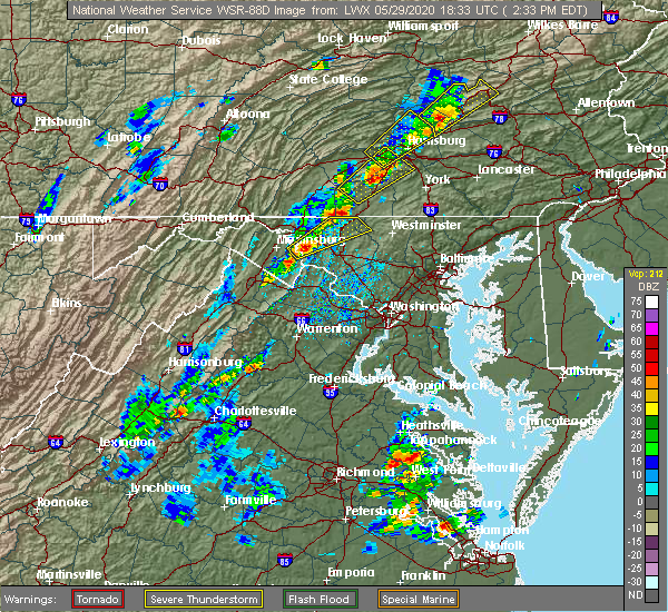 At 233 pm edt, a severe thunderstorm was located over carroll valley, moving northeast at 45 mph (radar indicated). Hazards include 70 mph wind gusts and quarter size hail. Hail damage to vehicles is expected. expect considerable tree damage. Wind damage is also likely to mobile homes, roofs, and outbuildings. At 233 pm edt, a severe thunderstorm was located over carroll valley, moving northeast at 45 mph (radar indicated). Hazards include 70 mph wind gusts and quarter size hail. Hail damage to vehicles is expected. expect considerable tree damage. Wind damage is also likely to mobile homes, roofs, and outbuildings.
|
| 4/13/2020 1:06 PM EDT |
 At 106 pm edt, severe thunderstorms were located along a line extending from near fayetteville to mount lena, moving northeast at 55 mph (radar indicated). Hazards include 70 mph wind gusts and quarter size hail. Hail damage to vehicles is expected. expect considerable tree damage. Wind damage is also likely to mobile homes, roofs, and outbuildings. At 106 pm edt, severe thunderstorms were located along a line extending from near fayetteville to mount lena, moving northeast at 55 mph (radar indicated). Hazards include 70 mph wind gusts and quarter size hail. Hail damage to vehicles is expected. expect considerable tree damage. Wind damage is also likely to mobile homes, roofs, and outbuildings.
|
| 10/31/2019 7:08 PM EDT |
 At 706 pm edt, severe thunderstorms were located along a line extending from 7 miles northwest of millersburg to newport to near duncannon to pine grove furnace to near mont alto, moving northeast at 65 mph (radar indicated). Hazards include 70 mph wind gusts. Expect considerable tree damage. Damage is likely to mobile homes, roofs, and outbuildings. At 706 pm edt, severe thunderstorms were located along a line extending from 7 miles northwest of millersburg to newport to near duncannon to pine grove furnace to near mont alto, moving northeast at 65 mph (radar indicated). Hazards include 70 mph wind gusts. Expect considerable tree damage. Damage is likely to mobile homes, roofs, and outbuildings.
|
| 7/6/2019 7:24 PM EDT |
 At 724 pm edt, severe thunderstorms were located along a line extending from near churchtown to greencastle, moving east at 30 mph (radar indicated). Hazards include 60 mph wind gusts and quarter size hail. Hail damage to vehicles is expected. expect wind damage to trees, roofs, and siding. locations impacted include, york, chambersburg, hanover, weigelstown, waynesboro, gettysburg, parkville, greencastle, hampton, guilford, shiloh, west york, littlestown, carroll valley, codorus, grantley, fayetteville, mcsherrystown, manchester and emigsville. this includes the following interstates, interstate 81 from mile markers 0 to 16. Interstate 83 from mile markers 20 to 25. At 724 pm edt, severe thunderstorms were located along a line extending from near churchtown to greencastle, moving east at 30 mph (radar indicated). Hazards include 60 mph wind gusts and quarter size hail. Hail damage to vehicles is expected. expect wind damage to trees, roofs, and siding. locations impacted include, york, chambersburg, hanover, weigelstown, waynesboro, gettysburg, parkville, greencastle, hampton, guilford, shiloh, west york, littlestown, carroll valley, codorus, grantley, fayetteville, mcsherrystown, manchester and emigsville. this includes the following interstates, interstate 81 from mile markers 0 to 16. Interstate 83 from mile markers 20 to 25.
|
| 7/6/2019 6:44 PM EDT |
 At 644 pm edt, severe thunderstorms were located along a line extending from near cornwall to big cove tannery, moving east at 30 mph (radar indicated). Hazards include 60 mph wind gusts and quarter size hail. Hail damage to vehicles is expected. Expect wind damage to trees, roofs, and siding. At 644 pm edt, severe thunderstorms were located along a line extending from near cornwall to big cove tannery, moving east at 30 mph (radar indicated). Hazards include 60 mph wind gusts and quarter size hail. Hail damage to vehicles is expected. Expect wind damage to trees, roofs, and siding.
|
| 7/6/2019 5:34 PM EDT |
 At 533 pm edt, severe thunderstorms were located along a line extending from near urban to near duncannon to mount holly springs to near emmitsburg, moving east at 30 mph (radar indicated). Hazards include 60 mph wind gusts and quarter size hail. Hail damage to vehicles is expected. Expect wind damage to trees, roofs, and siding. At 533 pm edt, severe thunderstorms were located along a line extending from near urban to near duncannon to mount holly springs to near emmitsburg, moving east at 30 mph (radar indicated). Hazards include 60 mph wind gusts and quarter size hail. Hail damage to vehicles is expected. Expect wind damage to trees, roofs, and siding.
|
| 7/2/2019 6:03 PM EDT |
 At 602 pm edt, a severe thunderstorm was located near cashtown, moving southeast at 10 mph (radar indicated). Hazards include 60 mph wind gusts and nickel size hail. Expect damage to trees, roofs, and siding. this severe thunderstorm will be near, cashtown around 620 pm edt. orrtanna around 630 pm edt. carroll valley around 640 pm edt. gettysburg, lake heritage and bonneauville around 700 pm edt. Other locations impacted by this severe thunderstorm include arendtsville, two taverns, mcknightstown, fairfield, gettysburg national military park, liberty mountain resort, gettysburg college and hunterstown. At 602 pm edt, a severe thunderstorm was located near cashtown, moving southeast at 10 mph (radar indicated). Hazards include 60 mph wind gusts and nickel size hail. Expect damage to trees, roofs, and siding. this severe thunderstorm will be near, cashtown around 620 pm edt. orrtanna around 630 pm edt. carroll valley around 640 pm edt. gettysburg, lake heritage and bonneauville around 700 pm edt. Other locations impacted by this severe thunderstorm include arendtsville, two taverns, mcknightstown, fairfield, gettysburg national military park, liberty mountain resort, gettysburg college and hunterstown.
|
| 6/29/2019 2:57 PM EDT |
 The severe thunderstorm warning for adams and southwestern york counties will expire at 300 pm edt, the storm which prompted the warning has weakened below severe limits, and no longer poses an immediate threat to life or property. therefore, the warning will be allowed to expire. a severe thunderstorm watch remains in effect until 700 pm edt for south central pennsylvania. The severe thunderstorm warning for adams and southwestern york counties will expire at 300 pm edt, the storm which prompted the warning has weakened below severe limits, and no longer poses an immediate threat to life or property. therefore, the warning will be allowed to expire. a severe thunderstorm watch remains in effect until 700 pm edt for south central pennsylvania.
|
| 6/29/2019 2:35 PM EDT |
 A severe thunderstorm warning remains in effect until 300 pm edt for adams and southwestern york counties. at 234 pm edt, a severe thunderstorm was located near hampton, moving southeast at 45 mph. hazard. 60 mph wind gusts and half dollar size hail. source. Radar indicated. A severe thunderstorm warning remains in effect until 300 pm edt for adams and southwestern york counties. at 234 pm edt, a severe thunderstorm was located near hampton, moving southeast at 45 mph. hazard. 60 mph wind gusts and half dollar size hail. source. Radar indicated.
|
| 6/29/2019 2:19 PM EDT |
 At 219 pm edt, a severe thunderstorm was located near pine grove furnace, moving southeast at 45 mph (radar indicated). Hazards include 60 mph wind gusts and half dollar size hail. Hail damage to vehicles is expected. Expect wind damage to trees, roofs, and siding. At 219 pm edt, a severe thunderstorm was located near pine grove furnace, moving southeast at 45 mph (radar indicated). Hazards include 60 mph wind gusts and half dollar size hail. Hail damage to vehicles is expected. Expect wind damage to trees, roofs, and siding.
|
| 6/2/2019 4:48 PM EDT |
 At 448 pm edt, a severe thunderstorm was located over cashtown, moving east at 20 mph (radar indicated). Hazards include 60 mph wind gusts and quarter size hail. Hail damage to vehicles is expected. Expect wind damage to trees, roofs, and siding. At 448 pm edt, a severe thunderstorm was located over cashtown, moving east at 20 mph (radar indicated). Hazards include 60 mph wind gusts and quarter size hail. Hail damage to vehicles is expected. Expect wind damage to trees, roofs, and siding.
|
| 5/29/2019 4:58 PM EDT |
 At 458 pm edt, severe thunderstorms were located along a line extending from near perulack to near shippensburg to near st. thomas to near gamber, moving east at 65 mph (radar indicated). Hazards include 60 mph wind gusts and quarter size hail. Hail damage to vehicles is expected. expect wind damage to trees, roofs, and siding. severe thunderstorms will be near, waynesboro, pine grove furnace, bloserville, mont alto, plainfield, newville, fayetteville, wayne heights, guilford and rouzerville around 510 pm edt. carlisle, schlusser, carroll valley, boiling springs, carlisle springs, lake meade, orrtanna, hampton, aspers and new kingstown around 520 pm edt. mechanicsburg, lower allen, camp hill, gettysburg, lemoyne, siddonsburg, east berlin, york airport, dillsburg and shiremanstown around 530 pm edt. spry, dallastown, red lion, york, weigelstown, jacobus, valley green, grantley, manchester and valley view around 540 pm edt. other locations impacted by these severe thunderstorms include arendtsville, orrstown, quincy, east prospect, blain, gardners, fawn grove, glenville, heidlersburg and biglerville. this includes the following interstates, the pennsylvania turnpike from mile markers 200 to 246. interstate 81 from mile markers 7 to 58. Interstate 83 between mile markers 0 and 39, and near mile marker 41. At 458 pm edt, severe thunderstorms were located along a line extending from near perulack to near shippensburg to near st. thomas to near gamber, moving east at 65 mph (radar indicated). Hazards include 60 mph wind gusts and quarter size hail. Hail damage to vehicles is expected. expect wind damage to trees, roofs, and siding. severe thunderstorms will be near, waynesboro, pine grove furnace, bloserville, mont alto, plainfield, newville, fayetteville, wayne heights, guilford and rouzerville around 510 pm edt. carlisle, schlusser, carroll valley, boiling springs, carlisle springs, lake meade, orrtanna, hampton, aspers and new kingstown around 520 pm edt. mechanicsburg, lower allen, camp hill, gettysburg, lemoyne, siddonsburg, east berlin, york airport, dillsburg and shiremanstown around 530 pm edt. spry, dallastown, red lion, york, weigelstown, jacobus, valley green, grantley, manchester and valley view around 540 pm edt. other locations impacted by these severe thunderstorms include arendtsville, orrstown, quincy, east prospect, blain, gardners, fawn grove, glenville, heidlersburg and biglerville. this includes the following interstates, the pennsylvania turnpike from mile markers 200 to 246. interstate 81 from mile markers 7 to 58. Interstate 83 between mile markers 0 and 39, and near mile marker 41.
|
| 5/23/2019 11:59 PM EDT |
 At 1156 pm edt, severe thunderstorms were located along a line extending from shippensburg to near walnut bottom to near lake meade, moving southeast at 45 mph (radar indicated). Hazards include 60 mph wind gusts and quarter size hail. Hail damage to vehicles is expected. Expect wind damage to trees, roofs, and siding. At 1156 pm edt, severe thunderstorms were located along a line extending from shippensburg to near walnut bottom to near lake meade, moving southeast at 45 mph (radar indicated). Hazards include 60 mph wind gusts and quarter size hail. Hail damage to vehicles is expected. Expect wind damage to trees, roofs, and siding.
|
| 5/19/2019 5:44 PM EDT |
 At 544 pm edt, a severe thunderstorm was located near lake meade, moving northeast at 30 mph (radar indicated). Hazards include 60 mph wind gusts and quarter size hail. Hail damage to vehicles is expected. expect wind damage to trees, roofs, and siding. Locations impacted include, hampton, lake meade, cashtown, aspers, orrtanna, pine grove furnace, biglerville, arendtsville, york springs, heidlersburg, bendersville, hunterstown, mcknightstown, idaville and gardners. At 544 pm edt, a severe thunderstorm was located near lake meade, moving northeast at 30 mph (radar indicated). Hazards include 60 mph wind gusts and quarter size hail. Hail damage to vehicles is expected. expect wind damage to trees, roofs, and siding. Locations impacted include, hampton, lake meade, cashtown, aspers, orrtanna, pine grove furnace, biglerville, arendtsville, york springs, heidlersburg, bendersville, hunterstown, mcknightstown, idaville and gardners.
|
| 5/19/2019 5:07 PM EDT |
 At 506 pm edt, a severe thunderstorm was located near cashtown, moving northeast at 30 mph. another thunderstorm was developing near greencastle (radar indicated). Hazards include 60 mph wind gusts and quarter size hail. Hail damage to vehicles is expected. Expect wind damage to trees, roofs, and siding. At 506 pm edt, a severe thunderstorm was located near cashtown, moving northeast at 30 mph. another thunderstorm was developing near greencastle (radar indicated). Hazards include 60 mph wind gusts and quarter size hail. Hail damage to vehicles is expected. Expect wind damage to trees, roofs, and siding.
|
| 4/19/2019 8:50 PM EDT |
 At 849 pm edt, a severe thunderstorm was located over cashtown, moving northeast at 70 mph (radar indicated). Hazards include 60 mph wind gusts. Expect damage to roofs, siding, and trees. this severe storm will be near, cashtown around 850 pm edt. Other locations impacted by this severe thunderstorm include mcknightstown, fairfield and liberty mountain resort. At 849 pm edt, a severe thunderstorm was located over cashtown, moving northeast at 70 mph (radar indicated). Hazards include 60 mph wind gusts. Expect damage to roofs, siding, and trees. this severe storm will be near, cashtown around 850 pm edt. Other locations impacted by this severe thunderstorm include mcknightstown, fairfield and liberty mountain resort.
|
| 4/19/2019 8:11 PM EDT |
 At 811 pm edt, a severe thunderstorm was located over paramount-long meadow, moving northeast at 25 mph (radar indicated). Hazards include 60 mph wind gusts. Expect damage to roofs, siding, and trees. this severe thunderstorm will be near, waynesboro, wayne heights and rouzerville around 830 pm edt. mont alto around 840 pm edt. carroll valley around 850 pm edt. orrtanna and cashtown around 900 pm edt. other locations impacted by this severe thunderstorm include mcknightstown, fairfield, state line, quincy, penn state mont alto and liberty mountain resort. This includes interstate 81 from mile markers 0 to 5. At 811 pm edt, a severe thunderstorm was located over paramount-long meadow, moving northeast at 25 mph (radar indicated). Hazards include 60 mph wind gusts. Expect damage to roofs, siding, and trees. this severe thunderstorm will be near, waynesboro, wayne heights and rouzerville around 830 pm edt. mont alto around 840 pm edt. carroll valley around 850 pm edt. orrtanna and cashtown around 900 pm edt. other locations impacted by this severe thunderstorm include mcknightstown, fairfield, state line, quincy, penn state mont alto and liberty mountain resort. This includes interstate 81 from mile markers 0 to 5.
|
| 8/8/2018 8:25 PM EDT |
 At 823 pm edt, a severe thunderstorm was located near emmitsburg, moving east at 25 mph (radar indicated). Hazards include 60 mph wind gusts and localized flooding. Flooding of small streams and low spots. Locations impacted include, waynesboro, littlestown, carroll valley, wayne heights, rouzerville, orrtanna, fairfield, two taverns and liberty mountain resort. At 823 pm edt, a severe thunderstorm was located near emmitsburg, moving east at 25 mph (radar indicated). Hazards include 60 mph wind gusts and localized flooding. Flooding of small streams and low spots. Locations impacted include, waynesboro, littlestown, carroll valley, wayne heights, rouzerville, orrtanna, fairfield, two taverns and liberty mountain resort.
|
| 8/8/2018 8:01 PM EDT |
 At 801 pm edt, a severe thunderstorm was located near carroll valley, moving east at 25 mph (radar indicated). Hazards include 60 mph wind gusts and quarter size hail. Hail damage to vehicles is possible. Expect wind damage to roofs, siding, and trees. At 801 pm edt, a severe thunderstorm was located near carroll valley, moving east at 25 mph (radar indicated). Hazards include 60 mph wind gusts and quarter size hail. Hail damage to vehicles is possible. Expect wind damage to roofs, siding, and trees.
|
| 6/24/2018 5:21 PM EDT |
 At 521 pm edt, a severe thunderstorm was located over orrtanna, moving east at 35 mph (radar indicated). Hazards include 60 mph wind gusts and quarter size hail. Hail damage to vehicles is expected. Expect wind damage to roofs, siding, and trees. At 521 pm edt, a severe thunderstorm was located over orrtanna, moving east at 35 mph (radar indicated). Hazards include 60 mph wind gusts and quarter size hail. Hail damage to vehicles is expected. Expect wind damage to roofs, siding, and trees.
|
| 1/12/2018 7:02 PM EST |
 At 701 pm est, a severe thunderstorm was located near cashtown, moving northeast at 40 mph (radar indicated). Hazards include 60 mph wind gusts. Expect damage to trees and power lines. Locations impacted include, gettysburg, waynesboro, wayne heights, bonneauville, pine grove furnace, carroll valley, fayetteville, mont alto, walnut bottom and lake heritage. At 701 pm est, a severe thunderstorm was located near cashtown, moving northeast at 40 mph (radar indicated). Hazards include 60 mph wind gusts. Expect damage to trees and power lines. Locations impacted include, gettysburg, waynesboro, wayne heights, bonneauville, pine grove furnace, carroll valley, fayetteville, mont alto, walnut bottom and lake heritage.
|
| 1/12/2018 6:28 PM EST |
 At 627 pm est, a severe thunderstorm was located over robinwood, moving northeast at 45 mph (radar indicated). Hazards include 60 mph wind gusts. expect damage to trees and power lines At 627 pm est, a severe thunderstorm was located over robinwood, moving northeast at 45 mph (radar indicated). Hazards include 60 mph wind gusts. expect damage to trees and power lines
|
| 9/5/2017 4:01 PM EDT | Trees down in adams county PA, 1.7 miles S of Orrtanna, PA |
| 9/5/2017 4:00 PM EDT | 70 mph wind gust in cashtown in adams county PA, 1.7 miles S of Orrtanna, PA |
| 9/5/2017 3:30 PM EDT |
 At 329 pm edt, severe thunderstorms were located along a line extending from st. thomas to near fountainhead-orchard hills, moving east at 35 mph (radar indicated). Hazards include 70 mph wind gusts and quarter size hail. Hail damage to vehicles is possible. expect considerable tree damage. wind damage is also likely to mobile homes, roofs, and outbuildings. these severe storms will be near, marion around 330 pm edt. chambersburg, greencastle, guilford and scotland around 340 pm edt. waynesboro, wayne heights, rouzerville, fayetteville and mont alto around 350 pm edt. carroll valley, cashtown and orrtanna around 400 pm edt. Other locations impacted by these severe thunderstorms include arendtsville, quincy, biglerville, williamson, state line, mcknightstown, upton, fairfield, bendersville and liberty mountain resort. At 329 pm edt, severe thunderstorms were located along a line extending from st. thomas to near fountainhead-orchard hills, moving east at 35 mph (radar indicated). Hazards include 70 mph wind gusts and quarter size hail. Hail damage to vehicles is possible. expect considerable tree damage. wind damage is also likely to mobile homes, roofs, and outbuildings. these severe storms will be near, marion around 330 pm edt. chambersburg, greencastle, guilford and scotland around 340 pm edt. waynesboro, wayne heights, rouzerville, fayetteville and mont alto around 350 pm edt. carroll valley, cashtown and orrtanna around 400 pm edt. Other locations impacted by these severe thunderstorms include arendtsville, quincy, biglerville, williamson, state line, mcknightstown, upton, fairfield, bendersville and liberty mountain resort.
|
| 9/5/2017 3:02 PM EDT |
 At 301 pm edt, a severe thunderstorm was located near big cove tannery, moving northeast at 45 mph (radar indicated). Hazards include 60 mph wind gusts and quarter size hail. Hail damage to vehicles is possible. Expect wind damage to trees and power lines. At 301 pm edt, a severe thunderstorm was located near big cove tannery, moving northeast at 45 mph (radar indicated). Hazards include 60 mph wind gusts and quarter size hail. Hail damage to vehicles is possible. Expect wind damage to trees and power lines.
|
| 8/4/2017 10:33 PM EDT |
 At 1032 pm edt, a severe thunderstorm was located over aspers, moving northeast at 25 mph (radar indicated). Hazards include 60 mph wind gusts. expect damage to trees and power lines At 1032 pm edt, a severe thunderstorm was located over aspers, moving northeast at 25 mph (radar indicated). Hazards include 60 mph wind gusts. expect damage to trees and power lines
|
| 8/4/2017 9:30 PM EDT |
 At 930 pm edt, a severe thunderstorm was located over walnut bottom, moving northeast at 30 mph (radar indicated). Hazards include 60 mph wind gusts and quarter size hail. Hail damage to vehicles is possible. Expect wind damage to trees and power lines. At 930 pm edt, a severe thunderstorm was located over walnut bottom, moving northeast at 30 mph (radar indicated). Hazards include 60 mph wind gusts and quarter size hail. Hail damage to vehicles is possible. Expect wind damage to trees and power lines.
|
| 8/4/2017 8:55 PM EDT |
 At 855 pm edt, a severe thunderstorm was located near cashtown, moving northeast at 25 mph (radar indicated). Hazards include 60 mph wind gusts and quarter size hail. Hail damage to vehicles is possible. Expect wind damage to trees and power lines. At 855 pm edt, a severe thunderstorm was located near cashtown, moving northeast at 25 mph (radar indicated). Hazards include 60 mph wind gusts and quarter size hail. Hail damage to vehicles is possible. Expect wind damage to trees and power lines.
|
| 6/19/2017 1:28 PM EDT |
 At 125 pm edt, severe thunderstorms were located along a line extending from new kingstown to boiling springs to near dillsburg to near lake heritage, moving northeast at 45 mph (radar indicated). Hazards include 70 mph wind gusts. Expect considerable tree damage. damage is likely to mobile homes, roofs, and outbuildings. Locations impacted include, parkville, red lion, weigelstown, dallastown, hanover, carlisle, lower allen, spry, enola and mechanicsburg. At 125 pm edt, severe thunderstorms were located along a line extending from new kingstown to boiling springs to near dillsburg to near lake heritage, moving northeast at 45 mph (radar indicated). Hazards include 70 mph wind gusts. Expect considerable tree damage. damage is likely to mobile homes, roofs, and outbuildings. Locations impacted include, parkville, red lion, weigelstown, dallastown, hanover, carlisle, lower allen, spry, enola and mechanicsburg.
|
| 6/19/2017 12:40 PM EDT |
 At 1239 pm edt, severe thunderstorms were located along a line extending from near walnut bottom to mont alto to near paramount-long meadow, moving east at 50 mph (radar indicated). Hazards include 70 mph wind gusts. Expect considerable tree damage. Damage is likely to mobile homes, roofs, and outbuildings. At 1239 pm edt, severe thunderstorms were located along a line extending from near walnut bottom to mont alto to near paramount-long meadow, moving east at 50 mph (radar indicated). Hazards include 70 mph wind gusts. Expect considerable tree damage. Damage is likely to mobile homes, roofs, and outbuildings.
|
| 10/30/2016 4:07 PM EDT |
 At 405 pm edt, severe thunderstorms were located along a line extending from near dehart dam to near shippensburg to near mercersburg to near hancock, moving east at 50 mph (radar indicated). Hazards include 60 mph wind gusts. Expect damage to roofs. siding. and trees. these severe storms will be near, linglestown, colonial park, skyline view, pine grove furnace, paxtonia and cashtown around 410 pm edt. waynesboro, palmyra, hershey, aspers and campbelltown around 420 pm edt. hampton, wayne heights, rouzerville, carroll valley, lake meade, new oxford and mont alto around 430 pm edt. hanover, parkville, weigelstown, york airport, spring grove, east berlin and dover around 440 pm edt. Other locations impacted by these severe thunderstorms include hunterstown, york haven, york springs, idaville, three mile island, newberrytown, upton, lewisberry, arendtsville and capital city airport. At 405 pm edt, severe thunderstorms were located along a line extending from near dehart dam to near shippensburg to near mercersburg to near hancock, moving east at 50 mph (radar indicated). Hazards include 60 mph wind gusts. Expect damage to roofs. siding. and trees. these severe storms will be near, linglestown, colonial park, skyline view, pine grove furnace, paxtonia and cashtown around 410 pm edt. waynesboro, palmyra, hershey, aspers and campbelltown around 420 pm edt. hampton, wayne heights, rouzerville, carroll valley, lake meade, new oxford and mont alto around 430 pm edt. hanover, parkville, weigelstown, york airport, spring grove, east berlin and dover around 440 pm edt. Other locations impacted by these severe thunderstorms include hunterstown, york haven, york springs, idaville, three mile island, newberrytown, upton, lewisberry, arendtsville and capital city airport.
|
| 10/30/2016 3:29 PM EDT |
 At 328 pm edt, severe thunderstorms were located along a line extending from near mexico to near fort littleton to near clearville to near lake gordon, moving east at 50 mph (radar indicated). Hazards include 60 mph wind gusts. Expect damage to roofs. siding. and trees. severe thunderstorms will be near, fort littleton, ickesburg and spruce hill around 330 pm edt. fannettsburg, locust grove, willow hill, new bloomfield and crystal springs around 340 pm edt. chambersburg, needmore, upper strasburg, big cove tannery, duncannon, barnes gap, inglesmith and roxbury around 350 pm edt. shippensburg, harrisburg, mercersburg, scotland, claylick, fayetteville, guilford, marysville, warfordsburg and rockville around 400 pm edt. other locations impacted by these severe thunderstorms include york springs, idaville, blain, rainsburg, shirleysburg, wellsville, new germantown, franklintown, bendersville and dauphin. this includes the following interstates, interstate 70 from mile markers 147 to 170. the pennsylvania turnpike from mile markers 151 to 258. interstate 81 from mile markers 1 to 79. interstate 83 from mile markers 22 to 50. Interstate 283 from mile markers 0 to 2. At 328 pm edt, severe thunderstorms were located along a line extending from near mexico to near fort littleton to near clearville to near lake gordon, moving east at 50 mph (radar indicated). Hazards include 60 mph wind gusts. Expect damage to roofs. siding. and trees. severe thunderstorms will be near, fort littleton, ickesburg and spruce hill around 330 pm edt. fannettsburg, locust grove, willow hill, new bloomfield and crystal springs around 340 pm edt. chambersburg, needmore, upper strasburg, big cove tannery, duncannon, barnes gap, inglesmith and roxbury around 350 pm edt. shippensburg, harrisburg, mercersburg, scotland, claylick, fayetteville, guilford, marysville, warfordsburg and rockville around 400 pm edt. other locations impacted by these severe thunderstorms include york springs, idaville, blain, rainsburg, shirleysburg, wellsville, new germantown, franklintown, bendersville and dauphin. this includes the following interstates, interstate 70 from mile markers 147 to 170. the pennsylvania turnpike from mile markers 151 to 258. interstate 81 from mile markers 1 to 79. interstate 83 from mile markers 22 to 50. Interstate 283 from mile markers 0 to 2.
|
| 8/16/2016 3:04 PM EDT |
 At 304 pm edt, a severe thunderstorm was located near gettysburg, moving northeast at 40 mph (radar indicated). Hazards include 60 mph wind gusts. Expect damage to roofs. siding. And trees. At 304 pm edt, a severe thunderstorm was located near gettysburg, moving northeast at 40 mph (radar indicated). Hazards include 60 mph wind gusts. Expect damage to roofs. siding. And trees.
|
| 8/13/2016 8:35 PM EDT |
 At 834 pm edt, severe thunderstorms were located along a line extending from near cashtown to near rouzerville, moving east at 35 mph (radar indicated). Hazards include 60 mph wind gusts. Expect damage to roofs. siding. And trees. At 834 pm edt, severe thunderstorms were located along a line extending from near cashtown to near rouzerville, moving east at 35 mph (radar indicated). Hazards include 60 mph wind gusts. Expect damage to roofs. siding. And trees.
|
| 7/25/2016 4:18 PM EDT |
 At 417 pm edt, a severe thunderstorm was located near orrtanna, moving east at 25 mph (radar indicated). Hazards include 60 mph wind gusts and quarter size hail. Hail damage to vehicles is expected. expect wind damage to roofs, siding, and trees. Locations impacted include, gettysburg, hanover, lake heritage, new oxford, bonneauville, littlestown, carroll valley, cashtown, mcsherrystown, orrtanna, hunterstown, fairfield, two taverns, mcknightstown, abbottstown, gettysburg college, gettysburg national military park and liberty mountain resort. At 417 pm edt, a severe thunderstorm was located near orrtanna, moving east at 25 mph (radar indicated). Hazards include 60 mph wind gusts and quarter size hail. Hail damage to vehicles is expected. expect wind damage to roofs, siding, and trees. Locations impacted include, gettysburg, hanover, lake heritage, new oxford, bonneauville, littlestown, carroll valley, cashtown, mcsherrystown, orrtanna, hunterstown, fairfield, two taverns, mcknightstown, abbottstown, gettysburg college, gettysburg national military park and liberty mountain resort.
|
| 7/25/2016 3:54 PM EDT |
 At 354 pm edt, a severe thunderstorm was located over mont alto, moving east at 25 mph (radar indicated). Hazards include 60 mph wind gusts and quarter size hail. Hail damage to vehicles is expected. Expect wind damage to roofs, siding, and trees. At 354 pm edt, a severe thunderstorm was located over mont alto, moving east at 25 mph (radar indicated). Hazards include 60 mph wind gusts and quarter size hail. Hail damage to vehicles is expected. Expect wind damage to roofs, siding, and trees.
|
| 2/24/2016 5:36 PM EST |
 At 535 pm est, doppler radar indicated a line of strong to severe thunderstorms capable of producing damaging winds around 60 mph. these storms were located along a line extending from near rouzerville to near thurmont to near point of rocks, and moving northeast at 50 mph. At 535 pm est, doppler radar indicated a line of strong to severe thunderstorms capable of producing damaging winds around 60 mph. these storms were located along a line extending from near rouzerville to near thurmont to near point of rocks, and moving northeast at 50 mph.
|
| 10/9/2015 3:50 PM EDT |
 At 350 pm edt, doppler radar indicated a severe thunderstorm capable of producing damaging winds around 60 mph. this storm was located over orrtanna, and moving east at 45 mph. At 350 pm edt, doppler radar indicated a severe thunderstorm capable of producing damaging winds around 60 mph. this storm was located over orrtanna, and moving east at 45 mph.
|
| 7/27/2015 12:30 AM EDT |
 At 1226 am edt, doppler radar indicated a line of severe thunderstorms capable of producing quarter size hail and damaging winds in excess of 60 mph. these storms were located along a line extending from near mount wolf to near lake meade, aspers and scotland, moving southeast at 15 mph. locations impacted include, chambersburg, dallastown, gettysburg, hanover, red lion, shippensburg, spry, weigelstown, york, aspers, bonneauville, brogue, cashtown, codorus, cross roads, dillsburg, dover, east berlin, east york and emigsville. At 1226 am edt, doppler radar indicated a line of severe thunderstorms capable of producing quarter size hail and damaging winds in excess of 60 mph. these storms were located along a line extending from near mount wolf to near lake meade, aspers and scotland, moving southeast at 15 mph. locations impacted include, chambersburg, dallastown, gettysburg, hanover, red lion, shippensburg, spry, weigelstown, york, aspers, bonneauville, brogue, cashtown, codorus, cross roads, dillsburg, dover, east berlin, east york and emigsville.
|
| 7/27/2015 12:02 AM EDT |
 At 1201 am edt, doppler radar indicated a line of severe thunderstorms capable of producing quarter size hail and damaging winds around 60 mph. these storms were located along a line extending from near valley green to near pine grove furnace to near upper strasburg, and moving southeast at 25 mph. At 1201 am edt, doppler radar indicated a line of severe thunderstorms capable of producing quarter size hail and damaging winds around 60 mph. these storms were located along a line extending from near valley green to near pine grove furnace to near upper strasburg, and moving southeast at 25 mph.
|
| 7/9/2015 5:03 PM EDT |
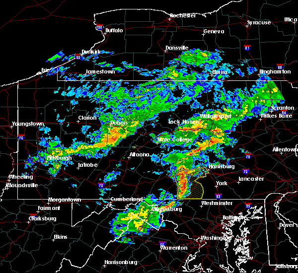 At 503 pm edt, doppler radar indicated a line of severe thunderstorms capable of producing damaging winds in excess of 60 mph. these storms were located along a line extending from near colonel denning state park to near rouzerville, moving east at 40 mph. locations impacted include, camp hill, carlisle, enola, gettysburg, hanover, harrisburg, lemoyne, lower allen, mechanicsburg, new cumberland, parkville, aspers, bloserville, boiling springs, bonneauville, carlisle springs, carroll valley, cashtown, east berlin and hampton. At 503 pm edt, doppler radar indicated a line of severe thunderstorms capable of producing damaging winds in excess of 60 mph. these storms were located along a line extending from near colonel denning state park to near rouzerville, moving east at 40 mph. locations impacted include, camp hill, carlisle, enola, gettysburg, hanover, harrisburg, lemoyne, lower allen, mechanicsburg, new cumberland, parkville, aspers, bloserville, boiling springs, bonneauville, carlisle springs, carroll valley, cashtown, east berlin and hampton.
|
| 7/9/2015 4:50 PM EDT |
 At 450 pm edt, doppler radar indicated a line of severe thunderstorms capable of producing damaging winds around 60 mph. these storms were located along a line extending from near colonel denning state park to wayne heights, and moving east at 40 mph. At 450 pm edt, doppler radar indicated a line of severe thunderstorms capable of producing damaging winds around 60 mph. these storms were located along a line extending from near colonel denning state park to wayne heights, and moving east at 40 mph.
|
| 6/23/2015 4:49 PM EDT |
 At 449 pm edt, doppler radar indicated a severe thunderstorm capable of producing quarter size hail and damaging winds around 60 mph. this storm was located near claylick, and moving east at 35 mph. At 449 pm edt, doppler radar indicated a severe thunderstorm capable of producing quarter size hail and damaging winds around 60 mph. this storm was located near claylick, and moving east at 35 mph.
|
| 6/23/2015 4:35 PM EDT |
 At 434 pm edt, doppler radar indicated a severe thunderstorm capable of producing quarter size hail and destructive winds in excess of 70 mph. this storm was located near dillsburg, moving east at 35 mph. locations impacted include, carlisle, dallastown, gettysburg, hanover, mechanicsburg, middletown, parkville, red lion, spry, weigelstown, york, aspers, boiling springs, bonneauville, brogue, cashtown, codorus, cross roads, delta and dillsburg. At 434 pm edt, doppler radar indicated a severe thunderstorm capable of producing quarter size hail and destructive winds in excess of 70 mph. this storm was located near dillsburg, moving east at 35 mph. locations impacted include, carlisle, dallastown, gettysburg, hanover, mechanicsburg, middletown, parkville, red lion, spry, weigelstown, york, aspers, boiling springs, bonneauville, brogue, cashtown, codorus, cross roads, delta and dillsburg.
|
| 6/23/2015 4:15 PM EDT |
 At 414 pm edt, doppler radar indicated a severe thunderstorm capable of producing quarter size hail and damaging winds of 60 to 70 mph. this storm was located near pine grove furnace, and moving east at 35 mph. At 414 pm edt, doppler radar indicated a severe thunderstorm capable of producing quarter size hail and damaging winds of 60 to 70 mph. this storm was located near pine grove furnace, and moving east at 35 mph.
|
| 6/8/2015 6:00 PM EDT | At 600 pm edt, doppler radar indicated a line of severe thunderstorms capable of producing damaging winds in excess of 60 mph. these storms were located along a line extending from near dillsburg to orrtanna to near rouzerville, moving east at 35 mph. locations impacted include, carlisle, gettysburg, hanover, parkville, waynesboro, aspers, boiling springs, bonneauville, carroll valley, cashtown, east berlin, hampton, lake heritage, lake meade, littlestown, mcsherrystown, mont alto, mount holly springs, new oxford and orrtanna. |
| 6/8/2015 5:12 PM EDT | At 511 pm edt, doppler radar indicated a line of severe thunderstorms capable of producing damaging winds of 60 to 70 mph. these storms were located along a line extending from plainfield to near st. thomas to near claylick, and moving southeast at 15 mph. |
| 4/20/2015 8:30 PM EDT | At 830 pm edt, doppler radar indicated a severe thunderstorm capable of producing damaging winds around 60 mph. this storm was located near claylick, and moving northeast at 35 mph. |
| 7/8/2014 6:26 PM EDT | Trees dow in adams county PA, 0.3 miles S of Orrtanna, PA |
| 6/25/2013 9:20 PM EDT | Trees reported down near ortann in adams county PA, 1.1 miles WSW of Orrtanna, PA |
Hail Maps for Orrtanna, PA
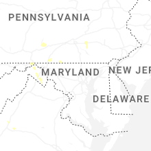


Connect with Interactive Hail Maps