

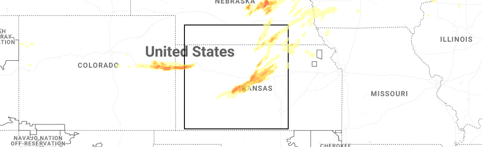
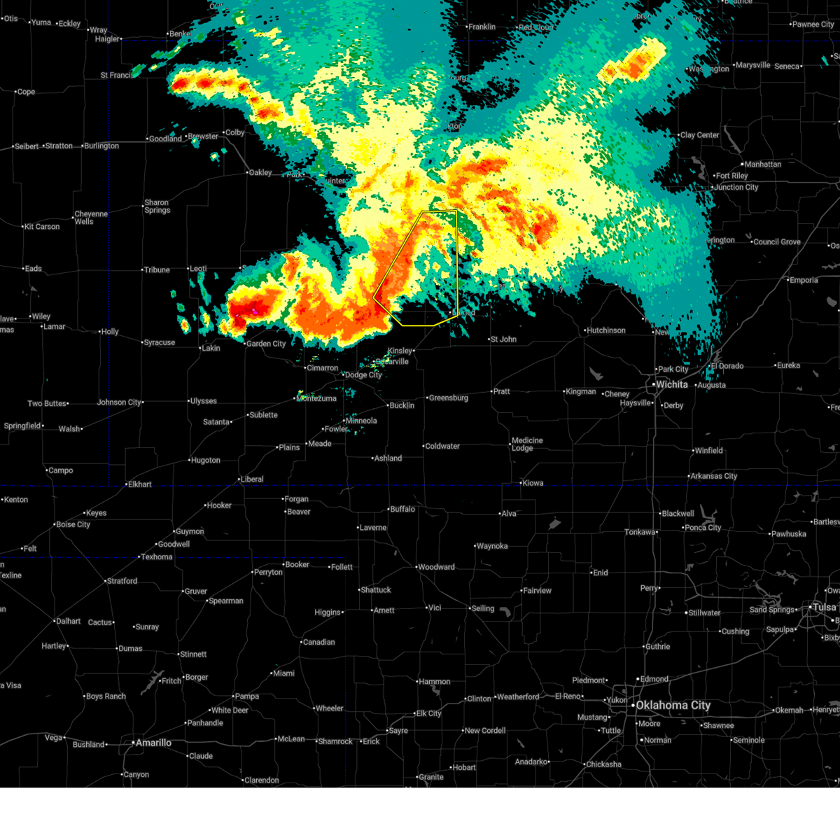
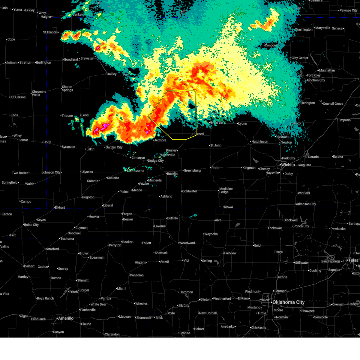
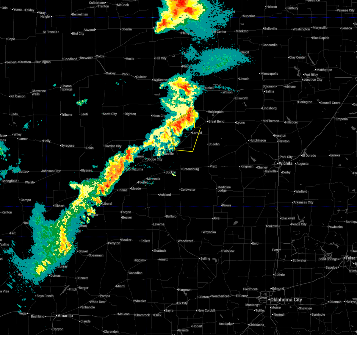
Hail Map for Otis, KS
The Otis, KS area has had 15 reports of on-the-ground hail by trained spotters, and has been under severe weather warnings 30 times during the past 12 months. Doppler radar has detected hail at or near Otis, KS on 105 occasions, including 5 occasions during the past year.
| Name: | Otis, KS |
| Where Located: | 27.6 miles SSE of Hays, KS |
| Map: | Google Map for Otis, KS |
| Population: | 282 |
| Housing Units: | 169 |
| More Info: | Search Google for Otis, KS |
2
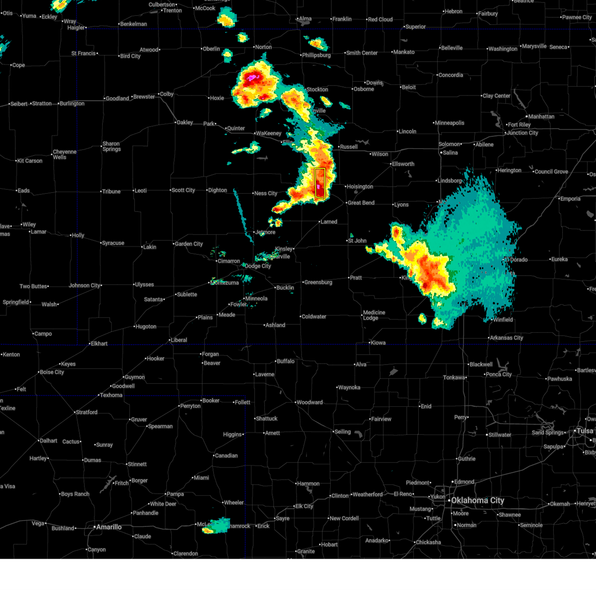
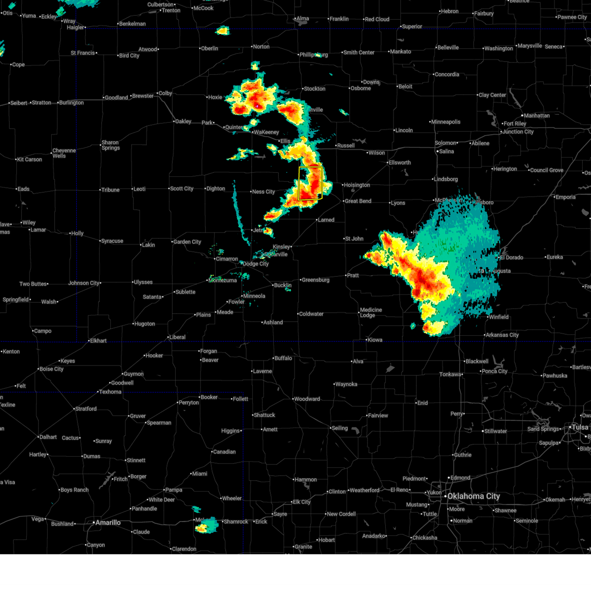
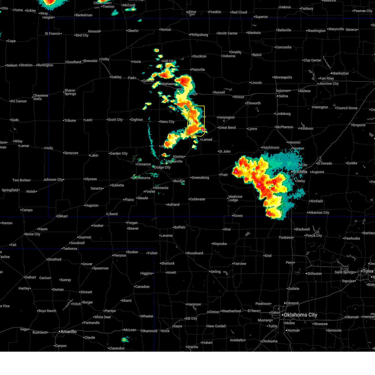
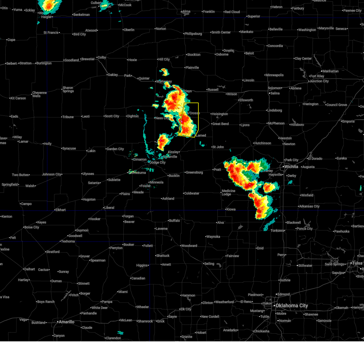
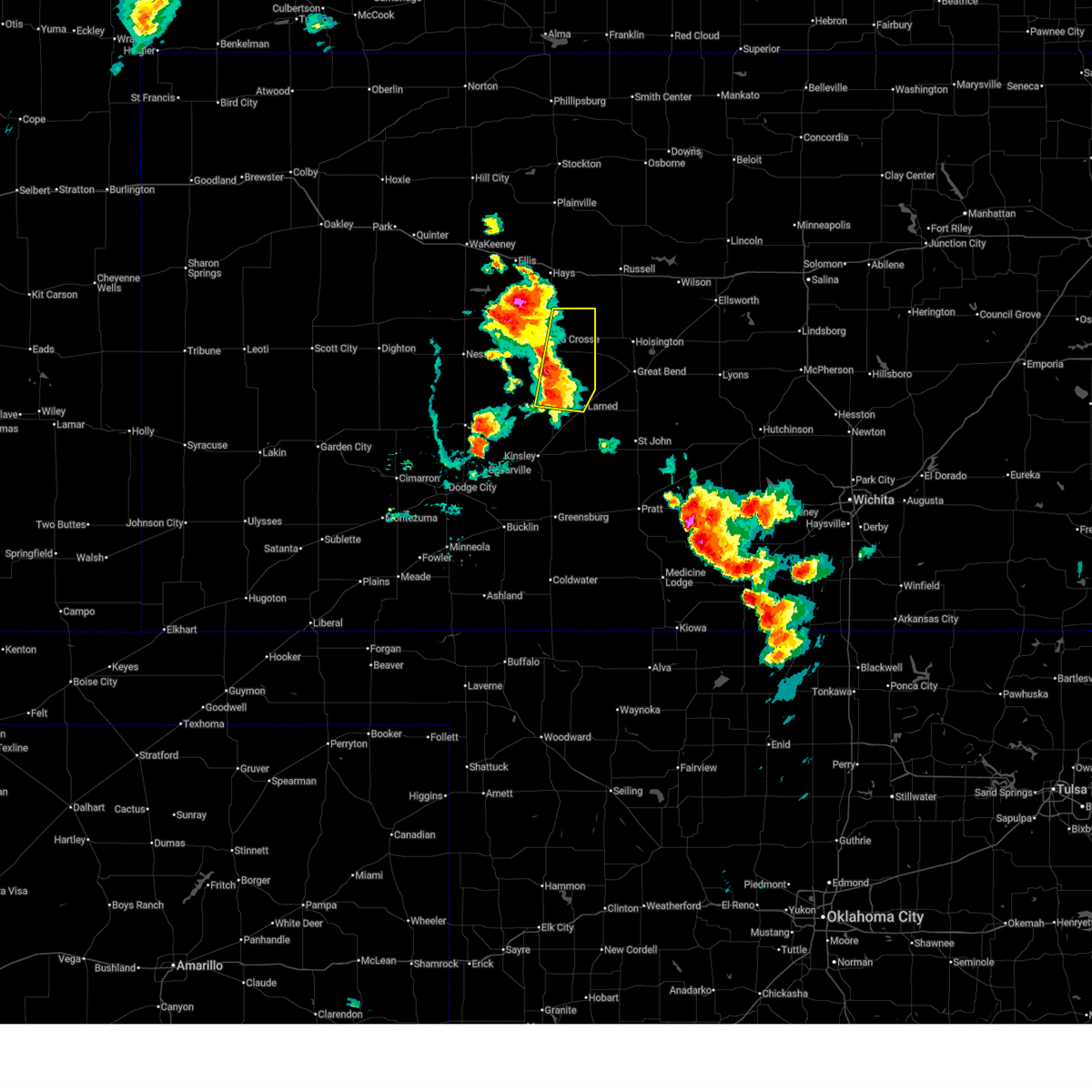
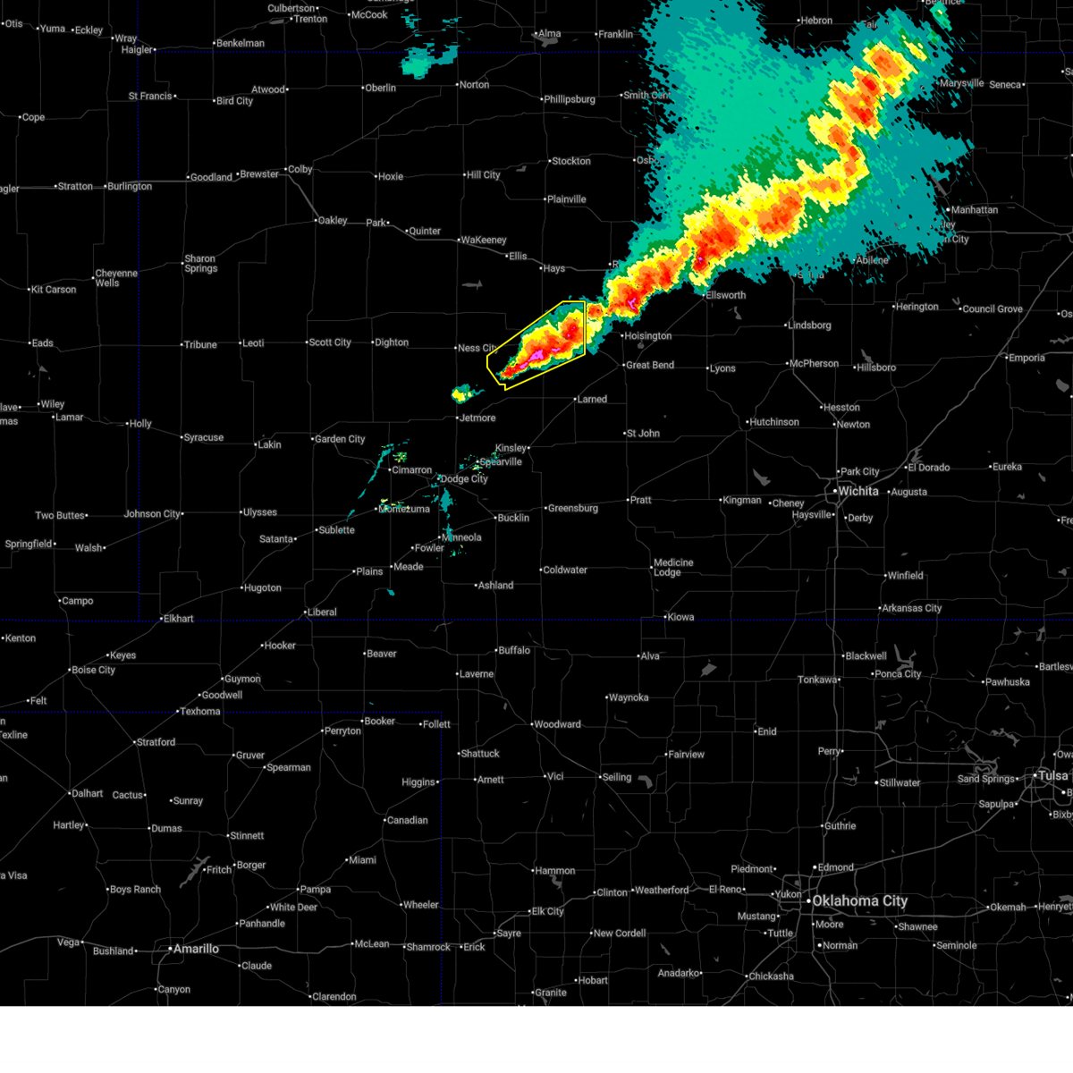
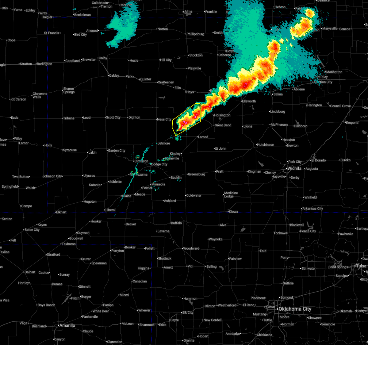
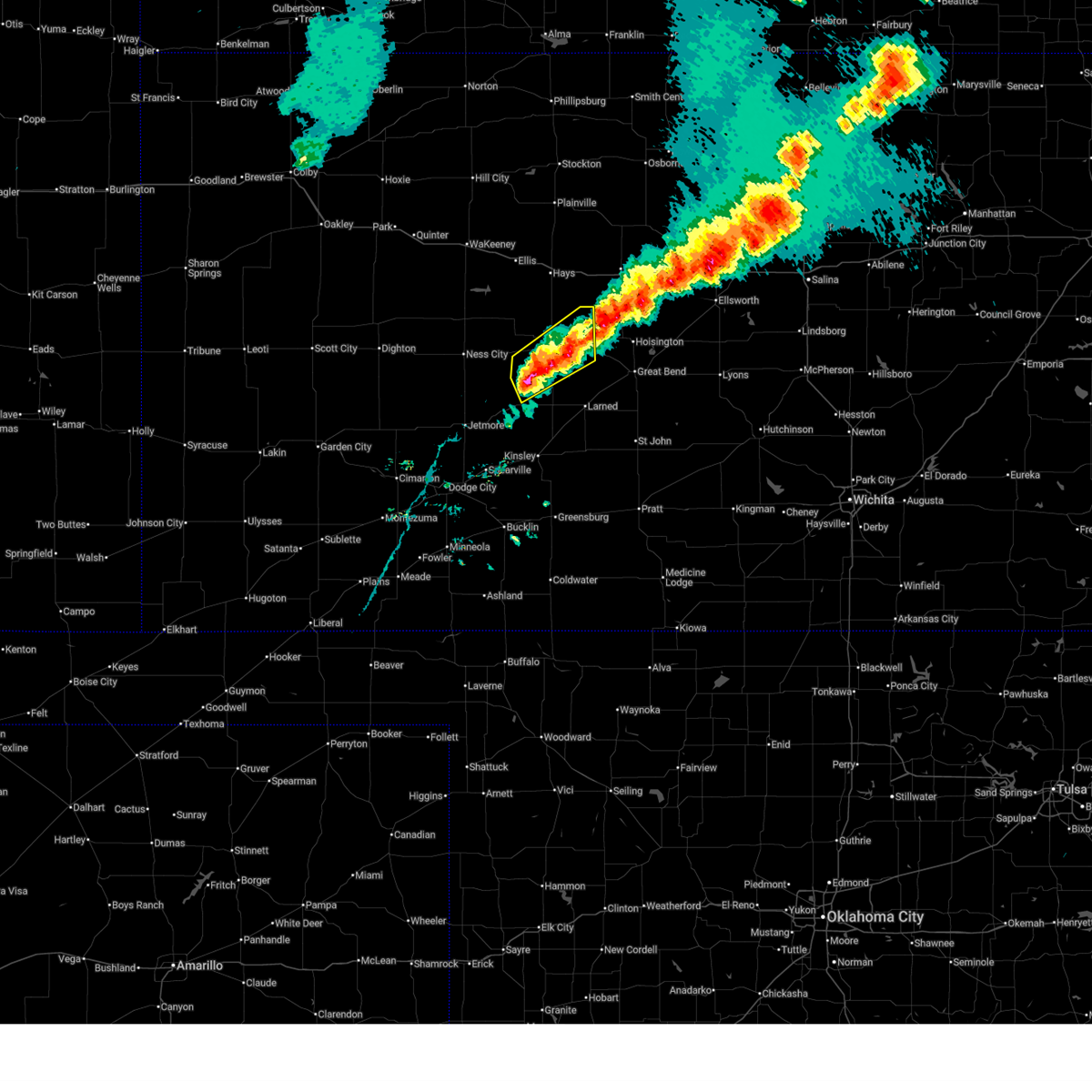
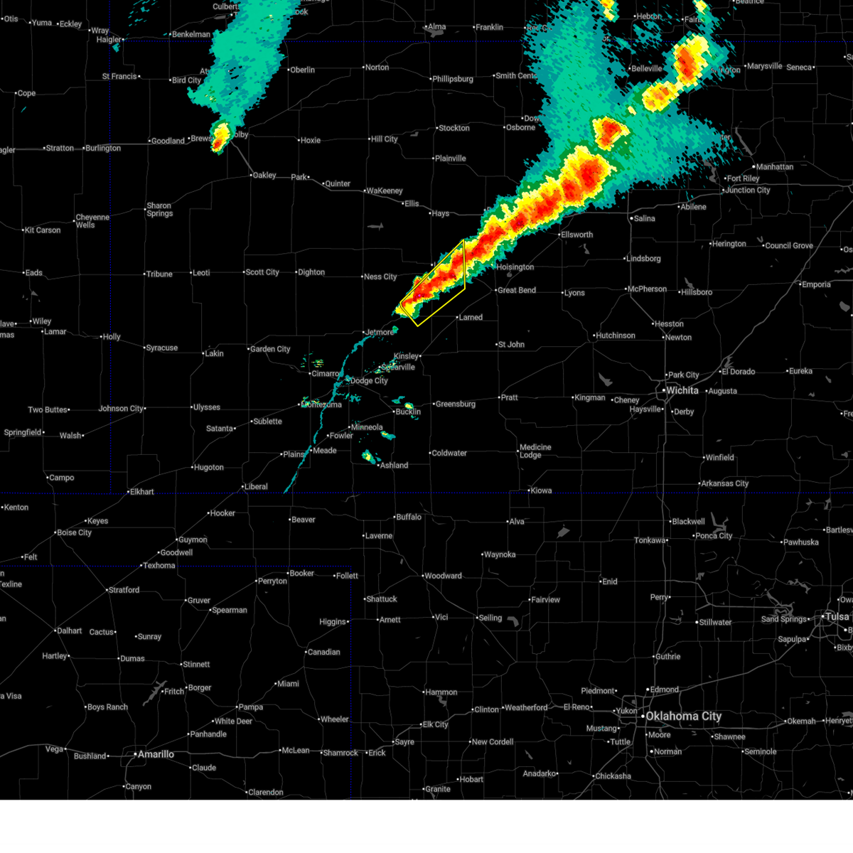
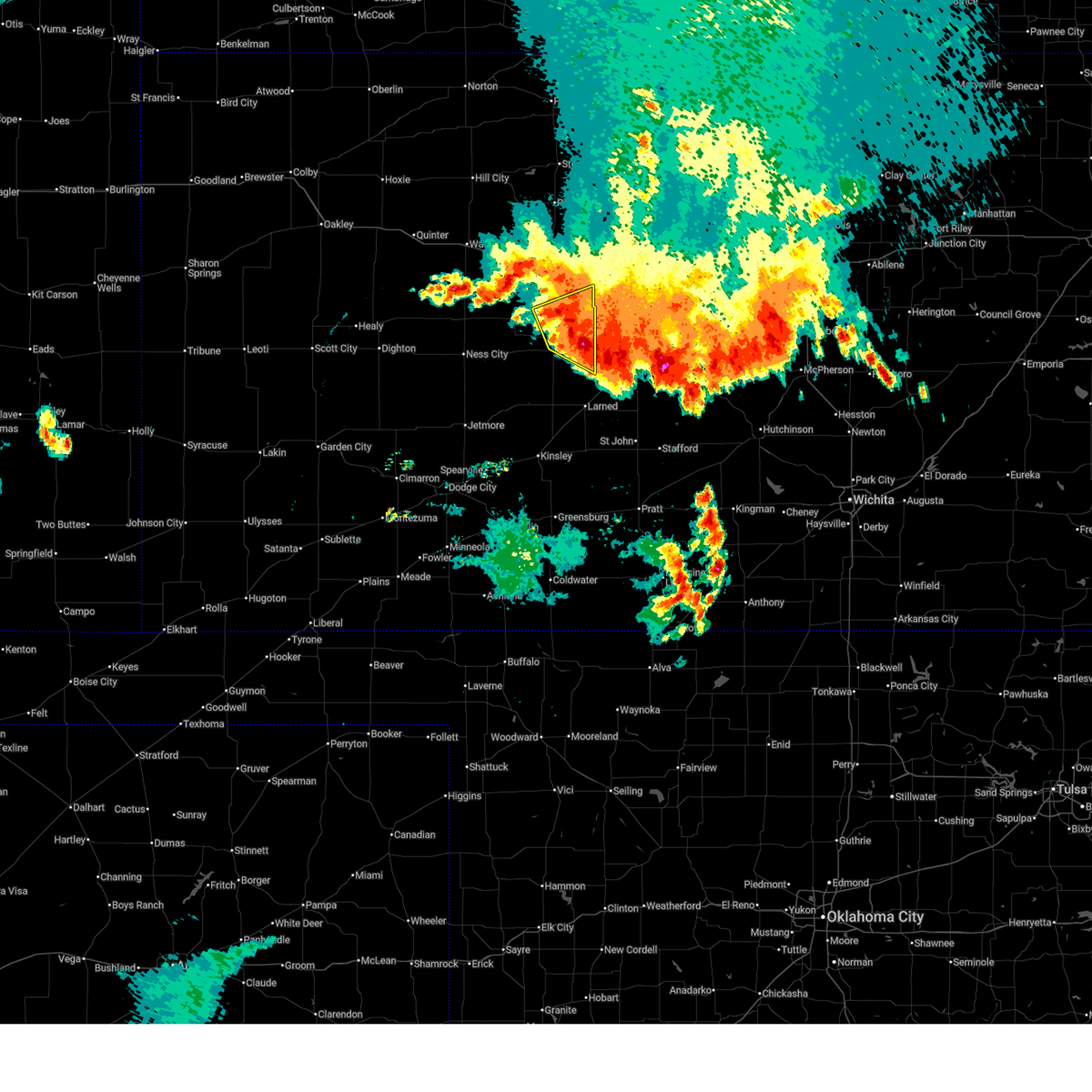
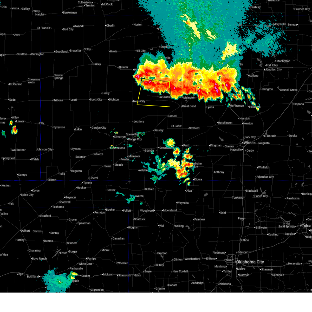
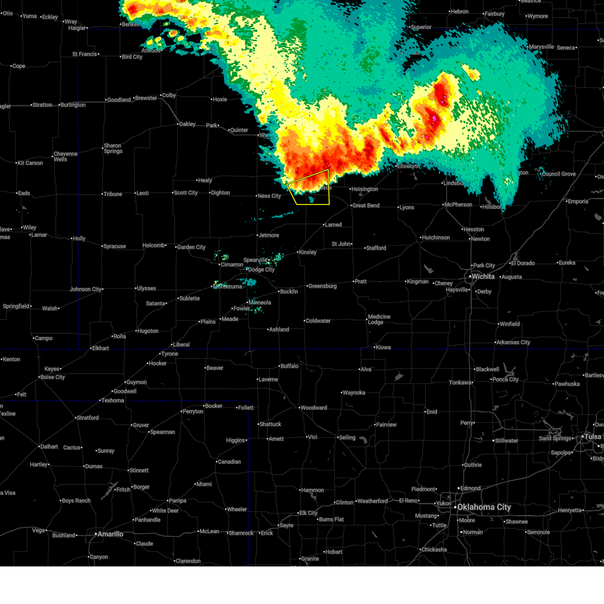
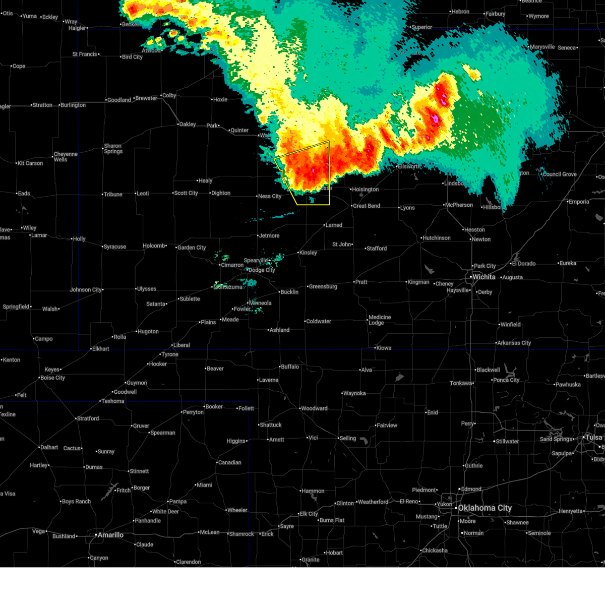
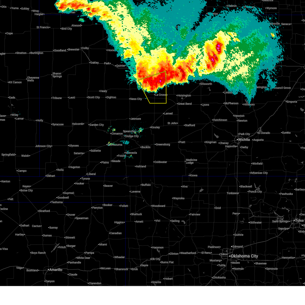
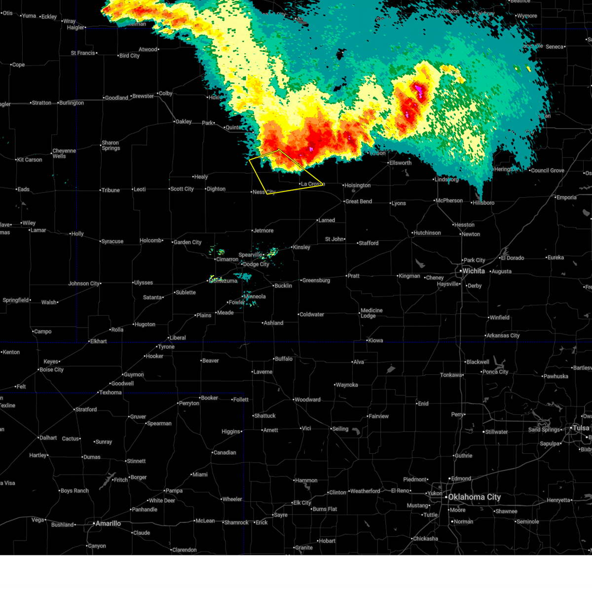
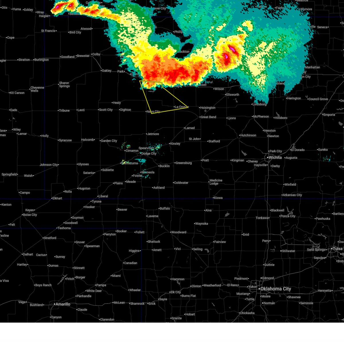
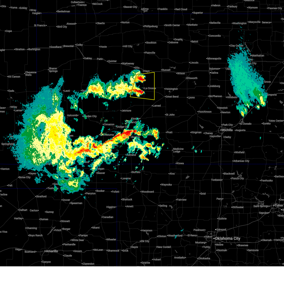
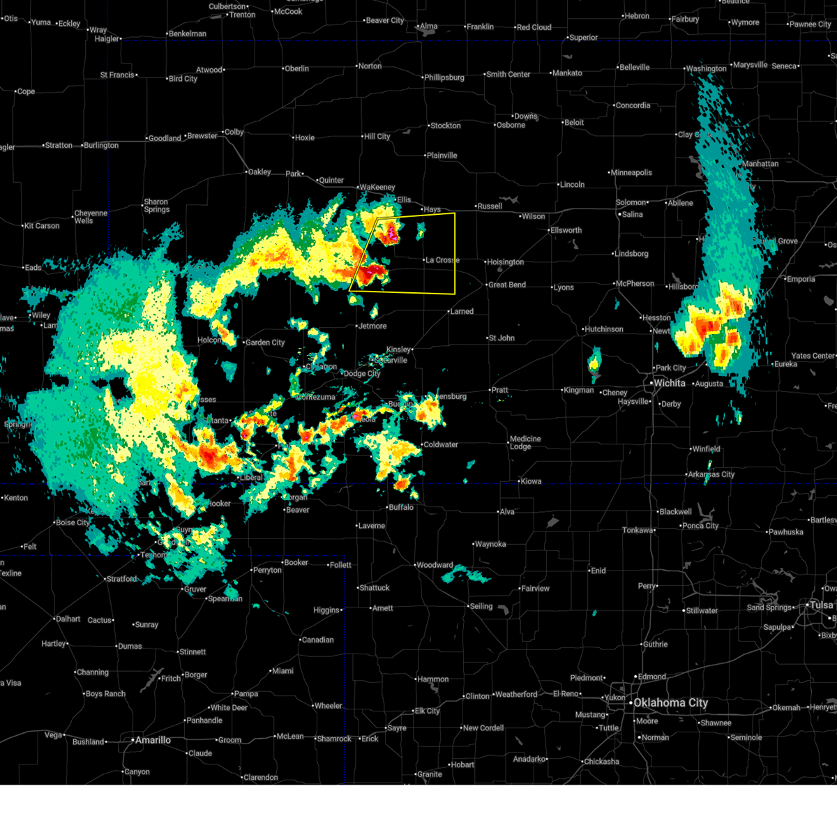
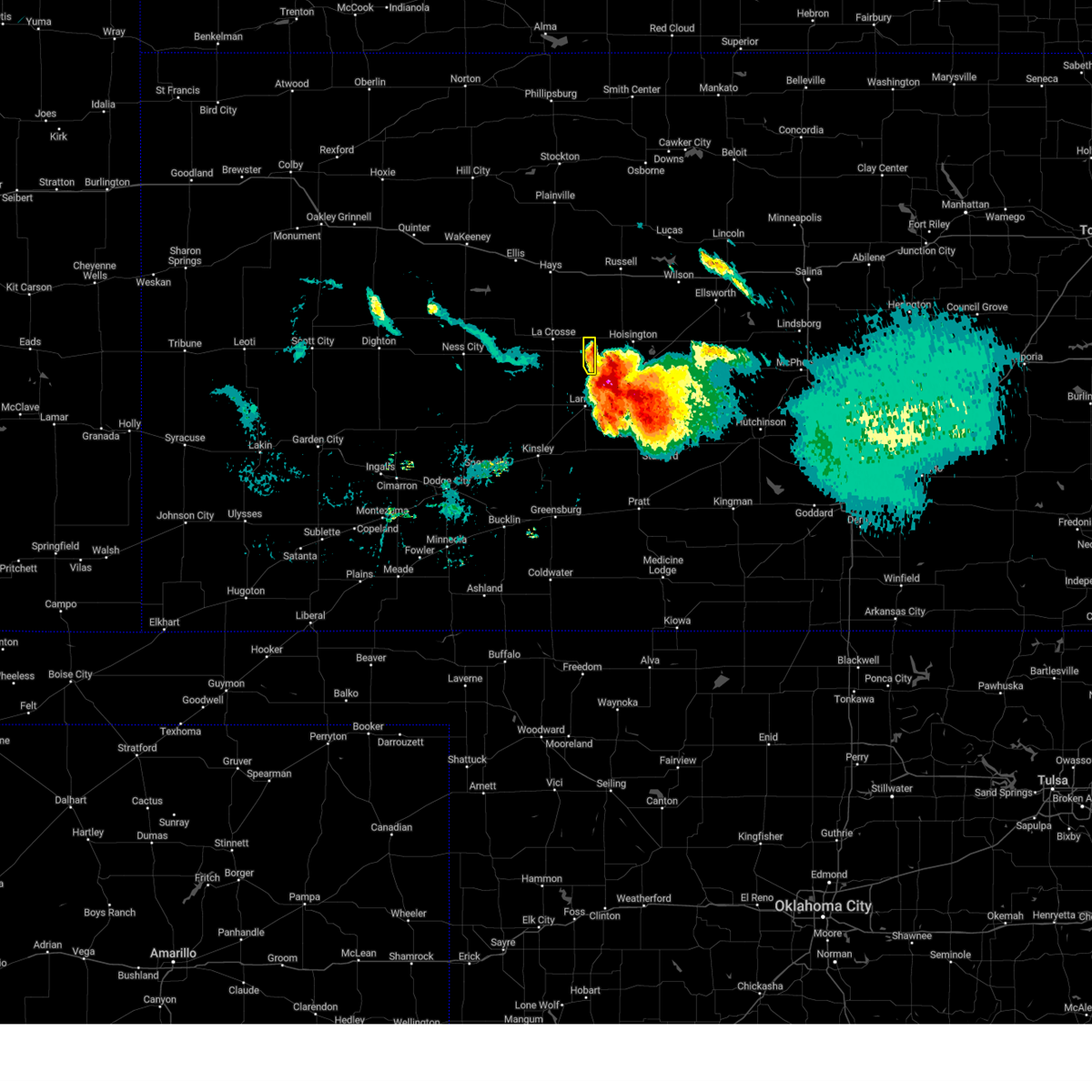
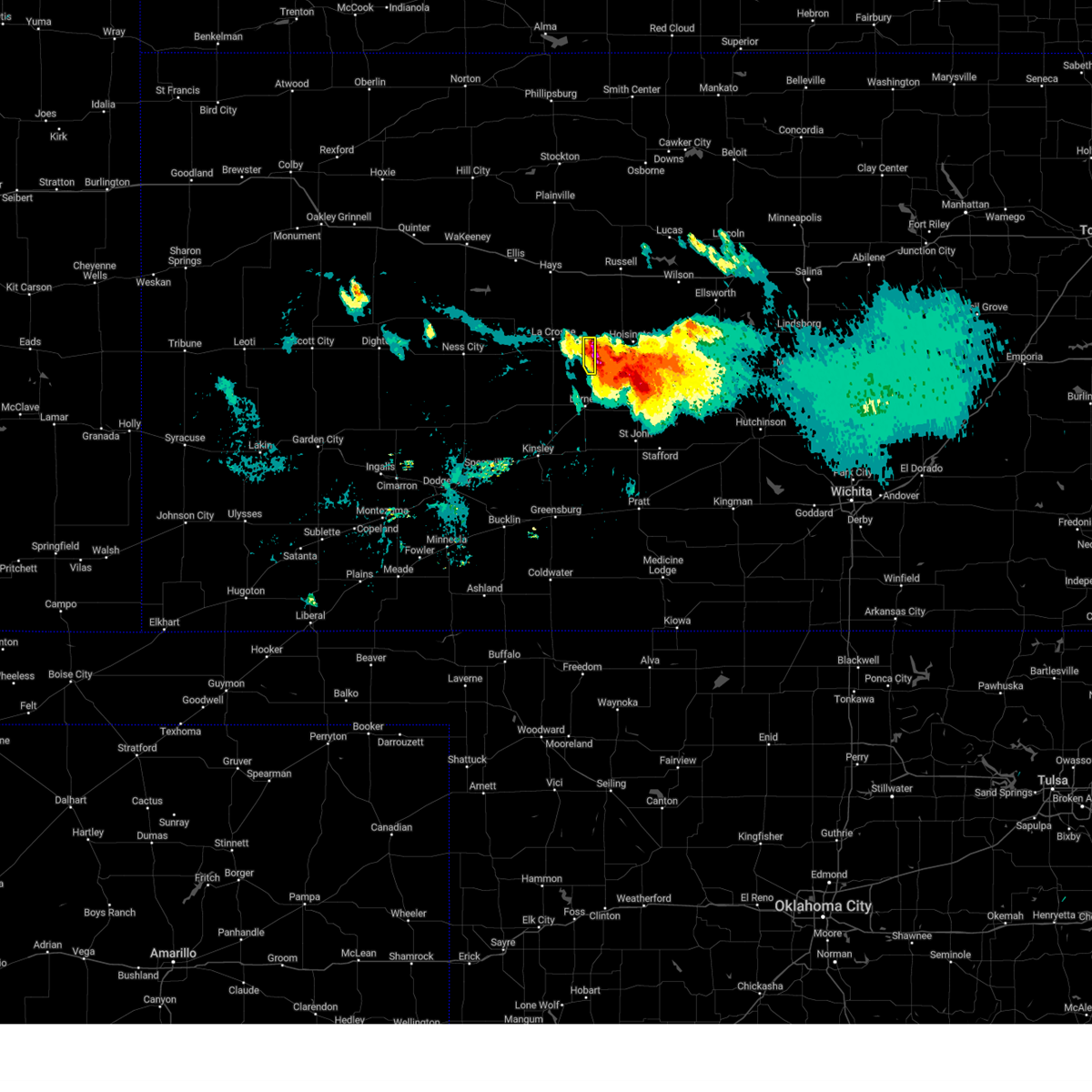
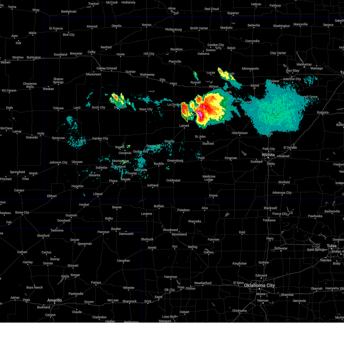
The Top Recent Hail Date for Otis, KS is Sunday, May 17, 2026 (3rd out of 105)
Hail and Wind Damage Spotted near Otis, KS
| Date / Time | Report Details |
|---|---|
| 6/30/2026 9:50 PM CDT |
 The storms which prompted the warning have moved out of the area. therefore, the warning will be allowed to expire. however, gusty winds are still possible with these thunderstorms. a severe thunderstorm watch remains in effect until 1000 pm cdt for central kansas. The storms which prompted the warning have moved out of the area. therefore, the warning will be allowed to expire. however, gusty winds are still possible with these thunderstorms. a severe thunderstorm watch remains in effect until 1000 pm cdt for central kansas.
|
| 6/30/2026 9:41 PM CDT |
 At 941 pm cdt, severe thunderstorms were located along a line extending from near plainville to near emmeram to near loretta to near rush center, moving east at 35 mph (radar indicated). Hazards include 60 mph wind gusts. Expect damage to roofs, siding, and trees. Locations impacted include, la crosse, walker, bison, rush center, otis and timken. At 941 pm cdt, severe thunderstorms were located along a line extending from near plainville to near emmeram to near loretta to near rush center, moving east at 35 mph (radar indicated). Hazards include 60 mph wind gusts. Expect damage to roofs, siding, and trees. Locations impacted include, la crosse, walker, bison, rush center, otis and timken.
|
| 6/30/2026 9:20 PM CDT |
 Svrddc the national weather service in dodge city has issued a * severe thunderstorm warning for, rush county in central kansas, ellis county in central kansas, * until 1000 pm cdt. * at 920 pm cdt, severe thunderstorms were located along a line extending from 7 miles south of zurich to near munjor to near la crosse to near alexander, moving northeast at 35 mph (radar indicated). Hazards include 60 mph wind gusts. Expect damage to roofs, siding, and trees. severe thunderstorms will be near, hays, la crosse, victoria, catherine, rush center, toulon, nekoma, loretta, munjor, and pfeifer around 925 pm cdt. emmeram around 930 pm cdt. Walker and bison around 935 pm cdt. Svrddc the national weather service in dodge city has issued a * severe thunderstorm warning for, rush county in central kansas, ellis county in central kansas, * until 1000 pm cdt. * at 920 pm cdt, severe thunderstorms were located along a line extending from 7 miles south of zurich to near munjor to near la crosse to near alexander, moving northeast at 35 mph (radar indicated). Hazards include 60 mph wind gusts. Expect damage to roofs, siding, and trees. severe thunderstorms will be near, hays, la crosse, victoria, catherine, rush center, toulon, nekoma, loretta, munjor, and pfeifer around 925 pm cdt. emmeram around 930 pm cdt. Walker and bison around 935 pm cdt.
|
| 6/20/2026 10:37 PM CDT |
 Svrddc the national weather service in dodge city has issued a * severe thunderstorm warning for, pawnee county in south central kansas, stafford county in south central kansas, rush county in central kansas, northeastern edwards county in south central kansas, northwestern pratt county in south central kansas, southeastern ellis county in central kansas, * until 1130 pm cdt. * at 1036 pm cdt, severe thunderstorms were located along a line extending from near otis to 7 miles southwest of garfield, moving southeast at 40 mph (radar indicated). Hazards include 60 mph wind gusts. Expect damage to roofs, siding, and trees. severe thunderstorms will be near, otis, garfield, ash valley, frizell, and shaffer around 1040 pm cdt. larned around 1045 pm cdt. zook around 1050 pm cdt. belpre around 1055 pm cdt. Other locations in the path of these severe thunderstorms include radium, macksville, seward and dillwyn. Svrddc the national weather service in dodge city has issued a * severe thunderstorm warning for, pawnee county in south central kansas, stafford county in south central kansas, rush county in central kansas, northeastern edwards county in south central kansas, northwestern pratt county in south central kansas, southeastern ellis county in central kansas, * until 1130 pm cdt. * at 1036 pm cdt, severe thunderstorms were located along a line extending from near otis to 7 miles southwest of garfield, moving southeast at 40 mph (radar indicated). Hazards include 60 mph wind gusts. Expect damage to roofs, siding, and trees. severe thunderstorms will be near, otis, garfield, ash valley, frizell, and shaffer around 1040 pm cdt. larned around 1045 pm cdt. zook around 1050 pm cdt. belpre around 1055 pm cdt. Other locations in the path of these severe thunderstorms include radium, macksville, seward and dillwyn.
|
| 6/20/2026 10:19 PM CDT |
 At 1018 pm cdt, severe thunderstorms were located along a line extending from near pfeifer to near la crosse to near burdett, moving east at 30 mph (public. at 1016 pm cdt, a personal weather station reported 63 mph winds 4 miles west of nekoma). Hazards include 70 mph wind gusts. Expect considerable tree damage. damage is likely to mobile homes, roofs, and outbuildings. Locations impacted include, hays, larned, la crosse, victoria, walker, otis, bison, burdett, schoenchen, rush center, rozel, liebenthal, timken, alexander, ash valley, sanford, nekoma, frizell, hargrave, and pfeifer. At 1018 pm cdt, severe thunderstorms were located along a line extending from near pfeifer to near la crosse to near burdett, moving east at 30 mph (public. at 1016 pm cdt, a personal weather station reported 63 mph winds 4 miles west of nekoma). Hazards include 70 mph wind gusts. Expect considerable tree damage. damage is likely to mobile homes, roofs, and outbuildings. Locations impacted include, hays, larned, la crosse, victoria, walker, otis, bison, burdett, schoenchen, rush center, rozel, liebenthal, timken, alexander, ash valley, sanford, nekoma, frizell, hargrave, and pfeifer.
|
| 6/20/2026 9:52 PM CDT |
 Svrddc the national weather service in dodge city has issued a * severe thunderstorm warning for, eastern ness county in west central kansas, northeastern hodgeman county in southwestern kansas, southeastern trego county in west central kansas, pawnee county in south central kansas, rush county in central kansas, southern ellis county in central kansas, * until 1045 pm cdt. * at 952 pm cdt, severe thunderstorms were located along a line extending from near antonino to near mccracken to 9 miles southeast of ness city, moving east at 35 mph (radar indicated). Hazards include 70 mph wind gusts and penny size hail. Expect considerable tree damage. Damage is likely to mobile homes, roofs, and outbuildings. Svrddc the national weather service in dodge city has issued a * severe thunderstorm warning for, eastern ness county in west central kansas, northeastern hodgeman county in southwestern kansas, southeastern trego county in west central kansas, pawnee county in south central kansas, rush county in central kansas, southern ellis county in central kansas, * until 1045 pm cdt. * at 952 pm cdt, severe thunderstorms were located along a line extending from near antonino to near mccracken to 9 miles southeast of ness city, moving east at 35 mph (radar indicated). Hazards include 70 mph wind gusts and penny size hail. Expect considerable tree damage. Damage is likely to mobile homes, roofs, and outbuildings.
|
| 6/9/2026 6:56 PM CDT |
 At 655 pm cdt, severe thunderstorms were located along a line extending from near albert to near rozel, moving east at 50 mph (automated weather station. at 647 pm cdt, a 65 mph wind gust was measured 3 miles southwest of burdett). Hazards include 60 mph wind gusts. Expect damage to roofs, siding, and trees. These severe storms will be near, ash valley around 700 pm cdt. At 655 pm cdt, severe thunderstorms were located along a line extending from near albert to near rozel, moving east at 50 mph (automated weather station. at 647 pm cdt, a 65 mph wind gust was measured 3 miles southwest of burdett). Hazards include 60 mph wind gusts. Expect damage to roofs, siding, and trees. These severe storms will be near, ash valley around 700 pm cdt.
|
| 6/9/2026 6:40 PM CDT |
 Svrddc the national weather service in dodge city has issued a * severe thunderstorm warning for, pawnee county in south central kansas, southern rush county in central kansas, northern edwards county in south central kansas, * until 715 pm cdt. * at 640 pm cdt, severe thunderstorms were located along a line extending from near rush center to near ash valley to near hanston, moving east at 60 mph (radar indicated). Hazards include 60 mph wind gusts. Expect damage to roofs, siding, and trees. severe thunderstorms will be near, larned, rozel, timken, ash valley, frizell, shaffer, and sanford around 645 pm cdt. otis and garfield around 650 pm cdt. Other locations in the path of these severe thunderstorms include zook. Svrddc the national weather service in dodge city has issued a * severe thunderstorm warning for, pawnee county in south central kansas, southern rush county in central kansas, northern edwards county in south central kansas, * until 715 pm cdt. * at 640 pm cdt, severe thunderstorms were located along a line extending from near rush center to near ash valley to near hanston, moving east at 60 mph (radar indicated). Hazards include 60 mph wind gusts. Expect damage to roofs, siding, and trees. severe thunderstorms will be near, larned, rozel, timken, ash valley, frizell, shaffer, and sanford around 645 pm cdt. otis and garfield around 650 pm cdt. Other locations in the path of these severe thunderstorms include zook.
|
| 6/9/2026 6:09 PM CDT |
 Svrddc the national weather service in dodge city has issued a * severe thunderstorm warning for, northeastern ness county in west central kansas, southeastern trego county in west central kansas, rush county in central kansas, ellis county in central kansas, * until 700 pm cdt. * at 609 pm cdt, severe thunderstorms were located along a line extending from 6 miles south of ogallah to near mccracken to 9 miles north of burdett, moving northeast at 45 mph (radar indicated). Hazards include 60 mph wind gusts. Expect damage to roofs, siding, and trees. severe thunderstorms will be near, riga, nekoma, and hargrave around 615 pm cdt. ellis and antonino around 620 pm cdt. la crosse, schoenchen, rush center, liebenthal, and yocemento around 625 pm cdt. Other locations in the path of these severe thunderstorms include hays, munjor, bison, toulon, victoria, catherine, loretta and pfeifer. Svrddc the national weather service in dodge city has issued a * severe thunderstorm warning for, northeastern ness county in west central kansas, southeastern trego county in west central kansas, rush county in central kansas, ellis county in central kansas, * until 700 pm cdt. * at 609 pm cdt, severe thunderstorms were located along a line extending from 6 miles south of ogallah to near mccracken to 9 miles north of burdett, moving northeast at 45 mph (radar indicated). Hazards include 60 mph wind gusts. Expect damage to roofs, siding, and trees. severe thunderstorms will be near, riga, nekoma, and hargrave around 615 pm cdt. ellis and antonino around 620 pm cdt. la crosse, schoenchen, rush center, liebenthal, and yocemento around 625 pm cdt. Other locations in the path of these severe thunderstorms include hays, munjor, bison, toulon, victoria, catherine, loretta and pfeifer.
|
| 6/1/2026 10:28 PM CDT |
 Svrddc the national weather service in dodge city has issued a * severe thunderstorm warning for, pawnee county in south central kansas, western stafford county in south central kansas, rush county in central kansas, northern edwards county in south central kansas, * until 1130 pm cdt. * at 1028 pm cdt, severe thunderstorms were located along a line extending from near pfeifer to fellsburg, moving east at 25 mph (radar indicated). Hazards include 60 mph wind gusts. Expect damage to roofs, siding, and trees. severe thunderstorms will be near, larned, otis, belpre, shaffer, and zook around 1035 pm cdt. Other locations in the path of these severe thunderstorms include macksville, radium, dillwyn and seward. Svrddc the national weather service in dodge city has issued a * severe thunderstorm warning for, pawnee county in south central kansas, western stafford county in south central kansas, rush county in central kansas, northern edwards county in south central kansas, * until 1130 pm cdt. * at 1028 pm cdt, severe thunderstorms were located along a line extending from near pfeifer to fellsburg, moving east at 25 mph (radar indicated). Hazards include 60 mph wind gusts. Expect damage to roofs, siding, and trees. severe thunderstorms will be near, larned, otis, belpre, shaffer, and zook around 1035 pm cdt. Other locations in the path of these severe thunderstorms include macksville, radium, dillwyn and seward.
|
| 5/30/2026 5:57 PM CDT |
 The storm which prompted the warning has moved out of the area. therefore, the warning will be allowed to expire. a severe thunderstorm watch remains in effect until 1000 pm cdt for central kansas. The storm which prompted the warning has moved out of the area. therefore, the warning will be allowed to expire. a severe thunderstorm watch remains in effect until 1000 pm cdt for central kansas.
|
| 5/30/2026 5:47 PM CDT |
 At 547 pm cdt, a severe thunderstorm was located near milberger, or 7 miles east of pfeifer, moving north at 30 mph (radar indicated). Hazards include 60 mph wind gusts and quarter size hail. Hail damage to vehicles is expected. expect wind damage to roofs, siding, and trees. Locations impacted include, otis and shaffer. At 547 pm cdt, a severe thunderstorm was located near milberger, or 7 miles east of pfeifer, moving north at 30 mph (radar indicated). Hazards include 60 mph wind gusts and quarter size hail. Hail damage to vehicles is expected. expect wind damage to roofs, siding, and trees. Locations impacted include, otis and shaffer.
|
| 5/30/2026 5:37 PM CDT |
 At 537 pm cdt, a severe thunderstorm was located near loretta, moving northeast at 30 mph (radar indicated). Hazards include 60 mph wind gusts and quarter size hail. Hail damage to vehicles is expected. expect wind damage to roofs, siding, and trees. Locations impacted include, la crosse, otis, bison, rush center, timken, loretta, and shaffer. At 537 pm cdt, a severe thunderstorm was located near loretta, moving northeast at 30 mph (radar indicated). Hazards include 60 mph wind gusts and quarter size hail. Hail damage to vehicles is expected. expect wind damage to roofs, siding, and trees. Locations impacted include, la crosse, otis, bison, rush center, timken, loretta, and shaffer.
|
| 5/30/2026 5:18 PM CDT |
 At 517 pm cdt, a severe thunderstorm was located near bison, moving northeast at 40 mph (radar indicated). Hazards include 60 mph wind gusts and quarter size hail. Hail damage to vehicles is expected. expect wind damage to roofs, siding, and trees. Locations impacted include, la crosse, otis, bison, rush center, liebenthal, timken, ash valley, loretta, and shaffer. At 517 pm cdt, a severe thunderstorm was located near bison, moving northeast at 40 mph (radar indicated). Hazards include 60 mph wind gusts and quarter size hail. Hail damage to vehicles is expected. expect wind damage to roofs, siding, and trees. Locations impacted include, la crosse, otis, bison, rush center, liebenthal, timken, ash valley, loretta, and shaffer.
|
| 5/30/2026 4:56 PM CDT |
 At 456 pm cdt, a severe thunderstorm was located near ash valley, moving north at 30 mph (radar indicated). Hazards include 60 mph wind gusts and half dollar size hail. Hail damage to vehicles is expected. expect wind damage to roofs, siding, and trees. Locations impacted include, larned, la crosse, otis, bison, rush center, rozel, liebenthal, timken, ash valley, loretta, sanford, frizell, and shaffer. At 456 pm cdt, a severe thunderstorm was located near ash valley, moving north at 30 mph (radar indicated). Hazards include 60 mph wind gusts and half dollar size hail. Hail damage to vehicles is expected. expect wind damage to roofs, siding, and trees. Locations impacted include, larned, la crosse, otis, bison, rush center, rozel, liebenthal, timken, ash valley, loretta, sanford, frizell, and shaffer.
|
| 5/30/2026 4:44 PM CDT |
 Svrddc the national weather service in dodge city has issued a * severe thunderstorm warning for, northeastern pawnee county in south central kansas, eastern rush county in central kansas, * until 600 pm cdt. * at 444 pm cdt, a severe thunderstorm was located near sanford, moving north at 30 mph (radar indicated). Hazards include 60 mph wind gusts and quarter size hail. Hail damage to vehicles is expected. Expect wind damage to roofs, siding, and trees. Svrddc the national weather service in dodge city has issued a * severe thunderstorm warning for, northeastern pawnee county in south central kansas, eastern rush county in central kansas, * until 600 pm cdt. * at 444 pm cdt, a severe thunderstorm was located near sanford, moving north at 30 mph (radar indicated). Hazards include 60 mph wind gusts and quarter size hail. Hail damage to vehicles is expected. Expect wind damage to roofs, siding, and trees.
|
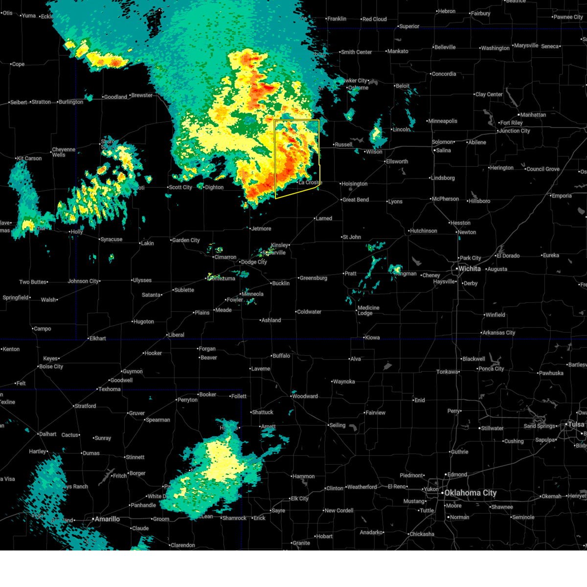
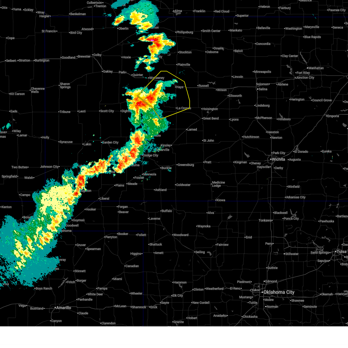
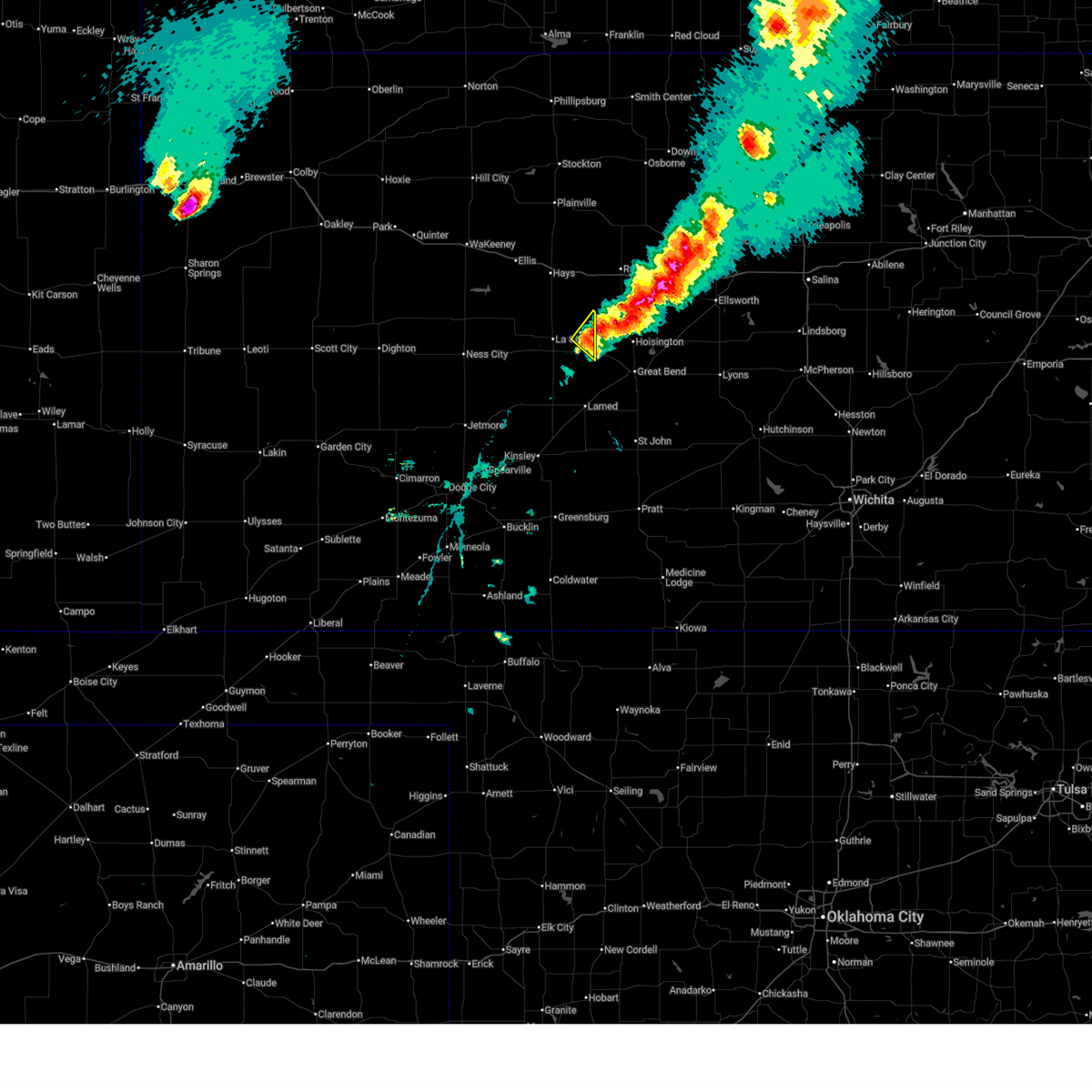
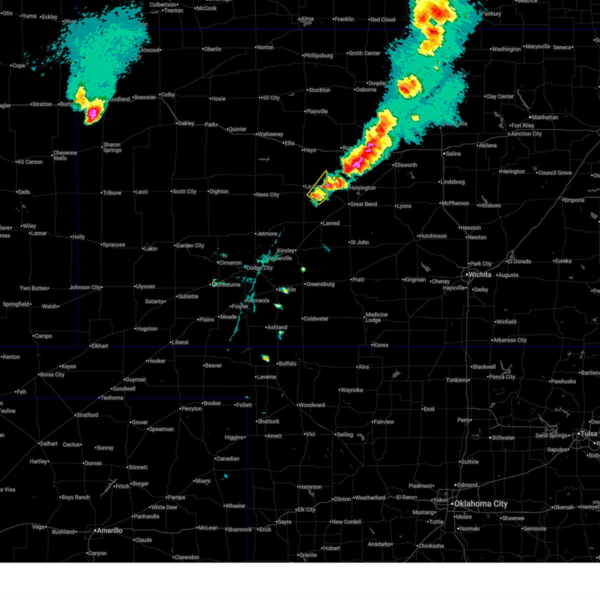
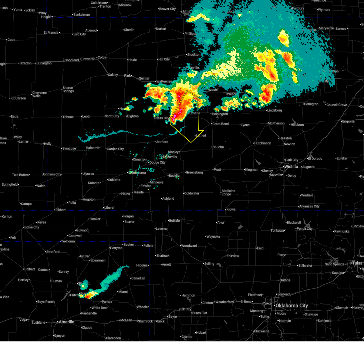
| 5/17/2026 10:07 PM CDT |
 At 1007 pm cdt, severe thunderstorms were located along a line extending from near milberger to 12 miles southeast of beeler, moving northeast at 15 mph (radar indicated). Hazards include 60 mph wind gusts and quarter size hail. Hail damage to vehicles is expected. expect wind damage to roofs, siding, and trees. Locations impacted include, bazine, mccracken, liebenthal, alexander, loretta, hargrave, pfeifer and ness city. At 1007 pm cdt, severe thunderstorms were located along a line extending from near milberger to 12 miles southeast of beeler, moving northeast at 15 mph (radar indicated). Hazards include 60 mph wind gusts and quarter size hail. Hail damage to vehicles is expected. expect wind damage to roofs, siding, and trees. Locations impacted include, bazine, mccracken, liebenthal, alexander, loretta, hargrave, pfeifer and ness city.
|
| 5/17/2026 9:25 PM CDT |
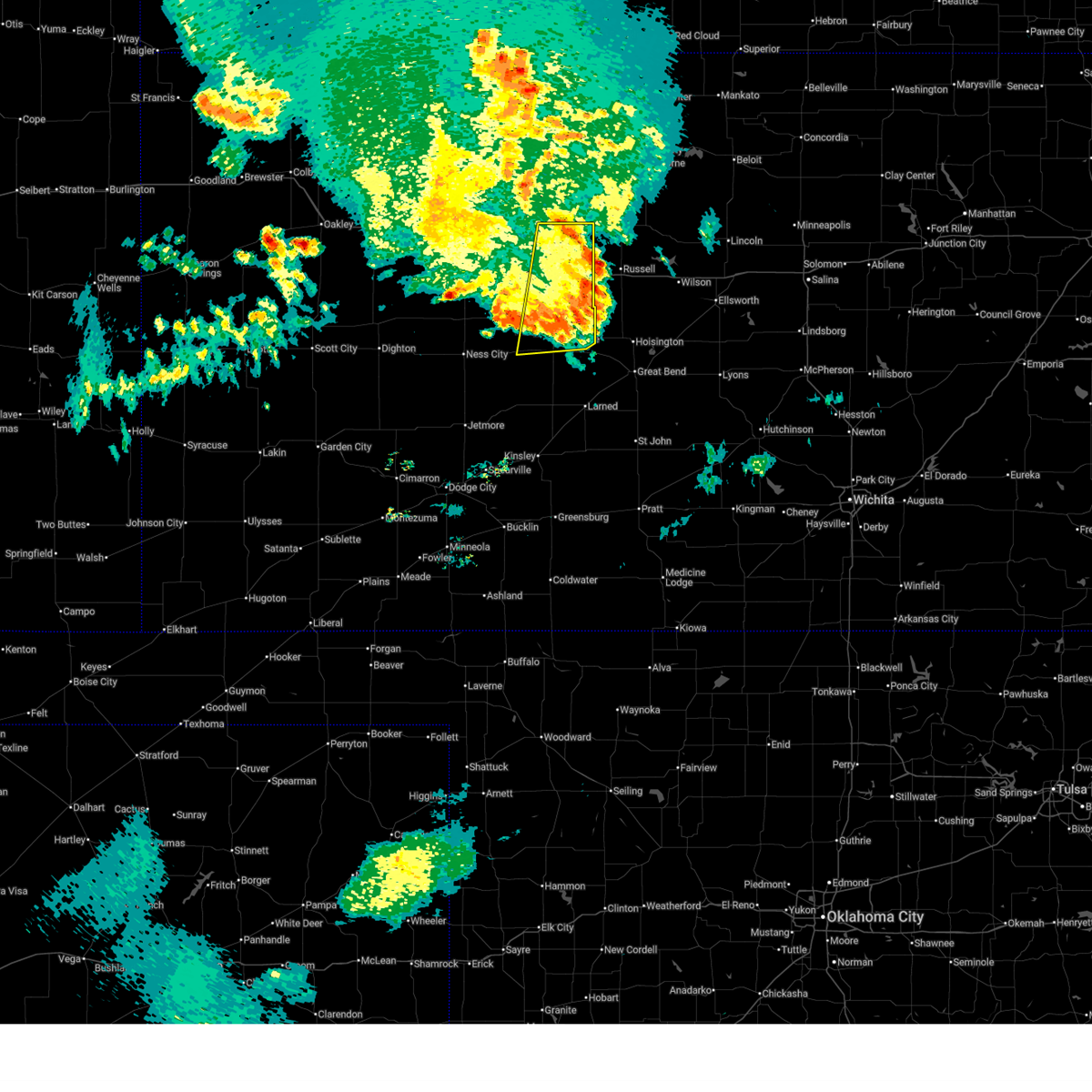
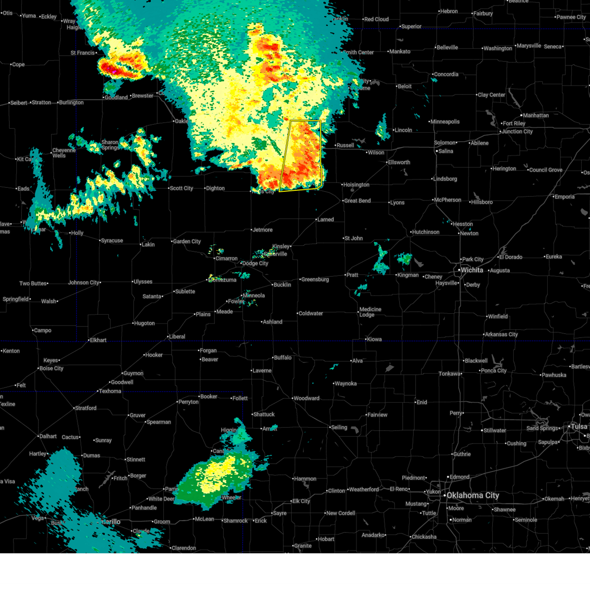
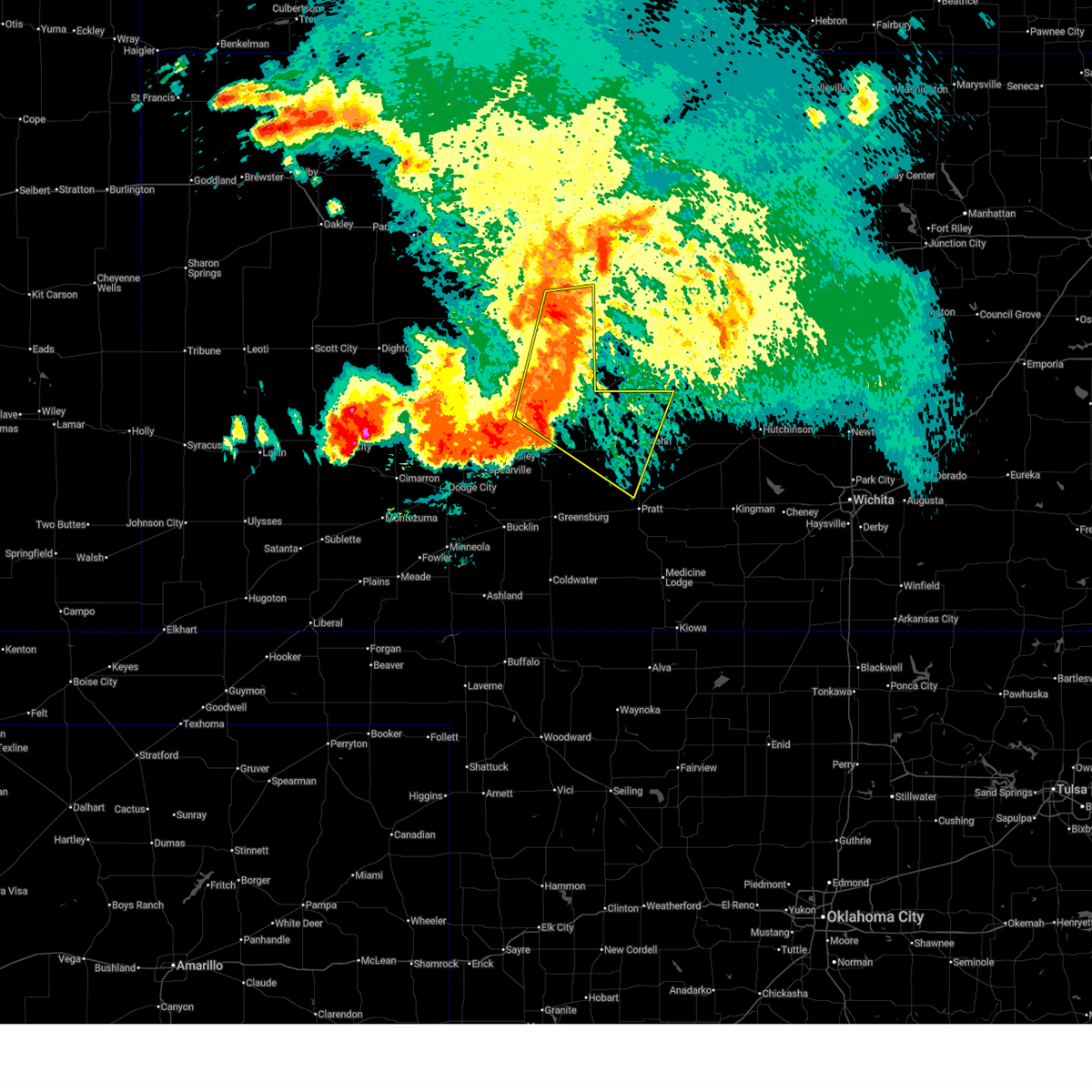
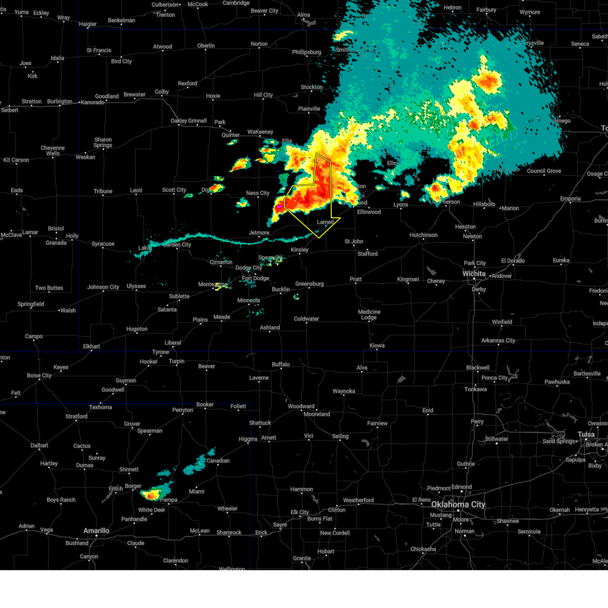
 Svrddc the national weather service in dodge city has issued a * severe thunderstorm warning for, southern ness county in west central kansas, northern hodgeman county in southwestern kansas, northwestern pawnee county in south central kansas, rush county in central kansas, * until 1015 pm cdt. * at 925 pm cdt, severe thunderstorms were located along a line extending from near otis to 8 miles northeast of kalvesta, moving northeast at 15 mph (radar indicated). Hazards include golf ball size hail and 60 mph wind gusts. People and animals outdoors will be injured. expect hail damage to roofs, siding, windows, and vehicles. expect wind damage to roofs, siding, and trees. severe thunderstorms will be near, la crosse, alexander, and nekoma around 930 pm cdt. Bazine, loretta, and hargrave around 940 pm cdt. Svrddc the national weather service in dodge city has issued a * severe thunderstorm warning for, southern ness county in west central kansas, northern hodgeman county in southwestern kansas, northwestern pawnee county in south central kansas, rush county in central kansas, * until 1015 pm cdt. * at 925 pm cdt, severe thunderstorms were located along a line extending from near otis to 8 miles northeast of kalvesta, moving northeast at 15 mph (radar indicated). Hazards include golf ball size hail and 60 mph wind gusts. People and animals outdoors will be injured. expect hail damage to roofs, siding, windows, and vehicles. expect wind damage to roofs, siding, and trees. severe thunderstorms will be near, la crosse, alexander, and nekoma around 930 pm cdt. Bazine, loretta, and hargrave around 940 pm cdt.
|
| 5/17/2026 9:07 PM CDT |
 At 907 pm cdt, severe thunderstorms were located along a line extending from near loretta to 7 miles southeast of bazine, moving northwest at 10 mph (radar indicated). Hazards include golf ball size hail and 60 mph wind gusts. People and animals outdoors will be injured. expect hail damage to roofs, siding, windows, and vehicles. expect wind damage to roofs, siding, and trees. Locations impacted include, la crosse, alexander, nekoma, loretta, hargrave and pfeifer. At 907 pm cdt, severe thunderstorms were located along a line extending from near loretta to 7 miles southeast of bazine, moving northwest at 10 mph (radar indicated). Hazards include golf ball size hail and 60 mph wind gusts. People and animals outdoors will be injured. expect hail damage to roofs, siding, windows, and vehicles. expect wind damage to roofs, siding, and trees. Locations impacted include, la crosse, alexander, nekoma, loretta, hargrave and pfeifer.
|
| 5/17/2026 8:44 PM CDT |
 Svrddc the national weather service in dodge city has issued a * severe thunderstorm warning for, southeastern ness county in west central kansas, northwestern pawnee county in south central kansas, rush county in central kansas, * until 930 pm cdt. * at 844 pm cdt, severe thunderstorms were located along a line extending from near otis to 9 miles north of burdett, moving northeast at 15 mph (radar indicated). Hazards include golf ball size hail and 60 mph wind gusts. People and animals outdoors will be injured. expect hail damage to roofs, siding, windows, and vehicles. expect wind damage to roofs, siding, and trees. severe thunderstorms will be near, la crosse, bison, rush center, and nekoma around 850 pm cdt. Other locations in the path of these severe thunderstorms include alexander and loretta. Svrddc the national weather service in dodge city has issued a * severe thunderstorm warning for, southeastern ness county in west central kansas, northwestern pawnee county in south central kansas, rush county in central kansas, * until 930 pm cdt. * at 844 pm cdt, severe thunderstorms were located along a line extending from near otis to 9 miles north of burdett, moving northeast at 15 mph (radar indicated). Hazards include golf ball size hail and 60 mph wind gusts. People and animals outdoors will be injured. expect hail damage to roofs, siding, windows, and vehicles. expect wind damage to roofs, siding, and trees. severe thunderstorms will be near, la crosse, bison, rush center, and nekoma around 850 pm cdt. Other locations in the path of these severe thunderstorms include alexander and loretta.
|
| 5/17/2026 8:09 PM CDT |
 At 809 pm cdt, severe thunderstorms were located along a line extending from 6 miles northeast of otis to 9 miles north of burdett, moving northeast at 15 mph (radar indicated). Hazards include ping pong ball size hail and 60 mph wind gusts. People and animals outdoors will be injured. expect hail damage to roofs, siding, windows, and vehicles. expect wind damage to roofs, siding, and trees. these severe storms will be near, otis, bison, rush center, and timken around 815 pm cdt. Other locations in the path of these severe thunderstorms include la crosse. At 809 pm cdt, severe thunderstorms were located along a line extending from 6 miles northeast of otis to 9 miles north of burdett, moving northeast at 15 mph (radar indicated). Hazards include ping pong ball size hail and 60 mph wind gusts. People and animals outdoors will be injured. expect hail damage to roofs, siding, windows, and vehicles. expect wind damage to roofs, siding, and trees. these severe storms will be near, otis, bison, rush center, and timken around 815 pm cdt. Other locations in the path of these severe thunderstorms include la crosse.
|
| 5/17/2026 7:58 PM CDT |
 Svrddc the national weather service in dodge city has issued a * severe thunderstorm warning for, northwestern pawnee county in south central kansas, rush county in central kansas, * until 845 pm cdt. * at 758 pm cdt, severe thunderstorms were located along a line extending from near otis to 6 miles north of burdett, moving northeast at 15 mph (radar indicated). Hazards include 60 mph wind gusts and quarter size hail. Hail damage to vehicles is expected. expect wind damage to roofs, siding, and trees. Severe thunderstorms will be near, otis, bison, rush center, and timken around 805 pm cdt. Svrddc the national weather service in dodge city has issued a * severe thunderstorm warning for, northwestern pawnee county in south central kansas, rush county in central kansas, * until 845 pm cdt. * at 758 pm cdt, severe thunderstorms were located along a line extending from near otis to 6 miles north of burdett, moving northeast at 15 mph (radar indicated). Hazards include 60 mph wind gusts and quarter size hail. Hail damage to vehicles is expected. expect wind damage to roofs, siding, and trees. Severe thunderstorms will be near, otis, bison, rush center, and timken around 805 pm cdt.
|
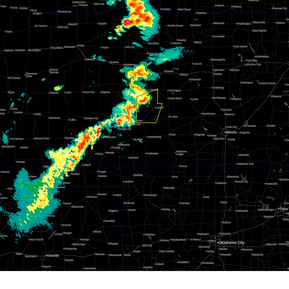
| 5/17/2026 7:45 PM CDT |
 At 745 pm cdt, a severe thunderstorm was located very near otis, moving northeast at 45 mph (radar indicated). Hazards include 60 mph wind gusts and quarter size hail. Hail damage to vehicles is expected. expect wind damage to roofs, siding, and trees. This severe thunderstorm will remain over mainly rural areas of northwestern pawnee and eastern rush counties. At 745 pm cdt, a severe thunderstorm was located very near otis, moving northeast at 45 mph (radar indicated). Hazards include 60 mph wind gusts and quarter size hail. Hail damage to vehicles is expected. expect wind damage to roofs, siding, and trees. This severe thunderstorm will remain over mainly rural areas of northwestern pawnee and eastern rush counties.
|
| 5/17/2026 7:22 PM CDT |
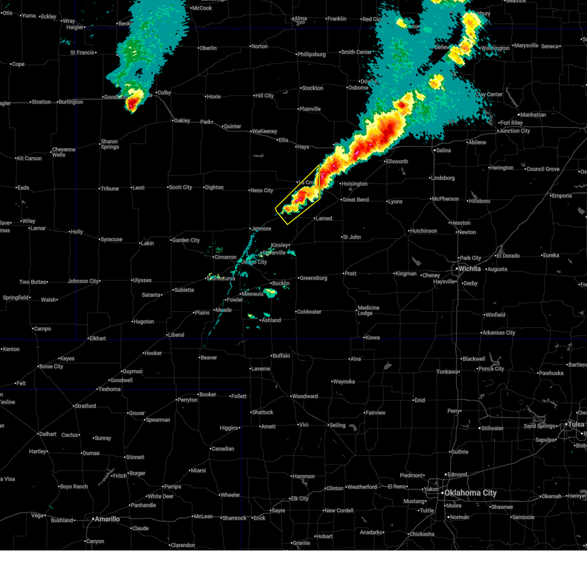 Svrddc the national weather service in dodge city has issued a * severe thunderstorm warning for, northwestern pawnee county in south central kansas, eastern rush county in central kansas, * until 800 pm cdt. * at 722 pm cdt, a severe thunderstorm was located near ash valley, moving northeast at 45 mph (radar indicated). Hazards include quarter size hail. Damage to vehicles is expected. this severe thunderstorm will be near, timken around 730 pm cdt. shaffer around 735 pm cdt. Otis around 740 pm cdt. Svrddc the national weather service in dodge city has issued a * severe thunderstorm warning for, northwestern pawnee county in south central kansas, eastern rush county in central kansas, * until 800 pm cdt. * at 722 pm cdt, a severe thunderstorm was located near ash valley, moving northeast at 45 mph (radar indicated). Hazards include quarter size hail. Damage to vehicles is expected. this severe thunderstorm will be near, timken around 730 pm cdt. shaffer around 735 pm cdt. Otis around 740 pm cdt.
|
| 5/17/2026 6:49 PM CDT |
 At 649 pm cdt, a severe thunderstorm was located near olmitz, or near otis, moving northeast at 30 mph (radar indicated). Hazards include quarter size hail. Damage to vehicles is expected. Locations impacted include, otis and shaffer. At 649 pm cdt, a severe thunderstorm was located near olmitz, or near otis, moving northeast at 30 mph (radar indicated). Hazards include quarter size hail. Damage to vehicles is expected. Locations impacted include, otis and shaffer.
|
| 5/17/2026 6:46 PM CDT | Half Dollar sized hail reported 0.3 miles SSW of Otis, KS, report of half-dollar sized hail with photos. |
| 5/17/2026 6:40 PM CDT |
 Svrddc the national weather service in dodge city has issued a * severe thunderstorm warning for, southeastern rush county in central kansas, * until 730 pm cdt. * at 640 pm cdt, a severe thunderstorm was located very near otis, moving northeast at 25 mph (radar indicated). Hazards include quarter size hail. Damage to vehicles is expected. This severe thunderstorm will remain over mainly rural areas of southeastern rush county. Svrddc the national weather service in dodge city has issued a * severe thunderstorm warning for, southeastern rush county in central kansas, * until 730 pm cdt. * at 640 pm cdt, a severe thunderstorm was located very near otis, moving northeast at 25 mph (radar indicated). Hazards include quarter size hail. Damage to vehicles is expected. This severe thunderstorm will remain over mainly rural areas of southeastern rush county.
|
| 5/17/2026 6:37 PM CDT | Quarter sized hail reported 0.4 miles NNW of Otis, KS |
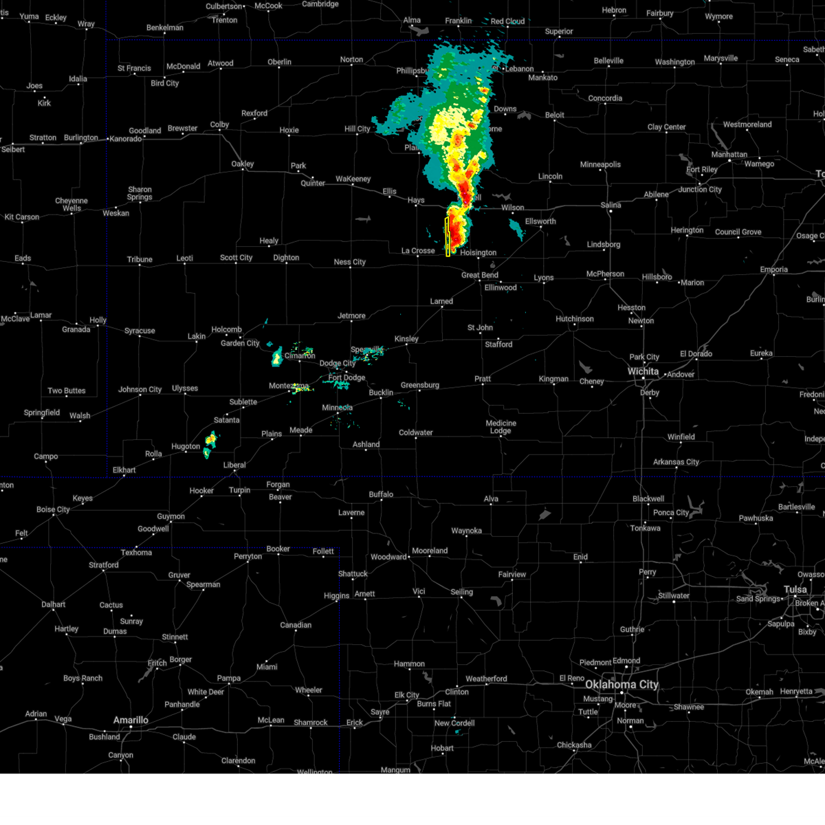
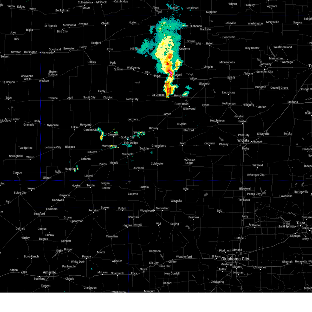
| 9/19/2025 8:20 PM CDT | The storm which prompted the warning has weakened below severe limits, and no longer poses an immediate threat to life or property. therefore, the warning will be allowed to expire. a severe thunderstorm watch remains in effect until 1100 pm cdt for central kansas. |
| 9/19/2025 7:59 PM CDT | At 758 pm cdt, a severe thunderstorm was located very near loretta, moving southeast at 20 mph (radar indicated). Hazards include 60 mph wind gusts and quarter size hail. Hail damage to vehicles is expected. expect wind damage to roofs, siding, and trees. Locations impacted include, otis. |
| 9/19/2025 7:59 PM CDT | the severe thunderstorm warning has been cancelled and is no longer in effect |
| 9/19/2025 7:34 PM CDT | Svrddc the national weather service in dodge city has issued a * severe thunderstorm warning for, northeastern rush county in central kansas, southeastern ellis county in central kansas, * until 830 pm cdt. * at 734 pm cdt, a severe thunderstorm was located very near schoenchen, moving southeast at 20 mph (radar indicated). Hazards include ping pong ball size hail and 60 mph wind gusts. People and animals outdoors will be injured. expect hail damage to roofs, siding, windows, and vehicles. expect wind damage to roofs, siding, and trees. this severe thunderstorm will be near, liebenthal around 740 pm cdt. Loretta and pfeifer around 750 pm cdt. |
| 7/21/2025 8:50 PM CDT |
 At 849 pm cdt, severe thunderstorms were located along a line extending from 6 miles south of albert to near liebenthal, moving east at 10 mph (radar indicated). Hazards include 60 mph wind gusts. Expect damage to roofs, siding, and trees. Locations impacted include, bison, schoenchen, liebenthal, timken, shaffer, otis and loretta. At 849 pm cdt, severe thunderstorms were located along a line extending from 6 miles south of albert to near liebenthal, moving east at 10 mph (radar indicated). Hazards include 60 mph wind gusts. Expect damage to roofs, siding, and trees. Locations impacted include, bison, schoenchen, liebenthal, timken, shaffer, otis and loretta.
|
| 7/21/2025 8:50 PM CDT |
 the severe thunderstorm warning has been cancelled and is no longer in effect the severe thunderstorm warning has been cancelled and is no longer in effect
|
| 7/21/2025 8:08 PM CDT |
 Svrddc the national weather service in dodge city has issued a * severe thunderstorm warning for, northeastern ness county in west central kansas, southeastern trego county in west central kansas, rush county in central kansas, southern ellis county in central kansas, * until 900 pm cdt. * at 808 pm cdt, severe thunderstorms were located along a line extending from near otis to near mccracken, moving south at 20 mph (radar indicated). Hazards include 60 mph wind gusts and nickel size hail. Expect damage to roofs, siding, and trees. severe thunderstorms will be near, la crosse, bison, rush center, timken, alexander, shaffer, and nekoma around 815 pm cdt. Bazine around 820 pm cdt. Svrddc the national weather service in dodge city has issued a * severe thunderstorm warning for, northeastern ness county in west central kansas, southeastern trego county in west central kansas, rush county in central kansas, southern ellis county in central kansas, * until 900 pm cdt. * at 808 pm cdt, severe thunderstorms were located along a line extending from near otis to near mccracken, moving south at 20 mph (radar indicated). Hazards include 60 mph wind gusts and nickel size hail. Expect damage to roofs, siding, and trees. severe thunderstorms will be near, la crosse, bison, rush center, timken, alexander, shaffer, and nekoma around 815 pm cdt. Bazine around 820 pm cdt.
|
| 6/17/2025 2:04 AM CDT |
 the severe thunderstorm warning has been cancelled and is no longer in effect the severe thunderstorm warning has been cancelled and is no longer in effect
|
| 6/17/2025 2:04 AM CDT |
 At 204 am cdt, a severe thunderstorm was located near shaffer, moving southeast at 40 mph (radar indicated). Hazards include 60 mph wind gusts and quarter size hail. Hail damage to vehicles is expected. expect wind damage to roofs, siding, and trees. Locations impacted include, la crosse, otis, bison, rush center, timken, loretta, nekoma, hargrave, and shaffer. At 204 am cdt, a severe thunderstorm was located near shaffer, moving southeast at 40 mph (radar indicated). Hazards include 60 mph wind gusts and quarter size hail. Hail damage to vehicles is expected. expect wind damage to roofs, siding, and trees. Locations impacted include, la crosse, otis, bison, rush center, timken, loretta, nekoma, hargrave, and shaffer.
|
| 6/17/2025 2:00 AM CDT |
 At 159 am cdt, a severe thunderstorm was located near shaffer, moving southeast at 40 mph (radar indicated). Hazards include 60 mph wind gusts and quarter size hail. Hail damage to vehicles is expected. expect wind damage to roofs, siding, and trees. Locations impacted include, hays, la crosse, victoria, walker, otis, bison, schoenchen, mccracken, rush center, liebenthal, timken, munjor, loretta, nekoma, hargrave, pfeifer, toulon, shaffer, and antonino. At 159 am cdt, a severe thunderstorm was located near shaffer, moving southeast at 40 mph (radar indicated). Hazards include 60 mph wind gusts and quarter size hail. Hail damage to vehicles is expected. expect wind damage to roofs, siding, and trees. Locations impacted include, hays, la crosse, victoria, walker, otis, bison, schoenchen, mccracken, rush center, liebenthal, timken, munjor, loretta, nekoma, hargrave, pfeifer, toulon, shaffer, and antonino.
|
| 6/17/2025 1:43 AM CDT |
 Svrddc the national weather service in dodge city has issued a * severe thunderstorm warning for, southeastern trego county in west central kansas, rush county in central kansas, southern ellis county in central kansas, * until 245 am cdt. * at 143 am cdt, a severe thunderstorm was located near pfeifer, moving southeast at 40 mph (radar indicated). Hazards include 60 mph wind gusts and quarter size hail. Hail damage to vehicles is expected. expect wind damage to roofs, siding, and trees. This severe thunderstorm will remain over mainly rural areas of southeastern trego, rush and southern ellis counties. Svrddc the national weather service in dodge city has issued a * severe thunderstorm warning for, southeastern trego county in west central kansas, rush county in central kansas, southern ellis county in central kansas, * until 245 am cdt. * at 143 am cdt, a severe thunderstorm was located near pfeifer, moving southeast at 40 mph (radar indicated). Hazards include 60 mph wind gusts and quarter size hail. Hail damage to vehicles is expected. expect wind damage to roofs, siding, and trees. This severe thunderstorm will remain over mainly rural areas of southeastern trego, rush and southern ellis counties.
|
| 6/17/2025 1:37 AM CDT |
 At 137 am cdt, a severe thunderstorm was located near mccracken, moving southeast at 40 mph (radar indicated). Hazards include 60 mph wind gusts and penny size hail. Expect damage to roofs, siding, and trees. Locations impacted include, mccracken, hargrave and la crosse. At 137 am cdt, a severe thunderstorm was located near mccracken, moving southeast at 40 mph (radar indicated). Hazards include 60 mph wind gusts and penny size hail. Expect damage to roofs, siding, and trees. Locations impacted include, mccracken, hargrave and la crosse.
|
| 6/17/2025 1:13 AM CDT |
 Svrddc the national weather service in dodge city has issued a * severe thunderstorm warning for, northeastern ness county in west central kansas, southern trego county in west central kansas, northern rush county in central kansas, southwestern ellis county in central kansas, * until 200 am cdt. * at 113 am cdt, a severe thunderstorm was located near cedar bluff, moving southeast at 40 mph (radar indicated). Hazards include 60 mph wind gusts and quarter size hail. Hail damage to vehicles is expected. expect wind damage to roofs, siding, and trees. this severe thunderstorm will be near, cedar bluff around 120 am cdt. brownell around 130 am cdt. Other locations in the path of this severe thunderstorm include mccracken and alexander. Svrddc the national weather service in dodge city has issued a * severe thunderstorm warning for, northeastern ness county in west central kansas, southern trego county in west central kansas, northern rush county in central kansas, southwestern ellis county in central kansas, * until 200 am cdt. * at 113 am cdt, a severe thunderstorm was located near cedar bluff, moving southeast at 40 mph (radar indicated). Hazards include 60 mph wind gusts and quarter size hail. Hail damage to vehicles is expected. expect wind damage to roofs, siding, and trees. this severe thunderstorm will be near, cedar bluff around 120 am cdt. brownell around 130 am cdt. Other locations in the path of this severe thunderstorm include mccracken and alexander.
|
| 5/19/2025 8:44 PM CDT |
 the severe thunderstorm warning has been cancelled and is no longer in effect the severe thunderstorm warning has been cancelled and is no longer in effect
|
| 5/19/2025 8:44 PM CDT |
 At 844 pm cdt, severe thunderstorms were located along a line extending from schoenchen to near alexander, moving east at 25 mph (radar indicated). Hazards include 60 mph wind gusts and quarter size hail. Hail damage to vehicles is expected. expect wind damage to roofs, siding, and trees. Locations impacted include, schoenchen, liebenthal, nekoma, hargrave, la crosse, pfeifer, rush center, loretta, bison, timken and otis. At 844 pm cdt, severe thunderstorms were located along a line extending from schoenchen to near alexander, moving east at 25 mph (radar indicated). Hazards include 60 mph wind gusts and quarter size hail. Hail damage to vehicles is expected. expect wind damage to roofs, siding, and trees. Locations impacted include, schoenchen, liebenthal, nekoma, hargrave, la crosse, pfeifer, rush center, loretta, bison, timken and otis.
|
| 5/19/2025 8:13 PM CDT |
 Svrddc the national weather service in dodge city has issued a * severe thunderstorm warning for, eastern ness county in west central kansas, southeastern trego county in west central kansas, northwestern pawnee county in south central kansas, rush county in central kansas, southern ellis county in central kansas, * until 915 pm cdt. * at 813 pm cdt, severe thunderstorms were located along a line extending from 9 miles north of mccracken to near bazine, moving east at 25 mph (radar indicated). Hazards include 60 mph wind gusts and quarter size hail. Hail damage to vehicles is expected. expect wind damage to roofs, siding, and trees. severe thunderstorms will be near, bazine and mccracken around 820 pm cdt. alexander around 825 pm cdt. Other locations in the path of these severe thunderstorms include schoenchen, hargrave, liebenthal, nekoma, la crosse, pfeifer, rush center and loretta. Svrddc the national weather service in dodge city has issued a * severe thunderstorm warning for, eastern ness county in west central kansas, southeastern trego county in west central kansas, northwestern pawnee county in south central kansas, rush county in central kansas, southern ellis county in central kansas, * until 915 pm cdt. * at 813 pm cdt, severe thunderstorms were located along a line extending from 9 miles north of mccracken to near bazine, moving east at 25 mph (radar indicated). Hazards include 60 mph wind gusts and quarter size hail. Hail damage to vehicles is expected. expect wind damage to roofs, siding, and trees. severe thunderstorms will be near, bazine and mccracken around 820 pm cdt. alexander around 825 pm cdt. Other locations in the path of these severe thunderstorms include schoenchen, hargrave, liebenthal, nekoma, la crosse, pfeifer, rush center and loretta.
|
| 7/31/2024 7:52 PM CDT |
 At 752 pm cdt, a severe thunderstorm was located very near ash valley, moving southeast at 30 mph (radar indicated). Hazards include 60 mph wind gusts and quarter size hail. Hail damage to vehicles is expected. expect wind damage to roofs, siding, and trees. Locations impacted include, ash valley and larned. At 752 pm cdt, a severe thunderstorm was located very near ash valley, moving southeast at 30 mph (radar indicated). Hazards include 60 mph wind gusts and quarter size hail. Hail damage to vehicles is expected. expect wind damage to roofs, siding, and trees. Locations impacted include, ash valley and larned.
|
| 7/31/2024 7:30 PM CDT |
 Svrddc the national weather service in dodge city has issued a * severe thunderstorm warning for, northeastern pawnee county in south central kansas, rush county in central kansas, southeastern ellis county in central kansas, * until 815 pm cdt. * at 727 pm cdt, a severe thunderstorm was located near nekoma, moving southeast at 30 mph (radar indicated). Hazards include ping pong ball size hail and 60 mph wind gusts. People and animals outdoors will be injured. expect hail damage to roofs, siding, windows, and vehicles. expect wind damage to roofs, siding, and trees. this severe thunderstorm will be near, ash valley around 745 pm cdt. Other locations in the path of this severe thunderstorm include larned. Svrddc the national weather service in dodge city has issued a * severe thunderstorm warning for, northeastern pawnee county in south central kansas, rush county in central kansas, southeastern ellis county in central kansas, * until 815 pm cdt. * at 727 pm cdt, a severe thunderstorm was located near nekoma, moving southeast at 30 mph (radar indicated). Hazards include ping pong ball size hail and 60 mph wind gusts. People and animals outdoors will be injured. expect hail damage to roofs, siding, windows, and vehicles. expect wind damage to roofs, siding, and trees. this severe thunderstorm will be near, ash valley around 745 pm cdt. Other locations in the path of this severe thunderstorm include larned.
|
| 7/10/2024 8:27 PM CDT | Quarter sized hail reported 7.4 miles SSW of Otis, KS, lots of pea size hail with a couple of hail stones near quarter size. |
| 7/6/2024 9:58 PM CDT |
 Svrddc the national weather service in dodge city has issued a * severe thunderstorm warning for, northwestern pawnee county in south central kansas, rush county in central kansas, * until 1045 pm cdt. * at 957 pm cdt, severe thunderstorms were located along a line extending from near shaffer to near burdett, moving north at 35 mph (mesonet indicated). Hazards include 60 mph wind gusts. Expect damage to roofs, siding, and trees. severe thunderstorms will be near, otis, timken, and shaffer around 1005 pm cdt. bison and rush center around 1010 pm cdt. la crosse around 1015 pm cdt. Other locations in the path of these severe thunderstorms include nekoma, alexander, hargrave, loretta and liebenthal. Svrddc the national weather service in dodge city has issued a * severe thunderstorm warning for, northwestern pawnee county in south central kansas, rush county in central kansas, * until 1045 pm cdt. * at 957 pm cdt, severe thunderstorms were located along a line extending from near shaffer to near burdett, moving north at 35 mph (mesonet indicated). Hazards include 60 mph wind gusts. Expect damage to roofs, siding, and trees. severe thunderstorms will be near, otis, timken, and shaffer around 1005 pm cdt. bison and rush center around 1010 pm cdt. la crosse around 1015 pm cdt. Other locations in the path of these severe thunderstorms include nekoma, alexander, hargrave, loretta and liebenthal.
|
| 6/18/2024 7:20 PM CDT |
 the severe thunderstorm warning has been cancelled and is no longer in effect the severe thunderstorm warning has been cancelled and is no longer in effect
|
| 6/18/2024 7:20 PM CDT |
 At 719 pm cdt, a severe thunderstorm was located near shaffer, moving east at 30 mph (radar indicated). Hazards include 70 mph wind gusts and nickel size hail. Expect considerable tree damage. damage is likely to mobile homes, roofs, and outbuildings. Locations impacted include, otis, bison, timken, pfeifer, loretta, and shaffer. At 719 pm cdt, a severe thunderstorm was located near shaffer, moving east at 30 mph (radar indicated). Hazards include 70 mph wind gusts and nickel size hail. Expect considerable tree damage. damage is likely to mobile homes, roofs, and outbuildings. Locations impacted include, otis, bison, timken, pfeifer, loretta, and shaffer.
|
| 6/18/2024 7:19 PM CDT |
 Svrddc the national weather service in dodge city has issued a * severe thunderstorm warning for, north central pawnee county in south central kansas, north central stafford county in south central kansas, eastern rush county in central kansas, southeastern ellis county in central kansas, * until 745 pm cdt. * at 718 pm cdt, a severe thunderstorm was located near shaffer, moving east at 30 mph (radar indicated). Hazards include 70 mph wind gusts and nickel size hail. Expect considerable tree damage. damage is likely to mobile homes, roofs, and outbuildings. This severe thunderstorm will remain over mainly rural areas of north central pawnee, north central stafford, eastern rush and southeastern ellis counties. Svrddc the national weather service in dodge city has issued a * severe thunderstorm warning for, north central pawnee county in south central kansas, north central stafford county in south central kansas, eastern rush county in central kansas, southeastern ellis county in central kansas, * until 745 pm cdt. * at 718 pm cdt, a severe thunderstorm was located near shaffer, moving east at 30 mph (radar indicated). Hazards include 70 mph wind gusts and nickel size hail. Expect considerable tree damage. damage is likely to mobile homes, roofs, and outbuildings. This severe thunderstorm will remain over mainly rural areas of north central pawnee, north central stafford, eastern rush and southeastern ellis counties.
|
| 6/13/2024 6:43 PM CDT |
 the severe thunderstorm warning has been cancelled and is no longer in effect the severe thunderstorm warning has been cancelled and is no longer in effect
|
| 6/13/2024 6:25 PM CDT |
 At 625 pm cdt, a severe thunderstorm was located near shaffer, moving south at 15 mph (radar indicated). Hazards include 60 mph wind gusts and quarter size hail. Hail damage to vehicles is expected. expect wind damage to roofs, siding, and trees. Locations impacted include, otis, bison, timken, ash valley, and shaffer. At 625 pm cdt, a severe thunderstorm was located near shaffer, moving south at 15 mph (radar indicated). Hazards include 60 mph wind gusts and quarter size hail. Hail damage to vehicles is expected. expect wind damage to roofs, siding, and trees. Locations impacted include, otis, bison, timken, ash valley, and shaffer.
|
| 6/13/2024 6:09 PM CDT |
 Svrddc the national weather service in dodge city has issued a * severe thunderstorm warning for, northeastern pawnee county in south central kansas, southeastern rush county in central kansas, * until 715 pm cdt. * at 609 pm cdt, a severe thunderstorm was located near bison, moving south at 15 mph (radar indicated). Hazards include 60 mph wind gusts and quarter size hail. Hail damage to vehicles is expected. Expect wind damage to roofs, siding, and trees. Svrddc the national weather service in dodge city has issued a * severe thunderstorm warning for, northeastern pawnee county in south central kansas, southeastern rush county in central kansas, * until 715 pm cdt. * at 609 pm cdt, a severe thunderstorm was located near bison, moving south at 15 mph (radar indicated). Hazards include 60 mph wind gusts and quarter size hail. Hail damage to vehicles is expected. Expect wind damage to roofs, siding, and trees.
|
| 6/13/2024 5:38 PM CDT |
 At 538 pm cdt, a severe thunderstorm was located near otis, moving southeast at 15 mph (radar indicated). Hazards include golf ball size hail and 60 mph wind gusts. People and animals outdoors will be injured. expect hail damage to roofs, siding, windows, and vehicles. expect wind damage to roofs, siding, and trees. Locations impacted include, otis, bison, timken, ash valley, and shaffer. At 538 pm cdt, a severe thunderstorm was located near otis, moving southeast at 15 mph (radar indicated). Hazards include golf ball size hail and 60 mph wind gusts. People and animals outdoors will be injured. expect hail damage to roofs, siding, windows, and vehicles. expect wind damage to roofs, siding, and trees. Locations impacted include, otis, bison, timken, ash valley, and shaffer.
|
| 6/13/2024 5:37 PM CDT | Golf Ball sized hail reported 5.2 miles S of Otis, KS, time estimated from radar. |
| 6/13/2024 5:27 PM CDT | Reported alongside penny-size hai in barton county KS, 7.3 miles SSW of Otis, KS |
| 6/13/2024 5:17 PM CDT |
 Svrddc the national weather service in dodge city has issued a * severe thunderstorm warning for, north central pawnee county in south central kansas, eastern rush county in central kansas, * until 615 pm cdt. * at 517 pm cdt, a severe thunderstorm was located near loretta, moving south at 20 mph (radar indicated). Hazards include 60 mph wind gusts and quarter size hail. Hail damage to vehicles is expected. Expect wind damage to roofs, siding, and trees. Svrddc the national weather service in dodge city has issued a * severe thunderstorm warning for, north central pawnee county in south central kansas, eastern rush county in central kansas, * until 615 pm cdt. * at 517 pm cdt, a severe thunderstorm was located near loretta, moving south at 20 mph (radar indicated). Hazards include 60 mph wind gusts and quarter size hail. Hail damage to vehicles is expected. Expect wind damage to roofs, siding, and trees.
|
| 6/8/2024 10:39 PM CDT |
 Svrddc the national weather service in dodge city has issued a * severe thunderstorm warning for, eastern ness county in west central kansas, northeastern hodgeman county in southwestern kansas, northern pawnee county in south central kansas, rush county in central kansas, * until 1145 pm cdt. * at 1039 pm cdt, severe thunderstorms were located along a line extending from near hanston to near ash valley, moving north at 20 mph (radar indicated). Hazards include 60 mph wind gusts and quarter size hail. Hail damage to vehicles is expected. expect wind damage to roofs, siding, and trees. severe thunderstorms will be near, burdett and ash valley around 1045 pm cdt. Other locations in the path of these severe thunderstorms include rush center, timken, shaffer, bazine, bison, alexander, nekoma, la crosse and otis. Svrddc the national weather service in dodge city has issued a * severe thunderstorm warning for, eastern ness county in west central kansas, northeastern hodgeman county in southwestern kansas, northern pawnee county in south central kansas, rush county in central kansas, * until 1145 pm cdt. * at 1039 pm cdt, severe thunderstorms were located along a line extending from near hanston to near ash valley, moving north at 20 mph (radar indicated). Hazards include 60 mph wind gusts and quarter size hail. Hail damage to vehicles is expected. expect wind damage to roofs, siding, and trees. severe thunderstorms will be near, burdett and ash valley around 1045 pm cdt. Other locations in the path of these severe thunderstorms include rush center, timken, shaffer, bazine, bison, alexander, nekoma, la crosse and otis.
|
| 6/4/2024 1:03 PM CDT |
 the severe thunderstorm warning has been cancelled and is no longer in effect the severe thunderstorm warning has been cancelled and is no longer in effect
|
| 6/4/2024 12:56 PM CDT |
 At 1256 pm cdt, a severe thunderstorm was located 7 miles southwest of milberger, or 7 miles east of pfeifer, moving northeast at 20 mph (radar indicated). Hazards include 60 mph wind gusts and quarter size hail. Hail damage to vehicles is expected. expect wind damage to roofs, siding, and trees. Locations impacted include, otis. At 1256 pm cdt, a severe thunderstorm was located 7 miles southwest of milberger, or 7 miles east of pfeifer, moving northeast at 20 mph (radar indicated). Hazards include 60 mph wind gusts and quarter size hail. Hail damage to vehicles is expected. expect wind damage to roofs, siding, and trees. Locations impacted include, otis.
|
| 6/4/2024 12:48 PM CDT |
 Svrddc the national weather service in dodge city has issued a * severe thunderstorm warning for, northeastern rush county in central kansas, southeastern ellis county in central kansas, * until 115 pm cdt. * at 1248 pm cdt, a severe thunderstorm was located near loretta, moving east at 15 mph (radar indicated). Hazards include 60 mph wind gusts and quarter size hail. Hail damage to vehicles is expected. expect wind damage to roofs, siding, and trees. This severe thunderstorm will remain over mainly rural areas of northeastern rush and southeastern ellis counties. Svrddc the national weather service in dodge city has issued a * severe thunderstorm warning for, northeastern rush county in central kansas, southeastern ellis county in central kansas, * until 115 pm cdt. * at 1248 pm cdt, a severe thunderstorm was located near loretta, moving east at 15 mph (radar indicated). Hazards include 60 mph wind gusts and quarter size hail. Hail damage to vehicles is expected. expect wind damage to roofs, siding, and trees. This severe thunderstorm will remain over mainly rural areas of northeastern rush and southeastern ellis counties.
|
| 5/19/2024 6:24 PM CDT |
 At 624 pm cdt, severe thunderstorms were located along a line extending from near ness city to near la crosse to near pawnee rock, moving east at 55 mph (radar indicated). Hazards include 60 mph wind gusts and penny size hail. Expect damage to roofs, siding, and trees. Locations impacted include, larned, la crosse, bazine, otis, bison, mccracken, rush center, rozel, liebenthal, timken, alexander, seward, ash valley, brownell, radium, sanford, loretta, nekoma, frizell, and hargrave. At 624 pm cdt, severe thunderstorms were located along a line extending from near ness city to near la crosse to near pawnee rock, moving east at 55 mph (radar indicated). Hazards include 60 mph wind gusts and penny size hail. Expect damage to roofs, siding, and trees. Locations impacted include, larned, la crosse, bazine, otis, bison, mccracken, rush center, rozel, liebenthal, timken, alexander, seward, ash valley, brownell, radium, sanford, loretta, nekoma, frizell, and hargrave.
|
| 5/19/2024 6:24 PM CDT |
 the severe thunderstorm warning has been cancelled and is no longer in effect the severe thunderstorm warning has been cancelled and is no longer in effect
|
| 5/19/2024 6:08 PM CDT |
 the severe thunderstorm warning has been cancelled and is no longer in effect the severe thunderstorm warning has been cancelled and is no longer in effect
|
| 5/19/2024 6:08 PM CDT |
 At 608 pm cdt, severe thunderstorms were located along a line extending from 6 miles east of beeler to near alexander to near garfield, moving east at 55 mph (radar indicated). Hazards include 70 mph wind gusts and penny size hail. Expect considerable tree damage. damage is likely to mobile homes, roofs, and outbuildings. Locations impacted include, larned, ness city, bazine, rush center, alexander, ash valley, frizell, nekoma, la crosse, hargrave, bison, timken, radium, shaffer, otis, mccracken, liebenthal and loretta. At 608 pm cdt, severe thunderstorms were located along a line extending from 6 miles east of beeler to near alexander to near garfield, moving east at 55 mph (radar indicated). Hazards include 70 mph wind gusts and penny size hail. Expect considerable tree damage. damage is likely to mobile homes, roofs, and outbuildings. Locations impacted include, larned, ness city, bazine, rush center, alexander, ash valley, frizell, nekoma, la crosse, hargrave, bison, timken, radium, shaffer, otis, mccracken, liebenthal and loretta.
|
| 5/19/2024 5:52 PM CDT |
 Svrddc the national weather service in dodge city has issued a * severe thunderstorm warning for, ness county in west central kansas, hodgeman county in southwestern kansas, southern trego county in west central kansas, pawnee county in south central kansas, southeastern lane county in west central kansas, northern stafford county in south central kansas, rush county in central kansas, northwestern edwards county in south central kansas, southern ellis county in central kansas, * until 645 pm cdt. * at 552 pm cdt, severe thunderstorms were located along a line extending from 7 miles south of alamota to 8 miles southwest of bazine to 9 miles southeast of gray, moving east at 55 mph (radar indicated). Hazards include 70 mph wind gusts and penny size hail. Expect considerable tree damage. damage is likely to mobile homes, roofs, and outbuildings. severe thunderstorms will be near, burdett around 555 pm cdt. ness city, bazine, rozel, and beeler around 600 pm cdt. garfield, alexander, and sanford around 605 pm cdt. frizell and nekoma around 610 pm cdt. Other locations in the path of these severe thunderstorms include larned, rush center, ash valley, la crosse, bison, timken, radium, shaffer, hargrave, otis and mccracken. Svrddc the national weather service in dodge city has issued a * severe thunderstorm warning for, ness county in west central kansas, hodgeman county in southwestern kansas, southern trego county in west central kansas, pawnee county in south central kansas, southeastern lane county in west central kansas, northern stafford county in south central kansas, rush county in central kansas, northwestern edwards county in south central kansas, southern ellis county in central kansas, * until 645 pm cdt. * at 552 pm cdt, severe thunderstorms were located along a line extending from 7 miles south of alamota to 8 miles southwest of bazine to 9 miles southeast of gray, moving east at 55 mph (radar indicated). Hazards include 70 mph wind gusts and penny size hail. Expect considerable tree damage. damage is likely to mobile homes, roofs, and outbuildings. severe thunderstorms will be near, burdett around 555 pm cdt. ness city, bazine, rozel, and beeler around 600 pm cdt. garfield, alexander, and sanford around 605 pm cdt. frizell and nekoma around 610 pm cdt. Other locations in the path of these severe thunderstorms include larned, rush center, ash valley, la crosse, bison, timken, radium, shaffer, hargrave, otis and mccracken.
|
| 9/19/2023 6:25 PM CDT |
 At 624 pm cdt, a severe thunderstorm was located near nekoma, and is nearly stationary (radar indicated). Hazards include 60 mph wind gusts and quarter size hail. Hail damage to vehicles is expected. expect wind damage to roofs, siding, and trees. locations impacted include, la crosse, otis, bison, rush center, liebenthal, timken, loretta, nekoma, hargrave and shaffer. hail threat, radar indicated max hail size, 1. 00 in wind threat, radar indicated max wind gust, 60 mph. At 624 pm cdt, a severe thunderstorm was located near nekoma, and is nearly stationary (radar indicated). Hazards include 60 mph wind gusts and quarter size hail. Hail damage to vehicles is expected. expect wind damage to roofs, siding, and trees. locations impacted include, la crosse, otis, bison, rush center, liebenthal, timken, loretta, nekoma, hargrave and shaffer. hail threat, radar indicated max hail size, 1. 00 in wind threat, radar indicated max wind gust, 60 mph.
|
| 9/19/2023 6:09 PM CDT |
 At 609 pm cdt, a severe thunderstorm was located near nekoma, and is nearly stationary (radar indicated). Hazards include 60 mph wind gusts and quarter size hail. Hail damage to vehicles is expected. Expect wind damage to roofs, siding, and trees. At 609 pm cdt, a severe thunderstorm was located near nekoma, and is nearly stationary (radar indicated). Hazards include 60 mph wind gusts and quarter size hail. Hail damage to vehicles is expected. Expect wind damage to roofs, siding, and trees.
|
| 8/9/2023 3:11 AM CDT |
 At 310 am cdt, severe thunderstorms were located along a line extending from near albert to near larned to near garfield, moving southeast at 30 mph (radar indicated). Hazards include 60 mph wind gusts. Expect damage to roofs, siding, and trees. locations impacted include, zook. hail threat, radar indicated max hail size, <. 75 in wind threat, radar indicated max wind gust, 60 mph. At 310 am cdt, severe thunderstorms were located along a line extending from near albert to near larned to near garfield, moving southeast at 30 mph (radar indicated). Hazards include 60 mph wind gusts. Expect damage to roofs, siding, and trees. locations impacted include, zook. hail threat, radar indicated max hail size, <. 75 in wind threat, radar indicated max wind gust, 60 mph.
|
| 8/9/2023 2:33 AM CDT |
 At 233 am cdt, severe thunderstorms were located along a line extending from near mccracken to near nekoma to near gray, moving east at 25 mph (radar indicated). Hazards include 60 mph wind gusts. Expect damage to roofs, siding, and trees. severe thunderstorms will be near, nekoma around 240 am cdt. hargrave around 250 am cdt. other locations in the path of these severe thunderstorms include rush center, la crosse, bison, rozel, timken and sanford. hail threat, radar indicated max hail size, <. 75 in wind threat, radar indicated max wind gust, 60 mph. At 233 am cdt, severe thunderstorms were located along a line extending from near mccracken to near nekoma to near gray, moving east at 25 mph (radar indicated). Hazards include 60 mph wind gusts. Expect damage to roofs, siding, and trees. severe thunderstorms will be near, nekoma around 240 am cdt. hargrave around 250 am cdt. other locations in the path of these severe thunderstorms include rush center, la crosse, bison, rozel, timken and sanford. hail threat, radar indicated max hail size, <. 75 in wind threat, radar indicated max wind gust, 60 mph.
|
| 8/7/2023 9:23 PM CDT |
 The severe thunderstorm warning for northern rush and southeastern ellis counties will expire at 930 pm cdt, the severe thunderstorm which prompted the warning is slowly weakening and moving out of the warned area. therefore, the warning will be allowed to expire at 930 pm cdt. heavy rain, frequent lightning and strong winds will continue for the next hour. a severe thunderstorm watch remains in effect until 100 am cdt for central kansas. The severe thunderstorm warning for northern rush and southeastern ellis counties will expire at 930 pm cdt, the severe thunderstorm which prompted the warning is slowly weakening and moving out of the warned area. therefore, the warning will be allowed to expire at 930 pm cdt. heavy rain, frequent lightning and strong winds will continue for the next hour. a severe thunderstorm watch remains in effect until 100 am cdt for central kansas.
|
| 8/7/2023 9:10 PM CDT |
 At 909 pm cdt, a severe thunderstorm was located near loretta, moving southeast at 35 mph (automated equipment. a wind gust of 58 mph was measured at the hays airport at 8:56 pm cdt). Hazards include 60 mph wind gusts and quarter size hail. Hail damage to vehicles is expected. expect wind damage to roofs, siding, and trees. locations impacted include, otis. hail threat, radar indicated max hail size, 1. 00 in wind threat, radar indicated max wind gust, 60 mph. At 909 pm cdt, a severe thunderstorm was located near loretta, moving southeast at 35 mph (automated equipment. a wind gust of 58 mph was measured at the hays airport at 8:56 pm cdt). Hazards include 60 mph wind gusts and quarter size hail. Hail damage to vehicles is expected. expect wind damage to roofs, siding, and trees. locations impacted include, otis. hail threat, radar indicated max hail size, 1. 00 in wind threat, radar indicated max wind gust, 60 mph.
|
| 8/7/2023 8:54 PM CDT |
 At 853 pm cdt, a severe thunderstorm was located very near liebenthal, moving southeast at 35 mph (radar indicated). Hazards include 60 mph wind gusts and quarter size hail. Hail damage to vehicles is expected. expect wind damage to roofs, siding, and trees. this severe thunderstorm will be near, pfeifer around 905 pm cdt. loretta around 910 pm cdt. other locations in the path of this severe thunderstorm include bison and otis. hail threat, radar indicated max hail size, 1. 00 in wind threat, radar indicated max wind gust, 60 mph. At 853 pm cdt, a severe thunderstorm was located very near liebenthal, moving southeast at 35 mph (radar indicated). Hazards include 60 mph wind gusts and quarter size hail. Hail damage to vehicles is expected. expect wind damage to roofs, siding, and trees. this severe thunderstorm will be near, pfeifer around 905 pm cdt. loretta around 910 pm cdt. other locations in the path of this severe thunderstorm include bison and otis. hail threat, radar indicated max hail size, 1. 00 in wind threat, radar indicated max wind gust, 60 mph.
|
| 8/5/2023 10:05 PM CDT |
 The severe thunderstorm warning for central pawnee and southern rush counties will expire at 1015 pm cdt, the storm which prompted the warning has weakened below severe limits, and no longer poses an immediate threat to life or property. therefore, the warning will be allowed to expire. however small hail, gusty winds and heavy rain are still possible with this thunderstorm. a severe thunderstorm watch remains in effect until 100 am cdt for south central and central kansas. to report severe weather, contact your nearest law enforcement agency. they will relay your report to the national weather service dodge city. The severe thunderstorm warning for central pawnee and southern rush counties will expire at 1015 pm cdt, the storm which prompted the warning has weakened below severe limits, and no longer poses an immediate threat to life or property. therefore, the warning will be allowed to expire. however small hail, gusty winds and heavy rain are still possible with this thunderstorm. a severe thunderstorm watch remains in effect until 100 am cdt for south central and central kansas. to report severe weather, contact your nearest law enforcement agency. they will relay your report to the national weather service dodge city.
|
| 8/5/2023 9:49 PM CDT |
 At 949 pm cdt, a severe thunderstorm was located near rush center, moving east at 30 mph (radar indicated). Hazards include 60 mph wind gusts and quarter size hail. Hail damage to vehicles is expected. expect wind damage to roofs, siding, and trees. locations impacted include, larned, la crosse, otis, bison, rush center, rozel, timken, alexander, ash valley, sanford, nekoma, frizell, zook and shaffer. hail threat, radar indicated max hail size, 1. 00 in wind threat, radar indicated max wind gust, 60 mph. At 949 pm cdt, a severe thunderstorm was located near rush center, moving east at 30 mph (radar indicated). Hazards include 60 mph wind gusts and quarter size hail. Hail damage to vehicles is expected. expect wind damage to roofs, siding, and trees. locations impacted include, larned, la crosse, otis, bison, rush center, rozel, timken, alexander, ash valley, sanford, nekoma, frizell, zook and shaffer. hail threat, radar indicated max hail size, 1. 00 in wind threat, radar indicated max wind gust, 60 mph.
|
| 8/5/2023 9:37 PM CDT |
 At 937 pm cdt, a severe thunderstorm was located near alexander, moving east at 40 mph (radar indicated). Hazards include 60 mph wind gusts and quarter size hail. Hail damage to vehicles is expected. Expect wind damage to roofs, siding, and trees. At 937 pm cdt, a severe thunderstorm was located near alexander, moving east at 40 mph (radar indicated). Hazards include 60 mph wind gusts and quarter size hail. Hail damage to vehicles is expected. Expect wind damage to roofs, siding, and trees.
|
| 7/16/2023 6:35 PM CDT |
 The severe thunderstorm warning for southeastern rush county will expire at 645 pm cdt, the storm which prompted the warning has moved out of the area. therefore, the warning will be allowed to expire. a severe thunderstorm watch remains in effect until 1000 pm cdt for central kansas. The severe thunderstorm warning for southeastern rush county will expire at 645 pm cdt, the storm which prompted the warning has moved out of the area. therefore, the warning will be allowed to expire. a severe thunderstorm watch remains in effect until 1000 pm cdt for central kansas.
|
| 7/16/2023 6:16 PM CDT |
 At 616 pm cdt, a severe thunderstorm was located very near albert, or near shaffer, moving southeast at 20 mph (radar indicated). Hazards include 60 mph wind gusts and half dollar size hail. Hail damage to vehicles is expected. expect wind damage to roofs, siding, and trees. locations impacted include, otis and shaffer. hail threat, radar indicated max hail size, 1. 25 in wind threat, radar indicated max wind gust, 60 mph. At 616 pm cdt, a severe thunderstorm was located very near albert, or near shaffer, moving southeast at 20 mph (radar indicated). Hazards include 60 mph wind gusts and half dollar size hail. Hail damage to vehicles is expected. expect wind damage to roofs, siding, and trees. locations impacted include, otis and shaffer. hail threat, radar indicated max hail size, 1. 25 in wind threat, radar indicated max wind gust, 60 mph.
|
| 7/16/2023 6:04 PM CDT |
 At 603 pm cdt, a severe thunderstorm was located near otis, moving southeast at 20 mph (radar indicated). Hazards include 60 mph wind gusts and half dollar size hail. Hail damage to vehicles is expected. expect wind damage to roofs, siding, and trees. this severe thunderstorm will remain over mainly rural areas of northeastern pawnee and southeastern rush counties. hail threat, radar indicated max hail size, 1. 25 in wind threat, radar indicated max wind gust, 60 mph. At 603 pm cdt, a severe thunderstorm was located near otis, moving southeast at 20 mph (radar indicated). Hazards include 60 mph wind gusts and half dollar size hail. Hail damage to vehicles is expected. expect wind damage to roofs, siding, and trees. this severe thunderstorm will remain over mainly rural areas of northeastern pawnee and southeastern rush counties. hail threat, radar indicated max hail size, 1. 25 in wind threat, radar indicated max wind gust, 60 mph.
|
| 7/16/2023 5:53 PM CDT |
 At 553 pm cdt, a severe thunderstorm was located near otis, moving southeast at 20 mph (radar indicated). Hazards include 60 mph wind gusts and half dollar size hail. Hail damage to vehicles is expected. expect wind damage to roofs, siding, and trees. this severe thunderstorm will be near, otis around 600 pm cdt. shaffer around 605 pm cdt. hail threat, radar indicated max hail size, 1. 25 in wind threat, radar indicated max wind gust, 60 mph. At 553 pm cdt, a severe thunderstorm was located near otis, moving southeast at 20 mph (radar indicated). Hazards include 60 mph wind gusts and half dollar size hail. Hail damage to vehicles is expected. expect wind damage to roofs, siding, and trees. this severe thunderstorm will be near, otis around 600 pm cdt. shaffer around 605 pm cdt. hail threat, radar indicated max hail size, 1. 25 in wind threat, radar indicated max wind gust, 60 mph.
|
| 7/14/2023 2:21 PM CDT |
 The severe thunderstorm warning for eastern rush county will expire at 230 pm cdt, the storm which prompted the warning has moved out of the area. therefore, the warning will be allowed to expire. a severe thunderstorm watch remains in effect until 700 pm cdt for central kansas. The severe thunderstorm warning for eastern rush county will expire at 230 pm cdt, the storm which prompted the warning has moved out of the area. therefore, the warning will be allowed to expire. a severe thunderstorm watch remains in effect until 700 pm cdt for central kansas.
|
| 7/14/2023 2:02 PM CDT |
 At 202 pm cdt, a severe thunderstorm was located very near otis, moving east at 30 mph (radar indicated). Hazards include 70 mph wind gusts and quarter size hail. Hail damage to vehicles is expected. expect considerable tree damage. wind damage is also likely to mobile homes, roofs, and outbuildings. this severe thunderstorm will remain over mainly rural areas of eastern rush county. thunderstorm damage threat, considerable hail threat, radar indicated max hail size, 1. 00 in wind threat, radar indicated max wind gust, 70 mph. At 202 pm cdt, a severe thunderstorm was located very near otis, moving east at 30 mph (radar indicated). Hazards include 70 mph wind gusts and quarter size hail. Hail damage to vehicles is expected. expect considerable tree damage. wind damage is also likely to mobile homes, roofs, and outbuildings. this severe thunderstorm will remain over mainly rural areas of eastern rush county. thunderstorm damage threat, considerable hail threat, radar indicated max hail size, 1. 00 in wind threat, radar indicated max wind gust, 70 mph.
|
| 7/14/2023 1:43 PM CDT |
 At 143 pm cdt, a severe thunderstorm was located near liebenthal, moving east at 30 mph (radar indicated). Hazards include 70 mph wind gusts and ping pong ball size hail. People and animals outdoors will be injured. expect hail damage to roofs, siding, windows, and vehicles. expect considerable tree damage. wind damage is also likely to mobile homes, roofs, and outbuildings. this severe thunderstorm will be near, bison, timken and loretta around 155 pm cdt. other locations in the path of this severe thunderstorm include otis. thunderstorm damage threat, considerable hail threat, radar indicated max hail size, 1. 50 in wind threat, radar indicated max wind gust, 70 mph. At 143 pm cdt, a severe thunderstorm was located near liebenthal, moving east at 30 mph (radar indicated). Hazards include 70 mph wind gusts and ping pong ball size hail. People and animals outdoors will be injured. expect hail damage to roofs, siding, windows, and vehicles. expect considerable tree damage. wind damage is also likely to mobile homes, roofs, and outbuildings. this severe thunderstorm will be near, bison, timken and loretta around 155 pm cdt. other locations in the path of this severe thunderstorm include otis. thunderstorm damage threat, considerable hail threat, radar indicated max hail size, 1. 50 in wind threat, radar indicated max wind gust, 70 mph.
|
| 6/27/2023 9:24 PM CDT |
 At 923 pm cdt, severe thunderstorms were located along a line extending from near nekoma to near trousdale, moving northeast at 50 mph (radar indicated). Hazards include 70 mph wind gusts. Expect considerable tree damage. damage is likely to mobile homes, roofs, and outbuildings. thunderstorm damage threat, considerable hail threat, radar indicated max hail size, <. 75 in wind threat, radar indicated max wind gust, 70 mph. At 923 pm cdt, severe thunderstorms were located along a line extending from near nekoma to near trousdale, moving northeast at 50 mph (radar indicated). Hazards include 70 mph wind gusts. Expect considerable tree damage. damage is likely to mobile homes, roofs, and outbuildings. thunderstorm damage threat, considerable hail threat, radar indicated max hail size, <. 75 in wind threat, radar indicated max wind gust, 70 mph.
|
| 6/27/2023 9:11 PM CDT |
 At 910 pm cdt, severe thunderstorms were located along a line extending from 13 miles northwest of jetmore to near bucklin, moving northeast at 50 mph (radar indicated). Hazards include 70 mph wind gusts. Expect considerable tree damage. damage is likely to mobile homes, roofs, and outbuildings. thunderstorm damage threat, considerable hail threat, radar indicated max hail size, <. 75 in wind threat, radar indicated max wind gust, 70 mph. At 910 pm cdt, severe thunderstorms were located along a line extending from 13 miles northwest of jetmore to near bucklin, moving northeast at 50 mph (radar indicated). Hazards include 70 mph wind gusts. Expect considerable tree damage. damage is likely to mobile homes, roofs, and outbuildings. thunderstorm damage threat, considerable hail threat, radar indicated max hail size, <. 75 in wind threat, radar indicated max wind gust, 70 mph.
|
| 5/28/2023 5:37 PM CDT |
 At 537 pm cdt, a severe thunderstorm was located near ash valley, moving north at 20 mph (radar indicated). Hazards include quarter size hail. damage to vehicles is expected At 537 pm cdt, a severe thunderstorm was located near ash valley, moving north at 20 mph (radar indicated). Hazards include quarter size hail. damage to vehicles is expected
|
| 5/9/2023 3:23 PM CDT |
 At 323 pm cdt, a severe thunderstorm was located near timken, moving southeast at 15 mph (radar indicated). Hazards include two inch hail. People and animals outdoors will be injured. expect damage to roofs, siding, windows, and vehicles. locations impacted include, otis, bison, rush center, timken and shaffer. thunderstorm damage threat, considerable hail threat, radar indicated max hail size, 2. 00 in wind threat, radar indicated max wind gust, <50 mph. At 323 pm cdt, a severe thunderstorm was located near timken, moving southeast at 15 mph (radar indicated). Hazards include two inch hail. People and animals outdoors will be injured. expect damage to roofs, siding, windows, and vehicles. locations impacted include, otis, bison, rush center, timken and shaffer. thunderstorm damage threat, considerable hail threat, radar indicated max hail size, 2. 00 in wind threat, radar indicated max wind gust, <50 mph.
|
| 5/9/2023 3:08 PM CDT |
 At 307 pm cdt, a severe thunderstorm was located very near bison, moving southeast at 15 mph (radar indicated). Hazards include two inch hail. People and animals outdoors will be injured. Expect damage to roofs, siding, windows, and vehicles. At 307 pm cdt, a severe thunderstorm was located very near bison, moving southeast at 15 mph (radar indicated). Hazards include two inch hail. People and animals outdoors will be injured. Expect damage to roofs, siding, windows, and vehicles.
|
| 5/9/2023 3:05 PM CDT |
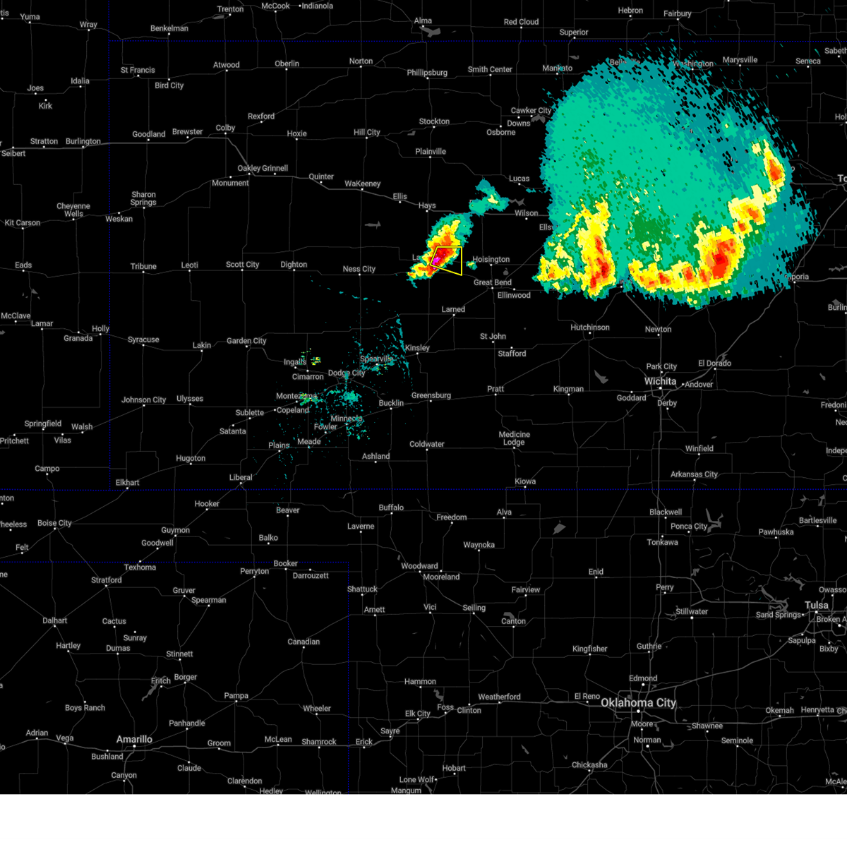 At 304 pm cdt, a severe thunderstorm was located very near bison, moving southeast at 30 mph (trained weather spotters). Hazards include two inch hail. People and animals outdoors will be injured. expect damage to roofs, siding, windows, and vehicles. locations impacted include, otis and bison. ping pong ball size hail was reported 3 miles northwest of bison around 3 pm cdt. thunderstorm damage threat, considerable hail threat, observed max hail size, 2. 00 in wind threat, radar indicated max wind gust, <50 mph. At 304 pm cdt, a severe thunderstorm was located very near bison, moving southeast at 30 mph (trained weather spotters). Hazards include two inch hail. People and animals outdoors will be injured. expect damage to roofs, siding, windows, and vehicles. locations impacted include, otis and bison. ping pong ball size hail was reported 3 miles northwest of bison around 3 pm cdt. thunderstorm damage threat, considerable hail threat, observed max hail size, 2. 00 in wind threat, radar indicated max wind gust, <50 mph.
|
| 5/9/2023 2:55 PM CDT |
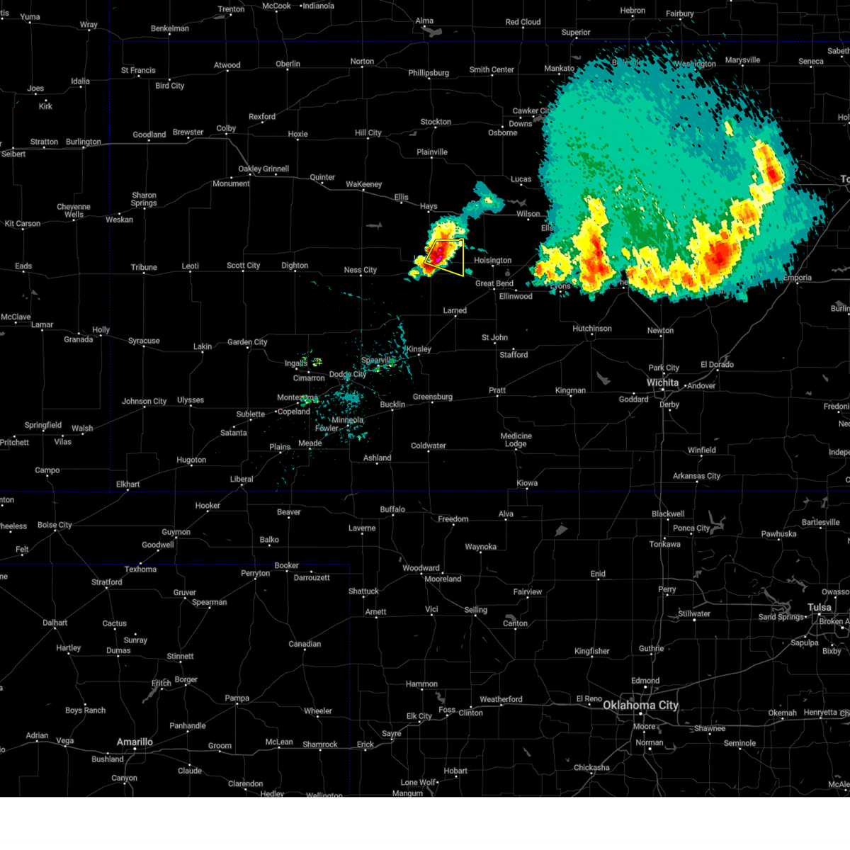 At 254 pm cdt, a severe thunderstorm was located near bison, moving southeast at 20 mph (radar indicated). Hazards include two inch hail. People and animals outdoors will be injured. expect damage to roofs, siding, windows, and vehicles. locations impacted include, la crosse, otis, bison and loretta. thunderstorm damage threat, considerable hail threat, radar indicated max hail size, 2. 00 in wind threat, radar indicated max wind gust, <50 mph. At 254 pm cdt, a severe thunderstorm was located near bison, moving southeast at 20 mph (radar indicated). Hazards include two inch hail. People and animals outdoors will be injured. expect damage to roofs, siding, windows, and vehicles. locations impacted include, la crosse, otis, bison and loretta. thunderstorm damage threat, considerable hail threat, radar indicated max hail size, 2. 00 in wind threat, radar indicated max wind gust, <50 mph.
|
| 5/9/2023 2:39 PM CDT |
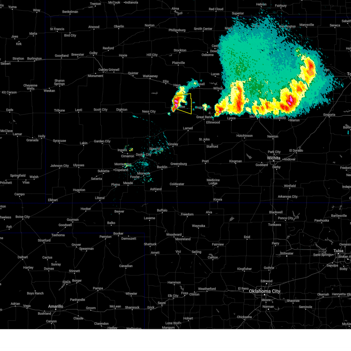 At 239 pm cdt, a severe thunderstorm was located near liebenthal, moving southeast at 20 mph (radar indicated). Hazards include two inch hail. People and animals outdoors will be injured. expect damage to roofs, siding, windows, and vehicles. locations impacted include, loretta, bison and otis. thunderstorm damage threat, considerable hail threat, radar indicated max hail size, 2. 00 in wind threat, radar indicated max wind gust, <50 mph. At 239 pm cdt, a severe thunderstorm was located near liebenthal, moving southeast at 20 mph (radar indicated). Hazards include two inch hail. People and animals outdoors will be injured. expect damage to roofs, siding, windows, and vehicles. locations impacted include, loretta, bison and otis. thunderstorm damage threat, considerable hail threat, radar indicated max hail size, 2. 00 in wind threat, radar indicated max wind gust, <50 mph.
|
| 5/9/2023 2:28 PM CDT |
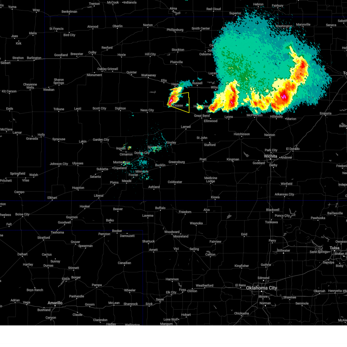 At 227 pm cdt, a severe thunderstorm was located near liebenthal, moving southeast at 20 mph (radar indicated). Hazards include ping pong ball size hail. People and animals outdoors will be injured. expect damage to roofs, siding, windows, and vehicles. this severe thunderstorm will be near, liebenthal around 235 pm cdt. other locations in the path of this severe thunderstorm include la crosse, loretta, bison and otis. hail threat, radar indicated max hail size, 1. 50 in wind threat, radar indicated max wind gust, <50 mph. At 227 pm cdt, a severe thunderstorm was located near liebenthal, moving southeast at 20 mph (radar indicated). Hazards include ping pong ball size hail. People and animals outdoors will be injured. expect damage to roofs, siding, windows, and vehicles. this severe thunderstorm will be near, liebenthal around 235 pm cdt. other locations in the path of this severe thunderstorm include la crosse, loretta, bison and otis. hail threat, radar indicated max hail size, 1. 50 in wind threat, radar indicated max wind gust, <50 mph.
|
| 2/26/2023 7:06 PM CST |
 The severe thunderstorm warning for northeastern ness, southern trego, northern pawnee, rush and ellis counties will expire at 715 pm cst, the storms which prompted the warning have weakened below severe limits, and no longer pose an immediate threat to life or property. therefore, the warning will be allowed to expire. a severe thunderstorm watch remains in effect until 800 pm cst for central, south central and west central kansas. The severe thunderstorm warning for northeastern ness, southern trego, northern pawnee, rush and ellis counties will expire at 715 pm cst, the storms which prompted the warning have weakened below severe limits, and no longer pose an immediate threat to life or property. therefore, the warning will be allowed to expire. a severe thunderstorm watch remains in effect until 800 pm cst for central, south central and west central kansas.
|
| 2/26/2023 6:38 PM CST |
 At 638 pm cst, severe thunderstorms were located along a line extending from near mccracken to near nekoma to near rozel, moving east at 60 mph (radar indicated). Hazards include 60 mph wind gusts and nickel size hail. Expect damage to roofs, siding, and trees. Locations impacted include, rush center, ash valley, la crosse, liebenthal, timken, bison, shaffer, loretta, pfeifer and otis. At 638 pm cst, severe thunderstorms were located along a line extending from near mccracken to near nekoma to near rozel, moving east at 60 mph (radar indicated). Hazards include 60 mph wind gusts and nickel size hail. Expect damage to roofs, siding, and trees. Locations impacted include, rush center, ash valley, la crosse, liebenthal, timken, bison, shaffer, loretta, pfeifer and otis.
|
| 2/26/2023 6:24 PM CST |
 At 623 pm cst, severe thunderstorms were located along a line extending from 6 miles southwest of brownell to near bazine to near burdett, moving east at 60 mph (radar indicated). Hazards include 70 mph wind gusts and ping pong ball size hail. People and animals outdoors will be injured. expect hail damage to roofs, siding, windows, and vehicles. expect considerable tree damage. wind damage is also likely to mobile homes, roofs, and outbuildings. severe thunderstorms will be near, burdett and alexander around 630 pm cst. nekoma around 635 pm cst. mccracken around 640 pm cst. Other locations in the path of these severe thunderstorms include rush center, ash valley, hargrave, la crosse, liebenthal, timken, shaffer, bison, loretta, pfeifer and otis. At 623 pm cst, severe thunderstorms were located along a line extending from 6 miles southwest of brownell to near bazine to near burdett, moving east at 60 mph (radar indicated). Hazards include 70 mph wind gusts and ping pong ball size hail. People and animals outdoors will be injured. expect hail damage to roofs, siding, windows, and vehicles. expect considerable tree damage. wind damage is also likely to mobile homes, roofs, and outbuildings. severe thunderstorms will be near, burdett and alexander around 630 pm cst. nekoma around 635 pm cst. mccracken around 640 pm cst. Other locations in the path of these severe thunderstorms include rush center, ash valley, hargrave, la crosse, liebenthal, timken, shaffer, bison, loretta, pfeifer and otis.
|
| 8/29/2022 6:05 PM CDT | Ping Pong Ball sized hail reported 0.4 miles NNW of Otis, KS, public report passed along by media. time estimate is based on radar. |
| 7/22/2022 11:07 PM CDT |
 The severe thunderstorm warning for northeastern ness, rush and ellis counties will expire at 1115 pm cdt, the storms which prompted the warning have weakened below severe limits, and no longer pose an immediate threat to life or property. therefore, the warning will be allowed to expire. The severe thunderstorm warning for northeastern ness, rush and ellis counties will expire at 1115 pm cdt, the storms which prompted the warning have weakened below severe limits, and no longer pose an immediate threat to life or property. therefore, the warning will be allowed to expire.
|
| 7/22/2022 10:45 PM CDT |
 At 1045 pm cdt, severe thunderstorms were located along a line extending from 8 miles south of natoma to near loretta to near bazine, moving southeast at 25 mph (radar indicated). Hazards include 70 mph wind gusts and penny size hail. Expect considerable tree damage. damage is likely to mobile homes, roofs, and outbuildings. locations impacted include, loretta, pfeifer, otis and nekoma. thunderstorm damage threat, considerable hail threat, radar indicated max hail size, 0. 75 in wind threat, radar indicated max wind gust, 70 mph. At 1045 pm cdt, severe thunderstorms were located along a line extending from 8 miles south of natoma to near loretta to near bazine, moving southeast at 25 mph (radar indicated). Hazards include 70 mph wind gusts and penny size hail. Expect considerable tree damage. damage is likely to mobile homes, roofs, and outbuildings. locations impacted include, loretta, pfeifer, otis and nekoma. thunderstorm damage threat, considerable hail threat, radar indicated max hail size, 0. 75 in wind threat, radar indicated max wind gust, 70 mph.
|
| 7/22/2022 10:25 PM CDT |
 At 1025 pm cdt, severe thunderstorms were located along a line extending from 6 miles south of codell to near schoenchen to 6 miles northwest of bazine, moving southeast at 20 mph (radar indicated). Hazards include 60 mph wind gusts and nickel size hail. Expect damage to roofs, siding, and trees. severe thunderstorms will be near, schoenchen, liebenthal and munjor around 1030 pm cdt. loretta and pfeifer around 1045 pm cdt. other locations in the path of these severe thunderstorms include alexander, otis and nekoma. hail threat, radar indicated max hail size, 0. 88 in wind threat, radar indicated max wind gust, 60 mph. At 1025 pm cdt, severe thunderstorms were located along a line extending from 6 miles south of codell to near schoenchen to 6 miles northwest of bazine, moving southeast at 20 mph (radar indicated). Hazards include 60 mph wind gusts and nickel size hail. Expect damage to roofs, siding, and trees. severe thunderstorms will be near, schoenchen, liebenthal and munjor around 1030 pm cdt. loretta and pfeifer around 1045 pm cdt. other locations in the path of these severe thunderstorms include alexander, otis and nekoma. hail threat, radar indicated max hail size, 0. 88 in wind threat, radar indicated max wind gust, 60 mph.
|
| 7/6/2022 5:08 PM CDT |
 At 508 pm cdt, a severe thunderstorm was located near otis, moving east at 15 mph (radar indicated). Hazards include two inch hail and 60 mph wind gusts. People and animals outdoors will be injured. expect hail damage to roofs, siding, windows, and vehicles. expect wind damage to roofs, siding, and trees. locations impacted include, otis, timken, loretta, shaffer and pfeifer. thunderstorm damage threat, considerable hail threat, observed max hail size, 2. 00 in wind threat, radar indicated max wind gust, 60 mph. At 508 pm cdt, a severe thunderstorm was located near otis, moving east at 15 mph (radar indicated). Hazards include two inch hail and 60 mph wind gusts. People and animals outdoors will be injured. expect hail damage to roofs, siding, windows, and vehicles. expect wind damage to roofs, siding, and trees. locations impacted include, otis, timken, loretta, shaffer and pfeifer. thunderstorm damage threat, considerable hail threat, observed max hail size, 2. 00 in wind threat, radar indicated max wind gust, 60 mph.
|
| 7/6/2022 4:52 PM CDT |
 At 452 pm cdt, a severe thunderstorm was located near loretta, moving east at 15 mph (law enforcement). Hazards include golf ball size hail and 60 mph wind gusts. People and animals outdoors will be injured. expect hail damage to roofs, siding, windows, and vehicles. expect wind damage to roofs, siding, and trees. locations impacted include, pfeifer and otis. thunderstorm damage threat, considerable hail threat, observed max hail size, 1. 75 in wind threat, radar indicated max wind gust, 60 mph. At 452 pm cdt, a severe thunderstorm was located near loretta, moving east at 15 mph (law enforcement). Hazards include golf ball size hail and 60 mph wind gusts. People and animals outdoors will be injured. expect hail damage to roofs, siding, windows, and vehicles. expect wind damage to roofs, siding, and trees. locations impacted include, pfeifer and otis. thunderstorm damage threat, considerable hail threat, observed max hail size, 1. 75 in wind threat, radar indicated max wind gust, 60 mph.
|
| 7/6/2022 4:33 PM CDT |
 At 433 pm cdt, a severe thunderstorm was located near liebenthal, moving east at 15 mph (law enforcement). Hazards include golf ball size hail and 60 mph wind gusts. People and animals outdoors will be injured. expect hail damage to roofs, siding, windows, and vehicles. expect wind damage to roofs, siding, and trees. this severe thunderstorm will be near, bison around 450 pm cdt. other locations in the path of this severe thunderstorm include loretta, pfeifer and otis. thunderstorm damage threat, considerable hail threat, observed max hail size, 1. 75 in wind threat, radar indicated max wind gust, 60 mph. At 433 pm cdt, a severe thunderstorm was located near liebenthal, moving east at 15 mph (law enforcement). Hazards include golf ball size hail and 60 mph wind gusts. People and animals outdoors will be injured. expect hail damage to roofs, siding, windows, and vehicles. expect wind damage to roofs, siding, and trees. this severe thunderstorm will be near, bison around 450 pm cdt. other locations in the path of this severe thunderstorm include loretta, pfeifer and otis. thunderstorm damage threat, considerable hail threat, observed max hail size, 1. 75 in wind threat, radar indicated max wind gust, 60 mph.
|
| 6/14/2022 7:33 PM CDT |
 At 731 pm cdt, a severe thunderstorm was located near bazine, moving east at 20 mph. a second severe thunderstorm was located near loretta, moving northeast at 25 mph (public. golfball size hail was reported 3 miles southeast of bazine at 730 pm). Hazards include golf ball size hail and 70 mph wind gusts. People and animals outdoors will be injured. expect hail damage to roofs, siding, windows, and vehicles. expect considerable tree damage. wind damage is also likely to mobile homes, roofs, and outbuildings. locations impacted include, alexander, mccracken, nekoma, la crosse, rush center and hargrave. thunderstorm damage threat, considerable hail threat, observed max hail size, 1. 75 in wind threat, radar indicated max wind gust, 70 mph. At 731 pm cdt, a severe thunderstorm was located near bazine, moving east at 20 mph. a second severe thunderstorm was located near loretta, moving northeast at 25 mph (public. golfball size hail was reported 3 miles southeast of bazine at 730 pm). Hazards include golf ball size hail and 70 mph wind gusts. People and animals outdoors will be injured. expect hail damage to roofs, siding, windows, and vehicles. expect considerable tree damage. wind damage is also likely to mobile homes, roofs, and outbuildings. locations impacted include, alexander, mccracken, nekoma, la crosse, rush center and hargrave. thunderstorm damage threat, considerable hail threat, observed max hail size, 1. 75 in wind threat, radar indicated max wind gust, 70 mph.
|
| 6/14/2022 7:12 PM CDT |
 At 710 pm cdt, a severe thunderstorm was located near bazine, moving northeast at 35 mph. a second severe thunderstorm was located 5 miles north of la crosse, moving northeast at 30 mph (radar indicated and storm spotter reported. golfball size hail was reported 4 miles west southwest of bazine at 708 pm). Hazards include golf ball size hail and 70 mph wind gusts with both storms. People and animals outdoors will be injured. expect hail damage to roofs, siding, windows, and vehicles. expect considerable tree damage. wind damage is also likely to mobile homes, roofs, and outbuildings. this severe thunderstorm will be near, alexander around 725 pm cdt. mccracken around 730 pm cdt. other locations in the path of this severe thunderstorm include nekoma, hargrave, la crosse, rush center, liebenthal, bison, timken, otis and loretta. this new warning replaces the previous warnings in effect for southeastern ness and rush counties. thunderstorm damage threat, considerable hail threat, observed max hail size, 1. 75 in wind threat, radar indicated max wind gust, 70 mph. At 710 pm cdt, a severe thunderstorm was located near bazine, moving northeast at 35 mph. a second severe thunderstorm was located 5 miles north of la crosse, moving northeast at 30 mph (radar indicated and storm spotter reported. golfball size hail was reported 4 miles west southwest of bazine at 708 pm). Hazards include golf ball size hail and 70 mph wind gusts with both storms. People and animals outdoors will be injured. expect hail damage to roofs, siding, windows, and vehicles. expect considerable tree damage. wind damage is also likely to mobile homes, roofs, and outbuildings. this severe thunderstorm will be near, alexander around 725 pm cdt. mccracken around 730 pm cdt. other locations in the path of this severe thunderstorm include nekoma, hargrave, la crosse, rush center, liebenthal, bison, timken, otis and loretta. this new warning replaces the previous warnings in effect for southeastern ness and rush counties. thunderstorm damage threat, considerable hail threat, observed max hail size, 1. 75 in wind threat, radar indicated max wind gust, 70 mph.
|
| 5/17/2022 10:15 PM CDT |
 At 1015 pm cdt, severe thunderstorms were located along a line extending from 8 miles south of dorrance to near shaffer to near bazine, moving southeast at 40 mph (radar indicated). Hazards include 60 mph wind gusts and penny size hail. Expect damage to roofs, siding, and trees. locations impacted include, otis and shaffer. hail threat, radar indicated max hail size, 0. 75 in wind threat, radar indicated max wind gust, 60 mph. At 1015 pm cdt, severe thunderstorms were located along a line extending from 8 miles south of dorrance to near shaffer to near bazine, moving southeast at 40 mph (radar indicated). Hazards include 60 mph wind gusts and penny size hail. Expect damage to roofs, siding, and trees. locations impacted include, otis and shaffer. hail threat, radar indicated max hail size, 0. 75 in wind threat, radar indicated max wind gust, 60 mph.
|
| 5/17/2022 9:42 PM CDT |
 At 942 pm cdt, severe thunderstorms were located along a line extending from near gorham to near hargrave to 7 miles south of arnold, moving southeast at 40 mph (radar indicated). Hazards include 60 mph wind gusts and quarter size hail. Hail damage to vehicles is expected. expect wind damage to roofs, siding, and trees. severe thunderstorms will be near, walker, liebenthal and hargrave around 945 pm cdt. la crosse and rush center around 955 pm cdt. bison around 1000 pm cdt. other locations in the path of these severe thunderstorms include timken, bazine, otis and shaffer. hail threat, radar indicated max hail size, 1. 00 in wind threat, radar indicated max wind gust, 60 mph. At 942 pm cdt, severe thunderstorms were located along a line extending from near gorham to near hargrave to 7 miles south of arnold, moving southeast at 40 mph (radar indicated). Hazards include 60 mph wind gusts and quarter size hail. Hail damage to vehicles is expected. expect wind damage to roofs, siding, and trees. severe thunderstorms will be near, walker, liebenthal and hargrave around 945 pm cdt. la crosse and rush center around 955 pm cdt. bison around 1000 pm cdt. other locations in the path of these severe thunderstorms include timken, bazine, otis and shaffer. hail threat, radar indicated max hail size, 1. 00 in wind threat, radar indicated max wind gust, 60 mph.
|
| 4/23/2022 3:33 AM CDT |
 At 333 am cdt, severe thunderstorms were located along a line extending from near natoma to near rush center, moving east at 40 mph (radar indicated). Hazards include 60 mph wind gusts. Expect damage to roofs, siding, and trees. locations impacted include, otis. hail threat, radar indicated max hail size, <. 75 in wind threat, radar indicated max wind gust, 60 mph. At 333 am cdt, severe thunderstorms were located along a line extending from near natoma to near rush center, moving east at 40 mph (radar indicated). Hazards include 60 mph wind gusts. Expect damage to roofs, siding, and trees. locations impacted include, otis. hail threat, radar indicated max hail size, <. 75 in wind threat, radar indicated max wind gust, 60 mph.
|
| 4/23/2022 2:47 AM CDT |
 At 246 am cdt, severe thunderstorms were located along a line extending from 9 miles north of ogallah to near ness city, moving east at 40 mph (radar indicated). Hazards include 60 mph wind gusts. Expect damage to roofs, siding, and trees. severe thunderstorms will be near, bazine around 300 am cdt. other locations in the path of these severe thunderstorms include alexander, nekoma, hargrave, rush center, la crosse, bison, timken and shaffer. hail threat, radar indicated max hail size, <. 75 in wind threat, radar indicated max wind gust, 60 mph. At 246 am cdt, severe thunderstorms were located along a line extending from 9 miles north of ogallah to near ness city, moving east at 40 mph (radar indicated). Hazards include 60 mph wind gusts. Expect damage to roofs, siding, and trees. severe thunderstorms will be near, bazine around 300 am cdt. other locations in the path of these severe thunderstorms include alexander, nekoma, hargrave, rush center, la crosse, bison, timken and shaffer. hail threat, radar indicated max hail size, <. 75 in wind threat, radar indicated max wind gust, 60 mph.
|
| 4/21/2022 8:32 PM CDT |
 At 832 pm cdt, a severe thunderstorm was located near la crosse, moving northeast at 20 mph (radar indicated). Hazards include golf ball size hail. People and animals outdoors will be injured. expect damage to roofs, siding, windows, and vehicles. locations impacted include, la crosse, otis, bison, rush center, timken and shaffer. thunderstorm damage threat, considerable hail threat, radar indicated max hail size, 1. 75 in wind threat, radar indicated max wind gust, <50 mph. At 832 pm cdt, a severe thunderstorm was located near la crosse, moving northeast at 20 mph (radar indicated). Hazards include golf ball size hail. People and animals outdoors will be injured. expect damage to roofs, siding, windows, and vehicles. locations impacted include, la crosse, otis, bison, rush center, timken and shaffer. thunderstorm damage threat, considerable hail threat, radar indicated max hail size, 1. 75 in wind threat, radar indicated max wind gust, <50 mph.
|
| 4/21/2022 8:19 PM CDT |
 At 819 pm cdt, a severe thunderstorm was located near rush center, moving east at 20 mph (radar indicated). Hazards include two inch hail. People and animals outdoors will be injured. expect damage to roofs, siding, windows, and vehicles. locations impacted include, bison, timken, shaffer and otis. thunderstorm damage threat, considerable hail threat, radar indicated max hail size, 2. 00 in wind threat, radar indicated max wind gust, <50 mph. At 819 pm cdt, a severe thunderstorm was located near rush center, moving east at 20 mph (radar indicated). Hazards include two inch hail. People and animals outdoors will be injured. expect damage to roofs, siding, windows, and vehicles. locations impacted include, bison, timken, shaffer and otis. thunderstorm damage threat, considerable hail threat, radar indicated max hail size, 2. 00 in wind threat, radar indicated max wind gust, <50 mph.
|
| 4/21/2022 7:57 PM CDT |
 At 756 pm cdt, a severe thunderstorm was located near nekoma, moving east at 30 mph. this is a destructive storm for nekoma (radar indicated). Hazards include baseball size hail. People and animals outdoors will be severely injured. expect shattered windows, extensive damage to roofs, siding, and vehicles. this severe thunderstorm will be near, la crosse and rush center around 810 pm cdt. Other locations in the path of this severe thunderstorm include bison, timken, otis and shaffer. At 756 pm cdt, a severe thunderstorm was located near nekoma, moving east at 30 mph. this is a destructive storm for nekoma (radar indicated). Hazards include baseball size hail. People and animals outdoors will be severely injured. expect shattered windows, extensive damage to roofs, siding, and vehicles. this severe thunderstorm will be near, la crosse and rush center around 810 pm cdt. Other locations in the path of this severe thunderstorm include bison, timken, otis and shaffer.
|
| 10/12/2021 11:38 PM CDT |
 The severe thunderstorm warning for pawnee, eastern rush and northeastern edwards counties will expire at 1145 pm cdt, the storms which prompted the warning have weakened below severe limits, and no longer pose an immediate threat to life or property. therefore, the warning will be allowed to expire. however gusty winds are still possible with these thunderstorms. a tornado watch remains in effect until 500 am cdt for south central and central kansas. The severe thunderstorm warning for pawnee, eastern rush and northeastern edwards counties will expire at 1145 pm cdt, the storms which prompted the warning have weakened below severe limits, and no longer pose an immediate threat to life or property. therefore, the warning will be allowed to expire. however gusty winds are still possible with these thunderstorms. a tornado watch remains in effect until 500 am cdt for south central and central kansas.
|
| 10/12/2021 11:32 PM CDT |
 At 1131 pm cdt, severe thunderstorms were located along a line extending from near pfeifer to near shaffer to near garfield, moving east at 50 mph (radar indicated). Hazards include 60 mph wind gusts and penny size hail. Expect damage to roofs, siding, and trees. Locations impacted include, larned, kinsley, la crosse, lewis, otis, bison, garfield, rush center, belpre, timken, ash valley, sanford, loretta, frizell, zook, shaffer and pfeifer. At 1131 pm cdt, severe thunderstorms were located along a line extending from near pfeifer to near shaffer to near garfield, moving east at 50 mph (radar indicated). Hazards include 60 mph wind gusts and penny size hail. Expect damage to roofs, siding, and trees. Locations impacted include, larned, kinsley, la crosse, lewis, otis, bison, garfield, rush center, belpre, timken, ash valley, sanford, loretta, frizell, zook, shaffer and pfeifer.
|
| 10/12/2021 11:13 PM CDT |
 At 1113 pm cdt, severe thunderstorms were located along a line extending from near liebenthal to 6 miles southwest of rush center to near gray, moving northeast at 30 mph (radar indicated). Hazards include 60 mph wind gusts and penny size hail. Expect damage to roofs, siding, and trees. Locations impacted include, liebenthal, loretta, rush center, pfeifer, la crosse, timken, bison, sanford, shaffer, otis and ash valley. At 1113 pm cdt, severe thunderstorms were located along a line extending from near liebenthal to 6 miles southwest of rush center to near gray, moving northeast at 30 mph (radar indicated). Hazards include 60 mph wind gusts and penny size hail. Expect damage to roofs, siding, and trees. Locations impacted include, liebenthal, loretta, rush center, pfeifer, la crosse, timken, bison, sanford, shaffer, otis and ash valley.
|
| 10/12/2021 10:47 PM CDT |
 At 1047 pm cdt, severe thunderstorms were located along a line extending from near mccracken to near burdett to near bellefont, moving east at 50 mph (radar indicated). Hazards include 70 mph wind gusts and penny size hail. Expect considerable tree damage. damage is likely to mobile homes, roofs, and outbuildings. severe thunderstorms will be near, burdett, mccracken and alexander around 1050 pm cdt. rozel, hargrave and nekoma around 1055 pm cdt. kinsley, la crosse, rush center and liebenthal around 1105 pm cdt. Other locations in the path of these severe thunderstorms include ash valley, bison, timken, loretta, lewis, garfield, otis, belpre and zook. At 1047 pm cdt, severe thunderstorms were located along a line extending from near mccracken to near burdett to near bellefont, moving east at 50 mph (radar indicated). Hazards include 70 mph wind gusts and penny size hail. Expect considerable tree damage. damage is likely to mobile homes, roofs, and outbuildings. severe thunderstorms will be near, burdett, mccracken and alexander around 1050 pm cdt. rozel, hargrave and nekoma around 1055 pm cdt. kinsley, la crosse, rush center and liebenthal around 1105 pm cdt. Other locations in the path of these severe thunderstorms include ash valley, bison, timken, loretta, lewis, garfield, otis, belpre and zook.
|
| 8/7/2021 7:56 PM CDT |
 The severe thunderstorm warning for northern rush and eastern ellis counties will expire at 800 pm cdt, the storms which prompted the warning have moved out of the area. therefore, the warning will be allowed to expire. however gusty winds are still possible with these thunderstorms. a severe thunderstorm watch remains in effect until 900 pm cdt for central kansas. The severe thunderstorm warning for northern rush and eastern ellis counties will expire at 800 pm cdt, the storms which prompted the warning have moved out of the area. therefore, the warning will be allowed to expire. however gusty winds are still possible with these thunderstorms. a severe thunderstorm watch remains in effect until 900 pm cdt for central kansas.
|
| 8/7/2021 7:44 PM CDT |
 At 744 pm cdt, severe thunderstorms were located along a line extending from near olmitz to near sanford, moving east at 40 mph (radar indicated). Hazards include 60 mph wind gusts. Expect damage to roofs, siding, and trees. severe thunderstorms will be near, otis around 750 pm cdt. other locations in the path of these severe thunderstorms include larned and radium. hail threat, radar indicated max hail size, <. 75 in wind threat, radar indicated max wind gust, 60 mph. At 744 pm cdt, severe thunderstorms were located along a line extending from near olmitz to near sanford, moving east at 40 mph (radar indicated). Hazards include 60 mph wind gusts. Expect damage to roofs, siding, and trees. severe thunderstorms will be near, otis around 750 pm cdt. other locations in the path of these severe thunderstorms include larned and radium. hail threat, radar indicated max hail size, <. 75 in wind threat, radar indicated max wind gust, 60 mph.
|
| 8/7/2021 7:13 PM CDT |
 At 712 pm cdt, severe thunderstorms were located along a line extending from 9 miles south of natoma to near victoria to near hargrave, moving east at 25 mph (radar indicated). Hazards include 60 mph wind gusts. Expect damage to roofs, siding, and trees. severe thunderstorms will be near, walker around 720 pm cdt. other locations in the path of these severe thunderstorms include otis. hail threat, radar indicated max hail size, <. 75 in wind threat, radar indicated max wind gust, 60 mph. At 712 pm cdt, severe thunderstorms were located along a line extending from 9 miles south of natoma to near victoria to near hargrave, moving east at 25 mph (radar indicated). Hazards include 60 mph wind gusts. Expect damage to roofs, siding, and trees. severe thunderstorms will be near, walker around 720 pm cdt. other locations in the path of these severe thunderstorms include otis. hail threat, radar indicated max hail size, <. 75 in wind threat, radar indicated max wind gust, 60 mph.
|
| 8/7/2021 6:58 PM CDT |
 At 657 pm cdt, severe thunderstorms were located along a line extending from near natoma to near walker to near hargrave, moving east at 25 mph (radar indicated). Hazards include 60 mph wind gusts and penny size hail. Expect damage to roofs, siding, and trees. locations impacted include, walker, bison, loretta, pfeifer and otis. hail threat, radar indicated max hail size, 0. 75 in wind threat, radar indicated max wind gust, 60 mph. At 657 pm cdt, severe thunderstorms were located along a line extending from near natoma to near walker to near hargrave, moving east at 25 mph (radar indicated). Hazards include 60 mph wind gusts and penny size hail. Expect damage to roofs, siding, and trees. locations impacted include, walker, bison, loretta, pfeifer and otis. hail threat, radar indicated max hail size, 0. 75 in wind threat, radar indicated max wind gust, 60 mph.
|
| 8/7/2021 6:31 PM CDT |
 At 630 pm cdt, severe thunderstorms were located along a line extending from near zurich to near yocemento to near mccracken, moving east at 40 mph (radar indicated). Hazards include ping pong ball size hail and 60 mph wind gusts. People and animals outdoors will be injured. expect hail damage to roofs, siding, windows, and vehicles. expect wind damage to roofs, siding, and trees. severe thunderstorms will be near, hays, la crosse, liebenthal, toulon and munjor around 645 pm cdt. catherine around 650 pm cdt. other locations in the path of these severe thunderstorms include victoria, bison, loretta, emmeram, pfeifer, walker and otis. this warning replaces the previous warning for southern portions of trego and ellis and northern portions of ness and rush counties. hail threat, radar indicated max hail size, 1. 50 in wind threat, radar indicated max wind gust, 60 mph. At 630 pm cdt, severe thunderstorms were located along a line extending from near zurich to near yocemento to near mccracken, moving east at 40 mph (radar indicated). Hazards include ping pong ball size hail and 60 mph wind gusts. People and animals outdoors will be injured. expect hail damage to roofs, siding, windows, and vehicles. expect wind damage to roofs, siding, and trees. severe thunderstorms will be near, hays, la crosse, liebenthal, toulon and munjor around 645 pm cdt. catherine around 650 pm cdt. other locations in the path of these severe thunderstorms include victoria, bison, loretta, emmeram, pfeifer, walker and otis. this warning replaces the previous warning for southern portions of trego and ellis and northern portions of ness and rush counties. hail threat, radar indicated max hail size, 1. 50 in wind threat, radar indicated max wind gust, 60 mph.
|
| 6/25/2021 12:18 AM CDT |
 At 1217 am cdt, a severe thunderstorm was located very near loretta, moving northeast at 20 mph (radar indicated). Hazards include 60 mph wind gusts and quarter size hail. Hail damage to vehicles is expected. expect wind damage to roofs, siding, and trees. Locations impacted include, la crosse, otis, bison, rush center, timken, loretta, pfeifer and shaffer. At 1217 am cdt, a severe thunderstorm was located very near loretta, moving northeast at 20 mph (radar indicated). Hazards include 60 mph wind gusts and quarter size hail. Hail damage to vehicles is expected. expect wind damage to roofs, siding, and trees. Locations impacted include, la crosse, otis, bison, rush center, timken, loretta, pfeifer and shaffer.
|
| 6/25/2021 12:03 AM CDT |
 At 1203 am cdt, a severe thunderstorm was located near liebenthal, moving east at 25 mph (radar indicated). Hazards include 60 mph wind gusts and quarter size hail. Hail damage to vehicles is expected. expect wind damage to roofs, siding, and trees. Locations impacted include, loretta and pfeifer. At 1203 am cdt, a severe thunderstorm was located near liebenthal, moving east at 25 mph (radar indicated). Hazards include 60 mph wind gusts and quarter size hail. Hail damage to vehicles is expected. expect wind damage to roofs, siding, and trees. Locations impacted include, loretta and pfeifer.
|
| 6/24/2021 11:47 PM CDT |
 At 1146 pm cdt, a severe thunderstorm was located near hargrave, moving northeast at 20 mph (radar indicated). Hazards include 60 mph wind gusts and quarter size hail. Hail damage to vehicles is expected. expect wind damage to roofs, siding, and trees. this severe thunderstorm will be near, rush center around 1150 pm cdt. la crosse around 1200 am cdt. liebenthal around 1205 am cdt. Other locations in the path of this severe thunderstorm include bison, loretta and pfeifer. At 1146 pm cdt, a severe thunderstorm was located near hargrave, moving northeast at 20 mph (radar indicated). Hazards include 60 mph wind gusts and quarter size hail. Hail damage to vehicles is expected. expect wind damage to roofs, siding, and trees. this severe thunderstorm will be near, rush center around 1150 pm cdt. la crosse around 1200 am cdt. liebenthal around 1205 am cdt. Other locations in the path of this severe thunderstorm include bison, loretta and pfeifer.
|
| 5/16/2021 7:13 PM CDT |
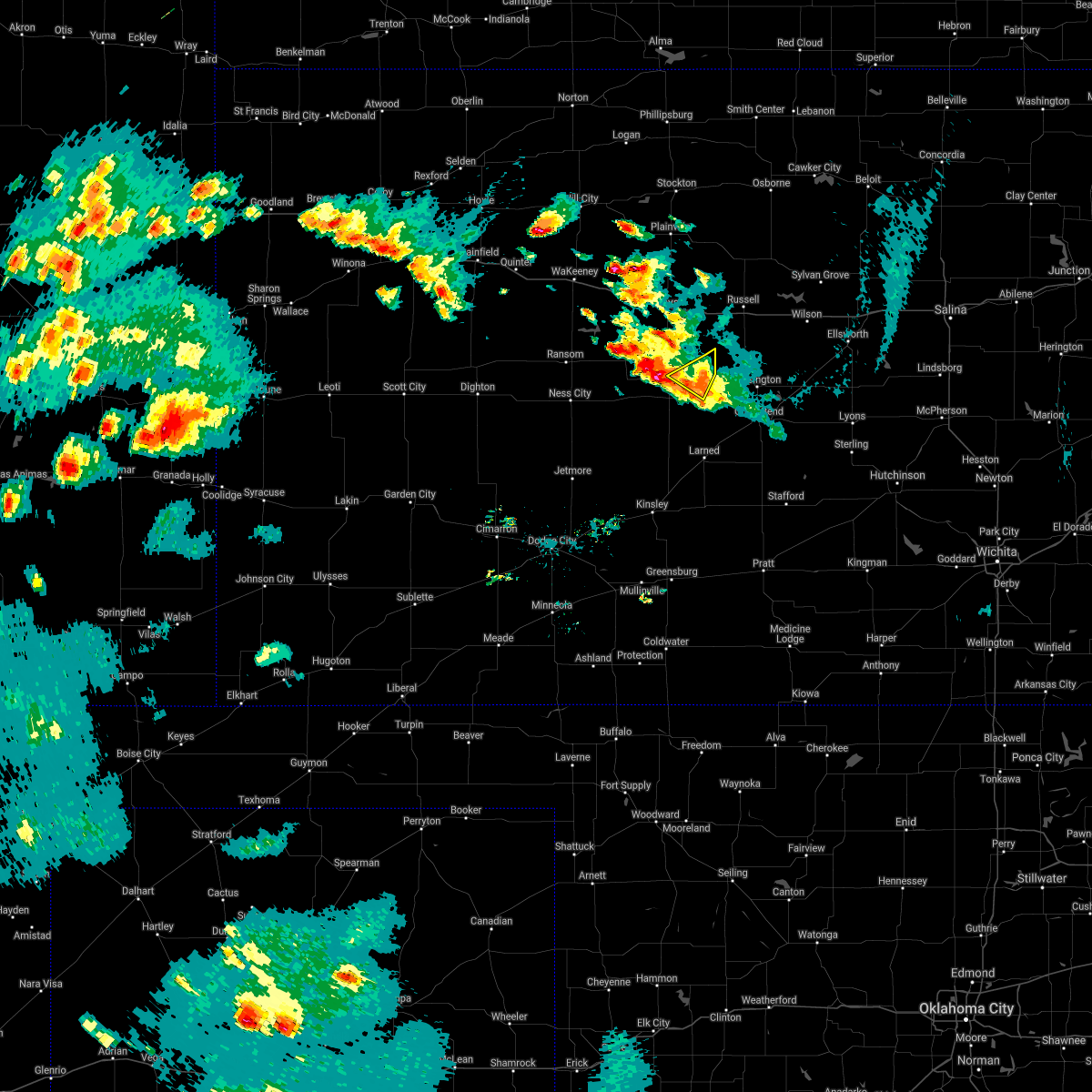 The severe thunderstorm warning for northeastern rush county will expire at 715 pm cdt, the storm which prompted the warning has weakened below severe limits, and no longer poses an immediate threat to life or property. therefore, the warning will be allowed to expire. however heavy rain is still possible with this thunderstorm. to report severe weather, contact your nearest law enforcement agency. they will relay your report to the national weather service dodge city. The severe thunderstorm warning for northeastern rush county will expire at 715 pm cdt, the storm which prompted the warning has weakened below severe limits, and no longer poses an immediate threat to life or property. therefore, the warning will be allowed to expire. however heavy rain is still possible with this thunderstorm. to report severe weather, contact your nearest law enforcement agency. they will relay your report to the national weather service dodge city.
|
| 5/16/2021 6:47 PM CDT |
 At 647 pm cdt, a severe thunderstorm was located near otis, moving southwest at 15 mph (radar indicated). Hazards include 60 mph wind gusts and quarter size hail. Hail damage to vehicles is expected. expect wind damage to roofs, siding, and trees. Locations impacted include, bison. At 647 pm cdt, a severe thunderstorm was located near otis, moving southwest at 15 mph (radar indicated). Hazards include 60 mph wind gusts and quarter size hail. Hail damage to vehicles is expected. expect wind damage to roofs, siding, and trees. Locations impacted include, bison.
|
| 5/16/2021 6:24 PM CDT |
 At 624 pm cdt, a severe thunderstorm was located near pfeifer, moving southwest at 15 mph (radar indicated). Hazards include ping pong ball size hail and 60 mph wind gusts. People and animals outdoors will be injured. expect hail damage to roofs, siding, windows, and vehicles. expect wind damage to roofs, siding, and trees. this severe thunderstorm will be near, loretta around 640 pm cdt. Other locations in the path of this severe thunderstorm include otis and bison. At 624 pm cdt, a severe thunderstorm was located near pfeifer, moving southwest at 15 mph (radar indicated). Hazards include ping pong ball size hail and 60 mph wind gusts. People and animals outdoors will be injured. expect hail damage to roofs, siding, windows, and vehicles. expect wind damage to roofs, siding, and trees. this severe thunderstorm will be near, loretta around 640 pm cdt. Other locations in the path of this severe thunderstorm include otis and bison.
|
| 5/14/2021 11:20 PM CDT |
 At 1120 pm cdt, severe thunderstorms were located along a line extending from near olmitz to 6 miles southwest of jetmore, moving southeast at 35 mph (radar indicated). Hazards include 60 mph wind gusts and quarter size hail. Hail damage to vehicles is expected. expect wind damage to roofs, siding, and trees. These severe thunderstorms will remain over mainly rural areas of northwestern ford, hodgeman, pawnee, southeastern rush and northwestern edwards counties. At 1120 pm cdt, severe thunderstorms were located along a line extending from near olmitz to 6 miles southwest of jetmore, moving southeast at 35 mph (radar indicated). Hazards include 60 mph wind gusts and quarter size hail. Hail damage to vehicles is expected. expect wind damage to roofs, siding, and trees. These severe thunderstorms will remain over mainly rural areas of northwestern ford, hodgeman, pawnee, southeastern rush and northwestern edwards counties.
|
| 5/14/2021 11:05 PM CDT |
 At 1104 pm cdt, severe thunderstorms were located along a line extending from near otis to 7 miles east of kalvesta, moving southeast at 35 mph (radar indicated). Hazards include 60 mph wind gusts and quarter size hail. Hail damage to vehicles is expected. expect wind damage to roofs, siding, and trees. severe thunderstorms will be near, otis, bison, timken and shaffer around 1110 pm cdt. Other locations in the path of these severe thunderstorms include jetmore. At 1104 pm cdt, severe thunderstorms were located along a line extending from near otis to 7 miles east of kalvesta, moving southeast at 35 mph (radar indicated). Hazards include 60 mph wind gusts and quarter size hail. Hail damage to vehicles is expected. expect wind damage to roofs, siding, and trees. severe thunderstorms will be near, otis, bison, timken and shaffer around 1110 pm cdt. Other locations in the path of these severe thunderstorms include jetmore.
|
| 5/14/2021 10:46 PM CDT |
 At 1046 pm cdt, severe thunderstorms were located along a line extending from alexander to 6 miles southeast of albert, moving south at 10 mph (radar indicated). Hazards include 60 mph wind gusts and quarter size hail. Hail damage to vehicles is expected. expect wind damage to roofs, siding, and trees. Locations impacted include, larned, la crosse, otis, bison, burdett, garfield, mccracken, rush center, rozel, timken, alexander, ash valley, sanford, nekoma, frizell, hargrave, zook and shaffer. At 1046 pm cdt, severe thunderstorms were located along a line extending from alexander to 6 miles southeast of albert, moving south at 10 mph (radar indicated). Hazards include 60 mph wind gusts and quarter size hail. Hail damage to vehicles is expected. expect wind damage to roofs, siding, and trees. Locations impacted include, larned, la crosse, otis, bison, burdett, garfield, mccracken, rush center, rozel, timken, alexander, ash valley, sanford, nekoma, frizell, hargrave, zook and shaffer.
|
| 5/14/2021 10:26 PM CDT |
 At 1026 pm cdt, severe thunderstorms were located along a line extending from near mccracken to near albert, moving south at 35 mph (radar indicated). Hazards include 70 mph wind gusts and quarter size hail. Hail damage to vehicles is expected. expect considerable tree damage. Wind damage is also likely to mobile homes, roofs, and outbuildings. At 1026 pm cdt, severe thunderstorms were located along a line extending from near mccracken to near albert, moving south at 35 mph (radar indicated). Hazards include 70 mph wind gusts and quarter size hail. Hail damage to vehicles is expected. expect considerable tree damage. Wind damage is also likely to mobile homes, roofs, and outbuildings.
|
| 5/14/2021 10:02 PM CDT |
 At 1002 pm cdt, a severe thunderstorm was located near ash valley, moving south at 10 mph (radar indicated). Hazards include 70 mph wind gusts and quarter size hail. Hail damage to vehicles is expected. expect considerable tree damage. wind damage is also likely to mobile homes, roofs, and outbuildings. Locations impacted include, larned, la crosse, otis, bison, rush center, timken, ash valley, sanford, frizell and shaffer. At 1002 pm cdt, a severe thunderstorm was located near ash valley, moving south at 10 mph (radar indicated). Hazards include 70 mph wind gusts and quarter size hail. Hail damage to vehicles is expected. expect considerable tree damage. wind damage is also likely to mobile homes, roofs, and outbuildings. Locations impacted include, larned, la crosse, otis, bison, rush center, timken, ash valley, sanford, frizell and shaffer.
|
| 5/14/2021 9:41 PM CDT |
 The severe thunderstorm warning for north central pawnee and southeastern rush counties will expire at 945 pm cdt, the storm which prompted the warning has moved out of the area. therefore, the warning will be allowed to expire. however small hail, gusty winds and heavy rain are still possible with this thunderstorm. a severe thunderstorm watch remains in effect until 100 am cdt for south central and central kansas. The severe thunderstorm warning for north central pawnee and southeastern rush counties will expire at 945 pm cdt, the storm which prompted the warning has moved out of the area. therefore, the warning will be allowed to expire. however small hail, gusty winds and heavy rain are still possible with this thunderstorm. a severe thunderstorm watch remains in effect until 100 am cdt for south central and central kansas.
|
| 5/14/2021 9:38 PM CDT |
 At 938 pm cdt, a severe thunderstorm was located near timken, moving south at 20 mph (radar indicated). Hazards include 60 mph wind gusts and quarter size hail. Hail damage to vehicles is expected. Expect wind damage to roofs, siding, and trees. At 938 pm cdt, a severe thunderstorm was located near timken, moving south at 20 mph (radar indicated). Hazards include 60 mph wind gusts and quarter size hail. Hail damage to vehicles is expected. Expect wind damage to roofs, siding, and trees.
|
| 5/14/2021 9:16 PM CDT |
 At 916 pm cdt, a severe thunderstorm was located near timken, moving south at 15 mph (radar indicated). Hazards include two inch hail and 60 mph wind gusts. People and animals outdoors will be injured. expect hail damage to roofs, siding, windows, and vehicles. expect wind damage to roofs, siding, and trees. Locations impacted include, otis, bison, timken and shaffer. At 916 pm cdt, a severe thunderstorm was located near timken, moving south at 15 mph (radar indicated). Hazards include two inch hail and 60 mph wind gusts. People and animals outdoors will be injured. expect hail damage to roofs, siding, windows, and vehicles. expect wind damage to roofs, siding, and trees. Locations impacted include, otis, bison, timken and shaffer.
|
| 5/14/2021 9:10 PM CDT |
 At 910 pm cdt, a severe thunderstorm was located near shaffer, moving southeast at 20 mph (radar indicated). Hazards include two inch hail and 60 mph wind gusts. People and animals outdoors will be injured. expect hail damage to roofs, siding, windows, and vehicles. expect wind damage to roofs, siding, and trees. Locations impacted include, otis, bison, timken and shaffer. At 910 pm cdt, a severe thunderstorm was located near shaffer, moving southeast at 20 mph (radar indicated). Hazards include two inch hail and 60 mph wind gusts. People and animals outdoors will be injured. expect hail damage to roofs, siding, windows, and vehicles. expect wind damage to roofs, siding, and trees. Locations impacted include, otis, bison, timken and shaffer.
|
| 5/14/2021 9:03 PM CDT |
 At 902 pm cdt, a severe thunderstorm was located near bison, moving southeast at 25 mph (radar indicated). Hazards include golf ball size hail and 60 mph wind gusts. People and animals outdoors will be injured. expect hail damage to roofs, siding, windows, and vehicles. expect wind damage to roofs, siding, and trees. Locations impacted include, otis and shaffer. At 902 pm cdt, a severe thunderstorm was located near bison, moving southeast at 25 mph (radar indicated). Hazards include golf ball size hail and 60 mph wind gusts. People and animals outdoors will be injured. expect hail damage to roofs, siding, windows, and vehicles. expect wind damage to roofs, siding, and trees. Locations impacted include, otis and shaffer.
|
| 5/14/2021 8:50 PM CDT |
 The severe thunderstorm warning for northeastern rush county will expire at 900 pm cdt, the storm which prompted the warning has moved out of the area. therefore, the warning will be allowed to expire. however small hail, gusty winds and heavy rain are still possible with this thunderstorm. a severe thunderstorm watch remains in effect until 100 am cdt for central kansas. The severe thunderstorm warning for northeastern rush county will expire at 900 pm cdt, the storm which prompted the warning has moved out of the area. therefore, the warning will be allowed to expire. however small hail, gusty winds and heavy rain are still possible with this thunderstorm. a severe thunderstorm watch remains in effect until 100 am cdt for central kansas.
|
| 5/14/2021 8:48 PM CDT |
 At 848 pm cdt, a severe thunderstorm was located near loretta, moving southeast at 20 mph (radar indicated). Hazards include golf ball size hail and 60 mph wind gusts. People and animals outdoors will be injured. expect hail damage to roofs, siding, windows, and vehicles. expect wind damage to roofs, siding, and trees. this severe thunderstorm will be near, bison around 900 pm cdt. Other locations in the path of this severe thunderstorm include timken, otis and shaffer. At 848 pm cdt, a severe thunderstorm was located near loretta, moving southeast at 20 mph (radar indicated). Hazards include golf ball size hail and 60 mph wind gusts. People and animals outdoors will be injured. expect hail damage to roofs, siding, windows, and vehicles. expect wind damage to roofs, siding, and trees. this severe thunderstorm will be near, bison around 900 pm cdt. Other locations in the path of this severe thunderstorm include timken, otis and shaffer.
|
| 5/14/2021 8:44 PM CDT |
 At 844 pm cdt, a severe thunderstorm was located near loretta, moving southeast at 30 mph (radar indicated). Hazards include golf ball size hail and 60 mph wind gusts. People and animals outdoors will be injured. expect hail damage to roofs, siding, windows, and vehicles. expect wind damage to roofs, siding, and trees. Locations impacted include, otis, liebenthal, loretta and shaffer. At 844 pm cdt, a severe thunderstorm was located near loretta, moving southeast at 30 mph (radar indicated). Hazards include golf ball size hail and 60 mph wind gusts. People and animals outdoors will be injured. expect hail damage to roofs, siding, windows, and vehicles. expect wind damage to roofs, siding, and trees. Locations impacted include, otis, liebenthal, loretta and shaffer.
|
| 5/14/2021 8:29 PM CDT |
 At 829 pm cdt, a severe thunderstorm was located near pfeifer, moving southeast at 25 mph (radar indicated). Hazards include golf ball size hail and 60 mph wind gusts. People and animals outdoors will be injured. expect hail damage to roofs, siding, windows, and vehicles. expect wind damage to roofs, siding, and trees. Locations impacted include, loretta, bison, otis and shaffer. At 829 pm cdt, a severe thunderstorm was located near pfeifer, moving southeast at 25 mph (radar indicated). Hazards include golf ball size hail and 60 mph wind gusts. People and animals outdoors will be injured. expect hail damage to roofs, siding, windows, and vehicles. expect wind damage to roofs, siding, and trees. Locations impacted include, loretta, bison, otis and shaffer.
|
| 5/14/2021 8:06 PM CDT |
 At 806 pm cdt, a severe thunderstorm was located near antonino, moving southeast at 25 mph (radar indicated). Hazards include ping pong ball size hail and 60 mph wind gusts. People and animals outdoors will be injured. expect hail damage to roofs, siding, windows, and vehicles. expect wind damage to roofs, siding, and trees. this severe thunderstorm will be near, toulon around 810 pm cdt. schoenchen and munjor around 815 pm cdt. liebenthal around 825 pm cdt. Other locations in the path of this severe thunderstorm include pfeifer, loretta and otis. At 806 pm cdt, a severe thunderstorm was located near antonino, moving southeast at 25 mph (radar indicated). Hazards include ping pong ball size hail and 60 mph wind gusts. People and animals outdoors will be injured. expect hail damage to roofs, siding, windows, and vehicles. expect wind damage to roofs, siding, and trees. this severe thunderstorm will be near, toulon around 810 pm cdt. schoenchen and munjor around 815 pm cdt. liebenthal around 825 pm cdt. Other locations in the path of this severe thunderstorm include pfeifer, loretta and otis.
|
| 5/8/2021 6:36 PM CDT |
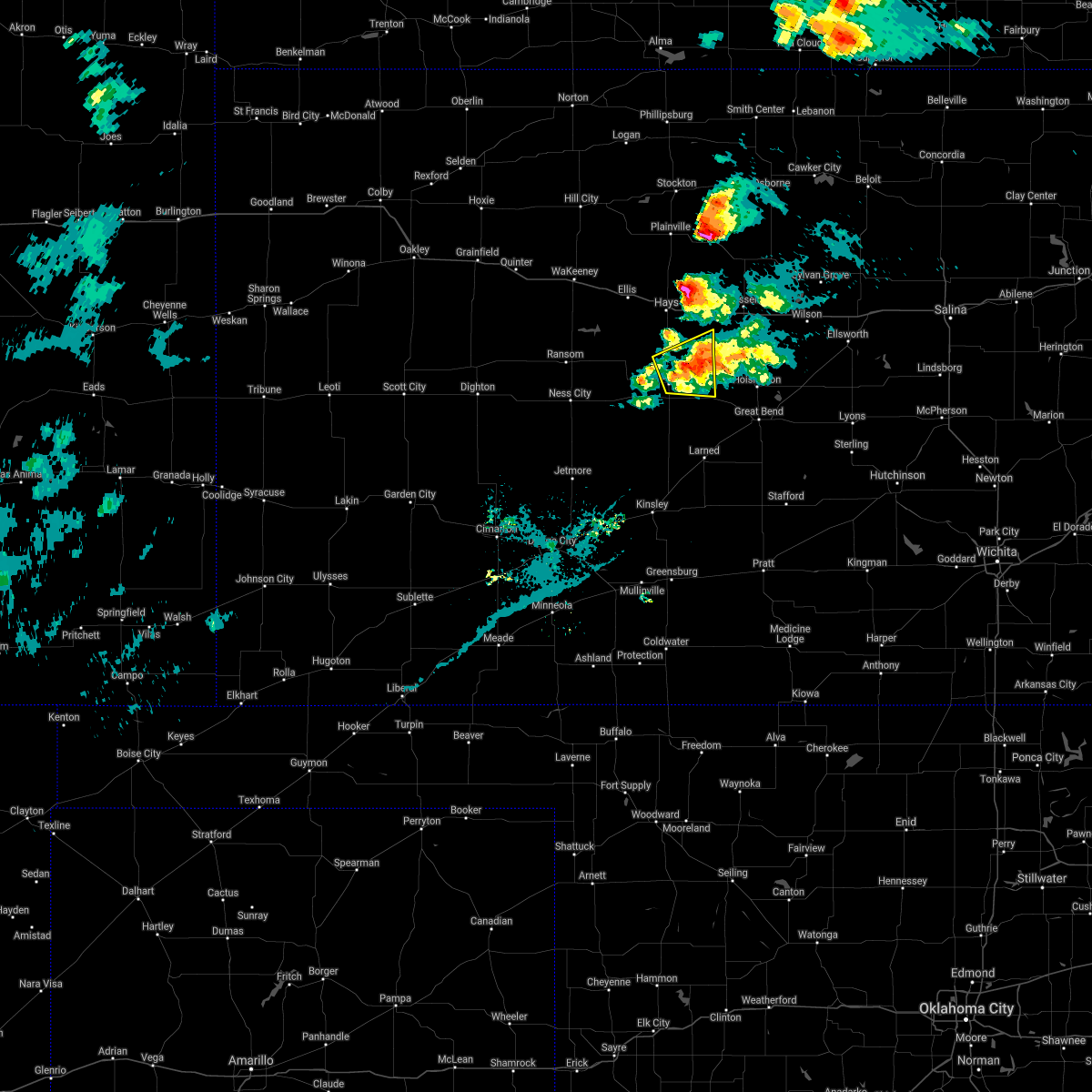 The severe thunderstorm warning for northeastern rush and southeastern ellis counties will expire at 645 pm cdt, the storm which prompted the warning has weakened below severe limits, and no longer poses an immediate threat to life or property. therefore, the warning will be allowed to expire. however small hail up to penny sized is still possible with this thunderstorm. a severe thunderstorm watch remains in effect until 900 pm cdt for central kansas. The severe thunderstorm warning for northeastern rush and southeastern ellis counties will expire at 645 pm cdt, the storm which prompted the warning has weakened below severe limits, and no longer poses an immediate threat to life or property. therefore, the warning will be allowed to expire. however small hail up to penny sized is still possible with this thunderstorm. a severe thunderstorm watch remains in effect until 900 pm cdt for central kansas.
|
| 5/8/2021 6:21 PM CDT |
 At 620 pm cdt, a severe thunderstorm was located near la crosse, moving east at 25 mph (trained weather spotters reported quarter sized hail 3 miles east of hargrave at 6:15 pm). Hazards include quarter size hail. Damage to vehicles is expected. Locations impacted include, bison, loretta, pfeifer and otis. At 620 pm cdt, a severe thunderstorm was located near la crosse, moving east at 25 mph (trained weather spotters reported quarter sized hail 3 miles east of hargrave at 6:15 pm). Hazards include quarter size hail. Damage to vehicles is expected. Locations impacted include, bison, loretta, pfeifer and otis.
|
| 5/8/2021 6:06 PM CDT |
 At 606 pm cdt, a severe thunderstorm was located near hargrave, moving east at 25 mph (radar indicated). Hazards include quarter size hail. Damage to vehicles is expected. this severe thunderstorm will be near, la crosse and liebenthal around 620 pm cdt. Other locations in the path of this severe thunderstorm include bison, timken, loretta and otis. At 606 pm cdt, a severe thunderstorm was located near hargrave, moving east at 25 mph (radar indicated). Hazards include quarter size hail. Damage to vehicles is expected. this severe thunderstorm will be near, la crosse and liebenthal around 620 pm cdt. Other locations in the path of this severe thunderstorm include bison, timken, loretta and otis.
|
| 5/2/2021 10:55 PM CDT |
 The severe thunderstorm warning for northern pawnee and rush counties will expire at 1100 pm cdt, the storms which prompted the warning have weakened below severe limits, and no longer pose an immediate threat to life or property. therefore, the warning will be allowed to expire. however gusty winds are still possible with these thunderstorms. a severe thunderstorm watch remains in effect until midnight cdt for south central and central kansas. The severe thunderstorm warning for northern pawnee and rush counties will expire at 1100 pm cdt, the storms which prompted the warning have weakened below severe limits, and no longer pose an immediate threat to life or property. therefore, the warning will be allowed to expire. however gusty winds are still possible with these thunderstorms. a severe thunderstorm watch remains in effect until midnight cdt for south central and central kansas.
|
| 5/2/2021 10:43 PM CDT |
 At 1042 pm cdt, severe thunderstorms were located along a line extending from near milberger to 6 miles southeast of burdett, moving southeast at 35 mph (radar indicated). Hazards include 60 mph wind gusts and penny size hail. Expect damage to roofs, siding, and trees. Locations impacted include, la crosse, otis, bison, rush center, rozel, timken, ash valley, sanford, loretta, frizell, shaffer and nekoma. At 1042 pm cdt, severe thunderstorms were located along a line extending from near milberger to 6 miles southeast of burdett, moving southeast at 35 mph (radar indicated). Hazards include 60 mph wind gusts and penny size hail. Expect damage to roofs, siding, and trees. Locations impacted include, la crosse, otis, bison, rush center, rozel, timken, ash valley, sanford, loretta, frizell, shaffer and nekoma.
|
| 5/2/2021 10:19 PM CDT |
 At 1019 pm cdt, severe thunderstorms were located along a line extending from near walker to near gray, moving southeast at 35 mph (radar indicated). Hazards include 60 mph wind gusts and penny size hail. expect damage to roofs, siding, and trees At 1019 pm cdt, severe thunderstorms were located along a line extending from near walker to near gray, moving southeast at 35 mph (radar indicated). Hazards include 60 mph wind gusts and penny size hail. expect damage to roofs, siding, and trees
|
| 4/6/2021 7:02 PM CDT |
 At 701 pm cdt, a severe thunderstorm was located very near sanford, moving northeast at 30 mph (radar indicated). Hazards include two inch hail and 60 mph wind gusts. People and animals outdoors will be injured. expect hail damage to roofs, siding, windows, and vehicles. expect wind damage to roofs, siding, and trees. Locations impacted include, larned, otis, garfield, rozel, timken, ash valley, sanford, frizell and shaffer. At 701 pm cdt, a severe thunderstorm was located very near sanford, moving northeast at 30 mph (radar indicated). Hazards include two inch hail and 60 mph wind gusts. People and animals outdoors will be injured. expect hail damage to roofs, siding, windows, and vehicles. expect wind damage to roofs, siding, and trees. Locations impacted include, larned, otis, garfield, rozel, timken, ash valley, sanford, frizell and shaffer.
|
| 4/6/2021 6:39 PM CDT |
 The national weather service in dodge city has issued a * severe thunderstorm warning for. central pawnee county in south central kansas. southeastern rush county in central kansas. north central edwards county in south central kansas. Until 730 pm cdt. The national weather service in dodge city has issued a * severe thunderstorm warning for. central pawnee county in south central kansas. southeastern rush county in central kansas. north central edwards county in south central kansas. Until 730 pm cdt.
|
| 6/24/2020 4:37 PM CDT |
 At 437 pm cdt, a severe thunderstorm was located very near shaffer, moving south at 15 mph (radar indicated). Hazards include ping pong ball size hail and 60 mph wind gusts. People and animals outdoors will be injured. expect hail damage to roofs, siding, windows, and vehicles. expect wind damage to roofs, siding, and trees. Locations impacted include, otis, timken and shaffer. At 437 pm cdt, a severe thunderstorm was located very near shaffer, moving south at 15 mph (radar indicated). Hazards include ping pong ball size hail and 60 mph wind gusts. People and animals outdoors will be injured. expect hail damage to roofs, siding, windows, and vehicles. expect wind damage to roofs, siding, and trees. Locations impacted include, otis, timken and shaffer.
|
| 6/24/2020 4:28 PM CDT |
 At 428 pm cdt, a severe thunderstorm was located very near shaffer, moving south at 15 mph (radar indicated). Hazards include 60 mph wind gusts and quarter size hail. Hail damage to vehicles is expected. Expect wind damage to roofs, siding, and trees. At 428 pm cdt, a severe thunderstorm was located very near shaffer, moving south at 15 mph (radar indicated). Hazards include 60 mph wind gusts and quarter size hail. Hail damage to vehicles is expected. Expect wind damage to roofs, siding, and trees.
|
| 6/24/2020 4:27 PM CDT | Hen Egg sized hail reported 0.4 miles NNW of Otis, KS, social reports of continued egg size hail. |
| 6/24/2020 4:19 PM CDT | Hen Egg sized hail reported 0.4 miles NNW of Otis, KS, social media report of egg size hail. |
| 6/24/2020 4:15 PM CDT | Half Dollar sized hail reported 0.4 miles NNW of Otis, KS, social media reports of half dollar size hail. |
| 6/24/2020 4:11 PM CDT | Hen Egg sized hail reported 0.4 miles NNW of Otis, KS, quarters to eggs reported by spotter network. |
| 6/24/2020 4:10 PM CDT |
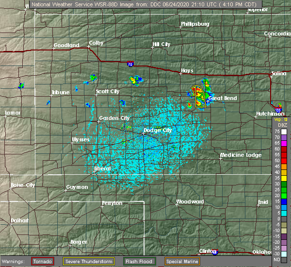 At 410 pm cdt, a severe thunderstorm was located near otis, and is nearly stationary (radar indicated). Hazards include two inch hail and 60 mph wind gusts. People and animals outdoors will be injured. expect hail damage to roofs, siding, windows, and vehicles. expect wind damage to roofs, siding, and trees. Locations impacted include, otis. At 410 pm cdt, a severe thunderstorm was located near otis, and is nearly stationary (radar indicated). Hazards include two inch hail and 60 mph wind gusts. People and animals outdoors will be injured. expect hail damage to roofs, siding, windows, and vehicles. expect wind damage to roofs, siding, and trees. Locations impacted include, otis.
|
| 6/24/2020 4:08 PM CDT | Hen Egg sized hail reported 0.4 miles NNW of Otis, KS, egg size hail reported from kake. |
| 6/24/2020 4:07 PM CDT |
 At 406 pm cdt, a severe thunderstorm was located near otis, and is nearly stationary (radar indicated). Hazards include ping pong ball size hail and 60 mph wind gusts. People and animals outdoors will be injured. expect hail damage to roofs, siding, windows, and vehicles. expect wind damage to roofs, siding, and trees. Locations impacted include, otis. At 406 pm cdt, a severe thunderstorm was located near otis, and is nearly stationary (radar indicated). Hazards include ping pong ball size hail and 60 mph wind gusts. People and animals outdoors will be injured. expect hail damage to roofs, siding, windows, and vehicles. expect wind damage to roofs, siding, and trees. Locations impacted include, otis.
|
| 6/24/2020 4:01 PM CDT |
 At 401 pm cdt, a severe thunderstorm was located near otis, and is nearly stationary (radar indicated). Hazards include 60 mph wind gusts and quarter size hail. Hail damage to vehicles is expected. Expect wind damage to roofs, siding, and trees. At 401 pm cdt, a severe thunderstorm was located near otis, and is nearly stationary (radar indicated). Hazards include 60 mph wind gusts and quarter size hail. Hail damage to vehicles is expected. Expect wind damage to roofs, siding, and trees.
|
| 6/21/2020 5:41 PM CDT |
 At 540 pm cdt, severe thunderstorms were located along a line extending from great bend to 6 miles north of offerle, moving southeast at 35 mph. these are very dangerous storms (radar indicated). Hazards include 80 mph wind gusts and half dollar size hail. Flying debris will be dangerous to those caught without shelter. mobile homes will be heavily damaged. expect considerable damage to roofs, windows, and vehicles. Extensive tree damage and power outages are likely. At 540 pm cdt, severe thunderstorms were located along a line extending from great bend to 6 miles north of offerle, moving southeast at 35 mph. these are very dangerous storms (radar indicated). Hazards include 80 mph wind gusts and half dollar size hail. Flying debris will be dangerous to those caught without shelter. mobile homes will be heavily damaged. expect considerable damage to roofs, windows, and vehicles. Extensive tree damage and power outages are likely.
|
| 6/21/2020 5:24 PM CDT |
 At 523 pm cdt, severe thunderstorms were located along a line extending from 6 miles north of burdett to near bellefont, moving east at 30 mph. these are very dangerous storms (radar indicated). Hazards include 80 mph wind gusts and ping pong ball size hail. Flying debris will be dangerous to those caught without shelter. mobile homes will be heavily damaged. expect considerable damage to roofs, windows, and vehicles. extensive tree damage and power outages are likely. Locations impacted include, gray, larned, kinsley, la crosse, lewis, bazine, otis, bison, burdett, offerle, garfield, mccracken, rush center, rozel, belpre, timken, alexander, ash valley, sanford and nekoma. At 523 pm cdt, severe thunderstorms were located along a line extending from 6 miles north of burdett to near bellefont, moving east at 30 mph. these are very dangerous storms (radar indicated). Hazards include 80 mph wind gusts and ping pong ball size hail. Flying debris will be dangerous to those caught without shelter. mobile homes will be heavily damaged. expect considerable damage to roofs, windows, and vehicles. extensive tree damage and power outages are likely. Locations impacted include, gray, larned, kinsley, la crosse, lewis, bazine, otis, bison, burdett, offerle, garfield, mccracken, rush center, rozel, belpre, timken, alexander, ash valley, sanford and nekoma.
|
| 6/21/2020 4:59 PM CDT |
 At 459 pm cdt, severe thunderstorms were located along a line extending from near bazine to 9 miles south of hanston, moving east at 50 mph (radar indicated). Hazards include 70 mph wind gusts and ping pong ball size hail. People and animals outdoors will be injured. expect hail damage to roofs, siding, windows, and vehicles. expect considerable tree damage. Wind damage is also likely to mobile homes, roofs, and outbuildings. At 459 pm cdt, severe thunderstorms were located along a line extending from near bazine to 9 miles south of hanston, moving east at 50 mph (radar indicated). Hazards include 70 mph wind gusts and ping pong ball size hail. People and animals outdoors will be injured. expect hail damage to roofs, siding, windows, and vehicles. expect considerable tree damage. Wind damage is also likely to mobile homes, roofs, and outbuildings.
|
| 6/21/2020 4:47 PM CDT |
 At 447 pm cdt, a severe thunderstorm was located near milberger, or 8 miles east of pfeifer, moving southeast at 20 mph (radar indicated). Hazards include golf ball size hail and 60 mph wind gusts. People and animals outdoors will be injured. expect hail damage to roofs, siding, windows, and vehicles. expect wind damage to roofs, siding, and trees. Locations impacted include, la crosse, otis, bison, schoenchen, rush center, liebenthal, timken, alexander, loretta, nekoma, hargrave, pfeifer, shaffer and antonino. At 447 pm cdt, a severe thunderstorm was located near milberger, or 8 miles east of pfeifer, moving southeast at 20 mph (radar indicated). Hazards include golf ball size hail and 60 mph wind gusts. People and animals outdoors will be injured. expect hail damage to roofs, siding, windows, and vehicles. expect wind damage to roofs, siding, and trees. Locations impacted include, la crosse, otis, bison, schoenchen, rush center, liebenthal, timken, alexander, loretta, nekoma, hargrave, pfeifer, shaffer and antonino.
|
| 6/21/2020 4:24 PM CDT |
 At 424 pm cdt, a severe thunderstorm was located near pfeifer, and is nearly stationary (radar indicated). Hazards include golf ball size hail and 60 mph wind gusts. People and animals outdoors will be injured. expect hail damage to roofs, siding, windows, and vehicles. expect wind damage to roofs, siding, and trees. Locations impacted include, hays, ellis, la crosse, victoria, walker, catherine, otis, bison, schoenchen, rush center, liebenthal, timken, alexander, yocemento, munjor, loretta, nekoma, hargrave, pfeifer and toulon. At 424 pm cdt, a severe thunderstorm was located near pfeifer, and is nearly stationary (radar indicated). Hazards include golf ball size hail and 60 mph wind gusts. People and animals outdoors will be injured. expect hail damage to roofs, siding, windows, and vehicles. expect wind damage to roofs, siding, and trees. Locations impacted include, hays, ellis, la crosse, victoria, walker, catherine, otis, bison, schoenchen, rush center, liebenthal, timken, alexander, yocemento, munjor, loretta, nekoma, hargrave, pfeifer and toulon.
|
| 6/21/2020 4:09 PM CDT |
 At 408 pm cdt, a severe thunderstorm was located near pfeifer, moving southeast at 20 mph (radar indicated). Hazards include 60 mph wind gusts and half dollar size hail. Hail damage to vehicles is expected. Expect wind damage to roofs, siding, and trees. At 408 pm cdt, a severe thunderstorm was located near pfeifer, moving southeast at 20 mph (radar indicated). Hazards include 60 mph wind gusts and half dollar size hail. Hail damage to vehicles is expected. Expect wind damage to roofs, siding, and trees.
|
| 9/21/2019 6:39 PM CDT |
 At 638 pm cdt, a severe thunderstorm was located very near mccracken, moving east at 20 mph (radar indicated). Hazards include 60 mph wind gusts and quarter size hail. Hail damage to vehicles is expected. Expect wind damage to roofs, siding, and trees. At 638 pm cdt, a severe thunderstorm was located very near mccracken, moving east at 20 mph (radar indicated). Hazards include 60 mph wind gusts and quarter size hail. Hail damage to vehicles is expected. Expect wind damage to roofs, siding, and trees.
|
| 8/29/2019 10:25 PM CDT |
 At 1024 pm cdt, a severe thunderstorm was located near liebenthal, moving southeast at 40 mph (radar indicated). Hazards include 60 mph wind gusts and quarter size hail. Hail damage to vehicles is expected. expect wind damage to roofs, siding, and trees. Locations impacted include, victoria, otis, schoenchen, liebenthal, loretta, pfeifer, munjor, antonino and toulon. At 1024 pm cdt, a severe thunderstorm was located near liebenthal, moving southeast at 40 mph (radar indicated). Hazards include 60 mph wind gusts and quarter size hail. Hail damage to vehicles is expected. expect wind damage to roofs, siding, and trees. Locations impacted include, victoria, otis, schoenchen, liebenthal, loretta, pfeifer, munjor, antonino and toulon.
|
| 8/29/2019 10:17 PM CDT |
 At 1017 pm cdt, a severe thunderstorm was located near pfeifer, moving southeast at 40 mph (radar indicated). Hazards include 70 mph wind gusts and quarter size hail. Hail damage to vehicles is expected. expect considerable tree damage. wind damage is also likely to mobile homes, roofs, and outbuildings. Locations impacted include, hays, victoria, walker, catherine, otis, schoenchen, liebenthal, emmeram, munjor, loretta, pfeifer, toulon and antonino. At 1017 pm cdt, a severe thunderstorm was located near pfeifer, moving southeast at 40 mph (radar indicated). Hazards include 70 mph wind gusts and quarter size hail. Hail damage to vehicles is expected. expect considerable tree damage. wind damage is also likely to mobile homes, roofs, and outbuildings. Locations impacted include, hays, victoria, walker, catherine, otis, schoenchen, liebenthal, emmeram, munjor, loretta, pfeifer, toulon and antonino.
|
| 8/29/2019 10:06 PM CDT |
 At 1005 pm cdt, a severe thunderstorm was located very near munjor, moving southeast at 40 mph (radar indicated). Hazards include 70 mph wind gusts and quarter size hail. Hail damage to vehicles is expected. expect considerable tree damage. Wind damage is also likely to mobile homes, roofs, and outbuildings. At 1005 pm cdt, a severe thunderstorm was located very near munjor, moving southeast at 40 mph (radar indicated). Hazards include 70 mph wind gusts and quarter size hail. Hail damage to vehicles is expected. expect considerable tree damage. Wind damage is also likely to mobile homes, roofs, and outbuildings.
|
| 8/25/2019 1:04 AM CDT |
 At 104 am cdt, a severe thunderstorm was located near shaffer, moving southeast at 30 mph (radar indicated). Hazards include 60 mph wind gusts and nickel size hail. Expect damage to roofs, siding, and trees. Locations impacted include, la crosse, otis, bison, rush center, timken and shaffer. At 104 am cdt, a severe thunderstorm was located near shaffer, moving southeast at 30 mph (radar indicated). Hazards include 60 mph wind gusts and nickel size hail. Expect damage to roofs, siding, and trees. Locations impacted include, la crosse, otis, bison, rush center, timken and shaffer.
|
| 8/25/2019 12:42 AM CDT |
 At 1242 am cdt, a severe thunderstorm was located near bison, moving southeast at 30 mph (radar indicated). Hazards include 60 mph wind gusts and half dollar size hail. Hail damage to vehicles is expected. Expect wind damage to roofs, siding, and trees. At 1242 am cdt, a severe thunderstorm was located near bison, moving southeast at 30 mph (radar indicated). Hazards include 60 mph wind gusts and half dollar size hail. Hail damage to vehicles is expected. Expect wind damage to roofs, siding, and trees.
|
| 8/25/2019 12:34 AM CDT |
 At 1233 am cdt, a severe thunderstorm was located near la crosse, moving southeast at 30 mph (radar indicated). Hazards include 60 mph wind gusts and half dollar size hail. Hail damage to vehicles is expected. expect wind damage to roofs, siding, and trees. Locations impacted include, la crosse, otis, bison, mccracken, rush center, liebenthal, timken, loretta, nekoma, hargrave, shaffer and pfeifer. At 1233 am cdt, a severe thunderstorm was located near la crosse, moving southeast at 30 mph (radar indicated). Hazards include 60 mph wind gusts and half dollar size hail. Hail damage to vehicles is expected. expect wind damage to roofs, siding, and trees. Locations impacted include, la crosse, otis, bison, mccracken, rush center, liebenthal, timken, loretta, nekoma, hargrave, shaffer and pfeifer.
|
| 8/25/2019 12:18 AM CDT |
 At 1216 am cdt, severe thunderstorms were located along a line extending from near hoisington to near albert to near timken, moving southeast at 40 mph. another severe thunderstorm was developing just north of mccracken (radar indicated). Hazards include golf ball size hail and 60 mph wind gusts. People and animals outdoors will be injured. expect hail damage to roofs, siding, windows, and vehicles. expect wind damage to roofs, siding, and trees. Locations impacted include, la crosse, walker, otis, bison, schoenchen, mccracken, rush center, liebenthal, timken, ash valley, loretta, nekoma, hargrave, pfeifer and shaffer. At 1216 am cdt, severe thunderstorms were located along a line extending from near hoisington to near albert to near timken, moving southeast at 40 mph. another severe thunderstorm was developing just north of mccracken (radar indicated). Hazards include golf ball size hail and 60 mph wind gusts. People and animals outdoors will be injured. expect hail damage to roofs, siding, windows, and vehicles. expect wind damage to roofs, siding, and trees. Locations impacted include, la crosse, walker, otis, bison, schoenchen, mccracken, rush center, liebenthal, timken, ash valley, loretta, nekoma, hargrave, pfeifer and shaffer.
|
| 8/24/2019 11:38 PM CDT |
 At 1138 pm cdt, severe thunderstorms were located along a line extending from near gorham to near liebenthal to near brownell, moving southeast at 30 mph (radar indicated). Hazards include 70 mph wind gusts and half dollar size hail. Hail damage to vehicles is expected. expect considerable tree damage. Wind damage is also likely to mobile homes, roofs, and outbuildings. At 1138 pm cdt, severe thunderstorms were located along a line extending from near gorham to near liebenthal to near brownell, moving southeast at 30 mph (radar indicated). Hazards include 70 mph wind gusts and half dollar size hail. Hail damage to vehicles is expected. expect considerable tree damage. Wind damage is also likely to mobile homes, roofs, and outbuildings.
|
| 8/18/2019 1:09 AM CDT |
 At 109 am cdt, severe thunderstorms were located along a line extending from near gorham to near loretta, moving east at 30 mph (radar indicated). Hazards include 60 mph wind gusts and quarter size hail. Hail damage to vehicles is expected. Expect wind damage to roofs, siding, and trees. At 109 am cdt, severe thunderstorms were located along a line extending from near gorham to near loretta, moving east at 30 mph (radar indicated). Hazards include 60 mph wind gusts and quarter size hail. Hail damage to vehicles is expected. Expect wind damage to roofs, siding, and trees.
|
| 8/13/2019 8:48 PM CDT |
 At 848 pm cdt, severe thunderstorms were located along a line extending from 6 miles north of olmitz to near radium to near macksville, moving southeast at 40 mph (radar indicated). Hazards include 70 mph wind gusts and quarter size hail. Hail damage to vehicles is expected. expect considerable tree damage. wind damage is also likely to mobile homes, roofs, and outbuildings. locations impacted include, larned, kinsley, la crosse, st. John, macksville, lewis, otis, bison, garfield, rush center, rozel, liebenthal, belpre, timken, seward, ash valley, radium, sanford, loretta and frizell. At 848 pm cdt, severe thunderstorms were located along a line extending from 6 miles north of olmitz to near radium to near macksville, moving southeast at 40 mph (radar indicated). Hazards include 70 mph wind gusts and quarter size hail. Hail damage to vehicles is expected. expect considerable tree damage. wind damage is also likely to mobile homes, roofs, and outbuildings. locations impacted include, larned, kinsley, la crosse, st. John, macksville, lewis, otis, bison, garfield, rush center, rozel, liebenthal, belpre, timken, seward, ash valley, radium, sanford, loretta and frizell.
|
| 8/13/2019 8:33 PM CDT | Time estimated from rada in barton county KS, 8.8 miles SW of Otis, KS |
| 8/13/2019 8:21 PM CDT |
 At 821 pm cdt, a severe thunderstorm was located near victoria, moving southeast at 25 mph. this is a very dangerous storm (radar indicated). Hazards include 80 mph wind gusts and golf ball size hail. Flying debris will be dangerous to those caught without shelter. mobile homes will be heavily damaged. expect considerable damage to roofs, windows, and vehicles. extensive tree damage and power outages are likely. locations impacted include, hays, victoria, walker, catherine, otis, loretta, emmeram, yocemento, pfeifer, toulon and munjor. There have been numerous reports of wind damage in and around hays from estimated and measured 75 mph wind gusts. At 821 pm cdt, a severe thunderstorm was located near victoria, moving southeast at 25 mph. this is a very dangerous storm (radar indicated). Hazards include 80 mph wind gusts and golf ball size hail. Flying debris will be dangerous to those caught without shelter. mobile homes will be heavily damaged. expect considerable damage to roofs, windows, and vehicles. extensive tree damage and power outages are likely. locations impacted include, hays, victoria, walker, catherine, otis, loretta, emmeram, yocemento, pfeifer, toulon and munjor. There have been numerous reports of wind damage in and around hays from estimated and measured 75 mph wind gusts.
|
| 8/13/2019 8:13 PM CDT |
 At 813 pm cdt, severe thunderstorms were located along a line extending from near munjor to near garfield, moving east at 25 mph (radar indicated). Hazards include 70 mph wind gusts and quarter size hail. Hail damage to vehicles is expected. expect considerable tree damage. Wind damage is also likely to mobile homes, roofs, and outbuildings. At 813 pm cdt, severe thunderstorms were located along a line extending from near munjor to near garfield, moving east at 25 mph (radar indicated). Hazards include 70 mph wind gusts and quarter size hail. Hail damage to vehicles is expected. expect considerable tree damage. Wind damage is also likely to mobile homes, roofs, and outbuildings.
|
| 8/13/2019 7:56 PM CDT |
 At 756 pm cdt, a severe thunderstorm was located very near hays, moving southeast at 35 mph (radar indicated). Hazards include golf ball size hail and 60 mph wind gusts. People and animals outdoors will be injured. expect hail damage to roofs, siding, windows, and vehicles. Expect wind damage to roofs, siding, and trees. At 756 pm cdt, a severe thunderstorm was located very near hays, moving southeast at 35 mph (radar indicated). Hazards include golf ball size hail and 60 mph wind gusts. People and animals outdoors will be injured. expect hail damage to roofs, siding, windows, and vehicles. Expect wind damage to roofs, siding, and trees.
|
| 7/31/2019 8:06 PM CDT |
 The severe thunderstorm warning for rush county will expire at 815 pm cdt, the storm which prompted the warning has moved out of the area. therefore, the warning will be allowed to expire. however gusty winds are still possible with this thunderstorm. The severe thunderstorm warning for rush county will expire at 815 pm cdt, the storm which prompted the warning has moved out of the area. therefore, the warning will be allowed to expire. however gusty winds are still possible with this thunderstorm.
|
| 7/31/2019 7:35 PM CDT |
 At 720 pm cdt, a severe thunderstorm was located near la crosse, moving east at 25 mph (radar indicated). Hazards include 60 mph wind gusts and quarter size hail. Hail damage to vehicles is expected. Expect wind damage to roofs, siding, and trees. At 720 pm cdt, a severe thunderstorm was located near la crosse, moving east at 25 mph (radar indicated). Hazards include 60 mph wind gusts and quarter size hail. Hail damage to vehicles is expected. Expect wind damage to roofs, siding, and trees.
|
| 7/31/2019 7:20 PM CDT |
 At 720 pm cdt, a severe thunderstorm was located near la crosse, moving east at 25 mph (radar indicated). Hazards include 60 mph wind gusts and quarter size hail. Hail damage to vehicles is expected. Expect wind damage to roofs, siding, and trees. At 720 pm cdt, a severe thunderstorm was located near la crosse, moving east at 25 mph (radar indicated). Hazards include 60 mph wind gusts and quarter size hail. Hail damage to vehicles is expected. Expect wind damage to roofs, siding, and trees.
|
| 6/9/2019 2:05 AM CDT |
 The severe thunderstorm warning for rush and southeastern ellis counties will expire at 215 am cdt, the storms which prompted the warning have moved out of the area. therefore, the warning will be allowed to expire. however gusty winds and heavy rain are still possible with these thunderstorms. a severe thunderstorm watch remains in effect until 300 am cdt for central kansas. The severe thunderstorm warning for rush and southeastern ellis counties will expire at 215 am cdt, the storms which prompted the warning have moved out of the area. therefore, the warning will be allowed to expire. however gusty winds and heavy rain are still possible with these thunderstorms. a severe thunderstorm watch remains in effect until 300 am cdt for central kansas.
|
| 6/9/2019 1:39 AM CDT |
 At 138 am cdt, severe thunderstorms were located along a line extending from near emmeram to near loretta to 7 miles south of nekoma, moving east at 50 mph (radar indicated). Hazards include 70 mph wind gusts and nickel size hail. Expect considerable tree damage. Damage is likely to mobile homes, roofs, and outbuildings. At 138 am cdt, severe thunderstorms were located along a line extending from near emmeram to near loretta to 7 miles south of nekoma, moving east at 50 mph (radar indicated). Hazards include 70 mph wind gusts and nickel size hail. Expect considerable tree damage. Damage is likely to mobile homes, roofs, and outbuildings.
|
| 6/9/2019 1:30 AM CDT |
 At 130 am cdt, severe thunderstorms were located along a line extending from near catherine to near la crosse to 6 miles south of bazine, moving southeast at 55 mph (radar indicated). Hazards include 70 mph wind gusts and nickel size hail. Expect considerable tree damage. damage is likely to mobile homes, roofs, and outbuildings. Locations impacted include, hays, ness city, la crosse, victoria, walker, bazine, catherine, otis, bison, schoenchen, mccracken, rush center, liebenthal, timken, alexander, emmeram, yocemento, nekoma, hargrave and pfeifer. At 130 am cdt, severe thunderstorms were located along a line extending from near catherine to near la crosse to 6 miles south of bazine, moving southeast at 55 mph (radar indicated). Hazards include 70 mph wind gusts and nickel size hail. Expect considerable tree damage. damage is likely to mobile homes, roofs, and outbuildings. Locations impacted include, hays, ness city, la crosse, victoria, walker, bazine, catherine, otis, bison, schoenchen, mccracken, rush center, liebenthal, timken, alexander, emmeram, yocemento, nekoma, hargrave and pfeifer.
|
| 6/9/2019 1:17 AM CDT |
 At 117 am cdt, severe thunderstorms were located along a line extending from 6 miles northwest of catherine to near mccracken to near ness city, moving southeast at 40 mph (radar indicated). Hazards include 60 mph wind gusts and nickel size hail. Expect damage to roofs, siding, and trees. Locations impacted include, hays, ness city, la crosse, victoria, walker, bazine, catherine, otis, bison, schoenchen, mccracken, rush center, liebenthal, timken, alexander, brownell, emmeram, yocemento, nekoma and hargrave. At 117 am cdt, severe thunderstorms were located along a line extending from 6 miles northwest of catherine to near mccracken to near ness city, moving southeast at 40 mph (radar indicated). Hazards include 60 mph wind gusts and nickel size hail. Expect damage to roofs, siding, and trees. Locations impacted include, hays, ness city, la crosse, victoria, walker, bazine, catherine, otis, bison, schoenchen, mccracken, rush center, liebenthal, timken, alexander, brownell, emmeram, yocemento, nekoma and hargrave.
|
| 6/9/2019 12:51 AM CDT |
 At 1251 am cdt, severe thunderstorms were located along a line extending from 9 miles south of zurich to near beeler, moving southeast at 45 mph (radar indicated). Hazards include 60 mph wind gusts and nickel size hail. expect damage to roofs, siding, and trees At 1251 am cdt, severe thunderstorms were located along a line extending from 9 miles south of zurich to near beeler, moving southeast at 45 mph (radar indicated). Hazards include 60 mph wind gusts and nickel size hail. expect damage to roofs, siding, and trees
|
| 5/27/2019 12:00 AM CDT |
 At 1159 pm cdt, severe thunderstorms were located along a line extending from near ellis to 7 miles northwest of pawnee rock, moving northeast at 40 mph (radar indicated). Hazards include 60 mph wind gusts and penny size hail. expect damage to roofs, siding, and trees At 1159 pm cdt, severe thunderstorms were located along a line extending from near ellis to 7 miles northwest of pawnee rock, moving northeast at 40 mph (radar indicated). Hazards include 60 mph wind gusts and penny size hail. expect damage to roofs, siding, and trees
|
| 5/17/2019 9:27 PM CDT |
 At 926 pm cdt, a severe thunderstorm was located 9 miles south of burdett, moving northeast at 60 mph (radar indicated). Hazards include ping pong ball size hail and 60 mph wind gusts. People and animals outdoors will be injured. expect hail damage to roofs, siding, windows, and vehicles. Expect wind damage to roofs, siding, and trees. At 926 pm cdt, a severe thunderstorm was located 9 miles south of burdett, moving northeast at 60 mph (radar indicated). Hazards include ping pong ball size hail and 60 mph wind gusts. People and animals outdoors will be injured. expect hail damage to roofs, siding, windows, and vehicles. Expect wind damage to roofs, siding, and trees.
|
| 5/6/2019 11:11 PM CDT |
 The national weather service in dodge city has issued a * severe thunderstorm warning for. pawnee county in south central kansas. northwestern stafford county in south central kansas. eastern rush county in central kansas. East central edwards county in south central kansas. The national weather service in dodge city has issued a * severe thunderstorm warning for. pawnee county in south central kansas. northwestern stafford county in south central kansas. eastern rush county in central kansas. East central edwards county in south central kansas.
|
| 4/29/2019 12:51 AM CDT |
 The severe thunderstorm warning for northeastern pawnee and southeastern rush counties will expire at 100 am cdt, the storm which prompted the warning has moved out of the area. therefore, the warning will be allowed to expire. The severe thunderstorm warning for northeastern pawnee and southeastern rush counties will expire at 100 am cdt, the storm which prompted the warning has moved out of the area. therefore, the warning will be allowed to expire.
|
| 4/29/2019 12:34 AM CDT |
 At 1233 am cdt, a severe thunderstorm was located near shaffer, moving east at 45 mph (radar indicated). Hazards include quarter size hail. Damage to vehicles is expected. Locations impacted include, otis, bison, timken, ash valley and shaffer. At 1233 am cdt, a severe thunderstorm was located near shaffer, moving east at 45 mph (radar indicated). Hazards include quarter size hail. Damage to vehicles is expected. Locations impacted include, otis, bison, timken, ash valley and shaffer.
|
| 4/29/2019 12:09 AM CDT |
 At 1208 am cdt, a severe thunderstorm was located very near nekoma, moving east at 40 mph (radar indicated). Hazards include golf ball size hail. People and animals outdoors will be injured. Expect damage to roofs, siding, windows, and vehicles. At 1208 am cdt, a severe thunderstorm was located very near nekoma, moving east at 40 mph (radar indicated). Hazards include golf ball size hail. People and animals outdoors will be injured. Expect damage to roofs, siding, windows, and vehicles.
|
| 4/28/2019 10:16 PM CDT |
 At 1016 pm cdt, severe thunderstorms were located along a line extending from near emmeram to near timken, moving east at 40 mph (radar indicated). Hazards include 60 mph wind gusts and quarter size hail. Hail damage to vehicles is expected. expect wind damage to roofs, siding, and trees. Locations impacted include, hays, la crosse, victoria, walker, catherine, otis, bison, schoenchen, rush center, liebenthal, timken, emmeram, munjor, loretta, pfeifer, toulon, shaffer and antonino. At 1016 pm cdt, severe thunderstorms were located along a line extending from near emmeram to near timken, moving east at 40 mph (radar indicated). Hazards include 60 mph wind gusts and quarter size hail. Hail damage to vehicles is expected. expect wind damage to roofs, siding, and trees. Locations impacted include, hays, la crosse, victoria, walker, catherine, otis, bison, schoenchen, rush center, liebenthal, timken, emmeram, munjor, loretta, pfeifer, toulon, shaffer and antonino.
|
| 4/28/2019 9:58 PM CDT |
 At 958 pm cdt, severe thunderstorms were located along a line extending from yocemento to near nekoma, moving east at 35 mph (radar indicated). Hazards include 60 mph wind gusts and quarter size hail. Hail damage to vehicles is expected. Expect wind damage to roofs, siding, and trees. At 958 pm cdt, severe thunderstorms were located along a line extending from yocemento to near nekoma, moving east at 35 mph (radar indicated). Hazards include 60 mph wind gusts and quarter size hail. Hail damage to vehicles is expected. Expect wind damage to roofs, siding, and trees.
|
| 4/21/2019 8:54 PM CDT |
 The severe thunderstorm warning for northeastern pawnee and eastern rush counties will expire at 900 pm cdt, the storm which prompted the warning has weakened below severe limits, and has exited the warned area. therefore, the warning will be allowed to expire. however gusty winds and heavy rain are still possible with this thunderstorm. The severe thunderstorm warning for northeastern pawnee and eastern rush counties will expire at 900 pm cdt, the storm which prompted the warning has weakened below severe limits, and has exited the warned area. therefore, the warning will be allowed to expire. however gusty winds and heavy rain are still possible with this thunderstorm.
|
| 4/21/2019 8:28 PM CDT |
 At 828 pm cdt, a severe thunderstorm was located near shaffer, moving east at 25 mph (radar indicated). Hazards include 60 mph wind gusts and quarter size hail. Hail damage to vehicles is expected. expect wind damage to roofs, siding, and trees. Locations impacted include, larned, otis, bison, rush center, rozel, timken, ash valley, sanford, frizell and shaffer. At 828 pm cdt, a severe thunderstorm was located near shaffer, moving east at 25 mph (radar indicated). Hazards include 60 mph wind gusts and quarter size hail. Hail damage to vehicles is expected. expect wind damage to roofs, siding, and trees. Locations impacted include, larned, otis, bison, rush center, rozel, timken, ash valley, sanford, frizell and shaffer.
|
| 4/21/2019 8:09 PM CDT |
 At 807 pm cdt, a severe thunderstorm was located near rush center, moving northeast at 35 mph. this replaces the previous warning for ellis and rush counties (radar indicated). Hazards include 60 mph wind gusts and quarter size hail. Hail damage to vehicles is expected. Expect wind damage to roofs, siding, and trees. At 807 pm cdt, a severe thunderstorm was located near rush center, moving northeast at 35 mph. this replaces the previous warning for ellis and rush counties (radar indicated). Hazards include 60 mph wind gusts and quarter size hail. Hail damage to vehicles is expected. Expect wind damage to roofs, siding, and trees.
|
| 4/21/2019 7:56 PM CDT |
 At 756 pm cdt, a severe thunderstorm was located near loretta, moving northeast at 45 mph (radar indicated). Hazards include 60 mph wind gusts and quarter size hail. Hail damage to vehicles is expected. expect wind damage to roofs, siding, and trees. Locations impacted include, hays, victoria, walker, catherine, otis, schoenchen, liebenthal, loretta, emmeram, pfeifer, toulon and munjor. At 756 pm cdt, a severe thunderstorm was located near loretta, moving northeast at 45 mph (radar indicated). Hazards include 60 mph wind gusts and quarter size hail. Hail damage to vehicles is expected. expect wind damage to roofs, siding, and trees. Locations impacted include, hays, victoria, walker, catherine, otis, schoenchen, liebenthal, loretta, emmeram, pfeifer, toulon and munjor.
|
| 4/21/2019 7:30 PM CDT |
 At 729 pm cdt, a severe thunderstorm was located 8 miles south of plainville, or 14 miles northwest of catherine, moving east at 45 mph (radar indicated). Hazards include 60 mph wind gusts. Expect damage to roofs, siding, and trees. Locations impacted include, hays, ellis, victoria, walker, catherine, otis, schoenchen, ogallah, liebenthal, emmeram, yocemento, munjor, loretta, riga, pfeifer, toulon and antonino. At 729 pm cdt, a severe thunderstorm was located 8 miles south of plainville, or 14 miles northwest of catherine, moving east at 45 mph (radar indicated). Hazards include 60 mph wind gusts. Expect damage to roofs, siding, and trees. Locations impacted include, hays, ellis, victoria, walker, catherine, otis, schoenchen, ogallah, liebenthal, emmeram, yocemento, munjor, loretta, riga, pfeifer, toulon and antonino.
|
| 4/21/2019 7:16 PM CDT |
 At 716 pm cdt, a severe thunderstorm was located 9 miles north of ellis, moving east at 45 mph (radar indicated). Hazards include 60 mph wind gusts and penny size hail. expect damage to roofs, siding, and trees At 716 pm cdt, a severe thunderstorm was located 9 miles north of ellis, moving east at 45 mph (radar indicated). Hazards include 60 mph wind gusts and penny size hail. expect damage to roofs, siding, and trees
|
| 10/5/2018 7:19 PM CDT |
 At 718 pm cdt, a severe thunderstorm was located 3 miles northeast of otis, moving east at 35 mph (radar indicated). Hazards include 60 mph wind gusts and quarter size hail. Hail damage to vehicles is expected. expect wind damage to roofs, siding, and trees. Locations impacted include, la crosse, otis, bison and loretta. At 718 pm cdt, a severe thunderstorm was located 3 miles northeast of otis, moving east at 35 mph (radar indicated). Hazards include 60 mph wind gusts and quarter size hail. Hail damage to vehicles is expected. expect wind damage to roofs, siding, and trees. Locations impacted include, la crosse, otis, bison and loretta.
|
| 10/5/2018 7:00 PM CDT |
 At 659 pm cdt, a severe thunderstorm was located near la crosse, moving east at 30 mph (radar indicated). Hazards include 60 mph wind gusts and quarter size hail. Hail damage to vehicles is expected. expect wind damage to roofs, siding, and trees. Locations impacted include, la crosse, otis, bison, rush center, liebenthal, loretta and pfeifer. At 659 pm cdt, a severe thunderstorm was located near la crosse, moving east at 30 mph (radar indicated). Hazards include 60 mph wind gusts and quarter size hail. Hail damage to vehicles is expected. expect wind damage to roofs, siding, and trees. Locations impacted include, la crosse, otis, bison, rush center, liebenthal, loretta and pfeifer.
|
| 10/5/2018 6:47 PM CDT |
 At 647 pm cdt, a severe thunderstorm was located 3 miles northeast of nekoma, moving northeast at 35 mph (radar indicated). Hazards include 60 mph wind gusts and quarter size hail. Hail damage to vehicles is expected. Expect wind damage to roofs, siding, and trees. At 647 pm cdt, a severe thunderstorm was located 3 miles northeast of nekoma, moving northeast at 35 mph (radar indicated). Hazards include 60 mph wind gusts and quarter size hail. Hail damage to vehicles is expected. Expect wind damage to roofs, siding, and trees.
|
| 9/2/2018 5:18 PM CDT |
 At 518 pm cdt, a severe thunderstorm was located very near ash valley, moving northeast at 35 mph (radar indicated). Hazards include ping pong ball size hail and 60 mph wind gusts. People and animals outdoors will be injured. expect hail damage to roofs, siding, windows, and vehicles. expect wind damage to roofs, siding, and trees. Locations impacted include, otis, timken, ash valley and shaffer. At 518 pm cdt, a severe thunderstorm was located very near ash valley, moving northeast at 35 mph (radar indicated). Hazards include ping pong ball size hail and 60 mph wind gusts. People and animals outdoors will be injured. expect hail damage to roofs, siding, windows, and vehicles. expect wind damage to roofs, siding, and trees. Locations impacted include, otis, timken, ash valley and shaffer.
|
| 9/2/2018 5:01 PM CDT |
 At 500 pm cdt, a severe thunderstorm was located 5 miles west of ash valley, moving northeast at 15 mph (radar indicated and public report). Hazards include golf ball size hail and 60 mph wind gusts. People and animals outdoors will be injured. expect hail damage to roofs, siding, windows, and vehicles. expect wind damage to roofs, siding, and trees. at 455 pm cdt, a citizen reported ping ping ball size hail 7 miles north northeast of rozel. Locations impacted include, otis, bison, rush center, timken, ash valley and shaffer. At 500 pm cdt, a severe thunderstorm was located 5 miles west of ash valley, moving northeast at 15 mph (radar indicated and public report). Hazards include golf ball size hail and 60 mph wind gusts. People and animals outdoors will be injured. expect hail damage to roofs, siding, windows, and vehicles. expect wind damage to roofs, siding, and trees. at 455 pm cdt, a citizen reported ping ping ball size hail 7 miles north northeast of rozel. Locations impacted include, otis, bison, rush center, timken, ash valley and shaffer.
|
| 9/2/2018 4:42 PM CDT |
 At 441 pm cdt, a severe thunderstorm was located 3 miles north of rozel, moving northeast at 20 mph (radar indicated). Hazards include golf ball size hail and 60 mph wind gusts. People and animals outdoors will be injured. expect hail damage to roofs, siding, windows, and vehicles. expect wind damage to roofs, siding, and trees. This warning replaces the previous warning for portions of pawnee and rush county. At 441 pm cdt, a severe thunderstorm was located 3 miles north of rozel, moving northeast at 20 mph (radar indicated). Hazards include golf ball size hail and 60 mph wind gusts. People and animals outdoors will be injured. expect hail damage to roofs, siding, windows, and vehicles. expect wind damage to roofs, siding, and trees. This warning replaces the previous warning for portions of pawnee and rush county.
|
| 8/19/2018 7:25 PM CDT |
 At 724 pm cdt, a severe thunderstorm was located 3 miles east of pfeifer, moving southeast at 30 mph (radar indicated). Hazards include 60 mph wind gusts and quarter size hail. Hail damage to vehicles is expected. expect wind damage to roofs, siding, and trees. Locations impacted include, otis, bison, timken, pfeifer, loretta and shaffer. At 724 pm cdt, a severe thunderstorm was located 3 miles east of pfeifer, moving southeast at 30 mph (radar indicated). Hazards include 60 mph wind gusts and quarter size hail. Hail damage to vehicles is expected. expect wind damage to roofs, siding, and trees. Locations impacted include, otis, bison, timken, pfeifer, loretta and shaffer.
|
| 8/19/2018 7:09 PM CDT |
 At 708 pm cdt, a severe thunderstorm was located 4 miles east of munjor, moving southeast at 30 mph (radar indicated). Hazards include 60 mph wind gusts and quarter size hail. Hail damage to vehicles is expected. Expect wind damage to roofs, siding, and trees. At 708 pm cdt, a severe thunderstorm was located 4 miles east of munjor, moving southeast at 30 mph (radar indicated). Hazards include 60 mph wind gusts and quarter size hail. Hail damage to vehicles is expected. Expect wind damage to roofs, siding, and trees.
|
| 7/27/2018 5:56 PM CDT |
 At 556 pm cdt, a severe thunderstorm was located very near bison, moving southeast at 20 mph (radar indicated). Hazards include ping pong ball size hail and 60 mph wind gusts. People and animals outdoors will be injured. expect hail damage to roofs, siding, windows, and vehicles. expect wind damage to roofs, siding, and trees. Locations impacted include, la crosse, otis, bison, rush center, timken, ash valley and shaffer. At 556 pm cdt, a severe thunderstorm was located very near bison, moving southeast at 20 mph (radar indicated). Hazards include ping pong ball size hail and 60 mph wind gusts. People and animals outdoors will be injured. expect hail damage to roofs, siding, windows, and vehicles. expect wind damage to roofs, siding, and trees. Locations impacted include, la crosse, otis, bison, rush center, timken, ash valley and shaffer.
|
| 7/27/2018 5:42 PM CDT |
 At 541 pm cdt, a severe thunderstorm was located 3 miles north of la crosse, moving southeast at 20 mph (radar indicated). Hazards include ping pong ball size hail and 60 mph wind gusts. People and animals outdoors will be injured. expect hail damage to roofs, siding, windows, and vehicles. Expect wind damage to roofs, siding, and trees. At 541 pm cdt, a severe thunderstorm was located 3 miles north of la crosse, moving southeast at 20 mph (radar indicated). Hazards include ping pong ball size hail and 60 mph wind gusts. People and animals outdoors will be injured. expect hail damage to roofs, siding, windows, and vehicles. Expect wind damage to roofs, siding, and trees.
|
| 6/26/2018 8:48 AM CDT |
 At 847 am cdt, a severe thunderstorm was located near la crosse, moving east at 25 mph (radar indicated). Hazards include 60 mph wind gusts and quarter size hail. Hail damage to vehicles is expected. expect wind damage to roofs, siding, and trees. Locations impacted include, la crosse, otis, bison, rush center, timken, nekoma, hargrave and shaffer. At 847 am cdt, a severe thunderstorm was located near la crosse, moving east at 25 mph (radar indicated). Hazards include 60 mph wind gusts and quarter size hail. Hail damage to vehicles is expected. expect wind damage to roofs, siding, and trees. Locations impacted include, la crosse, otis, bison, rush center, timken, nekoma, hargrave and shaffer.
|
| 6/26/2018 8:26 AM CDT |
 At 826 am cdt, a severe thunderstorm was located very near hargrave, moving east at 35 mph (radar indicated). Hazards include 60 mph wind gusts and quarter size hail. Hail damage to vehicles is expected. Expect wind damage to roofs, siding, and trees. At 826 am cdt, a severe thunderstorm was located very near hargrave, moving east at 35 mph (radar indicated). Hazards include 60 mph wind gusts and quarter size hail. Hail damage to vehicles is expected. Expect wind damage to roofs, siding, and trees.
|
| 6/24/2018 8:33 PM CDT |
 At 832 pm cdt, severe thunderstorms were located along a line extending from 7 miles southwest of zurich to 4 miles northeast of brownell, moving east at 45 mph (radar indicated). Hazards include 60 mph wind gusts and penny size hail. Expect damage to roofs, siding, and trees. Locations impacted include, hays, ellis, wakeeney, victoria, walker, catherine, otis, bison, schoenchen, ogallah, collyer, liebenthal, brownell, emmeram, trego center, yocemento, cedar bluff, munjor, loretta and riga. At 832 pm cdt, severe thunderstorms were located along a line extending from 7 miles southwest of zurich to 4 miles northeast of brownell, moving east at 45 mph (radar indicated). Hazards include 60 mph wind gusts and penny size hail. Expect damage to roofs, siding, and trees. Locations impacted include, hays, ellis, wakeeney, victoria, walker, catherine, otis, bison, schoenchen, ogallah, collyer, liebenthal, brownell, emmeram, trego center, yocemento, cedar bluff, munjor, loretta and riga.
|
| 6/24/2018 8:04 PM CDT |
 At 804 pm cdt, severe thunderstorms were located along a line extending from 5 miles northeast of voda to 3 miles northeast of utica, moving east at 55 mph (radar indicated). Hazards include 60 mph wind gusts and penny size hail. expect damage to roofs, siding, and trees At 804 pm cdt, severe thunderstorms were located along a line extending from 5 miles northeast of voda to 3 miles northeast of utica, moving east at 55 mph (radar indicated). Hazards include 60 mph wind gusts and penny size hail. expect damage to roofs, siding, and trees
|
| 6/19/2018 11:27 PM CDT |
 The severe thunderstorm warning for northeastern pawnee, eastern rush and eastern ellis counties will expire at 1130 pm cdt, the storms which prompted the warning have moved out of the area. therefore, the warning will be allowed to expire. however gusty winds are still possible with these thunderstorms. a severe thunderstorm watch remains in effect until 500 am cdt for south central kansas. The severe thunderstorm warning for northeastern pawnee, eastern rush and eastern ellis counties will expire at 1130 pm cdt, the storms which prompted the warning have moved out of the area. therefore, the warning will be allowed to expire. however gusty winds are still possible with these thunderstorms. a severe thunderstorm watch remains in effect until 500 am cdt for south central kansas.
|
| 6/19/2018 11:20 PM CDT |
 At 1120 pm cdt, severe thunderstorms were located along a line extending from 7 miles northeast of emmeram to 3 miles southwest of ash valley, moving southeast at 25 mph (radar indicated). Hazards include 60 mph wind gusts and penny size hail. Expect damage to roofs, siding, and trees. Locations impacted include, victoria, walker, otis, bison, timken, ash valley, loretta, emmeram, pfeifer and shaffer. At 1120 pm cdt, severe thunderstorms were located along a line extending from 7 miles northeast of emmeram to 3 miles southwest of ash valley, moving southeast at 25 mph (radar indicated). Hazards include 60 mph wind gusts and penny size hail. Expect damage to roofs, siding, and trees. Locations impacted include, victoria, walker, otis, bison, timken, ash valley, loretta, emmeram, pfeifer and shaffer.
|
| 6/19/2018 10:55 PM CDT |
 At 1054 pm cdt, severe thunderstorms were located along a line extending from 3 miles west of codell to near ash valley, moving east at 55 mph (radar indicated). Hazards include 70 mph wind gusts and penny size hail. Expect considerable tree damage. Damage is likely to mobile homes, roofs, and outbuildings. At 1054 pm cdt, severe thunderstorms were located along a line extending from 3 miles west of codell to near ash valley, moving east at 55 mph (radar indicated). Hazards include 70 mph wind gusts and penny size hail. Expect considerable tree damage. Damage is likely to mobile homes, roofs, and outbuildings.
|
| 6/19/2018 10:29 PM CDT |
 At 1028 pm cdt, severe thunderstorms were located along a line extending from 6 miles south of palco to 6 miles south of brownell, moving northeast at 45 mph (radar indicated). Hazards include 70 mph wind gusts and penny size hail. Expect considerable tree damage. Damage is likely to mobile homes, roofs, and outbuildings. At 1028 pm cdt, severe thunderstorms were located along a line extending from 6 miles south of palco to 6 miles south of brownell, moving northeast at 45 mph (radar indicated). Hazards include 70 mph wind gusts and penny size hail. Expect considerable tree damage. Damage is likely to mobile homes, roofs, and outbuildings.
|
| 6/19/2018 10:19 PM CDT |
 At 957 pm cdt, severe thunderstorms were located along a line extending from 11 miles north of wakeeney to 4 miles north of ness city, moving east at 60 mph (radar indicated). Hazards include 70 mph wind gusts and penny size hail. Expect considerable tree damage. damage is likely to mobile homes, roofs, and outbuildings. Locations impacted include, hays, ellis, wakeeney, la crosse, victoria, walker, catherine, ransom, otis, bison, schoenchen, mccracken, ogallah, utica, collyer, liebenthal, timken, brownell, emmeram and yocemento. At 957 pm cdt, severe thunderstorms were located along a line extending from 11 miles north of wakeeney to 4 miles north of ness city, moving east at 60 mph (radar indicated). Hazards include 70 mph wind gusts and penny size hail. Expect considerable tree damage. damage is likely to mobile homes, roofs, and outbuildings. Locations impacted include, hays, ellis, wakeeney, la crosse, victoria, walker, catherine, ransom, otis, bison, schoenchen, mccracken, ogallah, utica, collyer, liebenthal, timken, brownell, emmeram and yocemento.
|
| 6/19/2018 9:57 PM CDT |
 At 957 pm cdt, severe thunderstorms were located along a line extending from 11 miles north of wakeeney to 4 miles north of ness city, moving east at 60 mph (radar indicated). Hazards include 70 mph wind gusts and penny size hail. Expect considerable tree damage. damage is likely to mobile homes, roofs, and outbuildings. Locations impacted include, hays, ellis, wakeeney, la crosse, victoria, walker, catherine, ransom, otis, bison, schoenchen, mccracken, ogallah, utica, collyer, liebenthal, timken, brownell, emmeram and yocemento. At 957 pm cdt, severe thunderstorms were located along a line extending from 11 miles north of wakeeney to 4 miles north of ness city, moving east at 60 mph (radar indicated). Hazards include 70 mph wind gusts and penny size hail. Expect considerable tree damage. damage is likely to mobile homes, roofs, and outbuildings. Locations impacted include, hays, ellis, wakeeney, la crosse, victoria, walker, catherine, ransom, otis, bison, schoenchen, mccracken, ogallah, utica, collyer, liebenthal, timken, brownell, emmeram and yocemento.
|
| 6/19/2018 9:37 PM CDT |
 At 936 pm cdt, severe thunderstorms were located along a line extending from 6 miles northeast of quinter to 5 miles north of alamota, moving east at 50 mph (radar indicated). Hazards include 70 mph wind gusts and penny size hail. Expect considerable tree damage. Damage is likely to mobile homes, roofs, and outbuildings. At 936 pm cdt, severe thunderstorms were located along a line extending from 6 miles northeast of quinter to 5 miles north of alamota, moving east at 50 mph (radar indicated). Hazards include 70 mph wind gusts and penny size hail. Expect considerable tree damage. Damage is likely to mobile homes, roofs, and outbuildings.
|
| 5/28/2018 8:50 PM CDT |
 At 850 pm cdt, severe thunderstorms were located along a line extending from 3 miles south of ellis to 6 miles northwest of burdett, moving east at 40 mph (radar indicated). Hazards include 60 mph wind gusts and quarter size hail. Hail damage to vehicles is expected. Expect wind damage to roofs, siding, and trees. At 850 pm cdt, severe thunderstorms were located along a line extending from 3 miles south of ellis to 6 miles northwest of burdett, moving east at 40 mph (radar indicated). Hazards include 60 mph wind gusts and quarter size hail. Hail damage to vehicles is expected. Expect wind damage to roofs, siding, and trees.
|
| 5/13/2018 10:00 PM CDT |
 At 940 pm cdt, a severe thunderstorm was located 7 miles west of antonino, moving northeast at 35 mph. this warning replaces the expiring warning (radar indicated). Hazards include two inch hail and 70 mph wind gusts. People and animals outdoors will be injured. expect hail damage to roofs, siding, windows, and vehicles. expect considerable tree damage. Wind damage is also likely to mobile homes, roofs, and outbuildings. At 940 pm cdt, a severe thunderstorm was located 7 miles west of antonino, moving northeast at 35 mph. this warning replaces the expiring warning (radar indicated). Hazards include two inch hail and 70 mph wind gusts. People and animals outdoors will be injured. expect hail damage to roofs, siding, windows, and vehicles. expect considerable tree damage. Wind damage is also likely to mobile homes, roofs, and outbuildings.
|
| 5/13/2018 9:42 PM CDT |
 At 940 pm cdt, a severe thunderstorm was located 7 miles west of antonino, moving northeast at 35 mph. this warning replaces the expiring warning (radar indicated). Hazards include two inch hail and 70 mph wind gusts. People and animals outdoors will be injured. expect hail damage to roofs, siding, windows, and vehicles. expect considerable tree damage. Wind damage is also likely to mobile homes, roofs, and outbuildings. At 940 pm cdt, a severe thunderstorm was located 7 miles west of antonino, moving northeast at 35 mph. this warning replaces the expiring warning (radar indicated). Hazards include two inch hail and 70 mph wind gusts. People and animals outdoors will be injured. expect hail damage to roofs, siding, windows, and vehicles. expect considerable tree damage. Wind damage is also likely to mobile homes, roofs, and outbuildings.
|
| 5/2/2018 2:41 PM CDT |
 At 239 pm cdt, a severe thunderstorm was located 7 miles southwest of albert, or 7 miles south of shaffer, moving north at 30 mph (public). Hazards include ping pong ball size hail and 60 mph wind gusts. People and animals outdoors will be injured. expect hail damage to roofs, siding, windows, and vehicles. expect wind damage to roofs, siding, and trees. locations impacted include, larned, otis, garfield, timken, ash valley, frizell, zook and shaffer. ping pong ball sized hail was reported with this storm 9 miles south of larned at 2:28 pm. A tornado watch remains in effect until 1000 pm cdt for south central and central kansas. At 239 pm cdt, a severe thunderstorm was located 7 miles southwest of albert, or 7 miles south of shaffer, moving north at 30 mph (public). Hazards include ping pong ball size hail and 60 mph wind gusts. People and animals outdoors will be injured. expect hail damage to roofs, siding, windows, and vehicles. expect wind damage to roofs, siding, and trees. locations impacted include, larned, otis, garfield, timken, ash valley, frizell, zook and shaffer. ping pong ball sized hail was reported with this storm 9 miles south of larned at 2:28 pm. A tornado watch remains in effect until 1000 pm cdt for south central and central kansas.
|
| 5/2/2018 2:25 PM CDT |
 At 225 pm cdt, a severe thunderstorm was located 5 miles north of larned, moving north at 30 mph (radar indicated). Hazards include 60 mph wind gusts and half dollar size hail. Hail damage to vehicles is expected. Expect wind damage to roofs, siding, and trees. At 225 pm cdt, a severe thunderstorm was located 5 miles north of larned, moving north at 30 mph (radar indicated). Hazards include 60 mph wind gusts and half dollar size hail. Hail damage to vehicles is expected. Expect wind damage to roofs, siding, and trees.
|
| 5/1/2018 5:21 PM CDT | Golf Ball sized hail reported 5.9 miles WSW of Otis, KS |
| 5/1/2018 5:09 PM CDT | Tennis Ball sized hail reported 0.4 miles NNW of Otis, KS |
| 5/1/2018 4:59 PM CDT |
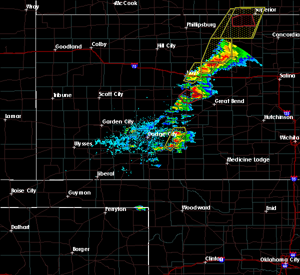 At 458 pm cdt, a severe thunderstorm was located 4 miles northwest of otis, moving northeast at 55 mph (public). Hazards include tennis ball size hail and 60 mph wind gusts. People and animals outdoors will be injured. expect hail damage to roofs, siding, windows, and vehicles. Expect wind damage to roofs, siding, and trees. At 458 pm cdt, a severe thunderstorm was located 4 miles northwest of otis, moving northeast at 55 mph (public). Hazards include tennis ball size hail and 60 mph wind gusts. People and animals outdoors will be injured. expect hail damage to roofs, siding, windows, and vehicles. Expect wind damage to roofs, siding, and trees.
|
| 5/1/2018 4:43 PM CDT |
 At 442 pm cdt, a severe thunderstorm capable of producing a tornado was located very near rush center, moving northeast at 50 mph (radar indicated rotation). Hazards include tornado and tennis ball size hail. Flying debris will be dangerous to those caught without shelter. mobile homes will be damaged or destroyed. damage to roofs, windows, and vehicles will occur. tree damage is likely. this dangerous storm will be near, bison and timken around 450 pm cdt. otis around 500 pm cdt. This storm has also produced quarter sized hail 16 miles southwest of la crosse at 4:25 pm. At 442 pm cdt, a severe thunderstorm capable of producing a tornado was located very near rush center, moving northeast at 50 mph (radar indicated rotation). Hazards include tornado and tennis ball size hail. Flying debris will be dangerous to those caught without shelter. mobile homes will be damaged or destroyed. damage to roofs, windows, and vehicles will occur. tree damage is likely. this dangerous storm will be near, bison and timken around 450 pm cdt. otis around 500 pm cdt. This storm has also produced quarter sized hail 16 miles southwest of la crosse at 4:25 pm.
|
| 5/1/2018 4:31 PM CDT |
 A tornado warning remains in effect until 500 pm cdt for rush county. at 431 pm cdt, a severe thunderstorm capable of producing a tornado was located 6 miles south of nekoma, moving northeast at 45 mph. hazard. tornado and tennis ball size hail. source. Radar indicated rotation. A tornado warning remains in effect until 500 pm cdt for rush county. at 431 pm cdt, a severe thunderstorm capable of producing a tornado was located 6 miles south of nekoma, moving northeast at 45 mph. hazard. tornado and tennis ball size hail. source. Radar indicated rotation.
|
| 5/1/2018 4:26 PM CDT |
 At 426 pm cdt, a severe thunderstorm capable of producing a tornado was located 6 miles south of nekoma, moving northeast at 55 mph (radar indicated rotation). Hazards include tornado and tennis ball size hail. Flying debris will be dangerous to those caught without shelter. mobile homes will be damaged or destroyed. damage to roofs, windows, and vehicles will occur. tree damage is likely. this dangerous storm will be near, nekoma around 430 pm cdt. rush center around 435 pm cdt. la crosse around 440 pm cdt. Bison and timken around 445 pm cdt. At 426 pm cdt, a severe thunderstorm capable of producing a tornado was located 6 miles south of nekoma, moving northeast at 55 mph (radar indicated rotation). Hazards include tornado and tennis ball size hail. Flying debris will be dangerous to those caught without shelter. mobile homes will be damaged or destroyed. damage to roofs, windows, and vehicles will occur. tree damage is likely. this dangerous storm will be near, nekoma around 430 pm cdt. rush center around 435 pm cdt. la crosse around 440 pm cdt. Bison and timken around 445 pm cdt.
|
| 5/1/2018 4:11 PM CDT |
 At 410 pm cdt, a severe thunderstorm capable of producing a tornado was located 7 miles northwest of burdett, moving northeast at 55 mph (radar indicated rotation). Hazards include tornado and tennis ball size hail. Flying debris will be dangerous to those caught without shelter. mobile homes will be damaged or destroyed. damage to roofs, windows, and vehicles will occur. tree damage is likely. this dangerous storm will be near, nekoma around 430 pm cdt. la crosse and rush center around 435 pm cdt. Bison and timken around 440 pm cdt. At 410 pm cdt, a severe thunderstorm capable of producing a tornado was located 7 miles northwest of burdett, moving northeast at 55 mph (radar indicated rotation). Hazards include tornado and tennis ball size hail. Flying debris will be dangerous to those caught without shelter. mobile homes will be damaged or destroyed. damage to roofs, windows, and vehicles will occur. tree damage is likely. this dangerous storm will be near, nekoma around 430 pm cdt. la crosse and rush center around 435 pm cdt. Bison and timken around 440 pm cdt.
|
| 10/6/2017 7:05 PM CDT |
 The severe thunderstorm warning for eastern rush county will expire at 715 pm cdt, the storm which prompted the warning has moved out of the area. therefore the warning will be allowed to expire. a severe thunderstorm watch remains in effect until 1100 pm cdt for central kansas. The severe thunderstorm warning for eastern rush county will expire at 715 pm cdt, the storm which prompted the warning has moved out of the area. therefore the warning will be allowed to expire. a severe thunderstorm watch remains in effect until 1100 pm cdt for central kansas.
|
| 10/6/2017 6:40 PM CDT |
 At 640 pm cdt, a severe thunderstorm was located near rush center, or 5 miles southeast of la crosse, moving northeast at 50 mph (radar indicated). Hazards include ping pong ball size hail and 60 mph wind gusts. People and animals outdoors will be injured. expect hail damage to roofs, siding, windows, and vehicles. expect wind damage to roofs, siding, and trees. Locations impacted include, la crosse, otis, bison, rush center, timken and shaffer. At 640 pm cdt, a severe thunderstorm was located near rush center, or 5 miles southeast of la crosse, moving northeast at 50 mph (radar indicated). Hazards include ping pong ball size hail and 60 mph wind gusts. People and animals outdoors will be injured. expect hail damage to roofs, siding, windows, and vehicles. expect wind damage to roofs, siding, and trees. Locations impacted include, la crosse, otis, bison, rush center, timken and shaffer.
|
| 10/6/2017 6:30 PM CDT |
 At 630 pm cdt, a severe thunderstorm was located 4 miles south of nekoma, or 9 miles southwest of la crosse, moving northeast at 35 mph (radar indicated). Hazards include ping pong ball size hail and 60 mph wind gusts. People and animals outdoors will be injured. expect hail damage to roofs, siding, windows, and vehicles. Expect wind damage to roofs, siding, and trees. At 630 pm cdt, a severe thunderstorm was located 4 miles south of nekoma, or 9 miles southwest of la crosse, moving northeast at 35 mph (radar indicated). Hazards include ping pong ball size hail and 60 mph wind gusts. People and animals outdoors will be injured. expect hail damage to roofs, siding, windows, and vehicles. Expect wind damage to roofs, siding, and trees.
|
| 8/10/2017 4:27 PM CDT |
 At 427 pm cdt, a severe thunderstorm was located very near shaffer, or 11 miles east of la crosse, moving southeast at 25 mph (radar indicated). Hazards include ping pong ball size hail and 60 mph wind gusts. People and animals outdoors will be injured. expect hail damage to roofs, siding, windows, and vehicles. expect wind damage to roofs, siding, and trees. Locations impacted include, otis, bison, timken and shaffer. At 427 pm cdt, a severe thunderstorm was located very near shaffer, or 11 miles east of la crosse, moving southeast at 25 mph (radar indicated). Hazards include ping pong ball size hail and 60 mph wind gusts. People and animals outdoors will be injured. expect hail damage to roofs, siding, windows, and vehicles. expect wind damage to roofs, siding, and trees. Locations impacted include, otis, bison, timken and shaffer.
|
| 8/10/2017 4:14 PM CDT |
 At 414 pm cdt, a severe thunderstorm was located very near bison, or 6 miles east of la crosse, moving east at 25 mph (radar indicated). Hazards include 60 mph wind gusts and half dollar size hail. Hail damage to vehicles is expected. Expect wind damage to roofs, siding, and trees. At 414 pm cdt, a severe thunderstorm was located very near bison, or 6 miles east of la crosse, moving east at 25 mph (radar indicated). Hazards include 60 mph wind gusts and half dollar size hail. Hail damage to vehicles is expected. Expect wind damage to roofs, siding, and trees.
|
| 8/10/2017 4:04 PM CDT |
 At 404 pm cdt, a severe thunderstorm was located 3 miles southwest of loretta, or 7 miles northeast of la crosse, moving southeast at 35 mph (radar indicated). Hazards include 60 mph wind gusts and quarter size hail. Hail damage to vehicles is expected. Expect wind damage to roofs, siding, and trees. At 404 pm cdt, a severe thunderstorm was located 3 miles southwest of loretta, or 7 miles northeast of la crosse, moving southeast at 35 mph (radar indicated). Hazards include 60 mph wind gusts and quarter size hail. Hail damage to vehicles is expected. Expect wind damage to roofs, siding, and trees.
|
| 6/22/2017 9:41 PM CDT | Quarter sized hail reported 8.2 miles SSW of Otis, KS |
| 6/22/2017 9:36 PM CDT |
 The severe thunderstorm warning for northeastern rush and southeastern ellis counties will expire at 945 pm cdt, the storm which prompted the warning has weakened below severe limits, and has exited the warned area. therefore, the warning will be allowed to expire. The severe thunderstorm warning for northeastern rush and southeastern ellis counties will expire at 945 pm cdt, the storm which prompted the warning has weakened below severe limits, and has exited the warned area. therefore, the warning will be allowed to expire.
|
| 6/22/2017 9:27 PM CDT |
 At 926 pm cdt, a severe thunderstorm was located 5 miles east of loretta, or 15 miles northeast of la crosse, moving east at 25 mph (radar indicated). Hazards include 60 mph wind gusts and quarter size hail. Hail damage to vehicles is expected. expect wind damage to roofs, siding, and trees. Locations impacted include, la crosse, victoria, otis, bison, schoenchen, liebenthal, walker, munjor, loretta, pfeifer and toulon. At 926 pm cdt, a severe thunderstorm was located 5 miles east of loretta, or 15 miles northeast of la crosse, moving east at 25 mph (radar indicated). Hazards include 60 mph wind gusts and quarter size hail. Hail damage to vehicles is expected. expect wind damage to roofs, siding, and trees. Locations impacted include, la crosse, victoria, otis, bison, schoenchen, liebenthal, walker, munjor, loretta, pfeifer and toulon.
|
| 6/22/2017 9:15 PM CDT |
 At 915 pm cdt, a severe thunderstorm was located near pfeifer, or 12 miles southeast of hays, moving east at 25 mph (radar indicated). Hazards include 60 mph wind gusts and quarter size hail. Hail damage to vehicles is expected. expect wind damage to roofs, siding, and trees. Locations impacted include, hays, la crosse, victoria, catherine, otis, bison, schoenchen, mccracken, rush center, liebenthal, timken, walker, alexander, nekoma, munjor, antonino, emmeram, loretta, pfeifer and toulon. At 915 pm cdt, a severe thunderstorm was located near pfeifer, or 12 miles southeast of hays, moving east at 25 mph (radar indicated). Hazards include 60 mph wind gusts and quarter size hail. Hail damage to vehicles is expected. expect wind damage to roofs, siding, and trees. Locations impacted include, hays, la crosse, victoria, catherine, otis, bison, schoenchen, mccracken, rush center, liebenthal, timken, walker, alexander, nekoma, munjor, antonino, emmeram, loretta, pfeifer and toulon.
|
| 6/22/2017 8:53 PM CDT |
 At 853 pm cdt, a severe thunderstorm was located very near schoenchen, or 11 miles north of la crosse, moving east at 25 mph (radar indicated). Hazards include two inch hail and 60 mph wind gusts. People and animals outdoors will be injured. expect hail damage to roofs, siding, windows, and vehicles. Expect wind damage to roofs, siding, and trees. At 853 pm cdt, a severe thunderstorm was located very near schoenchen, or 11 miles north of la crosse, moving east at 25 mph (radar indicated). Hazards include two inch hail and 60 mph wind gusts. People and animals outdoors will be injured. expect hail damage to roofs, siding, windows, and vehicles. Expect wind damage to roofs, siding, and trees.
|
| 6/18/2017 12:43 AM CDT |
 At 1242 am cdt, a severe thunderstorm was located near nekoma, or 10 miles southwest of la crosse, moving east at 45 mph (radar indicated). Hazards include 60 mph wind gusts and nickel size hail. Expect damage to roofs, siding, and trees. Locations impacted include, la crosse, otis, bison, rush center, liebenthal, timken, alexander, nekoma, loretta, shaffer and hargrave. At 1242 am cdt, a severe thunderstorm was located near nekoma, or 10 miles southwest of la crosse, moving east at 45 mph (radar indicated). Hazards include 60 mph wind gusts and nickel size hail. Expect damage to roofs, siding, and trees. Locations impacted include, la crosse, otis, bison, rush center, liebenthal, timken, alexander, nekoma, loretta, shaffer and hargrave.
|
| 6/18/2017 12:16 AM CDT |
 At 1216 am cdt, a severe thunderstorm was located 6 miles northeast of ness city, moving east at 45 mph (radar indicated). Hazards include 60 mph wind gusts and quarter size hail. Hail damage to vehicles is expected. Expect wind damage to roofs, siding, and trees. At 1216 am cdt, a severe thunderstorm was located 6 miles northeast of ness city, moving east at 45 mph (radar indicated). Hazards include 60 mph wind gusts and quarter size hail. Hail damage to vehicles is expected. Expect wind damage to roofs, siding, and trees.
|
| 6/15/2017 4:46 PM CDT | Quarter sized hail reported 0.3 miles SSW of Otis, KS |
| 6/15/2017 4:41 PM CDT |
 At 441 pm cdt, a severe thunderstorm was located very near bison, or 7 miles east of la crosse, moving southeast at 25 mph (radar indicated). Hazards include 70 mph wind gusts and ping pong ball size hail. People and animals outdoors will be injured. expect hail damage to roofs, siding, windows, and vehicles. expect considerable tree damage. wind damage is also likely to mobile homes, roofs, and outbuildings. Locations impacted include, la crosse, otis, bison, rush center, liebenthal, timken, loretta and shaffer. At 441 pm cdt, a severe thunderstorm was located very near bison, or 7 miles east of la crosse, moving southeast at 25 mph (radar indicated). Hazards include 70 mph wind gusts and ping pong ball size hail. People and animals outdoors will be injured. expect hail damage to roofs, siding, windows, and vehicles. expect considerable tree damage. wind damage is also likely to mobile homes, roofs, and outbuildings. Locations impacted include, la crosse, otis, bison, rush center, liebenthal, timken, loretta and shaffer.
|
| 6/15/2017 4:28 PM CDT |
 At 427 pm cdt, a severe thunderstorm was located 4 miles southeast of loretta, or 11 miles northeast of la crosse, moving southeast at 20 mph (radar indicated). Hazards include 60 mph wind gusts and quarter size hail. Hail damage to vehicles is expected. Expect wind damage to roofs, siding, and trees. At 427 pm cdt, a severe thunderstorm was located 4 miles southeast of loretta, or 11 miles northeast of la crosse, moving southeast at 20 mph (radar indicated). Hazards include 60 mph wind gusts and quarter size hail. Hail damage to vehicles is expected. Expect wind damage to roofs, siding, and trees.
|
| 6/15/2017 4:15 PM CDT |
 At 415 pm cdt, a severe thunderstorm was located very near loretta, or 9 miles northeast of la crosse, moving southeast at 25 mph (radar indicated). Hazards include 60 mph wind gusts and half dollar size hail. Hail damage to vehicles is expected. expect wind damage to roofs, siding, and trees. Locations impacted include, hays, la crosse, victoria, otis, bison, schoenchen, mccracken, rush center, liebenthal, timken, walker, alexander, ash valley, nekoma, munjor, antonino, loretta, pfeifer, toulon and shaffer. At 415 pm cdt, a severe thunderstorm was located very near loretta, or 9 miles northeast of la crosse, moving southeast at 25 mph (radar indicated). Hazards include 60 mph wind gusts and half dollar size hail. Hail damage to vehicles is expected. expect wind damage to roofs, siding, and trees. Locations impacted include, hays, la crosse, victoria, otis, bison, schoenchen, mccracken, rush center, liebenthal, timken, walker, alexander, ash valley, nekoma, munjor, antonino, loretta, pfeifer, toulon and shaffer.
|
| 6/15/2017 3:43 PM CDT |
 The national weather service in dodge city has issued a * severe thunderstorm warning for. northern pawnee county in south central kansas. rush county in central kansas. southern ellis county in central kansas. Until 430 pm cdt. The national weather service in dodge city has issued a * severe thunderstorm warning for. northern pawnee county in south central kansas. rush county in central kansas. southern ellis county in central kansas. Until 430 pm cdt.
|
| 6/15/2017 3:17 PM CDT |
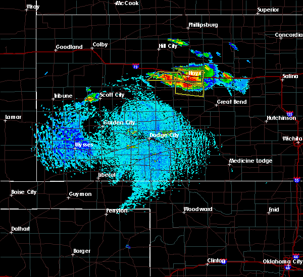 At 317 pm cdt, a severe thunderstorm was located very near schoenchen, or 11 miles north of la crosse, moving southeast at 20 mph (radar indicated). Hazards include 70 mph wind gusts and half dollar size hail. Hail damage to vehicles is expected. expect considerable tree damage. wind damage is also likely to mobile homes, roofs, and outbuildings. Locations impacted include, otis, schoenchen, liebenthal, antonino, loretta and pfeifer. At 317 pm cdt, a severe thunderstorm was located very near schoenchen, or 11 miles north of la crosse, moving southeast at 20 mph (radar indicated). Hazards include 70 mph wind gusts and half dollar size hail. Hail damage to vehicles is expected. expect considerable tree damage. wind damage is also likely to mobile homes, roofs, and outbuildings. Locations impacted include, otis, schoenchen, liebenthal, antonino, loretta and pfeifer.
|
| 6/15/2017 3:02 PM CDT |
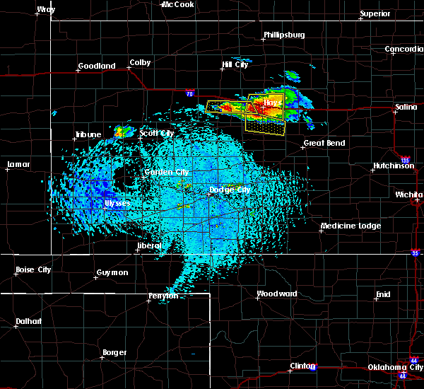 At 301 pm cdt, a severe thunderstorm was located near antonino, or 9 miles south of hays, moving southeast at 15 mph (radar indicated). Hazards include 70 mph wind gusts and ping pong ball size hail. People and animals outdoors will be injured. expect hail damage to roofs, siding, windows, and vehicles. expect considerable tree damage. Wind damage is also likely to mobile homes, roofs, and outbuildings. At 301 pm cdt, a severe thunderstorm was located near antonino, or 9 miles south of hays, moving southeast at 15 mph (radar indicated). Hazards include 70 mph wind gusts and ping pong ball size hail. People and animals outdoors will be injured. expect hail damage to roofs, siding, windows, and vehicles. expect considerable tree damage. Wind damage is also likely to mobile homes, roofs, and outbuildings.
|
| 6/13/2017 8:22 PM CDT |
 At 822 pm cdt, a severe thunderstorm was located 3 miles southwest of timken, or 7 miles southeast of la crosse, moving northeast at 40 mph (radar indicated). Hazards include up to ping pong ball size hail and 60 mph wind gusts. People and animals outdoors will be injured. expect hail damage to roofs, siding, windows, and vehicles. Expect wind damage to roofs, siding, and trees. At 822 pm cdt, a severe thunderstorm was located 3 miles southwest of timken, or 7 miles southeast of la crosse, moving northeast at 40 mph (radar indicated). Hazards include up to ping pong ball size hail and 60 mph wind gusts. People and animals outdoors will be injured. expect hail damage to roofs, siding, windows, and vehicles. Expect wind damage to roofs, siding, and trees.
|
| 6/13/2017 5:34 PM CDT |
 At 534 pm cdt, a severe thunderstorm was located near burdett, or 21 miles north of kinsley, moving northeast at 40 mph (radar indicated). Hazards include 60 mph wind gusts and half dollar size hail. Hail damage to vehicles is expected. Expect wind damage to roofs, siding, and trees. At 534 pm cdt, a severe thunderstorm was located near burdett, or 21 miles north of kinsley, moving northeast at 40 mph (radar indicated). Hazards include 60 mph wind gusts and half dollar size hail. Hail damage to vehicles is expected. Expect wind damage to roofs, siding, and trees.
|
| 5/25/2017 11:11 PM CDT |
 The severe thunderstorm warning for northeastern rush and southeastern ellis counties will expire at 1115 pm cdt. the storm which prompted the warning has weakened below severe limits, and has exited the warned area. therefore, the warning will be allowed to expire. However gusty winds are still possible with this thunderstorm. The severe thunderstorm warning for northeastern rush and southeastern ellis counties will expire at 1115 pm cdt. the storm which prompted the warning has weakened below severe limits, and has exited the warned area. therefore, the warning will be allowed to expire. However gusty winds are still possible with this thunderstorm.
|
| 5/25/2017 10:58 PM CDT |
 At 1058 pm cdt, a severe thunderstorm was located near otis, or 12 miles east of la crosse, moving east at 25 mph (radar indicated). Hazards include 60 mph wind gusts and quarter size hail. Hail damage to vehicles is expected. expect wind damage to roofs, siding, and trees. Locations impacted include, otis, bison, timken, loretta and pfeifer. At 1058 pm cdt, a severe thunderstorm was located near otis, or 12 miles east of la crosse, moving east at 25 mph (radar indicated). Hazards include 60 mph wind gusts and quarter size hail. Hail damage to vehicles is expected. expect wind damage to roofs, siding, and trees. Locations impacted include, otis, bison, timken, loretta and pfeifer.
|
| 5/25/2017 10:36 PM CDT |
 At 1036 pm cdt, a severe thunderstorm was located near la crosse, moving east at 40 mph (radar indicated). Hazards include 60 mph wind gusts and quarter size hail. Hail damage to vehicles is expected. expect wind damage to roofs, siding, and trees. Locations impacted include, la crosse, victoria, otis, bison, schoenchen, rush center, liebenthal, timken, walker, munjor, loretta, pfeifer, toulon and hays regional airport. At 1036 pm cdt, a severe thunderstorm was located near la crosse, moving east at 40 mph (radar indicated). Hazards include 60 mph wind gusts and quarter size hail. Hail damage to vehicles is expected. expect wind damage to roofs, siding, and trees. Locations impacted include, la crosse, victoria, otis, bison, schoenchen, rush center, liebenthal, timken, walker, munjor, loretta, pfeifer, toulon and hays regional airport.
|
| 5/25/2017 10:21 PM CDT |
 At 1021 pm cdt, a severe thunderstorm was located very near hargrave, or 7 miles northwest of la crosse, moving east at 35 mph (radar indicated). Hazards include 60 mph wind gusts and quarter size hail. Hail damage to vehicles is expected. Expect wind damage to roofs, siding, and trees. At 1021 pm cdt, a severe thunderstorm was located very near hargrave, or 7 miles northwest of la crosse, moving east at 35 mph (radar indicated). Hazards include 60 mph wind gusts and quarter size hail. Hail damage to vehicles is expected. Expect wind damage to roofs, siding, and trees.
|
| 5/25/2017 8:57 PM CDT |
 At 856 pm cdt, a severe thunderstorm was located very near hays, moving east at 40 mph (radar indicated). Hazards include golf ball size hail and 70 mph wind gusts. People and animals outdoors will be injured. expect hail damage to roofs, siding, windows, and vehicles. expect considerable tree damage. wind damage is also likely to mobile homes, roofs, and outbuildings. Locations impacted include, hays, victoria, catherine, otis, schoenchen, liebenthal, walker, munjor, antonino, emmeram, loretta, pfeifer, yocemento, toulon and hays regional airport. At 856 pm cdt, a severe thunderstorm was located very near hays, moving east at 40 mph (radar indicated). Hazards include golf ball size hail and 70 mph wind gusts. People and animals outdoors will be injured. expect hail damage to roofs, siding, windows, and vehicles. expect considerable tree damage. wind damage is also likely to mobile homes, roofs, and outbuildings. Locations impacted include, hays, victoria, catherine, otis, schoenchen, liebenthal, walker, munjor, antonino, emmeram, loretta, pfeifer, yocemento, toulon and hays regional airport.
|
| 5/25/2017 8:50 PM CDT |
 At 850 pm cdt, a severe thunderstorm was located very near yocemento, or 4 miles west of hays, moving east at 45 mph (radar indicated). Hazards include golf ball size hail and 70 mph wind gusts. People and animals outdoors will be injured. expect hail damage to roofs, siding, windows, and vehicles. expect considerable tree damage. wind damage is also likely to mobile homes, roofs, and outbuildings. Locations impacted include, hays, la crosse, ellis, victoria, catherine, otis, bison, schoenchen, mccracken, rush center, liebenthal, timken, walker, alexander, nekoma, antonino, munjor, emmeram, loretta and pfeifer. At 850 pm cdt, a severe thunderstorm was located very near yocemento, or 4 miles west of hays, moving east at 45 mph (radar indicated). Hazards include golf ball size hail and 70 mph wind gusts. People and animals outdoors will be injured. expect hail damage to roofs, siding, windows, and vehicles. expect considerable tree damage. wind damage is also likely to mobile homes, roofs, and outbuildings. Locations impacted include, hays, la crosse, ellis, victoria, catherine, otis, bison, schoenchen, mccracken, rush center, liebenthal, timken, walker, alexander, nekoma, antonino, munjor, emmeram, loretta and pfeifer.
|
| 5/25/2017 8:37 PM CDT |
 At 837 pm cdt, a severe thunderstorm was located 8 miles west of antonino, or 14 miles southwest of hays, moving east at 45 mph (radar indicated). Hazards include 70 mph wind gusts and quarter size hail. Hail damage to vehicles is expected. expect considerable tree damage. wind damage is also likely to mobile homes, roofs, and outbuildings. Locations impacted include, hays, la crosse, ellis, victoria, bazine, catherine, otis, bison, schoenchen, mccracken, rush center, liebenthal, timken, walker, alexander, nekoma, brownell, antonino, munjor and emmeram. At 837 pm cdt, a severe thunderstorm was located 8 miles west of antonino, or 14 miles southwest of hays, moving east at 45 mph (radar indicated). Hazards include 70 mph wind gusts and quarter size hail. Hail damage to vehicles is expected. expect considerable tree damage. wind damage is also likely to mobile homes, roofs, and outbuildings. Locations impacted include, hays, la crosse, ellis, victoria, bazine, catherine, otis, bison, schoenchen, mccracken, rush center, liebenthal, timken, walker, alexander, nekoma, brownell, antonino, munjor and emmeram.
|
| 5/25/2017 8:28 PM CDT |
 At 827 pm cdt, a severe thunderstorm was located 3 miles east of cedar bluff reservoir, or 18 miles southeast of wakeeney, moving east at 45 mph (radar indicated). Hazards include golf ball size hail and 70 mph wind gusts. People and animals outdoors will be injured. expect hail damage to roofs, siding, windows, and vehicles. expect considerable tree damage. Wind damage is also likely to mobile homes, roofs, and outbuildings. At 827 pm cdt, a severe thunderstorm was located 3 miles east of cedar bluff reservoir, or 18 miles southeast of wakeeney, moving east at 45 mph (radar indicated). Hazards include golf ball size hail and 70 mph wind gusts. People and animals outdoors will be injured. expect hail damage to roofs, siding, windows, and vehicles. expect considerable tree damage. Wind damage is also likely to mobile homes, roofs, and outbuildings.
|
| 5/18/2017 5:13 PM CDT |
 At 513 pm cdt, a severe thunderstorm was located very near ash valley, or 12 miles northwest of larned, moving northeast at 45 mph (radar indicated). Hazards include ping pong ball size hail and 60 mph wind gusts. People and animals outdoors will be injured. expect hail damage to roofs, siding, windows, and vehicles. Expect wind damage to roofs, siding, and trees. At 513 pm cdt, a severe thunderstorm was located very near ash valley, or 12 miles northwest of larned, moving northeast at 45 mph (radar indicated). Hazards include ping pong ball size hail and 60 mph wind gusts. People and animals outdoors will be injured. expect hail damage to roofs, siding, windows, and vehicles. Expect wind damage to roofs, siding, and trees.
|
| 5/18/2017 4:57 PM CDT |
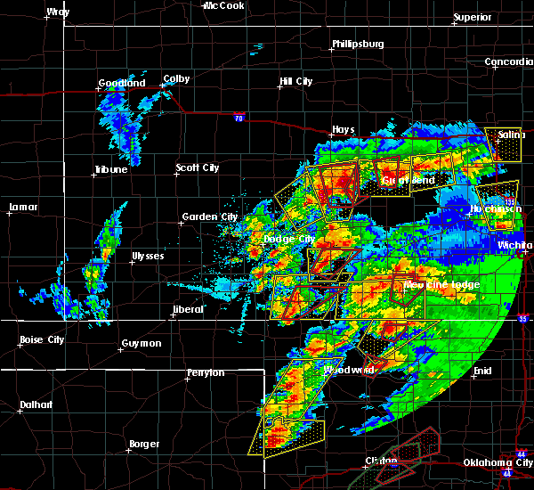 At 456 pm cdt, a severe thunderstorm capable of producing a tornado was located 6 miles northwest of pawnee rock, or 11 miles north of larned, moving northeast at 20 mph (radar indicated rotation). Hazards include tornado and tennis ball size hail. Flying debris will be dangerous to those caught without shelter. mobile homes will be damaged or destroyed. damage to roofs, windows, and vehicles will occur. tree damage is likely. This dangerous storm will be near, shaffer around 510 pm cdt. At 456 pm cdt, a severe thunderstorm capable of producing a tornado was located 6 miles northwest of pawnee rock, or 11 miles north of larned, moving northeast at 20 mph (radar indicated rotation). Hazards include tornado and tennis ball size hail. Flying debris will be dangerous to those caught without shelter. mobile homes will be damaged or destroyed. damage to roofs, windows, and vehicles will occur. tree damage is likely. This dangerous storm will be near, shaffer around 510 pm cdt.
|
| 5/18/2017 4:42 PM CDT |
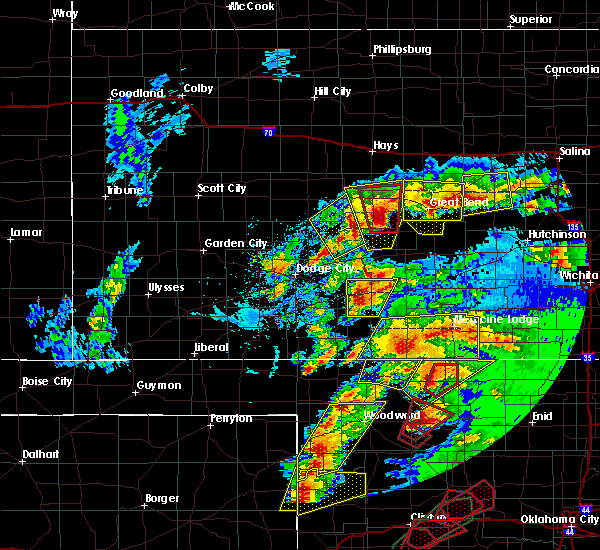 At 442 pm cdt, a severe thunderstorm capable of producing a tornado was located 3 miles north of frizell, or 7 miles west of larned, moving north at 25 mph (radar indicated rotation). Hazards include tornado and tennis ball size hail. Flying debris will be dangerous to those caught without shelter. mobile homes will be damaged or destroyed. damage to roofs, windows, and vehicles will occur. tree damage is likely. this dangerous storm will be near, ash valley around 455 pm cdt. rush center and timken around 515 pm cdt. Other locations impacted by this tornadic thunderstorm include fort larned historic site. At 442 pm cdt, a severe thunderstorm capable of producing a tornado was located 3 miles north of frizell, or 7 miles west of larned, moving north at 25 mph (radar indicated rotation). Hazards include tornado and tennis ball size hail. Flying debris will be dangerous to those caught without shelter. mobile homes will be damaged or destroyed. damage to roofs, windows, and vehicles will occur. tree damage is likely. this dangerous storm will be near, ash valley around 455 pm cdt. rush center and timken around 515 pm cdt. Other locations impacted by this tornadic thunderstorm include fort larned historic site.
|
| 5/18/2017 4:07 PM CDT |
 At 407 pm cdt, a severe thunderstorm was located very near garfield, or 11 miles southwest of larned, moving north at 45 mph (radar indicated). Hazards include ping pong ball size hail and 60 mph wind gusts. People and animals outdoors will be injured. expect hail damage to roofs, siding, windows, and vehicles. Expect wind damage to roofs, siding, and trees. At 407 pm cdt, a severe thunderstorm was located very near garfield, or 11 miles southwest of larned, moving north at 45 mph (radar indicated). Hazards include ping pong ball size hail and 60 mph wind gusts. People and animals outdoors will be injured. expect hail damage to roofs, siding, windows, and vehicles. Expect wind damage to roofs, siding, and trees.
|
| 5/16/2017 11:27 PM CDT |
 The severe thunderstorm warning for eastern pawnee, stafford, eastern rush and north central pratt counties will expire at 1130 pm cdt, the storms which prompted the warning have weakened below severe limits, and no longer pose an immediate threat to life or property. therefore the warning will be allowed to expire. however gusty winds and heavy rain are still possible with these thunderstorms. a severe thunderstorm watch remains in effect until 500 am cdt for south central kansas. The severe thunderstorm warning for eastern pawnee, stafford, eastern rush and north central pratt counties will expire at 1130 pm cdt, the storms which prompted the warning have weakened below severe limits, and no longer pose an immediate threat to life or property. therefore the warning will be allowed to expire. however gusty winds and heavy rain are still possible with these thunderstorms. a severe thunderstorm watch remains in effect until 500 am cdt for south central kansas.
|
| 5/16/2017 11:18 PM CDT |
 At 1118 pm cdt, severe thunderstorms were located along a line extending from near shaffer to 4 miles north of byers, moving northeast at 60 mph (radar indicated). Hazards include 70 mph wind gusts and penny size hail. Expect considerable tree damage. damage is likely to mobile homes, roofs, and outbuildings. Locations impacted include, saint john, stafford, macksville, otis, bison, hudson, timken, seward, byers, radium, dillwyn, shaffer, little salt marsh at quivira refuge and big salt marsh at quivira refuge. At 1118 pm cdt, severe thunderstorms were located along a line extending from near shaffer to 4 miles north of byers, moving northeast at 60 mph (radar indicated). Hazards include 70 mph wind gusts and penny size hail. Expect considerable tree damage. damage is likely to mobile homes, roofs, and outbuildings. Locations impacted include, saint john, stafford, macksville, otis, bison, hudson, timken, seward, byers, radium, dillwyn, shaffer, little salt marsh at quivira refuge and big salt marsh at quivira refuge.
|
| 5/16/2017 11:02 PM CDT |
 At 1101 pm cdt, severe thunderstorms were located along a line extending from 5 miles southwest of ash valley to 5 miles north of wellsford, moving northeast at 55 mph (radar indicated). Hazards include 70 mph wind gusts and quarter size hail. Hail damage to vehicles is expected. expect considerable tree damage. wind damage is also likely to mobile homes, roofs, and outbuildings. Locations impacted include, larned, saint john, stafford, macksville, otis, bison, garfield, rush center, hudson, belpre, timken, seward, ash valley, byers, radium, wellsford, trousdale, hopewell, loretta and dillwyn. At 1101 pm cdt, severe thunderstorms were located along a line extending from 5 miles southwest of ash valley to 5 miles north of wellsford, moving northeast at 55 mph (radar indicated). Hazards include 70 mph wind gusts and quarter size hail. Hail damage to vehicles is expected. expect considerable tree damage. wind damage is also likely to mobile homes, roofs, and outbuildings. Locations impacted include, larned, saint john, stafford, macksville, otis, bison, garfield, rush center, hudson, belpre, timken, seward, ash valley, byers, radium, wellsford, trousdale, hopewell, loretta and dillwyn.
|
| 5/16/2017 10:50 PM CDT |
 At 1049 pm cdt, severe thunderstorms were located along a line extending from 2 miles south of rozel to 2 miles west of haviland, moving northeast at 55 mph (radar indicated). Hazards include 70 mph wind gusts and half dollar size hail. Hail damage to vehicles is expected. expect considerable tree damage. Wind damage is also likely to mobile homes, roofs, and outbuildings. At 1049 pm cdt, severe thunderstorms were located along a line extending from 2 miles south of rozel to 2 miles west of haviland, moving northeast at 55 mph (radar indicated). Hazards include 70 mph wind gusts and half dollar size hail. Hail damage to vehicles is expected. expect considerable tree damage. Wind damage is also likely to mobile homes, roofs, and outbuildings.
|
| 5/16/2017 6:12 PM CDT |
 At 612 pm cdt, a severe thunderstorm was located near shaffer, or 14 miles northwest of great bend, moving northeast at 45 mph. this is a very dangerous storm (radar indicated). Hazards include 80 mph wind gusts and ping pong ball size hail. Flying debris will be dangerous to those caught without shelter. mobile homes will be heavily damaged. expect considerable damage to roofs, windows, and vehicles. extensive tree damage and power outages are likely. locations impacted include, victoria, otis, bison, liebenthal, walker, loretta, pfeifer and shaffer. A tornado watch remains in effect until 1000 pm cdt for central kansas. At 612 pm cdt, a severe thunderstorm was located near shaffer, or 14 miles northwest of great bend, moving northeast at 45 mph. this is a very dangerous storm (radar indicated). Hazards include 80 mph wind gusts and ping pong ball size hail. Flying debris will be dangerous to those caught without shelter. mobile homes will be heavily damaged. expect considerable damage to roofs, windows, and vehicles. extensive tree damage and power outages are likely. locations impacted include, victoria, otis, bison, liebenthal, walker, loretta, pfeifer and shaffer. A tornado watch remains in effect until 1000 pm cdt for central kansas.
|
| 5/16/2017 5:47 PM CDT |
 At 547 pm cdt, a severe thunderstorm was located very near bison, or 5 miles east of la crosse, moving northeast at 45 mph. this is a very dangerous storm (radar indicated). Hazards include 80 mph wind gusts and ping pong ball size hail. Flying debris will be dangerous to those caught without shelter. mobile homes will be heavily damaged. expect considerable damage to roofs, windows, and vehicles. Extensive tree damage and power outages are likely. At 547 pm cdt, a severe thunderstorm was located very near bison, or 5 miles east of la crosse, moving northeast at 45 mph. this is a very dangerous storm (radar indicated). Hazards include 80 mph wind gusts and ping pong ball size hail. Flying debris will be dangerous to those caught without shelter. mobile homes will be heavily damaged. expect considerable damage to roofs, windows, and vehicles. Extensive tree damage and power outages are likely.
|
| 5/16/2017 1:30 AM CDT | Large tree limbs reported down in otis. winds due to heat burst event. report received via social medi in rush county KS, 0.3 miles SSW of Otis, KS |
| 12/25/2016 11:38 AM CST | Heavy rainfall with visibility 1/8th mile in barton county KS, 8.8 miles SW of Otis, KS |
| 12/25/2016 10:45 AM CST |
 At 1045 am cst, a severe thunderstorm was located 6 miles east of cedar bluff reservoir, or 18 miles west of hays, moving northeast at 50 mph (radar indicated). Hazards include 60 mph wind gusts. expect damage to roofs, siding, and trees At 1045 am cst, a severe thunderstorm was located 6 miles east of cedar bluff reservoir, or 18 miles west of hays, moving northeast at 50 mph (radar indicated). Hazards include 60 mph wind gusts. expect damage to roofs, siding, and trees
|
| 8/11/2016 6:20 PM CDT | 2 power poles down on k in rush county KS, 1 miles ESE of Otis, KS |
| 7/13/2016 6:21 AM CDT |
 The severe thunderstorm warning for northeastern rush and ellis counties will expire at 630 am cdt, the storm which prompted the warning has moved out of the area. therefore, the warning will be allowed to expire. a severe thunderstorm watch remains in effect until 1000 am cdt for central kansas. The severe thunderstorm warning for northeastern rush and ellis counties will expire at 630 am cdt, the storm which prompted the warning has moved out of the area. therefore, the warning will be allowed to expire. a severe thunderstorm watch remains in effect until 1000 am cdt for central kansas.
|
| 7/13/2016 6:19 AM CDT | Galatia fire chief estimates winds in excess of 60 mp in barton county KS, 8.8 miles SW of Otis, KS |
| 7/13/2016 6:03 AM CDT |
 At 601 am cdt, a severe thunderstorm was located 4 miles east of munjor, moving east at 40 mph. a wind gust of 62 mph was reported at the hays airport at 555 am cdt (radar indicated). Hazards include 70 mph wind gusts and nickel size hail. Expect considerable tree damage. damage is likely to mobile homes, roofs, and outbuildings. Locations impacted include, hays, la crosse, victoria, walker, catherine, otis, bison, schoenchen, liebenthal, timken, toulon, yocemento, loretta, shaffer, emmeram, hargrave, munjor, pfeifer and antonino. At 601 am cdt, a severe thunderstorm was located 4 miles east of munjor, moving east at 40 mph. a wind gust of 62 mph was reported at the hays airport at 555 am cdt (radar indicated). Hazards include 70 mph wind gusts and nickel size hail. Expect considerable tree damage. damage is likely to mobile homes, roofs, and outbuildings. Locations impacted include, hays, la crosse, victoria, walker, catherine, otis, bison, schoenchen, liebenthal, timken, toulon, yocemento, loretta, shaffer, emmeram, hargrave, munjor, pfeifer and antonino.
|
| 7/13/2016 5:36 AM CDT |
 At 535 am cdt, a severe thunderstorm was located 6 miles southwest of yocemento, moving east at 40 mph (radar indicated). Hazards include 60 mph wind gusts and nickel size hail. Expect damage to roofs. siding. And trees. At 535 am cdt, a severe thunderstorm was located 6 miles southwest of yocemento, moving east at 40 mph (radar indicated). Hazards include 60 mph wind gusts and nickel size hail. Expect damage to roofs. siding. And trees.
|
| 7/12/2016 1:10 AM CDT |
 The severe thunderstorm warning for southeastern rush and north central pawnee counties will expire at 115 am cdt, the storm which prompted the warning has weakened below severe limits, and no longer pose an immediate threat to life or property. therefore, the warning will be allowed to expire. however small hail and gusty winds are still possible with this thunderstorm. The severe thunderstorm warning for southeastern rush and north central pawnee counties will expire at 115 am cdt, the storm which prompted the warning has weakened below severe limits, and no longer pose an immediate threat to life or property. therefore, the warning will be allowed to expire. however small hail and gusty winds are still possible with this thunderstorm.
|
| 7/12/2016 12:58 AM CDT |
 At 1258 am cdt, a severe thunderstorm was located 3 miles south of rush center, moving northeast at 25 mph (radar indicated). Hazards include 60 mph wind gusts and quarter size hail. Hail damage to vehicles is expected. expect wind damage to roofs, siding, and trees. Locations impacted include, la crosse, otis, bison, rush center and timken. At 1258 am cdt, a severe thunderstorm was located 3 miles south of rush center, moving northeast at 25 mph (radar indicated). Hazards include 60 mph wind gusts and quarter size hail. Hail damage to vehicles is expected. expect wind damage to roofs, siding, and trees. Locations impacted include, la crosse, otis, bison, rush center and timken.
|
| 7/12/2016 12:40 AM CDT |
 At 1239 am cdt, a severe thunderstorm was located 7 miles south of nekoma, moving northeast at 15 mph (radar indicated). Hazards include 60 mph wind gusts and half dollar size hail. Hail damage to vehicles is expected. expect wind damage to roofs, siding, and trees. Locations impacted include, la crosse, otis, bison, mccracken, rush center, liebenthal, timken, alexander, loretta, nekoma and hargrave. At 1239 am cdt, a severe thunderstorm was located 7 miles south of nekoma, moving northeast at 15 mph (radar indicated). Hazards include 60 mph wind gusts and half dollar size hail. Hail damage to vehicles is expected. expect wind damage to roofs, siding, and trees. Locations impacted include, la crosse, otis, bison, mccracken, rush center, liebenthal, timken, alexander, loretta, nekoma and hargrave.
|
| 7/12/2016 12:13 AM CDT |
 At 1213 am cdt, a severe thunderstorm was located 6 miles south of alexander, moving northeast at 30 mph (radar indicated). Hazards include 60 mph wind gusts and half dollar size hail. Hail damage to vehicles is expected. Expect wind damage to roofs, siding, and trees. At 1213 am cdt, a severe thunderstorm was located 6 miles south of alexander, moving northeast at 30 mph (radar indicated). Hazards include 60 mph wind gusts and half dollar size hail. Hail damage to vehicles is expected. Expect wind damage to roofs, siding, and trees.
|
| 7/5/2016 11:20 PM CDT |
 At 1118 pm cdt, severe thunderstorms were located along a line extending from 6 miles south of brownell to 4 miles northwest of kalvesta, moving southeast at 60 mph. these are very dangerous storms (radar indicated). Hazards include 80 mph wind gusts and half dollar size hail. Flying debris will be dangerous to those caught without shelter. mobile homes will be heavily damaged. expect considerable damage to roofs, windows and vehicles. Extensive tree damage and power outages are likely. At 1118 pm cdt, severe thunderstorms were located along a line extending from 6 miles south of brownell to 4 miles northwest of kalvesta, moving southeast at 60 mph. these are very dangerous storms (radar indicated). Hazards include 80 mph wind gusts and half dollar size hail. Flying debris will be dangerous to those caught without shelter. mobile homes will be heavily damaged. expect considerable damage to roofs, windows and vehicles. Extensive tree damage and power outages are likely.
|
| 7/2/2016 7:17 PM CDT |
 At 717 pm cdt, a severe thunderstorm capable of producing a tornado was located 4 miles south of timken, moving east at 20 mph (radar indicated rotation). Hazards include tornado and two inch hail. Flying debris will be dangerous to those caught without shelter. mobile homes will be damaged or destroyed. damage to roofs, windows and vehicles will occur. tree damage is likely. This dangerous storm will be near, shaffer around 730 pm cdt. At 717 pm cdt, a severe thunderstorm capable of producing a tornado was located 4 miles south of timken, moving east at 20 mph (radar indicated rotation). Hazards include tornado and two inch hail. Flying debris will be dangerous to those caught without shelter. mobile homes will be damaged or destroyed. damage to roofs, windows and vehicles will occur. tree damage is likely. This dangerous storm will be near, shaffer around 730 pm cdt.
|
| 7/2/2016 7:06 PM CDT |
 At 705 pm cdt, a severe thunderstorm capable of producing a tornado was located 4 miles southeast of rush center, moving east at 20 mph (radar indicated rotation). Hazards include tornado and ping pong ball size hail. Flying debris will be dangerous to those caught without shelter. mobile homes will be damaged or destroyed. damage to roofs, windows and vehicles will occur. tree damage is likely. this dangerous storm will be near, timken around 715 pm cdt. Shaffer around 730 pm cdt. At 705 pm cdt, a severe thunderstorm capable of producing a tornado was located 4 miles southeast of rush center, moving east at 20 mph (radar indicated rotation). Hazards include tornado and ping pong ball size hail. Flying debris will be dangerous to those caught without shelter. mobile homes will be damaged or destroyed. damage to roofs, windows and vehicles will occur. tree damage is likely. this dangerous storm will be near, timken around 715 pm cdt. Shaffer around 730 pm cdt.
|
| 7/2/2016 6:01 PM CDT |
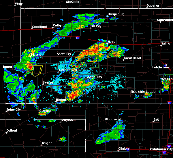 At 601 pm cdt, a severe thunderstorm capable of producing a tornado was located near shaffer, moving northeast at 15 mph (radar indicated rotation). Hazards include tornado and ping pong ball size hail. Flying debris will be dangerous to those caught without shelter. mobile homes will be damaged or destroyed. damage to roofs, windows and vehicles will occur. tree damage is likely. This dangerous storm will be near, otis around 605 pm cdt. At 601 pm cdt, a severe thunderstorm capable of producing a tornado was located near shaffer, moving northeast at 15 mph (radar indicated rotation). Hazards include tornado and ping pong ball size hail. Flying debris will be dangerous to those caught without shelter. mobile homes will be damaged or destroyed. damage to roofs, windows and vehicles will occur. tree damage is likely. This dangerous storm will be near, otis around 605 pm cdt.
|
| 7/2/2016 5:42 PM CDT |
 At 542 pm cdt, a severe thunderstorm was located 3 miles northeast of bison, moving east at 30 mph (radar indicated). Hazards include 60 mph wind gusts and quarter size hail. Hail damage to vehicles is expected. expect wind damage to roofs, siding and trees. Locations impacted include, otis, bison, rush center, timken and loretta. At 542 pm cdt, a severe thunderstorm was located 3 miles northeast of bison, moving east at 30 mph (radar indicated). Hazards include 60 mph wind gusts and quarter size hail. Hail damage to vehicles is expected. expect wind damage to roofs, siding and trees. Locations impacted include, otis, bison, rush center, timken and loretta.
|
| 7/2/2016 5:11 PM CDT |
 At 511 pm cdt, a severe thunderstorm was located near rush center, moving northeast at 15 mph (radar indicated). Hazards include 60 mph wind gusts and half dollar size hail. Hail damage to vehicles is expected. Expect wind damage to roofs, siding and trees. At 511 pm cdt, a severe thunderstorm was located near rush center, moving northeast at 15 mph (radar indicated). Hazards include 60 mph wind gusts and half dollar size hail. Hail damage to vehicles is expected. Expect wind damage to roofs, siding and trees.
|
| 7/2/2016 12:20 AM CDT |
 At 1220 am cdt, a severe thunderstorm was located 3 miles west of garfield, moving northeast at 30 mph (radar indicated). Hazards include quarter size hail. damage to vehicles is expected At 1220 am cdt, a severe thunderstorm was located 3 miles west of garfield, moving northeast at 30 mph (radar indicated). Hazards include quarter size hail. damage to vehicles is expected
|
| 6/17/2016 7:26 PM CDT |
 At 726 pm cdt, a severe thunderstorm was located 5 miles northeast of mccracken, moving south at 15 mph (radar indicated). Hazards include up to two inch hail and 60 mph wind gusts. People and animals outdoors will be injured. expect hail damage to roofs, siding, windows and vehicles. expect wind damage to roofs, siding and trees. Locations impacted include, hays, ellis, la crosse, victoria, walker, catherine, otis, bison, schoenchen, mccracken, ogallah, liebenthal, riga, yocemento, munjor, cedar bluff, toulon, antonino, loretta and emmeram. At 726 pm cdt, a severe thunderstorm was located 5 miles northeast of mccracken, moving south at 15 mph (radar indicated). Hazards include up to two inch hail and 60 mph wind gusts. People and animals outdoors will be injured. expect hail damage to roofs, siding, windows and vehicles. expect wind damage to roofs, siding and trees. Locations impacted include, hays, ellis, la crosse, victoria, walker, catherine, otis, bison, schoenchen, mccracken, ogallah, liebenthal, riga, yocemento, munjor, cedar bluff, toulon, antonino, loretta and emmeram.
|
| 6/17/2016 7:11 PM CDT |
 At 711 pm cdt, a severe thunderstorm was located 7 miles north of mccracken, moving south at 10 mph (radar indicated). Hazards include up to ping pong ball size hail and 60 mph wind gusts. People and animals outdoors will be injured. expect hail damage to roofs, siding, windows and vehicles. Expect wind damage to roofs, siding and trees. At 711 pm cdt, a severe thunderstorm was located 7 miles north of mccracken, moving south at 10 mph (radar indicated). Hazards include up to ping pong ball size hail and 60 mph wind gusts. People and animals outdoors will be injured. expect hail damage to roofs, siding, windows and vehicles. Expect wind damage to roofs, siding and trees.
|
| 5/26/2016 3:04 PM CDT |
 At 304 pm cdt, a severe thunderstorm was located near bison, moving northeast at 30 mph (radar indicated). Hazards include 60 mph wind gusts and quarter size hail. Hail damage to vehicles is expected. expect wind damage to roofs, siding and trees. locations impacted include, la crosse, otis, bison, timken, shaffer and loretta. A tornado watch remains in effect until 1000 pm cdt for central kansas. At 304 pm cdt, a severe thunderstorm was located near bison, moving northeast at 30 mph (radar indicated). Hazards include 60 mph wind gusts and quarter size hail. Hail damage to vehicles is expected. expect wind damage to roofs, siding and trees. locations impacted include, la crosse, otis, bison, timken, shaffer and loretta. A tornado watch remains in effect until 1000 pm cdt for central kansas.
|
| 5/26/2016 2:59 PM CDT |
 At 258 pm cdt, a severe thunderstorm was located very near bison, moving northeast at 30 mph (radar indicated). Hazards include ping pong ball size hail and 60 mph wind gusts. People and animals outdoors will be injured. expect hail damage to roofs, siding, windows and vehicles. expect wind damage to roofs, siding and trees. locations impacted include, la crosse, otis, bison, rush center, liebenthal, timken, loretta, shaffer and hargrave. A tornado watch remains in effect until 1000 pm cdt for central kansas. At 258 pm cdt, a severe thunderstorm was located very near bison, moving northeast at 30 mph (radar indicated). Hazards include ping pong ball size hail and 60 mph wind gusts. People and animals outdoors will be injured. expect hail damage to roofs, siding, windows and vehicles. expect wind damage to roofs, siding and trees. locations impacted include, la crosse, otis, bison, rush center, liebenthal, timken, loretta, shaffer and hargrave. A tornado watch remains in effect until 1000 pm cdt for central kansas.
|
| 5/26/2016 2:54 PM CDT |
 At 253 pm cdt, a severe thunderstorm was located near timken, moving northeast at 30 mph (radar indicated). Hazards include two inch hail and 70 mph wind gusts. People and animals outdoors will be injured. expect hail damage to roofs, siding, windows and vehicles. expect considerable tree damage. wind damage is also likely to mobile homes, roofs and outbuildings. locations impacted include, la crosse, otis, bison, rush center, liebenthal, timken, loretta, nekoma, shaffer and hargrave. A tornado watch remains in effect until 1000 pm cdt for south central kansas. At 253 pm cdt, a severe thunderstorm was located near timken, moving northeast at 30 mph (radar indicated). Hazards include two inch hail and 70 mph wind gusts. People and animals outdoors will be injured. expect hail damage to roofs, siding, windows and vehicles. expect considerable tree damage. wind damage is also likely to mobile homes, roofs and outbuildings. locations impacted include, la crosse, otis, bison, rush center, liebenthal, timken, loretta, nekoma, shaffer and hargrave. A tornado watch remains in effect until 1000 pm cdt for south central kansas.
|
| 5/26/2016 2:46 PM CDT |
 At 246 pm cdt, a severe thunderstorm was located 4 miles southeast of rush center, moving northeast at 30 mph (radar indicated). Hazards include two inch hail and 70 mph wind gusts. People and animals outdoors will be injured. expect hail damage to roofs, siding, windows and vehicles. expect considerable tree damage. wind damage is also likely to mobile homes, roofs and outbuildings. locations impacted include, larned, la crosse, otis, bison, rush center, liebenthal, timken, ash valley, loretta, nekoma, shaffer and hargrave. A tornado watch remains in effect until 1000 pm cdt for south central kansas. At 246 pm cdt, a severe thunderstorm was located 4 miles southeast of rush center, moving northeast at 30 mph (radar indicated). Hazards include two inch hail and 70 mph wind gusts. People and animals outdoors will be injured. expect hail damage to roofs, siding, windows and vehicles. expect considerable tree damage. wind damage is also likely to mobile homes, roofs and outbuildings. locations impacted include, larned, la crosse, otis, bison, rush center, liebenthal, timken, ash valley, loretta, nekoma, shaffer and hargrave. A tornado watch remains in effect until 1000 pm cdt for south central kansas.
|
| 5/26/2016 2:37 PM CDT |
 At 237 pm cdt, a severe thunderstorm was located 5 miles northwest of ash valley, moving northeast at 30 mph (radar indicated). Hazards include tennis ball size hail and 70 mph wind gusts. People and animals outdoors will be injured. expect hail damage to roofs, siding, windows and vehicles. expect considerable tree damage. Wind damage is also likely to mobile homes, roofs and outbuildings. At 237 pm cdt, a severe thunderstorm was located 5 miles northwest of ash valley, moving northeast at 30 mph (radar indicated). Hazards include tennis ball size hail and 70 mph wind gusts. People and animals outdoors will be injured. expect hail damage to roofs, siding, windows and vehicles. expect considerable tree damage. Wind damage is also likely to mobile homes, roofs and outbuildings.
|
| 5/8/2016 6:50 PM CDT |
 At 649 pm cdt, a severe thunderstorm was located near pfeifer, moving north at 55 mph (radar indicated). Hazards include golf ball size hail and 70 mph wind gusts. People and animals outdoors will be injured. expect hail damage to roofs, siding, windows and vehicles. expect considerable tree damage. wind damage is also likely to mobile homes, roofs and outbuildings. trained spotters reported half dollar size hail near bison. locations impacted include, la crosse, otis, bison, schoenchen, liebenthal, antonino, loretta and pfeifer. A tornado watch remains in effect until 1000 pm cdt for central kansas. At 649 pm cdt, a severe thunderstorm was located near pfeifer, moving north at 55 mph (radar indicated). Hazards include golf ball size hail and 70 mph wind gusts. People and animals outdoors will be injured. expect hail damage to roofs, siding, windows and vehicles. expect considerable tree damage. wind damage is also likely to mobile homes, roofs and outbuildings. trained spotters reported half dollar size hail near bison. locations impacted include, la crosse, otis, bison, schoenchen, liebenthal, antonino, loretta and pfeifer. A tornado watch remains in effect until 1000 pm cdt for central kansas.
|
| 5/8/2016 6:38 PM CDT |
 At 638 pm cdt, a severe thunderstorm was located near bison, moving north at 45 mph (radar indicated). Hazards include two inch hail and 70 mph wind gusts. People and animals outdoors will be injured. expect hail damage to roofs, siding, windows and vehicles. expect considerable tree damage. Wind damage is also likely to mobile homes, roofs and outbuildings. At 638 pm cdt, a severe thunderstorm was located near bison, moving north at 45 mph (radar indicated). Hazards include two inch hail and 70 mph wind gusts. People and animals outdoors will be injured. expect hail damage to roofs, siding, windows and vehicles. expect considerable tree damage. Wind damage is also likely to mobile homes, roofs and outbuildings.
|
| 8/8/2015 5:15 PM CDT | 3 inch diameter tree branches fel in rush county KS, 3.5 miles NE of Otis, KS |
| 7/17/2015 9:05 PM CDT |
 At 905 pm cdt, a severe thunderstorm was located 3 miles west of timken, moving northeast at 30 mph (radar indicated). Hazards include 70 mph wind gusts and half dollar size hail. Hail damage to vehicles is expected. expect considerable tree damage. Wind damage is also likely to mobile homes, roofs and outbuildings. At 905 pm cdt, a severe thunderstorm was located 3 miles west of timken, moving northeast at 30 mph (radar indicated). Hazards include 70 mph wind gusts and half dollar size hail. Hail damage to vehicles is expected. expect considerable tree damage. Wind damage is also likely to mobile homes, roofs and outbuildings.
|
| 4/2/2015 10:55 PM CDT | A severe thunderstorm warning remains in effect until 1145 pm cdt for eastern pawnee. stafford. eastern rush and east central edwards counties. at 1054 pm cdt. severe thunderstorms were located along a line extending from near loretta to 6 miles southwest of albert to near belpre. Moving east at 35 mph. |
| 4/2/2015 10:42 PM CDT | The national weather service in dodge city has issued a * severe thunderstorm warning for. pawnee county in south central kansas. stafford county in south central kansas. rush county in central kansas. East central edwards county in south central kansas. |
| 4/2/2015 10:20 PM CDT | A severe thunderstorm warning remains in effect until 1045 pm cdt for northern rush and southern ellis counties. at 1019 pm cdt. a severe thunderstorm was located 7 miles southwest of antonino. moving east at 45 mph. hazard. 60 mph wind gusts and penny size hail. source. Radar indicated. |
| 4/2/2015 10:06 PM CDT | A severe thunderstorm warning remains in effect until 1045 pm cdt for southeastern trego. northern rush. northeastern ness and southern ellis counties. at 1006 pm cdt. a severe thunderstorm was located over cedar bluff. moving east at 35 mph. hazard. 60 mph wind gusts and penny size hail. |
| 4/2/2015 9:50 PM CDT | The national weather service in dodge city has issued a * severe thunderstorm warning for. eastern trego county in west central kansas. northern rush county in central kansas. northeastern ness county in west central kansas. Ellis county in central kansas. |
| 9/9/2014 9:50 PM CDT | Law enforcement report power lines and trees dow in barton county KS, 3.5 miles SSW of Otis, KS |
| 6/27/2013 4:39 PM CDT | Measured by ksn weatherlab network station at the otis-bison high schoo in rush county KS, 0.4 miles NNW of Otis, KS |
| 4/14/2012 7:47 PM CDT | Quarter sized hail reported 12.2 miles N of Otis, KS |
| 4/14/2012 12:45 PM CDT | A 60x120 foot metal barn was dest in rush county KS, 8.6 miles SSE of Otis, KS |
| 1/1/0001 12:00 AM | An experienced storm spottered estimated a 70 mph wind gust in far eastern rush count in rush county KS, 1.1 miles N of Otis, KS |
| 1/1/0001 12:00 AM | Tree limbs one inch in diameter were down. winds were estimated at 60 mp in rush county KS, 8.6 miles SSE of Otis, KS |
Hail Maps for Otis, KS
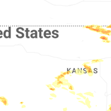
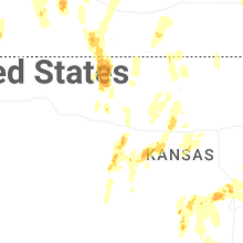
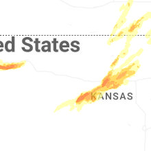
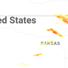
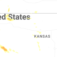
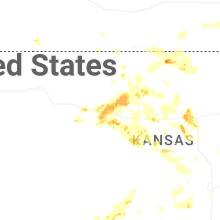


Connect with Interactive Hail Maps