

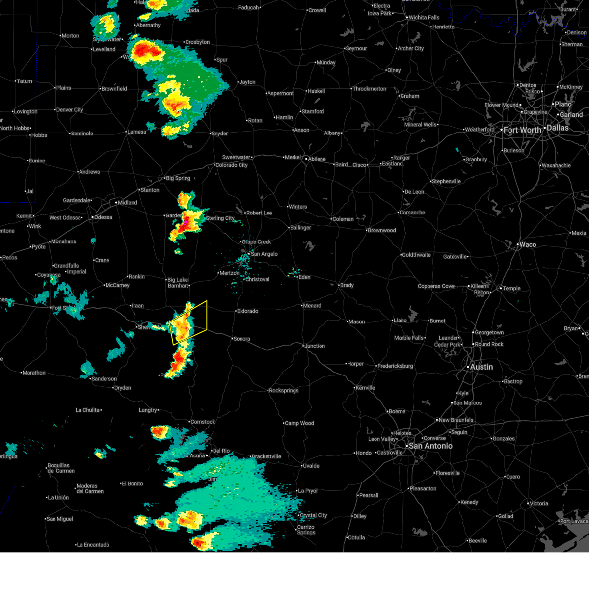
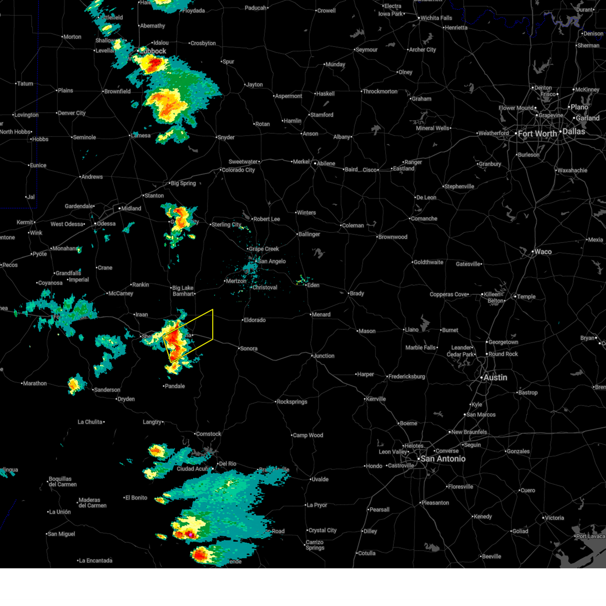
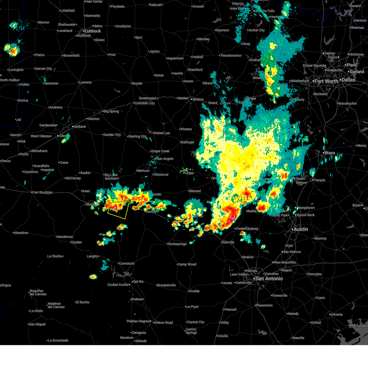
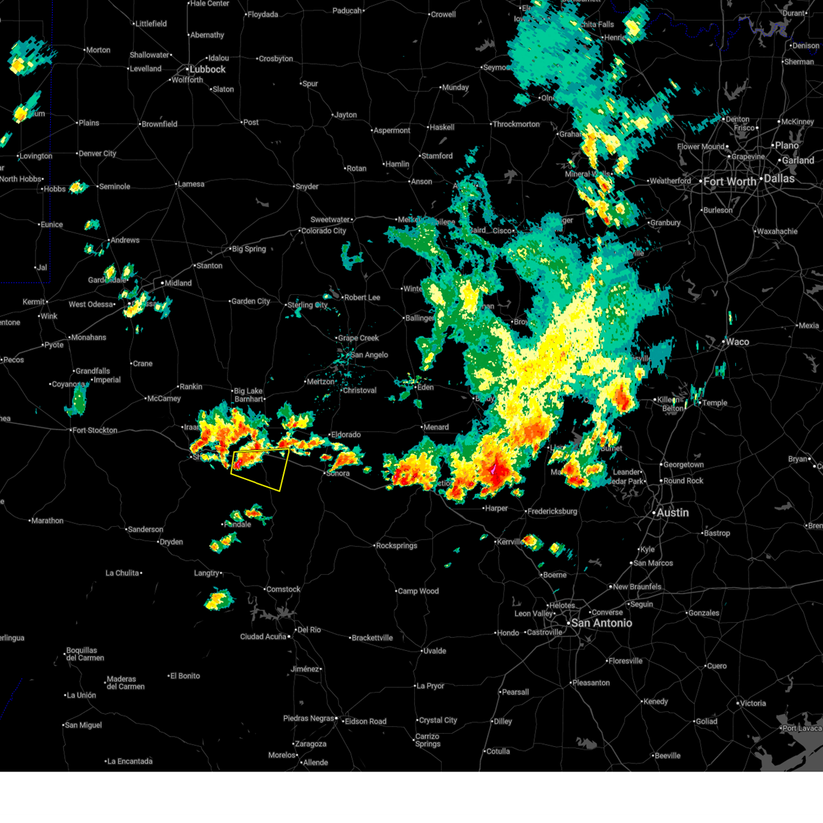
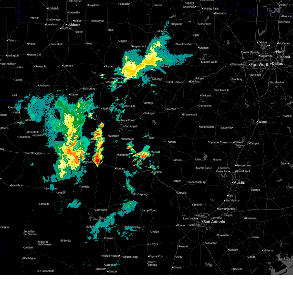
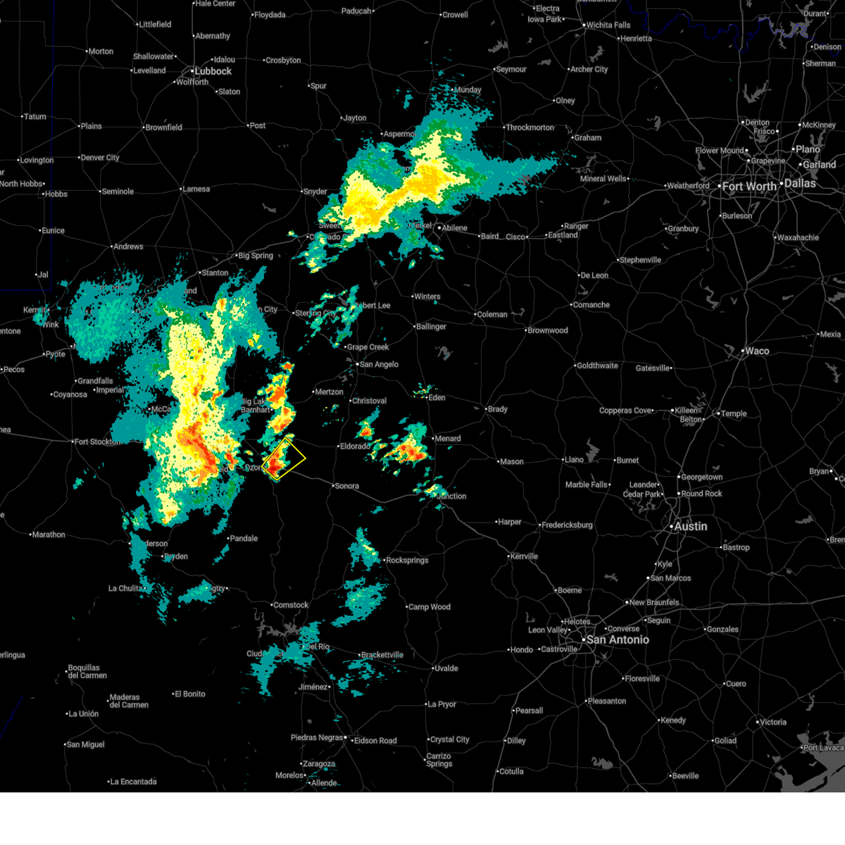
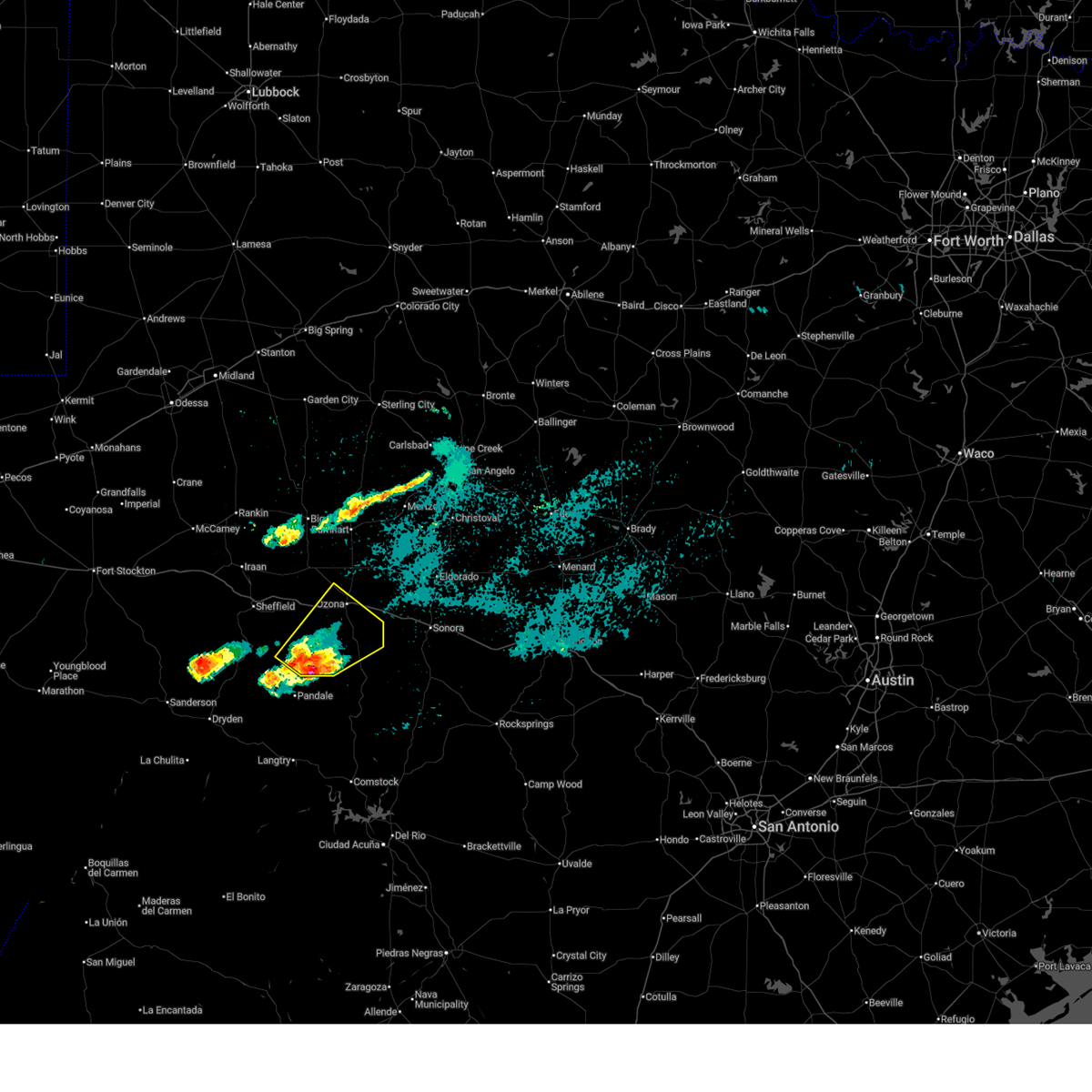
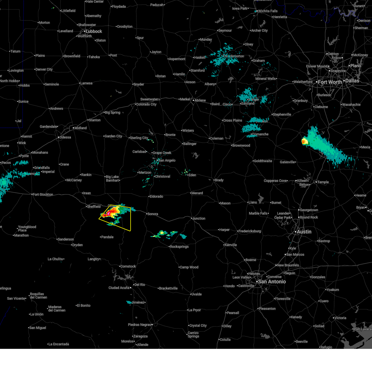
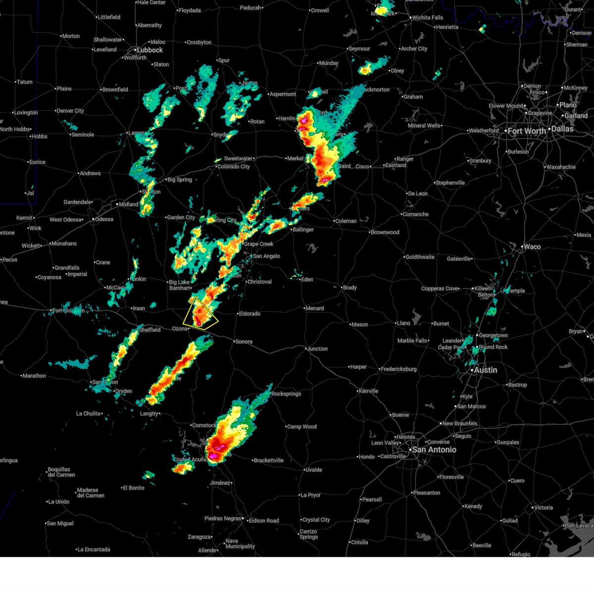
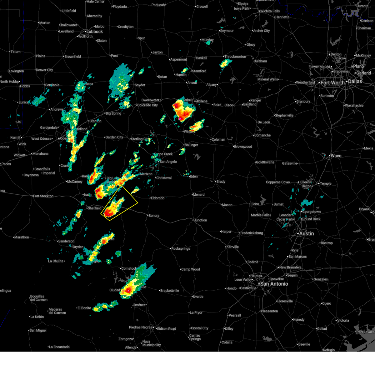
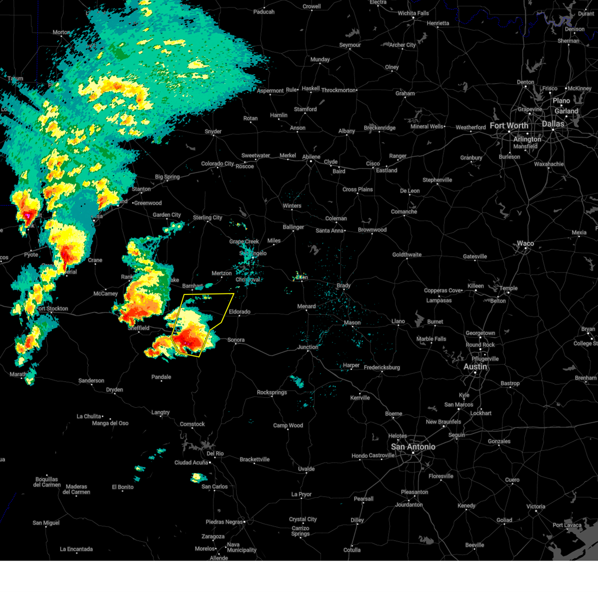
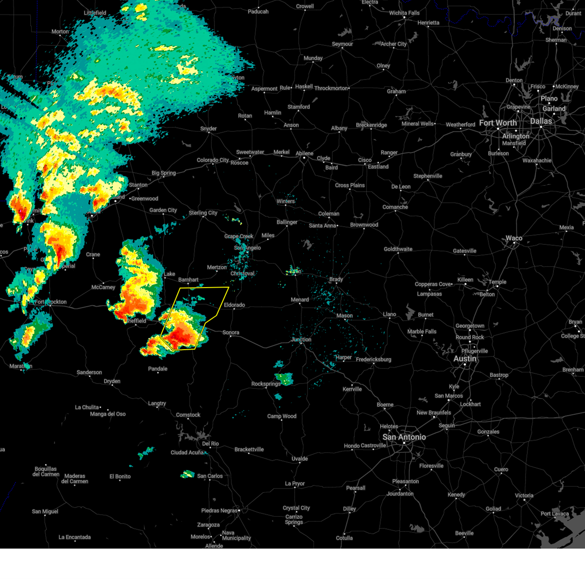
Hail Map for Ozona, TX
The Ozona, TX area has had 30 reports of on-the-ground hail by trained spotters, and has been under severe weather warnings 14 times during the past 12 months. Doppler radar has detected hail at or near Ozona, TX on 57 occasions, including 7 occasions during the past year.
| Name: | Ozona, TX |
| Where Located: | 94.4 miles N of Del Rio, TX |
| Map: | Google Map for Ozona, TX |
| Population: | 3225 |
| Housing Units: | 1393 |
| More Info: | Search Google for Ozona, TX |
1
The Top Recent Hail Date for Ozona, TX is Tuesday, March 10, 2026 (13th out of 57)

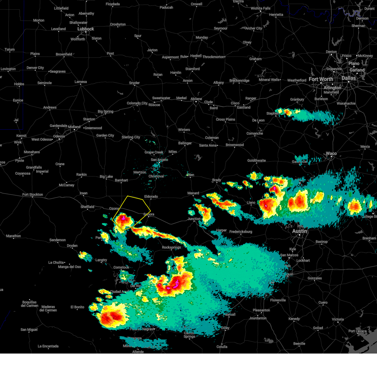
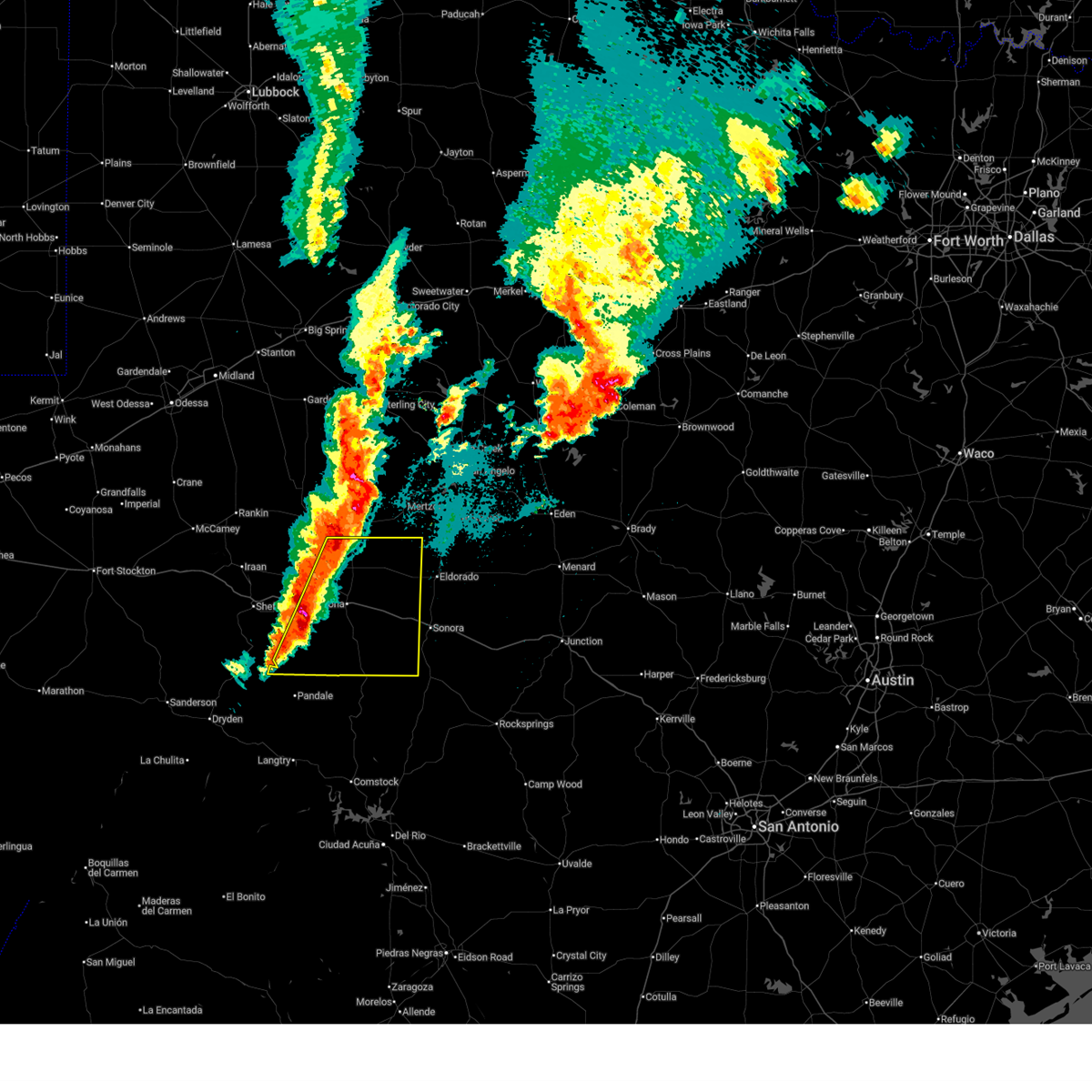
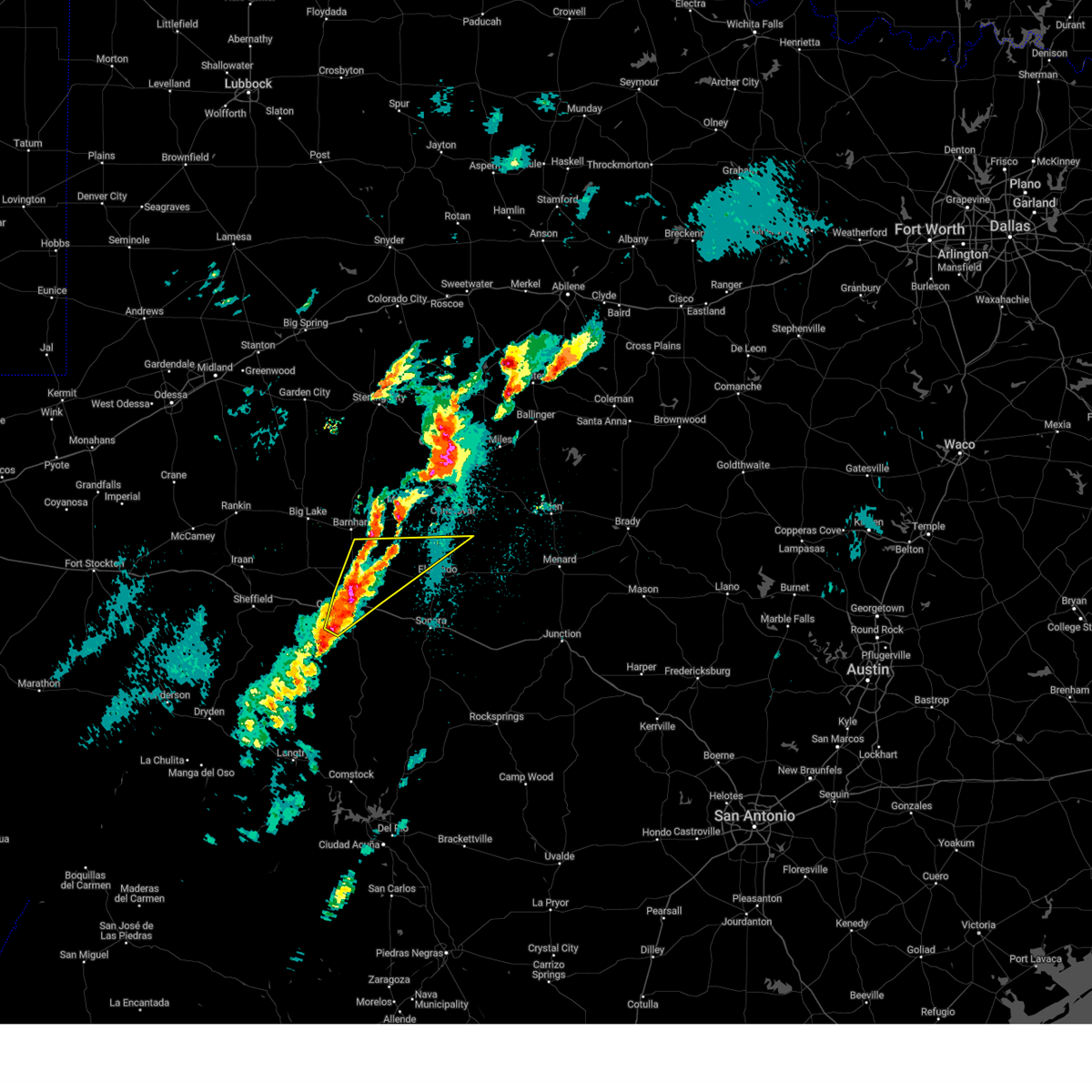
Hail and Wind Damage Spotted near Ozona, TX
| Date / Time | Report Details |
|---|---|
| 5/22/2026 5:35 PM CDT |
 At 534 pm cdt, a severe thunderstorm was located over ozona, moving northeast at 25 mph (radar indicated). Hazards include 60 mph wind gusts. Expect damage to roofs, siding, and trees. this severe storm will be near, ozona around 540 pm cdt. other locations impacted by this severe thunderstorm include i- 10 near the crockett-sutton county line and us-190 near the crockett- sutton county line. This includes interstate 10 between mile markers 353 and 379. At 534 pm cdt, a severe thunderstorm was located over ozona, moving northeast at 25 mph (radar indicated). Hazards include 60 mph wind gusts. Expect damage to roofs, siding, and trees. this severe storm will be near, ozona around 540 pm cdt. other locations impacted by this severe thunderstorm include i- 10 near the crockett-sutton county line and us-190 near the crockett- sutton county line. This includes interstate 10 between mile markers 353 and 379.
|
| 5/22/2026 5:15 PM CDT |
 Svrsjt the national weather service in san angelo has issued a * severe thunderstorm warning for, southeastern crockett county in west central texas, * until 615 pm cdt. * at 513 pm cdt, a severe thunderstorm was located 8 miles southeast of the intersection of i-10 and highway 405, or 12 miles southwest of ozona, moving northeast at 30 mph (radar indicated). Hazards include 60 mph wind gusts and nickel size hail. Expect damage to roofs, siding, and trees. this severe thunderstorm will be near, ozona around 520 pm cdt. other locations impacted by this severe thunderstorm include the intersection of ranch road 2083 and highway 405, i- 10 near the crockett-sutton county line, the intersection of i- 10 and highway 405, and us-190 near the crockett-sutton county line. This includes interstate 10 between mile markers 346 and 379. Svrsjt the national weather service in san angelo has issued a * severe thunderstorm warning for, southeastern crockett county in west central texas, * until 615 pm cdt. * at 513 pm cdt, a severe thunderstorm was located 8 miles southeast of the intersection of i-10 and highway 405, or 12 miles southwest of ozona, moving northeast at 30 mph (radar indicated). Hazards include 60 mph wind gusts and nickel size hail. Expect damage to roofs, siding, and trees. this severe thunderstorm will be near, ozona around 520 pm cdt. other locations impacted by this severe thunderstorm include the intersection of ranch road 2083 and highway 405, i- 10 near the crockett-sutton county line, the intersection of i- 10 and highway 405, and us-190 near the crockett-sutton county line. This includes interstate 10 between mile markers 346 and 379.
|
| 5/21/2026 4:51 PM CDT |
 At 451 pm cdt, a severe thunderstorm was located near ozona, moving east at 20 mph (radar indicated). Hazards include 60 mph wind gusts and half dollar size hail. Hail damage to vehicles is expected. expect wind damage to roofs, siding, and trees. this severe storm will be near, ozona around 455 pm cdt. other locations impacted by this severe thunderstorm include the intersection of highway 163 and ranch road 1973. This includes interstate 10 between mile markers 357 and 378. At 451 pm cdt, a severe thunderstorm was located near ozona, moving east at 20 mph (radar indicated). Hazards include 60 mph wind gusts and half dollar size hail. Hail damage to vehicles is expected. expect wind damage to roofs, siding, and trees. this severe storm will be near, ozona around 455 pm cdt. other locations impacted by this severe thunderstorm include the intersection of highway 163 and ranch road 1973. This includes interstate 10 between mile markers 357 and 378.
|
| 5/21/2026 4:27 PM CDT | Golf Ball sized hail reported 13.5 miles ENE of Ozona, TX, video posted on facebook of golf-ball size hail on cr404 near interstate 10. |
| 5/21/2026 4:25 PM CDT |
 Svrsjt the national weather service in san angelo has issued a * severe thunderstorm warning for, east central crockett county in west central texas, * until 530 pm cdt. * at 425 pm cdt, a severe thunderstorm was located near the intersection of i-10 and highway 405, or 11 miles southwest of ozona, moving east at 20 mph (radar indicated). Hazards include golf ball size hail and 60 mph wind gusts. People and animals outdoors will be injured. expect hail damage to roofs, siding, windows, and vehicles. expect wind damage to roofs, siding, and trees. this severe thunderstorm will be near, ozona around 430 pm cdt. other locations impacted by this severe thunderstorm include the intersection of highway 163 and ranch road 1973. This includes interstate 10 between mile markers 351 and 378. Svrsjt the national weather service in san angelo has issued a * severe thunderstorm warning for, east central crockett county in west central texas, * until 530 pm cdt. * at 425 pm cdt, a severe thunderstorm was located near the intersection of i-10 and highway 405, or 11 miles southwest of ozona, moving east at 20 mph (radar indicated). Hazards include golf ball size hail and 60 mph wind gusts. People and animals outdoors will be injured. expect hail damage to roofs, siding, windows, and vehicles. expect wind damage to roofs, siding, and trees. this severe thunderstorm will be near, ozona around 430 pm cdt. other locations impacted by this severe thunderstorm include the intersection of highway 163 and ranch road 1973. This includes interstate 10 between mile markers 351 and 378.
|
| 5/20/2026 7:37 PM CDT |
 At 736 pm cdt, a severe thunderstorm was located near ozona, moving northeast at 20 mph (radar indicated). Hazards include 60 mph wind gusts and quarter size hail. Hail damage to vehicles is expected. expect wind damage to roofs, siding, and trees. locations impacted include, ozona. This includes interstate 10 between mile markers 367 and 376. At 736 pm cdt, a severe thunderstorm was located near ozona, moving northeast at 20 mph (radar indicated). Hazards include 60 mph wind gusts and quarter size hail. Hail damage to vehicles is expected. expect wind damage to roofs, siding, and trees. locations impacted include, ozona. This includes interstate 10 between mile markers 367 and 376.
|
| 5/20/2026 7:37 PM CDT |
 the severe thunderstorm warning has been cancelled and is no longer in effect the severe thunderstorm warning has been cancelled and is no longer in effect
|
| 5/20/2026 7:25 PM CDT |
 Svrsjt the national weather service in san angelo has issued a * severe thunderstorm warning for, western schleicher county in west central texas, east central crockett county in west central texas, * until 815 pm cdt. * at 725 pm cdt, a severe thunderstorm was located near ozona, moving northeast at 20 mph (radar indicated). Hazards include 60 mph wind gusts and quarter size hail. Hail damage to vehicles is expected. expect wind damage to roofs, siding, and trees. this severe thunderstorm will remain over mainly rural areas of western schleicher and east central crockett counties. This includes interstate 10 between mile markers 363 and 376. Svrsjt the national weather service in san angelo has issued a * severe thunderstorm warning for, western schleicher county in west central texas, east central crockett county in west central texas, * until 815 pm cdt. * at 725 pm cdt, a severe thunderstorm was located near ozona, moving northeast at 20 mph (radar indicated). Hazards include 60 mph wind gusts and quarter size hail. Hail damage to vehicles is expected. expect wind damage to roofs, siding, and trees. this severe thunderstorm will remain over mainly rural areas of western schleicher and east central crockett counties. This includes interstate 10 between mile markers 363 and 376.
|
| 5/10/2026 6:29 PM CDT | Quarter sized hail reported 22.8 miles S of Ozona, TX |
| 5/6/2026 5:36 AM CDT |
 Svrsjt the national weather service in san angelo has issued a * severe thunderstorm warning for, southeastern crockett county in west central texas, * until 630 am cdt. * at 536 am cdt, a severe thunderstorm was located 9 miles south of the intersection of ranch road 2083 and highway 405, or 13 miles northeast of pandale, moving northeast at 35 mph (radar indicated). Hazards include 60 mph wind gusts and half dollar size hail. Hail damage to vehicles is expected. expect wind damage to roofs, siding, and trees. this severe thunderstorm will remain over mainly rural areas of southeastern crockett county, including the following locations, the intersection of ranch road 2083 and highway 405 and the intersection of highway 163 and ranch road 1973. This includes interstate 10 between mile markers 353 and 370. Svrsjt the national weather service in san angelo has issued a * severe thunderstorm warning for, southeastern crockett county in west central texas, * until 630 am cdt. * at 536 am cdt, a severe thunderstorm was located 9 miles south of the intersection of ranch road 2083 and highway 405, or 13 miles northeast of pandale, moving northeast at 35 mph (radar indicated). Hazards include 60 mph wind gusts and half dollar size hail. Hail damage to vehicles is expected. expect wind damage to roofs, siding, and trees. this severe thunderstorm will remain over mainly rural areas of southeastern crockett county, including the following locations, the intersection of ranch road 2083 and highway 405 and the intersection of highway 163 and ranch road 1973. This includes interstate 10 between mile markers 353 and 370.
|
| 4/29/2026 3:52 PM CDT |
 Svrsjt the national weather service in san angelo has issued a * severe thunderstorm warning for, southeastern crockett county in west central texas, * until 445 pm cdt. * at 351 pm cdt, a severe thunderstorm was located 10 miles northeast of the intersection of ranch road 2083 and highway 405, or 12 miles southwest of ozona, moving east at 30 mph (radar indicated). Hazards include ping pong ball size hail and 60 mph wind gusts. People and animals outdoors will be injured. expect hail damage to roofs, siding, windows, and vehicles. expect wind damage to roofs, siding, and trees. this severe thunderstorm will remain over mainly rural areas of southeastern crockett county, including the following locations, the intersection of ranch road 2083 and highway 405, the intersection of highway 163 and ranch road 1973, and i-10 near the crockett-sutton county line. This includes interstate 10 between mile markers 355 and 364, and between mile markers 376 and 379. Svrsjt the national weather service in san angelo has issued a * severe thunderstorm warning for, southeastern crockett county in west central texas, * until 445 pm cdt. * at 351 pm cdt, a severe thunderstorm was located 10 miles northeast of the intersection of ranch road 2083 and highway 405, or 12 miles southwest of ozona, moving east at 30 mph (radar indicated). Hazards include ping pong ball size hail and 60 mph wind gusts. People and animals outdoors will be injured. expect hail damage to roofs, siding, windows, and vehicles. expect wind damage to roofs, siding, and trees. this severe thunderstorm will remain over mainly rural areas of southeastern crockett county, including the following locations, the intersection of ranch road 2083 and highway 405, the intersection of highway 163 and ranch road 1973, and i-10 near the crockett-sutton county line. This includes interstate 10 between mile markers 355 and 364, and between mile markers 376 and 379.
|
| 3/10/2026 5:09 PM CDT |
 At 509 pm cdt, a severe thunderstorm was located 9 miles northwest of i-10 near the crockett-sutton county line, or 9 miles northeast of ozona, moving east at 35 mph (radar indicated). Hazards include 60 mph wind gusts and quarter size hail. Hail damage to vehicles is expected. expect wind damage to roofs, siding, and trees. This severe thunderstorm will remain over mainly rural areas of western schleicher and northeastern crockett counties, including the following locations, the intersection of us 190 and highway 163. At 509 pm cdt, a severe thunderstorm was located 9 miles northwest of i-10 near the crockett-sutton county line, or 9 miles northeast of ozona, moving east at 35 mph (radar indicated). Hazards include 60 mph wind gusts and quarter size hail. Hail damage to vehicles is expected. expect wind damage to roofs, siding, and trees. This severe thunderstorm will remain over mainly rural areas of western schleicher and northeastern crockett counties, including the following locations, the intersection of us 190 and highway 163.
|
| 3/10/2026 4:31 PM CDT |
 Svrsjt the national weather service in san angelo has issued a * severe thunderstorm warning for, western schleicher county in west central texas, northeastern crockett county in west central texas, * until 530 pm cdt. * at 431 pm cdt, a severe thunderstorm was located near the intersection of i-10 and highway 405, or 13 miles southwest of ozona, moving northeast at 40 mph (radar indicated). Hazards include 60 mph wind gusts and quarter size hail. Hail damage to vehicles is expected. expect wind damage to roofs, siding, and trees. this severe thunderstorm will be near, ozona around 440 pm cdt. other locations impacted by this severe thunderstorm include the intersection of us 190 and highway 163 and the intersection of i-10 and highway 405. This includes interstate 10 between mile markers 349 and 375. Svrsjt the national weather service in san angelo has issued a * severe thunderstorm warning for, western schleicher county in west central texas, northeastern crockett county in west central texas, * until 530 pm cdt. * at 431 pm cdt, a severe thunderstorm was located near the intersection of i-10 and highway 405, or 13 miles southwest of ozona, moving northeast at 40 mph (radar indicated). Hazards include 60 mph wind gusts and quarter size hail. Hail damage to vehicles is expected. expect wind damage to roofs, siding, and trees. this severe thunderstorm will be near, ozona around 440 pm cdt. other locations impacted by this severe thunderstorm include the intersection of us 190 and highway 163 and the intersection of i-10 and highway 405. This includes interstate 10 between mile markers 349 and 375.
|
| 10/24/2025 7:07 PM CDT | At 705 pm cdt, a severe thunderstorm was located near ozona, moving east at 35 mph (radar indicated). Hazards include ping pong ball size hail and 60 mph wind gusts. People and animals outdoors will be injured. expect hail damage to roofs, siding, windows, and vehicles. expect wind damage to roofs, siding, and trees. this severe thunderstorm will remain over mainly rural areas of east central crockett county. People attending ozona lion stadium should seek safe shelter immediately! this includes interstate 10 between mile markers 359 and 379. |
| 10/24/2025 6:51 PM CDT | At 650 pm cdt, a severe thunderstorm was located 8 miles southwest of ozona, moving east at 30 mph (radar indicated). Hazards include 60 mph wind gusts and quarter size hail. Hail damage to vehicles is expected. expect wind damage to roofs, siding, and trees. this severe storm will be near, ozona around 655 pm cdt. People attending ozona lion stadium should seek safe shelter immediately! this includes interstate 10 between mile markers 351 and 379. |
| 10/24/2025 6:32 PM CDT | Svrsjt the national weather service in san angelo has issued a * severe thunderstorm warning for, crockett county in west central texas, * until 730 pm cdt. * at 630 pm cdt, a severe thunderstorm was located in western crockett county, about 17 miles west of ozona, moving east at 35 mph (radar indicated). Hazards include 60 mph wind gusts and quarter size hail. Hail damage to vehicles is expected. expect wind damage to roofs, siding, and trees. this severe thunderstorm will be near, ozona around 645 pm cdt, as well as interstate 10 through most of crockett county. other locations impacted by this severe thunderstorm include the intersection of i-10 and highway 405 and the intersection of i-10 and highway 290. People attending the football game at ozona lion stadium should seek safe shelter immediately! this includes interstate 10 between mile markers 338 and 379. |
| 5/6/2025 1:04 AM CDT |
 At 104 am cdt, a severe thunderstorm was located 7 miles south of ozona, moving northeast at 35 mph (radar indicated). Hazards include golf ball size hail and 60 mph wind gusts. People and animals outdoors will be injured. expect hail damage to roofs, siding, windows, and vehicles. expect wind damage to roofs, siding, and trees. this severe storm will be near, ozona around 110 am cdt. other locations impacted by this severe thunderstorm include the intersection of us- 190 and ranch road 1828, the intersection of us 190 and highway 163, us-190 near the crockett- sutton county line, and the intersection of highway 163 and ranch road 1973. This includes interstate 10 between mile markers 353 and 378. At 104 am cdt, a severe thunderstorm was located 7 miles south of ozona, moving northeast at 35 mph (radar indicated). Hazards include golf ball size hail and 60 mph wind gusts. People and animals outdoors will be injured. expect hail damage to roofs, siding, windows, and vehicles. expect wind damage to roofs, siding, and trees. this severe storm will be near, ozona around 110 am cdt. other locations impacted by this severe thunderstorm include the intersection of us- 190 and ranch road 1828, the intersection of us 190 and highway 163, us-190 near the crockett- sutton county line, and the intersection of highway 163 and ranch road 1973. This includes interstate 10 between mile markers 353 and 378.
|
| 5/6/2025 12:55 AM CDT |
 Svrsjt the national weather service in san angelo has issued a * severe thunderstorm warning for, northwestern schleicher county in west central texas, eastern crockett county in west central texas, * until 200 am cdt. * at 1254 am cdt, a severe thunderstorm was located about 10 miles southwest of ozona, moving northeast at 40 mph (radar indicated). Hazards include 60 mph wind gusts and quarter size hail. Hail damage to vehicles is expected. expect wind damage to roofs, siding, and trees. this severe thunderstorm will be near, ozona around 115 am cdt. other locations impacted by this severe thunderstorm include the intersection of us-190 and ranch road 1828, the intersection of us 190 and highway 163, us-190 near the crockett-sutton county line, and the intersection of highway 163 and ranch road 1973. This includes interstate 10 in central and eastern crockett county. Svrsjt the national weather service in san angelo has issued a * severe thunderstorm warning for, northwestern schleicher county in west central texas, eastern crockett county in west central texas, * until 200 am cdt. * at 1254 am cdt, a severe thunderstorm was located about 10 miles southwest of ozona, moving northeast at 40 mph (radar indicated). Hazards include 60 mph wind gusts and quarter size hail. Hail damage to vehicles is expected. expect wind damage to roofs, siding, and trees. this severe thunderstorm will be near, ozona around 115 am cdt. other locations impacted by this severe thunderstorm include the intersection of us-190 and ranch road 1828, the intersection of us 190 and highway 163, us-190 near the crockett-sutton county line, and the intersection of highway 163 and ranch road 1973. This includes interstate 10 in central and eastern crockett county.
|
| 5/1/2025 6:33 PM CDT |
 Svrsjt the national weather service in san angelo has issued a * severe thunderstorm warning for, southwestern schleicher county in west central texas, southeastern crockett county in west central texas, northwestern sutton county in west central texas, * until 715 pm cdt. * at 632 pm cdt, a severe thunderstorm was located over the intersection of highway 163 and ranch road 1973, or 11 miles south of ozona, moving northeast at 40 mph (radar indicated). Hazards include tennis ball size hail and 60 mph wind gusts. People and animals outdoors will be injured. expect hail damage to roofs, siding, windows, and vehicles. expect wind damage to roofs, siding, and trees. this severe thunderstorm will remain over mainly rural areas of southwestern schleicher, southeastern crockett and northwestern sutton counties, including the following locations, the intersection of highway 163 and ranch road 1973, i-10 near the crockett-sutton county line, and the intersection of i-10 and ranch road 1989. This includes interstate 10 between mile markers 366 and 396. Svrsjt the national weather service in san angelo has issued a * severe thunderstorm warning for, southwestern schleicher county in west central texas, southeastern crockett county in west central texas, northwestern sutton county in west central texas, * until 715 pm cdt. * at 632 pm cdt, a severe thunderstorm was located over the intersection of highway 163 and ranch road 1973, or 11 miles south of ozona, moving northeast at 40 mph (radar indicated). Hazards include tennis ball size hail and 60 mph wind gusts. People and animals outdoors will be injured. expect hail damage to roofs, siding, windows, and vehicles. expect wind damage to roofs, siding, and trees. this severe thunderstorm will remain over mainly rural areas of southwestern schleicher, southeastern crockett and northwestern sutton counties, including the following locations, the intersection of highway 163 and ranch road 1973, i-10 near the crockett-sutton county line, and the intersection of i-10 and ranch road 1989. This includes interstate 10 between mile markers 366 and 396.
|
| 5/1/2025 6:06 PM CDT | Baseball sized hail reported 25.5 miles NNE of Ozona, TX |
| 4/19/2025 11:22 PM CDT |
 Svrsjt the national weather service in san angelo has issued a * severe thunderstorm warning for, western schleicher county in west central texas, crockett county in west central texas, western sutton county in west central texas, * until 1215 am cdt. * at 1120 pm cdt, severe thunderstorms were located along a line extending from 7 miles west of barnhart to near the intersection of i-10 and highway 405 to 7 miles east of terrell county gas plant, moving east at 50 mph (radar indicated). Hazards include 70 mph wind gusts and half dollar size hail. Hail damage to vehicles is expected. expect considerable tree damage. wind damage is also likely to mobile homes, roofs, and outbuildings. severe thunderstorms will be near, ozona around 1125 pm cdt. other locations impacted by these severe thunderstorms include the intersection of us- 190 and ranch road 1828, the intersection of us 190 and highway 163, the intersection of ranch road 2083 and highway 405, the intersection of highway 163 and ranch road 1973, i-10 near the crockett- sutton county line, the intersection of i-10 and ranch road 1989, us- 190 near the crockett-sutton county line, and the intersection of i- 10 and highway 405. This includes interstate 10 between mile markers 346 and 395. Svrsjt the national weather service in san angelo has issued a * severe thunderstorm warning for, western schleicher county in west central texas, crockett county in west central texas, western sutton county in west central texas, * until 1215 am cdt. * at 1120 pm cdt, severe thunderstorms were located along a line extending from 7 miles west of barnhart to near the intersection of i-10 and highway 405 to 7 miles east of terrell county gas plant, moving east at 50 mph (radar indicated). Hazards include 70 mph wind gusts and half dollar size hail. Hail damage to vehicles is expected. expect considerable tree damage. wind damage is also likely to mobile homes, roofs, and outbuildings. severe thunderstorms will be near, ozona around 1125 pm cdt. other locations impacted by these severe thunderstorms include the intersection of us- 190 and ranch road 1828, the intersection of us 190 and highway 163, the intersection of ranch road 2083 and highway 405, the intersection of highway 163 and ranch road 1973, i-10 near the crockett- sutton county line, the intersection of i-10 and ranch road 1989, us- 190 near the crockett-sutton county line, and the intersection of i- 10 and highway 405. This includes interstate 10 between mile markers 346 and 395.
|
| 4/19/2025 12:48 AM CDT |
 Svrsjt the national weather service in san angelo has issued a * severe thunderstorm warning for, northwestern schleicher county in west central texas, northeastern crockett county in west central texas, * until 145 am cdt. * at 1247 am cdt, a severe thunderstorm was located near ozona, moving northeast at 45 mph (radar indicated). Hazards include 60 mph wind gusts and quarter size hail. Hail damage to vehicles is expected. expect wind damage to roofs, siding, and trees. this severe thunderstorm will remain over mainly rural areas of northwestern schleicher and northeastern crockett counties, including the following locations, the intersection of ranch road 1828 and ranch road 915, the intersection of us-190 and ranch road 1828, the intersection of us 190 and highway 163, and us-190 near the crockett-sutton county line. This includes interstate 10 between mile markers 359 and 376. Svrsjt the national weather service in san angelo has issued a * severe thunderstorm warning for, northwestern schleicher county in west central texas, northeastern crockett county in west central texas, * until 145 am cdt. * at 1247 am cdt, a severe thunderstorm was located near ozona, moving northeast at 45 mph (radar indicated). Hazards include 60 mph wind gusts and quarter size hail. Hail damage to vehicles is expected. expect wind damage to roofs, siding, and trees. this severe thunderstorm will remain over mainly rural areas of northwestern schleicher and northeastern crockett counties, including the following locations, the intersection of ranch road 1828 and ranch road 915, the intersection of us-190 and ranch road 1828, the intersection of us 190 and highway 163, and us-190 near the crockett-sutton county line. This includes interstate 10 between mile markers 359 and 376.
|
| 3/4/2025 1:52 AM CST | At 152 am cst, severe thunderstorms were located along a line extending from 6 miles northwest of the intersection of us 190 and highway 163 to 8 miles southeast of the intersection of i-10 and highway 405, moving east at 45 mph (radar indicated). Hazards include 60 mph wind gusts and quarter size hail. Hail damage to vehicles is expected. expect wind damage to roofs, siding, and trees. these severe storms will be near, ozona around 200 am cst. other locations impacted by these severe thunderstorms include the intersection of us 190 and highway 163. This includes interstate 10 between mile markers 351 and 378. |
| 3/4/2025 1:29 AM CST | At 129 am cst, severe thunderstorms were located along a line extending from near big lake to near the intersection of i-10 and highway 290, moving east at 40 mph (radar indicated). Hazards include 60 mph wind gusts and quarter size hail. Hail damage to vehicles is expected. expect wind damage to roofs, siding, and trees. these severe storms will be near, barnhart around 140 am cst. ozona around 145 am cst. other locations impacted by these severe thunderstorms include the intersection of us 190 and highway 163, the intersection of i-10 and highway 405, and the intersection of i-10 and highway 290. This includes interstate 10 between mile markers 337 and 378. |
| 3/4/2025 1:12 AM CST | Svrsjt the national weather service in san angelo has issued a * severe thunderstorm warning for, crockett county in west central texas, southwestern irion county in west central texas, * until 215 am cst. * at 111 am cst, severe thunderstorms were located along a line extending from near best to near i-10 near the crockett-pecos county line, moving east at 45 mph (radar indicated). Hazards include 60 mph wind gusts and quarter size hail. Hail damage to vehicles is expected. expect wind damage to roofs, siding, and trees. severe thunderstorms will be near, barnhart around 135 am cst. ozona around 140 am cst. other locations impacted by these severe thunderstorms include the intersection of us 190 and highway 163, ft lancaster, the intersection of i-10 and highway 405, the intersection of i-10 and highway 290, and i-10 near the crockett-pecos county line. This includes interstate 10 between mile markers 327 and 378. |
| 6/10/2024 11:39 PM CDT |
 Svrsjt the national weather service in san angelo has issued a * severe thunderstorm warning for, southeastern crockett county in west central texas, * until 1245 am cdt. * at 1137 pm cdt, a severe thunderstorm was located near the intersection of i-10 and highway 405, or 15 miles west of ozona, moving southeast at 30 mph (radar indicated). Hazards include golf ball size hail and 60 mph wind gusts. People and animals outdoors will be injured. expect hail damage to roofs, siding, windows, and vehicles. expect wind damage to roofs, siding, and trees. this severe thunderstorm will remain over mainly rural areas of southeastern crockett county, including the following locations, the intersection of highway 163 and ranch road 1973, the intersection of i-10 and highway 405, and the intersection of i-10 and highway 290. This includes interstate 10 between mile markers 342 and 363. Svrsjt the national weather service in san angelo has issued a * severe thunderstorm warning for, southeastern crockett county in west central texas, * until 1245 am cdt. * at 1137 pm cdt, a severe thunderstorm was located near the intersection of i-10 and highway 405, or 15 miles west of ozona, moving southeast at 30 mph (radar indicated). Hazards include golf ball size hail and 60 mph wind gusts. People and animals outdoors will be injured. expect hail damage to roofs, siding, windows, and vehicles. expect wind damage to roofs, siding, and trees. this severe thunderstorm will remain over mainly rural areas of southeastern crockett county, including the following locations, the intersection of highway 163 and ranch road 1973, the intersection of i-10 and highway 405, and the intersection of i-10 and highway 290. This includes interstate 10 between mile markers 342 and 363.
|
| 6/5/2024 5:40 PM CDT |
 At 538 pm cdt, a cluster of strong to severe thunderstorms were located along and just north of i-10 across crockett county. the strongest storm was 7 miles west of ozona, moving west at 20 mph (radar indicated). Hazards include 60 mph wind gusts and quarter size hail. Hail damage to vehicles is expected. expect wind damage to roofs, siding, and trees. locations impacted include, ozona and i-10 near the crockett-sutton county line. This includes interstate 10 between mile markers 356 and 391. At 538 pm cdt, a cluster of strong to severe thunderstorms were located along and just north of i-10 across crockett county. the strongest storm was 7 miles west of ozona, moving west at 20 mph (radar indicated). Hazards include 60 mph wind gusts and quarter size hail. Hail damage to vehicles is expected. expect wind damage to roofs, siding, and trees. locations impacted include, ozona and i-10 near the crockett-sutton county line. This includes interstate 10 between mile markers 356 and 391.
|
| 6/5/2024 4:57 PM CDT |
 Svrsjt the national weather service in san angelo has issued a * severe thunderstorm warning for, southwestern schleicher county in west central texas, northeastern crockett county in west central texas, northwestern sutton county in west central texas, * until 600 pm cdt. * at 456 pm cdt, a cluster of severe thunderstorms were located along i-10 from just northwest of sonora to near ozona, moving west at 20 mph. quarter to golf ball size hail are possible with many of these storms (radar indicated). Hazards include golf ball size hail and 60 mph wind gusts. People and animals outdoors will be injured. expect hail damage to roofs, siding, windows, and vehicles. Expect wind damage to roofs, siding, and trees. Svrsjt the national weather service in san angelo has issued a * severe thunderstorm warning for, southwestern schleicher county in west central texas, northeastern crockett county in west central texas, northwestern sutton county in west central texas, * until 600 pm cdt. * at 456 pm cdt, a cluster of severe thunderstorms were located along i-10 from just northwest of sonora to near ozona, moving west at 20 mph. quarter to golf ball size hail are possible with many of these storms (radar indicated). Hazards include golf ball size hail and 60 mph wind gusts. People and animals outdoors will be injured. expect hail damage to roofs, siding, windows, and vehicles. Expect wind damage to roofs, siding, and trees.
|
| 5/23/2024 4:05 AM CDT |
 Svrsjt the national weather service in san angelo has issued a * severe thunderstorm warning for, southwestern schleicher county in west central texas, east central crockett county in west central texas, northwestern sutton county in west central texas, * until 445 am cdt. * at 404 am cdt, a severe thunderstorm was located near i-10 near the crockett-sutton county line, or 9 miles southeast of ozona, moving east at 40 mph (radar indicated). Hazards include 60 mph wind gusts and half dollar size hail. Hail damage to vehicles is expected. expect wind damage to roofs, siding, and trees. this severe thunderstorm will remain over mainly rural areas of southwestern schleicher, east central crockett and northwestern sutton counties, including the following locations, the intersection of us-190 and ranch road 1828, i-10 near the crockett-sutton county line, the intersection of i-10 and ranch road 1989, us-277 near the sutton-schleicher county line, and the intersection of highway 163 and ranch road 1973. This includes interstate 10 between mile markers 361 and 396. Svrsjt the national weather service in san angelo has issued a * severe thunderstorm warning for, southwestern schleicher county in west central texas, east central crockett county in west central texas, northwestern sutton county in west central texas, * until 445 am cdt. * at 404 am cdt, a severe thunderstorm was located near i-10 near the crockett-sutton county line, or 9 miles southeast of ozona, moving east at 40 mph (radar indicated). Hazards include 60 mph wind gusts and half dollar size hail. Hail damage to vehicles is expected. expect wind damage to roofs, siding, and trees. this severe thunderstorm will remain over mainly rural areas of southwestern schleicher, east central crockett and northwestern sutton counties, including the following locations, the intersection of us-190 and ranch road 1828, i-10 near the crockett-sutton county line, the intersection of i-10 and ranch road 1989, us-277 near the sutton-schleicher county line, and the intersection of highway 163 and ranch road 1973. This includes interstate 10 between mile markers 361 and 396.
|
| 5/23/2024 3:29 AM CDT |
 At 329 am cdt, a severe thunderstorm was located 7 miles southeast of the intersection of i-10 and highway 405, or 12 miles southwest of ozona, moving northeast at 30 mph (radar indicated). Hazards include 60 mph wind gusts and half dollar size hail. Hail damage to vehicles is expected. expect wind damage to roofs, siding, and trees. this severe storm will be near, ozona around 335 am cdt. other locations impacted by this severe thunderstorm include the intersection of i-10 and highway 405 and the intersection of ranch road 2083 and highway 405. This includes interstate 10 between mile markers 349 and 374. At 329 am cdt, a severe thunderstorm was located 7 miles southeast of the intersection of i-10 and highway 405, or 12 miles southwest of ozona, moving northeast at 30 mph (radar indicated). Hazards include 60 mph wind gusts and half dollar size hail. Hail damage to vehicles is expected. expect wind damage to roofs, siding, and trees. this severe storm will be near, ozona around 335 am cdt. other locations impacted by this severe thunderstorm include the intersection of i-10 and highway 405 and the intersection of ranch road 2083 and highway 405. This includes interstate 10 between mile markers 349 and 374.
|
| 5/23/2024 3:22 AM CDT |
 Svrsjt the national weather service in san angelo has issued a * severe thunderstorm warning for, southeastern crockett county in west central texas, * until 400 am cdt. * at 321 am cdt, a severe thunderstorm was located 7 miles north of the intersection of ranch road 2083 and highway 405, or 16 miles southwest of ozona, moving northeast at 30 mph (radar indicated). Hazards include 60 mph wind gusts and quarter size hail. Hail damage to vehicles is expected. expect wind damage to roofs, siding, and trees. this severe thunderstorm will be near, ozona around 335 am cdt. other locations impacted by this severe thunderstorm include the intersection of i-10 and highway 405 and the intersection of ranch road 2083 and highway 405. This includes interstate 10 between mile markers 349 and 374. Svrsjt the national weather service in san angelo has issued a * severe thunderstorm warning for, southeastern crockett county in west central texas, * until 400 am cdt. * at 321 am cdt, a severe thunderstorm was located 7 miles north of the intersection of ranch road 2083 and highway 405, or 16 miles southwest of ozona, moving northeast at 30 mph (radar indicated). Hazards include 60 mph wind gusts and quarter size hail. Hail damage to vehicles is expected. expect wind damage to roofs, siding, and trees. this severe thunderstorm will be near, ozona around 335 am cdt. other locations impacted by this severe thunderstorm include the intersection of i-10 and highway 405 and the intersection of ranch road 2083 and highway 405. This includes interstate 10 between mile markers 349 and 374.
|
| 5/23/2024 3:21 AM CDT |
 Svrsjt the national weather service in san angelo has issued a * severe thunderstorm warning for, southeastern crockett county in west central texas, * until 400 am cdt. * at 321 am cdt, a severe thunderstorm was located 7 miles north of the intersection of ranch road 2083 and highway 405, or 16 miles southwest of ozona, moving northeast at 35 mph (radar indicated). Hazards include 60 mph wind gusts and quarter size hail. Hail damage to vehicles is expected. expect wind damage to roofs, siding, and trees. this severe thunderstorm will be near, ozona around 335 am cdt. other locations impacted by this severe thunderstorm include the intersection of i-10 and highway 405 and the intersection of ranch road 2083 and highway 405. This includes interstate 10 between mile markers 349 and 374. Svrsjt the national weather service in san angelo has issued a * severe thunderstorm warning for, southeastern crockett county in west central texas, * until 400 am cdt. * at 321 am cdt, a severe thunderstorm was located 7 miles north of the intersection of ranch road 2083 and highway 405, or 16 miles southwest of ozona, moving northeast at 35 mph (radar indicated). Hazards include 60 mph wind gusts and quarter size hail. Hail damage to vehicles is expected. expect wind damage to roofs, siding, and trees. this severe thunderstorm will be near, ozona around 335 am cdt. other locations impacted by this severe thunderstorm include the intersection of i-10 and highway 405 and the intersection of ranch road 2083 and highway 405. This includes interstate 10 between mile markers 349 and 374.
|
| 5/4/2024 8:30 PM CDT | Quarter sized hail reported 36.4 miles NE of Ozona, TX |
| 3/15/2024 7:25 AM CDT | Quarter sized hail reported 30.1 miles ESE of Ozona, TX, radar estimated time. |
| 3/15/2024 5:59 AM CDT |
 At 559 am cdt, a severe thunderstorm was located 7 miles southeast of ozona, moving northeast at 30 mph (radar indicated). Hazards include ping pong ball size hail and 60 mph wind gusts. People and animals outdoors will be injured. expect hail damage to roofs, siding, windows, and vehicles. expect wind damage to roofs, siding, and trees. this severe thunderstorm will remain over mainly rural areas of southeastern crockett and west central sutton counties, including the following locations, the intersection of highway 163 and ranch road 1973. This includes interstate 10 between mile markers 360 and 378. At 559 am cdt, a severe thunderstorm was located 7 miles southeast of ozona, moving northeast at 30 mph (radar indicated). Hazards include ping pong ball size hail and 60 mph wind gusts. People and animals outdoors will be injured. expect hail damage to roofs, siding, windows, and vehicles. expect wind damage to roofs, siding, and trees. this severe thunderstorm will remain over mainly rural areas of southeastern crockett and west central sutton counties, including the following locations, the intersection of highway 163 and ranch road 1973. This includes interstate 10 between mile markers 360 and 378.
|
| 3/15/2024 5:38 AM CDT |
 Svrsjt the national weather service in san angelo has issued a * severe thunderstorm warning for, southeastern crockett county in west central texas, west central sutton county in west central texas, * until 630 am cdt. * at 537 am cdt, a severe thunderstorm was located 7 miles west of the intersection of highway 163 and ranch road 1973, or 12 miles south of ozona, moving northeast at 30 mph (radar indicated). Hazards include 60 mph wind gusts and quarter size hail. Hail damage to vehicles is expected. expect wind damage to roofs, siding, and trees. this severe thunderstorm will be near, ozona around 545 am cdt. other locations impacted by this severe thunderstorm include the intersection of highway 163 and ranch road 1973. This includes interstate 10 between mile markers 360 and 378. Svrsjt the national weather service in san angelo has issued a * severe thunderstorm warning for, southeastern crockett county in west central texas, west central sutton county in west central texas, * until 630 am cdt. * at 537 am cdt, a severe thunderstorm was located 7 miles west of the intersection of highway 163 and ranch road 1973, or 12 miles south of ozona, moving northeast at 30 mph (radar indicated). Hazards include 60 mph wind gusts and quarter size hail. Hail damage to vehicles is expected. expect wind damage to roofs, siding, and trees. this severe thunderstorm will be near, ozona around 545 am cdt. other locations impacted by this severe thunderstorm include the intersection of highway 163 and ranch road 1973. This includes interstate 10 between mile markers 360 and 378.
|
| 3/15/2024 5:38 AM CDT |
 Svrsjt the national weather service in san angelo has issued a * severe thunderstorm warning for, southeastern crockett county in west central texas, west central sutton county in west central texas, * until 615 am cdt. * at 536 am cdt, a severe thunderstorm was located 7 miles west of the intersection of highway 163 and ranch road 1973, or 13 miles south of ozona, moving northeast at 30 mph (radar indicated). Hazards include 60 mph wind gusts and quarter size hail. Hail damage to vehicles is expected. expect wind damage to roofs, siding, and trees. this severe thunderstorm will be near, ozona around 545 am cdt. other locations impacted by this severe thunderstorm include the intersection of highway 163 and ranch road 1973. This includes interstate 10 between mile markers 360 and 378. Svrsjt the national weather service in san angelo has issued a * severe thunderstorm warning for, southeastern crockett county in west central texas, west central sutton county in west central texas, * until 615 am cdt. * at 536 am cdt, a severe thunderstorm was located 7 miles west of the intersection of highway 163 and ranch road 1973, or 13 miles south of ozona, moving northeast at 30 mph (radar indicated). Hazards include 60 mph wind gusts and quarter size hail. Hail damage to vehicles is expected. expect wind damage to roofs, siding, and trees. this severe thunderstorm will be near, ozona around 545 am cdt. other locations impacted by this severe thunderstorm include the intersection of highway 163 and ranch road 1973. This includes interstate 10 between mile markers 360 and 378.
|
| 2/11/2024 12:38 AM CST |
 At 1238 am cst, a severe thunderstorm was located over ozona, moving east at 35 mph (radar indicated). Hazards include 60 mph wind gusts and penny size hail. Expect damage to roofs, siding, and trees. this severe thunderstorm will remain over mainly rural areas of east central crockett county. this includes interstate 10 between mile markers 360 and 379. hail threat, radar indicated max hail size, 0. 75 in wind threat, radar indicated max wind gust, 60 mph. At 1238 am cst, a severe thunderstorm was located over ozona, moving east at 35 mph (radar indicated). Hazards include 60 mph wind gusts and penny size hail. Expect damage to roofs, siding, and trees. this severe thunderstorm will remain over mainly rural areas of east central crockett county. this includes interstate 10 between mile markers 360 and 379. hail threat, radar indicated max hail size, 0. 75 in wind threat, radar indicated max wind gust, 60 mph.
|
| 2/11/2024 12:22 AM CST |
 At 1222 am cst, a severe thunderstorm was located near the intersection of i-10 and highway 405, or 9 miles west of ozona, moving east at 35 mph (radar indicated). Hazards include 60 mph wind gusts and quarter size hail. Hail damage to vehicles is expected. expect wind damage to roofs, siding, and trees. this severe thunderstorm will be near, ozona around 1225 am cst. this includes interstate 10 between mile markers 351 and 379. hail threat, radar indicated max hail size, 1. 00 in wind threat, radar indicated max wind gust, 60 mph. At 1222 am cst, a severe thunderstorm was located near the intersection of i-10 and highway 405, or 9 miles west of ozona, moving east at 35 mph (radar indicated). Hazards include 60 mph wind gusts and quarter size hail. Hail damage to vehicles is expected. expect wind damage to roofs, siding, and trees. this severe thunderstorm will be near, ozona around 1225 am cst. this includes interstate 10 between mile markers 351 and 379. hail threat, radar indicated max hail size, 1. 00 in wind threat, radar indicated max wind gust, 60 mph.
|
| 10/4/2023 6:50 PM CDT |
 At 649 pm cdt, a severe thunderstorm was located about 16 miles west of ozona, moving east at 20 mph (radar indicated). Hazards include 60 mph wind gusts and quarter size hail. Hail damage to vehicles is expected. expect wind damage to roofs, siding, and trees. this severe storm will be near, ozona around 715 pm cdt. other locations impacted by this severe thunderstorm include the intersection of ranch road 2083 and highway 405, ft lancaster, the intersection of highway 163 and ranch road 1973, the intersection of i-10 and highway 405, the intersection of i-10 and highway 290, and i-10 near the crockett-pecos county line. this includes interstate 10 between mile markers 328 and 371. hail threat, radar indicated max hail size, 1. 00 in wind threat, radar indicated max wind gust, 60 mph. At 649 pm cdt, a severe thunderstorm was located about 16 miles west of ozona, moving east at 20 mph (radar indicated). Hazards include 60 mph wind gusts and quarter size hail. Hail damage to vehicles is expected. expect wind damage to roofs, siding, and trees. this severe storm will be near, ozona around 715 pm cdt. other locations impacted by this severe thunderstorm include the intersection of ranch road 2083 and highway 405, ft lancaster, the intersection of highway 163 and ranch road 1973, the intersection of i-10 and highway 405, the intersection of i-10 and highway 290, and i-10 near the crockett-pecos county line. this includes interstate 10 between mile markers 328 and 371. hail threat, radar indicated max hail size, 1. 00 in wind threat, radar indicated max wind gust, 60 mph.
|
| 10/4/2023 6:29 PM CDT |
 At 629 pm cdt, a severe thunderstorm was located near ft lancaster, or 14 miles east of sheffield, moving east at 20 mph (radar indicated). Hazards include 60 mph wind gusts and quarter size hail. Hail damage to vehicles is expected. expect wind damage to roofs, siding, and trees. this severe thunderstorm will be near, ozona around 720 pm cdt. other locations impacted by this severe thunderstorm include the intersection of ranch road 2083 and highway 405, ft lancaster, the intersection of highway 163 and ranch road 1973, the intersection of i-10 and highway 405, the intersection of i-10 and highway 290, and i-10 near the crockett-pecos county line. this includes interstate 10 between mile markers 328 and 371. hail threat, radar indicated max hail size, 1. 00 in wind threat, radar indicated max wind gust, 60 mph. At 629 pm cdt, a severe thunderstorm was located near ft lancaster, or 14 miles east of sheffield, moving east at 20 mph (radar indicated). Hazards include 60 mph wind gusts and quarter size hail. Hail damage to vehicles is expected. expect wind damage to roofs, siding, and trees. this severe thunderstorm will be near, ozona around 720 pm cdt. other locations impacted by this severe thunderstorm include the intersection of ranch road 2083 and highway 405, ft lancaster, the intersection of highway 163 and ranch road 1973, the intersection of i-10 and highway 405, the intersection of i-10 and highway 290, and i-10 near the crockett-pecos county line. this includes interstate 10 between mile markers 328 and 371. hail threat, radar indicated max hail size, 1. 00 in wind threat, radar indicated max wind gust, 60 mph.
|
| 6/25/2023 7:50 PM CDT | The koza asos reported a 56 kt gust from the outflow of a collapsing thunderstor in crockett county TX, 1.4 miles S of Ozona, TX |
| 6/3/2023 8:54 PM CDT | Tennis Ball sized hail reported 21.5 miles SE of Ozona, TX |
| 6/3/2023 8:41 PM CDT | Ping Pong Ball sized hail reported 21.5 miles SE of Ozona, TX, report from mping: ping pong ball (1.50 in.). |
| 6/2/2023 6:47 PM CDT | Baseball sized hail reported 24.9 miles N of Ozona, TX, baseball size hail was reported. |
| 6/4/2022 12:07 AM CDT |
 At 1207 am cdt, severe thunderstorms were located along a line extending from 11 miles southwest of broome to 14 miles north of barnhart to 11 miles northwest of ozona to near sheffield, moving southeast at 35 mph (radar indicated). Hazards include 60 mph wind gusts and penny size hail. Expect damage to roofs, siding, and trees. severe thunderstorms will be near, ozona around 1225 am cdt. mertzon, sherwood and arden around 1235 am cdt. other locations impacted by these severe thunderstorms include ft lancaster, the intersection of us 190 and highway 163, i- 10 near the crockett-pecos county line, us-87 near the coke- tom green county line, us-190 near the crockett- sutton county line, the intersection of i- 10 and highway 290 and the intersection of i-10 and highway 405. this includes interstate 10 between mile markers 327 and 378. hail threat, radar indicated max hail size, 0. 75 in wind threat, observed max wind gust, 60 mph. At 1207 am cdt, severe thunderstorms were located along a line extending from 11 miles southwest of broome to 14 miles north of barnhart to 11 miles northwest of ozona to near sheffield, moving southeast at 35 mph (radar indicated). Hazards include 60 mph wind gusts and penny size hail. Expect damage to roofs, siding, and trees. severe thunderstorms will be near, ozona around 1225 am cdt. mertzon, sherwood and arden around 1235 am cdt. other locations impacted by these severe thunderstorms include ft lancaster, the intersection of us 190 and highway 163, i- 10 near the crockett-pecos county line, us-87 near the coke- tom green county line, us-190 near the crockett- sutton county line, the intersection of i- 10 and highway 290 and the intersection of i-10 and highway 405. this includes interstate 10 between mile markers 327 and 378. hail threat, radar indicated max hail size, 0. 75 in wind threat, observed max wind gust, 60 mph.
|
| 5/24/2022 4:18 PM CDT |
 At 417 pm cdt, a severe thunderstorm was located over ozona, moving northeast at 30 mph (radar indicated). Hazards include two inch hail and 60 mph wind gusts. People and animals outdoors will be injured. expect hail damage to roofs, siding, windows, and vehicles. expect wind damage to roofs, siding, and trees. this severe thunderstorm will remain over mainly rural areas of east central crockett county, including the following locations, us- 190 near the crockett-sutton county line and i-10 near the crockett- sutton county line. this includes interstate 10 between mile markers 362 and 379. thunderstorm damage threat, considerable hail threat, radar indicated max hail size, 2. 00 in wind threat, radar indicated max wind gust, 60 mph. At 417 pm cdt, a severe thunderstorm was located over ozona, moving northeast at 30 mph (radar indicated). Hazards include two inch hail and 60 mph wind gusts. People and animals outdoors will be injured. expect hail damage to roofs, siding, windows, and vehicles. expect wind damage to roofs, siding, and trees. this severe thunderstorm will remain over mainly rural areas of east central crockett county, including the following locations, us- 190 near the crockett-sutton county line and i-10 near the crockett- sutton county line. this includes interstate 10 between mile markers 362 and 379. thunderstorm damage threat, considerable hail threat, radar indicated max hail size, 2. 00 in wind threat, radar indicated max wind gust, 60 mph.
|
| 5/24/2022 3:57 PM CDT |
 At 356 pm cdt, a severe thunderstorm was located 10 miles southwest of ozona, moving northeast at 30 mph (radar indicated). Hazards include two inch hail and 60 mph wind gusts. People and animals outdoors will be injured. expect hail damage to roofs, siding, windows, and vehicles. expect wind damage to roofs, siding, and trees. this severe storm will be near, ozona around 420 pm cdt. other locations impacted by this severe thunderstorm include us- 190 near the crockett-sutton county line and i-10 near the crockett- sutton county line. this includes interstate 10 between mile markers 352 and 379. thunderstorm damage threat, considerable hail threat, radar indicated max hail size, 2. 00 in wind threat, radar indicated max wind gust, 60 mph. At 356 pm cdt, a severe thunderstorm was located 10 miles southwest of ozona, moving northeast at 30 mph (radar indicated). Hazards include two inch hail and 60 mph wind gusts. People and animals outdoors will be injured. expect hail damage to roofs, siding, windows, and vehicles. expect wind damage to roofs, siding, and trees. this severe storm will be near, ozona around 420 pm cdt. other locations impacted by this severe thunderstorm include us- 190 near the crockett-sutton county line and i-10 near the crockett- sutton county line. this includes interstate 10 between mile markers 352 and 379. thunderstorm damage threat, considerable hail threat, radar indicated max hail size, 2. 00 in wind threat, radar indicated max wind gust, 60 mph.
|
| 5/24/2022 3:50 PM CDT |
 At 349 pm cdt, a severe thunderstorm was located 14 miles southwest of ozona, moving northeast at 35 mph (radar indicated). Hazards include 60 mph wind gusts and quarter size hail. Hail damage to vehicles is expected. expect wind damage to roofs, siding, and trees. this severe thunderstorm will be near, ozona around 420 pm cdt. other locations impacted by this severe thunderstorm include us- 190 near the crockett-sutton county line and i-10 near the crockett- sutton county line. this includes interstate 10 between mile markers 352 and 379. hail threat, radar indicated max hail size, 1. 00 in wind threat, radar indicated max wind gust, 60 mph. At 349 pm cdt, a severe thunderstorm was located 14 miles southwest of ozona, moving northeast at 35 mph (radar indicated). Hazards include 60 mph wind gusts and quarter size hail. Hail damage to vehicles is expected. expect wind damage to roofs, siding, and trees. this severe thunderstorm will be near, ozona around 420 pm cdt. other locations impacted by this severe thunderstorm include us- 190 near the crockett-sutton county line and i-10 near the crockett- sutton county line. this includes interstate 10 between mile markers 352 and 379. hail threat, radar indicated max hail size, 1. 00 in wind threat, radar indicated max wind gust, 60 mph.
|
| 5/4/2022 10:14 PM CDT |
 At 1013 pm cdt, a severe thunderstorm was located 12 miles northeast of ozona, moving northeast at 45 mph (radar indicated). Hazards include ping pong ball size hail and 60 mph wind gusts. People and animals outdoors will be injured. expect hail damage to roofs, siding, windows, and vehicles. expect wind damage to roofs, siding, and trees. locations impacted include, ozona. this includes interstate 10 between mile markers 366 and 377. hail threat, observed max hail size, 1. 50 in wind threat, radar indicated max wind gust, 60 mph. At 1013 pm cdt, a severe thunderstorm was located 12 miles northeast of ozona, moving northeast at 45 mph (radar indicated). Hazards include ping pong ball size hail and 60 mph wind gusts. People and animals outdoors will be injured. expect hail damage to roofs, siding, windows, and vehicles. expect wind damage to roofs, siding, and trees. locations impacted include, ozona. this includes interstate 10 between mile markers 366 and 377. hail threat, observed max hail size, 1. 50 in wind threat, radar indicated max wind gust, 60 mph.
|
| 5/4/2022 10:07 PM CDT | Ping Pong Ball sized hail reported 1.4 miles S of Ozona, TX, the public reported 1 to 1.5 inch hail. |
| 5/4/2022 9:57 PM CDT |
 At 957 pm cdt, a severe thunderstorm was located over ozona, moving northeast at 45 mph (radar indicated). Hazards include 60 mph wind gusts and quarter size hail. Hail damage to vehicles is expected. expect wind damage to roofs, siding, and trees. this severe thunderstorm will remain over mainly rural areas of northeastern crockett county, including the following locations, the intersection of us 190 and highway 163. this includes interstate 10 between mile markers 360 and 378. hail threat, radar indicated max hail size, 1. 00 in wind threat, radar indicated max wind gust, 60 mph. At 957 pm cdt, a severe thunderstorm was located over ozona, moving northeast at 45 mph (radar indicated). Hazards include 60 mph wind gusts and quarter size hail. Hail damage to vehicles is expected. expect wind damage to roofs, siding, and trees. this severe thunderstorm will remain over mainly rural areas of northeastern crockett county, including the following locations, the intersection of us 190 and highway 163. this includes interstate 10 between mile markers 360 and 378. hail threat, radar indicated max hail size, 1. 00 in wind threat, radar indicated max wind gust, 60 mph.
|
| 4/24/2022 10:36 PM CDT |
 At 1034 pm cdt, a severe thunderstorm was located near ozona, moving east at 15 mph (radar indicated). Hazards include ping pong ball size hail and 60 mph wind gusts. People and animals outdoors will be injured. expect hail damage to roofs, siding, windows, and vehicles. expect wind damage to roofs, siding, and trees. locations impacted include, ozona, the intersection of us-190 and ranch road 1828, i- 10 near the crockett-sutton county line and the intersection of i- 10 and ranch road 1989. this includes interstate 10 between mile markers 365 and 392. hail threat, radar indicated max hail size, 1. 50 in wind threat, radar indicated max wind gust, 60 mph. At 1034 pm cdt, a severe thunderstorm was located near ozona, moving east at 15 mph (radar indicated). Hazards include ping pong ball size hail and 60 mph wind gusts. People and animals outdoors will be injured. expect hail damage to roofs, siding, windows, and vehicles. expect wind damage to roofs, siding, and trees. locations impacted include, ozona, the intersection of us-190 and ranch road 1828, i- 10 near the crockett-sutton county line and the intersection of i- 10 and ranch road 1989. this includes interstate 10 between mile markers 365 and 392. hail threat, radar indicated max hail size, 1. 50 in wind threat, radar indicated max wind gust, 60 mph.
|
| 4/24/2022 10:14 PM CDT |
 At 1013 pm cdt, a severe thunderstorm was located over ozona, moving east at 15 mph (radar indicated). Hazards include ping pong ball size hail and 60 mph wind gusts. People and animals outdoors will be injured. expect hail damage to roofs, siding, windows, and vehicles. expect wind damage to roofs, siding, and trees. this severe thunderstorm will remain over mainly rural areas of western schleicher, east central crockett and northwestern sutton counties, including the following locations, the intersection of us-190 and ranch road 1828, i-10 near the crockett-sutton county line, the intersection of i-10 and ranch road 1989, us-190 near the crockett-sutton county line and the intersection of highway 163 and ranch road 1973. this includes interstate 10 between mile markers 358 and 392. hail threat, radar indicated max hail size, 1. 50 in wind threat, radar indicated max wind gust, 60 mph. At 1013 pm cdt, a severe thunderstorm was located over ozona, moving east at 15 mph (radar indicated). Hazards include ping pong ball size hail and 60 mph wind gusts. People and animals outdoors will be injured. expect hail damage to roofs, siding, windows, and vehicles. expect wind damage to roofs, siding, and trees. this severe thunderstorm will remain over mainly rural areas of western schleicher, east central crockett and northwestern sutton counties, including the following locations, the intersection of us-190 and ranch road 1828, i-10 near the crockett-sutton county line, the intersection of i-10 and ranch road 1989, us-190 near the crockett-sutton county line and the intersection of highway 163 and ranch road 1973. this includes interstate 10 between mile markers 358 and 392. hail threat, radar indicated max hail size, 1. 50 in wind threat, radar indicated max wind gust, 60 mph.
|
| 4/24/2022 10:03 PM CDT |
 At 1000 pm cdt, a severe thunderstorm was located near ozona, moving east at 10 mph (radar indicated). Hazards include golf ball size hail and 60 mph wind gusts. People and animals outdoors will be injured. expect hail damage to roofs, siding, windows, and vehicles. expect wind damage to roofs, siding, and trees. this severe storm will be near, ozona around 1020 pm cdt. other locations impacted by this severe thunderstorm include the intersection of us 190 and highway 163. this includes interstate 10 between mile markers 350 and 372. thunderstorm damage threat, considerable hail threat, radar indicated max hail size, 1. 75 in wind threat, radar indicated max wind gust, 60 mph. At 1000 pm cdt, a severe thunderstorm was located near ozona, moving east at 10 mph (radar indicated). Hazards include golf ball size hail and 60 mph wind gusts. People and animals outdoors will be injured. expect hail damage to roofs, siding, windows, and vehicles. expect wind damage to roofs, siding, and trees. this severe storm will be near, ozona around 1020 pm cdt. other locations impacted by this severe thunderstorm include the intersection of us 190 and highway 163. this includes interstate 10 between mile markers 350 and 372. thunderstorm damage threat, considerable hail threat, radar indicated max hail size, 1. 75 in wind threat, radar indicated max wind gust, 60 mph.
|
| 4/24/2022 9:43 PM CDT |
 At 942 pm cdt, a severe thunderstorm was located 9 miles northwest of ozona, moving east at 10 mph (radar indicated). Hazards include 60 mph wind gusts and quarter size hail. Hail damage to vehicles is expected. expect wind damage to roofs, siding, and trees. this severe storm will be near, ozona around 1020 pm cdt. other locations impacted by this severe thunderstorm include the intersection of us 190 and highway 163 and the intersection of i-10 and highway 405. this includes interstate 10 between mile markers 344 and 372. hail threat, radar indicated max hail size, 1. 00 in wind threat, radar indicated max wind gust, 60 mph. At 942 pm cdt, a severe thunderstorm was located 9 miles northwest of ozona, moving east at 10 mph (radar indicated). Hazards include 60 mph wind gusts and quarter size hail. Hail damage to vehicles is expected. expect wind damage to roofs, siding, and trees. this severe storm will be near, ozona around 1020 pm cdt. other locations impacted by this severe thunderstorm include the intersection of us 190 and highway 163 and the intersection of i-10 and highway 405. this includes interstate 10 between mile markers 344 and 372. hail threat, radar indicated max hail size, 1. 00 in wind threat, radar indicated max wind gust, 60 mph.
|
| 4/24/2022 9:14 PM CDT |
 At 912 pm cdt, a severe thunderstorm was located 14 miles northeast of ft lancaster, or 17 miles west of ozona, moving east at 10 mph (radar indicated). Hazards include 60 mph wind gusts and quarter size hail. Hail damage to vehicles is expected. expect wind damage to roofs, siding, and trees. this severe thunderstorm will be near, ozona around 1015 pm cdt. other locations impacted by this severe thunderstorm include the intersection of us 190 and highway 163, the intersection of i-10 and highway 290 and the intersection of i-10 and highway 405. this includes interstate 10 between mile markers 341 and 372. hail threat, radar indicated max hail size, 1. 00 in wind threat, radar indicated max wind gust, 60 mph. At 912 pm cdt, a severe thunderstorm was located 14 miles northeast of ft lancaster, or 17 miles west of ozona, moving east at 10 mph (radar indicated). Hazards include 60 mph wind gusts and quarter size hail. Hail damage to vehicles is expected. expect wind damage to roofs, siding, and trees. this severe thunderstorm will be near, ozona around 1015 pm cdt. other locations impacted by this severe thunderstorm include the intersection of us 190 and highway 163, the intersection of i-10 and highway 290 and the intersection of i-10 and highway 405. this includes interstate 10 between mile markers 341 and 372. hail threat, radar indicated max hail size, 1. 00 in wind threat, radar indicated max wind gust, 60 mph.
|
| 6/21/2021 8:38 PM CDT |
 At 837 pm cdt, a severe thunderstorm was located 8 miles southeast of ozona, moving southeast at 15 mph (radar indicated). Hazards include 60 mph wind gusts. Expect damage to roofs, siding, and trees. locations impacted include, ozona and the intersection of highway 163 and ranch road 1973. This includes interstate 10 between mile markers 356 and 372. At 837 pm cdt, a severe thunderstorm was located 8 miles southeast of ozona, moving southeast at 15 mph (radar indicated). Hazards include 60 mph wind gusts. Expect damage to roofs, siding, and trees. locations impacted include, ozona and the intersection of highway 163 and ranch road 1973. This includes interstate 10 between mile markers 356 and 372.
|
| 6/21/2021 8:19 PM CDT |
 At 819 pm cdt, a severe thunderstorm was located over ozona, moving south at 15 mph (radar indicated). Hazards include 60 mph wind gusts and quarter size hail. Hail damage to vehicles is expected. expect wind damage to roofs, siding, and trees. this severe thunderstorm will remain over mainly rural areas of southeastern crockett county, including the following locations, the intersection of highway 163 and ranch road 1973. This includes interstate 10 between mile markers 354 and 372. At 819 pm cdt, a severe thunderstorm was located over ozona, moving south at 15 mph (radar indicated). Hazards include 60 mph wind gusts and quarter size hail. Hail damage to vehicles is expected. expect wind damage to roofs, siding, and trees. this severe thunderstorm will remain over mainly rural areas of southeastern crockett county, including the following locations, the intersection of highway 163 and ranch road 1973. This includes interstate 10 between mile markers 354 and 372.
|
| 5/29/2021 2:39 AM CDT |
 At 239 am cdt, severe thunderstorms were located along a line extending from near eldorado to 9 miles north of juno, moving east at 45 mph (radar indicated). Hazards include 60 mph wind gusts and nickel size hail. Expect damage to roofs, siding, and trees. locations impacted include, sonora, eldorado, ozona, the intersection of ranch road 1828 and ranch road 915, the intersection of us-190 and ranch road 1828, us- 277 near the sutton- schleicher county line, the intersection of highway 163 and ranch road 1973, the intersection of ranch road 2596 and ranch road 864, i- 10 near the crockett-sutton county line, the intersection of us- 277 and ranch road 189, the intersection of i- 10 and ranch road 1989 and us-190 near the crockett- sutton county line. This includes interstate 10 between mile markers 364 and 432. At 239 am cdt, severe thunderstorms were located along a line extending from near eldorado to 9 miles north of juno, moving east at 45 mph (radar indicated). Hazards include 60 mph wind gusts and nickel size hail. Expect damage to roofs, siding, and trees. locations impacted include, sonora, eldorado, ozona, the intersection of ranch road 1828 and ranch road 915, the intersection of us-190 and ranch road 1828, us- 277 near the sutton- schleicher county line, the intersection of highway 163 and ranch road 1973, the intersection of ranch road 2596 and ranch road 864, i- 10 near the crockett-sutton county line, the intersection of us- 277 and ranch road 189, the intersection of i- 10 and ranch road 1989 and us-190 near the crockett- sutton county line. This includes interstate 10 between mile markers 364 and 432.
|
| 5/29/2021 2:18 AM CDT |
 At 218 am cdt, severe thunderstorms were located along a line extending from 6 miles east of ozona to near pandale, moving southeast at 80 mph (radar indicated). Hazards include 60 mph wind gusts and quarter size hail. Hail damage to vehicles is expected. expect wind damage to roofs, siding, and trees. these severe thunderstorms will remain over mainly rural areas of western schleicher, southwestern kimble, southeastern crockett and sutton counties, including the following locations, the intersection of ranch road 1828 and ranch road 915, the intersection of us-190 and ranch road 1828, the intersection of ranch road 2083 and highway 405, us-277 near the sutton-schleicher county line, the intersection of highway 163 and ranch road 1973, the intersection of ranch road 2596 and ranch road 864, i-10 near the crockett-sutton county line, the intersection of us-277 and ranch road 189, the intersection of i-10 and ranch road 1989 and us-190 near the crockett-sutton county line. This includes interstate 10 between mile markers 355 and 432. At 218 am cdt, severe thunderstorms were located along a line extending from 6 miles east of ozona to near pandale, moving southeast at 80 mph (radar indicated). Hazards include 60 mph wind gusts and quarter size hail. Hail damage to vehicles is expected. expect wind damage to roofs, siding, and trees. these severe thunderstorms will remain over mainly rural areas of western schleicher, southwestern kimble, southeastern crockett and sutton counties, including the following locations, the intersection of ranch road 1828 and ranch road 915, the intersection of us-190 and ranch road 1828, the intersection of ranch road 2083 and highway 405, us-277 near the sutton-schleicher county line, the intersection of highway 163 and ranch road 1973, the intersection of ranch road 2596 and ranch road 864, i-10 near the crockett-sutton county line, the intersection of us-277 and ranch road 189, the intersection of i-10 and ranch road 1989 and us-190 near the crockett-sutton county line. This includes interstate 10 between mile markers 355 and 432.
|
| 5/29/2021 1:27 AM CDT |
 At 127 am cdt, a severe thunderstorm was located 15 miles south of big lake, moving southeast at 35 mph (radar indicated). Hazards include 60 mph wind gusts and quarter size hail. Hail damage to vehicles is expected. expect wind damage to roofs, siding, and trees. this severe storm will be near, ozona around 205 am cdt. other locations impacted by this severe thunderstorm include ft lancaster, the intersection of us 190 and highway 163, the intersection of i-10 and highway 290, the intersection of i-10 and highway 405 and i-10 near the crockett-pecos county line. This includes interstate 10 between mile markers 327 and 372. At 127 am cdt, a severe thunderstorm was located 15 miles south of big lake, moving southeast at 35 mph (radar indicated). Hazards include 60 mph wind gusts and quarter size hail. Hail damage to vehicles is expected. expect wind damage to roofs, siding, and trees. this severe storm will be near, ozona around 205 am cdt. other locations impacted by this severe thunderstorm include ft lancaster, the intersection of us 190 and highway 163, the intersection of i-10 and highway 290, the intersection of i-10 and highway 405 and i-10 near the crockett-pecos county line. This includes interstate 10 between mile markers 327 and 372.
|
| 5/29/2021 1:09 AM CDT |
 At 109 am cdt, a severe thunderstorm was located 10 miles south of best, moving southeast at 35 mph (radar indicated). Hazards include 60 mph wind gusts and nickel size hail. Expect damage to roofs, siding, and trees. this severe thunderstorm will be near, ozona around 205 am cdt. other locations impacted by this severe thunderstorm include ft lancaster, the intersection of us 190 and highway 163, the intersection of i-10 and highway 290, the intersection of i-10 and highway 405 and i-10 near the crockett-pecos county line. This includes interstate 10 between mile markers 327 and 372. At 109 am cdt, a severe thunderstorm was located 10 miles south of best, moving southeast at 35 mph (radar indicated). Hazards include 60 mph wind gusts and nickel size hail. Expect damage to roofs, siding, and trees. this severe thunderstorm will be near, ozona around 205 am cdt. other locations impacted by this severe thunderstorm include ft lancaster, the intersection of us 190 and highway 163, the intersection of i-10 and highway 290, the intersection of i-10 and highway 405 and i-10 near the crockett-pecos county line. This includes interstate 10 between mile markers 327 and 372.
|
| 3/22/2021 2:30 PM CDT |
 At 230 pm cdt, a severe thunderstorm was located 11 miles west of ozona, moving east at 55 mph (radar indicated). Hazards include 60 mph wind gusts and quarter size hail. Hail damage to vehicles is expected. expect wind damage to roofs, siding, and trees. this severe thunderstorm will be near, ozona around 240 pm cdt. other locations impacted by this severe thunderstorm include the intersection of us 190 and highway 163, the intersection of i-10 and highway 405 and i-10 near the crockett-sutton county line. This includes interstate 10 between mile markers 348 and 379. At 230 pm cdt, a severe thunderstorm was located 11 miles west of ozona, moving east at 55 mph (radar indicated). Hazards include 60 mph wind gusts and quarter size hail. Hail damage to vehicles is expected. expect wind damage to roofs, siding, and trees. this severe thunderstorm will be near, ozona around 240 pm cdt. other locations impacted by this severe thunderstorm include the intersection of us 190 and highway 163, the intersection of i-10 and highway 405 and i-10 near the crockett-sutton county line. This includes interstate 10 between mile markers 348 and 379.
|
| 6/29/2020 7:04 PM CDT |
 At 702 pm cdt, a severe thunderstorm was located 10 miles north of ozona, moving northeast at 30 mph (radar indicated). Hazards include 70 mph wind gusts and quarter size hail. Hail damage to vehicles is expected. expect considerable tree damage. wind damage is also likely to mobile homes, roofs, and outbuildings. locations impacted include, ozona, us-190 near the crockett- sutton county line and the intersection of us 190 and highway 163. This includes interstate 10 between mile markers 358 and 378. At 702 pm cdt, a severe thunderstorm was located 10 miles north of ozona, moving northeast at 30 mph (radar indicated). Hazards include 70 mph wind gusts and quarter size hail. Hail damage to vehicles is expected. expect considerable tree damage. wind damage is also likely to mobile homes, roofs, and outbuildings. locations impacted include, ozona, us-190 near the crockett- sutton county line and the intersection of us 190 and highway 163. This includes interstate 10 between mile markers 358 and 378.
|
| 6/29/2020 6:45 PM CDT |
 At 643 pm cdt, a severe thunderstorm was located near ozona, moving northeast at 30 mph (radar indicated). Hazards include ping pong ball size hail and 60 mph wind gusts. People and animals outdoors will be injured. expect hail damage to roofs, siding, windows, and vehicles. expect wind damage to roofs, siding, and trees. this severe thunderstorm will remain over mainly rural areas of northwestern schleicher and crockett counties, including the following locations, the intersection of us 190 and highway 163, us-190 near the crockett-sutton county line, ft lancaster, the intersection of highway 163 and ranch road 1973, the intersection of i-10 and highway 405 and the intersection of i-10 and highway 290. This includes interstate 10 between mile markers 329 and 378. At 643 pm cdt, a severe thunderstorm was located near ozona, moving northeast at 30 mph (radar indicated). Hazards include ping pong ball size hail and 60 mph wind gusts. People and animals outdoors will be injured. expect hail damage to roofs, siding, windows, and vehicles. expect wind damage to roofs, siding, and trees. this severe thunderstorm will remain over mainly rural areas of northwestern schleicher and crockett counties, including the following locations, the intersection of us 190 and highway 163, us-190 near the crockett-sutton county line, ft lancaster, the intersection of highway 163 and ranch road 1973, the intersection of i-10 and highway 405 and the intersection of i-10 and highway 290. This includes interstate 10 between mile markers 329 and 378.
|
| 6/29/2020 6:21 PM CDT |
 At 620 pm cdt, a severe thunderstorm was located 14 miles southwest of ozona, moving north-northeast at 35 mph (radar indicated). Hazards include 70 mph wind gusts and ping pong ball size hail. People and animals outdoors will be injured. expect hail damage to roofs, siding, windows, and vehicles. expect considerable tree damage. wind damage is also likely to mobile homes, roofs, and outbuildings. this severe storm will be near, ozona around 645 pm cdt. This includes interstate 10 between mile markers 353 and 370. At 620 pm cdt, a severe thunderstorm was located 14 miles southwest of ozona, moving north-northeast at 35 mph (radar indicated). Hazards include 70 mph wind gusts and ping pong ball size hail. People and animals outdoors will be injured. expect hail damage to roofs, siding, windows, and vehicles. expect considerable tree damage. wind damage is also likely to mobile homes, roofs, and outbuildings. this severe storm will be near, ozona around 645 pm cdt. This includes interstate 10 between mile markers 353 and 370.
|
| 6/29/2020 5:57 PM CDT |
 At 555 pm cdt, a severe thunderstorm was in far southern crockett county, located 13 miles north of pandale, or 27 miles northwest of juno, and moving northeast at 35 mph (radar indicated). Hazards include 60 mph wind gusts and quarter size hail. Hail damage to vehicles is expected. expect wind damage to roofs, siding, and trees. this severe thunderstorm will be near, ozona around 640 pm cdt. other locations impacted by this severe thunderstorm include the intersection of ranch road 2083 and highway 405 and the intersection of highway 163 and ranch road 1973. This includes interstate 10 between mile markers 353 and 376. At 555 pm cdt, a severe thunderstorm was in far southern crockett county, located 13 miles north of pandale, or 27 miles northwest of juno, and moving northeast at 35 mph (radar indicated). Hazards include 60 mph wind gusts and quarter size hail. Hail damage to vehicles is expected. expect wind damage to roofs, siding, and trees. this severe thunderstorm will be near, ozona around 640 pm cdt. other locations impacted by this severe thunderstorm include the intersection of ranch road 2083 and highway 405 and the intersection of highway 163 and ranch road 1973. This includes interstate 10 between mile markers 353 and 376.
|
| 6/22/2020 7:51 PM CDT | Hen Egg sized hail reported 18.7 miles SE of Ozona, TX |
| 5/24/2020 5:10 PM CDT |
 At 509 pm cdt, a severe thunderstorm was located near ozona, moving east at 35 mph (radar indicated). Hazards include 60 mph wind gusts. Expect damage to roofs, siding, and trees. locations impacted include, ozona, the intersection of us 190 and highway 163, the intersection of ranch road 2083 and highway 405, the intersection of highway 163 and ranch road 1973, i-10 near the crockett-pecos county line, ft lancaster, the intersection of i-10 and highway 405 and the intersection of i-10 and highway 290. This includes interstate 10 between mile markers 327 and 379. At 509 pm cdt, a severe thunderstorm was located near ozona, moving east at 35 mph (radar indicated). Hazards include 60 mph wind gusts. Expect damage to roofs, siding, and trees. locations impacted include, ozona, the intersection of us 190 and highway 163, the intersection of ranch road 2083 and highway 405, the intersection of highway 163 and ranch road 1973, i-10 near the crockett-pecos county line, ft lancaster, the intersection of i-10 and highway 405 and the intersection of i-10 and highway 290. This includes interstate 10 between mile markers 327 and 379.
|
| 5/24/2020 4:46 PM CDT |
 At 445 pm cdt, a severe thunderstorm was located 18 miles southwest of ozona, moving east at 45 mph (radar indicated). Hazards include 60 mph wind gusts and quarter size hail. Hail damage to vehicles is expected. expect wind damage to roofs, siding, and trees. locations impacted include, ozona, the intersection of us 190 and highway 163, the intersection of ranch road 2083 and highway 405, the intersection of highway 163 and ranch road 1973, i-10 near the crockett-pecos county line, ft lancaster, the intersection of i-10 and highway 405 and the intersection of i-10 and highway 290. This includes interstate 10 between mile markers 327 and 379. At 445 pm cdt, a severe thunderstorm was located 18 miles southwest of ozona, moving east at 45 mph (radar indicated). Hazards include 60 mph wind gusts and quarter size hail. Hail damage to vehicles is expected. expect wind damage to roofs, siding, and trees. locations impacted include, ozona, the intersection of us 190 and highway 163, the intersection of ranch road 2083 and highway 405, the intersection of highway 163 and ranch road 1973, i-10 near the crockett-pecos county line, ft lancaster, the intersection of i-10 and highway 405 and the intersection of i-10 and highway 290. This includes interstate 10 between mile markers 327 and 379.
|
| 5/24/2020 4:20 PM CDT |
 At 420 pm cdt, a severe thunderstorm was located 9 miles northeast of terrell county gas plant, or 14 miles south of sheffield, moving east at 35 mph (radar indicated). Hazards include 60 mph wind gusts and half dollar size hail. Hail damage to vehicles is expected. expect wind damage to roofs, siding, and trees. this severe thunderstorm will remain over mainly rural areas of crockett county, including the following locations, the intersection of us 190 and highway 163, the intersection of ranch road 2083 and highway 405, the intersection of highway 163 and ranch road 1973, i-10 near the crockett-pecos county line, ft lancaster, the intersection of i-10 and highway 405 and the intersection of i-10 and highway 290. This includes interstate 10 between mile markers 327 and 379. At 420 pm cdt, a severe thunderstorm was located 9 miles northeast of terrell county gas plant, or 14 miles south of sheffield, moving east at 35 mph (radar indicated). Hazards include 60 mph wind gusts and half dollar size hail. Hail damage to vehicles is expected. expect wind damage to roofs, siding, and trees. this severe thunderstorm will remain over mainly rural areas of crockett county, including the following locations, the intersection of us 190 and highway 163, the intersection of ranch road 2083 and highway 405, the intersection of highway 163 and ranch road 1973, i-10 near the crockett-pecos county line, ft lancaster, the intersection of i-10 and highway 405 and the intersection of i-10 and highway 290. This includes interstate 10 between mile markers 327 and 379.
|
| 5/15/2020 6:15 PM CDT | 64 mph wind gust recorded at the ozona awos at 6:15 pm cd in crockett county TX, 1.4 miles S of Ozona, TX |
| 4/12/2020 1:07 AM CDT |
 At 106 am cdt, a severe thunderstorm was located 9 miles southwest of ozona, moving northeast at 35 mph (radar indicated). Hazards include 60 mph wind gusts and quarter size hail. Hail damage to vehicles is expected. expect wind damage to roofs, siding, and trees. this severe thunderstorm will be near, ozona around 125 am cdt. other locations impacted by this severe thunderstorm include us- 190 near the crockett-sutton county line and i-10 near the crockett- sutton county line. This includes interstate 10 between mile markers 355 and 379. At 106 am cdt, a severe thunderstorm was located 9 miles southwest of ozona, moving northeast at 35 mph (radar indicated). Hazards include 60 mph wind gusts and quarter size hail. Hail damage to vehicles is expected. expect wind damage to roofs, siding, and trees. this severe thunderstorm will be near, ozona around 125 am cdt. other locations impacted by this severe thunderstorm include us- 190 near the crockett-sutton county line and i-10 near the crockett- sutton county line. This includes interstate 10 between mile markers 355 and 379.
|
| 6/24/2019 9:25 PM CDT |
 At 925 pm cdt, a severe thunderstorm was located 8 miles west of ozona, moving east at 10 mph (radar indicated). Hazards include 60 mph wind gusts. Expect damage to roofs, siding, and trees. this severe thunderstorm will be near, ozona around 1010 pm cdt. This includes interstate 10 between mile markers 353 and 373. At 925 pm cdt, a severe thunderstorm was located 8 miles west of ozona, moving east at 10 mph (radar indicated). Hazards include 60 mph wind gusts. Expect damage to roofs, siding, and trees. this severe thunderstorm will be near, ozona around 1010 pm cdt. This includes interstate 10 between mile markers 353 and 373.
|
| 5/30/2019 6:07 PM CDT | Quarter sized hail reported 20 miles N of Ozona, TX |
| 5/30/2019 6:00 PM CDT | Quarter sized hail reported 17.3 miles N of Ozona, TX |
| 5/29/2019 3:39 PM CDT |
 At 327 pm cdt, a severe thunderstorm was located over ozona, moving east at 35 mph (radar indicated). Hazards include golf ball size hail and 60 mph wind gusts. People and animals outdoors will be injured. expect hail damage to roofs, siding, windows, and vehicles. expect wind damage to roofs, siding, and trees. this severe thunderstorm will remain over mainly rural areas of southwestern schleicher, east central crockett and northwestern sutton counties, including the following locations, the intersection of us-190 and ranch road 1828, i-10 near the crockett-sutton county line and the intersection of i-10 and ranch road 1989. This includes interstate 10 between mile markers 361 and 391. At 327 pm cdt, a severe thunderstorm was located over ozona, moving east at 35 mph (radar indicated). Hazards include golf ball size hail and 60 mph wind gusts. People and animals outdoors will be injured. expect hail damage to roofs, siding, windows, and vehicles. expect wind damage to roofs, siding, and trees. this severe thunderstorm will remain over mainly rural areas of southwestern schleicher, east central crockett and northwestern sutton counties, including the following locations, the intersection of us-190 and ranch road 1828, i-10 near the crockett-sutton county line and the intersection of i-10 and ranch road 1989. This includes interstate 10 between mile markers 361 and 391.
|
| 5/29/2019 3:27 PM CDT |
 At 327 pm cdt, a severe thunderstorm was located over ozona, moving east at 35 mph (radar indicated). Hazards include golf ball size hail and 60 mph wind gusts. People and animals outdoors will be injured. expect hail damage to roofs, siding, windows, and vehicles. expect wind damage to roofs, siding, and trees. this severe thunderstorm will remain over mainly rural areas of southwestern schleicher, east central crockett and northwestern sutton counties, including the following locations, the intersection of us-190 and ranch road 1828, i-10 near the crockett-sutton county line and the intersection of i-10 and ranch road 1989. This includes interstate 10 between mile markers 361 and 391. At 327 pm cdt, a severe thunderstorm was located over ozona, moving east at 35 mph (radar indicated). Hazards include golf ball size hail and 60 mph wind gusts. People and animals outdoors will be injured. expect hail damage to roofs, siding, windows, and vehicles. expect wind damage to roofs, siding, and trees. this severe thunderstorm will remain over mainly rural areas of southwestern schleicher, east central crockett and northwestern sutton counties, including the following locations, the intersection of us-190 and ranch road 1828, i-10 near the crockett-sutton county line and the intersection of i-10 and ranch road 1989. This includes interstate 10 between mile markers 361 and 391.
|
| 5/29/2019 3:15 PM CDT |
 At 314 pm cdt, a severe thunderstorm was located 12 miles north of ozona, moving east at 30 mph (radar indicated). Hazards include 60 mph wind gusts and half dollar size hail. Hail damage to vehicles is expected. expect wind damage to roofs, siding, and trees. locations impacted include, ozona and the intersection of us 190 and highway 163. This includes interstate 10 between mile markers 367 and 369. At 314 pm cdt, a severe thunderstorm was located 12 miles north of ozona, moving east at 30 mph (radar indicated). Hazards include 60 mph wind gusts and half dollar size hail. Hail damage to vehicles is expected. expect wind damage to roofs, siding, and trees. locations impacted include, ozona and the intersection of us 190 and highway 163. This includes interstate 10 between mile markers 367 and 369.
|
| 5/29/2019 3:06 PM CDT | Quarter sized hail reported 9.8 miles SE of Ozona, TX |
| 5/29/2019 2:56 PM CDT | Golf Ball sized hail reported 15.7 miles SE of Ozona, TX, at highway 137 and farm to market road 1964. |
| 5/29/2019 2:53 PM CDT |
 At 251 pm cdt, a severe thunderstorm was located 13 miles northwest of ozona, moving east at 30 mph (radar indicated. at 240pm, golf-ball size hail was reported by law enforcement near hwys 1964 and 137). Hazards include golf ball size hail and 60 mph wind gusts. People and animals outdoors will be injured. expect hail damage to roofs, siding, windows, and vehicles. Expect wind damage to roofs, siding, and trees. At 251 pm cdt, a severe thunderstorm was located 13 miles northwest of ozona, moving east at 30 mph (radar indicated. at 240pm, golf-ball size hail was reported by law enforcement near hwys 1964 and 137). Hazards include golf ball size hail and 60 mph wind gusts. People and animals outdoors will be injured. expect hail damage to roofs, siding, windows, and vehicles. Expect wind damage to roofs, siding, and trees.
|
| 5/17/2019 11:40 PM CDT |
 At 1140 pm cdt, a severe thunderstorm was located 7 miles north of ozona, moving northeast at 30 mph (radar indicated). Hazards include ping pong ball size hail and 60 mph wind gusts. People and animals outdoors will be injured. expect hail damage to roofs, siding, windows, and vehicles. expect wind damage to roofs, siding, and trees. this severe thunderstorm will remain over mainly rural areas of western schleicher and northeastern crockett counties, including the following locations, us-190 near the crockett-sutton county line and the intersection of us 190 and highway 163. This includes interstate 10 between mile markers 361 and 370. At 1140 pm cdt, a severe thunderstorm was located 7 miles north of ozona, moving northeast at 30 mph (radar indicated). Hazards include ping pong ball size hail and 60 mph wind gusts. People and animals outdoors will be injured. expect hail damage to roofs, siding, windows, and vehicles. expect wind damage to roofs, siding, and trees. this severe thunderstorm will remain over mainly rural areas of western schleicher and northeastern crockett counties, including the following locations, us-190 near the crockett-sutton county line and the intersection of us 190 and highway 163. This includes interstate 10 between mile markers 361 and 370.
|
| 5/17/2019 11:31 PM CDT |
 At 1129 pm cdt, a severe thunderstorm was located 12 miles north of ozona, moving northeast at 30 mph (radar indicated). Hazards include 60 mph wind gusts and half dollar size hail. Hail damage to vehicles is expected. expect wind damage to roofs, siding, and trees. locations impacted include, ozona, us-190 near the crockett- sutton county line and the intersection of us 190 and highway 163. This includes interstate 10 between mile markers 358 and 368. At 1129 pm cdt, a severe thunderstorm was located 12 miles north of ozona, moving northeast at 30 mph (radar indicated). Hazards include 60 mph wind gusts and half dollar size hail. Hail damage to vehicles is expected. expect wind damage to roofs, siding, and trees. locations impacted include, ozona, us-190 near the crockett- sutton county line and the intersection of us 190 and highway 163. This includes interstate 10 between mile markers 358 and 368.
|
| 5/17/2019 11:08 PM CDT |
 The national weather service in san angelo has issued a * severe thunderstorm warning for. west central schleicher county in west central texas. northeastern crockett county in west central texas. south central irion county in west central texas. Until 1145 pm cdt. The national weather service in san angelo has issued a * severe thunderstorm warning for. west central schleicher county in west central texas. northeastern crockett county in west central texas. south central irion county in west central texas. Until 1145 pm cdt.
|
| 5/17/2019 8:49 PM CDT |
 At 823 pm cdt, a severe thunderstorm was located 18 miles east of sheffield, moving east at 25 mph (radar indicated). Hazards include 60 mph wind gusts and quarter size hail. Hail damage to vehicles is expected. expect wind damage to roofs, siding, and trees. this severe thunderstorm will be near, ozona around 915 pm cdt. other locations impacted by this severe thunderstorm include the intersection of i-10 and highway 405 and the intersection of i-10 and highway 290. This includes interstate 10 between mile markers 340 and 366. At 823 pm cdt, a severe thunderstorm was located 18 miles east of sheffield, moving east at 25 mph (radar indicated). Hazards include 60 mph wind gusts and quarter size hail. Hail damage to vehicles is expected. expect wind damage to roofs, siding, and trees. this severe thunderstorm will be near, ozona around 915 pm cdt. other locations impacted by this severe thunderstorm include the intersection of i-10 and highway 405 and the intersection of i-10 and highway 290. This includes interstate 10 between mile markers 340 and 366.
|
| 5/17/2019 8:24 PM CDT |
 At 823 pm cdt, a severe thunderstorm was located 18 miles east of sheffield, moving east at 25 mph (radar indicated). Hazards include 60 mph wind gusts and quarter size hail. Hail damage to vehicles is expected. expect wind damage to roofs, siding, and trees. this severe thunderstorm will be near, ozona around 915 pm cdt. other locations impacted by this severe thunderstorm include the intersection of i-10 and highway 405 and the intersection of i-10 and highway 290. This includes interstate 10 between mile markers 340 and 366. At 823 pm cdt, a severe thunderstorm was located 18 miles east of sheffield, moving east at 25 mph (radar indicated). Hazards include 60 mph wind gusts and quarter size hail. Hail damage to vehicles is expected. expect wind damage to roofs, siding, and trees. this severe thunderstorm will be near, ozona around 915 pm cdt. other locations impacted by this severe thunderstorm include the intersection of i-10 and highway 405 and the intersection of i-10 and highway 290. This includes interstate 10 between mile markers 340 and 366.
|
| 5/3/2019 4:49 PM CDT | Quarter sized hail reported 37.2 miles N of Ozona, TX, video and picture of hail... at least quarter size... posted on twitter. |
| 4/30/2019 7:00 PM CDT | Tea Cup sized hail reported 0.2 miles W of Ozona, TX, photo sent into the office showing the large hail. |
| 4/30/2019 6:54 PM CDT | Hen Egg sized hail reported 0.2 miles W of Ozona, TX, facebook post had a photo of the large hail. |
| 4/30/2019 6:45 PM CDT | Quarter sized hail reported 0.2 miles W of Ozona, TX, lots of hail with broken windshields in the fire station parking lot. |
| 4/30/2019 6:04 PM CDT | Golf Ball sized hail reported 20 miles E of Ozona, TX, trucker reported golf ball hail on i-10. |
| 3/13/2019 1:34 AM CDT |
 At 133 am cdt, severe thunderstorms were located along a line extending from near stamford to near nugent to view, moving east at 40 mph (radar indicated). Hazards include 60 mph wind gusts and penny size hail. Expect damage to roofs, siding, and trees. these severe thunderstorms will remain over mainly rural areas of western schleicher, eastern crockett, southeastern irion and western sutton counties, including the following locations, the intersection of us- 190 and ranch road 1828, the intersection of us 190 and highway 163, i-10 near the crockett-sutton county line, the intersection of i- 10 and ranch road 1989, us-190 near the crockett- sutton county line and the intersection of highway 163 and ranch road 1973. A tornado watch remains in effect until 500 am cdt for west central texas. At 133 am cdt, severe thunderstorms were located along a line extending from near stamford to near nugent to view, moving east at 40 mph (radar indicated). Hazards include 60 mph wind gusts and penny size hail. Expect damage to roofs, siding, and trees. these severe thunderstorms will remain over mainly rural areas of western schleicher, eastern crockett, southeastern irion and western sutton counties, including the following locations, the intersection of us- 190 and ranch road 1828, the intersection of us 190 and highway 163, i-10 near the crockett-sutton county line, the intersection of i- 10 and ranch road 1989, us-190 near the crockett- sutton county line and the intersection of highway 163 and ranch road 1973. A tornado watch remains in effect until 500 am cdt for west central texas.
|
| 3/13/2019 1:23 AM CDT |
 At 121 am cdt, severe thunderstorms were located along a line extending from 6 miles south of sagerton to hawley to 7 miles northwest of coronados camp, moving northeast at 40 mph (radar indicated). Hazards include 60 mph wind gusts and penny size hail. Expect damage to roofs, siding, and trees. these severe thunderstorms will remain over mainly rural areas of western schleicher, crockett, southern irion and western sutton counties, including the following locations, the intersection of us- 190 and ranch road 1828, the intersection of us 190 and highway 163, the intersection of ranch road 2083 and highway 405, the intersection of highway 163 and ranch road 1973, i-10 near the crockett- sutton county line, the intersection of i-10 and ranch road 1989, us- 190 near the crockett-sutton county line, the intersection of i- 10 and highway 405 and the intersection of i-10 and highway 290. A tornado watch remains in effect until 500 am cdt for west central texas. At 121 am cdt, severe thunderstorms were located along a line extending from 6 miles south of sagerton to hawley to 7 miles northwest of coronados camp, moving northeast at 40 mph (radar indicated). Hazards include 60 mph wind gusts and penny size hail. Expect damage to roofs, siding, and trees. these severe thunderstorms will remain over mainly rural areas of western schleicher, crockett, southern irion and western sutton counties, including the following locations, the intersection of us- 190 and ranch road 1828, the intersection of us 190 and highway 163, the intersection of ranch road 2083 and highway 405, the intersection of highway 163 and ranch road 1973, i-10 near the crockett- sutton county line, the intersection of i-10 and ranch road 1989, us- 190 near the crockett-sutton county line, the intersection of i- 10 and highway 405 and the intersection of i-10 and highway 290. A tornado watch remains in effect until 500 am cdt for west central texas.
|
| 3/13/2019 12:56 AM CDT |
 At 1254 am cdt, severe thunderstorms were located along a line extending from 8 miles northeast of rotan to 7 miles southeast of longworth to near maryneal, moving northeast at 40 mph (radar indicated). Hazards include 60 mph wind gusts and penny size hail. Expect damage to roofs, siding, and trees. these severe thunderstorms will remain over mainly rural areas of western schleicher, crockett, southern irion and western sutton counties, including the following locations, the intersection of us-190 and ranch road 1828, the intersection of us 190 and highway 163, the intersection of ranch road 2083 and highway 405, the intersection of highway 163 and ranch road 1973, i-10 near the crockett-pecos county line, i-10 near the crockett-sutton county line, the intersection of i-10 and ranch road 1989, us-190 near the crockett-sutton county line, ft lancaster and the intersection of i-10 and highway 405. this includes interstate 10 between mile markers 327 and 397. A tornado watch remains in effect until 500 am cdt for west central texas. At 1254 am cdt, severe thunderstorms were located along a line extending from 8 miles northeast of rotan to 7 miles southeast of longworth to near maryneal, moving northeast at 40 mph (radar indicated). Hazards include 60 mph wind gusts and penny size hail. Expect damage to roofs, siding, and trees. these severe thunderstorms will remain over mainly rural areas of western schleicher, crockett, southern irion and western sutton counties, including the following locations, the intersection of us-190 and ranch road 1828, the intersection of us 190 and highway 163, the intersection of ranch road 2083 and highway 405, the intersection of highway 163 and ranch road 1973, i-10 near the crockett-pecos county line, i-10 near the crockett-sutton county line, the intersection of i-10 and ranch road 1989, us-190 near the crockett-sutton county line, ft lancaster and the intersection of i-10 and highway 405. this includes interstate 10 between mile markers 327 and 397. A tornado watch remains in effect until 500 am cdt for west central texas.
|
| 12/26/2018 3:34 PM CST |
 At 333 pm cst, severe thunderstorms were located along a line extending from 8 miles southeast of barnhart to 18 miles northeast of pandale, moving northeast at 40 mph (radar indicated). Hazards include 60 mph wind gusts and quarter size hail. Hail damage to vehicles is expected. expect wind damage to roofs, siding, and trees. These severe thunderstorms will remain over mainly rural areas of crockett county, including the following locations, the intersection of us 190 and highway 163, the intersection of ranch road 2083 and highway 405, the intersection of highway 163 and ranch road 1973, the intersection of i-10 and highway 405, us- 190 near the crockett-sutton county line and i-10 near the crockett- sutton county line. At 333 pm cst, severe thunderstorms were located along a line extending from 8 miles southeast of barnhart to 18 miles northeast of pandale, moving northeast at 40 mph (radar indicated). Hazards include 60 mph wind gusts and quarter size hail. Hail damage to vehicles is expected. expect wind damage to roofs, siding, and trees. These severe thunderstorms will remain over mainly rural areas of crockett county, including the following locations, the intersection of us 190 and highway 163, the intersection of ranch road 2083 and highway 405, the intersection of highway 163 and ranch road 1973, the intersection of i-10 and highway 405, us- 190 near the crockett-sutton county line and i-10 near the crockett- sutton county line.
|
| 12/26/2018 3:23 PM CST |
 At 318 pm cst, severe thunderstorms were located along a line extending from just west of ozona to 18 miles north, northeast of ozona, moving northeast at 45 mph (radar indicated). Hazards include 60 mph wind gusts and quarter size hail. Hail damage to vehicles is expected. expect wind damage to roofs, siding, and trees. These severe thunderstorms will remain over mainly rural areas of crockett county, including the following locations, the intersection of us 190 and highway 163, the intersection of ranch road 2083 and highway 405, the intersection of highway 163 and ranch road 1973, the intersection of i- 10 and highway 405, the intersection of i-10 and highway 290, us- 190 near the crockett-sutton county line and i-10 near the crockett- sutton county line. At 318 pm cst, severe thunderstorms were located along a line extending from just west of ozona to 18 miles north, northeast of ozona, moving northeast at 45 mph (radar indicated). Hazards include 60 mph wind gusts and quarter size hail. Hail damage to vehicles is expected. expect wind damage to roofs, siding, and trees. These severe thunderstorms will remain over mainly rural areas of crockett county, including the following locations, the intersection of us 190 and highway 163, the intersection of ranch road 2083 and highway 405, the intersection of highway 163 and ranch road 1973, the intersection of i- 10 and highway 405, the intersection of i-10 and highway 290, us- 190 near the crockett-sutton county line and i-10 near the crockett- sutton county line.
|
| 12/26/2018 3:01 PM CST |
 At 257 pm cst, severe thunderstorms were located along a line extending from 12 miles southwest of barnhart to just west of ozona, moving northeast at 40 mph (radar indicated). Hazards include 60 mph wind gusts and quarter size hail. Hail damage to vehicles is expected. expect wind damage to roofs, siding, and trees. These severe thunderstorms will remain over mainly rural areas of crockett county, including the following locations, the intersection of us 190 and highway 163, the intersection of ranch road 2083 and highway 405, the intersection of highway 163 and ranch road 1973, i-10 near the crockett- pecos county line, ft lancaster, the intersection of i- 10 and highway 405, the intersection of i-10 and highway 290, us- 190 near the crockett-sutton county line and i-10 near the crockett- sutton county line. At 257 pm cst, severe thunderstorms were located along a line extending from 12 miles southwest of barnhart to just west of ozona, moving northeast at 40 mph (radar indicated). Hazards include 60 mph wind gusts and quarter size hail. Hail damage to vehicles is expected. expect wind damage to roofs, siding, and trees. These severe thunderstorms will remain over mainly rural areas of crockett county, including the following locations, the intersection of us 190 and highway 163, the intersection of ranch road 2083 and highway 405, the intersection of highway 163 and ranch road 1973, i-10 near the crockett- pecos county line, ft lancaster, the intersection of i- 10 and highway 405, the intersection of i-10 and highway 290, us- 190 near the crockett-sutton county line and i-10 near the crockett- sutton county line.
|
| 12/26/2018 2:41 PM CST |
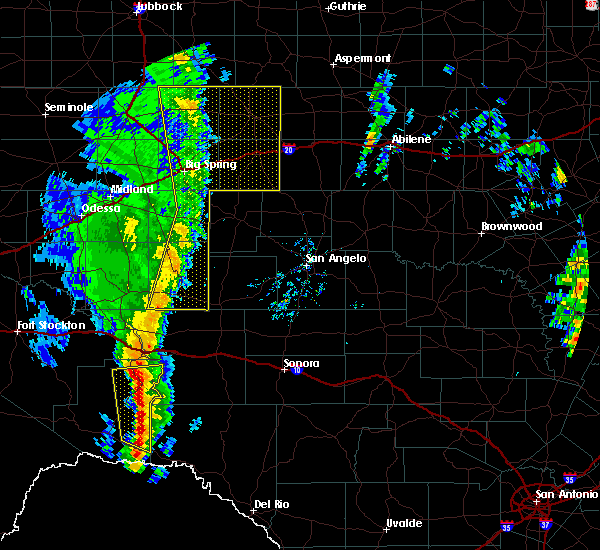 At 237 pm cst, severe thunderstorms were located along a line extending from 16 miles northeast of sheffield to 19 miles northeast of terrell county gas plant, moving northeast at 45 mph (radar indicated). Hazards include 60 mph wind gusts and quarter size hail. Hail damage to vehicles is expected. expect wind damage to roofs, siding, and trees. severe thunderstorms will be near, ozona around 305 pm cst. other locations impacted by these severe thunderstorms include the intersection of us 190 and highway 163, the intersection of ranch road 2083 and highway 405, the intersection of highway 163 and ranch road 1973, i-10 near the crockett- pecos county line, ft lancaster, the intersection of i- 10 and highway 405, the intersection of i-10 and highway 290, us- 190 near the crockett-sutton county line and i-10 near the crockett- sutton county line. This includes interstate 10 between mile markers 327 and 379. At 237 pm cst, severe thunderstorms were located along a line extending from 16 miles northeast of sheffield to 19 miles northeast of terrell county gas plant, moving northeast at 45 mph (radar indicated). Hazards include 60 mph wind gusts and quarter size hail. Hail damage to vehicles is expected. expect wind damage to roofs, siding, and trees. severe thunderstorms will be near, ozona around 305 pm cst. other locations impacted by these severe thunderstorms include the intersection of us 190 and highway 163, the intersection of ranch road 2083 and highway 405, the intersection of highway 163 and ranch road 1973, i-10 near the crockett- pecos county line, ft lancaster, the intersection of i- 10 and highway 405, the intersection of i-10 and highway 290, us- 190 near the crockett-sutton county line and i-10 near the crockett- sutton county line. This includes interstate 10 between mile markers 327 and 379.
|
| 6/3/2018 5:42 PM CDT |
 At 541 pm cdt, a severe thunderstorm was located near ozona, moving northwest at 10 mph (radar indicated). Hazards include golf ball size hail and 60 mph wind gusts. People and animals outdoors will be injured. expect hail damage to roofs, siding, windows, and vehicles. expect wind damage to roofs, siding, and trees. this severe storm will be near, ozona around 615 pm cdt. drivers on highway 163 south of ozona should expect large hail. Other locations impacted by this severe thunderstorm include the intersection of us 190 and highway 163, the intersection of highway 163 and ranch road 1973 and i-10 near the crockett-sutton county line. At 541 pm cdt, a severe thunderstorm was located near ozona, moving northwest at 10 mph (radar indicated). Hazards include golf ball size hail and 60 mph wind gusts. People and animals outdoors will be injured. expect hail damage to roofs, siding, windows, and vehicles. expect wind damage to roofs, siding, and trees. this severe storm will be near, ozona around 615 pm cdt. drivers on highway 163 south of ozona should expect large hail. Other locations impacted by this severe thunderstorm include the intersection of us 190 and highway 163, the intersection of highway 163 and ranch road 1973 and i-10 near the crockett-sutton county line.
|
| 6/3/2018 5:28 PM CDT |
 At 527 pm cdt, a severe thunderstorm was located 8 miles southeast of ozona, moving northwest at 10 mph (radar indicated). Hazards include ping pong ball size hail and 60 mph wind gusts. People and animals outdoors will be injured. expect hail damage to roofs, siding, windows, and vehicles. expect wind damage to roofs, siding, and trees. this severe thunderstorm will be near, ozona around 615 pm cdt. other locations impacted by this severe thunderstorm include the intersection of us 190 and highway 163, the intersection of highway 163 and ranch road 1973 and i-10 near the crockett-sutton county line. This includes interstate 10 between mile markers 351 and 379. At 527 pm cdt, a severe thunderstorm was located 8 miles southeast of ozona, moving northwest at 10 mph (radar indicated). Hazards include ping pong ball size hail and 60 mph wind gusts. People and animals outdoors will be injured. expect hail damage to roofs, siding, windows, and vehicles. expect wind damage to roofs, siding, and trees. this severe thunderstorm will be near, ozona around 615 pm cdt. other locations impacted by this severe thunderstorm include the intersection of us 190 and highway 163, the intersection of highway 163 and ranch road 1973 and i-10 near the crockett-sutton county line. This includes interstate 10 between mile markers 351 and 379.
|
| 6/2/2018 7:27 PM CDT |
 The national weather service in san angelo has issued a * severe thunderstorm warning for. southwestern schleicher county in west central texas. northeastern crockett county in west central texas. northwestern sutton county in west central texas. Until 815 pm cdt. The national weather service in san angelo has issued a * severe thunderstorm warning for. southwestern schleicher county in west central texas. northeastern crockett county in west central texas. northwestern sutton county in west central texas. Until 815 pm cdt.
|
| 6/2/2018 7:20 PM CDT | Ping Pong Ball sized hail reported 14.7 miles SE of Ozona, TX |
| 5/2/2018 11:28 PM CDT |
 At 1128 pm cdt, a severe thunderstorm was located 16 miles south of ozona, moving northeast at 40 mph (radar indicated). Hazards include ping pong ball size hail and 60 mph wind gusts. People and animals outdoors will be injured. expect hail damage to roofs, siding, windows, and vehicles. expect wind damage to roofs, siding, and trees. this severe thunderstorm will remain over mainly rural areas of southwestern schleicher, southeastern crockett and northwestern sutton counties, including the following locations: the intersection of highway 163 and ranch road 1973, i-10 near the crockett-sutton county line and the intersection of i-10 and ranch road 1989. This includes interstate 10 between mile markers 362 and 401. At 1128 pm cdt, a severe thunderstorm was located 16 miles south of ozona, moving northeast at 40 mph (radar indicated). Hazards include ping pong ball size hail and 60 mph wind gusts. People and animals outdoors will be injured. expect hail damage to roofs, siding, windows, and vehicles. expect wind damage to roofs, siding, and trees. this severe thunderstorm will remain over mainly rural areas of southwestern schleicher, southeastern crockett and northwestern sutton counties, including the following locations: the intersection of highway 163 and ranch road 1973, i-10 near the crockett-sutton county line and the intersection of i-10 and ranch road 1989. This includes interstate 10 between mile markers 362 and 401.
|
| 7/24/2017 8:25 PM CDT | Sheriffs office relayed a 60 mph wind gust reported from the ozona volunteer fire departent that was 17 miles west of ozona along i-1 in crockett county TX, 17 miles E of Ozona, TX |
| 6/23/2017 9:31 PM CDT |
 At 931 pm cdt, severe thunderstorms were located along a line extending from 13 miles southwest of fort mckavett to 15 miles northwest of sonora to 11 miles west of ozona, moving south at 45 mph (radar indicated). Hazards include 60 mph wind gusts. Expect damage to roofs, siding, and trees. these severe thunderstorms will remain over mainly rural areas of schleicher, eastern crockett and sutton counties, including the following locations: the intersection of ranch road 2083 and highway 405, the intersection of ranch road 2596 and ranch road 864, the intersection of us-190 and ranch road 2084, the intersection of u. s 190 and highway 163, the intersection of us-190 and ranch road 1828, i-10 near the crockett-sutton county line, the intersection of i-10 and ranch road 1989, the intersection of i-10 and highway 290, the intersection of us-277 and ranch road 189 and the intersection of highway 163 and ranch road 1973. This includes interstate 10 between mile markers 343 and 429. At 931 pm cdt, severe thunderstorms were located along a line extending from 13 miles southwest of fort mckavett to 15 miles northwest of sonora to 11 miles west of ozona, moving south at 45 mph (radar indicated). Hazards include 60 mph wind gusts. Expect damage to roofs, siding, and trees. these severe thunderstorms will remain over mainly rural areas of schleicher, eastern crockett and sutton counties, including the following locations: the intersection of ranch road 2083 and highway 405, the intersection of ranch road 2596 and ranch road 864, the intersection of us-190 and ranch road 2084, the intersection of u. s 190 and highway 163, the intersection of us-190 and ranch road 1828, i-10 near the crockett-sutton county line, the intersection of i-10 and ranch road 1989, the intersection of i-10 and highway 290, the intersection of us-277 and ranch road 189 and the intersection of highway 163 and ranch road 1973. This includes interstate 10 between mile markers 343 and 429.
|
| 6/23/2017 8:40 PM CDT |
 At 840 pm cdt, severe thunderstorms were located along a line extending from 12 miles southwest of eden to 8 miles northeast of eldorado to 24 miles northwest of sonora to 17 miles northwest of ozona, moving south at 30 mph (radar indicated). Hazards include 70 mph wind gusts. Expect considerable tree damage. damage is likely to mobile homes, roofs, and outbuildings. severe thunderstorms will be near, eldorado around 845 pm cdt. other locations impacted by these severe thunderstorms include the intersection of highway 163 and ranch road 1973, the intersection of ranch road 2596 and ranch road 864, the intersection of us- 190 and ranch road 2084, the intersection of u. s 190 and highway 163, camp sol mayer, the intersection of us-190 and ranch road 1828, i- 10 near the crockett-sutton county line, us-190 near the crockett- sutton county line and the intersection of i-10 and ranch road 1989. This includes interstate 10 between mile markers 350 and 415. At 840 pm cdt, severe thunderstorms were located along a line extending from 12 miles southwest of eden to 8 miles northeast of eldorado to 24 miles northwest of sonora to 17 miles northwest of ozona, moving south at 30 mph (radar indicated). Hazards include 70 mph wind gusts. Expect considerable tree damage. damage is likely to mobile homes, roofs, and outbuildings. severe thunderstorms will be near, eldorado around 845 pm cdt. other locations impacted by these severe thunderstorms include the intersection of highway 163 and ranch road 1973, the intersection of ranch road 2596 and ranch road 864, the intersection of us- 190 and ranch road 2084, the intersection of u. s 190 and highway 163, camp sol mayer, the intersection of us-190 and ranch road 1828, i- 10 near the crockett-sutton county line, us-190 near the crockett- sutton county line and the intersection of i-10 and ranch road 1989. This includes interstate 10 between mile markers 350 and 415.
|
| 4/10/2017 10:12 PM CDT | Baseball sized hail reported 33.8 miles NE of Ozona, TX, near the county line on fm2083 |
| 3/28/2017 9:10 PM CDT |
 At 908 pm cdt, a severe thunderstorm was located 9 miles northwest of eldorado, moving east at 45 mph (radar indicated). Hazards include 60 mph wind gusts and quarter size hail. Hail damage to vehicles is expected. expect wind damage to roofs, siding, and trees. This severe storm will be near, eldorado around 920 pm cdt. At 908 pm cdt, a severe thunderstorm was located 9 miles northwest of eldorado, moving east at 45 mph (radar indicated). Hazards include 60 mph wind gusts and quarter size hail. Hail damage to vehicles is expected. expect wind damage to roofs, siding, and trees. This severe storm will be near, eldorado around 920 pm cdt.
|
| 3/28/2017 8:42 PM CDT |
 At 841 pm cdt, a severe thunderstorm was located 14 miles southeast of barnhart, or 17 miles northeast of ozona, moving east at 45 mph (radar indicated). Hazards include 60 mph wind gusts and quarter size hail. Hail damage to vehicles is expected. expect wind damage to roofs, siding, and trees. this severe thunderstorm will be near, eldorado around 920 pm cdt. This includes interstate 10 between mile markers 336 and 405. At 841 pm cdt, a severe thunderstorm was located 14 miles southeast of barnhart, or 17 miles northeast of ozona, moving east at 45 mph (radar indicated). Hazards include 60 mph wind gusts and quarter size hail. Hail damage to vehicles is expected. expect wind damage to roofs, siding, and trees. this severe thunderstorm will be near, eldorado around 920 pm cdt. This includes interstate 10 between mile markers 336 and 405.
|
| 3/28/2017 8:22 PM CDT |
 At 821 pm cdt, a severe thunderstorm was located 14 miles southwest of barnhart, or 17 miles north of ozona, moving east at 50 mph (radar indicated). Hazards include 60 mph wind gusts and quarter size hail. Hail damage to vehicles is expected. expect wind damage to roofs, siding, and trees. this severe thunderstorm will remain over mainly rural areas of northeastern crockett and southwestern irion counties, including the following locations: the intersection of u. s 190 and highway 163, ft lancaster, the intersection of i-10 and highway 290, the intersection of i-10 and highway 405 and i-10 near the crockett-pecos county line. This includes interstate 10 between mile markers 327 and 379. At 821 pm cdt, a severe thunderstorm was located 14 miles southwest of barnhart, or 17 miles north of ozona, moving east at 50 mph (radar indicated). Hazards include 60 mph wind gusts and quarter size hail. Hail damage to vehicles is expected. expect wind damage to roofs, siding, and trees. this severe thunderstorm will remain over mainly rural areas of northeastern crockett and southwestern irion counties, including the following locations: the intersection of u. s 190 and highway 163, ft lancaster, the intersection of i-10 and highway 290, the intersection of i-10 and highway 405 and i-10 near the crockett-pecos county line. This includes interstate 10 between mile markers 327 and 379.
|
| 5/26/2016 5:40 PM CDT | Winds gusting up to 60 mph along interstate 10 near mile marker 35 in crockett county TX, 7.8 miles ENE of Ozona, TX |
| 5/26/2016 5:40 PM CDT | Exit sign blown down at exit 350 on interstate 1 in crockett county TX, 14.7 miles E of Ozona, TX |
| 5/26/2016 5:32 PM CDT |
 At 532 pm cdt, a severe thunderstorm was located 11 miles southwest of ozona, moving northeast at 45 mph (radar indicated). Hazards include 60 mph wind gusts and half dollar size hail. Hail damage to vehicles is expected. expect wind damage to roofs, siding, and trees. this severe storm will be near, ozona around 545 pm cdt. other locations impacted by this severe thunderstorm include the intersection of i-10 and highway 405, the intersection of i-10 and highway 290 and the intersection of highway 163 and ranch road 1973. This includes interstate 10 between mile markers 342 and 375. At 532 pm cdt, a severe thunderstorm was located 11 miles southwest of ozona, moving northeast at 45 mph (radar indicated). Hazards include 60 mph wind gusts and half dollar size hail. Hail damage to vehicles is expected. expect wind damage to roofs, siding, and trees. this severe storm will be near, ozona around 545 pm cdt. other locations impacted by this severe thunderstorm include the intersection of i-10 and highway 405, the intersection of i-10 and highway 290 and the intersection of highway 163 and ranch road 1973. This includes interstate 10 between mile markers 342 and 375.
|
| 5/26/2016 5:09 PM CDT |
 At 509 pm cdt, a severe thunderstorm was located 14 miles north of pandale, or 27 miles southeast of sheffield, moving northeast at 45 mph (radar indicated). Hazards include ping pong ball size hail and 60 mph wind gusts. People and animals outdoors will be injured. expect hail damage to roofs, siding, windows, and vehicles. expect wind damage to roofs, siding, and trees. this severe storm will be near, ozona around 545 pm cdt. other locations impacted by this severe thunderstorm include the intersection of i-10 and highway 405, the intersection of i-10 and highway 290, the intersection of ranch road 2083 and highway 405 and the intersection of highway 163 and ranch road 1973. This includes interstate 10 between mile markers 340 and 375. At 509 pm cdt, a severe thunderstorm was located 14 miles north of pandale, or 27 miles southeast of sheffield, moving northeast at 45 mph (radar indicated). Hazards include ping pong ball size hail and 60 mph wind gusts. People and animals outdoors will be injured. expect hail damage to roofs, siding, windows, and vehicles. expect wind damage to roofs, siding, and trees. this severe storm will be near, ozona around 545 pm cdt. other locations impacted by this severe thunderstorm include the intersection of i-10 and highway 405, the intersection of i-10 and highway 290, the intersection of ranch road 2083 and highway 405 and the intersection of highway 163 and ranch road 1973. This includes interstate 10 between mile markers 340 and 375.
|
| 5/26/2016 5:03 PM CDT |
 At 503 pm cdt, a severe thunderstorm was located 9 miles north of pandale, or 29 miles northwest of juno, moving northeast at 45 mph (radar indicated). Hazards include 60 mph wind gusts and half dollar size hail. Hail damage to vehicles is expected. expect wind damage to roofs, siding, and trees. this severe thunderstorm will be near, ozona around 545 pm cdt. other locations impacted by this severe thunderstorm include the intersection of i-10 and highway 405, the intersection of i-10 and highway 290, the intersection of ranch road 2083 and highway 405 and the intersection of highway 163 and ranch road 1973. This includes interstate 10 between mile markers 340 and 375. At 503 pm cdt, a severe thunderstorm was located 9 miles north of pandale, or 29 miles northwest of juno, moving northeast at 45 mph (radar indicated). Hazards include 60 mph wind gusts and half dollar size hail. Hail damage to vehicles is expected. expect wind damage to roofs, siding, and trees. this severe thunderstorm will be near, ozona around 545 pm cdt. other locations impacted by this severe thunderstorm include the intersection of i-10 and highway 405, the intersection of i-10 and highway 290, the intersection of ranch road 2083 and highway 405 and the intersection of highway 163 and ranch road 1973. This includes interstate 10 between mile markers 340 and 375.
|
| 5/17/2016 6:14 PM CDT |
 At 613 pm cdt, a severe thunderstorm was located 8 miles southeast of ozona, moving east at 30 mph (radar indicated). Hazards include golf ball size hail and 60 mph wind gusts. People and animals outdoors will be injured. expect hail damage to roofs, siding, windows, and vehicles. expect wind damage to roofs, siding, and trees. this severe thunderstorm will remain over mainly rural areas of east central crockett county. This includes interstate 10 between mile markers 361 and 379. At 613 pm cdt, a severe thunderstorm was located 8 miles southeast of ozona, moving east at 30 mph (radar indicated). Hazards include golf ball size hail and 60 mph wind gusts. People and animals outdoors will be injured. expect hail damage to roofs, siding, windows, and vehicles. expect wind damage to roofs, siding, and trees. this severe thunderstorm will remain over mainly rural areas of east central crockett county. This includes interstate 10 between mile markers 361 and 379.
|
| 5/17/2016 5:54 PM CDT |
 At 554 pm cdt, a severe thunderstorm was located near ozona, moving northeast at 10 mph (radar indicated). Hazards include 60 mph wind gusts and quarter size hail. Hail damage to vehicles is expected. expect wind damage to roofs, siding, and trees. this severe thunderstorm will be near, ozona around 625 pm cdt. This includes interstate 10 between mile markers 361 and 379. At 554 pm cdt, a severe thunderstorm was located near ozona, moving northeast at 10 mph (radar indicated). Hazards include 60 mph wind gusts and quarter size hail. Hail damage to vehicles is expected. expect wind damage to roofs, siding, and trees. this severe thunderstorm will be near, ozona around 625 pm cdt. This includes interstate 10 between mile markers 361 and 379.
|
| 5/17/2016 5:07 PM CDT | Quarter sized hail reported 14.7 miles SE of Ozona, TX |
| 3/8/2016 4:22 PM CST |
 At 421 pm cst, a severe thunderstorm was located 9 miles west of ozona, moving north at 30 mph (radar indicated). Hazards include 60 mph wind gusts and quarter size hail. Hail damage to vehicles is expected. expect wind damage to roofs, siding, and trees. locations impacted include, ozona and the intersection of i-10 and highway 405. This includes interstate 10 between mile markers 349 and 368. At 421 pm cst, a severe thunderstorm was located 9 miles west of ozona, moving north at 30 mph (radar indicated). Hazards include 60 mph wind gusts and quarter size hail. Hail damage to vehicles is expected. expect wind damage to roofs, siding, and trees. locations impacted include, ozona and the intersection of i-10 and highway 405. This includes interstate 10 between mile markers 349 and 368.
|
| 3/8/2016 4:06 PM CST |
 At 406 pm cst, a severe thunderstorm was located 12 miles southwest of ozona, moving north at 35 mph (radar indicated). Hazards include 60 mph wind gusts and quarter size hail. Hail damage to vehicles is expected. expect wind damage to roofs, siding, and trees. locations impacted include, ozona and the intersection of i-10 and highway 405. This includes interstate 10 between mile markers 348 and 370. At 406 pm cst, a severe thunderstorm was located 12 miles southwest of ozona, moving north at 35 mph (radar indicated). Hazards include 60 mph wind gusts and quarter size hail. Hail damage to vehicles is expected. expect wind damage to roofs, siding, and trees. locations impacted include, ozona and the intersection of i-10 and highway 405. This includes interstate 10 between mile markers 348 and 370.
|
| 3/8/2016 3:48 PM CST |
 At 347 pm cst, a severe thunderstorm was located 21 miles southwest of ozona, moving north at 35 mph (radar indicated). Hazards include 60 mph wind gusts and quarter size hail. Hail damage to vehicles is expected. expect wind damage to roofs, siding, and trees. this severe thunderstorm will remain over mainly rural areas of southeastern crockett county, including the following locations: the intersection of i-10 and highway 405 and the intersection of ranch road 2083 and highway 405. This includes interstate 10 between mile markers 346 and 371. At 347 pm cst, a severe thunderstorm was located 21 miles southwest of ozona, moving north at 35 mph (radar indicated). Hazards include 60 mph wind gusts and quarter size hail. Hail damage to vehicles is expected. expect wind damage to roofs, siding, and trees. this severe thunderstorm will remain over mainly rural areas of southeastern crockett county, including the following locations: the intersection of i-10 and highway 405 and the intersection of ranch road 2083 and highway 405. This includes interstate 10 between mile markers 346 and 371.
|
| 3/8/2016 1:04 AM CST |
 At 103 am cst, a severe thunderstorm was located 8 miles southwest of barnhart, or 16 miles southeast of big lake, moving north at 35 mph (radar indicated). Hazards include golf ball size hail and 60 mph wind gusts. People and animals outdoors will be injured. expect hail damage to roofs, siding, windows, and vehicles. expect wind damage to roofs, siding, and trees. this severe storm will be near, barnhart around 115 am cst. other locations impacted by this severe thunderstorm include the intersection of i-10 and highway 405, the intersection of u. s 190 and highway 163, the intersection of i-10 and highway 290, ft lancaster and the intersection of highway 163 and ranch road 1973. This includes interstate 10 between mile markers 328 and 373. At 103 am cst, a severe thunderstorm was located 8 miles southwest of barnhart, or 16 miles southeast of big lake, moving north at 35 mph (radar indicated). Hazards include golf ball size hail and 60 mph wind gusts. People and animals outdoors will be injured. expect hail damage to roofs, siding, windows, and vehicles. expect wind damage to roofs, siding, and trees. this severe storm will be near, barnhart around 115 am cst. other locations impacted by this severe thunderstorm include the intersection of i-10 and highway 405, the intersection of u. s 190 and highway 163, the intersection of i-10 and highway 290, ft lancaster and the intersection of highway 163 and ranch road 1973. This includes interstate 10 between mile markers 328 and 373.
|
| 3/8/2016 12:56 AM CST |
 At 1255 am cst, a severe thunderstorm was located 14 miles southwest of barnhart, or 17 miles north of ozona, moving northeast at 35 mph (radar indicated). Hazards include 60 mph wind gusts and half dollar size hail. Hail damage to vehicles is expected. expect wind damage to roofs, siding, and trees. this severe thunderstorm will be near, barnhart around 115 am cst. other locations impacted by this severe thunderstorm include the intersection of i-10 and highway 405, the intersection of u. s 190 and highway 163, the intersection of i-10 and highway 290, ft lancaster and the intersection of highway 163 and ranch road 1973. This includes interstate 10 between mile markers 328 and 373. At 1255 am cst, a severe thunderstorm was located 14 miles southwest of barnhart, or 17 miles north of ozona, moving northeast at 35 mph (radar indicated). Hazards include 60 mph wind gusts and half dollar size hail. Hail damage to vehicles is expected. expect wind damage to roofs, siding, and trees. this severe thunderstorm will be near, barnhart around 115 am cst. other locations impacted by this severe thunderstorm include the intersection of i-10 and highway 405, the intersection of u. s 190 and highway 163, the intersection of i-10 and highway 290, ft lancaster and the intersection of highway 163 and ranch road 1973. This includes interstate 10 between mile markers 328 and 373.
|
| 5/28/2015 8:53 PM CDT | At 851 pm cdt, severe thunderstorms were located along a line extending from 17 miles northwest of fort mckavett to 12 miles east of the terrell gas plant, and moving southeast at 35 mph (radar indicated). Hazards include 60 mph wind gusts. Expect damage to roofs. siding and trees. severe thunderstorms will be near, sonora around 915 pm cdt. other locations in the warning include the intersection of us-190 and ranch road 2084, the intersection of highway 163 and ranch road 1973, us-277 near the sutton-schleicher county line and the intersection of i-10 and ranch road 1989. This includes interstate 10 between mile markers 342 and 428. |
| 5/28/2015 8:17 PM CDT | At 814 pm cdt, severe thunderstorms were located along a line extending from 11 miles southwest of christoval to 13 miles southeast of sheffield, moving southeast at 50 mph (radar indicated). Hazards include 60 mph wind gusts and quarter size hail. Hail damage to vehicles is expected. expect wind damage to roofs, siding and trees. severe thunderstorms will be near, eldorado around 830 pm cdt. sonora around 850 pm cdt. This also includes interstate 10 between mile markers 343 and 428. |
| 5/19/2015 2:05 AM CDT | At 202 am cdt, severe thunderstorms were located along a line extending from 12 miles east of stiles to 9 miles southeast of big lake to 21 miles south of big lake, and moving east at 35 mph (radar indicated). Hazards include 70 mph wind gusts and quarter size hail. Hail damage to vehicles is expected. expect considerable tree damage. wind damage is also likely to mobile homes, roofs and outbuildings. severe thunderstorms will be near, barnhart around 220 am cdt. ozona around 240 am cdt. other locations in the warning include the intersection of us 190 and highway 163. this includes interstate 10 between mile markers 353 and 366. 1. 00in. |
| 5/19/2015 1:50 AM CDT | At 146 am cdt, severe thunderstorms were located along a line extending from stiles to 5 miles south of big lake to 13 miles east of iraan, moving east at 25 mph. these are very dangerous storms (radar indicated). Hazards include 80 mph wind gusts and half dollar size hail. Flying debris will be dangerous to those caught without shelter. mobile homes will be heavily damaged. expect considerable damage to roofs, windows and vehicles. extensive tree damage and power outages are likely. severe thunderstorms will be near, barnhart around 240 am cdt. other locations in the warning include the intersection of us 190 and highway 163. this also includes interstate 10 between mile markers 356 and 366. 1. 25in. |
| 5/18/2015 7:40 PM CDT | At 738 pm cdt, a severe thunderstorm was located 13 miles southwest of barnhart, and moving north at 30 mph (radar indicated). Hazards include ping pong ball size hail and 60 mph wind gusts. People and pets outdoors will be injured. expect hail damage to roofs, siding, windows and vehicles. expect wind damage to roofs, siding and trees. locations impacted include, mainly rural areas of northern crockett county. this includes interstate 10 between mile markers 349 and 376. 1. 50in. |
| 5/18/2015 7:27 PM CDT | At 724 pm cdt, a severe thunderstorm was located 14 miles northwest of ozona, and another severe thunderstorm was located about 7 miles southwest ozona. the storms moving north at 25 mph (radar indicated). Hazards include 60 mph wind gusts and half dollar size hail. Hail damage to vehicles is expected. expect wind damage to roofs, siding and trees. the severe thunderstorm will affect mainly rural areas of northeastern crockett county. this also includes interstate 10 between mile markers 349 and 376. 1. 25in. |
| 5/16/2015 11:31 PM CDT | At 1129 pm cdt, severe thunderstorms were located along a line extending from eldorado to 16 miles west of ozona, and moving east at 35 mph (radar indicated). Hazards include 60 mph wind gusts and half dollar size hail. Hail damage to vehicles is expected. expect wind damage to roofs, siding and trees. locations impacted include, ozona, eldorado, i-10 near the crockett-sutton county line and us-277 near the sutton-schleicher county line. this includes interstate 10 between mile markers 332 and 382. 1. 25in. |
| 5/16/2015 11:25 PM CDT | Storm damage reported in crockett county TX, 6.2 miles W of Ozona, TX |
| 5/16/2015 11:13 PM CDT | At 1110 pm cdt, severe thunderstorms were located along a line extending from 7 miles north of eldorado to 17 miles east of sheffield, moving east at 55 mph (radar indicated). Hazards include golf ball size hail and 60 mph wind gusts. People and pets outdoors will be injured. expect hail damage to roofs, siding, windows and vehicles. expect wind damage to roofs, siding and trees. severe thunderstorms will affect mainly rural areas of northern crockett, northwestern sutton and schleicher counties, including the following locations, the intersection of us 190 and highway 163, the intersection of ranch road 1828 and ranch road 915 and us-190 near the crockett-sutton county line. this also includes interstate 10 between mile markers 332 and 381. 1. 75in. |
| 5/16/2015 11:12 PM CDT | Golf Ball sized hail reported 3.9 miles SE of Ozona, TX |
| 5/16/2015 10:23 PM CDT | At 1021 pm cdt, a severe thunderstorm was located 9 miles northwest of ozona, and moving east at 25 mph. golf ball size hail was reported 8 miles northwest of ozona (trained weather spotters). Hazards include golf ball size hail and 60 mph wind gusts. People and pets outdoors will be injured. expect hail damage to roofs, siding, windows and vehicles. expect wind damage to roofs, siding and trees. locations impacted include, ozona, the intersection of us 190 and highway 163, us-190 near the crockett-sutton county line and the intersection of us-190 and ranch road 1828. this includes interstate 10 between mile markers 353 and 372. 1. 75in. |
| 5/16/2015 10:22 PM CDT | Golf Ball sized hail reported 8.8 miles SE of Ozona, TX |
| 5/16/2015 10:12 PM CDT | At 1009 pm cdt, a severe thunderstorm was located 12 miles northwest of ozona, moving east at 25 mph. another severe thunderstorm was located 10 mile southeast of barnhart, also moving east at 25 mph (radar indicated). Hazards include ping pong ball size hail and 60 mph wind gusts. People and pets outdoors will be injured. expect hail damage to roofs, siding, windows and vehicles. expect wind damage to roofs, siding and trees. the severe thunderstorm will affect mainly rural areas of northeastern crockett, southern irion and western schleicher counties, including the following locations, the intersection of us 190 and highway 163, us-190 near the crockett-sutton county line and the intersection of us-190 and ranch road 1828. this also includes interstate 10 between mile markers 353 and 372. 1. 50in. |
| 5/13/2015 4:44 PM CDT | At 443 pm cdt, a severe thunderstorm was located 12 miles southeast of ozona, moving east at 25 mph (radar indicated). Hazards include 60 mph wind gusts and quarter size hail. Hail damage to vehicles is expected. expect wind damage to roofs, siding and trees. the severe thunderstorm will be near, sonora around 530 pm cdt. other locations in the warning include i-10 near the crockett-sutton county line and the intersection of i-10 and ranch road 1989. this also includes interstate 10 between mile markers 356 and 402. Possible. |
| 5/13/2015 4:26 PM CDT | At 425 pm cdt, a severe thunderstorm was located near ozona, and moving east at 30 mph (radar indicated). Hazards include 60 mph wind gusts and quarter size hail. Hail damage to vehicles is expected. expect wind damage to roofs, siding and trees. locations impacted include, i-10 near the crockett-sutton county line. this includes interstate 10 between mile markers 356 and 384. 1. 00in. |
| 5/13/2015 4:06 PM CDT | At 404 pm cdt, a severe thunderstorm was located near ozona, moving east at 30 mph (radar indicated). Hazards include 60 mph wind gusts and half dollar size hail. Hail damage to vehicles is expected. expect wind damage to roofs, siding and trees. the severe thunderstorm will affect mainly rural areas of east central crockett, northwestern sutton and southwestern schleicher counties, including the following locations, ozona and i-10 near the crockett-sutton county line. this also includes interstate 10 between mile markers 349 and 384. 1. 25in. |
| 5/7/2014 6:48 PM CDT | Golf Ball sized hail reported 26.9 miles N of Ozona, TX |
| 10/13/2012 5:07 PM CDT | Quarter sized hail reported 21.1 miles SSW of Ozona, TX |
| 4/7/2012 11:43 PM CDT | Ping Pong Ball sized hail reported 26 miles ENE of Ozona, TX, ping pong ball size hail 8 miles south of four corner windmill |
| 4/7/2012 11:25 PM CDT | Quarter sized hail reported 1 miles E of Ozona, TX |
| 4/7/2012 11:02 PM CDT | Winds esimated 60 to 70 mph in crockett county TX, 1.6 miles E of Ozona, TX |
| 4/7/2012 11:02 PM CDT | Ping Pong Ball sized hail reported 1.6 miles E of Ozona, TX, half dollar to ping pong ball size hail reported along interstate 10. |
| 1/1/0001 12:00 AM | Golf Ball sized hail reported 5 miles W of Ozona, TX |
Hail Maps for Ozona, TX
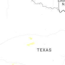
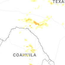
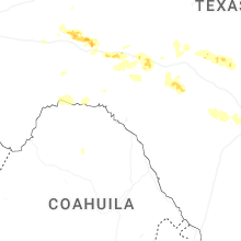
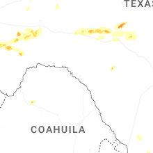
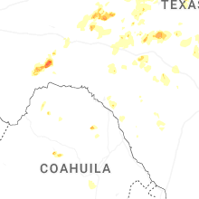
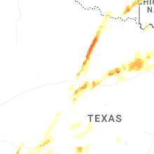
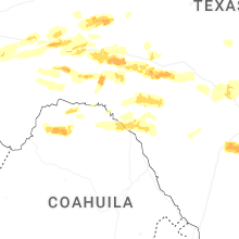
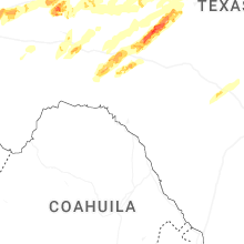
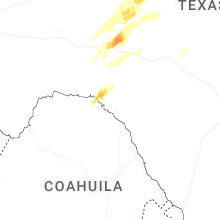


Connect with Interactive Hail Maps