

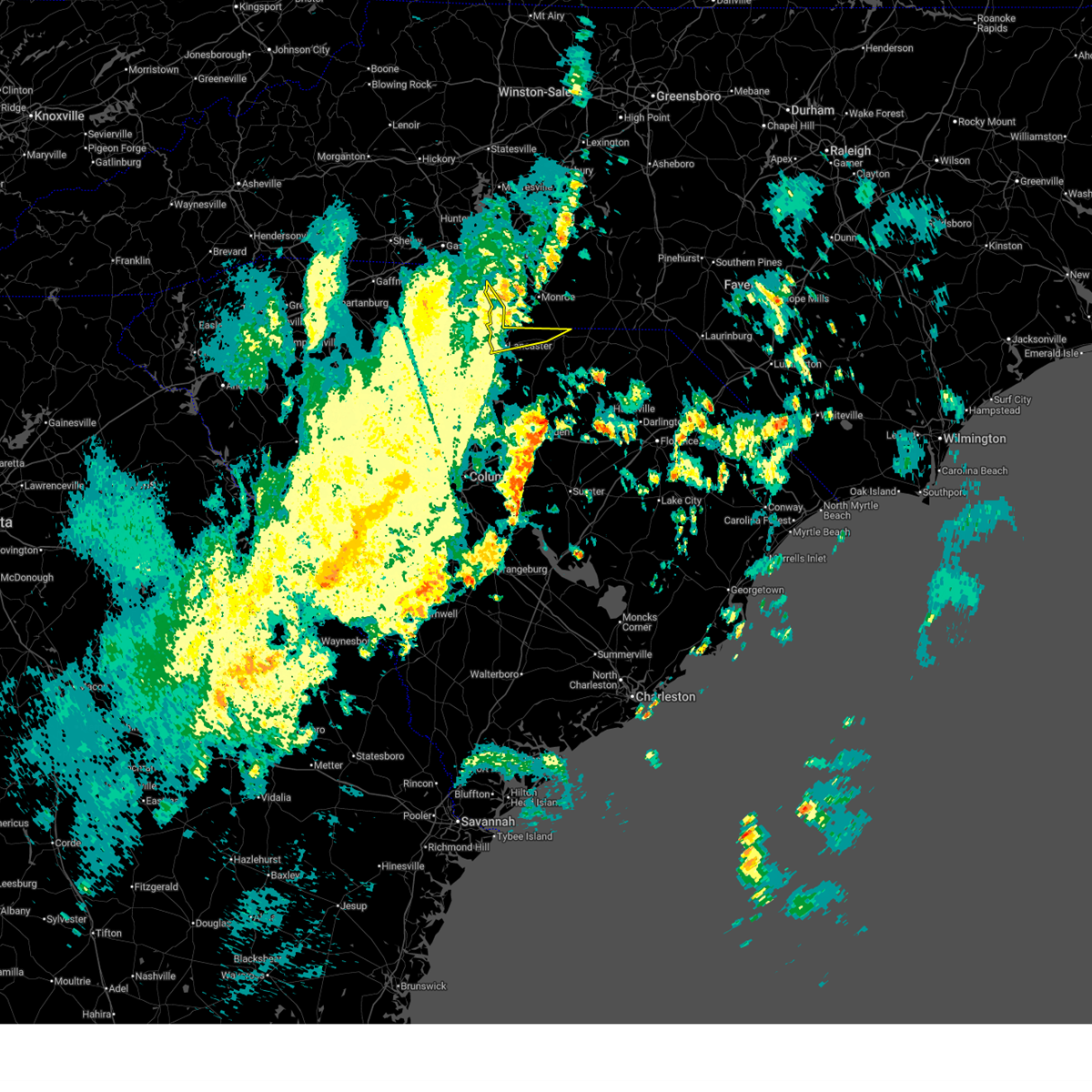
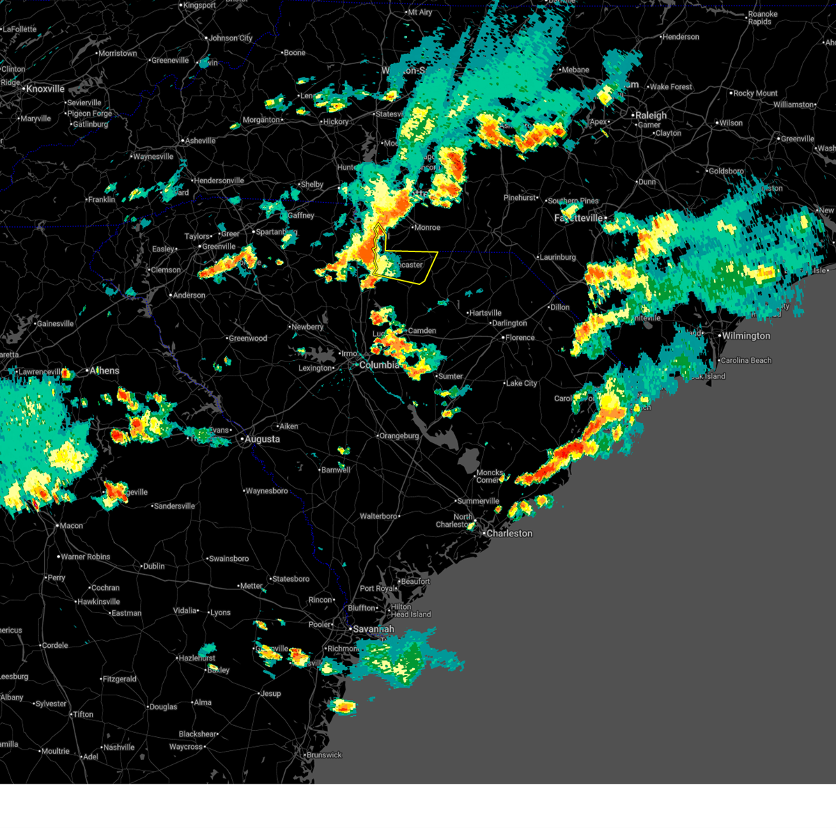
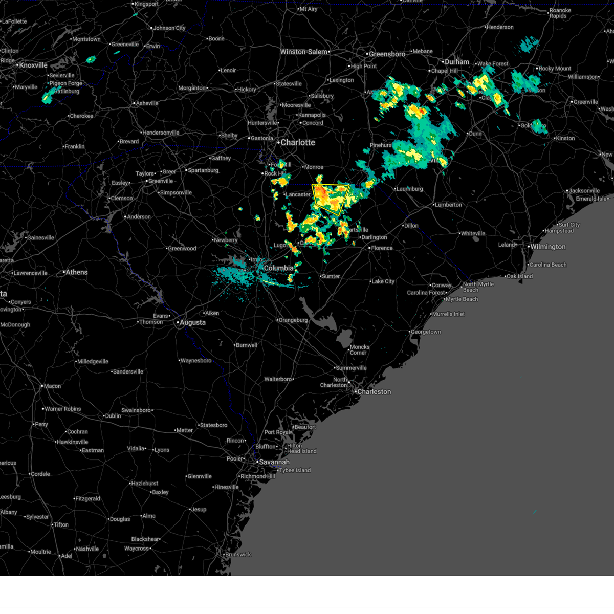
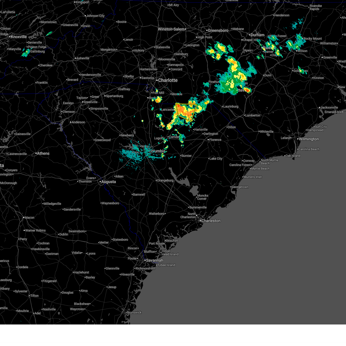
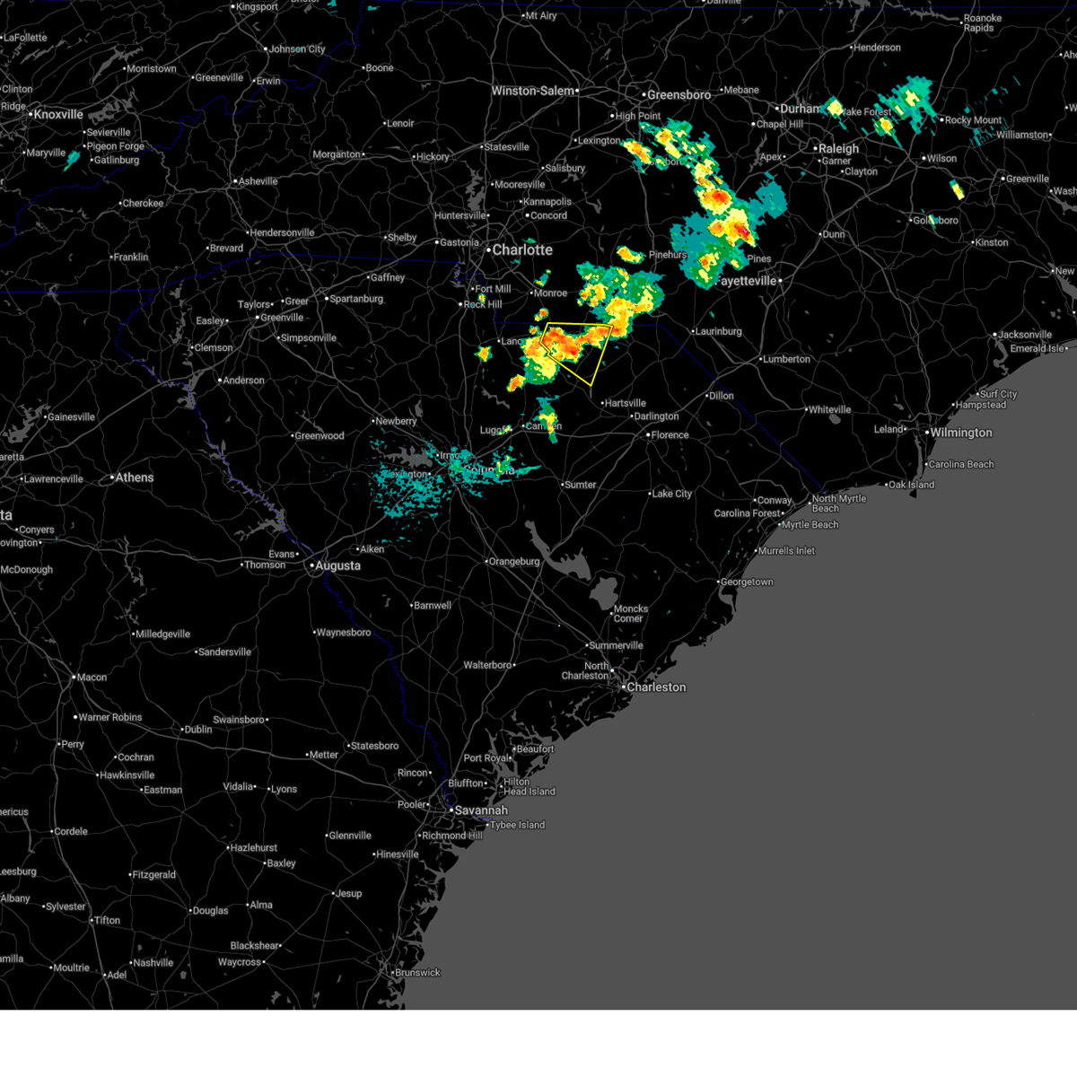
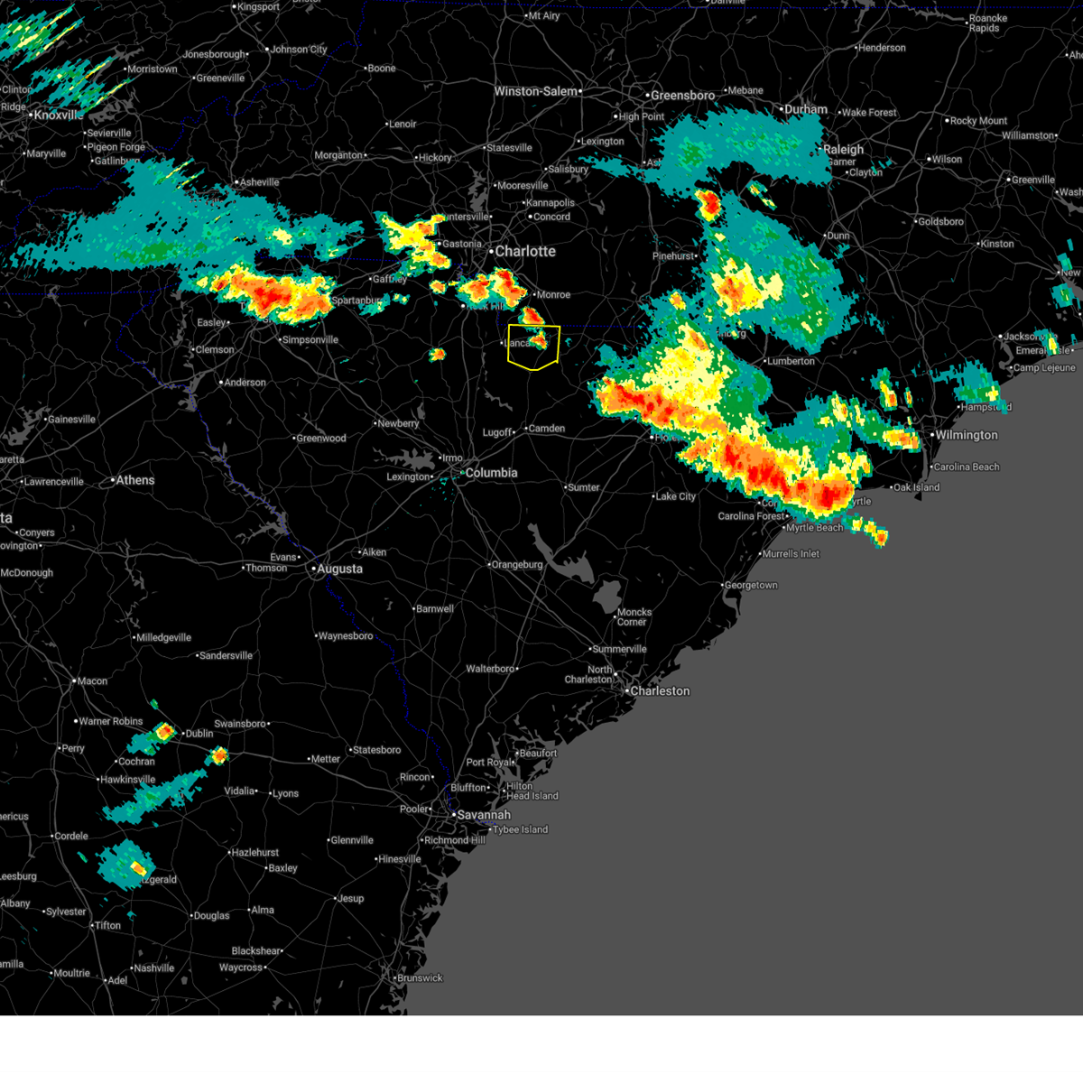
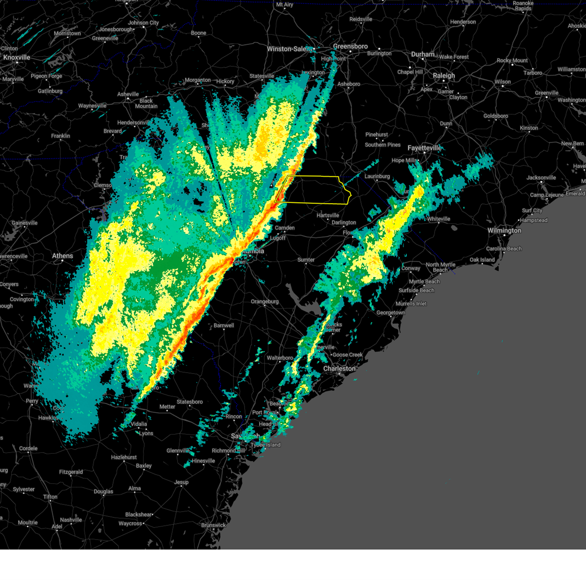
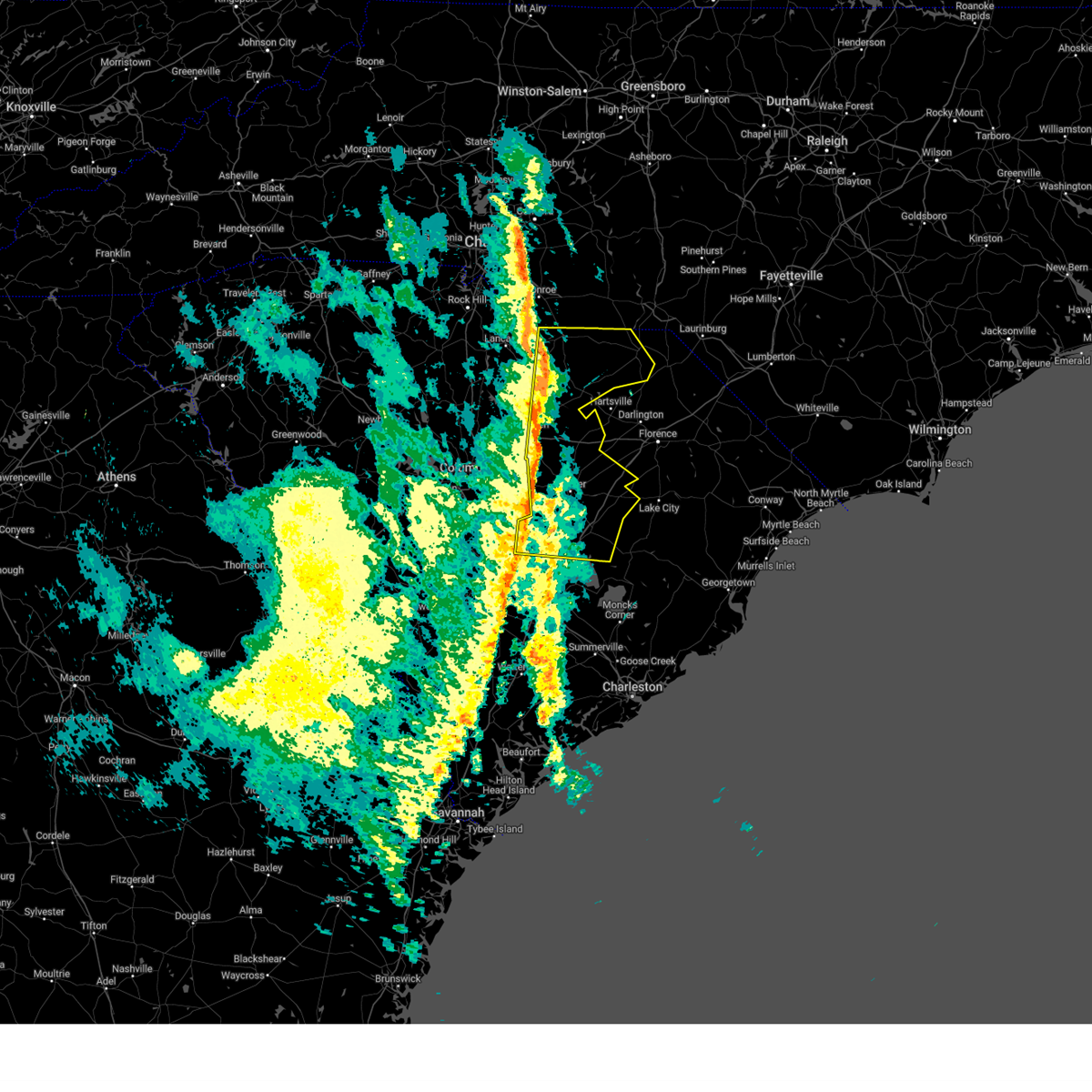
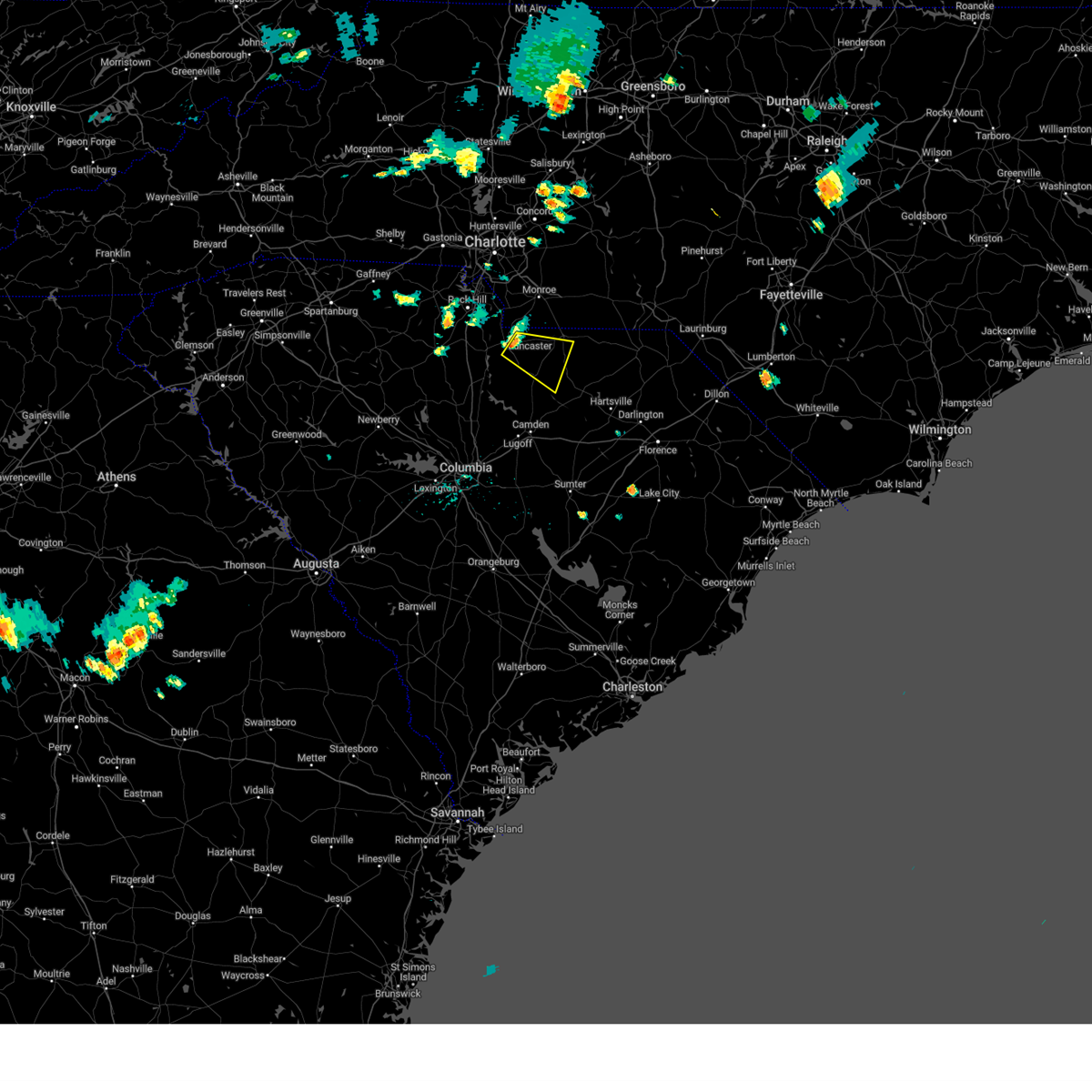
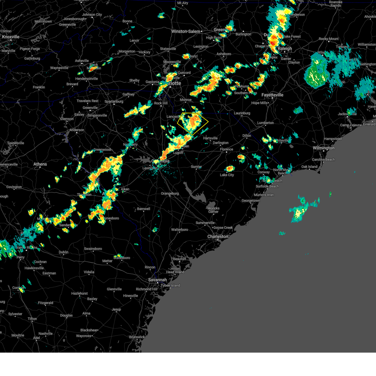
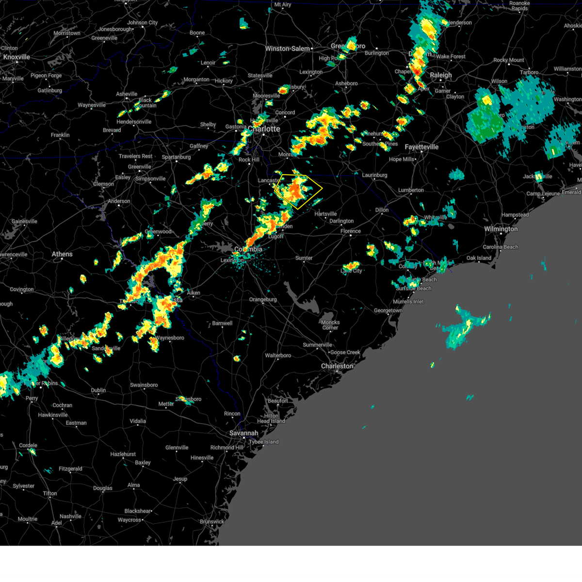
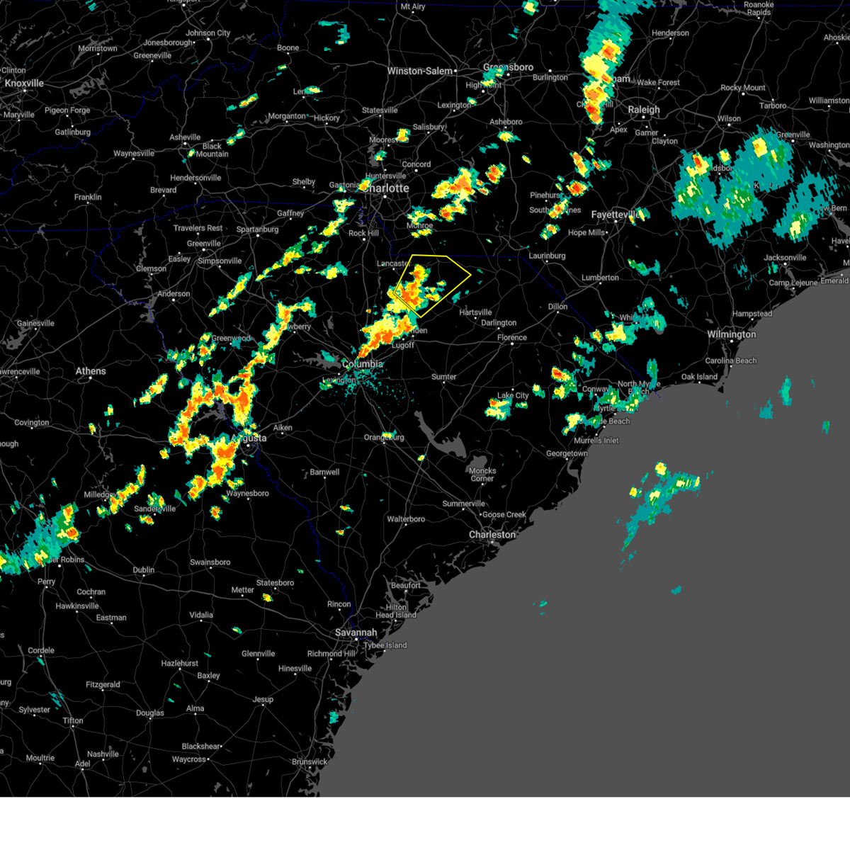
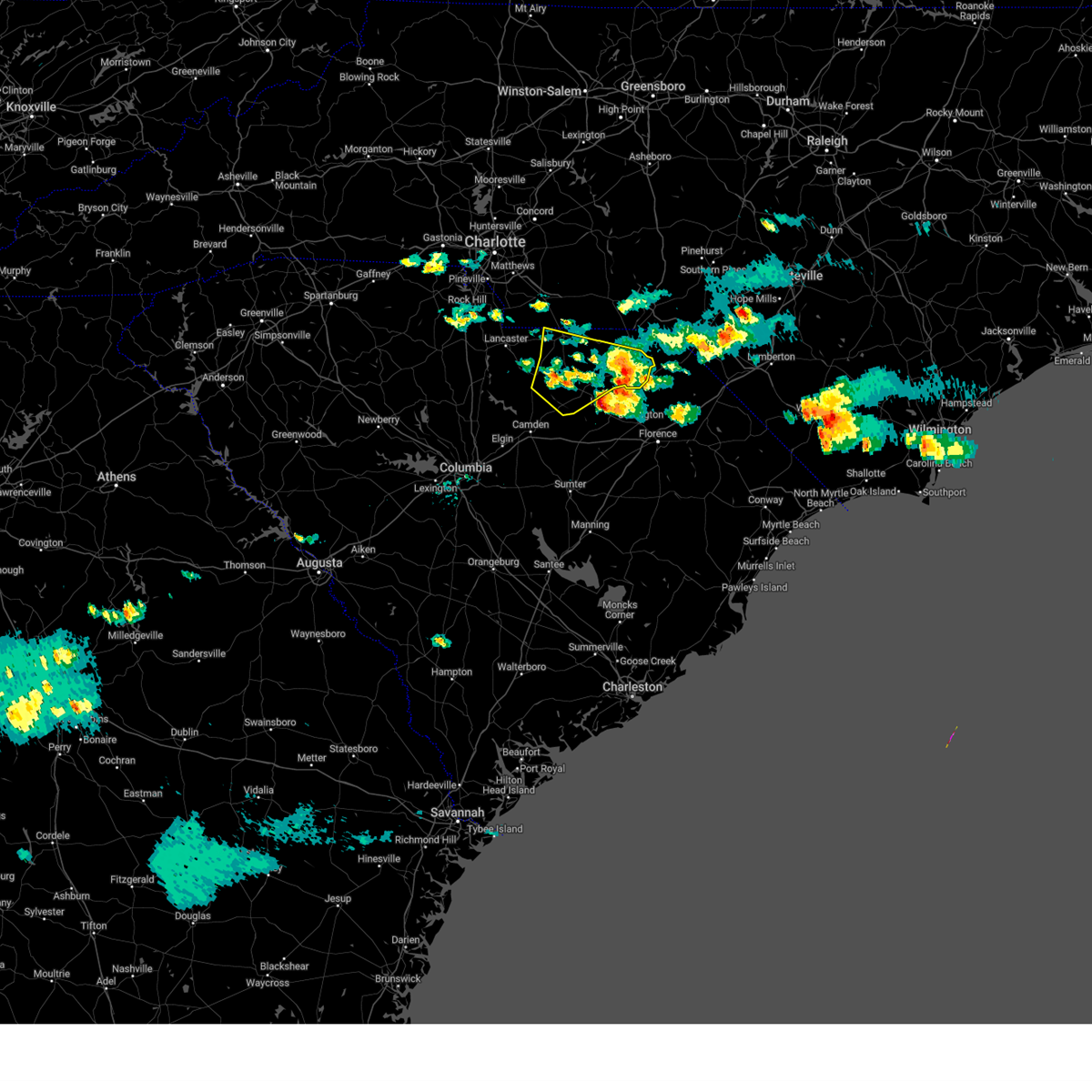
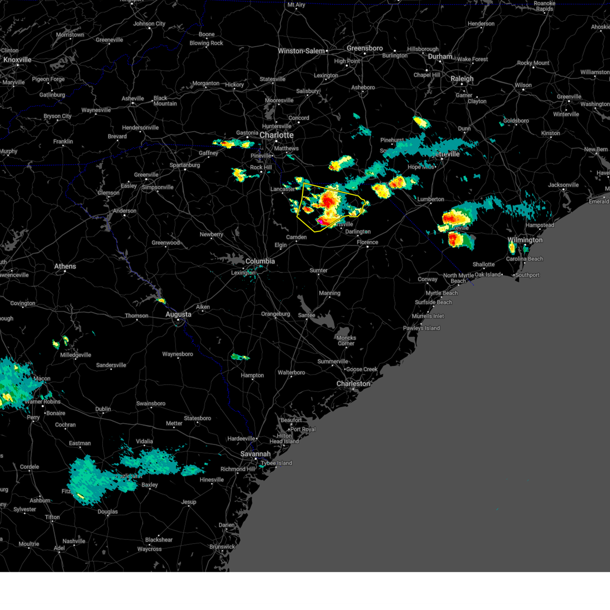
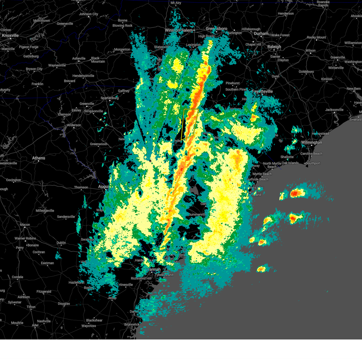
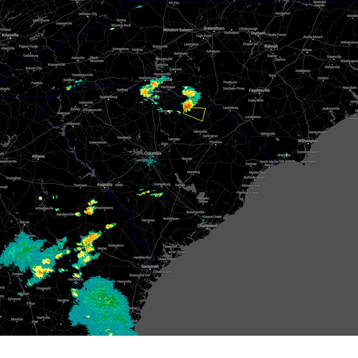
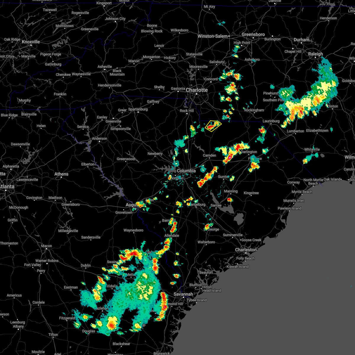
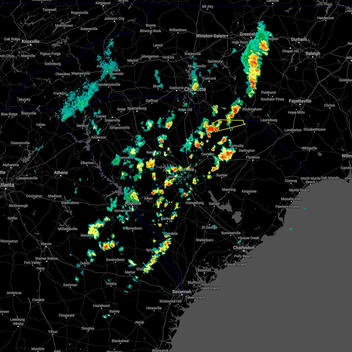
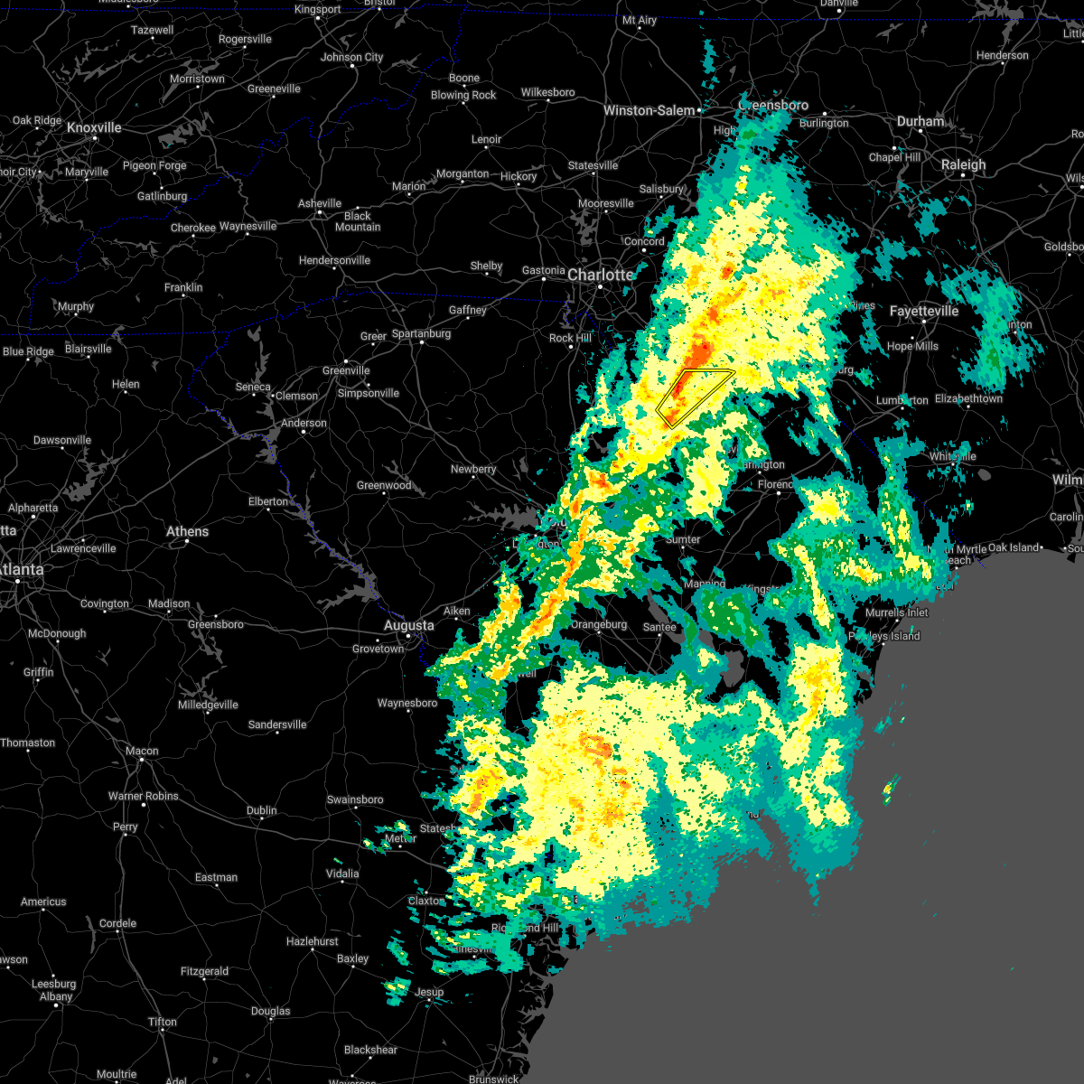
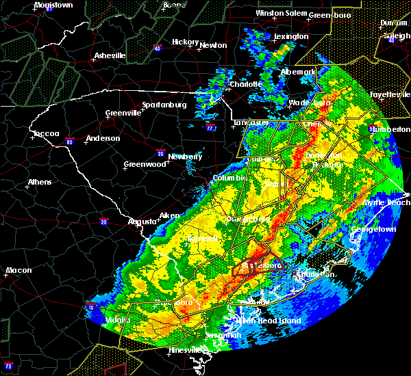
Hail Map for Pageland, SC
The Pageland, SC area has had 5 reports of on-the-ground hail by trained spotters, and has been under severe weather warnings 9 times during the past 12 months. Doppler radar has detected hail at or near Pageland, SC on 53 occasions, including 1 occasion during the past year.
| Name: | Pageland, SC |
| Where Located: | 40.4 miles SE of Charlotte, NC |
| Map: | Google Map for Pageland, SC |
| Population: | 2760 |
| Housing Units: | 1246 |
| More Info: | Search Google for Pageland, SC |
0
The Top Recent Hail Date for Pageland, SC is Wednesday, July 9, 2025 (50th out of 53)

Hail and Wind Damage Spotted near Pageland, SC
| Date / Time | Report Details |
|---|---|
| 3/16/2026 10:16 AM EDT |
 the severe thunderstorm warning has been cancelled and is no longer in effect the severe thunderstorm warning has been cancelled and is no longer in effect
|
| 3/16/2026 9:38 AM EDT |
 Svrcae the national weather service in columbia has issued a * severe thunderstorm warning for, northern lancaster county in central south carolina, northwestern chesterfield county in central south carolina, * until 1045 am edt. * at 937 am edt, severe thunderstorms were located along a line extending from near hidden valley to near chester, moving east at 60 mph (radar indicated). Hazards include 60 mph wind gusts. expect damage to trees and powerlines Svrcae the national weather service in columbia has issued a * severe thunderstorm warning for, northern lancaster county in central south carolina, northwestern chesterfield county in central south carolina, * until 1045 am edt. * at 937 am edt, severe thunderstorms were located along a line extending from near hidden valley to near chester, moving east at 60 mph (radar indicated). Hazards include 60 mph wind gusts. expect damage to trees and powerlines
|
| 8/1/2025 7:11 PM EDT |
 The storms which prompted the warning have weakened below severe limits, and no longer pose an immediate threat to life or property. therefore, the warning will be allowed to expire. The storms which prompted the warning have weakened below severe limits, and no longer pose an immediate threat to life or property. therefore, the warning will be allowed to expire.
|
| 8/1/2025 6:53 PM EDT |
 At 653 pm edt, severe thunderstorms were located along a line extending from near sturdivants to near kershaw, moving east at 40 mph (radar indicated). Hazards include 60 mph wind gusts. Expect damage to trees and powerlines. Locations impacted include, pageland, elgin, buford, taxahaw, pleasant hill, high point fire station, kershaw correctional institution, tradesville, antioch, bear creek park, kirk air base, and forty acre rock preserve. At 653 pm edt, severe thunderstorms were located along a line extending from near sturdivants to near kershaw, moving east at 40 mph (radar indicated). Hazards include 60 mph wind gusts. Expect damage to trees and powerlines. Locations impacted include, pageland, elgin, buford, taxahaw, pleasant hill, high point fire station, kershaw correctional institution, tradesville, antioch, bear creek park, kirk air base, and forty acre rock preserve.
|
| 8/1/2025 6:33 PM EDT |
 At 633 pm edt, severe thunderstorms were located along a line extending from near mineral springs to fishing creek reservoir, moving east at 20 mph (radar indicated). Hazards include 60 mph wind gusts. Expect damage to trees and powerlines. Locations impacted include, lancaster, pageland, elgin, andrew jackson state park, usc lancaster, irwin, buford, high point fire station, arrowood estates, tradesville, camp creek fire station, antioch, kirk air base, forty acre rock preserve, taxahaw, pleasant hill, unity fire station, kershaw correctional institution, lancaster mill, and mcwhirter airfield. At 633 pm edt, severe thunderstorms were located along a line extending from near mineral springs to fishing creek reservoir, moving east at 20 mph (radar indicated). Hazards include 60 mph wind gusts. Expect damage to trees and powerlines. Locations impacted include, lancaster, pageland, elgin, andrew jackson state park, usc lancaster, irwin, buford, high point fire station, arrowood estates, tradesville, camp creek fire station, antioch, kirk air base, forty acre rock preserve, taxahaw, pleasant hill, unity fire station, kershaw correctional institution, lancaster mill, and mcwhirter airfield.
|
| 8/1/2025 6:10 PM EDT |
 Svrcae the national weather service in columbia has issued a * severe thunderstorm warning for, lancaster county in central south carolina, northwestern chesterfield county in central south carolina, * until 715 pm edt. * at 610 pm edt, severe thunderstorms were located along a line extending from marvin to near fort lawn, moving east at 20 mph (radar indicated). Hazards include 60 mph wind gusts. expect damage to trees and powerlines Svrcae the national weather service in columbia has issued a * severe thunderstorm warning for, lancaster county in central south carolina, northwestern chesterfield county in central south carolina, * until 715 pm edt. * at 610 pm edt, severe thunderstorms were located along a line extending from marvin to near fort lawn, moving east at 20 mph (radar indicated). Hazards include 60 mph wind gusts. expect damage to trees and powerlines
|
| 7/27/2025 10:52 PM EDT |
 The storm which prompted the warning has weakened below severe limits, and no longer poses an immediate threat to life or property. therefore, the warning will be allowed to expire. however, gusty winds are still possible with this thunderstorm. The storm which prompted the warning has weakened below severe limits, and no longer poses an immediate threat to life or property. therefore, the warning will be allowed to expire. however, gusty winds are still possible with this thunderstorm.
|
| 7/27/2025 10:35 PM EDT |
 At 1035 pm edt, a severe thunderstorm was located 7 miles southeast of pageland, or 21 miles southwest of wadesboro, moving east at 15 mph (radar indicated). Hazards include 60 mph wind gusts. Expect damage to trees and powerlines. Locations impacted include, pageland, chesterfield, carolina sandhills wildlife refuge, jefferson, ruby, mount croghan, chesterfield ruby middle school, high point fire station, alligator fire station, bay springs fire station, chesterfield detention center, and central high school. At 1035 pm edt, a severe thunderstorm was located 7 miles southeast of pageland, or 21 miles southwest of wadesboro, moving east at 15 mph (radar indicated). Hazards include 60 mph wind gusts. Expect damage to trees and powerlines. Locations impacted include, pageland, chesterfield, carolina sandhills wildlife refuge, jefferson, ruby, mount croghan, chesterfield ruby middle school, high point fire station, alligator fire station, bay springs fire station, chesterfield detention center, and central high school.
|
| 7/27/2025 10:10 PM EDT |
 Svrcae the national weather service in columbia has issued a * severe thunderstorm warning for, northwestern chesterfield county in central south carolina, * until 1100 pm edt. * at 1010 pm edt, a severe thunderstorm was located over pageland, or 19 miles southeast of monroe, moving east at 15 mph (radar indicated). Hazards include 60 mph wind gusts and penny size hail. expect damage to trees and powerlines Svrcae the national weather service in columbia has issued a * severe thunderstorm warning for, northwestern chesterfield county in central south carolina, * until 1100 pm edt. * at 1010 pm edt, a severe thunderstorm was located over pageland, or 19 miles southeast of monroe, moving east at 15 mph (radar indicated). Hazards include 60 mph wind gusts and penny size hail. expect damage to trees and powerlines
|
| 6/25/2025 6:37 PM EDT |
 Svrcae the national weather service in columbia has issued a * severe thunderstorm warning for, central lancaster county in central south carolina, northwestern chesterfield county in central south carolina, * until 730 pm edt. * at 637 pm edt, a severe thunderstorm was located near buford, or 14 miles east of lancaster, and is nearly stationary (radar indicated). Hazards include 60 mph wind gusts and quarter size hail. Hail damage to vehicles is expected. Expect wind damage to trees and powerlines. Svrcae the national weather service in columbia has issued a * severe thunderstorm warning for, central lancaster county in central south carolina, northwestern chesterfield county in central south carolina, * until 730 pm edt. * at 637 pm edt, a severe thunderstorm was located near buford, or 14 miles east of lancaster, and is nearly stationary (radar indicated). Hazards include 60 mph wind gusts and quarter size hail. Hail damage to vehicles is expected. Expect wind damage to trees and powerlines.
|
| 2/16/2025 7:41 AM EST |
 Svrcae the national weather service in columbia has issued a * severe thunderstorm warning for, southeastern lancaster county in central south carolina, chesterfield county in central south carolina, north central kershaw county in central south carolina, * until 845 am est. * at 741 am est, severe thunderstorms were located along a line extending from 8 miles northeast of buford to near elgin, moving east at 55 mph (radar indicated). Hazards include 60 mph wind gusts. expect damage to trees and powerlines Svrcae the national weather service in columbia has issued a * severe thunderstorm warning for, southeastern lancaster county in central south carolina, chesterfield county in central south carolina, north central kershaw county in central south carolina, * until 845 am est. * at 741 am est, severe thunderstorms were located along a line extending from 8 miles northeast of buford to near elgin, moving east at 55 mph (radar indicated). Hazards include 60 mph wind gusts. expect damage to trees and powerlines
|
| 12/29/2024 9:41 AM EST |
 Svrcae the national weather service in columbia has issued a * severe thunderstorm warning for, southeastern lancaster county in central south carolina, lee county in central south carolina, east central calhoun county in central south carolina, clarendon county in central south carolina, chesterfield county in central south carolina, sumter county in central south carolina, eastern kershaw county in central south carolina, * until 1045 am est. * at 940 am est, severe thunderstorms were located along a line extending from near pageland to 8 miles north of elloree, moving east at 35 mph (radar indicated). Hazards include 60 mph wind gusts. expect damage to trees and powerlines Svrcae the national weather service in columbia has issued a * severe thunderstorm warning for, southeastern lancaster county in central south carolina, lee county in central south carolina, east central calhoun county in central south carolina, clarendon county in central south carolina, chesterfield county in central south carolina, sumter county in central south carolina, eastern kershaw county in central south carolina, * until 1045 am est. * at 940 am est, severe thunderstorms were located along a line extending from near pageland to 8 miles north of elloree, moving east at 35 mph (radar indicated). Hazards include 60 mph wind gusts. expect damage to trees and powerlines
|
| 8/18/2024 6:10 PM EDT |
 Svrcae the national weather service in columbia has issued a * severe thunderstorm warning for, southern lancaster county in central south carolina, northwestern chesterfield county in central south carolina, north central kershaw county in central south carolina, * until 700 pm edt. * at 610 pm edt, a severe thunderstorm was located near lancaster, moving east at 20 mph (radar indicated). Hazards include 60 mph wind gusts and quarter size hail. Hail damage to vehicles is expected. Expect wind damage to trees and powerlines. Svrcae the national weather service in columbia has issued a * severe thunderstorm warning for, southern lancaster county in central south carolina, northwestern chesterfield county in central south carolina, north central kershaw county in central south carolina, * until 700 pm edt. * at 610 pm edt, a severe thunderstorm was located near lancaster, moving east at 20 mph (radar indicated). Hazards include 60 mph wind gusts and quarter size hail. Hail damage to vehicles is expected. Expect wind damage to trees and powerlines.
|
| 8/3/2024 3:38 PM EDT |
 The storm which prompted the warning has weakened below severe limits, and has exited the warned area. therefore, the warning will be allowed to expire. a severe thunderstorm watch remains in effect until 900 pm edt for central south carolina. The storm which prompted the warning has weakened below severe limits, and has exited the warned area. therefore, the warning will be allowed to expire. a severe thunderstorm watch remains in effect until 900 pm edt for central south carolina.
|
| 8/3/2024 3:26 PM EDT |
 At 326 pm edt, a severe thunderstorm was located near pageland, or 21 miles east of lancaster, moving northeast at 35 mph (radar indicated). Hazards include 60 mph wind gusts and penny size hail. Expect damage to trees and powerlines. Locations impacted include, pageland, elgin, mt pisgah, buford, jefferson, high point fire station, tradesville, antioch, kirk air base, forty acre rock preserve, taxahaw, kershaw correctional institution, bear creek park, and central high school. At 326 pm edt, a severe thunderstorm was located near pageland, or 21 miles east of lancaster, moving northeast at 35 mph (radar indicated). Hazards include 60 mph wind gusts and penny size hail. Expect damage to trees and powerlines. Locations impacted include, pageland, elgin, mt pisgah, buford, jefferson, high point fire station, tradesville, antioch, kirk air base, forty acre rock preserve, taxahaw, kershaw correctional institution, bear creek park, and central high school.
|
| 8/3/2024 3:06 PM EDT |
 Svrcae the national weather service in columbia has issued a * severe thunderstorm warning for, southeastern lancaster county in central south carolina, northwestern chesterfield county in central south carolina, northeastern kershaw county in central south carolina, * until 345 pm edt. * at 306 pm edt, a severe thunderstorm was located over kershaw, or 14 miles northeast of lake wateree dam, moving northeast at 30 mph (radar indicated). Hazards include 60 mph wind gusts and penny size hail. expect damage to trees and powerlines Svrcae the national weather service in columbia has issued a * severe thunderstorm warning for, southeastern lancaster county in central south carolina, northwestern chesterfield county in central south carolina, northeastern kershaw county in central south carolina, * until 345 pm edt. * at 306 pm edt, a severe thunderstorm was located over kershaw, or 14 miles northeast of lake wateree dam, moving northeast at 30 mph (radar indicated). Hazards include 60 mph wind gusts and penny size hail. expect damage to trees and powerlines
|
| 5/15/2024 5:15 PM EDT |
 Svrcae the national weather service in columbia has issued a * severe thunderstorm warning for, lancaster county in central south carolina, northwestern chesterfield county in central south carolina, * until 600 pm edt. * at 515 pm edt, a severe thunderstorm was located near usc lancaster, or near lancaster, moving east at 35 mph (radar indicated). Hazards include 60 mph wind gusts and quarter size hail. Hail damage to vehicles is expected. Expect wind damage to trees and powerlines. Svrcae the national weather service in columbia has issued a * severe thunderstorm warning for, lancaster county in central south carolina, northwestern chesterfield county in central south carolina, * until 600 pm edt. * at 515 pm edt, a severe thunderstorm was located near usc lancaster, or near lancaster, moving east at 35 mph (radar indicated). Hazards include 60 mph wind gusts and quarter size hail. Hail damage to vehicles is expected. Expect wind damage to trees and powerlines.
|
| 5/10/2024 2:48 PM EDT |
 At 247 pm edt, severe thunderstorms were located along a line extending from near chesterfield to near pageland, moving east at 30 mph (radar indicated). Hazards include ping pong ball size hail and 60 mph wind gusts. People and animals outdoors will be injured. expect hail damage to roofs, siding, windows, and vehicles. expect wind damage to trees and powerlines. locations impacted include, lancaster, cheraw, pageland, kershaw, chesterfield, elgin, heath springs, cheraw state park, usc lancaster, irwin, northeastern technical college, cheraw municipal airport, carolina sandhills wildlife refuge, mt pisgah, buford, jefferson, ruby, patrick, mount croghan, and chesterfield ruby middle school. Hail up to ping pong ball size is expected near ruby and chesterfield and vicinities. At 247 pm edt, severe thunderstorms were located along a line extending from near chesterfield to near pageland, moving east at 30 mph (radar indicated). Hazards include ping pong ball size hail and 60 mph wind gusts. People and animals outdoors will be injured. expect hail damage to roofs, siding, windows, and vehicles. expect wind damage to trees and powerlines. locations impacted include, lancaster, cheraw, pageland, kershaw, chesterfield, elgin, heath springs, cheraw state park, usc lancaster, irwin, northeastern technical college, cheraw municipal airport, carolina sandhills wildlife refuge, mt pisgah, buford, jefferson, ruby, patrick, mount croghan, and chesterfield ruby middle school. Hail up to ping pong ball size is expected near ruby and chesterfield and vicinities.
|
| 5/10/2024 2:31 PM EDT |
 At 230 pm edt, severe thunderstorms were located along a line extending from 6 miles east of pageland to near buford, moving east at 30 mph (radar indicated). Hazards include 60 mph wind gusts and half dollar size hail. Hail damage to vehicles is expected. expect wind damage to trees and powerlines. locations impacted include, lancaster, cheraw, pageland, kershaw, chesterfield, elgin, heath springs, cheraw state park, usc lancaster, irwin, northeastern technical college, cheraw municipal airport, carolina sandhills wildlife refuge, mt pisgah, buford, jefferson, ruby, patrick, mount croghan, and chesterfield ruby middle school. quarter sized hail was reported with this storm north of pageland. hail up to half dollar sized will be possible with this storm from near pageland to mt. Croghan and vicinities. At 230 pm edt, severe thunderstorms were located along a line extending from 6 miles east of pageland to near buford, moving east at 30 mph (radar indicated). Hazards include 60 mph wind gusts and half dollar size hail. Hail damage to vehicles is expected. expect wind damage to trees and powerlines. locations impacted include, lancaster, cheraw, pageland, kershaw, chesterfield, elgin, heath springs, cheraw state park, usc lancaster, irwin, northeastern technical college, cheraw municipal airport, carolina sandhills wildlife refuge, mt pisgah, buford, jefferson, ruby, patrick, mount croghan, and chesterfield ruby middle school. quarter sized hail was reported with this storm north of pageland. hail up to half dollar sized will be possible with this storm from near pageland to mt. Croghan and vicinities.
|
| 5/10/2024 2:16 PM EDT | Quarter sized hail reported 8.5 miles ESE of Pageland, SC, quarter sized hail reported at 2:16p near the wolf pond rd and sc 207 by buford sc fire. |
| 5/10/2024 2:04 PM EDT |
 Svrcae the national weather service in columbia has issued a * severe thunderstorm warning for, lancaster county in central south carolina, chesterfield county in central south carolina, northeastern kershaw county in central south carolina, * until 300 pm edt. * at 203 pm edt, severe thunderstorms were located along a line extending from 6 miles northwest of pageland to near andrew jackson state park, moving east at 30 mph (radar indicated). Hazards include 60 mph wind gusts and half dollar size hail. Hail damage to vehicles is expected. Expect wind damage to trees and powerlines. Svrcae the national weather service in columbia has issued a * severe thunderstorm warning for, lancaster county in central south carolina, chesterfield county in central south carolina, northeastern kershaw county in central south carolina, * until 300 pm edt. * at 203 pm edt, severe thunderstorms were located along a line extending from 6 miles northwest of pageland to near andrew jackson state park, moving east at 30 mph (radar indicated). Hazards include 60 mph wind gusts and half dollar size hail. Hail damage to vehicles is expected. Expect wind damage to trees and powerlines.
|
| 5/8/2024 5:43 PM EDT |
 At 542 pm edt, severe thunderstorms were located along a line extending from near pageland to 7 miles northeast of blair, moving east at 35 mph (radar indicated). Hazards include 60 mph wind gusts and quarter size hail. Hail damage to vehicles is expected. expect wind damage to trees and powerlines. locations impacted include, lancaster, winnsboro, springdale, lake wateree dam, pageland, kershaw, elgin, heath springs, westville, liberty hill, blackstock, longtown, lake wateree state park, lebanon fire station, bell town fire station, mitford, faith christian school, pine grove fire station, white oak, and bear creek park. This includes interstate 77 between mile markers 36 and 51. At 542 pm edt, severe thunderstorms were located along a line extending from near pageland to 7 miles northeast of blair, moving east at 35 mph (radar indicated). Hazards include 60 mph wind gusts and quarter size hail. Hail damage to vehicles is expected. expect wind damage to trees and powerlines. locations impacted include, lancaster, winnsboro, springdale, lake wateree dam, pageland, kershaw, elgin, heath springs, westville, liberty hill, blackstock, longtown, lake wateree state park, lebanon fire station, bell town fire station, mitford, faith christian school, pine grove fire station, white oak, and bear creek park. This includes interstate 77 between mile markers 36 and 51.
|
| 5/8/2024 5:05 PM EDT |
 At 505 pm edt, severe thunderstorms were located along a line extending from near andrew jackson state park to 7 miles east of carlisle, moving east at 30 mph (radar indicated). Hazards include 60 mph wind gusts and half dollar size hail. Hail damage to vehicles is expected. expect wind damage to trees and powerlines. locations impacted include, lancaster, winnsboro, springdale, lake wateree dam, pageland, kershaw, elgin, heath springs, westville, usc lancaster, irwin, liberty hill, blackstock, andrew jackson state park, longtown, buford, lake wateree state park, lebanon fire station, arrowood estates, and bell town fire station. This includes interstate 77 between mile markers 36 and 51. At 505 pm edt, severe thunderstorms were located along a line extending from near andrew jackson state park to 7 miles east of carlisle, moving east at 30 mph (radar indicated). Hazards include 60 mph wind gusts and half dollar size hail. Hail damage to vehicles is expected. expect wind damage to trees and powerlines. locations impacted include, lancaster, winnsboro, springdale, lake wateree dam, pageland, kershaw, elgin, heath springs, westville, usc lancaster, irwin, liberty hill, blackstock, andrew jackson state park, longtown, buford, lake wateree state park, lebanon fire station, arrowood estates, and bell town fire station. This includes interstate 77 between mile markers 36 and 51.
|
| 5/8/2024 4:31 PM EDT |
 Svrcae the national weather service in columbia has issued a * severe thunderstorm warning for, northern fairfield county in central south carolina, lancaster county in central south carolina, northwestern chesterfield county in central south carolina, northwestern kershaw county in central south carolina, * until 600 pm edt. * at 430 pm edt, severe thunderstorms were located along a line extending from near lake wylie to near carlisle, moving east at 30 mph (radar indicated). Hazards include golf ball size hail and 60 mph wind gusts. People and animals outdoors will be injured. expect hail damage to roofs, siding, windows, and vehicles. Expect wind damage to trees and powerlines. Svrcae the national weather service in columbia has issued a * severe thunderstorm warning for, northern fairfield county in central south carolina, lancaster county in central south carolina, northwestern chesterfield county in central south carolina, northwestern kershaw county in central south carolina, * until 600 pm edt. * at 430 pm edt, severe thunderstorms were located along a line extending from near lake wylie to near carlisle, moving east at 30 mph (radar indicated). Hazards include golf ball size hail and 60 mph wind gusts. People and animals outdoors will be injured. expect hail damage to roofs, siding, windows, and vehicles. Expect wind damage to trees and powerlines.
|
| 4/20/2024 6:13 PM EDT |
 The storm which prompted the warning has moved out of the area. therefore, the warning will be allowed to expire. a severe thunderstorm watch remains in effect until 1000 pm edt for central south carolina. to report severe weather, contact your nearest law enforcement agency. they will relay your report to the national weather service columbia. The storm which prompted the warning has moved out of the area. therefore, the warning will be allowed to expire. a severe thunderstorm watch remains in effect until 1000 pm edt for central south carolina. to report severe weather, contact your nearest law enforcement agency. they will relay your report to the national weather service columbia.
|
| 4/20/2024 5:54 PM EDT |
 At 553 pm edt, a severe thunderstorm was located near clyde, or 12 miles northwest of hartsville, moving east at 25 mph (radar indicated). Hazards include ping pong ball size hail and 60 mph wind gusts. People and animals outdoors will be injured. expect hail damage to roofs, siding, windows, and vehicles. expect wind damage to trees and powerlines. Locations impacted include, cheraw, pageland, kershaw, chesterfield, cheraw state park, northeastern technical college, carolina sandhills wildlife refuge, mt pisgah, cheraw municipal airport, mcbee, jefferson, ruby, patrick, bethune, chesterfield ruby middle school, cheraw fish hatchery, middendorf, central high school, high point fire station, and alligator fire station. At 553 pm edt, a severe thunderstorm was located near clyde, or 12 miles northwest of hartsville, moving east at 25 mph (radar indicated). Hazards include ping pong ball size hail and 60 mph wind gusts. People and animals outdoors will be injured. expect hail damage to roofs, siding, windows, and vehicles. expect wind damage to trees and powerlines. Locations impacted include, cheraw, pageland, kershaw, chesterfield, cheraw state park, northeastern technical college, carolina sandhills wildlife refuge, mt pisgah, cheraw municipal airport, mcbee, jefferson, ruby, patrick, bethune, chesterfield ruby middle school, cheraw fish hatchery, middendorf, central high school, high point fire station, and alligator fire station.
|
| 4/20/2024 5:43 PM EDT |
 At 542 pm edt, a severe thunderstorm was located near carolina sandhills wildlife refuge, or 22 miles northwest of hartsville, moving east at 40 mph (radar indicated). Hazards include ping pong ball size hail and 60 mph wind gusts. People and animals outdoors will be injured. expect hail damage to roofs, siding, windows, and vehicles. expect wind damage to trees and powerlines. Locations impacted include, cheraw, pageland, kershaw, chesterfield, cheraw state park, northeastern technical college, carolina sandhills wildlife refuge, mt pisgah, cheraw municipal airport, mcbee, jefferson, ruby, patrick, bethune, chesterfield ruby middle school, cheraw fish hatchery, middendorf, central high school, high point fire station, and alligator fire station. At 542 pm edt, a severe thunderstorm was located near carolina sandhills wildlife refuge, or 22 miles northwest of hartsville, moving east at 40 mph (radar indicated). Hazards include ping pong ball size hail and 60 mph wind gusts. People and animals outdoors will be injured. expect hail damage to roofs, siding, windows, and vehicles. expect wind damage to trees and powerlines. Locations impacted include, cheraw, pageland, kershaw, chesterfield, cheraw state park, northeastern technical college, carolina sandhills wildlife refuge, mt pisgah, cheraw municipal airport, mcbee, jefferson, ruby, patrick, bethune, chesterfield ruby middle school, cheraw fish hatchery, middendorf, central high school, high point fire station, and alligator fire station.
|
| 4/20/2024 5:18 PM EDT |
 Svrcae the national weather service in columbia has issued a * severe thunderstorm warning for, southeastern lancaster county in central south carolina, chesterfield county in central south carolina, northeastern kershaw county in central south carolina, * until 615 pm edt. * at 517 pm edt, a severe thunderstorm was located near heath springs, or 11 miles southeast of lancaster, moving southeast at 35 mph (trained weather spotter reports 2 inch hail observed in the city of lancaster). Hazards include two inch hail and 60 mph wind gusts. People and animals outdoors will be injured. expect hail damage to roofs, siding, windows, and vehicles. Expect wind damage to trees and powerlines. Svrcae the national weather service in columbia has issued a * severe thunderstorm warning for, southeastern lancaster county in central south carolina, chesterfield county in central south carolina, northeastern kershaw county in central south carolina, * until 615 pm edt. * at 517 pm edt, a severe thunderstorm was located near heath springs, or 11 miles southeast of lancaster, moving southeast at 35 mph (trained weather spotter reports 2 inch hail observed in the city of lancaster). Hazards include two inch hail and 60 mph wind gusts. People and animals outdoors will be injured. expect hail damage to roofs, siding, windows, and vehicles. Expect wind damage to trees and powerlines.
|
| 1/9/2024 4:06 PM EST |
 The severe thunderstorm warning for eastern lancaster, western chesterfield and northeastern kershaw counties will expire at 415 pm est, the storms which prompted the warning have moved out of the area. therefore, the warning will be allowed to expire. a tornado watch remains in effect until 600 pm est for central south carolina. The severe thunderstorm warning for eastern lancaster, western chesterfield and northeastern kershaw counties will expire at 415 pm est, the storms which prompted the warning have moved out of the area. therefore, the warning will be allowed to expire. a tornado watch remains in effect until 600 pm est for central south carolina.
|
| 1/9/2024 4:00 PM EST |
 At 400 pm est, severe thunderstorms were located along a line extending from 7 miles east of sturdivants to near clyde, moving east at 40 mph (radar indicated). Hazards include 60 mph wind gusts. Expect damage to trees and powerlines. locations impacted include, pageland, cassatt, carolina sandhills wildlife refuge, mt pisgah, mcbee, jefferson, ruby, bethune, mount croghan, high point fire station, and central high school. hail threat, radar indicated max hail size, <. 75 in wind threat, radar indicated max wind gust, 60 mph. At 400 pm est, severe thunderstorms were located along a line extending from 7 miles east of sturdivants to near clyde, moving east at 40 mph (radar indicated). Hazards include 60 mph wind gusts. Expect damage to trees and powerlines. locations impacted include, pageland, cassatt, carolina sandhills wildlife refuge, mt pisgah, mcbee, jefferson, ruby, bethune, mount croghan, high point fire station, and central high school. hail threat, radar indicated max hail size, <. 75 in wind threat, radar indicated max wind gust, 60 mph.
|
| 1/9/2024 3:59 PM EST |
 At 358 pm est, severe thunderstorms were located along a line extending from 7 miles east of sturdivants to near clyde, moving east at 40 mph (radar indicated). Hazards include 60 mph wind gusts. expect damage to trees and powerlines At 358 pm est, severe thunderstorms were located along a line extending from 7 miles east of sturdivants to near clyde, moving east at 40 mph (radar indicated). Hazards include 60 mph wind gusts. expect damage to trees and powerlines
|
| 1/9/2024 3:37 PM EST | Chesterfield em reported power lines down on the road at rupert courtney ln at mcgregor st. as well as w evans st. in pageland. time estimated by rada in chesterfield county SC, 1.2 miles E of Pageland, SC |
| 1/9/2024 3:26 PM EST |
 At 325 pm est, severe thunderstorms were located along a line extending from 6 miles northeast of buford to camden, moving east at 35 mph (radar indicated). Hazards include 60 mph wind gusts. expect damage to trees and powerlines At 325 pm est, severe thunderstorms were located along a line extending from 6 miles northeast of buford to camden, moving east at 35 mph (radar indicated). Hazards include 60 mph wind gusts. expect damage to trees and powerlines
|
| 1/9/2024 2:58 PM EST |
 At 257 pm est, a severe thunderstorm was located near heath springs, or 8 miles southeast of lancaster, moving northeast at 65 mph (radar indicated). Hazards include 70 mph wind gusts. Expect considerable tree damage. Damage is likely to mobile homes, roofs, and outbuildings. At 257 pm est, a severe thunderstorm was located near heath springs, or 8 miles southeast of lancaster, moving northeast at 65 mph (radar indicated). Hazards include 70 mph wind gusts. Expect considerable tree damage. Damage is likely to mobile homes, roofs, and outbuildings.
|
| 1/9/2024 1:57 PM EST |
 At 157 pm est, severe thunderstorms were located along a line extending from near indian land to 6 miles northwest of aiken state park, moving northeast at 65 mph (radar indicated). Hazards include 60 mph wind gusts. Expect damage to trees and powerlines. locations impacted include, columbia, lexington, west columbia, cayce, irmo, forest acres, lancaster, camden, batesburg-leesville, winnsboro, springdale, dentsville, oak grove, lake wateree dam, st. andrews, vc summer nuclear station, highway 6 at lake murray dam, red bank, indian land, and pageland. this includes the following highways, interstate 126 between mile markers 0 and 3. interstate 20 in south carolina between mile markers 29 and 96. interstate 26 between mile markers 85 and 120. Interstate 77 between mile markers 0 and 51. At 157 pm est, severe thunderstorms were located along a line extending from near indian land to 6 miles northwest of aiken state park, moving northeast at 65 mph (radar indicated). Hazards include 60 mph wind gusts. Expect damage to trees and powerlines. locations impacted include, columbia, lexington, west columbia, cayce, irmo, forest acres, lancaster, camden, batesburg-leesville, winnsboro, springdale, dentsville, oak grove, lake wateree dam, st. andrews, vc summer nuclear station, highway 6 at lake murray dam, red bank, indian land, and pageland. this includes the following highways, interstate 126 between mile markers 0 and 3. interstate 20 in south carolina between mile markers 29 and 96. interstate 26 between mile markers 85 and 120. Interstate 77 between mile markers 0 and 51.
|
| 1/9/2024 1:55 PM EST |
 At 155 pm est, severe thunderstorms were located along a line extending from stallings to 12 miles southwest of red bank, moving northeast at 105 mph (radar indicated). Hazards include 60 mph wind gusts. expect damage to trees and powerlines At 155 pm est, severe thunderstorms were located along a line extending from stallings to 12 miles southwest of red bank, moving northeast at 105 mph (radar indicated). Hazards include 60 mph wind gusts. expect damage to trees and powerlines
|
| 8/15/2023 5:16 PM EDT |
 At 516 pm edt, severe thunderstorms were located along a line extending from near buford to near westville, moving east at 35 mph (radar indicated). Hazards include 60 mph wind gusts. Expect damage to trees and powerlines. locations impacted include, pageland, kershaw, heath springs, westville, mt pisgah, buford, jefferson, high point fire station, tradesville, antioch, kirk air base, forty acre rock preserve, taxahaw, pleasant hill, kershaw correctional institution, bear creek park, and central high school. hail threat, radar indicated max hail size, <. 75 in wind threat, radar indicated max wind gust, 60 mph. At 516 pm edt, severe thunderstorms were located along a line extending from near buford to near westville, moving east at 35 mph (radar indicated). Hazards include 60 mph wind gusts. Expect damage to trees and powerlines. locations impacted include, pageland, kershaw, heath springs, westville, mt pisgah, buford, jefferson, high point fire station, tradesville, antioch, kirk air base, forty acre rock preserve, taxahaw, pleasant hill, kershaw correctional institution, bear creek park, and central high school. hail threat, radar indicated max hail size, <. 75 in wind threat, radar indicated max wind gust, 60 mph.
|
| 8/15/2023 5:04 PM EDT |
 At 504 pm edt, severe thunderstorms were located along a line extending from near buford to near liberty hill, moving east at 35 mph (radar indicated). Hazards include 60 mph wind gusts. Expect damage to trees and powerlines. locations impacted include, lancaster, pageland, kershaw, elgin, heath springs, westville, usc lancaster, irwin, liberty hill, mt pisgah, buford, jefferson, arrowood estates, faith christian school, bear creek park, central high school, mcdonald green elementary school, high point fire station, tradesville, and camp creek fire station. hail threat, radar indicated max hail size, <. 75 in wind threat, radar indicated max wind gust, 60 mph. At 504 pm edt, severe thunderstorms were located along a line extending from near buford to near liberty hill, moving east at 35 mph (radar indicated). Hazards include 60 mph wind gusts. Expect damage to trees and powerlines. locations impacted include, lancaster, pageland, kershaw, elgin, heath springs, westville, usc lancaster, irwin, liberty hill, mt pisgah, buford, jefferson, arrowood estates, faith christian school, bear creek park, central high school, mcdonald green elementary school, high point fire station, tradesville, and camp creek fire station. hail threat, radar indicated max hail size, <. 75 in wind threat, radar indicated max wind gust, 60 mph.
|
| 8/15/2023 4:47 PM EDT |
 At 447 pm edt, severe thunderstorms were located along a line extending from near usc lancaster to near springdale, moving east at 35 mph (radar indicated). Hazards include 60 mph wind gusts. expect damage to trees and powerlines At 447 pm edt, severe thunderstorms were located along a line extending from near usc lancaster to near springdale, moving east at 35 mph (radar indicated). Hazards include 60 mph wind gusts. expect damage to trees and powerlines
|
| 8/7/2023 6:25 PM EDT |
 At 625 pm edt, severe thunderstorms were located along a line extending from matthews to chester state park, moving east at 45 mph (radar indicated). Hazards include 60 mph wind gusts and quarter size hail. Hail damage to vehicles is expected. Expect wind damage to trees and powerlines. At 625 pm edt, severe thunderstorms were located along a line extending from matthews to chester state park, moving east at 45 mph (radar indicated). Hazards include 60 mph wind gusts and quarter size hail. Hail damage to vehicles is expected. Expect wind damage to trees and powerlines.
|
| 7/23/2023 2:08 PM EDT |
 At 208 pm edt, a severe thunderstorm was located near pageland, or 18 miles southeast of monroe, moving east at 15 mph (radar indicated). Hazards include 60 mph wind gusts and quarter size hail. Hail damage to vehicles is expected. Expect wind damage to trees and powerlines. At 208 pm edt, a severe thunderstorm was located near pageland, or 18 miles southeast of monroe, moving east at 15 mph (radar indicated). Hazards include 60 mph wind gusts and quarter size hail. Hail damage to vehicles is expected. Expect wind damage to trees and powerlines.
|
| 7/6/2022 8:31 PM EDT |
 At 831 pm edt, a severe thunderstorm was located 8 miles east of pageland, or 16 miles southwest of wadesboro, moving east at 20 mph (radar indicated). Hazards include 60 mph wind gusts. expect damage to trees and powerlines At 831 pm edt, a severe thunderstorm was located 8 miles east of pageland, or 16 miles southwest of wadesboro, moving east at 20 mph (radar indicated). Hazards include 60 mph wind gusts. expect damage to trees and powerlines
|
| 6/17/2022 6:25 PM EDT |
 At 625 pm edt, a severe thunderstorm was located over van wyck, or 8 miles northwest of lancaster, moving southeast at 30 mph (law enforcement). Hazards include 70 mph wind gusts and quarter size hail. Hail damage to vehicles is expected. expect considerable tree damage. wind damage is also likely to mobile homes, roofs, and outbuildings. locations impacted include, lancaster, indian land, pageland, elgin, andrew jackson state park, usc lancaster, van wyck, irwin, buford, high point fire station, arrowood estates, tradesville, camp creek fire station, antioch, kirk air base, taxahaw, unity fire station, lancaster mill, carolina commons shopping center and mcwhirter airfield. thunderstorm damage threat, considerable hail threat, radar indicated max hail size, 1. 00 in wind threat, observed max wind gust, 70 mph. At 625 pm edt, a severe thunderstorm was located over van wyck, or 8 miles northwest of lancaster, moving southeast at 30 mph (law enforcement). Hazards include 70 mph wind gusts and quarter size hail. Hail damage to vehicles is expected. expect considerable tree damage. wind damage is also likely to mobile homes, roofs, and outbuildings. locations impacted include, lancaster, indian land, pageland, elgin, andrew jackson state park, usc lancaster, van wyck, irwin, buford, high point fire station, arrowood estates, tradesville, camp creek fire station, antioch, kirk air base, taxahaw, unity fire station, lancaster mill, carolina commons shopping center and mcwhirter airfield. thunderstorm damage threat, considerable hail threat, radar indicated max hail size, 1. 00 in wind threat, observed max wind gust, 70 mph.
|
| 6/17/2022 6:10 PM EDT |
 At 610 pm edt, a severe thunderstorm was located over lesslie, or near rock hill, moving southeast at 30 mph (radar indicated). Hazards include 60 mph wind gusts and quarter size hail. Hail damage to vehicles is expected. Expect wind damage to trees and powerlines. At 610 pm edt, a severe thunderstorm was located over lesslie, or near rock hill, moving southeast at 30 mph (radar indicated). Hazards include 60 mph wind gusts and quarter size hail. Hail damage to vehicles is expected. Expect wind damage to trees and powerlines.
|
| 6/16/2022 5:32 PM EDT |
 At 532 pm edt, severe thunderstorms were located along a line extending from near mineral springs to near liberty hill, moving east at 35 mph (radar indicated). Hazards include 60 mph wind gusts and penny size hail. expect damage to trees and powerlines At 532 pm edt, severe thunderstorms were located along a line extending from near mineral springs to near liberty hill, moving east at 35 mph (radar indicated). Hazards include 60 mph wind gusts and penny size hail. expect damage to trees and powerlines
|
| 6/3/2022 5:28 PM EDT |
 At 528 pm edt, a severe thunderstorm was located near chesterfield, or 15 miles west of cheraw, moving east at 25 mph (radar indicated). Hazards include ping pong ball size hail and 60 mph wind gusts. People and animals outdoors will be injured. expect hail damage to roofs, siding, windows, and vehicles. expect wind damage to trees and powerlines. locations impacted include, cheraw, pageland, kershaw, chesterfield, cheraw state park, northeastern technical college, cheraw municipal airport, carolina sandhills wildlife refuge, mt pisgah, mcbee, jefferson, ruby, patrick, bethune, mount croghan, chesterfield ruby middle school, north central high school, cheraw fish hatchery, middendorf and central high school. hail threat, radar indicated max hail size, 1. 50 in wind threat, radar indicated max wind gust, 60 mph. At 528 pm edt, a severe thunderstorm was located near chesterfield, or 15 miles west of cheraw, moving east at 25 mph (radar indicated). Hazards include ping pong ball size hail and 60 mph wind gusts. People and animals outdoors will be injured. expect hail damage to roofs, siding, windows, and vehicles. expect wind damage to trees and powerlines. locations impacted include, cheraw, pageland, kershaw, chesterfield, cheraw state park, northeastern technical college, cheraw municipal airport, carolina sandhills wildlife refuge, mt pisgah, mcbee, jefferson, ruby, patrick, bethune, mount croghan, chesterfield ruby middle school, north central high school, cheraw fish hatchery, middendorf and central high school. hail threat, radar indicated max hail size, 1. 50 in wind threat, radar indicated max wind gust, 60 mph.
|
| 6/3/2022 5:04 PM EDT |
 At 504 pm edt, a severe thunderstorm was located over pageland, or 19 miles southeast of monroe, moving east at 15 mph (radar indicated). Hazards include 60 mph wind gusts and quarter size hail. Hail damage to vehicles is expected. Expect wind damage to trees and powerlines. At 504 pm edt, a severe thunderstorm was located over pageland, or 19 miles southeast of monroe, moving east at 15 mph (radar indicated). Hazards include 60 mph wind gusts and quarter size hail. Hail damage to vehicles is expected. Expect wind damage to trees and powerlines.
|
| 5/6/2022 6:54 PM EDT |
 The severe thunderstorm warning for central lancaster and northwestern chesterfield counties will expire at 700 pm edt, the storm which prompted the warning has moved out of the area. therefore, the warning will be allowed to expire. however gusty winds are still possible with this thunderstorm. a tornado watch remains in effect until 800 pm edt for central south carolina. a severe thunderstorm watch remains in effect until 1000 pm edt for central south carolina. The severe thunderstorm warning for central lancaster and northwestern chesterfield counties will expire at 700 pm edt, the storm which prompted the warning has moved out of the area. therefore, the warning will be allowed to expire. however gusty winds are still possible with this thunderstorm. a tornado watch remains in effect until 800 pm edt for central south carolina. a severe thunderstorm watch remains in effect until 1000 pm edt for central south carolina.
|
| 5/6/2022 6:49 PM EDT |
 At 649 pm edt, a severe thunderstorm was located near sturdivants, or 15 miles southwest of wadesboro, moving northeast at 70 mph (radar indicated). Hazards include ping pong ball size hail and 60 mph wind gusts. People and animals outdoors will be injured. expect hail damage to roofs, siding, windows, and vehicles. expect wind damage to trees and powerlines. locations impacted include, lancaster, pageland, elgin, usc lancaster, buford, jefferson, high point fire station, arrowood estates, tradesville, camp creek fire station, antioch, kirk air base, forty acre rock preserve, taxahaw, unity fire station, bear creek park, central high school and lancaster mill. hail threat, observed max hail size, 1. 50 in wind threat, observed max wind gust, 60 mph. At 649 pm edt, a severe thunderstorm was located near sturdivants, or 15 miles southwest of wadesboro, moving northeast at 70 mph (radar indicated). Hazards include ping pong ball size hail and 60 mph wind gusts. People and animals outdoors will be injured. expect hail damage to roofs, siding, windows, and vehicles. expect wind damage to trees and powerlines. locations impacted include, lancaster, pageland, elgin, usc lancaster, buford, jefferson, high point fire station, arrowood estates, tradesville, camp creek fire station, antioch, kirk air base, forty acre rock preserve, taxahaw, unity fire station, bear creek park, central high school and lancaster mill. hail threat, observed max hail size, 1. 50 in wind threat, observed max wind gust, 60 mph.
|
| 5/6/2022 6:41 PM EDT |
 At 641 pm edt, a severe thunderstorm was located over pageland, or 17 miles southeast of monroe, moving northeast at 70 mph (radar indicated). Hazards include ping pong ball size hail and 60 mph wind gusts. People and animals outdoors will be injured. expect hail damage to roofs, siding, windows, and vehicles. expect wind damage to trees and powerlines. locations impacted include, lancaster, pageland, kershaw, elgin, heath springs, usc lancaster, irwin, buford, jefferson, bell town fire station, arrowood estates, bear creek park, central high school, mcdonald green elementary school, high point fire station, tradesville, camp creek fire station, antioch, kirk air base and forty acre rock preserve. hail threat, radar indicated max hail size, 1. 50 in wind threat, radar indicated max wind gust, 60 mph. At 641 pm edt, a severe thunderstorm was located over pageland, or 17 miles southeast of monroe, moving northeast at 70 mph (radar indicated). Hazards include ping pong ball size hail and 60 mph wind gusts. People and animals outdoors will be injured. expect hail damage to roofs, siding, windows, and vehicles. expect wind damage to trees and powerlines. locations impacted include, lancaster, pageland, kershaw, elgin, heath springs, usc lancaster, irwin, buford, jefferson, bell town fire station, arrowood estates, bear creek park, central high school, mcdonald green elementary school, high point fire station, tradesville, camp creek fire station, antioch, kirk air base and forty acre rock preserve. hail threat, radar indicated max hail size, 1. 50 in wind threat, radar indicated max wind gust, 60 mph.
|
| 5/6/2022 6:29 PM EDT |
 At 629 pm edt, a severe thunderstorm was located near heath springs, or 11 miles southeast of lancaster, moving northeast at 70 mph (radar indicated). Hazards include ping pong ball size hail and 60 mph wind gusts. People and animals outdoors will be injured. expect hail damage to roofs, siding, windows, and vehicles. Expect wind damage to trees and powerlines. At 629 pm edt, a severe thunderstorm was located near heath springs, or 11 miles southeast of lancaster, moving northeast at 70 mph (radar indicated). Hazards include ping pong ball size hail and 60 mph wind gusts. People and animals outdoors will be injured. expect hail damage to roofs, siding, windows, and vehicles. Expect wind damage to trees and powerlines.
|
| 5/6/2022 5:58 PM EDT |
 At 558 pm edt, a severe thunderstorm was located near kershaw, or 15 miles southeast of lancaster, moving northeast at 45 mph (radar indicated). Hazards include ping pong ball size hail and 60 mph wind gusts. People and animals outdoors will be injured. expect hail damage to roofs, siding, windows, and vehicles. Expect wind damage to trees and powerlines. At 558 pm edt, a severe thunderstorm was located near kershaw, or 15 miles southeast of lancaster, moving northeast at 45 mph (radar indicated). Hazards include ping pong ball size hail and 60 mph wind gusts. People and animals outdoors will be injured. expect hail damage to roofs, siding, windows, and vehicles. Expect wind damage to trees and powerlines.
|
| 5/3/2022 5:05 PM EDT |
 At 504 pm edt, a severe thunderstorm was located over buford, or 10 miles east of lancaster, moving northeast at 15 mph (radar indicated. quarter size hail observed). Hazards include 60 mph wind gusts and half dollar size hail. Hail damage to vehicles is expected. expect wind damage to trees and powerlines. locations impacted include, pageland, buford, taxahaw, high point fire station, tradesville and antioch. hail threat, observed max hail size, 1. 25 in wind threat, radar indicated max wind gust, 60 mph. At 504 pm edt, a severe thunderstorm was located over buford, or 10 miles east of lancaster, moving northeast at 15 mph (radar indicated. quarter size hail observed). Hazards include 60 mph wind gusts and half dollar size hail. Hail damage to vehicles is expected. expect wind damage to trees and powerlines. locations impacted include, pageland, buford, taxahaw, high point fire station, tradesville and antioch. hail threat, observed max hail size, 1. 25 in wind threat, radar indicated max wind gust, 60 mph.
|
| 5/3/2022 4:51 PM EDT |
 At 450 pm edt, a severe thunderstorm was located near elgin, or 7 miles east of lancaster, moving northeast at 15 mph (radar indicated). Hazards include 60 mph wind gusts and quarter size hail. Hail damage to vehicles is expected. Expect wind damage to trees and powerlines. At 450 pm edt, a severe thunderstorm was located near elgin, or 7 miles east of lancaster, moving northeast at 15 mph (radar indicated). Hazards include 60 mph wind gusts and quarter size hail. Hail damage to vehicles is expected. Expect wind damage to trees and powerlines.
|
| 4/26/2022 2:38 PM EDT |
 At 238 pm edt, a severe thunderstorm was located near pageland, or 20 miles east of lancaster, moving east at 65 mph (radar indicated). Hazards include 60 mph wind gusts and quarter size hail. Hail damage to vehicles is expected. Expect wind damage to trees and powerlines. At 238 pm edt, a severe thunderstorm was located near pageland, or 20 miles east of lancaster, moving east at 65 mph (radar indicated). Hazards include 60 mph wind gusts and quarter size hail. Hail damage to vehicles is expected. Expect wind damage to trees and powerlines.
|
| 3/31/2022 1:43 PM EDT |
 At 143 pm edt, a severe thunderstorm was located near pageland, or 22 miles southeast of monroe, moving northeast at 40 mph (radar indicated). Hazards include 60 mph wind gusts. Expect damage to trees and powerlines. Locations impacted include, chesterfield, mt pisgah, jefferson, ruby, mount croghan, chesterfield ruby middle school and central high school. At 143 pm edt, a severe thunderstorm was located near pageland, or 22 miles southeast of monroe, moving northeast at 40 mph (radar indicated). Hazards include 60 mph wind gusts. Expect damage to trees and powerlines. Locations impacted include, chesterfield, mt pisgah, jefferson, ruby, mount croghan, chesterfield ruby middle school and central high school.
|
| 3/31/2022 1:25 PM EDT |
 At 124 pm edt, a severe thunderstorm was located near mt pisgah, or 17 miles southeast of lancaster, moving northeast at 40 mph (radar indicated). Hazards include 60 mph wind gusts. expect damage to trees and powerlines At 124 pm edt, a severe thunderstorm was located near mt pisgah, or 17 miles southeast of lancaster, moving northeast at 40 mph (radar indicated). Hazards include 60 mph wind gusts. expect damage to trees and powerlines
|
| 7/28/2021 5:58 PM EDT |
 At 555 pm edt, a severe thunderstorm was located over northeastern technical college, or over cheraw, moving south at 15 mph (radar indicated. at 5:55 pm a 68 mph wind gust was recorded at the cheraw municipal airport near cheraw, sc). Hazards include 70 mph wind gusts and nickel size hail. Expect considerable tree damage. damage is likely to mobile homes, roofs, and outbuildings. locations impacted include, cheraw, pageland, chesterfield, carolina sandhills wildlife refuge, cheraw state park, northeastern technical college, cheraw municipal airport, mcbee, jefferson, ruby, patrick, mount croghan, chesterfield ruby middle school, cheraw fish hatchery, alligator fire station, middendorf, bay springs fire station, chesterfield detention center and central high school. thunderstorm damage threat, considerable hail threat, radar indicated max hail size, 0. 88 in wind threat, radar indicated max wind gust, 70 mph. At 555 pm edt, a severe thunderstorm was located over northeastern technical college, or over cheraw, moving south at 15 mph (radar indicated. at 5:55 pm a 68 mph wind gust was recorded at the cheraw municipal airport near cheraw, sc). Hazards include 70 mph wind gusts and nickel size hail. Expect considerable tree damage. damage is likely to mobile homes, roofs, and outbuildings. locations impacted include, cheraw, pageland, chesterfield, carolina sandhills wildlife refuge, cheraw state park, northeastern technical college, cheraw municipal airport, mcbee, jefferson, ruby, patrick, mount croghan, chesterfield ruby middle school, cheraw fish hatchery, alligator fire station, middendorf, bay springs fire station, chesterfield detention center and central high school. thunderstorm damage threat, considerable hail threat, radar indicated max hail size, 0. 88 in wind threat, radar indicated max wind gust, 70 mph.
|
| 7/28/2021 5:45 PM EDT |
 At 544 pm edt, a severe thunderstorm was located over cheraw, moving south at 20 mph. additional thunderstorms in central chesterfield county may also become severe soon (radar indicated). Hazards include 60 mph wind gusts and penny size hail. expect damage to roofs, siding, and trees At 544 pm edt, a severe thunderstorm was located over cheraw, moving south at 20 mph. additional thunderstorms in central chesterfield county may also become severe soon (radar indicated). Hazards include 60 mph wind gusts and penny size hail. expect damage to roofs, siding, and trees
|
| 5/4/2021 5:12 PM EDT |
 At 512 pm edt, severe thunderstorms were located along a line extending from sturdivants to near cassatt, moving northeast at 60 mph (radar indicated). Hazards include 70 mph wind gusts. Expect considerable tree damage. damage is likely to mobile homes, roofs, and outbuildings. Locations impacted include, cheraw, pageland, chesterfield, cheraw state park, northeastern technical college, cassatt, cheraw municipal airport, carolina sandhills wildlife refuge, mt pisgah, goodale state park, mcbee, jefferson, ruby, patrick, bethune, mount croghan, lucknow, chesterfield ruby middle school, north central high school and cheraw fish hatchery. At 512 pm edt, severe thunderstorms were located along a line extending from sturdivants to near cassatt, moving northeast at 60 mph (radar indicated). Hazards include 70 mph wind gusts. Expect considerable tree damage. damage is likely to mobile homes, roofs, and outbuildings. Locations impacted include, cheraw, pageland, chesterfield, cheraw state park, northeastern technical college, cassatt, cheraw municipal airport, carolina sandhills wildlife refuge, mt pisgah, goodale state park, mcbee, jefferson, ruby, patrick, bethune, mount croghan, lucknow, chesterfield ruby middle school, north central high school and cheraw fish hatchery.
|
| 5/4/2021 5:03 PM EDT |
 At 502 pm edt, severe thunderstorms were located along a line extending from 6 miles northwest of pageland to goodale state park, moving northeast at 60 mph (radar indicated). Hazards include 60 mph wind gusts. expect damage to roofs, siding, and trees At 502 pm edt, severe thunderstorms were located along a line extending from 6 miles northwest of pageland to goodale state park, moving northeast at 60 mph (radar indicated). Hazards include 60 mph wind gusts. expect damage to roofs, siding, and trees
|
| 5/4/2021 4:22 PM EDT |
 At 421 pm edt, a severe thunderstorm was located near fishing creek reservoir, or near lancaster, moving east at 30 mph (radar indicated). Hazards include 60 mph wind gusts and quarter size hail. Hail damage to vehicles is expected. Expect wind damage to roofs, siding, and trees. At 421 pm edt, a severe thunderstorm was located near fishing creek reservoir, or near lancaster, moving east at 30 mph (radar indicated). Hazards include 60 mph wind gusts and quarter size hail. Hail damage to vehicles is expected. Expect wind damage to roofs, siding, and trees.
|
| 3/25/2021 6:41 PM EDT |
 At 639 pm edt, a severe thunderstorm was located 7 miles north of carolina sandhills wildlife refuge, or 17 miles west of cheraw, moving east at 55 mph (radar indicated). Hazards include 70 mph wind gusts and quarter size hail. Hail damage to vehicles is expected. expect considerable tree damage. wind damage is also likely to mobile homes, roofs, and outbuildings. Locations impacted include, cheraw, pageland, chesterfield, carolina sandhills wildlife refuge, cheraw state park, northeastern technical college, cheraw municipal airport, jefferson, ruby, patrick, mount croghan, chesterfield ruby middle school, cheraw fish hatchery, bay springs fire station, chesterfield detention center and central high school. At 639 pm edt, a severe thunderstorm was located 7 miles north of carolina sandhills wildlife refuge, or 17 miles west of cheraw, moving east at 55 mph (radar indicated). Hazards include 70 mph wind gusts and quarter size hail. Hail damage to vehicles is expected. expect considerable tree damage. wind damage is also likely to mobile homes, roofs, and outbuildings. Locations impacted include, cheraw, pageland, chesterfield, carolina sandhills wildlife refuge, cheraw state park, northeastern technical college, cheraw municipal airport, jefferson, ruby, patrick, mount croghan, chesterfield ruby middle school, cheraw fish hatchery, bay springs fire station, chesterfield detention center and central high school.
|
| 3/25/2021 6:28 PM EDT |
 At 628 pm edt, a severe thunderstorm was located 7 miles northeast of mt pisgah, or 22 miles east of lancaster, moving east at 55 mph (radar indicated). Hazards include 60 mph wind gusts and quarter size hail. Hail damage to vehicles is expected. Expect wind damage to roofs, siding, and trees. At 628 pm edt, a severe thunderstorm was located 7 miles northeast of mt pisgah, or 22 miles east of lancaster, moving east at 55 mph (radar indicated). Hazards include 60 mph wind gusts and quarter size hail. Hail damage to vehicles is expected. Expect wind damage to roofs, siding, and trees.
|
| 3/25/2021 6:18 PM EDT |
 At 617 pm edt, a severe thunderstorm was located 7 miles northwest of mt pisgah, or 15 miles east of lancaster, moving east at 55 mph (radar indicated). Hazards include 60 mph wind gusts and half dollar size hail. Hail damage to vehicles is expected. expect wind damage to roofs, siding, and trees. Locations impacted include, pageland, kershaw, elgin, heath springs, carolina sandhills wildlife refuge, mt pisgah, buford, jefferson, ruby, mount croghan, chesterfield ruby middle school, high point fire station, tradesville, bay springs fire station, camp creek fire station, antioch, kirk air base, forty acre rock preserve, taxahaw and pleasant hill. At 617 pm edt, a severe thunderstorm was located 7 miles northwest of mt pisgah, or 15 miles east of lancaster, moving east at 55 mph (radar indicated). Hazards include 60 mph wind gusts and half dollar size hail. Hail damage to vehicles is expected. expect wind damage to roofs, siding, and trees. Locations impacted include, pageland, kershaw, elgin, heath springs, carolina sandhills wildlife refuge, mt pisgah, buford, jefferson, ruby, mount croghan, chesterfield ruby middle school, high point fire station, tradesville, bay springs fire station, camp creek fire station, antioch, kirk air base, forty acre rock preserve, taxahaw and pleasant hill.
|
| 3/25/2021 6:06 PM EDT |
 At 605 pm edt, a severe thunderstorm was located over elgin, or 7 miles southeast of lancaster, moving east at 50 mph (radar indicated). Hazards include ping pong ball size hail and 60 mph wind gusts. People and animals outdoors will be injured. expect hail damage to roofs, siding, windows, and vehicles. expect wind damage to roofs, siding, and trees. Locations impacted include, lancaster, pageland, kershaw, elgin, heath springs, usc lancaster, irwin, carolina sandhills wildlife refuge, mt pisgah, buford, jefferson, ruby, mount croghan, chesterfield ruby middle school, bell town fire station, arrowood estates, faith christian school, bear creek park, central high school and mcdonald green elementary school. At 605 pm edt, a severe thunderstorm was located over elgin, or 7 miles southeast of lancaster, moving east at 50 mph (radar indicated). Hazards include ping pong ball size hail and 60 mph wind gusts. People and animals outdoors will be injured. expect hail damage to roofs, siding, windows, and vehicles. expect wind damage to roofs, siding, and trees. Locations impacted include, lancaster, pageland, kershaw, elgin, heath springs, usc lancaster, irwin, carolina sandhills wildlife refuge, mt pisgah, buford, jefferson, ruby, mount croghan, chesterfield ruby middle school, bell town fire station, arrowood estates, faith christian school, bear creek park, central high school and mcdonald green elementary school.
|
| 3/25/2021 5:48 PM EDT |
 At 547 pm edt, a severe thunderstorm was located over fishing creek reservoir, or 9 miles southwest of lancaster, moving east at 55 mph (radar indicated). Hazards include ping pong ball size hail and 60 mph wind gusts. People and animals outdoors will be injured. expect hail damage to roofs, siding, windows, and vehicles. Expect wind damage to roofs, siding, and trees. At 547 pm edt, a severe thunderstorm was located over fishing creek reservoir, or 9 miles southwest of lancaster, moving east at 55 mph (radar indicated). Hazards include ping pong ball size hail and 60 mph wind gusts. People and animals outdoors will be injured. expect hail damage to roofs, siding, windows, and vehicles. Expect wind damage to roofs, siding, and trees.
|
| 7/13/2020 4:03 PM EDT |
 At 403 pm edt, a severe thunderstorm was located over chesterfield, or 13 miles west of cheraw, moving southeast at 15 mph (radar indicated). Hazards include 60 mph wind gusts and quarter size hail. Hail damage to vehicles is expected. expect wind damage to roofs, siding, and trees. Locations impacted include, pageland, chesterfield, ruby, mount croghan, chesterfield ruby middle school, chesterfield detention center and central high school. At 403 pm edt, a severe thunderstorm was located over chesterfield, or 13 miles west of cheraw, moving southeast at 15 mph (radar indicated). Hazards include 60 mph wind gusts and quarter size hail. Hail damage to vehicles is expected. expect wind damage to roofs, siding, and trees. Locations impacted include, pageland, chesterfield, ruby, mount croghan, chesterfield ruby middle school, chesterfield detention center and central high school.
|
| 7/13/2020 3:46 PM EDT |
 At 346 pm edt, a severe thunderstorm was located near chesterfield, or 14 miles southwest of wadesboro, moving southeast at 15 mph (radar indicated). Hazards include 60 mph wind gusts and quarter size hail. Hail damage to vehicles is expected. expect wind damage to roofs, siding, and trees. Locations impacted include, pageland, chesterfield, ruby, mount croghan, chesterfield ruby middle school, chesterfield detention center and central high school. At 346 pm edt, a severe thunderstorm was located near chesterfield, or 14 miles southwest of wadesboro, moving southeast at 15 mph (radar indicated). Hazards include 60 mph wind gusts and quarter size hail. Hail damage to vehicles is expected. expect wind damage to roofs, siding, and trees. Locations impacted include, pageland, chesterfield, ruby, mount croghan, chesterfield ruby middle school, chesterfield detention center and central high school.
|
| 7/13/2020 3:29 PM EDT |
 At 329 pm edt, a severe thunderstorm was located 8 miles southeast of sturdivants, or 14 miles southwest of wadesboro, moving southeast at 15 mph (radar indicated). Hazards include 60 mph wind gusts and quarter size hail. Hail damage to vehicles is expected. Expect wind damage to roofs, siding, and trees. At 329 pm edt, a severe thunderstorm was located 8 miles southeast of sturdivants, or 14 miles southwest of wadesboro, moving southeast at 15 mph (radar indicated). Hazards include 60 mph wind gusts and quarter size hail. Hail damage to vehicles is expected. Expect wind damage to roofs, siding, and trees.
|
| 6/28/2020 6:00 PM EDT |
 At 600 pm edt, a severe thunderstorm was located over buford, or 11 miles east of lancaster, moving southeast at 20 mph (radar indicated). Hazards include 60 mph wind gusts and quarter size hail. Hail damage to vehicles is expected. expect wind damage to roofs, siding, and trees. Locations impacted include, pageland, buford, jefferson, taxahaw, high point fire station, kershaw correctional institution, tradesville, central high school and forty acre rock preserve. At 600 pm edt, a severe thunderstorm was located over buford, or 11 miles east of lancaster, moving southeast at 20 mph (radar indicated). Hazards include 60 mph wind gusts and quarter size hail. Hail damage to vehicles is expected. expect wind damage to roofs, siding, and trees. Locations impacted include, pageland, buford, jefferson, taxahaw, high point fire station, kershaw correctional institution, tradesville, central high school and forty acre rock preserve.
|
| 6/28/2020 5:33 PM EDT |
 At 531 pm edt, severe thunderstorms were located along a line extending from near buford to near van wyck, moving east at 25 mph. additional strong thunderstorms over central york county may intensify and impact northern lancaster county through 615 pm edt (radar indicated). Hazards include 60 mph wind gusts and quarter size hail. Hail damage to vehicles is expected. expect wind damage to roofs, siding, and trees. Locations impacted include, lancaster, indian land, pageland, elgin, andrew jackson state park, usc lancaster, van wyck, buford, jefferson, high point fire station, arrowood estates, tradesville, camp creek fire station, community of almond glen, antioch, kirk air base, forty acre rock preserve, taxahaw, kershaw correctional institution and unity fire station. At 531 pm edt, severe thunderstorms were located along a line extending from near buford to near van wyck, moving east at 25 mph. additional strong thunderstorms over central york county may intensify and impact northern lancaster county through 615 pm edt (radar indicated). Hazards include 60 mph wind gusts and quarter size hail. Hail damage to vehicles is expected. expect wind damage to roofs, siding, and trees. Locations impacted include, lancaster, indian land, pageland, elgin, andrew jackson state park, usc lancaster, van wyck, buford, jefferson, high point fire station, arrowood estates, tradesville, camp creek fire station, community of almond glen, antioch, kirk air base, forty acre rock preserve, taxahaw, kershaw correctional institution and unity fire station.
|
| 6/28/2020 5:07 PM EDT |
 At 507 pm edt, a severe thunderstorm was located over andrew jackson state park, or 8 miles north of lancaster, moving southeast at 20 mph (radar indicated). Hazards include 60 mph wind gusts and quarter size hail. Hail damage to vehicles is expected. Expect wind damage to roofs, siding, and trees. At 507 pm edt, a severe thunderstorm was located over andrew jackson state park, or 8 miles north of lancaster, moving southeast at 20 mph (radar indicated). Hazards include 60 mph wind gusts and quarter size hail. Hail damage to vehicles is expected. Expect wind damage to roofs, siding, and trees.
|
| 5/28/2020 6:25 PM EDT |
 At 625 pm edt, a severe thunderstorm was located 7 miles west of chesterfield, or 16 miles southwest of wadesboro, moving northeast at 15 mph (radar indicated). Hazards include 60 mph wind gusts and penny size hail. expect damage to roofs, siding, and trees At 625 pm edt, a severe thunderstorm was located 7 miles west of chesterfield, or 16 miles southwest of wadesboro, moving northeast at 15 mph (radar indicated). Hazards include 60 mph wind gusts and penny size hail. expect damage to roofs, siding, and trees
|
| 5/22/2020 5:16 PM EDT | Highway patrol reported tree in roadway at evans mill road and zion church roa in chesterfield county SC, 2.5 miles NW of Pageland, SC |
| 5/22/2020 5:04 PM EDT | Schp reported trees down at evans mill rd and zion church rd. time estimate in chesterfield county SC, 2.5 miles NW of Pageland, SC |
| 5/22/2020 4:54 PM EDT |
 At 453 pm edt, severe thunderstorms were located along a line extending from near pageland to near lake wateree dam, moving east at 50 mph (radar indicated). Hazards include 60 mph wind gusts. Expect damage to roofs, siding, and trees. locations impacted include, winnsboro, pageland, kershaw, chesterfield, heath springs, westville, liberty hill, carolina sandhills wildlife refuge, mt pisgah, lake wateree state park, mcbee, jefferson, ruby, bethune, mount croghan, chesterfield ruby middle school, north central high school, central high school, high point fire station and bay springs fire station. This includes interstate 77 between mile markers 38 and 46. At 453 pm edt, severe thunderstorms were located along a line extending from near pageland to near lake wateree dam, moving east at 50 mph (radar indicated). Hazards include 60 mph wind gusts. Expect damage to roofs, siding, and trees. locations impacted include, winnsboro, pageland, kershaw, chesterfield, heath springs, westville, liberty hill, carolina sandhills wildlife refuge, mt pisgah, lake wateree state park, mcbee, jefferson, ruby, bethune, mount croghan, chesterfield ruby middle school, north central high school, central high school, high point fire station and bay springs fire station. This includes interstate 77 between mile markers 38 and 46.
|
| 5/22/2020 4:31 PM EDT |
 At 431 pm edt, severe thunderstorms were located along a line extending from near waxhaw to near winnsboro, moving east at 40 mph (radar indicated). Hazards include 60 mph wind gusts. expect damage to roofs, siding, and trees At 431 pm edt, severe thunderstorms were located along a line extending from near waxhaw to near winnsboro, moving east at 40 mph (radar indicated). Hazards include 60 mph wind gusts. expect damage to roofs, siding, and trees
|
| 5/5/2020 4:07 AM EDT |
 At 407 am edt, severe thunderstorms were located along a line extending from tega cay to near richburg to 7 miles northeast of prosperity, moving east at 55 mph (radar indicated). Hazards include 60 mph wind gusts and penny size hail. expect damage to roofs, siding, and trees At 407 am edt, severe thunderstorms were located along a line extending from tega cay to near richburg to 7 miles northeast of prosperity, moving east at 55 mph (radar indicated). Hazards include 60 mph wind gusts and penny size hail. expect damage to roofs, siding, and trees
|
| 5/5/2020 12:56 AM EDT |
 At 1255 am edt, a severe thunderstorm was located 8 miles northeast of mt pisgah, or 24 miles east of lancaster, moving east at 30 mph (radar indicated). Hazards include 60 mph wind gusts and quarter size hail. Hail damage to vehicles is expected. expect wind damage to roofs, siding, and trees. Locations impacted include, pageland, chesterfield, carolina sandhills wildlife refuge, jefferson, ruby, patrick, mount croghan, chesterfield ruby middle school, alligator fire station, bay springs fire station, chesterfield detention center and central high school. At 1255 am edt, a severe thunderstorm was located 8 miles northeast of mt pisgah, or 24 miles east of lancaster, moving east at 30 mph (radar indicated). Hazards include 60 mph wind gusts and quarter size hail. Hail damage to vehicles is expected. expect wind damage to roofs, siding, and trees. Locations impacted include, pageland, chesterfield, carolina sandhills wildlife refuge, jefferson, ruby, patrick, mount croghan, chesterfield ruby middle school, alligator fire station, bay springs fire station, chesterfield detention center and central high school.
|
| 5/5/2020 12:41 AM EDT |
 At 1241 am edt, a severe thunderstorm was located 7 miles north of mt pisgah, or 17 miles east of lancaster, moving east at 30 mph (radar indicated). Hazards include 60 mph wind gusts and half dollar size hail. Hail damage to vehicles is expected. Expect wind damage to roofs, siding, and trees. At 1241 am edt, a severe thunderstorm was located 7 miles north of mt pisgah, or 17 miles east of lancaster, moving east at 30 mph (radar indicated). Hazards include 60 mph wind gusts and half dollar size hail. Hail damage to vehicles is expected. Expect wind damage to roofs, siding, and trees.
|
| 4/13/2020 7:11 AM EDT |
 The severe thunderstorm warning for southeastern lancaster, chesterfield and northeastern kershaw counties will expire at 715 am edt, the storms which prompted the warning have moved out of the area. therefore, the warning will be allowed to expire. a tornado watch remains in effect until 1100 am edt for central south carolina. The severe thunderstorm warning for southeastern lancaster, chesterfield and northeastern kershaw counties will expire at 715 am edt, the storms which prompted the warning have moved out of the area. therefore, the warning will be allowed to expire. a tornado watch remains in effect until 1100 am edt for central south carolina.
|
| 4/13/2020 6:23 AM EDT |
 At 623 am edt, severe thunderstorms were located along a line extending from near pageland to near lake wateree dam, moving northeast at 60 mph (radar indicated). Hazards include 70 mph wind gusts and penny size hail. Expect considerable tree damage. Damage is likely to mobile homes, roofs, and outbuildings. At 623 am edt, severe thunderstorms were located along a line extending from near pageland to near lake wateree dam, moving northeast at 60 mph (radar indicated). Hazards include 70 mph wind gusts and penny size hail. Expect considerable tree damage. Damage is likely to mobile homes, roofs, and outbuildings.
|
| 2/6/2020 3:10 PM EST |
 At 309 pm est, severe thunderstorms were located along a line extending from 7 miles northwest of pageland to near jenkinsville, moving east at 60 mph (radar indicated). Hazards include 60 mph wind gusts. expect damage to roofs, siding, and trees At 309 pm est, severe thunderstorms were located along a line extending from 7 miles northwest of pageland to near jenkinsville, moving east at 60 mph (radar indicated). Hazards include 60 mph wind gusts. expect damage to roofs, siding, and trees
|
| 1/11/2020 10:42 PM EST | County dispatch reports trees down on hwy 9... time estimated by rada in chesterfield county SC, 0.6 miles WSW of Pageland, SC |
| 1/11/2020 10:29 PM EST |
 At 1027 pm est, likely severe thunderstorms extended through eastern lancaster county and central kershaw county. movement was east-northeast near 50 mph (radar indicated). Hazards include 60 mph wind gusts. expect damage to roofs, siding, and trees At 1027 pm est, likely severe thunderstorms extended through eastern lancaster county and central kershaw county. movement was east-northeast near 50 mph (radar indicated). Hazards include 60 mph wind gusts. expect damage to roofs, siding, and trees
|
| 10/31/2019 7:15 PM EDT |
 At 714 pm edt, severe thunderstorms were located along a line extending from near pageland to 7 miles southeast of cassatt to 10 miles southeast of goodale state park, moving east at 50 mph (radar indicated). Hazards include 60 mph wind gusts. Expect damage to roofs, siding, and trees. locations impacted include, camden, cheraw, bishopville, pageland, chesterfield, cheraw state park, northeastern technical college, cassatt, elliott, cheraw municipal airport, lee state park, carolina sandhills wildlife refuge, mt pisgah, goodale state park, mcbee, jefferson, lynchburg, ruby, patrick and bethune. This includes interstate 20 in south carolina between mile markers 98 and 125. At 714 pm edt, severe thunderstorms were located along a line extending from near pageland to 7 miles southeast of cassatt to 10 miles southeast of goodale state park, moving east at 50 mph (radar indicated). Hazards include 60 mph wind gusts. Expect damage to roofs, siding, and trees. locations impacted include, camden, cheraw, bishopville, pageland, chesterfield, cheraw state park, northeastern technical college, cassatt, elliott, cheraw municipal airport, lee state park, carolina sandhills wildlife refuge, mt pisgah, goodale state park, mcbee, jefferson, lynchburg, ruby, patrick and bethune. This includes interstate 20 in south carolina between mile markers 98 and 125.
|
| 10/31/2019 6:53 PM EDT |
 At 653 pm edt, severe thunderstorms were located along a line extending from near camden to near lugoff to 9 miles southeast of elgin, moving east at 50 mph (radar indicated). Hazards include 60 mph wind gusts. expect damage to roofs, siding, and trees At 653 pm edt, severe thunderstorms were located along a line extending from near camden to near lugoff to 9 miles southeast of elgin, moving east at 50 mph (radar indicated). Hazards include 60 mph wind gusts. expect damage to roofs, siding, and trees
|
| 9/12/2019 6:15 PM EDT |
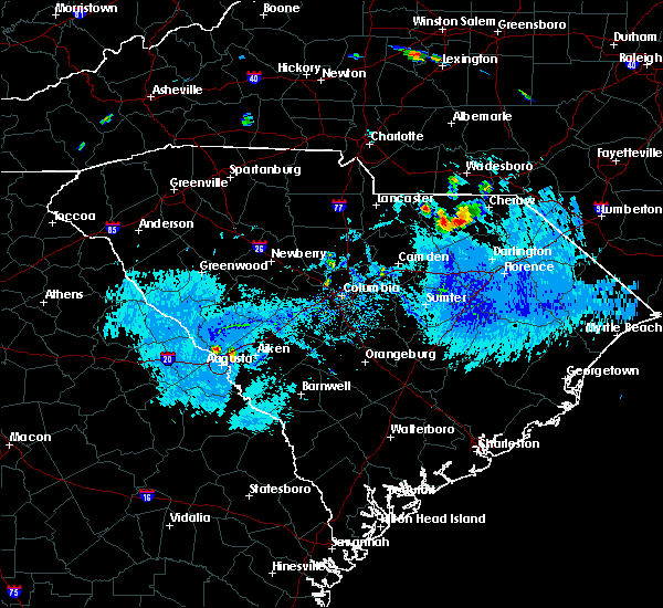 At 614 pm edt, severe thunderstorms were located near carolina sandhills wildlife refuge and also just north of jefferson. movement was southwest at 10 mph (radar indicated). Hazards include ping pong ball size hail and 60 mph wind gusts. People and animals outdoors will be injured. expect hail damage to roofs, siding, windows, and vehicles. Expect wind damage to roofs, siding, and trees. At 614 pm edt, severe thunderstorms were located near carolina sandhills wildlife refuge and also just north of jefferson. movement was southwest at 10 mph (radar indicated). Hazards include ping pong ball size hail and 60 mph wind gusts. People and animals outdoors will be injured. expect hail damage to roofs, siding, windows, and vehicles. Expect wind damage to roofs, siding, and trees.
|
| 8/18/2019 4:29 PM EDT |
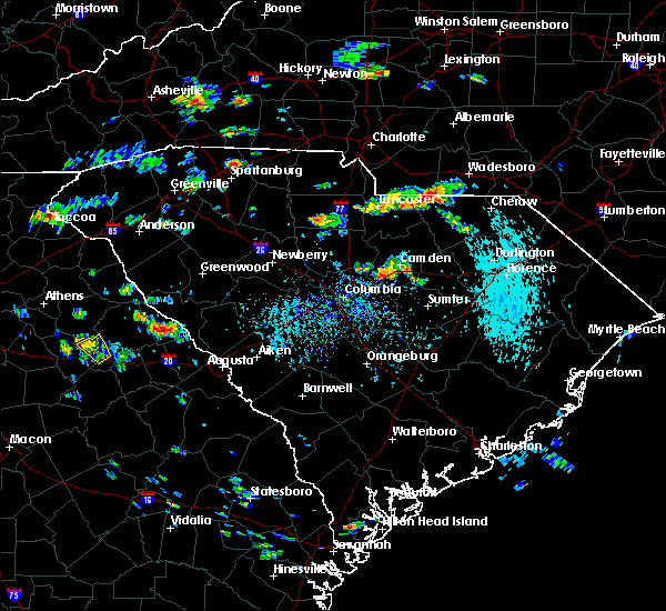 At 429 pm edt, a severe thunderstorm was located over pageland, or 15 miles southeast of monroe, moving southwest at 5 mph (radar indicated). Hazards include 60 mph wind gusts and quarter size hail. Hail damage to vehicles is expected. expect wind damage to roofs, siding, and trees. Locations impacted include, pageland, jefferson, high point fire station and central high school. At 429 pm edt, a severe thunderstorm was located over pageland, or 15 miles southeast of monroe, moving southwest at 5 mph (radar indicated). Hazards include 60 mph wind gusts and quarter size hail. Hail damage to vehicles is expected. expect wind damage to roofs, siding, and trees. Locations impacted include, pageland, jefferson, high point fire station and central high school.
|
| 8/18/2019 4:15 PM EDT |
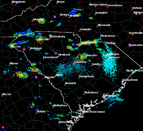 The national weather service in columbia has issued a * severe thunderstorm warning for. east central lancaster county in central south carolina. northwestern chesterfield county in central south carolina. until 445 pm edt. At 414 pm edt, a severe thunderstorm was located over pageland, or. The national weather service in columbia has issued a * severe thunderstorm warning for. east central lancaster county in central south carolina. northwestern chesterfield county in central south carolina. until 445 pm edt. At 414 pm edt, a severe thunderstorm was located over pageland, or.
|
| 7/4/2019 2:02 PM EDT |
 At 201 pm edt, a severe thunderstorm was located near pageland, or 20 miles southeast of monroe, moving northeast at 10 mph (radar indicated). Hazards include 60 mph wind gusts and penny size hail. expect damage to roofs, siding, and trees At 201 pm edt, a severe thunderstorm was located near pageland, or 20 miles southeast of monroe, moving northeast at 10 mph (radar indicated). Hazards include 60 mph wind gusts and penny size hail. expect damage to roofs, siding, and trees
|
| 6/22/2019 4:53 PM EDT |
 At 453 pm edt, severe thunderstorms were located along a line extending from marshville to near great falls to near blair, moving southeast at 45 mph (radar indicated). Hazards include 60 mph wind gusts and quarter size hail. Hail damage to vehicles is expected. expect wind damage to roofs, siding, and trees. locations impacted include, newberry, lancaster, winnsboro, vc summer nuclear station, lake wateree dam, pageland, kershaw, whitmire, elgin, prosperity, heath springs, jenkinsville, liberty hill, monticello, lake wateree state park, fairfield county airport, westville, usc lancaster, irwin and newberry college. This includes interstate 77 between mile markers 30 and 50. At 453 pm edt, severe thunderstorms were located along a line extending from marshville to near great falls to near blair, moving southeast at 45 mph (radar indicated). Hazards include 60 mph wind gusts and quarter size hail. Hail damage to vehicles is expected. expect wind damage to roofs, siding, and trees. locations impacted include, newberry, lancaster, winnsboro, vc summer nuclear station, lake wateree dam, pageland, kershaw, whitmire, elgin, prosperity, heath springs, jenkinsville, liberty hill, monticello, lake wateree state park, fairfield county airport, westville, usc lancaster, irwin and newberry college. This includes interstate 77 between mile markers 30 and 50.
|
| 6/22/2019 4:32 PM EDT |
 At 431 pm edt, severe thunderstorms were located along a line extending from fairview in union county to near richburg to whitmire, moving southeast at 45 mph (radar indicated). Hazards include 70 mph wind gusts and quarter size hail. Hail damage to vehicles is expected. expect considerable tree damage. Wind damage is also likely to mobile homes, roofs, and outbuildings. At 431 pm edt, severe thunderstorms were located along a line extending from fairview in union county to near richburg to whitmire, moving southeast at 45 mph (radar indicated). Hazards include 70 mph wind gusts and quarter size hail. Hail damage to vehicles is expected. expect considerable tree damage. Wind damage is also likely to mobile homes, roofs, and outbuildings.
|
| 6/17/2019 4:17 PM EDT |
 At 412 pm edt, a severe thunderstorm was located near buford, or 11 miles east of lancaster, moving northeast at 15 mph (radar indicated. multiple reports of trees blocking the roadway along rocky river road and along hwy 521 at doc garris rd). Hazards include 60 mph wind gusts and penny size hail. Expect damage to roofs, siding, and trees. Locations impacted include, pageland, elgin, buford, jefferson, high point fire station, tradesville, antioch, kirk air base, forty acre rock preserve, taxahaw, kershaw correctional institution, bear creek park and central high school. At 412 pm edt, a severe thunderstorm was located near buford, or 11 miles east of lancaster, moving northeast at 15 mph (radar indicated. multiple reports of trees blocking the roadway along rocky river road and along hwy 521 at doc garris rd). Hazards include 60 mph wind gusts and penny size hail. Expect damage to roofs, siding, and trees. Locations impacted include, pageland, elgin, buford, jefferson, high point fire station, tradesville, antioch, kirk air base, forty acre rock preserve, taxahaw, kershaw correctional institution, bear creek park and central high school.
|
| 6/17/2019 3:48 PM EDT |
 At 348 pm edt, a severe thunderstorm was located near heath springs, or 9 miles southeast of lancaster, moving northeast at 15 mph (radar indicated). Hazards include 60 mph wind gusts and penny size hail. expect damage to roofs, siding, and trees At 348 pm edt, a severe thunderstorm was located near heath springs, or 9 miles southeast of lancaster, moving northeast at 15 mph (radar indicated). Hazards include 60 mph wind gusts and penny size hail. expect damage to roofs, siding, and trees
|
| 5/4/2019 6:39 PM EDT |
 At 638 pm edt, severe thunderstorms were located along a line extending from wadesboro to 8 miles north of cheraw municipal airport to near chesterfield, moving northeast at 50 mph (radar indicated). Hazards include 60 mph wind gusts and quarter size hail. Hail damage to vehicles is expected. expect wind damage to roofs, siding, and trees. Locations impacted include, cheraw, pageland, chesterfield, cheraw municipal airport, northeastern technical college, jefferson, ruby, mount croghan, chesterfield ruby middle school, high point fire station, chesterfield detention center and central high school. At 638 pm edt, severe thunderstorms were located along a line extending from wadesboro to 8 miles north of cheraw municipal airport to near chesterfield, moving northeast at 50 mph (radar indicated). Hazards include 60 mph wind gusts and quarter size hail. Hail damage to vehicles is expected. expect wind damage to roofs, siding, and trees. Locations impacted include, cheraw, pageland, chesterfield, cheraw municipal airport, northeastern technical college, jefferson, ruby, mount croghan, chesterfield ruby middle school, high point fire station, chesterfield detention center and central high school.
|
| 5/4/2019 6:19 PM EDT | Widespread power outages reported in pagelan in chesterfield county SC, 0.2 miles S of Pageland, SC |
| 5/4/2019 6:18 PM EDT |
 The national weather service in columbia has issued a * severe thunderstorm warning for. chesterfield county in central south carolina. until 700 pm edt. At 618 pm edt, severe thunderstorms were located along a line extending from near sturdivants to 6 miles west of chesterfield to. The national weather service in columbia has issued a * severe thunderstorm warning for. chesterfield county in central south carolina. until 700 pm edt. At 618 pm edt, severe thunderstorms were located along a line extending from near sturdivants to 6 miles west of chesterfield to.
|
| 4/19/2019 3:24 PM EDT |
 At 323 pm edt, severe thunderstorms were located along a line extending from mt pisgah to 6 miles northwest of north hartsville to near quinby, moving north at 65 mph (radar indicated). Hazards include 70 mph wind gusts. Expect considerable tree damage. damage is likely to mobile homes, roofs, and outbuildings. Locations impacted include, cheraw, pageland, chesterfield, carolina sandhills wildlife refuge, cheraw state park, northeastern technical college, cheraw municipal airport, jefferson, ruby, patrick, mount croghan, chesterfield ruby middle school, cheraw fish hatchery, alligator fire station, middendorf, bay springs fire station, and chesterfield detention center. At 323 pm edt, severe thunderstorms were located along a line extending from mt pisgah to 6 miles northwest of north hartsville to near quinby, moving north at 65 mph (radar indicated). Hazards include 70 mph wind gusts. Expect considerable tree damage. damage is likely to mobile homes, roofs, and outbuildings. Locations impacted include, cheraw, pageland, chesterfield, carolina sandhills wildlife refuge, cheraw state park, northeastern technical college, cheraw municipal airport, jefferson, ruby, patrick, mount croghan, chesterfield ruby middle school, cheraw fish hatchery, alligator fire station, middendorf, bay springs fire station, and chesterfield detention center.
|
| 4/19/2019 3:21 PM EDT |
 The severe thunderstorm warning for lancaster, western chesterfield and kershaw counties will expire at 330 pm edt, the storms which prompted the warning have moved out of the area. therefore, the warning will be allowed to expire. a tornado watch remains in effect until 600 pm edt for central south carolina. The severe thunderstorm warning for lancaster, western chesterfield and kershaw counties will expire at 330 pm edt, the storms which prompted the warning have moved out of the area. therefore, the warning will be allowed to expire. a tornado watch remains in effect until 600 pm edt for central south carolina.
|
| 4/19/2019 2:50 PM EDT |
 At 250 pm edt, severe thunderstorms were located along a line extending from weddington to near westville, moving northeast at 50 mph (radar indicated). Hazards include 70 mph wind gusts. Expect considerable tree damage. damage is likely to mobile homes, roofs, and outbuildings. Locations impacted include, lancaster, camden, lake wateree dam, pageland, kershaw, elgin, heath springs, lugoff, westville, cassatt, mt pisgah, buford, goodale state park, mcbee, jefferson, bethune, north central high school, north towne square shopping center, midway elementary school and pine grove fire station. At 250 pm edt, severe thunderstorms were located along a line extending from weddington to near westville, moving northeast at 50 mph (radar indicated). Hazards include 70 mph wind gusts. Expect considerable tree damage. damage is likely to mobile homes, roofs, and outbuildings. Locations impacted include, lancaster, camden, lake wateree dam, pageland, kershaw, elgin, heath springs, lugoff, westville, cassatt, mt pisgah, buford, goodale state park, mcbee, jefferson, bethune, north central high school, north towne square shopping center, midway elementary school and pine grove fire station.
|
| 4/19/2019 2:48 PM EDT |
 At 248 pm edt, severe thunderstorms were located along a line extending from 10 miles northeast of mcentire air base to mulberry to 7 miles west of kingstree, moving north at 65 mph (radar indicated). Hazards include 70 mph wind gusts. Expect considerable tree damage. Damage is likely to mobile homes, roofs, and outbuildings. At 248 pm edt, severe thunderstorms were located along a line extending from 10 miles northeast of mcentire air base to mulberry to 7 miles west of kingstree, moving north at 65 mph (radar indicated). Hazards include 70 mph wind gusts. Expect considerable tree damage. Damage is likely to mobile homes, roofs, and outbuildings.
|
| 4/19/2019 2:33 PM EDT |
 At 233 pm edt, severe thunderstorms were located along a line extending from van wyck to near camden, moving northeast at 50 mph (radar indicated). Hazards include 70 mph wind gusts. Expect considerable tree damage. Damage is likely to mobile homes, roofs, and outbuildings. At 233 pm edt, severe thunderstorms were located along a line extending from van wyck to near camden, moving northeast at 50 mph (radar indicated). Hazards include 70 mph wind gusts. Expect considerable tree damage. Damage is likely to mobile homes, roofs, and outbuildings.
|
| 4/14/2019 5:29 PM EDT |
 At 528 pm edt, a severe thunderstorm was located near mt pisgah, or 21 miles east of lancaster, moving northeast at 40 mph (radar indicated). Hazards include 65 mph wind gusts. expect damage to roofs, siding, and trees At 528 pm edt, a severe thunderstorm was located near mt pisgah, or 21 miles east of lancaster, moving northeast at 40 mph (radar indicated). Hazards include 65 mph wind gusts. expect damage to roofs, siding, and trees
|
| 4/14/2019 5:15 PM EDT |
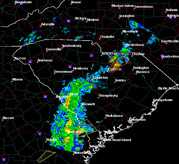 At 515 pm edt, a severe thunderstorm capable of producing a tornado was located near mt pisgah, or 16 miles northeast of lake wateree dam, moving northeast at 35 mph (radar indicated rotation). Hazards include tornado. Flying debris will be dangerous to those caught without shelter. mobile homes will be damaged or destroyed. damage to roofs, windows, and vehicles will occur. tree damage is likely. this dangerous storm will be near, mt pisgah around 525 pm edt. Other locations impacted by this tornadic thunderstorm include chesterfield ruby middle school, high point fire station, mount croghan, jefferson, chesterfield detention center, ruby and central high school. At 515 pm edt, a severe thunderstorm capable of producing a tornado was located near mt pisgah, or 16 miles northeast of lake wateree dam, moving northeast at 35 mph (radar indicated rotation). Hazards include tornado. Flying debris will be dangerous to those caught without shelter. mobile homes will be damaged or destroyed. damage to roofs, windows, and vehicles will occur. tree damage is likely. this dangerous storm will be near, mt pisgah around 525 pm edt. Other locations impacted by this tornadic thunderstorm include chesterfield ruby middle school, high point fire station, mount croghan, jefferson, chesterfield detention center, ruby and central high school.
|
| 4/14/2019 5:00 PM EDT |
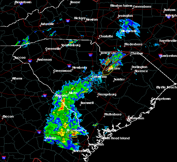 At 500 pm edt, a severe thunderstorm capable of producing a tornado was located over westville, or 8 miles northeast of lake wateree dam, moving northeast at 35 mph (radar indicated rotation). Hazards include tornado. Flying debris will be dangerous to those caught without shelter. mobile homes will be damaged or destroyed. damage to roofs, windows, and vehicles will occur. tree damage is likely. this dangerous storm will be near, kershaw around 515 pm edt. mt pisgah around 525 pm edt. Other locations impacted by this tornadic thunderstorm include chesterfield ruby middle school, high point fire station, mount croghan, north central high school, jefferson, dekalb, bay springs fire station, forty acre rock preserve, taxahaw and kershaw correctional institution. At 500 pm edt, a severe thunderstorm capable of producing a tornado was located over westville, or 8 miles northeast of lake wateree dam, moving northeast at 35 mph (radar indicated rotation). Hazards include tornado. Flying debris will be dangerous to those caught without shelter. mobile homes will be damaged or destroyed. damage to roofs, windows, and vehicles will occur. tree damage is likely. this dangerous storm will be near, kershaw around 515 pm edt. mt pisgah around 525 pm edt. Other locations impacted by this tornadic thunderstorm include chesterfield ruby middle school, high point fire station, mount croghan, north central high school, jefferson, dekalb, bay springs fire station, forty acre rock preserve, taxahaw and kershaw correctional institution.
|
| 6/27/2018 7:14 PM EDT |
 At 713 pm edt, severe thunderstorms were located along a line extending from 10 miles west of pageland to 9 miles east of kershaw to 7 miles northeast of camden, moving east at 35 mph (radar indicated). Hazards include 60 mph wind gusts and penny size hail. Expect damage to roofs, siding, and trees. Locations impacted include, pageland, kershaw, mcbee, jefferson and bethune. At 713 pm edt, severe thunderstorms were located along a line extending from 10 miles west of pageland to 9 miles east of kershaw to 7 miles northeast of camden, moving east at 35 mph (radar indicated). Hazards include 60 mph wind gusts and penny size hail. Expect damage to roofs, siding, and trees. Locations impacted include, pageland, kershaw, mcbee, jefferson and bethune.
|
| 6/27/2018 6:55 PM EDT |
 At 655 pm edt, severe thunderstorms were located along a line extending from 6 miles north of lancaster to near kershaw to 8 miles northwest of camden, moving east at 35 mph (radar indicated). Hazards include 60 mph wind gusts and penny size hail. expect damage to roofs, siding, and trees At 655 pm edt, severe thunderstorms were located along a line extending from 6 miles north of lancaster to near kershaw to 8 miles northwest of camden, moving east at 35 mph (radar indicated). Hazards include 60 mph wind gusts and penny size hail. expect damage to roofs, siding, and trees
|
| 6/27/2018 6:28 PM EDT |
 At 628 pm edt, severe thunderstorms were located along a line extending from 6 miles north of lancaster to near great falls, moving east at 40 mph (radar indicated). Hazards include 60 mph wind gusts and quarter size hail. Hail damage to vehicles is expected. Expect wind damage to roofs, siding, and trees. At 628 pm edt, severe thunderstorms were located along a line extending from 6 miles north of lancaster to near great falls, moving east at 40 mph (radar indicated). Hazards include 60 mph wind gusts and quarter size hail. Hail damage to vehicles is expected. Expect wind damage to roofs, siding, and trees.
|
| 6/25/2018 9:43 PM EDT |
 The severe thunderstorm warning for southeastern lancaster. chesterfield and northeastern kershaw counties will expire at 945 pm edt. the storms which prompted the warning have weakened below severe limits, and no longer pose an immediate threat to life or property. therefore, the warning will be allowed to expire. However gusty. The severe thunderstorm warning for southeastern lancaster. chesterfield and northeastern kershaw counties will expire at 945 pm edt. the storms which prompted the warning have weakened below severe limits, and no longer pose an immediate threat to life or property. therefore, the warning will be allowed to expire. However gusty.
|
| 6/25/2018 8:45 PM EDT |
 At 845 pm edt, severe thunderstorms were located along a line extending from 8 miles west of wadesboro to near kershaw, moving east at 25 mph (radar indicated). Hazards include 60 mph wind gusts. expect damage to roofs, siding, and trees At 845 pm edt, severe thunderstorms were located along a line extending from 8 miles west of wadesboro to near kershaw, moving east at 25 mph (radar indicated). Hazards include 60 mph wind gusts. expect damage to roofs, siding, and trees
|
| 6/25/2018 8:05 PM EDT |
 At 804 pm edt, severe thunderstorms were located along a line extending from near mineral springs to 7 miles northeast of irmo, moving southeast at 50 mph (radar indicated). Hazards include 60 mph wind gusts and penny size hail. expect damage to roofs, siding, and trees At 804 pm edt, severe thunderstorms were located along a line extending from near mineral springs to 7 miles northeast of irmo, moving southeast at 50 mph (radar indicated). Hazards include 60 mph wind gusts and penny size hail. expect damage to roofs, siding, and trees
|
| 6/25/2018 4:56 PM EDT |
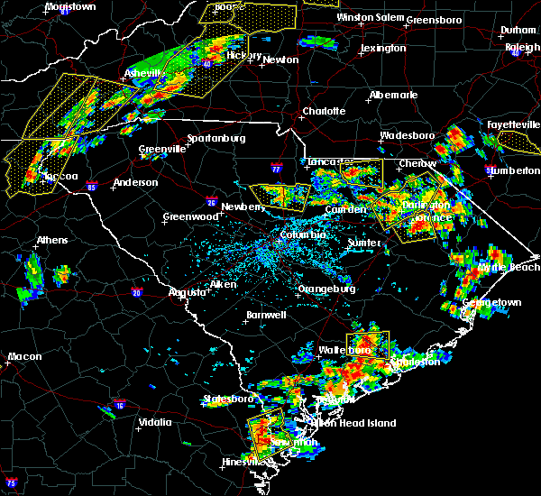 At 455 pm edt, a severe thunderstorm was located 7 miles south of pageland, or 23 miles east of lancaster, moving east at 25 mph (radar indicated). Hazards include 60 mph wind gusts and quarter size hail. Hail damage to vehicles is expected. Expect wind damage to roofs, siding, and trees. At 455 pm edt, a severe thunderstorm was located 7 miles south of pageland, or 23 miles east of lancaster, moving east at 25 mph (radar indicated). Hazards include 60 mph wind gusts and quarter size hail. Hail damage to vehicles is expected. Expect wind damage to roofs, siding, and trees.
|
| 4/15/2018 3:56 PM EDT | Chesterfield county sheriff reported trees down in pagelan in chesterfield county SC, 0.6 miles WSW of Pageland, SC |
| 4/15/2018 3:48 PM EDT |
 At 345 pm edt, severe thunderstorms extended from lancaster county southward into kershaw county. storm movement was northeast near 50 mph and toward chesterfield county (radar indicated). Hazards include 60 mph wind gusts. expect damage to roofs, siding, and trees At 345 pm edt, severe thunderstorms extended from lancaster county southward into kershaw county. storm movement was northeast near 50 mph and toward chesterfield county (radar indicated). Hazards include 60 mph wind gusts. expect damage to roofs, siding, and trees
|
| 3/1/2018 3:55 PM EST |
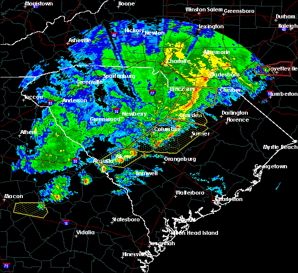 At 353 pm est, showers with damaging wind extending along the chesterfield and lancaster county line southward in kershaw county. movement was eastward near 50 mph (radar indicated). Hazards include 60 mph wind gusts. Expect damage to roofs, siding, and trees. Locations impacted include, camden, bishopville, pageland, kershaw, chesterfield, mcbee, jefferson, ruby, patrick, bethune and mount croghan. At 353 pm est, showers with damaging wind extending along the chesterfield and lancaster county line southward in kershaw county. movement was eastward near 50 mph (radar indicated). Hazards include 60 mph wind gusts. Expect damage to roofs, siding, and trees. Locations impacted include, camden, bishopville, pageland, kershaw, chesterfield, mcbee, jefferson, ruby, patrick, bethune and mount croghan.
|
| 3/1/2018 3:43 PM EST |
 At 342 pm est, showers with damaging wind were in lancaster and western kershaw counties moving eastward near 45 mph and toward chesterfield and parts of lee county (radar indicated). Hazards include 60 mph wind gusts. expect damage to roofs, siding, and trees At 342 pm est, showers with damaging wind were in lancaster and western kershaw counties moving eastward near 45 mph and toward chesterfield and parts of lee county (radar indicated). Hazards include 60 mph wind gusts. expect damage to roofs, siding, and trees
|
| 9/1/2017 3:39 PM EDT |
 At 338 pm edt, severe thunderstorms were located along a broken line extending from near pageland to near clyde, moving northeast at 40 mph. the strongest storm is located near mcbee (radar indicated). Hazards include 60 mph wind gusts and half dollar size hail. Hail damage to vehicles is expected. Expect wind damage to roofs, siding, and trees. At 338 pm edt, severe thunderstorms were located along a broken line extending from near pageland to near clyde, moving northeast at 40 mph. the strongest storm is located near mcbee (radar indicated). Hazards include 60 mph wind gusts and half dollar size hail. Hail damage to vehicles is expected. Expect wind damage to roofs, siding, and trees.
|
| 9/1/2017 3:23 PM EDT |
 At 323 pm edt, a severe thunderstorm was located near kershaw, or 17 miles southeast of lancaster, moving northeast at 45 mph (radar indicated). Hazards include 60 mph wind gusts. Expect damage to roofs, siding, and trees. locations impacted include, pageland, kershaw, jefferson and mount croghan. A tornado watch remains in effect until 1000 pm edt for central south carolina. At 323 pm edt, a severe thunderstorm was located near kershaw, or 17 miles southeast of lancaster, moving northeast at 45 mph (radar indicated). Hazards include 60 mph wind gusts. Expect damage to roofs, siding, and trees. locations impacted include, pageland, kershaw, jefferson and mount croghan. A tornado watch remains in effect until 1000 pm edt for central south carolina.
|
| 9/1/2017 2:54 PM EDT |
 At 252 pm edt, a severe thunderstorm was located 10 miles southwest of heath springs, or 15 miles northwest of camden, moving northeast at 40 mph (radar indicated). Hazards include 70 mph wind gusts and half dollar size hail. Hail damage to vehicles is expected. expect considerable tree damage. wind damage is also likely to mobile homes, roofs, and outbuildings. locations impacted include, lancaster, pageland, kershaw, elgin, heath springs, irwin, jefferson, mount croghan and lancaster mill. A tornado watch remains in effect until 1000 pm edt for central south carolina. At 252 pm edt, a severe thunderstorm was located 10 miles southwest of heath springs, or 15 miles northwest of camden, moving northeast at 40 mph (radar indicated). Hazards include 70 mph wind gusts and half dollar size hail. Hail damage to vehicles is expected. expect considerable tree damage. wind damage is also likely to mobile homes, roofs, and outbuildings. locations impacted include, lancaster, pageland, kershaw, elgin, heath springs, irwin, jefferson, mount croghan and lancaster mill. A tornado watch remains in effect until 1000 pm edt for central south carolina.
|
| 9/1/2017 2:33 PM EDT |
 At 233 pm edt, a severe thunderstorm was located 8 miles east of winnsboro, moving northeast at 40 mph (radar indicated). Hazards include 70 mph wind gusts and half dollar size hail. Hail damage to vehicles is expected. expect considerable tree damage. Wind damage is also likely to mobile homes, roofs, and outbuildings. At 233 pm edt, a severe thunderstorm was located 8 miles east of winnsboro, moving northeast at 40 mph (radar indicated). Hazards include 70 mph wind gusts and half dollar size hail. Hail damage to vehicles is expected. expect considerable tree damage. Wind damage is also likely to mobile homes, roofs, and outbuildings.
|
| 7/23/2017 4:28 PM EDT |
 At 427 pm edt, a severe thunderstorm was located near pageland, or 16 miles east of lancaster, moving northeast at 5 mph (radar indicated). Hazards include 60 mph wind gusts and quarter size hail. Minor hail damage to vehicles is expected. Expect wind damage to roofs, siding, and trees. At 427 pm edt, a severe thunderstorm was located near pageland, or 16 miles east of lancaster, moving northeast at 5 mph (radar indicated). Hazards include 60 mph wind gusts and quarter size hail. Minor hail damage to vehicles is expected. Expect wind damage to roofs, siding, and trees.
|
| 7/23/2017 4:21 PM EDT |
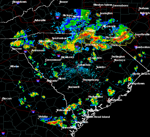 At 420 pm edt, a severe thunderstorm was located near chesterfield, or 16 miles west of cheraw, and is nearly stationary (radar indicated). Hazards include 60 mph wind gusts and quarter size hail. Hail damage to vehicles is expected. expect wind damage to roofs, siding, and trees. Locations impacted include, cheraw, pageland, chesterfield, ruby and mount croghan. At 420 pm edt, a severe thunderstorm was located near chesterfield, or 16 miles west of cheraw, and is nearly stationary (radar indicated). Hazards include 60 mph wind gusts and quarter size hail. Hail damage to vehicles is expected. expect wind damage to roofs, siding, and trees. Locations impacted include, cheraw, pageland, chesterfield, ruby and mount croghan.
|
| 7/23/2017 3:27 PM EDT |
 At 326 pm edt, a severe thunderstorm was located near ruby, or 15 miles west of cheraw, and is nearly stationary (radar indicated). Hazards include 60 mph wind gusts and quarter size hail. Minor hail damage to vehicles is expected. Expect wind damage to roofs, siding, and trees. At 326 pm edt, a severe thunderstorm was located near ruby, or 15 miles west of cheraw, and is nearly stationary (radar indicated). Hazards include 60 mph wind gusts and quarter size hail. Minor hail damage to vehicles is expected. Expect wind damage to roofs, siding, and trees.
|
| 7/18/2017 8:22 PM EDT |
 At 821 pm edt, a severe thunderstorm was located near chesterfield, or 12 miles west of cheraw, moving southwest at 10 mph (radar indicated). Hazards include 60 mph wind gusts. Expect damage to roofs, siding, and trees. Locations impacted include, cheraw, pageland, chesterfield, ruby, patrick and mount croghan. At 821 pm edt, a severe thunderstorm was located near chesterfield, or 12 miles west of cheraw, moving southwest at 10 mph (radar indicated). Hazards include 60 mph wind gusts. Expect damage to roofs, siding, and trees. Locations impacted include, cheraw, pageland, chesterfield, ruby, patrick and mount croghan.
|
| 7/18/2017 7:50 PM EDT |
 At 749 pm edt, a severe thunderstorm was located near chesterfield, or near cheraw, and is nearly stationary (radar indicated). Hazards include 60 mph wind gusts and quarter size hail. Hail damage to vehicles is expected. Expect wind damage to roofs, siding, and trees. At 749 pm edt, a severe thunderstorm was located near chesterfield, or near cheraw, and is nearly stationary (radar indicated). Hazards include 60 mph wind gusts and quarter size hail. Hail damage to vehicles is expected. Expect wind damage to roofs, siding, and trees.
|
| 7/1/2017 7:02 PM EDT |
 At 702 pm edt, a severe thunderstorm was located near waxhaw, or 9 miles northeast of lancaster, moving southeast at 15 mph (radar indicated). Hazards include 60 mph wind gusts. expect damage to roofs, siding, and trees At 702 pm edt, a severe thunderstorm was located near waxhaw, or 9 miles northeast of lancaster, moving southeast at 15 mph (radar indicated). Hazards include 60 mph wind gusts. expect damage to roofs, siding, and trees
|
| 6/19/2017 6:45 PM EDT |
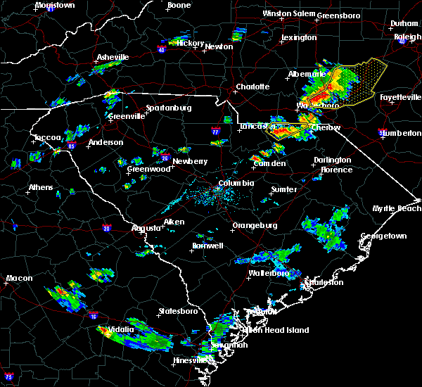 At 644 pm edt, thunderstorms extended from just south of chesterfield to just northeast of jefferson. movement was northeast near 20 mph. some of these storms likely contained wind gusts of 40 to 60 mph and quarter-size hail (radar indicated). Hazards include 60 mph wind gusts and quarter size hail. Hail damage to vehicles is expected. Expect wind damage to roofs, siding, and trees. At 644 pm edt, thunderstorms extended from just south of chesterfield to just northeast of jefferson. movement was northeast near 20 mph. some of these storms likely contained wind gusts of 40 to 60 mph and quarter-size hail (radar indicated). Hazards include 60 mph wind gusts and quarter size hail. Hail damage to vehicles is expected. Expect wind damage to roofs, siding, and trees.
|
| 4/3/2017 4:51 PM EDT |
 At 451 pm edt, severe thunderstorms were located along a line extending from near pageland to near dentsville, moving east at 60 mph (radar indicated). Hazards include 70 mph wind gusts. Expect considerable tree damage. Damage is likely to mobile homes, roofs, and outbuildings. At 451 pm edt, severe thunderstorms were located along a line extending from near pageland to near dentsville, moving east at 60 mph (radar indicated). Hazards include 70 mph wind gusts. Expect considerable tree damage. Damage is likely to mobile homes, roofs, and outbuildings.
|
| 11/30/2016 7:17 PM EST |
 At 717 pm est, severe thunderstorms were located along a line extending from near sturdivants to 8 miles north of camden, moving northeast at 45 mph (radar indicated). Hazards include 60 mph wind gusts. Expect damage to roofs. siding. and trees. Locations impacted include, camden, pageland, chesterfield, mcbee, jefferson, ruby, bethune and mount croghan. At 717 pm est, severe thunderstorms were located along a line extending from near sturdivants to 8 miles north of camden, moving northeast at 45 mph (radar indicated). Hazards include 60 mph wind gusts. Expect damage to roofs. siding. and trees. Locations impacted include, camden, pageland, chesterfield, mcbee, jefferson, ruby, bethune and mount croghan.
|
| 11/30/2016 6:59 PM EST |
 At 658 pm est, severe thunderstorms were located along a line extending from 10 miles southeast of mineral springs to 6 miles northwest of lugoff, moving northeast at 55 mph (radar indicated). Hazards include 60 mph wind gusts. Expect damage to roofs. siding. And trees. At 658 pm est, severe thunderstorms were located along a line extending from 10 miles southeast of mineral springs to 6 miles northwest of lugoff, moving northeast at 55 mph (radar indicated). Hazards include 60 mph wind gusts. Expect damage to roofs. siding. And trees.
|
| 8/14/2016 6:19 PM EDT |
 At 618 pm edt, a severe thunderstorm was located 8 miles west of pageland, or 14 miles east of lancaster, moving northeast at 15 mph (radar indicated). Hazards include 60 mph wind gusts and quarter size hail. Hail damage to vehicles is expected. Expect wind damage to roofs, siding, and trees. At 618 pm edt, a severe thunderstorm was located 8 miles west of pageland, or 14 miles east of lancaster, moving northeast at 15 mph (radar indicated). Hazards include 60 mph wind gusts and quarter size hail. Hail damage to vehicles is expected. Expect wind damage to roofs, siding, and trees.
|
| 7/20/2016 12:54 AM EDT |
 At 1252 am edt, a likely severe thunderstorm was located just east of jefferson. movement was south at 20 mph and toward the angelus and carolina sandhills national wildlife refuge (radar indicated). Hazards include 60 mph wind gusts and penny size hail. Expect damage to roofs. siding. and trees. Locations impacted include, angelus. At 1252 am edt, a likely severe thunderstorm was located just east of jefferson. movement was south at 20 mph and toward the angelus and carolina sandhills national wildlife refuge (radar indicated). Hazards include 60 mph wind gusts and penny size hail. Expect damage to roofs. siding. and trees. Locations impacted include, angelus.
|
| 7/20/2016 12:14 AM EDT |
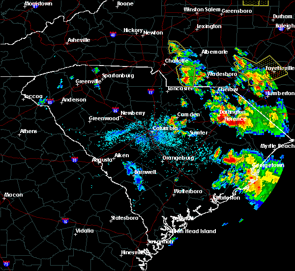 At 1210 am edt, a severe thunderstorm was approaching the north and south carolina border area near tradesville and pageland. the storm was moving southward near 20 mph (radar indicated). Hazards include 60 mph wind gusts and penny size hail. Expect damage to roofs. siding. And trees. At 1210 am edt, a severe thunderstorm was approaching the north and south carolina border area near tradesville and pageland. the storm was moving southward near 20 mph (radar indicated). Hazards include 60 mph wind gusts and penny size hail. Expect damage to roofs. siding. And trees.
|
| 7/16/2016 7:29 PM EDT |
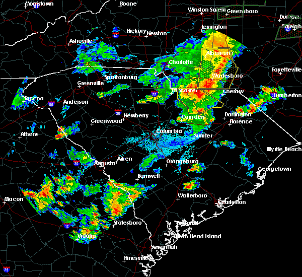 At 729 pm edt, severe thunderstorms were located along a line extending from 7 miles west of pageland to 9 miles north of north hartsville to near bishopville, moving east at 45 mph (radar indicated). Hazards include 60 mph wind gusts. Expect damage to roofs. siding. and trees. Locations impacted include, pageland, mcbee, jefferson, ruby, patrick, bethune and mount croghan. At 729 pm edt, severe thunderstorms were located along a line extending from 7 miles west of pageland to 9 miles north of north hartsville to near bishopville, moving east at 45 mph (radar indicated). Hazards include 60 mph wind gusts. Expect damage to roofs. siding. and trees. Locations impacted include, pageland, mcbee, jefferson, ruby, patrick, bethune and mount croghan.
|
| 7/16/2016 7:19 PM EDT |
 At 718 pm edt, severe thunderstorms were located along a line extending from 9 miles northeast of elgin to 9 miles north of clyde to 8 miles southwest of bishopville, moving east at 45 mph (radar indicated). Hazards include 60 mph wind gusts. Expect damage to roofs. siding. and trees. Locations impacted include, lancaster, bishopville, pageland, kershaw, elgin, heath springs, irwin, mcbee, jefferson, ruby, patrick, bethune, mount croghan and lancaster mill. At 718 pm edt, severe thunderstorms were located along a line extending from 9 miles northeast of elgin to 9 miles north of clyde to 8 miles southwest of bishopville, moving east at 45 mph (radar indicated). Hazards include 60 mph wind gusts. Expect damage to roofs. siding. and trees. Locations impacted include, lancaster, bishopville, pageland, kershaw, elgin, heath springs, irwin, mcbee, jefferson, ruby, patrick, bethune, mount croghan and lancaster mill.
|
| 7/16/2016 7:04 PM EDT |
 At 703 pm edt, severe thunderstorms were located along a line extending from near lancaster to 9 miles east of kershaw to 8 miles southeast of lugoff, moving east at 45 mph (radar indicated). Hazards include 60 mph wind gusts. Expect damage to roofs. siding. And trees. At 703 pm edt, severe thunderstorms were located along a line extending from near lancaster to 9 miles east of kershaw to 8 miles southeast of lugoff, moving east at 45 mph (radar indicated). Hazards include 60 mph wind gusts. Expect damage to roofs. siding. And trees.
|
| 7/15/2016 2:08 PM EDT |
 At 208 pm edt, a severe thunderstorm was located 7 miles southeast of pageland, or 22 miles west of cheraw, moving northeast at 40 mph (radar indicated). Hazards include 60 mph wind gusts and quarter size hail. Hail damage to vehicles is expected. Expect wind damage to roofs, siding, and trees. At 208 pm edt, a severe thunderstorm was located 7 miles southeast of pageland, or 22 miles west of cheraw, moving northeast at 40 mph (radar indicated). Hazards include 60 mph wind gusts and quarter size hail. Hail damage to vehicles is expected. Expect wind damage to roofs, siding, and trees.
|
| 7/15/2016 1:13 PM EDT | Tree down airport rd knight r in chesterfield county SC, 3.4 miles WNW of Pageland, SC |
| 7/15/2016 1:13 PM EDT | Trees down on brock r in chesterfield county SC, 3 miles S of Pageland, SC |
| 7/15/2016 1:12 PM EDT |
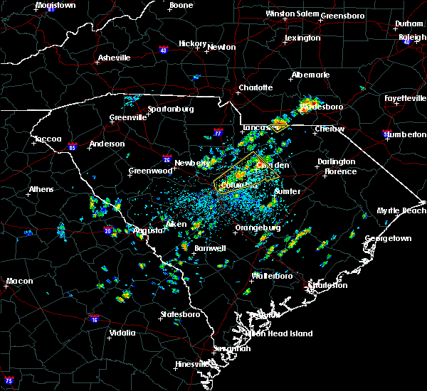 At 112 pm edt, a severe thunderstorm was located near pageland, or 17 miles southeast of monroe, moving northeast at 15 mph (radar indicated). Hazards include 60 mph wind gusts. Expect damage to roofs. siding. And trees. At 112 pm edt, a severe thunderstorm was located near pageland, or 17 miles southeast of monroe, moving northeast at 15 mph (radar indicated). Hazards include 60 mph wind gusts. Expect damage to roofs. siding. And trees.
|
| 7/11/2016 1:18 PM EDT |
 At 118 pm edt, a severe thunderstorm was located 9 miles south of chesterfield, or 10 miles southwest of cheraw, moving east at 15 mph (radar indicated). Hazards include 60 mph wind gusts. Expect damage to roofs. siding. And trees. At 118 pm edt, a severe thunderstorm was located 9 miles south of chesterfield, or 10 miles southwest of cheraw, moving east at 15 mph (radar indicated). Hazards include 60 mph wind gusts. Expect damage to roofs. siding. And trees.
|
| 7/8/2016 10:35 PM EDT |
 At 1034 pm edt, severe thunderstorms were located along a line extending from near bennettsville to 8 miles south of cheraw to near kershaw, moving southeast at 65 mph (radar indicated). Hazards include 60 mph wind gusts. Expect damage to roofs. siding. And trees. At 1034 pm edt, severe thunderstorms were located along a line extending from near bennettsville to 8 miles south of cheraw to near kershaw, moving southeast at 65 mph (radar indicated). Hazards include 60 mph wind gusts. Expect damage to roofs. siding. And trees.
|
| 7/8/2016 9:41 PM EDT |
 At 940 pm edt, severe thunderstorms were located along a line extending from near cheraw to near irwin, moving southeast at 40 mph (radar indicated). Hazards include 60 mph wind gusts. Expect damage to roofs. siding. And trees. At 940 pm edt, severe thunderstorms were located along a line extending from near cheraw to near irwin, moving southeast at 40 mph (radar indicated). Hazards include 60 mph wind gusts. Expect damage to roofs. siding. And trees.
|
| 7/8/2016 8:10 PM EDT |
 At 809 pm edt, a severe thunderstorm was located near lesslie, or 8 miles east of rock hill, moving east at 35 mph (radar indicated). Hazards include 60 mph wind gusts. Expect damage to roofs. siding. And trees. At 809 pm edt, a severe thunderstorm was located near lesslie, or 8 miles east of rock hill, moving east at 35 mph (radar indicated). Hazards include 60 mph wind gusts. Expect damage to roofs. siding. And trees.
|
| 7/7/2016 4:48 PM EDT |
 At 447 pm edt, a severe thunderstorm was located 13 miles east of kershaw, or 20 miles northwest of hartsville, moving east at 35 mph (law enforcement). Hazards include 60 mph wind gusts. Expect damage to roofs. siding. and trees. Locations impacted include, cheraw, pageland, chesterfield, mcbee, jefferson, society hill, ruby, patrick, mount croghan and mcfarlan. At 447 pm edt, a severe thunderstorm was located 13 miles east of kershaw, or 20 miles northwest of hartsville, moving east at 35 mph (law enforcement). Hazards include 60 mph wind gusts. Expect damage to roofs. siding. and trees. Locations impacted include, cheraw, pageland, chesterfield, mcbee, jefferson, society hill, ruby, patrick, mount croghan and mcfarlan.
|
| 7/7/2016 4:30 PM EDT |
 At 430 pm edt, a severe thunderstorm was located near kershaw, or 17 miles southeast of lancaster, moving east at 35 mph (law enforcement). Hazards include 60 mph wind gusts and penny size hail. Expect damage to roofs. siding. And trees. At 430 pm edt, a severe thunderstorm was located near kershaw, or 17 miles southeast of lancaster, moving east at 35 mph (law enforcement). Hazards include 60 mph wind gusts and penny size hail. Expect damage to roofs. siding. And trees.
|
| 7/5/2016 5:51 PM EDT |
 At 549 pm edt, thunderstorms extended from lancaster county southward into lower richland county. movement was eastward near 35 mph. some of the thunderstorms contained wind gusts of 40 to 60 mph (radar indicated). Hazards include 60 mph wind gusts. Expect damage to roofs. siding. and trees. locations impacted include, orangeburg, camden, brookdale, pageland, st. Matthews, kershaw, eastover, lugoff, jefferson, mount croghan, rembert and edisto. At 549 pm edt, thunderstorms extended from lancaster county southward into lower richland county. movement was eastward near 35 mph. some of the thunderstorms contained wind gusts of 40 to 60 mph (radar indicated). Hazards include 60 mph wind gusts. Expect damage to roofs. siding. and trees. locations impacted include, orangeburg, camden, brookdale, pageland, st. Matthews, kershaw, eastover, lugoff, jefferson, mount croghan, rembert and edisto.
|
| 7/5/2016 5:45 PM EDT |
 At 542 pm edt, a line of thunderstorms extended from lancaster county southward through kershaw, lower richland and calhoun county. movement was east-northeast near 35 mph. some of the thunderstorms within the line likely contained wind gusts of 40 to 60 mph (radar indicated). Hazards include 60 mph wind gusts. Expect damage to roofs. Siding and trees. At 542 pm edt, a line of thunderstorms extended from lancaster county southward through kershaw, lower richland and calhoun county. movement was east-northeast near 35 mph. some of the thunderstorms within the line likely contained wind gusts of 40 to 60 mph (radar indicated). Hazards include 60 mph wind gusts. Expect damage to roofs. Siding and trees.
|
| 7/5/2016 5:17 PM EDT |
 At 515 pm edt, a line of thunderstorms extended from lancaster county southward through columbia and swansea. movement was east northeastward near 35 mph. some of the storms likely contained wind gusts of 40 to 60 mph (radar indicated). Hazards include 60 mph wind gusts. Expect damage to roofs. siding. and trees. locations impacted include, columbia, orangeburg, cayce, forest acres, lancaster, camden, springdale, st. andrews, dentsville, oak grove, woodfields, brookdale, pageland, south congaree, pine ridge, st. Matthews, kershaw, gaston and elgin. At 515 pm edt, a line of thunderstorms extended from lancaster county southward through columbia and swansea. movement was east northeastward near 35 mph. some of the storms likely contained wind gusts of 40 to 60 mph (radar indicated). Hazards include 60 mph wind gusts. Expect damage to roofs. siding. and trees. locations impacted include, columbia, orangeburg, cayce, forest acres, lancaster, camden, springdale, st. andrews, dentsville, oak grove, woodfields, brookdale, pageland, south congaree, pine ridge, st. Matthews, kershaw, gaston and elgin.
|
| 7/5/2016 5:05 PM EDT |
 At 504 pm edt, severe thunderstorms were located along a line extending from 8 miles northeast of winnsboro to 15 miles southeast of batesburg-leesville, moving northeast at 75 mph (radar indicated). Hazards include 60 mph wind gusts. Expect damage to roofs. siding. And trees. At 504 pm edt, severe thunderstorms were located along a line extending from 8 miles northeast of winnsboro to 15 miles southeast of batesburg-leesville, moving northeast at 75 mph (radar indicated). Hazards include 60 mph wind gusts. Expect damage to roofs. siding. And trees.
|
| 7/4/2016 4:30 PM EDT |
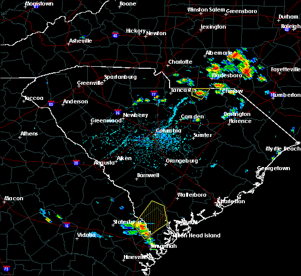 At 430 pm edt, a severe thunderstorm was located near pageland, or 22 miles southwest of wadesboro, moving north at 5 mph (radar indicated). Hazards include 60 mph wind gusts. Expect damage to roofs. siding. And trees. At 430 pm edt, a severe thunderstorm was located near pageland, or 22 miles southwest of wadesboro, moving north at 5 mph (radar indicated). Hazards include 60 mph wind gusts. Expect damage to roofs. siding. And trees.
|
| 3/14/2016 10:02 PM EDT |
 A severe thunderstorm warning remains in effect until 1030 pm edt thunderstorms extended through central chesterfield county westward along the chester and fairfield county line at 1000 pm. some of the thunderstorms likely contained damaging wind, especially the storms moving toward the heath springs and kershaw area of southern lancaster county. storm movement was east near 30 mph. , precautionary/preparedness actions, severe thunderstorms produce damaging winds, destructive hail, deadly lightning and very heavy rain. for your protection move to an interior room on the lowest floor of your home or business. heavy rains flood roads quickly so do not drive into areas where water covers the road. &&. A severe thunderstorm warning remains in effect until 1030 pm edt thunderstorms extended through central chesterfield county westward along the chester and fairfield county line at 1000 pm. some of the thunderstorms likely contained damaging wind, especially the storms moving toward the heath springs and kershaw area of southern lancaster county. storm movement was east near 30 mph. , precautionary/preparedness actions, severe thunderstorms produce damaging winds, destructive hail, deadly lightning and very heavy rain. for your protection move to an interior room on the lowest floor of your home or business. heavy rains flood roads quickly so do not drive into areas where water covers the road. &&.
|
| 3/14/2016 9:12 PM EDT |
 At 910 pm edt, doppler radar indicated and area of thunderstorms some of which likely contained wind gusts in excess of 60 mph and damaging hail. these storms were located near a line extending from near lesslie to near richburg to near clinton, and moving east at 30 mph. At 910 pm edt, doppler radar indicated and area of thunderstorms some of which likely contained wind gusts in excess of 60 mph and damaging hail. these storms were located near a line extending from near lesslie to near richburg to near clinton, and moving east at 30 mph.
|
| 12/30/2015 1:05 PM EST |
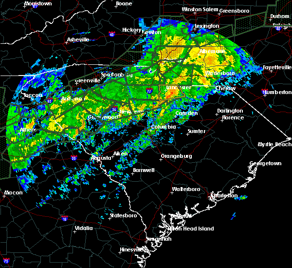 At 105 pm est, doppler radar indicated a line of severe thunderstorms capable of producing damaging winds in excess of 60 mph. these storms were located along a line extending from 6 miles west of pageland to kershaw, and moving east at 50 mph. At 105 pm est, doppler radar indicated a line of severe thunderstorms capable of producing damaging winds in excess of 60 mph. these storms were located along a line extending from 6 miles west of pageland to kershaw, and moving east at 50 mph.
|
| 7/23/2015 4:52 PM EDT |
 At 450 pm edt, doppler radar indicated a severe thunderstorm capable of producing damaging winds in excess of 60 mph. this storm was located near chesterfield, or 10 miles west of cheraw, and moving southeast at 15 mph. At 450 pm edt, doppler radar indicated a severe thunderstorm capable of producing damaging winds in excess of 60 mph. this storm was located near chesterfield, or 10 miles west of cheraw, and moving southeast at 15 mph.
|
| 7/13/2015 9:53 PM EDT |
 At 952 pm edt, doppler radar indicated a severe thunderstorm capable of producing damaging winds in excess of 60 mph. this storm was located near pageland, or 12 miles south of monroe, and moving southeast at 35 mph. penny size hail may also accompany the damaging winds. At 952 pm edt, doppler radar indicated a severe thunderstorm capable of producing damaging winds in excess of 60 mph. this storm was located near pageland, or 12 miles south of monroe, and moving southeast at 35 mph. penny size hail may also accompany the damaging winds.
|
| 9/16/2014 7:48 PM EDT | Trees down off philadelphia church rd and landsford rd... sw of sturdivants... n in union county NC, 5.7 miles S of Pageland, SC |
| 4/19/2013 4:40 PM EDT | Dispatch reported a couple of trees down on juniper roa in chesterfield county SC, 1.6 miles S of Pageland, SC |
| 1/30/2013 9:44 PM EST | Dot reported several trees down in the pageland are in chesterfield county SC, 0.2 miles S of Pageland, SC |
| 1/30/2013 9:26 PM EST | A few trees down in lancaster county SC, 9.1 miles E of Pageland, SC |
| 7/1/2012 8:26 PM EDT | Skywarn spotter follow-up to previous report...church on airport road across from central hs has a partially destroyed roof...winds estimated at 65+ mph...multiple repo in chesterfield county SC, 0.2 miles S of Pageland, SC |
| 7/1/2012 7:54 PM EDT | Skywarn spotter reports trees down in pagelan in chesterfield county SC, 0.2 miles S of Pageland, SC |
| 7/1/2012 7:30 PM EDT | Tree partially blocking tice rd approx 1 2 mile from white store r in anson county NC, 7.3 miles SW of Pageland, SC |
| 7/1/2012 4:07 PM EDT | Golf Ball sized hail reported 0.2 miles S of Pageland, SC, golf ball sized hail at kirkley road and peach orchard road. |
| 7/1/2012 3:40 PM EDT | Hen Egg sized hail reported 0.2 miles S of Pageland, SC, 2 inch hail measured at the white plains golf course |
| 8/21/2011 9:05 PM EDT | Quarter sized hail reported 0.2 miles S of Pageland, SC, mike yabo |
| 1/1/0001 12:00 AM | Several trees down on sr 151 south of pagelan in chesterfield county SC, 1.9 miles N of Pageland, SC |
| 1/1/0001 12:00 AM | Several trees down in the allens crossroads area...including a tree that fell on a fire fighting truck with people in the truc in union county NC, 8 miles SSE of Pageland, SC |
| 1/1/0001 12:00 AM | Quarter sized hail reported 2.9 miles NW of Pageland, SC, one inch hail reported on hatchery road. |
| 4/9/2011 7:15 PM EDT | Spotter reports metal roof peeled off a horse stall and multiple trees down in union county NC, 2.5 miles SSE of Pageland, SC |
| 4/9/2011 7:15 PM EDT | Spotter reports metal roof peeled off a horse stall and multiple trees down in union county NC, 8.3 miles ESE of Pageland, SC |
Hail Maps for Pageland, SC

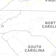


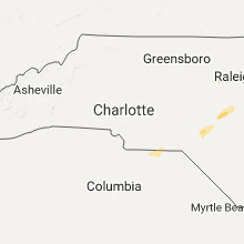


Connect with Interactive Hail Maps