

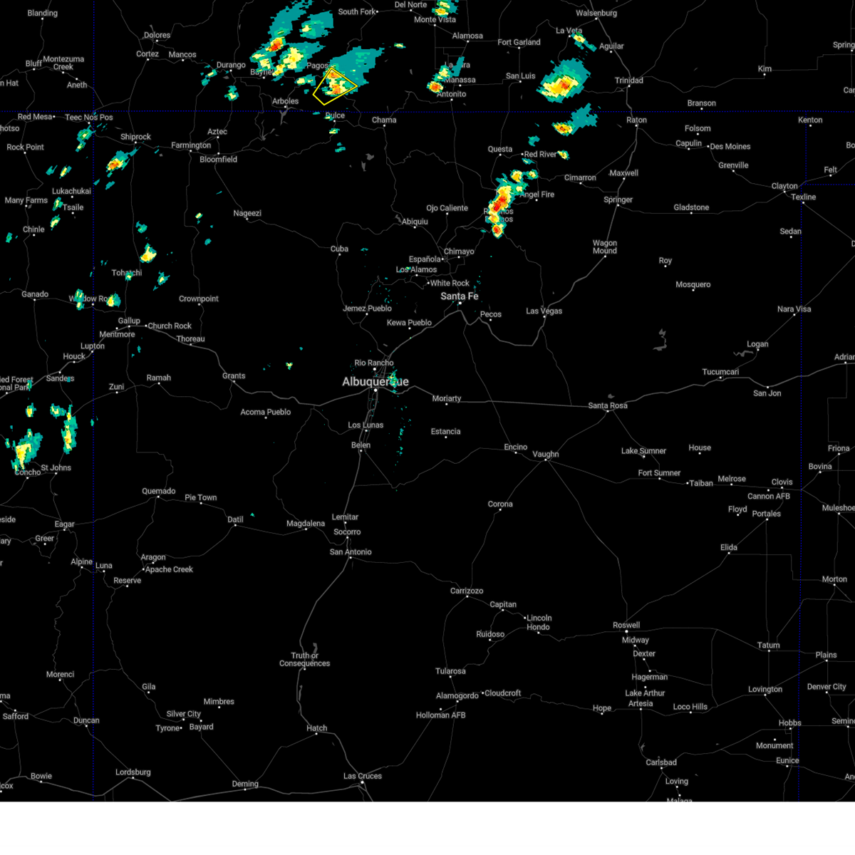
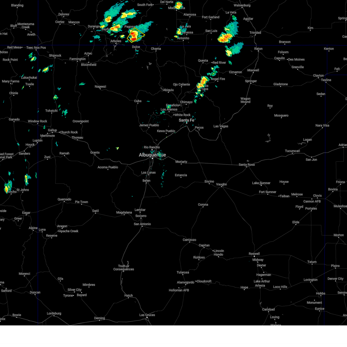
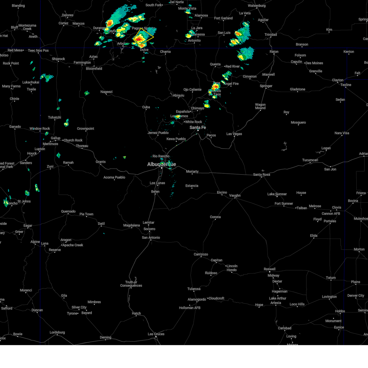
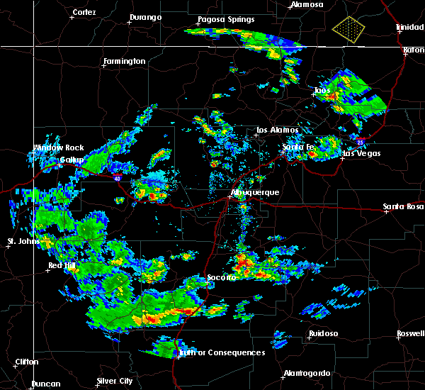
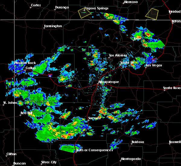
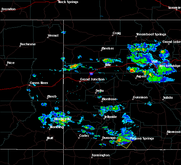
Hail Map for Pagosa Springs, CO
The Pagosa Springs, CO area has had 4 reports of on-the-ground hail by trained spotters, and has been under severe weather warnings 0 times during the past 12 months. Doppler radar has detected hail at or near Pagosa Springs, CO on 3 occasions.
| Name: | Pagosa Springs, CO |
| Where Located: | 74.5 miles ENE of Farmington, NM |
| Map: | Google Map for Pagosa Springs, CO |
| Population: | 1727 |
| Housing Units: | 945 |
| More Info: | Search Google for Pagosa Springs, CO |
0
The Top Recent Hail Date for Pagosa Springs, CO is Thursday, July 29, 2021 (2nd out of 3)

Hail and Wind Damage Spotted near Pagosa Springs, CO
| Date / Time | Report Details |
|---|---|
| 6/20/2024 1:13 PM MDT |
 The storm which prompted the warning has weakened below severe limits, and no longer poses an immediate threat to life or property. therefore, the warning will be allowed to expire. however, heavy rain is still possible with this thunderstorm. The storm which prompted the warning has weakened below severe limits, and no longer poses an immediate threat to life or property. therefore, the warning will be allowed to expire. however, heavy rain is still possible with this thunderstorm.
|
| 6/20/2024 12:59 PM MDT |
 At 1259 pm mdt, a severe thunderstorm was located near pagosa springs, or 17 miles north of dulce, moving northeast at 20 mph (radar indicated). Hazards include 60 mph wind gusts and quarter size hail. Hail damage to vehicles is expected. expect wind damage to roofs, siding, and trees. Locations impacted include, pagosa springs. At 1259 pm mdt, a severe thunderstorm was located near pagosa springs, or 17 miles north of dulce, moving northeast at 20 mph (radar indicated). Hazards include 60 mph wind gusts and quarter size hail. Hail damage to vehicles is expected. expect wind damage to roofs, siding, and trees. Locations impacted include, pagosa springs.
|
| 6/20/2024 12:46 PM MDT |
 Svrgjt the national weather service in grand junction has issued a * severe thunderstorm warning for, central archuleta county in southwestern colorado, * until 115 pm mdt. * at 1245 pm mdt, a severe thunderstorm was located 9 miles south of pagosa springs, or 14 miles north of dulce, moving northeast at 20 mph (radar indicated). Hazards include 60 mph wind gusts and quarter size hail. Hail damage to vehicles is expected. Expect wind damage to roofs, siding, and trees. Svrgjt the national weather service in grand junction has issued a * severe thunderstorm warning for, central archuleta county in southwestern colorado, * until 115 pm mdt. * at 1245 pm mdt, a severe thunderstorm was located 9 miles south of pagosa springs, or 14 miles north of dulce, moving northeast at 20 mph (radar indicated). Hazards include 60 mph wind gusts and quarter size hail. Hail damage to vehicles is expected. Expect wind damage to roofs, siding, and trees.
|
| 6/6/2020 1:11 PM MDT | Corrects previous non-tstm wnd gst report from 2 s wolf creek pass. awos station kcpw wolf creek pas in mineral county CO, 18.2 miles SW of Pagosa Springs, CO |
| 5/11/2020 6:15 PM MDT | Storm damage reported in archuleta county CO, 1.9 miles SE of Pagosa Springs, CO |
| 5/16/2019 6:35 PM MDT | Awos kpso measured wind gus in archuleta county CO, 1.9 miles SE of Pagosa Springs, CO |
| 8/20/2016 4:46 PM MDT |
 At 446 pm mdt, trained weather spotters reported a strong thunderstorm producing marble sized hail. this storm was located near pagosa springs, or 20 miles north of dulce, moving southeast at 5 mph. locations impacted include, pagosa springs. At 446 pm mdt, trained weather spotters reported a strong thunderstorm producing marble sized hail. this storm was located near pagosa springs, or 20 miles north of dulce, moving southeast at 5 mph. locations impacted include, pagosa springs.
|
| 8/20/2016 4:25 PM MDT | Quarter sized hail reported 1.9 miles SE of Pagosa Springs, CO, accompanied by heavy rain. |
| 8/20/2016 4:24 PM MDT |
 At 423 pm mdt, emergency management reported a severe thunderstorm producing quarter size hail. this storm was located over pagosa springs, or 21 miles north of dulce, and moving southeast at 5 mph. At 423 pm mdt, emergency management reported a severe thunderstorm producing quarter size hail. this storm was located over pagosa springs, or 21 miles north of dulce, and moving southeast at 5 mph.
|
| 8/17/2015 4:32 PM MDT |
 At 431 pm mdt, doppler radar indicated a severe thunderstorm capable of producing quarter size hail. this storm was located 15 miles west of pagosa springs, or 28 miles northwest of dulce, and moving southeast at 25 mph. At 431 pm mdt, doppler radar indicated a severe thunderstorm capable of producing quarter size hail. this storm was located 15 miles west of pagosa springs, or 28 miles northwest of dulce, and moving southeast at 25 mph.
|
| 9/29/2014 1:00 PM MDT | Golf Ball sized hail reported 4.9 miles W of Pagosa Springs, CO, golf ball size hail reported by at least six people. |
| 9/29/2014 12:30 PM MDT | Hundreds of trees down in a forest area near county road 302 in eastern archuleta county. time is approximat in archuleta county CO, 4.9 miles W of Pagosa Springs, CO |
| 5/7/2012 11:42 AM MDT | Quarter sized hail reported 0.6 miles ESE of Pagosa Springs, CO, hail covering the ground. just ended. |
| 5/7/2012 11:31 AM MDT | Quarter sized hail reported 18.1 miles NNE of Pagosa Springs, CO |
Hail Maps for Pagosa Springs, CO


Connect with Interactive Hail Maps