

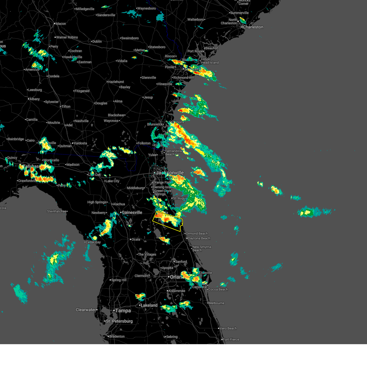
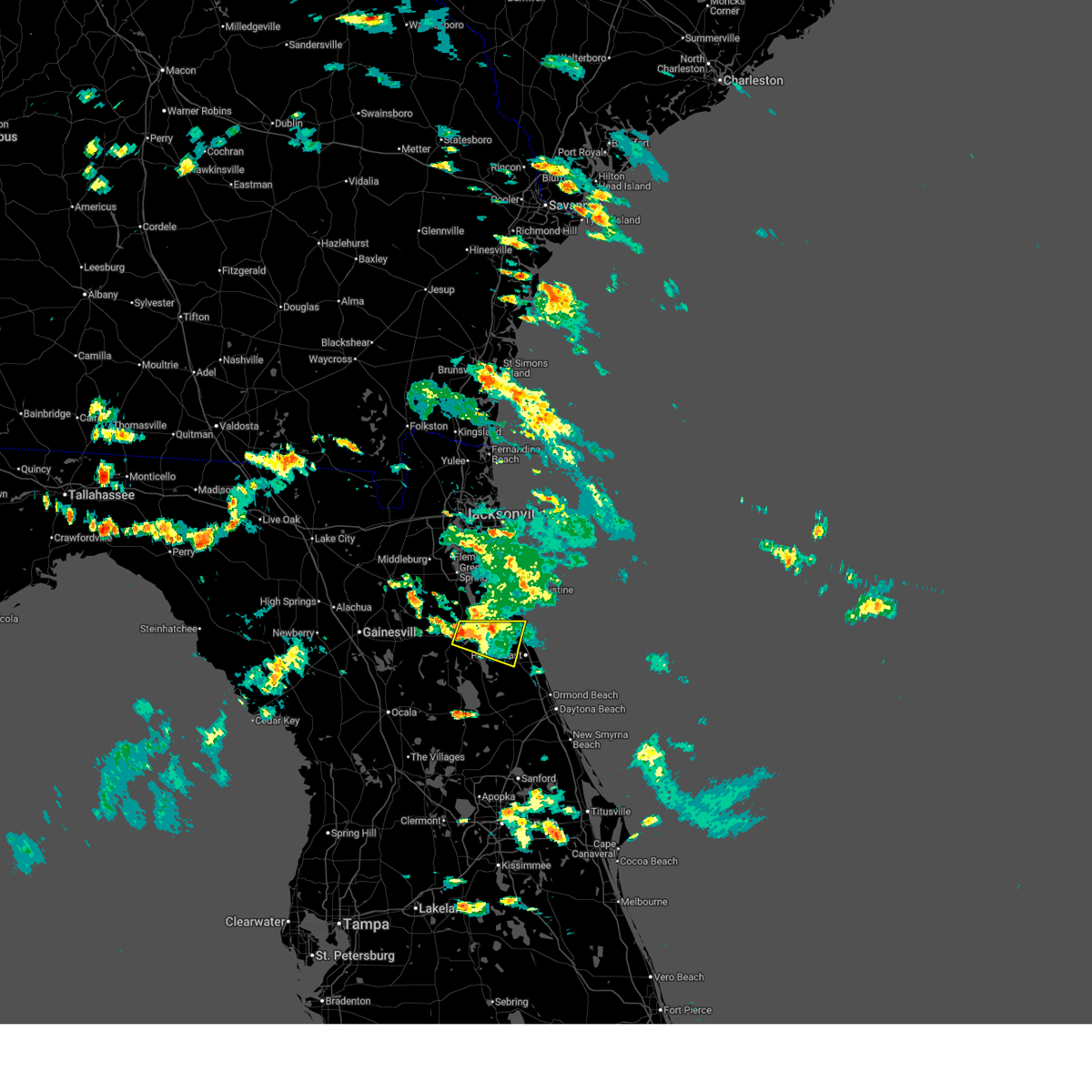
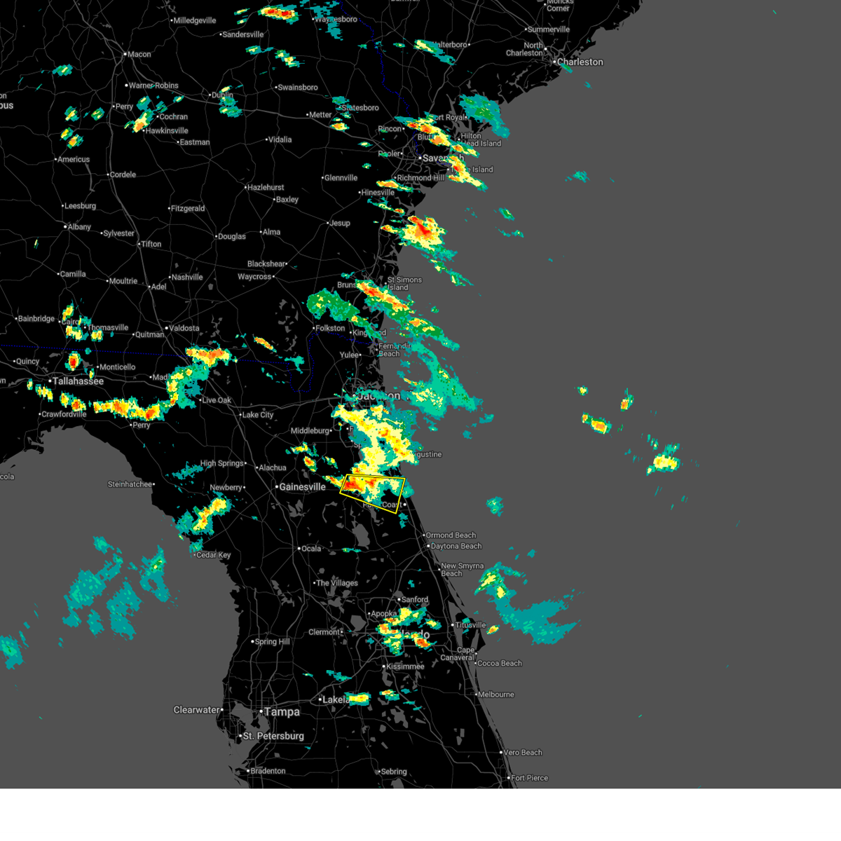
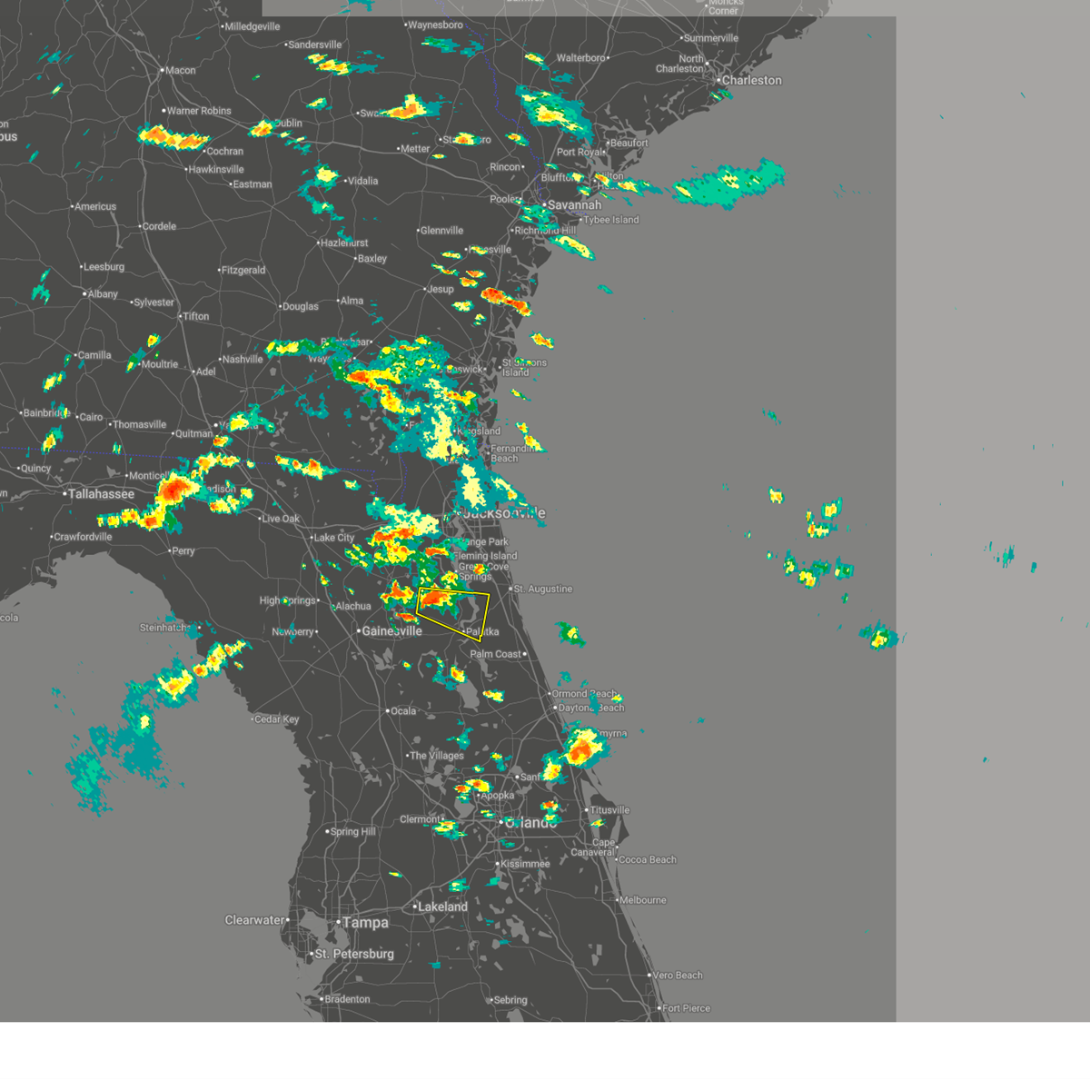
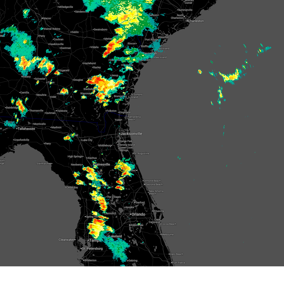
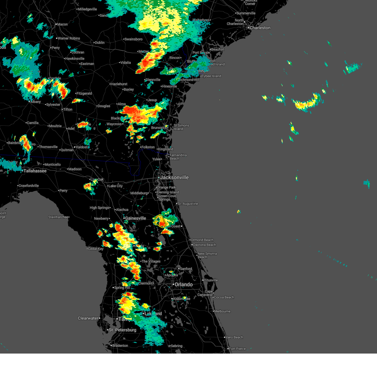
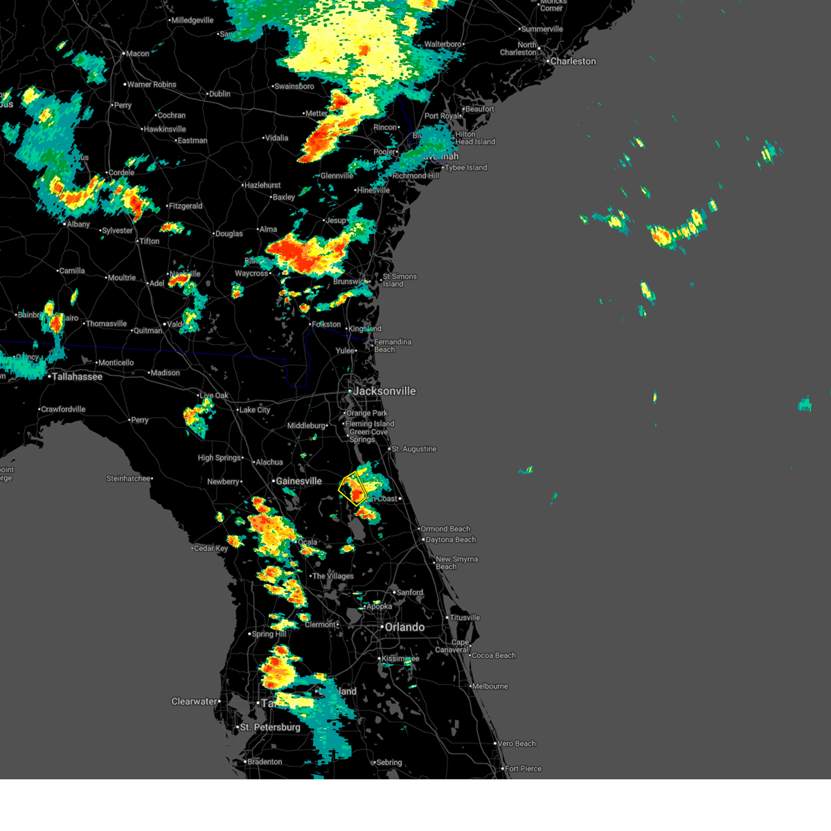
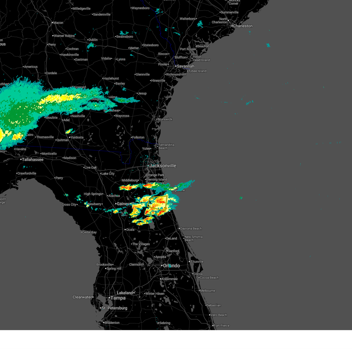
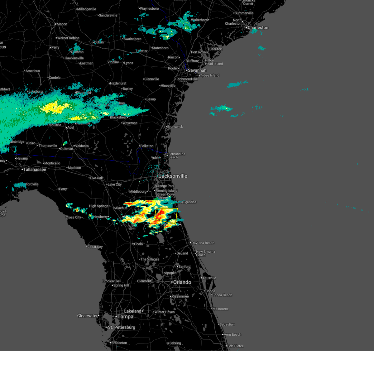
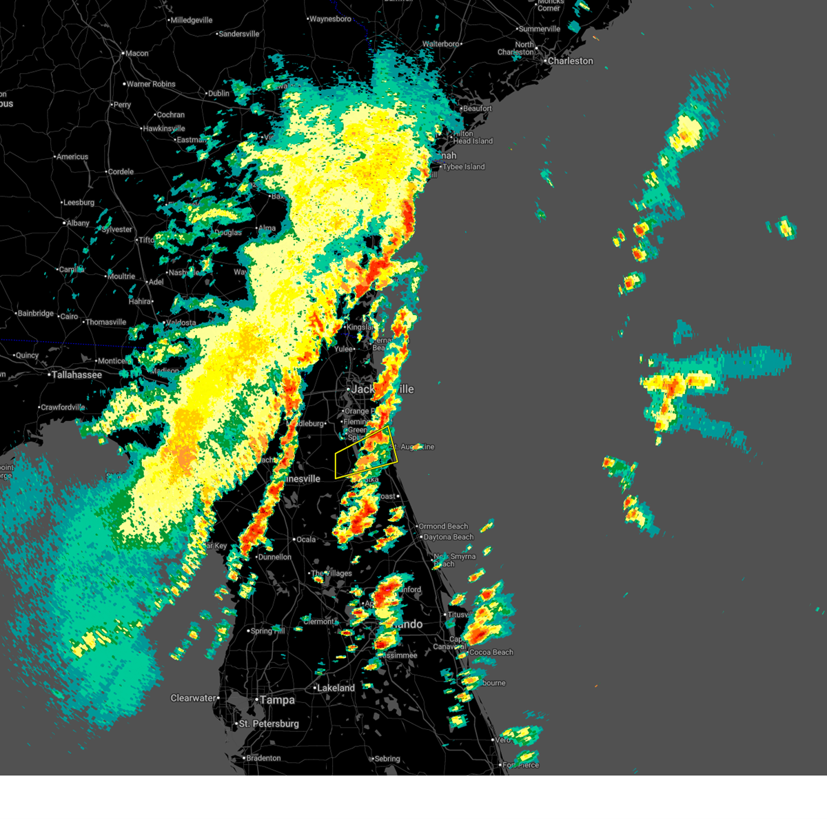
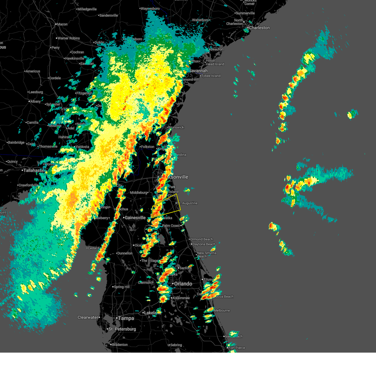
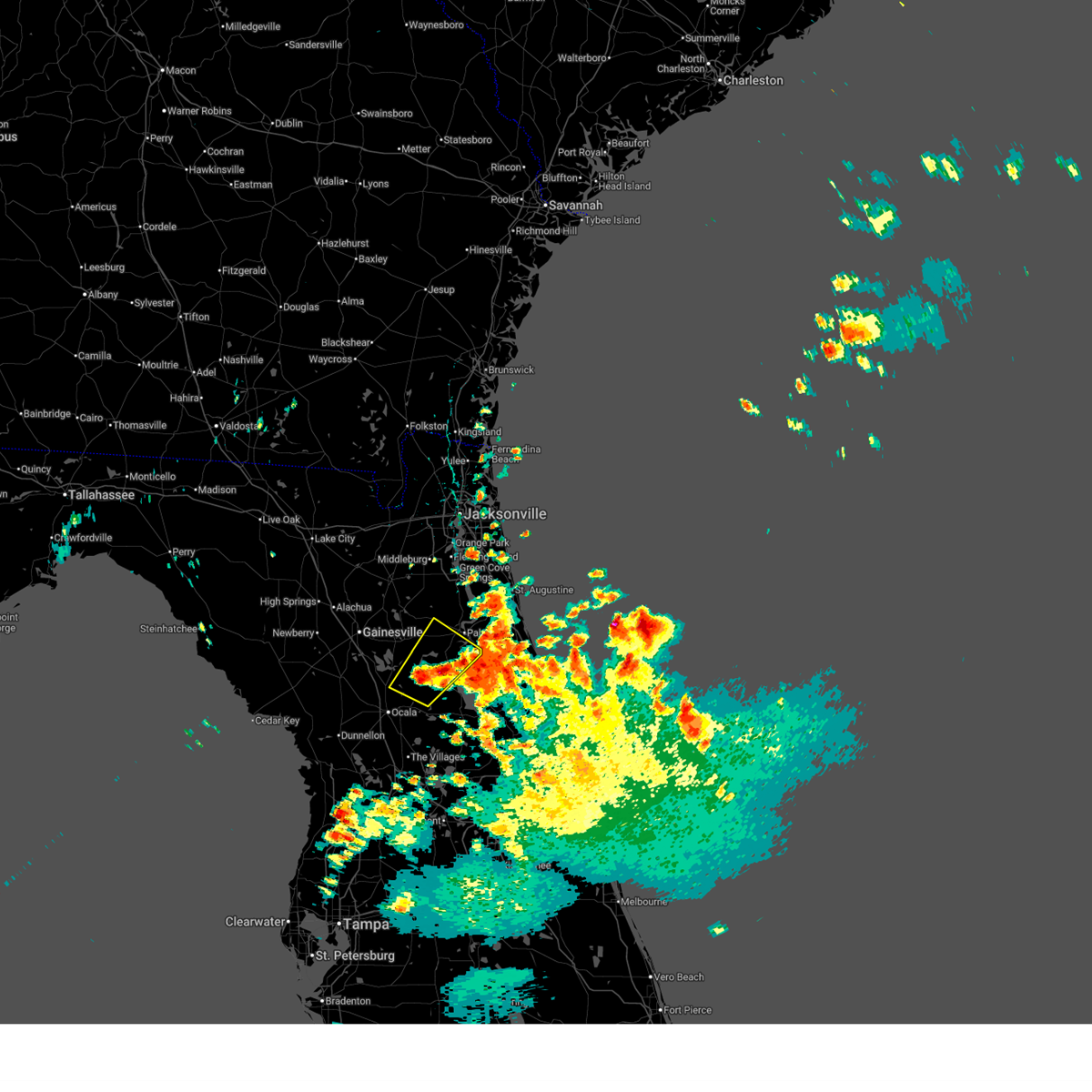
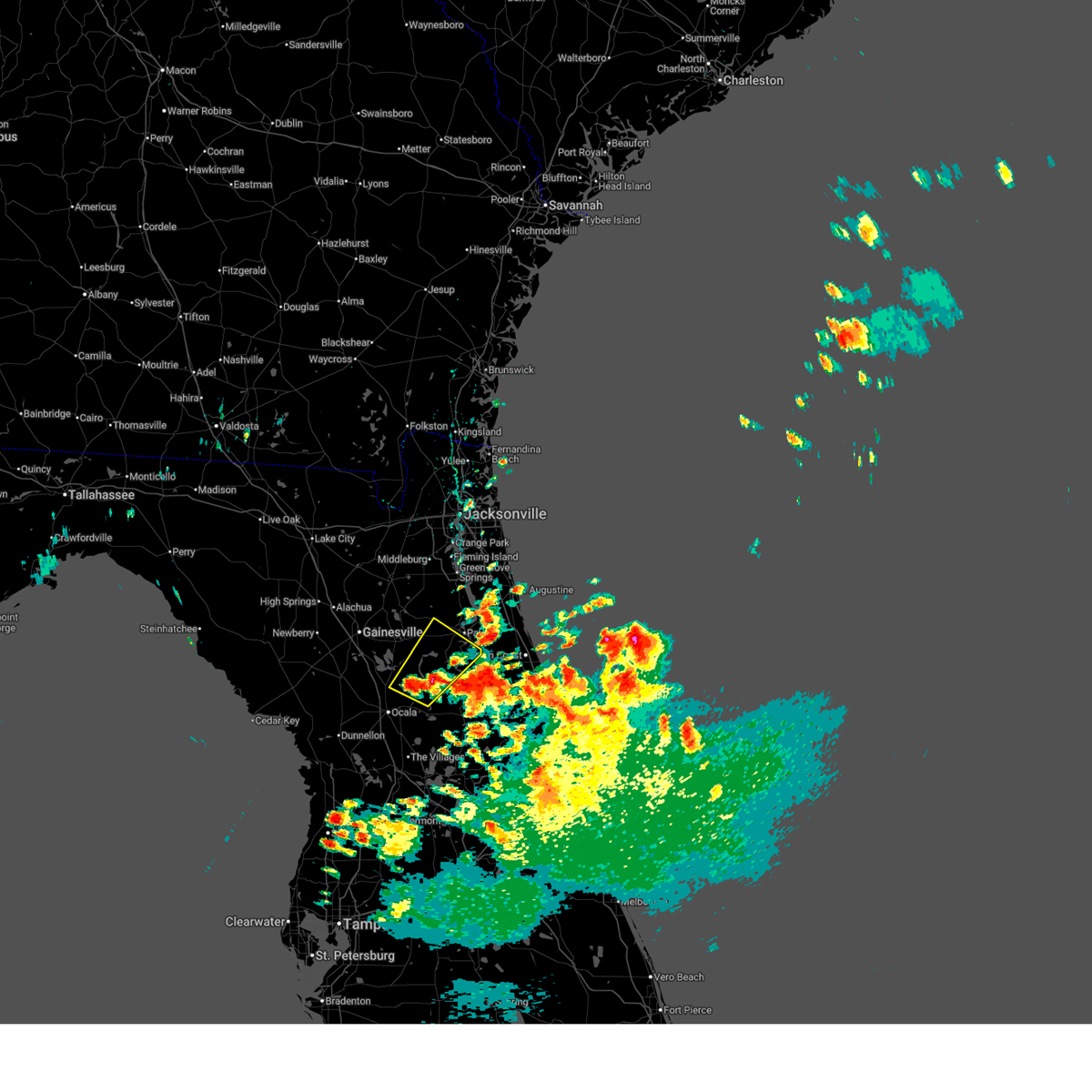
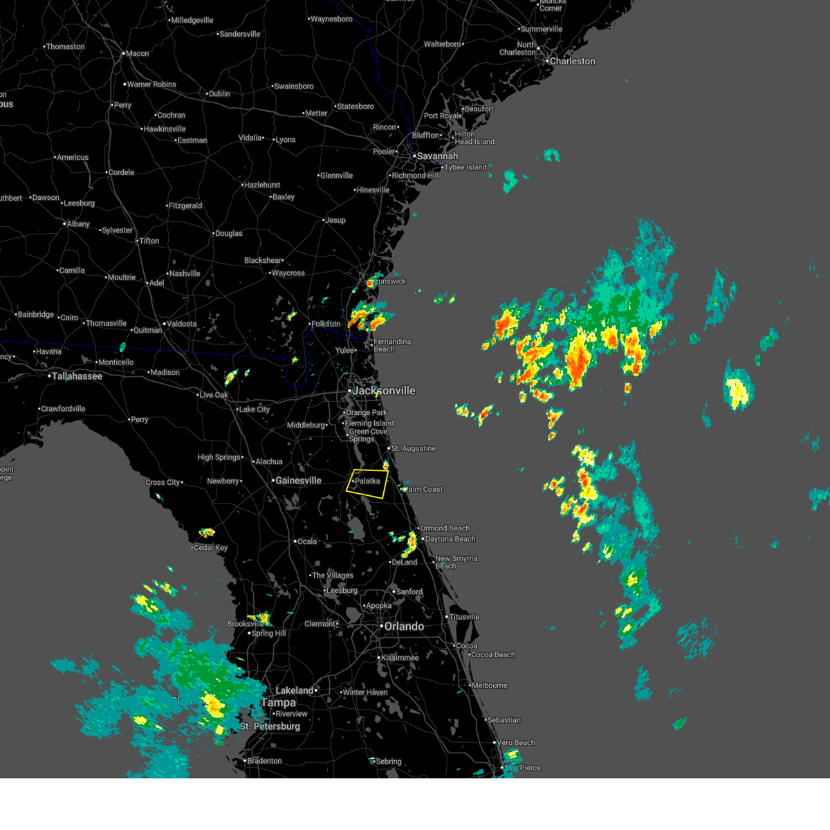
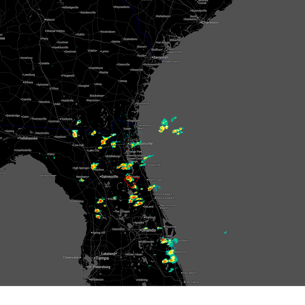
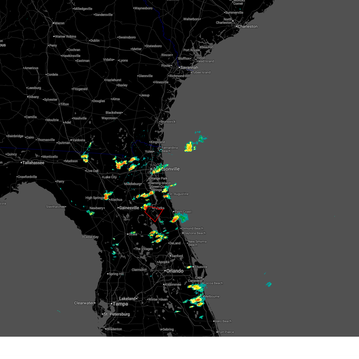
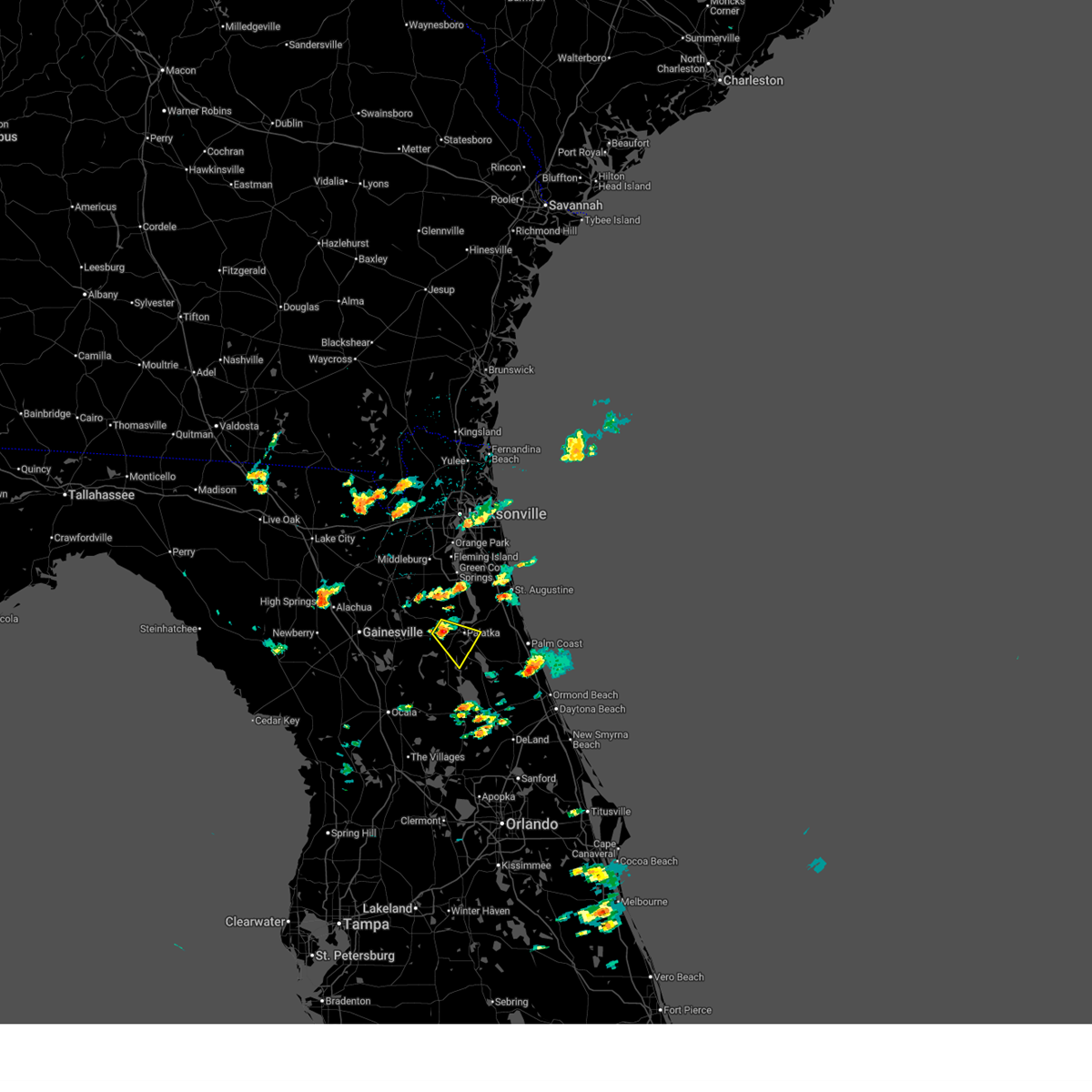
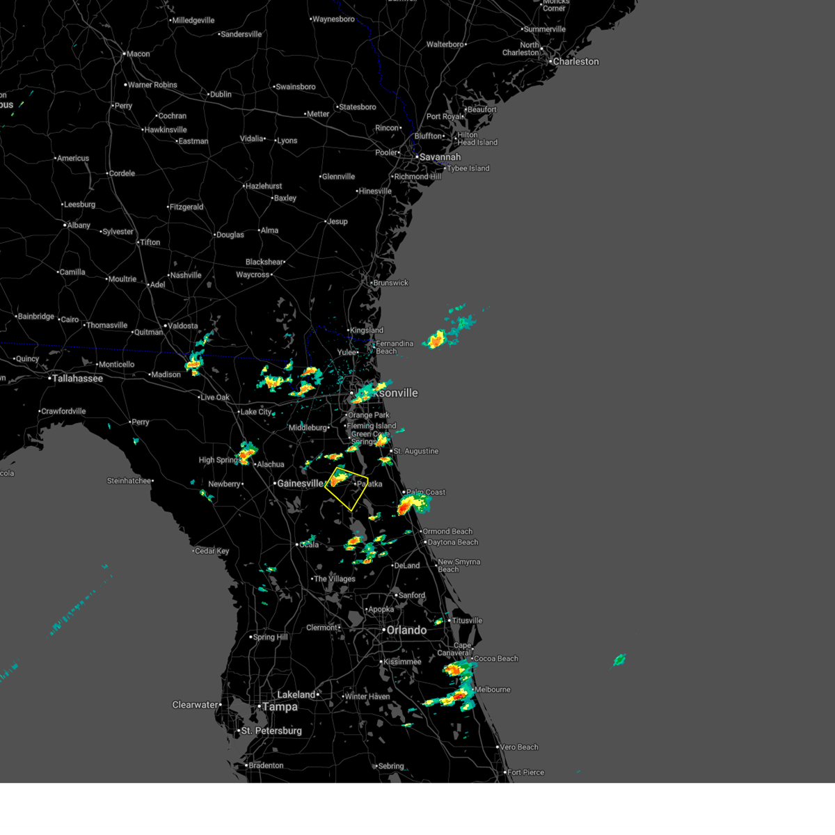
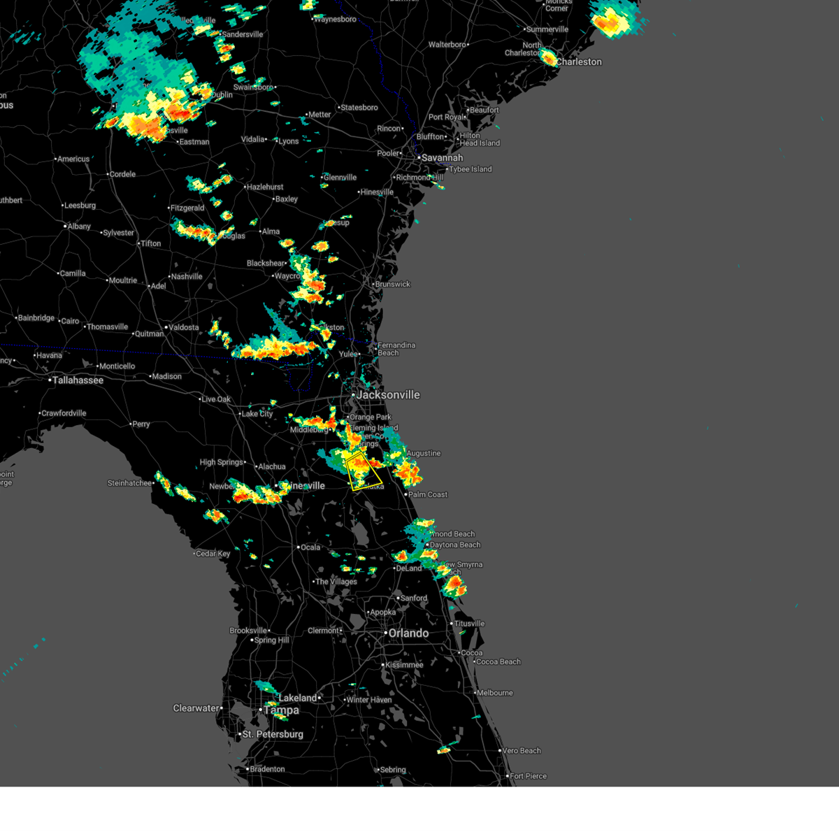
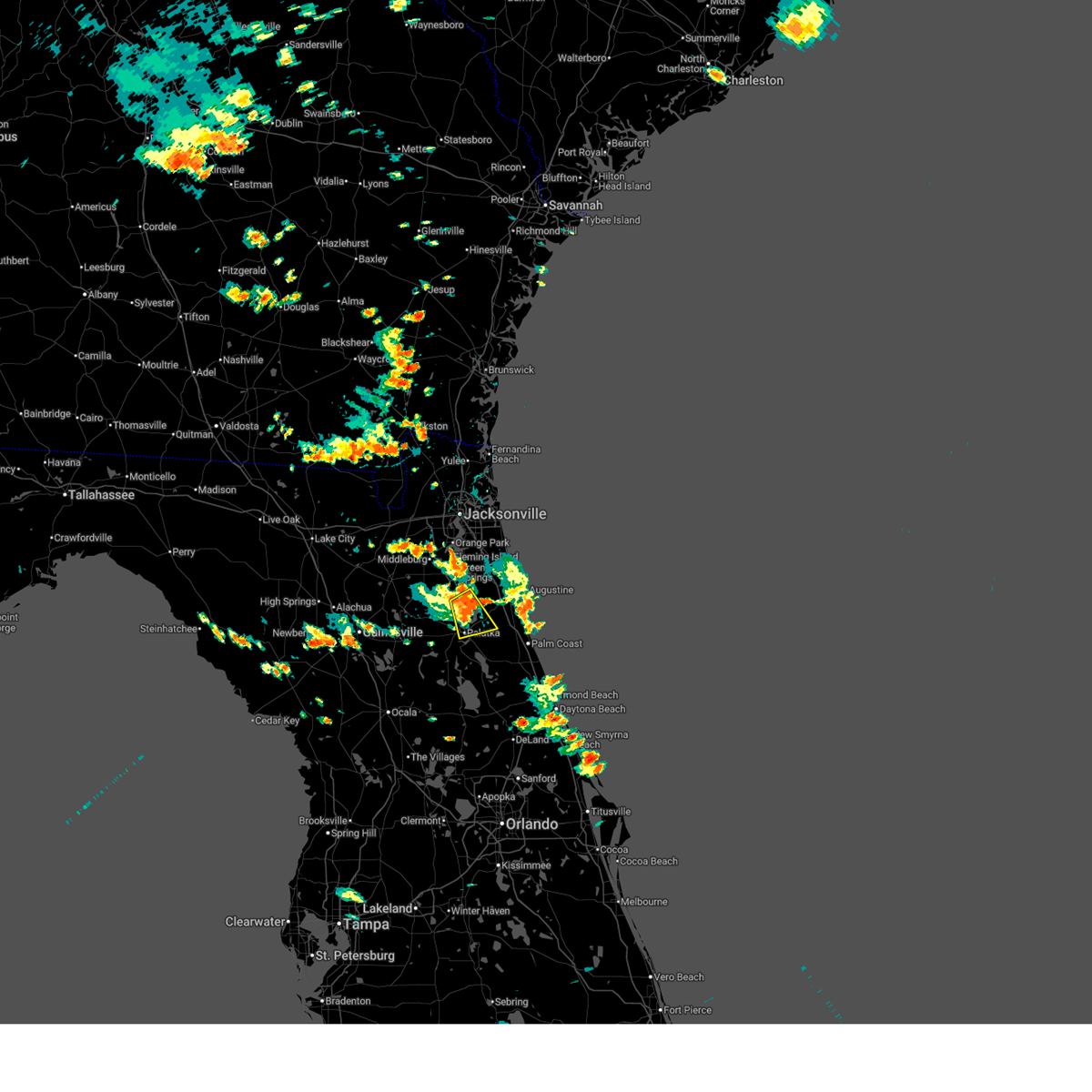
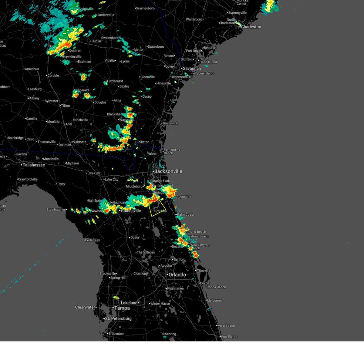
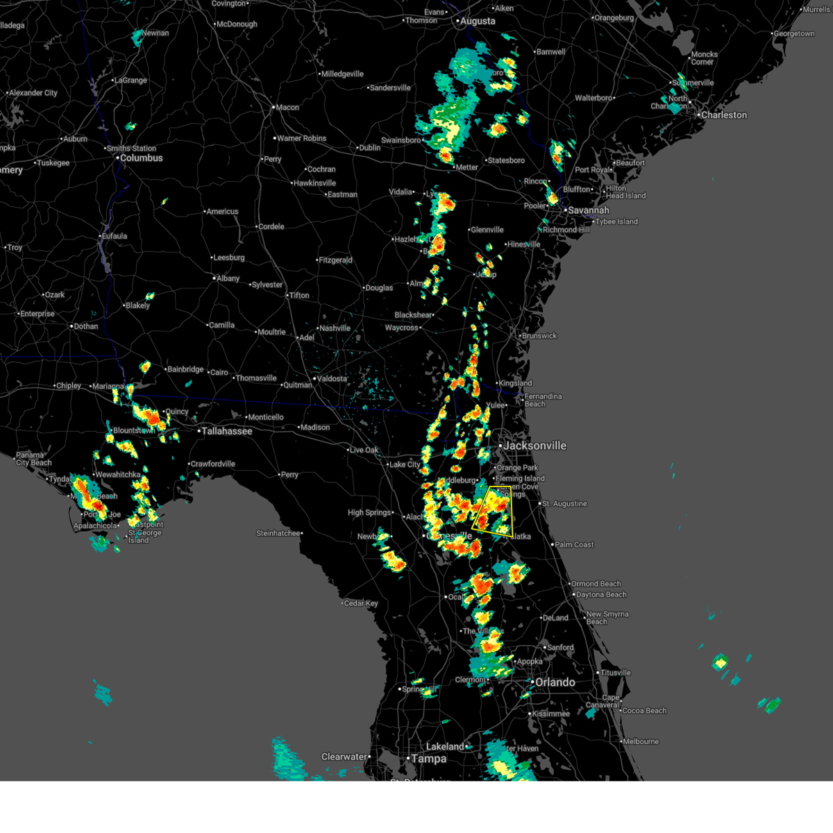
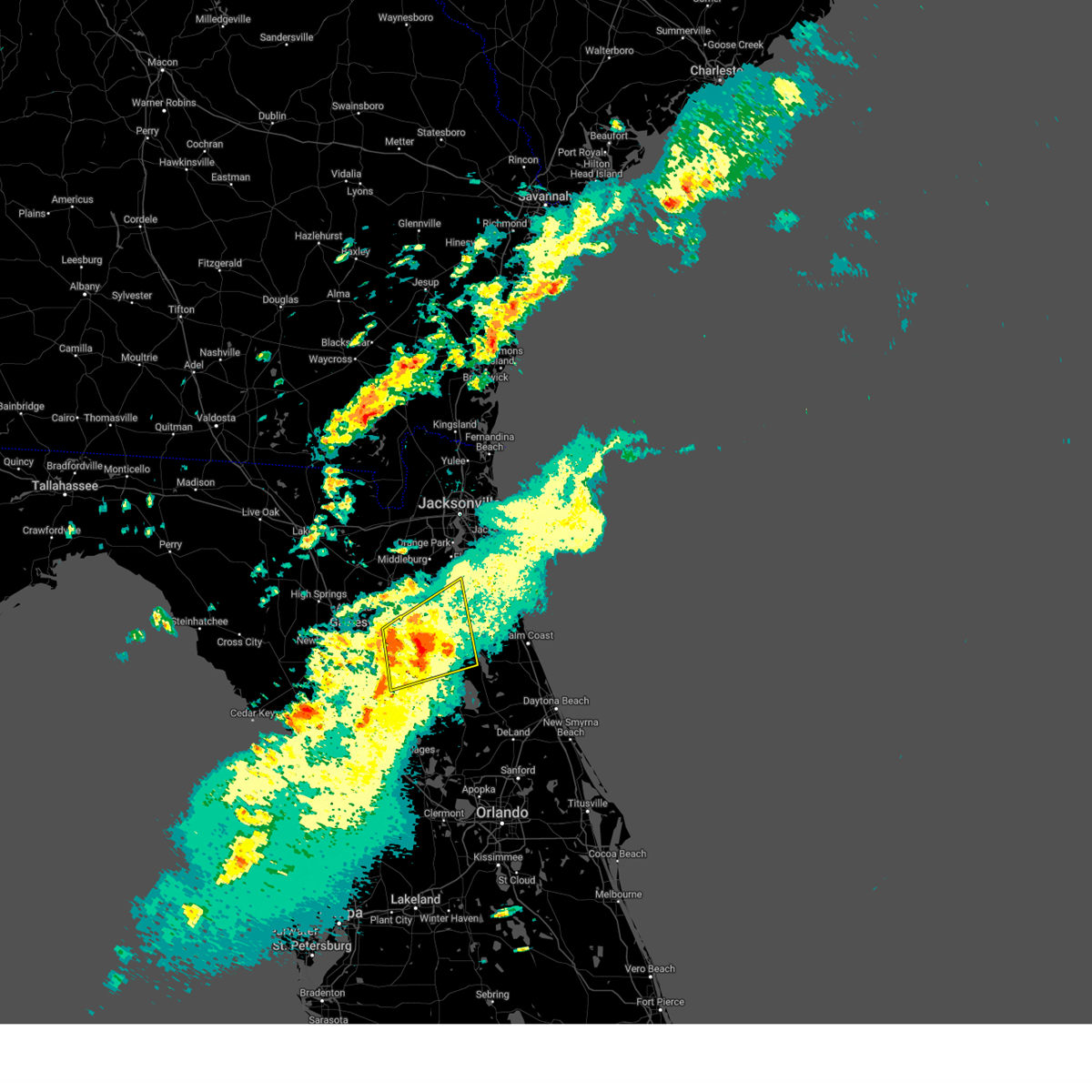
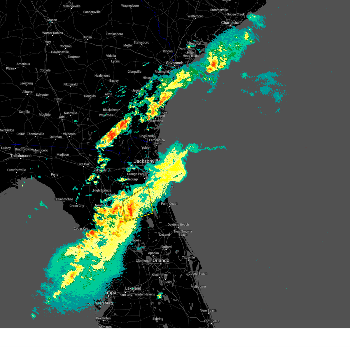
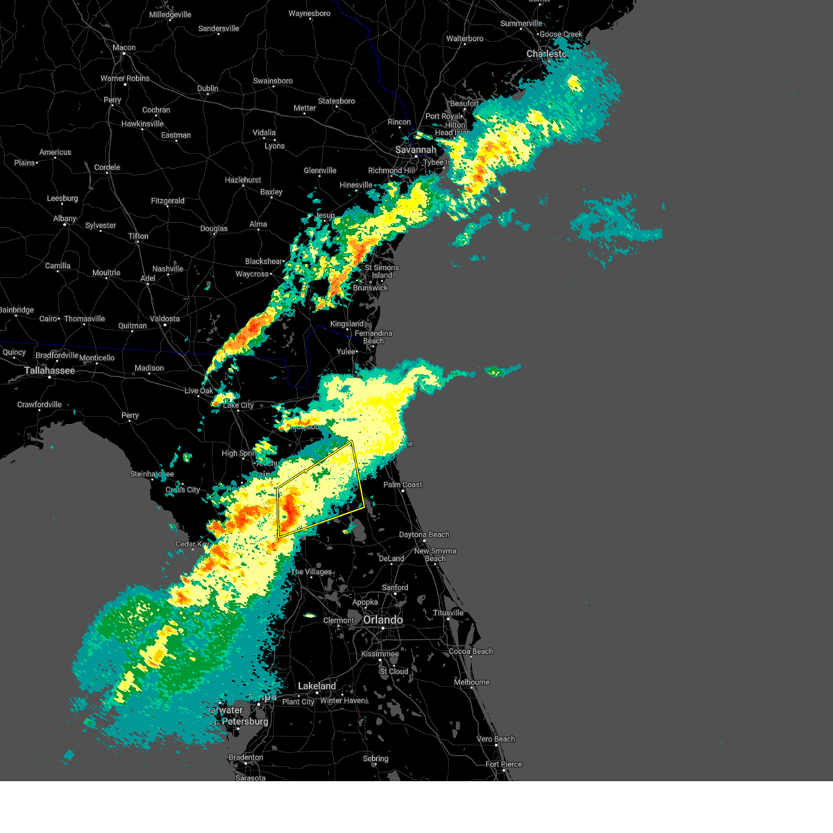
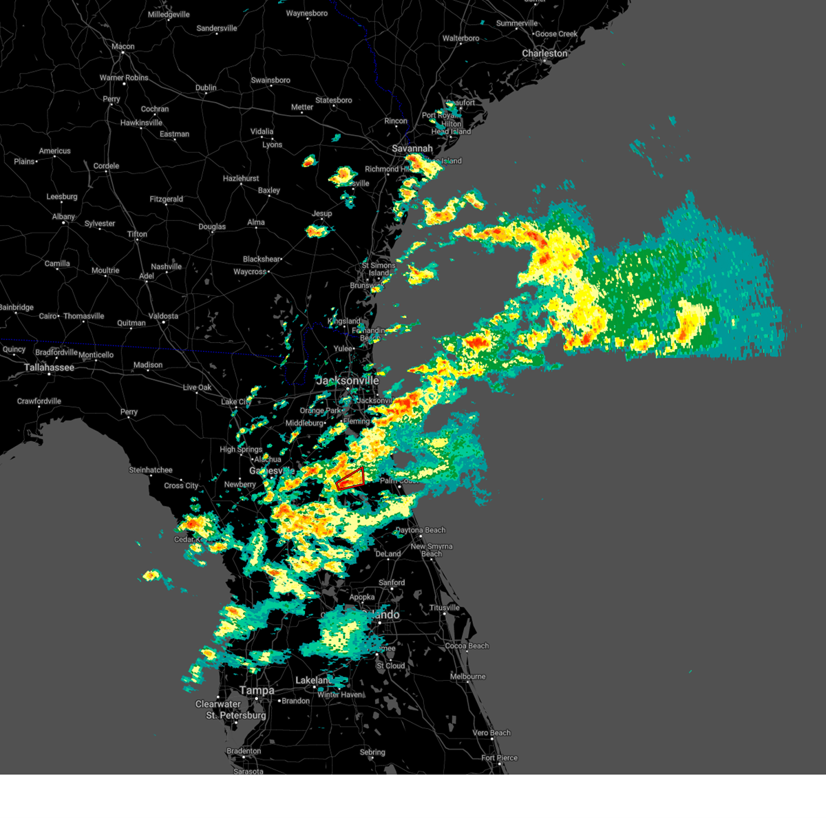
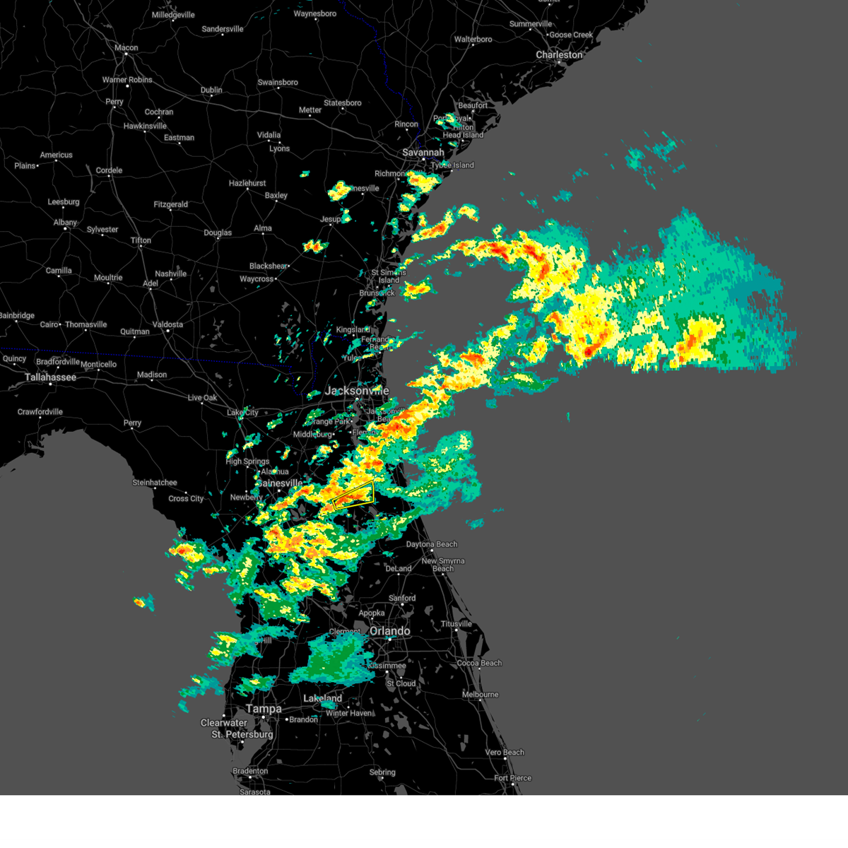
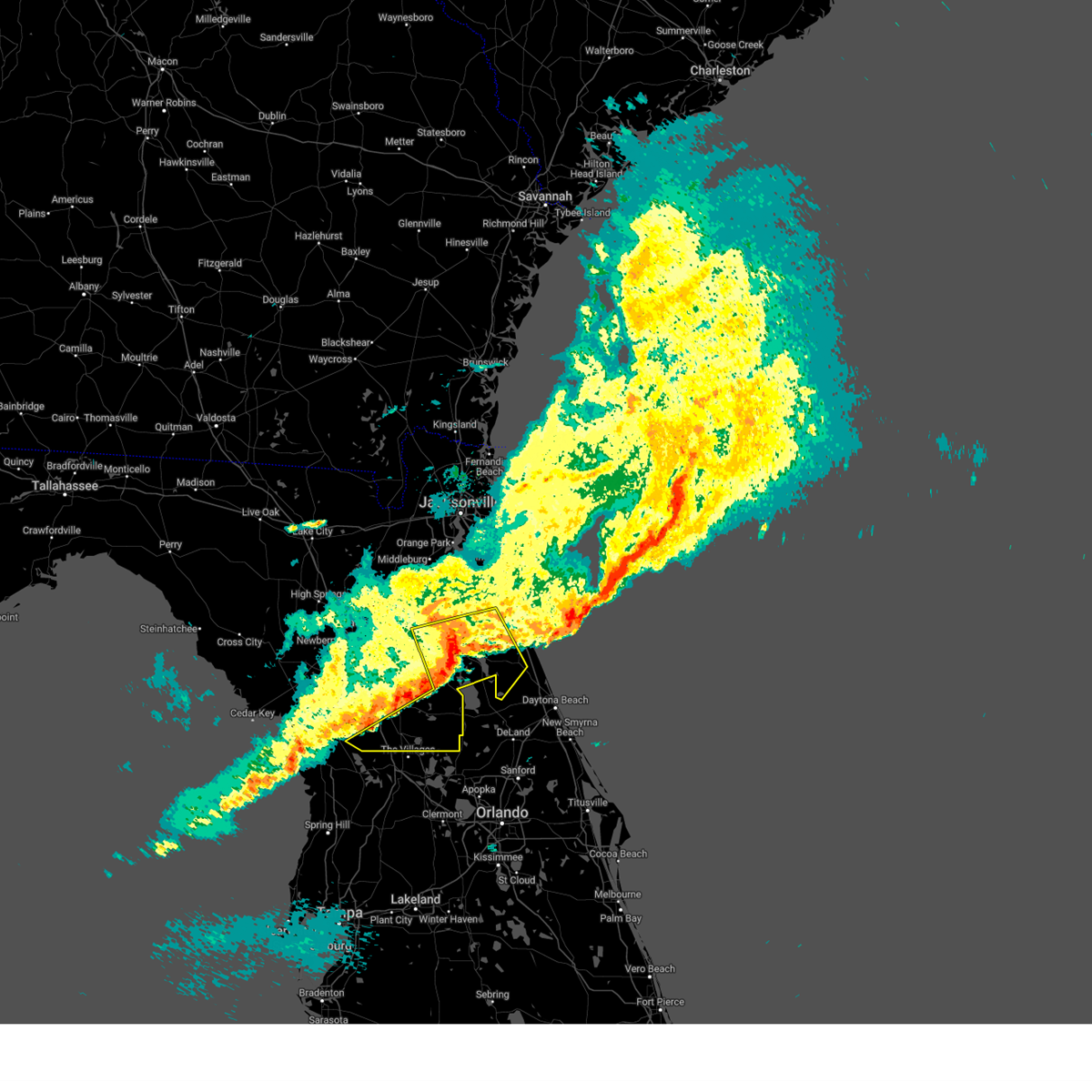
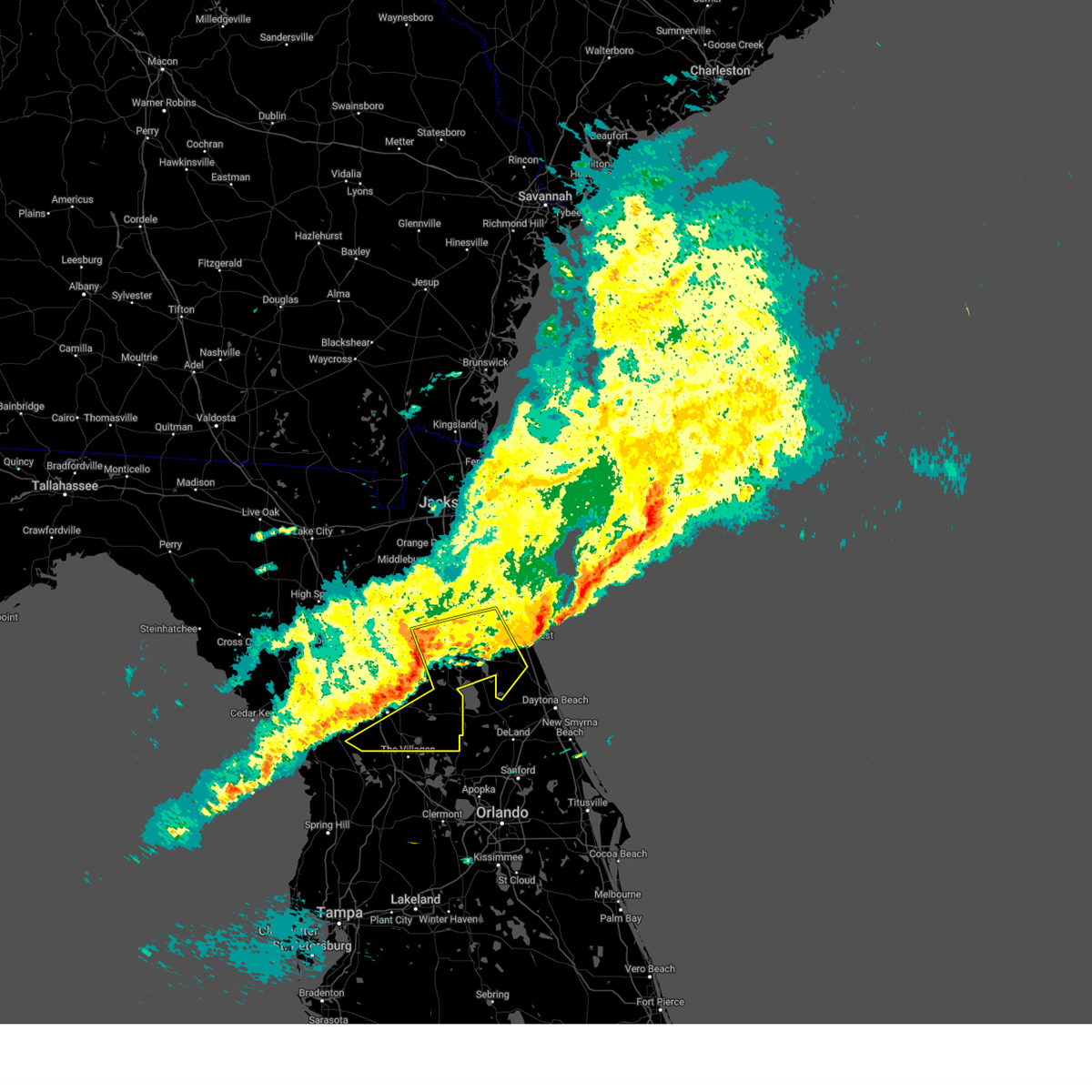
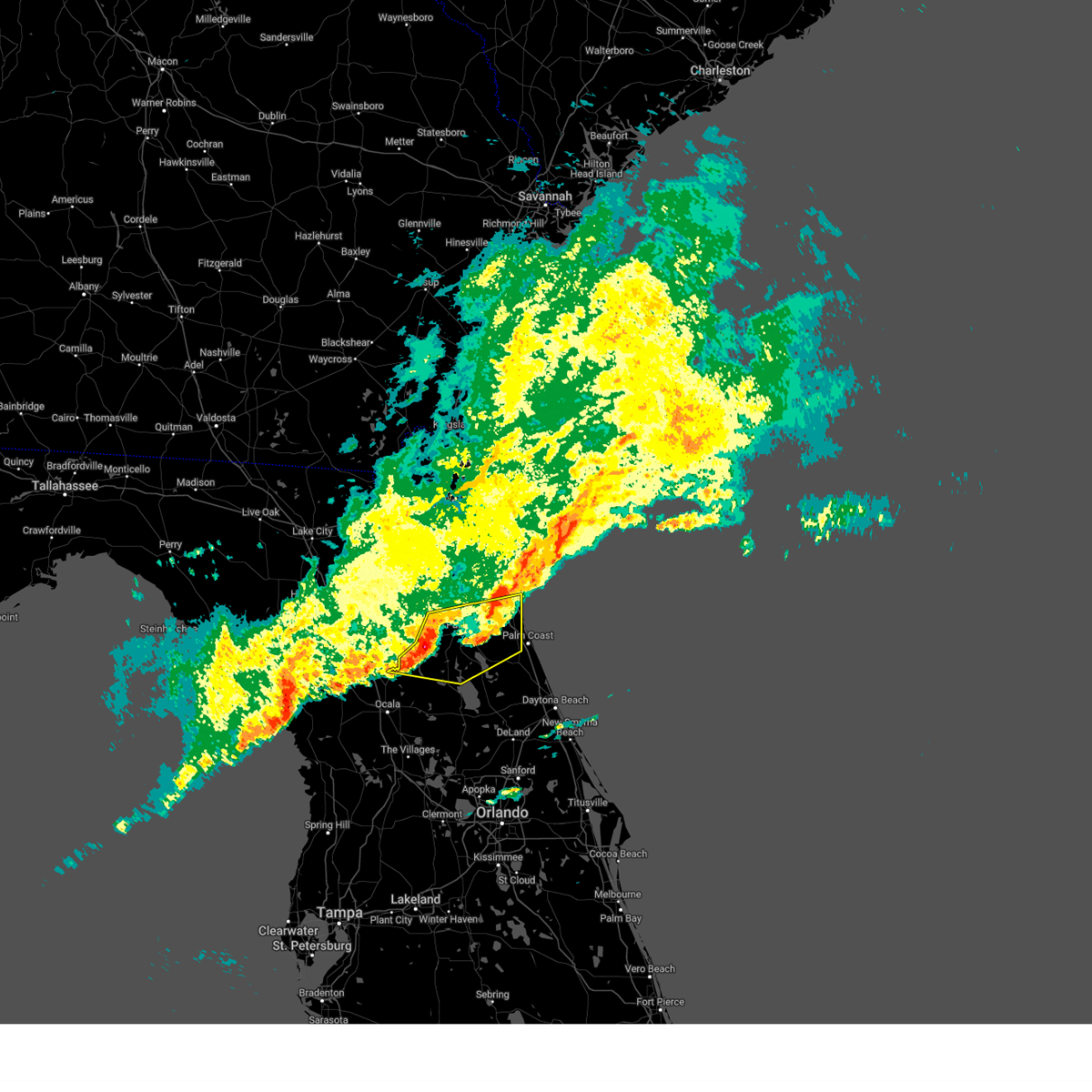
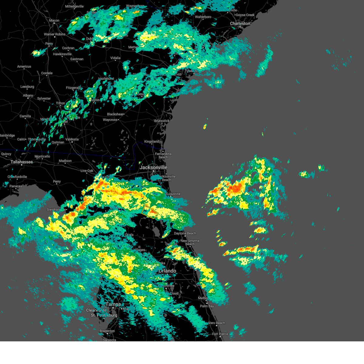
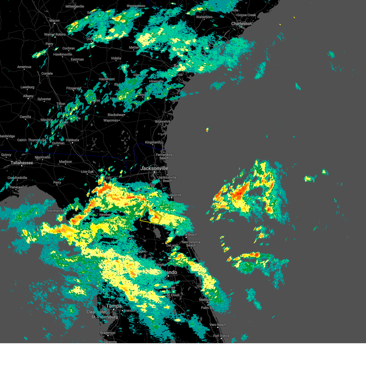
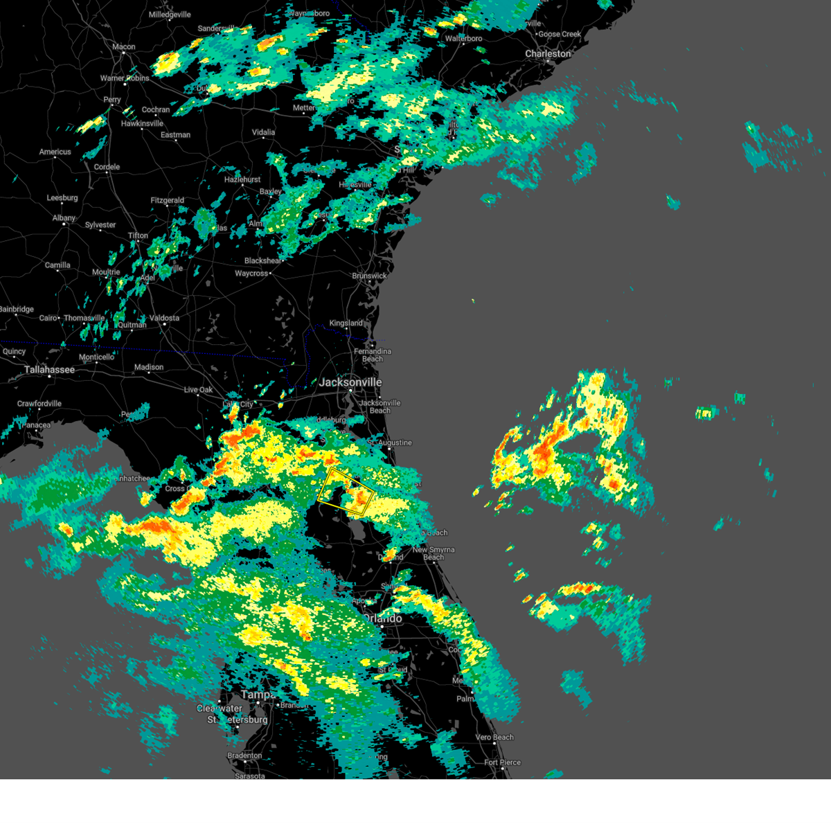
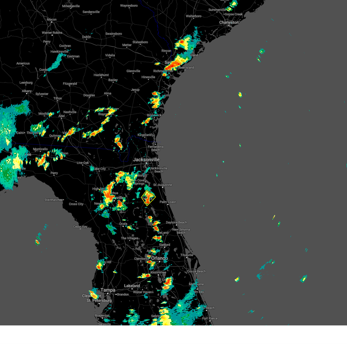
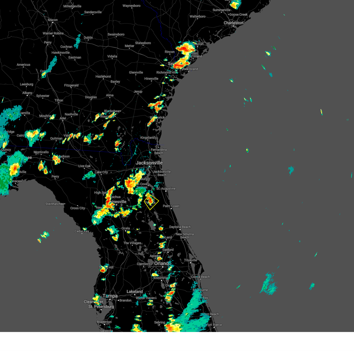
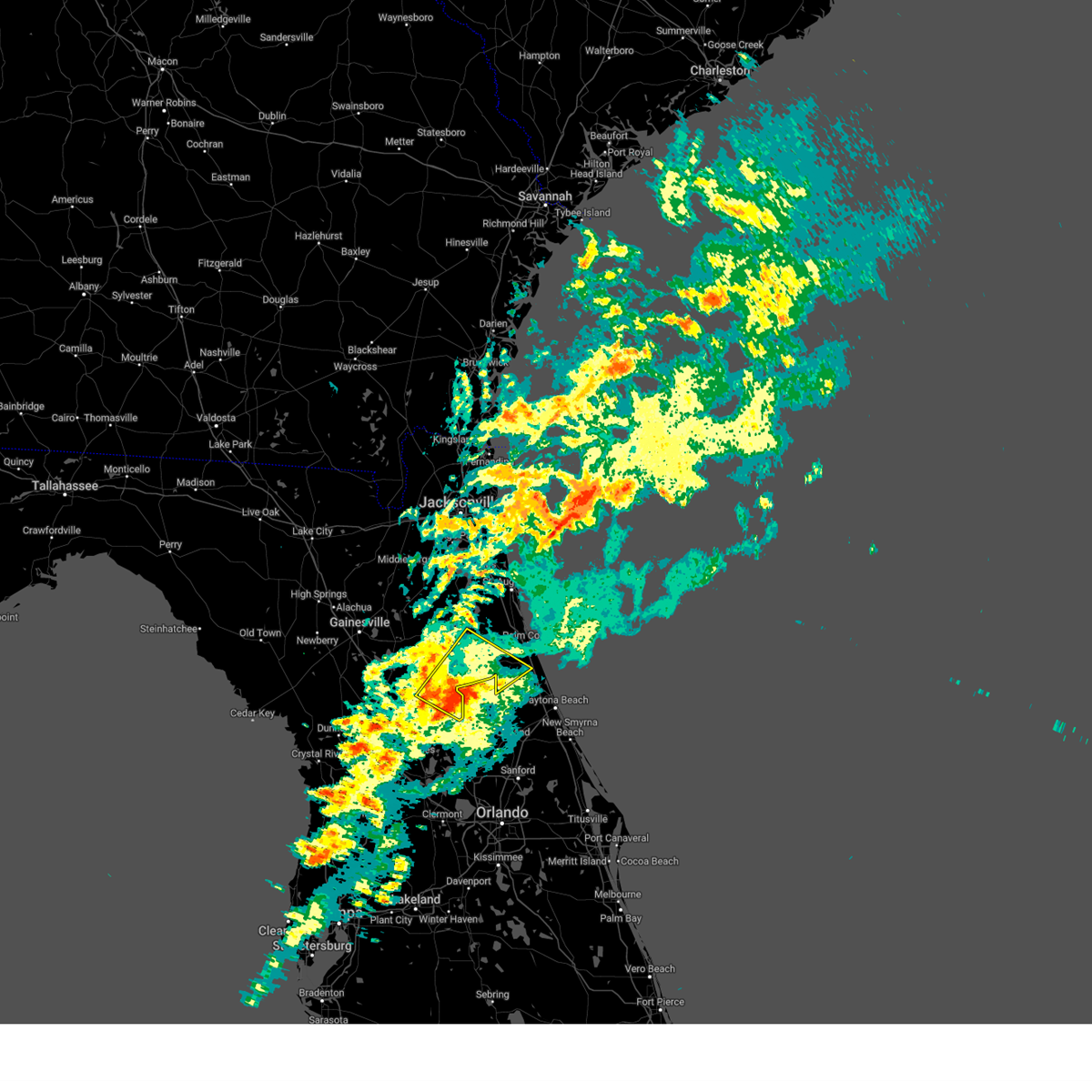
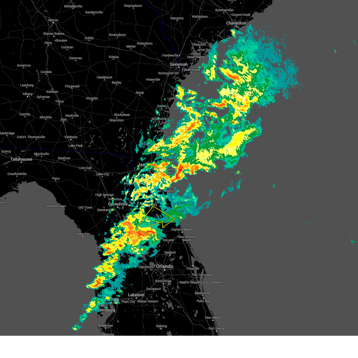
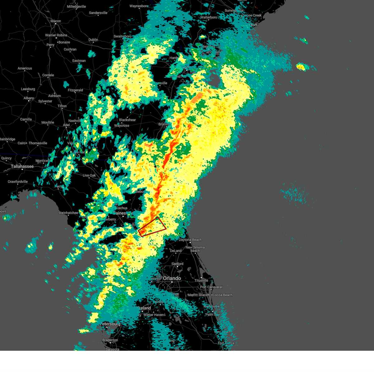
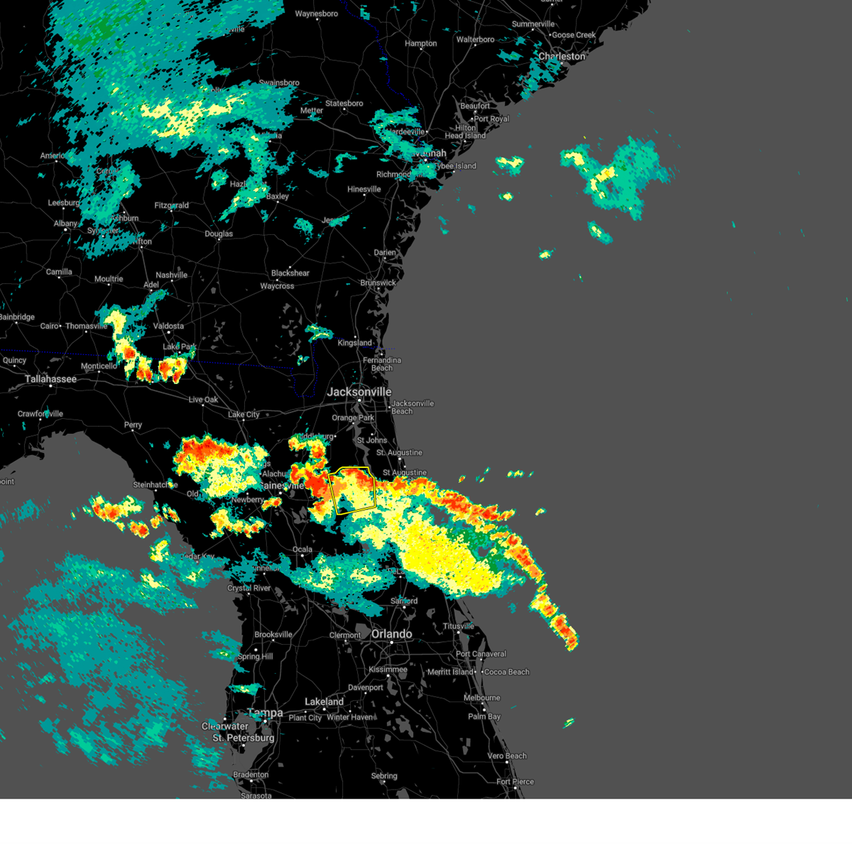
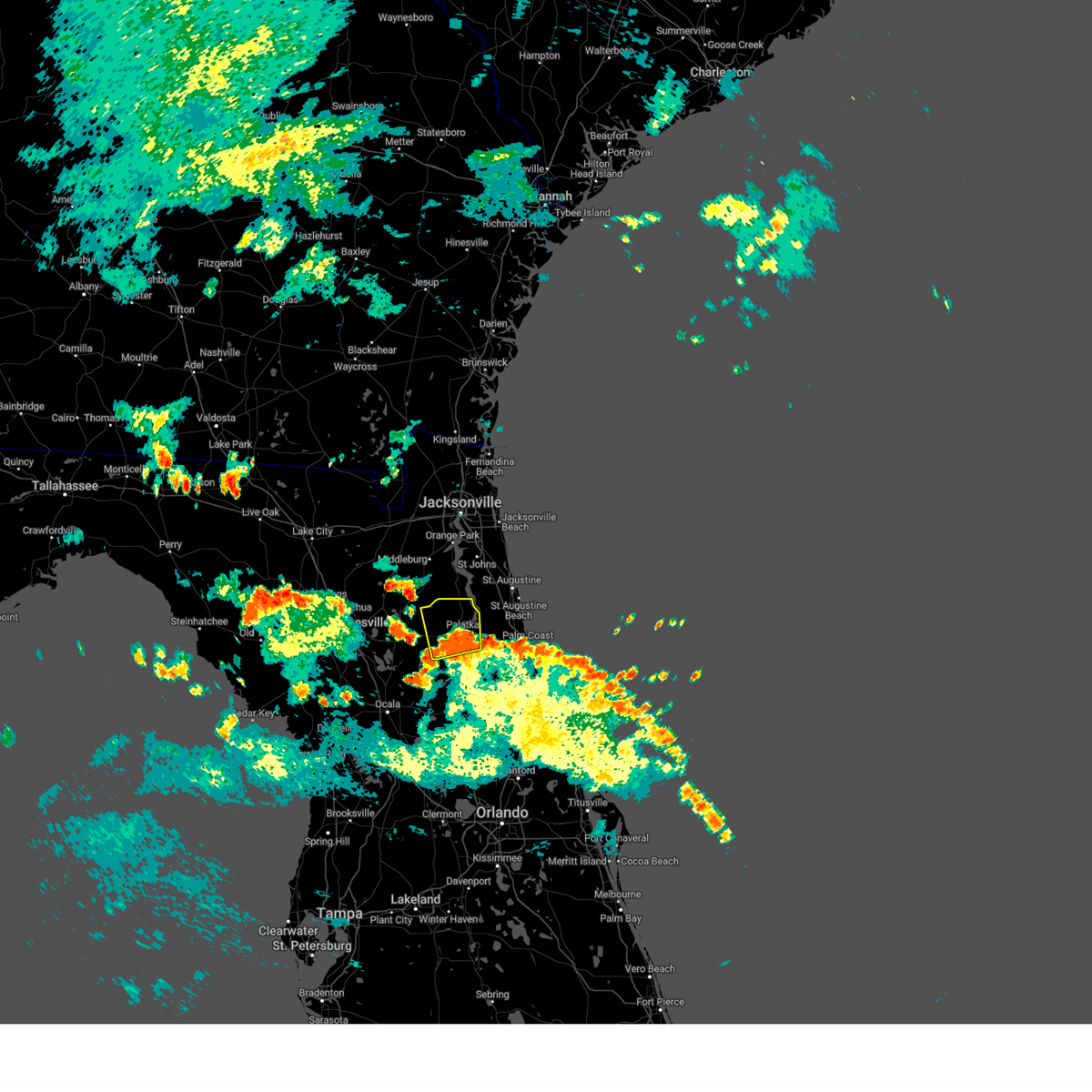
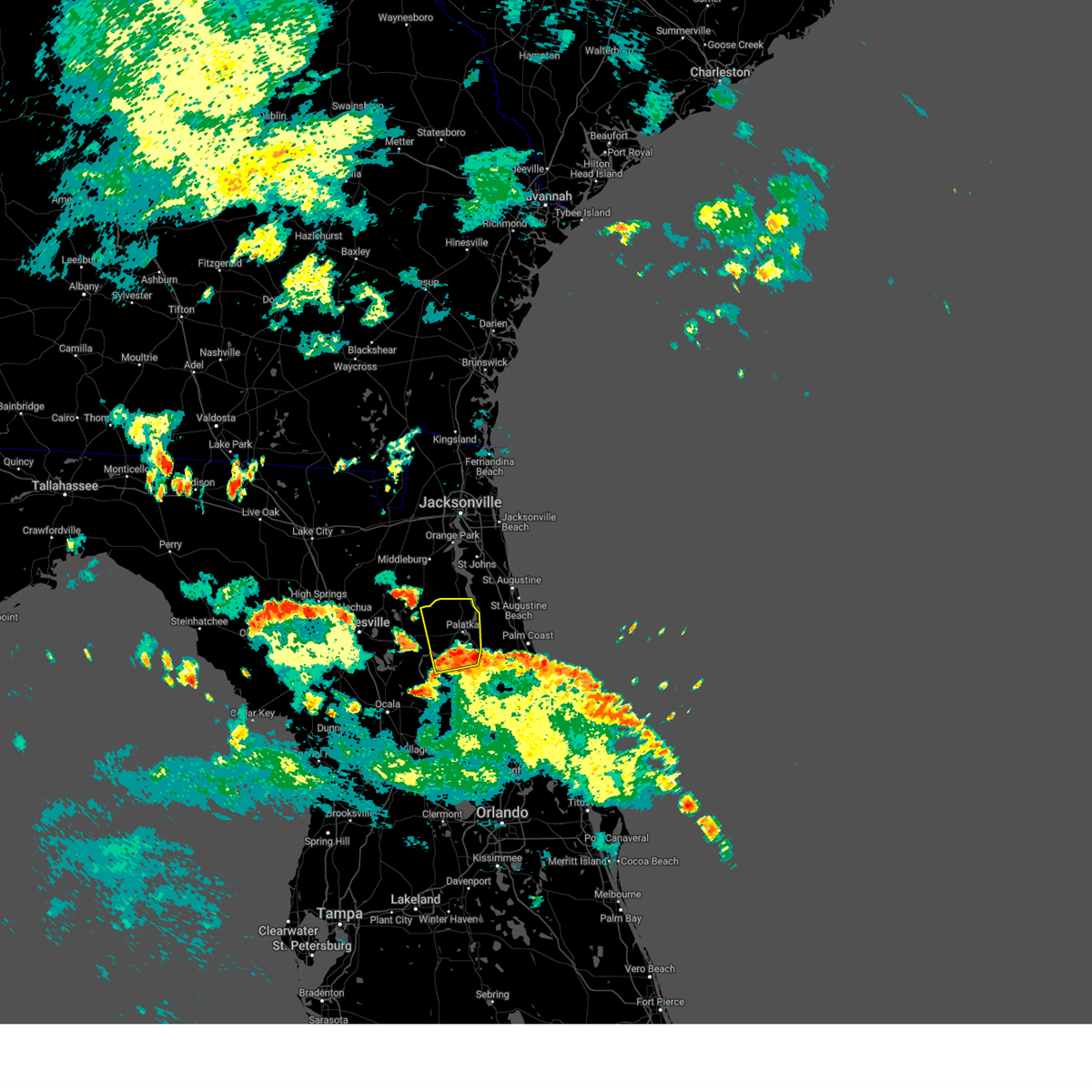
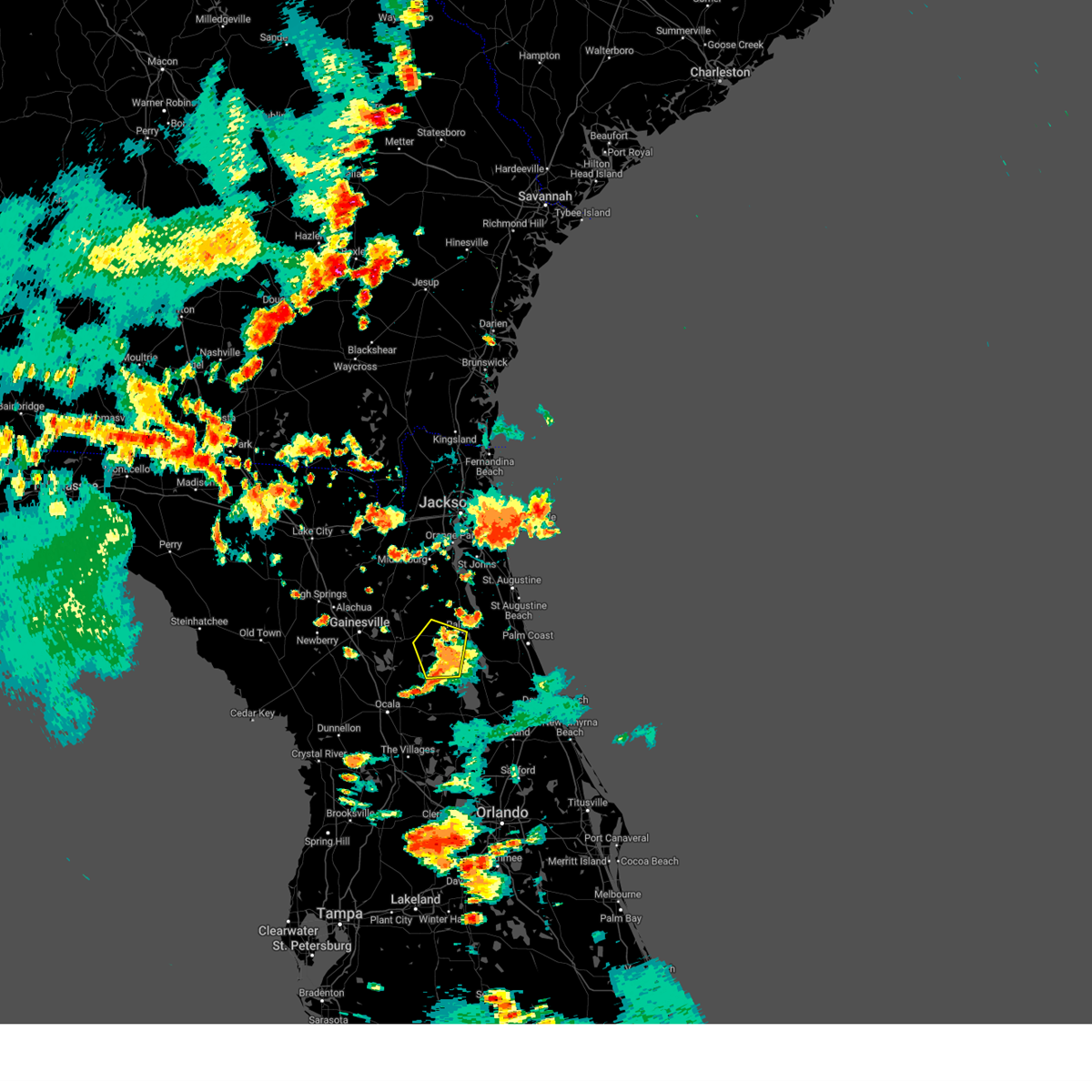
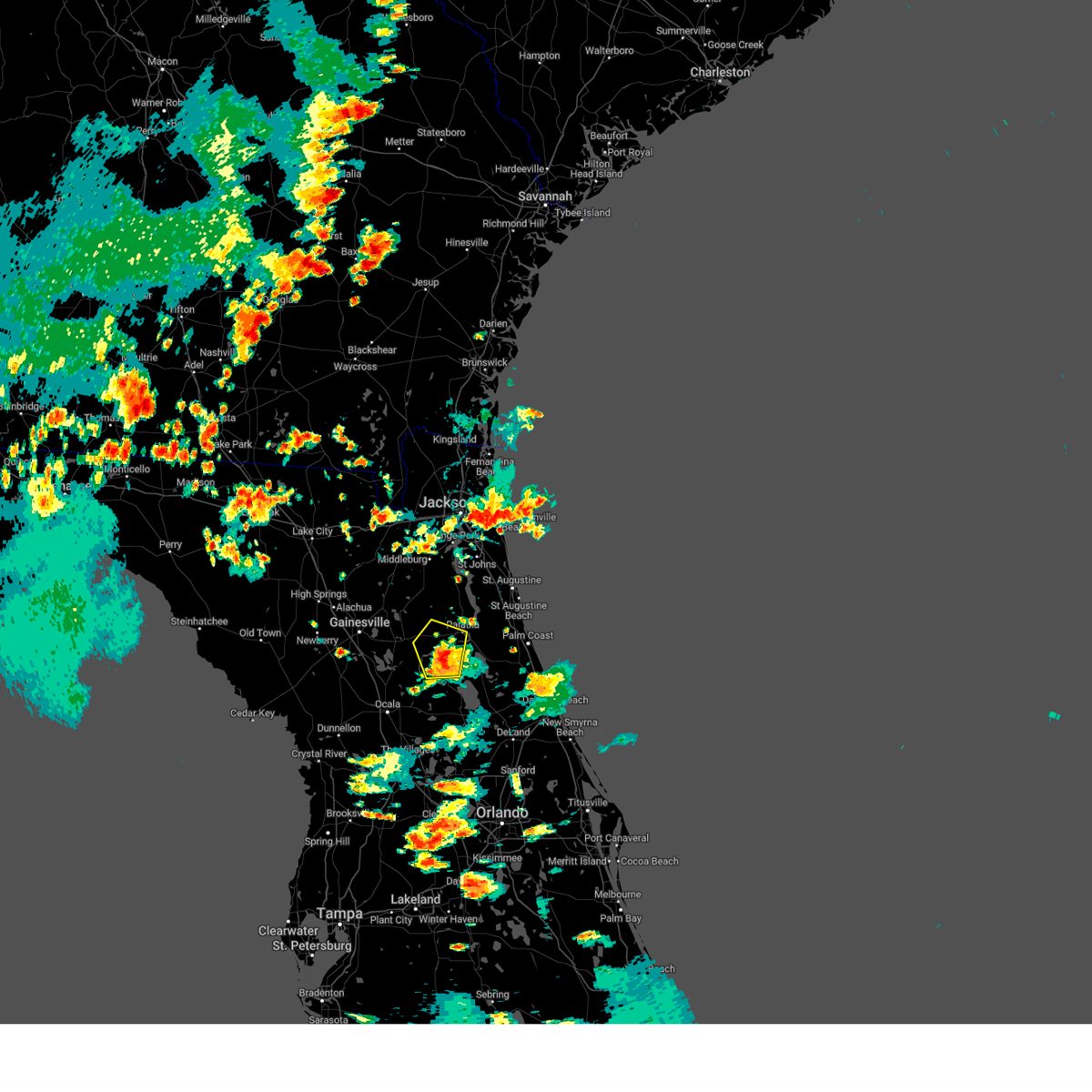
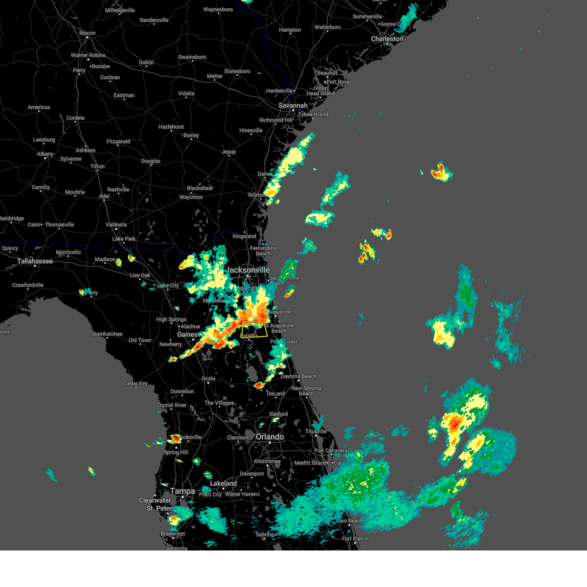
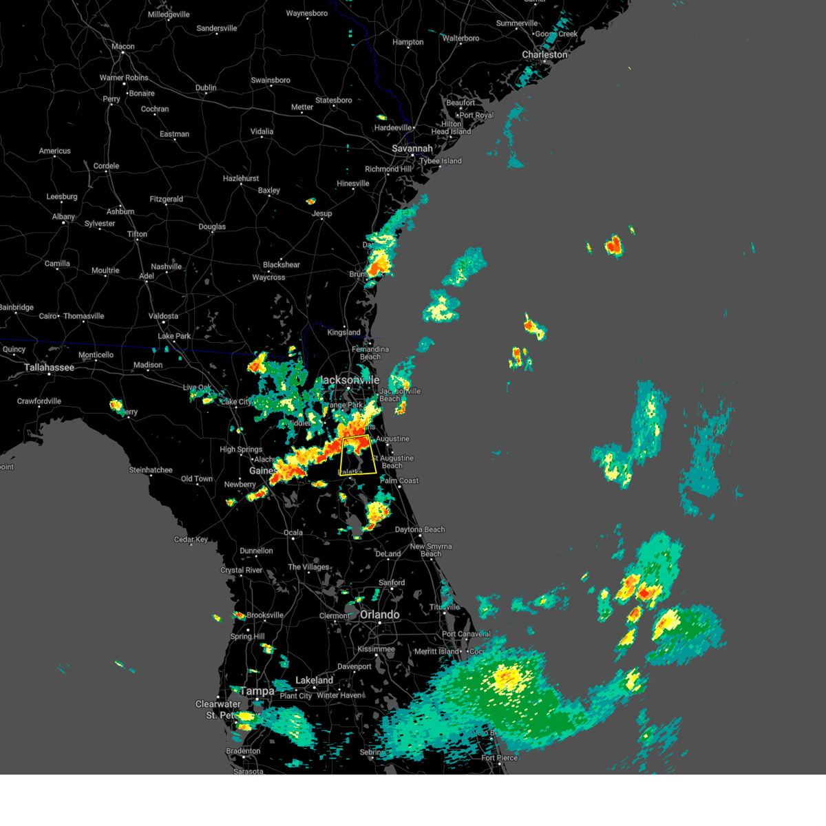
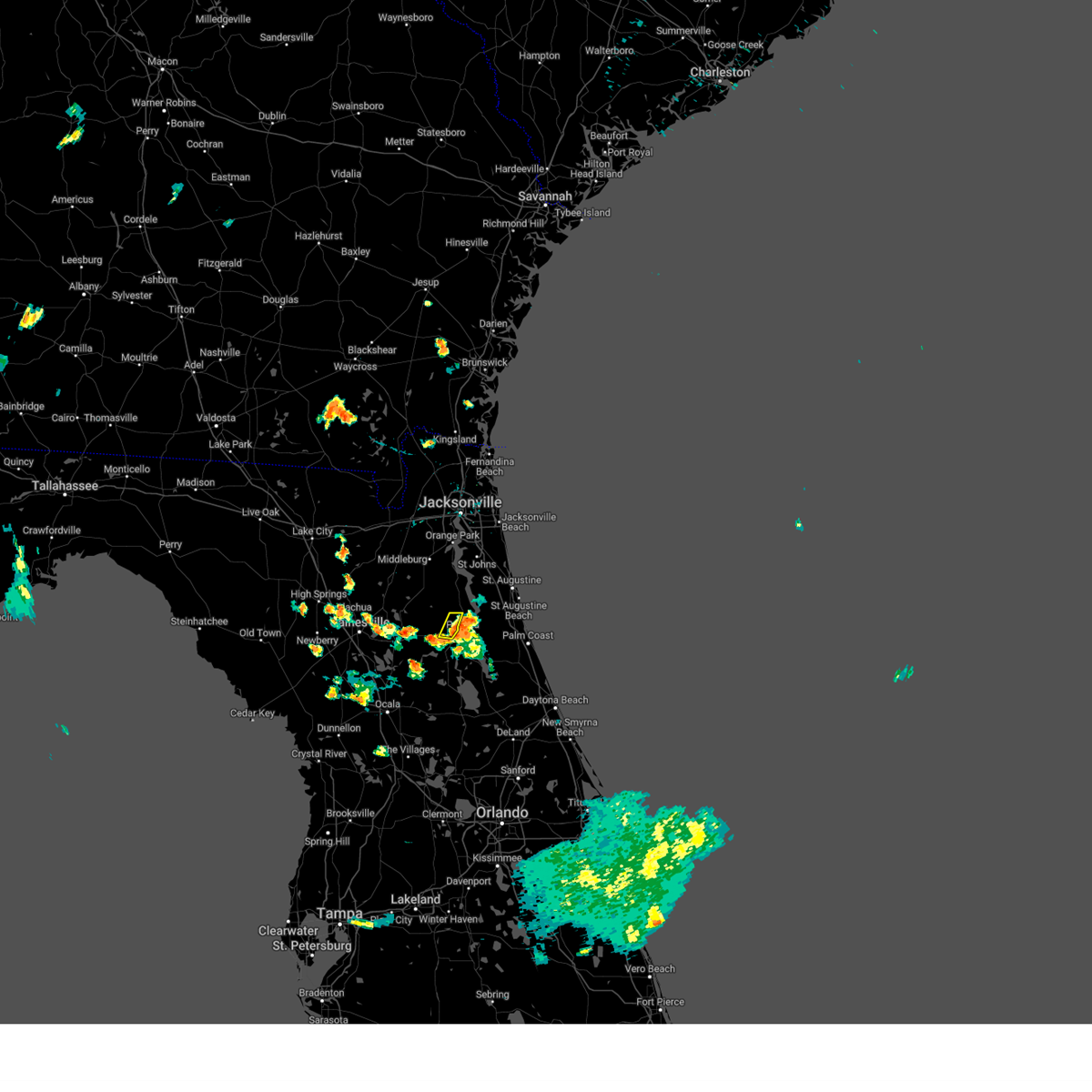
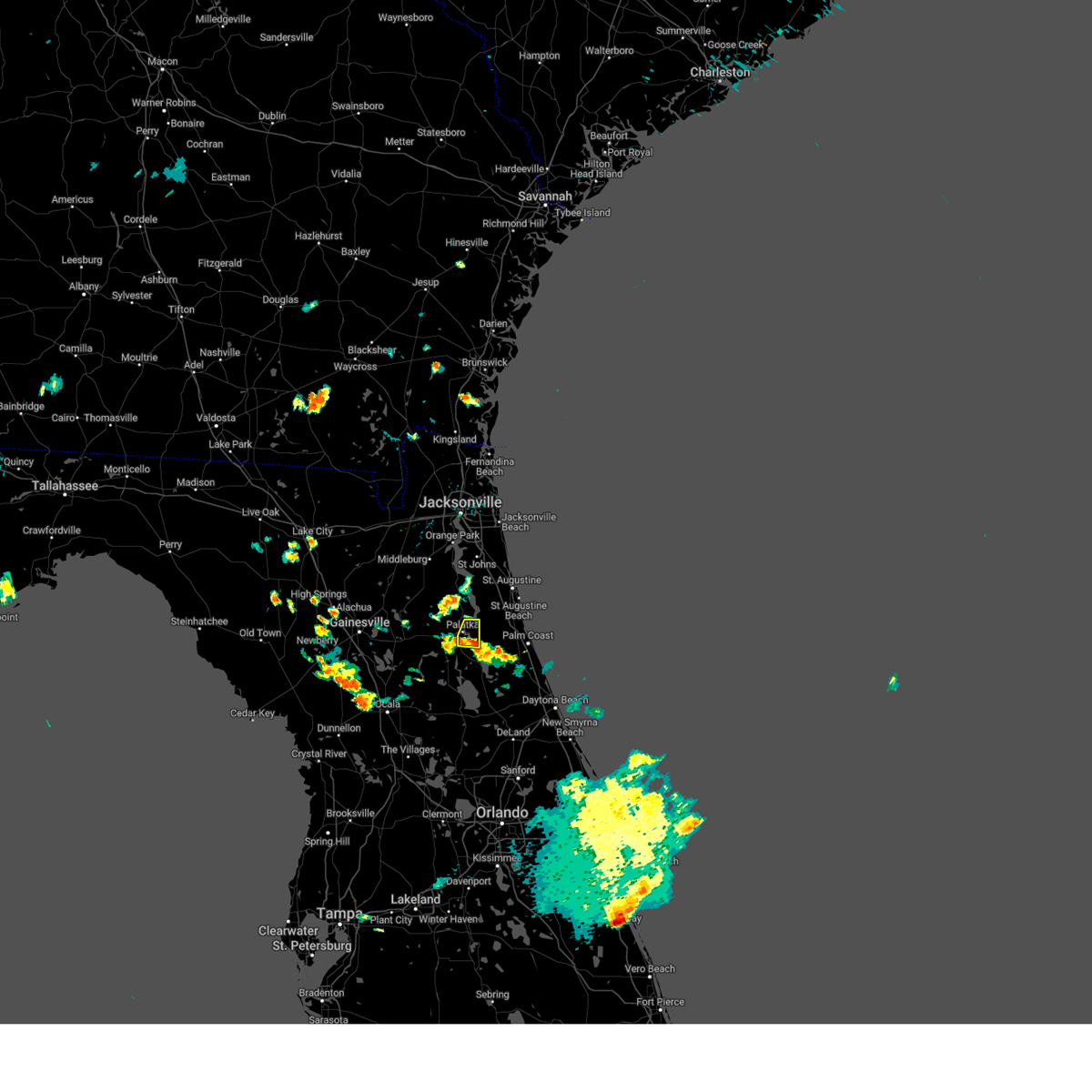
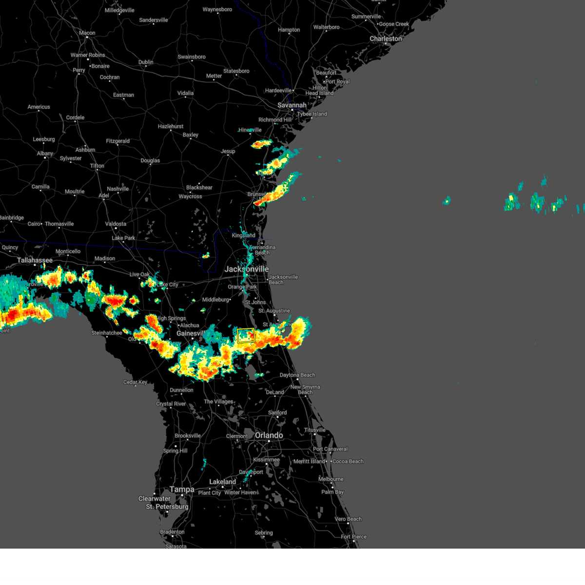
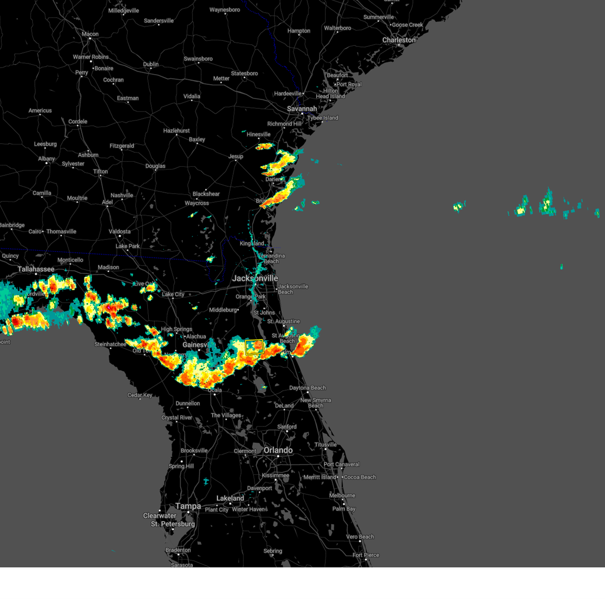
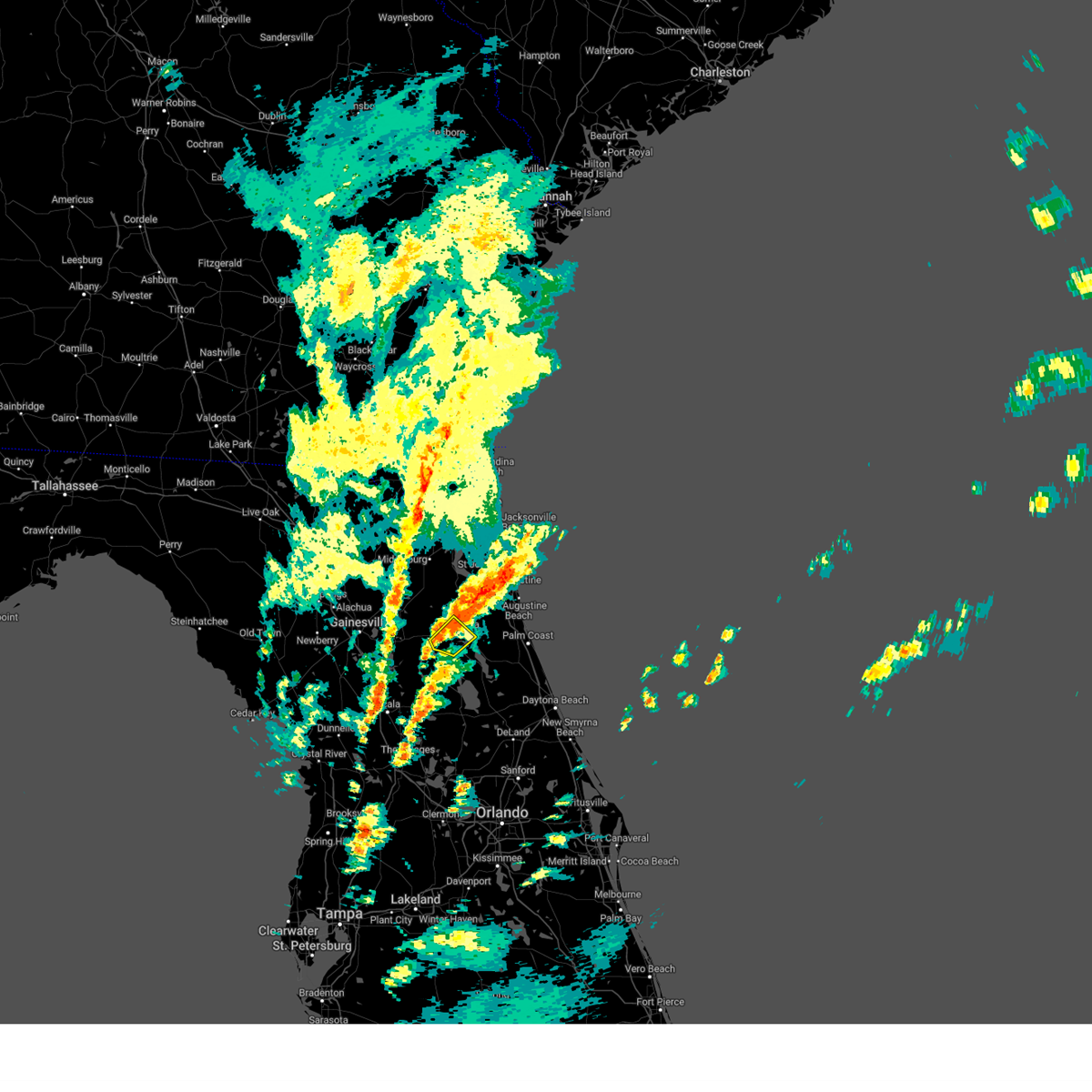
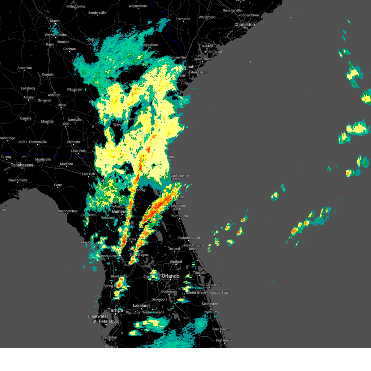
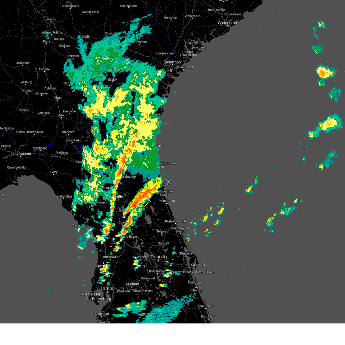
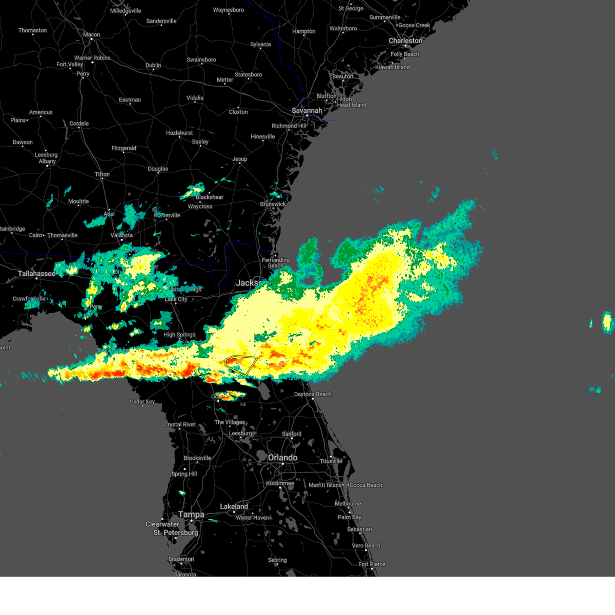
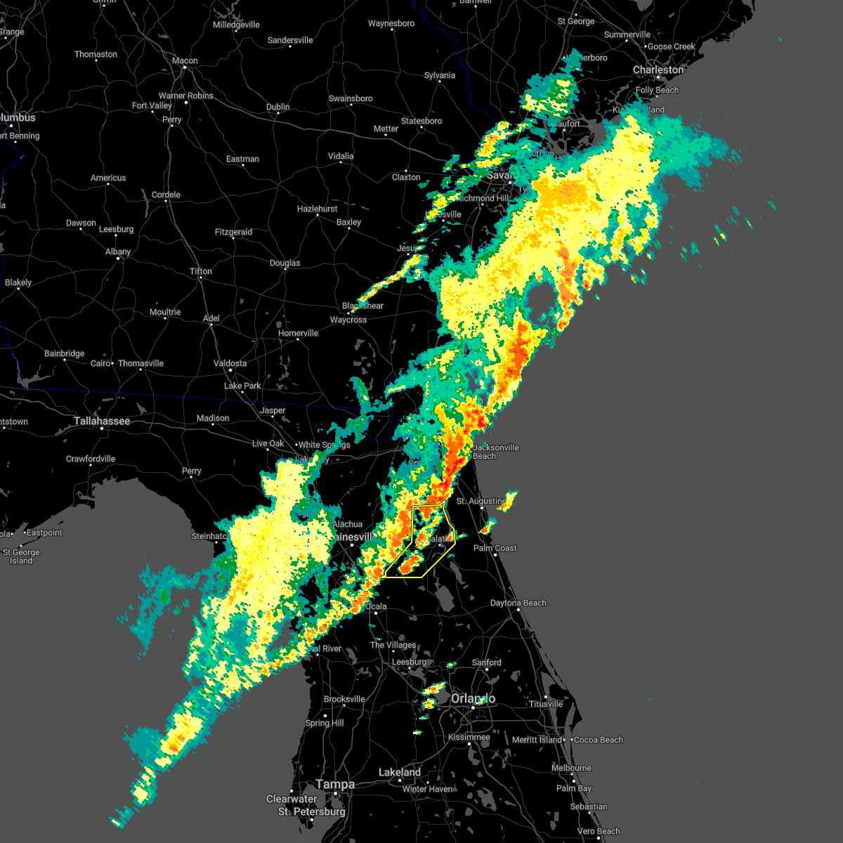
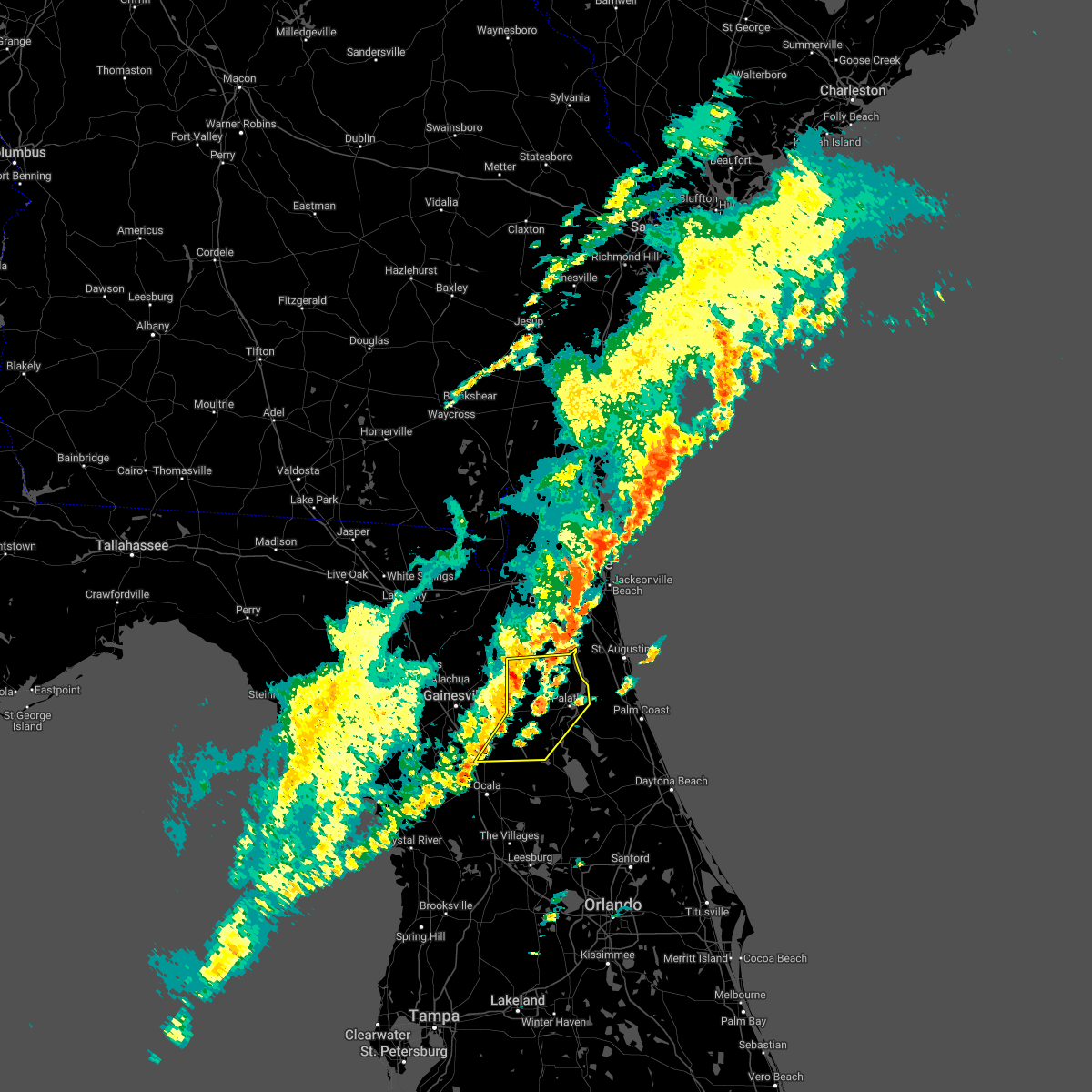
Hail Map for Palatka, FL
The Palatka, FL area has had 3 reports of on-the-ground hail by trained spotters, and has been under severe weather warnings 33 times during the past 12 months. Doppler radar has detected hail at or near Palatka, FL on 75 occasions, including 4 occasions during the past year.
| Name: | Palatka, FL |
| Where Located: | 47 miles S of Jacksonville, FL |
| Map: | Google Map for Palatka, FL |
| Population: | 10558 |
| Housing Units: | 4533 |
| More Info: | Search Google for Palatka, FL |
1
The Top Recent Hail Date for Palatka, FL is Thursday, August 28, 2025 (15th out of 75)

Hail and Wind Damage Spotted near Palatka, FL
| Date / Time | Report Details |
|---|---|
| 5/30/2026 6:30 PM EDT |
 Svrjax the national weather service in jacksonville has issued a * severe thunderstorm warning for, flagler county in northeastern florida, southern st. johns county in northeastern florida, east central putnam county in northeastern florida, * until 715 pm edt. * at 630 pm edt, a severe thunderstorm was located over san mateo, or near pomona park, moving east at 30 mph (radar indicated). Hazards include 60 mph wind gusts. expect damage to roofs, siding, and trees Svrjax the national weather service in jacksonville has issued a * severe thunderstorm warning for, flagler county in northeastern florida, southern st. johns county in northeastern florida, east central putnam county in northeastern florida, * until 715 pm edt. * at 630 pm edt, a severe thunderstorm was located over san mateo, or near pomona park, moving east at 30 mph (radar indicated). Hazards include 60 mph wind gusts. expect damage to roofs, siding, and trees
|
| 5/30/2026 5:58 PM EDT |
 At 558 pm edt, a severe thunderstorm was located over san mateo, or over east palatka, moving east at 25 mph (radar indicated). Hazards include 60 mph wind gusts. Expect damage to roofs, siding, and trees. Locations impacted include, palatka, east palatka, orange mills, san mateo, and espanola. At 558 pm edt, a severe thunderstorm was located over san mateo, or over east palatka, moving east at 25 mph (radar indicated). Hazards include 60 mph wind gusts. Expect damage to roofs, siding, and trees. Locations impacted include, palatka, east palatka, orange mills, san mateo, and espanola.
|
| 5/30/2026 5:46 PM EDT |
 Svrjax the national weather service in jacksonville has issued a * severe thunderstorm warning for, northwestern flagler county in northeastern florida, southeastern st. johns county in northeastern florida, northeastern putnam county in northeastern florida, * until 630 pm edt. * at 546 pm edt, a severe thunderstorm was located over palatka, moving east at 25 mph (radar indicated). Hazards include 60 mph wind gusts. expect damage to roofs, siding, and trees Svrjax the national weather service in jacksonville has issued a * severe thunderstorm warning for, northwestern flagler county in northeastern florida, southeastern st. johns county in northeastern florida, northeastern putnam county in northeastern florida, * until 630 pm edt. * at 546 pm edt, a severe thunderstorm was located over palatka, moving east at 25 mph (radar indicated). Hazards include 60 mph wind gusts. expect damage to roofs, siding, and trees
|
| 5/30/2026 4:52 PM EDT |
 Svrjax the national weather service in jacksonville has issued a * severe thunderstorm warning for, southwestern st. johns county in northeastern florida, northeastern putnam county in northeastern florida, southeastern clay county in northeastern florida, * until 530 pm edt. * at 452 pm edt, a severe thunderstorm was located over george's lake, or 11 miles east of keystone heights, moving east at 30 mph (radar indicated). Hazards include 60 mph wind gusts. expect damage to roofs, siding, and trees Svrjax the national weather service in jacksonville has issued a * severe thunderstorm warning for, southwestern st. johns county in northeastern florida, northeastern putnam county in northeastern florida, southeastern clay county in northeastern florida, * until 530 pm edt. * at 452 pm edt, a severe thunderstorm was located over george's lake, or 11 miles east of keystone heights, moving east at 30 mph (radar indicated). Hazards include 60 mph wind gusts. expect damage to roofs, siding, and trees
|
| 5/23/2026 6:50 PM EDT |
 the severe thunderstorm warning has been cancelled and is no longer in effect the severe thunderstorm warning has been cancelled and is no longer in effect
|
| 5/23/2026 6:33 PM EDT |
 At 633 pm edt, a severe thunderstorm was located near satsuma, or near pomona park, and is nearly stationary (radar indicated). Hazards include 60 mph wind gusts. Expect damage to roofs, siding, and trees. Locations impacted include, palatka, pomona park, east palatka, satsuma, and san mateo. At 633 pm edt, a severe thunderstorm was located near satsuma, or near pomona park, and is nearly stationary (radar indicated). Hazards include 60 mph wind gusts. Expect damage to roofs, siding, and trees. Locations impacted include, palatka, pomona park, east palatka, satsuma, and san mateo.
|
| 5/23/2026 6:26 PM EDT |
 Svrjax the national weather service in jacksonville has issued a * severe thunderstorm warning for, east central putnam county in northeastern florida, * until 700 pm edt. * at 625 pm edt, a severe thunderstorm was located near satsuma, or near pomona park, moving northwest at 10 to 15 mph (radar indicated). Hazards include 60 mph wind gusts and penny size hail. expect damage to roofs, siding, and trees Svrjax the national weather service in jacksonville has issued a * severe thunderstorm warning for, east central putnam county in northeastern florida, * until 700 pm edt. * at 625 pm edt, a severe thunderstorm was located near satsuma, or near pomona park, moving northwest at 10 to 15 mph (radar indicated). Hazards include 60 mph wind gusts and penny size hail. expect damage to roofs, siding, and trees
|
| 5/23/2026 6:12 PM EDT | A storm spotter reported a large tree branch snapped off near the base of the trunk west of palatka. time was estimated by rada in putnam county FL, 1.4 miles E of Palatka, FL |
| 5/8/2026 5:21 PM EDT |
 The storm which prompted the warning has weakened below severe limits, and no longer poses an immediate threat to life or property. therefore, the warning will be allowed to expire. however, hail and gusty winds are still possible with this thunderstorm. remember, a severe thunderstorm warning still remains in effect until 530 pm. The storm which prompted the warning has weakened below severe limits, and no longer poses an immediate threat to life or property. therefore, the warning will be allowed to expire. however, hail and gusty winds are still possible with this thunderstorm. remember, a severe thunderstorm warning still remains in effect until 530 pm.
|
| 5/8/2026 5:04 PM EDT |
 At 504 pm edt, a severe thunderstorm was located over orange mills, or near east palatka, moving east at 20 mph (radar indicated). Hazards include 60 mph wind gusts and quarter size hail. Hail damage to vehicles is expected. expect wind damage to roofs, siding, and trees. Locations impacted include, palatka, hastings, east palatka, federal point, orange mills, san mateo, spuds, and dupont center. At 504 pm edt, a severe thunderstorm was located over orange mills, or near east palatka, moving east at 20 mph (radar indicated). Hazards include 60 mph wind gusts and quarter size hail. Hail damage to vehicles is expected. expect wind damage to roofs, siding, and trees. Locations impacted include, palatka, hastings, east palatka, federal point, orange mills, san mateo, spuds, and dupont center.
|
| 5/8/2026 4:53 PM EDT |
 Svrjax the national weather service in jacksonville has issued a * severe thunderstorm warning for, northwestern flagler county in northeastern florida, southeastern st. johns county in northeastern florida, northeastern putnam county in northeastern florida, * until 530 pm edt. * at 453 pm edt, a severe thunderstorm was located near orange mills, or near east palatka, moving east at 20 mph (radar indicated). Hazards include 60 mph wind gusts and quarter size hail. Hail damage to vehicles is expected. Expect wind damage to roofs, siding, and trees. Svrjax the national weather service in jacksonville has issued a * severe thunderstorm warning for, northwestern flagler county in northeastern florida, southeastern st. johns county in northeastern florida, northeastern putnam county in northeastern florida, * until 530 pm edt. * at 453 pm edt, a severe thunderstorm was located near orange mills, or near east palatka, moving east at 20 mph (radar indicated). Hazards include 60 mph wind gusts and quarter size hail. Hail damage to vehicles is expected. Expect wind damage to roofs, siding, and trees.
|
| 3/16/2026 3:22 PM EDT |
 At 322 pm edt, severe thunderstorms were located along a line extending from near world golf village to near bardin, moving east at 55 mph (radar indicated). Hazards include 60 mph wind gusts and penny size hail. Expect damage to roofs, siding, and trees. Locations impacted include, saint augustine, palatka, hastings, east palatka, world golf village, saint augustine beach, vilano beach, federal point, south ponte vedra, and crescent beach. At 322 pm edt, severe thunderstorms were located along a line extending from near world golf village to near bardin, moving east at 55 mph (radar indicated). Hazards include 60 mph wind gusts and penny size hail. Expect damage to roofs, siding, and trees. Locations impacted include, saint augustine, palatka, hastings, east palatka, world golf village, saint augustine beach, vilano beach, federal point, south ponte vedra, and crescent beach.
|
| 3/16/2026 3:22 PM EDT |
 the severe thunderstorm warning has been cancelled and is no longer in effect the severe thunderstorm warning has been cancelled and is no longer in effect
|
| 3/16/2026 3:12 PM EDT |
 the severe thunderstorm warning has been cancelled and is no longer in effect the severe thunderstorm warning has been cancelled and is no longer in effect
|
| 3/16/2026 3:12 PM EDT |
 At 312 pm edt, severe thunderstorms were located along a line extending from near green cove springs to near florahome, moving east at 55 mph (radar indicated). Hazards include 60 mph wind gusts and penny size hail. Expect damage to roofs, siding, and trees. Locations impacted include, saint augustine, palatka, green cove springs, interlachen, keystone heights, hastings, melrose, east palatka, world golf village, and saint augustine beach. At 312 pm edt, severe thunderstorms were located along a line extending from near green cove springs to near florahome, moving east at 55 mph (radar indicated). Hazards include 60 mph wind gusts and penny size hail. Expect damage to roofs, siding, and trees. Locations impacted include, saint augustine, palatka, green cove springs, interlachen, keystone heights, hastings, melrose, east palatka, world golf village, and saint augustine beach.
|
| 3/16/2026 3:10 PM EDT | Numerous trees and powerlines were reported across palatka along 3rd ave... horseman club rd... south state rd 19... bardin rd... silver lake dr... west river rd and ke in putnam county FL, 0.4 miles WSW of Palatka, FL |
| 3/16/2026 2:47 PM EDT |
 Svrjax the national weather service in jacksonville has issued a * severe thunderstorm warning for, southeastern bradford county in northern florida, southeastern alachua county in northern florida, st. johns county in northeastern florida, northern putnam county in northeastern florida, southern clay county in northeastern florida, * until 345 pm edt. * at 247 pm edt, severe thunderstorms were located along a line extending from near kingsley to rochelle, moving east at 55 mph (radar indicated). Hazards include 60 mph wind gusts and penny size hail. expect damage to roofs, siding, and trees Svrjax the national weather service in jacksonville has issued a * severe thunderstorm warning for, southeastern bradford county in northern florida, southeastern alachua county in northern florida, st. johns county in northeastern florida, northern putnam county in northeastern florida, southern clay county in northeastern florida, * until 345 pm edt. * at 247 pm edt, severe thunderstorms were located along a line extending from near kingsley to rochelle, moving east at 55 mph (radar indicated). Hazards include 60 mph wind gusts and penny size hail. expect damage to roofs, siding, and trees
|
| 3/16/2026 2:19 PM EDT |
 the severe thunderstorm warning has been cancelled and is no longer in effect the severe thunderstorm warning has been cancelled and is no longer in effect
|
| 3/16/2026 1:58 PM EDT |
 Svrjax the national weather service in jacksonville has issued a * severe thunderstorm warning for, central st. johns county in northeastern florida, northeastern putnam county in northeastern florida, east central clay county in northeastern florida, * until 230 pm edt. * at 158 pm edt, a severe thunderstorm was located over bostwick, or near hastings, moving northeast at 50 mph (radar indicated). Hazards include 60 mph wind gusts and penny size hail. expect damage to roofs, siding, and trees Svrjax the national weather service in jacksonville has issued a * severe thunderstorm warning for, central st. johns county in northeastern florida, northeastern putnam county in northeastern florida, east central clay county in northeastern florida, * until 230 pm edt. * at 158 pm edt, a severe thunderstorm was located over bostwick, or near hastings, moving northeast at 50 mph (radar indicated). Hazards include 60 mph wind gusts and penny size hail. expect damage to roofs, siding, and trees
|
| 3/16/2026 1:55 PM EDT | Putnam county em reported trees down along south moody rd near pine oak way and south state rd 19. time was estimated by rada in putnam county FL, 1.5 miles NNE of Palatka, FL |
| 3/15/2026 7:00 PM EDT |
 the severe thunderstorm warning has been cancelled and is no longer in effect the severe thunderstorm warning has been cancelled and is no longer in effect
|
| 3/15/2026 6:39 PM EDT |
 Svrjax the national weather service in jacksonville has issued a * severe thunderstorm warning for, northeastern marion county in northern florida, central putnam county in northeastern florida, * until 715 pm edt. * at 638 pm edt, a severe thunderstorm was located over fort mccoy, moving northeast at 20 mph (radar indicated). Hazards include 60 mph wind gusts and quarter size hail. Hail damage to vehicles is expected. Expect wind damage to roofs, siding, and trees. Svrjax the national weather service in jacksonville has issued a * severe thunderstorm warning for, northeastern marion county in northern florida, central putnam county in northeastern florida, * until 715 pm edt. * at 638 pm edt, a severe thunderstorm was located over fort mccoy, moving northeast at 20 mph (radar indicated). Hazards include 60 mph wind gusts and quarter size hail. Hail damage to vehicles is expected. Expect wind damage to roofs, siding, and trees.
|
| 9/7/2025 5:54 PM EDT |
 The storm which prompted the warning has weakened below severe limits, and no longer poses an immediate threat to life or property. therefore, the warning will be allowed to expire. however, gusty winds and heavy rain are still possible with this thunderstorm. The storm which prompted the warning has weakened below severe limits, and no longer poses an immediate threat to life or property. therefore, the warning will be allowed to expire. however, gusty winds and heavy rain are still possible with this thunderstorm.
|
| 9/7/2025 5:40 PM EDT |
 At 540 pm edt, a severe thunderstorm was located near san mateo, or near east palatka, moving southeast at 20 mph (radar indicated). Hazards include 60 mph wind gusts. Expect damage to roofs, siding, and trees. Locations impacted include, palatka, hastings, east palatka, orange mills, and san mateo. At 540 pm edt, a severe thunderstorm was located near san mateo, or near east palatka, moving southeast at 20 mph (radar indicated). Hazards include 60 mph wind gusts. Expect damage to roofs, siding, and trees. Locations impacted include, palatka, hastings, east palatka, orange mills, and san mateo.
|
| 9/7/2025 5:27 PM EDT |
 Svrjax the national weather service in jacksonville has issued a * severe thunderstorm warning for, northwestern flagler county in northeastern florida, southeastern st. johns county in northeastern florida, northeastern putnam county in northeastern florida, * until 600 pm edt. * at 527 pm edt, a severe thunderstorm was located over orange mills, or over east palatka, moving east at 15 mph (radar indicated). Hazards include 60 mph wind gusts. expect damage to roofs, siding, and trees Svrjax the national weather service in jacksonville has issued a * severe thunderstorm warning for, northwestern flagler county in northeastern florida, southeastern st. johns county in northeastern florida, northeastern putnam county in northeastern florida, * until 600 pm edt. * at 527 pm edt, a severe thunderstorm was located over orange mills, or over east palatka, moving east at 15 mph (radar indicated). Hazards include 60 mph wind gusts. expect damage to roofs, siding, and trees
|
| 8/28/2025 3:29 PM EDT |
 the tornado warning has been cancelled and is no longer in effect the tornado warning has been cancelled and is no longer in effect
|
| 8/28/2025 3:25 PM EDT |
 At 325 pm edt, a severe thunderstorm capable of producing a tornado was located over satsuma, or near palatka, moving southeast at 15 mph (radar indicated rotation). Hazards include tornado. Flying debris will be dangerous to those caught without shelter. mobile homes will be damaged or destroyed. damage to roofs, windows, and vehicles will occur. tree damage is likely. this dangerous storm will be near, satsuma and san mateo around 330 pm edt. pomona park around 335 pm edt. Other locations impacted by this tornadic thunderstorm include lake como and welaka. At 325 pm edt, a severe thunderstorm capable of producing a tornado was located over satsuma, or near palatka, moving southeast at 15 mph (radar indicated rotation). Hazards include tornado. Flying debris will be dangerous to those caught without shelter. mobile homes will be damaged or destroyed. damage to roofs, windows, and vehicles will occur. tree damage is likely. this dangerous storm will be near, satsuma and san mateo around 330 pm edt. pomona park around 335 pm edt. Other locations impacted by this tornadic thunderstorm include lake como and welaka.
|
| 8/28/2025 3:20 PM EDT | Putnam county sheriff reported trees and powerlines were blown down along silverlake drive. the time of damage was based on rada in putnam county FL, 3.3 miles NE of Palatka, FL |
| 8/28/2025 3:17 PM EDT | Multiple trees and power lines down near karen lane and fl 19 southwest of palatka. time estimated via rada in putnam county FL, 3.7 miles NE of Palatka, FL |
| 8/28/2025 3:16 PM EDT |
 Torjax the national weather service in jacksonville has issued a * tornado warning for, northwestern flagler county in northeastern florida, southeastern putnam county in northeastern florida, * until 400 pm edt. * at 316 pm edt, a severe thunderstorm capable of producing a tornado was located near satsuma, or near palatka, moving southeast at 20 mph (radar indicated rotation). Hazards include tornado. Flying debris will be dangerous to those caught without shelter. mobile homes will be damaged or destroyed. damage to roofs, windows, and vehicles will occur. tree damage is likely. this dangerous storm will be near, palatka and satsuma around 320 pm edt. san mateo around 330 pm edt. pomona park around 335 pm edt. Other locations impacted by this tornadic thunderstorm include lake como and welaka. Torjax the national weather service in jacksonville has issued a * tornado warning for, northwestern flagler county in northeastern florida, southeastern putnam county in northeastern florida, * until 400 pm edt. * at 316 pm edt, a severe thunderstorm capable of producing a tornado was located near satsuma, or near palatka, moving southeast at 20 mph (radar indicated rotation). Hazards include tornado. Flying debris will be dangerous to those caught without shelter. mobile homes will be damaged or destroyed. damage to roofs, windows, and vehicles will occur. tree damage is likely. this dangerous storm will be near, palatka and satsuma around 320 pm edt. san mateo around 330 pm edt. pomona park around 335 pm edt. Other locations impacted by this tornadic thunderstorm include lake como and welaka.
|
| 8/28/2025 3:12 PM EDT |
 At 312 pm edt, a severe thunderstorm was located near hollister, or near palatka, moving southeast at 15 mph (radar indicated). Hazards include 60 mph wind gusts and penny size hail. Expect damage to roofs, siding, and trees. Locations impacted include, palatka, east palatka, satsuma, san mateo, hollister, and welaka. At 312 pm edt, a severe thunderstorm was located near hollister, or near palatka, moving southeast at 15 mph (radar indicated). Hazards include 60 mph wind gusts and penny size hail. Expect damage to roofs, siding, and trees. Locations impacted include, palatka, east palatka, satsuma, san mateo, hollister, and welaka.
|
| 8/28/2025 3:07 PM EDT |
 At 307 pm edt, a severe thunderstorm was located near hollister, or near palatka, moving southeast at 15 mph (radar indicated). Hazards include 60 mph wind gusts and penny size hail. Expect damage to roofs, siding, and trees. Locations impacted include, palatka, east palatka, hollister, satsuma, san mateo, welaka, and carraway. At 307 pm edt, a severe thunderstorm was located near hollister, or near palatka, moving southeast at 15 mph (radar indicated). Hazards include 60 mph wind gusts and penny size hail. Expect damage to roofs, siding, and trees. Locations impacted include, palatka, east palatka, hollister, satsuma, san mateo, welaka, and carraway.
|
| 8/28/2025 3:00 PM EDT |
 Svrjax the national weather service in jacksonville has issued a * severe thunderstorm warning for, central putnam county in northeastern florida, * until 330 pm edt. * at 300 pm edt, a severe thunderstorm was located near hollister, or 7 miles west of palatka, moving southeast at 15 mph (radar indicated). Hazards include 60 mph wind gusts and penny size hail. expect damage to roofs, siding, and trees Svrjax the national weather service in jacksonville has issued a * severe thunderstorm warning for, central putnam county in northeastern florida, * until 330 pm edt. * at 300 pm edt, a severe thunderstorm was located near hollister, or 7 miles west of palatka, moving southeast at 15 mph (radar indicated). Hazards include 60 mph wind gusts and penny size hail. expect damage to roofs, siding, and trees
|
| 7/21/2025 3:16 PM EDT |
 the severe thunderstorm warning has been cancelled and is no longer in effect the severe thunderstorm warning has been cancelled and is no longer in effect
|
| 7/21/2025 3:04 PM EDT |
 At 303 pm edt, a severe thunderstorm was located near federal point, or near hastings, moving southeast at 15 mph (radar indicated). Hazards include 60 mph wind gusts. Expect damage to roofs, siding, and trees. Locations impacted include, palatka, hastings, east palatka, bostwick, federal point, orange mills, and spuds. At 303 pm edt, a severe thunderstorm was located near federal point, or near hastings, moving southeast at 15 mph (radar indicated). Hazards include 60 mph wind gusts. Expect damage to roofs, siding, and trees. Locations impacted include, palatka, hastings, east palatka, bostwick, federal point, orange mills, and spuds.
|
| 7/21/2025 2:48 PM EDT |
 Svrjax the national weather service in jacksonville has issued a * severe thunderstorm warning for, southwestern st. johns county in northeastern florida, northeastern putnam county in northeastern florida, east central clay county in northeastern florida, * until 330 pm edt. * at 248 pm edt, a severe thunderstorm was located over bostwick, or 10 miles north of palatka, moving southeast at 15 mph (radar indicated). Hazards include 60 mph wind gusts. expect damage to roofs, siding, and trees Svrjax the national weather service in jacksonville has issued a * severe thunderstorm warning for, southwestern st. johns county in northeastern florida, northeastern putnam county in northeastern florida, east central clay county in northeastern florida, * until 330 pm edt. * at 248 pm edt, a severe thunderstorm was located over bostwick, or 10 miles north of palatka, moving southeast at 15 mph (radar indicated). Hazards include 60 mph wind gusts. expect damage to roofs, siding, and trees
|
| 7/14/2025 3:09 PM EDT |
 the severe thunderstorm warning has been cancelled and is no longer in effect the severe thunderstorm warning has been cancelled and is no longer in effect
|
| 7/14/2025 2:55 PM EDT |
 Svrjax the national weather service in jacksonville has issued a * severe thunderstorm warning for, west central st. johns county in northeastern florida, northeastern putnam county in northeastern florida, southeastern clay county in northeastern florida, * until 330 pm edt. * at 254 pm edt, a severe thunderstorm was located near picolata, or 8 miles south of green cove springs, moving south at 15 mph (radar indicated). Hazards include 60 mph wind gusts and penny size hail. expect damage to roofs, siding, and trees Svrjax the national weather service in jacksonville has issued a * severe thunderstorm warning for, west central st. johns county in northeastern florida, northeastern putnam county in northeastern florida, southeastern clay county in northeastern florida, * until 330 pm edt. * at 254 pm edt, a severe thunderstorm was located near picolata, or 8 miles south of green cove springs, moving south at 15 mph (radar indicated). Hazards include 60 mph wind gusts and penny size hail. expect damage to roofs, siding, and trees
|
| 7/12/2025 3:30 PM EDT | Multiple trees down on state route 100 east of florahome. time estimated via rada in putnam county FL, 8.6 miles ESE of Palatka, FL |
| 6/11/2025 3:25 PM EDT | Caller reported large oak tree branches down on his property near the intersection of west river rd and cheffey r in putnam county FL, 6.7 miles SW of Palatka, FL |
| 3/16/2025 2:55 PM EDT |
 The storm which prompted the warning has weakened below severe limits, and no longer poses an immediate threat to life or property. therefore, the warning will be allowed to expire. however, gusty winds are still possible with this thunderstorm. a tornado watch remains in effect until 500 pm edt for northern and northeastern florida. The storm which prompted the warning has weakened below severe limits, and no longer poses an immediate threat to life or property. therefore, the warning will be allowed to expire. however, gusty winds are still possible with this thunderstorm. a tornado watch remains in effect until 500 pm edt for northern and northeastern florida.
|
| 3/16/2025 2:44 PM EDT |
 At 243 pm edt, a severe thunderstorm was located over interlachen, moving northeast at 45 mph (radar indicated). Hazards include 60 mph wind gusts and nickel size hail. Expect damage to roofs, siding, and trees. Locations impacted include, lake delancy, hog valley, sparr, melrose, carraway, east palatka, pomona park, lochloosa, interlachen, and grove park. At 243 pm edt, a severe thunderstorm was located over interlachen, moving northeast at 45 mph (radar indicated). Hazards include 60 mph wind gusts and nickel size hail. Expect damage to roofs, siding, and trees. Locations impacted include, lake delancy, hog valley, sparr, melrose, carraway, east palatka, pomona park, lochloosa, interlachen, and grove park.
|
| 3/16/2025 2:21 PM EDT |
 Svrjax the national weather service in jacksonville has issued a * severe thunderstorm warning for, southeastern alachua county in northern florida, northeastern marion county in northern florida, putnam county in northeastern florida, southern clay county in northeastern florida, * until 300 pm edt. * at 221 pm edt, a severe thunderstorm was located over citra, moving northeast at 45 mph (radar indicated). Hazards include 60 mph wind gusts and nickel size hail. expect damage to roofs, siding, and trees Svrjax the national weather service in jacksonville has issued a * severe thunderstorm warning for, southeastern alachua county in northern florida, northeastern marion county in northern florida, putnam county in northeastern florida, southern clay county in northeastern florida, * until 300 pm edt. * at 221 pm edt, a severe thunderstorm was located over citra, moving northeast at 45 mph (radar indicated). Hazards include 60 mph wind gusts and nickel size hail. expect damage to roofs, siding, and trees
|
| 3/10/2025 8:00 AM EDT | The storm which prompted the warning has weakened below severe limits, and no longer poses an immediate threat to life or property. therefore, the warning has been allowed to expire. however, gusty winds are still possible with this thunderstorm. |
| 3/10/2025 7:44 AM EDT |
 At 744 am edt, a severe thunderstorm capable of producing a tornado was located near satsuma, or near palatka, moving east at 40 mph (radar indicated rotation). Hazards include tornado. Flying debris will be dangerous to those caught without shelter. mobile homes will be damaged or destroyed. damage to roofs, windows, and vehicles will occur. tree damage is likely. this dangerous storm will be near, san mateo, palatka, and east palatka around 750 am edt. Orange mills around 755 am edt. At 744 am edt, a severe thunderstorm capable of producing a tornado was located near satsuma, or near palatka, moving east at 40 mph (radar indicated rotation). Hazards include tornado. Flying debris will be dangerous to those caught without shelter. mobile homes will be damaged or destroyed. damage to roofs, windows, and vehicles will occur. tree damage is likely. this dangerous storm will be near, san mateo, palatka, and east palatka around 750 am edt. Orange mills around 755 am edt.
|
| 3/10/2025 7:36 AM EDT |
 Torjax the national weather service in jacksonville has issued a * tornado warning for, central putnam county in northeastern florida, * until 800 am edt. * at 736 am edt, a severe thunderstorm capable of producing a tornado was located near hollister, or 8 miles southeast of interlachen, moving east at 40 mph (radar indicated rotation). Hazards include tornado. Flying debris will be dangerous to those caught without shelter. mobile homes will be damaged or destroyed. damage to roofs, windows, and vehicles will occur. tree damage is likely. this dangerous storm will be near, palatka around 740 am edt. east palatka around 745 am edt. san mateo around 750 am edt. Orange mills around 755 am edt. Torjax the national weather service in jacksonville has issued a * tornado warning for, central putnam county in northeastern florida, * until 800 am edt. * at 736 am edt, a severe thunderstorm capable of producing a tornado was located near hollister, or 8 miles southeast of interlachen, moving east at 40 mph (radar indicated rotation). Hazards include tornado. Flying debris will be dangerous to those caught without shelter. mobile homes will be damaged or destroyed. damage to roofs, windows, and vehicles will occur. tree damage is likely. this dangerous storm will be near, palatka around 740 am edt. east palatka around 745 am edt. san mateo around 750 am edt. Orange mills around 755 am edt.
|
| 3/10/2025 7:33 AM EDT |
 Svrjax the national weather service in jacksonville has issued a * severe thunderstorm warning for, central putnam county in northeastern florida, * until 800 am edt. * at 733 am edt, a severe thunderstorm was located near hollister, or 7 miles southeast of interlachen, moving east at 40 mph (radar indicated). Hazards include 60 mph wind gusts. expect damage to roofs, siding, and trees Svrjax the national weather service in jacksonville has issued a * severe thunderstorm warning for, central putnam county in northeastern florida, * until 800 am edt. * at 733 am edt, a severe thunderstorm was located near hollister, or 7 miles southeast of interlachen, moving east at 40 mph (radar indicated). Hazards include 60 mph wind gusts. expect damage to roofs, siding, and trees
|
| 1/19/2025 7:42 AM EST |
 At 742 am est, severe thunderstorms were located along a line extending from near palatka to fruitland to 10 miles southwest of ocala airport, moving east at 70 mph (radar indicated). Hazards include 70 mph wind gusts and quarter size hail. Hail damage to vehicles is expected. expect considerable tree damage. wind damage is also likely to mobile homes, roofs, and outbuildings. Locations impacted include, palatka, bunnell, crescent city, interlachen, pomona park, hastings, east palatka, salt springs, andalusia, and juniper springs. At 742 am est, severe thunderstorms were located along a line extending from near palatka to fruitland to 10 miles southwest of ocala airport, moving east at 70 mph (radar indicated). Hazards include 70 mph wind gusts and quarter size hail. Hail damage to vehicles is expected. expect considerable tree damage. wind damage is also likely to mobile homes, roofs, and outbuildings. Locations impacted include, palatka, bunnell, crescent city, interlachen, pomona park, hastings, east palatka, salt springs, andalusia, and juniper springs.
|
| 1/19/2025 7:32 AM EST |
 Svrjax the national weather service in jacksonville has issued a * severe thunderstorm warning for, western flagler county in northeastern florida, south central st. johns county in northeastern florida, eastern marion county in northern florida, putnam county in northeastern florida, * until 800 am est. * at 732 am est, severe thunderstorms were located along a line extending from near lake geneva to near fort mccoy to 8 miles southwest of rainbow lakes estates, moving east at 55 mph (radar indicated). Hazards include 70 mph wind gusts and quarter size hail. Hail damage to vehicles is expected. expect considerable tree damage. Wind damage is also likely to mobile homes, roofs, and outbuildings. Svrjax the national weather service in jacksonville has issued a * severe thunderstorm warning for, western flagler county in northeastern florida, south central st. johns county in northeastern florida, eastern marion county in northern florida, putnam county in northeastern florida, * until 800 am est. * at 732 am est, severe thunderstorms were located along a line extending from near lake geneva to near fort mccoy to 8 miles southwest of rainbow lakes estates, moving east at 55 mph (radar indicated). Hazards include 70 mph wind gusts and quarter size hail. Hail damage to vehicles is expected. expect considerable tree damage. Wind damage is also likely to mobile homes, roofs, and outbuildings.
|
| 1/19/2025 7:01 AM EST | At 701 am est, severe thunderstorms were located along a line extending from near bostwick to satsuma to near fort mccoy, moving east at 60 mph (radar indicated). Hazards include 60 mph wind gusts. Expect damage to roofs, siding, and trees. Locations impacted include, palatka, crescent city, pomona park, hastings, east palatka, andalusia, saint augustine beach, lake delancy, federal point, and orange springs. |
| 1/19/2025 6:51 AM EST |
 Svrjax the national weather service in jacksonville has issued a * severe thunderstorm warning for, northwestern flagler county in northeastern florida, southeastern st. johns county in northeastern florida, northeastern marion county in northern florida, putnam county in northeastern florida, * until 715 am est. * at 650 am est, severe thunderstorms were located along a line extending from near bardin to 6 miles south of hollister to near sparr, moving east at 55 mph (radar indicated). Hazards include 60 mph wind gusts. expect damage to roofs, siding, and trees Svrjax the national weather service in jacksonville has issued a * severe thunderstorm warning for, northwestern flagler county in northeastern florida, southeastern st. johns county in northeastern florida, northeastern marion county in northern florida, putnam county in northeastern florida, * until 715 am est. * at 650 am est, severe thunderstorms were located along a line extending from near bardin to 6 miles south of hollister to near sparr, moving east at 55 mph (radar indicated). Hazards include 60 mph wind gusts. expect damage to roofs, siding, and trees
|
| 8/4/2024 3:30 PM EDT |
 the severe thunderstorm warning has been cancelled and is no longer in effect the severe thunderstorm warning has been cancelled and is no longer in effect
|
| 8/4/2024 3:23 PM EDT |
 At 323 pm edt, a severe thunderstorm was located over satsuma, or near palatka, moving northwest at 20 mph (radar indicated). Hazards include 60 mph wind gusts. Expect damage to roofs, siding, and trees. Locations impacted include, palatka, interlachen, hollister, san mateo, satsuma, carraway, and mannville. At 323 pm edt, a severe thunderstorm was located over satsuma, or near palatka, moving northwest at 20 mph (radar indicated). Hazards include 60 mph wind gusts. Expect damage to roofs, siding, and trees. Locations impacted include, palatka, interlachen, hollister, san mateo, satsuma, carraway, and mannville.
|
| 8/4/2024 3:23 PM EDT |
 the severe thunderstorm warning has been cancelled and is no longer in effect the severe thunderstorm warning has been cancelled and is no longer in effect
|
| 8/4/2024 3:15 PM EDT |
 At 314 pm edt, a severe thunderstorm was located over satsuma, or over pomona park, moving west at 25 mph (radar indicated). Hazards include 60 mph wind gusts. Expect damage to roofs, siding, and trees. Locations impacted include, palatka, interlachen, pomona park, hollister, san mateo, satsuma, welaka, carraway, mannville, and lake como. At 314 pm edt, a severe thunderstorm was located over satsuma, or over pomona park, moving west at 25 mph (radar indicated). Hazards include 60 mph wind gusts. Expect damage to roofs, siding, and trees. Locations impacted include, palatka, interlachen, pomona park, hollister, san mateo, satsuma, welaka, carraway, mannville, and lake como.
|
| 8/4/2024 3:15 PM EDT |
 the severe thunderstorm warning has been cancelled and is no longer in effect the severe thunderstorm warning has been cancelled and is no longer in effect
|
| 8/4/2024 3:10 PM EDT |
 Svrjax the national weather service in jacksonville has issued a * severe thunderstorm warning for, west central flagler county in northeastern florida, northeastern marion county in northern florida, central putnam county in northeastern florida, * until 345 pm edt. * at 309 pm edt, a severe thunderstorm was located over pomona park, moving northwest at 25 mph (radar indicated). Hazards include 60 mph wind gusts. expect damage to roofs, siding, and trees Svrjax the national weather service in jacksonville has issued a * severe thunderstorm warning for, west central flagler county in northeastern florida, northeastern marion county in northern florida, central putnam county in northeastern florida, * until 345 pm edt. * at 309 pm edt, a severe thunderstorm was located over pomona park, moving northwest at 25 mph (radar indicated). Hazards include 60 mph wind gusts. expect damage to roofs, siding, and trees
|
| 7/22/2024 4:41 PM EDT |
 The storm which prompted the warning has weakened below severe limits, and no longer poses an immediate threat to life or property. therefore, the warning will be allowed to expire. however, gusty winds and heavy rain are still possible with this thunderstorm. The storm which prompted the warning has weakened below severe limits, and no longer poses an immediate threat to life or property. therefore, the warning will be allowed to expire. however, gusty winds and heavy rain are still possible with this thunderstorm.
|
| 7/22/2024 4:17 PM EDT |
 Svrjax the national weather service in jacksonville has issued a * severe thunderstorm warning for, south central st. johns county in northeastern florida, northeastern putnam county in northeastern florida, * until 445 pm edt. * at 417 pm edt, a severe thunderstorm was located over orange mills, or near east palatka, moving southeast at 10 mph (radar indicated). Hazards include 60 mph wind gusts. expect damage to roofs, siding, and trees Svrjax the national weather service in jacksonville has issued a * severe thunderstorm warning for, south central st. johns county in northeastern florida, northeastern putnam county in northeastern florida, * until 445 pm edt. * at 417 pm edt, a severe thunderstorm was located over orange mills, or near east palatka, moving southeast at 10 mph (radar indicated). Hazards include 60 mph wind gusts. expect damage to roofs, siding, and trees
|
| 5/10/2024 10:00 AM EDT |
 the severe thunderstorm warning has been cancelled and is no longer in effect the severe thunderstorm warning has been cancelled and is no longer in effect
|
| 5/10/2024 9:59 AM EDT |
 The storms which prompted the warning have moved out of the area. therefore, the warning will be allowed to expire. however, heavy rain is still possible with these thunderstorms. a severe thunderstorm watch remains in effect until noon edt for northern and northeastern florida, and southeastern georgia. The storms which prompted the warning have moved out of the area. therefore, the warning will be allowed to expire. however, heavy rain is still possible with these thunderstorms. a severe thunderstorm watch remains in effect until noon edt for northern and northeastern florida, and southeastern georgia.
|
| 5/10/2024 9:45 AM EDT |
 Svrjax the national weather service in jacksonville has issued a * severe thunderstorm warning for, northwestern flagler county in northeastern florida, northeastern nassau county in northeastern florida, st. johns county in northeastern florida, putnam county in northeastern florida, northeastern clay county in northeastern florida, duval county in northeastern florida, southeastern camden county in southeastern georgia, * until 1015 am edt. * at 945 am edt, severe thunderstorms were located along a line extending from near st. marys to near bostwick to near lake delancy, moving east at 55 mph (radar indicated). Hazards include 60 mph wind gusts and penny size hail. expect damage to roofs, siding, and trees Svrjax the national weather service in jacksonville has issued a * severe thunderstorm warning for, northwestern flagler county in northeastern florida, northeastern nassau county in northeastern florida, st. johns county in northeastern florida, putnam county in northeastern florida, northeastern clay county in northeastern florida, duval county in northeastern florida, southeastern camden county in southeastern georgia, * until 1015 am edt. * at 945 am edt, severe thunderstorms were located along a line extending from near st. marys to near bostwick to near lake delancy, moving east at 55 mph (radar indicated). Hazards include 60 mph wind gusts and penny size hail. expect damage to roofs, siding, and trees
|
| 5/10/2024 9:25 AM EDT |
 Svrjax the national weather service in jacksonville has issued a * severe thunderstorm warning for, nassau county in northeastern florida, southeastern alachua county in northern florida, st. johns county in northeastern florida, central marion county in northern florida, putnam county in northeastern florida, clay county in northeastern florida, duval county in northeastern florida, camden county in southeastern georgia, northeastern charlton county in southeastern georgia, * until 1000 am edt. * at 925 am edt, severe thunderstorms were located along a line extending from near kings ferry to near florahome to near williston municipal airport, moving east at 60 mph (radar indicated). Hazards include 60 mph wind gusts and penny size hail. expect damage to roofs, siding, and trees Svrjax the national weather service in jacksonville has issued a * severe thunderstorm warning for, nassau county in northeastern florida, southeastern alachua county in northern florida, st. johns county in northeastern florida, central marion county in northern florida, putnam county in northeastern florida, clay county in northeastern florida, duval county in northeastern florida, camden county in southeastern georgia, northeastern charlton county in southeastern georgia, * until 1000 am edt. * at 925 am edt, severe thunderstorms were located along a line extending from near kings ferry to near florahome to near williston municipal airport, moving east at 60 mph (radar indicated). Hazards include 60 mph wind gusts and penny size hail. expect damage to roofs, siding, and trees
|
| 5/10/2024 9:20 AM EDT |
 At 920 am edt, severe thunderstorms were located along a line extending from 10 miles east of woodbine to baymeadows to near bardin to 8 miles southwest of cross creek, moving east at 90 mph (radar indicated). Hazards include 60 mph wind gusts and penny size hail. Expect damage to roofs, siding, and trees. locations impacted include, jacksonville, st. Marys, kingsland, fernandina beach, palatka, orange park, green cove springs, rainbow lakes estates, woodbine, and interlachen. At 920 am edt, severe thunderstorms were located along a line extending from 10 miles east of woodbine to baymeadows to near bardin to 8 miles southwest of cross creek, moving east at 90 mph (radar indicated). Hazards include 60 mph wind gusts and penny size hail. Expect damage to roofs, siding, and trees. locations impacted include, jacksonville, st. Marys, kingsland, fernandina beach, palatka, orange park, green cove springs, rainbow lakes estates, woodbine, and interlachen.
|
| 5/10/2024 9:00 AM EDT |
 Svrjax the national weather service in jacksonville has issued a * severe thunderstorm warning for, nassau county in northeastern florida, southeastern bradford county in northern florida, southeastern alachua county in northern florida, northwestern st. johns county in northeastern florida, northwestern marion county in northern florida, northwestern putnam county in northeastern florida, clay county in northeastern florida, duval county in northeastern florida, camden county in southeastern georgia, * until 930 am edt. * at 900 am edt, severe thunderstorms were located along a line extending from near hickox to near bryceville to near keystone heights to near archer, moving east at 70 mph (radar indicated). Hazards include 70 mph wind gusts and quarter size hail. Hail damage to vehicles is expected. expect considerable tree damage. Wind damage is also likely to mobile homes, roofs, and outbuildings. Svrjax the national weather service in jacksonville has issued a * severe thunderstorm warning for, nassau county in northeastern florida, southeastern bradford county in northern florida, southeastern alachua county in northern florida, northwestern st. johns county in northeastern florida, northwestern marion county in northern florida, northwestern putnam county in northeastern florida, clay county in northeastern florida, duval county in northeastern florida, camden county in southeastern georgia, * until 930 am edt. * at 900 am edt, severe thunderstorms were located along a line extending from near hickox to near bryceville to near keystone heights to near archer, moving east at 70 mph (radar indicated). Hazards include 70 mph wind gusts and quarter size hail. Hail damage to vehicles is expected. expect considerable tree damage. Wind damage is also likely to mobile homes, roofs, and outbuildings.
|
| 4/11/2024 12:31 PM EDT |
 At 1230 pm edt, a severe thunderstorm was located near lynne, moving northeast at 55 mph (radar indicated). Hazards include 70 mph wind gusts. possible tornado heafing towards lake george. Expect considerable tree damage. damage is likely to mobile homes, roofs, and outbuildings. Locations impacted include, bunnell, crescent city, pomona park, salt springs, east palatka, andalusia, juniper springs, lake delancy, fruitland, and san mateo. At 1230 pm edt, a severe thunderstorm was located near lynne, moving northeast at 55 mph (radar indicated). Hazards include 70 mph wind gusts. possible tornado heafing towards lake george. Expect considerable tree damage. damage is likely to mobile homes, roofs, and outbuildings. Locations impacted include, bunnell, crescent city, pomona park, salt springs, east palatka, andalusia, juniper springs, lake delancy, fruitland, and san mateo.
|
| 4/11/2024 12:18 PM EDT |
 Svrjax the national weather service in jacksonville has issued a * severe thunderstorm warning for, southern flagler county in northeastern florida, northeastern marion county in northern florida, southeastern putnam county in northeastern florida, * until 1245 pm edt. * at 1217 pm edt, a severe thunderstorm was located near salt springs, moving northeast at 50 mph (radar indicated). Hazards include 60 mph wind gusts. expect damage to roofs, siding, and trees Svrjax the national weather service in jacksonville has issued a * severe thunderstorm warning for, southern flagler county in northeastern florida, northeastern marion county in northern florida, southeastern putnam county in northeastern florida, * until 1245 pm edt. * at 1217 pm edt, a severe thunderstorm was located near salt springs, moving northeast at 50 mph (radar indicated). Hazards include 60 mph wind gusts. expect damage to roofs, siding, and trees
|
| 1/9/2024 4:40 PM EST |
 The severe thunderstorm warning for western flagler, southeastern st. johns, eastern marion and eastern putnam counties will expire at 445 pm est, the storms that prompted this severe thunderstorm warning continue to impact putnam, marion, st johns and flagler counties. a new severe thunderstorm warning will reissued for these threatened areas. a tornado watch remains in effect until 600 pm est for northern and northeastern florida. The severe thunderstorm warning for western flagler, southeastern st. johns, eastern marion and eastern putnam counties will expire at 445 pm est, the storms that prompted this severe thunderstorm warning continue to impact putnam, marion, st johns and flagler counties. a new severe thunderstorm warning will reissued for these threatened areas. a tornado watch remains in effect until 600 pm est for northern and northeastern florida.
|
| 1/9/2024 4:30 PM EST |
 A severe thunderstorm warning remains in effect until 445 pm est for western flagler. southeastern st. johns. eastern marion and eastern putnam counties. at 430 pm est, severe thunderstorms were located along a line extending from near hastings to lady lake, moving east at 45 mph. hazard. 60 mph wind gusts. A severe thunderstorm warning remains in effect until 445 pm est for western flagler. southeastern st. johns. eastern marion and eastern putnam counties. at 430 pm est, severe thunderstorms were located along a line extending from near hastings to lady lake, moving east at 45 mph. hazard. 60 mph wind gusts.
|
| 1/9/2024 4:01 PM EST |
 At 401 pm est, severe thunderstorms were located along a line extending from near bardin to 9 miles northeast of inverness highlands north, moving east at 45 mph (radar indicated). Hazards include 60 mph wind gusts. expect damage to roofs, siding, and trees At 401 pm est, severe thunderstorms were located along a line extending from near bardin to 9 miles northeast of inverness highlands north, moving east at 45 mph (radar indicated). Hazards include 60 mph wind gusts. expect damage to roofs, siding, and trees
|
| 1/9/2024 3:59 PM EST |
 At 358 pm est, a severe thunderstorm capable of producing a tornado was located near fort mccoy, moving northeast at 50 mph (radar indicated rotation). Hazards include tornado. Flying debris will be dangerous to those caught without shelter. mobile homes will be damaged or destroyed. damage to roofs, windows, and vehicles will occur. tree damage is likely. this dangerous storm will be near, lake delancy around 405 pm est. pomona park and satsuma around 420 pm est. Other locations impacted by this tornadic thunderstorm include lake como, welaka, and hog valley. At 358 pm est, a severe thunderstorm capable of producing a tornado was located near fort mccoy, moving northeast at 50 mph (radar indicated rotation). Hazards include tornado. Flying debris will be dangerous to those caught without shelter. mobile homes will be damaged or destroyed. damage to roofs, windows, and vehicles will occur. tree damage is likely. this dangerous storm will be near, lake delancy around 405 pm est. pomona park and satsuma around 420 pm est. Other locations impacted by this tornadic thunderstorm include lake como, welaka, and hog valley.
|
| 9/11/2023 10:00 PM EDT | Powerline down. location 1506 husfon av in putnam county FL, 1.2 miles WNW of Palatka, FL |
| 9/11/2023 6:58 PM EDT | Corrects previous tstm wnd dmg report from 1 s palatka. powerline down. location 1506 husfon av in putnam county FL, 1.2 miles WNW of Palatka, FL |
| 9/11/2023 6:44 PM EDT |
 At 644 pm edt, a severe thunderstorm was located near satsuma, or near pomona park, moving northeast at 15 mph (radar indicated). Hazards include 60 mph wind gusts. expect damage to roofs, siding, and trees At 644 pm edt, a severe thunderstorm was located near satsuma, or near pomona park, moving northeast at 15 mph (radar indicated). Hazards include 60 mph wind gusts. expect damage to roofs, siding, and trees
|
| 8/29/2023 7:53 PM EDT |
 The severe thunderstorm warning for northeastern putnam county will expire at 800 pm edt, the storm which prompted the warning has moved out of the area. therefore, the warning will be allowed to expire. The severe thunderstorm warning for northeastern putnam county will expire at 800 pm edt, the storm which prompted the warning has moved out of the area. therefore, the warning will be allowed to expire.
|
| 8/29/2023 7:32 PM EDT |
 At 731 pm edt, a severe thunderstorm was located near palatka, moving north at 35 mph (radar indicated). Hazards include 60 mph wind gusts. Expect damage to roofs, siding, and trees. locations impacted include, palatka, east palatka, george`s lake, florahome, bostwick, federal point, orange mills, bardin, hollister, and san mateo. hail threat, radar indicated max hail size, <. 75 in wind threat, radar indicated max wind gust, 60 mph. At 731 pm edt, a severe thunderstorm was located near palatka, moving north at 35 mph (radar indicated). Hazards include 60 mph wind gusts. Expect damage to roofs, siding, and trees. locations impacted include, palatka, east palatka, george`s lake, florahome, bostwick, federal point, orange mills, bardin, hollister, and san mateo. hail threat, radar indicated max hail size, <. 75 in wind threat, radar indicated max wind gust, 60 mph.
|
| 8/29/2023 7:21 PM EDT |
 At 720 pm edt, a severe thunderstorm was located over satsuma, or near pomona park, moving north at 35 mph (radar indicated). Hazards include 60 mph wind gusts. expect damage to roofs, siding, and trees At 720 pm edt, a severe thunderstorm was located over satsuma, or near pomona park, moving north at 35 mph (radar indicated). Hazards include 60 mph wind gusts. expect damage to roofs, siding, and trees
|
| 7/30/2023 7:14 PM EDT |
 At 714 pm edt, severe thunderstorms were located along a line extending from saint augustine to near lake geneva, moving southeast at 25 mph (radar indicated). Hazards include 60 mph wind gusts and penny size hail. expect damage to roofs, siding, and trees At 714 pm edt, severe thunderstorms were located along a line extending from saint augustine to near lake geneva, moving southeast at 25 mph (radar indicated). Hazards include 60 mph wind gusts and penny size hail. expect damage to roofs, siding, and trees
|
| 7/30/2023 6:40 PM EDT |
 The severe thunderstorm warning for northeastern marion and central putnam counties will expire at 645 pm edt, the storm which prompted the warning has weakened below severe limits, and no longer poses an immediate threat to life or property. therefore, the warning will be allowed to expire. however small hail, gusty winds and heavy rain are still possible with this thunderstorm. The severe thunderstorm warning for northeastern marion and central putnam counties will expire at 645 pm edt, the storm which prompted the warning has weakened below severe limits, and no longer poses an immediate threat to life or property. therefore, the warning will be allowed to expire. however small hail, gusty winds and heavy rain are still possible with this thunderstorm.
|
| 7/30/2023 6:15 PM EDT |
 At 615 pm edt, a severe thunderstorm was located near lake delancy, or 10 miles north of salt springs, moving north at 5 mph (radar indicated). Hazards include 60 mph wind gusts and nickel size hail. expect damage to roofs, siding, and trees At 615 pm edt, a severe thunderstorm was located near lake delancy, or 10 miles north of salt springs, moving north at 5 mph (radar indicated). Hazards include 60 mph wind gusts and nickel size hail. expect damage to roofs, siding, and trees
|
| 7/17/2023 7:14 PM EDT | Report of trees down from thunderstor in putnam county FL, 1.3 miles SW of Palatka, FL |
| 7/17/2023 7:13 PM EDT | Trees dow in putnam county FL, 1.3 miles N of Palatka, FL |
| 7/17/2023 6:58 PM EDT |
 At 658 pm edt, a severe thunderstorm was located near bostwick, or near hastings, moving south at 20 mph (radar indicated). Hazards include 60 mph wind gusts and penny size hail. Expect damage to roofs, siding, and trees. locations impacted include, hastings, bostwick, orange mills, federal point and spuds. hail threat, radar indicated max hail size, 0. 75 in wind threat, radar indicated max wind gust, 60 mph. At 658 pm edt, a severe thunderstorm was located near bostwick, or near hastings, moving south at 20 mph (radar indicated). Hazards include 60 mph wind gusts and penny size hail. Expect damage to roofs, siding, and trees. locations impacted include, hastings, bostwick, orange mills, federal point and spuds. hail threat, radar indicated max hail size, 0. 75 in wind threat, radar indicated max wind gust, 60 mph.
|
| 7/17/2023 6:38 PM EDT |
 At 638 pm edt, a severe thunderstorm was located over picolata, or 8 miles southeast of green cove springs, moving south at 20 mph (radar indicated). Hazards include 60 mph wind gusts and penny size hail. expect damage to roofs, siding, and trees At 638 pm edt, a severe thunderstorm was located over picolata, or 8 miles southeast of green cove springs, moving south at 20 mph (radar indicated). Hazards include 60 mph wind gusts and penny size hail. expect damage to roofs, siding, and trees
|
| 7/12/2023 6:40 PM EDT |
 The severe thunderstorm warning for north central putnam county will expire at 645 pm edt, the storm which prompted the warning has moved out of the area. therefore, the warning will be allowed to expire. The severe thunderstorm warning for north central putnam county will expire at 645 pm edt, the storm which prompted the warning has moved out of the area. therefore, the warning will be allowed to expire.
|
| 7/12/2023 6:30 PM EDT |
 At 630 pm edt, a severe thunderstorm was located over palatka, moving southeast at 20 mph (radar indicated). Hazards include 60 mph wind gusts and quarter size hail. Hail damage to vehicles is expected. Expect wind damage to roofs, siding, and trees. At 630 pm edt, a severe thunderstorm was located over palatka, moving southeast at 20 mph (radar indicated). Hazards include 60 mph wind gusts and quarter size hail. Hail damage to vehicles is expected. Expect wind damage to roofs, siding, and trees.
|
| 7/12/2023 6:24 PM EDT |
 At 624 pm edt, a severe thunderstorm was located over bardin, or near palatka, and is nearly stationary (radar indicated). Hazards include 60 mph wind gusts and quarter size hail. Hail damage to vehicles is expected. expect wind damage to roofs, siding, and trees. locations impacted include, palatka and bardin. hail threat, radar indicated max hail size, 1. 00 in wind threat, radar indicated max wind gust, 60 mph. At 624 pm edt, a severe thunderstorm was located over bardin, or near palatka, and is nearly stationary (radar indicated). Hazards include 60 mph wind gusts and quarter size hail. Hail damage to vehicles is expected. expect wind damage to roofs, siding, and trees. locations impacted include, palatka and bardin. hail threat, radar indicated max hail size, 1. 00 in wind threat, radar indicated max wind gust, 60 mph.
|
| 7/12/2023 6:15 PM EDT |
 At 615 pm edt, a severe thunderstorm was located over bardin, or 7 miles northwest of palatka, moving south at 5 mph (radar indicated). Hazards include 60 mph wind gusts. expect damage to roofs, siding, and trees At 615 pm edt, a severe thunderstorm was located over bardin, or 7 miles northwest of palatka, moving south at 5 mph (radar indicated). Hazards include 60 mph wind gusts. expect damage to roofs, siding, and trees
|
| 7/12/2023 5:58 PM EDT |
 At 558 pm edt, a severe thunderstorm was located over san mateo, or near east palatka, and is nearly stationary (radar indicated). Hazards include 60 mph wind gusts. expect damage to roofs, siding, and trees At 558 pm edt, a severe thunderstorm was located over san mateo, or near east palatka, and is nearly stationary (radar indicated). Hazards include 60 mph wind gusts. expect damage to roofs, siding, and trees
|
| 7/7/2023 5:59 PM EDT |
 At 559 pm edt, a severe thunderstorm was located near san mateo, or near east palatka, moving southeast at 20 mph (radar indicated). Hazards include 60 mph wind gusts and penny size hail. expect damage to roofs, siding, and trees At 559 pm edt, a severe thunderstorm was located near san mateo, or near east palatka, moving southeast at 20 mph (radar indicated). Hazards include 60 mph wind gusts and penny size hail. expect damage to roofs, siding, and trees
|
| 7/7/2023 5:52 PM EDT |
 At 552 pm edt, a severe thunderstorm was located near andalusia, moving south at 30 mph (radar indicated). Hazards include 60 mph wind gusts and penny size hail. Expect damage to roofs, siding, and trees. Locations impacted include, palatka, pomona park, hastings, east palatka, andalusia, orange mills, san mateo, spuds, lake como and elkton. At 552 pm edt, a severe thunderstorm was located near andalusia, moving south at 30 mph (radar indicated). Hazards include 60 mph wind gusts and penny size hail. Expect damage to roofs, siding, and trees. Locations impacted include, palatka, pomona park, hastings, east palatka, andalusia, orange mills, san mateo, spuds, lake como and elkton.
|
| 7/7/2023 5:32 PM EDT |
 At 532 pm edt, a severe thunderstorm was located over orange mills, or over hastings, moving south at 30 mph (radar indicated). Hazards include 60 mph wind gusts and penny size hail. expect damage to roofs, siding, and trees At 532 pm edt, a severe thunderstorm was located over orange mills, or over hastings, moving south at 30 mph (radar indicated). Hazards include 60 mph wind gusts and penny size hail. expect damage to roofs, siding, and trees
|
| 6/10/2023 5:40 PM EDT |
 The severe thunderstorm warning for east central putnam county will expire at 545 pm edt, the storm which prompted the warning has weakened below severe limits, and has exited the warned area. therefore, the warning will be allowed to expire. The severe thunderstorm warning for east central putnam county will expire at 545 pm edt, the storm which prompted the warning has weakened below severe limits, and has exited the warned area. therefore, the warning will be allowed to expire.
|
| 6/10/2023 5:20 PM EDT |
 At 520 pm edt, a severe thunderstorm was located over east palatka, moving southeast at 20 mph (radar indicated). Hazards include 60 mph wind gusts and quarter size hail. Hail damage to vehicles is expected. expect wind damage to roofs, siding, and trees. locations impacted include, palatka, east palatka, orange mills and san mateo. hail threat, radar indicated max hail size, 1. 00 in wind threat, radar indicated max wind gust, 60 mph. At 520 pm edt, a severe thunderstorm was located over east palatka, moving southeast at 20 mph (radar indicated). Hazards include 60 mph wind gusts and quarter size hail. Hail damage to vehicles is expected. expect wind damage to roofs, siding, and trees. locations impacted include, palatka, east palatka, orange mills and san mateo. hail threat, radar indicated max hail size, 1. 00 in wind threat, radar indicated max wind gust, 60 mph.
|
| 6/10/2023 5:14 PM EDT |
 At 514 pm edt, a severe thunderstorm was located over east palatka, moving east at 10 mph (radar indicated). Hazards include 60 mph wind gusts and quarter size hail. Hail damage to vehicles is expected. Expect wind damage to roofs, siding, and trees. At 514 pm edt, a severe thunderstorm was located over east palatka, moving east at 10 mph (radar indicated). Hazards include 60 mph wind gusts and quarter size hail. Hail damage to vehicles is expected. Expect wind damage to roofs, siding, and trees.
|
| 6/9/2023 3:12 PM EDT |
 The severe thunderstorm warning for northeastern putnam county will expire at 315 pm edt, the storm which prompted the warning is weakening below severe limits, and will longer pose an immediate threat to life or property when the warning expires. therefore, the warning will be allowed to expire. small hail and gusty winds to 50 mph remain possible with this thunderstorm. to report severe weather, contact your nearest law enforcement agency. they will relay your report to the national weather service jacksonville. The severe thunderstorm warning for northeastern putnam county will expire at 315 pm edt, the storm which prompted the warning is weakening below severe limits, and will longer pose an immediate threat to life or property when the warning expires. therefore, the warning will be allowed to expire. small hail and gusty winds to 50 mph remain possible with this thunderstorm. to report severe weather, contact your nearest law enforcement agency. they will relay your report to the national weather service jacksonville.
|
| 6/9/2023 3:03 PM EDT |
 At 303 pm edt, a severe thunderstorm was located over palatka, moving south at 15 mph (radar indicated). Hazards include 60 mph wind gusts and quarter size hail. Hail damage to vehicles is expected. expect wind damage to roofs, siding, and trees. locations impacted include, palatka, east palatka, orange mills and bardin. hail threat, radar indicated max hail size, 1. 00 in wind threat, radar indicated max wind gust, 60 mph. At 303 pm edt, a severe thunderstorm was located over palatka, moving south at 15 mph (radar indicated). Hazards include 60 mph wind gusts and quarter size hail. Hail damage to vehicles is expected. expect wind damage to roofs, siding, and trees. locations impacted include, palatka, east palatka, orange mills and bardin. hail threat, radar indicated max hail size, 1. 00 in wind threat, radar indicated max wind gust, 60 mph.
|
| 6/9/2023 2:57 PM EDT |
 At 257 pm edt, a severe thunderstorm was located over palatka, moving south at 10 mph (radar indicated). Hazards include 60 mph wind gusts and quarter size hail. Hail damage to vehicles is expected. Expect wind damage to roofs, siding, and trees. At 257 pm edt, a severe thunderstorm was located over palatka, moving south at 10 mph (radar indicated). Hazards include 60 mph wind gusts and quarter size hail. Hail damage to vehicles is expected. Expect wind damage to roofs, siding, and trees.
|
| 4/30/2023 5:38 AM EDT |
 The severe thunderstorm warning for central putnam county will expire at 545 am edt, the storm which prompted the warning has weakened below severe limits, and no longer poses an immediate threat to life or property. therefore, the warning will be allowed to expire. however gusty winds are still possible with this thunderstorm. a tornado watch remains in effect until 200 pm edt for northeastern florida. The severe thunderstorm warning for central putnam county will expire at 545 am edt, the storm which prompted the warning has weakened below severe limits, and no longer poses an immediate threat to life or property. therefore, the warning will be allowed to expire. however gusty winds are still possible with this thunderstorm. a tornado watch remains in effect until 200 pm edt for northeastern florida.
|
| 4/30/2023 5:34 AM EDT |
 At 534 am edt, a severe thunderstorm was located over palatka, moving northeast at 50 mph (radar indicated). Hazards include 60 mph wind gusts. Expect damage to roofs, siding, and trees. Locations impacted include, palatka, east palatka, hollister, san mateo and satsuma. At 534 am edt, a severe thunderstorm was located over palatka, moving northeast at 50 mph (radar indicated). Hazards include 60 mph wind gusts. Expect damage to roofs, siding, and trees. Locations impacted include, palatka, east palatka, hollister, san mateo and satsuma.
|
| 4/30/2023 5:29 AM EDT |
 At 528 am edt, a severe thunderstorm was located near palatka, moving northeast at 50 mph (radar indicated). Hazards include 60 mph wind gusts. Expect damage to roofs, siding, and trees. Locations impacted include, palatka, interlachen, east palatka, bardin, hollister, san mateo, satsuma, carraway and mannville. At 528 am edt, a severe thunderstorm was located near palatka, moving northeast at 50 mph (radar indicated). Hazards include 60 mph wind gusts. Expect damage to roofs, siding, and trees. Locations impacted include, palatka, interlachen, east palatka, bardin, hollister, san mateo, satsuma, carraway and mannville.
|
| 4/30/2023 5:24 AM EDT |
 At 524 am edt, a severe thunderstorm was located over hollister, or near interlachen, moving northeast at 50 mph (radar indicated). Hazards include 60 mph wind gusts. Expect damage to roofs, siding, and trees. Locations impacted include, palatka, interlachen, east palatka, bardin, hollister, san mateo, satsuma, carraway and mannville. At 524 am edt, a severe thunderstorm was located over hollister, or near interlachen, moving northeast at 50 mph (radar indicated). Hazards include 60 mph wind gusts. Expect damage to roofs, siding, and trees. Locations impacted include, palatka, interlachen, east palatka, bardin, hollister, san mateo, satsuma, carraway and mannville.
|
| 4/30/2023 5:18 AM EDT |
 At 517 am edt, a severe thunderstorm was located near interlachen, moving northeast at 50 mph (radar indicated). Hazards include 60 mph wind gusts. expect damage to roofs, siding, and trees At 517 am edt, a severe thunderstorm was located near interlachen, moving northeast at 50 mph (radar indicated). Hazards include 60 mph wind gusts. expect damage to roofs, siding, and trees
|
| 4/27/2023 4:59 PM EDT |
 At 459 pm edt, a severe thunderstorm was located over federal point, or over hastings, moving east at 20 mph (radar indicated). Hazards include 60 mph wind gusts and half dollar size hail. Hail damage to vehicles is expected. expect wind damage to roofs, siding, and trees. locations impacted include, palatka, hastings, east palatka, bostwick, federal point, orange mills, spuds and elkton. hail threat, radar indicated max hail size, 1. 25 in wind threat, radar indicated max wind gust, 60 mph. At 459 pm edt, a severe thunderstorm was located over federal point, or over hastings, moving east at 20 mph (radar indicated). Hazards include 60 mph wind gusts and half dollar size hail. Hail damage to vehicles is expected. expect wind damage to roofs, siding, and trees. locations impacted include, palatka, hastings, east palatka, bostwick, federal point, orange mills, spuds and elkton. hail threat, radar indicated max hail size, 1. 25 in wind threat, radar indicated max wind gust, 60 mph.
|
| 4/27/2023 4:37 PM EDT |
 At 437 pm edt, a severe thunderstorm was located near bostwick, or near palatka, moving east at 25 mph (radar indicated). Hazards include 60 mph wind gusts and nickel size hail. expect damage to roofs, siding, and trees At 437 pm edt, a severe thunderstorm was located near bostwick, or near palatka, moving east at 25 mph (radar indicated). Hazards include 60 mph wind gusts and nickel size hail. expect damage to roofs, siding, and trees
|
| 3/13/2023 3:29 AM EDT |
 At 329 am edt, a severe thunderstorm was located near orange springs, or near interlachen, moving east at 30 mph (radar indicated). Hazards include 60 mph wind gusts. Expect damage to roofs, siding, and trees. Locations impacted include, interlachen, orange springs, hollister, hog valley, johnson and mannville. At 329 am edt, a severe thunderstorm was located near orange springs, or near interlachen, moving east at 30 mph (radar indicated). Hazards include 60 mph wind gusts. Expect damage to roofs, siding, and trees. Locations impacted include, interlachen, orange springs, hollister, hog valley, johnson and mannville.
|
| 3/13/2023 3:18 AM EDT |
 At 318 am edt, a severe thunderstorm was located over hawthorne, or 7 miles south of melrose, moving east at 30 mph (radar indicated). Hazards include 60 mph wind gusts. expect damage to roofs, siding, and trees At 318 am edt, a severe thunderstorm was located over hawthorne, or 7 miles south of melrose, moving east at 30 mph (radar indicated). Hazards include 60 mph wind gusts. expect damage to roofs, siding, and trees
|
| 1/4/2023 4:42 PM EST |
 The severe thunderstorm warning for northeastern marion, northwestern putnam and southeastern clay counties will expire at 445 pm est, the storms which prompted the warning have weakened below severe limits, and no longer pose an immediate threat to life or property. therefore, the warning will be allowed to expire. however gusty winds and heavy rain are still possible with these thunderstorms. a tornado watch remains in effect until 600 pm est for northern and northeastern florida. The severe thunderstorm warning for northeastern marion, northwestern putnam and southeastern clay counties will expire at 445 pm est, the storms which prompted the warning have weakened below severe limits, and no longer pose an immediate threat to life or property. therefore, the warning will be allowed to expire. however gusty winds and heavy rain are still possible with these thunderstorms. a tornado watch remains in effect until 600 pm est for northern and northeastern florida.
|
| 1/4/2023 4:23 PM EST |
 At 423 pm est, severe thunderstorms were located along a line extending from near world golf village to near bostwick to near orange springs, moving northeast at 55 mph (radar indicated). Hazards include 60 mph wind gusts and penny size hail. Expect damage to roofs, siding, and trees. locations impacted include, palatka, interlachen, east palatka, george`s lake, bostwick, federal point, orange mills, orange springs, bardin and hollister. hail threat, radar indicated max hail size, 0. 75 in wind threat, radar indicated max wind gust, 60 mph. At 423 pm est, severe thunderstorms were located along a line extending from near world golf village to near bostwick to near orange springs, moving northeast at 55 mph (radar indicated). Hazards include 60 mph wind gusts and penny size hail. Expect damage to roofs, siding, and trees. locations impacted include, palatka, interlachen, east palatka, george`s lake, bostwick, federal point, orange mills, orange springs, bardin and hollister. hail threat, radar indicated max hail size, 0. 75 in wind threat, radar indicated max wind gust, 60 mph.
|
| 1/4/2023 4:17 PM EST |
 At 416 pm est, severe thunderstorms were located along a line extending from near green cove springs to hollister to near fort mccoy, moving east at 40 mph (radar indicated). Hazards include 60 mph wind gusts and penny size hail. Expect damage to roofs, siding, and trees. locations impacted include, palatka, interlachen, east palatka, citra, lake delancy, george`s lake, lake geneva, florahome, bostwick and melrose landing. hail threat, radar indicated max hail size, 0. 75 in wind threat, radar indicated max wind gust, 60 mph. At 416 pm est, severe thunderstorms were located along a line extending from near green cove springs to hollister to near fort mccoy, moving east at 40 mph (radar indicated). Hazards include 60 mph wind gusts and penny size hail. Expect damage to roofs, siding, and trees. locations impacted include, palatka, interlachen, east palatka, citra, lake delancy, george`s lake, lake geneva, florahome, bostwick and melrose landing. hail threat, radar indicated max hail size, 0. 75 in wind threat, radar indicated max wind gust, 60 mph.
|
| 1/4/2023 3:57 PM EST |
 At 357 pm est, severe thunderstorms were located along a line extending from near starke to near hawthorne to 9 miles southwest of cross creek, moving east at 55 mph (radar indicated). Hazards include 70 mph wind gusts. Expect considerable tree damage. Damage is likely to mobile homes, roofs, and outbuildings. At 357 pm est, severe thunderstorms were located along a line extending from near starke to near hawthorne to 9 miles southwest of cross creek, moving east at 55 mph (radar indicated). Hazards include 70 mph wind gusts. Expect considerable tree damage. Damage is likely to mobile homes, roofs, and outbuildings.
|
| 8/17/2022 7:42 PM EDT |
 The severe thunderstorm warning for southeastern st. johns and northeastern putnam counties will expire at 745 pm edt, the storms which prompted the warning have weakened below severe limits, and have exited the warned area. therefore, the warning will be allowed to expire. however gusty winds and heavy rain are still possible with these thunderstorms. The severe thunderstorm warning for southeastern st. johns and northeastern putnam counties will expire at 745 pm edt, the storms which prompted the warning have weakened below severe limits, and have exited the warned area. therefore, the warning will be allowed to expire. however gusty winds and heavy rain are still possible with these thunderstorms.
|
| 8/17/2022 7:38 PM EDT |
 At 737 pm edt, severe thunderstorms were located along a line extending from near saint augustine beach to orange mills, moving east at 15 mph (radar indicated). Hazards include 60 mph wind gusts and penny size hail. Expect damage to roofs, siding, and trees. locations impacted include, hastings, east palatka, saint augustine beach, marineland, crescent beach, saint augustine shores, orange mills, butler beach, spuds and dupont center. hail threat, radar indicated max hail size, 0. 75 in wind threat, radar indicated max wind gust, 60 mph. At 737 pm edt, severe thunderstorms were located along a line extending from near saint augustine beach to orange mills, moving east at 15 mph (radar indicated). Hazards include 60 mph wind gusts and penny size hail. Expect damage to roofs, siding, and trees. locations impacted include, hastings, east palatka, saint augustine beach, marineland, crescent beach, saint augustine shores, orange mills, butler beach, spuds and dupont center. hail threat, radar indicated max hail size, 0. 75 in wind threat, radar indicated max wind gust, 60 mph.
|
| 8/17/2022 7:14 PM EDT |
 At 713 pm edt, severe thunderstorms were located along a line extending from saint augustine beach to near orange mills, moving southeast at 15 mph (radar indicated). Hazards include 60 mph wind gusts and penny size hail. expect damage to roofs, siding, and trees At 713 pm edt, severe thunderstorms were located along a line extending from saint augustine beach to near orange mills, moving southeast at 15 mph (radar indicated). Hazards include 60 mph wind gusts and penny size hail. expect damage to roofs, siding, and trees
|
| 8/17/2022 6:47 PM EDT |
 At 646 pm edt, severe thunderstorms were located along a line extending from south ponte vedra to 8 miles south of world golf village to near bostwick, moving east at 15 mph (radar indicated). Hazards include 60 mph wind gusts and penny size hail. expect damage to roofs, siding, and trees At 646 pm edt, severe thunderstorms were located along a line extending from south ponte vedra to 8 miles south of world golf village to near bostwick, moving east at 15 mph (radar indicated). Hazards include 60 mph wind gusts and penny size hail. expect damage to roofs, siding, and trees
|
| 6/24/2022 2:37 PM EDT |
 The severe thunderstorm warning for putnam county will expire at 245 pm edt, the storm which prompted the warning has weakened below severe limits, and no longer poses an immediate threat to life or property. therefore, the warning will be allowed to expire. however gusty winds and heavy rain are still possible with this thunderstorm. The severe thunderstorm warning for putnam county will expire at 245 pm edt, the storm which prompted the warning has weakened below severe limits, and no longer poses an immediate threat to life or property. therefore, the warning will be allowed to expire. however gusty winds and heavy rain are still possible with this thunderstorm.
|
| 6/24/2022 2:30 PM EDT | Tree reported on a house in buffalo bluf in putnam county FL, 4.8 miles N of Palatka, FL |
| 6/24/2022 2:17 PM EDT |
 At 216 pm edt, a severe thunderstorm was located over palatka, moving northeast at 5 mph (radar indicated). Hazards include 60 mph wind gusts and quarter size hail. Hail damage to vehicles is expected. Expect wind damage to roofs, siding, and trees. At 216 pm edt, a severe thunderstorm was located over palatka, moving northeast at 5 mph (radar indicated). Hazards include 60 mph wind gusts and quarter size hail. Hail damage to vehicles is expected. Expect wind damage to roofs, siding, and trees.
|
| 6/24/2022 2:04 PM EDT |
 At 203 pm edt, a severe thunderstorm was located over crescent city, moving southwest at 10 mph (radar indicated). Hazards include 70 mph wind gusts and quarter size hail. Hail damage to vehicles is expected. expect considerable tree damage. wind damage is also likely to mobile homes, roofs, and outbuildings. locations impacted include, palatka, bunnell, crescent city, interlachen, pomona park, east palatka, andalusia, lake delancy, fruitland and melrose landing. thunderstorm damage threat, considerable hail threat, radar indicated max hail size, 1. 00 in wind threat, radar indicated max wind gust, 70 mph. At 203 pm edt, a severe thunderstorm was located over crescent city, moving southwest at 10 mph (radar indicated). Hazards include 70 mph wind gusts and quarter size hail. Hail damage to vehicles is expected. expect considerable tree damage. wind damage is also likely to mobile homes, roofs, and outbuildings. locations impacted include, palatka, bunnell, crescent city, interlachen, pomona park, east palatka, andalusia, lake delancy, fruitland and melrose landing. thunderstorm damage threat, considerable hail threat, radar indicated max hail size, 1. 00 in wind threat, radar indicated max wind gust, 70 mph.
|
| 6/24/2022 1:55 PM EDT |
 At 155 pm edt, a severe thunderstorm was located near andalusia, moving south at 15 mph (radar indicated). Hazards include 70 mph wind gusts and quarter size hail. Hail damage to vehicles is expected. expect considerable tree damage. wind damage is also likely to mobile homes, roofs, and outbuildings. locations impacted include, palatka, bunnell, crescent city, interlachen, pomona park, east palatka, andalusia, lake delancy, fruitland and melrose landing. thunderstorm damage threat, considerable hail threat, radar indicated max hail size, 1. 00 in wind threat, radar indicated max wind gust, 70 mph. At 155 pm edt, a severe thunderstorm was located near andalusia, moving south at 15 mph (radar indicated). Hazards include 70 mph wind gusts and quarter size hail. Hail damage to vehicles is expected. expect considerable tree damage. wind damage is also likely to mobile homes, roofs, and outbuildings. locations impacted include, palatka, bunnell, crescent city, interlachen, pomona park, east palatka, andalusia, lake delancy, fruitland and melrose landing. thunderstorm damage threat, considerable hail threat, radar indicated max hail size, 1. 00 in wind threat, radar indicated max wind gust, 70 mph.
|
| 6/24/2022 1:40 PM EDT |
 At 139 pm edt, a severe thunderstorm was located near san mateo, or near andalusia, moving southwest at 10 mph (radar indicated). Hazards include 60 mph wind gusts. expect damage to roofs, siding, and trees At 139 pm edt, a severe thunderstorm was located near san mateo, or near andalusia, moving southwest at 10 mph (radar indicated). Hazards include 60 mph wind gusts. expect damage to roofs, siding, and trees
|
| 5/17/2022 3:38 PM EDT |
 At 338 pm edt, a severe thunderstorm was located near hollister, or 8 miles southwest of palatka, moving southeast at 10 mph (radar indicated). Hazards include 60 mph wind gusts and quarter size hail. Hail damage to vehicles is expected. Expect wind damage to roofs, siding, and trees. At 338 pm edt, a severe thunderstorm was located near hollister, or 8 miles southwest of palatka, moving southeast at 10 mph (radar indicated). Hazards include 60 mph wind gusts and quarter size hail. Hail damage to vehicles is expected. Expect wind damage to roofs, siding, and trees.
|
| 5/6/2022 10:47 PM EDT |
 At 1046 pm edt, severe thunderstorms were located along a line extending from durbin to 6 miles east of picolata to near bostwick, moving east at 40 mph (radar indicated). Hazards include 60 mph wind gusts and penny size hail. Expect damage to roofs, siding, and trees. Locations impacted include, palatka, green cove springs, east palatka, fruit cove, world golf village, fleming island, george`s lake, nocatee, durbin and picolata. At 1046 pm edt, severe thunderstorms were located along a line extending from durbin to 6 miles east of picolata to near bostwick, moving east at 40 mph (radar indicated). Hazards include 60 mph wind gusts and penny size hail. Expect damage to roofs, siding, and trees. Locations impacted include, palatka, green cove springs, east palatka, fruit cove, world golf village, fleming island, george`s lake, nocatee, durbin and picolata.
|
| 5/6/2022 10:23 PM EDT |
 At 1022 pm edt, severe thunderstorms were located along a line extending from fleming island to 7 miles southwest of green cove springs to near george`s lake, moving east at 25 mph (radar indicated). Hazards include 60 mph wind gusts and penny size hail. Expect damage to roofs, siding, and trees. Locations impacted include, palatka, green cove springs, east palatka, fruit cove, world golf village, fleming island, george`s lake, nocatee, durbin and picolata. At 1022 pm edt, severe thunderstorms were located along a line extending from fleming island to 7 miles southwest of green cove springs to near george`s lake, moving east at 25 mph (radar indicated). Hazards include 60 mph wind gusts and penny size hail. Expect damage to roofs, siding, and trees. Locations impacted include, palatka, green cove springs, east palatka, fruit cove, world golf village, fleming island, george`s lake, nocatee, durbin and picolata.
|
| 5/6/2022 10:08 PM EDT |
 At 1008 pm edt, severe thunderstorms were located along a line extending from near doctors inlet to 7 miles north of george`s lake to near keystone heights, moving east at 25 mph (radar indicated). Hazards include 60 mph wind gusts and penny size hail. expect damage to roofs, siding, and trees At 1008 pm edt, severe thunderstorms were located along a line extending from near doctors inlet to 7 miles north of george`s lake to near keystone heights, moving east at 25 mph (radar indicated). Hazards include 60 mph wind gusts and penny size hail. expect damage to roofs, siding, and trees
|
| 4/7/2022 9:22 AM EDT |
 At 922 am edt, a severe thunderstorm was located near lake delancy, or near salt springs, moving east at 55 mph (radar indicated). Hazards include 60 mph wind gusts and nickel size hail. expect damage to roofs, siding, and trees At 922 am edt, a severe thunderstorm was located near lake delancy, or near salt springs, moving east at 55 mph (radar indicated). Hazards include 60 mph wind gusts and nickel size hail. expect damage to roofs, siding, and trees
|
| 3/11/2022 1:31 PM EST |
 At 130 pm est, a severe thunderstorm was located over orange mills, or near east palatka, moving northeast at 30 mph (radar indicated). Hazards include 60 mph wind gusts and quarter size hail. Hail damage to vehicles is expected. expect wind damage to roofs, siding, and trees. Locations impacted include, saint augustine, palatka, hastings, east palatka, saint augustine beach, vilano beach, bostwick, federal point, crescent beach and saint augustine shores. At 130 pm est, a severe thunderstorm was located over orange mills, or near east palatka, moving northeast at 30 mph (radar indicated). Hazards include 60 mph wind gusts and quarter size hail. Hail damage to vehicles is expected. expect wind damage to roofs, siding, and trees. Locations impacted include, saint augustine, palatka, hastings, east palatka, saint augustine beach, vilano beach, bostwick, federal point, crescent beach and saint augustine shores.
|
| 3/11/2022 1:20 PM EST |
 At 120 pm est, a severe thunderstorm was located over palatka, moving northeast at 30 mph (radar indicated). Hazards include 60 mph wind gusts and quarter size hail. Hail damage to vehicles is expected. Expect wind damage to roofs, siding, and trees. At 120 pm est, a severe thunderstorm was located over palatka, moving northeast at 30 mph (radar indicated). Hazards include 60 mph wind gusts and quarter size hail. Hail damage to vehicles is expected. Expect wind damage to roofs, siding, and trees.
|
| 10/28/2021 1:25 PM EDT |
 At 125 pm edt, severe thunderstorms were located along a line extending from near pomona park to ocklawaha, moving east at 30 mph (radar indicated). Hazards include 60 mph wind gusts. expect damage to roofs, siding, and trees At 125 pm edt, severe thunderstorms were located along a line extending from near pomona park to ocklawaha, moving east at 30 mph (radar indicated). Hazards include 60 mph wind gusts. expect damage to roofs, siding, and trees
|
| 10/28/2021 1:20 PM EDT |
 The severe thunderstorm warning for northern flagler, st. johns and northeastern putnam counties will expire at 130 pm edt, the storms which prompted the warning have weakened below severe limits, and no longer pose an immediate threat to life or property. therefore, the warning will be allowed to expire. however gusty winds and heavy rain are still possible with these thunderstorms. a tornado watch remains in effect until 500 pm edt for northeastern florida. The severe thunderstorm warning for northern flagler, st. johns and northeastern putnam counties will expire at 130 pm edt, the storms which prompted the warning have weakened below severe limits, and no longer pose an immediate threat to life or property. therefore, the warning will be allowed to expire. however gusty winds and heavy rain are still possible with these thunderstorms. a tornado watch remains in effect until 500 pm edt for northeastern florida.
|
| 10/28/2021 12:58 PM EDT |
 At 1258 pm edt, severe thunderstorms were located along a line extending from near world golf village to palatka, moving northeast at 45 mph (radar indicated). Hazards include 60 mph wind gusts. Expect damage to roofs, siding, and trees. Locations impacted include, saint augustine, palatka, hastings, east palatka, world golf village, saint augustine beach, marineland, vilano beach, federal point and south ponte vedra. At 1258 pm edt, severe thunderstorms were located along a line extending from near world golf village to palatka, moving northeast at 45 mph (radar indicated). Hazards include 60 mph wind gusts. Expect damage to roofs, siding, and trees. Locations impacted include, saint augustine, palatka, hastings, east palatka, world golf village, saint augustine beach, marineland, vilano beach, federal point and south ponte vedra.
|
| 10/28/2021 12:33 PM EDT |
 At 1233 pm edt, severe thunderstorms were located along a line extending from 6 miles northeast of george`s lake to near orange springs, moving east at 35 mph (radar indicated). Hazards include 60 mph wind gusts. expect damage to roofs, siding, and trees At 1233 pm edt, severe thunderstorms were located along a line extending from 6 miles northeast of george`s lake to near orange springs, moving east at 35 mph (radar indicated). Hazards include 60 mph wind gusts. expect damage to roofs, siding, and trees
|
| 10/28/2021 12:20 PM EDT |
 At 1219 pm edt, a severe thunderstorm was located near melrose landing, or near interlachen, moving east at 25 mph (radar indicated). Hazards include 60 mph wind gusts. Expect damage to roofs, siding, and trees. Locations impacted include, palatka, interlachen, pomona park, george`s lake, florahome, melrose landing, orange springs, bardin, hollister and satsuma. At 1219 pm edt, a severe thunderstorm was located near melrose landing, or near interlachen, moving east at 25 mph (radar indicated). Hazards include 60 mph wind gusts. Expect damage to roofs, siding, and trees. Locations impacted include, palatka, interlachen, pomona park, george`s lake, florahome, melrose landing, orange springs, bardin, hollister and satsuma.
|
| 10/28/2021 12:06 PM EDT |
 At 1206 pm edt, a severe thunderstorm was located over hawthorne, or 7 miles south of melrose, moving east at 25 mph (radar indicated). Hazards include 60 mph wind gusts. expect damage to roofs, siding, and trees At 1206 pm edt, a severe thunderstorm was located over hawthorne, or 7 miles south of melrose, moving east at 25 mph (radar indicated). Hazards include 60 mph wind gusts. expect damage to roofs, siding, and trees
|
| 10/8/2021 3:10 PM EDT |
 The severe thunderstorm warning for northwestern flagler, south central st. johns and east central putnam counties will expire at 315 pm edt, the storm which prompted the warning has weakened below severe limits, and no longer poses an immediate threat to life or property. therefore, the warning will be allowed to expire. however gusty winds are still possible with this thunderstorm. The severe thunderstorm warning for northwestern flagler, south central st. johns and east central putnam counties will expire at 315 pm edt, the storm which prompted the warning has weakened below severe limits, and no longer poses an immediate threat to life or property. therefore, the warning will be allowed to expire. however gusty winds are still possible with this thunderstorm.
|
| 10/8/2021 3:02 PM EDT |
 At 302 pm edt, a severe thunderstorm was located over satsuma, or near pomona park, moving east at 35 mph (radar indicated). Hazards include 60 mph wind gusts and penny size hail. Expect damage to roofs, siding, and trees. locations impacted include, palatka, crescent city, pomona park, east palatka, andalusia, san mateo, satsuma, welaka and lake como. hail threat, radar indicated max hail size, 0. 75 in wind threat, radar indicated max wind gust, 60 mph. At 302 pm edt, a severe thunderstorm was located over satsuma, or near pomona park, moving east at 35 mph (radar indicated). Hazards include 60 mph wind gusts and penny size hail. Expect damage to roofs, siding, and trees. locations impacted include, palatka, crescent city, pomona park, east palatka, andalusia, san mateo, satsuma, welaka and lake como. hail threat, radar indicated max hail size, 0. 75 in wind threat, radar indicated max wind gust, 60 mph.
|
| 10/8/2021 2:47 PM EDT |
 At 247 pm edt, a severe thunderstorm was located near palatka, moving east at 40 mph (radar indicated). Hazards include 60 mph wind gusts and penny size hail. expect damage to roofs, siding, and trees At 247 pm edt, a severe thunderstorm was located near palatka, moving east at 40 mph (radar indicated). Hazards include 60 mph wind gusts and penny size hail. expect damage to roofs, siding, and trees
|
| 6/22/2021 2:51 PM EDT |
 At 251 pm edt, a severe thunderstorm capable of producing a tornado was located over east palatka, moving northeast at 25 mph (radar indicated rotation). Hazards include tornado. Flying debris will be dangerous to those caught without shelter. mobile homes will be damaged or destroyed. damage to roofs, windows, and vehicles will occur. tree damage is likely. this dangerous storm will be near, hastings around 305 pm edt. Other locations impacted by this tornadic thunderstorm include spuds. At 251 pm edt, a severe thunderstorm capable of producing a tornado was located over east palatka, moving northeast at 25 mph (radar indicated rotation). Hazards include tornado. Flying debris will be dangerous to those caught without shelter. mobile homes will be damaged or destroyed. damage to roofs, windows, and vehicles will occur. tree damage is likely. this dangerous storm will be near, hastings around 305 pm edt. Other locations impacted by this tornadic thunderstorm include spuds.
|
| 6/20/2021 1:38 PM EDT |
 At 137 pm edt, a severe thunderstorm capable of producing a tornado was located over san mateo, or over east palatka, moving east at 30 mph (radar indicated rotation). Hazards include tornado. Flying debris will be dangerous to those caught without shelter. mobile homes will be damaged or destroyed. damage to roofs, windows, and vehicles will occur. tree damage is likely. This dangerous storm will be near, hastings around 150 pm edt. At 137 pm edt, a severe thunderstorm capable of producing a tornado was located over san mateo, or over east palatka, moving east at 30 mph (radar indicated rotation). Hazards include tornado. Flying debris will be dangerous to those caught without shelter. mobile homes will be damaged or destroyed. damage to roofs, windows, and vehicles will occur. tree damage is likely. This dangerous storm will be near, hastings around 150 pm edt.
|
| 6/15/2021 6:05 PM EDT | 911 call center reported a tree down near the intersection of east buffalo bluff rd & cove drive. time estimate based on rada in putnam county FL, 4.7 miles N of Palatka, FL |
| 6/15/2021 5:46 PM EDT |
 At 546 pm edt, a severe thunderstorm was located over east palatka, moving east at 25 mph (radar indicated). Hazards include 60 mph wind gusts and quarter size hail. Hail damage to vehicles is expected. Expect wind damage to roofs, siding, and trees. At 546 pm edt, a severe thunderstorm was located over east palatka, moving east at 25 mph (radar indicated). Hazards include 60 mph wind gusts and quarter size hail. Hail damage to vehicles is expected. Expect wind damage to roofs, siding, and trees.
|
| 6/3/2021 4:30 PM EDT |
 At 429 pm edt, a severe thunderstorm was located near hastings, moving northeast at 10 mph (radar indicated). Hazards include 60 mph wind gusts and half dollar size hail. Hail damage to vehicles is expected. Expect wind damage to roofs, siding, and trees. At 429 pm edt, a severe thunderstorm was located near hastings, moving northeast at 10 mph (radar indicated). Hazards include 60 mph wind gusts and half dollar size hail. Hail damage to vehicles is expected. Expect wind damage to roofs, siding, and trees.
|
| 2/15/2021 3:41 PM EST |
 At 341 pm est, a severe thunderstorm was located over hollister, or 7 miles east of interlachen, moving northeast at 15 mph (radar indicated). Hazards include 60 mph wind gusts and quarter size hail. Hail damage to vehicles is expected. Expect wind damage to roofs, siding, and trees. At 341 pm est, a severe thunderstorm was located over hollister, or 7 miles east of interlachen, moving northeast at 15 mph (radar indicated). Hazards include 60 mph wind gusts and quarter size hail. Hail damage to vehicles is expected. Expect wind damage to roofs, siding, and trees.
|
| 2/15/2021 3:12 PM EST |
 The tornado warning for northwestern putnam county will expire at 315 pm est, the storm which prompted the warning has weakened below severe limits, and no longer appears capable of producing a tornado. therefore, the warning will be allowed to expire. however gusty winds and heavy rain are still possible with this thunderstorm. a tornado watch remains in effect until 1000 pm est for northeastern florida. The tornado warning for northwestern putnam county will expire at 315 pm est, the storm which prompted the warning has weakened below severe limits, and no longer appears capable of producing a tornado. therefore, the warning will be allowed to expire. however gusty winds and heavy rain are still possible with this thunderstorm. a tornado watch remains in effect until 1000 pm est for northeastern florida.
|
| 2/15/2021 3:02 PM EST |
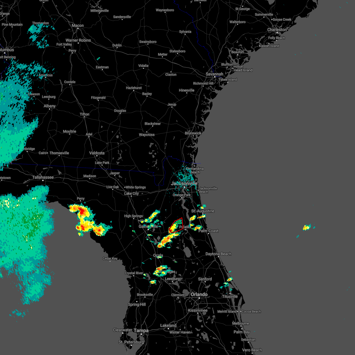 At 302 pm est, a severe thunderstorm capable of producing a tornado was located over interlachen, moving northeast at 25 mph (radar indicated rotation). Hazards include tornado. Flying debris will be dangerous to those caught without shelter. mobile homes will be damaged or destroyed. damage to roofs, windows, and vehicles will occur. tree damage is likely. this dangerous storm will be near, bardin around 325 pm est. palatka around 330 pm est. Other locations impacted by this tornadic thunderstorm include carraway and mannville. At 302 pm est, a severe thunderstorm capable of producing a tornado was located over interlachen, moving northeast at 25 mph (radar indicated rotation). Hazards include tornado. Flying debris will be dangerous to those caught without shelter. mobile homes will be damaged or destroyed. damage to roofs, windows, and vehicles will occur. tree damage is likely. this dangerous storm will be near, bardin around 325 pm est. palatka around 330 pm est. Other locations impacted by this tornadic thunderstorm include carraway and mannville.
|
| 2/15/2021 2:48 PM EST |
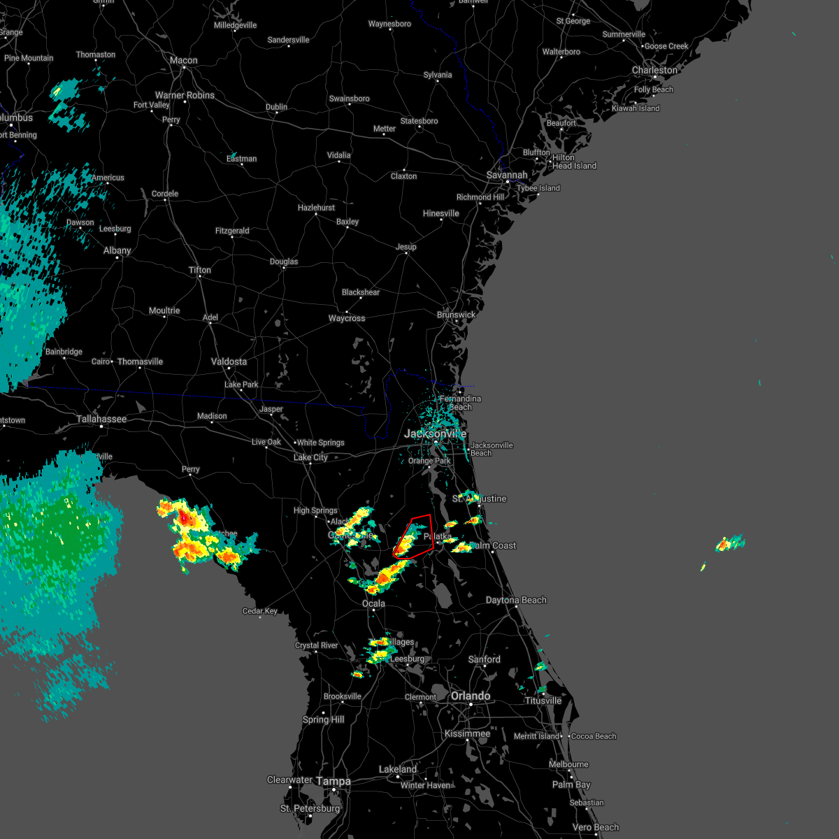 At 248 pm est, a severe thunderstorm capable of producing a tornado was located near interlachen, moving northeast at 25 mph (radar indicated rotation). Hazards include tornado. Flying debris will be dangerous to those caught without shelter. mobile homes will be damaged or destroyed. damage to roofs, windows, and vehicles will occur. tree damage is likely. this dangerous storm will be near, interlachen around 300 pm est. hollister around 305 pm est. florahome around 315 pm est. bardin around 325 pm est. Other locations impacted by this tornadic thunderstorm include carraway, mannville and johnson. At 248 pm est, a severe thunderstorm capable of producing a tornado was located near interlachen, moving northeast at 25 mph (radar indicated rotation). Hazards include tornado. Flying debris will be dangerous to those caught without shelter. mobile homes will be damaged or destroyed. damage to roofs, windows, and vehicles will occur. tree damage is likely. this dangerous storm will be near, interlachen around 300 pm est. hollister around 305 pm est. florahome around 315 pm est. bardin around 325 pm est. Other locations impacted by this tornadic thunderstorm include carraway, mannville and johnson.
|
| 2/15/2021 2:37 PM EST |
 At 237 pm est, a severe thunderstorm capable of producing a tornado was located over orange springs, or 8 miles southwest of interlachen, moving northeast at 20 mph (radar indicated rotation). Hazards include tornado. Flying debris will be dangerous to those caught without shelter. mobile homes will be damaged or destroyed. damage to roofs, windows, and vehicles will occur. tree damage is likely. this dangerous storm will be near, melrose landing around 300 pm est. interlachen around 305 pm est. hollister around 310 pm est. florahome and bardin around 315 pm est. Other locations impacted by this tornadic thunderstorm include carraway, mannville and johnson. At 237 pm est, a severe thunderstorm capable of producing a tornado was located over orange springs, or 8 miles southwest of interlachen, moving northeast at 20 mph (radar indicated rotation). Hazards include tornado. Flying debris will be dangerous to those caught without shelter. mobile homes will be damaged or destroyed. damage to roofs, windows, and vehicles will occur. tree damage is likely. this dangerous storm will be near, melrose landing around 300 pm est. interlachen around 305 pm est. hollister around 310 pm est. florahome and bardin around 315 pm est. Other locations impacted by this tornadic thunderstorm include carraway, mannville and johnson.
|
| 2/14/2021 2:02 PM EST |
 At 201 pm est, a severe thunderstorm capable of producing a tornado was located over bardin, or near palatka, moving northeast at 30 mph. the town of bostwick is directly in the path of this potential tornado (radar indicated rotation). Hazards include tornado. Flying debris will be dangerous to those caught without shelter. mobile homes will be damaged or destroyed. damage to roofs, windows, and vehicles will occur. tree damage is likely. This dangerous storm will be near, bostwick around 210 pm est. At 201 pm est, a severe thunderstorm capable of producing a tornado was located over bardin, or near palatka, moving northeast at 30 mph. the town of bostwick is directly in the path of this potential tornado (radar indicated rotation). Hazards include tornado. Flying debris will be dangerous to those caught without shelter. mobile homes will be damaged or destroyed. damage to roofs, windows, and vehicles will occur. tree damage is likely. This dangerous storm will be near, bostwick around 210 pm est.
|
| 2/14/2021 1:54 PM EST |
 At 154 pm est, a severe thunderstorm capable of producing a tornado was located near bardin, or near palatka, moving northeast at 40 mph (radar indicated rotation). Hazards include tornado. Flying debris will be dangerous to those caught without shelter. mobile homes will be damaged or destroyed. damage to roofs, windows, and vehicles will occur. tree damage is likely. this dangerous storm will be near, bostwick around 210 pm est. Other locations impacted by this tornadic thunderstorm include carraway. At 154 pm est, a severe thunderstorm capable of producing a tornado was located near bardin, or near palatka, moving northeast at 40 mph (radar indicated rotation). Hazards include tornado. Flying debris will be dangerous to those caught without shelter. mobile homes will be damaged or destroyed. damage to roofs, windows, and vehicles will occur. tree damage is likely. this dangerous storm will be near, bostwick around 210 pm est. Other locations impacted by this tornadic thunderstorm include carraway.
|
| 2/14/2021 1:48 PM EST |
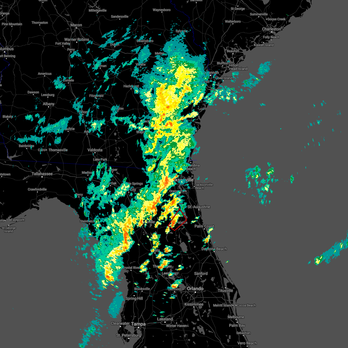 At 148 pm est, a severe thunderstorm capable of producing a tornado was located over hollister, or 7 miles east of interlachen, moving northeast at 40 mph (radar indicated rotation). Hazards include tornado. Flying debris will be dangerous to those caught without shelter. mobile homes will be damaged or destroyed. damage to roofs, windows, and vehicles will occur. tree damage is likely. this dangerous storm will be near, palatka and bardin around 155 pm est. bostwick around 205 pm est. Other locations impacted by this tornadic thunderstorm include carraway and mannville. At 148 pm est, a severe thunderstorm capable of producing a tornado was located over hollister, or 7 miles east of interlachen, moving northeast at 40 mph (radar indicated rotation). Hazards include tornado. Flying debris will be dangerous to those caught without shelter. mobile homes will be damaged or destroyed. damage to roofs, windows, and vehicles will occur. tree damage is likely. this dangerous storm will be near, palatka and bardin around 155 pm est. bostwick around 205 pm est. Other locations impacted by this tornadic thunderstorm include carraway and mannville.
|
| 2/14/2021 1:43 PM EST |
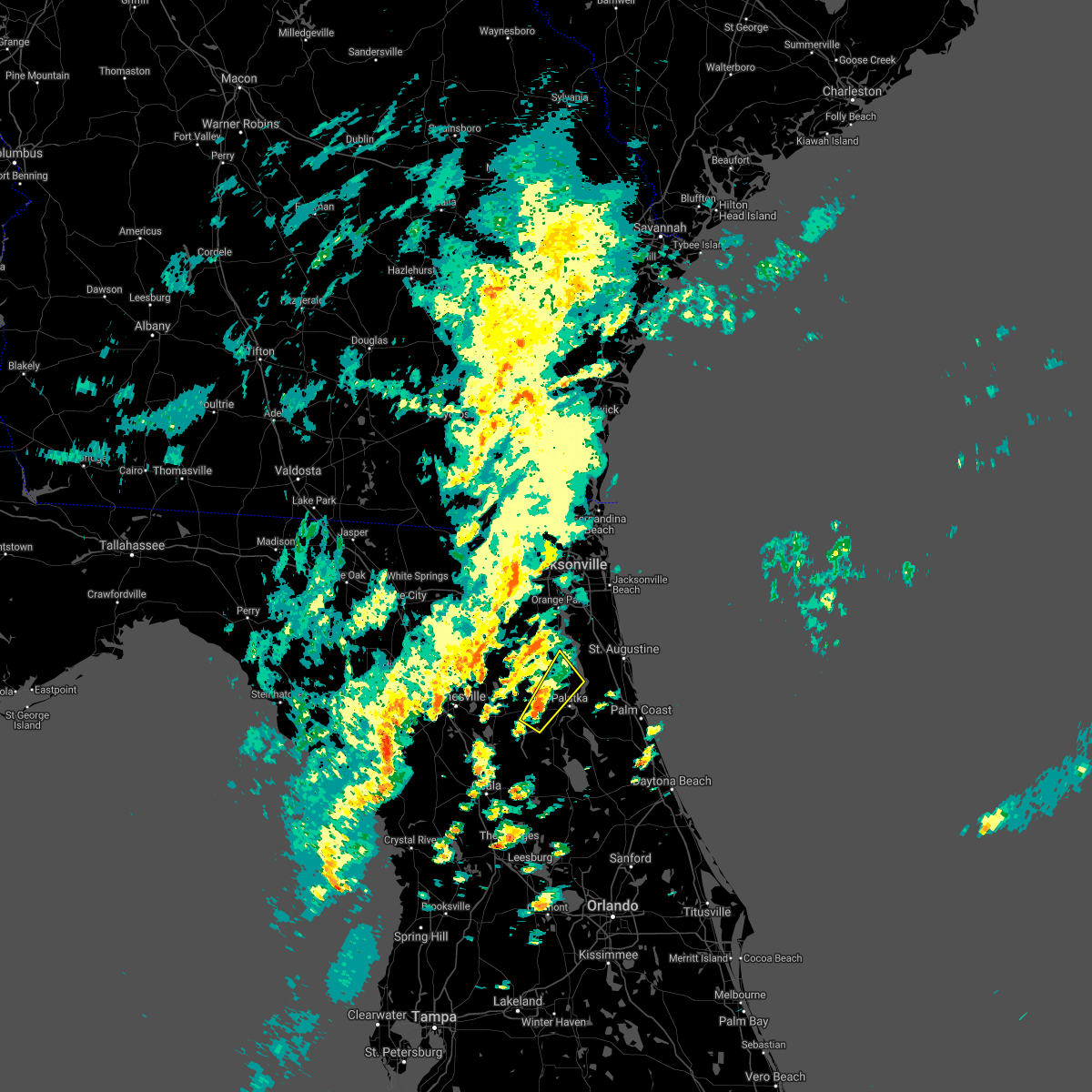 At 143 pm est, a severe thunderstorm was located over hollister, or near interlachen, moving northeast at 35 mph (radar indicated). Hazards include 60 mph wind gusts. expect damage to roofs, siding, and trees At 143 pm est, a severe thunderstorm was located over hollister, or near interlachen, moving northeast at 35 mph (radar indicated). Hazards include 60 mph wind gusts. expect damage to roofs, siding, and trees
|
| 8/8/2020 8:20 PM EDT |
 The severe thunderstorm warning for central putnam county will expire at 830 pm edt, the storm which prompted the warning has weakened below severe limits, and no longer poses an immediate threat to life or property. therefore, the warning will be allowed to expire. The severe thunderstorm warning for central putnam county will expire at 830 pm edt, the storm which prompted the warning has weakened below severe limits, and no longer poses an immediate threat to life or property. therefore, the warning will be allowed to expire.
|
| 8/8/2020 8:12 PM EDT |
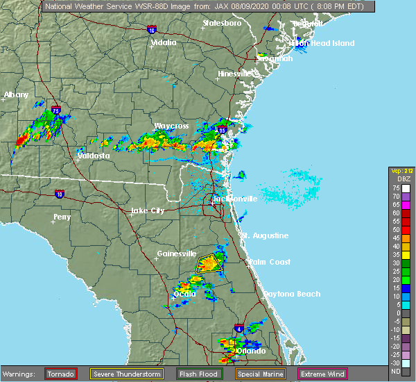 At 812 pm edt, a severe thunderstorm was located over satsuma, or near palatka, moving southeast at 15 mph (radar indicated). Hazards include 60 mph wind gusts and nickel size hail. Expect damage to roofs, siding, and trees. Locations impacted include, palatka, hollister and satsuma. At 812 pm edt, a severe thunderstorm was located over satsuma, or near palatka, moving southeast at 15 mph (radar indicated). Hazards include 60 mph wind gusts and nickel size hail. Expect damage to roofs, siding, and trees. Locations impacted include, palatka, hollister and satsuma.
|
| 8/8/2020 7:51 PM EDT |
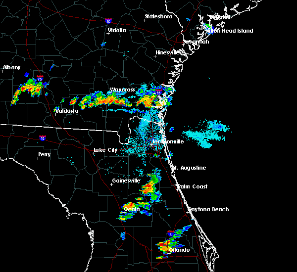 At 751 pm edt, a severe thunderstorm was located near palatka, moving southeast at 10 mph (radar indicated). Hazards include 60 mph wind gusts and quarter size hail. Hail damage to vehicles is expected. Expect wind damage to roofs, siding, and trees. At 751 pm edt, a severe thunderstorm was located near palatka, moving southeast at 10 mph (radar indicated). Hazards include 60 mph wind gusts and quarter size hail. Hail damage to vehicles is expected. Expect wind damage to roofs, siding, and trees.
|
| 8/7/2020 4:21 PM EDT |
 At 355 pm edt, a severe thunderstorm was located over bardin, or near palatka, moving northeast at 15 mph (radar indicated). Hazards include 60 mph wind gusts and nickel size hail. Expect damage to roofs, siding, and trees. Locations impacted include, palatka, hastings, east palatka, bostwick, federal point, orange mills, bardin and san mateo. At 355 pm edt, a severe thunderstorm was located over bardin, or near palatka, moving northeast at 15 mph (radar indicated). Hazards include 60 mph wind gusts and nickel size hail. Expect damage to roofs, siding, and trees. Locations impacted include, palatka, hastings, east palatka, bostwick, federal point, orange mills, bardin and san mateo.
|
| 8/7/2020 3:55 PM EDT |
 At 355 pm edt, a severe thunderstorm was located over bardin, or near palatka, moving northeast at 15 mph (radar indicated). Hazards include 60 mph wind gusts and nickel size hail. Expect damage to roofs, siding, and trees. Locations impacted include, palatka, hastings, east palatka, bostwick, federal point, orange mills, bardin and san mateo. At 355 pm edt, a severe thunderstorm was located over bardin, or near palatka, moving northeast at 15 mph (radar indicated). Hazards include 60 mph wind gusts and nickel size hail. Expect damage to roofs, siding, and trees. Locations impacted include, palatka, hastings, east palatka, bostwick, federal point, orange mills, bardin and san mateo.
|
| 8/7/2020 3:41 PM EDT |
 At 340 pm edt, a severe thunderstorm was located over bardin, or near palatka, moving northeast at 10 mph (radar indicated). Hazards include 60 mph wind gusts and nickel size hail. expect damage to roofs, siding, and trees At 340 pm edt, a severe thunderstorm was located over bardin, or near palatka, moving northeast at 10 mph (radar indicated). Hazards include 60 mph wind gusts and nickel size hail. expect damage to roofs, siding, and trees
|
| 7/27/2020 4:16 PM EDT |
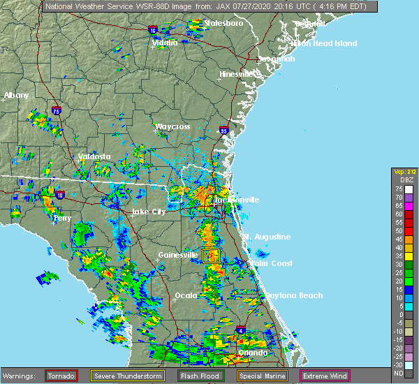 At 416 pm edt, a severe thunderstorm was located near bardin, or near palatka, moving east at 5 mph (radar indicated). Hazards include 60 mph wind gusts. Expect damage to roofs, siding, and trees. Locations impacted include, palatka, east palatka, bostwick and bardin. At 416 pm edt, a severe thunderstorm was located near bardin, or near palatka, moving east at 5 mph (radar indicated). Hazards include 60 mph wind gusts. Expect damage to roofs, siding, and trees. Locations impacted include, palatka, east palatka, bostwick and bardin.
|
| 7/27/2020 4:15 PM EDT | Trees were down on power lines which caused widespread power outage in putnam county FL, 6.4 miles SSE of Palatka, FL |
| 7/27/2020 4:04 PM EDT |
 At 403 pm edt, a severe thunderstorm was located over bardin, or near palatka, moving east at 5 mph (radar indicated). Hazards include 60 mph wind gusts. expect damage to roofs, siding, and trees At 403 pm edt, a severe thunderstorm was located over bardin, or near palatka, moving east at 5 mph (radar indicated). Hazards include 60 mph wind gusts. expect damage to roofs, siding, and trees
|
| 6/19/2020 6:25 PM EDT |
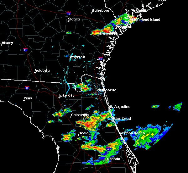 The severe thunderstorm warning for northeastern marion and central putnam counties will expire at 630 pm edt, the storm which prompted the warning has weakened below severe limits, and no longer poses an immediate threat to life or property. therefore, the warning will be allowed to expire. however small hail, gusty winds and heavy rain are still possible with this thunderstorm. The severe thunderstorm warning for northeastern marion and central putnam counties will expire at 630 pm edt, the storm which prompted the warning has weakened below severe limits, and no longer poses an immediate threat to life or property. therefore, the warning will be allowed to expire. however small hail, gusty winds and heavy rain are still possible with this thunderstorm.
|
| 6/19/2020 6:14 PM EDT |
 At 614 pm edt, a severe thunderstorm was located near orange springs, or 8 miles northeast of fort mccoy, moving northeast at 30 mph (radar indicated). Hazards include ping pong ball size hail and 60 mph wind gusts. People and animals outdoors will be injured. expect hail damage to roofs, siding, windows, and vehicles. expect wind damage to roofs, siding, and trees. Locations impacted include, interlachen, lake delancy, melrose landing, orange springs, hollister, san mateo, satsuma, welaka, hog valley and johnson. At 614 pm edt, a severe thunderstorm was located near orange springs, or 8 miles northeast of fort mccoy, moving northeast at 30 mph (radar indicated). Hazards include ping pong ball size hail and 60 mph wind gusts. People and animals outdoors will be injured. expect hail damage to roofs, siding, windows, and vehicles. expect wind damage to roofs, siding, and trees. Locations impacted include, interlachen, lake delancy, melrose landing, orange springs, hollister, san mateo, satsuma, welaka, hog valley and johnson.
|
| 6/19/2020 5:37 PM EDT |
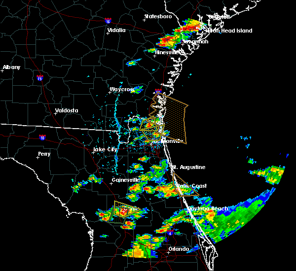 At 537 pm edt, a severe thunderstorm was located near anthony, or 7 miles southwest of fort mccoy, moving northeast at 10 mph (radar indicated). Hazards include golf ball size hail and 60 mph wind gusts. People and animals outdoors will be injured. expect hail damage to roofs, siding, windows, and vehicles. Expect wind damage to roofs, siding, and trees. At 537 pm edt, a severe thunderstorm was located near anthony, or 7 miles southwest of fort mccoy, moving northeast at 10 mph (radar indicated). Hazards include golf ball size hail and 60 mph wind gusts. People and animals outdoors will be injured. expect hail damage to roofs, siding, windows, and vehicles. Expect wind damage to roofs, siding, and trees.
|
| 6/18/2020 9:06 PM EDT |
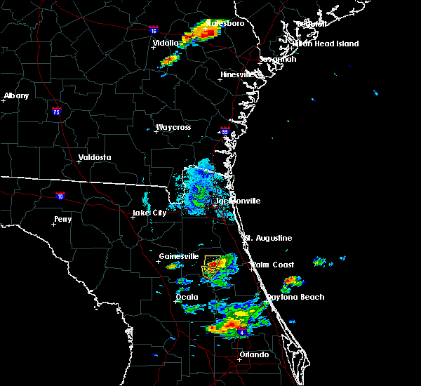 At 906 pm edt, a severe thunderstorm was located west of palatka, moving north at 20 mph (radar indicated). Hazards include 60 mph wind gusts and quarter size hail. Hail damage to vehicles is expected. expect wind damage to roofs, siding, and trees. Locations impacted include, palatka and bardin. At 906 pm edt, a severe thunderstorm was located west of palatka, moving north at 20 mph (radar indicated). Hazards include 60 mph wind gusts and quarter size hail. Hail damage to vehicles is expected. expect wind damage to roofs, siding, and trees. Locations impacted include, palatka and bardin.
|
| 6/18/2020 8:57 PM EDT |
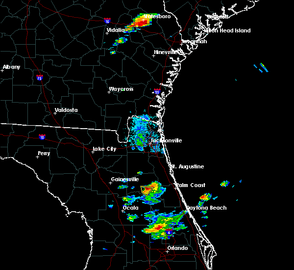 The national weather service in jacksonville has issued a * severe thunderstorm warning for. central putnam county in northeastern florida. until 930 pm edt. At 856 pm edt, a severe thunderstorm was located southwest of palatka, moving north at 20 mph. The national weather service in jacksonville has issued a * severe thunderstorm warning for. central putnam county in northeastern florida. until 930 pm edt. At 856 pm edt, a severe thunderstorm was located southwest of palatka, moving north at 20 mph.
|
| 6/18/2020 8:53 PM EDT | Half Dollar sized hail reported 3.8 miles ENE of Palatka, FL, action news wjax-tv relayed a picture of nearly ping pong ball sized hail taken near silver lake in northeastern putnam county. time of hail estimated by doppler radar |
| 4/15/2020 1:39 PM EDT |
 The severe thunderstorm warning for northern flagler, st. johns and putnam counties will expire at 145 pm edt, the storm which prompted the warning has weakened below severe limits, and has exited the warned area. therefore, the warning will be allowed to expire. however gusty winds and heavy rain are still possible with this thunderstorm. The severe thunderstorm warning for northern flagler, st. johns and putnam counties will expire at 145 pm edt, the storm which prompted the warning has weakened below severe limits, and has exited the warned area. therefore, the warning will be allowed to expire. however gusty winds and heavy rain are still possible with this thunderstorm.
|
| 4/15/2020 1:14 PM EDT |
 At 114 pm edt, a severe thunderstorm was located over florahome, or near interlachen, moving east at 35 mph (radar indicated). Hazards include 60 mph wind gusts. Expect damage to roofs, siding, and trees. Locations impacted include, palm coast, saint augustine, palatka, interlachen, hastings, melrose, east palatka, world golf village, saint augustine beach and marineland. At 114 pm edt, a severe thunderstorm was located over florahome, or near interlachen, moving east at 35 mph (radar indicated). Hazards include 60 mph wind gusts. Expect damage to roofs, siding, and trees. Locations impacted include, palm coast, saint augustine, palatka, interlachen, hastings, melrose, east palatka, world golf village, saint augustine beach and marineland.
|
| 4/15/2020 1:02 PM EDT |
 At 101 pm edt, a severe thunderstorm was located over melrose landing, or near melrose, moving east at 35 mph (radar indicated). Hazards include 60 mph wind gusts. Expect damage to roofs, siding, and trees. Locations impacted include, palm coast, saint augustine, palatka, interlachen, keystone heights, hastings, melrose, east palatka, world golf village and saint augustine beach. At 101 pm edt, a severe thunderstorm was located over melrose landing, or near melrose, moving east at 35 mph (radar indicated). Hazards include 60 mph wind gusts. Expect damage to roofs, siding, and trees. Locations impacted include, palm coast, saint augustine, palatka, interlachen, keystone heights, hastings, melrose, east palatka, world golf village and saint augustine beach.
|
| 4/15/2020 12:45 PM EDT |
 At 1244 pm edt, a severe thunderstorm was located near orange heights, or 7 miles southwest of melrose, moving east at 35 mph (radar indicated). Hazards include 60 mph wind gusts. expect damage to roofs, siding, and trees At 1244 pm edt, a severe thunderstorm was located near orange heights, or 7 miles southwest of melrose, moving east at 35 mph (radar indicated). Hazards include 60 mph wind gusts. expect damage to roofs, siding, and trees
|
| 4/14/2020 4:06 PM EDT |
 At 405 pm edt, a severe thunderstorm was located over san mateo, or near east palatka, moving east at 25 mph (radar indicated). Hazards include 60 mph wind gusts. Expect damage to roofs, siding, and trees. Locations impacted include, palatka, east palatka, san mateo and satsuma. At 405 pm edt, a severe thunderstorm was located over san mateo, or near east palatka, moving east at 25 mph (radar indicated). Hazards include 60 mph wind gusts. Expect damage to roofs, siding, and trees. Locations impacted include, palatka, east palatka, san mateo and satsuma.
|
| 4/14/2020 3:58 PM EDT |
 At 357 pm edt, a severe thunderstorm was located over satsuma, or near palatka, moving east at 25 mph (radar indicated). Hazards include 60 mph wind gusts. expect damage to roofs, siding, and trees At 357 pm edt, a severe thunderstorm was located over satsuma, or near palatka, moving east at 25 mph (radar indicated). Hazards include 60 mph wind gusts. expect damage to roofs, siding, and trees
|
| 4/14/2020 1:13 PM EDT |
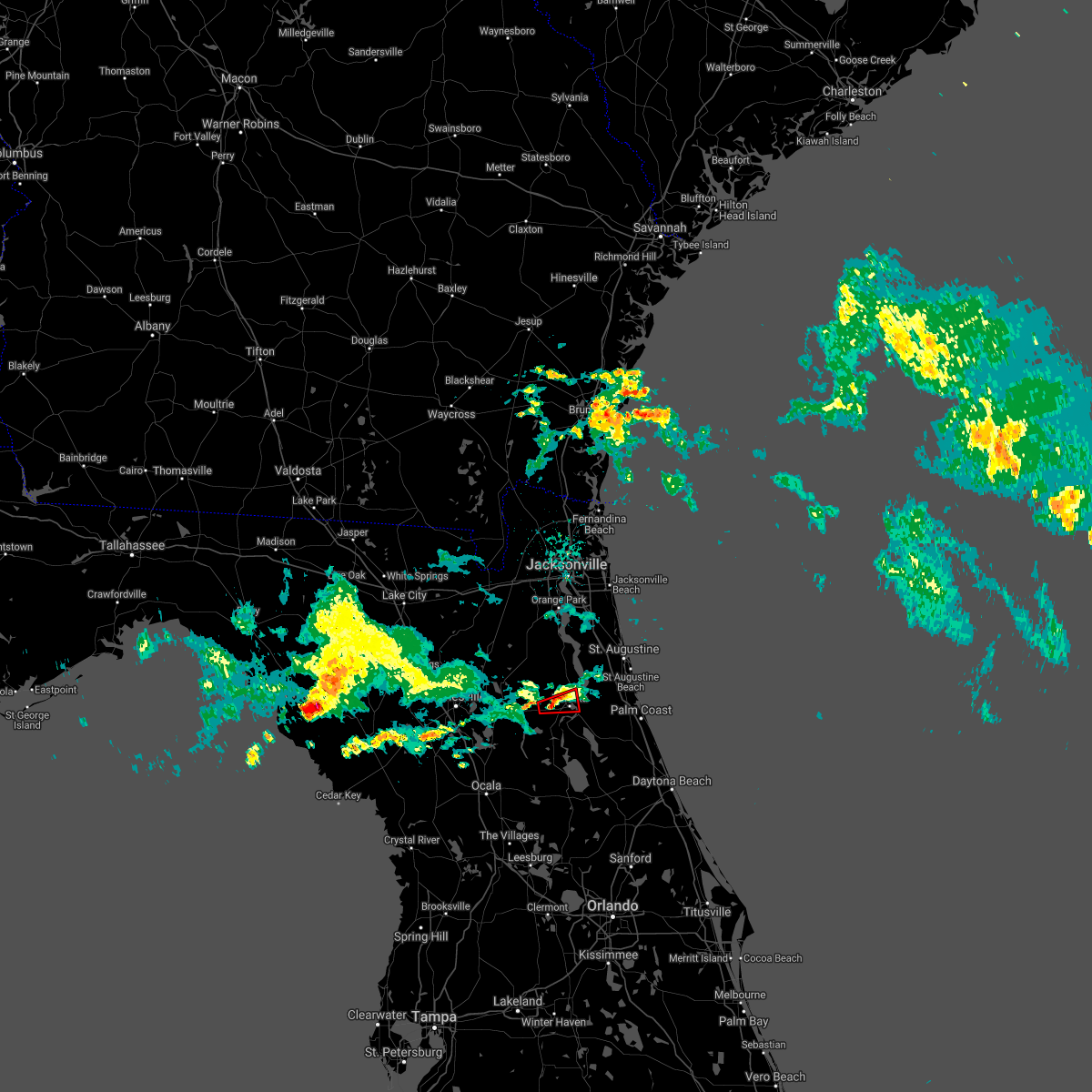 The tornado warning for north central putnam county will expire at 115 pm edt, the tornado threat has diminished and the tornado warning has been cancelled. The tornado warning for north central putnam county will expire at 115 pm edt, the tornado threat has diminished and the tornado warning has been cancelled.
|
| 4/14/2020 1:03 PM EDT |
 At 103 pm edt, a severe thunderstorm capable of producing a tornado was located over hollister, or near interlachen, moving east at 20 mph (radar indicated rotation). Hazards include tornado. Flying debris will be dangerous to those caught without shelter. mobile homes will be damaged or destroyed. damage to roofs, windows, and vehicles will occur. tree damage is likely. this dangerous storm will be near, palatka around 125 pm edt. East palatka around 130 pm edt. At 103 pm edt, a severe thunderstorm capable of producing a tornado was located over hollister, or near interlachen, moving east at 20 mph (radar indicated rotation). Hazards include tornado. Flying debris will be dangerous to those caught without shelter. mobile homes will be damaged or destroyed. damage to roofs, windows, and vehicles will occur. tree damage is likely. this dangerous storm will be near, palatka around 125 pm edt. East palatka around 130 pm edt.
|
| 4/14/2020 1:03 PM EDT |
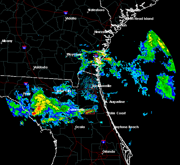 At 103 pm edt, a severe thunderstorm was located over hollister, or near interlachen, moving east at 20 mph (radar indicated). Hazards include 60 mph wind gusts. Expect damage to roofs, siding, and trees. Locations impacted include, bardin, hollister and carraway. At 103 pm edt, a severe thunderstorm was located over hollister, or near interlachen, moving east at 20 mph (radar indicated). Hazards include 60 mph wind gusts. Expect damage to roofs, siding, and trees. Locations impacted include, bardin, hollister and carraway.
|
| 4/14/2020 12:56 PM EDT |
 At 1255 pm edt, a severe thunderstorm was located over hollister, or near interlachen, moving east at 20 mph (radar indicated). Hazards include 60 mph wind gusts. Expect damage to roofs, siding, and trees. Locations impacted include, interlachen, bardin, hollister, carraway and mannville. At 1255 pm edt, a severe thunderstorm was located over hollister, or near interlachen, moving east at 20 mph (radar indicated). Hazards include 60 mph wind gusts. Expect damage to roofs, siding, and trees. Locations impacted include, interlachen, bardin, hollister, carraway and mannville.
|
| 4/14/2020 12:54 PM EDT |
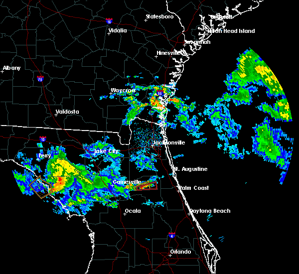 At 1254 pm edt, a severe thunderstorm capable of producing a tornado was located over hollister, or near interlachen, moving east at 20 mph (radar indicated rotation). Hazards include tornado. Flying debris will be dangerous to those caught without shelter. mobile homes will be damaged or destroyed. damage to roofs, windows, and vehicles will occur. tree damage is likely. this dangerous storm will be near, palatka around 115 pm edt. Other locations impacted by this tornadic thunderstorm include mannville. At 1254 pm edt, a severe thunderstorm capable of producing a tornado was located over hollister, or near interlachen, moving east at 20 mph (radar indicated rotation). Hazards include tornado. Flying debris will be dangerous to those caught without shelter. mobile homes will be damaged or destroyed. damage to roofs, windows, and vehicles will occur. tree damage is likely. this dangerous storm will be near, palatka around 115 pm edt. Other locations impacted by this tornadic thunderstorm include mannville.
|
| 4/14/2020 12:49 PM EDT |
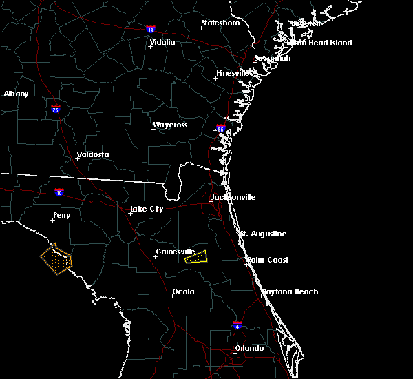 At 1248 pm edt, a severe thunderstorm capable of producing a tornado was located over interlachen, moving east at 20 mph (radar indicated rotation). Hazards include tornado. Flying debris will be dangerous to those caught without shelter. mobile homes will be damaged or destroyed. damage to roofs, windows, and vehicles will occur. tree damage is likely. this dangerous storm will be near, hollister around 100 pm edt. palatka around 115 pm edt. Other locations impacted by this tornadic thunderstorm include mannville. At 1248 pm edt, a severe thunderstorm capable of producing a tornado was located over interlachen, moving east at 20 mph (radar indicated rotation). Hazards include tornado. Flying debris will be dangerous to those caught without shelter. mobile homes will be damaged or destroyed. damage to roofs, windows, and vehicles will occur. tree damage is likely. this dangerous storm will be near, hollister around 100 pm edt. palatka around 115 pm edt. Other locations impacted by this tornadic thunderstorm include mannville.
|
| 4/14/2020 12:43 PM EDT |
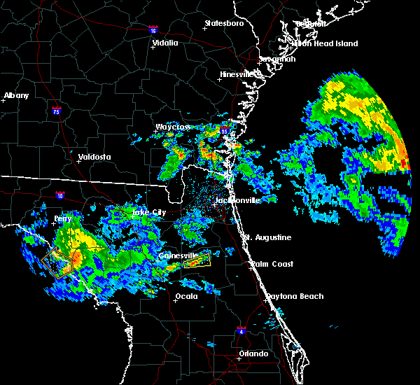 At 1242 pm edt, a severe thunderstorm was located over interlachen, moving east at 20 mph (radar indicated). Hazards include 60 mph wind gusts. this storm is rotating and has the potential to produce a tornado. seek shelter in your safe room. Expect damage to roofs, siding, and trees. Locations impacted include, interlachen, bardin, hollister, carraway and mannville. At 1242 pm edt, a severe thunderstorm was located over interlachen, moving east at 20 mph (radar indicated). Hazards include 60 mph wind gusts. this storm is rotating and has the potential to produce a tornado. seek shelter in your safe room. Expect damage to roofs, siding, and trees. Locations impacted include, interlachen, bardin, hollister, carraway and mannville.
|
| 4/14/2020 12:37 PM EDT |
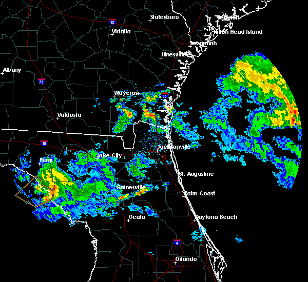 At 1237 pm edt, a severe thunderstorm was located over melrose landing, or near interlachen, moving east at 20 mph (radar indicated). Hazards include 60 mph wind gusts. expect damage to roofs, siding, and trees At 1237 pm edt, a severe thunderstorm was located over melrose landing, or near interlachen, moving east at 20 mph (radar indicated). Hazards include 60 mph wind gusts. expect damage to roofs, siding, and trees
|
| 2/6/2020 11:09 PM EST |
 At 1108 pm est, severe thunderstorms were located along a line extending from near sawgrass to guana river state park to near orange mills, moving east at 45 mph (radar indicated). Hazards include 60 mph wind gusts. Expect damage to roofs, siding, and trees. Locations impacted include, saint augustine, hastings, east palatka, world golf village, saint augustine beach, sawgrass, nocatee, vilano beach, palm valley and federal point. At 1108 pm est, severe thunderstorms were located along a line extending from near sawgrass to guana river state park to near orange mills, moving east at 45 mph (radar indicated). Hazards include 60 mph wind gusts. Expect damage to roofs, siding, and trees. Locations impacted include, saint augustine, hastings, east palatka, world golf village, saint augustine beach, sawgrass, nocatee, vilano beach, palm valley and federal point.
|
| 2/6/2020 10:57 PM EST |
 At 1056 pm est, severe thunderstorms were located along a line extending from near satsuma to near the villages, moving east at 45 mph (radar indicated). Hazards include 60 to 70 mph wind gusts. Expect considerable tree damage. Damage is likely to mobile homes, roofs, and outbuildings. At 1056 pm est, severe thunderstorms were located along a line extending from near satsuma to near the villages, moving east at 45 mph (radar indicated). Hazards include 60 to 70 mph wind gusts. Expect considerable tree damage. Damage is likely to mobile homes, roofs, and outbuildings.
|
| 2/6/2020 10:53 PM EST |
 At 1051 pm est, severe thunderstorms were located along a line extending from near neptune beach to near durbin to near hollister, moving east at 45 mph (radar indicated). Hazards include 60 to 70 mph wind gusts. Expect considerable tree damage. damage is likely to mobile homes, roofs, and outbuildings. Locations impacted include, saint augustine, palatka, green cove springs, hastings, east palatka, unf, fruit cove, ponte vedra beach, neptune beach and world golf village. At 1051 pm est, severe thunderstorms were located along a line extending from near neptune beach to near durbin to near hollister, moving east at 45 mph (radar indicated). Hazards include 60 to 70 mph wind gusts. Expect considerable tree damage. damage is likely to mobile homes, roofs, and outbuildings. Locations impacted include, saint augustine, palatka, green cove springs, hastings, east palatka, unf, fruit cove, ponte vedra beach, neptune beach and world golf village.
|
| 2/6/2020 10:49 PM EST |
 At 1049 pm est, severe thunderstorms were located along a line extending from 6 miles north of lake delancy to 6 miles southeast of fort mccoy to 7 miles north of wildwood, moving east at 50 mph (radar indicated). Hazards include 60 mph wind gusts. Expect damage to roofs, siding, and trees. Locations impacted include, ocala, crescent city, pomona park, fort mccoy, salt springs, juniper springs, lynne, lake delancy, sparr and moss bluff. At 1049 pm est, severe thunderstorms were located along a line extending from 6 miles north of lake delancy to 6 miles southeast of fort mccoy to 7 miles north of wildwood, moving east at 50 mph (radar indicated). Hazards include 60 mph wind gusts. Expect damage to roofs, siding, and trees. Locations impacted include, ocala, crescent city, pomona park, fort mccoy, salt springs, juniper springs, lynne, lake delancy, sparr and moss bluff.
|
| 2/6/2020 10:42 PM EST |
 At 1042 pm est, severe thunderstorms were located along a line extending from 6 miles north of little talbot island to fruit cove to near hollister, moving east at 40 mph (radar indicated). Hazards include 70 mph wind gusts. Expect considerable tree damage. Damage is likely to mobile homes, roofs, and outbuildings. At 1042 pm est, severe thunderstorms were located along a line extending from 6 miles north of little talbot island to fruit cove to near hollister, moving east at 40 mph (radar indicated). Hazards include 70 mph wind gusts. Expect considerable tree damage. Damage is likely to mobile homes, roofs, and outbuildings.
|
| 2/6/2020 10:34 PM EST |
 At 1032 pm est, severe thunderstorms were located along a line extending from near fernandina beach to interlachen, moving east at 65 mph (radar indicated. at 1023 pm, nas jax airport measured a gust to 76 mph). Hazards include up to 70 to 75 mph wind gusts. Expect considerable tree damage. damage is likely to mobile homes, roofs, and outbuildings. Locations impacted include, jacksonville, saint augustine, fernandina beach, palatka, orange park, green cove springs, interlachen, hastings, east palatka and jacksonville international arpt. At 1032 pm est, severe thunderstorms were located along a line extending from near fernandina beach to interlachen, moving east at 65 mph (radar indicated. at 1023 pm, nas jax airport measured a gust to 76 mph). Hazards include up to 70 to 75 mph wind gusts. Expect considerable tree damage. damage is likely to mobile homes, roofs, and outbuildings. Locations impacted include, jacksonville, saint augustine, fernandina beach, palatka, orange park, green cove springs, interlachen, hastings, east palatka and jacksonville international arpt.
|
| 2/6/2020 10:22 PM EST |
 At 1021 pm est, severe thunderstorms were located along a line extending from near yulee to near hawthorne, moving east at 45 mph (radar indicated. at 1012 pm, jacksonville international airport reported a gust to 58 mph). Hazards include 70 mph wind gusts. Expect considerable tree damage. damage is likely to mobile homes, roofs, and outbuildings. Locations impacted include, jacksonville, saint augustine, fernandina beach, palatka, orange park, green cove springs, starke, interlachen, keystone heights and callahan. At 1021 pm est, severe thunderstorms were located along a line extending from near yulee to near hawthorne, moving east at 45 mph (radar indicated. at 1012 pm, jacksonville international airport reported a gust to 58 mph). Hazards include 70 mph wind gusts. Expect considerable tree damage. damage is likely to mobile homes, roofs, and outbuildings. Locations impacted include, jacksonville, saint augustine, fernandina beach, palatka, orange park, green cove springs, starke, interlachen, keystone heights and callahan.
|
| 2/6/2020 10:11 PM EST |
 At 1011 pm est, severe thunderstorms were located along a line extending from near cross creek to 9 miles west of anthony to near beverly hills, moving east at 50 mph (radar indicated). Hazards include 60 mph wind gusts. expect damage to roofs, siding, and trees At 1011 pm est, severe thunderstorms were located along a line extending from near cross creek to 9 miles west of anthony to near beverly hills, moving east at 50 mph (radar indicated). Hazards include 60 mph wind gusts. expect damage to roofs, siding, and trees
|
| 2/6/2020 9:56 PM EST |
 At 955 pm est, severe thunderstorms were located along a line extending from near callahan to rochelle, moving east at 50 mph (radar indicated). Hazards include 70 mph wind gusts. Expect considerable tree damage. Damage is likely to mobile homes, roofs, and outbuildings. At 955 pm est, severe thunderstorms were located along a line extending from near callahan to rochelle, moving east at 50 mph (radar indicated). Hazards include 70 mph wind gusts. Expect considerable tree damage. Damage is likely to mobile homes, roofs, and outbuildings.
|
| 12/14/2019 4:40 AM EST |
 At 440 am est, a severe thunderstorm capable of producing a tornado was located over bardin, or near palatka, moving east at 50 mph (radar indicated rotation). Hazards include tornado. Flying debris will be dangerous to those caught without shelter. mobile homes will be damaged or destroyed. damage to roofs, windows, and vehicles will occur. tree damage is likely. this dangerous storm will be near, orange mills around 445 am est. hastings and federal point around 450 am est. saint augustine, butler beach, saint augustine south, saint augustine shores and crescent beach around 510 am est. saint augustine beach around 515 am est. Other locations impacted by this tornadic thunderstorm include spuds, anastasia, dupont center, elkton and bakersville. At 440 am est, a severe thunderstorm capable of producing a tornado was located over bardin, or near palatka, moving east at 50 mph (radar indicated rotation). Hazards include tornado. Flying debris will be dangerous to those caught without shelter. mobile homes will be damaged or destroyed. damage to roofs, windows, and vehicles will occur. tree damage is likely. this dangerous storm will be near, orange mills around 445 am est. hastings and federal point around 450 am est. saint augustine, butler beach, saint augustine south, saint augustine shores and crescent beach around 510 am est. saint augustine beach around 515 am est. Other locations impacted by this tornadic thunderstorm include spuds, anastasia, dupont center, elkton and bakersville.
|
| 12/14/2019 4:31 AM EST |
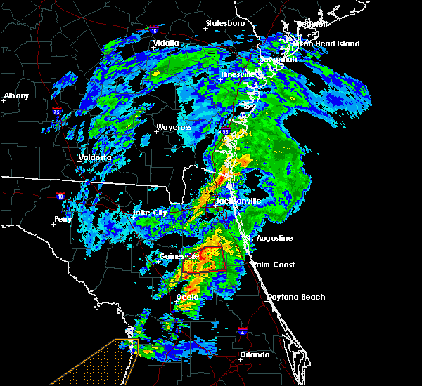 At 431 am est, a severe thunderstorm capable of producing a tornado was located near florahome, or 7 miles northeast of interlachen, moving northeast at 45 mph (radar indicated rotation). Hazards include tornado. Flying debris will be dangerous to those caught without shelter. mobile homes will be damaged or destroyed. damage to roofs, windows, and vehicles will occur. tree damage is likely. this dangerous storm will be near, palatka and bardin around 440 am est. bostwick and orange mills around 450 am est. Other locations impacted by this tornadic thunderstorm include carraway and mannville. At 431 am est, a severe thunderstorm capable of producing a tornado was located near florahome, or 7 miles northeast of interlachen, moving northeast at 45 mph (radar indicated rotation). Hazards include tornado. Flying debris will be dangerous to those caught without shelter. mobile homes will be damaged or destroyed. damage to roofs, windows, and vehicles will occur. tree damage is likely. this dangerous storm will be near, palatka and bardin around 440 am est. bostwick and orange mills around 450 am est. Other locations impacted by this tornadic thunderstorm include carraway and mannville.
|
| 12/14/2019 4:30 AM EST | Wind damage in palatka including trees down and powerlines down. time of event based on rada in putnam county FL, 0.4 miles WSW of Palatka, FL |
| 12/14/2019 4:22 AM EST |
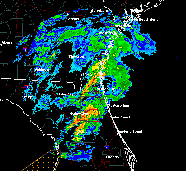 At 421 am est, a severe thunderstorm capable of producing a tornado was located over melrose landing, or near interlachen, moving east at 45 mph (radar indicated rotation). Hazards include tornado. Flying debris will be dangerous to those caught without shelter. mobile homes will be damaged or destroyed. damage to roofs, windows, and vehicles will occur. tree damage is likely. this dangerous storm will be near, hollister and florahome around 430 am est. bardin around 440 am est. palatka, east palatka, bostwick and orange mills around 445 am est. Other locations impacted by this tornadic thunderstorm include carraway, mannville and johnson. At 421 am est, a severe thunderstorm capable of producing a tornado was located over melrose landing, or near interlachen, moving east at 45 mph (radar indicated rotation). Hazards include tornado. Flying debris will be dangerous to those caught without shelter. mobile homes will be damaged or destroyed. damage to roofs, windows, and vehicles will occur. tree damage is likely. this dangerous storm will be near, hollister and florahome around 430 am est. bardin around 440 am est. palatka, east palatka, bostwick and orange mills around 445 am est. Other locations impacted by this tornadic thunderstorm include carraway, mannville and johnson.
|
| 12/14/2019 4:08 AM EST |
 At 408 am est, a severe thunderstorm capable of producing a tornado was located over hawthorne, or near melrose, moving east at 45 mph (radar indicated rotation). Hazards include tornado. Flying debris will be dangerous to those caught without shelter. mobile homes will be damaged or destroyed. damage to roofs, windows, and vehicles will occur. tree damage is likely. this dangerous storm will be near, melrose landing around 420 am est. interlachen and florahome around 425 am est. hollister around 430 am est. bardin around 440 am est. palatka, east palatka, orange mills, bostwick and san mateo around 445 am est. Other locations impacted by this tornadic thunderstorm include johnson, putnam hall, carraway and mannville. At 408 am est, a severe thunderstorm capable of producing a tornado was located over hawthorne, or near melrose, moving east at 45 mph (radar indicated rotation). Hazards include tornado. Flying debris will be dangerous to those caught without shelter. mobile homes will be damaged or destroyed. damage to roofs, windows, and vehicles will occur. tree damage is likely. this dangerous storm will be near, melrose landing around 420 am est. interlachen and florahome around 425 am est. hollister around 430 am est. bardin around 440 am est. palatka, east palatka, orange mills, bostwick and san mateo around 445 am est. Other locations impacted by this tornadic thunderstorm include johnson, putnam hall, carraway and mannville.
|
| 6/4/2019 4:21 PM EDT |
 At 421 pm edt, a severe thunderstorm was located over palatka, and is nearly stationary (radar indicated). Hazards include 70 mph wind gusts and quarter size hail. Hail damage to vehicles is expected. expect considerable tree damage. wind damage is also likely to mobile homes, roofs, and outbuildings. Locations impacted include, palatka, east palatka, bardin and san mateo. At 421 pm edt, a severe thunderstorm was located over palatka, and is nearly stationary (radar indicated). Hazards include 70 mph wind gusts and quarter size hail. Hail damage to vehicles is expected. expect considerable tree damage. wind damage is also likely to mobile homes, roofs, and outbuildings. Locations impacted include, palatka, east palatka, bardin and san mateo.
|
| 6/4/2019 4:15 PM EDT | Tree down and blocking intersection of bardin road and state road 100 near palatka. time given based on rada in putnam county FL, 4.4 miles ESE of Palatka, FL |
| 6/4/2019 4:12 PM EDT |
 At 411 pm edt, a severe thunderstorm was located over palatka, moving southeast at 10 mph (radar indicated). Hazards include 60 mph wind gusts and quarter size hail. Hail damage to vehicles is expected. Expect wind damage to roofs, siding, and trees. At 411 pm edt, a severe thunderstorm was located over palatka, moving southeast at 10 mph (radar indicated). Hazards include 60 mph wind gusts and quarter size hail. Hail damage to vehicles is expected. Expect wind damage to roofs, siding, and trees.
|
| 5/5/2019 12:35 PM EDT |
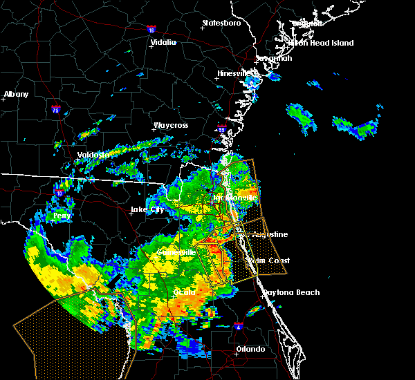 The severe thunderstorm warning for eastern putnam county will expire at 1245 pm edt, the storms which prompted the warning have moved out of the area. therefore, the warning will be allowed to expire. however gusty winds and heavy rain are still possible with these thunderstorms. to report severe weather, contact your nearest law enforcement agency. they will relay your report to the national weather service jacksonville. The severe thunderstorm warning for eastern putnam county will expire at 1245 pm edt, the storms which prompted the warning have moved out of the area. therefore, the warning will be allowed to expire. however gusty winds and heavy rain are still possible with these thunderstorms. to report severe weather, contact your nearest law enforcement agency. they will relay your report to the national weather service jacksonville.
|
| 5/5/2019 12:26 PM EDT |
 At 1225 pm edt, severe thunderstorms were located along a line extending from near george`s lake to near palatka to pomona park, moving northeast at 45 mph (radar indicated). Hazards include 60 mph wind gusts. Expect damage to roofs, siding, and trees. Locations impacted include, palatka, crescent city, pomona park, east palatka, fruitland, bostwick, federal point, orange mills, bardin and san mateo. At 1225 pm edt, severe thunderstorms were located along a line extending from near george`s lake to near palatka to pomona park, moving northeast at 45 mph (radar indicated). Hazards include 60 mph wind gusts. Expect damage to roofs, siding, and trees. Locations impacted include, palatka, crescent city, pomona park, east palatka, fruitland, bostwick, federal point, orange mills, bardin and san mateo.
|
| 5/5/2019 12:25 PM EDT |
 At 1224 pm edt, severe thunderstorms were located along a line extending from near bostwick to near orange mills to near crescent city, moving northeast at 45 mph (radar indicated). Hazards include 60 mph wind gusts. expect damage to roofs, siding, and trees At 1224 pm edt, severe thunderstorms were located along a line extending from near bostwick to near orange mills to near crescent city, moving northeast at 45 mph (radar indicated). Hazards include 60 mph wind gusts. expect damage to roofs, siding, and trees
|
| 5/5/2019 12:13 PM EDT | 911 call center passed on reports of numerous trees down throughout putnam count in putnam county FL, 7.9 miles ENE of Palatka, FL |
| 5/5/2019 12:05 PM EDT |
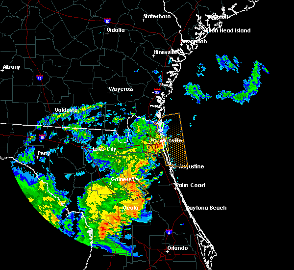 At 1204 pm edt, severe thunderstorms were located along a line extending from near melrose landing to near orange springs to near salt springs, moving northeast at 45 mph. rotation was also noted within this line near putnam hall (radar indicated). Hazards include 60 mph wind gusts. expect damage to roofs, siding, and trees At 1204 pm edt, severe thunderstorms were located along a line extending from near melrose landing to near orange springs to near salt springs, moving northeast at 45 mph. rotation was also noted within this line near putnam hall (radar indicated). Hazards include 60 mph wind gusts. expect damage to roofs, siding, and trees
|
| 4/19/2019 1:25 PM EDT |
 At 125 pm edt, severe thunderstorms were located along a line extending from sawgrass to near lake weir, moving east at 40 mph (radar indicated). Hazards include 60 mph wind gusts. expect damage to roofs, siding, and trees At 125 pm edt, severe thunderstorms were located along a line extending from sawgrass to near lake weir, moving east at 40 mph (radar indicated). Hazards include 60 mph wind gusts. expect damage to roofs, siding, and trees
|
| 4/19/2019 12:45 PM EDT |
 At 1244 pm edt, severe thunderstorms were located along a line extending from near green cove springs to 10 miles northeast of inverness highlands north, moving east at 50 mph (radar indicated). Hazards include 60 mph wind gusts. expect damage to roofs, siding, and trees At 1244 pm edt, severe thunderstorms were located along a line extending from near green cove springs to 10 miles northeast of inverness highlands north, moving east at 50 mph (radar indicated). Hazards include 60 mph wind gusts. expect damage to roofs, siding, and trees
|
| 4/19/2019 11:54 AM EDT |
 At 1154 am edt, severe thunderstorms were located along a line extending from near keystone heights to near beverly hills, moving northeast at 50 mph (radar indicated). Hazards include 60 mph wind gusts. expect damage to roofs, siding, and trees At 1154 am edt, severe thunderstorms were located along a line extending from near keystone heights to near beverly hills, moving northeast at 50 mph (radar indicated). Hazards include 60 mph wind gusts. expect damage to roofs, siding, and trees
|
| 3/2/2019 4:00 PM EST |
 At 400 pm est, a severe thunderstorm was located near hollister, or 7 miles southeast of interlachen, moving east at 25 mph (radar indicated). Hazards include 60 mph wind gusts and quarter size hail. Hail damage to vehicles is expected. expect wind damage to roofs, siding, and trees. Locations impacted include, palatka, hollister and satsuma. At 400 pm est, a severe thunderstorm was located near hollister, or 7 miles southeast of interlachen, moving east at 25 mph (radar indicated). Hazards include 60 mph wind gusts and quarter size hail. Hail damage to vehicles is expected. expect wind damage to roofs, siding, and trees. Locations impacted include, palatka, hollister and satsuma.
|
| 3/2/2019 3:46 PM EST |
 At 345 pm est, a severe thunderstorm was located over interlachen, moving east at 20 mph (radar indicated). Hazards include quarter size hail. damage to vehicles is expected At 345 pm est, a severe thunderstorm was located over interlachen, moving east at 20 mph (radar indicated). Hazards include quarter size hail. damage to vehicles is expected
|
| 11/14/2018 11:12 PM EST |
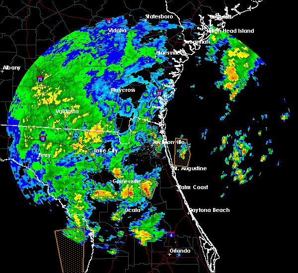 At 1111 pm est, a severe thunderstorm was located near hollister, or 8 miles southwest of palatka, moving north at 15 mph (radar indicated). Hazards include 60 mph wind gusts. Expect damage to roofs, siding, and trees. Locations impacted include, palatka, east palatka, bardin, hollister, satsuma, welaka and carraway. At 1111 pm est, a severe thunderstorm was located near hollister, or 8 miles southwest of palatka, moving north at 15 mph (radar indicated). Hazards include 60 mph wind gusts. Expect damage to roofs, siding, and trees. Locations impacted include, palatka, east palatka, bardin, hollister, satsuma, welaka and carraway.
|
| 11/14/2018 10:55 PM EST |
 At 1054 pm est, a severe thunderstorm was located near lake delancy, or 10 miles west of pomona park, moving north at 10 mph (radar indicated). Hazards include 60 mph wind gusts. expect damage to roofs, siding, and trees At 1054 pm est, a severe thunderstorm was located near lake delancy, or 10 miles west of pomona park, moving north at 10 mph (radar indicated). Hazards include 60 mph wind gusts. expect damage to roofs, siding, and trees
|
| 7/22/2018 2:10 PM EDT |
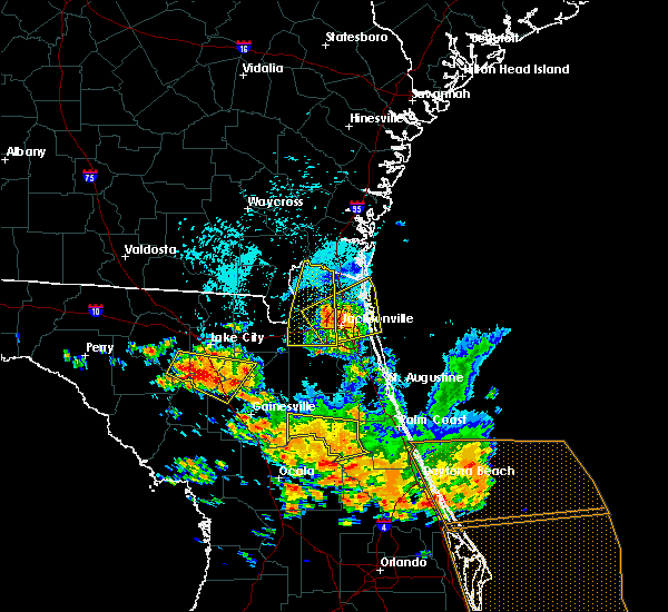 The severe thunderstorm warning for central putnam county will expire at 215 pm edt, the storm which prompted the warning has weakened below severe limits, and no longer poses an immediate threat to life or property. therefore, the warning will be allowed to expire. however small hail, gusty winds and heavy rain are still possible with this thunderstorm. a severe thunderstorm watch remains in effect until 800 pm edt for northern and northeastern florida. The severe thunderstorm warning for central putnam county will expire at 215 pm edt, the storm which prompted the warning has weakened below severe limits, and no longer poses an immediate threat to life or property. therefore, the warning will be allowed to expire. however small hail, gusty winds and heavy rain are still possible with this thunderstorm. a severe thunderstorm watch remains in effect until 800 pm edt for northern and northeastern florida.
|
| 7/22/2018 1:58 PM EDT |
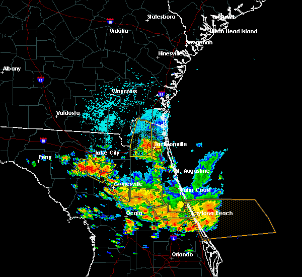 At 158 pm edt, a severe thunderstorm was located over satsuma, or near pomona park, moving southeast at 35 mph (radar indicated). Hazards include 70 mph wind gusts and quarter size hail. Hail damage to vehicles is expected. expect considerable tree damage. wind damage is also likely to mobile homes, roofs, and outbuildings. Locations impacted include, crescent city, interlachen, pomona park, fruitland, melrose landing, hollister, san mateo, satsuma, welaka and johnson. At 158 pm edt, a severe thunderstorm was located over satsuma, or near pomona park, moving southeast at 35 mph (radar indicated). Hazards include 70 mph wind gusts and quarter size hail. Hail damage to vehicles is expected. expect considerable tree damage. wind damage is also likely to mobile homes, roofs, and outbuildings. Locations impacted include, crescent city, interlachen, pomona park, fruitland, melrose landing, hollister, san mateo, satsuma, welaka and johnson.
|
| 7/22/2018 1:38 PM EDT |
 At 138 pm edt, a severe thunderstorm was located over interlachen, moving southeast at 40 mph (radar indicated). Hazards include 70 mph wind gusts and quarter size hail. Hail damage to vehicles is expected. expect considerable tree damage. wind damage is also likely to mobile homes, roofs, and outbuildings. Locations impacted include, palatka, crescent city, interlachen, pomona park, east palatka, melrose, george`s lake, fruitland, florahome and bostwick. At 138 pm edt, a severe thunderstorm was located over interlachen, moving southeast at 40 mph (radar indicated). Hazards include 70 mph wind gusts and quarter size hail. Hail damage to vehicles is expected. expect considerable tree damage. wind damage is also likely to mobile homes, roofs, and outbuildings. Locations impacted include, palatka, crescent city, interlachen, pomona park, east palatka, melrose, george`s lake, fruitland, florahome and bostwick.
|
| 7/22/2018 1:31 PM EDT |
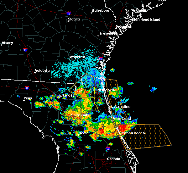 The national weather service in jacksonville has issued a * severe thunderstorm warning for. putnam county in northeastern florida. until 215 pm edt. At 131 pm edt, a severe thunderstorm was located near melrose landing, or near melrose, moving southeast at 35 mph. The national weather service in jacksonville has issued a * severe thunderstorm warning for. putnam county in northeastern florida. until 215 pm edt. At 131 pm edt, a severe thunderstorm was located near melrose landing, or near melrose, moving southeast at 35 mph.
|
| 7/22/2018 12:59 PM EDT |
 At 1259 pm edt, severe thunderstorms were located along a line extending from satsuma to sparr, moving southeast at 20 mph (radar indicated). Hazards include 70 mph wind gusts and quarter size hail. Hail damage to vehicles is expected. expect considerable tree damage. wind damage is also likely to mobile homes, roofs, and outbuildings. Locations impacted include, palatka, crescent city, interlachen, pomona park, fort mccoy, citra, east palatka, lake delancy, sparr and anthony. At 1259 pm edt, severe thunderstorms were located along a line extending from satsuma to sparr, moving southeast at 20 mph (radar indicated). Hazards include 70 mph wind gusts and quarter size hail. Hail damage to vehicles is expected. expect considerable tree damage. wind damage is also likely to mobile homes, roofs, and outbuildings. Locations impacted include, palatka, crescent city, interlachen, pomona park, fort mccoy, citra, east palatka, lake delancy, sparr and anthony.
|
| 7/22/2018 12:34 PM EDT |
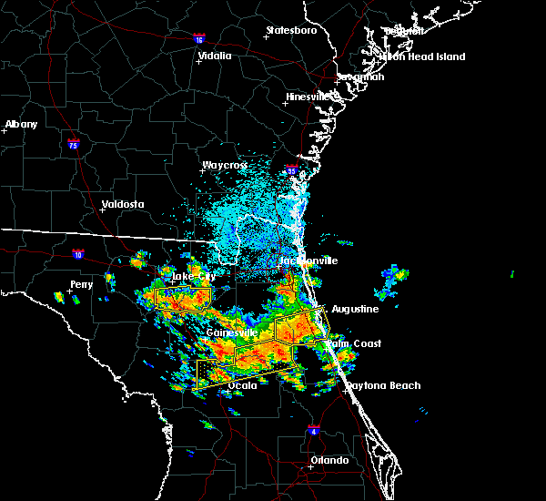 At 1233 pm edt, severe thunderstorms were located along a line extending from palatka to 6 miles southeast of williston, moving south at 20 mph (radar indicated). Hazards include 70 mph wind gusts and quarter size hail. Hail damage to vehicles is expected. expect considerable tree damage. Wind damage is also likely to mobile homes, roofs, and outbuildings. At 1233 pm edt, severe thunderstorms were located along a line extending from palatka to 6 miles southeast of williston, moving south at 20 mph (radar indicated). Hazards include 70 mph wind gusts and quarter size hail. Hail damage to vehicles is expected. expect considerable tree damage. Wind damage is also likely to mobile homes, roofs, and outbuildings.
|
| 7/22/2018 12:23 PM EDT |
 At 1223 pm edt, a severe thunderstorm was located near hastings, moving east at 25 mph (radar indicated). Hazards include 70 mph wind gusts and quarter size hail. Hail damage to vehicles is expected. expect considerable tree damage. Wind damage is also likely to mobile homes, roofs, and outbuildings. At 1223 pm edt, a severe thunderstorm was located near hastings, moving east at 25 mph (radar indicated). Hazards include 70 mph wind gusts and quarter size hail. Hail damage to vehicles is expected. expect considerable tree damage. Wind damage is also likely to mobile homes, roofs, and outbuildings.
|
| 7/22/2018 12:07 PM EDT |
 At 1207 pm edt, a severe thunderstorm was located near george`s lake, or 10 miles southwest of green cove springs, moving east at 20 mph (radar indicated). Hazards include 70 mph wind gusts and quarter size hail. Hail damage to vehicles is expected. expect considerable tree damage. wind damage is also likely to mobile homes, roofs, and outbuildings. Locations impacted include, palatka, green cove springs, east palatka, middleburg, fleming island, george`s lake, florahome, bostwick, federal point and doctors inlet. At 1207 pm edt, a severe thunderstorm was located near george`s lake, or 10 miles southwest of green cove springs, moving east at 20 mph (radar indicated). Hazards include 70 mph wind gusts and quarter size hail. Hail damage to vehicles is expected. expect considerable tree damage. wind damage is also likely to mobile homes, roofs, and outbuildings. Locations impacted include, palatka, green cove springs, east palatka, middleburg, fleming island, george`s lake, florahome, bostwick, federal point and doctors inlet.
|
| 7/22/2018 11:57 AM EDT |
 At 1157 am edt, a severe thunderstorm was located near george`s lake, or 12 miles southwest of green cove springs, moving east at 20 mph (radar indicated). Hazards include 70 mph wind gusts and quarter size hail. Hail damage to vehicles is expected. expect considerable tree damage. wind damage is also likely to mobile homes, roofs, and outbuildings. Locations impacted include, palatka, green cove springs, keystone heights, east palatka, middleburg, fleming island, george`s lake, lake geneva, florahome and camp blanding. At 1157 am edt, a severe thunderstorm was located near george`s lake, or 12 miles southwest of green cove springs, moving east at 20 mph (radar indicated). Hazards include 70 mph wind gusts and quarter size hail. Hail damage to vehicles is expected. expect considerable tree damage. wind damage is also likely to mobile homes, roofs, and outbuildings. Locations impacted include, palatka, green cove springs, keystone heights, east palatka, middleburg, fleming island, george`s lake, lake geneva, florahome and camp blanding.
|
| 7/22/2018 11:41 AM EDT |
 At 1140 am edt, a severe thunderstorm was located near kingsley, or 10 miles south of middleburg, moving east at 20 mph (radar indicated). Hazards include 70 mph wind gusts and quarter size hail. Hail damage to vehicles is expected. expect considerable tree damage. Wind damage is also likely to mobile homes, roofs, and outbuildings. At 1140 am edt, a severe thunderstorm was located near kingsley, or 10 miles south of middleburg, moving east at 20 mph (radar indicated). Hazards include 70 mph wind gusts and quarter size hail. Hail damage to vehicles is expected. expect considerable tree damage. Wind damage is also likely to mobile homes, roofs, and outbuildings.
|
| 7/21/2018 3:06 PM EDT |
 The severe thunderstorm warning for st. johns, northern putnam and southern clay counties will expire at 315 pm edt, the storms which prompted the warning have weakened below severe limits, and no longer pose an immediate threat to life or property. therefore, the warning will be allowed to expire. however gusty winds are still possible with these thunderstorms. to report severe weather, contact your nearest law enforcement agency. they will relay your report to the national weather service jacksonville. The severe thunderstorm warning for st. johns, northern putnam and southern clay counties will expire at 315 pm edt, the storms which prompted the warning have weakened below severe limits, and no longer pose an immediate threat to life or property. therefore, the warning will be allowed to expire. however gusty winds are still possible with these thunderstorms. to report severe weather, contact your nearest law enforcement agency. they will relay your report to the national weather service jacksonville.
|
| 7/21/2018 3:01 PM EDT |
 At 301 pm edt, severe thunderstorms were located along a line extending from south ponte vedra to near lake geneva, moving south at 40 mph (radar indicated). Hazards include 60 mph wind gusts. Expect damage to roofs, siding, and trees. Locations impacted include, saint augustine, palatka, interlachen, keystone heights, hastings, melrose, east palatka, world golf village, saint augustine beach and vilano beach. At 301 pm edt, severe thunderstorms were located along a line extending from south ponte vedra to near lake geneva, moving south at 40 mph (radar indicated). Hazards include 60 mph wind gusts. Expect damage to roofs, siding, and trees. Locations impacted include, saint augustine, palatka, interlachen, keystone heights, hastings, melrose, east palatka, world golf village, saint augustine beach and vilano beach.
|
| 7/21/2018 2:47 PM EDT |
 At 247 pm edt, severe thunderstorms were located along a line extending from near sawgrass to near camp blanding, moving south at 30 mph (radar indicated). Hazards include 60 mph wind gusts. Expect damage to roofs, siding, and trees. Locations impacted include, saint augustine, palatka, green cove springs, interlachen, keystone heights, hastings, melrose, east palatka, fruit cove and world golf village. At 247 pm edt, severe thunderstorms were located along a line extending from near sawgrass to near camp blanding, moving south at 30 mph (radar indicated). Hazards include 60 mph wind gusts. Expect damage to roofs, siding, and trees. Locations impacted include, saint augustine, palatka, green cove springs, interlachen, keystone heights, hastings, melrose, east palatka, fruit cove and world golf village.
|
| 7/21/2018 2:27 PM EDT |
 At 226 pm edt, severe thunderstorms were located along a line extending from neptune beach to near maxville, moving south at 30 mph (radar indicated). Hazards include 60 mph wind gusts. expect damage to roofs, siding, and trees At 226 pm edt, severe thunderstorms were located along a line extending from neptune beach to near maxville, moving south at 30 mph (radar indicated). Hazards include 60 mph wind gusts. expect damage to roofs, siding, and trees
|
| 6/4/2018 4:25 PM EDT |
 At 425 pm edt, a severe thunderstorm was located near bardin, or near palatka, moving east at 30 mph (radar indicated). Hazards include 60 mph wind gusts and quarter size hail. Hail damage to vehicles is expected. Expect wind damage to roofs, siding, and trees. At 425 pm edt, a severe thunderstorm was located near bardin, or near palatka, moving east at 30 mph (radar indicated). Hazards include 60 mph wind gusts and quarter size hail. Hail damage to vehicles is expected. Expect wind damage to roofs, siding, and trees.
|
| 6/3/2018 7:02 PM EDT |
 The national weather service in jacksonville has issued a * severe thunderstorm warning for. northwestern putnam county in northeastern florida. southern clay county in northeastern florida. until 745 pm edt. At 701 pm edt, a severe thunderstorm was located over florahome, or. The national weather service in jacksonville has issued a * severe thunderstorm warning for. northwestern putnam county in northeastern florida. southern clay county in northeastern florida. until 745 pm edt. At 701 pm edt, a severe thunderstorm was located over florahome, or.
|
| 4/15/2018 2:59 PM EDT |
 At 259 pm edt, severe thunderstorms were located along a line extending from near lake geneva to interlachen to emeralda, moving northeast at 35 mph (radar indicated). Hazards include 70 mph wind gusts. Expect considerable tree damage. damage is likely to mobile homes, roofs, and outbuildings. locations impacted include, palatka, crescent city, interlachen, pomona park, east palatka, salt springs, juniper springs, lake delancy, florahome and melrose landing. A tornado watch remains in effect until 600 pm edt for northern and northeastern florida. At 259 pm edt, severe thunderstorms were located along a line extending from near lake geneva to interlachen to emeralda, moving northeast at 35 mph (radar indicated). Hazards include 70 mph wind gusts. Expect considerable tree damage. damage is likely to mobile homes, roofs, and outbuildings. locations impacted include, palatka, crescent city, interlachen, pomona park, east palatka, salt springs, juniper springs, lake delancy, florahome and melrose landing. A tornado watch remains in effect until 600 pm edt for northern and northeastern florida.
|
| 4/15/2018 2:40 PM EDT |
 At 240 pm edt, severe thunderstorms were located along a line extending from near kingsley to interlachen to near weirsdale, moving northeast at 50 mph (radar indicated). Hazards include 60 mph wind gusts. expect damage to roofs, siding, and trees At 240 pm edt, severe thunderstorms were located along a line extending from near kingsley to interlachen to near weirsdale, moving northeast at 50 mph (radar indicated). Hazards include 60 mph wind gusts. expect damage to roofs, siding, and trees
|
| 4/10/2018 10:22 AM EDT |
 At 1022 am edt, a severe thunderstorm was located over hollister, or near interlachen, moving northeast at 25 mph (radar indicated). Hazards include 60 mph wind gusts and quarter size hail. Hail damage to vehicles is expected. Expect wind damage to roofs, siding, and trees. At 1022 am edt, a severe thunderstorm was located over hollister, or near interlachen, moving northeast at 25 mph (radar indicated). Hazards include 60 mph wind gusts and quarter size hail. Hail damage to vehicles is expected. Expect wind damage to roofs, siding, and trees.
|
| 9/1/2017 4:11 PM EDT |
 At 411 pm edt, a severe thunderstorm was located near fruitland, or near salt springs, moving northeast at 15 mph (radar indicated). Hazards include 60 mph wind gusts and quarter size hail. Hail damage to vehicles is expected. Expect wind damage to roofs, siding, and trees. At 411 pm edt, a severe thunderstorm was located near fruitland, or near salt springs, moving northeast at 15 mph (radar indicated). Hazards include 60 mph wind gusts and quarter size hail. Hail damage to vehicles is expected. Expect wind damage to roofs, siding, and trees.
|
| 8/8/2017 8:55 PM EDT |
 At 855 pm edt, a severe thunderstorm was located near lake delancy, or near salt springs, moving northeast at 15 mph (radar indicated). Hazards include 60 mph wind gusts and nickel size hail. expect damage to roofs, siding, and trees At 855 pm edt, a severe thunderstorm was located near lake delancy, or near salt springs, moving northeast at 15 mph (radar indicated). Hazards include 60 mph wind gusts and nickel size hail. expect damage to roofs, siding, and trees
|
| 7/10/2017 5:46 PM EDT |
 At 545 pm edt, a severe thunderstorm was located near orange mills, or near east palatka, moving north at 20 mph (radar indicated). Hazards include 60 mph wind gusts and nickel size hail. Expect damage to roofs, siding, and trees. Locations impacted include, palatka, hastings, east palatka, bostwick, federal point, orange mills and spuds. At 545 pm edt, a severe thunderstorm was located near orange mills, or near east palatka, moving north at 20 mph (radar indicated). Hazards include 60 mph wind gusts and nickel size hail. Expect damage to roofs, siding, and trees. Locations impacted include, palatka, hastings, east palatka, bostwick, federal point, orange mills and spuds.
|
| 7/10/2017 5:45 PM EDT | Emergency manager reports multiple trees down over road in putnam county FL, 0.4 miles WSW of Palatka, FL |
| 7/10/2017 5:42 PM EDT | Quarter sized hail reported 0.2 miles ESE of Palatka, FL, gas station employee reported quarter size hail. |
| 7/10/2017 5:37 PM EDT |
 At 537 pm edt, a severe thunderstorm was located over palatka, moving north at 15 mph (radar indicated). Hazards include 60 mph wind gusts and quarter size hail. Hail damage to vehicles is expected. expect wind damage to roofs, siding, and trees. Locations impacted include, palatka, hastings, east palatka, bostwick, federal point, orange mills, san mateo and spuds. At 537 pm edt, a severe thunderstorm was located over palatka, moving north at 15 mph (radar indicated). Hazards include 60 mph wind gusts and quarter size hail. Hail damage to vehicles is expected. expect wind damage to roofs, siding, and trees. Locations impacted include, palatka, hastings, east palatka, bostwick, federal point, orange mills, san mateo and spuds.
|
| 7/10/2017 5:30 PM EDT |
 At 530 pm edt, a severe thunderstorm was located over palatka, moving north at 20 mph (radar indicated). Hazards include 60 mph wind gusts and quarter size hail. Hail damage to vehicles is expected. Expect wind damage to roofs, siding, and trees. At 530 pm edt, a severe thunderstorm was located over palatka, moving north at 20 mph (radar indicated). Hazards include 60 mph wind gusts and quarter size hail. Hail damage to vehicles is expected. Expect wind damage to roofs, siding, and trees.
|
| 6/26/2017 6:07 PM EDT |
 At 606 pm edt, severe thunderstorms were located along a line extending from near guana river state park to near george`s lake, moving south at 10 mph (radar indicated). Hazards include 60 mph wind gusts and penny size hail. Expect damage to roofs, siding, and trees. Locations impacted include, saint augustine, palatka, interlachen, hastings, east palatka, world golf village, saint augustine beach, marineland, vilano beach and florahome. At 606 pm edt, severe thunderstorms were located along a line extending from near guana river state park to near george`s lake, moving south at 10 mph (radar indicated). Hazards include 60 mph wind gusts and penny size hail. Expect damage to roofs, siding, and trees. Locations impacted include, saint augustine, palatka, interlachen, hastings, east palatka, world golf village, saint augustine beach, marineland, vilano beach and florahome.
|
| 6/26/2017 5:31 PM EDT |
 At 530 pm edt, severe thunderstorms were located along a line extending from near palm valley to near george`s lake, moving south at 20 mph (radar indicated). Hazards include 60 mph wind gusts and penny size hail. expect damage to roofs, siding, and trees At 530 pm edt, severe thunderstorms were located along a line extending from near palm valley to near george`s lake, moving south at 20 mph (radar indicated). Hazards include 60 mph wind gusts and penny size hail. expect damage to roofs, siding, and trees
|
| 6/15/2017 6:25 PM EDT |
 The severe thunderstorm warning for central putnam county will expire at 630 pm edt, the storm which prompted the warning has weakened below severe limits, and no longer poses an immediate threat to life or property. therefore the warning will be allowed to expire. however gusty winds and heavy rain are still possible with this thunderstorm. The severe thunderstorm warning for central putnam county will expire at 630 pm edt, the storm which prompted the warning has weakened below severe limits, and no longer poses an immediate threat to life or property. therefore the warning will be allowed to expire. however gusty winds and heavy rain are still possible with this thunderstorm.
|
| 6/15/2017 6:20 PM EDT |
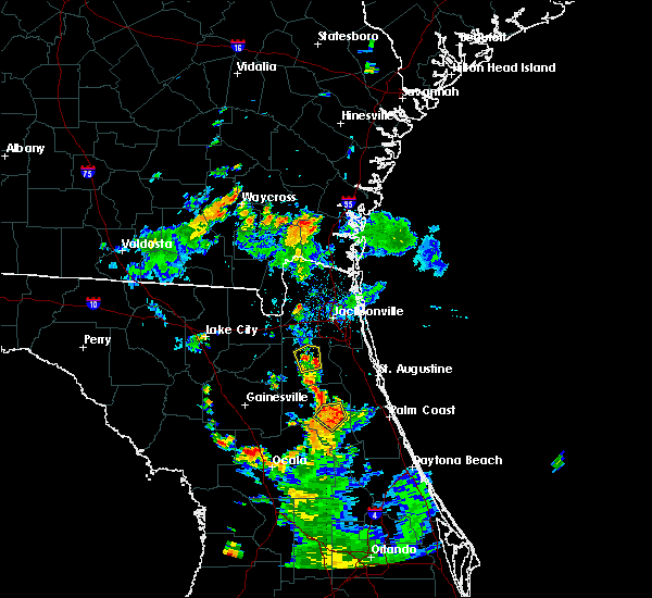 At 620 pm edt, a severe thunderstorm was located over satsuma, or near palatka, moving northeast at 15 mph (radar indicated). Hazards include 60 mph wind gusts and nickel size hail. Expect damage to roofs, siding, and trees. Locations impacted include, palatka, east palatka, san mateo, satsuma and welaka. At 620 pm edt, a severe thunderstorm was located over satsuma, or near palatka, moving northeast at 15 mph (radar indicated). Hazards include 60 mph wind gusts and nickel size hail. Expect damage to roofs, siding, and trees. Locations impacted include, palatka, east palatka, san mateo, satsuma and welaka.
|
| 6/15/2017 6:05 PM EDT | Tree limbs fell on power lines. large hail reported to central dispatch... size unknow in putnam county FL, 2.8 miles NE of Palatka, FL |
| 6/15/2017 5:51 PM EDT |
 At 551 pm edt, a severe thunderstorm was located near lake delancy, or 10 miles southeast of interlachen, moving northeast at 15 mph (radar indicated). Hazards include 60 mph wind gusts and nickel size hail. expect damage to roofs, siding, and trees At 551 pm edt, a severe thunderstorm was located near lake delancy, or 10 miles southeast of interlachen, moving northeast at 15 mph (radar indicated). Hazards include 60 mph wind gusts and nickel size hail. expect damage to roofs, siding, and trees
|
| 5/24/2017 9:23 AM EDT |
 At 922 am edt, a severe thunderstorm was located over bardin, or near palatka, moving northeast at 30 mph. radar indicated some rotation with this storm. tornadoes can occur with little or no advanced warning (radar indicated). Hazards include 60 mph wind gusts. expect damage to roofs, siding, and trees At 922 am edt, a severe thunderstorm was located over bardin, or near palatka, moving northeast at 30 mph. radar indicated some rotation with this storm. tornadoes can occur with little or no advanced warning (radar indicated). Hazards include 60 mph wind gusts. expect damage to roofs, siding, and trees
|
| 5/24/2017 6:18 AM EDT |
 At 617 am edt, a severe thunderstorm capable of producing a tornado was located over orange mills, or near east palatka, moving east at 30 mph (radar indicated rotation). Hazards include tornado. Flying debris will be dangerous to those caught without shelter. mobile homes will be damaged or destroyed. damage to roofs, windows, and vehicles will occur. tree damage is likely. this dangerous storm will be near, federal point around 625 am edt. hastings around 630 am edt. Other locations impacted by this tornadic thunderstorm include elkton and spuds. At 617 am edt, a severe thunderstorm capable of producing a tornado was located over orange mills, or near east palatka, moving east at 30 mph (radar indicated rotation). Hazards include tornado. Flying debris will be dangerous to those caught without shelter. mobile homes will be damaged or destroyed. damage to roofs, windows, and vehicles will occur. tree damage is likely. this dangerous storm will be near, federal point around 625 am edt. hastings around 630 am edt. Other locations impacted by this tornadic thunderstorm include elkton and spuds.
|
| 4/4/2017 8:40 AM EDT |
 At 839 am edt, a severe thunderstorm was located near university of florida, or 8 miles south of gainesville, moving east at 35 mph (radar indicated). Hazards include 60 mph wind gusts. expect damage to roofs, siding, and trees At 839 am edt, a severe thunderstorm was located near university of florida, or 8 miles south of gainesville, moving east at 35 mph (radar indicated). Hazards include 60 mph wind gusts. expect damage to roofs, siding, and trees
|
| 1/22/2017 7:30 PM EST |
 At 728 pm est, severe thunderstorms were located along a line extending from 10 miles northeast of kings bay base to 6 miles northeast of federal point, moving east at 145 mph (radar indicated). Hazards include 60 mph wind gusts and quarter size hail. Hail damage to vehicles is expected. expect wind damage to roofs, siding, and trees. locations impacted include, saint augustine, fernandina beach, palatka, hastings, ponte vedra beach, unf, fruit cove, east palatka, neptune beach and world golf village. a tornado watch remains in effect until 800 pm est for northeastern florida, and southeastern georgia. Time, mot, loc 0028z 249deg 125kt 3090 8138 2980 8146. At 728 pm est, severe thunderstorms were located along a line extending from 10 miles northeast of kings bay base to 6 miles northeast of federal point, moving east at 145 mph (radar indicated). Hazards include 60 mph wind gusts and quarter size hail. Hail damage to vehicles is expected. expect wind damage to roofs, siding, and trees. locations impacted include, saint augustine, fernandina beach, palatka, hastings, ponte vedra beach, unf, fruit cove, east palatka, neptune beach and world golf village. a tornado watch remains in effect until 800 pm est for northeastern florida, and southeastern georgia. Time, mot, loc 0028z 249deg 125kt 3090 8138 2980 8146.
|
| 1/22/2017 7:15 PM EST |
 At 714 pm est, severe thunderstorms were located along a line extending from 6 miles northeast of kings bay base to near bostwick, moving northeast at 95 mph (radar indicated). Hazards include 60 mph wind gusts and quarter size hail. Hail damage to vehicles is expected. Expect wind damage to roofs, siding, and trees. At 714 pm est, severe thunderstorms were located along a line extending from 6 miles northeast of kings bay base to near bostwick, moving northeast at 95 mph (radar indicated). Hazards include 60 mph wind gusts and quarter size hail. Hail damage to vehicles is expected. Expect wind damage to roofs, siding, and trees.
|
| 1/22/2017 7:01 PM EST |
 At 701 pm est, severe thunderstorms were located along a line extending from near kings bay base to near bostwick, moving northeast at 70 mph (radar indicated). Hazards include 60 mph wind gusts and quarter size hail. Hail damage to vehicles is expected. expect wind damage to roofs, siding, and trees. locations impacted include, jacksonville, saint augustine, fernandina beach, palatka, orange park, green cove springs, interlachen, callahan, hastings and jacksonville international arpt. A tornado watch remains in effect until 800 pm est for northern and northeastern florida. At 701 pm est, severe thunderstorms were located along a line extending from near kings bay base to near bostwick, moving northeast at 70 mph (radar indicated). Hazards include 60 mph wind gusts and quarter size hail. Hail damage to vehicles is expected. expect wind damage to roofs, siding, and trees. locations impacted include, jacksonville, saint augustine, fernandina beach, palatka, orange park, green cove springs, interlachen, callahan, hastings and jacksonville international arpt. A tornado watch remains in effect until 800 pm est for northern and northeastern florida.
|
| 1/22/2017 6:55 PM EST |
 At 654 pm est, severe thunderstorms were located along a line extending from st. marys to near bardin, moving northeast at 70 mph (radar indicated). Hazards include 60 mph wind gusts and quarter size hail. Hail damage to vehicles is expected. expect wind damage to roofs, siding, and trees. locations impacted include, jacksonville, saint augustine, fernandina beach, palatka, orange park, green cove springs, interlachen, keystone heights, callahan and hastings. A tornado watch remains in effect until 800 pm est for northeastern and northern florida, and southeastern georgia. At 654 pm est, severe thunderstorms were located along a line extending from st. marys to near bardin, moving northeast at 70 mph (radar indicated). Hazards include 60 mph wind gusts and quarter size hail. Hail damage to vehicles is expected. expect wind damage to roofs, siding, and trees. locations impacted include, jacksonville, saint augustine, fernandina beach, palatka, orange park, green cove springs, interlachen, keystone heights, callahan and hastings. A tornado watch remains in effect until 800 pm est for northeastern and northern florida, and southeastern georgia.
|
| 1/22/2017 6:46 PM EST |
 At 646 pm est, severe thunderstorms were located along a line extending from near yulee to interlachen, moving northeast at 70 mph (radar indicated). Hazards include 60 mph wind gusts and quarter size hail. Hail damage to vehicles is expected. expect wind damage to roofs, siding, and trees. locations impacted include, jacksonville, saint augustine, fernandina beach, palatka, orange park, green cove springs, starke, interlachen, keystone heights and callahan. A tornado watch remains in effect until 800 pm est for northeastern and northern florida, and southeastern georgia. At 646 pm est, severe thunderstorms were located along a line extending from near yulee to interlachen, moving northeast at 70 mph (radar indicated). Hazards include 60 mph wind gusts and quarter size hail. Hail damage to vehicles is expected. expect wind damage to roofs, siding, and trees. locations impacted include, jacksonville, saint augustine, fernandina beach, palatka, orange park, green cove springs, starke, interlachen, keystone heights and callahan. A tornado watch remains in effect until 800 pm est for northeastern and northern florida, and southeastern georgia.
|
| 1/22/2017 6:32 PM EST |
 At 631 pm est, severe thunderstorms were located along a line extending from 6 miles west of ratliff to cross creek, moving northeast at 70 mph (radar indicated). Hazards include 60 mph wind gusts and quarter size hail. Hail damage to vehicles is expected. expect wind damage to roofs, siding, and trees. locations impacted include, jacksonville, gainesville, saint augustine, fernandina beach, palatka, orange park, green cove springs, starke, lake butler and interlachen. A tornado watch remains in effect until 800 pm est for northeastern and northern florida, and southeastern georgia. At 631 pm est, severe thunderstorms were located along a line extending from 6 miles west of ratliff to cross creek, moving northeast at 70 mph (radar indicated). Hazards include 60 mph wind gusts and quarter size hail. Hail damage to vehicles is expected. expect wind damage to roofs, siding, and trees. locations impacted include, jacksonville, gainesville, saint augustine, fernandina beach, palatka, orange park, green cove springs, starke, lake butler and interlachen. A tornado watch remains in effect until 800 pm est for northeastern and northern florida, and southeastern georgia.
|
| 1/22/2017 6:17 PM EST |
 At 617 pm est, severe thunderstorms were located along a line extending from 8 miles north of macclenny to near williston, moving northeast at 70 mph (radar indicated). Hazards include 60 mph wind gusts and quarter size hail. Hail damage to vehicles is expected. expect wind damage to roofs, siding, and trees. locations impacted include, jacksonville, gainesville, saint augustine, fernandina beach, palatka, orange park, green cove springs, starke, lake butler and interlachen. A tornado watch remains in effect until 800 pm est for northeastern and northern florida, and southeastern georgia. At 617 pm est, severe thunderstorms were located along a line extending from 8 miles north of macclenny to near williston, moving northeast at 70 mph (radar indicated). Hazards include 60 mph wind gusts and quarter size hail. Hail damage to vehicles is expected. expect wind damage to roofs, siding, and trees. locations impacted include, jacksonville, gainesville, saint augustine, fernandina beach, palatka, orange park, green cove springs, starke, lake butler and interlachen. A tornado watch remains in effect until 800 pm est for northeastern and northern florida, and southeastern georgia.
|
| 1/22/2017 6:06 PM EST |
 At 605 pm est, severe thunderstorms were located along a line extending from near sanderson to near williston highlands, moving northeast at 70 mph (radar indicated). Hazards include 60 mph wind gusts and quarter size hail. Hail damage to vehicles is expected. Expect wind damage to roofs, siding, and trees. At 605 pm est, severe thunderstorms were located along a line extending from near sanderson to near williston highlands, moving northeast at 70 mph (radar indicated). Hazards include 60 mph wind gusts and quarter size hail. Hail damage to vehicles is expected. Expect wind damage to roofs, siding, and trees.
|
| 7/12/2016 5:58 PM EDT |
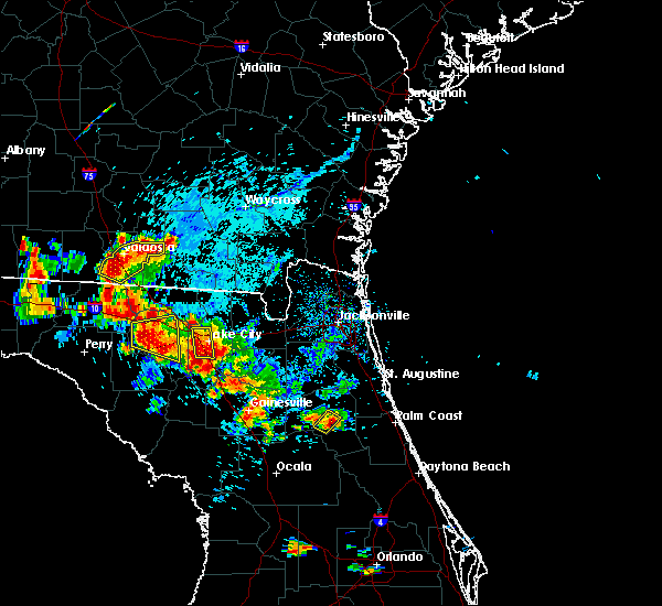 At 558 pm edt, a severe thunderstorm was located near palatka, moving northwest at 5 mph (radar indicated). Hazards include 60 mph wind gusts and quarter size hail. Hail damage to vehicles is expected. expect wind damage to roofs, siding, and trees. Locations impacted include, palatka. At 558 pm edt, a severe thunderstorm was located near palatka, moving northwest at 5 mph (radar indicated). Hazards include 60 mph wind gusts and quarter size hail. Hail damage to vehicles is expected. expect wind damage to roofs, siding, and trees. Locations impacted include, palatka.
|
| 7/12/2016 5:41 PM EDT |
 At 541 pm edt, a severe thunderstorm was located near hollister, or near palatka, moving northwest at 10 mph (radar indicated). Hazards include 60 mph wind gusts and quarter size hail. Hail damage to vehicles is expected. Expect wind damage to roofs, siding, and trees. At 541 pm edt, a severe thunderstorm was located near hollister, or near palatka, moving northwest at 10 mph (radar indicated). Hazards include 60 mph wind gusts and quarter size hail. Hail damage to vehicles is expected. Expect wind damage to roofs, siding, and trees.
|
| 7/7/2016 5:40 PM EDT | 128 saint johns ave tree down on powerlines in putnam county FL, 2.2 miles W of Palatka, FL |
| 6/5/2016 6:33 PM EDT |
 At 633 pm edt, a severe thunderstorm was located over palatka, moving northeast at 20 mph (radar indicated). Hazards include 60 mph wind gusts. Expect damage to roofs. siding. And trees. At 633 pm edt, a severe thunderstorm was located over palatka, moving northeast at 20 mph (radar indicated). Hazards include 60 mph wind gusts. Expect damage to roofs. siding. And trees.
|
| 5/31/2016 6:53 PM EDT | Central dispatch reported a tree down blocking one lane of state road 100 between roberts lane and bardin roa in putnam county FL, 5.8 miles ESE of Palatka, FL |
| 5/31/2016 6:35 PM EDT |
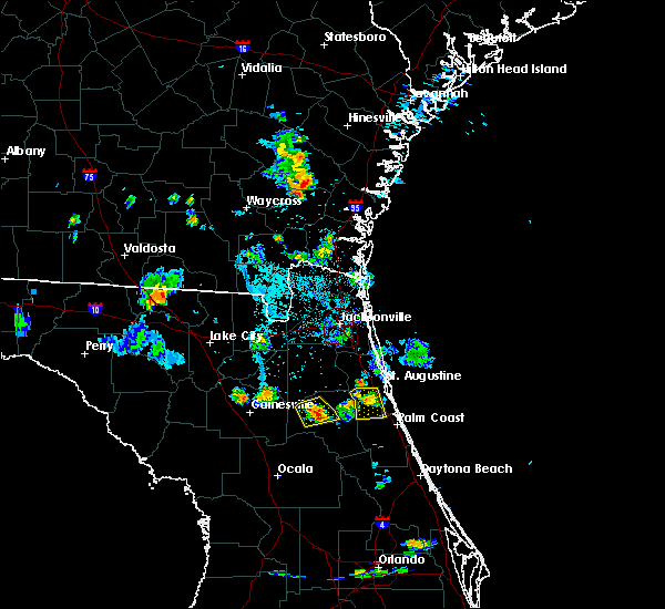 At 634 pm edt, a severe thunderstorm was located near florahome, or near interlachen, moving southeast at 5 mph (radar indicated). Hazards include 60 mph wind gusts. Expect damage to roofs. siding. and trees. Locations impacted include, palatka, interlachen, bardin, melrose landing, florahome, hollister, carraway, putnam hall and mannville. At 634 pm edt, a severe thunderstorm was located near florahome, or near interlachen, moving southeast at 5 mph (radar indicated). Hazards include 60 mph wind gusts. Expect damage to roofs. siding. and trees. Locations impacted include, palatka, interlachen, bardin, melrose landing, florahome, hollister, carraway, putnam hall and mannville.
|
| 5/31/2016 6:18 PM EDT |
 At 618 pm edt, a severe thunderstorm was located over florahome, or near interlachen, and is nearly stationary (radar indicated). Hazards include 60 mph wind gusts and penny size hail. Expect damage to roofs. siding. And trees. At 618 pm edt, a severe thunderstorm was located over florahome, or near interlachen, and is nearly stationary (radar indicated). Hazards include 60 mph wind gusts and penny size hail. Expect damage to roofs. siding. And trees.
|
| 5/20/2016 12:54 PM EDT | Dispatch reports a tree down near husson and cecille avenu in putnam county FL, 1.2 miles WNW of Palatka, FL |
| 5/20/2016 12:54 PM EDT | Dispatch reports a tree down near north moody road and stillwell avenue. time estimate in putnam county FL, 0.8 miles E of Palatka, FL |
| 5/13/2016 6:39 PM EDT |
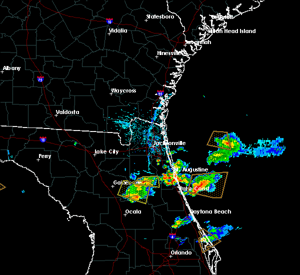 At 639 pm edt, a severe thunderstorm was located near george`s lake, or 11 miles northwest of palatka, moving east at 20 mph (radar indicated). Hazards include 60 mph wind gusts and penny size hail. Expect damage to roofs. siding. and trees. Locations impacted include, palatka, east palatka, bardin, george`s lake, orange mills, bostwick, florahome and carraway. At 639 pm edt, a severe thunderstorm was located near george`s lake, or 11 miles northwest of palatka, moving east at 20 mph (radar indicated). Hazards include 60 mph wind gusts and penny size hail. Expect damage to roofs. siding. and trees. Locations impacted include, palatka, east palatka, bardin, george`s lake, orange mills, bostwick, florahome and carraway.
|
| 5/13/2016 6:14 PM EDT |
 At 614 pm edt, a severe thunderstorm was located near florahome, or near keystone heights, moving east at 20 mph (radar indicated). Hazards include 60 mph wind gusts and penny size hail. Expect damage to roofs. siding. And trees. At 614 pm edt, a severe thunderstorm was located near florahome, or near keystone heights, moving east at 20 mph (radar indicated). Hazards include 60 mph wind gusts and penny size hail. Expect damage to roofs. siding. And trees.
|
| 5/13/2016 5:56 PM EDT |
 At 555 pm edt, a severe thunderstorm was located near hawthorne, or near melrose, moving east at 20 mph (radar indicated). Hazards include 60 mph wind gusts and penny size hail. Expect damage to roofs. siding. And trees. At 555 pm edt, a severe thunderstorm was located near hawthorne, or near melrose, moving east at 20 mph (radar indicated). Hazards include 60 mph wind gusts and penny size hail. Expect damage to roofs. siding. And trees.
|
| 8/7/2015 3:10 PM EDT |
 At 310 pm edt, doppler radar indicated a line of severe thunderstorms capable of producing damaging winds in excess of 60 mph. these storms were located along a line extending from 6 miles northeast of guana river state park to near saint augustine to bardin, moving east at 35 mph. locations impacted include, saint augustine, palatka, hastings, east palatka, world golf village, bostwick, nocatee, durbin, saint augustine south, federal point, san mateo, butler beach, south ponte vedra, orange mills, guana river state park, saint augustine shores, picolata, crescent beach, dupont center and spuds. At 310 pm edt, doppler radar indicated a line of severe thunderstorms capable of producing damaging winds in excess of 60 mph. these storms were located along a line extending from 6 miles northeast of guana river state park to near saint augustine to bardin, moving east at 35 mph. locations impacted include, saint augustine, palatka, hastings, east palatka, world golf village, bostwick, nocatee, durbin, saint augustine south, federal point, san mateo, butler beach, south ponte vedra, orange mills, guana river state park, saint augustine shores, picolata, crescent beach, dupont center and spuds.
|
| 8/7/2015 2:56 PM EDT |
 At 256 pm edt, doppler radar indicated a line of severe thunderstorms capable of producing damaging winds in excess of 60 mph. these storms were located along a line extending from 6 miles southeast of sawgrass to near picolata to near interlachen, and moving southeast at 35 mph. At 256 pm edt, doppler radar indicated a line of severe thunderstorms capable of producing damaging winds in excess of 60 mph. these storms were located along a line extending from 6 miles southeast of sawgrass to near picolata to near interlachen, and moving southeast at 35 mph.
|
| 7/11/2015 3:41 PM EDT |
 At 341 pm edt, doppler radar indicated a severe thunderstorm capable of producing quarter size hail and damaging winds in excess of 60 mph. this storm was located over florahome, or 7 miles northeast of interlachen, and moving south at 5 mph. At 341 pm edt, doppler radar indicated a severe thunderstorm capable of producing quarter size hail and damaging winds in excess of 60 mph. this storm was located over florahome, or 7 miles northeast of interlachen, and moving south at 5 mph.
|
| 7/7/2015 5:39 PM EDT |
 The severe thunderstorm warning for north central putnam county will expire at 545 pm edt, the storm which prompted the warning has weakened below severe limits, and no longer poses an immediate threat to life or property. therefore the warning will be allowed to expire. The severe thunderstorm warning for north central putnam county will expire at 545 pm edt, the storm which prompted the warning has weakened below severe limits, and no longer poses an immediate threat to life or property. therefore the warning will be allowed to expire.
|
| 7/7/2015 5:27 PM EDT |
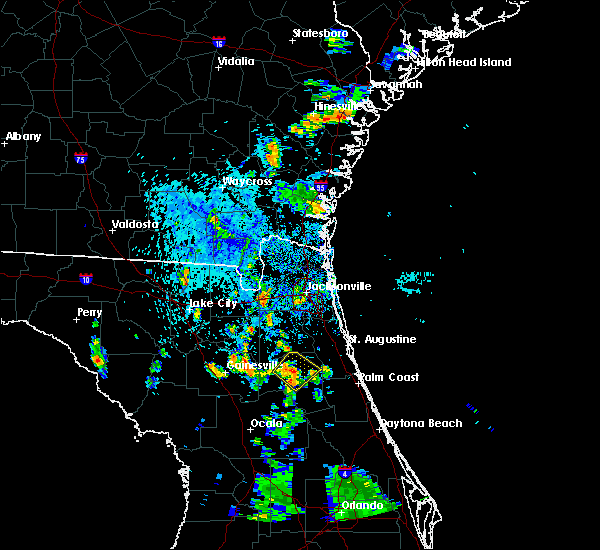 At 527 pm edt, doppler radar indicated a severe thunderstorm capable of producing quarter size hail and destructive winds in excess of 70 mph. this storm was located over bardin, or near palatka. this storm was nearly stationary. locations impacted include, palatka, bardin, hollister and carraway. At 527 pm edt, doppler radar indicated a severe thunderstorm capable of producing quarter size hail and destructive winds in excess of 70 mph. this storm was located over bardin, or near palatka. this storm was nearly stationary. locations impacted include, palatka, bardin, hollister and carraway.
|
| 7/7/2015 5:14 PM EDT |
 At 514 pm edt, doppler radar indicated a severe thunderstorm capable of producing quarter size hail and damaging winds in excess of 60 mph. this storm was located near bardin, or near palatka, and moving northeast at 5 mph. At 514 pm edt, doppler radar indicated a severe thunderstorm capable of producing quarter size hail and damaging winds in excess of 60 mph. this storm was located near bardin, or near palatka, and moving northeast at 5 mph.
|
| 7/5/2015 4:57 PM EDT | The severe thunderstorm warning for central putnam and northeastern marion counties will expire at 500 pm edt, the storm which prompted the warning has moved out of the area. therefore the warning will be allowed to expire. |
| 7/5/2015 4:25 PM EDT |
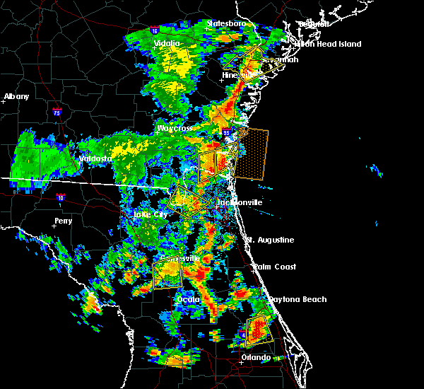 At 424 pm edt, doppler radar indicated a severe thunderstorm capable of producing quarter size hail and damaging winds in excess of 60 mph. this storm was located near hollister, or near interlachen, and moving northeast at 20 mph. At 424 pm edt, doppler radar indicated a severe thunderstorm capable of producing quarter size hail and damaging winds in excess of 60 mph. this storm was located near hollister, or near interlachen, and moving northeast at 20 mph.
|
| 6/22/2015 10:49 PM EDT |
 At 1049 pm edt, doppler radar indicated a severe thunderstorm capable of producing damaging winds in excess of 60 mph. this storm was located over bardin, or 9 miles northwest of palatka, and moving north at 15 mph. penny size hail may also accompany the damaging winds. At 1049 pm edt, doppler radar indicated a severe thunderstorm capable of producing damaging winds in excess of 60 mph. this storm was located over bardin, or 9 miles northwest of palatka, and moving north at 15 mph. penny size hail may also accompany the damaging winds.
|
| 6/18/2015 6:20 PM EDT | The sheriffs received reports of trees down in carraway near state road 100. the time given was based on rada in putnam county FL, 8.6 miles ESE of Palatka, FL |
| 6/18/2015 6:18 PM EDT | At 617 pm edt, doppler radar indicated a severe thunderstorm capable of producing damaging winds in excess of 60 mph. this storm was located over bardin, or 8 miles northwest of palatka, and moving east at 10 mph. |
| 6/12/2015 5:33 PM EDT |
 At 532 pm edt, doppler radar indicated a severe thunderstorm capable of producing damaging winds in excess of 60 mph. this storm was located over hollister, or near interlachen, moving north at 15 mph. locations impacted include, palatka, interlachen, bardin, melrose landing, bostwick, florahome, hollister, johnson, carraway, putnam hall and mannville. At 532 pm edt, doppler radar indicated a severe thunderstorm capable of producing damaging winds in excess of 60 mph. this storm was located over hollister, or near interlachen, moving north at 15 mph. locations impacted include, palatka, interlachen, bardin, melrose landing, bostwick, florahome, hollister, johnson, carraway, putnam hall and mannville.
|
| 6/12/2015 4:54 PM EDT |
 At 454 pm edt, doppler radar indicated a severe thunderstorm capable of producing damaging winds in excess of 60 mph. this storm was located over fruitland, or near salt springs, and moving north at 15 mph. penny size hail may also accompany the damaging winds. At 454 pm edt, doppler radar indicated a severe thunderstorm capable of producing damaging winds in excess of 60 mph. this storm was located over fruitland, or near salt springs, and moving north at 15 mph. penny size hail may also accompany the damaging winds.
|
| 5/20/2015 3:55 PM EDT | At 355 pm edt, doppler radar indicated a severe thunderstorm capable of producing quarter size hail and damaging winds in excess of 60 mph. this storm was located over interlachen, moving east at 20 mph. locations impacted include, palatka, interlachen, east palatka, bardin, melrose landing, satsuma, florahome, hollister, johnson, carraway and mannville. |
| 5/20/2015 3:39 PM EDT | At 339 pm edt, doppler radar indicated a severe thunderstorm capable of producing quarter size hail and damaging winds in excess of 60 mph. this storm was located over melrose landing, or near interlachen, and moving east at 25 mph. |
| 4/20/2015 3:45 PM EDT | At 345 pm edt, doppler radar indicated a line of severe thunderstorms capable of producing quarter size hail and damaging winds in excess of 60 mph. these storms were located along a line extending from near bardin to near pomona park, moving east at 45 mph. locations impacted include, palatka, crescent city, pomona park, east palatka, satsuma, bostwick, federal point, bardin, fruitland, san mateo, orange mills, welaka, lake como and georgetown. |
| 4/20/2015 3:24 PM EDT | At 324 pm edt, doppler radar indicated a line of severe thunderstorms capable of producing quarter size hail and damaging winds in excess of 60 mph. these storms were located along a line extending from florahome to near orange springs, and moving east at 45 mph. |
| 4/19/2015 4:45 PM EDT | Trees down at the intersection of sweet magnolia street and white oaks trac in putnam county FL, 5.3 miles NW of Palatka, FL |
| 8/21/2014 5:30 PM EDT | Putnam county 911/dispatch reports trees and powerlines down in the vicinity of silver lake road. time of damage based on radar dat in putnam county FL, 3.7 miles NE of Palatka, FL |
| 7/3/2014 4:00 PM EDT | Tree was reported down on mellon road. time is estimated based on rada in putnam county FL, 0.4 miles WSW of Palatka, FL |
| 6/8/2014 4:15 PM EDT | Putnam county dispatch reports numerous trees and powerlines downed along state road 19 in the vicinity of silver lake drive. time of damage based on radar data in putnam county FL, 2.8 miles NE of Palatka, FL |
| 9/6/2013 4:00 PM EDT | Trees down in roadway along state road 10 in putnam county FL, 9.4 miles ESE of Palatka, FL |
| 2/26/2013 10:05 AM EST | Tree reported down near president and washington streets in the palatka area. time of report based on rada in putnam county FL, 0.4 miles WSW of Palatka, FL |
| 8/9/2012 4:00 PM EDT | Power lines down on east paniel roa in putnam county FL, 3.3 miles NE of Palatka, FL |
| 6/10/2012 4:40 PM EDT | 911 call center reported several trees down in palatk in putnam county FL, 2.9 miles S of Palatka, FL |
| 5/17/2012 9:19 PM EDT | Hen Egg sized hail reported 8.9 miles ENE of Palatka, FL |
| 5/14/2012 4:41 PM EDT | Numerous trees down across west tocoi rd and css train track near east hwy us 17 in putnam county FL, 9.3 miles SSW of Palatka, FL |
Hail Maps for Palatka, FL
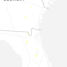
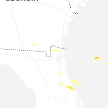
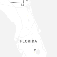
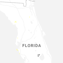
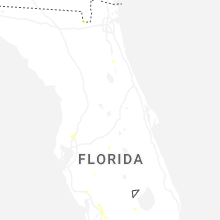
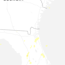


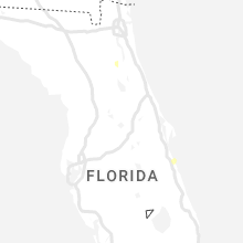


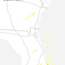


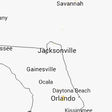


Connect with Interactive Hail Maps