

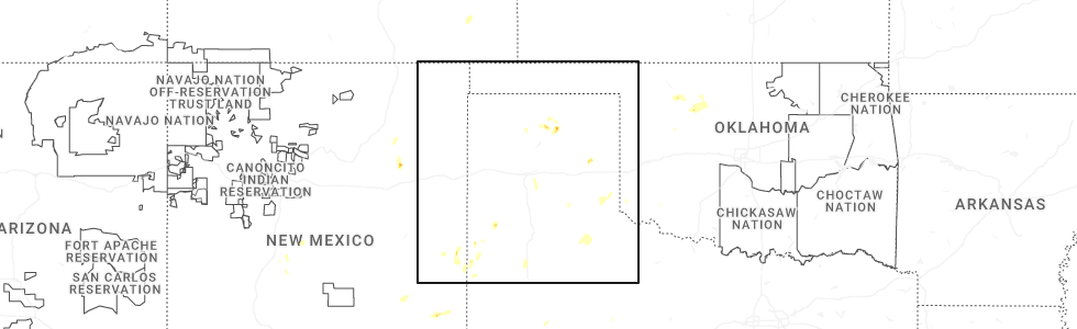
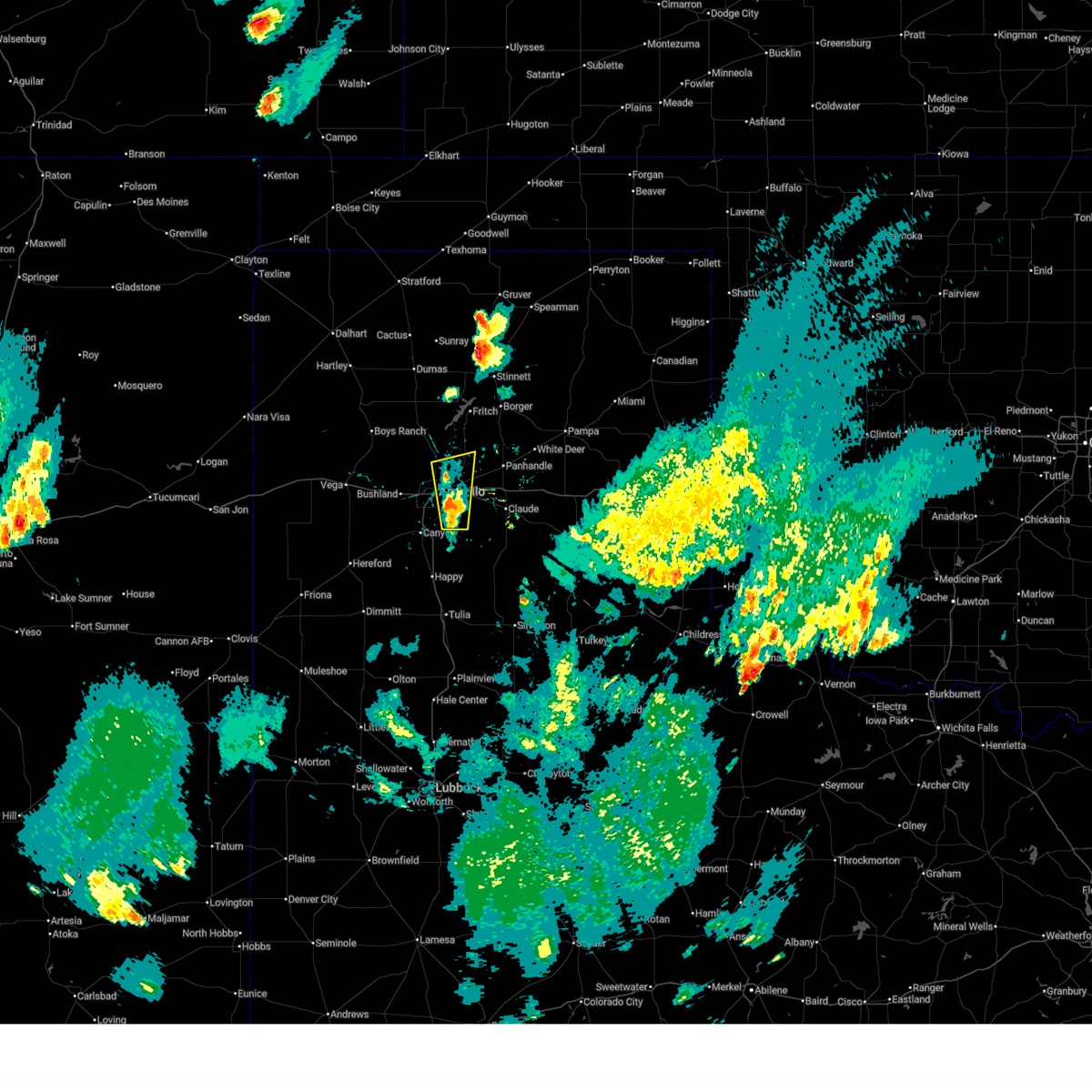
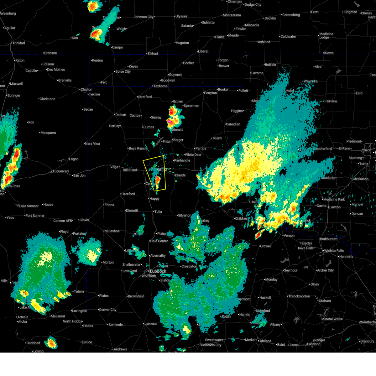
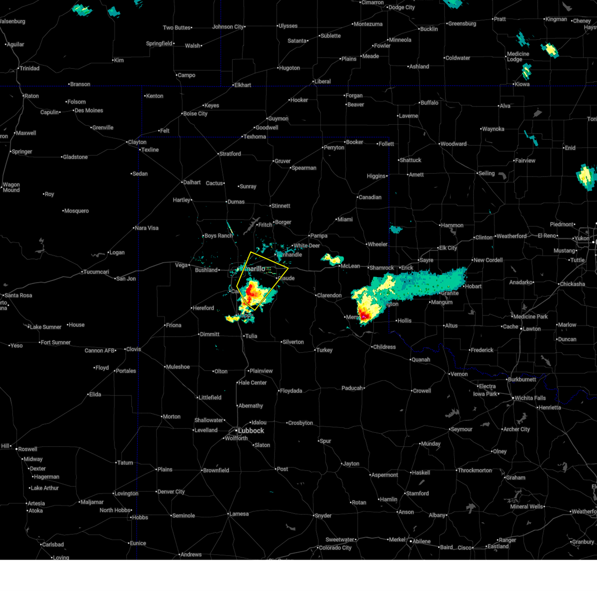
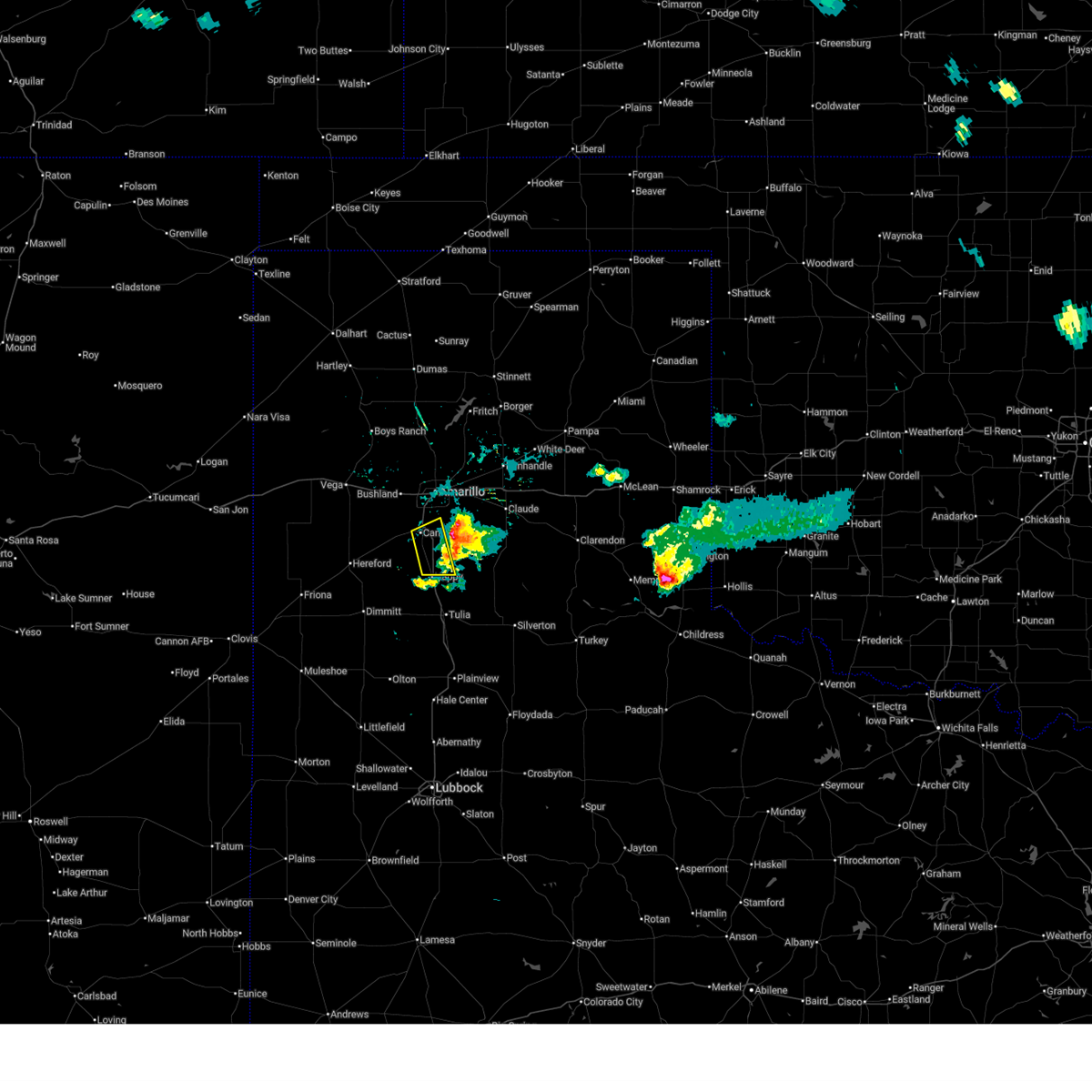
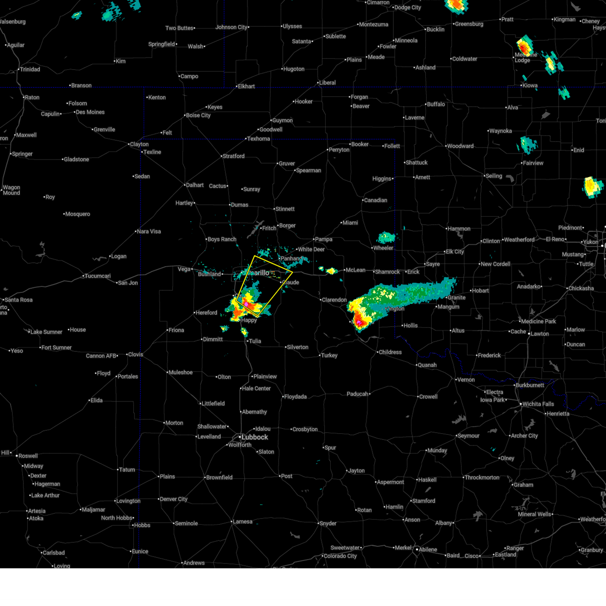
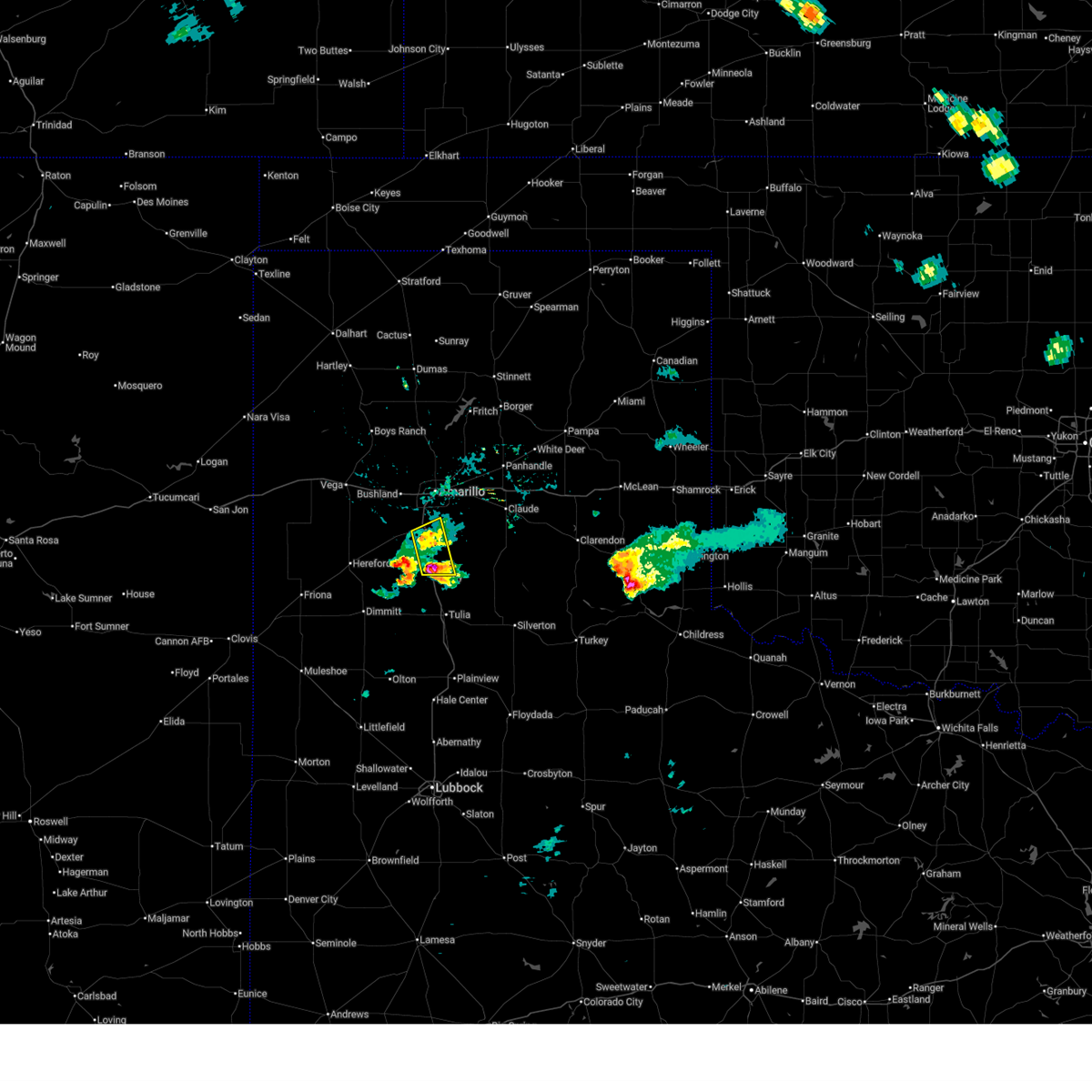
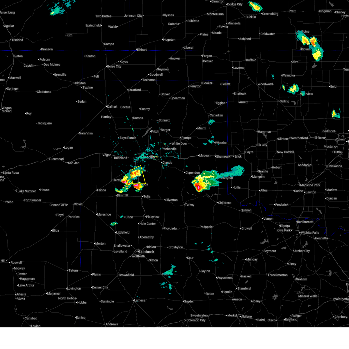
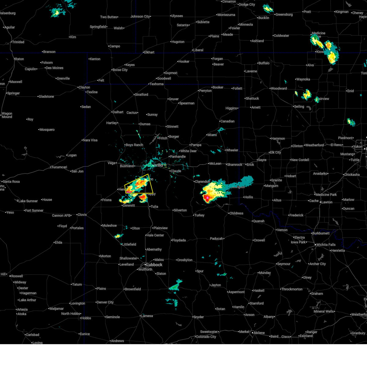
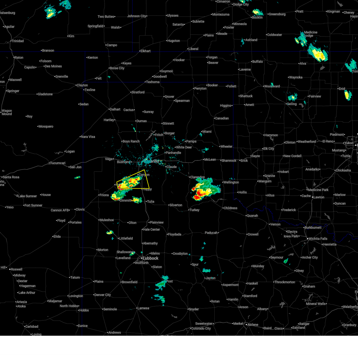
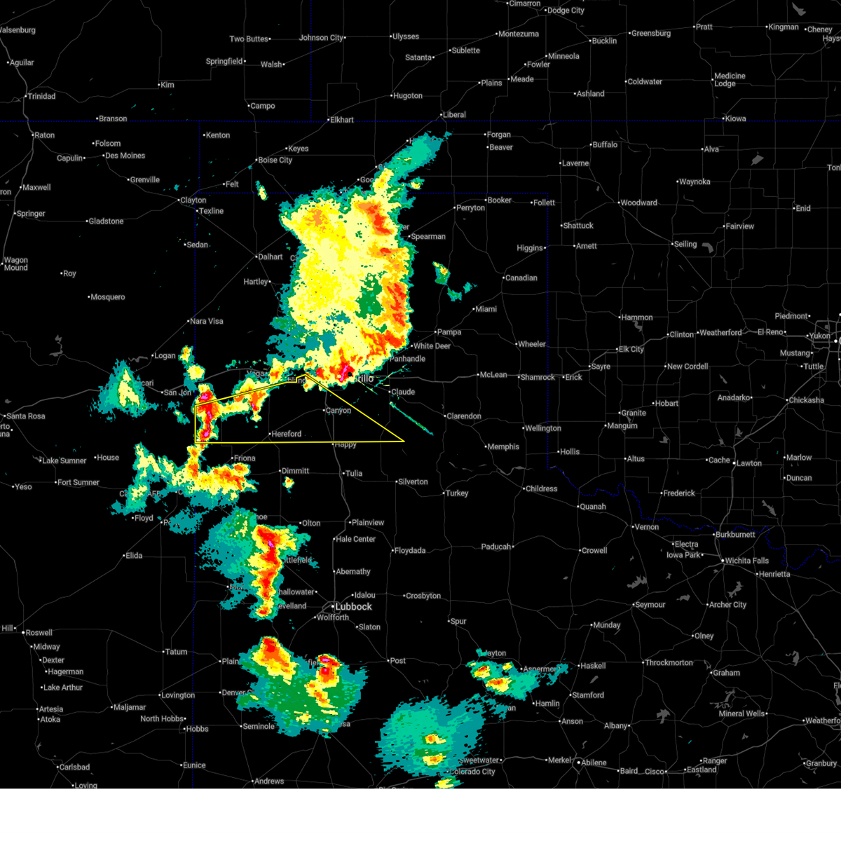
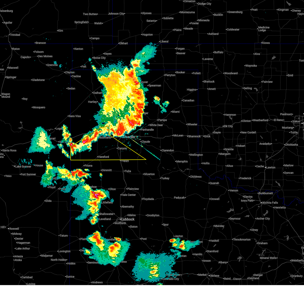
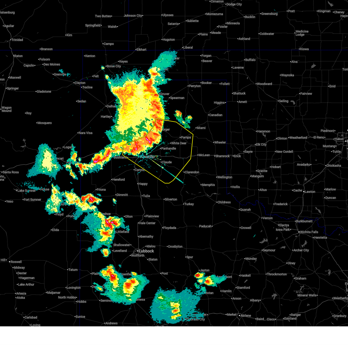
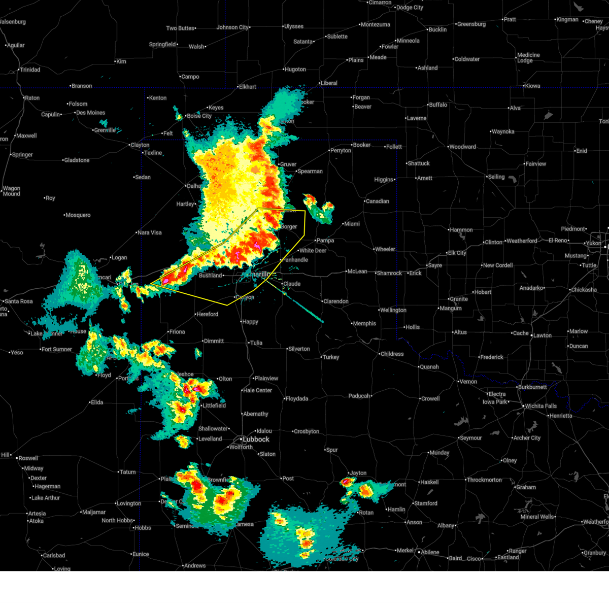
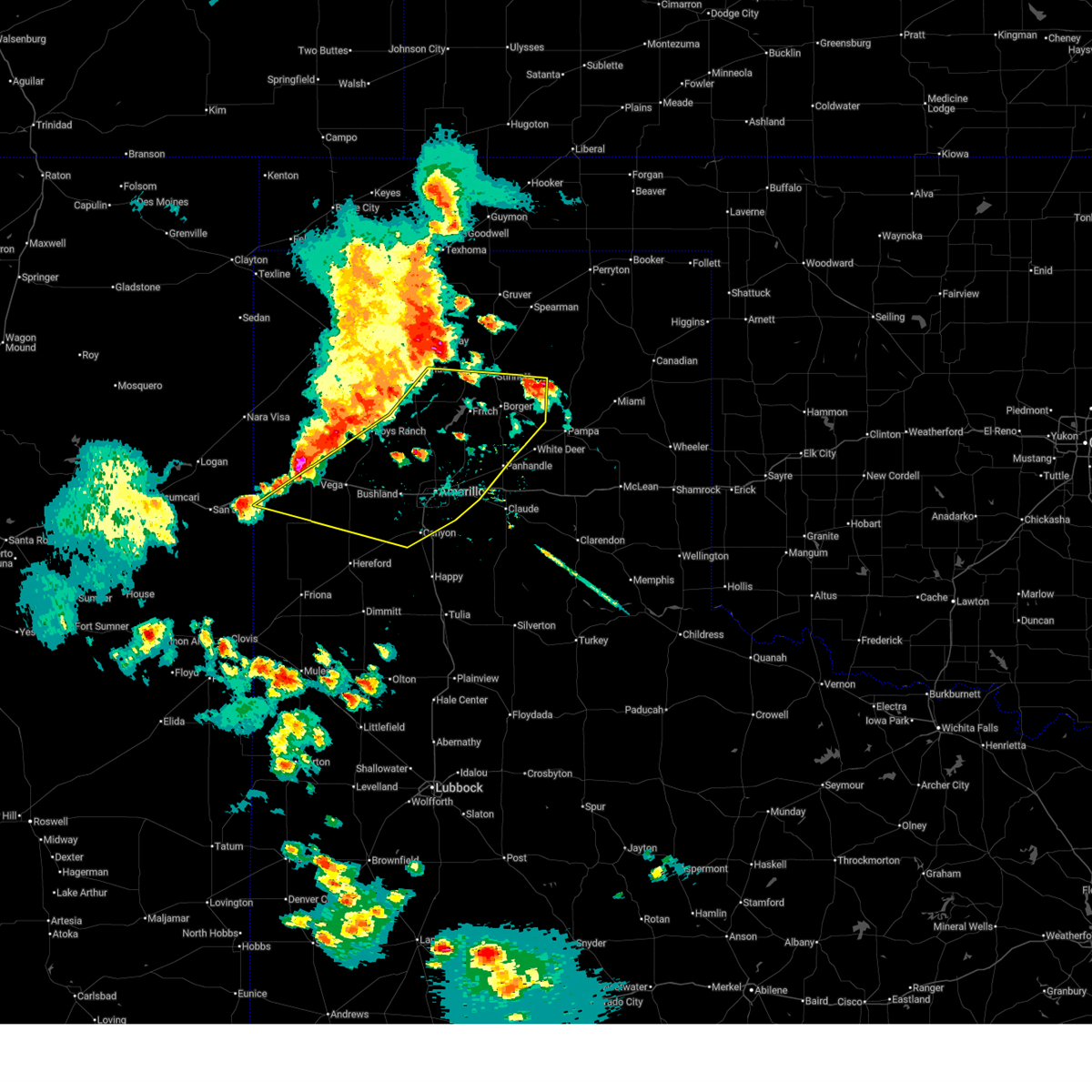
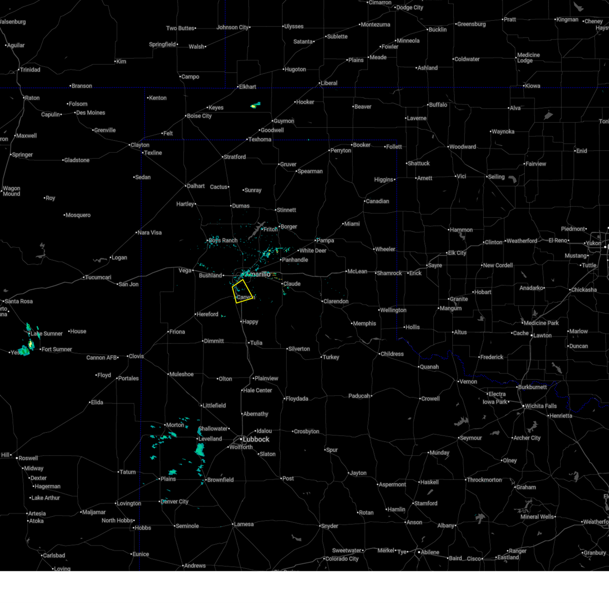
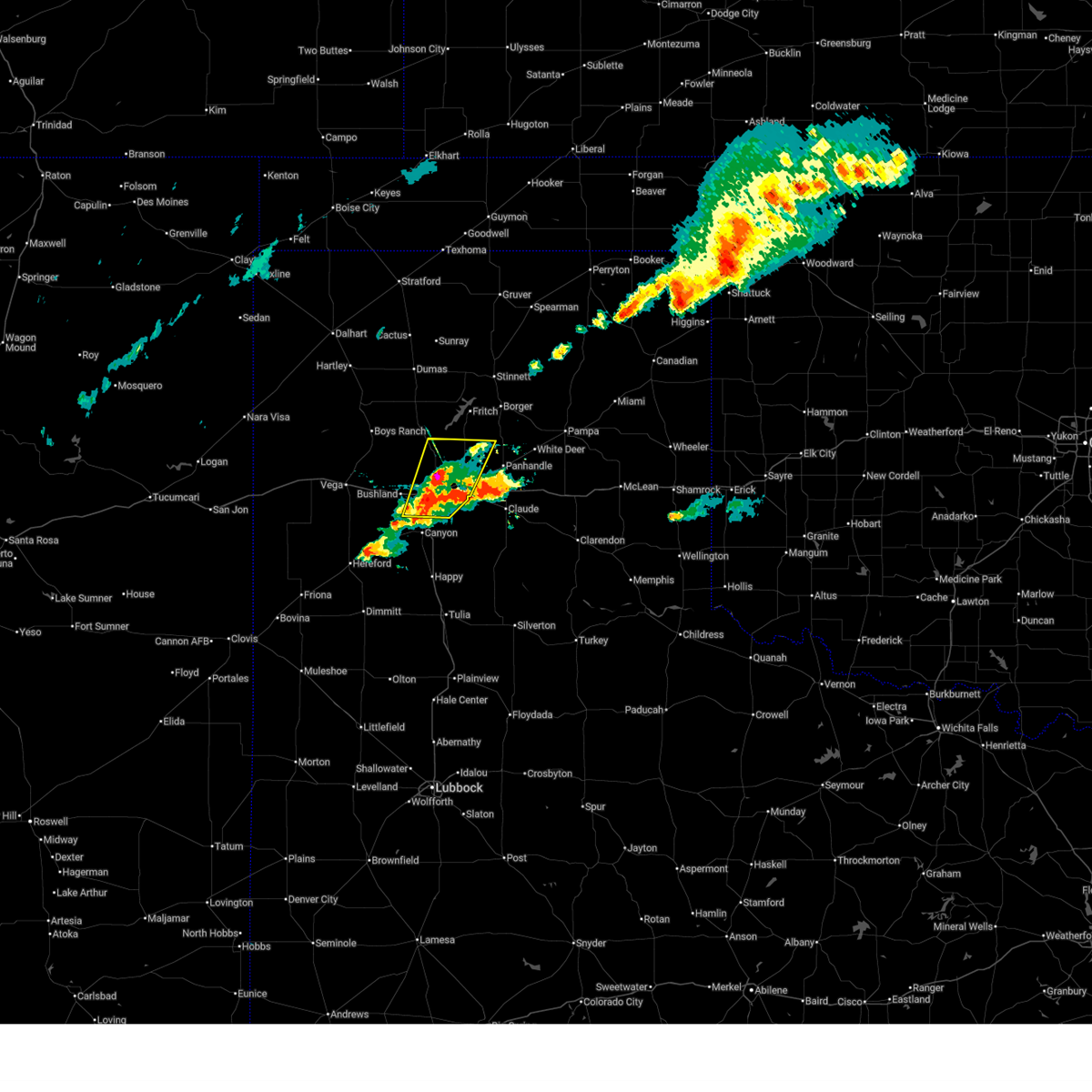
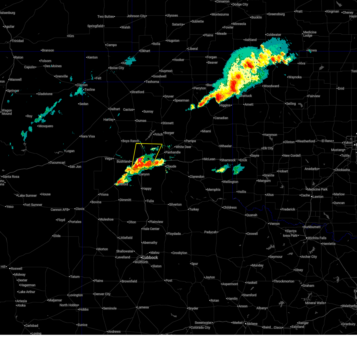
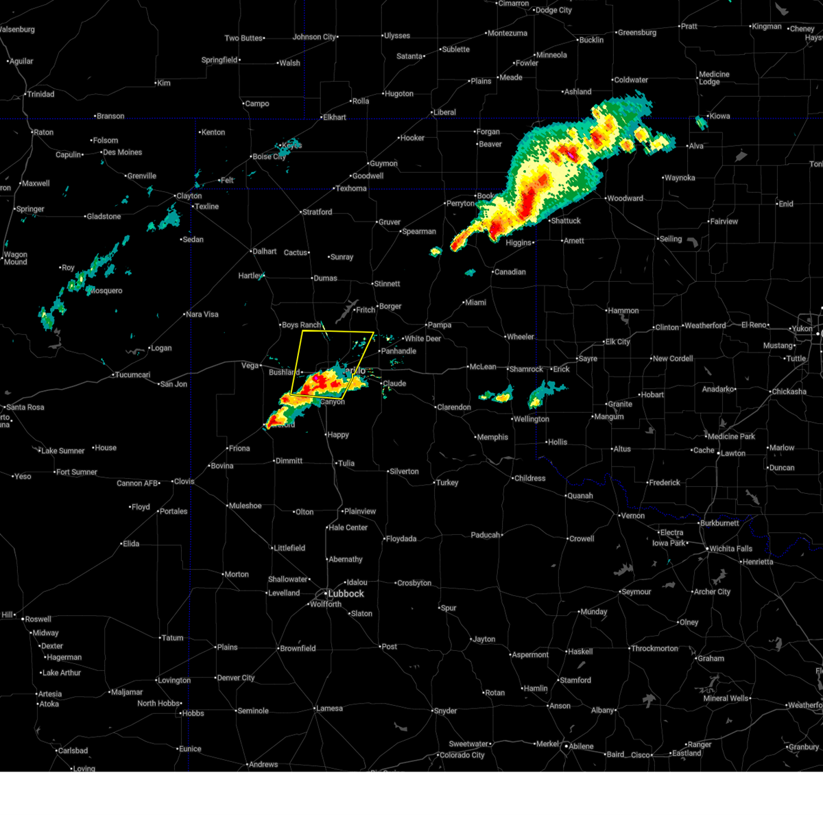
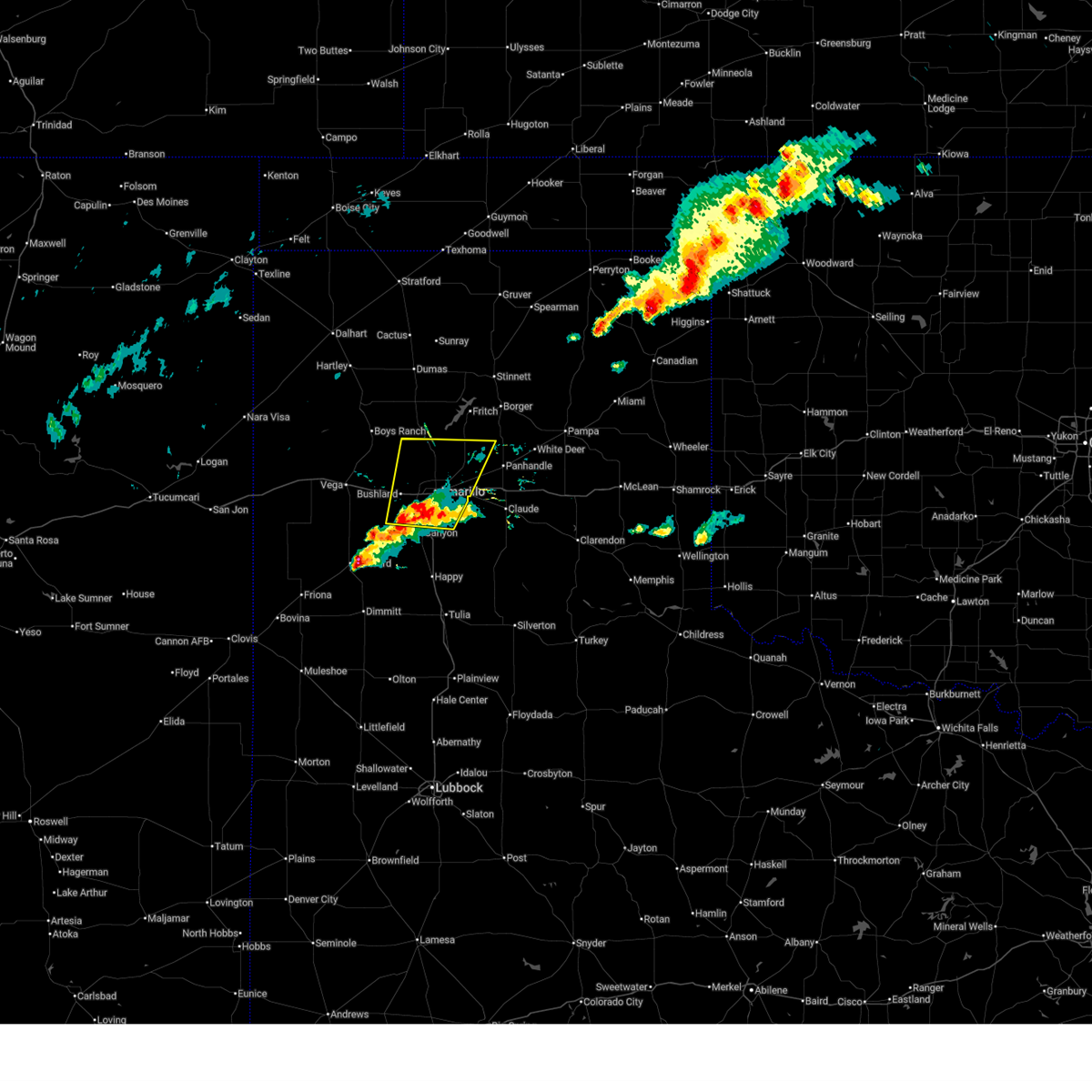
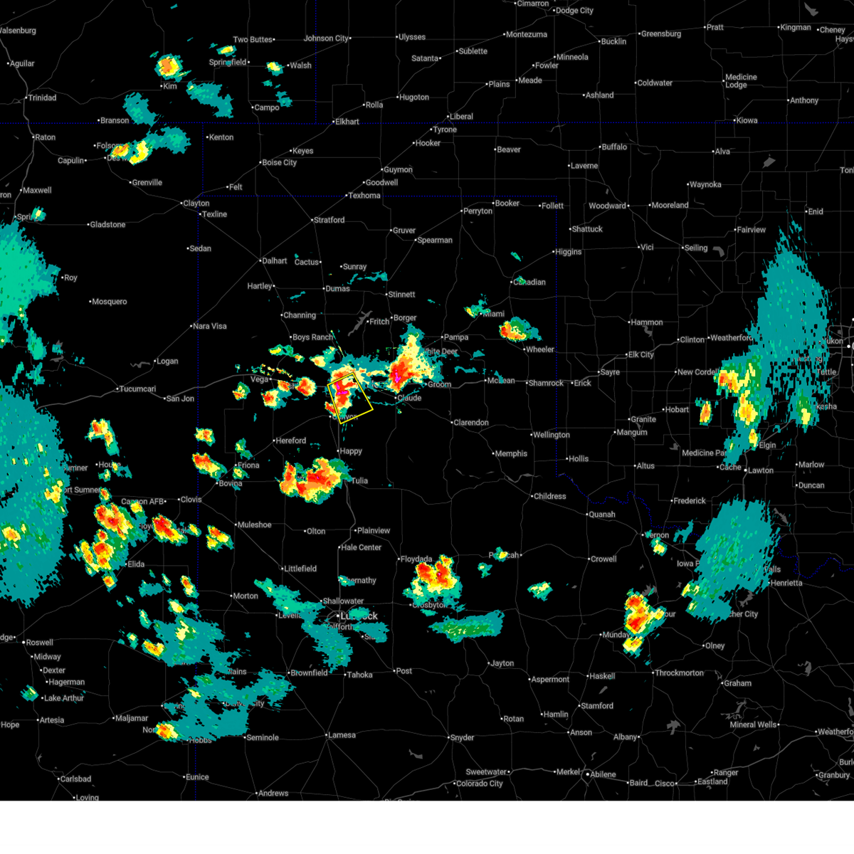
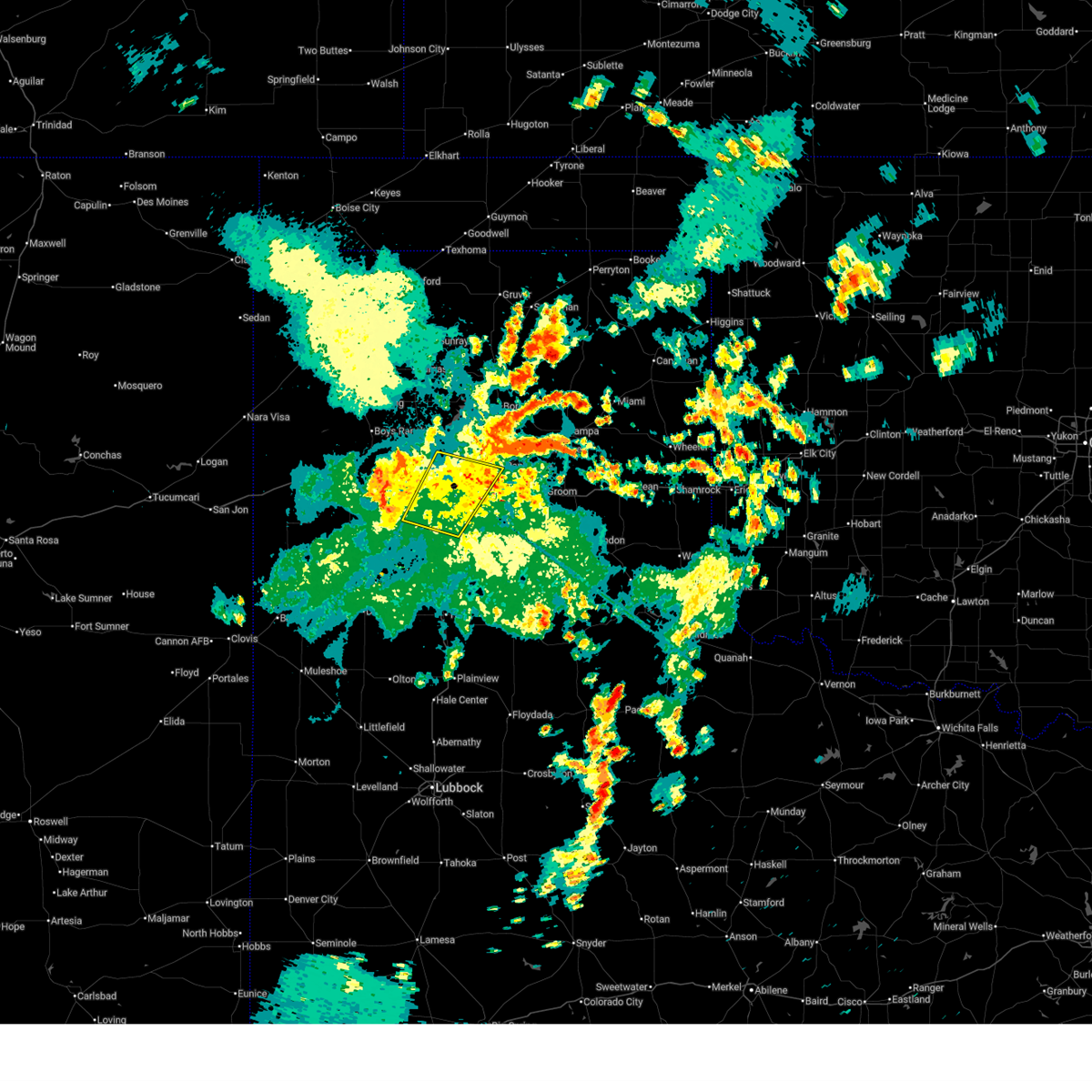
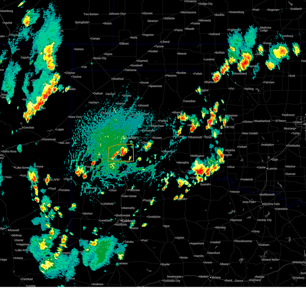
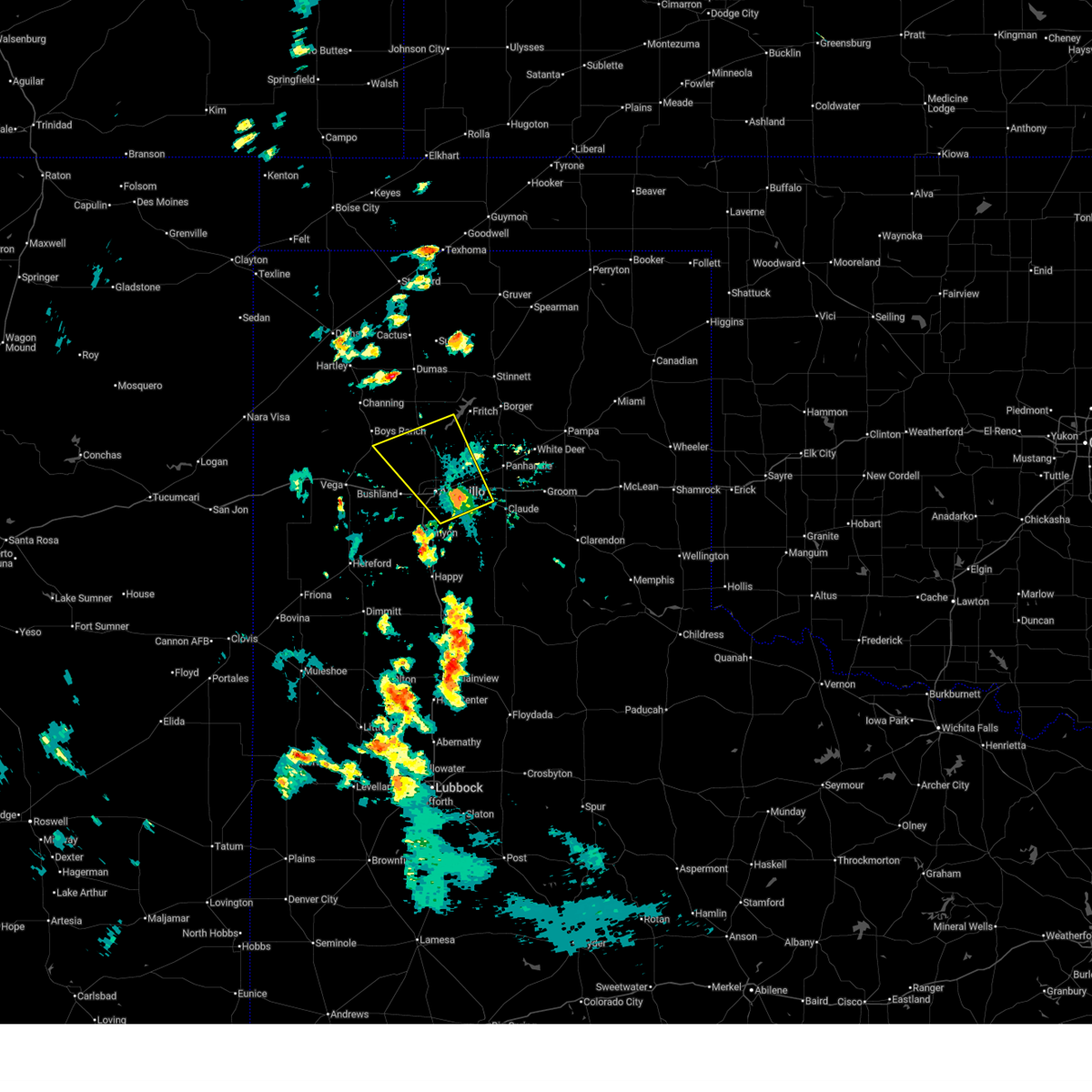
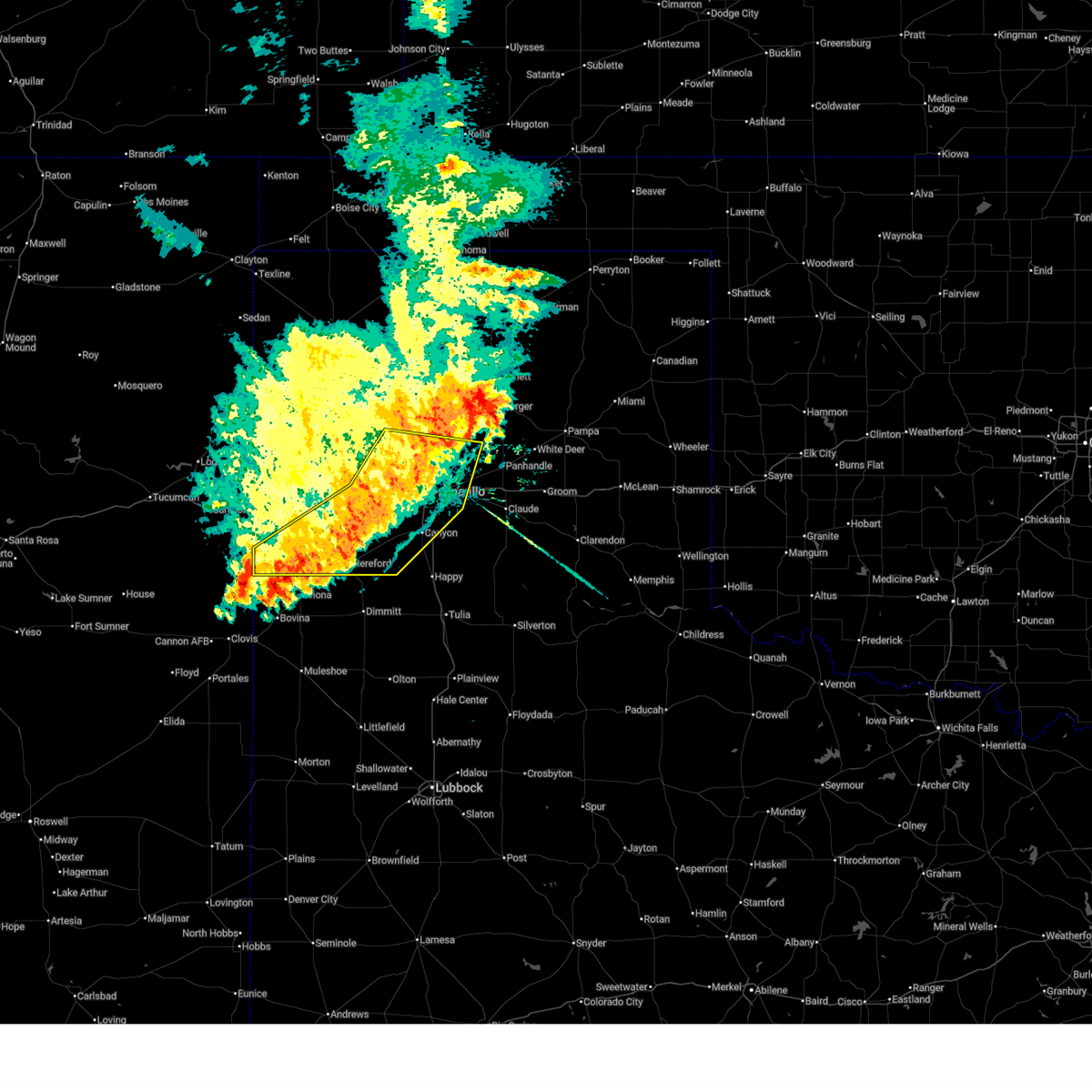
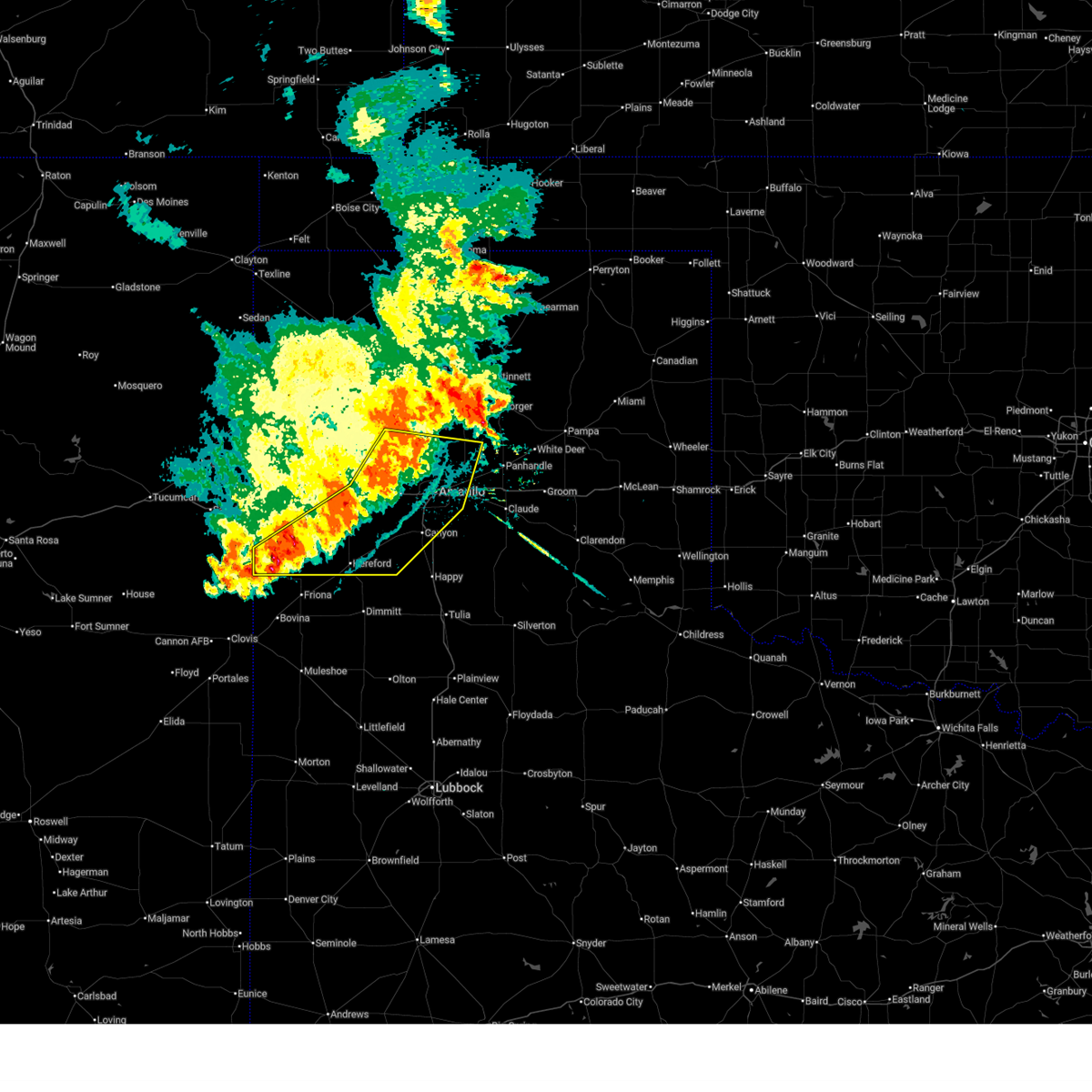
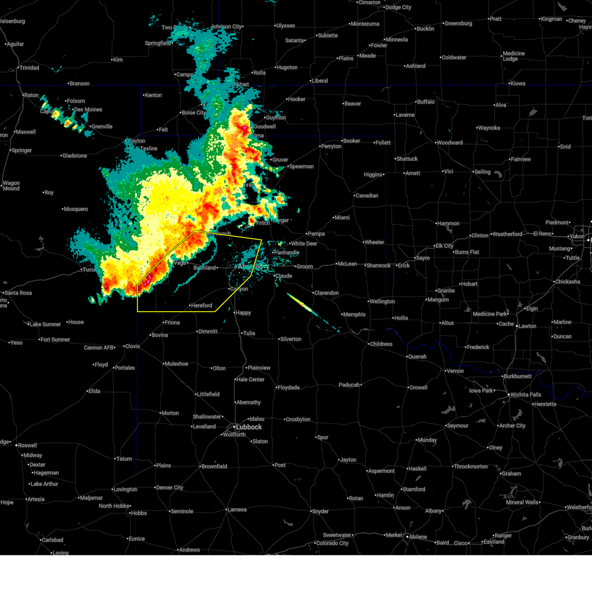
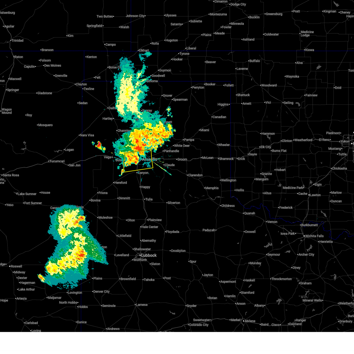
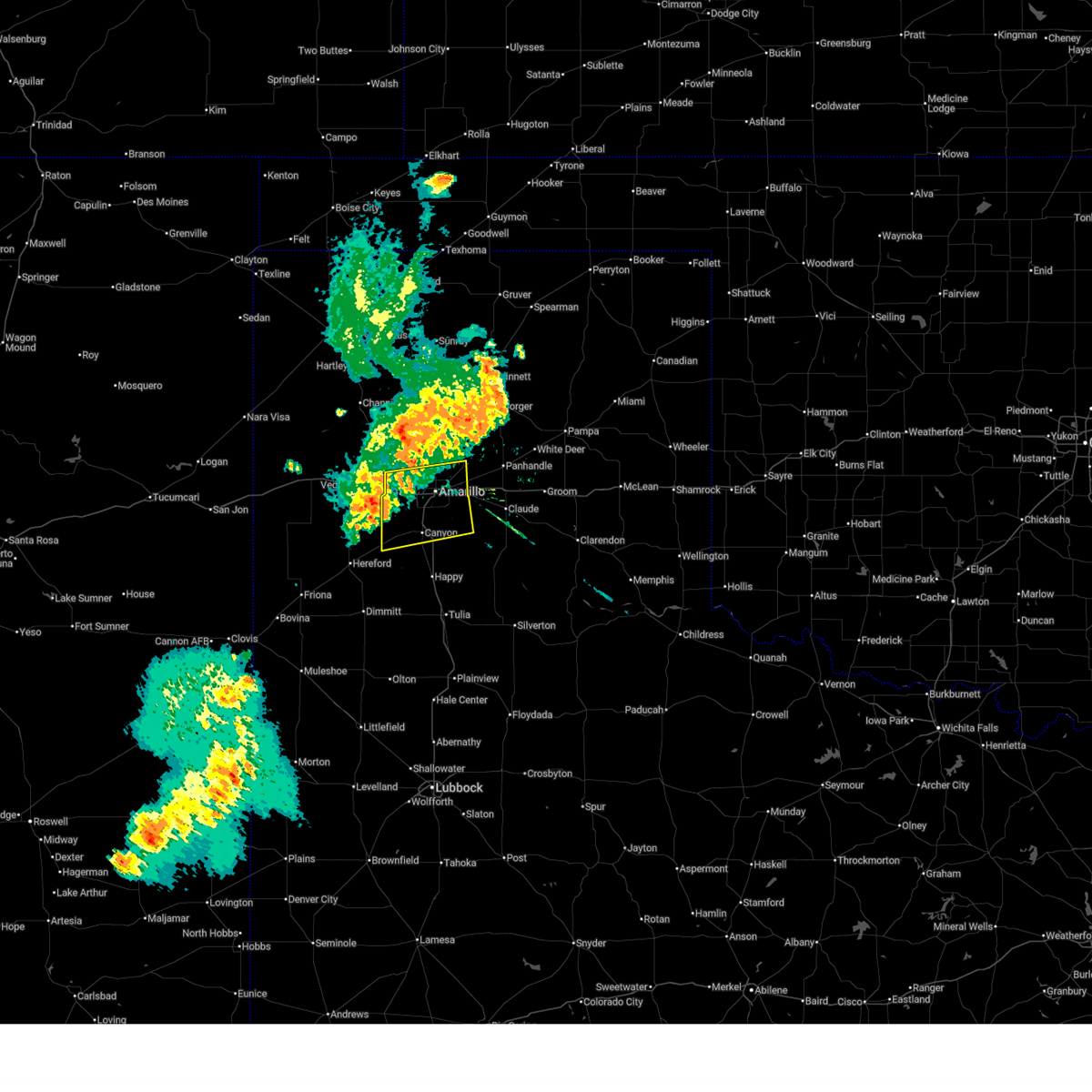
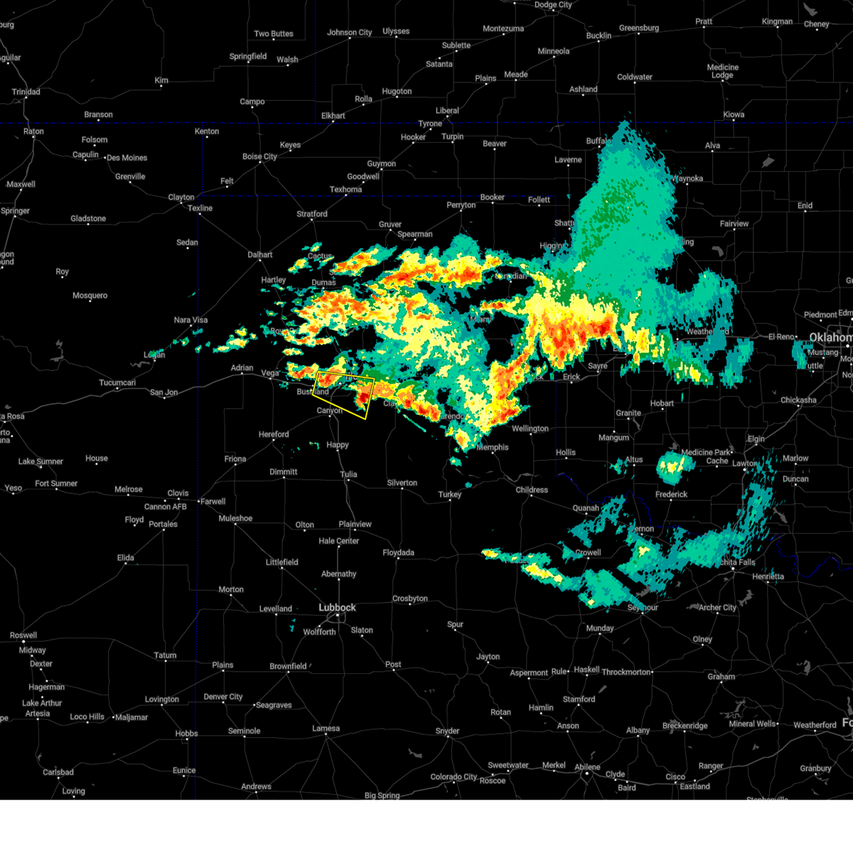
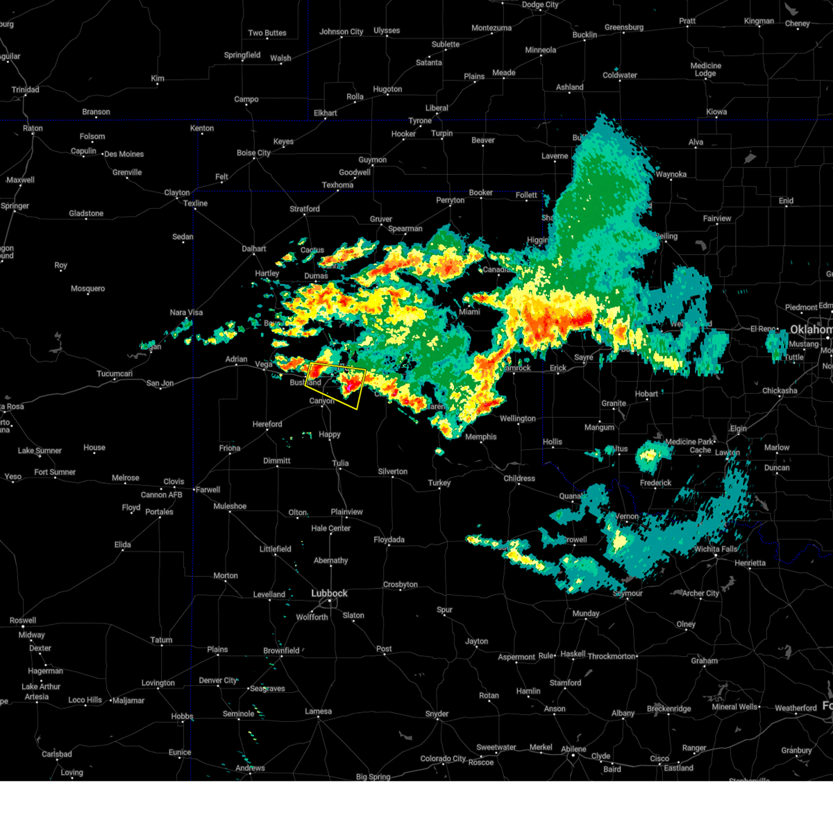
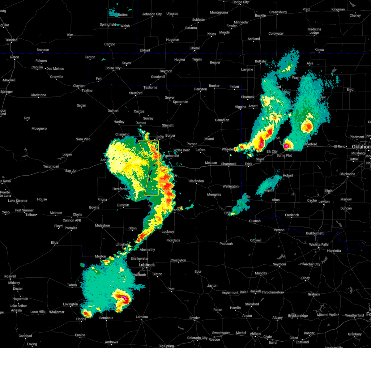
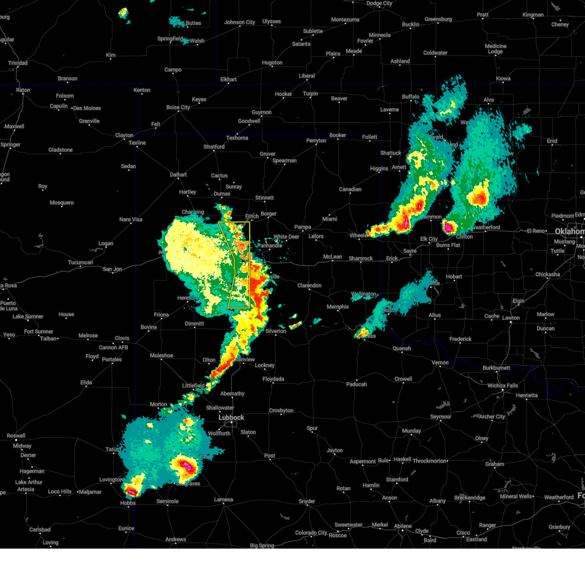
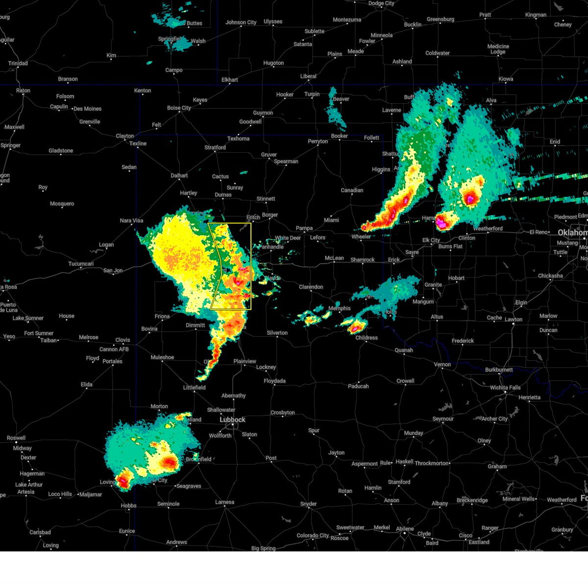
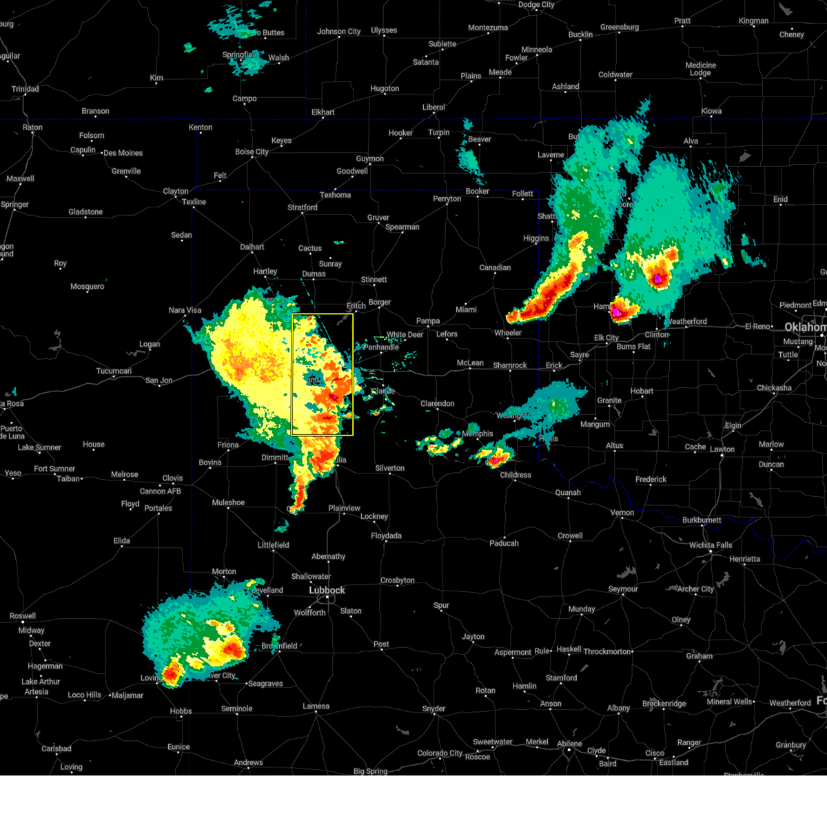
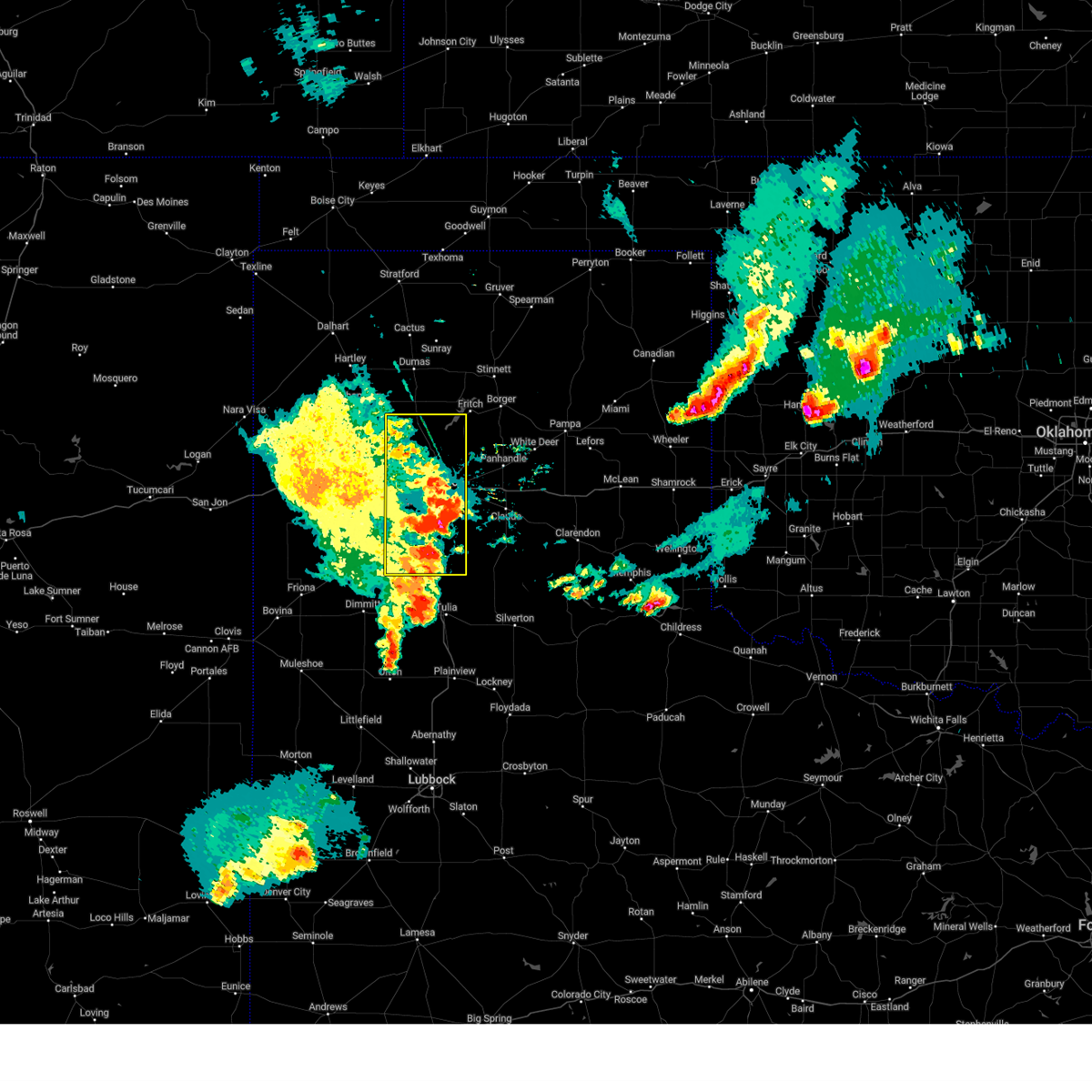
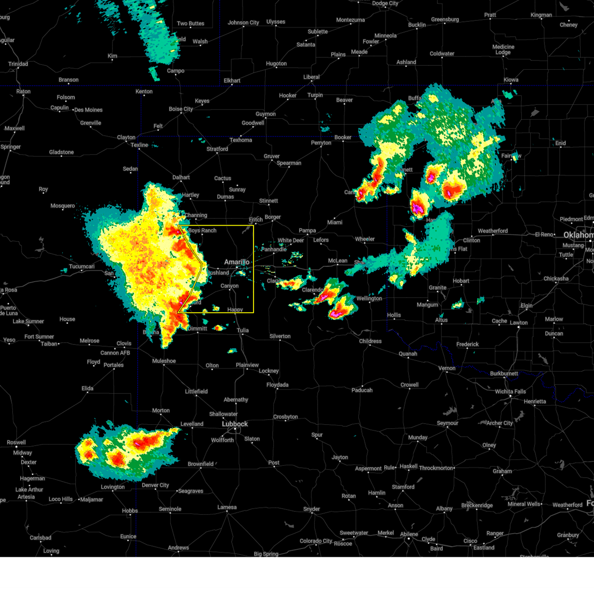
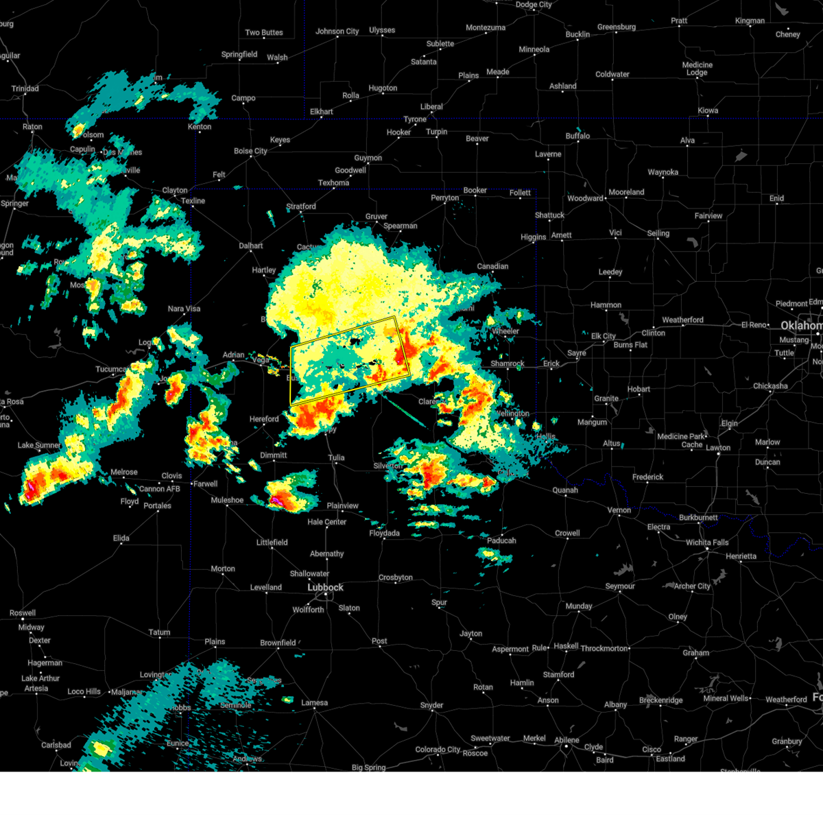
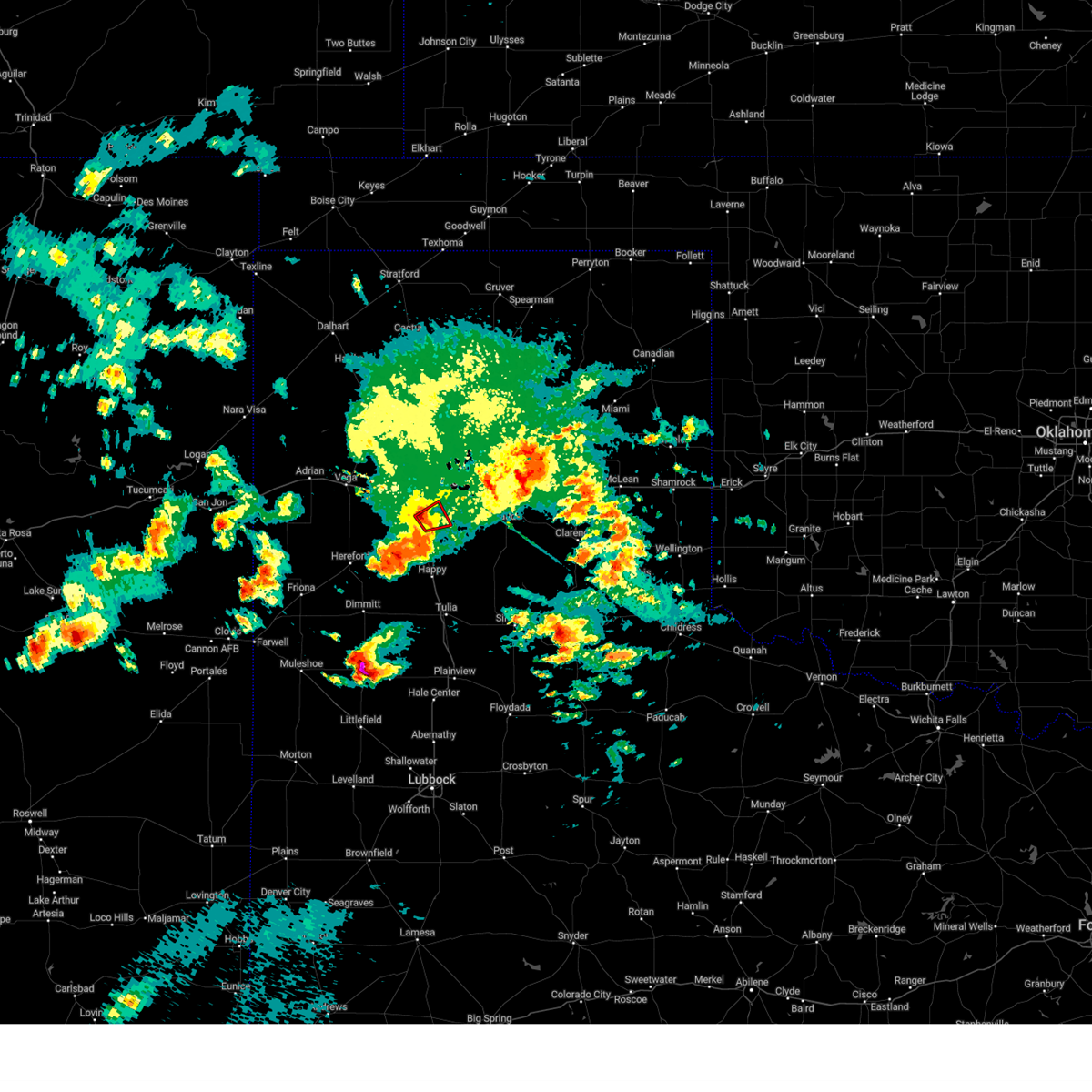
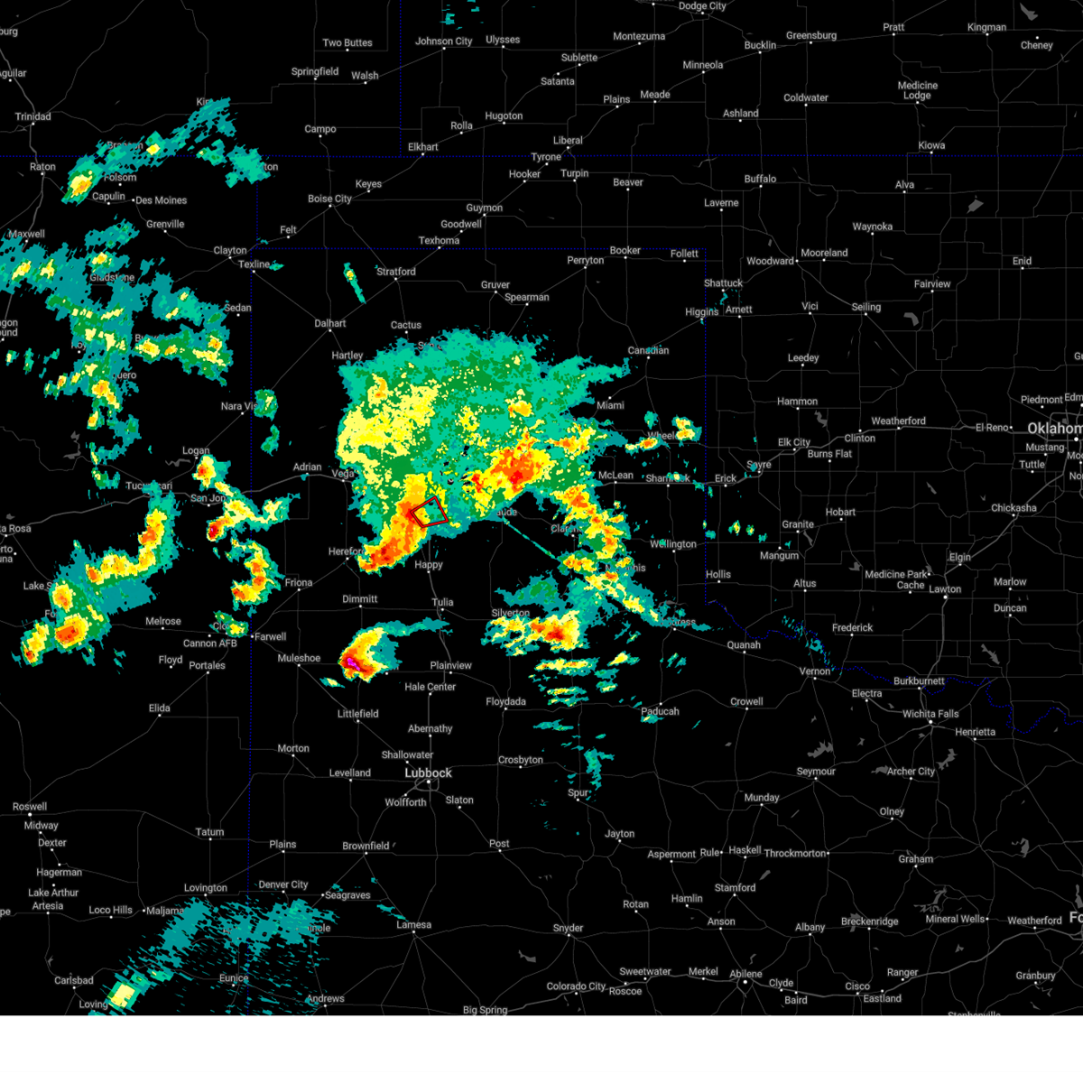
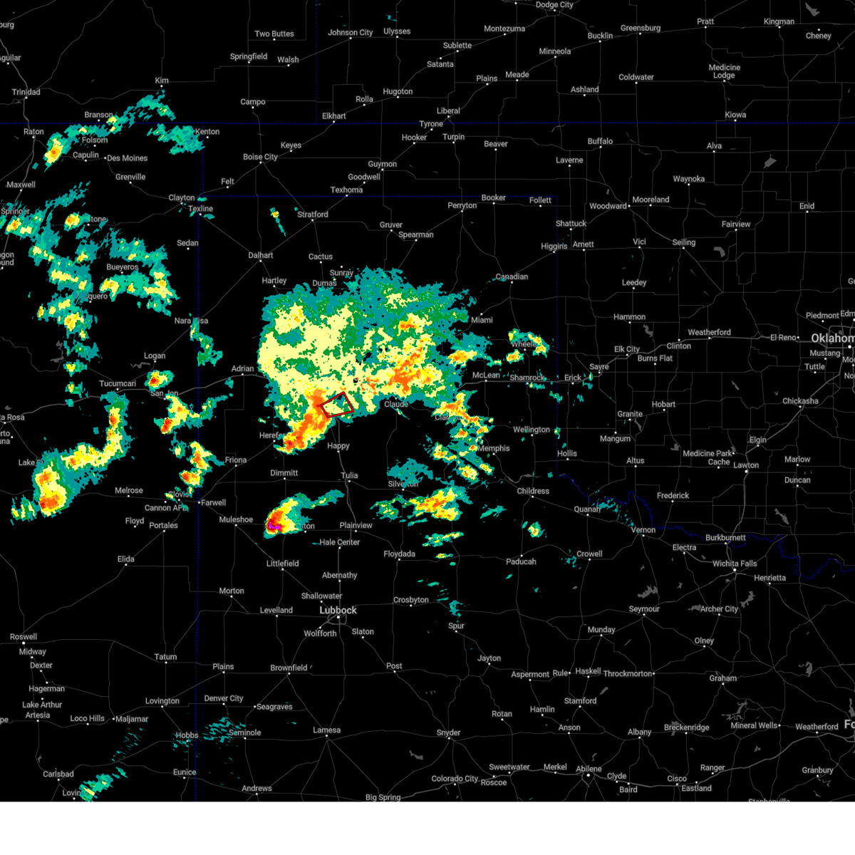
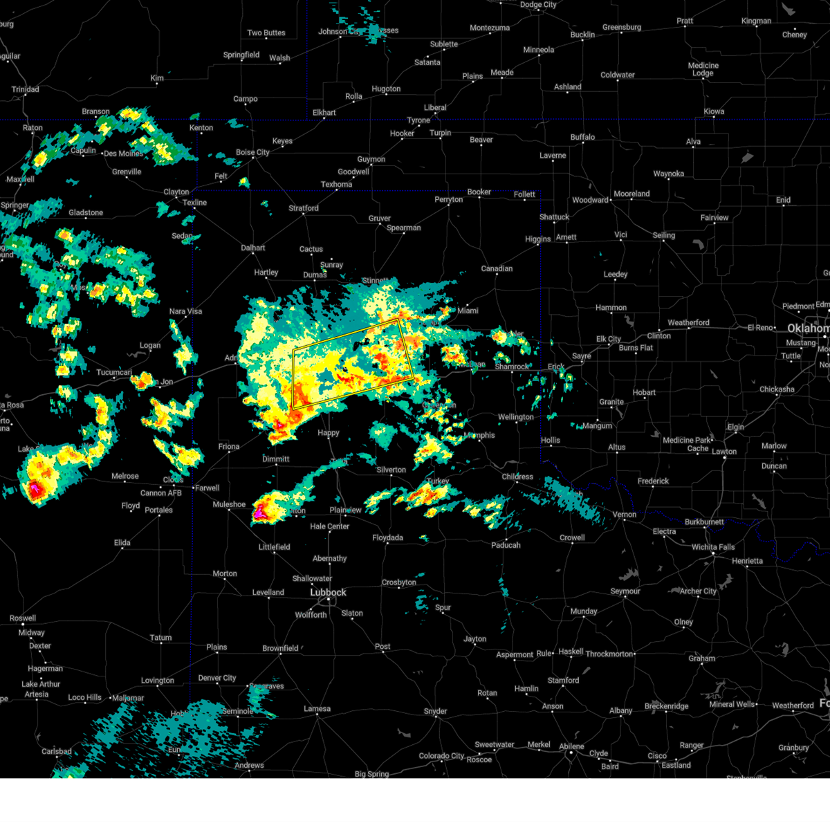
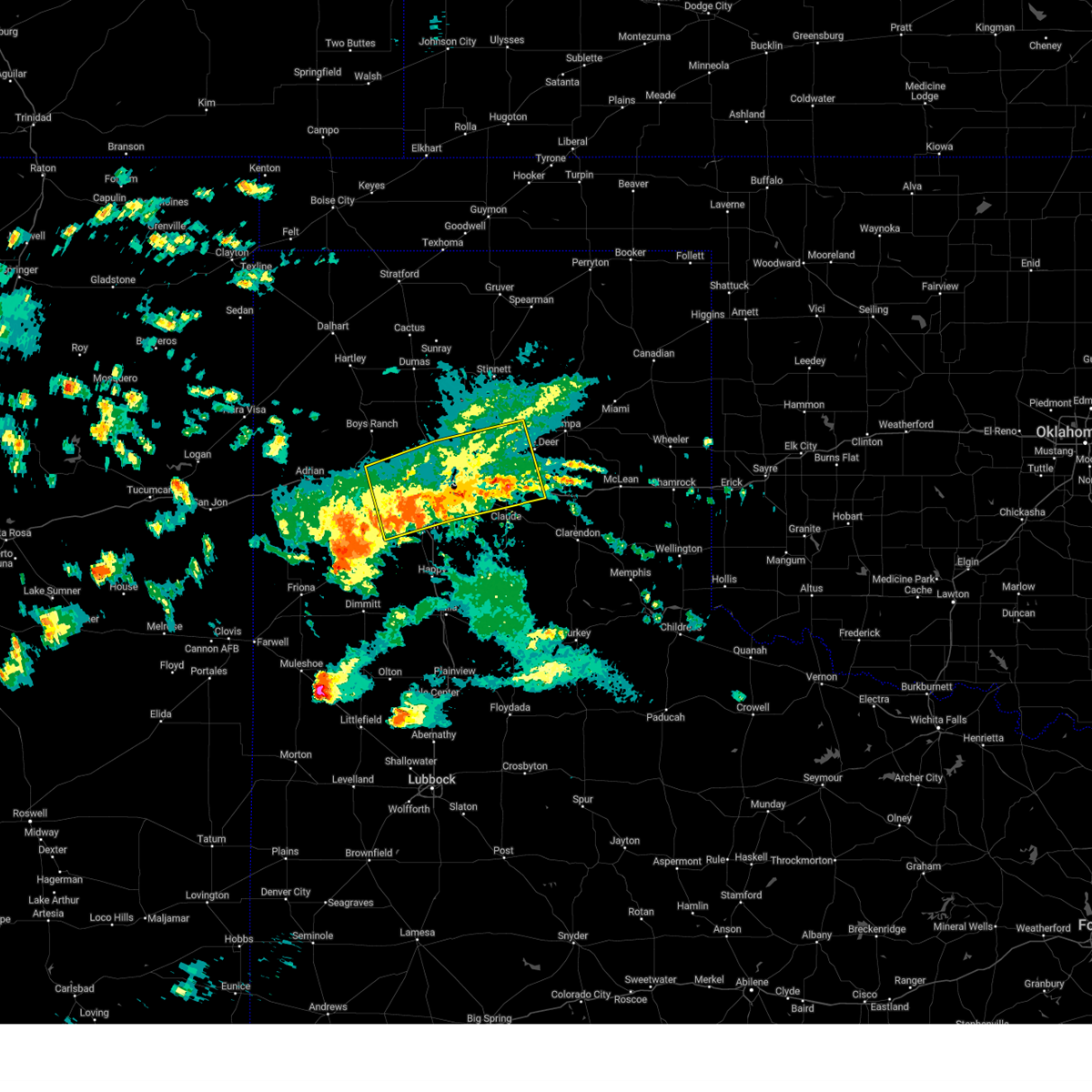
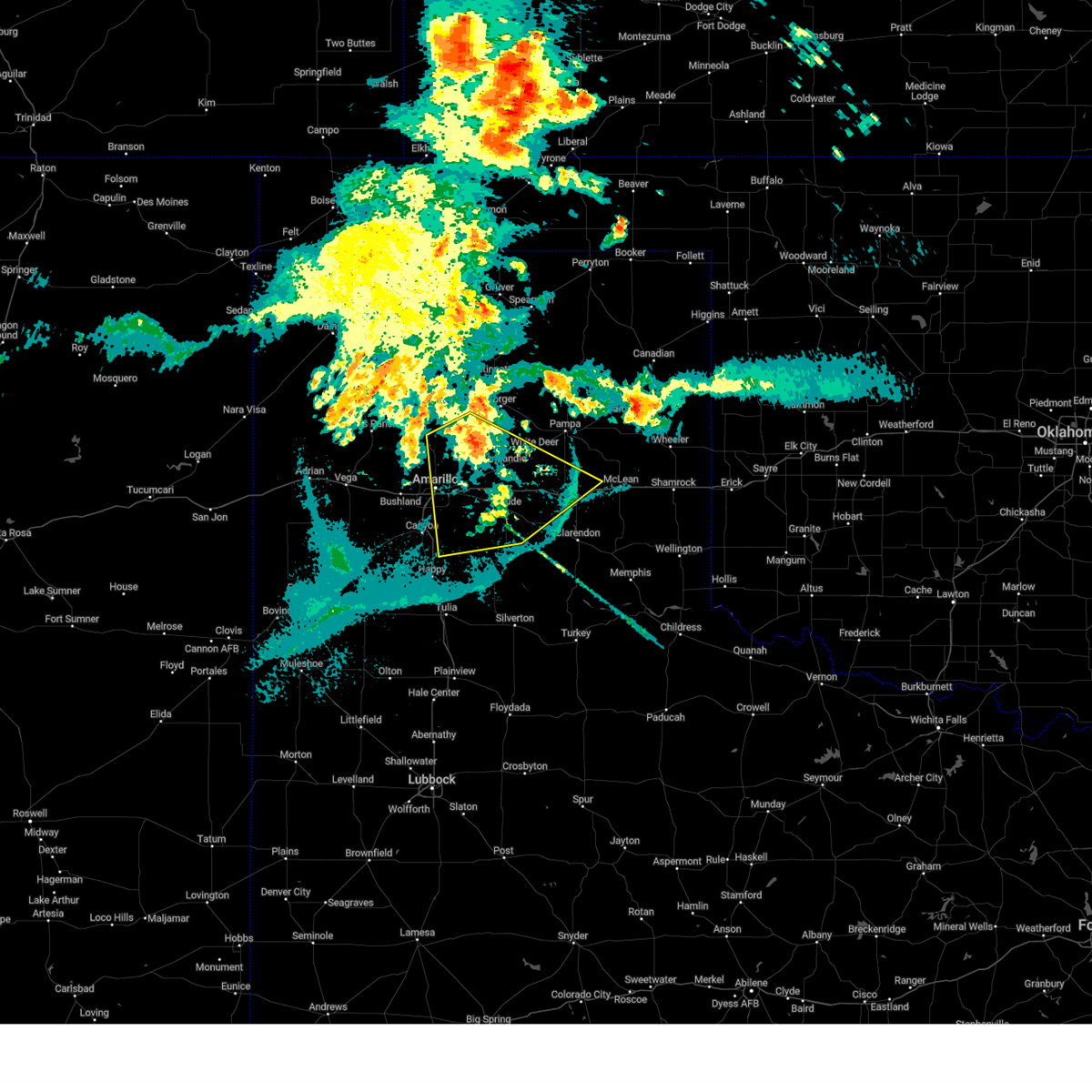
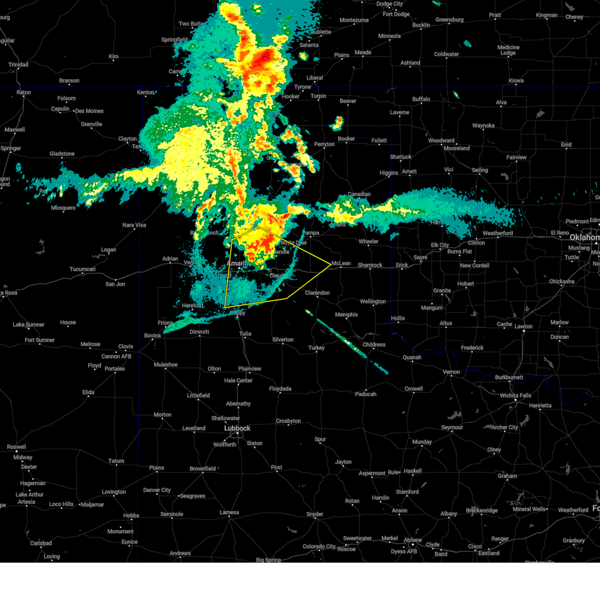
Hail Map for Palisades, TX
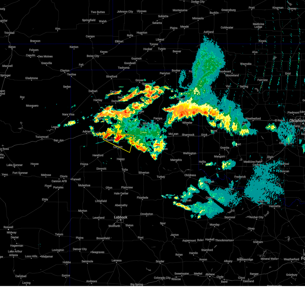
The Palisades, TX area has had 0 reports of on-the-ground hail by trained spotters, and has been under severe weather warnings 64 times during the past 12 months. Doppler radar has detected hail at or near Palisades, TX on 90 occasions, including 6 occasions during the past year.
| Name: | Palisades, TX |
| Where Located: | 10.1 miles S of Amarillo, TX |
| Map: | Google Map for Palisades, TX |
| Population: | 325 |
| Housing Units: | 165 |
| More Info: | Search Google for Palisades, TX |
0
The Top Recent Hail Date for Palisades, TX is Friday, June 5, 2026 (89th out of 90)
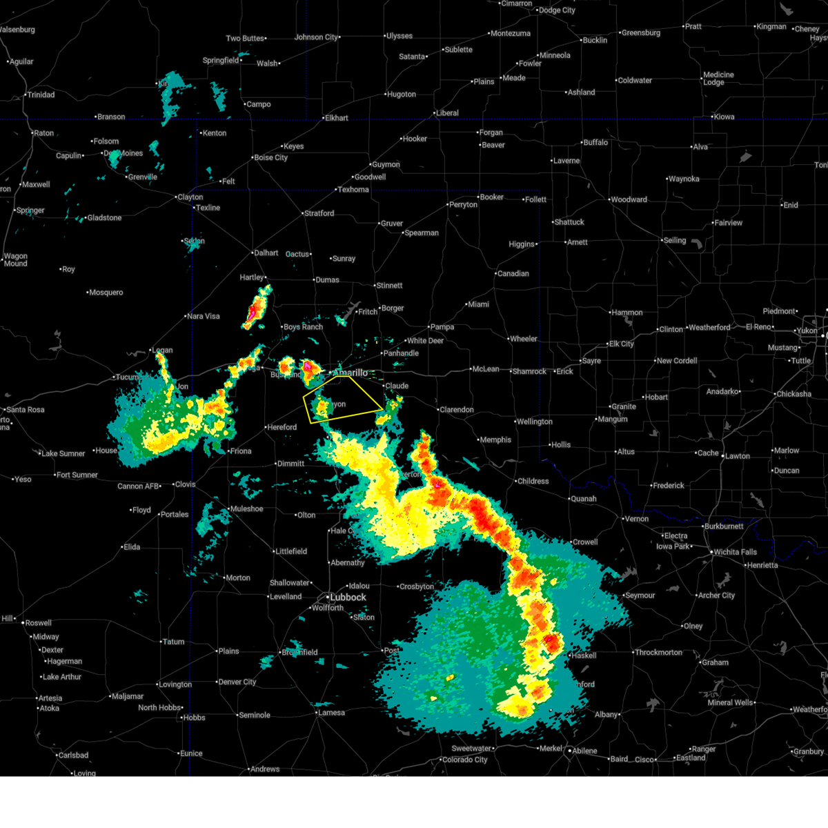
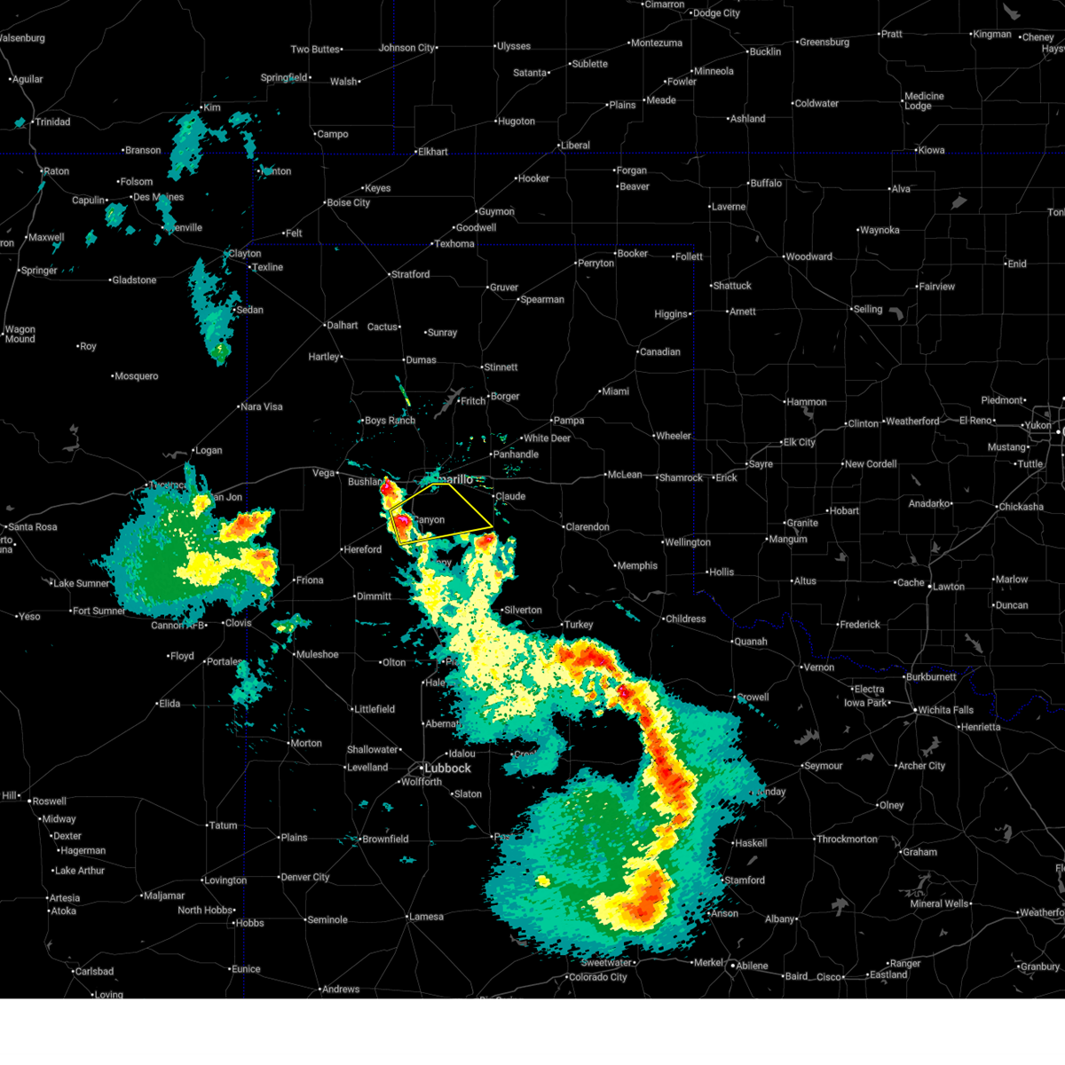
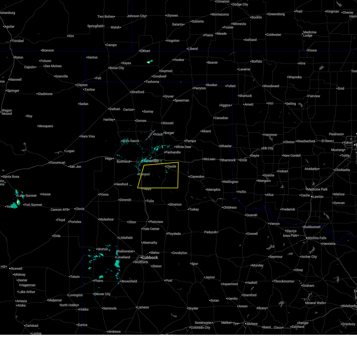
Hail and Wind Damage Spotted near Palisades, TX
| Date / Time | Report Details |
|---|---|
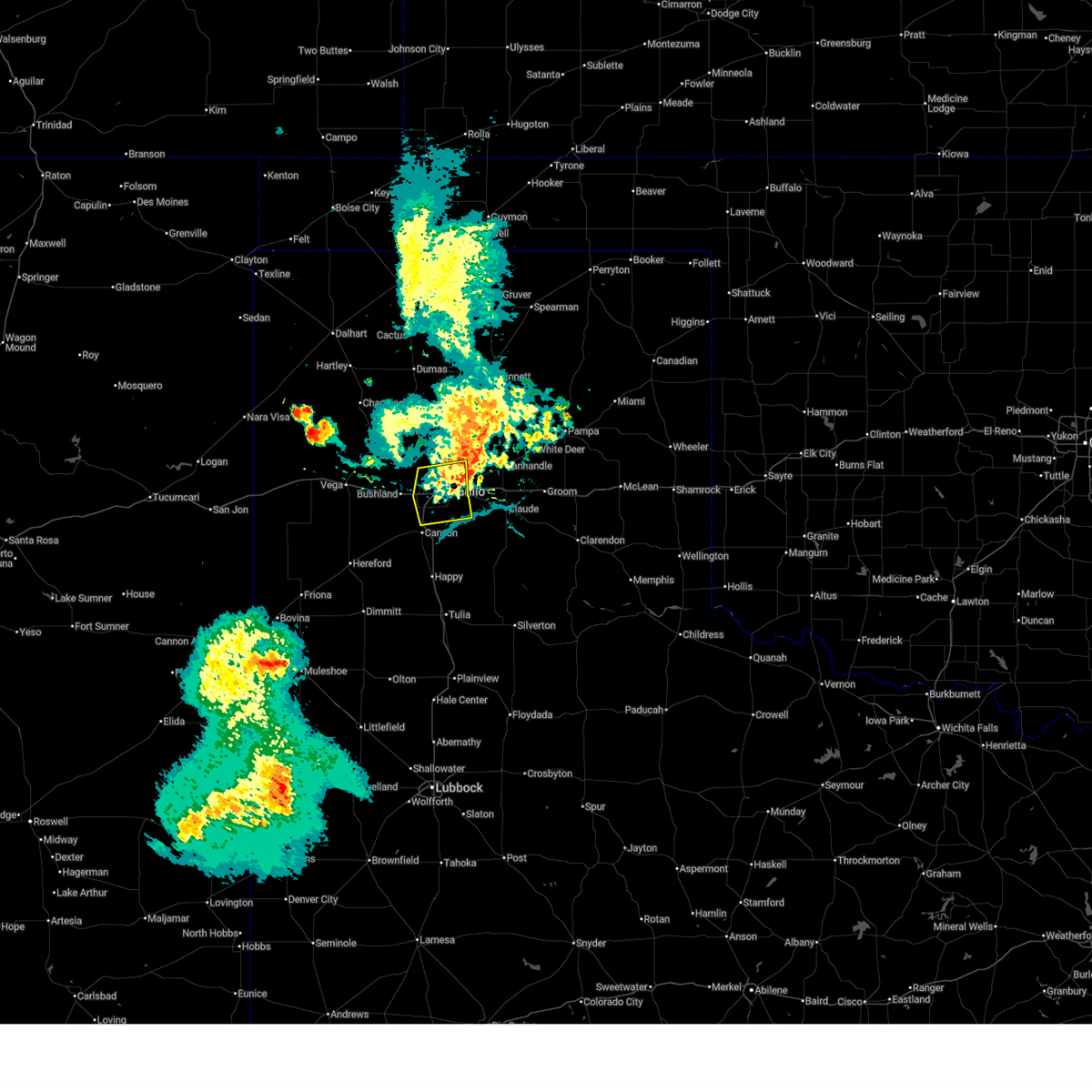
| 6/13/2026 9:45 PM CDT |
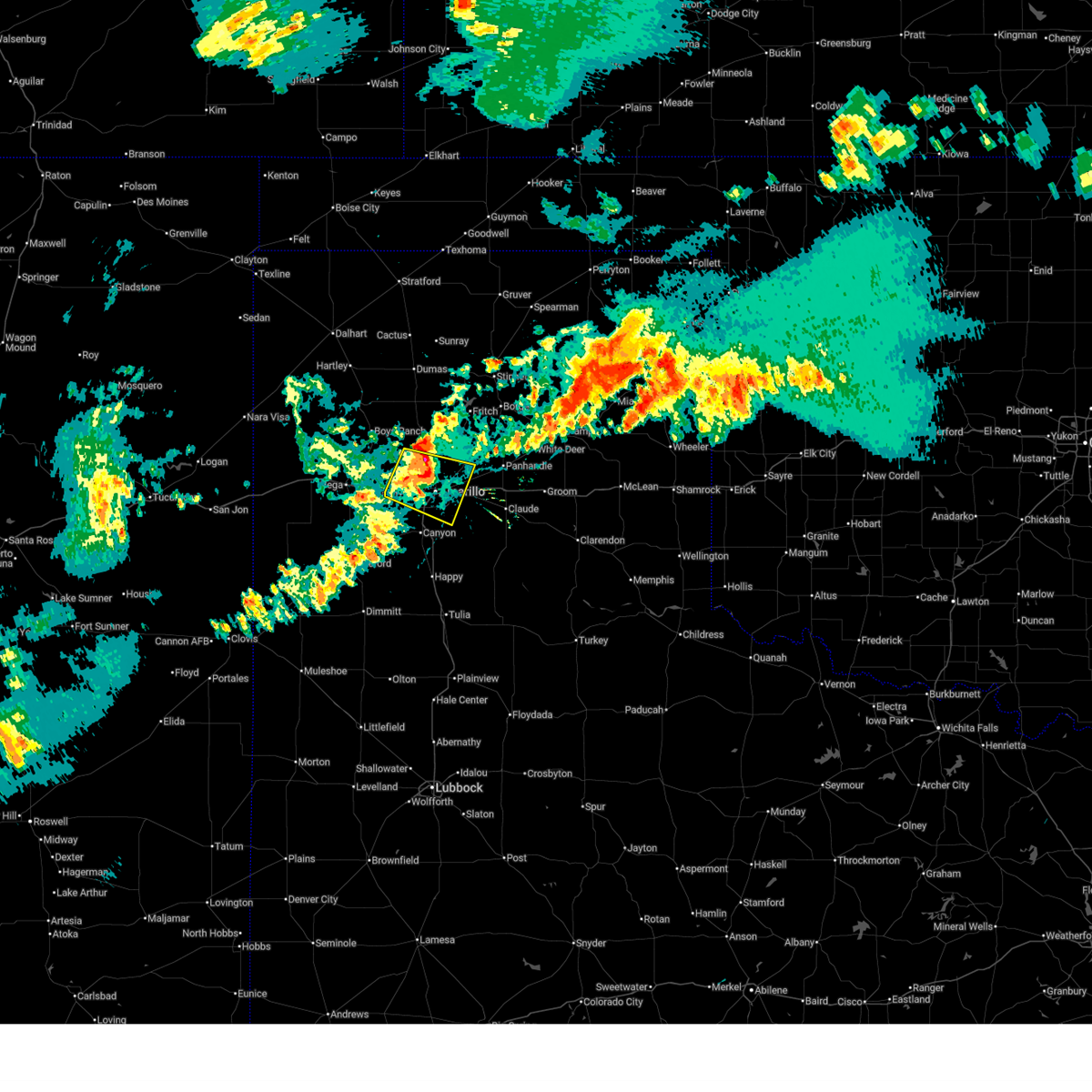 At 944 pm cdt, automated weather equipment reported severe thunderstorms were located along a line extending from 10 miles north of amarillo to 4 miles east of bushland, moving east at 25 mph. these are destructive storms for amarillo, texas (automated weather equipment). Hazards include 90 mph wind gusts and penny size hail. You are in a life-threatening situation. flying debris may be deadly to those caught without shelter. mobile homes will be heavily damaged or destroyed. homes and businesses will have substantial roof and window damage. expect extensive tree damage and power outages. Locations impacted include, amarillo, lake tanglewood, bushland, timbercreek canyon, and pantex. At 944 pm cdt, automated weather equipment reported severe thunderstorms were located along a line extending from 10 miles north of amarillo to 4 miles east of bushland, moving east at 25 mph. these are destructive storms for amarillo, texas (automated weather equipment). Hazards include 90 mph wind gusts and penny size hail. You are in a life-threatening situation. flying debris may be deadly to those caught without shelter. mobile homes will be heavily damaged or destroyed. homes and businesses will have substantial roof and window damage. expect extensive tree damage and power outages. Locations impacted include, amarillo, lake tanglewood, bushland, timbercreek canyon, and pantex.
|
| 6/13/2026 9:28 PM CDT |
 Svrama the national weather service in amarillo has issued a * severe thunderstorm warning for, northern randall county in the panhandle of texas, west central carson county in the panhandle of texas, southern potter county in the panhandle of texas, * until 1030 pm cdt. * at 927 pm cdt, severe thunderstorms were located along a line extending from 6 miles southeast of valley de oro to 3 miles northwest of bushland, moving east at 25 mph (radar indicated). Hazards include 70 mph wind gusts and penny size hail. Expect some tree damage. Damage is likely to mobile homes, roofs, and outbuildings. Svrama the national weather service in amarillo has issued a * severe thunderstorm warning for, northern randall county in the panhandle of texas, west central carson county in the panhandle of texas, southern potter county in the panhandle of texas, * until 1030 pm cdt. * at 927 pm cdt, severe thunderstorms were located along a line extending from 6 miles southeast of valley de oro to 3 miles northwest of bushland, moving east at 25 mph (radar indicated). Hazards include 70 mph wind gusts and penny size hail. Expect some tree damage. Damage is likely to mobile homes, roofs, and outbuildings.
|
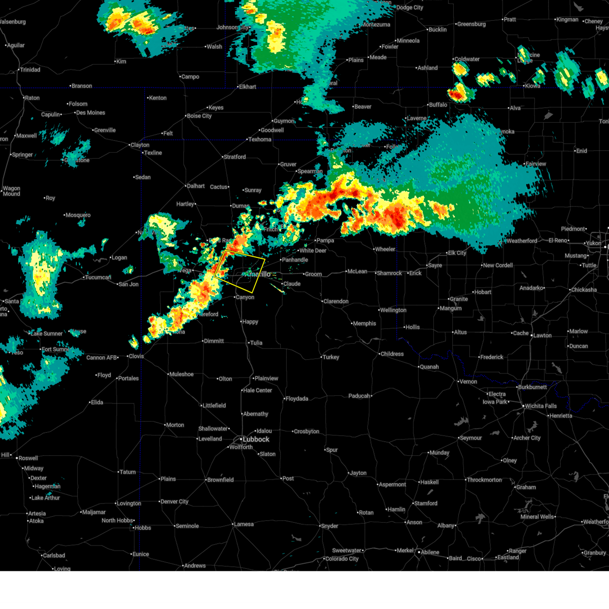
| 6/5/2026 7:59 PM CDT |
 At 759 pm cdt, a severe thunderstorm was located 7 miles southeast of amarillo, moving north at 20 mph (radar indicated). Hazards include 60 mph wind gusts. Minor damage to roofs, siding, and trees is possible. Locations impacted include, amarillo, lake tanglewood, and pantex. At 759 pm cdt, a severe thunderstorm was located 7 miles southeast of amarillo, moving north at 20 mph (radar indicated). Hazards include 60 mph wind gusts. Minor damage to roofs, siding, and trees is possible. Locations impacted include, amarillo, lake tanglewood, and pantex.
|
| 6/5/2026 7:41 PM CDT |
 Svrama the national weather service in amarillo has issued a * severe thunderstorm warning for, northwestern armstrong county in the panhandle of texas, northeastern randall county in the panhandle of texas, southwestern carson county in the panhandle of texas, southeastern potter county in the panhandle of texas, * until 830 pm cdt. * at 741 pm cdt, a severe thunderstorm was located 5 miles northeast of lake tanglewood, or 11 miles southeast of amarillo, moving north at 25 mph (radar indicated). Hazards include 60 mph wind gusts and nickel size hail. minor damage to roofs, siding, and trees is possible Svrama the national weather service in amarillo has issued a * severe thunderstorm warning for, northwestern armstrong county in the panhandle of texas, northeastern randall county in the panhandle of texas, southwestern carson county in the panhandle of texas, southeastern potter county in the panhandle of texas, * until 830 pm cdt. * at 741 pm cdt, a severe thunderstorm was located 5 miles northeast of lake tanglewood, or 11 miles southeast of amarillo, moving north at 25 mph (radar indicated). Hazards include 60 mph wind gusts and nickel size hail. minor damage to roofs, siding, and trees is possible
|
| 5/29/2026 7:07 PM CDT |
 At 707 pm cdt, a severe thunderstorm was located 7 miles southwest of washburn, or 11 miles southeast of amarillo, moving northeast at 35 mph. this is a destructive storm for portions of the amarillo area (radar indicated). Hazards include 80 mph wind gusts and quarter size hail. Flying debris will be dangerous to those caught without shelter. mobile homes will be heavily damaged. expect considerable damage to roofs, windows, and vehicles. tree damage and power outages are likely. hail damage to vehicles is expected. Locations impacted include, amarillo, claude, lake tanglewood, washburn, palo duro canyon, timbercreek canyon, and pantex. At 707 pm cdt, a severe thunderstorm was located 7 miles southwest of washburn, or 11 miles southeast of amarillo, moving northeast at 35 mph. this is a destructive storm for portions of the amarillo area (radar indicated). Hazards include 80 mph wind gusts and quarter size hail. Flying debris will be dangerous to those caught without shelter. mobile homes will be heavily damaged. expect considerable damage to roofs, windows, and vehicles. tree damage and power outages are likely. hail damage to vehicles is expected. Locations impacted include, amarillo, claude, lake tanglewood, washburn, palo duro canyon, timbercreek canyon, and pantex.
|
| 5/29/2026 7:05 PM CDT |
 The storm which prompted the warning has moved out of the area. therefore, the warning will be allowed to expire. however, gusty winds are still possible with this thunderstorm. a severe thunderstorm watch remains in effect until 1000 pm cdt for the panhandle of texas. The storm which prompted the warning has moved out of the area. therefore, the warning will be allowed to expire. however, gusty winds are still possible with this thunderstorm. a severe thunderstorm watch remains in effect until 1000 pm cdt for the panhandle of texas.
|
| 5/29/2026 6:55 PM CDT |
 Svrama the national weather service in amarillo has issued a * severe thunderstorm warning for, northwestern armstrong county in the panhandle of texas, eastern randall county in the panhandle of texas, southwestern carson county in the panhandle of texas, southeastern potter county in the panhandle of texas, * until 800 pm cdt. * at 654 pm cdt, a severe thunderstorm was located 4 miles west of palo duro canyon, or 9 miles east of canyon, moving northeast at 30 mph. this is a destructive storm for portions of the amarillo area and palo duro canyon (radar indicated). Hazards include 80 mph wind gusts and two inch hail. Flying debris will be dangerous to those caught without shelter. mobile homes will be heavily damaged. expect considerable damage to roofs, windows, and vehicles. tree damage and power outages are likely. people and animals outdoors will be injured. Expect hail damage to roofs, siding, windows, and vehicles. Svrama the national weather service in amarillo has issued a * severe thunderstorm warning for, northwestern armstrong county in the panhandle of texas, eastern randall county in the panhandle of texas, southwestern carson county in the panhandle of texas, southeastern potter county in the panhandle of texas, * until 800 pm cdt. * at 654 pm cdt, a severe thunderstorm was located 4 miles west of palo duro canyon, or 9 miles east of canyon, moving northeast at 30 mph. this is a destructive storm for portions of the amarillo area and palo duro canyon (radar indicated). Hazards include 80 mph wind gusts and two inch hail. Flying debris will be dangerous to those caught without shelter. mobile homes will be heavily damaged. expect considerable damage to roofs, windows, and vehicles. tree damage and power outages are likely. people and animals outdoors will be injured. Expect hail damage to roofs, siding, windows, and vehicles.
|
| 5/29/2026 6:44 PM CDT |
 At 643 pm cdt, a severe thunderstorm was located 7 miles north of happy, or 9 miles south of canyon, moving north at 30 mph (radar indicated). Hazards include two inch hail and 70 mph wind gusts. Expect some tree damage. damage is likely to mobile homes, roofs, and outbuildings. people and animals outdoors will be injured. expect hail damage to roofs, siding, windows, and vehicles. Locations impacted include, canyon and timbercreek canyon. At 643 pm cdt, a severe thunderstorm was located 7 miles north of happy, or 9 miles south of canyon, moving north at 30 mph (radar indicated). Hazards include two inch hail and 70 mph wind gusts. Expect some tree damage. damage is likely to mobile homes, roofs, and outbuildings. people and animals outdoors will be injured. expect hail damage to roofs, siding, windows, and vehicles. Locations impacted include, canyon and timbercreek canyon.
|
| 5/29/2026 6:35 PM CDT |
 At 634 pm cdt, a severe thunderstorm was located near happy, or 14 miles south of canyon, moving north at 35 mph (radar indicated). Hazards include two inch hail and 60 mph wind gusts. Minor damage to roofs, siding, and trees is possible. people and animals outdoors will be injured. expect hail damage to roofs, siding, windows, and vehicles. Locations impacted include, canyon and timbercreek canyon. At 634 pm cdt, a severe thunderstorm was located near happy, or 14 miles south of canyon, moving north at 35 mph (radar indicated). Hazards include two inch hail and 60 mph wind gusts. Minor damage to roofs, siding, and trees is possible. people and animals outdoors will be injured. expect hail damage to roofs, siding, windows, and vehicles. Locations impacted include, canyon and timbercreek canyon.
|
| 5/29/2026 6:35 PM CDT |
 the severe thunderstorm warning has been cancelled and is no longer in effect the severe thunderstorm warning has been cancelled and is no longer in effect
|
| 5/29/2026 6:25 PM CDT |
 At 625 pm cdt, a severe thunderstorm was located 8 miles south of buffalo lake, or 12 miles east of hereford, moving east at 20 mph (radar indicated). Hazards include 60 mph wind gusts and quarter size hail. Minor damage to roofs, siding, and trees is possible. hail damage to vehicles is expected. Locations impacted include, canyon, buffalo lake, and timbercreek canyon. At 625 pm cdt, a severe thunderstorm was located 8 miles south of buffalo lake, or 12 miles east of hereford, moving east at 20 mph (radar indicated). Hazards include 60 mph wind gusts and quarter size hail. Minor damage to roofs, siding, and trees is possible. hail damage to vehicles is expected. Locations impacted include, canyon, buffalo lake, and timbercreek canyon.
|
| 5/29/2026 6:15 PM CDT |
 Svrama the national weather service in amarillo has issued a * severe thunderstorm warning for, southern randall county in the panhandle of texas, southeastern deaf smith county in the panhandle of texas, * until 715 pm cdt. * at 615 pm cdt, a severe thunderstorm was located 9 miles southeast of hereford, moving northeast at 20 mph (radar indicated). Hazards include quarter size hail. damage to vehicles is expected Svrama the national weather service in amarillo has issued a * severe thunderstorm warning for, southern randall county in the panhandle of texas, southeastern deaf smith county in the panhandle of texas, * until 715 pm cdt. * at 615 pm cdt, a severe thunderstorm was located 9 miles southeast of hereford, moving northeast at 20 mph (radar indicated). Hazards include quarter size hail. damage to vehicles is expected
|
| 5/23/2026 9:33 PM CDT |
 At 932 pm cdt, severe thunderstorms were located along a line extending from 3 miles south of canyon to 11 miles east of easter to 3 miles southeast of black, moving southeast at 30 mph (radar indicated). Hazards include 60 mph wind gusts and quarter size hail. Minor damage to roofs, siding, and trees is possible. hail damage to vehicles is expected. Locations impacted include, hereford, canyon, buffalo lake, dawn, wayside, umbarger, palo duro canyon, mescalero park, and timbercreek canyon. At 932 pm cdt, severe thunderstorms were located along a line extending from 3 miles south of canyon to 11 miles east of easter to 3 miles southeast of black, moving southeast at 30 mph (radar indicated). Hazards include 60 mph wind gusts and quarter size hail. Minor damage to roofs, siding, and trees is possible. hail damage to vehicles is expected. Locations impacted include, hereford, canyon, buffalo lake, dawn, wayside, umbarger, palo duro canyon, mescalero park, and timbercreek canyon.
|
| 5/23/2026 9:09 PM CDT |
 Svrama the national weather service in amarillo has issued a * severe thunderstorm warning for, southwestern armstrong county in the panhandle of texas, randall county in the panhandle of texas, southeastern deaf smith county in the panhandle of texas, * until 1015 pm cdt. * at 909 pm cdt, a severe thunderstorm was located 5 miles northeast of hereford, moving southeast at 25 mph (radar indicated). Hazards include ping pong ball size hail and 60 mph wind gusts. Minor damage to roofs, siding, and trees is possible. people and animals outdoors will be injured. Expect hail damage to roofs, siding, windows, and vehicles. Svrama the national weather service in amarillo has issued a * severe thunderstorm warning for, southwestern armstrong county in the panhandle of texas, randall county in the panhandle of texas, southeastern deaf smith county in the panhandle of texas, * until 1015 pm cdt. * at 909 pm cdt, a severe thunderstorm was located 5 miles northeast of hereford, moving southeast at 25 mph (radar indicated). Hazards include ping pong ball size hail and 60 mph wind gusts. Minor damage to roofs, siding, and trees is possible. people and animals outdoors will be injured. Expect hail damage to roofs, siding, windows, and vehicles.
|
| 5/23/2026 8:45 PM CDT |
 At 845 pm cdt, severe thunderstorms were located along a line extending from 13 miles northeast of skellytown to 7 miles southeast of white deer to 3 miles northeast of lake tanglewood, moving east at 35 mph (radar indicated). Hazards include 70 mph wind gusts and nickel size hail. Expect some tree damage. damage is likely to mobile homes, roofs, and outbuildings. Locations impacted include, amarillo, pampa, panhandle, claude, white deer, lake tanglewood, groom, lefors, skellytown, howardwick, bushland, lake mcclellan, washburn, goodnight, kingsmill, greenbelt lake, mescalero park, timbercreek canyon, and pantex. At 845 pm cdt, severe thunderstorms were located along a line extending from 13 miles northeast of skellytown to 7 miles southeast of white deer to 3 miles northeast of lake tanglewood, moving east at 35 mph (radar indicated). Hazards include 70 mph wind gusts and nickel size hail. Expect some tree damage. damage is likely to mobile homes, roofs, and outbuildings. Locations impacted include, amarillo, pampa, panhandle, claude, white deer, lake tanglewood, groom, lefors, skellytown, howardwick, bushland, lake mcclellan, washburn, goodnight, kingsmill, greenbelt lake, mescalero park, timbercreek canyon, and pantex.
|
| 5/23/2026 8:43 PM CDT |
 At 843 pm cdt, severe thunderstorms were located along a line extending from near mescalero park to 8 miles north of hereford to 8 miles west of bootleg, moving southeast at 30 mph (radar indicated). Hazards include 60 mph wind gusts and quarter size hail. Minor damage to roofs, siding, and trees is possible. hail damage to vehicles is expected. Locations impacted include, amarillo, hereford, canyon, lake tanglewood, bushland, buffalo lake, wayside, bootleg, umbarger, palo duro canyon, mescalero park, dawn, simms, and timbercreek canyon. At 843 pm cdt, severe thunderstorms were located along a line extending from near mescalero park to 8 miles north of hereford to 8 miles west of bootleg, moving southeast at 30 mph (radar indicated). Hazards include 60 mph wind gusts and quarter size hail. Minor damage to roofs, siding, and trees is possible. hail damage to vehicles is expected. Locations impacted include, amarillo, hereford, canyon, lake tanglewood, bushland, buffalo lake, wayside, bootleg, umbarger, palo duro canyon, mescalero park, dawn, simms, and timbercreek canyon.
|
| 5/23/2026 8:14 PM CDT |
 Svrama the national weather service in amarillo has issued a * severe thunderstorm warning for, southwestern armstrong county in the panhandle of texas, randall county in the panhandle of texas, southeastern oldham county in the panhandle of texas, deaf smith county in the panhandle of texas, southwestern potter county in the panhandle of texas, * until 915 pm cdt. * at 813 pm cdt, severe thunderstorms were located along a line extending from 6 miles northeast of wildorado to 6 miles north of bellview, moving southeast at 25 mph (radar indicated). Hazards include 70 mph wind gusts and quarter size hail. Expect some tree damage. damage is likely to mobile homes, roofs, and outbuildings. Hail damage to vehicles is expected. Svrama the national weather service in amarillo has issued a * severe thunderstorm warning for, southwestern armstrong county in the panhandle of texas, randall county in the panhandle of texas, southeastern oldham county in the panhandle of texas, deaf smith county in the panhandle of texas, southwestern potter county in the panhandle of texas, * until 915 pm cdt. * at 813 pm cdt, severe thunderstorms were located along a line extending from 6 miles northeast of wildorado to 6 miles north of bellview, moving southeast at 25 mph (radar indicated). Hazards include 70 mph wind gusts and quarter size hail. Expect some tree damage. damage is likely to mobile homes, roofs, and outbuildings. Hail damage to vehicles is expected.
|
| 5/23/2026 8:11 PM CDT |
 Svrama the national weather service in amarillo has issued a * severe thunderstorm warning for, armstrong county in the panhandle of texas, northeastern randall county in the panhandle of texas, carson county in the panhandle of texas, southern hutchinson county in the panhandle of texas, gray county in the panhandle of texas, potter county in the panhandle of texas, southwestern roberts county in the panhandle of texas, northwestern donley county in the panhandle of texas, * until 915 pm cdt. * at 811 pm cdt, severe thunderstorms were located along a line extending from 7 miles southeast of stinnett to 3 miles north of panhandle to 5 miles southeast of amarillo, moving southeast at 35 mph (radar indicated). Hazards include 70 mph wind gusts and quarter size hail. Expect some tree damage. damage is likely to mobile homes, roofs, and outbuildings. Hail damage to vehicles is expected. Svrama the national weather service in amarillo has issued a * severe thunderstorm warning for, armstrong county in the panhandle of texas, northeastern randall county in the panhandle of texas, carson county in the panhandle of texas, southern hutchinson county in the panhandle of texas, gray county in the panhandle of texas, potter county in the panhandle of texas, southwestern roberts county in the panhandle of texas, northwestern donley county in the panhandle of texas, * until 915 pm cdt. * at 811 pm cdt, severe thunderstorms were located along a line extending from 7 miles southeast of stinnett to 3 miles north of panhandle to 5 miles southeast of amarillo, moving southeast at 35 mph (radar indicated). Hazards include 70 mph wind gusts and quarter size hail. Expect some tree damage. damage is likely to mobile homes, roofs, and outbuildings. Hail damage to vehicles is expected.
|
| 5/23/2026 8:02 PM CDT |
 At 802 pm cdt, severe thunderstorms were located along a line extending from 11 miles east of stinnett to 9 miles northeast of amarillo to 5 miles northwest of simms, moving southeast at 30 mph (radar indicated). Hazards include 70 mph wind gusts and quarter size hail. Expect some tree damage. damage is likely to mobile homes, roofs, and outbuildings. hail damage to vehicles is expected. Locations impacted include, amarillo, canyon, borger, panhandle, vega, fritch, stinnett, lake tanglewood, skellytown, sanford, bushland, valley de oro, washburn, umbarger, wildorado, mescalero park, lake meredith, timbercreek canyon, and pantex. At 802 pm cdt, severe thunderstorms were located along a line extending from 11 miles east of stinnett to 9 miles northeast of amarillo to 5 miles northwest of simms, moving southeast at 30 mph (radar indicated). Hazards include 70 mph wind gusts and quarter size hail. Expect some tree damage. damage is likely to mobile homes, roofs, and outbuildings. hail damage to vehicles is expected. Locations impacted include, amarillo, canyon, borger, panhandle, vega, fritch, stinnett, lake tanglewood, skellytown, sanford, bushland, valley de oro, washburn, umbarger, wildorado, mescalero park, lake meredith, timbercreek canyon, and pantex.
|
| 5/23/2026 7:22 PM CDT |
 Svrama the national weather service in amarillo has issued a * severe thunderstorm warning for, northwestern armstrong county in the panhandle of texas, northern randall county in the panhandle of texas, southeastern oldham county in the panhandle of texas, carson county in the panhandle of texas, southern hutchinson county in the panhandle of texas, northern deaf smith county in the panhandle of texas, potter county in the panhandle of texas, southeastern moore county in the panhandle of texas, * until 815 pm cdt. * at 722 pm cdt, severe thunderstorms were located along a line extending from 11 miles southeast of sunray to 9 miles east of valley de oro to 6 miles south of adrian, moving east at 40 mph (radar indicated). Hazards include 70 mph wind gusts and ping pong ball size hail. Expect some tree damage. damage is likely to mobile homes, roofs, and outbuildings. people and animals outdoors will be injured. Expect hail damage to roofs, siding, windows, and vehicles. Svrama the national weather service in amarillo has issued a * severe thunderstorm warning for, northwestern armstrong county in the panhandle of texas, northern randall county in the panhandle of texas, southeastern oldham county in the panhandle of texas, carson county in the panhandle of texas, southern hutchinson county in the panhandle of texas, northern deaf smith county in the panhandle of texas, potter county in the panhandle of texas, southeastern moore county in the panhandle of texas, * until 815 pm cdt. * at 722 pm cdt, severe thunderstorms were located along a line extending from 11 miles southeast of sunray to 9 miles east of valley de oro to 6 miles south of adrian, moving east at 40 mph (radar indicated). Hazards include 70 mph wind gusts and ping pong ball size hail. Expect some tree damage. damage is likely to mobile homes, roofs, and outbuildings. people and animals outdoors will be injured. Expect hail damage to roofs, siding, windows, and vehicles.
|
| 5/22/2026 8:28 PM CDT |
 the severe thunderstorm warning has been cancelled and is no longer in effect the severe thunderstorm warning has been cancelled and is no longer in effect
|
| 5/22/2026 8:05 PM CDT |
 Svrama the national weather service in amarillo has issued a * severe thunderstorm warning for, west central armstrong county in the panhandle of texas, central randall county in the panhandle of texas, * until 900 pm cdt. * at 804 pm cdt, a severe thunderstorm was located over canyon, moving east at 25 mph (radar indicated). Hazards include 60 mph wind gusts and quarter size hail. Minor damage to roofs, siding, and trees is possible. Hail damage to vehicles is expected. Svrama the national weather service in amarillo has issued a * severe thunderstorm warning for, west central armstrong county in the panhandle of texas, central randall county in the panhandle of texas, * until 900 pm cdt. * at 804 pm cdt, a severe thunderstorm was located over canyon, moving east at 25 mph (radar indicated). Hazards include 60 mph wind gusts and quarter size hail. Minor damage to roofs, siding, and trees is possible. Hail damage to vehicles is expected.
|
| 5/14/2026 4:40 PM CDT |
 Svrama the national weather service in amarillo has issued a * severe thunderstorm warning for, armstrong county in the panhandle of texas, eastern randall county in the panhandle of texas, * until 545 pm cdt. * at 440 pm cdt, severe thunderstorms were located along a line extending from lake tanglewood to near happy, moving east at 30 mph (radar indicated). Hazards include 60 mph wind gusts. minor damage to roofs, siding, and trees is possible Svrama the national weather service in amarillo has issued a * severe thunderstorm warning for, armstrong county in the panhandle of texas, eastern randall county in the panhandle of texas, * until 545 pm cdt. * at 440 pm cdt, severe thunderstorms were located along a line extending from lake tanglewood to near happy, moving east at 30 mph (radar indicated). Hazards include 60 mph wind gusts. minor damage to roofs, siding, and trees is possible
|
| 5/14/2026 4:33 PM CDT |
 At 433 pm cdt, a severe thunderstorm was located over lake tanglewood, or 6 miles northeast of canyon, moving northeast at 30 mph (radar indicated). Hazards include 60 mph wind gusts. Minor damage to roofs, siding, and trees is possible. Locations impacted include, amarillo, canyon, lake tanglewood, mescalero park, and timbercreek canyon. At 433 pm cdt, a severe thunderstorm was located over lake tanglewood, or 6 miles northeast of canyon, moving northeast at 30 mph (radar indicated). Hazards include 60 mph wind gusts. Minor damage to roofs, siding, and trees is possible. Locations impacted include, amarillo, canyon, lake tanglewood, mescalero park, and timbercreek canyon.
|
| 5/14/2026 4:10 PM CDT |
 At 410 pm cdt, a severe thunderstorm was located 5 miles east of umbarger, or 5 miles west of canyon, moving northeast at 30 mph (radar indicated). Hazards include 60 mph wind gusts. Minor damage to roofs, siding, and trees is possible. Locations impacted include, amarillo, canyon, lake tanglewood, umbarger, mescalero park, and timbercreek canyon. At 410 pm cdt, a severe thunderstorm was located 5 miles east of umbarger, or 5 miles west of canyon, moving northeast at 30 mph (radar indicated). Hazards include 60 mph wind gusts. Minor damage to roofs, siding, and trees is possible. Locations impacted include, amarillo, canyon, lake tanglewood, umbarger, mescalero park, and timbercreek canyon.
|
| 5/14/2026 3:52 PM CDT |
 Svrama the national weather service in amarillo has issued a * severe thunderstorm warning for, central randall county in the panhandle of texas, east central deaf smith county in the panhandle of texas, * until 500 pm cdt. * at 352 pm cdt, a severe thunderstorm was located over dawn, or 14 miles northeast of hereford, moving northeast at 30 mph (radar indicated). Hazards include 60 mph wind gusts. minor damage to roofs, siding, and trees is possible Svrama the national weather service in amarillo has issued a * severe thunderstorm warning for, central randall county in the panhandle of texas, east central deaf smith county in the panhandle of texas, * until 500 pm cdt. * at 352 pm cdt, a severe thunderstorm was located over dawn, or 14 miles northeast of hereford, moving northeast at 30 mph (radar indicated). Hazards include 60 mph wind gusts. minor damage to roofs, siding, and trees is possible
|
| 3/4/2026 12:44 AM CST |
 At 1243 am cst, a severe thunderstorm was located 10 miles northeast of amarillo, moving northeast at 30 mph (radar indicated). Hazards include half dollar size hail. Damage to vehicles is expected. Locations impacted include, amarillo, mescalero park, and pantex. At 1243 am cst, a severe thunderstorm was located 10 miles northeast of amarillo, moving northeast at 30 mph (radar indicated). Hazards include half dollar size hail. Damage to vehicles is expected. Locations impacted include, amarillo, mescalero park, and pantex.
|
| 3/4/2026 12:34 AM CST |
 At 1234 am cst, a severe thunderstorm was located 5 miles northeast of amarillo, moving northeast at 30 mph (radar indicated). Hazards include golf ball size hail. People and animals outdoors will be injured. expect damage to roofs, siding, windows, and vehicles. Locations impacted include, amarillo, mescalero park, and pantex. At 1234 am cst, a severe thunderstorm was located 5 miles northeast of amarillo, moving northeast at 30 mph (radar indicated). Hazards include golf ball size hail. People and animals outdoors will be injured. expect damage to roofs, siding, windows, and vehicles. Locations impacted include, amarillo, mescalero park, and pantex.
|
| 3/4/2026 12:26 AM CST |
 At 1225 am cst, a severe thunderstorm was located over amarillo, moving northeast at 30 mph (radar indicated). Hazards include ping pong ball size hail. People and animals outdoors will be injured. expect damage to roofs, siding, windows, and vehicles. Locations impacted include, amarillo, canyon, lake tanglewood, mescalero park, bushland, timbercreek canyon, and pantex. At 1225 am cst, a severe thunderstorm was located over amarillo, moving northeast at 30 mph (radar indicated). Hazards include ping pong ball size hail. People and animals outdoors will be injured. expect damage to roofs, siding, windows, and vehicles. Locations impacted include, amarillo, canyon, lake tanglewood, mescalero park, bushland, timbercreek canyon, and pantex.
|
| 3/4/2026 12:19 AM CST |
 Svrama the national weather service in amarillo has issued a * severe thunderstorm warning for, northern randall county in the panhandle of texas, southwestern carson county in the panhandle of texas, potter county in the panhandle of texas, * until 100 am cst. * at 1219 am cst, a severe thunderstorm was located near amarillo, moving northeast at 30 mph (radar indicated). Hazards include quarter size hail. damage to vehicles is expected Svrama the national weather service in amarillo has issued a * severe thunderstorm warning for, northern randall county in the panhandle of texas, southwestern carson county in the panhandle of texas, potter county in the panhandle of texas, * until 100 am cst. * at 1219 am cst, a severe thunderstorm was located near amarillo, moving northeast at 30 mph (radar indicated). Hazards include quarter size hail. damage to vehicles is expected
|
| 11/20/2025 4:08 PM CST |
 Svrama the national weather service in amarillo has issued a * severe thunderstorm warning for, armstrong county in the panhandle of texas, northeastern randall county in the panhandle of texas, southwestern carson county in the panhandle of texas, southeastern potter county in the panhandle of texas, west central donley county in the panhandle of texas, * until 500 pm cst. * at 408 pm cst, severe thunderstorms were located along a line extending from 3 miles south of amarillo to 11 miles northeast of vigo park, moving northeast at 40 mph (radar indicated). Hazards include 60 mph wind gusts and penny size hail. minor damage to roofs, siding, and trees is possible Svrama the national weather service in amarillo has issued a * severe thunderstorm warning for, armstrong county in the panhandle of texas, northeastern randall county in the panhandle of texas, southwestern carson county in the panhandle of texas, southeastern potter county in the panhandle of texas, west central donley county in the panhandle of texas, * until 500 pm cst. * at 408 pm cst, severe thunderstorms were located along a line extending from 3 miles south of amarillo to 11 miles northeast of vigo park, moving northeast at 40 mph (radar indicated). Hazards include 60 mph wind gusts and penny size hail. minor damage to roofs, siding, and trees is possible
|
| 10/24/2025 7:44 PM CDT | At 744 pm cdt, a severe thunderstorm was located near canyon, moving southeast at 15 mph (trained weather spotters). Hazards include quarter size hail. Damage to vehicles is expected. Locations impacted include, canyon, lake tanglewood, palo duro canyon, and timbercreek canyon. |
| 10/24/2025 7:13 PM CDT | Svrama the national weather service in amarillo has issued a * severe thunderstorm warning for, eastern randall county in the panhandle of texas, * until 815 pm cdt. * at 712 pm cdt, a severe thunderstorm was located near lake tanglewood, or 5 miles northeast of canyon, moving southeast at 15 mph (radar indicated). Hazards include 60 mph wind gusts and quarter size hail. Minor damage to roofs, siding, and trees is possible. Hail damage to vehicles is expected. |
| 10/24/2025 6:57 PM CDT | At 656 pm cdt, severe thunderstorms were located along a line extending from 5 miles east of amarillo to mescalero park, moving south at 10 mph (trained weather spotters). Hazards include 60 mph wind gusts and quarter size hail. Minor damage to roofs, siding, and trees is possible. hail damage to vehicles is expected. Locations impacted include, amarillo, canyon, lake tanglewood, mescalero park, and timbercreek canyon. |
| 10/24/2025 6:33 PM CDT | At 632 pm cdt, severe thunderstorms were located along a line extending from 8 miles northwest of washburn to 3 miles north of mescalero park, and are nearly stationary (radar indicated). Hazards include 60 mph wind gusts and quarter size hail. Minor damage to roofs, siding, and trees is possible. hail damage to vehicles is expected. Locations impacted include, amarillo, canyon, lake tanglewood, mescalero park, and timbercreek canyon. |
| 10/24/2025 6:08 PM CDT | Svrama the national weather service in amarillo has issued a * severe thunderstorm warning for, northeastern randall county in the panhandle of texas, southeastern potter county in the panhandle of texas, * until 715 pm cdt. * at 608 pm cdt, severe thunderstorms were located along a line extending from 7 miles east of amarillo to 4 miles north of mescalero park, moving southeast at 15 mph (radar indicated). Hazards include 60 mph wind gusts and quarter size hail. Minor damage to roofs, siding, and trees is possible. Hail damage to vehicles is expected. |
| 9/22/2025 10:25 PM CDT | The storms which prompted the warning have weakened below severe limits, and no longer pose an immediate threat to life or property. therefore, the warning will be allowed to expire. however, gusty winds and heavy rain are still possible with these thunderstorms. |
| 9/22/2025 10:03 PM CDT | the severe thunderstorm warning has been cancelled and is no longer in effect |
| 9/22/2025 10:03 PM CDT | At 1002 pm cdt, severe thunderstorms were located along a line extending from 9 miles north of amarillo to 3 miles west of lake tanglewood, moving east at 45 mph (radar indicated). Hazards include 60 mph wind gusts. Minor damage to roofs, siding, and trees is possible. Locations impacted include, amarillo, canyon, lake tanglewood, mescalero park, bushland, palo duro canyon, and timbercreek canyon. |
| 9/22/2025 9:48 PM CDT | At 947 pm cdt, automated weather equipment reported severe thunderstorms were located along a line extending from 6 miles northwest of bushland to 4 miles southeast of umbarger, moving east at 40 mph (automated weather equipment). Hazards include 60 mph wind gusts. Minor damage to roofs, siding, and trees is possible. Locations impacted include, amarillo, canyon, lake tanglewood, mescalero park, buffalo lake, bushland, dawn, umbarger, palo duro canyon, and timbercreek canyon. |
| 9/22/2025 9:27 PM CDT | Svrama the national weather service in amarillo has issued a * severe thunderstorm warning for, randall county in the panhandle of texas, southeastern oldham county in the panhandle of texas, eastern deaf smith county in the panhandle of texas, southern potter county in the panhandle of texas, * until 1030 pm cdt. * at 927 pm cdt, severe thunderstorms were located along a line extending from 4 miles northeast of vega to 5 miles west of dawn, moving east at 40 mph (radar indicated). Hazards include 60 mph wind gusts. minor damage to roofs, siding, and trees is possible |
| 8/11/2025 8:01 PM CDT |
 the severe thunderstorm warning has been cancelled and is no longer in effect the severe thunderstorm warning has been cancelled and is no longer in effect
|
| 8/11/2025 8:01 PM CDT |
 At 800 pm cdt, a severe thunderstorm was located near lake tanglewood, or 10 miles southeast of amarillo, moving southeast at 10 mph (radar indicated). Hazards include 60 mph wind gusts and quarter size hail. Minor damage to roofs, siding, and trees is possible. hail damage to vehicles is expected. Locations impacted include, lake tanglewood and timbercreek canyon. At 800 pm cdt, a severe thunderstorm was located near lake tanglewood, or 10 miles southeast of amarillo, moving southeast at 10 mph (radar indicated). Hazards include 60 mph wind gusts and quarter size hail. Minor damage to roofs, siding, and trees is possible. hail damage to vehicles is expected. Locations impacted include, lake tanglewood and timbercreek canyon.
|
| 8/11/2025 7:34 PM CDT |
 At 734 pm cdt, a severe thunderstorm was located 5 miles southeast of amarillo, moving southeast at 10 mph (radar indicated). Hazards include golf ball size hail and 70 mph wind gusts. Expect some tree damage. damage is likely to mobile homes, roofs, and outbuildings. people and animals outdoors will be injured. expect hail damage to roofs, siding, windows, and vehicles. Locations impacted include, amarillo, lake tanglewood, and timbercreek canyon. At 734 pm cdt, a severe thunderstorm was located 5 miles southeast of amarillo, moving southeast at 10 mph (radar indicated). Hazards include golf ball size hail and 70 mph wind gusts. Expect some tree damage. damage is likely to mobile homes, roofs, and outbuildings. people and animals outdoors will be injured. expect hail damage to roofs, siding, windows, and vehicles. Locations impacted include, amarillo, lake tanglewood, and timbercreek canyon.
|
| 8/11/2025 7:25 PM CDT |
 Svrama the national weather service in amarillo has issued a * severe thunderstorm warning for, west central armstrong county in the panhandle of texas, northeastern randall county in the panhandle of texas, southeastern potter county in the panhandle of texas, * until 830 pm cdt. * at 724 pm cdt, a severe thunderstorm was located 4 miles southeast of amarillo, moving southeast at 10 mph. this is a destructive storm for amarillo and areas east of canyon (radar indicated). Hazards include baseball size hail and 70 mph wind gusts. People and animals outdoors will be severely injured. Expect shattered windows, extensive damage to roofs, siding, and vehicles. Svrama the national weather service in amarillo has issued a * severe thunderstorm warning for, west central armstrong county in the panhandle of texas, northeastern randall county in the panhandle of texas, southeastern potter county in the panhandle of texas, * until 830 pm cdt. * at 724 pm cdt, a severe thunderstorm was located 4 miles southeast of amarillo, moving southeast at 10 mph. this is a destructive storm for amarillo and areas east of canyon (radar indicated). Hazards include baseball size hail and 70 mph wind gusts. People and animals outdoors will be severely injured. Expect shattered windows, extensive damage to roofs, siding, and vehicles.
|
| 7/30/2025 6:16 PM CDT |
 the severe thunderstorm warning has been cancelled and is no longer in effect the severe thunderstorm warning has been cancelled and is no longer in effect
|
| 7/30/2025 6:02 PM CDT |
 At 602 pm cdt, a severe thunderstorm was located over canyon, moving north at 15 mph (radar indicated). Hazards include 60 mph wind gusts. Minor damage to roofs, siding, and trees is possible. Locations impacted include, canyon, lake tanglewood, mescalero park, and timbercreek canyon. At 602 pm cdt, a severe thunderstorm was located over canyon, moving north at 15 mph (radar indicated). Hazards include 60 mph wind gusts. Minor damage to roofs, siding, and trees is possible. Locations impacted include, canyon, lake tanglewood, mescalero park, and timbercreek canyon.
|
| 7/30/2025 5:47 PM CDT |
 Svrama the national weather service in amarillo has issued a * severe thunderstorm warning for, central randall county in the panhandle of texas, * until 630 pm cdt. * at 547 pm cdt, a severe thunderstorm was located 6 miles south of canyon, moving north at 15 mph (radar indicated). Hazards include 60 mph wind gusts and quarter size hail. Minor damage to roofs, siding, and trees is possible. Hail damage to vehicles is expected. Svrama the national weather service in amarillo has issued a * severe thunderstorm warning for, central randall county in the panhandle of texas, * until 630 pm cdt. * at 547 pm cdt, a severe thunderstorm was located 6 miles south of canyon, moving north at 15 mph (radar indicated). Hazards include 60 mph wind gusts and quarter size hail. Minor damage to roofs, siding, and trees is possible. Hail damage to vehicles is expected.
|
| 7/24/2025 11:21 PM CDT |
 The storm which prompted the warning has weakened below severe limits, and no longer poses an immediate threat to life or property. therefore, the warning will be allowed to expire. however, heavy rain is still possible with this thunderstorm. The storm which prompted the warning has weakened below severe limits, and no longer poses an immediate threat to life or property. therefore, the warning will be allowed to expire. however, heavy rain is still possible with this thunderstorm.
|
| 7/24/2025 11:04 PM CDT |
 At 1103 pm cdt, a severe thunderstorm was located 8 miles northwest of washburn, or 11 miles northeast of amarillo, moving northeast at 20 mph (radar indicated). Hazards include 60 mph wind gusts. Minor damage to roofs, siding, and trees is possible. Locations impacted include, amarillo, canyon, lake tanglewood, mescalero park, washburn, timbercreek canyon, and pantex. At 1103 pm cdt, a severe thunderstorm was located 8 miles northwest of washburn, or 11 miles northeast of amarillo, moving northeast at 20 mph (radar indicated). Hazards include 60 mph wind gusts. Minor damage to roofs, siding, and trees is possible. Locations impacted include, amarillo, canyon, lake tanglewood, mescalero park, washburn, timbercreek canyon, and pantex.
|
| 7/24/2025 10:43 PM CDT |
 Svrama the national weather service in amarillo has issued a * severe thunderstorm warning for, northwestern armstrong county in the panhandle of texas, northern randall county in the panhandle of texas, southwestern carson county in the panhandle of texas, southeastern potter county in the panhandle of texas, * until 1130 pm cdt. * at 1043 pm cdt, a severe thunderstorm was located 7 miles east of amarillo, moving northeast at 20 mph (radar indicated). Hazards include 70 mph wind gusts. Expect some tree damage. Damage is likely to mobile homes, roofs, and outbuildings. Svrama the national weather service in amarillo has issued a * severe thunderstorm warning for, northwestern armstrong county in the panhandle of texas, northern randall county in the panhandle of texas, southwestern carson county in the panhandle of texas, southeastern potter county in the panhandle of texas, * until 1130 pm cdt. * at 1043 pm cdt, a severe thunderstorm was located 7 miles east of amarillo, moving northeast at 20 mph (radar indicated). Hazards include 70 mph wind gusts. Expect some tree damage. Damage is likely to mobile homes, roofs, and outbuildings.
|
| 7/24/2025 5:53 PM CDT |
 the severe thunderstorm warning has been cancelled and is no longer in effect the severe thunderstorm warning has been cancelled and is no longer in effect
|
| 7/24/2025 5:44 PM CDT |
 At 543 pm cdt, severe thunderstorms were located along a line extending from 4 miles west of palo duro canyon to canyon to 4 miles southeast of umbarger, moving north at 10 mph (radar indicated). Hazards include 60 mph wind gusts. Minor damage to roofs, siding, and trees is possible. Locations impacted include, canyon, lake tanglewood, mescalero park, buffalo lake, umbarger, palo duro canyon, and timbercreek canyon. At 543 pm cdt, severe thunderstorms were located along a line extending from 4 miles west of palo duro canyon to canyon to 4 miles southeast of umbarger, moving north at 10 mph (radar indicated). Hazards include 60 mph wind gusts. Minor damage to roofs, siding, and trees is possible. Locations impacted include, canyon, lake tanglewood, mescalero park, buffalo lake, umbarger, palo duro canyon, and timbercreek canyon.
|
| 7/24/2025 5:27 PM CDT |
 Svrama the national weather service in amarillo has issued a * severe thunderstorm warning for, southwestern armstrong county in the panhandle of texas, randall county in the panhandle of texas, * until 615 pm cdt. * at 527 pm cdt, severe thunderstorms were located along a line extending from 3 miles west of palo duro canyon to canyon to 5 miles southeast of buffalo lake, and are nearly stationary (radar indicated). Hazards include 60 mph wind gusts and quarter size hail. Minor damage to roofs, siding, and trees is possible. Hail damage to vehicles is expected. Svrama the national weather service in amarillo has issued a * severe thunderstorm warning for, southwestern armstrong county in the panhandle of texas, randall county in the panhandle of texas, * until 615 pm cdt. * at 527 pm cdt, severe thunderstorms were located along a line extending from 3 miles west of palo duro canyon to canyon to 5 miles southeast of buffalo lake, and are nearly stationary (radar indicated). Hazards include 60 mph wind gusts and quarter size hail. Minor damage to roofs, siding, and trees is possible. Hail damage to vehicles is expected.
|
| 7/22/2025 10:51 PM CDT |
 Svrama the national weather service in amarillo has issued a * severe thunderstorm warning for, northwestern armstrong county in the panhandle of texas, northeastern randall county in the panhandle of texas, east central oldham county in the panhandle of texas, southwestern carson county in the panhandle of texas, potter county in the panhandle of texas, * until 1130 pm cdt. * at 1050 pm cdt, a severe thunderstorm was located 8 miles east of amarillo, moving northwest at 25 mph (automated weather equipment). Hazards include 70 mph wind gusts. Expect some tree damage. Damage is likely to mobile homes, roofs, and outbuildings. Svrama the national weather service in amarillo has issued a * severe thunderstorm warning for, northwestern armstrong county in the panhandle of texas, northeastern randall county in the panhandle of texas, east central oldham county in the panhandle of texas, southwestern carson county in the panhandle of texas, potter county in the panhandle of texas, * until 1130 pm cdt. * at 1050 pm cdt, a severe thunderstorm was located 8 miles east of amarillo, moving northwest at 25 mph (automated weather equipment). Hazards include 70 mph wind gusts. Expect some tree damage. Damage is likely to mobile homes, roofs, and outbuildings.
|
| 7/12/2025 12:10 AM CDT |
 The storms which prompted the warning have weakened below severe limits, and no longer pose an immediate threat to life or property. therefore, the warning will be allowed to expire. however, gusty winds and heavy rain are still possible with these thunderstorms. a severe thunderstorm watch remains in effect until 100 am cdt for the panhandle of texas. The storms which prompted the warning have weakened below severe limits, and no longer pose an immediate threat to life or property. therefore, the warning will be allowed to expire. however, gusty winds and heavy rain are still possible with these thunderstorms. a severe thunderstorm watch remains in effect until 100 am cdt for the panhandle of texas.
|
| 7/11/2025 11:57 PM CDT |
 At 1156 pm cdt, severe thunderstorms were located along a line extending from 16 miles northwest of washburn to amarillo to 4 miles west of mescalero park to 5 miles south of hereford, moving southeast at 35 mph (radar indicated). Hazards include 60 mph wind gusts. Minor damage to roofs, siding, and trees is possible. Locations impacted include, amarillo, hereford, canyon, lake tanglewood, buffalo lake, bushland, valley de oro, umbarger, bootleg, wildorado, mescalero park, dawn, simms, timbercreek canyon, and pantex. At 1156 pm cdt, severe thunderstorms were located along a line extending from 16 miles northwest of washburn to amarillo to 4 miles west of mescalero park to 5 miles south of hereford, moving southeast at 35 mph (radar indicated). Hazards include 60 mph wind gusts. Minor damage to roofs, siding, and trees is possible. Locations impacted include, amarillo, hereford, canyon, lake tanglewood, buffalo lake, bushland, valley de oro, umbarger, bootleg, wildorado, mescalero park, dawn, simms, timbercreek canyon, and pantex.
|
| 7/11/2025 11:25 PM CDT |
 Svrama the national weather service in amarillo has issued a * severe thunderstorm warning for, randall county in the panhandle of texas, eastern oldham county in the panhandle of texas, west central carson county in the panhandle of texas, deaf smith county in the panhandle of texas, potter county in the panhandle of texas, * until 1215 am cdt. * at 1125 pm cdt, severe thunderstorms were located along a line extending from near valley de oro to 7 miles northwest of bushland to near wildorado to 8 miles east of bootleg, moving southeast at 35 mph (radar indicated). Hazards include 60 mph wind gusts and penny size hail. minor damage to roofs, siding, and trees is possible Svrama the national weather service in amarillo has issued a * severe thunderstorm warning for, randall county in the panhandle of texas, eastern oldham county in the panhandle of texas, west central carson county in the panhandle of texas, deaf smith county in the panhandle of texas, potter county in the panhandle of texas, * until 1215 am cdt. * at 1125 pm cdt, severe thunderstorms were located along a line extending from near valley de oro to 7 miles northwest of bushland to near wildorado to 8 miles east of bootleg, moving southeast at 35 mph (radar indicated). Hazards include 60 mph wind gusts and penny size hail. minor damage to roofs, siding, and trees is possible
|
| 6/25/2025 5:12 PM CDT |
 Svrama the national weather service in amarillo has issued a * severe thunderstorm warning for, northwestern armstrong county in the panhandle of texas, northeastern randall county in the panhandle of texas, southwestern carson county in the panhandle of texas, southeastern potter county in the panhandle of texas, * until 615 pm cdt. * at 512 pm cdt, a severe thunderstorm was located 6 miles west of washburn, or 10 miles east of amarillo, moving north at 25 mph (radar indicated). Hazards include 60 mph wind gusts. minor damage to roofs, siding, and trees is possible Svrama the national weather service in amarillo has issued a * severe thunderstorm warning for, northwestern armstrong county in the panhandle of texas, northeastern randall county in the panhandle of texas, southwestern carson county in the panhandle of texas, southeastern potter county in the panhandle of texas, * until 615 pm cdt. * at 512 pm cdt, a severe thunderstorm was located 6 miles west of washburn, or 10 miles east of amarillo, moving north at 25 mph (radar indicated). Hazards include 60 mph wind gusts. minor damage to roofs, siding, and trees is possible
|
| 6/22/2025 10:29 PM CDT |
 The storms which prompted the warning have weakened below severe limits, and no longer pose an immediate threat to life or property. therefore, the warning will be allowed to expire. a severe thunderstorm watch remains in effect until 1100 pm cdt for the panhandle of texas. The storms which prompted the warning have weakened below severe limits, and no longer pose an immediate threat to life or property. therefore, the warning will be allowed to expire. a severe thunderstorm watch remains in effect until 1100 pm cdt for the panhandle of texas.
|
| 6/22/2025 10:19 PM CDT |
 the severe thunderstorm warning has been cancelled and is no longer in effect the severe thunderstorm warning has been cancelled and is no longer in effect
|
| 6/22/2025 10:19 PM CDT |
 At 1018 pm cdt, severe thunderstorms were located along a line extending from 14 miles south of lake meredith to 6 miles northeast of lake tanglewood, moving east at 30 mph (radar indicated). Hazards include 60 mph wind gusts. Minor damage to roofs, siding, and trees is possible. Locations impacted include, amarillo, canyon, lake tanglewood, mescalero park, and timbercreek canyon. At 1018 pm cdt, severe thunderstorms were located along a line extending from 14 miles south of lake meredith to 6 miles northeast of lake tanglewood, moving east at 30 mph (radar indicated). Hazards include 60 mph wind gusts. Minor damage to roofs, siding, and trees is possible. Locations impacted include, amarillo, canyon, lake tanglewood, mescalero park, and timbercreek canyon.
|
| 6/22/2025 9:54 PM CDT |
 At 954 pm cdt, severe thunderstorms were located along a line extending from 13 miles north of amarillo to near mescalero park, moving east at 60 mph (radar indicated). Hazards include 60 mph wind gusts and penny size hail. Minor damage to roofs, siding, and trees is possible. Locations impacted include, amarillo, canyon, lake tanglewood, mescalero park, bushland, and timbercreek canyon. At 954 pm cdt, severe thunderstorms were located along a line extending from 13 miles north of amarillo to near mescalero park, moving east at 60 mph (radar indicated). Hazards include 60 mph wind gusts and penny size hail. Minor damage to roofs, siding, and trees is possible. Locations impacted include, amarillo, canyon, lake tanglewood, mescalero park, bushland, and timbercreek canyon.
|
| 6/22/2025 9:30 PM CDT |
 Svrama the national weather service in amarillo has issued a * severe thunderstorm warning for, northwestern armstrong county in the panhandle of texas, northern randall county in the panhandle of texas, east central deaf smith county in the panhandle of texas, southern potter county in the panhandle of texas, * until 1030 pm cdt. * at 930 pm cdt, severe thunderstorms were located along a line extending from 8 miles northeast of wildorado to near umbarger, moving east at 30 mph (radar indicated). Hazards include 60 mph wind gusts and nickel size hail. minor damage to roofs, siding, and trees is possible Svrama the national weather service in amarillo has issued a * severe thunderstorm warning for, northwestern armstrong county in the panhandle of texas, northern randall county in the panhandle of texas, east central deaf smith county in the panhandle of texas, southern potter county in the panhandle of texas, * until 1030 pm cdt. * at 930 pm cdt, severe thunderstorms were located along a line extending from 8 miles northeast of wildorado to near umbarger, moving east at 30 mph (radar indicated). Hazards include 60 mph wind gusts and nickel size hail. minor damage to roofs, siding, and trees is possible
|
| 6/7/2025 5:10 AM CDT |
 The storm which prompted the warning has weakened below severe limits, and no longer poses an immediate threat to life or property. therefore, the warning will be allowed to expire. however, heavy rain is still possible with this thunderstorm. The storm which prompted the warning has weakened below severe limits, and no longer poses an immediate threat to life or property. therefore, the warning will be allowed to expire. however, heavy rain is still possible with this thunderstorm.
|
| 6/7/2025 5:02 AM CDT |
 At 501 am cdt, a severe thunderstorm was located 7 miles southwest of washburn, or 12 miles southeast of amarillo, moving east at 40 mph (radar indicated). Hazards include 60 mph wind gusts and penny size hail. Minor damage to roofs, siding, and trees is possible. Locations impacted include, washburn, amarillo, lake tanglewood, timbercreek canyon, and mescalero park. At 501 am cdt, a severe thunderstorm was located 7 miles southwest of washburn, or 12 miles southeast of amarillo, moving east at 40 mph (radar indicated). Hazards include 60 mph wind gusts and penny size hail. Minor damage to roofs, siding, and trees is possible. Locations impacted include, washburn, amarillo, lake tanglewood, timbercreek canyon, and mescalero park.
|
| 6/7/2025 5:02 AM CDT |
 the severe thunderstorm warning has been cancelled and is no longer in effect the severe thunderstorm warning has been cancelled and is no longer in effect
|
| 6/7/2025 4:44 AM CDT |
 At 443 am cdt, a severe thunderstorm was located near amarillo, moving east at 35 mph (radar indicated). Hazards include 60 mph wind gusts and quarter size hail. Minor damage to roofs, siding, and trees is possible. hail damage to vehicles is expected. Locations impacted include, amarillo, mescalero park, bushland, lake tanglewood, timbercreek canyon, washburn, palo duro canyon, and canyon. At 443 am cdt, a severe thunderstorm was located near amarillo, moving east at 35 mph (radar indicated). Hazards include 60 mph wind gusts and quarter size hail. Minor damage to roofs, siding, and trees is possible. hail damage to vehicles is expected. Locations impacted include, amarillo, mescalero park, bushland, lake tanglewood, timbercreek canyon, washburn, palo duro canyon, and canyon.
|
| 6/7/2025 4:25 AM CDT |
 Svrama the national weather service in amarillo has issued a * severe thunderstorm warning for, northwestern armstrong county in the panhandle of texas, northern randall county in the panhandle of texas, southeastern oldham county in the panhandle of texas, southwestern carson county in the panhandle of texas, northeastern deaf smith county in the panhandle of texas, southern potter county in the panhandle of texas, * until 515 am cdt. * at 424 am cdt, a severe thunderstorm was located over bushland, or 10 miles west of amarillo, moving east at 40 mph (radar indicated). Hazards include 60 mph wind gusts and quarter size hail. Minor damage to roofs, siding, and trees is possible. Hail damage to vehicles is expected. Svrama the national weather service in amarillo has issued a * severe thunderstorm warning for, northwestern armstrong county in the panhandle of texas, northern randall county in the panhandle of texas, southeastern oldham county in the panhandle of texas, southwestern carson county in the panhandle of texas, northeastern deaf smith county in the panhandle of texas, southern potter county in the panhandle of texas, * until 515 am cdt. * at 424 am cdt, a severe thunderstorm was located over bushland, or 10 miles west of amarillo, moving east at 40 mph (radar indicated). Hazards include 60 mph wind gusts and quarter size hail. Minor damage to roofs, siding, and trees is possible. Hail damage to vehicles is expected.
|
| 6/2/2025 4:06 PM CDT |
 At 406 pm cdt, severe thunderstorms were located along a line extending from 10 miles southwest of lake meredith to near panhandle, moving northeast at 55 mph (radar indicated). Hazards include 70 mph wind gusts. Expect some tree damage. damage is likely to mobile homes, roofs, and outbuildings. Locations impacted include, panhandle, pantex, lake tanglewood, timbercreek canyon, white deer, washburn, palo duro canyon, amarillo, fritch, and borger. At 406 pm cdt, severe thunderstorms were located along a line extending from 10 miles southwest of lake meredith to near panhandle, moving northeast at 55 mph (radar indicated). Hazards include 70 mph wind gusts. Expect some tree damage. damage is likely to mobile homes, roofs, and outbuildings. Locations impacted include, panhandle, pantex, lake tanglewood, timbercreek canyon, white deer, washburn, palo duro canyon, amarillo, fritch, and borger.
|
| 6/2/2025 3:36 PM CDT |
 Svrama the national weather service in amarillo has issued a * severe thunderstorm warning for, northwestern armstrong county in the panhandle of texas, northeastern randall county in the panhandle of texas, carson county in the panhandle of texas, potter county in the panhandle of texas, * until 415 pm cdt. * at 336 pm cdt, severe thunderstorms were located along a line extending from 7 miles northeast of bushland to 8 miles south of washburn, moving northeast at 55 mph (automated weather equipment). Hazards include 60 mph wind gusts. minor damage to roofs, siding, and trees is possible Svrama the national weather service in amarillo has issued a * severe thunderstorm warning for, northwestern armstrong county in the panhandle of texas, northeastern randall county in the panhandle of texas, carson county in the panhandle of texas, potter county in the panhandle of texas, * until 415 pm cdt. * at 336 pm cdt, severe thunderstorms were located along a line extending from 7 miles northeast of bushland to 8 miles south of washburn, moving northeast at 55 mph (automated weather equipment). Hazards include 60 mph wind gusts. minor damage to roofs, siding, and trees is possible
|
| 5/26/2025 10:22 PM CDT |
 The storms which prompted the warning have moved out of the area. therefore, the warning will be allowed to expire. a severe thunderstorm watch remains in effect until midnight cdt for the panhandle of texas. The storms which prompted the warning have moved out of the area. therefore, the warning will be allowed to expire. a severe thunderstorm watch remains in effect until midnight cdt for the panhandle of texas.
|
| 5/26/2025 10:10 PM CDT |
 At 1010 pm cdt, severe thunderstorms were located along a line extending from 7 miles northeast of boys ranch to 8 miles southeast of valley de oro to 10 miles northeast of bushland to 3 miles west of amarillo to 4 miles southeast of umbarger to 8 miles south of buffalo lake, moving east at 20 mph (radar indicated). Hazards include 60 mph wind gusts and penny size hail. Minor damage to roofs, siding, and trees is possible. Locations impacted include, lake tanglewood, timbercreek canyon, palo duro canyon, and amarillo. At 1010 pm cdt, severe thunderstorms were located along a line extending from 7 miles northeast of boys ranch to 8 miles southeast of valley de oro to 10 miles northeast of bushland to 3 miles west of amarillo to 4 miles southeast of umbarger to 8 miles south of buffalo lake, moving east at 20 mph (radar indicated). Hazards include 60 mph wind gusts and penny size hail. Minor damage to roofs, siding, and trees is possible. Locations impacted include, lake tanglewood, timbercreek canyon, palo duro canyon, and amarillo.
|
| 5/26/2025 9:53 PM CDT |
 At 952 pm cdt, severe thunderstorms were located along a line extending from 3 miles northeast of boys ranch to 5 miles south of valley de oro to 8 miles northwest of amarillo to 4 miles east of bushland to near umbarger to 9 miles southeast of hereford, moving east at 20 mph (radar indicated). Hazards include 70 mph wind gusts and quarter size hail. Expect some tree damage. damage is likely to mobile homes, roofs, and outbuildings. hail damage to vehicles is expected. Locations impacted include, amarillo, mescalero park, lake tanglewood, timbercreek canyon, palo duro canyon, and canyon. At 952 pm cdt, severe thunderstorms were located along a line extending from 3 miles northeast of boys ranch to 5 miles south of valley de oro to 8 miles northwest of amarillo to 4 miles east of bushland to near umbarger to 9 miles southeast of hereford, moving east at 20 mph (radar indicated). Hazards include 70 mph wind gusts and quarter size hail. Expect some tree damage. damage is likely to mobile homes, roofs, and outbuildings. hail damage to vehicles is expected. Locations impacted include, amarillo, mescalero park, lake tanglewood, timbercreek canyon, palo duro canyon, and canyon.
|
| 5/26/2025 9:45 PM CDT |
 At 945 pm cdt, severe thunderstorms were located along a line extending from 4 miles northeast of boys ranch to 5 miles south of valley de oro to 7 miles northwest of amarillo to 5 miles east of bushland to umbarger to 9 miles south of dawn, and are nearly stationary (trained weather spotters reported quarter sized hail on the southeast 335 loop). Hazards include 70 mph wind gusts and quarter size hail. Expect some tree damage. damage is likely to mobile homes, roofs, and outbuildings. hail damage to vehicles is expected. Locations impacted include, amarillo, mescalero park, bushland, buffalo lake, lake tanglewood, timbercreek canyon, valley de oro, canyon, umbarger, and palo duro canyon. At 945 pm cdt, severe thunderstorms were located along a line extending from 4 miles northeast of boys ranch to 5 miles south of valley de oro to 7 miles northwest of amarillo to 5 miles east of bushland to umbarger to 9 miles south of dawn, and are nearly stationary (trained weather spotters reported quarter sized hail on the southeast 335 loop). Hazards include 70 mph wind gusts and quarter size hail. Expect some tree damage. damage is likely to mobile homes, roofs, and outbuildings. hail damage to vehicles is expected. Locations impacted include, amarillo, mescalero park, bushland, buffalo lake, lake tanglewood, timbercreek canyon, valley de oro, canyon, umbarger, and palo duro canyon.
|
| 5/26/2025 9:43 PM CDT |
 At 942 pm cdt, severe thunderstorms were located along a line extending from 4 miles northeast of boys ranch to 6 miles south of valley de oro to 7 miles northwest of amarillo to 5 miles east of bushland to umbarger to 9 miles southwest of buffalo lake, moving east at 20 mph (trained weather spotters). Hazards include 70 mph wind gusts and quarter size hail. Expect some tree damage. damage is likely to mobile homes, roofs, and outbuildings. hail damage to vehicles is expected. Locations impacted include, amarillo, mescalero park, bushland, buffalo lake, lake tanglewood, timbercreek canyon, valley de oro, canyon, umbarger, and palo duro canyon. At 942 pm cdt, severe thunderstorms were located along a line extending from 4 miles northeast of boys ranch to 6 miles south of valley de oro to 7 miles northwest of amarillo to 5 miles east of bushland to umbarger to 9 miles southwest of buffalo lake, moving east at 20 mph (trained weather spotters). Hazards include 70 mph wind gusts and quarter size hail. Expect some tree damage. damage is likely to mobile homes, roofs, and outbuildings. hail damage to vehicles is expected. Locations impacted include, amarillo, mescalero park, bushland, buffalo lake, lake tanglewood, timbercreek canyon, valley de oro, canyon, umbarger, and palo duro canyon.
|
| 5/26/2025 9:40 PM CDT |
 At 939 pm cdt, severe thunderstorms were located along a line extending from 5 miles northeast of boys ranch to 6 miles southeast of valley de oro to 8 miles northeast of bushland to 5 miles west of amarillo to umbarger to 9 miles southwest of buffalo lake, moving east at 20 mph (radar indicated). Hazards include 70 mph wind gusts and penny size hail. Expect some tree damage. damage is likely to mobile homes, roofs, and outbuildings. Locations impacted include, amarillo, mescalero park, bushland, buffalo lake, lake tanglewood, timbercreek canyon, valley de oro, canyon, umbarger, and palo duro canyon. At 939 pm cdt, severe thunderstorms were located along a line extending from 5 miles northeast of boys ranch to 6 miles southeast of valley de oro to 8 miles northeast of bushland to 5 miles west of amarillo to umbarger to 9 miles southwest of buffalo lake, moving east at 20 mph (radar indicated). Hazards include 70 mph wind gusts and penny size hail. Expect some tree damage. damage is likely to mobile homes, roofs, and outbuildings. Locations impacted include, amarillo, mescalero park, bushland, buffalo lake, lake tanglewood, timbercreek canyon, valley de oro, canyon, umbarger, and palo duro canyon.
|
| 5/26/2025 9:40 PM CDT |
 the severe thunderstorm warning has been cancelled and is no longer in effect the severe thunderstorm warning has been cancelled and is no longer in effect
|
| 5/26/2025 8:54 PM CDT |
 Svrama the national weather service in amarillo has issued a * severe thunderstorm warning for, randall county in the panhandle of texas, eastern oldham county in the panhandle of texas, eastern deaf smith county in the panhandle of texas, potter county in the panhandle of texas, * until 1030 pm cdt. * at 853 pm cdt, severe thunderstorms were located along a line extending from 9 miles southwest of channing to 10 miles south of boys ranch to 8 miles northwest of bushland to 3 miles southeast of wildorado to 7 miles west of dawn to 4 miles northeast of summerfield, moving east at 20 mph (automated weather equipment). Hazards include 70 mph wind gusts and penny size hail. Expect some tree damage. Damage is likely to mobile homes, roofs, and outbuildings. Svrama the national weather service in amarillo has issued a * severe thunderstorm warning for, randall county in the panhandle of texas, eastern oldham county in the panhandle of texas, eastern deaf smith county in the panhandle of texas, potter county in the panhandle of texas, * until 1030 pm cdt. * at 853 pm cdt, severe thunderstorms were located along a line extending from 9 miles southwest of channing to 10 miles south of boys ranch to 8 miles northwest of bushland to 3 miles southeast of wildorado to 7 miles west of dawn to 4 miles northeast of summerfield, moving east at 20 mph (automated weather equipment). Hazards include 70 mph wind gusts and penny size hail. Expect some tree damage. Damage is likely to mobile homes, roofs, and outbuildings.
|
| 4/26/2025 1:38 AM CDT |
 The storms which prompted the warning have moved out of the area. therefore, the warning will be allowed to expire. however, gusty winds are still possible with these thunderstorms. a severe thunderstorm watch remains in effect until 400 am cdt for the panhandle of texas. The storms which prompted the warning have moved out of the area. therefore, the warning will be allowed to expire. however, gusty winds are still possible with these thunderstorms. a severe thunderstorm watch remains in effect until 400 am cdt for the panhandle of texas.
|
| 4/26/2025 1:23 AM CDT |
 The storm which prompted the warning has weakened below severe limits, and no longer appears capable of producing a tornado. therefore, the warning will be allowed to expire. however, gusty winds are still possible with this thunderstorm. a severe thunderstorm watch remains in effect until 400 am cdt for the panhandle of texas. The storm which prompted the warning has weakened below severe limits, and no longer appears capable of producing a tornado. therefore, the warning will be allowed to expire. however, gusty winds are still possible with this thunderstorm. a severe thunderstorm watch remains in effect until 400 am cdt for the panhandle of texas.
|
| 4/26/2025 1:10 AM CDT |
 At 109 am cdt, a severe thunderstorm capable of producing a tornado was located over mescalero park, or 5 miles north of canyon, moving northeast at 15 mph (radar indicated rotation). Hazards include tornado. Flying debris will be dangerous to those caught without shelter. mobile homes will be damaged or destroyed. damage to roofs, windows, and vehicles will occur. tree damage is likely. Locations impacted include, mescalero park, lake tanglewood, timbercreek canyon, canyon, and amarillo. At 109 am cdt, a severe thunderstorm capable of producing a tornado was located over mescalero park, or 5 miles north of canyon, moving northeast at 15 mph (radar indicated rotation). Hazards include tornado. Flying debris will be dangerous to those caught without shelter. mobile homes will be damaged or destroyed. damage to roofs, windows, and vehicles will occur. tree damage is likely. Locations impacted include, mescalero park, lake tanglewood, timbercreek canyon, canyon, and amarillo.
|
| 4/26/2025 1:01 AM CDT |
 Torama the national weather service in amarillo has issued a * tornado warning for, northeastern randall county in the panhandle of texas, * until 130 am cdt. * at 101 am cdt, a severe thunderstorm capable of producing a tornado was located over mescalero park, or near canyon, moving northeast at 20 mph (radar indicated rotation). Hazards include tornado. Flying debris will be dangerous to those caught without shelter. mobile homes will be damaged or destroyed. damage to roofs, windows, and vehicles will occur. Tree damage is likely. Torama the national weather service in amarillo has issued a * tornado warning for, northeastern randall county in the panhandle of texas, * until 130 am cdt. * at 101 am cdt, a severe thunderstorm capable of producing a tornado was located over mescalero park, or near canyon, moving northeast at 20 mph (radar indicated rotation). Hazards include tornado. Flying debris will be dangerous to those caught without shelter. mobile homes will be damaged or destroyed. damage to roofs, windows, and vehicles will occur. Tree damage is likely.
|
| 4/26/2025 12:40 AM CDT |
 Svrama the national weather service in amarillo has issued a * severe thunderstorm warning for, northwestern armstrong county in the panhandle of texas, northern randall county in the panhandle of texas, carson county in the panhandle of texas, southern potter county in the panhandle of texas, * until 145 am cdt. * at 1240 am cdt, severe thunderstorms were located along a line extending from 3 miles north of claude to 4 miles north of umbarger, moving northwest at 25 mph (radar indicated). Hazards include 60 mph wind gusts. minor damage to roofs, siding, and trees is possible Svrama the national weather service in amarillo has issued a * severe thunderstorm warning for, northwestern armstrong county in the panhandle of texas, northern randall county in the panhandle of texas, carson county in the panhandle of texas, southern potter county in the panhandle of texas, * until 145 am cdt. * at 1240 am cdt, severe thunderstorms were located along a line extending from 3 miles north of claude to 4 miles north of umbarger, moving northwest at 25 mph (radar indicated). Hazards include 60 mph wind gusts. minor damage to roofs, siding, and trees is possible
|
| 4/25/2025 11:51 PM CDT |
 Svrama the national weather service in amarillo has issued a * severe thunderstorm warning for, northern armstrong county in the panhandle of texas, northern randall county in the panhandle of texas, southeastern oldham county in the panhandle of texas, carson county in the panhandle of texas, northeastern deaf smith county in the panhandle of texas, potter county in the panhandle of texas, * until 1245 am cdt. * at 1151 pm cdt, severe thunderstorms were located along a line extending from 5 miles west of groom to 5 miles north of lake tanglewood to 5 miles north of umbarger, moving north at 25 mph (radar indicated). Hazards include 60 mph wind gusts and quarter size hail. Minor damage to roofs, siding, and trees is possible. Hail damage to vehicles is expected. Svrama the national weather service in amarillo has issued a * severe thunderstorm warning for, northern armstrong county in the panhandle of texas, northern randall county in the panhandle of texas, southeastern oldham county in the panhandle of texas, carson county in the panhandle of texas, northeastern deaf smith county in the panhandle of texas, potter county in the panhandle of texas, * until 1245 am cdt. * at 1151 pm cdt, severe thunderstorms were located along a line extending from 5 miles west of groom to 5 miles north of lake tanglewood to 5 miles north of umbarger, moving north at 25 mph (radar indicated). Hazards include 60 mph wind gusts and quarter size hail. Minor damage to roofs, siding, and trees is possible. Hail damage to vehicles is expected.
|
| 8/1/2024 10:16 PM CDT |
 the severe thunderstorm warning has been cancelled and is no longer in effect the severe thunderstorm warning has been cancelled and is no longer in effect
|
| 8/1/2024 9:57 PM CDT |
 At 956 pm cdt, a severe thunderstorm was located 7 miles south of panhandle, moving southeast at 15 mph (radar indicated). Hazards include 60 mph wind gusts. Minor damage to roofs, siding, and trees is possible. Locations impacted include, amarillo, panhandle, claude, fritch, white deer, lake tanglewood, groom, lake mcclellan, washburn, palo duro canyon, goodnight, timbercreek canyon, and pantex. At 956 pm cdt, a severe thunderstorm was located 7 miles south of panhandle, moving southeast at 15 mph (radar indicated). Hazards include 60 mph wind gusts. Minor damage to roofs, siding, and trees is possible. Locations impacted include, amarillo, panhandle, claude, fritch, white deer, lake tanglewood, groom, lake mcclellan, washburn, palo duro canyon, goodnight, timbercreek canyon, and pantex.
|
| 8/1/2024 9:43 PM CDT |
 At 942 pm cdt, a severe thunderstorm was located 6 miles southwest of panhandle, moving southeast at 20 mph (radar indicated). Hazards include 60 mph wind gusts. Minor damage to roofs, siding, and trees is possible. Locations impacted include, amarillo, canyon, panhandle, claude, fritch, white deer, lake tanglewood, groom, lake mcclellan, washburn, palo duro canyon, goodnight, mescalero park, timbercreek canyon, and pantex. At 942 pm cdt, a severe thunderstorm was located 6 miles southwest of panhandle, moving southeast at 20 mph (radar indicated). Hazards include 60 mph wind gusts. Minor damage to roofs, siding, and trees is possible. Locations impacted include, amarillo, canyon, panhandle, claude, fritch, white deer, lake tanglewood, groom, lake mcclellan, washburn, palo duro canyon, goodnight, mescalero park, timbercreek canyon, and pantex.
|
| 8/1/2024 9:15 PM CDT |
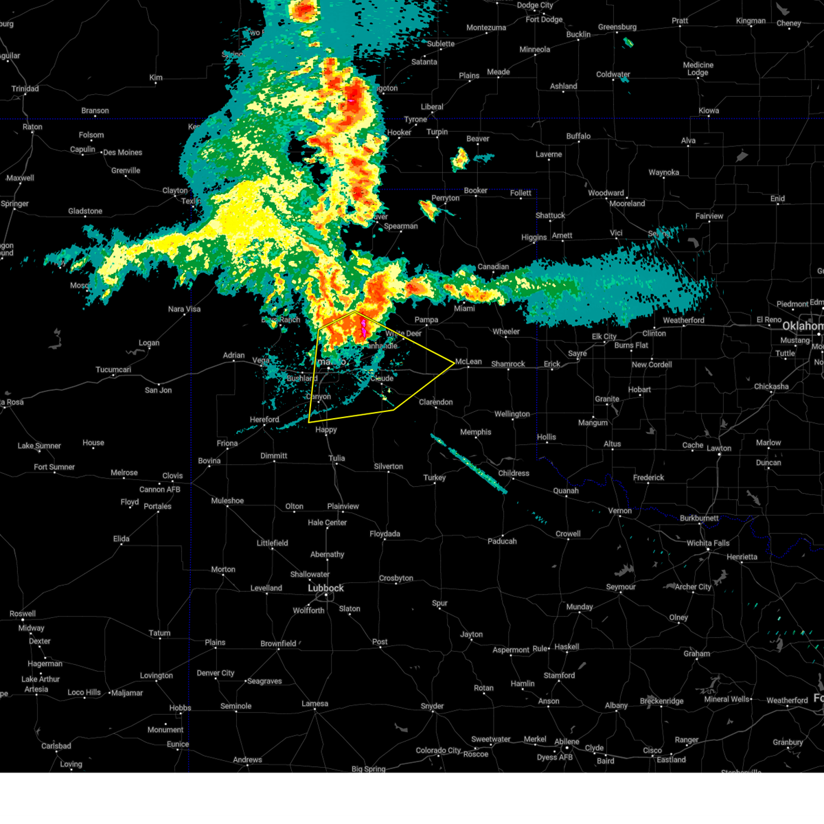 Svrama the national weather service in amarillo has issued a * severe thunderstorm warning for, northern armstrong county in the panhandle of texas, eastern randall county in the panhandle of texas, carson county in the panhandle of texas, southwestern gray county in the panhandle of texas, eastern potter county in the panhandle of texas, northwestern donley county in the panhandle of texas, * until 1045 pm cdt. * at 915 pm cdt, a severe thunderstorm was located 10 miles northwest of panhandle, moving south at 20 mph (radar indicated). Hazards include 70 mph wind gusts. Expect some tree damage. Damage is likely to mobile homes, roofs, and outbuildings. Svrama the national weather service in amarillo has issued a * severe thunderstorm warning for, northern armstrong county in the panhandle of texas, eastern randall county in the panhandle of texas, carson county in the panhandle of texas, southwestern gray county in the panhandle of texas, eastern potter county in the panhandle of texas, northwestern donley county in the panhandle of texas, * until 1045 pm cdt. * at 915 pm cdt, a severe thunderstorm was located 10 miles northwest of panhandle, moving south at 20 mph (radar indicated). Hazards include 70 mph wind gusts. Expect some tree damage. Damage is likely to mobile homes, roofs, and outbuildings.
|
| 7/2/2024 8:06 PM CDT |
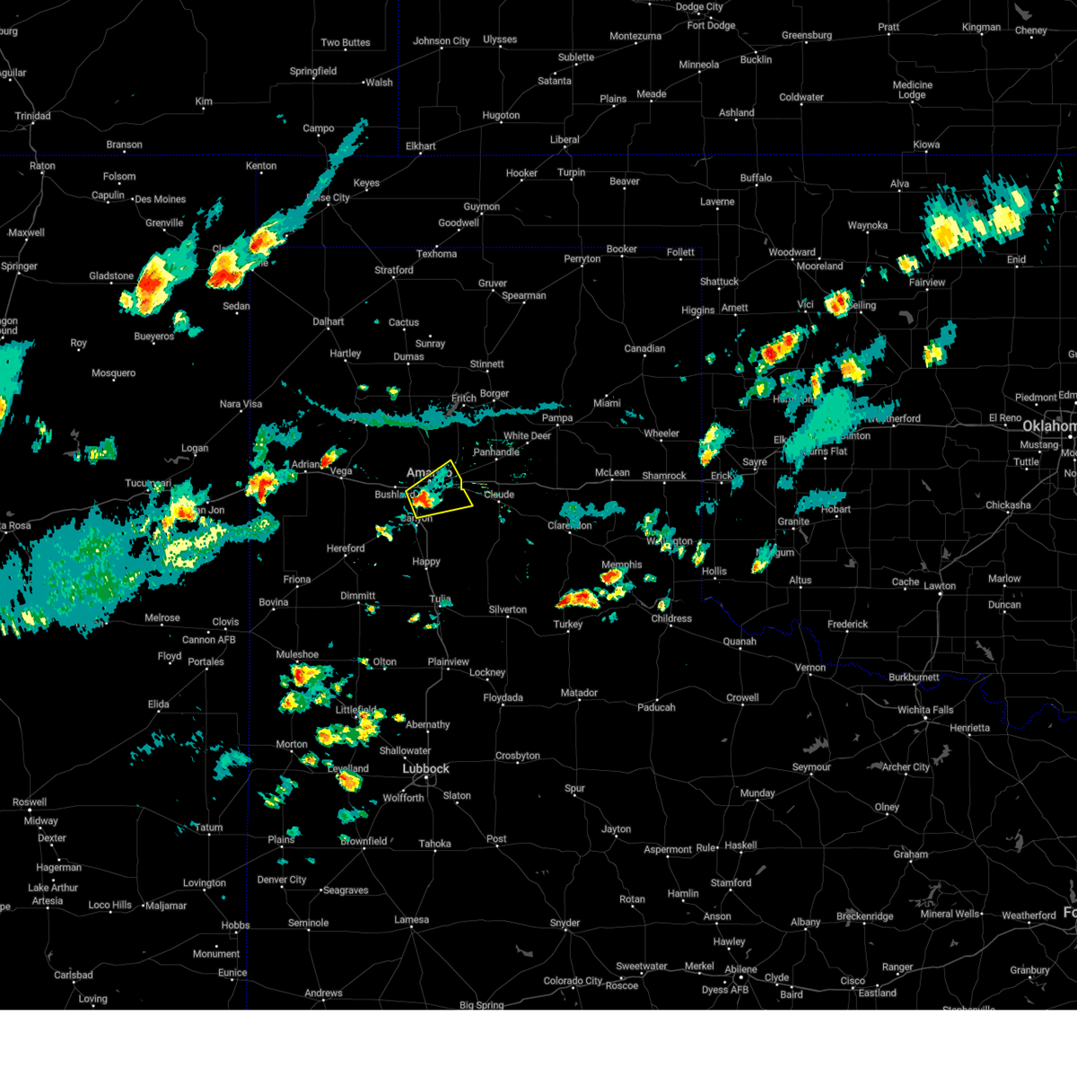 Svrama the national weather service in amarillo has issued a * severe thunderstorm warning for, northwestern armstrong county in the panhandle of texas, northeastern randall county in the panhandle of texas, southeastern potter county in the panhandle of texas, * until 845 pm cdt. * at 805 pm cdt, a severe thunderstorm was located 4 miles south of amarillo, moving northeast at 15 mph (radar indicated). Hazards include 60 mph wind gusts and penny size hail. minor damage to roofs, siding, and trees is possible Svrama the national weather service in amarillo has issued a * severe thunderstorm warning for, northwestern armstrong county in the panhandle of texas, northeastern randall county in the panhandle of texas, southeastern potter county in the panhandle of texas, * until 845 pm cdt. * at 805 pm cdt, a severe thunderstorm was located 4 miles south of amarillo, moving northeast at 15 mph (radar indicated). Hazards include 60 mph wind gusts and penny size hail. minor damage to roofs, siding, and trees is possible
|
| 6/25/2024 8:19 PM CDT |
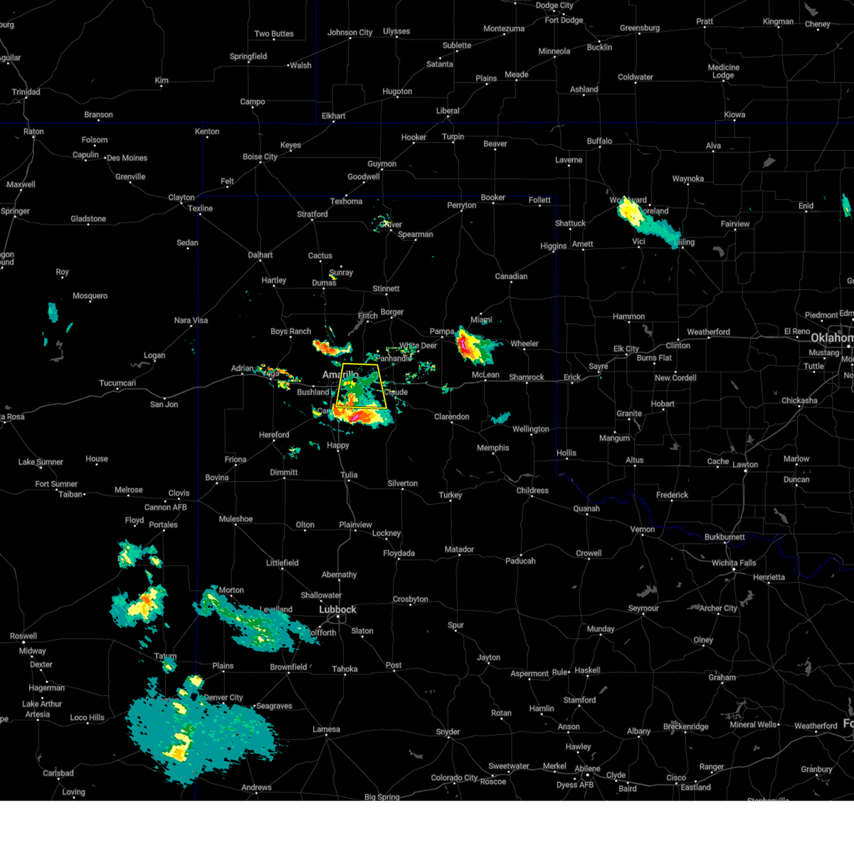 the severe thunderstorm warning has been cancelled and is no longer in effect the severe thunderstorm warning has been cancelled and is no longer in effect
|
| 6/25/2024 7:55 PM CDT |
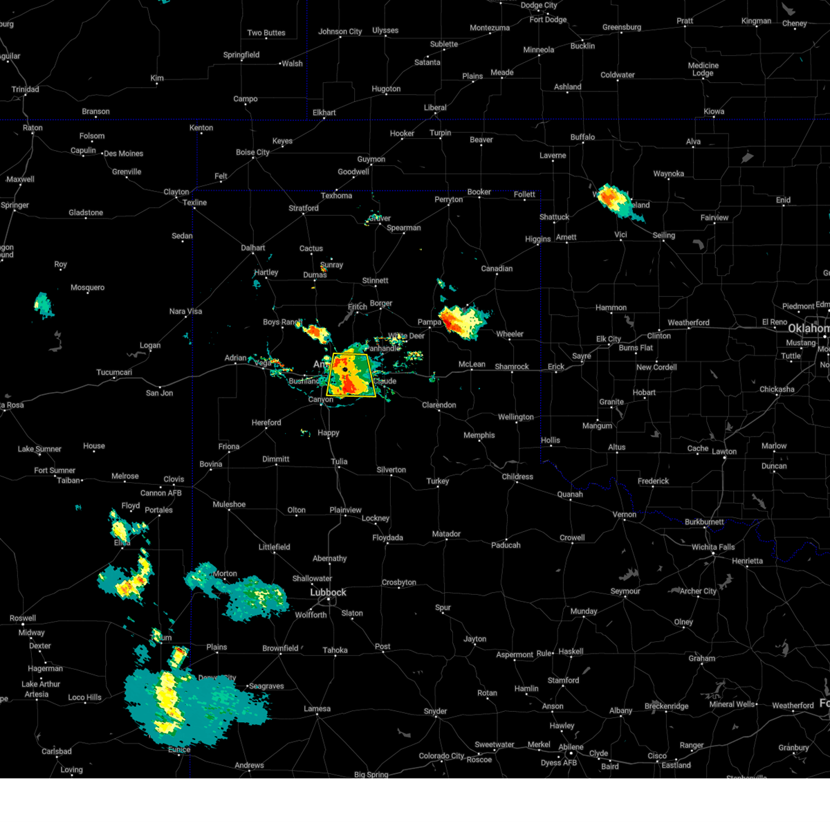 At 754 pm cdt, a severe thunderstorm was located 7 miles northeast of lake tanglewood, or 9 miles southeast of amarillo, moving south at 10 mph (radar indicated). Hazards include 70 mph wind gusts and nickel size hail. Expect some tree damage. damage is likely to mobile homes, roofs, and outbuildings. Locations impacted include, amarillo, lake tanglewood, washburn, timbercreek canyon, and pantex. At 754 pm cdt, a severe thunderstorm was located 7 miles northeast of lake tanglewood, or 9 miles southeast of amarillo, moving south at 10 mph (radar indicated). Hazards include 70 mph wind gusts and nickel size hail. Expect some tree damage. damage is likely to mobile homes, roofs, and outbuildings. Locations impacted include, amarillo, lake tanglewood, washburn, timbercreek canyon, and pantex.
|
| 6/25/2024 7:46 PM CDT |
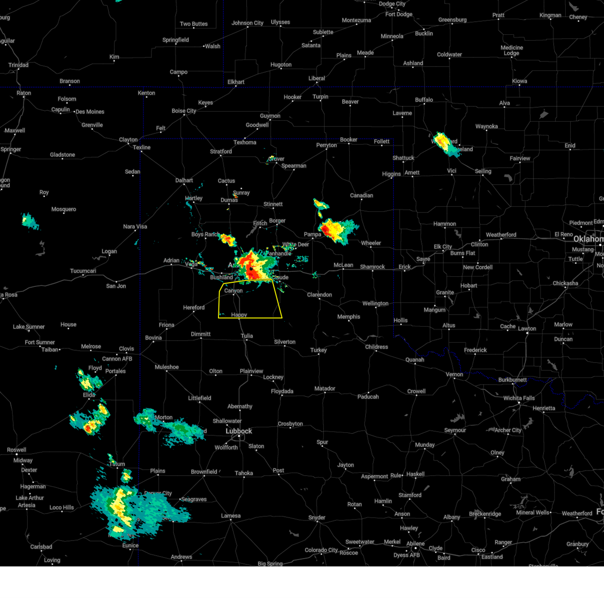 Svrama the national weather service in amarillo has issued a * severe thunderstorm warning for, western armstrong county in the panhandle of texas, randall county in the panhandle of texas, * until 845 pm cdt. * at 745 pm cdt, a severe thunderstorm was located along an outflow line extending from 5 miles southwest of bushland to 5 miles east of canyon to 5 miles south of washburn, moving south at 25 mph (radar indicated). Hazards include 70 mph wind gusts and nickel size hail. Expect some tree damage. Damage is likely to mobile homes, roofs, and outbuildings. Svrama the national weather service in amarillo has issued a * severe thunderstorm warning for, western armstrong county in the panhandle of texas, randall county in the panhandle of texas, * until 845 pm cdt. * at 745 pm cdt, a severe thunderstorm was located along an outflow line extending from 5 miles southwest of bushland to 5 miles east of canyon to 5 miles south of washburn, moving south at 25 mph (radar indicated). Hazards include 70 mph wind gusts and nickel size hail. Expect some tree damage. Damage is likely to mobile homes, roofs, and outbuildings.
|
| 6/25/2024 7:23 PM CDT |
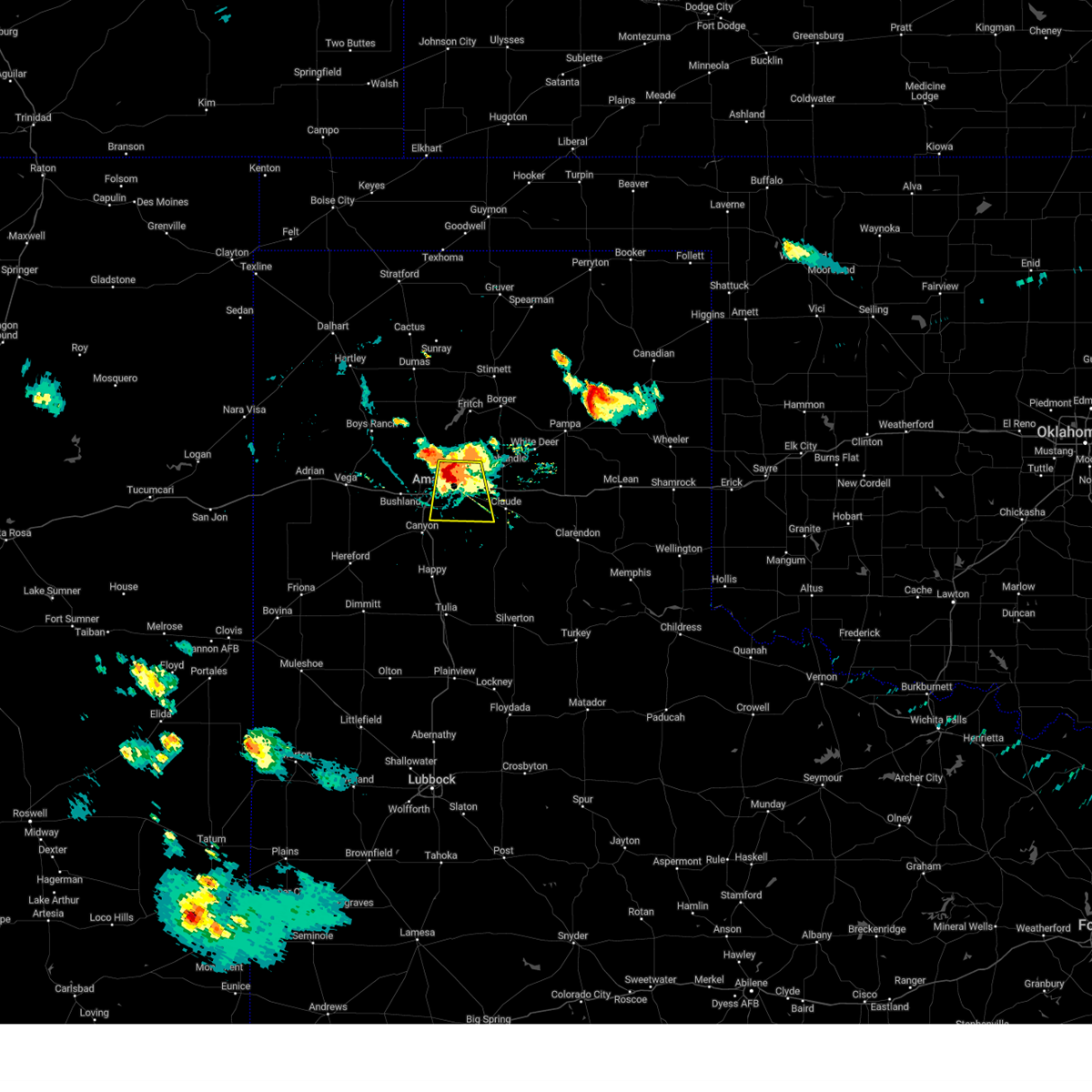 Svrama the national weather service in amarillo has issued a * severe thunderstorm warning for, northwestern armstrong county in the panhandle of texas, northeastern randall county in the panhandle of texas, southwestern carson county in the panhandle of texas, southeastern potter county in the panhandle of texas, * until 830 pm cdt. * at 722 pm cdt, a severe thunderstorm was located 9 miles northeast of amarillo, moving south at 10 mph. this is a destructive storm for eastern portions of amarillo (radar indicated). Hazards include 80 mph wind gusts and nickel size hail. Flying debris will be dangerous to those caught without shelter. mobile homes will be heavily damaged. expect considerable damage to roofs, windows, and vehicles. Tree damage and power outages are likely. Svrama the national weather service in amarillo has issued a * severe thunderstorm warning for, northwestern armstrong county in the panhandle of texas, northeastern randall county in the panhandle of texas, southwestern carson county in the panhandle of texas, southeastern potter county in the panhandle of texas, * until 830 pm cdt. * at 722 pm cdt, a severe thunderstorm was located 9 miles northeast of amarillo, moving south at 10 mph. this is a destructive storm for eastern portions of amarillo (radar indicated). Hazards include 80 mph wind gusts and nickel size hail. Flying debris will be dangerous to those caught without shelter. mobile homes will be heavily damaged. expect considerable damage to roofs, windows, and vehicles. Tree damage and power outages are likely.
|
| 6/25/2024 7:14 PM CDT |
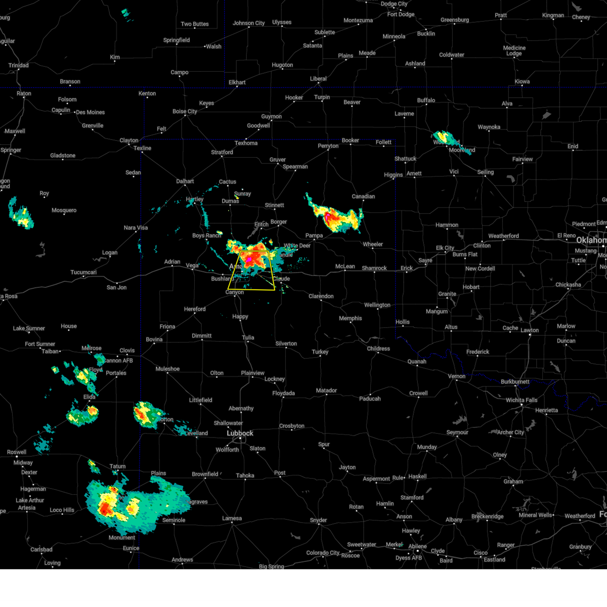 At 714 pm cdt, a severe thunderstorm was located 7 miles northeast of amarillo, moving south at 15 mph (radar indicated). Hazards include 70 mph wind gusts and nickel size hail. Expect some tree damage. damage is likely to mobile homes, roofs, and outbuildings. Locations impacted include, amarillo, lake tanglewood, washburn, mescalero park, timbercreek canyon, and pantex. At 714 pm cdt, a severe thunderstorm was located 7 miles northeast of amarillo, moving south at 15 mph (radar indicated). Hazards include 70 mph wind gusts and nickel size hail. Expect some tree damage. damage is likely to mobile homes, roofs, and outbuildings. Locations impacted include, amarillo, lake tanglewood, washburn, mescalero park, timbercreek canyon, and pantex.
|
| 6/25/2024 7:00 PM CDT |
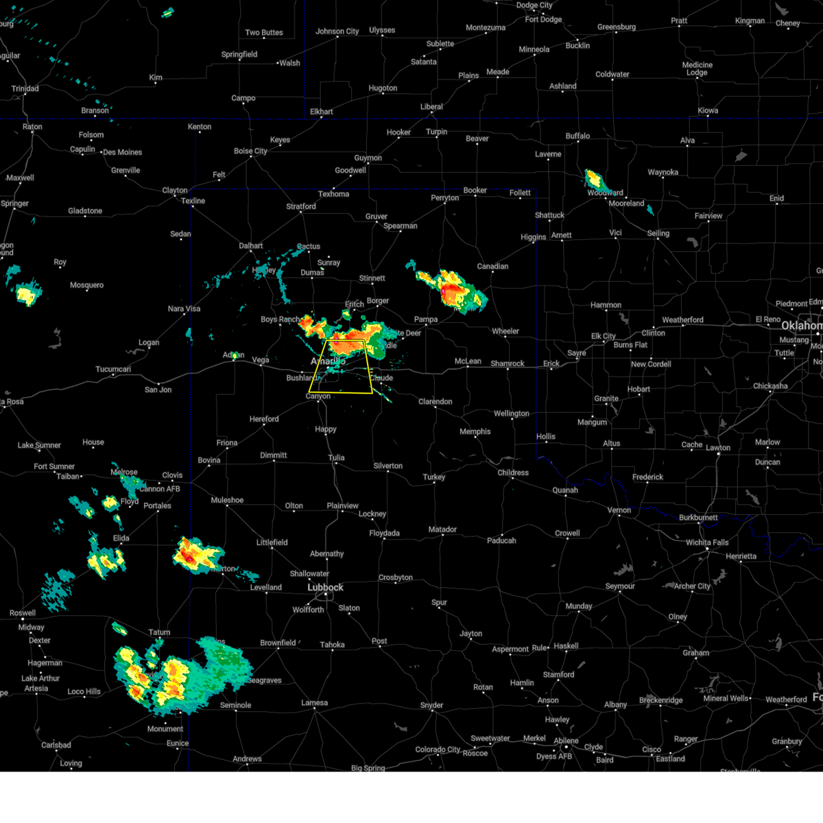 Svrama the national weather service in amarillo has issued a * severe thunderstorm warning for, northwestern armstrong county in the panhandle of texas, northeastern randall county in the panhandle of texas, southwestern carson county in the panhandle of texas, southeastern potter county in the panhandle of texas, * until 800 pm cdt. * at 659 pm cdt, a severe thunderstorm was located 10 miles northeast of amarillo, moving south at 15 mph (radar indicated). Hazards include 70 mph wind gusts. Expect some tree damage. Damage is likely to mobile homes, roofs, and outbuildings. Svrama the national weather service in amarillo has issued a * severe thunderstorm warning for, northwestern armstrong county in the panhandle of texas, northeastern randall county in the panhandle of texas, southwestern carson county in the panhandle of texas, southeastern potter county in the panhandle of texas, * until 800 pm cdt. * at 659 pm cdt, a severe thunderstorm was located 10 miles northeast of amarillo, moving south at 15 mph (radar indicated). Hazards include 70 mph wind gusts. Expect some tree damage. Damage is likely to mobile homes, roofs, and outbuildings.
|
| 6/6/2024 8:38 PM CDT |
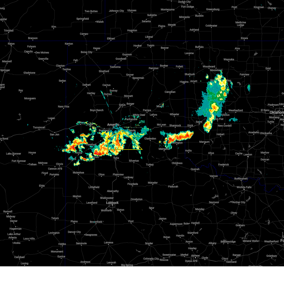 At 837 pm cdt, a severe thunderstorm was located near happy, or 14 miles north of tulia, moving southeast at 25 mph (radar indicated). Hazards include 60 mph wind gusts. Minor damage to roofs, siding, and trees is possible. Locations impacted include, canyon, lake tanglewood, wayside, palo duro canyon, and timbercreek canyon. At 837 pm cdt, a severe thunderstorm was located near happy, or 14 miles north of tulia, moving southeast at 25 mph (radar indicated). Hazards include 60 mph wind gusts. Minor damage to roofs, siding, and trees is possible. Locations impacted include, canyon, lake tanglewood, wayside, palo duro canyon, and timbercreek canyon.
|
| 6/6/2024 8:12 PM CDT |
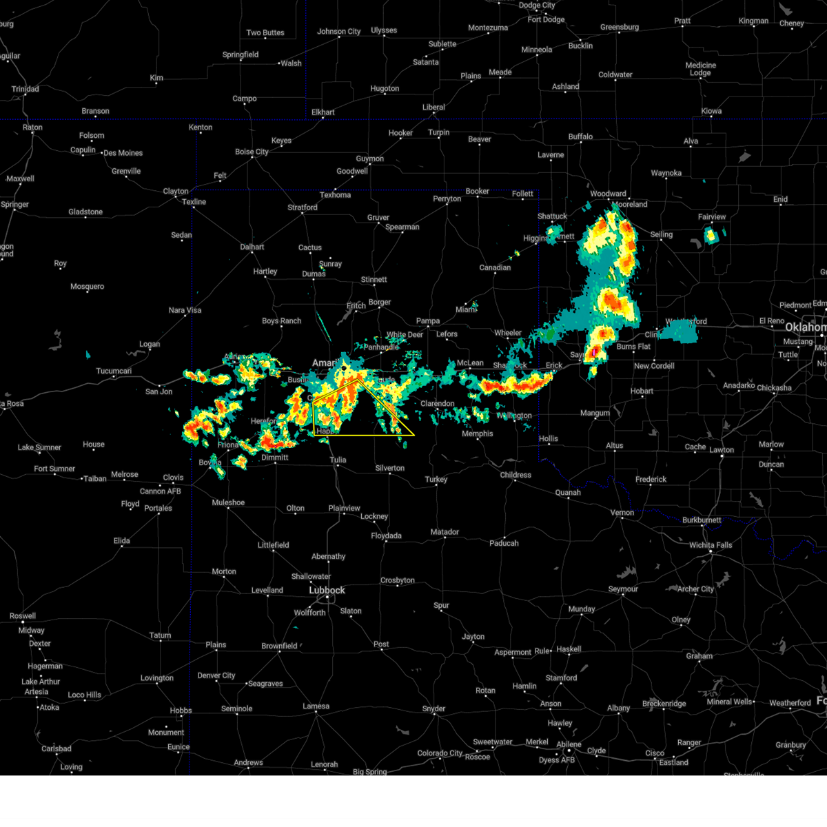 At 812 pm cdt, a severe thunderstorm was located over happy, or 15 miles south of canyon, moving south at 30 mph (radar indicated). Hazards include 70 mph wind gusts. Expect some tree damage. damage is likely to mobile homes, roofs, and outbuildings. Locations impacted include, canyon, lake tanglewood, wayside, palo duro canyon, and timbercreek canyon. At 812 pm cdt, a severe thunderstorm was located over happy, or 15 miles south of canyon, moving south at 30 mph (radar indicated). Hazards include 70 mph wind gusts. Expect some tree damage. damage is likely to mobile homes, roofs, and outbuildings. Locations impacted include, canyon, lake tanglewood, wayside, palo duro canyon, and timbercreek canyon.
|
| 6/6/2024 7:49 PM CDT |
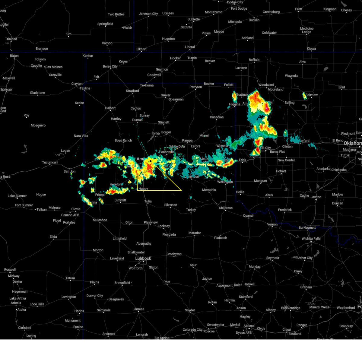 At 749 pm cdt, a severe thunderstorm was located over palo duro canyon, or 16 miles east of canyon, moving southeast at 20 mph (radar indicated). Hazards include 70 mph wind gusts. Expect some tree damage. damage is likely to mobile homes, roofs, and outbuildings. Locations impacted include, canyon, lake tanglewood, wayside, palo duro canyon, and timbercreek canyon. At 749 pm cdt, a severe thunderstorm was located over palo duro canyon, or 16 miles east of canyon, moving southeast at 20 mph (radar indicated). Hazards include 70 mph wind gusts. Expect some tree damage. damage is likely to mobile homes, roofs, and outbuildings. Locations impacted include, canyon, lake tanglewood, wayside, palo duro canyon, and timbercreek canyon.
|
| 6/6/2024 7:28 PM CDT |
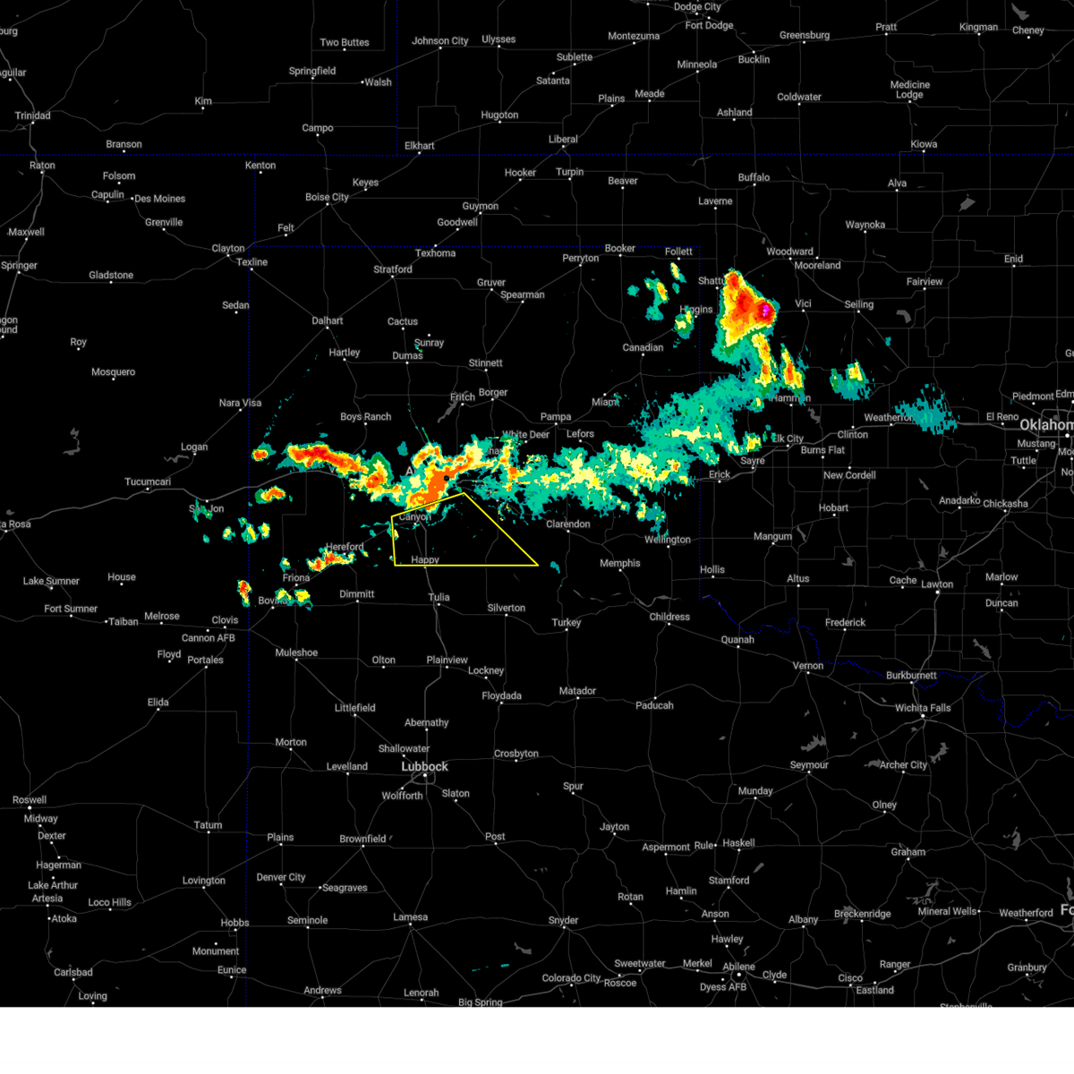 Svrama the national weather service in amarillo has issued a * severe thunderstorm warning for, southern armstrong county in the panhandle of texas, randall county in the panhandle of texas, * until 900 pm cdt. * at 728 pm cdt, a severe thunderstorm was located 4 miles southeast of lake tanglewood, or 11 miles east of canyon, moving southeast at 40 mph (radar indicated). Hazards include 70 mph wind gusts. Expect some tree damage. Damage is likely to mobile homes, roofs, and outbuildings. Svrama the national weather service in amarillo has issued a * severe thunderstorm warning for, southern armstrong county in the panhandle of texas, randall county in the panhandle of texas, * until 900 pm cdt. * at 728 pm cdt, a severe thunderstorm was located 4 miles southeast of lake tanglewood, or 11 miles east of canyon, moving southeast at 40 mph (radar indicated). Hazards include 70 mph wind gusts. Expect some tree damage. Damage is likely to mobile homes, roofs, and outbuildings.
|
| 6/2/2024 6:26 PM CDT |
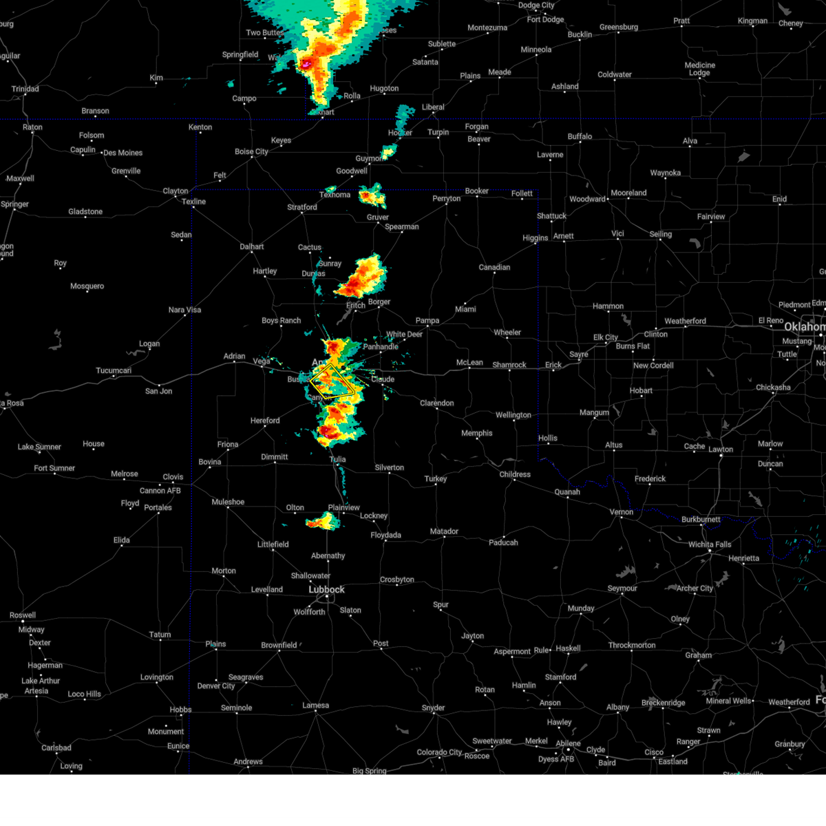 At 626 pm cdt, a severe thunderstorm was located near amarillo, moving northeast at 50 mph (radar indicated). Hazards include 60 mph wind gusts and quarter size hail. Minor damage to roofs, siding, and trees is possible. hail damage to vehicles is expected. Locations impacted include, amarillo, lake tanglewood, mescalero park, and timbercreek canyon. At 626 pm cdt, a severe thunderstorm was located near amarillo, moving northeast at 50 mph (radar indicated). Hazards include 60 mph wind gusts and quarter size hail. Minor damage to roofs, siding, and trees is possible. hail damage to vehicles is expected. Locations impacted include, amarillo, lake tanglewood, mescalero park, and timbercreek canyon.
|
| 6/2/2024 6:10 PM CDT |
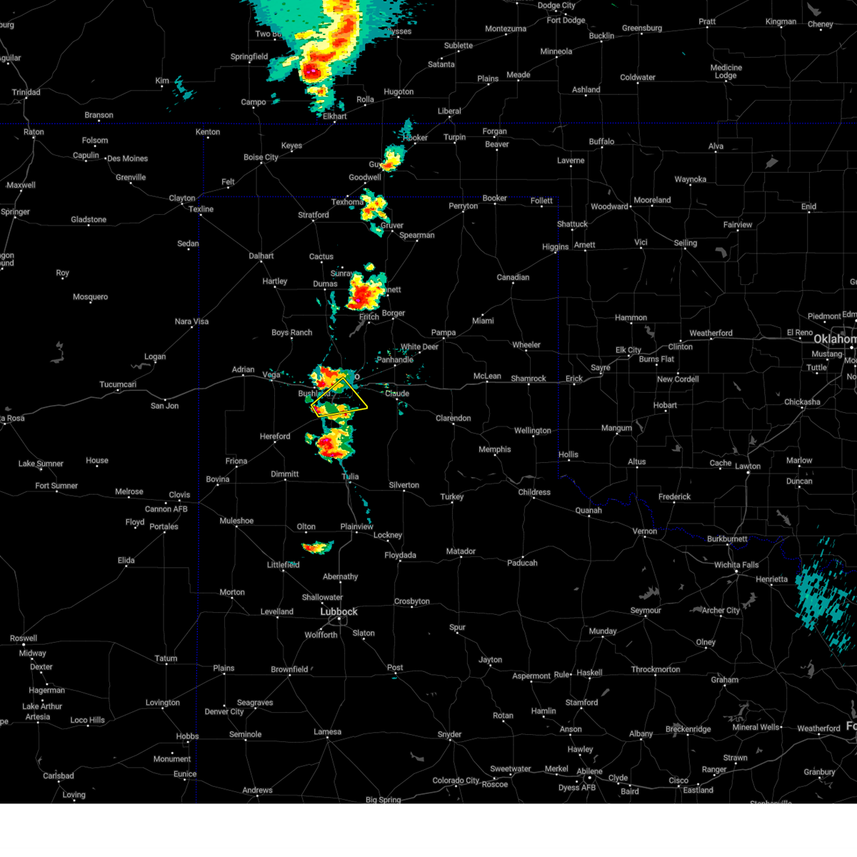 At 610 pm cdt, a severe thunderstorm was located 4 miles west of mescalero park, or 6 miles northwest of canyon, moving northeast at 45 mph (radar indicated). Hazards include 60 mph wind gusts and half dollar size hail. Minor damage to roofs, siding, and trees is possible. hail damage to vehicles is expected. Locations impacted include, amarillo, canyon, lake tanglewood, mescalero park, and timbercreek canyon. At 610 pm cdt, a severe thunderstorm was located 4 miles west of mescalero park, or 6 miles northwest of canyon, moving northeast at 45 mph (radar indicated). Hazards include 60 mph wind gusts and half dollar size hail. Minor damage to roofs, siding, and trees is possible. hail damage to vehicles is expected. Locations impacted include, amarillo, canyon, lake tanglewood, mescalero park, and timbercreek canyon.
|
| 6/2/2024 6:02 PM CDT |
 Svrama the national weather service in amarillo has issued a * severe thunderstorm warning for, northern randall county in the panhandle of texas, south central potter county in the panhandle of texas, * until 700 pm cdt. * at 602 pm cdt, a severe thunderstorm was located 5 miles north of umbarger, or 9 miles west of canyon, moving northeast at 20 mph (radar indicated). Hazards include ping pong ball size hail and 60 mph wind gusts. Minor damage to roofs, siding, and trees is possible. people and animals outdoors will be injured. Expect hail damage to roofs, siding, windows, and vehicles. Svrama the national weather service in amarillo has issued a * severe thunderstorm warning for, northern randall county in the panhandle of texas, south central potter county in the panhandle of texas, * until 700 pm cdt. * at 602 pm cdt, a severe thunderstorm was located 5 miles north of umbarger, or 9 miles west of canyon, moving northeast at 20 mph (radar indicated). Hazards include ping pong ball size hail and 60 mph wind gusts. Minor damage to roofs, siding, and trees is possible. people and animals outdoors will be injured. Expect hail damage to roofs, siding, windows, and vehicles.
|
| 5/31/2024 10:05 PM CDT |
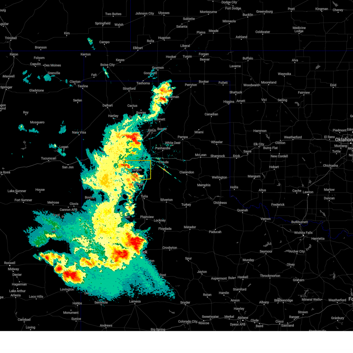 At 1005 pm cdt, a severe thunderstorm was located over lake tanglewood, or 7 miles northeast of canyon, moving east at 35 mph (radar indicated). Hazards include 60 mph wind gusts and penny size hail. Minor damage to roofs, siding, and trees is possible. Locations impacted include, amarillo, canyon, lake tanglewood, mescalero park, palo duro canyon, and timbercreek canyon. At 1005 pm cdt, a severe thunderstorm was located over lake tanglewood, or 7 miles northeast of canyon, moving east at 35 mph (radar indicated). Hazards include 60 mph wind gusts and penny size hail. Minor damage to roofs, siding, and trees is possible. Locations impacted include, amarillo, canyon, lake tanglewood, mescalero park, palo duro canyon, and timbercreek canyon.
|
| 5/31/2024 9:52 PM CDT |
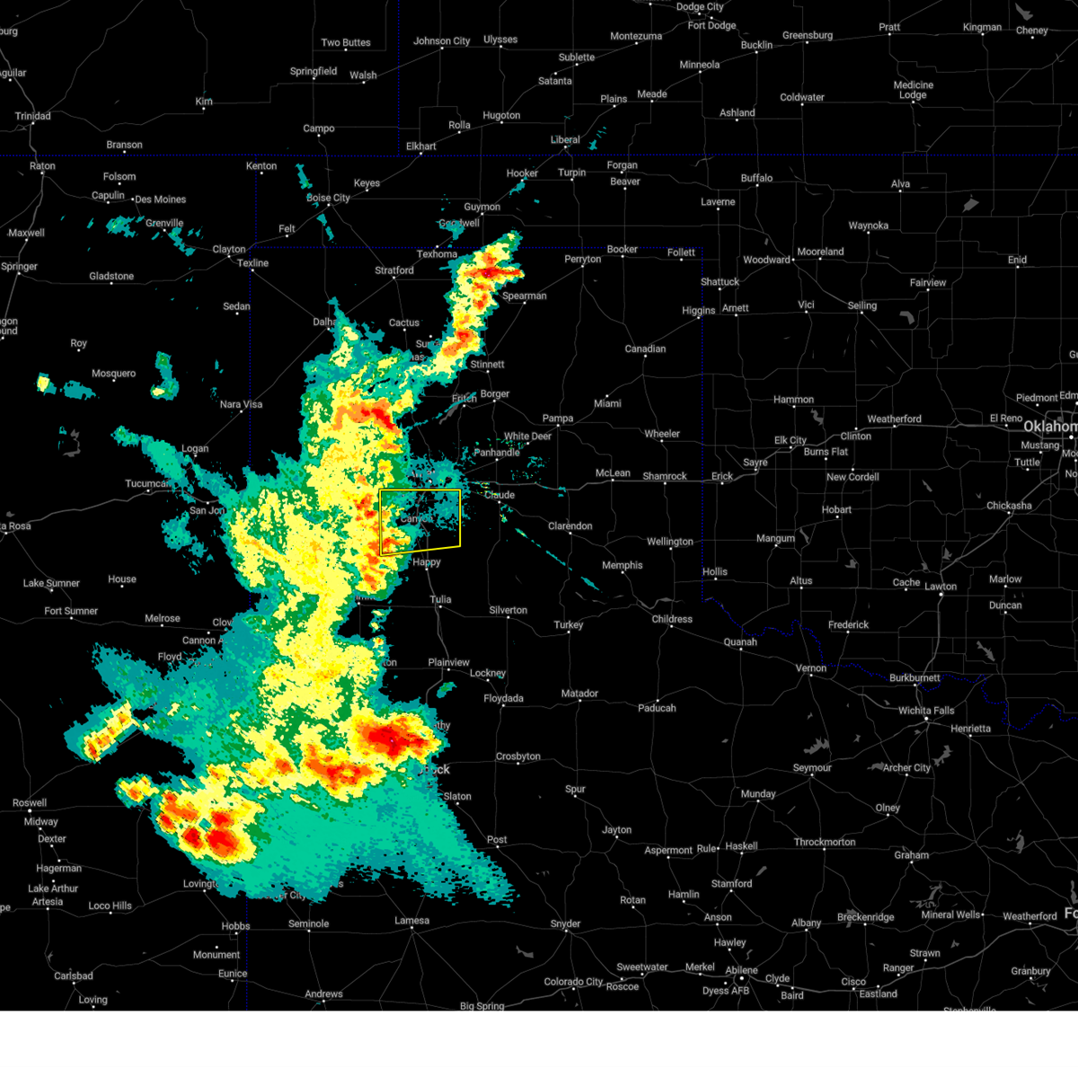 the severe thunderstorm warning has been cancelled and is no longer in effect the severe thunderstorm warning has been cancelled and is no longer in effect
|
| 5/31/2024 9:52 PM CDT |
 At 951 pm cdt, a severe thunderstorm was located near mescalero park, or 4 miles northwest of canyon, moving northeast at 45 mph (radar indicated). Hazards include 70 mph wind gusts and penny size hail. Expect some tree damage. damage is likely to mobile homes, roofs, and outbuildings. Locations impacted include, amarillo, canyon, lake tanglewood, mescalero park, buffalo lake, umbarger, palo duro canyon, and timbercreek canyon. At 951 pm cdt, a severe thunderstorm was located near mescalero park, or 4 miles northwest of canyon, moving northeast at 45 mph (radar indicated). Hazards include 70 mph wind gusts and penny size hail. Expect some tree damage. damage is likely to mobile homes, roofs, and outbuildings. Locations impacted include, amarillo, canyon, lake tanglewood, mescalero park, buffalo lake, umbarger, palo duro canyon, and timbercreek canyon.
|
| 5/31/2024 9:27 PM CDT |
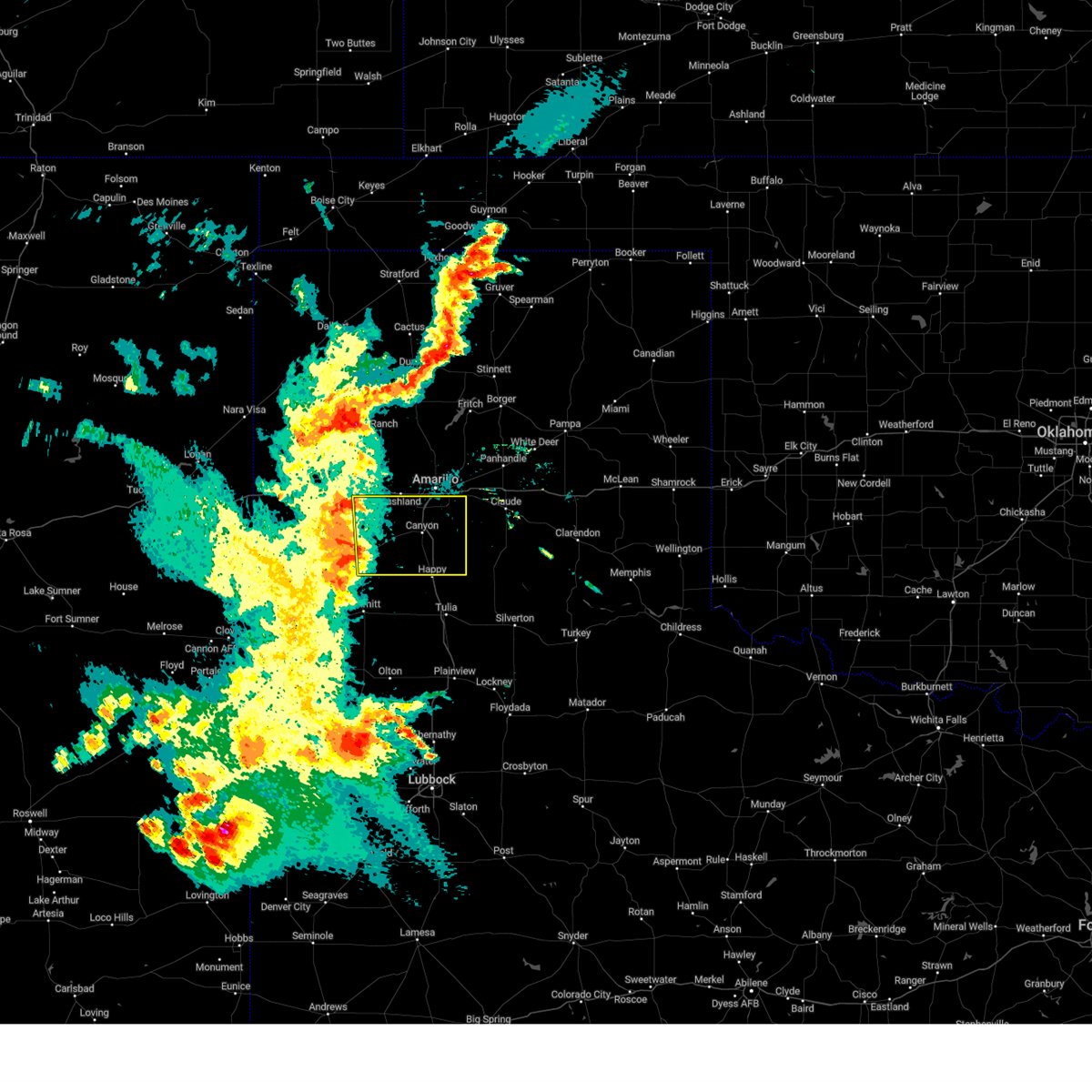 Svrama the national weather service in amarillo has issued a * severe thunderstorm warning for, randall county in the panhandle of texas, eastern deaf smith county in the panhandle of texas, * until 1030 pm cdt. * at 926 pm cdt, a severe thunderstorm was located near dawn, or 9 miles northeast of hereford, moving east at 35 mph (radar indicated). Hazards include 70 mph wind gusts and penny size hail. Expect some tree damage. Damage is likely to mobile homes, roofs, and outbuildings. Svrama the national weather service in amarillo has issued a * severe thunderstorm warning for, randall county in the panhandle of texas, eastern deaf smith county in the panhandle of texas, * until 1030 pm cdt. * at 926 pm cdt, a severe thunderstorm was located near dawn, or 9 miles northeast of hereford, moving east at 35 mph (radar indicated). Hazards include 70 mph wind gusts and penny size hail. Expect some tree damage. Damage is likely to mobile homes, roofs, and outbuildings.
|
| 5/30/2024 7:06 PM CDT |
 At 706 pm cdt, severe thunderstorms were located along a line extending from 18 miles southwest of wolf creek park to 6 miles southwest of codman to 7 miles south of white deer to 4 miles southwest of washburn, moving east at 40 mph (radar indicated). Hazards include 70 mph wind gusts and nickel size hail. Expect some tree damage. damage is likely to mobile homes, roofs, and outbuildings. Locations impacted include, amarillo, pampa, canyon, canadian, panhandle, clarendon, claude, miami, briscoe, white deer, lake tanglewood, mclean, groom, lefors, skellytown, howardwick, bushland, lake mcclellan, wayside, and goodnight. At 706 pm cdt, severe thunderstorms were located along a line extending from 18 miles southwest of wolf creek park to 6 miles southwest of codman to 7 miles south of white deer to 4 miles southwest of washburn, moving east at 40 mph (radar indicated). Hazards include 70 mph wind gusts and nickel size hail. Expect some tree damage. damage is likely to mobile homes, roofs, and outbuildings. Locations impacted include, amarillo, pampa, canyon, canadian, panhandle, clarendon, claude, miami, briscoe, white deer, lake tanglewood, mclean, groom, lefors, skellytown, howardwick, bushland, lake mcclellan, wayside, and goodnight.
|
| 5/30/2024 6:44 PM CDT |
 Svrama the national weather service in amarillo has issued a * severe thunderstorm warning for, armstrong county in the panhandle of texas, randall county in the panhandle of texas, western wheeler county in the panhandle of texas, carson county in the panhandle of texas, eastern hutchinson county in the panhandle of texas, gray county in the panhandle of texas, southern potter county in the panhandle of texas, roberts county in the panhandle of texas, western hemphill county in the panhandle of texas, northwestern donley county in the panhandle of texas, * until 800 pm cdt. * at 643 pm cdt, severe thunderstorms were located along a line extending from 14 miles southeast of spearman to 6 miles northeast of skellytown to near panhandle to 4 miles north of amarillo, moving east at 40 mph (radar indicated). Hazards include 70 mph wind gusts and penny size hail. Expect some tree damage. Damage is likely to mobile homes, roofs, and outbuildings. Svrama the national weather service in amarillo has issued a * severe thunderstorm warning for, armstrong county in the panhandle of texas, randall county in the panhandle of texas, western wheeler county in the panhandle of texas, carson county in the panhandle of texas, eastern hutchinson county in the panhandle of texas, gray county in the panhandle of texas, southern potter county in the panhandle of texas, roberts county in the panhandle of texas, western hemphill county in the panhandle of texas, northwestern donley county in the panhandle of texas, * until 800 pm cdt. * at 643 pm cdt, severe thunderstorms were located along a line extending from 14 miles southeast of spearman to 6 miles northeast of skellytown to near panhandle to 4 miles north of amarillo, moving east at 40 mph (radar indicated). Hazards include 70 mph wind gusts and penny size hail. Expect some tree damage. Damage is likely to mobile homes, roofs, and outbuildings.
|
| 5/30/2024 5:49 PM CDT |
 Svrama the national weather service in amarillo has issued a * severe thunderstorm warning for, northern armstrong county in the panhandle of texas, northern randall county in the panhandle of texas, southeastern oldham county in the panhandle of texas, carson county in the panhandle of texas, hutchinson county in the panhandle of texas, western gray county in the panhandle of texas, potter county in the panhandle of texas, roberts county in the panhandle of texas, southeastern moore county in the panhandle of texas, * until 645 pm cdt. * at 546 pm cdt, severe thunderstorms were located along a line extending from 9 miles east of morse to near sanford to 9 miles southwest of lake meredith to 4 miles east of valley de oro to 7 miles southwest of boys ranch, moving southeast at 40 mph (automated weather equipment). Hazards include 70 mph wind gusts. Expect some tree damage. Damage is likely to mobile homes, roofs, and outbuildings. Svrama the national weather service in amarillo has issued a * severe thunderstorm warning for, northern armstrong county in the panhandle of texas, northern randall county in the panhandle of texas, southeastern oldham county in the panhandle of texas, carson county in the panhandle of texas, hutchinson county in the panhandle of texas, western gray county in the panhandle of texas, potter county in the panhandle of texas, roberts county in the panhandle of texas, southeastern moore county in the panhandle of texas, * until 645 pm cdt. * at 546 pm cdt, severe thunderstorms were located along a line extending from 9 miles east of morse to near sanford to 9 miles southwest of lake meredith to 4 miles east of valley de oro to 7 miles southwest of boys ranch, moving southeast at 40 mph (automated weather equipment). Hazards include 70 mph wind gusts. Expect some tree damage. Damage is likely to mobile homes, roofs, and outbuildings.
|
| 5/28/2024 5:33 PM CDT |
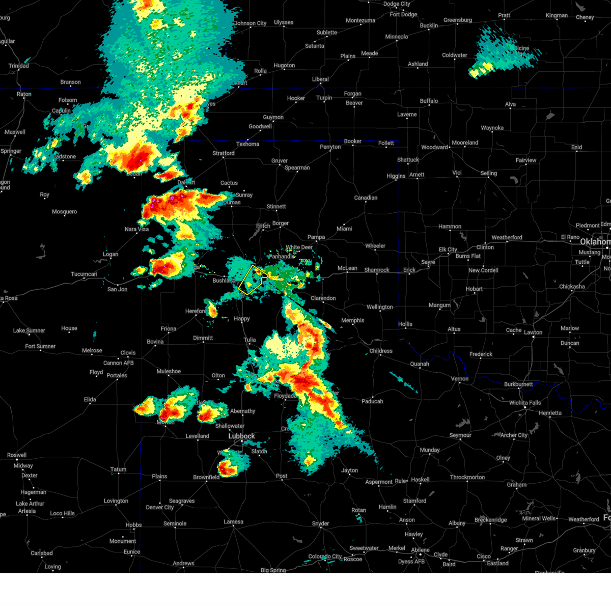 the severe thunderstorm warning has been cancelled and is no longer in effect the severe thunderstorm warning has been cancelled and is no longer in effect
|
| 5/28/2024 5:19 PM CDT |
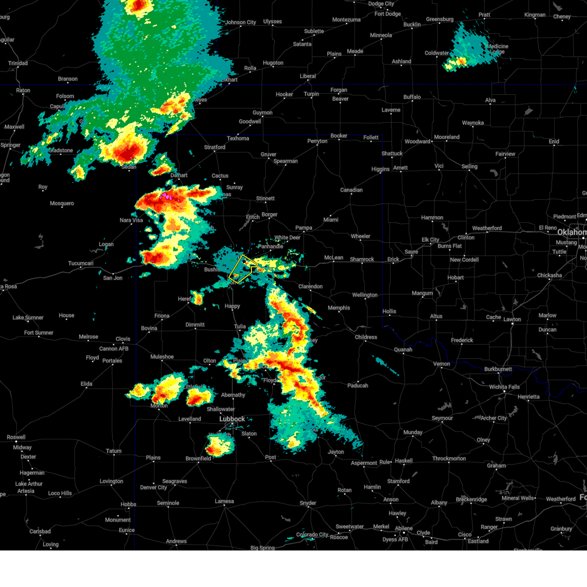 At 519 pm cdt, a severe thunderstorm was located 6 miles west of washburn, or 9 miles east of amarillo, moving northeast at 20 mph (radar indicated). Hazards include 60 mph wind gusts and quarter size hail. Minor damage to roofs, siding, and trees is possible. hail damage to vehicles is expected. Locations impacted include, amarillo, lake tanglewood, mescalero park, and timbercreek canyon. At 519 pm cdt, a severe thunderstorm was located 6 miles west of washburn, or 9 miles east of amarillo, moving northeast at 20 mph (radar indicated). Hazards include 60 mph wind gusts and quarter size hail. Minor damage to roofs, siding, and trees is possible. hail damage to vehicles is expected. Locations impacted include, amarillo, lake tanglewood, mescalero park, and timbercreek canyon.
|
| 5/28/2024 5:03 PM CDT |
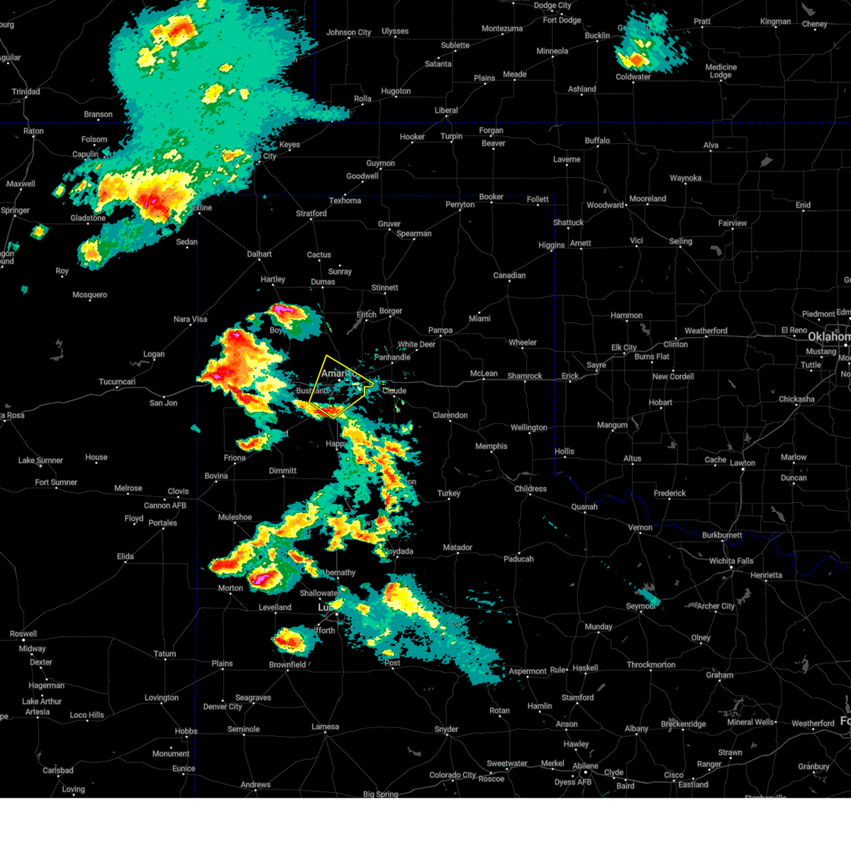 At 503 pm cdt, a severe thunderstorm was located near mescalero park, or 6 miles southwest of amarillo, moving northeast at 25 mph (law enforcement). Hazards include 60 mph wind gusts and quarter size hail. Minor damage to roofs, siding, and trees is possible. hail damage to vehicles is expected. Locations impacted include, amarillo, canyon, lake tanglewood, mescalero park, and timbercreek canyon. At 503 pm cdt, a severe thunderstorm was located near mescalero park, or 6 miles southwest of amarillo, moving northeast at 25 mph (law enforcement). Hazards include 60 mph wind gusts and quarter size hail. Minor damage to roofs, siding, and trees is possible. hail damage to vehicles is expected. Locations impacted include, amarillo, canyon, lake tanglewood, mescalero park, and timbercreek canyon.
|
| 5/28/2024 5:03 PM CDT |
 the severe thunderstorm warning has been cancelled and is no longer in effect the severe thunderstorm warning has been cancelled and is no longer in effect
|
| 5/28/2024 4:47 PM CDT |
 At 446 pm cdt, a severe thunderstorm was located 4 miles northwest of canyon, moving northeast at 25 mph (law enforcement confirmed golf ball size hail in canyon). Hazards include golf ball size hail and 70 mph wind gusts. Expect some tree damage. damage is likely to mobile homes, roofs, and outbuildings. people and animals outdoors will be injured. expect hail damage to roofs, siding, windows, and vehicles. Locations impacted include, amarillo, canyon, lake tanglewood, mescalero park, bushland, umbarger, and timbercreek canyon. At 446 pm cdt, a severe thunderstorm was located 4 miles northwest of canyon, moving northeast at 25 mph (law enforcement confirmed golf ball size hail in canyon). Hazards include golf ball size hail and 70 mph wind gusts. Expect some tree damage. damage is likely to mobile homes, roofs, and outbuildings. people and animals outdoors will be injured. expect hail damage to roofs, siding, windows, and vehicles. Locations impacted include, amarillo, canyon, lake tanglewood, mescalero park, bushland, umbarger, and timbercreek canyon.
|
| 5/28/2024 4:38 PM CDT |
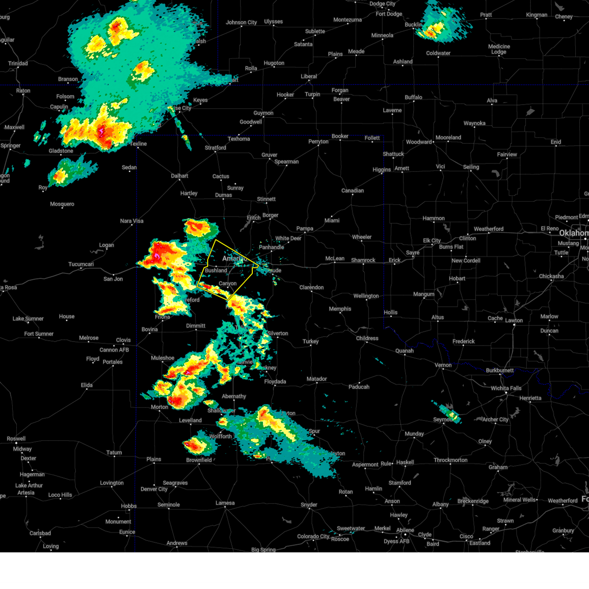 Svrama the national weather service in amarillo has issued a * severe thunderstorm warning for, northern randall county in the panhandle of texas, southwestern carson county in the panhandle of texas, northeastern deaf smith county in the panhandle of texas, southern potter county in the panhandle of texas, * until 545 pm cdt. * at 438 pm cdt, a severe thunderstorm was located 5 miles east of umbarger, or 5 miles west of canyon, moving northeast at 25 mph (radar indicated). Hazards include 70 mph wind gusts and ping pong ball size hail. Expect some tree damage. damage is likely to mobile homes, roofs, and outbuildings. people and animals outdoors will be injured. Expect hail damage to roofs, siding, windows, and vehicles. Svrama the national weather service in amarillo has issued a * severe thunderstorm warning for, northern randall county in the panhandle of texas, southwestern carson county in the panhandle of texas, northeastern deaf smith county in the panhandle of texas, southern potter county in the panhandle of texas, * until 545 pm cdt. * at 438 pm cdt, a severe thunderstorm was located 5 miles east of umbarger, or 5 miles west of canyon, moving northeast at 25 mph (radar indicated). Hazards include 70 mph wind gusts and ping pong ball size hail. Expect some tree damage. damage is likely to mobile homes, roofs, and outbuildings. people and animals outdoors will be injured. Expect hail damage to roofs, siding, windows, and vehicles.
|
| 5/12/2024 1:16 AM CDT |
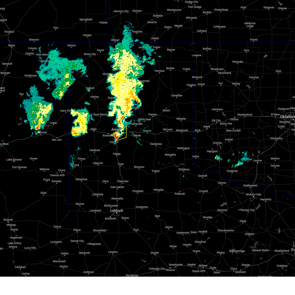 At 116 am cdt, a severe thunderstorm was located 4 miles north of lake tanglewood, or 6 miles southeast of amarillo, moving east at 40 mph (radar indicated). Hazards include 60 mph wind gusts and quarter size hail. Minor damage to roofs, siding, and trees is possible. hail damage to vehicles is expected. Locations impacted include, amarillo. At 116 am cdt, a severe thunderstorm was located 4 miles north of lake tanglewood, or 6 miles southeast of amarillo, moving east at 40 mph (radar indicated). Hazards include 60 mph wind gusts and quarter size hail. Minor damage to roofs, siding, and trees is possible. hail damage to vehicles is expected. Locations impacted include, amarillo.
|
| 5/12/2024 1:04 AM CDT |
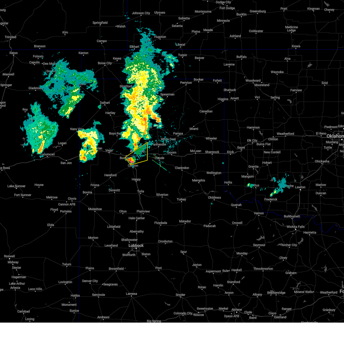 At 104 am cdt, a severe thunderstorm was located 4 miles northwest of mescalero park, or 7 miles southwest of amarillo, moving northeast at 40 mph (radar indicated). Hazards include 60 mph wind gusts and half dollar size hail. Minor damage to roofs, siding, and trees is possible. hail damage to vehicles is expected. Locations impacted include, amarillo and mescalero park. At 104 am cdt, a severe thunderstorm was located 4 miles northwest of mescalero park, or 7 miles southwest of amarillo, moving northeast at 40 mph (radar indicated). Hazards include 60 mph wind gusts and half dollar size hail. Minor damage to roofs, siding, and trees is possible. hail damage to vehicles is expected. Locations impacted include, amarillo and mescalero park.
|
| 5/12/2024 12:52 AM CDT |
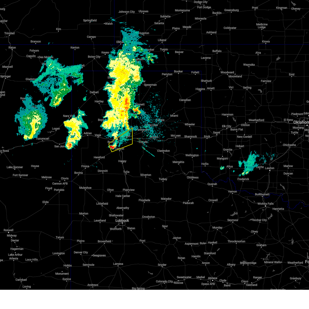 Svrama the national weather service in amarillo has issued a * severe thunderstorm warning for, northern randall county in the panhandle of texas, southeastern potter county in the panhandle of texas, * until 145 am cdt. * at 1252 am cdt, a severe thunderstorm was located 8 miles west of mescalero park, or 9 miles northwest of canyon, moving northeast at 40 mph (radar indicated). Hazards include quarter size hail. damage to vehicles is expected Svrama the national weather service in amarillo has issued a * severe thunderstorm warning for, northern randall county in the panhandle of texas, southeastern potter county in the panhandle of texas, * until 145 am cdt. * at 1252 am cdt, a severe thunderstorm was located 8 miles west of mescalero park, or 9 miles northwest of canyon, moving northeast at 40 mph (radar indicated). Hazards include quarter size hail. damage to vehicles is expected
|
| 12/23/2023 5:12 PM CST |
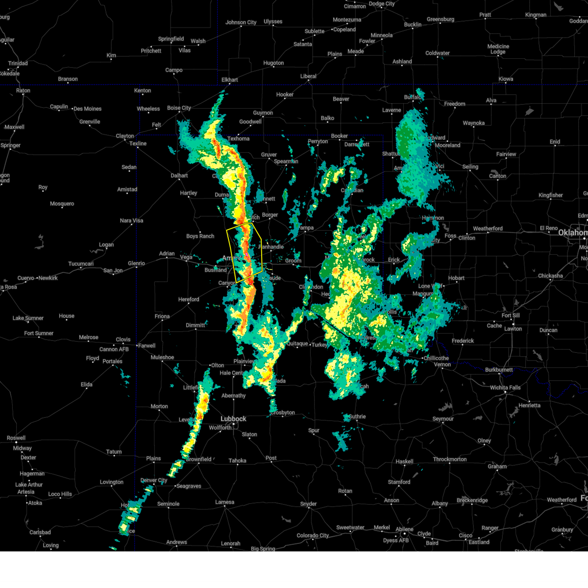 The severe thunderstorm warning for northwestern armstrong, northeastern randall, southwestern carson and eastern potter counties will expire at 515 pm cst, the storms which prompted the warning have weakened below severe limits, and no longer pose an immediate threat to life or property. therefore, the warning will be allowed to expire. however small hail, gusty winds and heavy rain are still possible with these thunderstorms. The severe thunderstorm warning for northwestern armstrong, northeastern randall, southwestern carson and eastern potter counties will expire at 515 pm cst, the storms which prompted the warning have weakened below severe limits, and no longer pose an immediate threat to life or property. therefore, the warning will be allowed to expire. however small hail, gusty winds and heavy rain are still possible with these thunderstorms.
|
| 12/23/2023 4:58 PM CST |
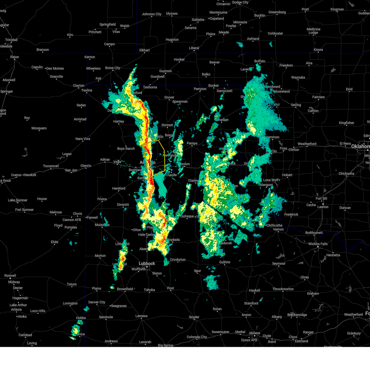 At 457 pm cst, severe thunderstorms were located along a line extending from 9 miles southwest of lake meredith to 13 miles northeast of amarillo to 6 miles northeast of lake tanglewood, moving northeast at 45 mph (radar indicated). Hazards include 60 mph wind gusts. Minor damage to roofs, siding, and trees is possible. locations impacted include, amarillo, lake tanglewood, washburn, timbercreek canyon, and pantex. hail threat, radar indicated max hail size, <. 75 in wind threat, radar indicated max wind gust, 60 mph. At 457 pm cst, severe thunderstorms were located along a line extending from 9 miles southwest of lake meredith to 13 miles northeast of amarillo to 6 miles northeast of lake tanglewood, moving northeast at 45 mph (radar indicated). Hazards include 60 mph wind gusts. Minor damage to roofs, siding, and trees is possible. locations impacted include, amarillo, lake tanglewood, washburn, timbercreek canyon, and pantex. hail threat, radar indicated max hail size, <. 75 in wind threat, radar indicated max wind gust, 60 mph.
|
| 12/23/2023 4:42 PM CST |
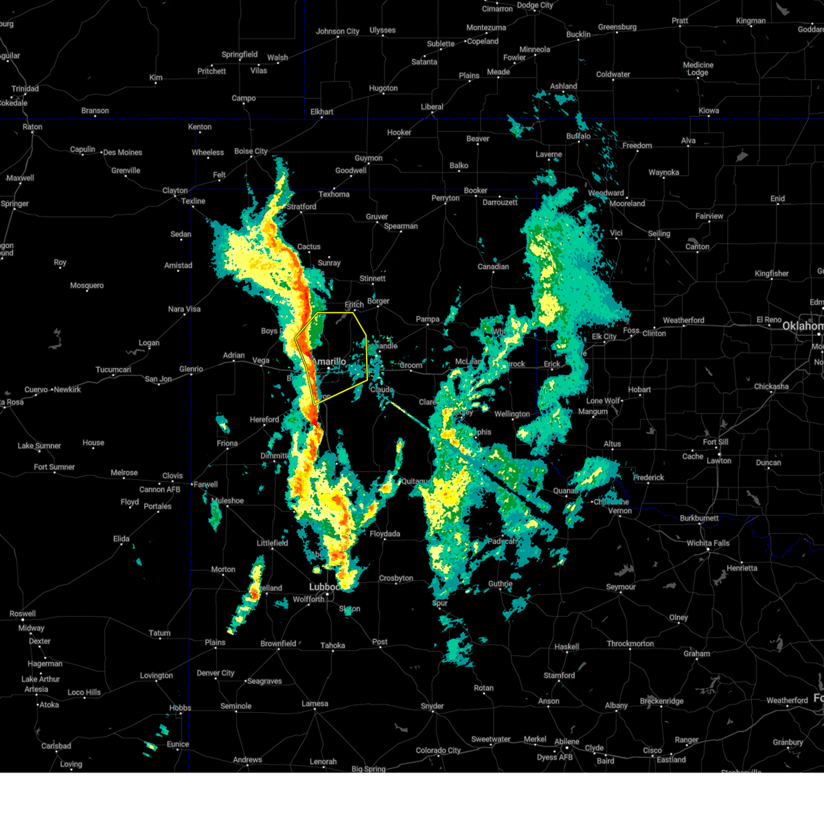 At 441 pm cst, severe thunderstorms were located along a line extending from 8 miles east of valley de oro to 3 miles northwest of amarillo to near mescalero park, moving northeast at 45 mph (radar indicated). Hazards include 60 mph wind gusts and penny size hail. Minor damage to roofs, siding, and trees is possible. locations impacted include, amarillo, canyon, lake tanglewood, mescalero park, valley de oro, washburn, timbercreek canyon, and pantex. hail threat, radar indicated max hail size, 0. 75in wind threat, radar indicated max wind gust, 60 mph. At 441 pm cst, severe thunderstorms were located along a line extending from 8 miles east of valley de oro to 3 miles northwest of amarillo to near mescalero park, moving northeast at 45 mph (radar indicated). Hazards include 60 mph wind gusts and penny size hail. Minor damage to roofs, siding, and trees is possible. locations impacted include, amarillo, canyon, lake tanglewood, mescalero park, valley de oro, washburn, timbercreek canyon, and pantex. hail threat, radar indicated max hail size, 0. 75in wind threat, radar indicated max wind gust, 60 mph.
|
| 12/23/2023 4:28 PM CST |
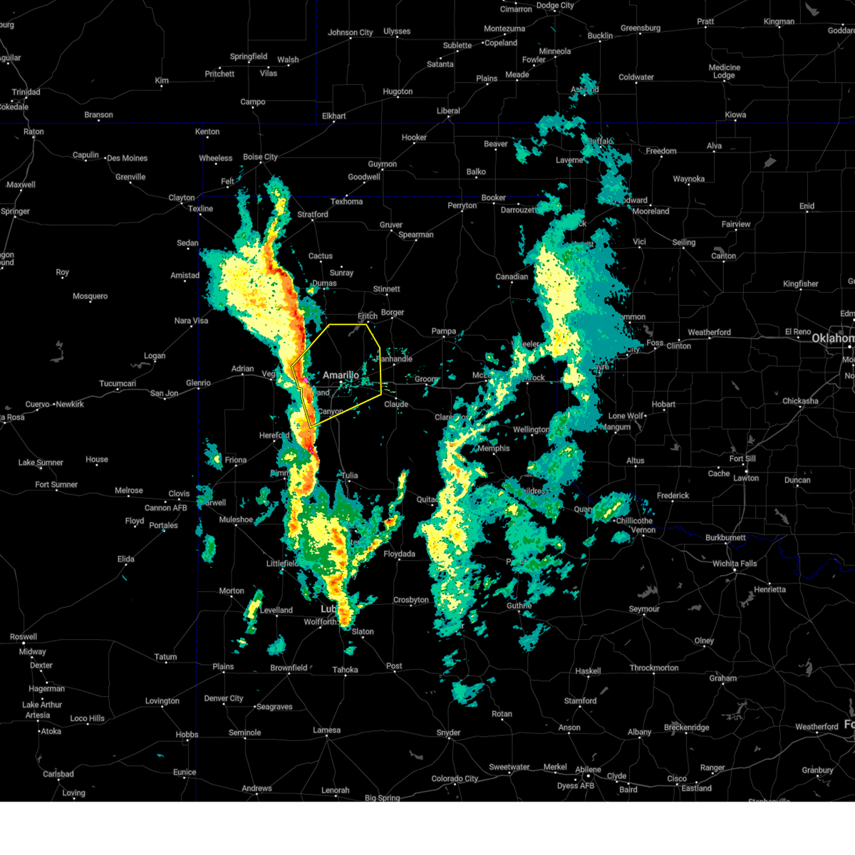 At 427 pm cst, severe thunderstorms were located along a line extending from 8 miles south of valley de oro to near bushland to 5 miles west of canyon, moving northeast at 45 mph (radar indicated). Hazards include 60 mph wind gusts and quarter size hail. Minor damage to roofs, siding, and trees is possible. Hail damage to vehicles is expected. At 427 pm cst, severe thunderstorms were located along a line extending from 8 miles south of valley de oro to near bushland to 5 miles west of canyon, moving northeast at 45 mph (radar indicated). Hazards include 60 mph wind gusts and quarter size hail. Minor damage to roofs, siding, and trees is possible. Hail damage to vehicles is expected.
|
| 9/10/2023 10:33 PM CDT |
 At 1033 pm cdt, severe thunderstorms were located along a line extending from 9 miles south of fritch to 7 miles southwest of palo duro canyon, moving east at 25 mph (radar indicated). Hazards include 60 mph wind gusts and quarter size hail. Minor damage to roofs, siding, and trees is possible. hail damage to vehicles is expected. locations impacted include, amarillo, canyon, panhandle, claude, lake tanglewood, mescalero park, wayside, washburn, palo duro canyon, timbercreek canyon, and pantex. hail threat, radar indicated max hail size, 1. 00in wind threat, radar indicated max wind gust, 60 mph. At 1033 pm cdt, severe thunderstorms were located along a line extending from 9 miles south of fritch to 7 miles southwest of palo duro canyon, moving east at 25 mph (radar indicated). Hazards include 60 mph wind gusts and quarter size hail. Minor damage to roofs, siding, and trees is possible. hail damage to vehicles is expected. locations impacted include, amarillo, canyon, panhandle, claude, lake tanglewood, mescalero park, wayside, washburn, palo duro canyon, timbercreek canyon, and pantex. hail threat, radar indicated max hail size, 1. 00in wind threat, radar indicated max wind gust, 60 mph.
|
| 9/10/2023 10:20 PM CDT |
 At 1019 pm cdt, automated weather equipment reported severe thunderstorms were located along a line extending from 13 miles southwest of lake meredith to 8 miles northwest of happy, moving east at 35 mph (automated weather equipment. at 957 pm cdt, automated weather equipment recorded a 63 mph wind gust 15 miles north northwest of amarillo). Hazards include 60 mph wind gusts. Minor damage to roofs, siding, and trees is possible. locations impacted include, amarillo, canyon, panhandle, claude, lake tanglewood, mescalero park, wayside, washburn, palo duro canyon, timbercreek canyon, and pantex. hail threat, radar indicated max hail size, <. 75 in wind threat, observed max wind gust, 60 mph. At 1019 pm cdt, automated weather equipment reported severe thunderstorms were located along a line extending from 13 miles southwest of lake meredith to 8 miles northwest of happy, moving east at 35 mph (automated weather equipment. at 957 pm cdt, automated weather equipment recorded a 63 mph wind gust 15 miles north northwest of amarillo). Hazards include 60 mph wind gusts. Minor damage to roofs, siding, and trees is possible. locations impacted include, amarillo, canyon, panhandle, claude, lake tanglewood, mescalero park, wayside, washburn, palo duro canyon, timbercreek canyon, and pantex. hail threat, radar indicated max hail size, <. 75 in wind threat, observed max wind gust, 60 mph.
|
| 9/10/2023 10:10 PM CDT |
 At 1010 pm cdt, automated weather equipment reported severe thunderstorms were located along a line extending from 14 miles southeast of masterson to 8 miles southeast of buffalo lake, moving east at 35 mph (automated weather equipment. at 957 pm cdt, automated weather equipment recorded a 63 mph wind gust 15 miles north northwest of amarillo). Hazards include 60 mph wind gusts. Minor damage to roofs, siding, and trees is possible. locations impacted include, amarillo, hereford, canyon, panhandle, claude, lake tanglewood, buffalo lake, bushland, wayside, washburn, umbarger, palo duro canyon, mescalero park, dawn, timbercreek canyon, and pantex. hail threat, radar indicated max hail size, <. 75 in wind threat, observed max wind gust, 60 mph. At 1010 pm cdt, automated weather equipment reported severe thunderstorms were located along a line extending from 14 miles southeast of masterson to 8 miles southeast of buffalo lake, moving east at 35 mph (automated weather equipment. at 957 pm cdt, automated weather equipment recorded a 63 mph wind gust 15 miles north northwest of amarillo). Hazards include 60 mph wind gusts. Minor damage to roofs, siding, and trees is possible. locations impacted include, amarillo, hereford, canyon, panhandle, claude, lake tanglewood, buffalo lake, bushland, wayside, washburn, umbarger, palo duro canyon, mescalero park, dawn, timbercreek canyon, and pantex. hail threat, radar indicated max hail size, <. 75 in wind threat, observed max wind gust, 60 mph.
|
| 9/10/2023 10:00 PM CDT |
 At 1000 pm cdt, severe thunderstorms were located along a line extending from 12 miles east of valley de oro to 6 miles southeast of buffalo lake, moving east at 35 mph (radar indicated). Hazards include 60 mph wind gusts. minor damage to roofs, siding, and trees is possible At 1000 pm cdt, severe thunderstorms were located along a line extending from 12 miles east of valley de oro to 6 miles southeast of buffalo lake, moving east at 35 mph (radar indicated). Hazards include 60 mph wind gusts. minor damage to roofs, siding, and trees is possible
|
| 8/8/2023 8:06 PM CDT |
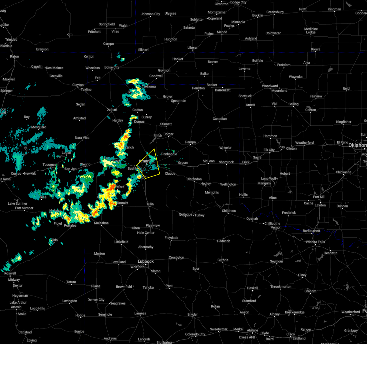 At 805 pm cdt, a severe thunderstorm was located near amarillo, moving northeast at 35 mph (radar indicated). Hazards include 60 mph wind gusts. Minor damage to roofs, siding, and trees is possible. locations impacted include, amarillo, lake tanglewood, mescalero park and timbercreek canyon. hail threat, radar indicated max hail size, <. 75 in wind threat, radar indicated max wind gust, 60 mph. At 805 pm cdt, a severe thunderstorm was located near amarillo, moving northeast at 35 mph (radar indicated). Hazards include 60 mph wind gusts. Minor damage to roofs, siding, and trees is possible. locations impacted include, amarillo, lake tanglewood, mescalero park and timbercreek canyon. hail threat, radar indicated max hail size, <. 75 in wind threat, radar indicated max wind gust, 60 mph.
|
| 8/8/2023 7:39 PM CDT |
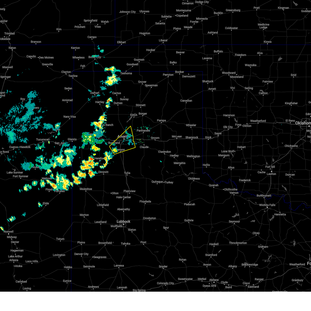 At 738 pm cdt, a severe thunderstorm was located 7 miles west of mescalero park, or 8 miles northwest of canyon, moving northeast at 30 mph (radar indicated). Hazards include 60 mph wind gusts. minor damage to roofs, siding, and trees is possible At 738 pm cdt, a severe thunderstorm was located 7 miles west of mescalero park, or 8 miles northwest of canyon, moving northeast at 30 mph (radar indicated). Hazards include 60 mph wind gusts. minor damage to roofs, siding, and trees is possible
|
| 7/16/2023 12:01 AM CDT |
 At 1200 am cdt, a severe thunderstorm was located 6 miles south of canyon, moving southeast at 35 mph (radar indicated). Hazards include 70 mph wind gusts. Expect some tree damage. damage is likely to mobile homes, roofs, and outbuildings. locations impacted include, amarillo, hereford, canyon, lake tanglewood, mescalero park, buffalo lake, dawn, wayside, umbarger, palo duro canyon and timbercreek canyon. thunderstorm damage threat, considerable hail threat, radar indicated max hail size, <. 75 in wind threat, radar indicated max wind gust, 70 mph. At 1200 am cdt, a severe thunderstorm was located 6 miles south of canyon, moving southeast at 35 mph (radar indicated). Hazards include 70 mph wind gusts. Expect some tree damage. damage is likely to mobile homes, roofs, and outbuildings. locations impacted include, amarillo, hereford, canyon, lake tanglewood, mescalero park, buffalo lake, dawn, wayside, umbarger, palo duro canyon and timbercreek canyon. thunderstorm damage threat, considerable hail threat, radar indicated max hail size, <. 75 in wind threat, radar indicated max wind gust, 70 mph.
|
| 7/15/2023 11:54 PM CDT |
 At 1153 pm cdt, a severe thunderstorm was located over buffalo lake, or 12 miles southwest of canyon, moving southeast at 20 mph (radar indicated). Hazards include 70 mph wind gusts. Expect some tree damage. damage is likely to mobile homes, roofs, and outbuildings. locations impacted include, amarillo, hereford, canyon, claude, lake tanglewood, buffalo lake, wayside, washburn, umbarger, palo duro canyon, mescalero park, dawn and timbercreek canyon. thunderstorm damage threat, considerable hail threat, radar indicated max hail size, <. 75 in wind threat, radar indicated max wind gust, 70 mph. At 1153 pm cdt, a severe thunderstorm was located over buffalo lake, or 12 miles southwest of canyon, moving southeast at 20 mph (radar indicated). Hazards include 70 mph wind gusts. Expect some tree damage. damage is likely to mobile homes, roofs, and outbuildings. locations impacted include, amarillo, hereford, canyon, claude, lake tanglewood, buffalo lake, wayside, washburn, umbarger, palo duro canyon, mescalero park, dawn and timbercreek canyon. thunderstorm damage threat, considerable hail threat, radar indicated max hail size, <. 75 in wind threat, radar indicated max wind gust, 70 mph.
|
| 7/15/2023 11:43 PM CDT | At 1143 pm cdt, a severe thunderstorm was located near canyon, moving east at 25 mph (radar indicated). Hazards include 70 mph wind gusts. Expect some tree damage. damage is likely to mobile homes, roofs, and outbuildings. locations impacted include, amarillo, hereford, canyon, claude, lake tanglewood, buffalo lake, wayside, washburn, umbarger, palo duro canyon, mescalero park, dawn and timbercreek canyon. thunderstorm damage threat, considerable hail threat, radar indicated max hail size, <. 75 in wind threat, radar indicated max wind gust, 70 mph. |
| 7/15/2023 11:32 PM CDT |
 At 1132 pm cdt, a severe thunderstorm was located over lake tanglewood, or 8 miles southeast of amarillo, moving southeast at 35 mph (radar indicated). Hazards include 70 mph wind gusts and quarter size hail. Expect some tree damage. damage is likely to mobile homes, roofs, and outbuildings. hail damage to vehicles is expected. locations impacted include, amarillo, hereford, canyon, claude, lake tanglewood, buffalo lake, wayside, washburn, umbarger, palo duro canyon, mescalero park, dawn and timbercreek canyon. thunderstorm damage threat, considerable hail threat, radar indicated max hail size, 1. 00in wind threat, radar indicated max wind gust, 70 mph. At 1132 pm cdt, a severe thunderstorm was located over lake tanglewood, or 8 miles southeast of amarillo, moving southeast at 35 mph (radar indicated). Hazards include 70 mph wind gusts and quarter size hail. Expect some tree damage. damage is likely to mobile homes, roofs, and outbuildings. hail damage to vehicles is expected. locations impacted include, amarillo, hereford, canyon, claude, lake tanglewood, buffalo lake, wayside, washburn, umbarger, palo duro canyon, mescalero park, dawn and timbercreek canyon. thunderstorm damage threat, considerable hail threat, radar indicated max hail size, 1. 00in wind threat, radar indicated max wind gust, 70 mph.
|
| 7/15/2023 11:14 PM CDT |
 At 1114 pm cdt, a severe thunderstorm was located 4 miles southeast of amarillo, moving southeast at 25 mph (radar indicated). Hazards include 70 mph wind gusts and quarter size hail. Expect some tree damage. damage is likely to mobile homes, roofs, and outbuildings. Hail damage to vehicles is expected. At 1114 pm cdt, a severe thunderstorm was located 4 miles southeast of amarillo, moving southeast at 25 mph (radar indicated). Hazards include 70 mph wind gusts and quarter size hail. Expect some tree damage. damage is likely to mobile homes, roofs, and outbuildings. Hail damage to vehicles is expected.
|
| 7/8/2023 10:21 PM CDT |
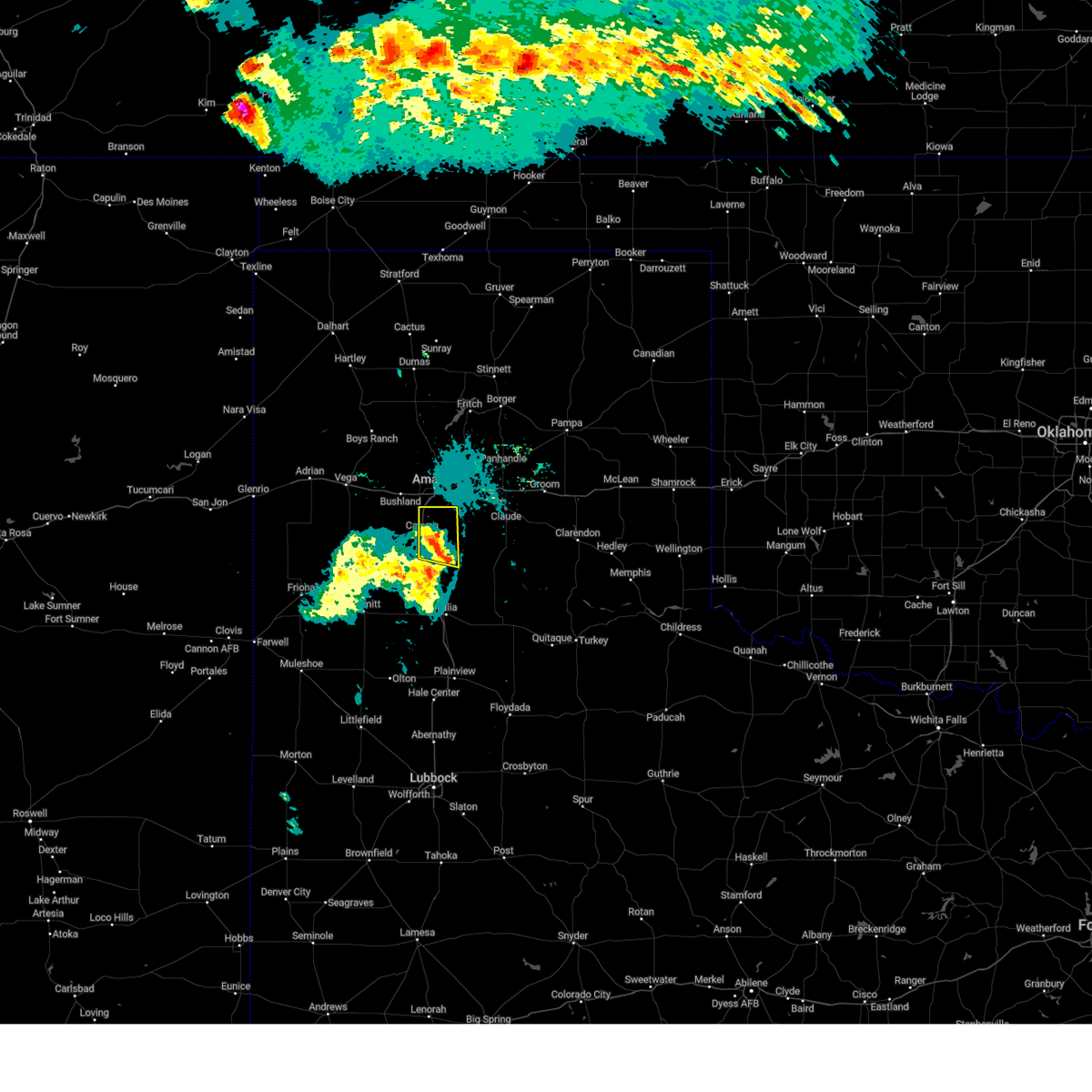 At 1021 pm cdt, a severe thunderstorm was located 7 miles southwest of palo duro canyon, or 9 miles southeast of canyon, moving east at 30 mph (radar indicated). Hazards include 60 mph wind gusts. Minor damage to roofs, siding, and trees is possible. locations impacted include, amarillo, canyon, lake tanglewood, mescalero park and timbercreek canyon. hail threat, radar indicated max hail size, <. 75 in wind threat, radar indicated max wind gust, 60 mph. At 1021 pm cdt, a severe thunderstorm was located 7 miles southwest of palo duro canyon, or 9 miles southeast of canyon, moving east at 30 mph (radar indicated). Hazards include 60 mph wind gusts. Minor damage to roofs, siding, and trees is possible. locations impacted include, amarillo, canyon, lake tanglewood, mescalero park and timbercreek canyon. hail threat, radar indicated max hail size, <. 75 in wind threat, radar indicated max wind gust, 60 mph.
|
| 7/8/2023 9:58 PM CDT |
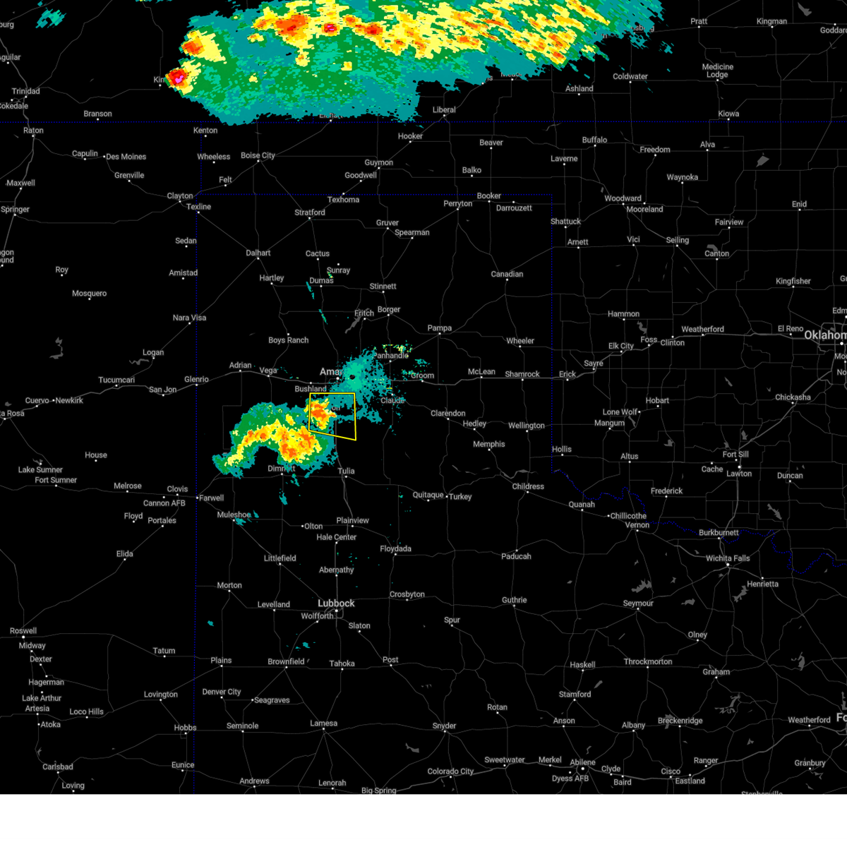 At 957 pm cdt, a severe thunderstorm was located 4 miles west of canyon, moving east at 25 mph (radar indicated). Hazards include 60 mph wind gusts. minor damage to roofs, siding, and trees is possible At 957 pm cdt, a severe thunderstorm was located 4 miles west of canyon, moving east at 25 mph (radar indicated). Hazards include 60 mph wind gusts. minor damage to roofs, siding, and trees is possible
|
| 7/6/2023 1:25 AM CDT |
 At 125 am cdt, a severe thunderstorm was located 5 miles west of washburn, or 10 miles east of amarillo, moving south at 15 mph (radar indicated). Hazards include 60 mph wind gusts. Minor damage to roofs, siding, and trees is possible. locations impacted include, amarillo, canyon, claude, lake tanglewood, mescalero park, washburn, palo duro canyon, goodnight and timbercreek canyon. hail threat, radar indicated max hail size, <. 75 in wind threat, radar indicated max wind gust, 60 mph. At 125 am cdt, a severe thunderstorm was located 5 miles west of washburn, or 10 miles east of amarillo, moving south at 15 mph (radar indicated). Hazards include 60 mph wind gusts. Minor damage to roofs, siding, and trees is possible. locations impacted include, amarillo, canyon, claude, lake tanglewood, mescalero park, washburn, palo duro canyon, goodnight and timbercreek canyon. hail threat, radar indicated max hail size, <. 75 in wind threat, radar indicated max wind gust, 60 mph.
|
| 7/6/2023 1:02 AM CDT |
 At 101 am cdt, automated weather equipment reported a severe thunderstorm was located 8 miles east of amarillo, moving south at 15 mph (automated weather equipment. at 101 am cdt, a 59 mph wind gust was recorded at the amarillo airport). Hazards include 60 mph wind gusts. Minor damage to roofs, siding, and trees is possible. locations impacted include, amarillo, canyon, panhandle, claude, lake tanglewood, mescalero park, washburn, palo duro canyon, goodnight, timbercreek canyon and pantex. hail threat, radar indicated max hail size, <. 75 in wind threat, radar indicated max wind gust, 60 mph. At 101 am cdt, automated weather equipment reported a severe thunderstorm was located 8 miles east of amarillo, moving south at 15 mph (automated weather equipment. at 101 am cdt, a 59 mph wind gust was recorded at the amarillo airport). Hazards include 60 mph wind gusts. Minor damage to roofs, siding, and trees is possible. locations impacted include, amarillo, canyon, panhandle, claude, lake tanglewood, mescalero park, washburn, palo duro canyon, goodnight, timbercreek canyon and pantex. hail threat, radar indicated max hail size, <. 75 in wind threat, radar indicated max wind gust, 60 mph.
|
| 7/6/2023 12:46 AM CDT |
 At 1245 am cdt, severe thunderstorms were located along a line extending from 4 miles northwest of panhandle to 7 miles north of amarillo, moving south at 15 mph (automated weather equipment. at 1239 am cdt, a 61 mph gust was recorded 1 mile east southeast of pantex). Hazards include 60 mph wind gusts. minor damage to roofs, siding, and trees is possible At 1245 am cdt, severe thunderstorms were located along a line extending from 4 miles northwest of panhandle to 7 miles north of amarillo, moving south at 15 mph (automated weather equipment. at 1239 am cdt, a 61 mph gust was recorded 1 mile east southeast of pantex). Hazards include 60 mph wind gusts. minor damage to roofs, siding, and trees is possible
|
| 7/2/2023 7:53 PM CDT |
 At 752 pm cdt, severe thunderstorms were located along a line extending from 9 miles southeast of fritch to near washburn to near mescalero park, moving east at 25 mph (radar indicated). Hazards include 60 mph wind gusts. minor damage to roofs, siding, and trees is possible At 752 pm cdt, severe thunderstorms were located along a line extending from 9 miles southeast of fritch to near washburn to near mescalero park, moving east at 25 mph (radar indicated). Hazards include 60 mph wind gusts. minor damage to roofs, siding, and trees is possible
|
| 7/2/2023 7:41 PM CDT |
 At 740 pm cdt, severe thunderstorms were located along a line extending from 10 miles southeast of fritch to 6 miles northwest of washburn to mescalero park to 6 miles north of dawn, moving east at 35 mph (radar indicated). Hazards include 60 mph wind gusts. Minor damage to roofs, siding, and trees is possible. locations impacted include, amarillo, canyon, panhandle, fritch, white deer, lake tanglewood, buffalo lake, bushland, washburn, umbarger, palo duro canyon, mescalero park, timbercreek canyon and pantex. hail threat, radar indicated max hail size, <. 75 in wind threat, radar indicated max wind gust, 60 mph. At 740 pm cdt, severe thunderstorms were located along a line extending from 10 miles southeast of fritch to 6 miles northwest of washburn to mescalero park to 6 miles north of dawn, moving east at 35 mph (radar indicated). Hazards include 60 mph wind gusts. Minor damage to roofs, siding, and trees is possible. locations impacted include, amarillo, canyon, panhandle, fritch, white deer, lake tanglewood, buffalo lake, bushland, washburn, umbarger, palo duro canyon, mescalero park, timbercreek canyon and pantex. hail threat, radar indicated max hail size, <. 75 in wind threat, radar indicated max wind gust, 60 mph.
|
| 7/2/2023 7:04 PM CDT |
 At 704 pm cdt, severe thunderstorms were located along a line extending from 4 miles northwest of lake meredith to 12 miles east of valley de oro to 6 miles northwest of bushland to 4 miles southwest of vega, moving southeast at 35 mph (radar indicated). Hazards include 70 mph wind gusts and nickel size hail. Expect some tree damage. damage is likely to mobile homes, roofs, and outbuildings. locations impacted include, amarillo, canyon, panhandle, vega, fritch, white deer, lake tanglewood, buffalo lake, bushland, washburn, umbarger, wildorado, palo duro canyon, mescalero park, dawn, lake meredith, timbercreek canyon and pantex. thunderstorm damage threat, considerable hail threat, radar indicated max hail size, 0. 88in wind threat, radar indicated max wind gust, 70 mph. At 704 pm cdt, severe thunderstorms were located along a line extending from 4 miles northwest of lake meredith to 12 miles east of valley de oro to 6 miles northwest of bushland to 4 miles southwest of vega, moving southeast at 35 mph (radar indicated). Hazards include 70 mph wind gusts and nickel size hail. Expect some tree damage. damage is likely to mobile homes, roofs, and outbuildings. locations impacted include, amarillo, canyon, panhandle, vega, fritch, white deer, lake tanglewood, buffalo lake, bushland, washburn, umbarger, wildorado, palo duro canyon, mescalero park, dawn, lake meredith, timbercreek canyon and pantex. thunderstorm damage threat, considerable hail threat, radar indicated max hail size, 0. 88in wind threat, radar indicated max wind gust, 70 mph.
|
| 7/2/2023 6:59 PM CDT |
 At 658 pm cdt, severe thunderstorms were located along a line extending from 6 miles northwest of lake meredith to 11 miles east of valley de oro to 6 miles northeast of wildorado to 4 miles southwest of vega, moving southeast at 35 mph (radar indicated). Hazards include 60 mph wind gusts and nickel size hail. minor damage to roofs, siding, and trees is possible At 658 pm cdt, severe thunderstorms were located along a line extending from 6 miles northwest of lake meredith to 11 miles east of valley de oro to 6 miles northeast of wildorado to 4 miles southwest of vega, moving southeast at 35 mph (radar indicated). Hazards include 60 mph wind gusts and nickel size hail. minor damage to roofs, siding, and trees is possible
|
| 6/30/2023 2:45 PM CDT |
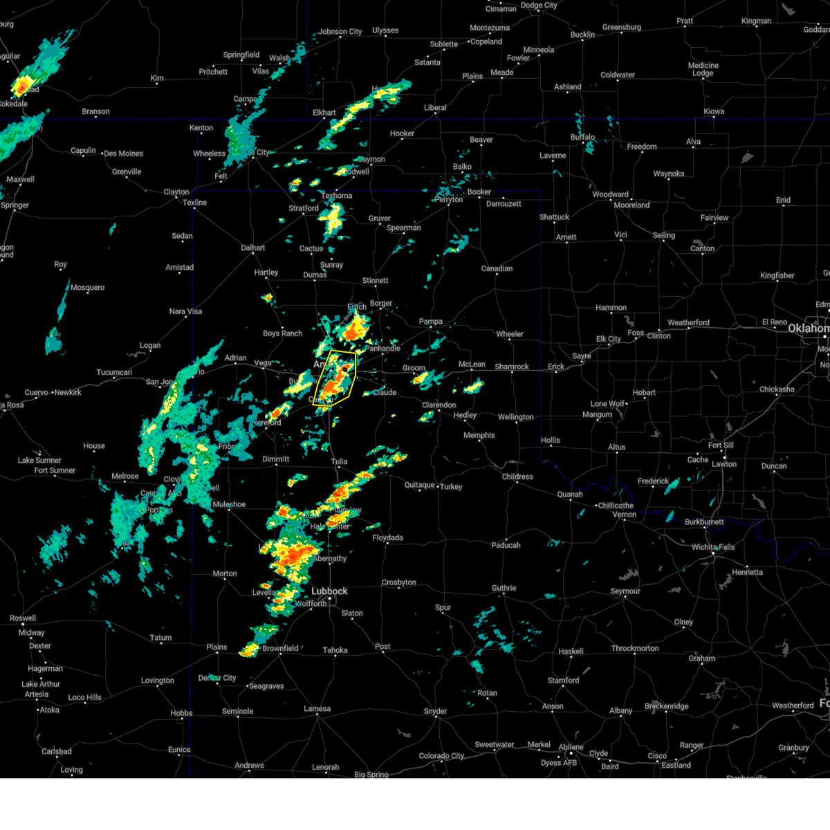 At 244 pm cdt, a severe thunderstorm was located 4 miles south of amarillo, moving north at 20 mph (radar indicated). Hazards include 60 mph wind gusts and quarter size hail. Minor damage to roofs, siding, and trees is possible. hail damage to vehicles is expected. locations impacted include, amarillo, canyon, lake tanglewood, mescalero park and timbercreek canyon. hail threat, radar indicated max hail size, 1. 00in wind threat, radar indicated max wind gust, 60 mph. At 244 pm cdt, a severe thunderstorm was located 4 miles south of amarillo, moving north at 20 mph (radar indicated). Hazards include 60 mph wind gusts and quarter size hail. Minor damage to roofs, siding, and trees is possible. hail damage to vehicles is expected. locations impacted include, amarillo, canyon, lake tanglewood, mescalero park and timbercreek canyon. hail threat, radar indicated max hail size, 1. 00in wind threat, radar indicated max wind gust, 60 mph.
|
| 6/30/2023 2:33 PM CDT |
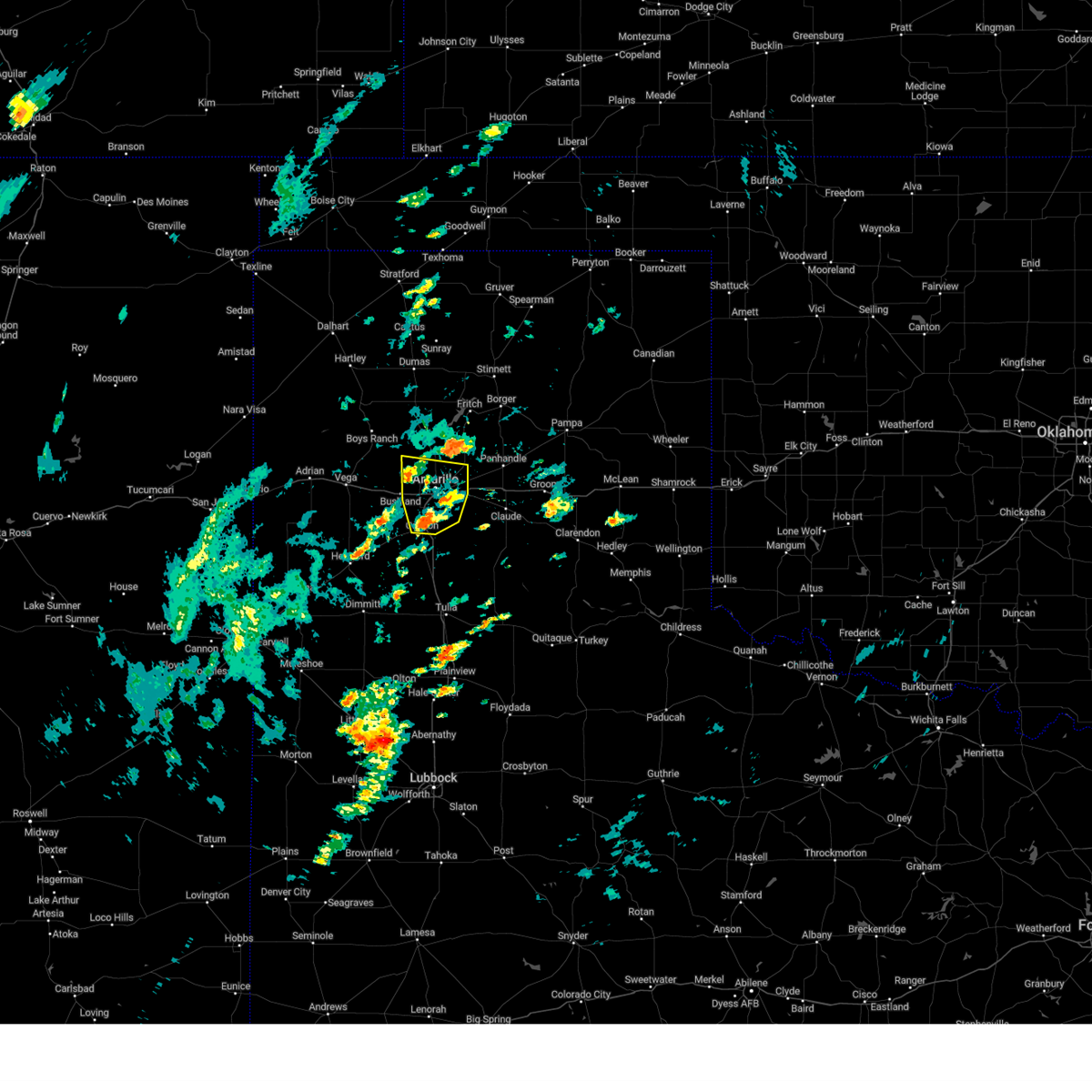 At 233 pm cdt, a severe thunderstorm was located over mescalero park, or 6 miles north of canyon, moving north at 20 mph (radar indicated). Hazards include 60 mph wind gusts and quarter size hail. Minor damage to roofs, siding, and trees is possible. hail damage to vehicles is expected. locations impacted include, amarillo, canyon, lake tanglewood, mescalero park and timbercreek canyon. hail threat, radar indicated max hail size, 1. 00in wind threat, radar indicated max wind gust, 60 mph. At 233 pm cdt, a severe thunderstorm was located over mescalero park, or 6 miles north of canyon, moving north at 20 mph (radar indicated). Hazards include 60 mph wind gusts and quarter size hail. Minor damage to roofs, siding, and trees is possible. hail damage to vehicles is expected. locations impacted include, amarillo, canyon, lake tanglewood, mescalero park and timbercreek canyon. hail threat, radar indicated max hail size, 1. 00in wind threat, radar indicated max wind gust, 60 mph.
|
| 6/30/2023 2:24 PM CDT |
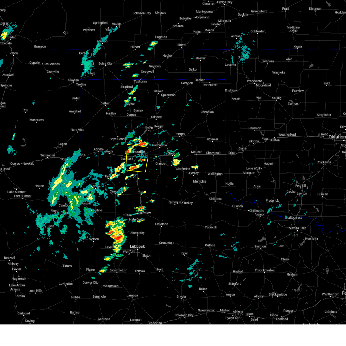 At 224 pm cdt, a severe thunderstorm was located over mescalero park, or near canyon, moving north at 20 mph (radar indicated). Hazards include 60 mph wind gusts and quarter size hail. Minor damage to roofs, siding, and trees is possible. Hail damage to vehicles is expected. At 224 pm cdt, a severe thunderstorm was located over mescalero park, or near canyon, moving north at 20 mph (radar indicated). Hazards include 60 mph wind gusts and quarter size hail. Minor damage to roofs, siding, and trees is possible. Hail damage to vehicles is expected.
|
| 6/23/2023 6:23 PM CDT |
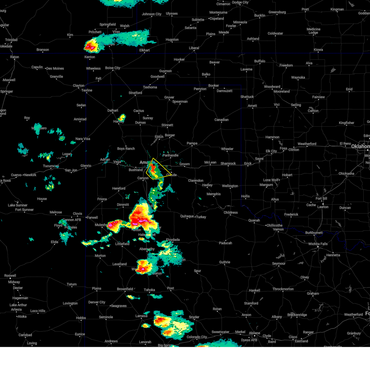 The severe thunderstorm warning for northwestern armstrong, northeastern randall, southwestern carson and southeastern potter counties will expire at 630 pm cdt, the storm which prompted the warning has weakened below severe limits, and no longer poses an immediate threat to life or property. therefore, the warning will be allowed to expire. however small hail, gusty winds and heavy rain are still possible with this thunderstorm. a severe thunderstorm watch remains in effect until 1100 pm cdt for the panhandle of texas. The severe thunderstorm warning for northwestern armstrong, northeastern randall, southwestern carson and southeastern potter counties will expire at 630 pm cdt, the storm which prompted the warning has weakened below severe limits, and no longer poses an immediate threat to life or property. therefore, the warning will be allowed to expire. however small hail, gusty winds and heavy rain are still possible with this thunderstorm. a severe thunderstorm watch remains in effect until 1100 pm cdt for the panhandle of texas.
|
| 6/23/2023 6:14 PM CDT |
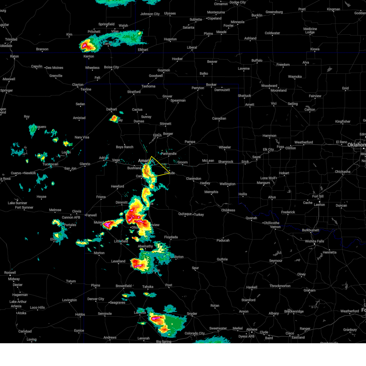 At 613 pm cdt, a severe thunderstorm was located 11 miles northwest of washburn, or 13 miles northeast of amarillo, moving northeast at 60 mph (radar indicated). Hazards include 60 mph wind gusts and quarter size hail. Minor damage to roofs, siding, and trees is possible. hail damage to vehicles is expected. locations impacted include, amarillo, lake tanglewood and washburn. hail threat, radar indicated max hail size, 1. 00in wind threat, radar indicated max wind gust, 60 mph. At 613 pm cdt, a severe thunderstorm was located 11 miles northwest of washburn, or 13 miles northeast of amarillo, moving northeast at 60 mph (radar indicated). Hazards include 60 mph wind gusts and quarter size hail. Minor damage to roofs, siding, and trees is possible. hail damage to vehicles is expected. locations impacted include, amarillo, lake tanglewood and washburn. hail threat, radar indicated max hail size, 1. 00in wind threat, radar indicated max wind gust, 60 mph.
|
| 6/23/2023 6:09 PM CDT |
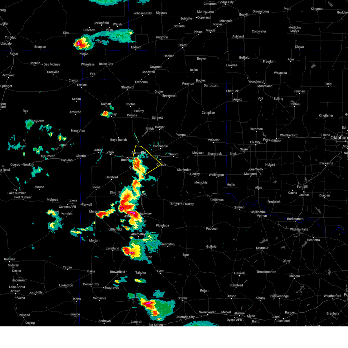 At 609 pm cdt, a severe thunderstorm was located 9 miles northeast of amarillo, moving northeast at 60 mph (radar indicated). Hazards include 60 mph wind gusts and quarter size hail. Minor damage to roofs, siding, and trees is possible. hail damage to vehicles is expected. locations impacted include, amarillo, lake tanglewood, washburn, palo duro canyon, mescalero park and timbercreek canyon. hail threat, radar indicated max hail size, 1. 00in wind threat, radar indicated max wind gust, 60 mph. At 609 pm cdt, a severe thunderstorm was located 9 miles northeast of amarillo, moving northeast at 60 mph (radar indicated). Hazards include 60 mph wind gusts and quarter size hail. Minor damage to roofs, siding, and trees is possible. hail damage to vehicles is expected. locations impacted include, amarillo, lake tanglewood, washburn, palo duro canyon, mescalero park and timbercreek canyon. hail threat, radar indicated max hail size, 1. 00in wind threat, radar indicated max wind gust, 60 mph.
|
| 6/23/2023 6:02 PM CDT |
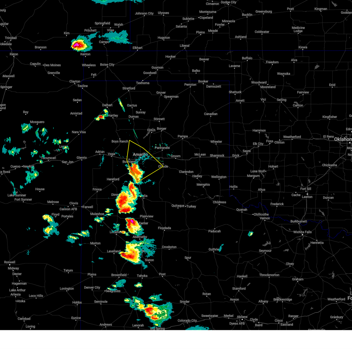 At 601 pm cdt, a severe thunderstorm was located over amarillo, moving northeast at 60 mph (radar indicated). Hazards include 60 mph wind gusts and quarter size hail. Minor damage to roofs, siding, and trees is possible. hail damage to vehicles is expected. locations impacted include, amarillo, canyon, lake tanglewood, mescalero park, bushland, washburn, palo duro canyon and timbercreek canyon. hail threat, radar indicated max hail size, 1. 00in wind threat, radar indicated max wind gust, 60 mph. At 601 pm cdt, a severe thunderstorm was located over amarillo, moving northeast at 60 mph (radar indicated). Hazards include 60 mph wind gusts and quarter size hail. Minor damage to roofs, siding, and trees is possible. hail damage to vehicles is expected. locations impacted include, amarillo, canyon, lake tanglewood, mescalero park, bushland, washburn, palo duro canyon and timbercreek canyon. hail threat, radar indicated max hail size, 1. 00in wind threat, radar indicated max wind gust, 60 mph.
|
| 6/23/2023 5:50 PM CDT |
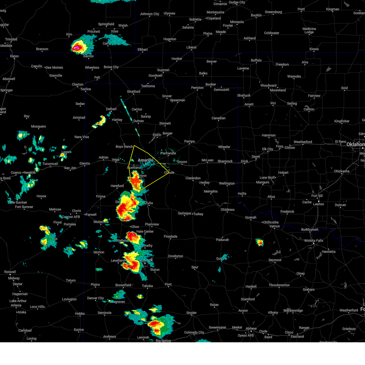 At 550 pm cdt, a severe thunderstorm was located over mescalero park, or 5 miles north of canyon, moving northeast at 60 mph (radar indicated). Hazards include 60 mph wind gusts and quarter size hail. Minor damage to roofs, siding, and trees is possible. hail damage to vehicles is expected. locations impacted include, amarillo, canyon, lake tanglewood, mescalero park, bushland, washburn, umbarger, palo duro canyon and timbercreek canyon. hail threat, radar indicated max hail size, 1. 00in wind threat, radar indicated max wind gust, 60 mph. At 550 pm cdt, a severe thunderstorm was located over mescalero park, or 5 miles north of canyon, moving northeast at 60 mph (radar indicated). Hazards include 60 mph wind gusts and quarter size hail. Minor damage to roofs, siding, and trees is possible. hail damage to vehicles is expected. locations impacted include, amarillo, canyon, lake tanglewood, mescalero park, bushland, washburn, umbarger, palo duro canyon and timbercreek canyon. hail threat, radar indicated max hail size, 1. 00in wind threat, radar indicated max wind gust, 60 mph.
|
| 6/23/2023 5:40 PM CDT |
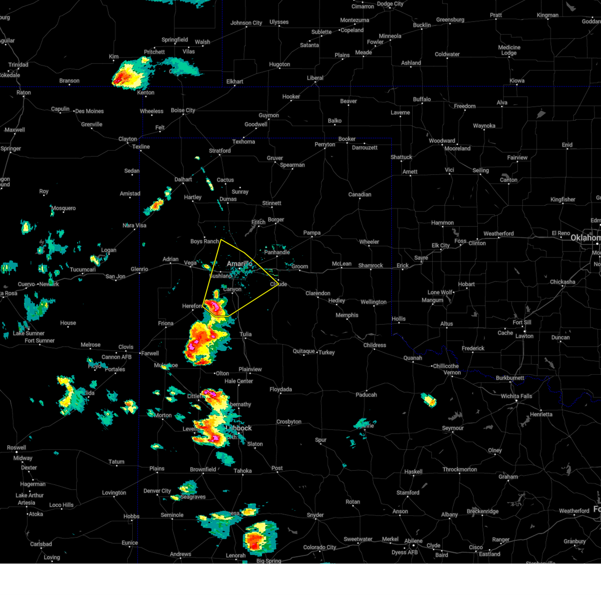 At 539 pm cdt, a severe thunderstorm was located near umbarger, or 7 miles west of canyon, moving northeast at 60 mph (radar indicated). Hazards include 60 mph wind gusts and quarter size hail. Minor damage to roofs, siding, and trees is possible. Hail damage to vehicles is expected. At 539 pm cdt, a severe thunderstorm was located near umbarger, or 7 miles west of canyon, moving northeast at 60 mph (radar indicated). Hazards include 60 mph wind gusts and quarter size hail. Minor damage to roofs, siding, and trees is possible. Hail damage to vehicles is expected.
|
| 6/4/2023 2:10 PM CDT |
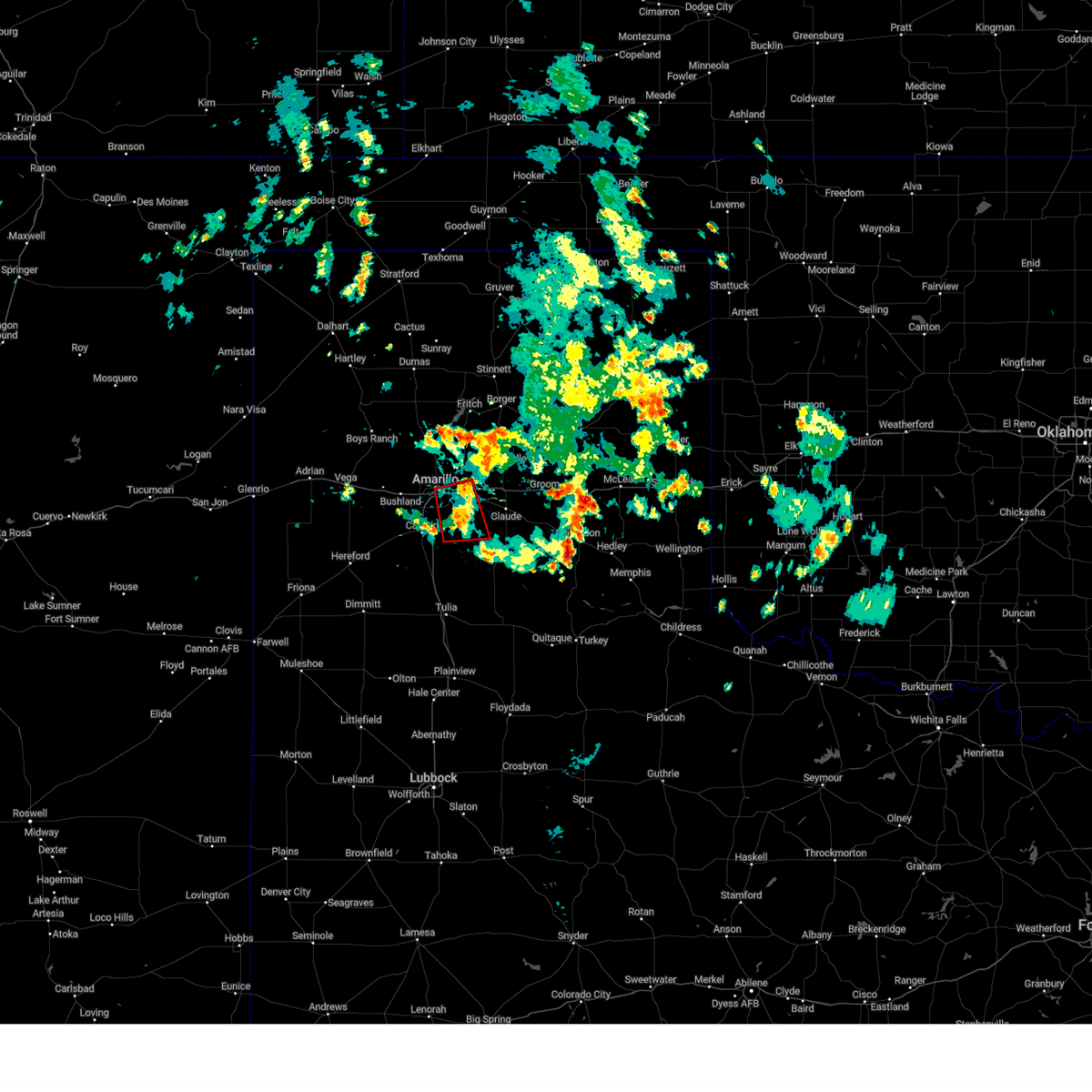 The tornado warning for northwestern armstrong, northeastern randall, southwestern carson and southeastern potter counties will expire at 215 pm cdt, the tornado threat has diminished and the tornado warning has been cancelled. however, large hail and damaging winds remain likely and a severe thunderstorm warning remains in effect for the area. however gusty winds and heavy rain are still possible with this thunderstorm. The tornado warning for northwestern armstrong, northeastern randall, southwestern carson and southeastern potter counties will expire at 215 pm cdt, the tornado threat has diminished and the tornado warning has been cancelled. however, large hail and damaging winds remain likely and a severe thunderstorm warning remains in effect for the area. however gusty winds and heavy rain are still possible with this thunderstorm.
|
| 6/4/2023 2:06 PM CDT |
 At 206 pm cdt, a severe thunderstorm capable of producing a tornado was located near palo duro canyon, or 12 miles east of canyon, moving south at 10 mph (radar indicated rotation). Hazards include tornado and quarter size hail. Flying debris will be dangerous to those caught without shelter. mobile homes will be damaged or destroyed. damage to roofs, windows, and vehicles will occur. tree damage is likely. Locations impacted include, amarillo, lake tanglewood, washburn and palo duro canyon. At 206 pm cdt, a severe thunderstorm capable of producing a tornado was located near palo duro canyon, or 12 miles east of canyon, moving south at 10 mph (radar indicated rotation). Hazards include tornado and quarter size hail. Flying debris will be dangerous to those caught without shelter. mobile homes will be damaged or destroyed. damage to roofs, windows, and vehicles will occur. tree damage is likely. Locations impacted include, amarillo, lake tanglewood, washburn and palo duro canyon.
|
| 6/4/2023 1:57 PM CDT |
 At 157 pm cdt, a severe thunderstorm capable of producing a tornado was located 5 miles north of palo duro canyon, or 12 miles east of canyon, moving south at 10 mph (radar indicated rotation). Hazards include tornado and quarter size hail. Flying debris will be dangerous to those caught without shelter. mobile homes will be damaged or destroyed. damage to roofs, windows, and vehicles will occur. tree damage is likely. Locations impacted include, amarillo, lake tanglewood, washburn and palo duro canyon. At 157 pm cdt, a severe thunderstorm capable of producing a tornado was located 5 miles north of palo duro canyon, or 12 miles east of canyon, moving south at 10 mph (radar indicated rotation). Hazards include tornado and quarter size hail. Flying debris will be dangerous to those caught without shelter. mobile homes will be damaged or destroyed. damage to roofs, windows, and vehicles will occur. tree damage is likely. Locations impacted include, amarillo, lake tanglewood, washburn and palo duro canyon.
|
| 6/4/2023 1:49 PM CDT |
 At 149 pm cdt, a severe thunderstorm capable of producing a tornado was located 6 miles east of lake tanglewood, or 13 miles southeast of amarillo, and is nearly stationary (radar indicated rotation). Hazards include tornado and quarter size hail. Flying debris will be dangerous to those caught without shelter. mobile homes will be damaged or destroyed. damage to roofs, windows, and vehicles will occur. tree damage is likely. Locations impacted include, amarillo, lake tanglewood, washburn and palo duro canyon. At 149 pm cdt, a severe thunderstorm capable of producing a tornado was located 6 miles east of lake tanglewood, or 13 miles southeast of amarillo, and is nearly stationary (radar indicated rotation). Hazards include tornado and quarter size hail. Flying debris will be dangerous to those caught without shelter. mobile homes will be damaged or destroyed. damage to roofs, windows, and vehicles will occur. tree damage is likely. Locations impacted include, amarillo, lake tanglewood, washburn and palo duro canyon.
|
| 6/4/2023 1:46 PM CDT |
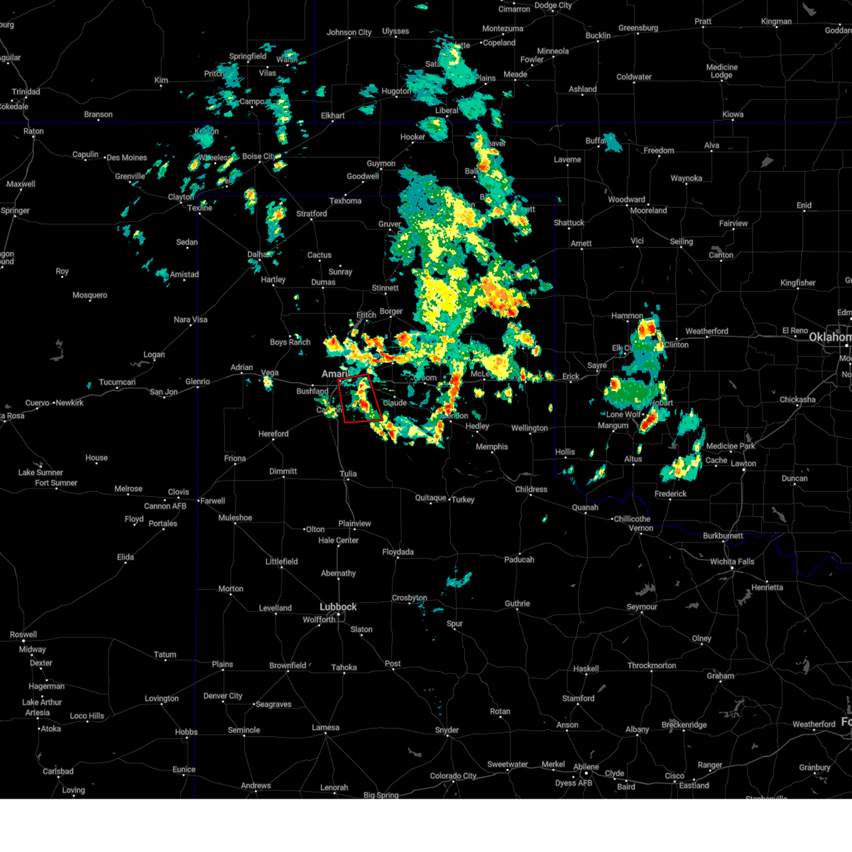 At 146 pm cdt, a severe thunderstorm capable of producing a tornado was located 4 miles west of washburn, or 11 miles east of amarillo, and is nearly stationary (radar indicated rotation). Hazards include tornado and quarter size hail. Flying debris will be dangerous to those caught without shelter. mobile homes will be damaged or destroyed. damage to roofs, windows, and vehicles will occur. tree damage is likely. Locations impacted include, amarillo, lake tanglewood, washburn, palo duro canyon and timbercreek canyon. At 146 pm cdt, a severe thunderstorm capable of producing a tornado was located 4 miles west of washburn, or 11 miles east of amarillo, and is nearly stationary (radar indicated rotation). Hazards include tornado and quarter size hail. Flying debris will be dangerous to those caught without shelter. mobile homes will be damaged or destroyed. damage to roofs, windows, and vehicles will occur. tree damage is likely. Locations impacted include, amarillo, lake tanglewood, washburn, palo duro canyon and timbercreek canyon.
|
| 6/4/2023 1:34 PM CDT |
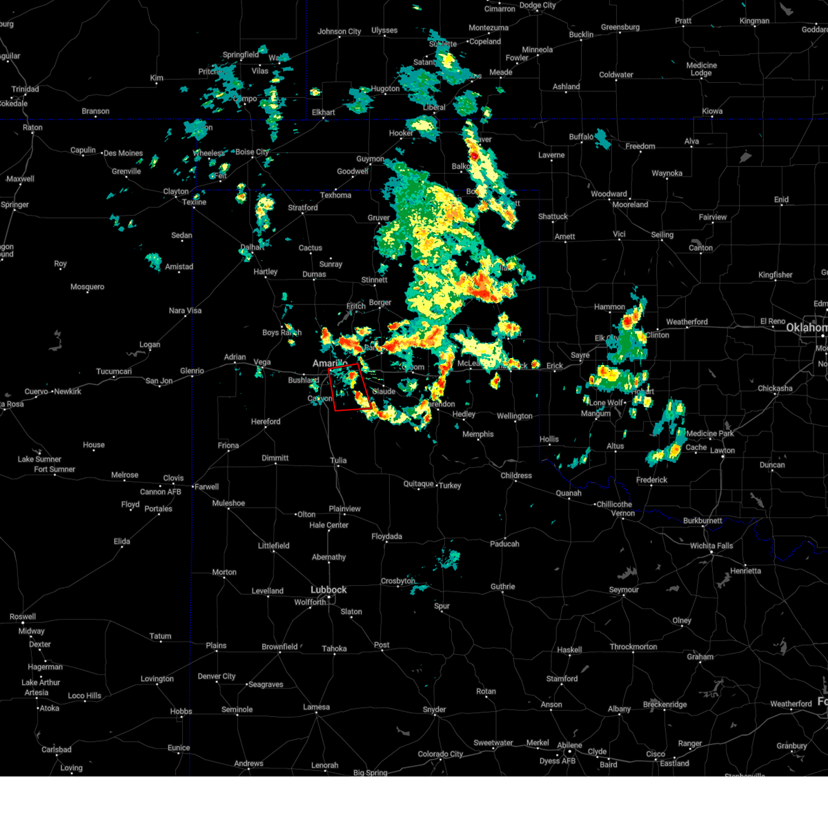 At 133 pm cdt, a severe thunderstorm capable of producing a tornado was located 6 miles southwest of washburn, or 11 miles southeast of amarillo, moving south at 10 mph (weather spotters reported a funnel cloud). Hazards include tornado. Flying debris will be dangerous to those caught without shelter. mobile homes will be damaged or destroyed. damage to roofs, windows, and vehicles will occur. tree damage is likely. Locations impacted include, amarillo, lake tanglewood, washburn, palo duro canyon and timbercreek canyon. At 133 pm cdt, a severe thunderstorm capable of producing a tornado was located 6 miles southwest of washburn, or 11 miles southeast of amarillo, moving south at 10 mph (weather spotters reported a funnel cloud). Hazards include tornado. Flying debris will be dangerous to those caught without shelter. mobile homes will be damaged or destroyed. damage to roofs, windows, and vehicles will occur. tree damage is likely. Locations impacted include, amarillo, lake tanglewood, washburn, palo duro canyon and timbercreek canyon.
|
| 6/4/2023 1:26 PM CDT |
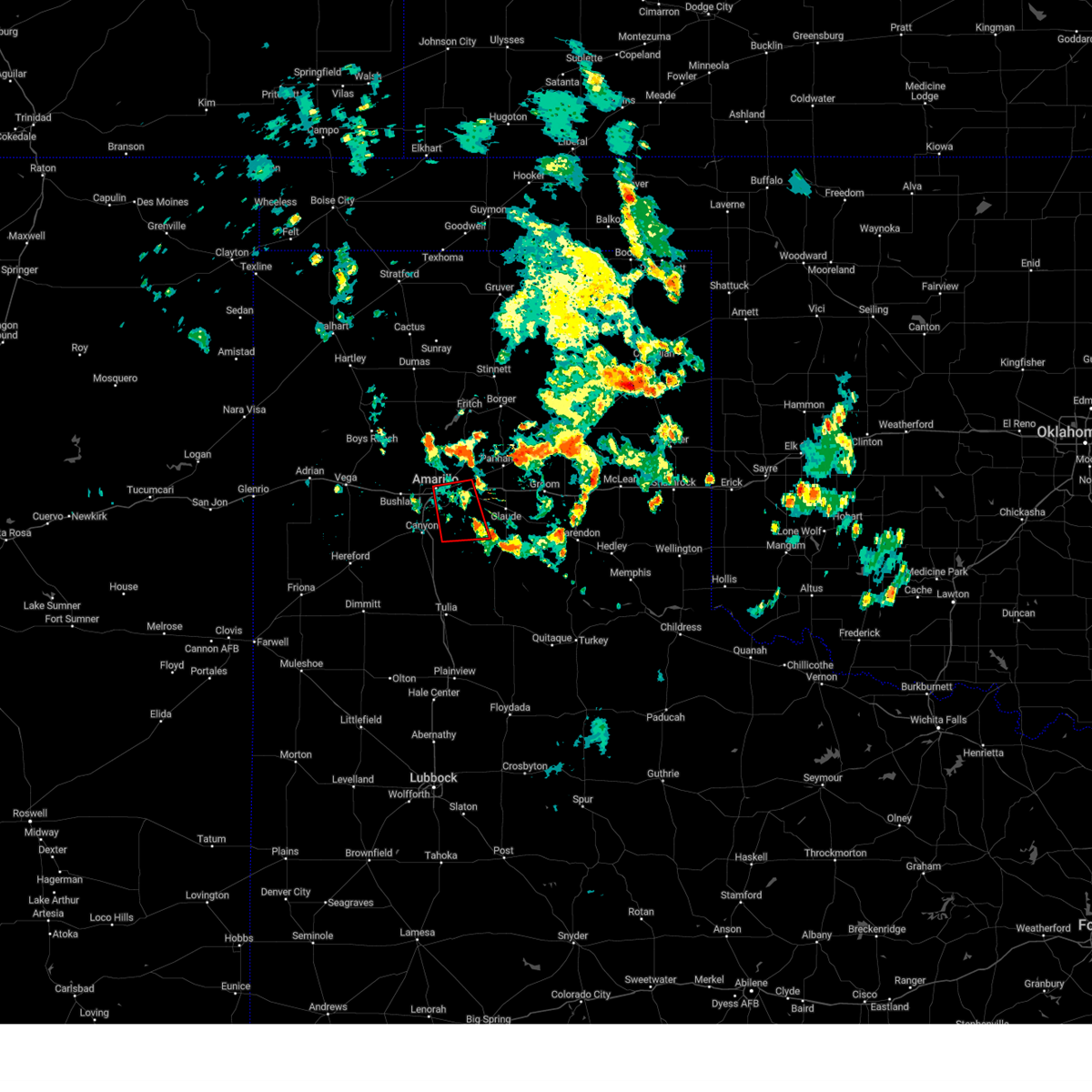 At 126 pm cdt, a severe thunderstorm capable of producing a tornado was located 6 miles west of washburn, or 10 miles east of amarillo, moving south at 10 mph (weather spotters reported funnel cloud). Hazards include tornado. Flying debris will be dangerous to those caught without shelter. mobile homes will be damaged or destroyed. damage to roofs, windows, and vehicles will occur. Tree damage is likely. At 126 pm cdt, a severe thunderstorm capable of producing a tornado was located 6 miles west of washburn, or 10 miles east of amarillo, moving south at 10 mph (weather spotters reported funnel cloud). Hazards include tornado. Flying debris will be dangerous to those caught without shelter. mobile homes will be damaged or destroyed. damage to roofs, windows, and vehicles will occur. Tree damage is likely.
|
| 6/3/2023 9:54 PM CDT |
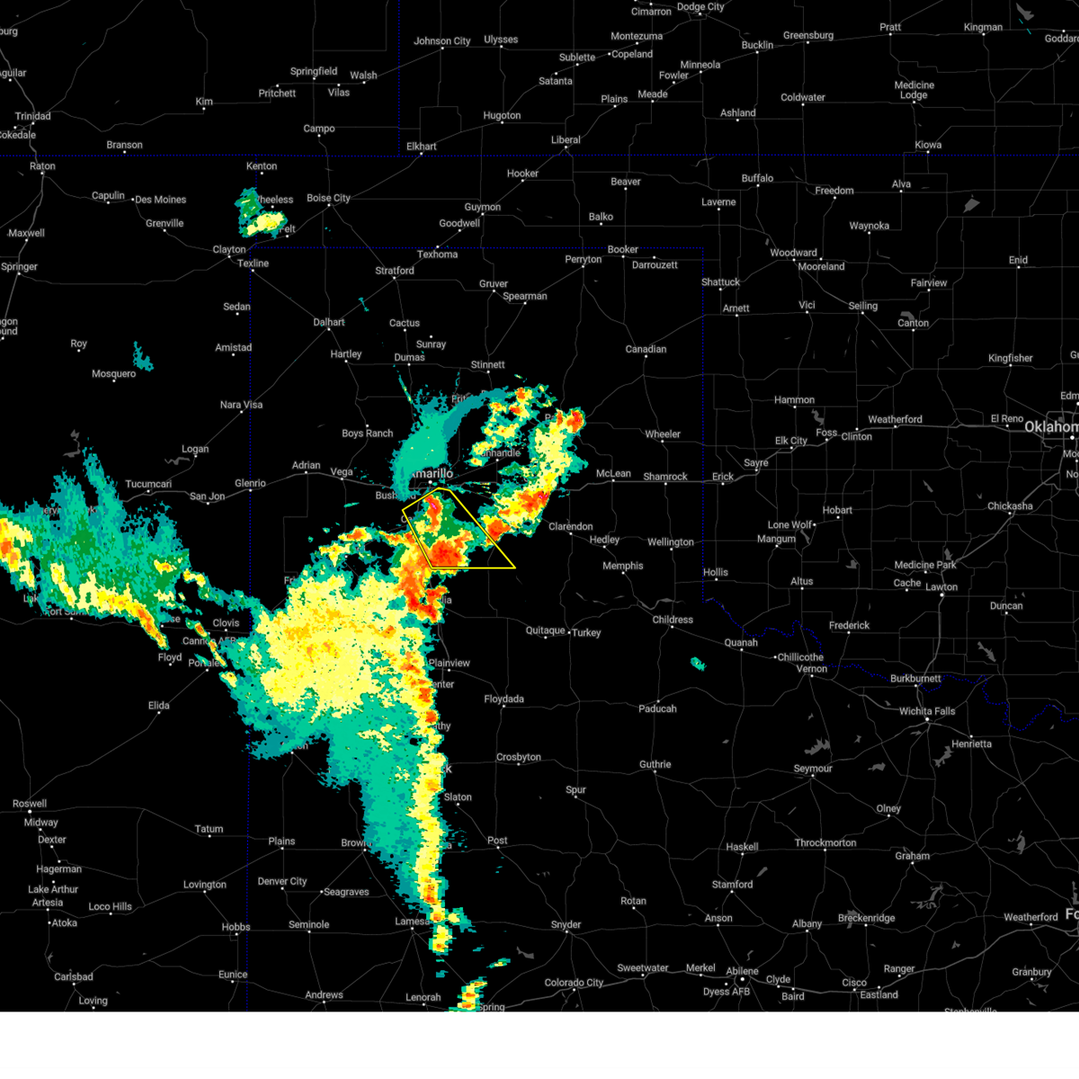 At 954 pm cdt, a severe thunderstorm was located over lake tanglewood, or 9 miles southeast of amarillo, moving southeast at 20 mph (radar indicated). Hazards include 60 mph wind gusts and quarter size hail. Minor damage to roofs, siding, and trees is possible. hail damage to vehicles is expected. locations impacted include, amarillo, canyon, lake tanglewood, mescalero park, wayside, palo duro canyon and timbercreek canyon. hail threat, radar indicated max hail size, 1. 00in wind threat, radar indicated max wind gust, 60 mph. At 954 pm cdt, a severe thunderstorm was located over lake tanglewood, or 9 miles southeast of amarillo, moving southeast at 20 mph (radar indicated). Hazards include 60 mph wind gusts and quarter size hail. Minor damage to roofs, siding, and trees is possible. hail damage to vehicles is expected. locations impacted include, amarillo, canyon, lake tanglewood, mescalero park, wayside, palo duro canyon and timbercreek canyon. hail threat, radar indicated max hail size, 1. 00in wind threat, radar indicated max wind gust, 60 mph.
|
| 6/3/2023 9:05 PM CDT |
 At 905 pm cdt, severe thunderstorms were located along a line extending from 3 miles southwest of mescalero park to 7 miles northwest of black, moving southeast at 25 mph (radar indicated). Hazards include ping pong ball size hail and 60 mph wind gusts. Minor damage to roofs, siding, and trees is possible. people and animals outdoors will be injured. expect hail damage to roofs, siding, windows, and vehicles. locations impacted include, amarillo, hereford, canyon, lake tanglewood, mescalero park, buffalo lake, dawn, wayside, umbarger, bootleg, palo duro canyon and timbercreek canyon. hail threat, radar indicated max hail size, 1. 50 in wind threat, radar indicated max wind gust, 60 mph. At 905 pm cdt, severe thunderstorms were located along a line extending from 3 miles southwest of mescalero park to 7 miles northwest of black, moving southeast at 25 mph (radar indicated). Hazards include ping pong ball size hail and 60 mph wind gusts. Minor damage to roofs, siding, and trees is possible. people and animals outdoors will be injured. expect hail damage to roofs, siding, windows, and vehicles. locations impacted include, amarillo, hereford, canyon, lake tanglewood, mescalero park, buffalo lake, dawn, wayside, umbarger, bootleg, palo duro canyon and timbercreek canyon. hail threat, radar indicated max hail size, 1. 50 in wind threat, radar indicated max wind gust, 60 mph.
|
| 6/3/2023 8:47 PM CDT |
 At 847 pm cdt, severe thunderstorms were located along a line extending from 6 miles south of bushland to 6 miles southeast of bootleg, moving southeast at 10 mph (radar indicated). Hazards include 60 mph wind gusts and half dollar size hail. Minor damage to roofs, siding, and trees is possible. hail damage to vehicles is expected. locations impacted include, amarillo, hereford, canyon, lake tanglewood, buffalo lake, bushland, wayside, umbarger, bootleg, palo duro canyon, mescalero park, dawn and timbercreek canyon. hail threat, radar indicated max hail size, 1. 25 in wind threat, radar indicated max wind gust, 60 mph. At 847 pm cdt, severe thunderstorms were located along a line extending from 6 miles south of bushland to 6 miles southeast of bootleg, moving southeast at 10 mph (radar indicated). Hazards include 60 mph wind gusts and half dollar size hail. Minor damage to roofs, siding, and trees is possible. hail damage to vehicles is expected. locations impacted include, amarillo, hereford, canyon, lake tanglewood, buffalo lake, bushland, wayside, umbarger, bootleg, palo duro canyon, mescalero park, dawn and timbercreek canyon. hail threat, radar indicated max hail size, 1. 25 in wind threat, radar indicated max wind gust, 60 mph.
|
| 6/3/2023 8:29 PM CDT |
 At 829 pm cdt, a severe thunderstorm was located 6 miles west of panhandle, moving south at 20 mph (radar indicated). Hazards include ping pong ball size hail and 60 mph wind gusts. Minor damage to roofs, siding, and trees is possible. people and animals outdoors will be injured. expect hail damage to roofs, siding, windows, and vehicles. locations impacted include, amarillo, canyon, panhandle, claude, white deer, lake tanglewood, groom, skellytown, wayside, washburn, palo duro canyon, goodnight, mescalero park, timbercreek canyon and pantex. hail threat, radar indicated max hail size, 1. 50 in wind threat, radar indicated max wind gust, 60 mph. At 829 pm cdt, a severe thunderstorm was located 6 miles west of panhandle, moving south at 20 mph (radar indicated). Hazards include ping pong ball size hail and 60 mph wind gusts. Minor damage to roofs, siding, and trees is possible. people and animals outdoors will be injured. expect hail damage to roofs, siding, windows, and vehicles. locations impacted include, amarillo, canyon, panhandle, claude, white deer, lake tanglewood, groom, skellytown, wayside, washburn, palo duro canyon, goodnight, mescalero park, timbercreek canyon and pantex. hail threat, radar indicated max hail size, 1. 50 in wind threat, radar indicated max wind gust, 60 mph.
|
| 6/3/2023 8:24 PM CDT |
 At 824 pm cdt, severe thunderstorms were located along a line extending from 3 miles south of bushland to 3 miles east of bootleg, moving southeast at 10 mph (radar indicated). Hazards include 60 mph wind gusts and half dollar size hail. Minor damage to roofs, siding, and trees is possible. Hail damage to vehicles is expected. At 824 pm cdt, severe thunderstorms were located along a line extending from 3 miles south of bushland to 3 miles east of bootleg, moving southeast at 10 mph (radar indicated). Hazards include 60 mph wind gusts and half dollar size hail. Minor damage to roofs, siding, and trees is possible. Hail damage to vehicles is expected.
|
| 6/3/2023 8:00 PM CDT |
 At 800 pm cdt, a severe thunderstorm was located 7 miles south of panhandle, moving south at 5 mph (radar indicated). Hazards include 60 mph wind gusts and half dollar size hail. Minor damage to roofs, siding, and trees is possible. hail damage to vehicles is expected. locations impacted include, amarillo, canyon, panhandle, claude, white deer, lake tanglewood, groom, skellytown, wayside, washburn, palo duro canyon, goodnight, mescalero park, timbercreek canyon and pantex. hail threat, radar indicated max hail size, 1. 25 in wind threat, radar indicated max wind gust, 60 mph. At 800 pm cdt, a severe thunderstorm was located 7 miles south of panhandle, moving south at 5 mph (radar indicated). Hazards include 60 mph wind gusts and half dollar size hail. Minor damage to roofs, siding, and trees is possible. hail damage to vehicles is expected. locations impacted include, amarillo, canyon, panhandle, claude, white deer, lake tanglewood, groom, skellytown, wayside, washburn, palo duro canyon, goodnight, mescalero park, timbercreek canyon and pantex. hail threat, radar indicated max hail size, 1. 25 in wind threat, radar indicated max wind gust, 60 mph.
|
| 6/3/2023 7:39 PM CDT |
 At 738 pm cdt, a severe thunderstorm was located 5 miles southwest of panhandle, moving south at 5 mph (radar indicated). Hazards include 60 mph wind gusts and half dollar size hail. Minor damage to roofs, siding, and trees is possible. hail damage to vehicles is expected. locations impacted include, amarillo, canyon, panhandle, claude, white deer, lake tanglewood, groom, skellytown, wayside, washburn, palo duro canyon, goodnight, mescalero park, timbercreek canyon and pantex. hail threat, radar indicated max hail size, 1. 25 in wind threat, radar indicated max wind gust, 60 mph. At 738 pm cdt, a severe thunderstorm was located 5 miles southwest of panhandle, moving south at 5 mph (radar indicated). Hazards include 60 mph wind gusts and half dollar size hail. Minor damage to roofs, siding, and trees is possible. hail damage to vehicles is expected. locations impacted include, amarillo, canyon, panhandle, claude, white deer, lake tanglewood, groom, skellytown, wayside, washburn, palo duro canyon, goodnight, mescalero park, timbercreek canyon and pantex. hail threat, radar indicated max hail size, 1. 25 in wind threat, radar indicated max wind gust, 60 mph.
|
| 6/3/2023 7:33 PM CDT |
 At 732 pm cdt, a severe thunderstorm was located 4 miles south of panhandle, moving southeast at 5 mph (radar indicated). Hazards include 60 mph wind gusts and half dollar size hail. Minor damage to roofs, siding, and trees is possible. hail damage to vehicles is expected. locations impacted include, amarillo, canyon, panhandle, claude, white deer, lake tanglewood, groom, skellytown, wayside, washburn, palo duro canyon, goodnight, mescalero park, timbercreek canyon and pantex. hail threat, radar indicated max hail size, 1. 25 in wind threat, radar indicated max wind gust, 60 mph. At 732 pm cdt, a severe thunderstorm was located 4 miles south of panhandle, moving southeast at 5 mph (radar indicated). Hazards include 60 mph wind gusts and half dollar size hail. Minor damage to roofs, siding, and trees is possible. hail damage to vehicles is expected. locations impacted include, amarillo, canyon, panhandle, claude, white deer, lake tanglewood, groom, skellytown, wayside, washburn, palo duro canyon, goodnight, mescalero park, timbercreek canyon and pantex. hail threat, radar indicated max hail size, 1. 25 in wind threat, radar indicated max wind gust, 60 mph.
|
| 6/3/2023 7:21 PM CDT |
 At 721 pm cdt, a severe thunderstorm was located 7 miles west of panhandle, moving south at 10 mph (radar indicated). Hazards include 60 mph wind gusts and half dollar size hail. Minor damage to roofs, siding, and trees is possible. Hail damage to vehicles is expected. At 721 pm cdt, a severe thunderstorm was located 7 miles west of panhandle, moving south at 10 mph (radar indicated). Hazards include 60 mph wind gusts and half dollar size hail. Minor damage to roofs, siding, and trees is possible. Hail damage to vehicles is expected.
|
| 5/31/2023 9:34 PM CDT |
 At 934 pm cdt, automated weather equipment reported severe thunderstorms were located along a line extending from 5 miles north of lake meredith to 5 miles north of washburn to 6 miles south of canyon, moving northeast at 45 mph (automated weather equipment. at 923 pm cdt, automated weather equipment recorded a 60 mph wind gust 1 mile west northwest of fritch). Hazards include 60 mph wind gusts. Minor damage to roofs, siding, and trees is possible. locations impacted include, amarillo, dumas, canyon, borger, panhandle, claude, fritch, sunray, stinnett, lake tanglewood, sanford, buffalo lake, bushland, valley de oro, washburn, umbarger, palo duro canyon, mescalero park, four way and masterson. hail threat, radar indicated max hail size, <. 75 in wind threat, radar indicated max wind gust, 60 mph. At 934 pm cdt, automated weather equipment reported severe thunderstorms were located along a line extending from 5 miles north of lake meredith to 5 miles north of washburn to 6 miles south of canyon, moving northeast at 45 mph (automated weather equipment. at 923 pm cdt, automated weather equipment recorded a 60 mph wind gust 1 mile west northwest of fritch). Hazards include 60 mph wind gusts. Minor damage to roofs, siding, and trees is possible. locations impacted include, amarillo, dumas, canyon, borger, panhandle, claude, fritch, sunray, stinnett, lake tanglewood, sanford, buffalo lake, bushland, valley de oro, washburn, umbarger, palo duro canyon, mescalero park, four way and masterson. hail threat, radar indicated max hail size, <. 75 in wind threat, radar indicated max wind gust, 60 mph.
|
| 5/31/2023 9:00 PM CDT |
 At 900 pm cdt, automated weather equipment reported severe thunderstorms were located along a line extending from 3 miles south of masterson to 11 miles north of amarillo to near canyon, moving northeast at 30 mph (automated weather equipment. at 854 pm cdt, automated weather equipment measured a 58 mph wind gust 15 miles north northwest of amarillo). Hazards include 60 mph wind gusts and nickel size hail. Minor damage to roofs, siding, and trees is possible. locations impacted include, amarillo, dumas, canyon, borger, panhandle, claude, fritch, sunray, stinnett, lake tanglewood, sanford, buffalo lake, bushland, valley de oro, washburn, umbarger, palo duro canyon, mescalero park, four way and masterson. hail threat, radar indicated max hail size, 0. 88in wind threat, radar indicated max wind gust, 60 mph. At 900 pm cdt, automated weather equipment reported severe thunderstorms were located along a line extending from 3 miles south of masterson to 11 miles north of amarillo to near canyon, moving northeast at 30 mph (automated weather equipment. at 854 pm cdt, automated weather equipment measured a 58 mph wind gust 15 miles north northwest of amarillo). Hazards include 60 mph wind gusts and nickel size hail. Minor damage to roofs, siding, and trees is possible. locations impacted include, amarillo, dumas, canyon, borger, panhandle, claude, fritch, sunray, stinnett, lake tanglewood, sanford, buffalo lake, bushland, valley de oro, washburn, umbarger, palo duro canyon, mescalero park, four way and masterson. hail threat, radar indicated max hail size, 0. 88in wind threat, radar indicated max wind gust, 60 mph.
|
| 5/31/2023 8:32 PM CDT |
 At 831 pm cdt, severe thunderstorms were located along a line extending from 9 miles west of masterson to 10 miles southeast of valley de oro to 7 miles south of canyon, moving northeast at 35 mph (radar indicated). Hazards include 60 mph wind gusts and nickel size hail. minor damage to roofs, siding, and trees is possible At 831 pm cdt, severe thunderstorms were located along a line extending from 9 miles west of masterson to 10 miles southeast of valley de oro to 7 miles south of canyon, moving northeast at 35 mph (radar indicated). Hazards include 60 mph wind gusts and nickel size hail. minor damage to roofs, siding, and trees is possible
|
| 5/31/2023 5:46 AM CDT |
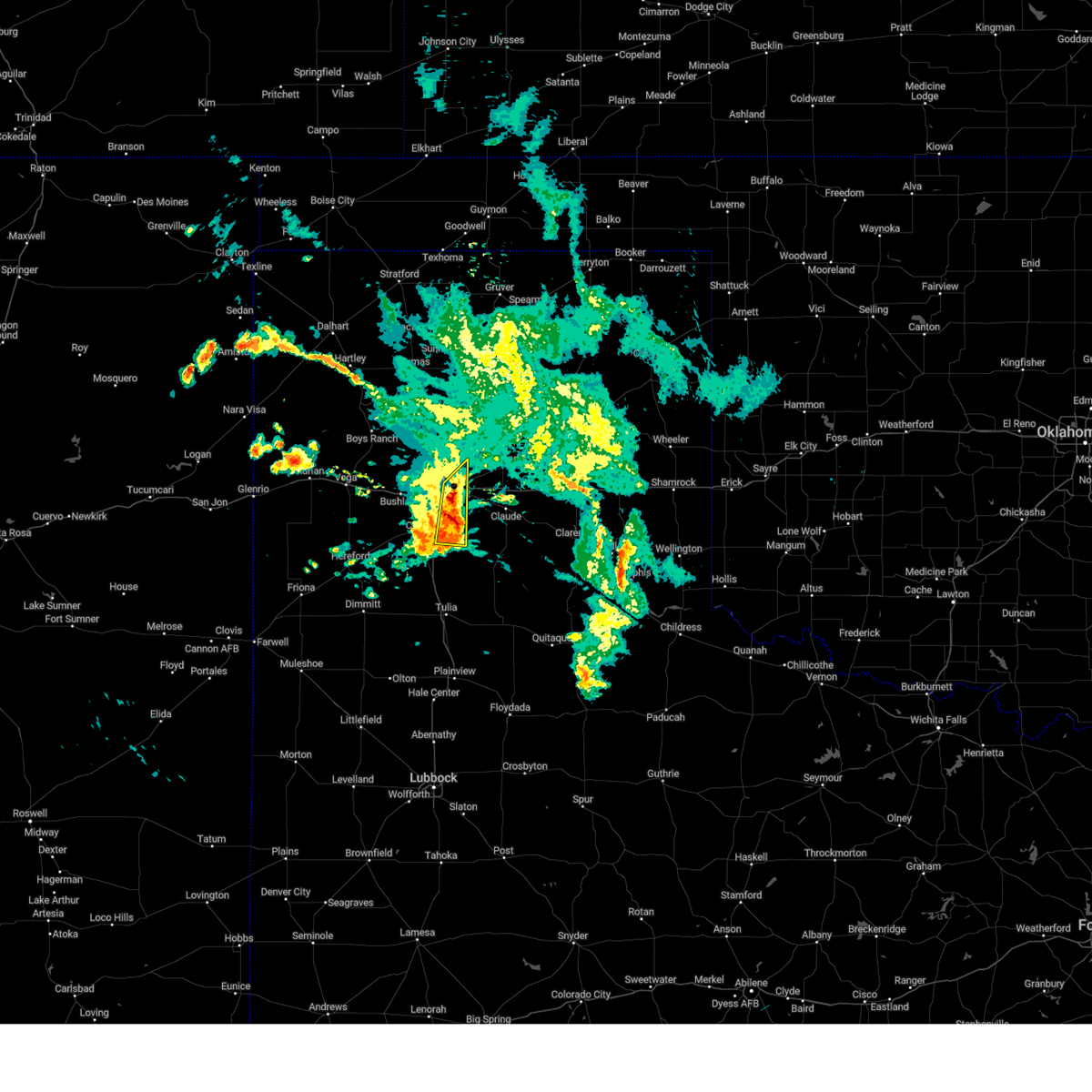 At 545 am cdt, a severe thunderstorm was located 6 miles north of palo duro canyon, or 15 miles east of canyon, moving east at 30 mph (radar indicated). Hazards include 60 mph wind gusts and nickel size hail. Minor damage to roofs, siding, and trees is possible. locations impacted include, amarillo, lake tanglewood and palo duro canyon. hail threat, radar indicated max hail size, 0. 88in wind threat, radar indicated max wind gust, 60 mph. At 545 am cdt, a severe thunderstorm was located 6 miles north of palo duro canyon, or 15 miles east of canyon, moving east at 30 mph (radar indicated). Hazards include 60 mph wind gusts and nickel size hail. Minor damage to roofs, siding, and trees is possible. locations impacted include, amarillo, lake tanglewood and palo duro canyon. hail threat, radar indicated max hail size, 0. 88in wind threat, radar indicated max wind gust, 60 mph.
|
| 5/31/2023 5:29 AM CDT |
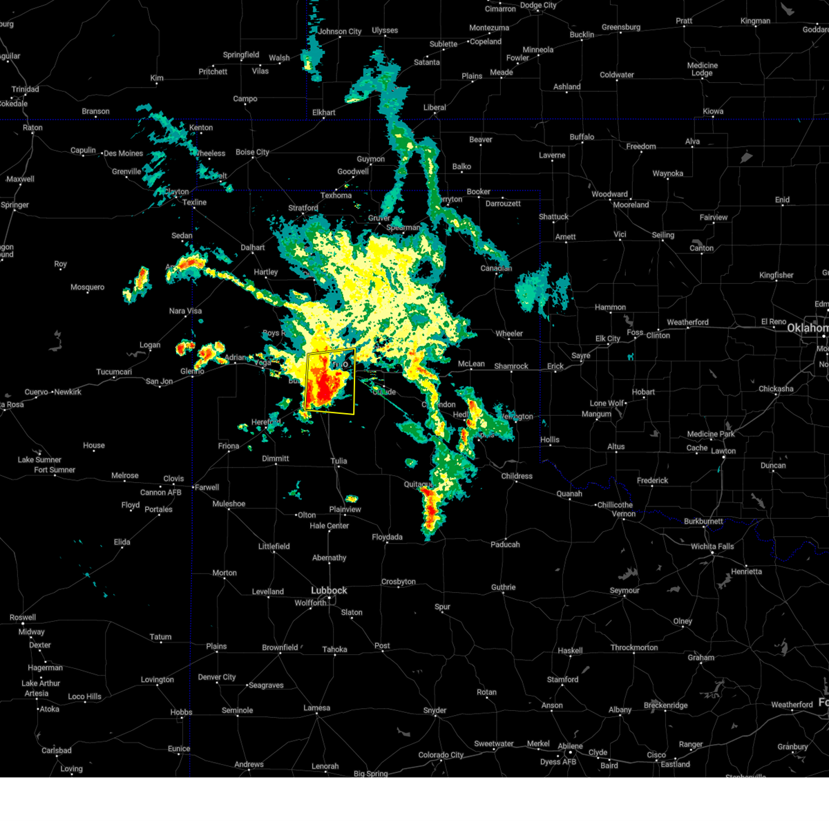 At 529 am cdt, a severe thunderstorm was located 4 miles east of amarillo, moving east at 30 mph (radar indicated). Hazards include 60 mph wind gusts and nickel size hail. Minor damage to roofs, siding, and trees is possible. locations impacted include, amarillo, canyon, lake tanglewood, mescalero park, palo duro canyon and timbercreek canyon. hail threat, radar indicated max hail size, 0. 88in wind threat, radar indicated max wind gust, 60 mph. At 529 am cdt, a severe thunderstorm was located 4 miles east of amarillo, moving east at 30 mph (radar indicated). Hazards include 60 mph wind gusts and nickel size hail. Minor damage to roofs, siding, and trees is possible. locations impacted include, amarillo, canyon, lake tanglewood, mescalero park, palo duro canyon and timbercreek canyon. hail threat, radar indicated max hail size, 0. 88in wind threat, radar indicated max wind gust, 60 mph.
|
| 5/31/2023 4:54 AM CDT |
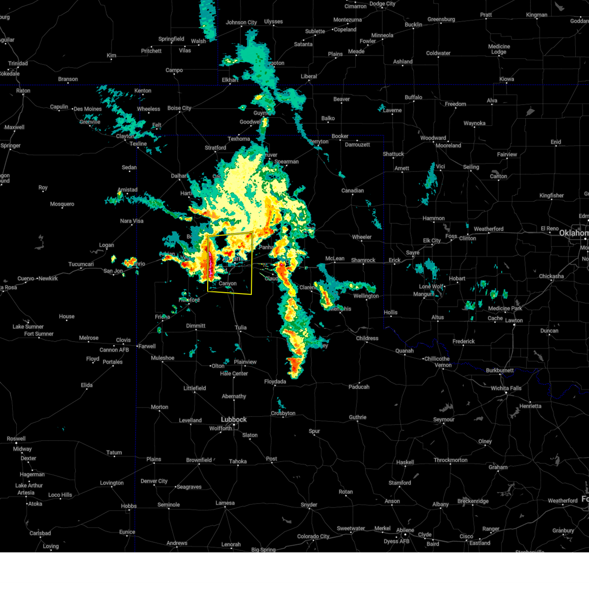 At 453 am cdt, a severe thunderstorm was located near bushland, or 12 miles west of amarillo, moving east at 30 mph (radar indicated). Hazards include 60 mph wind gusts and nickel size hail. minor damage to roofs, siding, and trees is possible At 453 am cdt, a severe thunderstorm was located near bushland, or 12 miles west of amarillo, moving east at 30 mph (radar indicated). Hazards include 60 mph wind gusts and nickel size hail. minor damage to roofs, siding, and trees is possible
|
| 5/23/2023 7:14 PM CDT |
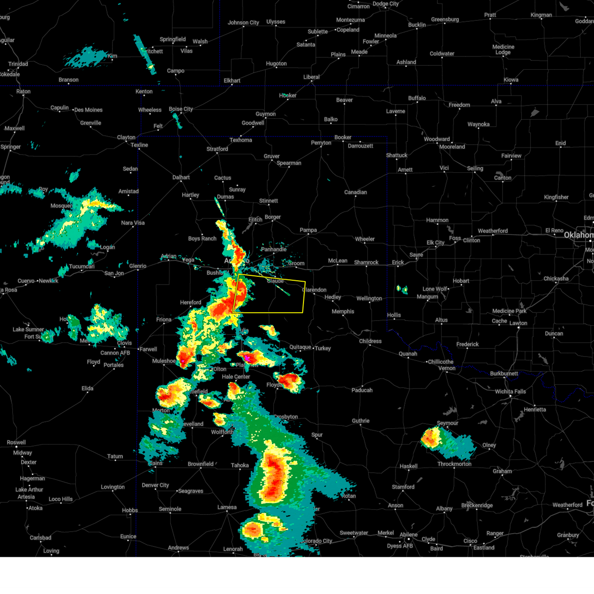 At 714 pm cdt, severe thunderstorms were located along a line extending from lake tanglewood to 7 miles southwest of palo duro canyon, moving east at 35 mph (radar indicated). Hazards include 60 mph wind gusts and penny size hail. minor damage to roofs, siding, and trees is possible At 714 pm cdt, severe thunderstorms were located along a line extending from lake tanglewood to 7 miles southwest of palo duro canyon, moving east at 35 mph (radar indicated). Hazards include 60 mph wind gusts and penny size hail. minor damage to roofs, siding, and trees is possible
|
| 5/23/2023 7:12 PM CDT |
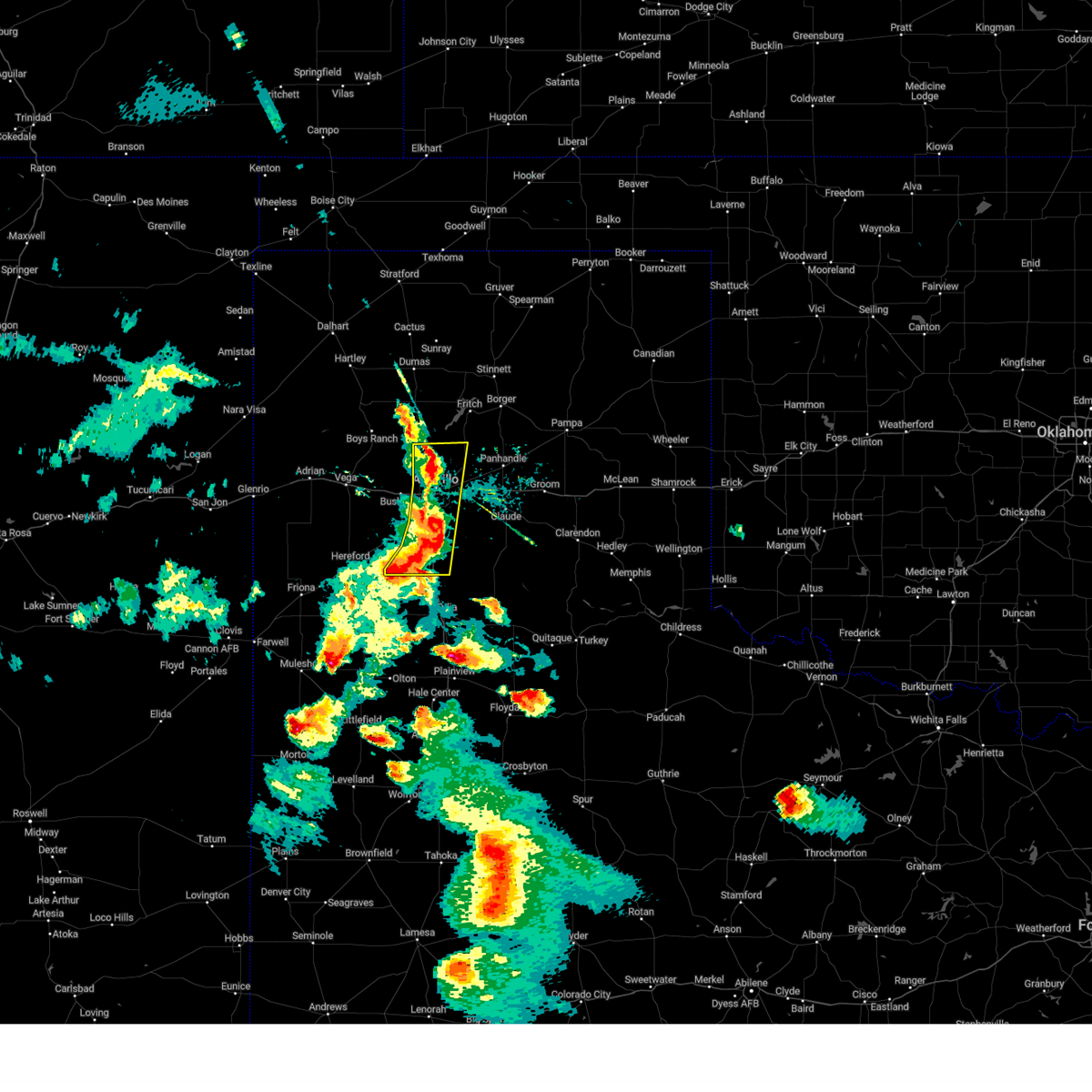 At 711 pm cdt, severe thunderstorms were located along a line extending from 15 miles north of amarillo to near lake tanglewood to 6 miles northwest of happy, moving east at 35 mph (radar indicated). Hazards include 60 mph wind gusts and nickel size hail. Minor damage to roofs, siding, and trees is possible. locations impacted include, amarillo, canyon, lake tanglewood, mescalero park and timbercreek canyon. hail threat, radar indicated max hail size, 0. 88in wind threat, radar indicated max wind gust, 60 mph. At 711 pm cdt, severe thunderstorms were located along a line extending from 15 miles north of amarillo to near lake tanglewood to 6 miles northwest of happy, moving east at 35 mph (radar indicated). Hazards include 60 mph wind gusts and nickel size hail. Minor damage to roofs, siding, and trees is possible. locations impacted include, amarillo, canyon, lake tanglewood, mescalero park and timbercreek canyon. hail threat, radar indicated max hail size, 0. 88in wind threat, radar indicated max wind gust, 60 mph.
|
| 5/23/2023 6:57 PM CDT |
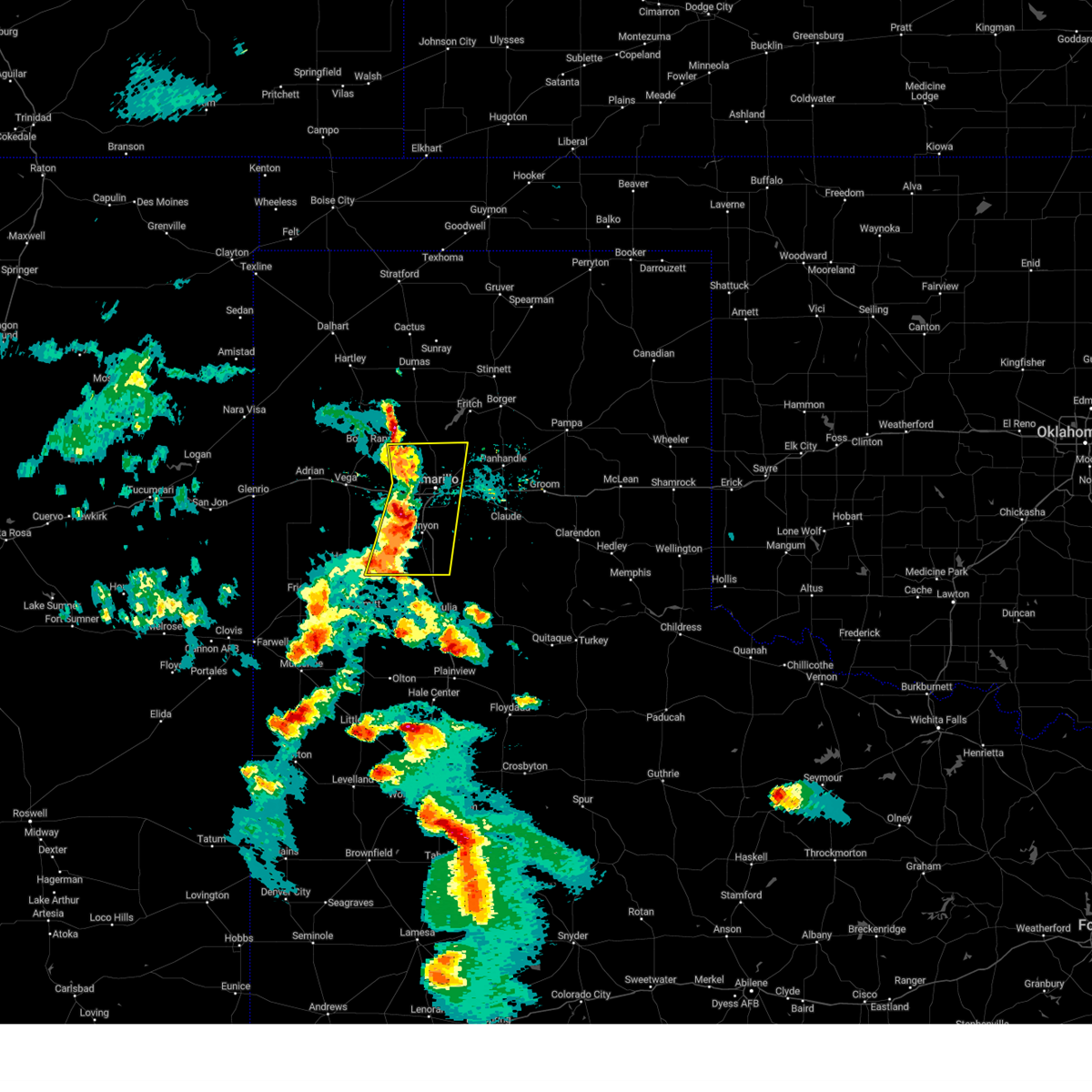 At 656 pm cdt, severe thunderstorms were located along a line extending from 10 miles east of valley de oro to near mescalero park to 6 miles southeast of buffalo lake, moving east at 35 mph (radar indicated). Hazards include 60 mph wind gusts and quarter size hail. Minor damage to roofs, siding, and trees is possible. hail damage to vehicles is expected. locations impacted include, amarillo, canyon, lake tanglewood, mescalero park, buffalo lake, bushland, dawn, valley de oro, umbarger and timbercreek canyon. hail threat, radar indicated max hail size, 1. 00in wind threat, radar indicated max wind gust, 60 mph. At 656 pm cdt, severe thunderstorms were located along a line extending from 10 miles east of valley de oro to near mescalero park to 6 miles southeast of buffalo lake, moving east at 35 mph (radar indicated). Hazards include 60 mph wind gusts and quarter size hail. Minor damage to roofs, siding, and trees is possible. hail damage to vehicles is expected. locations impacted include, amarillo, canyon, lake tanglewood, mescalero park, buffalo lake, bushland, dawn, valley de oro, umbarger and timbercreek canyon. hail threat, radar indicated max hail size, 1. 00in wind threat, radar indicated max wind gust, 60 mph.
|
| 5/23/2023 6:45 PM CDT |
 At 645 pm cdt, severe thunderstorms were located along a line extending from 4 miles southeast of valley de oro to 5 miles northeast of umbarger to 6 miles southwest of buffalo lake, moving east at 40 mph (radar indicated). Hazards include 60 mph wind gusts and half dollar size hail. Minor damage to roofs, siding, and trees is possible. hail damage to vehicles is expected. locations impacted include, amarillo, hereford, canyon, lake tanglewood, mescalero park, buffalo lake, bushland, dawn, valley de oro, umbarger and timbercreek canyon. hail threat, radar indicated max hail size, 1. 25 in wind threat, radar indicated max wind gust, 60 mph. At 645 pm cdt, severe thunderstorms were located along a line extending from 4 miles southeast of valley de oro to 5 miles northeast of umbarger to 6 miles southwest of buffalo lake, moving east at 40 mph (radar indicated). Hazards include 60 mph wind gusts and half dollar size hail. Minor damage to roofs, siding, and trees is possible. hail damage to vehicles is expected. locations impacted include, amarillo, hereford, canyon, lake tanglewood, mescalero park, buffalo lake, bushland, dawn, valley de oro, umbarger and timbercreek canyon. hail threat, radar indicated max hail size, 1. 25 in wind threat, radar indicated max wind gust, 60 mph.
|
| 5/23/2023 6:35 PM CDT |
 At 635 pm cdt, severe thunderstorms were located along a line extending from 3 miles southwest of valley de oro to 7 miles northwest of umbarger to 6 miles east of hereford, moving east at 35 mph (radar indicated). Hazards include 60 mph wind gusts and quarter size hail. Minor damage to roofs, siding, and trees is possible. Hail damage to vehicles is expected. At 635 pm cdt, severe thunderstorms were located along a line extending from 3 miles southwest of valley de oro to 7 miles northwest of umbarger to 6 miles east of hereford, moving east at 35 mph (radar indicated). Hazards include 60 mph wind gusts and quarter size hail. Minor damage to roofs, siding, and trees is possible. Hail damage to vehicles is expected.
|
| 5/18/2023 9:51 PM CDT |
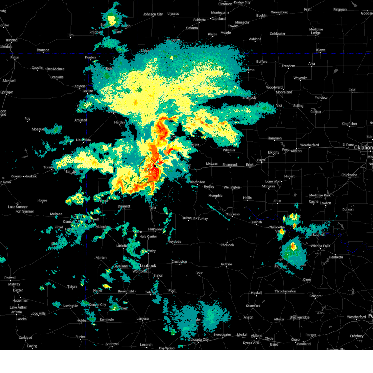 The severe thunderstorm warning for northeastern randall and southeastern potter counties will expire at 1000 pm cdt, the storm which prompted the warning has weakened below severe limits, and no longer poses an immediate threat to life or property. therefore, the warning will be allowed to expire. however, heavy rain and flooding are still possible with this storm and a flash flood warning is in effect for southeastern potter and northwestern randall counties, including the cities of amarillo and canyon, until midnight cdt. The severe thunderstorm warning for northeastern randall and southeastern potter counties will expire at 1000 pm cdt, the storm which prompted the warning has weakened below severe limits, and no longer poses an immediate threat to life or property. therefore, the warning will be allowed to expire. however, heavy rain and flooding are still possible with this storm and a flash flood warning is in effect for southeastern potter and northwestern randall counties, including the cities of amarillo and canyon, until midnight cdt.
|
| 5/18/2023 9:23 PM CDT |
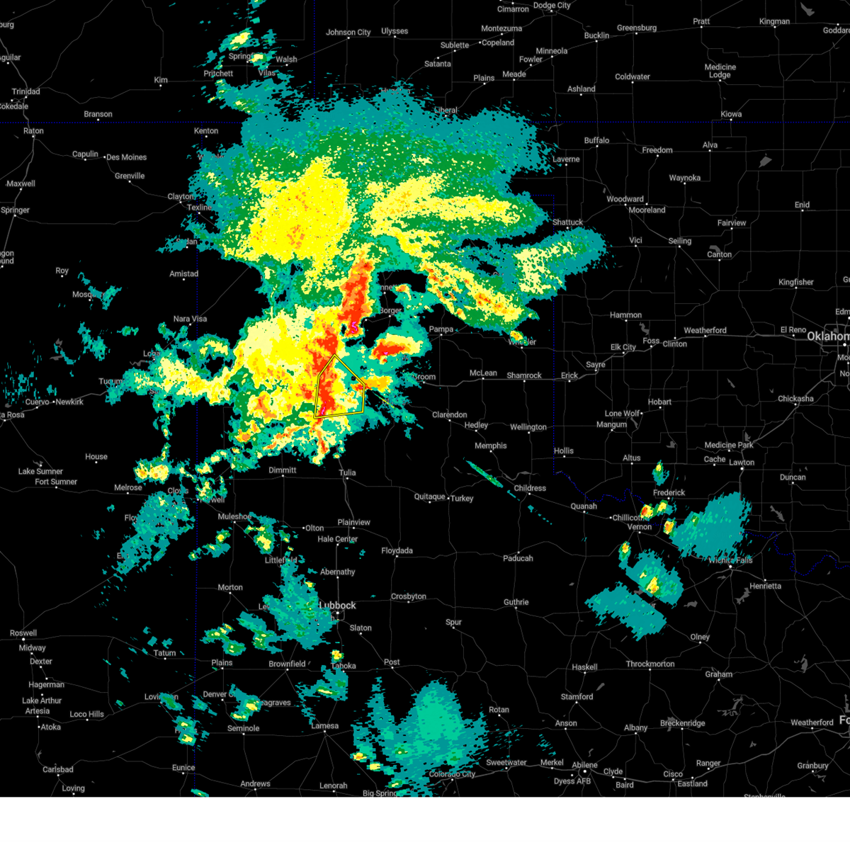 At 923 pm cdt, a severe thunderstorm was located over mescalero park, or near canyon, moving east at 30 mph (radar indicated). Hazards include 70 mph wind gusts and quarter size hail. Expect some tree damage. damage is likely to mobile homes, roofs, and outbuildings. hail damage to vehicles is expected. locations impacted include, amarillo, canyon, lake tanglewood, mescalero park and timbercreek canyon. thunderstorm damage threat, considerable hail threat, radar indicated max hail size, 1. 00in wind threat, radar indicated max wind gust, 70 mph. At 923 pm cdt, a severe thunderstorm was located over mescalero park, or near canyon, moving east at 30 mph (radar indicated). Hazards include 70 mph wind gusts and quarter size hail. Expect some tree damage. damage is likely to mobile homes, roofs, and outbuildings. hail damage to vehicles is expected. locations impacted include, amarillo, canyon, lake tanglewood, mescalero park and timbercreek canyon. thunderstorm damage threat, considerable hail threat, radar indicated max hail size, 1. 00in wind threat, radar indicated max wind gust, 70 mph.
|
| 5/18/2023 8:56 PM CDT |
 At 856 pm cdt, two severe thunderstorms, the first located 6 miles west of mescalero park and the second located 7 miles east of lake tanglewood, were moving northeast at 15 mph (radar indicated). Hazards include 60 mph wind gusts and quarter size hail. Minor damage to roofs, siding, and trees is possible. hail damage to vehicles is expected. locations impacted include, amarillo, canyon, lake tanglewood, mescalero park and timbercreek canyon. hail threat, radar indicated max hail size, 1. 00in wind threat, radar indicated max wind gust, 60 mph. At 856 pm cdt, two severe thunderstorms, the first located 6 miles west of mescalero park and the second located 7 miles east of lake tanglewood, were moving northeast at 15 mph (radar indicated). Hazards include 60 mph wind gusts and quarter size hail. Minor damage to roofs, siding, and trees is possible. hail damage to vehicles is expected. locations impacted include, amarillo, canyon, lake tanglewood, mescalero park and timbercreek canyon. hail threat, radar indicated max hail size, 1. 00in wind threat, radar indicated max wind gust, 60 mph.
|
| 5/18/2023 8:31 PM CDT |
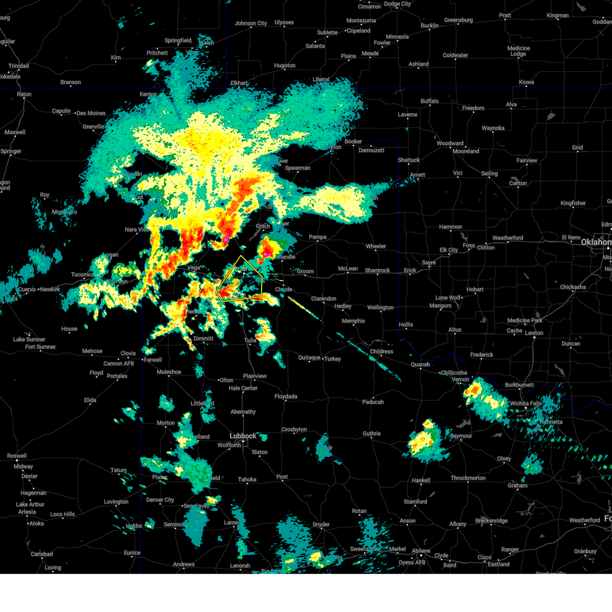 At 831 pm cdt, a severe thunderstorm was located 6 miles northeast of umbarger, or 8 miles northwest of canyon, moving northeast at 15 mph (radar indicated). Hazards include ping pong ball size hail and 60 mph wind gusts. Minor damage to roofs, siding, and trees is possible. people and animals outdoors will be injured. Expect hail damage to roofs, siding, windows, and vehicles. At 831 pm cdt, a severe thunderstorm was located 6 miles northeast of umbarger, or 8 miles northwest of canyon, moving northeast at 15 mph (radar indicated). Hazards include ping pong ball size hail and 60 mph wind gusts. Minor damage to roofs, siding, and trees is possible. people and animals outdoors will be injured. Expect hail damage to roofs, siding, windows, and vehicles.
|
| 8/29/2022 4:53 PM CDT |
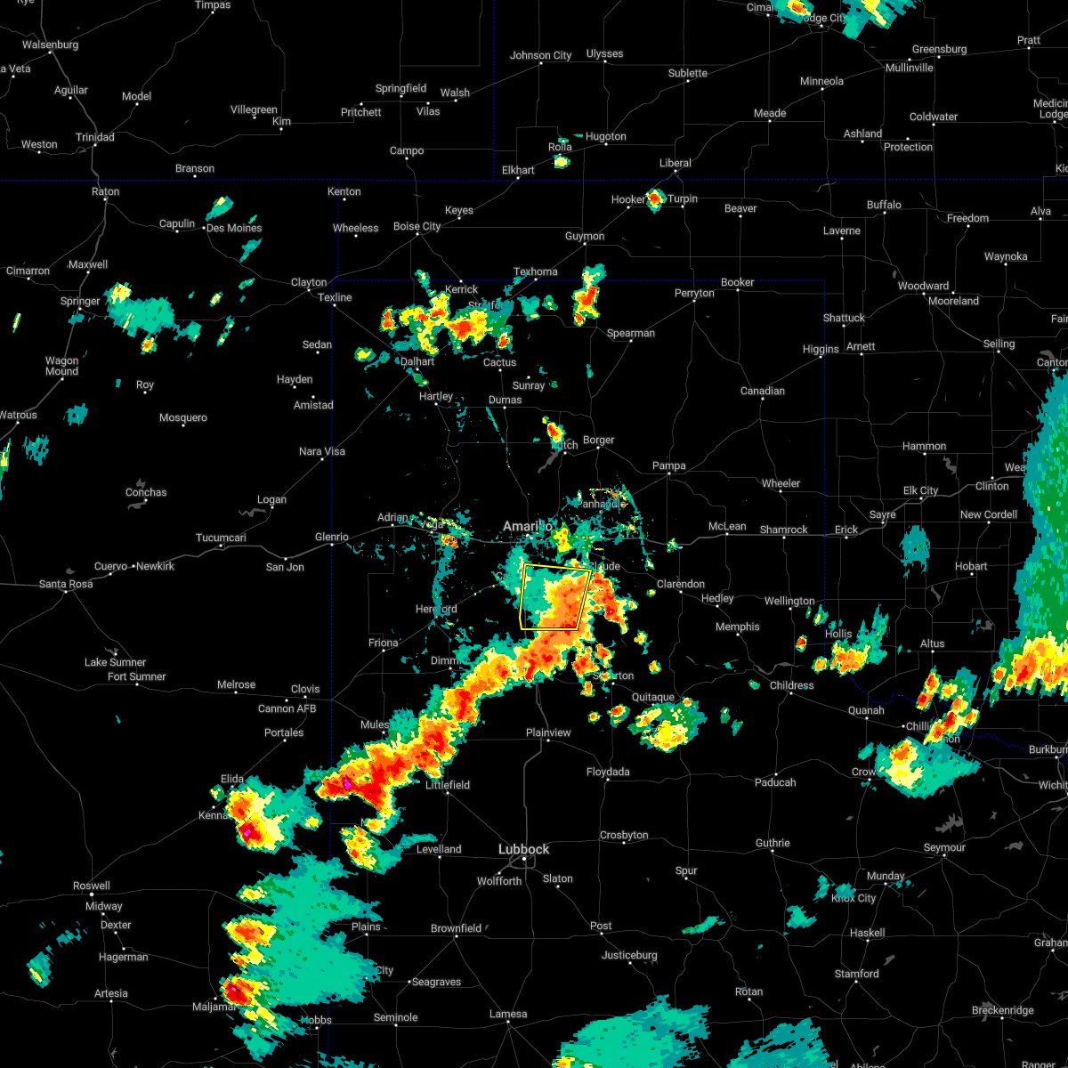 The severe thunderstorm warning for southwestern armstrong and southeastern randall counties will expire at 500 pm cdt, the severe thunderstorm which prompted the warning has moved out of the warned area. therefore, the warning will be allowed to expire. however gusty winds and heavy rain are still possible with this thunderstorm. The severe thunderstorm warning for southwestern armstrong and southeastern randall counties will expire at 500 pm cdt, the severe thunderstorm which prompted the warning has moved out of the warned area. therefore, the warning will be allowed to expire. however gusty winds and heavy rain are still possible with this thunderstorm.
|
| 8/29/2022 4:31 PM CDT |
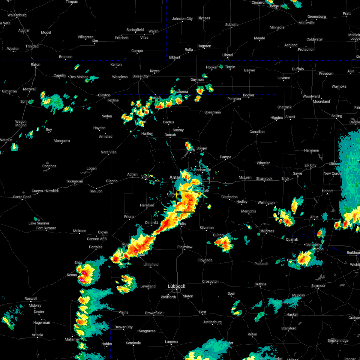 At 431 pm cdt, a severe thunderstorm was located 9 miles northeast of happy, or 11 miles southeast of canyon, moving south at 15 mph (radar indicated). Hazards include 60 mph wind gusts. Minor damage to roofs, siding, and trees is possible. locations impacted include, lake tanglewood, wayside, palo duro canyon and timbercreek canyon. hail threat, radar indicated max hail size, <. 75 in wind threat, radar indicated max wind gust, 60 mph. At 431 pm cdt, a severe thunderstorm was located 9 miles northeast of happy, or 11 miles southeast of canyon, moving south at 15 mph (radar indicated). Hazards include 60 mph wind gusts. Minor damage to roofs, siding, and trees is possible. locations impacted include, lake tanglewood, wayside, palo duro canyon and timbercreek canyon. hail threat, radar indicated max hail size, <. 75 in wind threat, radar indicated max wind gust, 60 mph.
|
| 8/29/2022 4:13 PM CDT |
 The severe thunderstorm warning for northwestern armstrong. northern randall. southwestern carson and southeastern potter counties will expire at 415 pm cdt. the storms which prompted the warning have moved out of the area. therefore, the warning will be allowed to expire. However gusty winds and heavy rain are still possible with these thunderstorms. The severe thunderstorm warning for northwestern armstrong. northern randall. southwestern carson and southeastern potter counties will expire at 415 pm cdt. the storms which prompted the warning have moved out of the area. therefore, the warning will be allowed to expire. However gusty winds and heavy rain are still possible with these thunderstorms.
|
| 8/29/2022 4:01 PM CDT |
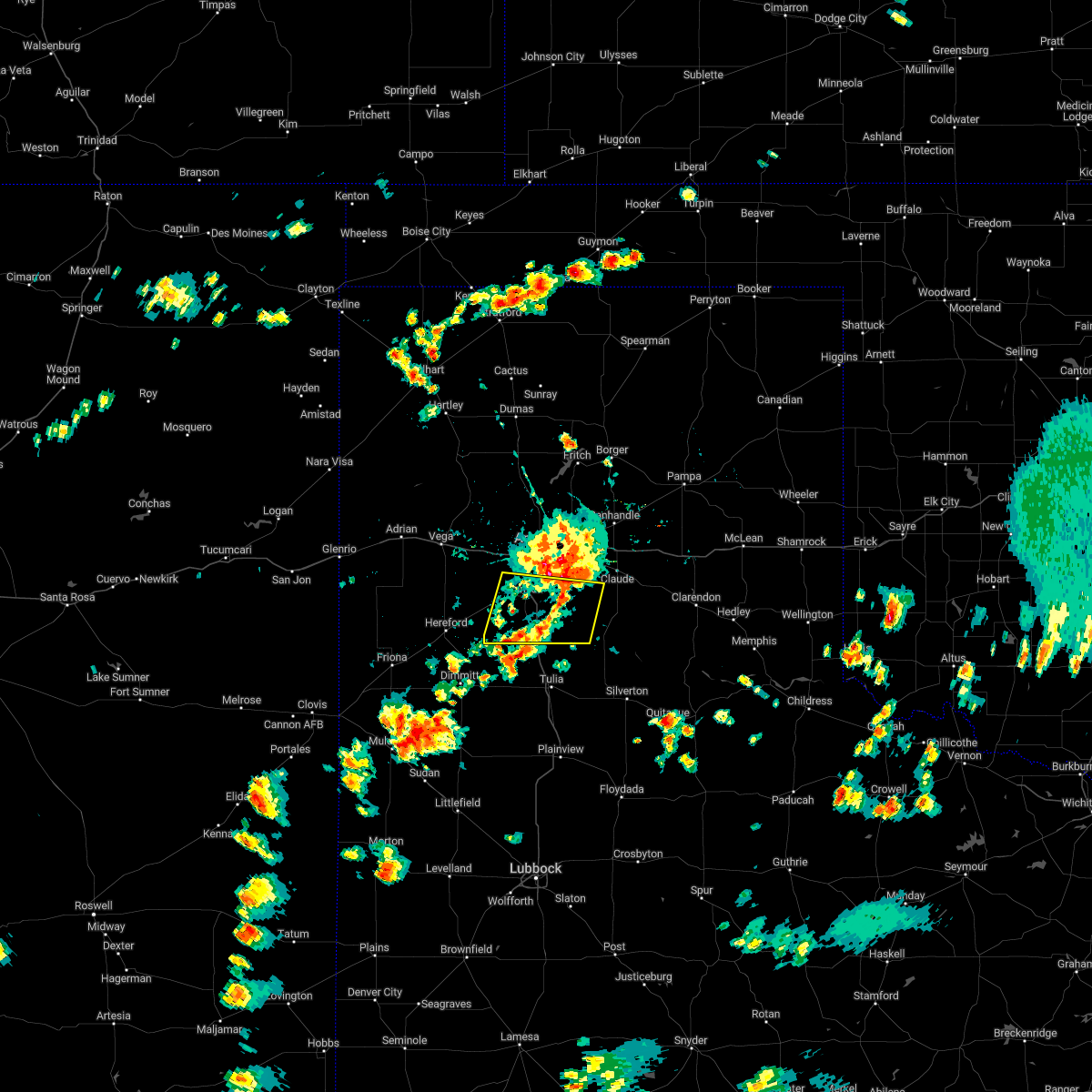 At 401 pm cdt, a severe thunderstorm was located 5 miles south of lake tanglewood, or 6 miles east of canyon, moving south at 10 mph (radar indicated). Hazards include 70 mph wind gusts and quarter size hail. Expect some tree damage. damage is likely to mobile homes, roofs, and outbuildings. hail damage to vehicles is expected. locations impacted include, canyon, lake tanglewood, mescalero park, buffalo lake, wayside, umbarger, palo duro canyon and timbercreek canyon. thunderstorm damage threat, considerable hail threat, radar indicated max hail size, 1. 00in wind threat, radar indicated max wind gust, 70 mph. At 401 pm cdt, a severe thunderstorm was located 5 miles south of lake tanglewood, or 6 miles east of canyon, moving south at 10 mph (radar indicated). Hazards include 70 mph wind gusts and quarter size hail. Expect some tree damage. damage is likely to mobile homes, roofs, and outbuildings. hail damage to vehicles is expected. locations impacted include, canyon, lake tanglewood, mescalero park, buffalo lake, wayside, umbarger, palo duro canyon and timbercreek canyon. thunderstorm damage threat, considerable hail threat, radar indicated max hail size, 1. 00in wind threat, radar indicated max wind gust, 70 mph.
|
| 8/29/2022 3:56 PM CDT |
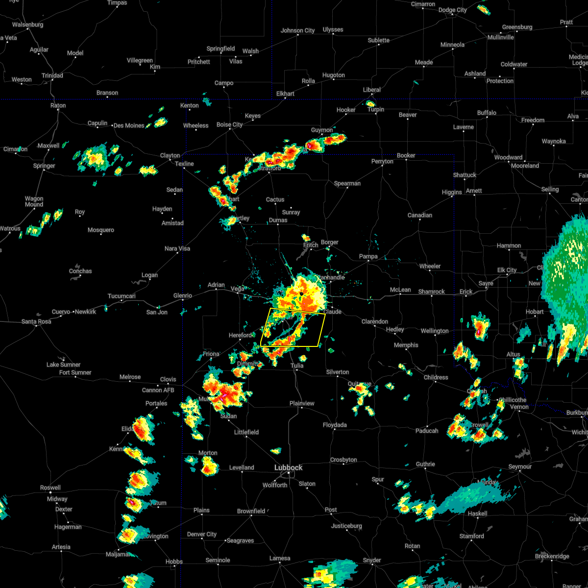 At 356 pm cdt, a severe thunderstorm was located over lake tanglewood, or 8 miles northeast of canyon, moving south at 10 mph (radar indicated). Hazards include 60 mph wind gusts and quarter size hail. Minor damage to roofs, siding, and trees is possible. Hail damage to vehicles is expected. At 356 pm cdt, a severe thunderstorm was located over lake tanglewood, or 8 miles northeast of canyon, moving south at 10 mph (radar indicated). Hazards include 60 mph wind gusts and quarter size hail. Minor damage to roofs, siding, and trees is possible. Hail damage to vehicles is expected.
|
| 8/29/2022 3:45 PM CDT |
 At 345 pm cdt, severe thunderstorms were located along a line extending from washburn to 3 miles northeast of mescalero park, moving east at 10 mph (radar indicated). Hazards include 60 mph wind gusts and quarter size hail. Minor damage to roofs, siding, and trees is possible. hail damage to vehicles is expected. locations impacted include, amarillo, canyon, panhandle, lake tanglewood, mescalero park, washburn, timbercreek canyon and pantex. hail threat, radar indicated max hail size, 1. 00in wind threat, radar indicated max wind gust, 60 mph. At 345 pm cdt, severe thunderstorms were located along a line extending from washburn to 3 miles northeast of mescalero park, moving east at 10 mph (radar indicated). Hazards include 60 mph wind gusts and quarter size hail. Minor damage to roofs, siding, and trees is possible. hail damage to vehicles is expected. locations impacted include, amarillo, canyon, panhandle, lake tanglewood, mescalero park, washburn, timbercreek canyon and pantex. hail threat, radar indicated max hail size, 1. 00in wind threat, radar indicated max wind gust, 60 mph.
|
| 8/29/2022 3:21 PM CDT |
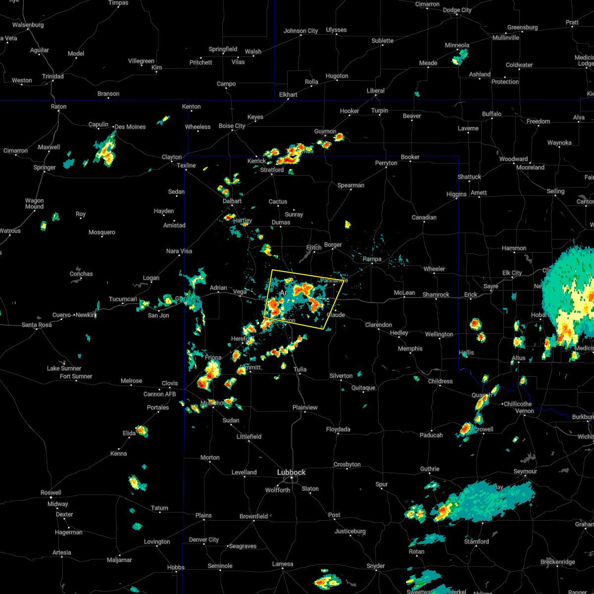 At 321 pm cdt, severe thunderstorms were located along a line extending from 6 miles northwest of washburn to 5 miles west of mescalero park, moving east at 10 mph (radar indicated). Hazards include 60 mph wind gusts and quarter size hail. Minor damage to roofs, siding, and trees is possible. Hail damage to vehicles is expected. At 321 pm cdt, severe thunderstorms were located along a line extending from 6 miles northwest of washburn to 5 miles west of mescalero park, moving east at 10 mph (radar indicated). Hazards include 60 mph wind gusts and quarter size hail. Minor damage to roofs, siding, and trees is possible. Hail damage to vehicles is expected.
|
| 7/29/2022 6:18 PM CDT |
 At 618 pm cdt, severe thunderstorms were located along a line extending from 5 miles southwest of bushland to mescalero park to 4 miles north of palo duro canyon, moving northeast at 20 mph (radar indicated). Hazards include 60 mph wind gusts and penny size hail. minor damage to roofs, siding, and trees is possible At 618 pm cdt, severe thunderstorms were located along a line extending from 5 miles southwest of bushland to mescalero park to 4 miles north of palo duro canyon, moving northeast at 20 mph (radar indicated). Hazards include 60 mph wind gusts and penny size hail. minor damage to roofs, siding, and trees is possible
|
| 6/8/2022 6:36 AM CDT |
 At 636 am cdt, severe thunderstorms were located along a line extending from 7 miles north of sweetwater to 5 miles north of lefors to 7 miles west of panhandle to 8 miles northeast of bushland, moving southeast at 55 mph (radar indicated). Hazards include 70 mph wind gusts and quarter size hail. Expect some tree damage. damage is likely to mobile homes, roofs, and outbuildings. Hail damage to vehicles is expected. At 636 am cdt, severe thunderstorms were located along a line extending from 7 miles north of sweetwater to 5 miles north of lefors to 7 miles west of panhandle to 8 miles northeast of bushland, moving southeast at 55 mph (radar indicated). Hazards include 70 mph wind gusts and quarter size hail. Expect some tree damage. damage is likely to mobile homes, roofs, and outbuildings. Hail damage to vehicles is expected.
|
| 6/1/2022 8:57 PM CDT |
 At 857 pm cdt, a severe thunderstorm was located 6 miles north of happy, or 10 miles south of canyon, moving northeast at 25 mph (radar indicated). Hazards include 60 mph wind gusts and quarter size hail. Minor damage to roofs, siding, and trees is possible. Hail damage to vehicles is expected. At 857 pm cdt, a severe thunderstorm was located 6 miles north of happy, or 10 miles south of canyon, moving northeast at 25 mph (radar indicated). Hazards include 60 mph wind gusts and quarter size hail. Minor damage to roofs, siding, and trees is possible. Hail damage to vehicles is expected.
|
| 5/10/2022 6:44 PM CDT |
 At 643 pm cdt, severe thunderstorms were located along a line extending from 4 miles east of vega to 4 miles south of washburn, moving northeast at 50 mph (radar indicated). Hazards include golf ball size hail and 70 mph wind gusts. Expect some tree damage. damage is likely to mobile homes, roofs, and outbuildings. people and animals outdoors will be injured. expect hail damage to roofs, siding, windows, and vehicles. locations impacted include, amarillo, canyon, panhandle, vega, lake tanglewood, bushland, valley de oro, washburn, boys ranch, umbarger, wildorado, palo duro canyon, mescalero park, timbercreek canyon and pantex. thunderstorm damage threat, considerable hail threat, radar indicated max hail size, 1. 75 in wind threat, radar indicated max wind gust, 70 mph. At 643 pm cdt, severe thunderstorms were located along a line extending from 4 miles east of vega to 4 miles south of washburn, moving northeast at 50 mph (radar indicated). Hazards include golf ball size hail and 70 mph wind gusts. Expect some tree damage. damage is likely to mobile homes, roofs, and outbuildings. people and animals outdoors will be injured. expect hail damage to roofs, siding, windows, and vehicles. locations impacted include, amarillo, canyon, panhandle, vega, lake tanglewood, bushland, valley de oro, washburn, boys ranch, umbarger, wildorado, palo duro canyon, mescalero park, timbercreek canyon and pantex. thunderstorm damage threat, considerable hail threat, radar indicated max hail size, 1. 75 in wind threat, radar indicated max wind gust, 70 mph.
|
| 5/10/2022 6:29 PM CDT |
 At 629 pm cdt, severe thunderstorms were located along a line extending from 10 miles northeast of simms to palo duro canyon, moving northeast at 50 mph (radar indicated). Hazards include 70 mph wind gusts and ping pong ball size hail. Expect some tree damage. damage is likely to mobile homes, roofs, and outbuildings. people and animals outdoors will be injured. Expect hail damage to roofs, siding, windows, and vehicles. At 629 pm cdt, severe thunderstorms were located along a line extending from 10 miles northeast of simms to palo duro canyon, moving northeast at 50 mph (radar indicated). Hazards include 70 mph wind gusts and ping pong ball size hail. Expect some tree damage. damage is likely to mobile homes, roofs, and outbuildings. people and animals outdoors will be injured. Expect hail damage to roofs, siding, windows, and vehicles.
|
| 5/10/2022 6:14 PM CDT |
 At 614 pm cdt, a severe thunderstorm was located over hereford, moving north at 30 mph (radar indicated). Hazards include 70 mph wind gusts and quarter size hail. Expect some tree damage. damage is likely to mobile homes, roofs, and outbuildings. hail damage to vehicles is expected. locations impacted include, amarillo, hereford, canyon, mescalero park, buffalo lake, dawn, umbarger and timbercreek canyon. thunderstorm damage threat, considerable hail threat, radar indicated max hail size, 1. 00in wind threat, radar indicated max wind gust, 70 mph. At 614 pm cdt, a severe thunderstorm was located over hereford, moving north at 30 mph (radar indicated). Hazards include 70 mph wind gusts and quarter size hail. Expect some tree damage. damage is likely to mobile homes, roofs, and outbuildings. hail damage to vehicles is expected. locations impacted include, amarillo, hereford, canyon, mescalero park, buffalo lake, dawn, umbarger and timbercreek canyon. thunderstorm damage threat, considerable hail threat, radar indicated max hail size, 1. 00in wind threat, radar indicated max wind gust, 70 mph.
|
| 5/10/2022 5:45 PM CDT |
 At 545 pm cdt, a severe thunderstorm was located 4 miles west of easter, or 10 miles northwest of dimmitt, moving north at 30 mph (radar indicated). Hazards include 60 mph wind gusts and quarter size hail. Minor damage to roofs, siding, and trees is possible. Hail damage to vehicles is expected. At 545 pm cdt, a severe thunderstorm was located 4 miles west of easter, or 10 miles northwest of dimmitt, moving north at 30 mph (radar indicated). Hazards include 60 mph wind gusts and quarter size hail. Minor damage to roofs, siding, and trees is possible. Hail damage to vehicles is expected.
|
| 5/4/2022 2:19 PM CDT |
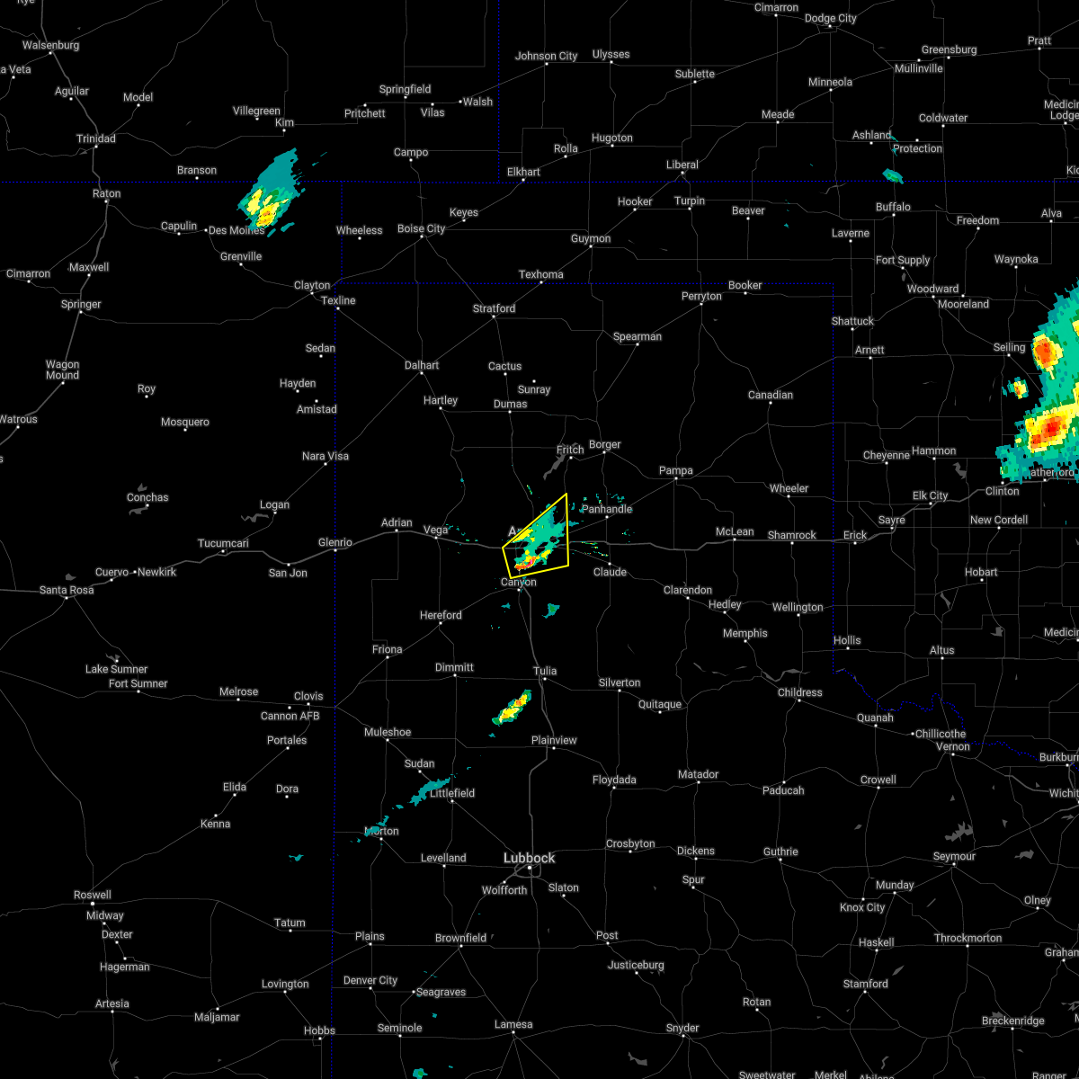 At 219 pm cdt, a severe thunderstorm was located 5 miles northwest of lake tanglewood, or 5 miles south of amarillo, moving east at 25 mph (public). Hazards include 60 mph wind gusts and half dollar size hail. Minor damage to roofs, siding, and trees is possible. hail damage to vehicles is expected. locations impacted include, amarillo and mescalero park. hail threat, observed max hail size, 1. 25 in wind threat, radar indicated max wind gust, 60 mph. At 219 pm cdt, a severe thunderstorm was located 5 miles northwest of lake tanglewood, or 5 miles south of amarillo, moving east at 25 mph (public). Hazards include 60 mph wind gusts and half dollar size hail. Minor damage to roofs, siding, and trees is possible. hail damage to vehicles is expected. locations impacted include, amarillo and mescalero park. hail threat, observed max hail size, 1. 25 in wind threat, radar indicated max wind gust, 60 mph.
|
| 5/4/2022 2:15 PM CDT |
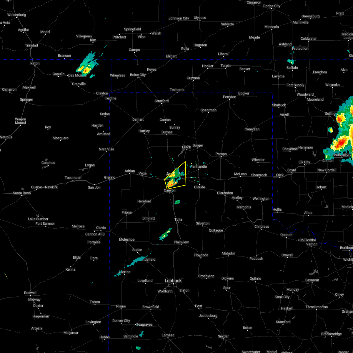 At 215 pm cdt, a severe thunderstorm was located 4 miles northwest of lake tanglewood, or 5 miles south of amarillo, moving east at 30 mph (public). Hazards include 60 mph wind gusts and half dollar size hail. Minor damage to roofs, siding, and trees is possible. hail damage to vehicles is expected. locations impacted include, amarillo and mescalero park. hail threat, radar indicated max hail size, 1. 25 in wind threat, radar indicated max wind gust, 60 mph. At 215 pm cdt, a severe thunderstorm was located 4 miles northwest of lake tanglewood, or 5 miles south of amarillo, moving east at 30 mph (public). Hazards include 60 mph wind gusts and half dollar size hail. Minor damage to roofs, siding, and trees is possible. hail damage to vehicles is expected. locations impacted include, amarillo and mescalero park. hail threat, radar indicated max hail size, 1. 25 in wind threat, radar indicated max wind gust, 60 mph.
|
| 5/4/2022 2:01 PM CDT |
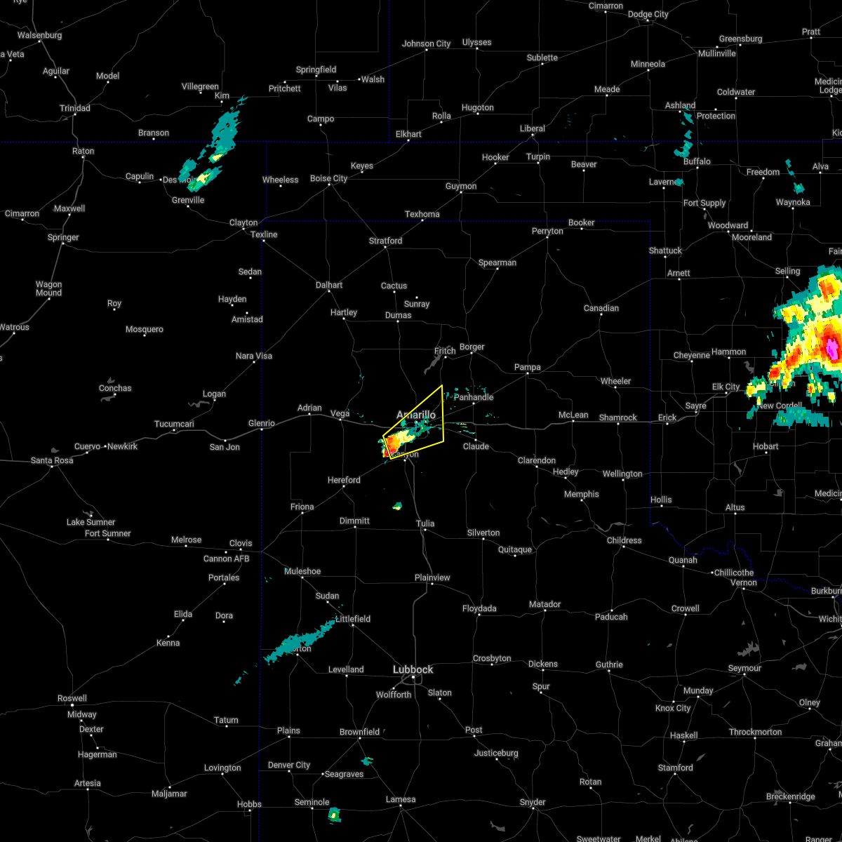 At 201 pm cdt, a severe thunderstorm was located near mescalero park, or 7 miles north of canyon, moving northeast at 40 mph (trained weather spotters). Hazards include 60 mph wind gusts and half dollar size hail. Minor damage to roofs, siding, and trees is possible. hail damage to vehicles is expected. locations impacted include, amarillo, canyon, lake tanglewood, mescalero park and timbercreek canyon. hail threat, radar indicated max hail size, 1. 25 in wind threat, radar indicated max wind gust, 60 mph. At 201 pm cdt, a severe thunderstorm was located near mescalero park, or 7 miles north of canyon, moving northeast at 40 mph (trained weather spotters). Hazards include 60 mph wind gusts and half dollar size hail. Minor damage to roofs, siding, and trees is possible. hail damage to vehicles is expected. locations impacted include, amarillo, canyon, lake tanglewood, mescalero park and timbercreek canyon. hail threat, radar indicated max hail size, 1. 25 in wind threat, radar indicated max wind gust, 60 mph.
|
| 5/4/2022 1:45 PM CDT |
 At 145 pm cdt, a severe thunderstorm was located near umbarger, or 11 miles west of canyon, moving northeast at 30 mph (radar indicated). Hazards include 60 mph wind gusts and half dollar size hail. Minor damage to roofs, siding, and trees is possible. Hail damage to vehicles is expected. At 145 pm cdt, a severe thunderstorm was located near umbarger, or 11 miles west of canyon, moving northeast at 30 mph (radar indicated). Hazards include 60 mph wind gusts and half dollar size hail. Minor damage to roofs, siding, and trees is possible. Hail damage to vehicles is expected.
|
| 5/1/2022 9:35 PM CDT |
 At 934 pm cdt, a severe thunderstorm was located 4 miles northeast of lake tanglewood, or 9 miles southeast of amarillo, moving east at 30 mph (radar indicated). Hazards include 60 mph wind gusts and half dollar size hail. Minor damage to roofs, siding, and trees is possible. Hail damage to vehicles is expected. At 934 pm cdt, a severe thunderstorm was located 4 miles northeast of lake tanglewood, or 9 miles southeast of amarillo, moving east at 30 mph (radar indicated). Hazards include 60 mph wind gusts and half dollar size hail. Minor damage to roofs, siding, and trees is possible. Hail damage to vehicles is expected.
|
| 4/22/2022 7:41 PM CDT |
 At 741 pm cdt, a severe thunderstorm was located over palo duro canyon, or 12 miles east of canyon, moving northeast at 50 mph (radar indicated). Hazards include golf ball size hail and 60 mph wind gusts. Minor damage to roofs, siding, and trees is possible. people and animals outdoors will be injured. expect hail damage to roofs, siding, windows, and vehicles. locations impacted include, canyon, claude, lake tanglewood, wayside, washburn, palo duro canyon and timbercreek canyon. thunderstorm damage threat, considerable hail threat, radar indicated max hail size, 1. 75 in wind threat, radar indicated max wind gust, 60 mph. At 741 pm cdt, a severe thunderstorm was located over palo duro canyon, or 12 miles east of canyon, moving northeast at 50 mph (radar indicated). Hazards include golf ball size hail and 60 mph wind gusts. Minor damage to roofs, siding, and trees is possible. people and animals outdoors will be injured. expect hail damage to roofs, siding, windows, and vehicles. locations impacted include, canyon, claude, lake tanglewood, wayside, washburn, palo duro canyon and timbercreek canyon. thunderstorm damage threat, considerable hail threat, radar indicated max hail size, 1. 75 in wind threat, radar indicated max wind gust, 60 mph.
|
| 4/22/2022 7:31 PM CDT |
 At 730 pm cdt, a severe thunderstorm was located 5 miles northeast of happy, or 14 miles southeast of canyon, moving northeast at 50 mph (radar indicated). Hazards include ping pong ball size hail and 60 mph wind gusts. Minor damage to roofs, siding, and trees is possible. people and animals outdoors will be injured. Expect hail damage to roofs, siding, windows, and vehicles. At 730 pm cdt, a severe thunderstorm was located 5 miles northeast of happy, or 14 miles southeast of canyon, moving northeast at 50 mph (radar indicated). Hazards include ping pong ball size hail and 60 mph wind gusts. Minor damage to roofs, siding, and trees is possible. people and animals outdoors will be injured. Expect hail damage to roofs, siding, windows, and vehicles.
|
| 4/22/2022 7:26 PM CDT |
 At 726 pm cdt, a severe thunderstorm was located 4 miles northeast of amarillo, moving northeast at 50 mph (trained weather spotters reported golf ball size hail). Hazards include golf ball size hail and 60 mph wind gusts. Minor damage to roofs, siding, and trees is possible. people and animals outdoors will be injured. expect hail damage to roofs, siding, windows, and vehicles. locations impacted include, amarillo, panhandle, fritch, lake tanglewood, washburn, mescalero park and pantex. thunderstorm damage threat, considerable hail threat, observed max hail size, 1. 75 in wind threat, radar indicated max wind gust, 60 mph. At 726 pm cdt, a severe thunderstorm was located 4 miles northeast of amarillo, moving northeast at 50 mph (trained weather spotters reported golf ball size hail). Hazards include golf ball size hail and 60 mph wind gusts. Minor damage to roofs, siding, and trees is possible. people and animals outdoors will be injured. expect hail damage to roofs, siding, windows, and vehicles. locations impacted include, amarillo, panhandle, fritch, lake tanglewood, washburn, mescalero park and pantex. thunderstorm damage threat, considerable hail threat, observed max hail size, 1. 75 in wind threat, radar indicated max wind gust, 60 mph.
|
| 4/22/2022 7:17 PM CDT |
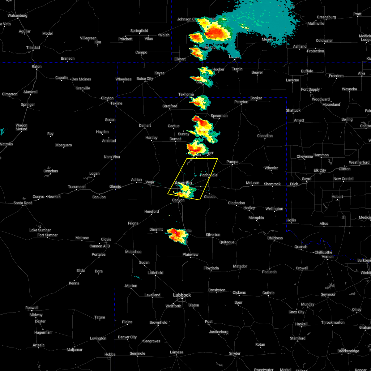 At 716 pm cdt, a severe thunderstorm was located 4 miles south of amarillo, moving northeast at 50 mph (radar indicated). Hazards include 60 mph wind gusts and half dollar size hail. Minor damage to roofs, siding, and trees is possible. Hail damage to vehicles is expected. At 716 pm cdt, a severe thunderstorm was located 4 miles south of amarillo, moving northeast at 50 mph (radar indicated). Hazards include 60 mph wind gusts and half dollar size hail. Minor damage to roofs, siding, and trees is possible. Hail damage to vehicles is expected.
|
| 8/21/2021 6:41 PM CDT |
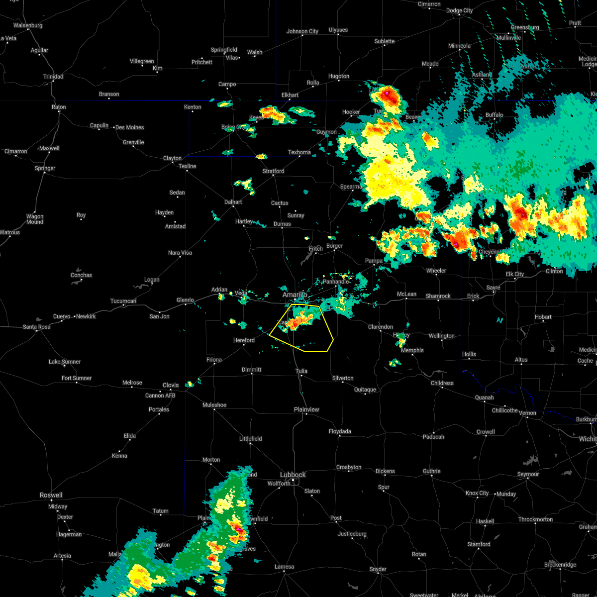 The severe thunderstorm warning for western armstrong and randall counties will expire at 645 pm cdt, the storm which prompted the warning has weakened below severe limits, and no longer poses an immediate threat to life or property. therefore, the warning will be allowed to expire. however gusty winds are still possible with this thunderstorm. The severe thunderstorm warning for western armstrong and randall counties will expire at 645 pm cdt, the storm which prompted the warning has weakened below severe limits, and no longer poses an immediate threat to life or property. therefore, the warning will be allowed to expire. however gusty winds are still possible with this thunderstorm.
|
| 8/21/2021 6:10 PM CDT |
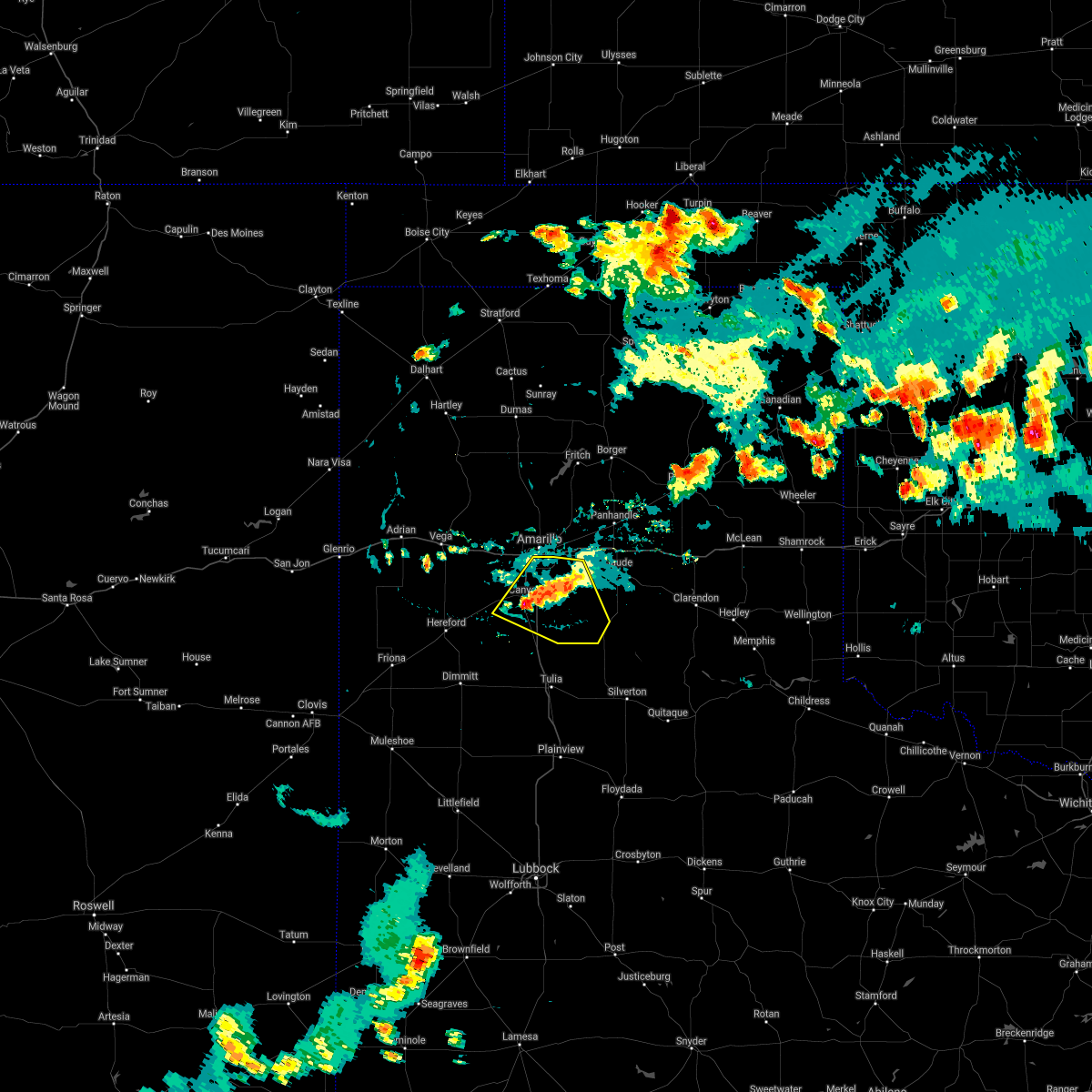 At 610 pm cdt, a severe thunderstorm was located over canyon, moving northeast at 15 mph (radar indicated). Hazards include 60 mph wind gusts and quarter size hail. Minor damage to roofs, siding, and trees is possible. hail damage to vehicles is expected. locations impacted include, amarillo, canyon, lake tanglewood, mescalero park, wayside, palo duro canyon and timbercreek canyon. hail threat, radar indicated max hail size, 1. 00in wind threat, radar indicated max wind gust, 60 mph. At 610 pm cdt, a severe thunderstorm was located over canyon, moving northeast at 15 mph (radar indicated). Hazards include 60 mph wind gusts and quarter size hail. Minor damage to roofs, siding, and trees is possible. hail damage to vehicles is expected. locations impacted include, amarillo, canyon, lake tanglewood, mescalero park, wayside, palo duro canyon and timbercreek canyon. hail threat, radar indicated max hail size, 1. 00in wind threat, radar indicated max wind gust, 60 mph.
|
| 8/21/2021 5:57 PM CDT |
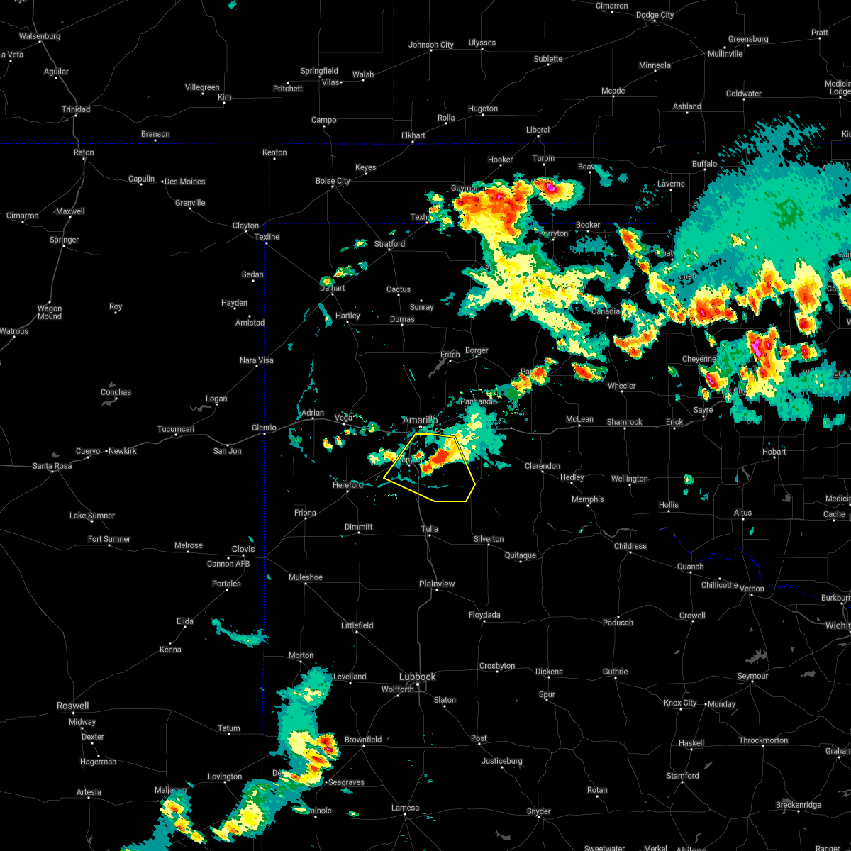 At 556 pm cdt, a severe thunderstorm was located 6 miles north of palo duro canyon, or 15 miles east of canyon, moving northeast at 10 mph (radar indicated). Hazards include 60 mph wind gusts. Minor damage to roofs, siding, and trees is possible. locations impacted include, amarillo, canyon, lake tanglewood, mescalero park, wayside, palo duro canyon and timbercreek canyon. hail threat, radar indicated max hail size, <. 75 in wind threat, radar indicated max wind gust, 60 mph. At 556 pm cdt, a severe thunderstorm was located 6 miles north of palo duro canyon, or 15 miles east of canyon, moving northeast at 10 mph (radar indicated). Hazards include 60 mph wind gusts. Minor damage to roofs, siding, and trees is possible. locations impacted include, amarillo, canyon, lake tanglewood, mescalero park, wayside, palo duro canyon and timbercreek canyon. hail threat, radar indicated max hail size, <. 75 in wind threat, radar indicated max wind gust, 60 mph.
|
| 8/21/2021 5:33 PM CDT |
 At 533 pm cdt, a severe thunderstorm was located 7 miles north of palo duro canyon, or 15 miles west of claude, moving northeast at 20 mph (radar indicated). Hazards include 60 mph wind gusts and nickel size hail. Minor damage to roofs, siding, and trees is possible. locations impacted include, amarillo, canyon, panhandle, claude, lake tanglewood, mescalero park, wayside, washburn, palo duro canyon, timbercreek canyon and pantex. hail threat, radar indicated max hail size, 0. 88in wind threat, radar indicated max wind gust, 60 mph. At 533 pm cdt, a severe thunderstorm was located 7 miles north of palo duro canyon, or 15 miles west of claude, moving northeast at 20 mph (radar indicated). Hazards include 60 mph wind gusts and nickel size hail. Minor damage to roofs, siding, and trees is possible. locations impacted include, amarillo, canyon, panhandle, claude, lake tanglewood, mescalero park, wayside, washburn, palo duro canyon, timbercreek canyon and pantex. hail threat, radar indicated max hail size, 0. 88in wind threat, radar indicated max wind gust, 60 mph.
|
| 8/21/2021 5:14 PM CDT |
 At 514 pm cdt, a severe thunderstorm was located 6 miles south of washburn, or 13 miles west of claude, moving northeast at 15 mph (radar indicated). Hazards include 60 mph wind gusts and quarter size hail. Minor damage to roofs, siding, and trees is possible. Hail damage to vehicles is expected. At 514 pm cdt, a severe thunderstorm was located 6 miles south of washburn, or 13 miles west of claude, moving northeast at 15 mph (radar indicated). Hazards include 60 mph wind gusts and quarter size hail. Minor damage to roofs, siding, and trees is possible. Hail damage to vehicles is expected.
|
| 8/21/2021 4:29 PM CDT |
 At 428 pm cdt, a severe thunderstorm was located near umbarger, or 11 miles west of canyon, moving northeast at 5 mph (radar indicated). Hazards include 60 mph wind gusts. Minor damage to roofs, siding, and trees is possible. locations impacted include, amarillo, canyon, mescalero park, bushland and timbercreek canyon. hail threat, radar indicated max hail size, <. 75 in wind threat, radar indicated max wind gust, 60 mph. At 428 pm cdt, a severe thunderstorm was located near umbarger, or 11 miles west of canyon, moving northeast at 5 mph (radar indicated). Hazards include 60 mph wind gusts. Minor damage to roofs, siding, and trees is possible. locations impacted include, amarillo, canyon, mescalero park, bushland and timbercreek canyon. hail threat, radar indicated max hail size, <. 75 in wind threat, radar indicated max wind gust, 60 mph.
|
| 8/21/2021 4:11 PM CDT |
 At 410 pm cdt, a severe thunderstorm was located near amarillo, moving northeast at 15 mph (radar indicated). Hazards include 60 mph wind gusts and penny size hail. Minor damage to roofs, siding, and trees is possible. locations impacted include, amarillo, canyon, lake tanglewood, mescalero park, bushland, washburn, timbercreek canyon and pantex. hail threat, radar indicated max hail size, 0. 75in wind threat, radar indicated max wind gust, 60 mph. At 410 pm cdt, a severe thunderstorm was located near amarillo, moving northeast at 15 mph (radar indicated). Hazards include 60 mph wind gusts and penny size hail. Minor damage to roofs, siding, and trees is possible. locations impacted include, amarillo, canyon, lake tanglewood, mescalero park, bushland, washburn, timbercreek canyon and pantex. hail threat, radar indicated max hail size, 0. 75in wind threat, radar indicated max wind gust, 60 mph.
|
| 8/21/2021 4:03 PM CDT |
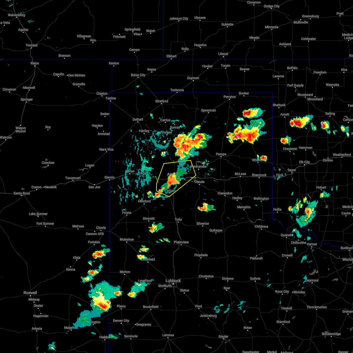 At 403 pm cdt, a severe thunderstorm was located 5 miles southwest of amarillo, moving northeast at 10 mph (radar indicated). Hazards include 60 mph wind gusts and quarter size hail. Minor damage to roofs, siding, and trees is possible. hail damage to vehicles is expected. locations impacted include, amarillo, canyon, lake tanglewood, mescalero park, bushland, washburn, timbercreek canyon and pantex. hail threat, radar indicated max hail size, 1. 00in wind threat, radar indicated max wind gust, 60 mph. At 403 pm cdt, a severe thunderstorm was located 5 miles southwest of amarillo, moving northeast at 10 mph (radar indicated). Hazards include 60 mph wind gusts and quarter size hail. Minor damage to roofs, siding, and trees is possible. hail damage to vehicles is expected. locations impacted include, amarillo, canyon, lake tanglewood, mescalero park, bushland, washburn, timbercreek canyon and pantex. hail threat, radar indicated max hail size, 1. 00in wind threat, radar indicated max wind gust, 60 mph.
|
| 8/21/2021 3:54 PM CDT |
 At 353 pm cdt, a severe thunderstorm was located 5 miles southwest of amarillo, moving northeast at 15 mph (trained weather spotters). Hazards include 70 mph wind gusts and quarter size hail. Expect some tree damage. damage is likely to mobile homes, roofs, and outbuildings. hail damage to vehicles is expected. locations impacted include, amarillo, canyon, lake tanglewood, mescalero park, bushland, washburn, timbercreek canyon and pantex. thunderstorm damage threat, considerable hail threat, radar indicated max hail size, 1. 00in wind threat, radar indicated max wind gust, 70 mph. At 353 pm cdt, a severe thunderstorm was located 5 miles southwest of amarillo, moving northeast at 15 mph (trained weather spotters). Hazards include 70 mph wind gusts and quarter size hail. Expect some tree damage. damage is likely to mobile homes, roofs, and outbuildings. hail damage to vehicles is expected. locations impacted include, amarillo, canyon, lake tanglewood, mescalero park, bushland, washburn, timbercreek canyon and pantex. thunderstorm damage threat, considerable hail threat, radar indicated max hail size, 1. 00in wind threat, radar indicated max wind gust, 70 mph.
|
| 8/21/2021 3:46 PM CDT |
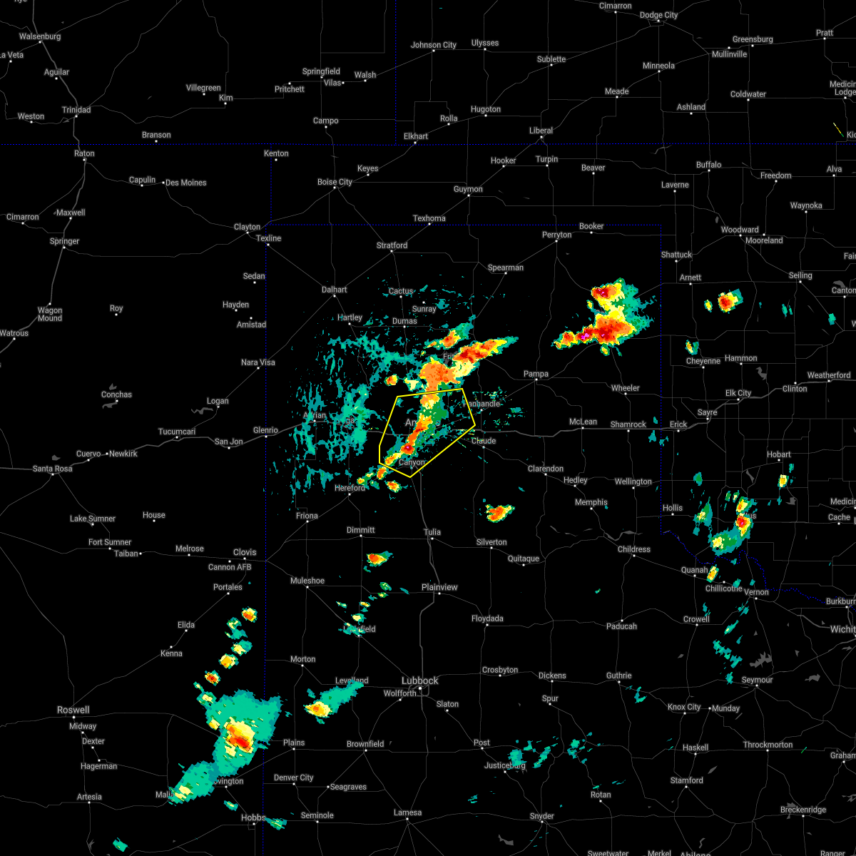 At 346 pm cdt, a severe thunderstorm was located 4 miles north of mescalero park, or 7 miles southwest of amarillo, moving northeast at 15 mph (trained weather spotters). Hazards include 60 mph wind gusts and half dollar size hail. Minor damage to roofs, siding, and trees is possible. hail damage to vehicles is expected. locations impacted include, amarillo, canyon, lake tanglewood, mescalero park, bushland, washburn, timbercreek canyon and pantex. hail threat, radar indicated max hail size, 1. 25 in wind threat, radar indicated max wind gust, 60 mph. At 346 pm cdt, a severe thunderstorm was located 4 miles north of mescalero park, or 7 miles southwest of amarillo, moving northeast at 15 mph (trained weather spotters). Hazards include 60 mph wind gusts and half dollar size hail. Minor damage to roofs, siding, and trees is possible. hail damage to vehicles is expected. locations impacted include, amarillo, canyon, lake tanglewood, mescalero park, bushland, washburn, timbercreek canyon and pantex. hail threat, radar indicated max hail size, 1. 25 in wind threat, radar indicated max wind gust, 60 mph.
|
| 8/21/2021 3:42 PM CDT |
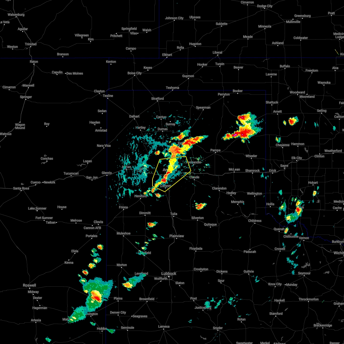 At 342 pm cdt, a severe thunderstorm was located 4 miles northwest of mescalero park, or 8 miles north of canyon, moving northeast at 15 mph (radar indicated). Hazards include 60 mph wind gusts and half dollar size hail. Minor damage to roofs, siding, and trees is possible. Hail damage to vehicles is expected. At 342 pm cdt, a severe thunderstorm was located 4 miles northwest of mescalero park, or 8 miles north of canyon, moving northeast at 15 mph (radar indicated). Hazards include 60 mph wind gusts and half dollar size hail. Minor damage to roofs, siding, and trees is possible. Hail damage to vehicles is expected.
|
| 8/12/2021 6:24 PM CDT |
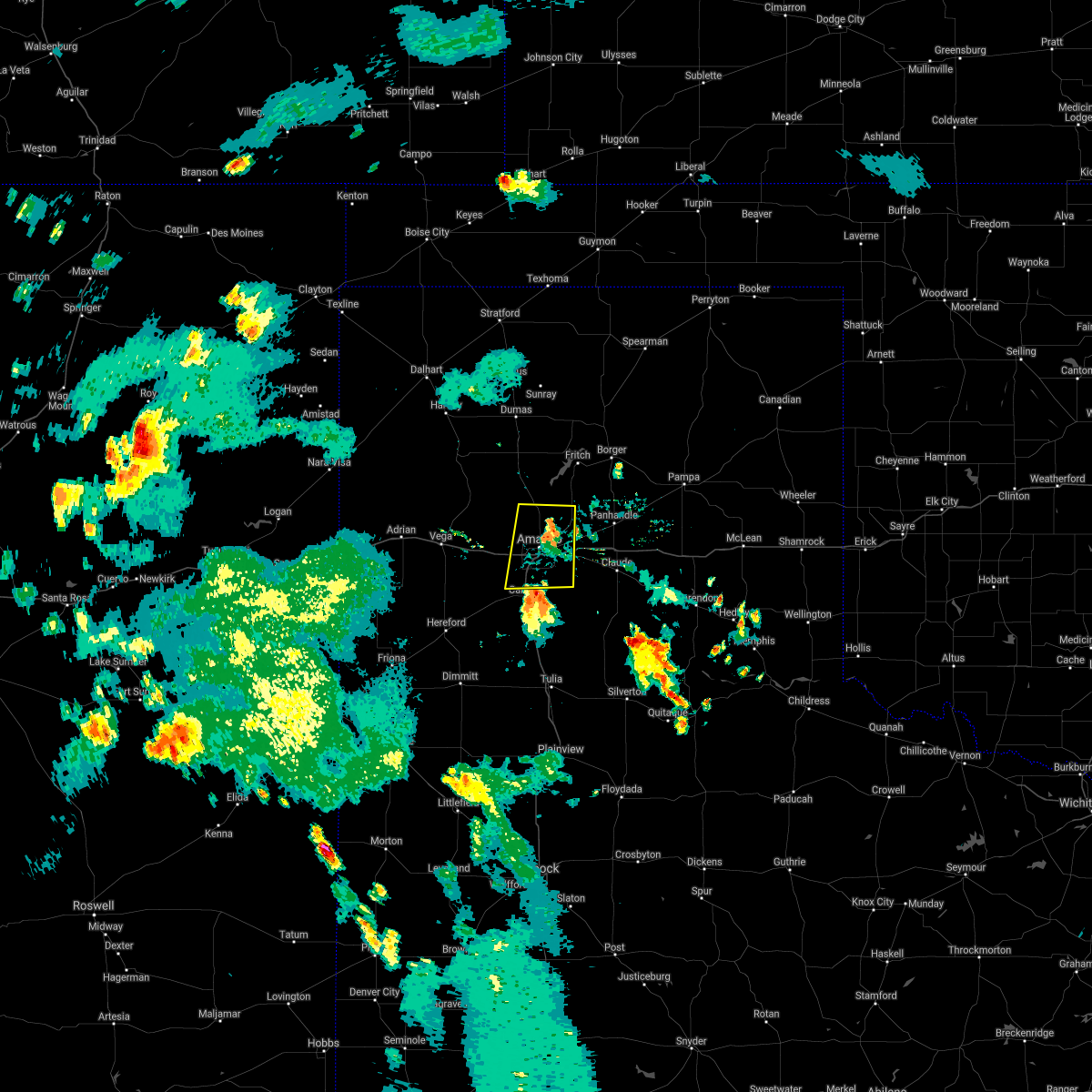 At 623 pm cdt, a severe thunderstorm was located 4 miles north of lake tanglewood, or 6 miles southeast of amarillo, moving north at 25 mph (radar indicated). Hazards include 60 mph wind gusts. minor damage to roofs, siding, and trees is possible At 623 pm cdt, a severe thunderstorm was located 4 miles north of lake tanglewood, or 6 miles southeast of amarillo, moving north at 25 mph (radar indicated). Hazards include 60 mph wind gusts. minor damage to roofs, siding, and trees is possible
|
| 8/7/2021 7:50 PM CDT |
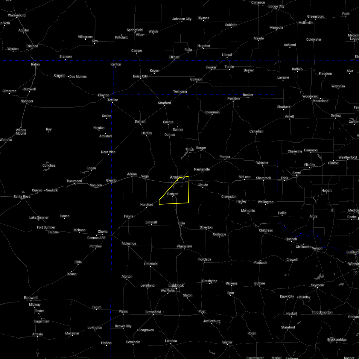 The severe thunderstorm warning for central randall and southeastern potter counties will expire at 800 pm cdt, the storm which prompted the warning has moved out of the area. therefore, the warning will be allowed to expire. however gusty winds are still possible with this thunderstorm. The severe thunderstorm warning for central randall and southeastern potter counties will expire at 800 pm cdt, the storm which prompted the warning has moved out of the area. therefore, the warning will be allowed to expire. however gusty winds are still possible with this thunderstorm.
|
| 8/7/2021 7:27 PM CDT |
 At 726 pm cdt, a severe thunderstorm was located 4 miles north of lake tanglewood, or 6 miles southeast of amarillo, moving east at 20 mph (radar indicated). Hazards include 60 mph wind gusts. Minor damage to roofs, siding, and trees is possible. locations impacted include, amarillo, canyon, lake tanglewood, mescalero park, buffalo lake, umbarger, palo duro canyon and timbercreek canyon. hail threat, radar indicated max hail size, <. 75 in wind threat, radar indicated max wind gust, 60 mph. At 726 pm cdt, a severe thunderstorm was located 4 miles north of lake tanglewood, or 6 miles southeast of amarillo, moving east at 20 mph (radar indicated). Hazards include 60 mph wind gusts. Minor damage to roofs, siding, and trees is possible. locations impacted include, amarillo, canyon, lake tanglewood, mescalero park, buffalo lake, umbarger, palo duro canyon and timbercreek canyon. hail threat, radar indicated max hail size, <. 75 in wind threat, radar indicated max wind gust, 60 mph.
|
| 8/7/2021 7:04 PM CDT |
 At 704 pm cdt, a severe thunderstorm was located 4 miles north of mescalero park, or 7 miles southwest of amarillo, moving east at 20 mph (radar indicated). Hazards include 60 mph wind gusts and quarter size hail. Minor damage to roofs, siding, and trees is possible. Hail damage to vehicles is expected. At 704 pm cdt, a severe thunderstorm was located 4 miles north of mescalero park, or 7 miles southwest of amarillo, moving east at 20 mph (radar indicated). Hazards include 60 mph wind gusts and quarter size hail. Minor damage to roofs, siding, and trees is possible. Hail damage to vehicles is expected.
|
| 7/5/2021 2:43 AM CDT |
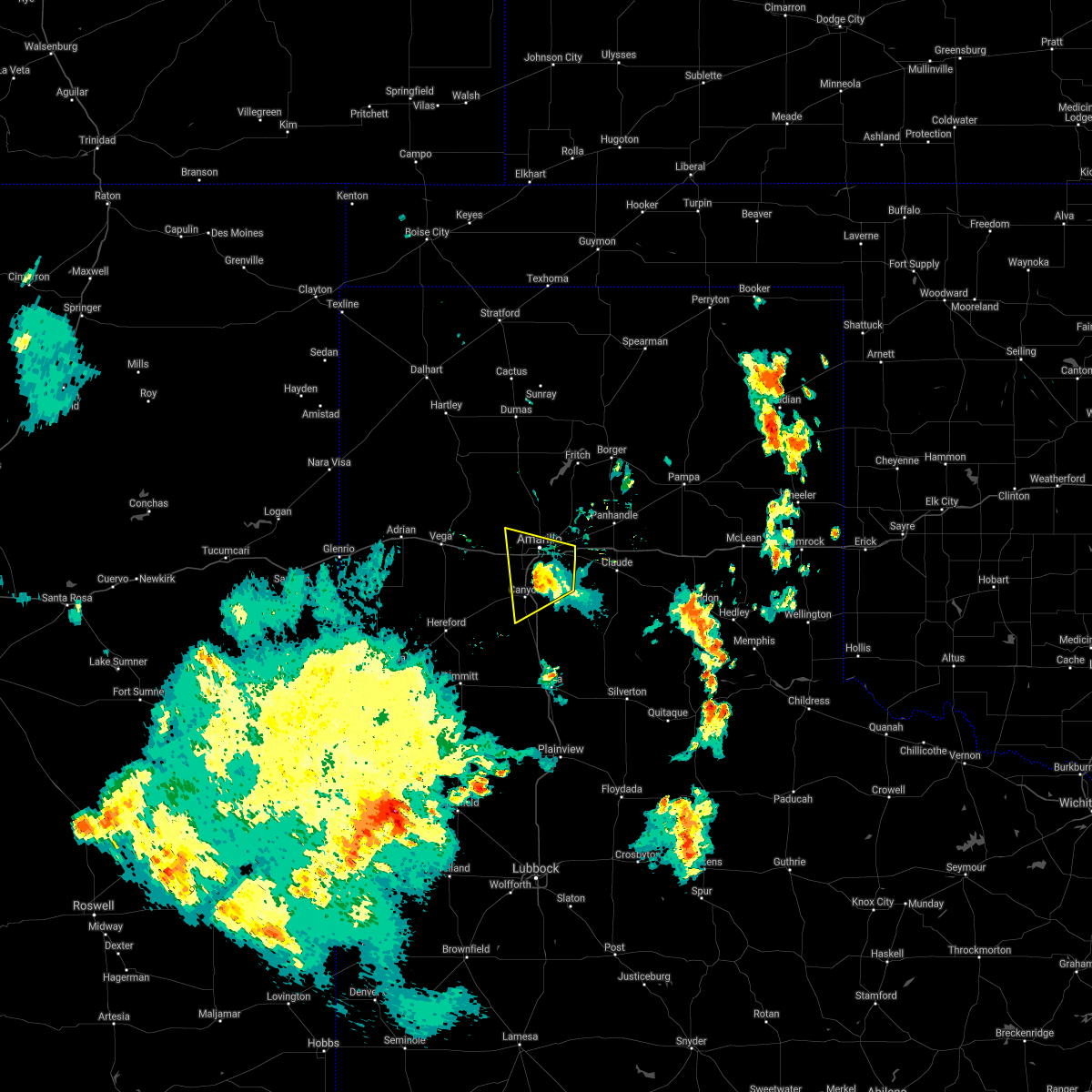 The severe thunderstorm warning for northeastern randall and southeastern potter counties will expire at 245 am cdt, the storm which prompted the warning has weakened below severe limits, and no longer poses an immediate threat to life or property. therefore, the warning will be allowed to expire. however small hail, gusty winds and heavy rain are still possible with this thunderstorm. The severe thunderstorm warning for northeastern randall and southeastern potter counties will expire at 245 am cdt, the storm which prompted the warning has weakened below severe limits, and no longer poses an immediate threat to life or property. therefore, the warning will be allowed to expire. however small hail, gusty winds and heavy rain are still possible with this thunderstorm.
|
| 7/5/2021 2:26 AM CDT |
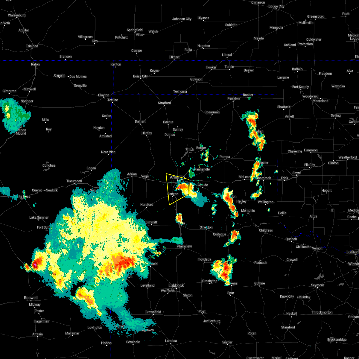 At 226 am cdt, a severe thunderstorm was located 5 miles southwest of amarillo, moving west at 20 mph (radar indicated). Hazards include 70 mph wind gusts and ping pong ball size hail. Expect some tree damage. damage is likely to mobile homes, roofs, and outbuildings. people and animals outdoors will be injured. expect hail damage to roofs, siding, windows, and vehicles. Locations impacted include, amarillo, canyon, lake tanglewood, mescalero park and timbercreek canyon. At 226 am cdt, a severe thunderstorm was located 5 miles southwest of amarillo, moving west at 20 mph (radar indicated). Hazards include 70 mph wind gusts and ping pong ball size hail. Expect some tree damage. damage is likely to mobile homes, roofs, and outbuildings. people and animals outdoors will be injured. expect hail damage to roofs, siding, windows, and vehicles. Locations impacted include, amarillo, canyon, lake tanglewood, mescalero park and timbercreek canyon.
|
| 7/5/2021 2:15 AM CDT |
 At 215 am cdt, a severe thunderstorm was located over amarillo, moving west at 20 mph (radar indicated). Hazards include 60 mph wind gusts and quarter size hail. Minor damage to roofs, siding, and trees is possible. hail damage to vehicles is expected. Locations impacted include, amarillo, canyon, lake tanglewood, washburn, mescalero park and timbercreek canyon. At 215 am cdt, a severe thunderstorm was located over amarillo, moving west at 20 mph (radar indicated). Hazards include 60 mph wind gusts and quarter size hail. Minor damage to roofs, siding, and trees is possible. hail damage to vehicles is expected. Locations impacted include, amarillo, canyon, lake tanglewood, washburn, mescalero park and timbercreek canyon.
|
| 7/5/2021 1:58 AM CDT |
 At 158 am cdt, a severe thunderstorm was located 6 miles east of amarillo, moving west at 20 mph (radar indicated). Hazards include 70 mph wind gusts and ping pong ball size hail. Expect some tree damage. damage is likely to mobile homes, roofs, and outbuildings. people and animals outdoors will be injured. expect hail damage to roofs, siding, windows, and vehicles. Locations impacted include, amarillo, canyon, claude, lake tanglewood, mescalero park, washburn and timbercreek canyon. At 158 am cdt, a severe thunderstorm was located 6 miles east of amarillo, moving west at 20 mph (radar indicated). Hazards include 70 mph wind gusts and ping pong ball size hail. Expect some tree damage. damage is likely to mobile homes, roofs, and outbuildings. people and animals outdoors will be injured. expect hail damage to roofs, siding, windows, and vehicles. Locations impacted include, amarillo, canyon, claude, lake tanglewood, mescalero park, washburn and timbercreek canyon.
|
| 7/5/2021 1:41 AM CDT |
 At 141 am cdt, a severe thunderstorm was located near washburn, or 11 miles east of amarillo, moving west at 20 mph. this is a very dangerous storm (radar indicated). Hazards include 80 mph wind gusts and ping pong ball size hail. Flying debris will be dangerous to those caught without shelter. mobile homes will be heavily damaged. expect considerable damage to roofs, windows, and vehicles. tree damage and power outages are likely. people and animals outdoors will be injured. expect hail damage to roofs, siding, windows, and vehicles. Locations impacted include, amarillo, canyon, claude, lake tanglewood, mescalero park, washburn and timbercreek canyon. At 141 am cdt, a severe thunderstorm was located near washburn, or 11 miles east of amarillo, moving west at 20 mph. this is a very dangerous storm (radar indicated). Hazards include 80 mph wind gusts and ping pong ball size hail. Flying debris will be dangerous to those caught without shelter. mobile homes will be heavily damaged. expect considerable damage to roofs, windows, and vehicles. tree damage and power outages are likely. people and animals outdoors will be injured. expect hail damage to roofs, siding, windows, and vehicles. Locations impacted include, amarillo, canyon, claude, lake tanglewood, mescalero park, washburn and timbercreek canyon.
|
| 7/5/2021 1:31 AM CDT |
 At 131 am cdt, a severe thunderstorm was located over washburn, or 13 miles northwest of claude, moving west at 20 mph (radar indicated). Hazards include 70 mph wind gusts and ping pong ball size hail. Expect some tree damage. damage is likely to mobile homes, roofs, and outbuildings. people and animals outdoors will be injured. Expect hail damage to roofs, siding, windows, and vehicles. At 131 am cdt, a severe thunderstorm was located over washburn, or 13 miles northwest of claude, moving west at 20 mph (radar indicated). Hazards include 70 mph wind gusts and ping pong ball size hail. Expect some tree damage. damage is likely to mobile homes, roofs, and outbuildings. people and animals outdoors will be injured. Expect hail damage to roofs, siding, windows, and vehicles.
|
| 6/6/2021 9:40 PM CDT |
 At 940 pm cdt, severe thunderstorms were located along a line extending from near wildorado to 7 miles southeast of hereford, moving east at 15 mph (radar indicated). Hazards include 60 mph wind gusts and quarter size hail. Minor damage to roofs, siding, and trees is possible. Hail damage to vehicles is expected. At 940 pm cdt, severe thunderstorms were located along a line extending from near wildorado to 7 miles southeast of hereford, moving east at 15 mph (radar indicated). Hazards include 60 mph wind gusts and quarter size hail. Minor damage to roofs, siding, and trees is possible. Hail damage to vehicles is expected.
|
| 5/30/2021 11:27 PM CDT |
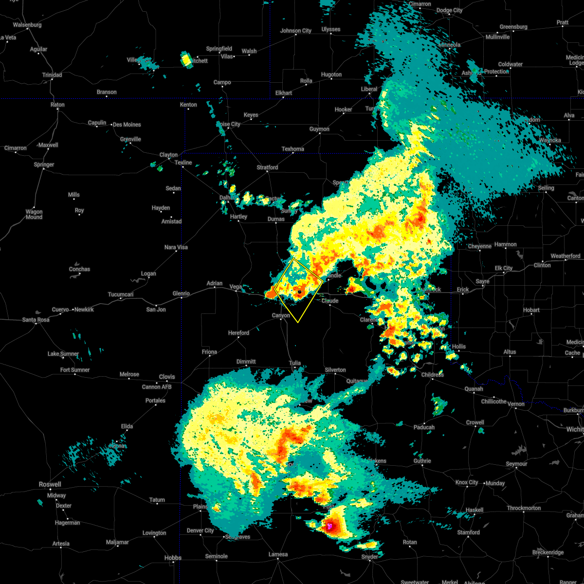 The severe thunderstorm warning for northwestern armstrong, northeastern randall, southwestern carson and eastern potter counties will expire at 1130 pm cdt, the storms which prompted the warning have weakened below severe limits, and no longer pose an immediate threat to life or property. therefore, the warning will be allowed to expire. however heavy rain is still possible with these thunderstorms. a tornado watch remains in effect until midnight cdt for the panhandle of texas. The severe thunderstorm warning for northwestern armstrong, northeastern randall, southwestern carson and eastern potter counties will expire at 1130 pm cdt, the storms which prompted the warning have weakened below severe limits, and no longer pose an immediate threat to life or property. therefore, the warning will be allowed to expire. however heavy rain is still possible with these thunderstorms. a tornado watch remains in effect until midnight cdt for the panhandle of texas.
|
| 5/30/2021 11:07 PM CDT |
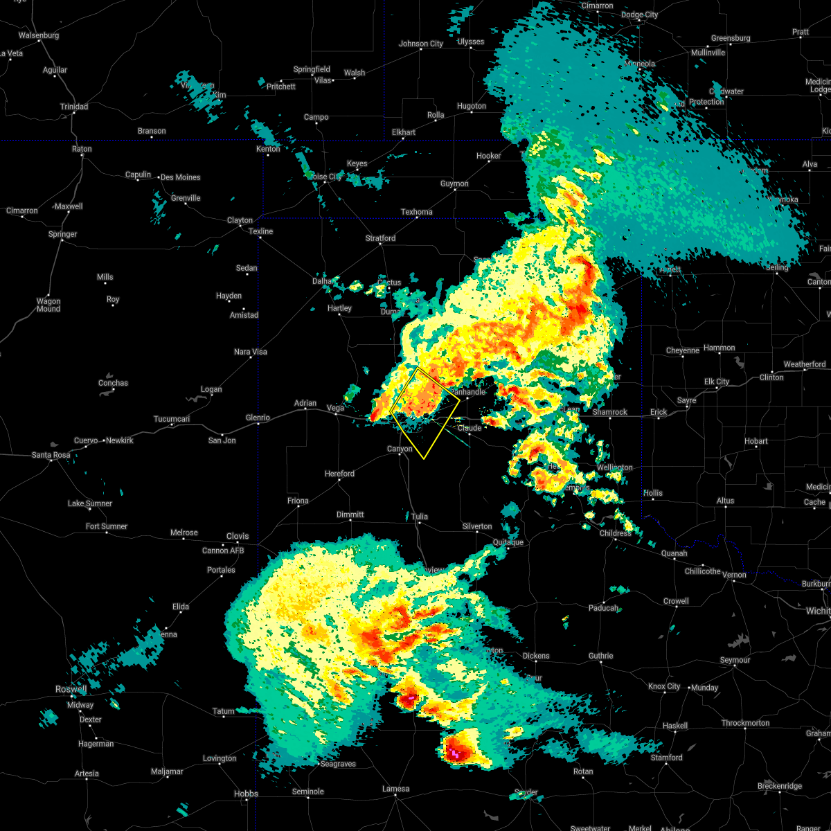 At 1106 pm cdt, severe thunderstorms were located along a line extending from 12 miles northwest of washburn to 5 miles northeast of mescalero park, moving southeast at 20 mph (radar indicated). Hazards include 60 mph wind gusts and penny size hail. Minor damage to roofs, siding, and trees is possible. locations impacted include, amarillo, lake tanglewood, washburn, timbercreek canyon and pantex. A tornado watch remains in effect until midnight cdt for the panhandle of texas. At 1106 pm cdt, severe thunderstorms were located along a line extending from 12 miles northwest of washburn to 5 miles northeast of mescalero park, moving southeast at 20 mph (radar indicated). Hazards include 60 mph wind gusts and penny size hail. Minor damage to roofs, siding, and trees is possible. locations impacted include, amarillo, lake tanglewood, washburn, timbercreek canyon and pantex. A tornado watch remains in effect until midnight cdt for the panhandle of texas.
|
| 5/30/2021 10:42 PM CDT |
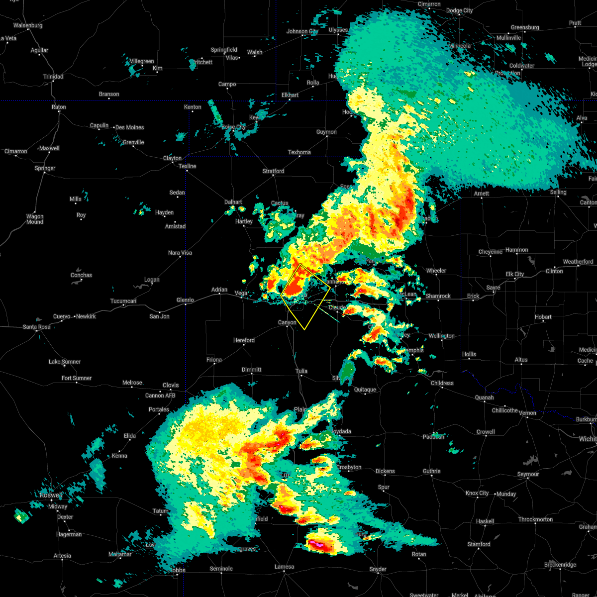 At 1042 pm cdt, severe thunderstorms were located along a line extending from 17 miles northwest of washburn to 3 miles southwest of amarillo, moving southeast at 20 mph (radar indicated). Hazards include 70 mph wind gusts and quarter size hail. Expect some tree damage. damage is likely to mobile homes, roofs, and outbuildings. hail damage to vehicles is expected. locations impacted include, amarillo, lake tanglewood, washburn, timbercreek canyon and pantex. A tornado watch remains in effect until midnight cdt for the panhandle of texas. At 1042 pm cdt, severe thunderstorms were located along a line extending from 17 miles northwest of washburn to 3 miles southwest of amarillo, moving southeast at 20 mph (radar indicated). Hazards include 70 mph wind gusts and quarter size hail. Expect some tree damage. damage is likely to mobile homes, roofs, and outbuildings. hail damage to vehicles is expected. locations impacted include, amarillo, lake tanglewood, washburn, timbercreek canyon and pantex. A tornado watch remains in effect until midnight cdt for the panhandle of texas.
|
| 5/30/2021 10:27 PM CDT |
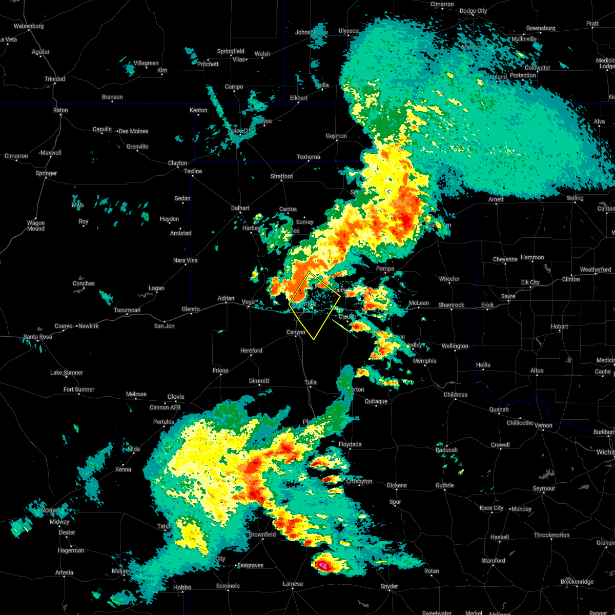 At 1027 pm cdt, severe thunderstorms were located along a line extending from 16 miles southwest of lake meredith to 5 miles west of amarillo, moving southeast at 20 mph (radar indicated). Hazards include 60 mph wind gusts and quarter size hail. Minor damage to roofs, siding, and trees is possible. Hail damage to vehicles is expected. At 1027 pm cdt, severe thunderstorms were located along a line extending from 16 miles southwest of lake meredith to 5 miles west of amarillo, moving southeast at 20 mph (radar indicated). Hazards include 60 mph wind gusts and quarter size hail. Minor damage to roofs, siding, and trees is possible. Hail damage to vehicles is expected.
|
| 5/26/2021 6:47 PM CDT |
 At 646 pm cdt, two severe thunderstorms, the first over lake tanglewood and the second 3 miles south of palo duro canyon, were moving northeast at 40 mph (radar indicated). Hazards include ping pong ball size hail and 60 mph wind gusts. Minor damage to roofs, siding, and trees is possible. people and animals outdoors will be injured. Expect hail damage to roofs, siding, windows, and vehicles. At 646 pm cdt, two severe thunderstorms, the first over lake tanglewood and the second 3 miles south of palo duro canyon, were moving northeast at 40 mph (radar indicated). Hazards include ping pong ball size hail and 60 mph wind gusts. Minor damage to roofs, siding, and trees is possible. people and animals outdoors will be injured. Expect hail damage to roofs, siding, windows, and vehicles.
|
| 5/26/2021 6:36 PM CDT |
 At 635 pm cdt, two severe thunderstorms, the first 4 miles southwest of lake tanglewood and the second 7 miles southwest of palo duro canyon, were moving northeast at 40 mph (radar indicated). Hazards include 60 mph wind gusts and quarter size hail. Minor damage to roofs, siding, and trees is possible. hail damage to vehicles is expected. locations impacted include, canyon, lake tanglewood, wayside, palo duro canyon, mescalero park and timbercreek canyon. A tornado watch remains in effect until midnight cdt for the panhandle of texas. At 635 pm cdt, two severe thunderstorms, the first 4 miles southwest of lake tanglewood and the second 7 miles southwest of palo duro canyon, were moving northeast at 40 mph (radar indicated). Hazards include 60 mph wind gusts and quarter size hail. Minor damage to roofs, siding, and trees is possible. hail damage to vehicles is expected. locations impacted include, canyon, lake tanglewood, wayside, palo duro canyon, mescalero park and timbercreek canyon. A tornado watch remains in effect until midnight cdt for the panhandle of texas.
|
| 5/26/2021 6:11 PM CDT |
 At 611 pm cdt, a severe thunderstorm was located 7 miles northwest of happy, or 13 miles south of canyon, moving northeast at 40 mph (radar indicated). Hazards include 60 mph wind gusts and quarter size hail. Minor damage to roofs, siding, and trees is possible. Hail damage to vehicles is expected. At 611 pm cdt, a severe thunderstorm was located 7 miles northwest of happy, or 13 miles south of canyon, moving northeast at 40 mph (radar indicated). Hazards include 60 mph wind gusts and quarter size hail. Minor damage to roofs, siding, and trees is possible. Hail damage to vehicles is expected.
|
| 5/18/2021 6:36 PM CDT |
 At 636 pm cdt, severe thunderstorms were located along a line extending from 6 miles east of masterson to near palo duro canyon, moving east at 25 mph (radar indicated). Hazards include 60 mph wind gusts and quarter size hail. Minor damage to roofs, siding, and trees is possible. hail damage to vehicles is expected. Locations impacted include, amarillo, canyon, lake tanglewood, mescalero park, washburn, masterson, lake meredith, timbercreek canyon and pantex. At 636 pm cdt, severe thunderstorms were located along a line extending from 6 miles east of masterson to near palo duro canyon, moving east at 25 mph (radar indicated). Hazards include 60 mph wind gusts and quarter size hail. Minor damage to roofs, siding, and trees is possible. hail damage to vehicles is expected. Locations impacted include, amarillo, canyon, lake tanglewood, mescalero park, washburn, masterson, lake meredith, timbercreek canyon and pantex.
|
| 5/18/2021 6:26 PM CDT |
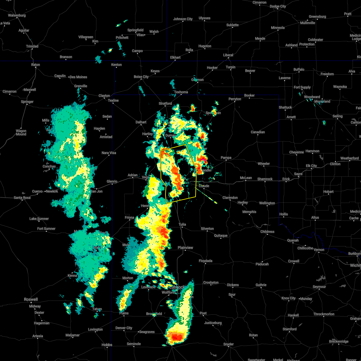 At 625 pm cdt, severe thunderstorms were located along a line extending from 3 miles southeast of masterson to near palo duro canyon, moving east at 15 mph (radar indicated). Hazards include 60 mph wind gusts and quarter size hail. Minor damage to roofs, siding, and trees is possible. hail damage to vehicles is expected. Locations impacted include, amarillo, canyon, lake tanglewood, mescalero park, bushland, four way, valley de oro, washburn, masterson, lake meredith, timbercreek canyon and pantex. At 625 pm cdt, severe thunderstorms were located along a line extending from 3 miles southeast of masterson to near palo duro canyon, moving east at 15 mph (radar indicated). Hazards include 60 mph wind gusts and quarter size hail. Minor damage to roofs, siding, and trees is possible. hail damage to vehicles is expected. Locations impacted include, amarillo, canyon, lake tanglewood, mescalero park, bushland, four way, valley de oro, washburn, masterson, lake meredith, timbercreek canyon and pantex.
|
| 5/18/2021 6:18 PM CDT |
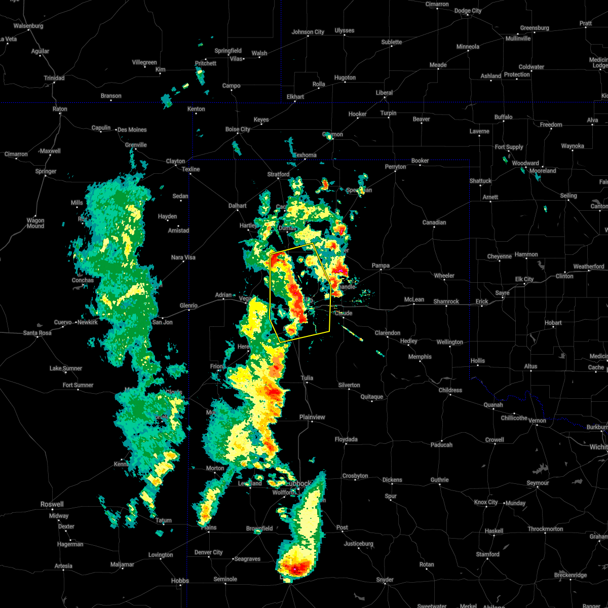 At 617 pm cdt, severe thunderstorms were located along a line extending from near masterson to 4 miles northwest of palo duro canyon, moving east at 15 mph (radar indicated). Hazards include 60 mph wind gusts and quarter size hail. Minor damage to roofs, siding, and trees is possible. hail damage to vehicles is expected. Locations impacted include, amarillo, canyon, lake tanglewood, mescalero park, bushland, four way, valley de oro, washburn, masterson, lake meredith, timbercreek canyon and pantex. At 617 pm cdt, severe thunderstorms were located along a line extending from near masterson to 4 miles northwest of palo duro canyon, moving east at 15 mph (radar indicated). Hazards include 60 mph wind gusts and quarter size hail. Minor damage to roofs, siding, and trees is possible. hail damage to vehicles is expected. Locations impacted include, amarillo, canyon, lake tanglewood, mescalero park, bushland, four way, valley de oro, washburn, masterson, lake meredith, timbercreek canyon and pantex.
|
| 5/18/2021 6:05 PM CDT |
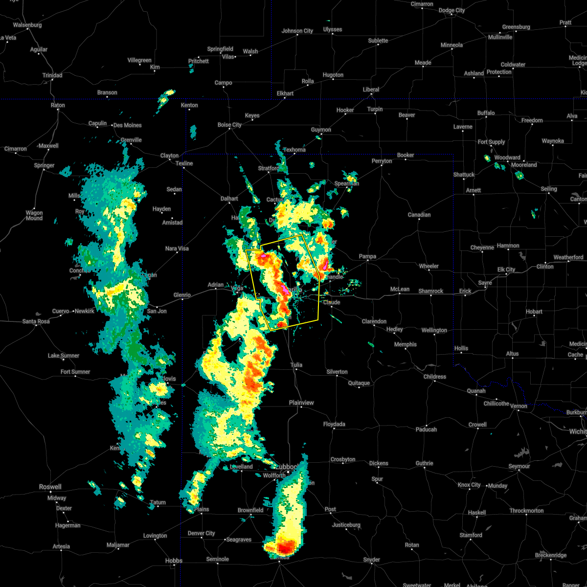 At 604 pm cdt, severe thunderstorms were located along a line extending from 3 miles southwest of masterson to 6 miles south of lake tanglewood, moving east at 20 mph (radar indicated). Hazards include 60 mph wind gusts and quarter size hail. Minor damage to roofs, siding, and trees is possible. hail damage to vehicles is expected. Locations impacted include, amarillo, canyon, lake tanglewood, bushland, valley de oro, washburn, boys ranch, mescalero park, four way, masterson, lake meredith, timbercreek canyon and pantex. At 604 pm cdt, severe thunderstorms were located along a line extending from 3 miles southwest of masterson to 6 miles south of lake tanglewood, moving east at 20 mph (radar indicated). Hazards include 60 mph wind gusts and quarter size hail. Minor damage to roofs, siding, and trees is possible. hail damage to vehicles is expected. Locations impacted include, amarillo, canyon, lake tanglewood, bushland, valley de oro, washburn, boys ranch, mescalero park, four way, masterson, lake meredith, timbercreek canyon and pantex.
|
| 5/18/2021 5:54 PM CDT |
 At 553 pm cdt, severe thunderstorms were located along a line extending from 5 miles northeast of valley de oro to 3 miles north of mescalero park, moving east at 15 mph (radar indicated). Hazards include 60 mph wind gusts and quarter size hail. Minor damage to roofs, siding, and trees is possible. hail damage to vehicles is expected. Locations impacted include, amarillo, canyon, lake tanglewood, bushland, valley de oro, washburn, boys ranch, mescalero park, four way, masterson, lake meredith, timbercreek canyon and pantex. At 553 pm cdt, severe thunderstorms were located along a line extending from 5 miles northeast of valley de oro to 3 miles north of mescalero park, moving east at 15 mph (radar indicated). Hazards include 60 mph wind gusts and quarter size hail. Minor damage to roofs, siding, and trees is possible. hail damage to vehicles is expected. Locations impacted include, amarillo, canyon, lake tanglewood, bushland, valley de oro, washburn, boys ranch, mescalero park, four way, masterson, lake meredith, timbercreek canyon and pantex.
|
| 5/18/2021 5:41 PM CDT |
 At 541 pm cdt, severe thunderstorms were located along a line extending from near valley de oro to 4 miles northwest of mescalero park, moving east at 20 mph (radar indicated). Hazards include 60 mph wind gusts and quarter size hail. Minor damage to roofs, siding, and trees is possible. hail damage to vehicles is expected. Locations impacted include, amarillo, canyon, lake tanglewood, bushland, valley de oro, washburn, boys ranch, mescalero park, four way, masterson, lake meredith, timbercreek canyon and pantex. At 541 pm cdt, severe thunderstorms were located along a line extending from near valley de oro to 4 miles northwest of mescalero park, moving east at 20 mph (radar indicated). Hazards include 60 mph wind gusts and quarter size hail. Minor damage to roofs, siding, and trees is possible. hail damage to vehicles is expected. Locations impacted include, amarillo, canyon, lake tanglewood, bushland, valley de oro, washburn, boys ranch, mescalero park, four way, masterson, lake meredith, timbercreek canyon and pantex.
|
| 5/18/2021 5:32 PM CDT |
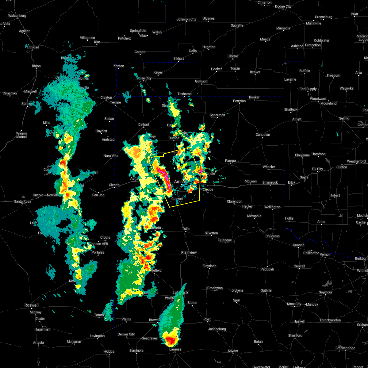 At 532 pm cdt, severe thunderstorms were located along a line extending from valley de oro to 4 miles northwest of mescalero park, moving east at 20 mph (radar indicated). Hazards include 60 mph wind gusts and half dollar size hail. Minor damage to roofs, siding, and trees is possible. hail damage to vehicles is expected. Locations impacted include, amarillo, canyon, lake tanglewood, bushland, valley de oro, washburn, boys ranch, mescalero park, four way, masterson, lake meredith, timbercreek canyon and pantex. At 532 pm cdt, severe thunderstorms were located along a line extending from valley de oro to 4 miles northwest of mescalero park, moving east at 20 mph (radar indicated). Hazards include 60 mph wind gusts and half dollar size hail. Minor damage to roofs, siding, and trees is possible. hail damage to vehicles is expected. Locations impacted include, amarillo, canyon, lake tanglewood, bushland, valley de oro, washburn, boys ranch, mescalero park, four way, masterson, lake meredith, timbercreek canyon and pantex.
|
| 5/18/2021 5:19 PM CDT |
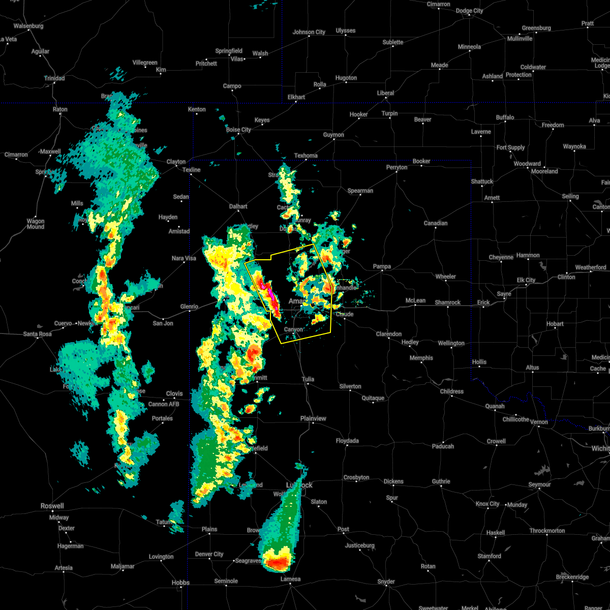 At 519 pm cdt, severe thunderstorms were located along a line extending from 6 miles west of valley de oro to 4 miles south of bushland, moving east at 20 mph (radar indicated). Hazards include 60 mph wind gusts and half dollar size hail. Minor damage to roofs, siding, and trees is possible. Hail damage to vehicles is expected. At 519 pm cdt, severe thunderstorms were located along a line extending from 6 miles west of valley de oro to 4 miles south of bushland, moving east at 20 mph (radar indicated). Hazards include 60 mph wind gusts and half dollar size hail. Minor damage to roofs, siding, and trees is possible. Hail damage to vehicles is expected.
|
| 5/17/2021 7:59 PM CDT |
 The national weather service in amarillo has issued a * severe thunderstorm warning for. armstrong county in the panhandle of texas. randall county in the panhandle of texas. carson county in the panhandle of texas. Southwestern hutchinson county in the panhandle of texas. The national weather service in amarillo has issued a * severe thunderstorm warning for. armstrong county in the panhandle of texas. randall county in the panhandle of texas. carson county in the panhandle of texas. Southwestern hutchinson county in the panhandle of texas.
|
| 5/17/2021 7:33 PM CDT |
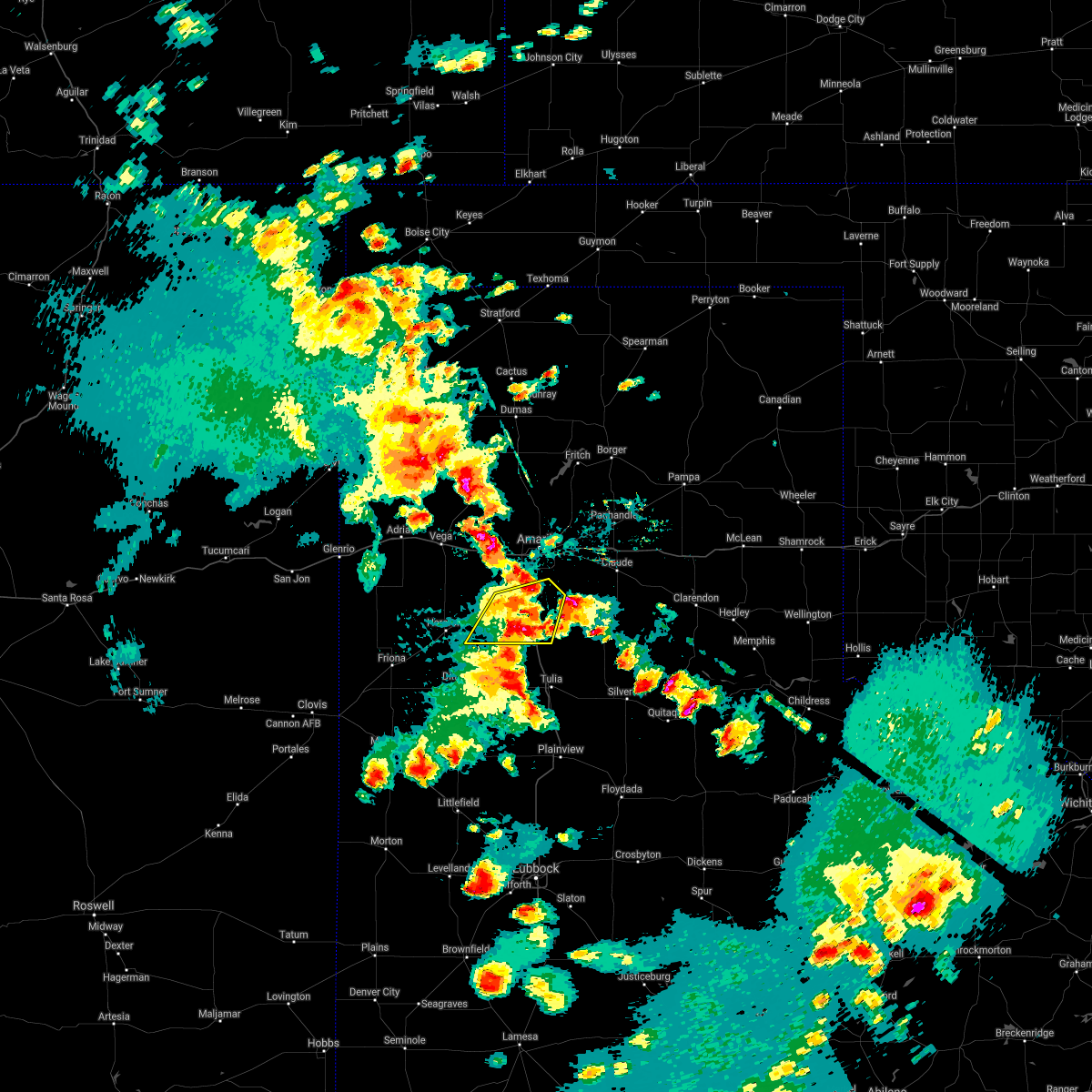 At 733 pm cdt, a severe thunderstorm was located 7 miles northwest of happy, or 9 miles south of canyon, moving northeast at 35 mph (radar indicated). Hazards include 60 mph wind gusts and half dollar size hail. Minor damage to roofs, siding, and trees is possible. Hail damage to vehicles is expected. At 733 pm cdt, a severe thunderstorm was located 7 miles northwest of happy, or 9 miles south of canyon, moving northeast at 35 mph (radar indicated). Hazards include 60 mph wind gusts and half dollar size hail. Minor damage to roofs, siding, and trees is possible. Hail damage to vehicles is expected.
|
| 5/17/2021 7:30 PM CDT |
 At 730 pm cdt, a severe thunderstorm was located 4 miles east of palo duro canyon, or 16 miles southwest of claude, moving north at 35 mph. this is a very dangerous storm (radar indicated). Hazards include baseball size hail and 60 mph wind gusts. People and animals outdoors will be severely injured. expect shattered windows, extensive damage to roofs, siding, and vehicles. locations impacted include, claude, lake tanglewood, wayside, palo duro canyon and timbercreek canyon. A tornado watch remains in effect until 1100 pm cdt for the panhandle of texas. At 730 pm cdt, a severe thunderstorm was located 4 miles east of palo duro canyon, or 16 miles southwest of claude, moving north at 35 mph. this is a very dangerous storm (radar indicated). Hazards include baseball size hail and 60 mph wind gusts. People and animals outdoors will be severely injured. expect shattered windows, extensive damage to roofs, siding, and vehicles. locations impacted include, claude, lake tanglewood, wayside, palo duro canyon and timbercreek canyon. A tornado watch remains in effect until 1100 pm cdt for the panhandle of texas.
|
| 5/17/2021 7:17 PM CDT |
 At 717 pm cdt, a severe thunderstorm was located 4 miles northwest of wayside, or 21 miles southeast of canyon, moving north at 35 mph (radar indicated). Hazards include tennis ball size hail and 60 mph wind gusts. Minor damage to roofs, siding, and trees is possible. people and animals outdoors will be injured. expect hail damage to roofs, siding, windows, and vehicles. locations impacted include, claude, lake tanglewood, wayside, palo duro canyon and timbercreek canyon. A tornado watch remains in effect until 1100 pm cdt for the panhandle of texas. At 717 pm cdt, a severe thunderstorm was located 4 miles northwest of wayside, or 21 miles southeast of canyon, moving north at 35 mph (radar indicated). Hazards include tennis ball size hail and 60 mph wind gusts. Minor damage to roofs, siding, and trees is possible. people and animals outdoors will be injured. expect hail damage to roofs, siding, windows, and vehicles. locations impacted include, claude, lake tanglewood, wayside, palo duro canyon and timbercreek canyon. A tornado watch remains in effect until 1100 pm cdt for the panhandle of texas.
|
| 5/17/2021 7:01 PM CDT |
 At 654 pm cdt, a severe thunderstorm was located near vigo park, or 14 miles northeast of tulia, moving north at 35 mph (radar indicated). Hazards include 60 mph wind gusts and half dollar size hail. Minor damage to roofs, siding, and trees is possible. Hail damage to vehicles is expected. At 654 pm cdt, a severe thunderstorm was located near vigo park, or 14 miles northeast of tulia, moving north at 35 mph (radar indicated). Hazards include 60 mph wind gusts and half dollar size hail. Minor damage to roofs, siding, and trees is possible. Hail damage to vehicles is expected.
|
| 5/17/2021 6:54 PM CDT |
 At 654 pm cdt, a severe thunderstorm was located near vigo park, or 14 miles northeast of tulia, moving north at 35 mph (radar indicated). Hazards include 60 mph wind gusts and half dollar size hail. Minor damage to roofs, siding, and trees is possible. Hail damage to vehicles is expected. At 654 pm cdt, a severe thunderstorm was located near vigo park, or 14 miles northeast of tulia, moving north at 35 mph (radar indicated). Hazards include 60 mph wind gusts and half dollar size hail. Minor damage to roofs, siding, and trees is possible. Hail damage to vehicles is expected.
|
| 5/16/2021 8:15 PM CDT |
 At 815 pm cdt, a severe thunderstorm was located over canyon, and is nearly stationary (radar indicated). Hazards include golf ball size hail and 60 mph wind gusts. Minor damage to roofs, siding, and trees is possible. people and animals outdoors will be injured. expect hail damage to roofs, siding, windows, and vehicles. hail may accumulate on roadways causing hazardous travel. Locations impacted include, canyon, lake tanglewood, mescalero park and timbercreek canyon. At 815 pm cdt, a severe thunderstorm was located over canyon, and is nearly stationary (radar indicated). Hazards include golf ball size hail and 60 mph wind gusts. Minor damage to roofs, siding, and trees is possible. people and animals outdoors will be injured. expect hail damage to roofs, siding, windows, and vehicles. hail may accumulate on roadways causing hazardous travel. Locations impacted include, canyon, lake tanglewood, mescalero park and timbercreek canyon.
|
| 5/16/2021 8:02 PM CDT |
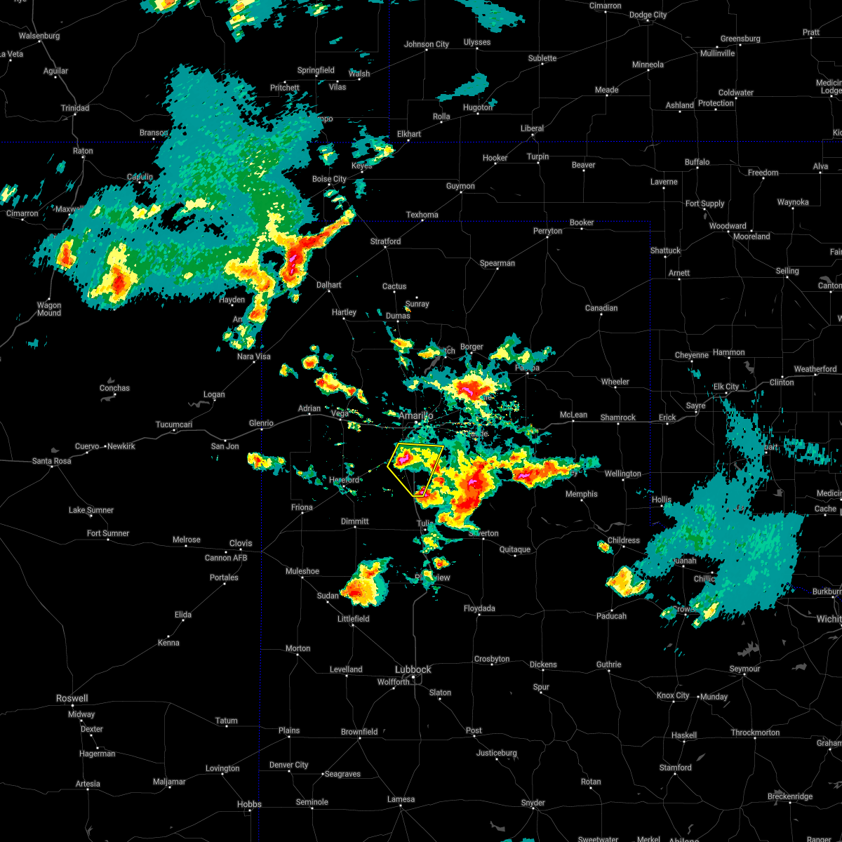 At 802 pm cdt, a severe thunderstorm was located over canyon, moving east at 10 mph (radar indicated). Hazards include golf ball size hail and 60 mph wind gusts. Minor damage to roofs, siding, and trees is possible. people and animals outdoors will be injured. expect hail damage to roofs, siding, windows, and vehicles. hail may accumulate on roadways causing hazardous travel. Locations impacted include, canyon, lake tanglewood, mescalero park and timbercreek canyon. At 802 pm cdt, a severe thunderstorm was located over canyon, moving east at 10 mph (radar indicated). Hazards include golf ball size hail and 60 mph wind gusts. Minor damage to roofs, siding, and trees is possible. people and animals outdoors will be injured. expect hail damage to roofs, siding, windows, and vehicles. hail may accumulate on roadways causing hazardous travel. Locations impacted include, canyon, lake tanglewood, mescalero park and timbercreek canyon.
|
| 5/16/2021 7:44 PM CDT |
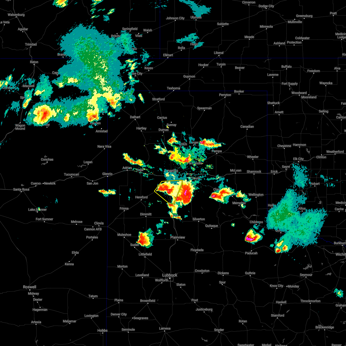 At 744 pm cdt, a severe thunderstorm was located over canyon, and is nearly stationary. at 738 pm cdt, the public reported half dollar size hail 5 miles east southeast of canyon (public). Hazards include 60 mph wind gusts and half dollar size hail. Minor damage to roofs, siding, and trees is possible. hail damage to vehicles is expected. Hail may accumulate on roadways causing hazardous travel. At 744 pm cdt, a severe thunderstorm was located over canyon, and is nearly stationary. at 738 pm cdt, the public reported half dollar size hail 5 miles east southeast of canyon (public). Hazards include 60 mph wind gusts and half dollar size hail. Minor damage to roofs, siding, and trees is possible. hail damage to vehicles is expected. Hail may accumulate on roadways causing hazardous travel.
|
| 5/16/2021 7:10 PM CDT |
 At 710 pm cdt, a severe thunderstorm was located 6 miles southwest of palo duro canyon, or 9 miles southeast of canyon, moving southeast at 20 mph (radar indicated). Hazards include 70 mph wind gusts and ping pong ball size hail. Expect some tree damage. damage is likely to mobile homes, roofs, and outbuildings. people and animals outdoors will be injured. expect hail damage to roofs, siding, windows, and vehicles. Locations impacted include, amarillo, canyon, lake tanglewood, mescalero park, palo duro canyon and timbercreek canyon. At 710 pm cdt, a severe thunderstorm was located 6 miles southwest of palo duro canyon, or 9 miles southeast of canyon, moving southeast at 20 mph (radar indicated). Hazards include 70 mph wind gusts and ping pong ball size hail. Expect some tree damage. damage is likely to mobile homes, roofs, and outbuildings. people and animals outdoors will be injured. expect hail damage to roofs, siding, windows, and vehicles. Locations impacted include, amarillo, canyon, lake tanglewood, mescalero park, palo duro canyon and timbercreek canyon.
|
| 5/16/2021 6:45 PM CDT |
 At 645 pm cdt, a severe thunderstorm was located 4 miles northeast of canyon, and is nearly stationary. at 644 pm cdt a trained spotter reports ping pong size hail and estimated 70 mph wind gusts in canyon (trained weather spotters). Hazards include golf ball size hail and 70 mph wind gusts. Expect some tree damage. damage is likely to mobile homes, roofs, and outbuildings. people and animals outdoors will be injured. expect hail damage to roofs, siding, windows, and vehicles. hail may accumulate on roadways causing hazardous travel. Locations impacted include, amarillo, canyon, lake tanglewood, mescalero park, umbarger, palo duro canyon and timbercreek canyon. At 645 pm cdt, a severe thunderstorm was located 4 miles northeast of canyon, and is nearly stationary. at 644 pm cdt a trained spotter reports ping pong size hail and estimated 70 mph wind gusts in canyon (trained weather spotters). Hazards include golf ball size hail and 70 mph wind gusts. Expect some tree damage. damage is likely to mobile homes, roofs, and outbuildings. people and animals outdoors will be injured. expect hail damage to roofs, siding, windows, and vehicles. hail may accumulate on roadways causing hazardous travel. Locations impacted include, amarillo, canyon, lake tanglewood, mescalero park, umbarger, palo duro canyon and timbercreek canyon.
|
| 5/16/2021 6:41 PM CDT |
 The national weather service in amarillo has issued a * severe thunderstorm warning for. northwestern armstrong county in the panhandle of texas. randall county in the panhandle of texas. until 745 pm cdt. At 641 pm cdt, a severe thunderstorm was located 4 miles northeast. The national weather service in amarillo has issued a * severe thunderstorm warning for. northwestern armstrong county in the panhandle of texas. randall county in the panhandle of texas. until 745 pm cdt. At 641 pm cdt, a severe thunderstorm was located 4 miles northeast.
|
| 5/16/2021 6:30 PM CDT |
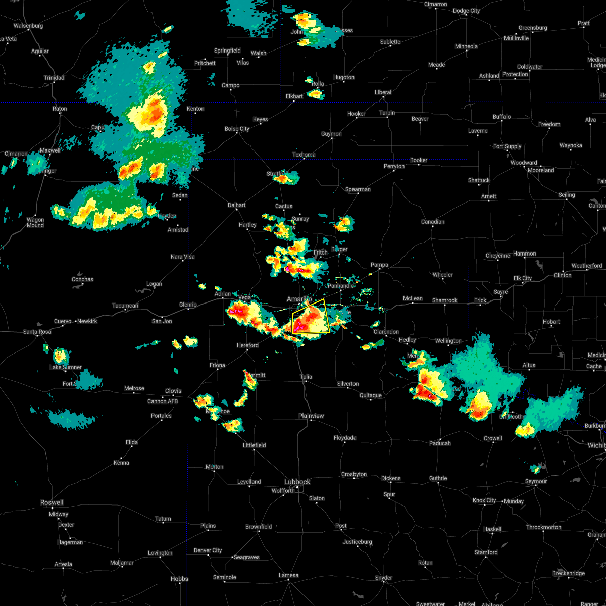 At 630 pm cdt, a severe thunderstorm was located over lake tanglewood, or 7 miles northeast of canyon, and is nearly stationary (radar indicated). Hazards include golf ball size hail and 60 mph wind gusts. Minor damage to roofs, siding, and trees is possible. people and animals outdoors will be injured. expect hail damage to roofs, siding, windows, and vehicles. hail may accumulate on roadways causing hazardous travel. Locations impacted include, amarillo, canyon, lake tanglewood, washburn, mescalero park and timbercreek canyon. At 630 pm cdt, a severe thunderstorm was located over lake tanglewood, or 7 miles northeast of canyon, and is nearly stationary (radar indicated). Hazards include golf ball size hail and 60 mph wind gusts. Minor damage to roofs, siding, and trees is possible. people and animals outdoors will be injured. expect hail damage to roofs, siding, windows, and vehicles. hail may accumulate on roadways causing hazardous travel. Locations impacted include, amarillo, canyon, lake tanglewood, washburn, mescalero park and timbercreek canyon.
|
| 5/16/2021 6:23 PM CDT |
 At 623 pm cdt, a severe thunderstorm was located over lake tanglewood, or 9 miles southeast of amarillo, moving east at 10 mph (radar indicated). Hazards include two inch hail and 60 mph wind gusts. Minor damage to roofs, siding, and trees is possible. people and animals outdoors will be injured. expect hail damage to roofs, siding, windows, and vehicles. hail may accumulate on roadways causing hazardous travel. Locations impacted include, amarillo, canyon, panhandle, claude, lake tanglewood, mescalero park, washburn and timbercreek canyon. At 623 pm cdt, a severe thunderstorm was located over lake tanglewood, or 9 miles southeast of amarillo, moving east at 10 mph (radar indicated). Hazards include two inch hail and 60 mph wind gusts. Minor damage to roofs, siding, and trees is possible. people and animals outdoors will be injured. expect hail damage to roofs, siding, windows, and vehicles. hail may accumulate on roadways causing hazardous travel. Locations impacted include, amarillo, canyon, panhandle, claude, lake tanglewood, mescalero park, washburn and timbercreek canyon.
|
| 5/16/2021 6:17 PM CDT |
 At 616 pm cdt, a severe thunderstorm was located over lake tanglewood, or 9 miles northeast of canyon, moving east at 10 mph. at 614 pm cdt, a trained spotter reports just under tennis ball size hail 4 miles east northeast of canyon (trained weather spotters). Hazards include two inch hail and 60 mph wind gusts. Minor damage to roofs, siding, and trees is possible. people and animals outdoors will be injured. expect hail damage to roofs, siding, windows, and vehicles. hail may accumulate on roadways causing hazardous travel. Locations impacted include, amarillo, canyon, panhandle, claude, lake tanglewood, mescalero park, washburn and timbercreek canyon. At 616 pm cdt, a severe thunderstorm was located over lake tanglewood, or 9 miles northeast of canyon, moving east at 10 mph. at 614 pm cdt, a trained spotter reports just under tennis ball size hail 4 miles east northeast of canyon (trained weather spotters). Hazards include two inch hail and 60 mph wind gusts. Minor damage to roofs, siding, and trees is possible. people and animals outdoors will be injured. expect hail damage to roofs, siding, windows, and vehicles. hail may accumulate on roadways causing hazardous travel. Locations impacted include, amarillo, canyon, panhandle, claude, lake tanglewood, mescalero park, washburn and timbercreek canyon.
|
| 5/16/2021 6:03 PM CDT |
 At 603 pm cdt, a severe thunderstorm was located over lake tanglewood, or 8 miles northeast of canyon, moving northeast at 5 mph (radar indicated). Hazards include golf ball size hail and 60 mph wind gusts. Minor damage to roofs, siding, and trees is possible. people and animals outdoors will be injured. expect hail damage to roofs, siding, windows, and vehicles. hail may accumulate on roadways causing hazardous travel. Locations impacted include, amarillo, canyon, panhandle, claude, lake tanglewood, mescalero park, washburn and timbercreek canyon. At 603 pm cdt, a severe thunderstorm was located over lake tanglewood, or 8 miles northeast of canyon, moving northeast at 5 mph (radar indicated). Hazards include golf ball size hail and 60 mph wind gusts. Minor damage to roofs, siding, and trees is possible. people and animals outdoors will be injured. expect hail damage to roofs, siding, windows, and vehicles. hail may accumulate on roadways causing hazardous travel. Locations impacted include, amarillo, canyon, panhandle, claude, lake tanglewood, mescalero park, washburn and timbercreek canyon.
|
| 5/16/2021 5:45 PM CDT |
 At 545 pm cdt, a severe thunderstorm was located 4 miles northeast of lake tanglewood, or 9 miles southeast of amarillo, moving east at 10 mph (radar indicated). Hazards include ping pong ball size hail and 60 mph wind gusts. Minor damage to roofs, siding, and trees is possible. people and animals outdoors will be injured. Expect hail damage to roofs, siding, windows, and vehicles. At 545 pm cdt, a severe thunderstorm was located 4 miles northeast of lake tanglewood, or 9 miles southeast of amarillo, moving east at 10 mph (radar indicated). Hazards include ping pong ball size hail and 60 mph wind gusts. Minor damage to roofs, siding, and trees is possible. people and animals outdoors will be injured. Expect hail damage to roofs, siding, windows, and vehicles.
|
| 5/16/2021 5:17 PM CDT |
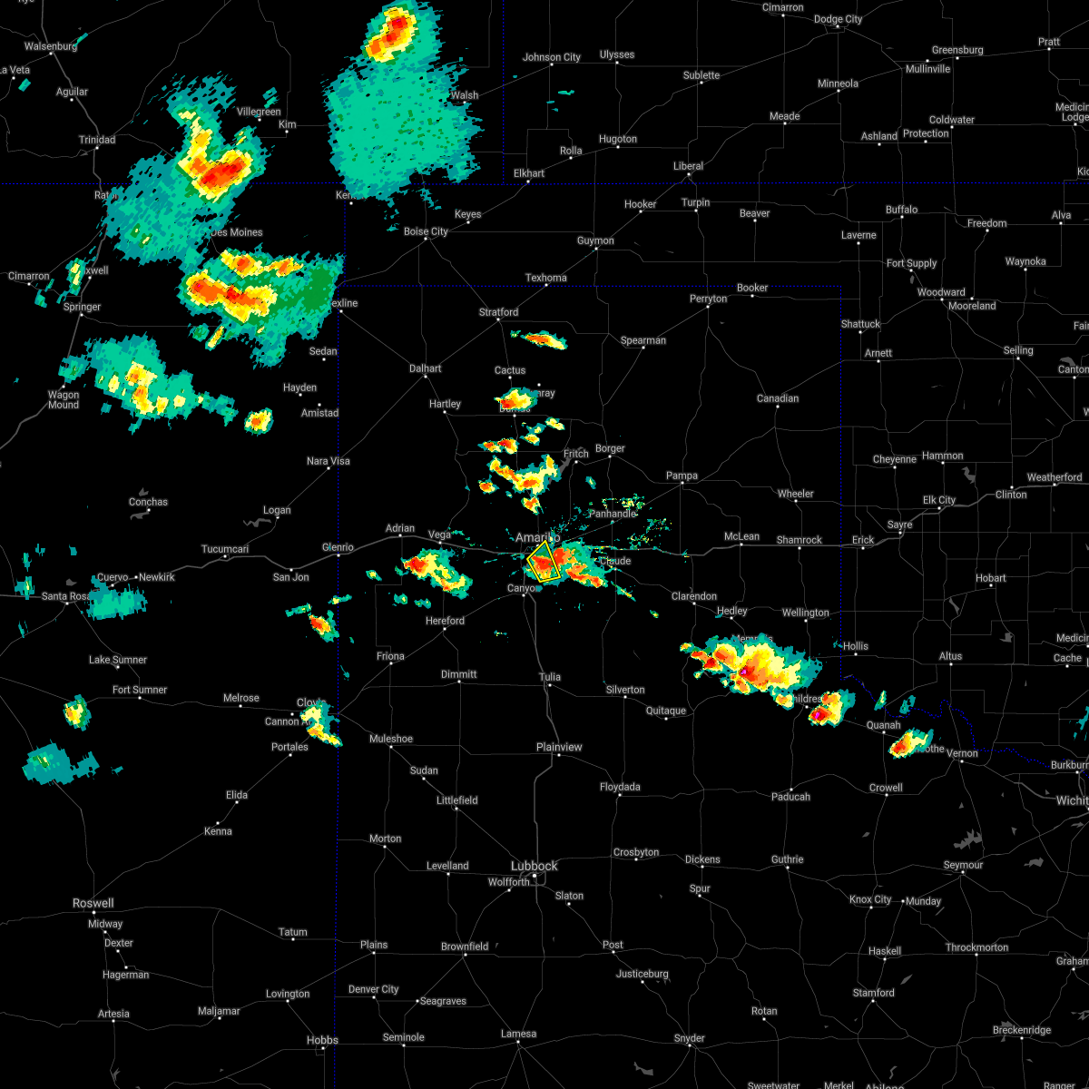 At 516 pm cdt, a severe thunderstorm was located 5 miles south of amarillo, moving northeast at 10 mph. reports of two inch hail with this storm (public). Hazards include two inch hail and 60 mph wind gusts. Minor damage to roofs, siding, and trees is possible. people and animals outdoors will be injured. expect hail damage to roofs, siding, windows, and vehicles. Locations impacted include, amarillo, lake tanglewood and timbercreek canyon. At 516 pm cdt, a severe thunderstorm was located 5 miles south of amarillo, moving northeast at 10 mph. reports of two inch hail with this storm (public). Hazards include two inch hail and 60 mph wind gusts. Minor damage to roofs, siding, and trees is possible. people and animals outdoors will be injured. expect hail damage to roofs, siding, windows, and vehicles. Locations impacted include, amarillo, lake tanglewood and timbercreek canyon.
|
| 5/16/2021 5:07 PM CDT |
 At 506 pm cdt, a severe thunderstorm was located near mescalero park, or 6 miles south of amarillo, moving northeast at 10 mph. multiple trained spotters have reported quarter to half dollar size hail with this storm (trained weather spotters). Hazards include 60 mph wind gusts and half dollar size hail. Minor damage to roofs, siding, and trees is possible. hail damage to vehicles is expected. Locations impacted include, amarillo, lake tanglewood, mescalero park and timbercreek canyon. At 506 pm cdt, a severe thunderstorm was located near mescalero park, or 6 miles south of amarillo, moving northeast at 10 mph. multiple trained spotters have reported quarter to half dollar size hail with this storm (trained weather spotters). Hazards include 60 mph wind gusts and half dollar size hail. Minor damage to roofs, siding, and trees is possible. hail damage to vehicles is expected. Locations impacted include, amarillo, lake tanglewood, mescalero park and timbercreek canyon.
|
| 5/16/2021 4:58 PM CDT |
 At 458 pm cdt, a severe thunderstorm was located near mescalero park, or 7 miles south of amarillo, moving northeast at 10 mph (radar indicated). Hazards include 60 mph wind gusts and half dollar size hail. Minor damage to roofs, siding, and trees is possible. hail damage to vehicles is expected. Locations impacted include, amarillo, canyon, lake tanglewood, mescalero park and timbercreek canyon. At 458 pm cdt, a severe thunderstorm was located near mescalero park, or 7 miles south of amarillo, moving northeast at 10 mph (radar indicated). Hazards include 60 mph wind gusts and half dollar size hail. Minor damage to roofs, siding, and trees is possible. hail damage to vehicles is expected. Locations impacted include, amarillo, canyon, lake tanglewood, mescalero park and timbercreek canyon.
|
| 5/16/2021 4:46 PM CDT |
 At 446 pm cdt, a severe thunderstorm was located over mescalero park, or 7 miles north of canyon, moving northeast at 10 mph (radar indicated). Hazards include 60 mph wind gusts and quarter size hail. Minor damage to roofs, siding, and trees is possible. Hail damage to vehicles is expected. At 446 pm cdt, a severe thunderstorm was located over mescalero park, or 7 miles north of canyon, moving northeast at 10 mph (radar indicated). Hazards include 60 mph wind gusts and quarter size hail. Minor damage to roofs, siding, and trees is possible. Hail damage to vehicles is expected.
|
| 5/14/2021 7:41 PM CDT |
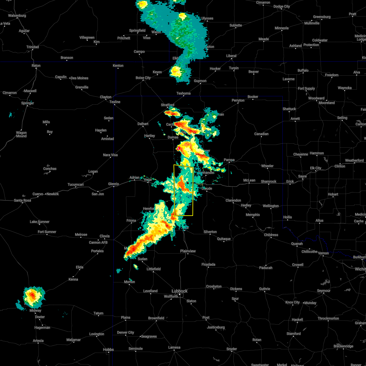 At 741 pm cdt, severe thunderstorms were located along a line extending from 5 miles north of amarillo to 7 miles northeast of lake tanglewood, moving northeast at 30 mph (radar indicated). Hazards include 70 mph wind gusts. Expect some tree damage. damage is likely to mobile homes, roofs, and outbuildings. Locations impacted include, amarillo, canyon, lake tanglewood, mescalero park, palo duro canyon and timbercreek canyon. At 741 pm cdt, severe thunderstorms were located along a line extending from 5 miles north of amarillo to 7 miles northeast of lake tanglewood, moving northeast at 30 mph (radar indicated). Hazards include 70 mph wind gusts. Expect some tree damage. damage is likely to mobile homes, roofs, and outbuildings. Locations impacted include, amarillo, canyon, lake tanglewood, mescalero park, palo duro canyon and timbercreek canyon.
|
| 5/14/2021 7:06 PM CDT |
 At 705 pm cdt, severe thunderstorms were located along a line extending from 3 miles south of vega to bushland to 8 miles south of buffalo lake, moving east at 20 mph (automated weather equipment 4 miles east of vega reported 70 mph wind gust at 700 pm cdt). Hazards include 70 mph wind gusts and quarter size hail. Expect some tree damage. damage is likely to mobile homes, roofs, and outbuildings. Hail damage to vehicles is expected. At 705 pm cdt, severe thunderstorms were located along a line extending from 3 miles south of vega to bushland to 8 miles south of buffalo lake, moving east at 20 mph (automated weather equipment 4 miles east of vega reported 70 mph wind gust at 700 pm cdt). Hazards include 70 mph wind gusts and quarter size hail. Expect some tree damage. damage is likely to mobile homes, roofs, and outbuildings. Hail damage to vehicles is expected.
|
| 5/7/2021 6:54 PM CDT |
 At 653 pm cdt, severe thunderstorms were located along a line extending from 3 miles southwest of white deer to 6 miles southwest of groom to 10 miles northeast of wayside, moving east at 45 mph (radar indicated). Hazards include 60 mph wind gusts and quarter size hail. Minor damage to roofs, siding, and trees is possible. hail damage to vehicles is expected. Locations impacted include, amarillo, hereford, canyon, panhandle, claude, lake tanglewood, buffalo lake, washburn, umbarger, palo duro canyon, mescalero park, dawn, timbercreek canyon and pantex. At 653 pm cdt, severe thunderstorms were located along a line extending from 3 miles southwest of white deer to 6 miles southwest of groom to 10 miles northeast of wayside, moving east at 45 mph (radar indicated). Hazards include 60 mph wind gusts and quarter size hail. Minor damage to roofs, siding, and trees is possible. hail damage to vehicles is expected. Locations impacted include, amarillo, hereford, canyon, panhandle, claude, lake tanglewood, buffalo lake, washburn, umbarger, palo duro canyon, mescalero park, dawn, timbercreek canyon and pantex.
|
| 5/7/2021 6:40 PM CDT |
 At 640 pm cdt, severe thunderstorms were located along a line extending from 3 miles north of panhandle to 3 miles north of claude to 3 miles southeast of palo duro canyon, moving east at 45 mph (radar indicated). Hazards include 60 mph wind gusts and quarter size hail. Minor damage to roofs, siding, and trees is possible. hail damage to vehicles is expected. Locations impacted include, amarillo, hereford, canyon, panhandle, claude, vega, fritch, lake tanglewood, bushland, buffalo lake, washburn, umbarger, wildorado, palo duro canyon, mescalero park, dawn, timbercreek canyon and pantex. At 640 pm cdt, severe thunderstorms were located along a line extending from 3 miles north of panhandle to 3 miles north of claude to 3 miles southeast of palo duro canyon, moving east at 45 mph (radar indicated). Hazards include 60 mph wind gusts and quarter size hail. Minor damage to roofs, siding, and trees is possible. hail damage to vehicles is expected. Locations impacted include, amarillo, hereford, canyon, panhandle, claude, vega, fritch, lake tanglewood, bushland, buffalo lake, washburn, umbarger, wildorado, palo duro canyon, mescalero park, dawn, timbercreek canyon and pantex.
|
| 5/7/2021 5:38 PM CDT |
 At 538 pm cdt, severe thunderstorms were located along a line extending from 5 miles southwest of valley de oro to 5 miles southeast of wildorado to 6 miles north of hereford, moving east at 45 mph (radar indicated). Hazards include 60 mph wind gusts and quarter size hail. Minor damage to roofs, siding, and trees is possible. Hail damage to vehicles is expected. At 538 pm cdt, severe thunderstorms were located along a line extending from 5 miles southwest of valley de oro to 5 miles southeast of wildorado to 6 miles north of hereford, moving east at 45 mph (radar indicated). Hazards include 60 mph wind gusts and quarter size hail. Minor damage to roofs, siding, and trees is possible. Hail damage to vehicles is expected.
|
| 3/13/2021 4:03 PM CST |
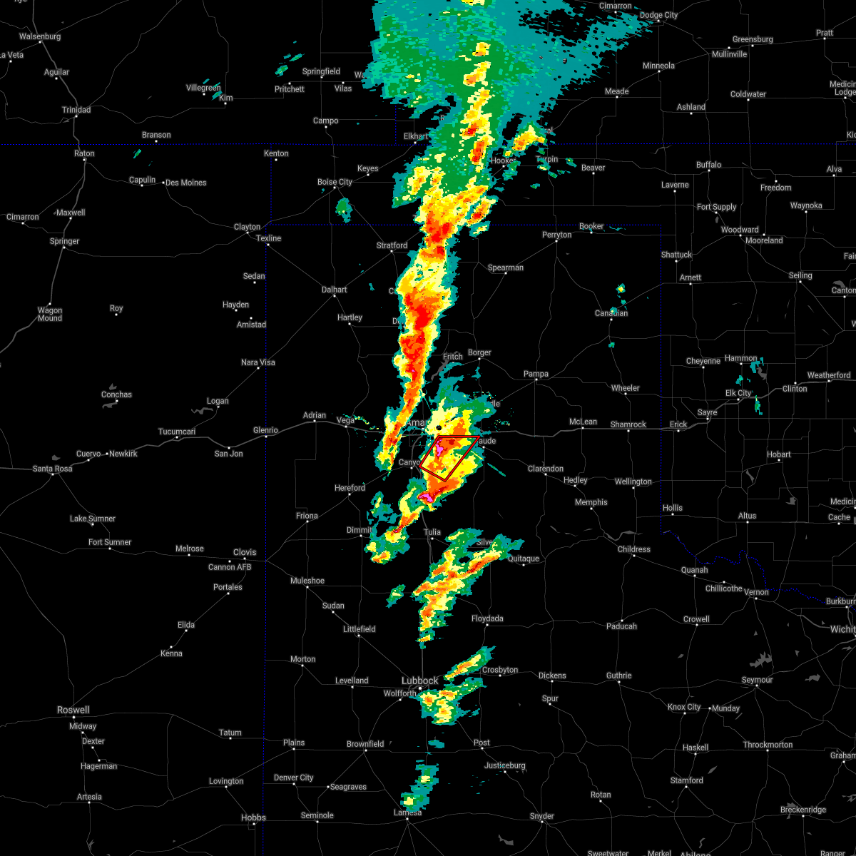 At 403 pm cst, a confirmed large and extremely dangerous tornado was located near palo duro canyon, or 12 miles east of canyon, moving northeast at 35 mph. this is a particularly dangerous situation. take cover now! (weather spotters confirmed tornado). Hazards include damaging tornado. You are in a life-threatening situation. flying debris may be deadly to those caught without shelter. mobile homes will be destroyed. considerable damage to homes, businesses, and vehicles is likely and complete destruction is possible. Locations impacted include, lake tanglewood, washburn and palo duro canyon. At 403 pm cst, a confirmed large and extremely dangerous tornado was located near palo duro canyon, or 12 miles east of canyon, moving northeast at 35 mph. this is a particularly dangerous situation. take cover now! (weather spotters confirmed tornado). Hazards include damaging tornado. You are in a life-threatening situation. flying debris may be deadly to those caught without shelter. mobile homes will be destroyed. considerable damage to homes, businesses, and vehicles is likely and complete destruction is possible. Locations impacted include, lake tanglewood, washburn and palo duro canyon.
|
| 3/13/2021 3:50 PM CST |
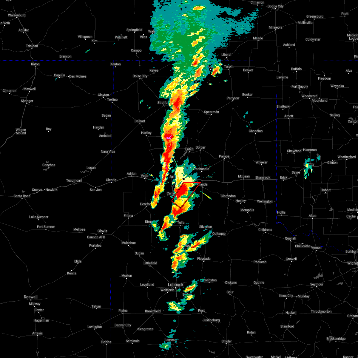 At 350 pm cst, a confirmed large and extremely dangerous tornado was located 7 miles west of palo duro canyon, or 7 miles southeast of canyon, moving northeast at 30 mph. this is a particularly dangerous situation. take cover now! (weather spotters confirmed tornado). Hazards include damaging tornado. You are in a life-threatening situation. flying debris may be deadly to those caught without shelter. mobile homes will be destroyed. Considerable damage to homes, businesses, and vehicles is likely and complete destruction is possible. At 350 pm cst, a confirmed large and extremely dangerous tornado was located 7 miles west of palo duro canyon, or 7 miles southeast of canyon, moving northeast at 30 mph. this is a particularly dangerous situation. take cover now! (weather spotters confirmed tornado). Hazards include damaging tornado. You are in a life-threatening situation. flying debris may be deadly to those caught without shelter. mobile homes will be destroyed. Considerable damage to homes, businesses, and vehicles is likely and complete destruction is possible.
|
| 8/29/2020 9:03 PM CDT |
 At 903 pm cdt, a severe thunderstorm was located 5 miles east of buffalo lake, or 9 miles southwest of canyon, moving east at 20 mph (radar indicated). Hazards include 60 mph wind gusts and quarter size hail. Minor damage to roofs, siding, and trees is possible. hail damage to vehicles is expected. Locations impacted include, amarillo, canyon, lake tanglewood, mescalero park, buffalo lake, umbarger, palo duro canyon and timbercreek canyon. At 903 pm cdt, a severe thunderstorm was located 5 miles east of buffalo lake, or 9 miles southwest of canyon, moving east at 20 mph (radar indicated). Hazards include 60 mph wind gusts and quarter size hail. Minor damage to roofs, siding, and trees is possible. hail damage to vehicles is expected. Locations impacted include, amarillo, canyon, lake tanglewood, mescalero park, buffalo lake, umbarger, palo duro canyon and timbercreek canyon.
|
| 8/29/2020 8:29 PM CDT |
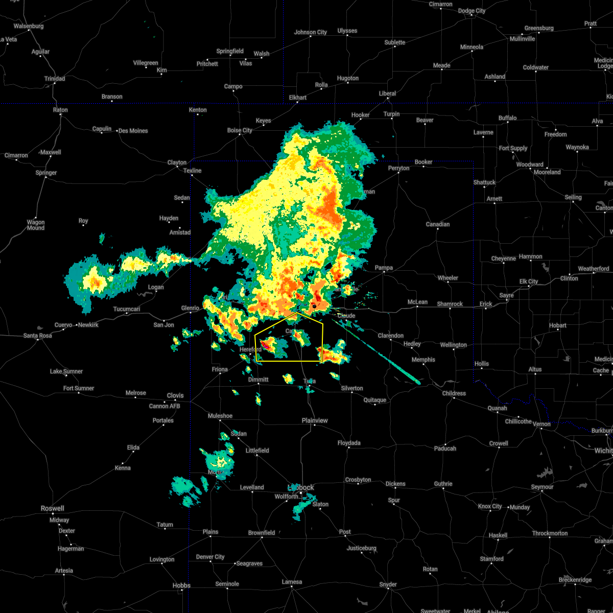 At 829 pm cdt, a severe thunderstorm was located 4 miles southwest of dawn, or 8 miles northeast of hereford, moving east at 20 mph (radar indicated). Hazards include 70 mph wind gusts and half dollar size hail. Expect some tree damage. damage is likely to mobile homes, roofs, and outbuildings. Hail damage to vehicles is expected. At 829 pm cdt, a severe thunderstorm was located 4 miles southwest of dawn, or 8 miles northeast of hereford, moving east at 20 mph (radar indicated). Hazards include 70 mph wind gusts and half dollar size hail. Expect some tree damage. damage is likely to mobile homes, roofs, and outbuildings. Hail damage to vehicles is expected.
|
| 8/14/2020 5:13 PM CDT |
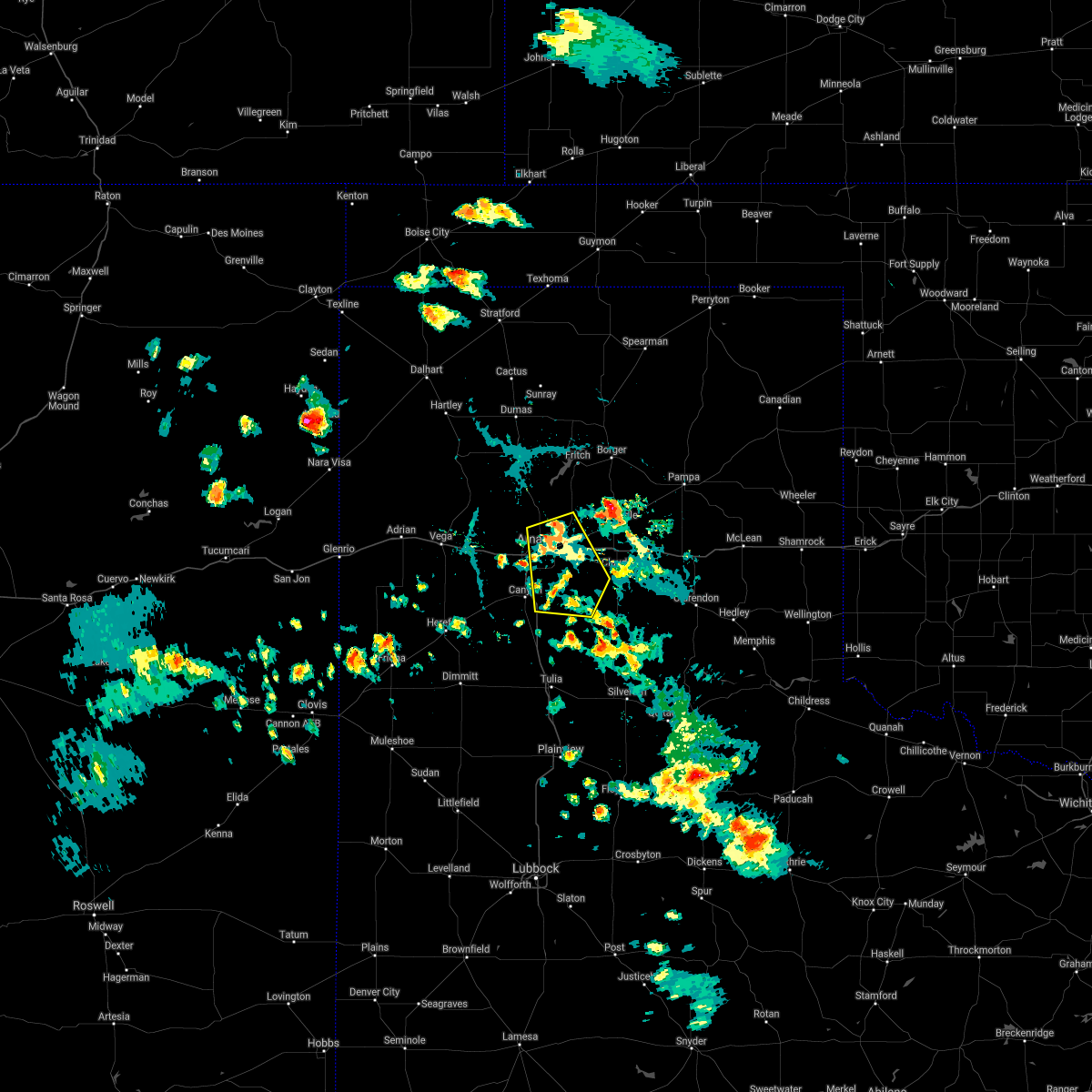 At 513 pm cdt, a severe thunderstorm was located 4 miles northeast of amarillo, moving southeast at 5 mph (radar indicated). Hazards include 60 mph wind gusts and quarter size hail. Minor damage to roofs, siding, and trees is possible. hail damage to vehicles is expected. Locations impacted include, amarillo, lake tanglewood, washburn, palo duro canyon, timbercreek canyon and pantex. At 513 pm cdt, a severe thunderstorm was located 4 miles northeast of amarillo, moving southeast at 5 mph (radar indicated). Hazards include 60 mph wind gusts and quarter size hail. Minor damage to roofs, siding, and trees is possible. hail damage to vehicles is expected. Locations impacted include, amarillo, lake tanglewood, washburn, palo duro canyon, timbercreek canyon and pantex.
|
| 8/14/2020 4:58 PM CDT |
 At 458 pm cdt, a severe thunderstorm was located 5 miles northeast of amarillo, moving southeast at 10 mph (radar indicated). Hazards include 60 mph wind gusts and quarter size hail. Minor damage to roofs, siding, and trees is possible. Hail damage to vehicles is expected. At 458 pm cdt, a severe thunderstorm was located 5 miles northeast of amarillo, moving southeast at 10 mph (radar indicated). Hazards include 60 mph wind gusts and quarter size hail. Minor damage to roofs, siding, and trees is possible. Hail damage to vehicles is expected.
|
| 6/22/2020 9:28 PM CDT |
 The severe thunderstorm warning for northern armstrong, randall, southwestern carson, deaf smith and southern potter counties will expire at 930 pm cdt, the storms which prompted the warning have moved out of the area. therefore, the warning will be allowed to expire. a severe thunderstorm watch remains in effect until 1100 pm cdt for the panhandle of texas. The severe thunderstorm warning for northern armstrong, randall, southwestern carson, deaf smith and southern potter counties will expire at 930 pm cdt, the storms which prompted the warning have moved out of the area. therefore, the warning will be allowed to expire. a severe thunderstorm watch remains in effect until 1100 pm cdt for the panhandle of texas.
|
| 6/22/2020 9:07 PM CDT |
 At 907 pm cdt, severe thunderstorms were located along a line extending from near claude to 8 miles southeast of buffalo lake, moving southeast at 50 mph (radar indicated). Hazards include 60 mph wind gusts. Minor damage to roofs, siding, and trees is possible. Locations impacted include, amarillo, hereford, canyon, panhandle, claude, lake tanglewood, buffalo lake, bushland, washburn, umbarger, bootleg, goodnight, palo duro canyon, mescalero park, dawn, simms, timbercreek canyon and pantex. At 907 pm cdt, severe thunderstorms were located along a line extending from near claude to 8 miles southeast of buffalo lake, moving southeast at 50 mph (radar indicated). Hazards include 60 mph wind gusts. Minor damage to roofs, siding, and trees is possible. Locations impacted include, amarillo, hereford, canyon, panhandle, claude, lake tanglewood, buffalo lake, bushland, washburn, umbarger, bootleg, goodnight, palo duro canyon, mescalero park, dawn, simms, timbercreek canyon and pantex.
|
| 6/22/2020 8:38 PM CDT |
 At 837 pm cdt, severe thunderstorms were located along a line extending from 9 miles northwest of washburn to 11 miles north of hereford, moving south at 40 mph (trained weather spotters). Hazards include 70 mph wind gusts and half dollar size hail. Expect some tree damage. damage is likely to mobile homes, roofs, and outbuildings. Locations impacted include, amarillo, hereford, canyon, panhandle, claude, lake tanglewood, buffalo lake, bushland, washburn, umbarger, bootleg, goodnight, palo duro canyon, mescalero park, dawn, simms, timbercreek canyon and pantex. At 837 pm cdt, severe thunderstorms were located along a line extending from 9 miles northwest of washburn to 11 miles north of hereford, moving south at 40 mph (trained weather spotters). Hazards include 70 mph wind gusts and half dollar size hail. Expect some tree damage. damage is likely to mobile homes, roofs, and outbuildings. Locations impacted include, amarillo, hereford, canyon, panhandle, claude, lake tanglewood, buffalo lake, bushland, washburn, umbarger, bootleg, goodnight, palo duro canyon, mescalero park, dawn, simms, timbercreek canyon and pantex.
|
| 6/22/2020 8:01 PM CDT |
 At 800 pm cdt, severe thunderstorms were located along a line extending from 8 miles east of four way to 4 miles southeast of vega, moving southeast at 50 mph. these are very dangerous storms (trained weather spotters). Hazards include 80 mph wind gusts and golf ball size hail. Flying debris will be dangerous to those caught without shelter. mobile homes could be heavily damaged. expect considerable damage to roofs, windows, and vehicles. tree damage and power outages are possible. people and animals outdoors will be injured. Expect hail damage to roofs, siding, windows, and vehicles. At 800 pm cdt, severe thunderstorms were located along a line extending from 8 miles east of four way to 4 miles southeast of vega, moving southeast at 50 mph. these are very dangerous storms (trained weather spotters). Hazards include 80 mph wind gusts and golf ball size hail. Flying debris will be dangerous to those caught without shelter. mobile homes could be heavily damaged. expect considerable damage to roofs, windows, and vehicles. tree damage and power outages are possible. people and animals outdoors will be injured. Expect hail damage to roofs, siding, windows, and vehicles.
|
| 5/23/2020 4:59 PM CDT |
 At 442 pm cdt, a severe thunderstorm was located 5 miles west of happy, or 16 miles northwest of tulia, moving northeast at 20 mph (radar indicated). Hazards include golf ball size hail and 60 mph wind gusts. Minor damage to roofs, siding, and trees is possible. people and animals outdoors will be injured. Expect hail damage to roofs, siding, windows, and vehicles. At 442 pm cdt, a severe thunderstorm was located 5 miles west of happy, or 16 miles northwest of tulia, moving northeast at 20 mph (radar indicated). Hazards include golf ball size hail and 60 mph wind gusts. Minor damage to roofs, siding, and trees is possible. people and animals outdoors will be injured. Expect hail damage to roofs, siding, windows, and vehicles.
|
| 5/23/2020 4:42 PM CDT |
 At 442 pm cdt, a severe thunderstorm was located 5 miles west of happy, or 16 miles northwest of tulia, moving northeast at 20 mph (radar indicated). Hazards include golf ball size hail and 60 mph wind gusts. Minor damage to roofs, siding, and trees is possible. people and animals outdoors will be injured. Expect hail damage to roofs, siding, windows, and vehicles. At 442 pm cdt, a severe thunderstorm was located 5 miles west of happy, or 16 miles northwest of tulia, moving northeast at 20 mph (radar indicated). Hazards include golf ball size hail and 60 mph wind gusts. Minor damage to roofs, siding, and trees is possible. people and animals outdoors will be injured. Expect hail damage to roofs, siding, windows, and vehicles.
|
| 5/23/2020 4:39 PM CDT |
 At 439 pm cdt, a severe thunderstorm was located 4 miles south of amarillo, moving northeast at 20 mph (radar indicated). Hazards include 60 mph wind gusts and quarter size hail. Minor damage to roofs, siding, and trees is possible. Hail damage to vehicles is expected. At 439 pm cdt, a severe thunderstorm was located 4 miles south of amarillo, moving northeast at 20 mph (radar indicated). Hazards include 60 mph wind gusts and quarter size hail. Minor damage to roofs, siding, and trees is possible. Hail damage to vehicles is expected.
|
| 5/11/2020 9:12 PM CDT |
 The severe thunderstorm warning for southwestern armstrong and eastern randall counties will expire at 915 pm cdt, the storms which prompted the warning have weakened below severe limits, and no longer pose an immediate threat to life or property. therefore, the warning will be allowed to expire. however gusty winds and heavy rain are still possible with these thunderstorms. a severe thunderstorm watch remains in effect until midnight cdt for the panhandle of texas. The severe thunderstorm warning for southwestern armstrong and eastern randall counties will expire at 915 pm cdt, the storms which prompted the warning have weakened below severe limits, and no longer pose an immediate threat to life or property. therefore, the warning will be allowed to expire. however gusty winds and heavy rain are still possible with these thunderstorms. a severe thunderstorm watch remains in effect until midnight cdt for the panhandle of texas.
|
| 5/11/2020 9:02 PM CDT |
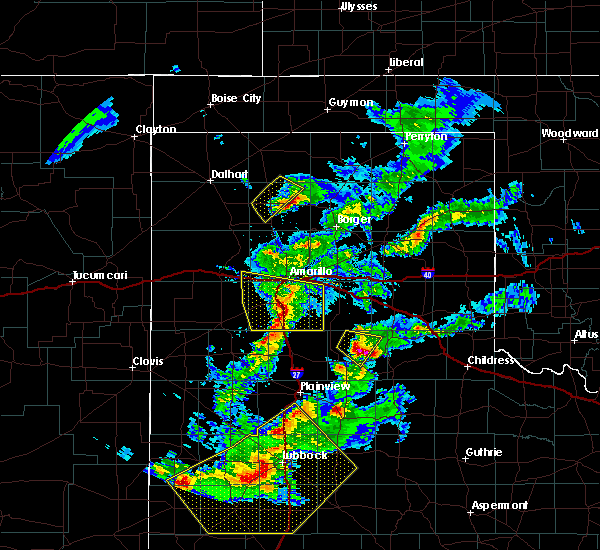 At 901 pm cdt, severe thunderstorms were located along a line extending from lake tanglewood to 10 miles south of canyon to 6 miles southwest of happy, moving east at 40 mph (radar indicated). Hazards include 60 mph wind gusts and nickel size hail. Minor damage to roofs, siding, and trees is possible. Locations impacted include, canyon, lake tanglewood, mescalero park, wayside, palo duro canyon and timbercreek canyon. At 901 pm cdt, severe thunderstorms were located along a line extending from lake tanglewood to 10 miles south of canyon to 6 miles southwest of happy, moving east at 40 mph (radar indicated). Hazards include 60 mph wind gusts and nickel size hail. Minor damage to roofs, siding, and trees is possible. Locations impacted include, canyon, lake tanglewood, mescalero park, wayside, palo duro canyon and timbercreek canyon.
|
| 5/11/2020 8:49 PM CDT |
 At 848 pm cdt, severe thunderstorms were located along a line extending from mescalero park to 7 miles south of canyon to 9 miles west of happy, moving east at 45 mph (radar indicated). Hazards include 60 mph wind gusts and quarter size hail. Minor damage to roofs, siding, and trees is possible. hail damage to vehicles is expected. Locations impacted include, amarillo, canyon, lake tanglewood, mescalero park, buffalo lake, bushland, wayside, umbarger, palo duro canyon and timbercreek canyon. At 848 pm cdt, severe thunderstorms were located along a line extending from mescalero park to 7 miles south of canyon to 9 miles west of happy, moving east at 45 mph (radar indicated). Hazards include 60 mph wind gusts and quarter size hail. Minor damage to roofs, siding, and trees is possible. hail damage to vehicles is expected. Locations impacted include, amarillo, canyon, lake tanglewood, mescalero park, buffalo lake, bushland, wayside, umbarger, palo duro canyon and timbercreek canyon.
|
| 5/11/2020 8:32 PM CDT |
 At 832 pm cdt, severe thunderstorms were located along a line extending from 6 miles southwest of bushland to buffalo lake to 12 miles south of dawn, moving east at 45 mph (radar indicated). Hazards include 60 mph wind gusts and quarter size hail. Minor damage to roofs, siding, and trees is possible. hail damage to vehicles is expected. Locations impacted include, amarillo, hereford, canyon, vega, lake tanglewood, buffalo lake, bushland, wayside, umbarger, wildorado, palo duro canyon, mescalero park, dawn and timbercreek canyon. At 832 pm cdt, severe thunderstorms were located along a line extending from 6 miles southwest of bushland to buffalo lake to 12 miles south of dawn, moving east at 45 mph (radar indicated). Hazards include 60 mph wind gusts and quarter size hail. Minor damage to roofs, siding, and trees is possible. hail damage to vehicles is expected. Locations impacted include, amarillo, hereford, canyon, vega, lake tanglewood, buffalo lake, bushland, wayside, umbarger, wildorado, palo duro canyon, mescalero park, dawn and timbercreek canyon.
|
| 5/11/2020 8:15 PM CDT |
 At 815 pm cdt, severe thunderstorms were located along a line extending from 6 miles southeast of vega to 8 miles northwest of dawn to near hereford, moving east at 45 mph (radar indicated). Hazards include 60 mph wind gusts and quarter size hail. Minor damage to roofs, siding, and trees is possible. Hail damage to vehicles is expected. At 815 pm cdt, severe thunderstorms were located along a line extending from 6 miles southeast of vega to 8 miles northwest of dawn to near hereford, moving east at 45 mph (radar indicated). Hazards include 60 mph wind gusts and quarter size hail. Minor damage to roofs, siding, and trees is possible. Hail damage to vehicles is expected.
|
| 5/11/2020 6:41 PM CDT |
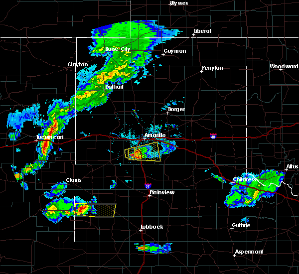 At 640 pm cdt, a severe thunderstorm was located near canyon, moving east at 30 mph (radar indicated). Hazards include 60 mph wind gusts and half dollar size hail. Minor damage to roofs, siding, and trees is possible. hail damage to vehicles is expected. Locations impacted include, canyon, lake tanglewood, mescalero park, palo duro canyon and timbercreek canyon. At 640 pm cdt, a severe thunderstorm was located near canyon, moving east at 30 mph (radar indicated). Hazards include 60 mph wind gusts and half dollar size hail. Minor damage to roofs, siding, and trees is possible. hail damage to vehicles is expected. Locations impacted include, canyon, lake tanglewood, mescalero park, palo duro canyon and timbercreek canyon.
|
| 5/11/2020 6:35 PM CDT |
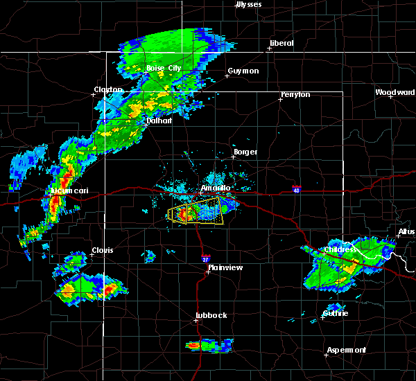 At 635 pm cdt, a severe thunderstorm was located 4 miles east of umbarger, or 5 miles west of canyon, moving east at 30 mph (radar indicated). Hazards include 60 mph wind gusts and quarter size hail. Minor damage to roofs, siding, and trees is possible. hail damage to vehicles is expected. Locations impacted include, canyon, lake tanglewood, mescalero park, palo duro canyon and timbercreek canyon. At 635 pm cdt, a severe thunderstorm was located 4 miles east of umbarger, or 5 miles west of canyon, moving east at 30 mph (radar indicated). Hazards include 60 mph wind gusts and quarter size hail. Minor damage to roofs, siding, and trees is possible. hail damage to vehicles is expected. Locations impacted include, canyon, lake tanglewood, mescalero park, palo duro canyon and timbercreek canyon.
|
| 5/11/2020 6:28 PM CDT |
 At 628 pm cdt, a severe thunderstorm was located over umbarger, or 9 miles west of canyon, moving east at 30 mph (radar indicated). Hazards include ping pong ball size hail and 60 mph wind gusts. Minor damage to roofs, siding, and trees is possible. people and animals outdoors will be injured. Expect hail damage to roofs, siding, windows, and vehicles. At 628 pm cdt, a severe thunderstorm was located over umbarger, or 9 miles west of canyon, moving east at 30 mph (radar indicated). Hazards include ping pong ball size hail and 60 mph wind gusts. Minor damage to roofs, siding, and trees is possible. people and animals outdoors will be injured. Expect hail damage to roofs, siding, windows, and vehicles.
|
| 9/28/2019 8:17 PM CDT |
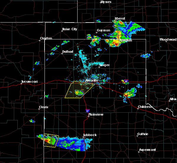 At 817 pm cdt, a severe thunderstorm was located near buffalo lake, or 10 miles southwest of canyon, moving northeast at 35 mph (law enforcement reported downed power lines in dimmitt). Hazards include 70 mph wind gusts. Expect some tree damage. damage is likely to mobile homes, roofs, and outbuildings. Locations impacted include, amarillo, canyon, lake tanglewood, mescalero park, buffalo lake, bushland, umbarger and timbercreek canyon. At 817 pm cdt, a severe thunderstorm was located near buffalo lake, or 10 miles southwest of canyon, moving northeast at 35 mph (law enforcement reported downed power lines in dimmitt). Hazards include 70 mph wind gusts. Expect some tree damage. damage is likely to mobile homes, roofs, and outbuildings. Locations impacted include, amarillo, canyon, lake tanglewood, mescalero park, buffalo lake, bushland, umbarger and timbercreek canyon.
|
| 9/28/2019 8:10 PM CDT |
 At 809 pm cdt, a severe thunderstorm was located near umbarger, or 8 miles southwest of canyon, moving northeast at 45 mph (law enforcement reported downed power poles in south dimmitt). Hazards include 70 mph wind gusts and quarter size hail. Expect some tree damage. damage is likely to mobile homes, roofs, and outbuildings. hail damage to vehicles is expected. Locations impacted include, amarillo, hereford, canyon, lake tanglewood, mescalero park, buffalo lake, bushland, dawn, umbarger and timbercreek canyon. At 809 pm cdt, a severe thunderstorm was located near umbarger, or 8 miles southwest of canyon, moving northeast at 45 mph (law enforcement reported downed power poles in south dimmitt). Hazards include 70 mph wind gusts and quarter size hail. Expect some tree damage. damage is likely to mobile homes, roofs, and outbuildings. hail damage to vehicles is expected. Locations impacted include, amarillo, hereford, canyon, lake tanglewood, mescalero park, buffalo lake, bushland, dawn, umbarger and timbercreek canyon.
|
| 9/28/2019 7:48 PM CDT |
 At 748 pm cdt, a severe thunderstorm was located 12 miles northeast of easter, or 13 miles northeast of dimmitt, moving northeast at 50 mph (radar indicated). Hazards include 70 mph wind gusts and quarter size hail. Expect some tree damage. damage is likely to mobile homes, roofs, and outbuildings. Hail damage to vehicles is expected. At 748 pm cdt, a severe thunderstorm was located 12 miles northeast of easter, or 13 miles northeast of dimmitt, moving northeast at 50 mph (radar indicated). Hazards include 70 mph wind gusts and quarter size hail. Expect some tree damage. damage is likely to mobile homes, roofs, and outbuildings. Hail damage to vehicles is expected.
|
| 8/15/2019 5:40 AM CDT |
 At 539 am cdt, automated weather equipment reported a severe thunderstorm was located 11 miles northwest of panhandle, moving southeast at 45 mph (automated weather equipment. at 532 am cdt, automated equipment recorded a 73 mph gust in fritch). Hazards include 70 mph wind gusts. Expect some tree damage. damage is likely to mobile homes, roofs, and outbuildings. Locations impacted include, amarillo, borger, panhandle, claude, fritch, stinnett, lake tanglewood, sanford, washburn, goodnight, palo duro canyon, lake meredith and pantex. At 539 am cdt, automated weather equipment reported a severe thunderstorm was located 11 miles northwest of panhandle, moving southeast at 45 mph (automated weather equipment. at 532 am cdt, automated equipment recorded a 73 mph gust in fritch). Hazards include 70 mph wind gusts. Expect some tree damage. damage is likely to mobile homes, roofs, and outbuildings. Locations impacted include, amarillo, borger, panhandle, claude, fritch, stinnett, lake tanglewood, sanford, washburn, goodnight, palo duro canyon, lake meredith and pantex.
|
| 8/15/2019 5:31 AM CDT |
 At 530 am cdt, a severe thunderstorm was located 7 miles south of fritch, or 14 miles southwest of borger, moving south at 45 mph (radar indicated). Hazards include 60 mph wind gusts. minor damage to roofs, siding, and trees is possible At 530 am cdt, a severe thunderstorm was located 7 miles south of fritch, or 14 miles southwest of borger, moving south at 45 mph (radar indicated). Hazards include 60 mph wind gusts. minor damage to roofs, siding, and trees is possible
|
| 8/9/2019 4:17 PM CDT |
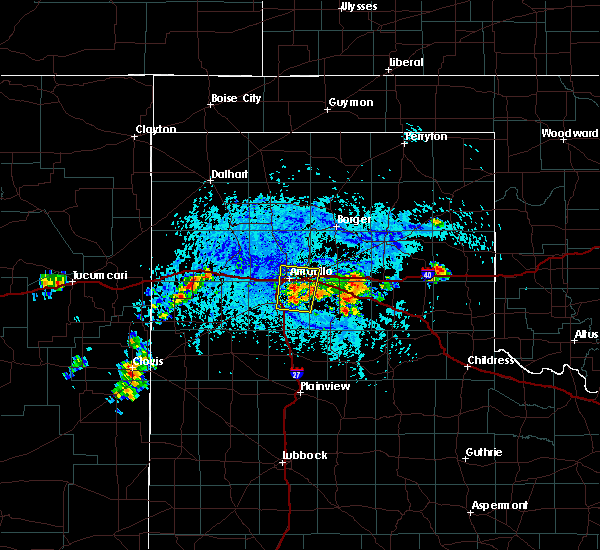 At 416 pm cdt, a severe thunderstorm was located near lake tanglewood, or 7 miles southeast of amarillo, moving north at 5 mph (radar indicated). Hazards include 60 mph wind gusts and quarter size hail. Minor damage to roofs, siding, and trees is possible. Hail damage to vehicles is expected. At 416 pm cdt, a severe thunderstorm was located near lake tanglewood, or 7 miles southeast of amarillo, moving north at 5 mph (radar indicated). Hazards include 60 mph wind gusts and quarter size hail. Minor damage to roofs, siding, and trees is possible. Hail damage to vehicles is expected.
|
| 8/7/2019 5:02 PM CDT |
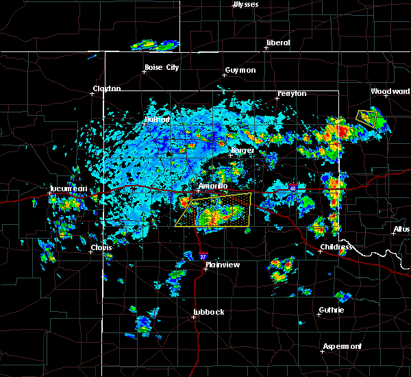 At 502 pm cdt, a severe thunderstorm was located near mescalero park, or 6 miles north of canyon, moving northeast at 20 mph (radar indicated). Hazards include 70 mph wind gusts and penny size hail. Expect some tree damage. Damage is likely to mobile homes, roofs, and outbuildings. At 502 pm cdt, a severe thunderstorm was located near mescalero park, or 6 miles north of canyon, moving northeast at 20 mph (radar indicated). Hazards include 70 mph wind gusts and penny size hail. Expect some tree damage. Damage is likely to mobile homes, roofs, and outbuildings.
|
| 8/7/2019 4:22 PM CDT |
 At 422 pm cdt, severe thunderstorms were located along a line extending from 11 miles north of wayside to 5 miles south of palo duro canyon to 5 miles north of happy, moving east at 15 mph (radar indicated). Hazards include 70 mph wind gusts and penny size hail. Expect some tree damage. Damage is likely to mobile homes, roofs, and outbuildings. At 422 pm cdt, severe thunderstorms were located along a line extending from 11 miles north of wayside to 5 miles south of palo duro canyon to 5 miles north of happy, moving east at 15 mph (radar indicated). Hazards include 70 mph wind gusts and penny size hail. Expect some tree damage. Damage is likely to mobile homes, roofs, and outbuildings.
|
| 7/10/2019 3:10 PM CDT |
 At 309 pm cdt, a severe thunderstorm was located 4 miles west of mescalero park, or 6 miles northwest of canyon, moving southwest at 35 mph (radar indicated). Hazards include 60 mph wind gusts and quarter size hail. Minor damage to roofs, siding, and trees is possible. Hail damage to vehicles is expected. At 309 pm cdt, a severe thunderstorm was located 4 miles west of mescalero park, or 6 miles northwest of canyon, moving southwest at 35 mph (radar indicated). Hazards include 60 mph wind gusts and quarter size hail. Minor damage to roofs, siding, and trees is possible. Hail damage to vehicles is expected.
|
| 6/18/2019 7:05 PM CDT |
 At 704 pm cdt, a severe thunderstorm was located over canyon, moving east at 25 mph (radar indicated). Hazards include golf ball size hail and 60 mph wind gusts. accumulating hail is also possible with this storm. Minor damage to roofs, siding, and trees is possible. people and animals outdoors will be injured. expect hail damage to roofs, siding, windows, and vehicles. hail may accumulate on roadways causing hazardous travel. Locations impacted include, canyon, lake tanglewood, mescalero park, palo duro canyon and timbercreek canyon. At 704 pm cdt, a severe thunderstorm was located over canyon, moving east at 25 mph (radar indicated). Hazards include golf ball size hail and 60 mph wind gusts. accumulating hail is also possible with this storm. Minor damage to roofs, siding, and trees is possible. people and animals outdoors will be injured. expect hail damage to roofs, siding, windows, and vehicles. hail may accumulate on roadways causing hazardous travel. Locations impacted include, canyon, lake tanglewood, mescalero park, palo duro canyon and timbercreek canyon.
|
| 6/18/2019 6:55 PM CDT |
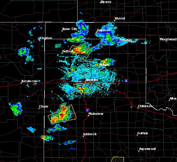 At 655 pm cdt, a severe thunderstorm was located near canyon, moving east at 25 mph (radar indicated). Hazards include golf ball size hail and 60 mph wind gusts. Minor damage to roofs, siding, and trees is possible. people and animals outdoors will be injured. expect hail damage to roofs, siding, windows, and vehicles. Locations impacted include, amarillo, canyon, lake tanglewood, mescalero park, palo duro canyon and timbercreek canyon. At 655 pm cdt, a severe thunderstorm was located near canyon, moving east at 25 mph (radar indicated). Hazards include golf ball size hail and 60 mph wind gusts. Minor damage to roofs, siding, and trees is possible. people and animals outdoors will be injured. expect hail damage to roofs, siding, windows, and vehicles. Locations impacted include, amarillo, canyon, lake tanglewood, mescalero park, palo duro canyon and timbercreek canyon.
|
| 6/18/2019 6:52 PM CDT |
 At 651 pm cdt, a severe thunderstorm was located 5 miles northeast of umbarger, or 7 miles west of canyon, moving east at 25 mph (radar indicated). Hazards include 60 mph wind gusts and half dollar size hail. Minor damage to roofs, siding, and trees is possible. Hail damage to vehicles is expected. At 651 pm cdt, a severe thunderstorm was located 5 miles northeast of umbarger, or 7 miles west of canyon, moving east at 25 mph (radar indicated). Hazards include 60 mph wind gusts and half dollar size hail. Minor damage to roofs, siding, and trees is possible. Hail damage to vehicles is expected.
|
| 6/18/2019 6:50 PM CDT |
 At 650 pm cdt, a severe thunderstorm was located 4 miles north of umbarger, or 9 miles west of canyon, moving east at 30 mph (radar indicated). Hazards include 60 mph wind gusts and half dollar size hail. Minor damage to roofs, siding, and trees is possible. Hail damage to vehicles is expected. At 650 pm cdt, a severe thunderstorm was located 4 miles north of umbarger, or 9 miles west of canyon, moving east at 30 mph (radar indicated). Hazards include 60 mph wind gusts and half dollar size hail. Minor damage to roofs, siding, and trees is possible. Hail damage to vehicles is expected.
|
| 6/17/2019 10:06 PM CDT |
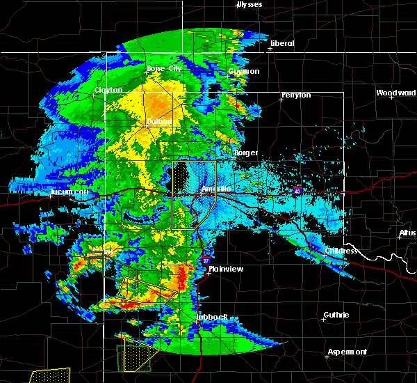 The severe thunderstorm warning for randall and potter counties will expire at 1015 pm cdt, the storms which prompted the warning have weakened below severe limits, and no longer pose an immediate threat to life or property. therefore, the warning will be allowed to expire. The severe thunderstorm warning for randall and potter counties will expire at 1015 pm cdt, the storms which prompted the warning have weakened below severe limits, and no longer pose an immediate threat to life or property. therefore, the warning will be allowed to expire.
|
| 6/17/2019 9:49 PM CDT |
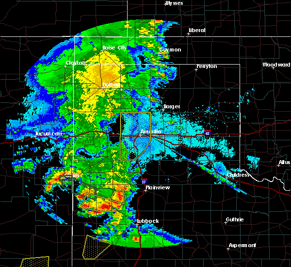 At 948 pm cdt, severe thunderstorms were located along a line extending from 10 miles south of masterson to 8 miles west of amarillo to 4 miles southwest of bushland to 8 miles south of buffalo lake, moving east at 30 mph (trained weather spotters). Hazards include 60 mph wind gusts. Minor damage to roofs, siding, and trees is possible. Locations impacted include, amarillo, canyon, lake tanglewood, mescalero park, buffalo lake, bushland, valley de oro, umbarger and timbercreek canyon. At 948 pm cdt, severe thunderstorms were located along a line extending from 10 miles south of masterson to 8 miles west of amarillo to 4 miles southwest of bushland to 8 miles south of buffalo lake, moving east at 30 mph (trained weather spotters). Hazards include 60 mph wind gusts. Minor damage to roofs, siding, and trees is possible. Locations impacted include, amarillo, canyon, lake tanglewood, mescalero park, buffalo lake, bushland, valley de oro, umbarger and timbercreek canyon.
|
| 6/17/2019 9:21 PM CDT |
 At 920 pm cdt, severe thunderstorms were located along a line extending from 8 miles north of valley de oro to 4 miles west of wildorado to 9 miles northwest of summerfield, moving southeast at 40 mph (trained weather spotters. at 915 pm cdt, storm chasers reported at least 60 mph gusts and blowing dust in vega). Hazards include 60 mph wind gusts. Minor damage to roofs, siding, and trees is possible. Locations impacted include, amarillo, hereford, canyon, vega, lake tanglewood, adrian, buffalo lake, bushland, valley de oro, boys ranch, umbarger, bootleg, wildorado, mescalero park, dawn, simms and timbercreek canyon. At 920 pm cdt, severe thunderstorms were located along a line extending from 8 miles north of valley de oro to 4 miles west of wildorado to 9 miles northwest of summerfield, moving southeast at 40 mph (trained weather spotters. at 915 pm cdt, storm chasers reported at least 60 mph gusts and blowing dust in vega). Hazards include 60 mph wind gusts. Minor damage to roofs, siding, and trees is possible. Locations impacted include, amarillo, hereford, canyon, vega, lake tanglewood, adrian, buffalo lake, bushland, valley de oro, boys ranch, umbarger, bootleg, wildorado, mescalero park, dawn, simms and timbercreek canyon.
|
| 6/17/2019 9:09 PM CDT |
 At 907 pm cdt, severe thunderstorms were located along a line extending from 5 miles northeast of boys ranch to vega to 3 miles northeast of bootleg, moving southeast at 30 mph (automated weather equipment. at 857 pm cdt, a 67 mph gust was recorded 11 miles west northwest of bootleg). Hazards include 60 mph wind gusts. minor damage to roofs, siding, and trees is possible At 907 pm cdt, severe thunderstorms were located along a line extending from 5 miles northeast of boys ranch to vega to 3 miles northeast of bootleg, moving southeast at 30 mph (automated weather equipment. at 857 pm cdt, a 67 mph gust was recorded 11 miles west northwest of bootleg). Hazards include 60 mph wind gusts. minor damage to roofs, siding, and trees is possible
|
| 6/15/2019 6:23 PM CDT |
 The national weather service in amarillo has issued a * severe thunderstorm warning for. eastern randall county in the panhandle of texas. armstrong county in the panhandle of texas. southern carson county in the panhandle of texas. Southwestern gray county in the panhandle of texas. The national weather service in amarillo has issued a * severe thunderstorm warning for. eastern randall county in the panhandle of texas. armstrong county in the panhandle of texas. southern carson county in the panhandle of texas. Southwestern gray county in the panhandle of texas.
|
| 6/5/2019 7:27 PM CDT |
 The severe thunderstorm warning for randall, armstrong, western carson and southern potter counties will expire at 730 pm cdt, the storms which prompted the warning have weakened below severe limits, and no longer pose an immediate threat to life or property. therefore, the warning will be allowed to expire. however small hail, gusty winds up to 55 mph, and heavy rain are still possible with these thunderstorms. The severe thunderstorm warning for randall, armstrong, western carson and southern potter counties will expire at 730 pm cdt, the storms which prompted the warning have weakened below severe limits, and no longer pose an immediate threat to life or property. therefore, the warning will be allowed to expire. however small hail, gusty winds up to 55 mph, and heavy rain are still possible with these thunderstorms.
|
| 6/5/2019 6:49 PM CDT |
 At 649 pm cdt, severe thunderstorms were located along a line extending from 12 miles southeast of valley de oro to 3 miles northwest of lake tanglewood to 3 miles northeast of happy, moving east at 35 mph (automated weather equipment. at 627 pm cdt, automated weather equipment recorded a 58 mph wind gust at umbarger). Hazards include 60 mph wind gusts and quarter size hail. Minor damage to roofs, siding, and trees is possible. hail damage to vehicles is expected. Locations impacted include, amarillo, canyon, panhandle, claude, lake tanglewood, mescalero park, bushland, wayside, washburn, palo duro canyon, timbercreek canyon and pantex. At 649 pm cdt, severe thunderstorms were located along a line extending from 12 miles southeast of valley de oro to 3 miles northwest of lake tanglewood to 3 miles northeast of happy, moving east at 35 mph (automated weather equipment. at 627 pm cdt, automated weather equipment recorded a 58 mph wind gust at umbarger). Hazards include 60 mph wind gusts and quarter size hail. Minor damage to roofs, siding, and trees is possible. hail damage to vehicles is expected. Locations impacted include, amarillo, canyon, panhandle, claude, lake tanglewood, mescalero park, bushland, wayside, washburn, palo duro canyon, timbercreek canyon and pantex.
|
| 6/5/2019 6:38 PM CDT |
 At 637 pm cdt, severe thunderstorms were located along a line extending from 9 miles southeast of valley de oro to near mescalero park to 3 miles northwest of happy, moving east at 35 mph (automated weather equipment. at 627 pm cdt, automated weather equipment at umbarger recorded a 58 mph wind gust). Hazards include 60 mph wind gusts and penny size hail. minor damage to roofs, siding, and trees is possible At 637 pm cdt, severe thunderstorms were located along a line extending from 9 miles southeast of valley de oro to near mescalero park to 3 miles northwest of happy, moving east at 35 mph (automated weather equipment. at 627 pm cdt, automated weather equipment at umbarger recorded a 58 mph wind gust). Hazards include 60 mph wind gusts and penny size hail. minor damage to roofs, siding, and trees is possible
|
| 6/1/2019 8:36 PM CDT |
 At 836 pm cdt, severe thunderstorms were located along a line extending from 7 miles north of washburn to 3 miles northeast of palo duro canyon to 7 miles southeast of canyon, moving east at 35 mph (radar indicated). Hazards include 70 mph wind gusts and quarter size hail. Expect some tree damage. damage is likely to mobile homes, roofs, and outbuildings. hail damage to vehicles is expected. Locations impacted include, amarillo, canyon, claude, lake tanglewood, mescalero park, wayside, washburn, palo duro canyon, timbercreek canyon and pantex. At 836 pm cdt, severe thunderstorms were located along a line extending from 7 miles north of washburn to 3 miles northeast of palo duro canyon to 7 miles southeast of canyon, moving east at 35 mph (radar indicated). Hazards include 70 mph wind gusts and quarter size hail. Expect some tree damage. damage is likely to mobile homes, roofs, and outbuildings. hail damage to vehicles is expected. Locations impacted include, amarillo, canyon, claude, lake tanglewood, mescalero park, wayside, washburn, palo duro canyon, timbercreek canyon and pantex.
|
| 6/1/2019 8:24 PM CDT |
 At 823 pm cdt, automated weather equipment reported severe thunderstorms were located along a line extending from 11 miles northeast of amarillo to near lake tanglewood to 3 miles southwest of canyon, moving southeast at 35 mph. these are very dangerous storms (automated weather equipment. at 804 pm cdt, automated weather equipment recorded a 91 mph wind gust 7 miles south southeast of amarillo). Hazards include 90 mph wind gusts and quarter size hail. You are in a life-threatening situation. flying debris may be deadly to those caught without shelter. mobile homes will be heavily damaged or destroyed. homes and businesses will have substantial roof and window damage. expect extensive tree damage and power outages. Locations impacted include, amarillo, canyon, claude, lake tanglewood, mescalero park, wayside, washburn, palo duro canyon, timbercreek canyon and pantex. At 823 pm cdt, automated weather equipment reported severe thunderstorms were located along a line extending from 11 miles northeast of amarillo to near lake tanglewood to 3 miles southwest of canyon, moving southeast at 35 mph. these are very dangerous storms (automated weather equipment. at 804 pm cdt, automated weather equipment recorded a 91 mph wind gust 7 miles south southeast of amarillo). Hazards include 90 mph wind gusts and quarter size hail. You are in a life-threatening situation. flying debris may be deadly to those caught without shelter. mobile homes will be heavily damaged or destroyed. homes and businesses will have substantial roof and window damage. expect extensive tree damage and power outages. Locations impacted include, amarillo, canyon, claude, lake tanglewood, mescalero park, wayside, washburn, palo duro canyon, timbercreek canyon and pantex.
|
| 6/1/2019 8:08 PM CDT |
 At 807 pm cdt, severe thunderstorms were located along a line extending from 16 miles east of valley de oro to 5 miles south of amarillo to 5 miles northeast of umbarger, moving southeast at 35 mph (trained weather spotters. at 806 pm cdt, trained weather spotters estimated a 60 mph wind gust 3 miles east of amarillo). Hazards include 70 mph wind gusts and quarter size hail. Expect some tree damage. damage is likely to mobile homes, roofs, and outbuildings. hail damage to vehicles is expected. Locations impacted include, amarillo, canyon, claude, lake tanglewood, mescalero park, wayside, washburn, palo duro canyon, timbercreek canyon and pantex. At 807 pm cdt, severe thunderstorms were located along a line extending from 16 miles east of valley de oro to 5 miles south of amarillo to 5 miles northeast of umbarger, moving southeast at 35 mph (trained weather spotters. at 806 pm cdt, trained weather spotters estimated a 60 mph wind gust 3 miles east of amarillo). Hazards include 70 mph wind gusts and quarter size hail. Expect some tree damage. damage is likely to mobile homes, roofs, and outbuildings. hail damage to vehicles is expected. Locations impacted include, amarillo, canyon, claude, lake tanglewood, mescalero park, wayside, washburn, palo duro canyon, timbercreek canyon and pantex.
|
| 6/1/2019 8:00 PM CDT |
 The national weather service in amarillo has issued a * severe thunderstorm warning for. randall county in the panhandle of texas. western armstrong county in the panhandle of texas. southwestern carson county in the panhandle of texas. Eastern potter county in the panhandle of texas. The national weather service in amarillo has issued a * severe thunderstorm warning for. randall county in the panhandle of texas. western armstrong county in the panhandle of texas. southwestern carson county in the panhandle of texas. Eastern potter county in the panhandle of texas.
|
| 6/1/2019 7:56 PM CDT |
 At 756 pm cdt, automated weather equipment reported a severe thunderstorm was located over amarillo, moving southeast at 35 mph (automated weather equipment. at 754 pm cdt, a storm chaser recorded a 66 mph wind gust on the southwest side of amarillo). Hazards include ping pong ball size hail and 60 mph wind gusts. Minor damage to roofs, siding, and trees is possible. people and animals outdoors will be injured. expect hail damage to roofs, siding, windows, and vehicles. hail may accumulate on roadways causing hazardous travel. Locations impacted include, amarillo, canyon, lake tanglewood, mescalero park, bushland, valley de oro and timbercreek canyon. At 756 pm cdt, automated weather equipment reported a severe thunderstorm was located over amarillo, moving southeast at 35 mph (automated weather equipment. at 754 pm cdt, a storm chaser recorded a 66 mph wind gust on the southwest side of amarillo). Hazards include ping pong ball size hail and 60 mph wind gusts. Minor damage to roofs, siding, and trees is possible. people and animals outdoors will be injured. expect hail damage to roofs, siding, windows, and vehicles. hail may accumulate on roadways causing hazardous travel. Locations impacted include, amarillo, canyon, lake tanglewood, mescalero park, bushland, valley de oro and timbercreek canyon.
|
| 6/1/2019 7:16 PM CDT |
 At 715 pm cdt, a severe thunderstorm was located over valley de oro, or 21 miles northwest of amarillo, moving southeast at 35 mph (automated weather equipment. at 703 pm cdt, automated weather equipment recorded a 60 mph wind gust at boys ranch). Hazards include ping pong ball size hail and 60 mph wind gusts. Minor damage to roofs, siding, and trees is possible. people and animals outdoors will be injured. expect hail damage to roofs, siding, windows, and vehicles. hail may accumulate on roadways causing hazardous travel. Locations impacted include, amarillo, canyon, lake tanglewood, mescalero park, bushland, valley de oro, boys ranch, wildorado and timbercreek canyon. At 715 pm cdt, a severe thunderstorm was located over valley de oro, or 21 miles northwest of amarillo, moving southeast at 35 mph (automated weather equipment. at 703 pm cdt, automated weather equipment recorded a 60 mph wind gust at boys ranch). Hazards include ping pong ball size hail and 60 mph wind gusts. Minor damage to roofs, siding, and trees is possible. people and animals outdoors will be injured. expect hail damage to roofs, siding, windows, and vehicles. hail may accumulate on roadways causing hazardous travel. Locations impacted include, amarillo, canyon, lake tanglewood, mescalero park, bushland, valley de oro, boys ranch, wildorado and timbercreek canyon.
|
| 6/1/2019 7:12 PM CDT |
 At 711 pm cdt, a severe thunderstorm was located over valley de oro, or 22 miles northeast of vega, moving southeast at 35 mph (radar indicated). Hazards include ping pong ball size hail and 60 mph wind gusts. Minor damage to roofs, siding, and trees is possible. people and animals outdoors will be injured. expect hail damage to roofs, siding, windows, and vehicles. Hail may accumulate on roadways causing hazardous travel. At 711 pm cdt, a severe thunderstorm was located over valley de oro, or 22 miles northeast of vega, moving southeast at 35 mph (radar indicated). Hazards include ping pong ball size hail and 60 mph wind gusts. Minor damage to roofs, siding, and trees is possible. people and animals outdoors will be injured. expect hail damage to roofs, siding, windows, and vehicles. Hail may accumulate on roadways causing hazardous travel.
|
| 5/26/2019 9:42 PM CDT |
 At 941 pm cdt, severe thunderstorms were located along a line extending from 7 miles northeast of amarillo to 4 miles southeast of mescalero park, moving northeast at 45 mph (emergency management. at 934 pm cdt, quarter size hail was reported in amarillo). Hazards include 60 mph wind gusts and quarter size hail. Minor damage to roofs, siding, and trees is possible. Hail damage to vehicles is expected. At 941 pm cdt, severe thunderstorms were located along a line extending from 7 miles northeast of amarillo to 4 miles southeast of mescalero park, moving northeast at 45 mph (emergency management. at 934 pm cdt, quarter size hail was reported in amarillo). Hazards include 60 mph wind gusts and quarter size hail. Minor damage to roofs, siding, and trees is possible. Hail damage to vehicles is expected.
|
| 5/26/2019 9:23 PM CDT |
 At 922 pm cdt, severe thunderstorms were located along a line extending from 7 miles southwest of lake meredith to 9 miles north of amarillo to 5 miles northwest of mescalero park, moving east at 40 mph (emergency management. at 921 pm, emergency management reported quarter size hail at hillside and soncy in amarillo). Hazards include 60 mph wind gusts and quarter size hail. Minor damage to roofs, siding, and trees is possible. hail damage to vehicles is expected. locations impacted include, amarillo, canyon, borger, panhandle, fritch, lake tanglewood, bushland, washburn, umbarger, palo duro canyon, mescalero park, timbercreek canyon and pantex. A tornado watch remains in effect until 200 am cdt for the panhandle of texas. At 922 pm cdt, severe thunderstorms were located along a line extending from 7 miles southwest of lake meredith to 9 miles north of amarillo to 5 miles northwest of mescalero park, moving east at 40 mph (emergency management. at 921 pm, emergency management reported quarter size hail at hillside and soncy in amarillo). Hazards include 60 mph wind gusts and quarter size hail. Minor damage to roofs, siding, and trees is possible. hail damage to vehicles is expected. locations impacted include, amarillo, canyon, borger, panhandle, fritch, lake tanglewood, bushland, washburn, umbarger, palo duro canyon, mescalero park, timbercreek canyon and pantex. A tornado watch remains in effect until 200 am cdt for the panhandle of texas.
|
| 5/26/2019 8:52 PM CDT |
 At 851 pm cdt, severe thunderstorms were located along a line extending from 5 miles southwest of valley de oro to 3 miles southwest of wildorado to 7 miles north of hereford, moving east at 55 mph (radar indicated). Hazards include 70 mph wind gusts and quarter size hail. Expect some tree damage. damage is likely to mobile homes, roofs, and outbuildings. Hail damage to vehicles is expected. At 851 pm cdt, severe thunderstorms were located along a line extending from 5 miles southwest of valley de oro to 3 miles southwest of wildorado to 7 miles north of hereford, moving east at 55 mph (radar indicated). Hazards include 70 mph wind gusts and quarter size hail. Expect some tree damage. damage is likely to mobile homes, roofs, and outbuildings. Hail damage to vehicles is expected.
|
| 5/26/2019 3:10 PM CDT |
 At 310 pm cdt, a severe thunderstorm was located 15 miles south of fritch, or 16 miles west of panhandle, moving northeast at 40 mph (radar indicated). Hazards include quarter size hail. Damage to vehicles is expected. locations impacted include, amarillo, lake tanglewood and pantex. A tornado watch remains in effect until 1000 pm cdt for the panhandle of texas. At 310 pm cdt, a severe thunderstorm was located 15 miles south of fritch, or 16 miles west of panhandle, moving northeast at 40 mph (radar indicated). Hazards include quarter size hail. Damage to vehicles is expected. locations impacted include, amarillo, lake tanglewood and pantex. A tornado watch remains in effect until 1000 pm cdt for the panhandle of texas.
|
| 5/26/2019 2:42 PM CDT |
 At 242 pm cdt, a severe thunderstorm was located near amarillo, moving northeast at 40 mph (radar indicated). Hazards include quarter size hail. damage to vehicles is expected At 242 pm cdt, a severe thunderstorm was located near amarillo, moving northeast at 40 mph (radar indicated). Hazards include quarter size hail. damage to vehicles is expected
|
| 5/25/2019 4:16 PM CDT |
 At 416 pm cdt, a severe thunderstorm was located 6 miles northwest of mescalero park, or 9 miles southwest of amarillo, moving northeast at 40 mph (radar indicated). Hazards include 60 mph wind gusts and quarter size hail. Minor damage to roofs, siding, and trees is possible. Hail damage to vehicles is expected. At 416 pm cdt, a severe thunderstorm was located 6 miles northwest of mescalero park, or 9 miles southwest of amarillo, moving northeast at 40 mph (radar indicated). Hazards include 60 mph wind gusts and quarter size hail. Minor damage to roofs, siding, and trees is possible. Hail damage to vehicles is expected.
|
| 5/23/2019 6:44 PM CDT |
 At 644 pm cdt, a severe thunderstorm was located near umbarger, or 7 miles west of canyon, moving northeast at 45 mph (radar indicated). Hazards include ping pong ball size hail and 60 mph wind gusts. Minor damage to roofs, siding, and trees is possible. people and animals outdoors will be injured. Expect hail damage to roofs, siding, windows, and vehicles. At 644 pm cdt, a severe thunderstorm was located near umbarger, or 7 miles west of canyon, moving northeast at 45 mph (radar indicated). Hazards include ping pong ball size hail and 60 mph wind gusts. Minor damage to roofs, siding, and trees is possible. people and animals outdoors will be injured. Expect hail damage to roofs, siding, windows, and vehicles.
|
| 5/23/2019 6:11 PM CDT |
 At 611 pm cdt, a severe thunderstorm was located 6 miles north of umbarger, or 11 miles west of canyon, moving north at 60 mph (radar indicated). Hazards include ping pong ball size hail and 60 mph wind gusts. Minor damage to roofs, siding, and trees is possible. people and animals outdoors will be injured. expect hail damage to roofs, siding, windows, and vehicles. locations impacted include, amarillo, hereford, canyon, lake tanglewood, mescalero park, buffalo lake, bushland, dawn, valley de oro, umbarger, wildorado and timbercreek canyon. A tornado watch remains in effect until 1000 pm cdt for the panhandle of texas. At 611 pm cdt, a severe thunderstorm was located 6 miles north of umbarger, or 11 miles west of canyon, moving north at 60 mph (radar indicated). Hazards include ping pong ball size hail and 60 mph wind gusts. Minor damage to roofs, siding, and trees is possible. people and animals outdoors will be injured. expect hail damage to roofs, siding, windows, and vehicles. locations impacted include, amarillo, hereford, canyon, lake tanglewood, mescalero park, buffalo lake, bushland, dawn, valley de oro, umbarger, wildorado and timbercreek canyon. A tornado watch remains in effect until 1000 pm cdt for the panhandle of texas.
|
| 5/23/2019 5:47 PM CDT |
 At 547 pm cdt, a severe thunderstorm was located 9 miles northeast of easter, or 9 miles southeast of hereford, moving northeast at 55 mph (radar indicated). Hazards include 60 mph wind gusts and quarter size hail. Minor damage to roofs, siding, and trees is possible. Hail damage to vehicles is expected. At 547 pm cdt, a severe thunderstorm was located 9 miles northeast of easter, or 9 miles southeast of hereford, moving northeast at 55 mph (radar indicated). Hazards include 60 mph wind gusts and quarter size hail. Minor damage to roofs, siding, and trees is possible. Hail damage to vehicles is expected.
|
| 5/23/2019 4:51 PM CDT |
 At 450 pm cdt, a severe thunderstorm was located 11 miles northwest of dawn, or 12 miles north of hereford, moving northeast at 55 mph (radar indicated). Hazards include 60 mph wind gusts and half dollar size hail. Minor damage to roofs, siding, and trees is possible. hail damage to vehicles is expected. locations impacted include, amarillo, hereford, canyon, vega, mescalero park, bushland, dawn, umbarger, wildorado and timbercreek canyon. A tornado watch remains in effect until 1000 pm cdt for the panhandle of texas. At 450 pm cdt, a severe thunderstorm was located 11 miles northwest of dawn, or 12 miles north of hereford, moving northeast at 55 mph (radar indicated). Hazards include 60 mph wind gusts and half dollar size hail. Minor damage to roofs, siding, and trees is possible. hail damage to vehicles is expected. locations impacted include, amarillo, hereford, canyon, vega, mescalero park, bushland, dawn, umbarger, wildorado and timbercreek canyon. A tornado watch remains in effect until 1000 pm cdt for the panhandle of texas.
|
| 5/23/2019 4:40 PM CDT |
 At 440 pm cdt, a severe thunderstorm was located 5 miles northwest of hereford, moving northeast at 55 mph (radar indicated). Hazards include 60 mph wind gusts and quarter size hail. Minor damage to roofs, siding, and trees is possible. Hail damage to vehicles is expected. At 440 pm cdt, a severe thunderstorm was located 5 miles northwest of hereford, moving northeast at 55 mph (radar indicated). Hazards include 60 mph wind gusts and quarter size hail. Minor damage to roofs, siding, and trees is possible. Hail damage to vehicles is expected.
|
| 5/20/2019 8:24 AM CDT |
 A severe thunderstorm warning remains in effect until 915 am cdt for northern randall. northwestern armstrong. northwestern carson. hutchinson. potter. northwestern roberts and eastern moore counties. At 823 am cdt, severe thunderstorms were located along a line extending from 13 miles northeast of bushland to 8 miles northeast of. A severe thunderstorm warning remains in effect until 915 am cdt for northern randall. northwestern armstrong. northwestern carson. hutchinson. potter. northwestern roberts and eastern moore counties. At 823 am cdt, severe thunderstorms were located along a line extending from 13 miles northeast of bushland to 8 miles northeast of.
|
| 5/20/2019 8:10 AM CDT |
 The national weather service in amarillo has issued a * severe thunderstorm warning for. northern randall county in the panhandle of texas. northwestern armstrong county in the panhandle of texas. northwestern carson county in the panhandle of texas. Hutchinson county in the panhandle of texas. The national weather service in amarillo has issued a * severe thunderstorm warning for. northern randall county in the panhandle of texas. northwestern armstrong county in the panhandle of texas. northwestern carson county in the panhandle of texas. Hutchinson county in the panhandle of texas.
|
| 5/20/2019 8:06 AM CDT |
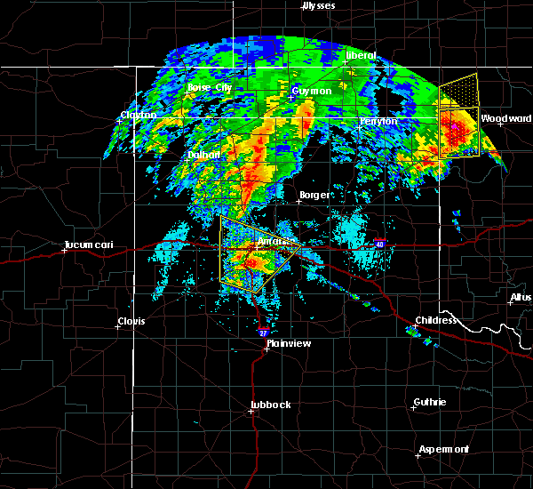 At 806 am cdt, severe thunderstorms were located along a line extending from 4 miles southeast of bushland to lake tanglewood, moving northeast at 70 mph (public). Hazards include 60 mph wind gusts and quarter size hail. Minor damage to roofs, siding, and trees is possible. hail damage to vehicles is expected. Locations impacted include, amarillo, canyon, lake tanglewood, mescalero park, buffalo lake, bushland, valley de oro, washburn, umbarger, palo duro canyon and timbercreek canyon. At 806 am cdt, severe thunderstorms were located along a line extending from 4 miles southeast of bushland to lake tanglewood, moving northeast at 70 mph (public). Hazards include 60 mph wind gusts and quarter size hail. Minor damage to roofs, siding, and trees is possible. hail damage to vehicles is expected. Locations impacted include, amarillo, canyon, lake tanglewood, mescalero park, buffalo lake, bushland, valley de oro, washburn, umbarger, palo duro canyon and timbercreek canyon.
|
| 5/20/2019 7:56 AM CDT |
 At 756 am cdt, severe thunderstorms were located along a line extending from 4 miles north of umbarger to near canyon, moving northeast at 70 mph (radar indicated). Hazards include golf ball size hail and 60 mph wind gusts. Minor damage to roofs, siding, and trees is possible. people and animals outdoors will be injured. expect hail damage to roofs, siding, windows, and vehicles. Locations impacted include, amarillo, canyon, lake tanglewood, mescalero park, buffalo lake, bushland, dawn, valley de oro, washburn, umbarger, palo duro canyon and timbercreek canyon. At 756 am cdt, severe thunderstorms were located along a line extending from 4 miles north of umbarger to near canyon, moving northeast at 70 mph (radar indicated). Hazards include golf ball size hail and 60 mph wind gusts. Minor damage to roofs, siding, and trees is possible. people and animals outdoors will be injured. expect hail damage to roofs, siding, windows, and vehicles. Locations impacted include, amarillo, canyon, lake tanglewood, mescalero park, buffalo lake, bushland, dawn, valley de oro, washburn, umbarger, palo duro canyon and timbercreek canyon.
|
| 5/20/2019 7:49 AM CDT |
 At 748 am cdt, severe thunderstorms were located along a line extending from 3 miles northeast of dawn to 8 miles south of canyon, moving northeast at 70 mph (radar indicated). Hazards include 60 mph wind gusts and half dollar size hail. Minor damage to roofs, siding, and trees is possible. hail damage to vehicles is expected. Locations impacted include, amarillo, canyon, lake tanglewood, buffalo lake, bushland, valley de oro, washburn, umbarger, wildorado, palo duro canyon, mescalero park, dawn and timbercreek canyon. At 748 am cdt, severe thunderstorms were located along a line extending from 3 miles northeast of dawn to 8 miles south of canyon, moving northeast at 70 mph (radar indicated). Hazards include 60 mph wind gusts and half dollar size hail. Minor damage to roofs, siding, and trees is possible. hail damage to vehicles is expected. Locations impacted include, amarillo, canyon, lake tanglewood, buffalo lake, bushland, valley de oro, washburn, umbarger, wildorado, palo duro canyon, mescalero park, dawn and timbercreek canyon.
|
| 5/20/2019 7:40 AM CDT |
 At 740 am cdt, severe thunderstorms were located along a line extending from 4 miles south of dawn to 9 miles southeast of buffalo lake, moving northeast at 70 mph (radar indicated). Hazards include ping pong ball size hail and 60 mph wind gusts. Minor damage to roofs, siding, and trees is possible. people and animals outdoors will be injured. expect hail damage to roofs, siding, windows, and vehicles. Locations impacted include, amarillo, hereford, canyon, lake tanglewood, buffalo lake, bushland, valley de oro, washburn, umbarger, wildorado, palo duro canyon, mescalero park, dawn and timbercreek canyon. At 740 am cdt, severe thunderstorms were located along a line extending from 4 miles south of dawn to 9 miles southeast of buffalo lake, moving northeast at 70 mph (radar indicated). Hazards include ping pong ball size hail and 60 mph wind gusts. Minor damage to roofs, siding, and trees is possible. people and animals outdoors will be injured. expect hail damage to roofs, siding, windows, and vehicles. Locations impacted include, amarillo, hereford, canyon, lake tanglewood, buffalo lake, bushland, valley de oro, washburn, umbarger, wildorado, palo duro canyon, mescalero park, dawn and timbercreek canyon.
|
| 5/20/2019 7:30 AM CDT |
 At 729 am cdt, severe thunderstorms were located along a line extending from 6 miles northeast of easter to 13 miles northeast of dimmitt, moving northeast at 70 mph (radar indicated). Hazards include two inch hail and 60 mph wind gusts. Minor damage to roofs, siding, and trees is possible. people and animals outdoors will be injured. Expect hail damage to roofs, siding, windows, and vehicles. At 729 am cdt, severe thunderstorms were located along a line extending from 6 miles northeast of easter to 13 miles northeast of dimmitt, moving northeast at 70 mph (radar indicated). Hazards include two inch hail and 60 mph wind gusts. Minor damage to roofs, siding, and trees is possible. people and animals outdoors will be injured. Expect hail damage to roofs, siding, windows, and vehicles.
|
| 5/7/2019 4:31 PM CDT |
 At 431 pm cdt, a severe thunderstorm was located 5 miles southwest of amarillo, moving north at 40 mph (radar indicated). Hazards include 60 mph wind gusts and quarter size hail. Minor damage to roofs, siding, and trees is possible. hail damage to vehicles is expected. locations impacted include, amarillo, lake tanglewood, mescalero park and timbercreek canyon. A tornado watch remains in effect until 1000 pm cdt for the panhandle of texas. At 431 pm cdt, a severe thunderstorm was located 5 miles southwest of amarillo, moving north at 40 mph (radar indicated). Hazards include 60 mph wind gusts and quarter size hail. Minor damage to roofs, siding, and trees is possible. hail damage to vehicles is expected. locations impacted include, amarillo, lake tanglewood, mescalero park and timbercreek canyon. A tornado watch remains in effect until 1000 pm cdt for the panhandle of texas.
|
| 5/7/2019 4:17 PM CDT |
 At 416 pm cdt, a severe thunderstorm was located over canyon, moving north at 40 mph (radar indicated). Hazards include 60 mph wind gusts and half dollar size hail. Minor damage to roofs, siding, and trees is possible. Hail damage to vehicles is expected. At 416 pm cdt, a severe thunderstorm was located over canyon, moving north at 40 mph (radar indicated). Hazards include 60 mph wind gusts and half dollar size hail. Minor damage to roofs, siding, and trees is possible. Hail damage to vehicles is expected.
|
| 5/6/2019 7:50 PM CDT |
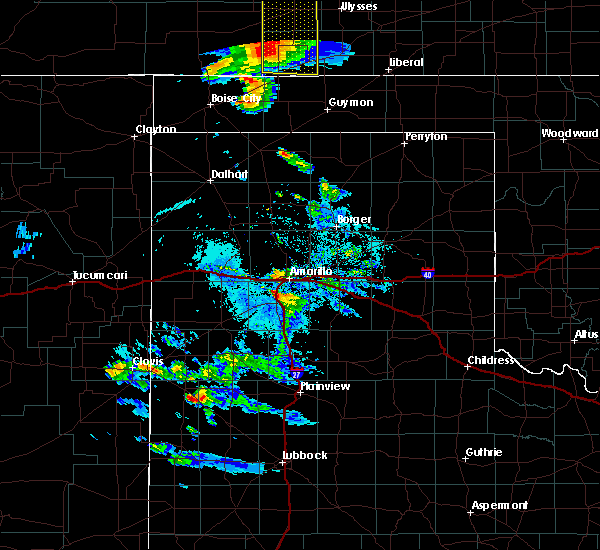 At 750 pm cdt, a severe thunderstorm was located over mescalero park, or 5 miles north of canyon, moving northeast at 30 mph (radar indicated). Hazards include golf ball size hail and 60 mph wind gusts. Minor damage to roofs, siding, and trees is possible. people and animals outdoors will be injured. Expect hail damage to roofs, siding, windows, and vehicles. At 750 pm cdt, a severe thunderstorm was located over mescalero park, or 5 miles north of canyon, moving northeast at 30 mph (radar indicated). Hazards include golf ball size hail and 60 mph wind gusts. Minor damage to roofs, siding, and trees is possible. people and animals outdoors will be injured. Expect hail damage to roofs, siding, windows, and vehicles.
|
| 4/17/2019 5:53 PM CDT |
 At 552 pm cdt, severe thunderstorms were located along a line extending from 5 miles east of washburn to 5 miles north of lake tanglewood, moving northwest at 5 mph (radar indicated). Hazards include 60 mph wind gusts and quarter size hail. Minor damage to roofs, siding, and trees is possible. hail damage to vehicles is expected. Hail may accumulate on roadways causing hazardous travel. At 552 pm cdt, severe thunderstorms were located along a line extending from 5 miles east of washburn to 5 miles north of lake tanglewood, moving northwest at 5 mph (radar indicated). Hazards include 60 mph wind gusts and quarter size hail. Minor damage to roofs, siding, and trees is possible. hail damage to vehicles is expected. Hail may accumulate on roadways causing hazardous travel.
|
| 4/17/2019 5:28 PM CDT |
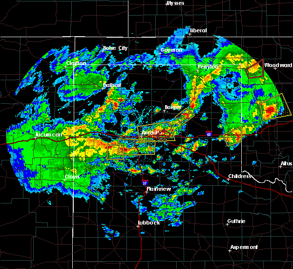 At 528 pm cdt, severe thunderstorms were located along a line extending from 4 miles north of dawn to 3 miles north of palo duro canyon, moving north at 20 mph (radar indicated). Hazards include 60 mph wind gusts and quarter size hail. Minor damage to roofs, siding, and trees is possible. Hail damage to vehicles is expected. At 528 pm cdt, severe thunderstorms were located along a line extending from 4 miles north of dawn to 3 miles north of palo duro canyon, moving north at 20 mph (radar indicated). Hazards include 60 mph wind gusts and quarter size hail. Minor damage to roofs, siding, and trees is possible. Hail damage to vehicles is expected.
|
| 3/22/2019 8:36 PM CDT |
 At 833 pm cdt, a severe thunderstorm was located 4 miles northeast of lake tanglewood, or 9 miles southeast of amarillo, moving east at 30 mph (radar indicated. trained weather spotters reported half dollar size hail in lake tanglewood at 8:29 pm cdt). Hazards include golf ball size hail. People and animals outdoors will be injured. expect damage to roofs, siding, windows, and vehicles. Locations impacted include, amarillo, canyon, panhandle, claude, white deer, lake tanglewood, skellytown, wayside, washburn, palo duro canyon, mescalero park, timbercreek canyon and pantex. At 833 pm cdt, a severe thunderstorm was located 4 miles northeast of lake tanglewood, or 9 miles southeast of amarillo, moving east at 30 mph (radar indicated. trained weather spotters reported half dollar size hail in lake tanglewood at 8:29 pm cdt). Hazards include golf ball size hail. People and animals outdoors will be injured. expect damage to roofs, siding, windows, and vehicles. Locations impacted include, amarillo, canyon, panhandle, claude, white deer, lake tanglewood, skellytown, wayside, washburn, palo duro canyon, mescalero park, timbercreek canyon and pantex.
|
| 3/22/2019 8:19 PM CDT |
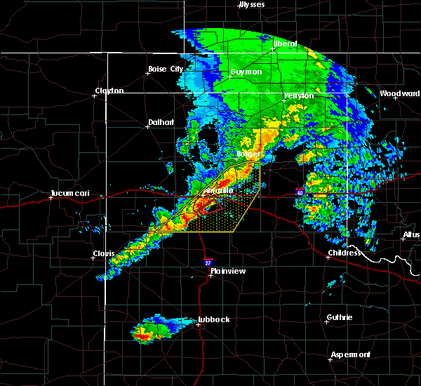 At 819 pm cdt, a severe thunderstorm capable of producing a tornado was located near lake tanglewood, or 7 miles east of canyon, moving northeast at 35 mph (radar indicated rotation). Hazards include tornado and quarter size hail. Flying debris will be dangerous to those caught without shelter. mobile homes will be damaged or destroyed. damage to roofs, windows, and vehicles will occur. Tree damage is likely. At 819 pm cdt, a severe thunderstorm capable of producing a tornado was located near lake tanglewood, or 7 miles east of canyon, moving northeast at 35 mph (radar indicated rotation). Hazards include tornado and quarter size hail. Flying debris will be dangerous to those caught without shelter. mobile homes will be damaged or destroyed. damage to roofs, windows, and vehicles will occur. Tree damage is likely.
|
| 3/22/2019 8:10 PM CDT |
 At 807 pm cdt, a severe thunderstorm was located over canyon, moving east at 40 mph. other less intense storms were located from near amarillo to north of panhandle (trained weather spotters reported tennis ball size hail 4 miles west of canyon at 8:05 pm cdt). Hazards include tennis ball size hail and 60 mph wind gusts. Minor damage to roofs, siding, and trees is possible. people and animals outdoors will be injured. expect hail damage to roofs, siding, windows, and vehicles. Locations impacted include, amarillo, canyon, panhandle, claude, white deer, lake tanglewood, skellytown, buffalo lake, wayside, washburn, umbarger, palo duro canyon, mescalero park, dawn, timbercreek canyon and pantex. At 807 pm cdt, a severe thunderstorm was located over canyon, moving east at 40 mph. other less intense storms were located from near amarillo to north of panhandle (trained weather spotters reported tennis ball size hail 4 miles west of canyon at 8:05 pm cdt). Hazards include tennis ball size hail and 60 mph wind gusts. Minor damage to roofs, siding, and trees is possible. people and animals outdoors will be injured. expect hail damage to roofs, siding, windows, and vehicles. Locations impacted include, amarillo, canyon, panhandle, claude, white deer, lake tanglewood, skellytown, buffalo lake, wayside, washburn, umbarger, palo duro canyon, mescalero park, dawn, timbercreek canyon and pantex.
|
| 3/22/2019 8:01 PM CDT |
 At 800 pm cdt, severe thunderstorms were located along a line extending from 6 miles north of panhandle to 4 miles east of buffalo lake, moving northeast at 40 mph (radar indicated). Hazards include 60 mph wind gusts and quarter size hail. Minor damage to roofs, siding, and trees is possible. Hail damage to vehicles is expected. At 800 pm cdt, severe thunderstorms were located along a line extending from 6 miles north of panhandle to 4 miles east of buffalo lake, moving northeast at 40 mph (radar indicated). Hazards include 60 mph wind gusts and quarter size hail. Minor damage to roofs, siding, and trees is possible. Hail damage to vehicles is expected.
|
| 3/22/2019 7:49 PM CDT |
 At 749 pm cdt, severe thunderstorms were located along a line extending from 5 miles northwest of panhandle to 5 miles southeast of hereford, moving east at 15 mph (radar indicated). Hazards include 60 mph wind gusts and quarter size hail. Minor damage to roofs, siding, and trees is possible. hail damage to vehicles is expected. hail may accumulate on roadways causing hazardous travel. Locations impacted include, amarillo, hereford, canyon, fritch, lake tanglewood, buffalo lake, washburn, umbarger, palo duro canyon, mescalero park, dawn, timbercreek canyon and pantex. At 749 pm cdt, severe thunderstorms were located along a line extending from 5 miles northwest of panhandle to 5 miles southeast of hereford, moving east at 15 mph (radar indicated). Hazards include 60 mph wind gusts and quarter size hail. Minor damage to roofs, siding, and trees is possible. hail damage to vehicles is expected. hail may accumulate on roadways causing hazardous travel. Locations impacted include, amarillo, hereford, canyon, fritch, lake tanglewood, buffalo lake, washburn, umbarger, palo duro canyon, mescalero park, dawn, timbercreek canyon and pantex.
|
| 3/22/2019 7:20 PM CDT |
 At 720 pm cdt, severe thunderstorms were located along a line extending from 5 miles north of lake meredith to 4 miles east of amarillo to near hereford, moving east at 10 mph (radar indicated). Hazards include tennis ball size hail and 60 mph wind gusts. Minor damage to roofs, siding, and trees is possible. people and animals outdoors will be injured. expect hail damage to roofs, siding, windows, and vehicles. hail may accumulate on roadways causing hazardous travel. Locations impacted include, amarillo, hereford, canyon, borger, fritch, stinnett, lake tanglewood, sanford, buffalo lake, bushland, washburn, umbarger, palo duro canyon, mescalero park, dawn, lake meredith, timbercreek canyon and pantex. At 720 pm cdt, severe thunderstorms were located along a line extending from 5 miles north of lake meredith to 4 miles east of amarillo to near hereford, moving east at 10 mph (radar indicated). Hazards include tennis ball size hail and 60 mph wind gusts. Minor damage to roofs, siding, and trees is possible. people and animals outdoors will be injured. expect hail damage to roofs, siding, windows, and vehicles. hail may accumulate on roadways causing hazardous travel. Locations impacted include, amarillo, hereford, canyon, borger, fritch, stinnett, lake tanglewood, sanford, buffalo lake, bushland, washburn, umbarger, palo duro canyon, mescalero park, dawn, lake meredith, timbercreek canyon and pantex.
|
| 3/22/2019 6:36 PM CDT |
 At 634 pm cdt, severe thunderstorms were located along a line extending from 4 miles southwest of masterson to 4 miles northwest of amarillo to near summerfield, moving east at 30 mph (radar indicated). Hazards include tennis ball size hail and 70 mph wind gusts. Expect some tree damage. damage is likely to mobile homes, roofs, and outbuildings. people and animals outdoors will be injured. Expect hail damage to roofs, siding, windows, and vehicles. At 634 pm cdt, severe thunderstorms were located along a line extending from 4 miles southwest of masterson to 4 miles northwest of amarillo to near summerfield, moving east at 30 mph (radar indicated). Hazards include tennis ball size hail and 70 mph wind gusts. Expect some tree damage. damage is likely to mobile homes, roofs, and outbuildings. people and animals outdoors will be injured. Expect hail damage to roofs, siding, windows, and vehicles.
|
| 12/26/2018 3:16 PM CST |
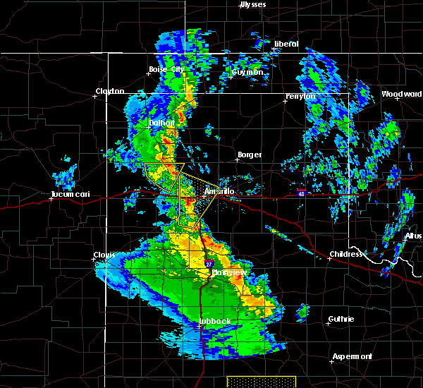 At 315 pm cst, a severe thunderstorm was located 6 miles southeast of bushland, or 8 miles southwest of amarillo, moving north at 35 mph (trained weather spotters). Hazards include quarter size hail. Damage to vehicles is expected. Locations impacted include, amarillo, canyon, mescalero park, bushland, valley de oro, umbarger and timbercreek canyon. At 315 pm cst, a severe thunderstorm was located 6 miles southeast of bushland, or 8 miles southwest of amarillo, moving north at 35 mph (trained weather spotters). Hazards include quarter size hail. Damage to vehicles is expected. Locations impacted include, amarillo, canyon, mescalero park, bushland, valley de oro, umbarger and timbercreek canyon.
|
| 12/26/2018 2:59 PM CST |
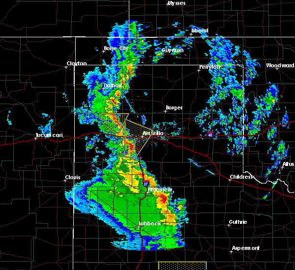 At 258 pm cst, a severe thunderstorm was located 4 miles northwest of canyon, moving north at 50 mph (radar indicated). Hazards include half dollar size hail. damage to vehicles is expected At 258 pm cst, a severe thunderstorm was located 4 miles northwest of canyon, moving north at 50 mph (radar indicated). Hazards include half dollar size hail. damage to vehicles is expected
|
| 9/1/2018 6:28 PM CDT |
 At 627 pm cdt, a severe thunderstorm was located 7 miles northwest of amarillo, moving north at 25 mph (radar indicated). Hazards include 60 mph wind gusts and half dollar size hail. Minor damage to roofs, siding, and trees is possible. hail damage to vehicles is expected. Locations impacted include, amarillo, canyon, lake tanglewood, mescalero park, palo duro canyon and timbercreek canyon. At 627 pm cdt, a severe thunderstorm was located 7 miles northwest of amarillo, moving north at 25 mph (radar indicated). Hazards include 60 mph wind gusts and half dollar size hail. Minor damage to roofs, siding, and trees is possible. hail damage to vehicles is expected. Locations impacted include, amarillo, canyon, lake tanglewood, mescalero park, palo duro canyon and timbercreek canyon.
|
| 9/1/2018 6:15 PM CDT |
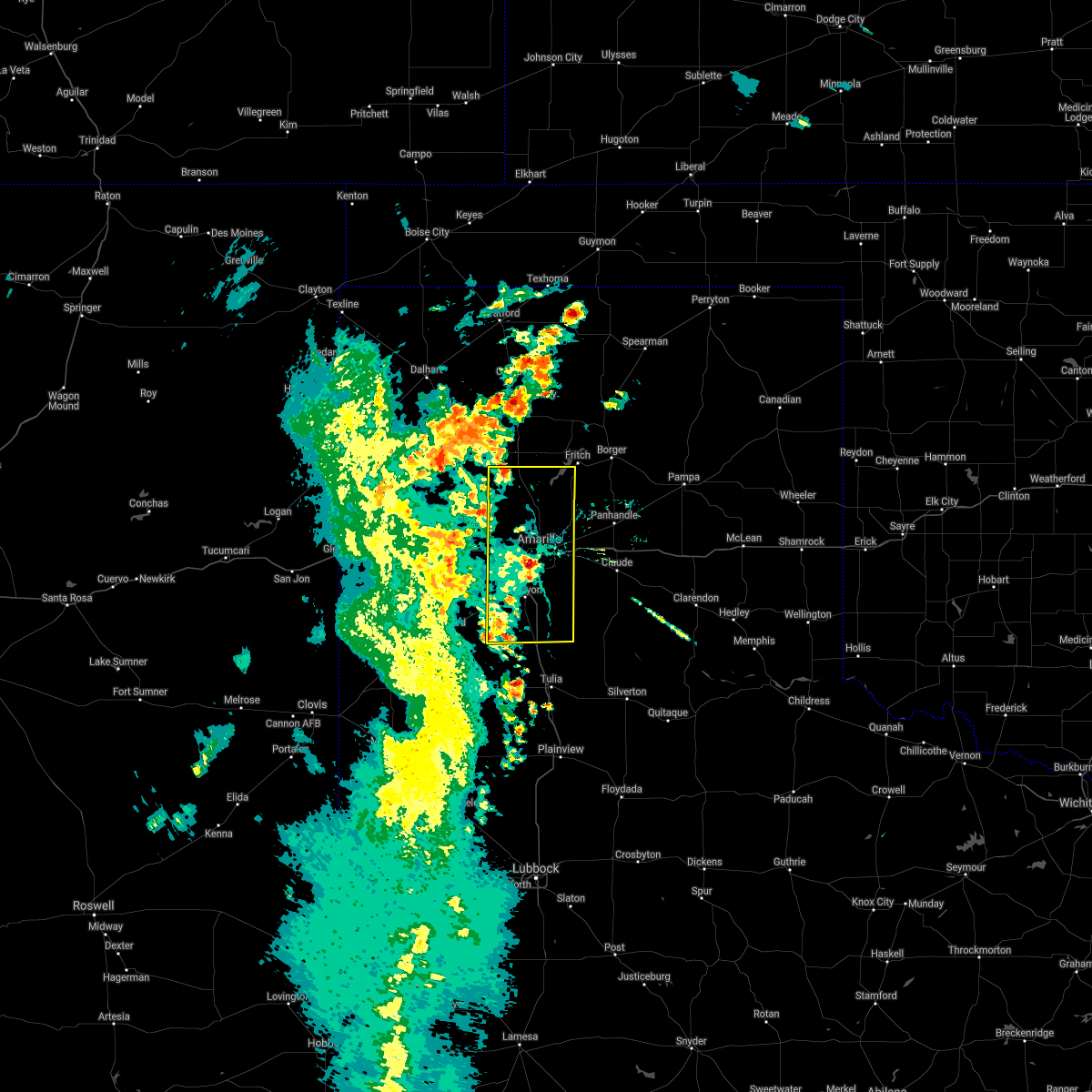 At 614 pm cdt, a severe thunderstorm was located near amarillo, moving north at 25 mph (trained weather spotters). Hazards include golf ball size hail was reported at randall high school. 60 mph winds still possible with this storm. Minor damage to roofs, siding, and trees is possible. people and animals outdoors will be injured. expect hail damage to roofs, siding, windows, and vehicles. Locations impacted include, amarillo, canyon, lake tanglewood, mescalero park, buffalo lake, bushland, valley de oro, umbarger, palo duro canyon and timbercreek canyon. At 614 pm cdt, a severe thunderstorm was located near amarillo, moving north at 25 mph (trained weather spotters). Hazards include golf ball size hail was reported at randall high school. 60 mph winds still possible with this storm. Minor damage to roofs, siding, and trees is possible. people and animals outdoors will be injured. expect hail damage to roofs, siding, windows, and vehicles. Locations impacted include, amarillo, canyon, lake tanglewood, mescalero park, buffalo lake, bushland, valley de oro, umbarger, palo duro canyon and timbercreek canyon.
|
| 9/1/2018 6:11 PM CDT |
 The national weather service in amarillo has issued a * severe thunderstorm warning for. randall county in the panhandle of texas. potter county in the panhandle of texas. until 715 pm cdt. At 609 pm cdt, a severe thunderstorm was located near amarillo,. The national weather service in amarillo has issued a * severe thunderstorm warning for. randall county in the panhandle of texas. potter county in the panhandle of texas. until 715 pm cdt. At 609 pm cdt, a severe thunderstorm was located near amarillo,.
|
| 8/8/2018 2:35 AM CDT |
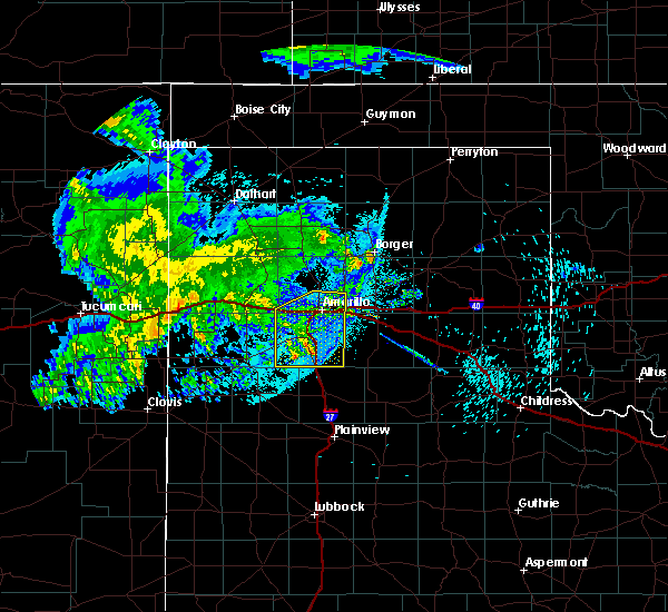 The severe thunderstorm warning for randall and southern potter counties will expire at 245 am cdt, the storms which prompted the warning have weakened below severe limits, and have exited the warned area. therefore, the warning will be allowed to expire. however gusty winds are still possible with these thunderstorms. The severe thunderstorm warning for randall and southern potter counties will expire at 245 am cdt, the storms which prompted the warning have weakened below severe limits, and have exited the warned area. therefore, the warning will be allowed to expire. however gusty winds are still possible with these thunderstorms.
|
| 8/8/2018 2:06 AM CDT |
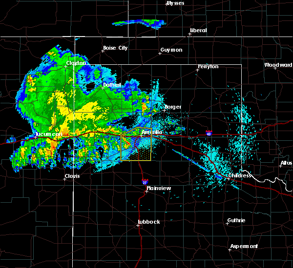 At 206 am cdt, severe thunderstorms were located along a line extending from 5 miles northwest of amarillo to 9 miles south of buffalo lake, moving east at 40 mph (radar indicated). Hazards include 60 mph wind gusts. Minor damage to roofs, siding, and trees is possible. Locations impacted include, amarillo, canyon, lake tanglewood, mescalero park, buffalo lake, bushland, umbarger, palo duro canyon and timbercreek canyon. At 206 am cdt, severe thunderstorms were located along a line extending from 5 miles northwest of amarillo to 9 miles south of buffalo lake, moving east at 40 mph (radar indicated). Hazards include 60 mph wind gusts. Minor damage to roofs, siding, and trees is possible. Locations impacted include, amarillo, canyon, lake tanglewood, mescalero park, buffalo lake, bushland, umbarger, palo duro canyon and timbercreek canyon.
|
| 8/8/2018 1:39 AM CDT |
 At 139 am cdt, severe thunderstorms were located along a line extending from 8 miles northwest of amarillo to 7 miles southeast of bootleg, moving southeast at 35 mph (radar indicated). Hazards include 60 mph wind gusts and penny size hail. minor damage to roofs, siding, and trees is possible At 139 am cdt, severe thunderstorms were located along a line extending from 8 miles northwest of amarillo to 7 miles southeast of bootleg, moving southeast at 35 mph (radar indicated). Hazards include 60 mph wind gusts and penny size hail. minor damage to roofs, siding, and trees is possible
|
| 8/1/2018 7:55 PM CDT |
 The severe thunderstorm warning for northeastern randall, northwestern armstrong, southwestern carson and southern potter counties will expire at 800 pm cdt, the storm which prompted the warning has moved out of the area. therefore, the warning will be allowed to expire. The severe thunderstorm warning for northeastern randall, northwestern armstrong, southwestern carson and southern potter counties will expire at 800 pm cdt, the storm which prompted the warning has moved out of the area. therefore, the warning will be allowed to expire.
|
| 8/1/2018 7:18 PM CDT |
 At 718 pm cdt, a severe thunderstorm was located over amarillo, moving south at 10 mph (radar indicated). Hazards include 60 mph wind gusts and nickel size hail. Minor damage to roofs, siding, and trees is possible. Locations impacted include, amarillo, canyon, lake tanglewood, mescalero park, washburn, timbercreek canyon and pantex. At 718 pm cdt, a severe thunderstorm was located over amarillo, moving south at 10 mph (radar indicated). Hazards include 60 mph wind gusts and nickel size hail. Minor damage to roofs, siding, and trees is possible. Locations impacted include, amarillo, canyon, lake tanglewood, mescalero park, washburn, timbercreek canyon and pantex.
|
| 8/1/2018 6:55 PM CDT |
 At 655 pm cdt, a severe thunderstorm was located 4 miles north of amarillo, moving south at 10 mph (radar indicated). Hazards include 60 mph wind gusts and nickel size hail. minor damage to roofs, siding, and trees is possible At 655 pm cdt, a severe thunderstorm was located 4 miles north of amarillo, moving south at 10 mph (radar indicated). Hazards include 60 mph wind gusts and nickel size hail. minor damage to roofs, siding, and trees is possible
|
| 6/13/2018 12:38 AM CDT |
 At 1238 am cdt, a severe thunderstorm was located over palo duro canyon, or 12 miles east of canyon, moving south at 25 mph (public). Hazards include 60 mph wind gusts and quarter size hail. Minor damage to roofs, siding, and trees is possible. hail damage to vehicles is expected. Locations impacted include, amarillo, canyon, lake tanglewood, mescalero park, palo duro canyon and timbercreek canyon. At 1238 am cdt, a severe thunderstorm was located over palo duro canyon, or 12 miles east of canyon, moving south at 25 mph (public). Hazards include 60 mph wind gusts and quarter size hail. Minor damage to roofs, siding, and trees is possible. hail damage to vehicles is expected. Locations impacted include, amarillo, canyon, lake tanglewood, mescalero park, palo duro canyon and timbercreek canyon.
|
| 6/13/2018 12:22 AM CDT |
 At 1222 am cdt, a severe thunderstorm was located over lake tanglewood, or 10 miles southeast of amarillo, moving south at 20 mph (radar indicated). Hazards include 70 mph wind gusts and quarter size hail. Expect some tree damage. damage is likely to mobile homes, roofs, and outbuildings. Hail damage to vehicles is expected. At 1222 am cdt, a severe thunderstorm was located over lake tanglewood, or 10 miles southeast of amarillo, moving south at 20 mph (radar indicated). Hazards include 70 mph wind gusts and quarter size hail. Expect some tree damage. damage is likely to mobile homes, roofs, and outbuildings. Hail damage to vehicles is expected.
|
| 6/13/2018 12:20 AM CDT |
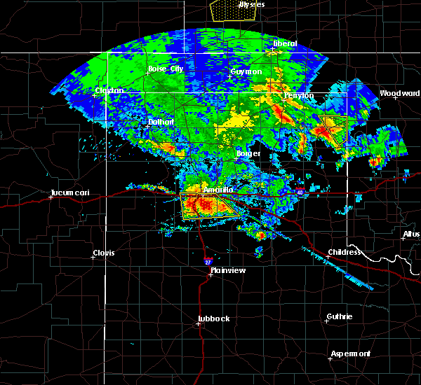 At 1219 am cdt, a severe thunderstorm was located near lake tanglewood, or 9 miles southeast of amarillo, moving south at 20 mph (public). Hazards include 70 mph wind gusts and quarter size hail. Expect some tree damage. damage is likely to mobile homes, roofs, and outbuildings. hail damage to vehicles is expected. Locations impacted include, amarillo, canyon, lake tanglewood, mescalero park, bushland, palo duro canyon and timbercreek canyon. At 1219 am cdt, a severe thunderstorm was located near lake tanglewood, or 9 miles southeast of amarillo, moving south at 20 mph (public). Hazards include 70 mph wind gusts and quarter size hail. Expect some tree damage. damage is likely to mobile homes, roofs, and outbuildings. hail damage to vehicles is expected. Locations impacted include, amarillo, canyon, lake tanglewood, mescalero park, bushland, palo duro canyon and timbercreek canyon.
|
| 6/13/2018 12:09 AM CDT |
 At 1209 am cdt, a severe thunderstorm was located 5 miles northeast of lake tanglewood, or 7 miles southeast of amarillo, moving south at 25 mph (public). Hazards include 60 mph wind gusts and quarter size hail. Minor damage to roofs, siding, and trees is possible. hail damage to vehicles is expected. Locations impacted include, amarillo, canyon, lake tanglewood, mescalero park, bushland, washburn, palo duro canyon and timbercreek canyon. At 1209 am cdt, a severe thunderstorm was located 5 miles northeast of lake tanglewood, or 7 miles southeast of amarillo, moving south at 25 mph (public). Hazards include 60 mph wind gusts and quarter size hail. Minor damage to roofs, siding, and trees is possible. hail damage to vehicles is expected. Locations impacted include, amarillo, canyon, lake tanglewood, mescalero park, bushland, washburn, palo duro canyon and timbercreek canyon.
|
| 6/12/2018 11:53 PM CDT |
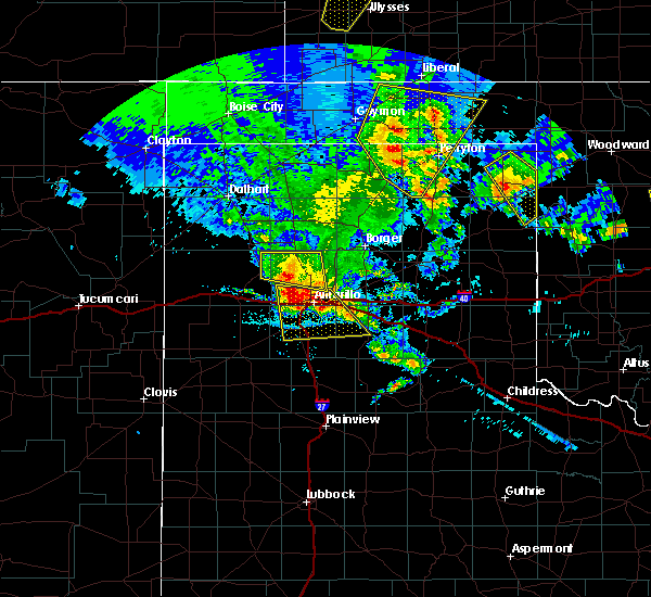 At 1152 pm cdt, a severe thunderstorm was located over amarillo, moving south at 25 mph (radar indicated). Hazards include 60 mph wind gusts and quarter size hail. Minor damage to roofs, siding, and trees is possible. Hail damage to vehicles is expected. At 1152 pm cdt, a severe thunderstorm was located over amarillo, moving south at 25 mph (radar indicated). Hazards include 60 mph wind gusts and quarter size hail. Minor damage to roofs, siding, and trees is possible. Hail damage to vehicles is expected.
|
| 8/17/2017 7:59 PM CDT |
 At 758 pm cdt, a severe thunderstorm was located over lake tanglewood, or 8 miles south of amarillo, moving east at 15 mph (radar indicated). Hazards include 60 mph wind gusts and penny size hail. Minor damage to roofs, siding, and trees is possible. Locations impacted include, amarillo, claude, lake tanglewood, mescalero park and timbercreek canyon. At 758 pm cdt, a severe thunderstorm was located over lake tanglewood, or 8 miles south of amarillo, moving east at 15 mph (radar indicated). Hazards include 60 mph wind gusts and penny size hail. Minor damage to roofs, siding, and trees is possible. Locations impacted include, amarillo, claude, lake tanglewood, mescalero park and timbercreek canyon.
|
| 8/17/2017 7:20 PM CDT |
 At 720 pm cdt, a severe thunderstorm was located 5 miles north of mescalero park, or 8 miles southwest of amarillo, moving east at 25 mph (radar indicated). Hazards include 60 mph wind gusts and quarter size hail. Minor damage to roofs, siding, and trees is possible. Hail damage to vehicles is expected. At 720 pm cdt, a severe thunderstorm was located 5 miles north of mescalero park, or 8 miles southwest of amarillo, moving east at 25 mph (radar indicated). Hazards include 60 mph wind gusts and quarter size hail. Minor damage to roofs, siding, and trees is possible. Hail damage to vehicles is expected.
|
| 8/14/2017 11:21 PM CDT |
 At 1121 pm cdt, severe thunderstorms were located along a line extending from 7 miles northwest of claude to 12 miles south of buffalo lake, moving southeast at 30 mph (radar indicated). Hazards include 60 mph wind gusts. Minor damage to roofs, siding, and trees is possible. Locations impacted include, amarillo, hereford, canyon, panhandle, clarendon, claude, lake tanglewood, mclean, groom, howardwick, buffalo lake, lake mcclellan, wayside, washburn, umbarger, palo duro canyon, goodnight, mescalero park, dawn and alanreed. At 1121 pm cdt, severe thunderstorms were located along a line extending from 7 miles northwest of claude to 12 miles south of buffalo lake, moving southeast at 30 mph (radar indicated). Hazards include 60 mph wind gusts. Minor damage to roofs, siding, and trees is possible. Locations impacted include, amarillo, hereford, canyon, panhandle, clarendon, claude, lake tanglewood, mclean, groom, howardwick, buffalo lake, lake mcclellan, wayside, washburn, umbarger, palo duro canyon, goodnight, mescalero park, dawn and alanreed.
|
| 8/14/2017 10:40 PM CDT |
 At 1038 pm cdt, severe thunderstorms were located along a line extending from 15 miles north of amarillo to 6 miles north of hereford, moving southeast at 40 mph (radar indicated). Hazards include 60 mph wind gusts. minor damage to roofs, siding, and trees is possible At 1038 pm cdt, severe thunderstorms were located along a line extending from 15 miles north of amarillo to 6 miles north of hereford, moving southeast at 40 mph (radar indicated). Hazards include 60 mph wind gusts. minor damage to roofs, siding, and trees is possible
|
| 8/13/2017 8:27 PM CDT |
 At 827 pm cdt, severe thunderstorms were located along a line extending from 6 miles south of panhandle to 5 miles northeast of umbarger, moving southeast at 25 mph (radar indicated). Hazards include 60 mph wind gusts and penny size hail. Minor damage to roofs, siding, and trees is possible. Locations impacted include, amarillo, canyon, panhandle, claude, lake tanglewood, groom, buffalo lake, wayside, washburn, umbarger, palo duro canyon, mescalero park, timbercreek canyon and pantex. At 827 pm cdt, severe thunderstorms were located along a line extending from 6 miles south of panhandle to 5 miles northeast of umbarger, moving southeast at 25 mph (radar indicated). Hazards include 60 mph wind gusts and penny size hail. Minor damage to roofs, siding, and trees is possible. Locations impacted include, amarillo, canyon, panhandle, claude, lake tanglewood, groom, buffalo lake, wayside, washburn, umbarger, palo duro canyon, mescalero park, timbercreek canyon and pantex.
|
| 8/13/2017 7:50 PM CDT |
 At 749 pm cdt, severe thunderstorms were located along a line extending from 10 miles south of fritch to 3 miles southwest of bushland, moving southeast at 35 mph. these are very dangerous storms (radar indicated). Hazards include 80 mph wind gusts and penny size hail. Flying debris will be dangerous to those caught without shelter. mobile homes will be heavily damaged. expect considerable damage to roofs, windows, and vehicles. Tree damage and power outages are likely. At 749 pm cdt, severe thunderstorms were located along a line extending from 10 miles south of fritch to 3 miles southwest of bushland, moving southeast at 35 mph. these are very dangerous storms (radar indicated). Hazards include 80 mph wind gusts and penny size hail. Flying debris will be dangerous to those caught without shelter. mobile homes will be heavily damaged. expect considerable damage to roofs, windows, and vehicles. Tree damage and power outages are likely.
|
| 7/29/2017 4:06 PM CDT |
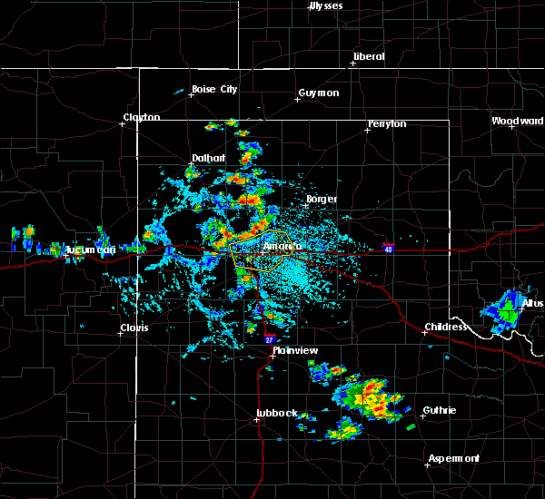 At 406 pm cdt, severe thunderstorms were located along a line extending from 16 miles northwest of washburn to 7 miles northwest of amarillo to 5 miles north of bushland, moving southeast at 5 mph (radar indicated). Hazards include 60 mph wind gusts and nickel size hail. minor damage to roofs, siding, and trees is possible At 406 pm cdt, severe thunderstorms were located along a line extending from 16 miles northwest of washburn to 7 miles northwest of amarillo to 5 miles north of bushland, moving southeast at 5 mph (radar indicated). Hazards include 60 mph wind gusts and nickel size hail. minor damage to roofs, siding, and trees is possible
|
| 7/26/2017 7:33 PM CDT |
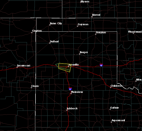 At 731 pm cdt, a severe thunderstorm was located over bushland, or 12 miles west of amarillo, moving east at 5 mph (radar indicated). Hazards include 70 mph wind gusts. a 66 mph wind gust was reported at kvii studio schoolnet at 7:26 pm. Expect some tree damage. damage is likely to mobile homes, roofs, and outbuildings. Locations impacted include, amarillo, lake tanglewood, mescalero park, bushland and timbercreek canyon. At 731 pm cdt, a severe thunderstorm was located over bushland, or 12 miles west of amarillo, moving east at 5 mph (radar indicated). Hazards include 70 mph wind gusts. a 66 mph wind gust was reported at kvii studio schoolnet at 7:26 pm. Expect some tree damage. damage is likely to mobile homes, roofs, and outbuildings. Locations impacted include, amarillo, lake tanglewood, mescalero park, bushland and timbercreek canyon.
|
| 7/26/2017 7:25 PM CDT |
 At 724 pm cdt, a severe thunderstorm was located over bushland, or 16 miles west of amarillo, moving east at 5 mph (radar indicated). Hazards include 65 mph wind gusts. Expect some tree damage. Damage is likely to mobile homes, roofs, and outbuildings. At 724 pm cdt, a severe thunderstorm was located over bushland, or 16 miles west of amarillo, moving east at 5 mph (radar indicated). Hazards include 65 mph wind gusts. Expect some tree damage. Damage is likely to mobile homes, roofs, and outbuildings.
|
| 7/4/2017 10:32 PM CDT |
 At 1031 pm cdt, a severe thunderstorm was located 4 miles east of lake tanglewood, or 11 miles southeast of amarillo, moving southeast at 25 mph (radar indicated). Hazards include 70 mph wind gusts and ping pong ball size hail. Expect some tree damage. damage is likely to mobile homes, roofs, and outbuildings. people and animals outdoors will be injured. Expect hail damage to roofs, siding, windows, and vehicles. At 1031 pm cdt, a severe thunderstorm was located 4 miles east of lake tanglewood, or 11 miles southeast of amarillo, moving southeast at 25 mph (radar indicated). Hazards include 70 mph wind gusts and ping pong ball size hail. Expect some tree damage. damage is likely to mobile homes, roofs, and outbuildings. people and animals outdoors will be injured. Expect hail damage to roofs, siding, windows, and vehicles.
|
| 7/3/2017 7:08 PM CDT |
 At 708 pm cdt, a severe thunderstorm was located 6 miles north of mescalero park, or 7 miles southwest of amarillo, moving east at 30 mph (radar indicated). Hazards include 60 mph wind gusts and quarter size hail. Minor damage to roofs, siding, and trees is possible. hail damage to vehicles is expected. Locations impacted include, amarillo, canyon, lake tanglewood, mescalero park, bushland and timbercreek canyon. At 708 pm cdt, a severe thunderstorm was located 6 miles north of mescalero park, or 7 miles southwest of amarillo, moving east at 30 mph (radar indicated). Hazards include 60 mph wind gusts and quarter size hail. Minor damage to roofs, siding, and trees is possible. hail damage to vehicles is expected. Locations impacted include, amarillo, canyon, lake tanglewood, mescalero park, bushland and timbercreek canyon.
|
| 7/3/2017 7:04 PM CDT |
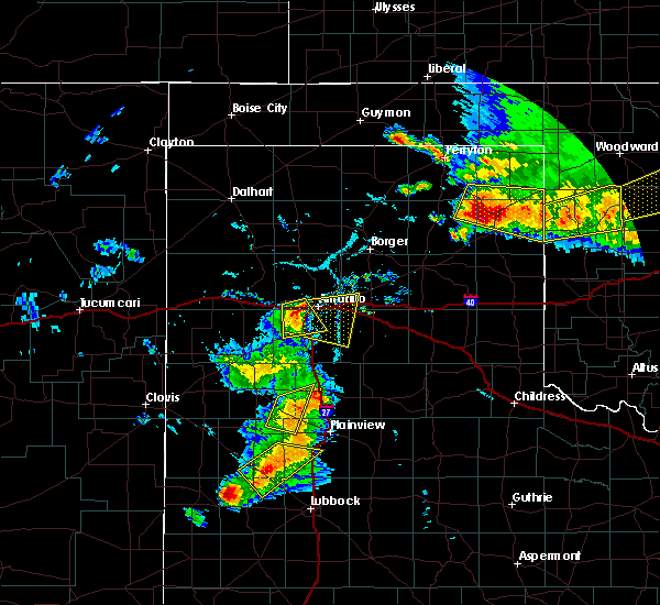 At 704 pm cdt, a severe thunderstorm was located 5 miles southeast of bushland, or 9 miles west of amarillo, moving east at 25 mph (radar indicated). Hazards include 60 mph wind gusts and quarter size hail. quarter size hail was reported in bushland around 7pm. Minor damage to roofs, siding, and trees is possible. Hail damage to vehicles is expected. At 704 pm cdt, a severe thunderstorm was located 5 miles southeast of bushland, or 9 miles west of amarillo, moving east at 25 mph (radar indicated). Hazards include 60 mph wind gusts and quarter size hail. quarter size hail was reported in bushland around 7pm. Minor damage to roofs, siding, and trees is possible. Hail damage to vehicles is expected.
|
| 7/3/2017 6:49 PM CDT |
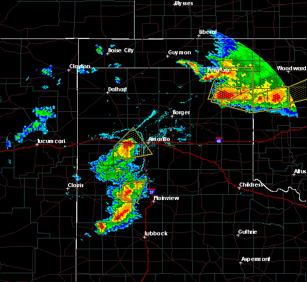 At 621 pm cdt, a severe thunderstorm was located 4 miles south of wildorado, or 12 miles southeast of vega, moving northeast at 30 mph (radar indicated). Hazards include golf ball size hail and 70 mph wind gusts. Expect some tree damage. damage is likely to mobile homes, roofs, and outbuildings. people and animals outdoors will be injured. Expect hail damage to roofs, siding, windows, and vehicles. At 621 pm cdt, a severe thunderstorm was located 4 miles south of wildorado, or 12 miles southeast of vega, moving northeast at 30 mph (radar indicated). Hazards include golf ball size hail and 70 mph wind gusts. Expect some tree damage. damage is likely to mobile homes, roofs, and outbuildings. people and animals outdoors will be injured. Expect hail damage to roofs, siding, windows, and vehicles.
|
| 7/3/2017 6:21 PM CDT |
 At 621 pm cdt, a severe thunderstorm was located 4 miles south of wildorado, or 12 miles southeast of vega, moving northeast at 30 mph (radar indicated). Hazards include golf ball size hail and 70 mph wind gusts. Expect some tree damage. damage is likely to mobile homes, roofs, and outbuildings. people and animals outdoors will be injured. Expect hail damage to roofs, siding, windows, and vehicles. At 621 pm cdt, a severe thunderstorm was located 4 miles south of wildorado, or 12 miles southeast of vega, moving northeast at 30 mph (radar indicated). Hazards include golf ball size hail and 70 mph wind gusts. Expect some tree damage. damage is likely to mobile homes, roofs, and outbuildings. people and animals outdoors will be injured. Expect hail damage to roofs, siding, windows, and vehicles.
|
| 6/24/2017 2:35 AM CDT |
 At 234 am cdt, a severe thunderstorm was located 10 miles west of palo duro canyon, or 10 miles east of canyon, moving east at 20 mph (radar indicated). Hazards include quarter size hail. Damage to vehicles is expected. Locations impacted include, canyon, lake tanglewood, mescalero park and timbercreek canyon. At 234 am cdt, a severe thunderstorm was located 10 miles west of palo duro canyon, or 10 miles east of canyon, moving east at 20 mph (radar indicated). Hazards include quarter size hail. Damage to vehicles is expected. Locations impacted include, canyon, lake tanglewood, mescalero park and timbercreek canyon.
|
| 6/24/2017 2:00 AM CDT |
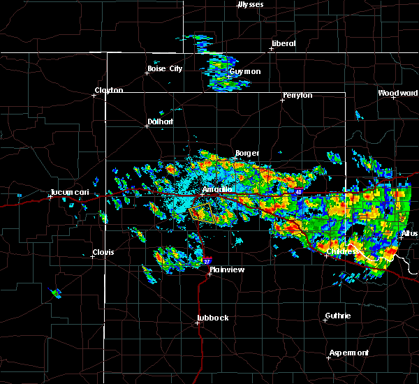 At 156 am cdt, a severe thunderstorm was located near canyon, moving east at 20 mph. this severe storm has weakened some as of 156 am cdt (trained weather spotters reported ping pong ball to golfball size hail 1 to 2 miles west and northwest of canyon between 145 am and 148 am cdt). Hazards include half dollar size hail. Damage to vehicles is expected. Locations impacted include, canyon, lake tanglewood, mescalero park and timbercreek canyon. At 156 am cdt, a severe thunderstorm was located near canyon, moving east at 20 mph. this severe storm has weakened some as of 156 am cdt (trained weather spotters reported ping pong ball to golfball size hail 1 to 2 miles west and northwest of canyon between 145 am and 148 am cdt). Hazards include half dollar size hail. Damage to vehicles is expected. Locations impacted include, canyon, lake tanglewood, mescalero park and timbercreek canyon.
|
| 6/24/2017 1:43 AM CDT |
 At 142 am cdt, a severe thunderstorm was located over canyon, moving east at 20 mph (radar indicated). Hazards include half dollar size hail. damage to vehicles is expected At 142 am cdt, a severe thunderstorm was located over canyon, moving east at 20 mph (radar indicated). Hazards include half dollar size hail. damage to vehicles is expected
|
| 6/8/2017 9:16 PM CDT |
 At 915 pm cdt, a severe thunderstorm was located 5 miles east of canyon, moving south at 30 mph (trained weather spotters). Hazards include golf ball size hail and 70 mph wind gusts. Expect some tree damage. damage is likely to mobile homes, roofs, and outbuildings. people and animals outdoors will be injured. expect hail damage to roofs, siding, windows, and vehicles. hail may accumulate on roadways causing hazardous travel. Locations impacted include, canyon, lake tanglewood, mescalero park, palo duro canyon and timbercreek canyon. At 915 pm cdt, a severe thunderstorm was located 5 miles east of canyon, moving south at 30 mph (trained weather spotters). Hazards include golf ball size hail and 70 mph wind gusts. Expect some tree damage. damage is likely to mobile homes, roofs, and outbuildings. people and animals outdoors will be injured. expect hail damage to roofs, siding, windows, and vehicles. hail may accumulate on roadways causing hazardous travel. Locations impacted include, canyon, lake tanglewood, mescalero park, palo duro canyon and timbercreek canyon.
|
| 6/8/2017 9:04 PM CDT |
 At 902 pm cdt, a severe thunderstorm was located near lake tanglewood, or 6 miles northeast of canyon, moving south at 25 mph (radar indicated). Hazards include golf ball size hail and 70 mph wind gusts. Expect some tree damage. damage is likely to mobile homes, roofs, and outbuildings. people and animals outdoors will be injured. expect hail damage to roofs, siding, windows, and vehicles. Locations impacted include, amarillo, canyon, lake tanglewood, mescalero park, palo duro canyon and timbercreek canyon. At 902 pm cdt, a severe thunderstorm was located near lake tanglewood, or 6 miles northeast of canyon, moving south at 25 mph (radar indicated). Hazards include golf ball size hail and 70 mph wind gusts. Expect some tree damage. damage is likely to mobile homes, roofs, and outbuildings. people and animals outdoors will be injured. expect hail damage to roofs, siding, windows, and vehicles. Locations impacted include, amarillo, canyon, lake tanglewood, mescalero park, palo duro canyon and timbercreek canyon.
|
| 6/8/2017 8:56 PM CDT |
 At 855 pm cdt, a severe thunderstorm was located over lake tanglewood, or 9 miles south of amarillo, moving south at 30 mph (trained weather spotters). Hazards include golf ball size hail and 60 mph wind gusts. Minor damage to roofs, siding, and trees is possible. people and animals outdoors will be injured. expect hail damage to roofs, siding, windows, and vehicles. hail may accumulate on roadways causing hazardous travel. Locations impacted include, amarillo, canyon, lake tanglewood, mescalero park, palo duro canyon and timbercreek canyon. At 855 pm cdt, a severe thunderstorm was located over lake tanglewood, or 9 miles south of amarillo, moving south at 30 mph (trained weather spotters). Hazards include golf ball size hail and 60 mph wind gusts. Minor damage to roofs, siding, and trees is possible. people and animals outdoors will be injured. expect hail damage to roofs, siding, windows, and vehicles. hail may accumulate on roadways causing hazardous travel. Locations impacted include, amarillo, canyon, lake tanglewood, mescalero park, palo duro canyon and timbercreek canyon.
|
| 6/8/2017 8:38 PM CDT |
 At 837 pm cdt, a severe thunderstorm was located over amarillo, moving south at 30 mph (trained weather spotters). Hazards include two inch hail and 60 mph wind gusts. Minor damage to roofs, siding, and trees is possible. people and animals outdoors will be injured. expect hail damage to roofs, siding, windows, and vehicles. Hail may accumulate on roadways causing hazardous travel. At 837 pm cdt, a severe thunderstorm was located over amarillo, moving south at 30 mph (trained weather spotters). Hazards include two inch hail and 60 mph wind gusts. Minor damage to roofs, siding, and trees is possible. people and animals outdoors will be injured. expect hail damage to roofs, siding, windows, and vehicles. Hail may accumulate on roadways causing hazardous travel.
|
| 6/8/2017 8:35 PM CDT |
 At 835 pm cdt, a severe thunderstorm was located 4 miles southeast of amarillo, moving south at 30 mph (trained weather spotters). Hazards include two inch hail and 60 mph wind gusts. Minor damage to roofs, siding, and trees is possible. people and animals outdoors will be injured. expect hail damage to roofs, siding, windows, and vehicles. Locations impacted include, amarillo, canyon, lake tanglewood, mescalero park, washburn, timbercreek canyon and pantex. At 835 pm cdt, a severe thunderstorm was located 4 miles southeast of amarillo, moving south at 30 mph (trained weather spotters). Hazards include two inch hail and 60 mph wind gusts. Minor damage to roofs, siding, and trees is possible. people and animals outdoors will be injured. expect hail damage to roofs, siding, windows, and vehicles. Locations impacted include, amarillo, canyon, lake tanglewood, mescalero park, washburn, timbercreek canyon and pantex.
|
| 6/8/2017 8:08 PM CDT |
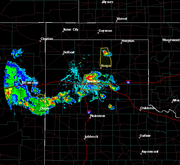 At 807 pm cdt, a severe thunderstorm was located 9 miles north of amarillo, moving south at 30 mph (radar indicated. a 64 mph wind gust was reported 14 miles north of amarillo). Hazards include ping pong ball size hail and 60 mph wind gusts. Minor damage to roofs, siding, and trees is possible. people and animals outdoors will be injured. expect hail damage to roofs, siding, windows, and vehicles. Locations impacted include, amarillo, canyon, lake tanglewood, mescalero park, washburn, timbercreek canyon and pantex. At 807 pm cdt, a severe thunderstorm was located 9 miles north of amarillo, moving south at 30 mph (radar indicated. a 64 mph wind gust was reported 14 miles north of amarillo). Hazards include ping pong ball size hail and 60 mph wind gusts. Minor damage to roofs, siding, and trees is possible. people and animals outdoors will be injured. expect hail damage to roofs, siding, windows, and vehicles. Locations impacted include, amarillo, canyon, lake tanglewood, mescalero park, washburn, timbercreek canyon and pantex.
|
| 6/8/2017 7:45 PM CDT |
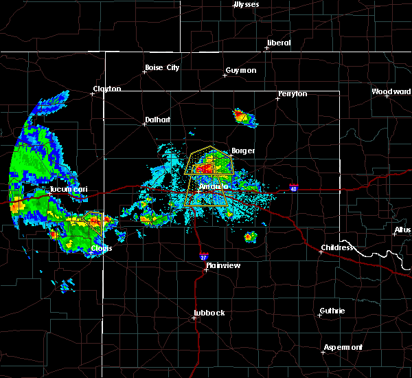 At 745 pm cdt, a severe thunderstorm was located 14 miles southwest of lake meredith, or 18 miles north of amarillo, moving south at 25 mph (radar indicated). Hazards include ping pong ball size hail and 60 mph wind gusts. Minor damage to roofs, siding, and trees is possible. people and animals outdoors will be injured. Expect hail damage to roofs, siding, windows, and vehicles. At 745 pm cdt, a severe thunderstorm was located 14 miles southwest of lake meredith, or 18 miles north of amarillo, moving south at 25 mph (radar indicated). Hazards include ping pong ball size hail and 60 mph wind gusts. Minor damage to roofs, siding, and trees is possible. people and animals outdoors will be injured. Expect hail damage to roofs, siding, windows, and vehicles.
|
| 5/10/2017 4:00 AM CDT |
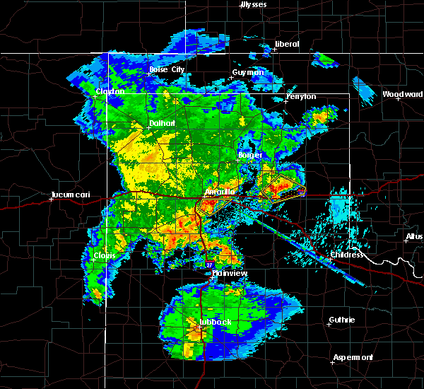 At 400 am cdt, a severe thunderstorm was located 5 miles northeast of lake tanglewood, or 8 miles southeast of amarillo, moving northeast at 35 mph (radar indicated). Hazards include golf ball size hail. People and animals outdoors will be injured. expect damage to roofs, siding, windows, and vehicles. Locations impacted include, amarillo, lake tanglewood, washburn and timbercreek canyon. At 400 am cdt, a severe thunderstorm was located 5 miles northeast of lake tanglewood, or 8 miles southeast of amarillo, moving northeast at 35 mph (radar indicated). Hazards include golf ball size hail. People and animals outdoors will be injured. expect damage to roofs, siding, windows, and vehicles. Locations impacted include, amarillo, lake tanglewood, washburn and timbercreek canyon.
|
| 5/10/2017 3:50 AM CDT |
 At 350 am cdt, a severe thunderstorm was located over lake tanglewood, or 8 miles northeast of canyon, moving northeast at 30 mph (radar indicated). Hazards include ping pong ball size hail. People and animals outdoors will be injured. expect damage to roofs, siding, windows, and vehicles. Locations impacted include, amarillo, canyon, lake tanglewood, washburn, mescalero park and timbercreek canyon. At 350 am cdt, a severe thunderstorm was located over lake tanglewood, or 8 miles northeast of canyon, moving northeast at 30 mph (radar indicated). Hazards include ping pong ball size hail. People and animals outdoors will be injured. expect damage to roofs, siding, windows, and vehicles. Locations impacted include, amarillo, canyon, lake tanglewood, washburn, mescalero park and timbercreek canyon.
|
| 5/10/2017 3:37 AM CDT |
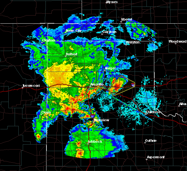 At 336 am cdt, a severe thunderstorm was located 4 miles east of canyon, moving northeast at 30 mph (radar indicated). Hazards include ping pong ball size hail. People and animals outdoors will be injured. Expect damage to roofs, siding, windows, and vehicles. At 336 am cdt, a severe thunderstorm was located 4 miles east of canyon, moving northeast at 30 mph (radar indicated). Hazards include ping pong ball size hail. People and animals outdoors will be injured. Expect damage to roofs, siding, windows, and vehicles.
|
| 7/15/2016 8:59 PM CDT |
 At 859 pm cdt, a severe thunderstorm was located 5 miles northwest of claude, moving east at 20 mph (radar indicated). Hazards include 60 mph wind gusts. Minor damage to roofs. siding. and trees is possible. Locations impacted include, amarillo, claude, lake tanglewood, washburn and goodnight. At 859 pm cdt, a severe thunderstorm was located 5 miles northwest of claude, moving east at 20 mph (radar indicated). Hazards include 60 mph wind gusts. Minor damage to roofs. siding. and trees is possible. Locations impacted include, amarillo, claude, lake tanglewood, washburn and goodnight.
|
| 7/15/2016 8:49 PM CDT |
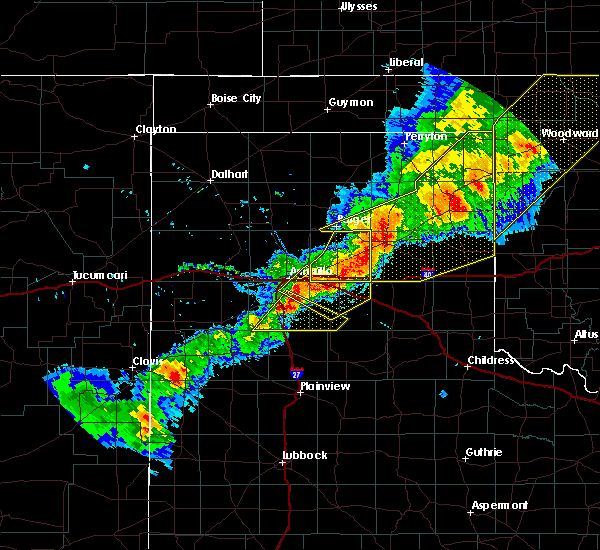 At 848 pm cdt, a severe thunderstorm was located 6 miles south of lake tanglewood, or 7 miles east of canyon, moving east at 30 mph (radar indicated). Hazards include 60 mph wind gusts and quarter size hail. Minor damage to roofs. siding. and trees is possible. Hail damage to vehicles is expected. At 848 pm cdt, a severe thunderstorm was located 6 miles south of lake tanglewood, or 7 miles east of canyon, moving east at 30 mph (radar indicated). Hazards include 60 mph wind gusts and quarter size hail. Minor damage to roofs. siding. and trees is possible. Hail damage to vehicles is expected.
|
| 7/15/2016 8:25 PM CDT |
 At 825 pm cdt, a severe thunderstorm was located 5 miles west of washburn, or 8 miles east of amarillo, moving east at 20 mph (radar indicated). Hazards include 60 mph wind gusts and nickel size hail. Minor damage to roofs. siding. And trees is possible. At 825 pm cdt, a severe thunderstorm was located 5 miles west of washburn, or 8 miles east of amarillo, moving east at 20 mph (radar indicated). Hazards include 60 mph wind gusts and nickel size hail. Minor damage to roofs. siding. And trees is possible.
|
| 7/15/2016 8:07 PM CDT |
 At 806 pm cdt, severe thunderstorms were located along a line extending from 11 miles southeast of fritch to 3 miles northeast of mescalero park, moving east at 40 mph (radar indicated). Hazards include 60 mph wind gusts. Minor damage to roofs. siding. and trees is possible. severe winds are expected to occur before the rain starts. Locations impacted include, amarillo, lake tanglewood, bushland, mescalero park and timbercreek canyon. At 806 pm cdt, severe thunderstorms were located along a line extending from 11 miles southeast of fritch to 3 miles northeast of mescalero park, moving east at 40 mph (radar indicated). Hazards include 60 mph wind gusts. Minor damage to roofs. siding. and trees is possible. severe winds are expected to occur before the rain starts. Locations impacted include, amarillo, lake tanglewood, bushland, mescalero park and timbercreek canyon.
|
| 7/15/2016 7:40 PM CDT |
 At 740 pm cdt, severe thunderstorms were located along a line extending from 6 miles southwest of lake meredith to bushland, moving east at 40 mph (radar indicated). Hazards include 60 mph wind gusts. Minor damage to roofs. siding. and trees is possible. Locations impacted include, amarillo, canyon, lake tanglewood, bushland, mescalero park and timbercreek canyon. At 740 pm cdt, severe thunderstorms were located along a line extending from 6 miles southwest of lake meredith to bushland, moving east at 40 mph (radar indicated). Hazards include 60 mph wind gusts. Minor damage to roofs. siding. and trees is possible. Locations impacted include, amarillo, canyon, lake tanglewood, bushland, mescalero park and timbercreek canyon.
|
| 7/15/2016 7:28 PM CDT |
 At 728 pm cdt, severe thunderstorms were located along a line extending from near masterson to 10 miles southeast of valley de oro to 3 miles west of wildorado, moving east at 45 mph (radar indicated). Hazards include 60 mph wind gusts. Minor damage to roofs. siding. And trees is possible. At 728 pm cdt, severe thunderstorms were located along a line extending from near masterson to 10 miles southeast of valley de oro to 3 miles west of wildorado, moving east at 45 mph (radar indicated). Hazards include 60 mph wind gusts. Minor damage to roofs. siding. And trees is possible.
|
| 7/14/2016 8:36 PM CDT |
 At 836 pm cdt, a severe thunderstorm was located over lake tanglewood, or 9 miles south of amarillo, moving south at 10 mph (trained weather spotters). Hazards include half dollar size hail. Damage to vehicles is expected. locations impacted include, amarillo, canyon, lake tanglewood, mescalero park, palo duro canyon and timbercreek canyon. This includes interstate 27 between mile markers 101 and 110, and near mile marker 121. At 836 pm cdt, a severe thunderstorm was located over lake tanglewood, or 9 miles south of amarillo, moving south at 10 mph (trained weather spotters). Hazards include half dollar size hail. Damage to vehicles is expected. locations impacted include, amarillo, canyon, lake tanglewood, mescalero park, palo duro canyon and timbercreek canyon. This includes interstate 27 between mile markers 101 and 110, and near mile marker 121.
|
| 7/14/2016 8:20 PM CDT |
 At 819 pm cdt, severe thunderstorms were located along a line extending from 5 miles north of mescalero park to 6 miles east of lake tanglewood, moving southwest at 5 mph (radar indicated). Hazards include 60 mph wind gusts and half dollar size hail. Minor damage to roofs. siding. and trees is possible. Hail damage to vehicles is expected. At 819 pm cdt, severe thunderstorms were located along a line extending from 5 miles north of mescalero park to 6 miles east of lake tanglewood, moving southwest at 5 mph (radar indicated). Hazards include 60 mph wind gusts and half dollar size hail. Minor damage to roofs. siding. and trees is possible. Hail damage to vehicles is expected.
|
| 6/26/2016 1:53 PM CDT |
 At 152 pm cdt, a severe thunderstorm was located 5 miles south of lake tanglewood or 6 miles east of canyon, moving north at 10 mph (radar indicated). Hazards include 60 mph wind gusts and half dollar size hail. Minor damage to roofs. siding. and trees is possible. hail damage to vehicles is expected. locations impacted include, canyon, lake tanglewood and timbercreek canyon. This includes interstate 27 between mile markers 103 and 106. At 152 pm cdt, a severe thunderstorm was located 5 miles south of lake tanglewood or 6 miles east of canyon, moving north at 10 mph (radar indicated). Hazards include 60 mph wind gusts and half dollar size hail. Minor damage to roofs. siding. and trees is possible. hail damage to vehicles is expected. locations impacted include, canyon, lake tanglewood and timbercreek canyon. This includes interstate 27 between mile markers 103 and 106.
|
| 6/26/2016 1:39 PM CDT |
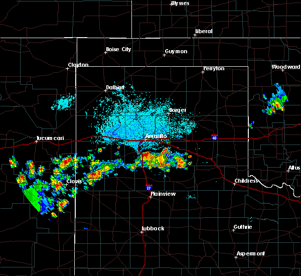 At 139 pm cdt, a severe thunderstorm was located 5 miles west of palo duro canyon, or 9 miles east of canyon, moving northeast at 20 mph (radar indicated). Hazards include ping pong ball size hail and 60 mph wind gusts. Minor damage to roofs. siding. and trees is possible. people and animals outdoors will be injured. Expect hail damage to roofs, siding, windows, and vehicles. At 139 pm cdt, a severe thunderstorm was located 5 miles west of palo duro canyon, or 9 miles east of canyon, moving northeast at 20 mph (radar indicated). Hazards include ping pong ball size hail and 60 mph wind gusts. Minor damage to roofs. siding. and trees is possible. people and animals outdoors will be injured. Expect hail damage to roofs, siding, windows, and vehicles.
|
| 6/26/2016 12:42 PM CDT |
 At 1242 pm cdt, a severe thunderstorm was located over happy, or 15 miles south of canyon, moving northeast at 15 mph (radar indicated). Hazards include ping pong ball size hail and 60 mph wind gusts. Minor damage to roofs. siding. and trees is possible. people and animals outdoors will be injured. Expect hail damage to roofs, siding, windows, and vehicles. At 1242 pm cdt, a severe thunderstorm was located over happy, or 15 miles south of canyon, moving northeast at 15 mph (radar indicated). Hazards include ping pong ball size hail and 60 mph wind gusts. Minor damage to roofs. siding. and trees is possible. people and animals outdoors will be injured. Expect hail damage to roofs, siding, windows, and vehicles.
|
| 6/13/2016 10:10 PM CDT |
 At 1009 pm cdt, a severe thunderstorm was located over lake tanglewood, or 11 miles southeast of amarillo, moving east at 30 mph (radar indicated). Hazards include quarter size hail. Damage to vehicles is possible. locations impacted include, amarillo, lake tanglewood and timbercreek canyon. A tornado watch remains in effect until 200 am cdt for the panhandle of texas. At 1009 pm cdt, a severe thunderstorm was located over lake tanglewood, or 11 miles southeast of amarillo, moving east at 30 mph (radar indicated). Hazards include quarter size hail. Damage to vehicles is possible. locations impacted include, amarillo, lake tanglewood and timbercreek canyon. A tornado watch remains in effect until 200 am cdt for the panhandle of texas.
|
| 6/13/2016 10:01 PM CDT |
 At 1001 pm cdt, a severe thunderstorm was located over lake tanglewood, or 8 miles south of amarillo, moving east at 35 mph (trained weather spotters). Hazards include up to golf ball size hail. People and animals outdoors will be injured. expect damage to roofs, siding, windows, and vehicles. locations impacted include, amarillo, lake tanglewood, mescalero park and timbercreek canyon. A tornado watch remains in effect until 200 am cdt for the panhandle of texas. At 1001 pm cdt, a severe thunderstorm was located over lake tanglewood, or 8 miles south of amarillo, moving east at 35 mph (trained weather spotters). Hazards include up to golf ball size hail. People and animals outdoors will be injured. expect damage to roofs, siding, windows, and vehicles. locations impacted include, amarillo, lake tanglewood, mescalero park and timbercreek canyon. A tornado watch remains in effect until 200 am cdt for the panhandle of texas.
|
| 6/13/2016 9:51 PM CDT |
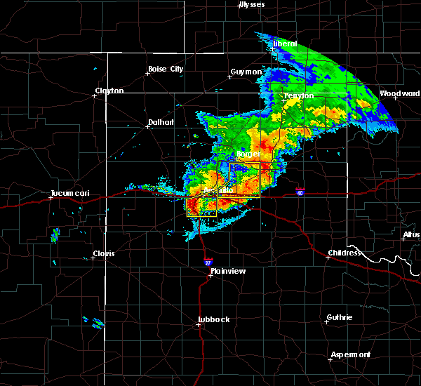 At 950 pm cdt, a severe thunderstorm was located over mescalero park, or 6 miles north of canyon, moving east at 35 mph (radar indicated). Hazards include 60 mph wind gusts and half dollar size hail. Minor damage to roofs. siding. and trees is possible. hail damage to vehicles is expected. locations impacted include, amarillo, canyon, lake tanglewood, mescalero park, palo duro canyon and timbercreek canyon. A tornado watch remains in effect until 200 am cdt for the panhandle of texas. At 950 pm cdt, a severe thunderstorm was located over mescalero park, or 6 miles north of canyon, moving east at 35 mph (radar indicated). Hazards include 60 mph wind gusts and half dollar size hail. Minor damage to roofs. siding. and trees is possible. hail damage to vehicles is expected. locations impacted include, amarillo, canyon, lake tanglewood, mescalero park, palo duro canyon and timbercreek canyon. A tornado watch remains in effect until 200 am cdt for the panhandle of texas.
|
| 6/13/2016 9:39 PM CDT |
 At 938 pm cdt, severe thunderstorms were located along a line extending from 3 miles southeast of bushland to umbarger, moving east at 30 mph (radar indicated). Hazards include ping pong ball size hail and 60 mph wind gusts. Minor damage to roofs. siding. and trees is possible. people and animals outdoors will be injured. Expect hail damage to roofs, siding, windows, and vehicles. At 938 pm cdt, severe thunderstorms were located along a line extending from 3 miles southeast of bushland to umbarger, moving east at 30 mph (radar indicated). Hazards include ping pong ball size hail and 60 mph wind gusts. Minor damage to roofs. siding. and trees is possible. people and animals outdoors will be injured. Expect hail damage to roofs, siding, windows, and vehicles.
|
| 5/29/2016 5:21 PM CDT |
 The severe thunderstorm warning for northeastern deaf smith, northern randall and southeastern potter counties will expire at 530 pm cdt, the storms which prompted the warning have weakened below severe limits, and no longer pose an immediate threat to life or property. therefore the warning will be allowed to expire. however heavy rain is still possible with these thunderstorms. a severe thunderstorm watch remains in effect until 1000 pm cdt for the texas panhandle. The severe thunderstorm warning for northeastern deaf smith, northern randall and southeastern potter counties will expire at 530 pm cdt, the storms which prompted the warning have weakened below severe limits, and no longer pose an immediate threat to life or property. therefore the warning will be allowed to expire. however heavy rain is still possible with these thunderstorms. a severe thunderstorm watch remains in effect until 1000 pm cdt for the texas panhandle.
|
| 5/29/2016 5:09 PM CDT |
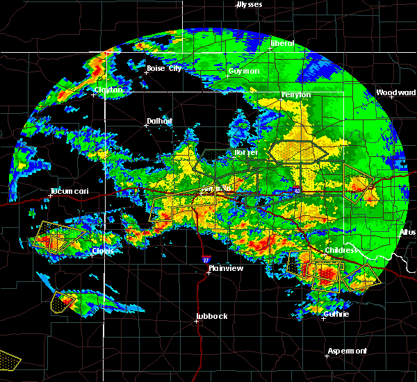 At 508 pm cdt, severe thunderstorms were located along a line extending from 4 miles northwest of washburn to 4 miles northeast of hereford, moving east at 15 mph (radar indicated). Hazards include 60 mph wind gusts and quarter size hail. Minor damage to roofs. siding. and trees is possible. hail damage to vehicles is expected. locations impacted include, amarillo, lake tanglewood, bushland, mescalero park, dawn and timbercreek canyon. this includes the following highways, interstate 27 between mile markers 113 and 123. Interstate 40 between mile markers 55 and 82. At 508 pm cdt, severe thunderstorms were located along a line extending from 4 miles northwest of washburn to 4 miles northeast of hereford, moving east at 15 mph (radar indicated). Hazards include 60 mph wind gusts and quarter size hail. Minor damage to roofs. siding. and trees is possible. hail damage to vehicles is expected. locations impacted include, amarillo, lake tanglewood, bushland, mescalero park, dawn and timbercreek canyon. this includes the following highways, interstate 27 between mile markers 113 and 123. Interstate 40 between mile markers 55 and 82.
|
| 5/29/2016 4:48 PM CDT |
 At 448 pm cdt, severe thunderstorms were located along a line extending from 8 miles northwest of washburn to 10 miles northwest of hereford, moving east at 15 mph (radar indicated). Hazards include 60 mph wind gusts and half dollar size hail. Minor damage to roofs. siding. and trees is possible. hail damage to vehicles is expected. locations impacted include, amarillo, vega, lake tanglewood, wildorado, bushland, mescalero park, dawn and timbercreek canyon. this includes the following highways, interstate 27 between mile markers 113 and 123. Interstate 40 between mile markers 36 and 82. At 448 pm cdt, severe thunderstorms were located along a line extending from 8 miles northwest of washburn to 10 miles northwest of hereford, moving east at 15 mph (radar indicated). Hazards include 60 mph wind gusts and half dollar size hail. Minor damage to roofs. siding. and trees is possible. hail damage to vehicles is expected. locations impacted include, amarillo, vega, lake tanglewood, wildorado, bushland, mescalero park, dawn and timbercreek canyon. this includes the following highways, interstate 27 between mile markers 113 and 123. Interstate 40 between mile markers 36 and 82.
|
| 5/29/2016 4:29 PM CDT |
 At 429 pm cdt, severe thunderstorms were located along a line extending from 5 miles northwest of amarillo to 3 miles west of bootleg, moving east at 15 mph (radar indicated). Hazards include ping pong ball size hail and 60 mph wind gusts. Minor damage to roofs. siding. and trees is possible. people and animals outdoors will be injured. Expect hail damage to roofs, siding, windows, and vehicles. At 429 pm cdt, severe thunderstorms were located along a line extending from 5 miles northwest of amarillo to 3 miles west of bootleg, moving east at 15 mph (radar indicated). Hazards include ping pong ball size hail and 60 mph wind gusts. Minor damage to roofs. siding. and trees is possible. people and animals outdoors will be injured. Expect hail damage to roofs, siding, windows, and vehicles.
|
| 4/10/2016 9:58 PM CDT |
 At 957 pm cdt, severe thunderstorms were located along a line extending from 4 miles southeast of fritch to near claude, moving east at 40 mph (radar indicated). Hazards include 60 mph wind gusts. Minor damage to roofs. siding. and trees is possible. the severe winds will likely begin before the rain starts. little or no lightning will accompany these storms. Locations impacted include, amarillo, panhandle, claude, fritch, lake tanglewood, washburn, timbercreek canyon and pantex. At 957 pm cdt, severe thunderstorms were located along a line extending from 4 miles southeast of fritch to near claude, moving east at 40 mph (radar indicated). Hazards include 60 mph wind gusts. Minor damage to roofs. siding. and trees is possible. the severe winds will likely begin before the rain starts. little or no lightning will accompany these storms. Locations impacted include, amarillo, panhandle, claude, fritch, lake tanglewood, washburn, timbercreek canyon and pantex.
|
| 4/10/2016 9:41 PM CDT |
 At 940 pm cdt, severe thunderstorms were located along a line extending from 11 miles east of valley de oro to 4 miles north of palo duro canyon, moving northeast at 50 mph (radar indicated). Hazards include 70 mph wind gusts. Expect some tree damage. damage is likely to mobile homes. roofs, and outbuildings. little or no lightning will accompany these storms. the severe winds may begin before the rain starts. a 68 mph wind gust occurred at the amarillo airport at 940 pm cdt. Locations impacted include, amarillo, panhandle, claude, fritch, lake tanglewood, washburn, mescalero park, timbercreek canyon and pantex. At 940 pm cdt, severe thunderstorms were located along a line extending from 11 miles east of valley de oro to 4 miles north of palo duro canyon, moving northeast at 50 mph (radar indicated). Hazards include 70 mph wind gusts. Expect some tree damage. damage is likely to mobile homes. roofs, and outbuildings. little or no lightning will accompany these storms. the severe winds may begin before the rain starts. a 68 mph wind gust occurred at the amarillo airport at 940 pm cdt. Locations impacted include, amarillo, panhandle, claude, fritch, lake tanglewood, washburn, mescalero park, timbercreek canyon and pantex.
|
| 4/10/2016 9:33 PM CDT |
 At 932 pm cdt, severe thunderstorms were located along a line extending from 8 miles southeast of valley de oro to 4 miles northwest of palo duro canyon, moving northeast at 50 mph (radar indicated). Hazards include 60 mph wind gusts. Minor damage to roofs. siding. And trees is possible. At 932 pm cdt, severe thunderstorms were located along a line extending from 8 miles southeast of valley de oro to 4 miles northwest of palo duro canyon, moving northeast at 50 mph (radar indicated). Hazards include 60 mph wind gusts. Minor damage to roofs. siding. And trees is possible.
|
| 11/16/2015 8:15 PM CST |
 At 815 pm cst, severe thunderstorms were located extending from near lake tanglewood to near happy, moving northeast at 45 mph (radar indicated). Hazards include 70 mph wind gusts and quarter size hail. Expect some tree damage. wind damage is also likely to mobile homes, roofs and outbuildings. locations impacted include, claude, lake tanglewood, washburn, palo duro canyon and timbercreek canyon. A tornado watch remains in effect until 900 pm cst for central texas. At 815 pm cst, severe thunderstorms were located extending from near lake tanglewood to near happy, moving northeast at 45 mph (radar indicated). Hazards include 70 mph wind gusts and quarter size hail. Expect some tree damage. wind damage is also likely to mobile homes, roofs and outbuildings. locations impacted include, claude, lake tanglewood, washburn, palo duro canyon and timbercreek canyon. A tornado watch remains in effect until 900 pm cst for central texas.
|
| 11/16/2015 7:37 PM CST |
 At 737 pm cst, a severe thunderstorm was located over happy, or 14 miles north of tulia, moving north at 60 mph (radar indicated). Hazards include ping pong ball size hail and 60 mph wind gusts. People and animals outdoors will be injured. expect hail damage to roofs, siding, windows and vehicles. Minor wind damage to roofs, siding and trees is possible. At 737 pm cst, a severe thunderstorm was located over happy, or 14 miles north of tulia, moving north at 60 mph (radar indicated). Hazards include ping pong ball size hail and 60 mph wind gusts. People and animals outdoors will be injured. expect hail damage to roofs, siding, windows and vehicles. Minor wind damage to roofs, siding and trees is possible.
|
| 11/16/2015 6:26 PM CST |
 At 625 pm cst, a severe thunderstorm was located over lake tanglewood, or 8 miles south of amarillo, moving northeast at 40 mph (radar indicated). Hazards include golf ball size hail and 60 mph wind gusts. People and animals outdoors will be injured. expect hail damage to roofs, siding, windows and vehicles. minor wind damage to roofs, siding and trees is possible. locations impacted include, amarillo, lake tanglewood, mescalero park and timbercreek canyon. A tornado watch remains in effect until 900 pm cst. At 625 pm cst, a severe thunderstorm was located over lake tanglewood, or 8 miles south of amarillo, moving northeast at 40 mph (radar indicated). Hazards include golf ball size hail and 60 mph wind gusts. People and animals outdoors will be injured. expect hail damage to roofs, siding, windows and vehicles. minor wind damage to roofs, siding and trees is possible. locations impacted include, amarillo, lake tanglewood, mescalero park and timbercreek canyon. A tornado watch remains in effect until 900 pm cst.
|
| 11/16/2015 6:19 PM CST |
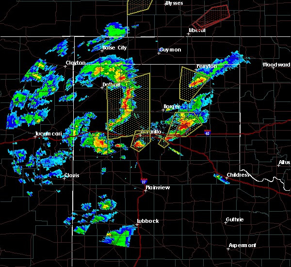 At 619 pm cst, a severe thunderstorm was located near canyon, moving northeast at 45 mph (radar indicated). Hazards include ping pong ball size hail and 60 mph wind gusts. People and animals outdoors will be injured. expect hail damage to roofs, siding, windows and vehicles. Minor wind damage to roofs, siding and trees is possible. At 619 pm cst, a severe thunderstorm was located near canyon, moving northeast at 45 mph (radar indicated). Hazards include ping pong ball size hail and 60 mph wind gusts. People and animals outdoors will be injured. expect hail damage to roofs, siding, windows and vehicles. Minor wind damage to roofs, siding and trees is possible.
|
| 8/19/2015 1:58 AM CDT |
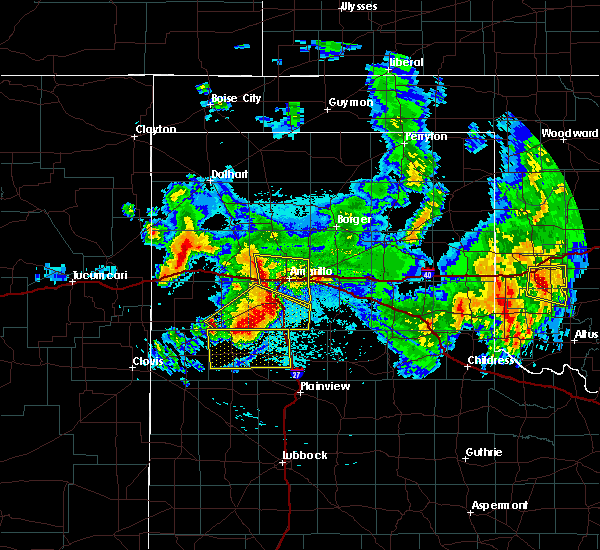 At 158 am cdt, severe thunderstorms were located along a line extending from 7 miles southeast of valley de oro to near bushland to near mescalero park, moving east at 35 mph (radar indicated). Hazards include 60 mph wind gusts and half dollar size hail. Hail damage to vehicles is expected. Minor wind damage to roofs, siding and trees is possible. At 158 am cdt, severe thunderstorms were located along a line extending from 7 miles southeast of valley de oro to near bushland to near mescalero park, moving east at 35 mph (radar indicated). Hazards include 60 mph wind gusts and half dollar size hail. Hail damage to vehicles is expected. Minor wind damage to roofs, siding and trees is possible.
|
| 7/17/2015 4:40 PM CDT |
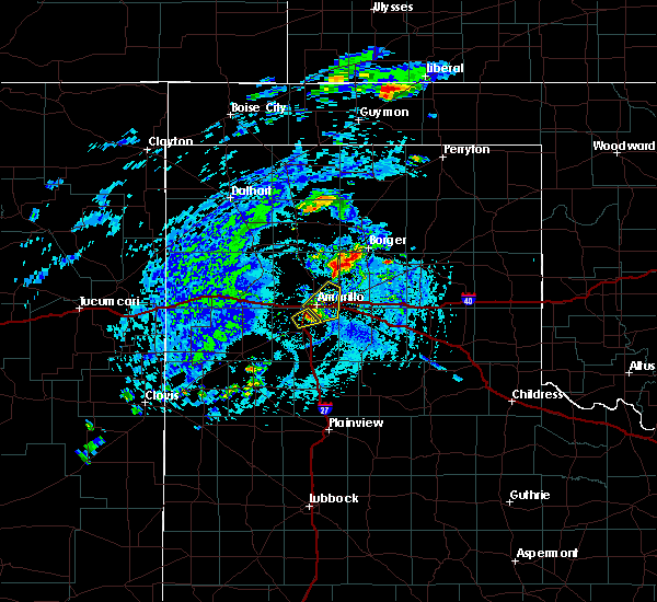 At 437 pm cdt, a severe thunderstorm was located 6 miles northwest of lake tanglewood, and moving northeast at 25 mph (radar indicated). Hazards include 60 mph wind gusts and nickel size hail. Minor damage to roofs. Siding and trees is possible. At 437 pm cdt, a severe thunderstorm was located 6 miles northwest of lake tanglewood, and moving northeast at 25 mph (radar indicated). Hazards include 60 mph wind gusts and nickel size hail. Minor damage to roofs. Siding and trees is possible.
|
| 7/17/2015 4:27 PM CDT |
 At 424 pm cdt, a severe thunderstorm was located 6 miles north of canyon, and moving northeast at 20 mph (radar indicated). Hazards include 60 mph wind gusts and nickel size hail. Minor damage to roofs. Siding and trees is possible. At 424 pm cdt, a severe thunderstorm was located 6 miles north of canyon, and moving northeast at 20 mph (radar indicated). Hazards include 60 mph wind gusts and nickel size hail. Minor damage to roofs. Siding and trees is possible.
|
| 7/17/2015 4:19 PM CDT |
 At 416 pm cdt, a severe thunderstorm was located 6 miles northwest of canyon, and moving northeast at 20 mph (radar indicated). Hazards include 60 mph wind gusts and quarter size hail. Hail damage to vehicles is expected. Minor wind damage to roofs, siding and trees is possible. At 416 pm cdt, a severe thunderstorm was located 6 miles northwest of canyon, and moving northeast at 20 mph (radar indicated). Hazards include 60 mph wind gusts and quarter size hail. Hail damage to vehicles is expected. Minor wind damage to roofs, siding and trees is possible.
|
| 7/17/2015 4:11 PM CDT |
 At 408 pm cdt, a severe thunderstorm was located 6 miles northeast of umbarger, and moving east at 25 mph (radar indicated). Hazards include 60 mph wind gusts and quarter size hail. Hail damage to vehicles is expected. Minor wind damage to roofs, siding and trees is possible. At 408 pm cdt, a severe thunderstorm was located 6 miles northeast of umbarger, and moving east at 25 mph (radar indicated). Hazards include 60 mph wind gusts and quarter size hail. Hail damage to vehicles is expected. Minor wind damage to roofs, siding and trees is possible.
|
| 7/8/2015 11:35 PM CDT |
 At 1133 pm cdt, a severe thunderstorm was located near lake tanglewood, and moving east at 30 mph (radar indicated). Hazards include 60 mph wind gusts and quarter size hail. Hail damage to vehicles is expected. Minor wind damage to roofs, siding and trees is possible. At 1133 pm cdt, a severe thunderstorm was located near lake tanglewood, and moving east at 30 mph (radar indicated). Hazards include 60 mph wind gusts and quarter size hail. Hail damage to vehicles is expected. Minor wind damage to roofs, siding and trees is possible.
|
| 7/8/2015 11:01 PM CDT |
 At 1058 pm cdt, a severe thunderstorm was located 6 miles southwest of bushland, and moving east at 25 mph (radar indicated). Hazards include 60 mph wind gusts and quarter size hail. Hail damage to vehicles is expected. Minor wind damage to roofs, siding and trees is possible. At 1058 pm cdt, a severe thunderstorm was located 6 miles southwest of bushland, and moving east at 25 mph (radar indicated). Hazards include 60 mph wind gusts and quarter size hail. Hail damage to vehicles is expected. Minor wind damage to roofs, siding and trees is possible.
|
| 7/8/2015 9:53 PM CDT |
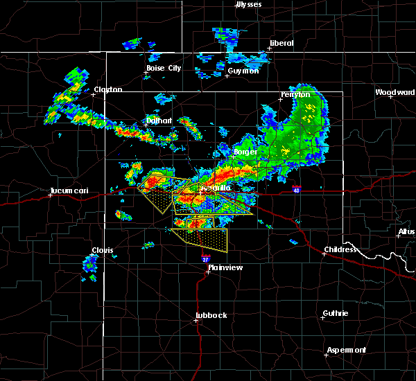 At 951 pm cdt, severe thunderstorms were located along a line extending from amarillo to 6 miles southeast of bushland, and moving southeast at 30 mph (emergency management. at 916 pm...golf ball size hail was reported 5 miles northeast of wildorado). Hazards include golf ball size hail and 60 mph wind gusts. People and animals outdoors will be injured. expect hail damage to roofs, siding, windows and vehicles. Minor wind damage to roofs, siding and trees is possible. At 951 pm cdt, severe thunderstorms were located along a line extending from amarillo to 6 miles southeast of bushland, and moving southeast at 30 mph (emergency management. at 916 pm...golf ball size hail was reported 5 miles northeast of wildorado). Hazards include golf ball size hail and 60 mph wind gusts. People and animals outdoors will be injured. expect hail damage to roofs, siding, windows and vehicles. Minor wind damage to roofs, siding and trees is possible.
|
| 7/8/2015 9:44 PM CDT |
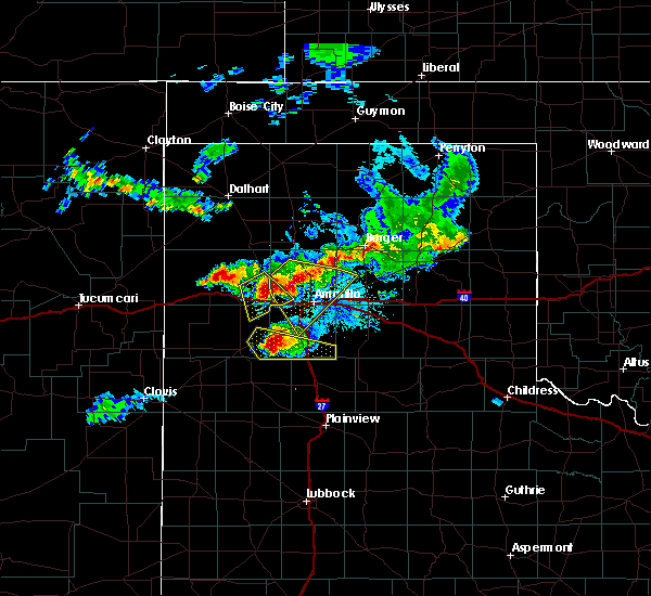 At 942 pm cdt, severe thunderstorms were located along a line extending from amarillo to bushland, and moving southeast at 30 mph (emergency management). Hazards include golf ball size hail and 60 mph wind gusts. People and animals outdoors will be injured. expect hail damage to roofs, siding, windows and vehicles. Minor wind damage to roofs, siding and trees is possible. At 942 pm cdt, severe thunderstorms were located along a line extending from amarillo to bushland, and moving southeast at 30 mph (emergency management). Hazards include golf ball size hail and 60 mph wind gusts. People and animals outdoors will be injured. expect hail damage to roofs, siding, windows and vehicles. Minor wind damage to roofs, siding and trees is possible.
|
| 7/8/2015 9:21 PM CDT |
 At 919 pm cdt, severe thunderstorms were located along a line extending from 11 miles northwest of amarillo to wildorado, and moving southeast at 20 mph (radar indicated). Hazards include 60 mph wind gusts and half dollar size hail. Hail damage to vehicles is expected. Minor wind damage to roofs, siding and trees is possible. At 919 pm cdt, severe thunderstorms were located along a line extending from 11 miles northwest of amarillo to wildorado, and moving southeast at 20 mph (radar indicated). Hazards include 60 mph wind gusts and half dollar size hail. Hail damage to vehicles is expected. Minor wind damage to roofs, siding and trees is possible.
|
| 7/8/2015 8:55 PM CDT |
 At 852 pm cdt, a severe thunderstorm was located 5 miles southeast of valley de oro, and moving southeast at 20 mph (radar indicated). Hazards include 60 mph wind gusts and half dollar size hail. Hail damage to vehicles is expected. Minor wind damage to roofs, siding and trees is possible. At 852 pm cdt, a severe thunderstorm was located 5 miles southeast of valley de oro, and moving southeast at 20 mph (radar indicated). Hazards include 60 mph wind gusts and half dollar size hail. Hail damage to vehicles is expected. Minor wind damage to roofs, siding and trees is possible.
|
| 7/8/2015 8:35 PM CDT |
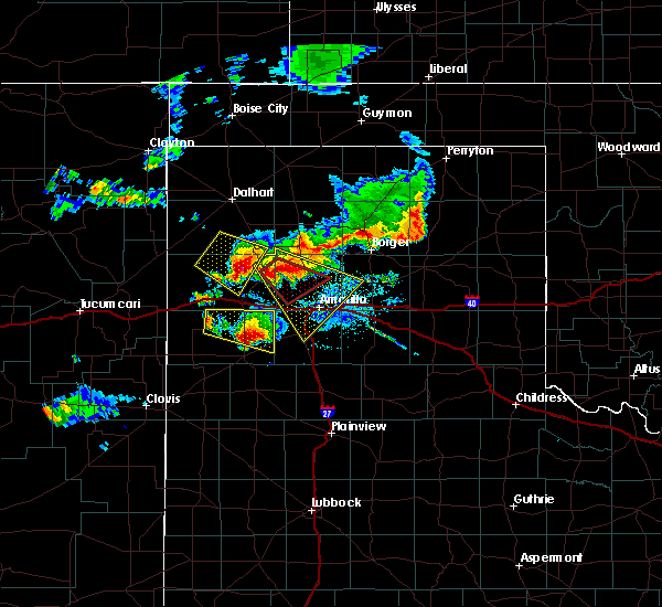 At 831 pm cdt, a severe thunderstorm was located near valley de oro, and moving southeast at 15 mph (trained weather spotters). Hazards include golf ball size hail and 60 mph wind gusts. People and animals outdoors will be injured. expect hail damage to roofs, siding, windows and vehicles. Minor wind damage to roofs, siding and trees is possible. At 831 pm cdt, a severe thunderstorm was located near valley de oro, and moving southeast at 15 mph (trained weather spotters). Hazards include golf ball size hail and 60 mph wind gusts. People and animals outdoors will be injured. expect hail damage to roofs, siding, windows and vehicles. Minor wind damage to roofs, siding and trees is possible.
|
| 7/8/2015 8:14 PM CDT |
 At 813 pm cdt, a severe thunderstorm was located near boys ranch, and moving southeast at 20 mph (trained weather spotters). Hazards include golf ball size hail and 60 mph wind gusts. People and animals outdoors will be injured. expect hail damage to roofs, siding, windows and vehicles. Minor wind damage to roofs, siding and trees is possible. At 813 pm cdt, a severe thunderstorm was located near boys ranch, and moving southeast at 20 mph (trained weather spotters). Hazards include golf ball size hail and 60 mph wind gusts. People and animals outdoors will be injured. expect hail damage to roofs, siding, windows and vehicles. Minor wind damage to roofs, siding and trees is possible.
|
| 7/3/2015 9:48 PM CDT |
 At 945 pm cdt, a severe thunderstorm was located 8 miles southwest of amarillo, and moving southwest at 20 mph (radar indicated). Hazards include 70 mph wind gusts and penny size hail. Expect some tree damage. damage is likely to mobile homes. Roofs and outbuildings. At 945 pm cdt, a severe thunderstorm was located 8 miles southwest of amarillo, and moving southwest at 20 mph (radar indicated). Hazards include 70 mph wind gusts and penny size hail. Expect some tree damage. damage is likely to mobile homes. Roofs and outbuildings.
|
| 7/3/2015 9:24 PM CDT |
 At 921 pm cdt, a severe thunderstorm was located near amarillo, and moving south at 30 mph (radar indicated). Hazards include 70 mph wind gusts and penny size hail. Expect some tree damage. Damage is likely to mobile homes, roofs and outbuildings. At 921 pm cdt, a severe thunderstorm was located near amarillo, and moving south at 30 mph (radar indicated). Hazards include 70 mph wind gusts and penny size hail. Expect some tree damage. Damage is likely to mobile homes, roofs and outbuildings.
|
| 7/3/2015 9:14 PM CDT |
 At 912 pm cdt, a severe thunderstorm was located near amarillo, and moving south at 30 mph (radar indicated). Hazards include 60 mph wind gusts and penny size hail. Minor damage to roofs. Siding and trees is possible. At 912 pm cdt, a severe thunderstorm was located near amarillo, and moving south at 30 mph (radar indicated). Hazards include 60 mph wind gusts and penny size hail. Minor damage to roofs. Siding and trees is possible.
|
| 7/3/2015 9:03 PM CDT |
 At 901 pm cdt, a severe thunderstorm was located near washburn, and moving south at 30 mph (radar indicated). Hazards include 60 mph wind gusts and penny size hail. Minor damage to roofs. Siding and trees is possible. At 901 pm cdt, a severe thunderstorm was located near washburn, and moving south at 30 mph (radar indicated). Hazards include 60 mph wind gusts and penny size hail. Minor damage to roofs. Siding and trees is possible.
|
| 7/3/2015 8:28 PM CDT |
 At 826 pm cdt, a severe thunderstorm was located 8 miles northwest of panhandle, and moving south at 30 mph (radar indicated). Hazards include 70 mph wind gusts and quarter size hail. Hail damage to vehicles is expected. expect some tree damage. Wind damage is also likely to mobile homes, roofs and outbuildings. At 826 pm cdt, a severe thunderstorm was located 8 miles northwest of panhandle, and moving south at 30 mph (radar indicated). Hazards include 70 mph wind gusts and quarter size hail. Hail damage to vehicles is expected. expect some tree damage. Wind damage is also likely to mobile homes, roofs and outbuildings.
|
| 7/3/2015 8:05 PM CDT |
 At 801 pm cdt, a severe thunderstorm was located near borger, and moving south at 30 mph (radar indicated). Hazards include 70 mph wind gusts and quarter size hail. Hail damage to vehicles is expected. expect some tree damage. Wind damage is also likely to mobile homes, roofs and outbuildings. At 801 pm cdt, a severe thunderstorm was located near borger, and moving south at 30 mph (radar indicated). Hazards include 70 mph wind gusts and quarter size hail. Hail damage to vehicles is expected. expect some tree damage. Wind damage is also likely to mobile homes, roofs and outbuildings.
|
| 7/3/2015 7:54 PM CDT |
 At 754 pm cdt, a severe thunderstorm was located near borger, and moving south at 30 mph (radar indicated). Hazards include 70 mph wind gusts and quarter size hail. Hail damage to vehicles is expected. expect some tree damage. Wind damage is also likely to mobile homes, roofs and outbuildings. At 754 pm cdt, a severe thunderstorm was located near borger, and moving south at 30 mph (radar indicated). Hazards include 70 mph wind gusts and quarter size hail. Hail damage to vehicles is expected. expect some tree damage. Wind damage is also likely to mobile homes, roofs and outbuildings.
|
| 7/3/2015 7:26 PM CDT |
 At 722 pm cdt, a severe thunderstorm was located 7 miles east of stinnett, and moving south at 45 mph (radar indicated). Hazards include 70 mph wind gusts and quarter size hail. Hail damage to vehicles is expected. expect some tree damage. Wind damage is also likely to mobile homes, roofs and outbuildings. At 722 pm cdt, a severe thunderstorm was located 7 miles east of stinnett, and moving south at 45 mph (radar indicated). Hazards include 70 mph wind gusts and quarter size hail. Hail damage to vehicles is expected. expect some tree damage. Wind damage is also likely to mobile homes, roofs and outbuildings.
|
| 6/14/2015 6:47 PM CDT |
 At 644 pm cdt, a severe thunderstorm was located near amarillo, and moving northeast at 25 mph (radar indicated). Hazards include 75 mph wind gusts and penny size hail. Expect some tree damage. Damage is likely to mobile homes, roofs and outbuildings. At 644 pm cdt, a severe thunderstorm was located near amarillo, and moving northeast at 25 mph (radar indicated). Hazards include 75 mph wind gusts and penny size hail. Expect some tree damage. Damage is likely to mobile homes, roofs and outbuildings.
|
| 6/14/2015 6:47 PM CDT |
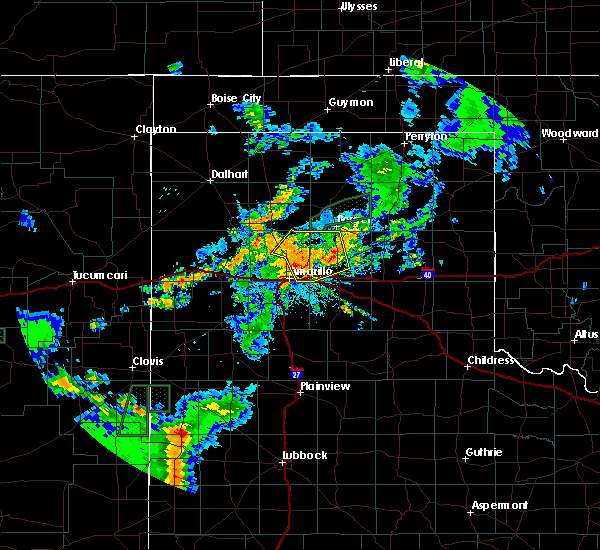 The national weather service in amarillo has issued a * severe thunderstorm warning for. western carson county in the panhandle of texas. potter county in the panhandle of texas. northern randall county in the panhandle of texas. Until 800 pm cdt. The national weather service in amarillo has issued a * severe thunderstorm warning for. western carson county in the panhandle of texas. potter county in the panhandle of texas. northern randall county in the panhandle of texas. Until 800 pm cdt.
|
| 6/14/2015 6:14 PM CDT |
 At 612 pm cdt, a severe thunderstorm was located 10 miles northwest of umbarger, and moving northeast at 30 mph (radar indicated). Hazards include 70 mph wind gusts and quarter size hail. Hail damage to vehicles is expected. expect some tree damage. Wind damage is also likely to mobile homes, roofs and outbuildings. At 612 pm cdt, a severe thunderstorm was located 10 miles northwest of umbarger, and moving northeast at 30 mph (radar indicated). Hazards include 70 mph wind gusts and quarter size hail. Hail damage to vehicles is expected. expect some tree damage. Wind damage is also likely to mobile homes, roofs and outbuildings.
|
| 5/28/2015 2:38 AM CDT | The severe thunderstorm warning for east central randall county will expire at 245 am cdt, the storm which prompted the warning has weakened below severe limits, and no longer poses an immediate threat to life or property. |
| 5/28/2015 2:21 AM CDT | At 219 am cdt, a severe thunderstorm was located near lake tanglewood, and moving east at 15 mph (radar indicated). Hazards include quarter size hail. damage to vehicles is possible |
| 5/28/2015 2:10 AM CDT | At 206 am cdt, a severe thunderstorm was located 5 miles west of lake tanglewood, and moving east at 10 mph (radar indicated). Hazards include ping pong ball size hail. People and animals outdoors will be injured. Expect damage to roofs, siding, windows and vehicles. |
| 5/28/2015 2:02 AM CDT | At 201 am cdt, a severe thunderstorm was located 5 miles north of canyon, and moving east at 15 mph (trained weather spotters). Hazards include half dollar size hail. damage to vehicles is expected |
| 5/27/2015 11:57 PM CDT | At 1154 pm cdt, a severe thunderstorm was located 6 miles southeast of canyon, and moving east at 20 mph (radar indicated). Hazards include ping pong ball size hail and 60 mph wind gusts. People and animals outdoors will be injured. expect hail damage to roofs, siding, windows and vehicles. Minor wind damage to roofs, siding and trees is possible. |
| 5/27/2015 11:40 PM CDT | At 1137 pm cdt, a severe thunderstorm was located near canyon, and moving northeast at 15 mph (trained weather spotters). Hazards include hail up to golf ball size. People and animals outdoors will be injured. Expect damage to roofs, siding, windows and vehicles. |
| 5/27/2015 11:32 PM CDT | At 1130 pm cdt, a severe thunderstorm was located near canyon, and moving northeast at 15 mph (public). Hazards include golf ball size hail. People and animals outdoors will be injured. Expect damage to roofs, siding, windows and vehicles. |
| 5/27/2015 11:20 PM CDT | At 1118 pm cdt, a severe thunderstorm was located near canyon, and moving northeast at 10 mph (radar indicated). Hazards include half dollar size hail. damage to vehicles is expected |
| 5/27/2015 11:02 PM CDT | At 1100 pm cdt, a severe thunderstorm was located near canyon, and moving northeast at 10 mph (radar indicated). Hazards include half dollar size hail. damage to vehicles is expected |
| 5/23/2015 3:31 PM CDT | At 328 pm cdt, a severe thunderstorm was located near lake tanglewood, and moving northeast at 35 mph (radar indicated). Hazards include 60 mph wind gusts. Minor damage to roofs. Siding and trees is possible. |
| 5/23/2015 3:22 PM CDT | At 320 pm cdt, a severe thunderstorm was located near lake tanglewood, and moving northeast at 35 mph (radar indicated). Hazards include 60 mph wind gusts and penny size hail. Minor damage to roofs. Siding and trees is possible. |
| 5/23/2015 3:12 PM CDT | At 310 pm cdt, a severe thunderstorm was located near canyon, and moving northeast at 35 mph (radar indicated). Hazards include 60 mph wind gusts and quarter size hail. Hail damage to vehicles is expected. Minor wind damage to roofs, siding and trees is possible. |
| 5/23/2015 5:44 AM CDT | At 544 am cdt, severe thunderstorms were located along a line extending from 10 miles west of panhandle to washburn to palo duro canyon, and moving east at 40 mph (radar indicated). Hazards include 60 mph wind gusts and quarter size hail. Hail damage to vehicles is expected. Minor wind damage to roofs, siding and trees is possible. |
| 5/23/2015 5:24 AM CDT | At 523 am cdt, severe thunderstorms were located along a line extending from 9 miles north of amarillo to 5 miles southeast of amarillo to canyon, and moving east at 40 mph (radar indicated. a 64 mph thunderstorm wind gust was reported at tradewind elementary school at 5:18 am). Hazards include 65 mph wind gusts and quarter size hail. Hail damage to vehicles is expected. Minor wind damage to roofs, siding and trees is possible. |
| 5/23/2015 5:09 AM CDT | At 509 am cdt, severe thunderstorms were located along a line extending from 11 miles northwest of amarillo to 6 miles southwest of amarillo to canyon, and moving east at 40 mph (radar indicated). Hazards include 65 mph wind gusts and quarter size hail. Hail damage to vehicles is expected. Minor wind damage to roofs, siding and trees is possible. |
| 5/19/2015 4:42 PM CDT | The severe thunderstorm warning for northeastern randall county will expire at 445 pm cdt, the storm which prompted the warning has weakened and moved out of the warned area. hail up to nickel size is still possible with this thunderstorm. |
| 5/19/2015 4:27 PM CDT | At 424 pm cdt, a severe thunderstorm was located near lake tanglewood, and moving east at 25 mph (radar indicated). Hazards include 60 mph wind gusts and half dollar size hail. Hail damage to vehicles is expected. Minor wind damage to roofs, siding and trees is possible. |
| 5/19/2015 4:20 PM CDT | At 416 pm cdt, a severe thunderstorm was located near lake tanglewood, and moving east at 45 mph (trained weather spotters). Hazards include 60 mph wind gusts and quarter size hail. Hail damage to vehicles is expected. Minor wind damage to roofs, siding and trees is possible. |
| 5/19/2015 4:10 PM CDT | At 408 pm cdt, a severe thunderstorm was located 5 miles north of canyon, and moving east at 35 mph (trained weather spotters). Hazards include 60 mph wind gusts and half dollar size hail. Hail damage to vehicles is expected. Minor wind damage to roofs, siding and trees is possible. |
| 5/19/2015 4:05 PM CDT | At 403 pm cdt, a severe thunderstorm was located near canyon, and moving east at 35 mph (radar indicated). Hazards include half dollar size hail. damage to vehicles is expected |
| 5/5/2015 6:08 PM CDT | At 605 pm cdt, severe thunderstorms were located along a line extending from 8 miles south of wildorado to 5 miles south of buffalo lake, and moving northeast at 40 mph (radar indicated). Hazards include 60 mph wind gusts and quarter size hail. Hail damage to vehicles is expected. Minor wind damage to roofs, siding and trees is possible. |
| 4/16/2015 3:24 PM CDT | At 322 pm cdt, a severe thunderstorm was located near lake tanglewood, and moving north at 30 mph (radar indicated). Hazards include quarter size hail. damage to vehicles is expected |
| 4/16/2015 3:12 PM CDT | At 309 pm cdt, a severe thunderstorm was located near lake tanglewood, and moving north at 30 mph (radar indicated). Hazards include ping pong ball size hail and 60 mph wind gusts. People and animals outdoors will be injured. expect hail damage to roofs, siding, windows and vehicles. Minor wind damage to roofs, siding and trees is possible. |
| 4/16/2015 2:42 PM CDT | At 240 pm cdt, a severe thunderstorm was located 6 miles northwest of lake tanglewood, and moving northeast at 15 mph (radar indicated). Hazards include ping pong ball size hail and 60 mph wind gusts. People and animals outdoors will be injured. expect hail damage to roofs, siding, windows and vehicles. Minor wind damage to roofs, siding and trees is possible. |
| 4/16/2015 2:32 PM CDT | At 229 pm cdt, a severe thunderstorm was located 6 miles west of lake tanglewood, and moving northeast at 15 mph (radar indicated). Hazards include 60 mph wind gusts and half dollar size hail. Hail damage to vehicles is expected. Minor wind damage to roofs, siding and trees is possible. |
Hail Maps for Palisades, TX
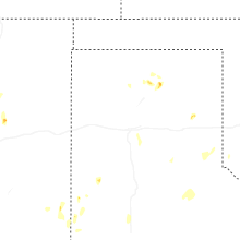
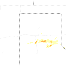
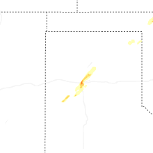
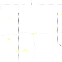
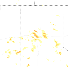
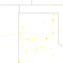
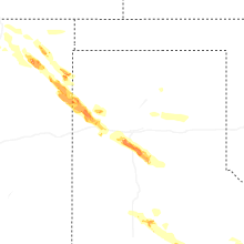
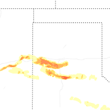
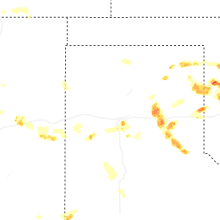


Connect with Interactive Hail Maps