

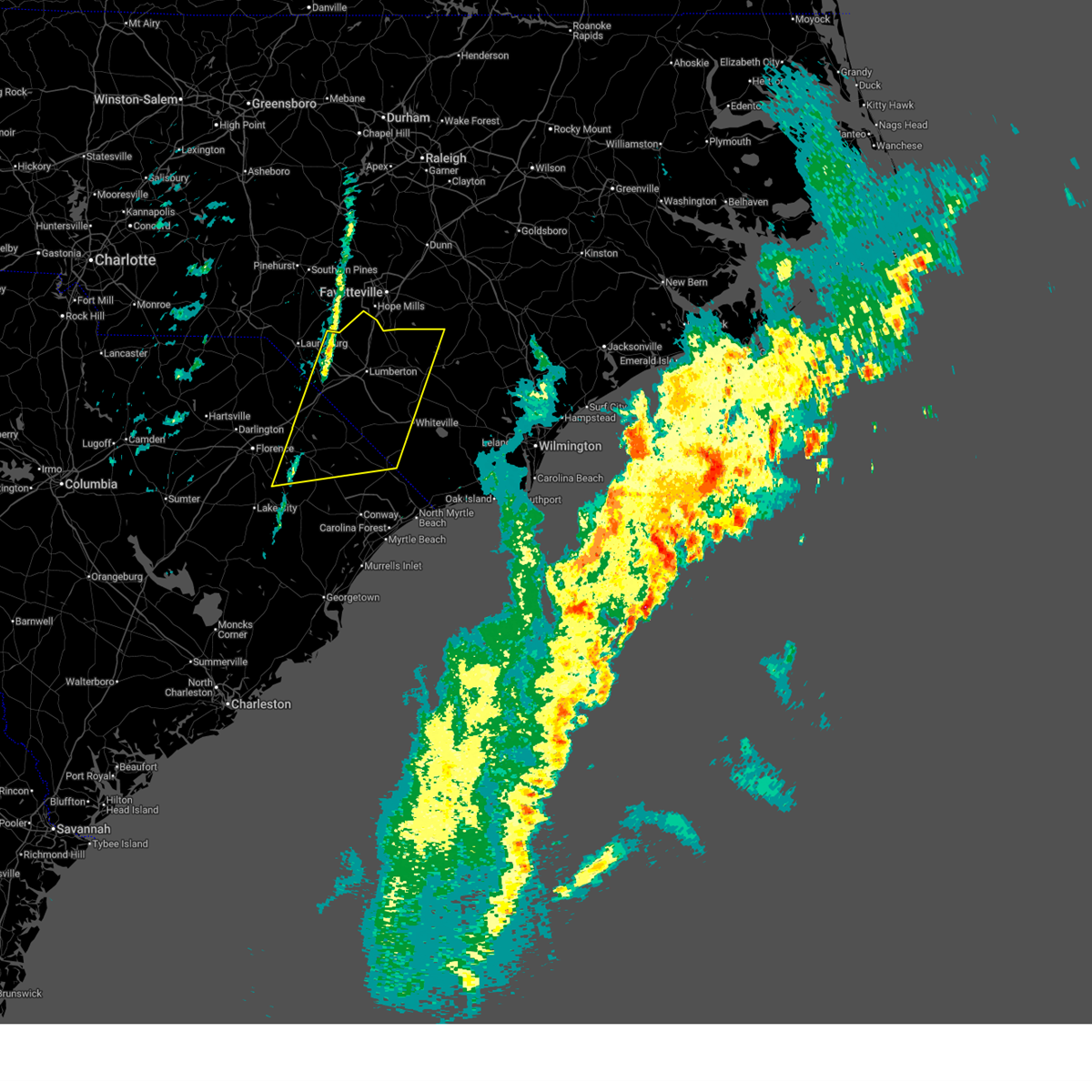
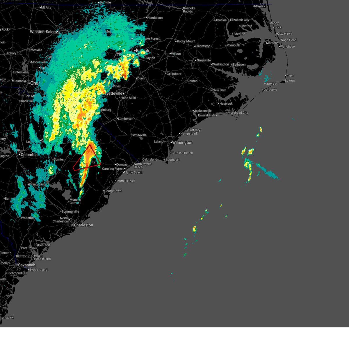
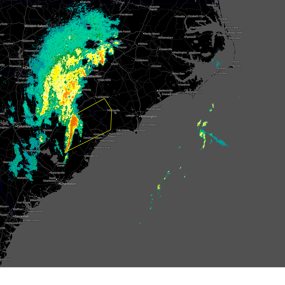
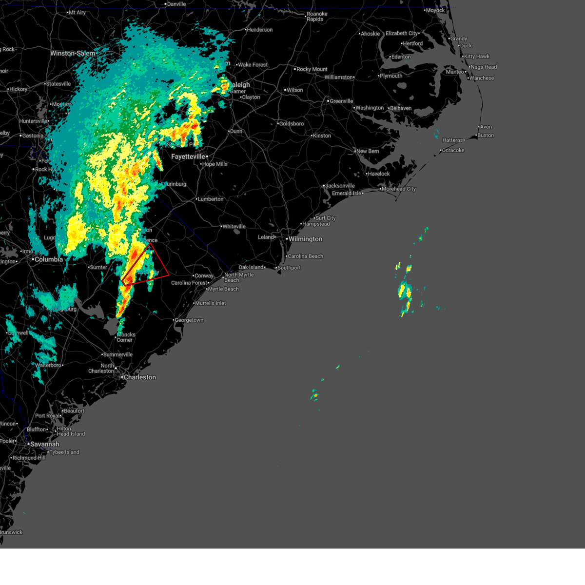
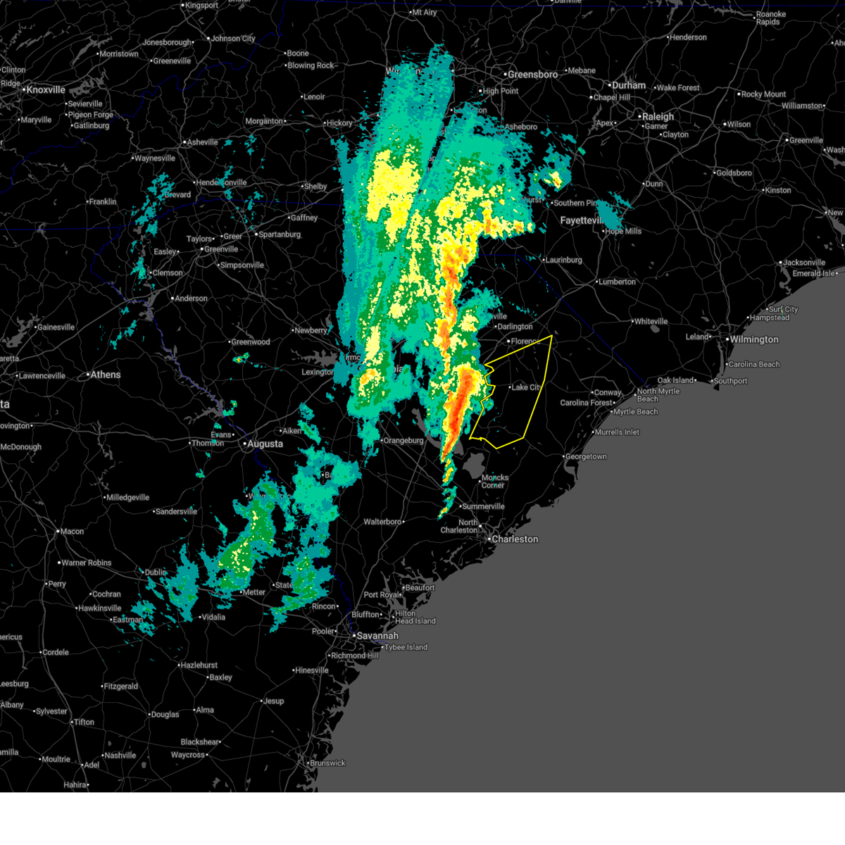
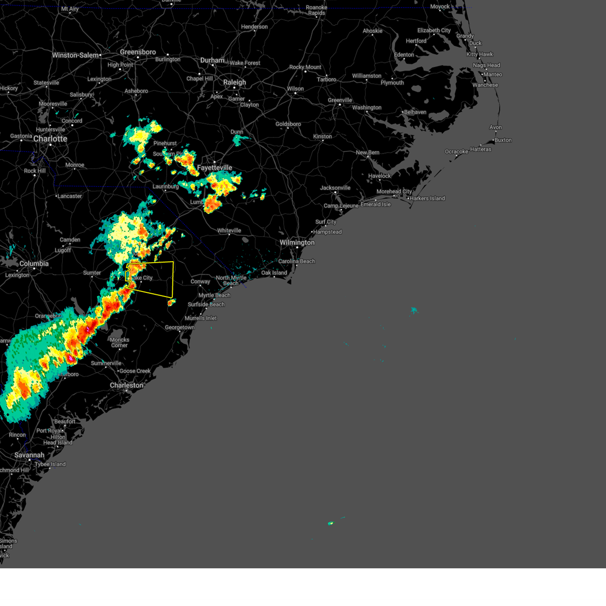
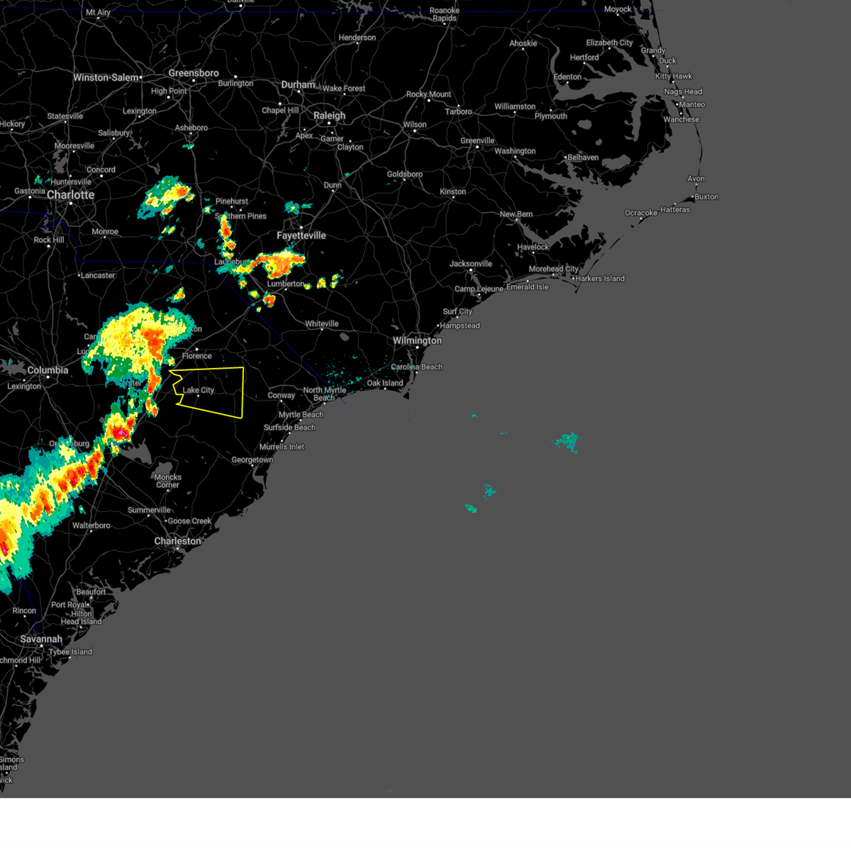
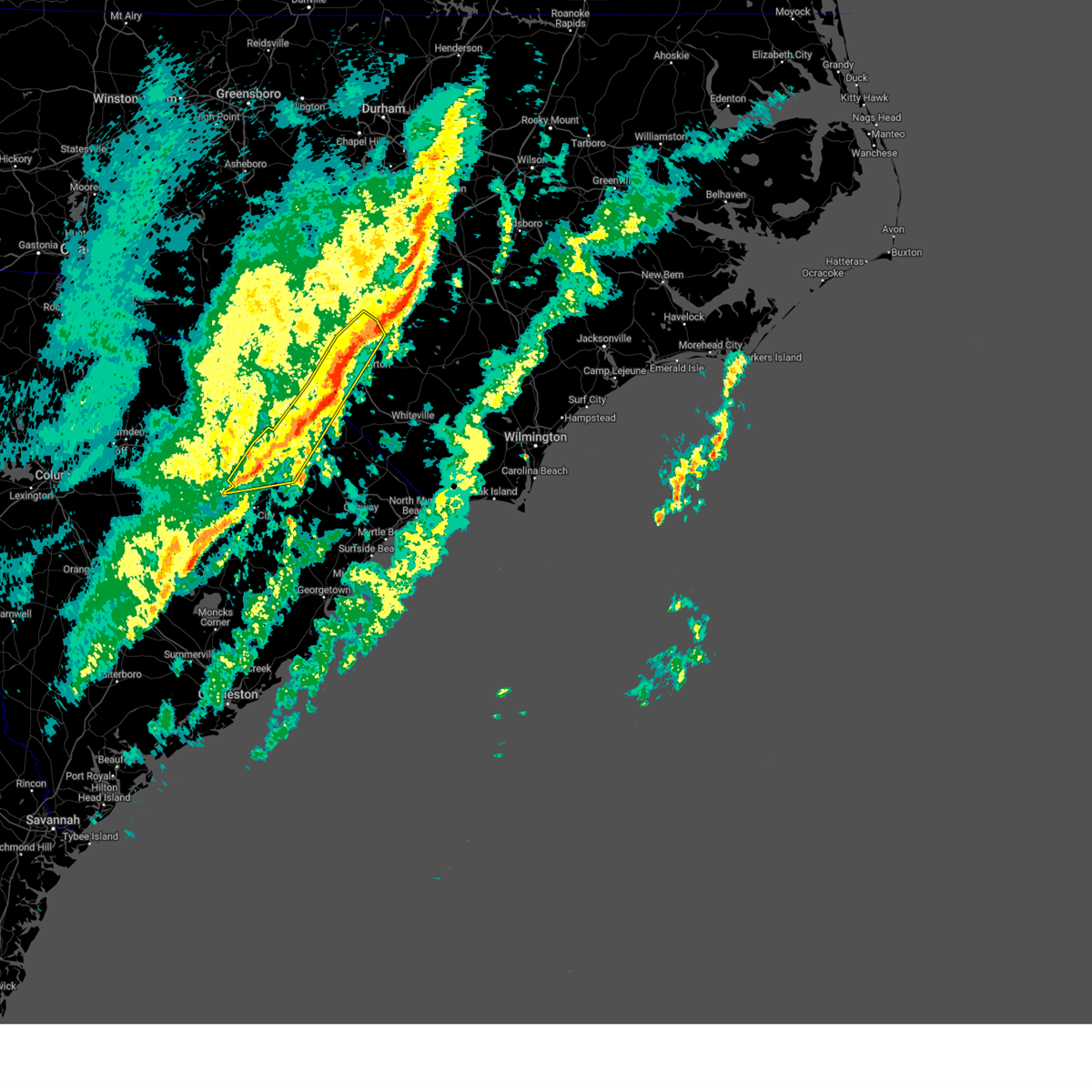
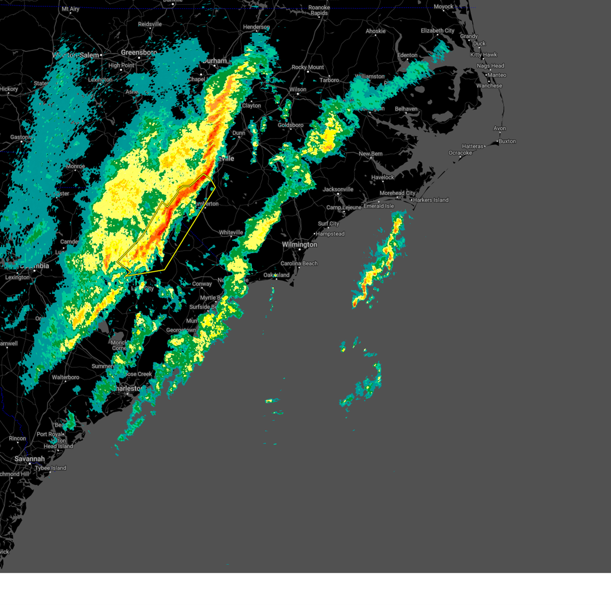
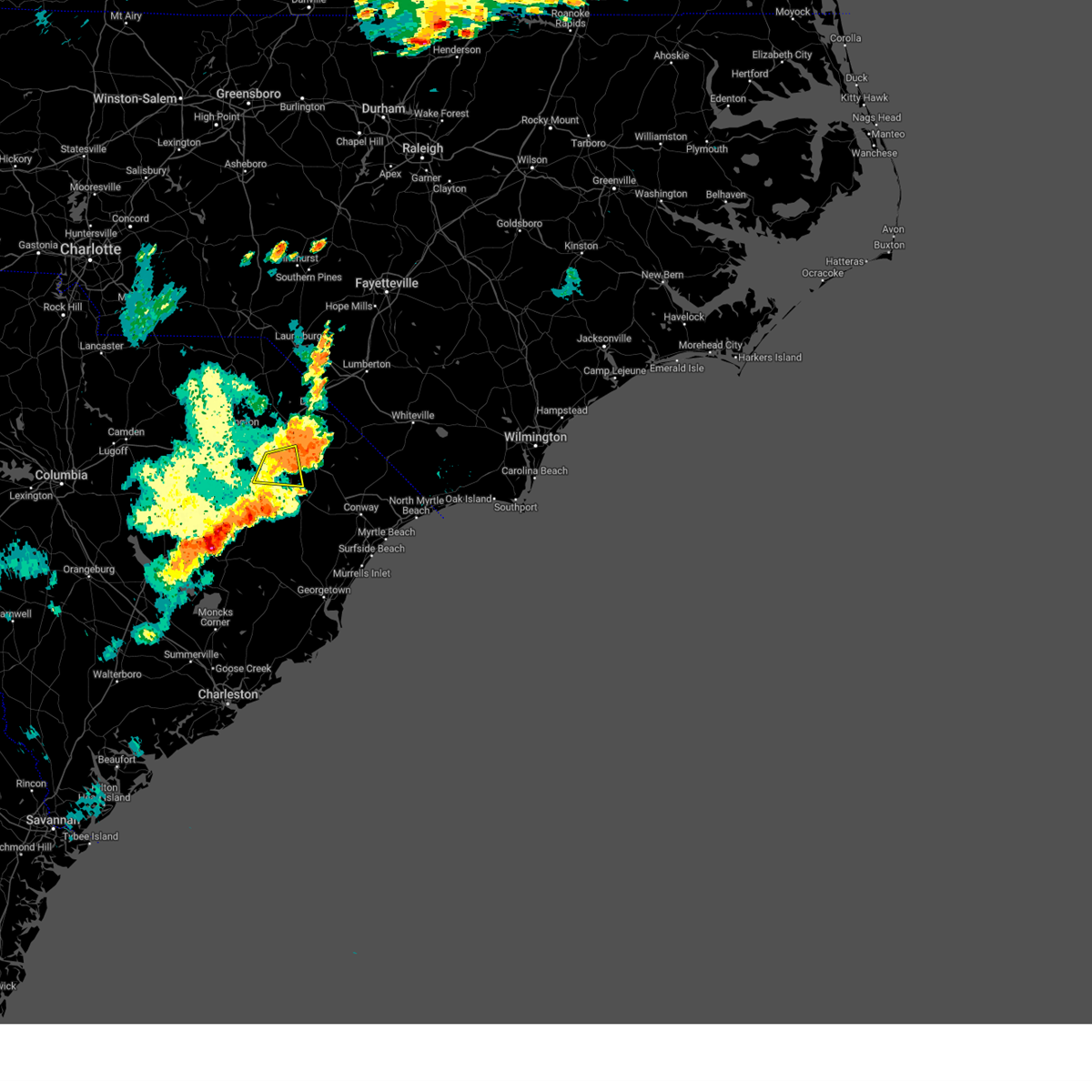
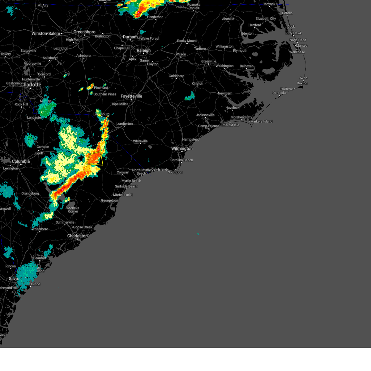
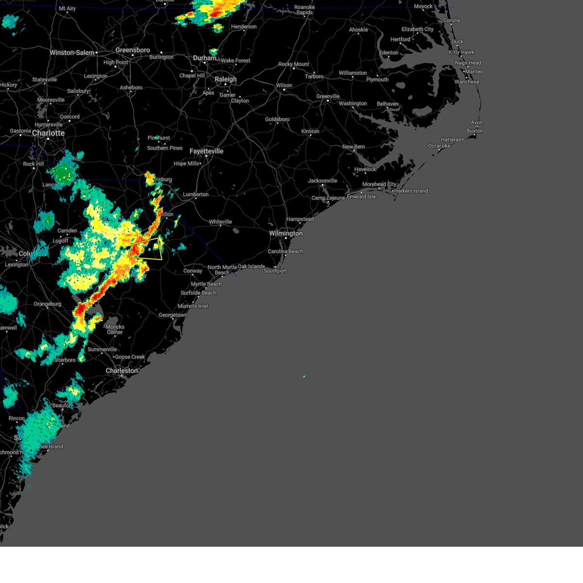
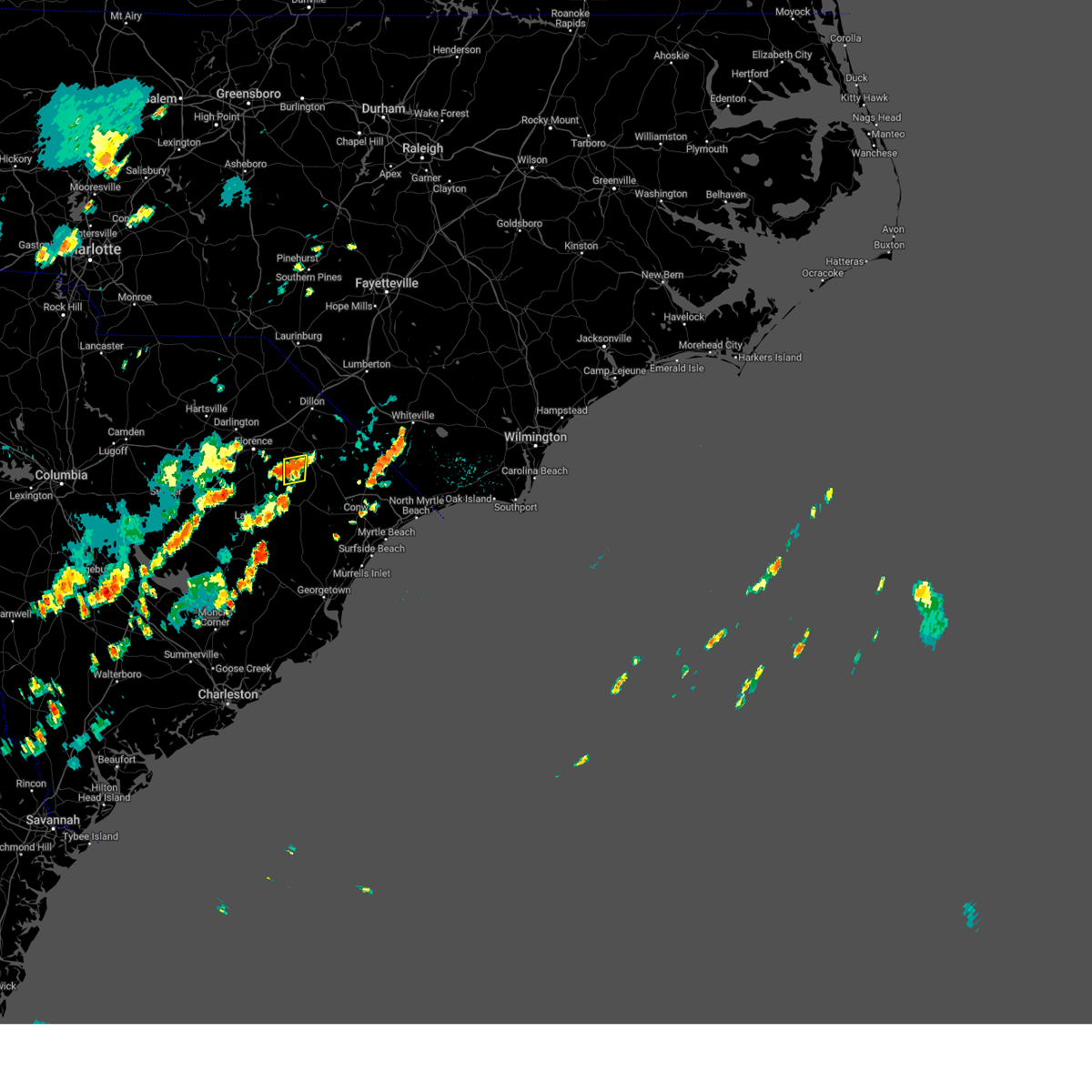
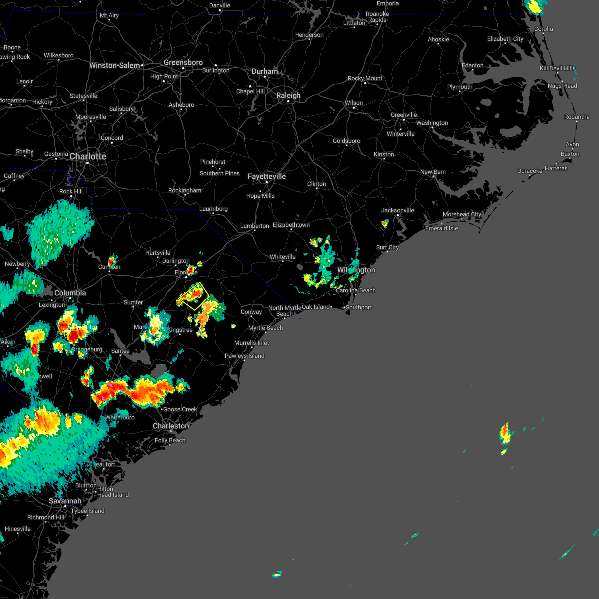
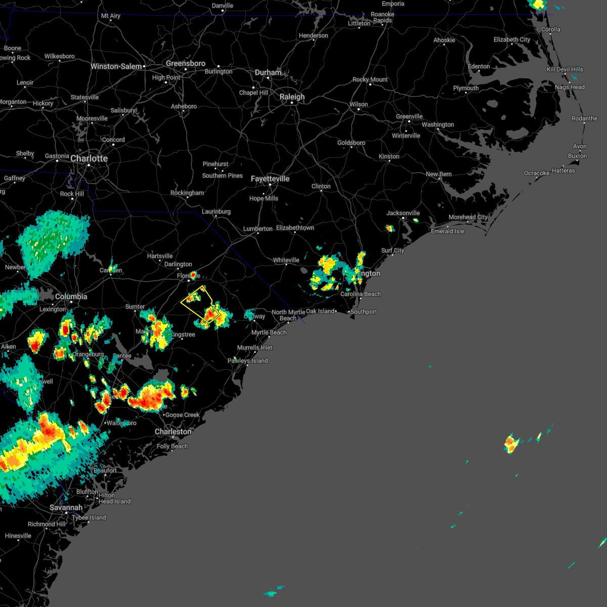
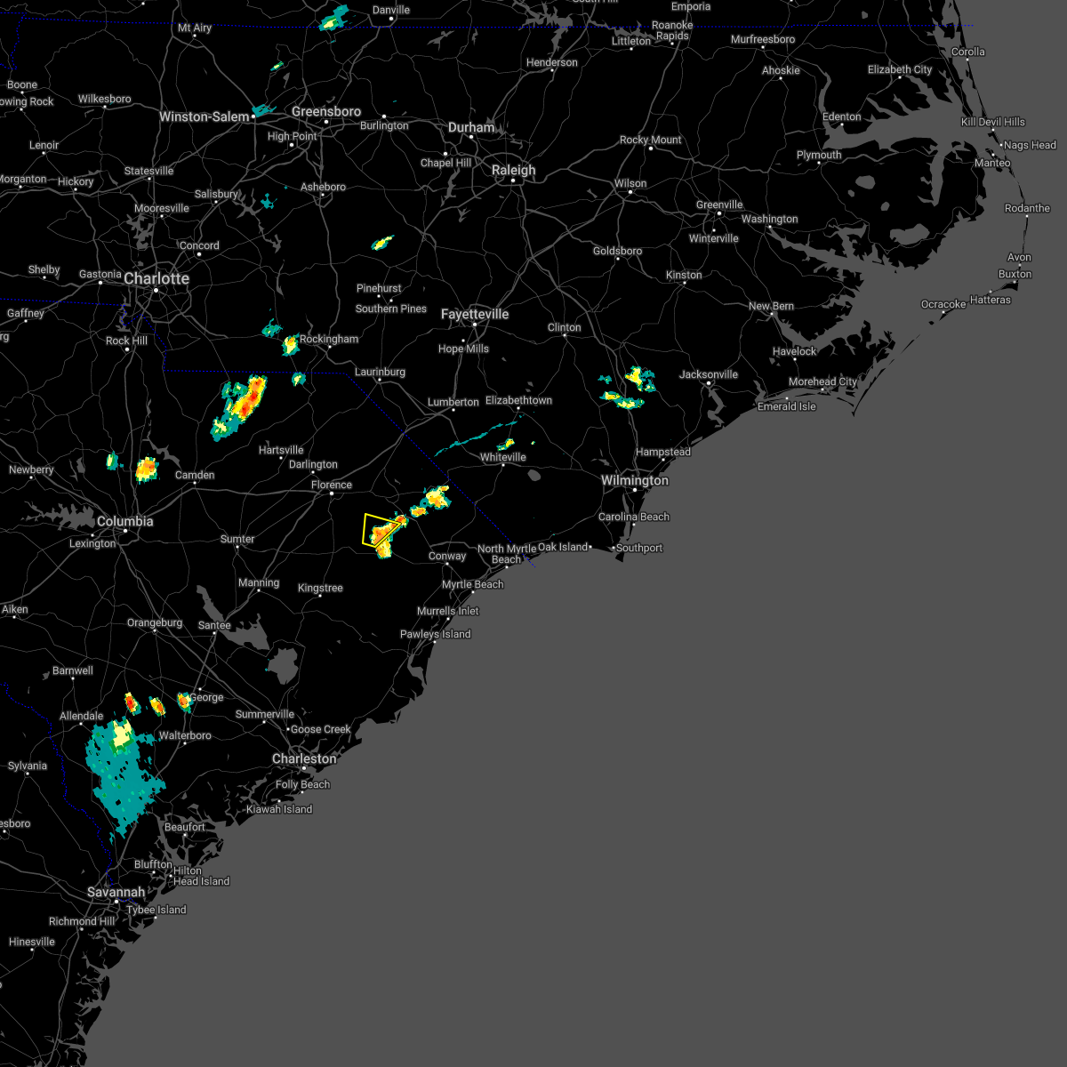
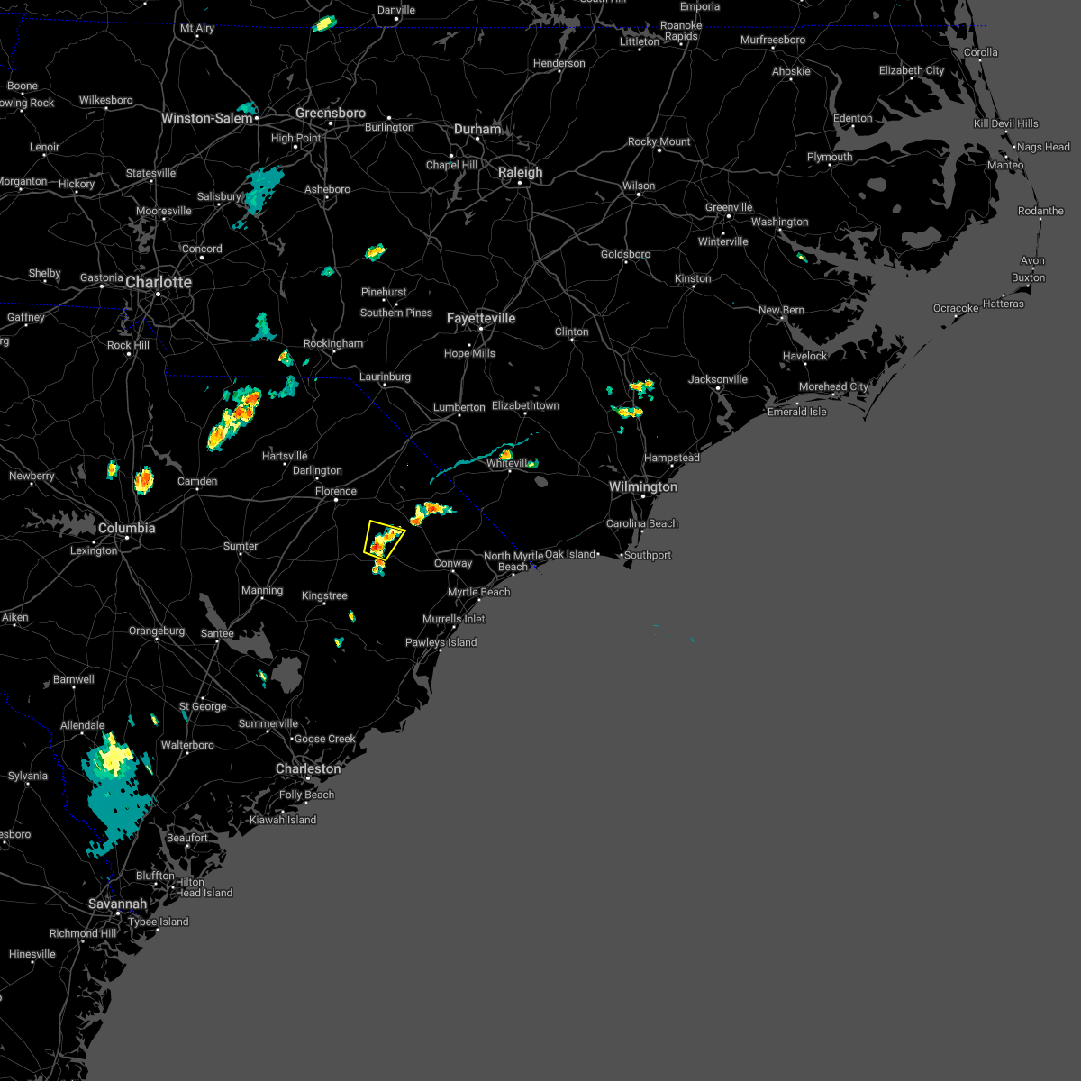
Hail Map for Pamplico, SC
The Pamplico, SC area has had 6 reports of on-the-ground hail by trained spotters, and has been under severe weather warnings 6 times during the past 12 months. Doppler radar has detected hail at or near Pamplico, SC on 48 occasions.
| Name: | Pamplico, SC |
| Where Located: | 60.6 miles NNE of Charleston, SC |
| Map: | Google Map for Pamplico, SC |
| Population: | 1226 |
| Housing Units: | 497 |
| More Info: | Search Google for Pamplico, SC |
0
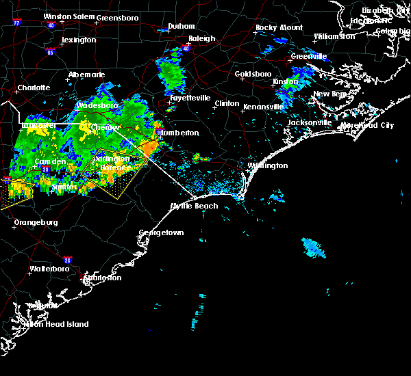
The Top Recent Hail Date for Pamplico, SC is Sunday, June 8, 2025 (31st out of 48)

Hail and Wind Damage Spotted near Pamplico, SC
| Date / Time | Report Details |
|---|---|
| 3/16/2026 6:17 PM EDT |
 Svrilm the national weather service in wilmington has issued a * severe thunderstorm warning for, robeson county in southeastern north carolina, western bladen county in southeastern north carolina, northwestern columbus county in southeastern north carolina, central florence county in northeastern south carolina, dillon county in northeastern south carolina, northwestern horry county in northeastern south carolina, marion county in northeastern south carolina, * until 730 pm edt. * at 616 pm edt, showers producing strong wind gusts were located along a line extending from near antioch to dillon to near blue brick, moving east at 35 mph (radar indicated. at 5:53 pm the florence airport reported a gust of 58 mph). Hazards include 60 mph wind gusts. expect wind damage to trees and power lines Svrilm the national weather service in wilmington has issued a * severe thunderstorm warning for, robeson county in southeastern north carolina, western bladen county in southeastern north carolina, northwestern columbus county in southeastern north carolina, central florence county in northeastern south carolina, dillon county in northeastern south carolina, northwestern horry county in northeastern south carolina, marion county in northeastern south carolina, * until 730 pm edt. * at 616 pm edt, showers producing strong wind gusts were located along a line extending from near antioch to dillon to near blue brick, moving east at 35 mph (radar indicated. at 5:53 pm the florence airport reported a gust of 58 mph). Hazards include 60 mph wind gusts. expect wind damage to trees and power lines
|
| 3/12/2026 12:03 PM EDT |
 the tornado warning has been cancelled and is no longer in effect the tornado warning has been cancelled and is no longer in effect
|
| 3/12/2026 12:00 PM EDT |
 Svrilm the national weather service in wilmington has issued a * severe thunderstorm warning for, southeastern robeson county in southeastern north carolina, southwestern bladen county in southeastern north carolina, columbus county in southeastern north carolina, eastern florence county in northeastern south carolina, north central georgetown county in northeastern south carolina, southeastern dillon county in northeastern south carolina, horry county in northeastern south carolina, marion county in northeastern south carolina, northeastern williamsburg county in northeastern south carolina, * until 1245 pm edt. * at 1159 am edt, severe thunderstorms were located along a line extending from near sellers to near kingsburg to near trio, moving northeast at 55 mph (radar indicated). Hazards include 60 mph wind gusts. expect wind damage to trees and power lines Svrilm the national weather service in wilmington has issued a * severe thunderstorm warning for, southeastern robeson county in southeastern north carolina, southwestern bladen county in southeastern north carolina, columbus county in southeastern north carolina, eastern florence county in northeastern south carolina, north central georgetown county in northeastern south carolina, southeastern dillon county in northeastern south carolina, horry county in northeastern south carolina, marion county in northeastern south carolina, northeastern williamsburg county in northeastern south carolina, * until 1245 pm edt. * at 1159 am edt, severe thunderstorms were located along a line extending from near sellers to near kingsburg to near trio, moving northeast at 55 mph (radar indicated). Hazards include 60 mph wind gusts. expect wind damage to trees and power lines
|
| 3/12/2026 11:40 AM EDT |
 Torilm the national weather service in wilmington has issued a * tornado warning for, southeastern florence county in northeastern south carolina, west central marion county in northeastern south carolina, north central williamsburg county in northeastern south carolina, * until 1215 pm edt. * at 1139 am edt, a severe thunderstorm capable of producing a tornado was located over hebron, or 7 miles north of kingstree, moving northeast at 55 mph (radar indicated rotation). Hazards include tornado. Flying debris will be dangerous to those caught without shelter. mobile homes will be damaged or destroyed. damage to roofs, windows, and vehicles will occur. tree damage is likely. this dangerous storm will be near, lake city and cades around 1145 am edt. hannah around 1155 am edt. gresham around 1205 pm edt. Other locations impacted by this tornadic thunderstorm include coward and scranton. Torilm the national weather service in wilmington has issued a * tornado warning for, southeastern florence county in northeastern south carolina, west central marion county in northeastern south carolina, north central williamsburg county in northeastern south carolina, * until 1215 pm edt. * at 1139 am edt, a severe thunderstorm capable of producing a tornado was located over hebron, or 7 miles north of kingstree, moving northeast at 55 mph (radar indicated rotation). Hazards include tornado. Flying debris will be dangerous to those caught without shelter. mobile homes will be damaged or destroyed. damage to roofs, windows, and vehicles will occur. tree damage is likely. this dangerous storm will be near, lake city and cades around 1145 am edt. hannah around 1155 am edt. gresham around 1205 pm edt. Other locations impacted by this tornadic thunderstorm include coward and scranton.
|
| 3/12/2026 11:20 AM EDT |
 Svrilm the national weather service in wilmington has issued a * severe thunderstorm warning for, florence county in northeastern south carolina, northwestern marion county in northeastern south carolina, williamsburg county in northeastern south carolina, * until noon edt. * at 1119 am edt, severe thunderstorms were located along a line extending from 7 miles southwest of cartersville to near manning to 7 miles east of holly hill, moving northeast at 50 mph (radar indicated). Hazards include 60 mph wind gusts. expect wind damage to trees and power lines Svrilm the national weather service in wilmington has issued a * severe thunderstorm warning for, florence county in northeastern south carolina, northwestern marion county in northeastern south carolina, williamsburg county in northeastern south carolina, * until noon edt. * at 1119 am edt, severe thunderstorms were located along a line extending from 7 miles southwest of cartersville to near manning to 7 miles east of holly hill, moving northeast at 50 mph (radar indicated). Hazards include 60 mph wind gusts. expect wind damage to trees and power lines
|
| 6/25/2025 6:43 PM EDT |
 Svrilm the national weather service in wilmington has issued a * severe thunderstorm warning for, florence county in northeastern south carolina, southern darlington county in northeastern south carolina, * until 745 pm edt. * at 642 pm edt, severe thunderstorms were located along a line extending from kellytown to near quinby, moving south at 30 mph (trained weather spotters). Hazards include 60 mph wind gusts and quarter size hail. Minor hail damage to vehicles is possible. Expect wind damage to trees and power lines. Svrilm the national weather service in wilmington has issued a * severe thunderstorm warning for, florence county in northeastern south carolina, southern darlington county in northeastern south carolina, * until 745 pm edt. * at 642 pm edt, severe thunderstorms were located along a line extending from kellytown to near quinby, moving south at 30 mph (trained weather spotters). Hazards include 60 mph wind gusts and quarter size hail. Minor hail damage to vehicles is possible. Expect wind damage to trees and power lines.
|
| 6/8/2025 12:54 PM EDT |
 The storm which prompted the warning has moved out of the area. therefore, the warning will be allowed to expire. a severe thunderstorm watch remains in effect until 500 pm edt for northeastern south carolina. please send your reports of hail and/or wind damage, including trees or large limbs downed, by calling the national weather service office in wilmington at 1-800-697-3901. The storm which prompted the warning has moved out of the area. therefore, the warning will be allowed to expire. a severe thunderstorm watch remains in effect until 500 pm edt for northeastern south carolina. please send your reports of hail and/or wind damage, including trees or large limbs downed, by calling the national weather service office in wilmington at 1-800-697-3901.
|
| 6/8/2025 12:52 PM EDT |
 Svrilm the national weather service in wilmington has issued a * severe thunderstorm warning for, southeastern florence county in northeastern south carolina, north central georgetown county in northeastern south carolina, horry county in northeastern south carolina, central marion county in northeastern south carolina, northeastern williamsburg county in northeastern south carolina, * until 145 pm edt. * at 1252 pm edt, a severe thunderstorm was located near gresham, or 14 miles south of marion, moving east at 40 mph (radar indicated). Hazards include 60 mph wind gusts and quarter size hail. Minor hail damage to vehicles is possible. Expect wind damage to trees and power lines. Svrilm the national weather service in wilmington has issued a * severe thunderstorm warning for, southeastern florence county in northeastern south carolina, north central georgetown county in northeastern south carolina, horry county in northeastern south carolina, central marion county in northeastern south carolina, northeastern williamsburg county in northeastern south carolina, * until 145 pm edt. * at 1252 pm edt, a severe thunderstorm was located near gresham, or 14 miles south of marion, moving east at 40 mph (radar indicated). Hazards include 60 mph wind gusts and quarter size hail. Minor hail damage to vehicles is possible. Expect wind damage to trees and power lines.
|
| 6/8/2025 12:48 PM EDT |
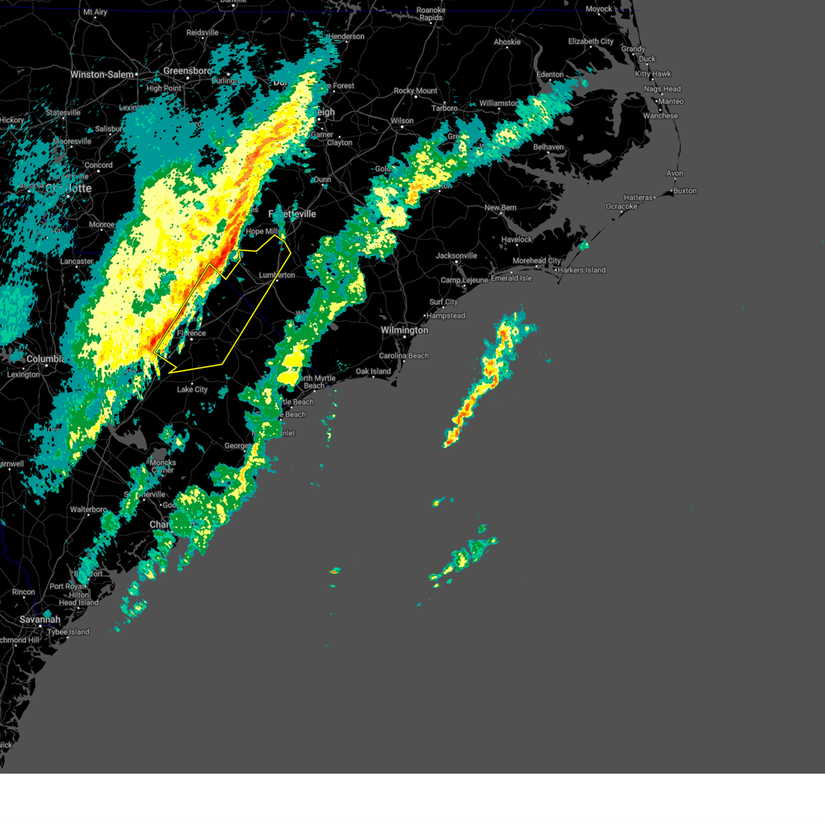
 At 1248 pm edt, a severe thunderstorm was located near pamplico, or 14 miles south of marion, moving east at 35 mph (radar indicated). Hazards include 60 mph wind gusts and quarter size hail. Minor hail damage to vehicles is possible. expect wind damage to trees and power lines. Locations impacted include, johnsonville, pamplico, hemingway, gresham, hyman, hannah, poston, kingsburg, and stuckey. At 1248 pm edt, a severe thunderstorm was located near pamplico, or 14 miles south of marion, moving east at 35 mph (radar indicated). Hazards include 60 mph wind gusts and quarter size hail. Minor hail damage to vehicles is possible. expect wind damage to trees and power lines. Locations impacted include, johnsonville, pamplico, hemingway, gresham, hyman, hannah, poston, kingsburg, and stuckey.
|
| 6/8/2025 12:44 PM EDT |
 At 1244 pm edt, a severe thunderstorm was located over pamplico, or 13 miles northeast of lake city, moving east at 35 mph (radar indicated). Hazards include 60 mph wind gusts. Expect wind damage to trees and power lines. Locations impacted include, lake city, johnsonville, pamplico, hemingway, hyman, hannah, cades, poston, gresham, friendfield, kingsburg, scranton, coward, and stuckey. At 1244 pm edt, a severe thunderstorm was located over pamplico, or 13 miles northeast of lake city, moving east at 35 mph (radar indicated). Hazards include 60 mph wind gusts. Expect wind damage to trees and power lines. Locations impacted include, lake city, johnsonville, pamplico, hemingway, hyman, hannah, cades, poston, gresham, friendfield, kingsburg, scranton, coward, and stuckey.
|
| 6/8/2025 12:23 PM EDT |
 At 1223 pm edt, a severe thunderstorm was located near lake city, moving east at 35 mph (radar indicated). Hazards include 60 mph wind gusts. Expect wind damage to trees and power lines. Locations impacted include, lake city, johnsonville, pamplico, hemingway, hyman, hannah, cades, poston, gresham, hebron, friendfield, new hope, kingsburg, effingham, scranton, coward, olanta, stuckey, and central crossroads. At 1223 pm edt, a severe thunderstorm was located near lake city, moving east at 35 mph (radar indicated). Hazards include 60 mph wind gusts. Expect wind damage to trees and power lines. Locations impacted include, lake city, johnsonville, pamplico, hemingway, hyman, hannah, cades, poston, gresham, hebron, friendfield, new hope, kingsburg, effingham, scranton, coward, olanta, stuckey, and central crossroads.
|
| 6/8/2025 11:59 AM EDT |
 Svrilm the national weather service in wilmington has issued a * severe thunderstorm warning for, southern florence county in northeastern south carolina, west central marion county in northeastern south carolina, northeastern williamsburg county in northeastern south carolina, * until 100 pm edt. * at 1159 am edt, a severe thunderstorm was located near woods bay state park, or 15 miles east of south sumter, moving east at 35 mph (radar indicated). Hazards include 60 mph wind gusts and penny size hail. expect wind damage to trees and power lines Svrilm the national weather service in wilmington has issued a * severe thunderstorm warning for, southern florence county in northeastern south carolina, west central marion county in northeastern south carolina, northeastern williamsburg county in northeastern south carolina, * until 100 pm edt. * at 1159 am edt, a severe thunderstorm was located near woods bay state park, or 15 miles east of south sumter, moving east at 35 mph (radar indicated). Hazards include 60 mph wind gusts and penny size hail. expect wind damage to trees and power lines
|
| 2/16/2025 9:32 AM EST |
 At 931 am est, severe thunderstorms were located along a line extending from near tobermory to blue brick, moving east at 55 mph (radar indicated). Hazards include 60 mph wind gusts. Expect wind damage to trees and power lines. locations impacted include, florence, lumberton, marion, dillon, red springs, pembroke, st. Pauls, latta, pamplico, rowland, quinby, sellers, blue brick, rex, zion, hamer, mars bluff, south of the border, shannon, and buie. At 931 am est, severe thunderstorms were located along a line extending from near tobermory to blue brick, moving east at 55 mph (radar indicated). Hazards include 60 mph wind gusts. Expect wind damage to trees and power lines. locations impacted include, florence, lumberton, marion, dillon, red springs, pembroke, st. Pauls, latta, pamplico, rowland, quinby, sellers, blue brick, rex, zion, hamer, mars bluff, south of the border, shannon, and buie.
|
| 2/16/2025 9:32 AM EST |
 the severe thunderstorm warning has been cancelled and is no longer in effect the severe thunderstorm warning has been cancelled and is no longer in effect
|
| 2/16/2025 9:16 AM EST |
 At 915 am est, severe thunderstorms were located along a line extending from near shannon to florence, moving east at 55 mph (public reported trees down in the city of darlington, sc). Hazards include 60 mph wind gusts. Expect wind damage to trees and power lines. locations impacted include, florence, lumberton, marion, dillon, red springs, pembroke, maxton, timmonsville, st. Pauls, latta, pamplico, rowland, quinby, clio, sellers, blue brick, rex, hamer, brownsville, and shannon. At 915 am est, severe thunderstorms were located along a line extending from near shannon to florence, moving east at 55 mph (public reported trees down in the city of darlington, sc). Hazards include 60 mph wind gusts. Expect wind damage to trees and power lines. locations impacted include, florence, lumberton, marion, dillon, red springs, pembroke, maxton, timmonsville, st. Pauls, latta, pamplico, rowland, quinby, clio, sellers, blue brick, rex, hamer, brownsville, and shannon.
|
| 2/16/2025 8:58 AM EST |
 Svrilm the national weather service in wilmington has issued a * severe thunderstorm warning for, robeson county in southeastern north carolina, central florence county in northeastern south carolina, dillon county in northeastern south carolina, eastern darlington county in northeastern south carolina, northwestern marion county in northeastern south carolina, eastern marlboro county in northeastern south carolina, * until 1000 am est. * at 858 am est, severe thunderstorms were located along a line extending from near maxton to near lamar, moving east at 55 mph (radar indicated). Hazards include 60 mph wind gusts. expect wind damage to trees and power lines Svrilm the national weather service in wilmington has issued a * severe thunderstorm warning for, robeson county in southeastern north carolina, central florence county in northeastern south carolina, dillon county in northeastern south carolina, eastern darlington county in northeastern south carolina, northwestern marion county in northeastern south carolina, eastern marlboro county in northeastern south carolina, * until 1000 am est. * at 858 am est, severe thunderstorms were located along a line extending from near maxton to near lamar, moving east at 55 mph (radar indicated). Hazards include 60 mph wind gusts. expect wind damage to trees and power lines
|
| 8/18/2024 7:31 PM EDT |
 The storm which prompted the warning has weakened below severe limits, and no longer poses an immediate threat to life or property. therefore, the warning has been allowed to expire. please send your reports of hail and/or wind damage, including trees or large limbs downed, by calling the national weather service office in wilmington at 1-800-697-3901. The storm which prompted the warning has weakened below severe limits, and no longer poses an immediate threat to life or property. therefore, the warning has been allowed to expire. please send your reports of hail and/or wind damage, including trees or large limbs downed, by calling the national weather service office in wilmington at 1-800-697-3901.
|
| 8/18/2024 7:17 PM EDT |
 At 717 pm edt, a severe thunderstorm was located near pamplico, or 14 miles southwest of marion, moving east at 25 mph (radar indicated). Hazards include 60 mph wind gusts. Expect wind damage to trees and power lines. Locations impacted include, pamplico, gresham, brittons neck, hyman, kingsburg, and hannah. At 717 pm edt, a severe thunderstorm was located near pamplico, or 14 miles southwest of marion, moving east at 25 mph (radar indicated). Hazards include 60 mph wind gusts. Expect wind damage to trees and power lines. Locations impacted include, pamplico, gresham, brittons neck, hyman, kingsburg, and hannah.
|
| 8/18/2024 6:49 PM EDT |
 Svrilm the national weather service in wilmington has issued a * severe thunderstorm warning for, southeastern florence county in northeastern south carolina, west central horry county in northeastern south carolina, northwestern marion county in northeastern south carolina, * until 730 pm edt. * at 649 pm edt, a severe thunderstorm was located near friendfield, or near lake city, moving east at 25 mph (radar indicated). Hazards include 60 mph wind gusts. expect wind damage to trees and power lines Svrilm the national weather service in wilmington has issued a * severe thunderstorm warning for, southeastern florence county in northeastern south carolina, west central horry county in northeastern south carolina, northwestern marion county in northeastern south carolina, * until 730 pm edt. * at 649 pm edt, a severe thunderstorm was located near friendfield, or near lake city, moving east at 25 mph (radar indicated). Hazards include 60 mph wind gusts. expect wind damage to trees and power lines
|
| 7/17/2024 8:56 PM EDT |
 the severe thunderstorm warning has been cancelled and is no longer in effect the severe thunderstorm warning has been cancelled and is no longer in effect
|
| 7/17/2024 8:40 PM EDT |
 At 840 pm edt, a severe thunderstorm was located over evergreen, or 8 miles southeast of florence, moving east at 20 mph (radar indicated). Hazards include 60 mph wind gusts and quarter size hail. Minor hail damage to vehicles is possible. expect wind damage to trees and power lines. Locations impacted include, pamplico, claussen, new hope, and evergreen. At 840 pm edt, a severe thunderstorm was located over evergreen, or 8 miles southeast of florence, moving east at 20 mph (radar indicated). Hazards include 60 mph wind gusts and quarter size hail. Minor hail damage to vehicles is possible. expect wind damage to trees and power lines. Locations impacted include, pamplico, claussen, new hope, and evergreen.
|
| 7/17/2024 8:23 PM EDT |
 Svrilm the national weather service in wilmington has issued a * severe thunderstorm warning for, central florence county in northeastern south carolina, northwestern marion county in northeastern south carolina, * until 915 pm edt. * at 823 pm edt, a severe thunderstorm was located over effingham, or near florence, moving east at 20 mph (radar indicated). Hazards include 60 mph wind gusts and quarter size hail. Minor hail damage to vehicles is possible. Expect wind damage to trees and power lines. Svrilm the national weather service in wilmington has issued a * severe thunderstorm warning for, central florence county in northeastern south carolina, northwestern marion county in northeastern south carolina, * until 915 pm edt. * at 823 pm edt, a severe thunderstorm was located over effingham, or near florence, moving east at 20 mph (radar indicated). Hazards include 60 mph wind gusts and quarter size hail. Minor hail damage to vehicles is possible. Expect wind damage to trees and power lines.
|
| 7/16/2024 5:06 PM EDT |
 Svrilm the national weather service in wilmington has issued a * severe thunderstorm warning for, central florence county in northeastern south carolina, western marion county in northeastern south carolina, * until 600 pm edt. * at 505 pm edt, a severe thunderstorm was located near pamplico, or 9 miles southwest of marion, and is nearly stationary (radar indicated). Hazards include 60 mph wind gusts and penny size hail. Expect wind damage to trees and power lines. This severe thunderstorm will remain over mainly rural areas of central florence and western marion counties. Svrilm the national weather service in wilmington has issued a * severe thunderstorm warning for, central florence county in northeastern south carolina, western marion county in northeastern south carolina, * until 600 pm edt. * at 505 pm edt, a severe thunderstorm was located near pamplico, or 9 miles southwest of marion, and is nearly stationary (radar indicated). Hazards include 60 mph wind gusts and penny size hail. Expect wind damage to trees and power lines. This severe thunderstorm will remain over mainly rural areas of central florence and western marion counties.
|
| 5/15/2024 5:40 PM EDT |
 the severe thunderstorm warning has been cancelled and is no longer in effect the severe thunderstorm warning has been cancelled and is no longer in effect
|
| 5/15/2024 5:05 PM EDT |
 Svrilm the national weather service in wilmington has issued a * severe thunderstorm warning for, southern florence county in northeastern south carolina, northwestern williamsburg county in northeastern south carolina, * until 600 pm edt. * at 505 pm edt, a severe thunderstorm was located near hebron, or 12 miles northwest of kingstree, moving east at 30 mph (radar indicated). Hazards include 60 mph wind gusts and quarter size hail. Minor hail damage to vehicles is possible. Expect wind damage to trees and power lines. Svrilm the national weather service in wilmington has issued a * severe thunderstorm warning for, southern florence county in northeastern south carolina, northwestern williamsburg county in northeastern south carolina, * until 600 pm edt. * at 505 pm edt, a severe thunderstorm was located near hebron, or 12 miles northwest of kingstree, moving east at 30 mph (radar indicated). Hazards include 60 mph wind gusts and quarter size hail. Minor hail damage to vehicles is possible. Expect wind damage to trees and power lines.
|
| 5/8/2024 7:40 PM EDT |
 The storms which prompted the warning have weakened below severe limits, and no longer pose an immediate threat to life or property. therefore, the warning will be allowed to expire. a severe thunderstorm watch remains in effect until 1000 pm edt for southeastern north carolina, and northeastern south carolina. please send your reports of hail and/or wind damage, including trees or large limbs downed, by calling the national weather service office in wilmington at 1-800-697-3901. The storms which prompted the warning have weakened below severe limits, and no longer pose an immediate threat to life or property. therefore, the warning will be allowed to expire. a severe thunderstorm watch remains in effect until 1000 pm edt for southeastern north carolina, and northeastern south carolina. please send your reports of hail and/or wind damage, including trees or large limbs downed, by calling the national weather service office in wilmington at 1-800-697-3901.
|
| 5/8/2024 7:22 PM EDT |
 At 722 pm edt, severe thunderstorms were located along a line extending from near kemper to near marion to near new hope, moving east at 45 mph (radar indicated). Hazards include 60 mph wind gusts and quarter size hail. Minor hail damage to vehicles is possible. expect wind damage to trees and power lines. Locations impacted include, florence, marion, dillon, lake city, mullins, timmonsville, latta, pamplico, lamar, quinby, lake view, sellers, fork, blue brick, zion, hamer, mars bluff, south of the border, gapway, and cartersville. At 722 pm edt, severe thunderstorms were located along a line extending from near kemper to near marion to near new hope, moving east at 45 mph (radar indicated). Hazards include 60 mph wind gusts and quarter size hail. Minor hail damage to vehicles is possible. expect wind damage to trees and power lines. Locations impacted include, florence, marion, dillon, lake city, mullins, timmonsville, latta, pamplico, lamar, quinby, lake view, sellers, fork, blue brick, zion, hamer, mars bluff, south of the border, gapway, and cartersville.
|
| 5/8/2024 6:55 PM EDT |
 At 655 pm edt, severe thunderstorms were located along a line extending from near minturn to near mars bluff to near cartersville, moving east at 40 mph (radar indicated). Hazards include ping pong ball size hail and 60 mph wind gusts. People and animals outdoors will be injured. expect hail damage to roofs, siding, windows, and vehicles. expect wind damage to trees and power lines. Locations impacted include, florence, marion, dillon, lake city, darlington, mullins, timmonsville, latta, pamplico, lamar, quinby, lake view, sellers, blue brick, hamer, brownsville, darlington raceway, swift creek, rains, and floyd. At 655 pm edt, severe thunderstorms were located along a line extending from near minturn to near mars bluff to near cartersville, moving east at 40 mph (radar indicated). Hazards include ping pong ball size hail and 60 mph wind gusts. People and animals outdoors will be injured. expect hail damage to roofs, siding, windows, and vehicles. expect wind damage to trees and power lines. Locations impacted include, florence, marion, dillon, lake city, darlington, mullins, timmonsville, latta, pamplico, lamar, quinby, lake view, sellers, blue brick, hamer, brownsville, darlington raceway, swift creek, rains, and floyd.
|
| 5/8/2024 6:40 PM EDT |
 Svrilm the national weather service in wilmington has issued a * severe thunderstorm warning for, southwestern robeson county in southeastern north carolina, florence county in northeastern south carolina, dillon county in northeastern south carolina, darlington county in northeastern south carolina, marion county in northeastern south carolina, southern marlboro county in northeastern south carolina, * until 745 pm edt. * at 639 pm edt, severe thunderstorms were located along a line extending from near dunbar to near florence darlington technical college main campus to elliott, moving east at 40 mph (radar indicated). Hazards include 60 mph wind gusts and quarter size hail. Minor hail damage to vehicles is possible. Expect wind damage to trees and power lines. Svrilm the national weather service in wilmington has issued a * severe thunderstorm warning for, southwestern robeson county in southeastern north carolina, florence county in northeastern south carolina, dillon county in northeastern south carolina, darlington county in northeastern south carolina, marion county in northeastern south carolina, southern marlboro county in northeastern south carolina, * until 745 pm edt. * at 639 pm edt, severe thunderstorms were located along a line extending from near dunbar to near florence darlington technical college main campus to elliott, moving east at 40 mph (radar indicated). Hazards include 60 mph wind gusts and quarter size hail. Minor hail damage to vehicles is possible. Expect wind damage to trees and power lines.
|
| 1/9/2024 5:38 PM EST |
 At 536 pm est, severe thunderstorms were located along a line extending from prospect to near andrews, moving northeast at 70 mph (radar indicated). Hazards include 60 mph wind gusts. Expect wind damage to trees and power lines. Locations impacted include, marion, dillon, mullins, red springs, pembroke, andrews, maxton, johnsonville, latta, pamplico, rowland, hemingway, sellers, rhems, blue brick, hamer, nesmith, shannon, rains, and morrisville. At 536 pm est, severe thunderstorms were located along a line extending from prospect to near andrews, moving northeast at 70 mph (radar indicated). Hazards include 60 mph wind gusts. Expect wind damage to trees and power lines. Locations impacted include, marion, dillon, mullins, red springs, pembroke, andrews, maxton, johnsonville, latta, pamplico, rowland, hemingway, sellers, rhems, blue brick, hamer, nesmith, shannon, rains, and morrisville.
|
| 1/9/2024 4:59 PM EST |
 At 457 pm est, severe thunderstorms were located along a line extending from 8 miles southeast of hamlet to near gourdin, moving east at 55 mph (emergency management reported many trees down around darlington). Hazards include 60 mph wind gusts. expect wind damage to trees and power lines At 457 pm est, severe thunderstorms were located along a line extending from 8 miles southeast of hamlet to near gourdin, moving east at 55 mph (emergency management reported many trees down around darlington). Hazards include 60 mph wind gusts. expect wind damage to trees and power lines
|
| 8/11/2023 3:22 PM EDT |
 At 322 pm edt, a severe thunderstorm was located over sampit, or 9 miles west of georgetown, moving east at 35 mph (radar indicated). Hazards include 60 mph wind gusts. expect wind damage to trees and power lines At 322 pm edt, a severe thunderstorm was located over sampit, or 9 miles west of georgetown, moving east at 35 mph (radar indicated). Hazards include 60 mph wind gusts. expect wind damage to trees and power lines
|
| 8/7/2023 8:24 PM EDT |
 The severe thunderstorm warning for florence, south central darlington, northwestern marion and williamsburg counties will expire at 830 pm edt, the storm which prompted the warning has moved out of the area. therefore, the warning will be allowed to expire. however, gusty winds are still possible with this thunderstorm. a severe thunderstorm watch remains in effect until midnight edt for northeastern south carolina. remember, a tornado warning still remains in effect for central marion and central horry county until 8:45 pm edt. remember, a severe thunderstorm warning still remains in effect for eastern florence, marion, and eastern williamsburg county until 9:15 pm edt. The severe thunderstorm warning for florence, south central darlington, northwestern marion and williamsburg counties will expire at 830 pm edt, the storm which prompted the warning has moved out of the area. therefore, the warning will be allowed to expire. however, gusty winds are still possible with this thunderstorm. a severe thunderstorm watch remains in effect until midnight edt for northeastern south carolina. remember, a tornado warning still remains in effect for central marion and central horry county until 8:45 pm edt. remember, a severe thunderstorm warning still remains in effect for eastern florence, marion, and eastern williamsburg county until 9:15 pm edt.
|
| 8/7/2023 8:02 PM EDT |
 At 802 pm edt, a severe thunderstorm was located near florence, moving east at 50 mph (radar indicated). Hazards include 70 mph wind gusts and penny size hail. Expect considerable tree damage. damage is likely to mobile homes, roofs, and outbuildings. locations impacted include, florence, lake city, kingstree, andrews, timmonsville, johnsonville, pamplico, quinby, hemingway, blue brick, mars bluff, cades, poston, cartersville, nesmith, indiantown, gresham, earle, hebron, and morrisville. thunderstorm damage threat, considerable hail threat, radar indicated max hail size, 0. 75 in wind threat, observed max wind gust, 70 mph. At 802 pm edt, a severe thunderstorm was located near florence, moving east at 50 mph (radar indicated). Hazards include 70 mph wind gusts and penny size hail. Expect considerable tree damage. damage is likely to mobile homes, roofs, and outbuildings. locations impacted include, florence, lake city, kingstree, andrews, timmonsville, johnsonville, pamplico, quinby, hemingway, blue brick, mars bluff, cades, poston, cartersville, nesmith, indiantown, gresham, earle, hebron, and morrisville. thunderstorm damage threat, considerable hail threat, radar indicated max hail size, 0. 75 in wind threat, observed max wind gust, 70 mph.
|
| 8/7/2023 7:25 PM EDT |
 At 725 pm edt, a severe thunderstorm was located 8 miles southwest of woods bay state park, or 13 miles northeast of manning, moving east at 40 mph (radar indicated). Hazards include 60 mph wind gusts and penny size hail. expect wind damage to trees and power lines At 725 pm edt, a severe thunderstorm was located 8 miles southwest of woods bay state park, or 13 miles northeast of manning, moving east at 40 mph (radar indicated). Hazards include 60 mph wind gusts and penny size hail. expect wind damage to trees and power lines
|
| 6/27/2023 1:23 AM EDT |
 At 122 am edt, severe thunderstorms were located along a line extending from near new hope to near alcolu, moving east at 30 mph (radar indicated). Hazards include 60 mph wind gusts. Expect wind damage to trees and power lines. locations impacted include, lake city, kingstree, timmonsville, johnsonville, pamplico, cades, poston, indiantown, gresham, hebron, new hope, salters, sardis, hyman, hannah, effingham, friendfield, kingsburg, scranton and coward. an automated weather station in olanta recently reported a wind gust of 40 mph. hail threat, radar indicated max hail size, <. 75 in wind threat, radar indicated max wind gust, 60 mph. At 122 am edt, severe thunderstorms were located along a line extending from near new hope to near alcolu, moving east at 30 mph (radar indicated). Hazards include 60 mph wind gusts. Expect wind damage to trees and power lines. locations impacted include, lake city, kingstree, timmonsville, johnsonville, pamplico, cades, poston, indiantown, gresham, hebron, new hope, salters, sardis, hyman, hannah, effingham, friendfield, kingsburg, scranton and coward. an automated weather station in olanta recently reported a wind gust of 40 mph. hail threat, radar indicated max hail size, <. 75 in wind threat, radar indicated max wind gust, 60 mph.
|
| 6/27/2023 1:10 AM EDT |
 At 110 am edt, severe thunderstorms were located along a line extending from sardis to near alcolu, moving east at 30 mph (radar indicated). Hazards include 60 mph wind gusts. expect wind damage to trees and power lines At 110 am edt, severe thunderstorms were located along a line extending from sardis to near alcolu, moving east at 30 mph (radar indicated). Hazards include 60 mph wind gusts. expect wind damage to trees and power lines
|
| 8/3/2022 3:59 PM EDT |
 At 359 pm edt, a severe thunderstorm was located over friendfield, or 12 miles northeast of lake city, moving northwest at 15 mph (radar indicated). Hazards include 60 mph wind gusts and penny size hail. Expect wind damage to trees and power lines. locations impacted include, pamplico, hyman, effingham, friendfield, claussen, new hope, evergreen and coward. hail threat, radar indicated max hail size, 0. 75 in wind threat, radar indicated max wind gust, 60 mph. At 359 pm edt, a severe thunderstorm was located over friendfield, or 12 miles northeast of lake city, moving northwest at 15 mph (radar indicated). Hazards include 60 mph wind gusts and penny size hail. Expect wind damage to trees and power lines. locations impacted include, pamplico, hyman, effingham, friendfield, claussen, new hope, evergreen and coward. hail threat, radar indicated max hail size, 0. 75 in wind threat, radar indicated max wind gust, 60 mph.
|
| 8/3/2022 3:39 PM EDT |
 At 337 pm edt, a severe thunderstorm was located over hyman, or 11 miles northeast of lake city, moving northwest at 15 mph (radar indicated). Hazards include 60 mph wind gusts and penny size hail. expect wind damage to trees and power lines At 337 pm edt, a severe thunderstorm was located over hyman, or 11 miles northeast of lake city, moving northwest at 15 mph (radar indicated). Hazards include 60 mph wind gusts and penny size hail. expect wind damage to trees and power lines
|
| 8/1/2022 6:26 PM EDT |
 The severe thunderstorm warning for florence and northwestern williamsburg counties will expire at 630 pm edt, the storm which prompted the warning has weakened below severe limits, and no longer poses an immediate threat to life or property. therefore, the warning will be allowed to expire. however gusty winds are still possible with this thunderstorm as it further weakens. The severe thunderstorm warning for florence and northwestern williamsburg counties will expire at 630 pm edt, the storm which prompted the warning has weakened below severe limits, and no longer poses an immediate threat to life or property. therefore, the warning will be allowed to expire. however gusty winds are still possible with this thunderstorm as it further weakens.
|
| 8/1/2022 5:57 PM EDT |
 At 556 pm edt, a severe thunderstorm was located near lake city, moving east at 25 mph (radar indicated). Hazards include 60 mph wind gusts. expect wind damage to trees and power lines At 556 pm edt, a severe thunderstorm was located near lake city, moving east at 25 mph (radar indicated). Hazards include 60 mph wind gusts. expect wind damage to trees and power lines
|
| 8/1/2022 5:37 PM EDT |
 At 536 pm edt, a severe thunderstorm was located over woods bay state park, or 12 miles northwest of lake city, moving east at 40 mph (radar indicated). Hazards include 60 mph wind gusts. expect wind damage to trees and power lines At 536 pm edt, a severe thunderstorm was located over woods bay state park, or 12 miles northwest of lake city, moving east at 40 mph (radar indicated). Hazards include 60 mph wind gusts. expect wind damage to trees and power lines
|
| 7/13/2022 3:29 PM EDT |
 At 328 pm edt, a severe thunderstorm was located near lake city, moving east at 35 mph (radar indicated). Hazards include 60 mph wind gusts. Expect wind damage to trees and power lines. Locations impacted include, lake city, pamplico, hyman, hannah, mars bluff, cades, poston, francis marion university, gresham, friendfield, claussen, new hope, evergreen, kingsburg, brittons neck, scranton, coward and lake city community hospital. At 328 pm edt, a severe thunderstorm was located near lake city, moving east at 35 mph (radar indicated). Hazards include 60 mph wind gusts. Expect wind damage to trees and power lines. Locations impacted include, lake city, pamplico, hyman, hannah, mars bluff, cades, poston, francis marion university, gresham, friendfield, claussen, new hope, evergreen, kingsburg, brittons neck, scranton, coward and lake city community hospital.
|
| 7/13/2022 2:59 PM EDT |
 At 259 pm edt, a severe thunderstorm was located near new hope, or near lake city, moving east at 30 mph (radar indicated). Hazards include 60 mph wind gusts. expect wind damage to trees and power lines At 259 pm edt, a severe thunderstorm was located near new hope, or near lake city, moving east at 30 mph (radar indicated). Hazards include 60 mph wind gusts. expect wind damage to trees and power lines
|
| 6/17/2022 8:46 PM EDT |
 At 845 pm edt, severe thunderstorms were located along a line extending from near penderlea to near redbug to near gresham, moving southeast at 45 mph (radar indicated). Hazards include 60 mph wind gusts. expect wind damage to trees and power lines At 845 pm edt, severe thunderstorms were located along a line extending from near penderlea to near redbug to near gresham, moving southeast at 45 mph (radar indicated). Hazards include 60 mph wind gusts. expect wind damage to trees and power lines
|
| 6/17/2022 8:15 PM EDT |
 At 814 pm edt, severe thunderstorms were located along a line extending from 9 miles northwest of harrells to near claussen, moving southeast at 35 mph (radar indicated). Hazards include 60 mph wind gusts. expect wind damage to trees and power lines At 814 pm edt, severe thunderstorms were located along a line extending from 9 miles northwest of harrells to near claussen, moving southeast at 35 mph (radar indicated). Hazards include 60 mph wind gusts. expect wind damage to trees and power lines
|
| 6/16/2022 7:35 PM EDT |
 The severe thunderstorm warning for florence, southeastern darlington and north central williamsburg counties will expire at 745 pm edt, the storm which prompted the warning has weakened below severe limits, and no longer poses an immediate threat to life or property. therefore, the warning will be allowed to expire. The severe thunderstorm warning for florence, southeastern darlington and north central williamsburg counties will expire at 745 pm edt, the storm which prompted the warning has weakened below severe limits, and no longer poses an immediate threat to life or property. therefore, the warning will be allowed to expire.
|
| 6/16/2022 7:14 PM EDT |
 At 713 pm edt, a severe thunderstorm was located near new hope, or 11 miles northwest of lake city, moving southeast at 20 mph (radar indicated). Hazards include 60 mph wind gusts and quarter size hail. Minor hail damage to vehicles is possible. expect wind damage to trees and power lines. locations impacted include, florence, lake city, timmonsville, quinby, sardis, hyman, effingham, cartersville, florence darlington technical college main campus, hebron, friendfield, new hope, evergreen, scranton, coward, olanta, central crossroads, carolinas hospital system, lake city community hospital and mcleod regional medical center. hail threat, radar indicated max hail size, 1. 00 in wind threat, radar indicated max wind gust, 60 mph. At 713 pm edt, a severe thunderstorm was located near new hope, or 11 miles northwest of lake city, moving southeast at 20 mph (radar indicated). Hazards include 60 mph wind gusts and quarter size hail. Minor hail damage to vehicles is possible. expect wind damage to trees and power lines. locations impacted include, florence, lake city, timmonsville, quinby, sardis, hyman, effingham, cartersville, florence darlington technical college main campus, hebron, friendfield, new hope, evergreen, scranton, coward, olanta, central crossroads, carolinas hospital system, lake city community hospital and mcleod regional medical center. hail threat, radar indicated max hail size, 1. 00 in wind threat, radar indicated max wind gust, 60 mph.
|
| 6/16/2022 6:41 PM EDT |
 At 641 pm edt, a severe thunderstorm was located over timmonsville, or 10 miles southwest of darlington, moving southeast at 25 mph (radar indicated). Hazards include 60 mph wind gusts and quarter size hail. Minor hail damage to vehicles is possible. Expect wind damage to trees and power lines. At 641 pm edt, a severe thunderstorm was located over timmonsville, or 10 miles southwest of darlington, moving southeast at 25 mph (radar indicated). Hazards include 60 mph wind gusts and quarter size hail. Minor hail damage to vehicles is possible. Expect wind damage to trees and power lines.
|
| 5/27/2022 5:45 PM EDT |
 At 544 pm edt, a severe thunderstorm was located near lake city, moving northeast at 30 mph (radar indicated). Hazards include 60 mph wind gusts and quarter size hail. Minor hail damage to vehicles is possible. Expect wind damage to trees and power lines. At 544 pm edt, a severe thunderstorm was located near lake city, moving northeast at 30 mph (radar indicated). Hazards include 60 mph wind gusts and quarter size hail. Minor hail damage to vehicles is possible. Expect wind damage to trees and power lines.
|
| 5/27/2022 2:16 PM EDT |
 At 215 pm edt, severe thunderstorms were located along a line extending from hyman to near cades, moving northeast at 35 mph (radar indicated). Hazards include 60 mph wind gusts. Expect wind damage to trees and power lines. locations impacted include, lake city, kingstree, pamplico, hyman, hannah, cades, poston, hebron, friendfield, claussen, new hope, evergreen, kingsburg, scranton, coward and lake city community hospital. hail threat, radar indicated max hail size, <. 75 in wind threat, radar indicated max wind gust, 60 mph. At 215 pm edt, severe thunderstorms were located along a line extending from hyman to near cades, moving northeast at 35 mph (radar indicated). Hazards include 60 mph wind gusts. Expect wind damage to trees and power lines. locations impacted include, lake city, kingstree, pamplico, hyman, hannah, cades, poston, hebron, friendfield, claussen, new hope, evergreen, kingsburg, scranton, coward and lake city community hospital. hail threat, radar indicated max hail size, <. 75 in wind threat, radar indicated max wind gust, 60 mph.
|
| 5/27/2022 2:04 PM EDT |
 At 201 pm edt, severe thunderstorms were located along a line from 12 miles west of kingstree to near scranton moving northeast at 30 mph (radar indicated). Hazards include 60 mph wind gusts. Expect wind damage to trees and power lines. locations impacted include, lake city, kingstree, pamplico, hyman, hannah, effingham, cades, poston, francis marion university, hebron, friendfield, claussen, new hope, evergreen, kingsburg, scranton, coward, olanta, central crossroads and lake city community hospital. hail threat, radar indicated max hail size, <. 75 in wind threat, radar indicated max wind gust, 60 mph. At 201 pm edt, severe thunderstorms were located along a line from 12 miles west of kingstree to near scranton moving northeast at 30 mph (radar indicated). Hazards include 60 mph wind gusts. Expect wind damage to trees and power lines. locations impacted include, lake city, kingstree, pamplico, hyman, hannah, effingham, cades, poston, francis marion university, hebron, friendfield, claussen, new hope, evergreen, kingsburg, scranton, coward, olanta, central crossroads and lake city community hospital. hail threat, radar indicated max hail size, <. 75 in wind threat, radar indicated max wind gust, 60 mph.
|
| 5/27/2022 1:43 PM EDT |
 At 142 pm edt, a severe thunderstorm was located over hebron, or 8 miles west of lake city, moving northeast at 35 mph (radar indicated). Hazards include 60 mph wind gusts. expect wind damage to trees and power lines At 142 pm edt, a severe thunderstorm was located over hebron, or 8 miles west of lake city, moving northeast at 35 mph (radar indicated). Hazards include 60 mph wind gusts. expect wind damage to trees and power lines
|
| 5/15/2022 7:24 PM EDT |
 The severe thunderstorm warning for east central florence and west central marion counties will expire at 730 pm edt, the storm which prompted the warning has weakened below severe limits, and no longer poses an immediate threat to life or property. therefore, the warning will be allowed to expire. to report severe weather including hail or wind damage, please contact the national weather service in wilmington via phone, email, or social media. The severe thunderstorm warning for east central florence and west central marion counties will expire at 730 pm edt, the storm which prompted the warning has weakened below severe limits, and no longer poses an immediate threat to life or property. therefore, the warning will be allowed to expire. to report severe weather including hail or wind damage, please contact the national weather service in wilmington via phone, email, or social media.
|
| 5/15/2022 7:16 PM EDT |
 At 715 pm edt, a severe thunderstorm was located just east of pamplico, or 15 miles southwest of marion, moving north at 5 mph (radar indicated). Hazards include 60 mph wind gusts and quarter size hail. Minor hail damage to vehicles is possible. expect wind damage to trees and power lines. locations impacted include, pamplico. hail threat, radar indicated max hail size, 1. 00 in wind threat, radar indicated max wind gust, 60 mph. At 715 pm edt, a severe thunderstorm was located just east of pamplico, or 15 miles southwest of marion, moving north at 5 mph (radar indicated). Hazards include 60 mph wind gusts and quarter size hail. Minor hail damage to vehicles is possible. expect wind damage to trees and power lines. locations impacted include, pamplico. hail threat, radar indicated max hail size, 1. 00 in wind threat, radar indicated max wind gust, 60 mph.
|
| 5/15/2022 7:06 PM EDT |
 At 706 pm edt, a severe thunderstorm was located near pamplico, or 15 miles northeast of lake city, moving north at 5 mph (radar indicated). Hazards include 60 mph wind gusts and quarter size hail. Minor hail damage to vehicles is possible. Expect wind damage to trees and power lines. At 706 pm edt, a severe thunderstorm was located near pamplico, or 15 miles northeast of lake city, moving north at 5 mph (radar indicated). Hazards include 60 mph wind gusts and quarter size hail. Minor hail damage to vehicles is possible. Expect wind damage to trees and power lines.
|
| 5/6/2022 6:53 PM EDT |
 At 653 pm edt, severe thunderstorms were located along a line extending from brittons neck to near dongola to oatland, moving east at 60 mph (radar indicated). Hazards include 60 mph wind gusts and penny size hail. expect wind damage to trees and power lines At 653 pm edt, severe thunderstorms were located along a line extending from brittons neck to near dongola to oatland, moving east at 60 mph (radar indicated). Hazards include 60 mph wind gusts and penny size hail. expect wind damage to trees and power lines
|
| 4/5/2022 8:56 PM EDT |
 The severe thunderstorm warning for south central robeson, eastern florence, northeastern georgetown, dillon, horry, marion and northeastern williamsburg counties will expire at 900 pm edt, the storm which prompted the warning has moved out of the area. therefore, the warning will be allowed to expire. a tornado watch remains in effect until midnight edt for southeastern north carolina, and northeastern south carolina. The severe thunderstorm warning for south central robeson, eastern florence, northeastern georgetown, dillon, horry, marion and northeastern williamsburg counties will expire at 900 pm edt, the storm which prompted the warning has moved out of the area. therefore, the warning will be allowed to expire. a tornado watch remains in effect until midnight edt for southeastern north carolina, and northeastern south carolina.
|
| 4/5/2022 8:29 PM EDT |
 At 829 pm edt, a severe thunderstorm was located over outland, or 20 miles west of conway, moving east at 55 mph (radar indicated). Hazards include 60 mph wind gusts. expect wind damage to trees and power lines At 829 pm edt, a severe thunderstorm was located over outland, or 20 miles west of conway, moving east at 55 mph (radar indicated). Hazards include 60 mph wind gusts. expect wind damage to trees and power lines
|
| 4/5/2022 8:06 PM EDT |
 At 805 pm edt, a severe thunderstorm was located over new hope, or 9 miles south of florence, moving east at 50 mph (radar indicated). Hazards include 60 mph wind gusts. expect wind damage to trees and power lines At 805 pm edt, a severe thunderstorm was located over new hope, or 9 miles south of florence, moving east at 50 mph (radar indicated). Hazards include 60 mph wind gusts. expect wind damage to trees and power lines
|
| 4/5/2022 7:45 PM EDT |
 At 745 pm edt, severe thunderstorms were located along a line extending from near sardis to 6 miles east of holly hill, moving east at 50 mph (radar indicated). Hazards include 60 mph wind gusts. Expect wind damage to trees and power lines. Locations impacted include, florence, lake city, darlington, kingstree, timmonsville, lamar, quinby, mars bluff, brownsville, lydia, cades, darlington raceway, swift creek, cartersville, florence darlington technical college main campus, oats, hebron, new hope, trio and salters. At 745 pm edt, severe thunderstorms were located along a line extending from near sardis to 6 miles east of holly hill, moving east at 50 mph (radar indicated). Hazards include 60 mph wind gusts. Expect wind damage to trees and power lines. Locations impacted include, florence, lake city, darlington, kingstree, timmonsville, lamar, quinby, mars bluff, brownsville, lydia, cades, darlington raceway, swift creek, cartersville, florence darlington technical college main campus, oats, hebron, new hope, trio and salters.
|
| 4/5/2022 7:29 PM EDT |
 At 729 pm edt, severe thunderstorms were located along a line extending from 8 miles south of elliott to near holly hill, moving east at 50 mph (radar indicated). Hazards include 60 mph wind gusts. expect wind damage to trees and power lines At 729 pm edt, severe thunderstorms were located along a line extending from 8 miles south of elliott to near holly hill, moving east at 50 mph (radar indicated). Hazards include 60 mph wind gusts. expect wind damage to trees and power lines
|
| 4/5/2022 7:27 PM EDT |
 At 727 pm edt, a severe thunderstorm was located near indiantown, or 10 miles southeast of lake city, moving northeast at 40 mph (radar indicated). Hazards include 60 mph wind gusts. Expect wind damage to trees and power lines. Locations impacted include, johnsonville, pamplico, hemingway, gresham, hyman, hannah, poston, brittons neck, indiantown, kingsburg and stuckey. At 727 pm edt, a severe thunderstorm was located near indiantown, or 10 miles southeast of lake city, moving northeast at 40 mph (radar indicated). Hazards include 60 mph wind gusts. Expect wind damage to trees and power lines. Locations impacted include, johnsonville, pamplico, hemingway, gresham, hyman, hannah, poston, brittons neck, indiantown, kingsburg and stuckey.
|
| 4/5/2022 7:12 PM EDT |
 At 712 pm edt, a severe thunderstorm was located near kingstree, moving northeast at 40 mph (radar indicated). Hazards include 60 mph wind gusts. expect wind damage to trees and power lines At 712 pm edt, a severe thunderstorm was located near kingstree, moving northeast at 40 mph (radar indicated). Hazards include 60 mph wind gusts. expect wind damage to trees and power lines
|
| 4/5/2022 7:07 PM EDT |
 At 707 pm edt, a severe thunderstorm was located over kingstree, moving northeast at 40 mph (radar indicated). Hazards include 60 mph wind gusts. expect wind damage to trees and power lines At 707 pm edt, a severe thunderstorm was located over kingstree, moving northeast at 40 mph (radar indicated). Hazards include 60 mph wind gusts. expect wind damage to trees and power lines
|
| 1/3/2022 6:11 AM EST |
 The severe thunderstorm warning for florence, west central georgetown, southwestern dillon, northeastern darlington, marlboro and central williamsburg counties will expire at 615 am est, the storms which prompted the warning have moved out of the area. therefore, the warning will be allowed to expire. however gusty winds are still possible with these thunderstorms. a tornado watch remains in effect until 1100 am est for northeastern south carolina. The severe thunderstorm warning for florence, west central georgetown, southwestern dillon, northeastern darlington, marlboro and central williamsburg counties will expire at 615 am est, the storms which prompted the warning have moved out of the area. therefore, the warning will be allowed to expire. however gusty winds are still possible with these thunderstorms. a tornado watch remains in effect until 1100 am est for northeastern south carolina.
|
| 1/3/2022 5:51 AM EST |
 At 550 am est, severe thunderstorms were located along a line extending from 8 miles southwest of bennettsville to near salters, moving east at 40 mph (radar indicated). Hazards include 60 mph wind gusts. Expect wind damage to trees and power lines. locations impacted include, florence, bennettsville, lake city, darlington, kingstree, andrews, pamplico, quinby, mont clare, mars bluff, brownsville, cades, florence darlington technical college main campus, indiantown, earle, chavistown, new hope, trio, warsaw and hyman. hail threat, radar indicated max hail size, <. 75 in wind threat, observed max wind gust, 60 mph. At 550 am est, severe thunderstorms were located along a line extending from 8 miles southwest of bennettsville to near salters, moving east at 40 mph (radar indicated). Hazards include 60 mph wind gusts. Expect wind damage to trees and power lines. locations impacted include, florence, bennettsville, lake city, darlington, kingstree, andrews, pamplico, quinby, mont clare, mars bluff, brownsville, cades, florence darlington technical college main campus, indiantown, earle, chavistown, new hope, trio, warsaw and hyman. hail threat, radar indicated max hail size, <. 75 in wind threat, observed max wind gust, 60 mph.
|
| 1/3/2022 5:48 AM EST |
 At 548 am est, severe thunderstorms were located along a line extending from near mont clare to near trio, moving east at 40 mph (radar indicated). Hazards include 60 mph wind gusts. expect wind damage to trees and power lines At 548 am est, severe thunderstorms were located along a line extending from near mont clare to near trio, moving east at 40 mph (radar indicated). Hazards include 60 mph wind gusts. expect wind damage to trees and power lines
|
| 1/3/2022 5:29 AM EST |
 At 528 am est, severe thunderstorms were located along a line extending from near auburn to near saint stephen, moving east at 40 mph (radar indicated). Hazards include 60 mph wind gusts. Expect wind damage to trees and power lines. locations impacted include, florence, bennettsville, hartsville, lake city, darlington, kingstree, andrews, timmonsville, pamplico, lamar, quinby, brownsville, cades, darlington raceway, swift creek, chavistown, floyd, new hope, north hartsville and warsaw. hail threat, radar indicated max hail size, <. 75 in wind threat, radar indicated max wind gust, 60 mph. At 528 am est, severe thunderstorms were located along a line extending from near auburn to near saint stephen, moving east at 40 mph (radar indicated). Hazards include 60 mph wind gusts. Expect wind damage to trees and power lines. locations impacted include, florence, bennettsville, hartsville, lake city, darlington, kingstree, andrews, timmonsville, pamplico, lamar, quinby, brownsville, cades, darlington raceway, swift creek, chavistown, floyd, new hope, north hartsville and warsaw. hail threat, radar indicated max hail size, <. 75 in wind threat, radar indicated max wind gust, 60 mph.
|
| 1/3/2022 5:10 AM EST |
 At 509 am est, severe thunderstorms were located along a line extending from near kellytown to cross, moving northeast at 40 mph (radar indicated). Hazards include 60 mph wind gusts. expect wind damage to trees and power lines At 509 am est, severe thunderstorms were located along a line extending from near kellytown to cross, moving northeast at 40 mph (radar indicated). Hazards include 60 mph wind gusts. expect wind damage to trees and power lines
|
| 6/15/2021 3:12 PM EDT |
 At 311 pm edt, a severe thunderstorm was located near pamplico, or 12 miles south of marion, moving east at 30 mph (radar indicated). Hazards include 60 mph wind gusts and quarter size hail. Minor hail damage to vehicles is possible. Expect wind damage to trees and power lines. At 311 pm edt, a severe thunderstorm was located near pamplico, or 12 miles south of marion, moving east at 30 mph (radar indicated). Hazards include 60 mph wind gusts and quarter size hail. Minor hail damage to vehicles is possible. Expect wind damage to trees and power lines.
|
| 5/4/2021 7:57 PM EDT |
 At 757 pm edt, a severe thunderstorm was located over indiantown, or 14 miles southeast of lake city, moving east at 35 mph (radar indicated). Hazards include 60 mph wind gusts and quarter size hail. Minor hail damage to vehicles is possible. expect wind damage to trees and power lines. Locations impacted include, lake city, johnsonville, hemingway, rhems, warsaw, hannah, poston, oatland, nesmith, indiantown, outland, gresham, morrisville, henry, kingsburg, scranton, stuckey and lake city community hospital. At 757 pm edt, a severe thunderstorm was located over indiantown, or 14 miles southeast of lake city, moving east at 35 mph (radar indicated). Hazards include 60 mph wind gusts and quarter size hail. Minor hail damage to vehicles is possible. expect wind damage to trees and power lines. Locations impacted include, lake city, johnsonville, hemingway, rhems, warsaw, hannah, poston, oatland, nesmith, indiantown, outland, gresham, morrisville, henry, kingsburg, scranton, stuckey and lake city community hospital.
|
| 5/4/2021 7:42 PM EDT |
 At 742 pm edt, a severe thunderstorm was located near kingstree, moving east at 35 mph (radar indicated). Hazards include 60 mph wind gusts and quarter size hail. Minor hail damage to vehicles is possible. Expect wind damage to trees and power lines. At 742 pm edt, a severe thunderstorm was located near kingstree, moving east at 35 mph (radar indicated). Hazards include 60 mph wind gusts and quarter size hail. Minor hail damage to vehicles is possible. Expect wind damage to trees and power lines.
|
| 5/3/2021 5:25 PM EDT |
 At 525 pm edt, a severe thunderstorm was located over hebron, or near lake city, moving northeast at 35 mph (radar indicated). Hazards include 60 mph wind gusts and quarter size hail. Minor hail damage to vehicles is possible. Expect wind damage to trees and power lines. At 525 pm edt, a severe thunderstorm was located over hebron, or near lake city, moving northeast at 35 mph (radar indicated). Hazards include 60 mph wind gusts and quarter size hail. Minor hail damage to vehicles is possible. Expect wind damage to trees and power lines.
|
| 5/3/2021 5:17 PM EDT |
 At 515 pm edt, a severe thunderstorm was located between effingham, timmonsville, and florence, moving east at 35 to 40 mph. this thunderstorm has a history of producing golf ball sized hail (radar indicated). Hazards include golf ball size hail and 60 mph wind gusts. Anyone caught outdoors may become injured. expect hail damage to roofs, siding, windows, and vehicles. expect wind damage to trees and power lines. Locations impacted include, florence, timmonsville, pamplico, quinby, sardis, hyman, mars bluff, effingham, francis marion university, friendfield, claussen, new hope, evergreen, and coward. At 515 pm edt, a severe thunderstorm was located between effingham, timmonsville, and florence, moving east at 35 to 40 mph. this thunderstorm has a history of producing golf ball sized hail (radar indicated). Hazards include golf ball size hail and 60 mph wind gusts. Anyone caught outdoors may become injured. expect hail damage to roofs, siding, windows, and vehicles. expect wind damage to trees and power lines. Locations impacted include, florence, timmonsville, pamplico, quinby, sardis, hyman, mars bluff, effingham, francis marion university, friendfield, claussen, new hope, evergreen, and coward.
|
| 5/3/2021 4:57 PM EDT |
 At 456 pm edt, a severe thunderstorm was located near cartersville, or 15 miles southwest of florence, moving east at 35 to 40 mph (radar indicated). Hazards include two inch hail and 60 mph wind gusts. People and animals outdoors may become injured unless shelter is taken. expect hail damage to roofs, siding, windows, and vehicles. expect wind damage to trees and power lines. Locations impacted include, florence, timmonsville, pamplico, lamar, quinby, sardis, hyman, mars bluff, effingham, cartersville, francis marion university, friendfield, claussen, new hope, evergreen, and coward. At 456 pm edt, a severe thunderstorm was located near cartersville, or 15 miles southwest of florence, moving east at 35 to 40 mph (radar indicated). Hazards include two inch hail and 60 mph wind gusts. People and animals outdoors may become injured unless shelter is taken. expect hail damage to roofs, siding, windows, and vehicles. expect wind damage to trees and power lines. Locations impacted include, florence, timmonsville, pamplico, lamar, quinby, sardis, hyman, mars bluff, effingham, cartersville, francis marion university, friendfield, claussen, new hope, evergreen, and coward.
|
| 5/3/2021 4:45 PM EDT |
 At 443 pm edt, a severe thunderstorm was located near elliott, or 12 miles west and southwest of timmonsville, moving east at 40 mph (radar indicated). Hazards include 60 mph wind gusts and half dollar size hail. Minor hail damage to vehicles is possible. Expect wind damage to trees and power lines. At 443 pm edt, a severe thunderstorm was located near elliott, or 12 miles west and southwest of timmonsville, moving east at 40 mph (radar indicated). Hazards include 60 mph wind gusts and half dollar size hail. Minor hail damage to vehicles is possible. Expect wind damage to trees and power lines.
|
| 6/28/2020 8:43 PM EDT |
 The severe thunderstorm warning for central florence, southern dillon and northwestern marion counties will expire at 845 pm edt, the storm which prompted the warning has weakened below severe limits, and has exited the warned area. therefore, the warning will be allowed to expire. however gusty winds are still possible with this thunderstorm. The severe thunderstorm warning for central florence, southern dillon and northwestern marion counties will expire at 845 pm edt, the storm which prompted the warning has weakened below severe limits, and has exited the warned area. therefore, the warning will be allowed to expire. however gusty winds are still possible with this thunderstorm.
|
| 6/28/2020 8:30 PM EDT |
 At 830 pm edt, a severe thunderstorm was located near blue brick, or 11 miles west of marion, moving east at 35 mph (radar indicated). Hazards include 60 mph wind gusts and penny size hail. Expect wind damage to trees and power lines. Locations impacted include, florence, marion, latta, pamplico, quinby, sellers, fork, blue brick, zion, mars bluff, new hope, hyman, hannah, effingham, oak grove, bingham, floydale, smithboro, kemper and friendfield. At 830 pm edt, a severe thunderstorm was located near blue brick, or 11 miles west of marion, moving east at 35 mph (radar indicated). Hazards include 60 mph wind gusts and penny size hail. Expect wind damage to trees and power lines. Locations impacted include, florence, marion, latta, pamplico, quinby, sellers, fork, blue brick, zion, mars bluff, new hope, hyman, hannah, effingham, oak grove, bingham, floydale, smithboro, kemper and friendfield.
|
| 6/28/2020 8:06 PM EDT |
 At 805 pm edt, a severe thunderstorm was located over florence darlington technical college main campus, or near florence, moving southeast at 35 mph (radar indicated). Hazards include 60 mph wind gusts and penny size hail. expect wind damage to trees and power lines At 805 pm edt, a severe thunderstorm was located over florence darlington technical college main campus, or near florence, moving southeast at 35 mph (radar indicated). Hazards include 60 mph wind gusts and penny size hail. expect wind damage to trees and power lines
|
| 4/13/2020 7:45 AM EDT |
 At 745 am edt, a severe thunderstorm was located near johnsonville, or 14 miles east of lake city, moving northeast at 60 mph (radar indicated). Hazards include 60 mph wind gusts. expect wind damage to trees and power lines At 745 am edt, a severe thunderstorm was located near johnsonville, or 14 miles east of lake city, moving northeast at 60 mph (radar indicated). Hazards include 60 mph wind gusts. expect wind damage to trees and power lines
|
| 4/13/2020 7:04 AM EDT |
 At 704 am edt, a severe thunderstorm was located 10 miles southwest of hebron, or 10 miles east of manning, moving northeast at 80 mph (radar indicated). Hazards include 60 mph wind gusts. expect wind damage to trees and power lines At 704 am edt, a severe thunderstorm was located 10 miles southwest of hebron, or 10 miles east of manning, moving northeast at 80 mph (radar indicated). Hazards include 60 mph wind gusts. expect wind damage to trees and power lines
|
| 2/13/2020 2:07 PM EST |
 The severe thunderstorm warning for southeastern florence, marion and northwestern williamsburg counties will expire at 215 pm est, the storm which prompted the warning has weakened below severe limits, and no longer poses an immediate threat to life or property. therefore, the warning will be allowed to expire. however gusty winds are still possible with this line of thunderstorms. The severe thunderstorm warning for southeastern florence, marion and northwestern williamsburg counties will expire at 215 pm est, the storm which prompted the warning has weakened below severe limits, and no longer poses an immediate threat to life or property. therefore, the warning will be allowed to expire. however gusty winds are still possible with this line of thunderstorms.
|
| 2/13/2020 1:58 PM EST |
 At 158 pm est, a severe thunderstorm was located near blue brick, or 7 miles southwest of marion, moving east at 45 mph (radar indicated). Hazards include 60 mph wind gusts. Expect wind damage to trees and power lines. Locations impacted include, marion, lake city, mullins, kingstree, pamplico, salters, blue brick, hyman, hannah, cades, gapway, indiantown, rains, gresham, hebron, friendfield, kingsburg, scranton, lake city community hospital and carolinas hospital system - marion. At 158 pm est, a severe thunderstorm was located near blue brick, or 7 miles southwest of marion, moving east at 45 mph (radar indicated). Hazards include 60 mph wind gusts. Expect wind damage to trees and power lines. Locations impacted include, marion, lake city, mullins, kingstree, pamplico, salters, blue brick, hyman, hannah, cades, gapway, indiantown, rains, gresham, hebron, friendfield, kingsburg, scranton, lake city community hospital and carolinas hospital system - marion.
|
| 2/13/2020 1:45 PM EST |
 At 145 pm est, a severe thunderstorm was located over evergreen, or 8 miles southeast of florence, moving east at 45 mph (radar indicated). Hazards include 60 mph wind gusts. expect wind damage to trees and power lines At 145 pm est, a severe thunderstorm was located over evergreen, or 8 miles southeast of florence, moving east at 45 mph (radar indicated). Hazards include 60 mph wind gusts. expect wind damage to trees and power lines
|
| 2/13/2020 1:18 PM EST |
 At 118 pm est, severe thunderstorms were located along a line extending from near mechanicsville to near timmonsville to 9 miles southwest of cartersville, moving east at 60 mph (radar indicated). Hazards include 60 mph wind gusts. Expect wind damage to trees and power lines. Locations impacted include, florence, lake city, timmonsville, pamplico, quinby, mars bluff, cartersville, florence darlington technical college main campus, new hope, sardis, hyman, hannah, effingham, friendfield, claussen, evergreen, scranton, coward, olanta and central crossroads. At 118 pm est, severe thunderstorms were located along a line extending from near mechanicsville to near timmonsville to 9 miles southwest of cartersville, moving east at 60 mph (radar indicated). Hazards include 60 mph wind gusts. Expect wind damage to trees and power lines. Locations impacted include, florence, lake city, timmonsville, pamplico, quinby, mars bluff, cartersville, florence darlington technical college main campus, new hope, sardis, hyman, hannah, effingham, friendfield, claussen, evergreen, scranton, coward, olanta and central crossroads.
|
| 2/13/2020 12:57 PM EST |
 At 1256 pm est, severe thunderstorms were located along a line extending from near lamar to 9 miles west of cartersville to near millwood, moving east at 60 mph (radar indicated). Hazards include 60 mph wind gusts. expect wind damage to trees and power lines At 1256 pm est, severe thunderstorms were located along a line extending from near lamar to 9 miles west of cartersville to near millwood, moving east at 60 mph (radar indicated). Hazards include 60 mph wind gusts. expect wind damage to trees and power lines
|
| 2/6/2020 4:41 PM EST |
 At 441 pm est, a severe thunderstorm was located near bishopville, moving northeast at 65 mph (radar indicated). Hazards include 60 mph wind gusts and quarter size hail. Minor hail damage to vehicles is possible. Expect wind damage to trees and power lines. At 441 pm est, a severe thunderstorm was located near bishopville, moving northeast at 65 mph (radar indicated). Hazards include 60 mph wind gusts and quarter size hail. Minor hail damage to vehicles is possible. Expect wind damage to trees and power lines.
|
| 6/22/2019 6:28 PM EDT |
 At 628 pm edt, a severe thunderstorm was located near mars bluff, or 9 miles northeast of florence, moving southeast at 35 mph (radar indicated). Hazards include 60 mph wind gusts and quarter size hail. Minor hail damage to vehicles is possible. Expect wind damage to trees and power lines. At 628 pm edt, a severe thunderstorm was located near mars bluff, or 9 miles northeast of florence, moving southeast at 35 mph (radar indicated). Hazards include 60 mph wind gusts and quarter size hail. Minor hail damage to vehicles is possible. Expect wind damage to trees and power lines.
|
| 6/22/2019 5:34 AM EDT |
 At 534 am edt, severe thunderstorms were located along a line extending from near hyman to 7 miles north of jedburg, moving east at 55 mph (radar indicated). Hazards include 70 mph wind gusts and nickel size hail. Expect considerable tree damage. damage is likely to mobile homes, roofs, and outbuildings. Locations impacted include, lake city, kingstree, pamplico, salters, sardis, hyman, hannah, cades, cartersville, gourdin, hebron, friendfield, new hope, scranton, coward, olanta, lane, greeleyville, central crossroads and lake city community hospital. At 534 am edt, severe thunderstorms were located along a line extending from near hyman to 7 miles north of jedburg, moving east at 55 mph (radar indicated). Hazards include 70 mph wind gusts and nickel size hail. Expect considerable tree damage. damage is likely to mobile homes, roofs, and outbuildings. Locations impacted include, lake city, kingstree, pamplico, salters, sardis, hyman, hannah, cades, cartersville, gourdin, hebron, friendfield, new hope, scranton, coward, olanta, lane, greeleyville, central crossroads and lake city community hospital.
|
| 6/22/2019 5:01 AM EDT |
 At 500 am edt, severe thunderstorms were located along a line extending from near cartersville to near bowman, moving east at 55 mph (radar indicated). Hazards include 70 mph wind gusts and nickel size hail. Expect considerable tree damage. Damage is likely to mobile homes, roofs, and outbuildings. At 500 am edt, severe thunderstorms were located along a line extending from near cartersville to near bowman, moving east at 55 mph (radar indicated). Hazards include 70 mph wind gusts and nickel size hail. Expect considerable tree damage. Damage is likely to mobile homes, roofs, and outbuildings.
|
| 6/20/2019 5:18 PM EDT |
 At 517 pm edt, a severe thunderstorm was located over mechanicsville, or near darlington, moving east at 50 mph (radar indicated). Hazards include 60 mph wind gusts. Expect wind damage to trees and power lines. Locations impacted include, florence, marion, dillon, darlington, mullins, timmonsville, latta, pamplico, lamar, quinby, sellers, blue brick, hamer, brownsville, darlington raceway, swift creek, rains, floyd, new hope and minturn. At 517 pm edt, a severe thunderstorm was located over mechanicsville, or near darlington, moving east at 50 mph (radar indicated). Hazards include 60 mph wind gusts. Expect wind damage to trees and power lines. Locations impacted include, florence, marion, dillon, darlington, mullins, timmonsville, latta, pamplico, lamar, quinby, sellers, blue brick, hamer, brownsville, darlington raceway, swift creek, rains, floyd, new hope and minturn.
|
| 6/20/2019 4:50 PM EDT |
 At 449 pm edt, a severe thunderstorm was located near bishopville, moving east at 45 mph (radar indicated). Hazards include 60 mph wind gusts and pea size hail. expect wind damage to trees and power lines At 449 pm edt, a severe thunderstorm was located near bishopville, moving east at 45 mph (radar indicated). Hazards include 60 mph wind gusts and pea size hail. expect wind damage to trees and power lines
|
| 5/4/2019 5:55 PM EDT |
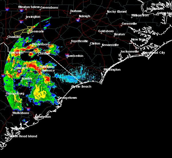 At 555 pm edt, a severe thunderstorm was located over pamplico, or 14 miles northeast of lake city, moving northeast at 40 mph (radar indicated). Hazards include 60 mph wind gusts and quarter size hail. Minor hail damage to vehicles is possible. Expect wind damage to trees and power lines. At 555 pm edt, a severe thunderstorm was located over pamplico, or 14 miles northeast of lake city, moving northeast at 40 mph (radar indicated). Hazards include 60 mph wind gusts and quarter size hail. Minor hail damage to vehicles is possible. Expect wind damage to trees and power lines.
|
| 4/19/2019 3:27 PM EDT |
 At 326 pm edt, severe thunderstorms were located along a line extending from 8 miles south of cheraw to near dongola, moving northeast at 60 mph (radar indicated). Hazards include 70 mph wind gusts. Expect considerable tree damage. damage is likely to mobile homes, roofs, and outbuildings. these severe storms will be near, conway, chavistown and wallace around 335 pm edt. bennettsville and homewood around 340 pm edt. Other locations impacted by these severe thunderstorms include coward, stuckey, lane, blenheim, aynor, scranton, society hill, carolinas hospital system, lake city community hospital and mcleod regional medical center. At 326 pm edt, severe thunderstorms were located along a line extending from 8 miles south of cheraw to near dongola, moving northeast at 60 mph (radar indicated). Hazards include 70 mph wind gusts. Expect considerable tree damage. damage is likely to mobile homes, roofs, and outbuildings. these severe storms will be near, conway, chavistown and wallace around 335 pm edt. bennettsville and homewood around 340 pm edt. Other locations impacted by these severe thunderstorms include coward, stuckey, lane, blenheim, aynor, scranton, society hill, carolinas hospital system, lake city community hospital and mcleod regional medical center.
|
| 4/19/2019 2:54 PM EDT |
 At 254 pm edt, severe thunderstorms were located along a line extending from 7 miles northwest of bishopville to earle, moving northeast at 60 mph (radar indicated). Hazards include 70 mph wind gusts. Expect considerable tree damage. damage is likely to mobile homes, roofs, and outbuildings. severe thunderstorms will be near, andrews and warsaw around 300 pm edt. clyde, kellytown and morrisville around 305 pm edt. hartsville, rhems and north hartsville around 310 pm edt. outland and auburn around 315 pm edt. dongola around 325 pm edt. wallace around 330 pm edt. conway, bennettsville, chavistown and homewood around 335 pm edt. Other locations impacted by these severe thunderstorms include coward, stuckey, lane, greeleyville, blenheim, aynor, olanta, scranton, society hill and carolinas hospital system. At 254 pm edt, severe thunderstorms were located along a line extending from 7 miles northwest of bishopville to earle, moving northeast at 60 mph (radar indicated). Hazards include 70 mph wind gusts. Expect considerable tree damage. damage is likely to mobile homes, roofs, and outbuildings. severe thunderstorms will be near, andrews and warsaw around 300 pm edt. clyde, kellytown and morrisville around 305 pm edt. hartsville, rhems and north hartsville around 310 pm edt. outland and auburn around 315 pm edt. dongola around 325 pm edt. wallace around 330 pm edt. conway, bennettsville, chavistown and homewood around 335 pm edt. Other locations impacted by these severe thunderstorms include coward, stuckey, lane, greeleyville, blenheim, aynor, olanta, scranton, society hill and carolinas hospital system.
|
| 9/16/2018 12:49 PM EDT |
 At 1249 pm edt, a severe thunderstorm capable of producing a tornado was located over evergreen, or 12 miles southeast of florence, moving north at 40 mph (radar indicated rotation). Hazards include tornado. Flying debris will be dangerous to those caught without shelter. mobile homes will be damaged or destroyed. damage to roofs, windows, and vehicles will occur. tree damage is likely. Locations impacted include, florence, hyman, mars bluff, friendfield, claussen, francis marion university, evergreen, carolinas hospital system, mcleod regional medical center, carolinas hospital system - cedar tower and health south rehabilitation hospital. At 1249 pm edt, a severe thunderstorm capable of producing a tornado was located over evergreen, or 12 miles southeast of florence, moving north at 40 mph (radar indicated rotation). Hazards include tornado. Flying debris will be dangerous to those caught without shelter. mobile homes will be damaged or destroyed. damage to roofs, windows, and vehicles will occur. tree damage is likely. Locations impacted include, florence, hyman, mars bluff, friendfield, claussen, francis marion university, evergreen, carolinas hospital system, mcleod regional medical center, carolinas hospital system - cedar tower and health south rehabilitation hospital.
|
| 9/16/2018 12:40 PM EDT |
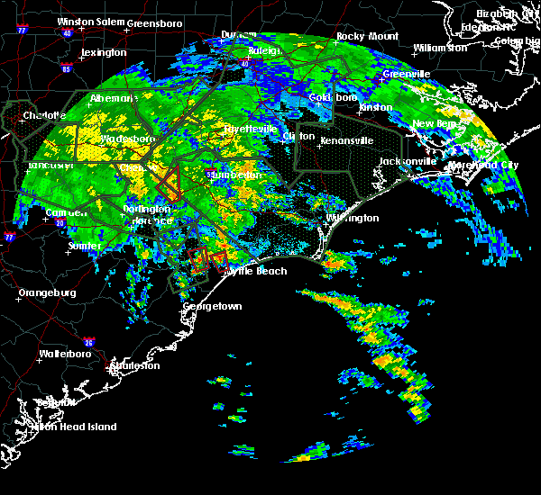 At 1240 pm edt, a severe thunderstorm capable of producing a tornado was located near friendfield, or 8 miles northeast of lake city, moving north at 40 mph (radar indicated rotation). Hazards include tornado. Flying debris will be dangerous to those caught without shelter. mobile homes will be damaged or destroyed. damage to roofs, windows, and vehicles will occur. Tree damage is likely. At 1240 pm edt, a severe thunderstorm capable of producing a tornado was located near friendfield, or 8 miles northeast of lake city, moving north at 40 mph (radar indicated rotation). Hazards include tornado. Flying debris will be dangerous to those caught without shelter. mobile homes will be damaged or destroyed. damage to roofs, windows, and vehicles will occur. Tree damage is likely.
|
| 8/8/2018 10:11 PM EDT |
 At 1011 pm edt, a severe thunderstorm was located over evergreen, or 11 miles southeast of florence, moving east at 20 mph (radar indicated). Hazards include 60 mph wind gusts and penny size hail. Expect wind damage to trees and power lines. Locations impacted include, marion, mullins, johnsonville, pamplico, blue brick, hyman, hannah, effingham, gapway, poston, brittons neck, francis marion university, rains, gresham, friendfield, claussen, new hope, evergreen, kingsburg and coward. At 1011 pm edt, a severe thunderstorm was located over evergreen, or 11 miles southeast of florence, moving east at 20 mph (radar indicated). Hazards include 60 mph wind gusts and penny size hail. Expect wind damage to trees and power lines. Locations impacted include, marion, mullins, johnsonville, pamplico, blue brick, hyman, hannah, effingham, gapway, poston, brittons neck, francis marion university, rains, gresham, friendfield, claussen, new hope, evergreen, kingsburg and coward.
|
| 8/8/2018 9:53 PM EDT |
 At 953 pm edt, a severe thunderstorm was located over effingham, or 7 miles south of florence, moving east at 20 mph (radar indicated). Hazards include 60 mph wind gusts and penny size hail. expect wind damage to trees and power lines At 953 pm edt, a severe thunderstorm was located over effingham, or 7 miles south of florence, moving east at 20 mph (radar indicated). Hazards include 60 mph wind gusts and penny size hail. expect wind damage to trees and power lines
|
| 6/25/2018 6:33 PM EDT |
 At 633 pm edt, severe thunderstorms were located along a line extending from near sardis to near outland, moving south at 15 mph (radar indicated). Hazards include 60 mph wind gusts and penny size hail. Expect damage trees and power lines. locations impacted include, lake city, kingstree, johnsonville, pamplico, hemingway, sardis, hannah, cades, poston, nesmith, brittons neck, indiantown, gresham, hebron, friendfield, henry, kingsburg, scranton, coward and olanta. This includes interstate 95 in south carolina near mile marker 147. At 633 pm edt, severe thunderstorms were located along a line extending from near sardis to near outland, moving south at 15 mph (radar indicated). Hazards include 60 mph wind gusts and penny size hail. Expect damage trees and power lines. locations impacted include, lake city, kingstree, johnsonville, pamplico, hemingway, sardis, hannah, cades, poston, nesmith, brittons neck, indiantown, gresham, hebron, friendfield, henry, kingsburg, scranton, coward and olanta. This includes interstate 95 in south carolina near mile marker 147.
|
| 6/25/2018 6:10 PM EDT |
 At 609 pm edt, severe thunderstorms were located along a line extending from near sardis to near brittons neck, moving south at 15 mph (radar indicated). Hazards include 60 mph wind gusts and penny size hail. expect damage trees and power lines At 609 pm edt, severe thunderstorms were located along a line extending from near sardis to near brittons neck, moving south at 15 mph (radar indicated). Hazards include 60 mph wind gusts and penny size hail. expect damage trees and power lines
|
| 4/15/2018 8:03 PM EDT | Tree down on the florence side of willow grove rd in florence county SC, 5.3 miles SSW of Pamplico, SC |
| 4/15/2018 7:52 PM EDT |
 At 751 pm edt, severe thunderstorms were located along a line extending from lake city to near warsaw, moving north at 55 mph (radar indicated). Hazards include 60 mph wind gusts and penny size hail. expect damage trees and power lines At 751 pm edt, severe thunderstorms were located along a line extending from lake city to near warsaw, moving north at 55 mph (radar indicated). Hazards include 60 mph wind gusts and penny size hail. expect damage trees and power lines
|
| 4/15/2018 5:35 PM EDT |
 At 526 pm edt, a severe thunderstorm was located near minturn, or 10 miles north of dillon, moving northeast at 55 mph (radar indicated). Hazards include 60 mph wind gusts. Expect damage trees and power lines. locations impacted include, florence, bennettsville, marion, dillon, mccoll, latta, pamplico, quinby, lake view, clio, sellers, fork, blue brick, zion, hamer, mars bluff, brownsville, south of the border, new hope and minturn. this includes interstate 95 in south carolina between mile markers 165 and 198. A tornado watch remains in effect until 1100 pm edt for northeastern south carolina. At 526 pm edt, a severe thunderstorm was located near minturn, or 10 miles north of dillon, moving northeast at 55 mph (radar indicated). Hazards include 60 mph wind gusts. Expect damage trees and power lines. locations impacted include, florence, bennettsville, marion, dillon, mccoll, latta, pamplico, quinby, lake view, clio, sellers, fork, blue brick, zion, hamer, mars bluff, brownsville, south of the border, new hope and minturn. this includes interstate 95 in south carolina between mile markers 165 and 198. A tornado watch remains in effect until 1100 pm edt for northeastern south carolina.
|
| 4/15/2018 5:26 PM EDT |
 At 526 pm edt, a severe thunderstorm was located near minturn, or 10 miles north of dillon, moving northeast at 55 mph (radar indicated). Hazards include 60 mph wind gusts. Expect damage trees and power lines. locations impacted include, florence, bennettsville, marion, dillon, mccoll, latta, pamplico, quinby, lake view, clio, sellers, fork, blue brick, zion, hamer, mars bluff, brownsville, south of the border, new hope and minturn. this includes interstate 95 in south carolina between mile markers 165 and 198. A tornado watch remains in effect until 1100 pm edt for northeastern south carolina. At 526 pm edt, a severe thunderstorm was located near minturn, or 10 miles north of dillon, moving northeast at 55 mph (radar indicated). Hazards include 60 mph wind gusts. Expect damage trees and power lines. locations impacted include, florence, bennettsville, marion, dillon, mccoll, latta, pamplico, quinby, lake view, clio, sellers, fork, blue brick, zion, hamer, mars bluff, brownsville, south of the border, new hope and minturn. this includes interstate 95 in south carolina between mile markers 165 and 198. A tornado watch remains in effect until 1100 pm edt for northeastern south carolina.
|
| 4/15/2018 4:47 PM EDT |
 At 446 pm edt, a severe thunderstorm was located over evergreen, or 9 miles southeast of florence, moving northeast at 55 mph (radar indicated). Hazards include 60 mph wind gusts. expect damage trees and power lines At 446 pm edt, a severe thunderstorm was located over evergreen, or 9 miles southeast of florence, moving northeast at 55 mph (radar indicated). Hazards include 60 mph wind gusts. expect damage trees and power lines
|
| 4/15/2018 4:41 PM EDT |
 At 440 pm edt, a severe thunderstorm was located near friendfield, or near lake city, moving northeast at 55 mph (radar indicated). Hazards include 60 mph wind gusts. Expect damage trees and power lines. locations impacted include, lake city, kingstree, johnsonville, pamplico, trio, salters, hyman, hannah, cades, poston, gourdin, indiantown, gresham, hebron, friendfield, kingsburg, scranton, coward, olanta and lane. A tornado watch remains in effect until 1100 pm edt for northeastern south carolina. At 440 pm edt, a severe thunderstorm was located near friendfield, or near lake city, moving northeast at 55 mph (radar indicated). Hazards include 60 mph wind gusts. Expect damage trees and power lines. locations impacted include, lake city, kingstree, johnsonville, pamplico, trio, salters, hyman, hannah, cades, poston, gourdin, indiantown, gresham, hebron, friendfield, kingsburg, scranton, coward, olanta and lane. A tornado watch remains in effect until 1100 pm edt for northeastern south carolina.
|
| 4/15/2018 4:10 PM EDT |
 At 409 pm edt, a severe thunderstorm was located near gourdin, or 10 miles southwest of kingstree, moving northeast at 55 mph (radar indicated). Hazards include 60 mph wind gusts. expect damage trees and power lines At 409 pm edt, a severe thunderstorm was located near gourdin, or 10 miles southwest of kingstree, moving northeast at 55 mph (radar indicated). Hazards include 60 mph wind gusts. expect damage trees and power lines
|
| 9/6/2017 5:16 PM EDT |
 At 516 pm edt, a severe thunderstorm was located near effingham, or near florence, moving east at 30 mph (radar indicated). Hazards include 60 mph wind gusts and nickel size hail. Expect damage trees and power lines. locations impacted include, florence, pamplico, quinby, hyman, mars bluff, effingham, florence darlington technical college main campus, francis marion university, claussen, new hope, evergreen, carolinas hospital system, mcleod regional medical center, carolinas hospital system - cedar tower and health south rehabilitation hospital. this includes the following highways, interstate 20 between mile markers 140 and 141. Interstate 95 in south carolina between mile markers 154 and 166, and between mile markers 168 and 175. At 516 pm edt, a severe thunderstorm was located near effingham, or near florence, moving east at 30 mph (radar indicated). Hazards include 60 mph wind gusts and nickel size hail. Expect damage trees and power lines. locations impacted include, florence, pamplico, quinby, hyman, mars bluff, effingham, florence darlington technical college main campus, francis marion university, claussen, new hope, evergreen, carolinas hospital system, mcleod regional medical center, carolinas hospital system - cedar tower and health south rehabilitation hospital. this includes the following highways, interstate 20 between mile markers 140 and 141. Interstate 95 in south carolina between mile markers 154 and 166, and between mile markers 168 and 175.
|
| 9/6/2017 4:56 PM EDT |
 At 455 pm edt, a severe thunderstorm was located over cartersville, or 14 miles southwest of florence, moving east at 30 mph (radar indicated). Hazards include 60 mph wind gusts and nickel size hail. expect damage trees and power lines At 455 pm edt, a severe thunderstorm was located over cartersville, or 14 miles southwest of florence, moving east at 30 mph (radar indicated). Hazards include 60 mph wind gusts and nickel size hail. expect damage trees and power lines
|
| 8/23/2017 10:18 PM EDT |
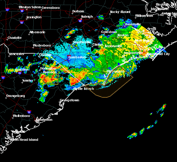 At 1017 pm edt, a severe thunderstorm was located over friendfield, or 11 miles northeast of lake city, moving east at 30 mph (radar indicated). Hazards include 60 mph wind gusts and nickel size hail. Expect damage trees and power lines. Locations impacted include, marion, pamplico, gresham, hyman, friendfield, new hope, brittons neck, evergreen, claussen, coward and carolinas hospital system - marion. At 1017 pm edt, a severe thunderstorm was located over friendfield, or 11 miles northeast of lake city, moving east at 30 mph (radar indicated). Hazards include 60 mph wind gusts and nickel size hail. Expect damage trees and power lines. Locations impacted include, marion, pamplico, gresham, hyman, friendfield, new hope, brittons neck, evergreen, claussen, coward and carolinas hospital system - marion.
|
| 8/23/2017 10:05 PM EDT |
 At 1004 pm edt, a severe thunderstorm was located over friendfield, or 10 miles north of lake city, moving east at 40 mph (radar indicated). Hazards include 60 mph wind gusts and nickel size hail. expect damage trees and power lines At 1004 pm edt, a severe thunderstorm was located over friendfield, or 10 miles north of lake city, moving east at 40 mph (radar indicated). Hazards include 60 mph wind gusts and nickel size hail. expect damage trees and power lines
|
| 8/6/2017 8:30 PM EDT |
 At 830 pm edt, a severe thunderstorm was located 8 miles northeast of pamplico, or 8 miles southwest of marion, moving northeast at 45 mph (radar indicated). Hazards include 60 mph wind gusts and nickel size hail. expect damage trees and power lines At 830 pm edt, a severe thunderstorm was located 8 miles northeast of pamplico, or 8 miles southwest of marion, moving northeast at 45 mph (radar indicated). Hazards include 60 mph wind gusts and nickel size hail. expect damage trees and power lines
|
| 8/6/2017 8:15 PM EDT | Report of trees down on north walnut street in downtown pamplic in florence county SC, 0.4 miles SSW of Pamplico, SC |
| 7/23/2017 7:06 PM EDT |
 At 706 pm edt, a severe thunderstorm was located over evergreen, or 9 miles southeast of florence, moving south at 5 mph (radar indicated). Hazards include 60 mph wind gusts. expect damage trees and power lines At 706 pm edt, a severe thunderstorm was located over evergreen, or 9 miles southeast of florence, moving south at 5 mph (radar indicated). Hazards include 60 mph wind gusts. expect damage trees and power lines
|
| 5/29/2017 9:37 PM EDT |
 At 937 pm edt, a severe thunderstorm was located over hannah, or 10 miles east of lake city, moving east at 35 mph (radar indicated). Hazards include 60 mph wind gusts and quarter size hail. Minor hail damage to vehicles is possible. expect wind damage to trees and power lines. Locations impacted include, lake city, johnsonville, pamplico, hemingway, hyman, hannah, cades, indiantown, friendfield, scranton, coward, stuckey and lake city community hospital. At 937 pm edt, a severe thunderstorm was located over hannah, or 10 miles east of lake city, moving east at 35 mph (radar indicated). Hazards include 60 mph wind gusts and quarter size hail. Minor hail damage to vehicles is possible. expect wind damage to trees and power lines. Locations impacted include, lake city, johnsonville, pamplico, hemingway, hyman, hannah, cades, indiantown, friendfield, scranton, coward, stuckey and lake city community hospital.
|
| 5/29/2017 9:16 PM EDT |
 At 915 pm edt, a severe thunderstorm was located near new hope, or near lake city, moving east at 35 mph (radar indicated). Hazards include 60 mph wind gusts and quarter size hail. Minor hail damage to vehicles is possible. expect wind damage to trees and power lines. Locations impacted include, lake city, johnsonville, pamplico, hemingway, hyman, hannah, effingham, cades, indiantown, hebron, friendfield, new hope, evergreen, scranton, coward, olanta, stuckey, central crossroads and lake city community hospital. At 915 pm edt, a severe thunderstorm was located near new hope, or near lake city, moving east at 35 mph (radar indicated). Hazards include 60 mph wind gusts and quarter size hail. Minor hail damage to vehicles is possible. expect wind damage to trees and power lines. Locations impacted include, lake city, johnsonville, pamplico, hemingway, hyman, hannah, effingham, cades, indiantown, hebron, friendfield, new hope, evergreen, scranton, coward, olanta, stuckey, central crossroads and lake city community hospital.
|
| 5/29/2017 8:54 PM EDT |
 At 854 pm edt, a severe thunderstorm was located 7 miles northwest of hebron, or 10 miles west of lake city, moving east at 35 mph (radar indicated). Hazards include 60 mph wind gusts and quarter size hail. Minor hail damage to vehicles is possible. Expect wind damage to trees and power lines. At 854 pm edt, a severe thunderstorm was located 7 miles northwest of hebron, or 10 miles west of lake city, moving east at 35 mph (radar indicated). Hazards include 60 mph wind gusts and quarter size hail. Minor hail damage to vehicles is possible. Expect wind damage to trees and power lines.
|
| 5/28/2017 8:02 PM EDT |
 At 801 pm edt, a severe thunderstorm was located near evergreen, or near florence, moving east at 35 mph (radar indicated). Hazards include 60 mph wind gusts and quarter size hail. Minor hail damage to vehicles is possible. expect wind damage to trees and power lines. locations impacted include, florence, marion, lake city, mullins, timmonsville, pamplico, quinby, sellers, blue brick, zion, mars bluff, gapway, rains, gresham, new hope, sardis, hyman, hannah, effingham and francis marion university. this includes the following highways, interstate 20 between mile markers 140 and 141. Interstate 95 in south carolina between mile markers 148 and 164, near mile marker 166, and between mile markers 168 and 174. At 801 pm edt, a severe thunderstorm was located near evergreen, or near florence, moving east at 35 mph (radar indicated). Hazards include 60 mph wind gusts and quarter size hail. Minor hail damage to vehicles is possible. expect wind damage to trees and power lines. locations impacted include, florence, marion, lake city, mullins, timmonsville, pamplico, quinby, sellers, blue brick, zion, mars bluff, gapway, rains, gresham, new hope, sardis, hyman, hannah, effingham and francis marion university. this includes the following highways, interstate 20 between mile markers 140 and 141. Interstate 95 in south carolina between mile markers 148 and 164, near mile marker 166, and between mile markers 168 and 174.
|
| 5/28/2017 7:47 PM EDT |
 At 747 pm edt, a severe thunderstorm was located near florence, moving east at 35 mph (radar indicated). Hazards include 60 mph wind gusts and quarter size hail. Minor hail damage to vehicles is possible. Expect wind damage to trees and power lines. At 747 pm edt, a severe thunderstorm was located near florence, moving east at 35 mph (radar indicated). Hazards include 60 mph wind gusts and quarter size hail. Minor hail damage to vehicles is possible. Expect wind damage to trees and power lines.
|
| 5/4/2017 10:52 PM EDT |
 At 1051 pm edt, a severe thunderstorm capable of producing a tornado was located near gresham, or 14 miles south of marion, moving north at 30 mph (radar indicated rotation). Hazards include tornado. Expect downed trees and possible damage to mobile homes, roofs, and vehicles that lie in it`s path. Locations impacted include, marion, mullins, johnsonville, zion, hannah, gapway, poston, rains, gresham, smithboro, kingsburg, brittons neck and carolinas hospital system - marion. At 1051 pm edt, a severe thunderstorm capable of producing a tornado was located near gresham, or 14 miles south of marion, moving north at 30 mph (radar indicated rotation). Hazards include tornado. Expect downed trees and possible damage to mobile homes, roofs, and vehicles that lie in it`s path. Locations impacted include, marion, mullins, johnsonville, zion, hannah, gapway, poston, rains, gresham, smithboro, kingsburg, brittons neck and carolinas hospital system - marion.
|
| 5/4/2017 10:36 PM EDT |
 At 1036 pm edt, a severe thunderstorm capable of producing a tornado was located over kingsburg, or 14 miles east of lake city, moving north at 30 mph (radar indicated rotation). Hazards include tornado. expect damage to mobile homes, roofs, and vehicles At 1036 pm edt, a severe thunderstorm capable of producing a tornado was located over kingsburg, or 14 miles east of lake city, moving north at 30 mph (radar indicated rotation). Hazards include tornado. expect damage to mobile homes, roofs, and vehicles
|
| 4/3/2017 6:56 PM EDT |
 The severe thunderstorm warning for florence and williamsburg counties will expire at 700 pm edt, the storm which prompted the warning has moved out of the area. therefore the warning will be allowed to expire. a severe thunderstorm watch remains in effect until 1000 pm edt for northeastern south carolina. remember, a severe thunderstorm warning still remains in effect for portions of florence and williamsburg counties. The severe thunderstorm warning for florence and williamsburg counties will expire at 700 pm edt, the storm which prompted the warning has moved out of the area. therefore the warning will be allowed to expire. a severe thunderstorm watch remains in effect until 1000 pm edt for northeastern south carolina. remember, a severe thunderstorm warning still remains in effect for portions of florence and williamsburg counties.
|
| 4/3/2017 6:50 PM EDT |
 At 650 pm edt, a severe thunderstorm was located near marion, moving east at 55 mph (radar indicated). Hazards include 60 mph wind gusts and penny size hail. expect damage to roofs, siding, and trees At 650 pm edt, a severe thunderstorm was located near marion, moving east at 55 mph (radar indicated). Hazards include 60 mph wind gusts and penny size hail. expect damage to roofs, siding, and trees
|
| 4/3/2017 6:41 PM EDT |
 At 640 pm edt, a severe thunderstorm was located near lake city, moving northeast at 50 mph (radar indicated). Hazards include 60 mph wind gusts and quarter size hail. Hail damage to vehicles is expected. expect wind damage to roofs, siding, and trees. Locations impacted include, lake city, kingstree, johnsonville, pamplico, hemingway, cades, poston, nesmith, indiantown, hebron, new hope, morrisville, henry, trio, salters, hyman, hannah, effingham, gourdin and friendfield. At 640 pm edt, a severe thunderstorm was located near lake city, moving northeast at 50 mph (radar indicated). Hazards include 60 mph wind gusts and quarter size hail. Hail damage to vehicles is expected. expect wind damage to roofs, siding, and trees. Locations impacted include, lake city, kingstree, johnsonville, pamplico, hemingway, cades, poston, nesmith, indiantown, hebron, new hope, morrisville, henry, trio, salters, hyman, hannah, effingham, gourdin and friendfield.
|
| 4/3/2017 6:21 PM EDT |
 At 621 pm edt, a severe thunderstorm was located near hebron, moving northeast at 50 mph (radar indicated). Hazards include 60 mph wind gusts and quarter size hail. Hail damage to vehicles is expected. expect wind damage to roofs, siding, and trees. Locations impacted include, lake city, kingstree, johnsonville, pamplico, hemingway, cades, poston, nesmith, indiantown, hebron, new hope, morrisville, henry, trio, salters, sardis, hyman, hannah, effingham and gourdin. At 621 pm edt, a severe thunderstorm was located near hebron, moving northeast at 50 mph (radar indicated). Hazards include 60 mph wind gusts and quarter size hail. Hail damage to vehicles is expected. expect wind damage to roofs, siding, and trees. Locations impacted include, lake city, kingstree, johnsonville, pamplico, hemingway, cades, poston, nesmith, indiantown, hebron, new hope, morrisville, henry, trio, salters, sardis, hyman, hannah, effingham and gourdin.
|
| 4/3/2017 6:00 PM EDT |
 At 600 pm edt, a severe thunderstorm was located near manning, moving northeast at 50 mph (radar indicated). Hazards include 60 mph wind gusts and quarter size hail. Hail damage to vehicles is expected. Expect wind damage to roofs, siding, and trees. At 600 pm edt, a severe thunderstorm was located near manning, moving northeast at 50 mph (radar indicated). Hazards include 60 mph wind gusts and quarter size hail. Hail damage to vehicles is expected. Expect wind damage to roofs, siding, and trees.
|
| 4/3/2017 5:55 PM EDT |
 At 554 pm edt, a severe thunderstorm was located over mechanicsville, or 7 miles northeast of darlington, moving northeast at 55 mph (radar indicated). Hazards include 60 mph wind gusts and quarter size hail. Hail damage to vehicles is expected. expect wind damage to roofs, siding, and trees. locations impacted include, florence, bennettsville, hartsville, lake city, darlington, timmonsville, mccoll, johnsonville, pamplico, lamar, quinby, clio, brownsville, darlington raceway, chavistown, floyd, new hope, north hartsville, hyman and effingham. this includes the following highways, interstate 20 between mile markers 125 and 141. Interstate 95 in south carolina near mile marker 146, and between mile markers 148 and 175. At 554 pm edt, a severe thunderstorm was located over mechanicsville, or 7 miles northeast of darlington, moving northeast at 55 mph (radar indicated). Hazards include 60 mph wind gusts and quarter size hail. Hail damage to vehicles is expected. expect wind damage to roofs, siding, and trees. locations impacted include, florence, bennettsville, hartsville, lake city, darlington, timmonsville, mccoll, johnsonville, pamplico, lamar, quinby, clio, brownsville, darlington raceway, chavistown, floyd, new hope, north hartsville, hyman and effingham. this includes the following highways, interstate 20 between mile markers 125 and 141. Interstate 95 in south carolina near mile marker 146, and between mile markers 148 and 175.
|
| 4/3/2017 5:36 PM EDT |
 At 535 pm edt, a severe thunderstorm was located near darlington, moving northeast at 50 mph (radar indicated). Hazards include 60 mph wind gusts and quarter size hail. Hail damage to vehicles is expected. expect wind damage to roofs, siding, and trees. locations impacted include, florence, bennettsville, hartsville, lake city, darlington, timmonsville, mccoll, johnsonville, pamplico, lamar, quinby, clio, brownsville, darlington raceway, chavistown, floyd, new hope, north hartsville, hyman and effingham. this includes the following highways, interstate 20 between mile markers 125 and 141. Interstate 95 in south carolina near mile marker 146, and between mile markers 148 and 175. At 535 pm edt, a severe thunderstorm was located near darlington, moving northeast at 50 mph (radar indicated). Hazards include 60 mph wind gusts and quarter size hail. Hail damage to vehicles is expected. expect wind damage to roofs, siding, and trees. locations impacted include, florence, bennettsville, hartsville, lake city, darlington, timmonsville, mccoll, johnsonville, pamplico, lamar, quinby, clio, brownsville, darlington raceway, chavistown, floyd, new hope, north hartsville, hyman and effingham. this includes the following highways, interstate 20 between mile markers 125 and 141. Interstate 95 in south carolina near mile marker 146, and between mile markers 148 and 175.
|
| 4/3/2017 5:15 PM EDT |
 At 514 pm edt, a severe thunderstorm was located near bishopville, moving northeast at 55 mph (radar indicated). Hazards include 60 mph wind gusts and quarter size hail. Hail damage to vehicles is expected. Expect wind damage to roofs, siding, and trees. At 514 pm edt, a severe thunderstorm was located near bishopville, moving northeast at 55 mph (radar indicated). Hazards include 60 mph wind gusts and quarter size hail. Hail damage to vehicles is expected. Expect wind damage to roofs, siding, and trees.
|
| 3/22/2017 12:09 AM EDT |
 At 1208 am edt, severe thunderstorms were located along a line extending from near dunbar to near claussen, moving east at 45 mph (radar indicated). Hazards include 60 mph wind gusts and penny size hail. Expect damage to roofs, siding, and trees. Locations impacted include, mccoll, johnsonville, pamplico, clio, hyman, mars bluff, hannah, brownsville, poston, friendfield, claussen, dunbar, evergreen, kingsburg, blenheim and tatum. At 1208 am edt, severe thunderstorms were located along a line extending from near dunbar to near claussen, moving east at 45 mph (radar indicated). Hazards include 60 mph wind gusts and penny size hail. Expect damage to roofs, siding, and trees. Locations impacted include, mccoll, johnsonville, pamplico, clio, hyman, mars bluff, hannah, brownsville, poston, friendfield, claussen, dunbar, evergreen, kingsburg, blenheim and tatum.
|
| 3/21/2017 11:11 PM EDT |
 At 1111 pm edt, severe thunderstorms were located along a line extending from 7 miles northwest of bishopville to near mulberry, moving east at 45 mph (radar indicated). Hazards include 60 mph wind gusts and penny size hail. expect damage to roofs, siding, and trees At 1111 pm edt, severe thunderstorms were located along a line extending from 7 miles northwest of bishopville to near mulberry, moving east at 45 mph (radar indicated). Hazards include 60 mph wind gusts and penny size hail. expect damage to roofs, siding, and trees
|
| 10/8/2016 2:02 AM EDT |
 At 201 am edt, a severe thunderstorm capable of producing a tornado was located near hannah, or 13 miles east of lake city, moving west at 50 mph (radar indicated rotation). Hazards include tornado. Flying debris will be dangerous to those caught without shelter. mobile homes will be damaged or destroyed. damage to roofs, windows, and vehicles will occur. tree damage is likely. this dangerous storm will be near, pamplico around 205 am edt. hyman around 210 am edt. lake city and friendfield around 215 am edt. other locations impacted by this tornadic thunderstorm include scranton and lake city community hospital. At 201 am edt, a severe thunderstorm capable of producing a tornado was located near hannah, or 13 miles east of lake city, moving west at 50 mph (radar indicated rotation). Hazards include tornado. Flying debris will be dangerous to those caught without shelter. mobile homes will be damaged or destroyed. damage to roofs, windows, and vehicles will occur. tree damage is likely. this dangerous storm will be near, pamplico around 205 am edt. hyman around 210 am edt. lake city and friendfield around 215 am edt. other locations impacted by this tornadic thunderstorm include scranton and lake city community hospital.
|
| 10/8/2016 1:54 AM EDT |
 At 153 am edt, a severe thunderstorm capable of producing a tornado was located over poston, or 18 miles east of lake city, moving northwest at 60 mph (radar indicated rotation). Hazards include tornado. Flying debris will be dangerous to those caught without shelter. mobile homes will be damaged or destroyed. damage to roofs, windows, and vehicles will occur. tree damage is likely. this dangerous storm will be near, hannah around 200 am edt. pamplico and hyman around 205 am edt. lake city and friendfield around 210 am edt. other locations impacted by this tornadic thunderstorm include scranton and lake city community hospital. At 153 am edt, a severe thunderstorm capable of producing a tornado was located over poston, or 18 miles east of lake city, moving northwest at 60 mph (radar indicated rotation). Hazards include tornado. Flying debris will be dangerous to those caught without shelter. mobile homes will be damaged or destroyed. damage to roofs, windows, and vehicles will occur. tree damage is likely. this dangerous storm will be near, hannah around 200 am edt. pamplico and hyman around 205 am edt. lake city and friendfield around 210 am edt. other locations impacted by this tornadic thunderstorm include scranton and lake city community hospital.
|
| 10/8/2016 1:47 AM EDT |
 At 147 am edt, a severe thunderstorm capable of producing a tornado was located near brittons neck, or 16 miles west of conway, moving northwest at 60 mph (radar indicated rotation). Hazards include tornado. Flying debris will be dangerous to those caught without shelter. mobile homes will be damaged or destroyed. damage to roofs, windows, and vehicles will occur. tree damage is likely. this dangerous storm will be near, hannah around 200 am edt. pamplico and hyman around 205 am edt. lake city and friendfield around 210 am edt. Other locations impacted by this tornadic thunderstorm include scranton and lake city community hospital. At 147 am edt, a severe thunderstorm capable of producing a tornado was located near brittons neck, or 16 miles west of conway, moving northwest at 60 mph (radar indicated rotation). Hazards include tornado. Flying debris will be dangerous to those caught without shelter. mobile homes will be damaged or destroyed. damage to roofs, windows, and vehicles will occur. tree damage is likely. this dangerous storm will be near, hannah around 200 am edt. pamplico and hyman around 205 am edt. lake city and friendfield around 210 am edt. Other locations impacted by this tornadic thunderstorm include scranton and lake city community hospital.
|
| 7/31/2016 4:37 PM EDT |
 At 436 pm edt, a severe thunderstorm was located near lake city, moving east northeast at 25 mph (radar indicated). Hazards include 60 mph wind gusts. frequent to continuous cloud to ground lightning. Expect damage to roofs. siding. And trees. At 436 pm edt, a severe thunderstorm was located near lake city, moving east northeast at 25 mph (radar indicated). Hazards include 60 mph wind gusts. frequent to continuous cloud to ground lightning. Expect damage to roofs. siding. And trees.
|
| 7/11/2016 9:41 PM EDT | The severe thunderstorm warning for southeastern florence, west central horry and central marion counties will expire at 945 pm edt, the storm which prompted the warning has weakened below severe limits, and has exited the warned area. therefore the warning will be allowed to expire. |
| 7/11/2016 9:19 PM EDT |
 At 918 pm edt, a severe thunderstorm was located over hyman, or 12 miles northeast of lake city, moving east at 20 mph (radar indicated). Hazards include 60 mph wind gusts and penny size hail. Expect damage to roofs. siding. and trees. Locations impacted include, johnsonville, pamplico, poston, kingsburg, galivants ferry, brittons neck, gresham, rains, hyman, hannah and aynor. At 918 pm edt, a severe thunderstorm was located over hyman, or 12 miles northeast of lake city, moving east at 20 mph (radar indicated). Hazards include 60 mph wind gusts and penny size hail. Expect damage to roofs. siding. and trees. Locations impacted include, johnsonville, pamplico, poston, kingsburg, galivants ferry, brittons neck, gresham, rains, hyman, hannah and aynor.
|
| 7/11/2016 8:51 PM EDT |
 At 850 pm edt, a severe thunderstorm was located over effingham, or 9 miles south of florence, moving east at 25 mph (radar indicated). Hazards include 60 mph wind gusts and penny size hail. Expect damage to roofs. siding. And trees. At 850 pm edt, a severe thunderstorm was located over effingham, or 9 miles south of florence, moving east at 25 mph (radar indicated). Hazards include 60 mph wind gusts and penny size hail. Expect damage to roofs. siding. And trees.
|
| 7/10/2016 5:24 PM EDT |
 At 524 pm edt, a severe thunderstorm was located over hannah, or 7 miles east of lake city, moving east at 20 mph (radar indicated). Hazards include 60 mph wind gusts and penny size hail. Expect damage to roofs. siding. and trees. Locations impacted include, pamplico, hyman, hannah, friendfield, scranton and coward. At 524 pm edt, a severe thunderstorm was located over hannah, or 7 miles east of lake city, moving east at 20 mph (radar indicated). Hazards include 60 mph wind gusts and penny size hail. Expect damage to roofs. siding. and trees. Locations impacted include, pamplico, hyman, hannah, friendfield, scranton and coward.
|
| 7/10/2016 5:10 PM EDT |
 At 509 pm edt, a severe thunderstorm was located near lake city, moving east at 25 mph (radar indicated). Hazards include 60 mph wind gusts and penny size hail. Expect damage to roofs. siding. and trees. Locations impacted include, lake city, pamplico, cades, hyman, hannah, friendfield, scranton, coward and lake city community hospital. At 509 pm edt, a severe thunderstorm was located near lake city, moving east at 25 mph (radar indicated). Hazards include 60 mph wind gusts and penny size hail. Expect damage to roofs. siding. and trees. Locations impacted include, lake city, pamplico, cades, hyman, hannah, friendfield, scranton, coward and lake city community hospital.
|
| 7/10/2016 4:56 PM EDT |
 At 455 pm edt, a severe thunderstorm was located near hebron, or near lake city, moving east at 20 mph (radar indicated). Hazards include 60 mph wind gusts and quarter size hail. Hail damage to vehicles is expected. Expect wind damage to roofs, siding, and trees. At 455 pm edt, a severe thunderstorm was located near hebron, or near lake city, moving east at 20 mph (radar indicated). Hazards include 60 mph wind gusts and quarter size hail. Hail damage to vehicles is expected. Expect wind damage to roofs, siding, and trees.
|
| 7/9/2016 1:18 AM EDT |
 At 116 am edt, severe thunderstorms were located along a line extending from near lake view to henry, moving east at 55 mph (radar indicated). Hazards include 60 mph wind gusts. Expect damage to roofs. siding. and trees. Locations impacted include, marion, mullins, johnsonville, latta, pamplico, lake view, hemingway, sellers, poston, kingsburg, kemper, smithboro, blue brick, henry, galivants ferry, fork, brittons neck, rains, gapway and hannah. At 116 am edt, severe thunderstorms were located along a line extending from near lake view to henry, moving east at 55 mph (radar indicated). Hazards include 60 mph wind gusts. Expect damage to roofs. siding. and trees. Locations impacted include, marion, mullins, johnsonville, latta, pamplico, lake view, hemingway, sellers, poston, kingsburg, kemper, smithboro, blue brick, henry, galivants ferry, fork, brittons neck, rains, gapway and hannah.
|
| 7/9/2016 12:50 AM EDT |
 At 1248 am edt, severe thunderstorms were located along a line extending from near marion to near hebron, moving east at 55 mph (radar indicated). Hazards include 60 mph wind gusts and penny size hail. Expect damage to roofs. siding. and trees. Locations impacted include, florence, marion, dillon, lake city, mullins, johnsonville, latta, pamplico, quinby, lake view, hemingway, sellers, kingsburg, hebron, new hope, smithboro, blue brick, henry, galivants ferry and brittons neck. At 1248 am edt, severe thunderstorms were located along a line extending from near marion to near hebron, moving east at 55 mph (radar indicated). Hazards include 60 mph wind gusts and penny size hail. Expect damage to roofs. siding. and trees. Locations impacted include, florence, marion, dillon, lake city, mullins, johnsonville, latta, pamplico, quinby, lake view, hemingway, sellers, kingsburg, hebron, new hope, smithboro, blue brick, henry, galivants ferry and brittons neck.
|
| 7/9/2016 12:23 AM EDT |
 At 1221 am edt, severe thunderstorms were located along a line extending from near florence to near south sumter, moving east at 55 mph (radar indicated). Hazards include 60 mph wind gusts and nickel size hail. Expect damage to roofs. siding. And trees. At 1221 am edt, severe thunderstorms were located along a line extending from near florence to near south sumter, moving east at 55 mph (radar indicated). Hazards include 60 mph wind gusts and nickel size hail. Expect damage to roofs. siding. And trees.
|
| 7/8/2016 11:17 PM EDT |
 At 1116 pm edt, a severe thunderstorm was located near quinby, or 9 miles northeast of florence, moving east at 40 mph (radar indicated). Hazards include 60 mph wind gusts and quarter size hail. Hail damage to vehicles is expected. Expect wind damage to roofs, siding, and trees. At 1116 pm edt, a severe thunderstorm was located near quinby, or 9 miles northeast of florence, moving east at 40 mph (radar indicated). Hazards include 60 mph wind gusts and quarter size hail. Hail damage to vehicles is expected. Expect wind damage to roofs, siding, and trees.
|
| 7/7/2016 9:56 PM EDT |
 At 956 pm edt, severe thunderstorms were located along a line extending from 6 miles west of green sea to near horry to near brittons neck to near hannah to near hebron to 7 miles north of manning, moving east at 55 mph (radar indicated). Hazards include 60 mph wind gusts. Expect damage to roofs. siding. and trees. Locations impacted include, myrtle beach, conway, north myrtle beach, georgetown, marion, lake city, debordieu colony, mullins, surfside beach, sunset beach, kingstree, pawleys island, north myrtle beach airport, springmaid pier, socastee, little river, yawkey south island, myrtle beach airport, red hill and murrells inlet. At 956 pm edt, severe thunderstorms were located along a line extending from 6 miles west of green sea to near horry to near brittons neck to near hannah to near hebron to 7 miles north of manning, moving east at 55 mph (radar indicated). Hazards include 60 mph wind gusts. Expect damage to roofs. siding. and trees. Locations impacted include, myrtle beach, conway, north myrtle beach, georgetown, marion, lake city, debordieu colony, mullins, surfside beach, sunset beach, kingstree, pawleys island, north myrtle beach airport, springmaid pier, socastee, little river, yawkey south island, myrtle beach airport, red hill and murrells inlet.
|
| 7/7/2016 9:37 PM EDT |
 At 937 pm edt, severe thunderstorms were located along a line extending from near marion to 6 miles west of rains to near hyman to near sardis, moving east at 45 mph (radar indicated). Hazards include 60 mph wind gusts and penny size hail. Expect damage to roofs. siding. And trees. At 937 pm edt, severe thunderstorms were located along a line extending from near marion to 6 miles west of rains to near hyman to near sardis, moving east at 45 mph (radar indicated). Hazards include 60 mph wind gusts and penny size hail. Expect damage to roofs. siding. And trees.
|
| 7/7/2016 9:01 PM EDT |
 At 859 pm edt, a gust front from a severe thunderstorm was located along a line extending from near quinby to near florence to near timmonsville, moving east at 45 mph (radar indicated). Hazards include 60 mph wind gusts. Expect damage to roofs. siding. and trees. Locations impacted include, florence, hartsville, lake city, darlington, timmonsville, pamplico, lamar, quinby, new hope, effingham, kellytown, florence darlington technical college main campus, north hartsville, evergreen, friendfield, darlington raceway, floyd, mars bluff, clyde and auburn. At 859 pm edt, a gust front from a severe thunderstorm was located along a line extending from near quinby to near florence to near timmonsville, moving east at 45 mph (radar indicated). Hazards include 60 mph wind gusts. Expect damage to roofs. siding. and trees. Locations impacted include, florence, hartsville, lake city, darlington, timmonsville, pamplico, lamar, quinby, new hope, effingham, kellytown, florence darlington technical college main campus, north hartsville, evergreen, friendfield, darlington raceway, floyd, mars bluff, clyde and auburn.
|
| 7/7/2016 8:47 PM EDT |
 At 846 pm edt, a severe thunderstorm was located over oats, or 9 miles south of hartsville, moving southeast at 40 mph (radar indicated). Hazards include 60 mph wind gusts. Expect damage to roofs. siding. And trees. At 846 pm edt, a severe thunderstorm was located over oats, or 9 miles south of hartsville, moving southeast at 40 mph (radar indicated). Hazards include 60 mph wind gusts. Expect damage to roofs. siding. And trees.
|
| 7/7/2016 6:05 PM EDT | Large tree down across power lines at hyman road and two notch road in florence county SC, 0.4 miles SSW of Pamplico, SC |
| 7/7/2016 6:00 PM EDT |
 At 559 pm edt, severe thunderstorms were located along a line extending from 6 miles northeast of pamplico to near friendfield, moving east at 35 mph (radar indicated). Hazards include 60 mph wind gusts. Expect damage to roofs. siding. And trees. At 559 pm edt, severe thunderstorms were located along a line extending from 6 miles northeast of pamplico to near friendfield, moving east at 35 mph (radar indicated). Hazards include 60 mph wind gusts. Expect damage to roofs. siding. And trees.
|
| 7/7/2016 5:41 PM EDT |
 At 540 pm edt, severe thunderstorms were located along a line extending from near claussen to near evergreen to near new hope and coward, moving east at 35 to 40 mph (radar indicated). Hazards include 70 mph wind gusts. Expect considerable tree damage. damage is likely to mobile homes, roofs, and outbuildings. Locations impacted include, pamplico, new hope, effingham, evergreen, hyman, hannah, friendfield, kingsburg, scranton, coward and olanta. At 540 pm edt, severe thunderstorms were located along a line extending from near claussen to near evergreen to near new hope and coward, moving east at 35 to 40 mph (radar indicated). Hazards include 70 mph wind gusts. Expect considerable tree damage. damage is likely to mobile homes, roofs, and outbuildings. Locations impacted include, pamplico, new hope, effingham, evergreen, hyman, hannah, friendfield, kingsburg, scranton, coward and olanta.
|
| 7/7/2016 5:15 PM EDT |
 At 514 pm edt, a severe thunderstorm was located from near sardis to timmonsville, moving east at 35 to 40 mph (radar indicated). Hazards include 60 mph wind gusts. Expect damage to roofs. siding. And trees. At 514 pm edt, a severe thunderstorm was located from near sardis to timmonsville, moving east at 35 to 40 mph (radar indicated). Hazards include 60 mph wind gusts. Expect damage to roofs. siding. And trees.
|
| 7/6/2016 6:04 PM EDT |
 At 603 pm edt, a cluster of strong to severe thunderstorms was located near blue brick to johnsonville, moving east at 30 mph (radar indicated). Hazards include 60 mph wind gusts and frequent cloud to ground lightning. Expect damage to roofs. siding. and trees. Locations impacted include, marion, johnsonville, pamplico, poston, kingsburg, brittons neck, gresham, rains, blue brick, hannah and hyman. At 603 pm edt, a cluster of strong to severe thunderstorms was located near blue brick to johnsonville, moving east at 30 mph (radar indicated). Hazards include 60 mph wind gusts and frequent cloud to ground lightning. Expect damage to roofs. siding. and trees. Locations impacted include, marion, johnsonville, pamplico, poston, kingsburg, brittons neck, gresham, rains, blue brick, hannah and hyman.
|
| 7/6/2016 5:36 PM EDT |
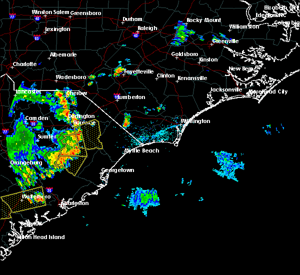 At 535 pm edt, national weather service doppler radar indicated a severe thunderstorm was located between effingham and coward, moving east at 25 to 30 mph (radar indicated). Hazards include 60 mph wind gusts and frequent cloud to ground lightning strikes. some locations within the warned area may receive damage to roofs, siding, and trees At 535 pm edt, national weather service doppler radar indicated a severe thunderstorm was located between effingham and coward, moving east at 25 to 30 mph (radar indicated). Hazards include 60 mph wind gusts and frequent cloud to ground lightning strikes. some locations within the warned area may receive damage to roofs, siding, and trees
|
| 6/24/2016 6:26 PM EDT |
 The severe thunderstorm warning for southern florence, northwestern georgetown, horry, central marion and williamsburg counties will expire at 630 pm edt, a new severe thunderstorm warning has been issued for portions of williamsburg and georgetown counties. that warning is in effect until 730 pm. The severe thunderstorm warning for southern florence, northwestern georgetown, horry, central marion and williamsburg counties will expire at 630 pm edt, a new severe thunderstorm warning has been issued for portions of williamsburg and georgetown counties. that warning is in effect until 730 pm.
|
| 6/24/2016 5:56 PM EDT |
 At 555 pm edt, a severe thunderstorm was located over pee dee crossroads, or near conway, moving east at 35 mph (radar indicated). Hazards include 60 mph wind gusts and quarter size hail. Hail damage to vehicles is expected. expect wind damage to roofs, siding, and trees. Locations impacted include, conway, lake city, kingstree, red hill, horry, andrews, loris, johnsonville, pamplico, hemingway, hickory grove, allsbrook, kingsburg, warsaw, gourdin, hebron, new hope, earle, henry and galivants ferry. At 555 pm edt, a severe thunderstorm was located over pee dee crossroads, or near conway, moving east at 35 mph (radar indicated). Hazards include 60 mph wind gusts and quarter size hail. Hail damage to vehicles is expected. expect wind damage to roofs, siding, and trees. Locations impacted include, conway, lake city, kingstree, red hill, horry, andrews, loris, johnsonville, pamplico, hemingway, hickory grove, allsbrook, kingsburg, warsaw, gourdin, hebron, new hope, earle, henry and galivants ferry.
|
| 6/24/2016 5:28 PM EDT |
 At 527 pm edt, severe thunderstorms were located from near olanta, to loris, moving east at 30 mph (radar indicated). Hazards include 60 mph wind gusts and quarter size hail. Hail damage to vehicles is expected. Expect wind damage to roofs, siding, and trees. At 527 pm edt, severe thunderstorms were located from near olanta, to loris, moving east at 30 mph (radar indicated). Hazards include 60 mph wind gusts and quarter size hail. Hail damage to vehicles is expected. Expect wind damage to roofs, siding, and trees.
|
| 6/24/2016 5:11 PM EDT |
 At 510 pm edt, a severe thunderstorm was located near lake city, moving east at 25 mph (radar indicated). Hazards include 60 mph wind gusts and quarter size hail. Hail damage to vehicles is expected. expect wind damage to roofs, siding, and trees. Locations impacted include, lake city, kingstree, pamplico, poston, kingsburg, sardis, hebron, gresham, new hope, evergreen, friendfield, brittons neck, cades, claussen, effingham, hyman, hannah, scranton, coward and olanta. At 510 pm edt, a severe thunderstorm was located near lake city, moving east at 25 mph (radar indicated). Hazards include 60 mph wind gusts and quarter size hail. Hail damage to vehicles is expected. expect wind damage to roofs, siding, and trees. Locations impacted include, lake city, kingstree, pamplico, poston, kingsburg, sardis, hebron, gresham, new hope, evergreen, friendfield, brittons neck, cades, claussen, effingham, hyman, hannah, scranton, coward and olanta.
|
| 6/24/2016 4:52 PM EDT |
 At 451 pm edt, a severe thunderstorm was located near sardis, or 11 miles northwest of lake city, moving east at 25 mph (radar indicated). Hazards include 60 mph wind gusts and quarter size hail. Hail damage to vehicles is expected. Expect wind damage to roofs, siding, and trees. At 451 pm edt, a severe thunderstorm was located near sardis, or 11 miles northwest of lake city, moving east at 25 mph (radar indicated). Hazards include 60 mph wind gusts and quarter size hail. Hail damage to vehicles is expected. Expect wind damage to roofs, siding, and trees.
|
| 6/15/2016 4:35 PM EDT | Report of tree down at intersection of treadway rd and sc hwy 9. time estimated by rada in marion county SC, 8.8 miles W of Pamplico, SC |
| 5/22/2016 10:34 PM EDT |
 At 1034 pm edt, a severe thunderstorm was located near blue brick, or near marion, moving southeast at 35 mph (radar indicated). Hazards include 60 mph wind gusts and quarter size hail. Hail damage to vehicles is expected. Expect wind damage to roofs, siding, and trees. At 1034 pm edt, a severe thunderstorm was located near blue brick, or near marion, moving southeast at 35 mph (radar indicated). Hazards include 60 mph wind gusts and quarter size hail. Hail damage to vehicles is expected. Expect wind damage to roofs, siding, and trees.
|
| 5/12/2016 4:12 PM EDT | The severe thunderstorm warning for northern florence county will expire at 415 pm edt, although the thunderstorm that prompted the severe thunderstorm warning has weakened below severe limits it remains strong near pamplico. this storm and others across the pee dee region could produce gusty winds to 40 mph, small hail and cloud to ground lightning over the next couple hours. move indoors if thunderstorms threaten your area. &&. |
| 5/12/2016 3:45 PM EDT |
 At 342 pm edt, a severe thunderstorm was located over claussen, or just southeast of florence, moving east at 15 mph (radar indicated). Hazards include 60 mph wind gusts and quarter size hail. in addition, frequent cloud to ground lightning is likely. Hail damage to vehicles is expected. expect wind damage to roofs, siding, and trees. Locations impacted include, florence, pamplico, quinby, mars bluff, new hope, claussen, effingham, and evergreen. At 342 pm edt, a severe thunderstorm was located over claussen, or just southeast of florence, moving east at 15 mph (radar indicated). Hazards include 60 mph wind gusts and quarter size hail. in addition, frequent cloud to ground lightning is likely. Hail damage to vehicles is expected. expect wind damage to roofs, siding, and trees. Locations impacted include, florence, pamplico, quinby, mars bluff, new hope, claussen, effingham, and evergreen.
|
| 5/12/2016 3:22 PM EDT |
 At 322 pm edt, a severe thunderstorm was located near florence, moving east at 20 mph (radar indicated). Hazards include 60 mph wind gusts and quarter size hail. Hail damage to vehicles is expected. Expect wind damage to roofs, siding, and trees. At 322 pm edt, a severe thunderstorm was located near florence, moving east at 20 mph (radar indicated). Hazards include 60 mph wind gusts and quarter size hail. Hail damage to vehicles is expected. Expect wind damage to roofs, siding, and trees.
|
| 2/24/2016 5:41 PM EST |
 The severe thunderstorm warning for central robeson, northwestern marion, dillon and central florence counties will expire at 545 pm est, the line of storms which prompted the warning have weakened below severe limits, and no longer poses an immediate threat to life or property. therefore the warning will be allowed to expire. The severe thunderstorm warning for central robeson, northwestern marion, dillon and central florence counties will expire at 545 pm est, the line of storms which prompted the warning have weakened below severe limits, and no longer poses an immediate threat to life or property. therefore the warning will be allowed to expire.
|
| 2/24/2016 5:26 PM EST |
 At 525 pm est, doppler radar indicated a line of severe thunderstorms capable of producing large hail up to ping pong ball size and damaging winds in excess of 60 mph. these storms were located along a line extending from near ammon to near galivants ferry, moving east at 60 mph. locations impacted include, marion, dillon, lake city, red springs, pembroke, st. pauls, latta, pamplico, rowland, sellers, new hope, smithboro, blue brick, little rock, fork, hamer, wakulla, rex, elrod and oak grove. this includes the following highways, interstate 74 between mile markers 211 and 209, near mile marker 210, and between mile markers 193 and 200. interstate 95 in south carolina between mile markers 179 and 198. interstate 95 in north carolina between mile markers 1 and 17, and between mile markers 24 and 38. At 525 pm est, doppler radar indicated a line of severe thunderstorms capable of producing large hail up to ping pong ball size and damaging winds in excess of 60 mph. these storms were located along a line extending from near ammon to near galivants ferry, moving east at 60 mph. locations impacted include, marion, dillon, lake city, red springs, pembroke, st. pauls, latta, pamplico, rowland, sellers, new hope, smithboro, blue brick, little rock, fork, hamer, wakulla, rex, elrod and oak grove. this includes the following highways, interstate 74 between mile markers 211 and 209, near mile marker 210, and between mile markers 193 and 200. interstate 95 in south carolina between mile markers 179 and 198. interstate 95 in north carolina between mile markers 1 and 17, and between mile markers 24 and 38.
|
| 2/24/2016 5:00 PM EST |
 At 459 pm est, doppler radar indicated a line of severe thunderstorms capable of producing large hail up to ping pong ball size and damaging winds in excess of 60 mph. these storms were located along a line extending from near barker ten mile to hannah, moving east at 65 mph. locations impacted include, florence, marion, dillon, lake city, red springs, pembroke, maxton, st. pauls, latta, pamplico, rowland, quinby, sellers, hebron, new hope, smithboro, blue brick, minturn, hamer and wakulla. this includes the following highways, interstate 74 near mile marker 191, between mile markers 211 and 209, and between mile markers 210 and 200. interstate 95 in south carolina between mile markers 172 and 198. interstate 95 in north carolina between mile markers 1 and 17, and between mile markers 24 and 38. At 459 pm est, doppler radar indicated a line of severe thunderstorms capable of producing large hail up to ping pong ball size and damaging winds in excess of 60 mph. these storms were located along a line extending from near barker ten mile to hannah, moving east at 65 mph. locations impacted include, florence, marion, dillon, lake city, red springs, pembroke, maxton, st. pauls, latta, pamplico, rowland, quinby, sellers, hebron, new hope, smithboro, blue brick, minturn, hamer and wakulla. this includes the following highways, interstate 74 near mile marker 191, between mile markers 211 and 209, and between mile markers 210 and 200. interstate 95 in south carolina between mile markers 172 and 198. interstate 95 in north carolina between mile markers 1 and 17, and between mile markers 24 and 38.
|
| 2/24/2016 4:40 PM EST |
 At 439 pm est, doppler radar indicated a line of severe thunderstorms capable of producing quarter size hail and damaging winds in excess of 60 mph. these storms were located along a line extending from raemon to hebron, and moving east at 55 mph. At 439 pm est, doppler radar indicated a line of severe thunderstorms capable of producing quarter size hail and damaging winds in excess of 60 mph. these storms were located along a line extending from raemon to hebron, and moving east at 55 mph.
|
| 7/2/2015 7:12 PM EDT |
 At 712 pm edt, doppler radar indicated a line of severe thunderstorms capable of producing quarter size hail and damaging winds in excess of 60 mph. these storms were located along a line extending from gapway to near rains to pamplico to kingstree to near gourdin, moving east at 25 mph. locations impacted include, marion, lake city, mullins, kingstree, horry, andrews, johnsonville, pamplico, hemingway, poston, kingsburg, warsaw, dongola, gourdin, earle, blue brick, trio, henry, galivants ferry and salters. this includes sc highway 22 between mile markers 1 and 4. At 712 pm edt, doppler radar indicated a line of severe thunderstorms capable of producing quarter size hail and damaging winds in excess of 60 mph. these storms were located along a line extending from gapway to near rains to pamplico to kingstree to near gourdin, moving east at 25 mph. locations impacted include, marion, lake city, mullins, kingstree, horry, andrews, johnsonville, pamplico, hemingway, poston, kingsburg, warsaw, dongola, gourdin, earle, blue brick, trio, henry, galivants ferry and salters. this includes sc highway 22 between mile markers 1 and 4.
|
| 7/2/2015 6:53 PM EDT |
 At 653 pm edt, doppler radar indicated a line of severe thunderstorms capable of producing quarter size hail and damaging winds in excess of 60 mph. these storms were located along a line extending from near oak grove to near new hope to kingstree, and moving east at 30 mph. At 653 pm edt, doppler radar indicated a line of severe thunderstorms capable of producing quarter size hail and damaging winds in excess of 60 mph. these storms were located along a line extending from near oak grove to near new hope to kingstree, and moving east at 30 mph.
|
| 6/30/2015 7:05 PM EDT |
 At 704 pm edt, doppler radar indicated a line of severe thunderstorms capable of producing quarter size hail and damaging winds in excess of 60 mph. these storms were located along a line extending from 10 miles northwest of pope afb to near raeford to 6 miles north of pamplico to near evergreen, moving east at 55 mph. locations impacted include, florence, bennettsville, lake city, mccoll, johnsonville, pamplico, quinby, clio, new hope, effingham, hannah, florence darlington technical college main campus, evergreen, friendfield, mars bluff, dunbar, claussen, hyman, mechanicsville and scranton. this includes interstate 95 in south carolina between mile markers 163 and 173. At 704 pm edt, doppler radar indicated a line of severe thunderstorms capable of producing quarter size hail and damaging winds in excess of 60 mph. these storms were located along a line extending from 10 miles northwest of pope afb to near raeford to 6 miles north of pamplico to near evergreen, moving east at 55 mph. locations impacted include, florence, bennettsville, lake city, mccoll, johnsonville, pamplico, quinby, clio, new hope, effingham, hannah, florence darlington technical college main campus, evergreen, friendfield, mars bluff, dunbar, claussen, hyman, mechanicsville and scranton. this includes interstate 95 in south carolina between mile markers 163 and 173.
|
| 6/30/2015 7:05 PM EDT |
 At 705 pm edt, doppler radar indicated a line of severe thunderstorms capable of producing quarter size hail and damaging winds in excess of 60 mph. these storms were located along a line extending from brownsville to near pamplico to 7 miles southeast of kingstree, and moving northeast at 65 mph. At 705 pm edt, doppler radar indicated a line of severe thunderstorms capable of producing quarter size hail and damaging winds in excess of 60 mph. these storms were located along a line extending from brownsville to near pamplico to 7 miles southeast of kingstree, and moving northeast at 65 mph.
|
| 6/30/2015 6:20 PM EDT |
 At 620 pm edt, doppler radar indicated a line of severe thunderstorms capable of producing half dollar size hail and damaging winds in excess of 60 mph. these storms were located along a line extending from near hoffman to near chavistown to 8 miles northwest of dovesville to hartsville, and moving northeast at 55 mph. At 620 pm edt, doppler radar indicated a line of severe thunderstorms capable of producing half dollar size hail and damaging winds in excess of 60 mph. these storms were located along a line extending from near hoffman to near chavistown to 8 miles northwest of dovesville to hartsville, and moving northeast at 55 mph.
|
| 6/27/2015 9:11 PM EDT |
 The severe thunderstorm warning for marion, southeastern florence, northeastern williamsburg and western horry counties will expire at 915 pm edt, the storm which prompted the warning has weakened below severe limits, and no longer poses an immediate threat to life or property. therefore the warning will be allowed to expire. however gusty winds are still possible with this thunderstorm. The severe thunderstorm warning for marion, southeastern florence, northeastern williamsburg and western horry counties will expire at 915 pm edt, the storm which prompted the warning has weakened below severe limits, and no longer poses an immediate threat to life or property. therefore the warning will be allowed to expire. however gusty winds are still possible with this thunderstorm.
|
| 6/27/2015 9:05 PM EDT |
 At 904 pm edt, doppler radar indicated a severe thunderstorm capable of producing quarter size hail and damaging winds in excess of 60 mph. this storm was located over nakina, or 14 miles south of whiteville. this was moving east at 30 mph. locations impacted include, conway, mullins, horry, johnsonville, pamplico, hemingway, poston, kingsburg, dongola, henry, galivants ferry, brittons neck, rains, gapway, hannah, pee dee crossroads, gresham, indiantown, green sea and nesmith. this includes sc highway 22 between mile markers 1 and 8. At 904 pm edt, doppler radar indicated a severe thunderstorm capable of producing quarter size hail and damaging winds in excess of 60 mph. this storm was located over nakina, or 14 miles south of whiteville. this was moving east at 30 mph. locations impacted include, conway, mullins, horry, johnsonville, pamplico, hemingway, poston, kingsburg, dongola, henry, galivants ferry, brittons neck, rains, gapway, hannah, pee dee crossroads, gresham, indiantown, green sea and nesmith. this includes sc highway 22 between mile markers 1 and 8.
|
| 6/27/2015 8:46 PM EDT |
 At 846 pm edt, doppler radar indicated a severe thunderstorm capable of producing quarter size hail and damaging winds in excess of 60 mph. this storm was located over tabor city, or 16 miles southwest of whiteville, moving east at 40 mph. locations impacted include, conway, marion, dillon, lake city, mullins, kingstree, horry, johnsonville, latta, pamplico, lake view, hemingway, poston, kingsburg, dongola, kemper, hebron, smithboro, henry and galivants ferry. this includes sc highway 22 between mile markers 1 and 8. At 846 pm edt, doppler radar indicated a severe thunderstorm capable of producing quarter size hail and damaging winds in excess of 60 mph. this storm was located over tabor city, or 16 miles southwest of whiteville, moving east at 40 mph. locations impacted include, conway, marion, dillon, lake city, mullins, kingstree, horry, johnsonville, latta, pamplico, lake view, hemingway, poston, kingsburg, dongola, kemper, hebron, smithboro, henry and galivants ferry. this includes sc highway 22 between mile markers 1 and 8.
|
| 6/27/2015 8:27 PM EDT |
 At 826 pm edt, doppler radar indicated a severe thunderstorm capable of producing quarter size hail and damaging winds in excess of 60 mph. this storm was located near green sea, or 10 miles southeast of mullins, moving east at 40 mph. locations impacted include, conway, marion, lake city, mullins, kingstree, horry, johnsonville, latta, pamplico, lake view, hemingway, sellers, kingsburg, hebron, new hope, smithboro, blue brick, henry, galivants ferry and brittons neck. this includes the following highways, interstate 95 in south carolina between mile markers 172 and 190. sc highway 22 between mile markers 1 and 8. At 826 pm edt, doppler radar indicated a severe thunderstorm capable of producing quarter size hail and damaging winds in excess of 60 mph. this storm was located near green sea, or 10 miles southeast of mullins, moving east at 40 mph. locations impacted include, conway, marion, lake city, mullins, kingstree, horry, johnsonville, latta, pamplico, lake view, hemingway, sellers, kingsburg, hebron, new hope, smithboro, blue brick, henry, galivants ferry and brittons neck. this includes the following highways, interstate 95 in south carolina between mile markers 172 and 190. sc highway 22 between mile markers 1 and 8.
|
| 6/27/2015 8:12 PM EDT |
 At 811 pm edt, doppler radar indicated a severe thunderstorm capable of producing quarter size hail and damaging winds in excess of 60 mph. this storm was located over claussen, or 10 miles southeast of florence, and moving east at 40 mph. At 811 pm edt, doppler radar indicated a severe thunderstorm capable of producing quarter size hail and damaging winds in excess of 60 mph. this storm was located over claussen, or 10 miles southeast of florence, and moving east at 40 mph.
|
| 6/27/2015 8:02 PM EDT |
 At 800 pm edt, doppler radar indicated a severe thunderstorm capable of producing quarter size hail and damaging winds in excess of 60 mph. this storm was located near mechanicsville, or 10 miles east of darlington. this storm was moving northeast at 40 mph. locations impacted include, florence, lake city, darlington, timmonsville, pamplico, quinby, kingsburg, sardis, new hope, effingham, hannah, florence darlington technical college main campus, brownsville, dovesville, evergreen, friendfield, mont clare, darlington raceway, floyd and mars bluff. this includes the following highways, interstate 20 between mile markers 132 and 141. interstate 95 in south carolina near mile marker 146, and between mile markers 148 and 175. At 800 pm edt, doppler radar indicated a severe thunderstorm capable of producing quarter size hail and damaging winds in excess of 60 mph. this storm was located near mechanicsville, or 10 miles east of darlington. this storm was moving northeast at 40 mph. locations impacted include, florence, lake city, darlington, timmonsville, pamplico, quinby, kingsburg, sardis, new hope, effingham, hannah, florence darlington technical college main campus, brownsville, dovesville, evergreen, friendfield, mont clare, darlington raceway, floyd and mars bluff. this includes the following highways, interstate 20 between mile markers 132 and 141. interstate 95 in south carolina near mile marker 146, and between mile markers 148 and 175.
|
| 6/27/2015 7:45 PM EDT |
 At 743 pm edt, doppler radar indicated a severe thunderstorm capable of producing quarter size hail and damaging winds in excess of 60 mph. this storm was located over darlington, moving northeast at 45 mph. locations impacted include, florence, hartsville, lake city, darlington, timmonsville, pamplico, lamar, quinby, kingsburg, sardis, new hope, effingham, kellytown, cartersville, hannah, florence darlington technical college main campus, brownsville, dovesville, evergreen and friendfield. this includes the following highways, interstate 20 between mile markers 125 and 141. interstate 95 in south carolina near mile marker 146, and between mile markers 148 and 175. At 743 pm edt, doppler radar indicated a severe thunderstorm capable of producing quarter size hail and damaging winds in excess of 60 mph. this storm was located over darlington, moving northeast at 45 mph. locations impacted include, florence, hartsville, lake city, darlington, timmonsville, pamplico, lamar, quinby, kingsburg, sardis, new hope, effingham, kellytown, cartersville, hannah, florence darlington technical college main campus, brownsville, dovesville, evergreen and friendfield. this includes the following highways, interstate 20 between mile markers 125 and 141. interstate 95 in south carolina near mile marker 146, and between mile markers 148 and 175.
|
| 6/27/2015 7:27 PM EDT |
 At 727 pm edt, doppler radar indicated a severe thunderstorm capable of producing quarter size hail and damaging winds in excess of 60 mph. this storm was located over lamar, or 10 miles east of bishopville, and moving northeast at 45 mph. At 727 pm edt, doppler radar indicated a severe thunderstorm capable of producing quarter size hail and damaging winds in excess of 60 mph. this storm was located over lamar, or 10 miles east of bishopville, and moving northeast at 45 mph.
|
| 6/18/2015 5:38 PM EDT | The severe thunderstorm warning for marion, south central dillon, eastern florence and northwestern horry counties will expire at 545 pm edt, the storm which prompted the warning has weakened below severe limits, and no longer poses an immediate threat to life or property. therefore the warning will be allowed to expire. |
| 6/18/2015 5:06 PM EDT | At 506 pm edt, doppler radar indicated a severe thunderstorm capable of producing quarter size hail and damaging winds in excess of 60 mph. this storm was located over rains, or near marion, moving southeast at 25 mph. locations impacted include, marion, lake city, mullins, johnsonville, pamplico, sellers, poston, kingsburg, gresham, evergreen, blue brick, friendfield, brittons neck, claussen, rains, gapway, hyman, zion, hannah and smithboro. |
| 6/18/2015 4:38 PM EDT | At 438 pm edt, doppler radar indicated a severe thunderstorm capable of producing quarter size hail and damaging winds in excess of 60 mph. this storm was located over blue brick, or 7 miles west of marion, and moving southeast at 25 mph. |
| 6/17/2015 9:14 PM EDT |
 At 914 pm edt, doppler radar indicated a severe thunderstorm capable of producing quarter size hail and damaging winds in excess of 60 mph. this storm was located near new hope, or near lake city, and moving east at 25 mph. At 914 pm edt, doppler radar indicated a severe thunderstorm capable of producing quarter size hail and damaging winds in excess of 60 mph. this storm was located near new hope, or near lake city, and moving east at 25 mph.
|
| 6/17/2015 7:51 PM EDT |
 At 749 pm edt, doppler radar indicated a severe thunderstorm capable of producing quarter size hail and damaging winds in excess of 60 mph. this storm was located betweem pamlico and gresham and drifting to the north. this severe thunderstorm will remain over mainly rural areas of west central marion and central florence counties. At 749 pm edt, doppler radar indicated a severe thunderstorm capable of producing quarter size hail and damaging winds in excess of 60 mph. this storm was located betweem pamlico and gresham and drifting to the north. this severe thunderstorm will remain over mainly rural areas of west central marion and central florence counties.
|
| 6/17/2015 7:24 PM EDT |
 At 723 pm edt, doppler radar indicated a severe thunderstorm capable of producing quarter size hail and damaging winds in excess of 60 mph. this storm was located near pamplico, or 12 miles southwest of marion. the storm was drifting slowly to the north. At 723 pm edt, doppler radar indicated a severe thunderstorm capable of producing quarter size hail and damaging winds in excess of 60 mph. this storm was located near pamplico, or 12 miles southwest of marion. the storm was drifting slowly to the north.
|
| 4/19/2015 7:19 PM EDT | The national weather service in wilmington nc has issued a * severe thunderstorm warning for. robeson county in southeastern north carolina. northwestern columbus county in southeastern north carolina. marion county in northeastern south carolina. Dillon county in northeastern south carolina. |
| 4/19/2015 7:19 PM EDT | At 718 pm edt, doppler radar indicated a line of severe thunderstorms capable of producing damaging winds in excess of 60 mph. these storms were located along a line extending from near bennettsville to kingsburg, and moving northeast at 50 mph. |
| 4/19/2015 6:57 PM EDT | At 656 pm edt, trained weather spotters reported a line of severe thunderstorms producing damaging winds in excess of 60 mph. these storms were located along a line extending from near dovesville to near salters, moving northeast at 40 mph. locations impacted include, florence, hartsville, lake city, darlington, kingstree, andrews, timmonsville, johnsonville, pamplico, quinby, hemingway, kingsburg, warsaw, gourdin, hebron, earle, new hope, henry, salters and effingham. this includes the following highways, interstate 20 between mile markers 131 and 141. interstate 95 in south carolina near mile marker 146, and between mile markers 150 and 176. |
| 4/19/2015 6:09 PM EDT | The national weather service in wilmington nc has issued a * severe thunderstorm warning for. florence county in northeastern south carolina. darlington county in northeastern south carolina. williamsburg county in northeastern south carolina. Until 715 pm edt. |
| 6/5/2014 5:50 PM EDT | Report of powerlines down across roadway. time estimated by rada in florence county SC, 6 miles NNW of Pamplico, SC |
| 9/3/2013 2:49 PM EDT | Power lines in roadway at big swamp rd and bazen rd - time estimated based on radar in florence county SC, 6.7 miles N of Pamplico, SC |
| 9/3/2013 2:47 PM EDT | Tree in roadway on big swamp road - time estimated based on radar in florence county SC, 4.5 miles N of Pamplico, SC |
| 9/3/2013 2:47 PM EDT | Multiple trees down on top of power lines and blocking s. pamplico highway - time estimated based on radar in florence county SC, 5.5 miles NNW of Pamplico, SC |
| 9/3/2013 2:47 PM EDT | Multiple trees down on top of power lines and blocking the roadway - time estimated based on radar in florence county SC, 5.5 miles NNW of Pamplico, SC |
| 4/19/2013 7:31 PM EDT | Tree in roadway at e bazen road and sc hwy 51 in florence county SC, 6.3 miles NNW of Pamplico, SC |
| 7/1/2012 5:00 PM EDT | Trees and power lines down on east bazen stree in florence county SC, 6 miles NNW of Pamplico, SC |
| 7/1/2012 4:42 PM EDT | Numerous trees down and power lines down on highway 5 in florence county SC, 4.2 miles NNW of Pamplico, SC |
| 4/5/2012 3:14 PM EDT | Quarter sized hail reported 2.4 miles W of Pamplico, SC |
| 1/1/0001 12:00 AM | Tree down on thomas lane near old river road. time of event estimated by rada in florence county SC, 5.2 miles NW of Pamplico, SC |
| 1/1/0001 12:00 AM | Tree down near intersection of old river road and mcwhite circle. time of event estimated by rada in florence county SC, 5.6 miles NW of Pamplico, SC |
| 1/1/0001 12:00 AM | Quarter sized hail reported 8.7 miles W of Pamplico, SC, nickel to quarter size hail fell briefly |
| 5/10/2011 6:25 PM EDT | Softball sized hail reported 7.9 miles N of Pamplico, SC, softball size hail over hannah broke a car window |
| 1/1/0001 12:00 AM | Golf Ball sized hail reported 0.4 miles SSW of Pamplico, SC |
| 1/1/0001 12:00 AM | Golf Ball sized hail reported 0.4 miles SSW of Pamplico, SC |
| 1/1/0001 12:00 AM | Baseball sized hail reported 6.1 miles SSE of Pamplico, SC, baseball size hail covering the ground. |
Hail Maps for Pamplico, SC


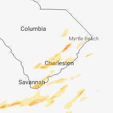


Connect with Interactive Hail Maps