

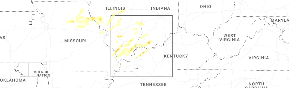
Hail Map for Parkers Settlement, IN
The Parkers Settlement, IN area has had 0 reports of on-the-ground hail by trained spotters, and has been under severe weather warnings 18 times during the past 12 months. Doppler radar has detected hail at or near Parkers Settlement, IN on 59 occasions, including 1 occasion during the past year.
| Name: | Parkers Settlement, IN |
| Where Located: | 9.8 miles WNW of Evansville, IN |
| Map: | Google Map for Parkers Settlement, IN |
| Population: | 711 |
| Housing Units: | 282 |
| More Info: | Search Google for Parkers Settlement, IN |
2
The Top Recent Hail Date for Parkers Settlement, IN is Monday, April 27, 2026 (10th out of 59)
Hail and Wind Damage Spotted near Parkers Settlement, IN
| Date / Time | Report Details |
|---|---|
| 6/27/2026 2:58 PM CDT |
 the severe thunderstorm warning has been cancelled and is no longer in effect the severe thunderstorm warning has been cancelled and is no longer in effect
|
| 6/27/2026 2:58 PM CDT |
 At 258 pm cdt, a severe thunderstorm was located over kasson, or near evansville, moving northeast at 45 mph (radar indicated). Hazards include 60 mph wind gusts. Expect damage to roofs, siding, and trees. locations impacted include, evansville, mount vernon, melody hill, darmstadt, blairsville, and kasson. This includes interstate 69 in indiana mile marker 1 and near mile marker 19. At 258 pm cdt, a severe thunderstorm was located over kasson, or near evansville, moving northeast at 45 mph (radar indicated). Hazards include 60 mph wind gusts. Expect damage to roofs, siding, and trees. locations impacted include, evansville, mount vernon, melody hill, darmstadt, blairsville, and kasson. This includes interstate 69 in indiana mile marker 1 and near mile marker 19.
|
| 6/27/2026 2:41 PM CDT |
 Svrpah the national weather service in paducah has issued a * severe thunderstorm warning for, vanderburgh county in southwestern indiana, southeastern posey county in southwestern indiana, northwestern henderson county in northwestern kentucky, northeastern union county in northwestern kentucky, * until 330 pm cdt. * at 240 pm cdt, a severe thunderstorm was located near mount vernon, moving northeast at 45 mph (radar indicated). Hazards include 60 mph wind gusts. expect damage to roofs, siding, and trees Svrpah the national weather service in paducah has issued a * severe thunderstorm warning for, vanderburgh county in southwestern indiana, southeastern posey county in southwestern indiana, northwestern henderson county in northwestern kentucky, northeastern union county in northwestern kentucky, * until 330 pm cdt. * at 240 pm cdt, a severe thunderstorm was located near mount vernon, moving northeast at 45 mph (radar indicated). Hazards include 60 mph wind gusts. expect damage to roofs, siding, and trees
|
| 6/21/2026 9:41 PM CDT |
 Torpah the national weather service in paducah has issued a * tornado warning for, northwestern vanderburgh county in southwestern indiana, northeastern posey county in southwestern indiana, * until 1030 pm cdt. * at 941 pm cdt, a severe thunderstorm capable of producing a tornado was located near new harmony, or 11 miles north of mount vernon, moving east at 30 mph (radar indicated rotation). Hazards include tornado. Flying debris will be dangerous to those caught without shelter. mobile homes will be damaged or destroyed. damage to roofs, windows, and vehicles will occur. tree damage is likely. this dangerous storm will be near, poseyville and blairsville around 945 pm cdt. darmstadt around 955 pm cdt. Evansville around 1000 pm cdt. Torpah the national weather service in paducah has issued a * tornado warning for, northwestern vanderburgh county in southwestern indiana, northeastern posey county in southwestern indiana, * until 1030 pm cdt. * at 941 pm cdt, a severe thunderstorm capable of producing a tornado was located near new harmony, or 11 miles north of mount vernon, moving east at 30 mph (radar indicated rotation). Hazards include tornado. Flying debris will be dangerous to those caught without shelter. mobile homes will be damaged or destroyed. damage to roofs, windows, and vehicles will occur. tree damage is likely. this dangerous storm will be near, poseyville and blairsville around 945 pm cdt. darmstadt around 955 pm cdt. Evansville around 1000 pm cdt.
|
| 4/27/2026 11:58 AM CDT |
 Svrpah the national weather service in paducah has issued a * severe thunderstorm warning for, northwestern warrick county in southwestern indiana, northern vanderburgh county in southwestern indiana, gibson county in southwestern indiana, northeastern posey county in southwestern indiana, central pike county in southwestern indiana, * until 1245 pm cdt/145 pm edt/. * at 1157 am cdt/1257 pm edt/, a severe thunderstorm was located near haubstadt, or near fort branch, moving northeast at 40 mph (radar indicated). Hazards include quarter size hail. damage to vehicles is expected Svrpah the national weather service in paducah has issued a * severe thunderstorm warning for, northwestern warrick county in southwestern indiana, northern vanderburgh county in southwestern indiana, gibson county in southwestern indiana, northeastern posey county in southwestern indiana, central pike county in southwestern indiana, * until 1245 pm cdt/145 pm edt/. * at 1157 am cdt/1257 pm edt/, a severe thunderstorm was located near haubstadt, or near fort branch, moving northeast at 40 mph (radar indicated). Hazards include quarter size hail. damage to vehicles is expected
|
| 4/27/2026 11:26 AM CDT |
 At 1126 am cdt, a severe thunderstorm was located near mount vernon, moving northeast at 30 mph (radar indicated). Hazards include quarter size hail. Damage to vehicles is expected. locations impacted include, mount vernon, poseyville, new harmony, cynthiana, and blairsville. This includes interstate 64 in indiana between mile markers 10 and 17. At 1126 am cdt, a severe thunderstorm was located near mount vernon, moving northeast at 30 mph (radar indicated). Hazards include quarter size hail. Damage to vehicles is expected. locations impacted include, mount vernon, poseyville, new harmony, cynthiana, and blairsville. This includes interstate 64 in indiana between mile markers 10 and 17.
|
| 4/27/2026 11:04 AM CDT |
 Svrpah the national weather service in paducah has issued a * severe thunderstorm warning for, southeastern white county in southeastern illinois, north central gallatin county in southern illinois, posey county in southwestern indiana, * until 1145 am cdt. * at 1104 am cdt, a severe thunderstorm was located 10 miles south of carmi, moving northeast at 30 mph (radar indicated). Hazards include quarter size hail. damage to vehicles is expected Svrpah the national weather service in paducah has issued a * severe thunderstorm warning for, southeastern white county in southeastern illinois, north central gallatin county in southern illinois, posey county in southwestern indiana, * until 1145 am cdt. * at 1104 am cdt, a severe thunderstorm was located 10 miles south of carmi, moving northeast at 30 mph (radar indicated). Hazards include quarter size hail. damage to vehicles is expected
|
| 3/15/2026 8:57 PM CDT |
 The storms which prompted the warning have weakened below severe limits, and have exited the warned area. therefore, the warning will be allowed to expire. a tornado watch remains in effect until 1100 pm cdt for southwestern indiana. The storms which prompted the warning have weakened below severe limits, and have exited the warned area. therefore, the warning will be allowed to expire. a tornado watch remains in effect until 1100 pm cdt for southwestern indiana.
|
| 3/15/2026 8:47 PM CDT |
 At 846 pm cdt, severe thunderstorms were located along a line extending from near patoka to near owensville to near blairsville, moving northeast at 50 mph (radar indicated). Hazards include 60 mph wind gusts. Expect damage to roofs, siding, and trees. locations impacted include, princeton, fort branch, haubstadt, darmstadt, owensville, poseyville, patoka, cynthiana, blairsville, and hazleton. This includes interstate 64 in indiana between mile markers 12 and 23. At 846 pm cdt, severe thunderstorms were located along a line extending from near patoka to near owensville to near blairsville, moving northeast at 50 mph (radar indicated). Hazards include 60 mph wind gusts. Expect damage to roofs, siding, and trees. locations impacted include, princeton, fort branch, haubstadt, darmstadt, owensville, poseyville, patoka, cynthiana, blairsville, and hazleton. This includes interstate 64 in indiana between mile markers 12 and 23.
|
| 3/15/2026 8:47 PM CDT |
 the severe thunderstorm warning has been cancelled and is no longer in effect the severe thunderstorm warning has been cancelled and is no longer in effect
|
| 3/15/2026 8:32 PM CDT |
 the severe thunderstorm warning has been cancelled and is no longer in effect the severe thunderstorm warning has been cancelled and is no longer in effect
|
| 3/15/2026 8:32 PM CDT |
 At 831 pm cdt, severe thunderstorms were located along a line extending from lancaster to near poseyville to near mount vernon, moving east at 50 mph (radar indicated). Hazards include 60 mph wind gusts. Expect damage to roofs, siding, and trees. locations impacted include, princeton, mount carmel, fort branch, lancaster, haubstadt, darmstadt, owensville, poseyville, new harmony, patoka, cynthiana, blairsville, allendale, hazleton, and keensburg. This includes interstate 64 in indiana between mile markers 6 and 23. At 831 pm cdt, severe thunderstorms were located along a line extending from lancaster to near poseyville to near mount vernon, moving east at 50 mph (radar indicated). Hazards include 60 mph wind gusts. Expect damage to roofs, siding, and trees. locations impacted include, princeton, mount carmel, fort branch, lancaster, haubstadt, darmstadt, owensville, poseyville, new harmony, patoka, cynthiana, blairsville, allendale, hazleton, and keensburg. This includes interstate 64 in indiana between mile markers 6 and 23.
|
| 3/15/2026 9:14 PM EDT |
 Svrpah the national weather service in paducah has issued a * severe thunderstorm warning for, central white county in southeastern illinois, wabash county in southeastern illinois, edwards county in southeastern illinois, gibson county in southwestern indiana, northwestern vanderburgh county in southwestern indiana, northern posey county in southwestern indiana, * until 900 pm cdt. * at 813 pm cdt, severe thunderstorms were located along a line extending from near parkersburg to near norris city, moving northeast at 55 mph (radar indicated). Hazards include 60 mph wind gusts. expect damage to roofs, siding, and trees Svrpah the national weather service in paducah has issued a * severe thunderstorm warning for, central white county in southeastern illinois, wabash county in southeastern illinois, edwards county in southeastern illinois, gibson county in southwestern indiana, northwestern vanderburgh county in southwestern indiana, northern posey county in southwestern indiana, * until 900 pm cdt. * at 813 pm cdt, severe thunderstorms were located along a line extending from near parkersburg to near norris city, moving northeast at 55 mph (radar indicated). Hazards include 60 mph wind gusts. expect damage to roofs, siding, and trees
|
| 1/9/2026 2:10 AM CST |
 Svrpah the national weather service in paducah has issued a * severe thunderstorm warning for, central white county in southeastern illinois, southwestern wabash county in southeastern illinois, southeastern edwards county in southeastern illinois, southwestern gibson county in southwestern indiana, posey county in southwestern indiana, * until 300 am cst. * at 210 am cst, severe thunderstorms were located along a line extending from 7 miles west of grayville to near norris city, moving east at 40 mph (radar indicated). Hazards include 60 mph wind gusts. expect damage to roofs, siding, and trees Svrpah the national weather service in paducah has issued a * severe thunderstorm warning for, central white county in southeastern illinois, southwestern wabash county in southeastern illinois, southeastern edwards county in southeastern illinois, southwestern gibson county in southwestern indiana, posey county in southwestern indiana, * until 300 am cst. * at 210 am cst, severe thunderstorms were located along a line extending from 7 miles west of grayville to near norris city, moving east at 40 mph (radar indicated). Hazards include 60 mph wind gusts. expect damage to roofs, siding, and trees
|
| 12/28/2025 6:40 PM CST |
 the severe thunderstorm warning has been cancelled and is no longer in effect the severe thunderstorm warning has been cancelled and is no longer in effect
|
| 12/28/2025 6:19 PM CST |
 Svrpah the national weather service in paducah has issued a * severe thunderstorm warning for, eastern white county in southeastern illinois, southwestern gibson county in southwestern indiana, posey county in southwestern indiana, * until 700 pm cst. * at 619 pm cst, a severe thunderstorm was located near carmi, moving east at 55 mph (radar indicated). Hazards include 60 mph wind gusts. expect damage to roofs, siding, and trees Svrpah the national weather service in paducah has issued a * severe thunderstorm warning for, eastern white county in southeastern illinois, southwestern gibson county in southwestern indiana, posey county in southwestern indiana, * until 700 pm cst. * at 619 pm cst, a severe thunderstorm was located near carmi, moving east at 55 mph (radar indicated). Hazards include 60 mph wind gusts. expect damage to roofs, siding, and trees
|
| 7/19/2025 1:57 PM CDT |
 Svrpah the national weather service in paducah has issued a * severe thunderstorm warning for, northwestern warrick county in southwestern indiana, southeastern gibson county in southwestern indiana, vanderburgh county in southwestern indiana, east central posey county in southwestern indiana, north central henderson county in northwestern kentucky, * until 245 pm cdt. * at 157 pm cdt, severe thunderstorms were located along a line extending from near fort branch to near darmstadt to near kasson, moving east at 15 mph (radar indicated). Hazards include 60 mph wind gusts. expect damage to roofs, siding, and trees Svrpah the national weather service in paducah has issued a * severe thunderstorm warning for, northwestern warrick county in southwestern indiana, southeastern gibson county in southwestern indiana, vanderburgh county in southwestern indiana, east central posey county in southwestern indiana, north central henderson county in northwestern kentucky, * until 245 pm cdt. * at 157 pm cdt, severe thunderstorms were located along a line extending from near fort branch to near darmstadt to near kasson, moving east at 15 mph (radar indicated). Hazards include 60 mph wind gusts. expect damage to roofs, siding, and trees
|
| 7/13/2025 5:07 PM CDT |
 Svrpah the national weather service in paducah has issued a * severe thunderstorm warning for, southern gibson county in southwestern indiana, northwestern vanderburgh county in southwestern indiana, northeastern posey county in southwestern indiana, * until 545 pm cdt. * at 507 pm cdt, a severe thunderstorm was located over blairsville, or 11 miles northeast of mount vernon, moving northeast at 25 mph (radar indicated). Hazards include 60 mph wind gusts. expect damage to roofs, siding, and trees Svrpah the national weather service in paducah has issued a * severe thunderstorm warning for, southern gibson county in southwestern indiana, northwestern vanderburgh county in southwestern indiana, northeastern posey county in southwestern indiana, * until 545 pm cdt. * at 507 pm cdt, a severe thunderstorm was located over blairsville, or 11 miles northeast of mount vernon, moving northeast at 25 mph (radar indicated). Hazards include 60 mph wind gusts. expect damage to roofs, siding, and trees
|
| 6/18/2025 2:57 PM CDT | The storm which prompted the warning has weakened below severe limits, and no longer poses an immediate threat to life or property. therefore, the warning will be allowed to expire. however, gusty winds and heavy rain are still possible with this thunderstorm. a tornado watch remains in effect until 800 pm cdt for southwestern indiana, and northwestern kentucky. |
| 6/18/2025 2:33 PM CDT | At 233 pm cdt, a severe thunderstorm was located near mount vernon, moving northeast at 45 mph (radar indicated). Hazards include 60 mph wind gusts and quarter size hail. Hail damage to vehicles is expected. expect wind damage to roofs, siding, and trees. locations impacted include, evansville, mount vernon, darmstadt, poseyville, cynthiana, blairsville, and kasson. This includes interstate 64 in indiana between mile markers 10 and 22. |
| 6/18/2025 2:33 PM CDT | the severe thunderstorm warning has been cancelled and is no longer in effect |
| 6/18/2025 2:20 PM CDT |
 Svrpah the national weather service in paducah has issued a * severe thunderstorm warning for, southeastern white county in southeastern illinois, northwestern vanderburgh county in southwestern indiana, posey county in southwestern indiana, * until 300 pm cdt. * at 219 pm cdt, a severe thunderstorm was located near mount vernon, moving northeast at 45 mph (radar indicated). Hazards include 60 mph wind gusts and quarter size hail. Hail damage to vehicles is expected. Expect wind damage to roofs, siding, and trees. Svrpah the national weather service in paducah has issued a * severe thunderstorm warning for, southeastern white county in southeastern illinois, northwestern vanderburgh county in southwestern indiana, posey county in southwestern indiana, * until 300 pm cdt. * at 219 pm cdt, a severe thunderstorm was located near mount vernon, moving northeast at 45 mph (radar indicated). Hazards include 60 mph wind gusts and quarter size hail. Hail damage to vehicles is expected. Expect wind damage to roofs, siding, and trees.
|
| 5/20/2025 2:44 AM CDT |
 the severe thunderstorm warning has been cancelled and is no longer in effect the severe thunderstorm warning has been cancelled and is no longer in effect
|
| 5/20/2025 2:26 AM CDT |
 Svrpah the national weather service in paducah has issued a * severe thunderstorm warning for, northwestern warrick county in southwestern indiana, vanderburgh county in southwestern indiana, southeastern gibson county in southwestern indiana, east central posey county in southwestern indiana, northwestern henderson county in northwestern kentucky, * until 315 am cdt. * at 226 am cdt, severe thunderstorms were located along a line extending from near mount vernon to near corydon, moving northeast at 50 mph (radar indicated). Hazards include 60 mph wind gusts. expect damage to roofs, siding, and trees Svrpah the national weather service in paducah has issued a * severe thunderstorm warning for, northwestern warrick county in southwestern indiana, vanderburgh county in southwestern indiana, southeastern gibson county in southwestern indiana, east central posey county in southwestern indiana, northwestern henderson county in northwestern kentucky, * until 315 am cdt. * at 226 am cdt, severe thunderstorms were located along a line extending from near mount vernon to near corydon, moving northeast at 50 mph (radar indicated). Hazards include 60 mph wind gusts. expect damage to roofs, siding, and trees
|
| 5/16/2025 6:28 PM CDT |
 the severe thunderstorm warning has been cancelled and is no longer in effect the severe thunderstorm warning has been cancelled and is no longer in effect
|
| 5/16/2025 6:28 PM CDT |
 At 628 pm cdt, a severe thunderstorm was located near carmi, moving east at 65 mph (radar indicated). Hazards include ping pong ball size hail and 60 mph wind gusts. People and animals outdoors will be injured. expect hail damage to roofs, siding, windows, and vehicles. expect wind damage to roofs, siding, and trees. locations impacted include, carmi, poseyville, new harmony, cynthiana, blairsville, and maunie. This includes interstate 64 in indiana between mile markers 9 and 17. At 628 pm cdt, a severe thunderstorm was located near carmi, moving east at 65 mph (radar indicated). Hazards include ping pong ball size hail and 60 mph wind gusts. People and animals outdoors will be injured. expect hail damage to roofs, siding, windows, and vehicles. expect wind damage to roofs, siding, and trees. locations impacted include, carmi, poseyville, new harmony, cynthiana, blairsville, and maunie. This includes interstate 64 in indiana between mile markers 9 and 17.
|
| 5/16/2025 6:17 PM CDT |
 Svrpah the national weather service in paducah has issued a * severe thunderstorm warning for, southern white county in southeastern illinois, southeastern hamilton county in south central illinois, northern posey county in southwestern indiana, * until 700 pm cdt. * at 617 pm cdt, a severe thunderstorm was located over norris city, or 11 miles northeast of eldorado, moving east at 65 mph (radar indicated). Hazards include ping pong ball size hail and 60 mph wind gusts. People and animals outdoors will be injured. expect hail damage to roofs, siding, windows, and vehicles. Expect wind damage to roofs, siding, and trees. Svrpah the national weather service in paducah has issued a * severe thunderstorm warning for, southern white county in southeastern illinois, southeastern hamilton county in south central illinois, northern posey county in southwestern indiana, * until 700 pm cdt. * at 617 pm cdt, a severe thunderstorm was located over norris city, or 11 miles northeast of eldorado, moving east at 65 mph (radar indicated). Hazards include ping pong ball size hail and 60 mph wind gusts. People and animals outdoors will be injured. expect hail damage to roofs, siding, windows, and vehicles. Expect wind damage to roofs, siding, and trees.
|
| 4/4/2025 10:40 PM CDT |
 The storms which prompted the warning have weakened below severe limits, and no longer pose an immediate threat to life or property. therefore, the warning will be allowed to expire. however, small hail, gusty winds and heavy rain are still possible with these thunderstorms. a tornado watch remains in effect until 400 am cdt for southwestern indiana, and northwestern kentucky. The storms which prompted the warning have weakened below severe limits, and no longer pose an immediate threat to life or property. therefore, the warning will be allowed to expire. however, small hail, gusty winds and heavy rain are still possible with these thunderstorms. a tornado watch remains in effect until 400 am cdt for southwestern indiana, and northwestern kentucky.
|
| 4/4/2025 10:32 PM CDT |
 At 1032 pm cdt, severe thunderstorms were located along a line extending from near grayville to near blairsville to near mount vernon, moving east at 50 mph (radar indicated). Hazards include 60 mph wind gusts and nickel size hail. Expect damage to roofs, siding, and trees. locations impacted include, blairsville, mount vernon, cynthiana, griffin, new harmony, poseyville, and grayville. this includes the following highways, interstate 64 in indiana between mile markers 1 and 17. Interstate 64 in illinois between mile markers 129 and 130. At 1032 pm cdt, severe thunderstorms were located along a line extending from near grayville to near blairsville to near mount vernon, moving east at 50 mph (radar indicated). Hazards include 60 mph wind gusts and nickel size hail. Expect damage to roofs, siding, and trees. locations impacted include, blairsville, mount vernon, cynthiana, griffin, new harmony, poseyville, and grayville. this includes the following highways, interstate 64 in indiana between mile markers 1 and 17. Interstate 64 in illinois between mile markers 129 and 130.
|
| 4/4/2025 10:32 PM CDT |
 the severe thunderstorm warning has been cancelled and is no longer in effect the severe thunderstorm warning has been cancelled and is no longer in effect
|
| 4/4/2025 10:01 PM CDT |
 Svrpah the national weather service in paducah has issued a * severe thunderstorm warning for, white county in southeastern illinois, northern gallatin county in southern illinois, southwestern gibson county in southwestern indiana, posey county in southwestern indiana, west central henderson county in northwestern kentucky, north central union county in northwestern kentucky, * until 1045 pm cdt. * at 1001 pm cdt, severe thunderstorms were located along a line extending from enfield to near norris city to near ridgway, moving east at 50 mph (radar indicated). Hazards include 60 mph wind gusts and half dollar size hail. Hail damage to vehicles is expected. Expect wind damage to roofs, siding, and trees. Svrpah the national weather service in paducah has issued a * severe thunderstorm warning for, white county in southeastern illinois, northern gallatin county in southern illinois, southwestern gibson county in southwestern indiana, posey county in southwestern indiana, west central henderson county in northwestern kentucky, north central union county in northwestern kentucky, * until 1045 pm cdt. * at 1001 pm cdt, severe thunderstorms were located along a line extending from enfield to near norris city to near ridgway, moving east at 50 mph (radar indicated). Hazards include 60 mph wind gusts and half dollar size hail. Hail damage to vehicles is expected. Expect wind damage to roofs, siding, and trees.
|
| 4/2/2025 9:06 PM CDT |
 At 906 pm cdt/1006 pm edt/, severe thunderstorms were located along a line extending from 7 miles northwest of shoals to 7 miles northwest of chandler to near evansville to near robards, moving east at 45 mph (radar indicated). Hazards include 70 mph wind gusts. Expect considerable tree damage. damage is likely to mobile homes, roofs, and outbuildings. locations impacted include, haubstadt, boonville, darmstadt, spurgeon, francisco, petersburg, winslow, lynnville, oakland city, somerville, chandler, robards, melody hill, princeton, fort branch, cynthiana, corydon, mackey, elberfeld, and newburgh. this includes the following highways, interstate 69 in kentucky between mile markers 138 and 148. interstate 69 in indiana between mile markers 1 and 52. interstate 64 in indiana between mile markers 15 and 44. Audubon parkway between mile markers 1 and 11. At 906 pm cdt/1006 pm edt/, severe thunderstorms were located along a line extending from 7 miles northwest of shoals to 7 miles northwest of chandler to near evansville to near robards, moving east at 45 mph (radar indicated). Hazards include 70 mph wind gusts. Expect considerable tree damage. damage is likely to mobile homes, roofs, and outbuildings. locations impacted include, haubstadt, boonville, darmstadt, spurgeon, francisco, petersburg, winslow, lynnville, oakland city, somerville, chandler, robards, melody hill, princeton, fort branch, cynthiana, corydon, mackey, elberfeld, and newburgh. this includes the following highways, interstate 69 in kentucky between mile markers 138 and 148. interstate 69 in indiana between mile markers 1 and 52. interstate 64 in indiana between mile markers 15 and 44. Audubon parkway between mile markers 1 and 11.
|
| 4/2/2025 8:57 PM CDT |
 the tornado warning has been cancelled and is no longer in effect the tornado warning has been cancelled and is no longer in effect
|
| 4/2/2025 8:57 PM CDT |
 At 856 pm cdt, tornado producing storms were located along a line extending from near kasson to evansville to near henderson, moving northeast at 75 mph (radar confirmed tornado). Hazards include damaging tornado. Flying debris will be dangerous to those caught without shelter. mobile homes will be damaged or destroyed. damage to roofs, windows, and vehicles will occur. tree damage is likely. these tornadic storms will be near, newburgh, melody hill, darmstadt, chandler, henderson, and evansville around 900 pm cdt. boonville around 905 pm cdt. lynnville around 910 pm cdt. folsomville around 915 pm cdt. other locations impacted by these tornadic storms include elberfeld and tennyson. this includes the following highways, interstate 69 in indiana between mile markers 1 and 23. Interstate 64 in indiana between mile markers 27 and 52. At 856 pm cdt, tornado producing storms were located along a line extending from near kasson to evansville to near henderson, moving northeast at 75 mph (radar confirmed tornado). Hazards include damaging tornado. Flying debris will be dangerous to those caught without shelter. mobile homes will be damaged or destroyed. damage to roofs, windows, and vehicles will occur. tree damage is likely. these tornadic storms will be near, newburgh, melody hill, darmstadt, chandler, henderson, and evansville around 900 pm cdt. boonville around 905 pm cdt. lynnville around 910 pm cdt. folsomville around 915 pm cdt. other locations impacted by these tornadic storms include elberfeld and tennyson. this includes the following highways, interstate 69 in indiana between mile markers 1 and 23. Interstate 64 in indiana between mile markers 27 and 52.
|
| 4/2/2025 8:54 PM CDT |
 Torpah the national weather service in paducah has issued a * tornado warning for, warrick county in southwestern indiana, vanderburgh county in southwestern indiana, west central spencer county in southwestern indiana, southeastern gibson county in southwestern indiana, east central posey county in southwestern indiana, northeastern henderson county in northwestern kentucky, * until 945 pm cdt. * at 854 pm cdt, severe thunderstorms capable of producing both tornadoes and extensive straight line wind damage were located along a line extending from near kasson to 6 miles southwest of evansville to near henderson, moving northeast at 70 mph (radar indicated rotation). Hazards include tornado. Flying debris will be dangerous to those caught without shelter. mobile homes will be damaged or destroyed. damage to roofs, windows, and vehicles will occur. tree damage is likely. these dangerous storms will be near, newburgh, melody hill, darmstadt, henderson, and evansville around 900 pm cdt. chandler around 905 pm cdt. lynnville and boonville around 910 pm cdt. folsomville around 915 pm cdt. other locations impacted by these tornadic storms include elberfeld and tennyson. this includes the following highways, interstate 69 in indiana between mile markers 1 and 23. Interstate 64 in indiana between mile markers 27 and 52. Torpah the national weather service in paducah has issued a * tornado warning for, warrick county in southwestern indiana, vanderburgh county in southwestern indiana, west central spencer county in southwestern indiana, southeastern gibson county in southwestern indiana, east central posey county in southwestern indiana, northeastern henderson county in northwestern kentucky, * until 945 pm cdt. * at 854 pm cdt, severe thunderstorms capable of producing both tornadoes and extensive straight line wind damage were located along a line extending from near kasson to 6 miles southwest of evansville to near henderson, moving northeast at 70 mph (radar indicated rotation). Hazards include tornado. Flying debris will be dangerous to those caught without shelter. mobile homes will be damaged or destroyed. damage to roofs, windows, and vehicles will occur. tree damage is likely. these dangerous storms will be near, newburgh, melody hill, darmstadt, henderson, and evansville around 900 pm cdt. chandler around 905 pm cdt. lynnville and boonville around 910 pm cdt. folsomville around 915 pm cdt. other locations impacted by these tornadic storms include elberfeld and tennyson. this includes the following highways, interstate 69 in indiana between mile markers 1 and 23. Interstate 64 in indiana between mile markers 27 and 52.
|
| 4/2/2025 8:44 PM CDT |
 At 843 pm cdt, tornado producing storms were located along a line extending from near carmi to near new harmony to mount vernon, moving northeast at 60 mph (radar confirmed tornado). Hazards include damaging tornado. Flying debris will be dangerous to those caught without shelter. mobile homes will be damaged or destroyed. damage to roofs, windows, and vehicles will occur. tree damage is likely. these tornadic storms will be near, poseyville, crossville, blairsville, new harmony, and grayville around 850 pm cdt. cynthiana around 855 pm cdt. haubstadt and owensville around 900 pm cdt. fort branch around 905 pm cdt. other locations impacted by these tornadic storms include keensburg, griffin, maunie, and phillipstown. this includes the following highways, interstate 69 in indiana between mile markers 23 and 25. interstate 64 in indiana between mile markers 1 and 26. Interstate 64 in illinois near mile marker 130. At 843 pm cdt, tornado producing storms were located along a line extending from near carmi to near new harmony to mount vernon, moving northeast at 60 mph (radar confirmed tornado). Hazards include damaging tornado. Flying debris will be dangerous to those caught without shelter. mobile homes will be damaged or destroyed. damage to roofs, windows, and vehicles will occur. tree damage is likely. these tornadic storms will be near, poseyville, crossville, blairsville, new harmony, and grayville around 850 pm cdt. cynthiana around 855 pm cdt. haubstadt and owensville around 900 pm cdt. fort branch around 905 pm cdt. other locations impacted by these tornadic storms include keensburg, griffin, maunie, and phillipstown. this includes the following highways, interstate 69 in indiana between mile markers 23 and 25. interstate 64 in indiana between mile markers 1 and 26. Interstate 64 in illinois near mile marker 130.
|
| 4/2/2025 8:40 PM CDT |
 Svrpah the national weather service in paducah has issued a * severe thunderstorm warning for, western warrick county in southwestern indiana, vanderburgh county in southwestern indiana, gibson county in southwestern indiana, eastern posey county in southwestern indiana, pike county in southwestern indiana, henderson county in northwestern kentucky, northwestern mclean county in northwestern kentucky, northeastern union county in northwestern kentucky, * until 930 pm cdt/1030 pm edt/. * at 840 pm cdt/940 pm edt/, severe thunderstorms were located along a line extending from 8 miles southeast of vincennes to near mount vernon to 6 miles northwest of sturgis, moving northeast at 60 mph (radar indicated). Hazards include 70 mph wind gusts and quarter size hail. Hail damage to vehicles is expected. expect considerable tree damage. Wind damage is also likely to mobile homes, roofs, and outbuildings. Svrpah the national weather service in paducah has issued a * severe thunderstorm warning for, western warrick county in southwestern indiana, vanderburgh county in southwestern indiana, gibson county in southwestern indiana, eastern posey county in southwestern indiana, pike county in southwestern indiana, henderson county in northwestern kentucky, northwestern mclean county in northwestern kentucky, northeastern union county in northwestern kentucky, * until 930 pm cdt/1030 pm edt/. * at 840 pm cdt/940 pm edt/, severe thunderstorms were located along a line extending from 8 miles southeast of vincennes to near mount vernon to 6 miles northwest of sturgis, moving northeast at 60 mph (radar indicated). Hazards include 70 mph wind gusts and quarter size hail. Hail damage to vehicles is expected. expect considerable tree damage. Wind damage is also likely to mobile homes, roofs, and outbuildings.
|
| 4/2/2025 8:37 PM CDT |
 Torpah the national weather service in paducah has issued a * tornado warning for, central white county in southeastern illinois, southwestern wabash county in southeastern illinois, northwestern vanderburgh county in southwestern indiana, southwestern gibson county in southwestern indiana, posey county in southwestern indiana, * until 915 pm cdt. * at 836 pm cdt, severe thunderstorms capable of producing both tornadoes and extensive straight line wind damage were located along a line extending from near carmi to near mount vernon, moving northeast at 60 mph (radar indicated rotation). Hazards include tornado. Flying debris will be dangerous to those caught without shelter. mobile homes will be damaged or destroyed. damage to roofs, windows, and vehicles will occur. tree damage is likely. these dangerous storms will be near, carmi and mount vernon around 840 pm cdt. crossville and new harmony around 845 pm cdt. poseyville, blairsville, and grayville around 850 pm cdt. cynthiana around 855 pm cdt. haubstadt and owensville around 900 pm cdt. fort branch around 905 pm cdt. princeton around 910 pm cdt. other locations impacted by these tornadic storms include keensburg, griffin, maunie, and phillipstown. this includes the following highways, interstate 69 in indiana between mile markers 23 and 25. interstate 64 in indiana between mile markers 1 and 26. Interstate 64 in illinois near mile marker 130. Torpah the national weather service in paducah has issued a * tornado warning for, central white county in southeastern illinois, southwestern wabash county in southeastern illinois, northwestern vanderburgh county in southwestern indiana, southwestern gibson county in southwestern indiana, posey county in southwestern indiana, * until 915 pm cdt. * at 836 pm cdt, severe thunderstorms capable of producing both tornadoes and extensive straight line wind damage were located along a line extending from near carmi to near mount vernon, moving northeast at 60 mph (radar indicated rotation). Hazards include tornado. Flying debris will be dangerous to those caught without shelter. mobile homes will be damaged or destroyed. damage to roofs, windows, and vehicles will occur. tree damage is likely. these dangerous storms will be near, carmi and mount vernon around 840 pm cdt. crossville and new harmony around 845 pm cdt. poseyville, blairsville, and grayville around 850 pm cdt. cynthiana around 855 pm cdt. haubstadt and owensville around 900 pm cdt. fort branch around 905 pm cdt. princeton around 910 pm cdt. other locations impacted by these tornadic storms include keensburg, griffin, maunie, and phillipstown. this includes the following highways, interstate 69 in indiana between mile markers 23 and 25. interstate 64 in indiana between mile markers 1 and 26. Interstate 64 in illinois near mile marker 130.
|
| 4/2/2025 7:54 PM CDT |
 the tornado warning has been cancelled and is no longer in effect the tornado warning has been cancelled and is no longer in effect
|
| 4/2/2025 7:54 PM CDT |
 At 753 pm cdt, a severe thunderstorm capable of producing a tornado was located near kasson, or 8 miles west of evansville, moving northeast at 60 mph (radar indicated rotation). Hazards include tornado and half dollar size hail. Flying debris will be dangerous to those caught without shelter. mobile homes will be damaged or destroyed. damage to roofs, windows, and vehicles will occur. tree damage is likely. this dangerous storm will be near, kasson, melody hill, darmstadt, and evansville around 800 pm cdt. this includes the following highways, interstate 69 in indiana between mile markers 9 and 13. Interstate 64 in indiana between mile markers 18 and 24. At 753 pm cdt, a severe thunderstorm capable of producing a tornado was located near kasson, or 8 miles west of evansville, moving northeast at 60 mph (radar indicated rotation). Hazards include tornado and half dollar size hail. Flying debris will be dangerous to those caught without shelter. mobile homes will be damaged or destroyed. damage to roofs, windows, and vehicles will occur. tree damage is likely. this dangerous storm will be near, kasson, melody hill, darmstadt, and evansville around 800 pm cdt. this includes the following highways, interstate 69 in indiana between mile markers 9 and 13. Interstate 64 in indiana between mile markers 18 and 24.
|
| 4/2/2025 7:47 PM CDT |
 the tornado warning has been cancelled and is no longer in effect the tornado warning has been cancelled and is no longer in effect
|
| 4/2/2025 7:47 PM CDT |
 At 747 pm cdt, a severe thunderstorm capable of producing a tornado was located near mount vernon, moving northeast at 60 mph (radar indicated rotation). Hazards include tornado. Flying debris will be dangerous to those caught without shelter. mobile homes will be damaged or destroyed. damage to roofs, windows, and vehicles will occur. tree damage is likely. this dangerous storm will be near, kasson, melody hill, darmstadt, blairsville, and evansville around 755 pm cdt. this includes the following highways, interstate 69 in indiana between mile markers 9 and 13. Interstate 64 in indiana between mile markers 18 and 24. At 747 pm cdt, a severe thunderstorm capable of producing a tornado was located near mount vernon, moving northeast at 60 mph (radar indicated rotation). Hazards include tornado. Flying debris will be dangerous to those caught without shelter. mobile homes will be damaged or destroyed. damage to roofs, windows, and vehicles will occur. tree damage is likely. this dangerous storm will be near, kasson, melody hill, darmstadt, blairsville, and evansville around 755 pm cdt. this includes the following highways, interstate 69 in indiana between mile markers 9 and 13. Interstate 64 in indiana between mile markers 18 and 24.
|
| 4/2/2025 7:37 PM CDT |
 At 737 pm cdt, a severe thunderstorm capable of producing a tornado was located near uniontown, or near mount vernon, moving northeast at 60 mph (radar indicated rotation). Hazards include tornado. Flying debris will be dangerous to those caught without shelter. mobile homes will be damaged or destroyed. damage to roofs, windows, and vehicles will occur. tree damage is likely. this dangerous storm will be near, mount vernon around 740 pm cdt. evansville around 745 pm cdt. kasson and blairsville around 750 pm cdt. melody hill and darmstadt around 755 pm cdt. this includes the following highways, interstate 69 in indiana between mile markers 1 and 5, and between mile markers 8 and 13. Interstate 64 in indiana between mile markers 18 and 24. At 737 pm cdt, a severe thunderstorm capable of producing a tornado was located near uniontown, or near mount vernon, moving northeast at 60 mph (radar indicated rotation). Hazards include tornado. Flying debris will be dangerous to those caught without shelter. mobile homes will be damaged or destroyed. damage to roofs, windows, and vehicles will occur. tree damage is likely. this dangerous storm will be near, mount vernon around 740 pm cdt. evansville around 745 pm cdt. kasson and blairsville around 750 pm cdt. melody hill and darmstadt around 755 pm cdt. this includes the following highways, interstate 69 in indiana between mile markers 1 and 5, and between mile markers 8 and 13. Interstate 64 in indiana between mile markers 18 and 24.
|
| 4/2/2025 7:24 PM CDT |
 Torpah the national weather service in paducah has issued a * tornado warning for, southeastern white county in southeastern illinois, central gallatin county in southern illinois, vanderburgh county in southwestern indiana, south central gibson county in southwestern indiana, central posey county in southwestern indiana, northern henderson county in northwestern kentucky, central union county in northwestern kentucky, * until 815 pm cdt. * at 723 pm cdt, a severe thunderstorm capable of producing a tornado was located over shawneetown, moving northeast at 60 mph (radar indicated rotation). Hazards include tornado. Flying debris will be dangerous to those caught without shelter. mobile homes will be damaged or destroyed. damage to roofs, windows, and vehicles will occur. tree damage is likely. this dangerous storm will be near, uniontown around 730 pm cdt. mount vernon around 735 pm cdt. evansville around 745 pm cdt. kasson around 750 pm cdt. melody hill and darmstadt around 755 pm cdt. other locations impacted by this tornadic thunderstorm include old shawneetown and junction. this includes the following highways, interstate 69 in indiana between mile markers 1 and 5, and between mile markers 8 and 13. Interstate 64 in indiana between mile markers 18 and 24. Torpah the national weather service in paducah has issued a * tornado warning for, southeastern white county in southeastern illinois, central gallatin county in southern illinois, vanderburgh county in southwestern indiana, south central gibson county in southwestern indiana, central posey county in southwestern indiana, northern henderson county in northwestern kentucky, central union county in northwestern kentucky, * until 815 pm cdt. * at 723 pm cdt, a severe thunderstorm capable of producing a tornado was located over shawneetown, moving northeast at 60 mph (radar indicated rotation). Hazards include tornado. Flying debris will be dangerous to those caught without shelter. mobile homes will be damaged or destroyed. damage to roofs, windows, and vehicles will occur. tree damage is likely. this dangerous storm will be near, uniontown around 730 pm cdt. mount vernon around 735 pm cdt. evansville around 745 pm cdt. kasson around 750 pm cdt. melody hill and darmstadt around 755 pm cdt. other locations impacted by this tornadic thunderstorm include old shawneetown and junction. this includes the following highways, interstate 69 in indiana between mile markers 1 and 5, and between mile markers 8 and 13. Interstate 64 in indiana between mile markers 18 and 24.
|
| 3/19/2025 5:44 PM CDT |
 Svrpah the national weather service in paducah has issued a * severe thunderstorm warning for, northwestern vanderburgh county in southwestern indiana, eastern gibson county in southwestern indiana, northeastern posey county in southwestern indiana, west central pike county in southwestern indiana, * until 615 pm cdt/715 pm edt/. * at 544 pm cdt/644 pm edt/, a severe thunderstorm was located over cynthiana, or 9 miles southwest of fort branch, moving northeast at 55 mph (radar indicated). Hazards include 60 mph wind gusts and penny size hail. expect damage to roofs, siding, and trees Svrpah the national weather service in paducah has issued a * severe thunderstorm warning for, northwestern vanderburgh county in southwestern indiana, eastern gibson county in southwestern indiana, northeastern posey county in southwestern indiana, west central pike county in southwestern indiana, * until 615 pm cdt/715 pm edt/. * at 544 pm cdt/644 pm edt/, a severe thunderstorm was located over cynthiana, or 9 miles southwest of fort branch, moving northeast at 55 mph (radar indicated). Hazards include 60 mph wind gusts and penny size hail. expect damage to roofs, siding, and trees
|
| 3/15/2025 2:50 AM CDT |
 At 250 am cdt/350 am edt/, severe thunderstorms were located along a line extending from near new harmony to 7 miles southeast of mount vernon, moving northeast at 80 mph (radar indicated). Hazards include 70 mph wind gusts. Expect considerable tree damage. damage is likely to mobile homes, roofs, and outbuildings. locations impacted include, haubstadt, boonville, darmstadt, spurgeon, winslow, lynnville, mount vernon, oakland city, maunie, somerville, chandler, melody hill, fort branch, poseyville, folsomville, blairsville, cynthiana, mackey, elberfeld, and newburgh. this includes the following highways, interstate 69 in indiana between mile markers 1 and 33. Interstate 64 in indiana between mile markers 13 and 50. At 250 am cdt/350 am edt/, severe thunderstorms were located along a line extending from near new harmony to 7 miles southeast of mount vernon, moving northeast at 80 mph (radar indicated). Hazards include 70 mph wind gusts. Expect considerable tree damage. damage is likely to mobile homes, roofs, and outbuildings. locations impacted include, haubstadt, boonville, darmstadt, spurgeon, winslow, lynnville, mount vernon, oakland city, maunie, somerville, chandler, melody hill, fort branch, poseyville, folsomville, blairsville, cynthiana, mackey, elberfeld, and newburgh. this includes the following highways, interstate 69 in indiana between mile markers 1 and 33. Interstate 64 in indiana between mile markers 13 and 50.
|
| 3/15/2025 2:47 AM CDT |
 Svrpah the national weather service in paducah has issued a * severe thunderstorm warning for, east central white county in southeastern illinois, warrick county in southwestern indiana, vanderburgh county in southwestern indiana, southeastern gibson county in southwestern indiana, posey county in southwestern indiana, southeastern pike county in southwestern indiana, northwestern henderson county in northwestern kentucky, northeastern union county in northwestern kentucky, * until 330 am cdt/430 am edt/. * at 247 am cdt/347 am edt/, severe thunderstorms were located along a line extending from near new harmony to near uniontown, moving northeast at 80 mph (radar indicated). Hazards include 60 mph wind gusts. expect damage to roofs, siding, and trees Svrpah the national weather service in paducah has issued a * severe thunderstorm warning for, east central white county in southeastern illinois, warrick county in southwestern indiana, vanderburgh county in southwestern indiana, southeastern gibson county in southwestern indiana, posey county in southwestern indiana, southeastern pike county in southwestern indiana, northwestern henderson county in northwestern kentucky, northeastern union county in northwestern kentucky, * until 330 am cdt/430 am edt/. * at 247 am cdt/347 am edt/, severe thunderstorms were located along a line extending from near new harmony to near uniontown, moving northeast at 80 mph (radar indicated). Hazards include 60 mph wind gusts. expect damage to roofs, siding, and trees
|
| 3/15/2025 2:20 AM CDT |
 Torpah the national weather service in paducah has issued a * tornado warning for, southeastern white county in southeastern illinois, northern vanderburgh county in southwestern indiana, south central gibson county in southwestern indiana, posey county in southwestern indiana, * until 300 am cdt. * at 220 am cdt, a severe thunderstorm capable of producing a tornado was located 7 miles west of mount vernon, moving northeast at 65 mph (radar indicated rotation). Hazards include tornado and quarter size hail. Flying debris will be dangerous to those caught without shelter. mobile homes will be damaged or destroyed. damage to roofs, windows, and vehicles will occur. tree damage is likely. this dangerous storm will be near, mount vernon around 225 am cdt. blairsville and new harmony around 230 am cdt. cynthiana and poseyville around 235 am cdt. haubstadt and darmstadt around 240 am cdt. owensville around 245 am cdt. other locations impacted by this tornadic thunderstorm include maunie. this includes the following highways, interstate 69 in indiana near mile marker 19. Interstate 64 in indiana between mile markers 8 and 27. Torpah the national weather service in paducah has issued a * tornado warning for, southeastern white county in southeastern illinois, northern vanderburgh county in southwestern indiana, south central gibson county in southwestern indiana, posey county in southwestern indiana, * until 300 am cdt. * at 220 am cdt, a severe thunderstorm capable of producing a tornado was located 7 miles west of mount vernon, moving northeast at 65 mph (radar indicated rotation). Hazards include tornado and quarter size hail. Flying debris will be dangerous to those caught without shelter. mobile homes will be damaged or destroyed. damage to roofs, windows, and vehicles will occur. tree damage is likely. this dangerous storm will be near, mount vernon around 225 am cdt. blairsville and new harmony around 230 am cdt. cynthiana and poseyville around 235 am cdt. haubstadt and darmstadt around 240 am cdt. owensville around 245 am cdt. other locations impacted by this tornadic thunderstorm include maunie. this includes the following highways, interstate 69 in indiana near mile marker 19. Interstate 64 in indiana between mile markers 8 and 27.
|
| 8/1/2024 1:55 PM CDT |
 At 155 pm cdt, severe thunderstorms were located along a line extending from near blairsville to near mount vernon to 6 miles east of ridgway, moving southeast at 35 mph (law enforcement). Hazards include 60 mph wind gusts. Expect damage to roofs, siding, and trees. locations impacted include, evansville, henderson, mount vernon, carmi, uniontown, ridgway, kasson, new haven, omaha, and maunie. This includes interstate 69 in indiana between mile markers 1 and 2. At 155 pm cdt, severe thunderstorms were located along a line extending from near blairsville to near mount vernon to 6 miles east of ridgway, moving southeast at 35 mph (law enforcement). Hazards include 60 mph wind gusts. Expect damage to roofs, siding, and trees. locations impacted include, evansville, henderson, mount vernon, carmi, uniontown, ridgway, kasson, new haven, omaha, and maunie. This includes interstate 69 in indiana between mile markers 1 and 2.
|
| 8/1/2024 1:31 PM CDT |
 Svrpah the national weather service in paducah has issued a * severe thunderstorm warning for, southern white county in southeastern illinois, northern gallatin county in southern illinois, southern vanderburgh county in southwestern indiana, posey county in southwestern indiana, northwestern henderson county in northwestern kentucky, northern union county in northwestern kentucky, * until 215 pm cdt. * at 131 pm cdt, severe thunderstorms were located along a line extending from near new harmony to 7 miles southeast of carmi to near norris city, moving southeast at 35 mph (law enforcement). Hazards include 60 mph wind gusts. expect damage to roofs, siding, and trees Svrpah the national weather service in paducah has issued a * severe thunderstorm warning for, southern white county in southeastern illinois, northern gallatin county in southern illinois, southern vanderburgh county in southwestern indiana, posey county in southwestern indiana, northwestern henderson county in northwestern kentucky, northern union county in northwestern kentucky, * until 215 pm cdt. * at 131 pm cdt, severe thunderstorms were located along a line extending from near new harmony to 7 miles southeast of carmi to near norris city, moving southeast at 35 mph (law enforcement). Hazards include 60 mph wind gusts. expect damage to roofs, siding, and trees
|
| 7/30/2024 6:27 PM CDT |
 At 626 pm cdt, severe thunderstorms were located along a line extending from near cynthiana to near kasson to near corydon, moving east at 45 mph (radar indicated). Hazards include 70 mph wind gusts and quarter size hail. Hail damage to vehicles is expected. expect considerable tree damage. wind damage is also likely to mobile homes, roofs, and outbuildings. locations impacted include, evansville, henderson, newburgh, chandler, fort branch, melody hill, haubstadt, darmstadt, owensville, poseyville, corydon, cynthiana, blairsville, kasson, elberfeld, waverly, and griffin. this includes the following highways, interstate 69 in kentucky between mile markers 141 and 148. interstate 69 in indiana between mile markers 1 and 24. interstate 64 in indiana between mile markers 5 and 33. Audubon parkway between mile markers 1 and 10. At 626 pm cdt, severe thunderstorms were located along a line extending from near cynthiana to near kasson to near corydon, moving east at 45 mph (radar indicated). Hazards include 70 mph wind gusts and quarter size hail. Hail damage to vehicles is expected. expect considerable tree damage. wind damage is also likely to mobile homes, roofs, and outbuildings. locations impacted include, evansville, henderson, newburgh, chandler, fort branch, melody hill, haubstadt, darmstadt, owensville, poseyville, corydon, cynthiana, blairsville, kasson, elberfeld, waverly, and griffin. this includes the following highways, interstate 69 in kentucky between mile markers 141 and 148. interstate 69 in indiana between mile markers 1 and 24. interstate 64 in indiana between mile markers 5 and 33. Audubon parkway between mile markers 1 and 10.
|
| 7/30/2024 6:22 PM CDT |
 At 621 pm cdt, severe thunderstorms were located along a line extending from near cynthiana to 6 miles southwest of kasson to near breckinridge center, moving east at 45 mph (radar indicated). Hazards include 60 mph wind gusts and quarter size hail. Hail damage to vehicles is expected. expect wind damage to roofs, siding, and trees. locations impacted include, evansville, henderson, mount vernon, newburgh, chandler, fort branch, melody hill, haubstadt, darmstadt, owensville, poseyville, uniontown, corydon, cynthiana, blairsville, kasson, elberfeld, waverly, and griffin. this includes the following highways, interstate 69 in kentucky between mile markers 141 and 148. interstate 69 in indiana between mile markers 1 and 24. interstate 64 in indiana between mile markers 2 and 33. Audubon parkway between mile markers 1 and 10. At 621 pm cdt, severe thunderstorms were located along a line extending from near cynthiana to 6 miles southwest of kasson to near breckinridge center, moving east at 45 mph (radar indicated). Hazards include 60 mph wind gusts and quarter size hail. Hail damage to vehicles is expected. expect wind damage to roofs, siding, and trees. locations impacted include, evansville, henderson, mount vernon, newburgh, chandler, fort branch, melody hill, haubstadt, darmstadt, owensville, poseyville, uniontown, corydon, cynthiana, blairsville, kasson, elberfeld, waverly, and griffin. this includes the following highways, interstate 69 in kentucky between mile markers 141 and 148. interstate 69 in indiana between mile markers 1 and 24. interstate 64 in indiana between mile markers 2 and 33. Audubon parkway between mile markers 1 and 10.
|
| 7/30/2024 6:22 PM CDT |
 The storms which prompted the warning have moved out of the warned area. therefore, the warning has been cancelled. a severe thunderstorm watch remains in effect until 1000 pm cdt for southeastern illinois, southwestern indiana, and northwestern kentucky. The storms which prompted the warning have moved out of the warned area. therefore, the warning has been cancelled. a severe thunderstorm watch remains in effect until 1000 pm cdt for southeastern illinois, southwestern indiana, and northwestern kentucky.
|
| 7/30/2024 6:18 PM CDT |
 the severe thunderstorm warning has been cancelled and is no longer in effect the severe thunderstorm warning has been cancelled and is no longer in effect
|
| 7/30/2024 6:18 PM CDT |
 At 617 pm cdt, severe thunderstorms were located along a line extending from near poseyville to 7 miles east of mount vernon to near breckinridge center, moving east at 45 mph (radar indicated). Hazards include 60 mph wind gusts and quarter size hail. Hail damage to vehicles is expected. expect wind damage to roofs, siding, and trees. locations impacted include, evansville, henderson, mount vernon, newburgh, chandler, fort branch, melody hill, haubstadt, darmstadt, owensville, poseyville, uniontown, corydon, cynthiana, blairsville, kasson, elberfeld, waverly, and griffin. this includes the following highways, interstate 69 in kentucky between mile markers 141 and 148. interstate 69 in indiana between mile markers 1 and 24. interstate 64 in indiana between mile markers 2 and 33. Audubon parkway between mile markers 1 and 10. At 617 pm cdt, severe thunderstorms were located along a line extending from near poseyville to 7 miles east of mount vernon to near breckinridge center, moving east at 45 mph (radar indicated). Hazards include 60 mph wind gusts and quarter size hail. Hail damage to vehicles is expected. expect wind damage to roofs, siding, and trees. locations impacted include, evansville, henderson, mount vernon, newburgh, chandler, fort branch, melody hill, haubstadt, darmstadt, owensville, poseyville, uniontown, corydon, cynthiana, blairsville, kasson, elberfeld, waverly, and griffin. this includes the following highways, interstate 69 in kentucky between mile markers 141 and 148. interstate 69 in indiana between mile markers 1 and 24. interstate 64 in indiana between mile markers 2 and 33. Audubon parkway between mile markers 1 and 10.
|
| 7/30/2024 6:04 PM CDT |
 Svrpah the national weather service in paducah has issued a * severe thunderstorm warning for, northeastern white county in southeastern illinois, east central gallatin county in southern illinois, southwestern warrick county in southwestern indiana, vanderburgh county in southwestern indiana, southwestern gibson county in southwestern indiana, posey county in southwestern indiana, henderson county in northwestern kentucky, northern union county in northwestern kentucky, * until 645 pm cdt. * at 604 pm cdt, severe thunderstorms were located along a line extending from crossville to near mount vernon to near uniontown, moving east at 45 mph (radar indicated). Hazards include 60 mph wind gusts and quarter size hail. Hail damage to vehicles is expected. Expect wind damage to roofs, siding, and trees. Svrpah the national weather service in paducah has issued a * severe thunderstorm warning for, northeastern white county in southeastern illinois, east central gallatin county in southern illinois, southwestern warrick county in southwestern indiana, vanderburgh county in southwestern indiana, southwestern gibson county in southwestern indiana, posey county in southwestern indiana, henderson county in northwestern kentucky, northern union county in northwestern kentucky, * until 645 pm cdt. * at 604 pm cdt, severe thunderstorms were located along a line extending from crossville to near mount vernon to near uniontown, moving east at 45 mph (radar indicated). Hazards include 60 mph wind gusts and quarter size hail. Hail damage to vehicles is expected. Expect wind damage to roofs, siding, and trees.
|
| 5/26/2024 8:33 PM CDT |
 Svrpah the national weather service in paducah has issued a * severe thunderstorm warning for, southeastern white county in southeastern illinois, south central wabash county in southeastern illinois, warrick county in southwestern indiana, vanderburgh county in southwestern indiana, gibson county in southwestern indiana, posey county in southwestern indiana, pike county in southwestern indiana, * until 930 pm cdt/1030 pm edt/. * at 833 pm cdt/933 pm edt/, severe thunderstorms were located along a line extending from near lancaster to near new harmony to 8 miles west of mount vernon, moving east at 65 mph (radar indicated). Hazards include 70 mph wind gusts and quarter size hail. Hail damage to vehicles is expected. expect considerable tree damage. Wind damage is also likely to mobile homes, roofs, and outbuildings. Svrpah the national weather service in paducah has issued a * severe thunderstorm warning for, southeastern white county in southeastern illinois, south central wabash county in southeastern illinois, warrick county in southwestern indiana, vanderburgh county in southwestern indiana, gibson county in southwestern indiana, posey county in southwestern indiana, pike county in southwestern indiana, * until 930 pm cdt/1030 pm edt/. * at 833 pm cdt/933 pm edt/, severe thunderstorms were located along a line extending from near lancaster to near new harmony to 8 miles west of mount vernon, moving east at 65 mph (radar indicated). Hazards include 70 mph wind gusts and quarter size hail. Hail damage to vehicles is expected. expect considerable tree damage. Wind damage is also likely to mobile homes, roofs, and outbuildings.
|
| 5/8/2024 9:19 PM CDT |
 the severe thunderstorm warning has been cancelled and is no longer in effect the severe thunderstorm warning has been cancelled and is no longer in effect
|
| 5/8/2024 8:52 PM CDT |
 the severe thunderstorm warning has been cancelled and is no longer in effect the severe thunderstorm warning has been cancelled and is no longer in effect
|
| 5/8/2024 8:52 PM CDT |
 At 851 pm cdt, a severe thunderstorm was located near new harmony, or near mount vernon, moving east at 60 mph (radar indicated). Hazards include 60 mph wind gusts and quarter size hail. Hail damage to vehicles is expected. expect wind damage to roofs, siding, and trees. locations impacted include, mount vernon, new harmony, and blairsville. This includes interstate 64 in indiana between mile markers 16 and 17. At 851 pm cdt, a severe thunderstorm was located near new harmony, or near mount vernon, moving east at 60 mph (radar indicated). Hazards include 60 mph wind gusts and quarter size hail. Hail damage to vehicles is expected. expect wind damage to roofs, siding, and trees. locations impacted include, mount vernon, new harmony, and blairsville. This includes interstate 64 in indiana between mile markers 16 and 17.
|
| 5/8/2024 8:47 PM CDT |
 Svrpah the national weather service in paducah has issued a * severe thunderstorm warning for, vanderburgh county in southwestern indiana, central posey county in southwestern indiana, northwestern henderson county in northwestern kentucky, * until 930 pm cdt. * at 847 pm cdt, a severe thunderstorm was located near mount vernon, moving east at 55 mph (radar indicated). Hazards include 60 mph wind gusts and half dollar size hail. Hail damage to vehicles is expected. Expect wind damage to roofs, siding, and trees. Svrpah the national weather service in paducah has issued a * severe thunderstorm warning for, vanderburgh county in southwestern indiana, central posey county in southwestern indiana, northwestern henderson county in northwestern kentucky, * until 930 pm cdt. * at 847 pm cdt, a severe thunderstorm was located near mount vernon, moving east at 55 mph (radar indicated). Hazards include 60 mph wind gusts and half dollar size hail. Hail damage to vehicles is expected. Expect wind damage to roofs, siding, and trees.
|
| 5/8/2024 8:35 PM CDT |
 Svrpah the national weather service in paducah has issued a * severe thunderstorm warning for, southeastern white county in southeastern illinois, central posey county in southwestern indiana, * until 915 pm cdt. * at 835 pm cdt, a severe thunderstorm was located near carmi, moving east at 65 mph (radar indicated). Hazards include 60 mph wind gusts and quarter size hail. Hail damage to vehicles is expected. Expect wind damage to roofs, siding, and trees. Svrpah the national weather service in paducah has issued a * severe thunderstorm warning for, southeastern white county in southeastern illinois, central posey county in southwestern indiana, * until 915 pm cdt. * at 835 pm cdt, a severe thunderstorm was located near carmi, moving east at 65 mph (radar indicated). Hazards include 60 mph wind gusts and quarter size hail. Hail damage to vehicles is expected. Expect wind damage to roofs, siding, and trees.
|
| 5/8/2024 12:01 AM CDT |
 the severe thunderstorm warning has been cancelled and is no longer in effect the severe thunderstorm warning has been cancelled and is no longer in effect
|
| 5/7/2024 11:47 PM CDT |
 At 1146 pm cdt, a severe thunderstorm was located near blairsville, or 7 miles north of mount vernon, moving east at 35 mph (radar indicated). Hazards include 60 mph wind gusts. Expect damage to roofs, siding, and trees. locations impacted include, evansville, mount vernon, melody hill, darmstadt, cynthiana, blairsville, and kasson. this includes the following highways, interstate 69 in indiana between mile markers 8 and 9. Interstate 64 in indiana between mile markers 14 and 23. At 1146 pm cdt, a severe thunderstorm was located near blairsville, or 7 miles north of mount vernon, moving east at 35 mph (radar indicated). Hazards include 60 mph wind gusts. Expect damage to roofs, siding, and trees. locations impacted include, evansville, mount vernon, melody hill, darmstadt, cynthiana, blairsville, and kasson. this includes the following highways, interstate 69 in indiana between mile markers 8 and 9. Interstate 64 in indiana between mile markers 14 and 23.
|
| 5/7/2024 11:47 PM CDT |
 the severe thunderstorm warning has been cancelled and is no longer in effect the severe thunderstorm warning has been cancelled and is no longer in effect
|
| 5/7/2024 11:36 PM CDT |
 Svrpah the national weather service in paducah has issued a * severe thunderstorm warning for, southeastern white county in southeastern illinois, vanderburgh county in southwestern indiana, south central gibson county in southwestern indiana, central posey county in southwestern indiana, * until 1215 am cdt. * at 1136 pm cdt, a severe thunderstorm was located near mount vernon, moving east at 35 mph (radar indicated). Hazards include 60 mph wind gusts and quarter size hail. Hail damage to vehicles is expected. Expect wind damage to roofs, siding, and trees. Svrpah the national weather service in paducah has issued a * severe thunderstorm warning for, southeastern white county in southeastern illinois, vanderburgh county in southwestern indiana, south central gibson county in southwestern indiana, central posey county in southwestern indiana, * until 1215 am cdt. * at 1136 pm cdt, a severe thunderstorm was located near mount vernon, moving east at 35 mph (radar indicated). Hazards include 60 mph wind gusts and quarter size hail. Hail damage to vehicles is expected. Expect wind damage to roofs, siding, and trees.
|
| 4/18/2024 9:29 PM CDT |
 At 929 pm cdt/1029 pm edt/, severe thunderstorms were located along a line extending from near oakland city to near evansville, moving east at 30 mph (radar indicated). Hazards include 60 mph wind gusts and quarter size hail. Hail damage to vehicles is expected. expect wind damage to roofs, siding, and trees. locations impacted include, evansville, henderson, princeton, boonville, newburgh, chandler, fort branch, oakland city, petersburg, melody hill, haubstadt, darmstadt, lynnville, winslow, patoka, kasson, elberfeld, francisco, somerville, and hazleton. this includes the following highways, interstate 69 in indiana between mile markers 1 and 52. Interstate 64 in indiana between mile markers 18 and 45. At 929 pm cdt/1029 pm edt/, severe thunderstorms were located along a line extending from near oakland city to near evansville, moving east at 30 mph (radar indicated). Hazards include 60 mph wind gusts and quarter size hail. Hail damage to vehicles is expected. expect wind damage to roofs, siding, and trees. locations impacted include, evansville, henderson, princeton, boonville, newburgh, chandler, fort branch, oakland city, petersburg, melody hill, haubstadt, darmstadt, lynnville, winslow, patoka, kasson, elberfeld, francisco, somerville, and hazleton. this includes the following highways, interstate 69 in indiana between mile markers 1 and 52. Interstate 64 in indiana between mile markers 18 and 45.
|
| 4/18/2024 9:29 PM CDT |
 the severe thunderstorm warning has been cancelled and is no longer in effect the severe thunderstorm warning has been cancelled and is no longer in effect
|
| 4/18/2024 9:00 PM CDT |
 At 900 pm cdt, severe thunderstorms were located along a line extending from new harmony to 9 miles southeast of norris city, moving east at 45 mph (radar indicated). Hazards include 60 mph wind gusts and quarter size hail. Hail damage to vehicles is expected. expect wind damage to roofs, siding, and trees. Locations impacted include, mount vernon, carmi, eldorado, norris city, new harmony, blairsville, new haven, omaha, broughton, and maunie. At 900 pm cdt, severe thunderstorms were located along a line extending from new harmony to 9 miles southeast of norris city, moving east at 45 mph (radar indicated). Hazards include 60 mph wind gusts and quarter size hail. Hail damage to vehicles is expected. expect wind damage to roofs, siding, and trees. Locations impacted include, mount vernon, carmi, eldorado, norris city, new harmony, blairsville, new haven, omaha, broughton, and maunie.
|
| 4/18/2024 8:53 PM CDT |
 Svrpah the national weather service in paducah has issued a * severe thunderstorm warning for, southeastern white county in southeastern illinois, central wabash county in southeastern illinois, warrick county in southwestern indiana, vanderburgh county in southwestern indiana, gibson county in southwestern indiana, posey county in southwestern indiana, pike county in southwestern indiana, northern henderson county in northwestern kentucky, * until 945 pm cdt/1045 pm edt/. * at 853 pm cdt/953 pm edt/, severe thunderstorms were located along a line extending from near st. francisville to 9 miles south of carmi, moving east at 60 mph (radar indicated). Hazards include 60 mph wind gusts and quarter size hail. Hail damage to vehicles is expected. Expect wind damage to roofs, siding, and trees. Svrpah the national weather service in paducah has issued a * severe thunderstorm warning for, southeastern white county in southeastern illinois, central wabash county in southeastern illinois, warrick county in southwestern indiana, vanderburgh county in southwestern indiana, gibson county in southwestern indiana, posey county in southwestern indiana, pike county in southwestern indiana, northern henderson county in northwestern kentucky, * until 945 pm cdt/1045 pm edt/. * at 853 pm cdt/953 pm edt/, severe thunderstorms were located along a line extending from near st. francisville to 9 miles south of carmi, moving east at 60 mph (radar indicated). Hazards include 60 mph wind gusts and quarter size hail. Hail damage to vehicles is expected. Expect wind damage to roofs, siding, and trees.
|
| 4/18/2024 8:18 PM CDT |
 Svrpah the national weather service in paducah has issued a * severe thunderstorm warning for, white county in southeastern illinois, northern saline county in southern illinois, southeastern hamilton county in south central illinois, northern gallatin county in southern illinois, posey county in southwestern indiana, * until 915 pm cdt. * at 818 pm cdt, severe thunderstorms were located along a line extending from 7 miles northeast of mcleansboro to near thompsonville, moving east at 45 mph (radar indicated). Hazards include 60 mph wind gusts and quarter size hail. Hail damage to vehicles is expected. Expect wind damage to roofs, siding, and trees. Svrpah the national weather service in paducah has issued a * severe thunderstorm warning for, white county in southeastern illinois, northern saline county in southern illinois, southeastern hamilton county in south central illinois, northern gallatin county in southern illinois, posey county in southwestern indiana, * until 915 pm cdt. * at 818 pm cdt, severe thunderstorms were located along a line extending from 7 miles northeast of mcleansboro to near thompsonville, moving east at 45 mph (radar indicated). Hazards include 60 mph wind gusts and quarter size hail. Hail damage to vehicles is expected. Expect wind damage to roofs, siding, and trees.
|
| 4/2/2024 6:21 AM CDT |
 The storms which prompted the warning have moved out of the area. therefore, the warning will be allowed to expire. a tornado watch remains in effect until 800 am cdt/900 am edt/ for southeastern illinois, southwestern indiana, and northwestern kentucky. The storms which prompted the warning have moved out of the area. therefore, the warning will be allowed to expire. a tornado watch remains in effect until 800 am cdt/900 am edt/ for southeastern illinois, southwestern indiana, and northwestern kentucky.
|
| 4/2/2024 6:10 AM CDT |
 The storm which prompted the warning has moved out of the area. therefore, the warning will be allowed to expire. a tornado watch remains in effect until 800 am cdt for southwestern indiana. The storm which prompted the warning has moved out of the area. therefore, the warning will be allowed to expire. a tornado watch remains in effect until 800 am cdt for southwestern indiana.
|
| 4/2/2024 5:53 AM CDT |
 The storm which prompted the warning has moved out of the area. therefore, the warning will be allowed to expire. a tornado watch remains in effect until 800 am cdt for southwestern indiana. The storm which prompted the warning has moved out of the area. therefore, the warning will be allowed to expire. a tornado watch remains in effect until 800 am cdt for southwestern indiana.
|
| 4/2/2024 5:47 AM CDT |
 Torpah the national weather service in paducah has issued a * tornado warning for, west central warrick county in southwestern indiana, northern vanderburgh county in southwestern indiana, northeastern posey county in southwestern indiana, * until 615 am cdt. * at 546 am cdt, a tornado producing storm was located over blairsville, or 11 miles northwest of evansville, moving east at 50 mph (radar confirmed tornado). Hazards include damaging tornado and quarter size hail. Flying debris will be dangerous to those caught without shelter. mobile homes will be damaged or destroyed. damage to roofs, windows, and vehicles will occur. tree damage is likely. this tornadic storm will be near, evansville, melody hill, darmstadt, and kasson around 550 am cdt. other locations impacted by this tornadic thunderstorm include elberfeld. this includes the following highways, interstate 69 in indiana between mile markers 10 and 20. Interstate 64 in indiana between mile markers 25 and 30. Torpah the national weather service in paducah has issued a * tornado warning for, west central warrick county in southwestern indiana, northern vanderburgh county in southwestern indiana, northeastern posey county in southwestern indiana, * until 615 am cdt. * at 546 am cdt, a tornado producing storm was located over blairsville, or 11 miles northwest of evansville, moving east at 50 mph (radar confirmed tornado). Hazards include damaging tornado and quarter size hail. Flying debris will be dangerous to those caught without shelter. mobile homes will be damaged or destroyed. damage to roofs, windows, and vehicles will occur. tree damage is likely. this tornadic storm will be near, evansville, melody hill, darmstadt, and kasson around 550 am cdt. other locations impacted by this tornadic thunderstorm include elberfeld. this includes the following highways, interstate 69 in indiana between mile markers 10 and 20. Interstate 64 in indiana between mile markers 25 and 30.
|
| 4/2/2024 5:42 AM CDT |
 At 542 am cdt, a confirmed tornado was located over blairsville, or 9 miles northeast of mount vernon, moving east at 50 mph (radar confirmed tornado). Hazards include damaging tornado and quarter size hail. Flying debris will be dangerous to those caught without shelter. mobile homes will be damaged or destroyed. damage to roofs, windows, and vehicles will occur. tree damage is likely. this tornadic thunderstorm will remain over mainly rural areas of northeastern posey county. This includes interstate 64 in indiana between mile markers 15 and 17. At 542 am cdt, a confirmed tornado was located over blairsville, or 9 miles northeast of mount vernon, moving east at 50 mph (radar confirmed tornado). Hazards include damaging tornado and quarter size hail. Flying debris will be dangerous to those caught without shelter. mobile homes will be damaged or destroyed. damage to roofs, windows, and vehicles will occur. tree damage is likely. this tornadic thunderstorm will remain over mainly rural areas of northeastern posey county. This includes interstate 64 in indiana between mile markers 15 and 17.
|
| 4/2/2024 5:42 AM CDT |
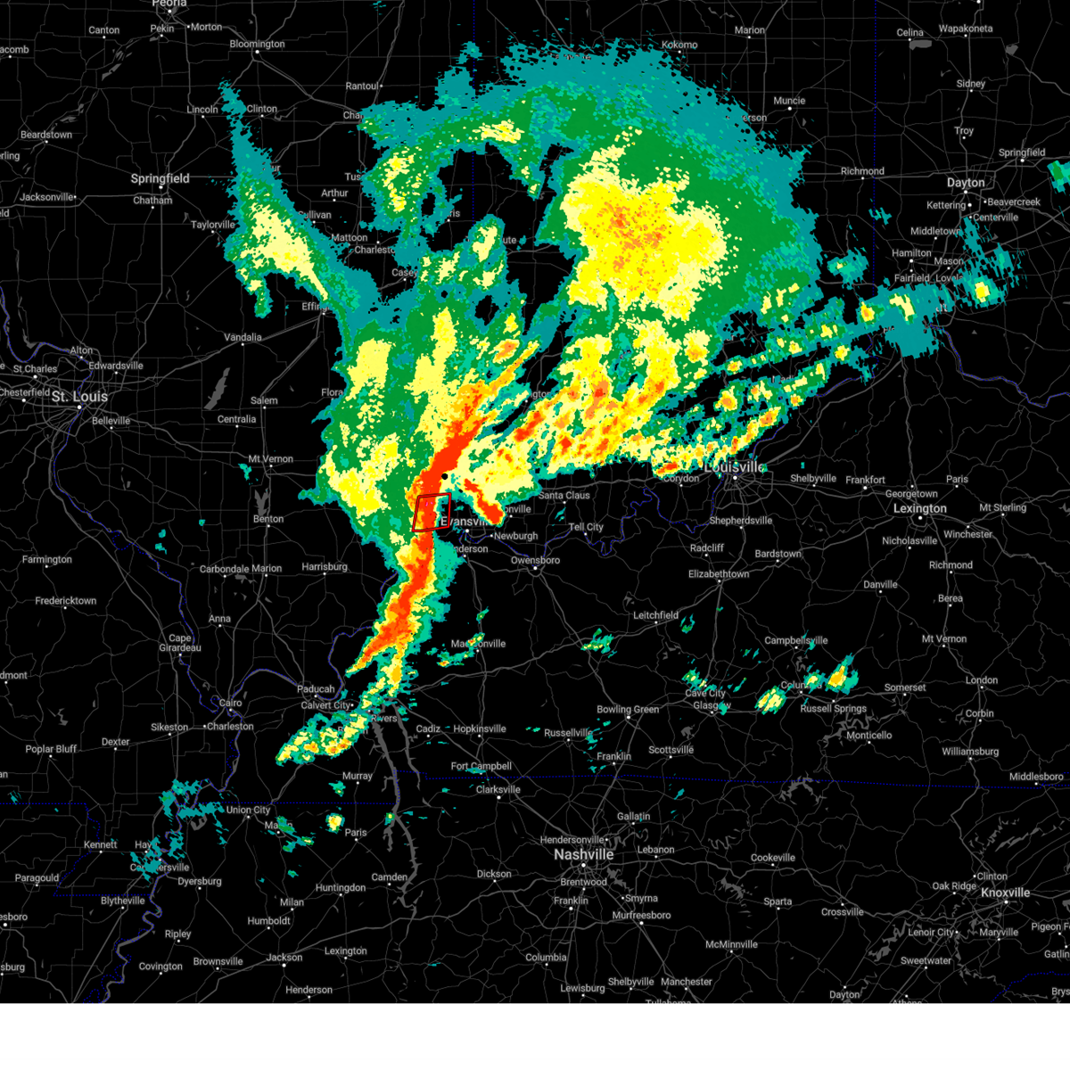 the tornado warning has been cancelled and is no longer in effect the tornado warning has been cancelled and is no longer in effect
|
| 4/2/2024 5:39 AM CDT |
 Svrpah the national weather service in paducah has issued a * severe thunderstorm warning for, warrick county in southwestern indiana, vanderburgh county in southwestern indiana, gibson county in southwestern indiana, posey county in southwestern indiana, pike county in southwestern indiana, * until 630 am cdt/730 am edt/. * at 538 am cdt/638 am edt/, severe thunderstorms were located along a line extending from near mount carmel to mount vernon, moving east at 60 mph (radar indicated). Hazards include 60 mph wind gusts. expect damage to roofs, siding, and trees Svrpah the national weather service in paducah has issued a * severe thunderstorm warning for, warrick county in southwestern indiana, vanderburgh county in southwestern indiana, gibson county in southwestern indiana, posey county in southwestern indiana, pike county in southwestern indiana, * until 630 am cdt/730 am edt/. * at 538 am cdt/638 am edt/, severe thunderstorms were located along a line extending from near mount carmel to mount vernon, moving east at 60 mph (radar indicated). Hazards include 60 mph wind gusts. expect damage to roofs, siding, and trees
|
| 4/2/2024 5:28 AM CDT |
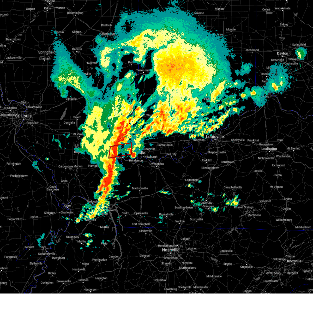 Torpah the national weather service in paducah has issued a * tornado warning for, central white county in southeastern illinois, northern posey county in southwestern indiana, * until 600 am cdt. * at 528 am cdt, severe thunderstorms capable of producing both tornadoes and extensive straight line wind damage were located near carmi, moving east at 55 mph (radar indicated rotation). Hazards include tornado and quarter size hail. Flying debris will be dangerous to those caught without shelter. mobile homes will be damaged or destroyed. damage to roofs, windows, and vehicles will occur. tree damage is likely. these dangerous storms will be near, new harmony around 535 am cdt. blairsville around 540 am cdt. other locations impacted by this tornadic thunderstorm include phillipstown and maunie. This includes interstate 64 in indiana between mile markers 11 and 17. Torpah the national weather service in paducah has issued a * tornado warning for, central white county in southeastern illinois, northern posey county in southwestern indiana, * until 600 am cdt. * at 528 am cdt, severe thunderstorms capable of producing both tornadoes and extensive straight line wind damage were located near carmi, moving east at 55 mph (radar indicated rotation). Hazards include tornado and quarter size hail. Flying debris will be dangerous to those caught without shelter. mobile homes will be damaged or destroyed. damage to roofs, windows, and vehicles will occur. tree damage is likely. these dangerous storms will be near, new harmony around 535 am cdt. blairsville around 540 am cdt. other locations impacted by this tornadic thunderstorm include phillipstown and maunie. This includes interstate 64 in indiana between mile markers 11 and 17.
|
| 3/30/2024 9:37 PM CDT |
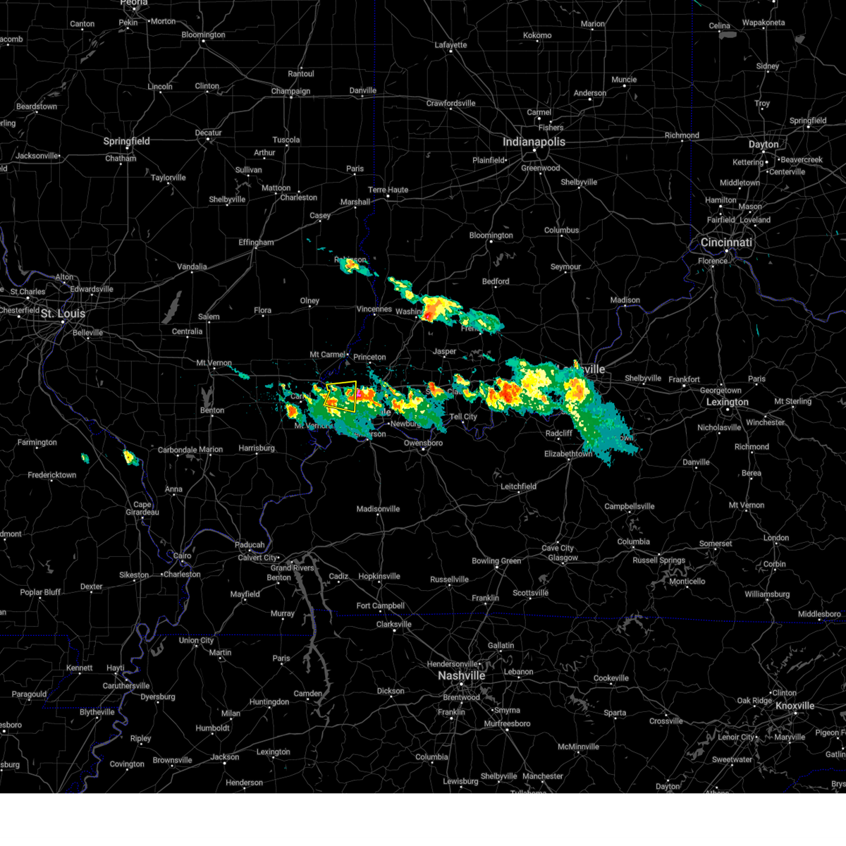 the severe thunderstorm warning has been cancelled and is no longer in effect the severe thunderstorm warning has been cancelled and is no longer in effect
|
| 3/30/2024 9:23 PM CDT |
 the severe thunderstorm warning has been cancelled and is no longer in effect the severe thunderstorm warning has been cancelled and is no longer in effect
|
| 3/30/2024 9:23 PM CDT |
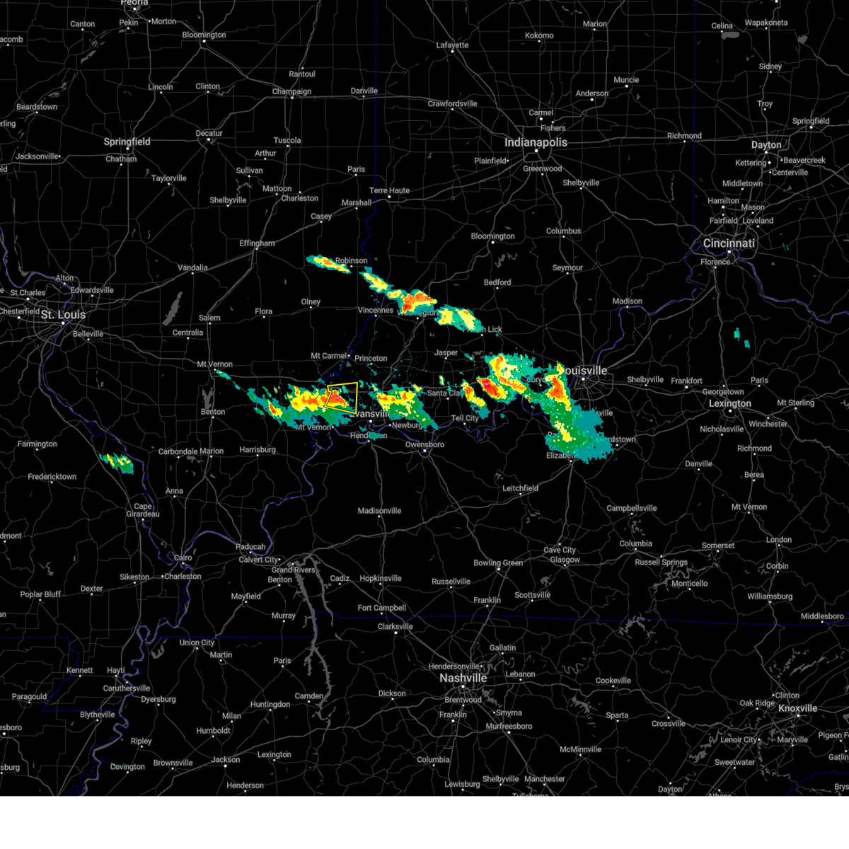 At 922 pm cdt, a severe thunderstorm was located near new harmony, or 13 miles north of mount vernon, moving east at 35 mph (radar indicated). Hazards include 60 mph wind gusts and half dollar size hail. Hail damage to vehicles is expected. expect wind damage to roofs, siding, and trees. locations impacted include, poseyville, new harmony, cynthiana, blairsville, and griffin. This includes interstate 64 in indiana between mile markers 4 and 17. At 922 pm cdt, a severe thunderstorm was located near new harmony, or 13 miles north of mount vernon, moving east at 35 mph (radar indicated). Hazards include 60 mph wind gusts and half dollar size hail. Hail damage to vehicles is expected. expect wind damage to roofs, siding, and trees. locations impacted include, poseyville, new harmony, cynthiana, blairsville, and griffin. This includes interstate 64 in indiana between mile markers 4 and 17.
|
| 3/30/2024 9:08 PM CDT |
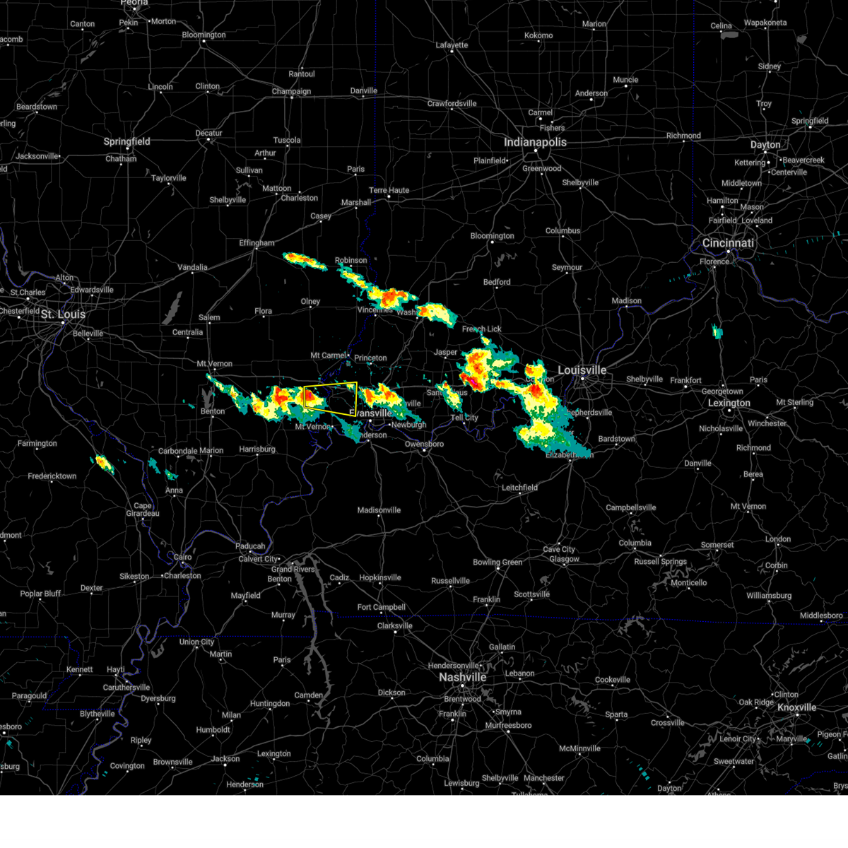 Svrpah the national weather service in paducah has issued a * severe thunderstorm warning for, northeastern white county in southeastern illinois, south central gibson county in southwestern indiana, northern posey county in southwestern indiana, * until 1000 pm cdt. * at 908 pm cdt, a severe thunderstorm was located over crossville, or 8 miles northeast of carmi, moving east at 35 mph (radar indicated). Hazards include 60 mph wind gusts and half dollar size hail. Hail damage to vehicles is expected. Expect wind damage to roofs, siding, and trees. Svrpah the national weather service in paducah has issued a * severe thunderstorm warning for, northeastern white county in southeastern illinois, south central gibson county in southwestern indiana, northern posey county in southwestern indiana, * until 1000 pm cdt. * at 908 pm cdt, a severe thunderstorm was located over crossville, or 8 miles northeast of carmi, moving east at 35 mph (radar indicated). Hazards include 60 mph wind gusts and half dollar size hail. Hail damage to vehicles is expected. Expect wind damage to roofs, siding, and trees.
|
| 3/14/2024 9:19 PM CDT |
 At 919 pm cdt/1019 pm edt/, severe thunderstorms were located along a line extending from washington to oakland city to near kasson, moving east at 55 mph (radar indicated). Hazards include 60 mph wind gusts and quarter size hail. Hail damage to vehicles is expected. expect wind damage to roofs, siding, and trees. locations impacted include, evansville, mount vernon, boonville, newburgh, chandler, fort branch, oakland city, petersburg, melody hill, dale, haubstadt, darmstadt, lynnville, winslow, santa claus, folsomville, eureka, kasson, blairsville, and elberfeld. this includes the following highways, interstate 69 in indiana between mile markers 1 and 52. Interstate 64 in indiana between mile markers 20 and 60. At 919 pm cdt/1019 pm edt/, severe thunderstorms were located along a line extending from washington to oakland city to near kasson, moving east at 55 mph (radar indicated). Hazards include 60 mph wind gusts and quarter size hail. Hail damage to vehicles is expected. expect wind damage to roofs, siding, and trees. locations impacted include, evansville, mount vernon, boonville, newburgh, chandler, fort branch, oakland city, petersburg, melody hill, dale, haubstadt, darmstadt, lynnville, winslow, santa claus, folsomville, eureka, kasson, blairsville, and elberfeld. this includes the following highways, interstate 69 in indiana between mile markers 1 and 52. Interstate 64 in indiana between mile markers 20 and 60.
|
| 3/14/2024 8:56 PM CDT |
 Svrpah the national weather service in paducah has issued a * severe thunderstorm warning for, warrick county in southwestern indiana, vanderburgh county in southwestern indiana, central spencer county in southwestern indiana, gibson county in southwestern indiana, posey county in southwestern indiana, pike county in southwestern indiana, * until 945 pm cdt/1045 pm edt/. * at 855 pm cdt/955 pm edt/, severe thunderstorms were located along a line extending from near vincennes to near princeton to 7 miles west of mount vernon, moving east at 50 mph (radar indicated). Hazards include 60 mph wind gusts and quarter size hail. Hail damage to vehicles is expected. Expect wind damage to roofs, siding, and trees. Svrpah the national weather service in paducah has issued a * severe thunderstorm warning for, warrick county in southwestern indiana, vanderburgh county in southwestern indiana, central spencer county in southwestern indiana, gibson county in southwestern indiana, posey county in southwestern indiana, pike county in southwestern indiana, * until 945 pm cdt/1045 pm edt/. * at 855 pm cdt/955 pm edt/, severe thunderstorms were located along a line extending from near vincennes to near princeton to 7 miles west of mount vernon, moving east at 50 mph (radar indicated). Hazards include 60 mph wind gusts and quarter size hail. Hail damage to vehicles is expected. Expect wind damage to roofs, siding, and trees.
|
| 2/10/2024 2:44 AM CST |
 At 244 am cst, a severe thunderstorm was located near blairsville, or 9 miles west of evansville, moving east at 45 mph (radar indicated). Hazards include 60 mph wind gusts and quarter size hail. Hail damage to vehicles is expected. expect wind damage to roofs, siding, and trees. locations impacted include, evansville, mount vernon, melody hill, darmstadt, blairsville, and kasson. this includes interstate 69 in indiana near mile marker 4, and between mile markers 11 and 18. hail threat, radar indicated max hail size, 1. 00 in wind threat, radar indicated max wind gust, 60 mph. At 244 am cst, a severe thunderstorm was located near blairsville, or 9 miles west of evansville, moving east at 45 mph (radar indicated). Hazards include 60 mph wind gusts and quarter size hail. Hail damage to vehicles is expected. expect wind damage to roofs, siding, and trees. locations impacted include, evansville, mount vernon, melody hill, darmstadt, blairsville, and kasson. this includes interstate 69 in indiana near mile marker 4, and between mile markers 11 and 18. hail threat, radar indicated max hail size, 1. 00 in wind threat, radar indicated max wind gust, 60 mph.
|
| 2/10/2024 2:33 AM CST |
 At 233 am cst, a severe thunderstorm was located near mount vernon, moving east at 45 mph (radar indicated). Hazards include 60 mph wind gusts and quarter size hail. Hail damage to vehicles is expected. Expect wind damage to roofs, siding, and trees. At 233 am cst, a severe thunderstorm was located near mount vernon, moving east at 45 mph (radar indicated). Hazards include 60 mph wind gusts and quarter size hail. Hail damage to vehicles is expected. Expect wind damage to roofs, siding, and trees.
|
| 9/27/2023 8:08 PM CDT |
 The severe thunderstorm warning for vanderburgh, northeastern posey and north central henderson counties will expire at 815 pm cdt, the storms which prompted the warning have weakened below severe limits, and no longer pose an immediate threat to life or property. therefore, the warning will be allowed to expire. however gusty winds and heavy rain are still possible with these thunderstorms. The severe thunderstorm warning for vanderburgh, northeastern posey and north central henderson counties will expire at 815 pm cdt, the storms which prompted the warning have weakened below severe limits, and no longer pose an immediate threat to life or property. therefore, the warning will be allowed to expire. however gusty winds and heavy rain are still possible with these thunderstorms.
|
| 9/27/2023 7:55 PM CDT |
 At 753 pm cdt, two severe thunderstorms were located near blairsville, and near kasson, moving east at 25 mph (public. at 746 pm...nickel size hail was observed near poseyville). Hazards include 60 mph wind gusts and half dollar size hail. Hail damage to vehicles is expected. expect wind damage to roofs, siding, and trees. locations impacted include, evansville, henderson, melody hill, darmstadt, blairsville, and kasson. this includes interstate 69 in indiana between mile markers 1 and 3, and between mile markers 14 and 19. hail threat, observed max hail size, 1. 25 in wind threat, radar indicated max wind gust, 60 mph. At 753 pm cdt, two severe thunderstorms were located near blairsville, and near kasson, moving east at 25 mph (public. at 746 pm...nickel size hail was observed near poseyville). Hazards include 60 mph wind gusts and half dollar size hail. Hail damage to vehicles is expected. expect wind damage to roofs, siding, and trees. locations impacted include, evansville, henderson, melody hill, darmstadt, blairsville, and kasson. this includes interstate 69 in indiana between mile markers 1 and 3, and between mile markers 14 and 19. hail threat, observed max hail size, 1. 25 in wind threat, radar indicated max wind gust, 60 mph.
|
| 9/27/2023 7:34 PM CDT |
 At 733 pm cdt, two severe thunderstorms were located near new harmony, and near mount vernon, moving east at 25 mph (radar indicated). Hazards include 60 mph wind gusts and quarter size hail. Hail damage to vehicles is expected. Expect wind damage to roofs, siding, and trees. At 733 pm cdt, two severe thunderstorms were located near new harmony, and near mount vernon, moving east at 25 mph (radar indicated). Hazards include 60 mph wind gusts and quarter size hail. Hail damage to vehicles is expected. Expect wind damage to roofs, siding, and trees.
|
| 7/29/2023 7:26 PM CDT |
 The severe thunderstorm warning for eastern white, east central wayne, wabash, edwards, eastern gallatin, southwestern gibson, posey, west central henderson and union counties will expire at 730 pm cdt, the storms which prompted the warning have weakened below severe limits, and no longer pose an immediate threat to life or property. therefore, the warning will be allowed to expire. however gusty winds and heavy rain are still possible with these thunderstorms. a severe thunderstorm watch remains in effect until 900 pm cdt for southern and southeastern illinois, southwestern indiana, and western and northwestern kentucky. The severe thunderstorm warning for eastern white, east central wayne, wabash, edwards, eastern gallatin, southwestern gibson, posey, west central henderson and union counties will expire at 730 pm cdt, the storms which prompted the warning have weakened below severe limits, and no longer pose an immediate threat to life or property. therefore, the warning will be allowed to expire. however gusty winds and heavy rain are still possible with these thunderstorms. a severe thunderstorm watch remains in effect until 900 pm cdt for southern and southeastern illinois, southwestern indiana, and western and northwestern kentucky.
|
| 7/29/2023 7:08 PM CDT |
 At 708 pm cdt, severe thunderstorms were located along a line extending from near mount carmel to near mount vernon to near morganfield, moving east at 45 mph (radar indicated). Hazards include 60 mph wind gusts. Expect damage to roofs, siding, and trees. locations impacted include, mount carmel, mount vernon, carmi, morganfield, albion, sturgis, breckinridge center, grayville, lancaster, owensville, poseyville, uniontown, west salem, new harmony, crossville, cynthiana, blairsville, allendale, new haven and waverly. this includes the following highways, interstate 64 in indiana between mile markers 1 and 17. interstate 64 in illinois between mile markers 122 and 130. hail threat, radar indicated max hail size, <. 75 in wind threat, radar indicated max wind gust, 60 mph. At 708 pm cdt, severe thunderstorms were located along a line extending from near mount carmel to near mount vernon to near morganfield, moving east at 45 mph (radar indicated). Hazards include 60 mph wind gusts. Expect damage to roofs, siding, and trees. locations impacted include, mount carmel, mount vernon, carmi, morganfield, albion, sturgis, breckinridge center, grayville, lancaster, owensville, poseyville, uniontown, west salem, new harmony, crossville, cynthiana, blairsville, allendale, new haven and waverly. this includes the following highways, interstate 64 in indiana between mile markers 1 and 17. interstate 64 in illinois between mile markers 122 and 130. hail threat, radar indicated max hail size, <. 75 in wind threat, radar indicated max wind gust, 60 mph.
|
| 7/29/2023 6:40 PM CDT |
 At 640 pm cdt, severe thunderstorms were located along a line extending from 8 miles east of fairfield to 6 miles south of carmi to near equality, moving east at 45 mph (radar indicated). Hazards include 70 mph wind gusts. Expect considerable tree damage. damage is likely to mobile homes, roofs, and outbuildings. locations impacted include, mount carmel, mount vernon, carmi, morganfield, albion, sturgis, shawneetown, breckinridge center, grayville, lancaster, owensville, norris city, poseyville, uniontown, west salem, ridgway, new harmony, crossville, enfield and equality. this includes the following highways, interstate 64 in indiana between mile markers 1 and 17. interstate 64 in illinois between mile markers 110 and 130. thunderstorm damage threat, considerable hail threat, radar indicated max hail size, <. 75 in wind threat, radar indicated max wind gust, 70 mph. At 640 pm cdt, severe thunderstorms were located along a line extending from 8 miles east of fairfield to 6 miles south of carmi to near equality, moving east at 45 mph (radar indicated). Hazards include 70 mph wind gusts. Expect considerable tree damage. damage is likely to mobile homes, roofs, and outbuildings. locations impacted include, mount carmel, mount vernon, carmi, morganfield, albion, sturgis, shawneetown, breckinridge center, grayville, lancaster, owensville, norris city, poseyville, uniontown, west salem, ridgway, new harmony, crossville, enfield and equality. this includes the following highways, interstate 64 in indiana between mile markers 1 and 17. interstate 64 in illinois between mile markers 110 and 130. thunderstorm damage threat, considerable hail threat, radar indicated max hail size, <. 75 in wind threat, radar indicated max wind gust, 70 mph.
|
| 7/29/2023 6:22 PM CDT |
 At 622 pm cdt, severe thunderstorms were located along a line extending from near cisne to near norris city to harrisburg, moving east at 45 mph (radar indicated). Hazards include 60 mph wind gusts. expect damage to roofs, siding, and trees At 622 pm cdt, severe thunderstorms were located along a line extending from near cisne to near norris city to harrisburg, moving east at 45 mph (radar indicated). Hazards include 60 mph wind gusts. expect damage to roofs, siding, and trees
|
| 7/2/2023 3:03 PM CDT |
 At 302 pm cdt, severe thunderstorms were located along a line extending from near kasson to 7 miles southwest of evansville, moving east at 50 mph (radar indicated). Hazards include 60 mph wind gusts and nickel size hail. Expect damage to roofs, siding, and trees. locations impacted include, evansville, melody hill, darmstadt, kasson and elberfeld. this includes interstate 69 in indiana between mile markers 8 and 19. hail threat, radar indicated max hail size, 0. 88 in wind threat, radar indicated max wind gust, 60 mph. At 302 pm cdt, severe thunderstorms were located along a line extending from near kasson to 7 miles southwest of evansville, moving east at 50 mph (radar indicated). Hazards include 60 mph wind gusts and nickel size hail. Expect damage to roofs, siding, and trees. locations impacted include, evansville, melody hill, darmstadt, kasson and elberfeld. this includes interstate 69 in indiana between mile markers 8 and 19. hail threat, radar indicated max hail size, 0. 88 in wind threat, radar indicated max wind gust, 60 mph.
|
| 7/2/2023 2:53 PM CDT |
 At 252 pm cdt, severe thunderstorms were located along a line extending from near new harmony to near mount vernon, moving east at 40 mph (radar indicated). Hazards include 60 mph wind gusts and nickel size hail. Expect damage to roofs, siding, and trees. locations impacted include, evansville, princeton, mount vernon, fort branch, melody hill, haubstadt, darmstadt, owensville, poseyville, new harmony, patoka, cynthiana, blairsville, kasson, elberfeld and griffin. this includes the following highways, interstate 69 in indiana between mile markers 8 and 25. interstate 64 in indiana between mile markers 1 and 30. hail threat, radar indicated max hail size, 0. 88 in wind threat, radar indicated max wind gust, 60 mph. At 252 pm cdt, severe thunderstorms were located along a line extending from near new harmony to near mount vernon, moving east at 40 mph (radar indicated). Hazards include 60 mph wind gusts and nickel size hail. Expect damage to roofs, siding, and trees. locations impacted include, evansville, princeton, mount vernon, fort branch, melody hill, haubstadt, darmstadt, owensville, poseyville, new harmony, patoka, cynthiana, blairsville, kasson, elberfeld and griffin. this includes the following highways, interstate 69 in indiana between mile markers 8 and 25. interstate 64 in indiana between mile markers 1 and 30. hail threat, radar indicated max hail size, 0. 88 in wind threat, radar indicated max wind gust, 60 mph.
|
| 7/2/2023 2:34 PM CDT |
 At 234 pm cdt, severe thunderstorms were located along a line extending from near crossville to 6 miles northwest of uniontown, moving east at 40 mph (radar indicated). Hazards include 60 mph wind gusts and nickel size hail. expect damage to roofs, siding, and trees At 234 pm cdt, severe thunderstorms were located along a line extending from near crossville to 6 miles northwest of uniontown, moving east at 40 mph (radar indicated). Hazards include 60 mph wind gusts and nickel size hail. expect damage to roofs, siding, and trees
|
| 7/2/2023 2:03 PM CDT |
 At 202 pm cdt, a severe thunderstorm was located over mount vernon, moving east at 30 mph (trained weather spotters. spotters reported quarter sized hail in new haven, il). Hazards include 60 mph wind gusts and quarter size hail. Hail damage to vehicles is expected. Expect wind damage to roofs, siding, and trees. At 202 pm cdt, a severe thunderstorm was located over mount vernon, moving east at 30 mph (trained weather spotters. spotters reported quarter sized hail in new haven, il). Hazards include 60 mph wind gusts and quarter size hail. Hail damage to vehicles is expected. Expect wind damage to roofs, siding, and trees.
|
| 7/1/2023 7:56 PM EDT |
 At 655 pm cdt/755 pm edt/, severe thunderstorms were located along a line extending from princeton to near evansville to near henderson, moving northeast at 70 mph (radar indicated). Hazards include 70 mph wind gusts. Expect considerable tree damage. Damage is likely to mobile homes, roofs, and outbuildings. At 655 pm cdt/755 pm edt/, severe thunderstorms were located along a line extending from princeton to near evansville to near henderson, moving northeast at 70 mph (radar indicated). Hazards include 70 mph wind gusts. Expect considerable tree damage. Damage is likely to mobile homes, roofs, and outbuildings.
|
| 7/1/2023 6:52 PM CDT |
 At 652 pm cdt/752 pm edt/, severe thunderstorms were located along a line extending from near petersburg to near fort branch to near kasson, moving east at 70 mph (radar indicated). Hazards include 70 mph wind gusts. Expect considerable tree damage. damage is likely to mobile homes, roofs, and outbuildings. locations impacted include, evansville, henderson, princeton, mount carmel, newburgh, chandler, fort branch, melody hill, haubstadt, darmstadt, owensville, poseyville, patoka, cynthiana, blairsville, kasson, elberfeld, francisco, somerville and bellmont. this includes the following highways, interstate 69 in indiana between mile markers 1 and 35. interstate 64 in indiana between mile markers 8 and 34. thunderstorm damage threat, considerable hail threat, radar indicated max hail size, <. 75 in wind threat, radar indicated max wind gust, 70 mph. At 652 pm cdt/752 pm edt/, severe thunderstorms were located along a line extending from near petersburg to near fort branch to near kasson, moving east at 70 mph (radar indicated). Hazards include 70 mph wind gusts. Expect considerable tree damage. damage is likely to mobile homes, roofs, and outbuildings. locations impacted include, evansville, henderson, princeton, mount carmel, newburgh, chandler, fort branch, melody hill, haubstadt, darmstadt, owensville, poseyville, patoka, cynthiana, blairsville, kasson, elberfeld, francisco, somerville and bellmont. this includes the following highways, interstate 69 in indiana between mile markers 1 and 35. interstate 64 in indiana between mile markers 8 and 34. thunderstorm damage threat, considerable hail threat, radar indicated max hail size, <. 75 in wind threat, radar indicated max wind gust, 70 mph.
|
| 7/1/2023 6:40 PM CDT |
 At 640 pm cdt/740 pm edt/, severe thunderstorms were located along a line extending from near patoka to 7 miles north of poseyville to near mount vernon, moving east at 70 mph (trained weather spotters). Hazards include 70 mph wind gusts. Expect considerable tree damage. damage is likely to mobile homes, roofs, and outbuildings. locations impacted include, evansville, henderson, princeton, mount carmel, mount vernon, newburgh, chandler, fort branch, albion, melody hill, grayville, haubstadt, darmstadt, owensville, poseyville, new harmony, crossville, patoka, cynthiana and blairsville. this includes the following highways, interstate 69 in indiana between mile markers 1 and 35. interstate 64 in indiana between mile markers 1 and 34. interstate 64 in illinois between mile markers 125 and 130. thunderstorm damage threat, considerable hail threat, radar indicated max hail size, <. 75 in wind threat, observed max wind gust, 70 mph. At 640 pm cdt/740 pm edt/, severe thunderstorms were located along a line extending from near patoka to 7 miles north of poseyville to near mount vernon, moving east at 70 mph (trained weather spotters). Hazards include 70 mph wind gusts. Expect considerable tree damage. damage is likely to mobile homes, roofs, and outbuildings. locations impacted include, evansville, henderson, princeton, mount carmel, mount vernon, newburgh, chandler, fort branch, albion, melody hill, grayville, haubstadt, darmstadt, owensville, poseyville, new harmony, crossville, patoka, cynthiana and blairsville. this includes the following highways, interstate 69 in indiana between mile markers 1 and 35. interstate 64 in indiana between mile markers 1 and 34. interstate 64 in illinois between mile markers 125 and 130. thunderstorm damage threat, considerable hail threat, radar indicated max hail size, <. 75 in wind threat, observed max wind gust, 70 mph.
|
| 7/1/2023 6:22 PM CDT |
 At 622 pm cdt/722 pm edt/, severe thunderstorms were located along a line extending from near west salem to near carmi to near ridgway, moving east at 70 mph (trained weather spotters). Hazards include 70 mph wind gusts. Expect considerable tree damage. damage is likely to mobile homes, roofs, and outbuildings. locations impacted include, evansville, henderson, princeton, mount carmel, mount vernon, carmi, newburgh, chandler, fort branch, albion, melody hill, grayville, haubstadt, darmstadt, owensville, poseyville, new harmony, crossville, patoka and cynthiana. this includes the following highways, interstate 69 in indiana between mile markers 1 and 35. interstate 64 in indiana between mile markers 1 and 34. interstate 64 in illinois between mile markers 118 and 130. thunderstorm damage threat, considerable hail threat, radar indicated max hail size, <. 75 in wind threat, observed max wind gust, 70 mph. At 622 pm cdt/722 pm edt/, severe thunderstorms were located along a line extending from near west salem to near carmi to near ridgway, moving east at 70 mph (trained weather spotters). Hazards include 70 mph wind gusts. Expect considerable tree damage. damage is likely to mobile homes, roofs, and outbuildings. locations impacted include, evansville, henderson, princeton, mount carmel, mount vernon, carmi, newburgh, chandler, fort branch, albion, melody hill, grayville, haubstadt, darmstadt, owensville, poseyville, new harmony, crossville, patoka and cynthiana. this includes the following highways, interstate 69 in indiana between mile markers 1 and 35. interstate 64 in indiana between mile markers 1 and 34. interstate 64 in illinois between mile markers 118 and 130. thunderstorm damage threat, considerable hail threat, radar indicated max hail size, <. 75 in wind threat, observed max wind gust, 70 mph.
|
| 7/1/2023 6:16 PM CDT |
 At 616 pm cdt/716 pm edt/, severe thunderstorms were located along a line extending from 9 miles west of west salem to near carmi to near ridgway, moving east at 70 mph (radar indicated). Hazards include 60 mph wind gusts. expect damage to roofs, siding, and trees At 616 pm cdt/716 pm edt/, severe thunderstorms were located along a line extending from 9 miles west of west salem to near carmi to near ridgway, moving east at 70 mph (radar indicated). Hazards include 60 mph wind gusts. expect damage to roofs, siding, and trees
|
| 7/1/2023 1:42 AM CDT |
 At 141 am cdt/241 am edt/, severe thunderstorms were located along a line extending from 6 miles southwest of oakland city to 6 miles northwest of chandler to melody hill, moving east at 45 mph (trained weather spotters. a 70 mph wind gust was measured in darmstadt at 1:40 am cdt). Hazards include 70 mph wind gusts and nickel size hail. Expect considerable tree damage. damage is likely to mobile homes, roofs, and outbuildings. these severe storms will be near, chandler around 150 am cdt. boonville, newburgh and lynnville around 155 am cdt. folsomville around 205 am cdt. dale around 215 am cdt. rockport, grandview and santa claus around 220 am cdt. other locations impacted by these severe thunderstorms include chrisney, mackey, elberfeld, somerville, spurgeon, tennyson and gentryville. this includes the following highways, interstate 69 in indiana between mile markers 7 and 31. interstate 64 in indiana between mile markers 24 and 56. thunderstorm damage threat, considerable hail threat, radar indicated max hail size, 0. 88 in wind threat, observed max wind gust, 70 mph. At 141 am cdt/241 am edt/, severe thunderstorms were located along a line extending from 6 miles southwest of oakland city to 6 miles northwest of chandler to melody hill, moving east at 45 mph (trained weather spotters. a 70 mph wind gust was measured in darmstadt at 1:40 am cdt). Hazards include 70 mph wind gusts and nickel size hail. Expect considerable tree damage. damage is likely to mobile homes, roofs, and outbuildings. these severe storms will be near, chandler around 150 am cdt. boonville, newburgh and lynnville around 155 am cdt. folsomville around 205 am cdt. dale around 215 am cdt. rockport, grandview and santa claus around 220 am cdt. other locations impacted by these severe thunderstorms include chrisney, mackey, elberfeld, somerville, spurgeon, tennyson and gentryville. this includes the following highways, interstate 69 in indiana between mile markers 7 and 31. interstate 64 in indiana between mile markers 24 and 56. thunderstorm damage threat, considerable hail threat, radar indicated max hail size, 0. 88 in wind threat, observed max wind gust, 70 mph.
|
| 7/1/2023 1:34 AM CDT |
 At 133 am cdt/233 am edt/, severe thunderstorms were located along a line extending from near princeton to near haubstadt to near kasson, moving east at 45 mph (radar indicated). Hazards include 60 mph wind gusts and nickel size hail. Expect damage to roofs, siding, and trees. severe thunderstorms will be near, melody hill around 140 am cdt. chandler around 150 am cdt. boonville, newburgh and lynnville around 155 am cdt. folsomville around 205 am cdt. rockport, dale, grandview and santa claus around 215 am cdt. other locations impacted by these severe thunderstorms include chrisney, mackey, elberfeld, somerville, spurgeon, tennyson and gentryville. this includes the following highways, interstate 69 in indiana between mile markers 7 and 31. interstate 64 in indiana between mile markers 21 and 56. hail threat, radar indicated max hail size, 0. 88 in wind threat, radar indicated max wind gust, 60 mph. At 133 am cdt/233 am edt/, severe thunderstorms were located along a line extending from near princeton to near haubstadt to near kasson, moving east at 45 mph (radar indicated). Hazards include 60 mph wind gusts and nickel size hail. Expect damage to roofs, siding, and trees. severe thunderstorms will be near, melody hill around 140 am cdt. chandler around 150 am cdt. boonville, newburgh and lynnville around 155 am cdt. folsomville around 205 am cdt. rockport, dale, grandview and santa claus around 215 am cdt. other locations impacted by these severe thunderstorms include chrisney, mackey, elberfeld, somerville, spurgeon, tennyson and gentryville. this includes the following highways, interstate 69 in indiana between mile markers 7 and 31. interstate 64 in indiana between mile markers 21 and 56. hail threat, radar indicated max hail size, 0. 88 in wind threat, radar indicated max wind gust, 60 mph.
|
| 6/29/2023 8:04 PM CDT | At 803 pm cdt, a severe thunderstorm was located over darmstadt, or near melody hill, moving southeast at 45 mph (radar indicated). Hazards include 70 mph wind gusts and ping pong ball size hail. People and animals outdoors will be injured. expect hail damage to roofs, siding, windows, and vehicles. expect considerable tree damage. wind damage is also likely to mobile homes, roofs, and outbuildings. locations impacted include, evansville, boonville, newburgh, chandler, melody hill, darmstadt, stanley, eureka, kasson, elberfeld and hebbardsville. this includes the following highways, interstate 69 in indiana between mile markers 1 and 23. interstate 64 in indiana between mile markers 25 and 31. audubon parkway between mile markers 12 and 16. thunderstorm damage threat, considerable hail threat, observed max hail size, 1. 50 in wind threat, radar indicated max wind gust, 70 mph. |
| 6/29/2023 8:04 PM CDT | At 803 pm cdt, a severe thunderstorm was located over darmstadt, or near melody hill, moving southeast at 45 mph (radar indicated). Hazards include 70 mph wind gusts and ping pong ball size hail. People and animals outdoors will be injured. expect hail damage to roofs, siding, windows, and vehicles. expect considerable tree damage. wind damage is also likely to mobile homes, roofs, and outbuildings. locations impacted include, evansville, boonville, newburgh, chandler, melody hill, darmstadt, stanley, eureka, kasson, elberfeld and hebbardsville. this includes the following highways, interstate 69 in indiana between mile markers 1 and 23. interstate 64 in indiana between mile markers 25 and 31. audubon parkway between mile markers 12 and 16. thunderstorm damage threat, considerable hail threat, observed max hail size, 1. 50 in wind threat, radar indicated max wind gust, 70 mph. |
| 6/29/2023 7:53 PM CDT |
 At 752 pm cdt, a severe thunderstorm was located near haubstadt, or near fort branch, moving southeast at 45 mph (radar indicated). Hazards include 70 mph wind gusts and ping pong ball size hail. People and animals outdoors will be injured. expect hail damage to roofs, siding, windows, and vehicles. expect considerable tree damage. Wind damage is also likely to mobile homes, roofs, and outbuildings. At 752 pm cdt, a severe thunderstorm was located near haubstadt, or near fort branch, moving southeast at 45 mph (radar indicated). Hazards include 70 mph wind gusts and ping pong ball size hail. People and animals outdoors will be injured. expect hail damage to roofs, siding, windows, and vehicles. expect considerable tree damage. Wind damage is also likely to mobile homes, roofs, and outbuildings.
|
| 6/29/2023 3:34 PM CDT |
 At 333 pm cdt/433 pm edt/, severe thunderstorms were located along a line extending from 6 miles northeast of tell city to eureka to new harmony, moving southeast at 55 mph (radar indicated). Hazards include 60 mph wind gusts. Expect damage to roofs, siding, and trees. locations impacted include, evansville, princeton, mount vernon, boonville, newburgh, chandler, fort branch, melody hill, haubstadt, darmstadt, owensville, poseyville, lynnville, new harmony, cynthiana, folsomville, blairsville, kasson, elberfeld and somerville. this includes the following highways, interstate 69 in indiana between mile markers 1 and 31. interstate 64 in indiana between mile markers 2 and 53. hail threat, radar indicated max hail size, <. 75 in wind threat, radar indicated max wind gust, 60 mph. At 333 pm cdt/433 pm edt/, severe thunderstorms were located along a line extending from 6 miles northeast of tell city to eureka to new harmony, moving southeast at 55 mph (radar indicated). Hazards include 60 mph wind gusts. Expect damage to roofs, siding, and trees. locations impacted include, evansville, princeton, mount vernon, boonville, newburgh, chandler, fort branch, melody hill, haubstadt, darmstadt, owensville, poseyville, lynnville, new harmony, cynthiana, folsomville, blairsville, kasson, elberfeld and somerville. this includes the following highways, interstate 69 in indiana between mile markers 1 and 31. interstate 64 in indiana between mile markers 2 and 53. hail threat, radar indicated max hail size, <. 75 in wind threat, radar indicated max wind gust, 60 mph.
|
| 6/29/2023 3:10 PM CDT |
 At 310 pm cdt/410 pm edt/, severe thunderstorms were located along a line extending from near dale to near darmstadt to near grayville, moving southeast at 55 mph (emergency management). Hazards include 60 mph wind gusts and penny size hail. Expect damage to roofs, siding, and trees. locations impacted include, evansville, princeton, mount vernon, boonville, newburgh, chandler, fort branch, oakland city, petersburg, melody hill, haubstadt, darmstadt, owensville, poseyville, lynnville, winslow, new harmony, cynthiana, folsomville and blairsville. this includes the following highways, interstate 69 in indiana between mile markers 1 and 52. interstate 64 in indiana between mile markers 2 and 53. hail threat, radar indicated max hail size, 0. 75 in wind threat, observed max wind gust, 60 mph. At 310 pm cdt/410 pm edt/, severe thunderstorms were located along a line extending from near dale to near darmstadt to near grayville, moving southeast at 55 mph (emergency management). Hazards include 60 mph wind gusts and penny size hail. Expect damage to roofs, siding, and trees. locations impacted include, evansville, princeton, mount vernon, boonville, newburgh, chandler, fort branch, oakland city, petersburg, melody hill, haubstadt, darmstadt, owensville, poseyville, lynnville, winslow, new harmony, cynthiana, folsomville and blairsville. this includes the following highways, interstate 69 in indiana between mile markers 1 and 52. interstate 64 in indiana between mile markers 2 and 53. hail threat, radar indicated max hail size, 0. 75 in wind threat, observed max wind gust, 60 mph.
|
| 6/29/2023 2:48 PM CDT |
 At 248 pm cdt/348 pm edt/, severe thunderstorms were located along a line extending from 6 miles southeast of washington to princeton to 6 miles northeast of grayville, moving southeast at 55 mph (radar indicated). Hazards include 60 mph wind gusts and penny size hail. expect damage to roofs, siding, and trees At 248 pm cdt/348 pm edt/, severe thunderstorms were located along a line extending from 6 miles southeast of washington to princeton to 6 miles northeast of grayville, moving southeast at 55 mph (radar indicated). Hazards include 60 mph wind gusts and penny size hail. expect damage to roofs, siding, and trees
|
| 6/29/2023 9:17 AM CDT |
 At 917 am cdt, a severe thunderstorm was located near kasson, or 9 miles east of mount vernon, moving south at 45 mph (radar indicated). Hazards include 70 mph wind gusts and ping pong ball size hail. People and animals outdoors will be injured. expect hail damage to roofs, siding, windows, and vehicles. expect considerable tree damage. Wind damage is also likely to mobile homes, roofs, and outbuildings. At 917 am cdt, a severe thunderstorm was located near kasson, or 9 miles east of mount vernon, moving south at 45 mph (radar indicated). Hazards include 70 mph wind gusts and ping pong ball size hail. People and animals outdoors will be injured. expect hail damage to roofs, siding, windows, and vehicles. expect considerable tree damage. Wind damage is also likely to mobile homes, roofs, and outbuildings.
|
| 4/5/2023 1:53 PM CDT |
 At 151 pm cdt/251 pm edt/, severe thunderstorms were located along a line extending from near grayville to near mount vernon indiana to near morganfield, moving east at 55 mph (radar indicated. a wind gust to near 50 mph was measured at carmi with at least one tree blown down). Hazards include 60 mph wind gusts and penny size hail. expect damage to roofs, siding, and trees At 151 pm cdt/251 pm edt/, severe thunderstorms were located along a line extending from near grayville to near mount vernon indiana to near morganfield, moving east at 55 mph (radar indicated. a wind gust to near 50 mph was measured at carmi with at least one tree blown down). Hazards include 60 mph wind gusts and penny size hail. expect damage to roofs, siding, and trees
|
| 3/3/2023 12:44 PM CST |
 At 1244 pm cst, severe thunderstorms were located along a line extending from near cynthiana to stanley, moving northeast at 60 mph (trained weather spotters). Hazards include 70 mph wind gusts. Expect considerable tree damage. damage is likely to mobile homes, roofs, and outbuildings. locations impacted include, evansville, henderson, melody hill, darmstadt, poseyville, new harmony, cynthiana, blairsville and kasson. this includes the following highways, interstate 69 in kentucky between mile markers 142 and 148. interstate 69 in indiana between mile markers 1 and 5, and between mile markers 9 and 12. interstate 64 in indiana between mile markers 9 and 20. Audubon parkway between mile markers 1 and 11. At 1244 pm cst, severe thunderstorms were located along a line extending from near cynthiana to stanley, moving northeast at 60 mph (trained weather spotters). Hazards include 70 mph wind gusts. Expect considerable tree damage. damage is likely to mobile homes, roofs, and outbuildings. locations impacted include, evansville, henderson, melody hill, darmstadt, poseyville, new harmony, cynthiana, blairsville and kasson. this includes the following highways, interstate 69 in kentucky between mile markers 142 and 148. interstate 69 in indiana between mile markers 1 and 5, and between mile markers 9 and 12. interstate 64 in indiana between mile markers 9 and 20. Audubon parkway between mile markers 1 and 11.
|
| 3/3/2023 12:37 PM CST |
 At 1237 pm cst, a confirmed tornado was located over kasson, or just west of evansville, moving north at 55 mph (radar confirmed tornado). Hazards include damaging tornado. Flying debris will be dangerous to those caught without shelter. mobile homes will be damaged or destroyed. damage to roofs, windows, and vehicles will occur. tree damage is likely. this tornadic thunderstorm will remain over mainly rural areas of vanderburgh, east central posey and north central henderson counties. this includes the following highways, interstate 69 in indiana between mile markers 10 and 20. Interstate 64 in indiana between mile markers 17 and 29. At 1237 pm cst, a confirmed tornado was located over kasson, or just west of evansville, moving north at 55 mph (radar confirmed tornado). Hazards include damaging tornado. Flying debris will be dangerous to those caught without shelter. mobile homes will be damaged or destroyed. damage to roofs, windows, and vehicles will occur. tree damage is likely. this tornadic thunderstorm will remain over mainly rural areas of vanderburgh, east central posey and north central henderson counties. this includes the following highways, interstate 69 in indiana between mile markers 10 and 20. Interstate 64 in indiana between mile markers 17 and 29.
|
| 3/3/2023 12:35 PM CST |
 At 1235 pm cst, a severe thunderstorm capable of producing a tornado was located near blairsville, or near mount vernon, moving northeast at 40 mph (radar indicated rotation). Hazards include tornado. Flying debris will be dangerous to those caught without shelter. mobile homes will be damaged or destroyed. damage to roofs, windows, and vehicles will occur. tree damage is likely. Locations impacted include, mount vernon and blairsville. At 1235 pm cst, a severe thunderstorm capable of producing a tornado was located near blairsville, or near mount vernon, moving northeast at 40 mph (radar indicated rotation). Hazards include tornado. Flying debris will be dangerous to those caught without shelter. mobile homes will be damaged or destroyed. damage to roofs, windows, and vehicles will occur. tree damage is likely. Locations impacted include, mount vernon and blairsville.
|
| 3/3/2023 12:30 PM CST |
 At 1229 pm cst, a severe thunderstorm capable of producing a tornado and extensive straight line winds to 80 mph was located near henderson, moving northeast at 55 mph (radar indicated rotation). Hazards include tornado. Flying debris will be dangerous to those caught without shelter. mobile homes will be damaged or destroyed. damage to roofs, windows, and vehicles will occur. tree damage is likely. this dangerous storm will be near, kasson around 1235 pm cst. other locations in the path of this tornadic thunderstorm include evansville, melody hill and darmstadt. this includes the following highways, interstate 69 in indiana between mile markers 1 and 2, and between mile markers 10 and 20. Interstate 64 in indiana between mile markers 17 and 29. At 1229 pm cst, a severe thunderstorm capable of producing a tornado and extensive straight line winds to 80 mph was located near henderson, moving northeast at 55 mph (radar indicated rotation). Hazards include tornado. Flying debris will be dangerous to those caught without shelter. mobile homes will be damaged or destroyed. damage to roofs, windows, and vehicles will occur. tree damage is likely. this dangerous storm will be near, kasson around 1235 pm cst. other locations in the path of this tornadic thunderstorm include evansville, melody hill and darmstadt. this includes the following highways, interstate 69 in indiana between mile markers 1 and 2, and between mile markers 10 and 20. Interstate 64 in indiana between mile markers 17 and 29.
|
| 3/3/2023 12:25 PM CST |
 At 1225 pm cst, a severe thunderstorm capable of producing a tornado was located over mount vernon, moving northeast at 55 mph (radar indicated rotation). Hazards include tornado. Flying debris will be dangerous to those caught without shelter. mobile homes will be damaged or destroyed. damage to roofs, windows, and vehicles will occur. tree damage is likely. Locations impacted include, blairsville. At 1225 pm cst, a severe thunderstorm capable of producing a tornado was located over mount vernon, moving northeast at 55 mph (radar indicated rotation). Hazards include tornado. Flying debris will be dangerous to those caught without shelter. mobile homes will be damaged or destroyed. damage to roofs, windows, and vehicles will occur. tree damage is likely. Locations impacted include, blairsville.
|
| 3/3/2023 12:19 PM CST |
 At 1218 pm cst, a severe thunderstorm capable of producing a tornado was located near corydon, or 9 miles northeast of breckinridge center, moving northeast at 55 mph (radar indicated rotation). Hazards include tornado. Flying debris will be dangerous to those caught without shelter. mobile homes will be damaged or destroyed. damage to roofs, windows, and vehicles will occur. tree damage is likely. this dangerous storm will be near, henderson around 1230 pm cst. kasson around 1235 pm cst. other locations in the path of this tornadic thunderstorm include evansville, melody hill and darmstadt. this includes the following highways, interstate 69 in indiana between mile markers 1 and 2, and between mile markers 10 and 20. Interstate 64 in indiana between mile markers 17 and 29. At 1218 pm cst, a severe thunderstorm capable of producing a tornado was located near corydon, or 9 miles northeast of breckinridge center, moving northeast at 55 mph (radar indicated rotation). Hazards include tornado. Flying debris will be dangerous to those caught without shelter. mobile homes will be damaged or destroyed. damage to roofs, windows, and vehicles will occur. tree damage is likely. this dangerous storm will be near, henderson around 1230 pm cst. kasson around 1235 pm cst. other locations in the path of this tornadic thunderstorm include evansville, melody hill and darmstadt. this includes the following highways, interstate 69 in indiana between mile markers 1 and 2, and between mile markers 10 and 20. Interstate 64 in indiana between mile markers 17 and 29.
|
| 3/3/2023 12:12 PM CST |
 At 1211 pm cst, a severe thunderstorm capable of producing a tornado was located near uniontown, or 8 miles east of shawneetown, moving northeast at 40 mph (radar indicated rotation). Hazards include tornado. Flying debris will be dangerous to those caught without shelter. mobile homes will be damaged or destroyed. damage to roofs, windows, and vehicles will occur. tree damage is likely. this dangerous storm will be near, uniontown around 1220 pm cst. Other locations in the path of this tornadic thunderstorm include mount vernon and blairsville. At 1211 pm cst, a severe thunderstorm capable of producing a tornado was located near uniontown, or 8 miles east of shawneetown, moving northeast at 40 mph (radar indicated rotation). Hazards include tornado. Flying debris will be dangerous to those caught without shelter. mobile homes will be damaged or destroyed. damage to roofs, windows, and vehicles will occur. tree damage is likely. this dangerous storm will be near, uniontown around 1220 pm cst. Other locations in the path of this tornadic thunderstorm include mount vernon and blairsville.
|
| 3/3/2023 11:55 AM CST |
 At 1154 am cst, severe thunderstorms were located along a line extending from near eldorado to near sturgis, moving northeast at 75 mph (trained weather spotters. these storms havea history of wind damage). Hazards include 70 mph wind gusts. Expect considerable tree damage. Damage is likely to mobile homes, roofs, and outbuildings. At 1154 am cst, severe thunderstorms were located along a line extending from near eldorado to near sturgis, moving northeast at 75 mph (trained weather spotters. these storms havea history of wind damage). Hazards include 70 mph wind gusts. Expect considerable tree damage. Damage is likely to mobile homes, roofs, and outbuildings.
|
| 6/17/2022 7:09 AM CDT |
 At 709 am cdt, severe thunderstorms were located along a line extending from near lancaster to near enfield, moving east at 45 mph (radar indicated). Hazards include 70 mph wind gusts and quarter size hail. Hail damage to vehicles is expected. expect considerable tree damage. Wind damage is also likely to mobile homes, roofs, and outbuildings. At 709 am cdt, severe thunderstorms were located along a line extending from near lancaster to near enfield, moving east at 45 mph (radar indicated). Hazards include 70 mph wind gusts and quarter size hail. Hail damage to vehicles is expected. expect considerable tree damage. Wind damage is also likely to mobile homes, roofs, and outbuildings.
|
| 5/19/2022 9:23 PM CDT |
 At 922 pm cdt, severe thunderstorms were located along a line extending from near albion to grayville to near crossville, moving east at 50 mph (radar indicated). Hazards include 60 mph wind gusts and quarter size hail. Hail damage to vehicles is expected. expect wind damage to roofs, siding, and trees. severe thunderstorms will be near, mount carmel around 935 pm cdt. other locations in the path of these severe thunderstorms include owensville, poseyville, blairsville, princeton, fort branch, patoka, cynthiana, darmstadt and haubstadt. this includes the following highways, interstate 69 in indiana between mile markers 23 and 29. interstate 64 in indiana between mile markers 2 and 28. hail threat, radar indicated max hail size, 1. 00 in wind threat, radar indicated max wind gust, 60 mph. At 922 pm cdt, severe thunderstorms were located along a line extending from near albion to grayville to near crossville, moving east at 50 mph (radar indicated). Hazards include 60 mph wind gusts and quarter size hail. Hail damage to vehicles is expected. expect wind damage to roofs, siding, and trees. severe thunderstorms will be near, mount carmel around 935 pm cdt. other locations in the path of these severe thunderstorms include owensville, poseyville, blairsville, princeton, fort branch, patoka, cynthiana, darmstadt and haubstadt. this includes the following highways, interstate 69 in indiana between mile markers 23 and 29. interstate 64 in indiana between mile markers 2 and 28. hail threat, radar indicated max hail size, 1. 00 in wind threat, radar indicated max wind gust, 60 mph.
|
| 5/19/2022 12:55 PM CDT |
 At 1255 pm cdt, a severe thunderstorm was located over poseyville, or 13 miles southwest of fort branch, moving northeast at 25 mph (radar indicated). Hazards include 60 mph wind gusts and quarter size hail. Hail damage to vehicles is expected. expect wind damage to roofs, siding, and trees. this severe thunderstorm will be near, cynthiana around 110 pm cdt. other locations in the path of this severe thunderstorm include haubstadt, owensville, fort branch and princeton. this includes the following highways, interstate 69 in indiana between mile markers 22 and 26. interstate 64 in indiana between mile markers 7 and 28. hail threat, radar indicated max hail size, 1. 00 in wind threat, radar indicated max wind gust, 60 mph. At 1255 pm cdt, a severe thunderstorm was located over poseyville, or 13 miles southwest of fort branch, moving northeast at 25 mph (radar indicated). Hazards include 60 mph wind gusts and quarter size hail. Hail damage to vehicles is expected. expect wind damage to roofs, siding, and trees. this severe thunderstorm will be near, cynthiana around 110 pm cdt. other locations in the path of this severe thunderstorm include haubstadt, owensville, fort branch and princeton. this includes the following highways, interstate 69 in indiana between mile markers 22 and 26. interstate 64 in indiana between mile markers 7 and 28. hail threat, radar indicated max hail size, 1. 00 in wind threat, radar indicated max wind gust, 60 mph.
|
| 3/30/2022 6:58 PM CDT |
 The severe thunderstorm warning for white, wabash, edwards, southwestern gibson and posey counties will expire at 700 pm cdt, the storms which prompted the warning have moved out of the area. therefore, the warning will be allowed to expire. however gusty winds are still possible with these thunderstorms. a tornado watch remains in effect until 1000 pm cdt for southern, south central and southeastern illinois, southwestern indiana, and northwestern kentucky. The severe thunderstorm warning for white, wabash, edwards, southwestern gibson and posey counties will expire at 700 pm cdt, the storms which prompted the warning have moved out of the area. therefore, the warning will be allowed to expire. however gusty winds are still possible with these thunderstorms. a tornado watch remains in effect until 1000 pm cdt for southern, south central and southeastern illinois, southwestern indiana, and northwestern kentucky.
|
| 3/30/2022 6:13 PM CDT |
 At 612 pm cdt, severe thunderstorms were located along a line extending from near schnell to 6 miles southeast of norris city, moving east at 35 mph (radar indicated). Hazards include 60 mph wind gusts. expect damage to roofs, siding, and trees At 612 pm cdt, severe thunderstorms were located along a line extending from near schnell to 6 miles southeast of norris city, moving east at 35 mph (radar indicated). Hazards include 60 mph wind gusts. expect damage to roofs, siding, and trees
|
| 7/8/2021 2:47 PM CDT |
 At 246 pm cdt, a severe thunderstorm was located over blairsville, or 9 miles northeast of mount vernon, moving east at 35 mph (law enforcement. a tree and power lines were down in the new harmony area). Hazards include 60 mph wind gusts and nickel size hail. Expect damage to roofs, siding, and trees. this severe thunderstorm will be near, darmstadt and kasson around 300 pm cdt. Other locations in the path of this severe thunderstorm include melody hill, evansville, newburgh, chandler and boonville. At 246 pm cdt, a severe thunderstorm was located over blairsville, or 9 miles northeast of mount vernon, moving east at 35 mph (law enforcement. a tree and power lines were down in the new harmony area). Hazards include 60 mph wind gusts and nickel size hail. Expect damage to roofs, siding, and trees. this severe thunderstorm will be near, darmstadt and kasson around 300 pm cdt. Other locations in the path of this severe thunderstorm include melody hill, evansville, newburgh, chandler and boonville.
|
| 3/25/2021 6:39 PM CDT |
 At 628 pm cdt, a severe thunderstorm was located 9 miles north of corydon, or 9 miles southeast of mount vernon, moving northeast at 60 mph (radar indicated). Hazards include 60 mph wind gusts and quarter size hail. Hail damage to vehicles is expected. Expect wind damage to roofs, siding, and trees. At 628 pm cdt, a severe thunderstorm was located 9 miles north of corydon, or 9 miles southeast of mount vernon, moving northeast at 60 mph (radar indicated). Hazards include 60 mph wind gusts and quarter size hail. Hail damage to vehicles is expected. Expect wind damage to roofs, siding, and trees.
|
| 3/25/2021 6:39 PM CDT |
 At 637 pm cdt, a severe thunderstorm was located over kasson, or near evansville, moving northeast at 60 mph (radar indicated. at 635 pm, dime size hail was reported 6 miles west of evansville). Hazards include 60 mph wind gusts and quarter size hail. Hail damage to vehicles is expected. expect wind damage to roofs, siding, and trees. Locations impacted include, evansville, fort branch, oakland city, melody hill, haubstadt, darmstadt, lynnville, kasson, elberfeld, francisco, somerville and mackey. At 637 pm cdt, a severe thunderstorm was located over kasson, or near evansville, moving northeast at 60 mph (radar indicated. at 635 pm, dime size hail was reported 6 miles west of evansville). Hazards include 60 mph wind gusts and quarter size hail. Hail damage to vehicles is expected. expect wind damage to roofs, siding, and trees. Locations impacted include, evansville, fort branch, oakland city, melody hill, haubstadt, darmstadt, lynnville, kasson, elberfeld, francisco, somerville and mackey.
|
| 3/25/2021 6:28 PM CDT |
 At 628 pm cdt, a severe thunderstorm was located 9 miles north of corydon, or 9 miles southeast of mount vernon, moving northeast at 60 mph (radar indicated). Hazards include 60 mph wind gusts and quarter size hail. Hail damage to vehicles is expected. Expect wind damage to roofs, siding, and trees. At 628 pm cdt, a severe thunderstorm was located 9 miles north of corydon, or 9 miles southeast of mount vernon, moving northeast at 60 mph (radar indicated). Hazards include 60 mph wind gusts and quarter size hail. Hail damage to vehicles is expected. Expect wind damage to roofs, siding, and trees.
|
| 3/25/2021 6:28 PM CDT |
 The national weather service in paducah has issued a * severe thunderstorm warning for. northwestern warrick county in southwestern indiana. southeastern gibson county in southwestern indiana. vanderburgh county in southwestern indiana. East central posey county in southwestern indiana. The national weather service in paducah has issued a * severe thunderstorm warning for. northwestern warrick county in southwestern indiana. southeastern gibson county in southwestern indiana. vanderburgh county in southwestern indiana. East central posey county in southwestern indiana.
|
| 7/15/2020 11:50 PM CDT |
 At 1149 pm cdt, a severe thunderstorm capable of producing a tornado was located over kasson, or 8 miles west of evansville, moving east at 35 mph (radar indicated rotation). Hazards include tornado. Flying debris will be dangerous to those caught without shelter. mobile homes will be damaged or destroyed. damage to roofs, windows, and vehicles will occur. tree damage is likely. this dangerous storm will be near, darmstadt around 1200 am cdt. evansville around 1205 am cdt. other locations impacted by this tornadic thunderstorm include elberfeld. this includes the following highways, interstate 69 in indiana between mile markers 13 and 20. Interstate 64 in indiana between mile markers 29 and 33. At 1149 pm cdt, a severe thunderstorm capable of producing a tornado was located over kasson, or 8 miles west of evansville, moving east at 35 mph (radar indicated rotation). Hazards include tornado. Flying debris will be dangerous to those caught without shelter. mobile homes will be damaged or destroyed. damage to roofs, windows, and vehicles will occur. tree damage is likely. this dangerous storm will be near, darmstadt around 1200 am cdt. evansville around 1205 am cdt. other locations impacted by this tornadic thunderstorm include elberfeld. this includes the following highways, interstate 69 in indiana between mile markers 13 and 20. Interstate 64 in indiana between mile markers 29 and 33.
|
| 7/8/2020 4:37 PM CDT |
 The severe thunderstorm warning for central vanderburgh and east central posey counties will expire at 445 pm cdt, the storm which prompted the warning has weakened below severe limits, and no longer poses an immediate threat to life or property. therefore, the warning will be allowed to expire. however heavy rain is still possible with this thunderstorm. The severe thunderstorm warning for central vanderburgh and east central posey counties will expire at 445 pm cdt, the storm which prompted the warning has weakened below severe limits, and no longer poses an immediate threat to life or property. therefore, the warning will be allowed to expire. however heavy rain is still possible with this thunderstorm.
|
| 7/8/2020 4:28 PM CDT |
 At 427 pm cdt, a severe thunderstorm was located over kasson, or near evansville, moving west at 20 mph (radar indicated). Hazards include 60 mph wind gusts and penny size hail. Expect damage to roofs, siding, and trees. Locations impacted include, evansville, melody hill, darmstadt, blairsville and kasson. At 427 pm cdt, a severe thunderstorm was located over kasson, or near evansville, moving west at 20 mph (radar indicated). Hazards include 60 mph wind gusts and penny size hail. Expect damage to roofs, siding, and trees. Locations impacted include, evansville, melody hill, darmstadt, blairsville and kasson.
|
| 7/8/2020 4:05 PM CDT |
 At 404 pm cdt, a severe thunderstorm was located over melody hill, moving west at 20 mph (radar indicated). Hazards include 60 mph wind gusts and quarter size hail. Hail damage to vehicles is expected. Expect wind damage to roofs, siding, and trees. At 404 pm cdt, a severe thunderstorm was located over melody hill, moving west at 20 mph (radar indicated). Hazards include 60 mph wind gusts and quarter size hail. Hail damage to vehicles is expected. Expect wind damage to roofs, siding, and trees.
|
| 7/8/2020 12:21 PM CDT |
 At 1221 pm cdt, a severe thunderstorm was located near darmstadt, or 7 miles northwest of melody hill, and is nearly stationary (radar indicated). Hazards include 60 mph wind gusts. Expect damage to roofs, siding, and trees. Locations impacted include, evansville, melody hill, darmstadt and kasson. At 1221 pm cdt, a severe thunderstorm was located near darmstadt, or 7 miles northwest of melody hill, and is nearly stationary (radar indicated). Hazards include 60 mph wind gusts. Expect damage to roofs, siding, and trees. Locations impacted include, evansville, melody hill, darmstadt and kasson.
|
| 7/8/2020 12:12 PM CDT |
 At 1211 pm cdt, a severe thunderstorm was located near darmstadt, or 7 miles northwest of melody hill, and is nearly stationary (radar indicated). Hazards include 60 mph wind gusts. expect damage to roofs, siding, and trees At 1211 pm cdt, a severe thunderstorm was located near darmstadt, or 7 miles northwest of melody hill, and is nearly stationary (radar indicated). Hazards include 60 mph wind gusts. expect damage to roofs, siding, and trees
|
| 5/16/2020 3:52 PM CDT |
 The severe thunderstorm warning for vanderburgh, northeastern posey and north central henderson counties will expire at 400 pm cdt, the storm which prompted the warning has weakened below severe limits, and no longer poses an immediate threat to life or property. therefore, the warning will be allowed to expire. The severe thunderstorm warning for vanderburgh, northeastern posey and north central henderson counties will expire at 400 pm cdt, the storm which prompted the warning has weakened below severe limits, and no longer poses an immediate threat to life or property. therefore, the warning will be allowed to expire.
|
| 5/16/2020 3:18 PM CDT |
 At 318 pm cdt, a severe thunderstorm was located near henderson, moving north at 10 mph (radar indicated). Hazards include 60 mph wind gusts and quarter size hail. Hail damage to vehicles is expected. Expect wind damage to roofs, siding, and trees. At 318 pm cdt, a severe thunderstorm was located near henderson, moving north at 10 mph (radar indicated). Hazards include 60 mph wind gusts and quarter size hail. Hail damage to vehicles is expected. Expect wind damage to roofs, siding, and trees.
|
| 4/8/2020 8:17 PM CDT |
 At 816 pm cdt, a severe thunderstorm was located near owensville, or near princeton, moving southeast at 35 mph (radar indicated). Hazards include 70 mph wind gusts and quarter size hail. Hail damage to vehicles is expected. expect considerable tree damage. Wind damage is also likely to mobile homes, roofs, and outbuildings. At 816 pm cdt, a severe thunderstorm was located near owensville, or near princeton, moving southeast at 35 mph (radar indicated). Hazards include 70 mph wind gusts and quarter size hail. Hail damage to vehicles is expected. expect considerable tree damage. Wind damage is also likely to mobile homes, roofs, and outbuildings.
|
| 6/30/2019 7:24 PM CDT |
 At 723 pm cdt, severe thunderstorms were located along a line extending from 6 miles northwest of crossville to near poseyville to chandler, moving south at 40 mph (trained weather spotters). Hazards include 60 mph wind gusts. Expect damage to roofs, siding, and trees. Locations impacted include, evansville, mount vernon, carmi, newburgh, melody hill, darmstadt, poseyville, new harmony, crossville, blairsville, kasson, maunie and phillipstown. At 723 pm cdt, severe thunderstorms were located along a line extending from 6 miles northwest of crossville to near poseyville to chandler, moving south at 40 mph (trained weather spotters). Hazards include 60 mph wind gusts. Expect damage to roofs, siding, and trees. Locations impacted include, evansville, mount vernon, carmi, newburgh, melody hill, darmstadt, poseyville, new harmony, crossville, blairsville, kasson, maunie and phillipstown.
|
| 6/30/2019 7:14 PM CDT |
 At 711 pm cdt, strong winds ahead a line of thunderstorms were located along a line extending from near albion to 7 miles northwest of poseyville to near lynnville, moving south at 40 mph. these winds have knocked down some trees in mount carmel illinois (trained weather spotters). Hazards include 60 mph wind gusts. expect damage to roofs, siding, and trees At 711 pm cdt, strong winds ahead a line of thunderstorms were located along a line extending from near albion to 7 miles northwest of poseyville to near lynnville, moving south at 40 mph. these winds have knocked down some trees in mount carmel illinois (trained weather spotters). Hazards include 60 mph wind gusts. expect damage to roofs, siding, and trees
|
| 6/16/2019 6:44 PM CDT |
 At 644 pm cdt, severe thunderstorms were located along a line extending from 6 miles southeast of grayville to near poseyville to mount vernon, moving east at 35 mph (radar indicated). Hazards include 60 mph wind gusts and nickel size hail. Expect damage to roofs, siding, and trees. Locations impacted include, mount vernon, poseyville, new harmony and blairsville. At 644 pm cdt, severe thunderstorms were located along a line extending from 6 miles southeast of grayville to near poseyville to mount vernon, moving east at 35 mph (radar indicated). Hazards include 60 mph wind gusts and nickel size hail. Expect damage to roofs, siding, and trees. Locations impacted include, mount vernon, poseyville, new harmony and blairsville.
|
| 6/16/2019 6:23 PM CDT |
 At 623 pm cdt, severe thunderstorms were located along a line extending from near crossville to 6 miles east of carmi to 10 miles northeast of ridgway, moving east at 35 mph (radar indicated). Hazards include 60 mph wind gusts and nickel size hail. expect damage to roofs, siding, and trees At 623 pm cdt, severe thunderstorms were located along a line extending from near crossville to 6 miles east of carmi to 10 miles northeast of ridgway, moving east at 35 mph (radar indicated). Hazards include 60 mph wind gusts and nickel size hail. expect damage to roofs, siding, and trees
|
| 3/14/2019 10:51 AM CDT |
 At 1051 am cdt, a severe thunderstorm capable of producing a tornado was located near evansville, moving northeast at 60 mph (radar indicated rotation). Hazards include tornado. Flying debris will be dangerous to those caught without shelter. mobile homes will be damaged or destroyed. damage to roofs, windows, and vehicles will occur. tree damage is likely. Locations impacted include, evansville, melody hill, darmstadt and kasson. At 1051 am cdt, a severe thunderstorm capable of producing a tornado was located near evansville, moving northeast at 60 mph (radar indicated rotation). Hazards include tornado. Flying debris will be dangerous to those caught without shelter. mobile homes will be damaged or destroyed. damage to roofs, windows, and vehicles will occur. tree damage is likely. Locations impacted include, evansville, melody hill, darmstadt and kasson.
|
| 3/14/2019 10:39 AM CDT |
 At 1038 am cdt, a confirmed tornado was located 7 miles north of corydon, or 9 miles west of henderson, moving northeast at 65 mph (emergency management confirmed tornado). Hazards include damaging tornado. Flying debris will be dangerous to those caught without shelter. mobile homes will be damaged or destroyed. damage to roofs, windows, and vehicles will occur. tree damage is likely. the tornado will be near, evansville and kasson around 1050 am cdt. Melody hill and darmstadt around 1055 am cdt. At 1038 am cdt, a confirmed tornado was located 7 miles north of corydon, or 9 miles west of henderson, moving northeast at 65 mph (emergency management confirmed tornado). Hazards include damaging tornado. Flying debris will be dangerous to those caught without shelter. mobile homes will be damaged or destroyed. damage to roofs, windows, and vehicles will occur. tree damage is likely. the tornado will be near, evansville and kasson around 1050 am cdt. Melody hill and darmstadt around 1055 am cdt.
|
| 3/14/2019 10:01 AM CDT |
 At 1001 am cdt, a severe thunderstorm was located near blairsville, or near mount vernon, moving northeast at 55 mph (radar indicated). Hazards include 60 mph wind gusts. expect damage to roofs, siding, and trees At 1001 am cdt, a severe thunderstorm was located near blairsville, or near mount vernon, moving northeast at 55 mph (radar indicated). Hazards include 60 mph wind gusts. expect damage to roofs, siding, and trees
|
| 7/14/2018 5:17 PM CDT |
 At 516 pm cdt, a severe thunderstorm was located near new harmony, or 8 miles north of mount vernon, moving east at 20 mph (radar indicated). Hazards include 60 mph wind gusts and quarter size hail. Hail damage to vehicles is expected. Expect wind damage to roofs, siding, and trees. At 516 pm cdt, a severe thunderstorm was located near new harmony, or 8 miles north of mount vernon, moving east at 20 mph (radar indicated). Hazards include 60 mph wind gusts and quarter size hail. Hail damage to vehicles is expected. Expect wind damage to roofs, siding, and trees.
|
| 6/26/2018 10:46 AM CDT |
 At 1046 am cdt, a severe thunderstorm was located over melody hill, moving northeast at 45 mph (trained weather spotters). Hazards include 60 mph wind gusts. Expect damage to roofs, siding, and trees. Locations impacted include, evansville, fort branch, melody hill, haubstadt, darmstadt, poseyville, cynthiana, blairsville and kasson. At 1046 am cdt, a severe thunderstorm was located over melody hill, moving northeast at 45 mph (trained weather spotters). Hazards include 60 mph wind gusts. Expect damage to roofs, siding, and trees. Locations impacted include, evansville, fort branch, melody hill, haubstadt, darmstadt, poseyville, cynthiana, blairsville and kasson.
|
| 6/26/2018 10:15 AM CDT |
 At 1014 am cdt, a severe thunderstorm was located near mount vernon, moving northeast at 55 mph (radar indicated). Hazards include 60 mph wind gusts and quarter size hail. Hail damage to vehicles is expected. Expect wind damage to roofs, siding, and trees. At 1014 am cdt, a severe thunderstorm was located near mount vernon, moving northeast at 55 mph (radar indicated). Hazards include 60 mph wind gusts and quarter size hail. Hail damage to vehicles is expected. Expect wind damage to roofs, siding, and trees.
|
| 6/12/2018 4:05 PM CDT |
 At 405 pm cdt, severe thunderstorms were located along a line extending from near patoka to near blairsville, moving east at 40 mph (radar indicated). Hazards include 60 mph wind gusts. Expect damage to roofs, siding, and trees. Locations impacted include, evansville, princeton, mount carmel, fort branch, princeton in gibson county, haubstadt, darmstadt, owensville, poseyville, patoka, cynthiana, blairsville, allendale, hazleton and keensburg. At 405 pm cdt, severe thunderstorms were located along a line extending from near patoka to near blairsville, moving east at 40 mph (radar indicated). Hazards include 60 mph wind gusts. Expect damage to roofs, siding, and trees. Locations impacted include, evansville, princeton, mount carmel, fort branch, princeton in gibson county, haubstadt, darmstadt, owensville, poseyville, patoka, cynthiana, blairsville, allendale, hazleton and keensburg.
|
| 6/12/2018 3:38 PM CDT |
 At 337 pm cdt, severe thunderstorms were located along a line extending from near lancaster to new harmony, moving east at 35 mph (radar indicated). Hazards include 60 mph wind gusts and quarter size hail. Hail damage to vehicles is expected. Expect wind damage to roofs, siding, and trees. At 337 pm cdt, severe thunderstorms were located along a line extending from near lancaster to new harmony, moving east at 35 mph (radar indicated). Hazards include 60 mph wind gusts and quarter size hail. Hail damage to vehicles is expected. Expect wind damage to roofs, siding, and trees.
|
| 5/31/2018 6:56 PM CDT |
 The national weather service in paducah has issued a * severe thunderstorm warning for. southeastern white county in southeastern illinois. central posey county in southwestern indiana. until 730 pm cdt. At 656 pm cdt, a severe thunderstorm was located 7 miles west of. The national weather service in paducah has issued a * severe thunderstorm warning for. southeastern white county in southeastern illinois. central posey county in southwestern indiana. until 730 pm cdt. At 656 pm cdt, a severe thunderstorm was located 7 miles west of.
|
| 5/31/2018 6:56 PM CDT |
 At 656 pm cdt, a severe thunderstorm was located 7 miles west of mount vernon, moving east at 40 mph (radar indicated). Hazards include 60 mph wind gusts and quarter size hail. Hail damage to vehicles is expected. Expect wind damage to roofs, siding, and trees. At 656 pm cdt, a severe thunderstorm was located 7 miles west of mount vernon, moving east at 40 mph (radar indicated). Hazards include 60 mph wind gusts and quarter size hail. Hail damage to vehicles is expected. Expect wind damage to roofs, siding, and trees.
|
| 5/31/2018 11:26 AM CDT |
 At 1125 am cdt, severe thunderstorms were located along a line extending from near lancaster to near corydon, moving east at 45 mph. these storms have a history of downing trees and power lines with winds gusting 40 to 60 mph (radar indicated). Hazards include 60 mph wind gusts. expect damage to roofs, siding, and trees At 1125 am cdt, severe thunderstorms were located along a line extending from near lancaster to near corydon, moving east at 45 mph. these storms have a history of downing trees and power lines with winds gusting 40 to 60 mph (radar indicated). Hazards include 60 mph wind gusts. expect damage to roofs, siding, and trees
|
| 5/31/2018 10:51 AM CDT |
 At 1051 am cdt, a severe thunderstorm was located near shawneetown, moving northeast at 45 mph. these storms have a history of downing trees and power lines, even with sub severe wind speeds (radar indicated). Hazards include 60 mph wind gusts. expect damage to roofs, siding, and trees At 1051 am cdt, a severe thunderstorm was located near shawneetown, moving northeast at 45 mph. these storms have a history of downing trees and power lines, even with sub severe wind speeds (radar indicated). Hazards include 60 mph wind gusts. expect damage to roofs, siding, and trees
|
| 5/10/2018 5:03 PM CDT |
 At 503 pm cdt, a severe thunderstorm was located over kasson, or near evansville, moving east at 25 mph (radar indicated). Hazards include 60 mph wind gusts and half dollar size hail. Hail damage to vehicles is expected. expect wind damage to roofs, siding, and trees. Locations impacted include, evansville, darmstadt and kasson. At 503 pm cdt, a severe thunderstorm was located over kasson, or near evansville, moving east at 25 mph (radar indicated). Hazards include 60 mph wind gusts and half dollar size hail. Hail damage to vehicles is expected. expect wind damage to roofs, siding, and trees. Locations impacted include, evansville, darmstadt and kasson.
|
| 5/10/2018 4:50 PM CDT |
 At 450 pm cdt, a severe thunderstorm was located over blairsville, or 9 miles northwest of evansville, moving east at 25 mph (radar indicated). Hazards include 60 mph wind gusts and half dollar size hail. Hail damage to vehicles is expected. expect wind damage to roofs, siding, and trees. Locations impacted include, evansville, darmstadt, blairsville and kasson. At 450 pm cdt, a severe thunderstorm was located over blairsville, or 9 miles northwest of evansville, moving east at 25 mph (radar indicated). Hazards include 60 mph wind gusts and half dollar size hail. Hail damage to vehicles is expected. expect wind damage to roofs, siding, and trees. Locations impacted include, evansville, darmstadt, blairsville and kasson.
|
| 5/10/2018 4:44 PM CDT |
 At 444 pm cdt, a severe thunderstorm was located over blairsville, or 11 miles northeast of mount vernon, moving east at 25 mph (radar indicated). Hazards include 60 mph wind gusts and quarter size hail. Hail damage to vehicles is expected. Expect wind damage to roofs, siding, and trees. At 444 pm cdt, a severe thunderstorm was located over blairsville, or 11 miles northeast of mount vernon, moving east at 25 mph (radar indicated). Hazards include 60 mph wind gusts and quarter size hail. Hail damage to vehicles is expected. Expect wind damage to roofs, siding, and trees.
|
| 4/3/2018 6:38 PM CDT |
 At 637 pm cdt, a severe thunderstorm capable of producing a tornado was located 10 miles west of mount vernon, moving east at 35 mph (radar indicated rotation). Hazards include tornado. Flying debris will be dangerous to those caught without shelter. mobile homes will be damaged or destroyed. damage to roofs, windows, and vehicles will occur. Tree damage is likely. At 637 pm cdt, a severe thunderstorm capable of producing a tornado was located 10 miles west of mount vernon, moving east at 35 mph (radar indicated rotation). Hazards include tornado. Flying debris will be dangerous to those caught without shelter. mobile homes will be damaged or destroyed. damage to roofs, windows, and vehicles will occur. Tree damage is likely.
|
| 8/19/2017 6:18 AM CDT |
 At 617 am cdt, a severe thunderstorm was located near crossville, or 7 miles east of carmi, moving east at 35 mph (radar indicated). Hazards include 60 mph wind gusts and quarter size hail. Hail damage to vehicles is expected. Expect wind damage to roofs, siding, and trees. At 617 am cdt, a severe thunderstorm was located near crossville, or 7 miles east of carmi, moving east at 35 mph (radar indicated). Hazards include 60 mph wind gusts and quarter size hail. Hail damage to vehicles is expected. Expect wind damage to roofs, siding, and trees.
|
| 7/23/2017 6:07 AM CDT |
 At 607 am cdt, severe thunderstorms were located along a line extending from near haubstadt to kasson, moving east at 45 mph (radar indicated). Hazards include 60 mph wind gusts. expect damage to roofs, siding, and trees At 607 am cdt, severe thunderstorms were located along a line extending from near haubstadt to kasson, moving east at 45 mph (radar indicated). Hazards include 60 mph wind gusts. expect damage to roofs, siding, and trees
|
| 7/23/2017 5:52 AM CDT |
 At 552 am cdt, severe thunderstorms were located along a line extending from near owensville to 6 miles south of new harmony, moving east at 45 mph (radar indicated). Hazards include 60 mph wind gusts. Expect damage to roofs, siding, and trees. Locations impacted include, evansville, melody hill, haubstadt, darmstadt, poseyville, new harmony, cynthiana, blairsville, kasson and griffin. At 552 am cdt, severe thunderstorms were located along a line extending from near owensville to 6 miles south of new harmony, moving east at 45 mph (radar indicated). Hazards include 60 mph wind gusts. Expect damage to roofs, siding, and trees. Locations impacted include, evansville, melody hill, haubstadt, darmstadt, poseyville, new harmony, cynthiana, blairsville, kasson and griffin.
|
| 7/23/2017 5:33 AM CDT |
 At 533 am cdt, severe thunderstorms were located along a line extending from grayville to near carmi, moving east at 45 mph (radar indicated). Hazards include 60 mph wind gusts. expect damage to roofs, siding, and trees At 533 am cdt, severe thunderstorms were located along a line extending from grayville to near carmi, moving east at 45 mph (radar indicated). Hazards include 60 mph wind gusts. expect damage to roofs, siding, and trees
|
| 4/29/2017 3:09 AM CDT |
 At 308 am cdt, a severe thunderstorm was located over kasson, or 8 miles northwest of evansville, moving northeast at 40 mph (radar indicated). Hazards include 60 mph wind gusts and quarter size hail. Hail damage to vehicles is expected. Expect wind damage to roofs, siding, and trees. At 308 am cdt, a severe thunderstorm was located over kasson, or 8 miles northwest of evansville, moving northeast at 40 mph (radar indicated). Hazards include 60 mph wind gusts and quarter size hail. Hail damage to vehicles is expected. Expect wind damage to roofs, siding, and trees.
|
| 4/28/2017 11:43 PM CDT |
 At 1143 pm cdt, a severe thunderstorm was located near kasson, or 9 miles east of mount vernon, moving northeast at 55 mph (radar indicated). Hazards include quarter size hail. damage to vehicles is expected At 1143 pm cdt, a severe thunderstorm was located near kasson, or 9 miles east of mount vernon, moving northeast at 55 mph (radar indicated). Hazards include quarter size hail. damage to vehicles is expected
|
| 7/28/2016 7:56 PM CDT |
 At 756 pm cdt, a severe thunderstorm was located near evansville, moving southeast at 45 mph (radar indicated). Hazards include 60 mph wind gusts and penny size hail. Expect damage to roofs. siding. And trees. At 756 pm cdt, a severe thunderstorm was located near evansville, moving southeast at 45 mph (radar indicated). Hazards include 60 mph wind gusts and penny size hail. Expect damage to roofs. siding. And trees.
|
| 7/28/2016 7:37 PM CDT |
 At 737 pm cdt, a severe thunderstorm was located near blairsville, or 8 miles northeast of mount vernon, moving southeast at 35 mph (radar indicated). Hazards include 60 mph wind gusts and nickel size hail. Expect damage to roofs. siding. And trees. At 737 pm cdt, a severe thunderstorm was located near blairsville, or 8 miles northeast of mount vernon, moving southeast at 35 mph (radar indicated). Hazards include 60 mph wind gusts and nickel size hail. Expect damage to roofs. siding. And trees.
|
| 7/13/2016 6:15 PM CDT |
 At 615 pm cdt, severe thunderstorms were located along a line extending from near mount carmel to near princeton to haubstadt to near kasson, moving east at 50 mph. these storms have a history of producing wind damage, so take cover now! (radar indicated). Hazards include 60 to 70 mph wind gusts and penny size hail. Expect considerable tree damage. damage is likely to mobile homes, roofs, and outbuildings. Locations impacted include, evansville, princeton, mount carmel, mount vernon, fort branch, oakland city, haubstadt, darmstadt, owensville, poseyville, new harmony, patoka, cynthiana, kasson, blairsville, francisco, somerville, hazleton and griffin. At 615 pm cdt, severe thunderstorms were located along a line extending from near mount carmel to near princeton to haubstadt to near kasson, moving east at 50 mph. these storms have a history of producing wind damage, so take cover now! (radar indicated). Hazards include 60 to 70 mph wind gusts and penny size hail. Expect considerable tree damage. damage is likely to mobile homes, roofs, and outbuildings. Locations impacted include, evansville, princeton, mount carmel, mount vernon, fort branch, oakland city, haubstadt, darmstadt, owensville, poseyville, new harmony, patoka, cynthiana, kasson, blairsville, francisco, somerville, hazleton and griffin.
|
| 7/13/2016 5:56 PM CDT |
 At 554 pm cdt, severe thunderstorms were located along a line extending from near sumner to near albion to near mount vernon, moving east at 55 mph. these storms continue to produce widespread wind damage, most recently as they moved over crossville. take cover now! (radar indicated). Hazards include 60 to 70 mph wind gusts and penny size hail. Expect considerable tree damage. damage is likely to mobile homes, roofs, and outbuildings. Locations impacted include, evansville, princeton, mount carmel, mount vernon, fort branch, oakland city, haubstadt, darmstadt, owensville, poseyville, new harmony, patoka, cynthiana, kasson, blairsville, francisco, somerville, hazleton and griffin. At 554 pm cdt, severe thunderstorms were located along a line extending from near sumner to near albion to near mount vernon, moving east at 55 mph. these storms continue to produce widespread wind damage, most recently as they moved over crossville. take cover now! (radar indicated). Hazards include 60 to 70 mph wind gusts and penny size hail. Expect considerable tree damage. damage is likely to mobile homes, roofs, and outbuildings. Locations impacted include, evansville, princeton, mount carmel, mount vernon, fort branch, oakland city, haubstadt, darmstadt, owensville, poseyville, new harmony, patoka, cynthiana, kasson, blairsville, francisco, somerville, hazleton and griffin.
|
| 7/13/2016 5:36 PM CDT |
 At 535 pm cdt, severe thunderstorms were located along a line extending from 9 miles southwest of albion to near crossville to near carmi to 8 miles southeast of norris city, moving east at 55 mph (radar indicated). Hazards include 60 to 70 mph wind gusts and penny size hail. Expect considerable tree damage. Damage is likely to mobile homes, roofs, and outbuildings. At 535 pm cdt, severe thunderstorms were located along a line extending from 9 miles southwest of albion to near crossville to near carmi to 8 miles southeast of norris city, moving east at 55 mph (radar indicated). Hazards include 60 to 70 mph wind gusts and penny size hail. Expect considerable tree damage. Damage is likely to mobile homes, roofs, and outbuildings.
|
| 5/11/2016 7:03 PM CDT |
 At 703 pm cdt, a severe thunderstorm was located 7 miles west of mount vernon, moving east at 35 mph (radar indicated). Hazards include 60 mph wind gusts and quarter size hail. Hail damage to vehicles is expected. Expect wind damage to roofs, siding, and trees. At 703 pm cdt, a severe thunderstorm was located 7 miles west of mount vernon, moving east at 35 mph (radar indicated). Hazards include 60 mph wind gusts and quarter size hail. Hail damage to vehicles is expected. Expect wind damage to roofs, siding, and trees.
|
| 5/11/2016 5:37 PM CDT |
 At 536 pm cdt, a severe thunderstorm was located near mount vernon, moving southeast at 35 mph (radar indicated). Hazards include 60 mph wind gusts and quarter size hail. Hail damage to vehicles is expected. Expect wind damage to roofs, siding, and trees. At 536 pm cdt, a severe thunderstorm was located near mount vernon, moving southeast at 35 mph (radar indicated). Hazards include 60 mph wind gusts and quarter size hail. Hail damage to vehicles is expected. Expect wind damage to roofs, siding, and trees.
|
| 5/7/2016 7:21 PM CDT |
 The severe thunderstorm warning for gibson and posey counties will expire at 730 pm cdt, the storm which prompted the warning has moved out of the area. therefore the warning will be allowed to expire. a severe thunderstorm watch remains in effect until 900 pm cdt for southeastern illinois. a severe thunderstorm watch also remains in effect until 100 am cdt for southern illinois, southwestern indiana, and northwestern kentucky. The severe thunderstorm warning for gibson and posey counties will expire at 730 pm cdt, the storm which prompted the warning has moved out of the area. therefore the warning will be allowed to expire. a severe thunderstorm watch remains in effect until 900 pm cdt for southeastern illinois. a severe thunderstorm watch also remains in effect until 100 am cdt for southern illinois, southwestern indiana, and northwestern kentucky.
|
| 5/7/2016 6:40 PM CDT |
 At 639 pm cdt, a severe thunderstorm was located near grayville, or 13 miles southeast of albion, moving east at 65 mph. this storm just produced winds in excess of 60 mph as it affected norris city in white county illinois (radar indicated). Hazards include 60 mph wind gusts. Expect damage to roofs. siding. And trees. At 639 pm cdt, a severe thunderstorm was located near grayville, or 13 miles southeast of albion, moving east at 65 mph. this storm just produced winds in excess of 60 mph as it affected norris city in white county illinois (radar indicated). Hazards include 60 mph wind gusts. Expect damage to roofs. siding. And trees.
|
| 4/26/2016 4:56 PM CDT |
 At 455 pm cdt, a severe thunderstorm was located over kasson, or near evansville, moving north at 40 mph (radar indicated). Hazards include 60 mph wind gusts and quarter size hail. Hail damage to vehicles is expected. Expect wind damage to roofs, siding, and trees. At 455 pm cdt, a severe thunderstorm was located over kasson, or near evansville, moving north at 40 mph (radar indicated). Hazards include 60 mph wind gusts and quarter size hail. Hail damage to vehicles is expected. Expect wind damage to roofs, siding, and trees.
|
| 4/6/2016 4:18 PM CDT |
 At 417 pm cdt, severe thunderstorms were located along a line extending from 8 miles southeast of st. francisville to 6 miles northwest of corydon, moving east at 50 mph (radar indicated). Hazards include 60 mph wind gusts. there have been reports of 60-65 mph winds just ahead of this line of showers. plus some large limbs have been reported down. Expect damage to roofs. siding. and trees. Locations impacted include, evansville, princeton, mount carmel, mount vernon, fort branch, oakland city, melody hill, haubstadt, darmstadt, owensville, poseyville, lynnville, new harmony, patoka, cynthiana, kasson, blairsville, francisco, somerville and hazleton. At 417 pm cdt, severe thunderstorms were located along a line extending from 8 miles southeast of st. francisville to 6 miles northwest of corydon, moving east at 50 mph (radar indicated). Hazards include 60 mph wind gusts. there have been reports of 60-65 mph winds just ahead of this line of showers. plus some large limbs have been reported down. Expect damage to roofs. siding. and trees. Locations impacted include, evansville, princeton, mount carmel, mount vernon, fort branch, oakland city, melody hill, haubstadt, darmstadt, owensville, poseyville, lynnville, new harmony, patoka, cynthiana, kasson, blairsville, francisco, somerville and hazleton.
|
| 4/6/2016 4:01 PM CDT |
 At 400 pm cdt, severe thunderstorms were located along a line extending from 6 miles southwest of st. francisville to near uniontown, moving east at 50 mph (radar indicated. little or no lightning is associated with these storms. there have been reports of 50-60 mph winds ahead of this line). Hazards include 60 mph wind gusts. Expect damage to roofs. siding. And trees. At 400 pm cdt, severe thunderstorms were located along a line extending from 6 miles southwest of st. francisville to near uniontown, moving east at 50 mph (radar indicated. little or no lightning is associated with these storms. there have been reports of 50-60 mph winds ahead of this line). Hazards include 60 mph wind gusts. Expect damage to roofs. siding. And trees.
|
| 4/6/2016 3:53 PM CDT |
 At 352 pm cdt, a severe thunderstorm was located near grayville, or 9 miles south of albion, moving northeast at 45 mph (radar indicated). Hazards include 60 mph wind gusts. no additional reports have been received in the warned area. however, doppler radar continues to show the potential for damaging winds in that area. Expect damage to roofs. siding. and trees. Locations impacted include, mount vernon, carmi, fairfield, albion, grayville, norris city, poseyville, west salem, new harmony, crossville, enfield, blairsville, new haven, omaha, bone gap, mill shoals, griffin, maunie, browns and springerton. At 352 pm cdt, a severe thunderstorm was located near grayville, or 9 miles south of albion, moving northeast at 45 mph (radar indicated). Hazards include 60 mph wind gusts. no additional reports have been received in the warned area. however, doppler radar continues to show the potential for damaging winds in that area. Expect damage to roofs. siding. and trees. Locations impacted include, mount vernon, carmi, fairfield, albion, grayville, norris city, poseyville, west salem, new harmony, crossville, enfield, blairsville, new haven, omaha, bone gap, mill shoals, griffin, maunie, browns and springerton.
|
| 4/6/2016 3:38 PM CDT |
 At 337 pm cdt, a severe thunderstorm was located near carmi, moving northeast at 55 mph (law enforcement). Hazards include 70 mph wind gusts. 911 in harrisburg reported numerous power lines and power poles down. power lines were reported down in ridgeway illinois. little if any lightning is associated with this band of showers. Expect considerable tree damage. Damage is likely to mobile homes, roofs, and outbuildings. At 337 pm cdt, a severe thunderstorm was located near carmi, moving northeast at 55 mph (law enforcement). Hazards include 70 mph wind gusts. 911 in harrisburg reported numerous power lines and power poles down. power lines were reported down in ridgeway illinois. little if any lightning is associated with this band of showers. Expect considerable tree damage. Damage is likely to mobile homes, roofs, and outbuildings.
|
| 12/23/2015 1:27 PM CST | At 126 pm cst, severe thunderstorms were located along a line extending from near oakland city to near haubstadt to near kasson, moving east at 45 mph (radar indicated). Hazards include 60 mph wind gusts and penny size hail. Expect damage to roofs. siding and trees. locations impacted include, evansville, fort branch, oakland city, melody hill, haubstadt, darmstadt, lynnville, kasson, francisco, somerville and mackey. a tornado watch remains in effect until 500 pm cst for southwestern indiana and northwestern kentucky. A tornado watch also remains in effect until 800 pm cst for southwestern indiana. |
| 12/23/2015 1:07 PM CST | At 106 pm cst, severe thunderstorms were located along a line extending from near st. francisville to near owensville to near blairsville, moving east at 55 mph (radar indicated). Hazards include 60 mph wind gusts and penny size hail. Expect damage to roofs. siding and trees. locations impacted include, evansville, princeton, mount vernon, fort branch, oakland city, melody hill, haubstadt, darmstadt, owensville, poseyville, lynnville, patoka, cynthiana, kasson, blairsville, francisco, somerville and mackey. a tornado watch remains in effect until 500 pm cst for southeastern illinois, southwestern indiana and northwestern kentucky. A tornado watch also remains in effect until 800 pm cst for southwestern indiana. |
| 12/23/2015 12:41 PM CST | The national weather service in paducah has issued a * severe thunderstorm warning for. wabash county in southeastern illinois. gibson county in southwestern indiana. vanderburgh county in southwestern indiana. Posey county in southwestern indiana. |
| 12/23/2015 12:41 PM CST | The national weather service in paducah has issued a * severe thunderstorm warning for. wabash county in southeastern illinois. gibson county in southwestern indiana. vanderburgh county in southwestern indiana. Posey county in southwestern indiana. |
| 6/16/2015 11:47 PM CDT |
 At 1146 pm cdt, a severe thunderstorm was located near kasson, or 7 miles west of evansville, moving northeast at 25 mph (radar indicated). Hazards include 60 mph wind gusts and quarter size hail. Hail damage to vehicles is expected. expect wind damage to roofs, siding and trees. Locations impacted include, evansville west side, darmstadt, blairsville and kasson. At 1146 pm cdt, a severe thunderstorm was located near kasson, or 7 miles west of evansville, moving northeast at 25 mph (radar indicated). Hazards include 60 mph wind gusts and quarter size hail. Hail damage to vehicles is expected. expect wind damage to roofs, siding and trees. Locations impacted include, evansville west side, darmstadt, blairsville and kasson.
|
| 6/16/2015 11:32 PM CDT |
 At 1131 pm cdt, a severe thunderstorm was located 9 miles northwest of henderson, moving northeast at 25 mph (radar indicated). Hazards include 60 mph wind gusts and quarter size hail. Hail damage to vehicles is expected. Expect wind damage to roofs, siding and trees. At 1131 pm cdt, a severe thunderstorm was located 9 miles northwest of henderson, moving northeast at 25 mph (radar indicated). Hazards include 60 mph wind gusts and quarter size hail. Hail damage to vehicles is expected. Expect wind damage to roofs, siding and trees.
|
| 3/2/2012 12:46 PM CST | 2 story home lost the roo in posey county IN, 4.1 miles ESE of Parkers Settlement, IN |
| 1/1/0001 12:00 AM | Storm damage reported in posey county IN, 3.6 miles N of Parkers Settlement, IN |
| 1/1/0001 12:00 AM | Late repor in posey county IN, 3.6 miles N of Parkers Settlement, IN |
Hail Maps for Parkers Settlement, IN
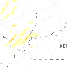
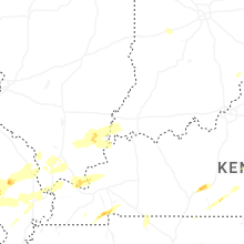


Connect with Interactive Hail Maps