

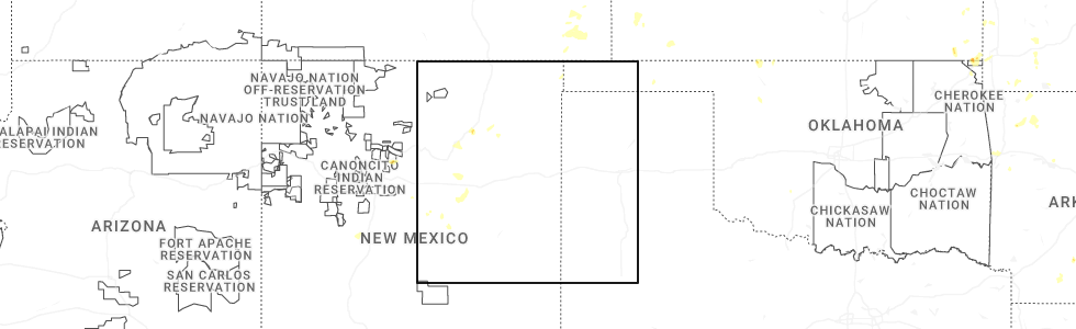
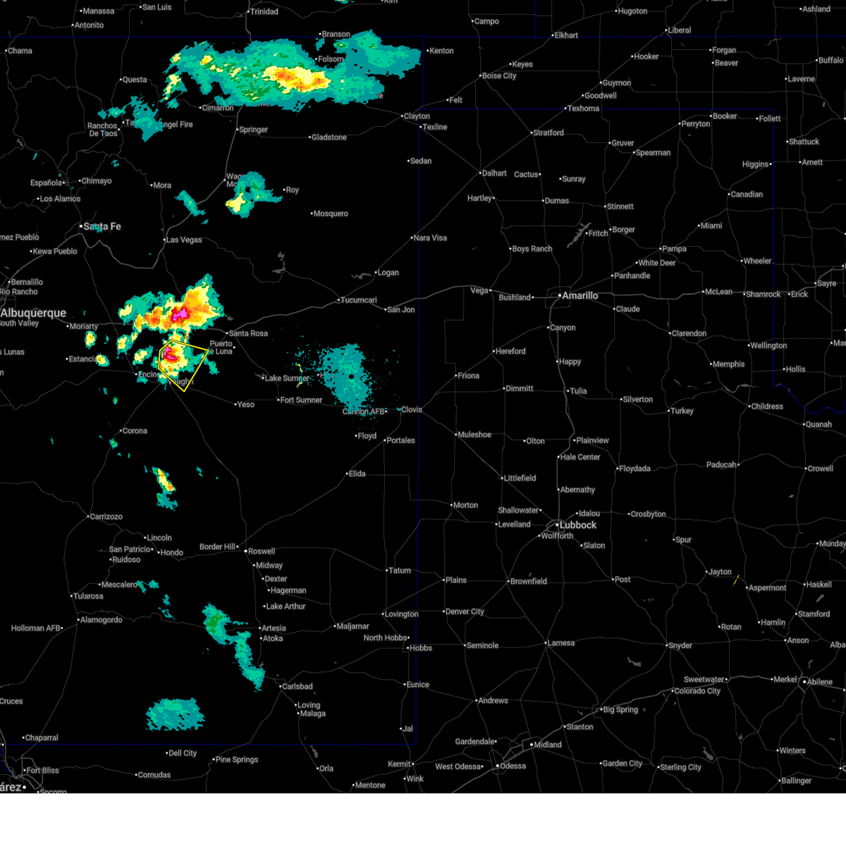
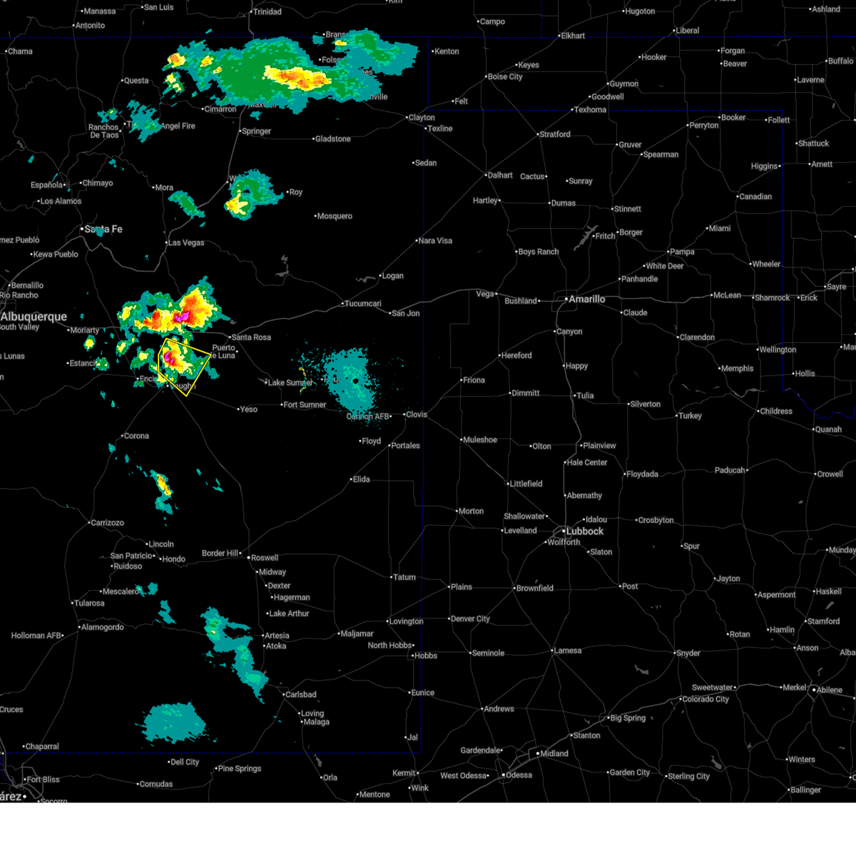
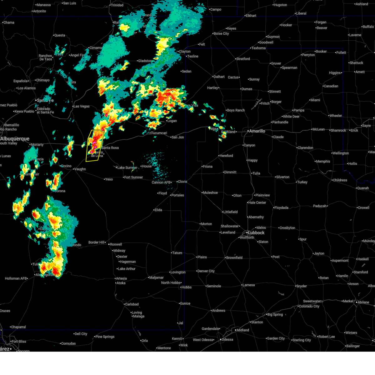
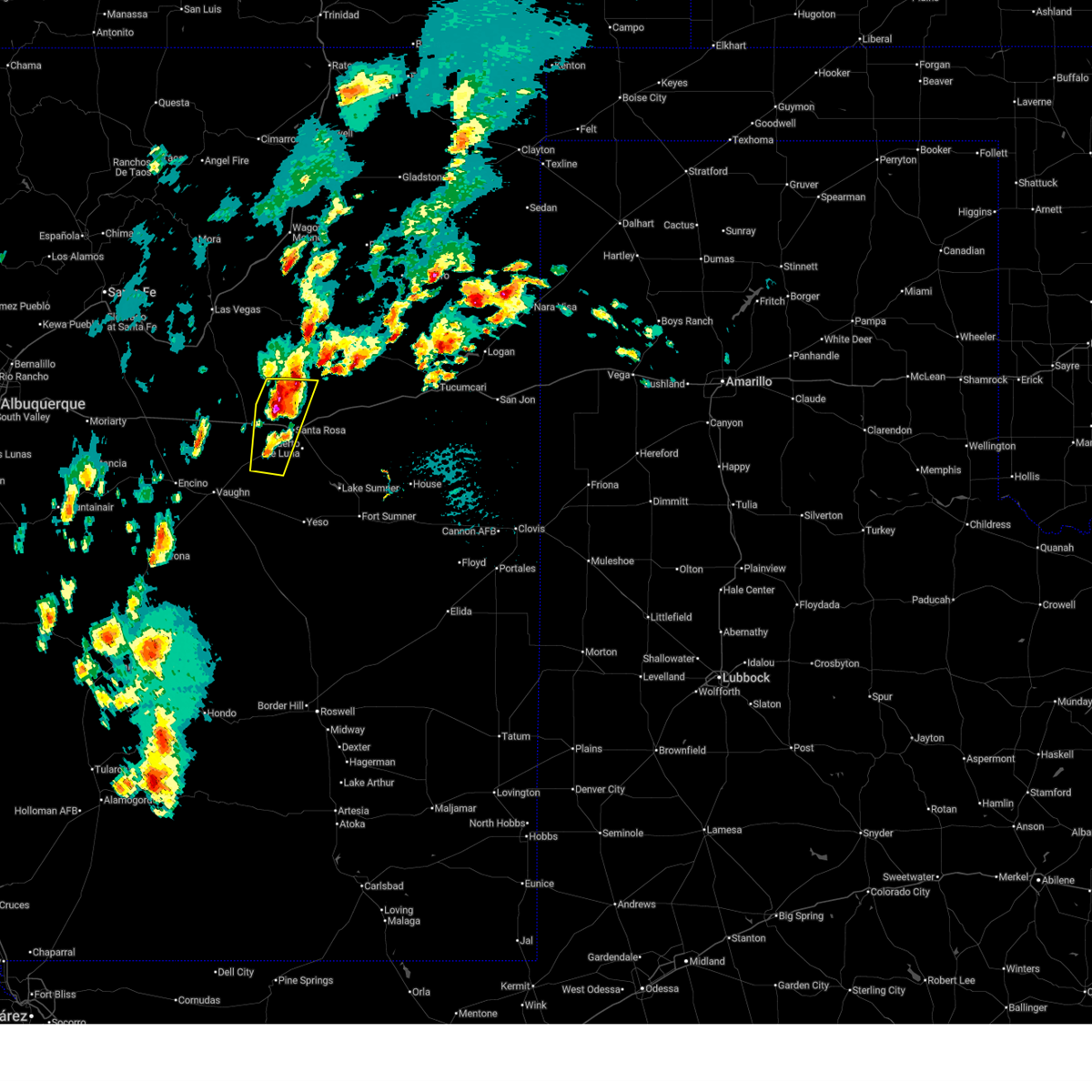
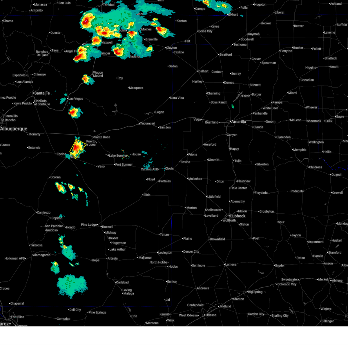
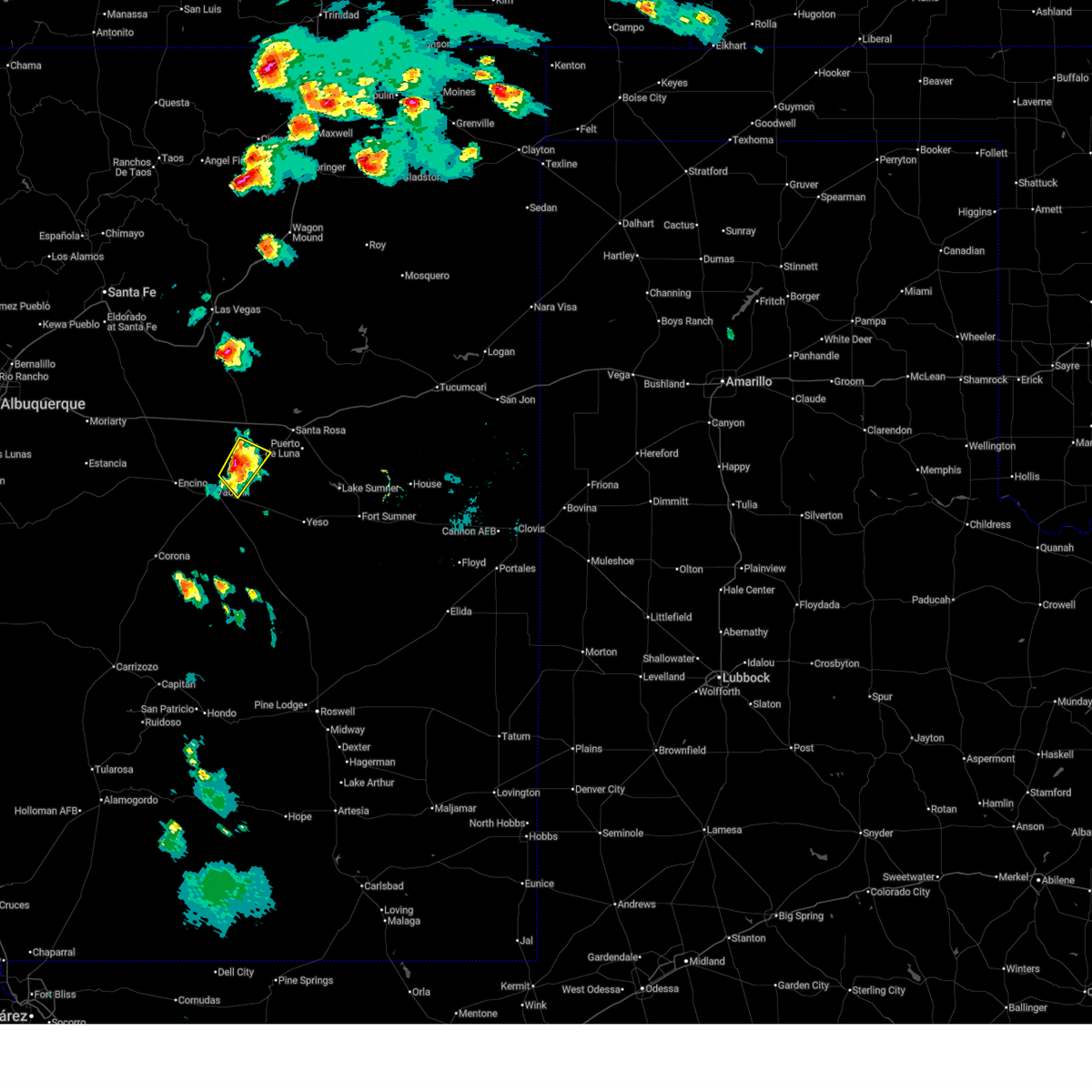
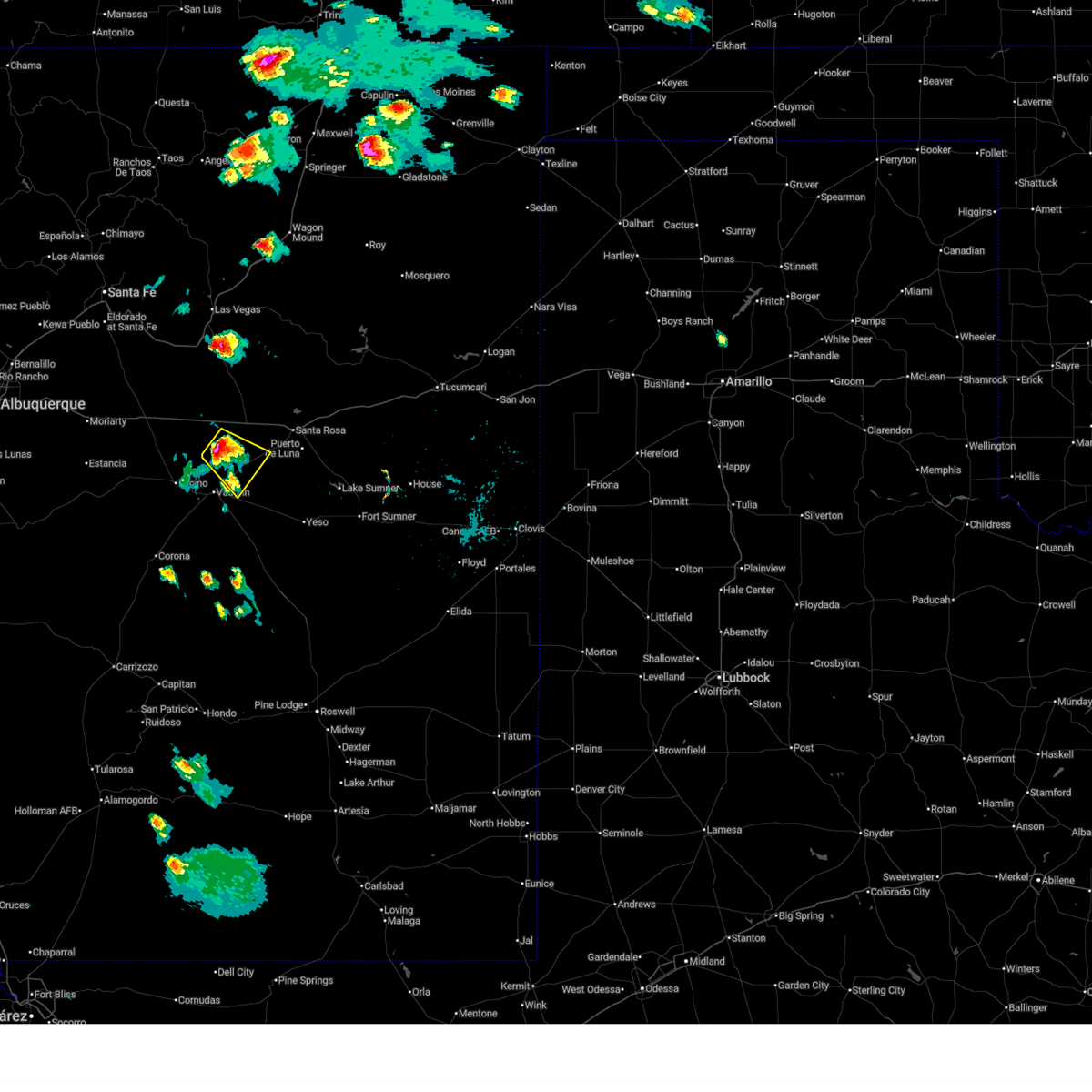
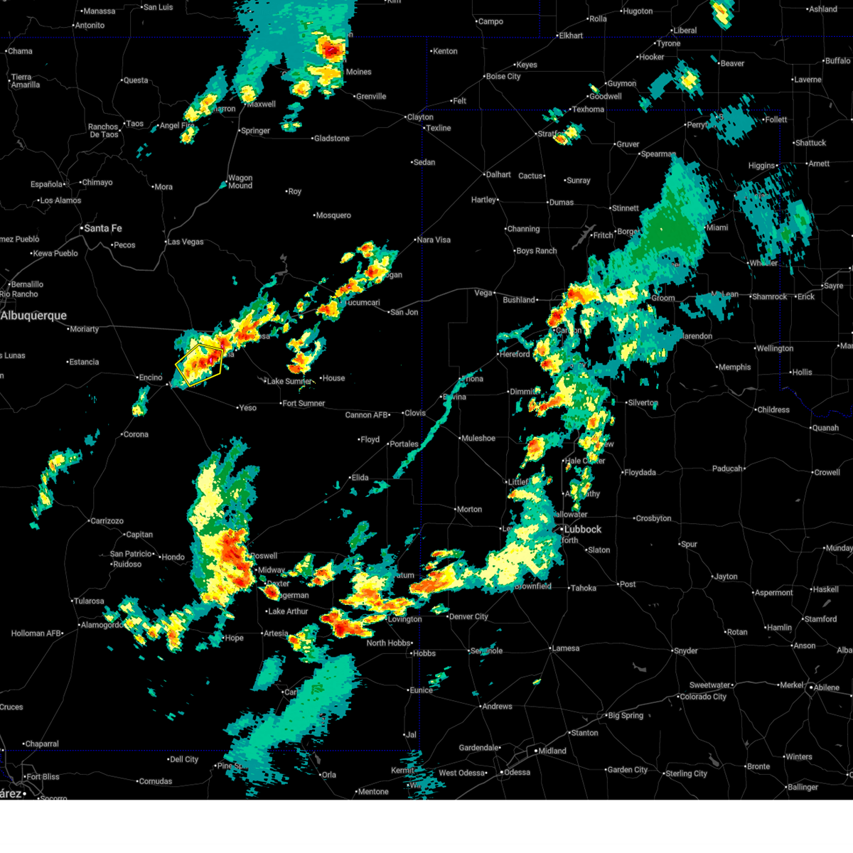
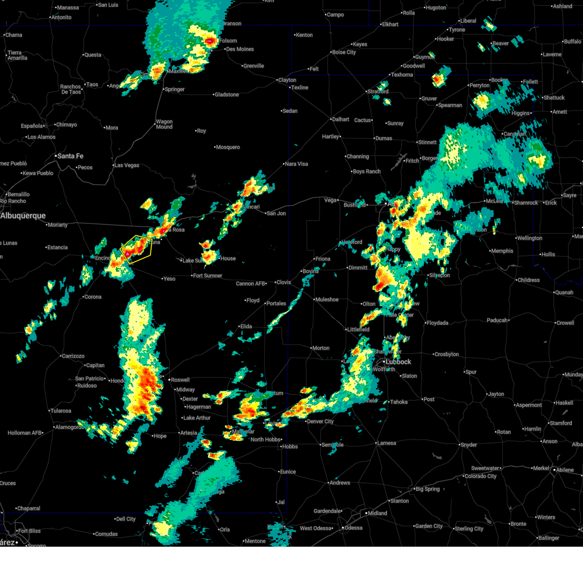
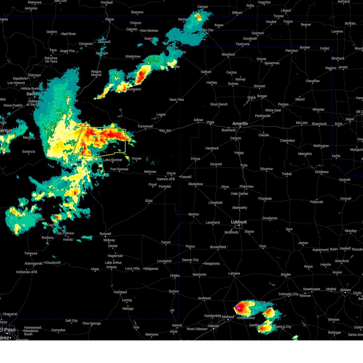
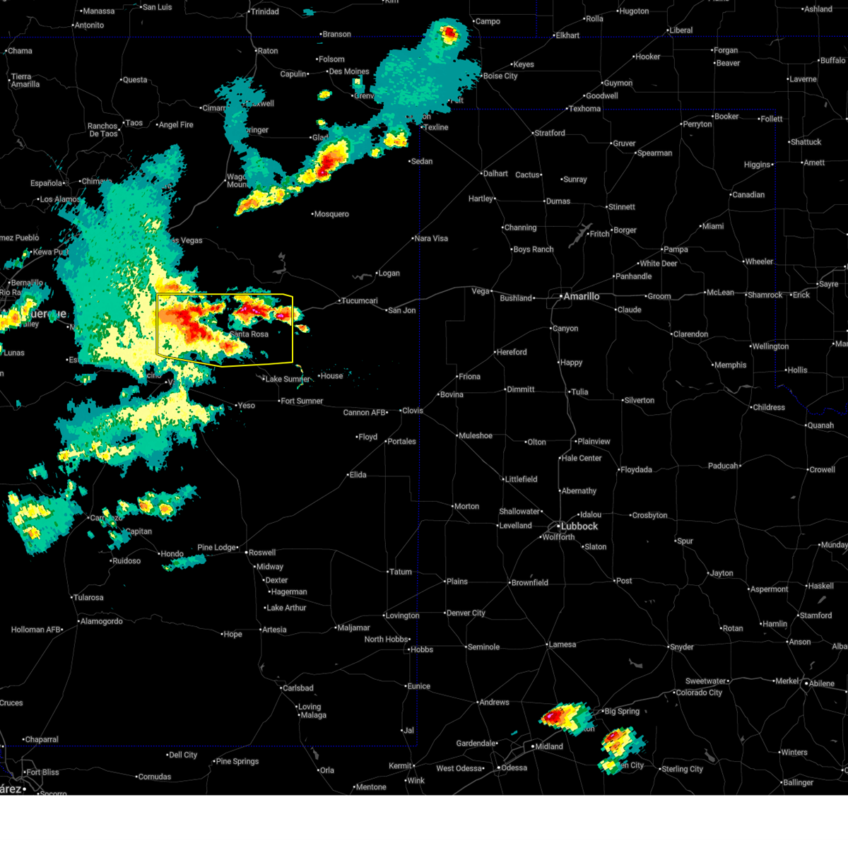
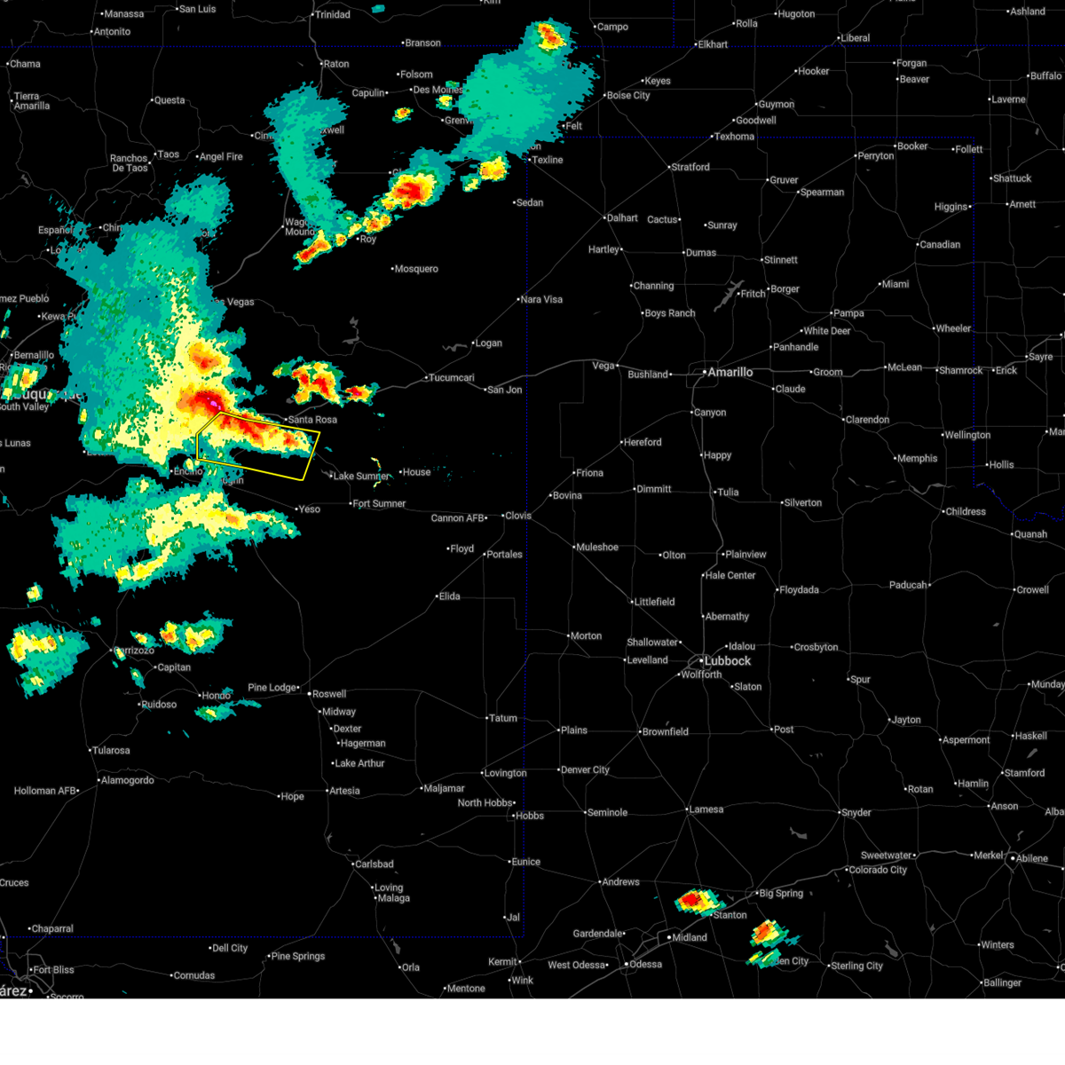
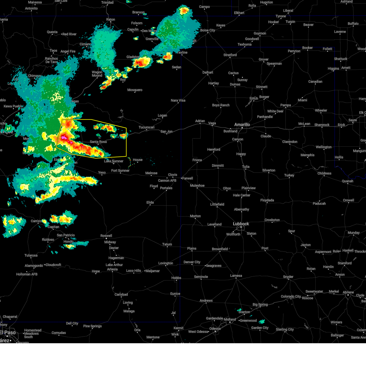
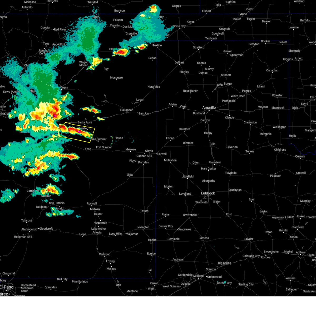
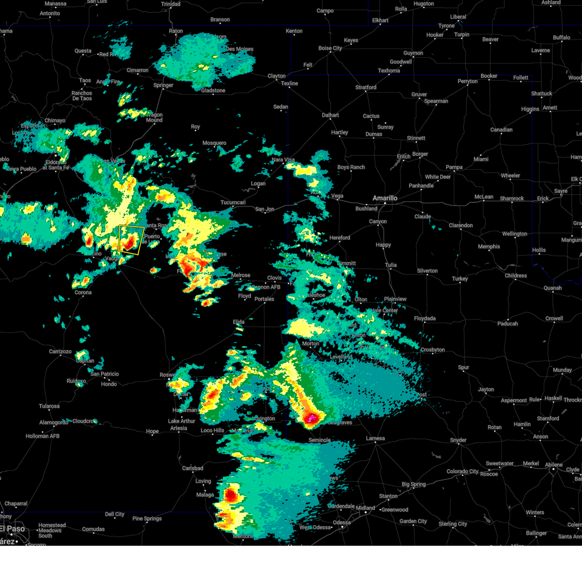
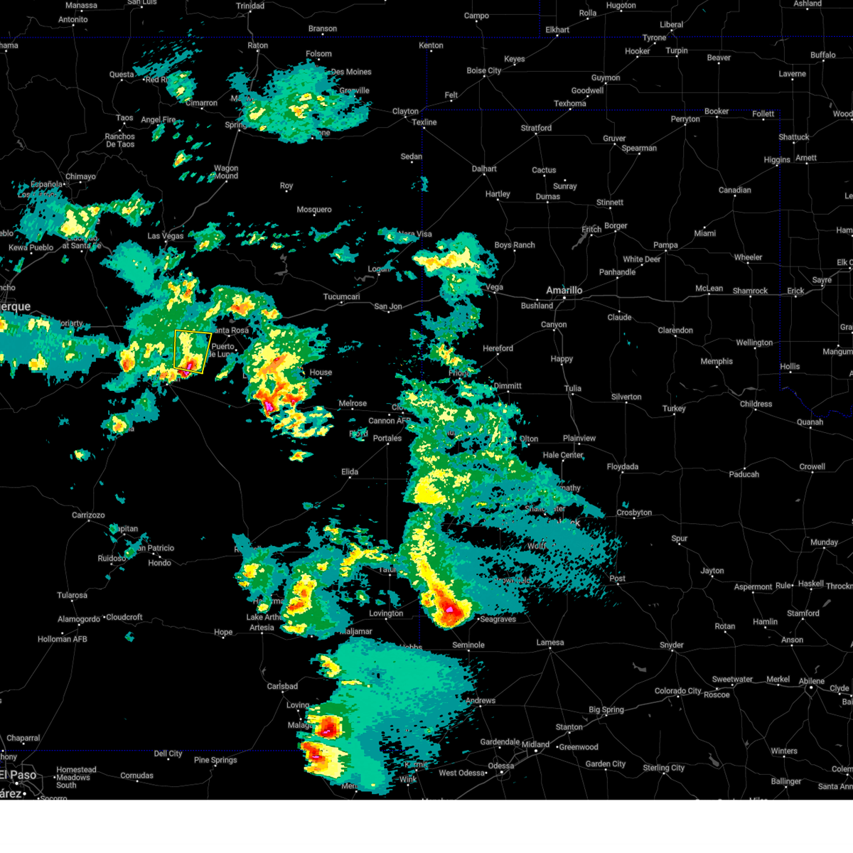
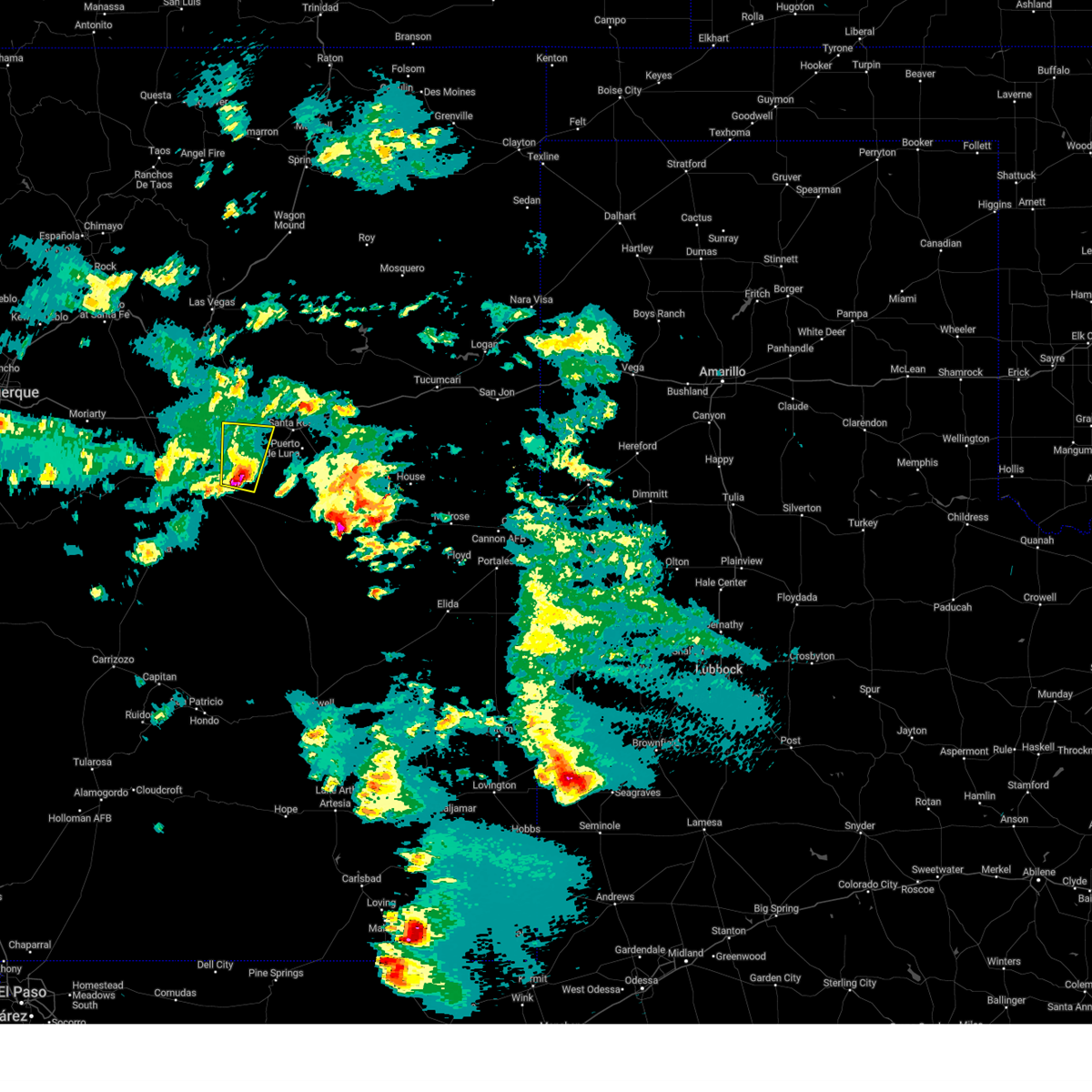
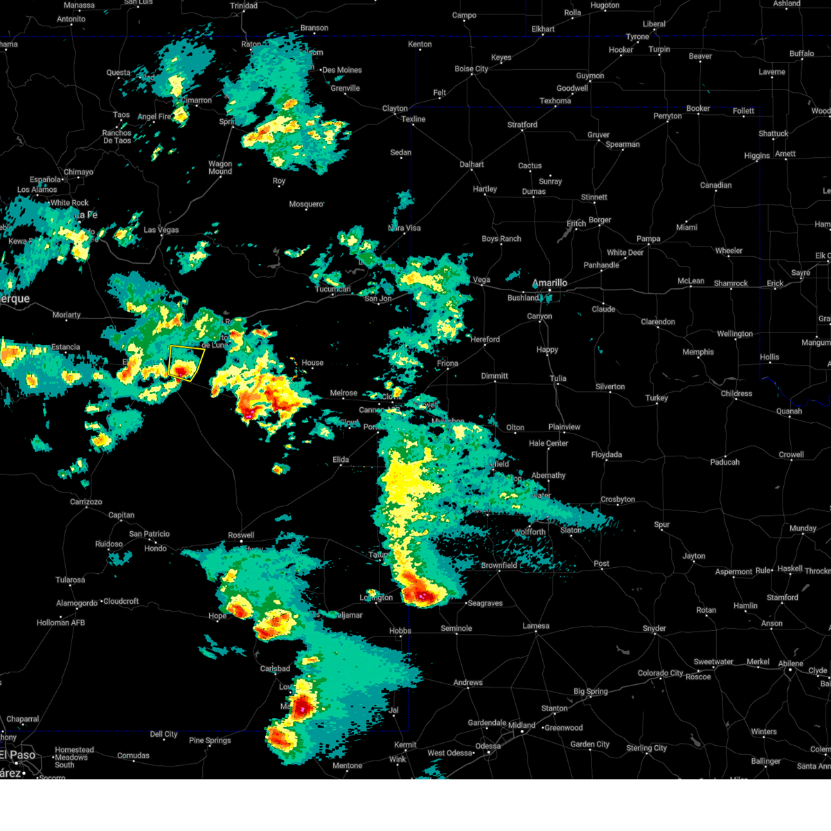
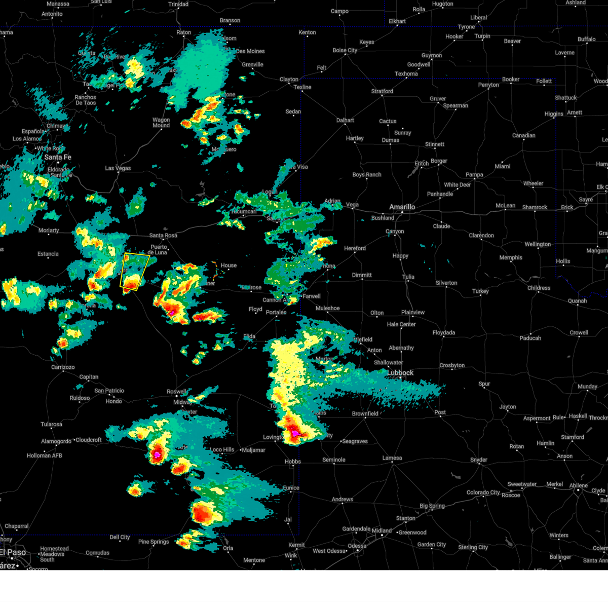
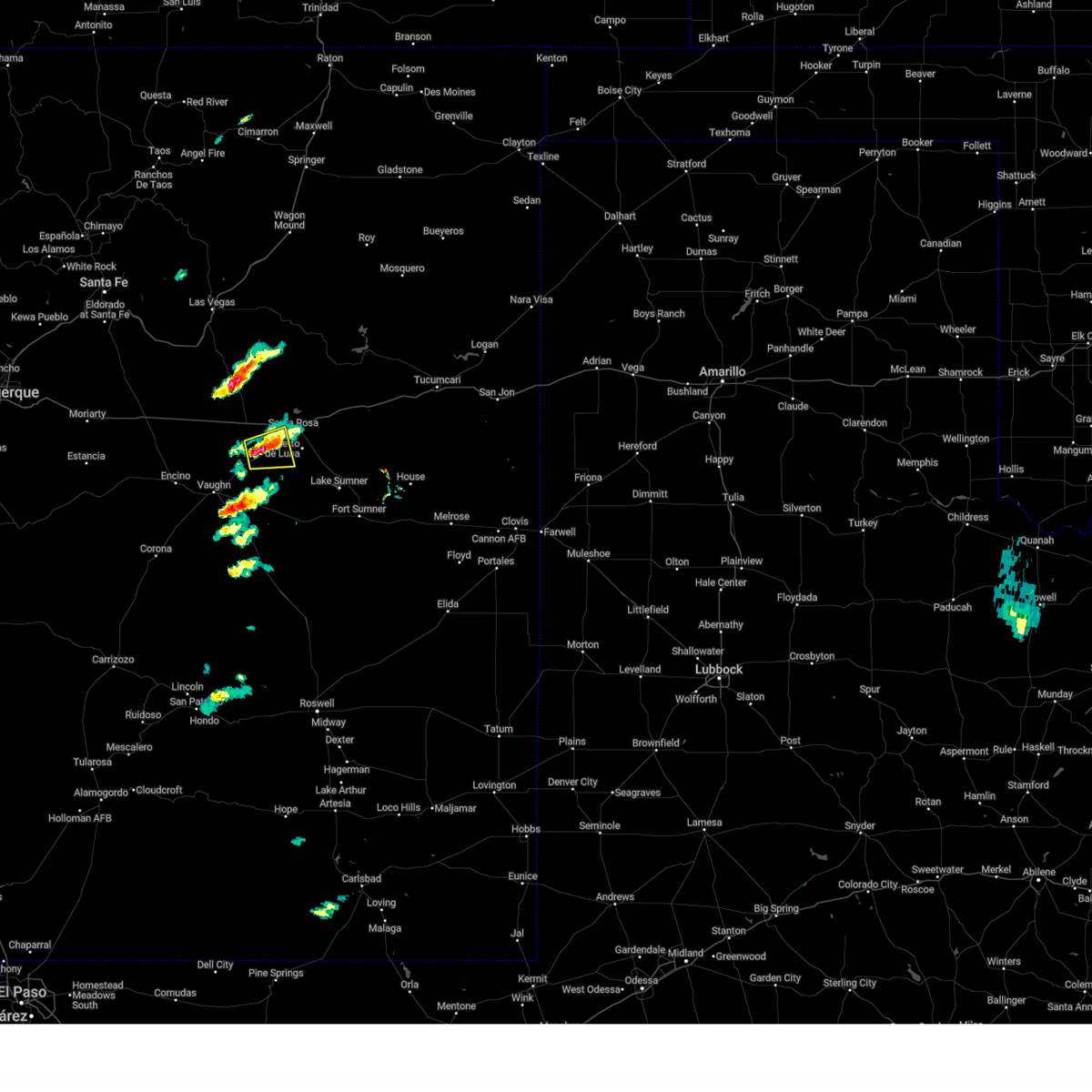
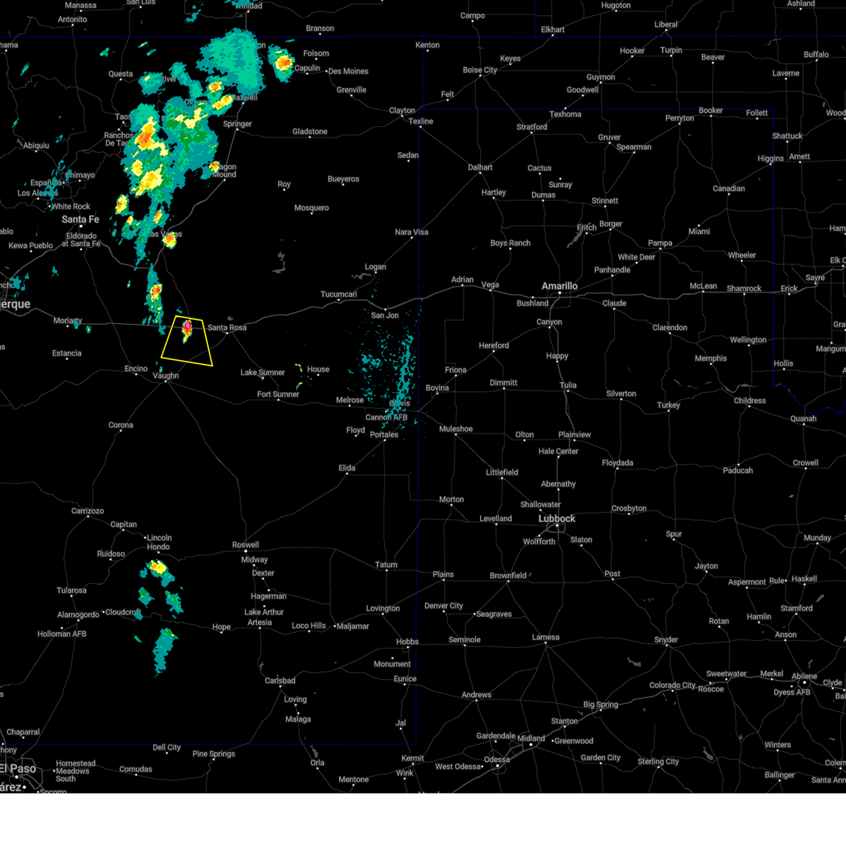
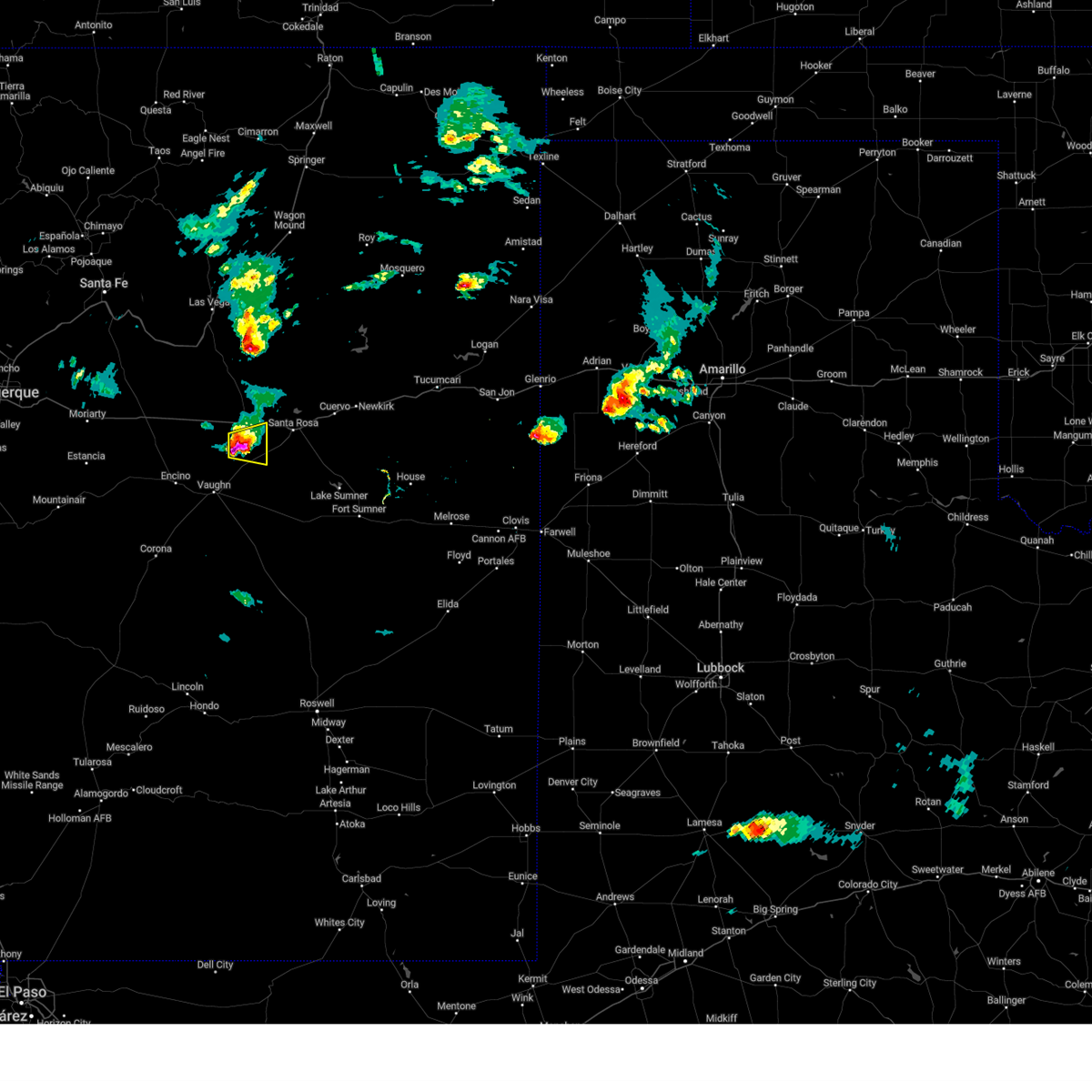
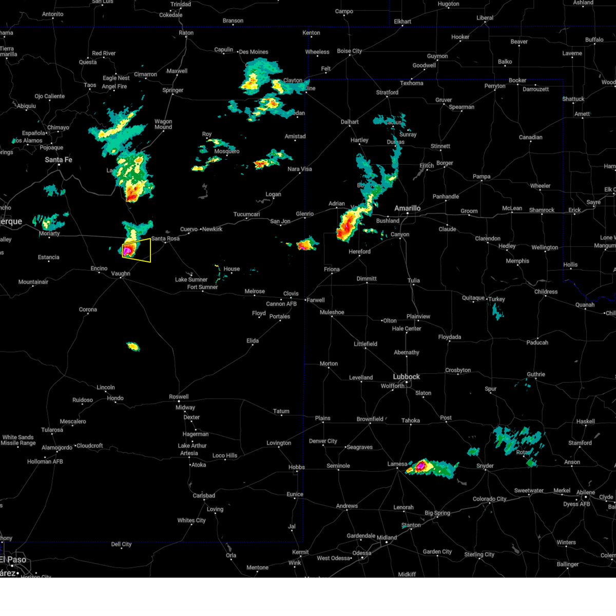
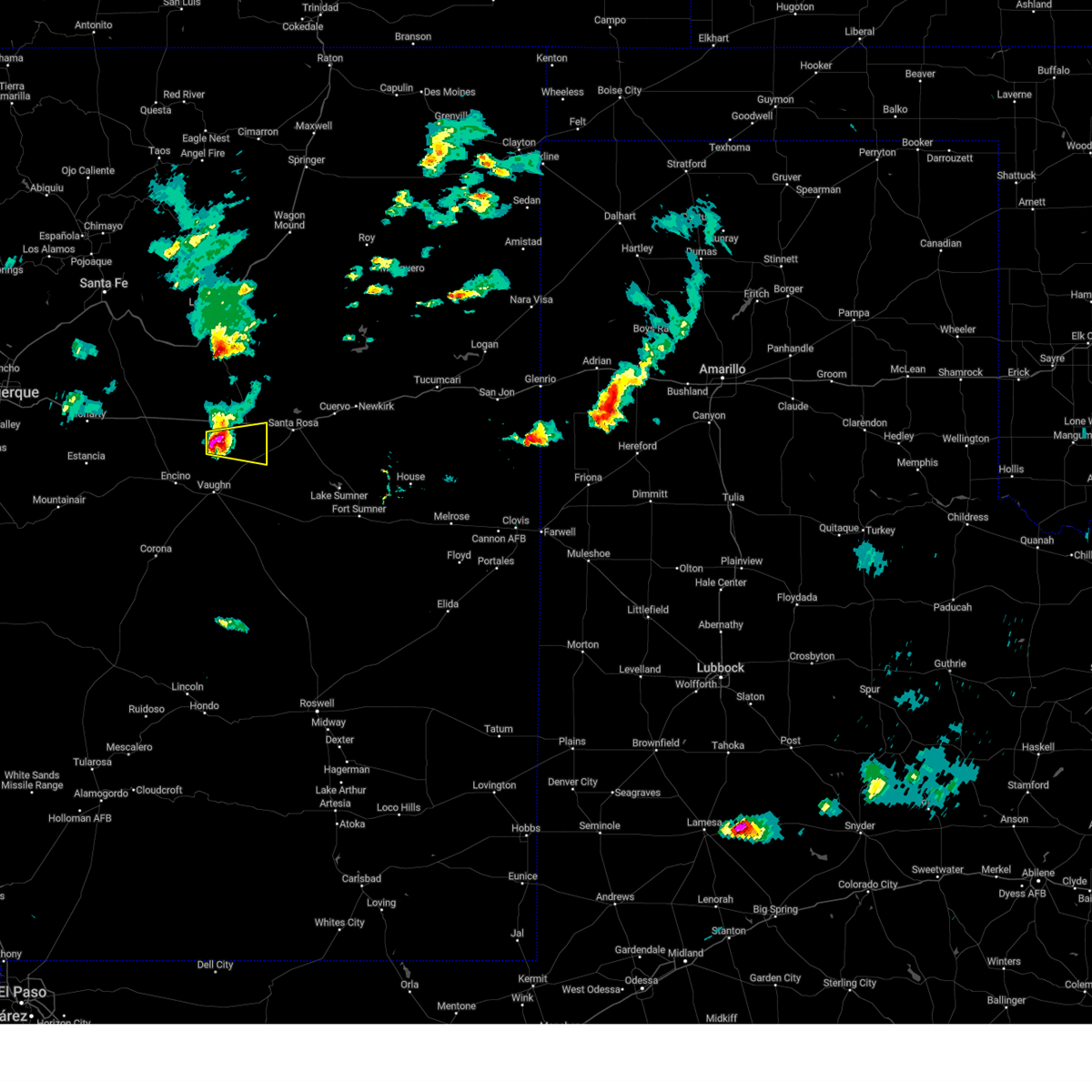
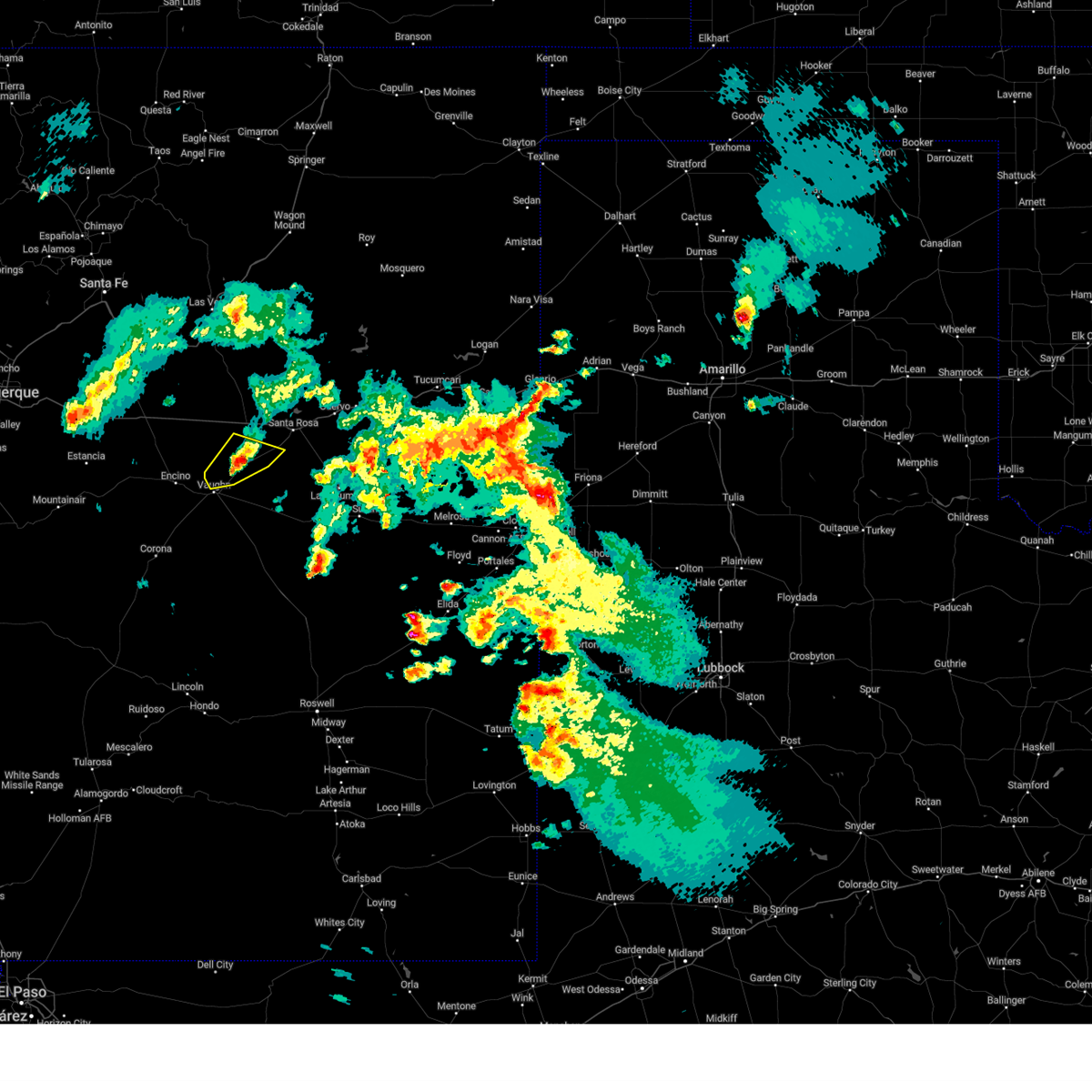
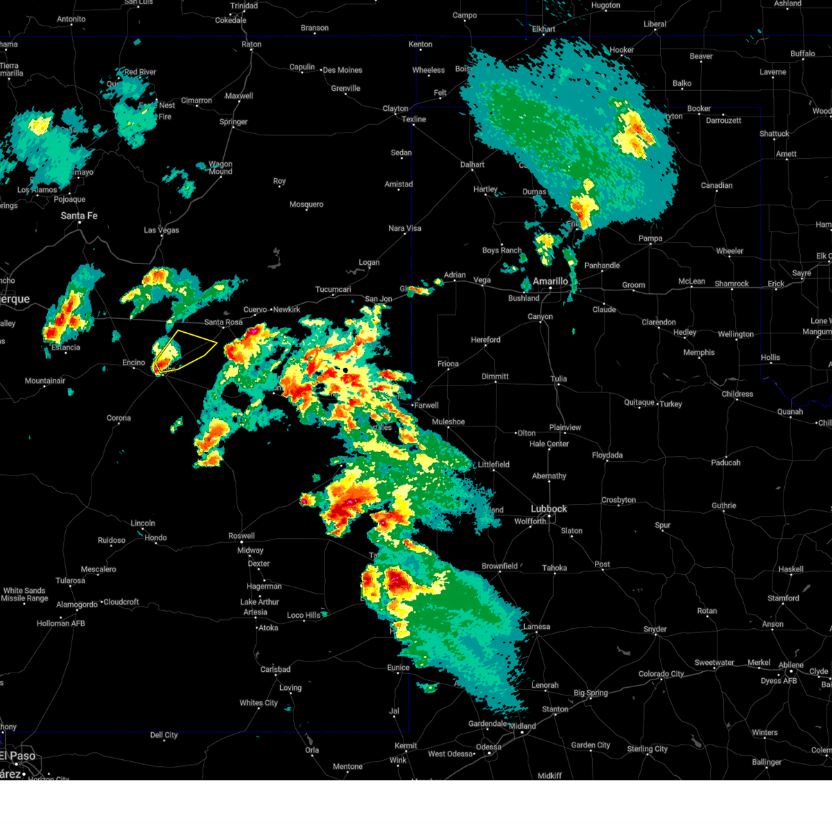
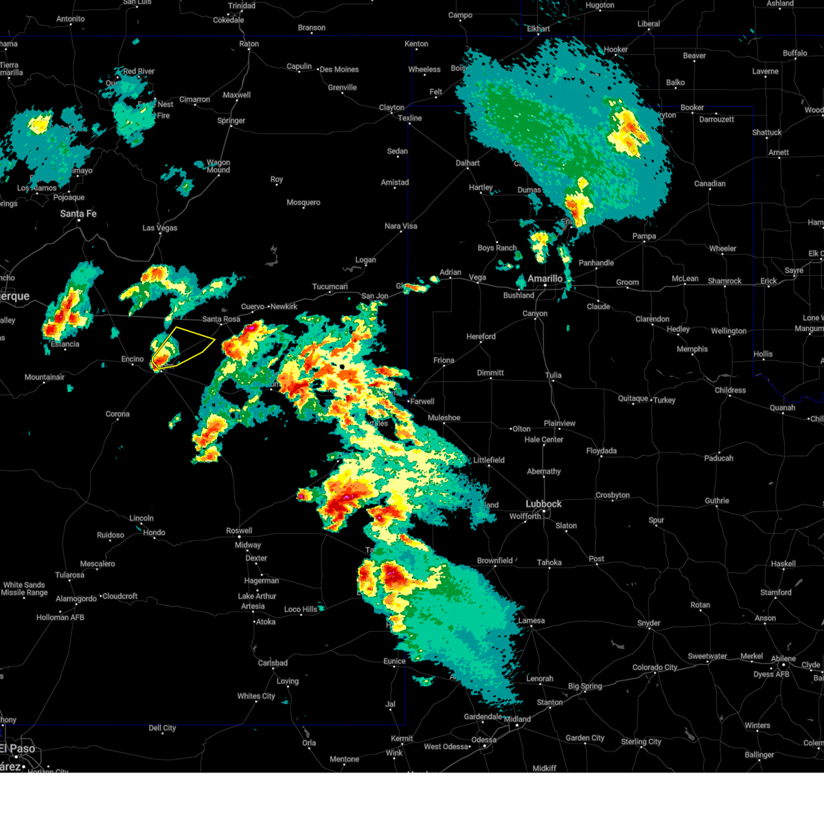
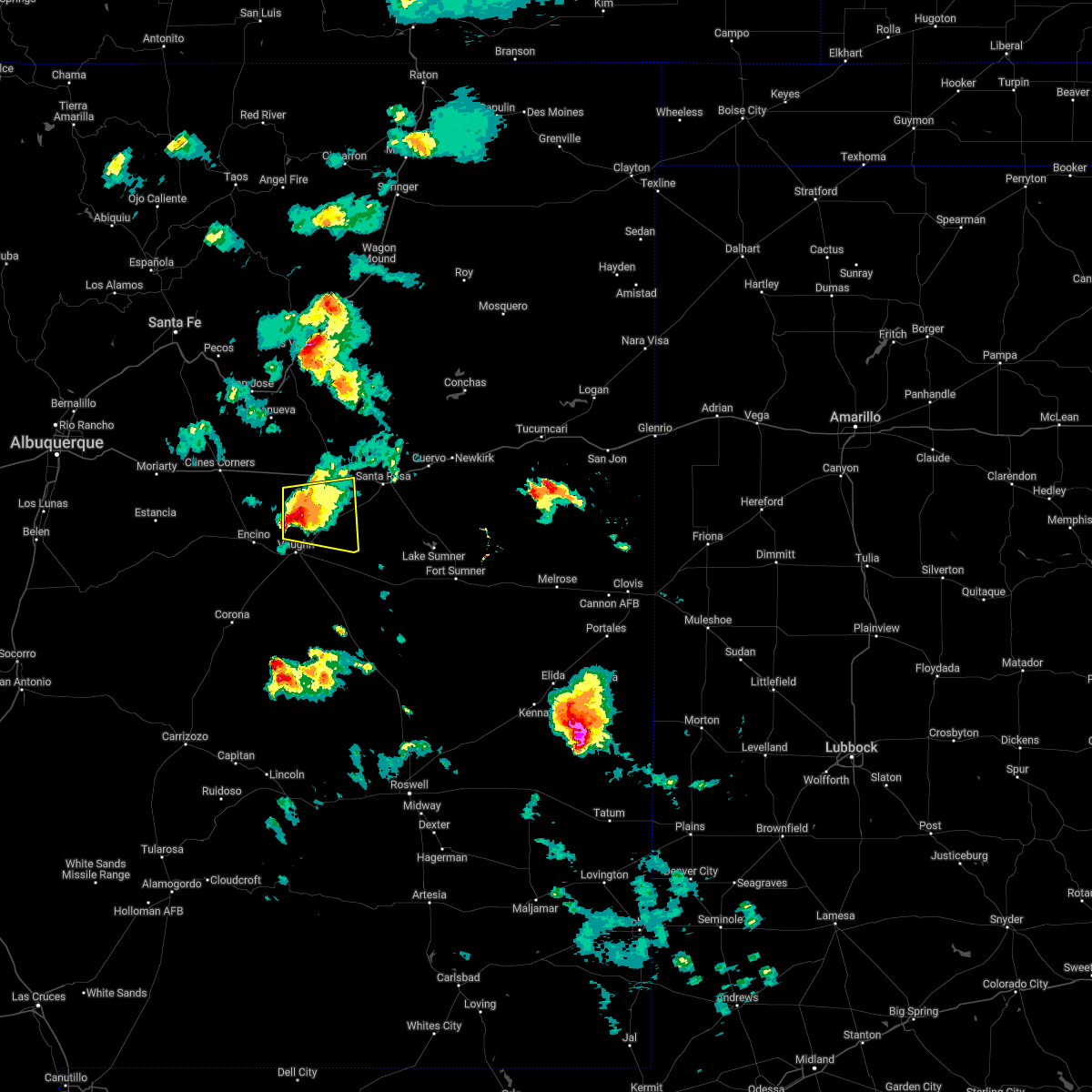
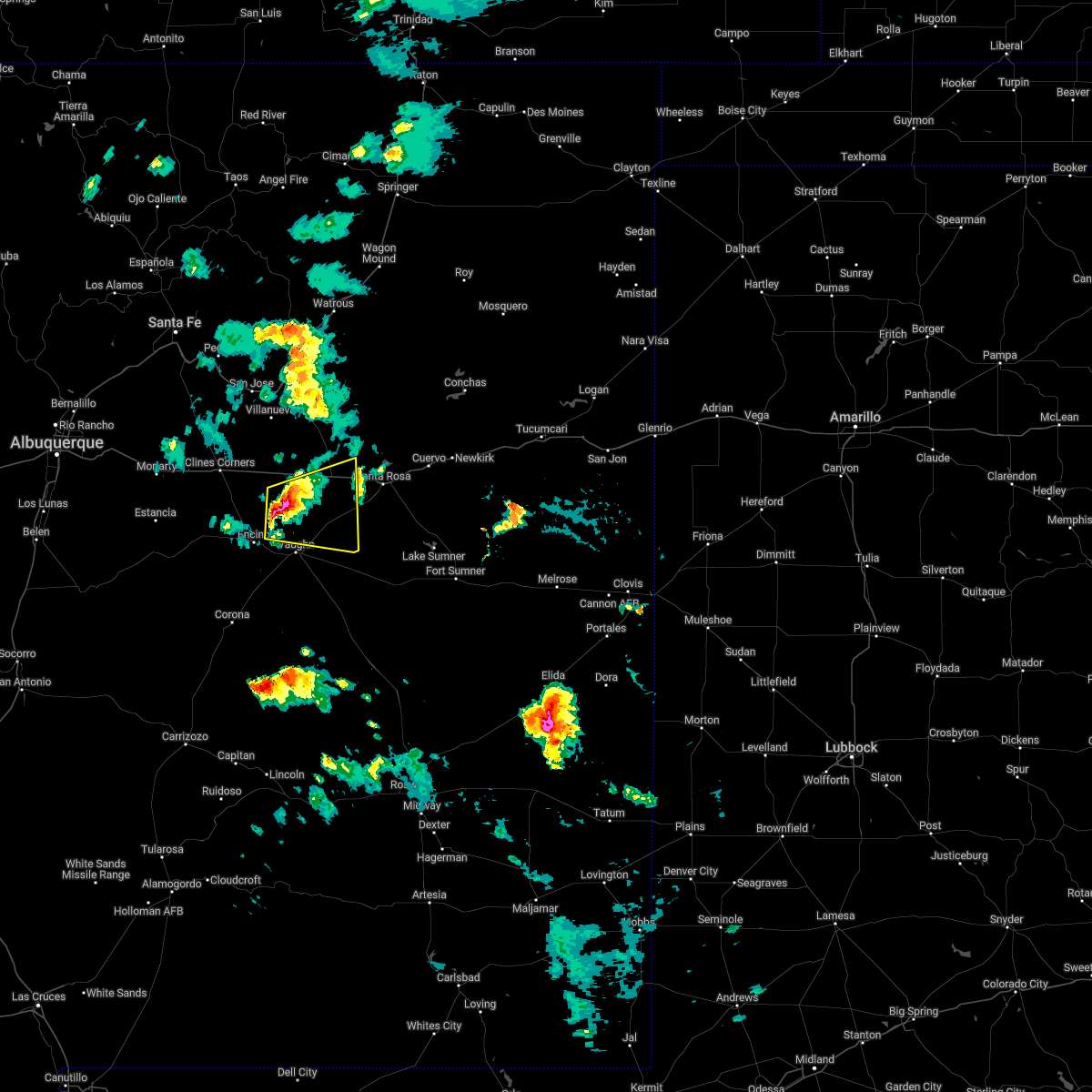
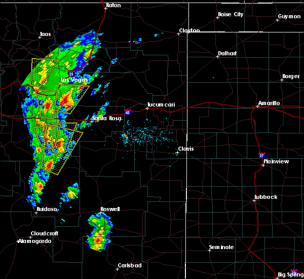
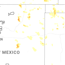
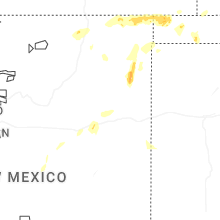
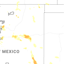
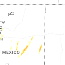
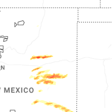
Hail Map for Pastura, NM
The Pastura, NM area has had 0 reports of on-the-ground hail by trained spotters, and has been under severe weather warnings 10 times during the past 12 months. Doppler radar has detected hail at or near Pastura, NM on 44 occasions, including 3 occasions during the past year.
| Name: | Pastura, NM |
| Where Located: | 74.2 miles WSW of Tucumcari, NM |
| Map: | Google Map for Pastura, NM |
| Population: | 23 |
| Housing Units: | 37 |
| More Info: | Search Google for Pastura, NM |
1
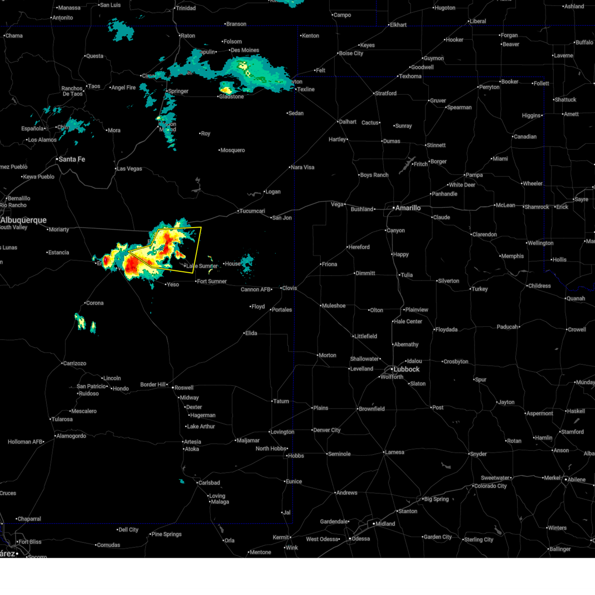
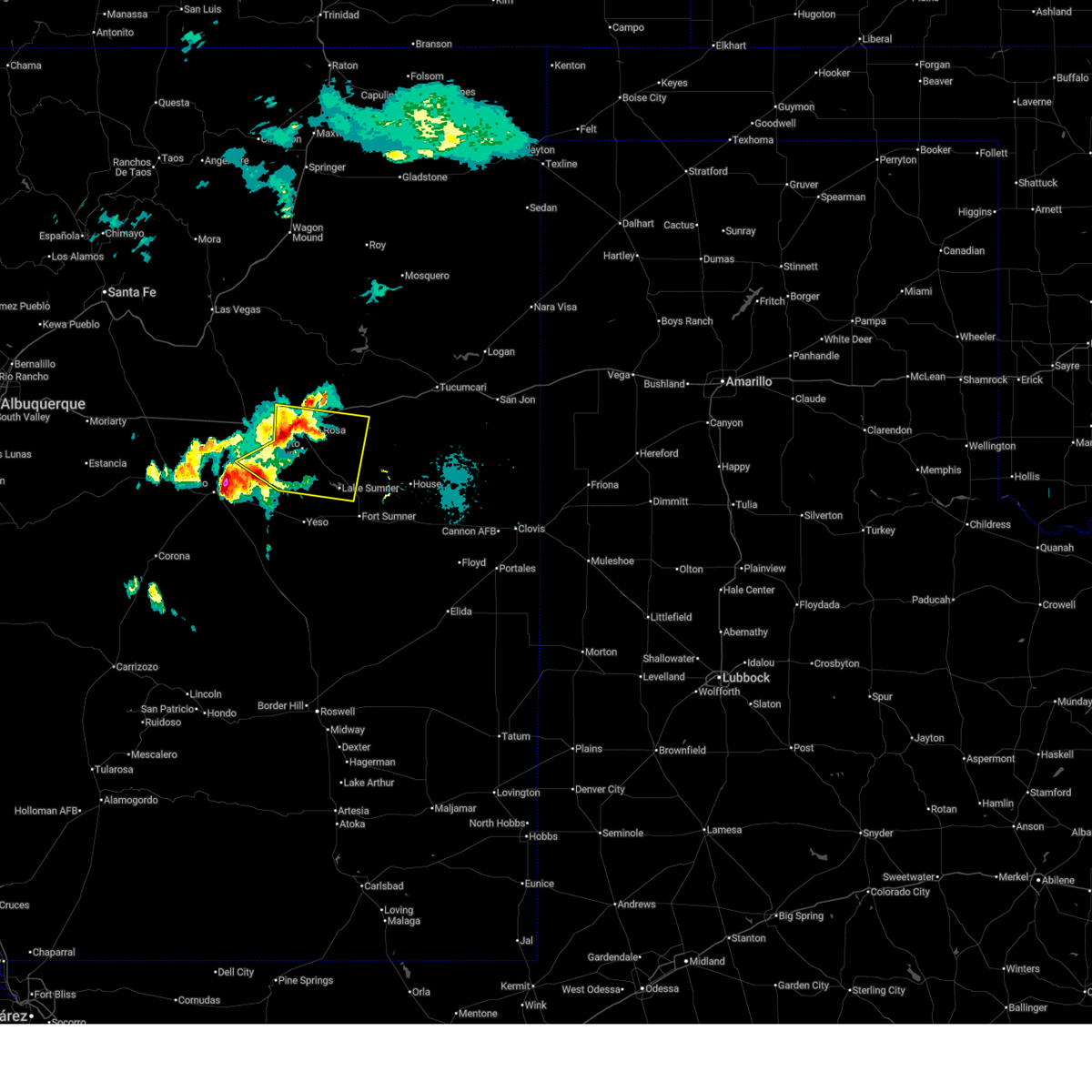
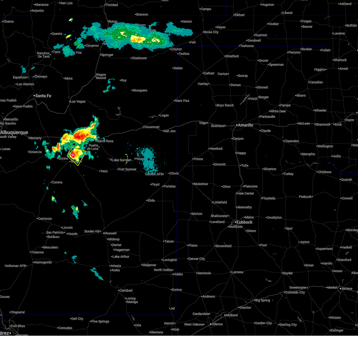
The Top Recent Hail Date for Pastura, NM is Tuesday, September 16, 2025 (15th out of 44)
Hail and Wind Damage Spotted near Pastura, NM
| Date / Time | Report Details |
|---|---|
| 6/19/2026 6:18 PM MDT |
 At 618 pm mdt, severe thunderstorms were located along a line from 6 miles northeast of puerto de luna to 13 miles south of puerto de luna, moving southeast at 35 mph (radar indicated). Hazards include 60 mph wind gusts and quarter size hail. Hail damage to vehicles is expected. expect wind damage to roofs, siding, and trees. locations impacted include, santa rosa, puerto de luna, sumner lake state park, sumner lake and pastura. This includes interstate 40 between mile markers 273 and 283. At 618 pm mdt, severe thunderstorms were located along a line from 6 miles northeast of puerto de luna to 13 miles south of puerto de luna, moving southeast at 35 mph (radar indicated). Hazards include 60 mph wind gusts and quarter size hail. Hail damage to vehicles is expected. expect wind damage to roofs, siding, and trees. locations impacted include, santa rosa, puerto de luna, sumner lake state park, sumner lake and pastura. This includes interstate 40 between mile markers 273 and 283.
|
| 6/19/2026 6:07 PM MDT |
 Svrabq the national weather service in albuquerque has issued a * severe thunderstorm warning for, northwestern de baca county in east central new mexico, central guadalupe county in east central new mexico, * until 645 pm mdt. * at 607 pm mdt, severe thunderstorms were located along a line from near santa rosa to 10 miles south of puerto de luna, moving southeast at 35 mph (radar indicated). Hazards include 60 mph wind gusts and small hail. expect damage to roofs, siding, and trees Svrabq the national weather service in albuquerque has issued a * severe thunderstorm warning for, northwestern de baca county in east central new mexico, central guadalupe county in east central new mexico, * until 645 pm mdt. * at 607 pm mdt, severe thunderstorms were located along a line from near santa rosa to 10 miles south of puerto de luna, moving southeast at 35 mph (radar indicated). Hazards include 60 mph wind gusts and small hail. expect damage to roofs, siding, and trees
|
| 6/19/2026 5:18 PM MDT |
 At 518 pm mdt, a severe thunderstorm was located 7 miles northeast of vaughn, moving southeast at 10 mph (radar indicated). Hazards include 60 mph wind gusts and quarter size hail. Hail damage to vehicles is expected. expect wind damage to roofs, siding, and trees. locations impacted include, pastura. This includes highway 60 between mile markers 276 and 280. At 518 pm mdt, a severe thunderstorm was located 7 miles northeast of vaughn, moving southeast at 10 mph (radar indicated). Hazards include 60 mph wind gusts and quarter size hail. Hail damage to vehicles is expected. expect wind damage to roofs, siding, and trees. locations impacted include, pastura. This includes highway 60 between mile markers 276 and 280.
|
| 6/19/2026 5:03 PM MDT |
 At 503 pm mdt, a severe thunderstorm was located 11 miles north of vaughn, moving southeast at 5 mph (radar indicated). Hazards include 60 mph wind gusts and small hail. Expect damage to roofs, siding, and trees. locations impacted include, pastura. This includes highway 60 between mile markers 276 and 280. At 503 pm mdt, a severe thunderstorm was located 11 miles north of vaughn, moving southeast at 5 mph (radar indicated). Hazards include 60 mph wind gusts and small hail. Expect damage to roofs, siding, and trees. locations impacted include, pastura. This includes highway 60 between mile markers 276 and 280.
|
| 6/19/2026 4:49 PM MDT |
 Svrabq the national weather service in albuquerque has issued a * severe thunderstorm warning for, southwestern guadalupe county in east central new mexico, * until 530 pm mdt. * at 449 pm mdt, a severe thunderstorm was located 13 miles north of vaughn, moving southeast at 5 mph (radar indicated). Hazards include 60 mph wind gusts and half dollar size hail. Hail damage to vehicles is expected. Expect wind damage to roofs, siding, and trees. Svrabq the national weather service in albuquerque has issued a * severe thunderstorm warning for, southwestern guadalupe county in east central new mexico, * until 530 pm mdt. * at 449 pm mdt, a severe thunderstorm was located 13 miles north of vaughn, moving southeast at 5 mph (radar indicated). Hazards include 60 mph wind gusts and half dollar size hail. Hail damage to vehicles is expected. Expect wind damage to roofs, siding, and trees.
|
| 6/2/2026 1:07 PM MDT |
 At 107 pm mdt, a severe thunderstorm was located 7 miles west of santa rosa, moving northwest at 5 mph (radar indicated). Hazards include 60 mph wind gusts and half dollar size hail. Hail damage to vehicles is expected. expect wind damage to roofs, siding, and trees. locations impacted include, santa rosa, santa rosa lake state park, colonias and pastura. This includes interstate 40 between mile markers 260 and 274. At 107 pm mdt, a severe thunderstorm was located 7 miles west of santa rosa, moving northwest at 5 mph (radar indicated). Hazards include 60 mph wind gusts and half dollar size hail. Hail damage to vehicles is expected. expect wind damage to roofs, siding, and trees. locations impacted include, santa rosa, santa rosa lake state park, colonias and pastura. This includes interstate 40 between mile markers 260 and 274.
|
| 6/2/2026 12:34 PM MDT |
 Svrabq the national weather service in albuquerque has issued a * severe thunderstorm warning for, north central guadalupe county in east central new mexico, * until 115 pm mdt. * at 1234 pm mdt, a severe thunderstorm was located 7 miles southeast of colonias, or 9 miles northwest of santa rosa, moving northeast at 10 mph (radar indicated). Hazards include ping pong ball size hail and 60 mph wind gusts. People and animals outdoors will be injured. expect hail damage to roofs, siding, windows, and vehicles. Expect wind damage to roofs, siding, and trees. Svrabq the national weather service in albuquerque has issued a * severe thunderstorm warning for, north central guadalupe county in east central new mexico, * until 115 pm mdt. * at 1234 pm mdt, a severe thunderstorm was located 7 miles southeast of colonias, or 9 miles northwest of santa rosa, moving northeast at 10 mph (radar indicated). Hazards include ping pong ball size hail and 60 mph wind gusts. People and animals outdoors will be injured. expect hail damage to roofs, siding, windows, and vehicles. Expect wind damage to roofs, siding, and trees.
|
| 10/6/2025 5:57 PM MDT | The severe thunderstorm warning that was previously in effect has been reissued for guadalupe county and is in effect until 645 pm mdt. please refer to that bulletin for the latest severe weather information. |
| 10/6/2025 5:42 PM MDT | At 542 pm mdt, a severe thunderstorm was located 8 miles east of pastura, or 11 miles southwest of santa rosa, moving east at 20 mph (radar indicated). Hazards include 60 mph wind gusts and half dollar size hail. Hail damage to vehicles is expected. expect wind damage to roofs, siding, and trees. locations impacted include, santa rosa and pastura. This includes interstate 40 between mile markers 265 and 277. |
| 10/6/2025 5:11 PM MDT | Svrabq the national weather service in albuquerque has issued a * severe thunderstorm warning for, central guadalupe county in east central new mexico, * until 600 pm mdt. * at 511 pm mdt, a severe thunderstorm was located near pastura, or 18 miles northeast of vaughn, moving northeast at 20 mph (radar indicated). Hazards include 60 mph wind gusts and quarter size hail. Hail damage to vehicles is expected. Expect wind damage to roofs, siding, and trees. |
| 7/11/2025 5:07 PM MDT |
 The severe thunderstorm warning that was previously in effect has been reissued for guadalupe county and is in effect until 545 pm mdt. please refer to that bulletin for the latest severe weather information. however, small hail and gusty winds are still possible with this thunderstorm. The severe thunderstorm warning that was previously in effect has been reissued for guadalupe county and is in effect until 545 pm mdt. please refer to that bulletin for the latest severe weather information. however, small hail and gusty winds are still possible with this thunderstorm.
|
| 7/11/2025 5:01 PM MDT |
 At 501 pm mdt, a severe thunderstorm was located 7 miles southwest of pastura, or 13 miles northeast of vaughn, moving southeast at 20 mph (radar indicated). Hazards include 60 mph wind gusts and quarter size hail. Hail damage to vehicles is expected. expect wind damage to roofs, siding, and trees. Locations impacted include, pastura. At 501 pm mdt, a severe thunderstorm was located 7 miles southwest of pastura, or 13 miles northeast of vaughn, moving southeast at 20 mph (radar indicated). Hazards include 60 mph wind gusts and quarter size hail. Hail damage to vehicles is expected. expect wind damage to roofs, siding, and trees. Locations impacted include, pastura.
|
| 7/11/2025 4:34 PM MDT |
 Svrabq the national weather service in albuquerque has issued a * severe thunderstorm warning for, west central guadalupe county in east central new mexico, * until 515 pm mdt. * at 434 pm mdt, a severe thunderstorm was located 15 miles north of vaughn, moving southeast at 20 mph (radar indicated). Hazards include 60 mph wind gusts and quarter size hail. Hail damage to vehicles is expected. Expect wind damage to roofs, siding, and trees. Svrabq the national weather service in albuquerque has issued a * severe thunderstorm warning for, west central guadalupe county in east central new mexico, * until 515 pm mdt. * at 434 pm mdt, a severe thunderstorm was located 15 miles north of vaughn, moving southeast at 20 mph (radar indicated). Hazards include 60 mph wind gusts and quarter size hail. Hail damage to vehicles is expected. Expect wind damage to roofs, siding, and trees.
|
| 6/23/2025 4:15 PM MDT |
 the severe thunderstorm warning has been cancelled and is no longer in effect the severe thunderstorm warning has been cancelled and is no longer in effect
|
| 6/23/2025 3:52 PM MDT |
 Svrabq the national weather service in albuquerque has issued a * severe thunderstorm warning for, west central guadalupe county in east central new mexico, * until 445 pm mdt. * at 352 pm mdt, a severe thunderstorm was located 8 miles southwest of pastura, or 12 miles northeast of vaughn, moving northeast at 10 mph (radar indicated). Hazards include 60 mph wind gusts and half dollar size hail. Hail damage to vehicles is expected. Expect wind damage to roofs, siding, and trees. Svrabq the national weather service in albuquerque has issued a * severe thunderstorm warning for, west central guadalupe county in east central new mexico, * until 445 pm mdt. * at 352 pm mdt, a severe thunderstorm was located 8 miles southwest of pastura, or 12 miles northeast of vaughn, moving northeast at 10 mph (radar indicated). Hazards include 60 mph wind gusts and half dollar size hail. Hail damage to vehicles is expected. Expect wind damage to roofs, siding, and trees.
|
| 6/9/2025 6:13 PM MDT |
 Svrabq the national weather service in albuquerque has issued a * severe thunderstorm warning for, northern guadalupe county in east central new mexico, * until 715 pm mdt. * at 613 pm mdt, severe thunderstorms were located along a line from near colonias to 7 miles southwest of montoya, moving south at 5 mph (radar indicated). Hazards include 60 mph wind gusts and quarter size hail. Hail damage to vehicles is expected. Expect wind damage to roofs, siding, and trees. Svrabq the national weather service in albuquerque has issued a * severe thunderstorm warning for, northern guadalupe county in east central new mexico, * until 715 pm mdt. * at 613 pm mdt, severe thunderstorms were located along a line from near colonias to 7 miles southwest of montoya, moving south at 5 mph (radar indicated). Hazards include 60 mph wind gusts and quarter size hail. Hail damage to vehicles is expected. Expect wind damage to roofs, siding, and trees.
|
| 6/9/2025 5:50 PM MDT |
 At 550 pm mdt, severe thunderstorms were located along a line from 7 miles south of cuervo to 6 miles south of anton chico, moving northeast at 30 mph (radar indicated). Hazards include 60 mph wind gusts and quarter size hail. Hail damage to vehicles is expected. expect wind damage to roofs, siding, and trees. locations impacted include, santa rosa, santa rosa lake state park, puerto de luna, colonias, cuervo, pastura, dilia, newkirk, anton chico and pintada. This includes interstate 40 between mile markers 240 and 307. At 550 pm mdt, severe thunderstorms were located along a line from 7 miles south of cuervo to 6 miles south of anton chico, moving northeast at 30 mph (radar indicated). Hazards include 60 mph wind gusts and quarter size hail. Hail damage to vehicles is expected. expect wind damage to roofs, siding, and trees. locations impacted include, santa rosa, santa rosa lake state park, puerto de luna, colonias, cuervo, pastura, dilia, newkirk, anton chico and pintada. This includes interstate 40 between mile markers 240 and 307.
|
| 6/9/2025 5:50 PM MDT |
 the severe thunderstorm warning has been cancelled and is no longer in effect the severe thunderstorm warning has been cancelled and is no longer in effect
|
| 6/9/2025 5:38 PM MDT |
 the severe thunderstorm warning has been cancelled and is no longer in effect the severe thunderstorm warning has been cancelled and is no longer in effect
|
| 6/9/2025 5:28 PM MDT |
 Svrabq the national weather service in albuquerque has issued a * severe thunderstorm warning for, northeastern torrance county in central new mexico, north central de baca county in east central new mexico, guadalupe county in east central new mexico, southwestern san miguel county in northeastern new mexico, * until 615 pm mdt. * at 528 pm mdt, severe thunderstorms were located along a line from over puerto de luna to 15 miles south of villanueva state park, moving northeast at 15 mph (radar indicated). Hazards include 60 mph wind gusts and quarter size hail. Hail damage to vehicles is expected. Expect wind damage to roofs, siding, and trees. Svrabq the national weather service in albuquerque has issued a * severe thunderstorm warning for, northeastern torrance county in central new mexico, north central de baca county in east central new mexico, guadalupe county in east central new mexico, southwestern san miguel county in northeastern new mexico, * until 615 pm mdt. * at 528 pm mdt, severe thunderstorms were located along a line from over puerto de luna to 15 miles south of villanueva state park, moving northeast at 15 mph (radar indicated). Hazards include 60 mph wind gusts and quarter size hail. Hail damage to vehicles is expected. Expect wind damage to roofs, siding, and trees.
|
| 6/9/2025 5:06 PM MDT |
 Svrabq the national weather service in albuquerque has issued a * severe thunderstorm warning for, west central guadalupe county in east central new mexico, * until 600 pm mdt. * at 506 pm mdt, severe thunderstorms were located along a line from 7 miles south of puerto de luna to 20 miles north of vaughn. these storms were stationary (radar indicated). Hazards include 60 mph wind gusts and quarter size hail. Hail damage to vehicles is expected. Expect wind damage to roofs, siding, and trees. Svrabq the national weather service in albuquerque has issued a * severe thunderstorm warning for, west central guadalupe county in east central new mexico, * until 600 pm mdt. * at 506 pm mdt, severe thunderstorms were located along a line from 7 miles south of puerto de luna to 20 miles north of vaughn. these storms were stationary (radar indicated). Hazards include 60 mph wind gusts and quarter size hail. Hail damage to vehicles is expected. Expect wind damage to roofs, siding, and trees.
|
| 5/4/2025 6:13 PM MDT |
 the severe thunderstorm warning has been cancelled and is no longer in effect the severe thunderstorm warning has been cancelled and is no longer in effect
|
| 5/4/2025 6:06 PM MDT |
 At 606 pm mdt, a severe thunderstorm was located 5 miles west of pastura, or 15 miles northeast of vaughn, moving north at 20 mph (radar indicated). Hazards include 60 mph wind gusts and quarter size hail. Hail damage to vehicles is expected. expect wind damage to roofs, siding, and trees. Locations impacted include, pastura and pintada. At 606 pm mdt, a severe thunderstorm was located 5 miles west of pastura, or 15 miles northeast of vaughn, moving north at 20 mph (radar indicated). Hazards include 60 mph wind gusts and quarter size hail. Hail damage to vehicles is expected. expect wind damage to roofs, siding, and trees. Locations impacted include, pastura and pintada.
|
| 5/4/2025 5:46 PM MDT |
 Svrabq the national weather service in albuquerque has issued a * severe thunderstorm warning for, west central guadalupe county in east central new mexico, * until 645 pm mdt. * at 546 pm mdt, a severe thunderstorm was located 10 miles southwest of pastura, or 10 miles northeast of vaughn, moving north at 15 mph (radar indicated). Hazards include 60 mph wind gusts and half dollar size hail. Hail damage to vehicles is expected. Expect wind damage to roofs, siding, and trees. Svrabq the national weather service in albuquerque has issued a * severe thunderstorm warning for, west central guadalupe county in east central new mexico, * until 645 pm mdt. * at 546 pm mdt, a severe thunderstorm was located 10 miles southwest of pastura, or 10 miles northeast of vaughn, moving north at 15 mph (radar indicated). Hazards include 60 mph wind gusts and half dollar size hail. Hail damage to vehicles is expected. Expect wind damage to roofs, siding, and trees.
|
| 5/4/2025 5:28 PM MDT |
 At 528 pm mdt, a severe thunderstorm was located 9 miles east of vaughn, moving north at 20 mph (radar indicated). Hazards include 60 mph wind gusts and quarter size hail. Hail damage to vehicles is expected. expect wind damage to roofs, siding, and trees. Locations impacted include, pastura. At 528 pm mdt, a severe thunderstorm was located 9 miles east of vaughn, moving north at 20 mph (radar indicated). Hazards include 60 mph wind gusts and quarter size hail. Hail damage to vehicles is expected. expect wind damage to roofs, siding, and trees. Locations impacted include, pastura.
|
| 5/4/2025 5:03 PM MDT |
 Svrabq the national weather service in albuquerque has issued a * severe thunderstorm warning for, southwestern guadalupe county in east central new mexico, * until 545 pm mdt. * at 503 pm mdt, a severe thunderstorm was located 10 miles southeast of vaughn, moving north at 20 mph (radar indicated). Hazards include 60 mph wind gusts and quarter size hail. Hail damage to vehicles is expected. Expect wind damage to roofs, siding, and trees. Svrabq the national weather service in albuquerque has issued a * severe thunderstorm warning for, southwestern guadalupe county in east central new mexico, * until 545 pm mdt. * at 503 pm mdt, a severe thunderstorm was located 10 miles southeast of vaughn, moving north at 20 mph (radar indicated). Hazards include 60 mph wind gusts and quarter size hail. Hail damage to vehicles is expected. Expect wind damage to roofs, siding, and trees.
|
| 4/26/2025 2:25 PM MDT |
 Svrabq the national weather service in albuquerque has issued a * severe thunderstorm warning for, central guadalupe county in east central new mexico, * until 315 pm mdt. * at 225 pm mdt, a severe thunderstorm was located near pastura, or 15 miles southwest of santa rosa, moving northeast at 10 mph (radar indicated). Hazards include 60 mph wind gusts and half dollar size hail. Hail damage to vehicles is expected. Expect wind damage to roofs, siding, and trees. Svrabq the national weather service in albuquerque has issued a * severe thunderstorm warning for, central guadalupe county in east central new mexico, * until 315 pm mdt. * at 225 pm mdt, a severe thunderstorm was located near pastura, or 15 miles southwest of santa rosa, moving northeast at 10 mph (radar indicated). Hazards include 60 mph wind gusts and half dollar size hail. Hail damage to vehicles is expected. Expect wind damage to roofs, siding, and trees.
|
| 7/26/2024 3:00 PM MDT |
 Svrabq the national weather service in albuquerque has issued a * severe thunderstorm warning for, northwestern guadalupe county in east central new mexico, * until 345 pm mdt. * at 258 pm mdt, a severe thunderstorm was located 13 miles southwest of colonias, or 20 miles west of santa rosa, moving south at 10 mph (radar indicated). Hazards include 60 mph wind gusts and quarter size hail. Hail damage to vehicles is expected. Expect wind damage to roofs, siding, and trees. Svrabq the national weather service in albuquerque has issued a * severe thunderstorm warning for, northwestern guadalupe county in east central new mexico, * until 345 pm mdt. * at 258 pm mdt, a severe thunderstorm was located 13 miles southwest of colonias, or 20 miles west of santa rosa, moving south at 10 mph (radar indicated). Hazards include 60 mph wind gusts and quarter size hail. Hail damage to vehicles is expected. Expect wind damage to roofs, siding, and trees.
|
| 7/5/2024 6:54 PM MDT |
 The storm which prompted the warning has weakened below severe limits, and no longer poses an immediate threat to life or property. therefore, the warning will be allowed to expire. however, small hail, gusty winds and heavy rain are still possible with this thunderstorm. a severe thunderstorm watch remains in effect until 1100 pm mdt for east central new mexico. The storm which prompted the warning has weakened below severe limits, and no longer poses an immediate threat to life or property. therefore, the warning will be allowed to expire. however, small hail, gusty winds and heavy rain are still possible with this thunderstorm. a severe thunderstorm watch remains in effect until 1100 pm mdt for east central new mexico.
|
| 7/5/2024 6:25 PM MDT |
 At 625 pm mdt, a severe thunderstorm was located over pastura, or 18 miles southwest of santa rosa, moving south at 5 mph (radar indicated). Hazards include 60 mph wind gusts and half dollar size hail. Hail damage to vehicles is expected. expect wind damage to roofs, siding, and trees. Locations impacted include, pastura and pintada. At 625 pm mdt, a severe thunderstorm was located over pastura, or 18 miles southwest of santa rosa, moving south at 5 mph (radar indicated). Hazards include 60 mph wind gusts and half dollar size hail. Hail damage to vehicles is expected. expect wind damage to roofs, siding, and trees. Locations impacted include, pastura and pintada.
|
| 7/5/2024 6:14 PM MDT |
 At 614 pm mdt, a severe thunderstorm was located near pastura, or 13 miles west of santa rosa, moving south at 10 mph (radar indicated). Hazards include 60 mph wind gusts and quarter size hail. Hail damage to vehicles is expected. expect wind damage to roofs, siding, and trees. Locations impacted include, pastura and pintada. At 614 pm mdt, a severe thunderstorm was located near pastura, or 13 miles west of santa rosa, moving south at 10 mph (radar indicated). Hazards include 60 mph wind gusts and quarter size hail. Hail damage to vehicles is expected. expect wind damage to roofs, siding, and trees. Locations impacted include, pastura and pintada.
|
| 7/5/2024 5:57 PM MDT |
 Svrabq the national weather service in albuquerque has issued a * severe thunderstorm warning for, west central guadalupe county in east central new mexico, * until 700 pm mdt. * at 556 pm mdt, a severe thunderstorm was located 10 miles north of pastura, or 13 miles west of santa rosa, moving south at 10 mph (radar indicated). Hazards include ping pong ball size hail and 60 mph wind gusts. People and animals outdoors will be injured. expect hail damage to roofs, siding, windows, and vehicles. Expect wind damage to roofs, siding, and trees. Svrabq the national weather service in albuquerque has issued a * severe thunderstorm warning for, west central guadalupe county in east central new mexico, * until 700 pm mdt. * at 556 pm mdt, a severe thunderstorm was located 10 miles north of pastura, or 13 miles west of santa rosa, moving south at 10 mph (radar indicated). Hazards include ping pong ball size hail and 60 mph wind gusts. People and animals outdoors will be injured. expect hail damage to roofs, siding, windows, and vehicles. Expect wind damage to roofs, siding, and trees.
|
| 6/19/2024 8:01 PM MDT |
 At 801 pm mdt, a severe thunderstorm was located 8 miles northwest of pastura, or 19 miles west of santa rosa, moving east at 20 mph (radar indicated). Hazards include 60 mph wind gusts and quarter size hail. Hail damage to vehicles is expected. expect wind damage to roofs, siding, and trees. Locations impacted include, colonias, pastura, and pintada. At 801 pm mdt, a severe thunderstorm was located 8 miles northwest of pastura, or 19 miles west of santa rosa, moving east at 20 mph (radar indicated). Hazards include 60 mph wind gusts and quarter size hail. Hail damage to vehicles is expected. expect wind damage to roofs, siding, and trees. Locations impacted include, colonias, pastura, and pintada.
|
| 6/19/2024 7:29 PM MDT |
 Svrabq the national weather service in albuquerque has issued a * severe thunderstorm warning for, northwestern guadalupe county in east central new mexico, * until 815 pm mdt. * at 729 pm mdt, a severe thunderstorm was located 10 miles northwest of pastura, or 20 miles northeast of vaughn, moving northeast at 25 mph (radar indicated). Hazards include 60 mph wind gusts and quarter size hail. Hail damage to vehicles is expected. Expect wind damage to roofs, siding, and trees. Svrabq the national weather service in albuquerque has issued a * severe thunderstorm warning for, northwestern guadalupe county in east central new mexico, * until 815 pm mdt. * at 729 pm mdt, a severe thunderstorm was located 10 miles northwest of pastura, or 20 miles northeast of vaughn, moving northeast at 25 mph (radar indicated). Hazards include 60 mph wind gusts and quarter size hail. Hail damage to vehicles is expected. Expect wind damage to roofs, siding, and trees.
|
| 5/31/2024 4:42 PM MDT |
 The storm which prompted the warning has moved out of the area. therefore, the warning will be allowed to expire. however, small hail and gusty winds are still possible with this thunderstorm. The storm which prompted the warning has moved out of the area. therefore, the warning will be allowed to expire. however, small hail and gusty winds are still possible with this thunderstorm.
|
| 5/31/2024 4:29 PM MDT |
 At 427 pm mdt, a severe thunderstorm was located near santa rosa, moving northeast at 35 mph (radar indicated). Hazards include 60 mph wind gusts and quarter size hail. Hail damage to vehicles is expected. expect wind damage to roofs, siding, and trees. Locations impacted include, santa rosa, puerto de luna, and pastura. At 427 pm mdt, a severe thunderstorm was located near santa rosa, moving northeast at 35 mph (radar indicated). Hazards include 60 mph wind gusts and quarter size hail. Hail damage to vehicles is expected. expect wind damage to roofs, siding, and trees. Locations impacted include, santa rosa, puerto de luna, and pastura.
|
| 5/31/2024 4:00 PM MDT |
 Svrabq the national weather service in albuquerque has issued a * severe thunderstorm warning for, central guadalupe county in east central new mexico, * until 445 pm mdt. * at 400 pm mdt, a severe thunderstorm was located near pastura, or 16 miles northeast of vaughn, moving northeast at 30 mph (radar indicated). Hazards include 60 mph wind gusts and quarter size hail. Hail damage to vehicles is expected. Expect wind damage to roofs, siding, and trees. Svrabq the national weather service in albuquerque has issued a * severe thunderstorm warning for, central guadalupe county in east central new mexico, * until 445 pm mdt. * at 400 pm mdt, a severe thunderstorm was located near pastura, or 16 miles northeast of vaughn, moving northeast at 30 mph (radar indicated). Hazards include 60 mph wind gusts and quarter size hail. Hail damage to vehicles is expected. Expect wind damage to roofs, siding, and trees.
|
| 5/11/2024 7:05 PM MDT |
 Svrabq the national weather service in albuquerque has issued a * severe thunderstorm warning for, central guadalupe county in east central new mexico, * until 745 pm mdt. * at 705 pm mdt, a severe thunderstorm was located near pastura, or 14 miles west of santa rosa, moving east at 30 mph (radar indicated). Hazards include 60 mph wind gusts and quarter size hail. Hail damage to vehicles is expected. Expect wind damage to roofs, siding, and trees. Svrabq the national weather service in albuquerque has issued a * severe thunderstorm warning for, central guadalupe county in east central new mexico, * until 745 pm mdt. * at 705 pm mdt, a severe thunderstorm was located near pastura, or 14 miles west of santa rosa, moving east at 30 mph (radar indicated). Hazards include 60 mph wind gusts and quarter size hail. Hail damage to vehicles is expected. Expect wind damage to roofs, siding, and trees.
|
| 7/8/2023 3:04 PM MDT |
 At 304 pm mdt, a severe thunderstorm was located 8 miles east of pastura, or 10 miles southwest of santa rosa, moving northeast at 30 mph (radar indicated). Hazards include half dollar size hail. damage to vehicles is expected At 304 pm mdt, a severe thunderstorm was located 8 miles east of pastura, or 10 miles southwest of santa rosa, moving northeast at 30 mph (radar indicated). Hazards include half dollar size hail. damage to vehicles is expected
|
| 6/1/2023 5:09 PM MDT |
 A severe thunderstorm warning remains in effect until 600 pm mdt for central guadalupe county. at 507 pm mdt, a severe thunderstorm was located near puerto de luna, or 9 miles south of santa rosa, moving east at 15 mph. hazard. two inch hail and 60 mph wind gusts. source. trained weather spotters. At 505 pm mdt, a trained spotter. A severe thunderstorm warning remains in effect until 600 pm mdt for central guadalupe county. at 507 pm mdt, a severe thunderstorm was located near puerto de luna, or 9 miles south of santa rosa, moving east at 15 mph. hazard. two inch hail and 60 mph wind gusts. source. trained weather spotters. At 505 pm mdt, a trained spotter.
|
| 6/1/2023 5:01 PM MDT |
 At 500 pm mdt, a severe thunderstorm was located 7 miles west of puerto de luna, or 10 miles southwest of santa rosa, moving east at 15 mph (radar indicated). Hazards include 60 mph wind gusts and quarter size hail. Hail damage to vehicles is expected. Expect wind damage to roofs, siding, and trees. At 500 pm mdt, a severe thunderstorm was located 7 miles west of puerto de luna, or 10 miles southwest of santa rosa, moving east at 15 mph (radar indicated). Hazards include 60 mph wind gusts and quarter size hail. Hail damage to vehicles is expected. Expect wind damage to roofs, siding, and trees.
|
| 6/1/2023 4:37 PM MDT |
 At 437 pm mdt, a severe thunderstorm was located over puerto de luna, or 9 miles south of santa rosa, moving east at 15 mph. another severe storm was located 2 miles east of pastura. this storm has a history of producing ping pong ball size hail (radar indicated). Hazards include ping pong ball size hail and 60 mph wind gusts. People and animals outdoors will be injured. expect hail damage to roofs, siding, windows, and vehicles. expect wind damage to roofs, siding, and trees. locations impacted include, puerto de luna and pastura. hail threat, radar indicated max hail size, 1. 50 in wind threat, radar indicated max wind gust, 60 mph. At 437 pm mdt, a severe thunderstorm was located over puerto de luna, or 9 miles south of santa rosa, moving east at 15 mph. another severe storm was located 2 miles east of pastura. this storm has a history of producing ping pong ball size hail (radar indicated). Hazards include ping pong ball size hail and 60 mph wind gusts. People and animals outdoors will be injured. expect hail damage to roofs, siding, windows, and vehicles. expect wind damage to roofs, siding, and trees. locations impacted include, puerto de luna and pastura. hail threat, radar indicated max hail size, 1. 50 in wind threat, radar indicated max wind gust, 60 mph.
|
| 6/1/2023 4:14 PM MDT |
 At 413 pm mdt, a severe thunderstorm was located near puerto de luna, or 11 miles south of santa rosa, moving east at 15 mph. a second severe storm was located 2 miles west of pastura moving east at 15 mph (radar indicated). Hazards include 60 mph wind gusts and quarter size hail. Hail damage to vehicles is expected. Expect wind damage to roofs, siding, and trees. At 413 pm mdt, a severe thunderstorm was located near puerto de luna, or 11 miles south of santa rosa, moving east at 15 mph. a second severe storm was located 2 miles west of pastura moving east at 15 mph (radar indicated). Hazards include 60 mph wind gusts and quarter size hail. Hail damage to vehicles is expected. Expect wind damage to roofs, siding, and trees.
|
| 6/1/2023 3:49 PM MDT |
 At 349 pm mdt, a severe thunderstorm was located 8 miles east of pastura, or 11 miles southwest of santa rosa, moving east at 20 mph (radar indicated). Hazards include 60 mph wind gusts and half dollar size hail. Hail damage to vehicles is expected. expect wind damage to roofs, siding, and trees. locations impacted include, pastura. hail threat, radar indicated max hail size, 1. 25 in wind threat, radar indicated max wind gust, 60 mph. At 349 pm mdt, a severe thunderstorm was located 8 miles east of pastura, or 11 miles southwest of santa rosa, moving east at 20 mph (radar indicated). Hazards include 60 mph wind gusts and half dollar size hail. Hail damage to vehicles is expected. expect wind damage to roofs, siding, and trees. locations impacted include, pastura. hail threat, radar indicated max hail size, 1. 25 in wind threat, radar indicated max wind gust, 60 mph.
|
| 6/1/2023 3:26 PM MDT |
 At 325 pm mdt, a severe thunderstorm was located over pastura, or 17 miles southwest of santa rosa, moving east at 20 mph (radar indicated). Hazards include ping pong ball size hail and 60 mph wind gusts. People and animals outdoors will be injured. expect hail damage to roofs, siding, windows, and vehicles. Expect wind damage to roofs, siding, and trees. At 325 pm mdt, a severe thunderstorm was located over pastura, or 17 miles southwest of santa rosa, moving east at 20 mph (radar indicated). Hazards include ping pong ball size hail and 60 mph wind gusts. People and animals outdoors will be injured. expect hail damage to roofs, siding, windows, and vehicles. Expect wind damage to roofs, siding, and trees.
|
| 6/1/2023 3:14 PM MDT |
 At 313 pm mdt, a severe thunderstorm was located near pastura, or 17 miles west of santa rosa, moving east at 20 mph (radar indicated). Hazards include golf ball size hail and 60 mph wind gusts. this storm has a history of producing quarter size hail and accumulation of hail 3 inches deep. People and animals outdoors will be injured. expect hail damage to roofs, siding, windows, and vehicles. expect wind damage to roofs, siding, and trees. locations impacted include, pastura and pintada. this includes interstate 40 between mile markers 262 and 263. thunderstorm damage threat, considerable hail threat, radar indicated max hail size, 1. 75 in wind threat, radar indicated max wind gust, 60 mph. At 313 pm mdt, a severe thunderstorm was located near pastura, or 17 miles west of santa rosa, moving east at 20 mph (radar indicated). Hazards include golf ball size hail and 60 mph wind gusts. this storm has a history of producing quarter size hail and accumulation of hail 3 inches deep. People and animals outdoors will be injured. expect hail damage to roofs, siding, windows, and vehicles. expect wind damage to roofs, siding, and trees. locations impacted include, pastura and pintada. this includes interstate 40 between mile markers 262 and 263. thunderstorm damage threat, considerable hail threat, radar indicated max hail size, 1. 75 in wind threat, radar indicated max wind gust, 60 mph.
|
| 6/1/2023 3:01 PM MDT |
 At 300 pm mdt, a severe thunderstorm was located 8 miles northwest of pastura, or 19 miles northeast of vaughn, moving east at 20 mph (radar indicated). Hazards include golf ball size hail and 60 mph wind gusts. People and animals outdoors will be injured. expect hail damage to roofs, siding, windows, and vehicles. expect wind damage to roofs, siding, and trees. locations impacted include, pastura and pintada. this includes interstate 40 between mile markers 262 and 263 and state highway 219. thunderstorm damage threat, considerable hail threat, radar indicated max hail size, 1. 75 in wind threat, radar indicated max wind gust, 60 mph. At 300 pm mdt, a severe thunderstorm was located 8 miles northwest of pastura, or 19 miles northeast of vaughn, moving east at 20 mph (radar indicated). Hazards include golf ball size hail and 60 mph wind gusts. People and animals outdoors will be injured. expect hail damage to roofs, siding, windows, and vehicles. expect wind damage to roofs, siding, and trees. locations impacted include, pastura and pintada. this includes interstate 40 between mile markers 262 and 263 and state highway 219. thunderstorm damage threat, considerable hail threat, radar indicated max hail size, 1. 75 in wind threat, radar indicated max wind gust, 60 mph.
|
| 6/1/2023 2:44 PM MDT |
 At 243 pm mdt, a severe thunderstorm was located 14 miles northwest of pastura, or 18 miles north of vaughn, moving east at 20 mph (radar indicated). Hazards include golf ball size hail and 60 mph wind gusts. People and animals outdoors will be injured. expect hail damage to roofs, siding, windows, and vehicles. Expect wind damage to roofs, siding, and trees. At 243 pm mdt, a severe thunderstorm was located 14 miles northwest of pastura, or 18 miles north of vaughn, moving east at 20 mph (radar indicated). Hazards include golf ball size hail and 60 mph wind gusts. People and animals outdoors will be injured. expect hail damage to roofs, siding, windows, and vehicles. Expect wind damage to roofs, siding, and trees.
|
| 5/31/2023 5:36 PM MDT |
 The severe thunderstorm warning for west central guadalupe county will expire at 545 pm mdt, the storm that prompted the warning has weakened below severe limits, and no longer poses an immediate threat to life or property. therefore, the warning will be allowed to expire. a severe thunderstorm watch remains in effect until 900 pm mdt for east central new mexico. The severe thunderstorm warning for west central guadalupe county will expire at 545 pm mdt, the storm that prompted the warning has weakened below severe limits, and no longer poses an immediate threat to life or property. therefore, the warning will be allowed to expire. a severe thunderstorm watch remains in effect until 900 pm mdt for east central new mexico.
|
| 5/31/2023 5:03 PM MDT |
 At 503 pm mdt, a severe thunderstorm was located near vaughn, moving northeast at 15 mph (radar indicated). Hazards include 60 mph wind gusts and half dollar size hail. Hail damage to vehicles is expected. expect wind damage to roofs, siding, and trees. Locations impacted include, pastura and pintada. At 503 pm mdt, a severe thunderstorm was located near vaughn, moving northeast at 15 mph (radar indicated). Hazards include 60 mph wind gusts and half dollar size hail. Hail damage to vehicles is expected. expect wind damage to roofs, siding, and trees. Locations impacted include, pastura and pintada.
|
| 5/31/2023 4:58 PM MDT |
 At 457 pm mdt, a severe thunderstorm was located near vaughn, moving northeast at 20 mph (radar indicated). Hazards include 60 mph wind gusts and half dollar size hail. Hail damage to vehicles is expected. Expect wind damage to roofs, siding, and trees. At 457 pm mdt, a severe thunderstorm was located near vaughn, moving northeast at 20 mph (radar indicated). Hazards include 60 mph wind gusts and half dollar size hail. Hail damage to vehicles is expected. Expect wind damage to roofs, siding, and trees.
|
| 6/3/2022 4:38 PM MDT |
 At 438 pm mdt, a severe thunderstorm was located 9 miles southeast of pastura, or 17 miles southwest of santa rosa, moving east at 15 mph (radar indicated). Hazards include 60 mph wind gusts and quarter size hail. Hail damage to vehicles is expected. expect wind damage to roofs, siding, and trees. locations impacted include, vaughn, puerto de luna and pastura. this includes the following highways, highway 285 between mile markers 201 and 204. highway 60 between mile markers 272 and 300. hail threat, radar indicated max hail size, 1. 00 in wind threat, radar indicated max wind gust, 60 mph. At 438 pm mdt, a severe thunderstorm was located 9 miles southeast of pastura, or 17 miles southwest of santa rosa, moving east at 15 mph (radar indicated). Hazards include 60 mph wind gusts and quarter size hail. Hail damage to vehicles is expected. expect wind damage to roofs, siding, and trees. locations impacted include, vaughn, puerto de luna and pastura. this includes the following highways, highway 285 between mile markers 201 and 204. highway 60 between mile markers 272 and 300. hail threat, radar indicated max hail size, 1. 00 in wind threat, radar indicated max wind gust, 60 mph.
|
| 6/3/2022 4:14 PM MDT |
 At 413 pm mdt, a severe thunderstorm was located near pastura, or 18 miles northeast of vaughn, moving east at 15 mph (radar indicated). Hazards include 60 mph wind gusts and quarter size hail. Hail damage to vehicles is expected. Expect wind damage to roofs, siding, and trees. At 413 pm mdt, a severe thunderstorm was located near pastura, or 18 miles northeast of vaughn, moving east at 15 mph (radar indicated). Hazards include 60 mph wind gusts and quarter size hail. Hail damage to vehicles is expected. Expect wind damage to roofs, siding, and trees.
|
| 6/3/2022 3:46 PM MDT |
 At 346 pm mdt, a severe thunderstorm was located near pastura, or 16 miles southwest of santa rosa, moving east at 20 mph (radar indicated). Hazards include 60 mph wind gusts and quarter size hail. Hail damage to vehicles is expected. expect wind damage to roofs, siding, and trees. locations impacted include, pastura. hail threat, radar indicated max hail size, 1. 00 in wind threat, radar indicated max wind gust, 60 mph. At 346 pm mdt, a severe thunderstorm was located near pastura, or 16 miles southwest of santa rosa, moving east at 20 mph (radar indicated). Hazards include 60 mph wind gusts and quarter size hail. Hail damage to vehicles is expected. expect wind damage to roofs, siding, and trees. locations impacted include, pastura. hail threat, radar indicated max hail size, 1. 00 in wind threat, radar indicated max wind gust, 60 mph.
|
| 6/3/2022 3:23 PM MDT |
 At 323 pm mdt, a severe thunderstorm was located near pastura, or 15 miles northeast of vaughn, moving east at 20 mph (radar indicated). Hazards include 60 mph wind gusts and quarter size hail. Hail damage to vehicles is expected. Expect wind damage to roofs, siding, and trees. At 323 pm mdt, a severe thunderstorm was located near pastura, or 15 miles northeast of vaughn, moving east at 20 mph (radar indicated). Hazards include 60 mph wind gusts and quarter size hail. Hail damage to vehicles is expected. Expect wind damage to roofs, siding, and trees.
|
| 5/16/2022 5:54 PM MDT |
 At 554 pm mdt, a severe thunderstorm was located 7 miles southeast of pastura, or 19 miles southwest of santa rosa, moving east at 25 mph (radar indicated). Hazards include 60 mph wind gusts and quarter size hail. Hail damage to vehicles is expected. expect wind damage to roofs, siding, and trees. this severe thunderstorm will remain over mainly rural areas of west central de baca and central guadalupe counties. this includes highway 60 between mile markers 292 and 304. hail threat, radar indicated max hail size, 1. 00 in wind threat, radar indicated max wind gust, 60 mph. At 554 pm mdt, a severe thunderstorm was located 7 miles southeast of pastura, or 19 miles southwest of santa rosa, moving east at 25 mph (radar indicated). Hazards include 60 mph wind gusts and quarter size hail. Hail damage to vehicles is expected. expect wind damage to roofs, siding, and trees. this severe thunderstorm will remain over mainly rural areas of west central de baca and central guadalupe counties. this includes highway 60 between mile markers 292 and 304. hail threat, radar indicated max hail size, 1. 00 in wind threat, radar indicated max wind gust, 60 mph.
|
| 5/16/2022 5:30 PM MDT |
 At 530 pm mdt, a severe thunderstorm was located near pastura, or 13 miles northeast of vaughn, moving east at 25 mph (radar indicated). Hazards include 60 mph wind gusts and quarter size hail. Hail damage to vehicles is expected. Expect wind damage to roofs, siding, and trees. At 530 pm mdt, a severe thunderstorm was located near pastura, or 13 miles northeast of vaughn, moving east at 25 mph (radar indicated). Hazards include 60 mph wind gusts and quarter size hail. Hail damage to vehicles is expected. Expect wind damage to roofs, siding, and trees.
|
| 5/16/2022 4:52 PM MDT |
 At 451 pm mdt, a severe thunderstorm was located 11 miles north of vaughn, moving east at 30 mph (radar indicated). Hazards include 60 mph wind gusts and quarter size hail. Hail damage to vehicles is expected. expect wind damage to roofs, siding, and trees. locations impacted include, pastura and pintada. hail threat, radar indicated max hail size, 1. 00 in wind threat, radar indicated max wind gust, 60 mph. At 451 pm mdt, a severe thunderstorm was located 11 miles north of vaughn, moving east at 30 mph (radar indicated). Hazards include 60 mph wind gusts and quarter size hail. Hail damage to vehicles is expected. expect wind damage to roofs, siding, and trees. locations impacted include, pastura and pintada. hail threat, radar indicated max hail size, 1. 00 in wind threat, radar indicated max wind gust, 60 mph.
|
| 5/16/2022 4:30 PM MDT |
 At 430 pm mdt, a severe thunderstorm was located 16 miles north of vaughn, moving east at 25 mph (radar indicated). Hazards include 60 mph wind gusts and half dollar size hail. Hail damage to vehicles is expected. Expect wind damage to roofs, siding, and trees. At 430 pm mdt, a severe thunderstorm was located 16 miles north of vaughn, moving east at 25 mph (radar indicated). Hazards include 60 mph wind gusts and half dollar size hail. Hail damage to vehicles is expected. Expect wind damage to roofs, siding, and trees.
|
| 7/12/2020 4:44 PM MDT |
 At 443 pm mdt, a severe thunderstorm was located 7 miles northeast of pastura, or 12 miles southwest of santa rosa, moving east at 20 mph (radar indicated). Hazards include ping pong ball size hail and 60 mph wind gusts. People and animals outdoors will be injured. expect hail damage to roofs, siding, windows, and vehicles. Expect wind damage to roofs, siding, and trees. At 443 pm mdt, a severe thunderstorm was located 7 miles northeast of pastura, or 12 miles southwest of santa rosa, moving east at 20 mph (radar indicated). Hazards include ping pong ball size hail and 60 mph wind gusts. People and animals outdoors will be injured. expect hail damage to roofs, siding, windows, and vehicles. Expect wind damage to roofs, siding, and trees.
|
| 6/23/2020 4:36 PM MDT |
 At 436 pm mdt, severe thunderstorms were located along a line extending from 7 miles east of vaughn to 13 miles southeast of encino, moving south at 40 mph (radar indicated). Hazards include golf ball size hail and 70 mph wind gusts. People and animals outdoors will be injured. expect hail damage to roofs, siding, windows, and vehicles. expect considerable tree damage. wind damage is also likely to mobile homes, roofs, and outbuildings. locations impacted include, vaughn, encino, pastura and duran. this includes the following highways, highway 285 between mile markers 194 and 225. Highway 60 between mile markers 249 and 283. At 436 pm mdt, severe thunderstorms were located along a line extending from 7 miles east of vaughn to 13 miles southeast of encino, moving south at 40 mph (radar indicated). Hazards include golf ball size hail and 70 mph wind gusts. People and animals outdoors will be injured. expect hail damage to roofs, siding, windows, and vehicles. expect considerable tree damage. wind damage is also likely to mobile homes, roofs, and outbuildings. locations impacted include, vaughn, encino, pastura and duran. this includes the following highways, highway 285 between mile markers 194 and 225. Highway 60 between mile markers 249 and 283.
|
| 6/23/2020 4:01 PM MDT |
 At 400 pm mdt, severe thunderstorms were located along a line extending from 14 miles south of anton chico to 12 miles north of encino, moving south at 35 mph (radar indicated). Hazards include 60 mph wind gusts and quarter size hail. Hail damage to vehicles is expected. Expect wind damage to roofs, siding, and trees. At 400 pm mdt, severe thunderstorms were located along a line extending from 14 miles south of anton chico to 12 miles north of encino, moving south at 35 mph (radar indicated). Hazards include 60 mph wind gusts and quarter size hail. Hail damage to vehicles is expected. Expect wind damage to roofs, siding, and trees.
|
| 4/25/2019 7:59 PM MDT |
 At 758 pm mdt, a severe thunderstorm was located 11 miles north of vaughn, moving southeast at 20 mph (public). Hazards include 60 mph wind gusts and nickel size hail. expect damage to roofs, siding, and trees At 758 pm mdt, a severe thunderstorm was located 11 miles north of vaughn, moving southeast at 20 mph (public). Hazards include 60 mph wind gusts and nickel size hail. expect damage to roofs, siding, and trees
|
| 8/21/2018 3:50 PM MDT |
 At 350 pm mdt, a severe thunderstorm was located near pastura, or 13 miles northeast of vaughn, moving northeast at 5 mph (radar indicated). Hazards include 60 mph wind gusts and quarter size hail. Hail damage to vehicles is expected. expect wind damage to roofs, siding, and trees. Locations impacted include, pastura. At 350 pm mdt, a severe thunderstorm was located near pastura, or 13 miles northeast of vaughn, moving northeast at 5 mph (radar indicated). Hazards include 60 mph wind gusts and quarter size hail. Hail damage to vehicles is expected. expect wind damage to roofs, siding, and trees. Locations impacted include, pastura.
|
| 8/21/2018 3:27 PM MDT |
 At 327 pm mdt, a severe thunderstorm was located 8 miles southwest of pastura, or 11 miles northeast of vaughn, moving northeast at 5 mph (radar indicated). Hazards include 60 mph wind gusts and half dollar size hail. Hail damage to vehicles is expected. Expect wind damage to roofs, siding, and trees. At 327 pm mdt, a severe thunderstorm was located 8 miles southwest of pastura, or 11 miles northeast of vaughn, moving northeast at 5 mph (radar indicated). Hazards include 60 mph wind gusts and half dollar size hail. Hail damage to vehicles is expected. Expect wind damage to roofs, siding, and trees.
|
| 8/8/2018 8:50 PM MDT |
 The severe thunderstorm warning for west central de baca and southwestern guadalupe counties will expire at 900 pm mdt, the storm which prompted the warning has weakened below severe limits, and no longer poses an immediate threat to life or property. therefore the warning will be allowed to expire. The severe thunderstorm warning for west central de baca and southwestern guadalupe counties will expire at 900 pm mdt, the storm which prompted the warning has weakened below severe limits, and no longer poses an immediate threat to life or property. therefore the warning will be allowed to expire.
|
| 8/8/2018 8:31 PM MDT |
 At 830 pm mdt, a severe thunderstorm was located near pastura, or 16 miles northeast of vaughn, moving southeast at 30 mph (radar indicated). Hazards include 60 mph wind gusts and half dollar size hail. Hail damage to vehicles is expected. Expect wind damage to roofs, siding, and trees. At 830 pm mdt, a severe thunderstorm was located near pastura, or 16 miles northeast of vaughn, moving southeast at 30 mph (radar indicated). Hazards include 60 mph wind gusts and half dollar size hail. Hail damage to vehicles is expected. Expect wind damage to roofs, siding, and trees.
|
| 6/7/2017 3:29 PM MDT |
 At 328 pm mdt, a severe thunderstorm was located near villanueva state park, or 23 miles south of las vegas, moving south at 45 mph (radar indicated). Hazards include ping pong ball size hail and 60 mph wind gusts. People and animals outdoors will be injured. expect hail damage to roofs, siding, windows, and vehicles. Expect wind damage to roofs, siding, and trees. At 328 pm mdt, a severe thunderstorm was located near villanueva state park, or 23 miles south of las vegas, moving south at 45 mph (radar indicated). Hazards include ping pong ball size hail and 60 mph wind gusts. People and animals outdoors will be injured. expect hail damage to roofs, siding, windows, and vehicles. Expect wind damage to roofs, siding, and trees.
|
| 5/9/2017 2:05 PM MDT |
 At 204 pm mdt, a severe thunderstorm was located 13 miles east of corona, moving north at 35 mph (radar indicated). Hazards include 60 mph wind gusts and half dollar size hail. Hail damage to vehicles is expected. Expect wind damage to roofs, siding, and trees. At 204 pm mdt, a severe thunderstorm was located 13 miles east of corona, moving north at 35 mph (radar indicated). Hazards include 60 mph wind gusts and half dollar size hail. Hail damage to vehicles is expected. Expect wind damage to roofs, siding, and trees.
|
| 7/8/2016 4:28 PM MDT |
 At 428 pm mdt, a severe thunderstorm was located 10 miles west of santa rosa, moving south at 15 mph (radar indicated). Hazards include quarter size hail and 60 mph wind gusts. Hail damage to vehicles is expected. Expect wind damage to roofs, siding, and trees. At 428 pm mdt, a severe thunderstorm was located 10 miles west of santa rosa, moving south at 15 mph (radar indicated). Hazards include quarter size hail and 60 mph wind gusts. Hail damage to vehicles is expected. Expect wind damage to roofs, siding, and trees.
|
| 7/8/2016 3:39 PM MDT |
 At 339 pm mdt, severe thunderstorms were located along a line extending from 8 miles south of colonias to 7 miles northeast of vaughn, moving southeast at 30 mph (radar indicated). Hazards include quarter size hail and 60 mph wind gusts. Hail damage to vehicles is expected. Expect wind damage to roofs, siding, and trees. At 339 pm mdt, severe thunderstorms were located along a line extending from 8 miles south of colonias to 7 miles northeast of vaughn, moving southeast at 30 mph (radar indicated). Hazards include quarter size hail and 60 mph wind gusts. Hail damage to vehicles is expected. Expect wind damage to roofs, siding, and trees.
|
| 8/17/2015 5:26 PM MDT |
 At 525 pm mdt, a severe thunderstorm was located near pastura, or 14 miles northeast of vaughn, moving south at 20 mph. this storm will move over highway 54 between pastura and vaughn. this is a very dangerous storm (radar indicated). Hazards include baseball size hail and 60 mph wind gusts. People and animals outdoors will be severely injured. expect shattered windows, extensive damage to roofs, siding and vehicles. locations impacted include, pastura. This includes highway 285 between mile markers 199 and 202. At 525 pm mdt, a severe thunderstorm was located near pastura, or 14 miles northeast of vaughn, moving south at 20 mph. this storm will move over highway 54 between pastura and vaughn. this is a very dangerous storm (radar indicated). Hazards include baseball size hail and 60 mph wind gusts. People and animals outdoors will be severely injured. expect shattered windows, extensive damage to roofs, siding and vehicles. locations impacted include, pastura. This includes highway 285 between mile markers 199 and 202.
|
| 8/17/2015 5:11 PM MDT |
 At 510 pm mdt, a severe thunderstorm was located 6 miles northwest of pastura, or 18 miles northeast of vaughn, moving southeast at 20 mph. this is a very dangerous storm (radar indicated). Hazards include baseball size hail and 60 mph wind gusts. People and animals outdoors will be severely injured. Expect shattered windows, extensive damage to roofs, siding and vehicles. At 510 pm mdt, a severe thunderstorm was located 6 miles northwest of pastura, or 18 miles northeast of vaughn, moving southeast at 20 mph. this is a very dangerous storm (radar indicated). Hazards include baseball size hail and 60 mph wind gusts. People and animals outdoors will be severely injured. Expect shattered windows, extensive damage to roofs, siding and vehicles.
|
| 6/13/2015 2:27 PM MDT |
 The national weather service in albuquerque has issued a * severe thunderstorm warning for. northwestern guadalupe county in east central new mexico. until 315 pm mdt * at 226 pm mdt. a severe thunderstorm was located over vaughn. Moving northeast at 25 mph. The national weather service in albuquerque has issued a * severe thunderstorm warning for. northwestern guadalupe county in east central new mexico. until 315 pm mdt * at 226 pm mdt. a severe thunderstorm was located over vaughn. Moving northeast at 25 mph.
|
| 5/19/2015 3:12 AM MDT | At 311 am mdt, severe thunderstorms were located along a line extending from 7 miles west of trujillo to colonias, moving northeast at 40 mph (radar indicated). Hazards include quarter size hail. Damage to vehicles is expected. locations impacted include, santa rosa, maes, pastura, variadero, santa rosa lake state park, colonias, trujillo and trementina. 1. 00in. |
| 5/19/2015 2:46 AM MDT | At 245 am mdt, severe thunderstorms were located along a line extending from near dilia to 6 miles west of pastura, moving northeast at 60 mph (radar indicated). Hazards include quarter size hail. damage to vehicles is expected |
| 5/18/2015 10:53 PM MDT | At 1053 pm mdt, a severe thunderstorm was located 7 miles north of pastura, or 17 miles west of santa rosa, moving northeast at 35 mph (radar indicated). Hazards include 60 mph wind gusts and quarter size hail. Hail damage to vehicles is expected. expect wind damage to roofs, siding and trees. this severe storm will be near, colonias and santa rosa lake state park around 1115 pm mdt. other locations impacted by this severe thunderstorm include pintada. 1. 00in. |
| 5/18/2015 10:36 PM MDT | At 1036 pm mdt, a severe thunderstorm was located 8 miles west of pastura, or 16 miles northeast of vaughn, moving northeast at 35 mph (radar indicated). Hazards include quarter size hail and 60 mph wind gusts. Hail damage to vehicles is expected. expect wind damage to roofs, siding and trees. this severe thunderstorm will be near, pastura around 1045 pm mdt. santa rosa, santa rosa lake state park and colonias around 1115 pm mdt. other locations impacted by this severe thunderstorm include pintada. this includes interstate 40 between mile markers 252 and 282. 1. 00in. |
| 5/14/2015 5:51 PM MDT | At 551 pm mdt, a severe thunderstorm was located 6 miles east of pastura, and moving northeast at 15 mph (radar indicated). Hazards include 60 mph wind gusts and quarter size hail. Hail damage to vehicles is expected. expect wind damage to roofs, siding and trees. locations impacted include, santa rosa and power dam lake. this will impact interstate 40 between mile markers 262 and 273, and highway 54 near pastura. 1. 00in. |
| 5/14/2015 5:31 PM MDT | At 531 pm mdt, a severe thunderstorm was located near pastura, and moving northeast at 20 mph (radar indicated). Hazards include 60 mph wind gusts and quarter size hail. Hail damage to vehicles is expected. expect wind damage to roofs, siding and trees. locations impacted include, santa rosa, pastura, san ignacio and power dam lake. this will impact interstate 40 between mile markers 255 and 274, this will also impact highway 54 near pastura, , 1. 00in. |
| 5/14/2015 5:14 PM MDT | At 514 pm mdt, a severe thunderstorm was located 6 miles southwest of pastura, and moving northeast at 20 mph (radar indicated). Hazards include ping pong ball size hail and 60 mph wind gusts. People and animals outdoors will be injured. expect hail damage to roofs, siding, windows and vehicles. Expect wind damage to roofs, siding and trees. |
| 5/14/2015 4:47 PM MDT | At 445 pm mdt, a severe thunderstorm was located 9 miles east of vaughn, and moving northeast at 10 mph (radar indicated). Hazards include 60 mph wind gusts and quarter size hail. Hail damage to vehicles is expected. expect wind damage to roofs, siding and trees. the severe thunderstorm will be near, pastura around 515 pm mdt. 1. 00in. |
| 5/14/2015 4:29 PM MDT | At 427 pm mdt, a severe thunderstorm was located 8 miles east of vaughn, and moving northeast at 20 mph (radar indicated). Hazards include 60 mph wind gusts and quarter size hail. Hail damage to vehicles is expected. expect wind damage to roofs, siding and trees. the severe thunderstorm will be near, pastura around 510 pm mdt. this will impact highway 285 between mile markers 201 and 204, , 1. 00in. |
| 7/19/2014 3:55 PM MDT | Storm damage reported in guadalupe county NM, 2.1 miles WSW of Pastura, NM |
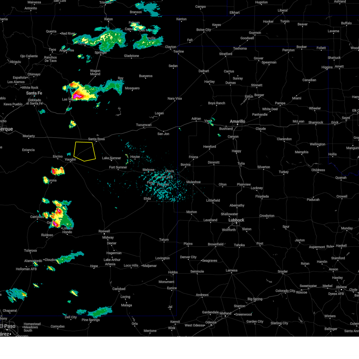
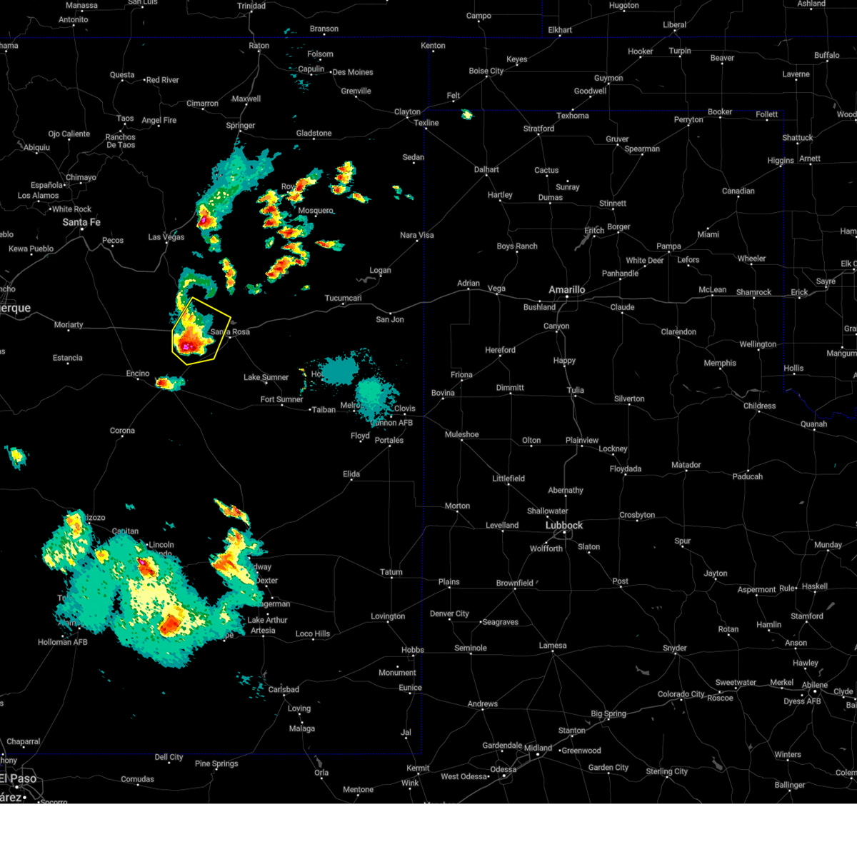
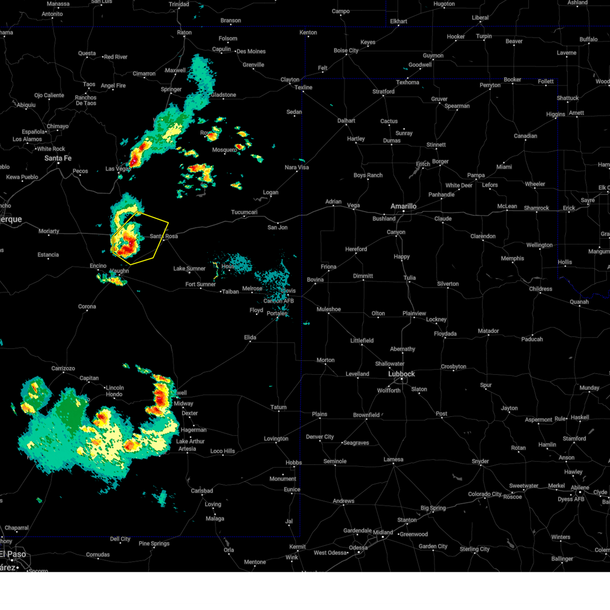
Hail Maps for Pastura, NM
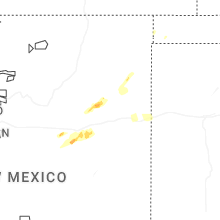
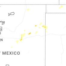
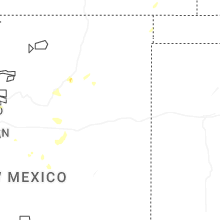


Connect with Interactive Hail Maps