

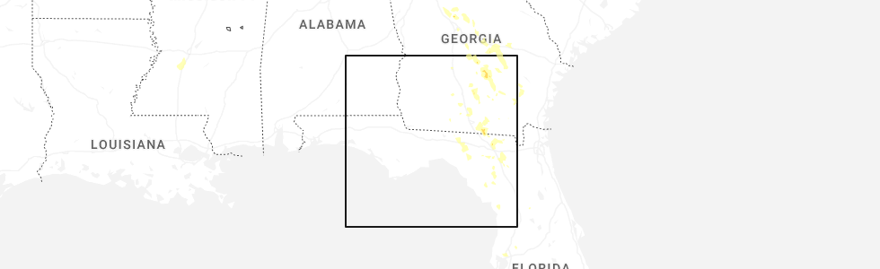
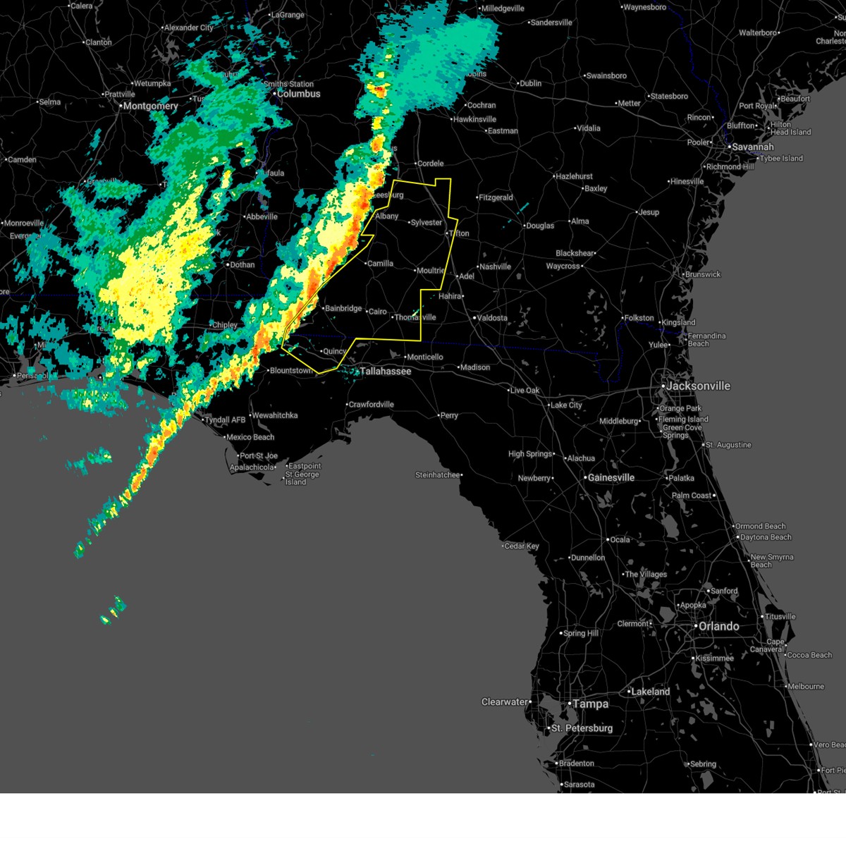
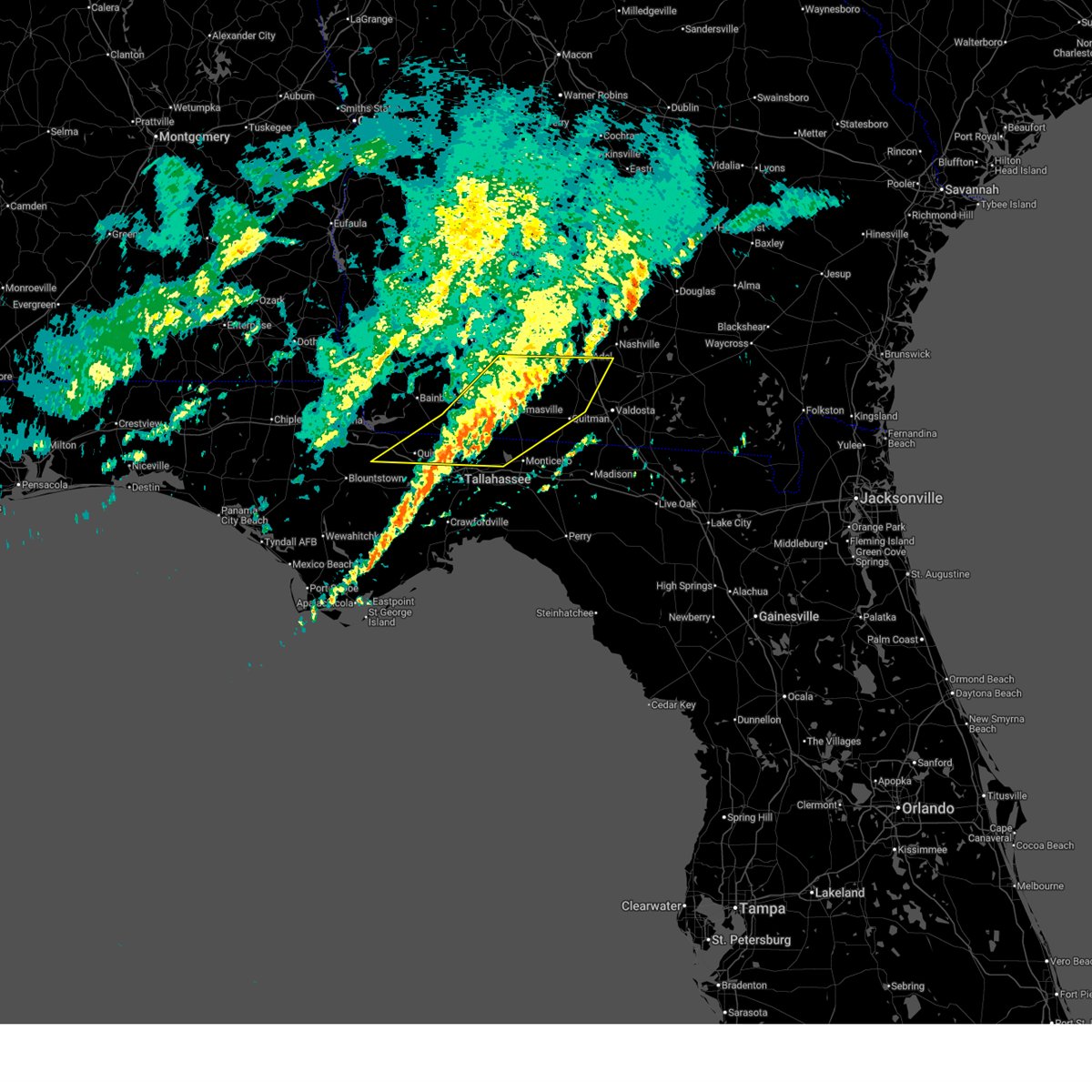
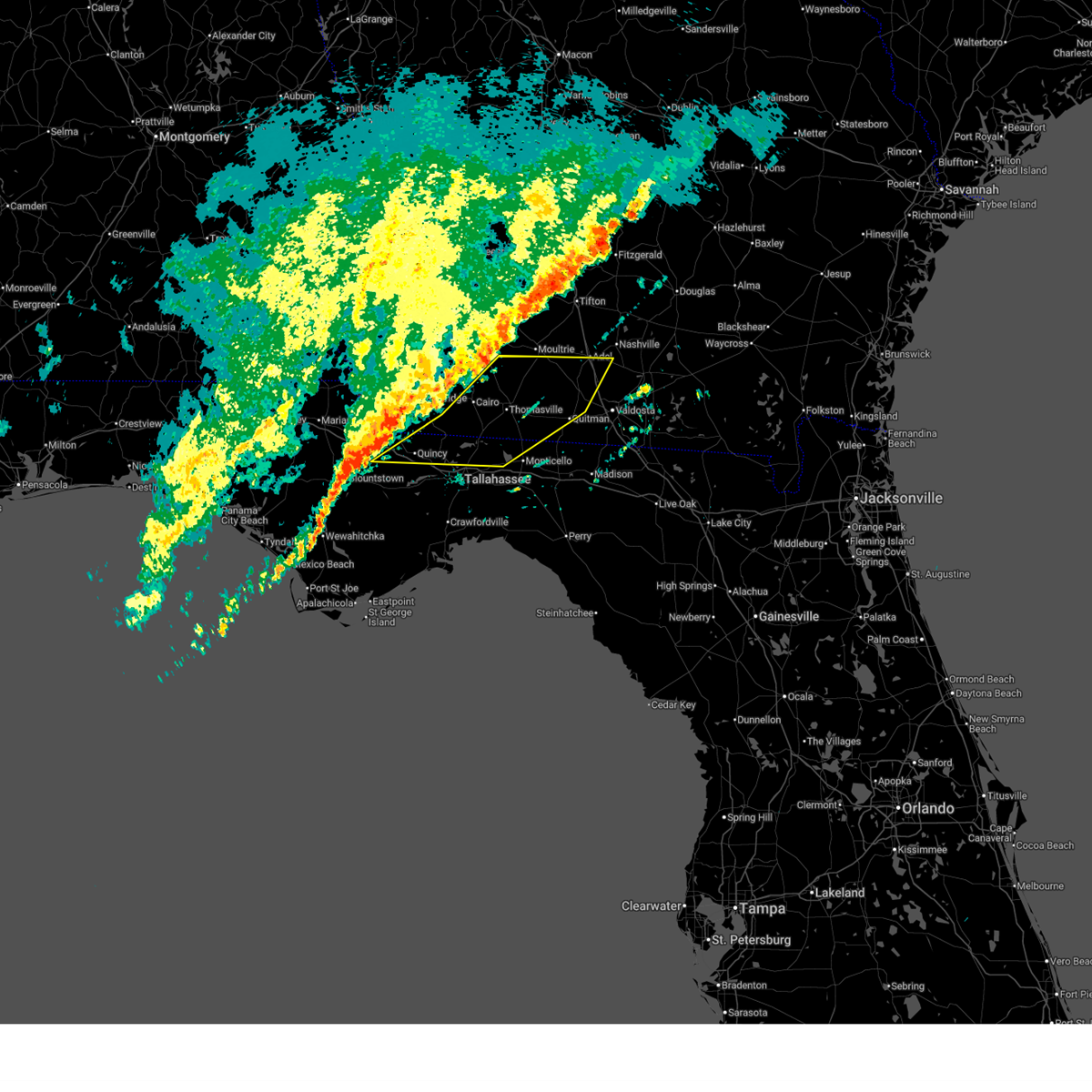
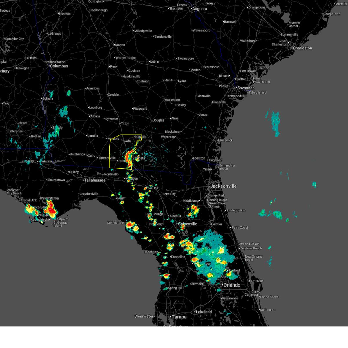
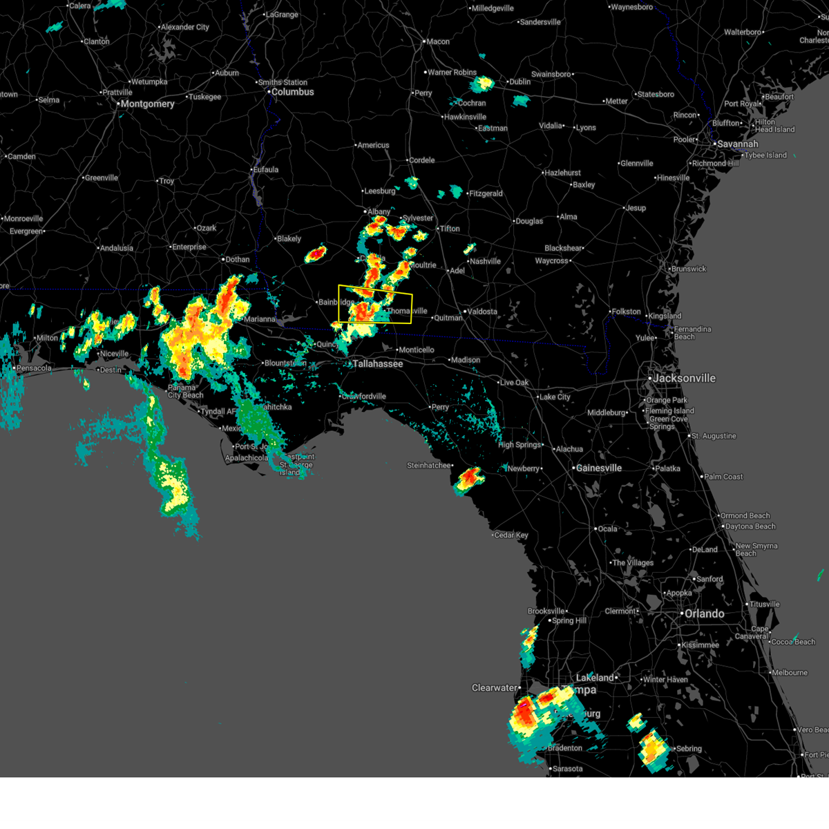
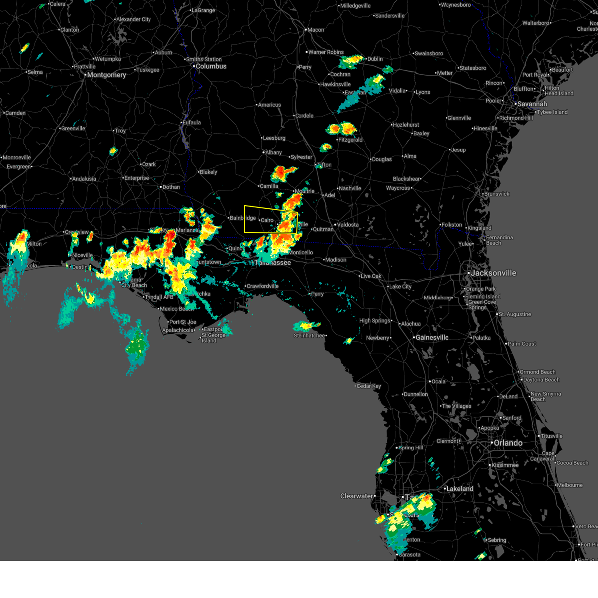
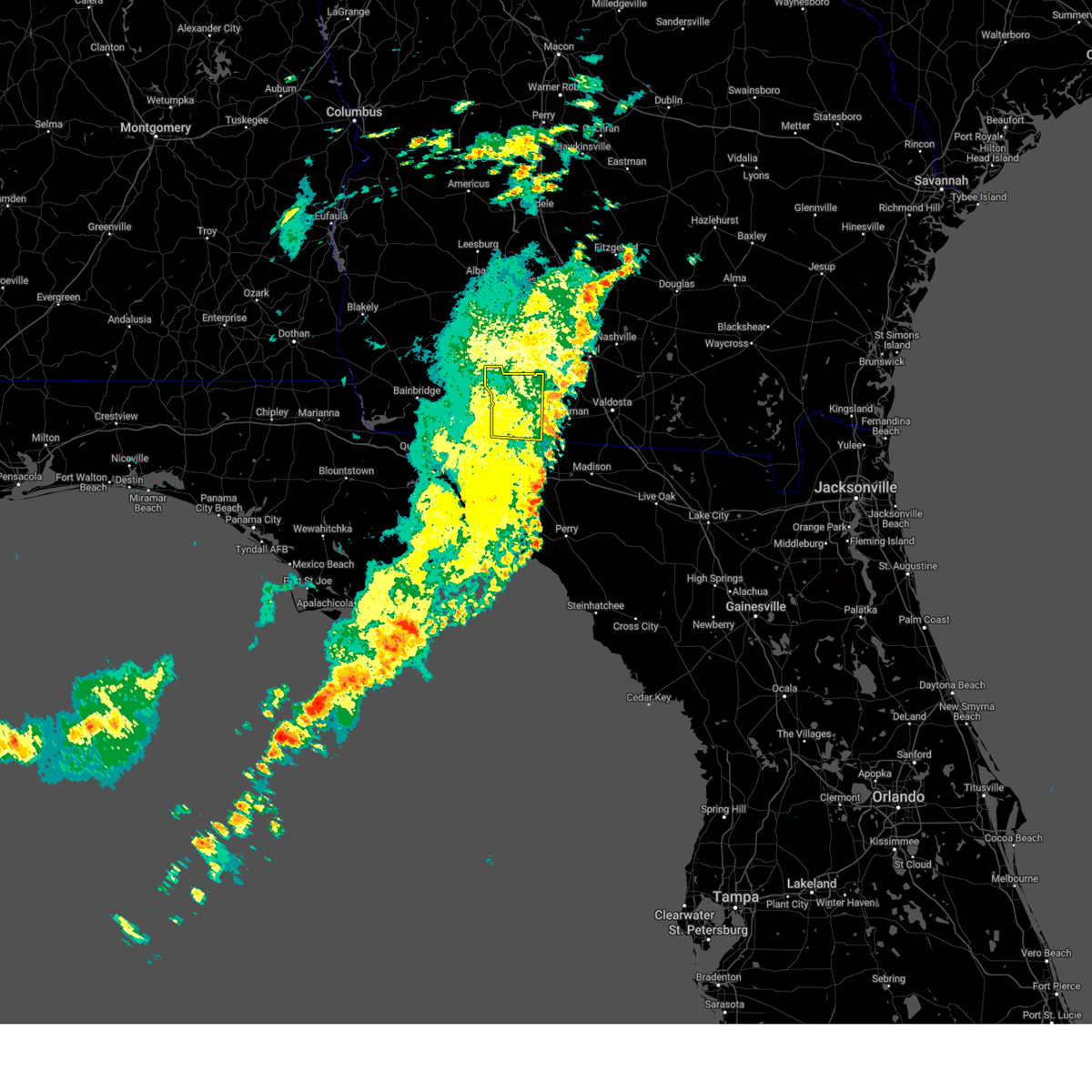
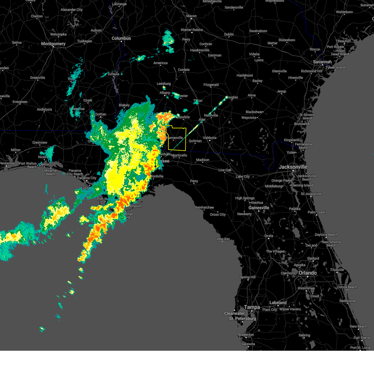
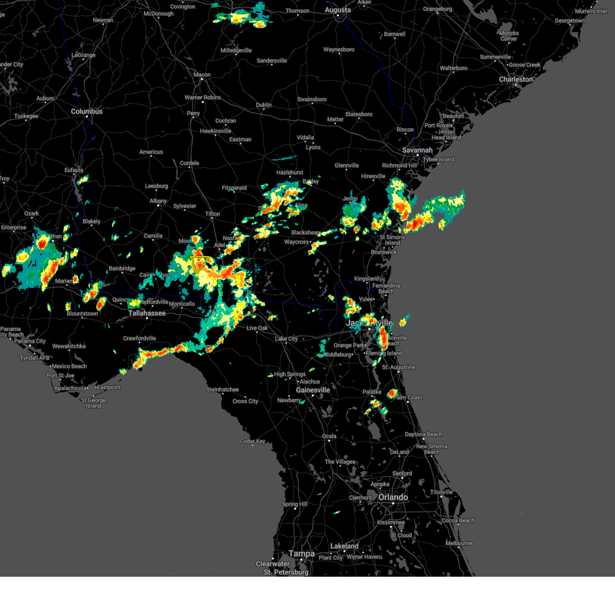
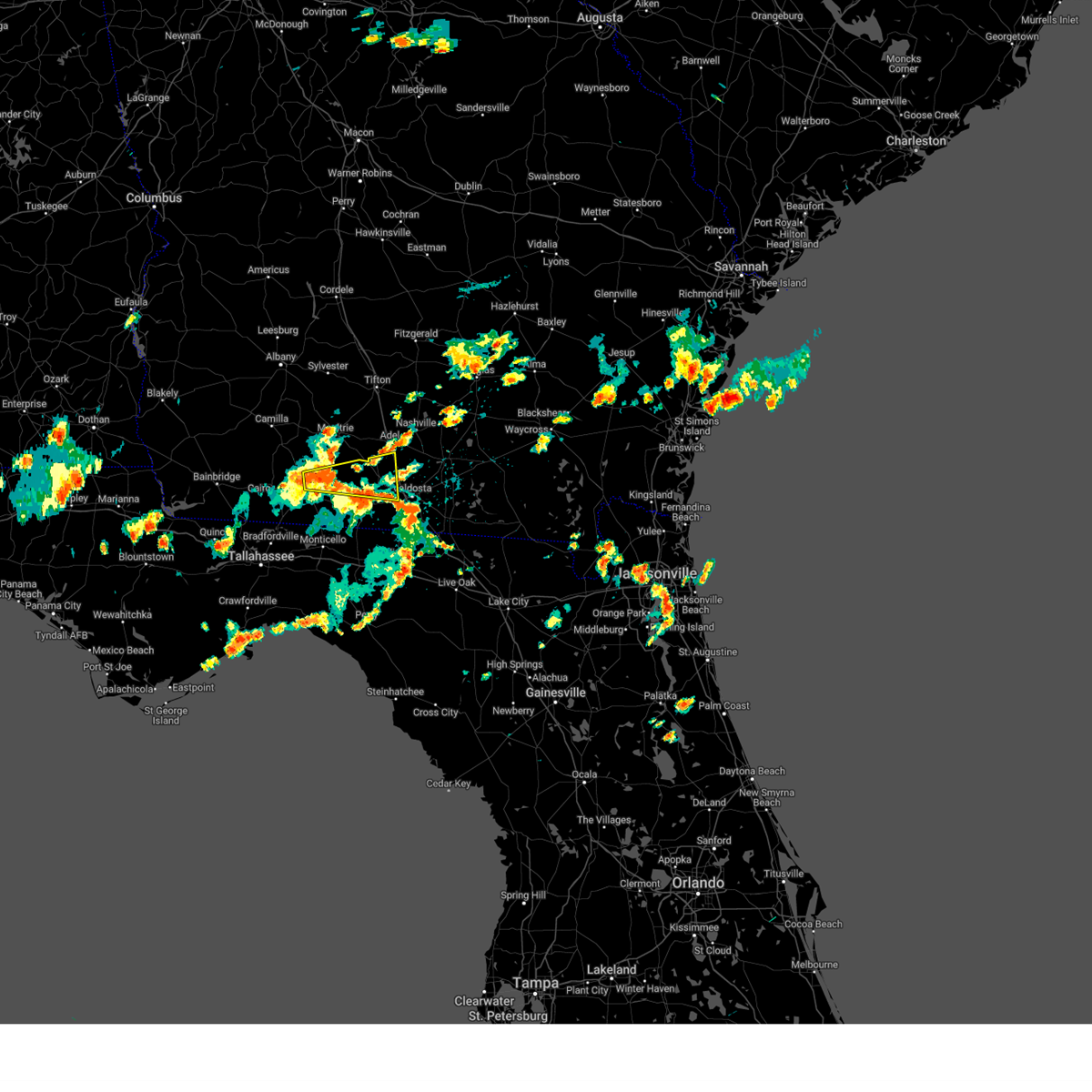
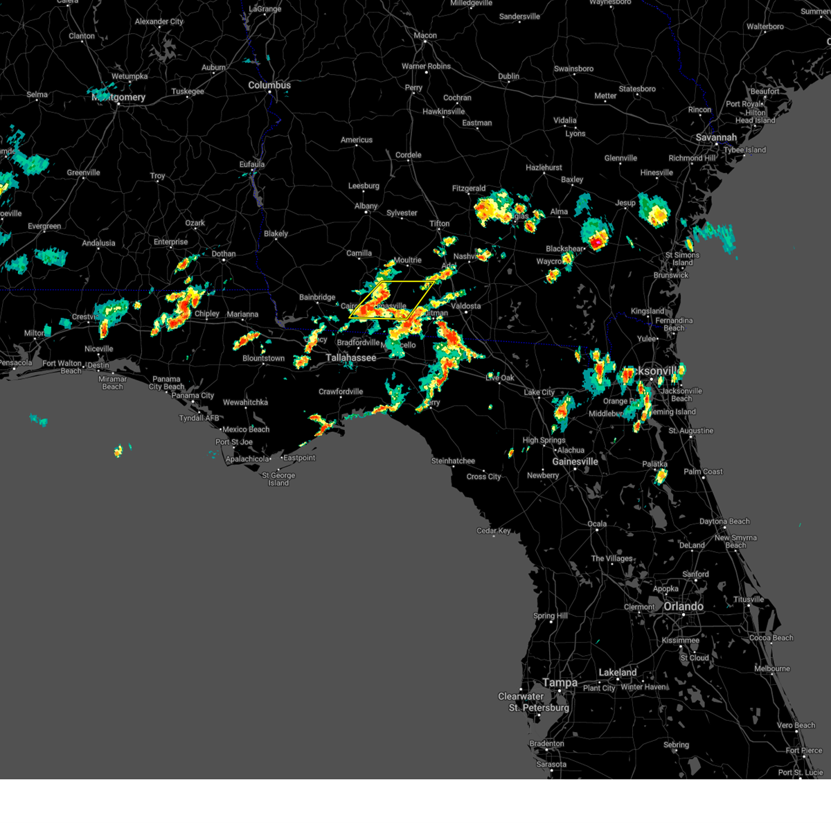
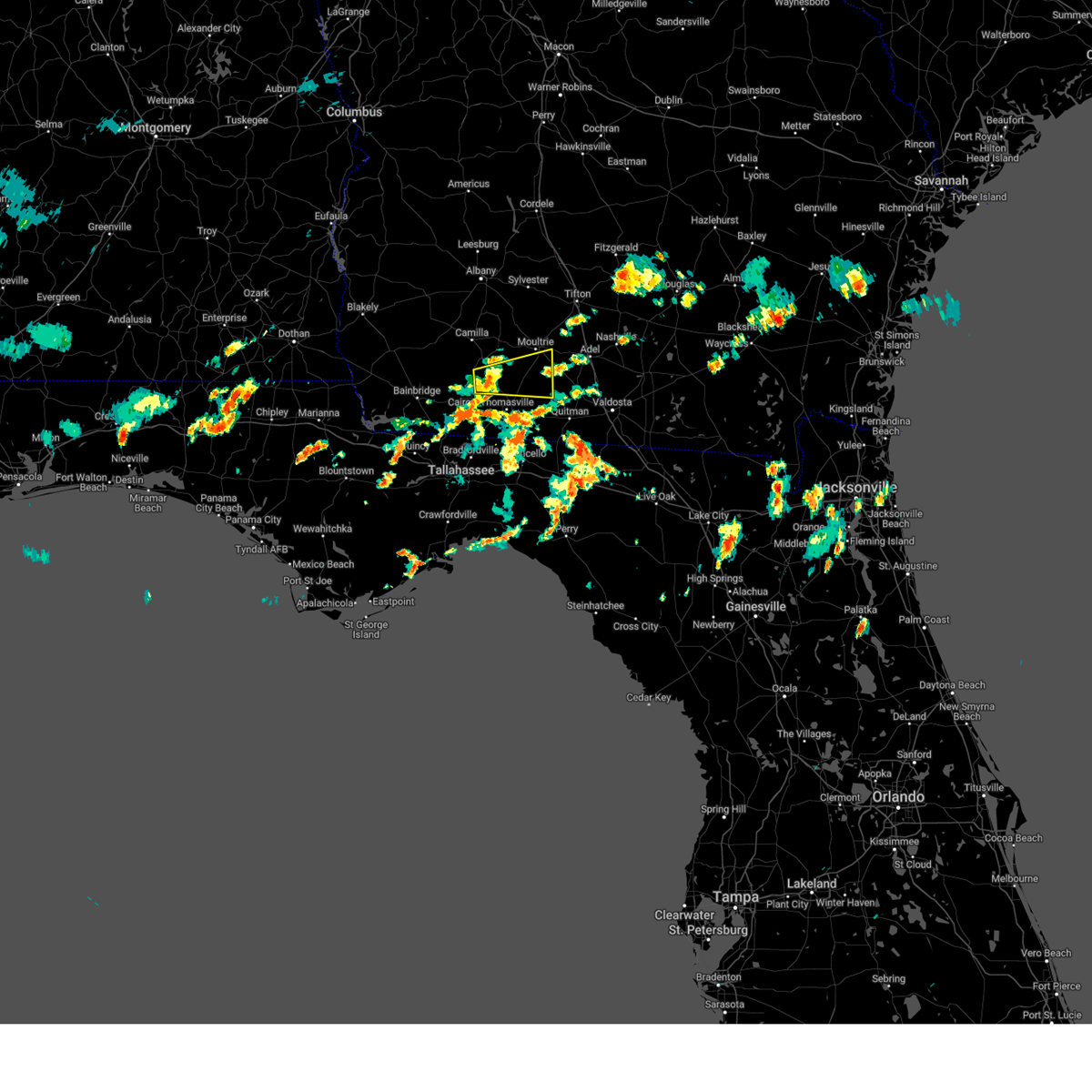
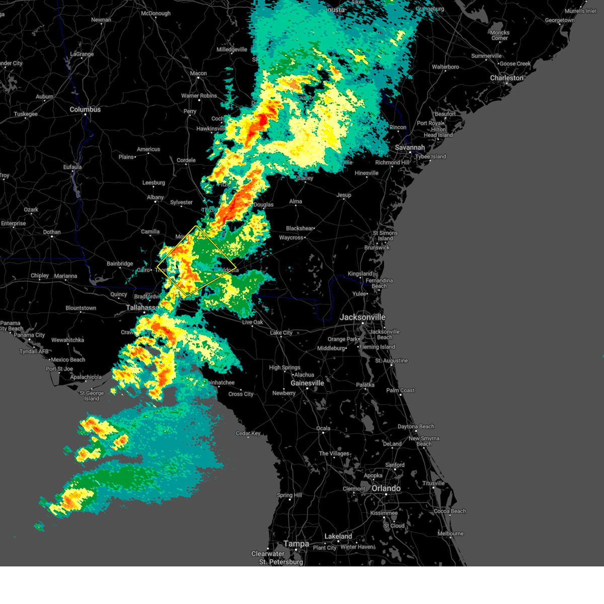
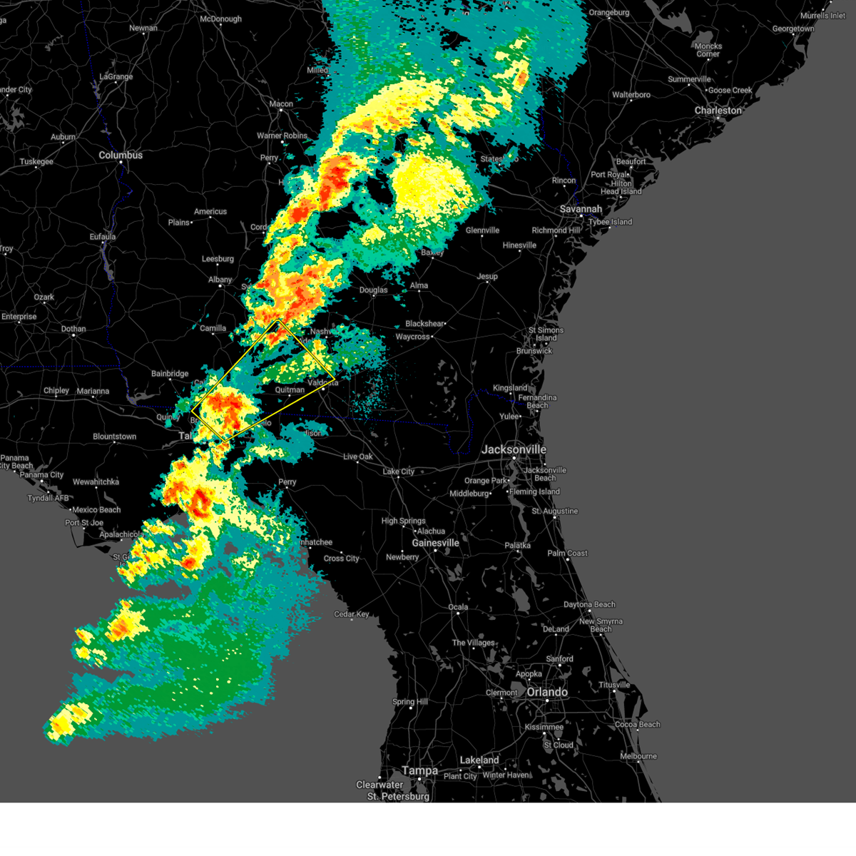
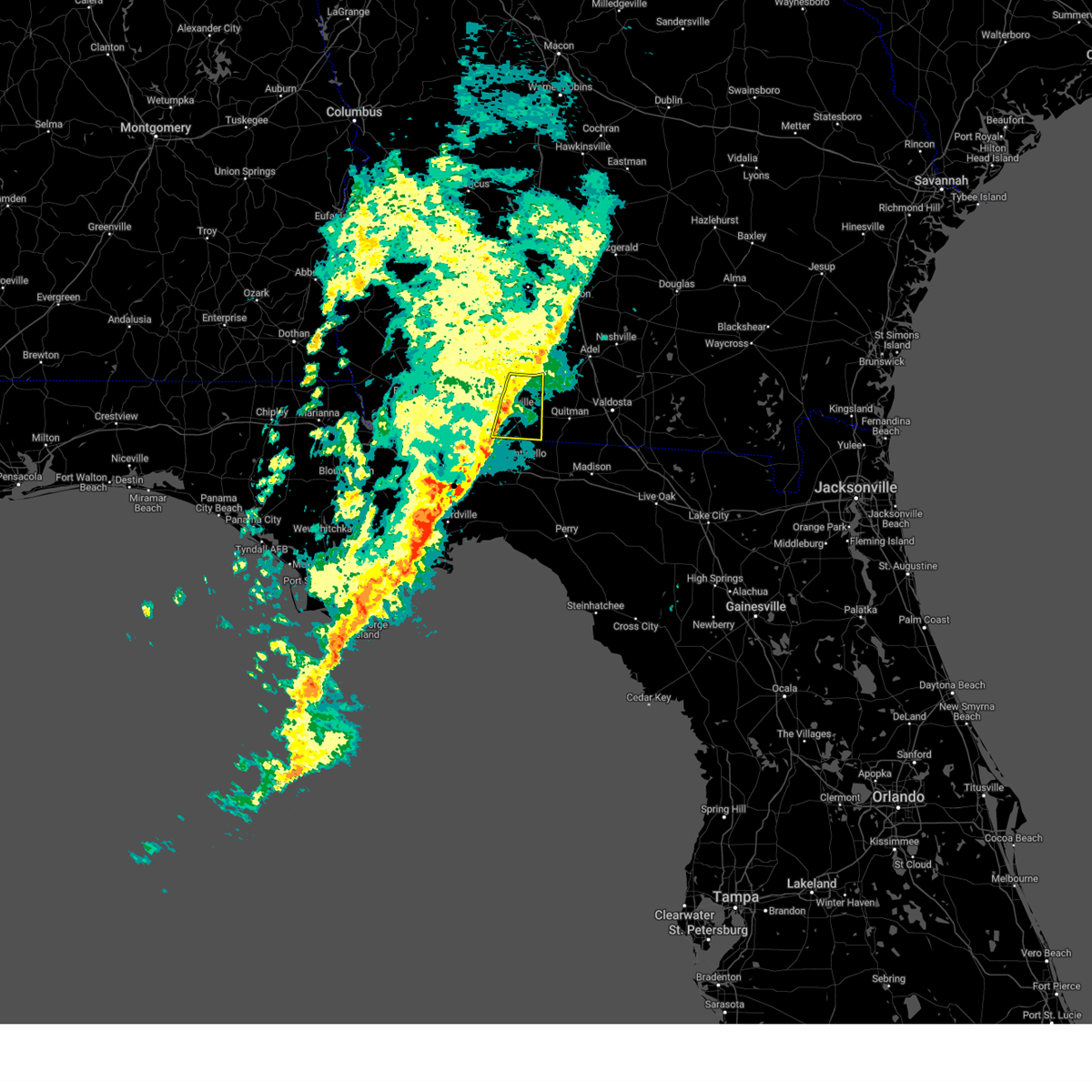
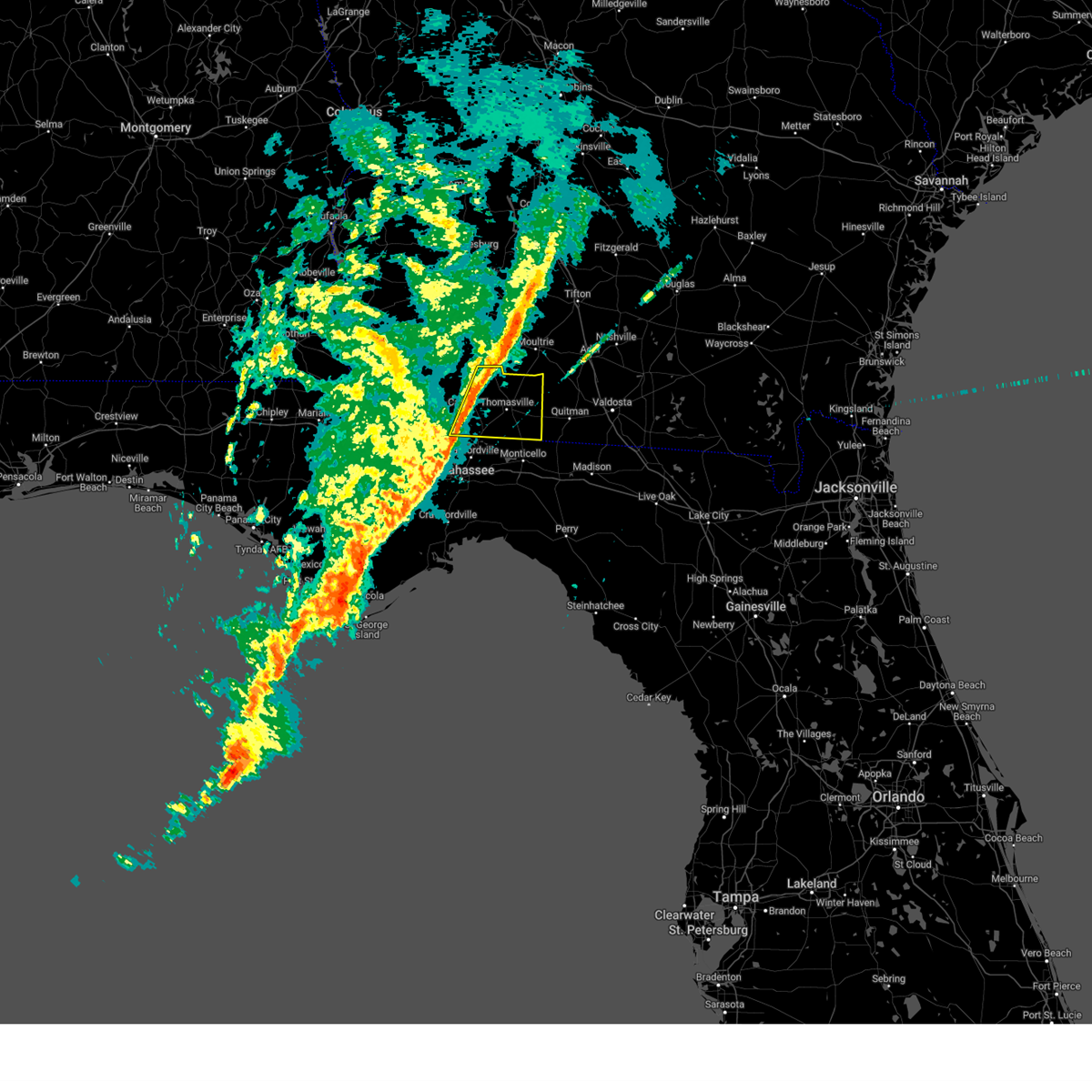
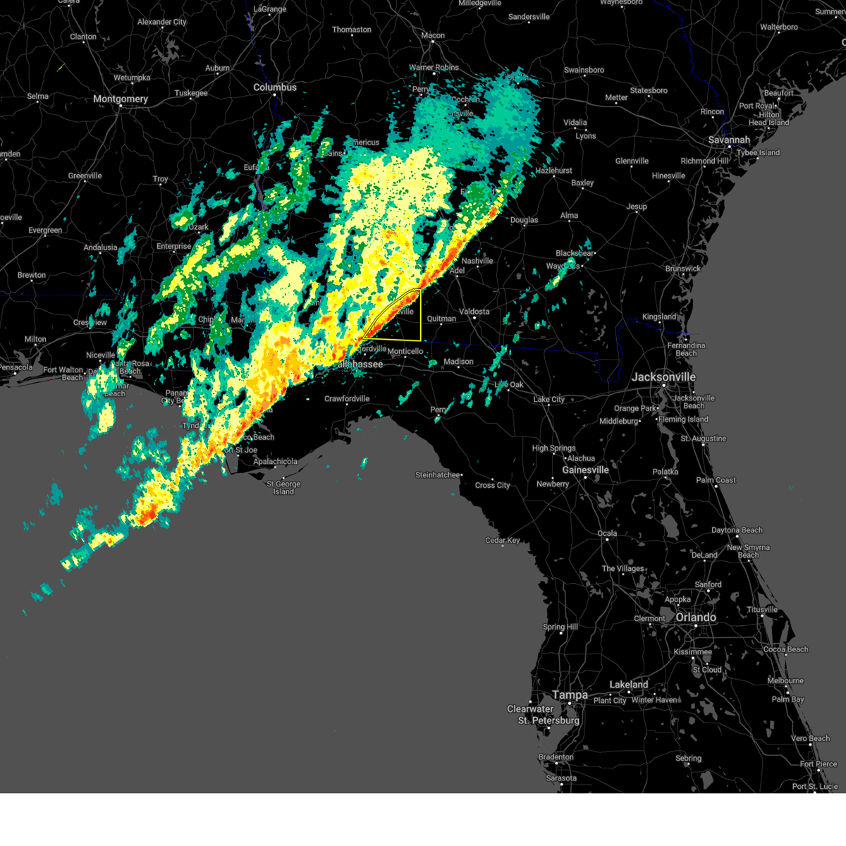
Hail Map for Pavo, GA
The Pavo, GA area has had 3 reports of on-the-ground hail by trained spotters, and has been under severe weather warnings 26 times during the past 12 months. Doppler radar has detected hail at or near Pavo, GA on 51 occasions, including 4 occasions during the past year.
| Name: | Pavo, GA |
| Where Located: | 48.2 miles NE of Tallahassee, FL |
| Map: | Google Map for Pavo, GA |
| Population: | 627 |
| Housing Units: | 298 |
| More Info: | Search Google for Pavo, GA |
0
The Top Recent Hail Date for Pavo, GA is Sunday, May 17, 2026 (51st out of 51)
Hail and Wind Damage Spotted near Pavo, GA
| Date / Time | Report Details |
|---|---|
| 3/12/2026 7:37 AM EDT |
 The storm which prompted the warning has weakened below severe limits, and has exited the warned area. therefore, the warning will be allowed to expire. however, gusty winds are still possible with this thunderstorm. a tornado watch remains in effect until 900 am edt for south central georgia. remember, a severe thunderstorm warning still remains in effect for thomas and colquitt counties until 900 am edt. The storm which prompted the warning has weakened below severe limits, and has exited the warned area. therefore, the warning will be allowed to expire. however, gusty winds are still possible with this thunderstorm. a tornado watch remains in effect until 900 am edt for south central georgia. remember, a severe thunderstorm warning still remains in effect for thomas and colquitt counties until 900 am edt.
|
| 3/12/2026 7:30 AM EDT |
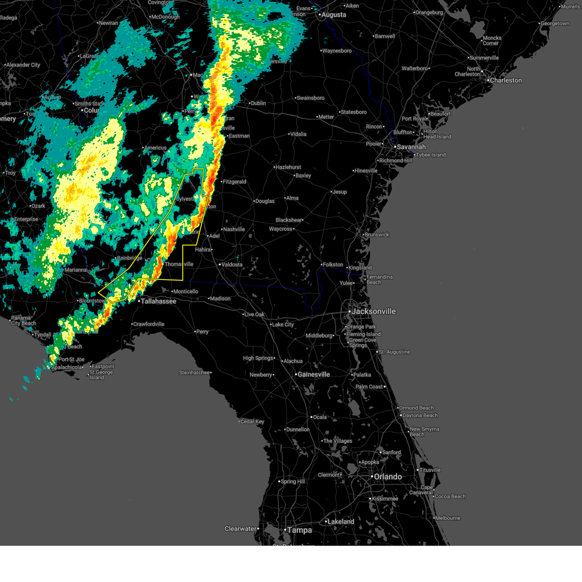 The storms which prompted the warning have moved out of the area. therefore, the warning will be allowed to expire. a tornado watch remains in effect until 900 am edt for big bend florida, and south central and southwestern georgia. to report severe weather, contact your nearest law enforcement agency. they will relay your report to the national weather service tallahassee. remember, a severe thunderstorm warning still remains in effect for thomas, colquitt, and tift counties. The storms which prompted the warning have moved out of the area. therefore, the warning will be allowed to expire. a tornado watch remains in effect until 900 am edt for big bend florida, and south central and southwestern georgia. to report severe weather, contact your nearest law enforcement agency. they will relay your report to the national weather service tallahassee. remember, a severe thunderstorm warning still remains in effect for thomas, colquitt, and tift counties.
|
| 3/12/2026 7:28 AM EDT |
 At 727 am edt, a severe thunderstorm capable of producing a tornado was located near coolidge, or 8 miles southwest of moultrie, moving east at 55 mph (radar indicated rotation). Hazards include tornado. Flying debris will be dangerous to those caught without shelter. mobile homes will be damaged or destroyed. damage to roofs, windows, and vehicles will occur. tree damage is likely. This tornadic thunderstorm will remain over mainly rural areas of northeastern thomas and southwestern colquitt counties, including the following locations, moultrie municipal a/p, autreyville, enon, center hill, murphy, south moultrie, and chastain. At 727 am edt, a severe thunderstorm capable of producing a tornado was located near coolidge, or 8 miles southwest of moultrie, moving east at 55 mph (radar indicated rotation). Hazards include tornado. Flying debris will be dangerous to those caught without shelter. mobile homes will be damaged or destroyed. damage to roofs, windows, and vehicles will occur. tree damage is likely. This tornadic thunderstorm will remain over mainly rural areas of northeastern thomas and southwestern colquitt counties, including the following locations, moultrie municipal a/p, autreyville, enon, center hill, murphy, south moultrie, and chastain.
|
| 3/12/2026 7:28 AM EDT |
 the tornado warning has been cancelled and is no longer in effect the tornado warning has been cancelled and is no longer in effect
|
| 3/12/2026 7:26 AM EDT |
 Svrtae the national weather service in tallahassee has issued a * severe thunderstorm warning for, cook county in south central georgia, southeastern grady county in southwestern georgia, southeastern berrien county in south central georgia, lanier county in south central georgia, lowndes county in south central georgia, thomas county in south central georgia, brooks county in south central georgia, southern colquitt county in south central georgia, * until 900 am edt. * at 726 am edt, severe thunderstorms were located along a line extending from riverside to 14 miles northeast of tallahassee, moving east at 65 mph (radar indicated). Hazards include 60 mph wind gusts. expect damage to roofs, siding, and trees Svrtae the national weather service in tallahassee has issued a * severe thunderstorm warning for, cook county in south central georgia, southeastern grady county in southwestern georgia, southeastern berrien county in south central georgia, lanier county in south central georgia, lowndes county in south central georgia, thomas county in south central georgia, brooks county in south central georgia, southern colquitt county in south central georgia, * until 900 am edt. * at 726 am edt, severe thunderstorms were located along a line extending from riverside to 14 miles northeast of tallahassee, moving east at 65 mph (radar indicated). Hazards include 60 mph wind gusts. expect damage to roofs, siding, and trees
|
| 3/12/2026 7:19 AM EDT |
 the tornado warning has been cancelled and is no longer in effect the tornado warning has been cancelled and is no longer in effect
|
| 3/12/2026 7:19 AM EDT |
 At 718 am edt, a severe thunderstorm capable of producing a tornado was located near ochlocknee, or 9 miles southeast of pelham, moving east at 35 mph (radar indicated rotation). Hazards include tornado. Flying debris will be dangerous to those caught without shelter. mobile homes will be damaged or destroyed. damage to roofs, windows, and vehicles will occur. tree damage is likely. this dangerous storm will be near, coolidge around 730 am edt. Other locations impacted by this tornadic thunderstorm include moultrie municipal a/p, quality, autreyville, enon, center hill, murphy, south moultrie, merrillville, chastain, and hollis. At 718 am edt, a severe thunderstorm capable of producing a tornado was located near ochlocknee, or 9 miles southeast of pelham, moving east at 35 mph (radar indicated rotation). Hazards include tornado. Flying debris will be dangerous to those caught without shelter. mobile homes will be damaged or destroyed. damage to roofs, windows, and vehicles will occur. tree damage is likely. this dangerous storm will be near, coolidge around 730 am edt. Other locations impacted by this tornadic thunderstorm include moultrie municipal a/p, quality, autreyville, enon, center hill, murphy, south moultrie, merrillville, chastain, and hollis.
|
| 3/12/2026 7:17 AM EDT |
 At 717 am edt, severe thunderstorms were located along a line extending from 8 miles east of ashburn to moultrie to near tallahassee, moving east at 45 mph (radar indicated). Hazards include 60 mph wind gusts. Expect damage to roofs, siding, and trees. Locations impacted include, tifton, moultrie, thomasville, quincy, havana, midway, ashburn, sylvester, cairo, boston, omega, norman park, poulan, doerun, ty ty, ochlocknee, pavo, coolidge, whigham, and phillipsburg. At 717 am edt, severe thunderstorms were located along a line extending from 8 miles east of ashburn to moultrie to near tallahassee, moving east at 45 mph (radar indicated). Hazards include 60 mph wind gusts. Expect damage to roofs, siding, and trees. Locations impacted include, tifton, moultrie, thomasville, quincy, havana, midway, ashburn, sylvester, cairo, boston, omega, norman park, poulan, doerun, ty ty, ochlocknee, pavo, coolidge, whigham, and phillipsburg.
|
| 3/12/2026 7:17 AM EDT |
 the severe thunderstorm warning has been cancelled and is no longer in effect the severe thunderstorm warning has been cancelled and is no longer in effect
|
| 3/12/2026 7:06 AM EDT |
 Tortae the national weather service in tallahassee has issued a * tornado warning for, northeastern grady county in southwestern georgia, southeastern mitchell county in southwestern georgia, northern thomas county in south central georgia, southwestern colquitt county in south central georgia, * until 745 am edt. * at 705 am edt, a severe thunderstorm capable of producing a tornado was located south of pelham, moving east at 35 mph (radar indicated rotation). Hazards include tornado. Flying debris will be dangerous to those caught without shelter. mobile homes will be damaged or destroyed. damage to roofs, windows, and vehicles will occur. tree damage is likely. this dangerous storm will be near, coolidge around 730 am edt. Other locations impacted by this tornadic thunderstorm include akridge, capel, autreyville, enon, center hill, south moultrie, merrillville, chastain, spence, and moultrie municipal a/p. Tortae the national weather service in tallahassee has issued a * tornado warning for, northeastern grady county in southwestern georgia, southeastern mitchell county in southwestern georgia, northern thomas county in south central georgia, southwestern colquitt county in south central georgia, * until 745 am edt. * at 705 am edt, a severe thunderstorm capable of producing a tornado was located south of pelham, moving east at 35 mph (radar indicated rotation). Hazards include tornado. Flying debris will be dangerous to those caught without shelter. mobile homes will be damaged or destroyed. damage to roofs, windows, and vehicles will occur. tree damage is likely. this dangerous storm will be near, coolidge around 730 am edt. Other locations impacted by this tornadic thunderstorm include akridge, capel, autreyville, enon, center hill, south moultrie, merrillville, chastain, spence, and moultrie municipal a/p.
|
| 3/12/2026 6:30 AM EDT |
 Svrtae the national weather service in tallahassee has issued a * severe thunderstorm warning for, east central jackson county in the panhandle of florida, gadsden county in big bend florida, mitchell county in southwestern georgia, southeastern lee county in southwestern georgia, southeastern seminole county in southwestern georgia, colquitt county in south central georgia, tift county in south central georgia, worth county in south central georgia, decatur county in southwestern georgia, grady county in southwestern georgia, turner county in south central georgia, eastern dougherty county in southwestern georgia, central baker county in southwestern georgia, thomas county in south central georgia, * until 730 am edt/630 am cdt/. * at 630 am edt/530 am cdt/, severe thunderstorms were located along a line extending from near de soto to near newton to chattahoochee, moving east at 45 mph (radar indicated). Hazards include 60 mph wind gusts. expect damage to roofs, siding, and trees Svrtae the national weather service in tallahassee has issued a * severe thunderstorm warning for, east central jackson county in the panhandle of florida, gadsden county in big bend florida, mitchell county in southwestern georgia, southeastern lee county in southwestern georgia, southeastern seminole county in southwestern georgia, colquitt county in south central georgia, tift county in south central georgia, worth county in south central georgia, decatur county in southwestern georgia, grady county in southwestern georgia, turner county in south central georgia, eastern dougherty county in southwestern georgia, central baker county in southwestern georgia, thomas county in south central georgia, * until 730 am edt/630 am cdt/. * at 630 am edt/530 am cdt/, severe thunderstorms were located along a line extending from near de soto to near newton to chattahoochee, moving east at 45 mph (radar indicated). Hazards include 60 mph wind gusts. expect damage to roofs, siding, and trees
|
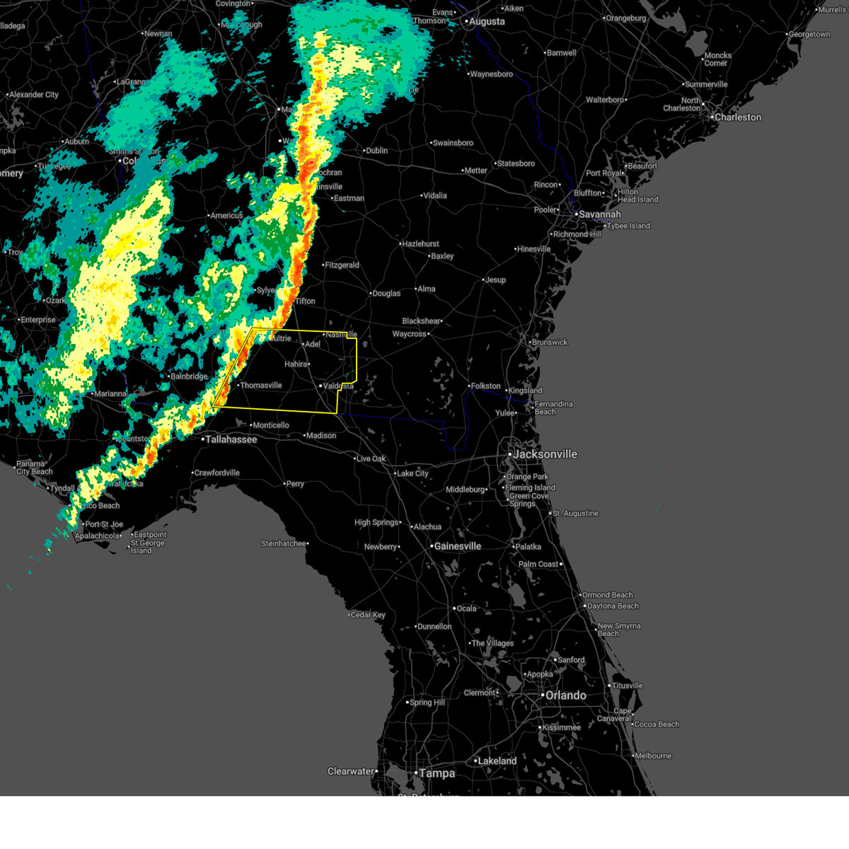
| 2/15/2026 12:41 PM EST |
 The storms which prompted the warning have weakened below severe limits, and no longer pose an immediate threat to life or property. therefore, the warning will be allowed to expire. however, gusty winds and heavy rain are still possible with these thunderstorms. a tornado watch remains in effect until 400 pm est for big bend florida, and south central and southwestern georgia. The storms which prompted the warning have weakened below severe limits, and no longer pose an immediate threat to life or property. therefore, the warning will be allowed to expire. however, gusty winds and heavy rain are still possible with these thunderstorms. a tornado watch remains in effect until 400 pm est for big bend florida, and south central and southwestern georgia.
|
| 2/15/2026 12:12 PM EST |
 At 1211 pm est, severe thunderstorms were located along a line extending from 8 miles south of doerun to 13 miles northeast of tallahassee to 11 miles west of crawfordville, moving east at 40 mph (radar indicated). Hazards include 60 mph wind gusts. Expect damage to roofs, siding, and trees. Locations impacted include, tallahassee, woodville, monticello, tallahassee state college, florida state university, moultrie, thomasville, midway, florida a and m, boston, norman park, ochlocknee, pavo, coolidge, doak campbell stadium, riverside, schley, berlin, funston, and barwick. At 1211 pm est, severe thunderstorms were located along a line extending from 8 miles south of doerun to 13 miles northeast of tallahassee to 11 miles west of crawfordville, moving east at 40 mph (radar indicated). Hazards include 60 mph wind gusts. Expect damage to roofs, siding, and trees. Locations impacted include, tallahassee, woodville, monticello, tallahassee state college, florida state university, moultrie, thomasville, midway, florida a and m, boston, norman park, ochlocknee, pavo, coolidge, doak campbell stadium, riverside, schley, berlin, funston, and barwick.
|
| 2/15/2026 12:12 PM EST |
 the severe thunderstorm warning has been cancelled and is no longer in effect the severe thunderstorm warning has been cancelled and is no longer in effect
|
| 2/15/2026 11:42 AM EST |
 Svrtae the national weather service in tallahassee has issued a * severe thunderstorm warning for, northern wakulla county in big bend florida, eastern gadsden county in big bend florida, southeastern liberty county in big bend florida, northwestern jefferson county in big bend florida, leon county in big bend florida, southeastern decatur county in southwestern georgia, grady county in southwestern georgia, southeastern mitchell county in southwestern georgia, thomas county in south central georgia, northwestern brooks county in south central georgia, colquitt county in south central georgia, * until 1245 pm est. * at 1142 am est, severe thunderstorms were located along a line extending from 6 miles west of pelham to near midway to 19 miles northwest of carrabelle, moving east at 40 mph (radar indicated). Hazards include 60 mph wind gusts. expect damage to roofs, siding, and trees Svrtae the national weather service in tallahassee has issued a * severe thunderstorm warning for, northern wakulla county in big bend florida, eastern gadsden county in big bend florida, southeastern liberty county in big bend florida, northwestern jefferson county in big bend florida, leon county in big bend florida, southeastern decatur county in southwestern georgia, grady county in southwestern georgia, southeastern mitchell county in southwestern georgia, thomas county in south central georgia, northwestern brooks county in south central georgia, colquitt county in south central georgia, * until 1245 pm est. * at 1142 am est, severe thunderstorms were located along a line extending from 6 miles west of pelham to near midway to 19 miles northwest of carrabelle, moving east at 40 mph (radar indicated). Hazards include 60 mph wind gusts. expect damage to roofs, siding, and trees
|
| 1/25/2026 5:53 PM EST |
 The storms which prompted the warning have weakened below severe limits, and no longer pose an immediate threat to life or property. therefore, the warning will be allowed to expire. however, gusty winds and heavy rain are still possible with these thunderstorms. a tornado watch remains in effect until 700 pm est for south central and southwestern georgia. The storms which prompted the warning have weakened below severe limits, and no longer pose an immediate threat to life or property. therefore, the warning will be allowed to expire. however, gusty winds and heavy rain are still possible with these thunderstorms. a tornado watch remains in effect until 700 pm est for south central and southwestern georgia.
|
| 1/25/2026 4:55 PM EST |
 Svrtae the national weather service in tallahassee has issued a * severe thunderstorm warning for, northern gadsden county in big bend florida, northwestern jefferson county in big bend florida, northeastern leon county in big bend florida, southern cook county in south central georgia, southeastern decatur county in southwestern georgia, grady county in southwestern georgia, south central berrien county in south central georgia, southeastern mitchell county in southwestern georgia, northwestern lowndes county in south central georgia, thomas county in south central georgia, brooks county in south central georgia, southern colquitt county in south central georgia, * until 600 pm est. * at 455 pm est, severe thunderstorms were located along a line extending from 9 miles east of pelham to near whigham to near greensboro, moving east at 50 mph (radar indicated). Hazards include 60 mph wind gusts. expect damage to roofs, siding, and trees Svrtae the national weather service in tallahassee has issued a * severe thunderstorm warning for, northern gadsden county in big bend florida, northwestern jefferson county in big bend florida, northeastern leon county in big bend florida, southern cook county in south central georgia, southeastern decatur county in southwestern georgia, grady county in southwestern georgia, south central berrien county in south central georgia, southeastern mitchell county in southwestern georgia, northwestern lowndes county in south central georgia, thomas county in south central georgia, brooks county in south central georgia, southern colquitt county in south central georgia, * until 600 pm est. * at 455 pm est, severe thunderstorms were located along a line extending from 9 miles east of pelham to near whigham to near greensboro, moving east at 50 mph (radar indicated). Hazards include 60 mph wind gusts. expect damage to roofs, siding, and trees
|
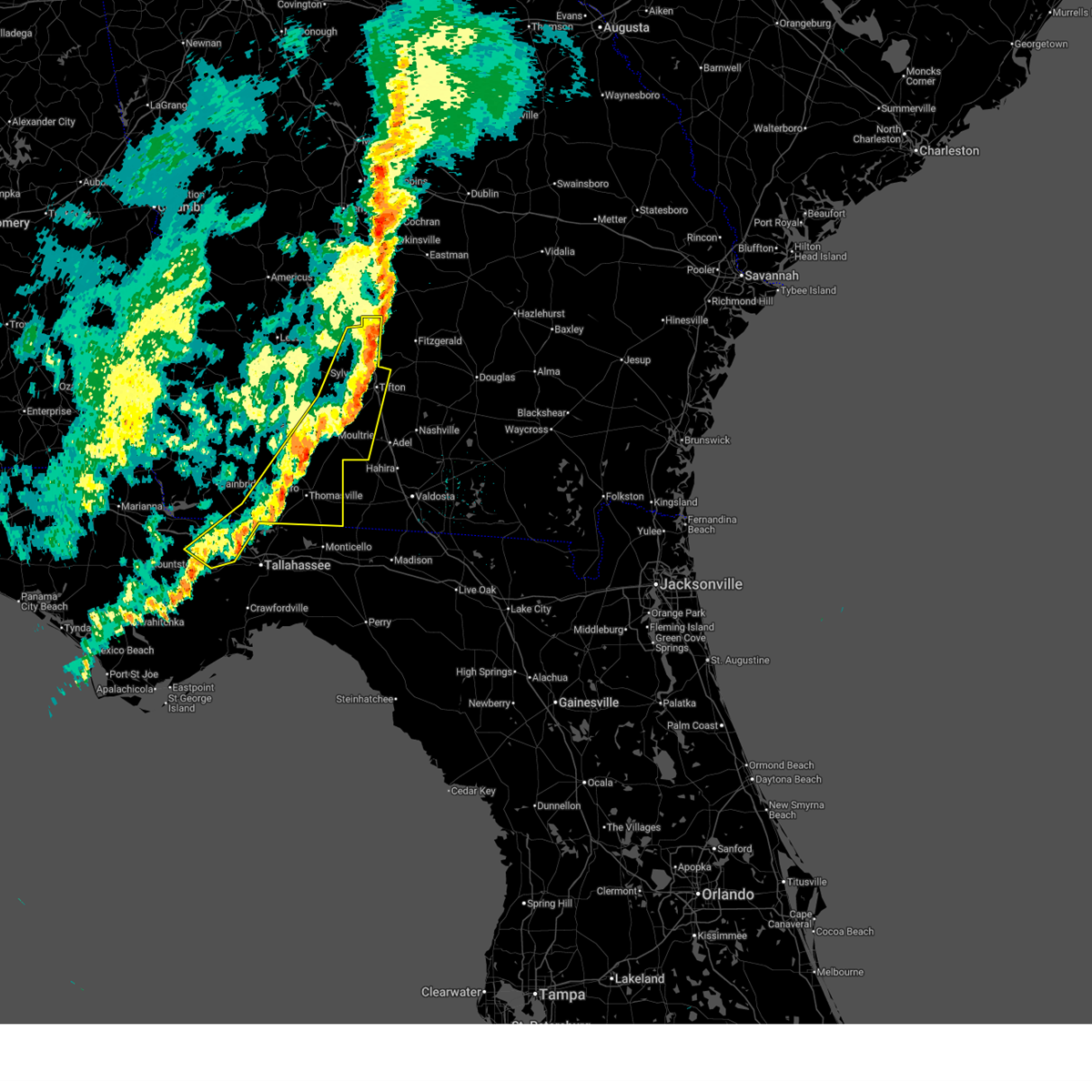
| 11/9/2025 4:29 PM EST | The storm which prompted the warning has moved out of the area. therefore, the warning will be allowed to expire. however, gusty winds are still possible with this thunderstorm. remember, a severe thunderstorm warning still remains in effect for northwestern brooks, northeastern thomas, and southeastern colquitt county until 6 pm est. |
| 11/9/2025 4:27 PM EST | Svrtae the national weather service in tallahassee has issued a * severe thunderstorm warning for, northeastern jefferson county in big bend florida, northeastern madison county in big bend florida, cook county in south central georgia, southeastern berrien county in south central georgia, lanier county in south central georgia, lowndes county in south central georgia, eastern thomas county in south central georgia, brooks county in south central georgia, southeastern colquitt county in south central georgia, * until 600 pm est. * at 426 pm est, severe thunderstorms were located along a line extending from 9 miles southeast of moultrie to boston to 10 miles northeast of monticello, moving east at 40 mph (radar indicated). Hazards include 60 mph wind gusts and quarter size hail. Hail damage to vehicles is expected. Expect wind damage to roofs, siding, and trees. |
| 11/9/2025 4:20 PM EST | Quarter sized hail reported 5.5 miles SE of Pavo, GA, quarter size hail was reported at the intersection of woodhaven road and enon road. |
| 11/9/2025 4:14 PM EST | At 414 pm est, a severe thunderstorm was located near coolidge, or 8 miles south of moultrie, moving east at 35 mph (radar indicated). Hazards include 60 mph wind gusts and quarter size hail. Hail damage to vehicles is expected. expect wind damage to roofs, siding, and trees. Locations impacted include, moultrie, pavo, coolidge, berlin, pineboro, moultrie municipal a/p, autreyville, enon, spence airport, murphy, south moultrie, and chastain. |
| 11/9/2025 3:55 PM EST | At 355 pm est, a severe thunderstorm was located near coolidge, or 12 miles southeast of pelham, moving east at 35 mph (radar indicated). Hazards include 70 mph wind gusts and quarter size hail. Hail damage to vehicles is expected. expect considerable tree damage. wind damage is also likely to mobile homes, roofs, and outbuildings. Locations impacted include, moultrie, pavo, coolidge, berlin, pineboro, moultrie municipal a/p, autreyville, enon, spence airport, murphy, south moultrie, and chastain. |
| 11/9/2025 3:55 PM EST | the severe thunderstorm warning has been cancelled and is no longer in effect |
| 11/9/2025 3:43 PM EST | Svrtae the national weather service in tallahassee has issued a * severe thunderstorm warning for, northeastern grady county in southwestern georgia, southeastern mitchell county in southwestern georgia, northern thomas county in south central georgia, northwestern brooks county in south central georgia, southern colquitt county in south central georgia, * until 430 pm est. * at 343 pm est, a severe thunderstorm was located near ochlocknee, or 8 miles southeast of pelham, moving east at 35 mph (radar indicated). Hazards include golf ball size hail and 70 mph wind gusts. People and animals outdoors will be injured. expect hail damage to roofs, siding, windows, and vehicles. expect considerable tree damage. Wind damage is also likely to mobile homes, roofs, and outbuildings. |
| 6/26/2025 3:36 PM EDT |
 Svrtae the national weather service in tallahassee has issued a * severe thunderstorm warning for, cook county in south central georgia, southern berrien county in south central georgia, western lowndes county in south central georgia, brooks county in south central georgia, southeastern colquitt county in south central georgia, * until 500 pm edt. * at 336 pm edt, severe thunderstorms were located along a line extending from near hahira to 8 miles west of lake park, moving northwest at 10 mph (radar indicated). Hazards include 60 mph wind gusts. expect damage to roofs, siding, and trees Svrtae the national weather service in tallahassee has issued a * severe thunderstorm warning for, cook county in south central georgia, southern berrien county in south central georgia, western lowndes county in south central georgia, brooks county in south central georgia, southeastern colquitt county in south central georgia, * until 500 pm edt. * at 336 pm edt, severe thunderstorms were located along a line extending from near hahira to 8 miles west of lake park, moving northwest at 10 mph (radar indicated). Hazards include 60 mph wind gusts. expect damage to roofs, siding, and trees
|
| 6/25/2025 7:25 PM EDT |
 The storm which prompted the warning has moved out of the area. therefore, the warning will be allowed to expire. to report severe weather, contact your nearest law enforcement agency. they will relay your report to the national weather service tallahassee. The storm which prompted the warning has moved out of the area. therefore, the warning will be allowed to expire. to report severe weather, contact your nearest law enforcement agency. they will relay your report to the national weather service tallahassee.
|
| 6/25/2025 6:32 PM EDT |
 Svrtae the national weather service in tallahassee has issued a * severe thunderstorm warning for, grady county in southwestern georgia, thomas county in south central georgia, * until 730 pm edt. * at 632 pm edt, a severe thunderstorm was located over thomasville, moving west at 15 mph (radar indicated). Hazards include 60 mph wind gusts. expect damage to roofs, siding, and trees Svrtae the national weather service in tallahassee has issued a * severe thunderstorm warning for, grady county in southwestern georgia, thomas county in south central georgia, * until 730 pm edt. * at 632 pm edt, a severe thunderstorm was located over thomasville, moving west at 15 mph (radar indicated). Hazards include 60 mph wind gusts. expect damage to roofs, siding, and trees
|
| 6/10/2025 5:28 AM EDT |
 The storms which prompted the warning have weakened below severe limits, and have exited the warned area. therefore, the warning will be allowed to expire. to report severe weather, contact your nearest law enforcement agency. they will relay your report to the national weather service tallahassee. The storms which prompted the warning have weakened below severe limits, and have exited the warned area. therefore, the warning will be allowed to expire. to report severe weather, contact your nearest law enforcement agency. they will relay your report to the national weather service tallahassee.
|
| 6/10/2025 4:14 AM EDT |
 Svrtae the national weather service in tallahassee has issued a * severe thunderstorm warning for, thomas county in south central georgia, * until 530 am edt. * at 414 am edt, severe thunderstorms were located along a line extending from 6 miles south of pelham to 11 miles south of cairo, moving east at 30 mph (radar indicated). Hazards include 60 mph wind gusts. expect damage to roofs, siding, and trees Svrtae the national weather service in tallahassee has issued a * severe thunderstorm warning for, thomas county in south central georgia, * until 530 am edt. * at 414 am edt, severe thunderstorms were located along a line extending from 6 miles south of pelham to 11 miles south of cairo, moving east at 30 mph (radar indicated). Hazards include 60 mph wind gusts. expect damage to roofs, siding, and trees
|
| 6/9/2025 1:34 PM EDT |
 the severe thunderstorm warning has been cancelled and is no longer in effect the severe thunderstorm warning has been cancelled and is no longer in effect
|
| 6/9/2025 1:34 PM EDT |
 At 133 pm edt, a severe thunderstorm was located 10 miles east of pavo, or 11 miles north of quitman, moving east at 40 mph (radar indicated). Hazards include 70 mph wind gusts. Expect considerable tree damage. damage is likely to mobile homes, roofs, and outbuildings. Locations impacted include, hahira, pavo, morven, cecil, barney, and i-75 at exit 29. At 133 pm edt, a severe thunderstorm was located 10 miles east of pavo, or 11 miles north of quitman, moving east at 40 mph (radar indicated). Hazards include 70 mph wind gusts. Expect considerable tree damage. damage is likely to mobile homes, roofs, and outbuildings. Locations impacted include, hahira, pavo, morven, cecil, barney, and i-75 at exit 29.
|
| 6/9/2025 1:32 PM EDT |
 the severe thunderstorm warning has been cancelled and is no longer in effect the severe thunderstorm warning has been cancelled and is no longer in effect
|
| 6/9/2025 1:32 PM EDT |
 At 132 pm edt, severe thunderstorms were located along a line extending from near pavo to near hahira, moving east at 45 mph (radar indicated). Hazards include 60 mph wind gusts. Expect damage to roofs, siding, and trees. Locations impacted include, pavo and autreyville. At 132 pm edt, severe thunderstorms were located along a line extending from near pavo to near hahira, moving east at 45 mph (radar indicated). Hazards include 60 mph wind gusts. Expect damage to roofs, siding, and trees. Locations impacted include, pavo and autreyville.
|
| 6/9/2025 1:18 PM EDT | Brooks county 911 call center reported a tree down along shelly road. timing estimated by rada in brooks county GA, 3 miles SSW of Pavo, GA |
| 6/9/2025 1:16 PM EDT | Thomas county 911 call center reported a tree down near the intersection of ione road and woodhaven road near the brooks-thomas county line. timing estimated by rada in thomas county GA, 2.7 miles S of Pavo, GA |
| 6/9/2025 1:09 PM EDT |
 Svrtae the national weather service in tallahassee has issued a * severe thunderstorm warning for, south central cook county in south central georgia, northwestern lowndes county in south central georgia, northeastern thomas county in south central georgia, northern brooks county in south central georgia, * until 145 pm edt. * at 108 pm edt, a severe thunderstorm was located near coolidge, or 8 miles northeast of thomasville, moving east at 40 mph (radar indicated). Hazards include 70 mph wind gusts. Expect considerable tree damage. Damage is likely to mobile homes, roofs, and outbuildings. Svrtae the national weather service in tallahassee has issued a * severe thunderstorm warning for, south central cook county in south central georgia, northwestern lowndes county in south central georgia, northeastern thomas county in south central georgia, northern brooks county in south central georgia, * until 145 pm edt. * at 108 pm edt, a severe thunderstorm was located near coolidge, or 8 miles northeast of thomasville, moving east at 40 mph (radar indicated). Hazards include 70 mph wind gusts. Expect considerable tree damage. Damage is likely to mobile homes, roofs, and outbuildings.
|
| 6/9/2025 12:57 PM EDT |
 Svrtae the national weather service in tallahassee has issued a * severe thunderstorm warning for, east central grady county in southwestern georgia, thomas county in south central georgia, northwestern brooks county in south central georgia, southwestern colquitt county in south central georgia, * until 145 pm edt. * at 1257 pm edt, severe thunderstorms were located along a line extending from near cairo to boston, moving east at 45 mph (radar indicated). Hazards include 60 mph wind gusts. expect damage to roofs, siding, and trees Svrtae the national weather service in tallahassee has issued a * severe thunderstorm warning for, east central grady county in southwestern georgia, thomas county in south central georgia, northwestern brooks county in south central georgia, southwestern colquitt county in south central georgia, * until 145 pm edt. * at 1257 pm edt, severe thunderstorms were located along a line extending from near cairo to boston, moving east at 45 mph (radar indicated). Hazards include 60 mph wind gusts. expect damage to roofs, siding, and trees
|
| 6/9/2025 12:43 PM EDT |
 Svrtae the national weather service in tallahassee has issued a * severe thunderstorm warning for, northeastern grady county in southwestern georgia, southeastern mitchell county in southwestern georgia, northern thomas county in south central georgia, northwestern brooks county in south central georgia, southwestern colquitt county in south central georgia, * until 130 pm edt. * at 1242 pm edt, a severe thunderstorm was located near ochlocknee, or 9 miles northeast of cairo, moving east at 25 mph (radar indicated). Hazards include 60 mph wind gusts. expect damage to roofs, siding, and trees Svrtae the national weather service in tallahassee has issued a * severe thunderstorm warning for, northeastern grady county in southwestern georgia, southeastern mitchell county in southwestern georgia, northern thomas county in south central georgia, northwestern brooks county in south central georgia, southwestern colquitt county in south central georgia, * until 130 pm edt. * at 1242 pm edt, a severe thunderstorm was located near ochlocknee, or 9 miles northeast of cairo, moving east at 25 mph (radar indicated). Hazards include 60 mph wind gusts. expect damage to roofs, siding, and trees
|
| 3/16/2025 7:38 AM EDT |
 the severe thunderstorm warning has been cancelled and is no longer in effect the severe thunderstorm warning has been cancelled and is no longer in effect
|
| 3/16/2025 7:38 AM EDT |
 At 738 am edt, severe thunderstorms were located along a line extending from coolidge to near quitman, moving northeast at 65 mph (radar indicated). Hazards include 60 mph wind gusts and quarter size hail. Hail damage to vehicles is expected. expect wind damage to roofs, siding, and trees. Locations impacted include, reed bingham state park, dillon, greggs, everett, merrillville, moultrie municipal a/p, brooks co a/p, morven, murphy, boston, dixie, berlin, patten, eason, moultrie, pavo, i-75 at exit 29, valdosta, thomasville, and newark. At 738 am edt, severe thunderstorms were located along a line extending from coolidge to near quitman, moving northeast at 65 mph (radar indicated). Hazards include 60 mph wind gusts and quarter size hail. Hail damage to vehicles is expected. expect wind damage to roofs, siding, and trees. Locations impacted include, reed bingham state park, dillon, greggs, everett, merrillville, moultrie municipal a/p, brooks co a/p, morven, murphy, boston, dixie, berlin, patten, eason, moultrie, pavo, i-75 at exit 29, valdosta, thomasville, and newark.
|
| 3/16/2025 7:09 AM EDT |
 Svrtae the national weather service in tallahassee has issued a * severe thunderstorm warning for, northeastern gadsden county in big bend florida, northwestern jefferson county in big bend florida, northeastern leon county in big bend florida, southwestern cook county in south central georgia, southeastern grady county in southwestern georgia, northwestern lowndes county in south central georgia, thomas county in south central georgia, brooks county in south central georgia, central colquitt county in south central georgia, * until 800 am edt. * at 708 am edt, severe thunderstorms were located along a line extending from 10 miles northeast of havana to 9 miles west of monticello, moving northeast at 65 mph (radar indicated). Hazards include 60 mph wind gusts and quarter size hail. Hail damage to vehicles is expected. Expect wind damage to roofs, siding, and trees. Svrtae the national weather service in tallahassee has issued a * severe thunderstorm warning for, northeastern gadsden county in big bend florida, northwestern jefferson county in big bend florida, northeastern leon county in big bend florida, southwestern cook county in south central georgia, southeastern grady county in southwestern georgia, northwestern lowndes county in south central georgia, thomas county in south central georgia, brooks county in south central georgia, central colquitt county in south central georgia, * until 800 am edt. * at 708 am edt, severe thunderstorms were located along a line extending from 10 miles northeast of havana to 9 miles west of monticello, moving northeast at 65 mph (radar indicated). Hazards include 60 mph wind gusts and quarter size hail. Hail damage to vehicles is expected. Expect wind damage to roofs, siding, and trees.
|
| 3/5/2025 4:54 AM EST |
 At 454 am est, severe thunderstorms were located along a line extending from coolidge to 10 miles south of thomasville, moving east at 30 mph (radar indicated). Hazards include 60 mph wind gusts. Expect damage to roofs, siding, and trees. Locations impacted include, thomasville municipal a/p, dillon, enon, everett, patten, eason, coolidge, merrillville, chastain, thomasville, newark, pasco, metcalf, boston, pavo, and barwick. At 454 am est, severe thunderstorms were located along a line extending from coolidge to 10 miles south of thomasville, moving east at 30 mph (radar indicated). Hazards include 60 mph wind gusts. Expect damage to roofs, siding, and trees. Locations impacted include, thomasville municipal a/p, dillon, enon, everett, patten, eason, coolidge, merrillville, chastain, thomasville, newark, pasco, metcalf, boston, pavo, and barwick.
|
| 3/5/2025 4:54 AM EST |
 the severe thunderstorm warning has been cancelled and is no longer in effect the severe thunderstorm warning has been cancelled and is no longer in effect
|
| 3/5/2025 4:21 AM EST |
 At 421 am est, severe thunderstorms were located along a line extending from near ochlocknee to 9 miles northeast of havana, moving east at 25 mph (radar indicated). Hazards include 60 mph wind gusts. Expect damage to roofs, siding, and trees. Locations impacted include, thomasville municipal a/p, capel, ochlocknee, dillon, enon, everett, rocky hill, merrillville, chastain, princes still, quality, boston, akridge, grady co a/p, moncrief, patten, eason, coolidge, reno, and spence. At 421 am est, severe thunderstorms were located along a line extending from near ochlocknee to 9 miles northeast of havana, moving east at 25 mph (radar indicated). Hazards include 60 mph wind gusts. Expect damage to roofs, siding, and trees. Locations impacted include, thomasville municipal a/p, capel, ochlocknee, dillon, enon, everett, rocky hill, merrillville, chastain, princes still, quality, boston, akridge, grady co a/p, moncrief, patten, eason, coolidge, reno, and spence.
|
| 3/5/2025 4:21 AM EST |
 the severe thunderstorm warning has been cancelled and is no longer in effect the severe thunderstorm warning has been cancelled and is no longer in effect
|
| 3/5/2025 3:43 AM EST |
 Svrtae the national weather service in tallahassee has issued a * severe thunderstorm warning for, eastern decatur county in southwestern georgia, grady county in southwestern georgia, thomas county in south central georgia, * until 515 am est. * at 343 am est, severe thunderstorms were located along a line extending from 12 miles north of whigham to 10 miles north of quincy, moving east at 35 mph (radar indicated). Hazards include 60 mph wind gusts. expect damage to roofs, siding, and trees Svrtae the national weather service in tallahassee has issued a * severe thunderstorm warning for, eastern decatur county in southwestern georgia, grady county in southwestern georgia, thomas county in south central georgia, * until 515 am est. * at 343 am est, severe thunderstorms were located along a line extending from 12 miles north of whigham to 10 miles north of quincy, moving east at 35 mph (radar indicated). Hazards include 60 mph wind gusts. expect damage to roofs, siding, and trees
|
| 2/16/2025 8:01 AM EST |
 At 801 am est, severe thunderstorms were located along a line extending from near pavo to 12 miles southwest of thomasville, moving east at 40 mph (radar indicated). Hazards include 60 mph wind gusts. Expect damage to roofs, siding, and trees. Locations impacted include, thomasville, boston, pavo, coolidge, barwick, thomasville municipal a/p, moncrief, dillon, enon, everett, patten, rocky hill, eason, merrillville, newark, pasco, beachton, metcalf, hollis, and oaklawn. At 801 am est, severe thunderstorms were located along a line extending from near pavo to 12 miles southwest of thomasville, moving east at 40 mph (radar indicated). Hazards include 60 mph wind gusts. Expect damage to roofs, siding, and trees. Locations impacted include, thomasville, boston, pavo, coolidge, barwick, thomasville municipal a/p, moncrief, dillon, enon, everett, patten, rocky hill, eason, merrillville, newark, pasco, beachton, metcalf, hollis, and oaklawn.
|
| 2/16/2025 7:50 AM EST |
 Svrtae the national weather service in tallahassee has issued a * severe thunderstorm warning for, central lanier county in south central georgia, lowndes county in south central georgia, brooks county in south central georgia, * until 915 am est. * at 750 am est, severe thunderstorms were located along a line extending from coolidge to 10 miles northeast of havana, moving east at 55 mph (radar indicated). Hazards include 60 mph wind gusts. expect damage to roofs, siding, and trees Svrtae the national weather service in tallahassee has issued a * severe thunderstorm warning for, central lanier county in south central georgia, lowndes county in south central georgia, brooks county in south central georgia, * until 915 am est. * at 750 am est, severe thunderstorms were located along a line extending from coolidge to 10 miles northeast of havana, moving east at 55 mph (radar indicated). Hazards include 60 mph wind gusts. expect damage to roofs, siding, and trees
|
| 2/16/2025 7:02 AM EST | Svrtae the national weather service in tallahassee has issued a * severe thunderstorm warning for, grady county in southwestern georgia, thomas county in south central georgia, * until 830 am est. * at 701 am est, severe thunderstorms were located along a line extending from 11 miles northeast of west bainbridge to near chattahoochee, moving east at 50 mph (radar indicated). Hazards include 60 mph wind gusts. expect damage to roofs, siding, and trees |
| 8/18/2024 10:13 PM EDT |
 the severe thunderstorm warning has been cancelled and is no longer in effect the severe thunderstorm warning has been cancelled and is no longer in effect
|
| 8/18/2024 10:13 PM EDT |
 At 1013 pm edt, severe thunderstorms were located along a line extending from near ray city to 10 miles north of quitman to near boston, moving southeast at 30 mph (radar indicated). Hazards include 60 mph wind gusts. Expect damage to roofs, siding, and trees. Locations impacted include, nashville, adel, valdosta, madison, lake park, lakeland, quitman, hahira, sparks, boston, ray city, ochlocknee, pavo, coolidge, i-75 at exit 16, moody air force base, remerton, meigs, dasher, and morven. At 1013 pm edt, severe thunderstorms were located along a line extending from near ray city to 10 miles north of quitman to near boston, moving southeast at 30 mph (radar indicated). Hazards include 60 mph wind gusts. Expect damage to roofs, siding, and trees. Locations impacted include, nashville, adel, valdosta, madison, lake park, lakeland, quitman, hahira, sparks, boston, ray city, ochlocknee, pavo, coolidge, i-75 at exit 16, moody air force base, remerton, meigs, dasher, and morven.
|
| 8/18/2024 9:28 PM EDT |
 Svrtae the national weather service in tallahassee has issued a * severe thunderstorm warning for, northeastern madison county in big bend florida, cook county in south central georgia, central berrien county in south central georgia, lanier county in south central georgia, lowndes county in south central georgia, northern thomas county in south central georgia, brooks county in south central georgia, colquitt county in south central georgia, * until 1100 pm edt. * at 928 pm edt, severe thunderstorms were located along a line extending from near lenox to near moultrie to near ochlocknee, moving southeast at 35 mph (radar indicated). Hazards include 60 mph wind gusts. expect damage to roofs, siding, and trees Svrtae the national weather service in tallahassee has issued a * severe thunderstorm warning for, northeastern madison county in big bend florida, cook county in south central georgia, central berrien county in south central georgia, lanier county in south central georgia, lowndes county in south central georgia, northern thomas county in south central georgia, brooks county in south central georgia, colquitt county in south central georgia, * until 1100 pm edt. * at 928 pm edt, severe thunderstorms were located along a line extending from near lenox to near moultrie to near ochlocknee, moving southeast at 35 mph (radar indicated). Hazards include 60 mph wind gusts. expect damage to roofs, siding, and trees
|
| 7/20/2024 4:25 PM EDT |
 the severe thunderstorm warning has been cancelled and is no longer in effect the severe thunderstorm warning has been cancelled and is no longer in effect
|
| 7/20/2024 4:05 PM EDT |
 Svrtae the national weather service in tallahassee has issued a * severe thunderstorm warning for, southeastern thomas county in south central georgia, western brooks county in south central georgia, * until 500 pm edt. * at 405 pm edt, a severe thunderstorm was located near boston, or 10 miles southeast of thomasville, moving northeast at 20 mph (radar indicated). Hazards include 60 mph wind gusts. expect damage to roofs, siding, and trees Svrtae the national weather service in tallahassee has issued a * severe thunderstorm warning for, southeastern thomas county in south central georgia, western brooks county in south central georgia, * until 500 pm edt. * at 405 pm edt, a severe thunderstorm was located near boston, or 10 miles southeast of thomasville, moving northeast at 20 mph (radar indicated). Hazards include 60 mph wind gusts. expect damage to roofs, siding, and trees
|
| 5/17/2024 7:36 PM EDT |
 At 736 pm edt, severe thunderstorms were located along a line extending from 6 miles south of ocilla to near enigma to near omega to near norman park to near moultrie to riverside to 9 miles northwest of coolidge to 9 miles north of ochlocknee to 6 miles south of pelham, moving east at 25 mph (radar indicated). Hazards include 60 mph wind gusts and penny size hail. Expect damage to roofs, siding, and trees. Locations impacted include, nashville, moultrie, adel, sparks, enigma, norman park, lenox, ochlocknee, alapaha, pavo, coolidge, riverside, schley, berlin, funston, cecil, ellenton, reed bingham state park, gladys, and massee. At 736 pm edt, severe thunderstorms were located along a line extending from 6 miles south of ocilla to near enigma to near omega to near norman park to near moultrie to riverside to 9 miles northwest of coolidge to 9 miles north of ochlocknee to 6 miles south of pelham, moving east at 25 mph (radar indicated). Hazards include 60 mph wind gusts and penny size hail. Expect damage to roofs, siding, and trees. Locations impacted include, nashville, moultrie, adel, sparks, enigma, norman park, lenox, ochlocknee, alapaha, pavo, coolidge, riverside, schley, berlin, funston, cecil, ellenton, reed bingham state park, gladys, and massee.
|
| 5/17/2024 7:36 PM EDT |
 the severe thunderstorm warning has been cancelled and is no longer in effect the severe thunderstorm warning has been cancelled and is no longer in effect
|
| 5/17/2024 7:02 PM EDT |
 Svrtae the national weather service in tallahassee has issued a * severe thunderstorm warning for, cook county in south central georgia, northeastern decatur county in southwestern georgia, northern grady county in southwestern georgia, southern irwin county in south central georgia, berrien county in south central georgia, southern mitchell county in southwestern georgia, northern thomas county in south central georgia, northwestern brooks county in south central georgia, colquitt county in south central georgia, tift county in south central georgia, southeastern worth county in south central georgia, * until 830 pm edt. * at 702 pm edt, severe thunderstorms were located along a line extending from near tifton to near ty ty to 7 miles northwest of norman park to near doerun to 9 miles northwest of riverside to 6 miles east of camilla to pelham to 12 miles northeast of bainbridge, moving east at 25 mph (radar indicated). Hazards include 60 mph wind gusts and penny size hail. expect damage to roofs, siding, and trees Svrtae the national weather service in tallahassee has issued a * severe thunderstorm warning for, cook county in south central georgia, northeastern decatur county in southwestern georgia, northern grady county in southwestern georgia, southern irwin county in south central georgia, berrien county in south central georgia, southern mitchell county in southwestern georgia, northern thomas county in south central georgia, northwestern brooks county in south central georgia, colquitt county in south central georgia, tift county in south central georgia, southeastern worth county in south central georgia, * until 830 pm edt. * at 702 pm edt, severe thunderstorms were located along a line extending from near tifton to near ty ty to 7 miles northwest of norman park to near doerun to 9 miles northwest of riverside to 6 miles east of camilla to pelham to 12 miles northeast of bainbridge, moving east at 25 mph (radar indicated). Hazards include 60 mph wind gusts and penny size hail. expect damage to roofs, siding, and trees
|
| 5/14/2024 6:19 AM EDT |
 At 619 am edt, severe thunderstorms were located along a line extending from near pavo to 7 miles south of suwannee river state park, moving east at 50 mph (radar indicated). Hazards include 60 mph wind gusts. Expect damage to roofs, siding, and trees. Locations impacted include, adel, valdosta, madison, lake park, lakeland, quitman, moultrie, hahira, sparks, boston, ray city, pavo, coolidge, i-75 at exit 16, moody air force base, remerton, meigs, dasher, morven, and berlin. At 619 am edt, severe thunderstorms were located along a line extending from near pavo to 7 miles south of suwannee river state park, moving east at 50 mph (radar indicated). Hazards include 60 mph wind gusts. Expect damage to roofs, siding, and trees. Locations impacted include, adel, valdosta, madison, lake park, lakeland, quitman, moultrie, hahira, sparks, boston, ray city, pavo, coolidge, i-75 at exit 16, moody air force base, remerton, meigs, dasher, morven, and berlin.
|
| 5/14/2024 6:01 AM EDT |
 Svrtae the national weather service in tallahassee has issued a * severe thunderstorm warning for, northeastern jefferson county in big bend florida, madison county in big bend florida, cook county in south central georgia, southeastern berrien county in south central georgia, lanier county in south central georgia, lowndes county in south central georgia, thomas county in south central georgia, brooks county in south central georgia, southern colquitt county in south central georgia, * until 730 am edt. * at 600 am edt, severe thunderstorms were located along a line extending from near thomasville to 6 miles southwest of dowling park, moving northeast at 50 mph (radar indicated). Hazards include 60 mph wind gusts. expect damage to roofs, siding, and trees Svrtae the national weather service in tallahassee has issued a * severe thunderstorm warning for, northeastern jefferson county in big bend florida, madison county in big bend florida, cook county in south central georgia, southeastern berrien county in south central georgia, lanier county in south central georgia, lowndes county in south central georgia, thomas county in south central georgia, brooks county in south central georgia, southern colquitt county in south central georgia, * until 730 am edt. * at 600 am edt, severe thunderstorms were located along a line extending from near thomasville to 6 miles southwest of dowling park, moving northeast at 50 mph (radar indicated). Hazards include 60 mph wind gusts. expect damage to roofs, siding, and trees
|
| 5/10/2024 7:22 AM EDT |
 Tortae the national weather service in tallahassee has issued a * tornado warning for, cook county in south central georgia, southeastern berrien county in south central georgia, lanier county in south central georgia, lowndes county in south central georgia, southeastern thomas county in south central georgia, brooks county in south central georgia, southeastern colquitt county in south central georgia, * until 815 am edt. * at 722 am edt, a severe thunderstorm capable of producing a tornado was located near boston, or 7 miles west of quitman, moving east at 45 mph (radar indicated rotation). Hazards include tornado. Flying debris will be dangerous to those caught without shelter. mobile homes will be damaged or destroyed. damage to roofs, windows, and vehicles will occur. tree damage is likely. this dangerous storm will be near, quitman around 725 am edt. valdosta and i-75 at exit 16 around 745 am edt. Other locations impacted by this tornadic thunderstorm include grooverville, barretts, new lois, massee, greggs, dasher, everett, hansell, nankin, and empress. Tortae the national weather service in tallahassee has issued a * tornado warning for, cook county in south central georgia, southeastern berrien county in south central georgia, lanier county in south central georgia, lowndes county in south central georgia, southeastern thomas county in south central georgia, brooks county in south central georgia, southeastern colquitt county in south central georgia, * until 815 am edt. * at 722 am edt, a severe thunderstorm capable of producing a tornado was located near boston, or 7 miles west of quitman, moving east at 45 mph (radar indicated rotation). Hazards include tornado. Flying debris will be dangerous to those caught without shelter. mobile homes will be damaged or destroyed. damage to roofs, windows, and vehicles will occur. tree damage is likely. this dangerous storm will be near, quitman around 725 am edt. valdosta and i-75 at exit 16 around 745 am edt. Other locations impacted by this tornadic thunderstorm include grooverville, barretts, new lois, massee, greggs, dasher, everett, hansell, nankin, and empress.
|
| 5/10/2024 7:20 AM EDT |
 At 719 am edt, severe thunderstorms were located along a line extending from near alapaha to 7 miles south of boston, moving east at 45 mph (radar indicated). Hazards include 70 mph wind gusts. Expect considerable tree damage. damage is likely to mobile homes, roofs, and outbuildings. Locations impacted include, nashville, adel, valdosta, lake park, lakeland, quitman, hahira, sparks, boston, enigma, ray city, lenox, alapaha, pavo, i-75 at exit 16, moody air force base, remerton, meigs, dasher, and morven. At 719 am edt, severe thunderstorms were located along a line extending from near alapaha to 7 miles south of boston, moving east at 45 mph (radar indicated). Hazards include 70 mph wind gusts. Expect considerable tree damage. damage is likely to mobile homes, roofs, and outbuildings. Locations impacted include, nashville, adel, valdosta, lake park, lakeland, quitman, hahira, sparks, boston, enigma, ray city, lenox, alapaha, pavo, i-75 at exit 16, moody air force base, remerton, meigs, dasher, and morven.
|
| 5/10/2024 7:20 AM EDT |
 the severe thunderstorm warning has been cancelled and is no longer in effect the severe thunderstorm warning has been cancelled and is no longer in effect
|
| 5/10/2024 6:27 AM EDT |
 Svrtae the national weather service in tallahassee has issued a * severe thunderstorm warning for, cook county in south central georgia, berrien county in south central georgia, lanier county in south central georgia, lowndes county in south central georgia, thomas county in south central georgia, brooks county in south central georgia, colquitt county in south central georgia, southern tift county in south central georgia, southern worth county in south central georgia, * until 800 am edt. * at 626 am edt, severe thunderstorms were located along a line extending from doerun to 11 miles south of cairo, moving east at 55 mph (radar indicated). Hazards include 60 mph wind gusts. expect damage to roofs, siding, and trees Svrtae the national weather service in tallahassee has issued a * severe thunderstorm warning for, cook county in south central georgia, berrien county in south central georgia, lanier county in south central georgia, lowndes county in south central georgia, thomas county in south central georgia, brooks county in south central georgia, colquitt county in south central georgia, southern tift county in south central georgia, southern worth county in south central georgia, * until 800 am edt. * at 626 am edt, severe thunderstorms were located along a line extending from doerun to 11 miles south of cairo, moving east at 55 mph (radar indicated). Hazards include 60 mph wind gusts. expect damage to roofs, siding, and trees
|
| 5/4/2024 6:27 PM EDT |
 the severe thunderstorm warning has been cancelled and is no longer in effect the severe thunderstorm warning has been cancelled and is no longer in effect
|
| 5/4/2024 5:58 PM EDT |
 Svrtae the national weather service in tallahassee has issued a * severe thunderstorm warning for, west central lowndes county in south central georgia, eastern thomas county in south central georgia, brooks county in south central georgia, southwestern colquitt county in south central georgia, * until 700 pm edt. * at 558 pm edt, a severe thunderstorm was located near quitman, moving southeast at 10 mph (radar indicated). Hazards include 60 mph wind gusts and quarter size hail. Hail damage to vehicles is expected. Expect wind damage to roofs, siding, and trees. Svrtae the national weather service in tallahassee has issued a * severe thunderstorm warning for, west central lowndes county in south central georgia, eastern thomas county in south central georgia, brooks county in south central georgia, southwestern colquitt county in south central georgia, * until 700 pm edt. * at 558 pm edt, a severe thunderstorm was located near quitman, moving southeast at 10 mph (radar indicated). Hazards include 60 mph wind gusts and quarter size hail. Hail damage to vehicles is expected. Expect wind damage to roofs, siding, and trees.
|
| 5/4/2024 5:20 PM EDT |
 Svrtae the national weather service in tallahassee has issued a * severe thunderstorm warning for, thomas county in south central georgia, brooks county in south central georgia, * until 600 pm edt. * at 520 pm edt, a severe thunderstorm was located over boston, or 10 miles southeast of thomasville, moving east at 20 mph (radar indicated). Hazards include 60 mph wind gusts and quarter size hail. Hail damage to vehicles is expected. Expect wind damage to roofs, siding, and trees. Svrtae the national weather service in tallahassee has issued a * severe thunderstorm warning for, thomas county in south central georgia, brooks county in south central georgia, * until 600 pm edt. * at 520 pm edt, a severe thunderstorm was located over boston, or 10 miles southeast of thomasville, moving east at 20 mph (radar indicated). Hazards include 60 mph wind gusts and quarter size hail. Hail damage to vehicles is expected. Expect wind damage to roofs, siding, and trees.
|
| 3/27/2024 11:31 PM EDT |
 the severe thunderstorm warning has been cancelled and is no longer in effect the severe thunderstorm warning has been cancelled and is no longer in effect
|
| 3/27/2024 11:19 PM EDT |
 At 1119 pm edt, a severe thunderstorm was located 7 miles northeast of pavo, or 12 miles southeast of moultrie, moving northeast at 65 mph (radar indicated). Hazards include quarter size hail. Damage to vehicles is expected. Locations impacted include, adel, sparks, lenox, pavo, berlin, ellenton, reed bingham state park, cook co a/p, barney, cool spring, staunton, massee, barneyville, greggs, pine valley, flat ford, wagon wheel, and laconte. At 1119 pm edt, a severe thunderstorm was located 7 miles northeast of pavo, or 12 miles southeast of moultrie, moving northeast at 65 mph (radar indicated). Hazards include quarter size hail. Damage to vehicles is expected. Locations impacted include, adel, sparks, lenox, pavo, berlin, ellenton, reed bingham state park, cook co a/p, barney, cool spring, staunton, massee, barneyville, greggs, pine valley, flat ford, wagon wheel, and laconte.
|
| 3/27/2024 11:19 PM EDT |
 the severe thunderstorm warning has been cancelled and is no longer in effect the severe thunderstorm warning has been cancelled and is no longer in effect
|
| 3/27/2024 11:07 PM EDT |
 Svrtae the national weather service in tallahassee has issued a * severe thunderstorm warning for, cook county in south central georgia, east central thomas county in south central georgia, northwestern brooks county in south central georgia, southeastern colquitt county in south central georgia, * until 1145 pm edt. * at 1107 pm edt, a severe thunderstorm was located near pavo, or 12 miles east of thomasville, moving northeast at 55 mph (radar indicated). Hazards include quarter size hail. damage to vehicles is expected Svrtae the national weather service in tallahassee has issued a * severe thunderstorm warning for, cook county in south central georgia, east central thomas county in south central georgia, northwestern brooks county in south central georgia, southeastern colquitt county in south central georgia, * until 1145 pm edt. * at 1107 pm edt, a severe thunderstorm was located near pavo, or 12 miles east of thomasville, moving northeast at 55 mph (radar indicated). Hazards include quarter size hail. damage to vehicles is expected
|
| 2/4/2024 2:51 PM EST |
 At 250 pm est, a severe thunderstorm capable of producing a tornado was located near pavo, or 11 miles south of moultrie, moving north at 40 mph (radar indicated rotation). Hazards include tornado. Flying debris will be dangerous to those caught without shelter. mobile homes will be damaged or destroyed. damage to roofs, windows, and vehicles will occur. tree damage is likely. this dangerous storm will be near, moultrie around 255 pm est. riverside around 305 pm est. Other locations impacted by this tornadic thunderstorm include funston, moultrie municipal a/p, autreyville, enon, spence airport, murphy, and south moultrie. At 250 pm est, a severe thunderstorm capable of producing a tornado was located near pavo, or 11 miles south of moultrie, moving north at 40 mph (radar indicated rotation). Hazards include tornado. Flying debris will be dangerous to those caught without shelter. mobile homes will be damaged or destroyed. damage to roofs, windows, and vehicles will occur. tree damage is likely. this dangerous storm will be near, moultrie around 255 pm est. riverside around 305 pm est. Other locations impacted by this tornadic thunderstorm include funston, moultrie municipal a/p, autreyville, enon, spence airport, murphy, and south moultrie.
|
| 1/12/2024 7:01 PM EST |
 At 700 pm est, a severe thunderstorm was located over boston, or 11 miles southeast of thomasville, moving northeast at 45 mph (radar indicated). Hazards include 60 mph wind gusts. Expect damage to roofs, siding, and trees. locations impacted include, thomasville, boston, pavo, barwick, fincher, thomasville municipal a/p, dillon, enon, everett, patten, eason, miccosukee, jarrott, newark, metcalf, hollis, and oaklawn. hail threat, radar indicated max hail size, <. 75 in wind threat, observed max wind gust, 60 mph. At 700 pm est, a severe thunderstorm was located over boston, or 11 miles southeast of thomasville, moving northeast at 45 mph (radar indicated). Hazards include 60 mph wind gusts. Expect damage to roofs, siding, and trees. locations impacted include, thomasville, boston, pavo, barwick, fincher, thomasville municipal a/p, dillon, enon, everett, patten, eason, miccosukee, jarrott, newark, metcalf, hollis, and oaklawn. hail threat, radar indicated max hail size, <. 75 in wind threat, observed max wind gust, 60 mph.
|
| 1/12/2024 6:50 PM EST |
 At 650 pm est, a severe thunderstorm was located 12 miles northeast of tallahassee, moving northeast at 60 mph (radar indicated). Hazards include 60 mph wind gusts. expect damage to roofs, siding, and trees At 650 pm est, a severe thunderstorm was located 12 miles northeast of tallahassee, moving northeast at 60 mph (radar indicated). Hazards include 60 mph wind gusts. expect damage to roofs, siding, and trees
|
| 1/12/2024 6:01 PM EST |
 At 601 pm est, a severe thunderstorm was located over coolidge, or 12 miles southwest of moultrie, moving northeast at 60 mph (radar indicated). Hazards include 60 mph wind gusts and penny size hail. expect damage to roofs, siding, and trees At 601 pm est, a severe thunderstorm was located over coolidge, or 12 miles southwest of moultrie, moving northeast at 60 mph (radar indicated). Hazards include 60 mph wind gusts and penny size hail. expect damage to roofs, siding, and trees
|
| 1/9/2024 11:40 AM EST |
 At 1140 am est, severe thunderstorms were located along a line extending from near pavo to 8 miles south of boston, moving east at 35 mph (radar indicated). Hazards include 70 mph wind gusts. Expect considerable tree damage. damage is likely to mobile homes, roofs, and outbuildings. Locations impacted include, lake park, valdosta, quitman, lakeland, hahira, boston, pavo, i-75 at exit 16, moody air force base, remerton, dasher, morven, barwick, grooverville, barretts, enon, everett, hansell, nankin, and empress. At 1140 am est, severe thunderstorms were located along a line extending from near pavo to 8 miles south of boston, moving east at 35 mph (radar indicated). Hazards include 70 mph wind gusts. Expect considerable tree damage. damage is likely to mobile homes, roofs, and outbuildings. Locations impacted include, lake park, valdosta, quitman, lakeland, hahira, boston, pavo, i-75 at exit 16, moody air force base, remerton, dasher, morven, barwick, grooverville, barretts, enon, everett, hansell, nankin, and empress.
|
| 1/9/2024 11:16 AM EST |
 At 1115 am est, severe thunderstorms were located along a line extending from near omega to 9 miles south of st. marks, moving northeast at 50 mph (radar indicated). Hazards include 70 mph wind gusts and quarter size hail. Hail damage to vehicles is expected. expect considerable tree damage. wind damage is also likely to mobile homes, roofs, and outbuildings. locations impacted include, tallahassee, woodville, monticello, florida state university, thomasville, st. Marks, crawfordville, florida a and m, cairo, boston, ochlocknee, pavo, coolidge, doak campbell stadium, wakulla, sopchoppy, barwick, alma, lake bradford, and cody. At 1115 am est, severe thunderstorms were located along a line extending from near omega to 9 miles south of st. marks, moving northeast at 50 mph (radar indicated). Hazards include 70 mph wind gusts and quarter size hail. Hail damage to vehicles is expected. expect considerable tree damage. wind damage is also likely to mobile homes, roofs, and outbuildings. locations impacted include, tallahassee, woodville, monticello, florida state university, thomasville, st. Marks, crawfordville, florida a and m, cairo, boston, ochlocknee, pavo, coolidge, doak campbell stadium, wakulla, sopchoppy, barwick, alma, lake bradford, and cody.
|
| 1/9/2024 11:12 AM EST |
 At 1112 am est, severe thunderstorms were located along a line extending from near ochlocknee to 11 miles southwest of thomasville, moving east at 50 mph (radar indicated). Hazards include 70 mph wind gusts. Expect considerable tree damage. Damage is likely to mobile homes, roofs, and outbuildings. At 1112 am est, severe thunderstorms were located along a line extending from near ochlocknee to 11 miles southwest of thomasville, moving east at 50 mph (radar indicated). Hazards include 70 mph wind gusts. Expect considerable tree damage. Damage is likely to mobile homes, roofs, and outbuildings.
|
| 1/9/2024 9:53 AM EST |
 At 953 am est, severe thunderstorms were located along a line extending from 8 miles west of west bainbridge to 12 miles south of port st. joe, moving northeast at 50 mph (radar indicated). Hazards include 70 mph wind gusts and quarter size hail. Hail damage to vehicles is expected. expect considerable tree damage. Wind damage is also likely to mobile homes, roofs, and outbuildings. At 953 am est, severe thunderstorms were located along a line extending from 8 miles west of west bainbridge to 12 miles south of port st. joe, moving northeast at 50 mph (radar indicated). Hazards include 70 mph wind gusts and quarter size hail. Hail damage to vehicles is expected. expect considerable tree damage. Wind damage is also likely to mobile homes, roofs, and outbuildings.
|
| 12/10/2023 10:46 AM EST |
 At 1046 am est, severe thunderstorms were located along a line extending from near coolidge to 14 miles east of woodville, moving east at 20 mph (radar indicated). Hazards include 60 mph wind gusts. Expect damage to roofs, siding, and trees. Locations impacted include, monticello, quitman, boston, pavo, coolidge, barwick, cody, dills, hells half acre, grooverville, lamont, enon, nash, thomas city, drifton, waukeenah, brooks co a/p, wacissa, wacissa springs, and dixie. At 1046 am est, severe thunderstorms were located along a line extending from near coolidge to 14 miles east of woodville, moving east at 20 mph (radar indicated). Hazards include 60 mph wind gusts. Expect damage to roofs, siding, and trees. Locations impacted include, monticello, quitman, boston, pavo, coolidge, barwick, cody, dills, hells half acre, grooverville, lamont, enon, nash, thomas city, drifton, waukeenah, brooks co a/p, wacissa, wacissa springs, and dixie.
|
| 12/10/2023 10:16 AM EST |
 At 1016 am est, severe thunderstorms were located along a line extending from near ochlocknee to 10 miles east of woodville, moving northeast at 30 mph (radar indicated). Hazards include 60 mph wind gusts. Expect damage to roofs, siding, and trees. Locations impacted include, monticello, thomasville, quitman, boston, ochlocknee, pavo, coolidge, barwick, alma, cody, dillon, everett, merrillville, drifton, brooks co a/p, lake miccosukee, dixie, festus, aucilla, and lois. At 1016 am est, severe thunderstorms were located along a line extending from near ochlocknee to 10 miles east of woodville, moving northeast at 30 mph (radar indicated). Hazards include 60 mph wind gusts. Expect damage to roofs, siding, and trees. Locations impacted include, monticello, thomasville, quitman, boston, ochlocknee, pavo, coolidge, barwick, alma, cody, dillon, everett, merrillville, drifton, brooks co a/p, lake miccosukee, dixie, festus, aucilla, and lois.
|
| 12/10/2023 9:50 AM EST |
 At 950 am est, severe thunderstorms were located along a line extending from near cairo to near st. marks, moving northeast at 30 mph (radar indicated). Hazards include 60 mph wind gusts. expect damage to roofs, siding, and trees At 950 am est, severe thunderstorms were located along a line extending from near cairo to near st. marks, moving northeast at 30 mph (radar indicated). Hazards include 60 mph wind gusts. expect damage to roofs, siding, and trees
|
| 8/16/2023 3:55 PM EDT |
 At 354 pm edt, a severe thunderstorm was located near pavo, or 11 miles northwest of quitman, moving northeast at 25 mph (radar indicated). Hazards include 60 mph wind gusts and penny size hail. Expect damage to roofs, siding, and trees. locations impacted include, pavo, morven, barwick, hollis, barney and oaklawn. hail threat, radar indicated max hail size, 0. 75 in wind threat, radar indicated max wind gust, 60 mph. At 354 pm edt, a severe thunderstorm was located near pavo, or 11 miles northwest of quitman, moving northeast at 25 mph (radar indicated). Hazards include 60 mph wind gusts and penny size hail. Expect damage to roofs, siding, and trees. locations impacted include, pavo, morven, barwick, hollis, barney and oaklawn. hail threat, radar indicated max hail size, 0. 75 in wind threat, radar indicated max wind gust, 60 mph.
|
| 8/16/2023 3:30 PM EDT |
 At 330 pm edt, a severe thunderstorm was located near boston, or 9 miles east of thomasville, moving northeast at 25 mph (radar indicated). Hazards include 60 mph wind gusts and penny size hail. expect damage to roofs, siding, and trees At 330 pm edt, a severe thunderstorm was located near boston, or 9 miles east of thomasville, moving northeast at 25 mph (radar indicated). Hazards include 60 mph wind gusts and penny size hail. expect damage to roofs, siding, and trees
|
| 8/8/2023 7:00 PM EDT |
 At 700 pm edt, severe thunderstorms were located along a line extending from 10 miles northeast of pavo to 8 miles southwest of thomasville, moving east at 25 mph (radar indicated). Hazards include 60 mph wind gusts. Expect damage to roofs, siding, and trees. locations impacted include, lake park, lakeland, valdosta, quitman, thomasville, hahira, boston, pavo, i-75 at exit 16, moody air force base, remerton, meigs, dasher, morven, barwick, thomasville municipal a/p, grooverville, barretts, dillon and everett. hail threat, radar indicated max hail size, <. 75 in wind threat, radar indicated max wind gust, 60 mph. At 700 pm edt, severe thunderstorms were located along a line extending from 10 miles northeast of pavo to 8 miles southwest of thomasville, moving east at 25 mph (radar indicated). Hazards include 60 mph wind gusts. Expect damage to roofs, siding, and trees. locations impacted include, lake park, lakeland, valdosta, quitman, thomasville, hahira, boston, pavo, i-75 at exit 16, moody air force base, remerton, meigs, dasher, morven, barwick, thomasville municipal a/p, grooverville, barretts, dillon and everett. hail threat, radar indicated max hail size, <. 75 in wind threat, radar indicated max wind gust, 60 mph.
|
| 8/8/2023 6:40 PM EDT | Power pole down in pav in thomas county GA, 0 miles ENE of Pavo, GA |
| 8/8/2023 6:37 PM EDT |
 At 637 pm edt, severe thunderstorms were located along a line extending from near pavo to 6 miles southwest of thomasville, moving east at 25 mph (radar indicated). Hazards include 60 mph wind gusts. Expect damage to roofs, siding, and trees. locations impacted include, valdosta, thomasville, lake park, lakeland, quitman, hahira, boston, pavo, coolidge, i-75 at exit 16, moody air force base, remerton, meigs, dasher, morven, barwick, barretts, dillon, everett and merrillville. hail threat, radar indicated max hail size, <. 75 in wind threat, radar indicated max wind gust, 60 mph. At 637 pm edt, severe thunderstorms were located along a line extending from near pavo to 6 miles southwest of thomasville, moving east at 25 mph (radar indicated). Hazards include 60 mph wind gusts. Expect damage to roofs, siding, and trees. locations impacted include, valdosta, thomasville, lake park, lakeland, quitman, hahira, boston, pavo, coolidge, i-75 at exit 16, moody air force base, remerton, meigs, dasher, morven, barwick, barretts, dillon, everett and merrillville. hail threat, radar indicated max hail size, <. 75 in wind threat, radar indicated max wind gust, 60 mph.
|
| 8/8/2023 6:10 PM EDT |
 At 610 pm edt, a severe thunderstorm was located near thomasville, moving southeast at 30 mph (radar indicated). Hazards include 60 mph wind gusts. expect damage to roofs, siding, and trees At 610 pm edt, a severe thunderstorm was located near thomasville, moving southeast at 30 mph (radar indicated). Hazards include 60 mph wind gusts. expect damage to roofs, siding, and trees
|
| 8/6/2023 6:26 PM EDT |
 At 626 pm edt, a severe thunderstorm was located near boston, or 8 miles east of thomasville, moving east at 10 mph (radar indicated). Hazards include 60 mph wind gusts. Expect damage to roofs, siding, and trees. locations impacted include, thomasville, boston, pavo, coolidge, barwick, thomasville municipal a/p, grooverville, dillon, enon, patten, eason, oaklawn, merrillville, pidcock, hollis, newark and pasco. hail threat, radar indicated max hail size, <. 75 in wind threat, radar indicated max wind gust, 60 mph. At 626 pm edt, a severe thunderstorm was located near boston, or 8 miles east of thomasville, moving east at 10 mph (radar indicated). Hazards include 60 mph wind gusts. Expect damage to roofs, siding, and trees. locations impacted include, thomasville, boston, pavo, coolidge, barwick, thomasville municipal a/p, grooverville, dillon, enon, patten, eason, oaklawn, merrillville, pidcock, hollis, newark and pasco. hail threat, radar indicated max hail size, <. 75 in wind threat, radar indicated max wind gust, 60 mph.
|
| 8/6/2023 5:58 PM EDT |
 At 558 pm edt, severe thunderstorms were located along a line extending from 7 miles west of riverside to near cairo, moving east at 15 mph (radar indicated). Hazards include 60 mph wind gusts. Expect damage to roofs, siding, and trees. locations impacted include, moultrie, thomasville, cairo, boston, ochlocknee, pavo, coolidge, riverside, funston, barwick, thomasville municipal a/p, grooverville, capel, dillon, enon, south moultrie, merrillville, chastain, moultrie municipal a/p and quality. hail threat, radar indicated max hail size, <. 75 in wind threat, radar indicated max wind gust, 60 mph. At 558 pm edt, severe thunderstorms were located along a line extending from 7 miles west of riverside to near cairo, moving east at 15 mph (radar indicated). Hazards include 60 mph wind gusts. Expect damage to roofs, siding, and trees. locations impacted include, moultrie, thomasville, cairo, boston, ochlocknee, pavo, coolidge, riverside, funston, barwick, thomasville municipal a/p, grooverville, capel, dillon, enon, south moultrie, merrillville, chastain, moultrie municipal a/p and quality. hail threat, radar indicated max hail size, <. 75 in wind threat, radar indicated max wind gust, 60 mph.
|
| 8/6/2023 5:28 PM EDT |
 At 528 pm edt, a severe thunderstorm was located near pelham, moving east at 15 mph (radar indicated). Hazards include 60 mph wind gusts. expect damage to roofs, siding, and trees At 528 pm edt, a severe thunderstorm was located near pelham, moving east at 15 mph (radar indicated). Hazards include 60 mph wind gusts. expect damage to roofs, siding, and trees
|
| 7/30/2023 6:20 PM EDT | Several trees and powerlines down in pavo. time estimated by rada in thomas county GA, 0 miles ENE of Pavo, GA |
| 7/30/2023 6:12 PM EDT |
 At 612 pm edt, a severe thunderstorm was located near pavo, or 13 miles northeast of thomasville, moving southeast at 15 mph (radar indicated). Hazards include 60 mph wind gusts. expect damage to roofs, siding, and trees At 612 pm edt, a severe thunderstorm was located near pavo, or 13 miles northeast of thomasville, moving southeast at 15 mph (radar indicated). Hazards include 60 mph wind gusts. expect damage to roofs, siding, and trees
|
| 7/22/2023 2:45 PM EDT |
 At 245 pm edt, severe thunderstorms were located along a line extending from 7 miles north of du pont to near thomasville, moving southeast at 10 mph (radar indicated). Hazards include 60 mph wind gusts and penny size hail. Expect damage to roofs, siding, and trees. locations impacted include, nashville, lakeland, adel, thomasville, hahira, sparks, ray city, pavo, coolidge, moody air force base, meigs, morven, berlin, barwick, cecil, reed bingham state park, thomasville municipal a/p, barretts, new lois and massee. hail threat, radar indicated max hail size, 0. 75 in wind threat, radar indicated max wind gust, 60 mph. At 245 pm edt, severe thunderstorms were located along a line extending from 7 miles north of du pont to near thomasville, moving southeast at 10 mph (radar indicated). Hazards include 60 mph wind gusts and penny size hail. Expect damage to roofs, siding, and trees. locations impacted include, nashville, lakeland, adel, thomasville, hahira, sparks, ray city, pavo, coolidge, moody air force base, meigs, morven, berlin, barwick, cecil, reed bingham state park, thomasville municipal a/p, barretts, new lois and massee. hail threat, radar indicated max hail size, 0. 75 in wind threat, radar indicated max wind gust, 60 mph.
|
| 7/22/2023 2:05 PM EDT | Tree down on cool springs rd near norman park r in brooks county GA, 3 miles SSW of Pavo, GA |
| 7/22/2023 1:55 PM EDT |
 At 155 pm edt, severe thunderstorms were located along a line extending from near alapaha to near pelham, moving east at 30 mph (radar indicated). Hazards include 60 mph wind gusts and penny size hail. expect damage to roofs, siding, and trees At 155 pm edt, severe thunderstorms were located along a line extending from near alapaha to near pelham, moving east at 30 mph (radar indicated). Hazards include 60 mph wind gusts and penny size hail. expect damage to roofs, siding, and trees
|
| 7/16/2023 4:50 PM EDT |
 The severe thunderstorm warning for thomas county will expire at 500 pm edt, the storm which prompted the warning has weakened below severe limits, and no longer poses an immediate threat to life or property. therefore, the warning will be allowed to expire. to report severe weather, contact your nearest law enforcement agency. they will relay your report to the national weather service tallahassee. The severe thunderstorm warning for thomas county will expire at 500 pm edt, the storm which prompted the warning has weakened below severe limits, and no longer poses an immediate threat to life or property. therefore, the warning will be allowed to expire. to report severe weather, contact your nearest law enforcement agency. they will relay your report to the national weather service tallahassee.
|
| 7/16/2023 4:29 PM EDT |
 At 429 pm edt, a severe thunderstorm was located over thomasville, moving east at 35 mph (radar indicated). Hazards include 60 mph wind gusts. Expect damage to roofs, siding, and trees. locations impacted include, thomasville, boston, pavo, barwick, thomasville municipal a/p, dillon, everett, patten, eason, merrillville, dawesville, newark, pasco, metcalf, hollis and oaklawn. hail threat, radar indicated max hail size, <. 75 in wind threat, radar indicated max wind gust, 60 mph. At 429 pm edt, a severe thunderstorm was located over thomasville, moving east at 35 mph (radar indicated). Hazards include 60 mph wind gusts. Expect damage to roofs, siding, and trees. locations impacted include, thomasville, boston, pavo, barwick, thomasville municipal a/p, dillon, everett, patten, eason, merrillville, dawesville, newark, pasco, metcalf, hollis and oaklawn. hail threat, radar indicated max hail size, <. 75 in wind threat, radar indicated max wind gust, 60 mph.
|
| 7/16/2023 4:02 PM EDT |
 At 402 pm edt, severe thunderstorms were located along a line extending from cairo to near tallahassee, moving east at 35 mph (radar indicated). Hazards include 60 mph wind gusts. expect damage to roofs, siding, and trees At 402 pm edt, severe thunderstorms were located along a line extending from cairo to near tallahassee, moving east at 35 mph (radar indicated). Hazards include 60 mph wind gusts. expect damage to roofs, siding, and trees
|
| 7/9/2023 4:00 PM EDT | Tree down near 1190 ione church roa in brooks county GA, 3.6 miles SSW of Pavo, GA |
| 7/9/2023 3:55 PM EDT | A couple of trees were blown down along dirt roads across northern thomas count in thomas county GA, 4.2 miles SE of Pavo, GA |
| 7/9/2023 3:54 PM EDT |
 At 353 pm edt, severe thunderstorms were located along a line extending from 9 miles northeast of pelham to 6 miles east of thomasville, moving east at 25 mph (radar indicated). Hazards include 60 mph wind gusts. Expect damage to roofs, siding, and trees. locations impacted include, moultrie, doerun, pavo, coolidge, riverside, schley, funston, barwick, autreyville, enon, minnesota, patten, center hill, south moultrie, sigsbee, moultrie municipal a/p, poplar arbor church, hollis, bay and murphy. hail threat, radar indicated max hail size, <. 75 in wind threat, radar indicated max wind gust, 60 mph. At 353 pm edt, severe thunderstorms were located along a line extending from 9 miles northeast of pelham to 6 miles east of thomasville, moving east at 25 mph (radar indicated). Hazards include 60 mph wind gusts. Expect damage to roofs, siding, and trees. locations impacted include, moultrie, doerun, pavo, coolidge, riverside, schley, funston, barwick, autreyville, enon, minnesota, patten, center hill, south moultrie, sigsbee, moultrie municipal a/p, poplar arbor church, hollis, bay and murphy. hail threat, radar indicated max hail size, <. 75 in wind threat, radar indicated max wind gust, 60 mph.
|
| 7/9/2023 3:52 PM EDT |
 At 351 pm edt, severe thunderstorms were located along a line extending from near doerun to 7 miles northeast of boston, moving east at 20 mph (radar indicated). Hazards include 60 mph wind gusts. expect damage to roofs, siding, and trees At 351 pm edt, severe thunderstorms were located along a line extending from near doerun to 7 miles northeast of boston, moving east at 20 mph (radar indicated). Hazards include 60 mph wind gusts. expect damage to roofs, siding, and trees
|
| 7/9/2023 3:39 PM EDT |
 At 338 pm edt, severe thunderstorms were located along a line extending from near camilla to near thomasville, moving east at 25 mph (radar indicated). Hazards include 60 mph wind gusts. Expect damage to roofs, siding, and trees. locations impacted include, moultrie, thomasville, camilla, pelham, boston, doerun, ochlocknee, pavo, coolidge, riverside, schley, funston, barwick, sale city, thomasville municipal a/p, dillon, enon, cotton, south moultrie and merrillville. hail threat, radar indicated max hail size, <. 75 in wind threat, radar indicated max wind gust, 60 mph. At 338 pm edt, severe thunderstorms were located along a line extending from near camilla to near thomasville, moving east at 25 mph (radar indicated). Hazards include 60 mph wind gusts. Expect damage to roofs, siding, and trees. locations impacted include, moultrie, thomasville, camilla, pelham, boston, doerun, ochlocknee, pavo, coolidge, riverside, schley, funston, barwick, sale city, thomasville municipal a/p, dillon, enon, cotton, south moultrie and merrillville. hail threat, radar indicated max hail size, <. 75 in wind threat, radar indicated max wind gust, 60 mph.
|
| 7/9/2023 3:15 PM EDT |
 At 314 pm edt, severe thunderstorms were located along a line extending from near camilla to near cairo, moving east at 25 mph (radar indicated). Hazards include 60 mph wind gusts. expect damage to roofs, siding, and trees At 314 pm edt, severe thunderstorms were located along a line extending from near camilla to near cairo, moving east at 25 mph (radar indicated). Hazards include 60 mph wind gusts. expect damage to roofs, siding, and trees
|
| 7/2/2023 12:20 AM EDT |
 The severe thunderstorm warning for thomas and southwestern brooks counties will expire at 1230 am edt, the storm which prompted the warning has weakened below severe limits, and no longer poses an immediate threat to life or property. therefore, the warning will be allowed to expire. to report severe weather, contact your nearest law enforcement agency. they will relay your report to the national weather service tallahassee. The severe thunderstorm warning for thomas and southwestern brooks counties will expire at 1230 am edt, the storm which prompted the warning has weakened below severe limits, and no longer poses an immediate threat to life or property. therefore, the warning will be allowed to expire. to report severe weather, contact your nearest law enforcement agency. they will relay your report to the national weather service tallahassee.
|
| 7/2/2023 12:05 AM EDT |
 At 1205 am edt, a severe thunderstorm was located near boston, or 10 miles east of thomasville, moving south at 15 mph (radar indicated). Hazards include 60 mph wind gusts. Expect damage to roofs, siding, and trees. locations impacted include, thomasville, boston, pavo, barwick, thomasville municipal a/p, grooverville, dillon, everett, patten, eason, oaklawn, merrillville, pidcock, hollis, newark, pasco and metcalf. hail threat, radar indicated max hail size, <. 75 in wind threat, radar indicated max wind gust, 60 mph. At 1205 am edt, a severe thunderstorm was located near boston, or 10 miles east of thomasville, moving south at 15 mph (radar indicated). Hazards include 60 mph wind gusts. Expect damage to roofs, siding, and trees. locations impacted include, thomasville, boston, pavo, barwick, thomasville municipal a/p, grooverville, dillon, everett, patten, eason, oaklawn, merrillville, pidcock, hollis, newark, pasco and metcalf. hail threat, radar indicated max hail size, <. 75 in wind threat, radar indicated max wind gust, 60 mph.
|
| 7/1/2023 11:36 PM EDT |
 At 1136 pm edt, a severe thunderstorm was located near coolidge, or 12 miles south of moultrie, moving south at 10 mph (radar indicated). Hazards include 60 mph wind gusts. expect damage to roofs, siding, and trees At 1136 pm edt, a severe thunderstorm was located near coolidge, or 12 miles south of moultrie, moving south at 10 mph (radar indicated). Hazards include 60 mph wind gusts. expect damage to roofs, siding, and trees
|
| 6/23/2023 7:46 PM EDT |
 At 746 pm edt, severe thunderstorms were located along a line extending from 8 miles northeast of pavo to near tallahassee, moving east at 30 mph (radar indicated). Hazards include 60 mph wind gusts. Expect damage to roofs, siding, and trees. locations impacted include, tallahassee, monticello, boston, pavo, morven, barwick, alma, dills, grooverville, everett, rocky hill, miccosukee, drifton, casa blanco, forest meadows park, pisgah church, lake miccosukee, fincher, dixie and barney. hail threat, radar indicated max hail size, <. 75 in wind threat, radar indicated max wind gust, 60 mph. At 746 pm edt, severe thunderstorms were located along a line extending from 8 miles northeast of pavo to near tallahassee, moving east at 30 mph (radar indicated). Hazards include 60 mph wind gusts. Expect damage to roofs, siding, and trees. locations impacted include, tallahassee, monticello, boston, pavo, morven, barwick, alma, dills, grooverville, everett, rocky hill, miccosukee, drifton, casa blanco, forest meadows park, pisgah church, lake miccosukee, fincher, dixie and barney. hail threat, radar indicated max hail size, <. 75 in wind threat, radar indicated max wind gust, 60 mph.
|
| 6/23/2023 7:26 PM EDT |
 At 726 pm edt, severe thunderstorms were located along a line extending from near pavo to 6 miles north of tallahassee, moving east at 25 mph (radar indicated). Hazards include 60 mph wind gusts. Expect damage to roofs, siding, and trees. locations impacted include, tallahassee, monticello, thomasville, boston, pavo, coolidge, morven, barwick, alma, dills, thomasville municipal a/p, grooverville, dillon, enon, everett, rocky hill, miccosukee, merrillville, drifton and killearn estates. hail threat, radar indicated max hail size, <. 75 in wind threat, radar indicated max wind gust, 60 mph. At 726 pm edt, severe thunderstorms were located along a line extending from near pavo to 6 miles north of tallahassee, moving east at 25 mph (radar indicated). Hazards include 60 mph wind gusts. Expect damage to roofs, siding, and trees. locations impacted include, tallahassee, monticello, thomasville, boston, pavo, coolidge, morven, barwick, alma, dills, thomasville municipal a/p, grooverville, dillon, enon, everett, rocky hill, miccosukee, merrillville, drifton and killearn estates. hail threat, radar indicated max hail size, <. 75 in wind threat, radar indicated max wind gust, 60 mph.
|
| 6/23/2023 6:52 PM EDT |
 At 652 pm edt, severe thunderstorms were located along a line extending from near ochlocknee to 7 miles north of tallahassee, moving east at 30 mph (radar indicated). Hazards include 60 mph wind gusts. expect damage to roofs, siding, and trees At 652 pm edt, severe thunderstorms were located along a line extending from near ochlocknee to 7 miles north of tallahassee, moving east at 30 mph (radar indicated). Hazards include 60 mph wind gusts. expect damage to roofs, siding, and trees
|
| 6/22/2023 10:25 PM EDT |
 At 1025 pm edt, a severe thunderstorm was located over thomasville, moving northeast at 35 mph (radar indicated). Hazards include 60 mph wind gusts. Expect damage to roofs, siding, and trees. locations impacted include, thomasville, boston, pavo, coolidge, barwick, thomasville municipal a/p, dillon, enon, patten, eason, merrillville, chastain, dawesville, newark, pasco, hollis and oaklawn. hail threat, radar indicated max hail size, <. 75 in wind threat, radar indicated max wind gust, 60 mph. At 1025 pm edt, a severe thunderstorm was located over thomasville, moving northeast at 35 mph (radar indicated). Hazards include 60 mph wind gusts. Expect damage to roofs, siding, and trees. locations impacted include, thomasville, boston, pavo, coolidge, barwick, thomasville municipal a/p, dillon, enon, patten, eason, merrillville, chastain, dawesville, newark, pasco, hollis and oaklawn. hail threat, radar indicated max hail size, <. 75 in wind threat, radar indicated max wind gust, 60 mph.
|
| 6/22/2023 10:06 PM EDT |
 At 1006 pm edt, a severe thunderstorm was located 12 miles south of cairo, moving northeast at 30 mph (radar indicated). Hazards include 60 mph wind gusts. Expect damage to roofs, siding, and trees. locations impacted include, thomasville, boston, pavo, coolidge, barwick, thomasville municipal a/p, moncrief, dillon, enon, patten, rocky hill, eason, merrillville, chastain, dawesville, pine park, newark, pasco, beachton and metcalf. hail threat, radar indicated max hail size, <. 75 in wind threat, radar indicated max wind gust, 60 mph. At 1006 pm edt, a severe thunderstorm was located 12 miles south of cairo, moving northeast at 30 mph (radar indicated). Hazards include 60 mph wind gusts. Expect damage to roofs, siding, and trees. locations impacted include, thomasville, boston, pavo, coolidge, barwick, thomasville municipal a/p, moncrief, dillon, enon, patten, rocky hill, eason, merrillville, chastain, dawesville, pine park, newark, pasco, beachton and metcalf. hail threat, radar indicated max hail size, <. 75 in wind threat, radar indicated max wind gust, 60 mph.
|
| 6/22/2023 9:45 PM EDT |
 At 944 pm edt, a severe thunderstorm was located 7 miles east of havana, moving northeast at 35 mph (radar indicated). Hazards include 60 mph wind gusts. expect damage to roofs, siding, and trees At 944 pm edt, a severe thunderstorm was located 7 miles east of havana, moving northeast at 35 mph (radar indicated). Hazards include 60 mph wind gusts. expect damage to roofs, siding, and trees
|
| 6/19/2023 9:32 AM EDT |
 At 932 am edt, severe thunderstorms were located along a line extending from 8 miles west of sparks to 7 miles southwest of boston to 11 miles west of monticello, moving southeast at 45 mph (radar indicated). Hazards include 60 mph wind gusts. Expect damage to roofs, siding, and trees. locations impacted include, tifton, moultrie, adel, thomasville, quitman, sparks, boston, omega, norman park, lenox, ty ty, pavo, coolidge, phillipsburg, unionville, morven, berlin, barwick, cecil and ellenton. hail threat, radar indicated max hail size, <. 75 in wind threat, radar indicated max wind gust, 60 mph. At 932 am edt, severe thunderstorms were located along a line extending from 8 miles west of sparks to 7 miles southwest of boston to 11 miles west of monticello, moving southeast at 45 mph (radar indicated). Hazards include 60 mph wind gusts. Expect damage to roofs, siding, and trees. locations impacted include, tifton, moultrie, adel, thomasville, quitman, sparks, boston, omega, norman park, lenox, ty ty, pavo, coolidge, phillipsburg, unionville, morven, berlin, barwick, cecil and ellenton. hail threat, radar indicated max hail size, <. 75 in wind threat, radar indicated max wind gust, 60 mph.
|
| 6/19/2023 9:11 AM EDT |
 At 911 am edt, severe thunderstorms were located along a line extending from near riverside to 7 miles southwest of thomasville to 8 miles northeast of havana, moving southeast at 45 mph (radar indicated). Hazards include 60 mph wind gusts. expect damage to roofs, siding, and trees At 911 am edt, severe thunderstorms were located along a line extending from near riverside to 7 miles southwest of thomasville to 8 miles northeast of havana, moving southeast at 45 mph (radar indicated). Hazards include 60 mph wind gusts. expect damage to roofs, siding, and trees
|
| 6/19/2023 8:53 AM EDT |
 At 853 am edt/753 am cdt/, severe thunderstorms were located along a line extending from 8 miles southwest of doerun to near cairo to near whigham to 11 miles south of bainbridge, moving east at 60 mph (radar indicated). Hazards include 60 mph wind gusts. Expect damage to roofs, siding, and trees. locations impacted include, moultrie, thomasville, cairo, quitman, pelham, camilla, bainbridge, boston, norman park, ochlocknee, pavo, coolidge, whigham, riverside, chattahoochee, schley, berlin, funston, attapulgus and barwick. hail threat, radar indicated max hail size, <. 75 in wind threat, radar indicated max wind gust, 60 mph. At 853 am edt/753 am cdt/, severe thunderstorms were located along a line extending from 8 miles southwest of doerun to near cairo to near whigham to 11 miles south of bainbridge, moving east at 60 mph (radar indicated). Hazards include 60 mph wind gusts. Expect damage to roofs, siding, and trees. locations impacted include, moultrie, thomasville, cairo, quitman, pelham, camilla, bainbridge, boston, norman park, ochlocknee, pavo, coolidge, whigham, riverside, chattahoochee, schley, berlin, funston, attapulgus and barwick. hail threat, radar indicated max hail size, <. 75 in wind threat, radar indicated max wind gust, 60 mph.
|
| 6/19/2023 8:17 AM EDT |
 At 817 am edt/717 am cdt/, severe thunderstorms were located along a line extending from 11 miles northeast of colquitt to 6 miles southeast of donalsonville to 13 miles northwest of chattahoochee to marianna, moving east at 55 mph (radar indicated). Hazards include 60 mph wind gusts. expect damage to roofs, siding, and trees At 817 am edt/717 am cdt/, severe thunderstorms were located along a line extending from 11 miles northeast of colquitt to 6 miles southeast of donalsonville to 13 miles northwest of chattahoochee to marianna, moving east at 55 mph (radar indicated). Hazards include 60 mph wind gusts. expect damage to roofs, siding, and trees
|
| 6/14/2023 9:03 PM EDT |
 At 902 pm edt, severe thunderstorms were located along a line extending from doerun to 8 miles north of havana, moving east at 55 mph (radar indicated). Hazards include 60 mph wind gusts. expect damage to roofs, siding, and trees At 902 pm edt, severe thunderstorms were located along a line extending from doerun to 8 miles north of havana, moving east at 55 mph (radar indicated). Hazards include 60 mph wind gusts. expect damage to roofs, siding, and trees
|
| 6/14/2023 8:31 PM EDT |
 At 831 pm edt, severe thunderstorms were located along a line extending from 6 miles north of newton to 8 miles southeast of donalsonville, moving east at 65 mph (radar indicated). Hazards include 60 mph wind gusts. expect damage to roofs, siding, and trees At 831 pm edt, severe thunderstorms were located along a line extending from 6 miles north of newton to 8 miles southeast of donalsonville, moving east at 65 mph (radar indicated). Hazards include 60 mph wind gusts. expect damage to roofs, siding, and trees
|
| 6/14/2023 7:02 PM EDT |
 At 702 pm edt, severe thunderstorms were located along a line extending from near blakely to 7 miles east of camilla, moving southeast at 40 mph (radar indicated). Hazards include 60 mph wind gusts. expect damage to roofs, siding, and trees At 702 pm edt, severe thunderstorms were located along a line extending from near blakely to 7 miles east of camilla, moving southeast at 40 mph (radar indicated). Hazards include 60 mph wind gusts. expect damage to roofs, siding, and trees
|
| 6/13/2023 4:13 PM EDT |
 At 413 pm edt, a severe thunderstorm was located 10 miles southwest of pelham, moving east at 25 mph (radar indicated). Hazards include 60 mph wind gusts and quarter size hail. Hail damage to vehicles is expected. Expect wind damage to roofs, siding, and trees. At 413 pm edt, a severe thunderstorm was located 10 miles southwest of pelham, moving east at 25 mph (radar indicated). Hazards include 60 mph wind gusts and quarter size hail. Hail damage to vehicles is expected. Expect wind damage to roofs, siding, and trees.
|
| 6/12/2023 7:42 AM EDT |
 At 742 am edt, a severe thunderstorm was located near moultrie, moving southeast at 30 mph (radar indicated). Hazards include 60 mph wind gusts. expect damage to roofs, siding, and trees At 742 am edt, a severe thunderstorm was located near moultrie, moving southeast at 30 mph (radar indicated). Hazards include 60 mph wind gusts. expect damage to roofs, siding, and trees
|
| 6/12/2023 6:56 AM EDT |
 At 656 am edt, a severe thunderstorm was located near camilla, moving southeast at 40 mph (radar indicated). Hazards include 60 mph wind gusts and penny size hail. expect damage to roofs, siding, and trees At 656 am edt, a severe thunderstorm was located near camilla, moving southeast at 40 mph (radar indicated). Hazards include 60 mph wind gusts and penny size hail. expect damage to roofs, siding, and trees
|
| 5/17/2023 2:56 PM EDT |
 The severe thunderstorm warning for southern cook, northwestern lowndes, northeastern thomas, brooks and southeastern colquitt counties will expire at 300 pm edt, the storms which prompted the warning have weakened below severe limits, and no longer pose an immediate threat to life or property. therefore, the warning will be allowed to expire. however gusty winds and heavy rain are still possible with these thunderstorms. The severe thunderstorm warning for southern cook, northwestern lowndes, northeastern thomas, brooks and southeastern colquitt counties will expire at 300 pm edt, the storms which prompted the warning have weakened below severe limits, and no longer pose an immediate threat to life or property. therefore, the warning will be allowed to expire. however gusty winds and heavy rain are still possible with these thunderstorms.
|
| 5/17/2023 2:44 PM EDT |
 At 243 pm edt, severe thunderstorms were located along a line extending from near pavo to 11 miles west of hahira to 6 miles east of quitman, moving northeast at 30 mph (radar indicated). Hazards include 60 mph wind gusts. Expect damage to roofs, siding, and trees. locations impacted include, valdosta, quitman, adel, hahira, pavo, coolidge, remerton, morven, berlin, barwick, cecil, thomasville municipal a/p, dillon, greggs, enon, merrillville, brooks co a/p, dixie, barney and autreyville. hail threat, radar indicated max hail size, <. 75 in wind threat, radar indicated max wind gust, 60 mph. At 243 pm edt, severe thunderstorms were located along a line extending from near pavo to 11 miles west of hahira to 6 miles east of quitman, moving northeast at 30 mph (radar indicated). Hazards include 60 mph wind gusts. Expect damage to roofs, siding, and trees. locations impacted include, valdosta, quitman, adel, hahira, pavo, coolidge, remerton, morven, berlin, barwick, cecil, thomasville municipal a/p, dillon, greggs, enon, merrillville, brooks co a/p, dixie, barney and autreyville. hail threat, radar indicated max hail size, <. 75 in wind threat, radar indicated max wind gust, 60 mph.
|
| 5/17/2023 2:18 PM EDT |
 At 218 pm edt, severe thunderstorms were located along a line extending from near coolidge to 6 miles northeast of boston to near quitman, moving northeast at 30 mph (radar indicated). Hazards include 60 mph wind gusts. expect damage to roofs, siding, and trees At 218 pm edt, severe thunderstorms were located along a line extending from near coolidge to 6 miles northeast of boston to near quitman, moving northeast at 30 mph (radar indicated). Hazards include 60 mph wind gusts. expect damage to roofs, siding, and trees
|
| 4/27/2023 7:00 PM EDT |
 At 659 pm edt, a severe thunderstorm was located near thomasville, moving northeast at 25 mph (radar indicated). Hazards include 60 mph wind gusts. expect damage to roofs, siding, and trees At 659 pm edt, a severe thunderstorm was located near thomasville, moving northeast at 25 mph (radar indicated). Hazards include 60 mph wind gusts. expect damage to roofs, siding, and trees
|
| 4/27/2023 6:42 PM EDT |
 At 642 pm edt, a severe thunderstorm capable of producing a tornado was located over coolidge, or 12 miles south of moultrie, moving northeast at 30 mph (radar indicated rotation). Hazards include tornado. Flying debris will be dangerous to those caught without shelter. mobile homes will be damaged or destroyed. damage to roofs, windows, and vehicles will occur. tree damage is likely. This tornadic thunderstorm will remain over mainly rural areas of northeastern thomas, northwestern brooks and south central colquitt counties, including the following locations, enon, spence airport, murphy, moultrie municipal a/p and autreyville. At 642 pm edt, a severe thunderstorm capable of producing a tornado was located over coolidge, or 12 miles south of moultrie, moving northeast at 30 mph (radar indicated rotation). Hazards include tornado. Flying debris will be dangerous to those caught without shelter. mobile homes will be damaged or destroyed. damage to roofs, windows, and vehicles will occur. tree damage is likely. This tornadic thunderstorm will remain over mainly rural areas of northeastern thomas, northwestern brooks and south central colquitt counties, including the following locations, enon, spence airport, murphy, moultrie municipal a/p and autreyville.
|
| 4/27/2023 6:33 PM EDT |
 At 633 pm edt, a severe thunderstorm capable of producing a tornado was located near coolidge, or 10 miles northeast of thomasville, moving east at 30 mph (radar indicated rotation). Hazards include tornado. Flying debris will be dangerous to those caught without shelter. mobile homes will be damaged or destroyed. damage to roofs, windows, and vehicles will occur. tree damage is likely. this dangerous storm will be near, pavo around 650 pm edt. Other locations impacted by this tornadic thunderstorm include enon, patten, merrillville, hollis and barwick. At 633 pm edt, a severe thunderstorm capable of producing a tornado was located near coolidge, or 10 miles northeast of thomasville, moving east at 30 mph (radar indicated rotation). Hazards include tornado. Flying debris will be dangerous to those caught without shelter. mobile homes will be damaged or destroyed. damage to roofs, windows, and vehicles will occur. tree damage is likely. this dangerous storm will be near, pavo around 650 pm edt. Other locations impacted by this tornadic thunderstorm include enon, patten, merrillville, hollis and barwick.
|
| 4/27/2023 6:23 PM EDT |
 At 623 pm edt, a confirmed tornado was located near thomasville, moving east at 30 mph (radar confirmed tornado). Hazards include damaging tornado. Flying debris will be dangerous to those caught without shelter. mobile homes will be damaged or destroyed. damage to roofs, windows, and vehicles will occur. tree damage is likely. this tornado will be near, coolidge around 640 pm edt. pavo around 645 pm edt. Other locations impacted by this tornadic thunderstorm include thomasville municipal a/p, dawesville, dillon, enon, patten, pasco, merrillville, hollis and barwick. At 623 pm edt, a confirmed tornado was located near thomasville, moving east at 30 mph (radar confirmed tornado). Hazards include damaging tornado. Flying debris will be dangerous to those caught without shelter. mobile homes will be damaged or destroyed. damage to roofs, windows, and vehicles will occur. tree damage is likely. this tornado will be near, coolidge around 640 pm edt. pavo around 645 pm edt. Other locations impacted by this tornadic thunderstorm include thomasville municipal a/p, dawesville, dillon, enon, patten, pasco, merrillville, hollis and barwick.
|
| 4/27/2023 6:18 PM EDT |
 At 618 pm edt, a severe thunderstorm capable of producing a tornado was located near thomasville, moving east at 30 mph (radar indicated rotation). Hazards include tornado. Flying debris will be dangerous to those caught without shelter. mobile homes will be damaged or destroyed. damage to roofs, windows, and vehicles will occur. tree damage is likely. this dangerous storm will be near, coolidge around 635 pm edt. pavo around 645 pm edt. Other locations impacted by this tornadic thunderstorm include thomasville municipal a/p, dawesville, dillon, enon, newark, patten, pasco, merrillville, hollis and oaklawn. At 618 pm edt, a severe thunderstorm capable of producing a tornado was located near thomasville, moving east at 30 mph (radar indicated rotation). Hazards include tornado. Flying debris will be dangerous to those caught without shelter. mobile homes will be damaged or destroyed. damage to roofs, windows, and vehicles will occur. tree damage is likely. this dangerous storm will be near, coolidge around 635 pm edt. pavo around 645 pm edt. Other locations impacted by this tornadic thunderstorm include thomasville municipal a/p, dawesville, dillon, enon, newark, patten, pasco, merrillville, hollis and oaklawn.
|
| 4/3/2023 2:00 PM EDT |
 At 159 pm edt, severe thunderstorms were located along a line extending from near whigham to 9 miles north of havana, moving east at 40 mph (radar indicated). Hazards include 60 mph wind gusts and quarter size hail. Hail damage to vehicles is expected. Expect wind damage to roofs, siding, and trees. At 159 pm edt, severe thunderstorms were located along a line extending from near whigham to 9 miles north of havana, moving east at 40 mph (radar indicated). Hazards include 60 mph wind gusts and quarter size hail. Hail damage to vehicles is expected. Expect wind damage to roofs, siding, and trees.
|
| 3/25/2023 5:46 PM EDT |
 At 545 pm edt, a severe thunderstorm was located near pavo, or 14 miles north of quitman, moving east at 30 mph (radar indicated). Hazards include 60 mph wind gusts and quarter size hail. Hail damage to vehicles is expected. expect wind damage to roofs, siding, and trees. Locations impacted include, valdosta, hahira, pavo, i-75 at exit 16, remerton, morven, berlin, cecil, barney, i-75 at exit 29, greggs and i-75 at exit 22. At 545 pm edt, a severe thunderstorm was located near pavo, or 14 miles north of quitman, moving east at 30 mph (radar indicated). Hazards include 60 mph wind gusts and quarter size hail. Hail damage to vehicles is expected. expect wind damage to roofs, siding, and trees. Locations impacted include, valdosta, hahira, pavo, i-75 at exit 16, remerton, morven, berlin, cecil, barney, i-75 at exit 29, greggs and i-75 at exit 22.
|
| 3/25/2023 5:45 PM EDT | Two trees and one power line down along gardner roa in brooks county GA, 6 miles SW of Pavo, GA |
| 3/25/2023 5:40 PM EDT | A picture of a tree across a road in the pavo area was posted on social medi in brooks county GA, 0 miles ENE of Pavo, GA |
| 3/25/2023 5:34 PM EDT |
 At 534 pm edt, a severe thunderstorm was located over pavo, or 14 miles south of moultrie, moving east at 35 mph (radar indicated). Hazards include ping pong ball size hail and 60 mph wind gusts. People and animals outdoors will be injured. expect hail damage to roofs, siding, windows, and vehicles. expect wind damage to roofs, siding, and trees. Locations impacted include, valdosta, hahira, pavo, i-75 at exit 16, remerton, morven, berlin, cecil, barney, autreyville, greggs, i-75 at exit 29, hollis, i-75 at exit 22 and enon. At 534 pm edt, a severe thunderstorm was located over pavo, or 14 miles south of moultrie, moving east at 35 mph (radar indicated). Hazards include ping pong ball size hail and 60 mph wind gusts. People and animals outdoors will be injured. expect hail damage to roofs, siding, windows, and vehicles. expect wind damage to roofs, siding, and trees. Locations impacted include, valdosta, hahira, pavo, i-75 at exit 16, remerton, morven, berlin, cecil, barney, autreyville, greggs, i-75 at exit 29, hollis, i-75 at exit 22 and enon.
|
| 3/25/2023 5:23 PM EDT |
 At 523 pm edt, a severe thunderstorm was located near coolidge, or 13 miles northeast of thomasville, moving east at 35 mph (radar indicated). Hazards include ping pong ball size hail and 60 mph wind gusts. People and animals outdoors will be injured. expect hail damage to roofs, siding, windows, and vehicles. Expect wind damage to roofs, siding, and trees. At 523 pm edt, a severe thunderstorm was located near coolidge, or 13 miles northeast of thomasville, moving east at 35 mph (radar indicated). Hazards include ping pong ball size hail and 60 mph wind gusts. People and animals outdoors will be injured. expect hail damage to roofs, siding, windows, and vehicles. Expect wind damage to roofs, siding, and trees.
|
| 3/25/2023 5:10 PM EDT |
 At 510 pm edt, a severe thunderstorm was located near coolidge, or 10 miles north of thomasville, moving east at 35 mph (radar indicated). Hazards include 60 mph wind gusts and half dollar size hail. Hail damage to vehicles is expected. expect wind damage to roofs, siding, and trees. Locations impacted include, pavo, coolidge, barwick, thomasville municipal a/p, autreyville, dillon, enon, patten, merrillville and chastain. At 510 pm edt, a severe thunderstorm was located near coolidge, or 10 miles north of thomasville, moving east at 35 mph (radar indicated). Hazards include 60 mph wind gusts and half dollar size hail. Hail damage to vehicles is expected. expect wind damage to roofs, siding, and trees. Locations impacted include, pavo, coolidge, barwick, thomasville municipal a/p, autreyville, dillon, enon, patten, merrillville and chastain.
|
| 3/25/2023 5:03 PM EDT |
 At 503 pm edt, a severe thunderstorm was located near ochlocknee, or 9 miles north of thomasville, moving east at 40 mph (radar indicated). Hazards include 60 mph wind gusts and quarter size hail. Hail damage to vehicles is expected. expect wind damage to roofs, siding, and trees. Locations impacted include, ochlocknee, pavo, coolidge, barwick, thomasville municipal a/p, autreyville, dillon, enon, patten, merrillville, chastain, dawesville, quality and pasco. At 503 pm edt, a severe thunderstorm was located near ochlocknee, or 9 miles north of thomasville, moving east at 40 mph (radar indicated). Hazards include 60 mph wind gusts and quarter size hail. Hail damage to vehicles is expected. expect wind damage to roofs, siding, and trees. Locations impacted include, ochlocknee, pavo, coolidge, barwick, thomasville municipal a/p, autreyville, dillon, enon, patten, merrillville, chastain, dawesville, quality and pasco.
|
| 3/25/2023 4:41 PM EDT |
 At 441 pm edt, a severe thunderstorm was located 8 miles south of pelham, moving east at 40 mph (radar indicated). Hazards include 60 mph wind gusts and quarter size hail. Hail damage to vehicles is expected. Expect wind damage to roofs, siding, and trees. At 441 pm edt, a severe thunderstorm was located 8 miles south of pelham, moving east at 40 mph (radar indicated). Hazards include 60 mph wind gusts and quarter size hail. Hail damage to vehicles is expected. Expect wind damage to roofs, siding, and trees.
|
| 3/12/2023 2:50 PM EDT | Thomas co 911 reports a tree down across hwy 33 at woodhaven r in thomas county GA, 3 miles SSE of Pavo, GA |
| 1/22/2023 5:01 PM EST |
 At 501 pm est, severe thunderstorms were located along a line extending from omega to 10 miles south of thomasville, moving east at 35 mph (radar indicated). Hazards include 60 mph wind gusts. expect damage to roofs, siding, and trees At 501 pm est, severe thunderstorms were located along a line extending from omega to 10 miles south of thomasville, moving east at 35 mph (radar indicated). Hazards include 60 mph wind gusts. expect damage to roofs, siding, and trees
|
| 1/22/2023 4:53 PM EST |
 At 453 pm est, severe thunderstorms were located along a line extending from near moultrie to 13 miles south of cairo, moving east at 50 mph (radar indicated). Hazards include 60 mph wind gusts. Expect damage to roofs, siding, and trees. Locations impacted include, moultrie, thomasville, boston, ochlocknee, pavo, coolidge, riverside, berlin, barwick, ellenton, thomasville municipal a/p, grooverville, dillon, enon, everett, rocky hill, south moultrie, merrillville, chastain and moultrie municipal a/p. At 453 pm est, severe thunderstorms were located along a line extending from near moultrie to 13 miles south of cairo, moving east at 50 mph (radar indicated). Hazards include 60 mph wind gusts. Expect damage to roofs, siding, and trees. Locations impacted include, moultrie, thomasville, boston, ochlocknee, pavo, coolidge, riverside, berlin, barwick, ellenton, thomasville municipal a/p, grooverville, dillon, enon, everett, rocky hill, south moultrie, merrillville, chastain and moultrie municipal a/p.
|
| 1/22/2023 4:37 PM EST |
 At 437 pm est, severe thunderstorms were located along a line extending from riverside to 10 miles northeast of havana, moving east at 40 mph (radar indicated). Hazards include 60 mph wind gusts. Expect damage to roofs, siding, and trees. Locations impacted include, moultrie, thomasville, cairo, boston, ochlocknee, pavo, coolidge, whigham, riverside, berlin, barwick, ellenton, capel, dillon, everett, rocky hill, merrillville, calvary, princes still and moultrie municipal a/p. At 437 pm est, severe thunderstorms were located along a line extending from riverside to 10 miles northeast of havana, moving east at 40 mph (radar indicated). Hazards include 60 mph wind gusts. Expect damage to roofs, siding, and trees. Locations impacted include, moultrie, thomasville, cairo, boston, ochlocknee, pavo, coolidge, whigham, riverside, berlin, barwick, ellenton, capel, dillon, everett, rocky hill, merrillville, calvary, princes still and moultrie municipal a/p.
|
| 1/22/2023 4:12 PM EST |
 At 412 pm est, a severe thunderstorm was located over cairo, moving east at 60 mph (radar indicated). Hazards include 60 mph wind gusts. expect damage to roofs, siding, and trees At 412 pm est, a severe thunderstorm was located over cairo, moving east at 60 mph (radar indicated). Hazards include 60 mph wind gusts. expect damage to roofs, siding, and trees
|
| 1/4/2023 10:49 AM EST |
 At 1049 am est, severe thunderstorms were located along a line extending from 6 miles northeast of doerun to near riverside to near coolidge to 7 miles southwest of boston, moving northeast at 50 mph (radar indicated). Hazards include 60 mph wind gusts. Expect damage to roofs, siding, and trees. locations impacted include, moultrie, quitman, tifton, thomasville, boston, omega, norman park, doerun, pavo, coolidge, phillipsburg, riverside, schley, morven, berlin, funston, barwick, ellenton, reed bingham state park and minton. hail threat, radar indicated max hail size, <. 75 in wind threat, radar indicated max wind gust, 60 mph. At 1049 am est, severe thunderstorms were located along a line extending from 6 miles northeast of doerun to near riverside to near coolidge to 7 miles southwest of boston, moving northeast at 50 mph (radar indicated). Hazards include 60 mph wind gusts. Expect damage to roofs, siding, and trees. locations impacted include, moultrie, quitman, tifton, thomasville, boston, omega, norman park, doerun, pavo, coolidge, phillipsburg, riverside, schley, morven, berlin, funston, barwick, ellenton, reed bingham state park and minton. hail threat, radar indicated max hail size, <. 75 in wind threat, radar indicated max wind gust, 60 mph.
|
| 1/4/2023 10:31 AM EST |
 At 1030 am est, severe thunderstorms were located along a line extending from near baconton to 6 miles east of pelham to near ochlocknee to 8 miles southeast of cairo, moving northeast at 50 mph (radar indicated). Hazards include 60 mph wind gusts. expect damage to roofs, siding, and trees At 1030 am est, severe thunderstorms were located along a line extending from near baconton to 6 miles east of pelham to near ochlocknee to 8 miles southeast of cairo, moving northeast at 50 mph (radar indicated). Hazards include 60 mph wind gusts. expect damage to roofs, siding, and trees
|
| 11/30/2022 10:08 AM EST |
 At 1008 am est, severe thunderstorms were located along a line extending from near sparks to 9 miles east of pavo to 9 miles south of thomasville, moving east at 35 mph (radar indicated). Hazards include 60 mph wind gusts. Expect damage to roofs, siding, and trees. Locations impacted include, nashville, adel, valdosta, lake park, lakeland, quitman, thomasville, moultrie, hahira, sparks, boston, ray city, pavo, i-75 at exit 16, moody air force base, remerton, meigs, dasher, morven and berlin. At 1008 am est, severe thunderstorms were located along a line extending from near sparks to 9 miles east of pavo to 9 miles south of thomasville, moving east at 35 mph (radar indicated). Hazards include 60 mph wind gusts. Expect damage to roofs, siding, and trees. Locations impacted include, nashville, adel, valdosta, lake park, lakeland, quitman, thomasville, moultrie, hahira, sparks, boston, ray city, pavo, i-75 at exit 16, moody air force base, remerton, meigs, dasher, morven and berlin.
|
| 11/30/2022 9:31 AM EST |
 At 931 am est, severe thunderstorms were located along a line extending from near riverside to near coolidge to 8 miles southwest of whigham, moving east at 35 mph (radar indicated). Hazards include 60 mph wind gusts. expect damage to roofs, siding, and trees At 931 am est, severe thunderstorms were located along a line extending from near riverside to near coolidge to 8 miles southwest of whigham, moving east at 35 mph (radar indicated). Hazards include 60 mph wind gusts. expect damage to roofs, siding, and trees
|
| 8/10/2022 4:41 PM EDT |
 At 441 pm edt, severe thunderstorms were located along a line extending from 6 miles northwest of havana to 11 miles northwest of monticello, moving northeast at 40 mph (radar indicated). Hazards include 60 mph wind gusts. expect damage to roofs, siding, and trees At 441 pm edt, severe thunderstorms were located along a line extending from 6 miles northwest of havana to 11 miles northwest of monticello, moving northeast at 40 mph (radar indicated). Hazards include 60 mph wind gusts. expect damage to roofs, siding, and trees
|
| 7/19/2022 5:39 PM EDT |
 The severe thunderstorm warning for central thomas and northwestern brooks counties will expire at 545 pm edt, the storm which prompted the warning has weakened below severe limits, and no longer poses an immediate threat to life or property. therefore, the warning will be allowed to expire. however gusty winds and heavy rain are still possible with this thunderstorm. The severe thunderstorm warning for central thomas and northwestern brooks counties will expire at 545 pm edt, the storm which prompted the warning has weakened below severe limits, and no longer poses an immediate threat to life or property. therefore, the warning will be allowed to expire. however gusty winds and heavy rain are still possible with this thunderstorm.
|
| 7/19/2022 5:09 PM EDT |
 At 509 pm edt, a severe thunderstorm was located 8 miles south of coolidge, or 8 miles northeast of thomasville, moving northeast at 20 mph (radar indicated). Hazards include 60 mph wind gusts and penny size hail. expect damage to roofs, siding, and trees At 509 pm edt, a severe thunderstorm was located 8 miles south of coolidge, or 8 miles northeast of thomasville, moving northeast at 20 mph (radar indicated). Hazards include 60 mph wind gusts and penny size hail. expect damage to roofs, siding, and trees
|
| 6/14/2022 4:15 PM EDT |
 At 415 pm edt, severe thunderstorms were located along a line extending from 9 miles northeast of pelham to 8 miles northeast of pavo to 6 miles north of mayday, moving southwest at 20 mph (radar indicated). Hazards include 60 mph wind gusts and penny size hail. expect damage to roofs, siding, and trees At 415 pm edt, severe thunderstorms were located along a line extending from 9 miles northeast of pelham to 8 miles northeast of pavo to 6 miles north of mayday, moving southwest at 20 mph (radar indicated). Hazards include 60 mph wind gusts and penny size hail. expect damage to roofs, siding, and trees
|
| 5/6/2022 2:36 PM EDT |
 At 235 pm edt, a severe thunderstorm was located near riverside, or near moultrie, moving northeast at 50 mph (radar indicated). Hazards include 60 mph wind gusts and quarter size hail. Hail damage to vehicles is expected. Expect wind damage to roofs, siding, and trees. At 235 pm edt, a severe thunderstorm was located near riverside, or near moultrie, moving northeast at 50 mph (radar indicated). Hazards include 60 mph wind gusts and quarter size hail. Hail damage to vehicles is expected. Expect wind damage to roofs, siding, and trees.
|
| 4/6/2022 11:57 PM EDT |
 At 1157 pm edt, a severe thunderstorm capable of producing a tornado was located near boston, or 9 miles east of thomasville, moving east at 25 mph (radar indicated rotation). Hazards include tornado. Flying debris will be dangerous to those caught without shelter. mobile homes will be damaged or destroyed. damage to roofs, windows, and vehicles will occur. tree damage is likely. this dangerous storm will be near, pavo around 1215 am edt. Other locations impacted by this tornadic thunderstorm include patten, eason, hollis, oaklawn and barwick. At 1157 pm edt, a severe thunderstorm capable of producing a tornado was located near boston, or 9 miles east of thomasville, moving east at 25 mph (radar indicated rotation). Hazards include tornado. Flying debris will be dangerous to those caught without shelter. mobile homes will be damaged or destroyed. damage to roofs, windows, and vehicles will occur. tree damage is likely. this dangerous storm will be near, pavo around 1215 am edt. Other locations impacted by this tornadic thunderstorm include patten, eason, hollis, oaklawn and barwick.
|
| 4/6/2022 11:45 PM EDT |
 At 1145 pm edt, a severe thunderstorm capable of producing a tornado was located near thomasville, moving east at 25 mph (radar indicated rotation). Hazards include tornado. Flying debris will be dangerous to those caught without shelter. mobile homes will be damaged or destroyed. damage to roofs, windows, and vehicles will occur. tree damage is likely. this dangerous storm will be near, boston around 1200 am edt. pavo around 1215 am edt. Other locations impacted by this tornadic thunderstorm include thomasville municipal a/p, dillon, newark, patten, eason, merrillville, hollis, oaklawn and barwick. At 1145 pm edt, a severe thunderstorm capable of producing a tornado was located near thomasville, moving east at 25 mph (radar indicated rotation). Hazards include tornado. Flying debris will be dangerous to those caught without shelter. mobile homes will be damaged or destroyed. damage to roofs, windows, and vehicles will occur. tree damage is likely. this dangerous storm will be near, boston around 1200 am edt. pavo around 1215 am edt. Other locations impacted by this tornadic thunderstorm include thomasville municipal a/p, dillon, newark, patten, eason, merrillville, hollis, oaklawn and barwick.
|
| 4/6/2022 11:38 PM EDT |
 At 1138 pm edt, a severe thunderstorm capable of producing a tornado was located over thomasville, moving east at 25 mph (radar indicated rotation). Hazards include tornado. Flying debris will be dangerous to those caught without shelter. mobile homes will be damaged or destroyed. damage to roofs, windows, and vehicles will occur. tree damage is likely. this dangerous storm will be near, boston around 1200 am edt. pavo around 1220 am edt. Other locations impacted by this tornadic thunderstorm include thomasville municipal a/p, dillon, newark, patten, eason, merrillville, hollis, oaklawn and barwick. At 1138 pm edt, a severe thunderstorm capable of producing a tornado was located over thomasville, moving east at 25 mph (radar indicated rotation). Hazards include tornado. Flying debris will be dangerous to those caught without shelter. mobile homes will be damaged or destroyed. damage to roofs, windows, and vehicles will occur. tree damage is likely. this dangerous storm will be near, boston around 1200 am edt. pavo around 1220 am edt. Other locations impacted by this tornadic thunderstorm include thomasville municipal a/p, dillon, newark, patten, eason, merrillville, hollis, oaklawn and barwick.
|
| 4/6/2022 9:10 PM EDT |
 At 910 pm edt, a severe thunderstorm capable of producing a tornado was located near pavo, or 11 miles east of thomasville, moving northeast at 30 mph (radar indicated rotation). Hazards include tornado. Flying debris will be dangerous to those caught without shelter. mobile homes will be damaged or destroyed. damage to roofs, windows, and vehicles will occur. tree damage is likely. this dangerous storm will be near, pavo around 920 pm edt. Other locations impacted by this tornadic thunderstorm include patten, hollis, oaklawn and barwick. At 910 pm edt, a severe thunderstorm capable of producing a tornado was located near pavo, or 11 miles east of thomasville, moving northeast at 30 mph (radar indicated rotation). Hazards include tornado. Flying debris will be dangerous to those caught without shelter. mobile homes will be damaged or destroyed. damage to roofs, windows, and vehicles will occur. tree damage is likely. this dangerous storm will be near, pavo around 920 pm edt. Other locations impacted by this tornadic thunderstorm include patten, hollis, oaklawn and barwick.
|
| 4/6/2022 9:06 PM EDT |
 At 906 pm edt, a severe thunderstorm capable of producing a tornado was located near boston, or 11 miles east of thomasville, moving east at 35 mph (radar indicated rotation). Hazards include tornado. Flying debris will be dangerous to those caught without shelter. mobile homes will be damaged or destroyed. damage to roofs, windows, and vehicles will occur. tree damage is likely. this dangerous storm will be near, pavo around 915 pm edt. Other locations impacted by this tornadic thunderstorm include morven, barney and barwick. At 906 pm edt, a severe thunderstorm capable of producing a tornado was located near boston, or 11 miles east of thomasville, moving east at 35 mph (radar indicated rotation). Hazards include tornado. Flying debris will be dangerous to those caught without shelter. mobile homes will be damaged or destroyed. damage to roofs, windows, and vehicles will occur. tree damage is likely. this dangerous storm will be near, pavo around 915 pm edt. Other locations impacted by this tornadic thunderstorm include morven, barney and barwick.
|
| 4/6/2022 9:00 PM EDT |
 At 900 pm edt, a severe thunderstorm capable of producing a tornado was located near boston, or near thomasville, moving east at 25 mph (radar indicated rotation). Hazards include tornado. Flying debris will be dangerous to those caught without shelter. mobile homes will be damaged or destroyed. damage to roofs, windows, and vehicles will occur. tree damage is likely. this dangerous storm will be near, pavo around 925 pm edt. Other locations impacted by this tornadic thunderstorm include patten, eason, newark, hollis, oaklawn and barwick. At 900 pm edt, a severe thunderstorm capable of producing a tornado was located near boston, or near thomasville, moving east at 25 mph (radar indicated rotation). Hazards include tornado. Flying debris will be dangerous to those caught without shelter. mobile homes will be damaged or destroyed. damage to roofs, windows, and vehicles will occur. tree damage is likely. this dangerous storm will be near, pavo around 925 pm edt. Other locations impacted by this tornadic thunderstorm include patten, eason, newark, hollis, oaklawn and barwick.
|
| 4/6/2022 8:52 PM EDT |
 At 851 pm edt, a severe thunderstorm capable of producing a tornado was located over thomasville, moving northeast at 25 mph (radar indicated rotation). Hazards include tornado. Flying debris will be dangerous to those caught without shelter. mobile homes will be damaged or destroyed. damage to roofs, windows, and vehicles will occur. tree damage is likely. this dangerous storm will be near, boston around 905 pm edt. pavo around 930 pm edt. Other locations impacted by this tornadic thunderstorm include thomasville municipal a/p, dillon, enon, newark, patten, eason, merrillville, hollis, oaklawn and barwick. At 851 pm edt, a severe thunderstorm capable of producing a tornado was located over thomasville, moving northeast at 25 mph (radar indicated rotation). Hazards include tornado. Flying debris will be dangerous to those caught without shelter. mobile homes will be damaged or destroyed. damage to roofs, windows, and vehicles will occur. tree damage is likely. this dangerous storm will be near, boston around 905 pm edt. pavo around 930 pm edt. Other locations impacted by this tornadic thunderstorm include thomasville municipal a/p, dillon, enon, newark, patten, eason, merrillville, hollis, oaklawn and barwick.
|
| 4/6/2022 8:48 PM EDT |
 At 848 pm edt, a severe thunderstorm capable of producing a tornado was located over thomasville, moving northeast at 30 mph (radar indicated rotation). Hazards include tornado. Flying debris will be dangerous to those caught without shelter. mobile homes will be damaged or destroyed. damage to roofs, windows, and vehicles will occur. tree damage is likely. this dangerous storm will be near, boston around 900 pm edt. pavo around 920 pm edt. Other locations impacted by this tornadic thunderstorm include thomasville municipal a/p, dillon, enon, newark, patten, pasco, eason, merrillville, metcalf and hollis. At 848 pm edt, a severe thunderstorm capable of producing a tornado was located over thomasville, moving northeast at 30 mph (radar indicated rotation). Hazards include tornado. Flying debris will be dangerous to those caught without shelter. mobile homes will be damaged or destroyed. damage to roofs, windows, and vehicles will occur. tree damage is likely. this dangerous storm will be near, boston around 900 pm edt. pavo around 920 pm edt. Other locations impacted by this tornadic thunderstorm include thomasville municipal a/p, dillon, enon, newark, patten, pasco, eason, merrillville, metcalf and hollis.
|
| 4/6/2022 8:43 PM EDT |
 At 842 pm edt, a severe thunderstorm capable of producing a tornado was located over thomasville, moving northeast at 40 mph (radar indicated rotation). Hazards include tornado. Flying debris will be dangerous to those caught without shelter. mobile homes will be damaged or destroyed. damage to roofs, windows, and vehicles will occur. tree damage is likely. this dangerous storm will be near, boston around 855 pm edt. pavo around 910 pm edt. Other locations impacted by this tornadic thunderstorm include thomasville municipal a/p, dillon, enon, newark, patten, pasco, eason, merrillville, metcalf and hollis. At 842 pm edt, a severe thunderstorm capable of producing a tornado was located over thomasville, moving northeast at 40 mph (radar indicated rotation). Hazards include tornado. Flying debris will be dangerous to those caught without shelter. mobile homes will be damaged or destroyed. damage to roofs, windows, and vehicles will occur. tree damage is likely. this dangerous storm will be near, boston around 855 pm edt. pavo around 910 pm edt. Other locations impacted by this tornadic thunderstorm include thomasville municipal a/p, dillon, enon, newark, patten, pasco, eason, merrillville, metcalf and hollis.
|
| 4/6/2022 8:40 PM EDT |
 At 840 pm edt, a severe thunderstorm capable of producing a tornado was located near thomasville, moving northeast at 40 mph (radar indicated rotation). Hazards include tornado. Flying debris will be dangerous to those caught without shelter. mobile homes will be damaged or destroyed. damage to roofs, windows, and vehicles will occur. tree damage is likely. this dangerous storm will be near, boston around 855 pm edt. pavo around 910 pm edt. Other locations impacted by this tornadic thunderstorm include thomasville municipal a/p, dillon, enon, newark, patten, pasco, eason, merrillville, metcalf and hollis. At 840 pm edt, a severe thunderstorm capable of producing a tornado was located near thomasville, moving northeast at 40 mph (radar indicated rotation). Hazards include tornado. Flying debris will be dangerous to those caught without shelter. mobile homes will be damaged or destroyed. damage to roofs, windows, and vehicles will occur. tree damage is likely. this dangerous storm will be near, boston around 855 pm edt. pavo around 910 pm edt. Other locations impacted by this tornadic thunderstorm include thomasville municipal a/p, dillon, enon, newark, patten, pasco, eason, merrillville, metcalf and hollis.
|
| 4/6/2022 8:39 PM EDT |
 At 839 pm edt, a severe thunderstorm capable of producing a tornado was located near thomasville, moving northeast at 40 mph (radar indicated rotation). Hazards include tornado. Flying debris will be dangerous to those caught without shelter. mobile homes will be damaged or destroyed. damage to roofs, windows, and vehicles will occur. tree damage is likely. this dangerous storm will be near, boston around 855 pm edt. pavo around 910 pm edt. Other locations impacted by this tornadic thunderstorm include thomasville municipal a/p, barwick, dillon, enon, hollis, newark, patten, pasco, eason and oaklawn. At 839 pm edt, a severe thunderstorm capable of producing a tornado was located near thomasville, moving northeast at 40 mph (radar indicated rotation). Hazards include tornado. Flying debris will be dangerous to those caught without shelter. mobile homes will be damaged or destroyed. damage to roofs, windows, and vehicles will occur. tree damage is likely. this dangerous storm will be near, boston around 855 pm edt. pavo around 910 pm edt. Other locations impacted by this tornadic thunderstorm include thomasville municipal a/p, barwick, dillon, enon, hollis, newark, patten, pasco, eason and oaklawn.
|
| 4/6/2022 8:30 PM EDT |
 At 830 pm edt, a severe thunderstorm was located near coolidge, or 7 miles northeast of thomasville, moving northeast at 40 mph (radar indicated). Hazards include 60 mph wind gusts. expect damage to roofs, siding, and trees At 830 pm edt, a severe thunderstorm was located near coolidge, or 7 miles northeast of thomasville, moving northeast at 40 mph (radar indicated). Hazards include 60 mph wind gusts. expect damage to roofs, siding, and trees
|
| 4/6/2022 8:28 PM EDT |
 At 828 pm edt, a severe thunderstorm was located 9 miles southwest of thomasville, moving east at 30 mph (radar indicated). Hazards include 60 mph wind gusts. expect damage to roofs, siding, and trees At 828 pm edt, a severe thunderstorm was located 9 miles southwest of thomasville, moving east at 30 mph (radar indicated). Hazards include 60 mph wind gusts. expect damage to roofs, siding, and trees
|
| 4/6/2022 5:10 PM EDT |
 At 510 pm edt, a severe thunderstorm was located near boston, or 12 miles north of monticello, moving east at 25 mph (radar indicated). Hazards include 60 mph wind gusts and penny size hail. Expect damage to roofs, siding, and trees. Locations impacted include, quitman, thomasville, boston, pavo, barwick, alma, fincher, dixie, thomasville municipal a/p, grooverville, festus, dillon, everett, patten, eason, oaklawn, pidcock, jarrott, brooks co a/p and hollis. At 510 pm edt, a severe thunderstorm was located near boston, or 12 miles north of monticello, moving east at 25 mph (radar indicated). Hazards include 60 mph wind gusts and penny size hail. Expect damage to roofs, siding, and trees. Locations impacted include, quitman, thomasville, boston, pavo, barwick, alma, fincher, dixie, thomasville municipal a/p, grooverville, festus, dillon, everett, patten, eason, oaklawn, pidcock, jarrott, brooks co a/p and hollis.
|
| 4/6/2022 4:41 PM EDT |
 At 440 pm edt, a severe thunderstorm was located 11 miles south of thomasville, moving northeast at 30 mph (radar indicated). Hazards include 60 mph wind gusts and quarter size hail. Hail damage to vehicles is expected. Expect wind damage to roofs, siding, and trees. At 440 pm edt, a severe thunderstorm was located 11 miles south of thomasville, moving northeast at 30 mph (radar indicated). Hazards include 60 mph wind gusts and quarter size hail. Hail damage to vehicles is expected. Expect wind damage to roofs, siding, and trees.
|
| 4/6/2022 4:06 PM EDT |
 At 406 pm edt, a severe thunderstorm was located 10 miles south of cairo, moving east at 30 mph (radar indicated). Hazards include 60 mph wind gusts and half dollar size hail. Hail damage to vehicles is expected. Expect wind damage to roofs, siding, and trees. At 406 pm edt, a severe thunderstorm was located 10 miles south of cairo, moving east at 30 mph (radar indicated). Hazards include 60 mph wind gusts and half dollar size hail. Hail damage to vehicles is expected. Expect wind damage to roofs, siding, and trees.
|
| 4/5/2022 4:35 PM EDT |
 At 435 pm edt, severe thunderstorms were located along a line extending from 7 miles southeast of pelham to 8 miles southwest of whigham to 6 miles southwest of greensboro, moving east at 50 mph (radar indicated). Hazards include 60 mph wind gusts and penny size hail. expect damage to roofs, siding, and trees At 435 pm edt, severe thunderstorms were located along a line extending from 7 miles southeast of pelham to 8 miles southwest of whigham to 6 miles southwest of greensboro, moving east at 50 mph (radar indicated). Hazards include 60 mph wind gusts and penny size hail. expect damage to roofs, siding, and trees
|
| 3/12/2022 5:11 AM EST |
 At 511 am est, severe thunderstorms were located along a line extending from 9 miles northeast of ty ty to near coolidge, moving east at 40 mph (radar indicated). Hazards include 60 mph wind gusts. expect damage to roofs, siding, and trees At 511 am est, severe thunderstorms were located along a line extending from 9 miles northeast of ty ty to near coolidge, moving east at 40 mph (radar indicated). Hazards include 60 mph wind gusts. expect damage to roofs, siding, and trees
|
| 3/12/2022 4:48 AM EST |
 At 448 am est, severe thunderstorms were located along a line extending from near pelham to 12 miles southeast of blountstown, moving east at 45 mph (radar indicated). Hazards include 60 mph wind gusts. expect damage to roofs, siding, and trees At 448 am est, severe thunderstorms were located along a line extending from near pelham to 12 miles southeast of blountstown, moving east at 45 mph (radar indicated). Hazards include 60 mph wind gusts. expect damage to roofs, siding, and trees
|
| 1/2/2022 10:12 PM EST |
 At 1012 pm est, severe thunderstorms were located along a line extending from 6 miles northeast of alapaha to 9 miles southwest of boston, moving east at 35 mph (radar indicated). Hazards include 60 mph wind gusts. Expect damage to roofs, siding, and trees. locations impacted include, nashville, adel, quitman, valdosta, hahira, sparks, boston, enigma, lenox, alapaha, pavo, morven, berlin, barwick, cecil, ellenton, reed bingham state park, greggs, everett and empress. hail threat, radar indicated max hail size, <. 75 in wind threat, radar indicated max wind gust, 60 mph. At 1012 pm est, severe thunderstorms were located along a line extending from 6 miles northeast of alapaha to 9 miles southwest of boston, moving east at 35 mph (radar indicated). Hazards include 60 mph wind gusts. Expect damage to roofs, siding, and trees. locations impacted include, nashville, adel, quitman, valdosta, hahira, sparks, boston, enigma, lenox, alapaha, pavo, morven, berlin, barwick, cecil, ellenton, reed bingham state park, greggs, everett and empress. hail threat, radar indicated max hail size, <. 75 in wind threat, radar indicated max wind gust, 60 mph.
|
| 1/2/2022 9:09 PM EST |
 At 909 pm est, severe thunderstorms were located along a line extending from 6 miles north of alapaha to 12 miles south of cairo, moving east at 20 mph (radar indicated). Hazards include 60 mph wind gusts. expect damage to roofs, siding, and trees At 909 pm est, severe thunderstorms were located along a line extending from 6 miles north of alapaha to 12 miles south of cairo, moving east at 20 mph (radar indicated). Hazards include 60 mph wind gusts. expect damage to roofs, siding, and trees
|
| 1/2/2022 9:00 PM EST |
 At 900 pm est, severe thunderstorms were located along a line extending from enigma to 12 miles northeast of havana, moving east at 15 mph (radar indicated). Hazards include 60 mph wind gusts. Expect damage to roofs, siding, and trees. locations impacted include, tifton, nashville, adel, thomasville, quitman, moultrie, valdosta, hahira, sparks, boston, enigma, omega, lenox, ochlocknee, alapaha, pavo, coolidge, phillipsburg, unionville and morven. hail threat, radar indicated max hail size, <. 75 in wind threat, radar indicated max wind gust, 60 mph. At 900 pm est, severe thunderstorms were located along a line extending from enigma to 12 miles northeast of havana, moving east at 15 mph (radar indicated). Hazards include 60 mph wind gusts. Expect damage to roofs, siding, and trees. locations impacted include, tifton, nashville, adel, thomasville, quitman, moultrie, valdosta, hahira, sparks, boston, enigma, omega, lenox, ochlocknee, alapaha, pavo, coolidge, phillipsburg, unionville and morven. hail threat, radar indicated max hail size, <. 75 in wind threat, radar indicated max wind gust, 60 mph.
|
| 1/2/2022 8:25 PM EST |
 At 825 pm est, severe thunderstorms were located along a line extending from near unionville to 7 miles northeast of havana, moving east at 20 mph (radar indicated). Hazards include 60 mph wind gusts. Expect damage to roofs, siding, and trees. locations impacted include, tifton, nashville, moultrie, adel, thomasville, cairo, quitman, valdosta, hahira, sparks, boston, enigma, omega, norman park, lenox, ochlocknee, alapaha, pavo, coolidge and phillipsburg. hail threat, radar indicated max hail size, <. 75 in wind threat, radar indicated max wind gust, 60 mph. At 825 pm est, severe thunderstorms were located along a line extending from near unionville to 7 miles northeast of havana, moving east at 20 mph (radar indicated). Hazards include 60 mph wind gusts. Expect damage to roofs, siding, and trees. locations impacted include, tifton, nashville, moultrie, adel, thomasville, cairo, quitman, valdosta, hahira, sparks, boston, enigma, omega, norman park, lenox, ochlocknee, alapaha, pavo, coolidge and phillipsburg. hail threat, radar indicated max hail size, <. 75 in wind threat, radar indicated max wind gust, 60 mph.
|
| 1/2/2022 7:47 PM EST |
 At 747 pm est, severe thunderstorms were located along a line extending from near phillipsburg to 10 miles north of quincy, moving east at 35 mph (radar indicated). Hazards include 60 mph wind gusts. expect damage to roofs, siding, and trees At 747 pm est, severe thunderstorms were located along a line extending from near phillipsburg to 10 miles north of quincy, moving east at 35 mph (radar indicated). Hazards include 60 mph wind gusts. expect damage to roofs, siding, and trees
|
| 7/28/2021 8:31 PM EDT | Tree and powerline down at harts mill and parrish road in pavo. time estimated by rada in thomas county GA, 1.2 miles E of Pavo, GA |
| 7/28/2021 8:29 PM EDT |
 At 828 pm edt, severe thunderstorms were located along a line extending from near riverside to near pavo to 6 miles northeast of boston to near quitman, moving southwest at 25 mph (radar indicated). Hazards include 60 mph wind gusts and penny size hail. expect damage to roofs, siding, and trees At 828 pm edt, severe thunderstorms were located along a line extending from near riverside to near pavo to 6 miles northeast of boston to near quitman, moving southwest at 25 mph (radar indicated). Hazards include 60 mph wind gusts and penny size hail. expect damage to roofs, siding, and trees
|
| 7/28/2021 7:56 PM EDT |
 At 756 pm edt, doppler radar indicated a line of severe thunderstorms capable of producing damaging winds in excess of 60 mph. these storms were located along a line extending from near norman park to 10 miles east of pavo to 7 miles northeast of quitman, and moving southwest at 35 mph. At 756 pm edt, doppler radar indicated a line of severe thunderstorms capable of producing damaging winds in excess of 60 mph. these storms were located along a line extending from near norman park to 10 miles east of pavo to 7 miles northeast of quitman, and moving southwest at 35 mph.
|
| 7/28/2021 7:22 PM EDT |
 At 722 pm edt, a severe thunderstorm was located near lenox, or 11 miles northwest of adel, moving southwest at 40 mph (radar indicated). Hazards include 60 mph wind gusts. expect damage to roofs, siding, and trees At 722 pm edt, a severe thunderstorm was located near lenox, or 11 miles northwest of adel, moving southwest at 40 mph (radar indicated). Hazards include 60 mph wind gusts. expect damage to roofs, siding, and trees
|
| 7/18/2021 6:38 PM EDT |
 At 638 pm edt, a severe thunderstorm was located near coolidge, or 7 miles northeast of thomasville, moving northeast at 20 mph (radar indicated). Hazards include 60 mph wind gusts. Expect damage to roofs, siding, and trees. Locations impacted include, thomasville, pavo, coolidge, barwick, thomasville municipal a/p, dillon, enon, patten, merrillville, dawesville, pasco, hollis, oaklawn and eason. At 638 pm edt, a severe thunderstorm was located near coolidge, or 7 miles northeast of thomasville, moving northeast at 20 mph (radar indicated). Hazards include 60 mph wind gusts. Expect damage to roofs, siding, and trees. Locations impacted include, thomasville, pavo, coolidge, barwick, thomasville municipal a/p, dillon, enon, patten, merrillville, dawesville, pasco, hollis, oaklawn and eason.
|
| 7/18/2021 6:29 PM EDT |
 At 629 pm edt, a severe thunderstorm was located near thomasville, moving northeast at 25 mph (radar indicated). Hazards include 60 mph wind gusts. Expect damage to roofs, siding, and trees. Locations impacted include, thomasville, boston, pavo, coolidge, barwick, thomasville municipal a/p, dillon, enon, patten, eason, merrillville, dawesville, newark, pasco, hollis and oaklawn. At 629 pm edt, a severe thunderstorm was located near thomasville, moving northeast at 25 mph (radar indicated). Hazards include 60 mph wind gusts. Expect damage to roofs, siding, and trees. Locations impacted include, thomasville, boston, pavo, coolidge, barwick, thomasville municipal a/p, dillon, enon, patten, eason, merrillville, dawesville, newark, pasco, hollis and oaklawn.
|
| 7/18/2021 6:12 PM EDT |
 At 612 pm edt, a severe thunderstorm was located near thomasville, moving northeast at 20 mph (radar indicated). Hazards include 60 mph wind gusts. expect damage to roofs, siding, and trees At 612 pm edt, a severe thunderstorm was located near thomasville, moving northeast at 20 mph (radar indicated). Hazards include 60 mph wind gusts. expect damage to roofs, siding, and trees
|
| 5/12/2021 12:05 PM EDT |
 The severe thunderstorm warning for northeastern thomas, northwestern brooks, central colquitt and southern worth counties will expire at 1215 pm edt, the storms which prompted the warning have moved out of the area. therefore, the warning will be allowed to expire. a severe thunderstorm watch remains in effect until 200 pm edt for south central georgia. to report severe weather, contact your nearest law enforcement agency. they will relay your report to the national weather service tallahassee. The severe thunderstorm warning for northeastern thomas, northwestern brooks, central colquitt and southern worth counties will expire at 1215 pm edt, the storms which prompted the warning have moved out of the area. therefore, the warning will be allowed to expire. a severe thunderstorm watch remains in effect until 200 pm edt for south central georgia. to report severe weather, contact your nearest law enforcement agency. they will relay your report to the national weather service tallahassee.
|
| 5/12/2021 11:53 AM EDT |
 At 1153 am edt, severe thunderstorms were located along a line extending from sylvester to near pavo, moving northeast at 40 mph (radar indicated). Hazards include 60 mph wind gusts. Expect damage to roofs, siding, and trees. Locations impacted include, sylvester, moultrie, norman park, poulan, pavo, coolidge, riverside, berlin, sumner, minton, scooterville, sylvester airport, anderson city, enon, tempy, south moultrie, merrillville, moultrie municipal a/p, shingler and murphy. At 1153 am edt, severe thunderstorms were located along a line extending from sylvester to near pavo, moving northeast at 40 mph (radar indicated). Hazards include 60 mph wind gusts. Expect damage to roofs, siding, and trees. Locations impacted include, sylvester, moultrie, norman park, poulan, pavo, coolidge, riverside, berlin, sumner, minton, scooterville, sylvester airport, anderson city, enon, tempy, south moultrie, merrillville, moultrie municipal a/p, shingler and murphy.
|
| 5/12/2021 11:40 AM EDT |
 At 1140 am edt, severe thunderstorms were located along a line extending from 6 miles southeast of marine corps logistics base to coolidge, moving east at 40 mph (radar indicated). Hazards include 60 mph wind gusts. Expect damage to roofs, siding, and trees. Locations impacted include, sylvester, moultrie, norman park, poulan, doerun, pavo, coolidge, riverside, schley, berlin, funston, sumner, bridgeboro, minton, scooterville, sylvester airport, anderson city, enon, tempy and parkerville. At 1140 am edt, severe thunderstorms were located along a line extending from 6 miles southeast of marine corps logistics base to coolidge, moving east at 40 mph (radar indicated). Hazards include 60 mph wind gusts. Expect damage to roofs, siding, and trees. Locations impacted include, sylvester, moultrie, norman park, poulan, doerun, pavo, coolidge, riverside, schley, berlin, funston, sumner, bridgeboro, minton, scooterville, sylvester airport, anderson city, enon, tempy and parkerville.
|
| 5/12/2021 11:28 AM EDT |
 At 1128 am edt, severe thunderstorms were located along a line extending from putney to near ochlocknee, moving northeast at 40 mph (radar indicated). Hazards include 60 mph wind gusts. Expect damage to roofs, siding, and trees. Locations impacted include, moultrie, sylvester, pelham, putney, camilla, norman park, baconton, poulan, doerun, ochlocknee, pavo, coolidge, riverside, schley, berlin, funston, sumner, sale city, minton and scooterville. At 1128 am edt, severe thunderstorms were located along a line extending from putney to near ochlocknee, moving northeast at 40 mph (radar indicated). Hazards include 60 mph wind gusts. Expect damage to roofs, siding, and trees. Locations impacted include, moultrie, sylvester, pelham, putney, camilla, norman park, baconton, poulan, doerun, ochlocknee, pavo, coolidge, riverside, schley, berlin, funston, sumner, sale city, minton and scooterville.
|
| 5/12/2021 11:06 AM EDT |
 At 1106 am edt, severe thunderstorms were located along a line extending from 6 miles north of newton to near cairo, moving northeast at 40 mph (radar indicated). Hazards include 60 mph wind gusts. expect damage to roofs, siding, and trees At 1106 am edt, severe thunderstorms were located along a line extending from 6 miles north of newton to near cairo, moving northeast at 40 mph (radar indicated). Hazards include 60 mph wind gusts. expect damage to roofs, siding, and trees
|
| 5/4/2021 11:13 PM EDT |
 At 1113 pm edt, severe thunderstorms were located along a line extending from 6 miles southwest of ambrose to near ochlocknee, moving east at 40 mph (radar indicated). Hazards include 60 mph wind gusts. expect damage to roofs, siding, and trees At 1113 pm edt, severe thunderstorms were located along a line extending from 6 miles southwest of ambrose to near ochlocknee, moving east at 40 mph (radar indicated). Hazards include 60 mph wind gusts. expect damage to roofs, siding, and trees
|
| 5/4/2021 10:43 PM EDT |
 The national weather service in tallahassee has issued a * severe thunderstorm warning for. decatur county in southwestern georgia. grady county in southwestern georgia. thomas county in south central georgia. Until 1215 am edt. The national weather service in tallahassee has issued a * severe thunderstorm warning for. decatur county in southwestern georgia. grady county in southwestern georgia. thomas county in south central georgia. Until 1215 am edt.
|
| 4/24/2021 9:44 PM EDT |
 At 944 pm edt, a severe thunderstorm was located near hahira, or 11 miles south of adel, moving east at 40 mph (radar indicated). Hazards include 70 mph wind gusts. Expect considerable tree damage. damage is likely to mobile homes, roofs, and outbuildings. Locations impacted include, lakeland, adel, valdosta, hahira, ray city, pavo, moody air force base, meigs, morven, berlin, barwick, cecil, thomasville municipal a/p, barretts, new lois, dillon, greggs, hansell, allenville and teeterville. At 944 pm edt, a severe thunderstorm was located near hahira, or 11 miles south of adel, moving east at 40 mph (radar indicated). Hazards include 70 mph wind gusts. Expect considerable tree damage. damage is likely to mobile homes, roofs, and outbuildings. Locations impacted include, lakeland, adel, valdosta, hahira, ray city, pavo, moody air force base, meigs, morven, berlin, barwick, cecil, thomasville municipal a/p, barretts, new lois, dillon, greggs, hansell, allenville and teeterville.
|
| 4/24/2021 9:21 PM EDT |
 At 921 pm edt, a severe thunderstorm was located over pavo, or 15 miles northwest of quitman, moving east at 55 mph (radar indicated). Hazards include 70 mph wind gusts. Expect considerable tree damage. Damage is likely to mobile homes, roofs, and outbuildings. At 921 pm edt, a severe thunderstorm was located over pavo, or 15 miles northwest of quitman, moving east at 55 mph (radar indicated). Hazards include 70 mph wind gusts. Expect considerable tree damage. Damage is likely to mobile homes, roofs, and outbuildings.
|
| 9/16/2020 5:09 PM EDT | At 509 pm edt, a confirmed tornado was located over pavo, or 15 miles south of moultrie, moving north at 25 mph (radar confirmed tornado). Hazards include damaging tornado. Flying debris will be dangerous to those caught without shelter. mobile homes will be damaged or destroyed. damage to roofs, windows, and vehicles will occur. tree damage is likely. this tornado will be near, moultrie around 540 pm edt. Other locations impacted by this tornadic thunderstorm include hollis, spence airport, autreyville and berlin. |
| 9/16/2020 5:04 PM EDT | At 504 pm edt, a severe thunderstorm capable of producing a tornado was located near pavo, or 13 miles northwest of quitman, moving north at 20 mph (radar indicated rotation). Hazards include tornado. Flying debris will be dangerous to those caught without shelter. mobile homes will be damaged or destroyed. damage to roofs, windows, and vehicles will occur. tree damage is likely. this dangerous storm will be near, pavo around 515 pm edt. moultrie around 540 pm edt. Other locations impacted by this tornadic thunderstorm include hollis, barwick, spence airport, autreyville and berlin. |
| 7/1/2020 3:40 PM EDT |
 At 340 pm edt, a severe thunderstorm was located near pavo, or 11 miles northwest of quitman, moving east at 40 mph (radar indicated). Hazards include 60 mph wind gusts. expect damage to roofs, siding, and trees At 340 pm edt, a severe thunderstorm was located near pavo, or 11 miles northwest of quitman, moving east at 40 mph (radar indicated). Hazards include 60 mph wind gusts. expect damage to roofs, siding, and trees
|
| 6/23/2020 1:29 PM EDT |
 At 129 pm edt, severe thunderstorms were located along a line extending from near thomasville to 6 miles east of monticello to 18 miles northwest of perry, moving east at 50 mph (radar indicated). Hazards include 60 mph wind gusts. expect damage to roofs, siding, and trees At 129 pm edt, severe thunderstorms were located along a line extending from near thomasville to 6 miles east of monticello to 18 miles northwest of perry, moving east at 50 mph (radar indicated). Hazards include 60 mph wind gusts. expect damage to roofs, siding, and trees
|
| 6/22/2020 6:55 PM EDT |
 At 655 pm edt, a severe thunderstorm was located near cairo, moving northeast at 25 mph (radar indicated). Hazards include 60 mph wind gusts. expect damage to roofs, siding, and trees At 655 pm edt, a severe thunderstorm was located near cairo, moving northeast at 25 mph (radar indicated). Hazards include 60 mph wind gusts. expect damage to roofs, siding, and trees
|
| 5/21/2020 6:45 PM EDT |
 At 645 pm edt, a severe thunderstorm was located 11 miles east of pavo, or 12 miles southwest of adel, moving east at 25 mph (radar indicated). Hazards include 60 mph wind gusts and nickel size hail. Expect damage to roofs, siding, and trees. Locations impacted include, pavo, morven, berlin, barwick, barney, autreyville, greggs, enon and hollis. At 645 pm edt, a severe thunderstorm was located 11 miles east of pavo, or 12 miles southwest of adel, moving east at 25 mph (radar indicated). Hazards include 60 mph wind gusts and nickel size hail. Expect damage to roofs, siding, and trees. Locations impacted include, pavo, morven, berlin, barwick, barney, autreyville, greggs, enon and hollis.
|
| 5/21/2020 6:19 PM EDT |
 At 619 pm edt, a severe thunderstorm was located over pavo, or 13 miles south of moultrie, moving east at 25 mph (radar indicated). Hazards include 60 mph wind gusts and nickel size hail. expect damage to roofs, siding, and trees At 619 pm edt, a severe thunderstorm was located over pavo, or 13 miles south of moultrie, moving east at 25 mph (radar indicated). Hazards include 60 mph wind gusts and nickel size hail. expect damage to roofs, siding, and trees
|
| 4/23/2020 7:15 PM EDT |
 At 715 pm edt, severe thunderstorms were located along a line extending from 7 miles east of pavo to 23 miles east of carrabelle, moving east at 35 mph (radar indicated). Hazards include 60 mph wind gusts and penny size hail. Expect damage to roofs, siding, and trees. Locations impacted include, monticello, quitman, boston, pavo, greenville, morven, barwick, alma, cody, everett, drifton, scanlon, lovett, empress, brooks co a/p, lake miccosukee, dixie, iddo, aucilla and lois. At 715 pm edt, severe thunderstorms were located along a line extending from 7 miles east of pavo to 23 miles east of carrabelle, moving east at 35 mph (radar indicated). Hazards include 60 mph wind gusts and penny size hail. Expect damage to roofs, siding, and trees. Locations impacted include, monticello, quitman, boston, pavo, greenville, morven, barwick, alma, cody, everett, drifton, scanlon, lovett, empress, brooks co a/p, lake miccosukee, dixie, iddo, aucilla and lois.
|
| 4/23/2020 6:24 PM EDT |
 At 624 pm edt, severe thunderstorms were located along a line extending from near ochlocknee to near eastpoint, moving east at 35 mph (radar indicated). Hazards include 60 mph wind gusts. expect damage to roofs, siding, and trees At 624 pm edt, severe thunderstorms were located along a line extending from near ochlocknee to near eastpoint, moving east at 35 mph (radar indicated). Hazards include 60 mph wind gusts. expect damage to roofs, siding, and trees
|
| 4/23/2020 12:48 PM EDT |
 The national weather service in tallahassee has issued a * severe thunderstorm warning for. cook county in south central georgia. berrien county in south central georgia. south central irwin county in south central georgia. Lanier county in south central georgia. The national weather service in tallahassee has issued a * severe thunderstorm warning for. cook county in south central georgia. berrien county in south central georgia. south central irwin county in south central georgia. Lanier county in south central georgia.
|
| 4/20/2020 2:48 AM EDT |
 At 248 am edt/148 am cdt/, severe thunderstorms were located along a line extending from 7 miles southeast of norman park to near coolidge to 6 miles southeast of cairo to 7 miles northeast of havana, moving east at 50 mph (radar indicated). Hazards include 70 mph wind gusts. Expect considerable tree damage. damage is likely to mobile homes, roofs, and outbuildings. Locations impacted include, bainbridge, moultrie, thomasville, havana, cairo, pelham, adel, tallahassee, sparks, ochlocknee, pavo, coolidge, whigham, west bainbridge, chattahoochee, riverside, berlin, funston, attapulgus and barwick. At 248 am edt/148 am cdt/, severe thunderstorms were located along a line extending from 7 miles southeast of norman park to near coolidge to 6 miles southeast of cairo to 7 miles northeast of havana, moving east at 50 mph (radar indicated). Hazards include 70 mph wind gusts. Expect considerable tree damage. damage is likely to mobile homes, roofs, and outbuildings. Locations impacted include, bainbridge, moultrie, thomasville, havana, cairo, pelham, adel, tallahassee, sparks, ochlocknee, pavo, coolidge, whigham, west bainbridge, chattahoochee, riverside, berlin, funston, attapulgus and barwick.
|
| 4/20/2020 1:52 AM EDT |
 At 152 am edt/1252 am cdt/, severe thunderstorms were located along a line extending from 8 miles south of newton to near west bainbridge to 9 miles north of chattahoochee to 12 miles east of marianna, moving east at 50 mph (radar indicated). Hazards include 70 mph wind gusts. Expect considerable tree damage. Damage is likely to mobile homes, roofs, and outbuildings. At 152 am edt/1252 am cdt/, severe thunderstorms were located along a line extending from 8 miles south of newton to near west bainbridge to 9 miles north of chattahoochee to 12 miles east of marianna, moving east at 50 mph (radar indicated). Hazards include 70 mph wind gusts. Expect considerable tree damage. Damage is likely to mobile homes, roofs, and outbuildings.
|
| 4/13/2020 6:52 AM EDT |
 At 652 am edt, severe thunderstorms were located along a line extending from near willacoochee to 15 miles northeast of tallahassee, moving east at 35 mph (radar indicated). Hazards include 70 mph wind gusts. Expect considerable tree damage. damage is likely to mobile homes, roofs, and outbuildings. Locations impacted include, nashville, adel, thomasville, lakeland, valdosta, lake park, quitman, cairo, moultrie, hahira, sparks, boston, ray city, lenox, ochlocknee, alapaha, pavo, coolidge, i-75 at exit 16 and moody air force base. At 652 am edt, severe thunderstorms were located along a line extending from near willacoochee to 15 miles northeast of tallahassee, moving east at 35 mph (radar indicated). Hazards include 70 mph wind gusts. Expect considerable tree damage. damage is likely to mobile homes, roofs, and outbuildings. Locations impacted include, nashville, adel, thomasville, lakeland, valdosta, lake park, quitman, cairo, moultrie, hahira, sparks, boston, ray city, lenox, ochlocknee, alapaha, pavo, coolidge, i-75 at exit 16 and moody air force base.
|
| 4/13/2020 6:27 AM EDT |
 At 627 am edt, severe thunderstorms were located along a line extending from near enigma to 6 miles northeast of havana, moving southeast at 40 mph (radar indicated). Hazards include 60 mph wind gusts. expect damage to roofs, siding, and trees At 627 am edt, severe thunderstorms were located along a line extending from near enigma to 6 miles northeast of havana, moving southeast at 40 mph (radar indicated). Hazards include 60 mph wind gusts. expect damage to roofs, siding, and trees
|
| 2/6/2020 6:02 PM EST |
 At 602 pm est, a severe thunderstorm was located over coolidge, or 11 miles south of moultrie, moving northeast at 75 mph (radar indicated). Hazards include 70 mph wind gusts. Expect considerable tree damage. damage is likely to mobile homes, roofs, and outbuildings. Locations impacted include, moultrie, adel, thomasville, sparks, omega, norman park, pavo, coolidge, riverside, schley, berlin, funston, barwick, cecil, ellenton, reed bingham state park, thomasville municipal a/p, dillon, greggs and enon. At 602 pm est, a severe thunderstorm was located over coolidge, or 11 miles south of moultrie, moving northeast at 75 mph (radar indicated). Hazards include 70 mph wind gusts. Expect considerable tree damage. damage is likely to mobile homes, roofs, and outbuildings. Locations impacted include, moultrie, adel, thomasville, sparks, omega, norman park, pavo, coolidge, riverside, schley, berlin, funston, barwick, cecil, ellenton, reed bingham state park, thomasville municipal a/p, dillon, greggs and enon.
|
| 2/6/2020 5:41 PM EST |
 At 541 pm est, a severe thunderstorm was located 8 miles southeast of cairo, moving northeast at 75 mph (radar indicated). Hazards include 70 mph wind gusts. Expect considerable tree damage. Damage is likely to mobile homes, roofs, and outbuildings. At 541 pm est, a severe thunderstorm was located 8 miles southeast of cairo, moving northeast at 75 mph (radar indicated). Hazards include 70 mph wind gusts. Expect considerable tree damage. Damage is likely to mobile homes, roofs, and outbuildings.
|
| 2/6/2020 3:57 PM EST |
 At 356 pm est, a severe thunderstorm was located 10 miles south of thomasville, moving northeast at 55 mph (radar indicated). Hazards include 60 mph wind gusts. Expect damage to roofs, siding, and trees. Locations impacted include, thomasville, boston, pavo, barwick, dixie, thomasville municipal a/p, grooverville, dillon, everett, patten, eason, oaklawn, merrillville, pidcock, hollis, newark, pasco and metcalf. At 356 pm est, a severe thunderstorm was located 10 miles south of thomasville, moving northeast at 55 mph (radar indicated). Hazards include 60 mph wind gusts. Expect damage to roofs, siding, and trees. Locations impacted include, thomasville, boston, pavo, barwick, dixie, thomasville municipal a/p, grooverville, dillon, everett, patten, eason, oaklawn, merrillville, pidcock, hollis, newark, pasco and metcalf.
|
| 2/6/2020 3:43 PM EST |
 At 343 pm est, a severe thunderstorm was located 11 miles east of tallahassee, moving northeast at 45 mph (radar indicated). Hazards include 60 mph wind gusts. expect damage to roofs, siding, and trees At 343 pm est, a severe thunderstorm was located 11 miles east of tallahassee, moving northeast at 45 mph (radar indicated). Hazards include 60 mph wind gusts. expect damage to roofs, siding, and trees
|
| 6/24/2019 7:15 PM EDT |
 At 714 pm edt, a severe thunderstorm was located over ray city, or 7 miles northwest of lakeland, moving east at 35 mph (radar indicated). Hazards include 60 mph wind gusts. Expect damage to roofs, siding, and trees. Locations impacted include, nashville, valdosta, hahira, ray city, pavo, morven, barwick, barney, new lois, i-75 at exit 29, allenville, i-75 at exit 22 and oaklawn. At 714 pm edt, a severe thunderstorm was located over ray city, or 7 miles northwest of lakeland, moving east at 35 mph (radar indicated). Hazards include 60 mph wind gusts. Expect damage to roofs, siding, and trees. Locations impacted include, nashville, valdosta, hahira, ray city, pavo, morven, barwick, barney, new lois, i-75 at exit 29, allenville, i-75 at exit 22 and oaklawn.
|
| 6/24/2019 7:06 PM EDT |
 At 706 pm edt, severe thunderstorms were located along a line extending from near pavo to 8 miles south of boston, moving east at 35 mph (radar indicated). Hazards include 60 mph wind gusts. Expect damage to roofs, siding, and trees. Locations impacted include, boston, pavo, coolidge, barwick, thomasville municipal a/p, enon, everett, patten, eason, merrillville, hollis and oaklawn. At 706 pm edt, severe thunderstorms were located along a line extending from near pavo to 8 miles south of boston, moving east at 35 mph (radar indicated). Hazards include 60 mph wind gusts. Expect damage to roofs, siding, and trees. Locations impacted include, boston, pavo, coolidge, barwick, thomasville municipal a/p, enon, everett, patten, eason, merrillville, hollis and oaklawn.
|
| 6/24/2019 6:58 PM EDT |
 At 658 pm edt, a severe thunderstorm was located over adel, moving east at 30 mph (radar indicated). Hazards include 60 mph wind gusts. Expect damage to roofs, siding, and trees. Locations impacted include, nashville, adel, valdosta, hahira, sparks, ray city, lenox, pavo, morven, barwick, cecil, new lois, massee, greggs, flat ford, wagon wheel, allenville, cottle, cook co a/p and barney. At 658 pm edt, a severe thunderstorm was located over adel, moving east at 30 mph (radar indicated). Hazards include 60 mph wind gusts. Expect damage to roofs, siding, and trees. Locations impacted include, nashville, adel, valdosta, hahira, sparks, ray city, lenox, pavo, morven, barwick, cecil, new lois, massee, greggs, flat ford, wagon wheel, allenville, cottle, cook co a/p and barney.
|
| 6/24/2019 6:54 PM EDT |
 At 654 pm edt, severe thunderstorms were located along a line extending from 6 miles northeast of thomasville to 9 miles southwest of boston, moving east at 40 mph (radar indicated). Hazards include 60 mph wind gusts. expect damage to roofs, siding, and trees At 654 pm edt, severe thunderstorms were located along a line extending from 6 miles northeast of thomasville to 9 miles southwest of boston, moving east at 40 mph (radar indicated). Hazards include 60 mph wind gusts. expect damage to roofs, siding, and trees
|
| 6/24/2019 6:29 PM EDT |
 At 629 pm edt, a severe thunderstorm was located near norman park, or 7 miles east of moultrie, moving east at 30 mph (radar indicated). Hazards include 60 mph wind gusts. expect damage to roofs, siding, and trees At 629 pm edt, a severe thunderstorm was located near norman park, or 7 miles east of moultrie, moving east at 30 mph (radar indicated). Hazards include 60 mph wind gusts. expect damage to roofs, siding, and trees
|
| 6/24/2019 6:23 PM EDT |
 At 623 pm edt, severe thunderstorms were located along a line extending from near pelham to 12 miles south of cairo, moving east at 40 mph. these storms have a history of blowing down trees (radar indicated). Hazards include 60 mph wind gusts. expect damage to roofs, siding, and trees At 623 pm edt, severe thunderstorms were located along a line extending from near pelham to 12 miles south of cairo, moving east at 40 mph. these storms have a history of blowing down trees (radar indicated). Hazards include 60 mph wind gusts. expect damage to roofs, siding, and trees
|
| 6/24/2019 6:02 PM EDT |
 At 601 pm edt, a severe thunderstorm was located 8 miles south of doerun, or 10 miles west of moultrie, moving east at 30 mph (radar indicated). Hazards include 60 mph wind gusts. Expect damage to roofs, siding, and trees. Locations impacted include, moultrie, camilla, norman park, doerun, pavo, coolidge, riverside, schley, funston, sale city, enon, cotton, south moultrie, merrillville, chastain, sigsbee, moultrie municipal a/p, poplar arbor church, murphy and cool spring. At 601 pm edt, a severe thunderstorm was located 8 miles south of doerun, or 10 miles west of moultrie, moving east at 30 mph (radar indicated). Hazards include 60 mph wind gusts. Expect damage to roofs, siding, and trees. Locations impacted include, moultrie, camilla, norman park, doerun, pavo, coolidge, riverside, schley, funston, sale city, enon, cotton, south moultrie, merrillville, chastain, sigsbee, moultrie municipal a/p, poplar arbor church, murphy and cool spring.
|
| 6/24/2019 5:30 PM EDT |
 At 530 pm edt, a severe thunderstorm was located over camilla, moving southeast at 30 mph (radar indicated). Hazards include 60 mph wind gusts. expect damage to roofs, siding, and trees At 530 pm edt, a severe thunderstorm was located over camilla, moving southeast at 30 mph (radar indicated). Hazards include 60 mph wind gusts. expect damage to roofs, siding, and trees
|
| 6/20/2019 8:29 PM EDT |
 At 828 pm edt, severe thunderstorms were located along a line extending from pavo to near cogdell, moving east at 40 mph (radar indicated). Hazards include 60 mph wind gusts. Expect damage to roofs, siding, and trees. Locations impacted include, nashville, lakeland, adel, valdosta, hahira, sparks, ray city, lenox, pavo, moody air force base, meigs, morven, barwick, cecil, reed bingham state park, barretts, new lois, massee, greggs and glory. At 828 pm edt, severe thunderstorms were located along a line extending from pavo to near cogdell, moving east at 40 mph (radar indicated). Hazards include 60 mph wind gusts. Expect damage to roofs, siding, and trees. Locations impacted include, nashville, lakeland, adel, valdosta, hahira, sparks, ray city, lenox, pavo, moody air force base, meigs, morven, barwick, cecil, reed bingham state park, barretts, new lois, massee, greggs and glory.
|
| 6/20/2019 8:14 PM EDT |
 At 814 pm edt, severe thunderstorms were located along a line extending from near coolidge to near pearson, moving east at 40 mph (radar indicated). Hazards include 60 mph wind gusts. Expect damage to roofs, siding, and trees. Locations impacted include, nashville, adel, valdosta, lakeland, moultrie, hahira, sparks, ray city, lenox, ochlocknee, pavo, coolidge, moody air force base, meigs, morven, berlin, barwick, cecil, ellenton and reed bingham state park. At 814 pm edt, severe thunderstorms were located along a line extending from near coolidge to near pearson, moving east at 40 mph (radar indicated). Hazards include 60 mph wind gusts. Expect damage to roofs, siding, and trees. Locations impacted include, nashville, adel, valdosta, lakeland, moultrie, hahira, sparks, ray city, lenox, ochlocknee, pavo, coolidge, moody air force base, meigs, morven, berlin, barwick, cecil, ellenton and reed bingham state park.
|
| 6/20/2019 7:40 PM EDT |
 At 740 pm edt, severe thunderstorms were located along a line extending from pelham to near alapaha, moving southeast at 35 mph (radar indicated. in addition, trees have been reported down with these storms). Hazards include 60 mph wind gusts. expect damage to roofs, siding, and trees At 740 pm edt, severe thunderstorms were located along a line extending from pelham to near alapaha, moving southeast at 35 mph (radar indicated. in addition, trees have been reported down with these storms). Hazards include 60 mph wind gusts. expect damage to roofs, siding, and trees
|
| 5/12/2019 1:52 PM EDT |
 The national weather service in tallahassee has issued a * severe thunderstorm warning for. northeastern jefferson county in big bend of florida. northeastern leon county in big bend of florida. north central madison county in big bend of florida. Cook county in south central georgia. The national weather service in tallahassee has issued a * severe thunderstorm warning for. northeastern jefferson county in big bend of florida. northeastern leon county in big bend of florida. north central madison county in big bend of florida. Cook county in south central georgia.
|
| 5/12/2019 1:52 PM EDT |
 At 151 pm edt, severe thunderstorms were located along a line extending from 6 miles northwest of norman park to near pavo to 10 miles northwest of monticello, moving east at 35 mph (radar indicated). Hazards include 60 mph wind gusts. expect damage to roofs, siding, and trees At 151 pm edt, severe thunderstorms were located along a line extending from 6 miles northwest of norman park to near pavo to 10 miles northwest of monticello, moving east at 35 mph (radar indicated). Hazards include 60 mph wind gusts. expect damage to roofs, siding, and trees
|
| 5/12/2019 1:15 PM EDT |
 At 115 pm edt, severe thunderstorms were located along a line extending from near albany to 6 miles southeast of baconton to near cairo, moving east at 45 mph (radar indicated). Hazards include 60 mph wind gusts and penny size hail. expect damage to roofs, siding, and trees At 115 pm edt, severe thunderstorms were located along a line extending from near albany to 6 miles southeast of baconton to near cairo, moving east at 45 mph (radar indicated). Hazards include 60 mph wind gusts and penny size hail. expect damage to roofs, siding, and trees
|
| 4/19/2019 10:06 AM EDT |
 The severe thunderstorm warning for north central jefferson, northwestern lowndes, thomas and northwestern brooks counties will expire at 1015 am edt, the storm which prompted the warning has weakened below severe limits, and no longer poses an immediate threat to life or property. therefore, the warning will be allowed to expire. however gusty winds are still possible with this thunderstorm. a tornado watch remains in effect until 1100 am edt for big bend of florida, and south central georgia. The severe thunderstorm warning for north central jefferson, northwestern lowndes, thomas and northwestern brooks counties will expire at 1015 am edt, the storm which prompted the warning has weakened below severe limits, and no longer poses an immediate threat to life or property. therefore, the warning will be allowed to expire. however gusty winds are still possible with this thunderstorm. a tornado watch remains in effect until 1100 am edt for big bend of florida, and south central georgia.
|
| 4/19/2019 9:53 AM EDT |
 At 953 am edt, a severe thunderstorm was located near boston, or near thomasville, moving northeast at 75 mph (radar indicated). Hazards include 60 mph wind gusts. Expect damage to roofs, siding, and trees. locations impacted include, monticello, thomasville, boston, pavo, coolidge, morven, barwick, alma, dills, thomasville municipal a/p, grooverville, dillon, enon, everett, merrillville, fincher, dixie, barney, festus and lois. A tornado watch remains in effect until 1100 am edt for big bend of florida, and south central georgia. At 953 am edt, a severe thunderstorm was located near boston, or near thomasville, moving northeast at 75 mph (radar indicated). Hazards include 60 mph wind gusts. Expect damage to roofs, siding, and trees. locations impacted include, monticello, thomasville, boston, pavo, coolidge, morven, barwick, alma, dills, thomasville municipal a/p, grooverville, dillon, enon, everett, merrillville, fincher, dixie, barney, festus and lois. A tornado watch remains in effect until 1100 am edt for big bend of florida, and south central georgia.
|
| 4/19/2019 9:41 AM EDT |
 At 940 am edt, a severe thunderstorm was located 11 miles northwest of monticello, moving northeast at 75 mph (radar indicated). Hazards include 60 mph wind gusts. Expect damage to roofs, siding, and trees. locations impacted include, monticello, thomasville, tallahassee, boston, pavo, coolidge, morven, barwick, alma, dills, thomasville municipal a/p, grooverville, dillon, enon, everett, miccosukee, merrillville, chaires, lake miccosukee and fincher. A tornado watch remains in effect until 1100 am edt for big bend of florida, and south central and southwestern georgia. At 940 am edt, a severe thunderstorm was located 11 miles northwest of monticello, moving northeast at 75 mph (radar indicated). Hazards include 60 mph wind gusts. Expect damage to roofs, siding, and trees. locations impacted include, monticello, thomasville, tallahassee, boston, pavo, coolidge, morven, barwick, alma, dills, thomasville municipal a/p, grooverville, dillon, enon, everett, miccosukee, merrillville, chaires, lake miccosukee and fincher. A tornado watch remains in effect until 1100 am edt for big bend of florida, and south central and southwestern georgia.
|
| 4/19/2019 9:23 AM EDT |
 At 923 am edt, doppler radar indicated a severe thunderstorm capable of producing damaging winds in excess of 60 mph. this storm was located near florida a and m, or 7 miles north of woodville, and moving northeast at 75 mph. At 923 am edt, doppler radar indicated a severe thunderstorm capable of producing damaging winds in excess of 60 mph. this storm was located near florida a and m, or 7 miles north of woodville, and moving northeast at 75 mph.
|
| 4/14/2019 3:12 PM EDT |
 At 311 pm edt, severe thunderstorms were located along a line extending from near unionville to near boston, moving northeast at 55 mph (radar indicated). Hazards include 60 mph wind gusts. expect damage to roofs, siding, and trees At 311 pm edt, severe thunderstorms were located along a line extending from near unionville to near boston, moving northeast at 55 mph (radar indicated). Hazards include 60 mph wind gusts. expect damage to roofs, siding, and trees
|
| 4/14/2019 2:25 PM EDT |
 At 224 pm edt, a severe thunderstorm was located near coolidge, or 9 miles northeast of thomasville, moving northeast at 45 mph (radar indicated). Hazards include 60 mph wind gusts. expect damage to roofs, siding, and trees At 224 pm edt, a severe thunderstorm was located near coolidge, or 9 miles northeast of thomasville, moving northeast at 45 mph (radar indicated). Hazards include 60 mph wind gusts. expect damage to roofs, siding, and trees
|
| 4/6/2019 5:40 PM EDT |
 At 540 pm edt, a severe thunderstorm was located near coolidge, or 11 miles southwest of moultrie, moving east at 20 mph (radar indicated). Hazards include 60 mph wind gusts and quarter size hail. Hail damage to vehicles is expected. Expect wind damage to roofs, siding, and trees. At 540 pm edt, a severe thunderstorm was located near coolidge, or 11 miles southwest of moultrie, moving east at 20 mph (radar indicated). Hazards include 60 mph wind gusts and quarter size hail. Hail damage to vehicles is expected. Expect wind damage to roofs, siding, and trees.
|
| 3/26/2019 11:35 PM EDT | Quarter sized hail reported 5.7 miles WSW of Pavo, GA, social media picture of accumulating hail from the sand hill area. |
| 3/26/2019 11:26 PM EDT |
 At 1126 pm edt, severe thunderstorms were located along a line extending from 7 miles northeast of pavo to 11 miles southwest of quitman, moving southeast at 15 mph (radar indicated). Hazards include quarter size hail. Damage to vehicles is expected. Locations impacted include, quitman, pavo, morven, berlin, barwick, dixie, barney, grooverville, oaklawn, pidcock, nankin, empress, brooks co a/p, blue springs and hollis. At 1126 pm edt, severe thunderstorms were located along a line extending from 7 miles northeast of pavo to 11 miles southwest of quitman, moving southeast at 15 mph (radar indicated). Hazards include quarter size hail. Damage to vehicles is expected. Locations impacted include, quitman, pavo, morven, berlin, barwick, dixie, barney, grooverville, oaklawn, pidcock, nankin, empress, brooks co a/p, blue springs and hollis.
|
| 3/26/2019 11:12 PM EDT | Quarter sized hail reported 3.4 miles S of Pavo, GA, report of hail from the pavo area. |
| 3/26/2019 11:11 PM EDT |
 At 1111 pm edt, severe thunderstorms were located along a line extending from 6 miles north of pavo to 8 miles southeast of boston, moving southeast at 15 mph (radar indicated). Hazards include quarter size hail. damage to vehicles is expected At 1111 pm edt, severe thunderstorms were located along a line extending from 6 miles north of pavo to 8 miles southeast of boston, moving southeast at 15 mph (radar indicated). Hazards include quarter size hail. damage to vehicles is expected
|
| 3/11/2019 5:53 PM EDT |
 At 553 pm edt, a severe thunderstorm was located near thomasville, moving southeast at 35 mph (radar indicated). Hazards include 60 mph wind gusts and quarter size hail. Hail damage to vehicles is expected. expect wind damage to roofs, siding, and trees. Locations impacted include, quitman, thomasville, boston, pavo, coolidge, morven, barwick, dixie, thomasville municipal a/p, grooverville, dillon, enon, patten, eason, oaklawn, merrillville, chastain, pidcock, dawesville and brooks co a/p. At 553 pm edt, a severe thunderstorm was located near thomasville, moving southeast at 35 mph (radar indicated). Hazards include 60 mph wind gusts and quarter size hail. Hail damage to vehicles is expected. expect wind damage to roofs, siding, and trees. Locations impacted include, quitman, thomasville, boston, pavo, coolidge, morven, barwick, dixie, thomasville municipal a/p, grooverville, dillon, enon, patten, eason, oaklawn, merrillville, chastain, pidcock, dawesville and brooks co a/p.
|
| 3/11/2019 5:37 PM EDT |
 At 537 pm edt, a severe thunderstorm was located over ochlocknee, or 10 miles northwest of thomasville, moving southeast at 35 mph (radar indicated). Hazards include 60 mph wind gusts and quarter size hail. Hail damage to vehicles is expected. Expect wind damage to roofs, siding, and trees. At 537 pm edt, a severe thunderstorm was located over ochlocknee, or 10 miles northwest of thomasville, moving southeast at 35 mph (radar indicated). Hazards include 60 mph wind gusts and quarter size hail. Hail damage to vehicles is expected. Expect wind damage to roofs, siding, and trees.
|
| 3/3/2019 8:07 PM EST |
 At 807 pm est, severe thunderstorms were located along a line extending from near riverside to 15 miles southwest of thomasville, moving east at 50 mph (radar indicated). Hazards include 60 mph wind gusts. expect damage to roofs, siding, and trees At 807 pm est, severe thunderstorms were located along a line extending from near riverside to 15 miles southwest of thomasville, moving east at 50 mph (radar indicated). Hazards include 60 mph wind gusts. expect damage to roofs, siding, and trees
|
| 3/3/2019 7:36 PM EST |
 At 736 pm est, severe thunderstorms were located along a line extending from 7 miles east of camilla to near havana, moving east at 60 mph (radar indicated). Hazards include 60 mph wind gusts. expect damage to roofs, siding, and trees At 736 pm est, severe thunderstorms were located along a line extending from 7 miles east of camilla to near havana, moving east at 60 mph (radar indicated). Hazards include 60 mph wind gusts. expect damage to roofs, siding, and trees
|
| 1/19/2019 9:02 PM EST |
 At 901 pm est, severe thunderstorms were located along a line extending from near pelham to 8 miles northeast of havana, moving northeast at 45 mph (radar indicated). Hazards include 60 mph wind gusts. Expect damage to roofs, siding, and trees. locations impacted include, cairo, thomasville, boston, ochlocknee, pavo, coolidge, barwick, thomasville municipal a/p, capel, dillon, enon, everett, rocky hill, merrillville, chastain, princes still, quality, akridge, grady co a/p and moncrief. A tornado watch remains in effect until midnight est for big bend of florida, and south central and southwestern georgia. At 901 pm est, severe thunderstorms were located along a line extending from near pelham to 8 miles northeast of havana, moving northeast at 45 mph (radar indicated). Hazards include 60 mph wind gusts. Expect damage to roofs, siding, and trees. locations impacted include, cairo, thomasville, boston, ochlocknee, pavo, coolidge, barwick, thomasville municipal a/p, capel, dillon, enon, everett, rocky hill, merrillville, chastain, princes still, quality, akridge, grady co a/p and moncrief. A tornado watch remains in effect until midnight est for big bend of florida, and south central and southwestern georgia.
|
| 1/19/2019 8:45 PM EST |
 At 845 pm est, severe thunderstorms were located along a line extending from 7 miles west of pelham to near havana, moving northeast at 50 mph (radar indicated). Hazards include 60 mph wind gusts. expect damage to roofs, siding, and trees At 845 pm est, severe thunderstorms were located along a line extending from 7 miles west of pelham to near havana, moving northeast at 50 mph (radar indicated). Hazards include 60 mph wind gusts. expect damage to roofs, siding, and trees
|
| 8/8/2018 4:22 PM EDT |
 At 422 pm edt, a severe thunderstorm was located near pavo, or 11 miles northeast of thomasville, moving northeast at 15 mph (radar indicated). Hazards include 60 mph wind gusts and penny size hail. expect damage to roofs, siding, and trees At 422 pm edt, a severe thunderstorm was located near pavo, or 11 miles northeast of thomasville, moving northeast at 15 mph (radar indicated). Hazards include 60 mph wind gusts and penny size hail. expect damage to roofs, siding, and trees
|
| 7/22/2018 6:43 PM EDT |
 At 643 pm edt, a severe thunderstorm was located 7 miles north of boston, or 9 miles east of thomasville, moving east at 35 mph (radar indicated). Hazards include 60 mph wind gusts and quarter size hail. Hail damage to vehicles is expected. expect wind damage to roofs, siding, and trees. Locations impacted include, thomasville, boston, pavo, barwick, thomasville municipal a/p, dillon, enon, patten, eason, oaklawn, merrillville, hollis and newark. At 643 pm edt, a severe thunderstorm was located 7 miles north of boston, or 9 miles east of thomasville, moving east at 35 mph (radar indicated). Hazards include 60 mph wind gusts and quarter size hail. Hail damage to vehicles is expected. expect wind damage to roofs, siding, and trees. Locations impacted include, thomasville, boston, pavo, barwick, thomasville municipal a/p, dillon, enon, patten, eason, oaklawn, merrillville, hollis and newark.
|
| 7/22/2018 6:22 PM EDT |
 At 622 pm edt, a severe thunderstorm was located near thomasville, moving east at 35 mph (radar indicated). Hazards include 60 mph wind gusts and quarter size hail. Hail damage to vehicles is expected. Expect wind damage to roofs, siding, and trees. At 622 pm edt, a severe thunderstorm was located near thomasville, moving east at 35 mph (radar indicated). Hazards include 60 mph wind gusts and quarter size hail. Hail damage to vehicles is expected. Expect wind damage to roofs, siding, and trees.
|
| 7/21/2018 12:44 PM EDT |
 At 1244 pm edt, a severe thunderstorm was located near coolidge, or 9 miles northeast of thomasville, moving southeast at 45 mph (radar indicated). Hazards include 60 mph wind gusts. Expect damage to roofs, siding, and trees. Locations impacted include, thomasville, pelham, camilla, ochlocknee, pavo, coolidge, thomasville municipal a/p, capel, dillon, enon, cotton, merrillville, chastain, quality, branchville, murphy, akridge, elpino, patten and center hill. At 1244 pm edt, a severe thunderstorm was located near coolidge, or 9 miles northeast of thomasville, moving southeast at 45 mph (radar indicated). Hazards include 60 mph wind gusts. Expect damage to roofs, siding, and trees. Locations impacted include, thomasville, pelham, camilla, ochlocknee, pavo, coolidge, thomasville municipal a/p, capel, dillon, enon, cotton, merrillville, chastain, quality, branchville, murphy, akridge, elpino, patten and center hill.
|
| 7/21/2018 12:26 PM EDT |
 At 1225 pm edt, a severe thunderstorm was located near pelham, moving southeast at 45 mph (radar indicated). Hazards include 60 mph wind gusts. Expect damage to roofs, siding, and trees. Locations impacted include, newton, thomasville, pelham, camilla, baconton, ochlocknee, pavo, coolidge, sale city, thomasville municipal a/p, flint, capel, dillon, enon, cotton, merrillville, chastain, quality, poplar arbor church and branchville. At 1225 pm edt, a severe thunderstorm was located near pelham, moving southeast at 45 mph (radar indicated). Hazards include 60 mph wind gusts. Expect damage to roofs, siding, and trees. Locations impacted include, newton, thomasville, pelham, camilla, baconton, ochlocknee, pavo, coolidge, sale city, thomasville municipal a/p, flint, capel, dillon, enon, cotton, merrillville, chastain, quality, poplar arbor church and branchville.
|
| 7/21/2018 11:56 AM EDT |
 At 1156 am edt, a severe thunderstorm was located near newton, moving southeast at 45 mph (radar indicated). Hazards include 60 mph wind gusts. expect damage to roofs, siding, and trees At 1156 am edt, a severe thunderstorm was located near newton, moving southeast at 45 mph (radar indicated). Hazards include 60 mph wind gusts. expect damage to roofs, siding, and trees
|
| 6/15/2018 2:11 PM EDT |
 At 210 pm edt, a severe thunderstorm was located near coolidge, or 11 miles northeast of thomasville, moving east at 20 mph (radar indicated). Hazards include 60 mph wind gusts. Expect damage to roofs, siding, and trees. Locations impacted include, moultrie, pavo, coolidge, berlin, moultrie municipal a/p, autreyville, enon, center hill, murphy, spence airport, merrillville and chastain. At 210 pm edt, a severe thunderstorm was located near coolidge, or 11 miles northeast of thomasville, moving east at 20 mph (radar indicated). Hazards include 60 mph wind gusts. Expect damage to roofs, siding, and trees. Locations impacted include, moultrie, pavo, coolidge, berlin, moultrie municipal a/p, autreyville, enon, center hill, murphy, spence airport, merrillville and chastain.
|
| 6/15/2018 1:52 PM EDT |
 The national weather service in tallahassee has issued a * severe thunderstorm warning for. northern thomas county in south central georgia. northwestern brooks county in south central georgia. southern colquitt county in south central georgia. Until 230 pm edt. The national weather service in tallahassee has issued a * severe thunderstorm warning for. northern thomas county in south central georgia. northwestern brooks county in south central georgia. southern colquitt county in south central georgia. Until 230 pm edt.
|
| 6/2/2018 2:09 PM EDT |
 At 209 pm edt, a severe thunderstorm was located near riverside, or near moultrie, moving east at 15 mph (radar indicated). Hazards include 60 mph wind gusts. expect damage to roofs, siding, and trees At 209 pm edt, a severe thunderstorm was located near riverside, or near moultrie, moving east at 15 mph (radar indicated). Hazards include 60 mph wind gusts. expect damage to roofs, siding, and trees
|
| 4/15/2018 9:11 AM EDT |
 At 911 am edt, severe thunderstorms were located along a line extending from near coolidge to 11 miles southeast of monticello to 15 miles southwest of perry, moving east at 30 mph (radar indicated). Hazards include 60 mph wind gusts. expect damage to roofs, siding, and trees At 911 am edt, severe thunderstorms were located along a line extending from near coolidge to 11 miles southeast of monticello to 15 miles southwest of perry, moving east at 30 mph (radar indicated). Hazards include 60 mph wind gusts. expect damage to roofs, siding, and trees
|
| 4/15/2018 8:48 AM EDT |
 The national weather service in tallahassee has issued a * severe thunderstorm warning for. jefferson county in big bend of florida. eastern leon county in big bend of florida. northwestern madison county in big bend of florida. Eastern grady county in southwestern georgia. The national weather service in tallahassee has issued a * severe thunderstorm warning for. jefferson county in big bend of florida. eastern leon county in big bend of florida. northwestern madison county in big bend of florida. Eastern grady county in southwestern georgia.
|
| 3/19/2018 3:45 PM EDT | Tree down on highway 33 north of pavo near the colquitt county lin in thomas county GA, 5 miles SSE of Pavo, GA |
| 3/19/2018 3:34 PM EDT |
 At 334 pm edt, a severe thunderstorm was located over pavo, or 13 miles south of moultrie, moving northeast at 35 mph (radar indicated). Hazards include 60 mph wind gusts and nickel size hail. Expect damage to roofs, siding, and trees. Locations impacted include, pavo, coolidge, barwick, enon, patten, merrillville, chastain, hollis and oaklawn. At 334 pm edt, a severe thunderstorm was located over pavo, or 13 miles south of moultrie, moving northeast at 35 mph (radar indicated). Hazards include 60 mph wind gusts and nickel size hail. Expect damage to roofs, siding, and trees. Locations impacted include, pavo, coolidge, barwick, enon, patten, merrillville, chastain, hollis and oaklawn.
|
| 3/19/2018 3:33 PM EDT |
 At 333 pm edt, a severe thunderstorm was located near coolidge, or 12 miles south of moultrie, moving northeast at 40 mph (radar indicated). Hazards include 60 mph wind gusts and nickel size hail. expect damage to roofs, siding, and trees At 333 pm edt, a severe thunderstorm was located near coolidge, or 12 miles south of moultrie, moving northeast at 40 mph (radar indicated). Hazards include 60 mph wind gusts and nickel size hail. expect damage to roofs, siding, and trees
|
| 3/19/2018 3:18 PM EDT |
 At 318 pm edt, a severe thunderstorm was located near thomasville, moving northeast at 35 mph (radar indicated). Hazards include 60 mph wind gusts. Expect damage to roofs, siding, and trees. Locations impacted include, thomasville, ochlocknee, pavo, coolidge, barwick, thomasville municipal a/p, dillon, enon, patten, eason, merrillville, chastain, dawesville, newark, pasco, hollis and oaklawn. At 318 pm edt, a severe thunderstorm was located near thomasville, moving northeast at 35 mph (radar indicated). Hazards include 60 mph wind gusts. Expect damage to roofs, siding, and trees. Locations impacted include, thomasville, ochlocknee, pavo, coolidge, barwick, thomasville municipal a/p, dillon, enon, patten, eason, merrillville, chastain, dawesville, newark, pasco, hollis and oaklawn.
|
| 3/19/2018 3:09 PM EDT |
 At 309 pm edt, a severe thunderstorm was located over thomasville, moving northeast at 35 mph (radar indicated). Hazards include 60 mph wind gusts. Expect damage to roofs, siding, and trees. Locations impacted include, thomasville, ochlocknee, pavo, coolidge, barwick, thomasville municipal a/p, dillon, enon, patten, eason, merrillville, chastain, dawesville, newark, pasco, hollis and oaklawn. At 309 pm edt, a severe thunderstorm was located over thomasville, moving northeast at 35 mph (radar indicated). Hazards include 60 mph wind gusts. Expect damage to roofs, siding, and trees. Locations impacted include, thomasville, ochlocknee, pavo, coolidge, barwick, thomasville municipal a/p, dillon, enon, patten, eason, merrillville, chastain, dawesville, newark, pasco, hollis and oaklawn.
|
| 3/19/2018 2:56 PM EDT |
 At 256 pm edt, a severe thunderstorm was located near thomasville, moving northeast at 35 mph (radar indicated). Hazards include 60 mph wind gusts. expect damage to roofs, siding, and trees At 256 pm edt, a severe thunderstorm was located near thomasville, moving northeast at 35 mph (radar indicated). Hazards include 60 mph wind gusts. expect damage to roofs, siding, and trees
|
| 9/1/2017 2:08 PM EDT |
 At 208 pm edt, a severe thunderstorm was located near pavo, or 11 miles northwest of quitman, moving northeast at 20 mph (radar indicated). Hazards include 60 mph wind gusts. expect damage to roofs, siding, and trees At 208 pm edt, a severe thunderstorm was located near pavo, or 11 miles northwest of quitman, moving northeast at 20 mph (radar indicated). Hazards include 60 mph wind gusts. expect damage to roofs, siding, and trees
|
| 8/31/2017 7:43 PM EDT |
 At 743 pm edt, a severe thunderstorm was located 7 miles north of quitman, moving east at 35 mph (radar indicated). Hazards include 60 mph wind gusts. Expect damage to roofs, siding, and trees. Locations impacted include, quitman, pavo, morven, barwick, pidcock, dixie, barney, grooverville, empress and brooks co a/p. At 743 pm edt, a severe thunderstorm was located 7 miles north of quitman, moving east at 35 mph (radar indicated). Hazards include 60 mph wind gusts. Expect damage to roofs, siding, and trees. Locations impacted include, quitman, pavo, morven, barwick, pidcock, dixie, barney, grooverville, empress and brooks co a/p.
|
| 8/31/2017 7:34 PM EDT |
 At 734 pm edt, a severe thunderstorm was located near pavo, or 14 miles northwest of quitman, moving northeast at 35 mph (radar indicated). Hazards include 60 mph wind gusts. Expect damage to roofs, siding, and trees. Locations impacted include, quitman, boston, pavo, coolidge, morven, barwick, dixie, barney, grooverville, enon, everett, patten, oaklawn, pidcock, empress, brooks co a/p and hollis. At 734 pm edt, a severe thunderstorm was located near pavo, or 14 miles northwest of quitman, moving northeast at 35 mph (radar indicated). Hazards include 60 mph wind gusts. Expect damage to roofs, siding, and trees. Locations impacted include, quitman, boston, pavo, coolidge, morven, barwick, dixie, barney, grooverville, enon, everett, patten, oaklawn, pidcock, empress, brooks co a/p and hollis.
|
| 8/31/2017 7:18 PM EDT |
 At 718 pm edt, a severe thunderstorm was located near thomasville, moving northeast at 35 mph (radar indicated). Hazards include 60 mph wind gusts. expect damage to roofs, siding, and trees At 718 pm edt, a severe thunderstorm was located near thomasville, moving northeast at 35 mph (radar indicated). Hazards include 60 mph wind gusts. expect damage to roofs, siding, and trees
|
| 8/31/2017 2:03 PM EDT |
 At 203 pm edt, a severe thunderstorm was located near thomasville, moving northeast at 30 mph (radar indicated). Hazards include 60 mph wind gusts. Expect damage to roofs, siding, and trees. Locations impacted include, thomasville, boston, ochlocknee, pavo, coolidge, barwick, thomasville municipal a/p, dillon, enon, patten, eason, merrillville, dawesville, newark, pasco, hollis and oaklawn. At 203 pm edt, a severe thunderstorm was located near thomasville, moving northeast at 30 mph (radar indicated). Hazards include 60 mph wind gusts. Expect damage to roofs, siding, and trees. Locations impacted include, thomasville, boston, ochlocknee, pavo, coolidge, barwick, thomasville municipal a/p, dillon, enon, patten, eason, merrillville, dawesville, newark, pasco, hollis and oaklawn.
|
| 8/31/2017 1:48 PM EDT |
 At 148 pm edt, a severe thunderstorm was located over thomasville, moving east at 35 mph (radar indicated). Hazards include 60 mph wind gusts. expect damage to roofs, siding, and trees At 148 pm edt, a severe thunderstorm was located over thomasville, moving east at 35 mph (radar indicated). Hazards include 60 mph wind gusts. expect damage to roofs, siding, and trees
|
| 7/15/2017 4:05 PM EDT |
 At 405 pm edt, a severe thunderstorm was located near thomasville, moving east at 10 mph (radar indicated). Hazards include 60 mph wind gusts. Expect damage to roofs, siding, and trees. Locations impacted include, thomasville, boston, pavo, coolidge, barwick, thomasville municipal a/p, dillon, enon, patten, eason, merrillville, dawesville, newark, pasco, hollis and oaklawn. At 405 pm edt, a severe thunderstorm was located near thomasville, moving east at 10 mph (radar indicated). Hazards include 60 mph wind gusts. Expect damage to roofs, siding, and trees. Locations impacted include, thomasville, boston, pavo, coolidge, barwick, thomasville municipal a/p, dillon, enon, patten, eason, merrillville, dawesville, newark, pasco, hollis and oaklawn.
|
| 7/15/2017 3:56 PM EDT |
 At 356 pm edt, a severe thunderstorm was located near thomasville, moving east at 10 mph (radar indicated). Hazards include 60 mph wind gusts and quarter size hail. Hail damage to vehicles is expected. Expect wind damage to roofs, siding, and trees. At 356 pm edt, a severe thunderstorm was located near thomasville, moving east at 10 mph (radar indicated). Hazards include 60 mph wind gusts and quarter size hail. Hail damage to vehicles is expected. Expect wind damage to roofs, siding, and trees.
|
| 7/13/2017 5:13 PM EDT |
 At 512 pm edt, a severe thunderstorm was located near boston, or 8 miles west of quitman, moving northwest at 20 mph (radar indicated). Hazards include 60 mph wind gusts. expect damage to roofs, siding, and trees At 512 pm edt, a severe thunderstorm was located near boston, or 8 miles west of quitman, moving northwest at 20 mph (radar indicated). Hazards include 60 mph wind gusts. expect damage to roofs, siding, and trees
|
| 2/7/2017 7:33 PM EST |
 At 733 pm est, severe thunderstorms were located along a line extending from omega to near sparks to 8 miles northeast of quitman, moving east at 55 mph (radar indicated). Hazards include 60 mph wind gusts. Expect damage to roofs, siding, and trees. Locations impacted include, quitman, moultrie, valdosta, lake park, lakeland, adel, nashville, tifton, hahira, sparks, boston, enigma, omega, ray city, norman park, lenox, doerun, alapaha, pavo and i-75 at exit 16. At 733 pm est, severe thunderstorms were located along a line extending from omega to near sparks to 8 miles northeast of quitman, moving east at 55 mph (radar indicated). Hazards include 60 mph wind gusts. Expect damage to roofs, siding, and trees. Locations impacted include, quitman, moultrie, valdosta, lake park, lakeland, adel, nashville, tifton, hahira, sparks, boston, enigma, omega, ray city, norman park, lenox, doerun, alapaha, pavo and i-75 at exit 16.
|
| 2/7/2017 7:06 PM EST |
 At 706 pm est, severe thunderstorms were located along a line extending from near doerun to 6 miles southwest of riverside to near thomasville, moving east at 55 mph (radar indicated). Hazards include 60 mph wind gusts. expect damage to roofs, siding, and trees At 706 pm est, severe thunderstorms were located along a line extending from near doerun to 6 miles southwest of riverside to near thomasville, moving east at 55 mph (radar indicated). Hazards include 60 mph wind gusts. expect damage to roofs, siding, and trees
|
| 1/22/2017 4:04 PM EST |
 At 404 pm est, a severe thunderstorm was located over pavo, or 13 miles south of moultrie, moving northeast at 50 mph (radar indicated). Hazards include 60 mph wind gusts and quarter size hail. Hail damage to vehicles is expected. Expect wind damage to roofs, siding, and trees. At 404 pm est, a severe thunderstorm was located over pavo, or 13 miles south of moultrie, moving northeast at 50 mph (radar indicated). Hazards include 60 mph wind gusts and quarter size hail. Hail damage to vehicles is expected. Expect wind damage to roofs, siding, and trees.
|
| 1/22/2017 12:02 PM EST |
 At 1201 pm est, a severe thunderstorm was located near pavo, or 12 miles northwest of quitman, moving northeast at 40 mph (radar indicated). Hazards include 60 mph wind gusts and penny size hail. Expect damage to roofs, siding, and trees. locations impacted include, pavo, morven, berlin, barwick, hollis, barney and oaklawn. A tornado watch remains in effect until 100 pm est for south central georgia. At 1201 pm est, a severe thunderstorm was located near pavo, or 12 miles northwest of quitman, moving northeast at 40 mph (radar indicated). Hazards include 60 mph wind gusts and penny size hail. Expect damage to roofs, siding, and trees. locations impacted include, pavo, morven, berlin, barwick, hollis, barney and oaklawn. A tornado watch remains in effect until 100 pm est for south central georgia.
|
| 1/22/2017 11:47 AM EST |
 At 1146 am est, a severe thunderstorm was located near boston, or 9 miles east of thomasville, moving northeast at 40 mph (radar indicated). Hazards include 60 mph wind gusts and penny size hail. expect damage to roofs, siding, and trees At 1146 am est, a severe thunderstorm was located near boston, or 9 miles east of thomasville, moving northeast at 40 mph (radar indicated). Hazards include 60 mph wind gusts and penny size hail. expect damage to roofs, siding, and trees
|
| 1/22/2017 7:15 AM EST |
 At 714 am est, a severe thunderstorm was located near thomasville, moving northeast at 40 mph (radar indicated). Hazards include 60 mph wind gusts and quarter size hail. Hail damage to vehicles is expected. Expect wind damage to roofs, siding, and trees. At 714 am est, a severe thunderstorm was located near thomasville, moving northeast at 40 mph (radar indicated). Hazards include 60 mph wind gusts and quarter size hail. Hail damage to vehicles is expected. Expect wind damage to roofs, siding, and trees.
|
| 1/22/2017 6:31 AM EST |
 At 631 am est, a severe thunderstorm was located near thomasville, moving northeast at 55 mph (radar indicated). Hazards include 60 mph wind gusts and quarter size hail. Hail damage to vehicles is expected. Expect wind damage to roofs, siding, and trees. At 631 am est, a severe thunderstorm was located near thomasville, moving northeast at 55 mph (radar indicated). Hazards include 60 mph wind gusts and quarter size hail. Hail damage to vehicles is expected. Expect wind damage to roofs, siding, and trees.
|
| 1/22/2017 6:06 AM EST |
 At 606 am est, severe thunderstorms were located along a line extending from near lenox to near cairo, moving northeast at 30 mph (radar indicated). Hazards include 60 mph wind gusts and quarter size hail. Hail damage to vehicles is expected. expect wind damage to roofs, siding, and trees. locations impacted include, thomasville, cairo, moultrie, adel, nashville, sparks, enigma, omega, norman park, lenox, ochlocknee, alapaha, pavo, coolidge, whigham, riverside, berlin, barwick, cecil and ellenton. A tornado watch remains in effect until 1000 am est for big bend of florida, and south central and southwestern georgia. At 606 am est, severe thunderstorms were located along a line extending from near lenox to near cairo, moving northeast at 30 mph (radar indicated). Hazards include 60 mph wind gusts and quarter size hail. Hail damage to vehicles is expected. expect wind damage to roofs, siding, and trees. locations impacted include, thomasville, cairo, moultrie, adel, nashville, sparks, enigma, omega, norman park, lenox, ochlocknee, alapaha, pavo, coolidge, whigham, riverside, berlin, barwick, cecil and ellenton. A tornado watch remains in effect until 1000 am est for big bend of florida, and south central and southwestern georgia.
|
| 1/22/2017 6:00 AM EST |
 At 600 am est, severe thunderstorms were located along a line extending from near enigma to near thomasville, moving northeast at 100 mph (radar indicated). Hazards include 60 mph wind gusts and quarter size hail. Hail damage to vehicles is expected. Expect wind damage to roofs, siding, and trees. At 600 am est, severe thunderstorms were located along a line extending from near enigma to near thomasville, moving northeast at 100 mph (radar indicated). Hazards include 60 mph wind gusts and quarter size hail. Hail damage to vehicles is expected. Expect wind damage to roofs, siding, and trees.
|
| 1/22/2017 3:14 AM EST |
 At 314 am est, a severe thunderstorm capable of producing a tornado was located over pavo, or 14 miles northeast of thomasville, moving east at 50 mph (radar indicated rotation). Hazards include tornado. Flying debris will be dangerous to those caught without shelter. mobile homes will be damaged or destroyed. damage to roofs, windows, and vehicles will occur. tree damage is likely. This tornadic thunderstorm will remain over mainly rural areas of northeastern thomas county, including the following locations: enon, patten, hollis and barwick. At 314 am est, a severe thunderstorm capable of producing a tornado was located over pavo, or 14 miles northeast of thomasville, moving east at 50 mph (radar indicated rotation). Hazards include tornado. Flying debris will be dangerous to those caught without shelter. mobile homes will be damaged or destroyed. damage to roofs, windows, and vehicles will occur. tree damage is likely. This tornadic thunderstorm will remain over mainly rural areas of northeastern thomas county, including the following locations: enon, patten, hollis and barwick.
|
| 1/22/2017 3:10 AM EST |
 At 310 am est, a severe thunderstorm capable of producing a tornado was located over pavo, or 14 miles south of moultrie, moving northeast at 55 mph (radar indicated rotation). Hazards include tornado. Flying debris will be dangerous to those caught without shelter. mobile homes will be damaged or destroyed. damage to roofs, windows, and vehicles will occur. tree damage is likely. this dangerous storm will be near, sparks around 335 am est. adel around 340 am est. Other locations impacted by this tornadic thunderstorm include laconte, pine valley, autreyville, massee, cook co a/p, hollis, cecil, barneyville, berlin and barney. At 310 am est, a severe thunderstorm capable of producing a tornado was located over pavo, or 14 miles south of moultrie, moving northeast at 55 mph (radar indicated rotation). Hazards include tornado. Flying debris will be dangerous to those caught without shelter. mobile homes will be damaged or destroyed. damage to roofs, windows, and vehicles will occur. tree damage is likely. this dangerous storm will be near, sparks around 335 am est. adel around 340 am est. Other locations impacted by this tornadic thunderstorm include laconte, pine valley, autreyville, massee, cook co a/p, hollis, cecil, barneyville, berlin and barney.
|
| 1/22/2017 3:01 AM EST |
 At 301 am est, a confirmed tornado was located near coolidge, or 7 miles northeast of thomasville, moving northeast at 55 mph (radar confirmed tornado). Hazards include damaging tornado. Flying debris will be dangerous to those caught without shelter. mobile homes will be damaged or destroyed. damage to roofs, windows, and vehicles will occur. tree damage is likely. this tornado will be near, coolidge around 305 am est. pavo around 310 am est. Other locations impacted by this tornadic thunderstorm include merrillville, dawesville, patten, dillon, pasco, enon, thomasville municipal a/p, hollis and barwick. At 301 am est, a confirmed tornado was located near coolidge, or 7 miles northeast of thomasville, moving northeast at 55 mph (radar confirmed tornado). Hazards include damaging tornado. Flying debris will be dangerous to those caught without shelter. mobile homes will be damaged or destroyed. damage to roofs, windows, and vehicles will occur. tree damage is likely. this tornado will be near, coolidge around 305 am est. pavo around 310 am est. Other locations impacted by this tornadic thunderstorm include merrillville, dawesville, patten, dillon, pasco, enon, thomasville municipal a/p, hollis and barwick.
|
| 1/22/2017 2:51 AM EST |
 At 251 am est, a severe thunderstorm was located near thomasville, moving east at 55 mph (radar indicated). Hazards include 60 mph wind gusts and quarter size hail. Hail damage to vehicles is expected. expect wind damage to roofs, siding, and trees. locations impacted include, thomasville, moultrie, boston, ochlocknee, pavo, coolidge, barwick, autreyville, newark, patten, quality, dillon, pasco, enon, moultrie municipal a/p, oaklawn, thomasville municipal a/p, eason, merrillville and dawesville. A tornado watch remains in effect until 400 am est for south central and southwestern georgia. At 251 am est, a severe thunderstorm was located near thomasville, moving east at 55 mph (radar indicated). Hazards include 60 mph wind gusts and quarter size hail. Hail damage to vehicles is expected. expect wind damage to roofs, siding, and trees. locations impacted include, thomasville, moultrie, boston, ochlocknee, pavo, coolidge, barwick, autreyville, newark, patten, quality, dillon, pasco, enon, moultrie municipal a/p, oaklawn, thomasville municipal a/p, eason, merrillville and dawesville. A tornado watch remains in effect until 400 am est for south central and southwestern georgia.
|
| 1/22/2017 2:49 AM EST |
 At 249 am est, a severe thunderstorm capable of producing a tornado was located near thomasville, moving east at 55 mph (radar indicated rotation). Hazards include tornado. Flying debris will be dangerous to those caught without shelter. mobile homes will be damaged or destroyed. damage to roofs, windows, and vehicles will occur. tree damage is likely. this dangerous storm will be near, coolidge around 305 am est. pavo around 310 am est. Other locations impacted by this tornadic thunderstorm include merrillville, dawesville, patten, dillon, pasco, enon, thomasville municipal a/p, hollis and barwick. At 249 am est, a severe thunderstorm capable of producing a tornado was located near thomasville, moving east at 55 mph (radar indicated rotation). Hazards include tornado. Flying debris will be dangerous to those caught without shelter. mobile homes will be damaged or destroyed. damage to roofs, windows, and vehicles will occur. tree damage is likely. this dangerous storm will be near, coolidge around 305 am est. pavo around 310 am est. Other locations impacted by this tornadic thunderstorm include merrillville, dawesville, patten, dillon, pasco, enon, thomasville municipal a/p, hollis and barwick.
|
| 1/22/2017 2:38 AM EST |
 At 237 am est, a severe thunderstorm was located near cairo, moving east at 60 mph (radar indicated). Hazards include 60 mph wind gusts and quarter size hail. Hail damage to vehicles is expected. expect wind damage to roofs, siding, and trees. locations impacted include, thomasville, cairo, moultrie, boston, ochlocknee, pavo, coolidge, whigham, barwick, quality, enon, pine park, moultrie municipal a/p, oaklawn, thomasville municipal a/p, dawesville, hollis, calvary, peoples still and chastain. A tornado watch remains in effect until 400 am est for south central and southwestern georgia. At 237 am est, a severe thunderstorm was located near cairo, moving east at 60 mph (radar indicated). Hazards include 60 mph wind gusts and quarter size hail. Hail damage to vehicles is expected. expect wind damage to roofs, siding, and trees. locations impacted include, thomasville, cairo, moultrie, boston, ochlocknee, pavo, coolidge, whigham, barwick, quality, enon, pine park, moultrie municipal a/p, oaklawn, thomasville municipal a/p, dawesville, hollis, calvary, peoples still and chastain. A tornado watch remains in effect until 400 am est for south central and southwestern georgia.
|
| 1/22/2017 2:25 AM EST |
 At 225 am est, a severe thunderstorm was located 10 miles north of havana, moving east at 55 mph (radar indicated). Hazards include 60 mph wind gusts and quarter size hail. Hail damage to vehicles is expected. Expect wind damage to roofs, siding, and trees. At 225 am est, a severe thunderstorm was located 10 miles north of havana, moving east at 55 mph (radar indicated). Hazards include 60 mph wind gusts and quarter size hail. Hail damage to vehicles is expected. Expect wind damage to roofs, siding, and trees.
|
| 1/2/2017 10:09 PM EST |
 At 1008 pm est, severe thunderstorms were located along a line extending from near leesburg to 10 miles southwest of thomasville, moving east at 50 mph (radar indicated). Hazards include 70 mph wind gusts. Expect considerable tree damage. Damage is likely to mobile homes, roofs, and outbuildings. At 1008 pm est, severe thunderstorms were located along a line extending from near leesburg to 10 miles southwest of thomasville, moving east at 50 mph (radar indicated). Hazards include 70 mph wind gusts. Expect considerable tree damage. Damage is likely to mobile homes, roofs, and outbuildings.
|
| 8/15/2016 7:35 PM EDT | Tree down near intersection of kennedy hill road and coffee road in brooks county GA, 8.7 miles WNW of Pavo, GA |
| 8/15/2016 7:21 PM EDT |
 At 721 pm edt, a severe thunderstorm was located 9 miles north of quitman, moving west at 15 mph (radar indicated). Hazards include 60 mph wind gusts. Expect damage to roofs. siding. and trees. Locations impacted include, quitman, pavo, morven, barwick, dixie, brooks co a/p, hollis, pidcock, barney and oaklawn. At 721 pm edt, a severe thunderstorm was located 9 miles north of quitman, moving west at 15 mph (radar indicated). Hazards include 60 mph wind gusts. Expect damage to roofs. siding. and trees. Locations impacted include, quitman, pavo, morven, barwick, dixie, brooks co a/p, hollis, pidcock, barney and oaklawn.
|
| 8/15/2016 7:05 PM EDT |
 At 705 pm edt, a severe thunderstorm was located 8 miles southwest of hahira, or 10 miles northeast of quitman, moving west at 15 mph (radar indicated). Hazards include 60 mph wind gusts. Expect damage to roofs. siding. And trees. At 705 pm edt, a severe thunderstorm was located 8 miles southwest of hahira, or 10 miles northeast of quitman, moving west at 15 mph (radar indicated). Hazards include 60 mph wind gusts. Expect damage to roofs. siding. And trees.
|
| 8/14/2016 7:53 PM EDT |
 At 753 pm edt, severe thunderstorms were located along a line extending from 8 miles north of lakeland to quitman, moving northwest at 30 mph (radar indicated). Hazards include 60 mph wind gusts. Expect damage to roofs. siding. And trees. At 753 pm edt, severe thunderstorms were located along a line extending from 8 miles north of lakeland to quitman, moving northwest at 30 mph (radar indicated). Hazards include 60 mph wind gusts. Expect damage to roofs. siding. And trees.
|
| 7/21/2016 2:15 PM EDT | Several trees down in the county. location approximated in thomas county GA, 5 miles SE of Pavo, GA |
| 7/19/2016 6:49 PM EDT |
 At 649 pm edt, severe thunderstorms were located along a line extending from 9 miles west of hahira to 13 miles southwest of madison, moving west at 40 mph (radar indicated). Hazards include 60 mph wind gusts. Expect damage to roofs. siding. and trees. Locations impacted include, monticello, quitman, madison, boston, pavo, coolidge, greenville, morven, barwick, dixie, eridu, dills, casa blanco, enon, montivilla, barney, hamburg, nankin, drifton and oaklawn. At 649 pm edt, severe thunderstorms were located along a line extending from 9 miles west of hahira to 13 miles southwest of madison, moving west at 40 mph (radar indicated). Hazards include 60 mph wind gusts. Expect damage to roofs. siding. and trees. Locations impacted include, monticello, quitman, madison, boston, pavo, coolidge, greenville, morven, barwick, dixie, eridu, dills, casa blanco, enon, montivilla, barney, hamburg, nankin, drifton and oaklawn.
|
| 7/19/2016 6:37 PM EDT |
 At 637 pm edt, severe thunderstorms were located along a line extending from near hahira to 8 miles southwest of madison, moving west at 45 mph (radar indicated). Hazards include 60 mph wind gusts and quarter size hail. Hail damage to vehicles is expected. expect wind damage to roofs, siding, and trees. Locations impacted include, monticello, madison, quitman, boston, pavo, coolidge, greenville, morven, barwick, dixie, eridu, dills, casa blanco, pinetta, blue springs, enon, montivilla, barney, hamburg and nankin. At 637 pm edt, severe thunderstorms were located along a line extending from near hahira to 8 miles southwest of madison, moving west at 45 mph (radar indicated). Hazards include 60 mph wind gusts and quarter size hail. Hail damage to vehicles is expected. expect wind damage to roofs, siding, and trees. Locations impacted include, monticello, madison, quitman, boston, pavo, coolidge, greenville, morven, barwick, dixie, eridu, dills, casa blanco, pinetta, blue springs, enon, montivilla, barney, hamburg and nankin.
|
| 7/19/2016 6:26 PM EDT |
 At 625 pm edt, severe thunderstorms were located along a line extending from adel to near madison, moving west at 40 mph (radar indicated). Hazards include 60 mph wind gusts and quarter size hail. Hail damage to vehicles is expected. expect wind damage to roofs, siding, and trees. Locations impacted include, monticello, quitman, moultrie, valdosta, madison, lake park, adel, hahira, sparks, boston, pavo, coolidge, riverside, i-75 at exit 16, valdosta state university, moody air force base, schley, remerton, dasher and greenville. At 625 pm edt, severe thunderstorms were located along a line extending from adel to near madison, moving west at 40 mph (radar indicated). Hazards include 60 mph wind gusts and quarter size hail. Hail damage to vehicles is expected. expect wind damage to roofs, siding, and trees. Locations impacted include, monticello, quitman, moultrie, valdosta, madison, lake park, adel, hahira, sparks, boston, pavo, coolidge, riverside, i-75 at exit 16, valdosta state university, moody air force base, schley, remerton, dasher and greenville.
|
| 7/19/2016 6:07 PM EDT |
 At 607 pm edt, severe thunderstorms were located along a line extending from near nashville to near madison, moving west at 40 mph. these storms have a history of blowing down several trees (radar indicated). Hazards include 60 mph wind gusts. Expect damage to roofs. siding. And trees. At 607 pm edt, severe thunderstorms were located along a line extending from near nashville to near madison, moving west at 40 mph. these storms have a history of blowing down several trees (radar indicated). Hazards include 60 mph wind gusts. Expect damage to roofs. siding. And trees.
|
| 7/12/2016 6:35 PM EDT |
 At 635 pm edt, a severe thunderstorm was located near pavo, or 13 miles east of thomasville, moving northeast at 20 mph (radar indicated). Hazards include 60 mph wind gusts and quarter size hail. Hail damage to vehicles is expected. Expect wind damage to roofs, siding, and trees. At 635 pm edt, a severe thunderstorm was located near pavo, or 13 miles east of thomasville, moving northeast at 20 mph (radar indicated). Hazards include 60 mph wind gusts and quarter size hail. Hail damage to vehicles is expected. Expect wind damage to roofs, siding, and trees.
|
| 6/26/2016 2:37 PM EDT | Tree down took out powerlines on adams roa in brooks county GA, 1.3 miles WNW of Pavo, GA |
| 6/26/2016 2:24 PM EDT | Two trees down on tallokas road...one at coffee road and one at highway 12 in brooks county GA, 5.5 miles WSW of Pavo, GA |
| 6/26/2016 2:23 PM EDT |
 At 223 pm edt, a severe thunderstorm was located near pavo, or 14 miles southeast of moultrie, moving southwest at 10 mph (radar indicated). Hazards include 60 mph wind gusts. Expect damage to roofs. siding. And trees. At 223 pm edt, a severe thunderstorm was located near pavo, or 14 miles southeast of moultrie, moving southwest at 10 mph (radar indicated). Hazards include 60 mph wind gusts. Expect damage to roofs. siding. And trees.
|
| 6/16/2016 4:36 PM EDT |
 At 435 pm edt, a severe thunderstorm was located near boston, or 10 miles west of quitman, moving east at 40 mph (radar indicated). Hazards include 60 mph wind gusts. Expect damage to roofs. siding. And trees. At 435 pm edt, a severe thunderstorm was located near boston, or 10 miles west of quitman, moving east at 40 mph (radar indicated). Hazards include 60 mph wind gusts. Expect damage to roofs. siding. And trees.
|
| 6/16/2016 4:27 PM EDT |
 At 427 pm edt, a severe thunderstorm was located over boston, or 10 miles east of thomasville, moving east at 40 mph (radar indicated). Hazards include 60 mph wind gusts. Expect damage to roofs. siding. and trees. Locations impacted include, thomasville, boston, ochlocknee, pavo, coolidge, barwick, autreyville, newark, patten, metcalf, quality, dillon, pasco, enon, moultrie municipal a/p, thomasville municipal a/p, eason, merrillville, dawesville and hollis. At 427 pm edt, a severe thunderstorm was located over boston, or 10 miles east of thomasville, moving east at 40 mph (radar indicated). Hazards include 60 mph wind gusts. Expect damage to roofs. siding. and trees. Locations impacted include, thomasville, boston, ochlocknee, pavo, coolidge, barwick, autreyville, newark, patten, metcalf, quality, dillon, pasco, enon, moultrie municipal a/p, thomasville municipal a/p, eason, merrillville, dawesville and hollis.
|
| 6/16/2016 3:52 PM EDT |
 At 352 pm edt, a severe thunderstorm was located over cairo, moving east at 40 mph (radar indicated). Hazards include 60 mph wind gusts. Expect damage to roofs. siding. And trees. At 352 pm edt, a severe thunderstorm was located over cairo, moving east at 40 mph (radar indicated). Hazards include 60 mph wind gusts. Expect damage to roofs. siding. And trees.
|
| 4/1/2016 4:28 PM EDT |
 At 428 pm edt, severe thunderstorms were located along a line extending from near enigma to near pavo, moving east at 35 mph (radar indicated). Hazards include 60 mph wind gusts. Expect damage to roofs. siding. and trees. locations impacted include, adel, nashville, valdosta, tifton, hahira, sparks, enigma, lenox, alapaha, pavo, morven, berlin, barwick, cecil, ellenton, barney, reed bingham state park, oaklawn, hollis and flat ford. A tornado watch remains in effect until 900 pm edt for south central georgia. At 428 pm edt, severe thunderstorms were located along a line extending from near enigma to near pavo, moving east at 35 mph (radar indicated). Hazards include 60 mph wind gusts. Expect damage to roofs. siding. and trees. locations impacted include, adel, nashville, valdosta, tifton, hahira, sparks, enigma, lenox, alapaha, pavo, morven, berlin, barwick, cecil, ellenton, barney, reed bingham state park, oaklawn, hollis and flat ford. A tornado watch remains in effect until 900 pm edt for south central georgia.
|
| 4/1/2016 4:15 PM EDT | Dogwood tree blown down in pavo in brooks county GA, 0 miles ENE of Pavo, GA |
| 4/1/2016 4:12 PM EDT |
 At 412 pm edt, severe thunderstorms were located along a line extending from near lenox to 7 miles northeast of thomasville, moving east at 35 mph (radar indicated). Hazards include 60 mph wind gusts. Expect damage to roofs. siding. And trees. At 412 pm edt, severe thunderstorms were located along a line extending from near lenox to 7 miles northeast of thomasville, moving east at 35 mph (radar indicated). Hazards include 60 mph wind gusts. Expect damage to roofs. siding. And trees.
|
| 2/24/2016 3:37 AM EST |
 At 336 am est, severe thunderstorms were located along a line extending from near norman park to 10 miles south of thomasville, moving east at 35 mph (radar indicated). Hazards include 60 mph wind gusts. Expect damage to roofs. Siding and trees. At 336 am est, severe thunderstorms were located along a line extending from near norman park to 10 miles south of thomasville, moving east at 35 mph (radar indicated). Hazards include 60 mph wind gusts. Expect damage to roofs. Siding and trees.
|
| 2/24/2016 2:59 AM EST |
 At 259 am est, severe thunderstorms were located along a line extending from near pelham to near havana, moving northeast at 35 mph (radar indicated). Hazards include 60 mph wind gusts. Expect damage to roofs. Siding and trees. At 259 am est, severe thunderstorms were located along a line extending from near pelham to near havana, moving northeast at 35 mph (radar indicated). Hazards include 60 mph wind gusts. Expect damage to roofs. Siding and trees.
|
| 8/7/2015 6:55 PM EDT |
 At 655 pm edt, doppler radar indicated a line of severe thunderstorms capable of producing damaging winds in excess of 60 mph. these storms were located along a line extending from near coolidge to quitman, moving southeast at 30 mph. locations impacted include, quitman, valdosta, pavo, i-75 at exit 16, morven, brooks co a/p, sand hill, blue springs, kinderlou and hollis. At 655 pm edt, doppler radar indicated a line of severe thunderstorms capable of producing damaging winds in excess of 60 mph. these storms were located along a line extending from near coolidge to quitman, moving southeast at 30 mph. locations impacted include, quitman, valdosta, pavo, i-75 at exit 16, morven, brooks co a/p, sand hill, blue springs, kinderlou and hollis.
|
| 8/7/2015 6:46 PM EDT |
 At 646 pm edt, doppler radar indicated a line of severe thunderstorms capable of producing damaging winds in excess of 60 mph. these storms were located along a line extending from near coolidge to near quitman, moving southeast at 30 mph. locations impacted include, quitman, valdosta, pavo, coolidge, i-75 at exit 16, morven, barwick, dixie, brooks co a/p, blue springs, enon, oaklawn, sand hill, hollis, empress, kinderlou and patten. At 646 pm edt, doppler radar indicated a line of severe thunderstorms capable of producing damaging winds in excess of 60 mph. these storms were located along a line extending from near coolidge to near quitman, moving southeast at 30 mph. locations impacted include, quitman, valdosta, pavo, coolidge, i-75 at exit 16, morven, barwick, dixie, brooks co a/p, blue springs, enon, oaklawn, sand hill, hollis, empress, kinderlou and patten.
|
| 8/7/2015 6:45 PM EDT | Trees down near pavo in brooks county GA, 0 miles ENE of Pavo, GA |
| 8/7/2015 6:26 PM EDT |
 At 626 pm edt, the national weather service has detected a line of severe thunderstorms capable of producing damaging winds in excess of 60 mph. these storms were located along a line extending from 10 miles east of pelham to near boston, and moving southeast at 35 mph. At 626 pm edt, the national weather service has detected a line of severe thunderstorms capable of producing damaging winds in excess of 60 mph. these storms were located along a line extending from 10 miles east of pelham to near boston, and moving southeast at 35 mph.
|
| 8/7/2015 3:02 PM EDT |
 At 301 pm edt, doppler radar indicated a severe thunderstorm capable of producing damaging winds in excess of 60 mph. this storm was located 8 miles east of pavo, or 14 miles north of quitman, moving east at 40 mph. locations impacted include, pavo, morven, barney and sand hill. At 301 pm edt, doppler radar indicated a severe thunderstorm capable of producing damaging winds in excess of 60 mph. this storm was located 8 miles east of pavo, or 14 miles north of quitman, moving east at 40 mph. locations impacted include, pavo, morven, barney and sand hill.
|
| 8/7/2015 2:53 PM EDT |
 At 252 pm edt, the national weather service has detected a severe thunderstorm capable of producing damaging winds in excess of 60 mph. this storm was located near pavo, or 11 miles southeast of moultrie, and moving east at 40 mph. At 252 pm edt, the national weather service has detected a severe thunderstorm capable of producing damaging winds in excess of 60 mph. this storm was located near pavo, or 11 miles southeast of moultrie, and moving east at 40 mph.
|
| 7/15/2015 6:50 PM EDT |
 At 650 pm edt, the national weather service has detected a line of severe thunderstorms capable of producing damaging winds in excess of 60 mph. these storms were located along a line extending from 10 miles west of pelham to 7 miles northwest of coolidge, and moving southeast at 40 mph. At 650 pm edt, the national weather service has detected a line of severe thunderstorms capable of producing damaging winds in excess of 60 mph. these storms were located along a line extending from 10 miles west of pelham to 7 miles northwest of coolidge, and moving southeast at 40 mph.
|
| 7/4/2015 2:52 PM EDT |
 At 252 pm edt, doppler radar indicated a line of severe thunderstorms capable of producing damaging winds in excess of 60 mph. these storms were located along a line extending from 8 miles southwest of ty ty to near pavo, moving east at 25 mph. locations impacted include, moultrie, omega, norman park, ty ty, pavo, riverside, schley, berlin, sumner, ellenton, south moultrie, pineboro, new elm, cool spring, enon, moultrie municipal a/p, crosland, tempy, hollis and powelltown. At 252 pm edt, doppler radar indicated a line of severe thunderstorms capable of producing damaging winds in excess of 60 mph. these storms were located along a line extending from 8 miles southwest of ty ty to near pavo, moving east at 25 mph. locations impacted include, moultrie, omega, norman park, ty ty, pavo, riverside, schley, berlin, sumner, ellenton, south moultrie, pineboro, new elm, cool spring, enon, moultrie municipal a/p, crosland, tempy, hollis and powelltown.
|
| 7/4/2015 2:33 PM EDT |
 At 233 pm edt, doppler radar indicated a line of severe thunderstorms capable of producing damaging winds in excess of 60 mph. these storms were located along a line extending from 7 miles north of doerun to near pavo, moving east at 35 mph. a wind gust of 53 mph was measured at the mitchell county airport at 204 pm edt. locations impacted include, moultrie, sylvester, omega, norman park, poulan, doerun, ty ty, pavo, coolidge, riverside, terrell, schley, berlin, funston, sumner, ellenton, south moultrie, new elm, ticknor and livingston. At 233 pm edt, doppler radar indicated a line of severe thunderstorms capable of producing damaging winds in excess of 60 mph. these storms were located along a line extending from 7 miles north of doerun to near pavo, moving east at 35 mph. a wind gust of 53 mph was measured at the mitchell county airport at 204 pm edt. locations impacted include, moultrie, sylvester, omega, norman park, poulan, doerun, ty ty, pavo, coolidge, riverside, terrell, schley, berlin, funston, sumner, ellenton, south moultrie, new elm, ticknor and livingston.
|
| 7/4/2015 2:13 PM EDT |
 At 213 pm edt, the national weather service has detected a line of severe thunderstorms capable of producing damaging winds in excess of 60 mph. these storms were located along a line extending from near baconton to 6 miles southeast of ochlocknee, and moving northeast at 40 mph. At 213 pm edt, the national weather service has detected a line of severe thunderstorms capable of producing damaging winds in excess of 60 mph. these storms were located along a line extending from near baconton to 6 miles southeast of ochlocknee, and moving northeast at 40 mph.
|
| 7/2/2015 4:00 PM EDT |
 At 400 pm edt, doppler radar indicated a line of severe thunderstorms capable of producing damaging winds in excess of 60 mph. these storms were located along a line extending from 6 miles southwest of sylvester to near pavo, moving east at 30 mph. locations impacted include, moultrie, doerun, pavo, coolidge, riverside, schley, funston, south moultrie, crestwood, new elm, enon, moultrie municipal a/p, ticknor, livingston, tempy, bay, anderson city, sigsbee, powelltown and murphy. At 400 pm edt, doppler radar indicated a line of severe thunderstorms capable of producing damaging winds in excess of 60 mph. these storms were located along a line extending from 6 miles southwest of sylvester to near pavo, moving east at 30 mph. locations impacted include, moultrie, doerun, pavo, coolidge, riverside, schley, funston, south moultrie, crestwood, new elm, enon, moultrie municipal a/p, ticknor, livingston, tempy, bay, anderson city, sigsbee, powelltown and murphy.
|
| 7/2/2015 3:46 PM EDT |
 At 346 pm edt, the national weather service has detected a severe thunderstorm capable of producing damaging winds in excess of 60 mph. this storm was located near moultrie, and moving east at 40 mph. At 346 pm edt, the national weather service has detected a severe thunderstorm capable of producing damaging winds in excess of 60 mph. this storm was located near moultrie, and moving east at 40 mph.
|
| 7/2/2015 3:38 PM EDT |
 At 337 pm edt, doppler radar indicated a line of severe thunderstorms capable of producing damaging winds in excess of 60 mph. these storms were located along a line extending from 8 miles north of doerun to 9 miles south of thomasville, moving east at 30 mph. some trees have been reported down in mitchell county. locations impacted include, thomasville, putney, moultrie, camilla, boston, baconton, doerun, ochlocknee, pavo, coolidge, riverside, schley, funston, sale city, cotton, south moultrie, quality, new elm, ticknor and livingston. At 337 pm edt, doppler radar indicated a line of severe thunderstorms capable of producing damaging winds in excess of 60 mph. these storms were located along a line extending from 8 miles north of doerun to 9 miles south of thomasville, moving east at 30 mph. some trees have been reported down in mitchell county. locations impacted include, thomasville, putney, moultrie, camilla, boston, baconton, doerun, ochlocknee, pavo, coolidge, riverside, schley, funston, sale city, cotton, south moultrie, quality, new elm, ticknor and livingston.
|
| 7/2/2015 3:07 PM EDT |
 At 307 pm edt, the national weather service has detected a line of severe thunderstorms capable of producing damaging winds in excess of 60 mph. these storms were located along a line extending from near baconton to 10 miles northeast of havana, and moving east at 30 mph. At 307 pm edt, the national weather service has detected a line of severe thunderstorms capable of producing damaging winds in excess of 60 mph. these storms were located along a line extending from near baconton to 10 miles northeast of havana, and moving east at 30 mph.
|
| 6/30/2015 12:33 PM EDT |
 At 1232 pm edt, the national weather service has detected a line of severe thunderstorms capable of producing damaging winds in excess of 60 mph. these storms were located along a line extending from near moultrie to near boston, and moving east at 40 mph. these storms have a history of wind damage in thomas county. At 1232 pm edt, the national weather service has detected a line of severe thunderstorms capable of producing damaging winds in excess of 60 mph. these storms were located along a line extending from near moultrie to near boston, and moving east at 40 mph. these storms have a history of wind damage in thomas county.
|
| 6/30/2015 12:27 PM EDT |
 At 1227 pm edt, local law enforcement reported a line of severe thunderstorms producing damaging winds in excess of 60 mph. these storms were located along a line extending from near coolidge to 6 miles west of boston, moving east at 40 mph. several trees and power lines have been blown down near thomasville. locations impacted include, quitman, adel, boston, pavo, coolidge, morven, berlin, barwick, dixie, enon, barney, moultrie municipal a/p, oaklawn, thomasville municipal a/p, hollis, everett, murphy, greggs, pine valley and autreyville. At 1227 pm edt, local law enforcement reported a line of severe thunderstorms producing damaging winds in excess of 60 mph. these storms were located along a line extending from near coolidge to 6 miles west of boston, moving east at 40 mph. several trees and power lines have been blown down near thomasville. locations impacted include, quitman, adel, boston, pavo, coolidge, morven, berlin, barwick, dixie, enon, barney, moultrie municipal a/p, oaklawn, thomasville municipal a/p, hollis, everett, murphy, greggs, pine valley and autreyville.
|
| 6/30/2015 12:14 PM EDT |
 At 1214 pm edt, doppler radar indicated a line of severe thunderstorms capable of producing damaging winds in excess of 60 mph. these storms were located along a line extending from near coolidge to 6 miles south of thomasville, moving east at 40 mph. locations impacted include, thomasville, quitman, adel, boston, ochlocknee, pavo, coolidge, morven, berlin, barwick, dixie, enon, barney, moultrie municipal a/p, oaklawn, thomasville municipal a/p, dawesville, hollis, everett and murphy. At 1214 pm edt, doppler radar indicated a line of severe thunderstorms capable of producing damaging winds in excess of 60 mph. these storms were located along a line extending from near coolidge to 6 miles south of thomasville, moving east at 40 mph. locations impacted include, thomasville, quitman, adel, boston, ochlocknee, pavo, coolidge, morven, berlin, barwick, dixie, enon, barney, moultrie municipal a/p, oaklawn, thomasville municipal a/p, dawesville, hollis, everett and murphy.
|
| 6/30/2015 11:53 AM EDT |
 At 1153 am edt, the national weather service has detected a line of severe thunderstorms capable of producing damaging winds in excess of 60 mph. these storms were located along a line extending from near pelham to 6 miles south of cairo, and moving east at 40 mph. At 1153 am edt, the national weather service has detected a line of severe thunderstorms capable of producing damaging winds in excess of 60 mph. these storms were located along a line extending from near pelham to 6 miles south of cairo, and moving east at 40 mph.
|
| 6/27/2015 3:54 PM EDT |
 At 353 pm edt, the national weather service has detected a line of severe thunderstorms capable of producing damaging winds in excess of 60 mph. these storms were located along a line extending from near pavo to 16 miles east of woodville, and moving northeast at 30 mph. At 353 pm edt, the national weather service has detected a line of severe thunderstorms capable of producing damaging winds in excess of 60 mph. these storms were located along a line extending from near pavo to 16 miles east of woodville, and moving northeast at 30 mph.
|
| 6/27/2015 3:39 PM EDT |
 At 338 pm edt, doppler radar indicated damaging winds in excess of 60 mph. this storm was located near thomasville, moving east at 45 mph. there have been multiple trees and power lines blown down with these storms. locations impacted include, thomasville, boston, ochlocknee, pavo, barwick, dixie, dills, oaklawn, thomasville municipal a/p, jarrott, hollis, dawesville, fincher, everett, newark, patten, metcalf, dillon, pasco and ashville. At 338 pm edt, doppler radar indicated damaging winds in excess of 60 mph. this storm was located near thomasville, moving east at 45 mph. there have been multiple trees and power lines blown down with these storms. locations impacted include, thomasville, boston, ochlocknee, pavo, barwick, dixie, dills, oaklawn, thomasville municipal a/p, jarrott, hollis, dawesville, fincher, everett, newark, patten, metcalf, dillon, pasco and ashville.
|
| 6/27/2015 3:22 PM EDT | Tree down on highway 33 in brooks county GA, 0 miles ENE of Pavo, GA |
| 6/27/2015 3:04 PM EDT |
 At 303 pm edt, the national weather service has detected a line of severe thunderstorms capable of producing damaging winds in excess of 60 mph. these storms were located along a line extending from 12 miles north of whigham to near havana, and moving east at 45 mph. At 303 pm edt, the national weather service has detected a line of severe thunderstorms capable of producing damaging winds in excess of 60 mph. these storms were located along a line extending from 12 miles north of whigham to near havana, and moving east at 45 mph.
|
| 6/24/2015 7:23 PM EDT |
 At 722 pm edt, the national weather service has detected a severe thunderstorm capable of producing damaging winds in excess of 60 mph. this storm was located over thomasville, and moving east at 25 mph. At 722 pm edt, the national weather service has detected a severe thunderstorm capable of producing damaging winds in excess of 60 mph. this storm was located over thomasville, and moving east at 25 mph.
|
| 6/17/2015 5:18 PM EDT |
 At 518 pm edt, doppler radar indicated a line of severe thunderstorms capable of producing quarter size hail and damaging winds in excess of 60 mph. these storms were located along a line extending from near boston to near monticello, and moving northwest at 10 mph. At 518 pm edt, doppler radar indicated a line of severe thunderstorms capable of producing quarter size hail and damaging winds in excess of 60 mph. these storms were located along a line extending from near boston to near monticello, and moving northwest at 10 mph.
|
| 4/19/2015 2:07 PM EDT | At 143 pm edt, the national weather service has detected a line of severe thunderstorms capable of producing damaging winds in excess of 60 mph. these storms were located along a line extending from near boston to 15 miles east of woodville, and moving northeast at 55 mph. this line has a history of blowing trees down in leon county. |
| 4/19/2015 2:07 PM EDT | At 143 pm edt, the national weather service has detected a line of severe thunderstorms capable of producing damaging winds in excess of 60 mph. these storms were located along a line extending from near boston to 15 miles east of woodville, and moving northeast at 55 mph. this line has a history of blowing trees down in leon county. |
| 4/19/2015 1:44 PM EDT | At 143 pm edt, the national weather service has detected a line of severe thunderstorms capable of producing damaging winds in excess of 60 mph. these storms were located along a line extending from near boston to 15 miles east of woodville, and moving northeast at 55 mph. this line has a history of blowing trees down in leon county. |
| 4/19/2015 1:44 PM EDT | At 143 pm edt, the national weather service has detected a line of severe thunderstorms capable of producing damaging winds in excess of 60 mph. these storms were located along a line extending from near boston to 15 miles east of woodville, and moving northeast at 55 mph. this line has a history of blowing trees down in leon county. |
| 7/26/2012 5:50 PM EDT | Tree down on tallokas road north of quitma in brooks county GA, 6.3 miles WNW of Pavo, GA |
Hail Maps for Pavo, GA
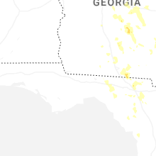
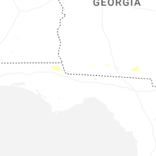
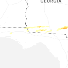

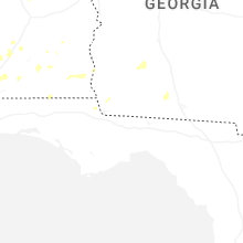


Connect with Interactive Hail Maps