

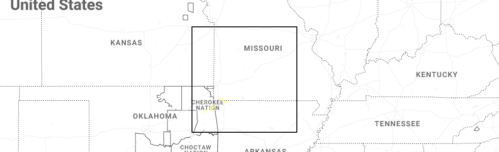
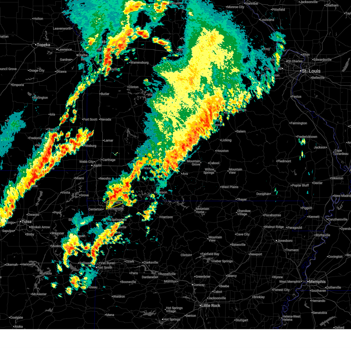
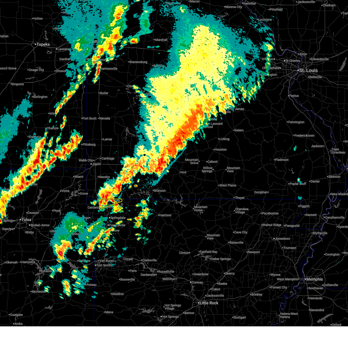
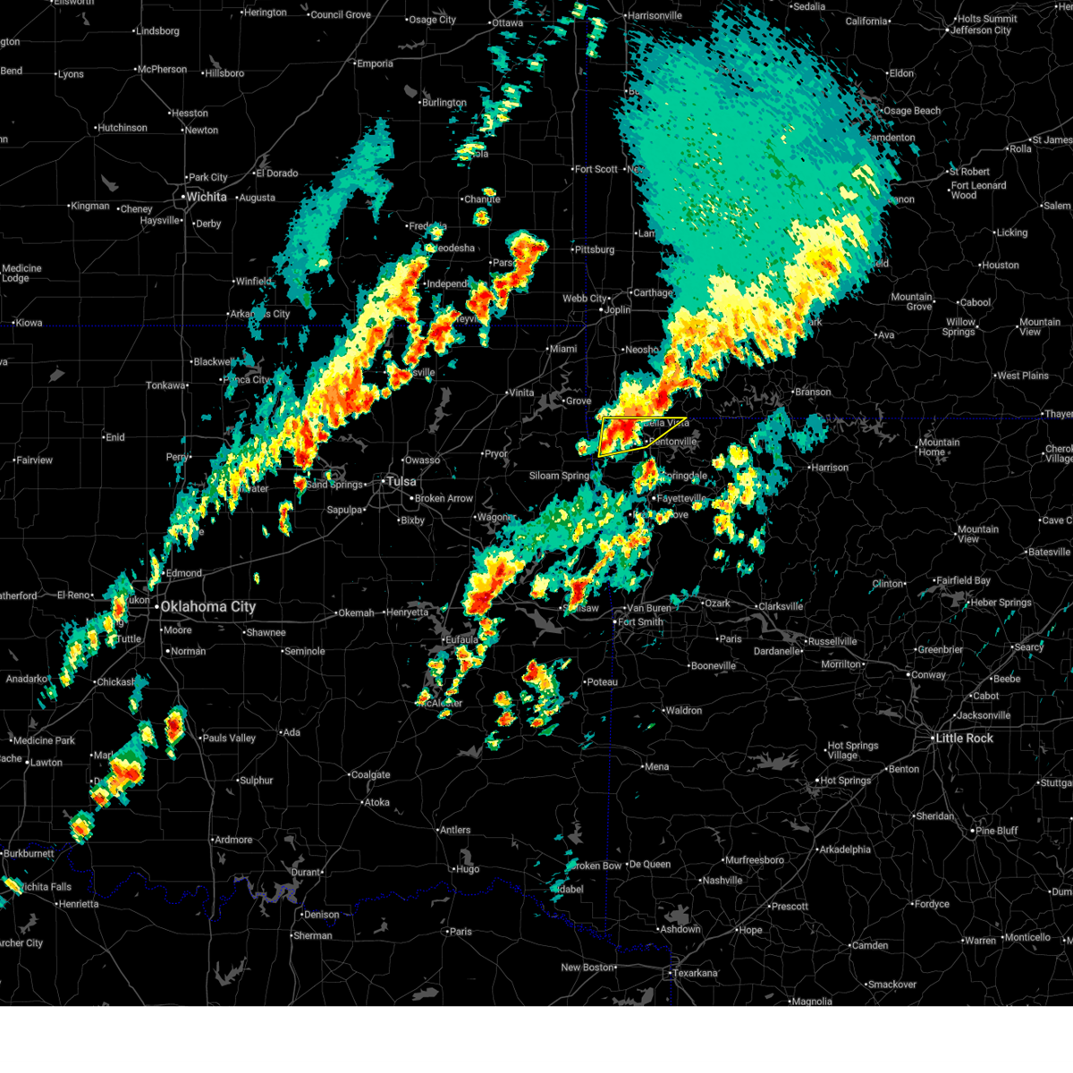
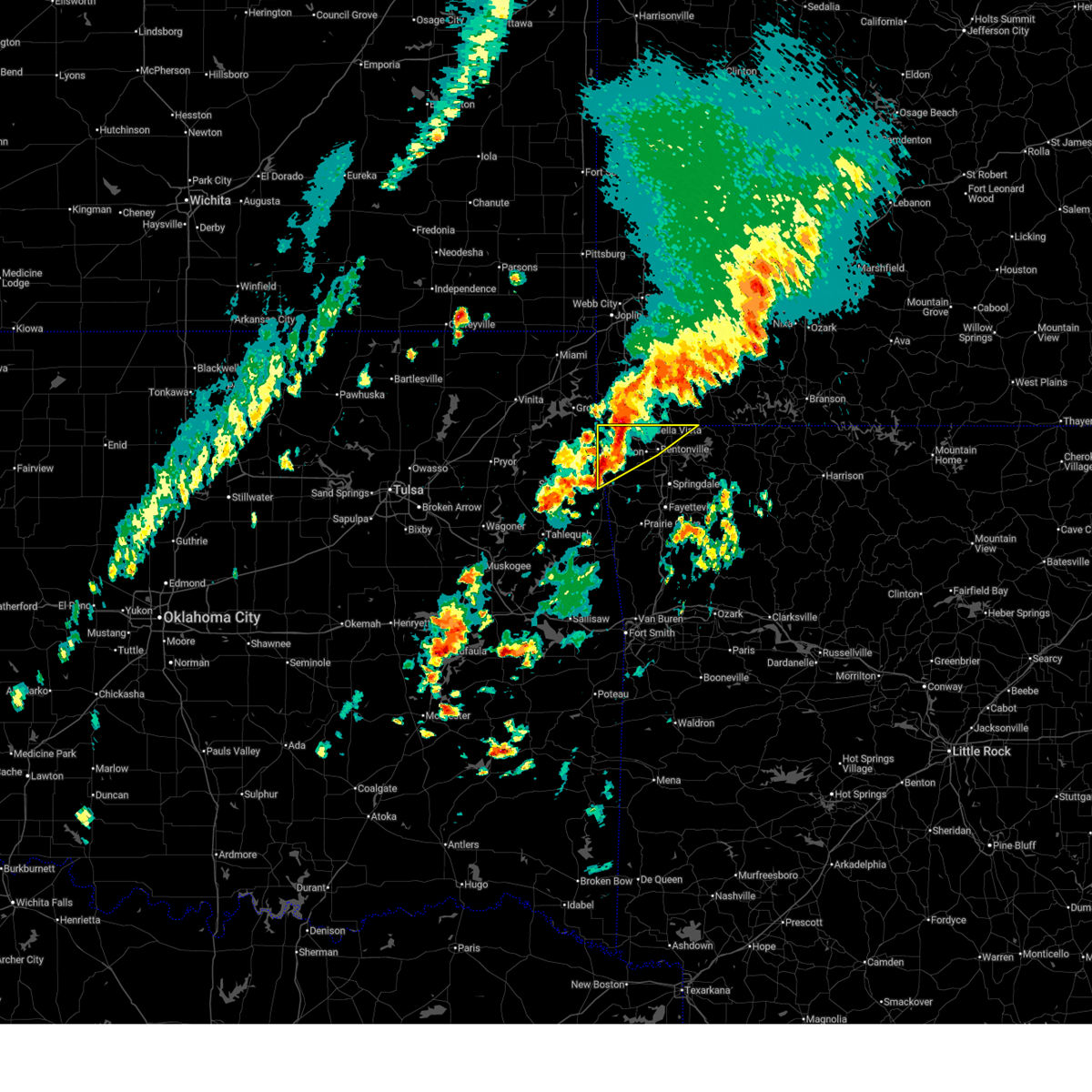
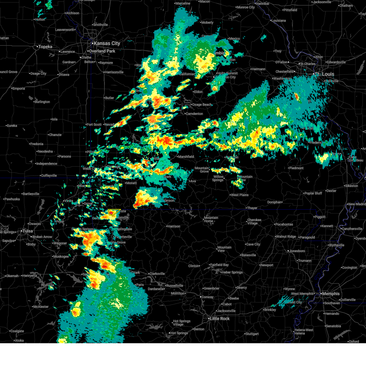
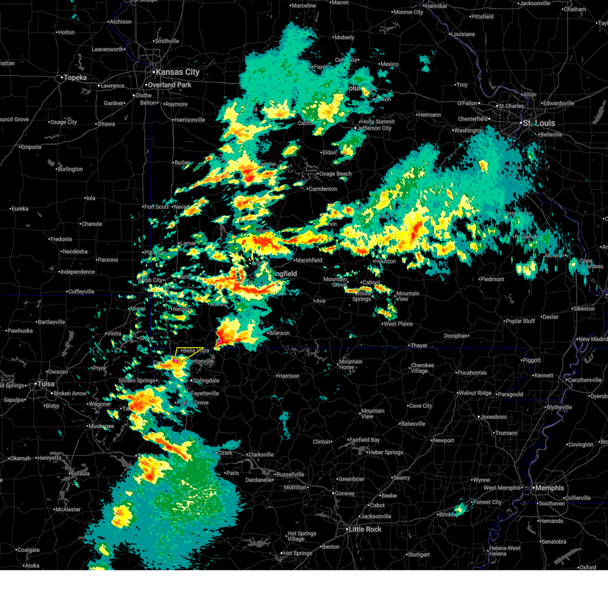
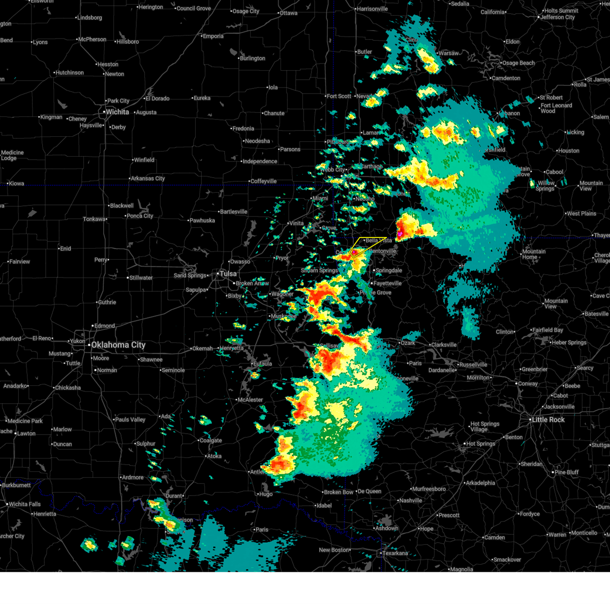
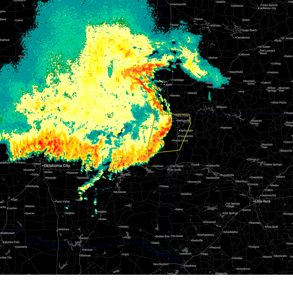
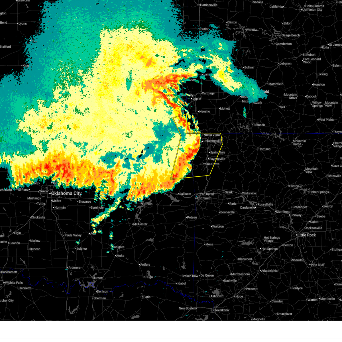
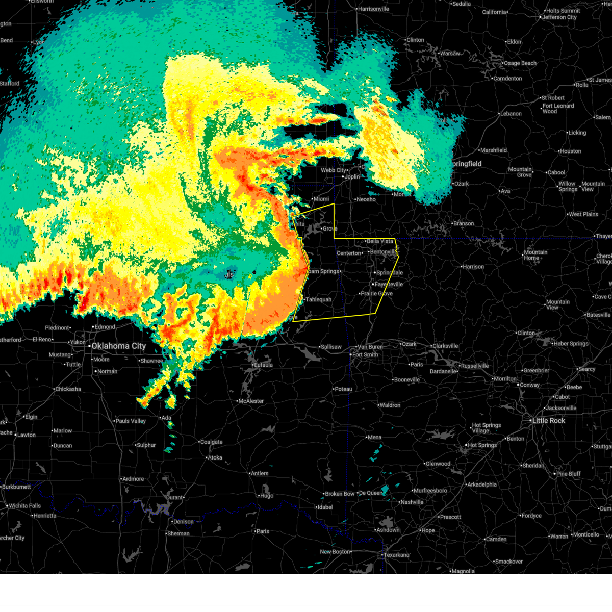
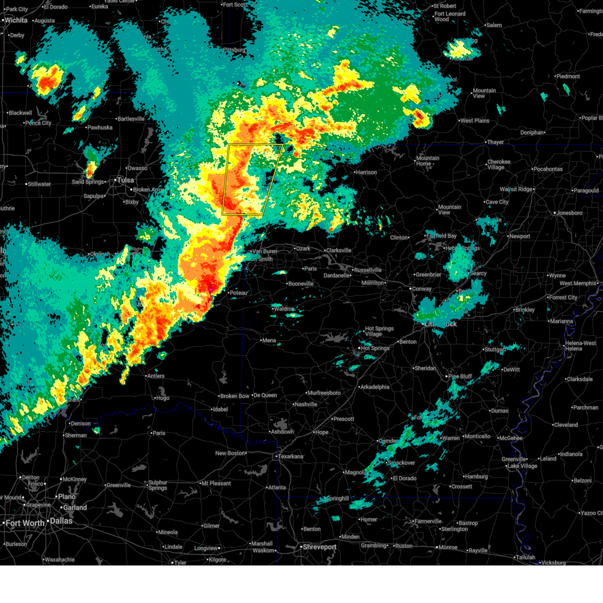
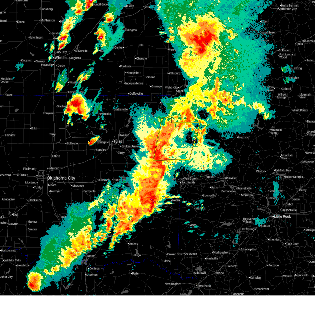
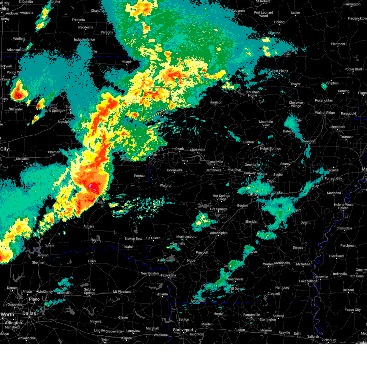
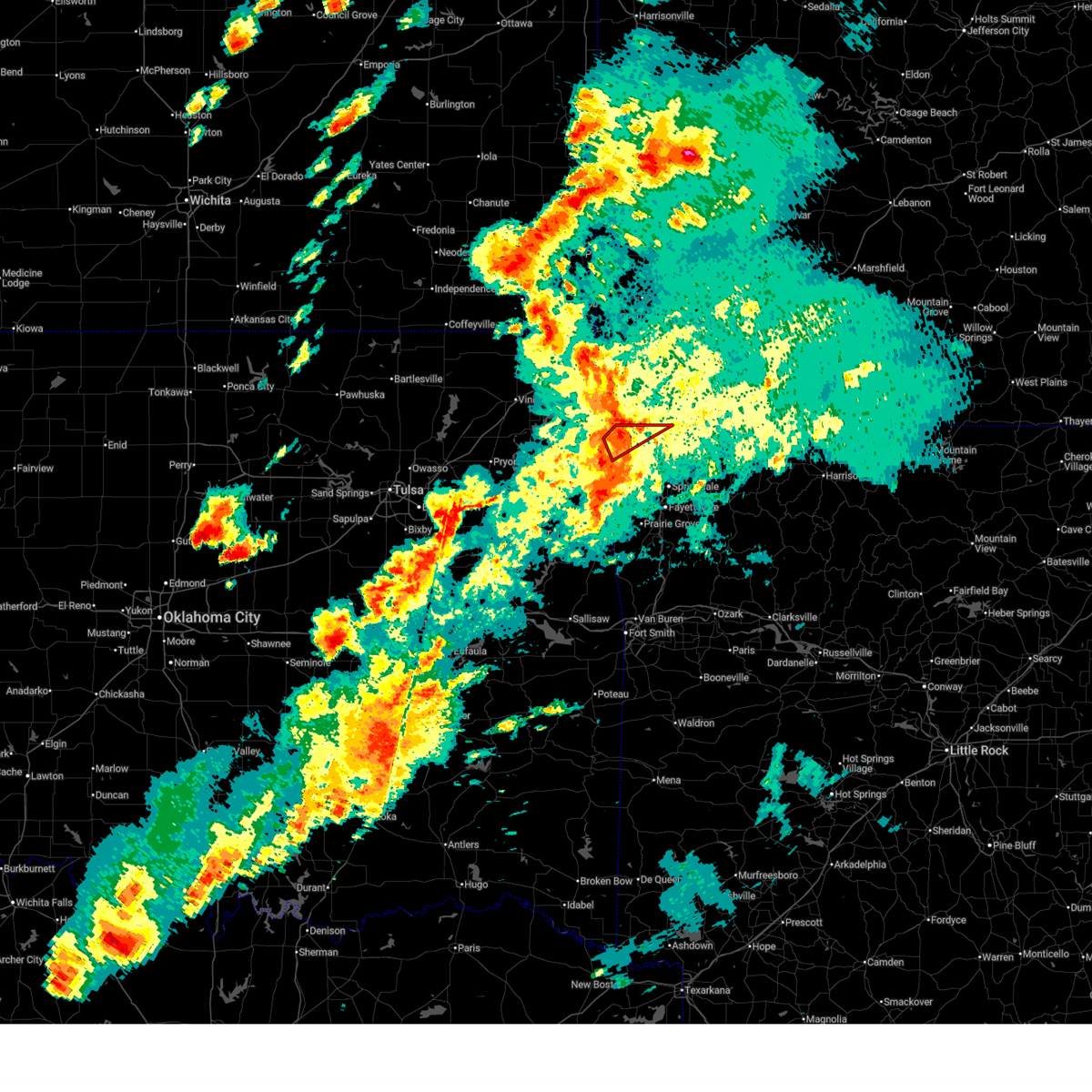
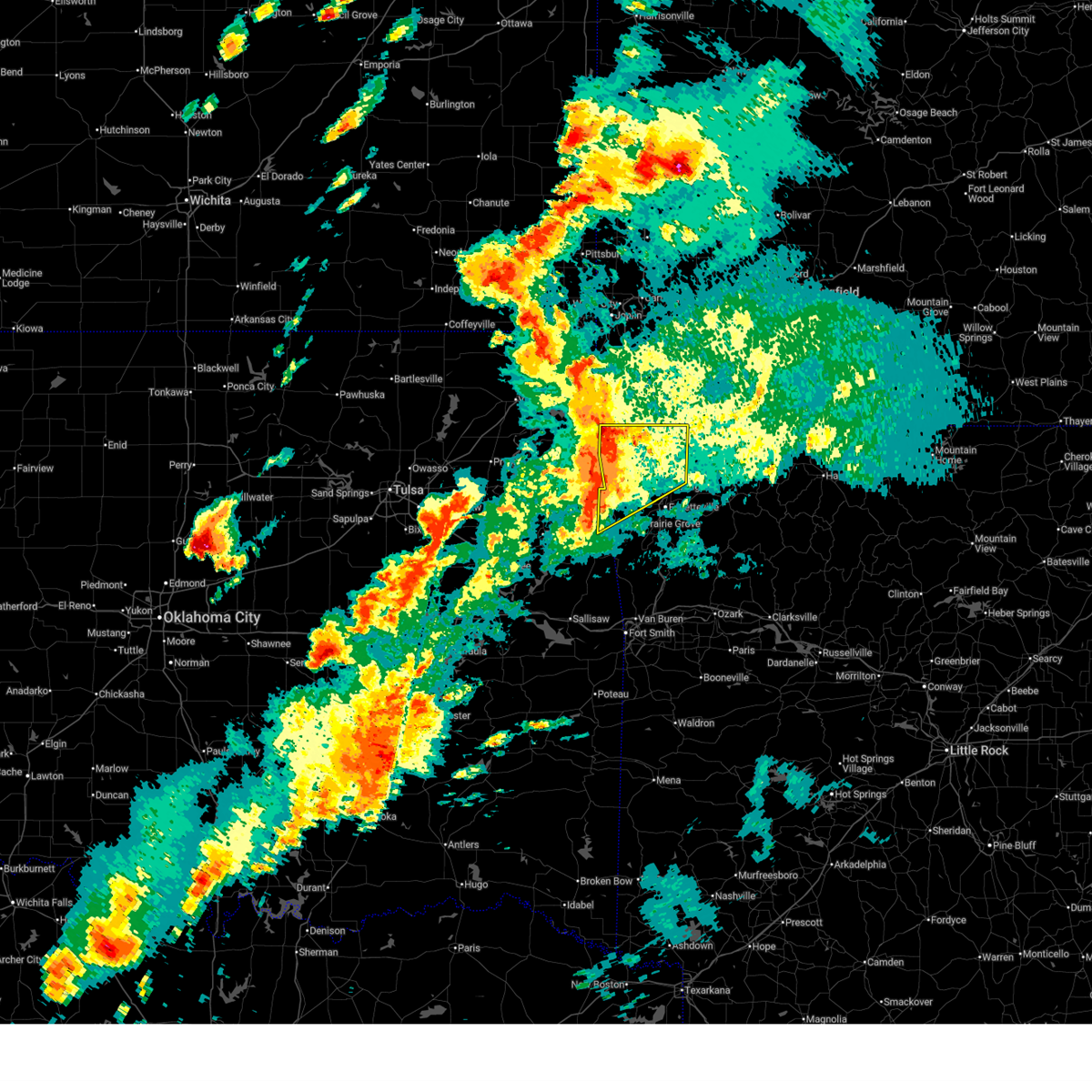
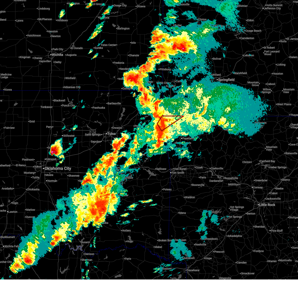
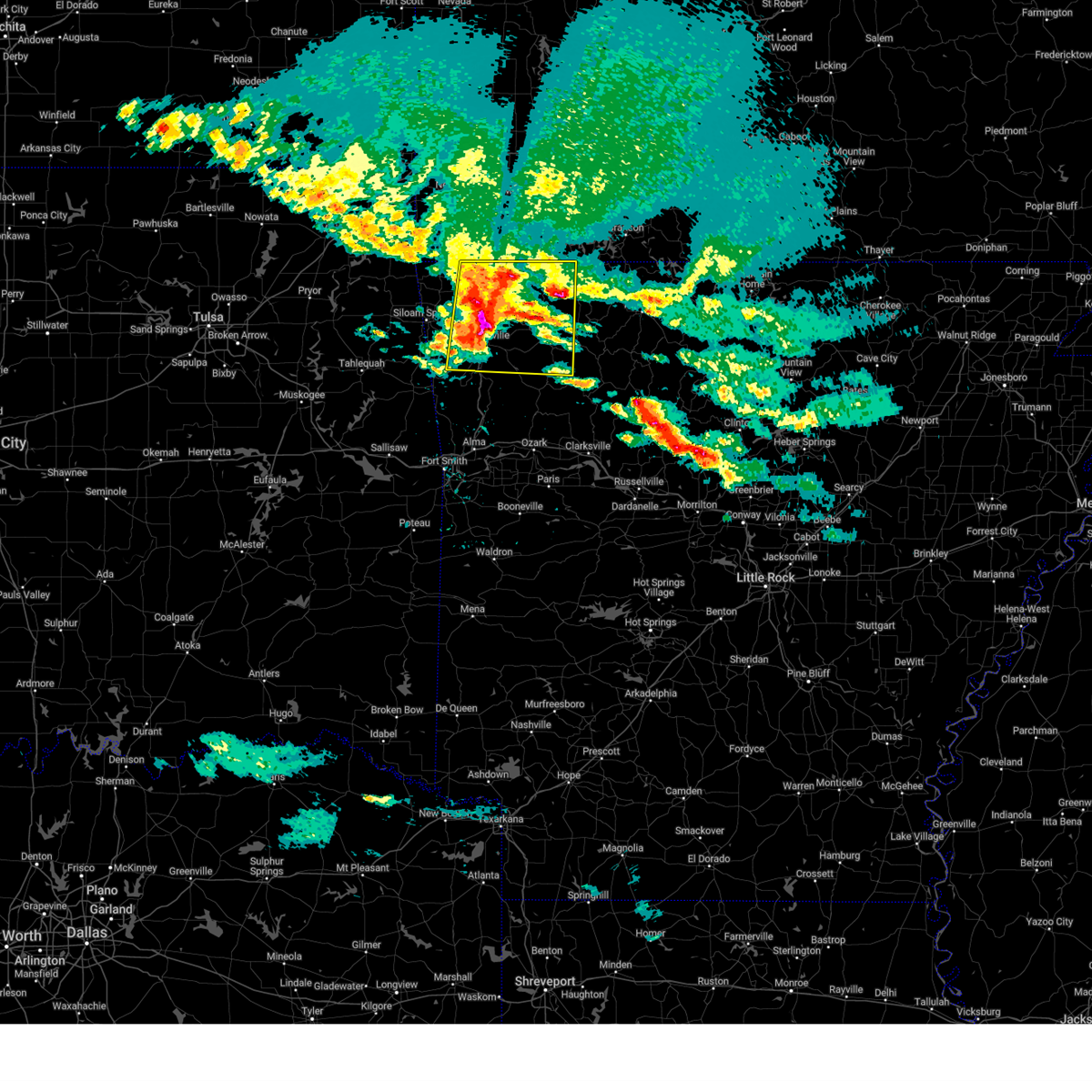
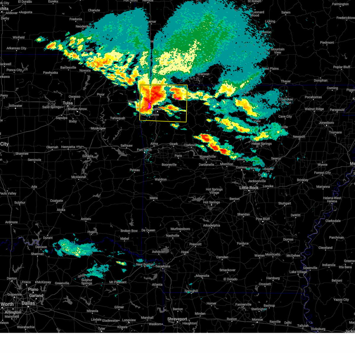
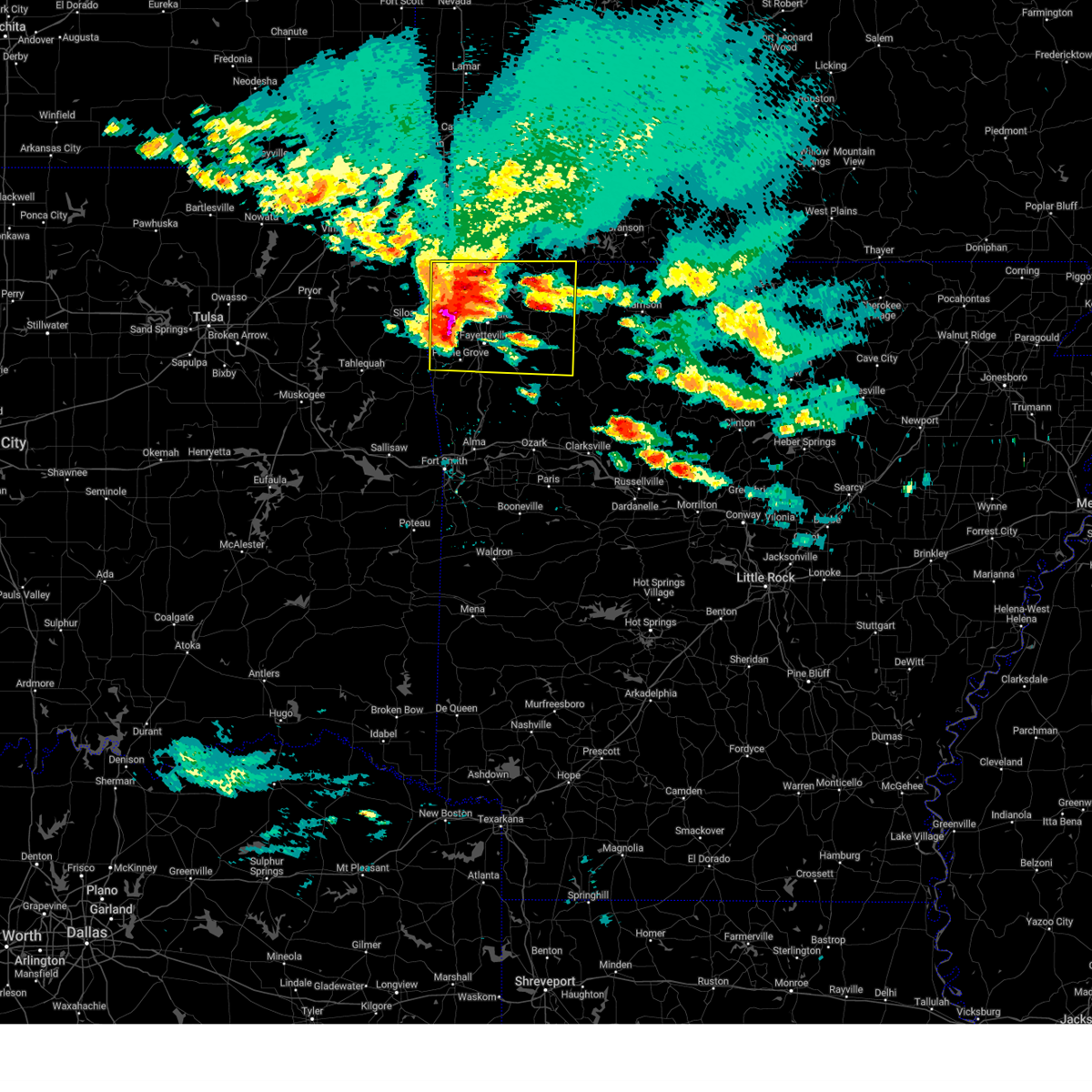
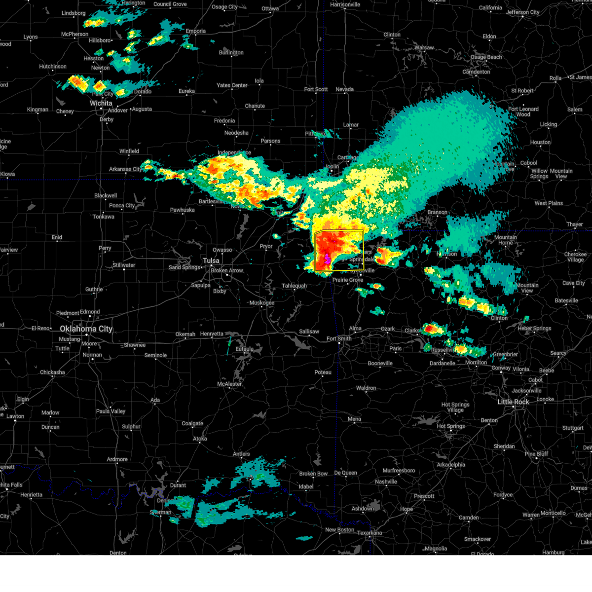
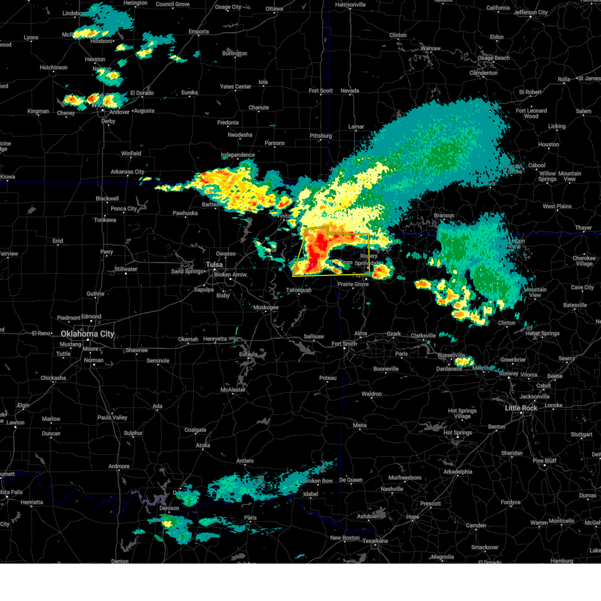
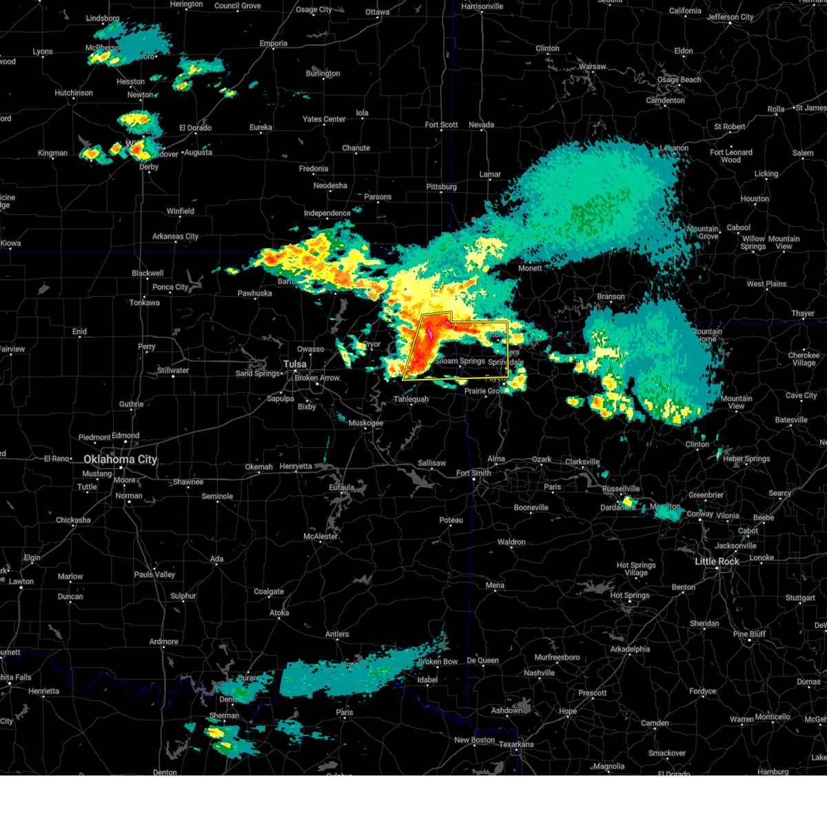
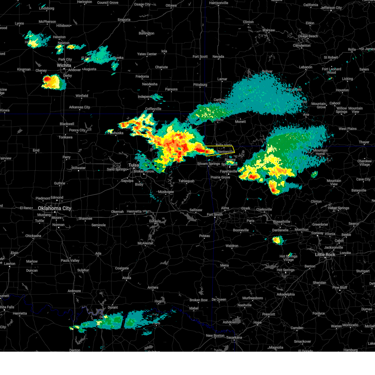
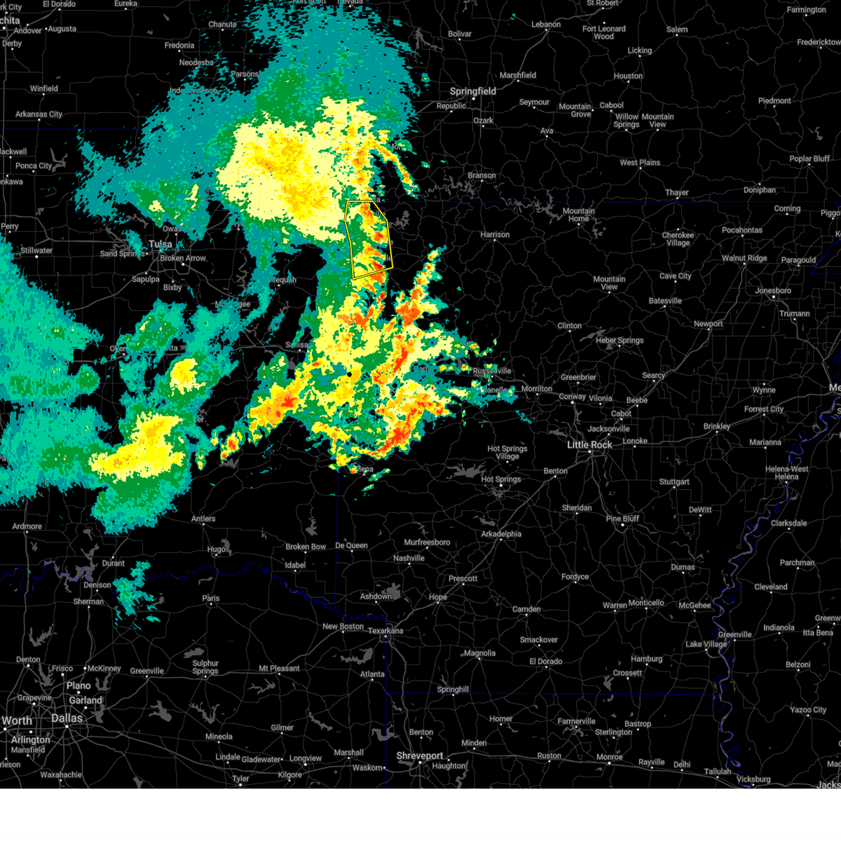
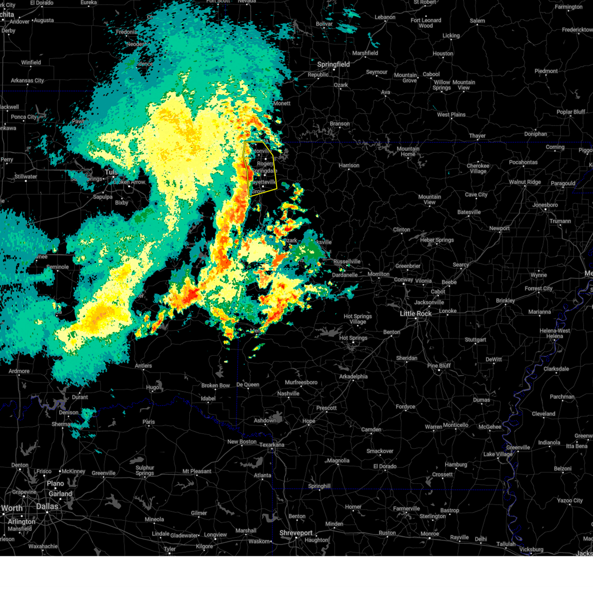
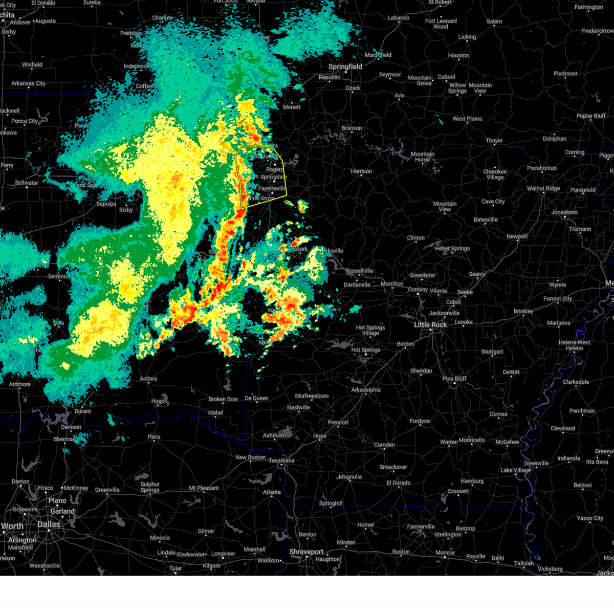
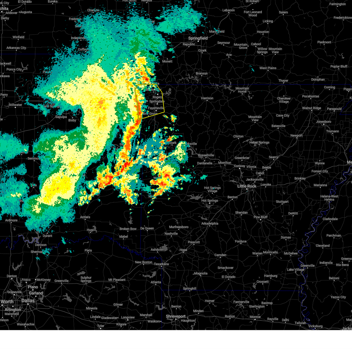
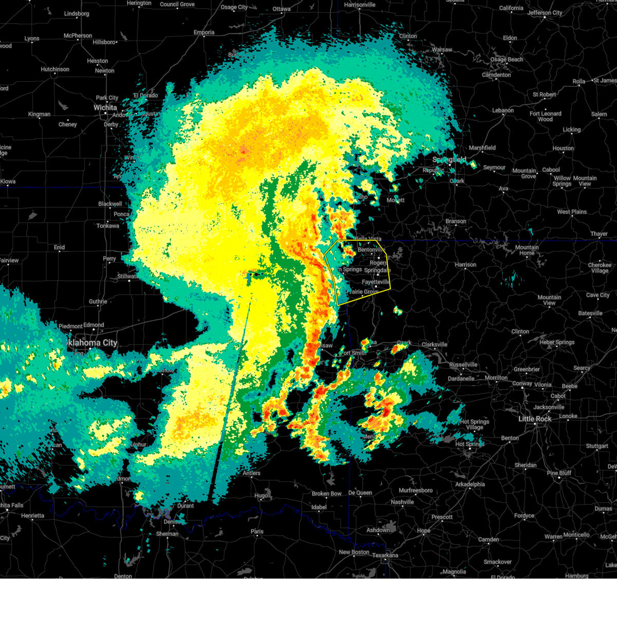
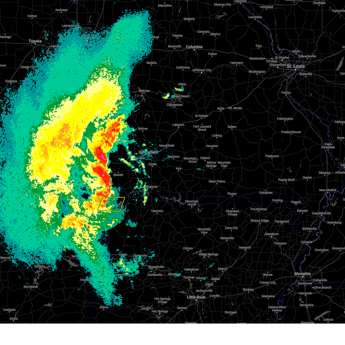
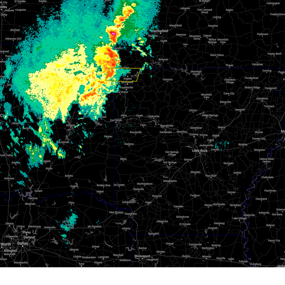
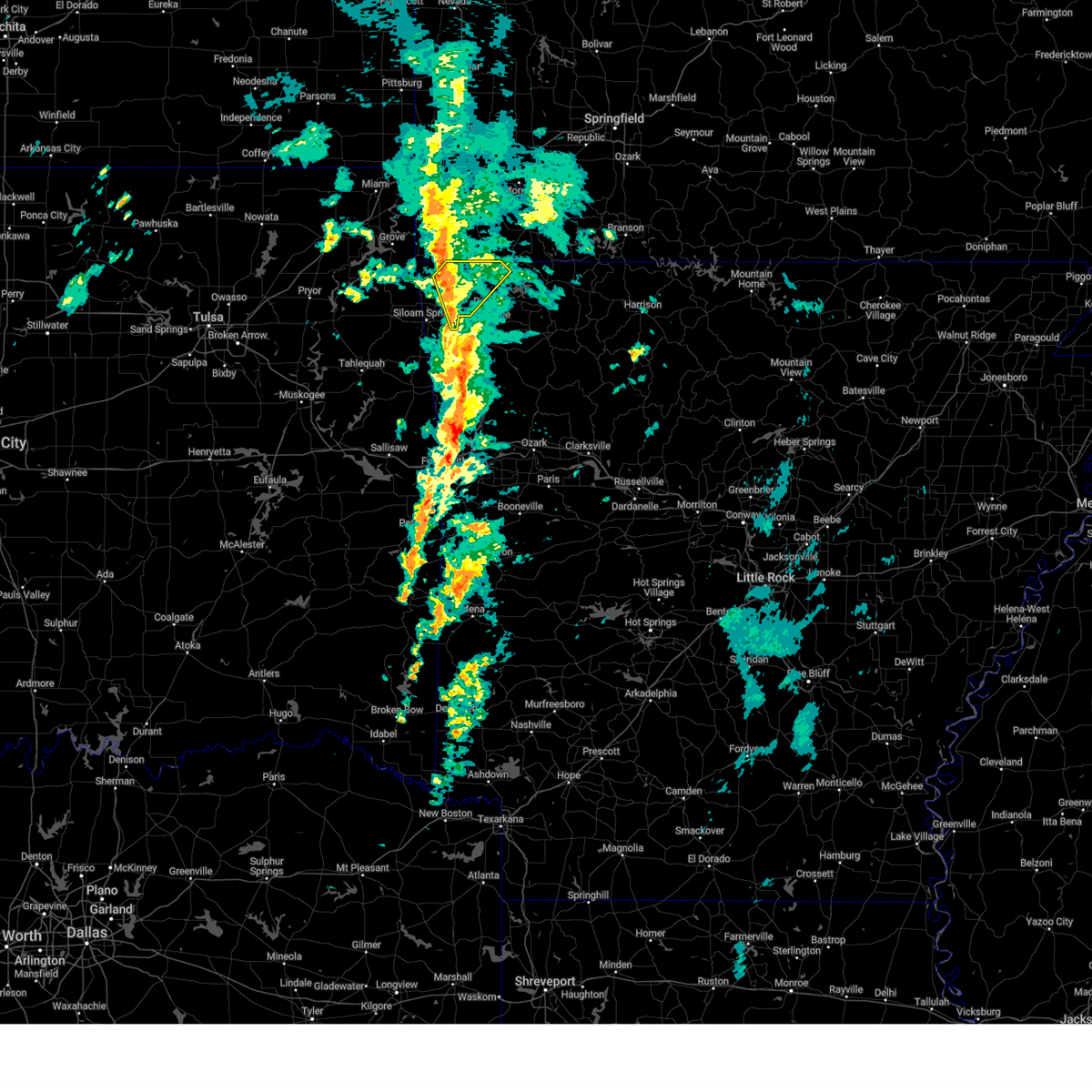
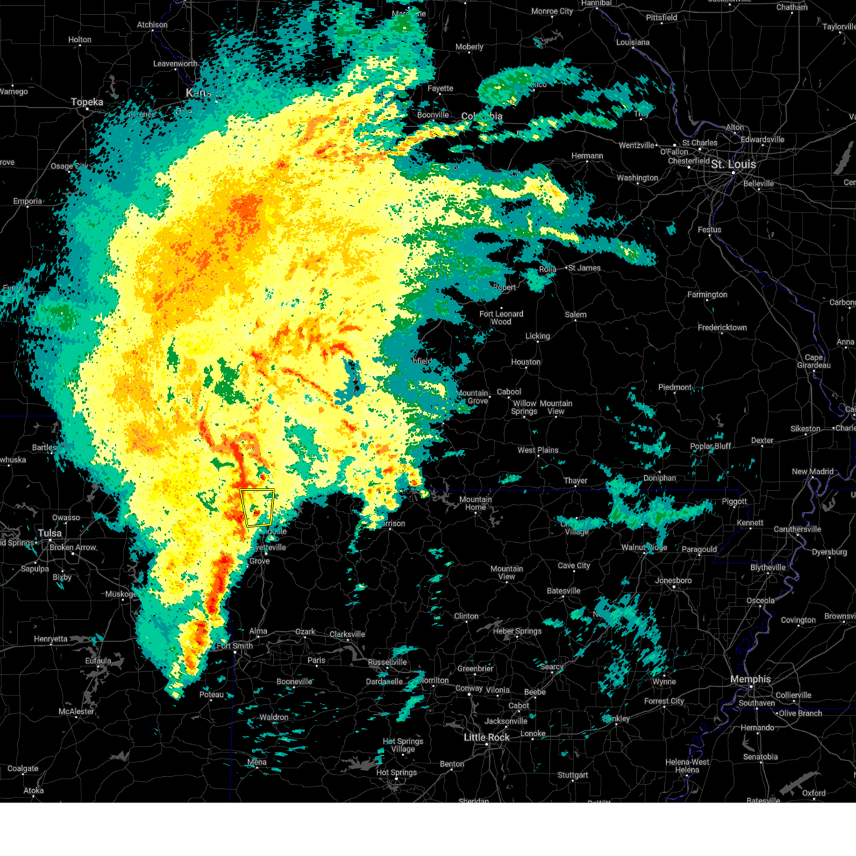
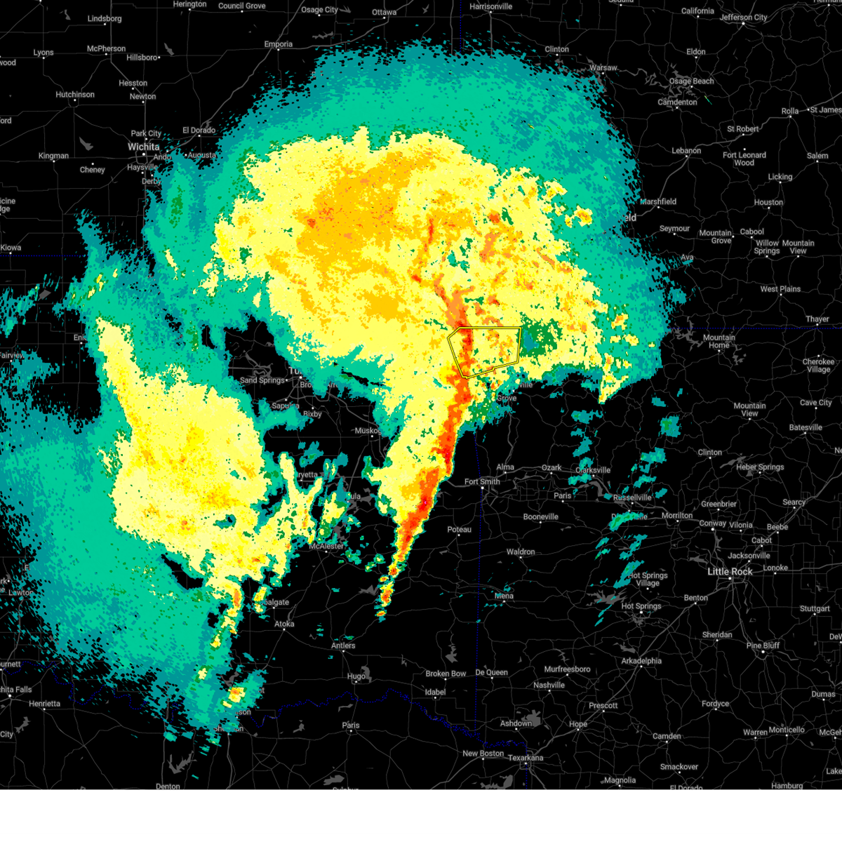
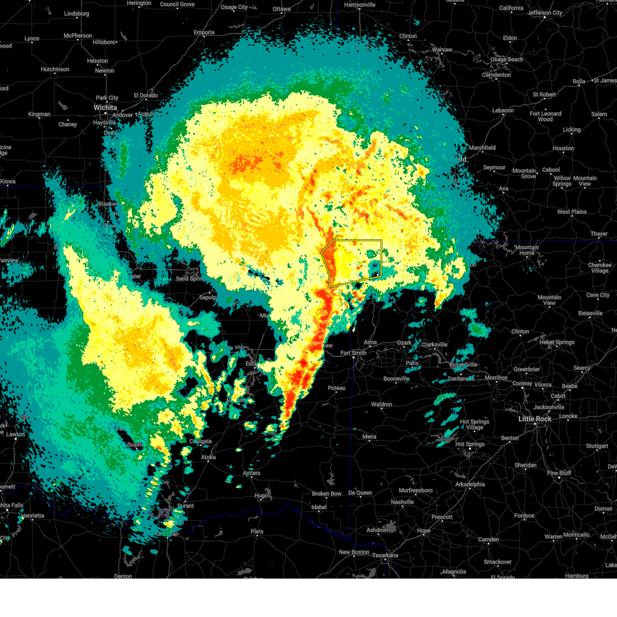
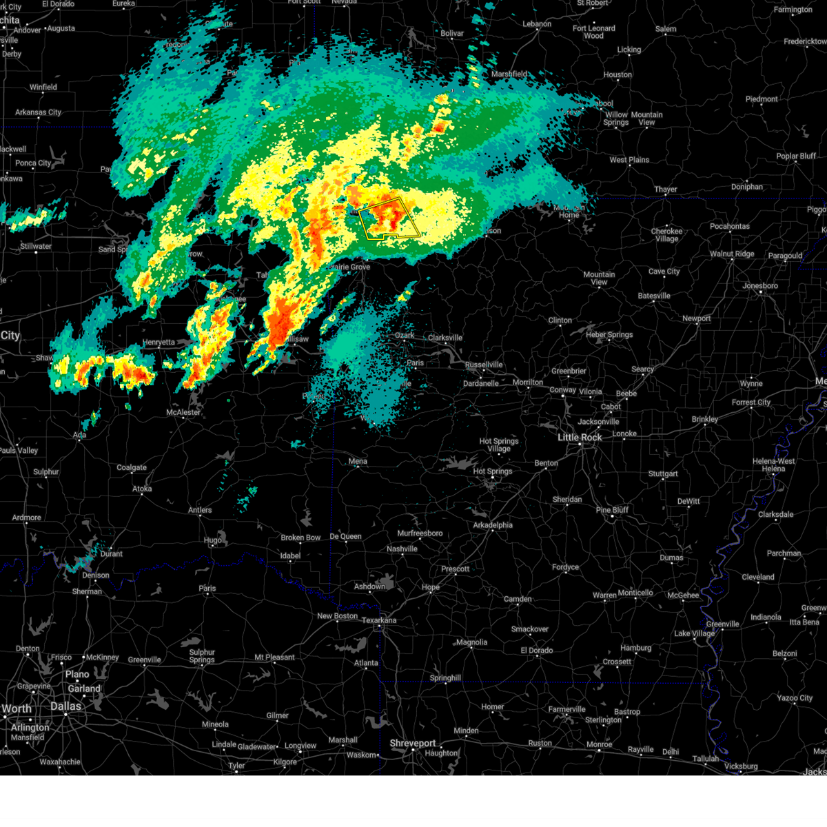
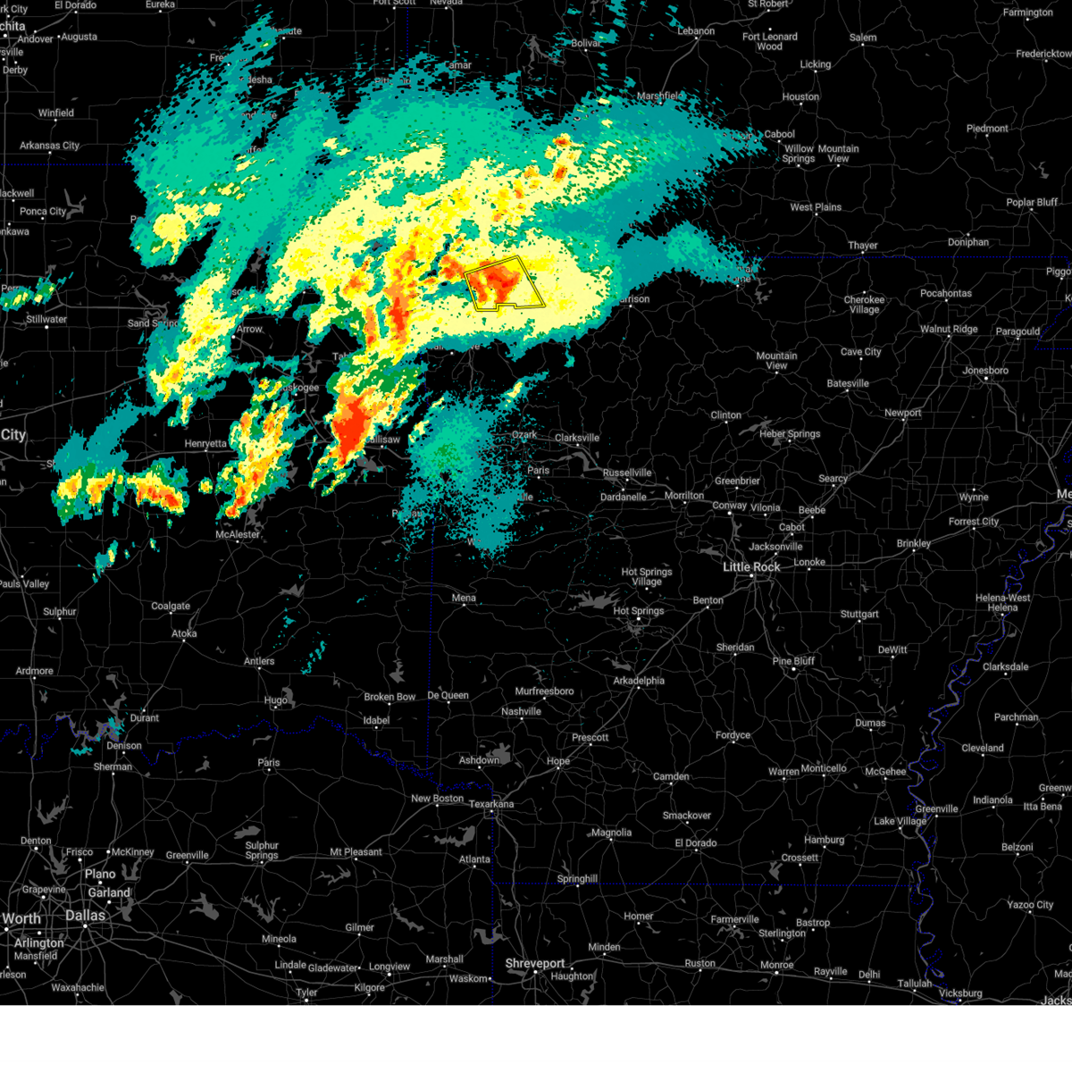
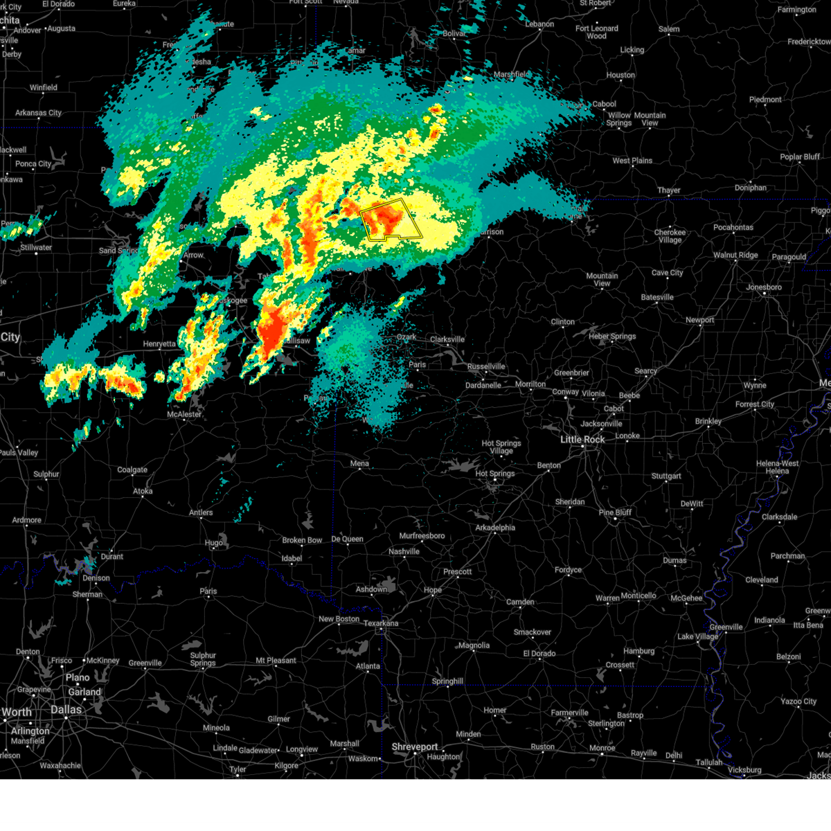
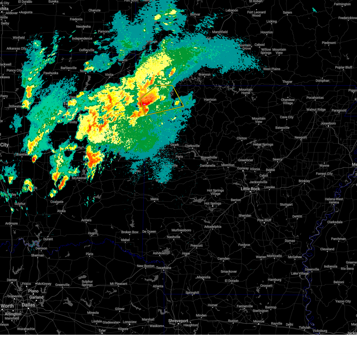
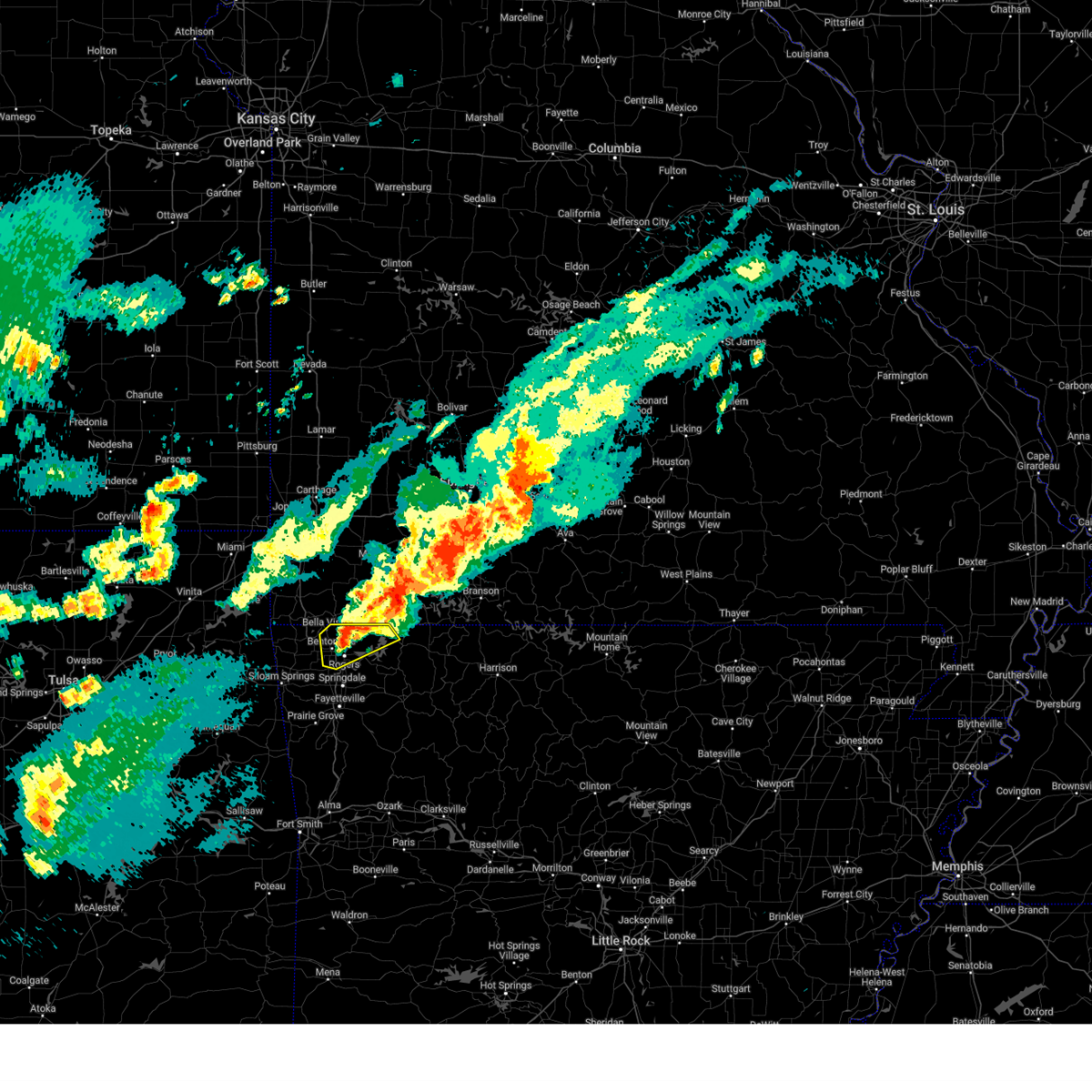
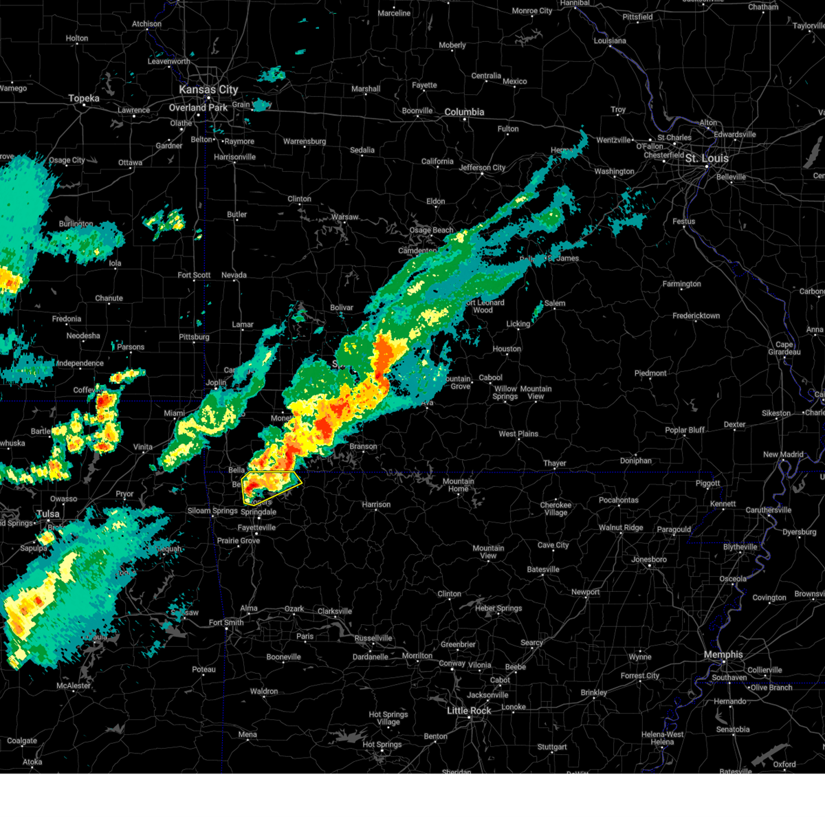
Hail Map for Pea Ridge, AR
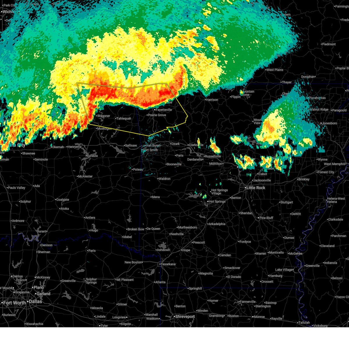
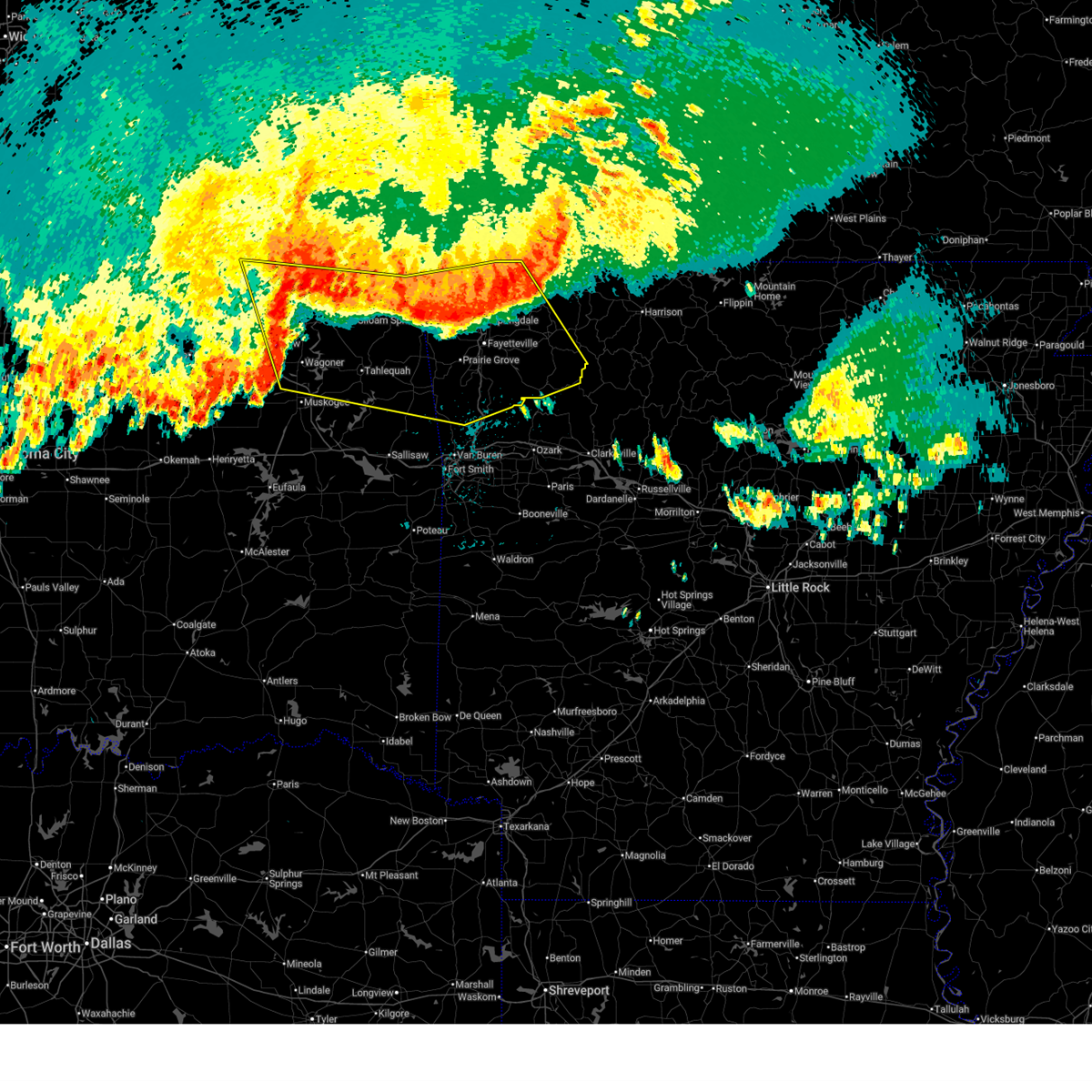
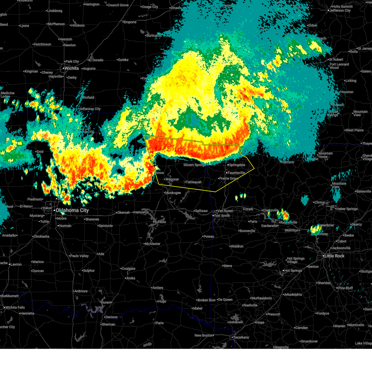
The Pea Ridge, AR area has had 6 reports of on-the-ground hail by trained spotters, and has been under severe weather warnings 19 times during the past 12 months. Doppler radar has detected hail at or near Pea Ridge, AR on 91 occasions, including 9 occasions during the past year.
| Name: | Pea Ridge, AR |
| Where Located: | 69.7 miles SW of Springfield, MO |
| Map: | Google Map for Pea Ridge, AR |
| Population: | 4794 |
| Housing Units: | 1887 |
| More Info: | Search Google for Pea Ridge, AR |
1
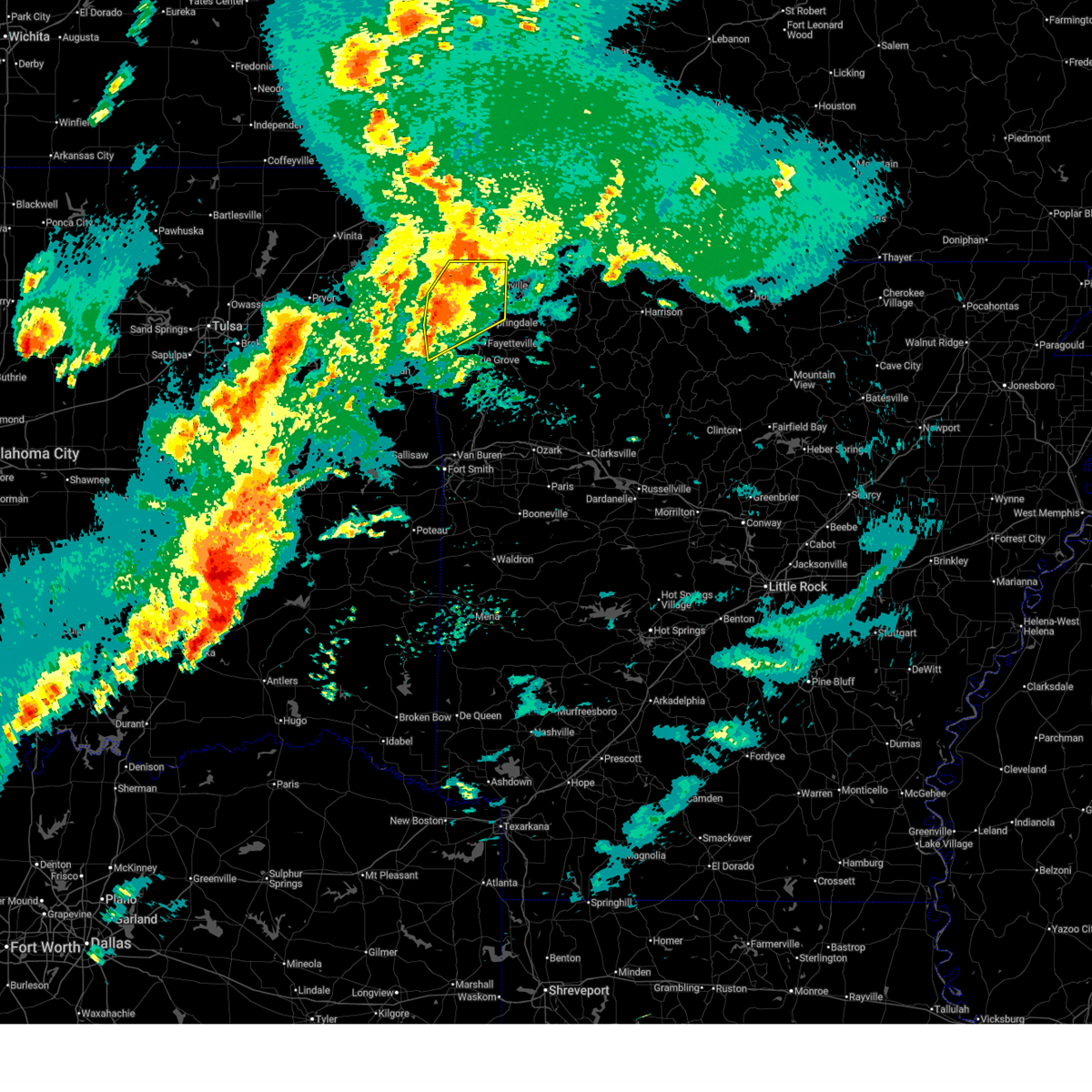
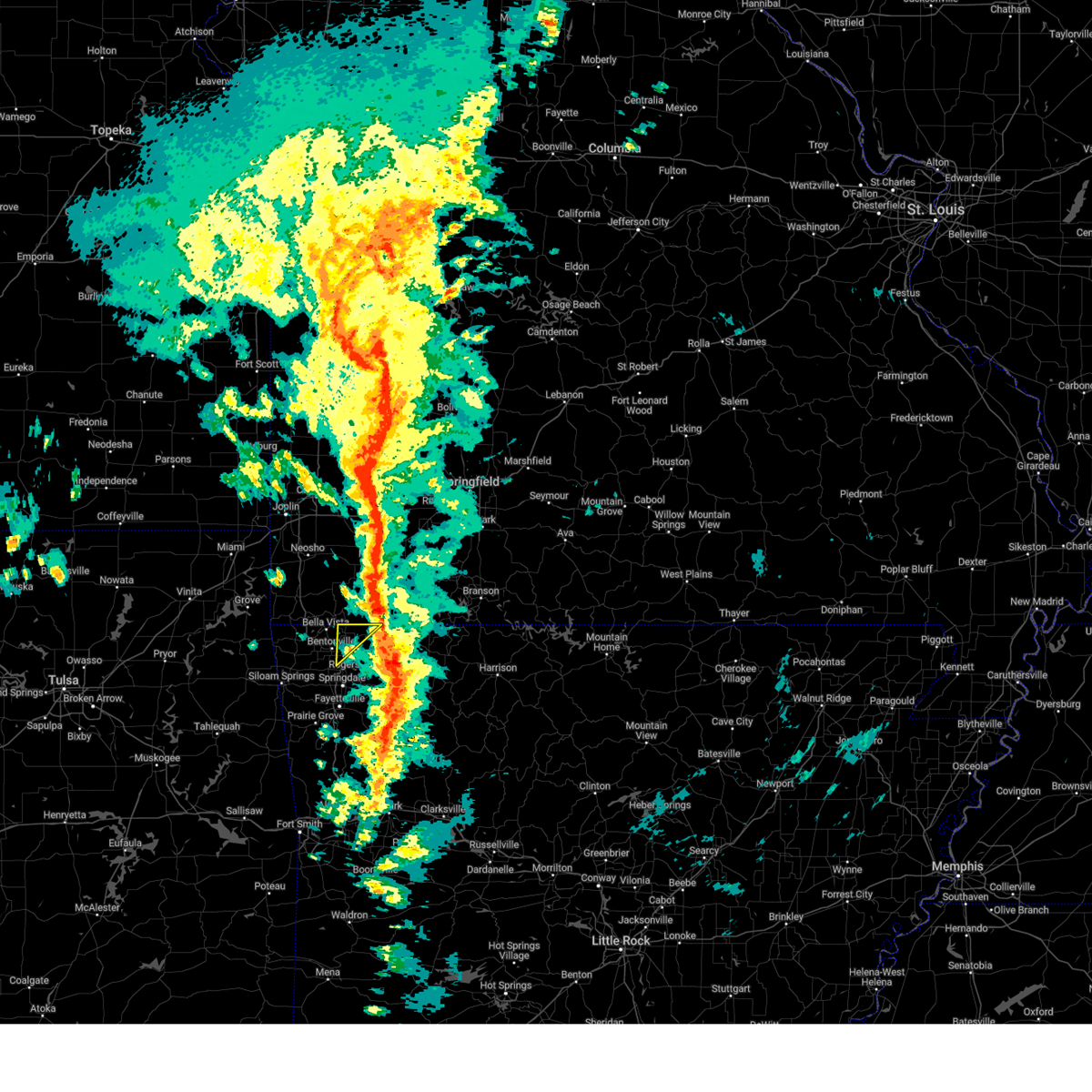
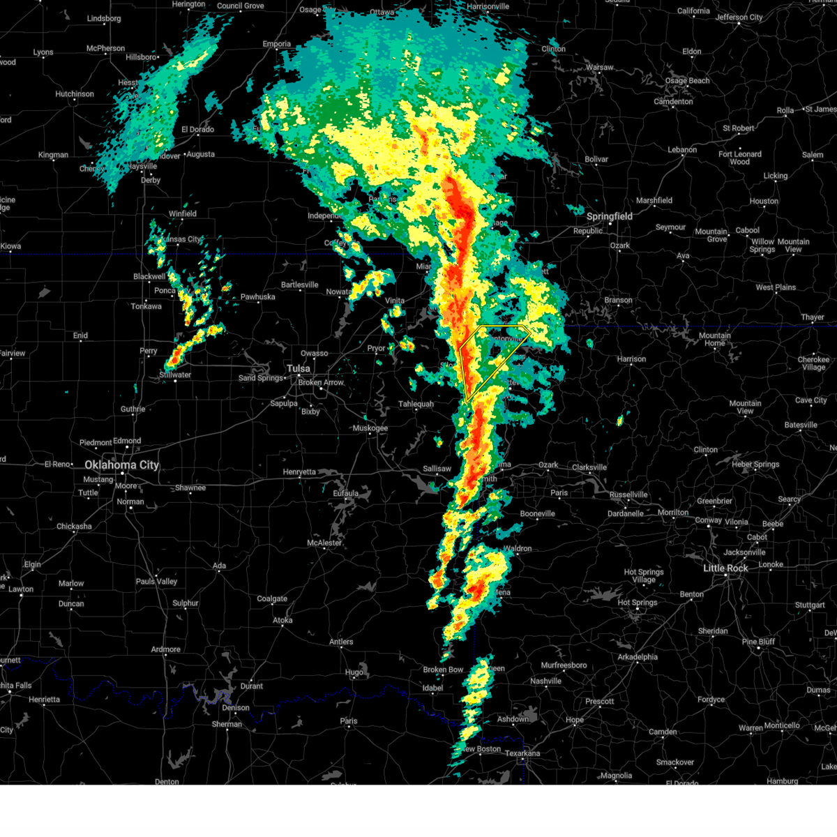
The Top Recent Hail Date for Pea Ridge, AR is Monday, June 8, 2026 (11th out of 91)
Hail and Wind Damage Spotted near Pea Ridge, AR
| Date / Time | Report Details |
|---|---|
| 6/14/2026 12:35 AM CDT |
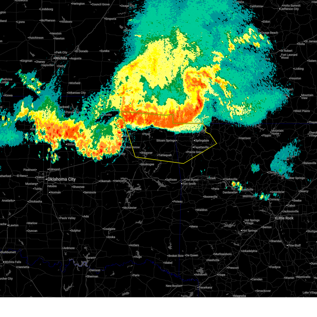
 At 1235 am cdt, severe thunderstorms were located along a line extending from 4 miles northeast of hindsville to 4 miles west of lincoln to 3 miles east of inola, moving southeast at 45 mph (emergency management). Hazards include 70 mph wind gusts. Expect considerable tree damage. damage is likely to mobile homes, roofs, and outbuildings. locations in or near the path include, fayetteville, springdale, rogers, muskogee, bentonville, claremore, tahlequah, siloam springs, wagoner, stilwell, jay, huntsville, mountainburg, pryor, natural dam, bella vista, pryor creek, lowell, farmington, pea ridge, this includes the following highways, interstate 44 between mile markers 243 and 268. Interstate 49 between mile markers 33 and 93. At 1235 am cdt, severe thunderstorms were located along a line extending from 4 miles northeast of hindsville to 4 miles west of lincoln to 3 miles east of inola, moving southeast at 45 mph (emergency management). Hazards include 70 mph wind gusts. Expect considerable tree damage. damage is likely to mobile homes, roofs, and outbuildings. locations in or near the path include, fayetteville, springdale, rogers, muskogee, bentonville, claremore, tahlequah, siloam springs, wagoner, stilwell, jay, huntsville, mountainburg, pryor, natural dam, bella vista, pryor creek, lowell, farmington, pea ridge, this includes the following highways, interstate 44 between mile markers 243 and 268. Interstate 49 between mile markers 33 and 93.
|
| 6/14/2026 12:21 AM CDT |
 Svrtsa the national weather service in tulsa has issued a * severe thunderstorm warning for, benton county in northwestern arkansas, madison county in northwestern arkansas, west central carroll county in northwestern arkansas, northern crawford county in northwestern arkansas, washington county in northwestern arkansas, central rogers county in northeastern oklahoma, southern delaware county in northeastern oklahoma, mayes county in northeastern oklahoma, adair county in northeastern oklahoma, eastern wagoner county in northeastern oklahoma, cherokee county in east central oklahoma, northeastern muskogee county in east central oklahoma, * until 100 am cdt. * at 1221 am cdt, severe thunderstorms were located along a line extending from 4 miles northeast of war eagle to near watts to tiawah, moving southeast at 45 mph (radar indicated). Hazards include 60 mph wind gusts. Expect damage to roofs, siding, and trees. locations in or near the path include, fayetteville, springdale, rogers, muskogee, bentonville, claremore, tahlequah, siloam springs, wagoner, stilwell, jay, huntsville, mountainburg, pryor, natural dam, bella vista, pryor creek, lowell, farmington, pea ridge, this includes the following highways, interstate 44 between mile markers 243 and 268. Interstate 49 between mile markers 33 and 93. Svrtsa the national weather service in tulsa has issued a * severe thunderstorm warning for, benton county in northwestern arkansas, madison county in northwestern arkansas, west central carroll county in northwestern arkansas, northern crawford county in northwestern arkansas, washington county in northwestern arkansas, central rogers county in northeastern oklahoma, southern delaware county in northeastern oklahoma, mayes county in northeastern oklahoma, adair county in northeastern oklahoma, eastern wagoner county in northeastern oklahoma, cherokee county in east central oklahoma, northeastern muskogee county in east central oklahoma, * until 100 am cdt. * at 1221 am cdt, severe thunderstorms were located along a line extending from 4 miles northeast of war eagle to near watts to tiawah, moving southeast at 45 mph (radar indicated). Hazards include 60 mph wind gusts. Expect damage to roofs, siding, and trees. locations in or near the path include, fayetteville, springdale, rogers, muskogee, bentonville, claremore, tahlequah, siloam springs, wagoner, stilwell, jay, huntsville, mountainburg, pryor, natural dam, bella vista, pryor creek, lowell, farmington, pea ridge, this includes the following highways, interstate 44 between mile markers 243 and 268. Interstate 49 between mile markers 33 and 93.
|
| 6/14/2026 12:14 AM CDT |
 At 1214 am cdt, severe thunderstorms were located along a line extending from 5 miles southeast of garfield to 2 miles west of west siloam springs to 3 miles north of tiawah, moving southeast at 30 mph (radar indicated). Hazards include 60 mph wind gusts. Expect damage to roofs, siding, and trees. locations in or near the path include, fayetteville, springdale, rogers, bentonville, claremore, tahlequah, siloam springs, wagoner, stilwell, jay, huntsville, pryor, bella vista, pryor creek, lowell, farmington, pea ridge, prairie grove, gentry, elkins, this includes the following highways, interstate 44 between mile markers 246 and 280. Interstate 49 between mile markers 48 and 93. At 1214 am cdt, severe thunderstorms were located along a line extending from 5 miles southeast of garfield to 2 miles west of west siloam springs to 3 miles north of tiawah, moving southeast at 30 mph (radar indicated). Hazards include 60 mph wind gusts. Expect damage to roofs, siding, and trees. locations in or near the path include, fayetteville, springdale, rogers, bentonville, claremore, tahlequah, siloam springs, wagoner, stilwell, jay, huntsville, pryor, bella vista, pryor creek, lowell, farmington, pea ridge, prairie grove, gentry, elkins, this includes the following highways, interstate 44 between mile markers 246 and 280. Interstate 49 between mile markers 48 and 93.
|
| 6/13/2026 11:52 PM CDT |
 Svrtsa the national weather service in tulsa has issued a * severe thunderstorm warning for, benton county in northwestern arkansas, northwestern madison county in northwestern arkansas, washington county in northwestern arkansas, southern craig county in northeastern oklahoma, rogers county in northeastern oklahoma, delaware county in northeastern oklahoma, mayes county in northeastern oklahoma, adair county in northeastern oklahoma, southern nowata county in northeastern oklahoma, northeastern wagoner county in northeastern oklahoma, cherokee county in east central oklahoma, * until 1230 am cdt. * at 1151 pm cdt, severe thunderstorms were located along a line extending from 8 miles north of pea ridge to 4 miles south of jay to near talala, moving southeast at 50 mph (radar indicated). Hazards include 60 mph wind gusts. Expect damage to roofs, siding, and trees. locations in or near the path include, fayetteville, springdale, rogers, bentonville, claremore, tahlequah, siloam springs, wagoner, vinita, stilwell, nowata, jay, huntsville, pryor, bella vista, pryor creek, lowell, grove, farmington, pea ridge, this includes the following highways, interstate 44 between mile markers 246 and 288. Interstate 49 between mile markers 48 and 93. Svrtsa the national weather service in tulsa has issued a * severe thunderstorm warning for, benton county in northwestern arkansas, northwestern madison county in northwestern arkansas, washington county in northwestern arkansas, southern craig county in northeastern oklahoma, rogers county in northeastern oklahoma, delaware county in northeastern oklahoma, mayes county in northeastern oklahoma, adair county in northeastern oklahoma, southern nowata county in northeastern oklahoma, northeastern wagoner county in northeastern oklahoma, cherokee county in east central oklahoma, * until 1230 am cdt. * at 1151 pm cdt, severe thunderstorms were located along a line extending from 8 miles north of pea ridge to 4 miles south of jay to near talala, moving southeast at 50 mph (radar indicated). Hazards include 60 mph wind gusts. Expect damage to roofs, siding, and trees. locations in or near the path include, fayetteville, springdale, rogers, bentonville, claremore, tahlequah, siloam springs, wagoner, vinita, stilwell, nowata, jay, huntsville, pryor, bella vista, pryor creek, lowell, grove, farmington, pea ridge, this includes the following highways, interstate 44 between mile markers 246 and 288. Interstate 49 between mile markers 48 and 93.
|
| 5/30/2026 8:05 PM CDT |
 At 805 pm cdt, a severe thunderstorm was located 4 miles southeast of pea ridge, moving northeast at 5 mph (radar indicated). Hazards include 60 mph wind gusts and penny size hail. Expect damage to roofs, siding, and trees. Locations in or near the path include, rogers, bentonville, pea ridge, gateway, avoca, hill top, walnut hill, this includes interstate 49 between mile markers 85 and 89. At 805 pm cdt, a severe thunderstorm was located 4 miles southeast of pea ridge, moving northeast at 5 mph (radar indicated). Hazards include 60 mph wind gusts and penny size hail. Expect damage to roofs, siding, and trees. Locations in or near the path include, rogers, bentonville, pea ridge, gateway, avoca, hill top, walnut hill, this includes interstate 49 between mile markers 85 and 89.
|
| 5/30/2026 7:49 PM CDT |
 Svrtsa the national weather service in tulsa has issued a * severe thunderstorm warning for, northeastern benton county in northwestern arkansas, * until 830 pm cdt. * at 749 pm cdt, a severe thunderstorm was located 3 miles south of pea ridge, moving northeast at 15 mph (radar indicated). Hazards include 60 mph wind gusts and quarter size hail. Hail damage to vehicles is expected. expect wind damage to roofs, siding, and trees. Locations in or near the path include, rogers, bentonville, pea ridge, gateway, avoca, hill top, walnut hill, this includes interstate 49 between mile markers 85 and 89. Svrtsa the national weather service in tulsa has issued a * severe thunderstorm warning for, northeastern benton county in northwestern arkansas, * until 830 pm cdt. * at 749 pm cdt, a severe thunderstorm was located 3 miles south of pea ridge, moving northeast at 15 mph (radar indicated). Hazards include 60 mph wind gusts and quarter size hail. Hail damage to vehicles is expected. expect wind damage to roofs, siding, and trees. Locations in or near the path include, rogers, bentonville, pea ridge, gateway, avoca, hill top, walnut hill, this includes interstate 49 between mile markers 85 and 89.
|
| 4/15/2026 12:32 AM CDT |
 At 1232 am cdt, severe thunderstorms were located along a line extending from 4 miles north of pea ridge to 7 miles east of springdale, moving east at 60 mph (radar indicated). Hazards include 60 mph wind gusts. Expect damage to roofs, siding, and trees. Locations in or near the path include, beaver lake, larue, pea ridge, avoca, pleasant ridge, gateway, hobbs state park, beaver, best, clifty, oak hill, busch, sonora, eureka springs, rockhouse, war eagle, cabanal, hill top, walnut hill, monte ne,. At 1232 am cdt, severe thunderstorms were located along a line extending from 4 miles north of pea ridge to 7 miles east of springdale, moving east at 60 mph (radar indicated). Hazards include 60 mph wind gusts. Expect damage to roofs, siding, and trees. Locations in or near the path include, beaver lake, larue, pea ridge, avoca, pleasant ridge, gateway, hobbs state park, beaver, best, clifty, oak hill, busch, sonora, eureka springs, rockhouse, war eagle, cabanal, hill top, walnut hill, monte ne,.
|
| 4/15/2026 12:11 AM CDT |
 Svrtsa the national weather service in tulsa has issued a * severe thunderstorm warning for, benton county in northwestern arkansas, northwestern madison county in northwestern arkansas, northwestern carroll county in northwestern arkansas, northeastern washington county in northwestern arkansas, * until 115 am cdt. * at 1211 am cdt, severe thunderstorms were located along a line extending from 2 miles south of noel to 5 miles southwest of tontitown, moving east at 50 mph (radar indicated). Hazards include 60 mph wind gusts. Expect damage to roofs, siding, and trees. Locations in or near the path include, rogers, northwest arkansas regional air, beaver lake, gravette, tontitown, decatur, larue, cave springs, bentonville, hiwasse, pea ridge, avoca, pleasant ridge, gallitin, gateway, hobbs state park, beaver, centerton, best, rocky comfort, this includes interstate 49 between mile markers 69 and 93. Svrtsa the national weather service in tulsa has issued a * severe thunderstorm warning for, benton county in northwestern arkansas, northwestern madison county in northwestern arkansas, northwestern carroll county in northwestern arkansas, northeastern washington county in northwestern arkansas, * until 115 am cdt. * at 1211 am cdt, severe thunderstorms were located along a line extending from 2 miles south of noel to 5 miles southwest of tontitown, moving east at 50 mph (radar indicated). Hazards include 60 mph wind gusts. Expect damage to roofs, siding, and trees. Locations in or near the path include, rogers, northwest arkansas regional air, beaver lake, gravette, tontitown, decatur, larue, cave springs, bentonville, hiwasse, pea ridge, avoca, pleasant ridge, gallitin, gateway, hobbs state park, beaver, centerton, best, rocky comfort, this includes interstate 49 between mile markers 69 and 93.
|
| 4/14/2026 11:49 PM CDT |
 At 1149 pm cdt, severe thunderstorms were located along a line extending from jay to colcord to 6 miles north of christie, moving northeast at 50 mph (radar indicated). Hazards include 60 mph wind gusts. Expect damage to roofs, siding, and trees. Locations in or near the path include, jay, northwest arkansas regional air, lake eucha state park, savoy, gravette, tontitown, decatur, ballard, hiwasse, cave springs, bentonville, gallitin, scraper, twin oaks, centerton, rocky comfort, natural falls state park, gentry, lake francis, maysville, this includes interstate 49 between mile markers 82 and 93. At 1149 pm cdt, severe thunderstorms were located along a line extending from jay to colcord to 6 miles north of christie, moving northeast at 50 mph (radar indicated). Hazards include 60 mph wind gusts. Expect damage to roofs, siding, and trees. Locations in or near the path include, jay, northwest arkansas regional air, lake eucha state park, savoy, gravette, tontitown, decatur, ballard, hiwasse, cave springs, bentonville, gallitin, scraper, twin oaks, centerton, rocky comfort, natural falls state park, gentry, lake francis, maysville, this includes interstate 49 between mile markers 82 and 93.
|
| 4/14/2026 11:29 PM CDT |
 Svrtsa the national weather service in tulsa has issued a * severe thunderstorm warning for, benton county in northwestern arkansas, northwestern washington county in northwestern arkansas, delaware county in northeastern oklahoma, northwestern adair county in northeastern oklahoma, northeastern cherokee county in east central oklahoma, * until 1215 am cdt. * at 1128 pm cdt, severe thunderstorms were located along a line extending from 3 miles south of chloeta to 2 miles northeast of leach to 7 miles north of tahlequah, moving northeast at 50 mph (radar indicated). Hazards include 60 mph wind gusts. Expect damage to roofs, siding, and trees. Locations in or near the path include, jay, northwest arkansas regional air, lake eucha state park, savoy, gravette, tontitown, decatur, ballard, hiwasse, cave springs, bentonville, leach, gallitin, chloeta, scraper, twin oaks, centerton, rocky comfort, natural falls state park, gentry, this includes interstate 49 between mile markers 82 and 93. Svrtsa the national weather service in tulsa has issued a * severe thunderstorm warning for, benton county in northwestern arkansas, northwestern washington county in northwestern arkansas, delaware county in northeastern oklahoma, northwestern adair county in northeastern oklahoma, northeastern cherokee county in east central oklahoma, * until 1215 am cdt. * at 1128 pm cdt, severe thunderstorms were located along a line extending from 3 miles south of chloeta to 2 miles northeast of leach to 7 miles north of tahlequah, moving northeast at 50 mph (radar indicated). Hazards include 60 mph wind gusts. Expect damage to roofs, siding, and trees. Locations in or near the path include, jay, northwest arkansas regional air, lake eucha state park, savoy, gravette, tontitown, decatur, ballard, hiwasse, cave springs, bentonville, leach, gallitin, chloeta, scraper, twin oaks, centerton, rocky comfort, natural falls state park, gentry, this includes interstate 49 between mile markers 82 and 93.
|
| 3/7/2026 1:00 AM CST |
 the severe thunderstorm warning has been cancelled and is no longer in effect the severe thunderstorm warning has been cancelled and is no longer in effect
|
| 3/7/2026 12:42 AM CST |
 At 1242 am cst, a severe thunderstorm was located 5 miles west of seligman, moving east at 40 mph (radar indicated). Hazards include 60 mph wind gusts and quarter size hail. Hail damage to vehicles is expected. expect wind damage to roofs, siding, and trees. Locations in or near the path include, bentonville, pea ridge, hill top, gateway, avoca, rogers, this includes interstate 49 between mile markers 88 and 90. At 1242 am cst, a severe thunderstorm was located 5 miles west of seligman, moving east at 40 mph (radar indicated). Hazards include 60 mph wind gusts and quarter size hail. Hail damage to vehicles is expected. expect wind damage to roofs, siding, and trees. Locations in or near the path include, bentonville, pea ridge, hill top, gateway, avoca, rogers, this includes interstate 49 between mile markers 88 and 90.
|
| 3/7/2026 12:28 AM CST |
 Svrtsa the national weather service in tulsa has issued a * severe thunderstorm warning for, northeastern benton county in northwestern arkansas, * until 115 am cst. * at 1228 am cst, a severe thunderstorm was located 3 miles northwest of pea ridge, moving east at 40 mph (radar indicated). Hazards include 60 mph wind gusts and quarter size hail. Hail damage to vehicles is expected. expect wind damage to roofs, siding, and trees. Locations in or near the path include, hiwasse, pea ridge, miller, hill top, gateway, bella vista, centerton, bentonville, rogers, this includes interstate 49 between mile markers 88 and 93. Svrtsa the national weather service in tulsa has issued a * severe thunderstorm warning for, northeastern benton county in northwestern arkansas, * until 115 am cst. * at 1228 am cst, a severe thunderstorm was located 3 miles northwest of pea ridge, moving east at 40 mph (radar indicated). Hazards include 60 mph wind gusts and quarter size hail. Hail damage to vehicles is expected. expect wind damage to roofs, siding, and trees. Locations in or near the path include, hiwasse, pea ridge, miller, hill top, gateway, bella vista, centerton, bentonville, rogers, this includes interstate 49 between mile markers 88 and 93.
|
| 3/7/2026 12:14 AM CST |
 the severe thunderstorm warning has been cancelled and is no longer in effect the severe thunderstorm warning has been cancelled and is no longer in effect
|
| 3/7/2026 12:14 AM CST |
 At 1214 am cst, severe thunderstorms were located along a line extending from 3 miles west of washburn to near bella vista, moving northeast at 40 mph (radar indicated). Hazards include 60 mph wind gusts and quarter size hail. Hail damage to vehicles is expected. expect wind damage to roofs, siding, and trees. Locations in or near the path include, decatur, bentonville, hiwasse, pea ridge, miller, bella vista, centerton, gravette, this includes interstate 49 between mile markers 87 and 93. At 1214 am cst, severe thunderstorms were located along a line extending from 3 miles west of washburn to near bella vista, moving northeast at 40 mph (radar indicated). Hazards include 60 mph wind gusts and quarter size hail. Hail damage to vehicles is expected. expect wind damage to roofs, siding, and trees. Locations in or near the path include, decatur, bentonville, hiwasse, pea ridge, miller, bella vista, centerton, gravette, this includes interstate 49 between mile markers 87 and 93.
|
| 3/6/2026 11:38 PM CST |
 Svrtsa the national weather service in tulsa has issued a * severe thunderstorm warning for, northwestern benton county in northwestern arkansas, southeastern delaware county in northeastern oklahoma, * until 1230 am cst. * at 1137 pm cst, severe thunderstorms were located 3 miles northeast of gravette and 5 miles east of colcord, moving northeast at 40 mph (radar indicated). Hazards include 60 mph wind gusts and quarter size hail. Hail damage to vehicles is expected. expect wind damage to roofs, siding, and trees. Locations in or near the path include, gentry, maysville, vaughn, gravette, decatur, bentonville, hiwasse, pea ridge, springtown, miller, bella vista, centerton, cherokee city, west siloam springs, siloam springs, highfill, this includes interstate 49 between mile markers 87 and 93. Svrtsa the national weather service in tulsa has issued a * severe thunderstorm warning for, northwestern benton county in northwestern arkansas, southeastern delaware county in northeastern oklahoma, * until 1230 am cst. * at 1137 pm cst, severe thunderstorms were located 3 miles northeast of gravette and 5 miles east of colcord, moving northeast at 40 mph (radar indicated). Hazards include 60 mph wind gusts and quarter size hail. Hail damage to vehicles is expected. expect wind damage to roofs, siding, and trees. Locations in or near the path include, gentry, maysville, vaughn, gravette, decatur, bentonville, hiwasse, pea ridge, springtown, miller, bella vista, centerton, cherokee city, west siloam springs, siloam springs, highfill, this includes interstate 49 between mile markers 87 and 93.
|
| 3/4/2026 9:25 PM CST |
 At 924 pm cst, a severe thunderstorm was located 3 miles northeast of bella vista, moving northeast at 45 mph (radar indicated). Hazards include ping pong ball size hail and 60 mph wind gusts. People and animals outdoors will be injured. expect hail damage to roofs, siding, windows, and vehicles. expect wind damage to roofs, siding, and trees. Locations in or near the path include, bella vista, pea ridge, this includes interstate 49 near mile marker 93. At 924 pm cst, a severe thunderstorm was located 3 miles northeast of bella vista, moving northeast at 45 mph (radar indicated). Hazards include ping pong ball size hail and 60 mph wind gusts. People and animals outdoors will be injured. expect hail damage to roofs, siding, windows, and vehicles. expect wind damage to roofs, siding, and trees. Locations in or near the path include, bella vista, pea ridge, this includes interstate 49 near mile marker 93.
|
| 3/4/2026 9:19 PM CST |
 At 919 pm cst, a severe thunderstorm was located over bella vista, moving northeast at 45 mph (radar indicated). Hazards include ping pong ball size hail and 60 mph wind gusts. People and animals outdoors will be injured. expect hail damage to roofs, siding, windows, and vehicles. expect wind damage to roofs, siding, and trees. Locations in or near the path include, bella vista, pea ridge, miller, bentonville, centerton, this includes interstate 49 between mile markers 90 and 93. At 919 pm cst, a severe thunderstorm was located over bella vista, moving northeast at 45 mph (radar indicated). Hazards include ping pong ball size hail and 60 mph wind gusts. People and animals outdoors will be injured. expect hail damage to roofs, siding, windows, and vehicles. expect wind damage to roofs, siding, and trees. Locations in or near the path include, bella vista, pea ridge, miller, bentonville, centerton, this includes interstate 49 between mile markers 90 and 93.
|
| 3/4/2026 9:13 PM CST |
 Svrtsa the national weather service in tulsa has issued a * severe thunderstorm warning for, north central benton county in northwestern arkansas, * until 930 pm cst. * at 913 pm cst, a severe thunderstorm was located 3 miles south of hiwasse, moving northeast at 40 mph (radar indicated). Hazards include 60 mph wind gusts and quarter size hail. Hail damage to vehicles is expected. expect wind damage to roofs, siding, and trees. Locations in or near the path include, bella vista, centerton, hiwasse, pea ridge, miller, bentonville, this includes interstate 49 between mile markers 90 and 93. Svrtsa the national weather service in tulsa has issued a * severe thunderstorm warning for, north central benton county in northwestern arkansas, * until 930 pm cst. * at 913 pm cst, a severe thunderstorm was located 3 miles south of hiwasse, moving northeast at 40 mph (radar indicated). Hazards include 60 mph wind gusts and quarter size hail. Hail damage to vehicles is expected. expect wind damage to roofs, siding, and trees. Locations in or near the path include, bella vista, centerton, hiwasse, pea ridge, miller, bentonville, this includes interstate 49 between mile markers 90 and 93.
|
| 8/19/2025 6:35 PM CDT | Trees dow in benton county AR, 0.3 miles WNW of Pea Ridge, AR |
| 6/18/2025 1:28 AM CDT |
 At 128 am cdt, severe thunderstorms were located along a line extending from 7 miles south of seneca to near northwest arkansas regional airport to near adair state park, moving east at 65 mph (radar indicated). Hazards include 60 mph wind gusts. Expect damage to roofs, siding, and trees. Locations impacted include, fayetteville, springdale, rogers, bentonville, bella vista, siloam springs, stilwell, lowell, grove, farmington, pea ridge, prairie grove, gentry, elkins, tontitown, gravette, west fork, lincoln, cave springs, and decatur. At 128 am cdt, severe thunderstorms were located along a line extending from 7 miles south of seneca to near northwest arkansas regional airport to near adair state park, moving east at 65 mph (radar indicated). Hazards include 60 mph wind gusts. Expect damage to roofs, siding, and trees. Locations impacted include, fayetteville, springdale, rogers, bentonville, bella vista, siloam springs, stilwell, lowell, grove, farmington, pea ridge, prairie grove, gentry, elkins, tontitown, gravette, west fork, lincoln, cave springs, and decatur.
|
| 6/18/2025 1:28 AM CDT |
 the severe thunderstorm warning has been cancelled and is no longer in effect the severe thunderstorm warning has been cancelled and is no longer in effect
|
| 6/18/2025 1:05 AM CDT |
 Svrtsa the national weather service in tulsa has issued a * severe thunderstorm warning for, benton county in northwestern arkansas, washington county in northwestern arkansas, southeastern craig county in northeastern oklahoma, delaware county in northeastern oklahoma, southern ottawa county in northeastern oklahoma, adair county in northeastern oklahoma, eastern cherokee county in east central oklahoma, * until 145 am cdt. * at 104 am cdt, severe thunderstorms were located along a line extending from 3 miles southwest of afton to 3 miles southwest of colcord to 5 miles west of cherokee landing state park, moving east at 65 mph (radar indicated). Hazards include 60 mph wind gusts. expect damage to roofs, siding, and trees Svrtsa the national weather service in tulsa has issued a * severe thunderstorm warning for, benton county in northwestern arkansas, washington county in northwestern arkansas, southeastern craig county in northeastern oklahoma, delaware county in northeastern oklahoma, southern ottawa county in northeastern oklahoma, adair county in northeastern oklahoma, eastern cherokee county in east central oklahoma, * until 145 am cdt. * at 104 am cdt, severe thunderstorms were located along a line extending from 3 miles southwest of afton to 3 miles southwest of colcord to 5 miles west of cherokee landing state park, moving east at 65 mph (radar indicated). Hazards include 60 mph wind gusts. expect damage to roofs, siding, and trees
|
| 5/19/2025 7:21 PM CDT |
 the severe thunderstorm warning has been cancelled and is no longer in effect the severe thunderstorm warning has been cancelled and is no longer in effect
|
| 5/19/2025 7:21 PM CDT |
 At 720 pm cdt, severe thunderstorms were located along a line extending from 7 miles northwest of pea ridge to 4 miles south of lincoln, moving east at 40 mph (radar indicated). Hazards include 70 mph wind gusts. Expect considerable tree damage. damage is likely to mobile homes, roofs, and outbuildings. Locations in or near the path include, adair state park, northwest arkansas regional air, cincinnati, savoy, tontitown, maryetta, pea ridge, cave springs, wedington, gallitin, lincoln, strickler, highfill, vaughn, monte ne, drake field airport, siloam springs, healing springs, springtown, miller, this includes interstate 49 between mile markers 51 and 93. At 720 pm cdt, severe thunderstorms were located along a line extending from 7 miles northwest of pea ridge to 4 miles south of lincoln, moving east at 40 mph (radar indicated). Hazards include 70 mph wind gusts. Expect considerable tree damage. damage is likely to mobile homes, roofs, and outbuildings. Locations in or near the path include, adair state park, northwest arkansas regional air, cincinnati, savoy, tontitown, maryetta, pea ridge, cave springs, wedington, gallitin, lincoln, strickler, highfill, vaughn, monte ne, drake field airport, siloam springs, healing springs, springtown, miller, this includes interstate 49 between mile markers 51 and 93.
|
| 5/19/2025 6:53 PM CDT |
 Svrtsa the national weather service in tulsa has issued a * severe thunderstorm warning for, benton county in northwestern arkansas, western washington county in northwestern arkansas, delaware county in northeastern oklahoma, adair county in northeastern oklahoma, northeastern cherokee county in east central oklahoma, * until 745 pm cdt. * at 653 pm cdt, severe thunderstorms were located along a line extending from 2 miles southwest of noel to 5 miles west of maryetta, moving east at 45 mph (radar indicated). Hazards include 70 mph wind gusts. Expect considerable tree damage. damage is likely to mobile homes, roofs, and outbuildings. Locations in or near the path include, adair state park, jay, northwest arkansas regional air, honey creek state park, cincinnati, lake eucha state park, savoy, tontitown, maryetta, pea ridge, cave springs, leach, zena, wedington, gallitin, scraper, stilwell, lincoln, tahlequah, strickler, this includes interstate 49 between mile markers 51 and 93. Svrtsa the national weather service in tulsa has issued a * severe thunderstorm warning for, benton county in northwestern arkansas, western washington county in northwestern arkansas, delaware county in northeastern oklahoma, adair county in northeastern oklahoma, northeastern cherokee county in east central oklahoma, * until 745 pm cdt. * at 653 pm cdt, severe thunderstorms were located along a line extending from 2 miles southwest of noel to 5 miles west of maryetta, moving east at 45 mph (radar indicated). Hazards include 70 mph wind gusts. Expect considerable tree damage. damage is likely to mobile homes, roofs, and outbuildings. Locations in or near the path include, adair state park, jay, northwest arkansas regional air, honey creek state park, cincinnati, lake eucha state park, savoy, tontitown, maryetta, pea ridge, cave springs, leach, zena, wedington, gallitin, scraper, stilwell, lincoln, tahlequah, strickler, this includes interstate 49 between mile markers 51 and 93.
|
| 5/19/2025 6:13 PM CDT |
 The storms which prompted the warning have weakened below severe limits, and no longer pose an immediate threat to life or property. therefore, the warning will be allowed to expire. however, gusty winds and heavy rain are still possible with these thunderstorms. a tornado watch remains in effect until 700 pm cdt for northwestern arkansas, and northeastern oklahoma. to report severe weather, contact your nearest law enforcement agency. they will relay your report to the national weather service tulsa. The storms which prompted the warning have weakened below severe limits, and no longer pose an immediate threat to life or property. therefore, the warning will be allowed to expire. however, gusty winds and heavy rain are still possible with these thunderstorms. a tornado watch remains in effect until 700 pm cdt for northwestern arkansas, and northeastern oklahoma. to report severe weather, contact your nearest law enforcement agency. they will relay your report to the national weather service tulsa.
|
| 5/19/2025 5:54 PM CDT |
 At 554 pm cdt, severe thunderstorms were located along a line extending from 4 miles north of bella vista to 3 miles southwest of pea ridge to 2 miles northeast of cincinnati, moving northeast at 55 mph (radar indicated). Hazards include 70 mph wind gusts. Expect considerable tree damage. damage is likely to mobile homes, roofs, and outbuildings. Locations in or near the path include, rogers, northwest arkansas regional air, cincinnati, savoy, tontitown, decatur, hiwasse, pea ridge, cave springs, bentonville, avoca, wedington, gallitin, centerton, rocky comfort, wheeler, springdale, gentry, lake francis, johnson, this includes interstate 49 between mile markers 68 and 93. At 554 pm cdt, severe thunderstorms were located along a line extending from 4 miles north of bella vista to 3 miles southwest of pea ridge to 2 miles northeast of cincinnati, moving northeast at 55 mph (radar indicated). Hazards include 70 mph wind gusts. Expect considerable tree damage. damage is likely to mobile homes, roofs, and outbuildings. Locations in or near the path include, rogers, northwest arkansas regional air, cincinnati, savoy, tontitown, decatur, hiwasse, pea ridge, cave springs, bentonville, avoca, wedington, gallitin, centerton, rocky comfort, wheeler, springdale, gentry, lake francis, johnson, this includes interstate 49 between mile markers 68 and 93.
|
| 5/19/2025 5:54 PM CDT |
 the severe thunderstorm warning has been cancelled and is no longer in effect the severe thunderstorm warning has been cancelled and is no longer in effect
|
| 5/19/2025 5:46 PM CDT |
 the tornado warning has been cancelled and is no longer in effect the tornado warning has been cancelled and is no longer in effect
|
| 5/19/2025 5:34 PM CDT |
 the tornado warning has been cancelled and is no longer in effect the tornado warning has been cancelled and is no longer in effect
|
| 5/19/2025 5:34 PM CDT |
 At 534 pm cdt, a severe thunderstorm capable of producing a tornado was located over gravette, moving northeast at 65 mph (radar indicated rotation). Hazards include tornado. Flying debris will be dangerous to those caught without shelter. mobile homes will be damaged or destroyed. damage to roofs, windows, and vehicles will occur. tree damage is likely. Locations in or near the path include, decatur, gravette, hiwasse,. At 534 pm cdt, a severe thunderstorm capable of producing a tornado was located over gravette, moving northeast at 65 mph (radar indicated rotation). Hazards include tornado. Flying debris will be dangerous to those caught without shelter. mobile homes will be damaged or destroyed. damage to roofs, windows, and vehicles will occur. tree damage is likely. Locations in or near the path include, decatur, gravette, hiwasse,.
|
| 5/19/2025 5:32 PM CDT |
 Svrtsa the national weather service in tulsa has issued a * severe thunderstorm warning for, benton county in northwestern arkansas, northwestern washington county in northwestern arkansas, northeastern adair county in northeastern oklahoma, * until 615 pm cdt. * at 532 pm cdt, severe thunderstorms were located along a line extending from 4 miles southwest of noel to 2 miles south of gentry to near baron, moving northeast at 50 mph (radar indicated). Hazards include 70 mph wind gusts. Expect considerable tree damage. damage is likely to mobile homes, roofs, and outbuildings. Locations in or near the path include, westville, rogers, northwest arkansas regional air, cincinnati, savoy, gravette, tontitown, decatur, ballard, hiwasse, pea ridge, cave springs, bentonville, avoca, wedington, gallitin, centerton, rocky comfort, wheeler, springdale, this includes interstate 49 between mile markers 68 and 93. Svrtsa the national weather service in tulsa has issued a * severe thunderstorm warning for, benton county in northwestern arkansas, northwestern washington county in northwestern arkansas, northeastern adair county in northeastern oklahoma, * until 615 pm cdt. * at 532 pm cdt, severe thunderstorms were located along a line extending from 4 miles southwest of noel to 2 miles south of gentry to near baron, moving northeast at 50 mph (radar indicated). Hazards include 70 mph wind gusts. Expect considerable tree damage. damage is likely to mobile homes, roofs, and outbuildings. Locations in or near the path include, westville, rogers, northwest arkansas regional air, cincinnati, savoy, gravette, tontitown, decatur, ballard, hiwasse, pea ridge, cave springs, bentonville, avoca, wedington, gallitin, centerton, rocky comfort, wheeler, springdale, this includes interstate 49 between mile markers 68 and 93.
|
| 5/19/2025 5:22 PM CDT |
 Tortsa the national weather service in tulsa has issued a * tornado warning for, northwestern benton county in northwestern arkansas, southeastern delaware county in northeastern oklahoma, * until 600 pm cdt. * at 522 pm cdt, a severe thunderstorm capable of producing a tornado was located 4 miles southwest of maysville, moving northeast at 55 mph (radar indicated rotation). Hazards include tornado. Flying debris will be dangerous to those caught without shelter. mobile homes will be damaged or destroyed. damage to roofs, windows, and vehicles will occur. tree damage is likely. Locations in or near the path include, decatur, maysville, hiwasse, miller, cherokee city, gravette, colcord,. Tortsa the national weather service in tulsa has issued a * tornado warning for, northwestern benton county in northwestern arkansas, southeastern delaware county in northeastern oklahoma, * until 600 pm cdt. * at 522 pm cdt, a severe thunderstorm capable of producing a tornado was located 4 miles southwest of maysville, moving northeast at 55 mph (radar indicated rotation). Hazards include tornado. Flying debris will be dangerous to those caught without shelter. mobile homes will be damaged or destroyed. damage to roofs, windows, and vehicles will occur. tree damage is likely. Locations in or near the path include, decatur, maysville, hiwasse, miller, cherokee city, gravette, colcord,.
|
| 5/18/2025 4:30 PM CDT |
 At 429 pm cdt, a severe thunderstorm was located 3 miles east of springdale, moving east at 50 mph. this is a destructive storm for springdale (radar indicated). Hazards include baseball size hail and 70 mph wind gusts. People and animals outdoors will be severely injured. expect shattered windows, extensive damage to roofs, siding, and vehicles. Locations in or near the path include, wesley, northwest arkansas regional air, beaver lake, elkins, savoy, tontitown, forum, aurora, larue, pea ridge, cave springs, pleasant ridge, hobbs state park, best, clifty, busch, georgetown, rockhouse, withrow springs state park, war eagle, this includes interstate 49 between mile markers 52 and 93. At 429 pm cdt, a severe thunderstorm was located 3 miles east of springdale, moving east at 50 mph. this is a destructive storm for springdale (radar indicated). Hazards include baseball size hail and 70 mph wind gusts. People and animals outdoors will be severely injured. expect shattered windows, extensive damage to roofs, siding, and vehicles. Locations in or near the path include, wesley, northwest arkansas regional air, beaver lake, elkins, savoy, tontitown, forum, aurora, larue, pea ridge, cave springs, pleasant ridge, hobbs state park, best, clifty, busch, georgetown, rockhouse, withrow springs state park, war eagle, this includes interstate 49 between mile markers 52 and 93.
|
| 5/18/2025 4:17 PM CDT |
 At 416 pm cdt, a severe thunderstorm was located 3 miles west of tontitown, moving east at 45 mph (radar indicated. asos at xna measured 68 mph wind gusts. golfball size hail reported by the public in siloam springs). Hazards include two inch hail and 70 mph wind gusts. People and animals outdoors will be injured. expect hail damage to roofs, siding, windows, and vehicles. expect considerable tree damage. wind damage is also likely to mobile homes, roofs, and outbuildings. Locations in or near the path include, wesley, northwest arkansas regional air, beaver lake, elkins, cincinnati, savoy, tontitown, forum, aurora, larue, pea ridge, cave springs, wedington, pleasant ridge, gallitin, hobbs state park, best, lincoln, clifty, busch, this includes interstate 49 between mile markers 52 and 93. At 416 pm cdt, a severe thunderstorm was located 3 miles west of tontitown, moving east at 45 mph (radar indicated. asos at xna measured 68 mph wind gusts. golfball size hail reported by the public in siloam springs). Hazards include two inch hail and 70 mph wind gusts. People and animals outdoors will be injured. expect hail damage to roofs, siding, windows, and vehicles. expect considerable tree damage. wind damage is also likely to mobile homes, roofs, and outbuildings. Locations in or near the path include, wesley, northwest arkansas regional air, beaver lake, elkins, cincinnati, savoy, tontitown, forum, aurora, larue, pea ridge, cave springs, wedington, pleasant ridge, gallitin, hobbs state park, best, lincoln, clifty, busch, this includes interstate 49 between mile markers 52 and 93.
|
| 5/18/2025 4:12 PM CDT |
 Svrtsa the national weather service in tulsa has issued a * severe thunderstorm warning for, benton county in northwestern arkansas, madison county in northwestern arkansas, western carroll county in northwestern arkansas, washington county in northwestern arkansas, * until 515 pm cdt. * at 411 pm cdt, a severe thunderstorm was located 6 miles southeast of springtown, moving east at 45 mph (radar indicated. public reported half dollar size hail in siloam springs at 358 pm). Hazards include two inch hail and 70 mph wind gusts. People and animals outdoors will be injured. expect hail damage to roofs, siding, windows, and vehicles. expect considerable tree damage. wind damage is also likely to mobile homes, roofs, and outbuildings. Locations in or near the path include, wesley, northwest arkansas regional air, beaver lake, elkins, cincinnati, savoy, tontitown, forum, aurora, larue, pea ridge, cave springs, wedington, pleasant ridge, gallitin, hobbs state park, best, lincoln, clifty, busch, this includes interstate 49 between mile markers 52 and 93. Svrtsa the national weather service in tulsa has issued a * severe thunderstorm warning for, benton county in northwestern arkansas, madison county in northwestern arkansas, western carroll county in northwestern arkansas, washington county in northwestern arkansas, * until 515 pm cdt. * at 411 pm cdt, a severe thunderstorm was located 6 miles southeast of springtown, moving east at 45 mph (radar indicated. public reported half dollar size hail in siloam springs at 358 pm). Hazards include two inch hail and 70 mph wind gusts. People and animals outdoors will be injured. expect hail damage to roofs, siding, windows, and vehicles. expect considerable tree damage. wind damage is also likely to mobile homes, roofs, and outbuildings. Locations in or near the path include, wesley, northwest arkansas regional air, beaver lake, elkins, cincinnati, savoy, tontitown, forum, aurora, larue, pea ridge, cave springs, wedington, pleasant ridge, gallitin, hobbs state park, best, lincoln, clifty, busch, this includes interstate 49 between mile markers 52 and 93.
|
| 5/18/2025 4:00 PM CDT |
 the severe thunderstorm warning has been cancelled and is no longer in effect the severe thunderstorm warning has been cancelled and is no longer in effect
|
| 5/18/2025 4:00 PM CDT |
 At 400 pm cdt, a severe thunderstorm was located near gentry, moving east at 45 mph (radar indicated). Hazards include two inch hail and 70 mph wind gusts. People and animals outdoors will be injured. expect hail damage to roofs, siding, windows, and vehicles. expect considerable tree damage. wind damage is also likely to mobile homes, roofs, and outbuildings. Locations in or near the path include, rogers, northwest arkansas regional air, gravette, tontitown, decatur, cave springs, bentonville, hiwasse, gallitin, centerton, rocky comfort, wheeler, natural falls state park, springdale, gentry, lake francis, maysville, johnson, fairmount, elm springs, this includes interstate 49 between mile markers 66 and 93. At 400 pm cdt, a severe thunderstorm was located near gentry, moving east at 45 mph (radar indicated). Hazards include two inch hail and 70 mph wind gusts. People and animals outdoors will be injured. expect hail damage to roofs, siding, windows, and vehicles. expect considerable tree damage. wind damage is also likely to mobile homes, roofs, and outbuildings. Locations in or near the path include, rogers, northwest arkansas regional air, gravette, tontitown, decatur, cave springs, bentonville, hiwasse, gallitin, centerton, rocky comfort, wheeler, natural falls state park, springdale, gentry, lake francis, maysville, johnson, fairmount, elm springs, this includes interstate 49 between mile markers 66 and 93.
|
| 5/18/2025 3:43 PM CDT |
 At 341 pm cdt, a severe thunderstorm was located over maysville, moving east at 40 mph (public reported 70 mph wind gusts and quarter size hail near kansas, oklahoma at 340 pm). Hazards include 70 mph wind gusts and half dollar size hail. Hail damage to vehicles is expected. expect considerable tree damage. wind damage is also likely to mobile homes, roofs, and outbuildings. Locations in or near the path include, jay, rogers, northwest arkansas regional air, lake eucha state park, gravette, tontitown, decatur, cave springs, bentonville, hiwasse, leach, gallitin, zena, twin oaks, centerton, rocky comfort, wheeler, natural falls state park, springdale, gentry, this includes interstate 49 between mile markers 66 and 93. At 341 pm cdt, a severe thunderstorm was located over maysville, moving east at 40 mph (public reported 70 mph wind gusts and quarter size hail near kansas, oklahoma at 340 pm). Hazards include 70 mph wind gusts and half dollar size hail. Hail damage to vehicles is expected. expect considerable tree damage. wind damage is also likely to mobile homes, roofs, and outbuildings. Locations in or near the path include, jay, rogers, northwest arkansas regional air, lake eucha state park, gravette, tontitown, decatur, cave springs, bentonville, hiwasse, leach, gallitin, zena, twin oaks, centerton, rocky comfort, wheeler, natural falls state park, springdale, gentry, this includes interstate 49 between mile markers 66 and 93.
|
| 5/18/2025 3:28 PM CDT |
 Svrtsa the national weather service in tulsa has issued a * severe thunderstorm warning for, benton county in northwestern arkansas, north central washington county in northwestern arkansas, delaware county in northeastern oklahoma, northwestern adair county in northeastern oklahoma, northeastern cherokee county in east central oklahoma, * until 415 pm cdt. * at 328 pm cdt, a severe thunderstorm was located 6 miles north of colcord, moving east at 40 mph (radar indicated). Hazards include 60 mph wind gusts and half dollar size hail. Hail damage to vehicles is expected. expect wind damage to roofs, siding, and trees. Locations in or near the path include, jay, rogers, northwest arkansas regional air, lake eucha state park, gravette, tontitown, decatur, cave springs, bentonville, hiwasse, leach, gallitin, zena, twin oaks, centerton, rocky comfort, wheeler, natural falls state park, springdale, gentry, this includes interstate 49 between mile markers 66 and 93. Svrtsa the national weather service in tulsa has issued a * severe thunderstorm warning for, benton county in northwestern arkansas, north central washington county in northwestern arkansas, delaware county in northeastern oklahoma, northwestern adair county in northeastern oklahoma, northeastern cherokee county in east central oklahoma, * until 415 pm cdt. * at 328 pm cdt, a severe thunderstorm was located 6 miles north of colcord, moving east at 40 mph (radar indicated). Hazards include 60 mph wind gusts and half dollar size hail. Hail damage to vehicles is expected. expect wind damage to roofs, siding, and trees. Locations in or near the path include, jay, rogers, northwest arkansas regional air, lake eucha state park, gravette, tontitown, decatur, cave springs, bentonville, hiwasse, leach, gallitin, zena, twin oaks, centerton, rocky comfort, wheeler, natural falls state park, springdale, gentry, this includes interstate 49 between mile markers 66 and 93.
|
| 5/18/2025 2:49 PM CDT |
 Svrtsa the national weather service in tulsa has issued a * severe thunderstorm warning for, northwestern benton county in northwestern arkansas, * until 330 pm cdt. * at 248 pm cdt, a severe thunderstorm was located 3 miles northwest of maysville, moving east at 35 mph (radar indicated). Hazards include quarter size hail. Damage to vehicles is expected. Locations in or near the path include, maysville, hiwasse, pea ridge, avoca, miller, bella vista, gravette, centerton, decatur, bentonville, rogers, this includes interstate 49 between mile markers 89 and 93. Svrtsa the national weather service in tulsa has issued a * severe thunderstorm warning for, northwestern benton county in northwestern arkansas, * until 330 pm cdt. * at 248 pm cdt, a severe thunderstorm was located 3 miles northwest of maysville, moving east at 35 mph (radar indicated). Hazards include quarter size hail. Damage to vehicles is expected. Locations in or near the path include, maysville, hiwasse, pea ridge, avoca, miller, bella vista, gravette, centerton, decatur, bentonville, rogers, this includes interstate 49 between mile markers 89 and 93.
|
| 4/30/2025 2:12 AM CDT |
 The storms which prompted the warning have weakened below severe limits, and no longer pose an immediate threat to life or property. therefore, the warning will be allowed to expire. however, gusty winds of 40 to 50 mph are still possible with these thunderstorms. The storms which prompted the warning have weakened below severe limits, and no longer pose an immediate threat to life or property. therefore, the warning will be allowed to expire. however, gusty winds of 40 to 50 mph are still possible with these thunderstorms.
|
| 4/30/2025 2:01 AM CDT |
 At 201 am cdt, severe thunderstorms were located along a line extending from 2 miles northwest of hiwasse to 2 miles southwest of cave springs to 3 miles south of farmington, moving northeast at 45 mph (radar indicated). Hazards include 60 mph wind gusts. Expect damage to roofs, siding, and trees. Locations in or near the path include, walnut grove, rogers, northwest arkansas regional air, savoy, tontitown, hiwasse, pea ridge, cave springs, bentonville, avoca, centerton, rocky comfort, wheeler, sonora, springdale, prairie grove battlefield state, fayetteville, johnson, elm springs, highfill, this includes interstate 49 between mile markers 57 and 93. At 201 am cdt, severe thunderstorms were located along a line extending from 2 miles northwest of hiwasse to 2 miles southwest of cave springs to 3 miles south of farmington, moving northeast at 45 mph (radar indicated). Hazards include 60 mph wind gusts. Expect damage to roofs, siding, and trees. Locations in or near the path include, walnut grove, rogers, northwest arkansas regional air, savoy, tontitown, hiwasse, pea ridge, cave springs, bentonville, avoca, centerton, rocky comfort, wheeler, sonora, springdale, prairie grove battlefield state, fayetteville, johnson, elm springs, highfill, this includes interstate 49 between mile markers 57 and 93.
|
| 4/30/2025 1:45 AM CDT |
 At 145 am cdt, severe thunderstorms were located along a line extending from 2 miles east of maysville to 4 miles east of siloam springs to near lincoln, moving northeast at 55 mph (radar indicated). Hazards include 60 mph wind gusts. Expect damage to roofs, siding, and trees. Locations in or near the path include, walnut grove, rogers, northwest arkansas regional air, cincinnati, savoy, gravette, tontitown, decatur, hiwasse, pea ridge, cave springs, bentonville, avoca, rhea, wedington, gallitin, centerton, rocky comfort, lincoln, wheeler, this includes interstate 49 between mile markers 57 and 93. At 145 am cdt, severe thunderstorms were located along a line extending from 2 miles east of maysville to 4 miles east of siloam springs to near lincoln, moving northeast at 55 mph (radar indicated). Hazards include 60 mph wind gusts. Expect damage to roofs, siding, and trees. Locations in or near the path include, walnut grove, rogers, northwest arkansas regional air, cincinnati, savoy, gravette, tontitown, decatur, hiwasse, pea ridge, cave springs, bentonville, avoca, rhea, wedington, gallitin, centerton, rocky comfort, lincoln, wheeler, this includes interstate 49 between mile markers 57 and 93.
|
| 4/30/2025 1:45 AM CDT |
 the severe thunderstorm warning has been cancelled and is no longer in effect the severe thunderstorm warning has been cancelled and is no longer in effect
|
| 4/30/2025 1:29 AM CDT |
 Svrtsa the national weather service in tulsa has issued a * severe thunderstorm warning for, benton county in northwestern arkansas, northern washington county in northwestern arkansas, southeastern delaware county in northeastern oklahoma, northeastern adair county in northeastern oklahoma, * until 215 am cdt. * at 129 am cdt, severe thunderstorms were located along a line extending from 6 miles north of kansas to 4 miles west of watts to near baron, moving northeast at 45 mph (radar indicated). Hazards include 70 mph wind gusts. Expect considerable tree damage. damage is likely to mobile homes, roofs, and outbuildings. Locations in or near the path include, northwest arkansas regional air, cincinnati, lake eucha state park, savoy, tontitown, pea ridge, cave springs, wedington, gallitin, lincoln, highfill, vaughn, monte ne, drake field airport, siloam springs, colcord, healing springs, springtown, miller, farmington, this includes interstate 49 between mile markers 57 and 93. Svrtsa the national weather service in tulsa has issued a * severe thunderstorm warning for, benton county in northwestern arkansas, northern washington county in northwestern arkansas, southeastern delaware county in northeastern oklahoma, northeastern adair county in northeastern oklahoma, * until 215 am cdt. * at 129 am cdt, severe thunderstorms were located along a line extending from 6 miles north of kansas to 4 miles west of watts to near baron, moving northeast at 45 mph (radar indicated). Hazards include 70 mph wind gusts. Expect considerable tree damage. damage is likely to mobile homes, roofs, and outbuildings. Locations in or near the path include, northwest arkansas regional air, cincinnati, lake eucha state park, savoy, tontitown, pea ridge, cave springs, wedington, gallitin, lincoln, highfill, vaughn, monte ne, drake field airport, siloam springs, colcord, healing springs, springtown, miller, farmington, this includes interstate 49 between mile markers 57 and 93.
|
| 4/29/2025 8:45 AM CDT |
 At 844 am cdt, severe thunderstorms were located along a line extending from 2 miles north of pea ridge to 2 miles west of rogers, moving east at 50 mph (radar indicated). Hazards include 60 mph wind gusts. Expect damage to roofs, siding, and trees. Locations in or near the path include, war eagle, rogers, northwest arkansas regional air, hill top, beaver lake, walnut hill, vaughn, monte ne, larue, bentonville, pea ridge, avoca, miller, gateway, bella vista, centerton, lookout, busch, highfill, lowell, this includes interstate 49 between mile markers 80 and 93. At 844 am cdt, severe thunderstorms were located along a line extending from 2 miles north of pea ridge to 2 miles west of rogers, moving east at 50 mph (radar indicated). Hazards include 60 mph wind gusts. Expect damage to roofs, siding, and trees. Locations in or near the path include, war eagle, rogers, northwest arkansas regional air, hill top, beaver lake, walnut hill, vaughn, monte ne, larue, bentonville, pea ridge, avoca, miller, gateway, bella vista, centerton, lookout, busch, highfill, lowell, this includes interstate 49 between mile markers 80 and 93.
|
| 4/29/2025 8:45 AM CDT |
 the severe thunderstorm warning has been cancelled and is no longer in effect the severe thunderstorm warning has been cancelled and is no longer in effect
|
| 4/29/2025 8:22 AM CDT |
 Svrtsa the national weather service in tulsa has issued a * severe thunderstorm warning for, benton county in northwestern arkansas, northwestern carroll county in northwestern arkansas, southeastern delaware county in northeastern oklahoma, * until 900 am cdt. * at 821 am cdt, severe thunderstorms were located along a line extending from 3 miles southwest of noel to 3 miles east of colcord, moving east at 50 mph (radar indicated). Hazards include 60 mph wind gusts. Expect damage to roofs, siding, and trees. Locations in or near the path include, rogers, northwest arkansas regional air, beaver lake, gravette, decatur, larue, cave springs, bentonville, hiwasse, pea ridge, avoca, gateway, hobbs state park, centerton, rocky comfort, busch, gentry, maysville, war eagle, hill top, this includes interstate 49 between mile markers 76 and 93. Svrtsa the national weather service in tulsa has issued a * severe thunderstorm warning for, benton county in northwestern arkansas, northwestern carroll county in northwestern arkansas, southeastern delaware county in northeastern oklahoma, * until 900 am cdt. * at 821 am cdt, severe thunderstorms were located along a line extending from 3 miles southwest of noel to 3 miles east of colcord, moving east at 50 mph (radar indicated). Hazards include 60 mph wind gusts. Expect damage to roofs, siding, and trees. Locations in or near the path include, rogers, northwest arkansas regional air, beaver lake, gravette, decatur, larue, cave springs, bentonville, hiwasse, pea ridge, avoca, gateway, hobbs state park, centerton, rocky comfort, busch, gentry, maysville, war eagle, hill top, this includes interstate 49 between mile markers 76 and 93.
|
| 4/20/2025 3:14 PM CDT |
 the severe thunderstorm warning has been cancelled and is no longer in effect the severe thunderstorm warning has been cancelled and is no longer in effect
|
| 4/20/2025 2:55 PM CDT |
 At 255 pm cdt, a severe thunderstorm was located over pea ridge, moving northeast at 45 mph (radar indicated). Hazards include 60 mph wind gusts. Expect damage to roofs, siding, and trees. Locations in or near the path include, pea ridge, avoca, rogers, hill top, gateway, bentonville, this includes interstate 49 mile marker 81 and near mile marker 87. At 255 pm cdt, a severe thunderstorm was located over pea ridge, moving northeast at 45 mph (radar indicated). Hazards include 60 mph wind gusts. Expect damage to roofs, siding, and trees. Locations in or near the path include, pea ridge, avoca, rogers, hill top, gateway, bentonville, this includes interstate 49 mile marker 81 and near mile marker 87.
|
| 4/20/2025 2:44 PM CDT |
 Svrtsa the national weather service in tulsa has issued a * severe thunderstorm warning for, northeastern benton county in northwestern arkansas, * until 330 pm cdt. * at 244 pm cdt, a severe thunderstorm was located over bentonville, moving northeast at 45 mph (radar indicated). Hazards include 60 mph wind gusts. Expect damage to roofs, siding, and trees. Locations in or near the path include, rogers, hill top, northwest arkansas regional air, vaughn, pea ridge, cave springs, bentonville, healing springs, avoca, miller, gateway, bella vista, centerton, rocky comfort, highfill, this includes interstate 49 between mile markers 81 and 93. Svrtsa the national weather service in tulsa has issued a * severe thunderstorm warning for, northeastern benton county in northwestern arkansas, * until 330 pm cdt. * at 244 pm cdt, a severe thunderstorm was located over bentonville, moving northeast at 45 mph (radar indicated). Hazards include 60 mph wind gusts. Expect damage to roofs, siding, and trees. Locations in or near the path include, rogers, hill top, northwest arkansas regional air, vaughn, pea ridge, cave springs, bentonville, healing springs, avoca, miller, gateway, bella vista, centerton, rocky comfort, highfill, this includes interstate 49 between mile markers 81 and 93.
|
| 4/20/2025 2:32 PM CDT |
 the severe thunderstorm warning has been cancelled and is no longer in effect the severe thunderstorm warning has been cancelled and is no longer in effect
|
| 4/20/2025 2:32 PM CDT |
 At 231 pm cdt, a severe thunderstorm was located near hiwasse, moving northeast at 50 mph (radar indicated). Hazards include 60 mph wind gusts and penny size hail. Expect damage to roofs, siding, and trees. Locations in or near the path include, rogers, hill top, northwest arkansas regional air, highfill, vaughn, gravette, decatur, hiwasse, pea ridge, cave springs, bentonville, healing springs, avoca, springtown, miller, bella vista, centerton, rocky comfort, lowell, this includes interstate 49 between mile markers 81 and 93. At 231 pm cdt, a severe thunderstorm was located near hiwasse, moving northeast at 50 mph (radar indicated). Hazards include 60 mph wind gusts and penny size hail. Expect damage to roofs, siding, and trees. Locations in or near the path include, rogers, hill top, northwest arkansas regional air, highfill, vaughn, gravette, decatur, hiwasse, pea ridge, cave springs, bentonville, healing springs, avoca, springtown, miller, bella vista, centerton, rocky comfort, lowell, this includes interstate 49 between mile markers 81 and 93.
|
| 4/20/2025 2:17 PM CDT |
 At 217 pm cdt, a severe thunderstorm was located over gentry, moving northeast at 55 mph (radar indicated). Hazards include 60 mph wind gusts and penny size hail. Expect damage to roofs, siding, and trees. Locations in or near the path include, rogers, northwest arkansas regional air, cincinnati, gravette, decatur, hiwasse, pea ridge, cave springs, bentonville, avoca, wedington, gallitin, centerton, rocky comfort, gentry, lake francis, hill top, fairmount, highfill, vaughn, this includes interstate 49 between mile markers 81 and 93. At 217 pm cdt, a severe thunderstorm was located over gentry, moving northeast at 55 mph (radar indicated). Hazards include 60 mph wind gusts and penny size hail. Expect damage to roofs, siding, and trees. Locations in or near the path include, rogers, northwest arkansas regional air, cincinnati, gravette, decatur, hiwasse, pea ridge, cave springs, bentonville, avoca, wedington, gallitin, centerton, rocky comfort, gentry, lake francis, hill top, fairmount, highfill, vaughn, this includes interstate 49 between mile markers 81 and 93.
|
| 4/20/2025 2:17 PM CDT |
 the severe thunderstorm warning has been cancelled and is no longer in effect the severe thunderstorm warning has been cancelled and is no longer in effect
|
| 4/20/2025 2:08 PM CDT |
 Svrtsa the national weather service in tulsa has issued a * severe thunderstorm warning for, benton county in northwestern arkansas, northwestern washington county in northwestern arkansas, southeastern delaware county in northeastern oklahoma, northeastern adair county in northeastern oklahoma, * until 245 pm cdt. * at 208 pm cdt, a severe thunderstorm was located near siloam springs, moving northeast at 70 mph (radar indicated). Hazards include 60 mph wind gusts and penny size hail. Expect damage to roofs, siding, and trees. Locations in or near the path include, westville, rogers, northwest arkansas regional air, cincinnati, gravette, decatur, ballard, hiwasse, pea ridge, cave springs, bentonville, avoca, wedington, gallitin, centerton, rocky comfort, natural falls state park, gentry, lake francis, hill top, this includes interstate 49 between mile markers 81 and 93. Svrtsa the national weather service in tulsa has issued a * severe thunderstorm warning for, benton county in northwestern arkansas, northwestern washington county in northwestern arkansas, southeastern delaware county in northeastern oklahoma, northeastern adair county in northeastern oklahoma, * until 245 pm cdt. * at 208 pm cdt, a severe thunderstorm was located near siloam springs, moving northeast at 70 mph (radar indicated). Hazards include 60 mph wind gusts and penny size hail. Expect damage to roofs, siding, and trees. Locations in or near the path include, westville, rogers, northwest arkansas regional air, cincinnati, gravette, decatur, ballard, hiwasse, pea ridge, cave springs, bentonville, avoca, wedington, gallitin, centerton, rocky comfort, natural falls state park, gentry, lake francis, hill top, this includes interstate 49 between mile markers 81 and 93.
|
| 4/20/2025 3:15 AM CDT |
 Svrtsa the national weather service in tulsa has issued a * severe thunderstorm warning for, northeastern benton county in northwestern arkansas, * until 345 am cdt. * at 315 am cdt, severe thunderstorms were located along a line extending from 2 miles west of bentonville to 3 miles southeast of cave springs, moving northeast at 60 mph (radar indicated). Hazards include 60 mph wind gusts. Expect damage to roofs, siding, and trees. Locations in or near the path include, rogers, hill top, walnut hill, vaughn, monte ne, pea ridge, cave springs, bentonville, avoca, lowell, miller, gateway, bella vista, centerton, highfill, springdale, this includes interstate 49 between mile markers 75 and 93. Svrtsa the national weather service in tulsa has issued a * severe thunderstorm warning for, northeastern benton county in northwestern arkansas, * until 345 am cdt. * at 315 am cdt, severe thunderstorms were located along a line extending from 2 miles west of bentonville to 3 miles southeast of cave springs, moving northeast at 60 mph (radar indicated). Hazards include 60 mph wind gusts. Expect damage to roofs, siding, and trees. Locations in or near the path include, rogers, hill top, walnut hill, vaughn, monte ne, pea ridge, cave springs, bentonville, avoca, lowell, miller, gateway, bella vista, centerton, highfill, springdale, this includes interstate 49 between mile markers 75 and 93.
|
| 4/20/2025 3:05 AM CDT |
 At 305 am cdt, severe thunderstorms were located along a line extending from 2 miles north of bella vista to near cave springs, moving northeast at 45 mph (radar indicated). Hazards include 60 mph wind gusts. Expect damage to roofs, siding, and trees. Locations in or near the path include, rogers, northwest arkansas regional air, highfill, vaughn, hiwasse, pea ridge, cave springs, bentonville, healing springs, lowell, miller, bella vista, centerton, this includes interstate 49 between mile markers 79 and 93. At 305 am cdt, severe thunderstorms were located along a line extending from 2 miles north of bella vista to near cave springs, moving northeast at 45 mph (radar indicated). Hazards include 60 mph wind gusts. Expect damage to roofs, siding, and trees. Locations in or near the path include, rogers, northwest arkansas regional air, highfill, vaughn, hiwasse, pea ridge, cave springs, bentonville, healing springs, lowell, miller, bella vista, centerton, this includes interstate 49 between mile markers 79 and 93.
|
| 4/20/2025 2:40 AM CDT |
 At 240 am cdt, severe thunderstorms were located along a line extending from 4 miles northwest of noel to 2 miles north of gravette to 2 miles north of gentry, moving northeast at 55 mph (radar indicated). Hazards include 60 mph wind gusts. Expect damage to roofs, siding, and trees. Locations in or near the path include, gentry, rogers, fairmount, northwest arkansas regional air, highfill, vaughn, gravette, decatur, hiwasse, pea ridge, siloam springs, cave springs, bentonville, healing springs, springtown, gallitin, lowell, miller, bella vista, centerton, this includes interstate 49 between mile markers 79 and 93. At 240 am cdt, severe thunderstorms were located along a line extending from 4 miles northwest of noel to 2 miles north of gravette to 2 miles north of gentry, moving northeast at 55 mph (radar indicated). Hazards include 60 mph wind gusts. Expect damage to roofs, siding, and trees. Locations in or near the path include, gentry, rogers, fairmount, northwest arkansas regional air, highfill, vaughn, gravette, decatur, hiwasse, pea ridge, siloam springs, cave springs, bentonville, healing springs, springtown, gallitin, lowell, miller, bella vista, centerton, this includes interstate 49 between mile markers 79 and 93.
|
| 4/20/2025 2:40 AM CDT |
 the severe thunderstorm warning has been cancelled and is no longer in effect the severe thunderstorm warning has been cancelled and is no longer in effect
|
| 4/20/2025 2:35 AM CDT |
 At 232 am cdt, severe thunderstorms were located along a line extending from near south west city to 3 miles northwest of decatur to 2 miles west of gentry, moving northeast at 55 mph (radar indicated). Hazards include 60 mph wind gusts. Expect damage to roofs, siding, and trees. Locations in or near the path include, gentry, maysville, rogers, fairmount, northwest arkansas regional air, highfill, vaughn, gravette, decatur, hiwasse, pea ridge, siloam springs, cave springs, bentonville, healing springs, springtown, gallitin, lowell, miller, bella vista, this includes interstate 49 between mile markers 79 and 93. At 232 am cdt, severe thunderstorms were located along a line extending from near south west city to 3 miles northwest of decatur to 2 miles west of gentry, moving northeast at 55 mph (radar indicated). Hazards include 60 mph wind gusts. Expect damage to roofs, siding, and trees. Locations in or near the path include, gentry, maysville, rogers, fairmount, northwest arkansas regional air, highfill, vaughn, gravette, decatur, hiwasse, pea ridge, siloam springs, cave springs, bentonville, healing springs, springtown, gallitin, lowell, miller, bella vista, this includes interstate 49 between mile markers 79 and 93.
|
| 4/20/2025 2:35 AM CDT |
 the severe thunderstorm warning has been cancelled and is no longer in effect the severe thunderstorm warning has been cancelled and is no longer in effect
|
| 4/20/2025 2:24 AM CDT |
 Svrtsa the national weather service in tulsa has issued a * severe thunderstorm warning for, benton county in northwestern arkansas, northwestern washington county in northwestern arkansas, southeastern delaware county in northeastern oklahoma, north central adair county in northeastern oklahoma, * until 315 am cdt. * at 223 am cdt, severe thunderstorms were located along a line extending from 6 miles southwest of maysville to 4 miles north of west siloam springs to 3 miles west of watts, moving northeast at 50 mph (radar indicated). Hazards include 60 mph wind gusts. Expect damage to roofs, siding, and trees. Locations in or near the path include, rogers, northwest arkansas regional air, lake eucha state park, gravette, tontitown, decatur, ballard, hiwasse, pea ridge, cave springs, bentonville, gallitin, centerton, rocky comfort, natural falls state park, springdale, gentry, lake francis, maysville, fairmount, this includes interstate 49 between mile markers 70 and 93. Svrtsa the national weather service in tulsa has issued a * severe thunderstorm warning for, benton county in northwestern arkansas, northwestern washington county in northwestern arkansas, southeastern delaware county in northeastern oklahoma, north central adair county in northeastern oklahoma, * until 315 am cdt. * at 223 am cdt, severe thunderstorms were located along a line extending from 6 miles southwest of maysville to 4 miles north of west siloam springs to 3 miles west of watts, moving northeast at 50 mph (radar indicated). Hazards include 60 mph wind gusts. Expect damage to roofs, siding, and trees. Locations in or near the path include, rogers, northwest arkansas regional air, lake eucha state park, gravette, tontitown, decatur, ballard, hiwasse, pea ridge, cave springs, bentonville, gallitin, centerton, rocky comfort, natural falls state park, springdale, gentry, lake francis, maysville, fairmount, this includes interstate 49 between mile markers 70 and 93.
|
| 4/19/2025 1:44 AM CDT |
 The storm which prompted the warning has weakened below severe limits, and no longer poses an immediate threat to life or property. therefore, the warning will be allowed to expire. however, gusty winds are still possible with this thunderstorm. a severe thunderstorm watch remains in effect until 300 am cdt for northwestern arkansas. to report severe weather, contact your nearest law enforcement agency. they will relay your report to the national weather service tulsa. The storm which prompted the warning has weakened below severe limits, and no longer poses an immediate threat to life or property. therefore, the warning will be allowed to expire. however, gusty winds are still possible with this thunderstorm. a severe thunderstorm watch remains in effect until 300 am cdt for northwestern arkansas. to report severe weather, contact your nearest law enforcement agency. they will relay your report to the national weather service tulsa.
|
| 4/19/2025 1:35 AM CDT |
 At 135 am cdt, a severe thunderstorm was located 7 miles west of eureka springs, moving northeast at 55 mph (radar indicated). Hazards include 60 mph wind gusts and quarter size hail. Hail damage to vehicles is expected. expect wind damage to roofs, siding, and trees. Locations in or near the path include, war eagle, rogers, hill top, beaver lake, walnut hill, monte ne, larue, avoca, lowell, hobbs state park, best, clifty, lookout, bentonville, pea ridge, springdale, this includes interstate 49 between mile markers 77 and 91. At 135 am cdt, a severe thunderstorm was located 7 miles west of eureka springs, moving northeast at 55 mph (radar indicated). Hazards include 60 mph wind gusts and quarter size hail. Hail damage to vehicles is expected. expect wind damage to roofs, siding, and trees. Locations in or near the path include, war eagle, rogers, hill top, beaver lake, walnut hill, monte ne, larue, avoca, lowell, hobbs state park, best, clifty, lookout, bentonville, pea ridge, springdale, this includes interstate 49 between mile markers 77 and 91.
|
| 4/19/2025 1:35 AM CDT |
 the severe thunderstorm warning has been cancelled and is no longer in effect the severe thunderstorm warning has been cancelled and is no longer in effect
|
| 4/19/2025 12:58 AM CDT |
 Svrtsa the national weather service in tulsa has issued a * severe thunderstorm warning for, benton county in northwestern arkansas, northwestern madison county in northwestern arkansas, west central carroll county in northwestern arkansas, northern washington county in northwestern arkansas, * until 145 am cdt. * at 1257 am cdt, a severe thunderstorm was located 6 miles west of tontitown, moving northeast at 50 mph (radar indicated). Hazards include 60 mph wind gusts and quarter size hail. Hail damage to vehicles is expected. expect wind damage to roofs, siding, and trees. Locations in or near the path include, hindsville, rogers, northwest arkansas regional air, beaver lake, savoy, tontitown, forum, larue, pea ridge, alabam, cave springs, bentonville, avoca, wedington, gallitin, rhea, gateway, hobbs state park, centerton, best, this includes interstate 49 between mile markers 62 and 93. Svrtsa the national weather service in tulsa has issued a * severe thunderstorm warning for, benton county in northwestern arkansas, northwestern madison county in northwestern arkansas, west central carroll county in northwestern arkansas, northern washington county in northwestern arkansas, * until 145 am cdt. * at 1257 am cdt, a severe thunderstorm was located 6 miles west of tontitown, moving northeast at 50 mph (radar indicated). Hazards include 60 mph wind gusts and quarter size hail. Hail damage to vehicles is expected. expect wind damage to roofs, siding, and trees. Locations in or near the path include, hindsville, rogers, northwest arkansas regional air, beaver lake, savoy, tontitown, forum, larue, pea ridge, alabam, cave springs, bentonville, avoca, wedington, gallitin, rhea, gateway, hobbs state park, centerton, best, this includes interstate 49 between mile markers 62 and 93.
|
| 4/18/2025 10:46 PM CDT |
 the severe thunderstorm warning has been cancelled and is no longer in effect the severe thunderstorm warning has been cancelled and is no longer in effect
|
| 4/18/2025 10:29 PM CDT |
 At 1029 pm cdt, a severe thunderstorm was located near bentonville, moving northeast at 45 mph (radar indicated). Hazards include 60 mph wind gusts and quarter size hail. Hail damage to vehicles is expected. expect wind damage to roofs, siding, and trees. Locations in or near the path include, rogers, hill top, walnut hill, pea ridge, bentonville, avoca, miller, gateway, bella vista, busch, centerton, lowell, eureka springs, this includes interstate 49 between mile markers 80 and 93. At 1029 pm cdt, a severe thunderstorm was located near bentonville, moving northeast at 45 mph (radar indicated). Hazards include 60 mph wind gusts and quarter size hail. Hail damage to vehicles is expected. expect wind damage to roofs, siding, and trees. Locations in or near the path include, rogers, hill top, walnut hill, pea ridge, bentonville, avoca, miller, gateway, bella vista, busch, centerton, lowell, eureka springs, this includes interstate 49 between mile markers 80 and 93.
|
| 4/18/2025 10:16 PM CDT |
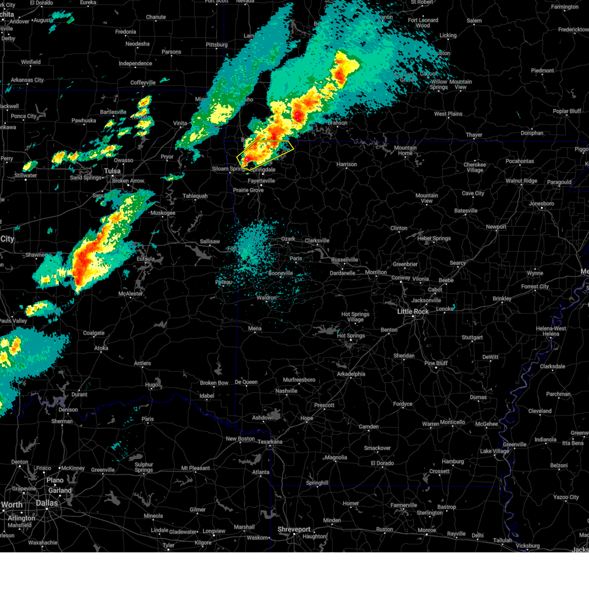 At 1016 pm cdt, a severe thunderstorm was located over highfill, moving northeast at 45 mph (radar indicated). Hazards include 60 mph wind gusts and quarter size hail. Hail damage to vehicles is expected. expect wind damage to roofs, siding, and trees. Locations in or near the path include, rogers, hill top, northwest arkansas regional air, highfill, walnut hill, vaughn, decatur, pea ridge, cave springs, bentonville, healing springs, avoca, miller, gateway, bella vista, centerton, rocky comfort, busch, lowell, eureka springs, this includes interstate 49 between mile markers 80 and 93. At 1016 pm cdt, a severe thunderstorm was located over highfill, moving northeast at 45 mph (radar indicated). Hazards include 60 mph wind gusts and quarter size hail. Hail damage to vehicles is expected. expect wind damage to roofs, siding, and trees. Locations in or near the path include, rogers, hill top, northwest arkansas regional air, highfill, walnut hill, vaughn, decatur, pea ridge, cave springs, bentonville, healing springs, avoca, miller, gateway, bella vista, centerton, rocky comfort, busch, lowell, eureka springs, this includes interstate 49 between mile markers 80 and 93.
|
| 4/18/2025 10:04 PM CDT |
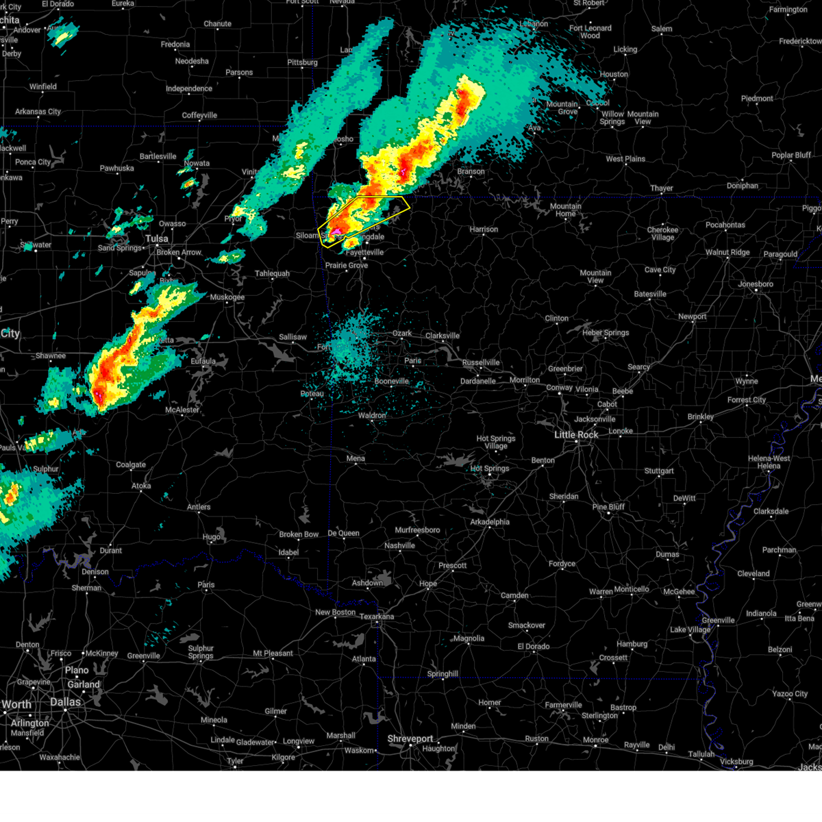 Svrtsa the national weather service in tulsa has issued a * severe thunderstorm warning for, central benton county in northwestern arkansas, northwestern carroll county in northwestern arkansas, * until 1100 pm cdt. * at 1003 pm cdt, a severe thunderstorm was located 4 miles south of springtown, moving northeast at 45 mph (trained weather spotters reported 75 mph wind gusts and ping pong ball size hail near siloam springs). Hazards include 70 mph wind gusts and ping pong ball size hail. People and animals outdoors will be injured. expect hail damage to roofs, siding, windows, and vehicles. expect considerable tree damage. wind damage is also likely to mobile homes, roofs, and outbuildings. Locations in or near the path include, rogers, northwest arkansas regional air, decatur, pea ridge, cave springs, bentonville, avoca, gallitin, gateway, centerton, rocky comfort, busch, gentry, hill top, fairmount, highfill, walnut hill, vaughn, siloam springs, healing springs, this includes interstate 49 between mile markers 80 and 93. Svrtsa the national weather service in tulsa has issued a * severe thunderstorm warning for, central benton county in northwestern arkansas, northwestern carroll county in northwestern arkansas, * until 1100 pm cdt. * at 1003 pm cdt, a severe thunderstorm was located 4 miles south of springtown, moving northeast at 45 mph (trained weather spotters reported 75 mph wind gusts and ping pong ball size hail near siloam springs). Hazards include 70 mph wind gusts and ping pong ball size hail. People and animals outdoors will be injured. expect hail damage to roofs, siding, windows, and vehicles. expect considerable tree damage. wind damage is also likely to mobile homes, roofs, and outbuildings. Locations in or near the path include, rogers, northwest arkansas regional air, decatur, pea ridge, cave springs, bentonville, avoca, gallitin, gateway, centerton, rocky comfort, busch, gentry, hill top, fairmount, highfill, walnut hill, vaughn, siloam springs, healing springs, this includes interstate 49 between mile markers 80 and 93.
|
| 4/18/2025 9:46 PM CDT |
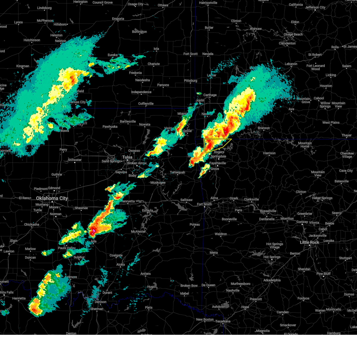 At 946 pm cdt, severe thunderstorms were located along a line extending from 4 miles northeast of gravette to 2 miles southeast of hiwasse to 2 miles northwest of highfill, moving northeast at 60 mph (radar indicated). Hazards include 60 mph wind gusts and nickel size hail. Expect damage to roofs, siding, and trees. Locations in or near the path include, hiwasse, pea ridge, bentonville, avoca, miller, hill top, gateway, bella vista, centerton, vaughn, highfill, rogers, this includes interstate 49 between mile markers 85 and 93. At 946 pm cdt, severe thunderstorms were located along a line extending from 4 miles northeast of gravette to 2 miles southeast of hiwasse to 2 miles northwest of highfill, moving northeast at 60 mph (radar indicated). Hazards include 60 mph wind gusts and nickel size hail. Expect damage to roofs, siding, and trees. Locations in or near the path include, hiwasse, pea ridge, bentonville, avoca, miller, hill top, gateway, bella vista, centerton, vaughn, highfill, rogers, this includes interstate 49 between mile markers 85 and 93.
|
| 4/18/2025 9:39 PM CDT |
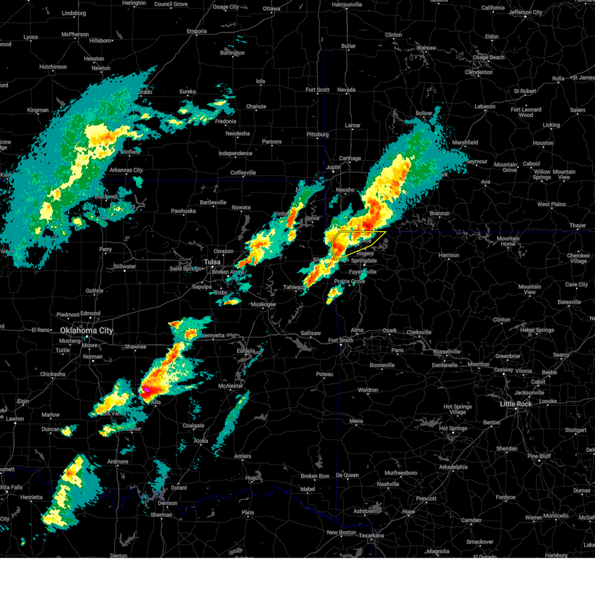 Svrtsa the national weather service in tulsa has issued a * severe thunderstorm warning for, northern benton county in northwestern arkansas, * until 1030 pm cdt. * at 938 pm cdt, severe thunderstorms were located along a line extending from 2 miles west of gravette to 3 miles east of decatur to near gentry, moving northeast at 50 mph (radar indicated). Hazards include 60 mph wind gusts and penny size hail. Expect damage to roofs, siding, and trees. Locations in or near the path include, gentry, hill top, northwest arkansas regional air, highfill, vaughn, gravette, decatur, hiwasse, pea ridge, bentonville, avoca, springtown, miller, gateway, bella vista, centerton, rogers, this includes interstate 49 between mile markers 84 and 93. Svrtsa the national weather service in tulsa has issued a * severe thunderstorm warning for, northern benton county in northwestern arkansas, * until 1030 pm cdt. * at 938 pm cdt, severe thunderstorms were located along a line extending from 2 miles west of gravette to 3 miles east of decatur to near gentry, moving northeast at 50 mph (radar indicated). Hazards include 60 mph wind gusts and penny size hail. Expect damage to roofs, siding, and trees. Locations in or near the path include, gentry, hill top, northwest arkansas regional air, highfill, vaughn, gravette, decatur, hiwasse, pea ridge, bentonville, avoca, springtown, miller, gateway, bella vista, centerton, rogers, this includes interstate 49 between mile markers 84 and 93.
|
| 4/18/2025 9:23 PM CDT |
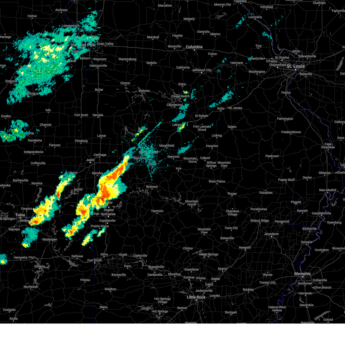 At 922 pm cdt, a severe thunderstorm was located over bella vista, moving northeast at 30 mph (radar indicated). Hazards include 60 mph wind gusts. Expect damage to roofs, siding, and trees. Locations in or near the path include, bella vista, hiwasse, centerton, miller, bentonville, this includes interstate 49 between mile markers 88 and 93. At 922 pm cdt, a severe thunderstorm was located over bella vista, moving northeast at 30 mph (radar indicated). Hazards include 60 mph wind gusts. Expect damage to roofs, siding, and trees. Locations in or near the path include, bella vista, hiwasse, centerton, miller, bentonville, this includes interstate 49 between mile markers 88 and 93.
|
| 4/18/2025 9:21 PM CDT |
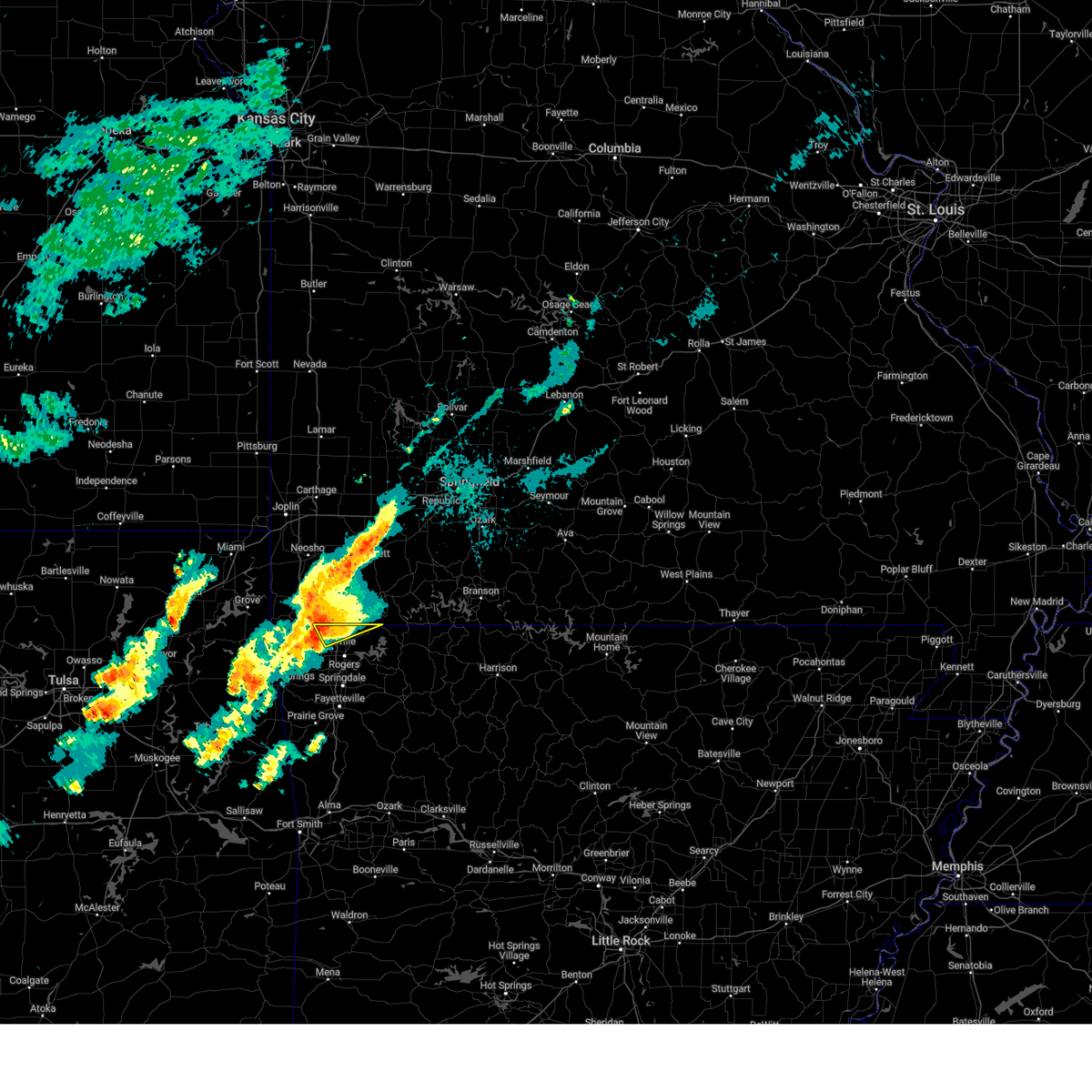 Svrtsa the national weather service in tulsa has issued a * severe thunderstorm warning for, north central benton county in northwestern arkansas, * until 1000 pm cdt. * at 921 pm cdt, a severe thunderstorm was located over bella vista, moving northeast at 40 mph (radar indicated). Hazards include 60 mph wind gusts and quarter size hail. Hail damage to vehicles is expected. expect wind damage to roofs, siding, and trees. Locations in or near the path include, bella vista, pea ridge, miller, gateway, bentonville, this includes interstate 49 between mile markers 90 and 93. Svrtsa the national weather service in tulsa has issued a * severe thunderstorm warning for, north central benton county in northwestern arkansas, * until 1000 pm cdt. * at 921 pm cdt, a severe thunderstorm was located over bella vista, moving northeast at 40 mph (radar indicated). Hazards include 60 mph wind gusts and quarter size hail. Hail damage to vehicles is expected. expect wind damage to roofs, siding, and trees. Locations in or near the path include, bella vista, pea ridge, miller, gateway, bentonville, this includes interstate 49 between mile markers 90 and 93.
|
| 4/18/2025 9:11 PM CDT |
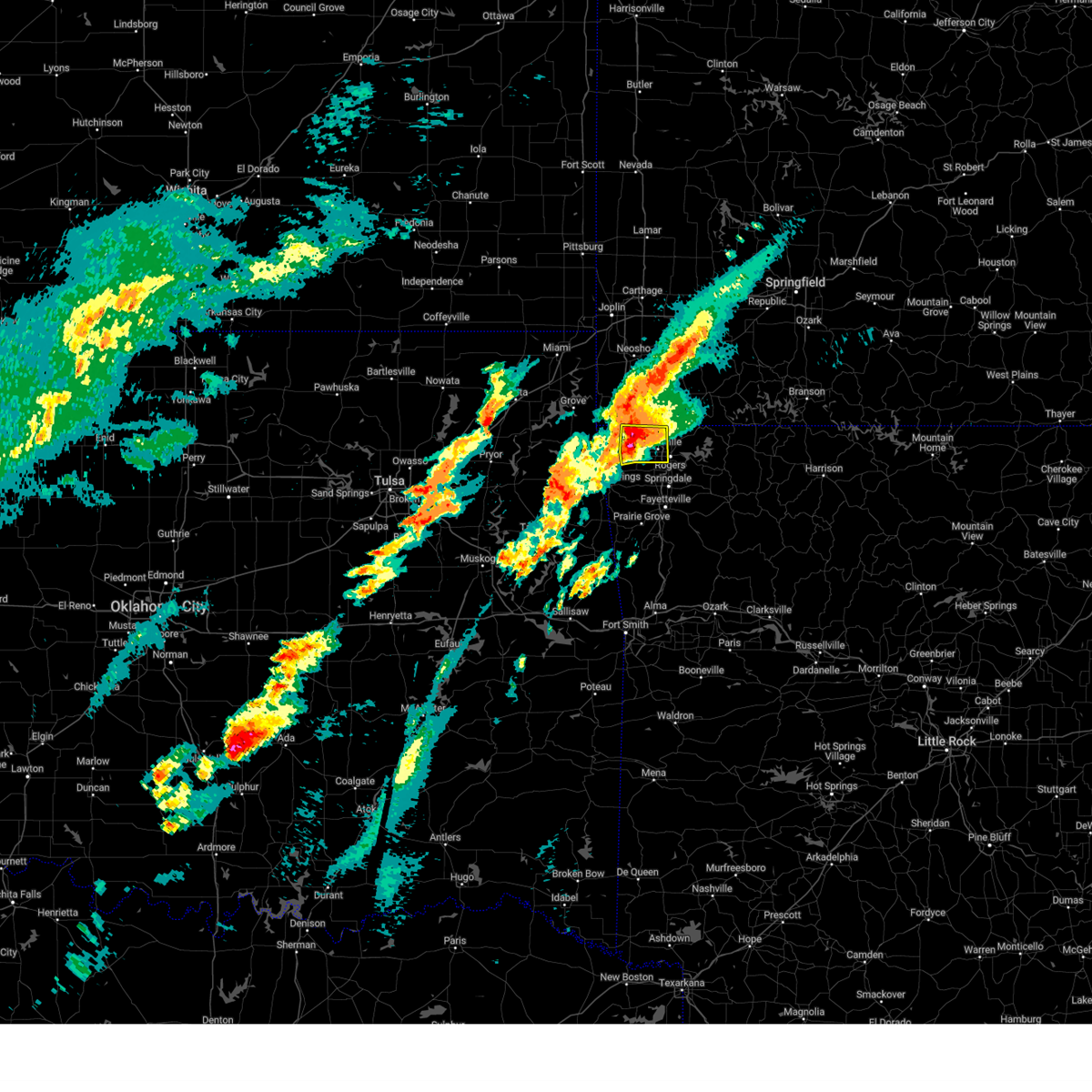 At 910 pm cdt, severe thunderstorms were located along a line extending from 4 miles south of pineville to 3 miles northwest of highfill, moving northeast at 45 mph (radar indicated). Hazards include 70 mph wind gusts and quarter size hail. Hail damage to vehicles is expected. expect considerable tree damage. wind damage is also likely to mobile homes, roofs, and outbuildings. Locations in or near the path include, hiwasse, bentonville, rogers, miller, bella vista, centerton, vaughn, gravette, decatur, highfill, this includes interstate 49 between mile markers 83 and 93. At 910 pm cdt, severe thunderstorms were located along a line extending from 4 miles south of pineville to 3 miles northwest of highfill, moving northeast at 45 mph (radar indicated). Hazards include 70 mph wind gusts and quarter size hail. Hail damage to vehicles is expected. expect considerable tree damage. wind damage is also likely to mobile homes, roofs, and outbuildings. Locations in or near the path include, hiwasse, bentonville, rogers, miller, bella vista, centerton, vaughn, gravette, decatur, highfill, this includes interstate 49 between mile markers 83 and 93.
|
| 4/18/2025 9:01 PM CDT |
 the severe thunderstorm warning has been cancelled and is no longer in effect the severe thunderstorm warning has been cancelled and is no longer in effect
|
| 4/18/2025 9:01 PM CDT |
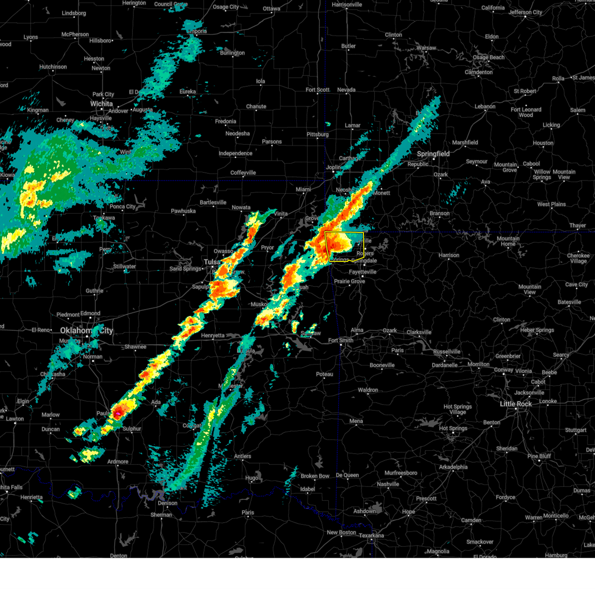 At 901 pm cdt, severe thunderstorms were located along a line extending from 3 miles southwest of noel to near gentry, moving northeast at 40 mph (radar indicated). Hazards include 70 mph wind gusts and half dollar size hail. Hail damage to vehicles is expected. expect considerable tree damage. wind damage is also likely to mobile homes, roofs, and outbuildings. Locations in or near the path include, gentry, maysville, rogers, fairmount, northwest arkansas regional air, highfill, vaughn, gravette, decatur, hiwasse, cave springs, bentonville, healing springs, springtown, miller, bella vista, centerton, rocky comfort, cherokee city, lowell, this includes interstate 49 between mile markers 78 and 93. At 901 pm cdt, severe thunderstorms were located along a line extending from 3 miles southwest of noel to near gentry, moving northeast at 40 mph (radar indicated). Hazards include 70 mph wind gusts and half dollar size hail. Hail damage to vehicles is expected. expect considerable tree damage. wind damage is also likely to mobile homes, roofs, and outbuildings. Locations in or near the path include, gentry, maysville, rogers, fairmount, northwest arkansas regional air, highfill, vaughn, gravette, decatur, hiwasse, cave springs, bentonville, healing springs, springtown, miller, bella vista, centerton, rocky comfort, cherokee city, lowell, this includes interstate 49 between mile markers 78 and 93.
|
| 4/18/2025 8:39 PM CDT |
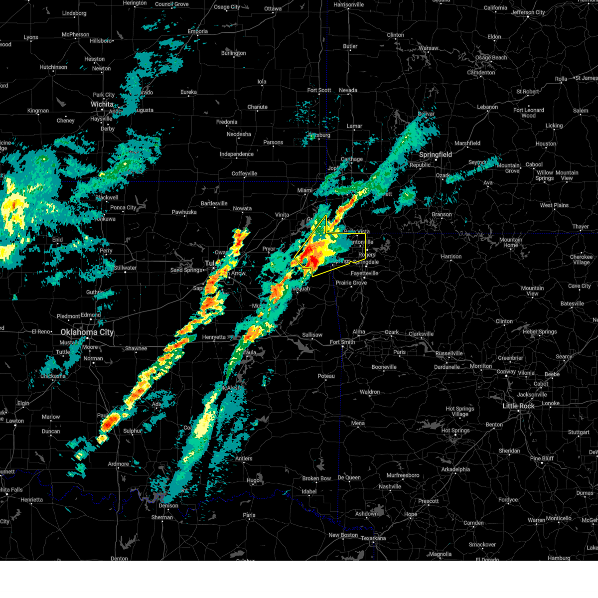 Svrtsa the national weather service in tulsa has issued a * severe thunderstorm warning for, western benton county in northwestern arkansas, delaware county in northeastern oklahoma, northwestern adair county in northeastern oklahoma, * until 945 pm cdt. * at 838 pm cdt, severe thunderstorms were located along a line extending from 4 miles north of leach to 3 miles southeast of twin oaks, moving northeast at 40 mph (radar indicated). Hazards include 60 mph wind gusts and half dollar size hail. Hail damage to vehicles is expected. expect wind damage to roofs, siding, and trees. Locations in or near the path include, jay, rogers, northwest arkansas regional air, lake eucha state park, gravette, decatur, hiwasse, cave springs, bentonville, leach, gallitin, twin oaks, centerton, rocky comfort, natural falls state park, gentry, maysville, fairmount, highfill, kansas, this includes interstate 49 between mile markers 78 and 93. Svrtsa the national weather service in tulsa has issued a * severe thunderstorm warning for, western benton county in northwestern arkansas, delaware county in northeastern oklahoma, northwestern adair county in northeastern oklahoma, * until 945 pm cdt. * at 838 pm cdt, severe thunderstorms were located along a line extending from 4 miles north of leach to 3 miles southeast of twin oaks, moving northeast at 40 mph (radar indicated). Hazards include 60 mph wind gusts and half dollar size hail. Hail damage to vehicles is expected. expect wind damage to roofs, siding, and trees. Locations in or near the path include, jay, rogers, northwest arkansas regional air, lake eucha state park, gravette, decatur, hiwasse, cave springs, bentonville, leach, gallitin, twin oaks, centerton, rocky comfort, natural falls state park, gentry, maysville, fairmount, highfill, kansas, this includes interstate 49 between mile markers 78 and 93.
|
| 4/4/2025 6:35 PM CDT |
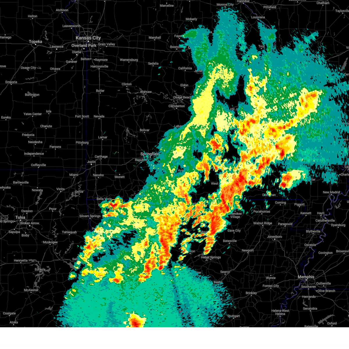 The storm which prompted the warning has moved out of the area. therefore, the warning will be allowed to expire. The storm which prompted the warning has moved out of the area. therefore, the warning will be allowed to expire.
|
| 4/4/2025 6:26 PM CDT |
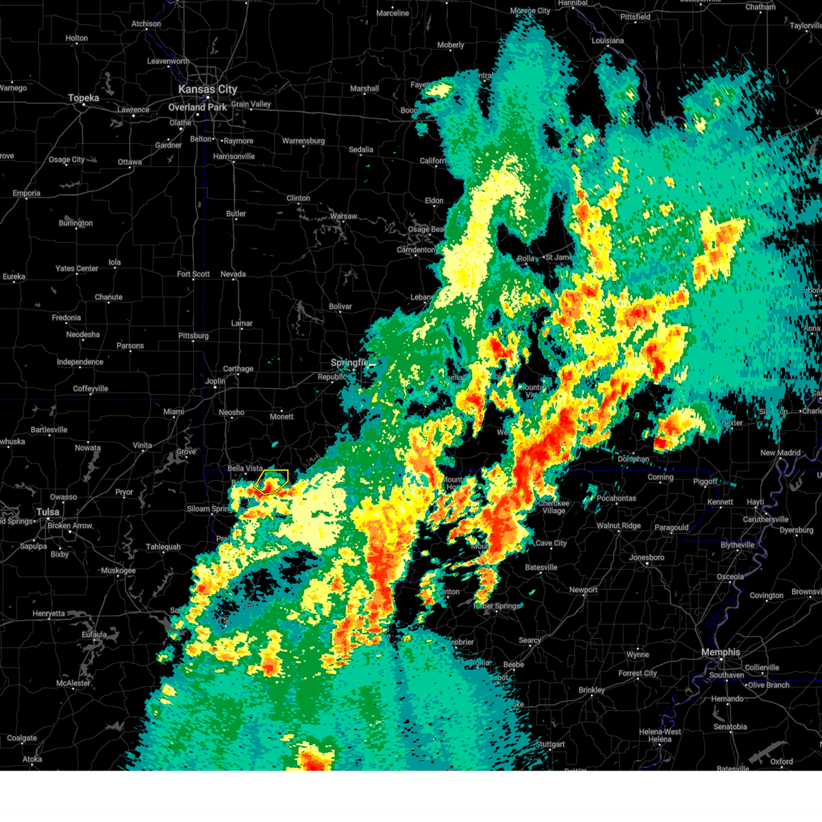 At 626 pm cdt, a severe thunderstorm was located near garfield, moving northeast at 60 mph (radar indicated). Hazards include quarter size hail. Damage to vehicles is expected. Locations in or near the path include, avoca, hill top, gateway, walnut hill, pea ridge, rogers, bentonville,. At 626 pm cdt, a severe thunderstorm was located near garfield, moving northeast at 60 mph (radar indicated). Hazards include quarter size hail. Damage to vehicles is expected. Locations in or near the path include, avoca, hill top, gateway, walnut hill, pea ridge, rogers, bentonville,.
|
| 4/4/2025 6:20 PM CDT |
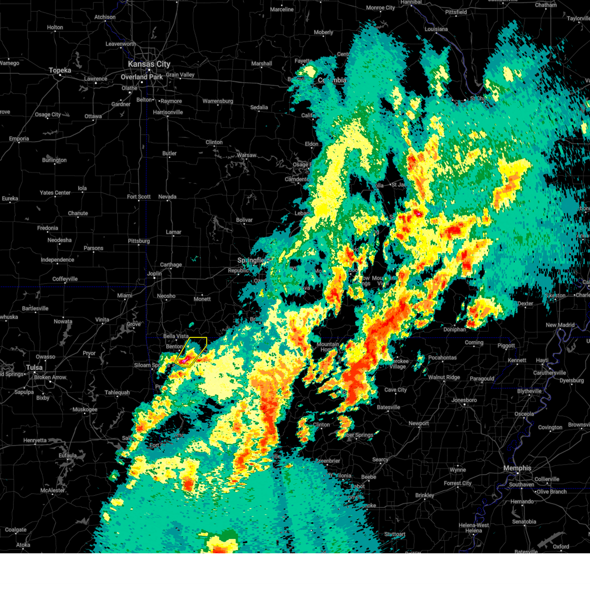 At 619 pm cdt, a severe thunderstorm was located 3 miles northeast of rogers, moving northeast at 60 mph (radar indicated. at 6:17 pm, nickel size hail was reported in rogers). Hazards include 60 mph wind gusts and quarter size hail. Hail damage to vehicles is expected. expect wind damage to roofs, siding, and trees. Locations in or near the path include, cave springs, avoca, lowell, rogers, hill top, gateway, walnut hill, monte ne, pea ridge, bentonville, springdale, this includes interstate 49 between mile markers 75 and 87. At 619 pm cdt, a severe thunderstorm was located 3 miles northeast of rogers, moving northeast at 60 mph (radar indicated. at 6:17 pm, nickel size hail was reported in rogers). Hazards include 60 mph wind gusts and quarter size hail. Hail damage to vehicles is expected. expect wind damage to roofs, siding, and trees. Locations in or near the path include, cave springs, avoca, lowell, rogers, hill top, gateway, walnut hill, monte ne, pea ridge, bentonville, springdale, this includes interstate 49 between mile markers 75 and 87.
|
| 4/4/2025 6:15 PM CDT |
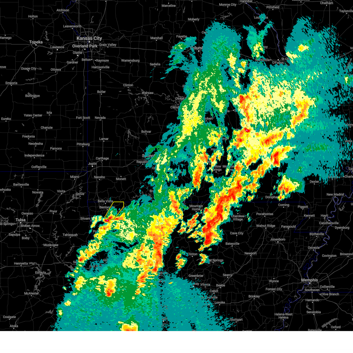 Svrtsa the national weather service in tulsa has issued a * severe thunderstorm warning for, northeastern benton county in northwestern arkansas, * until 645 pm cdt. * at 614 pm cdt, a severe thunderstorm was located over lowell, moving northeast at 60 mph (radar indicated). Hazards include 60 mph wind gusts and quarter size hail. Hail damage to vehicles is expected. expect wind damage to roofs, siding, and trees. Locations in or near the path include, cave springs, avoca, lowell, rogers, hill top, gateway, walnut hill, monte ne, pea ridge, bentonville, springdale, this includes interstate 49 between mile markers 75 and 87. Svrtsa the national weather service in tulsa has issued a * severe thunderstorm warning for, northeastern benton county in northwestern arkansas, * until 645 pm cdt. * at 614 pm cdt, a severe thunderstorm was located over lowell, moving northeast at 60 mph (radar indicated). Hazards include 60 mph wind gusts and quarter size hail. Hail damage to vehicles is expected. expect wind damage to roofs, siding, and trees. Locations in or near the path include, cave springs, avoca, lowell, rogers, hill top, gateway, walnut hill, monte ne, pea ridge, bentonville, springdale, this includes interstate 49 between mile markers 75 and 87.
|
| 4/2/2025 10:48 AM CDT |
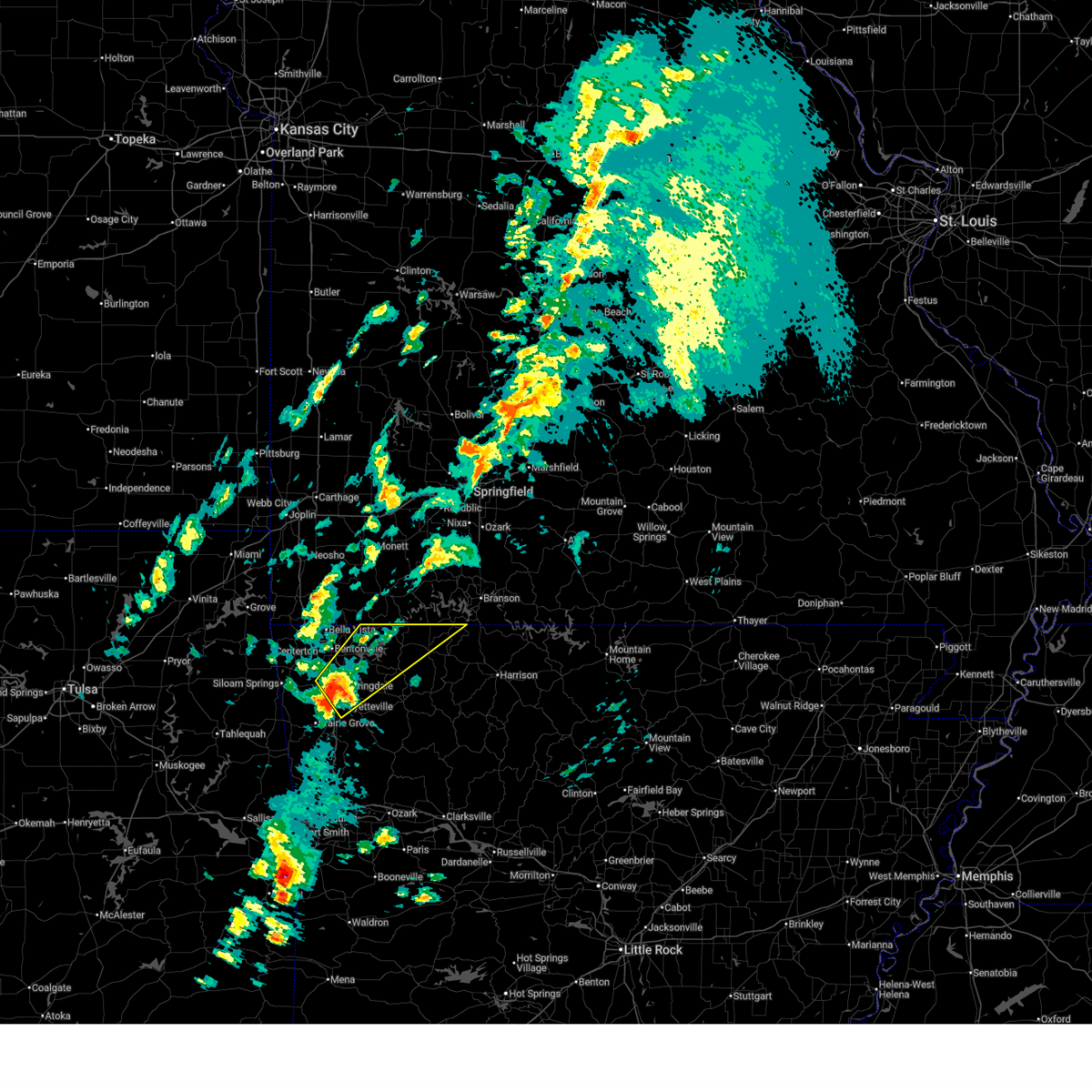 Svrtsa the national weather service in tulsa has issued a * severe thunderstorm warning for, northeastern benton county in northwestern arkansas, northwestern madison county in northwestern arkansas, northwestern carroll county in northwestern arkansas, northeastern washington county in northwestern arkansas, * until 1130 am cdt. * at 1048 am cdt, a severe thunderstorm was located 4 miles east of springdale, moving northeast at 60 mph (radar indicated). Hazards include 60 mph wind gusts and quarter size hail. Hail damage to vehicles is expected. expect wind damage to roofs, siding, and trees. Locations in or near the path include, rogers, beaver lake, tontitown, larue, cave springs, avoca, pleasant ridge, gateway, hobbs state park, beaver, best, clifty, oak hill, busch, sonora, eureka springs, springdale, fayetteville, war eagle, johnson, this includes interstate 49 between mile markers 62 and 84. Svrtsa the national weather service in tulsa has issued a * severe thunderstorm warning for, northeastern benton county in northwestern arkansas, northwestern madison county in northwestern arkansas, northwestern carroll county in northwestern arkansas, northeastern washington county in northwestern arkansas, * until 1130 am cdt. * at 1048 am cdt, a severe thunderstorm was located 4 miles east of springdale, moving northeast at 60 mph (radar indicated). Hazards include 60 mph wind gusts and quarter size hail. Hail damage to vehicles is expected. expect wind damage to roofs, siding, and trees. Locations in or near the path include, rogers, beaver lake, tontitown, larue, cave springs, avoca, pleasant ridge, gateway, hobbs state park, beaver, best, clifty, oak hill, busch, sonora, eureka springs, springdale, fayetteville, war eagle, johnson, this includes interstate 49 between mile markers 62 and 84.
|
| 4/2/2025 9:06 AM CDT |
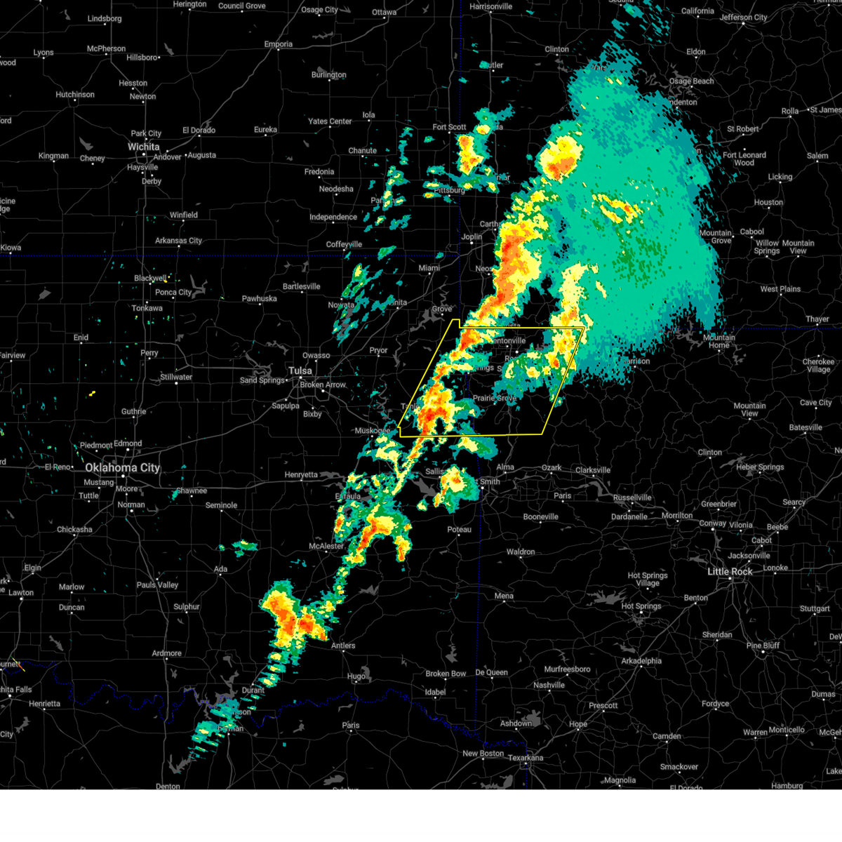 The storms which prompted the warning have weakened below severe limits, and no longer pose an immediate threat to life or property. therefore, the warning will be allowed to expire. however, gusty winds are still possible with these thunderstorms. a tornado watch remains in effect until noon cdt for northwestern and west central arkansas, and northeastern and east central oklahoma. The storms which prompted the warning have weakened below severe limits, and no longer pose an immediate threat to life or property. therefore, the warning will be allowed to expire. however, gusty winds are still possible with these thunderstorms. a tornado watch remains in effect until noon cdt for northwestern and west central arkansas, and northeastern and east central oklahoma.
|
| 4/2/2025 8:35 AM CDT |
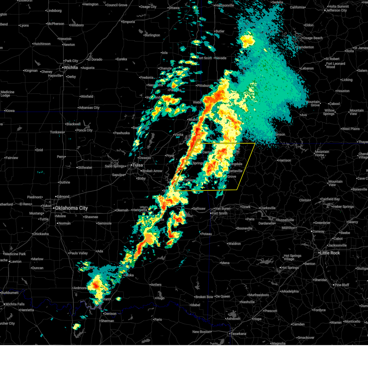 Svrtsa the national weather service in tulsa has issued a * severe thunderstorm warning for, benton county in northwestern arkansas, western madison county in northwestern arkansas, northwestern carroll county in northwestern arkansas, washington county in northwestern arkansas, eastern delaware county in northeastern oklahoma, adair county in northeastern oklahoma, eastern cherokee county in east central oklahoma, * until 915 am cdt. * at 835 am cdt, severe thunderstorms were located along a line extending from 3 miles northeast of pea ridge to 5 miles southeast of stilwell, moving northeast at 50 mph (radar indicated). Hazards include 60 mph wind gusts and nickel size hail. Expect damage to roofs, siding, and trees. Locations in or near the path include, adair state park, elkins, cincinnati, savoy, forum, cave springs, winslow, pleasant ridge, scraper, odell, hobbs state park, best, lincoln, clifty, busch, georgetown, tahlequah, war eagle, devils den state park, highfill, this includes interstate 49 between mile markers 41 and 93. Svrtsa the national weather service in tulsa has issued a * severe thunderstorm warning for, benton county in northwestern arkansas, western madison county in northwestern arkansas, northwestern carroll county in northwestern arkansas, washington county in northwestern arkansas, eastern delaware county in northeastern oklahoma, adair county in northeastern oklahoma, eastern cherokee county in east central oklahoma, * until 915 am cdt. * at 835 am cdt, severe thunderstorms were located along a line extending from 3 miles northeast of pea ridge to 5 miles southeast of stilwell, moving northeast at 50 mph (radar indicated). Hazards include 60 mph wind gusts and nickel size hail. Expect damage to roofs, siding, and trees. Locations in or near the path include, adair state park, elkins, cincinnati, savoy, forum, cave springs, winslow, pleasant ridge, scraper, odell, hobbs state park, best, lincoln, clifty, busch, georgetown, tahlequah, war eagle, devils den state park, highfill, this includes interstate 49 between mile markers 41 and 93.
|
| 4/2/2025 8:25 AM CDT |
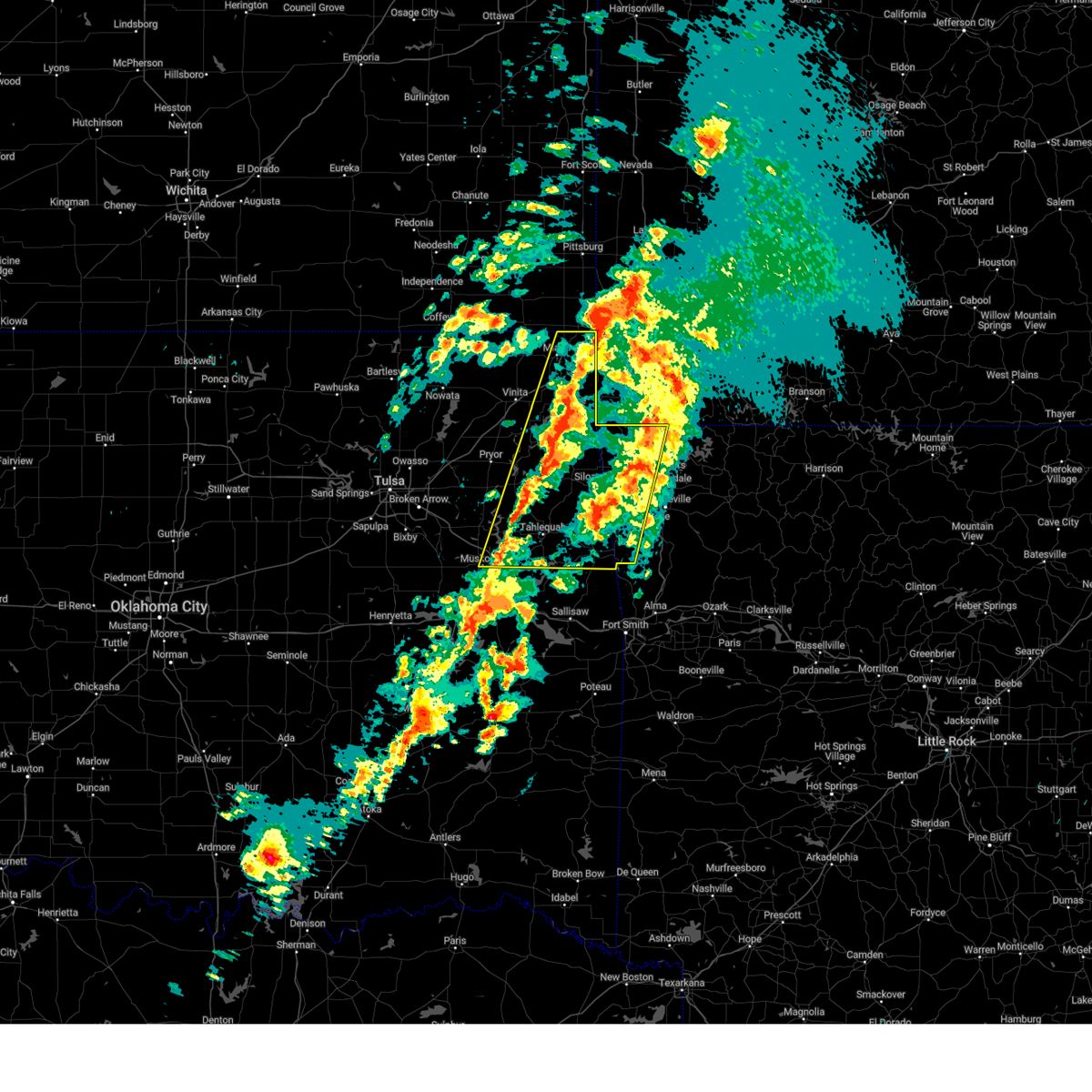 At 825 am cdt, severe thunderstorms were located along a line extending from 9 miles north of pea ridge to 2 miles north of maryetta, moving northeast at 65 mph (radar indicated). Hazards include 60 mph wind gusts and nickel size hail. Expect damage to roofs, siding, and trees. locations in or near the path include, adair state park, jay, honey creek state park, commerce, cincinnati, savoy, fort gibson, disney little blue state park, okay, cave springs, picher, leach, zena, cleora, chloeta, scraper, odell, ottawa, lincoln, tahlequah, this includes the following highways, interstate 44 between mile markers 293 and 324. Interstate 49 between mile markers 88 and 93. At 825 am cdt, severe thunderstorms were located along a line extending from 9 miles north of pea ridge to 2 miles north of maryetta, moving northeast at 65 mph (radar indicated). Hazards include 60 mph wind gusts and nickel size hail. Expect damage to roofs, siding, and trees. locations in or near the path include, adair state park, jay, honey creek state park, commerce, cincinnati, savoy, fort gibson, disney little blue state park, okay, cave springs, picher, leach, zena, cleora, chloeta, scraper, odell, ottawa, lincoln, tahlequah, this includes the following highways, interstate 44 between mile markers 293 and 324. Interstate 49 between mile markers 88 and 93.
|
| 4/2/2025 7:58 AM CDT |
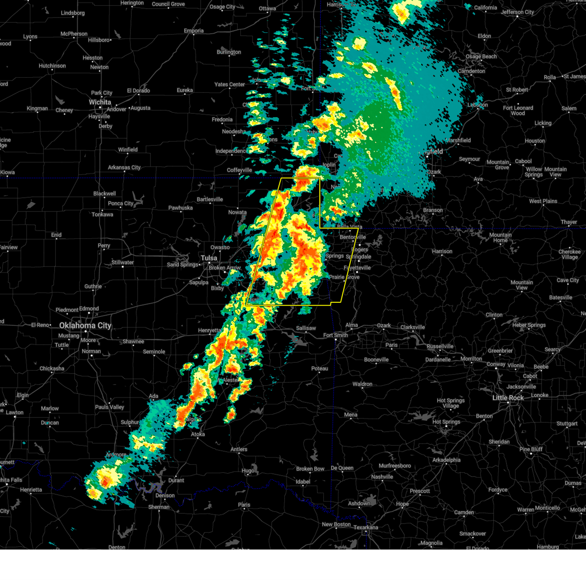 Svrtsa the national weather service in tulsa has issued a * severe thunderstorm warning for, benton county in northwestern arkansas, western washington county in northwestern arkansas, eastern craig county in northeastern oklahoma, delaware county in northeastern oklahoma, ottawa county in northeastern oklahoma, mayes county in northeastern oklahoma, adair county in northeastern oklahoma, eastern wagoner county in northeastern oklahoma, cherokee county in east central oklahoma, northeastern muskogee county in east central oklahoma, * until 845 am cdt. * at 758 am cdt, severe thunderstorms were located along a line extending from 6 miles northeast of grove to 5 miles east of pumpkin center, moving east at 55 mph (radar indicated). Hazards include 60 mph wind gusts and nickel size hail. Expect damage to roofs, siding, and trees. locations in or near the path include, adair state park, jay, vinita, honey creek state park, commerce, cincinnati, savoy, fort gibson, disney little blue state park, okay, cave springs, picher, strang, leach, zena, cleora, chloeta, scraper, odell, ottawa, this includes the following highways, interstate 44 between mile markers 274 and 324. Interstate 49 between mile markers 88 and 93. Svrtsa the national weather service in tulsa has issued a * severe thunderstorm warning for, benton county in northwestern arkansas, western washington county in northwestern arkansas, eastern craig county in northeastern oklahoma, delaware county in northeastern oklahoma, ottawa county in northeastern oklahoma, mayes county in northeastern oklahoma, adair county in northeastern oklahoma, eastern wagoner county in northeastern oklahoma, cherokee county in east central oklahoma, northeastern muskogee county in east central oklahoma, * until 845 am cdt. * at 758 am cdt, severe thunderstorms were located along a line extending from 6 miles northeast of grove to 5 miles east of pumpkin center, moving east at 55 mph (radar indicated). Hazards include 60 mph wind gusts and nickel size hail. Expect damage to roofs, siding, and trees. locations in or near the path include, adair state park, jay, vinita, honey creek state park, commerce, cincinnati, savoy, fort gibson, disney little blue state park, okay, cave springs, picher, strang, leach, zena, cleora, chloeta, scraper, odell, ottawa, this includes the following highways, interstate 44 between mile markers 274 and 324. Interstate 49 between mile markers 88 and 93.
|
| 3/30/2025 3:08 AM CDT |
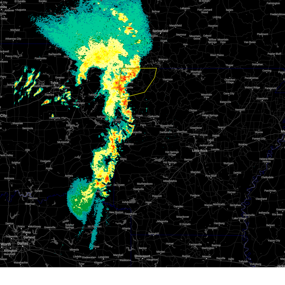 At 308 am cdt, severe thunderstorms were located along a line extending from 8 miles east of cassville to 4 miles southwest of eureka springs to 5 miles east of lowell to 2 miles west of elkins, moving northeast at 50 mph (radar indicated). Hazards include 60 mph wind gusts. Expect damage to roofs, siding, and trees. Locations in or near the path include, wesley, northwest arkansas regional air, beaver lake, metalton, elkins, savoy, tontitown, forum, larue, pea ridge, cave springs, pleasant ridge, hobbs state park, best, clifty, busch, georgetown, rockhouse, withrow springs state park, war eagle, this includes interstate 49 between mile markers 52 and 93. At 308 am cdt, severe thunderstorms were located along a line extending from 8 miles east of cassville to 4 miles southwest of eureka springs to 5 miles east of lowell to 2 miles west of elkins, moving northeast at 50 mph (radar indicated). Hazards include 60 mph wind gusts. Expect damage to roofs, siding, and trees. Locations in or near the path include, wesley, northwest arkansas regional air, beaver lake, metalton, elkins, savoy, tontitown, forum, larue, pea ridge, cave springs, pleasant ridge, hobbs state park, best, clifty, busch, georgetown, rockhouse, withrow springs state park, war eagle, this includes interstate 49 between mile markers 52 and 93.
|
| 3/30/2025 2:41 AM CDT |
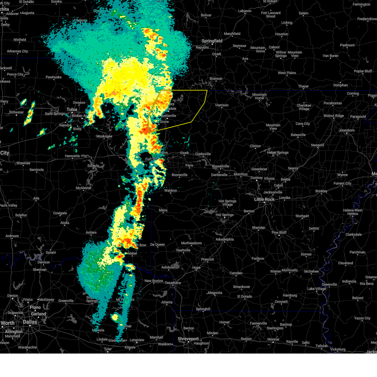 Svrtsa the national weather service in tulsa has issued a * severe thunderstorm warning for, benton county in northwestern arkansas, northwestern madison county in northwestern arkansas, carroll county in northwestern arkansas, washington county in northwestern arkansas, * until 330 am cdt. * at 240 am cdt, severe thunderstorms were located along a line extending from 5 miles northeast of pea ridge to 2 miles north of springdale to 7 miles northeast of cincinnati to 5 miles south of lincoln, moving northeast at 50 mph (radar indicated). Hazards include 60 mph wind gusts. Expect damage to roofs, siding, and trees. Locations in or near the path include, wesley, northwest arkansas regional air, beaver lake, metalton, elkins, cincinnati, savoy, tontitown, forum, larue, pea ridge, cave springs, wedington, pleasant ridge, gallitin, hobbs state park, best, lincoln, clifty, busch, this includes interstate 49 between mile markers 52 and 93. Svrtsa the national weather service in tulsa has issued a * severe thunderstorm warning for, benton county in northwestern arkansas, northwestern madison county in northwestern arkansas, carroll county in northwestern arkansas, washington county in northwestern arkansas, * until 330 am cdt. * at 240 am cdt, severe thunderstorms were located along a line extending from 5 miles northeast of pea ridge to 2 miles north of springdale to 7 miles northeast of cincinnati to 5 miles south of lincoln, moving northeast at 50 mph (radar indicated). Hazards include 60 mph wind gusts. Expect damage to roofs, siding, and trees. Locations in or near the path include, wesley, northwest arkansas regional air, beaver lake, metalton, elkins, cincinnati, savoy, tontitown, forum, larue, pea ridge, cave springs, wedington, pleasant ridge, gallitin, hobbs state park, best, lincoln, clifty, busch, this includes interstate 49 between mile markers 52 and 93.
|
| 3/30/2025 2:03 AM CDT |
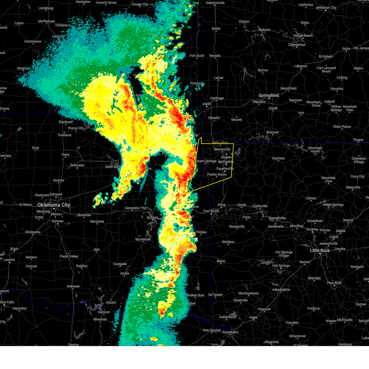 Svrtsa the national weather service in tulsa has issued a * severe thunderstorm warning for, benton county in northwestern arkansas, central washington county in northwestern arkansas, eastern delaware county in northeastern oklahoma, adair county in northeastern oklahoma, southeastern cherokee county in east central oklahoma, * until 245 am cdt. * at 203 am cdt, severe thunderstorms were located along a line extending from 2 miles north of south west city to 7 miles west of watts to 6 miles east of scraper to 6 miles northeast of cherokee landing state park, moving northeast at 60 mph (radar indicated). Hazards include 60 mph wind gusts. Expect damage to roofs, siding, and trees. Locations in or near the path include, adair state park, northwest arkansas regional air, cincinnati, savoy, tontitown, maryetta, pea ridge, cave springs, wedington, gallitin, stilwell, lincoln, highfill, vaughn, monte ne, drake field airport, siloam springs, colcord, healing springs, springtown, this includes interstate 49 between mile markers 53 and 93. Svrtsa the national weather service in tulsa has issued a * severe thunderstorm warning for, benton county in northwestern arkansas, central washington county in northwestern arkansas, eastern delaware county in northeastern oklahoma, adair county in northeastern oklahoma, southeastern cherokee county in east central oklahoma, * until 245 am cdt. * at 203 am cdt, severe thunderstorms were located along a line extending from 2 miles north of south west city to 7 miles west of watts to 6 miles east of scraper to 6 miles northeast of cherokee landing state park, moving northeast at 60 mph (radar indicated). Hazards include 60 mph wind gusts. Expect damage to roofs, siding, and trees. Locations in or near the path include, adair state park, northwest arkansas regional air, cincinnati, savoy, tontitown, maryetta, pea ridge, cave springs, wedington, gallitin, stilwell, lincoln, highfill, vaughn, monte ne, drake field airport, siloam springs, colcord, healing springs, springtown, this includes interstate 49 between mile markers 53 and 93.
|
| 3/14/2025 5:36 PM CDT |
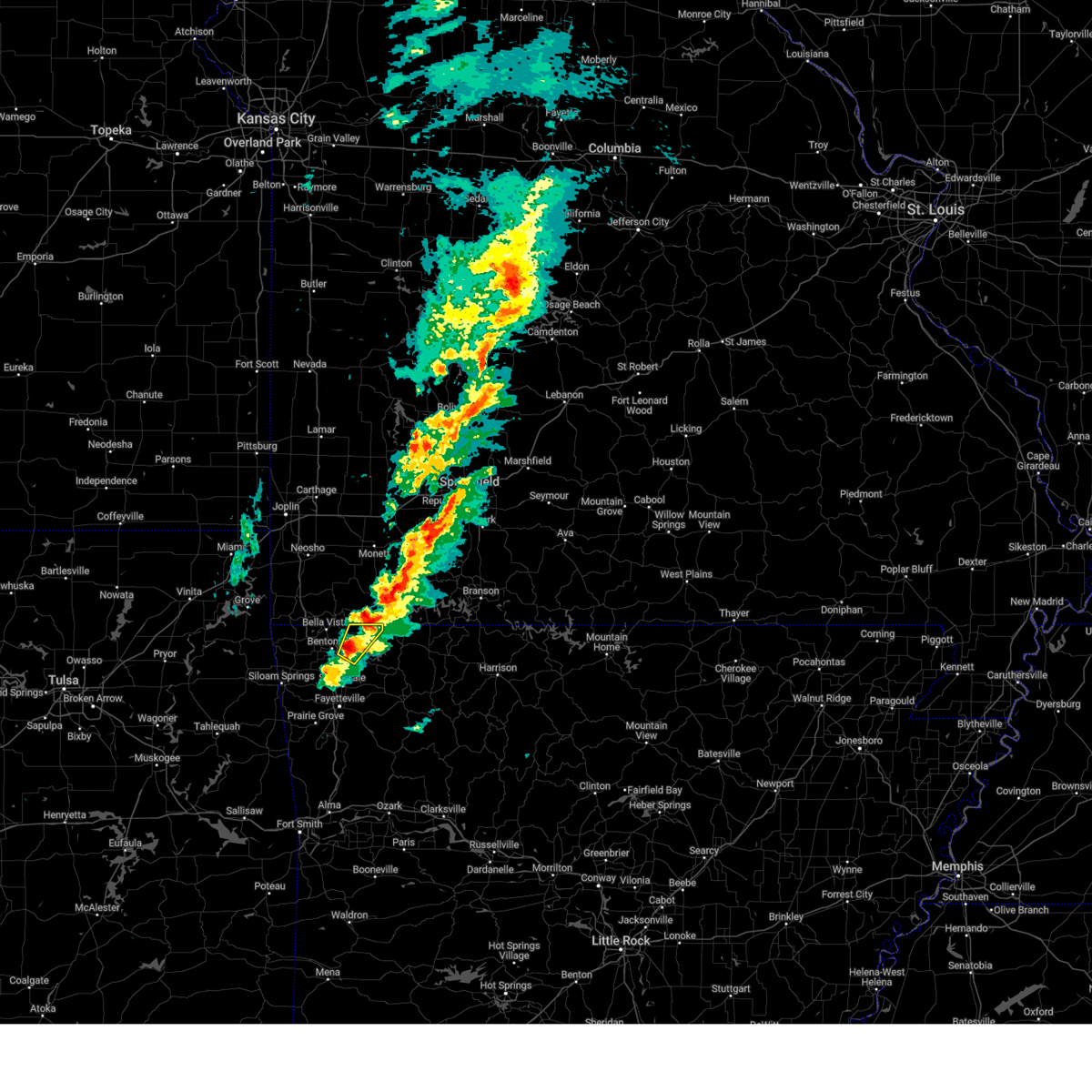 At 535 pm cdt, a severe thunderstorm was located 4 miles southwest of garfield, moving northeast at 90 mph (radar indicated). Hazards include 60 mph wind gusts and quarter size hail. Hail damage to vehicles is expected. expect wind damage to roofs, siding, and trees. Locations in or near the path include, avoca, walnut hill, hill top, gateway, pea ridge, rogers,. At 535 pm cdt, a severe thunderstorm was located 4 miles southwest of garfield, moving northeast at 90 mph (radar indicated). Hazards include 60 mph wind gusts and quarter size hail. Hail damage to vehicles is expected. expect wind damage to roofs, siding, and trees. Locations in or near the path include, avoca, walnut hill, hill top, gateway, pea ridge, rogers,.
|
| 3/14/2025 5:28 PM CDT |
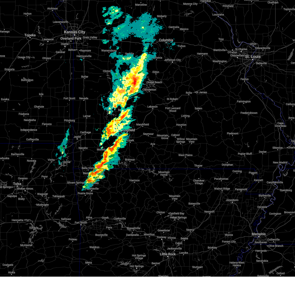 Svrtsa the national weather service in tulsa has issued a * severe thunderstorm warning for, northeastern benton county in northwestern arkansas, * until 600 pm cdt. * at 527 pm cdt, a severe thunderstorm was located near rogers, moving northeast at 80 mph. a second strong to severe thunderstorm was also located northeast of avoca (radar indicated). Hazards include 60 mph wind gusts and quarter size hail. Hail damage to vehicles is expected. expect wind damage to roofs, siding, and trees. Locations in or near the path include, pea ridge, cave springs, avoca, lowell, rogers, hill top, gateway, walnut hill, monte ne, bentonville, springdale, this includes interstate 49 between mile markers 76 and 88. Svrtsa the national weather service in tulsa has issued a * severe thunderstorm warning for, northeastern benton county in northwestern arkansas, * until 600 pm cdt. * at 527 pm cdt, a severe thunderstorm was located near rogers, moving northeast at 80 mph. a second strong to severe thunderstorm was also located northeast of avoca (radar indicated). Hazards include 60 mph wind gusts and quarter size hail. Hail damage to vehicles is expected. expect wind damage to roofs, siding, and trees. Locations in or near the path include, pea ridge, cave springs, avoca, lowell, rogers, hill top, gateway, walnut hill, monte ne, bentonville, springdale, this includes interstate 49 between mile markers 76 and 88.
|
| 3/14/2025 5:19 PM CDT |
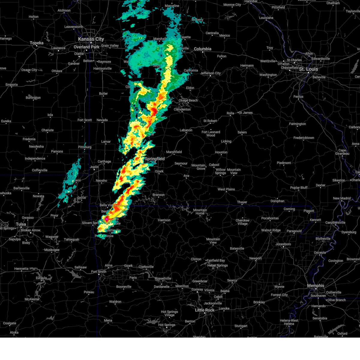 At 518 pm cdt, a severe thunderstorm was located 4 miles northeast of rogers, moving northeast at 65 mph (radar indicated). Hazards include 70 mph wind gusts and quarter size hail. Hail damage to vehicles is expected. expect considerable tree damage. wind damage is also likely to mobile homes, roofs, and outbuildings. Locations in or near the path include, rogers, hill top, northwest arkansas regional air, highfill, walnut hill, pea ridge, cave springs, bentonville, healing springs, avoca, gateway, lowell, centerton, this includes interstate 49 between mile markers 80 and 90. At 518 pm cdt, a severe thunderstorm was located 4 miles northeast of rogers, moving northeast at 65 mph (radar indicated). Hazards include 70 mph wind gusts and quarter size hail. Hail damage to vehicles is expected. expect considerable tree damage. wind damage is also likely to mobile homes, roofs, and outbuildings. Locations in or near the path include, rogers, hill top, northwest arkansas regional air, highfill, walnut hill, pea ridge, cave springs, bentonville, healing springs, avoca, gateway, lowell, centerton, this includes interstate 49 between mile markers 80 and 90.
|
| 3/14/2025 5:11 PM CDT |
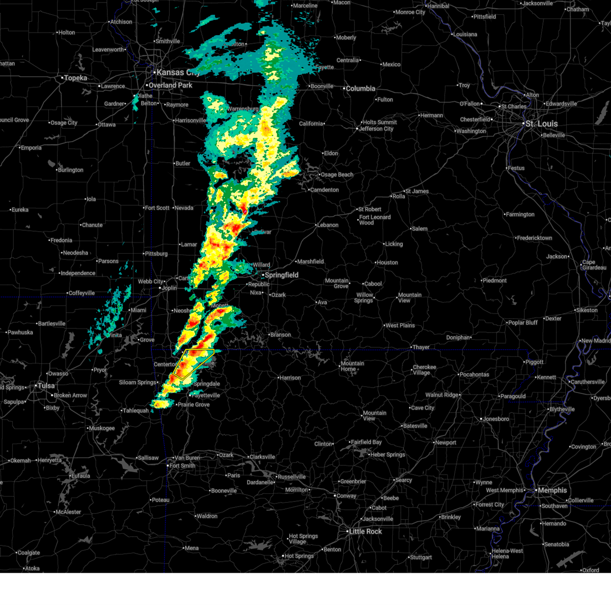 At 510 pm cdt, a severe thunderstorm was located near cave springs, moving northeast at 80 mph (radar indicated. at 459 pm, 59 mph winds were reported at northwest arkansas national airport). Hazards include 70 mph wind gusts and half dollar size hail. Hail damage to vehicles is expected. expect considerable tree damage. wind damage is also likely to mobile homes, roofs, and outbuildings. Locations in or near the path include, rogers, hill top, northwest arkansas regional air, highfill, walnut hill, vaughn, pea ridge, cave springs, bentonville, healing springs, avoca, miller, gateway, bella vista, centerton, lowell, this includes interstate 49 between mile markers 80 and 93. At 510 pm cdt, a severe thunderstorm was located near cave springs, moving northeast at 80 mph (radar indicated. at 459 pm, 59 mph winds were reported at northwest arkansas national airport). Hazards include 70 mph wind gusts and half dollar size hail. Hail damage to vehicles is expected. expect considerable tree damage. wind damage is also likely to mobile homes, roofs, and outbuildings. Locations in or near the path include, rogers, hill top, northwest arkansas regional air, highfill, walnut hill, vaughn, pea ridge, cave springs, bentonville, healing springs, avoca, miller, gateway, bella vista, centerton, lowell, this includes interstate 49 between mile markers 80 and 93.
|
| 3/14/2025 5:04 PM CDT |
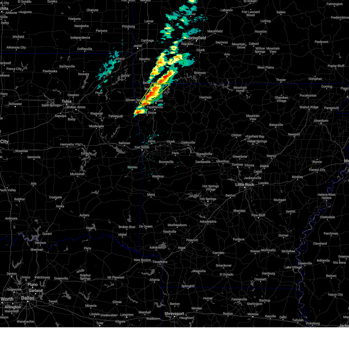 Svrtsa the national weather service in tulsa has issued a * severe thunderstorm warning for, central benton county in northwestern arkansas, * until 530 pm cdt. * at 504 pm cdt, a severe thunderstorm was located 4 miles south of highfill, moving northeast at 80 mph (radar indicated). Hazards include 60 mph wind gusts and quarter size hail. Hail damage to vehicles is expected. expect wind damage to roofs, siding, and trees. Locations in or near the path include, rogers, hill top, northwest arkansas regional air, highfill, walnut hill, vaughn, pea ridge, cave springs, bentonville, healing springs, avoca, gallitin, miller, gateway, bella vista, centerton, rocky comfort, lowell, this includes interstate 49 between mile markers 79 and 93. Svrtsa the national weather service in tulsa has issued a * severe thunderstorm warning for, central benton county in northwestern arkansas, * until 530 pm cdt. * at 504 pm cdt, a severe thunderstorm was located 4 miles south of highfill, moving northeast at 80 mph (radar indicated). Hazards include 60 mph wind gusts and quarter size hail. Hail damage to vehicles is expected. expect wind damage to roofs, siding, and trees. Locations in or near the path include, rogers, hill top, northwest arkansas regional air, highfill, walnut hill, vaughn, pea ridge, cave springs, bentonville, healing springs, avoca, gallitin, miller, gateway, bella vista, centerton, rocky comfort, lowell, this includes interstate 49 between mile markers 79 and 93.
|
| 3/14/2025 4:36 PM CDT |
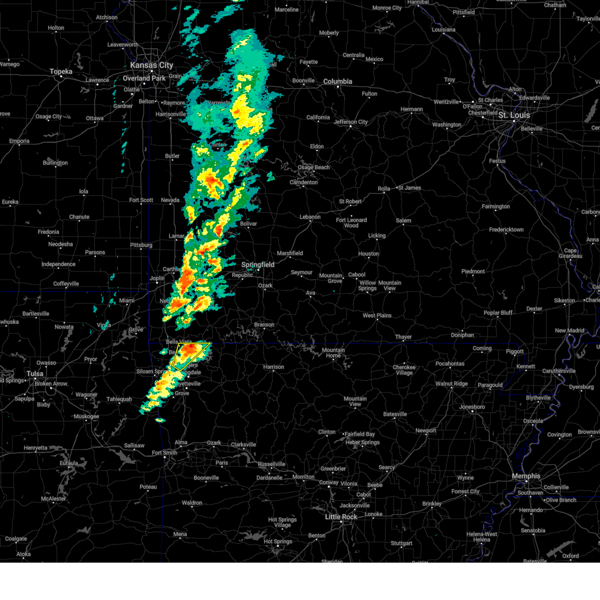 the severe thunderstorm warning has been cancelled and is no longer in effect the severe thunderstorm warning has been cancelled and is no longer in effect
|
| 3/14/2025 4:27 PM CDT |
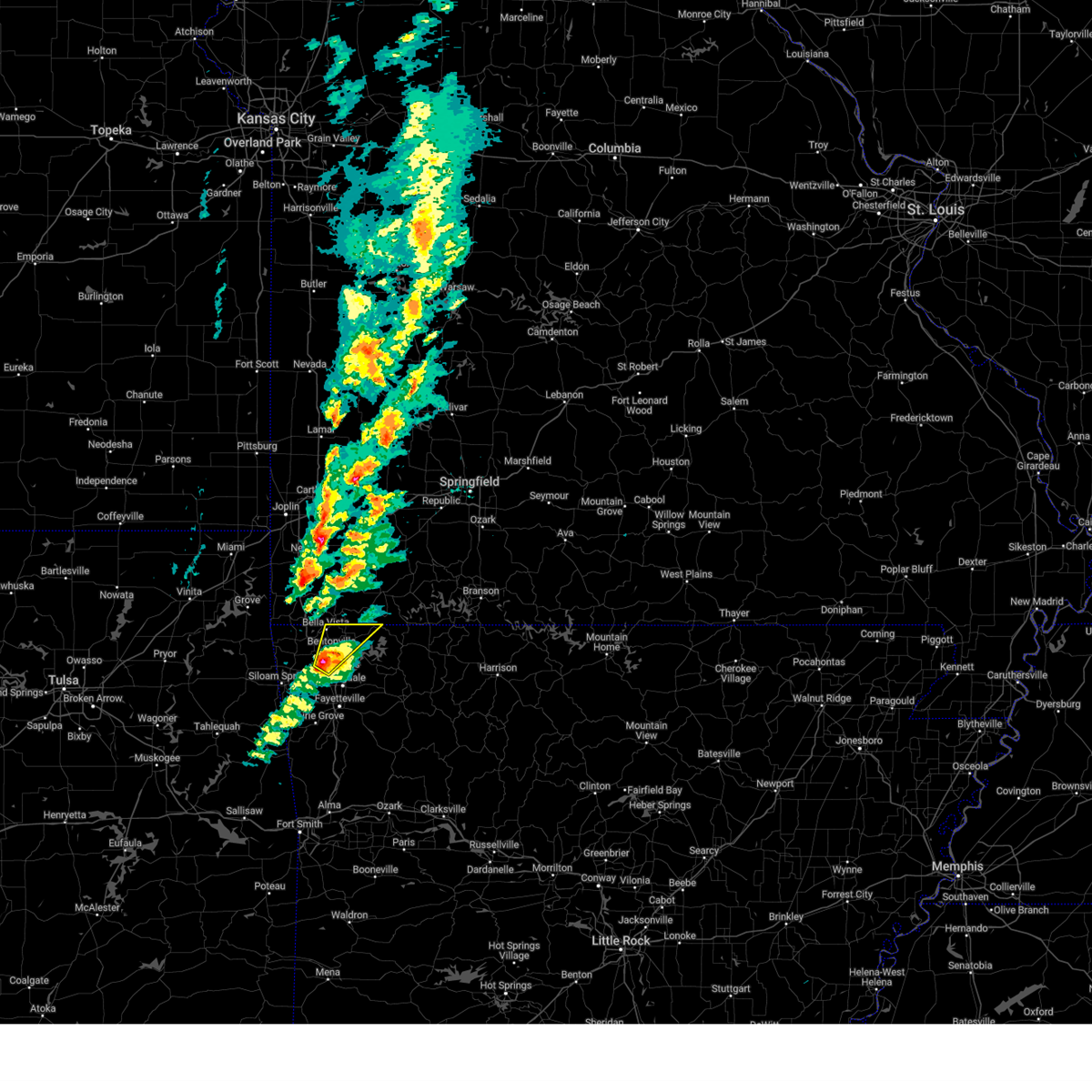 At 427 pm cdt, a severe thunderstorm was located over bentonville, moving northeast at 95 mph (radar indicated). Hazards include 60 mph wind gusts and quarter size hail. Hail damage to vehicles is expected. expect wind damage to roofs, siding, and trees. Locations in or near the path include, rogers, hill top, northwest arkansas regional air, highfill, vaughn, pea ridge, cave springs, bentonville, healing springs, avoca, miller, gateway, bella vista, centerton, walnut hill, lowell, this includes interstate 49 between mile markers 81 and 93. At 427 pm cdt, a severe thunderstorm was located over bentonville, moving northeast at 95 mph (radar indicated). Hazards include 60 mph wind gusts and quarter size hail. Hail damage to vehicles is expected. expect wind damage to roofs, siding, and trees. Locations in or near the path include, rogers, hill top, northwest arkansas regional air, highfill, vaughn, pea ridge, cave springs, bentonville, healing springs, avoca, miller, gateway, bella vista, centerton, walnut hill, lowell, this includes interstate 49 between mile markers 81 and 93.
|
| 3/14/2025 4:27 PM CDT |
 the severe thunderstorm warning has been cancelled and is no longer in effect the severe thunderstorm warning has been cancelled and is no longer in effect
|
| 3/14/2025 4:14 PM CDT |
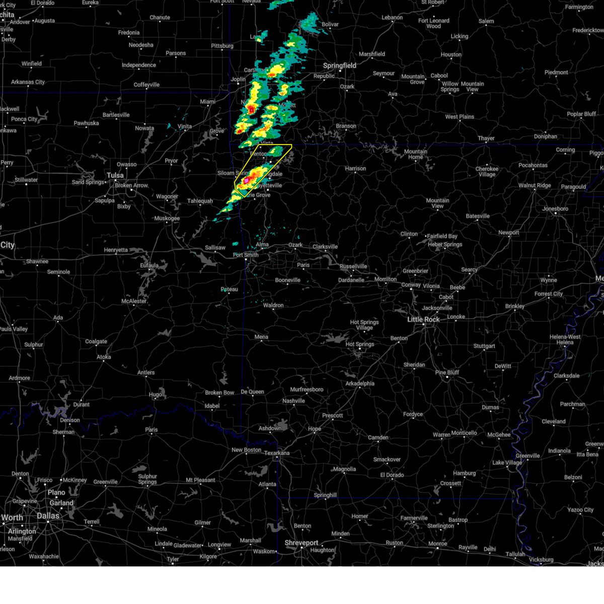 Svrtsa the national weather service in tulsa has issued a * severe thunderstorm warning for, central benton county in northwestern arkansas, northwestern washington county in northwestern arkansas, * until 500 pm cdt. * at 414 pm cdt, a severe thunderstorm was located 6 miles northeast of cincinnati, moving northeast at 75 mph (radar indicated). Hazards include 60 mph wind gusts and quarter size hail. Hail damage to vehicles is expected. expect wind damage to roofs, siding, and trees. Locations in or near the path include, rogers, northwest arkansas regional air, savoy, tontitown, pea ridge, cave springs, bentonville, avoca, wedington, gallitin, gateway, centerton, rocky comfort, lake francis, hill top, fairmount, elm springs, highfill, walnut hill, vaughn, this includes interstate 49 between mile markers 75 and 93. Svrtsa the national weather service in tulsa has issued a * severe thunderstorm warning for, central benton county in northwestern arkansas, northwestern washington county in northwestern arkansas, * until 500 pm cdt. * at 414 pm cdt, a severe thunderstorm was located 6 miles northeast of cincinnati, moving northeast at 75 mph (radar indicated). Hazards include 60 mph wind gusts and quarter size hail. Hail damage to vehicles is expected. expect wind damage to roofs, siding, and trees. Locations in or near the path include, rogers, northwest arkansas regional air, savoy, tontitown, pea ridge, cave springs, bentonville, avoca, wedington, gallitin, gateway, centerton, rocky comfort, lake francis, hill top, fairmount, elm springs, highfill, walnut hill, vaughn, this includes interstate 49 between mile markers 75 and 93.
|
| 11/4/2024 5:09 PM CST |
 The storm which prompted the warning has weakened below severe limits, and has exited the warned area. therefore, the warning will be allowed to expire. a tornado watch remains in effect until 900 pm cst for northwestern arkansas. The storm which prompted the warning has weakened below severe limits, and has exited the warned area. therefore, the warning will be allowed to expire. a tornado watch remains in effect until 900 pm cst for northwestern arkansas.
|
| 11/4/2024 5:00 PM CST |
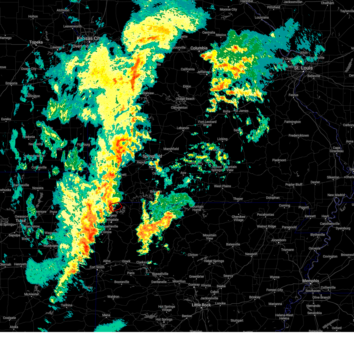 At 459 pm cst, a confirmed tornado was located 3 miles east of pea ridge, moving northeast at 45 mph (broadcast media confirmed tornado. tornado confirmed on media webcam on northeast side of rogers). Hazards include damaging tornado. Flying debris will be dangerous to those caught without shelter. mobile homes will be damaged or destroyed. damage to roofs, windows, and vehicles will occur. tree damage is likely. Locations in or near the path include, rogers, pea ridge, avoca, walnut hill, hill top,. At 459 pm cst, a confirmed tornado was located 3 miles east of pea ridge, moving northeast at 45 mph (broadcast media confirmed tornado. tornado confirmed on media webcam on northeast side of rogers). Hazards include damaging tornado. Flying debris will be dangerous to those caught without shelter. mobile homes will be damaged or destroyed. damage to roofs, windows, and vehicles will occur. tree damage is likely. Locations in or near the path include, rogers, pea ridge, avoca, walnut hill, hill top,.
|
| 11/4/2024 4:54 PM CST |
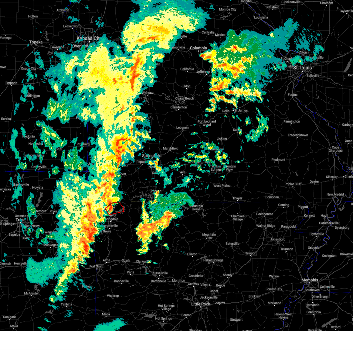 At 454 pm cst, a severe thunderstorm capable of producing a tornado was located 3 miles south of pea ridge, moving northeast at 45 mph (radar indicated rotation). Hazards include tornado. Flying debris will be dangerous to those caught without shelter. mobile homes will be damaged or destroyed. damage to roofs, windows, and vehicles will occur. tree damage is likely. Locations in or near the path include, rogers, bentonville, pea ridge, avoca, larue, hill top, beaver lake, walnut hill, this includes interstate 49 near mile marker 81, and between mile markers 83 and 91. At 454 pm cst, a severe thunderstorm capable of producing a tornado was located 3 miles south of pea ridge, moving northeast at 45 mph (radar indicated rotation). Hazards include tornado. Flying debris will be dangerous to those caught without shelter. mobile homes will be damaged or destroyed. damage to roofs, windows, and vehicles will occur. tree damage is likely. Locations in or near the path include, rogers, bentonville, pea ridge, avoca, larue, hill top, beaver lake, walnut hill, this includes interstate 49 near mile marker 81, and between mile markers 83 and 91.
|
| 11/4/2024 4:54 PM CST |
 the tornado warning has been cancelled and is no longer in effect the tornado warning has been cancelled and is no longer in effect
|
| 11/4/2024 4:38 PM CST |
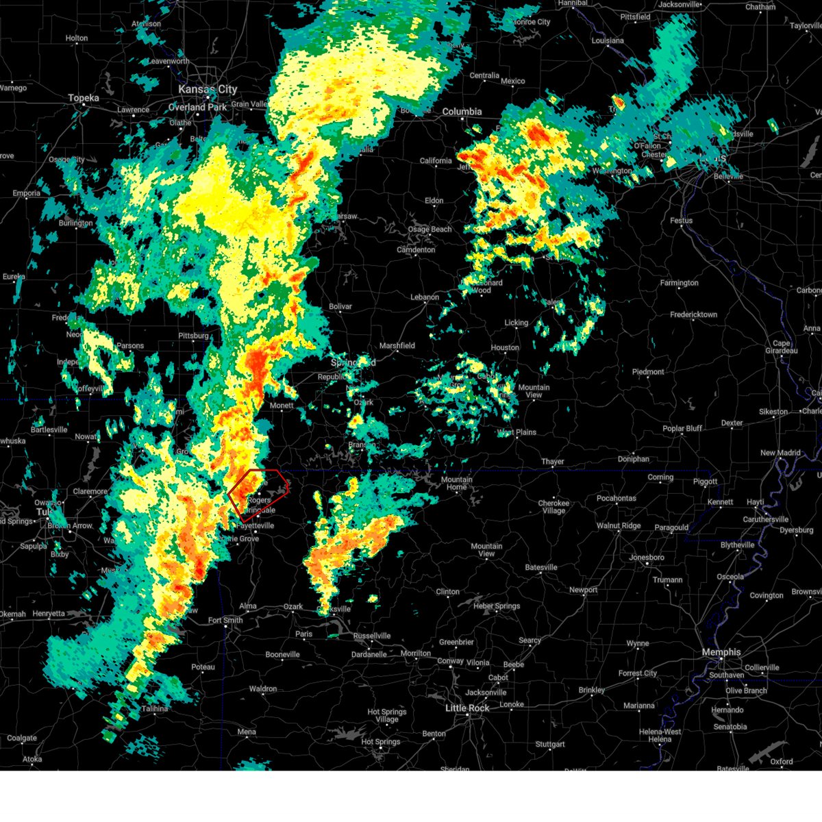 Tortsa the national weather service in tulsa has issued a * tornado warning for, central benton county in northwestern arkansas, north central washington county in northwestern arkansas, * until 515 pm cst. * at 437 pm cst, a severe thunderstorm capable of producing a tornado was located over cave springs, moving northeast at 40 mph. storm has a history of producing tornadoes (radar indicated rotation). Hazards include tornado. Flying debris will be dangerous to those caught without shelter. mobile homes will be damaged or destroyed. damage to roofs, windows, and vehicles will occur. tree damage is likely. Locations in or near the path include, springdale, rogers, bentonville, bella vista, lowell, pea ridge, tontitown, cave springs, highfill, northwest arkansas regional air, miller, centerton, elm springs, avoca, hill top, beaver lake, walnut hill, vaughn, monte ne, larue, this includes interstate 49 between mile markers 72 and 93. Tortsa the national weather service in tulsa has issued a * tornado warning for, central benton county in northwestern arkansas, north central washington county in northwestern arkansas, * until 515 pm cst. * at 437 pm cst, a severe thunderstorm capable of producing a tornado was located over cave springs, moving northeast at 40 mph. storm has a history of producing tornadoes (radar indicated rotation). Hazards include tornado. Flying debris will be dangerous to those caught without shelter. mobile homes will be damaged or destroyed. damage to roofs, windows, and vehicles will occur. tree damage is likely. Locations in or near the path include, springdale, rogers, bentonville, bella vista, lowell, pea ridge, tontitown, cave springs, highfill, northwest arkansas regional air, miller, centerton, elm springs, avoca, hill top, beaver lake, walnut hill, vaughn, monte ne, larue, this includes interstate 49 between mile markers 72 and 93.
|
| 11/3/2024 5:50 AM CST |
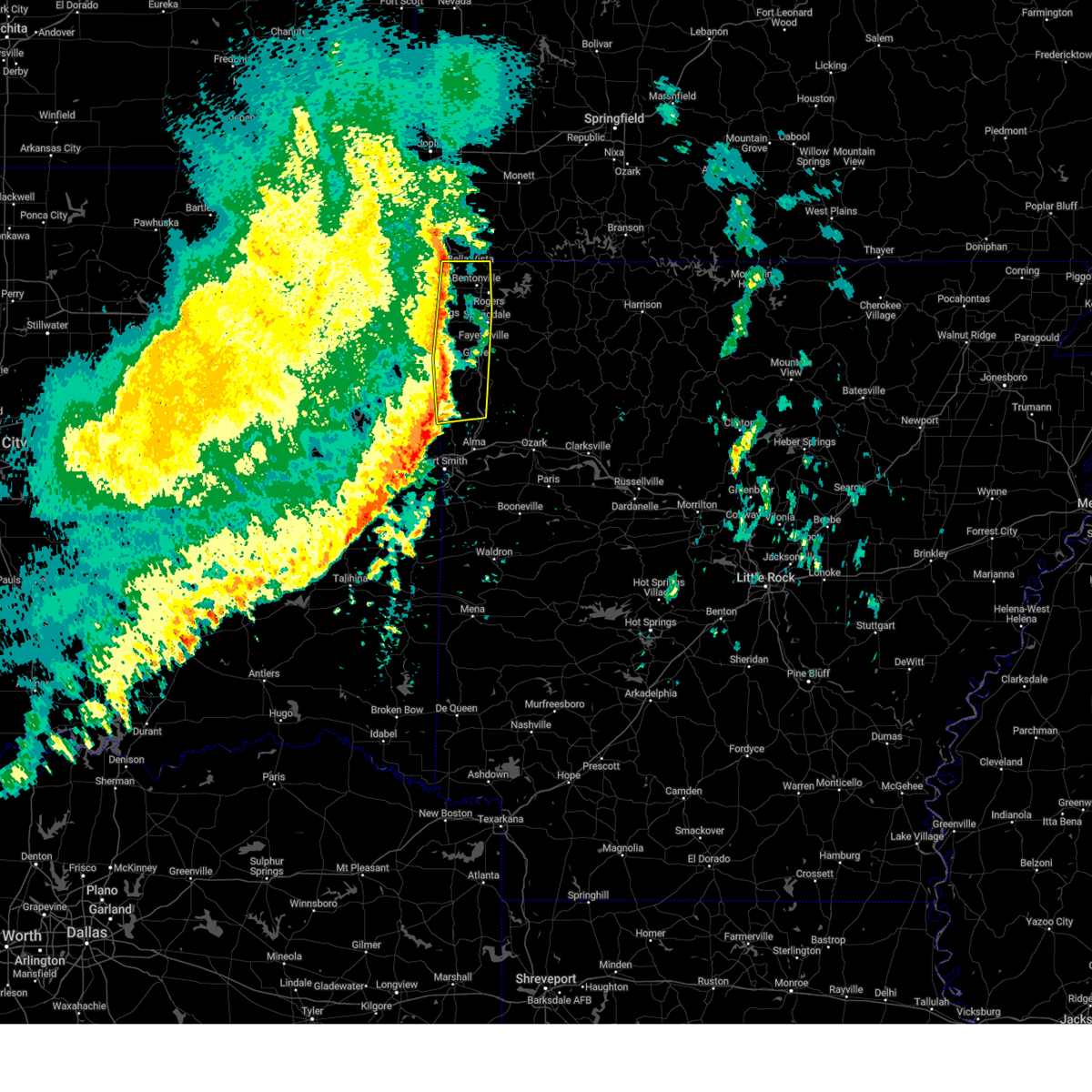 At 549 am cst, severe thunderstorms were located along a line extending from near lanagan to 2 miles northwest of bella vista to 3 miles northeast of lee creek, moving east at 50 mph (radar indicated). Hazards include 60 mph wind gusts. Expect damage to roofs, siding, and trees. Locations in or near the path include, fayetteville, springdale, rogers, bentonville, mountainburg, natural dam, bella vista, lowell, farmington, pea ridge, prairie grove, tontitown, gravette, west fork, lincoln, cave springs, decatur, greenland, highfill, winslow, this includes interstate 49 between mile markers 33 and 93. At 549 am cst, severe thunderstorms were located along a line extending from near lanagan to 2 miles northwest of bella vista to 3 miles northeast of lee creek, moving east at 50 mph (radar indicated). Hazards include 60 mph wind gusts. Expect damage to roofs, siding, and trees. Locations in or near the path include, fayetteville, springdale, rogers, bentonville, mountainburg, natural dam, bella vista, lowell, farmington, pea ridge, prairie grove, tontitown, gravette, west fork, lincoln, cave springs, decatur, greenland, highfill, winslow, this includes interstate 49 between mile markers 33 and 93.
|
| 11/3/2024 5:42 AM CST |
 At 541 am cst, severe thunderstorms were located along a line extending from 4 miles northwest of noel to 2 miles north of gravette to 3 miles northwest of natural dam, moving east at 50 mph (radar indicated). Hazards include 60 mph wind gusts. Expect damage to roofs, siding, and trees. Locations in or near the path include, fayetteville, springdale, rogers, bentonville, siloam springs, mountainburg, natural dam, bella vista, lowell, farmington, pea ridge, prairie grove, gentry, tontitown, gravette, west fork, lincoln, cave springs, decatur, greenland, this includes interstate 49 between mile markers 33 and 93. At 541 am cst, severe thunderstorms were located along a line extending from 4 miles northwest of noel to 2 miles north of gravette to 3 miles northwest of natural dam, moving east at 50 mph (radar indicated). Hazards include 60 mph wind gusts. Expect damage to roofs, siding, and trees. Locations in or near the path include, fayetteville, springdale, rogers, bentonville, siloam springs, mountainburg, natural dam, bella vista, lowell, farmington, pea ridge, prairie grove, gentry, tontitown, gravette, west fork, lincoln, cave springs, decatur, greenland, this includes interstate 49 between mile markers 33 and 93.
|
| 11/3/2024 5:42 AM CST |
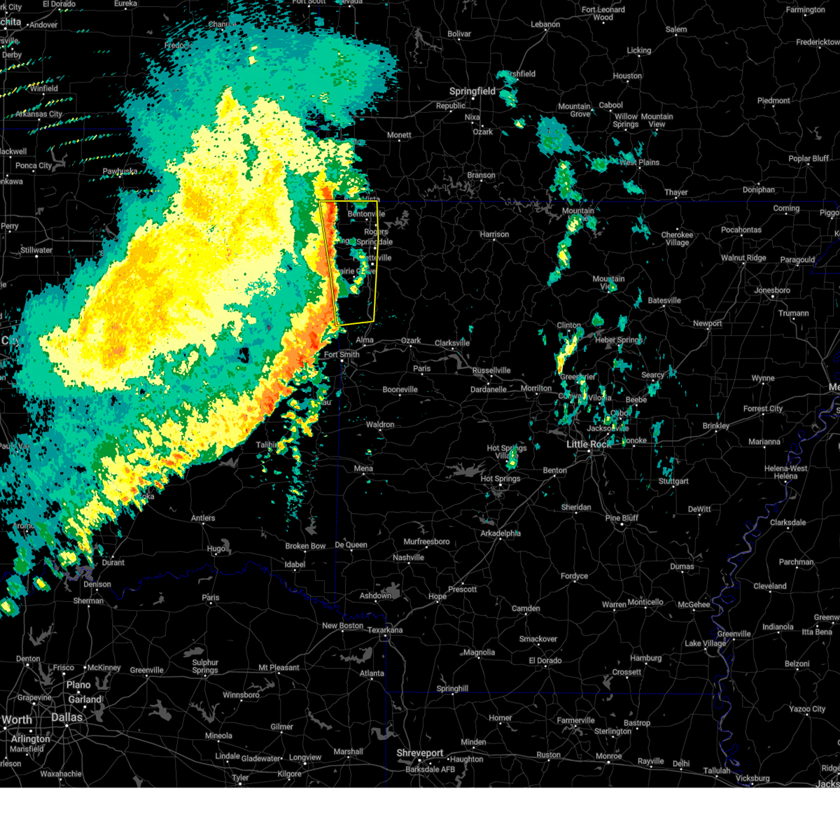 the severe thunderstorm warning has been cancelled and is no longer in effect the severe thunderstorm warning has been cancelled and is no longer in effect
|
| 11/3/2024 5:38 AM CST |
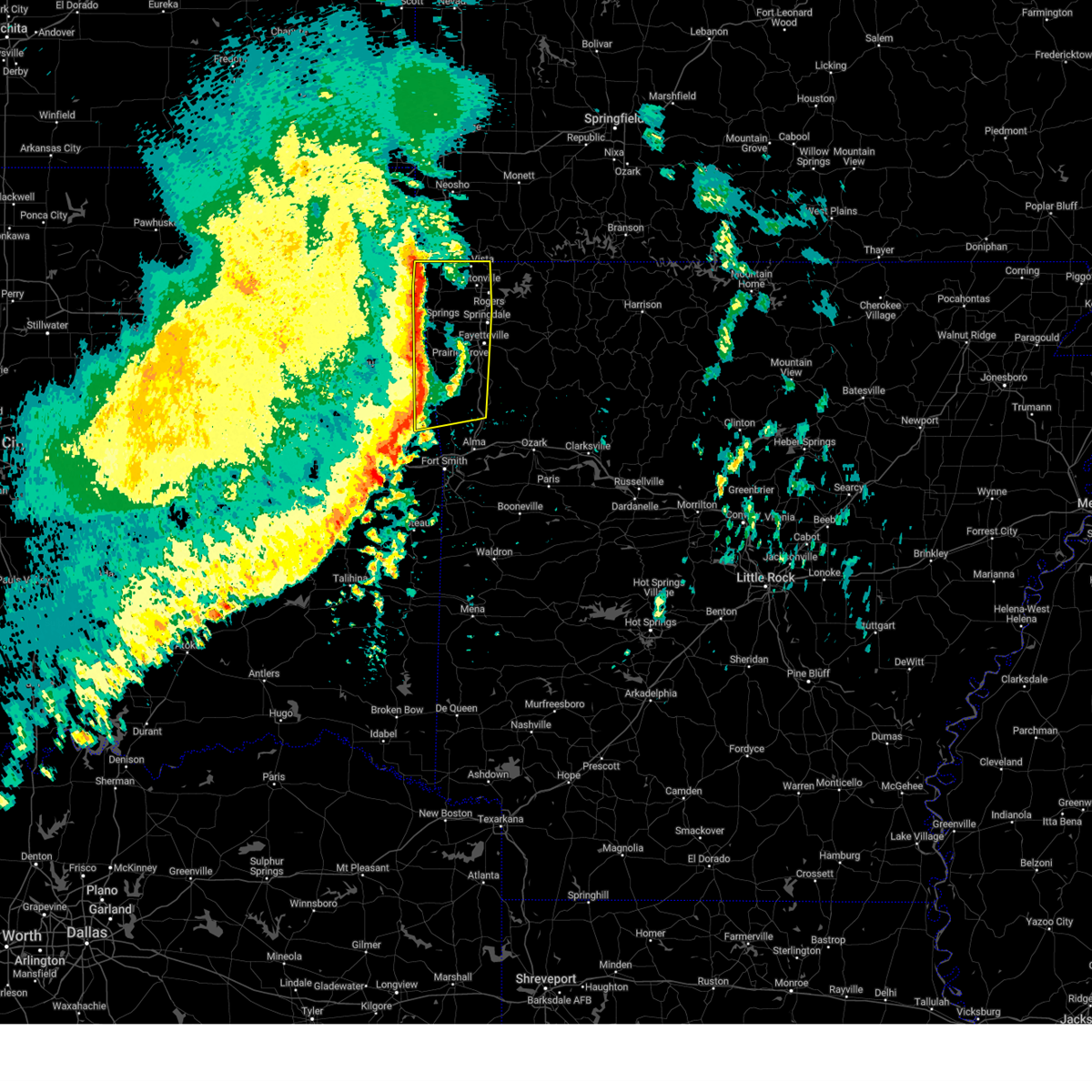 the severe thunderstorm warning has been cancelled and is no longer in effect the severe thunderstorm warning has been cancelled and is no longer in effect
|
| 11/3/2024 5:38 AM CST |
 At 537 am cst, severe thunderstorms were located along a line extending from 4 miles north of south west city to 3 miles northwest of gravette to 5 miles west of natural dam, moving east at 50 mph (radar indicated). Hazards include 60 mph wind gusts. Expect damage to roofs, siding, and trees. Locations in or near the path include, fayetteville, springdale, rogers, bentonville, siloam springs, stilwell, mountainburg, natural dam, bella vista, lowell, farmington, pea ridge, prairie grove, gentry, tontitown, gravette, west fork, lincoln, cave springs, decatur, this includes interstate 49 between mile markers 33 and 93. At 537 am cst, severe thunderstorms were located along a line extending from 4 miles north of south west city to 3 miles northwest of gravette to 5 miles west of natural dam, moving east at 50 mph (radar indicated). Hazards include 60 mph wind gusts. Expect damage to roofs, siding, and trees. Locations in or near the path include, fayetteville, springdale, rogers, bentonville, siloam springs, stilwell, mountainburg, natural dam, bella vista, lowell, farmington, pea ridge, prairie grove, gentry, tontitown, gravette, west fork, lincoln, cave springs, decatur, this includes interstate 49 between mile markers 33 and 93.
|
| 11/3/2024 5:20 AM CST |
 Svrtsa the national weather service in tulsa has issued a * severe thunderstorm warning for, benton county in northwestern arkansas, northwestern crawford county in northwestern arkansas, washington county in northwestern arkansas, eastern delaware county in northeastern oklahoma, southeastern ottawa county in northeastern oklahoma, northeastern sequoyah county in east central oklahoma, eastern adair county in northeastern oklahoma, * until 600 am cst. * at 519 am cst, severe thunderstorms were located along a line extending from near welch to 3 miles southeast of jay to 4 miles north of brushy, moving east at 50 mph (radar indicated. winds of 60 to 70 mph have been reported along this line of storm). Hazards include 70 mph wind gusts. Expect considerable tree damage. damage is likely to mobile homes, roofs, and outbuildings. Locations in or near the path include, fayetteville, springdale, rogers, bentonville, siloam springs, stilwell, mountainburg, natural dam, bella vista, lowell, farmington, pea ridge, prairie grove, gentry, tontitown, gravette, west fork, lincoln, cave springs, decatur, this includes interstate 49 between mile markers 33 and 93. Svrtsa the national weather service in tulsa has issued a * severe thunderstorm warning for, benton county in northwestern arkansas, northwestern crawford county in northwestern arkansas, washington county in northwestern arkansas, eastern delaware county in northeastern oklahoma, southeastern ottawa county in northeastern oklahoma, northeastern sequoyah county in east central oklahoma, eastern adair county in northeastern oklahoma, * until 600 am cst. * at 519 am cst, severe thunderstorms were located along a line extending from near welch to 3 miles southeast of jay to 4 miles north of brushy, moving east at 50 mph (radar indicated. winds of 60 to 70 mph have been reported along this line of storm). Hazards include 70 mph wind gusts. Expect considerable tree damage. damage is likely to mobile homes, roofs, and outbuildings. Locations in or near the path include, fayetteville, springdale, rogers, bentonville, siloam springs, stilwell, mountainburg, natural dam, bella vista, lowell, farmington, pea ridge, prairie grove, gentry, tontitown, gravette, west fork, lincoln, cave springs, decatur, this includes interstate 49 between mile markers 33 and 93.
|
| 8/16/2024 10:00 PM CDT |
 At 1000 pm cdt, severe thunderstorms were located along a line extending from 5 miles southwest of eureka springs to 8 miles west of tontitown, moving southeast at 40 mph (radar indicated). Hazards include 60 mph wind gusts and quarter size hail. Hail damage to vehicles is expected. expect wind damage to roofs, siding, and trees. Locations in or near the path include, fayetteville, springdale, rogers, bentonville, siloam springs, eureka springs, lowell, farmington, gentry, tontitown, lincoln, cave springs, decatur, west siloam springs, highfill, springtown, hindsville, northwest arkansas regional air, cincinnati, forum, this includes interstate 49 between mile markers 60 and 92. At 1000 pm cdt, severe thunderstorms were located along a line extending from 5 miles southwest of eureka springs to 8 miles west of tontitown, moving southeast at 40 mph (radar indicated). Hazards include 60 mph wind gusts and quarter size hail. Hail damage to vehicles is expected. expect wind damage to roofs, siding, and trees. Locations in or near the path include, fayetteville, springdale, rogers, bentonville, siloam springs, eureka springs, lowell, farmington, gentry, tontitown, lincoln, cave springs, decatur, west siloam springs, highfill, springtown, hindsville, northwest arkansas regional air, cincinnati, forum, this includes interstate 49 between mile markers 60 and 92.
|
| 8/16/2024 9:49 PM CDT |
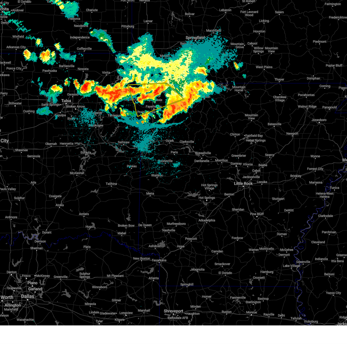 Svrtsa the national weather service in tulsa has issued a * severe thunderstorm warning for, benton county in northwestern arkansas, northwestern madison county in northwestern arkansas, southwestern carroll county in northwestern arkansas, northern washington county in northwestern arkansas, southeastern delaware county in northeastern oklahoma, * until 1015 pm cdt. * at 948 pm cdt, severe thunderstorms were located along a line extending from 2 miles south of garfield to 2 miles southeast of siloam springs, moving southeast at 45 mph (radar indicated). Hazards include 60 mph wind gusts and quarter size hail. Hail damage to vehicles is expected. expect wind damage to roofs, siding, and trees. Locations in or near the path include, fayetteville, springdale, rogers, bentonville, siloam springs, eureka springs, bella vista, lowell, farmington, pea ridge, gentry, tontitown, gravette, lincoln, cave springs, decatur, west siloam springs, highfill, gateway, springtown, this includes interstate 49 between mile markers 60 and 93. Svrtsa the national weather service in tulsa has issued a * severe thunderstorm warning for, benton county in northwestern arkansas, northwestern madison county in northwestern arkansas, southwestern carroll county in northwestern arkansas, northern washington county in northwestern arkansas, southeastern delaware county in northeastern oklahoma, * until 1015 pm cdt. * at 948 pm cdt, severe thunderstorms were located along a line extending from 2 miles south of garfield to 2 miles southeast of siloam springs, moving southeast at 45 mph (radar indicated). Hazards include 60 mph wind gusts and quarter size hail. Hail damage to vehicles is expected. expect wind damage to roofs, siding, and trees. Locations in or near the path include, fayetteville, springdale, rogers, bentonville, siloam springs, eureka springs, bella vista, lowell, farmington, pea ridge, gentry, tontitown, gravette, lincoln, cave springs, decatur, west siloam springs, highfill, gateway, springtown, this includes interstate 49 between mile markers 60 and 93.
|
| 8/16/2024 9:03 PM CDT |
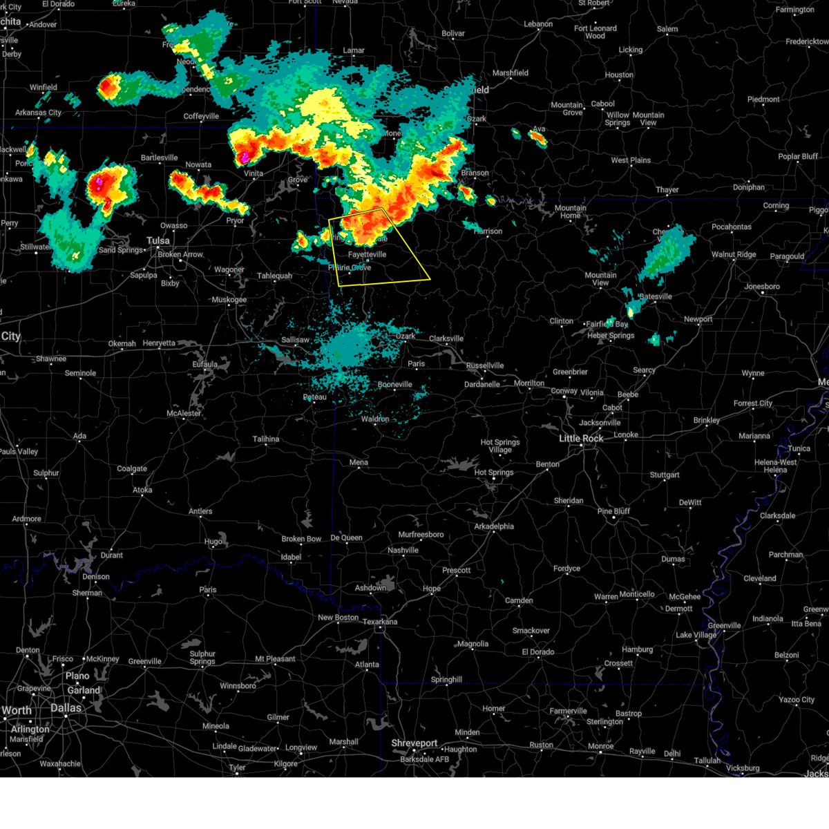 At 903 pm cdt, severe thunderstorms were located along a line extending from 3 miles north of war eagle to 2 miles southwest of springdale to 3 miles southwest of highfill, moving southeast at 45 mph (radar indicated). Hazards include 70 mph wind gusts and quarter size hail. Hail damage to vehicles is expected. expect considerable tree damage. wind damage is also likely to mobile homes, roofs, and outbuildings. Locations in or near the path include, fayetteville, springdale, rogers, bentonville, huntsville, lowell, farmington, prairie grove, gentry, elkins, tontitown, west fork, lincoln, cave springs, decatur, greenland, highfill, springtown, hindsville, wesley, this includes interstate 49 between mile markers 51 and 89. At 903 pm cdt, severe thunderstorms were located along a line extending from 3 miles north of war eagle to 2 miles southwest of springdale to 3 miles southwest of highfill, moving southeast at 45 mph (radar indicated). Hazards include 70 mph wind gusts and quarter size hail. Hail damage to vehicles is expected. expect considerable tree damage. wind damage is also likely to mobile homes, roofs, and outbuildings. Locations in or near the path include, fayetteville, springdale, rogers, bentonville, huntsville, lowell, farmington, prairie grove, gentry, elkins, tontitown, west fork, lincoln, cave springs, decatur, greenland, highfill, springtown, hindsville, wesley, this includes interstate 49 between mile markers 51 and 89.
|
| 8/16/2024 8:41 PM CDT |
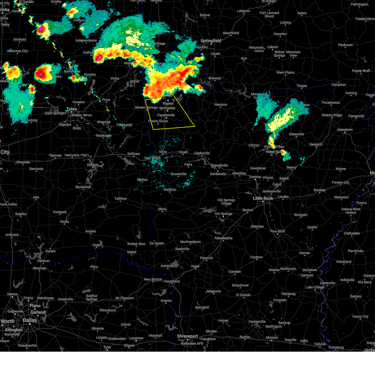 Svrtsa the national weather service in tulsa has issued a * severe thunderstorm warning for, central benton county in northwestern arkansas, northwestern madison county in northwestern arkansas, washington county in northwestern arkansas, * until 930 pm cdt. * at 841 pm cdt, severe thunderstorms were located along a line extending from pea ridge to near highfill to 3 miles northwest of decatur, moving southeast at 50 mph (radar indicated). Hazards include 70 mph wind gusts and quarter size hail. Hail damage to vehicles is expected. expect considerable tree damage. wind damage is also likely to mobile homes, roofs, and outbuildings. Locations in or near the path include, fayetteville, springdale, rogers, bentonville, siloam springs, huntsville, lowell, farmington, prairie grove, gentry, elkins, tontitown, west fork, lincoln, cave springs, decatur, greenland, highfill, springtown, hindsville, this includes interstate 49 between mile markers 51 and 89. Svrtsa the national weather service in tulsa has issued a * severe thunderstorm warning for, central benton county in northwestern arkansas, northwestern madison county in northwestern arkansas, washington county in northwestern arkansas, * until 930 pm cdt. * at 841 pm cdt, severe thunderstorms were located along a line extending from pea ridge to near highfill to 3 miles northwest of decatur, moving southeast at 50 mph (radar indicated). Hazards include 70 mph wind gusts and quarter size hail. Hail damage to vehicles is expected. expect considerable tree damage. wind damage is also likely to mobile homes, roofs, and outbuildings. Locations in or near the path include, fayetteville, springdale, rogers, bentonville, siloam springs, huntsville, lowell, farmington, prairie grove, gentry, elkins, tontitown, west fork, lincoln, cave springs, decatur, greenland, highfill, springtown, hindsville, this includes interstate 49 between mile markers 51 and 89.
|
| 8/16/2024 8:34 PM CDT |
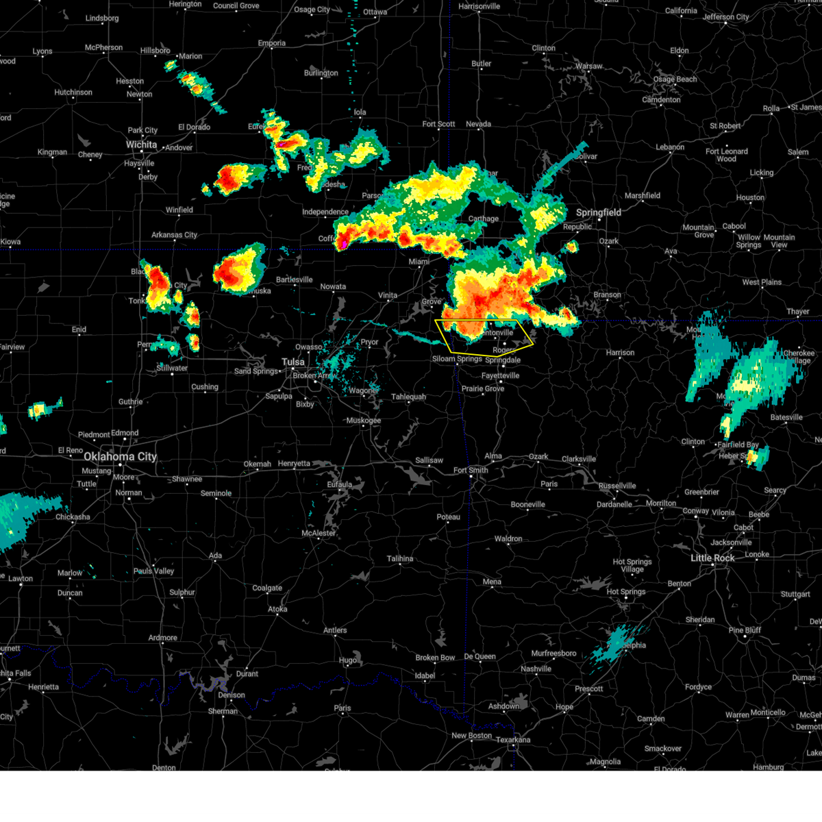 At 833 pm cdt, severe thunderstorms were located along a line extending from 7 miles west of washburn to 4 miles north of bella vista to near gravette, moving southeast at 40 mph (radar indicated). Hazards include 70 mph wind gusts and quarter size hail. Hail damage to vehicles is expected. expect considerable tree damage. wind damage is also likely to mobile homes, roofs, and outbuildings. Locations in or near the path include, rogers, bentonville, bella vista, lowell, pea ridge, gentry, gravette, cave springs, decatur, highfill, springtown, maysville, northwest arkansas regional air, hiwasse, miller, centerton, avoca, hill top, walnut hill, vaughn, this includes interstate 49 between mile markers 78 and 93. At 833 pm cdt, severe thunderstorms were located along a line extending from 7 miles west of washburn to 4 miles north of bella vista to near gravette, moving southeast at 40 mph (radar indicated). Hazards include 70 mph wind gusts and quarter size hail. Hail damage to vehicles is expected. expect considerable tree damage. wind damage is also likely to mobile homes, roofs, and outbuildings. Locations in or near the path include, rogers, bentonville, bella vista, lowell, pea ridge, gentry, gravette, cave springs, decatur, highfill, springtown, maysville, northwest arkansas regional air, hiwasse, miller, centerton, avoca, hill top, walnut hill, vaughn, this includes interstate 49 between mile markers 78 and 93.
|
| 8/16/2024 8:17 PM CDT |
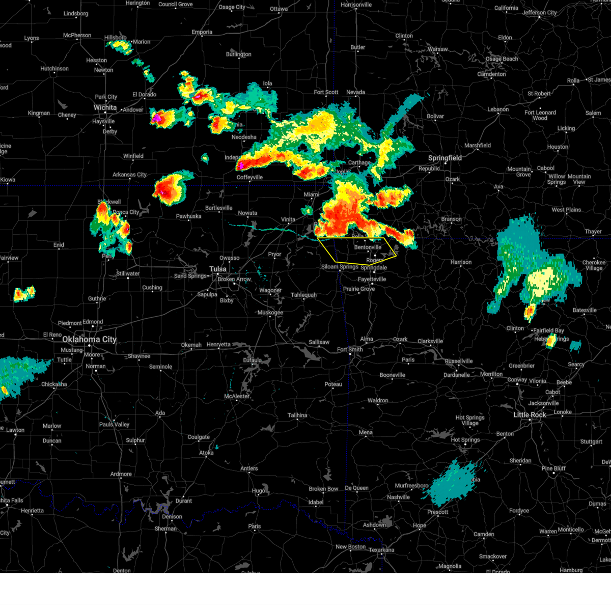 Svrtsa the national weather service in tulsa has issued a * severe thunderstorm warning for, benton county in northwestern arkansas, east central delaware county in northeastern oklahoma, * until 900 pm cdt. * at 817 pm cdt, a severe thunderstorm was located over lanagan, moving southeast at 45 mph (radar indicated). Hazards include 70 mph wind gusts and quarter size hail. Hail damage to vehicles is expected. expect considerable tree damage. wind damage is also likely to mobile homes, roofs, and outbuildings. Locations in or near the path include, rogers, bentonville, bella vista, lowell, pea ridge, gentry, gravette, cave springs, decatur, highfill, springtown, maysville, northwest arkansas regional air, hiwasse, miller, centerton, avoca, hill top, walnut hill, vaughn, this includes interstate 49 between mile markers 78 and 93. Svrtsa the national weather service in tulsa has issued a * severe thunderstorm warning for, benton county in northwestern arkansas, east central delaware county in northeastern oklahoma, * until 900 pm cdt. * at 817 pm cdt, a severe thunderstorm was located over lanagan, moving southeast at 45 mph (radar indicated). Hazards include 70 mph wind gusts and quarter size hail. Hail damage to vehicles is expected. expect considerable tree damage. wind damage is also likely to mobile homes, roofs, and outbuildings. Locations in or near the path include, rogers, bentonville, bella vista, lowell, pea ridge, gentry, gravette, cave springs, decatur, highfill, springtown, maysville, northwest arkansas regional air, hiwasse, miller, centerton, avoca, hill top, walnut hill, vaughn, this includes interstate 49 between mile markers 78 and 93.
|
| 7/4/2024 7:47 PM CDT |
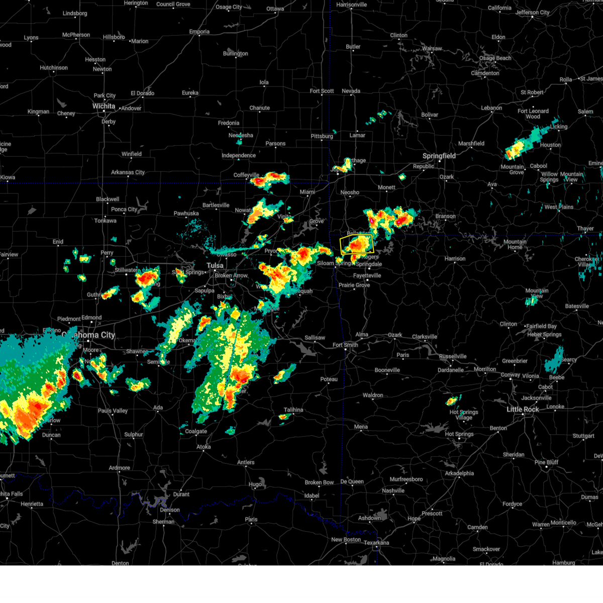 the severe thunderstorm warning has been cancelled and is no longer in effect the severe thunderstorm warning has been cancelled and is no longer in effect
|
| 7/4/2024 7:31 PM CDT |
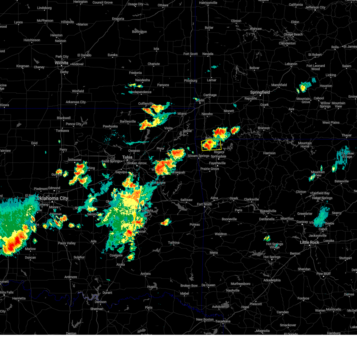 At 731 pm cdt, a severe thunderstorm was located near hiwasse, moving east at 20 mph (radar indicated). Hazards include 60 mph wind gusts and nickel size hail. Expect damage to roofs, siding, and trees. Locations in or near the path include, rogers, bentonville, bella vista, pea ridge, gravette, decatur, hiwasse, miller, centerton, this includes interstate 49 between mile markers 84 and 93. At 731 pm cdt, a severe thunderstorm was located near hiwasse, moving east at 20 mph (radar indicated). Hazards include 60 mph wind gusts and nickel size hail. Expect damage to roofs, siding, and trees. Locations in or near the path include, rogers, bentonville, bella vista, pea ridge, gravette, decatur, hiwasse, miller, centerton, this includes interstate 49 between mile markers 84 and 93.
|
| 7/4/2024 7:20 PM CDT |
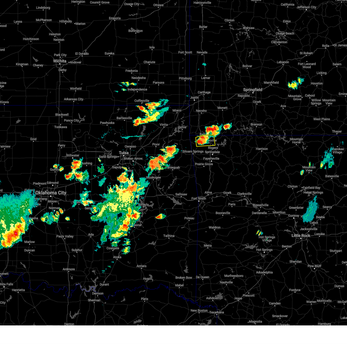 Svrtsa the national weather service in tulsa has issued a * severe thunderstorm warning for, northwestern benton county in northwestern arkansas, * until 800 pm cdt. * at 720 pm cdt, a severe thunderstorm was located 3 miles southeast of gravette, moving east at 20 mph (radar indicated). Hazards include 60 mph wind gusts and quarter size hail. Hail damage to vehicles is expected. expect wind damage to roofs, siding, and trees. Locations in or near the path include, rogers, bentonville, bella vista, pea ridge, gravette, decatur, hiwasse, miller, centerton, this includes interstate 49 between mile markers 84 and 93. Svrtsa the national weather service in tulsa has issued a * severe thunderstorm warning for, northwestern benton county in northwestern arkansas, * until 800 pm cdt. * at 720 pm cdt, a severe thunderstorm was located 3 miles southeast of gravette, moving east at 20 mph (radar indicated). Hazards include 60 mph wind gusts and quarter size hail. Hail damage to vehicles is expected. expect wind damage to roofs, siding, and trees. Locations in or near the path include, rogers, bentonville, bella vista, pea ridge, gravette, decatur, hiwasse, miller, centerton, this includes interstate 49 between mile markers 84 and 93.
|
| 5/26/2024 5:12 PM CDT |
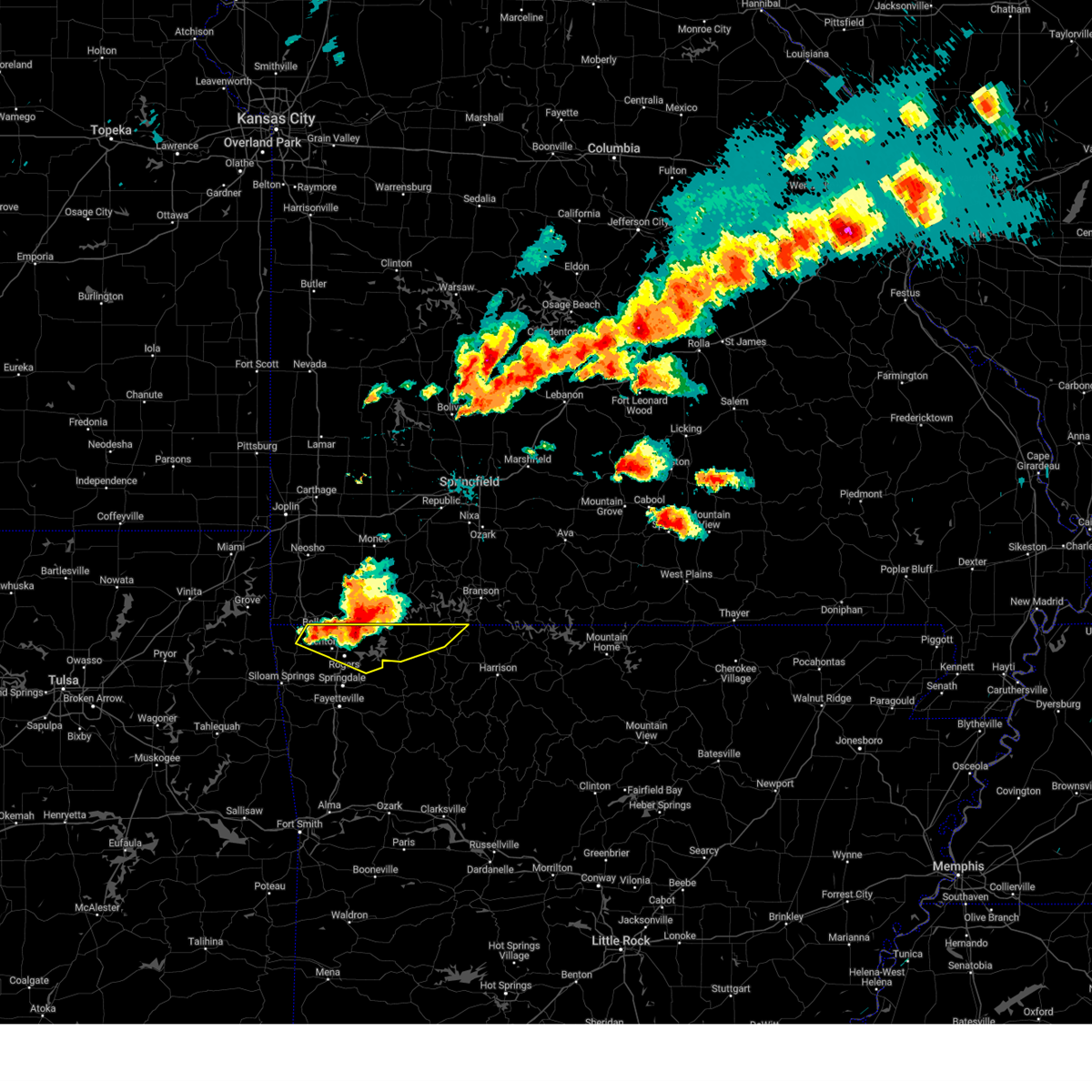 Svrtsa the national weather service in tulsa has issued a * severe thunderstorm warning for, northern benton county in northwestern arkansas, northern carroll county in northwestern arkansas, * until 600 pm cdt. * at 512 pm cdt, severe thunderstorms were located along a line extending from 4 miles east of washburn to 2 miles east of pea ridge to 3 miles west of hiwasse, moving east at 45 mph (radar indicated). Hazards include 60 mph wind gusts and quarter size hail. Hail damage to vehicles is expected. expect wind damage to roofs, siding, and trees. Locations in or near the path include, rogers, bentonville, berryville, eureka springs, bella vista, pea ridge, gateway, beaver, war eagle, hiwasse, urbanette, grandview, miller, centerton, avoca, hill top, beaver lake, walnut hill, monte ne, larue, this includes interstate 49 between mile markers 83 and 93. Svrtsa the national weather service in tulsa has issued a * severe thunderstorm warning for, northern benton county in northwestern arkansas, northern carroll county in northwestern arkansas, * until 600 pm cdt. * at 512 pm cdt, severe thunderstorms were located along a line extending from 4 miles east of washburn to 2 miles east of pea ridge to 3 miles west of hiwasse, moving east at 45 mph (radar indicated). Hazards include 60 mph wind gusts and quarter size hail. Hail damage to vehicles is expected. expect wind damage to roofs, siding, and trees. Locations in or near the path include, rogers, bentonville, berryville, eureka springs, bella vista, pea ridge, gateway, beaver, war eagle, hiwasse, urbanette, grandview, miller, centerton, avoca, hill top, beaver lake, walnut hill, monte ne, larue, this includes interstate 49 between mile markers 83 and 93.
|
| 5/26/2024 4:25 PM CDT |
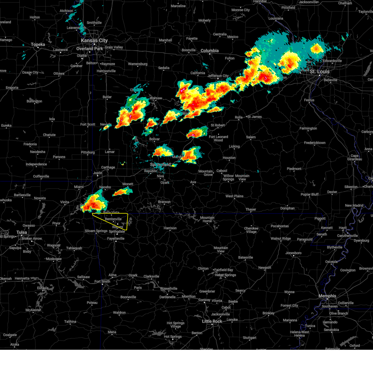 Svrtsa the national weather service in tulsa has issued a * severe thunderstorm warning for, northern benton county in northwestern arkansas, * until 515 pm cdt. * at 424 pm cdt, a severe thunderstorm was located 4 miles northwest of noel, moving southeast at 45 mph (radar indicated). Hazards include 60 mph wind gusts and half dollar size hail. Hail damage to vehicles is expected. expect wind damage to roofs, siding, and trees. Locations in or near the path include, rogers, bentonville, bella vista, pea ridge, gravette, gateway, hiwasse, miller, centerton, avoca, hill top, walnut hill, monte ne, larue, this includes interstate 49 between mile markers 83 and 93. Svrtsa the national weather service in tulsa has issued a * severe thunderstorm warning for, northern benton county in northwestern arkansas, * until 515 pm cdt. * at 424 pm cdt, a severe thunderstorm was located 4 miles northwest of noel, moving southeast at 45 mph (radar indicated). Hazards include 60 mph wind gusts and half dollar size hail. Hail damage to vehicles is expected. expect wind damage to roofs, siding, and trees. Locations in or near the path include, rogers, bentonville, bella vista, pea ridge, gravette, gateway, hiwasse, miller, centerton, avoca, hill top, walnut hill, monte ne, larue, this includes interstate 49 between mile markers 83 and 93.
|
| 5/26/2024 3:58 AM CDT |
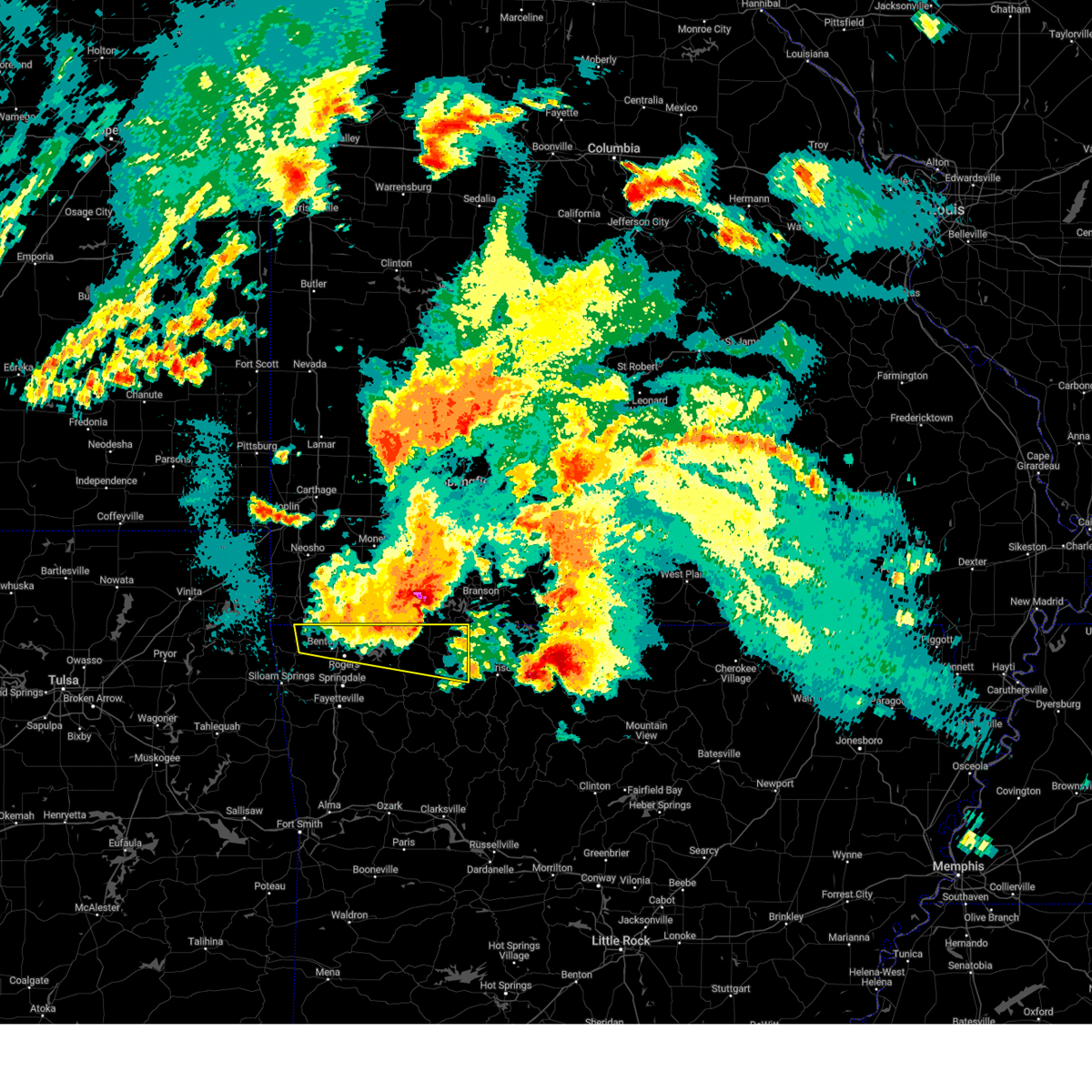 At 358 am cdt, severe thunderstorms were located along a line extending from 3 miles north of grandview to 3 miles south of eureka springs to 2 miles east of bella vista, moving southeast at 40 mph (radar indicated). Hazards include 70 mph wind gusts and half dollar size hail. Hail damage to vehicles is expected. expect considerable tree damage. wind damage is also likely to mobile homes, roofs, and outbuildings. Locations in or near the path include, rogers, bentonville, berryville, eureka springs, bella vista, pea ridge, green forest, gravette, gateway, beaver, carrollton, hiwasse, urbanette, rule, grandview, miller, centerton, avoca, beaver lake, connor, this includes interstate 49 between mile markers 84 and 93. At 358 am cdt, severe thunderstorms were located along a line extending from 3 miles north of grandview to 3 miles south of eureka springs to 2 miles east of bella vista, moving southeast at 40 mph (radar indicated). Hazards include 70 mph wind gusts and half dollar size hail. Hail damage to vehicles is expected. expect considerable tree damage. wind damage is also likely to mobile homes, roofs, and outbuildings. Locations in or near the path include, rogers, bentonville, berryville, eureka springs, bella vista, pea ridge, green forest, gravette, gateway, beaver, carrollton, hiwasse, urbanette, rule, grandview, miller, centerton, avoca, beaver lake, connor, this includes interstate 49 between mile markers 84 and 93.
|
| 5/26/2024 3:45 AM CDT |
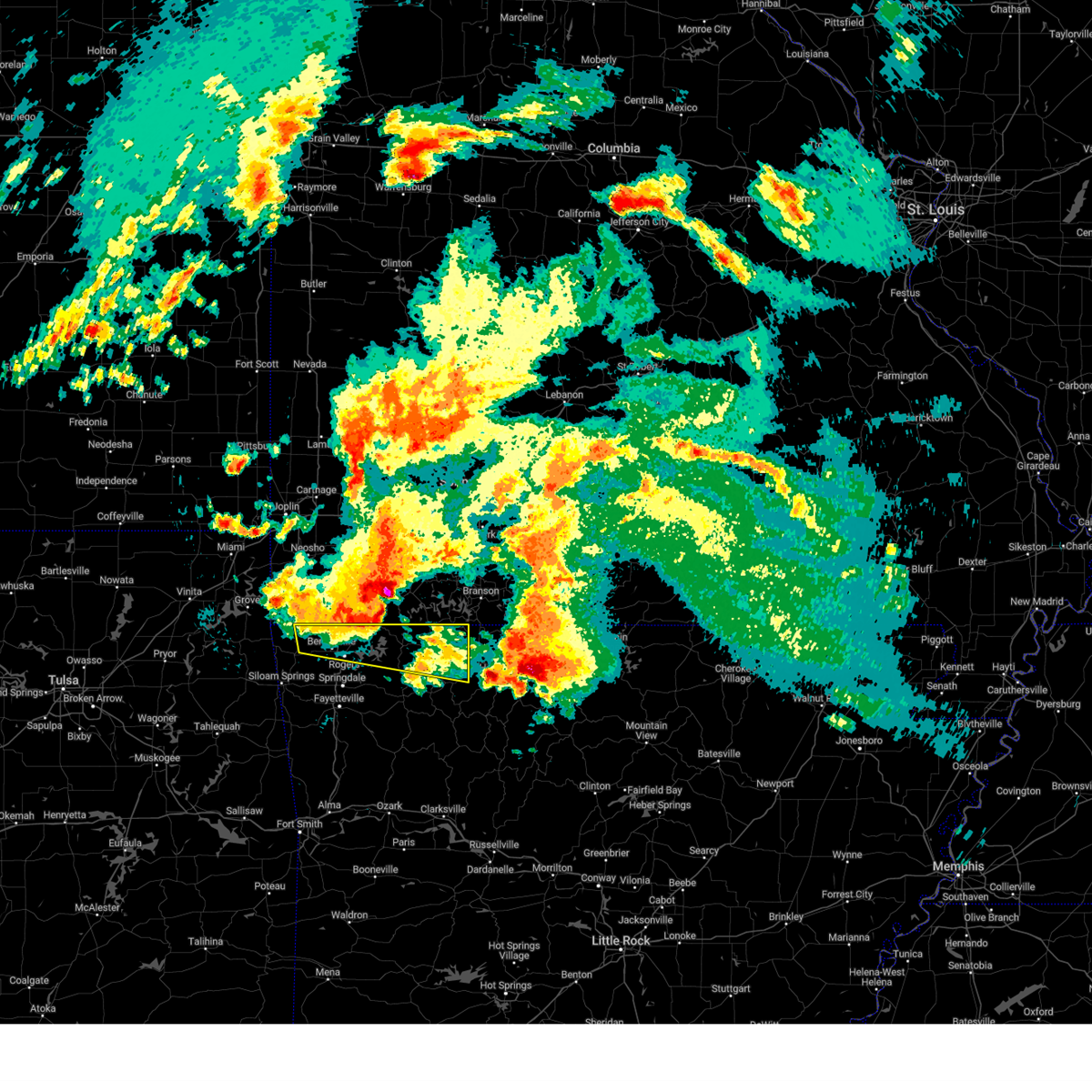 At 345 am cdt, a severe thunderstorm was located near beaver, moving east at 65 mph (radar indicated). Hazards include 70 mph wind gusts and half dollar size hail. Hail damage to vehicles is expected. expect considerable tree damage. wind damage is also likely to mobile homes, roofs, and outbuildings. Locations in or near the path include, rogers, bentonville, berryville, eureka springs, bella vista, pea ridge, green forest, gravette, gateway, beaver, carrollton, hiwasse, urbanette, rule, grandview, miller, centerton, avoca, beaver lake, connor, this includes interstate 49 between mile markers 84 and 93. At 345 am cdt, a severe thunderstorm was located near beaver, moving east at 65 mph (radar indicated). Hazards include 70 mph wind gusts and half dollar size hail. Hail damage to vehicles is expected. expect considerable tree damage. wind damage is also likely to mobile homes, roofs, and outbuildings. Locations in or near the path include, rogers, bentonville, berryville, eureka springs, bella vista, pea ridge, green forest, gravette, gateway, beaver, carrollton, hiwasse, urbanette, rule, grandview, miller, centerton, avoca, beaver lake, connor, this includes interstate 49 between mile markers 84 and 93.
|
| 5/26/2024 3:25 AM CDT |
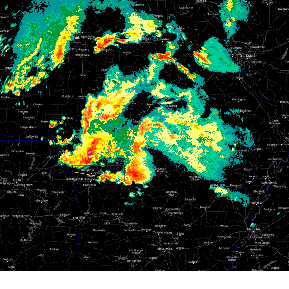 Svrtsa the national weather service in tulsa has issued a * severe thunderstorm warning for, northern benton county in northwestern arkansas, north central madison county in northwestern arkansas, carroll county in northwestern arkansas, * until 430 am cdt. * at 325 am cdt, a severe thunderstorm was located near bella vista, moving east at 60 mph (radar indicated). Hazards include 60 mph wind gusts and quarter size hail. Hail damage to vehicles is expected. expect wind damage to roofs, siding, and trees. Locations in or near the path include, rogers, bentonville, berryville, eureka springs, bella vista, pea ridge, green forest, gravette, decatur, gateway, beaver, carrollton, hiwasse, maysville, urbanette, rule, grandview, miller, centerton, avoca, this includes interstate 49 between mile markers 83 and 93. Svrtsa the national weather service in tulsa has issued a * severe thunderstorm warning for, northern benton county in northwestern arkansas, north central madison county in northwestern arkansas, carroll county in northwestern arkansas, * until 430 am cdt. * at 325 am cdt, a severe thunderstorm was located near bella vista, moving east at 60 mph (radar indicated). Hazards include 60 mph wind gusts and quarter size hail. Hail damage to vehicles is expected. expect wind damage to roofs, siding, and trees. Locations in or near the path include, rogers, bentonville, berryville, eureka springs, bella vista, pea ridge, green forest, gravette, decatur, gateway, beaver, carrollton, hiwasse, maysville, urbanette, rule, grandview, miller, centerton, avoca, this includes interstate 49 between mile markers 83 and 93.
|
| 5/26/2024 2:04 AM CDT |
 Tortsa the national weather service in tulsa has issued a * tornado warning for, northeastern benton county in northwestern arkansas, northwestern madison county in northwestern arkansas, northwestern carroll county in northwestern arkansas, * until 245 am cdt. * at 204 am cdt, a severe thunderstorm with strong low level rotation that could produce a tornado at any time was located 4 miles east of rogers, moving east at 25 mph (radar indicated rotation). Hazards include tornado and golf ball size hail. Flying debris will be dangerous to those caught without shelter. mobile homes will be damaged or destroyed. damage to roofs, windows, and vehicles will occur. tree damage is likely. Locations in or near the path include, springdale, rogers, bentonville, eureka springs, lowell, pea ridge, gateway, beaver, war eagle, hobbs state park, grandview, clifty, avoca, rockhouse, hill top, beaver lake, walnut hill, monte ne, larue, pleasant ridge, this includes interstate 49 between mile markers 76 and 90. Tortsa the national weather service in tulsa has issued a * tornado warning for, northeastern benton county in northwestern arkansas, northwestern madison county in northwestern arkansas, northwestern carroll county in northwestern arkansas, * until 245 am cdt. * at 204 am cdt, a severe thunderstorm with strong low level rotation that could produce a tornado at any time was located 4 miles east of rogers, moving east at 25 mph (radar indicated rotation). Hazards include tornado and golf ball size hail. Flying debris will be dangerous to those caught without shelter. mobile homes will be damaged or destroyed. damage to roofs, windows, and vehicles will occur. tree damage is likely. Locations in or near the path include, springdale, rogers, bentonville, eureka springs, lowell, pea ridge, gateway, beaver, war eagle, hobbs state park, grandview, clifty, avoca, rockhouse, hill top, beaver lake, walnut hill, monte ne, larue, pleasant ridge, this includes interstate 49 between mile markers 76 and 90.
|
| 5/26/2024 1:58 AM CDT |
 At 157 am cdt, a severe thunderstorm with strong low level rotation that could produce a tornado at any time was located near rogers, moving east at 25 mph (radar indicated rotation). Hazards include tornado and golf ball size hail. Flying debris will be dangerous to those caught without shelter. mobile homes will be damaged or destroyed. damage to roofs, windows, and vehicles will occur. tree damage is likely. Locations in or near the path include, rogers, bentonville, bella vista, lowell, pea ridge, cave springs, highfill, springtown, war eagle, northwest arkansas regional air, hiwasse, miller, centerton, avoca, hill top, walnut hill, vaughn, monte ne, larue, healing springs, this includes interstate 49 between mile markers 77 and 93. At 157 am cdt, a severe thunderstorm with strong low level rotation that could produce a tornado at any time was located near rogers, moving east at 25 mph (radar indicated rotation). Hazards include tornado and golf ball size hail. Flying debris will be dangerous to those caught without shelter. mobile homes will be damaged or destroyed. damage to roofs, windows, and vehicles will occur. tree damage is likely. Locations in or near the path include, rogers, bentonville, bella vista, lowell, pea ridge, cave springs, highfill, springtown, war eagle, northwest arkansas regional air, hiwasse, miller, centerton, avoca, hill top, walnut hill, vaughn, monte ne, larue, healing springs, this includes interstate 49 between mile markers 77 and 93.
|
| 5/26/2024 1:46 AM CDT |
 At 145 am cdt, a severe thunderstorm with strong low level rotation that could produce a tornado at any time was over bentonville, moving east at 30 mph (radar indicated rotation). Hazards include tornado and golf ball size hail. Flying debris will be dangerous to those caught without shelter. mobile homes will be damaged or destroyed. damage to roofs, windows, and vehicles will occur. tree damage is likely. Locations in or near the path include, springdale, rogers, bentonville, bella vista, lowell, pea ridge, gentry, gravette, cave springs, decatur, highfill, springtown, northwest arkansas regional air, hiwasse, war eagle, miller, centerton, avoca, larue, rocky comfort, this includes interstate 49 between mile markers 76 and 93. At 145 am cdt, a severe thunderstorm with strong low level rotation that could produce a tornado at any time was over bentonville, moving east at 30 mph (radar indicated rotation). Hazards include tornado and golf ball size hail. Flying debris will be dangerous to those caught without shelter. mobile homes will be damaged or destroyed. damage to roofs, windows, and vehicles will occur. tree damage is likely. Locations in or near the path include, springdale, rogers, bentonville, bella vista, lowell, pea ridge, gentry, gravette, cave springs, decatur, highfill, springtown, northwest arkansas regional air, hiwasse, war eagle, miller, centerton, avoca, larue, rocky comfort, this includes interstate 49 between mile markers 76 and 93.
|
| 5/26/2024 1:26 AM CDT |
 Tortsa the national weather service in tulsa has issued a * tornado warning for, benton county in northwestern arkansas, * until 215 am cdt. * at 126 am cdt, a severe thunderstorm with strong low level rotation that could produce a tornado at any time was located 3 miles east of decatur, moving east at 20 mph (radar indicated rotation). Hazards include tornado and golf ball size hail. Flying debris will be dangerous to those caught without shelter. mobile homes will be damaged or destroyed. damage to roofs, windows, and vehicles will occur. tree damage is likely. Locations in or near the path include, springdale, rogers, bentonville, bella vista, lowell, pea ridge, gentry, gravette, cave springs, decatur, highfill, springtown, northwest arkansas regional air, hiwasse, war eagle, miller, centerton, avoca, larue, rocky comfort, this includes interstate 49 between mile markers 75 and 93. Tortsa the national weather service in tulsa has issued a * tornado warning for, benton county in northwestern arkansas, * until 215 am cdt. * at 126 am cdt, a severe thunderstorm with strong low level rotation that could produce a tornado at any time was located 3 miles east of decatur, moving east at 20 mph (radar indicated rotation). Hazards include tornado and golf ball size hail. Flying debris will be dangerous to those caught without shelter. mobile homes will be damaged or destroyed. damage to roofs, windows, and vehicles will occur. tree damage is likely. Locations in or near the path include, springdale, rogers, bentonville, bella vista, lowell, pea ridge, gentry, gravette, cave springs, decatur, highfill, springtown, northwest arkansas regional air, hiwasse, war eagle, miller, centerton, avoca, larue, rocky comfort, this includes interstate 49 between mile markers 75 and 93.
|
| 5/8/2024 6:36 PM CDT |
 Svrtsa the national weather service in tulsa has issued a * severe thunderstorm warning for, northeastern benton county in northwestern arkansas, northwestern madison county in northwestern arkansas, carroll county in northwestern arkansas, * until 715 pm cdt. * at 636 pm cdt, a severe thunderstorm was located 6 miles east of rogers, moving east at 50 mph (radar indicated). Hazards include 60 mph wind gusts and quarter size hail. Hail damage to vehicles is expected. expect wind damage to roofs, siding, and trees. Locations in or near the path include, rogers, bentonville, berryville, eureka springs, lowell, green forest, beaver, hobbs state park, clifty, war eagle, urbanette, grandview, avoca, beaver lake, larue, pleasant ridge, denver, oak hill, busch, rockhouse, this includes interstate 49 between mile markers 79 and 81, and near mile marker 87. Svrtsa the national weather service in tulsa has issued a * severe thunderstorm warning for, northeastern benton county in northwestern arkansas, northwestern madison county in northwestern arkansas, carroll county in northwestern arkansas, * until 715 pm cdt. * at 636 pm cdt, a severe thunderstorm was located 6 miles east of rogers, moving east at 50 mph (radar indicated). Hazards include 60 mph wind gusts and quarter size hail. Hail damage to vehicles is expected. expect wind damage to roofs, siding, and trees. Locations in or near the path include, rogers, bentonville, berryville, eureka springs, lowell, green forest, beaver, hobbs state park, clifty, war eagle, urbanette, grandview, avoca, beaver lake, larue, pleasant ridge, denver, oak hill, busch, rockhouse, this includes interstate 49 between mile markers 79 and 81, and near mile marker 87.
|
| 5/6/2024 11:57 PM CDT |
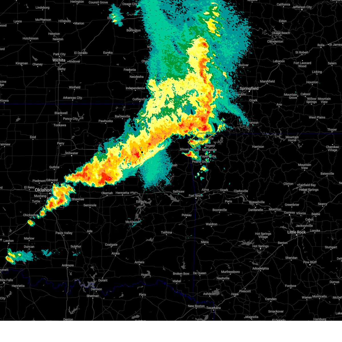 The storm which prompted the warning has moved out of the area. therefore, the warning will be allowed to expire. however, gusty winds are still possible with this thunderstorm. a tornado watch remains in effect until 500 am cdt for northwestern arkansas. The storm which prompted the warning has moved out of the area. therefore, the warning will be allowed to expire. however, gusty winds are still possible with this thunderstorm. a tornado watch remains in effect until 500 am cdt for northwestern arkansas.
|
| 5/6/2024 11:35 PM CDT |
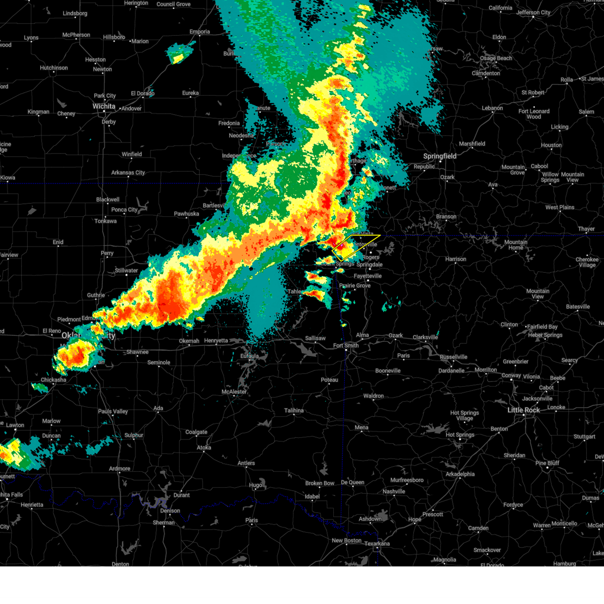 Svrtsa the national weather service in tulsa has issued a * severe thunderstorm warning for, northwestern benton county in northwestern arkansas, * until midnight cdt. * at 1134 pm cdt, a severe thunderstorm was located near decatur, moving northeast at 50 mph (radar indicated). Hazards include 60 mph wind gusts and half dollar size hail. Hail damage to vehicles is expected. expect wind damage to roofs, siding, and trees. Locations in or near the path include, bentonville, bella vista, pea ridge, gentry, gravette, decatur, hiwasse, miller, centerton, this includes interstate 49 between mile markers 90 and 93. Svrtsa the national weather service in tulsa has issued a * severe thunderstorm warning for, northwestern benton county in northwestern arkansas, * until midnight cdt. * at 1134 pm cdt, a severe thunderstorm was located near decatur, moving northeast at 50 mph (radar indicated). Hazards include 60 mph wind gusts and half dollar size hail. Hail damage to vehicles is expected. expect wind damage to roofs, siding, and trees. Locations in or near the path include, bentonville, bella vista, pea ridge, gentry, gravette, decatur, hiwasse, miller, centerton, this includes interstate 49 between mile markers 90 and 93.
|
| 4/28/2024 7:06 PM CDT |
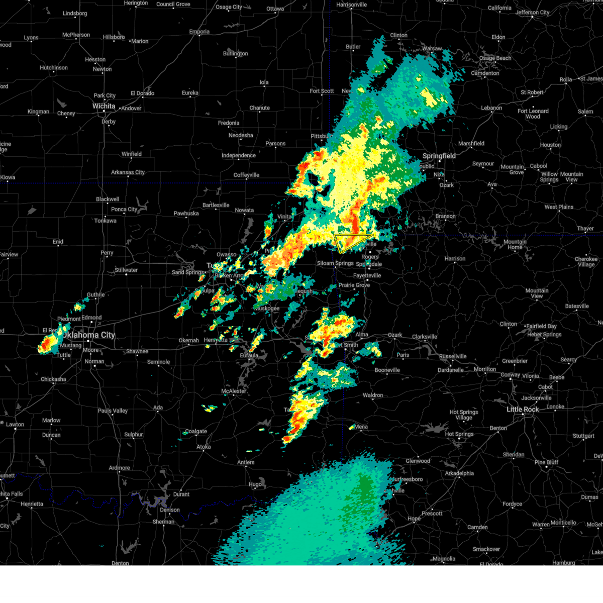 the severe thunderstorm warning has been cancelled and is no longer in effect the severe thunderstorm warning has been cancelled and is no longer in effect
|
| 4/28/2024 6:40 PM CDT |
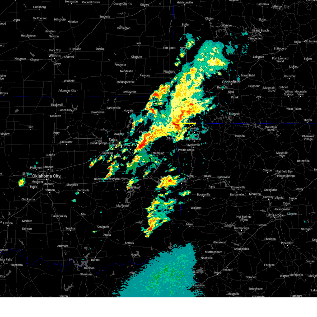 Svrtsa the national weather service in tulsa has issued a * severe thunderstorm warning for, northwestern benton county in northwestern arkansas, * until 730 pm cdt. * at 640 pm cdt, a severe thunderstorm was located 3 miles northeast of gravette, moving northeast at 55 mph (radar indicated). Hazards include 60 mph wind gusts. Expect damage to roofs, siding, and trees. Locations in or near the path include, gravette, decatur, hiwasse,. Svrtsa the national weather service in tulsa has issued a * severe thunderstorm warning for, northwestern benton county in northwestern arkansas, * until 730 pm cdt. * at 640 pm cdt, a severe thunderstorm was located 3 miles northeast of gravette, moving northeast at 55 mph (radar indicated). Hazards include 60 mph wind gusts. Expect damage to roofs, siding, and trees. Locations in or near the path include, gravette, decatur, hiwasse,.
|
| 4/28/2024 2:52 AM CDT |
 The storms which prompted the warning have weakened below severe limits, and no longer pose an immediate threat to life or property. therefore, the warning will be allowed to expire. however, gusty winds to 50 mph are still possible with these thunderstorms. a tornado watch remains in effect until 300 am cdt for northeastern oklahoma. a tornado watch also remains in effect until 700 am cdt for northwestern arkansas, and northeastern oklahoma. The storms which prompted the warning have weakened below severe limits, and no longer pose an immediate threat to life or property. therefore, the warning will be allowed to expire. however, gusty winds to 50 mph are still possible with these thunderstorms. a tornado watch remains in effect until 300 am cdt for northeastern oklahoma. a tornado watch also remains in effect until 700 am cdt for northwestern arkansas, and northeastern oklahoma.
|
| 4/28/2024 2:31 AM CDT |
 At 231 am cdt, severe thunderstorms were located along a line extending from 2 miles east of pineville to northwest arkansas regional airport to 2 miles east of cincinnati, moving east at 30 mph (radar indicated). Hazards include 60 mph wind gusts and penny size hail. Expect damage to roofs, siding, and trees. Locations in or near the path include, fayetteville, springdale, rogers, bentonville, siloam springs, bella vista, lowell, farmington, pea ridge, prairie grove, gentry, tontitown, gravette, west fork, lincoln, cave springs, decatur, greenland, west siloam springs, highfill, this includes interstate 49 between mile markers 53 and 93. At 231 am cdt, severe thunderstorms were located along a line extending from 2 miles east of pineville to northwest arkansas regional airport to 2 miles east of cincinnati, moving east at 30 mph (radar indicated). Hazards include 60 mph wind gusts and penny size hail. Expect damage to roofs, siding, and trees. Locations in or near the path include, fayetteville, springdale, rogers, bentonville, siloam springs, bella vista, lowell, farmington, pea ridge, prairie grove, gentry, tontitown, gravette, west fork, lincoln, cave springs, decatur, greenland, west siloam springs, highfill, this includes interstate 49 between mile markers 53 and 93.
|
| 4/28/2024 2:00 AM CDT |
 Svrtsa the national weather service in tulsa has issued a * severe thunderstorm warning for, benton county in northwestern arkansas, central washington county in northwestern arkansas, * until 300 am cdt. * at 200 am cdt, severe thunderstorms were located along a line extending from 3 miles west of south west city to 3 miles northwest of west siloam springs to 2 miles south of christie, moving east at 40 mph (radar indicated). Hazards include 70 mph wind gusts and penny size hail. Expect considerable tree damage. damage is likely to mobile homes, roofs, and outbuildings. Locations in or near the path include, fayetteville, springdale, rogers, bentonville, siloam springs, bella vista, lowell, farmington, pea ridge, prairie grove, gentry, tontitown, gravette, west fork, lincoln, cave springs, decatur, greenland, west siloam springs, highfill, this includes interstate 49 between mile markers 53 and 93. Svrtsa the national weather service in tulsa has issued a * severe thunderstorm warning for, benton county in northwestern arkansas, central washington county in northwestern arkansas, * until 300 am cdt. * at 200 am cdt, severe thunderstorms were located along a line extending from 3 miles west of south west city to 3 miles northwest of west siloam springs to 2 miles south of christie, moving east at 40 mph (radar indicated). Hazards include 70 mph wind gusts and penny size hail. Expect considerable tree damage. damage is likely to mobile homes, roofs, and outbuildings. Locations in or near the path include, fayetteville, springdale, rogers, bentonville, siloam springs, bella vista, lowell, farmington, pea ridge, prairie grove, gentry, tontitown, gravette, west fork, lincoln, cave springs, decatur, greenland, west siloam springs, highfill, this includes interstate 49 between mile markers 53 and 93.
|
| 4/2/2024 12:19 AM CDT |
 the severe thunderstorm warning has been cancelled and is no longer in effect the severe thunderstorm warning has been cancelled and is no longer in effect
|
| 4/2/2024 12:19 AM CDT |
 At 1219 am cdt, severe thunderstorms were located along a line extending from 3 miles northeast of bella vista to 3 miles northeast of watts, moving east at 45 mph (radar indicated). Hazards include 60 mph wind gusts. Expect damage to roofs, siding, and trees. Locations in or near the path include, fayetteville, springdale, rogers, bentonville, siloam springs, bella vista, lowell, pea ridge, gentry, tontitown, cave springs, highfill, gateway, springtown, northwest arkansas regional air, hiwasse, miller, centerton, johnson, elm springs, this includes interstate 49 between mile markers 68 and 93. At 1219 am cdt, severe thunderstorms were located along a line extending from 3 miles northeast of bella vista to 3 miles northeast of watts, moving east at 45 mph (radar indicated). Hazards include 60 mph wind gusts. Expect damage to roofs, siding, and trees. Locations in or near the path include, fayetteville, springdale, rogers, bentonville, siloam springs, bella vista, lowell, pea ridge, gentry, tontitown, cave springs, highfill, gateway, springtown, northwest arkansas regional air, hiwasse, miller, centerton, johnson, elm springs, this includes interstate 49 between mile markers 68 and 93.
|
| 4/1/2024 11:54 PM CDT |
 Svrtsa the national weather service in tulsa has issued a * severe thunderstorm warning for, benton county in northwestern arkansas, north central washington county in northwestern arkansas, southeastern delaware county in northeastern oklahoma, northwestern adair county in northeastern oklahoma, * until 1245 am cdt. * at 1154 pm cdt, severe thunderstorms were located along a line extending from 3 miles southeast of south west city to 2 miles southeast of oaks, moving east at 40 mph (radar indicated). Hazards include 60 mph wind gusts. Expect damage to roofs, siding, and trees. Locations in or near the path include, fayetteville, springdale, rogers, bentonville, siloam springs, bella vista, lowell, pea ridge, gentry, tontitown, gravette, cave springs, decatur, west siloam springs, colcord, kansas, highfill, gateway, oaks, springtown, this includes interstate 49 between mile markers 68 and 93. Svrtsa the national weather service in tulsa has issued a * severe thunderstorm warning for, benton county in northwestern arkansas, north central washington county in northwestern arkansas, southeastern delaware county in northeastern oklahoma, northwestern adair county in northeastern oklahoma, * until 1245 am cdt. * at 1154 pm cdt, severe thunderstorms were located along a line extending from 3 miles southeast of south west city to 2 miles southeast of oaks, moving east at 40 mph (radar indicated). Hazards include 60 mph wind gusts. Expect damage to roofs, siding, and trees. Locations in or near the path include, fayetteville, springdale, rogers, bentonville, siloam springs, bella vista, lowell, pea ridge, gentry, tontitown, gravette, cave springs, decatur, west siloam springs, colcord, kansas, highfill, gateway, oaks, springtown, this includes interstate 49 between mile markers 68 and 93.
|
| 3/14/2024 2:56 PM CDT |
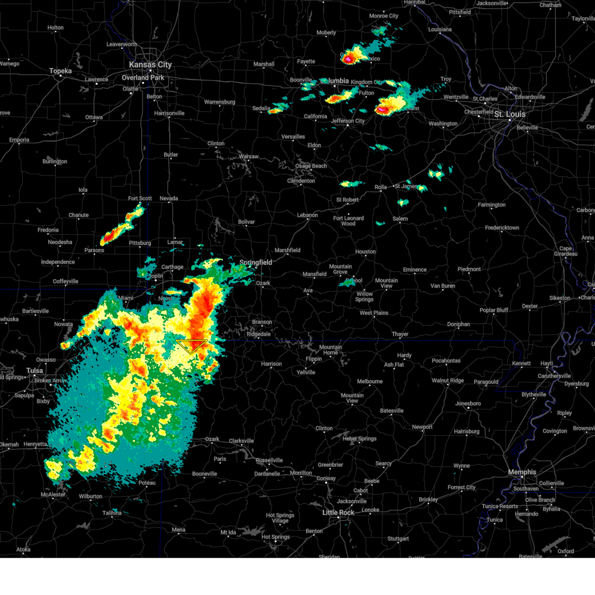 At 256 pm cdt, a severe thunderstorm was located near garfield, moving northeast at 35 mph (radar indicated). Hazards include 60 mph wind gusts and quarter size hail. Hail damage to vehicles is expected. expect wind damage to roofs, siding, and trees. Locations in or near the path include, rogers, pea ridge, gateway, avoca, hill top,. At 256 pm cdt, a severe thunderstorm was located near garfield, moving northeast at 35 mph (radar indicated). Hazards include 60 mph wind gusts and quarter size hail. Hail damage to vehicles is expected. expect wind damage to roofs, siding, and trees. Locations in or near the path include, rogers, pea ridge, gateway, avoca, hill top,.
|
| 3/14/2024 2:43 PM CDT |
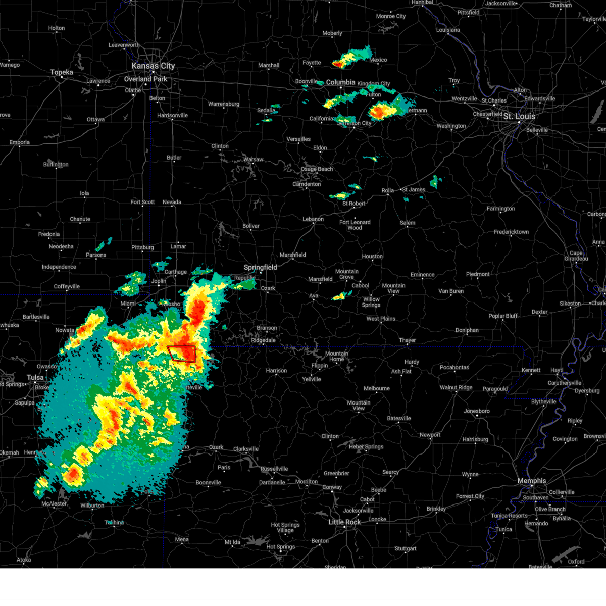 the tornado warning has been cancelled and is no longer in effect the tornado warning has been cancelled and is no longer in effect
|
| 3/14/2024 2:39 PM CDT |
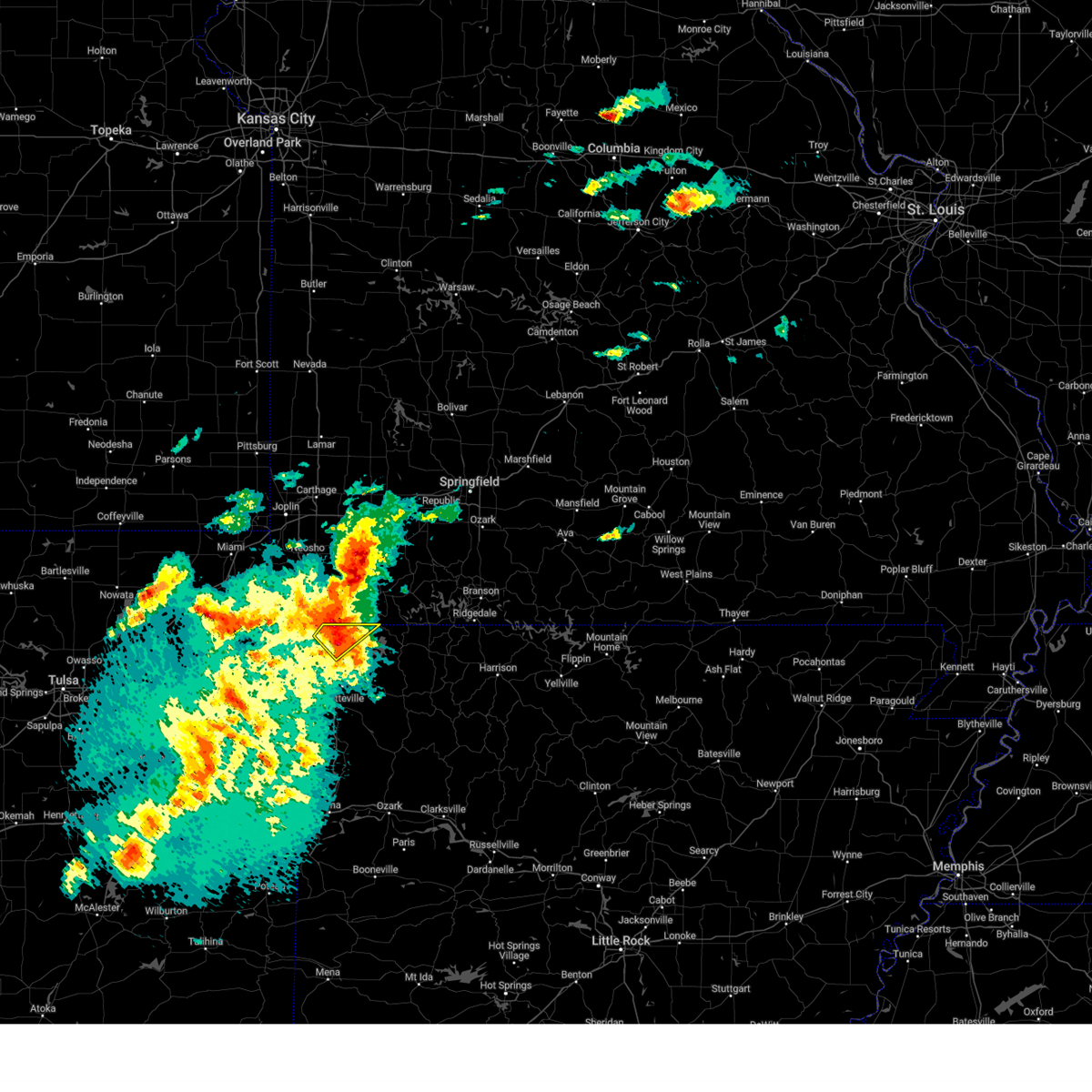 Svrtsa the national weather service in tulsa has issued a * severe thunderstorm warning for, north central benton county in northwestern arkansas, * until 330 pm cdt. * at 239 pm cdt, a severe thunderstorm was located near bella vista, moving northeast at 35 mph (radar indicated). Hazards include 60 mph wind gusts and quarter size hail. Hail damage to vehicles is expected. expect wind damage to roofs, siding, and trees. Locations in or near the path include, rogers, bentonville, bella vista, pea ridge, gateway, miller, avoca, hill top, this includes interstate 49 between mile markers 84 and 93. Svrtsa the national weather service in tulsa has issued a * severe thunderstorm warning for, north central benton county in northwestern arkansas, * until 330 pm cdt. * at 239 pm cdt, a severe thunderstorm was located near bella vista, moving northeast at 35 mph (radar indicated). Hazards include 60 mph wind gusts and quarter size hail. Hail damage to vehicles is expected. expect wind damage to roofs, siding, and trees. Locations in or near the path include, rogers, bentonville, bella vista, pea ridge, gateway, miller, avoca, hill top, this includes interstate 49 between mile markers 84 and 93.
|
| 3/14/2024 2:35 PM CDT |
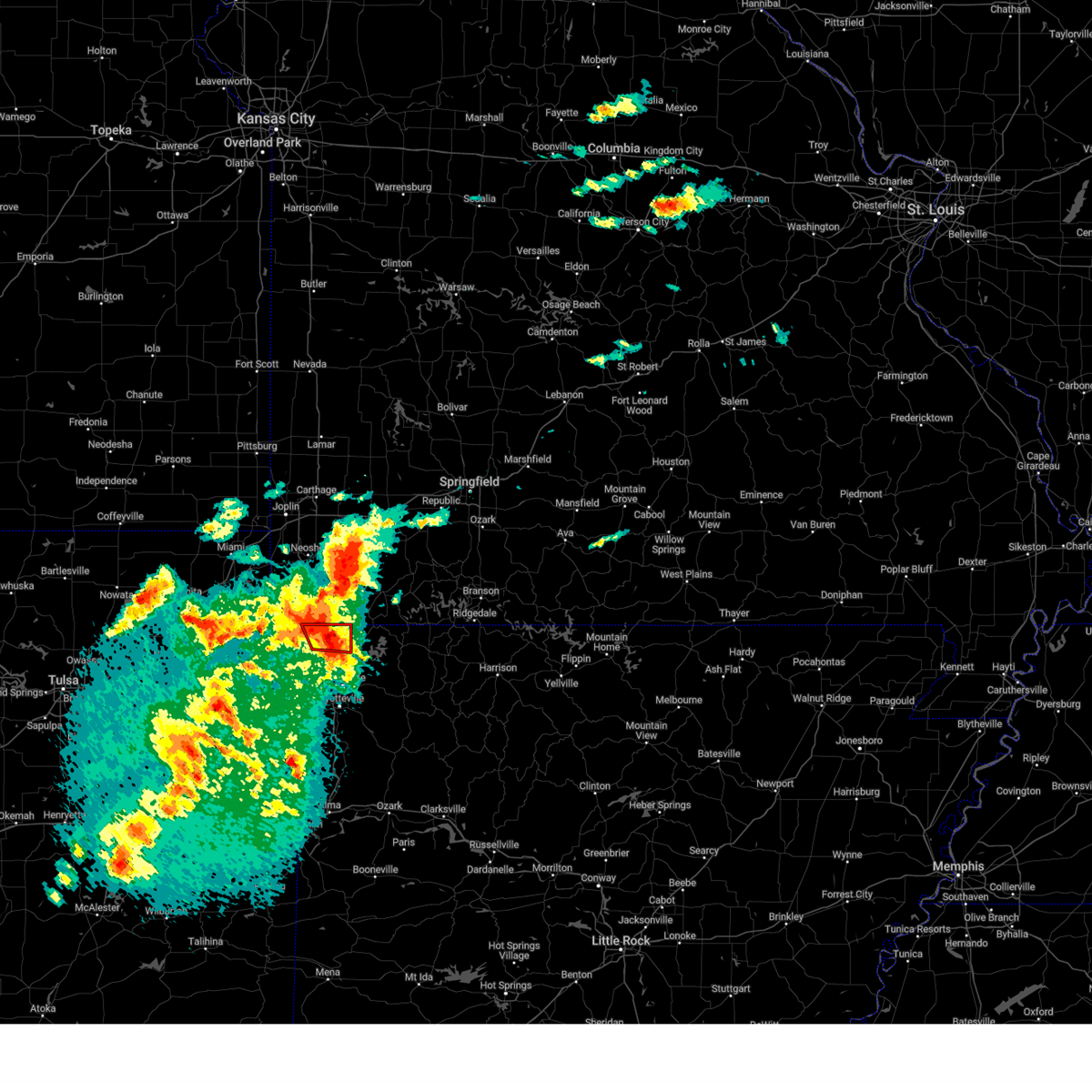 At 234 pm cdt, a severe thunderstorm capable of producing a tornado was located over bella vista, moving east at 30 mph (radar indicated rotation). Hazards include tornado and golf ball size hail. Flying debris will be dangerous to those caught without shelter. mobile homes will be damaged or destroyed. damage to roofs, windows, and vehicles will occur. tree damage is likely. Locations in or near the path include, rogers, bentonville, bella vista, pea ridge, hiwasse, miller, centerton, this includes interstate 49 between mile markers 87 and 93. At 234 pm cdt, a severe thunderstorm capable of producing a tornado was located over bella vista, moving east at 30 mph (radar indicated rotation). Hazards include tornado and golf ball size hail. Flying debris will be dangerous to those caught without shelter. mobile homes will be damaged or destroyed. damage to roofs, windows, and vehicles will occur. tree damage is likely. Locations in or near the path include, rogers, bentonville, bella vista, pea ridge, hiwasse, miller, centerton, this includes interstate 49 between mile markers 87 and 93.
|
| 3/14/2024 2:23 PM CDT |
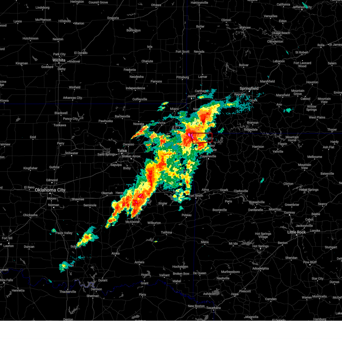 Tortsa the national weather service in tulsa has issued a * tornado warning for, northwestern benton county in northwestern arkansas, * until 300 pm cdt. * at 223 pm cdt, a severe thunderstorm capable of producing a tornado was located over gravette, moving east at 35 mph (radar indicated rotation). Hazards include tornado and baseball size hail. Flying debris will be dangerous to those caught without shelter. mobile homes will be damaged or destroyed. damage to roofs, windows, and vehicles will occur. tree damage is likely. Locations in or near the path include, rogers, bentonville, bella vista, pea ridge, gravette, decatur, hiwasse, miller, centerton, this includes interstate 49 between mile markers 86 and 93. Tortsa the national weather service in tulsa has issued a * tornado warning for, northwestern benton county in northwestern arkansas, * until 300 pm cdt. * at 223 pm cdt, a severe thunderstorm capable of producing a tornado was located over gravette, moving east at 35 mph (radar indicated rotation). Hazards include tornado and baseball size hail. Flying debris will be dangerous to those caught without shelter. mobile homes will be damaged or destroyed. damage to roofs, windows, and vehicles will occur. tree damage is likely. Locations in or near the path include, rogers, bentonville, bella vista, pea ridge, gravette, decatur, hiwasse, miller, centerton, this includes interstate 49 between mile markers 86 and 93.
|
| 1/11/2024 11:21 PM CST |
 At 1120 pm cst, severe thunderstorms were located along a line extending from 11 miles west of washburn to 3 miles east of lowell to near greenland, moving northeast at 65 mph (radar indicated). Hazards include 60 mph wind gusts and quarter size hail. Hail damage to vehicles is expected. expect wind damage to roofs, siding, and trees. locations in or near the path include, fayetteville, springdale, rogers, bentonville, berryville, huntsville, eureka springs, bella vista, lowell, farmington, pea ridge, holiday island, elkins, tontitown, west fork, cave springs, greenland, gateway, beaver, hindsville, this includes interstate 49 between mile markers 52 and 93. hail threat, radar indicated max hail size, 1. 00 in wind threat, radar indicated max wind gust, 60 mph. At 1120 pm cst, severe thunderstorms were located along a line extending from 11 miles west of washburn to 3 miles east of lowell to near greenland, moving northeast at 65 mph (radar indicated). Hazards include 60 mph wind gusts and quarter size hail. Hail damage to vehicles is expected. expect wind damage to roofs, siding, and trees. locations in or near the path include, fayetteville, springdale, rogers, bentonville, berryville, huntsville, eureka springs, bella vista, lowell, farmington, pea ridge, holiday island, elkins, tontitown, west fork, cave springs, greenland, gateway, beaver, hindsville, this includes interstate 49 between mile markers 52 and 93. hail threat, radar indicated max hail size, 1. 00 in wind threat, radar indicated max wind gust, 60 mph.
|
| 1/11/2024 11:01 PM CST |
 At 1101 pm cst, severe thunderstorms were located along a line extending from 4 miles northwest of hiwasse to near lincoln, moving northeast at 60 mph (radar indicated). Hazards include 60 mph wind gusts and quarter size hail. Hail damage to vehicles is expected. expect wind damage to roofs, siding, and trees. locations in or near the path include, fayetteville, springdale, rogers, bentonville, berryville, huntsville, eureka springs, bella vista, lowell, farmington, pea ridge, prairie grove, holiday island, elkins, tontitown, west fork, lincoln, cave springs, decatur, greenland, this includes interstate 49 between mile markers 50 and 93. hail threat, radar indicated max hail size, 1. 00 in wind threat, radar indicated max wind gust, 60 mph. At 1101 pm cst, severe thunderstorms were located along a line extending from 4 miles northwest of hiwasse to near lincoln, moving northeast at 60 mph (radar indicated). Hazards include 60 mph wind gusts and quarter size hail. Hail damage to vehicles is expected. expect wind damage to roofs, siding, and trees. locations in or near the path include, fayetteville, springdale, rogers, bentonville, berryville, huntsville, eureka springs, bella vista, lowell, farmington, pea ridge, prairie grove, holiday island, elkins, tontitown, west fork, lincoln, cave springs, decatur, greenland, this includes interstate 49 between mile markers 50 and 93. hail threat, radar indicated max hail size, 1. 00 in wind threat, radar indicated max wind gust, 60 mph.
|
| 9/24/2023 1:04 AM CDT |
 At 104 am cdt, a severe thunderstorm was located over decatur, moving east at 15 mph (radar indicated). Hazards include 60 mph wind gusts and half dollar size hail. Hail damage to vehicles is expected. expect wind damage to roofs, siding, and trees. locations in or near the path include, rogers, bentonville, bella vista, pea ridge, gentry, gravette, cave springs, decatur, highfill, springtown, northwest arkansas regional air, hiwasse, miller, centerton, vaughn, healing springs, rocky comfort, this includes interstate 49 between mile markers 84 and 93. hail threat, radar indicated max hail size, 1. 25 in wind threat, radar indicated max wind gust, 60 mph. At 104 am cdt, a severe thunderstorm was located over decatur, moving east at 15 mph (radar indicated). Hazards include 60 mph wind gusts and half dollar size hail. Hail damage to vehicles is expected. expect wind damage to roofs, siding, and trees. locations in or near the path include, rogers, bentonville, bella vista, pea ridge, gentry, gravette, cave springs, decatur, highfill, springtown, northwest arkansas regional air, hiwasse, miller, centerton, vaughn, healing springs, rocky comfort, this includes interstate 49 between mile markers 84 and 93. hail threat, radar indicated max hail size, 1. 25 in wind threat, radar indicated max wind gust, 60 mph.
|
| 9/24/2023 12:43 AM CDT |
 At 1243 am cdt, a severe thunderstorm was located 3 miles east of maysville, moving east at 15 mph (radar indicated). Hazards include 60 mph wind gusts and half dollar size hail. Hail damage to vehicles is expected. expect wind damage to roofs, siding, and trees. locations in or near the path include, rogers, bentonville, bella vista, pea ridge, gentry, gravette, cave springs, decatur, highfill, springtown, northwest arkansas regional air, hiwasse, miller, centerton, vaughn, healing springs, rocky comfort, this includes interstate 49 between mile markers 84 and 93. hail threat, radar indicated max hail size, 1. 25 in wind threat, radar indicated max wind gust, 60 mph. At 1243 am cdt, a severe thunderstorm was located 3 miles east of maysville, moving east at 15 mph (radar indicated). Hazards include 60 mph wind gusts and half dollar size hail. Hail damage to vehicles is expected. expect wind damage to roofs, siding, and trees. locations in or near the path include, rogers, bentonville, bella vista, pea ridge, gentry, gravette, cave springs, decatur, highfill, springtown, northwest arkansas regional air, hiwasse, miller, centerton, vaughn, healing springs, rocky comfort, this includes interstate 49 between mile markers 84 and 93. hail threat, radar indicated max hail size, 1. 25 in wind threat, radar indicated max wind gust, 60 mph.
|
| 9/6/2023 12:00 AM CDT |
 At 1159 pm cdt, severe thunderstorms were located along a line extending from 2 miles southwest of pea ridge to near rogers to 2 miles southeast of cave springs, moving east at 45 mph (radar indicated). Hazards include 60 mph wind gusts. Expect damage to roofs, siding, and trees. locations in or near the path include, springdale, rogers, bentonville, berryville, eureka springs, lowell, pea ridge, holiday island, gateway, beaver, hobbs state park, clifty, war eagle, urbanette, grandview, avoca, beaver lake, larue, pleasant ridge, best, this includes interstate 49 between mile markers 77 and 82. hail threat, radar indicated max hail size, <. 75 in wind threat, radar indicated max wind gust, 60 mph. At 1159 pm cdt, severe thunderstorms were located along a line extending from 2 miles southwest of pea ridge to near rogers to 2 miles southeast of cave springs, moving east at 45 mph (radar indicated). Hazards include 60 mph wind gusts. Expect damage to roofs, siding, and trees. locations in or near the path include, springdale, rogers, bentonville, berryville, eureka springs, lowell, pea ridge, holiday island, gateway, beaver, hobbs state park, clifty, war eagle, urbanette, grandview, avoca, beaver lake, larue, pleasant ridge, best, this includes interstate 49 between mile markers 77 and 82. hail threat, radar indicated max hail size, <. 75 in wind threat, radar indicated max wind gust, 60 mph.
|
| 8/9/2023 7:44 PM CDT |
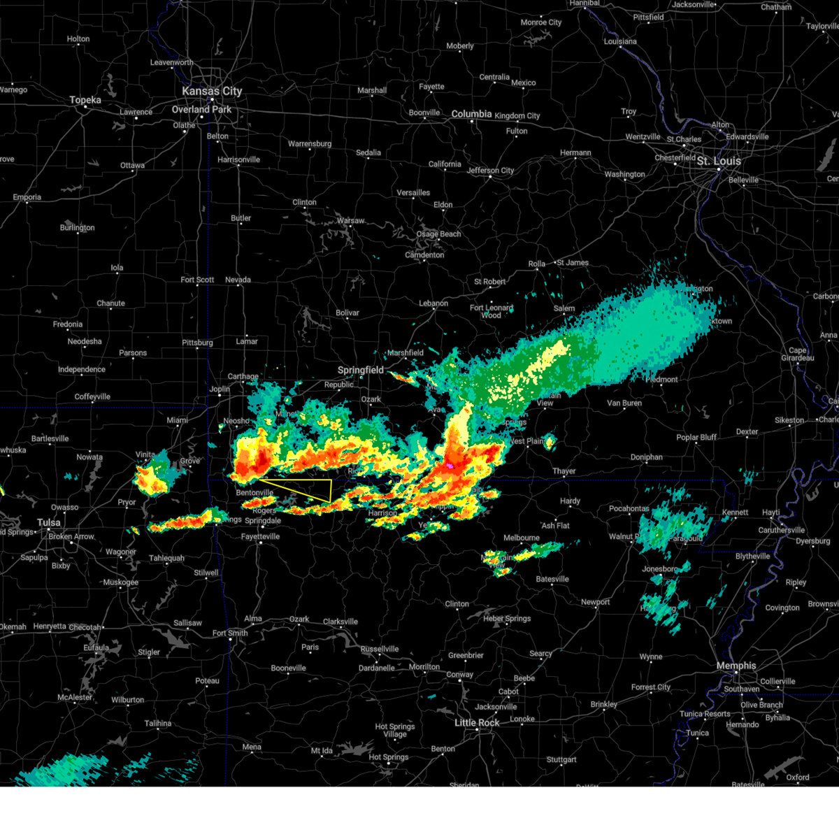 At 743 pm cdt, a severe thunderstorm was located 7 miles west of washburn, moving east at 45 mph (radar indicated). Hazards include 60 mph wind gusts and quarter size hail. Hail damage to vehicles is expected. expect wind damage to roofs, siding, and trees. locations in or near the path include, berryville, eureka springs, gateway, beaver, grandview, pleasant ridge, oak hill, busch, hail threat, radar indicated max hail size, 1. 00 in wind threat, radar indicated max wind gust, 60 mph. At 743 pm cdt, a severe thunderstorm was located 7 miles west of washburn, moving east at 45 mph (radar indicated). Hazards include 60 mph wind gusts and quarter size hail. Hail damage to vehicles is expected. expect wind damage to roofs, siding, and trees. locations in or near the path include, berryville, eureka springs, gateway, beaver, grandview, pleasant ridge, oak hill, busch, hail threat, radar indicated max hail size, 1. 00 in wind threat, radar indicated max wind gust, 60 mph.
|
| 7/30/2023 11:50 PM CDT |
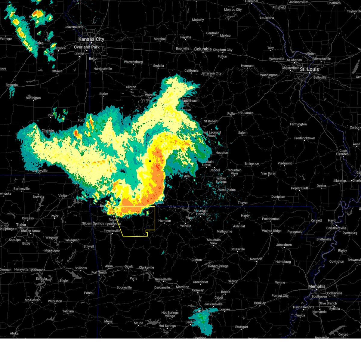 At 1150 pm cdt, severe thunderstorms were located along a line extending from 3 miles northeast of omaha to 4 miles northwest of rule to 4 miles east of lowell, moving southeast at 50 mph (radar indicated). Hazards include 70 mph wind gusts. Expect considerable tree damage. damage is likely to mobile homes, roofs, and outbuildings. locations in or near the path include, rogers, berryville, huntsville, eureka springs, pea ridge, green forest, gateway, beaver, hindsville, wesley, carrollton, rudd, kingston, forum, hobbs state park, clifty, withrow springs state park, war eagle, marble, osage, thunderstorm damage threat, considerable hail threat, radar indicated max hail size, <. 75 in wind threat, radar indicated max wind gust, 70 mph. At 1150 pm cdt, severe thunderstorms were located along a line extending from 3 miles northeast of omaha to 4 miles northwest of rule to 4 miles east of lowell, moving southeast at 50 mph (radar indicated). Hazards include 70 mph wind gusts. Expect considerable tree damage. damage is likely to mobile homes, roofs, and outbuildings. locations in or near the path include, rogers, berryville, huntsville, eureka springs, pea ridge, green forest, gateway, beaver, hindsville, wesley, carrollton, rudd, kingston, forum, hobbs state park, clifty, withrow springs state park, war eagle, marble, osage, thunderstorm damage threat, considerable hail threat, radar indicated max hail size, <. 75 in wind threat, radar indicated max wind gust, 70 mph.
|
| 7/30/2023 11:31 PM CDT |
 At 1130 pm cdt, severe thunderstorms were located along a line extending from near hollister to 6 miles northeast of grandview to 7 miles northeast of bella vista, moving southeast at 50 mph (radar indicated). Hazards include 70 mph wind gusts. Expect considerable tree damage. damage is likely to mobile homes, roofs, and outbuildings. locations in or near the path include, rogers, berryville, huntsville, eureka springs, pea ridge, green forest, gateway, beaver, hindsville, wesley, carrollton, rudd, kingston, forum, hobbs state park, clifty, withrow springs state park, war eagle, marble, osage, thunderstorm damage threat, considerable hail threat, radar indicated max hail size, <. 75 in wind threat, radar indicated max wind gust, 70 mph. At 1130 pm cdt, severe thunderstorms were located along a line extending from near hollister to 6 miles northeast of grandview to 7 miles northeast of bella vista, moving southeast at 50 mph (radar indicated). Hazards include 70 mph wind gusts. Expect considerable tree damage. damage is likely to mobile homes, roofs, and outbuildings. locations in or near the path include, rogers, berryville, huntsville, eureka springs, pea ridge, green forest, gateway, beaver, hindsville, wesley, carrollton, rudd, kingston, forum, hobbs state park, clifty, withrow springs state park, war eagle, marble, osage, thunderstorm damage threat, considerable hail threat, radar indicated max hail size, <. 75 in wind threat, radar indicated max wind gust, 70 mph.
|
| 7/30/2023 10:57 PM CDT |
 At 1057 pm cdt, severe thunderstorms were located along a line extending from near everton to 8 miles northwest of billings to near mount vernon to diamond, moving east at 45 mph (emergency management). Hazards include 70 mph wind gusts. Expect considerable tree damage. Damage is likely to mobile homes, roofs, and outbuildings. At 1057 pm cdt, severe thunderstorms were located along a line extending from near everton to 8 miles northwest of billings to near mount vernon to diamond, moving east at 45 mph (emergency management). Hazards include 70 mph wind gusts. Expect considerable tree damage. Damage is likely to mobile homes, roofs, and outbuildings.
|
| 7/14/2023 8:09 PM CDT |
 At 809 pm cdt, severe thunderstorms were located along a line extending from 4 miles north of grandview to 4 miles east of rogers to 4 miles northwest of colcord, moving southeast at 45 mph (radar indicated). Hazards include 60 mph wind gusts and penny size hail. Expect damage to roofs, siding, and trees. locations in or near the path include, springdale, rogers, bentonville, siloam springs, berryville, jay, eureka springs, bella vista, lowell, pea ridge, gentry, green forest, tontitown, gravette, cave springs, decatur, west siloam springs, colcord, kansas, highfill, this includes interstate 49 between mile markers 71 and 93. hail threat, radar indicated max hail size, 0. 75 in wind threat, radar indicated max wind gust, 60 mph. At 809 pm cdt, severe thunderstorms were located along a line extending from 4 miles north of grandview to 4 miles east of rogers to 4 miles northwest of colcord, moving southeast at 45 mph (radar indicated). Hazards include 60 mph wind gusts and penny size hail. Expect damage to roofs, siding, and trees. locations in or near the path include, springdale, rogers, bentonville, siloam springs, berryville, jay, eureka springs, bella vista, lowell, pea ridge, gentry, green forest, tontitown, gravette, cave springs, decatur, west siloam springs, colcord, kansas, highfill, this includes interstate 49 between mile markers 71 and 93. hail threat, radar indicated max hail size, 0. 75 in wind threat, radar indicated max wind gust, 60 mph.
|
| 7/14/2023 7:50 PM CDT |
 At 750 pm cdt, severe thunderstorms were located along a line extending from 4 miles southeast of cassville to 3 miles northeast of bella vista to 3 miles northeast of chloeta, moving southeast at 40 mph (radar indicated). Hazards include 60 mph wind gusts and penny size hail. Expect damage to roofs, siding, and trees. locations in or near the path include, springdale, rogers, bentonville, siloam springs, berryville, jay, eureka springs, bella vista, lowell, pea ridge, gentry, green forest, tontitown, gravette, cave springs, decatur, west siloam springs, colcord, kansas, highfill, this includes interstate 49 between mile markers 71 and 93. hail threat, radar indicated max hail size, 0. 75 in wind threat, radar indicated max wind gust, 60 mph. At 750 pm cdt, severe thunderstorms were located along a line extending from 4 miles southeast of cassville to 3 miles northeast of bella vista to 3 miles northeast of chloeta, moving southeast at 40 mph (radar indicated). Hazards include 60 mph wind gusts and penny size hail. Expect damage to roofs, siding, and trees. locations in or near the path include, springdale, rogers, bentonville, siloam springs, berryville, jay, eureka springs, bella vista, lowell, pea ridge, gentry, green forest, tontitown, gravette, cave springs, decatur, west siloam springs, colcord, kansas, highfill, this includes interstate 49 between mile markers 71 and 93. hail threat, radar indicated max hail size, 0. 75 in wind threat, radar indicated max wind gust, 60 mph.
|
| 7/14/2023 7:45 PM CDT |
 At 745 pm cdt, severe thunderstorms were located along a line extending from 4 miles west of washburn to near noel to near jay, moving east at 45 mph (radar indicated). Hazards include 60 mph wind gusts and penny size hail. Expect damage to roofs, siding, and trees. locations in or near the path include, jay, bella vista, grove, pea ridge, gravette, langley, bernice, spavinaw, gateway, disney, pensacola, maysville, honey creek state park, cherokee state park, bernice state park, spavinaw state park, hiwasse, cleora, chloeta, miller, this includes interstate 49 near mile marker 93. hail threat, radar indicated max hail size, 0. 75 in wind threat, radar indicated max wind gust, 60 mph. At 745 pm cdt, severe thunderstorms were located along a line extending from 4 miles west of washburn to near noel to near jay, moving east at 45 mph (radar indicated). Hazards include 60 mph wind gusts and penny size hail. Expect damage to roofs, siding, and trees. locations in or near the path include, jay, bella vista, grove, pea ridge, gravette, langley, bernice, spavinaw, gateway, disney, pensacola, maysville, honey creek state park, cherokee state park, bernice state park, spavinaw state park, hiwasse, cleora, chloeta, miller, this includes interstate 49 near mile marker 93. hail threat, radar indicated max hail size, 0. 75 in wind threat, radar indicated max wind gust, 60 mph.
|
| 7/14/2023 7:19 PM CDT |
 At 718 pm cdt, severe thunderstorms were located along a line extending from 4 miles east of goodman to 6 miles southeast of fairland to 4 miles southeast of vinita, moving southeast at 45 mph (radar indicated). Hazards include 60 mph wind gusts and penny size hail. Expect damage to roofs, siding, and trees. locations in or near the path include, vinita, jay, bella vista, grove, pea ridge, gravette, fairland, afton, langley, bernice, ketchum, spavinaw, gateway, wyandotte, disney, pensacola, honey creek state park, cherokee state park, bernice state park, hiwasse, this includes the following highways, interstate 44 between mile markers 277 and 305. interstate 49 near mile marker 93. hail threat, radar indicated max hail size, 0. 75 in wind threat, radar indicated max wind gust, 60 mph. At 718 pm cdt, severe thunderstorms were located along a line extending from 4 miles east of goodman to 6 miles southeast of fairland to 4 miles southeast of vinita, moving southeast at 45 mph (radar indicated). Hazards include 60 mph wind gusts and penny size hail. Expect damage to roofs, siding, and trees. locations in or near the path include, vinita, jay, bella vista, grove, pea ridge, gravette, fairland, afton, langley, bernice, ketchum, spavinaw, gateway, wyandotte, disney, pensacola, honey creek state park, cherokee state park, bernice state park, hiwasse, this includes the following highways, interstate 44 between mile markers 277 and 305. interstate 49 near mile marker 93. hail threat, radar indicated max hail size, 0. 75 in wind threat, radar indicated max wind gust, 60 mph.
|
| 7/13/2023 4:58 AM CDT |
 At 456 am cdt, severe thunderstorms were located along a line extending from 4 miles north of war eagle to 2 miles north of baron, moving southeast at 45 mph (radar indicated. northwest arkansas regional airport measured 63 mph wind gusts). Hazards include 60 mph wind gusts. Expect damage to roofs, siding, and trees. locations in or near the path include, fayetteville, springdale, rogers, bentonville, siloam springs, huntsville, cedarville, mountainburg, natural dam, lowell, farmington, pea ridge, prairie grove, gentry, elkins, tontitown, west fork, lincoln, cave springs, westville, this includes interstate 49 between mile markers 29 and 92. hail threat, radar indicated max hail size, <. 75 in wind threat, observed max wind gust, 60 mph. At 456 am cdt, severe thunderstorms were located along a line extending from 4 miles north of war eagle to 2 miles north of baron, moving southeast at 45 mph (radar indicated. northwest arkansas regional airport measured 63 mph wind gusts). Hazards include 60 mph wind gusts. Expect damage to roofs, siding, and trees. locations in or near the path include, fayetteville, springdale, rogers, bentonville, siloam springs, huntsville, cedarville, mountainburg, natural dam, lowell, farmington, pea ridge, prairie grove, gentry, elkins, tontitown, west fork, lincoln, cave springs, westville, this includes interstate 49 between mile markers 29 and 92. hail threat, radar indicated max hail size, <. 75 in wind threat, observed max wind gust, 60 mph.
|
| 6/18/2023 2:07 AM CDT |
 At 206 am cdt, severe thunderstorms were located along a line extending from 3 miles north of pea ridge to 3 miles east of fayetteville, moving east at 60 mph (radar indicated). Hazards include 70 mph wind gusts and nickel size hail. Expect considerable tree damage. damage is likely to mobile homes, roofs, and outbuildings. locations in or near the path include, fayetteville, springdale, rogers, bentonville, berryville, huntsville, eureka springs, lowell, pea ridge, green forest, gateway, beaver, hindsville, carrollton, rudd, forum, hobbs state park, clifty, withrow springs state park, war eagle, this includes interstate 49 between mile markers 77 and 81, and between mile markers 86 and 88. thunderstorm damage threat, considerable hail threat, radar indicated max hail size, 0. 88 in wind threat, radar indicated max wind gust, 70 mph. At 206 am cdt, severe thunderstorms were located along a line extending from 3 miles north of pea ridge to 3 miles east of fayetteville, moving east at 60 mph (radar indicated). Hazards include 70 mph wind gusts and nickel size hail. Expect considerable tree damage. damage is likely to mobile homes, roofs, and outbuildings. locations in or near the path include, fayetteville, springdale, rogers, bentonville, berryville, huntsville, eureka springs, lowell, pea ridge, green forest, gateway, beaver, hindsville, carrollton, rudd, forum, hobbs state park, clifty, withrow springs state park, war eagle, this includes interstate 49 between mile markers 77 and 81, and between mile markers 86 and 88. thunderstorm damage threat, considerable hail threat, radar indicated max hail size, 0. 88 in wind threat, radar indicated max wind gust, 70 mph.
|
| 6/18/2023 2:00 AM CDT |
 At 159 am cdt, severe thunderstorms were located along a line extending from 6 miles northwest of anderson to 5 miles northeast of bella vista to 3 miles north of farmington, moving northeast at 60 mph. these are destructive storms! (radar indicated). Hazards include 80 mph wind gusts and penny size hail. Flying debris will be dangerous to those caught without shelter. mobile homes will be heavily damaged. expect considerable damage to roofs, windows, and vehicles. extensive tree damage and power outages are likely. locations in or near the path include, fayetteville, springdale, rogers, bentonville, bella vista, lowell, grove, pea ridge, gentry, tontitown, gravette, cave springs, decatur, highfill, gateway, springtown, northwest arkansas regional air, honey creek state park, hiwasse, miller, this includes interstate 49 between mile markers 65 and 93. thunderstorm damage threat, destructive hail threat, radar indicated max hail size, 0. 75 in wind threat, radar indicated max wind gust, 80 mph. At 159 am cdt, severe thunderstorms were located along a line extending from 6 miles northwest of anderson to 5 miles northeast of bella vista to 3 miles north of farmington, moving northeast at 60 mph. these are destructive storms! (radar indicated). Hazards include 80 mph wind gusts and penny size hail. Flying debris will be dangerous to those caught without shelter. mobile homes will be heavily damaged. expect considerable damage to roofs, windows, and vehicles. extensive tree damage and power outages are likely. locations in or near the path include, fayetteville, springdale, rogers, bentonville, bella vista, lowell, grove, pea ridge, gentry, tontitown, gravette, cave springs, decatur, highfill, gateway, springtown, northwest arkansas regional air, honey creek state park, hiwasse, miller, this includes interstate 49 between mile markers 65 and 93. thunderstorm damage threat, destructive hail threat, radar indicated max hail size, 0. 75 in wind threat, radar indicated max wind gust, 80 mph.
|
| 6/18/2023 1:44 AM CDT |
 At 144 am cdt, severe thunderstorms were located along a line extending from 2 miles northeast of grove to gravette to 2 miles south of siloam springs, moving northeast at 55 mph. these are destructive storms! (radar indicated). Hazards include 90 mph wind gusts and penny size hail. You are in a life-threatening situation. flying debris may be deadly to those caught without shelter. mobile homes will be heavily damaged or destroyed. homes and businesses will have substantial roof and window damage. expect extensive tree damage and power outages. locations in or near the path include, fayetteville, springdale, rogers, bentonville, siloam springs, jay, bella vista, lowell, grove, pea ridge, gentry, tontitown, gravette, cave springs, decatur, west siloam springs, colcord, highfill, gateway, watts, this includes interstate 49 between mile markers 65 and 93. thunderstorm damage threat, destructive hail threat, radar indicated max hail size, 0. 75 in wind threat, radar indicated max wind gust, 90 mph. At 144 am cdt, severe thunderstorms were located along a line extending from 2 miles northeast of grove to gravette to 2 miles south of siloam springs, moving northeast at 55 mph. these are destructive storms! (radar indicated). Hazards include 90 mph wind gusts and penny size hail. You are in a life-threatening situation. flying debris may be deadly to those caught without shelter. mobile homes will be heavily damaged or destroyed. homes and businesses will have substantial roof and window damage. expect extensive tree damage and power outages. locations in or near the path include, fayetteville, springdale, rogers, bentonville, siloam springs, jay, bella vista, lowell, grove, pea ridge, gentry, tontitown, gravette, cave springs, decatur, west siloam springs, colcord, highfill, gateway, watts, this includes interstate 49 between mile markers 65 and 93. thunderstorm damage threat, destructive hail threat, radar indicated max hail size, 0. 75 in wind threat, radar indicated max wind gust, 90 mph.
|
| 6/18/2023 1:14 AM CDT |
 At 113 am cdt, severe thunderstorms were located along a line extending from 2 miles north of pensacola to 4 miles northeast of leach to 5 miles north of tahlequah, moving northeast at 65 mph. these are destructive storms! (radar indicated). Hazards include 90 mph wind gusts and nickel size hail. You are in a life-threatening situation. flying debris may be deadly to those caught without shelter. mobile homes will be heavily damaged or destroyed. homes and businesses will have substantial roof and window damage. expect extensive tree damage and power outages. locations in or near the path include, fayetteville, springdale, rogers, bentonville, siloam springs, jay, bella vista, lowell, grove, pea ridge, gentry, tontitown, gravette, cave springs, decatur, west siloam springs, colcord, kansas, highfill, gateway, this includes interstate 49 between mile markers 64 and 93. thunderstorm damage threat, destructive hail threat, radar indicated max hail size, 0. 88 in wind threat, radar indicated max wind gust, 90 mph. At 113 am cdt, severe thunderstorms were located along a line extending from 2 miles north of pensacola to 4 miles northeast of leach to 5 miles north of tahlequah, moving northeast at 65 mph. these are destructive storms! (radar indicated). Hazards include 90 mph wind gusts and nickel size hail. You are in a life-threatening situation. flying debris may be deadly to those caught without shelter. mobile homes will be heavily damaged or destroyed. homes and businesses will have substantial roof and window damage. expect extensive tree damage and power outages. locations in or near the path include, fayetteville, springdale, rogers, bentonville, siloam springs, jay, bella vista, lowell, grove, pea ridge, gentry, tontitown, gravette, cave springs, decatur, west siloam springs, colcord, kansas, highfill, gateway, this includes interstate 49 between mile markers 64 and 93. thunderstorm damage threat, destructive hail threat, radar indicated max hail size, 0. 88 in wind threat, radar indicated max wind gust, 90 mph.
|
| 4/15/2023 3:37 PM CDT |
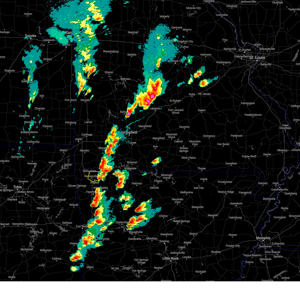 The severe thunderstorm warning for northeastern benton county will expire at 345 pm cdt, the storm which prompted the warning has moved out of the area. therefore, the warning will be allowed to expire. a severe thunderstorm watch remains in effect until 700 pm cdt for northwestern arkansas. The severe thunderstorm warning for northeastern benton county will expire at 345 pm cdt, the storm which prompted the warning has moved out of the area. therefore, the warning will be allowed to expire. a severe thunderstorm watch remains in effect until 700 pm cdt for northwestern arkansas.
|
| 4/15/2023 3:13 PM CDT |
 At 313 pm cdt, a severe thunderstorm was located 3 miles southeast of pea ridge, moving northeast at 40 mph (trained weather spotters). Hazards include 60 mph wind gusts and half dollar size hail. Hail damage to vehicles is expected. expect wind damage to roofs, siding, and trees. locations in or near the path include, rogers, bentonville, bella vista, pea ridge, gateway, miller, centerton, avoca, hill top, walnut hill, this includes interstate 49 between mile markers 83 and 93. hail threat, observed max hail size, 1. 25 in wind threat, radar indicated max wind gust, 60 mph. At 313 pm cdt, a severe thunderstorm was located 3 miles southeast of pea ridge, moving northeast at 40 mph (trained weather spotters). Hazards include 60 mph wind gusts and half dollar size hail. Hail damage to vehicles is expected. expect wind damage to roofs, siding, and trees. locations in or near the path include, rogers, bentonville, bella vista, pea ridge, gateway, miller, centerton, avoca, hill top, walnut hill, this includes interstate 49 between mile markers 83 and 93. hail threat, observed max hail size, 1. 25 in wind threat, radar indicated max wind gust, 60 mph.
|
| 4/15/2023 3:09 PM CDT | Half Dollar sized hail reported 3.7 miles SE of Pea Ridge, AR |
| 4/15/2023 2:54 PM CDT |
 At 254 pm cdt, a severe thunderstorm was located near bentonville, moving northeast at 40 mph (radar indicated). Hazards include 60 mph wind gusts and quarter size hail. Hail damage to vehicles is expected. expect wind damage to roofs, siding, and trees. locations in or near the path include, rogers, bentonville, bella vista, lowell, pea ridge, cave springs, highfill, gateway, northwest arkansas regional air, hiwasse, miller, centerton, avoca, hill top, beaver lake, walnut hill, vaughn, monte ne, larue, healing springs, this includes interstate 49 between mile markers 79 and 93. hail threat, radar indicated max hail size, 1. 00 in wind threat, radar indicated max wind gust, 60 mph. At 254 pm cdt, a severe thunderstorm was located near bentonville, moving northeast at 40 mph (radar indicated). Hazards include 60 mph wind gusts and quarter size hail. Hail damage to vehicles is expected. expect wind damage to roofs, siding, and trees. locations in or near the path include, rogers, bentonville, bella vista, lowell, pea ridge, cave springs, highfill, gateway, northwest arkansas regional air, hiwasse, miller, centerton, avoca, hill top, beaver lake, walnut hill, vaughn, monte ne, larue, healing springs, this includes interstate 49 between mile markers 79 and 93. hail threat, radar indicated max hail size, 1. 00 in wind threat, radar indicated max wind gust, 60 mph.
|
| 4/5/2023 6:05 AM CDT |
 At 605 am cdt, a severe thunderstorm was located over rogers, moving northeast at 65 mph (radar indicated). Hazards include 60 mph wind gusts and quarter size hail. Hail damage to vehicles is expected. expect wind damage to roofs, siding, and trees. locations in or near the path include, springdale, rogers, bentonville, berryville, eureka springs, lowell, pea ridge, gateway, beaver, war eagle, urbanette, hobbs state park, grandview, avoca, hill top, beaver lake, walnut hill, monte ne, larue, pleasant ridge, this includes interstate 49 between mile markers 78 and 81, and between mile markers 83 and 91. hail threat, radar indicated max hail size, 1. 00 in wind threat, radar indicated max wind gust, 60 mph. At 605 am cdt, a severe thunderstorm was located over rogers, moving northeast at 65 mph (radar indicated). Hazards include 60 mph wind gusts and quarter size hail. Hail damage to vehicles is expected. expect wind damage to roofs, siding, and trees. locations in or near the path include, springdale, rogers, bentonville, berryville, eureka springs, lowell, pea ridge, gateway, beaver, war eagle, urbanette, hobbs state park, grandview, avoca, hill top, beaver lake, walnut hill, monte ne, larue, pleasant ridge, this includes interstate 49 between mile markers 78 and 81, and between mile markers 83 and 91. hail threat, radar indicated max hail size, 1. 00 in wind threat, radar indicated max wind gust, 60 mph.
|
| 2/27/2023 1:10 AM CST |
 At 110 am cst, severe thunderstorms were located along a line extending from 4 miles northwest of pea ridge to 4 miles northwest of prairie grove to near barling, moving northeast at 45 mph (radar indicated). Hazards include 60 mph wind gusts. Expect damage to roofs, siding, and trees. locations in or near the path include, fayetteville, springdale, rogers, bentonville, berryville, ozark, charleston, huntsville, eureka springs, mountainburg, lowell, farmington, alma, pea ridge, prairie grove, elkins, tontitown, west fork, lavaca, cave springs, this includes the following highways, interstate 40 in arkansas between mile markers 11 and 42. interstate 49 between mile markers 22 and 89. hail threat, radar indicated max hail size, <. 75 in wind threat, radar indicated max wind gust, 60 mph. At 110 am cst, severe thunderstorms were located along a line extending from 4 miles northwest of pea ridge to 4 miles northwest of prairie grove to near barling, moving northeast at 45 mph (radar indicated). Hazards include 60 mph wind gusts. Expect damage to roofs, siding, and trees. locations in or near the path include, fayetteville, springdale, rogers, bentonville, berryville, ozark, charleston, huntsville, eureka springs, mountainburg, lowell, farmington, alma, pea ridge, prairie grove, elkins, tontitown, west fork, lavaca, cave springs, this includes the following highways, interstate 40 in arkansas between mile markers 11 and 42. interstate 49 between mile markers 22 and 89. hail threat, radar indicated max hail size, <. 75 in wind threat, radar indicated max wind gust, 60 mph.
|
| 2/27/2023 12:59 AM CST |
 At 1259 am cst, severe thunderstorms were located along a line extending from fairview to 3 miles northwest of garfield to 2 miles east of lowell to 3 miles west of mountainburg, moving east at 65 mph (radar indicated). Hazards include 60 mph wind gusts. Expect damage to roofs, siding, and trees. locations in or near the path include, fort smith, fayetteville, springdale, rogers, bentonville, van buren, cedarville, mountainburg, natural dam, bella vista, lowell, farmington, alma, pea ridge, barling, prairie grove, elkins, tontitown, west fork, lavaca, this includes the following highways, interstate 40 in arkansas between mile markers 0 and 23. interstate 540 between mile markers 1 and 14. interstate 49 between mile markers 22 and 93. hail threat, radar indicated max hail size, <. 75 in wind threat, observed max wind gust, 60 mph. At 1259 am cst, severe thunderstorms were located along a line extending from fairview to 3 miles northwest of garfield to 2 miles east of lowell to 3 miles west of mountainburg, moving east at 65 mph (radar indicated). Hazards include 60 mph wind gusts. Expect damage to roofs, siding, and trees. locations in or near the path include, fort smith, fayetteville, springdale, rogers, bentonville, van buren, cedarville, mountainburg, natural dam, bella vista, lowell, farmington, alma, pea ridge, barling, prairie grove, elkins, tontitown, west fork, lavaca, this includes the following highways, interstate 40 in arkansas between mile markers 0 and 23. interstate 540 between mile markers 1 and 14. interstate 49 between mile markers 22 and 93. hail threat, radar indicated max hail size, <. 75 in wind threat, observed max wind gust, 60 mph.
|
| 2/27/2023 12:47 AM CST |
 At 1246 am cst, severe thunderstorms were located along a line extending from 7 miles east of goodman to 2 miles north of bentonville to 2 miles southwest of tontitown to 4 miles southwest of cedarville, moving northeast at 65 mph (radar indicated). Hazards include 70 mph wind gusts. Expect considerable tree damage. damage is likely to mobile homes, roofs, and outbuildings. locations in or near the path include, fort smith, fayetteville, springdale, rogers, bentonville, van buren, siloam springs, stilwell, cedarville, mountainburg, natural dam, bella vista, lowell, farmington, alma, pea ridge, barling, prairie grove, muldrow, roland, this includes the following highways, interstate 40 in arkansas between mile markers 0 and 23. interstate 40 in oklahoma between mile markers 315 and 328. interstate 540 between mile markers 1 and 14. interstate 49 between mile markers 22 and 93. thunderstorm damage threat, considerable hail threat, radar indicated max hail size, <. 75 in wind threat, observed max wind gust, 70 mph. At 1246 am cst, severe thunderstorms were located along a line extending from 7 miles east of goodman to 2 miles north of bentonville to 2 miles southwest of tontitown to 4 miles southwest of cedarville, moving northeast at 65 mph (radar indicated). Hazards include 70 mph wind gusts. Expect considerable tree damage. damage is likely to mobile homes, roofs, and outbuildings. locations in or near the path include, fort smith, fayetteville, springdale, rogers, bentonville, van buren, siloam springs, stilwell, cedarville, mountainburg, natural dam, bella vista, lowell, farmington, alma, pea ridge, barling, prairie grove, muldrow, roland, this includes the following highways, interstate 40 in arkansas between mile markers 0 and 23. interstate 40 in oklahoma between mile markers 315 and 328. interstate 540 between mile markers 1 and 14. interstate 49 between mile markers 22 and 93. thunderstorm damage threat, considerable hail threat, radar indicated max hail size, <. 75 in wind threat, observed max wind gust, 70 mph.
|
| 2/27/2023 12:26 AM CST |
 At 1224 am cst, severe thunderstorms were located along a line extending from 2 miles northwest of south west city to 3 miles northwest of siloam springs to 3 miles northeast of christie to 4 miles west of gans, moving northeast at 65 mph (observed). Hazards include 70 mph wind gusts. Expect considerable tree damage. damage is likely to mobile homes, roofs, and outbuildings. this storm has a history of producing 70mph winds. locations in or near the path include, fort smith, fayetteville, springdale, rogers, bentonville, van buren, siloam springs, miami, sallisaw, stilwell, jay, cedarville, mountainburg, natural dam, bella vista, lowell, grove, farmington, alma, pea ridge, this includes the following highways, interstate 40 in arkansas between mile markers 0 and 23. interstate 40 in oklahoma between mile markers 302 and 328. interstate 44 between mile markers 297 and 308. interstate 540 between mile markers 1 and 14. interstate 49 between mile markers 22 and 93. thunderstorm damage threat, considerable hail threat, radar indicated max hail size, <. 75 in wind threat, observed max wind gust, 70 mph. At 1224 am cst, severe thunderstorms were located along a line extending from 2 miles northwest of south west city to 3 miles northwest of siloam springs to 3 miles northeast of christie to 4 miles west of gans, moving northeast at 65 mph (observed). Hazards include 70 mph wind gusts. Expect considerable tree damage. damage is likely to mobile homes, roofs, and outbuildings. this storm has a history of producing 70mph winds. locations in or near the path include, fort smith, fayetteville, springdale, rogers, bentonville, van buren, siloam springs, miami, sallisaw, stilwell, jay, cedarville, mountainburg, natural dam, bella vista, lowell, grove, farmington, alma, pea ridge, this includes the following highways, interstate 40 in arkansas between mile markers 0 and 23. interstate 40 in oklahoma between mile markers 302 and 328. interstate 44 between mile markers 297 and 308. interstate 540 between mile markers 1 and 14. interstate 49 between mile markers 22 and 93. thunderstorm damage threat, considerable hail threat, radar indicated max hail size, <. 75 in wind threat, observed max wind gust, 70 mph.
|
| 2/27/2023 12:10 AM CST |
 At 1209 am cst, severe thunderstorms were located along a line extending from 3 miles north of afton to 4 miles north of kansas to 4 miles southeast of pumpkin center, moving northeast at 70 mph. winds gusts of 70+ mph have been observed near hulbert with this line of storms (radar indicated). Hazards include 70 mph wind gusts. Expect considerable tree damage. damage is likely to mobile homes, roofs, and outbuildings. locations in or near the path include, rogers, bentonville, tahlequah, siloam springs, vinita, stilwell, jay, bella vista, grove, prairie grove, gentry, tontitown, gravette, lincoln, cave springs, decatur, westville, fairland, afton, gore, this includes the following highways, interstate 44 between mile markers 283 and 302. interstate 49 between mile markers 89 and 93. thunderstorm damage threat, considerable hail threat, radar indicated max hail size, <. 75 in wind threat, observed max wind gust, 70 mph. At 1209 am cst, severe thunderstorms were located along a line extending from 3 miles north of afton to 4 miles north of kansas to 4 miles southeast of pumpkin center, moving northeast at 70 mph. winds gusts of 70+ mph have been observed near hulbert with this line of storms (radar indicated). Hazards include 70 mph wind gusts. Expect considerable tree damage. damage is likely to mobile homes, roofs, and outbuildings. locations in or near the path include, rogers, bentonville, tahlequah, siloam springs, vinita, stilwell, jay, bella vista, grove, prairie grove, gentry, tontitown, gravette, lincoln, cave springs, decatur, westville, fairland, afton, gore, this includes the following highways, interstate 44 between mile markers 283 and 302. interstate 49 between mile markers 89 and 93. thunderstorm damage threat, considerable hail threat, radar indicated max hail size, <. 75 in wind threat, observed max wind gust, 70 mph.
|
| 2/26/2023 11:51 PM CST |
 At 1150 pm cst, severe thunderstorms were located along a line extending from near white oak to 3 miles north of peggs to 3 miles southwest of keefeton, moving northeast at 60 mph (radar indicated). Hazards include 70 mph wind gusts. Expect considerable tree damage. damage is likely to mobile homes, roofs, and outbuildings. locations in or near the path include, rogers, muskogee, bentonville, tahlequah, siloam springs, miami, vinita, stilwell, jay, bella vista, grove, prairie grove, fort gibson, gentry, tontitown, gravette, lincoln, cave springs, decatur, warner, this includes the following highways, interstate 44 between mile markers 270 and 324. interstate 49 between mile markers 89 and 93. thunderstorm damage threat, considerable hail threat, radar indicated max hail size, <. 75 in wind threat, radar indicated max wind gust, 70 mph. At 1150 pm cst, severe thunderstorms were located along a line extending from near white oak to 3 miles north of peggs to 3 miles southwest of keefeton, moving northeast at 60 mph (radar indicated). Hazards include 70 mph wind gusts. Expect considerable tree damage. damage is likely to mobile homes, roofs, and outbuildings. locations in or near the path include, rogers, muskogee, bentonville, tahlequah, siloam springs, miami, vinita, stilwell, jay, bella vista, grove, prairie grove, fort gibson, gentry, tontitown, gravette, lincoln, cave springs, decatur, warner, this includes the following highways, interstate 44 between mile markers 270 and 324. interstate 49 between mile markers 89 and 93. thunderstorm damage threat, considerable hail threat, radar indicated max hail size, <. 75 in wind threat, radar indicated max wind gust, 70 mph.
|
| 2/15/2023 11:11 PM CST |
 At 1111 pm cst, severe thunderstorms were located along a line extending from 2 miles south of cassville to near beaver to 4 miles east of springdale, moving northeast at 45 mph (radar indicated). Hazards include 60 mph wind gusts and nickel size hail. Expect damage to roofs, siding, and trees. locations in or near the path include, fayetteville, springdale, rogers, bentonville, berryville, eureka springs, lowell, pea ridge, tontitown, gateway, beaver, hindsville, forum, hobbs state park, clifty, withrow springs state park, war eagle, grandview, johnson, goshen, this includes interstate 49 between mile markers 64 and 85, and near mile marker 87. hail threat, radar indicated max hail size, 0. 88 in wind threat, radar indicated max wind gust, 60 mph. At 1111 pm cst, severe thunderstorms were located along a line extending from 2 miles south of cassville to near beaver to 4 miles east of springdale, moving northeast at 45 mph (radar indicated). Hazards include 60 mph wind gusts and nickel size hail. Expect damage to roofs, siding, and trees. locations in or near the path include, fayetteville, springdale, rogers, bentonville, berryville, eureka springs, lowell, pea ridge, tontitown, gateway, beaver, hindsville, forum, hobbs state park, clifty, withrow springs state park, war eagle, grandview, johnson, goshen, this includes interstate 49 between mile markers 64 and 85, and near mile marker 87. hail threat, radar indicated max hail size, 0. 88 in wind threat, radar indicated max wind gust, 60 mph.
|
| 2/15/2023 10:54 PM CST |
 At 1054 pm cst, severe thunderstorms were located along a line extending from 8 miles west of washburn to 5 miles southwest of garfield to 4 miles northwest of farmington, moving northeast at 55 mph (radar indicated). Hazards include 65 mph wind gusts and nickel size hail. Expect damage to roofs, siding, and trees. locations in or near the path include, fayetteville, springdale, rogers, bentonville, berryville, eureka springs, bella vista, lowell, farmington, pea ridge, tontitown, cave springs, highfill, gateway, beaver, hindsville, forum, hobbs state park, clifty, withrow springs state park, this includes interstate 49 between mile markers 62 and 93. hail threat, radar indicated max hail size, 0. 88 in wind threat, radar indicated max wind gust, 60 mph. At 1054 pm cst, severe thunderstorms were located along a line extending from 8 miles west of washburn to 5 miles southwest of garfield to 4 miles northwest of farmington, moving northeast at 55 mph (radar indicated). Hazards include 65 mph wind gusts and nickel size hail. Expect damage to roofs, siding, and trees. locations in or near the path include, fayetteville, springdale, rogers, bentonville, berryville, eureka springs, bella vista, lowell, farmington, pea ridge, tontitown, cave springs, highfill, gateway, beaver, hindsville, forum, hobbs state park, clifty, withrow springs state park, this includes interstate 49 between mile markers 62 and 93. hail threat, radar indicated max hail size, 0. 88 in wind threat, radar indicated max wind gust, 60 mph.
|
| 2/15/2023 10:27 PM CST |
 At 1026 pm cst, severe thunderstorms were located along a line extending from 4 miles southeast of south west city to 2 miles south of gentry to 2 miles north of westville, moving east at 60 mph (radar indicated). Hazards include 65 mph wind gusts. Expect damage to roofs, siding, and trees. locations in or near the path include, fayetteville, springdale, rogers, bentonville, siloam springs, berryville, eureka springs, bella vista, lowell, farmington, pea ridge, tontitown, gravette, cave springs, decatur, highfill, gateway, beaver, springtown, hindsville, this includes interstate 49 between mile markers 62 and 93. hail threat, radar indicated max hail size, <. 75 in wind threat, radar indicated max wind gust, 60 mph. At 1026 pm cst, severe thunderstorms were located along a line extending from 4 miles southeast of south west city to 2 miles south of gentry to 2 miles north of westville, moving east at 60 mph (radar indicated). Hazards include 65 mph wind gusts. Expect damage to roofs, siding, and trees. locations in or near the path include, fayetteville, springdale, rogers, bentonville, siloam springs, berryville, eureka springs, bella vista, lowell, farmington, pea ridge, tontitown, gravette, cave springs, decatur, highfill, gateway, beaver, springtown, hindsville, this includes interstate 49 between mile markers 62 and 93. hail threat, radar indicated max hail size, <. 75 in wind threat, radar indicated max wind gust, 60 mph.
|
| 10/12/2022 8:27 AM CDT |
 At 826 am cdt, severe thunderstorms were located along a line extending from near pea ridge to near bentonville to 5 miles southeast of siloam springs, moving east at 55 mph. the strongest storm was located between siloam springs and tontitown (radar indicated). Hazards include quarter size hail. Damage to vehicles is expected. locations in or near the path include, springdale, rogers, bentonville, siloam springs, bella vista, lowell, pea ridge, gentry, tontitown, cave springs, west siloam springs, highfill, gateway, springtown, northwest arkansas regional air, miller, centerton, elm springs, avoca, gallitin, this includes interstate 49 between mile markers 74 and 93. hail threat, radar indicated max hail size, 1. 00 in wind threat, radar indicated max wind gust, <50 mph. At 826 am cdt, severe thunderstorms were located along a line extending from near pea ridge to near bentonville to 5 miles southeast of siloam springs, moving east at 55 mph. the strongest storm was located between siloam springs and tontitown (radar indicated). Hazards include quarter size hail. Damage to vehicles is expected. locations in or near the path include, springdale, rogers, bentonville, siloam springs, bella vista, lowell, pea ridge, gentry, tontitown, cave springs, west siloam springs, highfill, gateway, springtown, northwest arkansas regional air, miller, centerton, elm springs, avoca, gallitin, this includes interstate 49 between mile markers 74 and 93. hail threat, radar indicated max hail size, 1. 00 in wind threat, radar indicated max wind gust, <50 mph.
|
| 10/12/2022 8:18 AM CDT |
 At 817 am cdt, severe thunderstorms were located along a line extending from 2 miles north of bella vista to 4 miles north of northwest arkansas regional airport to siloam springs, moving east at 55 mph. the strongest storm was near siloam springs (radar indicated). Hazards include quarter size hail. Damage to vehicles is expected. locations in or near the path include, springdale, rogers, bentonville, siloam springs, bella vista, lowell, pea ridge, gentry, tontitown, cave springs, decatur, west siloam springs, highfill, gateway, springtown, northwest arkansas regional air, hiwasse, miller, centerton, elm springs, this includes interstate 49 between mile markers 74 and 93. hail threat, radar indicated max hail size, 1. 00 in wind threat, radar indicated max wind gust, <50 mph. At 817 am cdt, severe thunderstorms were located along a line extending from 2 miles north of bella vista to 4 miles north of northwest arkansas regional airport to siloam springs, moving east at 55 mph. the strongest storm was near siloam springs (radar indicated). Hazards include quarter size hail. Damage to vehicles is expected. locations in or near the path include, springdale, rogers, bentonville, siloam springs, bella vista, lowell, pea ridge, gentry, tontitown, cave springs, decatur, west siloam springs, highfill, gateway, springtown, northwest arkansas regional air, hiwasse, miller, centerton, elm springs, this includes interstate 49 between mile markers 74 and 93. hail threat, radar indicated max hail size, 1. 00 in wind threat, radar indicated max wind gust, <50 mph.
|
| 10/12/2022 8:13 AM CDT |
 At 812 am cdt, severe thunderstorms were located along a line extending from bella vista to 2 miles east of decatur to west siloam springs, moving east at 55 mph (radar indicated). Hazards include quarter size hail. Damage to vehicles is expected. locations in or near the path include, springdale, rogers, bentonville, siloam springs, bella vista, lowell, pea ridge, gentry, tontitown, cave springs, decatur, west siloam springs, highfill, gateway, springtown, northwest arkansas regional air, hiwasse, miller, centerton, elm springs, this includes interstate 49 between mile markers 74 and 93. hail threat, radar indicated max hail size, 1. 00 in wind threat, radar indicated max wind gust, <50 mph. At 812 am cdt, severe thunderstorms were located along a line extending from bella vista to 2 miles east of decatur to west siloam springs, moving east at 55 mph (radar indicated). Hazards include quarter size hail. Damage to vehicles is expected. locations in or near the path include, springdale, rogers, bentonville, siloam springs, bella vista, lowell, pea ridge, gentry, tontitown, cave springs, decatur, west siloam springs, highfill, gateway, springtown, northwest arkansas regional air, hiwasse, miller, centerton, elm springs, this includes interstate 49 between mile markers 74 and 93. hail threat, radar indicated max hail size, 1. 00 in wind threat, radar indicated max wind gust, <50 mph.
|
| 7/27/2022 5:00 PM CDT |
 At 459 pm cdt, a severe thunderstorm was located over hiwasse, moving east at 10 mph (radar indicated). Hazards include 60 mph wind gusts. Expect damage to roofs, siding, and trees. locations in or near the path include, rogers, bentonville, bella vista, pea ridge, gravette, decatur, hiwasse, miller, centerton, vaughn, this includes interstate 49 between mile markers 83 and 93. hail threat, radar indicated max hail size, <. 75 in wind threat, radar indicated max wind gust, 60 mph. At 459 pm cdt, a severe thunderstorm was located over hiwasse, moving east at 10 mph (radar indicated). Hazards include 60 mph wind gusts. Expect damage to roofs, siding, and trees. locations in or near the path include, rogers, bentonville, bella vista, pea ridge, gravette, decatur, hiwasse, miller, centerton, vaughn, this includes interstate 49 between mile markers 83 and 93. hail threat, radar indicated max hail size, <. 75 in wind threat, radar indicated max wind gust, 60 mph.
|
| 7/27/2022 4:28 PM CDT |
 At 428 pm cdt, a severe thunderstorm was located 3 miles northeast of gravette, moving east at 10 mph (radar indicated). Hazards include 60 mph wind gusts and nickel size hail. Expect damage to roofs, siding, and trees. locations in or near the path include, rogers, bentonville, bella vista, pea ridge, gravette, decatur, hiwasse, miller, centerton, vaughn, this includes interstate 49 between mile markers 83 and 93. hail threat, radar indicated max hail size, 0. 88 in wind threat, radar indicated max wind gust, 60 mph. At 428 pm cdt, a severe thunderstorm was located 3 miles northeast of gravette, moving east at 10 mph (radar indicated). Hazards include 60 mph wind gusts and nickel size hail. Expect damage to roofs, siding, and trees. locations in or near the path include, rogers, bentonville, bella vista, pea ridge, gravette, decatur, hiwasse, miller, centerton, vaughn, this includes interstate 49 between mile markers 83 and 93. hail threat, radar indicated max hail size, 0. 88 in wind threat, radar indicated max wind gust, 60 mph.
|
| 5/15/2022 1:01 PM CDT |
 At 101 pm cdt, severe thunderstorms were located along a line extending from near cave springs to 4 miles north of war eagle, moving southeast at 15 mph (radar indicated). Hazards include 60 mph wind gusts and quarter size hail. Hail damage to vehicles is expected. expect wind damage to roofs, siding, and trees. locations in or near the path include, springdale, rogers, bentonville, bella vista, lowell, pea ridge, tontitown, gravette, cave springs, highfill, gateway, northwest arkansas regional air, hiwasse, hobbs state park, war eagle, miller, centerton, elm springs, avoca, beaver lake, this includes interstate 49 between mile markers 72 and 93. hail threat, radar indicated max hail size, 1. 00 in wind threat, radar indicated max wind gust, 60 mph. At 101 pm cdt, severe thunderstorms were located along a line extending from near cave springs to 4 miles north of war eagle, moving southeast at 15 mph (radar indicated). Hazards include 60 mph wind gusts and quarter size hail. Hail damage to vehicles is expected. expect wind damage to roofs, siding, and trees. locations in or near the path include, springdale, rogers, bentonville, bella vista, lowell, pea ridge, tontitown, gravette, cave springs, highfill, gateway, northwest arkansas regional air, hiwasse, hobbs state park, war eagle, miller, centerton, elm springs, avoca, beaver lake, this includes interstate 49 between mile markers 72 and 93. hail threat, radar indicated max hail size, 1. 00 in wind threat, radar indicated max wind gust, 60 mph.
|
| 5/15/2022 12:50 PM CDT |
 At 1249 pm cdt, severe thunderstorms were located along a line extending from hiwasse to near rogers to 5 miles southeast of garfield, moving southeast at 15 mph (radar indicated). Hazards include 60 mph wind gusts and quarter size hail. Hail damage to vehicles is expected. expect wind damage to roofs, siding, and trees. locations in or near the path include, springdale, rogers, bentonville, bella vista, lowell, pea ridge, tontitown, gravette, cave springs, highfill, gateway, northwest arkansas regional air, hiwasse, hobbs state park, war eagle, miller, centerton, elm springs, avoca, beaver lake, this includes interstate 49 between mile markers 72 and 93. hail threat, radar indicated max hail size, 1. 00 in wind threat, radar indicated max wind gust, 60 mph. At 1249 pm cdt, severe thunderstorms were located along a line extending from hiwasse to near rogers to 5 miles southeast of garfield, moving southeast at 15 mph (radar indicated). Hazards include 60 mph wind gusts and quarter size hail. Hail damage to vehicles is expected. expect wind damage to roofs, siding, and trees. locations in or near the path include, springdale, rogers, bentonville, bella vista, lowell, pea ridge, tontitown, gravette, cave springs, highfill, gateway, northwest arkansas regional air, hiwasse, hobbs state park, war eagle, miller, centerton, elm springs, avoca, beaver lake, this includes interstate 49 between mile markers 72 and 93. hail threat, radar indicated max hail size, 1. 00 in wind threat, radar indicated max wind gust, 60 mph.
|
| 5/15/2022 12:30 PM CDT | Tree snapped. report via media on twitter. time estimated by rada in benton county AR, 0.8 miles W of Pea Ridge, AR |
| 5/15/2022 12:26 PM CDT |
 At 1226 pm cdt, severe thunderstorms were located along a line extending from near decatur to 3 miles southeast of gateway, moving southeast at 15 mph (radar indicated). Hazards include 60 mph wind gusts and quarter size hail. Hail damage to vehicles is expected. expect wind damage to roofs, siding, and trees. locations in or near the path include, springdale, rogers, bentonville, bella vista, lowell, pea ridge, tontitown, gravette, cave springs, decatur, highfill, gateway, northwest arkansas regional air, hiwasse, hobbs state park, war eagle, miller, centerton, johnson, elm springs, this includes interstate 49 between mile markers 70 and 93. hail threat, radar indicated max hail size, 1. 00 in wind threat, radar indicated max wind gust, 60 mph. At 1226 pm cdt, severe thunderstorms were located along a line extending from near decatur to 3 miles southeast of gateway, moving southeast at 15 mph (radar indicated). Hazards include 60 mph wind gusts and quarter size hail. Hail damage to vehicles is expected. expect wind damage to roofs, siding, and trees. locations in or near the path include, springdale, rogers, bentonville, bella vista, lowell, pea ridge, tontitown, gravette, cave springs, decatur, highfill, gateway, northwest arkansas regional air, hiwasse, hobbs state park, war eagle, miller, centerton, johnson, elm springs, this includes interstate 49 between mile markers 70 and 93. hail threat, radar indicated max hail size, 1. 00 in wind threat, radar indicated max wind gust, 60 mph.
|
| 5/2/2022 9:56 PM CDT |
 At 956 pm cdt, a severe thunderstorm was located over rogers, moving east at 40 mph (radar indicated). Hazards include 60 mph wind gusts and penny size hail. Expect damage to roofs, siding, and trees. locations in or near the path include, springdale, rogers, bentonville, eureka springs, bella vista, lowell, pea ridge, cave springs, highfill, gateway, beaver, northwest arkansas regional air, hobbs state park, war eagle, miller, centerton, avoca, beaver lake, larue, best, this includes interstate 49 between mile markers 75 and 93. hail threat, radar indicated max hail size, 0. 75 in wind threat, radar indicated max wind gust, 60 mph. At 956 pm cdt, a severe thunderstorm was located over rogers, moving east at 40 mph (radar indicated). Hazards include 60 mph wind gusts and penny size hail. Expect damage to roofs, siding, and trees. locations in or near the path include, springdale, rogers, bentonville, eureka springs, bella vista, lowell, pea ridge, cave springs, highfill, gateway, beaver, northwest arkansas regional air, hobbs state park, war eagle, miller, centerton, avoca, beaver lake, larue, best, this includes interstate 49 between mile markers 75 and 93. hail threat, radar indicated max hail size, 0. 75 in wind threat, radar indicated max wind gust, 60 mph.
|
| 4/20/2022 11:41 PM CDT |
 At 1141 pm cdt, a severe thunderstorm was located over seligman, moving southeast at 30 mph (radar indicated). Hazards include golf ball size hail and 60 mph wind gusts. People and animals outdoors will be injured. expect hail damage to roofs, siding, windows, and vehicles. expect wind damage to roofs, siding, and trees. locations in or near the path include, berryville, eureka springs, gateway, beaver, urbanette, grandview, pleasant ridge, hill top, beaver lake, walnut hill, oak hill, busch, thunderstorm damage threat, considerable hail threat, observed max hail size, 1. 75 in wind threat, radar indicated max wind gust, 60 mph. At 1141 pm cdt, a severe thunderstorm was located over seligman, moving southeast at 30 mph (radar indicated). Hazards include golf ball size hail and 60 mph wind gusts. People and animals outdoors will be injured. expect hail damage to roofs, siding, windows, and vehicles. expect wind damage to roofs, siding, and trees. locations in or near the path include, berryville, eureka springs, gateway, beaver, urbanette, grandview, pleasant ridge, hill top, beaver lake, walnut hill, oak hill, busch, thunderstorm damage threat, considerable hail threat, observed max hail size, 1. 75 in wind threat, radar indicated max wind gust, 60 mph.
|
| 12/10/2021 6:47 PM CST |
 At 647 pm cst, severe thunderstorms were located along a line extending from bella vista to near decatur to 3 miles southeast of kansas, moving east at 40 mph (radar indicated). Hazards include 60 mph wind gusts and quarter size hail. Hail damage to vehicles is expected. expect wind damage to roofs, siding, and trees. locations in or near the path include, rogers, bentonville, bella vista, pea ridge, gentry, gravette, decatur, colcord, highfill, springtown, northwest arkansas regional air, hiwasse, miller, centerton, avoca, vaughn, cherokee city, this includes interstate 49 between mile markers 83 and 93. hail threat, radar indicated max hail size, 1. 00 in wind threat, radar indicated max wind gust, 60 mph. At 647 pm cst, severe thunderstorms were located along a line extending from bella vista to near decatur to 3 miles southeast of kansas, moving east at 40 mph (radar indicated). Hazards include 60 mph wind gusts and quarter size hail. Hail damage to vehicles is expected. expect wind damage to roofs, siding, and trees. locations in or near the path include, rogers, bentonville, bella vista, pea ridge, gentry, gravette, decatur, colcord, highfill, springtown, northwest arkansas regional air, hiwasse, miller, centerton, avoca, vaughn, cherokee city, this includes interstate 49 between mile markers 83 and 93. hail threat, radar indicated max hail size, 1. 00 in wind threat, radar indicated max wind gust, 60 mph.
|
| 12/10/2021 6:37 PM CST |
 At 636 pm cst, severe thunderstorms were located along a line extending from near gravette to 3 miles southeast of colcord, moving northeast at 50 mph (radar indicated). Hazards include 60 mph wind gusts and quarter size hail. Hail damage to vehicles is expected. expect wind damage to roofs, siding, and trees. locations in or near the path include, rogers, bentonville, bella vista, pea ridge, gentry, gravette, decatur, colcord, kansas, highfill, springtown, maysville, northwest arkansas regional air, hiwasse, miller, centerton, avoca, vaughn, cherokee city, this includes interstate 49 between mile markers 83 and 93. hail threat, radar indicated max hail size, 1. 00 in wind threat, radar indicated max wind gust, 60 mph. At 636 pm cst, severe thunderstorms were located along a line extending from near gravette to 3 miles southeast of colcord, moving northeast at 50 mph (radar indicated). Hazards include 60 mph wind gusts and quarter size hail. Hail damage to vehicles is expected. expect wind damage to roofs, siding, and trees. locations in or near the path include, rogers, bentonville, bella vista, pea ridge, gentry, gravette, decatur, colcord, kansas, highfill, springtown, maysville, northwest arkansas regional air, hiwasse, miller, centerton, avoca, vaughn, cherokee city, this includes interstate 49 between mile markers 83 and 93. hail threat, radar indicated max hail size, 1. 00 in wind threat, radar indicated max wind gust, 60 mph.
|
| 12/5/2021 10:40 PM CST |
 The severe thunderstorm warning for benton county will expire at 1045 pm cst, the storms which prompted the warning have weakened below severe limits, and no longer pose an immediate threat to life or property. therefore, the warning will be allowed to expire. however gusty winds to 40 mph and small hail are still possible with these thunderstorms. a severe thunderstorm watch remains in effect until 400 am cst for northwestern arkansas. The severe thunderstorm warning for benton county will expire at 1045 pm cst, the storms which prompted the warning have weakened below severe limits, and no longer pose an immediate threat to life or property. therefore, the warning will be allowed to expire. however gusty winds to 40 mph and small hail are still possible with these thunderstorms. a severe thunderstorm watch remains in effect until 400 am cst for northwestern arkansas.
|
| 12/5/2021 10:25 PM CST |
 At 1025 pm cst, severe thunderstorms were located along a line extending from near garfield to 4 miles south of springtown, moving east at 35 mph (radar indicated). Hazards include 60 mph wind gusts and nickel size hail. Expect damage to roofs, siding, and trees. locations in or near the path include, springdale, rogers, bentonville, bella vista, lowell, pea ridge, gentry, bethel heights, cave springs, decatur, highfill, gateway, springtown, northwest arkansas regional air, hobbs state park, war eagle, miller, centerton, avoca, beaver lake, this includes interstate 49 between mile markers 76 and 93. hail threat, radar indicated max hail size, 0. 88 in wind threat, radar indicated max wind gust, 60 mph. At 1025 pm cst, severe thunderstorms were located along a line extending from near garfield to 4 miles south of springtown, moving east at 35 mph (radar indicated). Hazards include 60 mph wind gusts and nickel size hail. Expect damage to roofs, siding, and trees. locations in or near the path include, springdale, rogers, bentonville, bella vista, lowell, pea ridge, gentry, bethel heights, cave springs, decatur, highfill, gateway, springtown, northwest arkansas regional air, hobbs state park, war eagle, miller, centerton, avoca, beaver lake, this includes interstate 49 between mile markers 76 and 93. hail threat, radar indicated max hail size, 0. 88 in wind threat, radar indicated max wind gust, 60 mph.
|
| 12/5/2021 10:00 PM CST |
 At 959 pm cst, severe thunderstorms were located along a line extending from 4 miles northwest of gravette to 4 miles west of west siloam springs, moving east at 50 mph (radar indicated). Hazards include 60 mph wind gusts and nickel size hail. Expect damage to roofs, siding, and trees. locations in or near the path include, springdale, rogers, bentonville, bella vista, lowell, pea ridge, gentry, bethel heights, gravette, cave springs, decatur, highfill, gateway, springtown, northwest arkansas regional air, hiwasse, hobbs state park, war eagle, miller, centerton, this includes interstate 49 between mile markers 76 and 93. hail threat, radar indicated max hail size, 0. 88 in wind threat, radar indicated max wind gust, 60 mph. At 959 pm cst, severe thunderstorms were located along a line extending from 4 miles northwest of gravette to 4 miles west of west siloam springs, moving east at 50 mph (radar indicated). Hazards include 60 mph wind gusts and nickel size hail. Expect damage to roofs, siding, and trees. locations in or near the path include, springdale, rogers, bentonville, bella vista, lowell, pea ridge, gentry, bethel heights, gravette, cave springs, decatur, highfill, gateway, springtown, northwest arkansas regional air, hiwasse, hobbs state park, war eagle, miller, centerton, this includes interstate 49 between mile markers 76 and 93. hail threat, radar indicated max hail size, 0. 88 in wind threat, radar indicated max wind gust, 60 mph.
|
| 9/21/2021 12:21 AM CDT |
 The severe thunderstorm warning for northwestern benton county will expire at 1230 am cdt, the storm which prompted the warning has weakened below severe limits, and no longer poses an immediate threat to life or property. therefore, the warning will be allowed to expire. however gusty winds and heavy rain are still likely with this thunderstorm. The severe thunderstorm warning for northwestern benton county will expire at 1230 am cdt, the storm which prompted the warning has weakened below severe limits, and no longer poses an immediate threat to life or property. therefore, the warning will be allowed to expire. however gusty winds and heavy rain are still likely with this thunderstorm.
|
| 9/20/2021 11:44 PM CDT |
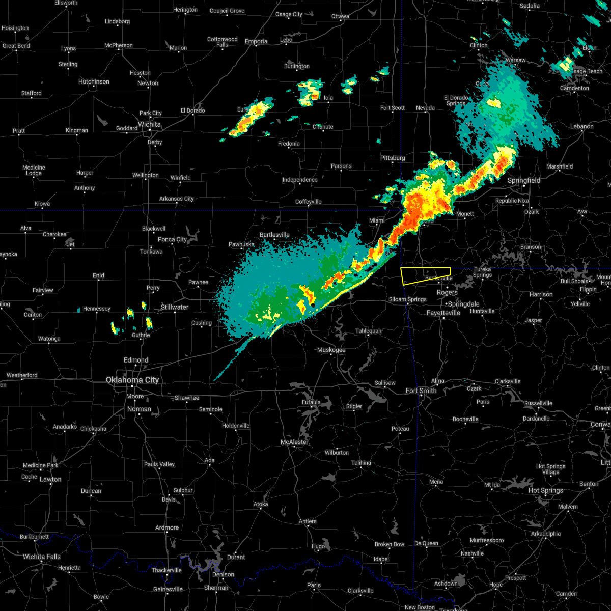 At 1143 pm cdt, a severe thunderstorm was located 4 miles southeast of south west city, moving east at 35 mph (radar indicated). Hazards include 60 mph wind gusts and quarter size hail. Hail damage to vehicles is expected. expect wind damage to roofs, siding, and trees. locations in or near the path include, bella vista, pea ridge, gravette, hiwasse, maysville, miller, this includes interstate 49 between mile markers 92 and 93. hail threat, radar indicated max hail size, 1. 00 in wind threat, radar indicated max wind gust, 60 mph. At 1143 pm cdt, a severe thunderstorm was located 4 miles southeast of south west city, moving east at 35 mph (radar indicated). Hazards include 60 mph wind gusts and quarter size hail. Hail damage to vehicles is expected. expect wind damage to roofs, siding, and trees. locations in or near the path include, bella vista, pea ridge, gravette, hiwasse, maysville, miller, this includes interstate 49 between mile markers 92 and 93. hail threat, radar indicated max hail size, 1. 00 in wind threat, radar indicated max wind gust, 60 mph.
|
| 8/13/2021 4:03 PM CDT |
 The national weather service in tulsa has issued a * severe thunderstorm warning for. northeastern benton county in northwestern arkansas. until 445 pm cdt. At 403 pm cdt, a severe thunderstorm was located over bentonville, moving east at 10 mph. The national weather service in tulsa has issued a * severe thunderstorm warning for. northeastern benton county in northwestern arkansas. until 445 pm cdt. At 403 pm cdt, a severe thunderstorm was located over bentonville, moving east at 10 mph.
|
| 5/9/2021 2:41 AM CDT |
 The severe thunderstorm warning for north central benton county will expire at 245 am cdt, the storm which prompted the warning has moved out of the area. therefore the warning will be allowed to expire. The severe thunderstorm warning for north central benton county will expire at 245 am cdt, the storm which prompted the warning has moved out of the area. therefore the warning will be allowed to expire.
|
| 5/9/2021 2:27 AM CDT |
 At 227 am cdt, a severe thunderstorm was located 3 miles northwest of bella vista, moving east at 55 mph (radar indicated). Hazards include 60 mph wind gusts and quarter size hail. Hail damage to vehicles is expected. expect wind damage to roofs, siding, and trees. Locations in or near the path include, bella vista, pea ridge, hiwasse, this includes interstate 49 near mile marker 93. At 227 am cdt, a severe thunderstorm was located 3 miles northwest of bella vista, moving east at 55 mph (radar indicated). Hazards include 60 mph wind gusts and quarter size hail. Hail damage to vehicles is expected. expect wind damage to roofs, siding, and trees. Locations in or near the path include, bella vista, pea ridge, hiwasse, this includes interstate 49 near mile marker 93.
|
| 5/9/2021 2:15 AM CDT |
 At 215 am cdt, a severe thunderstorm was located 3 miles southeast of south west city, moving east at 50 mph (radar indicated). Hazards include 60 mph wind gusts and quarter size hail. Hail damage to vehicles is expected. expect wind damage to roofs, siding, and trees. Locations in or near the path include, bella vista, pea ridge, gravette, hiwasse, maysville, this includes interstate 49 near mile marker 93. At 215 am cdt, a severe thunderstorm was located 3 miles southeast of south west city, moving east at 50 mph (radar indicated). Hazards include 60 mph wind gusts and quarter size hail. Hail damage to vehicles is expected. expect wind damage to roofs, siding, and trees. Locations in or near the path include, bella vista, pea ridge, gravette, hiwasse, maysville, this includes interstate 49 near mile marker 93.
|
| 4/28/2021 7:47 AM CDT |
 At 747 am cdt, a severe thunderstorm was located 4 miles east of rogers, moving northeast at 25 mph (radar indicated). Hazards include 60 mph wind gusts. Expect damage to roofs, siding, and trees. locations in or near the path include, springdale, rogers, bentonville, eureka springs, lowell, pea ridge, bethel heights, gateway, war eagle, hobbs state park, avoca, hill top, beaver lake, walnut hill, monte ne, larue, lookout, busch, best, this includes interstate 49 between mile markers 77 and 91. A tornado watch remains in effect until 1000 am cdt for northwestern arkansas. At 747 am cdt, a severe thunderstorm was located 4 miles east of rogers, moving northeast at 25 mph (radar indicated). Hazards include 60 mph wind gusts. Expect damage to roofs, siding, and trees. locations in or near the path include, springdale, rogers, bentonville, eureka springs, lowell, pea ridge, bethel heights, gateway, war eagle, hobbs state park, avoca, hill top, beaver lake, walnut hill, monte ne, larue, lookout, busch, best, this includes interstate 49 between mile markers 77 and 91. A tornado watch remains in effect until 1000 am cdt for northwestern arkansas.
|
| 3/17/2021 4:48 PM CDT |
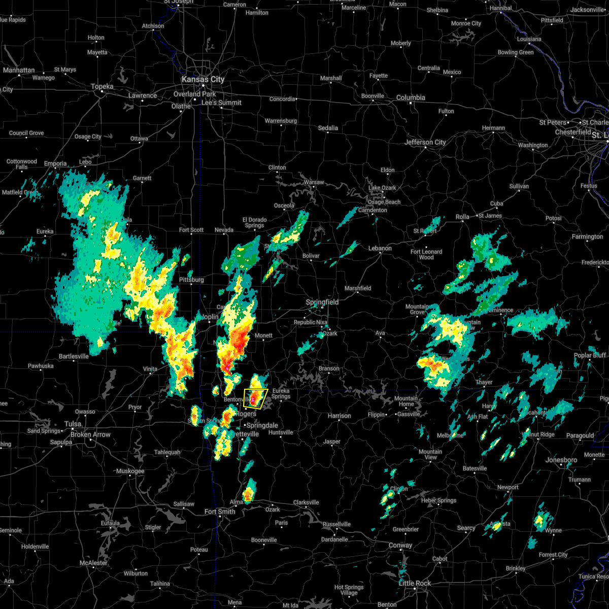 At 448 pm cdt, a severe thunderstorm was located 5 miles southwest of garfield, moving north at 35 mph (radar indicated). Hazards include 60 mph wind gusts and quarter size hail. Hail damage to vehicles is expected. expect wind damage to roofs, siding, and trees. Locations in or near the path include, rogers, pea ridge, gateway, avoca, walnut hill, hill top, a tornado watch remains in effect until 800 pm cdt for northwestern arkansas. At 448 pm cdt, a severe thunderstorm was located 5 miles southwest of garfield, moving north at 35 mph (radar indicated). Hazards include 60 mph wind gusts and quarter size hail. Hail damage to vehicles is expected. expect wind damage to roofs, siding, and trees. Locations in or near the path include, rogers, pea ridge, gateway, avoca, walnut hill, hill top, a tornado watch remains in effect until 800 pm cdt for northwestern arkansas.
|
| 3/17/2021 4:09 PM CDT |
 At 408 pm cdt, a severe thunderstorm was located over tontitown, moving north at 40 mph (radar indicated). Hazards include 60 mph wind gusts and quarter size hail. Hail damage to vehicles is expected. expect wind damage to roofs, siding, and trees. locations in or near the path include, fayetteville, springdale, rogers, bentonville, lowell, pea ridge, tontitown, bethel heights, cave springs, gateway, johnson, elm springs, avoca, hill top, walnut hill, monte ne, wheeler, larue, this includes interstate 49 between mile markers 64 and 93. A tornado watch remains in effect until 800 pm cdt for northwestern arkansas. At 408 pm cdt, a severe thunderstorm was located over tontitown, moving north at 40 mph (radar indicated). Hazards include 60 mph wind gusts and quarter size hail. Hail damage to vehicles is expected. expect wind damage to roofs, siding, and trees. locations in or near the path include, fayetteville, springdale, rogers, bentonville, lowell, pea ridge, tontitown, bethel heights, cave springs, gateway, johnson, elm springs, avoca, hill top, walnut hill, monte ne, wheeler, larue, this includes interstate 49 between mile markers 64 and 93. A tornado watch remains in effect until 800 pm cdt for northwestern arkansas.
|
| 1/30/2021 3:55 PM CST |
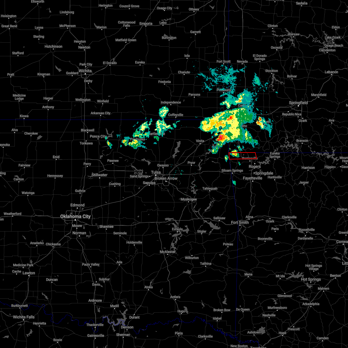 At 355 pm cst, a severe thunderstorm capable of producing a tornado was located 3 miles southeast of south west city, moving east at 35 mph (radar indicated rotation). Hazards include tornado. Flying debris will be dangerous to those caught without shelter. mobile homes will be damaged or destroyed. damage to roofs, windows, and vehicles will occur. tree damage is likely. Locations in or near the path include, bentonville, bella vista, pea ridge, gravette, hiwasse, miller, this includes interstate 49 between mile markers 91 and 93. At 355 pm cst, a severe thunderstorm capable of producing a tornado was located 3 miles southeast of south west city, moving east at 35 mph (radar indicated rotation). Hazards include tornado. Flying debris will be dangerous to those caught without shelter. mobile homes will be damaged or destroyed. damage to roofs, windows, and vehicles will occur. tree damage is likely. Locations in or near the path include, bentonville, bella vista, pea ridge, gravette, hiwasse, miller, this includes interstate 49 between mile markers 91 and 93.
|
| 11/14/2020 9:56 PM CST |
 At 954 pm cst, severe thunderstorms were located along a line extending from 3 miles southwest of beaver to 4 miles southwest of stilwell, moving southeast at 35 mph. wind gusts of 50 to 55 mph have been reported along this line. locally higher gusts to near 60 mph will likely occur at a few locations (trained weather spotters). Hazards include 60 mph wind gusts. Expect damage to roofs, siding, and trees. locations in or near the path include, fayetteville, springdale, rogers, bentonville, berryville, stilwell, eureka springs, cedarville, natural dam, lowell, farmington, prairie grove, elkins, tontitown, bethel heights, west fork, lincoln, cave springs, westville, greenland, this includes interstate 49 between mile markers 40 and 87. A tornado watch remains in effect until midnight cst for northwestern arkansas, and northeastern and east central oklahoma. At 954 pm cst, severe thunderstorms were located along a line extending from 3 miles southwest of beaver to 4 miles southwest of stilwell, moving southeast at 35 mph. wind gusts of 50 to 55 mph have been reported along this line. locally higher gusts to near 60 mph will likely occur at a few locations (trained weather spotters). Hazards include 60 mph wind gusts. Expect damage to roofs, siding, and trees. locations in or near the path include, fayetteville, springdale, rogers, bentonville, berryville, stilwell, eureka springs, cedarville, natural dam, lowell, farmington, prairie grove, elkins, tontitown, bethel heights, west fork, lincoln, cave springs, westville, greenland, this includes interstate 49 between mile markers 40 and 87. A tornado watch remains in effect until midnight cst for northwestern arkansas, and northeastern and east central oklahoma.
|
| 11/14/2020 9:49 PM CST |
 At 948 pm cst, severe thunderstorms were located along a line extending from 4 miles southeast of gateway to 5 miles southwest of maryetta, moving southeast at 35 mph (radar indicated). Hazards include 60 mph wind gusts. Expect damage to roofs, siding, and trees. locations in or near the path include, fayetteville, springdale, rogers, bentonville, berryville, stilwell, eureka springs, cedarville, natural dam, lowell, farmington, prairie grove, elkins, tontitown, bethel heights, west fork, lincoln, cave springs, westville, greenland, this includes interstate 49 between mile markers 40 and 87. A tornado watch remains in effect until midnight cst for northwestern arkansas, and northeastern and east central oklahoma. At 948 pm cst, severe thunderstorms were located along a line extending from 4 miles southeast of gateway to 5 miles southwest of maryetta, moving southeast at 35 mph (radar indicated). Hazards include 60 mph wind gusts. Expect damage to roofs, siding, and trees. locations in or near the path include, fayetteville, springdale, rogers, bentonville, berryville, stilwell, eureka springs, cedarville, natural dam, lowell, farmington, prairie grove, elkins, tontitown, bethel heights, west fork, lincoln, cave springs, westville, greenland, this includes interstate 49 between mile markers 40 and 87. A tornado watch remains in effect until midnight cst for northwestern arkansas, and northeastern and east central oklahoma.
|
| 7/9/2020 10:21 AM CDT |
 At 1021 am cdt, severe thunderstorms were located along a line extending from 2 miles west of rogers to 2 miles southwest of greenland to 8 miles east of adair state park, moving southeast at 35 mph (radar indicated). Hazards include 60 mph wind gusts. Expect damage to roofs, siding, and trees. Locations in or near the path include, fayetteville, springdale, rogers, bentonville, stilwell, lowell, farmington, pea ridge, prairie grove, elkins, tontitown, bethel heights, west fork, lincoln, cave springs, greenland, adair state park, strickler, drake field airport, johnson, this includes interstate 49 between mile markers 50 and 88. At 1021 am cdt, severe thunderstorms were located along a line extending from 2 miles west of rogers to 2 miles southwest of greenland to 8 miles east of adair state park, moving southeast at 35 mph (radar indicated). Hazards include 60 mph wind gusts. Expect damage to roofs, siding, and trees. Locations in or near the path include, fayetteville, springdale, rogers, bentonville, stilwell, lowell, farmington, pea ridge, prairie grove, elkins, tontitown, bethel heights, west fork, lincoln, cave springs, greenland, adair state park, strickler, drake field airport, johnson, this includes interstate 49 between mile markers 50 and 88.
|
| 7/9/2020 9:44 AM CDT |
 At 944 am cdt, severe thunderstorms were located along a line extending from 4 miles south of noel to 4 miles east of watts to proctor, moving southeast at 40 mph (radar indicated). Hazards include 60 mph wind gusts. Expect damage to roofs, siding, and trees. Locations in or near the path include, fayetteville, springdale, rogers, bentonville, siloam springs, stilwell, bella vista, lowell, farmington, pea ridge, prairie grove, gentry, elkins, tontitown, bethel heights, gravette, west fork, lincoln, cave springs, decatur, this includes interstate 49 between mile markers 50 and 93. At 944 am cdt, severe thunderstorms were located along a line extending from 4 miles south of noel to 4 miles east of watts to proctor, moving southeast at 40 mph (radar indicated). Hazards include 60 mph wind gusts. Expect damage to roofs, siding, and trees. Locations in or near the path include, fayetteville, springdale, rogers, bentonville, siloam springs, stilwell, bella vista, lowell, farmington, pea ridge, prairie grove, gentry, elkins, tontitown, bethel heights, gravette, west fork, lincoln, cave springs, decatur, this includes interstate 49 between mile markers 50 and 93.
|
| 5/25/2020 9:02 PM CDT |
 At 902 pm cdt, severe thunderstorms were located along a line extending from 3 miles west of narcissa to 6 miles southeast of seneca to near bentonville, moving north at 40 mph (radar indicated). Hazards include 60 mph wind gusts and quarter size hail. Hail damage to vehicles is expected. expect wind damage to roofs, siding, and trees. locations in or near the path include, rogers, bentonville, miami, bella vista, lowell, grove, pea ridge, commerce, gravette, fairland, afton, quapaw, bernice, wyandotte, picher, honey creek state park, bernice state park, hiwasse, cleora, narcissa, this includes the following highways, interstate 44 between mile markers 292 and 323. interstate 49 between mile markers 80 and 93. A tornado watch remains in effect until midnight cdt for northwestern arkansas, and northeastern oklahoma. At 902 pm cdt, severe thunderstorms were located along a line extending from 3 miles west of narcissa to 6 miles southeast of seneca to near bentonville, moving north at 40 mph (radar indicated). Hazards include 60 mph wind gusts and quarter size hail. Hail damage to vehicles is expected. expect wind damage to roofs, siding, and trees. locations in or near the path include, rogers, bentonville, miami, bella vista, lowell, grove, pea ridge, commerce, gravette, fairland, afton, quapaw, bernice, wyandotte, picher, honey creek state park, bernice state park, hiwasse, cleora, narcissa, this includes the following highways, interstate 44 between mile markers 292 and 323. interstate 49 between mile markers 80 and 93. A tornado watch remains in effect until midnight cdt for northwestern arkansas, and northeastern oklahoma.
|
| 5/25/2020 8:38 PM CDT |
 At 837 pm cdt, severe thunderstorms were located along a line extending from near ketchum to 5 miles northwest of noel to 2 miles southwest of bentonville, moving north at 35 mph (radar indicated). Hazards include 60 mph wind gusts and quarter size hail. Hail damage to vehicles is expected. expect wind damage to roofs, siding, and trees. locations in or near the path include, rogers, bentonville, miami, jay, bella vista, lowell, grove, pea ridge, commerce, gravette, fairland, afton, quapaw, bernice, wyandotte, picher, honey creek state park, bernice state park, hiwasse, cleora, this includes the following highways, interstate 44 between mile markers 292 and 323. interstate 49 between mile markers 80 and 93. A tornado watch remains in effect until midnight cdt for northwestern arkansas, and northeastern oklahoma. At 837 pm cdt, severe thunderstorms were located along a line extending from near ketchum to 5 miles northwest of noel to 2 miles southwest of bentonville, moving north at 35 mph (radar indicated). Hazards include 60 mph wind gusts and quarter size hail. Hail damage to vehicles is expected. expect wind damage to roofs, siding, and trees. locations in or near the path include, rogers, bentonville, miami, jay, bella vista, lowell, grove, pea ridge, commerce, gravette, fairland, afton, quapaw, bernice, wyandotte, picher, honey creek state park, bernice state park, hiwasse, cleora, this includes the following highways, interstate 44 between mile markers 292 and 323. interstate 49 between mile markers 80 and 93. A tornado watch remains in effect until midnight cdt for northwestern arkansas, and northeastern oklahoma.
|
| 5/4/2020 10:40 AM CDT |
 At 1040 am cdt, severe thunderstorms were located along a line extending from near rogers to near war eagle to 2 miles west of forum, moving east at 35 mph (radar indicated). Hazards include two inch hail. People and animals outdoors will be injured. expect damage to roofs, siding, windows, and vehicles. Locations in or near the path include, springdale, rogers, bentonville, berryville, huntsville, eureka springs, lowell, pea ridge, green forest, bethel heights, gateway, beaver, hindsville, carrollton, rudd, forum, hobbs state park, clifty, withrow springs state park, war eagle, this includes interstate 49 between mile markers 76 and 82. At 1040 am cdt, severe thunderstorms were located along a line extending from near rogers to near war eagle to 2 miles west of forum, moving east at 35 mph (radar indicated). Hazards include two inch hail. People and animals outdoors will be injured. expect damage to roofs, siding, windows, and vehicles. Locations in or near the path include, springdale, rogers, bentonville, berryville, huntsville, eureka springs, lowell, pea ridge, green forest, bethel heights, gateway, beaver, hindsville, carrollton, rudd, forum, hobbs state park, clifty, withrow springs state park, war eagle, this includes interstate 49 between mile markers 76 and 82.
|
| 5/4/2020 10:29 AM CDT |
 At 1028 am cdt, severe thunderstorms were located along a line extending from bentonville to 5 miles northwest of war eagle to 2 miles west of hindsville, moving east at 35 mph (radar indicated). Hazards include two inch hail. People and animals outdoors will be injured. expect damage to roofs, siding, windows, and vehicles. Locations in or near the path include, springdale, rogers, bentonville, berryville, huntsville, eureka springs, bella vista, lowell, pea ridge, green forest, bethel heights, highfill, gateway, beaver, hindsville, carrollton, rudd, forum, hobbs state park, clifty, this includes interstate 49 between mile markers 76 and 93. At 1028 am cdt, severe thunderstorms were located along a line extending from bentonville to 5 miles northwest of war eagle to 2 miles west of hindsville, moving east at 35 mph (radar indicated). Hazards include two inch hail. People and animals outdoors will be injured. expect damage to roofs, siding, windows, and vehicles. Locations in or near the path include, springdale, rogers, bentonville, berryville, huntsville, eureka springs, bella vista, lowell, pea ridge, green forest, bethel heights, highfill, gateway, beaver, hindsville, carrollton, rudd, forum, hobbs state park, clifty, this includes interstate 49 between mile markers 76 and 93.
|
| 5/4/2020 10:15 AM CDT |
 At 1014 am cdt, severe thunderstorms were located along a line extending from near hiwasse to near rogers to 6 miles southeast of springdale, moving east at 40 mph (radar indicated). Hazards include tennis ball size hail. People and animals outdoors will be injured. expect damage to roofs, siding, windows, and vehicles. Locations in or near the path include, fayetteville, springdale, rogers, bentonville, berryville, huntsville, eureka springs, bella vista, lowell, pea ridge, green forest, elkins, bethel heights, highfill, gateway, beaver, hindsville, carrollton, rudd, forum, this includes interstate 49 between mile markers 72 and 93. At 1014 am cdt, severe thunderstorms were located along a line extending from near hiwasse to near rogers to 6 miles southeast of springdale, moving east at 40 mph (radar indicated). Hazards include tennis ball size hail. People and animals outdoors will be injured. expect damage to roofs, siding, windows, and vehicles. Locations in or near the path include, fayetteville, springdale, rogers, bentonville, berryville, huntsville, eureka springs, bella vista, lowell, pea ridge, green forest, elkins, bethel heights, highfill, gateway, beaver, hindsville, carrollton, rudd, forum, this includes interstate 49 between mile markers 72 and 93.
|
| 5/4/2020 10:09 AM CDT |
 At 1009 am cdt, severe thunderstorms were located along a line extending from 3 miles southwest of hiwasse to 2 miles southeast of bentonville to 3 miles east of fayetteville, moving east at 35 mph (radar indicated). Hazards include two inch hail. People and animals outdoors will be injured. expect damage to roofs, siding, windows, and vehicles. Locations in or near the path include, fayetteville, springdale, rogers, bentonville, berryville, huntsville, eureka springs, bella vista, lowell, pea ridge, green forest, elkins, bethel heights, gravette, decatur, highfill, gateway, beaver, hindsville, carrollton, this includes interstate 49 between mile markers 72 and 93. At 1009 am cdt, severe thunderstorms were located along a line extending from 3 miles southwest of hiwasse to 2 miles southeast of bentonville to 3 miles east of fayetteville, moving east at 35 mph (radar indicated). Hazards include two inch hail. People and animals outdoors will be injured. expect damage to roofs, siding, windows, and vehicles. Locations in or near the path include, fayetteville, springdale, rogers, bentonville, berryville, huntsville, eureka springs, bella vista, lowell, pea ridge, green forest, elkins, bethel heights, gravette, decatur, highfill, gateway, beaver, hindsville, carrollton, this includes interstate 49 between mile markers 72 and 93.
|
| 5/4/2020 9:57 AM CDT |
 The national weather service in tulsa has issued a * severe thunderstorm warning for. benton county in northwestern arkansas. northern madison county in northwestern arkansas. carroll county in northwestern arkansas. Northeastern washington county in northwestern arkansas. The national weather service in tulsa has issued a * severe thunderstorm warning for. benton county in northwestern arkansas. northern madison county in northwestern arkansas. carroll county in northwestern arkansas. Northeastern washington county in northwestern arkansas.
|
| 5/4/2020 9:44 AM CDT |
 At 944 am cdt, a severe thunderstorm was located near maysville, moving northeast at 35 mph (radar indicated). Hazards include half dollar size hail. Damage to vehicles is expected. Locations in or near the path include, gravette, decatur, maysville, hiwasse, miller,. At 944 am cdt, a severe thunderstorm was located near maysville, moving northeast at 35 mph (radar indicated). Hazards include half dollar size hail. Damage to vehicles is expected. Locations in or near the path include, gravette, decatur, maysville, hiwasse, miller,.
|
| 5/4/2020 9:43 AM CDT |
 At 942 am cdt, severe thunderstorms were located along a line extending from near highfill to 2 miles northeast of prairie grove, moving east at 40 mph (radar indicated). Hazards include quarter size hail. Damage to vehicles is expected. Locations in or near the path include, fayetteville, springdale, rogers, bentonville, bella vista, lowell, farmington, pea ridge, prairie grove, gentry, elkins, tontitown, bethel heights, cave springs, greenland, highfill, gateway, springtown, northwest arkansas regional air, war eagle, this includes interstate 49 between mile markers 56 and 93. At 942 am cdt, severe thunderstorms were located along a line extending from near highfill to 2 miles northeast of prairie grove, moving east at 40 mph (radar indicated). Hazards include quarter size hail. Damage to vehicles is expected. Locations in or near the path include, fayetteville, springdale, rogers, bentonville, bella vista, lowell, farmington, pea ridge, prairie grove, gentry, elkins, tontitown, bethel heights, cave springs, greenland, highfill, gateway, springtown, northwest arkansas regional air, war eagle, this includes interstate 49 between mile markers 56 and 93.
|
| 5/4/2020 9:33 AM CDT |
 At 933 am cdt, severe thunderstorms were located along a line extending from 3 miles north of jay to 4 miles southwest of maysville to 3 miles west of decatur, moving northeast at 25 mph (radar indicated). Hazards include half dollar size hail. Damage to vehicles is expected. Locations in or near the path include, jay, gravette, decatur, maysville, hiwasse, miller,. At 933 am cdt, severe thunderstorms were located along a line extending from 3 miles north of jay to 4 miles southwest of maysville to 3 miles west of decatur, moving northeast at 25 mph (radar indicated). Hazards include half dollar size hail. Damage to vehicles is expected. Locations in or near the path include, jay, gravette, decatur, maysville, hiwasse, miller,.
|
| 5/4/2020 9:33 AM CDT |
 At 933 am cdt, severe thunderstorms were located along a line extending from 2 miles south of gentry to 2 miles northeast of lincoln, moving northeast at 35 mph (radar indicated). Hazards include quarter size hail. Damage to vehicles is expected. Locations in or near the path include, fayetteville, springdale, rogers, bentonville, siloam springs, bella vista, lowell, farmington, pea ridge, prairie grove, gentry, elkins, tontitown, bethel heights, lincoln, cave springs, greenland, highfill, gateway, springtown, this includes interstate 49 between mile markers 56 and 93. At 933 am cdt, severe thunderstorms were located along a line extending from 2 miles south of gentry to 2 miles northeast of lincoln, moving northeast at 35 mph (radar indicated). Hazards include quarter size hail. Damage to vehicles is expected. Locations in or near the path include, fayetteville, springdale, rogers, bentonville, siloam springs, bella vista, lowell, farmington, pea ridge, prairie grove, gentry, elkins, tontitown, bethel heights, lincoln, cave springs, greenland, highfill, gateway, springtown, this includes interstate 49 between mile markers 56 and 93.
|
| 5/4/2020 9:33 AM CDT |
 At 933 am cdt, severe thunderstorms were located along a line extending from 3 miles north of jay to 4 miles southwest of maysville to 3 miles west of decatur, moving northeast at 25 mph (radar indicated). Hazards include half dollar size hail. Damage to vehicles is expected. Locations in or near the path include, jay, gravette, decatur, maysville, hiwasse, miller,. At 933 am cdt, severe thunderstorms were located along a line extending from 3 miles north of jay to 4 miles southwest of maysville to 3 miles west of decatur, moving northeast at 25 mph (radar indicated). Hazards include half dollar size hail. Damage to vehicles is expected. Locations in or near the path include, jay, gravette, decatur, maysville, hiwasse, miller,.
|
| 5/4/2020 9:18 AM CDT |
 At 918 am cdt, severe thunderstorms were located along a line extending from near siloam springs to 5 miles east of baron, moving east at 40 mph (radar indicated). Hazards include quarter size hail. Damage to vehicles is expected. Locations in or near the path include, fayetteville, springdale, rogers, bentonville, siloam springs, bella vista, lowell, farmington, pea ridge, prairie grove, gentry, elkins, tontitown, bethel heights, lincoln, cave springs, westville, greenland, west siloam springs, highfill, this includes interstate 49 between mile markers 56 and 93. At 918 am cdt, severe thunderstorms were located along a line extending from near siloam springs to 5 miles east of baron, moving east at 40 mph (radar indicated). Hazards include quarter size hail. Damage to vehicles is expected. Locations in or near the path include, fayetteville, springdale, rogers, bentonville, siloam springs, bella vista, lowell, farmington, pea ridge, prairie grove, gentry, elkins, tontitown, bethel heights, lincoln, cave springs, westville, greenland, west siloam springs, highfill, this includes interstate 49 between mile markers 56 and 93.
|
| 5/4/2020 9:10 AM CDT |
 At 910 am cdt, severe thunderstorms were located along a line extending from 3 miles northeast of chloeta to 4 miles south of jay to 5 miles west of west siloam springs, moving northeast at 35 mph (radar indicated). Hazards include half dollar size hail. Damage to vehicles is expected. Locations in or near the path include, jay, bella vista, grove, gravette, decatur, colcord, maysville, hiwasse, miller, zena, lake eucha state park, cherokee city,. At 910 am cdt, severe thunderstorms were located along a line extending from 3 miles northeast of chloeta to 4 miles south of jay to 5 miles west of west siloam springs, moving northeast at 35 mph (radar indicated). Hazards include half dollar size hail. Damage to vehicles is expected. Locations in or near the path include, jay, bella vista, grove, gravette, decatur, colcord, maysville, hiwasse, miller, zena, lake eucha state park, cherokee city,.
|
| 5/4/2020 8:55 AM CDT |
 At 855 am cdt, a severe thunderstorm was located 7 miles southwest of jay, moving northeast at 35 mph (radar indicated). Hazards include half dollar size hail. Damage to vehicles is expected. Locations in or near the path include, jay, bella vista, grove, gravette, decatur, colcord, kansas, oaks, maysville, hiwasse, chloeta, twin oaks, miller, lake eucha state park, zena, cherokee city,. At 855 am cdt, a severe thunderstorm was located 7 miles southwest of jay, moving northeast at 35 mph (radar indicated). Hazards include half dollar size hail. Damage to vehicles is expected. Locations in or near the path include, jay, bella vista, grove, gravette, decatur, colcord, kansas, oaks, maysville, hiwasse, chloeta, twin oaks, miller, lake eucha state park, zena, cherokee city,.
|
| 4/28/2020 8:09 PM CDT |
 At 809 pm cdt, severe thunderstorms were located along a line extending from 3 miles northeast of rogers to 3 miles northeast of brentwood to 8 miles southeast of stilwell, moving east at 55 mph (radar indicated). Hazards include 60 mph wind gusts and quarter size hail. Hail damage to vehicles is expected. expect wind damage to roofs, siding, and trees. locations in or near the path include, fayetteville, springdale, rogers, bentonville, berryville, stilwell, huntsville, eureka springs, cedarville, mountainburg, natural dam, lowell, farmington, pea ridge, prairie grove, elkins, bethel heights, west fork, lincoln, greenland, this includes interstate 49 between mile markers 26 and 82, and near mile marker 87. A tornado watch remains in effect until 1100 pm cdt for northwestern and west central arkansas, and northeastern and east central oklahoma. At 809 pm cdt, severe thunderstorms were located along a line extending from 3 miles northeast of rogers to 3 miles northeast of brentwood to 8 miles southeast of stilwell, moving east at 55 mph (radar indicated). Hazards include 60 mph wind gusts and quarter size hail. Hail damage to vehicles is expected. expect wind damage to roofs, siding, and trees. locations in or near the path include, fayetteville, springdale, rogers, bentonville, berryville, stilwell, huntsville, eureka springs, cedarville, mountainburg, natural dam, lowell, farmington, pea ridge, prairie grove, elkins, bethel heights, west fork, lincoln, greenland, this includes interstate 49 between mile markers 26 and 82, and near mile marker 87. A tornado watch remains in effect until 1100 pm cdt for northwestern and west central arkansas, and northeastern and east central oklahoma.
|
| 4/28/2020 7:49 PM CDT |
 At 749 pm cdt, severe thunderstorms were located along a line extending from rogers to 3 miles south of gentry to near maryetta, moving east at 40 mph (radar indicated). Hazards include 60 mph wind gusts and quarter size hail. Hail damage to vehicles is expected. expect wind damage to roofs, siding, and trees. locations in or near the path include, springdale, rogers, bentonville, tahlequah, siloam springs, stilwell, bella vista, lowell, pea ridge, gentry, tontitown, bethel heights, gravette, cave springs, decatur, westville, west siloam springs, hulbert, highfill, gateway, this includes interstate 49 between mile markers 75 and 93. A tornado watch remains in effect until 1100 pm cdt for northwestern arkansas, and northeastern and east central oklahoma. At 749 pm cdt, severe thunderstorms were located along a line extending from rogers to 3 miles south of gentry to near maryetta, moving east at 40 mph (radar indicated). Hazards include 60 mph wind gusts and quarter size hail. Hail damage to vehicles is expected. expect wind damage to roofs, siding, and trees. locations in or near the path include, springdale, rogers, bentonville, tahlequah, siloam springs, stilwell, bella vista, lowell, pea ridge, gentry, tontitown, bethel heights, gravette, cave springs, decatur, westville, west siloam springs, hulbert, highfill, gateway, this includes interstate 49 between mile markers 75 and 93. A tornado watch remains in effect until 1100 pm cdt for northwestern arkansas, and northeastern and east central oklahoma.
|
| 4/28/2020 7:37 PM CDT |
 At 736 pm cdt, severe thunderstorms were located along a line extending from 3 miles northeast of maysville to near westville to 6 miles northwest of cherokee landing state park, moving east at 55 mph (radar indicated). Hazards include 60 mph wind gusts and quarter size hail. Hail damage to vehicles is expected. expect wind damage to roofs, siding, and trees. locations in or near the path include, fayetteville, springdale, rogers, bentonville, siloam springs, berryville, stilwell, huntsville, eureka springs, cedarville, mountainburg, natural dam, bella vista, lowell, farmington, pea ridge, prairie grove, gentry, elkins, tontitown, this includes interstate 49 between mile markers 26 and 93. A tornado watch remains in effect until 1100 pm cdt for northwestern and west central arkansas, and northeastern and east central oklahoma. At 736 pm cdt, severe thunderstorms were located along a line extending from 3 miles northeast of maysville to near westville to 6 miles northwest of cherokee landing state park, moving east at 55 mph (radar indicated). Hazards include 60 mph wind gusts and quarter size hail. Hail damage to vehicles is expected. expect wind damage to roofs, siding, and trees. locations in or near the path include, fayetteville, springdale, rogers, bentonville, siloam springs, berryville, stilwell, huntsville, eureka springs, cedarville, mountainburg, natural dam, bella vista, lowell, farmington, pea ridge, prairie grove, gentry, elkins, tontitown, this includes interstate 49 between mile markers 26 and 93. A tornado watch remains in effect until 1100 pm cdt for northwestern and west central arkansas, and northeastern and east central oklahoma.
|
| 4/28/2020 7:02 PM CDT |
 At 701 pm cdt, severe thunderstorms were located along a line extending from 2 miles southwest of south west city to 3 miles southeast of spavinaw to 5 miles north of hulbert, moving east at 40 mph (radar indicated). Hazards include 60 mph wind gusts and quarter size hail. Hail damage to vehicles is expected. expect wind damage to roofs, siding, and trees. locations in or near the path include, springdale, rogers, bentonville, tahlequah, siloam springs, stilwell, jay, bella vista, lowell, pea ridge, gentry, tontitown, bethel heights, gravette, cave springs, decatur, westville, locust grove, salina, west siloam springs, this includes interstate 49 between mile markers 75 and 93. A tornado watch remains in effect until 1100 pm cdt for northwestern arkansas, and northeastern and east central oklahoma. At 701 pm cdt, severe thunderstorms were located along a line extending from 2 miles southwest of south west city to 3 miles southeast of spavinaw to 5 miles north of hulbert, moving east at 40 mph (radar indicated). Hazards include 60 mph wind gusts and quarter size hail. Hail damage to vehicles is expected. expect wind damage to roofs, siding, and trees. locations in or near the path include, springdale, rogers, bentonville, tahlequah, siloam springs, stilwell, jay, bella vista, lowell, pea ridge, gentry, tontitown, bethel heights, gravette, cave springs, decatur, westville, locust grove, salina, west siloam springs, this includes interstate 49 between mile markers 75 and 93. A tornado watch remains in effect until 1100 pm cdt for northwestern arkansas, and northeastern and east central oklahoma.
|
| 4/24/2020 8:07 PM CDT |
 At 807 pm cdt, severe thunderstorms were located along a line extending from 3 miles northeast of pea ridge to springdale to 4 miles east of adair state park, moving east at 40 mph (radar indicated). Hazards include 60 mph wind gusts and nickel size hail. Expect damage to roofs, siding, and trees. Locations in or near the path include, fayetteville, springdale, rogers, bentonville, berryville, stilwell, huntsville, eureka springs, lowell, farmington, pea ridge, prairie grove, green forest, elkins, tontitown, bethel heights, west fork, lincoln, cave springs, greenland, this includes interstate 49 between mile markers 44 and 89. At 807 pm cdt, severe thunderstorms were located along a line extending from 3 miles northeast of pea ridge to springdale to 4 miles east of adair state park, moving east at 40 mph (radar indicated). Hazards include 60 mph wind gusts and nickel size hail. Expect damage to roofs, siding, and trees. Locations in or near the path include, fayetteville, springdale, rogers, bentonville, berryville, stilwell, huntsville, eureka springs, lowell, farmington, pea ridge, prairie grove, green forest, elkins, tontitown, bethel heights, west fork, lincoln, cave springs, greenland, this includes interstate 49 between mile markers 44 and 89.
|
| 4/24/2020 8:05 PM CDT |
 At 805 pm cdt, severe thunderstorms were located along a line extending from 3 miles northeast of pea ridge to 7 miles east of adair state park, moving east at 40 mph (radar indicated). Hazards include 60 mph wind gusts and nickel size hail. Expect damage to roofs, siding, and trees. Locations in or near the path include, fayetteville, springdale, rogers, bentonville, stilwell, lowell, farmington, pea ridge, prairie grove, tontitown, bethel heights, west fork, lincoln, cave springs, westville, greenland, highfill, gateway, adair state park, northwest arkansas regional air, this includes interstate 49 between mile markers 45 and 92. At 805 pm cdt, severe thunderstorms were located along a line extending from 3 miles northeast of pea ridge to 7 miles east of adair state park, moving east at 40 mph (radar indicated). Hazards include 60 mph wind gusts and nickel size hail. Expect damage to roofs, siding, and trees. Locations in or near the path include, fayetteville, springdale, rogers, bentonville, stilwell, lowell, farmington, pea ridge, prairie grove, tontitown, bethel heights, west fork, lincoln, cave springs, westville, greenland, highfill, gateway, adair state park, northwest arkansas regional air, this includes interstate 49 between mile markers 45 and 92.
|
| 4/24/2020 8:02 PM CDT | Tree blocking highway 94 near brush cree in benton county AR, 0.8 miles W of Pea Ridge, AR |
| 4/24/2020 8:00 PM CDT |
 At 759 pm cdt, severe thunderstorms were located along a line extending from 2 miles northwest of pea ridge to 4 miles east of adair state park, moving east at 40 mph (radar indicated). Hazards include 60 mph wind gusts and nickel size hail. Expect damage to roofs, siding, and trees. Locations in or near the path include, fayetteville, springdale, rogers, bentonville, siloam springs, stilwell, bella vista, lowell, farmington, pea ridge, prairie grove, gentry, tontitown, bethel heights, west fork, lincoln, cave springs, decatur, westville, greenland, this includes interstate 49 between mile markers 45 and 93. At 759 pm cdt, severe thunderstorms were located along a line extending from 2 miles northwest of pea ridge to 4 miles east of adair state park, moving east at 40 mph (radar indicated). Hazards include 60 mph wind gusts and nickel size hail. Expect damage to roofs, siding, and trees. Locations in or near the path include, fayetteville, springdale, rogers, bentonville, siloam springs, stilwell, bella vista, lowell, farmington, pea ridge, prairie grove, gentry, tontitown, bethel heights, west fork, lincoln, cave springs, decatur, westville, greenland, this includes interstate 49 between mile markers 45 and 93.
|
| 4/24/2020 7:40 PM CDT |
 At 740 pm cdt, severe thunderstorms were located along a line extending from 2 miles northwest of hiwasse to 6 miles southwest of maryetta, moving east at 40 mph (radar indicated). Hazards include 60 mph wind gusts and nickel size hail. Expect damage to roofs, siding, and trees. Locations in or near the path include, fayetteville, springdale, rogers, bentonville, siloam springs, stilwell, bella vista, lowell, farmington, pea ridge, prairie grove, gentry, tontitown, bethel heights, gravette, west fork, lincoln, cave springs, decatur, westville, this includes interstate 49 between mile markers 45 and 93. At 740 pm cdt, severe thunderstorms were located along a line extending from 2 miles northwest of hiwasse to 6 miles southwest of maryetta, moving east at 40 mph (radar indicated). Hazards include 60 mph wind gusts and nickel size hail. Expect damage to roofs, siding, and trees. Locations in or near the path include, fayetteville, springdale, rogers, bentonville, siloam springs, stilwell, bella vista, lowell, farmington, pea ridge, prairie grove, gentry, tontitown, bethel heights, gravette, west fork, lincoln, cave springs, decatur, westville, this includes interstate 49 between mile markers 45 and 93.
|
| 4/20/2020 6:25 PM CDT |
 At 625 pm cdt, a severe thunderstorm was located near rogers, moving southeast at 30 mph (radar indicated). Hazards include 60 mph wind gusts and quarter size hail. Hail damage to vehicles is expected. expect wind damage to roofs, siding, and trees. Locations in or near the path include, fayetteville, springdale, rogers, bentonville, lowell, bethel heights, war eagle, hobbs state park, clifty, goshen, mayfield, monte ne, best, lookout, sonora, this includes interstate 49 between mile markers 76 and 88. At 625 pm cdt, a severe thunderstorm was located near rogers, moving southeast at 30 mph (radar indicated). Hazards include 60 mph wind gusts and quarter size hail. Hail damage to vehicles is expected. expect wind damage to roofs, siding, and trees. Locations in or near the path include, fayetteville, springdale, rogers, bentonville, lowell, bethel heights, war eagle, hobbs state park, clifty, goshen, mayfield, monte ne, best, lookout, sonora, this includes interstate 49 between mile markers 76 and 88.
|
| 4/20/2020 6:17 PM CDT |
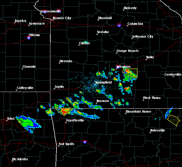 At 616 pm cdt, a severe thunderstorm was located over bentonville, moving southeast at 30 mph (radar indicated). Hazards include 60 mph wind gusts and quarter size hail. Hail damage to vehicles is expected. expect wind damage to roofs, siding, and trees. Locations in or near the path include, rogers, bentonville, bella vista, pea ridge, miller, centerton, avoca, this includes interstate 49 between mile markers 82 and 93. At 616 pm cdt, a severe thunderstorm was located over bentonville, moving southeast at 30 mph (radar indicated). Hazards include 60 mph wind gusts and quarter size hail. Hail damage to vehicles is expected. expect wind damage to roofs, siding, and trees. Locations in or near the path include, rogers, bentonville, bella vista, pea ridge, miller, centerton, avoca, this includes interstate 49 between mile markers 82 and 93.
|
| 4/20/2020 5:58 PM CDT |
 At 557 pm cdt, a severe thunderstorm was located over bella vista, moving southeast at 30 mph (radar indicated). Hazards include 60 mph wind gusts and quarter size hail. Hail damage to vehicles is expected. expect wind damage to roofs, siding, and trees. Locations in or near the path include, rogers, bentonville, bella vista, pea ridge, hiwasse, miller, centerton, avoca, this includes interstate 49 between mile markers 82 and 93. At 557 pm cdt, a severe thunderstorm was located over bella vista, moving southeast at 30 mph (radar indicated). Hazards include 60 mph wind gusts and quarter size hail. Hail damage to vehicles is expected. expect wind damage to roofs, siding, and trees. Locations in or near the path include, rogers, bentonville, bella vista, pea ridge, hiwasse, miller, centerton, avoca, this includes interstate 49 between mile markers 82 and 93.
|
| 4/20/2020 5:34 PM CDT |
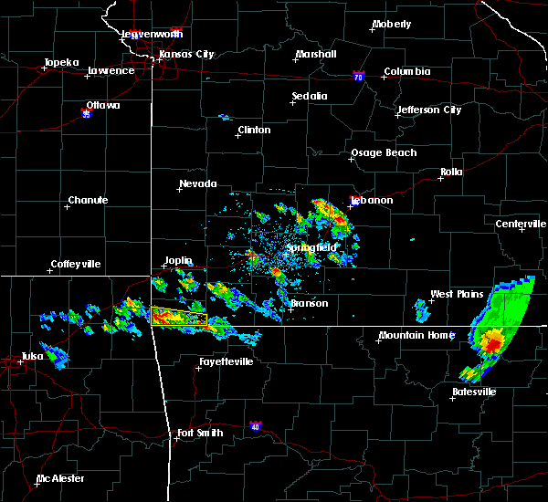 At 534 pm cdt, a severe thunderstorm was located over noel, moving southeast at 30 mph (radar indicated). Hazards include 60 mph wind gusts and quarter size hail. Hail damage to vehicles is expected. expect wind damage to roofs, siding, and trees. Locations in or near the path include, rogers, bentonville, bella vista, pea ridge, gravette, cave springs, highfill, hiwasse, miller, centerton, avoca, vaughn, this includes interstate 49 between mile markers 82 and 93. At 534 pm cdt, a severe thunderstorm was located over noel, moving southeast at 30 mph (radar indicated). Hazards include 60 mph wind gusts and quarter size hail. Hail damage to vehicles is expected. expect wind damage to roofs, siding, and trees. Locations in or near the path include, rogers, bentonville, bella vista, pea ridge, gravette, cave springs, highfill, hiwasse, miller, centerton, avoca, vaughn, this includes interstate 49 between mile markers 82 and 93.
|
| 3/11/2020 6:21 AM CDT |
 At 621 am cdt, severe thunderstorms were located along a line extending from garfield to near cave springs, moving southeast at 55 mph (radar indicated). Hazards include 60 mph wind gusts and quarter size hail. Hail damage to vehicles is expected. expect wind damage to roofs, siding, and trees. Locations in or near the path include, fayetteville, springdale, rogers, bentonville, eureka springs, bella vista, lowell, pea ridge, tontitown, bethel heights, cave springs, highfill, gateway, northwest arkansas regional air, hobbs state park, war eagle, centerton, johnson, elm springs, goshen, this includes interstate 49 between mile markers 66 and 93. At 621 am cdt, severe thunderstorms were located along a line extending from garfield to near cave springs, moving southeast at 55 mph (radar indicated). Hazards include 60 mph wind gusts and quarter size hail. Hail damage to vehicles is expected. expect wind damage to roofs, siding, and trees. Locations in or near the path include, fayetteville, springdale, rogers, bentonville, eureka springs, bella vista, lowell, pea ridge, tontitown, bethel heights, cave springs, highfill, gateway, northwest arkansas regional air, hobbs state park, war eagle, centerton, johnson, elm springs, goshen, this includes interstate 49 between mile markers 66 and 93.
|
| 3/11/2020 6:10 AM CDT |
 At 610 am cdt, severe thunderstorms were located along a line extending from 6 miles north of pea ridge to 4 miles northeast of decatur, moving southeast at 45 mph (radar indicated). Hazards include 60 mph wind gusts and quarter size hail. Hail damage to vehicles is expected. expect wind damage to roofs, siding, and trees. Locations in or near the path include, fayetteville, springdale, rogers, bentonville, eureka springs, bella vista, lowell, pea ridge, gentry, tontitown, bethel heights, cave springs, decatur, highfill, gateway, springtown, northwest arkansas regional air, hiwasse, hobbs state park, war eagle, this includes interstate 49 between mile markers 60 and 93. At 610 am cdt, severe thunderstorms were located along a line extending from 6 miles north of pea ridge to 4 miles northeast of decatur, moving southeast at 45 mph (radar indicated). Hazards include 60 mph wind gusts and quarter size hail. Hail damage to vehicles is expected. expect wind damage to roofs, siding, and trees. Locations in or near the path include, fayetteville, springdale, rogers, bentonville, eureka springs, bella vista, lowell, pea ridge, gentry, tontitown, bethel heights, cave springs, decatur, highfill, gateway, springtown, northwest arkansas regional air, hiwasse, hobbs state park, war eagle, this includes interstate 49 between mile markers 60 and 93.
|
| 3/11/2020 5:46 AM CDT |
 At 546 am cdt, severe thunderstorms were located along a line extending from 5 miles southeast of goodman to near south west city, moving southeast at 60 mph (radar indicated). Hazards include 60 mph wind gusts and quarter size hail. Hail damage to vehicles is expected. expect wind damage to roofs, siding, and trees. Locations in or near the path include, fayetteville, springdale, rogers, bentonville, eureka springs, bella vista, lowell, pea ridge, gentry, tontitown, bethel heights, gravette, cave springs, decatur, highfill, gateway, springtown, northwest arkansas regional air, hiwasse, hobbs state park, this includes interstate 49 between mile markers 60 and 93. At 546 am cdt, severe thunderstorms were located along a line extending from 5 miles southeast of goodman to near south west city, moving southeast at 60 mph (radar indicated). Hazards include 60 mph wind gusts and quarter size hail. Hail damage to vehicles is expected. expect wind damage to roofs, siding, and trees. Locations in or near the path include, fayetteville, springdale, rogers, bentonville, eureka springs, bella vista, lowell, pea ridge, gentry, tontitown, bethel heights, gravette, cave springs, decatur, highfill, gateway, springtown, northwest arkansas regional air, hiwasse, hobbs state park, this includes interstate 49 between mile markers 60 and 93.
|
| 1/10/2020 4:12 PM CST |
 At 412 pm cst, a severe thunderstorm was located 3 miles southwest of springtown, moving northeast at 50 mph (radar indicated). Hazards include 60 mph wind gusts and half dollar size hail. Hail damage to vehicles is expected. expect wind damage to roofs, siding, and trees. locations in or near the path include, rogers, bentonville, siloam springs, bella vista, lowell, pea ridge, gentry, gravette, cave springs, decatur, highfill, gateway, springtown, northwest arkansas regional air, hiwasse, miller, centerton, avoca, gallitin, rocky comfort, this includes interstate 49 between mile markers 80 and 93. A tornado watch remains in effect until 600 pm cst for northwestern arkansas, and northeastern oklahoma. At 412 pm cst, a severe thunderstorm was located 3 miles southwest of springtown, moving northeast at 50 mph (radar indicated). Hazards include 60 mph wind gusts and half dollar size hail. Hail damage to vehicles is expected. expect wind damage to roofs, siding, and trees. locations in or near the path include, rogers, bentonville, siloam springs, bella vista, lowell, pea ridge, gentry, gravette, cave springs, decatur, highfill, gateway, springtown, northwest arkansas regional air, hiwasse, miller, centerton, avoca, gallitin, rocky comfort, this includes interstate 49 between mile markers 80 and 93. A tornado watch remains in effect until 600 pm cst for northwestern arkansas, and northeastern oklahoma.
|
| 1/10/2020 3:39 PM CST |
 At 339 pm cst, a severe thunderstorm was located over siloam springs, moving northeast at 45 mph (radar indicated). Hazards include 60 mph wind gusts and penny size hail. Expect damage to roofs, siding, and trees. locations in or near the path include, rogers, bentonville, siloam springs, bella vista, pea ridge, gentry, cave springs, decatur, highfill, springtown, northwest arkansas regional air, hiwasse, miller, centerton, avoca, lake francis, hill top, fairmount, walnut hill, vaughn, this includes interstate 49 between mile markers 82 and 93. A tornado watch remains in effect until 600 pm cst for northwestern arkansas, and northeastern oklahoma. At 339 pm cst, a severe thunderstorm was located over siloam springs, moving northeast at 45 mph (radar indicated). Hazards include 60 mph wind gusts and penny size hail. Expect damage to roofs, siding, and trees. locations in or near the path include, rogers, bentonville, siloam springs, bella vista, pea ridge, gentry, cave springs, decatur, highfill, springtown, northwest arkansas regional air, hiwasse, miller, centerton, avoca, lake francis, hill top, fairmount, walnut hill, vaughn, this includes interstate 49 between mile markers 82 and 93. A tornado watch remains in effect until 600 pm cst for northwestern arkansas, and northeastern oklahoma.
|
| 1/10/2020 3:25 PM CST |
 At 324 pm cst, a severe thunderstorm was located 4 miles west of gentry, moving northeast at 55 mph (radar indicated). Hazards include 60 mph wind gusts and penny size hail. Expect damage to roofs, siding, and trees. locations in or near the path include, bella vista, gentry, gravette, decatur, springtown, hiwasse, miller, centerton, fairmount, cherokee city, this includes interstate 49 between mile markers 92 and 93. A tornado watch remains in effect until 600 pm cst for northwestern arkansas, and northeastern oklahoma. At 324 pm cst, a severe thunderstorm was located 4 miles west of gentry, moving northeast at 55 mph (radar indicated). Hazards include 60 mph wind gusts and penny size hail. Expect damage to roofs, siding, and trees. locations in or near the path include, bella vista, gentry, gravette, decatur, springtown, hiwasse, miller, centerton, fairmount, cherokee city, this includes interstate 49 between mile markers 92 and 93. A tornado watch remains in effect until 600 pm cst for northwestern arkansas, and northeastern oklahoma.
|
| 10/21/2019 12:52 AM CDT |
 The tornado warning for north central benton county will expire at 100 am cdt, the tornado threat has diminished and the tornado warning has been cancelled. however, large hail and damaging winds remain likely and a severe thunderstorm warning remains in effect for the area. a tornado watch remains in effect until 300 am cdt for northwestern arkansas. The tornado warning for north central benton county will expire at 100 am cdt, the tornado threat has diminished and the tornado warning has been cancelled. however, large hail and damaging winds remain likely and a severe thunderstorm warning remains in effect for the area. a tornado watch remains in effect until 300 am cdt for northwestern arkansas.
|
| 10/21/2019 12:41 AM CDT |
 At 1241 am cdt, severe thunderstorms were located along a line extending from 3 miles northeast of pea ridge to 2 miles northeast of war eagle to 4 miles southwest of elkins to moffett, moving east at 70 mph (radar indicated). Hazards include 70 mph wind gusts and quarter size hail. Hail damage to vehicles is expected. expect considerable tree damage. wind damage is also likely to mobile homes, roofs, and outbuildings. locations in or near the path include, fort smith, fayetteville, springdale, rogers, bentonville, van buren, sallisaw, berryville, ozark, huntsville, eureka springs, cedarville, mountainburg, natural dam, bella vista, lowell, farmington, alma, pea ridge, prairie grove, this includes the following highways, interstate 40 in arkansas between mile markers 0 and 42. interstate 40 in oklahoma between mile markers 304 and 328. interstate 540 between mile markers 1 and 8. interstate 49 between mile markers 22 and 93. A tornado watch remains in effect until 300 am cdt for northwestern and west central arkansas, and southeastern, northeastern and east central oklahoma. At 1241 am cdt, severe thunderstorms were located along a line extending from 3 miles northeast of pea ridge to 2 miles northeast of war eagle to 4 miles southwest of elkins to moffett, moving east at 70 mph (radar indicated). Hazards include 70 mph wind gusts and quarter size hail. Hail damage to vehicles is expected. expect considerable tree damage. wind damage is also likely to mobile homes, roofs, and outbuildings. locations in or near the path include, fort smith, fayetteville, springdale, rogers, bentonville, van buren, sallisaw, berryville, ozark, huntsville, eureka springs, cedarville, mountainburg, natural dam, bella vista, lowell, farmington, alma, pea ridge, prairie grove, this includes the following highways, interstate 40 in arkansas between mile markers 0 and 42. interstate 40 in oklahoma between mile markers 304 and 328. interstate 540 between mile markers 1 and 8. interstate 49 between mile markers 22 and 93. A tornado watch remains in effect until 300 am cdt for northwestern and west central arkansas, and southeastern, northeastern and east central oklahoma.
|
| 10/21/2019 12:36 AM CDT |
 At 1236 am cdt, a severe squall line capable of producing tornadoes that may not be visible due to heavy rain was located 4 miles northeast of rogers, moving northeast at 60 mph (radar indicated rotation). Hazards include tornado and quarter size hail. Flying debris will be dangerous to those caught without shelter. mobile homes will be damaged or destroyed. damage to roofs, windows, and vehicles will occur. tree damage is likely. Locations in or near the path include, rogers, bentonville, eureka springs, lowell, pea ridge, gateway, beaver, avoca, hill top, beaver lake, walnut hill, monte ne, larue, oak hill, busch, this includes interstate 49 between mile markers 79 and 91. At 1236 am cdt, a severe squall line capable of producing tornadoes that may not be visible due to heavy rain was located 4 miles northeast of rogers, moving northeast at 60 mph (radar indicated rotation). Hazards include tornado and quarter size hail. Flying debris will be dangerous to those caught without shelter. mobile homes will be damaged or destroyed. damage to roofs, windows, and vehicles will occur. tree damage is likely. Locations in or near the path include, rogers, bentonville, eureka springs, lowell, pea ridge, gateway, beaver, avoca, hill top, beaver lake, walnut hill, monte ne, larue, oak hill, busch, this includes interstate 49 between mile markers 79 and 91.
|
| 10/21/2019 12:33 AM CDT |
 At 1232 am cdt, severe thunderstorms were located along a line extending from 3 miles southwest of lowell to 4 miles north of fayetteville to 3 miles north of blackburn to 4 miles southwest of figure five, moving east at 60 mph (radar indicated). Hazards include 70 mph wind gusts. Expect considerable tree damage. damage is likely to mobile homes, roofs, and outbuildings. locations in or near the path include, fort smith, fayetteville, springdale, rogers, bentonville, van buren, siloam springs, sallisaw, stilwell, huntsville, eureka springs, cedarville, mountainburg, natural dam, bella vista, lowell, farmington, alma, pea ridge, prairie grove, this includes the following highways, interstate 40 in arkansas between mile markers 0 and 31. interstate 40 in oklahoma between mile markers 298 and 328. interstate 540 between mile markers 1 and 7. interstate 49 between mile markers 22 and 93. A tornado watch remains in effect until 300 am cdt for northwestern and west central arkansas, and southeastern, northeastern and east central oklahoma. At 1232 am cdt, severe thunderstorms were located along a line extending from 3 miles southwest of lowell to 4 miles north of fayetteville to 3 miles north of blackburn to 4 miles southwest of figure five, moving east at 60 mph (radar indicated). Hazards include 70 mph wind gusts. Expect considerable tree damage. damage is likely to mobile homes, roofs, and outbuildings. locations in or near the path include, fort smith, fayetteville, springdale, rogers, bentonville, van buren, siloam springs, sallisaw, stilwell, huntsville, eureka springs, cedarville, mountainburg, natural dam, bella vista, lowell, farmington, alma, pea ridge, prairie grove, this includes the following highways, interstate 40 in arkansas between mile markers 0 and 31. interstate 40 in oklahoma between mile markers 298 and 328. interstate 540 between mile markers 1 and 7. interstate 49 between mile markers 22 and 93. A tornado watch remains in effect until 300 am cdt for northwestern and west central arkansas, and southeastern, northeastern and east central oklahoma.
|
| 10/21/2019 12:30 AM CDT |
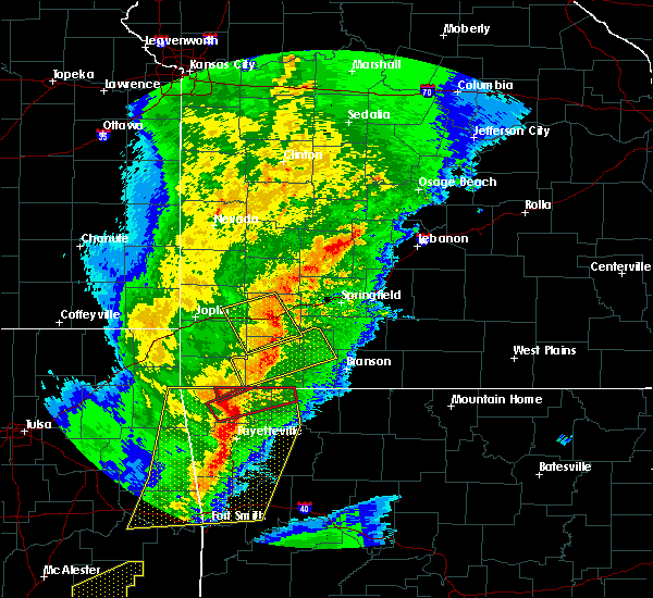 At 1229 am cdt, a severe squall line capable of producing tornadoes that may not be visible due to heavy rain was located over bella vista, moving northeast at 50 mph (radar indicated rotation). Hazards include tornado. Flying debris will be dangerous to those caught without shelter. mobile homes will be damaged or destroyed. damage to roofs, windows, and vehicles will occur. tree damage is likely. Locations in or near the path include, bella vista, pea ridge, miller, this includes interstate 49 near mile marker 93. At 1229 am cdt, a severe squall line capable of producing tornadoes that may not be visible due to heavy rain was located over bella vista, moving northeast at 50 mph (radar indicated rotation). Hazards include tornado. Flying debris will be dangerous to those caught without shelter. mobile homes will be damaged or destroyed. damage to roofs, windows, and vehicles will occur. tree damage is likely. Locations in or near the path include, bella vista, pea ridge, miller, this includes interstate 49 near mile marker 93.
|
| 10/21/2019 12:25 AM CDT |
 At 1224 am cdt, a severe squall line capable of producing tornadoes that may not be visible due to heavy rain was located near northwest arkansas regional airport, moving northeast at 60 mph (radar indicated rotation). Hazards include tornado and quarter size hail. Flying debris will be dangerous to those caught without shelter. mobile homes will be damaged or destroyed. damage to roofs, windows, and vehicles will occur. tree damage is likely. Locations in or near the path include, rogers, bentonville, eureka springs, bella vista, lowell, pea ridge, cave springs, highfill, gateway, beaver, northwest arkansas regional air, miller, centerton, avoca, hill top, beaver lake, walnut hill, vaughn, monte ne, larue, this includes interstate 49 between mile markers 79 and 93. At 1224 am cdt, a severe squall line capable of producing tornadoes that may not be visible due to heavy rain was located near northwest arkansas regional airport, moving northeast at 60 mph (radar indicated rotation). Hazards include tornado and quarter size hail. Flying debris will be dangerous to those caught without shelter. mobile homes will be damaged or destroyed. damage to roofs, windows, and vehicles will occur. tree damage is likely. Locations in or near the path include, rogers, bentonville, eureka springs, bella vista, lowell, pea ridge, cave springs, highfill, gateway, beaver, northwest arkansas regional air, miller, centerton, avoca, hill top, beaver lake, walnut hill, vaughn, monte ne, larue, this includes interstate 49 between mile markers 79 and 93.
|
| 10/21/2019 12:04 AM CDT |
 At 1204 am cdt, severe thunderstorms were located along a line extending from 3 miles west of west siloam springs to 5 miles northwest of westville to 5 miles west of stilwell to 5 miles east of tamaha, moving east at 60 mph (radar indicated). Hazards include 70 mph wind gusts. Expect considerable tree damage. damage is likely to mobile homes, roofs, and outbuildings. locations in or near the path include, fort smith, fayetteville, springdale, rogers, bentonville, van buren, siloam springs, sallisaw, stilwell, huntsville, eureka springs, cedarville, mountainburg, natural dam, bella vista, lowell, farmington, alma, pea ridge, prairie grove, this includes the following highways, interstate 40 in arkansas between mile markers 0 and 31. interstate 40 in oklahoma between mile markers 295 and 328. interstate 540 between mile markers 1 and 7. interstate 49 between mile markers 22 and 93. A tornado watch remains in effect until 300 am cdt for northwestern and west central arkansas, and southeastern, northeastern and east central oklahoma. At 1204 am cdt, severe thunderstorms were located along a line extending from 3 miles west of west siloam springs to 5 miles northwest of westville to 5 miles west of stilwell to 5 miles east of tamaha, moving east at 60 mph (radar indicated). Hazards include 70 mph wind gusts. Expect considerable tree damage. damage is likely to mobile homes, roofs, and outbuildings. locations in or near the path include, fort smith, fayetteville, springdale, rogers, bentonville, van buren, siloam springs, sallisaw, stilwell, huntsville, eureka springs, cedarville, mountainburg, natural dam, bella vista, lowell, farmington, alma, pea ridge, prairie grove, this includes the following highways, interstate 40 in arkansas between mile markers 0 and 31. interstate 40 in oklahoma between mile markers 295 and 328. interstate 540 between mile markers 1 and 7. interstate 49 between mile markers 22 and 93. A tornado watch remains in effect until 300 am cdt for northwestern and west central arkansas, and southeastern, northeastern and east central oklahoma.
|
| 8/26/2019 11:08 PM CDT |
 At 1107 pm cdt, severe thunderstorms were located along a line extending from 3 miles southwest of garfield to 4 miles northwest of lincoln to 2 miles southwest of christie to 5 miles south of peggs, moving southeast at 50 mph (radar indicated). Hazards include 70 mph wind gusts and penny size hail. Expect considerable tree damage. damage is likely to mobile homes, roofs, and outbuildings. Locations in or near the path include, fayetteville, springdale, rogers, bentonville, tahlequah, stilwell, huntsville, cedarville, mountainburg, natural dam, lowell, farmington, pea ridge, prairie grove, elkins, tontitown, bethel heights, west fork, lincoln, cave springs, this includes interstate 49 between mile markers 22 and 89. At 1107 pm cdt, severe thunderstorms were located along a line extending from 3 miles southwest of garfield to 4 miles northwest of lincoln to 2 miles southwest of christie to 5 miles south of peggs, moving southeast at 50 mph (radar indicated). Hazards include 70 mph wind gusts and penny size hail. Expect considerable tree damage. damage is likely to mobile homes, roofs, and outbuildings. Locations in or near the path include, fayetteville, springdale, rogers, bentonville, tahlequah, stilwell, huntsville, cedarville, mountainburg, natural dam, lowell, farmington, pea ridge, prairie grove, elkins, tontitown, bethel heights, west fork, lincoln, cave springs, this includes interstate 49 between mile markers 22 and 89.
|
| 8/26/2019 11:00 PM CDT |
 At 1100 pm cdt, severe thunderstorms were located along a line extending from 3 miles east of pea ridge to near cincinnati to near proctor to 3 miles southwest of peggs, moving southeast at 50 mph (radar indicated). Hazards include 70 mph wind gusts and penny size hail. Expect considerable tree damage. damage is likely to mobile homes, roofs, and outbuildings. Locations in or near the path include, fayetteville, springdale, rogers, bentonville, tahlequah, stilwell, huntsville, cedarville, mountainburg, natural dam, lowell, farmington, pea ridge, prairie grove, elkins, tontitown, bethel heights, west fork, lincoln, cave springs, this includes interstate 49 between mile markers 22 and 89. At 1100 pm cdt, severe thunderstorms were located along a line extending from 3 miles east of pea ridge to near cincinnati to near proctor to 3 miles southwest of peggs, moving southeast at 50 mph (radar indicated). Hazards include 70 mph wind gusts and penny size hail. Expect considerable tree damage. damage is likely to mobile homes, roofs, and outbuildings. Locations in or near the path include, fayetteville, springdale, rogers, bentonville, tahlequah, stilwell, huntsville, cedarville, mountainburg, natural dam, lowell, farmington, pea ridge, prairie grove, elkins, tontitown, bethel heights, west fork, lincoln, cave springs, this includes interstate 49 between mile markers 22 and 89.
|
| 8/26/2019 10:52 PM CDT |
 At 1052 pm cdt, severe thunderstorms were located along a line extending from 6 miles north of pea ridge to near watts to 5 miles southeast of chouteau, moving southeast at 45 mph (radar indicated). Hazards include 70 mph wind gusts and penny size hail. Expect considerable tree damage. damage is likely to mobile homes, roofs, and outbuildings. Locations in or near the path include, springdale, rogers, bentonville, tahlequah, siloam springs, bella vista, lowell, pea ridge, gentry, tontitown, bethel heights, chouteau, cave springs, decatur, westville, locust grove, west siloam springs, colcord, kansas, highfill, this includes interstate 49 between mile markers 72 and 93. At 1052 pm cdt, severe thunderstorms were located along a line extending from 6 miles north of pea ridge to near watts to 5 miles southeast of chouteau, moving southeast at 45 mph (radar indicated). Hazards include 70 mph wind gusts and penny size hail. Expect considerable tree damage. damage is likely to mobile homes, roofs, and outbuildings. Locations in or near the path include, springdale, rogers, bentonville, tahlequah, siloam springs, bella vista, lowell, pea ridge, gentry, tontitown, bethel heights, chouteau, cave springs, decatur, westville, locust grove, west siloam springs, colcord, kansas, highfill, this includes interstate 49 between mile markers 72 and 93.
|
| 8/26/2019 10:27 PM CDT |
 At 1027 pm cdt, severe thunderstorms were located along a line extending from 2 miles northeast of anderson to 5 miles north of leach to 2 miles southwest of chouteau, moving southeast at 40 mph (radar indicated). Hazards include 70 mph wind gusts and penny size hail. Expect considerable tree damage. damage is likely to mobile homes, roofs, and outbuildings. Locations in or near the path include, springdale, rogers, bentonville, tahlequah, siloam springs, jay, bella vista, lowell, pea ridge, gentry, tontitown, bethel heights, gravette, chouteau, cave springs, decatur, westville, locust grove, west siloam springs, colcord, this includes interstate 49 between mile markers 72 and 93. At 1027 pm cdt, severe thunderstorms were located along a line extending from 2 miles northeast of anderson to 5 miles north of leach to 2 miles southwest of chouteau, moving southeast at 40 mph (radar indicated). Hazards include 70 mph wind gusts and penny size hail. Expect considerable tree damage. damage is likely to mobile homes, roofs, and outbuildings. Locations in or near the path include, springdale, rogers, bentonville, tahlequah, siloam springs, jay, bella vista, lowell, pea ridge, gentry, tontitown, bethel heights, gravette, chouteau, cave springs, decatur, westville, locust grove, west siloam springs, colcord, this includes interstate 49 between mile markers 72 and 93.
|
| 6/23/2019 10:16 AM CDT |
 At 1016 am cdt, severe thunderstorms were located along a line extending from 2 miles northwest of pea ridge to 3 miles northeast of farmington, moving east at 45 mph (radar indicated). Hazards include 60 mph wind gusts. Expect damage to roofs, siding, and trees. Locations in or near the path include, fayetteville, springdale, rogers, bentonville, bella vista, lowell, farmington, pea ridge, tontitown, bethel heights, cave springs, johnson, elm springs, avoca, healing springs, wheeler, this includes interstate 49 between mile markers 62 and 93. At 1016 am cdt, severe thunderstorms were located along a line extending from 2 miles northwest of pea ridge to 3 miles northeast of farmington, moving east at 45 mph (radar indicated). Hazards include 60 mph wind gusts. Expect damage to roofs, siding, and trees. Locations in or near the path include, fayetteville, springdale, rogers, bentonville, bella vista, lowell, farmington, pea ridge, tontitown, bethel heights, cave springs, johnson, elm springs, avoca, healing springs, wheeler, this includes interstate 49 between mile markers 62 and 93.
|
| 6/23/2019 10:02 AM CDT |
 At 1002 am cdt, severe thunderstorms were located along a line extending from 3 miles northeast of bella vista to 6 miles northeast of cincinnati, moving east at 45 mph (radar indicated). Hazards include 60 mph wind gusts. Expect damage to roofs, siding, and trees. Locations in or near the path include, fayetteville, springdale, rogers, bentonville, siloam springs, bella vista, lowell, farmington, pea ridge, tontitown, bethel heights, cave springs, highfill, springtown, northwest arkansas regional air, hiwasse, miller, centerton, johnson, elm springs, this includes interstate 49 between mile markers 62 and 93. At 1002 am cdt, severe thunderstorms were located along a line extending from 3 miles northeast of bella vista to 6 miles northeast of cincinnati, moving east at 45 mph (radar indicated). Hazards include 60 mph wind gusts. Expect damage to roofs, siding, and trees. Locations in or near the path include, fayetteville, springdale, rogers, bentonville, siloam springs, bella vista, lowell, farmington, pea ridge, tontitown, bethel heights, cave springs, highfill, springtown, northwest arkansas regional air, hiwasse, miller, centerton, johnson, elm springs, this includes interstate 49 between mile markers 62 and 93.
|
| 6/23/2019 9:33 AM CDT |
 At 933 am cdt, severe thunderstorms were located along a line extending from 3 miles southwest of south west city to 4 miles southeast of scraper, moving east at 45 mph (radar indicated). Hazards include 60 mph wind gusts. Expect damage to roofs, siding, and trees. Locations in or near the path include, fayetteville, springdale, rogers, bentonville, siloam springs, bella vista, lowell, farmington, pea ridge, gentry, tontitown, bethel heights, gravette, cave springs, decatur, highfill, springtown, northwest arkansas regional air, hiwasse, maysville, this includes interstate 49 between mile markers 62 and 93. At 933 am cdt, severe thunderstorms were located along a line extending from 3 miles southwest of south west city to 4 miles southeast of scraper, moving east at 45 mph (radar indicated). Hazards include 60 mph wind gusts. Expect damage to roofs, siding, and trees. Locations in or near the path include, fayetteville, springdale, rogers, bentonville, siloam springs, bella vista, lowell, farmington, pea ridge, gentry, tontitown, bethel heights, gravette, cave springs, decatur, highfill, springtown, northwest arkansas regional air, hiwasse, maysville, this includes interstate 49 between mile markers 62 and 93.
|
| 5/29/2019 11:55 AM CDT |
 At 1155 am cdt, a severe squall line capable of producing tornadoes that may not be visible due to heavy rain was located along a line extending from 3 miles south of bentonville to 2 miles southwest of lowell, moving northeast at 30 mph (radar indicated rotation). Hazards include tornado. Flying debris will be dangerous to those caught without shelter. mobile homes will be damaged or destroyed. damage to roofs, windows, and vehicles will occur. tree damage is likely. Locations in or near the path include, fayetteville, springdale, rogers, bentonville, lowell, pea ridge, tontitown, bethel heights, cave springs, highfill, garfield, gateway, northwest arkansas regional air, war eagle, hobbs state park, centerton, johnson, elm springs, avoca, beaver lake, this includes interstate 49 between mile markers 69 and 92. At 1155 am cdt, a severe squall line capable of producing tornadoes that may not be visible due to heavy rain was located along a line extending from 3 miles south of bentonville to 2 miles southwest of lowell, moving northeast at 30 mph (radar indicated rotation). Hazards include tornado. Flying debris will be dangerous to those caught without shelter. mobile homes will be damaged or destroyed. damage to roofs, windows, and vehicles will occur. tree damage is likely. Locations in or near the path include, fayetteville, springdale, rogers, bentonville, lowell, pea ridge, tontitown, bethel heights, cave springs, highfill, garfield, gateway, northwest arkansas regional air, war eagle, hobbs state park, centerton, johnson, elm springs, avoca, beaver lake, this includes interstate 49 between mile markers 69 and 92.
|
| 5/29/2019 11:41 AM CDT |
 At 1140 am cdt, a severe squall line capable of producing tornadoes that may not be visible due to heavy rain was located along a line extending from near highfill to 3 miles northwest of tontitown, moving northeast at 35 mph (radar indicated rotation). Hazards include tornado. Flying debris will be dangerous to those caught without shelter. mobile homes will be damaged or destroyed. damage to roofs, windows, and vehicles will occur. tree damage is likely. Locations in or near the path include, fayetteville, springdale, rogers, bentonville, lowell, pea ridge, tontitown, bethel heights, cave springs, highfill, garfield, gateway, springtown, northwest arkansas regional air, war eagle, hobbs state park, centerton, johnson, elm springs, avoca, this includes interstate 49 between mile markers 69 and 92. At 1140 am cdt, a severe squall line capable of producing tornadoes that may not be visible due to heavy rain was located along a line extending from near highfill to 3 miles northwest of tontitown, moving northeast at 35 mph (radar indicated rotation). Hazards include tornado. Flying debris will be dangerous to those caught without shelter. mobile homes will be damaged or destroyed. damage to roofs, windows, and vehicles will occur. tree damage is likely. Locations in or near the path include, fayetteville, springdale, rogers, bentonville, lowell, pea ridge, tontitown, bethel heights, cave springs, highfill, garfield, gateway, springtown, northwest arkansas regional air, war eagle, hobbs state park, centerton, johnson, elm springs, avoca, this includes interstate 49 between mile markers 69 and 92.
|
| 5/29/2019 11:35 AM CDT |
 At 1134 am cdt, severe thunderstorms were located along a line extending from 2 miles north of decatur to 5 miles west of tontitown to 4 miles south of lincoln, moving northeast at 40 mph. at 1130 am, 67 mph wind gusts were measured in siloam springs (radar indicated). Hazards include 70 mph wind gusts and quarter size hail. Hail damage to vehicles is expected. expect considerable tree damage. wind damage is also likely to mobile homes, roofs, and outbuildings. Locations in or near the path include, fayetteville, springdale, rogers, bentonville, siloam springs, bella vista, lowell, farmington, pea ridge, prairie grove, gentry, elkins, tontitown, bethel heights, west fork, lincoln, cave springs, decatur, greenland, highfill, this includes interstate 49 between mile markers 52 and 93. At 1134 am cdt, severe thunderstorms were located along a line extending from 2 miles north of decatur to 5 miles west of tontitown to 4 miles south of lincoln, moving northeast at 40 mph. at 1130 am, 67 mph wind gusts were measured in siloam springs (radar indicated). Hazards include 70 mph wind gusts and quarter size hail. Hail damage to vehicles is expected. expect considerable tree damage. wind damage is also likely to mobile homes, roofs, and outbuildings. Locations in or near the path include, fayetteville, springdale, rogers, bentonville, siloam springs, bella vista, lowell, farmington, pea ridge, prairie grove, gentry, elkins, tontitown, bethel heights, west fork, lincoln, cave springs, decatur, greenland, highfill, this includes interstate 49 between mile markers 52 and 93.
|
| 5/29/2019 11:30 AM CDT |
 At 1129 am cdt, severe thunderstorms were located along a line extending from 2 miles northwest of decatur to 6 miles south of highfill to 6 miles southwest of lincoln, moving east at 40 mph (radar indicated). Hazards include 60 mph wind gusts and quarter size hail. Hail damage to vehicles is expected. expect wind damage to roofs, siding, and trees. Locations in or near the path include, fayetteville, springdale, rogers, bentonville, siloam springs, bella vista, lowell, farmington, pea ridge, prairie grove, gentry, elkins, tontitown, bethel heights, west fork, lincoln, cave springs, decatur, greenland, highfill, this includes interstate 49 between mile markers 52 and 93. At 1129 am cdt, severe thunderstorms were located along a line extending from 2 miles northwest of decatur to 6 miles south of highfill to 6 miles southwest of lincoln, moving east at 40 mph (radar indicated). Hazards include 60 mph wind gusts and quarter size hail. Hail damage to vehicles is expected. expect wind damage to roofs, siding, and trees. Locations in or near the path include, fayetteville, springdale, rogers, bentonville, siloam springs, bella vista, lowell, farmington, pea ridge, prairie grove, gentry, elkins, tontitown, bethel heights, west fork, lincoln, cave springs, decatur, greenland, highfill, this includes interstate 49 between mile markers 52 and 93.
|
| 5/26/2019 3:02 AM CDT |
 At 301 am cdt, severe thunderstorms were located along a line extending from 4 miles southeast of pea ridge to 2 miles southwest of war eagle to 4 miles north of elkins, moving east at 45 mph (radar indicated). Hazards include 60 mph wind gusts. Expect damage to roofs, siding, and trees. Locations in or near the path include, fayetteville, rogers, berryville, huntsville, eureka springs, elkins, garfield, beaver, hindsville, wesley, kingston, forum, aurora, hobbs state park, clifty, withrow springs state park, war eagle, japton, marble, grandview,. At 301 am cdt, severe thunderstorms were located along a line extending from 4 miles southeast of pea ridge to 2 miles southwest of war eagle to 4 miles north of elkins, moving east at 45 mph (radar indicated). Hazards include 60 mph wind gusts. Expect damage to roofs, siding, and trees. Locations in or near the path include, fayetteville, rogers, berryville, huntsville, eureka springs, elkins, garfield, beaver, hindsville, wesley, kingston, forum, aurora, hobbs state park, clifty, withrow springs state park, war eagle, japton, marble, grandview,.
|
| 5/26/2019 2:54 AM CDT |
 At 254 am cdt, severe thunderstorms were located along a line extending from 3 miles east of bentonville to 4 miles east of bethel heights to 4 miles east of fayetteville, moving east at 45 mph (radar indicated). Hazards include 60 mph wind gusts. Expect damage to roofs, siding, and trees. Locations in or near the path include, fayetteville, rogers, bentonville, berryville, huntsville, eureka springs, pea ridge, elkins, garfield, beaver, hindsville, wesley, kingston, forum, aurora, hobbs state park, clifty, withrow springs state park, war eagle, japton, this includes interstate 49 between mile markers 87 and 89. At 254 am cdt, severe thunderstorms were located along a line extending from 3 miles east of bentonville to 4 miles east of bethel heights to 4 miles east of fayetteville, moving east at 45 mph (radar indicated). Hazards include 60 mph wind gusts. Expect damage to roofs, siding, and trees. Locations in or near the path include, fayetteville, rogers, bentonville, berryville, huntsville, eureka springs, pea ridge, elkins, garfield, beaver, hindsville, wesley, kingston, forum, aurora, hobbs state park, clifty, withrow springs state park, war eagle, japton, this includes interstate 49 between mile markers 87 and 89.
|
| 5/26/2019 2:45 AM CDT |
 At 244 am cdt, severe thunderstorms were located along a line extending from 2 miles north of bella vista to 3 miles north of cave springs to near farmington, moving east at 45 mph (radar indicated). Hazards include 60 mph wind gusts. Expect damage to roofs, siding, and trees. Locations in or near the path include, fayetteville, springdale, rogers, bentonville, bella vista, lowell, farmington, pea ridge, prairie grove, elkins, tontitown, bethel heights, west fork, cave springs, greenland, highfill, northwest arkansas regional air, hiwasse, drake field airport, miller, this includes interstate 49 between mile markers 54 and 93. At 244 am cdt, severe thunderstorms were located along a line extending from 2 miles north of bella vista to 3 miles north of cave springs to near farmington, moving east at 45 mph (radar indicated). Hazards include 60 mph wind gusts. Expect damage to roofs, siding, and trees. Locations in or near the path include, fayetteville, springdale, rogers, bentonville, bella vista, lowell, farmington, pea ridge, prairie grove, elkins, tontitown, bethel heights, west fork, cave springs, greenland, highfill, northwest arkansas regional air, hiwasse, drake field airport, miller, this includes interstate 49 between mile markers 54 and 93.
|
| 5/26/2019 2:35 AM CDT |
 At 234 am cdt, severe thunderstorms were located along a line extending from 5 miles northeast of gravette to 3 miles north of highfill to 4 miles northwest of prairie grove, moving east at 45 mph (radar indicated). Hazards include 60 mph wind gusts. Expect damage to roofs, siding, and trees. Locations in or near the path include, fayetteville, springdale, rogers, bentonville, bella vista, lowell, farmington, pea ridge, prairie grove, gentry, elkins, tontitown, bethel heights, gravette, west fork, cave springs, decatur, greenland, highfill, springtown, this includes interstate 49 between mile markers 54 and 93. At 234 am cdt, severe thunderstorms were located along a line extending from 5 miles northeast of gravette to 3 miles north of highfill to 4 miles northwest of prairie grove, moving east at 45 mph (radar indicated). Hazards include 60 mph wind gusts. Expect damage to roofs, siding, and trees. Locations in or near the path include, fayetteville, springdale, rogers, bentonville, bella vista, lowell, farmington, pea ridge, prairie grove, gentry, elkins, tontitown, bethel heights, gravette, west fork, cave springs, decatur, greenland, highfill, springtown, this includes interstate 49 between mile markers 54 and 93.
|
| 5/26/2019 2:13 AM CDT |
 At 213 am cdt, severe thunderstorms were located along a line extending from 4 miles west of south west city to 5 miles northeast of colcord to 4 miles northwest of westville, moving east at 45 mph (radar indicated). Hazards include 60 mph wind gusts. Expect damage to roofs, siding, and trees. Locations in or near the path include, fayetteville, springdale, rogers, bentonville, siloam springs, bella vista, lowell, farmington, pea ridge, prairie grove, gentry, elkins, tontitown, bethel heights, gravette, west fork, cave springs, decatur, greenland, west siloam springs, this includes interstate 49 between mile markers 54 and 93. At 213 am cdt, severe thunderstorms were located along a line extending from 4 miles west of south west city to 5 miles northeast of colcord to 4 miles northwest of westville, moving east at 45 mph (radar indicated). Hazards include 60 mph wind gusts. Expect damage to roofs, siding, and trees. Locations in or near the path include, fayetteville, springdale, rogers, bentonville, siloam springs, bella vista, lowell, farmington, pea ridge, prairie grove, gentry, elkins, tontitown, bethel heights, gravette, west fork, cave springs, decatur, greenland, west siloam springs, this includes interstate 49 between mile markers 54 and 93.
|
| 5/21/2019 11:41 AM CDT |
 The severe thunderstorm warning for northeastern benton and eastern washington counties will expire at 1145 am cdt, the storms which prompted the warning have weakened below severe limits, and have exited the warned area. therefore the warning will be allowed to expire. however locally gusty winds of 50 to 55 mph are still possible with these thunderstorms. a tornado watch remains in effect until 200 pm cdt for northwestern arkansas. The severe thunderstorm warning for northeastern benton and eastern washington counties will expire at 1145 am cdt, the storms which prompted the warning have weakened below severe limits, and have exited the warned area. therefore the warning will be allowed to expire. however locally gusty winds of 50 to 55 mph are still possible with these thunderstorms. a tornado watch remains in effect until 200 pm cdt for northwestern arkansas.
|
| 5/21/2019 11:28 AM CDT |
 At 1128 am cdt, severe thunderstorms were located along a line extending from 3 miles north of pea ridge to 2 miles southeast of winslow, moving northeast at 35 mph (radar indicated). Hazards include 60 mph wind gusts and nickel size hail. Expect damage to roofs, siding, and trees. locations in or near the path include, fayetteville, springdale, rogers, bentonville, bella vista, lowell, pea ridge, elkins, bethel heights, west fork, greenland, garfield, gateway, winslow, hobbs state park, war eagle, brentwood, drake field airport, johnson, goshen, this includes interstate 49 between mile markers 42 and 51, between mile markers 53 and 55, and between mile markers 57 and 91. A tornado watch remains in effect until 200 pm cdt for northwestern arkansas. At 1128 am cdt, severe thunderstorms were located along a line extending from 3 miles north of pea ridge to 2 miles southeast of winslow, moving northeast at 35 mph (radar indicated). Hazards include 60 mph wind gusts and nickel size hail. Expect damage to roofs, siding, and trees. locations in or near the path include, fayetteville, springdale, rogers, bentonville, bella vista, lowell, pea ridge, elkins, bethel heights, west fork, greenland, garfield, gateway, winslow, hobbs state park, war eagle, brentwood, drake field airport, johnson, goshen, this includes interstate 49 between mile markers 42 and 51, between mile markers 53 and 55, and between mile markers 57 and 91. A tornado watch remains in effect until 200 pm cdt for northwestern arkansas.
|
| 5/21/2019 11:12 AM CDT |
 At 1043 am cdt, severe thunderstorms were located along a line extending from 2 miles north of bella vista to 9 miles east of stilwell, moving northeast at 40 mph (radar indicated). Hazards include 60 mph wind gusts and nickel size hail. Expect damage to roofs, siding, and trees. locations in or near the path include, fayetteville, springdale, rogers, bentonville, siloam springs, bella vista, lowell, farmington, pea ridge, prairie grove, gentry, elkins, tontitown, bethel heights, gravette, west fork, lincoln, cave springs, decatur, greenland, this includes interstate 49 between mile markers 41 and 93. A tornado watch remains in effect until noon cdt for northwestern arkansas. At 1043 am cdt, severe thunderstorms were located along a line extending from 2 miles north of bella vista to 9 miles east of stilwell, moving northeast at 40 mph (radar indicated). Hazards include 60 mph wind gusts and nickel size hail. Expect damage to roofs, siding, and trees. locations in or near the path include, fayetteville, springdale, rogers, bentonville, siloam springs, bella vista, lowell, farmington, pea ridge, prairie grove, gentry, elkins, tontitown, bethel heights, gravette, west fork, lincoln, cave springs, decatur, greenland, this includes interstate 49 between mile markers 41 and 93. A tornado watch remains in effect until noon cdt for northwestern arkansas.
|
| 5/21/2019 10:43 AM CDT |
 The national weather service in tulsa has issued a * severe thunderstorm warning for. benton county in northwestern arkansas. washington county in northwestern arkansas. until 1145 am cdt. At 1043 am cdt, severe thunderstorms were located along a line. The national weather service in tulsa has issued a * severe thunderstorm warning for. benton county in northwestern arkansas. washington county in northwestern arkansas. until 1145 am cdt. At 1043 am cdt, severe thunderstorms were located along a line.
|
| 5/21/2019 9:43 AM CDT |
 At 943 am cdt, severe thunderstorms were located along a line extending from 2 miles west of south west city to 5 miles south of maysville to 4 miles northwest of marble city, moving northeast at 45 mph (radar indicated). Hazards include 60 mph wind gusts and nickel size hail. Expect damage to roofs, siding, and trees. locations in or near the path include, fayetteville, springdale, rogers, bentonville, siloam springs, stilwell, natural dam, bella vista, lowell, farmington, pea ridge, prairie grove, gentry, elkins, tontitown, bethel heights, gravette, west fork, lincoln, cave springs, this includes interstate 49 between mile markers 37 and 93. A tornado watch remains in effect until noon cdt for northwestern arkansas, and northeastern and east central oklahoma. At 943 am cdt, severe thunderstorms were located along a line extending from 2 miles west of south west city to 5 miles south of maysville to 4 miles northwest of marble city, moving northeast at 45 mph (radar indicated). Hazards include 60 mph wind gusts and nickel size hail. Expect damage to roofs, siding, and trees. locations in or near the path include, fayetteville, springdale, rogers, bentonville, siloam springs, stilwell, natural dam, bella vista, lowell, farmington, pea ridge, prairie grove, gentry, elkins, tontitown, bethel heights, gravette, west fork, lincoln, cave springs, this includes interstate 49 between mile markers 37 and 93. A tornado watch remains in effect until noon cdt for northwestern arkansas, and northeastern and east central oklahoma.
|
| 5/21/2019 1:07 AM CDT |
 At 106 am cdt, a severe thunderstorm was located near rogers, moving northeast at 30 mph (radar indicated). Hazards include 60 mph wind gusts and half dollar size hail. Hail damage to vehicles is expected. expect wind damage to roofs, siding, and trees. locations in or near the path include, rogers, bentonville, eureka springs, lowell, pea ridge, garfield, gateway, beaver, avoca, hill top, beaver lake, walnut hill, monte ne, larue, busch, this includes interstate 49 between mile markers 81 and 85, and near mile marker 87. A tornado watch remains in effect until 800 am cdt for northwestern arkansas. At 106 am cdt, a severe thunderstorm was located near rogers, moving northeast at 30 mph (radar indicated). Hazards include 60 mph wind gusts and half dollar size hail. Hail damage to vehicles is expected. expect wind damage to roofs, siding, and trees. locations in or near the path include, rogers, bentonville, eureka springs, lowell, pea ridge, garfield, gateway, beaver, avoca, hill top, beaver lake, walnut hill, monte ne, larue, busch, this includes interstate 49 between mile markers 81 and 85, and near mile marker 87. A tornado watch remains in effect until 800 am cdt for northwestern arkansas.
|
| 5/21/2019 12:49 AM CDT |
 At 1249 am cdt, a severe thunderstorm was located 3 miles south of garfield, moving east at 35 mph (radar indicated). Hazards include 60 mph wind gusts and quarter size hail. Hail damage to vehicles is expected. expect wind damage to roofs, siding, and trees. locations in or near the path include, rogers, bentonville, eureka springs, bella vista, lowell, pea ridge, cave springs, garfield, gateway, beaver, urbanette, grandview, miller, centerton, avoca, beaver lake, larue, pleasant ridge, oak hill, busch, this includes interstate 49 between mile markers 79 and 93. A tornado watch remains in effect until 800 am cdt for northwestern arkansas. At 1249 am cdt, a severe thunderstorm was located 3 miles south of garfield, moving east at 35 mph (radar indicated). Hazards include 60 mph wind gusts and quarter size hail. Hail damage to vehicles is expected. expect wind damage to roofs, siding, and trees. locations in or near the path include, rogers, bentonville, eureka springs, bella vista, lowell, pea ridge, cave springs, garfield, gateway, beaver, urbanette, grandview, miller, centerton, avoca, beaver lake, larue, pleasant ridge, oak hill, busch, this includes interstate 49 between mile markers 79 and 93. A tornado watch remains in effect until 800 am cdt for northwestern arkansas.
|
| 5/21/2019 12:30 AM CDT |
 At 1229 am cdt, a severe thunderstorm was located near bentonville, moving northeast at 25 mph (trained weather spotters). Hazards include 60 mph wind gusts and half dollar size hail. Hail damage to vehicles is expected. expect wind damage to roofs, siding, and trees. locations in or near the path include, rogers, bentonville, siloam springs, eureka springs, bella vista, lowell, pea ridge, gentry, gravette, cave springs, decatur, highfill, garfield, gateway, beaver, springtown, northwest arkansas regional air, hiwasse, urbanette, grandview, this includes interstate 49 between mile markers 79 and 93. A tornado watch remains in effect until 800 am cdt for northwestern arkansas. At 1229 am cdt, a severe thunderstorm was located near bentonville, moving northeast at 25 mph (trained weather spotters). Hazards include 60 mph wind gusts and half dollar size hail. Hail damage to vehicles is expected. expect wind damage to roofs, siding, and trees. locations in or near the path include, rogers, bentonville, siloam springs, eureka springs, bella vista, lowell, pea ridge, gentry, gravette, cave springs, decatur, highfill, garfield, gateway, beaver, springtown, northwest arkansas regional air, hiwasse, urbanette, grandview, this includes interstate 49 between mile markers 79 and 93. A tornado watch remains in effect until 800 am cdt for northwestern arkansas.
|
| 5/21/2019 12:11 AM CDT |
 At 1210 am cdt, a severe thunderstorm was located over pea ridge, moving east at 40 mph. another severe thunderstorm was located near gentry, moving east at 40 mph (radar indicated). Hazards include 60 mph wind gusts and quarter size hail. Hail damage to vehicles is expected. expect wind damage to roofs, siding, and trees. locations in or near the path include, rogers, bentonville, siloam springs, eureka springs, bella vista, lowell, pea ridge, gentry, gravette, cave springs, decatur, highfill, garfield, gateway, beaver, springtown, northwest arkansas regional air, hiwasse, urbanette, grandview, this includes interstate 49 between mile markers 79 and 93. A tornado watch remains in effect until 100 am cdt for northwestern arkansas. At 1210 am cdt, a severe thunderstorm was located over pea ridge, moving east at 40 mph. another severe thunderstorm was located near gentry, moving east at 40 mph (radar indicated). Hazards include 60 mph wind gusts and quarter size hail. Hail damage to vehicles is expected. expect wind damage to roofs, siding, and trees. locations in or near the path include, rogers, bentonville, siloam springs, eureka springs, bella vista, lowell, pea ridge, gentry, gravette, cave springs, decatur, highfill, garfield, gateway, beaver, springtown, northwest arkansas regional air, hiwasse, urbanette, grandview, this includes interstate 49 between mile markers 79 and 93. A tornado watch remains in effect until 100 am cdt for northwestern arkansas.
|
| 5/20/2019 11:59 PM CDT |
 At 1159 pm cdt, a severe thunderstorm was located over bella vista, moving east at 35 mph (radar indicated). Hazards include 70 mph wind gusts and half dollar size hail. Hail damage to vehicles is expected. expect considerable tree damage. wind damage is also likely to mobile homes, roofs, and outbuildings. locations in or near the path include, rogers, bentonville, bella vista, lowell, pea ridge, highfill, hiwasse, northwest arkansas regional air, miller, centerton, avoca, vaughn, this includes interstate 49 between mile markers 81 and 93. A tornado watch remains in effect until 100 am cdt for northwestern arkansas. At 1159 pm cdt, a severe thunderstorm was located over bella vista, moving east at 35 mph (radar indicated). Hazards include 70 mph wind gusts and half dollar size hail. Hail damage to vehicles is expected. expect considerable tree damage. wind damage is also likely to mobile homes, roofs, and outbuildings. locations in or near the path include, rogers, bentonville, bella vista, lowell, pea ridge, highfill, hiwasse, northwest arkansas regional air, miller, centerton, avoca, vaughn, this includes interstate 49 between mile markers 81 and 93. A tornado watch remains in effect until 100 am cdt for northwestern arkansas.
|
| 5/20/2019 11:42 PM CDT |
 At 1142 pm cdt, a severe thunderstorm was located 3 miles southwest of hiwasse, moving east at 30 mph (radar indicated). Hazards include 70 mph wind gusts and quarter size hail. Hail damage to vehicles is expected. expect considerable tree damage. wind damage is also likely to mobile homes, roofs, and outbuildings. locations in or near the path include, rogers, bentonville, bella vista, pea ridge, gentry, gravette, decatur, highfill, garfield, gateway, springtown, northwest arkansas regional air, hiwasse, miller, centerton, avoca, hill top, beaver lake, walnut hill, vaughn, this includes interstate 49 between mile markers 81 and 93. A tornado watch remains in effect until 100 am cdt for northwestern arkansas. At 1142 pm cdt, a severe thunderstorm was located 3 miles southwest of hiwasse, moving east at 30 mph (radar indicated). Hazards include 70 mph wind gusts and quarter size hail. Hail damage to vehicles is expected. expect considerable tree damage. wind damage is also likely to mobile homes, roofs, and outbuildings. locations in or near the path include, rogers, bentonville, bella vista, pea ridge, gentry, gravette, decatur, highfill, garfield, gateway, springtown, northwest arkansas regional air, hiwasse, miller, centerton, avoca, hill top, beaver lake, walnut hill, vaughn, this includes interstate 49 between mile markers 81 and 93. A tornado watch remains in effect until 100 am cdt for northwestern arkansas.
|
| 5/20/2019 11:15 PM CDT |
 At 1115 pm cdt, a severe thunderstorm was located 4 miles northeast of colcord, moving east at 40 mph (radar indicated). Hazards include 70 mph wind gusts and quarter size hail. Hail damage to vehicles is expected. expect considerable tree damage. wind damage is also likely to mobile homes, roofs, and outbuildings. locations in or near the path include, rogers, bentonville, bella vista, pea ridge, gentry, gravette, decatur, highfill, garfield, gateway, springtown, maysville, northwest arkansas regional air, hiwasse, miller, centerton, avoca, hill top, beaver lake, walnut hill, this includes interstate 49 between mile markers 81 and 93. A tornado watch remains in effect until 100 am cdt for northwestern arkansas, and northeastern oklahoma. At 1115 pm cdt, a severe thunderstorm was located 4 miles northeast of colcord, moving east at 40 mph (radar indicated). Hazards include 70 mph wind gusts and quarter size hail. Hail damage to vehicles is expected. expect considerable tree damage. wind damage is also likely to mobile homes, roofs, and outbuildings. locations in or near the path include, rogers, bentonville, bella vista, pea ridge, gentry, gravette, decatur, highfill, garfield, gateway, springtown, maysville, northwest arkansas regional air, hiwasse, miller, centerton, avoca, hill top, beaver lake, walnut hill, this includes interstate 49 between mile markers 81 and 93. A tornado watch remains in effect until 100 am cdt for northwestern arkansas, and northeastern oklahoma.
|
| 5/18/2019 1:44 PM CDT |
 At 144 pm cdt, severe thunderstorms were located along a line extending from 7 miles west of goodman to near baron, moving east at 25 mph (radar indicated). Hazards include 60 mph wind gusts. Expect damage to roofs, siding, and trees. locations in or near the path include, fayetteville, springdale, rogers, bentonville, siloam springs, bella vista, lowell, farmington, pea ridge, prairie grove, gentry, tontitown, bethel heights, gravette, west fork, lincoln, cave springs, decatur, westville, greenland, this includes interstate 49 between mile markers 51 and 93. A tornado watch remains in effect until 500 pm cdt for northwestern arkansas, and northeastern oklahoma. At 144 pm cdt, severe thunderstorms were located along a line extending from 7 miles west of goodman to near baron, moving east at 25 mph (radar indicated). Hazards include 60 mph wind gusts. Expect damage to roofs, siding, and trees. locations in or near the path include, fayetteville, springdale, rogers, bentonville, siloam springs, bella vista, lowell, farmington, pea ridge, prairie grove, gentry, tontitown, bethel heights, gravette, west fork, lincoln, cave springs, decatur, westville, greenland, this includes interstate 49 between mile markers 51 and 93. A tornado watch remains in effect until 500 pm cdt for northwestern arkansas, and northeastern oklahoma.
|
| 5/18/2019 1:08 PM CDT |
 At 108 pm cdt, severe thunderstorms were located along a line extending from 5 miles south of wyandotte to 4 miles south of eldon, moving east at 30 mph (radar indicated). Hazards include 60 mph wind gusts. Expect damage to roofs, siding, and trees. locations in or near the path include, fayetteville, springdale, rogers, bentonville, siloam springs, jay, bella vista, lowell, grove, farmington, pea ridge, prairie grove, gentry, tontitown, bethel heights, gravette, west fork, lincoln, cave springs, decatur, this includes interstate 49 between mile markers 51 and 93. A tornado watch remains in effect until 500 pm cdt for northwestern arkansas, and northeastern and east central oklahoma. At 108 pm cdt, severe thunderstorms were located along a line extending from 5 miles south of wyandotte to 4 miles south of eldon, moving east at 30 mph (radar indicated). Hazards include 60 mph wind gusts. Expect damage to roofs, siding, and trees. locations in or near the path include, fayetteville, springdale, rogers, bentonville, siloam springs, jay, bella vista, lowell, grove, farmington, pea ridge, prairie grove, gentry, tontitown, bethel heights, gravette, west fork, lincoln, cave springs, decatur, this includes interstate 49 between mile markers 51 and 93. A tornado watch remains in effect until 500 pm cdt for northwestern arkansas, and northeastern and east central oklahoma.
|
| 12/1/2018 12:02 AM CST |
 At 1202 am cst, severe thunderstorms were located along a line extending from 8 miles west of washburn to 3 miles north of clifty, moving northeast at 60 mph (radar indicated). Hazards include 60 mph wind gusts. Expect damage to roofs, siding, and trees. locations in or near the path include, rogers, bentonville, bella vista, lowell, pea ridge, garfield, gateway, war eagle, avoca, hill top, walnut hill, monte ne, larue, sonora, this includes interstate 49 between mile markers 86 and 93. A tornado watch remains in effect until 200 am cst for northwestern arkansas. At 1202 am cst, severe thunderstorms were located along a line extending from 8 miles west of washburn to 3 miles north of clifty, moving northeast at 60 mph (radar indicated). Hazards include 60 mph wind gusts. Expect damage to roofs, siding, and trees. locations in or near the path include, rogers, bentonville, bella vista, lowell, pea ridge, garfield, gateway, war eagle, avoca, hill top, walnut hill, monte ne, larue, sonora, this includes interstate 49 between mile markers 86 and 93. A tornado watch remains in effect until 200 am cst for northwestern arkansas.
|
| 11/30/2018 11:51 PM CST |
 At 1151 pm cst, severe thunderstorms were located along a line extending from 4 miles north of pea ridge to hindsville, moving northeast at 70 mph (radar indicated). Hazards include 60 mph wind gusts. Expect damage to roofs, siding, and trees. Locations in or near the path include, rogers, bella vista, berryville, huntsville, eureka springs, pea ridge, green forest, garfield, gateway, beaver, hindsville, carrollton, rudd, forum, hobbs state park, clifty, withrow springs state park, war eagle, marble, osage, a tornado watch remains in effect until 200 am cst for northwestern arkansas. At 1151 pm cst, severe thunderstorms were located along a line extending from 4 miles north of pea ridge to hindsville, moving northeast at 70 mph (radar indicated). Hazards include 60 mph wind gusts. Expect damage to roofs, siding, and trees. Locations in or near the path include, rogers, bella vista, berryville, huntsville, eureka springs, pea ridge, green forest, garfield, gateway, beaver, hindsville, carrollton, rudd, forum, hobbs state park, clifty, withrow springs state park, war eagle, marble, osage, a tornado watch remains in effect until 200 am cst for northwestern arkansas.
|
| 11/30/2018 11:48 PM CST |
 At 1147 pm cst, severe thunderstorms were located along a line extending from 2 miles north of bella vista to 6 miles southeast of springdale, moving east at 65 mph (radar indicated). Hazards include 70 mph wind gusts. Expect considerable tree damage. damage is likely to mobile homes, roofs, and outbuildings. locations in or near the path include, fayetteville, springdale, rogers, bentonville, bella vista, lowell, pea ridge, tontitown, bethel heights, gravette, cave springs, decatur, highfill, garfield, gateway, springtown, northwest arkansas regional air, hiwasse, war eagle, miller, this includes interstate 49 between mile markers 68 and 93. A tornado watch remains in effect until 200 am cst for northwestern arkansas. At 1147 pm cst, severe thunderstorms were located along a line extending from 2 miles north of bella vista to 6 miles southeast of springdale, moving east at 65 mph (radar indicated). Hazards include 70 mph wind gusts. Expect considerable tree damage. damage is likely to mobile homes, roofs, and outbuildings. locations in or near the path include, fayetteville, springdale, rogers, bentonville, bella vista, lowell, pea ridge, tontitown, bethel heights, gravette, cave springs, decatur, highfill, garfield, gateway, springtown, northwest arkansas regional air, hiwasse, war eagle, miller, this includes interstate 49 between mile markers 68 and 93. A tornado watch remains in effect until 200 am cst for northwestern arkansas.
|
| 11/30/2018 11:25 PM CST |
 At 1125 pm cst, severe thunderstorms were located along a line extending from 5 miles northeast of grove to 3 miles south of colcord, moving northeast at 70 mph (radar indicated). Hazards include 70 mph wind gusts and penny size hail. Expect considerable tree damage. damage is likely to mobile homes, roofs, and outbuildings. locations in or near the path include, fayetteville, springdale, rogers, bentonville, siloam springs, bella vista, lowell, pea ridge, gentry, tontitown, bethel heights, gravette, cave springs, decatur, highfill, garfield, gateway, springtown, northwest arkansas regional air, hiwasse, this includes interstate 49 between mile markers 69 and 93. a tornado watch remains in effect until midnight cst for northeastern oklahoma. A tornado watch also remains in effect until 200 am cst for northwestern arkansas. At 1125 pm cst, severe thunderstorms were located along a line extending from 5 miles northeast of grove to 3 miles south of colcord, moving northeast at 70 mph (radar indicated). Hazards include 70 mph wind gusts and penny size hail. Expect considerable tree damage. damage is likely to mobile homes, roofs, and outbuildings. locations in or near the path include, fayetteville, springdale, rogers, bentonville, siloam springs, bella vista, lowell, pea ridge, gentry, tontitown, bethel heights, gravette, cave springs, decatur, highfill, garfield, gateway, springtown, northwest arkansas regional air, hiwasse, this includes interstate 49 between mile markers 69 and 93. a tornado watch remains in effect until midnight cst for northeastern oklahoma. A tornado watch also remains in effect until 200 am cst for northwestern arkansas.
|
| 11/30/2018 6:46 PM CST |
 At 645 pm cst, a severe thunderstorm was located over springtown, moving north at 45 mph (radar indicated). Hazards include 60 mph wind gusts. Expect damage to roofs, siding, and trees. locations in or near the path include, rogers, bentonville, siloam springs, bella vista, gentry, gravette, cave springs, decatur, highfill, springtown, maysville, northwest arkansas regional air, hiwasse, miller, centerton, fairmount, vaughn, healing springs, rocky comfort, cherokee city, this includes interstate 49 between mile markers 82 and 93. a tornado watch remains in effect until midnight cst for northeastern oklahoma. A tornado watch also remains in effect until 200 am cst for northwestern arkansas. At 645 pm cst, a severe thunderstorm was located over springtown, moving north at 45 mph (radar indicated). Hazards include 60 mph wind gusts. Expect damage to roofs, siding, and trees. locations in or near the path include, rogers, bentonville, siloam springs, bella vista, gentry, gravette, cave springs, decatur, highfill, springtown, maysville, northwest arkansas regional air, hiwasse, miller, centerton, fairmount, vaughn, healing springs, rocky comfort, cherokee city, this includes interstate 49 between mile markers 82 and 93. a tornado watch remains in effect until midnight cst for northeastern oklahoma. A tornado watch also remains in effect until 200 am cst for northwestern arkansas.
|
| 11/30/2018 6:32 PM CST |
 At 632 pm cst, a severe thunderstorm was located 5 miles northeast of cincinnati, moving north at 55 mph (radar indicated). Hazards include 60 mph wind gusts and penny size hail. Expect damage to roofs, siding, and trees. locations in or near the path include, fayetteville, springdale, rogers, bentonville, siloam springs, bella vista, farmington, gentry, tontitown, gravette, cave springs, decatur, west siloam springs, highfill, watts, springtown, northwest arkansas regional air, cincinnati, hiwasse, maysville, this includes interstate 49 between mile markers 82 and 93. A tornado watch remains in effect until midnight cst for northeastern oklahoma. At 632 pm cst, a severe thunderstorm was located 5 miles northeast of cincinnati, moving north at 55 mph (radar indicated). Hazards include 60 mph wind gusts and penny size hail. Expect damage to roofs, siding, and trees. locations in or near the path include, fayetteville, springdale, rogers, bentonville, siloam springs, bella vista, farmington, gentry, tontitown, gravette, cave springs, decatur, west siloam springs, highfill, watts, springtown, northwest arkansas regional air, cincinnati, hiwasse, maysville, this includes interstate 49 between mile markers 82 and 93. A tornado watch remains in effect until midnight cst for northeastern oklahoma.
|
| 11/30/2018 6:20 PM CST |
 At 620 pm cst, a severe thunderstorm was located near lincoln, moving north at 45 mph (radar indicated). Hazards include 60 mph wind gusts and quarter size hail. Hail damage to vehicles is expected. expect wind damage to roofs, siding, and trees. locations in or near the path include, fayetteville, springdale, rogers, bentonville, siloam springs, bella vista, farmington, prairie grove, gentry, tontitown, gravette, lincoln, cave springs, decatur, westville, west siloam springs, highfill, watts, springtown, northwest arkansas regional air, this includes interstate 49 between mile markers 82 and 93. A tornado watch remains in effect until midnight cst for northeastern oklahoma. At 620 pm cst, a severe thunderstorm was located near lincoln, moving north at 45 mph (radar indicated). Hazards include 60 mph wind gusts and quarter size hail. Hail damage to vehicles is expected. expect wind damage to roofs, siding, and trees. locations in or near the path include, fayetteville, springdale, rogers, bentonville, siloam springs, bella vista, farmington, prairie grove, gentry, tontitown, gravette, lincoln, cave springs, decatur, westville, west siloam springs, highfill, watts, springtown, northwest arkansas regional air, this includes interstate 49 between mile markers 82 and 93. A tornado watch remains in effect until midnight cst for northeastern oklahoma.
|
| 8/30/2018 1:54 PM CDT |
 The severe thunderstorm warning for northeastern benton county will expire at 200 pm cdt, the storm which prompted the warning has weakened below severe limits, and no longer poses an immediate threat to life or property. therefore the warning will be allowed to expire. however gusty winds and small hailr are still possible with this thunderstorm. The severe thunderstorm warning for northeastern benton county will expire at 200 pm cdt, the storm which prompted the warning has weakened below severe limits, and no longer poses an immediate threat to life or property. therefore the warning will be allowed to expire. however gusty winds and small hailr are still possible with this thunderstorm.
|
| 8/30/2018 1:41 PM CDT |
 At 141 pm cdt, a severe thunderstorm was located over bella vista, moving southeast at 20 mph (radar indicated). Hazards include 60 mph wind gusts and quarter size hail. Hail damage to vehicles is expected. expect wind damage to roofs, siding, and trees. Locations in or near the path include, rogers, bentonville, bella vista, lowell, pea ridge, hiwasse, miller, centerton, avoca, walnut hill, this includes interstate 49 between mile markers 81 and 93. At 141 pm cdt, a severe thunderstorm was located over bella vista, moving southeast at 20 mph (radar indicated). Hazards include 60 mph wind gusts and quarter size hail. Hail damage to vehicles is expected. expect wind damage to roofs, siding, and trees. Locations in or near the path include, rogers, bentonville, bella vista, lowell, pea ridge, hiwasse, miller, centerton, avoca, walnut hill, this includes interstate 49 between mile markers 81 and 93.
|
| 8/30/2018 1:17 PM CDT |
 At 117 pm cdt, a severe thunderstorm was located 3 miles northwest of hiwasse, moving southeast at 20 mph (radar indicated). Hazards include 60 mph wind gusts and quarter size hail. Hail damage to vehicles is expected. expect wind damage to roofs, siding, and trees. Locations in or near the path include, rogers, bentonville, bella vista, lowell, pea ridge, cave springs, highfill, hiwasse, miller, centerton, avoca, walnut hill, vaughn, this includes interstate 49 between mile markers 81 and 93. At 117 pm cdt, a severe thunderstorm was located 3 miles northwest of hiwasse, moving southeast at 20 mph (radar indicated). Hazards include 60 mph wind gusts and quarter size hail. Hail damage to vehicles is expected. expect wind damage to roofs, siding, and trees. Locations in or near the path include, rogers, bentonville, bella vista, lowell, pea ridge, cave springs, highfill, hiwasse, miller, centerton, avoca, walnut hill, vaughn, this includes interstate 49 between mile markers 81 and 93.
|
| 7/21/2018 2:39 AM CDT |
 The national weather service in tulsa has issued a * severe thunderstorm warning for. central benton county in northwestern arkansas. southern madison county in northwestern arkansas. washington county in northwestern arkansas. Southern delaware county in northeastern oklahoma. The national weather service in tulsa has issued a * severe thunderstorm warning for. central benton county in northwestern arkansas. southern madison county in northwestern arkansas. washington county in northwestern arkansas. Southern delaware county in northeastern oklahoma.
|
| 7/21/2018 2:39 AM CDT |
 At 239 am cdt, severe thunderstorms were located along a line extending from 4 miles north of leach to 3 miles northwest of tontitown, moving southeast at 45 mph (radar indicated). Hazards include 60 mph wind gusts and quarter size hail. Hail damage to vehicles is expected. expect wind damage to roofs, siding, and trees. Locations in or near the path include, fayetteville, springdale, rogers, bentonville, siloam springs, huntsville, lowell, farmington, prairie grove, gentry, elkins, tontitown, bethel heights, west fork, lincoln, cave springs, decatur, westville, greenland, west siloam springs, this includes interstate 49 between mile markers 48 and 91. At 239 am cdt, severe thunderstorms were located along a line extending from 4 miles north of leach to 3 miles northwest of tontitown, moving southeast at 45 mph (radar indicated). Hazards include 60 mph wind gusts and quarter size hail. Hail damage to vehicles is expected. expect wind damage to roofs, siding, and trees. Locations in or near the path include, fayetteville, springdale, rogers, bentonville, siloam springs, huntsville, lowell, farmington, prairie grove, gentry, elkins, tontitown, bethel heights, west fork, lincoln, cave springs, decatur, westville, greenland, west siloam springs, this includes interstate 49 between mile markers 48 and 91.
|
| 7/21/2018 12:09 AM CDT |
 At 1208 am cdt, a severe thunderstorm was located 3 miles northeast of lowell, moving southeast at 50 mph (radar indicated). Hazards include ping pong ball size hail and 60 mph wind gusts. People and animals outdoors will be injured. expect hail damage to roofs, siding, windows, and vehicles. expect wind damage to roofs, siding, and trees. Locations in or near the path include, rogers, bentonville, lowell, garfield, avoca, larue, hill top, walnut hill, monte ne, this includes interstate 49 between mile markers 76 and 89. At 1208 am cdt, a severe thunderstorm was located 3 miles northeast of lowell, moving southeast at 50 mph (radar indicated). Hazards include ping pong ball size hail and 60 mph wind gusts. People and animals outdoors will be injured. expect hail damage to roofs, siding, windows, and vehicles. expect wind damage to roofs, siding, and trees. Locations in or near the path include, rogers, bentonville, lowell, garfield, avoca, larue, hill top, walnut hill, monte ne, this includes interstate 49 between mile markers 76 and 89.
|
| 7/21/2018 12:05 AM CDT |
 At 1205 am cdt, a severe thunderstorm was located over rogers, moving southeast at 45 mph (radar indicated). Hazards include ping pong ball size hail and 60 mph wind gusts. People and animals outdoors will be injured. expect hail damage to roofs, siding, windows, and vehicles. expect wind damage to roofs, siding, and trees. Locations in or near the path include, fayetteville, springdale, rogers, bentonville, huntsville, lowell, elkins, bethel heights, cave springs, garfield, hindsville, wesley, hobbs state park, war eagle, japton, centerton, johnson, goshen, avoca, georgetown, this includes interstate 49 between mile markers 70 and 90. At 1205 am cdt, a severe thunderstorm was located over rogers, moving southeast at 45 mph (radar indicated). Hazards include ping pong ball size hail and 60 mph wind gusts. People and animals outdoors will be injured. expect hail damage to roofs, siding, windows, and vehicles. expect wind damage to roofs, siding, and trees. Locations in or near the path include, fayetteville, springdale, rogers, bentonville, huntsville, lowell, elkins, bethel heights, cave springs, garfield, hindsville, wesley, hobbs state park, war eagle, japton, centerton, johnson, goshen, avoca, georgetown, this includes interstate 49 between mile markers 70 and 90.
|
| 7/21/2018 12:04 AM CDT | Half Dollar sized hail reported 1.2 miles NW of Pea Ridge, AR |
| 7/20/2018 11:57 PM CDT | Trees down on highway 72 in pea ridge in benton county AR, 0.8 miles W of Pea Ridge, AR |
| 7/20/2018 11:57 PM CDT | Golf Ball sized hail reported 0.8 miles W of Pea Ridge, AR |
| 7/20/2018 11:53 PM CDT |
 At 1153 pm cdt, a severe thunderstorm was located near bella vista, moving southeast at 45 mph (radar indicated). Hazards include 60 mph wind gusts and half dollar size hail. Hail damage to vehicles is expected. expect wind damage to roofs, siding, and trees. Locations in or near the path include, rogers, bentonville, bella vista, lowell, pea ridge, garfield, gateway, miller, centerton, avoca, hill top, beaver lake, walnut hill, monte ne, larue, busch, this includes interstate 49 between mile markers 76 and 93. At 1153 pm cdt, a severe thunderstorm was located near bella vista, moving southeast at 45 mph (radar indicated). Hazards include 60 mph wind gusts and half dollar size hail. Hail damage to vehicles is expected. expect wind damage to roofs, siding, and trees. Locations in or near the path include, rogers, bentonville, bella vista, lowell, pea ridge, garfield, gateway, miller, centerton, avoca, hill top, beaver lake, walnut hill, monte ne, larue, busch, this includes interstate 49 between mile markers 76 and 93.
|
| 7/20/2018 11:43 PM CDT |
 At 1143 pm cdt, a severe thunderstorm was located 6 miles northeast of bella vista, moving southeast at 50 mph (radar indicated). Hazards include 60 mph wind gusts and half dollar size hail. Hail damage to vehicles is expected. expect wind damage to roofs, siding, and trees. Locations in or near the path include, rogers, bentonville, bella vista, lowell, pea ridge, garfield, gateway, miller, centerton, avoca, hill top, beaver lake, walnut hill, monte ne, larue, busch, this includes interstate 49 between mile markers 76 and 93. At 1143 pm cdt, a severe thunderstorm was located 6 miles northeast of bella vista, moving southeast at 50 mph (radar indicated). Hazards include 60 mph wind gusts and half dollar size hail. Hail damage to vehicles is expected. expect wind damage to roofs, siding, and trees. Locations in or near the path include, rogers, bentonville, bella vista, lowell, pea ridge, garfield, gateway, miller, centerton, avoca, hill top, beaver lake, walnut hill, monte ne, larue, busch, this includes interstate 49 between mile markers 76 and 93.
|
| 7/17/2018 2:43 PM CDT |
 At 242 pm cdt, severe thunderstorms were located along a line extending from 3 miles south of northwest arkansas regional airport to 2 miles northwest of cincinnati, moving southeast at 15 mph (radar indicated). Hazards include 60 mph wind gusts and penny size hail. Expect damage to roofs, siding, and trees. Locations in or near the path include, rogers, bentonville, siloam springs, bella vista, pea ridge, prairie grove, gentry, tontitown, cave springs, highfill, watts, springtown, northwest arkansas regional air, cincinnati, miller, centerton, elm springs, savoy, ballard, wedington, this includes interstate 49 between mile markers 82 and 93. At 242 pm cdt, severe thunderstorms were located along a line extending from 3 miles south of northwest arkansas regional airport to 2 miles northwest of cincinnati, moving southeast at 15 mph (radar indicated). Hazards include 60 mph wind gusts and penny size hail. Expect damage to roofs, siding, and trees. Locations in or near the path include, rogers, bentonville, siloam springs, bella vista, pea ridge, prairie grove, gentry, tontitown, cave springs, highfill, watts, springtown, northwest arkansas regional air, cincinnati, miller, centerton, elm springs, savoy, ballard, wedington, this includes interstate 49 between mile markers 82 and 93.
|
| 7/17/2018 2:16 PM CDT |
 At 216 pm cdt, severe thunderstorms were located along a line extending from 3 miles northeast of gravette to 2 miles north of watts, moving east at 30 mph (radar indicated). Hazards include 60 mph wind gusts and penny size hail. Expect damage to roofs, siding, and trees. Locations in or near the path include, rogers, bentonville, siloam springs, bella vista, pea ridge, prairie grove, gentry, tontitown, gravette, cave springs, decatur, west siloam springs, colcord, kansas, highfill, watts, oaks, springtown, northwest arkansas regional air, cincinnati, this includes interstate 49 between mile markers 82 and 93. At 216 pm cdt, severe thunderstorms were located along a line extending from 3 miles northeast of gravette to 2 miles north of watts, moving east at 30 mph (radar indicated). Hazards include 60 mph wind gusts and penny size hail. Expect damage to roofs, siding, and trees. Locations in or near the path include, rogers, bentonville, siloam springs, bella vista, pea ridge, prairie grove, gentry, tontitown, gravette, cave springs, decatur, west siloam springs, colcord, kansas, highfill, watts, oaks, springtown, northwest arkansas regional air, cincinnati, this includes interstate 49 between mile markers 82 and 93.
|
| 7/17/2018 1:53 PM CDT |
 At 152 pm cdt, severe thunderstorms were located along a line extending from near south west city to 2 miles southeast of kansas, moving east at 30 mph (radar indicated). Hazards include 60 mph wind gusts and nickel size hail. Expect damage to roofs, siding, and trees. Locations in or near the path include, rogers, bentonville, siloam springs, bella vista, pea ridge, prairie grove, gentry, tontitown, gravette, cave springs, decatur, west siloam springs, colcord, kansas, highfill, watts, oaks, springtown, northwest arkansas regional air, cincinnati, this includes interstate 49 between mile markers 82 and 93. At 152 pm cdt, severe thunderstorms were located along a line extending from near south west city to 2 miles southeast of kansas, moving east at 30 mph (radar indicated). Hazards include 60 mph wind gusts and nickel size hail. Expect damage to roofs, siding, and trees. Locations in or near the path include, rogers, bentonville, siloam springs, bella vista, pea ridge, prairie grove, gentry, tontitown, gravette, cave springs, decatur, west siloam springs, colcord, kansas, highfill, watts, oaks, springtown, northwest arkansas regional air, cincinnati, this includes interstate 49 between mile markers 82 and 93.
|
| 7/6/2018 1:36 PM CDT |
 At 136 pm cdt, a severe thunderstorm was located near bentonville, moving southwest at 25 mph (radar indicated). Hazards include 60 mph wind gusts and penny size hail. Expect damage to roofs, siding, and trees. Locations in or near the path include, rogers, bentonville, bella vista, lowell, pea ridge, garfield, miller, centerton, avoca, hill top, walnut hill, vaughn, monte ne, this includes interstate 49 between mile markers 79 and 93. At 136 pm cdt, a severe thunderstorm was located near bentonville, moving southwest at 25 mph (radar indicated). Hazards include 60 mph wind gusts and penny size hail. Expect damage to roofs, siding, and trees. Locations in or near the path include, rogers, bentonville, bella vista, lowell, pea ridge, garfield, miller, centerton, avoca, hill top, walnut hill, vaughn, monte ne, this includes interstate 49 between mile markers 79 and 93.
|
| 7/6/2018 1:20 PM CDT |
 The national weather service in tulsa has issued a * severe thunderstorm warning for. northeastern benton county in northwestern arkansas. Until 200 pm cdt * at 119 pm cdt, a severe thunderstorm was located over pea ridge, moving southwest at 10 mph. The national weather service in tulsa has issued a * severe thunderstorm warning for. northeastern benton county in northwestern arkansas. Until 200 pm cdt * at 119 pm cdt, a severe thunderstorm was located over pea ridge, moving southwest at 10 mph.
|
| 7/6/2018 1:15 PM CDT | Large tree limbs down...relayed via social medi in benton county AR, 0.8 miles W of Pea Ridge, AR |
| 6/26/2018 4:57 PM CDT |
 At 456 pm cdt, severe thunderstorms were located along a line extending from bolivar to near willard to near marionville to near purdy, moving east at 25 mph (radar indicated). Hazards include 70 mph wind gusts and penny size hail. Expect considerable tree damage. damage is likely to mobile homes, roofs, and outbuildings. Locations impacted include, springfield, nixa, ozark, republic, table rock lake, roaring river state park, monett, aurora, battlefield, willard, cassville, strafford, marionville, clever, ash grove, crane, fair grove, shell knob, purdy, billings, this includes interstate 44 between mile markers 58 and 90. At 456 pm cdt, severe thunderstorms were located along a line extending from bolivar to near willard to near marionville to near purdy, moving east at 25 mph (radar indicated). Hazards include 70 mph wind gusts and penny size hail. Expect considerable tree damage. damage is likely to mobile homes, roofs, and outbuildings. Locations impacted include, springfield, nixa, ozark, republic, table rock lake, roaring river state park, monett, aurora, battlefield, willard, cassville, strafford, marionville, clever, ash grove, crane, fair grove, shell knob, purdy, billings, this includes interstate 44 between mile markers 58 and 90.
|
| 6/26/2018 4:40 PM CDT |
 At 440 pm cdt, severe thunderstorms were located along a line extending from near fair play to near willard to near aurora to wheaton, moving east at 25 mph (radar indicated). Hazards include 60 mph wind gusts and penny size hail. expect damage to roofs, siding, and trees At 440 pm cdt, severe thunderstorms were located along a line extending from near fair play to near willard to near aurora to wheaton, moving east at 25 mph (radar indicated). Hazards include 60 mph wind gusts and penny size hail. expect damage to roofs, siding, and trees
|
| 12/4/2017 5:27 PM CST |
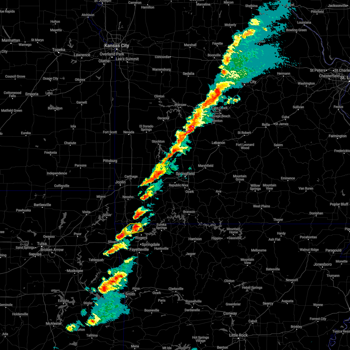 The severe thunderstorm warning for north central benton county will expire at 530 pm cst, the storm which prompted the warning has weakened below severe limits, and no longer poses an immediate threat to life or property. therefore the warning will be allowed to expire. however small hail and gusty winds are still possible with this thunderstorm. a severe thunderstorm watch remains in effect until 900 pm cst for northwestern arkansas. The severe thunderstorm warning for north central benton county will expire at 530 pm cst, the storm which prompted the warning has weakened below severe limits, and no longer poses an immediate threat to life or property. therefore the warning will be allowed to expire. however small hail and gusty winds are still possible with this thunderstorm. a severe thunderstorm watch remains in effect until 900 pm cst for northwestern arkansas.
|
| 12/4/2017 5:16 PM CST |
 At 516 pm cst, a severe thunderstorm was located over hiwasse, moving east at 30 mph (radar indicated). Hazards include 60 mph wind gusts and penny size hail. Expect damage to roofs, siding, and trees. Locations in or near the path include, rogers, bentonville, bella vista, pea ridge, hiwasse, miller, centerton, this includes interstate 49 between mile markers 88 and 93. At 516 pm cst, a severe thunderstorm was located over hiwasse, moving east at 30 mph (radar indicated). Hazards include 60 mph wind gusts and penny size hail. Expect damage to roofs, siding, and trees. Locations in or near the path include, rogers, bentonville, bella vista, pea ridge, hiwasse, miller, centerton, this includes interstate 49 between mile markers 88 and 93.
|
| 12/4/2017 5:05 PM CST |
 At 505 pm cst, a severe thunderstorm was located over gravette, moving east at 30 mph (radar indicated). Hazards include 60 mph wind gusts and penny size hail. Expect damage to roofs, siding, and trees. Locations in or near the path include, rogers, bentonville, bella vista, pea ridge, gravette, decatur, hiwasse, miller, centerton, sulphur springs, this includes interstate 49 between mile markers 87 and 93. At 505 pm cst, a severe thunderstorm was located over gravette, moving east at 30 mph (radar indicated). Hazards include 60 mph wind gusts and penny size hail. Expect damage to roofs, siding, and trees. Locations in or near the path include, rogers, bentonville, bella vista, pea ridge, gravette, decatur, hiwasse, miller, centerton, sulphur springs, this includes interstate 49 between mile markers 87 and 93.
|
| 12/4/2017 4:50 PM CST |
 The national weather service in tulsa has issued a * severe thunderstorm warning for. northern benton county in northwestern arkansas. east central delaware county in northeastern oklahoma. Until 530 pm cst * at 449 pm cst, a severe thunderstorm was located near maysville,. The national weather service in tulsa has issued a * severe thunderstorm warning for. northern benton county in northwestern arkansas. east central delaware county in northeastern oklahoma. Until 530 pm cst * at 449 pm cst, a severe thunderstorm was located near maysville,.
|
| 12/4/2017 4:50 PM CST |
 At 449 pm cst, a severe thunderstorm was located near maysville, moving east at 35 mph (radar indicated). Hazards include 60 mph wind gusts and penny size hail. Expect damage to roofs, siding, and trees. Locations in or near the path include, rogers, bentonville, bella vista, pea ridge, gravette, decatur, maysville, hiwasse, miller, centerton, sulphur springs, avoca, hill top, cherokee city, this includes interstate 49 between mile markers 88 and 93. At 449 pm cst, a severe thunderstorm was located near maysville, moving east at 35 mph (radar indicated). Hazards include 60 mph wind gusts and penny size hail. Expect damage to roofs, siding, and trees. Locations in or near the path include, rogers, bentonville, bella vista, pea ridge, gravette, decatur, maysville, hiwasse, miller, centerton, sulphur springs, avoca, hill top, cherokee city, this includes interstate 49 between mile markers 88 and 93.
|
| 8/18/2017 5:19 PM CDT |
 At 518 pm cdt, a severe thunderstorm was located near gentry, moving east at 25 mph (radar indicated). Hazards include tennis ball size hail and 60 mph wind gusts. People and animals outdoors will be injured. expect hail damage to roofs, siding, windows, and vehicles. expect wind damage to roofs, siding, and trees. Locations in or near the path include, rogers, bentonville, bella vista, pea ridge, gentry, gravette, cave springs, decatur, highfill, springtown, hiwasse, miller, centerton, avoca, fairmount, vaughn, healing springs, rocky comfort, cherokee city, this includes interstate 49 between mile markers 82 and 84, and between mile markers 86 and 93. At 518 pm cdt, a severe thunderstorm was located near gentry, moving east at 25 mph (radar indicated). Hazards include tennis ball size hail and 60 mph wind gusts. People and animals outdoors will be injured. expect hail damage to roofs, siding, windows, and vehicles. expect wind damage to roofs, siding, and trees. Locations in or near the path include, rogers, bentonville, bella vista, pea ridge, gentry, gravette, cave springs, decatur, highfill, springtown, hiwasse, miller, centerton, avoca, fairmount, vaughn, healing springs, rocky comfort, cherokee city, this includes interstate 49 between mile markers 82 and 84, and between mile markers 86 and 93.
|
| 8/18/2017 5:11 PM CDT |
 At 510 pm cdt, severe thunderstorms were located along a line extending from 3 miles northeast of gravette to 3 miles northwest of decatur to 4 miles west of gentry, moving east at 20 mph (radar indicated). Hazards include 60 mph wind gusts and half dollar size hail. Hail damage to vehicles is expected. expect wind damage to roofs, siding, and trees. Locations in or near the path include, rogers, bentonville, bella vista, pea ridge, gentry, gravette, cave springs, decatur, highfill, springtown, hiwasse, miller, centerton, sulphur springs, avoca, fairmount, vaughn, healing springs, rocky comfort, cherokee city, this includes interstate 49 between mile markers 82 and 84, and between mile markers 86 and 93. At 510 pm cdt, severe thunderstorms were located along a line extending from 3 miles northeast of gravette to 3 miles northwest of decatur to 4 miles west of gentry, moving east at 20 mph (radar indicated). Hazards include 60 mph wind gusts and half dollar size hail. Hail damage to vehicles is expected. expect wind damage to roofs, siding, and trees. Locations in or near the path include, rogers, bentonville, bella vista, pea ridge, gentry, gravette, cave springs, decatur, highfill, springtown, hiwasse, miller, centerton, sulphur springs, avoca, fairmount, vaughn, healing springs, rocky comfort, cherokee city, this includes interstate 49 between mile markers 82 and 84, and between mile markers 86 and 93.
|
| 8/18/2017 4:55 PM CDT |
 At 455 pm cdt, severe thunderstorms were located along a line extending from 3 miles south of noel to near maysville to colcord, moving east at 20 mph (radar indicated). Hazards include 60 mph wind gusts and quarter size hail. Hail damage to vehicles is expected. expect wind damage to roofs, siding, and trees. Locations in or near the path include, rogers, bentonville, siloam springs, bella vista, pea ridge, gentry, gravette, cave springs, decatur, colcord, kansas, highfill, springtown, maysville, hiwasse, miller, centerton, sulphur springs, avoca, fairmount, this includes interstate 49 between mile markers 82 and 84, and between mile markers 86 and 93. At 455 pm cdt, severe thunderstorms were located along a line extending from 3 miles south of noel to near maysville to colcord, moving east at 20 mph (radar indicated). Hazards include 60 mph wind gusts and quarter size hail. Hail damage to vehicles is expected. expect wind damage to roofs, siding, and trees. Locations in or near the path include, rogers, bentonville, siloam springs, bella vista, pea ridge, gentry, gravette, cave springs, decatur, colcord, kansas, highfill, springtown, maysville, hiwasse, miller, centerton, sulphur springs, avoca, fairmount, this includes interstate 49 between mile markers 82 and 84, and between mile markers 86 and 93.
|
| 7/8/2017 2:00 AM CDT |
 At 200 am cdt, severe thunderstorms were located along a line extending from 5 miles south of eureka springs to 3 miles north of maysville, moving southeast at 30 mph (radar indicated). Hazards include 60 mph wind gusts and quarter size hail. Hail damage to vehicles is expected. expect wind damage to roofs, siding, and trees. Locations in or near the path include, springdale, rogers, bentonville, siloam springs, bella vista, lowell, gentry, tontitown, bethel heights, gravette, cave springs, decatur, highfill, springtown, hindsville, forum, hiwasse, hobbs state park, clifty, withrow springs state park, this includes interstate 49 between mile markers 70 and 84, and between mile markers 86 and 93. At 200 am cdt, severe thunderstorms were located along a line extending from 5 miles south of eureka springs to 3 miles north of maysville, moving southeast at 30 mph (radar indicated). Hazards include 60 mph wind gusts and quarter size hail. Hail damage to vehicles is expected. expect wind damage to roofs, siding, and trees. Locations in or near the path include, springdale, rogers, bentonville, siloam springs, bella vista, lowell, gentry, tontitown, bethel heights, gravette, cave springs, decatur, highfill, springtown, hindsville, forum, hiwasse, hobbs state park, clifty, withrow springs state park, this includes interstate 49 between mile markers 70 and 84, and between mile markers 86 and 93.
|
| 7/8/2017 1:27 AM CDT |
 At 127 am cdt, severe thunderstorms were located along a line extending from 5 miles north of south west city to 2 miles south of garfield, moving southeast at 35 mph (radar indicated). Hazards include 60 mph wind gusts and quarter size hail. Hail damage to vehicles is expected. expect wind damage to roofs, siding, and trees. Locations in or near the path include, springdale, rogers, bentonville, bella vista, lowell, grove, pea ridge, gentry, bethel heights, gravette, cave springs, decatur, highfill, garfield, gateway, springtown, hiwasse, hobbs state park, clifty, maysville, this includes interstate 49 between mile markers 75 and 84, and between mile markers 86 and 93. At 127 am cdt, severe thunderstorms were located along a line extending from 5 miles north of south west city to 2 miles south of garfield, moving southeast at 35 mph (radar indicated). Hazards include 60 mph wind gusts and quarter size hail. Hail damage to vehicles is expected. expect wind damage to roofs, siding, and trees. Locations in or near the path include, springdale, rogers, bentonville, bella vista, lowell, grove, pea ridge, gentry, bethel heights, gravette, cave springs, decatur, highfill, garfield, gateway, springtown, hiwasse, hobbs state park, clifty, maysville, this includes interstate 49 between mile markers 75 and 84, and between mile markers 86 and 93.
|
| 7/8/2017 1:02 AM CDT |
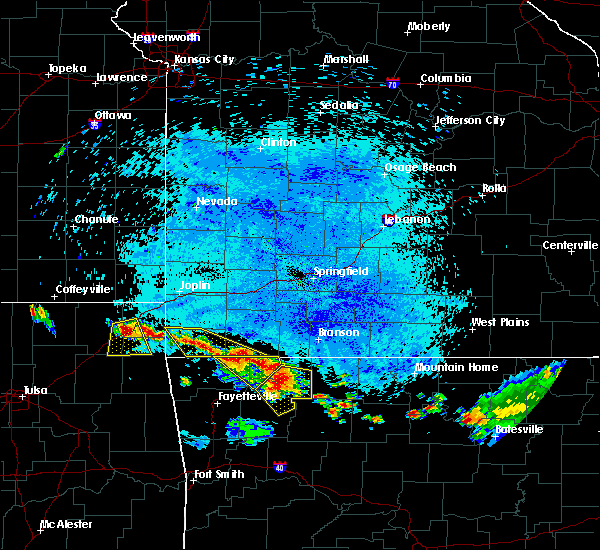 At 102 am cdt, severe thunderstorms were located along a line extending from 4 miles north of pea ridge to 3 miles southwest of grandview, moving southeast at 30 mph (radar indicated). Hazards include 60 mph wind gusts and quarter size hail. Hail damage to vehicles is expected. expect wind damage to roofs, siding, and trees. Locations in or near the path include, eureka springs, pea ridge, garfield, gateway, beaver, grandview, clifty, hill top, beaver lake, walnut hill, larue, pleasant ridge, bland, busch, lookout, oak hill,. At 102 am cdt, severe thunderstorms were located along a line extending from 4 miles north of pea ridge to 3 miles southwest of grandview, moving southeast at 30 mph (radar indicated). Hazards include 60 mph wind gusts and quarter size hail. Hail damage to vehicles is expected. expect wind damage to roofs, siding, and trees. Locations in or near the path include, eureka springs, pea ridge, garfield, gateway, beaver, grandview, clifty, hill top, beaver lake, walnut hill, larue, pleasant ridge, bland, busch, lookout, oak hill,.
|
| 7/8/2017 12:22 AM CDT |
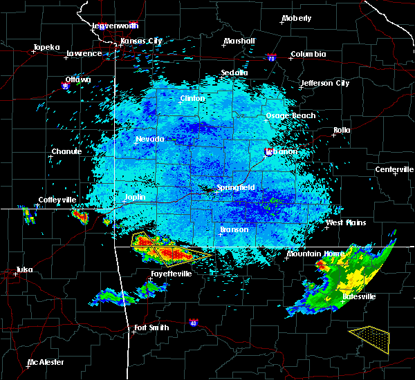 At 1222 am cdt, a severe thunderstorm was located near eureka springs, moving east at 40 mph (radar indicated). Hazards include 60 mph wind gusts and quarter size hail. Hail damage to vehicles is expected. expect wind damage to roofs, siding, and trees. Locations in or near the path include, berryville, eureka springs, garfield, gateway, beaver, war eagle, urbanette, hobbs state park, grandview, hill top, beaver lake, walnut hill, larue, bland, busch, lookout,. At 1222 am cdt, a severe thunderstorm was located near eureka springs, moving east at 40 mph (radar indicated). Hazards include 60 mph wind gusts and quarter size hail. Hail damage to vehicles is expected. expect wind damage to roofs, siding, and trees. Locations in or near the path include, berryville, eureka springs, garfield, gateway, beaver, war eagle, urbanette, hobbs state park, grandview, hill top, beaver lake, walnut hill, larue, bland, busch, lookout,.
|
| 7/8/2017 12:08 AM CDT |
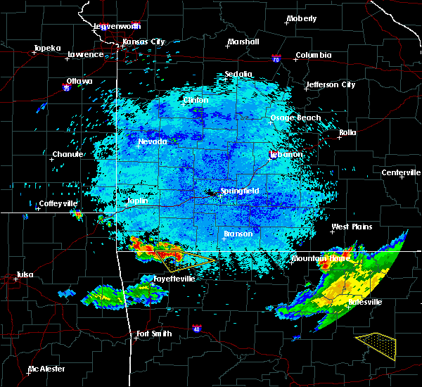 At 1208 am cdt, a severe thunderstorm was located over garfield, moving east at 35 mph (radar indicated). Hazards include 60 mph wind gusts and quarter size hail. Hail damage to vehicles is expected. expect wind damage to roofs, siding, and trees. Locations in or near the path include, berryville, eureka springs, garfield, gateway, beaver, war eagle, urbanette, hobbs state park, grandview, hill top, beaver lake, walnut hill, larue, bland, busch, lookout,. At 1208 am cdt, a severe thunderstorm was located over garfield, moving east at 35 mph (radar indicated). Hazards include 60 mph wind gusts and quarter size hail. Hail damage to vehicles is expected. expect wind damage to roofs, siding, and trees. Locations in or near the path include, berryville, eureka springs, garfield, gateway, beaver, war eagle, urbanette, hobbs state park, grandview, hill top, beaver lake, walnut hill, larue, bland, busch, lookout,.
|
| 5/27/2017 9:36 PM CDT |
 At 936 pm cdt, a severe thunderstorm was located 3 miles south of maysville, moving east at 45 mph (radar indicated). Hazards include 60 mph wind gusts and nickel size hail. Expect damage to roofs, siding, and trees. locations in or near the path include, fayetteville, springdale, rogers, bentonville, siloam springs, bella vista, lowell, pea ridge, gentry, tontitown, bethel heights, gravette, cave springs, decatur, highfill, garfield, gateway, springtown, hiwasse, hobbs state park, this includes interstate 49 between mile markers 70 and 84, and between mile markers 86 and 93. A tornado watch remains in effect until midnight cdt for northwestern arkansas, and northeastern oklahoma. At 936 pm cdt, a severe thunderstorm was located 3 miles south of maysville, moving east at 45 mph (radar indicated). Hazards include 60 mph wind gusts and nickel size hail. Expect damage to roofs, siding, and trees. locations in or near the path include, fayetteville, springdale, rogers, bentonville, siloam springs, bella vista, lowell, pea ridge, gentry, tontitown, bethel heights, gravette, cave springs, decatur, highfill, garfield, gateway, springtown, hiwasse, hobbs state park, this includes interstate 49 between mile markers 70 and 84, and between mile markers 86 and 93. A tornado watch remains in effect until midnight cdt for northwestern arkansas, and northeastern oklahoma.
|
| 5/27/2017 9:27 PM CDT | Power lines dow in benton county AR, 1.9 miles SE of Pea Ridge, AR |
| 5/27/2017 8:43 PM CDT |
 At 842 pm cdt, a severe thunderstorm was located 4 miles southeast of south west city, moving east at 45 mph (radar indicated). Hazards include 60 mph wind gusts and quarter size hail. Hail damage to vehicles is expected. expect wind damage to roofs, siding, and trees. locations in or near the path include, rogers, bentonville, bella vista, lowell, pea ridge, gravette, decatur, highfill, garfield, gateway, hiwasse, maysville, war eagle, hobbs state park, miller, centerton, sulphur springs, avoca, beaver lake, larue, this includes interstate 49 between mile markers 80 and 84, and between mile markers 86 and 93. A tornado watch remains in effect until midnight cdt for northwestern arkansas, and northeastern oklahoma. At 842 pm cdt, a severe thunderstorm was located 4 miles southeast of south west city, moving east at 45 mph (radar indicated). Hazards include 60 mph wind gusts and quarter size hail. Hail damage to vehicles is expected. expect wind damage to roofs, siding, and trees. locations in or near the path include, rogers, bentonville, bella vista, lowell, pea ridge, gravette, decatur, highfill, garfield, gateway, hiwasse, maysville, war eagle, hobbs state park, miller, centerton, sulphur springs, avoca, beaver lake, larue, this includes interstate 49 between mile markers 80 and 84, and between mile markers 86 and 93. A tornado watch remains in effect until midnight cdt for northwestern arkansas, and northeastern oklahoma.
|
| 5/19/2017 9:27 PM CDT |
 At 927 pm cdt, severe thunderstorms were located along a line extending from 2 miles southwest of goodman to 6 miles southeast of pineville to 2 miles north of highfill, moving northeast at 40 mph (radar indicated). Hazards include 60 mph wind gusts and nickel size hail. Expect damage to roofs, siding, and trees. locations in or near the path include, rogers, bentonville, bella vista, lowell, pea ridge, gentry, gravette, cave springs, decatur, highfill, springtown, maysville, hiwasse, miller, centerton, sulphur springs, vaughn, healing springs, cherokee city, this includes interstate 49 between mile markers 79 and 84, and between mile markers 86 and 93. A tornado watch remains in effect until 1100 pm cdt for northwestern arkansas, and northeastern oklahoma. At 927 pm cdt, severe thunderstorms were located along a line extending from 2 miles southwest of goodman to 6 miles southeast of pineville to 2 miles north of highfill, moving northeast at 40 mph (radar indicated). Hazards include 60 mph wind gusts and nickel size hail. Expect damage to roofs, siding, and trees. locations in or near the path include, rogers, bentonville, bella vista, lowell, pea ridge, gentry, gravette, cave springs, decatur, highfill, springtown, maysville, hiwasse, miller, centerton, sulphur springs, vaughn, healing springs, cherokee city, this includes interstate 49 between mile markers 79 and 84, and between mile markers 86 and 93. A tornado watch remains in effect until 1100 pm cdt for northwestern arkansas, and northeastern oklahoma.
|
| 5/19/2017 8:49 PM CDT |
 At 848 pm cdt, severe thunderstorms were located along a line extending from 4 miles southwest of honey creek state park to 5 miles southeast of jay to 3 miles northeast of scraper, moving northeast at 55 mph (radar indicated). Hazards include 60 mph wind gusts and quarter size hail. Hail damage to vehicles is expected. expect wind damage to roofs, siding, and trees. locations in or near the path include, rogers, bentonville, bella vista, lowell, pea ridge, gentry, gravette, cave springs, decatur, highfill, springtown, maysville, hiwasse, miller, centerton, sulphur springs, vaughn, healing springs, cherokee city, this includes interstate 49 between mile markers 79 and 84, and between mile markers 86 and 93. A tornado watch remains in effect until 1100 pm cdt for northwestern arkansas, and northeastern oklahoma. At 848 pm cdt, severe thunderstorms were located along a line extending from 4 miles southwest of honey creek state park to 5 miles southeast of jay to 3 miles northeast of scraper, moving northeast at 55 mph (radar indicated). Hazards include 60 mph wind gusts and quarter size hail. Hail damage to vehicles is expected. expect wind damage to roofs, siding, and trees. locations in or near the path include, rogers, bentonville, bella vista, lowell, pea ridge, gentry, gravette, cave springs, decatur, highfill, springtown, maysville, hiwasse, miller, centerton, sulphur springs, vaughn, healing springs, cherokee city, this includes interstate 49 between mile markers 79 and 84, and between mile markers 86 and 93. A tornado watch remains in effect until 1100 pm cdt for northwestern arkansas, and northeastern oklahoma.
|
| 5/19/2017 3:03 PM CDT |
 At 303 pm cdt, severe thunderstorms were located along a line extending from 6 miles northeast of gravette to 2 miles south of hiwasse to 4 miles northwest of tontitown, moving northeast at 45 mph (radar indicated). Hazards include 60 mph wind gusts. Expect damage to roofs, siding, and trees. Locations in or near the path include, springdale, rogers, bentonville, bella vista, lowell, pea ridge, tontitown, bethel heights, cave springs, highfill, hiwasse, miller, centerton, elm springs, avoca, oak grove, vaughn, monte ne, healing springs, harmon, this includes interstate 49 between mile markers 71 and 84, and between mile markers 86 and 93. At 303 pm cdt, severe thunderstorms were located along a line extending from 6 miles northeast of gravette to 2 miles south of hiwasse to 4 miles northwest of tontitown, moving northeast at 45 mph (radar indicated). Hazards include 60 mph wind gusts. Expect damage to roofs, siding, and trees. Locations in or near the path include, springdale, rogers, bentonville, bella vista, lowell, pea ridge, tontitown, bethel heights, cave springs, highfill, hiwasse, miller, centerton, elm springs, avoca, oak grove, vaughn, monte ne, healing springs, harmon, this includes interstate 49 between mile markers 71 and 84, and between mile markers 86 and 93.
|
| 5/19/2017 2:52 PM CDT |
 At 251 pm cdt, severe thunderstorms were located along a line extending from 4 miles south of noel to 2 miles south of gravette to 3 miles south of springtown, moving northeast at 50 mph (radar indicated). Hazards include 60 mph wind gusts. Expect damage to roofs, siding, and trees. Locations in or near the path include, springdale, rogers, bentonville, siloam springs, bella vista, lowell, pea ridge, gentry, tontitown, bethel heights, gravette, cave springs, decatur, highfill, springtown, hiwasse, maysville, miller, centerton, elm springs, this includes interstate 49 between mile markers 71 and 84, and between mile markers 86 and 93. At 251 pm cdt, severe thunderstorms were located along a line extending from 4 miles south of noel to 2 miles south of gravette to 3 miles south of springtown, moving northeast at 50 mph (radar indicated). Hazards include 60 mph wind gusts. Expect damage to roofs, siding, and trees. Locations in or near the path include, springdale, rogers, bentonville, siloam springs, bella vista, lowell, pea ridge, gentry, tontitown, bethel heights, gravette, cave springs, decatur, highfill, springtown, hiwasse, maysville, miller, centerton, elm springs, this includes interstate 49 between mile markers 71 and 84, and between mile markers 86 and 93.
|
| 5/19/2017 2:34 PM CDT |
 At 233 pm cdt, severe thunderstorms were located along a line extending from 3 miles west of south west city to 2 miles north of colcord to near watts, moving northeast at 50 mph (radar indicated). Hazards include 60 mph wind gusts. Expect damage to roofs, siding, and trees. Locations in or near the path include, springdale, rogers, bentonville, siloam springs, bella vista, lowell, pea ridge, gentry, tontitown, bethel heights, gravette, cave springs, decatur, west siloam springs, colcord, highfill, watts, springtown, hiwasse, maysville, this includes interstate 49 between mile markers 71 and 84, and between mile markers 86 and 93. At 233 pm cdt, severe thunderstorms were located along a line extending from 3 miles west of south west city to 2 miles north of colcord to near watts, moving northeast at 50 mph (radar indicated). Hazards include 60 mph wind gusts. Expect damage to roofs, siding, and trees. Locations in or near the path include, springdale, rogers, bentonville, siloam springs, bella vista, lowell, pea ridge, gentry, tontitown, bethel heights, gravette, cave springs, decatur, west siloam springs, colcord, highfill, watts, springtown, hiwasse, maysville, this includes interstate 49 between mile markers 71 and 84, and between mile markers 86 and 93.
|
| 5/19/2017 12:13 AM CDT |
 At 1212 am cdt, severe thunderstorms capable of producing a tornado were located along a line extending from 4 miles north of hiwasse to rogers, moving east at 70 mph (radar indicated rotation). Hazards include tornado. Flying debris will be dangerous to those caught without shelter. mobile homes will be damaged or destroyed. damage to roofs, windows, and vehicles will occur. tree damage is likely. Locations in or near the path include, springdale, rogers, bentonville, berryville, eureka springs, bella vista, lowell, pea ridge, bethel heights, cave springs, garfield, gateway, beaver, hiwasse, war eagle, urbanette, grandview, hobbs state park, miller, centerton, this includes interstate 49 between mile markers 75 and 84, and between mile markers 86 and 93. At 1212 am cdt, severe thunderstorms capable of producing a tornado were located along a line extending from 4 miles north of hiwasse to rogers, moving east at 70 mph (radar indicated rotation). Hazards include tornado. Flying debris will be dangerous to those caught without shelter. mobile homes will be damaged or destroyed. damage to roofs, windows, and vehicles will occur. tree damage is likely. Locations in or near the path include, springdale, rogers, bentonville, berryville, eureka springs, bella vista, lowell, pea ridge, bethel heights, cave springs, garfield, gateway, beaver, hiwasse, war eagle, urbanette, grandview, hobbs state park, miller, centerton, this includes interstate 49 between mile markers 75 and 84, and between mile markers 86 and 93.
|
| 5/19/2017 12:09 AM CDT |
 At 1209 am cdt, severe thunderstorms were located along a line extending from 2 miles southeast of noel to 3 miles northeast of tontitown to near chester, moving northeast at 45 mph (radar indicated). Hazards include 70 mph wind gusts and penny size hail. Expect considerable tree damage. damage is likely to mobile homes, roofs, and outbuildings. locations in or near the path include, fayetteville, springdale, rogers, bentonville, van buren, cedarville, mountainburg, natural dam, bella vista, lowell, farmington, pea ridge, prairie grove, elkins, tontitown, bethel heights, gravette, west fork, lincoln, cave springs, this includes the following highways, interstate 40 in arkansas between mile markers 0 and 2. interstate 49 between mile markers 22 and 84, and between mile markers 86 and 93. A tornado watch remains in effect until 300 am cdt for northwestern and west central arkansas. At 1209 am cdt, severe thunderstorms were located along a line extending from 2 miles southeast of noel to 3 miles northeast of tontitown to near chester, moving northeast at 45 mph (radar indicated). Hazards include 70 mph wind gusts and penny size hail. Expect considerable tree damage. damage is likely to mobile homes, roofs, and outbuildings. locations in or near the path include, fayetteville, springdale, rogers, bentonville, van buren, cedarville, mountainburg, natural dam, bella vista, lowell, farmington, pea ridge, prairie grove, elkins, tontitown, bethel heights, gravette, west fork, lincoln, cave springs, this includes the following highways, interstate 40 in arkansas between mile markers 0 and 2. interstate 49 between mile markers 22 and 84, and between mile markers 86 and 93. A tornado watch remains in effect until 300 am cdt for northwestern and west central arkansas.
|
| 5/19/2017 12:08 AM CDT |
 At 1207 am cdt, severe thunderstorms were located along a line extending from 3 miles east of gravette to 2 miles east of tontitown to near winslow to jenny lind, moving east at 50 mph (radar indicated). Hazards include 70 mph wind gusts and quarter size hail. Hail damage to vehicles is expected. expect considerable tree damage. wind damage is also likely to mobile homes, roofs, and outbuildings. locations in or near the path include, fayetteville, springdale, rogers, bentonville, berryville, ozark, charleston, huntsville, eureka springs, bella vista, greenwood, lowell, pea ridge, green forest, elkins, bethel heights, lavaca, mulberry, dyer, altus, this includes the following highways, interstate 40 in arkansas between mile markers 18 and 42. interstate 49 between mile markers 79 and 81, near mile marker 84, and between mile markers 86 and 93. A tornado watch remains in effect until 300 am cdt for northwestern and west central arkansas. At 1207 am cdt, severe thunderstorms were located along a line extending from 3 miles east of gravette to 2 miles east of tontitown to near winslow to jenny lind, moving east at 50 mph (radar indicated). Hazards include 70 mph wind gusts and quarter size hail. Hail damage to vehicles is expected. expect considerable tree damage. wind damage is also likely to mobile homes, roofs, and outbuildings. locations in or near the path include, fayetteville, springdale, rogers, bentonville, berryville, ozark, charleston, huntsville, eureka springs, bella vista, greenwood, lowell, pea ridge, green forest, elkins, bethel heights, lavaca, mulberry, dyer, altus, this includes the following highways, interstate 40 in arkansas between mile markers 18 and 42. interstate 49 between mile markers 79 and 81, near mile marker 84, and between mile markers 86 and 93. A tornado watch remains in effect until 300 am cdt for northwestern and west central arkansas.
|
| 5/18/2017 11:53 PM CDT |
 At 1153 pm cdt, severe thunderstorms were located along a line extending from 3 miles northwest of maysville to 8 miles northwest of farmington to 2 miles northwest of cedarville, moving northeast at 45 mph (radar indicated). Hazards include 70 mph wind gusts and penny size hail. Expect considerable tree damage. damage is likely to mobile homes, roofs, and outbuildings. locations in or near the path include, fayetteville, springdale, rogers, bentonville, van buren, siloam springs, stilwell, jay, cedarville, mountainburg, natural dam, bella vista, lowell, farmington, pea ridge, prairie grove, muldrow, roland, gentry, elkins, this includes the following highways, interstate 40 in arkansas between mile markers 0 and 3. interstate 40 in oklahoma between mile markers 312 and 319, and between mile markers 325 and 328. interstate 49 between mile markers 22 and 84, and between mile markers 86 and 93. a tornado watch remains in effect until midnight cdt for northwestern arkansas, and southeastern, northeastern and east central oklahoma. A tornado watch also remains in effect until 300 am cdt for northwestern and west central arkansas. At 1153 pm cdt, severe thunderstorms were located along a line extending from 3 miles northwest of maysville to 8 miles northwest of farmington to 2 miles northwest of cedarville, moving northeast at 45 mph (radar indicated). Hazards include 70 mph wind gusts and penny size hail. Expect considerable tree damage. damage is likely to mobile homes, roofs, and outbuildings. locations in or near the path include, fayetteville, springdale, rogers, bentonville, van buren, siloam springs, stilwell, jay, cedarville, mountainburg, natural dam, bella vista, lowell, farmington, pea ridge, prairie grove, muldrow, roland, gentry, elkins, this includes the following highways, interstate 40 in arkansas between mile markers 0 and 3. interstate 40 in oklahoma between mile markers 312 and 319, and between mile markers 325 and 328. interstate 49 between mile markers 22 and 84, and between mile markers 86 and 93. a tornado watch remains in effect until midnight cdt for northwestern arkansas, and southeastern, northeastern and east central oklahoma. A tornado watch also remains in effect until 300 am cdt for northwestern and west central arkansas.
|
| 5/18/2017 11:50 PM CDT |
 At 1149 pm cdt, severe thunderstorms were located along a line extending from 4 miles west of maysville to 7 miles northeast of cincinnati to 3 miles west of cedarville, moving northeast at 45 mph (radar indicated). Hazards include 70 mph wind gusts and penny size hail. Expect considerable tree damage. damage is likely to mobile homes, roofs, and outbuildings. locations in or near the path include, fayetteville, springdale, rogers, bentonville, van buren, siloam springs, stilwell, jay, cedarville, mountainburg, natural dam, bella vista, lowell, farmington, pea ridge, prairie grove, muldrow, roland, gentry, elkins, this includes the following highways, interstate 40 in arkansas between mile markers 0 and 3. interstate 40 in oklahoma between mile markers 311 and 319, and between mile markers 325 and 328. interstate 49 between mile markers 22 and 84, and between mile markers 86 and 93. a tornado watch remains in effect until midnight cdt for northwestern arkansas, northeastern oklahoma, and southeastern, northeastern and east central oklahoma. A tornado watch also remains in effect until 300 am cdt for northwestern and west central arkansas. At 1149 pm cdt, severe thunderstorms were located along a line extending from 4 miles west of maysville to 7 miles northeast of cincinnati to 3 miles west of cedarville, moving northeast at 45 mph (radar indicated). Hazards include 70 mph wind gusts and penny size hail. Expect considerable tree damage. damage is likely to mobile homes, roofs, and outbuildings. locations in or near the path include, fayetteville, springdale, rogers, bentonville, van buren, siloam springs, stilwell, jay, cedarville, mountainburg, natural dam, bella vista, lowell, farmington, pea ridge, prairie grove, muldrow, roland, gentry, elkins, this includes the following highways, interstate 40 in arkansas between mile markers 0 and 3. interstate 40 in oklahoma between mile markers 311 and 319, and between mile markers 325 and 328. interstate 49 between mile markers 22 and 84, and between mile markers 86 and 93. a tornado watch remains in effect until midnight cdt for northwestern arkansas, northeastern oklahoma, and southeastern, northeastern and east central oklahoma. A tornado watch also remains in effect until 300 am cdt for northwestern and west central arkansas.
|
| 5/18/2017 11:31 PM CDT |
 At 1131 pm cdt, severe thunderstorms were located along a line extending from 7 miles north of leach to 3 miles west of westville to 5 miles north of muldrow, moving northeast at 50 mph (radar indicated). Hazards include 70 mph wind gusts and penny size hail. Expect considerable tree damage. damage is likely to mobile homes, roofs, and outbuildings. locations in or near the path include, fayetteville, springdale, rogers, bentonville, van buren, siloam springs, stilwell, jay, cedarville, mountainburg, natural dam, bella vista, lowell, farmington, pea ridge, prairie grove, muldrow, roland, gentry, elkins, this includes the following highways, interstate 40 in arkansas between mile markers 0 and 3. interstate 40 in oklahoma between mile markers 311 and 319, and between mile markers 325 and 328. interstate 49 between mile markers 22 and 84, and between mile markers 86 and 93. a tornado watch remains in effect until midnight cdt for northwestern arkansas, northeastern oklahoma, and southeastern, northeastern and east central oklahoma. A tornado watch also remains in effect until 300 am cdt for northwestern and west central arkansas. At 1131 pm cdt, severe thunderstorms were located along a line extending from 7 miles north of leach to 3 miles west of westville to 5 miles north of muldrow, moving northeast at 50 mph (radar indicated). Hazards include 70 mph wind gusts and penny size hail. Expect considerable tree damage. damage is likely to mobile homes, roofs, and outbuildings. locations in or near the path include, fayetteville, springdale, rogers, bentonville, van buren, siloam springs, stilwell, jay, cedarville, mountainburg, natural dam, bella vista, lowell, farmington, pea ridge, prairie grove, muldrow, roland, gentry, elkins, this includes the following highways, interstate 40 in arkansas between mile markers 0 and 3. interstate 40 in oklahoma between mile markers 311 and 319, and between mile markers 325 and 328. interstate 49 between mile markers 22 and 84, and between mile markers 86 and 93. a tornado watch remains in effect until midnight cdt for northwestern arkansas, northeastern oklahoma, and southeastern, northeastern and east central oklahoma. A tornado watch also remains in effect until 300 am cdt for northwestern and west central arkansas.
|
| 5/11/2017 10:00 AM CDT |
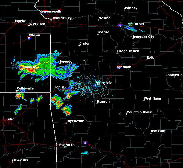 The national weather service in tulsa has issued a * severe thunderstorm warning for. northeastern benton county in northwestern arkansas. northwestern carroll county in northwestern arkansas. Until 1030 am cdt * at 1000 am cdt, a severe thunderstorm was located 3 miles northeast. The national weather service in tulsa has issued a * severe thunderstorm warning for. northeastern benton county in northwestern arkansas. northwestern carroll county in northwestern arkansas. Until 1030 am cdt * at 1000 am cdt, a severe thunderstorm was located 3 miles northeast.
|
| 5/11/2017 1:04 AM CDT |
 At 104 am cdt, severe thunderstorms were located along a line extending from 3 miles southeast of pea ridge to 3 miles southwest of greenland, moving east at 35 mph (radar indicated). Hazards include 60 mph wind gusts. Expect damage to roofs, siding, and trees. Locations in or near the path include, fayetteville, springdale, rogers, bentonville, lowell, farmington, pea ridge, prairie grove, elkins, tontitown, bethel heights, cave springs, greenland, highfill, garfield, gateway, hobbs state park, war eagle, centerton, johnson, this includes interstate 49 between mile markers 56 and 84, and between mile markers 86 and 92. At 104 am cdt, severe thunderstorms were located along a line extending from 3 miles southeast of pea ridge to 3 miles southwest of greenland, moving east at 35 mph (radar indicated). Hazards include 60 mph wind gusts. Expect damage to roofs, siding, and trees. Locations in or near the path include, fayetteville, springdale, rogers, bentonville, lowell, farmington, pea ridge, prairie grove, elkins, tontitown, bethel heights, cave springs, greenland, highfill, garfield, gateway, hobbs state park, war eagle, centerton, johnson, this includes interstate 49 between mile markers 56 and 84, and between mile markers 86 and 92.
|
| 5/11/2017 1:03 AM CDT |
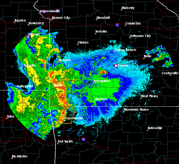 At 103 am cdt, severe thunderstorms were located along a line extending from 6 miles west of washburn to 3 miles north of rogers, moving east at 40 mph (radar indicated). Hazards include 60 mph wind gusts. Expect damage to roofs, siding, and trees. Locations in or near the path include, bentonville, bella vista, pea ridge, this includes interstate 49 between mile markers 91 and 93. At 103 am cdt, severe thunderstorms were located along a line extending from 6 miles west of washburn to 3 miles north of rogers, moving east at 40 mph (radar indicated). Hazards include 60 mph wind gusts. Expect damage to roofs, siding, and trees. Locations in or near the path include, bentonville, bella vista, pea ridge, this includes interstate 49 between mile markers 91 and 93.
|
| 5/11/2017 12:49 AM CDT |
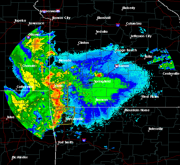 At 1249 am cdt, severe thunderstorms were located along a line extending from 6 miles east of pineville to near bentonville, moving east at 60 mph (radar indicated). Hazards include 60 mph wind gusts. Expect damage to roofs, siding, and trees. Locations in or near the path include, bentonville, bella vista, pea ridge, hiwasse, miller, this includes interstate 49 between mile markers 91 and 93. At 1249 am cdt, severe thunderstorms were located along a line extending from 6 miles east of pineville to near bentonville, moving east at 60 mph (radar indicated). Hazards include 60 mph wind gusts. Expect damage to roofs, siding, and trees. Locations in or near the path include, bentonville, bella vista, pea ridge, hiwasse, miller, this includes interstate 49 between mile markers 91 and 93.
|
| 5/11/2017 12:42 AM CDT |
 At 1242 am cdt, severe thunderstorms were located along a line extending from 3 miles southwest of hiwasse to 3 miles southeast of cincinnati, moving east at 45 mph (radar indicated). Hazards include 60 mph wind gusts. Expect damage to roofs, siding, and trees. Locations in or near the path include, fayetteville, springdale, rogers, bentonville, bella vista, lowell, farmington, pea ridge, prairie grove, elkins, tontitown, bethel heights, lincoln, cave springs, greenland, highfill, garfield, gateway, springtown, hobbs state park, this includes interstate 49 between mile markers 56 and 84, and between mile markers 86 and 93. At 1242 am cdt, severe thunderstorms were located along a line extending from 3 miles southwest of hiwasse to 3 miles southeast of cincinnati, moving east at 45 mph (radar indicated). Hazards include 60 mph wind gusts. Expect damage to roofs, siding, and trees. Locations in or near the path include, fayetteville, springdale, rogers, bentonville, bella vista, lowell, farmington, pea ridge, prairie grove, elkins, tontitown, bethel heights, lincoln, cave springs, greenland, highfill, garfield, gateway, springtown, hobbs state park, this includes interstate 49 between mile markers 56 and 84, and between mile markers 86 and 93.
|
| 5/11/2017 12:20 AM CDT |
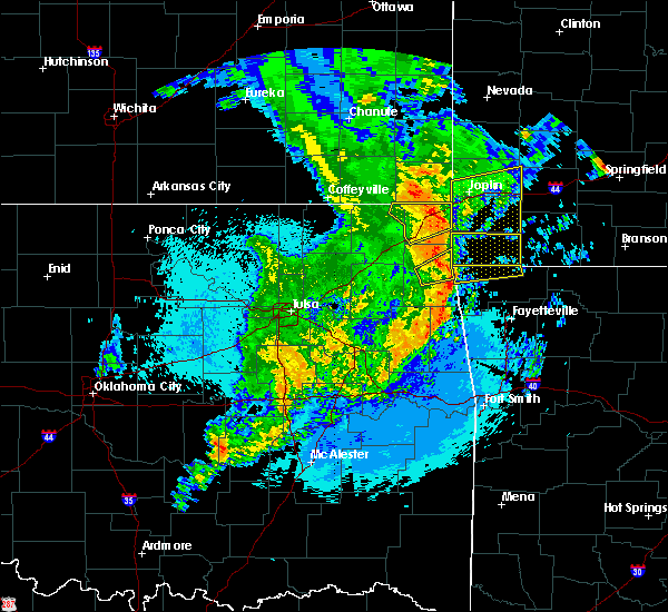 At 1219 am cdt, severe thunderstorms were located along a line extending from 3 miles west of south west city to 4 miles southwest of maysville, moving east at 45 mph (radar indicated). Hazards include 60 mph wind gusts. Expect damage to roofs, siding, and trees. Locations in or near the path include, bentonville, bella vista, pea ridge, gravette, hiwasse, maysville, miller, sulphur springs, this includes interstate 49 between mile markers 91 and 93. At 1219 am cdt, severe thunderstorms were located along a line extending from 3 miles west of south west city to 4 miles southwest of maysville, moving east at 45 mph (radar indicated). Hazards include 60 mph wind gusts. Expect damage to roofs, siding, and trees. Locations in or near the path include, bentonville, bella vista, pea ridge, gravette, hiwasse, maysville, miller, sulphur springs, this includes interstate 49 between mile markers 91 and 93.
|
| 4/29/2017 3:17 AM CDT |
 At 317 am cdt, a severe thunderstorm was located over garfield, moving northeast at 45 mph (radar indicated). Hazards include 60 mph wind gusts and quarter size hail. Hail damage to vehicles is expected. expect wind damage to roofs, siding, and trees. Locations in or near the path include, rogers, garfield, gateway, avoca, larue, hill top, beaver lake, bland, walnut hill, busch,. At 317 am cdt, a severe thunderstorm was located over garfield, moving northeast at 45 mph (radar indicated). Hazards include 60 mph wind gusts and quarter size hail. Hail damage to vehicles is expected. expect wind damage to roofs, siding, and trees. Locations in or near the path include, rogers, garfield, gateway, avoca, larue, hill top, beaver lake, bland, walnut hill, busch,.
|
| 4/29/2017 3:07 AM CDT |
 At 307 am cdt, a severe thunderstorm was located 4 miles northeast of rogers, moving northeast at 40 mph (radar indicated). Hazards include 60 mph wind gusts and quarter size hail. Hail damage to vehicles is expected. expect wind damage to roofs, siding, and trees. Locations in or near the path include, springdale, rogers, bentonville, lowell, pea ridge, bethel heights, garfield, gateway, avoca, hill top, beaver lake, walnut hill, monte ne, larue, bland, busch, this includes interstate 49 between mile markers 75 and 83, and between mile markers 86 and 87. At 307 am cdt, a severe thunderstorm was located 4 miles northeast of rogers, moving northeast at 40 mph (radar indicated). Hazards include 60 mph wind gusts and quarter size hail. Hail damage to vehicles is expected. expect wind damage to roofs, siding, and trees. Locations in or near the path include, springdale, rogers, bentonville, lowell, pea ridge, bethel heights, garfield, gateway, avoca, hill top, beaver lake, walnut hill, monte ne, larue, bland, busch, this includes interstate 49 between mile markers 75 and 83, and between mile markers 86 and 87.
|
| 4/29/2017 2:57 AM CDT |
 At 257 am cdt, a severe thunderstorm was located over rogers, moving northeast at 45 mph (radar indicated). Hazards include 60 mph wind gusts and quarter size hail. Hail damage to vehicles is expected. expect wind damage to roofs, siding, and trees. Locations in or near the path include, springdale, rogers, bentonville, lowell, pea ridge, tontitown, bethel heights, cave springs, garfield, gateway, war eagle, johnson, elm springs, avoca, oak grove, beaver lake, larue, wheeler, busch, shady grove, this includes interstate 49 between mile markers 68 and 84, and between mile markers 86 and 91. At 257 am cdt, a severe thunderstorm was located over rogers, moving northeast at 45 mph (radar indicated). Hazards include 60 mph wind gusts and quarter size hail. Hail damage to vehicles is expected. expect wind damage to roofs, siding, and trees. Locations in or near the path include, springdale, rogers, bentonville, lowell, pea ridge, tontitown, bethel heights, cave springs, garfield, gateway, war eagle, johnson, elm springs, avoca, oak grove, beaver lake, larue, wheeler, busch, shady grove, this includes interstate 49 between mile markers 68 and 84, and between mile markers 86 and 91.
|
| 4/29/2017 2:19 AM CDT |
 At 219 am cdt, a severe thunderstorm was located 5 miles south of garfield, moving northeast at 45 mph (radar indicated). Hazards include 60 mph wind gusts and half dollar size hail. Hail damage to vehicles is expected. expect wind damage to roofs, siding, and trees. Locations in or near the path include, springdale, rogers, bentonville, bella vista, lowell, pea ridge, tontitown, bethel heights, gravette, cave springs, highfill, garfield, gateway, beaver, hiwasse, miller, centerton, johnson, elm springs, avoca, this includes interstate 49 between mile markers 69 and 84, and between mile markers 86 and 93. At 219 am cdt, a severe thunderstorm was located 5 miles south of garfield, moving northeast at 45 mph (radar indicated). Hazards include 60 mph wind gusts and half dollar size hail. Hail damage to vehicles is expected. expect wind damage to roofs, siding, and trees. Locations in or near the path include, springdale, rogers, bentonville, bella vista, lowell, pea ridge, tontitown, bethel heights, gravette, cave springs, highfill, garfield, gateway, beaver, hiwasse, miller, centerton, johnson, elm springs, avoca, this includes interstate 49 between mile markers 69 and 84, and between mile markers 86 and 93.
|
| 4/29/2017 2:00 AM CDT |
 At 159 am cdt, a severe thunderstorm was located 3 miles west of bethel heights, moving northeast at 45 mph (radar indicated). Hazards include 60 mph wind gusts and quarter size hail. Hail damage to vehicles is expected. expect wind damage to roofs, siding, and trees. Locations in or near the path include, springdale, rogers, bentonville, bella vista, lowell, pea ridge, tontitown, bethel heights, gravette, cave springs, highfill, garfield, gateway, beaver, hiwasse, miller, centerton, johnson, elm springs, avoca, this includes interstate 49 between mile markers 69 and 84, and between mile markers 86 and 93. At 159 am cdt, a severe thunderstorm was located 3 miles west of bethel heights, moving northeast at 45 mph (radar indicated). Hazards include 60 mph wind gusts and quarter size hail. Hail damage to vehicles is expected. expect wind damage to roofs, siding, and trees. Locations in or near the path include, springdale, rogers, bentonville, bella vista, lowell, pea ridge, tontitown, bethel heights, gravette, cave springs, highfill, garfield, gateway, beaver, hiwasse, miller, centerton, johnson, elm springs, avoca, this includes interstate 49 between mile markers 69 and 84, and between mile markers 86 and 93.
|
| 4/29/2017 1:49 AM CDT |
 At 149 am cdt, a severe thunderstorm was located over highfill, moving northeast at 45 mph (radar indicated). Hazards include 60 mph wind gusts and quarter size hail. Hail damage to vehicles is expected. expect wind damage to roofs, siding, and trees. Locations in or near the path include, fayetteville, springdale, rogers, bentonville, bella vista, lowell, farmington, pea ridge, tontitown, bethel heights, gravette, cave springs, decatur, highfill, garfield, gateway, beaver, hiwasse, miller, centerton, this includes interstate 49 between mile markers 69 and 84, and between mile markers 86 and 93. At 149 am cdt, a severe thunderstorm was located over highfill, moving northeast at 45 mph (radar indicated). Hazards include 60 mph wind gusts and quarter size hail. Hail damage to vehicles is expected. expect wind damage to roofs, siding, and trees. Locations in or near the path include, fayetteville, springdale, rogers, bentonville, bella vista, lowell, farmington, pea ridge, tontitown, bethel heights, gravette, cave springs, decatur, highfill, garfield, gateway, beaver, hiwasse, miller, centerton, this includes interstate 49 between mile markers 69 and 84, and between mile markers 86 and 93.
|
| 4/29/2017 1:22 AM CDT |
 At 122 am cdt, a severe thunderstorm was located 6 miles east of rogers, moving northeast at 35 mph (radar indicated). Hazards include 60 mph wind gusts and half dollar size hail. Hail damage to vehicles is expected. expect wind damage to roofs, siding, and trees. Locations in or near the path include, springdale, rogers, bentonville, eureka springs, lowell, pea ridge, bethel heights, garfield, gateway, beaver, war eagle, hobbs state park, avoca, hill top, beaver lake, walnut hill, monte ne, larue, bland, busch, this includes interstate 49 between mile markers 76 and 84, and between mile markers 86 and 88. At 122 am cdt, a severe thunderstorm was located 6 miles east of rogers, moving northeast at 35 mph (radar indicated). Hazards include 60 mph wind gusts and half dollar size hail. Hail damage to vehicles is expected. expect wind damage to roofs, siding, and trees. Locations in or near the path include, springdale, rogers, bentonville, eureka springs, lowell, pea ridge, bethel heights, garfield, gateway, beaver, war eagle, hobbs state park, avoca, hill top, beaver lake, walnut hill, monte ne, larue, bland, busch, this includes interstate 49 between mile markers 76 and 84, and between mile markers 86 and 88.
|
| 4/29/2017 1:02 AM CDT |
 At 102 am cdt, a severe thunderstorm was located over bethel heights, moving northeast at 35 mph (radar indicated). Hazards include golf ball size hail and 60 mph wind gusts. People and animals outdoors will be injured. expect hail damage to roofs, siding, windows, and vehicles. expect wind damage to roofs, siding, and trees. Locations in or near the path include, fayetteville, springdale, rogers, bentonville, eureka springs, lowell, pea ridge, tontitown, bethel heights, cave springs, highfill, garfield, gateway, beaver, hobbs state park, war eagle, johnson, elm springs, goshen, avoca, this includes interstate 49 between mile markers 66 and 84, and between mile markers 86 and 90. At 102 am cdt, a severe thunderstorm was located over bethel heights, moving northeast at 35 mph (radar indicated). Hazards include golf ball size hail and 60 mph wind gusts. People and animals outdoors will be injured. expect hail damage to roofs, siding, windows, and vehicles. expect wind damage to roofs, siding, and trees. Locations in or near the path include, fayetteville, springdale, rogers, bentonville, eureka springs, lowell, pea ridge, tontitown, bethel heights, cave springs, highfill, garfield, gateway, beaver, hobbs state park, war eagle, johnson, elm springs, goshen, avoca, this includes interstate 49 between mile markers 66 and 84, and between mile markers 86 and 90.
|
| 4/28/2017 11:05 PM CDT |
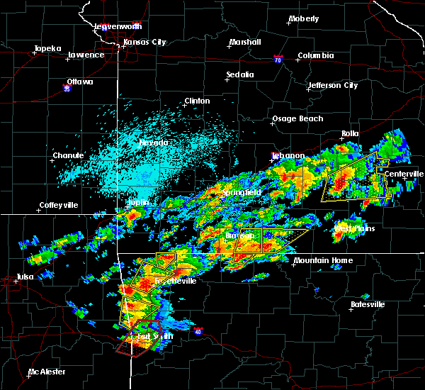 At 1105 pm cdt, a severe thunderstorm was located over gateway, moving northeast at 50 mph (radar indicated). Hazards include 60 mph wind gusts and quarter size hail. Hail damage to vehicles is expected. expect wind damage to roofs, siding, and trees. Locations in or near the path include, rogers, pea ridge, garfield, gateway, avoca, hill top, walnut hill,. At 1105 pm cdt, a severe thunderstorm was located over gateway, moving northeast at 50 mph (radar indicated). Hazards include 60 mph wind gusts and quarter size hail. Hail damage to vehicles is expected. expect wind damage to roofs, siding, and trees. Locations in or near the path include, rogers, pea ridge, garfield, gateway, avoca, hill top, walnut hill,.
|
| 4/28/2017 10:53 PM CDT |
 At 1053 pm cdt, a severe thunderstorm was located 4 miles east of rogers, moving northeast at 45 mph (radar indicated). Hazards include 60 mph wind gusts and quarter size hail. Hail damage to vehicles is expected. expect wind damage to roofs, siding, and trees. Locations in or near the path include, rogers, lowell, pea ridge, garfield, gateway, avoca, larue, hill top, bland, walnut hill, busch, monte ne, this includes interstate 49 between mile markers 78 and 80. At 1053 pm cdt, a severe thunderstorm was located 4 miles east of rogers, moving northeast at 45 mph (radar indicated). Hazards include 60 mph wind gusts and quarter size hail. Hail damage to vehicles is expected. expect wind damage to roofs, siding, and trees. Locations in or near the path include, rogers, lowell, pea ridge, garfield, gateway, avoca, larue, hill top, bland, walnut hill, busch, monte ne, this includes interstate 49 between mile markers 78 and 80.
|
| 4/26/2017 1:10 AM CDT | Tree down across n davis road in benton county AR, 0.8 miles W of Pea Ridge, AR |
| 4/26/2017 1:05 AM CDT |
 At 103 am cdt, severe thunderstorms were located along a line extending from 5 miles northwest of pea ridge to cave springs to near cincinnati, moving east at 60 mph (radar indicated. at 1257 am, a 61 mph wind gust was reported at northwest arkansas regional airport). Hazards include 70 mph wind gusts. Expect considerable tree damage. damage is likely to mobile homes, roofs, and outbuildings. Locations in or near the path include, fayetteville, springdale, rogers, bentonville, tahlequah, siloam springs, eureka springs, bella vista, lowell, farmington, pea ridge, prairie grove, gentry, elkins, tontitown, bethel heights, gravette, west fork, lincoln, cave springs, this includes interstate 49 between mile markers 49 and 84, and between mile markers 86 and 93. At 103 am cdt, severe thunderstorms were located along a line extending from 5 miles northwest of pea ridge to cave springs to near cincinnati, moving east at 60 mph (radar indicated. at 1257 am, a 61 mph wind gust was reported at northwest arkansas regional airport). Hazards include 70 mph wind gusts. Expect considerable tree damage. damage is likely to mobile homes, roofs, and outbuildings. Locations in or near the path include, fayetteville, springdale, rogers, bentonville, tahlequah, siloam springs, eureka springs, bella vista, lowell, farmington, pea ridge, prairie grove, gentry, elkins, tontitown, bethel heights, gravette, west fork, lincoln, cave springs, this includes interstate 49 between mile markers 49 and 84, and between mile markers 86 and 93.
|
| 4/26/2017 12:39 AM CDT |
 At 1238 am cdt, severe thunderstorms were located along a line extending from 3 miles north of maysville to 3 miles northwest of west siloam springs to 4 miles northeast of tahlequah, moving east at 60 mph (radar indicated). Hazards include 70 mph wind gusts. Expect considerable tree damage. damage is likely to mobile homes, roofs, and outbuildings. Locations in or near the path include, fayetteville, springdale, rogers, bentonville, tahlequah, siloam springs, eureka springs, bella vista, lowell, farmington, pea ridge, prairie grove, gentry, elkins, tontitown, bethel heights, gravette, west fork, lincoln, cave springs, this includes interstate 49 between mile markers 49 and 84, and between mile markers 86 and 93. At 1238 am cdt, severe thunderstorms were located along a line extending from 3 miles north of maysville to 3 miles northwest of west siloam springs to 4 miles northeast of tahlequah, moving east at 60 mph (radar indicated). Hazards include 70 mph wind gusts. Expect considerable tree damage. damage is likely to mobile homes, roofs, and outbuildings. Locations in or near the path include, fayetteville, springdale, rogers, bentonville, tahlequah, siloam springs, eureka springs, bella vista, lowell, farmington, pea ridge, prairie grove, gentry, elkins, tontitown, bethel heights, gravette, west fork, lincoln, cave springs, this includes interstate 49 between mile markers 49 and 84, and between mile markers 86 and 93.
|
| 4/26/2017 12:33 AM CDT |
 At 1233 am cdt, severe thunderstorms were located along a line extending from 5 miles north of grove to 5 miles north of south west city to 4 miles northeast of maysville to 2 miles northeast of kansas, moving east at 45 mph (radar indicated). Hazards include 70 mph wind gusts and penny size hail. Expect considerable tree damage. damage is likely to mobile homes, roofs, and outbuildings. Locations in or near the path include, rogers, bentonville, siloam springs, jay, bella vista, pea ridge, gentry, gravette, cave springs, decatur, colcord, kansas, highfill, oaks, springtown, hiwasse, leach, twin oaks, maysville, miller, this includes interstate 49 between mile markers 82 and 84, and between mile markers 86 and 93. At 1233 am cdt, severe thunderstorms were located along a line extending from 5 miles north of grove to 5 miles north of south west city to 4 miles northeast of maysville to 2 miles northeast of kansas, moving east at 45 mph (radar indicated). Hazards include 70 mph wind gusts and penny size hail. Expect considerable tree damage. damage is likely to mobile homes, roofs, and outbuildings. Locations in or near the path include, rogers, bentonville, siloam springs, jay, bella vista, pea ridge, gentry, gravette, cave springs, decatur, colcord, kansas, highfill, oaks, springtown, hiwasse, leach, twin oaks, maysville, miller, this includes interstate 49 between mile markers 82 and 84, and between mile markers 86 and 93.
|
| 4/26/2017 12:15 AM CDT |
 At 1215 am cdt, severe thunderstorms were located along a line extending from 2 miles northwest of bernice to 2 miles southwest of honey creek state park to 2 miles east of jay to 2 miles southwest of leach, moving east at 50 mph (radar indicated). Hazards include 70 mph wind gusts and penny size hail. Expect considerable tree damage. damage is likely to mobile homes, roofs, and outbuildings. Locations in or near the path include, rogers, bentonville, siloam springs, jay, bella vista, grove, pea ridge, gentry, gravette, cave springs, decatur, colcord, kansas, highfill, bernice, oaks, springtown, honey creek state park, bernice state park, hiwasse, this includes interstate 49 between mile markers 82 and 84, and between mile markers 86 and 93. At 1215 am cdt, severe thunderstorms were located along a line extending from 2 miles northwest of bernice to 2 miles southwest of honey creek state park to 2 miles east of jay to 2 miles southwest of leach, moving east at 50 mph (radar indicated). Hazards include 70 mph wind gusts and penny size hail. Expect considerable tree damage. damage is likely to mobile homes, roofs, and outbuildings. Locations in or near the path include, rogers, bentonville, siloam springs, jay, bella vista, grove, pea ridge, gentry, gravette, cave springs, decatur, colcord, kansas, highfill, bernice, oaks, springtown, honey creek state park, bernice state park, hiwasse, this includes interstate 49 between mile markers 82 and 84, and between mile markers 86 and 93.
|
| 4/4/2017 8:17 PM CDT |
 At 817 pm cdt, severe thunderstorms were located along a line extending from 5 miles northwest of war eagle to 2 miles north of elkins to 3 miles east of brentwood, moving northeast at 30 mph (radar indicated). Hazards include golf ball size hail and 60 mph wind gusts. People and animals outdoors will be injured. expect hail damage to roofs, siding, windows, and vehicles. expect wind damage to roofs, siding, and trees. locations in or near the path include, fayetteville, springdale, rogers, bentonville, huntsville, eureka springs, lowell, elkins, bethel heights, garfield, winslow, st. Paul, beaver, hindsville, wesley, saint paul, hobbs state park, clifty, withrow springs state park, war eagle, this includes interstate 49 between mile markers 77 and 81, and near mile marker 86. At 817 pm cdt, severe thunderstorms were located along a line extending from 5 miles northwest of war eagle to 2 miles north of elkins to 3 miles east of brentwood, moving northeast at 30 mph (radar indicated). Hazards include golf ball size hail and 60 mph wind gusts. People and animals outdoors will be injured. expect hail damage to roofs, siding, windows, and vehicles. expect wind damage to roofs, siding, and trees. locations in or near the path include, fayetteville, springdale, rogers, bentonville, huntsville, eureka springs, lowell, elkins, bethel heights, garfield, winslow, st. Paul, beaver, hindsville, wesley, saint paul, hobbs state park, clifty, withrow springs state park, war eagle, this includes interstate 49 between mile markers 77 and 81, and near mile marker 86.
|
| 4/4/2017 8:11 PM CDT |
 At 811 pm cdt, severe thunderstorms were located along a line extending from pea ridge to 2 miles northeast of bethel heights to 3 miles west of elkins to 2 miles southeast of winslow, moving northeast at 45 mph (radar indicated). Hazards include 60 mph wind gusts and quarter size hail. Hail damage to vehicles is expected. expect wind damage to roofs, siding, and trees. locations in or near the path include, fayetteville, springdale, rogers, bentonville, huntsville, eureka springs, bella vista, lowell, farmington, pea ridge, elkins, tontitown, bethel heights, west fork, cave springs, greenland, garfield, gateway, winslow, st. Paul, this includes interstate 49 between mile markers 41 and 84, and between mile markers 86 and 93. At 811 pm cdt, severe thunderstorms were located along a line extending from pea ridge to 2 miles northeast of bethel heights to 3 miles west of elkins to 2 miles southeast of winslow, moving northeast at 45 mph (radar indicated). Hazards include 60 mph wind gusts and quarter size hail. Hail damage to vehicles is expected. expect wind damage to roofs, siding, and trees. locations in or near the path include, fayetteville, springdale, rogers, bentonville, huntsville, eureka springs, bella vista, lowell, farmington, pea ridge, elkins, tontitown, bethel heights, west fork, cave springs, greenland, garfield, gateway, winslow, st. Paul, this includes interstate 49 between mile markers 41 and 84, and between mile markers 86 and 93.
|
| 4/4/2017 7:58 PM CDT |
 At 758 pm cdt, severe thunderstorms were located along a line extending from 2 miles south of bella vista to 2 miles south of tontitown to 2 miles southwest of west fork to 4 miles east of lee creek, moving northeast at 40 mph (radar indicated). Hazards include 60 mph wind gusts and quarter size hail. Hail damage to vehicles is expected. expect wind damage to roofs, siding, and trees. Locations in or near the path include, fayetteville, springdale, rogers, bentonville, huntsville, eureka springs, mountainburg, bella vista, lowell, farmington, pea ridge, elkins, tontitown, bethel heights, west fork, cave springs, greenland, garfield, gateway, winslow, this includes interstate 49 between mile markers 32 and 84, and between mile markers 86 and 93. At 758 pm cdt, severe thunderstorms were located along a line extending from 2 miles south of bella vista to 2 miles south of tontitown to 2 miles southwest of west fork to 4 miles east of lee creek, moving northeast at 40 mph (radar indicated). Hazards include 60 mph wind gusts and quarter size hail. Hail damage to vehicles is expected. expect wind damage to roofs, siding, and trees. Locations in or near the path include, fayetteville, springdale, rogers, bentonville, huntsville, eureka springs, mountainburg, bella vista, lowell, farmington, pea ridge, elkins, tontitown, bethel heights, west fork, cave springs, greenland, garfield, gateway, winslow, this includes interstate 49 between mile markers 32 and 84, and between mile markers 86 and 93.
|
| 3/9/2017 8:37 PM CST |
 At 837 pm cst, severe thunderstorms were located along a line extending from 2 miles south of siloam springs to 2 miles southwest of springdale to 6 miles north of clifty, moving south at 35 mph (radar indicated). Hazards include 60 mph wind gusts and half dollar size hail. Hail damage to vehicles is expected. expect wind damage to roofs, siding, and trees. Locations in or near the path include, fayetteville, springdale, rogers, bentonville, siloam springs, eureka springs, bella vista, lowell, pea ridge, gentry, tontitown, bethel heights, cave springs, highfill, garfield, gateway, beaver, springtown, hobbs state park, clifty, this includes interstate 49 between mile markers 65 and 84, and between mile markers 86 and 93. At 837 pm cst, severe thunderstorms were located along a line extending from 2 miles south of siloam springs to 2 miles southwest of springdale to 6 miles north of clifty, moving south at 35 mph (radar indicated). Hazards include 60 mph wind gusts and half dollar size hail. Hail damage to vehicles is expected. expect wind damage to roofs, siding, and trees. Locations in or near the path include, fayetteville, springdale, rogers, bentonville, siloam springs, eureka springs, bella vista, lowell, pea ridge, gentry, tontitown, bethel heights, cave springs, highfill, garfield, gateway, beaver, springtown, hobbs state park, clifty, this includes interstate 49 between mile markers 65 and 84, and between mile markers 86 and 93.
|
| 3/9/2017 8:02 PM CST |
 At 801 pm cst, severe thunderstorms were located along a line extending from 4 miles southwest of maysville to 4 miles southwest of bentonville to near seligman, moving southeast at 35 mph (radar indicated). Hazards include 60 mph wind gusts and half dollar size hail. Hail damage to vehicles is expected. expect wind damage to roofs, siding, and trees. Locations in or near the path include, fayetteville, springdale, rogers, bentonville, siloam springs, eureka springs, bella vista, lowell, pea ridge, gentry, tontitown, bethel heights, gravette, cave springs, decatur, highfill, garfield, gateway, beaver, springtown, this includes interstate 49 between mile markers 65 and 84, and between mile markers 86 and 93. At 801 pm cst, severe thunderstorms were located along a line extending from 4 miles southwest of maysville to 4 miles southwest of bentonville to near seligman, moving southeast at 35 mph (radar indicated). Hazards include 60 mph wind gusts and half dollar size hail. Hail damage to vehicles is expected. expect wind damage to roofs, siding, and trees. Locations in or near the path include, fayetteville, springdale, rogers, bentonville, siloam springs, eureka springs, bella vista, lowell, pea ridge, gentry, tontitown, bethel heights, gravette, cave springs, decatur, highfill, garfield, gateway, beaver, springtown, this includes interstate 49 between mile markers 65 and 84, and between mile markers 86 and 93.
|
| 3/6/2017 11:48 PM CST |
 At 1147 pm cst, severe thunderstorms were located along a line extending from near chain-o-lakes to near lincoln, moving east at 60 mph (radar indicated). Hazards include 60 mph wind gusts and quarter size hail. Hail damage to vehicles is expected. expect wind damage to roofs, siding, and trees. locations in or near the path include, fayetteville, springdale, rogers, bentonville, tahlequah, siloam springs, bella vista, lowell, farmington, pea ridge, gentry, tontitown, bethel heights, gravette, lincoln, cave springs, decatur, westville, west siloam springs, colcord, this includes interstate 49 between mile markers 69 and 84, and between mile markers 86 and 93. A tornado watch remains in effect until 300 am cst for northwestern arkansas, and northeastern and east central oklahoma. At 1147 pm cst, severe thunderstorms were located along a line extending from near chain-o-lakes to near lincoln, moving east at 60 mph (radar indicated). Hazards include 60 mph wind gusts and quarter size hail. Hail damage to vehicles is expected. expect wind damage to roofs, siding, and trees. locations in or near the path include, fayetteville, springdale, rogers, bentonville, tahlequah, siloam springs, bella vista, lowell, farmington, pea ridge, gentry, tontitown, bethel heights, gravette, lincoln, cave springs, decatur, westville, west siloam springs, colcord, this includes interstate 49 between mile markers 69 and 84, and between mile markers 86 and 93. A tornado watch remains in effect until 300 am cst for northwestern arkansas, and northeastern and east central oklahoma.
|
| 3/6/2017 11:24 PM CST |
 At 1124 pm cst, severe thunderstorms were located along a line extending from 3 miles east of pea ridge to 5 miles south of tahlequah, moving east at 70 mph (radar indicated). Hazards include 60 mph wind gusts and quarter size hail. Hail damage to vehicles is expected. expect wind damage to roofs, siding, and trees. locations in or near the path include, fayetteville, springdale, rogers, bentonville, tahlequah, siloam springs, berryville, stilwell, huntsville, eureka springs, lowell, farmington, pea ridge, prairie grove, green forest, elkins, tontitown, bethel heights, west fork, lincoln, this includes interstate 49 between mile markers 41 and 84, and between mile markers 86 and 91. A tornado watch remains in effect until 300 am cst for northwestern and west central arkansas, and northeastern and east central oklahoma. At 1124 pm cst, severe thunderstorms were located along a line extending from 3 miles east of pea ridge to 5 miles south of tahlequah, moving east at 70 mph (radar indicated). Hazards include 60 mph wind gusts and quarter size hail. Hail damage to vehicles is expected. expect wind damage to roofs, siding, and trees. locations in or near the path include, fayetteville, springdale, rogers, bentonville, tahlequah, siloam springs, berryville, stilwell, huntsville, eureka springs, lowell, farmington, pea ridge, prairie grove, green forest, elkins, tontitown, bethel heights, west fork, lincoln, this includes interstate 49 between mile markers 41 and 84, and between mile markers 86 and 91. A tornado watch remains in effect until 300 am cst for northwestern and west central arkansas, and northeastern and east central oklahoma.
|
| 3/6/2017 10:53 PM CST |
 At 1053 pm cst, severe thunderstorms were located along a line extending from 4 miles northwest of south west city to 4 miles west of wagoner, moving east at 65 mph (radar indicated). Hazards include 60 mph wind gusts and quarter size hail. Hail damage to vehicles is expected. expect wind damage to roofs, siding, and trees. locations in or near the path include, fayetteville, springdale, rogers, bentonville, tahlequah, siloam springs, wagoner, jay, bella vista, lowell, farmington, pea ridge, gentry, tontitown, bethel heights, gravette, lincoln, cave springs, decatur, westville, this includes interstate 49 between mile markers 69 and 84, and between mile markers 86 and 93. A tornado watch remains in effect until 300 am cst for northwestern arkansas, and northeastern and east central oklahoma. At 1053 pm cst, severe thunderstorms were located along a line extending from 4 miles northwest of south west city to 4 miles west of wagoner, moving east at 65 mph (radar indicated). Hazards include 60 mph wind gusts and quarter size hail. Hail damage to vehicles is expected. expect wind damage to roofs, siding, and trees. locations in or near the path include, fayetteville, springdale, rogers, bentonville, tahlequah, siloam springs, wagoner, jay, bella vista, lowell, farmington, pea ridge, gentry, tontitown, bethel heights, gravette, lincoln, cave springs, decatur, westville, this includes interstate 49 between mile markers 69 and 84, and between mile markers 86 and 93. A tornado watch remains in effect until 300 am cst for northwestern arkansas, and northeastern and east central oklahoma.
|
| 4/27/2016 1:00 AM CDT |
 At 100 am cdt, severe thunderstorms were located along a line extending from 3 miles northwest of garfield to 4 miles east of winslow, moving east at 45 mph (radar indicated). Hazards include 60 mph wind gusts and penny size hail. Expect damage to roofs. siding. and trees. Locations in or near the path include, fayetteville, springdale, rogers, bentonville, berryville, huntsville, eureka springs, bella vista, lowell, farmington, pea ridge, prairie grove, green forest, elkins, tontitown, bethel heights, west fork, cave springs, greenland, highfill, this includes interstate 49 between mile markers 43 and 84, and between mile markers 86 and 93. At 100 am cdt, severe thunderstorms were located along a line extending from 3 miles northwest of garfield to 4 miles east of winslow, moving east at 45 mph (radar indicated). Hazards include 60 mph wind gusts and penny size hail. Expect damage to roofs. siding. and trees. Locations in or near the path include, fayetteville, springdale, rogers, bentonville, berryville, huntsville, eureka springs, bella vista, lowell, farmington, pea ridge, prairie grove, green forest, elkins, tontitown, bethel heights, west fork, cave springs, greenland, highfill, this includes interstate 49 between mile markers 43 and 84, and between mile markers 86 and 93.
|
| 4/27/2016 12:56 AM CDT |
 At 1256 am cdt, a severe thunderstorm capable of producing a tornado was located 3 miles east of pea ridge, moving east at 50 mph (radar indicated rotation). Hazards include tornado. Flying debris will be dangerous to those caught without shelter. mobile homes will be damaged or destroyed. damage to roofs, windows, and vehicles will occur. tree damage is likely. Locations in or near the path include, rogers, pea ridge, garfield, gateway, avoca, walnut hill, hill top,. At 1256 am cdt, a severe thunderstorm capable of producing a tornado was located 3 miles east of pea ridge, moving east at 50 mph (radar indicated rotation). Hazards include tornado. Flying debris will be dangerous to those caught without shelter. mobile homes will be damaged or destroyed. damage to roofs, windows, and vehicles will occur. tree damage is likely. Locations in or near the path include, rogers, pea ridge, garfield, gateway, avoca, walnut hill, hill top,.
|
| 4/27/2016 12:48 AM CDT |
 At 1247 am cdt, severe thunderstorms were located along a line extending from 3 miles north of bella vista to near tontitown to 2 miles southeast of strickler, moving east at 45 mph (radar indicated). Hazards include 60 mph wind gusts and penny size hail. Expect damage to roofs. siding. and trees. Locations in or near the path include, fayetteville, springdale, rogers, bentonville, siloam springs, bella vista, lowell, farmington, pea ridge, prairie grove, gentry, elkins, tontitown, bethel heights, gravette, west fork, lincoln, cave springs, decatur, greenland, this includes interstate 49 between mile markers 42 and 84, and between mile markers 86 and 93. At 1247 am cdt, severe thunderstorms were located along a line extending from 3 miles north of bella vista to near tontitown to 2 miles southeast of strickler, moving east at 45 mph (radar indicated). Hazards include 60 mph wind gusts and penny size hail. Expect damage to roofs. siding. and trees. Locations in or near the path include, fayetteville, springdale, rogers, bentonville, siloam springs, bella vista, lowell, farmington, pea ridge, prairie grove, gentry, elkins, tontitown, bethel heights, gravette, west fork, lincoln, cave springs, decatur, greenland, this includes interstate 49 between mile markers 42 and 84, and between mile markers 86 and 93.
|
| 4/27/2016 12:40 AM CDT |
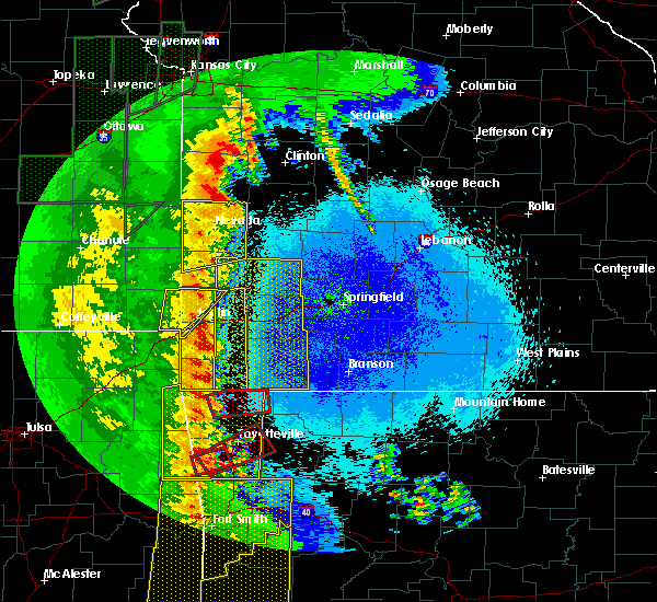 At 1240 am cdt, a severe thunderstorm capable of producing a tornado was located 3 miles southwest of bella vista, moving east at 50 mph (radar indicated rotation). Hazards include tornado. Flying debris will be dangerous to those caught without shelter. mobile homes will be damaged or destroyed. damage to roofs, windows, and vehicles will occur. tree damage is likely. Locations in or near the path include, rogers, bentonville, bella vista, lowell, pea ridge, highfill, garfield, gateway, hiwasse, miller, centerton, avoca, larue, bland, walnut hill, hill top, vaughn, this includes interstate 49 between mile markers 81 and 84, and between mile markers 86 and 93. At 1240 am cdt, a severe thunderstorm capable of producing a tornado was located 3 miles southwest of bella vista, moving east at 50 mph (radar indicated rotation). Hazards include tornado. Flying debris will be dangerous to those caught without shelter. mobile homes will be damaged or destroyed. damage to roofs, windows, and vehicles will occur. tree damage is likely. Locations in or near the path include, rogers, bentonville, bella vista, lowell, pea ridge, highfill, garfield, gateway, hiwasse, miller, centerton, avoca, larue, bland, walnut hill, hill top, vaughn, this includes interstate 49 between mile markers 81 and 84, and between mile markers 86 and 93.
|
| 4/27/2016 12:31 AM CDT |
 At 1230 am cdt, severe thunderstorms were located along a line extending from 2 miles south of lanagan to near gentry to 9 miles northwest of lee creek, moving east at 45 mph (radar indicated). Hazards include 60 mph wind gusts and penny size hail. Expect damage to roofs. siding. and trees. Locations in or near the path include, fayetteville, springdale, rogers, bentonville, siloam springs, stilwell, bella vista, lowell, farmington, pea ridge, prairie grove, gentry, elkins, tontitown, bethel heights, gravette, west fork, lincoln, cave springs, decatur, this includes interstate 49 between mile markers 42 and 84, and between mile markers 86 and 93. At 1230 am cdt, severe thunderstorms were located along a line extending from 2 miles south of lanagan to near gentry to 9 miles northwest of lee creek, moving east at 45 mph (radar indicated). Hazards include 60 mph wind gusts and penny size hail. Expect damage to roofs. siding. and trees. Locations in or near the path include, fayetteville, springdale, rogers, bentonville, siloam springs, stilwell, bella vista, lowell, farmington, pea ridge, prairie grove, gentry, elkins, tontitown, bethel heights, gravette, west fork, lincoln, cave springs, decatur, this includes interstate 49 between mile markers 42 and 84, and between mile markers 86 and 93.
|
| 4/27/2016 12:06 AM CDT |
 At 1205 am cdt, severe thunderstorms were located along a line extending from 5 miles southeast of honey creek state park to 2 miles east of kansas to near bunch, moving east at 40 mph (radar indicated). Hazards include 70 mph wind gusts and penny size hail. Expect considerable tree damage. damage is likely to mobile homes, roofs, and outbuildings. Locations in or near the path include, fayetteville, springdale, rogers, bentonville, siloam springs, stilwell, jay, bella vista, lowell, farmington, pea ridge, prairie grove, gentry, elkins, tontitown, bethel heights, gravette, west fork, lincoln, cave springs, this includes interstate 49 between mile markers 42 and 84, and between mile markers 86 and 93. At 1205 am cdt, severe thunderstorms were located along a line extending from 5 miles southeast of honey creek state park to 2 miles east of kansas to near bunch, moving east at 40 mph (radar indicated). Hazards include 70 mph wind gusts and penny size hail. Expect considerable tree damage. damage is likely to mobile homes, roofs, and outbuildings. Locations in or near the path include, fayetteville, springdale, rogers, bentonville, siloam springs, stilwell, jay, bella vista, lowell, farmington, pea ridge, prairie grove, gentry, elkins, tontitown, bethel heights, gravette, west fork, lincoln, cave springs, this includes interstate 49 between mile markers 42 and 84, and between mile markers 86 and 93.
|
| 12/26/2015 5:32 PM CST |
 At 532 pm cst, a severe thunderstorm was located over pea ridge, moving northeast at 40 mph (radar indicated). Hazards include 60 mph wind gusts. Expect damage to roofs. siding. and trees. Locations in or near the path include, bentonville, bella vista, pea ridge,. At 532 pm cst, a severe thunderstorm was located over pea ridge, moving northeast at 40 mph (radar indicated). Hazards include 60 mph wind gusts. Expect damage to roofs. siding. and trees. Locations in or near the path include, bentonville, bella vista, pea ridge,.
|
| 12/26/2015 5:16 PM CST |
 At 516 pm cst, a severe thunderstorm was located near bentonville, moving northeast at 40 mph (radar indicated). Hazards include 60 mph wind gusts. Expect damage to roofs. siding. and trees. Locations in or near the path include, rogers, bentonville, bella vista, lowell, pea ridge, cave springs, highfill, garfield, gateway, miller, centerton, avoca, walnut hill, hill top, vaughn,. At 516 pm cst, a severe thunderstorm was located near bentonville, moving northeast at 40 mph (radar indicated). Hazards include 60 mph wind gusts. Expect damage to roofs. siding. and trees. Locations in or near the path include, rogers, bentonville, bella vista, lowell, pea ridge, cave springs, highfill, garfield, gateway, miller, centerton, avoca, walnut hill, hill top, vaughn,.
|
| 12/26/2015 4:08 PM CST |
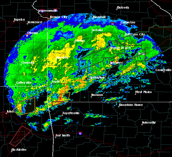 The tornado warning for northwestern benton county will expire at 415 pm cst, the storm which prompted the warning has moved out of the area. therefore the warning will be allowed to expire. The tornado warning for northwestern benton county will expire at 415 pm cst, the storm which prompted the warning has moved out of the area. therefore the warning will be allowed to expire.
|
| 12/26/2015 3:53 PM CST |
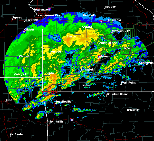 At 352 pm cst, a severe thunderstorm capable of producing a tornado was located 4 miles northeast of gravette, moving northeast at 35 mph (radar indicated rotation). Hazards include tornado. Flying debris will be dangerous to those caught without shelter. mobile homes will be damaged or destroyed. damage to roofs, windows, and vehicles will occur. tree damage is likely. Locations in or near the path include, pea ridge, gravette, hiwasse, sulphur springs,. At 352 pm cst, a severe thunderstorm capable of producing a tornado was located 4 miles northeast of gravette, moving northeast at 35 mph (radar indicated rotation). Hazards include tornado. Flying debris will be dangerous to those caught without shelter. mobile homes will be damaged or destroyed. damage to roofs, windows, and vehicles will occur. tree damage is likely. Locations in or near the path include, pea ridge, gravette, hiwasse, sulphur springs,.
|
| 12/26/2015 3:38 PM CST |
 At 338 pm cst, a severe thunderstorm capable of producing a tornado was located 4 miles northwest of decatur, moving northeast at 35 mph (radar indicated rotation). Hazards include tornado. Flying debris will be dangerous to those caught without shelter. mobile homes will be damaged or destroyed. damage to roofs, windows, and vehicles will occur. tree damage is likely. Locations in or near the path include, bella vista, pea ridge, gravette, decatur, hiwasse, miller, sulphur springs,. At 338 pm cst, a severe thunderstorm capable of producing a tornado was located 4 miles northwest of decatur, moving northeast at 35 mph (radar indicated rotation). Hazards include tornado. Flying debris will be dangerous to those caught without shelter. mobile homes will be damaged or destroyed. damage to roofs, windows, and vehicles will occur. tree damage is likely. Locations in or near the path include, bella vista, pea ridge, gravette, decatur, hiwasse, miller, sulphur springs,.
|
| 11/5/2015 5:21 PM CST |
 The severe thunderstorm warning for northeastern benton county will expire at 530 pm cst, the storm which prompted the warning has moved out of the area. therefore the warning will be allowed to expire. a tornado watch remains in effect until 900 pm cst for northwestern arkansas. The severe thunderstorm warning for northeastern benton county will expire at 530 pm cst, the storm which prompted the warning has moved out of the area. therefore the warning will be allowed to expire. a tornado watch remains in effect until 900 pm cst for northwestern arkansas.
|
| 11/5/2015 5:11 PM CST |
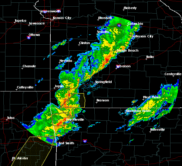 At 511 pm cst, a severe thunderstorm was located 3 miles east of pea ridge, moving northeast at 50 mph (radar indicated). Hazards include 60 mph wind gusts. Expect damage to roofs. siding and trees. Locations in or near the path include, rogers, bentonville, bella vista, pea ridge, garfield, gateway, war eagle, hobbs state park, miller, avoca, larue, bland, walnut hill, hill top, monte ne, a tornado watch remains in effect until 900 pm cst for northwestern arkansas. At 511 pm cst, a severe thunderstorm was located 3 miles east of pea ridge, moving northeast at 50 mph (radar indicated). Hazards include 60 mph wind gusts. Expect damage to roofs. siding and trees. Locations in or near the path include, rogers, bentonville, bella vista, pea ridge, garfield, gateway, war eagle, hobbs state park, miller, avoca, larue, bland, walnut hill, hill top, monte ne, a tornado watch remains in effect until 900 pm cst for northwestern arkansas.
|
| 11/5/2015 4:54 PM CST |
 At 454 pm cst, a severe thunderstorm was located 5 miles northeast of highfill, moving northeast at 50 mph (radar indicated). Hazards include 60 mph wind gusts. Expect damage to roofs. siding and trees. Locations in or near the path include, springdale, rogers, bentonville, bella vista, lowell, pea ridge, bethel heights, cave springs, decatur, highfill, garfield, gateway, springtown, hiwasse, war eagle, hobbs state park, miller, centerton, avoca, larue, a tornado watch remains in effect until 900 pm cst for northwestern arkansas. At 454 pm cst, a severe thunderstorm was located 5 miles northeast of highfill, moving northeast at 50 mph (radar indicated). Hazards include 60 mph wind gusts. Expect damage to roofs. siding and trees. Locations in or near the path include, springdale, rogers, bentonville, bella vista, lowell, pea ridge, bethel heights, cave springs, decatur, highfill, garfield, gateway, springtown, hiwasse, war eagle, hobbs state park, miller, centerton, avoca, larue, a tornado watch remains in effect until 900 pm cst for northwestern arkansas.
|
| 7/9/2015 6:25 PM CDT |
 At 625 pm cdt, severe thunderstorms were located along a line extending from near bentonville to 5 miles northwest of war eagle to 5 miles west of hindsville to 3 miles northwest of fayetteville, moving east at 45 mph (radar indicated). Hazards include 60 mph wind gusts. Expect damage to roofs. siding and trees. Locations impacted include, fayetteville, springdale, rogers, bentonville, eureka springs, bella vista, lowell, farmington, pea ridge, tontitown, bethel heights, garfield, gateway, beaver, hindsville, forum, hobbs state park, clifty, withrow springs state park and war eagle. At 625 pm cdt, severe thunderstorms were located along a line extending from near bentonville to 5 miles northwest of war eagle to 5 miles west of hindsville to 3 miles northwest of fayetteville, moving east at 45 mph (radar indicated). Hazards include 60 mph wind gusts. Expect damage to roofs. siding and trees. Locations impacted include, fayetteville, springdale, rogers, bentonville, eureka springs, bella vista, lowell, farmington, pea ridge, tontitown, bethel heights, garfield, gateway, beaver, hindsville, forum, hobbs state park, clifty, withrow springs state park and war eagle.
|
| 7/9/2015 6:07 PM CDT |
 At 607 pm cdt, severe thunderstorms were located along a line extending from 3 miles north of springtown to near cave springs to 4 miles south of tontitown, moving northeast at 40 mph (radar indicated). Hazards include 60 mph wind gusts. Expect damage to roofs. Siding and trees. At 607 pm cdt, severe thunderstorms were located along a line extending from 3 miles north of springtown to near cave springs to 4 miles south of tontitown, moving northeast at 40 mph (radar indicated). Hazards include 60 mph wind gusts. Expect damage to roofs. Siding and trees.
|
| 7/2/2015 6:30 PM CDT |
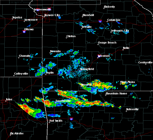 At 630 pm cdt, severe thunderstorms were located along a line extending from 3 miles northwest of garfield to 6 miles northwest of rudd, moving southeast at 10 mph (radar indicated). Hazards include 60 mph wind gusts and quarter size hail. Hail damage to vehicles is expected. Expect wind damage to roofs, siding and trees. At 630 pm cdt, severe thunderstorms were located along a line extending from 3 miles northwest of garfield to 6 miles northwest of rudd, moving southeast at 10 mph (radar indicated). Hazards include 60 mph wind gusts and quarter size hail. Hail damage to vehicles is expected. Expect wind damage to roofs, siding and trees.
|
| 5/25/2015 8:13 PM CDT | At 810 pm cdt, severe thunderstorms were located along a line extending from 6 miles southeast of springdale to wesley, and moving north at 35 mph (radar indicated). Hazards include 60 mph wind gusts. Expect damage to roofs. siding and trees. Locations in or near the path include, sonora, mayfield, hindsville, lowell, monte ne, best, war eagle, hobbs state park, rogers, lookout, bland, larue and avoca. |
| 5/25/2015 7:55 PM CDT | At 754 pm cdt, severe thunderstorms were located along a line extending from fayetteville to japton, and moving north at 35 mph (radar indicated). Hazards include 60 mph wind gusts. Expect damage to roofs. siding and trees. Locations in or near the path include, tuttle, wesley, johnson, shady grove, goshen, springdale, sonora, mayfield, lowell, hindsville, monte ne, rogers, war eagle, best, hobbs state park, lookout, avoca, bland and larue. |
| 5/17/2015 1:58 AM CDT | At 157 am cdt, severe thunderstorms were located along a line extending from beaver to elkins to bokoshe, and moving east at 45 mph (radar indicated). Hazards include 60 mph wind gusts and penny size hail. Expect damage to roofs. siding and trees. locations in or near the path include, best, brentwood, tuttle, cedarville, roland, durham, wesley, arnett, winslow, cottonwood, dora, oak hill, eureka springs, hindsville, wyola, clifty, figure five, pleasant ridge, chester, mount gayler, lake fort smith, locke and mountainburg this includes interstate 40 in oklahoma between mile markers 304 and 328. this includes interstate 40 in arkansas between mile markers 0 and 4. 0. 75in. |
| 5/17/2015 1:58 AM CDT | At 157 am cdt, severe thunderstorms were located along a line extending from beaver to elkins to bokoshe, and moving east at 45 mph (radar indicated). Hazards include 60 mph wind gusts and penny size hail. Expect damage to roofs. siding and trees. locations in or near the path include, best, brentwood, tuttle, cedarville, roland, durham, wesley, arnett, winslow, cottonwood, dora, oak hill, eureka springs, hindsville, wyola, clifty, figure five, pleasant ridge, chester, mount gayler, lake fort smith, locke and mountainburg this includes interstate 40 in oklahoma between mile markers 304 and 328. this includes interstate 40 in arkansas between mile markers 0 and 4. 0. 75in. |
| 5/17/2015 1:16 AM CDT | At 114 am cdt, severe thunderstorms were located along a line extending from 16 miles northwest of fairview to 12 miles southwest of fairview to 18 miles west of washburn, and moving northeast at 45 mph (emergency management. damange has been reported in newton county with these storms). Hazards include 60 mph wind gusts. Expect damage to roofs. Siding and trees. |
| 5/17/2015 1:13 AM CDT | At 112 am cdt, severe thunderstorms were located along a line extending from 5 miles north of bella vista to westville to briartown, and moving east at 45 mph (radar indicated). Hazards include 60 mph wind gusts and penny size hail. Expect damage to roofs. siding and trees. locations in or near the path include, marietta, stigler, highfill, centerton, vian, miller, vaughn, summers, bella vista, adair state park, northwest arkansas regional airport, bunch, wedington, rocky comfort, stilwell, marble city, healing springs, bentonville, rhea, tamaha, kanima, mc key, brushy lake state park, savoy, cave springs, pea ridge, harmon, lincoln, elm springs, keota, tontitown, wheeler, rogers, viney grove, oak grove, brushy, canehill, avoca, morrow, prairie grove battlefield state park, clyde, lowell, prairie grove, sallisaw, farmington, johnson, hill top, monte ne, garfield, springdale, walnut grove, walnut hill, shady grove, gateway, fayetteville, odell, cowlington, hogeye, greenland, drake field airport, larue, sonora, strickler, gans, bland, busch, beaver lake, war eagle, west fork, lookout, beaver, short, hobbs state park, goshen, woolsey, natural dam, muldrow, mayfield, best, black oak, lee creek, uniontown, blackburn, cottonwood, devils den state park, sulphur city, oak hill, elkins, eureka springs, hindsville, roland, tuttle, hicks, clifty, brentwood, pleasant ridge, cedarville, dora, wesley, durham, winslow, arnett, wyola, figure five, lake fort smith, mount gayler, locke, chester and mountainburg. this includes interstate 40 in oklahoma between mile markers 290 and 328. this includes interstate 40 in arkansas between mile markers 0 and 4. 0. 75in. |
| 5/17/2015 1:13 AM CDT | At 112 am cdt, severe thunderstorms were located along a line extending from 5 miles north of bella vista to westville to briartown, and moving east at 45 mph (radar indicated). Hazards include 60 mph wind gusts and penny size hail. Expect damage to roofs. siding and trees. locations in or near the path include, marietta, stigler, highfill, centerton, vian, miller, vaughn, summers, bella vista, adair state park, northwest arkansas regional airport, bunch, wedington, rocky comfort, stilwell, marble city, healing springs, bentonville, rhea, tamaha, kanima, mc key, brushy lake state park, savoy, cave springs, pea ridge, harmon, lincoln, elm springs, keota, tontitown, wheeler, rogers, viney grove, oak grove, brushy, canehill, avoca, morrow, prairie grove battlefield state park, clyde, lowell, prairie grove, sallisaw, farmington, johnson, hill top, monte ne, garfield, springdale, walnut grove, walnut hill, shady grove, gateway, fayetteville, odell, cowlington, hogeye, greenland, drake field airport, larue, sonora, strickler, gans, bland, busch, beaver lake, war eagle, west fork, lookout, beaver, short, hobbs state park, goshen, woolsey, natural dam, muldrow, mayfield, best, black oak, lee creek, uniontown, blackburn, cottonwood, devils den state park, sulphur city, oak hill, elkins, eureka springs, hindsville, roland, tuttle, hicks, clifty, brentwood, pleasant ridge, cedarville, dora, wesley, durham, winslow, arnett, wyola, figure five, lake fort smith, mount gayler, locke, chester and mountainburg. this includes interstate 40 in oklahoma between mile markers 290 and 328. this includes interstate 40 in arkansas between mile markers 0 and 4. 0. 75in. |
| 5/17/2015 1:10 AM CDT | At 108 am cdt, severe thunderstorms were located along a line extending from 6 miles northeast of hiwasse to westville to 7 miles west of tamaha, and moving northeast at 50 mph (radar indicated). Hazards include 60 mph wind gusts and penny size hail. Expect damage to roofs. siding and trees. locations in or near the path include, marietta, vian, highfill, miller, northwest arkansas regional airport, prairie grove battlefield state park, adair state park, brushy lake state park, oak grove, elm springs, tontitown, wheeler, savoy, wedington, viney grove, rhea, summers, canehill, clyde, morrow, farmington, prairie grove, lincoln, bella vista, centerton, vaughn, cave springs, healing springs, bentonville, harmon, walnut grove, rocky comfort, marble city, brushy, mc key, sallisaw, bunch and stilwell this includes interstate 40 in oklahoma between mile markers 281 and 309. 0. 75in. |
| 5/17/2015 1:10 AM CDT | At 108 am cdt, severe thunderstorms were located along a line extending from 6 miles northeast of hiwasse to westville to 7 miles west of tamaha, and moving northeast at 50 mph (radar indicated). Hazards include 60 mph wind gusts and penny size hail. Expect damage to roofs. siding and trees. locations in or near the path include, marietta, vian, highfill, miller, northwest arkansas regional airport, prairie grove battlefield state park, adair state park, brushy lake state park, oak grove, elm springs, tontitown, wheeler, savoy, wedington, viney grove, rhea, summers, canehill, clyde, morrow, farmington, prairie grove, lincoln, bella vista, centerton, vaughn, cave springs, healing springs, bentonville, harmon, walnut grove, rocky comfort, marble city, brushy, mc key, sallisaw, bunch and stilwell this includes interstate 40 in oklahoma between mile markers 281 and 309. 0. 75in. |
| 5/17/2015 12:59 AM CDT | At 1255 am cdt, severe thunderstorms were located along a line extending from baxter springs to anderson to 7 miles south of noel, and moving northeast at 55 mph (radar indicated). Hazards include 60 mph wind gusts. 60 mph wind gusts are expected within this line of severe thunderstorms. in addition, a tornado warning is in effect for far southeastern kansas, southern jasper, and newton counties, where stronger tornado winds will be possible. Expect damage to roofs. siding and trees. locations impacted include, airport drive, alba, anderson, baxter springs, carl junction, carterville, carthage, diamond, duenweg, duquesne, fairview, galena, goodman, granby, iron gates, joplin, lanagan, leawood, neosho, noel, oronogo, pineville, purcell, saginaw, sarcoxie, seneca, shoal creek drive, silver creek, south west city, treece and webb city. this warning also includes big sugar creek state park. interstate 44 between mile markers 0 and 29 will also be impacted by severe thunderstorms. once again, in addition to this severe thunderstorm warning, a tornado warning is in effect for far southeastern kansas, southern jasper, and newton counties until 115 am cdt. a tornado watch remains in effect until 500 am cdt sunday morning for southeast kansas and southwestern missouri. 75in. |
| 5/17/2015 12:59 AM CDT | At 1255 am cdt, severe thunderstorms were located along a line extending from baxter springs to anderson to 7 miles south of noel, and moving northeast at 55 mph (radar indicated). Hazards include 60 mph wind gusts. 60 mph wind gusts are expected within this line of severe thunderstorms. in addition, a tornado warning is in effect for far southeastern kansas, southern jasper, and newton counties, where stronger tornado winds will be possible. Expect damage to roofs. siding and trees. locations impacted include, airport drive, alba, anderson, baxter springs, carl junction, carterville, carthage, diamond, duenweg, duquesne, fairview, galena, goodman, granby, iron gates, joplin, lanagan, leawood, neosho, noel, oronogo, pineville, purcell, saginaw, sarcoxie, seneca, shoal creek drive, silver creek, south west city, treece and webb city. this warning also includes big sugar creek state park. interstate 44 between mile markers 0 and 29 will also be impacted by severe thunderstorms. once again, in addition to this severe thunderstorm warning, a tornado warning is in effect for far southeastern kansas, southern jasper, and newton counties until 115 am cdt. a tornado watch remains in effect until 500 am cdt sunday morning for southeast kansas and southwestern missouri. 75in. |
| 5/17/2015 12:55 AM CDT | At 1253 am cdt, severe thunderstorms were located along a line extending from noel to christie to porum, and moving northeast at 50 mph (radar indicated). Hazards include 70 mph wind gusts and penny size hail. Expect considerable tree damage. damage is likely to mobile homes, roofs and outbuildings. locations in or near the path include, watts, siloam springs, ballard, sulphur springs, gentry, gravette, lake francis, decatur, box, westville, baron, cincinnati, fairmount, springtown, gallitin, marietta, hiwasse, wedington, summers, highfill, vian, adair state park, vaughn, northwest arkansas regional airport, prairie grove battlefield state park, brushy lake state park, oak grove, elm springs, tontitown, wheeler, savoy, viney grove, rhea, canehill, clyde, morrow, farmington, prairie grove, lincoln, bella vista, centerton, cave springs, healing springs, bentonville, harmon, miller, rocky comfort, marble city, brushy, mc key, sallisaw, bunch and stilwell this includes interstate 40 in oklahoma between mile markers 271 and 309. 0. 75in. |
| 5/17/2015 12:55 AM CDT | At 1253 am cdt, severe thunderstorms were located along a line extending from noel to christie to porum, and moving northeast at 50 mph (radar indicated). Hazards include 70 mph wind gusts and penny size hail. Expect considerable tree damage. damage is likely to mobile homes, roofs and outbuildings. locations in or near the path include, watts, siloam springs, ballard, sulphur springs, gentry, gravette, lake francis, decatur, box, westville, baron, cincinnati, fairmount, springtown, gallitin, marietta, hiwasse, wedington, summers, highfill, vian, adair state park, vaughn, northwest arkansas regional airport, prairie grove battlefield state park, brushy lake state park, oak grove, elm springs, tontitown, wheeler, savoy, viney grove, rhea, canehill, clyde, morrow, farmington, prairie grove, lincoln, bella vista, centerton, cave springs, healing springs, bentonville, harmon, miller, rocky comfort, marble city, brushy, mc key, sallisaw, bunch and stilwell this includes interstate 40 in oklahoma between mile markers 271 and 309. 0. 75in. |
| 5/17/2015 12:38 AM CDT | At 1237 am cdt, severe thunderstorms were located along a line extending from jay to tahlequah to 8 miles north of enterprise, and moving northeast at 50 mph (radar indicated). Hazards include 70 mph wind gusts and penny size hail. Expect considerable tree damage. damage is likely to mobile homes, roofs and outbuildings. locations in or near the path include, kansas, lake eucha state park, eldon, proctor, briartown, porum, colcord, cherokee landing state park, natural falls state park, webbers falls, lake tenkiller state park, gore, maysville, cookson, christie, cherokee city, west siloam springs, ballard, sulphur springs, watts, siloam springs, box, gravette, lake francis, westville, baron, gentry, decatur, cincinnati, fairmount, springtown, marietta, gallitin, vian, hiwasse, summers, bunch, highfill, wedington, adair state park, stilwell, northwest arkansas regional airport, prairie grove battlefield state park, brushy lake state park, oak grove, elm springs, tontitown, wheeler, savoy, viney grove, rhea, canehill, clyde, morrow, farmington, prairie grove, lincoln, bella vista, centerton, vaughn, cave springs, healing springs, bentonville, harmon, walnut grove, miller, rocky comfort, marble city, brushy, mc key and sallisaw this includes interstate 40 in oklahoma between mile markers 267 and 309. 0. 75in. |
| 5/17/2015 12:38 AM CDT | At 1234 am cdt, severe thunderstorms were located along a line extending from 16 miles southwest of treece to 10 miles northwest of south west city to 18 miles southwest of south west city, or near jay oklahoma, and moving northeast at 60 mph (radar indicated). Hazards include 60 mph wind gusts. Expect damage to roofs. Siding and trees. |
| 5/17/2015 12:38 AM CDT | At 1234 am cdt, severe thunderstorms were located along a line extending from 16 miles southwest of treece to 10 miles northwest of south west city to 18 miles southwest of south west city, or near jay oklahoma, and moving northeast at 60 mph (radar indicated). Hazards include 60 mph wind gusts. Expect damage to roofs. Siding and trees. |
| 5/17/2015 12:38 AM CDT | At 1237 am cdt, severe thunderstorms were located along a line extending from jay to tahlequah to 8 miles north of enterprise, and moving northeast at 50 mph (radar indicated). Hazards include 70 mph wind gusts and penny size hail. Expect considerable tree damage. damage is likely to mobile homes, roofs and outbuildings. locations in or near the path include, kansas, lake eucha state park, eldon, proctor, briartown, porum, colcord, cherokee landing state park, natural falls state park, webbers falls, lake tenkiller state park, gore, maysville, cookson, christie, cherokee city, west siloam springs, ballard, sulphur springs, watts, siloam springs, box, gravette, lake francis, westville, baron, gentry, decatur, cincinnati, fairmount, springtown, marietta, gallitin, vian, hiwasse, summers, bunch, highfill, wedington, adair state park, stilwell, northwest arkansas regional airport, prairie grove battlefield state park, brushy lake state park, oak grove, elm springs, tontitown, wheeler, savoy, viney grove, rhea, canehill, clyde, morrow, farmington, prairie grove, lincoln, bella vista, centerton, vaughn, cave springs, healing springs, bentonville, harmon, walnut grove, miller, rocky comfort, marble city, brushy, mc key and sallisaw this includes interstate 40 in oklahoma between mile markers 267 and 309. 0. 75in. |
| 5/17/2015 12:12 AM CDT | At 1210 am cdt, severe thunderstorms were located along a line extending from peggs to fort gibson to eufaula, and moving northeast at 50 mph (radar indicated). Hazards include 70 mph wind gusts and penny size hail. Expect considerable tree damage. damage is likely to mobile homes, roofs and outbuildings. locations in or near the path include, warner, braggs, rose, pumpkin center, leach, greenleaf state park, tahlequah, twin oaks, briartown, porum, oaks, scraper, kansas, gore, eldon, webbers falls, lake tenkiller state park, cherokee landing state park, jay, proctor, lake eucha state park, cookson, colcord, natural falls state park, box, christie, maysville, cherokee city, vian, watts, west siloam springs, siloam springs, ballard, westville, mc key, lake francis, marietta, baron, gentry, bunch, decatur, marble city, gravette, sulphur springs, fairmount, cincinnati, gallitin, adair state park, springtown, summers, sallisaw, brushy lake state park, stilwell, wedington, hiwasse, highfill, vaughn, rhea, brushy, northwest arkansas regional airport, centerton, savoy, miller, lincoln, healing springs, rocky comfort, harmon, bella vista, wheeler, viney grove, cave springs, canehill, morrow, tontitown, clyde, bentonville, prairie grove battlefield state park, elm springs, prairie grove, oak grove and farmington. this includes interstate 40 in oklahoma between mile markers 267 and 309. 0. 75in. |
| 5/17/2015 12:12 AM CDT | At 1210 am cdt, severe thunderstorms were located along a line extending from peggs to fort gibson to eufaula, and moving northeast at 50 mph (radar indicated). Hazards include 70 mph wind gusts and penny size hail. Expect considerable tree damage. damage is likely to mobile homes, roofs and outbuildings. locations in or near the path include, warner, braggs, rose, pumpkin center, leach, greenleaf state park, tahlequah, twin oaks, briartown, porum, oaks, scraper, kansas, gore, eldon, webbers falls, lake tenkiller state park, cherokee landing state park, jay, proctor, lake eucha state park, cookson, colcord, natural falls state park, box, christie, maysville, cherokee city, vian, watts, west siloam springs, siloam springs, ballard, westville, mc key, lake francis, marietta, baron, gentry, bunch, decatur, marble city, gravette, sulphur springs, fairmount, cincinnati, gallitin, adair state park, springtown, summers, sallisaw, brushy lake state park, stilwell, wedington, hiwasse, highfill, vaughn, rhea, brushy, northwest arkansas regional airport, centerton, savoy, miller, lincoln, healing springs, rocky comfort, harmon, bella vista, wheeler, viney grove, cave springs, canehill, morrow, tontitown, clyde, bentonville, prairie grove battlefield state park, elm springs, prairie grove, oak grove and farmington. this includes interstate 40 in oklahoma between mile markers 267 and 309. 0. 75in. |
| 4/17/2015 8:42 PM CDT | The severe thunderstorm warning for central benton county will expire at 845 pm cdt, the storm which prompted the warning has weakened below severe limits, and no longer poses an immediate threat to life or property. however, small hail, gusty winds and heavy rain are still possible with this thunderstorm. |
| 4/17/2015 8:34 PM CDT | At 832 pm cdt, a severe thunderstorm was located near bentonville, and moving north at 5 mph (radar indicated). Hazards include 60 mph wind gusts and quarter size hail. Hail damage to vehicles is expected. expect wind damage to roofs, siding and trees. locations in or near the path include, bella vista and miller , 1. 00in. |
| 4/17/2015 8:18 PM CDT | At 816 pm cdt, a severe thunderstorm was located near bentonville, and moving north at 5 mph (radar indicated). Hazards include 60 mph wind gusts and quarter size hail. Hail damage to vehicles is expected. expect wind damage to roofs, siding and trees. locations in or near the path include, bentonville, miller and bella vista , 1. 00in. |
| 4/17/2015 8:06 PM CDT | At 804 pm cdt, a severe thunderstorm was located near bentonville, and moving north at 5 mph (radar indicated). Hazards include 60 mph wind gusts and quarter size hail. Hail damage to vehicles is expected. expect wind damage to roofs, siding and trees. locations in or near the path include, bentonville, miller and bella vista. 1. 00in. |
| 4/9/2015 3:48 PM CDT | A severe thunderstorm warning remains in effect for northwestern carroll and northeastern benton counties until 430 pm cdt. at 346 pm cdt. a severe thunderstorm was located near rogers. and moving east at 45 mph. hazard. quarter size hail. source. Radar indicated. |
| 4/9/2015 3:43 PM CDT | The national weather service in tulsa has issued a * severe thunderstorm warning for. northeastern benton county in northwest arkansas. northwestern carroll county in northwest arkansas. until 430 pm cdt * at 342 pm cdt. a severe thunderstorm was located near rogers. And. |
| 4/2/2015 11:40 PM CDT | The national weather service in tulsa has issued a * severe thunderstorm warning for. northeastern benton county in northwest arkansas. northern carroll county in northwest arkansas. until 1230 am cdt * at 1133 pm cdt. A severe thunderstorm was located near pea. |
| 4/2/2015 10:30 PM CST | Trees uprooted and damage to a barn. highway kk 2.2 miles north of arkansas borde in barry county MO, 6.2 miles SW of Pea Ridge, AR |
| 4/2/2015 10:23 PM CDT | A severe thunderstorm warning remains in effect for southern mcdonald county until 1100 pm cdt. at 1021 pm cdt. a severe thunderstorm was located near noel. and moving east at 35 mph. hazard. 60 mph wind gusts and penny size hail. source. Radar indicated. |
| 4/2/2015 10:12 PM CDT | A severe thunderstorm warning remains in effect for mcdonald county until 1100 pm cdt. at 1009 pm cdt. a severe thunderstorm was located near south west city. and moving east at 35 mph. hazard. 60 mph wind gusts and quarter size hail. source. Radar indicated. |
| 4/2/2015 9:57 PM CDT | The national weather service in springfield has issued a * severe thunderstorm warning for. mcdonald county in southwest missouri. until 1100 pm cdt * at 954 pm cdt. a severe thunderstorm was located 8 miles west of south west city. And moving east at 35 mph. |
| 3/25/2015 5:19 PM CDT | A severe thunderstorm warning remains in effect for eastern benton county until 530 pm cdt. at 517 pm cdt. a severe thunderstorm was located 6 miles east of rogers. and moving northeast at 25 mph. hazard. ping pong ball size hail and 60 mph wind gusts. source. Radar indicated. |
| 3/25/2015 5:05 PM CDT | The national weather service in tulsa has issued a * severe thunderstorm warning for. north central benton county in northwest arkansas. until 530 pm cdt * at 505 pm cdt. a severe thunderstorm was located near bella vista. And moving northeast at 50 mph. |
| 3/25/2015 4:38 PM CDT | A severe thunderstorm warning remains in effect for north central washington and eastern benton counties in northwest arkansas until 530 pm cdt. at 436 pm cdt. a severe thunderstorm was located near cave springs. and moving northeast at 25 mph. hazard. Ping pong ball size hail and 60 mph wind gusts. |
| 3/25/2015 4:31 PM CDT | The national weather service in tulsa has issued a * severe thunderstorm warning for. eastern benton county in northwest arkansas. north central washington county in northwest arkansas. until 530 pm cdt * at 430 pm cdt. A severe thunderstorm was located near tontitown. |
| 3/25/2015 4:00 PM CDT | The national weather service in springfield has issued a * severe thunderstorm warning for. mcdonald county in southwest missouri. until 445 pm cdt * at 358 pm cdt. a severe thunderstorm was located 6 miles southeast of south west city. And moving northeast at 35 mph. |
| 3/25/2015 4:00 PM CDT | A severe thunderstorm warning remains in effect for northern washington and benton counties in northwest arkansas until 430 pm cdt. at 357 pm cdt. severe thunderstorms were located along a line extending from maysville to watts. and moving northeast at 40 mph. hazard. 60 mph wind gusts and quarter size hail. |
| 3/25/2015 3:40 PM CDT | The national weather service in tulsa has issued a * severe thunderstorm warning for. benton county in northwest arkansas. northern washington county in northwest arkansas. northeastern adair county in northeast oklahoma. Southeastern delaware county in northeast oklahoma. |
| 3/25/2015 3:40 PM CDT | The national weather service in tulsa has issued a * severe thunderstorm warning for. benton county in northwest arkansas. northern washington county in northwest arkansas. northeastern adair county in northeast oklahoma. Southeastern delaware county in northeast oklahoma. |
| 7/23/2014 2:21 PM CDT | Multiple homes in pea ridge have sustained shingle damag in benton county AR, 0.8 miles W of Pea Ridge, AR |
| 4/3/2014 5:56 PM CDT | Golf Ball sized hail reported 0.8 miles W of Pea Ridge, AR, damage to vehicles. |
| 4/3/2014 5:48 PM CDT | Quarter sized hail reported 0.8 miles W of Pea Ridge, AR, northwest side of pea ridge |
| 7/23/2013 10:56 PM CDT | Large tree down south of tow in benton county AR, 0.8 miles W of Pea Ridge, AR |
| 5/20/2013 7:21 PM CDT | Tree down on a hous in benton county AR, 0.8 miles W of Pea Ridge, AR |
| 9/6/2012 5:23 PM CDT | Strong thunderstorm wind blew down trees and power lines in benton county AR, 0.8 miles W of Pea Ridge, AR |
| 8/4/2012 9:35 PM CDT | Multiple tree limbs down in and around pea ridg in benton county AR, 0.8 miles W of Pea Ridge, AR |
| 8/4/2012 9:32 PM CDT | Shingle damage to a hom in benton county AR, 0.9 miles NNE of Pea Ridge, AR |
| 8/4/2012 9:28 PM CDT | Many trees damaged by wind. power lines downed. roof damage to some home in benton county AR, 0.8 miles W of Pea Ridge, AR |
| 1/1/0001 12:00 AM | 30 inch dia tree blown dow in benton county AR, 2.1 miles SSW of Pea Ridge, AR |
| 1/1/0001 12:00 AM | Hen Egg sized hail reported 0.8 miles W of Pea Ridge, AR |
Hail Maps for Pea Ridge, AR
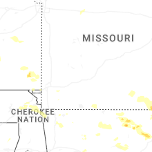
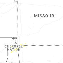
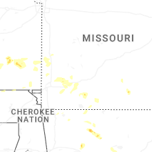


Connect with Interactive Hail Maps