

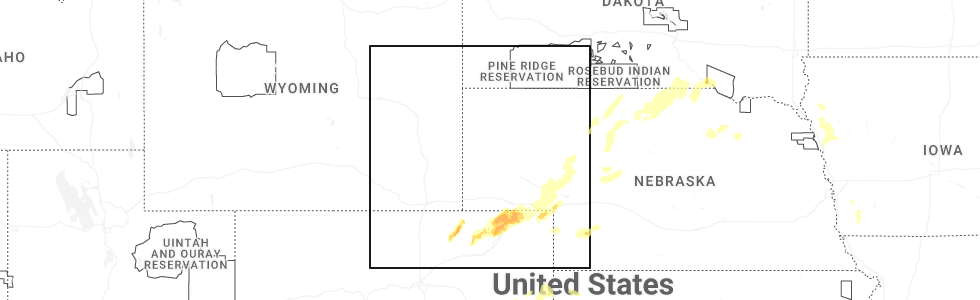
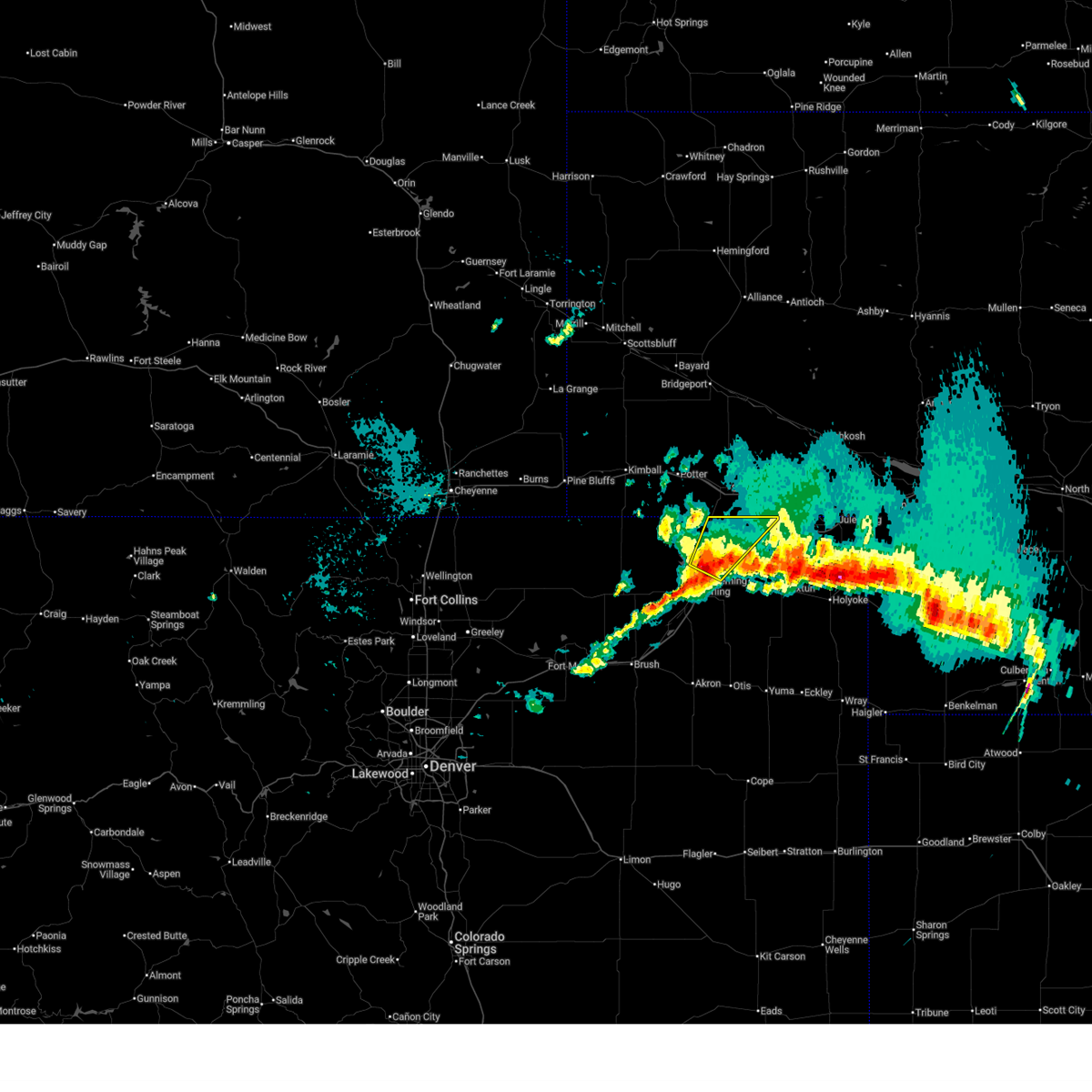
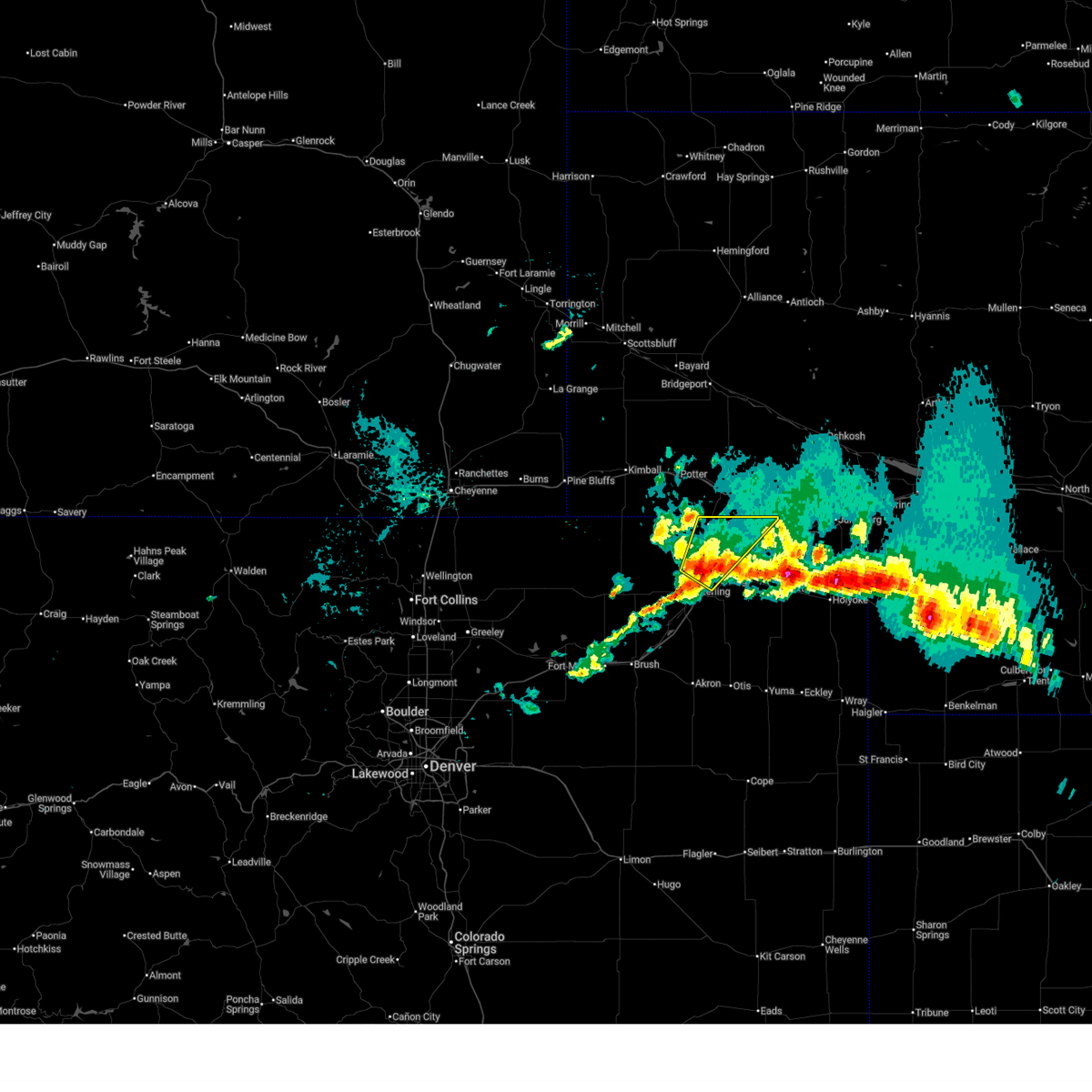
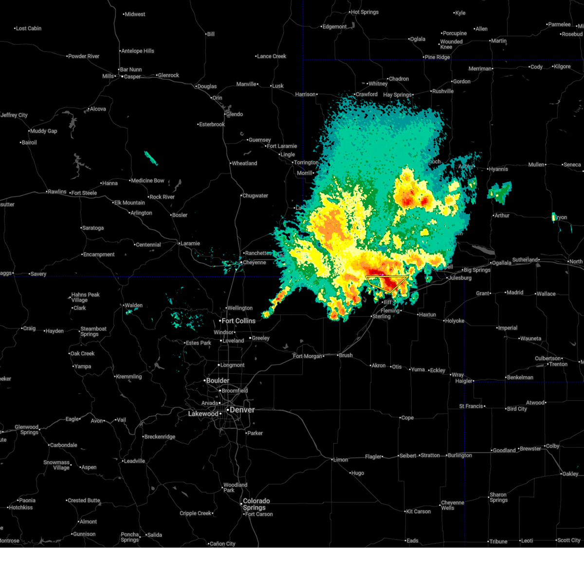
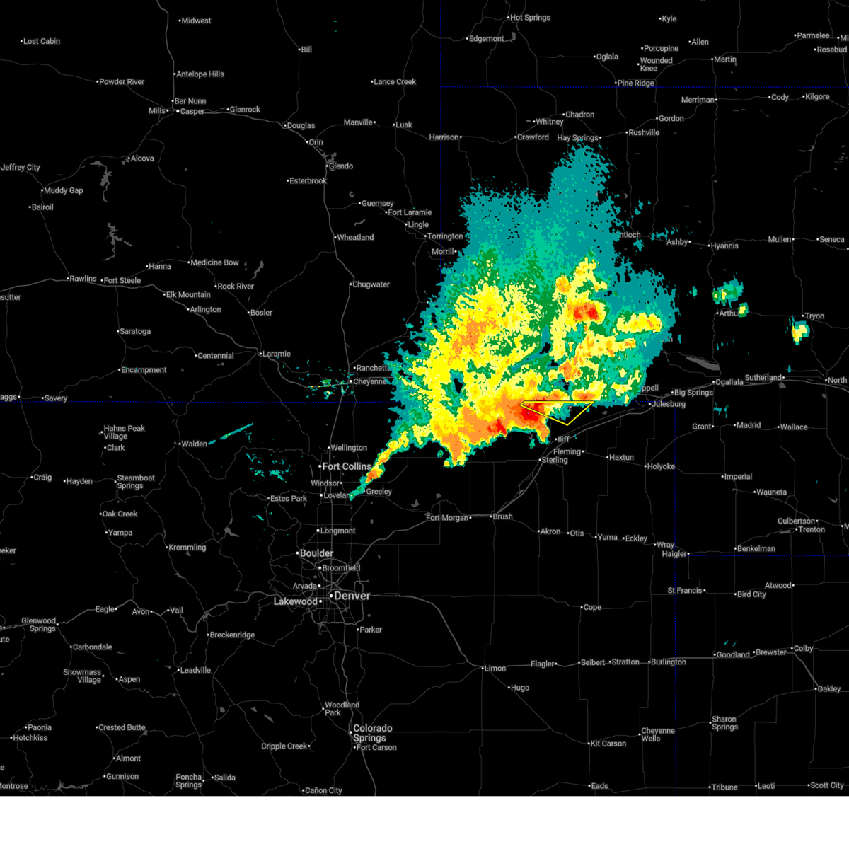
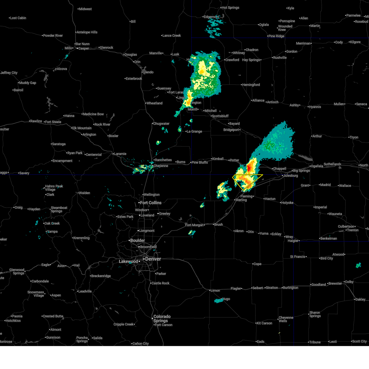
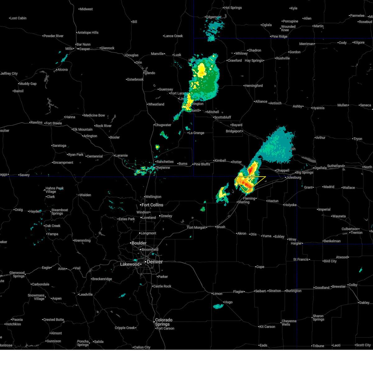
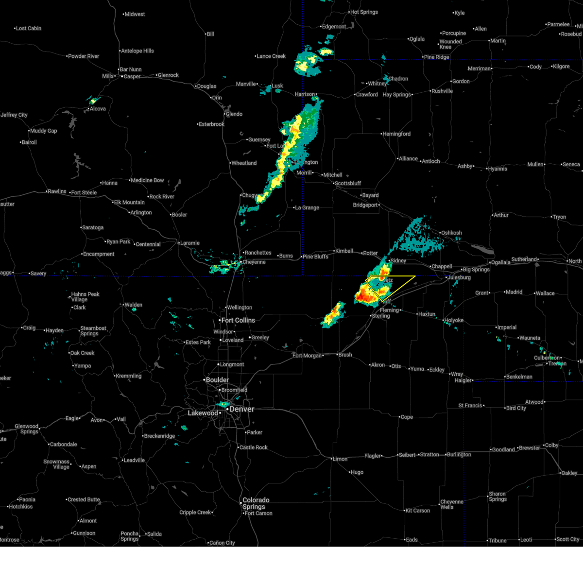
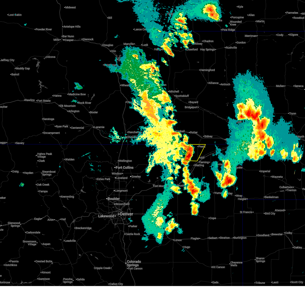
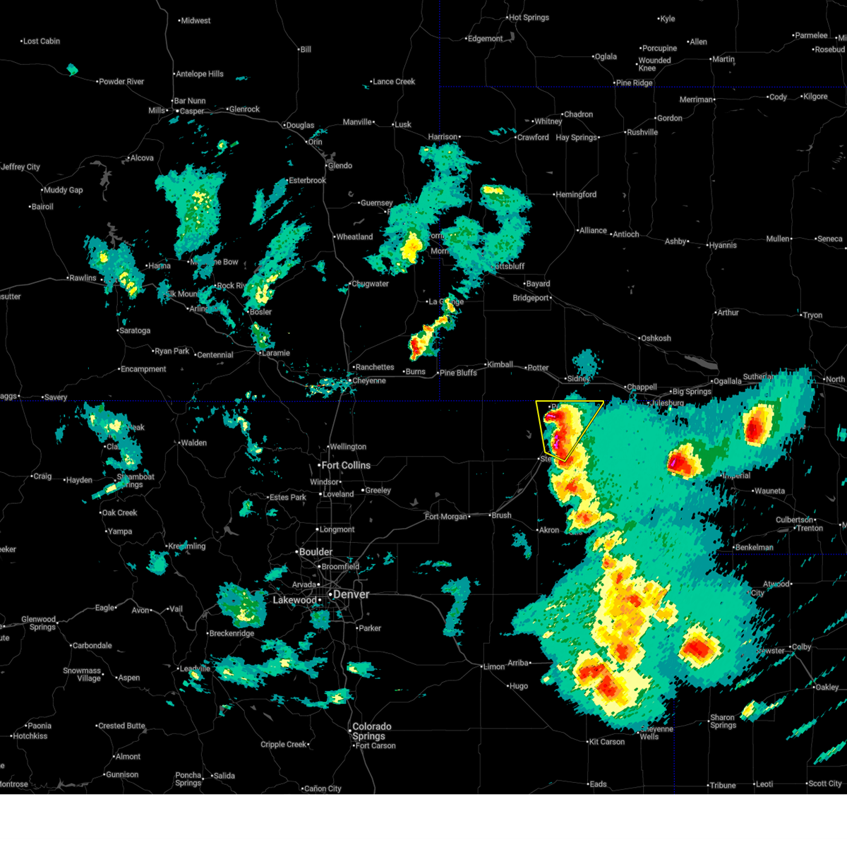
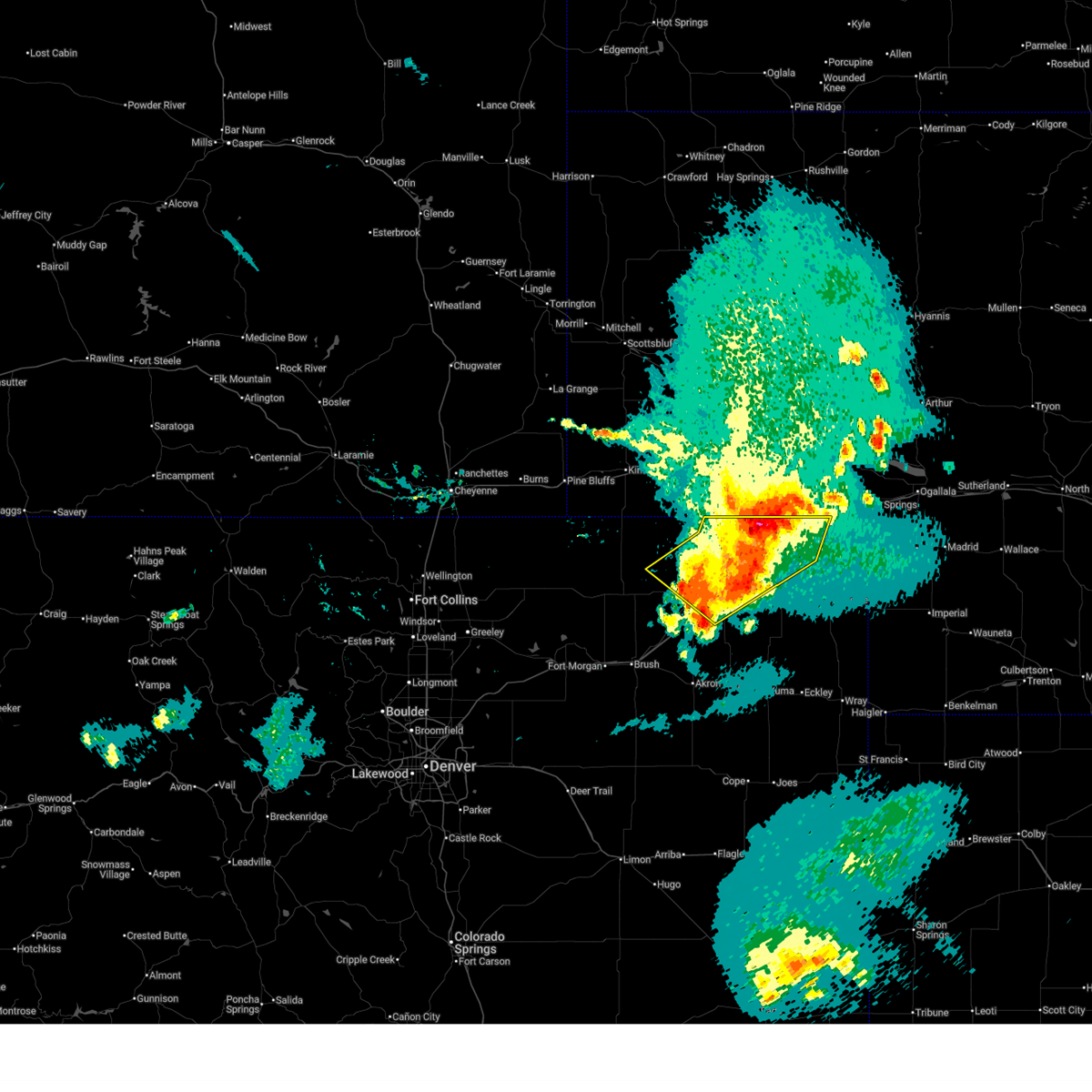
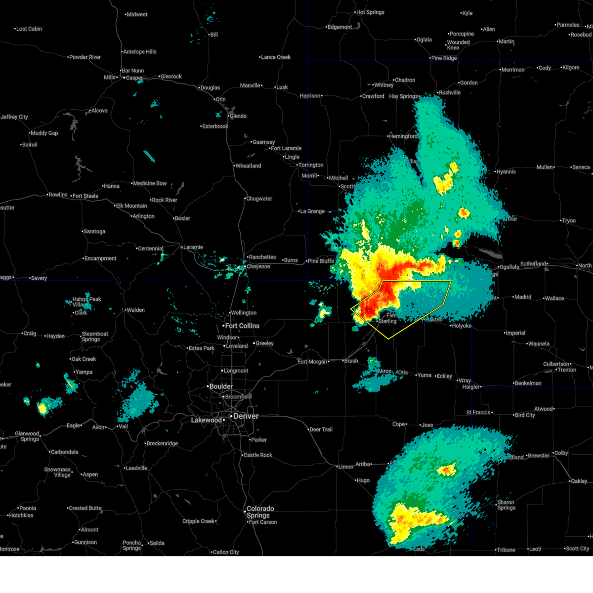
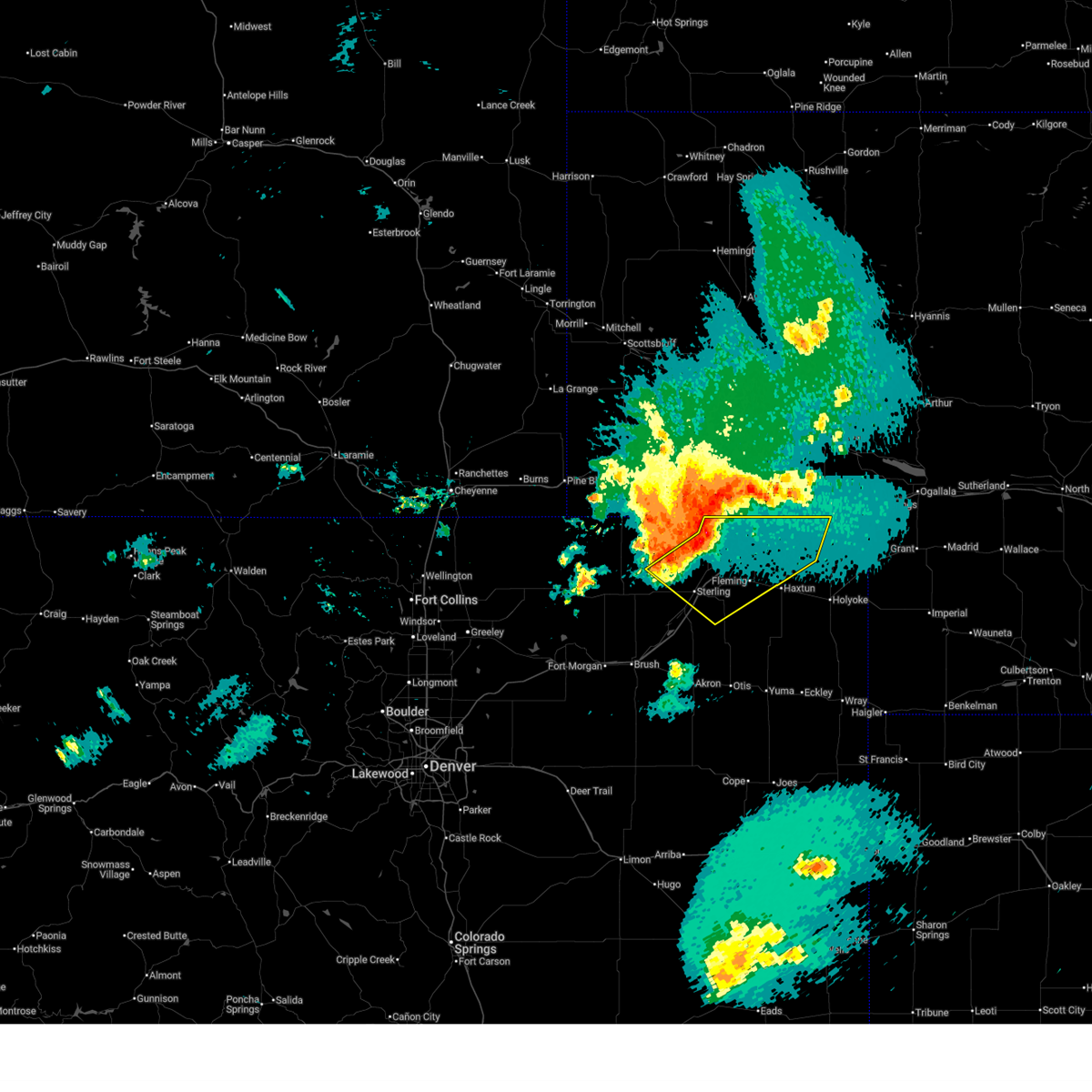
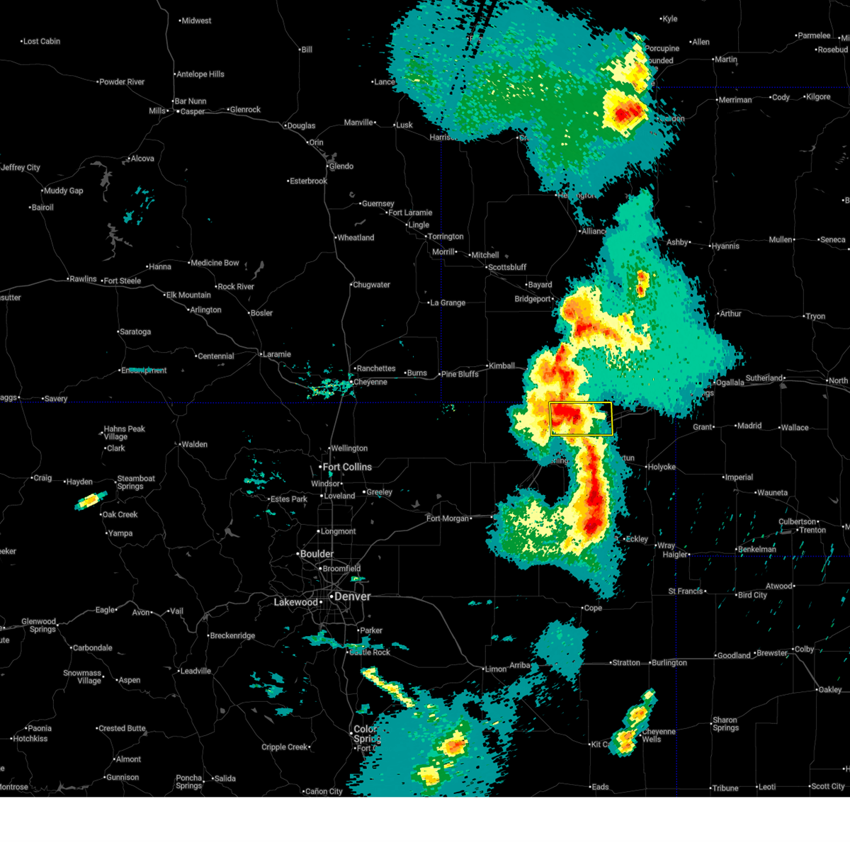
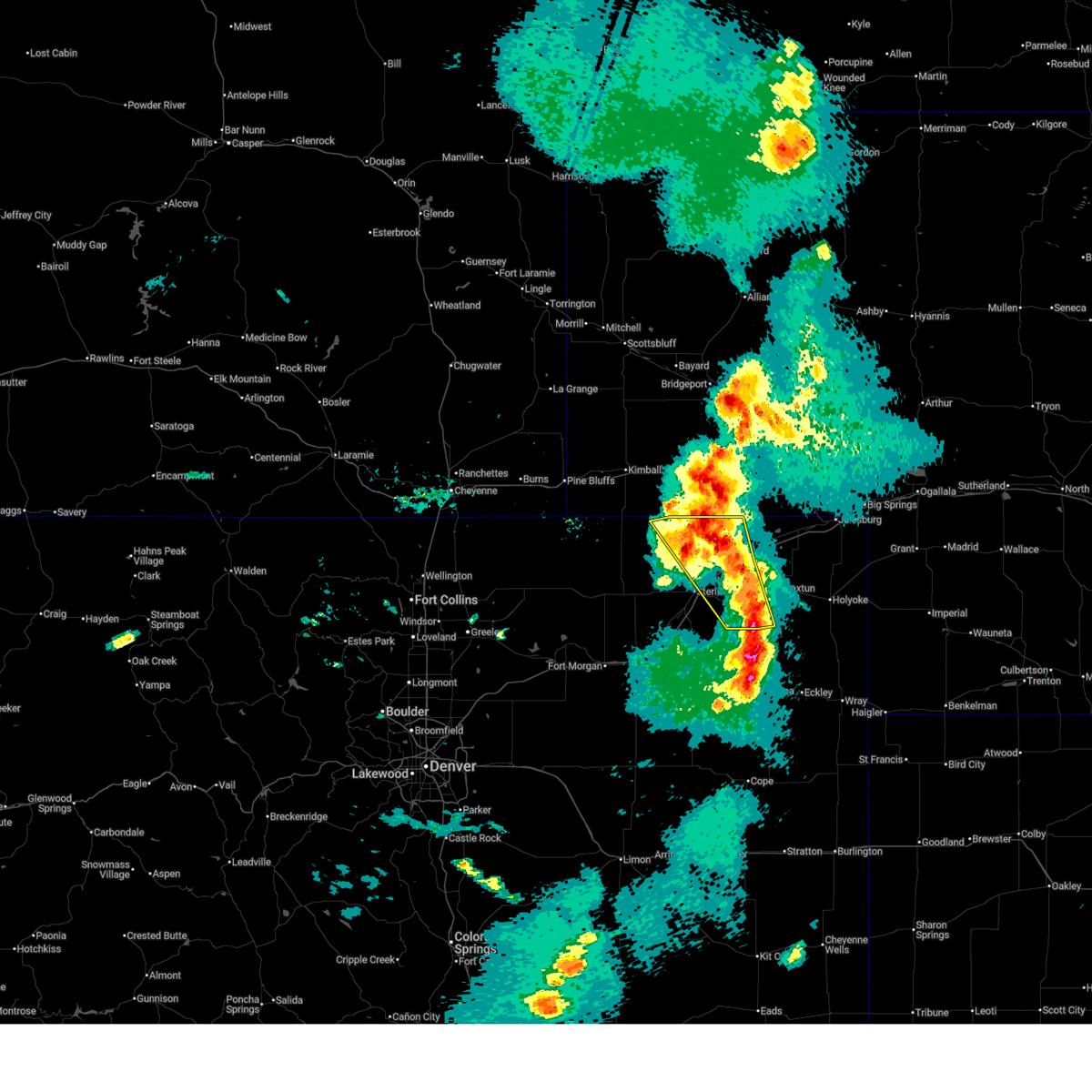
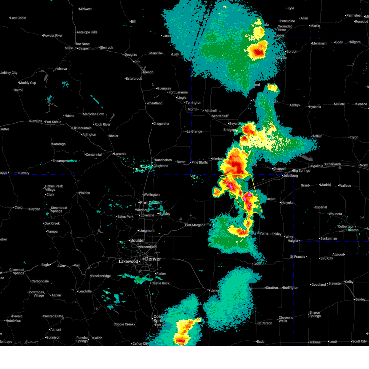
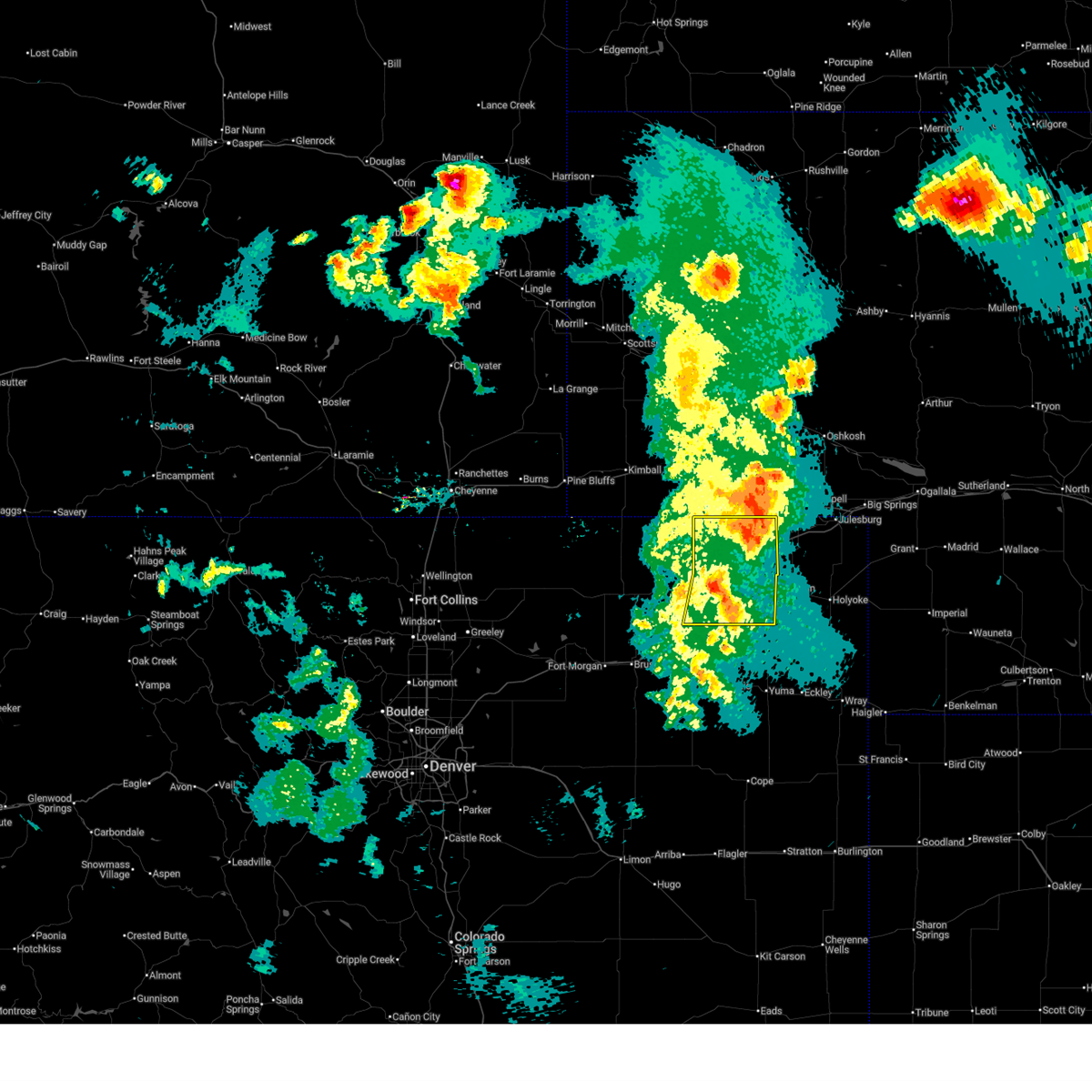
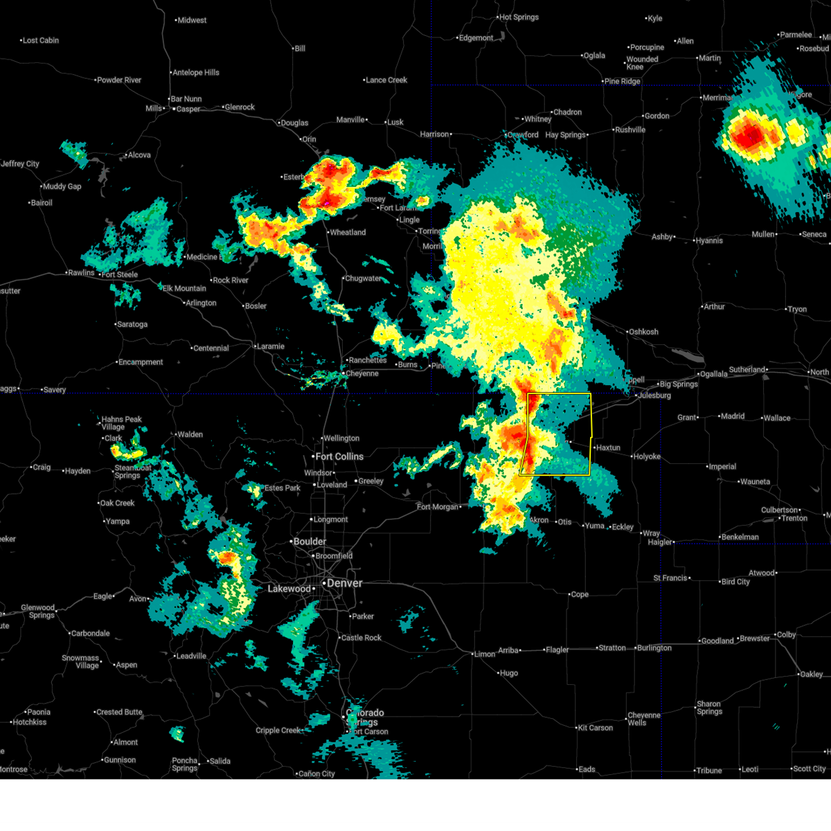
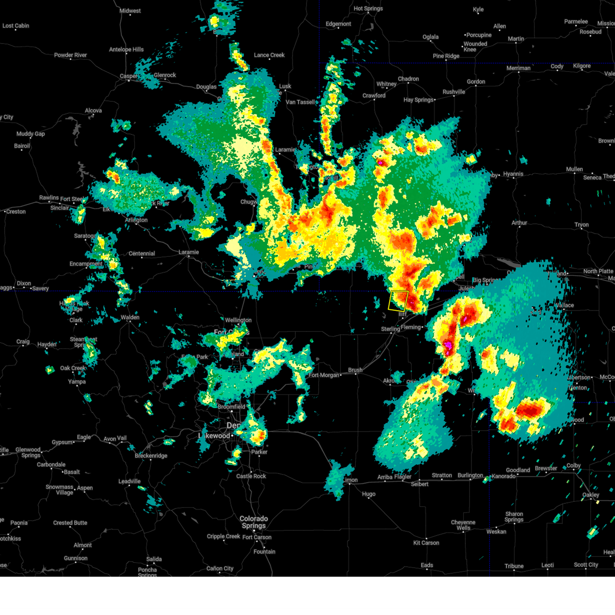
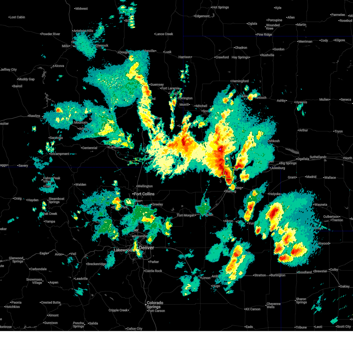
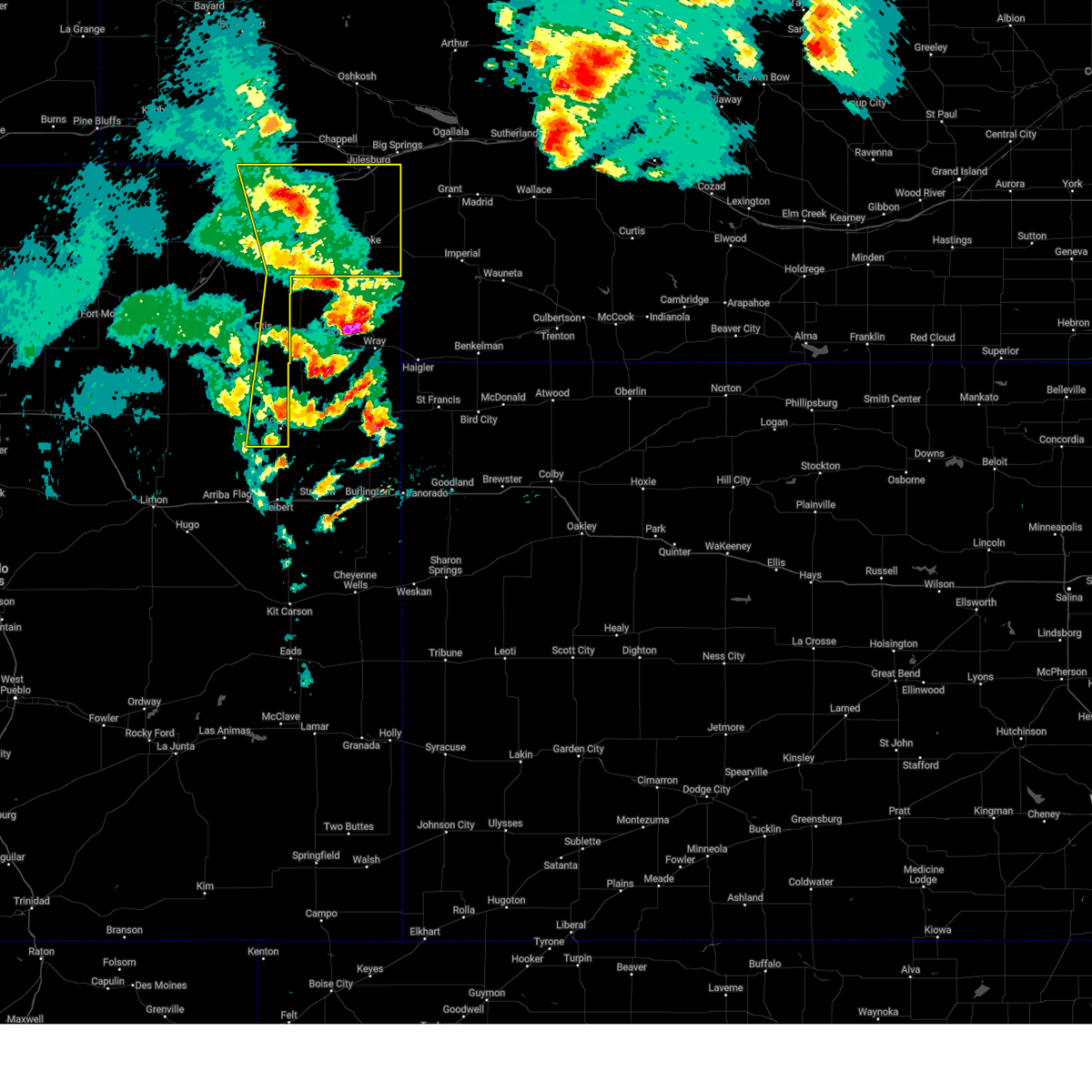
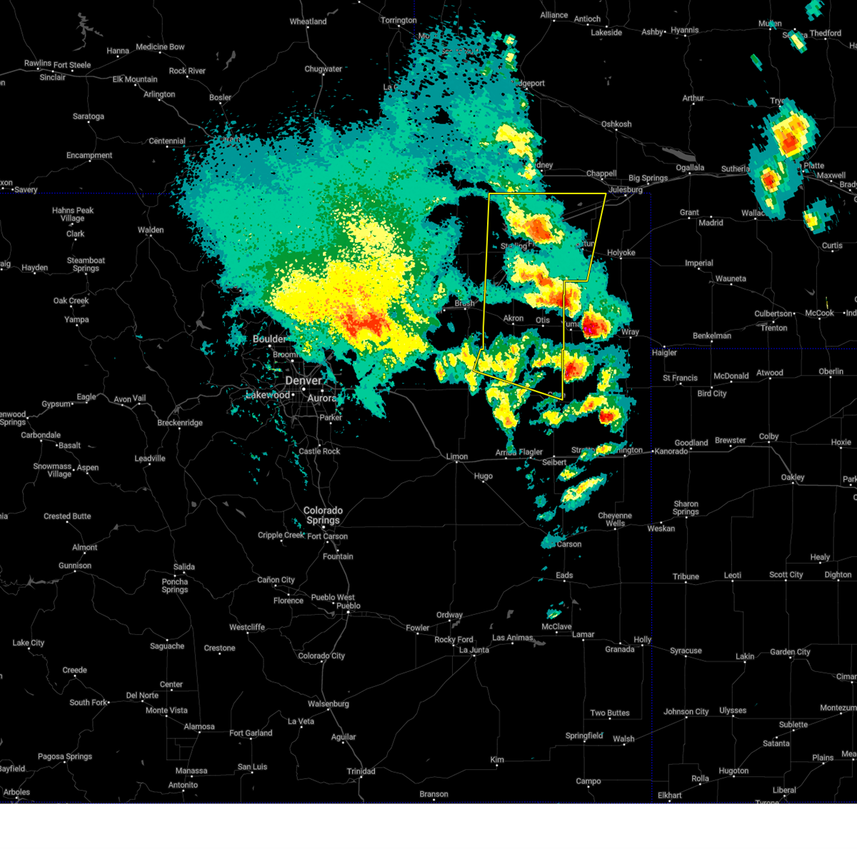
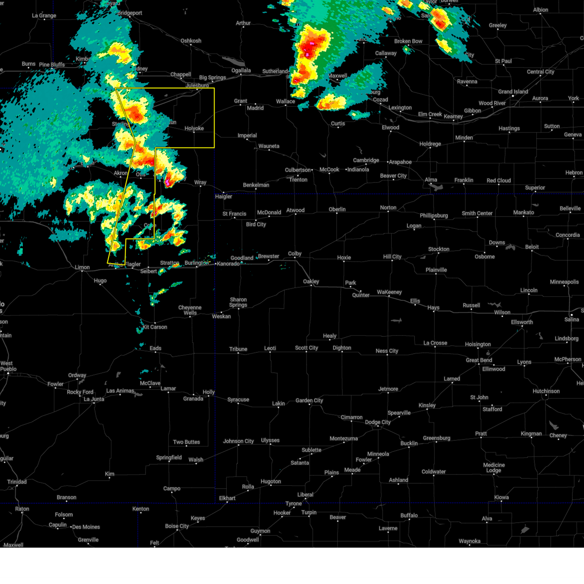
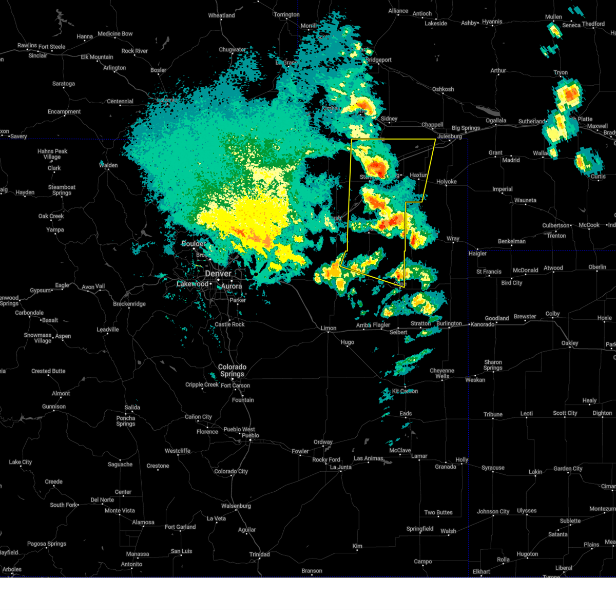
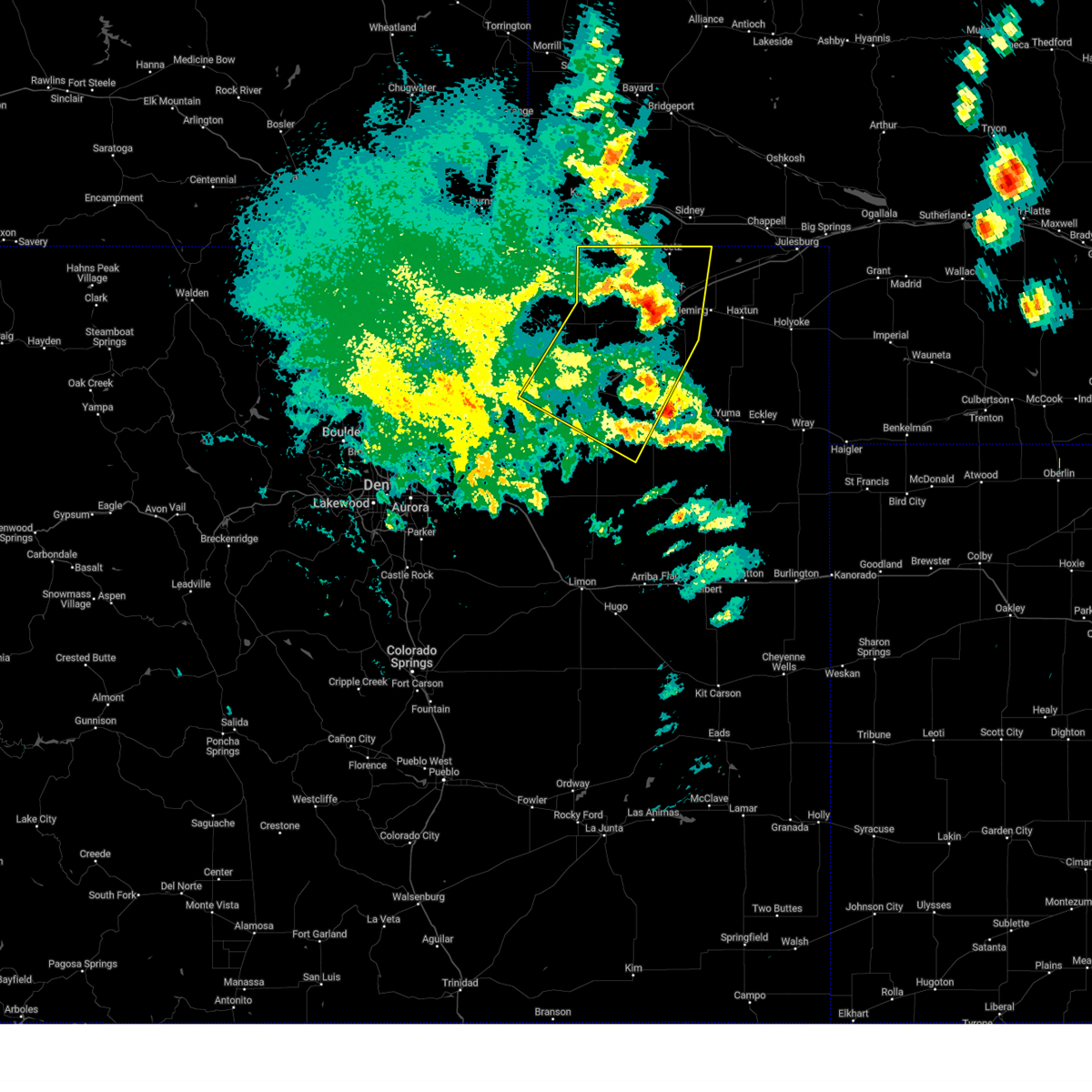
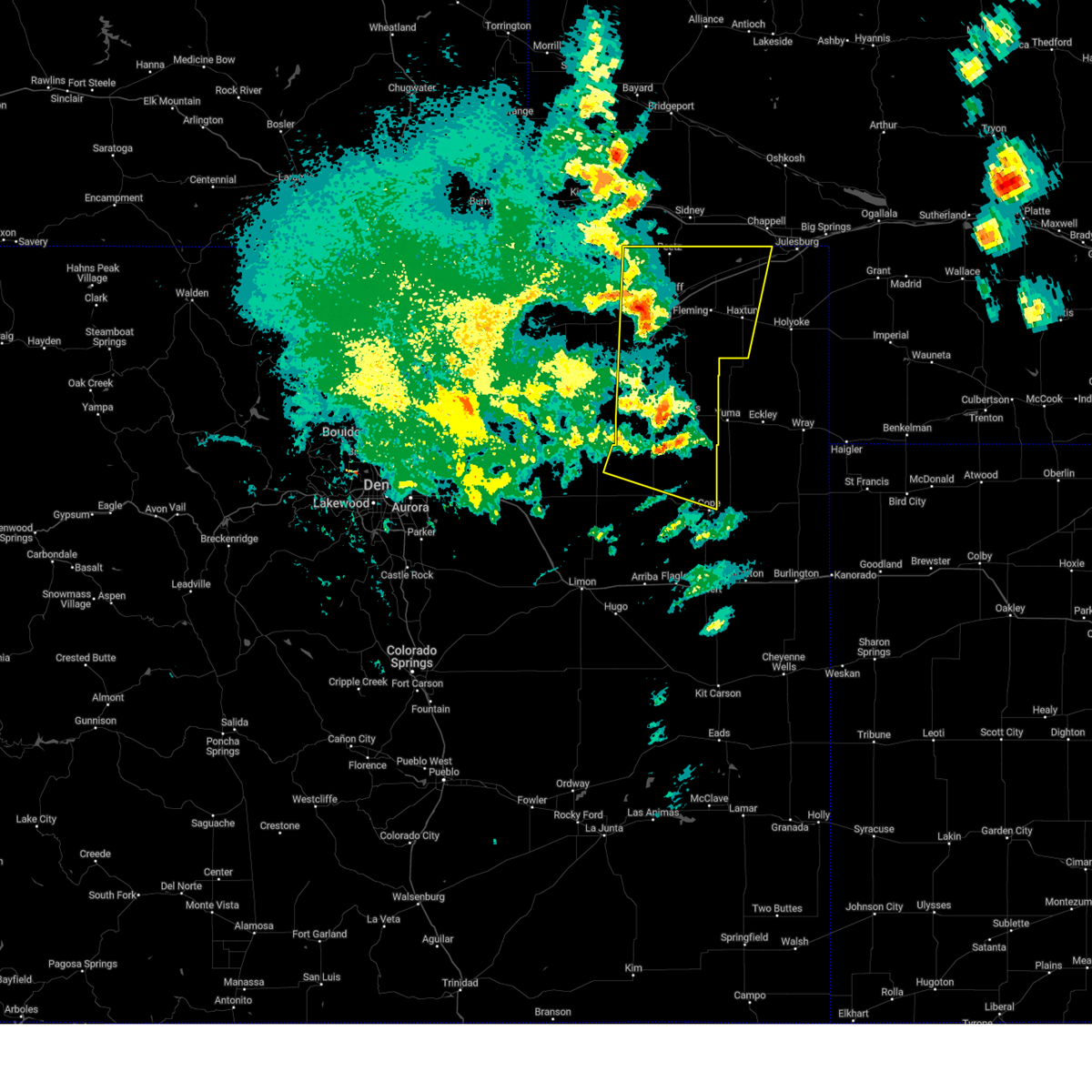
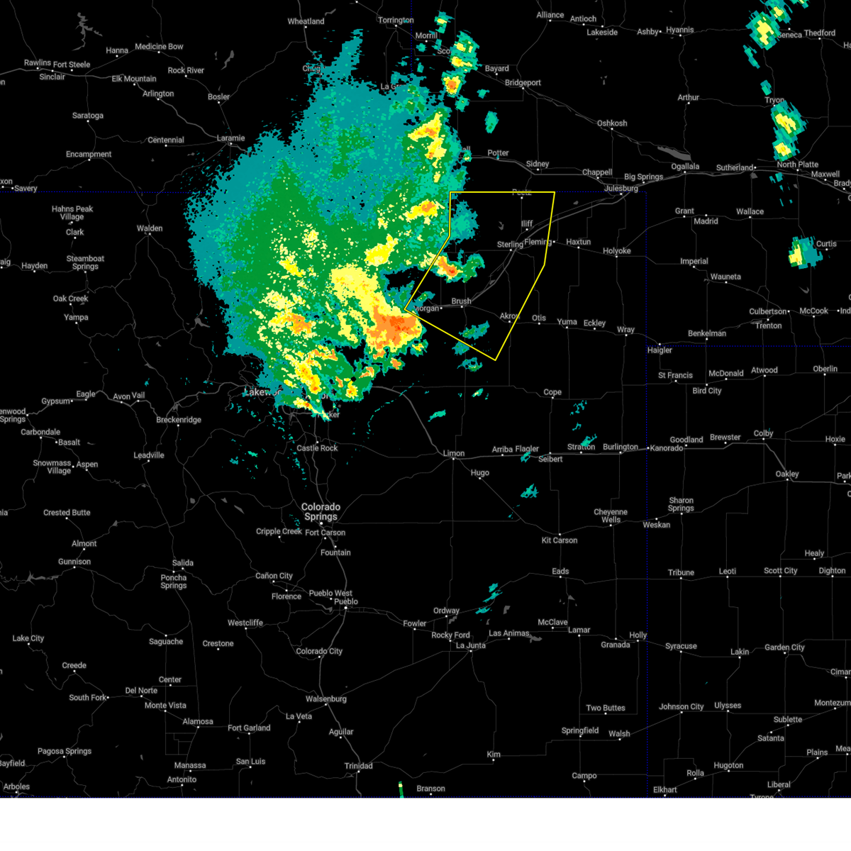
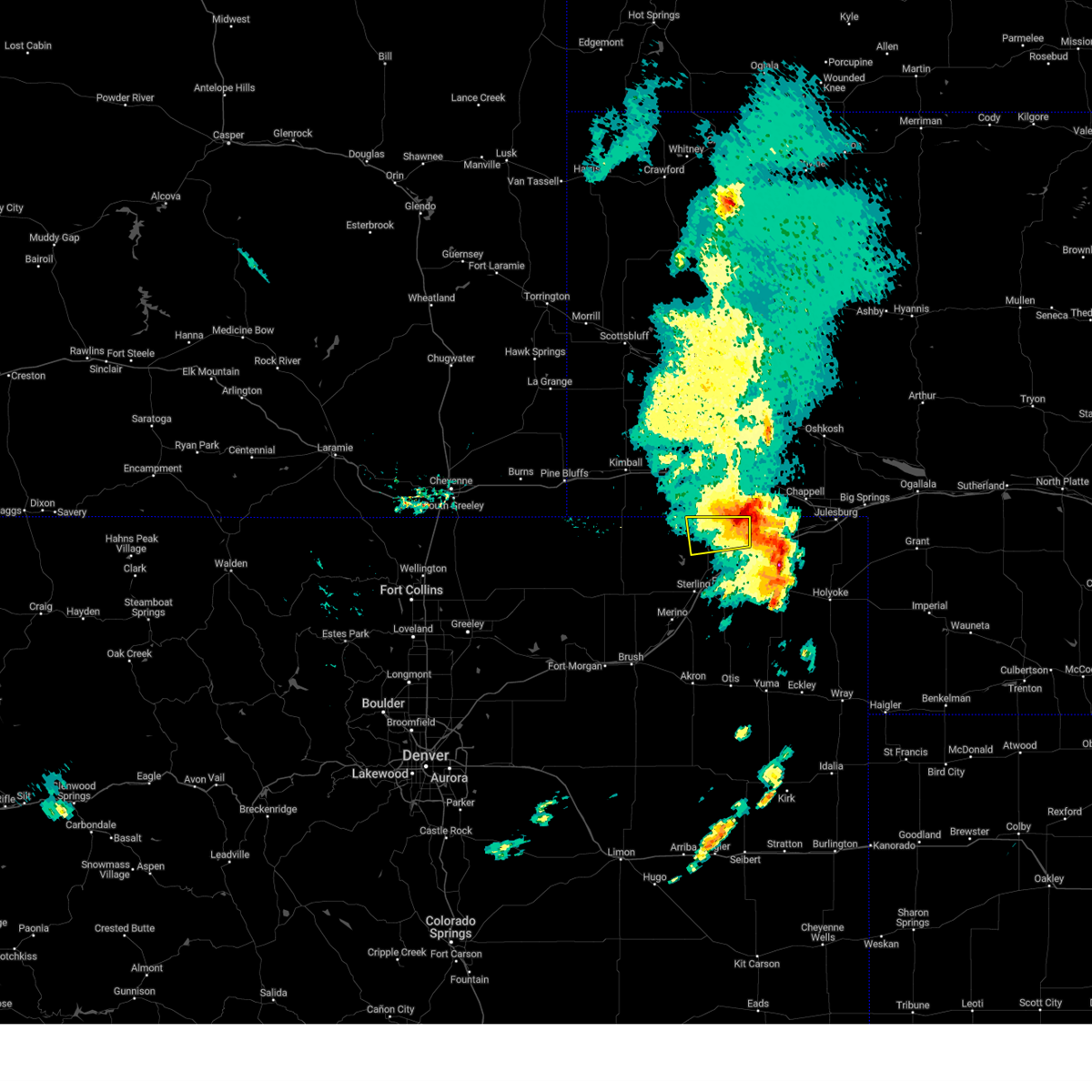
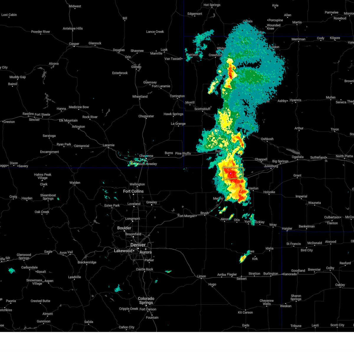
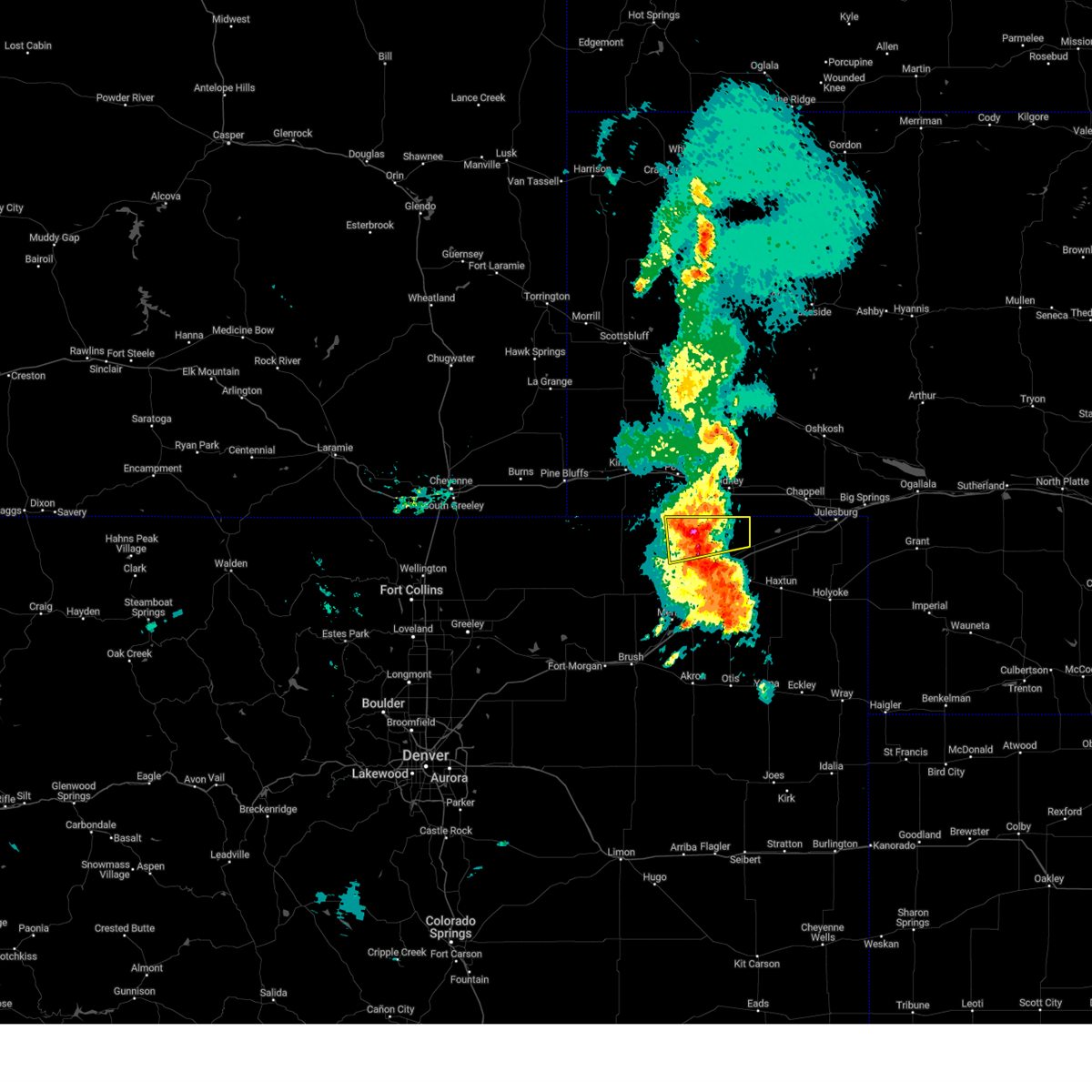
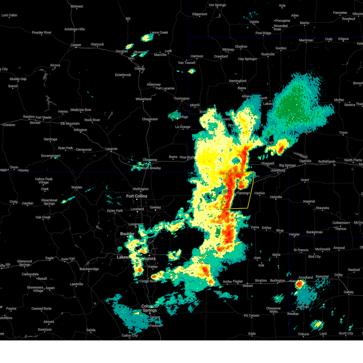
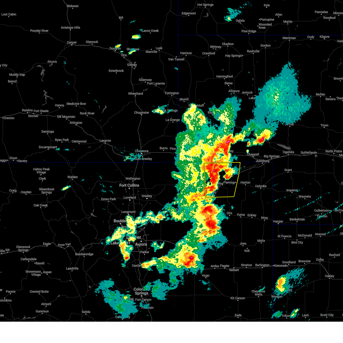
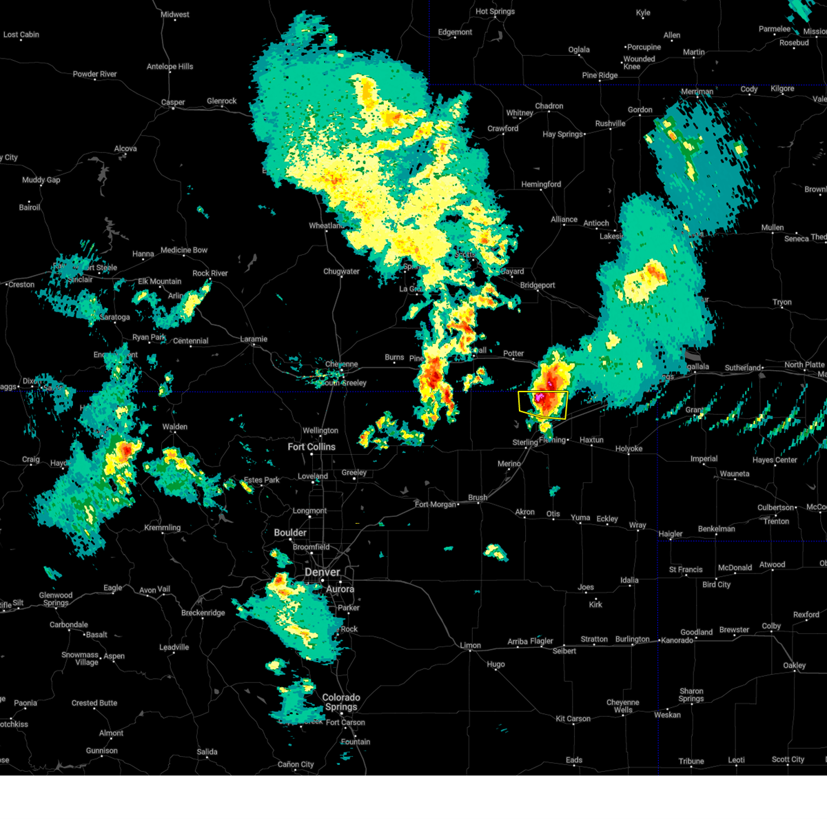
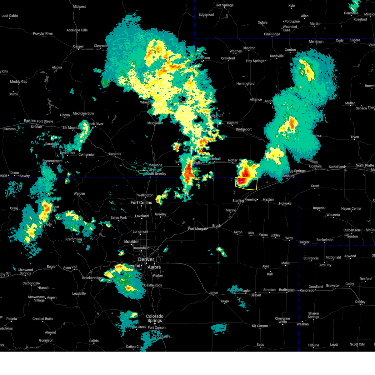
Hail Map for Peetz, CO
The Peetz, CO area has had 29 reports of on-the-ground hail by trained spotters, and has been under severe weather warnings 16 times during the past 12 months. Doppler radar has detected hail at or near Peetz, CO on 85 occasions, including 9 occasions during the past year.
| Name: | Peetz, CO |
| Where Located: | 61.8 miles NNW of Yuma, CO |
| Map: | Google Map for Peetz, CO |
| Population: | 238 |
| Housing Units: | 106 |
| More Info: | Search Google for Peetz, CO |
2
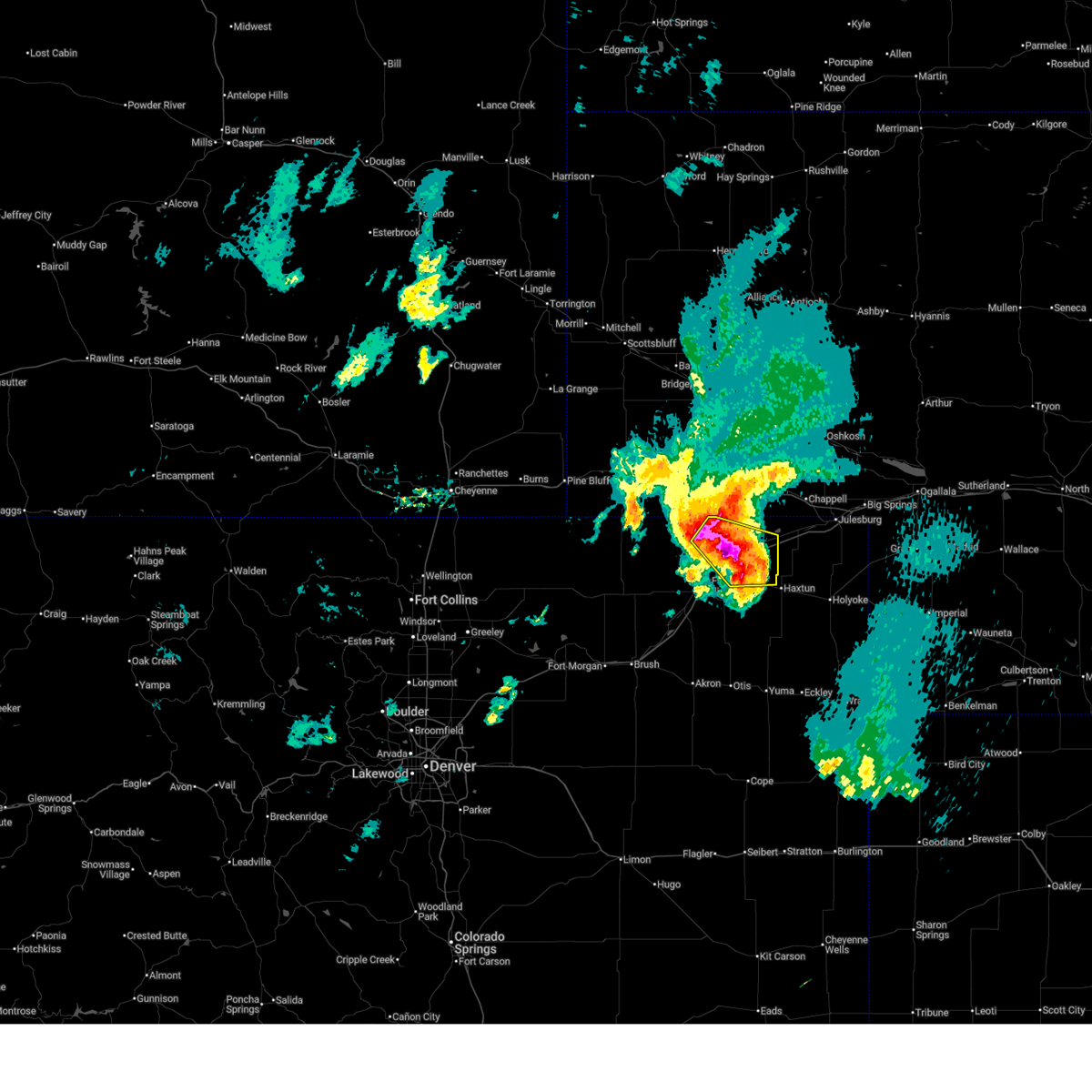
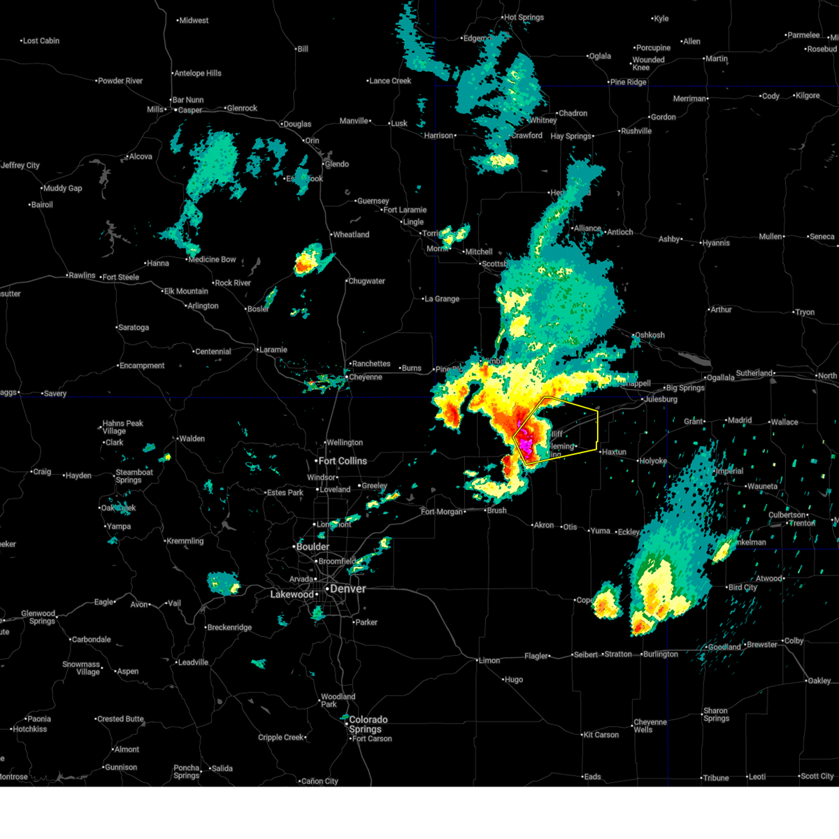
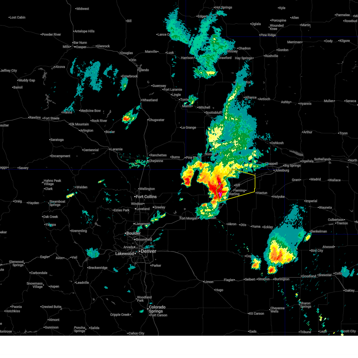
The Top Recent Hail Date for Peetz, CO is Tuesday, June 30, 2026 (6th out of 85)
Hail and Wind Damage Spotted near Peetz, CO
| Date / Time | Report Details |
|---|---|
| 7/3/2026 1:13 AM MDT |
 At 113 am mdt, a severe thunderstorm was located near iliff, or 11 miles northeast of sterling, moving northeast at 20 mph (radar indicated). Hazards include 60 mph wind gusts and quarter size hail. Hail damage to vehicles is expected. expect wind damage to roofs, siding, and trees. Locations impacted include, iliff, peetz, proctor, padroni and twin buttes. At 113 am mdt, a severe thunderstorm was located near iliff, or 11 miles northeast of sterling, moving northeast at 20 mph (radar indicated). Hazards include 60 mph wind gusts and quarter size hail. Hail damage to vehicles is expected. expect wind damage to roofs, siding, and trees. Locations impacted include, iliff, peetz, proctor, padroni and twin buttes.
|
| 7/3/2026 1:04 AM MDT |
 Svrbou the national weather service in denver has issued a * severe thunderstorm warning for, northeastern logan county in northeastern colorado, * until 145 am mdt. * at 104 am mdt, a severe thunderstorm was located near padroni, or 9 miles north of sterling, moving northeast at 20 mph (radar indicated). Hazards include 60 mph wind gusts and quarter size hail. Hail damage to vehicles is expected. Expect wind damage to roofs, siding, and trees. Svrbou the national weather service in denver has issued a * severe thunderstorm warning for, northeastern logan county in northeastern colorado, * until 145 am mdt. * at 104 am mdt, a severe thunderstorm was located near padroni, or 9 miles north of sterling, moving northeast at 20 mph (radar indicated). Hazards include 60 mph wind gusts and quarter size hail. Hail damage to vehicles is expected. Expect wind damage to roofs, siding, and trees.
|
| 7/2/2026 2:36 AM MDT |
 At 236 am mdt, a severe thunderstorm was located near peetz, or 26 miles north of sterling, moving northeast at 30 mph (radar indicated). Hazards include half dollar size hail. Damage to vehicles is expected. hail may accumulate on roadways causing hazardous travel. Locations impacted include, peetz. At 236 am mdt, a severe thunderstorm was located near peetz, or 26 miles north of sterling, moving northeast at 30 mph (radar indicated). Hazards include half dollar size hail. Damage to vehicles is expected. hail may accumulate on roadways causing hazardous travel. Locations impacted include, peetz.
|
| 7/2/2026 2:22 AM MDT |
 Svrbou the national weather service in denver has issued a * severe thunderstorm warning for, north central logan county in northeastern colorado, * until 300 am mdt. * at 222 am mdt, a severe thunderstorm was located 4 miles southwest of peetz, or 21 miles north of sterling, moving northeast at 30 mph (radar indicated). Hazards include half dollar size hail. Damage to vehicles is expected. Hail may accumulate on roadways causing hazardous travel. Svrbou the national weather service in denver has issued a * severe thunderstorm warning for, north central logan county in northeastern colorado, * until 300 am mdt. * at 222 am mdt, a severe thunderstorm was located 4 miles southwest of peetz, or 21 miles north of sterling, moving northeast at 30 mph (radar indicated). Hazards include half dollar size hail. Damage to vehicles is expected. Hail may accumulate on roadways causing hazardous travel.
|
| 6/30/2026 8:21 PM MDT | Quarter sized hail reported 10.3 miles W of Peetz, CO |
| 6/30/2026 8:06 PM MDT |
 At 806 pm mdt, a severe thunderstorm was located over proctor, or 19 miles northeast of sterling, moving northeast at 55 mph. this is a destructive storm for proctor, crook, twin buttes (radar indicated). Hazards include baseball size hail and 70 mph wind gusts. People and animals outdoors will be severely injured. expect shattered windows, extensive damage to roofs, siding, and vehicles. This severe thunderstorm will remain over mainly rural areas of northeastern logan county. At 806 pm mdt, a severe thunderstorm was located over proctor, or 19 miles northeast of sterling, moving northeast at 55 mph. this is a destructive storm for proctor, crook, twin buttes (radar indicated). Hazards include baseball size hail and 70 mph wind gusts. People and animals outdoors will be severely injured. expect shattered windows, extensive damage to roofs, siding, and vehicles. This severe thunderstorm will remain over mainly rural areas of northeastern logan county.
|
| 6/30/2026 7:46 PM MDT |
 At 746 pm mdt, a severe thunderstorm was located 7 miles west of iliff, or 8 miles northeast of sterling, moving northeast at 55 mph. this is a destructive storm for padroni, iliff, proctor (radar indicated). Hazards include baseball size hail and 70 mph wind gusts. People and animals outdoors will be severely injured. expect shattered windows, extensive damage to roofs, siding, and vehicles. This severe thunderstorm will remain over mainly rural areas of central logan county. At 746 pm mdt, a severe thunderstorm was located 7 miles west of iliff, or 8 miles northeast of sterling, moving northeast at 55 mph. this is a destructive storm for padroni, iliff, proctor (radar indicated). Hazards include baseball size hail and 70 mph wind gusts. People and animals outdoors will be severely injured. expect shattered windows, extensive damage to roofs, siding, and vehicles. This severe thunderstorm will remain over mainly rural areas of central logan county.
|
| 6/30/2026 7:32 PM MDT |
 Svrbou the national weather service in denver has issued a * severe thunderstorm warning for, central logan county in northeastern colorado, * until 815 pm mdt. * at 732 pm mdt, a severe thunderstorm was located near logan corners, or 6 miles west of sterling, moving east at 55 mph (radar indicated). Hazards include 60 mph wind gusts and quarter size hail. Hail damage to vehicles is expected. Expect wind damage to roofs, siding, and trees. Svrbou the national weather service in denver has issued a * severe thunderstorm warning for, central logan county in northeastern colorado, * until 815 pm mdt. * at 732 pm mdt, a severe thunderstorm was located near logan corners, or 6 miles west of sterling, moving east at 55 mph (radar indicated). Hazards include 60 mph wind gusts and quarter size hail. Hail damage to vehicles is expected. Expect wind damage to roofs, siding, and trees.
|
| 6/24/2026 5:38 PM MDT |
 Svrbou the national weather service in denver has issued a * severe thunderstorm warning for, northeastern logan county in northeastern colorado, northwestern sedgwick county in northeastern colorado, * until 615 pm mdt. * at 538 pm mdt, a severe thunderstorm was located near peetz, or 25 miles north of sterling, moving southeast at 20 mph (radar indicated). Hazards include ping pong ball size hail and 60 mph wind gusts. People and animals outdoors will be injured. expect hail damage to roofs, siding, windows, and vehicles. Expect wind damage to roofs, siding, and trees. Svrbou the national weather service in denver has issued a * severe thunderstorm warning for, northeastern logan county in northeastern colorado, northwestern sedgwick county in northeastern colorado, * until 615 pm mdt. * at 538 pm mdt, a severe thunderstorm was located near peetz, or 25 miles north of sterling, moving southeast at 20 mph (radar indicated). Hazards include ping pong ball size hail and 60 mph wind gusts. People and animals outdoors will be injured. expect hail damage to roofs, siding, windows, and vehicles. Expect wind damage to roofs, siding, and trees.
|
| 6/9/2026 4:05 PM MDT |
 The storm which prompted the warning has weakened below severe limits, and no longer poses an immediate threat to life or property. therefore, the warning will be allowed to expire. however, gusty winds are still possible with this thunderstorm. The storm which prompted the warning has weakened below severe limits, and no longer poses an immediate threat to life or property. therefore, the warning will be allowed to expire. however, gusty winds are still possible with this thunderstorm.
|
| 6/9/2026 3:52 PM MDT |
 At 352 pm mdt, a severe thunderstorm was located 5 miles southeast of peetz, or 22 miles north of sterling, moving northeast at 35 mph (radar indicated). Hazards include 60 mph wind gusts and small hail. Expect damage to roofs, siding, and trees. Locations impacted include, peetz. At 352 pm mdt, a severe thunderstorm was located 5 miles southeast of peetz, or 22 miles north of sterling, moving northeast at 35 mph (radar indicated). Hazards include 60 mph wind gusts and small hail. Expect damage to roofs, siding, and trees. Locations impacted include, peetz.
|
| 6/9/2026 3:40 PM MDT |
 Svrbou the national weather service in denver has issued a * severe thunderstorm warning for, northeastern logan county in northeastern colorado, * until 415 pm mdt. * at 340 pm mdt, a severe thunderstorm was located 5 miles north of padroni, or 16 miles north of sterling, moving northeast at 35 mph (radar indicated). Hazards include 60 mph wind gusts and small hail. expect damage to roofs, siding, and trees Svrbou the national weather service in denver has issued a * severe thunderstorm warning for, northeastern logan county in northeastern colorado, * until 415 pm mdt. * at 340 pm mdt, a severe thunderstorm was located 5 miles north of padroni, or 16 miles north of sterling, moving northeast at 35 mph (radar indicated). Hazards include 60 mph wind gusts and small hail. expect damage to roofs, siding, and trees
|
| 5/30/2026 5:59 PM MDT | Private weather statio in logan county CO, 7.3 miles WSW of Peetz, CO |
| 5/30/2026 5:43 PM MDT |
 Svrbou the national weather service in denver has issued a * severe thunderstorm warning for, northwestern logan county in northeastern colorado, * until 615 pm mdt. * at 543 pm mdt, a severe thunderstorm was located over north sterling reservoir, or 13 miles north of sterling, moving northeast at 15 mph (radar indicated). Hazards include 60 mph wind gusts and quarter size hail. Hail damage to vehicles is expected. Expect wind damage to roofs, siding, and trees. Svrbou the national weather service in denver has issued a * severe thunderstorm warning for, northwestern logan county in northeastern colorado, * until 615 pm mdt. * at 543 pm mdt, a severe thunderstorm was located over north sterling reservoir, or 13 miles north of sterling, moving northeast at 15 mph (radar indicated). Hazards include 60 mph wind gusts and quarter size hail. Hail damage to vehicles is expected. Expect wind damage to roofs, siding, and trees.
|
| 5/16/2026 4:59 PM MDT |
 Svrbou the national weather service in denver has issued a * severe thunderstorm warning for, northeastern logan county in northeastern colorado, * until 600 pm mdt. * at 459 pm mdt, a severe thunderstorm was located near iliff, or 11 miles northeast of sterling, moving north at 15 mph (radar indicated). Hazards include 60 mph wind gusts and quarter size hail. Hail damage to vehicles is expected. Expect wind damage to roofs, siding, and trees. Svrbou the national weather service in denver has issued a * severe thunderstorm warning for, northeastern logan county in northeastern colorado, * until 600 pm mdt. * at 459 pm mdt, a severe thunderstorm was located near iliff, or 11 miles northeast of sterling, moving north at 15 mph (radar indicated). Hazards include 60 mph wind gusts and quarter size hail. Hail damage to vehicles is expected. Expect wind damage to roofs, siding, and trees.
|
| 8/1/2025 8:26 PM MDT |
 The severe thunderstorm warning that was previously in effect has been reissued for logan, sedgwick, and phillips counties and is in effect until 930 pm mdt. please refer to that bulletin for the latest severe weather information. a tornado watch remains in effect until 1000 pm mdt friday for a portion of northeast colorado. The severe thunderstorm warning that was previously in effect has been reissued for logan, sedgwick, and phillips counties and is in effect until 930 pm mdt. please refer to that bulletin for the latest severe weather information. a tornado watch remains in effect until 1000 pm mdt friday for a portion of northeast colorado.
|
| 8/1/2025 8:01 PM MDT |
 At 801 pm mdt, severe thunderstorms were located along a line from 8 miles north of twin buttes to near iliff, or along a line from 15 miles southeast of sidney to 8 miles northeast of sterling, moving east at 40 mph (weather station reported. several automated weather stations reported wind gusts of 60 to 70 mph between peetz and sterling). Hazards include 70 mph wind gusts and small hail. Expect considerable tree damage. damage is likely to mobile homes, roofs, and outbuildings. Locations impacted include, sterling, fleming, ovid, iliff, peetz, sedgwick, crook, proctor, twin buttes, padroni, north sterling reservoir, marks butte, dailey and reiradon hill. At 801 pm mdt, severe thunderstorms were located along a line from 8 miles north of twin buttes to near iliff, or along a line from 15 miles southeast of sidney to 8 miles northeast of sterling, moving east at 40 mph (weather station reported. several automated weather stations reported wind gusts of 60 to 70 mph between peetz and sterling). Hazards include 70 mph wind gusts and small hail. Expect considerable tree damage. damage is likely to mobile homes, roofs, and outbuildings. Locations impacted include, sterling, fleming, ovid, iliff, peetz, sedgwick, crook, proctor, twin buttes, padroni, north sterling reservoir, marks butte, dailey and reiradon hill.
|
| 8/1/2025 7:55 PM MDT | Awos station k1jw peet in logan county CO, 4.5 miles E of Peetz, CO |
| 8/1/2025 7:46 PM MDT |
 Svrbou the national weather service in denver has issued a * severe thunderstorm warning for, logan county in northeastern colorado, northwestern phillips county in northeastern colorado, western sedgwick county in northeastern colorado, * until 830 pm mdt. * at 746 pm mdt, severe thunderstorms were located along a line from 5 miles southeast of sidney municipal airport to near north sterling reservoir, or along a line from 7 miles south of sidney to 9 miles northwest of sterling, moving east at 40 mph (weather station reported). Hazards include 60 mph wind gusts and small hail. expect damage to roofs, siding, and trees Svrbou the national weather service in denver has issued a * severe thunderstorm warning for, logan county in northeastern colorado, northwestern phillips county in northeastern colorado, western sedgwick county in northeastern colorado, * until 830 pm mdt. * at 746 pm mdt, severe thunderstorms were located along a line from 5 miles southeast of sidney municipal airport to near north sterling reservoir, or along a line from 7 miles south of sidney to 9 miles northwest of sterling, moving east at 40 mph (weather station reported). Hazards include 60 mph wind gusts and small hail. expect damage to roofs, siding, and trees
|
| 8/1/2025 7:40 PM MDT | Storm damage reported in logan county CO, 2.7 miles SSE of Peetz, CO |
| 8/1/2025 7:37 PM MDT | Storm damage reported in logan county CO, 4.7 miles ESE of Peetz, CO |
| 6/13/2025 8:14 PM MDT |
 The storms which prompted the warning have moved out of the area. therefore, the warning will be allowed to expire. a severe thunderstorm watch remains in effect until 1000 pm mdt friday for a portion of northeast colorado. The storms which prompted the warning have moved out of the area. therefore, the warning will be allowed to expire. a severe thunderstorm watch remains in effect until 1000 pm mdt friday for a portion of northeast colorado.
|
| 6/13/2025 8:14 PM MDT |
 Svrbou the national weather service in denver has issued a * severe thunderstorm warning for, northeastern logan county in northeastern colorado, northwestern sedgwick county in northeastern colorado, * until 845 pm mdt. * at 814 pm mdt, a severe thunderstorm was located 6 miles north of proctor, or 23 miles northeast of sterling, moving northeast at 20 mph (radar indicated). Hazards include 60 mph wind gusts and half dollar size hail. Hail damage to vehicles is expected. Expect wind damage to roofs, siding, and trees. Svrbou the national weather service in denver has issued a * severe thunderstorm warning for, northeastern logan county in northeastern colorado, northwestern sedgwick county in northeastern colorado, * until 845 pm mdt. * at 814 pm mdt, a severe thunderstorm was located 6 miles north of proctor, or 23 miles northeast of sterling, moving northeast at 20 mph (radar indicated). Hazards include 60 mph wind gusts and half dollar size hail. Hail damage to vehicles is expected. Expect wind damage to roofs, siding, and trees.
|
| 6/13/2025 8:00 PM MDT |
 At 800 pm mdt, severe thunderstorms were located along a line from 8 miles northwest of peetz to 5 miles south of st petersburg, or along a line from 17 miles southwest of sidney to 22 miles southeast of sterling, moving northeast at 20 mph (radar indicated). Hazards include 60 mph wind gusts and quarter size hail. Hail damage to vehicles is expected. expect wind damage to roofs, siding, and trees. Locations impacted include, eastern sterling, fleming, iliff, peetz, proctor, padroni, north sterling reservoir, st petersburg and reiradon hill. At 800 pm mdt, severe thunderstorms were located along a line from 8 miles northwest of peetz to 5 miles south of st petersburg, or along a line from 17 miles southwest of sidney to 22 miles southeast of sterling, moving northeast at 20 mph (radar indicated). Hazards include 60 mph wind gusts and quarter size hail. Hail damage to vehicles is expected. expect wind damage to roofs, siding, and trees. Locations impacted include, eastern sterling, fleming, iliff, peetz, proctor, padroni, north sterling reservoir, st petersburg and reiradon hill.
|
| 6/13/2025 7:40 PM MDT |
 Svrbou the national weather service in denver has issued a * severe thunderstorm warning for, central logan county in northeastern colorado, * until 815 pm mdt. * at 740 pm mdt, severe thunderstorms were located along a line from 11 miles northeast of westplains to 6 miles northeast of burdett, or along a line from 25 miles north of sterling to 20 miles southeast of sterling, moving northeast at 20 mph (radar indicated). Hazards include 60 mph wind gusts and half dollar size hail. Hail damage to vehicles is expected. Expect wind damage to roofs, siding, and trees. Svrbou the national weather service in denver has issued a * severe thunderstorm warning for, central logan county in northeastern colorado, * until 815 pm mdt. * at 740 pm mdt, severe thunderstorms were located along a line from 11 miles northeast of westplains to 6 miles northeast of burdett, or along a line from 25 miles north of sterling to 20 miles southeast of sterling, moving northeast at 20 mph (radar indicated). Hazards include 60 mph wind gusts and half dollar size hail. Hail damage to vehicles is expected. Expect wind damage to roofs, siding, and trees.
|
| 6/12/2025 6:56 PM MDT |
 The storms which prompted the warning have weakened below severe limits, and no longer pose an immediate threat to life or property. therefore, the warning will be allowed to expire. however, small hail and gusty winds are still possible with these thunderstorms. a severe thunderstorm watch remains in effect until 1100 pm mdt thursday for a portion of northeast colorado. The storms which prompted the warning have weakened below severe limits, and no longer pose an immediate threat to life or property. therefore, the warning will be allowed to expire. however, small hail and gusty winds are still possible with these thunderstorms. a severe thunderstorm watch remains in effect until 1100 pm mdt thursday for a portion of northeast colorado.
|
| 6/12/2025 6:22 PM MDT |
 Svrbou the national weather service in denver has issued a * severe thunderstorm warning for, logan county in northeastern colorado, * until 700 pm mdt. * at 622 pm mdt, severe thunderstorms were located along a line from near peetz to atwood, in sterling county, moving east at 10 mph (radar indicated). Hazards include 60 mph wind gusts and quarter size hail. Hail damage to vehicles is expected. Expect wind damage to roofs, siding, and trees. Svrbou the national weather service in denver has issued a * severe thunderstorm warning for, logan county in northeastern colorado, * until 700 pm mdt. * at 622 pm mdt, severe thunderstorms were located along a line from near peetz to atwood, in sterling county, moving east at 10 mph (radar indicated). Hazards include 60 mph wind gusts and quarter size hail. Hail damage to vehicles is expected. Expect wind damage to roofs, siding, and trees.
|
| 5/18/2025 4:56 PM MDT |
 The storm which prompted the warning has moved out of the area. therefore, the warning will be allowed to expire. a tornado watch remains in effect until 800 pm mdt sunday for a portion of northeast colorado. The storm which prompted the warning has moved out of the area. therefore, the warning will be allowed to expire. a tornado watch remains in effect until 800 pm mdt sunday for a portion of northeast colorado.
|
| 5/18/2025 4:26 PM MDT |
 Svrbou the national weather service in denver has issued a * severe thunderstorm warning for, north central logan county in northeastern colorado, * until 500 pm mdt. * at 426 pm mdt, a severe thunderstorm was located near peetz, or 21 miles north of sterling, moving northeast at 20 mph (radar indicated). Hazards include 70 mph wind gusts and half dollar size hail. Hail damage to vehicles is expected. expect considerable tree damage. Wind damage is also likely to mobile homes, roofs, and outbuildings. Svrbou the national weather service in denver has issued a * severe thunderstorm warning for, north central logan county in northeastern colorado, * until 500 pm mdt. * at 426 pm mdt, a severe thunderstorm was located near peetz, or 21 miles north of sterling, moving northeast at 20 mph (radar indicated). Hazards include 70 mph wind gusts and half dollar size hail. Hail damage to vehicles is expected. expect considerable tree damage. Wind damage is also likely to mobile homes, roofs, and outbuildings.
|
| 5/14/2025 6:21 PM MDT |
 the severe thunderstorm warning has been cancelled and is no longer in effect the severe thunderstorm warning has been cancelled and is no longer in effect
|
| 5/14/2025 6:21 PM MDT |
 At 621 pm mdt, severe thunderstorms were located along a line from 7 miles southeast of twin buttes to 7 miles south of cope, or along a line from 22 miles southwest of julesburg to 19 miles north of seibert, moving east at 45 mph (weather station reported. at 608 pm, a 62 mph wind gust was recorded 3 mile west of cope). Hazards include 70 mph wind gusts and small hail. Expect considerable tree damage. damage is likely to mobile homes, roofs, and outbuildings. Locations impacted include, holyoke, julesburg, haxtun, otis, fleming, ovid, peetz, sedgwick, crook, paoli, highland center, st petersburg, fairfield, lone star, marks butte, twin buttes, proctor, sixteen-mile corner, amherst and pleasant valley. At 621 pm mdt, severe thunderstorms were located along a line from 7 miles southeast of twin buttes to 7 miles south of cope, or along a line from 22 miles southwest of julesburg to 19 miles north of seibert, moving east at 45 mph (weather station reported. at 608 pm, a 62 mph wind gust was recorded 3 mile west of cope). Hazards include 70 mph wind gusts and small hail. Expect considerable tree damage. damage is likely to mobile homes, roofs, and outbuildings. Locations impacted include, holyoke, julesburg, haxtun, otis, fleming, ovid, peetz, sedgwick, crook, paoli, highland center, st petersburg, fairfield, lone star, marks butte, twin buttes, proctor, sixteen-mile corner, amherst and pleasant valley.
|
| 5/14/2025 6:02 PM MDT |
 The severe thunderstorm warning that was previously in effect has been reissued for eastern washington, eastern logan, sedgwick, and phillips counties and is in effect until 645 pm mdt. please refer to that bulletin for the latest severe weather information. a severe thunderstorm watch remains in effect until 1000 pm mdt for a portion of northeast colorado. The severe thunderstorm warning that was previously in effect has been reissued for eastern washington, eastern logan, sedgwick, and phillips counties and is in effect until 645 pm mdt. please refer to that bulletin for the latest severe weather information. a severe thunderstorm watch remains in effect until 1000 pm mdt for a portion of northeast colorado.
|
| 5/14/2025 5:58 PM MDT |
 Svrbou the national weather service in denver has issued a * severe thunderstorm warning for, northeastern lincoln county in east central colorado, eastern logan county in northeastern colorado, phillips county in northeastern colorado, sedgwick county in northeastern colorado, eastern washington county in northeastern colorado, * until 645 pm mdt. * at 558 pm mdt, severe thunderstorms were located along a line from near twin buttes to 11 miles south of thurman, or along a line from 28 miles northeast of sterling to 29 miles northeast of limon, moving east at 45 mph (public reported at 533 pm, the akron, colorado airport reported a 63 mph wind gust). Hazards include 70 mph wind gusts and small hail. Expect considerable tree damage. Damage is likely to mobile homes, roofs, and outbuildings. Svrbou the national weather service in denver has issued a * severe thunderstorm warning for, northeastern lincoln county in east central colorado, eastern logan county in northeastern colorado, phillips county in northeastern colorado, sedgwick county in northeastern colorado, eastern washington county in northeastern colorado, * until 645 pm mdt. * at 558 pm mdt, severe thunderstorms were located along a line from near twin buttes to 11 miles south of thurman, or along a line from 28 miles northeast of sterling to 29 miles northeast of limon, moving east at 45 mph (public reported at 533 pm, the akron, colorado airport reported a 63 mph wind gust). Hazards include 70 mph wind gusts and small hail. Expect considerable tree damage. Damage is likely to mobile homes, roofs, and outbuildings.
|
| 5/14/2025 5:45 PM MDT |
 At 545 pm mdt, severe thunderstorms were located along a line from 7 miles southeast of sidney municipal airport to 10 miles southeast of elba, or along a line from 8 miles southeast of sidney to 24 miles south of akron, moving east at 40 mph (trained spotters and weather stations reported. at 533 pm, the akron, colorado airport recorded a wind gust to 63 mph. at 515 pm, the sterling, colorado airport reported a wind gusts to 60 mph. reports of high wind damage have been received from around brush, where tree damage occurred). Hazards include 70 mph wind gusts and quarter size hail. Hail damage to vehicles is expected. expect considerable tree damage. wind damage is also likely to mobile homes, roofs, and outbuildings. Locations impacted include, sterling, akron, haxtun, otis, fleming, merino, iliff, peetz, sedgwick, crook, burdett, lone star, st petersburg, atwood, platner, prewitt reservoir, logan corners, padroni, proctor and midway. At 545 pm mdt, severe thunderstorms were located along a line from 7 miles southeast of sidney municipal airport to 10 miles southeast of elba, or along a line from 8 miles southeast of sidney to 24 miles south of akron, moving east at 40 mph (trained spotters and weather stations reported. at 533 pm, the akron, colorado airport recorded a wind gust to 63 mph. at 515 pm, the sterling, colorado airport reported a wind gusts to 60 mph. reports of high wind damage have been received from around brush, where tree damage occurred). Hazards include 70 mph wind gusts and quarter size hail. Hail damage to vehicles is expected. expect considerable tree damage. wind damage is also likely to mobile homes, roofs, and outbuildings. Locations impacted include, sterling, akron, haxtun, otis, fleming, merino, iliff, peetz, sedgwick, crook, burdett, lone star, st petersburg, atwood, platner, prewitt reservoir, logan corners, padroni, proctor and midway.
|
| 5/14/2025 5:41 PM MDT | Awos station k1jw peet in logan county CO, 4.5 miles E of Peetz, CO |
| 5/14/2025 5:28 PM MDT |
 The severe thunderstorm warning that was previously in effect has been reissued for logan and washington counties and is in effect until 600 pm mdt. please refer to that bulletin for the latest severe weather information. a severe thunderstorm watch remains in effect until 1000 pm mdt for a portion of northeast colorado. The severe thunderstorm warning that was previously in effect has been reissued for logan and washington counties and is in effect until 600 pm mdt. please refer to that bulletin for the latest severe weather information. a severe thunderstorm watch remains in effect until 1000 pm mdt for a portion of northeast colorado.
|
| 5/14/2025 5:22 PM MDT |
 Svrbou the national weather service in denver has issued a * severe thunderstorm warning for, logan county in northeastern colorado, western phillips county in northeastern colorado, western sedgwick county in northeastern colorado, washington county in northeastern colorado, * until 600 pm mdt. * at 522 pm mdt, severe thunderstorms were located along a line from 8 miles east of peetz to near elba, or along a line from 27 miles northeast of sterling to 19 miles south of akron, moving east at 60 mph (trained spotters reported at 510 pm, powerlines were reported down about 4 miles west of brush. tree damage was reported in brush with 3-4 inch diameter limbs broken. several weather stations reported gusts between 60 and 70 mph). Hazards include 70 mph wind gusts and small hail. Expect considerable tree damage. Damage is likely to mobile homes, roofs, and outbuildings. Svrbou the national weather service in denver has issued a * severe thunderstorm warning for, logan county in northeastern colorado, western phillips county in northeastern colorado, western sedgwick county in northeastern colorado, washington county in northeastern colorado, * until 600 pm mdt. * at 522 pm mdt, severe thunderstorms were located along a line from 8 miles east of peetz to near elba, or along a line from 27 miles northeast of sterling to 19 miles south of akron, moving east at 60 mph (trained spotters reported at 510 pm, powerlines were reported down about 4 miles west of brush. tree damage was reported in brush with 3-4 inch diameter limbs broken. several weather stations reported gusts between 60 and 70 mph). Hazards include 70 mph wind gusts and small hail. Expect considerable tree damage. Damage is likely to mobile homes, roofs, and outbuildings.
|
| 5/14/2025 5:07 PM MDT |
 At 507 pm mdt, severe thunderstorms were located along a line from near padroni to over gary, or along a line from 14 miles north of sterling to 18 miles southeast of fort morgan, moving southeast at 60 mph (weather station reported. at 455 pm, a 64 mph wind gust was recorded at the fort morgan airport). Hazards include 65 mph wind gusts and small hail. Expect damage to roofs, siding, and trees. Locations impacted include, sterling, fort morgan, akron, brush, wiggins, log lane village, merino, iliff, hillrose, peetz, willard, prewitt reservoir, pawnee pass, logan corners, atwood, snyder, stoneham, midway, north sterling reservoir and antelope springs. At 507 pm mdt, severe thunderstorms were located along a line from near padroni to over gary, or along a line from 14 miles north of sterling to 18 miles southeast of fort morgan, moving southeast at 60 mph (weather station reported. at 455 pm, a 64 mph wind gust was recorded at the fort morgan airport). Hazards include 65 mph wind gusts and small hail. Expect damage to roofs, siding, and trees. Locations impacted include, sterling, fort morgan, akron, brush, wiggins, log lane village, merino, iliff, hillrose, peetz, willard, prewitt reservoir, pawnee pass, logan corners, atwood, snyder, stoneham, midway, north sterling reservoir and antelope springs.
|
| 5/14/2025 4:45 PM MDT |
 Svrbou the national weather service in denver has issued a * severe thunderstorm warning for, logan county in northeastern colorado, morgan county in northeastern colorado, northwestern washington county in northeastern colorado, northeastern weld county in northeastern colorado, * until 530 pm mdt. * at 445 pm mdt, severe thunderstorms were located along a line from 6 miles east of westplains to near adena school, or along a line from 21 miles northwest of sterling to 9 miles south of fort morgan, moving southeast at 60 mph (public reported at 425 pm, a 58 mph wind gust was recorded on highway 34 west of wiggins. fort morgan airport recently reported a gust to 57 mph). Hazards include 60 mph wind gusts and small hail. expect damage to roofs, siding, and trees Svrbou the national weather service in denver has issued a * severe thunderstorm warning for, logan county in northeastern colorado, morgan county in northeastern colorado, northwestern washington county in northeastern colorado, northeastern weld county in northeastern colorado, * until 530 pm mdt. * at 445 pm mdt, severe thunderstorms were located along a line from 6 miles east of westplains to near adena school, or along a line from 21 miles northwest of sterling to 9 miles south of fort morgan, moving southeast at 60 mph (public reported at 425 pm, a 58 mph wind gust was recorded on highway 34 west of wiggins. fort morgan airport recently reported a gust to 57 mph). Hazards include 60 mph wind gusts and small hail. expect damage to roofs, siding, and trees
|
| 8/23/2024 6:55 PM MDT |
 The storm which prompted the warning has weakened below severe limits, and no longer poses an immediate threat to life or property. therefore, the warning will be allowed to expire. however, small hail, gusty winds and heavy rain are still possible with this thunderstorm. The storm which prompted the warning has weakened below severe limits, and no longer poses an immediate threat to life or property. therefore, the warning will be allowed to expire. however, small hail, gusty winds and heavy rain are still possible with this thunderstorm.
|
| 8/23/2024 6:33 PM MDT |
 At 633 pm mdt, a severe thunderstorm was located over peetz, or 14 miles southwest of sidney, moving northeast at 25 mph (radar indicated). Hazards include 60 mph wind gusts and nickel size hail. Expect damage to roofs, siding, and trees. Locations impacted include, peetz. At 633 pm mdt, a severe thunderstorm was located over peetz, or 14 miles southwest of sidney, moving northeast at 25 mph (radar indicated). Hazards include 60 mph wind gusts and nickel size hail. Expect damage to roofs, siding, and trees. Locations impacted include, peetz.
|
| 8/23/2024 6:22 PM MDT |
 Svrbou the national weather service in denver colorado has issued a * severe thunderstorm warning for, northern logan county in northeastern colorado, * until 700 pm mdt. * at 622 pm mdt, a severe thunderstorm was located 4 miles southwest of peetz, or 18 miles southwest of sidney, moving northeast at 25 mph (radar indicated). Hazards include 60 mph wind gusts and quarter size hail. Expect damage to roofs, siding, and trees. Hail damage to vehicles is expected. Svrbou the national weather service in denver colorado has issued a * severe thunderstorm warning for, northern logan county in northeastern colorado, * until 700 pm mdt. * at 622 pm mdt, a severe thunderstorm was located 4 miles southwest of peetz, or 18 miles southwest of sidney, moving northeast at 25 mph (radar indicated). Hazards include 60 mph wind gusts and quarter size hail. Expect damage to roofs, siding, and trees. Hail damage to vehicles is expected.
|
| 8/13/2024 6:34 PM MDT |
 At 634 pm mdt, severe thunderstorms were located along a line extending from 3 miles east of peetz to 6 miles east of prewitt reservoir, or along a line extending from 12 miles south of sidney to 12 miles south of sterling, moving east at 20 mph (radar indicated). Hazards include 60 mph wind gusts and quarter size hail. Expect damage to roofs, siding, and trees. hail damage to vehicles is expected. Locations impacted include, sterling, fleming, merino, iliff, peetz, crook, proctor, padroni, atwood, twin buttes, and north sterling reservoir. At 634 pm mdt, severe thunderstorms were located along a line extending from 3 miles east of peetz to 6 miles east of prewitt reservoir, or along a line extending from 12 miles south of sidney to 12 miles south of sterling, moving east at 20 mph (radar indicated). Hazards include 60 mph wind gusts and quarter size hail. Expect damage to roofs, siding, and trees. hail damage to vehicles is expected. Locations impacted include, sterling, fleming, merino, iliff, peetz, crook, proctor, padroni, atwood, twin buttes, and north sterling reservoir.
|
| 8/13/2024 6:15 PM MDT |
 Svrbou the national weather service in denver colorado has issued a * severe thunderstorm warning for, logan county in northeastern colorado, * until 700 pm mdt. * at 613 pm mdt, a line severe of thunderstorms was located across western logan county, moving northeast at 35 mph (radar indicated). Hazards include 60 mph wind gusts and quarter size hail. Expect damage to roofs, siding, and trees. Hail damage to vehicles is expected. Svrbou the national weather service in denver colorado has issued a * severe thunderstorm warning for, logan county in northeastern colorado, * until 700 pm mdt. * at 613 pm mdt, a line severe of thunderstorms was located across western logan county, moving northeast at 35 mph (radar indicated). Hazards include 60 mph wind gusts and quarter size hail. Expect damage to roofs, siding, and trees. Hail damage to vehicles is expected.
|
| 7/27/2024 6:33 PM MDT |
 At 631 pm mdt, a severe thunderstorm was located near peetz, or 13 miles southwest of sidney, moving east at 15 mph (trained weather spotters). Hazards include quarter size hail occurred in peetz at 630 pm mdt. wind gusts to 60 mph are possible in the warning area. Damage to vehicles is expected. Locations impacted include, peetz. At 631 pm mdt, a severe thunderstorm was located near peetz, or 13 miles southwest of sidney, moving east at 15 mph (trained weather spotters). Hazards include quarter size hail occurred in peetz at 630 pm mdt. wind gusts to 60 mph are possible in the warning area. Damage to vehicles is expected. Locations impacted include, peetz.
|
| 7/27/2024 6:30 PM MDT | Hen Egg sized hail reported 5 miles N of Peetz, CO, broken window and damage to cars. |
| 7/27/2024 6:30 PM MDT | Quarter sized hail reported 0.3 miles NW of Peetz, CO |
| 7/27/2024 6:28 PM MDT | Golf Ball sized hail reported 0.3 miles NW of Peetz, CO |
| 7/27/2024 6:13 PM MDT |
 Svrbou the national weather service in denver colorado has issued a * severe thunderstorm warning for, northeastern logan county in northeastern colorado, * until 700 pm mdt. * at 612 pm mdt, a severe thunderstorm was located near peetz, or 15 miles southwest of sidney, moving east at 15 mph (radar indicated). Hazards include 60 mph wind gusts and quarter size hail. Expect damage to roofs, siding, and trees. Hail damage to vehicles is expected. Svrbou the national weather service in denver colorado has issued a * severe thunderstorm warning for, northeastern logan county in northeastern colorado, * until 700 pm mdt. * at 612 pm mdt, a severe thunderstorm was located near peetz, or 15 miles southwest of sidney, moving east at 15 mph (radar indicated). Hazards include 60 mph wind gusts and quarter size hail. Expect damage to roofs, siding, and trees. Hail damage to vehicles is expected.
|
| 6/2/2024 3:44 PM MDT |
 The storm which prompted the warning has moved out of the area. therefore, the warning will be allowed to expire. a severe thunderstorm watch remains in effect until 1000 pm mdt for northeastern colorado. The storm which prompted the warning has moved out of the area. therefore, the warning will be allowed to expire. a severe thunderstorm watch remains in effect until 1000 pm mdt for northeastern colorado.
|
| 6/2/2024 2:57 PM MDT |
 Svrbou the national weather service in denver colorado has issued a * severe thunderstorm warning for, northeastern weld county in northeastern colorado, northwestern logan county in northeastern colorado, * until 345 pm mdt. * at 256 pm mdt, a severe thunderstorm was located 8 miles northwest of westplains, or 18 miles south of kimball, moving east at 25 mph (radar indicated). Hazards include 60 mph wind gusts and quarter size hail. Expect damage to roofs, siding, and trees. hail damage to vehicles is expected. This severe thunderstorm will remain over mainly rural areas of northeastern weld and northwestern logan counties. Svrbou the national weather service in denver colorado has issued a * severe thunderstorm warning for, northeastern weld county in northeastern colorado, northwestern logan county in northeastern colorado, * until 345 pm mdt. * at 256 pm mdt, a severe thunderstorm was located 8 miles northwest of westplains, or 18 miles south of kimball, moving east at 25 mph (radar indicated). Hazards include 60 mph wind gusts and quarter size hail. Expect damage to roofs, siding, and trees. hail damage to vehicles is expected. This severe thunderstorm will remain over mainly rural areas of northeastern weld and northwestern logan counties.
|
| 5/19/2024 3:00 PM MDT |
 The severe thunderstorm which prompted the warning has been replaced by a tornado warning, which is in effect until 3:30 pm mdt. The severe thunderstorm which prompted the warning has been replaced by a tornado warning, which is in effect until 3:30 pm mdt.
|
| 5/19/2024 2:39 PM MDT |
 At 239 pm mdt, a severe thunderstorm was located near proctor, or 18 miles northeast of sterling, moving east at 20 mph (radar indicated). Hazards include 60 mph wind gusts and quarter size hail. Expect damage to roofs, siding, and trees. hail damage to vehicles is expected. Locations impacted include, proctor and crook. At 239 pm mdt, a severe thunderstorm was located near proctor, or 18 miles northeast of sterling, moving east at 20 mph (radar indicated). Hazards include 60 mph wind gusts and quarter size hail. Expect damage to roofs, siding, and trees. hail damage to vehicles is expected. Locations impacted include, proctor and crook.
|
| 5/19/2024 2:18 PM MDT |
 Svrbou the national weather service in denver colorado has issued a * severe thunderstorm warning for, northeastern logan county in northeastern colorado, * until 300 pm mdt. * at 218 pm mdt, a severe thunderstorm was located 6 miles north of iliff, or 17 miles north of sterling, moving east at 55 mph (radar indicated). Hazards include 60 mph wind gusts and quarter size hail. Expect damage to roofs, siding, and trees. hail damage to vehicles is expected. this severe thunderstorm will be near, proctor around 225 pm mdt. Crook around 230 pm mdt. Svrbou the national weather service in denver colorado has issued a * severe thunderstorm warning for, northeastern logan county in northeastern colorado, * until 300 pm mdt. * at 218 pm mdt, a severe thunderstorm was located 6 miles north of iliff, or 17 miles north of sterling, moving east at 55 mph (radar indicated). Hazards include 60 mph wind gusts and quarter size hail. Expect damage to roofs, siding, and trees. hail damage to vehicles is expected. this severe thunderstorm will be near, proctor around 225 pm mdt. Crook around 230 pm mdt.
|
| 8/3/2023 6:55 PM MDT |
 At 655 pm mdt, severe thunderstorms were located along a line extending from 15 miles northwest of north sterling reservoir to 5 miles southeast of westplains to 7 miles north of pawnee pass, or along a line extending from 21 miles southeast of kimball to 18 miles northwest of sterling to 35 miles northeast of fort morgan, moving east at 20 mph (radar indicated). Hazards include 60 mph wind gusts and quarter size hail. Expect damage to roofs, siding, and trees. Hail damage to vehicles is expected. At 655 pm mdt, severe thunderstorms were located along a line extending from 15 miles northwest of north sterling reservoir to 5 miles southeast of westplains to 7 miles north of pawnee pass, or along a line extending from 21 miles southeast of kimball to 18 miles northwest of sterling to 35 miles northeast of fort morgan, moving east at 20 mph (radar indicated). Hazards include 60 mph wind gusts and quarter size hail. Expect damage to roofs, siding, and trees. Hail damage to vehicles is expected.
|
| 6/28/2023 8:54 PM MDT | Hen Egg sized hail reported 6.5 miles ENE of Peetz, CO, report from mping: hen egg (2.00 in.). |
| 6/28/2023 8:54 PM MDT | Hen Egg sized hail reported 6.1 miles E of Peetz, CO, report from mping: hen egg+ (2.25 in.). |
| 6/28/2023 7:53 PM MDT |
 At 752 pm mdt, a severe thunderstorm was located 5 miles south of peetz, or 18 miles north of sterling, moving southeast at 25 mph. this is a destructive storm for northern logan county near and a few miles southwest of peetz (radar indicated). Hazards include baseball size hail and 60 mph wind gusts. People and animals outdoors will be severely injured. expect shattered windows, extensive damage to roofs, siding, and vehicles. Locations impacted include, padroni and iliff. At 752 pm mdt, a severe thunderstorm was located 5 miles south of peetz, or 18 miles north of sterling, moving southeast at 25 mph. this is a destructive storm for northern logan county near and a few miles southwest of peetz (radar indicated). Hazards include baseball size hail and 60 mph wind gusts. People and animals outdoors will be severely injured. expect shattered windows, extensive damage to roofs, siding, and vehicles. Locations impacted include, padroni and iliff.
|
| 6/28/2023 7:34 PM MDT |
 At 734 pm mdt, a severe thunderstorm was located 9 miles west of peetz, or 21 miles southwest of sidney, moving southeast at 25 mph (radar indicated). Hazards include ping pong ball size hail and 60 mph wind gusts. Expect damage to roofs, siding, and trees. people and animals outdoors will be injured. expect hail damage to roofs, siding, windows, and vehicles. this severe thunderstorm will be near, peetz around 750 pm mdt. Other locations in the path of this severe thunderstorm include padroni and iliff. At 734 pm mdt, a severe thunderstorm was located 9 miles west of peetz, or 21 miles southwest of sidney, moving southeast at 25 mph (radar indicated). Hazards include ping pong ball size hail and 60 mph wind gusts. Expect damage to roofs, siding, and trees. people and animals outdoors will be injured. expect hail damage to roofs, siding, windows, and vehicles. this severe thunderstorm will be near, peetz around 750 pm mdt. Other locations in the path of this severe thunderstorm include padroni and iliff.
|
| 6/26/2023 9:34 PM MDT |
 At 932 pm mdt, a severe thunderstorm capable of producing a tornado was located near peetz, or 13 miles south of sidney, moving east at 25 mph (radar indicated rotation). Hazards include tornado and ping pong ball size hail. Flying debris will be dangerous to those caught without shelter. mobile homes will be damaged or destroyed. damage to roofs, windows, and vehicles will occur. tree damage is likely. This tornadic thunderstorm will remain over mainly rural areas of northeastern logan county just east of peetz. At 932 pm mdt, a severe thunderstorm capable of producing a tornado was located near peetz, or 13 miles south of sidney, moving east at 25 mph (radar indicated rotation). Hazards include tornado and ping pong ball size hail. Flying debris will be dangerous to those caught without shelter. mobile homes will be damaged or destroyed. damage to roofs, windows, and vehicles will occur. tree damage is likely. This tornadic thunderstorm will remain over mainly rural areas of northeastern logan county just east of peetz.
|
| 6/26/2023 9:30 PM MDT | Golf Ball sized hail reported 2.9 miles SSW of Peetz, CO, time estimated. |
| 6/26/2023 9:15 PM MDT |
 At 915 pm mdt, a severe thunderstorm capable of producing a tornado was located 4 miles northwest of peetz, or 15 miles southwest of sidney, moving southeast at 25 mph (radar indicated rotation). Hazards include tornado and ping pong ball size hail. Flying debris will be dangerous to those caught without shelter. mobile homes will be damaged or destroyed. damage to roofs, windows, and vehicles will occur. tree damage is likely. This dangerous storm will be near, peetz around 925 pm mdt. At 915 pm mdt, a severe thunderstorm capable of producing a tornado was located 4 miles northwest of peetz, or 15 miles southwest of sidney, moving southeast at 25 mph (radar indicated rotation). Hazards include tornado and ping pong ball size hail. Flying debris will be dangerous to those caught without shelter. mobile homes will be damaged or destroyed. damage to roofs, windows, and vehicles will occur. tree damage is likely. This dangerous storm will be near, peetz around 925 pm mdt.
|
| 6/26/2023 8:55 PM MDT |
 At 855 pm mdt, a severe thunderstorm was located 10 miles northwest of peetz, or 16 miles west of sidney, moving southeast at 20 mph (radar indicated). Hazards include 60 mph wind gusts and half dollar size hail. Expect damage to roofs, siding, and trees. Hail damage to vehicles is expected. At 855 pm mdt, a severe thunderstorm was located 10 miles northwest of peetz, or 16 miles west of sidney, moving southeast at 20 mph (radar indicated). Hazards include 60 mph wind gusts and half dollar size hail. Expect damage to roofs, siding, and trees. Hail damage to vehicles is expected.
|
| 6/23/2023 9:27 PM MDT |
 At 927 pm mdt, a severe thunderstorm was located 4 miles southwest of iliff, or 6 miles northeast of sterling, moving east at 40 mph (radar indicated). Hazards include ping pong ball size hail and 60 mph wind gusts. Expect damage to roofs, siding, and trees. people and animals outdoors will be injured. expect hail damage to roofs, siding, windows, and vehicles. this severe thunderstorm will be near, iliff around 930 pm mdt. proctor around 945 pm mdt. Other locations in the path of this severe thunderstorm include fleming and crook. At 927 pm mdt, a severe thunderstorm was located 4 miles southwest of iliff, or 6 miles northeast of sterling, moving east at 40 mph (radar indicated). Hazards include ping pong ball size hail and 60 mph wind gusts. Expect damage to roofs, siding, and trees. people and animals outdoors will be injured. expect hail damage to roofs, siding, windows, and vehicles. this severe thunderstorm will be near, iliff around 930 pm mdt. proctor around 945 pm mdt. Other locations in the path of this severe thunderstorm include fleming and crook.
|
| 6/23/2023 8:41 PM MDT |
 The severe thunderstorm warning for northeastern logan county will expire at 845 pm mdt, the warning will be allowed to expire. however hail and heavy rain are still possible with this thunderstorm. The severe thunderstorm warning for northeastern logan county will expire at 845 pm mdt, the warning will be allowed to expire. however hail and heavy rain are still possible with this thunderstorm.
|
| 6/23/2023 8:20 PM MDT |
 At 820 pm mdt, a severe thunderstorm was located near lorenzo, or 10 miles south of sidney, moving northeast at 15 mph (radar indicated). Hazards include 60 mph wind gusts and quarter size hail. Expect damage to roofs, siding, and trees. hail damage to vehicles is expected. this severe thunderstorm will remain over mainly rural areas of northeastern logan county. hail threat, radar indicated max hail size, 1. 00 in wind threat, radar indicated max wind gust, 60 mph. At 820 pm mdt, a severe thunderstorm was located near lorenzo, or 10 miles south of sidney, moving northeast at 15 mph (radar indicated). Hazards include 60 mph wind gusts and quarter size hail. Expect damage to roofs, siding, and trees. hail damage to vehicles is expected. this severe thunderstorm will remain over mainly rural areas of northeastern logan county. hail threat, radar indicated max hail size, 1. 00 in wind threat, radar indicated max wind gust, 60 mph.
|
| 6/23/2023 8:14 PM MDT | Golf Ball sized hail reported 0.3 miles NW of Peetz, CO, report and photo relayed through social media. time estimated from radar. |
| 6/21/2023 2:11 PM MDT |
 At 210 pm mdt, a severe thunderstorm was located near padroni, or 14 miles north of sterling, moving north at 5 mph (emergency management reported golf ball sized hail near north sterling reservoir). Hazards include golf ball size hail and 60 mph wind gusts. Expect damage to roofs, siding, and trees. people and animals outdoors will be injured. expect hail damage to roofs, siding, windows, and vehicles. Locations impacted include, peetz, padroni and north sterling reservoir. At 210 pm mdt, a severe thunderstorm was located near padroni, or 14 miles north of sterling, moving north at 5 mph (emergency management reported golf ball sized hail near north sterling reservoir). Hazards include golf ball size hail and 60 mph wind gusts. Expect damage to roofs, siding, and trees. people and animals outdoors will be injured. expect hail damage to roofs, siding, windows, and vehicles. Locations impacted include, peetz, padroni and north sterling reservoir.
|
| 6/21/2023 2:03 PM MDT |
 At 203 pm mdt, a severe thunderstorm was located near padroni, or 13 miles north of sterling, moving north at 5 mph (radar indicated). Hazards include golf ball size hail and 60 mph wind gusts. Expect damage to roofs, siding, and trees. people and animals outdoors will be injured. expect hail damage to roofs, siding, windows, and vehicles. Locations impacted include, peetz, padroni and north sterling reservoir. At 203 pm mdt, a severe thunderstorm was located near padroni, or 13 miles north of sterling, moving north at 5 mph (radar indicated). Hazards include golf ball size hail and 60 mph wind gusts. Expect damage to roofs, siding, and trees. people and animals outdoors will be injured. expect hail damage to roofs, siding, windows, and vehicles. Locations impacted include, peetz, padroni and north sterling reservoir.
|
| 6/21/2023 1:53 PM MDT |
 At 152 pm mdt, a severe thunderstorm was located over padroni, or 12 miles north of sterling, moving north at 5 mph (radar indicated). Hazards include 60 mph wind gusts and quarter size hail. Expect damage to roofs, siding, and trees. Hail damage to vehicles is expected. At 152 pm mdt, a severe thunderstorm was located over padroni, or 12 miles north of sterling, moving north at 5 mph (radar indicated). Hazards include 60 mph wind gusts and quarter size hail. Expect damage to roofs, siding, and trees. Hail damage to vehicles is expected.
|
| 6/21/2023 1:31 PM MDT |
 At 130 pm mdt, a severe thunderstorm was located near proctor, or 16 miles northeast of sterling, moving north at 5 mph (radar indicated). Hazards include ping pong ball size hail and 60 mph wind gusts. Expect damage to roofs, siding, and trees. people and animals outdoors will be injured. expect hail damage to roofs, siding, windows, and vehicles. This severe thunderstorm will remain over mainly rural areas of north central logan county. At 130 pm mdt, a severe thunderstorm was located near proctor, or 16 miles northeast of sterling, moving north at 5 mph (radar indicated). Hazards include ping pong ball size hail and 60 mph wind gusts. Expect damage to roofs, siding, and trees. people and animals outdoors will be injured. expect hail damage to roofs, siding, windows, and vehicles. This severe thunderstorm will remain over mainly rural areas of north central logan county.
|
| 6/21/2023 1:17 PM MDT |
 At 116 pm mdt, a severe thunderstorm was located near proctor, or 15 miles northeast of sterling, moving north at 5 mph (radar indicated). Hazards include quarter size hail. Damage to vehicles is expected. this severe thunderstorm will be near, proctor around 130 pm mdt. hail threat, radar indicated max hail size, 1. 00 in wind threat, radar indicated max wind gust, <50 mph. At 116 pm mdt, a severe thunderstorm was located near proctor, or 15 miles northeast of sterling, moving north at 5 mph (radar indicated). Hazards include quarter size hail. Damage to vehicles is expected. this severe thunderstorm will be near, proctor around 130 pm mdt. hail threat, radar indicated max hail size, 1. 00 in wind threat, radar indicated max wind gust, <50 mph.
|
| 5/10/2023 7:23 PM MDT |
 The severe thunderstorm warning for northeastern weld and northwestern logan counties will expire at 730 pm mdt, the storms which prompted the warning have weakened below severe limits, and have exited the warned area. therefore, the warning will be allowed to expire. however small hail and heavy rain are still possible with these thunderstorms. a tornado watch remains in effect until 900 pm mdt for northeastern colorado. to report severe weather, contact your nearest law enforcement agency. they will relay your report to the national weather service denver colorado. The severe thunderstorm warning for northeastern weld and northwestern logan counties will expire at 730 pm mdt, the storms which prompted the warning have weakened below severe limits, and have exited the warned area. therefore, the warning will be allowed to expire. however small hail and heavy rain are still possible with these thunderstorms. a tornado watch remains in effect until 900 pm mdt for northeastern colorado. to report severe weather, contact your nearest law enforcement agency. they will relay your report to the national weather service denver colorado.
|
| 5/10/2023 7:04 PM MDT |
 At 703 pm mdt, severe thunderstorms were located along a line extending from 4 miles northwest of peetz to 3 miles east of westplains, or along a line extending from 13 miles southwest of sidney to 20 miles northwest of sterling, moving northwest at 30 mph (radar indicated). Hazards include 60 mph wind gusts and quarter size hail. Expect damage to roofs, siding, and trees. hail damage to vehicles is expected. locations impacted include, westplains. hail threat, radar indicated max hail size, 1. 00 in wind threat, radar indicated max wind gust, 60 mph. At 703 pm mdt, severe thunderstorms were located along a line extending from 4 miles northwest of peetz to 3 miles east of westplains, or along a line extending from 13 miles southwest of sidney to 20 miles northwest of sterling, moving northwest at 30 mph (radar indicated). Hazards include 60 mph wind gusts and quarter size hail. Expect damage to roofs, siding, and trees. hail damage to vehicles is expected. locations impacted include, westplains. hail threat, radar indicated max hail size, 1. 00 in wind threat, radar indicated max wind gust, 60 mph.
|
| 5/10/2023 6:42 PM MDT |
 At 642 pm mdt, severe thunderstorms were located along a line extending from 6 miles north of proctor to near padroni, or along a line extending from 16 miles south of sidney to 8 miles north of sterling, moving northwest at 40 mph (trained weather spotters). Hazards include 60 mph wind gusts and quarter size hail. Expect damage to roofs, siding, and trees. hail damage to vehicles is expected. severe thunderstorms will be near, padroni around 645 pm mdt. north sterling reservoir around 650 pm mdt. peetz around 700 pm mdt. other locations in the path of these severe thunderstorms include westplains. hail threat, observed max hail size, 1. 00 in wind threat, radar indicated max wind gust, 60 mph. At 642 pm mdt, severe thunderstorms were located along a line extending from 6 miles north of proctor to near padroni, or along a line extending from 16 miles south of sidney to 8 miles north of sterling, moving northwest at 40 mph (trained weather spotters). Hazards include 60 mph wind gusts and quarter size hail. Expect damage to roofs, siding, and trees. hail damage to vehicles is expected. severe thunderstorms will be near, padroni around 645 pm mdt. north sterling reservoir around 650 pm mdt. peetz around 700 pm mdt. other locations in the path of these severe thunderstorms include westplains. hail threat, observed max hail size, 1. 00 in wind threat, radar indicated max wind gust, 60 mph.
|
| 5/10/2023 6:27 PM MDT |
 At 626 pm mdt, a severe thunderstorm was located 4 miles southwest of crook, or 22 miles northeast of sterling, moving north at 40 mph (radar indicated). Hazards include 60 mph wind gusts and half dollar size hail. Expect damage to roofs, siding, and trees. hail damage to vehicles is expected. locations impacted include, crook and twin buttes. hail threat, radar indicated max hail size, 1. 25 in wind threat, radar indicated max wind gust, 60 mph. At 626 pm mdt, a severe thunderstorm was located 4 miles southwest of crook, or 22 miles northeast of sterling, moving north at 40 mph (radar indicated). Hazards include 60 mph wind gusts and half dollar size hail. Expect damage to roofs, siding, and trees. hail damage to vehicles is expected. locations impacted include, crook and twin buttes. hail threat, radar indicated max hail size, 1. 25 in wind threat, radar indicated max wind gust, 60 mph.
|
| 5/10/2023 5:55 PM MDT |
 At 555 pm mdt, a severe thunderstorm was located 5 miles southeast of st petersburg, or 23 miles west of holyoke, moving north at 45 mph (radar indicated). Hazards include 60 mph wind gusts and half dollar size hail. Expect damage to roofs, siding, and trees. hail damage to vehicles is expected. this severe thunderstorm will be near, st petersburg around 600 pm mdt. fleming around 615 pm mdt. other locations in the path of this severe thunderstorm include crook, proctor and twin buttes. hail threat, radar indicated max hail size, 1. 25 in wind threat, radar indicated max wind gust, 60 mph. At 555 pm mdt, a severe thunderstorm was located 5 miles southeast of st petersburg, or 23 miles west of holyoke, moving north at 45 mph (radar indicated). Hazards include 60 mph wind gusts and half dollar size hail. Expect damage to roofs, siding, and trees. hail damage to vehicles is expected. this severe thunderstorm will be near, st petersburg around 600 pm mdt. fleming around 615 pm mdt. other locations in the path of this severe thunderstorm include crook, proctor and twin buttes. hail threat, radar indicated max hail size, 1. 25 in wind threat, radar indicated max wind gust, 60 mph.
|
| 6/7/2022 4:58 PM MDT |
 At 457 pm mdt, a severe thunderstorm was located 4 miles southeast of lorenzo, or 10 miles south of sidney, moving southeast at 55 mph (radar indicated). Hazards include 60 mph wind gusts and quarter size hail. Expect damage to roofs, siding, and trees. hail damage to vehicles is expected. this severe thunderstorm will be near, crook and twin buttes around 510 pm mdt. Other locations in the path of this severe thunderstorm include marks butte, fairfield and sixteen-mile corner. At 457 pm mdt, a severe thunderstorm was located 4 miles southeast of lorenzo, or 10 miles south of sidney, moving southeast at 55 mph (radar indicated). Hazards include 60 mph wind gusts and quarter size hail. Expect damage to roofs, siding, and trees. hail damage to vehicles is expected. this severe thunderstorm will be near, crook and twin buttes around 510 pm mdt. Other locations in the path of this severe thunderstorm include marks butte, fairfield and sixteen-mile corner.
|
| 5/16/2022 6:11 PM MDT |
 At 610 pm mdt, a severe thunderstorm was located 6 miles north of sedgwick, or 7 miles southwest of chappell, moving northeast at 20 mph (radar indicated). Hazards include 60 mph wind gusts and penny size hail. Expect damage to roofs, siding, and trees. this severe thunderstorm will remain over mainly rural areas of northeastern logan and western sedgwick counties. hail threat, radar indicated max hail size, 0. 75 in wind threat, radar indicated max wind gust, 60 mph. At 610 pm mdt, a severe thunderstorm was located 6 miles north of sedgwick, or 7 miles southwest of chappell, moving northeast at 20 mph (radar indicated). Hazards include 60 mph wind gusts and penny size hail. Expect damage to roofs, siding, and trees. this severe thunderstorm will remain over mainly rural areas of northeastern logan and western sedgwick counties. hail threat, radar indicated max hail size, 0. 75 in wind threat, radar indicated max wind gust, 60 mph.
|
| 5/16/2022 5:40 PM MDT |
 At 540 pm mdt, a severe thunderstorm was located 4 miles east of twin buttes, or 17 miles southwest of chappell, moving northeast at 20 mph (radar indicated). Hazards include 60 mph wind gusts and penny size hail. Expect damage to roofs, siding, and trees. this severe thunderstorm will be near, sedgwick around 600 pm mdt. hail threat, radar indicated max hail size, 0. 75 in wind threat, radar indicated max wind gust, 60 mph. At 540 pm mdt, a severe thunderstorm was located 4 miles east of twin buttes, or 17 miles southwest of chappell, moving northeast at 20 mph (radar indicated). Hazards include 60 mph wind gusts and penny size hail. Expect damage to roofs, siding, and trees. this severe thunderstorm will be near, sedgwick around 600 pm mdt. hail threat, radar indicated max hail size, 0. 75 in wind threat, radar indicated max wind gust, 60 mph.
|
| 10/12/2021 5:18 PM MDT |
 At 517 pm mdt, severe thunderstorms were located along a line extending from 3 miles south of iliff to 11 miles northeast of yuma, or along a line extending from 8 miles northeast of sterling to 25 miles northwest of wray, moving north at 45 mph (radar indicated). Hazards include 60 mph wind gusts and half dollar size hail. Expect damage to roofs, siding, and trees. hail damage to vehicles is expected. severe thunderstorms will be near, iliff, padroni and proctor around 525 pm mdt. other locations in the path of these severe thunderstorms include peetz, highland center, haxtun, paoli, fairfield and marks butte. hail threat, radar indicated max hail size, 1. 25 in wind threat, radar indicated max wind gust, 60 mph. At 517 pm mdt, severe thunderstorms were located along a line extending from 3 miles south of iliff to 11 miles northeast of yuma, or along a line extending from 8 miles northeast of sterling to 25 miles northwest of wray, moving north at 45 mph (radar indicated). Hazards include 60 mph wind gusts and half dollar size hail. Expect damage to roofs, siding, and trees. hail damage to vehicles is expected. severe thunderstorms will be near, iliff, padroni and proctor around 525 pm mdt. other locations in the path of these severe thunderstorms include peetz, highland center, haxtun, paoli, fairfield and marks butte. hail threat, radar indicated max hail size, 1. 25 in wind threat, radar indicated max wind gust, 60 mph.
|
| 9/11/2021 8:06 PM MDT |
 The severe thunderstorm warning for northeastern logan county will expire at 815 pm mdt, the storms which prompted the warning have weakened below severe limits, and no longer pose an immediate threat to life or property. therefore, the warning will be allowed to expire. however gusty winds are still possible with these thunderstorms. The severe thunderstorm warning for northeastern logan county will expire at 815 pm mdt, the storms which prompted the warning have weakened below severe limits, and no longer pose an immediate threat to life or property. therefore, the warning will be allowed to expire. however gusty winds are still possible with these thunderstorms.
|
| 9/11/2021 7:47 PM MDT |
 At 747 pm mdt, severe thunderstorms were located along a line extending from near sidney to 5 miles east of fleming, or along a line extending from 29 miles west of chappell to 23 miles west of holyoke, moving east at 35 mph (radar indicated). Hazards include 60 mph wind gusts. Expect damage to roofs, siding, and trees. these severe thunderstorms will remain over mainly rural areas of northeastern logan county. hail threat, radar indicated max hail size, <. 75 in wind threat, radar indicated max wind gust, 60 mph. At 747 pm mdt, severe thunderstorms were located along a line extending from near sidney to 5 miles east of fleming, or along a line extending from 29 miles west of chappell to 23 miles west of holyoke, moving east at 35 mph (radar indicated). Hazards include 60 mph wind gusts. Expect damage to roofs, siding, and trees. these severe thunderstorms will remain over mainly rural areas of northeastern logan county. hail threat, radar indicated max hail size, <. 75 in wind threat, radar indicated max wind gust, 60 mph.
|
| 9/11/2021 7:25 PM MDT |
 At 724 pm mdt, severe thunderstorms were located along a line extending from 9 miles south of potter to 8 miles southwest of fleming, or along a line extending from 16 miles west of sidney to 10 miles east of sterling, moving east at 35 mph (radar indicated). Hazards include 60 mph wind gusts. Expect damage to roofs, siding, and trees. severe thunderstorms will be near, fleming around 740 pm mdt. hail threat, radar indicated max hail size, <. 75 in wind threat, radar indicated max wind gust, 60 mph. At 724 pm mdt, severe thunderstorms were located along a line extending from 9 miles south of potter to 8 miles southwest of fleming, or along a line extending from 16 miles west of sidney to 10 miles east of sterling, moving east at 35 mph (radar indicated). Hazards include 60 mph wind gusts. Expect damage to roofs, siding, and trees. severe thunderstorms will be near, fleming around 740 pm mdt. hail threat, radar indicated max hail size, <. 75 in wind threat, radar indicated max wind gust, 60 mph.
|
| 9/11/2021 7:04 PM MDT |
 At 704 pm mdt, severe thunderstorms were located along a line extending from 9 miles northeast of westplains to near atwood, or along a line extending from 21 miles southeast of kimball to 4 miles southwest of sterling, moving northeast at 35 mph (radar indicated). Hazards include 70 mph wind gusts. Expect considerable tree damage. Damage is likely to mobile homes, roofs, and outbuildings. At 704 pm mdt, severe thunderstorms were located along a line extending from 9 miles northeast of westplains to near atwood, or along a line extending from 21 miles southeast of kimball to 4 miles southwest of sterling, moving northeast at 35 mph (radar indicated). Hazards include 70 mph wind gusts. Expect considerable tree damage. Damage is likely to mobile homes, roofs, and outbuildings.
|
| 6/19/2021 4:04 PM MDT |
 At 404 pm mdt, severe thunderstorms were located along a line extending from 5 miles northwest of twin buttes to prewitt reservoir, or along a line extending from 13 miles southeast of sidney to 16 miles southwest of sterling, moving east at 30 mph (radar indicated). Hazards include 60 mph wind gusts and quarter size hail. Expect damage to roofs, siding, and trees. Hail damage to vehicles is expected. At 404 pm mdt, severe thunderstorms were located along a line extending from 5 miles northwest of twin buttes to prewitt reservoir, or along a line extending from 13 miles southeast of sidney to 16 miles southwest of sterling, moving east at 30 mph (radar indicated). Hazards include 60 mph wind gusts and quarter size hail. Expect damage to roofs, siding, and trees. Hail damage to vehicles is expected.
|
| 5/26/2021 4:37 PM MDT |
 At 435 pm mdt, a severe thunderstorm was located 4 miles southwest of peetz, or 18 miles southwest of sidney, moving northeast at 40 mph (radar indicated). Hazards include 60 mph wind gusts and quarter size hail. Expect damage to roofs, siding, and trees. hail damage to vehicles is expected. Locations impacted include, sterling, iliff, peetz, padroni, westplains, logan corners, north sterling reservoir and pawnee pass. At 435 pm mdt, a severe thunderstorm was located 4 miles southwest of peetz, or 18 miles southwest of sidney, moving northeast at 40 mph (radar indicated). Hazards include 60 mph wind gusts and quarter size hail. Expect damage to roofs, siding, and trees. hail damage to vehicles is expected. Locations impacted include, sterling, iliff, peetz, padroni, westplains, logan corners, north sterling reservoir and pawnee pass.
|
| 5/26/2021 4:18 PM MDT |
 At 417 pm mdt, severe thunderstorms were located along a line extending from near north sterling reservoir to 5 miles northeast of stoneham, or along a line extending from 10 miles north of sterling to 30 miles north of fort morgan, moving north at 15 mph (radar indicated). Hazards include golf ball size hail and 60 mph wind gusts. Expect damage to roofs, siding, and trees. people and animals outdoors will be injured. Expect hail damage to roofs, siding, windows, and vehicles. At 417 pm mdt, severe thunderstorms were located along a line extending from near north sterling reservoir to 5 miles northeast of stoneham, or along a line extending from 10 miles north of sterling to 30 miles north of fort morgan, moving north at 15 mph (radar indicated). Hazards include golf ball size hail and 60 mph wind gusts. Expect damage to roofs, siding, and trees. people and animals outdoors will be injured. Expect hail damage to roofs, siding, windows, and vehicles.
|
| 7/19/2020 5:47 PM MDT |
 At 547 pm mdt, a severe thunderstorm was located 4 miles southeast of iliff, or 10 miles northeast of sterling, moving east at 55 mph (radar indicated). Hazards include two inch hail and 60 mph wind gusts. Expect damage to roofs, siding, and trees. people and animals outdoors will be injured. Expect hail damage to roofs, siding, windows, and vehicles. At 547 pm mdt, a severe thunderstorm was located 4 miles southeast of iliff, or 10 miles northeast of sterling, moving east at 55 mph (radar indicated). Hazards include two inch hail and 60 mph wind gusts. Expect damage to roofs, siding, and trees. people and animals outdoors will be injured. Expect hail damage to roofs, siding, windows, and vehicles.
|
| 7/19/2020 5:31 PM MDT |
 At 531 pm mdt, a severe thunderstorm was located 6 miles east of sterling, moving east at 65 mph (radar indicated). Hazards include 60 mph wind gusts and quarter size hail. Expect damage to roofs, siding, and trees. Hail damage to vehicles is expected. At 531 pm mdt, a severe thunderstorm was located 6 miles east of sterling, moving east at 65 mph (radar indicated). Hazards include 60 mph wind gusts and quarter size hail. Expect damage to roofs, siding, and trees. Hail damage to vehicles is expected.
|
| 7/13/2020 6:53 PM MDT |
 The severe thunderstorm warning for northern washington and logan counties will expire at 700 pm mdt, the storms which prompted the warning have weakened below severe limits, and no longer pose an immediate threat to life or property. therefore, the warning will be allowed to expire. a severe thunderstorm watch remains in effect until 1100 pm mdt for northeastern colorado. The severe thunderstorm warning for northern washington and logan counties will expire at 700 pm mdt, the storms which prompted the warning have weakened below severe limits, and no longer pose an immediate threat to life or property. therefore, the warning will be allowed to expire. a severe thunderstorm watch remains in effect until 1100 pm mdt for northeastern colorado.
|
| 7/13/2020 6:29 PM MDT |
 At 628 pm mdt, severe thunderstorms were located along a line extending from 5 miles southeast of lorenzo to 7 miles west of burdett to 8 miles east of woodrow, or along a line extending from 10 miles south of sidney to 15 miles north of akron to 27 miles southeast of fort morgan, moving east at 60 mph (radar indicated). Hazards include 60 mph wind gusts. Expect damage to roofs, siding, and trees. Locations impacted include, sterling, akron, fleming, merino, iliff, peetz, crook, prewitt reservoir, proctor, padroni, atwood, elba, platner, north sterling reservoir, twin buttes, burdett, logan corners and midway. At 628 pm mdt, severe thunderstorms were located along a line extending from 5 miles southeast of lorenzo to 7 miles west of burdett to 8 miles east of woodrow, or along a line extending from 10 miles south of sidney to 15 miles north of akron to 27 miles southeast of fort morgan, moving east at 60 mph (radar indicated). Hazards include 60 mph wind gusts. Expect damage to roofs, siding, and trees. Locations impacted include, sterling, akron, fleming, merino, iliff, peetz, crook, prewitt reservoir, proctor, padroni, atwood, elba, platner, north sterling reservoir, twin buttes, burdett, logan corners and midway.
|
| 7/13/2020 5:59 PM MDT |
 The national weather service in denver colorado has issued a * severe thunderstorm warning for. eastern morgan county in northeastern colorado. northern washington county in northeastern colorado. logan county in northeastern colorado. Until 700 pm mdt. The national weather service in denver colorado has issued a * severe thunderstorm warning for. eastern morgan county in northeastern colorado. northern washington county in northeastern colorado. logan county in northeastern colorado. Until 700 pm mdt.
|
| 7/13/2020 3:39 PM MDT |
 At 338 pm mdt, severe thunderstorms were located along a line extending from 10 miles northeast of westplains to 6 miles south of stoneham, or along a line extending from 22 miles southwest of sidney to 19 miles northeast of fort morgan, moving east at 35 mph. these storms had earlier produced wind gusts of 60 to 65 mph in the pawnee buttes and grover areas (radar indicated). Hazards include 60 mph wind gusts. Expect damage to roofs, siding, and trees. Locations impacted include, sterling, iliff, peetz, new raymer, stoneham, padroni, westplains, atwood, logan corners, north sterling reservoir, pawnee pass and willard. At 338 pm mdt, severe thunderstorms were located along a line extending from 10 miles northeast of westplains to 6 miles south of stoneham, or along a line extending from 22 miles southwest of sidney to 19 miles northeast of fort morgan, moving east at 35 mph. these storms had earlier produced wind gusts of 60 to 65 mph in the pawnee buttes and grover areas (radar indicated). Hazards include 60 mph wind gusts. Expect damage to roofs, siding, and trees. Locations impacted include, sterling, iliff, peetz, new raymer, stoneham, padroni, westplains, atwood, logan corners, north sterling reservoir, pawnee pass and willard.
|
| 7/13/2020 3:13 PM MDT |
 At 313 pm mdt, severe thunderstorms were located along a line extending from 9 miles northwest of westplains to 5 miles south of new raymer, or along a line extending from 17 miles south of kimball to 19 miles north of fort morgan, moving east at 30 mph (radar indicated). Hazards include 60 mph wind gusts. expect damage to roofs, siding, and trees At 313 pm mdt, severe thunderstorms were located along a line extending from 9 miles northwest of westplains to 5 miles south of new raymer, or along a line extending from 17 miles south of kimball to 19 miles north of fort morgan, moving east at 30 mph (radar indicated). Hazards include 60 mph wind gusts. expect damage to roofs, siding, and trees
|
| 7/9/2020 7:15 PM MDT |
 At 715 pm mdt, a severe thunderstorm was located 6 miles west of peetz, or 19 miles southwest of sidney, moving east at 20 mph (radar indicated). Hazards include 60 mph wind gusts and quarter size hail. Expect damage to roofs, siding, and trees. Hail damage to vehicles is expected. At 715 pm mdt, a severe thunderstorm was located 6 miles west of peetz, or 19 miles southwest of sidney, moving east at 20 mph (radar indicated). Hazards include 60 mph wind gusts and quarter size hail. Expect damage to roofs, siding, and trees. Hail damage to vehicles is expected.
|
| 7/8/2020 5:47 PM MDT |
 At 540 pm mdt, a severe thunderstorm was located 9 miles north of venango, or 11 miles south of big springs, moving east at 20 mph (radar indicated. automated weather station in sidney had an earlier wind gust to 90 mph. a trained spotter also reported a funnel cloud near sixteen mile corner in sedgwick county). Hazards include 70 mph wind gusts and nickel size hail. Expect considerable tree damage. damage is likely to mobile homes, roofs, and outbuildings. Locations impacted include, julesburg, haxtun, fleming, ovid, peetz, sedgwick, crook, paoli, proctor, marks butte, amherst, twin buttes, fairfield and sixteen-mile corner. At 540 pm mdt, a severe thunderstorm was located 9 miles north of venango, or 11 miles south of big springs, moving east at 20 mph (radar indicated. automated weather station in sidney had an earlier wind gust to 90 mph. a trained spotter also reported a funnel cloud near sixteen mile corner in sedgwick county). Hazards include 70 mph wind gusts and nickel size hail. Expect considerable tree damage. damage is likely to mobile homes, roofs, and outbuildings. Locations impacted include, julesburg, haxtun, fleming, ovid, peetz, sedgwick, crook, paoli, proctor, marks butte, amherst, twin buttes, fairfield and sixteen-mile corner.
|
| 7/8/2020 5:20 PM MDT |
 At 519 pm mdt, a severe thunderstorm was located near proctor, or 19 miles south of sidney, moving east at 30 mph (radar indicated). Hazards include 60 mph wind gusts. expect damage to roofs, siding, and trees At 519 pm mdt, a severe thunderstorm was located near proctor, or 19 miles south of sidney, moving east at 30 mph (radar indicated). Hazards include 60 mph wind gusts. expect damage to roofs, siding, and trees
|
| 7/8/2020 5:04 PM MDT |
 At 503 pm mdt, a severe thunderstorm was located 6 miles south of peetz, or 17 miles north of sterling, moving southeast at 30 mph (radar indicated. a spotter reported penny sized hail about 9 miles west of peetz). Hazards include 60 mph wind gusts and nickel size hail. Expect damage to roofs, siding, and trees. Locations impacted include, peetz. At 503 pm mdt, a severe thunderstorm was located 6 miles south of peetz, or 17 miles north of sterling, moving southeast at 30 mph (radar indicated. a spotter reported penny sized hail about 9 miles west of peetz). Hazards include 60 mph wind gusts and nickel size hail. Expect damage to roofs, siding, and trees. Locations impacted include, peetz.
|
| 7/8/2020 4:52 PM MDT |
 At 452 pm mdt, a severe thunderstorm was located 7 miles southwest of peetz, or 19 miles north of sterling, moving southeast at 30 mph (radar indicated). Hazards include 60 mph wind gusts and quarter size hail. Expect damage to roofs, siding, and trees. hail damage to vehicles is expected. Locations impacted include, peetz. At 452 pm mdt, a severe thunderstorm was located 7 miles southwest of peetz, or 19 miles north of sterling, moving southeast at 30 mph (radar indicated). Hazards include 60 mph wind gusts and quarter size hail. Expect damage to roofs, siding, and trees. hail damage to vehicles is expected. Locations impacted include, peetz.
|
| 7/8/2020 4:32 PM MDT |
 At 431 pm mdt, a severe thunderstorm was located 7 miles north of westplains, or 20 miles southeast of kimball, moving southeast at 25 mph (radar indicated). Hazards include 60 mph wind gusts and half dollar size hail. Expect damage to roofs, siding, and trees. Hail damage to vehicles is expected. At 431 pm mdt, a severe thunderstorm was located 7 miles north of westplains, or 20 miles southeast of kimball, moving southeast at 25 mph (radar indicated). Hazards include 60 mph wind gusts and half dollar size hail. Expect damage to roofs, siding, and trees. Hail damage to vehicles is expected.
|
| 6/26/2020 6:42 PM MDT |
 The severe thunderstorm warning for north central logan county will expire at 645 pm mdt, the storm which prompted the warning has weakened below severe limits, and no longer poses an immediate threat to life or property. therefore, the warning will be allowed to expire. a severe thunderstorm watch remains in effect until 900 pm mdt for northeastern colorado. The severe thunderstorm warning for north central logan county will expire at 645 pm mdt, the storm which prompted the warning has weakened below severe limits, and no longer poses an immediate threat to life or property. therefore, the warning will be allowed to expire. a severe thunderstorm watch remains in effect until 900 pm mdt for northeastern colorado.
|
| 6/26/2020 6:17 PM MDT | Golf Ball sized hail reported 2.3 miles SE of Peetz, CO |
| 6/26/2020 6:15 PM MDT |
 At 615 pm mdt, a severe thunderstorm was located 4 miles west of peetz, or 15 miles southwest of sidney, moving east at 20 mph (radar indicated). Hazards include golf ball size hail. People and animals outdoors will be injured. Expect damage to roofs, siding, windows, and vehicles. At 615 pm mdt, a severe thunderstorm was located 4 miles west of peetz, or 15 miles southwest of sidney, moving east at 20 mph (radar indicated). Hazards include golf ball size hail. People and animals outdoors will be injured. Expect damage to roofs, siding, windows, and vehicles.
|
| 6/26/2020 6:00 PM MDT | Hen Egg sized hail reported 0.3 miles NW of Peetz, CO |
| 6/21/2020 6:16 PM MDT |
 At 615 pm mdt, severe thunderstorms were located along a line extending from 3 miles northwest of peetz to near logan corners, or along a line extending from 15 miles southwest of sidney to 6 miles west of sterling, moving east at 20 mph (radar indicated). Hazards include 60 mph wind gusts. expect damage to roofs, siding, and trees At 615 pm mdt, severe thunderstorms were located along a line extending from 3 miles northwest of peetz to near logan corners, or along a line extending from 15 miles southwest of sidney to 6 miles west of sterling, moving east at 20 mph (radar indicated). Hazards include 60 mph wind gusts. expect damage to roofs, siding, and trees
|
| 6/9/2020 1:27 AM MDT |
 The severe thunderstorm warning for northeastern logan and western sedgwick counties will expire at 130 am mdt, the storm which prompted the warning has weakened below severe limits, and has exited the warned area. therefore, the warning will be allowed to expire. however small hail and gusty winds up to 55 mph are still possible with this thunderstorm. The severe thunderstorm warning for northeastern logan and western sedgwick counties will expire at 130 am mdt, the storm which prompted the warning has weakened below severe limits, and has exited the warned area. therefore, the warning will be allowed to expire. however small hail and gusty winds up to 55 mph are still possible with this thunderstorm.
|
| 6/9/2020 1:16 AM MDT |
 At 115 am mdt, a severe thunderstorm was located 5 miles west of marks butte, or 18 miles southwest of chappell, moving northeast at 50 mph (radar indicated). Hazards include 70 mph wind gusts and quarter size hail. Expect considerable tree damage. damage is likely to mobile homes, roofs, and outbuildings. hail damage to vehicles is expected. Locations impacted include, iliff, peetz, crook, proctor, padroni and twin buttes. At 115 am mdt, a severe thunderstorm was located 5 miles west of marks butte, or 18 miles southwest of chappell, moving northeast at 50 mph (radar indicated). Hazards include 70 mph wind gusts and quarter size hail. Expect considerable tree damage. damage is likely to mobile homes, roofs, and outbuildings. hail damage to vehicles is expected. Locations impacted include, iliff, peetz, crook, proctor, padroni and twin buttes.
|
| 6/9/2020 12:43 AM MDT |
 At 1243 am mdt, a severe thunderstorm was located 7 miles northwest of burdett, or 14 miles southeast of sterling, moving north at 45 mph (radar indicated). Hazards include 70 mph wind gusts and quarter size hail. Expect considerable tree damage. damage is likely to mobile homes, roofs, and outbuildings. Hail damage to vehicles is expected. At 1243 am mdt, a severe thunderstorm was located 7 miles northwest of burdett, or 14 miles southeast of sterling, moving north at 45 mph (radar indicated). Hazards include 70 mph wind gusts and quarter size hail. Expect considerable tree damage. damage is likely to mobile homes, roofs, and outbuildings. Hail damage to vehicles is expected.
|
| 6/6/2020 7:07 PM MDT |
 The severe thunderstorm warning for northeastern washington, logan, phillips and sedgwick counties will expire at 715 pm mdt, the storms which prompted the warning have weakened below severe limits, and are exiting the warned area. therefore, the warning will be allowed to expire. however gusty winds are still possible with these thunderstorms. a severe thunderstorm watch remains in effect until 800 pm mdt for northeastern colorado. to report severe weather, contact your nearest law enforcement agency. they will relay your report to the national weather service denver colorado. The severe thunderstorm warning for northeastern washington, logan, phillips and sedgwick counties will expire at 715 pm mdt, the storms which prompted the warning have weakened below severe limits, and are exiting the warned area. therefore, the warning will be allowed to expire. however gusty winds are still possible with these thunderstorms. a severe thunderstorm watch remains in effect until 800 pm mdt for northeastern colorado. to report severe weather, contact your nearest law enforcement agency. they will relay your report to the national weather service denver colorado.
|
| 6/6/2020 6:36 PM MDT |
 At 636 pm mdt, severe thunderstorms were located along a line extending from 4 miles northeast of sedgwick to near prewitt reservoir, or along a line extending from 7 miles south of chappell to 15 miles southwest of sterling, moving northeast at 60 mph (radar indicated). Hazards include 70 mph wind gusts. Expect considerable tree damage. Damage is likely to mobile homes, roofs, and outbuildings. At 636 pm mdt, severe thunderstorms were located along a line extending from 4 miles northeast of sedgwick to near prewitt reservoir, or along a line extending from 7 miles south of chappell to 15 miles southwest of sterling, moving northeast at 60 mph (radar indicated). Hazards include 70 mph wind gusts. Expect considerable tree damage. Damage is likely to mobile homes, roofs, and outbuildings.
|
| 6/6/2020 5:58 PM MDT |
 At 554 pm mdt, severe thunderstorms were located along a line extending from 5 miles southwest of peetz to 10 miles south of lindon, or along a line extending from 19 miles north of sterling to 26 miles northeast of limon, moving northeast at 55 mph (radar indicated). Hazards include 70 mph wind gusts. Expect considerable tree damage. Damage is likely to mobile homes, roofs, and outbuildings. At 554 pm mdt, severe thunderstorms were located along a line extending from 5 miles southwest of peetz to 10 miles south of lindon, or along a line extending from 19 miles north of sterling to 26 miles northeast of limon, moving northeast at 55 mph (radar indicated). Hazards include 70 mph wind gusts. Expect considerable tree damage. Damage is likely to mobile homes, roofs, and outbuildings.
|
| 6/6/2020 5:58 PM MDT |
 At 557 pm mdt, severe thunderstorms were located along a line extending from 3 miles south of peetz to 8 miles south of lindon, or along a line extending from 17 miles southwest of sidney to 28 miles northeast of limon, moving northeast at 55 mph (radar indicated). Hazards include 70 mph wind gusts. Expect considerable tree damage. Damage is likely to mobile homes, roofs, and outbuildings. At 557 pm mdt, severe thunderstorms were located along a line extending from 3 miles south of peetz to 8 miles south of lindon, or along a line extending from 17 miles southwest of sidney to 28 miles northeast of limon, moving northeast at 55 mph (radar indicated). Hazards include 70 mph wind gusts. Expect considerable tree damage. Damage is likely to mobile homes, roofs, and outbuildings.
|
| 6/6/2020 5:48 PM MDT |
 At 547 pm mdt, severe thunderstorms were located along a line extending from 4 miles southwest of north sterling reservoir to 6 miles southeast of cottonwood valley, or along a line extending from 9 miles northwest of sterling to 22 miles north of limon, moving northeast at 60 mph (radar indicated). Hazards include 70 mph wind gusts. Expect considerable tree damage. damage is likely to mobile homes, roofs, and outbuildings. Locations impacted include, sterling, fort morgan, akron, brush, log lane village, merino, iliff, hillrose, peetz, prewitt reservoir, shamrock, padroni, atwood, twelve-mile corner, stoneham, westplains, cottonwood valley, lindon, snyder and midway. At 547 pm mdt, severe thunderstorms were located along a line extending from 4 miles southwest of north sterling reservoir to 6 miles southeast of cottonwood valley, or along a line extending from 9 miles northwest of sterling to 22 miles north of limon, moving northeast at 60 mph (radar indicated). Hazards include 70 mph wind gusts. Expect considerable tree damage. damage is likely to mobile homes, roofs, and outbuildings. Locations impacted include, sterling, fort morgan, akron, brush, log lane village, merino, iliff, hillrose, peetz, prewitt reservoir, shamrock, padroni, atwood, twelve-mile corner, stoneham, westplains, cottonwood valley, lindon, snyder and midway.
|
| 6/6/2020 5:44 PM MDT |
 At 543 pm mdt, severe thunderstorms were located along a line extending from 4 miles southwest of north sterling reservoir to 4 miles southeast of cottonwood valley, or along a line extending from 10 miles northwest of sterling to 23 miles north of limon, moving southeast at 60 mph (radar indicated). Hazards include 70 mph wind gusts. Expect considerable tree damage. damage is likely to mobile homes, roofs, and outbuildings. Locations impacted include, sterling, fort morgan, akron, brush, log lane village, merino, iliff, hillrose, peetz, prewitt reservoir, shamrock, padroni, atwood, twelve-mile corner, stoneham, westplains, cottonwood valley, lindon, snyder and midway. At 543 pm mdt, severe thunderstorms were located along a line extending from 4 miles southwest of north sterling reservoir to 4 miles southeast of cottonwood valley, or along a line extending from 10 miles northwest of sterling to 23 miles north of limon, moving southeast at 60 mph (radar indicated). Hazards include 70 mph wind gusts. Expect considerable tree damage. damage is likely to mobile homes, roofs, and outbuildings. Locations impacted include, sterling, fort morgan, akron, brush, log lane village, merino, iliff, hillrose, peetz, prewitt reservoir, shamrock, padroni, atwood, twelve-mile corner, stoneham, westplains, cottonwood valley, lindon, snyder and midway.
|
| 6/6/2020 5:18 PM MDT |
 At 517 pm mdt, severe thunderstorms were located along a line extending from 9 miles south of kimball airport to 5 miles northeast of antelope springs to near leader, or along a line extending from 12 miles south of kimball to 18 miles northeast of fort morgan to 48 miles north of limon, moving northeast at 60 mph (radar indicated). Hazards include 70 mph wind gusts. Expect considerable tree damage. Damage is likely to mobile homes, roofs, and outbuildings. At 517 pm mdt, severe thunderstorms were located along a line extending from 9 miles south of kimball airport to 5 miles northeast of antelope springs to near leader, or along a line extending from 12 miles south of kimball to 18 miles northeast of fort morgan to 48 miles north of limon, moving northeast at 60 mph (radar indicated). Hazards include 70 mph wind gusts. Expect considerable tree damage. Damage is likely to mobile homes, roofs, and outbuildings.
|
| 5/23/2020 6:28 PM MDT |
 At 627 pm mdt, severe thunderstorms were located along a line extending from near sidney to 7 miles northeast of westplains, or along a line extending from 27 miles west of chappell to 23 miles northwest of sterling, moving southeast at 30 mph (radar indicated). Hazards include 60 mph wind gusts and half dollar size hail. Expect damage to roofs, siding, and trees. Hail damage to vehicles is expected. At 627 pm mdt, severe thunderstorms were located along a line extending from near sidney to 7 miles northeast of westplains, or along a line extending from 27 miles west of chappell to 23 miles northwest of sterling, moving southeast at 30 mph (radar indicated). Hazards include 60 mph wind gusts and half dollar size hail. Expect damage to roofs, siding, and trees. Hail damage to vehicles is expected.
|
| 8/22/2019 6:04 PM MDT |
 A severe thunderstorm warning remains in effect until 615 pm mdt for northwestern logan county. at 604 pm mdt, a severe thunderstorm was located near north sterling reservoir, or 13 miles north of sterling, moving east at 25 mph. hazard. 60 mph wind gusts and quarter size hail. source. Radar indicated. A severe thunderstorm warning remains in effect until 615 pm mdt for northwestern logan county. at 604 pm mdt, a severe thunderstorm was located near north sterling reservoir, or 13 miles north of sterling, moving east at 25 mph. hazard. 60 mph wind gusts and quarter size hail. source. Radar indicated.
|
| 8/22/2019 6:01 PM MDT |
 The national weather service in denver colorado has issued a * severe thunderstorm warning for. northwestern logan county in northeastern colorado. until 645 pm mdt. At 601 pm mdt, a severe thunderstorm was located near north sterling reservoir, or 13 miles north of sterling, moving east at. The national weather service in denver colorado has issued a * severe thunderstorm warning for. northwestern logan county in northeastern colorado. until 645 pm mdt. At 601 pm mdt, a severe thunderstorm was located near north sterling reservoir, or 13 miles north of sterling, moving east at.
|
| 8/22/2019 5:28 PM MDT |
 The national weather service in denver colorado has issued a * severe thunderstorm warning for. northeastern weld county in northeastern colorado. northwestern logan county in northeastern colorado. until 615 pm mdt. At 527 pm mdt, a severe thunderstorm was located over westplains,. The national weather service in denver colorado has issued a * severe thunderstorm warning for. northeastern weld county in northeastern colorado. northwestern logan county in northeastern colorado. until 615 pm mdt. At 527 pm mdt, a severe thunderstorm was located over westplains,.
|
| 8/16/2019 6:53 PM MDT |
 At 653 pm mdt, a severe thunderstorm was located 5 miles north of padroni, or 15 miles north of sterling, moving east at 45 mph (radar indicated). Hazards include 60 mph wind gusts and quarter size hail. Expect damage to roofs, siding, and trees. Hail damage to vehicles is expected. At 653 pm mdt, a severe thunderstorm was located 5 miles north of padroni, or 15 miles north of sterling, moving east at 45 mph (radar indicated). Hazards include 60 mph wind gusts and quarter size hail. Expect damage to roofs, siding, and trees. Hail damage to vehicles is expected.
|
| 8/11/2019 5:25 PM MDT |
 At 525 pm mdt, a severe thunderstorm capable of producing a tornado was located 7 miles west of peetz, or 18 miles southwest of sidney, moving north at 30 mph (radar indicated rotation). Hazards include tornado and tennis ball size hail. Flying debris will be dangerous to those caught without shelter. mobile homes will be damaged or destroyed. damage to roofs, windows, and vehicles will occur. tree damage is likely. Locations impacted include, peetz. At 525 pm mdt, a severe thunderstorm capable of producing a tornado was located 7 miles west of peetz, or 18 miles southwest of sidney, moving north at 30 mph (radar indicated rotation). Hazards include tornado and tennis ball size hail. Flying debris will be dangerous to those caught without shelter. mobile homes will be damaged or destroyed. damage to roofs, windows, and vehicles will occur. tree damage is likely. Locations impacted include, peetz.
|
| 8/11/2019 5:20 PM MDT | Golf Ball sized hail reported 9.2 miles E of Peetz, CO |
| 8/11/2019 5:11 PM MDT |
 At 510 pm mdt, a severe thunderstorm capable of producing a tornado was located 6 miles north of north sterling reservoir, or 17 miles north of sterling, moving north at 30 mph (radar indicated rotation). Hazards include tornado and tennis ball size hail. Flying debris will be dangerous to those caught without shelter. mobile homes will be damaged or destroyed. damage to roofs, windows, and vehicles will occur. Tree damage is likely. At 510 pm mdt, a severe thunderstorm capable of producing a tornado was located 6 miles north of north sterling reservoir, or 17 miles north of sterling, moving north at 30 mph (radar indicated rotation). Hazards include tornado and tennis ball size hail. Flying debris will be dangerous to those caught without shelter. mobile homes will be damaged or destroyed. damage to roofs, windows, and vehicles will occur. Tree damage is likely.
|
| 5/27/2019 3:59 PM MDT |
 The national weather service in denver colorado has issued a * tornado warning for. central logan county in northeastern colorado. until 430 pm mdt. At 359 pm mdt, a severe thunderstorm capable of producing a tornado was located near padroni, or 10 miles northeast of sterling, moving. The national weather service in denver colorado has issued a * tornado warning for. central logan county in northeastern colorado. until 430 pm mdt. At 359 pm mdt, a severe thunderstorm capable of producing a tornado was located near padroni, or 10 miles northeast of sterling, moving.
|
| 5/17/2019 4:54 PM MDT |
 At 454 pm mdt, a severe thunderstorm was located over padroni, or 8 miles north of sterling, moving northeast at 25 mph (trained weather spotters). Hazards include 60 mph wind gusts and quarter size hail. Expect damage to roofs, siding, and trees. hail damage to vehicles is expected. Locations impacted include, peetz, padroni and north sterling reservoir. At 454 pm mdt, a severe thunderstorm was located over padroni, or 8 miles north of sterling, moving northeast at 25 mph (trained weather spotters). Hazards include 60 mph wind gusts and quarter size hail. Expect damage to roofs, siding, and trees. hail damage to vehicles is expected. Locations impacted include, peetz, padroni and north sterling reservoir.
|
| 5/17/2019 4:39 PM MDT |
 At 438 pm mdt, a severe thunderstorm was located near sterling, moving north at 60 mph (trained weather spotters). Hazards include golf ball size hail and 60 mph wind gusts. Expect damage to roofs, siding, and trees. people and animals outdoors will be injured. expect hail damage to roofs, siding, windows, and vehicles. Locations impacted include, sterling, peetz, logan corners, north sterling reservoir, padroni and atwood. At 438 pm mdt, a severe thunderstorm was located near sterling, moving north at 60 mph (trained weather spotters). Hazards include golf ball size hail and 60 mph wind gusts. Expect damage to roofs, siding, and trees. people and animals outdoors will be injured. expect hail damage to roofs, siding, windows, and vehicles. Locations impacted include, sterling, peetz, logan corners, north sterling reservoir, padroni and atwood.
|
| 5/17/2019 4:23 PM MDT |
 At 423 pm mdt, a severe thunderstorm was located over willard, or 13 miles west of sterling, moving northeast at 30 mph (radar indicated). Hazards include 60 mph wind gusts and quarter size hail. Expect damage to roofs, siding, and trees. Hail damage to vehicles is expected. At 423 pm mdt, a severe thunderstorm was located over willard, or 13 miles west of sterling, moving northeast at 30 mph (radar indicated). Hazards include 60 mph wind gusts and quarter size hail. Expect damage to roofs, siding, and trees. Hail damage to vehicles is expected.
|
| 8/5/2018 7:37 PM MDT |
 At 736 pm mdt, a severe thunderstorm was located 8 miles northeast of westplains, or 20 miles north of sterling, moving east at 40 mph (radar indicated). Hazards include golf ball size hail and 70 mph wind gusts. Expect considerable tree damage. damage is likely to mobile homes, roofs, and outbuildings. people and animals outdoors will be injured. expect hail damage to roofs, siding, windows, and vehicles. Locations impacted include, peetz, north sterling reservoir, padroni and westplains. At 736 pm mdt, a severe thunderstorm was located 8 miles northeast of westplains, or 20 miles north of sterling, moving east at 40 mph (radar indicated). Hazards include golf ball size hail and 70 mph wind gusts. Expect considerable tree damage. damage is likely to mobile homes, roofs, and outbuildings. people and animals outdoors will be injured. expect hail damage to roofs, siding, windows, and vehicles. Locations impacted include, peetz, north sterling reservoir, padroni and westplains.
|
| 8/5/2018 7:12 PM MDT |
 At 711 pm mdt, a severe thunderstorm was located 12 miles northwest of westplains, or 17 miles south of kimball, moving east at 40 mph (radar indicated). Hazards include golf ball size hail and 70 mph wind gusts. Expect considerable tree damage. damage is likely to mobile homes, roofs, and outbuildings. people and animals outdoors will be injured. Expect hail damage to roofs, siding, windows, and vehicles. At 711 pm mdt, a severe thunderstorm was located 12 miles northwest of westplains, or 17 miles south of kimball, moving east at 40 mph (radar indicated). Hazards include golf ball size hail and 70 mph wind gusts. Expect considerable tree damage. damage is likely to mobile homes, roofs, and outbuildings. people and animals outdoors will be injured. Expect hail damage to roofs, siding, windows, and vehicles.
|
| 8/5/2018 5:30 PM MDT | Half Dollar sized hail reported 3.2 miles SE of Peetz, CO, a lot of hail fell fast... with the largest stones measured at 1.25 inches. |
| 8/5/2018 3:46 PM MDT | Half Dollar sized hail reported 1.2 miles S of Peetz, CO |
| 8/5/2018 3:27 PM MDT | Storm damage reported in logan county CO, 0.3 miles NW of Peetz, CO |
| 8/5/2018 3:22 PM MDT |
 At 321 pm mdt, a severe thunderstorm was located 5 miles northwest of peetz, or 12 miles southwest of sidney, moving east at 40 mph (radar indicated). Hazards include 70 mph wind gusts and quarter size hail. Expect considerable tree damage. damage is likely to mobile homes, roofs, and outbuildings. Hail damage to vehicles is expected. At 321 pm mdt, a severe thunderstorm was located 5 miles northwest of peetz, or 12 miles southwest of sidney, moving east at 40 mph (radar indicated). Hazards include 70 mph wind gusts and quarter size hail. Expect considerable tree damage. damage is likely to mobile homes, roofs, and outbuildings. Hail damage to vehicles is expected.
|
| 6/6/2018 7:26 PM MDT |
 At 711 pm mdt, a severe thunderstorm was located over peetz, or 15 miles southwest of sidney, moving northeast at 5 mph (radar indicated). Hazards include ping pong ball size hail and 60 mph wind gusts. Expect damage to roofs, siding, and trees. people and animals outdoors will be injured. Expect hail damage to roofs, siding, windows, and vehicles. At 711 pm mdt, a severe thunderstorm was located over peetz, or 15 miles southwest of sidney, moving northeast at 5 mph (radar indicated). Hazards include ping pong ball size hail and 60 mph wind gusts. Expect damage to roofs, siding, and trees. people and animals outdoors will be injured. Expect hail damage to roofs, siding, windows, and vehicles.
|
| 6/6/2018 7:15 PM MDT | Golf Ball sized hail reported 0.8 miles E of Peetz, CO |
| 6/6/2018 7:15 PM MDT | Storm damage reported in logan county CO, 0.8 miles E of Peetz, CO |
| 6/6/2018 7:11 PM MDT |
 At 711 pm mdt, a severe thunderstorm was located over peetz, or 15 miles southwest of sidney, moving northeast at 5 mph (radar indicated). Hazards include ping pong ball size hail and 60 mph wind gusts. Expect damage to roofs, siding, and trees. people and animals outdoors will be injured. Expect hail damage to roofs, siding, windows, and vehicles. At 711 pm mdt, a severe thunderstorm was located over peetz, or 15 miles southwest of sidney, moving northeast at 5 mph (radar indicated). Hazards include ping pong ball size hail and 60 mph wind gusts. Expect damage to roofs, siding, and trees. people and animals outdoors will be injured. Expect hail damage to roofs, siding, windows, and vehicles.
|
| 6/6/2018 6:37 PM MDT |
 At 637 pm mdt, a severe thunderstorm was located near lorenzo, or 11 miles south of sidney, moving north at 10 mph (radar indicated). Hazards include golf ball size hail and 60 mph wind gusts. Expect damage to roofs, siding, and trees. people and animals outdoors will be injured. Expect hail damage to roofs, siding, windows, and vehicles. At 637 pm mdt, a severe thunderstorm was located near lorenzo, or 11 miles south of sidney, moving north at 10 mph (radar indicated). Hazards include golf ball size hail and 60 mph wind gusts. Expect damage to roofs, siding, and trees. people and animals outdoors will be injured. Expect hail damage to roofs, siding, windows, and vehicles.
|
| 5/27/2018 6:24 PM MDT |
 The severe thunderstorm warning for logan county will expire at 630 pm mdt, the storms which prompted the warning have moved out of the area. therefore, the warning will be allowed to expire. a severe thunderstorm watch remains in effect until 800 pm mdt for northeastern colorado. The severe thunderstorm warning for logan county will expire at 630 pm mdt, the storms which prompted the warning have moved out of the area. therefore, the warning will be allowed to expire. a severe thunderstorm watch remains in effect until 800 pm mdt for northeastern colorado.
|
| 5/27/2018 5:57 PM MDT |
 At 557 pm mdt, severe thunderstorms were located along a line extending from 9 miles southeast of kimball airport to 6 miles northwest of haxtun, or along a line extending from 11 miles southeast of kimball to 23 miles northwest of holyoke, moving north at 40 mph (radar indicated). Hazards include 70 mph wind gusts and quarter size hail. Expect considerable tree damage. damage is likely to mobile homes, roofs, and outbuildings. hail damage to vehicles is expected. Locations impacted include, sterling, fleming, iliff, peetz, crook, st petersburg, proctor, padroni, westplains, twin buttes and north sterling reservoir. At 557 pm mdt, severe thunderstorms were located along a line extending from 9 miles southeast of kimball airport to 6 miles northwest of haxtun, or along a line extending from 11 miles southeast of kimball to 23 miles northwest of holyoke, moving north at 40 mph (radar indicated). Hazards include 70 mph wind gusts and quarter size hail. Expect considerable tree damage. damage is likely to mobile homes, roofs, and outbuildings. hail damage to vehicles is expected. Locations impacted include, sterling, fleming, iliff, peetz, crook, st petersburg, proctor, padroni, westplains, twin buttes and north sterling reservoir.
|
| 5/27/2018 5:38 PM MDT |
 At 538 pm mdt, severe thunderstorms were located along a line extending from 5 miles northwest of westplains to 4 miles east of st petersburg, or along a line extending from 21 miles south of kimball to 22 miles west of holyoke, moving north at 40 mph (radar indicated). Hazards include 70 mph wind gusts and quarter size hail. Expect considerable tree damage. damage is likely to mobile homes, roofs, and outbuildings. Hail damage to vehicles is expected. At 538 pm mdt, severe thunderstorms were located along a line extending from 5 miles northwest of westplains to 4 miles east of st petersburg, or along a line extending from 21 miles south of kimball to 22 miles west of holyoke, moving north at 40 mph (radar indicated). Hazards include 70 mph wind gusts and quarter size hail. Expect considerable tree damage. damage is likely to mobile homes, roofs, and outbuildings. Hail damage to vehicles is expected.
|
| 10/1/2017 4:35 PM MDT |
 At 434 pm mdt, severe thunderstorms were located along a line extending from 6 miles west of peetz to 4 miles west of proctor to 6 miles northwest of burdett, or along a line extending from 16 miles southwest of sidney to 15 miles northeast of sterling to 21 miles northeast of akron, moving east at 45 mph (radar indicated. a wind gust to 60 mph was also reported in southeast sterling with these storms). Hazards include 70 mph wind gusts and quarter size hail. Hail damage to vehicles is expected. expect considerable tree damage. Wind damage is also likely to mobile homes, roofs, and outbuildings. At 434 pm mdt, severe thunderstorms were located along a line extending from 6 miles west of peetz to 4 miles west of proctor to 6 miles northwest of burdett, or along a line extending from 16 miles southwest of sidney to 15 miles northeast of sterling to 21 miles northeast of akron, moving east at 45 mph (radar indicated. a wind gust to 60 mph was also reported in southeast sterling with these storms). Hazards include 70 mph wind gusts and quarter size hail. Hail damage to vehicles is expected. expect considerable tree damage. Wind damage is also likely to mobile homes, roofs, and outbuildings.
|
| 5/25/2017 7:30 PM MDT |
 At 723 pm mdt, very strong outflow winds produced by a line of thunderstorms was located along a line extending from 8 miles northeast of westplains to near pawnee pass to 3 miles north of snyder, or along a line extending from 21 miles southeast of kimball to 14 miles west of sterling to 13 miles northeast of fort morgan. the leading edge of these outflow winds was moving east at 55 mph (radar indicated). Hazards include 60 mph wind gusts. Expect damage to roofs, siding, and trees. blowing dust could reduce visibilities to less than a few hundred feet in open areas. Drivers of high profile and light weight vehicles could lose control with these strong cross winds. At 723 pm mdt, very strong outflow winds produced by a line of thunderstorms was located along a line extending from 8 miles northeast of westplains to near pawnee pass to 3 miles north of snyder, or along a line extending from 21 miles southeast of kimball to 14 miles west of sterling to 13 miles northeast of fort morgan. the leading edge of these outflow winds was moving east at 55 mph (radar indicated). Hazards include 60 mph wind gusts. Expect damage to roofs, siding, and trees. blowing dust could reduce visibilities to less than a few hundred feet in open areas. Drivers of high profile and light weight vehicles could lose control with these strong cross winds.
|
| 9/3/2016 4:30 PM MDT | In addition to 1.50 inches of rainfal in logan county CO, 9.2 miles E of Peetz, CO |
| 9/3/2016 4:26 PM MDT |
 At 422 pm mdt, a severe thunderstorm was located 4 miles west of north sterling reservoir, or 11 miles northwest of sterling, moving east at 10 mph (trainer weather spotter at 414 pm mdt reported quarter size hail 17 miles west of sterling in west central logan county). Hazards include quarter size hail. Damage to vehicles is expected. Locations impacted include, iliff, peetz, north sterling reservoir, westplains and padroni. At 422 pm mdt, a severe thunderstorm was located 4 miles west of north sterling reservoir, or 11 miles northwest of sterling, moving east at 10 mph (trainer weather spotter at 414 pm mdt reported quarter size hail 17 miles west of sterling in west central logan county). Hazards include quarter size hail. Damage to vehicles is expected. Locations impacted include, iliff, peetz, north sterling reservoir, westplains and padroni.
|
| 9/3/2016 4:07 PM MDT |
 At 406 pm mdt, a severe thunderstorm was located 7 miles west of north sterling reservoir, or 13 miles northwest of sterling, moving east at 10 mph (radar indicated). Hazards include quarter size hail. damage to vehicles is expected At 406 pm mdt, a severe thunderstorm was located 7 miles west of north sterling reservoir, or 13 miles northwest of sterling, moving east at 10 mph (radar indicated). Hazards include quarter size hail. damage to vehicles is expected
|
| 8/8/2016 10:11 PM MDT |
 At 1010 pm mdt, a severe thunderstorm was located 4 miles southwest of peetz, or 17 miles north of sterling, moving southeast at 15 mph (trained weather spotters). Hazards include 60 mph wind gusts and quarter size hail. Hail damage to vehicles is expected. Expect wind damage to roofs, siding, and trees. At 1010 pm mdt, a severe thunderstorm was located 4 miles southwest of peetz, or 17 miles north of sterling, moving southeast at 15 mph (trained weather spotters). Hazards include 60 mph wind gusts and quarter size hail. Hail damage to vehicles is expected. Expect wind damage to roofs, siding, and trees.
|
| 8/8/2016 9:52 PM MDT |
 At 952 pm mdt, a severe thunderstorm was located near peetz, or 14 miles southwest of sidney, moving east at 15 mph (radar indicated). Hazards include 60 mph wind gusts and quarter size hail. Hail damage to vehicles is expected. expect wind damage to roofs, siding, and trees. Locations impacted include, peetz. At 952 pm mdt, a severe thunderstorm was located near peetz, or 14 miles southwest of sidney, moving east at 15 mph (radar indicated). Hazards include 60 mph wind gusts and quarter size hail. Hail damage to vehicles is expected. expect wind damage to roofs, siding, and trees. Locations impacted include, peetz.
|
| 8/8/2016 9:47 PM MDT | Quarter sized hail reported 9.2 miles E of Peetz, CO |
| 8/8/2016 9:29 PM MDT |
 At 929 pm mdt, a severe thunderstorm was located 9 miles west of peetz, or 19 miles southwest of sidney, moving east at 15 mph (radar indicated). Hazards include 60 mph wind gusts and quarter size hail. Hail damage to vehicles is expected. Expect wind damage to roofs, siding, and trees. At 929 pm mdt, a severe thunderstorm was located 9 miles west of peetz, or 19 miles southwest of sidney, moving east at 15 mph (radar indicated). Hazards include 60 mph wind gusts and quarter size hail. Hail damage to vehicles is expected. Expect wind damage to roofs, siding, and trees.
|
| 8/8/2016 7:33 PM MDT |
 At 733 pm mdt, a severe thunderstorm was located 6 miles southeast of sidney airport, or 7 miles south of sidney, moving east at 30 mph (radar indicated). Hazards include 60 mph wind gusts and quarter size hail. Hail damage to vehicles is expected. expect wind damage to roofs, siding, and trees. Locations impacted include, peetz, crook, twin buttes and proctor. At 733 pm mdt, a severe thunderstorm was located 6 miles southeast of sidney airport, or 7 miles south of sidney, moving east at 30 mph (radar indicated). Hazards include 60 mph wind gusts and quarter size hail. Hail damage to vehicles is expected. expect wind damage to roofs, siding, and trees. Locations impacted include, peetz, crook, twin buttes and proctor.
|
| 8/8/2016 7:18 PM MDT |
 At 718 pm mdt, a severe thunderstorm was located over lorenzo, or 9 miles southwest of sidney, moving east at 30 mph (radar indicated). Hazards include 60 mph wind gusts and quarter size hail. Hail damage to vehicles is expected. expect wind damage to roofs, siding, and trees. Locations impacted include, peetz, crook, westplains, twin buttes and proctor. At 718 pm mdt, a severe thunderstorm was located over lorenzo, or 9 miles southwest of sidney, moving east at 30 mph (radar indicated). Hazards include 60 mph wind gusts and quarter size hail. Hail damage to vehicles is expected. expect wind damage to roofs, siding, and trees. Locations impacted include, peetz, crook, westplains, twin buttes and proctor.
|
| 8/8/2016 6:53 PM MDT |
 At 653 pm mdt, a severe thunderstorm was located 11 miles west of peetz, or 21 miles southwest of sidney, moving east at 35 mph (radar indicated). Hazards include 60 mph wind gusts and quarter size hail. Hail damage to vehicles is expected. Expect wind damage to roofs, siding, and trees. At 653 pm mdt, a severe thunderstorm was located 11 miles west of peetz, or 21 miles southwest of sidney, moving east at 35 mph (radar indicated). Hazards include 60 mph wind gusts and quarter size hail. Hail damage to vehicles is expected. Expect wind damage to roofs, siding, and trees.
|
| 7/27/2016 11:23 PM MDT |
 At 1121 pm mdt, a severe thunderstorm was located near kimball, moving southeast at 45 mph (radar indicated. this storm has a long history of producing hail up to golf ball size in southeast wyoming and the nebraska panhandle). Hazards include 70 mph wind gusts and ping pong ball size hail. People and animals outdoors will be injured. expect hail damage to roofs, siding, windows, and vehicles. expect considerable tree damage. Wind damage is also likely to mobile homes, roofs, and outbuildings. At 1121 pm mdt, a severe thunderstorm was located near kimball, moving southeast at 45 mph (radar indicated. this storm has a long history of producing hail up to golf ball size in southeast wyoming and the nebraska panhandle). Hazards include 70 mph wind gusts and ping pong ball size hail. People and animals outdoors will be injured. expect hail damage to roofs, siding, windows, and vehicles. expect considerable tree damage. Wind damage is also likely to mobile homes, roofs, and outbuildings.
|
| 7/27/2016 7:20 PM MDT |
 At 720 pm mdt, a severe thunderstorm was located near lorenzo, or 10 miles south of sidney, moving southeast at 30 mph (radar indicated). Hazards include 60 mph wind gusts and half dollar size hail. Hail damage to vehicles is expected. Expect wind damage to roofs, siding, and trees. At 720 pm mdt, a severe thunderstorm was located near lorenzo, or 10 miles south of sidney, moving southeast at 30 mph (radar indicated). Hazards include 60 mph wind gusts and half dollar size hail. Hail damage to vehicles is expected. Expect wind damage to roofs, siding, and trees.
|
| 6/28/2016 8:03 PM MDT |
 At 757 pm mdt, a severe thunderstorm near sydney nebraska was producing a line of very strong outflow winds across logan and sedgwick counties in northeast colorado. the leading edge of these winds extends from near iliff to near marks butte to 8 miles south of barton, or along a line extending from 12 miles northeast of sterling to 17 miles northwest of holyoke to 8 miles southeast of julesburg, moving southeast at 20 mph. this storm is expected to move over northeast logan county near twin buttes by 820 pm mdt (radar indicated. strong winds have been observed producing considerable blowing dust). Hazards include 60 mph wind gusts and nickel size hail. Expect damage to roofs. siding. And trees. At 757 pm mdt, a severe thunderstorm near sydney nebraska was producing a line of very strong outflow winds across logan and sedgwick counties in northeast colorado. the leading edge of these winds extends from near iliff to near marks butte to 8 miles south of barton, or along a line extending from 12 miles northeast of sterling to 17 miles northwest of holyoke to 8 miles southeast of julesburg, moving southeast at 20 mph. this storm is expected to move over northeast logan county near twin buttes by 820 pm mdt (radar indicated. strong winds have been observed producing considerable blowing dust). Hazards include 60 mph wind gusts and nickel size hail. Expect damage to roofs. siding. And trees.
|
| 6/28/2016 7:38 PM MDT |
 At 734 pm mdt, a severe thunderstorm was located near brownson, or 8 miles west of sidney, moving southeast at 25 mph (radar indicated). Hazards include 60 mph wind gusts and quarter size hail. Hail damage to vehicles is expected. Expect wind damage to roofs, siding, and trees. At 734 pm mdt, a severe thunderstorm was located near brownson, or 8 miles west of sidney, moving southeast at 25 mph (radar indicated). Hazards include 60 mph wind gusts and quarter size hail. Hail damage to vehicles is expected. Expect wind damage to roofs, siding, and trees.
|
| 5/30/2016 2:23 PM MDT |
 At 222 pm mdt, a confirmed tornado was located 1 miles west of peetz, or 17 miles southwest of sidney, moving east at 20 mph (weather spotters confirmed tornado). Hazards include damaging tornado. Flying debris will be dangerous to those caught without shelter. mobile homes will be damaged or destroyed. damage to roofs, windows and vehicles will occur. tree damage is likely. Locations impacted include, peetz and westplains. At 222 pm mdt, a confirmed tornado was located 1 miles west of peetz, or 17 miles southwest of sidney, moving east at 20 mph (weather spotters confirmed tornado). Hazards include damaging tornado. Flying debris will be dangerous to those caught without shelter. mobile homes will be damaged or destroyed. damage to roofs, windows and vehicles will occur. tree damage is likely. Locations impacted include, peetz and westplains.
|
| 5/30/2016 2:11 PM MDT |
 At 209 pm mdt, a severe thunderstorm capable of producing a tornado was located 9 miles west of peetz, or 20 miles southwest of sidney, moving east at 20 mph (radar indicated rotation. spotters have reported a tornado on the ground 5 west and northwest of peetz). Hazards include tornado. Flying debris will be dangerous to those caught without shelter. mobile homes will be damaged or destroyed. damage to roofs, windows and vehicles will occur. Tree damage is likely. At 209 pm mdt, a severe thunderstorm capable of producing a tornado was located 9 miles west of peetz, or 20 miles southwest of sidney, moving east at 20 mph (radar indicated rotation. spotters have reported a tornado on the ground 5 west and northwest of peetz). Hazards include tornado. Flying debris will be dangerous to those caught without shelter. mobile homes will be damaged or destroyed. damage to roofs, windows and vehicles will occur. Tree damage is likely.
|
| 8/17/2015 6:44 PM MDT |
 At 643 pm mdt, severe thunderstorms were located along a line extending from 4 miles northeast of north sterling reservoir to proctor, or along a line extending from 12 miles north of sterling to 22 miles south of sidney, moving east at 30 mph (radar indicated). Hazards include ping pong ball size hail and 60 mph wind gusts. People and animals outdoors will be injured. expect hail damage to roofs, siding, windows and vehicles. Expect wind damage to roofs, siding and trees. At 643 pm mdt, severe thunderstorms were located along a line extending from 4 miles northeast of north sterling reservoir to proctor, or along a line extending from 12 miles north of sterling to 22 miles south of sidney, moving east at 30 mph (radar indicated). Hazards include ping pong ball size hail and 60 mph wind gusts. People and animals outdoors will be injured. expect hail damage to roofs, siding, windows and vehicles. Expect wind damage to roofs, siding and trees.
|
| 8/5/2015 5:54 PM MDT | Ping Pong Ball sized hail reported 6.8 miles NNW of Peetz, CO |
| 8/5/2015 5:42 PM MDT |
 At 541 pm mdt, a severe thunderstorm was located 5 miles south of peetz, or 17 miles north of sterling, moving southeast at 20 mph (radar indicated). Hazards include ping pong ball size hail and 60 mph wind gusts. People and animals outdoors will be injured. expect hail damage to roofs, siding, windows and vehicles. Expect wind damage to roofs, siding and trees. At 541 pm mdt, a severe thunderstorm was located 5 miles south of peetz, or 17 miles north of sterling, moving southeast at 20 mph (radar indicated). Hazards include ping pong ball size hail and 60 mph wind gusts. People and animals outdoors will be injured. expect hail damage to roofs, siding, windows and vehicles. Expect wind damage to roofs, siding and trees.
|
| 4/25/2015 5:54 PM MDT | At 554 pm mdt, a severe thunderstorm was located 4 miles southeast of peetz, or 14 miles south of sidney, moving east at 20 mph (radar indicated). Hazards include quarter size hail and 60 mph wind gusts. Hail damage to vehicles is expected. expect wind damage to roofs, siding and trees. locations impacted include, peetz. 1. 00in. |
| 4/25/2015 5:42 PM MDT | At 542 pm mdt, a severe thunderstorm was located over peetz, or 15 miles southwest of sidney, moving east at 20 mph (radar indicated). Hazards include 60 mph wind gusts and quarter size hail. Hail damage to vehicles is expected. Expect wind damage to roofs, siding and trees. |
| 4/15/2015 3:55 PM MDT | Quarter sized hail reported 0.3 miles NW of Peetz, CO, pea to quarter size hail |
| 6/13/2013 7:29 PM MDT | 3 inch limbs down in peetz in logan county CO, 0.3 miles NW of Peetz, CO |
| 5/28/2013 8:20 PM MDT | Quarter sized hail reported 0.3 miles ENE of Peetz, CO |
| 5/28/2013 5:40 PM MDT | Quarter sized hail reported 0.3 miles ENE of Peetz, CO |
| 5/28/2013 5:31 PM MDT | Quarter sized hail reported 9.2 miles E of Peetz, CO |
| 5/27/2013 4:20 PM MDT | Storm damage reported in logan county CO, 0.3 miles ENE of Peetz, CO |
| 5/27/2013 3:52 PM MDT | Quarter sized hail reported 9.2 miles E of Peetz, CO |
| 5/27/2013 3:45 PM MDT | Quarter sized hail reported 0.3 miles ENE of Peetz, CO |
| 7/3/2012 6:05 PM MDT | Storm damage reported in logan county CO, 8.9 miles ENE of Peetz, CO |
| 5/5/2012 7:00 PM MDT | Half Dollar sized hail reported 0.3 miles ENE of Peetz, CO, also reported several funnels looking toward potter,ne |
| 1/1/0001 12:00 AM | Quarter sized hail reported 0.3 miles NW of Peetz, CO |
| 1/1/0001 12:00 AM | Half Dollar sized hail reported 1 miles ESE of Peetz, CO |
| 1/1/0001 12:00 AM | Half Dollar sized hail reported 1.2 miles S of Peetz, CO, thunderstorm wind gust to 45 mph |
| 1/1/0001 12:00 AM | Quarter sized hail reported 1 miles ESE of Peetz, CO |
| 1/1/0001 12:00 AM | Golf Ball sized hail reported 0.3 miles NW of Peetz, CO |
| 1/1/0001 12:00 AM | Quarter sized hail reported 0.3 miles NW of Peetz, CO |
Hail Maps for Peetz, CO
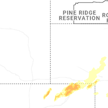
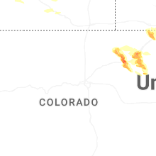
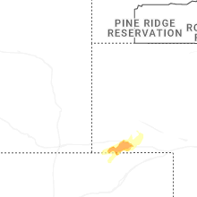
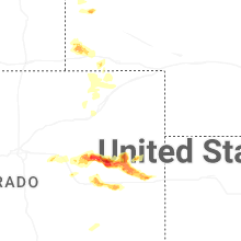

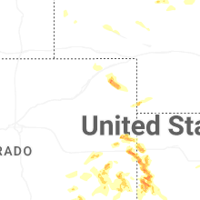
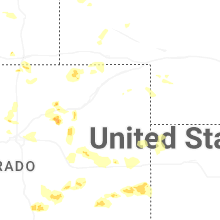
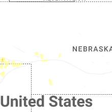

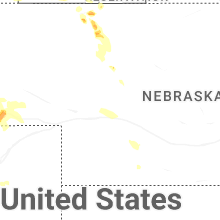
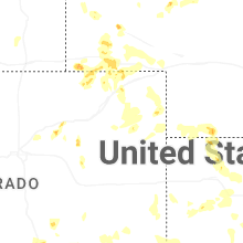
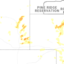


Connect with Interactive Hail Maps