

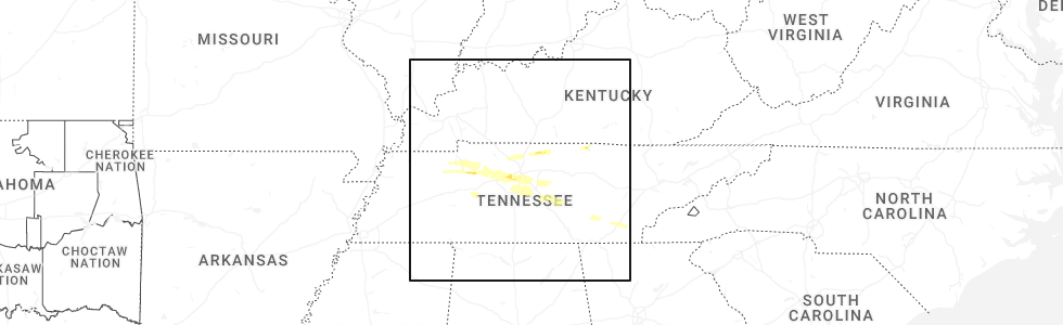
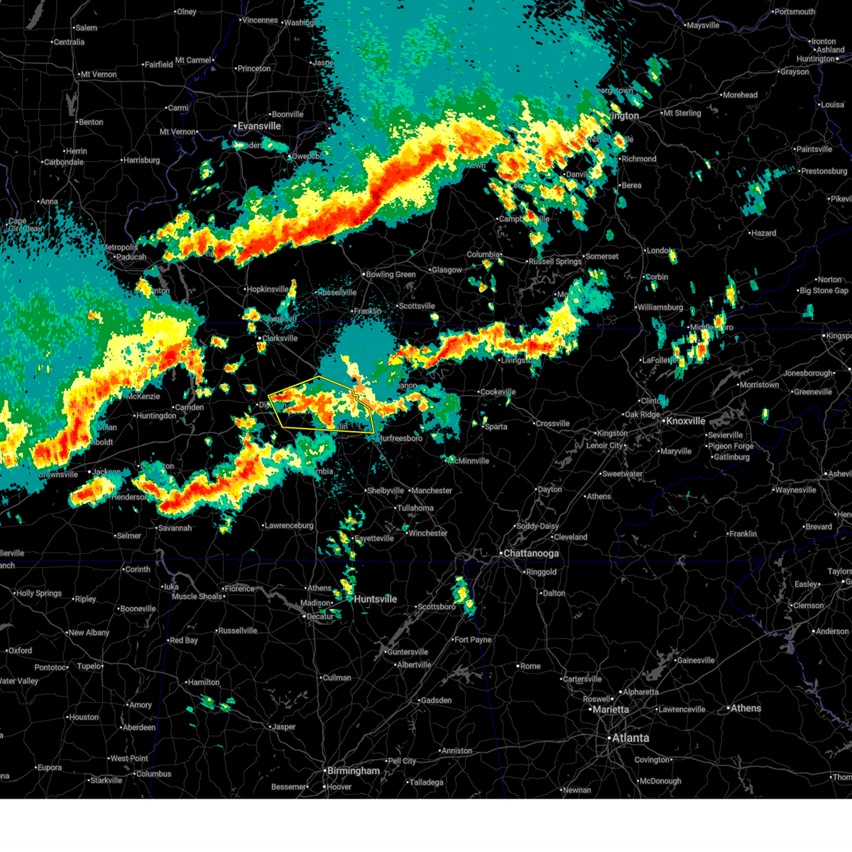
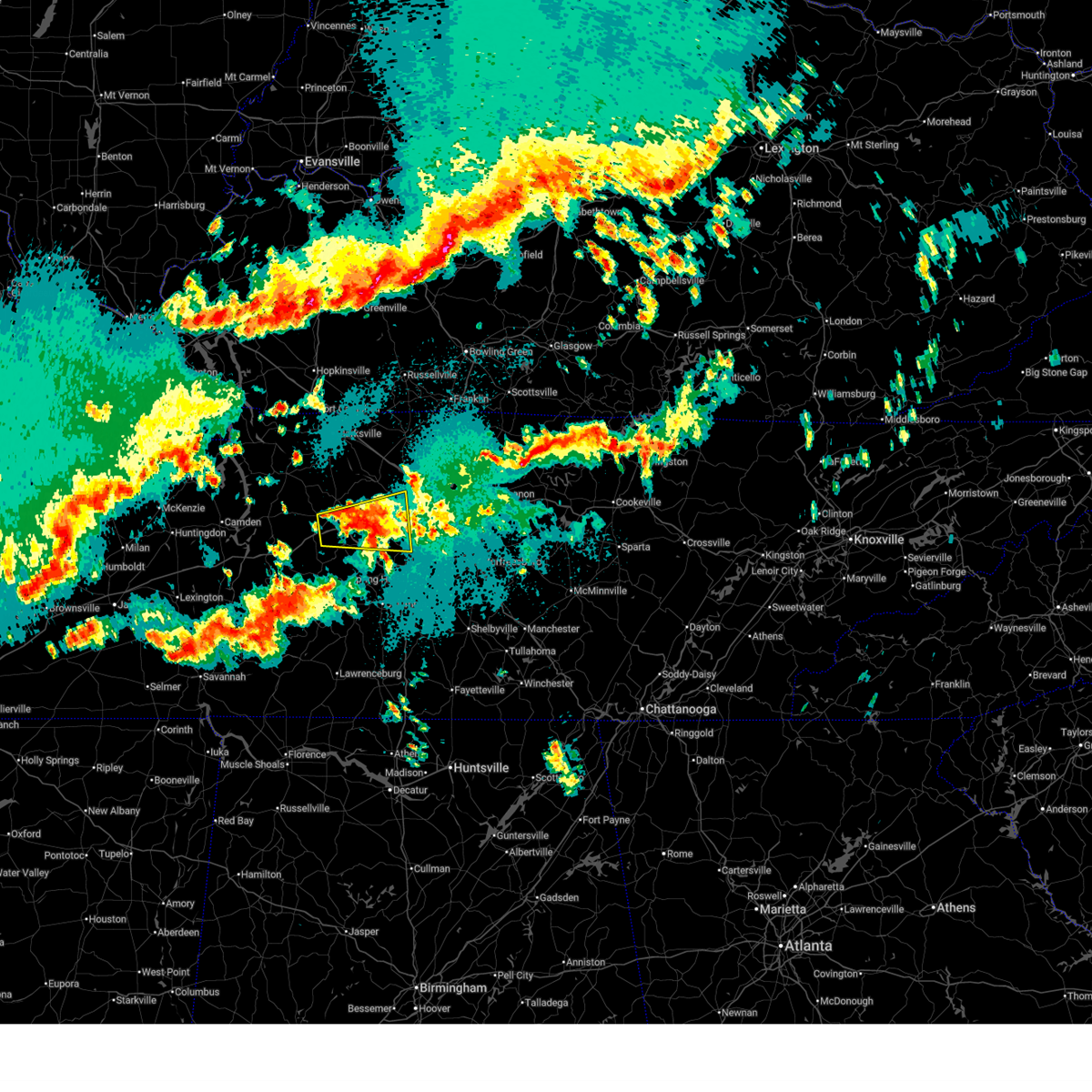
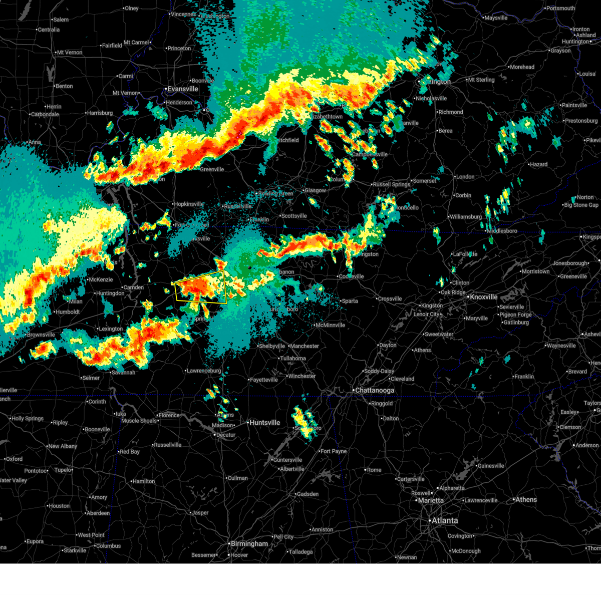
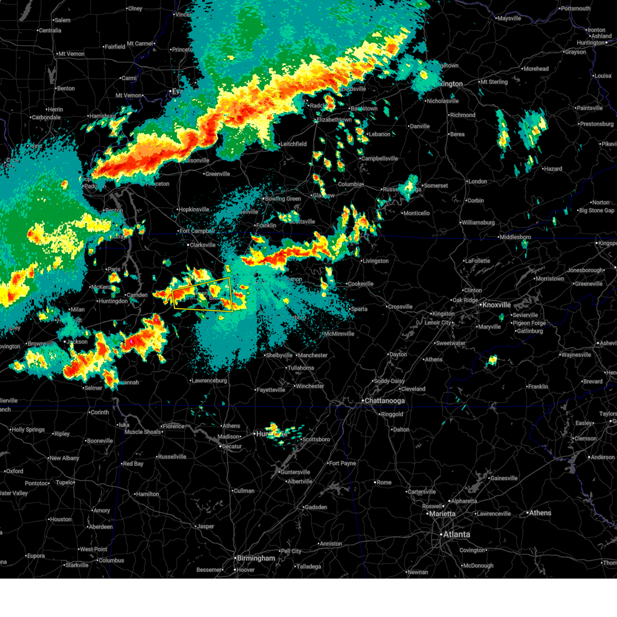
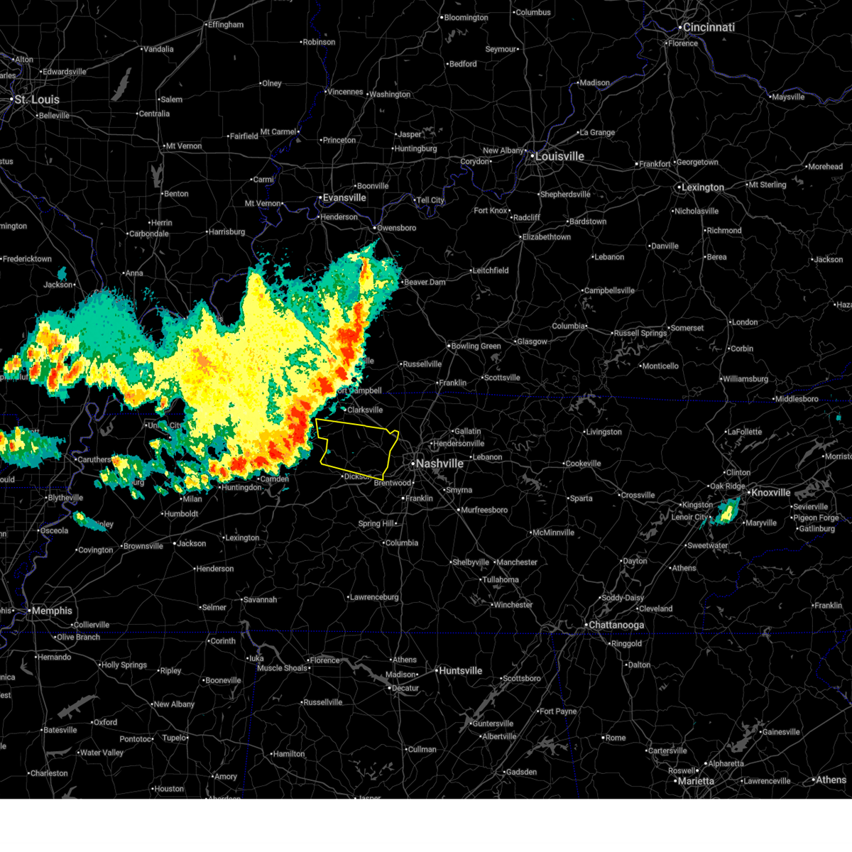
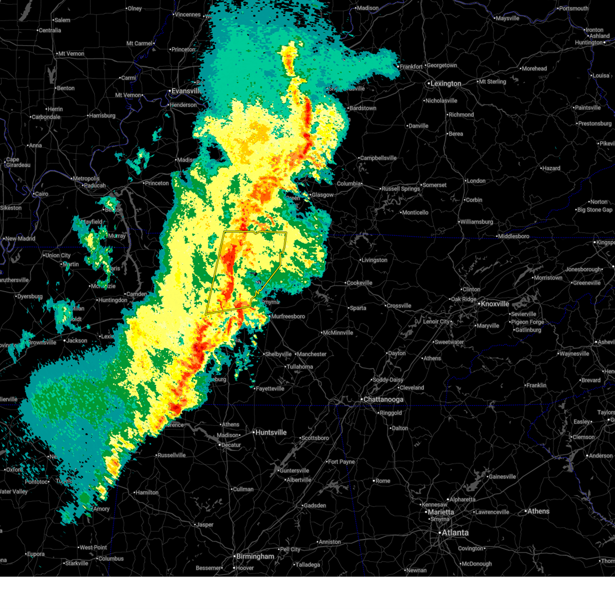
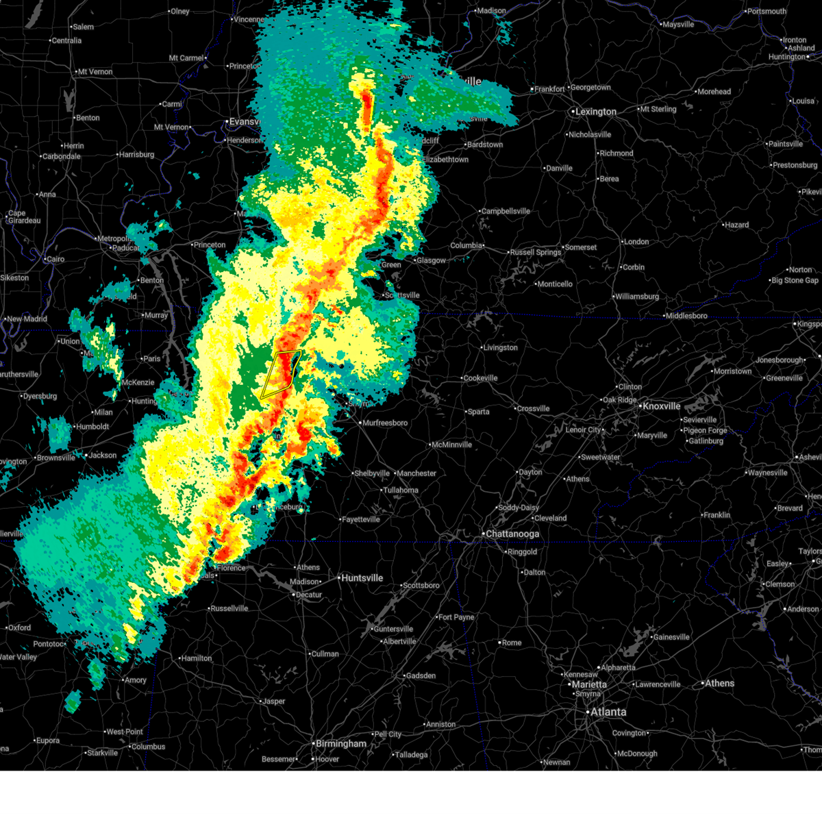
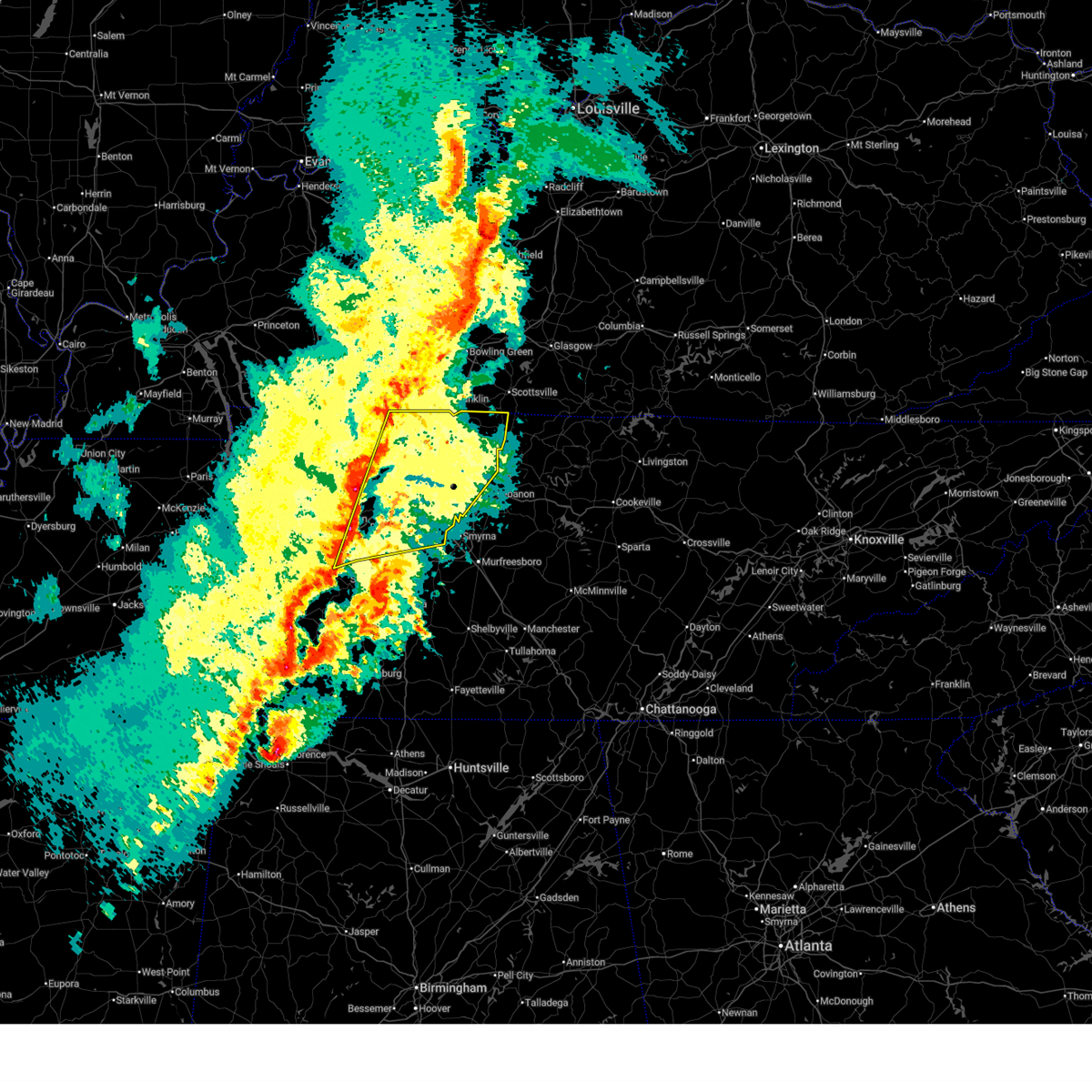
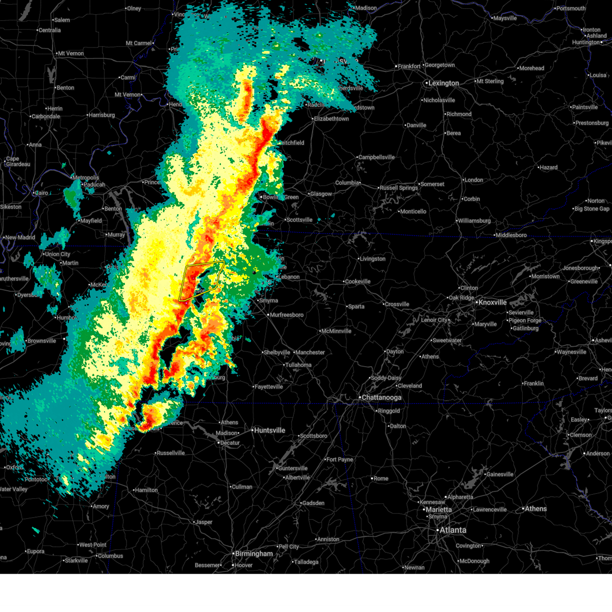
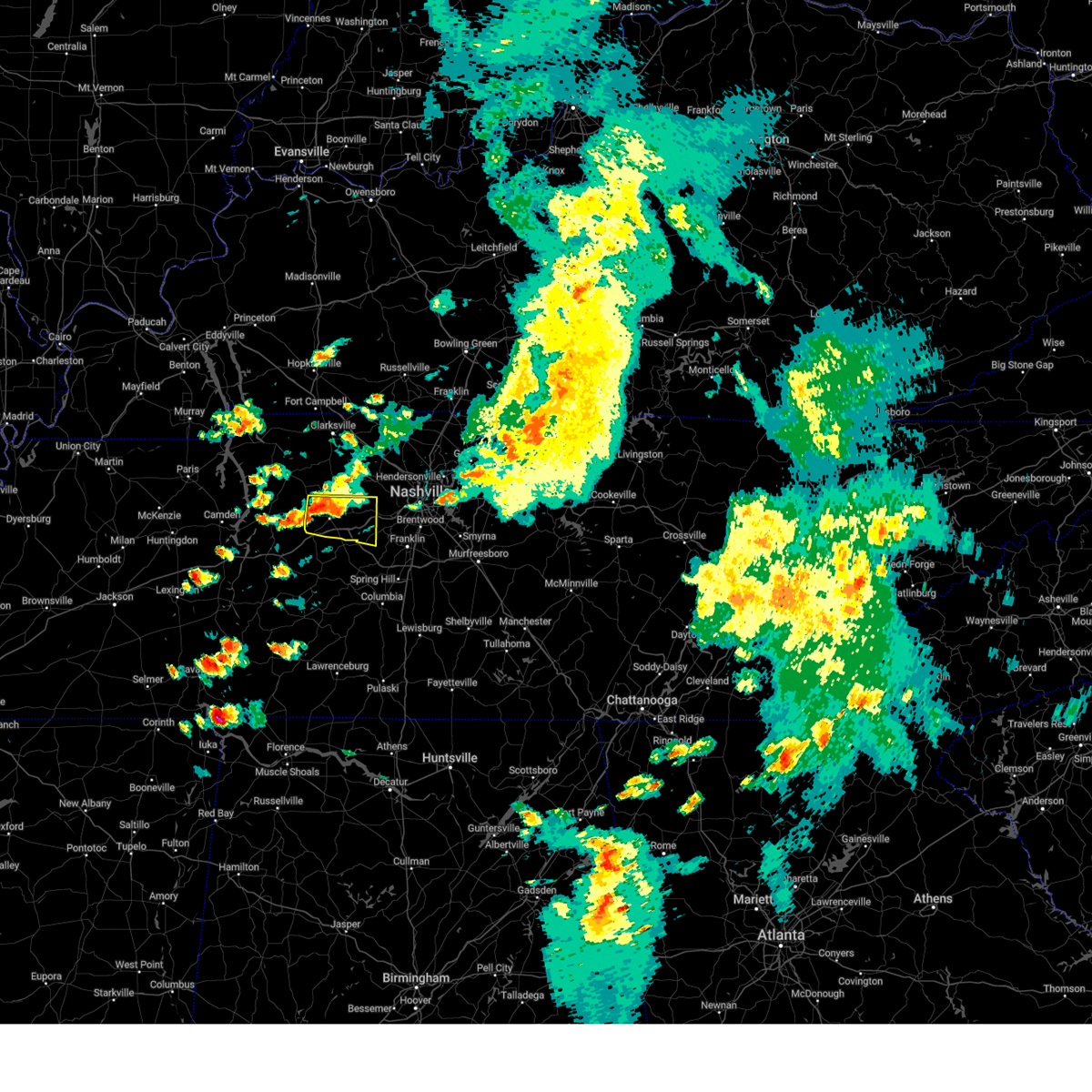
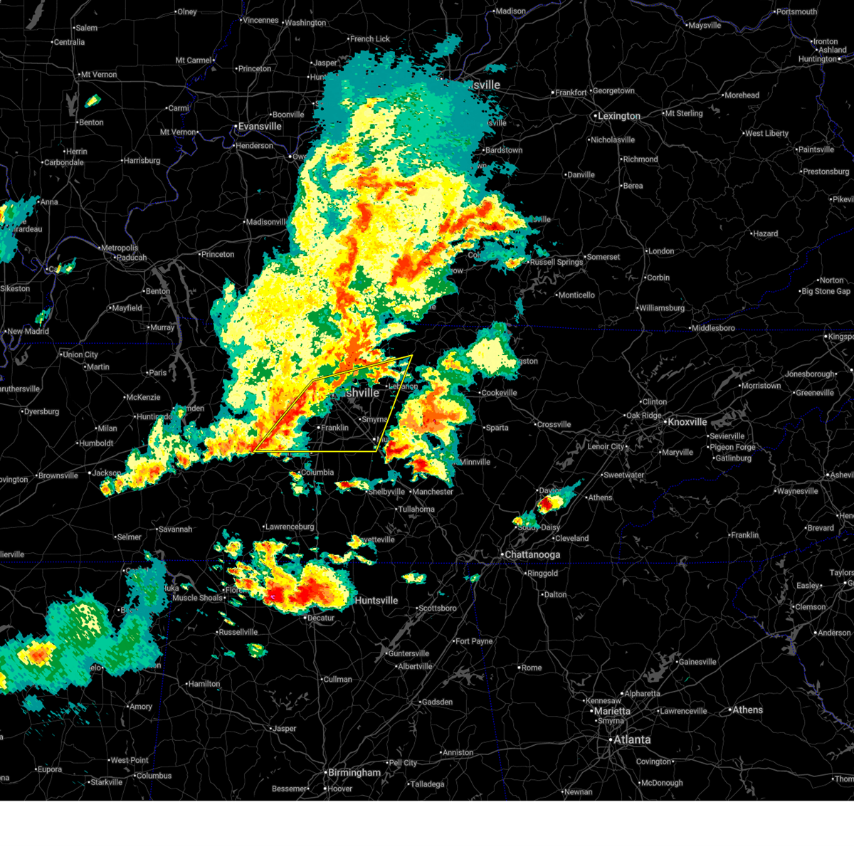
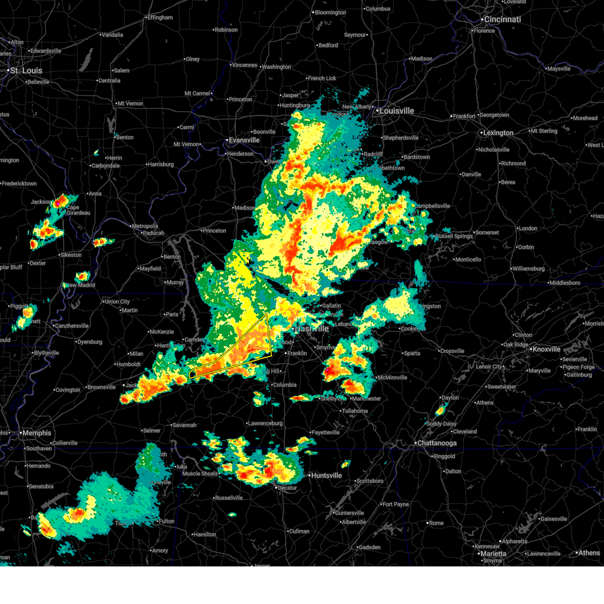
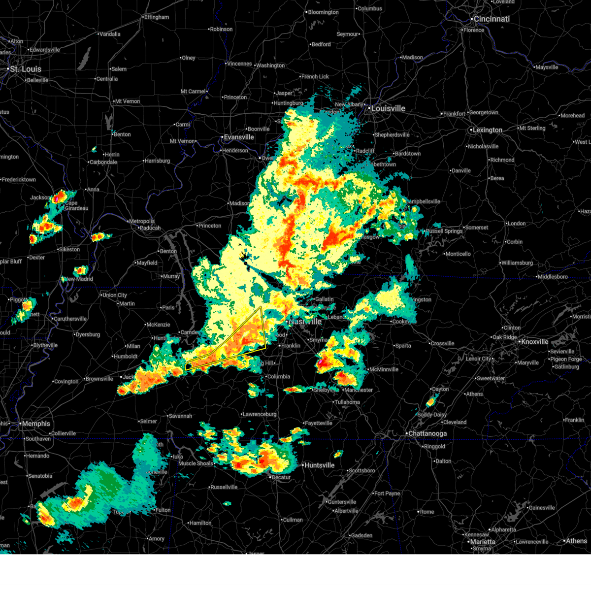
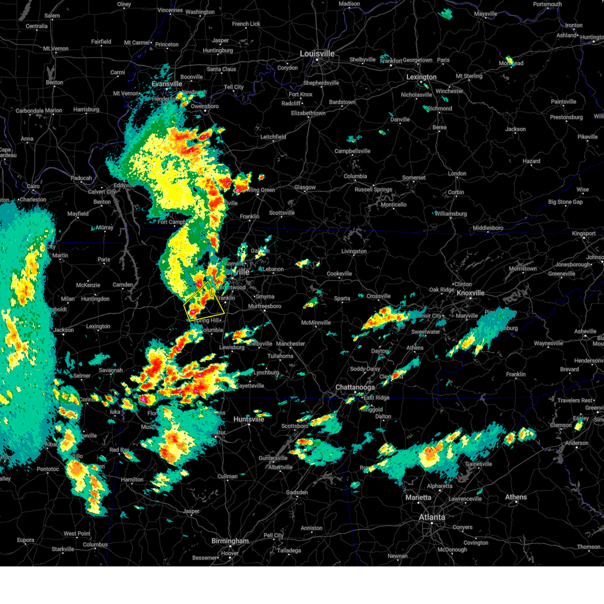
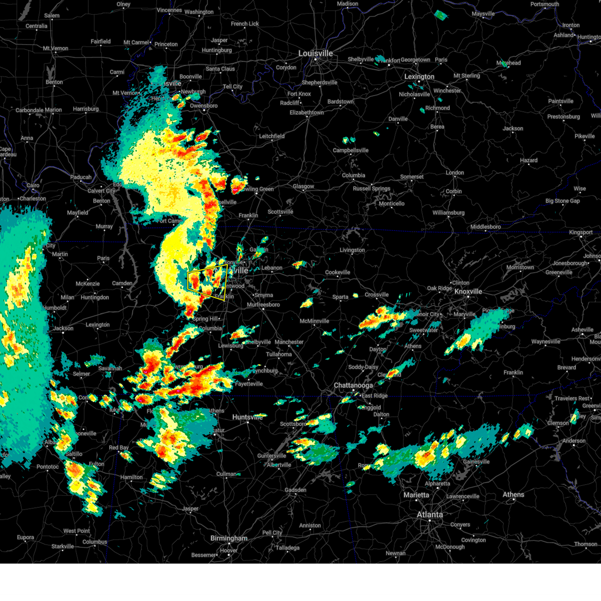
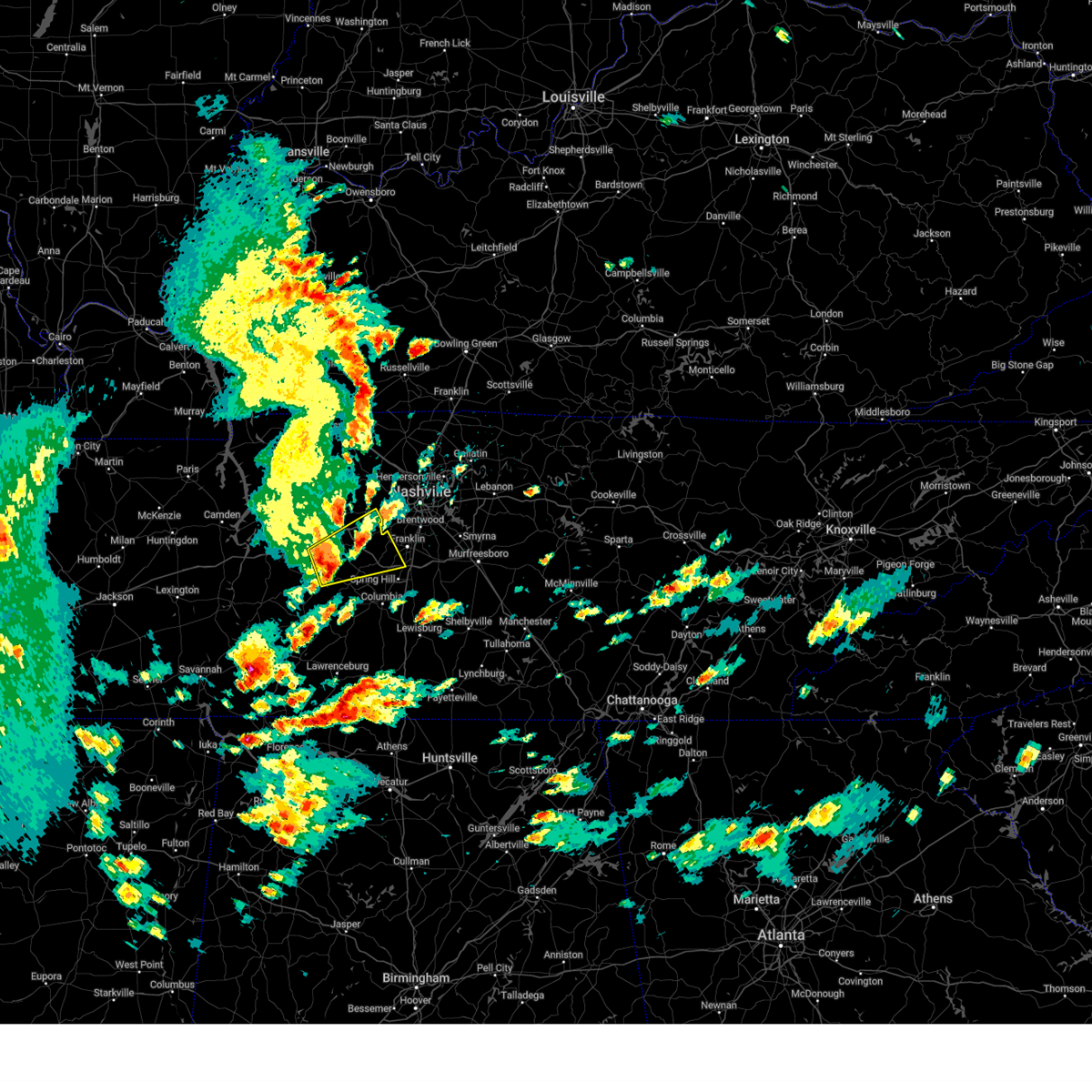
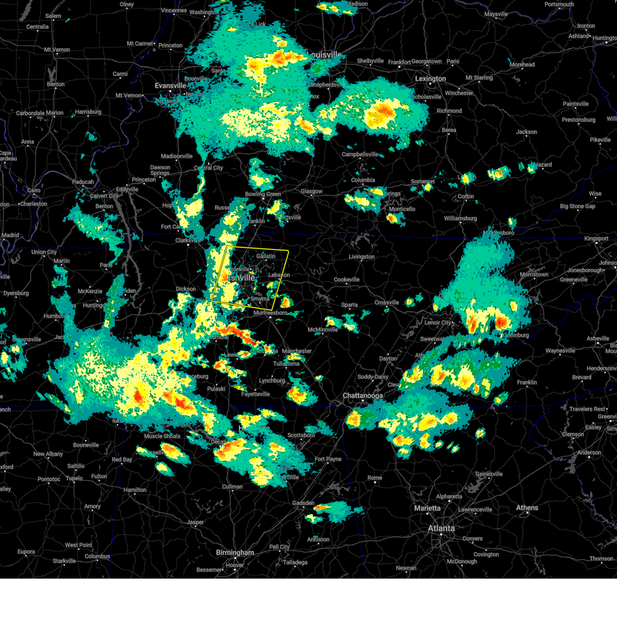
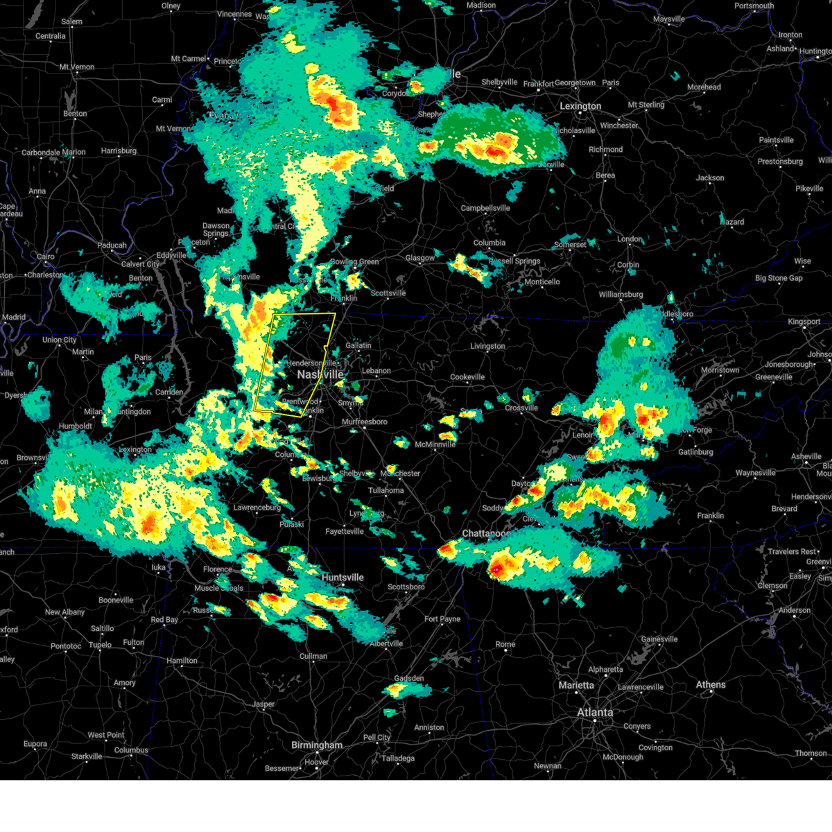
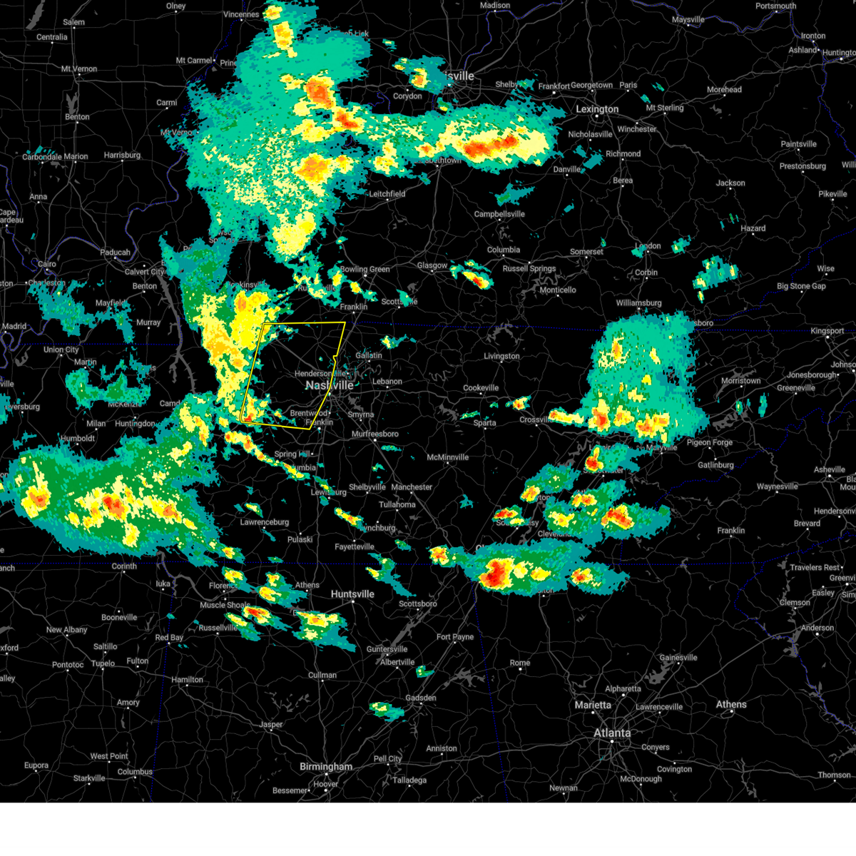
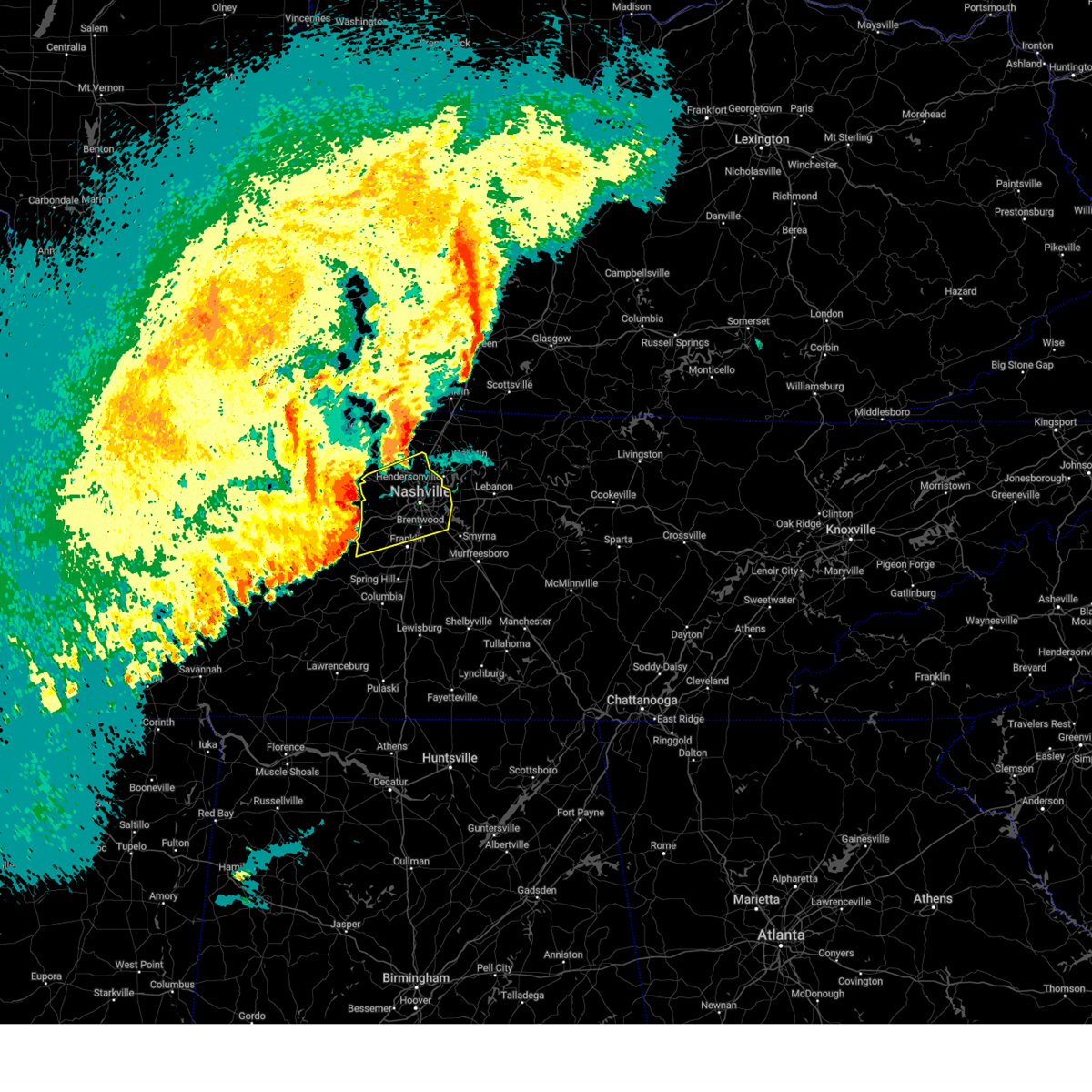
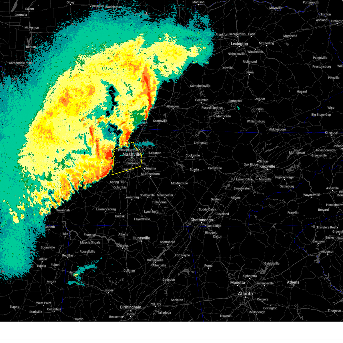
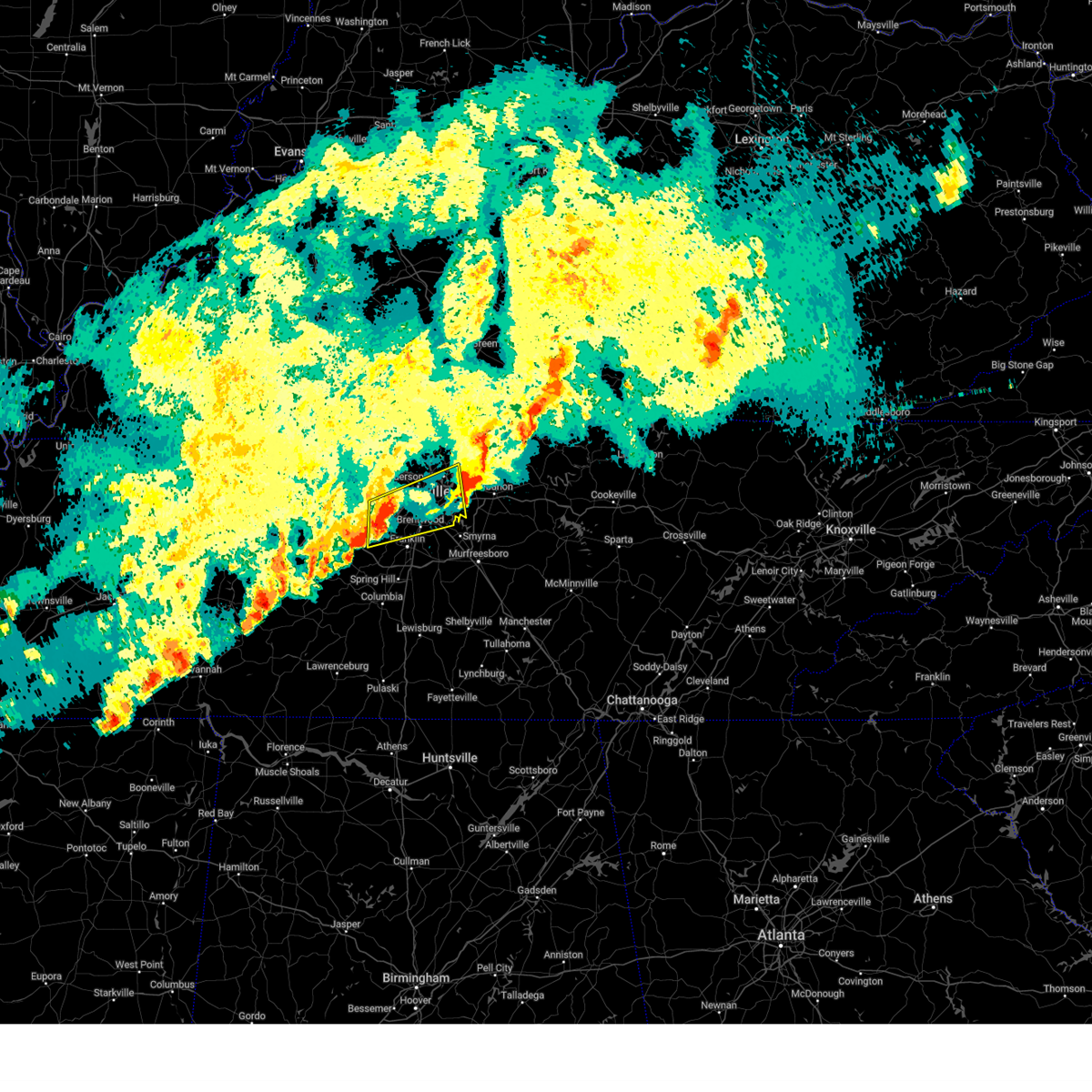
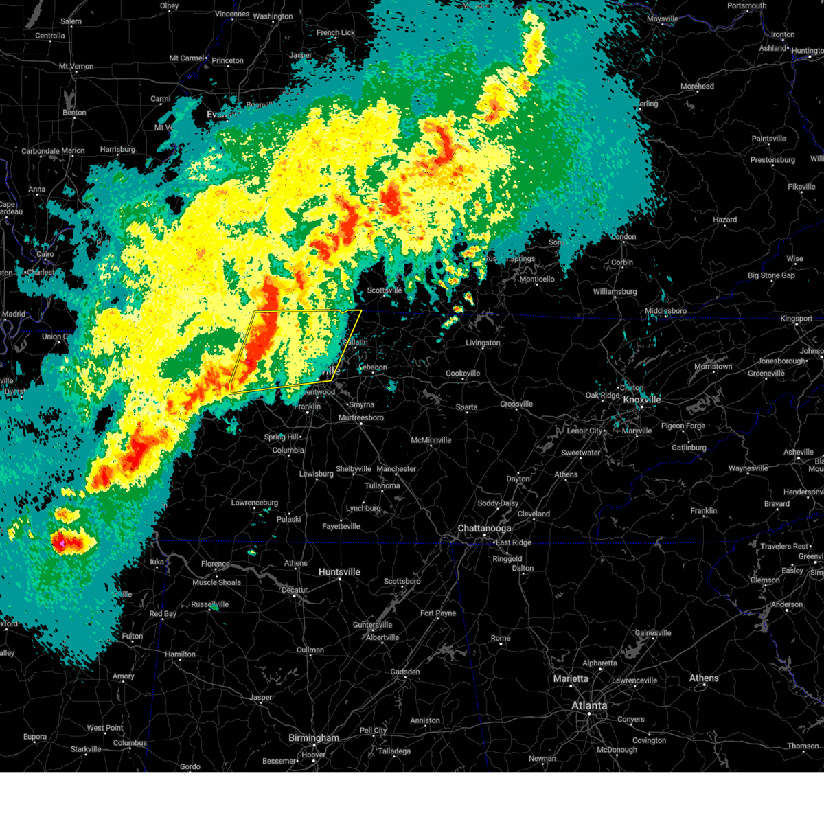
Hail Map for Pegram, TN
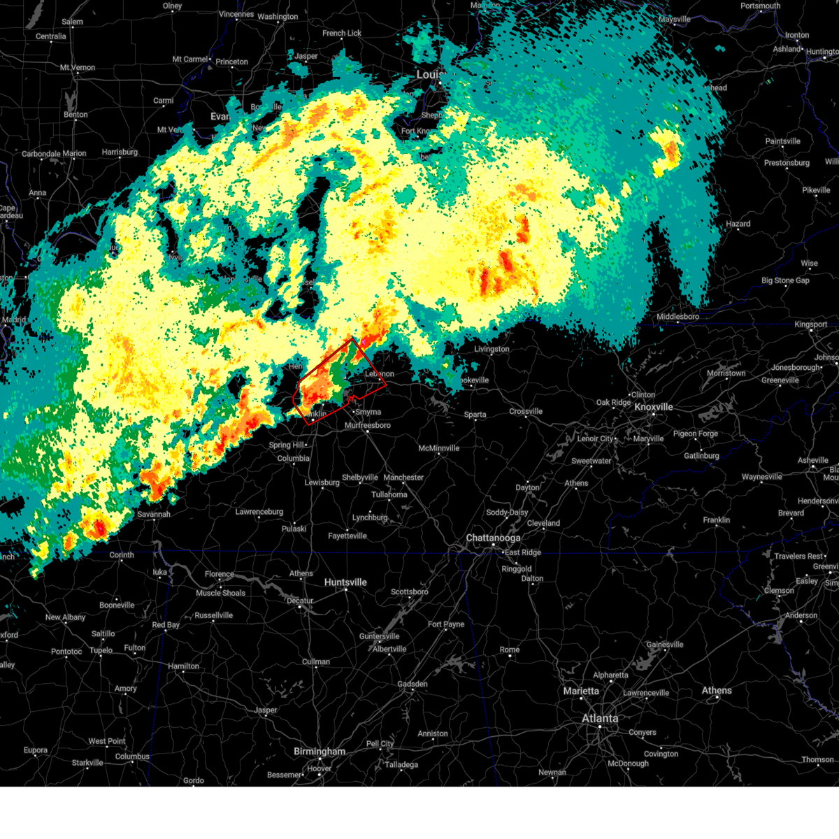
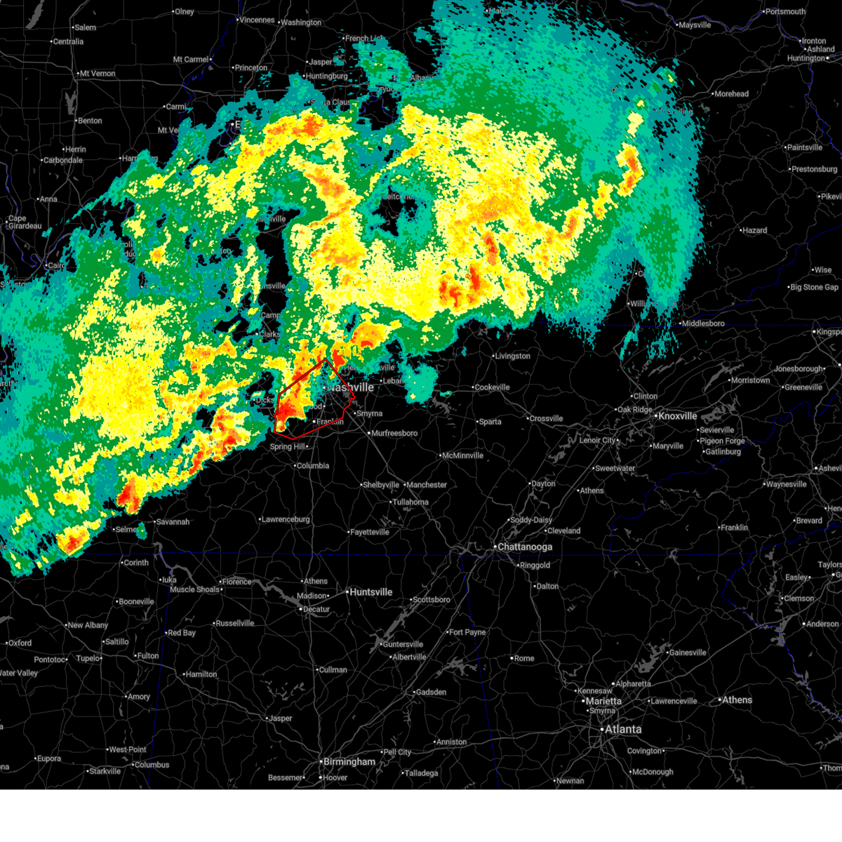
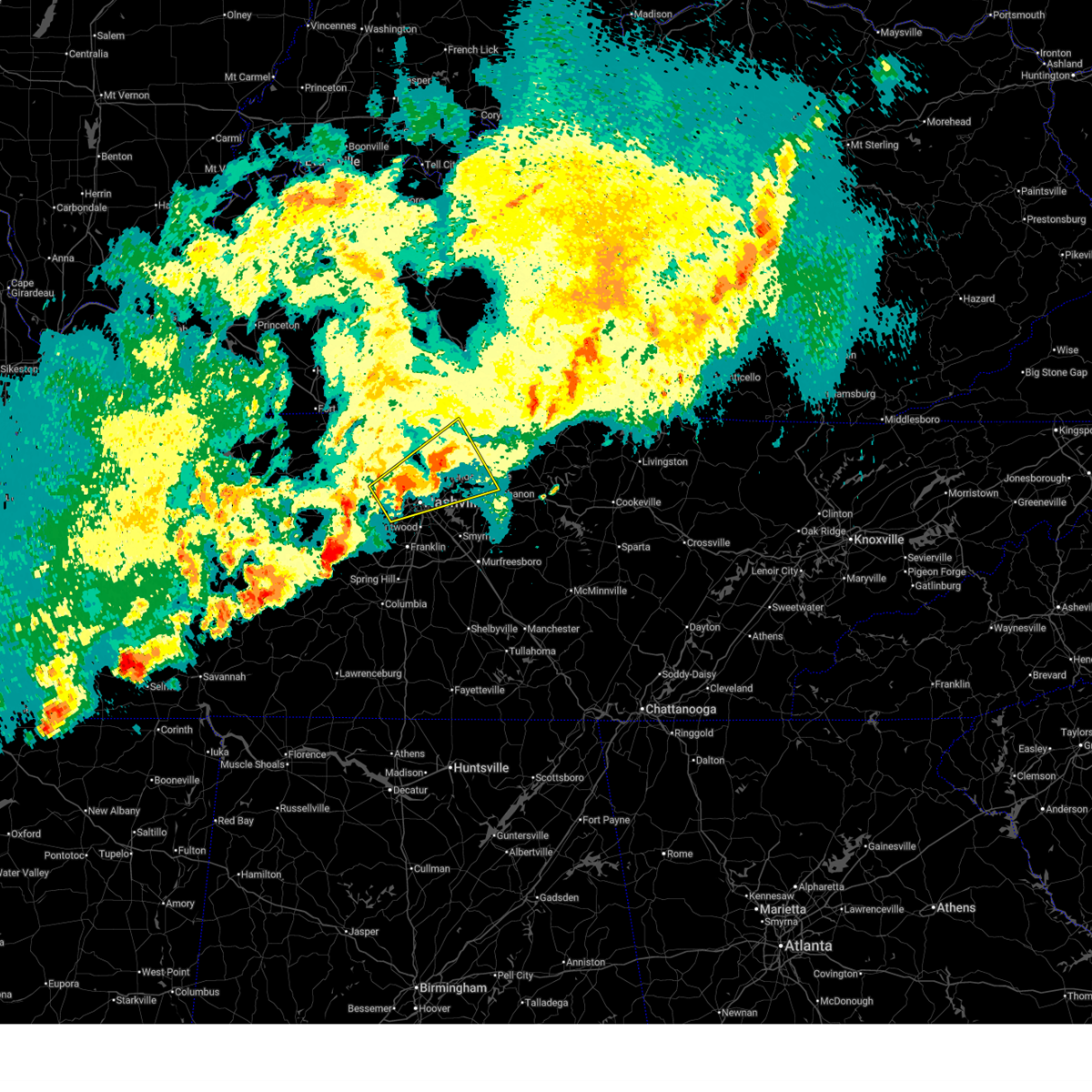
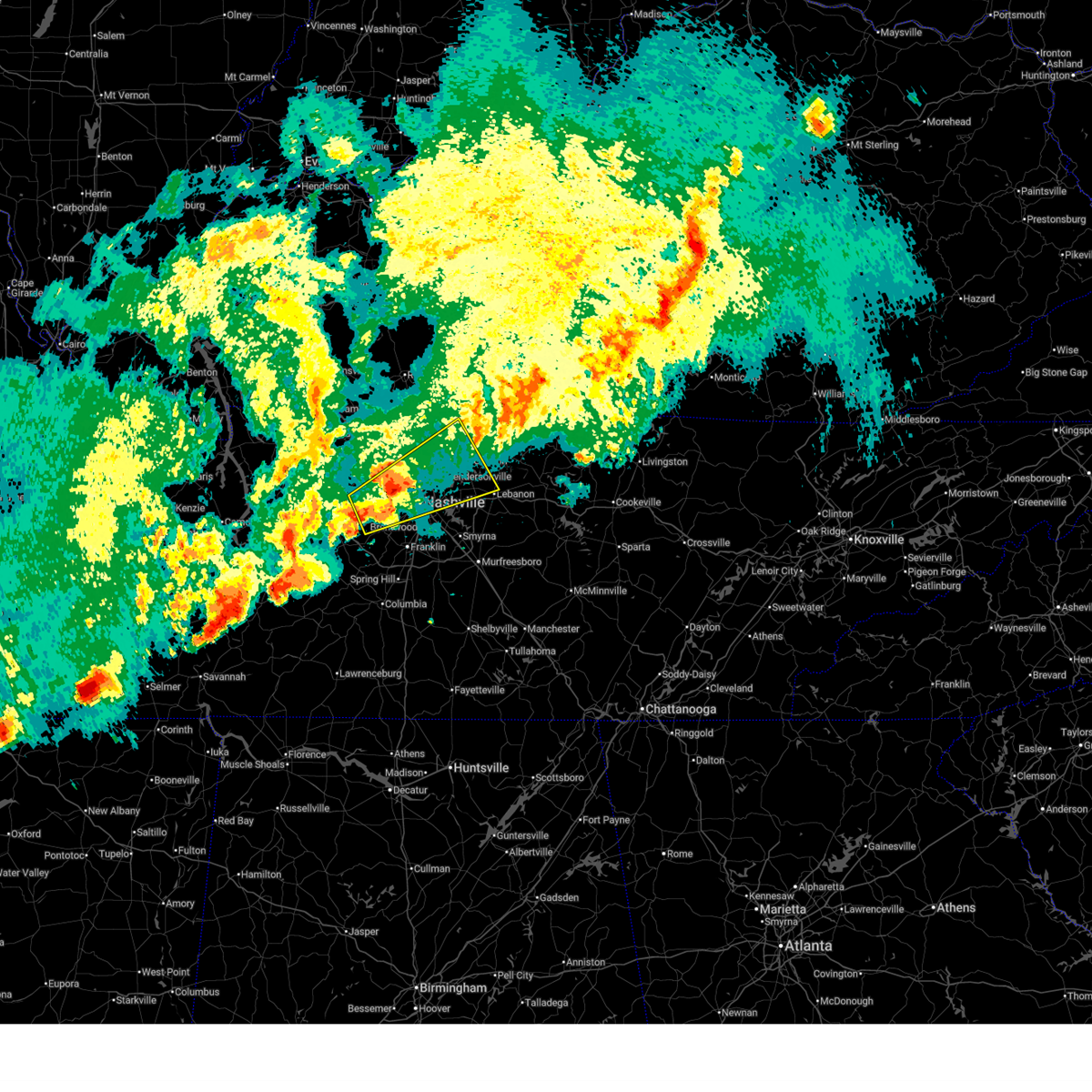
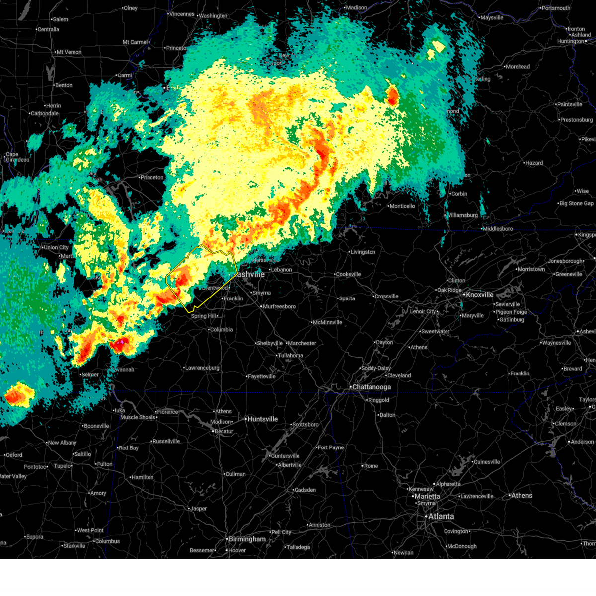
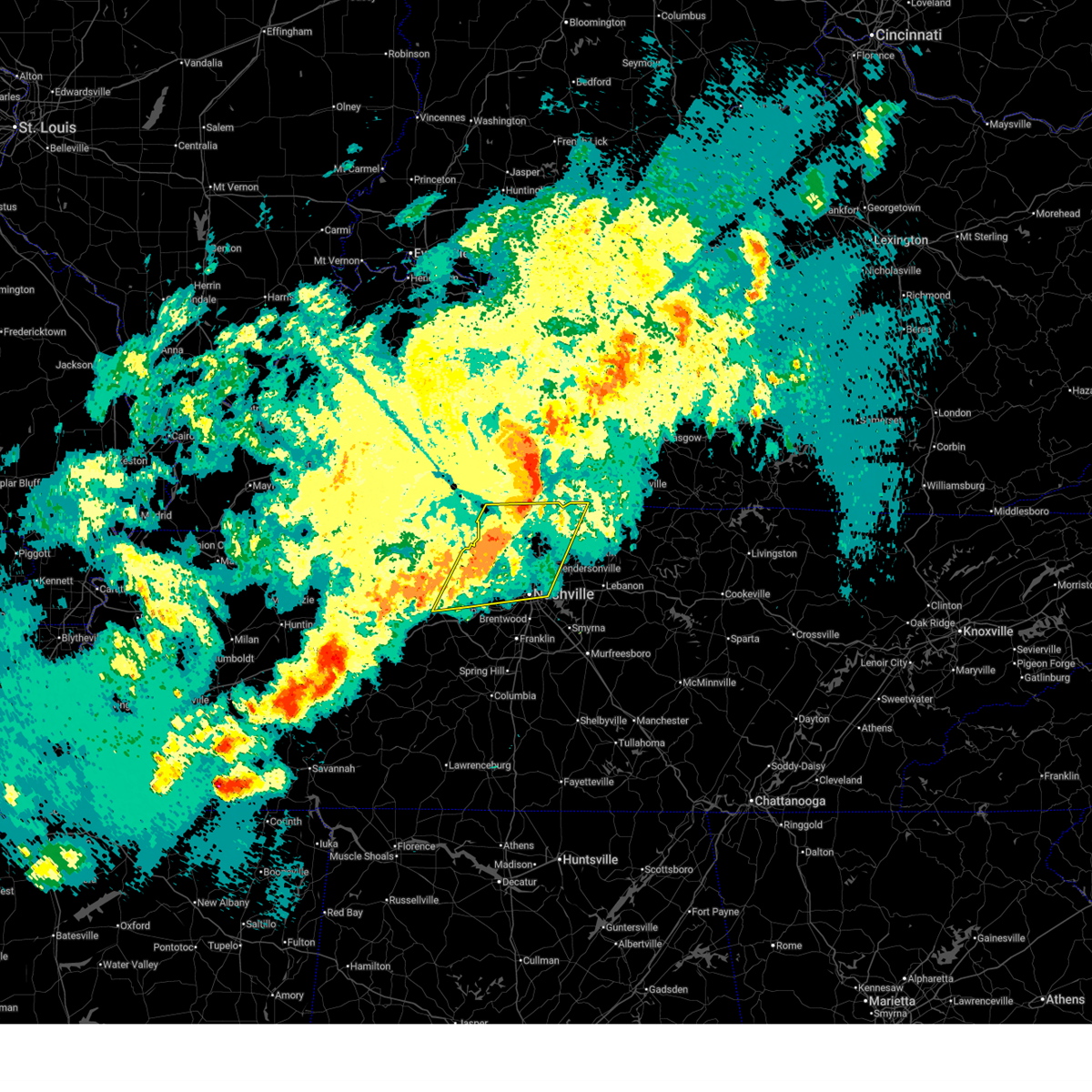
The Pegram, TN area has had 1 report of on-the-ground hail by trained spotters, and has been under severe weather warnings 33 times during the past 12 months. Doppler radar has detected hail at or near Pegram, TN on 93 occasions, including 6 occasions during the past year.
| Name: | Pegram, TN |
| Where Located: | 16.5 miles WSW of Nashville, TN |
| Map: | Google Map for Pegram, TN |
| Population: | 2093 |
| Housing Units: | 832 |
| More Info: | Search Google for Pegram, TN |
1
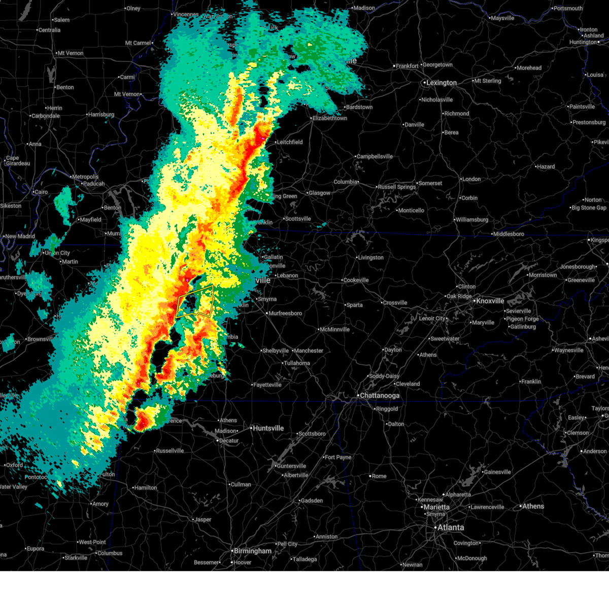
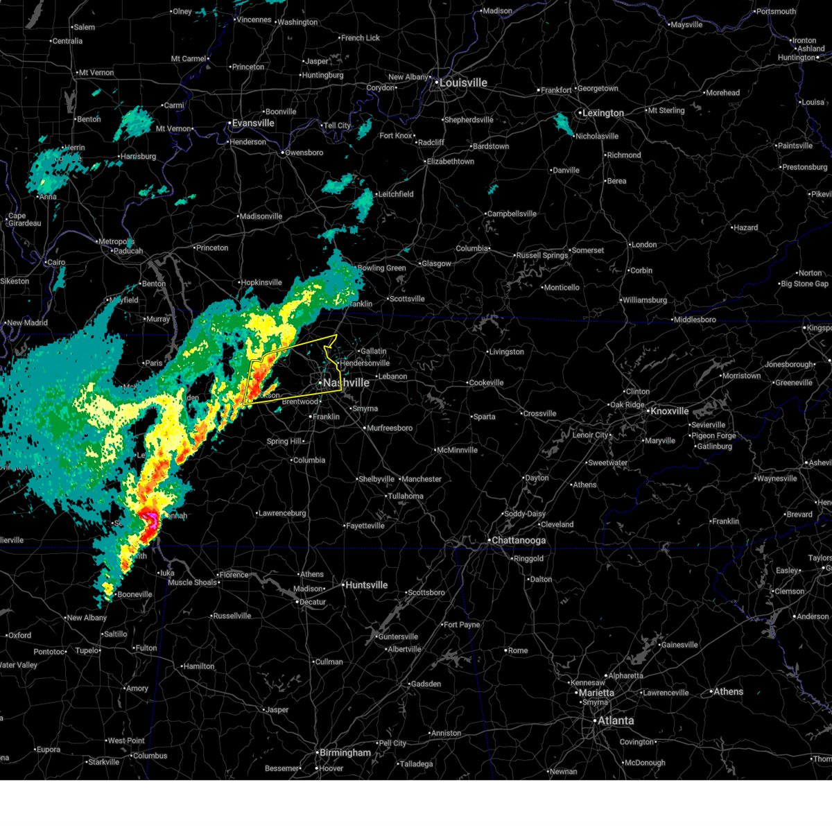
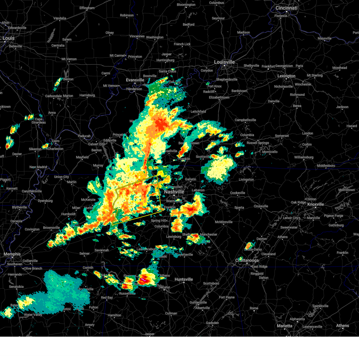
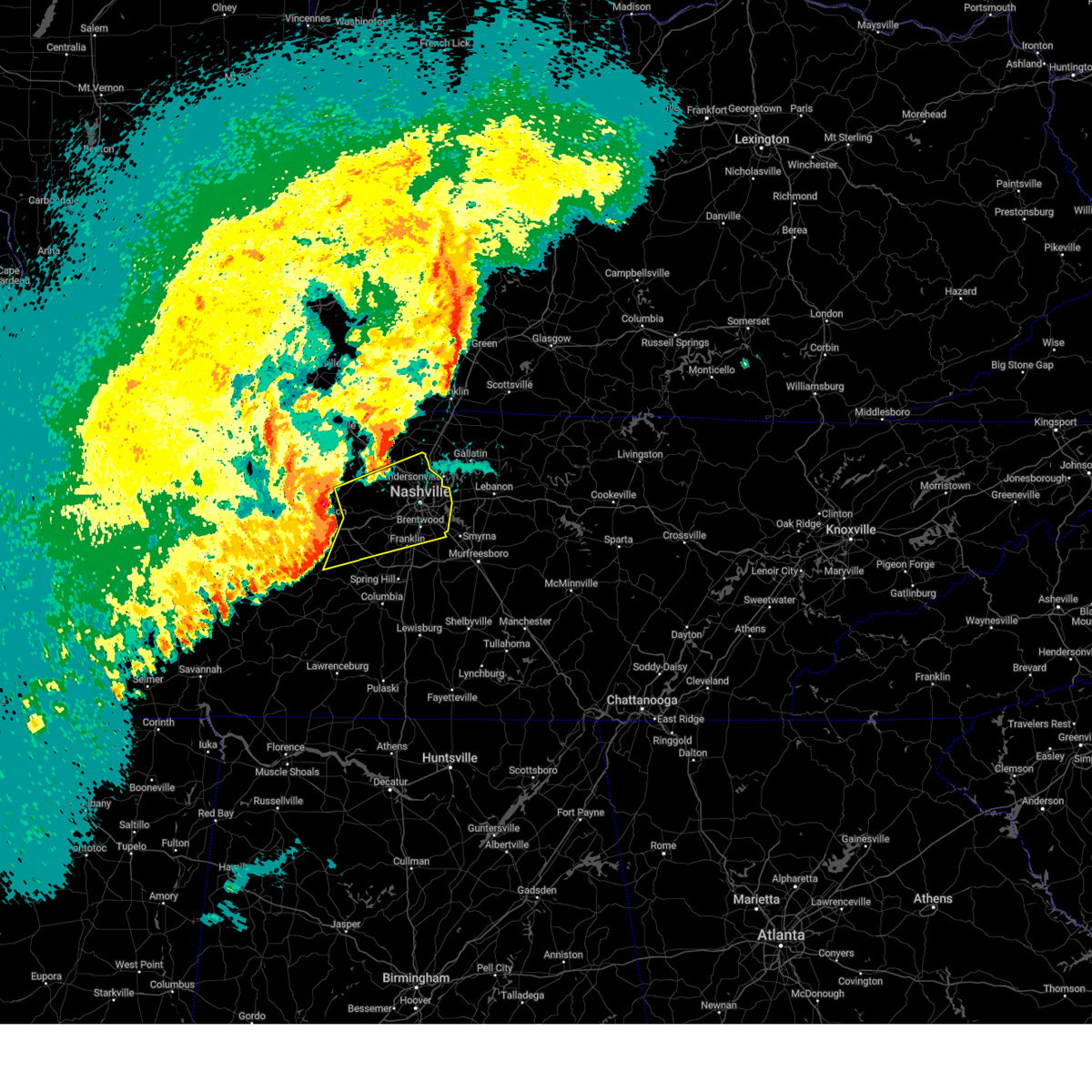
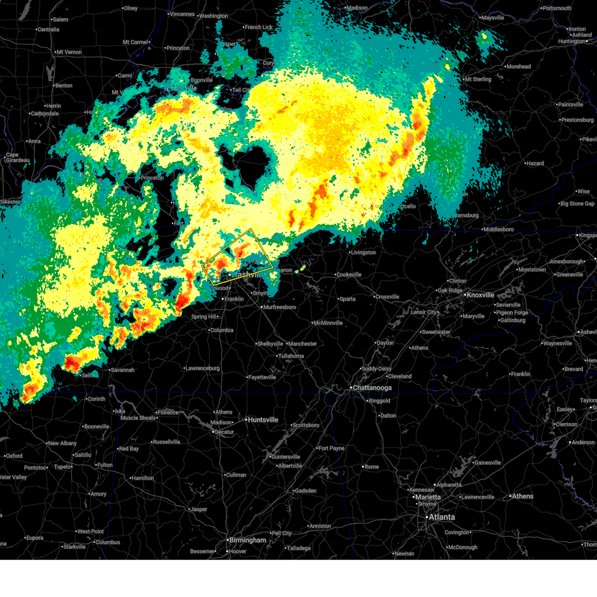
The Top Recent Hail Date for Pegram, TN is Friday, November 7, 2025 (5th out of 93)
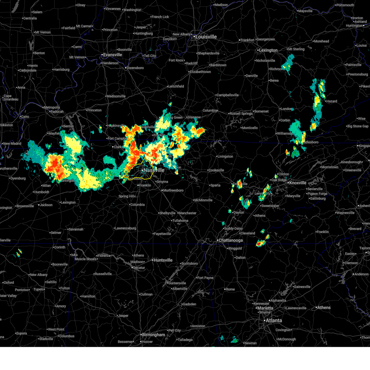
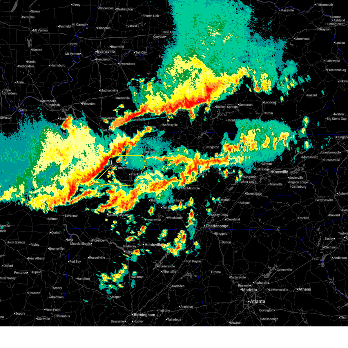
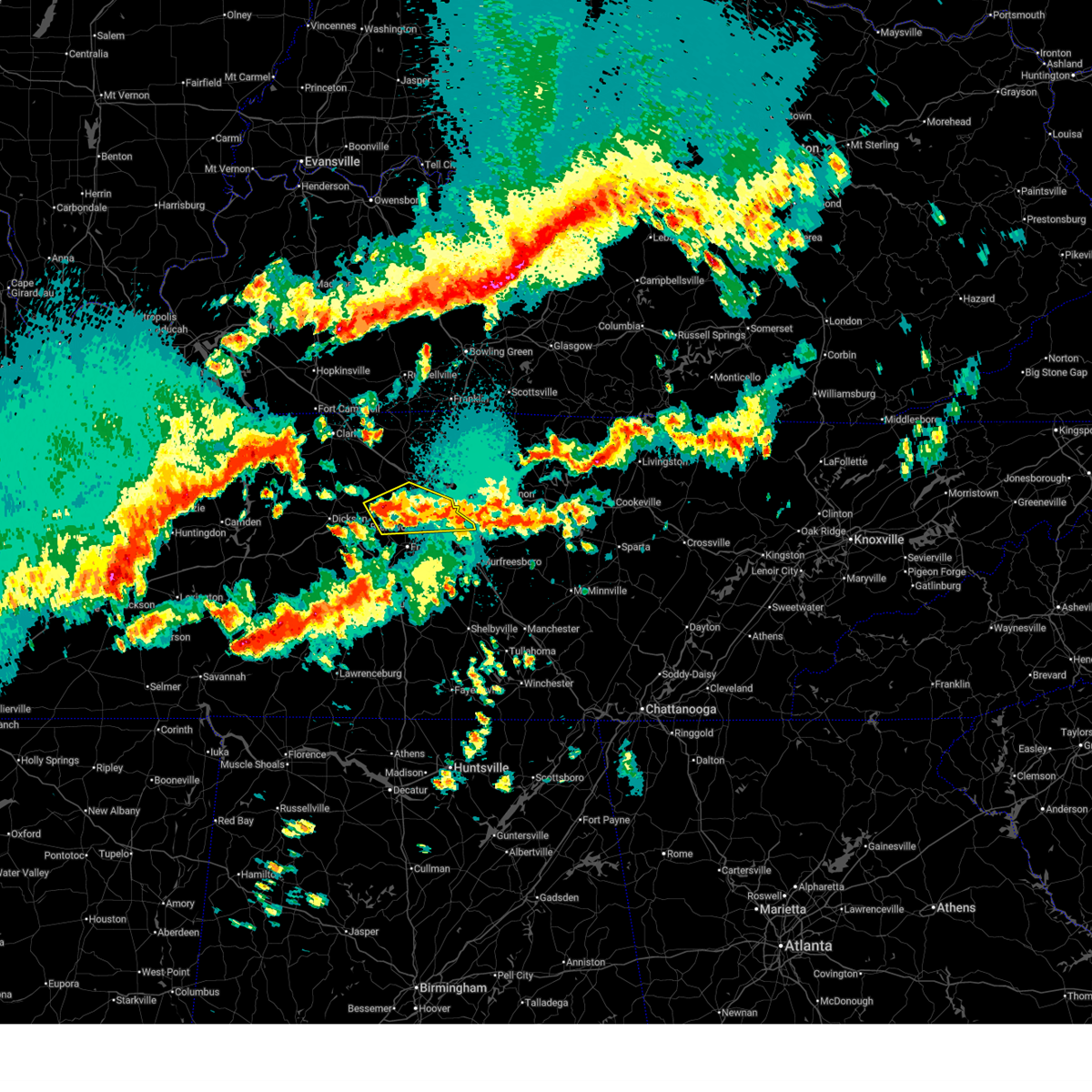
Hail and Wind Damage Spotted near Pegram, TN
| Date / Time | Report Details |
|---|---|
| 6/9/2026 4:18 PM CDT |
 Svrohx the national weather service in nashville has issued a * severe thunderstorm warning for, davidson county in middle tennessee, southeastern cheatham county in middle tennessee, * until 515 pm cdt. * at 418 pm cdt, severe thunderstorms were located along a line extending from near joelton to near kingston springs, moving east at 30 mph (radar indicated). Hazards include 60 mph wind gusts and penny size hail. expect damage to roofs, siding, and trees Svrohx the national weather service in nashville has issued a * severe thunderstorm warning for, davidson county in middle tennessee, southeastern cheatham county in middle tennessee, * until 515 pm cdt. * at 418 pm cdt, severe thunderstorms were located along a line extending from near joelton to near kingston springs, moving east at 30 mph (radar indicated). Hazards include 60 mph wind gusts and penny size hail. expect damage to roofs, siding, and trees
|
| 4/28/2026 2:21 AM CDT |
 Svrohx the national weather service in nashville has issued a * severe thunderstorm warning for, davidson county in middle tennessee, southeastern dickson county in middle tennessee, northeastern maury county in middle tennessee, williamson county in middle tennessee, southeastern cheatham county in middle tennessee, northern hickman county in middle tennessee, * until 315 am cdt. * at 221 am cdt, severe thunderstorms were located along a line extending from 7 miles north of white bluff to near dickson to 10 miles southeast of hurricane mills, moving east at 60 mph (radar indicated). Hazards include 60 mph wind gusts and penny size hail. expect damage to roofs, siding, and trees Svrohx the national weather service in nashville has issued a * severe thunderstorm warning for, davidson county in middle tennessee, southeastern dickson county in middle tennessee, northeastern maury county in middle tennessee, williamson county in middle tennessee, southeastern cheatham county in middle tennessee, northern hickman county in middle tennessee, * until 315 am cdt. * at 221 am cdt, severe thunderstorms were located along a line extending from 7 miles north of white bluff to near dickson to 10 miles southeast of hurricane mills, moving east at 60 mph (radar indicated). Hazards include 60 mph wind gusts and penny size hail. expect damage to roofs, siding, and trees
|
| 4/28/2026 1:24 AM CDT |
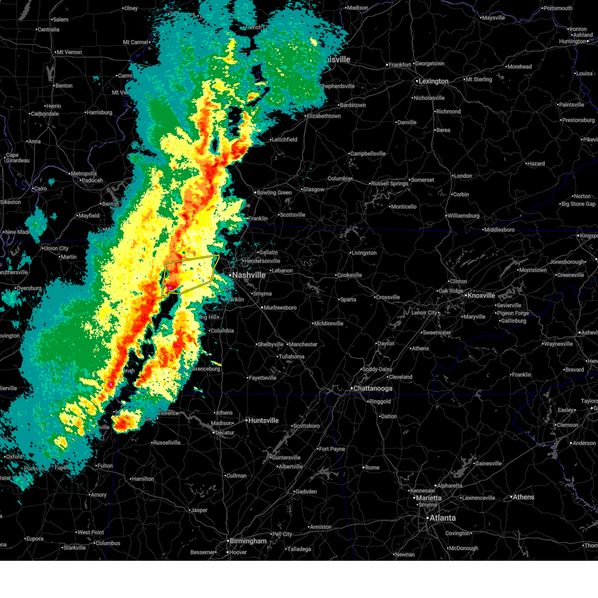
 At 124 am cdt, a severe thunderstorm was located over belle meade, or near nashville, moving east at 50 mph (radar indicated). Hazards include 60 mph wind gusts and quarter size hail. Hail damage to vehicles is expected. expect wind damage to roofs, siding, and trees. locations impacted include, ashland city, nashville, smyrna, brentwood, la vergne, forest hills, oak hill, belle meade, kingston springs, pegram, bellevue, antioch, hermitage, berry hill, bells bend, and percy priest lake. this includes the following highways, interstate 40 between mile markers 188 and 222. interstate 65 between mile markers 72 and 90. interstate 24 between mile markers 43 and 62. Interstate 840 between mile markers 64 and 65. At 124 am cdt, a severe thunderstorm was located over belle meade, or near nashville, moving east at 50 mph (radar indicated). Hazards include 60 mph wind gusts and quarter size hail. Hail damage to vehicles is expected. expect wind damage to roofs, siding, and trees. locations impacted include, ashland city, nashville, smyrna, brentwood, la vergne, forest hills, oak hill, belle meade, kingston springs, pegram, bellevue, antioch, hermitage, berry hill, bells bend, and percy priest lake. this includes the following highways, interstate 40 between mile markers 188 and 222. interstate 65 between mile markers 72 and 90. interstate 24 between mile markers 43 and 62. Interstate 840 between mile markers 64 and 65.
|
| 4/28/2026 1:07 AM CDT |
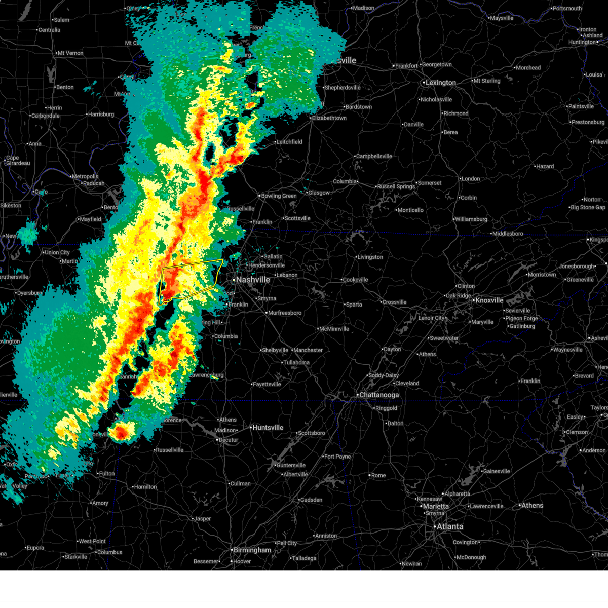
 Svrohx the national weather service in nashville has issued a * severe thunderstorm warning for, davidson county in middle tennessee, southeastern dickson county in middle tennessee, northwestern rutherford county in middle tennessee, northern williamson county in middle tennessee, southeastern cheatham county in middle tennessee, * until 215 am cdt. * at 107 am cdt, a severe thunderstorm was located near fairview, or 13 miles northwest of franklin, moving east at 40 mph (radar indicated). Hazards include 60 mph wind gusts and quarter size hail. Hail damage to vehicles is expected. Expect wind damage to roofs, siding, and trees. Svrohx the national weather service in nashville has issued a * severe thunderstorm warning for, davidson county in middle tennessee, southeastern dickson county in middle tennessee, northwestern rutherford county in middle tennessee, northern williamson county in middle tennessee, southeastern cheatham county in middle tennessee, * until 215 am cdt. * at 107 am cdt, a severe thunderstorm was located near fairview, or 13 miles northwest of franklin, moving east at 40 mph (radar indicated). Hazards include 60 mph wind gusts and quarter size hail. Hail damage to vehicles is expected. Expect wind damage to roofs, siding, and trees.
|
| 4/28/2026 12:57 AM CDT |
 At 1257 am cdt, a severe thunderstorm was located near white bluff, or 9 miles east of dickson, moving east at 25 mph (radar indicated). Hazards include 60 mph wind gusts and quarter size hail. Hail damage to vehicles is expected. expect wind damage to roofs, siding, and trees. locations impacted include, franklin, dickson, brentwood, forest hills, white bluff, belle meade, kingston springs, pegram, burns, bellevue, fairview, bon aqua, bells bend, and natchez trace at highway 96. this includes the following highways, interstate 40 between mile markers 166 and 203. Interstate 840 between mile markers 1 and 9. At 1257 am cdt, a severe thunderstorm was located near white bluff, or 9 miles east of dickson, moving east at 25 mph (radar indicated). Hazards include 60 mph wind gusts and quarter size hail. Hail damage to vehicles is expected. expect wind damage to roofs, siding, and trees. locations impacted include, franklin, dickson, brentwood, forest hills, white bluff, belle meade, kingston springs, pegram, burns, bellevue, fairview, bon aqua, bells bend, and natchez trace at highway 96. this includes the following highways, interstate 40 between mile markers 166 and 203. Interstate 840 between mile markers 1 and 9.
|
| 4/28/2026 12:44 AM CDT |
 At 1244 am cdt, a severe thunderstorm was located near white bluff, or 8 miles east of dickson, moving east at 35 mph (radar indicated). Hazards include 60 mph wind gusts and quarter size hail. Hail damage to vehicles is expected. expect wind damage to roofs, siding, and trees. locations impacted include, franklin, dickson, brentwood, forest hills, white bluff, belle meade, kingston springs, pegram, burns, bellevue, fairview, bon aqua, bells bend, and natchez trace at highway 96. this includes the following highways, interstate 40 between mile markers 166 and 203. Interstate 840 between mile markers 1 and 9. At 1244 am cdt, a severe thunderstorm was located near white bluff, or 8 miles east of dickson, moving east at 35 mph (radar indicated). Hazards include 60 mph wind gusts and quarter size hail. Hail damage to vehicles is expected. expect wind damage to roofs, siding, and trees. locations impacted include, franklin, dickson, brentwood, forest hills, white bluff, belle meade, kingston springs, pegram, burns, bellevue, fairview, bon aqua, bells bend, and natchez trace at highway 96. this includes the following highways, interstate 40 between mile markers 166 and 203. Interstate 840 between mile markers 1 and 9.
|
| 4/28/2026 12:25 AM CDT |
 Svrohx the national weather service in nashville has issued a * severe thunderstorm warning for, southwestern davidson county in middle tennessee, southern dickson county in middle tennessee, northwestern williamson county in middle tennessee, southeastern cheatham county in middle tennessee, northeastern hickman county in middle tennessee, * until 115 am cdt. * at 1224 am cdt, a severe thunderstorm was located near dickson, moving east at 35 mph (radar indicated). Hazards include 60 mph wind gusts and quarter size hail. Hail damage to vehicles is expected. Expect wind damage to roofs, siding, and trees. Svrohx the national weather service in nashville has issued a * severe thunderstorm warning for, southwestern davidson county in middle tennessee, southern dickson county in middle tennessee, northwestern williamson county in middle tennessee, southeastern cheatham county in middle tennessee, northeastern hickman county in middle tennessee, * until 115 am cdt. * at 1224 am cdt, a severe thunderstorm was located near dickson, moving east at 35 mph (radar indicated). Hazards include 60 mph wind gusts and quarter size hail. Hail damage to vehicles is expected. Expect wind damage to roofs, siding, and trees.
|
| 4/16/2026 7:10 PM CDT |
 At 709 pm cdt, a severe thunderstorm was located near ashland city, moving east at 50 mph (radar indicated). Hazards include 60 mph wind gusts and nickel size hail. Expect damage to roofs, siding, and trees. locations impacted include, ashland city, coopertown, kingston springs, pegram, and pleasant view. this includes the following highways, interstate 40 between mile markers 188 and 191. Interstate 24 between mile markers 28 and 31. At 709 pm cdt, a severe thunderstorm was located near ashland city, moving east at 50 mph (radar indicated). Hazards include 60 mph wind gusts and nickel size hail. Expect damage to roofs, siding, and trees. locations impacted include, ashland city, coopertown, kingston springs, pegram, and pleasant view. this includes the following highways, interstate 40 between mile markers 188 and 191. Interstate 24 between mile markers 28 and 31.
|
| 4/16/2026 7:07 PM CDT |
 Svrohx the national weather service in nashville has issued a * severe thunderstorm warning for, davidson county in middle tennessee, southwestern sumner county in middle tennessee, * until 800 pm cdt. * at 707 pm cdt, a severe thunderstorm was located over ashland city, moving east at 50 mph (radar indicated). Hazards include 60 mph wind gusts and nickel size hail. expect damage to roofs, siding, and trees Svrohx the national weather service in nashville has issued a * severe thunderstorm warning for, davidson county in middle tennessee, southwestern sumner county in middle tennessee, * until 800 pm cdt. * at 707 pm cdt, a severe thunderstorm was located over ashland city, moving east at 50 mph (radar indicated). Hazards include 60 mph wind gusts and nickel size hail. expect damage to roofs, siding, and trees
|
| 4/16/2026 6:54 PM CDT |
 At 653 pm cdt, a severe thunderstorm was located 9 miles north of white bluff, or 12 miles west of ashland city, moving east at 50 mph (radar indicated). Hazards include 60 mph wind gusts and quarter size hail. Hail damage to vehicles is expected. expect wind damage to roofs, siding, and trees. locations impacted include, ashland city, coopertown, white bluff, kingston springs, pegram, pleasant view, charlotte, vanleer, cheatham dam, and cunningham. this includes the following highways, interstate 40 between mile markers 188 and 191. Interstate 24 between mile markers 25 and 31. At 653 pm cdt, a severe thunderstorm was located 9 miles north of white bluff, or 12 miles west of ashland city, moving east at 50 mph (radar indicated). Hazards include 60 mph wind gusts and quarter size hail. Hail damage to vehicles is expected. expect wind damage to roofs, siding, and trees. locations impacted include, ashland city, coopertown, white bluff, kingston springs, pegram, pleasant view, charlotte, vanleer, cheatham dam, and cunningham. this includes the following highways, interstate 40 between mile markers 188 and 191. Interstate 24 between mile markers 25 and 31.
|
| 4/16/2026 6:42 PM CDT |
 Svrohx the national weather service in nashville has issued a * severe thunderstorm warning for, northern dickson county in middle tennessee, southern montgomery county in middle tennessee, cheatham county in middle tennessee, * until 730 pm cdt. * at 641 pm cdt, a severe thunderstorm was located 14 miles east of erin, moving east at 50 mph (radar indicated). Hazards include 60 mph wind gusts and half dollar size hail. Hail damage to vehicles is expected. Expect wind damage to roofs, siding, and trees. Svrohx the national weather service in nashville has issued a * severe thunderstorm warning for, northern dickson county in middle tennessee, southern montgomery county in middle tennessee, cheatham county in middle tennessee, * until 730 pm cdt. * at 641 pm cdt, a severe thunderstorm was located 14 miles east of erin, moving east at 50 mph (radar indicated). Hazards include 60 mph wind gusts and half dollar size hail. Hail damage to vehicles is expected. Expect wind damage to roofs, siding, and trees.
|
| 3/15/2026 10:45 PM CDT |
 At 1045 pm cdt, severe thunderstorms were located along a line extending from 7 miles northwest of portland to near thompson's station, moving east at 45 mph (radar indicated). Hazards include 70 mph wind gusts and quarter size hail. Hail damage to vehicles is expected. expect considerable tree damage. wind damage is also likely to mobile homes, roofs, and outbuildings. locations impacted include, franklin, gallatin, lebanon, springfield, ashland city, nashville, madison, hendersonville, brentwood, la vergne, mount juliet, goodlettsville, white house, millersville, greenbrier, nolensville, forest hills, oak hill, coopertown, and belle meade. this includes the following highways, interstate 40 between mile markers 189 and 231. interstate 65 between mile markers 66 and 121. interstate 24 between mile markers 27 and 63. Interstate 840 between mile markers 12 and 14. At 1045 pm cdt, severe thunderstorms were located along a line extending from 7 miles northwest of portland to near thompson's station, moving east at 45 mph (radar indicated). Hazards include 70 mph wind gusts and quarter size hail. Hail damage to vehicles is expected. expect considerable tree damage. wind damage is also likely to mobile homes, roofs, and outbuildings. locations impacted include, franklin, gallatin, lebanon, springfield, ashland city, nashville, madison, hendersonville, brentwood, la vergne, mount juliet, goodlettsville, white house, millersville, greenbrier, nolensville, forest hills, oak hill, coopertown, and belle meade. this includes the following highways, interstate 40 between mile markers 189 and 231. interstate 65 between mile markers 66 and 121. interstate 24 between mile markers 27 and 63. Interstate 840 between mile markers 12 and 14.
|
| 3/15/2026 10:45 PM CDT |
 the severe thunderstorm warning has been cancelled and is no longer in effect the severe thunderstorm warning has been cancelled and is no longer in effect
|
| 3/15/2026 10:29 PM CDT |
 At 1029 pm cdt, a severe thunderstorm was located over ashland city, moving northeast at 45 mph (radar indicated). Hazards include 60 mph wind gusts and quarter size hail. Hail damage to vehicles is expected. expect wind damage to roofs, siding, and trees. locations impacted include, ashland city, white bluff, kingston springs, and pegram. this includes the following highways, interstate 40 between mile markers 186 and 189. Interstate 24 between mile markers 30 and 31. At 1029 pm cdt, a severe thunderstorm was located over ashland city, moving northeast at 45 mph (radar indicated). Hazards include 60 mph wind gusts and quarter size hail. Hail damage to vehicles is expected. expect wind damage to roofs, siding, and trees. locations impacted include, ashland city, white bluff, kingston springs, and pegram. this includes the following highways, interstate 40 between mile markers 186 and 189. Interstate 24 between mile markers 30 and 31.
|
| 3/15/2026 10:22 PM CDT |
 Svrohx the national weather service in nashville has issued a * severe thunderstorm warning for, davidson county in middle tennessee, southeastern dickson county in middle tennessee, sumner county in middle tennessee, northern williamson county in middle tennessee, northwestern wilson county in middle tennessee, cheatham county in middle tennessee, northeastern hickman county in middle tennessee, robertson county in middle tennessee, * until 1115 pm cdt. * at 1021 pm cdt, severe thunderstorms were located along a line extending from 9 miles north of springfield to 11 miles southwest of fairview, moving east at 45 mph (radar indicated). Hazards include 70 mph wind gusts and quarter size hail. Hail damage to vehicles is expected. expect considerable tree damage. Wind damage is also likely to mobile homes, roofs, and outbuildings. Svrohx the national weather service in nashville has issued a * severe thunderstorm warning for, davidson county in middle tennessee, southeastern dickson county in middle tennessee, sumner county in middle tennessee, northern williamson county in middle tennessee, northwestern wilson county in middle tennessee, cheatham county in middle tennessee, northeastern hickman county in middle tennessee, robertson county in middle tennessee, * until 1115 pm cdt. * at 1021 pm cdt, severe thunderstorms were located along a line extending from 9 miles north of springfield to 11 miles southwest of fairview, moving east at 45 mph (radar indicated). Hazards include 70 mph wind gusts and quarter size hail. Hail damage to vehicles is expected. expect considerable tree damage. Wind damage is also likely to mobile homes, roofs, and outbuildings.
|
| 3/15/2026 10:15 PM CDT |
 the severe thunderstorm warning has been cancelled and is no longer in effect the severe thunderstorm warning has been cancelled and is no longer in effect
|
| 3/15/2026 10:15 PM CDT |
 At 1015 pm cdt, a severe thunderstorm was located near white bluff, or 9 miles southwest of ashland city, moving northeast at 50 mph (radar indicated). Hazards include 60 mph wind gusts and quarter size hail. Hail damage to vehicles is expected. expect wind damage to roofs, siding, and trees. locations impacted include, dickson, ashland city, white bluff, kingston springs, pegram, burns, charlotte, and cheatham dam. this includes the following highways, interstate 40 between mile markers 166 and 176, and between mile markers 186 and 189. Interstate 24 between mile markers 30 and 31. At 1015 pm cdt, a severe thunderstorm was located near white bluff, or 9 miles southwest of ashland city, moving northeast at 50 mph (radar indicated). Hazards include 60 mph wind gusts and quarter size hail. Hail damage to vehicles is expected. expect wind damage to roofs, siding, and trees. locations impacted include, dickson, ashland city, white bluff, kingston springs, pegram, burns, charlotte, and cheatham dam. this includes the following highways, interstate 40 between mile markers 166 and 176, and between mile markers 186 and 189. Interstate 24 between mile markers 30 and 31.
|
| 3/15/2026 10:04 PM CDT |
 Svrohx the national weather service in nashville has issued a * severe thunderstorm warning for, southeastern dickson county in middle tennessee, northwestern williamson county in middle tennessee, south central cheatham county in middle tennessee, northeastern hickman county in middle tennessee, * until 1030 pm cdt. * at 1004 pm cdt, a severe thunderstorm was located near centerville, moving east at 50 mph (radar indicated). Hazards include 60 mph wind gusts and penny size hail. expect damage to roofs, siding, and trees Svrohx the national weather service in nashville has issued a * severe thunderstorm warning for, southeastern dickson county in middle tennessee, northwestern williamson county in middle tennessee, south central cheatham county in middle tennessee, northeastern hickman county in middle tennessee, * until 1030 pm cdt. * at 1004 pm cdt, a severe thunderstorm was located near centerville, moving east at 50 mph (radar indicated). Hazards include 60 mph wind gusts and penny size hail. expect damage to roofs, siding, and trees
|
| 3/15/2026 9:48 PM CDT |
 At 948 pm cdt, a severe thunderstorm was located near dickson, moving northeast at 50 mph (radar indicated). Hazards include ping pong ball size hail and 60 mph wind gusts. People and animals outdoors will be injured. expect hail damage to roofs, siding, windows, and vehicles. expect wind damage to roofs, siding, and trees. locations impacted include, dickson, ashland city, white bluff, kingston springs, pegram, burns, charlotte, vanleer, slayden, and cheatham dam. this includes the following highways, interstate 40 between mile markers 159 and 160, between mile markers 164 and 176, and between mile markers 186 and 189. Interstate 24 near mile marker 31. At 948 pm cdt, a severe thunderstorm was located near dickson, moving northeast at 50 mph (radar indicated). Hazards include ping pong ball size hail and 60 mph wind gusts. People and animals outdoors will be injured. expect hail damage to roofs, siding, windows, and vehicles. expect wind damage to roofs, siding, and trees. locations impacted include, dickson, ashland city, white bluff, kingston springs, pegram, burns, charlotte, vanleer, slayden, and cheatham dam. this includes the following highways, interstate 40 between mile markers 159 and 160, between mile markers 164 and 176, and between mile markers 186 and 189. Interstate 24 near mile marker 31.
|
| 3/15/2026 9:39 PM CDT |
 Svrohx the national weather service in nashville has issued a * severe thunderstorm warning for, dickson county in middle tennessee, southeastern houston county in middle tennessee, cheatham county in middle tennessee, northeastern humphreys county in middle tennessee, * until 1045 pm cdt. * at 939 pm cdt, a severe thunderstorm was located 8 miles southeast of mcewen, or 10 miles southwest of dickson, moving northeast at 50 mph (radar indicated). Hazards include 60 mph wind gusts and quarter size hail. Hail damage to vehicles is expected. Expect wind damage to roofs, siding, and trees. Svrohx the national weather service in nashville has issued a * severe thunderstorm warning for, dickson county in middle tennessee, southeastern houston county in middle tennessee, cheatham county in middle tennessee, northeastern humphreys county in middle tennessee, * until 1045 pm cdt. * at 939 pm cdt, a severe thunderstorm was located 8 miles southeast of mcewen, or 10 miles southwest of dickson, moving northeast at 50 mph (radar indicated). Hazards include 60 mph wind gusts and quarter size hail. Hail damage to vehicles is expected. Expect wind damage to roofs, siding, and trees.
|
| 3/11/2026 1:45 PM CDT |
 the severe thunderstorm warning has been cancelled and is no longer in effect the severe thunderstorm warning has been cancelled and is no longer in effect
|
| 3/11/2026 1:45 PM CDT |
 At 144 pm cdt, a severe thunderstorm was located near ashland city, moving east at 55 mph (radar indicated). Hazards include 60 mph wind gusts and nickel size hail. Expect damage to roofs, siding, and trees. locations impacted include, springfield, ashland city, nashville, madison, hendersonville, goodlettsville, white house, millersville, greenbrier, forest hills, oak hill, coopertown, belle meade, kingston springs, lakewood, pegram, ridgetop, hermitage, old hickory, and joelton. this includes the following highways, interstate 40 between mile markers 185 and 220. interstate 65 between mile markers 79 and 97, and between mile markers 105 and 109. Interstate 24 between mile markers 24 and 54. At 144 pm cdt, a severe thunderstorm was located near ashland city, moving east at 55 mph (radar indicated). Hazards include 60 mph wind gusts and nickel size hail. Expect damage to roofs, siding, and trees. locations impacted include, springfield, ashland city, nashville, madison, hendersonville, goodlettsville, white house, millersville, greenbrier, forest hills, oak hill, coopertown, belle meade, kingston springs, lakewood, pegram, ridgetop, hermitage, old hickory, and joelton. this includes the following highways, interstate 40 between mile markers 185 and 220. interstate 65 between mile markers 79 and 97, and between mile markers 105 and 109. Interstate 24 between mile markers 24 and 54.
|
| 3/11/2026 1:22 PM CDT |
 Svrohx the national weather service in nashville has issued a * severe thunderstorm warning for, davidson county in middle tennessee, central dickson county in middle tennessee, cheatham county in middle tennessee, southern robertson county in middle tennessee, * until 215 pm cdt. * at 122 pm cdt, a severe thunderstorm was located near dickson, moving east at 55 mph (radar indicated). Hazards include 60 mph wind gusts and nickel size hail. expect damage to roofs, siding, and trees Svrohx the national weather service in nashville has issued a * severe thunderstorm warning for, davidson county in middle tennessee, central dickson county in middle tennessee, cheatham county in middle tennessee, southern robertson county in middle tennessee, * until 215 pm cdt. * at 122 pm cdt, a severe thunderstorm was located near dickson, moving east at 55 mph (radar indicated). Hazards include 60 mph wind gusts and nickel size hail. expect damage to roofs, siding, and trees
|
| 11/7/2025 4:17 PM CST | the severe thunderstorm warning has been cancelled and is no longer in effect |
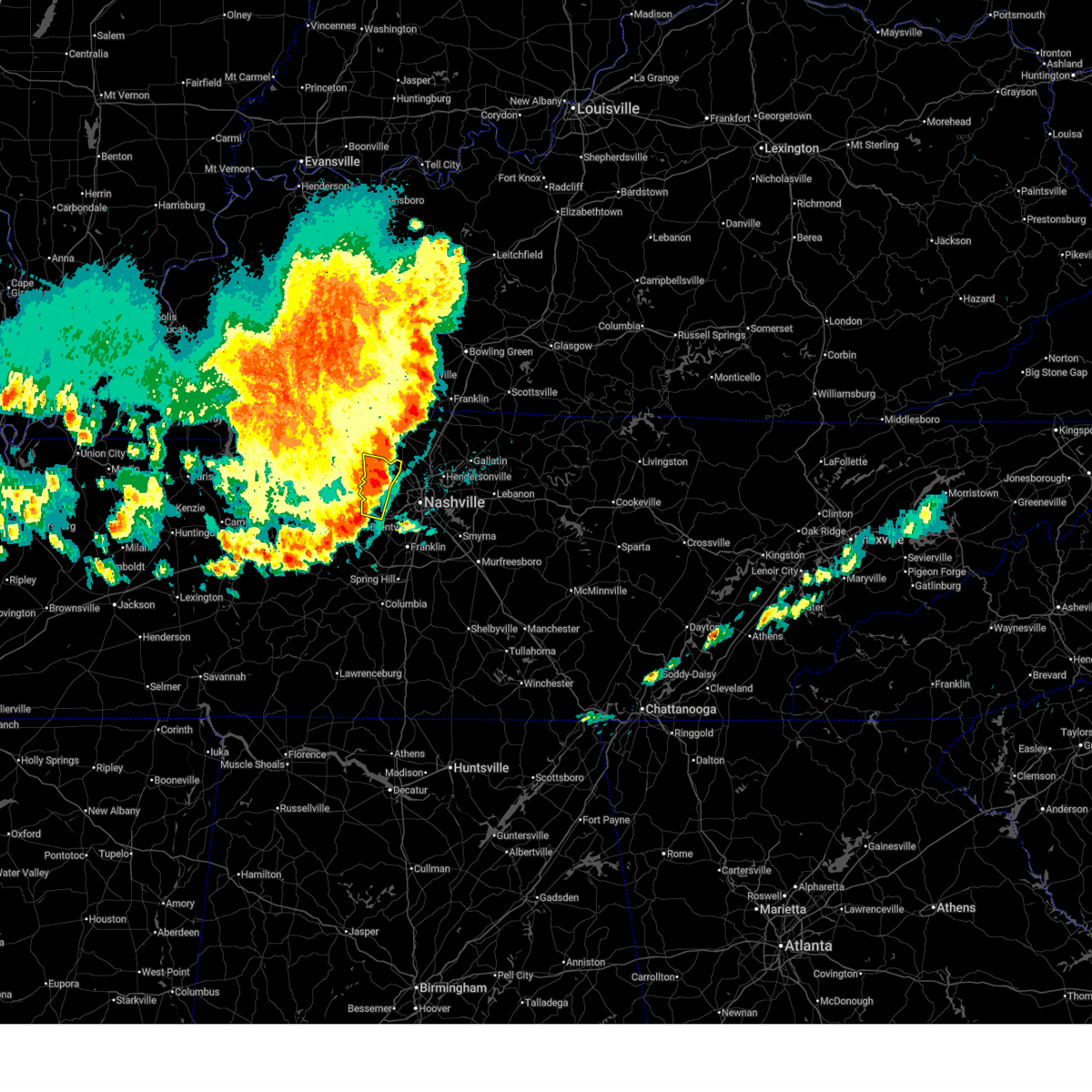
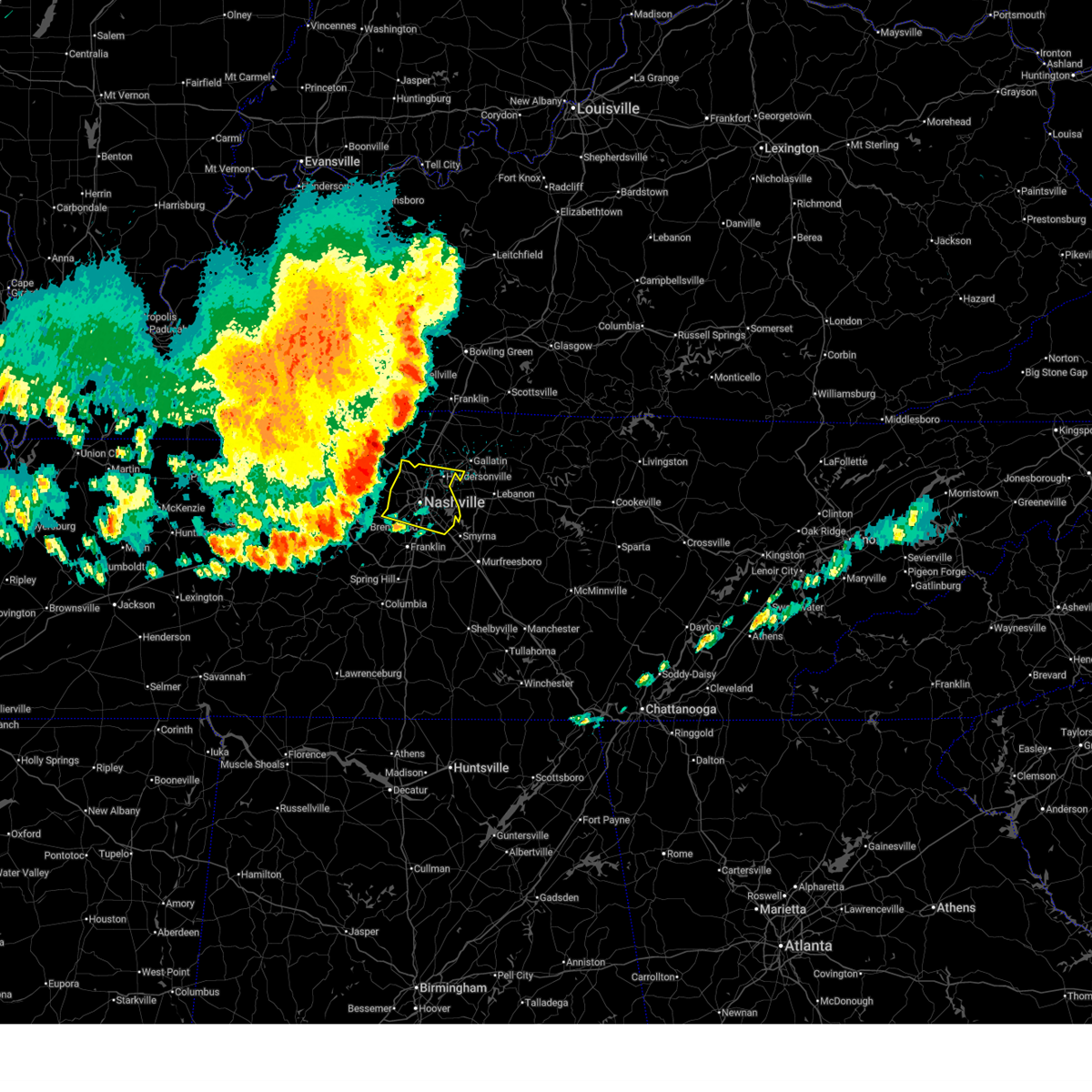
| 11/7/2025 4:17 PM CST | At 417 pm cst, a severe thunderstorm was located over pegram, or 12 miles south of ashland city, moving east at 35 mph (radar indicated). Hazards include ping pong ball size hail and 60 mph wind gusts. People and animals outdoors will be injured. expect hail damage to roofs, siding, windows, and vehicles. expect wind damage to roofs, siding, and trees. locations impacted include, ashland city, kingston springs, pegram, and fairview. This includes interstate 40 between mile markers 182 and 191. |
| 11/7/2025 4:14 PM CST | Svrohx the national weather service in nashville has issued a * severe thunderstorm warning for, davidson county in middle tennessee, northern williamson county in middle tennessee, southeastern cheatham county in middle tennessee, * until 515 pm cst. * at 414 pm cst, a severe thunderstorm was located over kingston springs, or 13 miles south of ashland city, moving east at 35 mph (radar indicated). Hazards include ping pong ball size hail and 60 mph wind gusts. People and animals outdoors will be injured. expect hail damage to roofs, siding, windows, and vehicles. Expect wind damage to roofs, siding, and trees. |
| 11/7/2025 3:39 PM CST | Svrohx the national weather service in nashville has issued a * severe thunderstorm warning for, dickson county in middle tennessee, northwestern williamson county in middle tennessee, cheatham county in middle tennessee, * until 430 pm cst. * at 338 pm cst, a severe thunderstorm was located 9 miles northwest of dickson, moving east at 50 mph (radar indicated). Hazards include 60 mph wind gusts and quarter size hail. Hail damage to vehicles is expected. Expect wind damage to roofs, siding, and trees. |
| 9/23/2025 1:15 AM CDT | At 115 am cdt, a severe thunderstorm was located near pegram, or near ashland city, moving northeast at 30 mph (radar indicated). Hazards include 60 mph wind gusts and penny size hail. Expect damage to roofs, siding, and trees. Locations impacted include, ashland city, kingston springs, and pegram. |
| 9/23/2025 1:15 AM CDT | the severe thunderstorm warning has been cancelled and is no longer in effect |
| 9/23/2025 12:59 AM CDT | Svrohx the national weather service in nashville has issued a * severe thunderstorm warning for, southeastern dickson county in middle tennessee, southeastern cheatham county in middle tennessee, * until 130 am cdt. * at 1259 am cdt, a severe thunderstorm was located over white bluff, or 10 miles east of dickson, moving northeast at 35 mph (radar indicated). Hazards include 60 mph wind gusts and penny size hail. expect damage to roofs, siding, and trees |
| 6/18/2025 8:03 PM CDT |
 Svrohx the national weather service in nashville has issued a * severe thunderstorm warning for, central davidson county in middle tennessee, sumner county in middle tennessee, northwestern wilson county in middle tennessee, southeastern cheatham county in middle tennessee, southeastern robertson county in middle tennessee, * until 830 pm cdt. * at 802 pm cdt, severe thunderstorms were located along a line extending from near portland to near millersville to pegram, moving east at 50 mph (radar indicated). Hazards include 60 mph wind gusts. expect damage to roofs, siding, and trees Svrohx the national weather service in nashville has issued a * severe thunderstorm warning for, central davidson county in middle tennessee, sumner county in middle tennessee, northwestern wilson county in middle tennessee, southeastern cheatham county in middle tennessee, southeastern robertson county in middle tennessee, * until 830 pm cdt. * at 802 pm cdt, severe thunderstorms were located along a line extending from near portland to near millersville to pegram, moving east at 50 mph (radar indicated). Hazards include 60 mph wind gusts. expect damage to roofs, siding, and trees
|
| 6/18/2025 7:40 PM CDT |
 Svrohx the national weather service in nashville has issued a * severe thunderstorm warning for, northwestern davidson county in middle tennessee, central dickson county in middle tennessee, cheatham county in middle tennessee, southwestern robertson county in middle tennessee, * until 815 pm cdt. * at 739 pm cdt, severe thunderstorms were located along a line extending from 6 miles southwest of coopertown to near dickson, moving east at 35 mph (radar indicated). Hazards include 60 mph wind gusts and penny size hail. expect damage to roofs, siding, and trees Svrohx the national weather service in nashville has issued a * severe thunderstorm warning for, northwestern davidson county in middle tennessee, central dickson county in middle tennessee, cheatham county in middle tennessee, southwestern robertson county in middle tennessee, * until 815 pm cdt. * at 739 pm cdt, severe thunderstorms were located along a line extending from 6 miles southwest of coopertown to near dickson, moving east at 35 mph (radar indicated). Hazards include 60 mph wind gusts and penny size hail. expect damage to roofs, siding, and trees
|
| 6/18/2025 7:39 PM CDT |
 Svrohx the national weather service in nashville has issued a * severe thunderstorm warning for, northwestern davidson county in middle tennessee, central dickson county in middle tennessee, cheatham county in middle tennessee, southwestern robertson county in middle tennessee, * until 815 pm cdt. * at 739 pm cdt, severe thunderstorms were located along a line extending from 6 miles southwest of coopertown to near dickson, moving east at 50 mph (radar indicated). Hazards include 60 mph wind gusts and penny size hail. expect damage to roofs, siding, and trees Svrohx the national weather service in nashville has issued a * severe thunderstorm warning for, northwestern davidson county in middle tennessee, central dickson county in middle tennessee, cheatham county in middle tennessee, southwestern robertson county in middle tennessee, * until 815 pm cdt. * at 739 pm cdt, severe thunderstorms were located along a line extending from 6 miles southwest of coopertown to near dickson, moving east at 50 mph (radar indicated). Hazards include 60 mph wind gusts and penny size hail. expect damage to roofs, siding, and trees
|
| 6/6/2025 7:16 PM CDT |
 At 716 pm cdt, a severe thunderstorm was located over dickson, moving east at 25 mph (radar indicated). Hazards include 60 mph wind gusts and quarter size hail. Hail damage to vehicles is expected. expect wind damage to roofs, siding, and trees. locations impacted include, dickson, white bluff, kingston springs, pegram, burns, fairview, and charlotte. this includes the following highways, interstate 40 between mile markers 167 and 189. Interstate 840 between mile markers 1 and 4, and near mile marker 6. At 716 pm cdt, a severe thunderstorm was located over dickson, moving east at 25 mph (radar indicated). Hazards include 60 mph wind gusts and quarter size hail. Hail damage to vehicles is expected. expect wind damage to roofs, siding, and trees. locations impacted include, dickson, white bluff, kingston springs, pegram, burns, fairview, and charlotte. this includes the following highways, interstate 40 between mile markers 167 and 189. Interstate 840 between mile markers 1 and 4, and near mile marker 6.
|
| 6/6/2025 6:59 PM CDT |
 Svrohx the national weather service in nashville has issued a * severe thunderstorm warning for, dickson county in middle tennessee, northwestern williamson county in middle tennessee, south central cheatham county in middle tennessee, * until 745 pm cdt. * at 659 pm cdt, a severe thunderstorm was located near dickson, moving east at 30 mph (radar indicated). Hazards include 60 mph wind gusts and quarter size hail. Hail damage to vehicles is expected. Expect wind damage to roofs, siding, and trees. Svrohx the national weather service in nashville has issued a * severe thunderstorm warning for, dickson county in middle tennessee, northwestern williamson county in middle tennessee, south central cheatham county in middle tennessee, * until 745 pm cdt. * at 659 pm cdt, a severe thunderstorm was located near dickson, moving east at 30 mph (radar indicated). Hazards include 60 mph wind gusts and quarter size hail. Hail damage to vehicles is expected. Expect wind damage to roofs, siding, and trees.
|
| 5/20/2025 6:06 PM CDT |
 Svrohx the national weather service in nashville has issued a * severe thunderstorm warning for, davidson county in middle tennessee, central rutherford county in middle tennessee, north central maury county in middle tennessee, southeastern sumner county in middle tennessee, williamson county in middle tennessee, wilson county in middle tennessee, south central cheatham county in middle tennessee, southwestern trousdale county in middle tennessee, east central hickman county in middle tennessee, * until 700 pm cdt. * at 606 pm cdt, severe thunderstorms were located along a line extending from near hendersonville to centerville, moving east at 50 mph (radar indicated). Hazards include 60 mph wind gusts and quarter size hail. Hail damage to vehicles is expected. Expect wind damage to roofs, siding, and trees. Svrohx the national weather service in nashville has issued a * severe thunderstorm warning for, davidson county in middle tennessee, central rutherford county in middle tennessee, north central maury county in middle tennessee, southeastern sumner county in middle tennessee, williamson county in middle tennessee, wilson county in middle tennessee, south central cheatham county in middle tennessee, southwestern trousdale county in middle tennessee, east central hickman county in middle tennessee, * until 700 pm cdt. * at 606 pm cdt, severe thunderstorms were located along a line extending from near hendersonville to centerville, moving east at 50 mph (radar indicated). Hazards include 60 mph wind gusts and quarter size hail. Hail damage to vehicles is expected. Expect wind damage to roofs, siding, and trees.
|
| 5/20/2025 5:59 PM CDT |
 the severe thunderstorm warning has been cancelled and is no longer in effect the severe thunderstorm warning has been cancelled and is no longer in effect
|
| 5/20/2025 5:59 PM CDT |
 At 559 pm cdt, severe thunderstorms were located along a line extending from near kingston springs to 7 miles northeast of centerville to 9 miles northwest of linden, moving east at 65 mph (radar indicated). Hazards include 60 mph wind gusts and quarter size hail. Hail damage to vehicles is expected. expect wind damage to roofs, siding, and trees. Locations impacted include, fairview, lobelville, kingston springs, bon aqua, pinewood, white bluff, lyles, nunnelly, burns, dickson, centerville, and pegram. At 559 pm cdt, severe thunderstorms were located along a line extending from near kingston springs to 7 miles northeast of centerville to 9 miles northwest of linden, moving east at 65 mph (radar indicated). Hazards include 60 mph wind gusts and quarter size hail. Hail damage to vehicles is expected. expect wind damage to roofs, siding, and trees. Locations impacted include, fairview, lobelville, kingston springs, bon aqua, pinewood, white bluff, lyles, nunnelly, burns, dickson, centerville, and pegram.
|
| 5/20/2025 5:21 PM CDT |
 Svrohx the national weather service in nashville has issued a * severe thunderstorm warning for, dickson county in middle tennessee, southern montgomery county in middle tennessee, northwestern williamson county in middle tennessee, houston county in middle tennessee, western cheatham county in middle tennessee, northern perry county in middle tennessee, humphreys county in middle tennessee, northern hickman county in middle tennessee, * until 615 pm cdt. * at 521 pm cdt, severe thunderstorms were located along a line extending from near springville to linden, moving east at 65 mph (radar indicated). Hazards include 60 mph wind gusts and quarter size hail. Hail damage to vehicles is expected. expect wind damage to roofs, siding, and trees. severe thunderstorms will be near, camden, waverly, and new johnsonville around 525 pm cdt. hurricane mills around 530 pm cdt. tennessee ridge and erin around 535 pm cdt. mcewen around 540 pm cdt. centerville around 545 pm cdt. dickson around 550 pm cdt. burns around 555 pm cdt. white bluff around 600 pm cdt. Other locations impacted by these severe thunderstorms include lobelville, charlotte, bon aqua, pinewood, cheatham dam, vanleer, lyles, slayden, nunnelly, and cunningham. Svrohx the national weather service in nashville has issued a * severe thunderstorm warning for, dickson county in middle tennessee, southern montgomery county in middle tennessee, northwestern williamson county in middle tennessee, houston county in middle tennessee, western cheatham county in middle tennessee, northern perry county in middle tennessee, humphreys county in middle tennessee, northern hickman county in middle tennessee, * until 615 pm cdt. * at 521 pm cdt, severe thunderstorms were located along a line extending from near springville to linden, moving east at 65 mph (radar indicated). Hazards include 60 mph wind gusts and quarter size hail. Hail damage to vehicles is expected. expect wind damage to roofs, siding, and trees. severe thunderstorms will be near, camden, waverly, and new johnsonville around 525 pm cdt. hurricane mills around 530 pm cdt. tennessee ridge and erin around 535 pm cdt. mcewen around 540 pm cdt. centerville around 545 pm cdt. dickson around 550 pm cdt. burns around 555 pm cdt. white bluff around 600 pm cdt. Other locations impacted by these severe thunderstorms include lobelville, charlotte, bon aqua, pinewood, cheatham dam, vanleer, lyles, slayden, nunnelly, and cunningham.
|
| 5/16/2025 11:35 PM CDT |
 At 1135 pm cdt, severe thunderstorms were located along a line extending from 6 miles east of celina to forest hills, moving east at 55 mph (radar indicated). Hazards include 60 mph wind gusts and quarter size hail. Hail damage to vehicles is expected. expect wind damage to roofs, siding, and trees. locations impacted include, red boiling springs, madison, hermitage, belle meade, hartsville, moss, pleasant shade, gallatin, bledsoe creek state park, dickerson chapel recreation area, hendersonville, berry hill, mount juliet, boles, oak hill, green hill, forest hills, celina, bethpage, and goodlettsville. this includes the following highways, interstate 40 between mile markers 186 and 235. interstate 65 between mile markers 75 and 98. interstate 24 between mile markers 38 and 57. Interstate 840 near mile marker 76. At 1135 pm cdt, severe thunderstorms were located along a line extending from 6 miles east of celina to forest hills, moving east at 55 mph (radar indicated). Hazards include 60 mph wind gusts and quarter size hail. Hail damage to vehicles is expected. expect wind damage to roofs, siding, and trees. locations impacted include, red boiling springs, madison, hermitage, belle meade, hartsville, moss, pleasant shade, gallatin, bledsoe creek state park, dickerson chapel recreation area, hendersonville, berry hill, mount juliet, boles, oak hill, green hill, forest hills, celina, bethpage, and goodlettsville. this includes the following highways, interstate 40 between mile markers 186 and 235. interstate 65 between mile markers 75 and 98. interstate 24 between mile markers 38 and 57. Interstate 840 near mile marker 76.
|
| 5/16/2025 11:35 PM CDT |
 the severe thunderstorm warning has been cancelled and is no longer in effect the severe thunderstorm warning has been cancelled and is no longer in effect
|
| 5/16/2025 11:08 PM CDT |
 At 1107 pm cdt, severe thunderstorms were located along a line extending from near red boiling springs to near burns, moving east at 55 mph (radar indicated). Hazards include 60 mph wind gusts and quarter size hail. Hail damage to vehicles is expected. expect wind damage to roofs, siding, and trees. locations impacted include, charlotte, black jack, hartsville, moss, pleasant shade, millersville, gallatin, bledsoe creek state park, dickerson chapel recreation area, hendersonville, cottontown, mount juliet, westmoreland, white bluff, forest hills, cheatham dam, goodlettsville, dixon springs, oak grove, and nashville. this includes the following highways, interstate 40 between mile markers 186 and 235. interstate 65 between mile markers 75 and 121. interstate 24 between mile markers 22 and 57. Interstate 840 near mile marker 76. At 1107 pm cdt, severe thunderstorms were located along a line extending from near red boiling springs to near burns, moving east at 55 mph (radar indicated). Hazards include 60 mph wind gusts and quarter size hail. Hail damage to vehicles is expected. expect wind damage to roofs, siding, and trees. locations impacted include, charlotte, black jack, hartsville, moss, pleasant shade, millersville, gallatin, bledsoe creek state park, dickerson chapel recreation area, hendersonville, cottontown, mount juliet, westmoreland, white bluff, forest hills, cheatham dam, goodlettsville, dixon springs, oak grove, and nashville. this includes the following highways, interstate 40 between mile markers 186 and 235. interstate 65 between mile markers 75 and 121. interstate 24 between mile markers 22 and 57. Interstate 840 near mile marker 76.
|
| 5/16/2025 11:08 PM CDT |
 the severe thunderstorm warning has been cancelled and is no longer in effect the severe thunderstorm warning has been cancelled and is no longer in effect
|
| 5/16/2025 10:40 PM CDT |
 Svrohx the national weather service in nashville has issued a * severe thunderstorm warning for, northern smith county in middle tennessee, southern montgomery county in middle tennessee, sumner county in middle tennessee, southeastern stewart county in middle tennessee, houston county in middle tennessee, northern wilson county in middle tennessee, cheatham county in middle tennessee, clay county in middle tennessee, northern humphreys county in middle tennessee, robertson county in middle tennessee, davidson county in middle tennessee, dickson county in middle tennessee, northern jackson county in middle tennessee, macon county in middle tennessee, trousdale county in middle tennessee, * until 1145 pm cdt. * at 1040 pm cdt, severe thunderstorms were located along a line extending from near westmoreland to near mcewen, moving east at 55 mph (radar indicated). Hazards include 60 mph wind gusts and quarter size hail. Hail damage to vehicles is expected. Expect wind damage to roofs, siding, and trees. Svrohx the national weather service in nashville has issued a * severe thunderstorm warning for, northern smith county in middle tennessee, southern montgomery county in middle tennessee, sumner county in middle tennessee, southeastern stewart county in middle tennessee, houston county in middle tennessee, northern wilson county in middle tennessee, cheatham county in middle tennessee, clay county in middle tennessee, northern humphreys county in middle tennessee, robertson county in middle tennessee, davidson county in middle tennessee, dickson county in middle tennessee, northern jackson county in middle tennessee, macon county in middle tennessee, trousdale county in middle tennessee, * until 1145 pm cdt. * at 1040 pm cdt, severe thunderstorms were located along a line extending from near westmoreland to near mcewen, moving east at 55 mph (radar indicated). Hazards include 60 mph wind gusts and quarter size hail. Hail damage to vehicles is expected. Expect wind damage to roofs, siding, and trees.
|
| 5/2/2025 1:02 PM CDT |
 At 102 pm cdt, a severe thunderstorm was located over pegram, or 12 miles south of ashland city, moving east at 25 mph (radar indicated). Hazards include 60 mph wind gusts and quarter size hail. Hail damage to vehicles is expected. expect wind damage to roofs, siding, and trees. locations impacted include, kingston springs, beaman park, belle meade, bells bend, bellevue, pegram, natchez trace at highway 96, forest hills, ashland city, franklin, and brentwood. This includes interstate 40 between mile markers 186 and 204. At 102 pm cdt, a severe thunderstorm was located over pegram, or 12 miles south of ashland city, moving east at 25 mph (radar indicated). Hazards include 60 mph wind gusts and quarter size hail. Hail damage to vehicles is expected. expect wind damage to roofs, siding, and trees. locations impacted include, kingston springs, beaman park, belle meade, bells bend, bellevue, pegram, natchez trace at highway 96, forest hills, ashland city, franklin, and brentwood. This includes interstate 40 between mile markers 186 and 204.
|
| 5/2/2025 1:02 PM CDT |
 the severe thunderstorm warning has been cancelled and is no longer in effect the severe thunderstorm warning has been cancelled and is no longer in effect
|
| 5/2/2025 12:52 PM CDT |
 At 1252 pm cdt, a severe thunderstorm was located over kingston springs, or 12 miles east of dickson, moving east at 25 mph (radar indicated). Hazards include 60 mph wind gusts and quarter size hail. Hail damage to vehicles is expected. expect wind damage to roofs, siding, and trees. locations impacted include, kingston springs, beaman park, belle meade, bells bend, white bluff, bellevue, natchez trace at highway 96, pegram, forest hills, ashland city, franklin, and brentwood. This includes interstate 40 between mile markers 179 and 204. At 1252 pm cdt, a severe thunderstorm was located over kingston springs, or 12 miles east of dickson, moving east at 25 mph (radar indicated). Hazards include 60 mph wind gusts and quarter size hail. Hail damage to vehicles is expected. expect wind damage to roofs, siding, and trees. locations impacted include, kingston springs, beaman park, belle meade, bells bend, white bluff, bellevue, natchez trace at highway 96, pegram, forest hills, ashland city, franklin, and brentwood. This includes interstate 40 between mile markers 179 and 204.
|
| 5/2/2025 12:49 PM CDT |
 At 1249 pm cdt, a severe thunderstorm was located near fairview, or 13 miles southeast of dickson, moving east at 35 mph (radar indicated). Hazards include 60 mph wind gusts and quarter size hail. Hail damage to vehicles is expected. expect wind damage to roofs, siding, and trees. locations impacted include, fairview, kingston springs, primm springs, leipers fork, natchez trace at highway 96, pegram, and thompson's station. this includes the following highways, interstate 40 between mile markers 181 and 190. Interstate 840 between mile markers 3 and 28. At 1249 pm cdt, a severe thunderstorm was located near fairview, or 13 miles southeast of dickson, moving east at 35 mph (radar indicated). Hazards include 60 mph wind gusts and quarter size hail. Hail damage to vehicles is expected. expect wind damage to roofs, siding, and trees. locations impacted include, fairview, kingston springs, primm springs, leipers fork, natchez trace at highway 96, pegram, and thompson's station. this includes the following highways, interstate 40 between mile markers 181 and 190. Interstate 840 between mile markers 3 and 28.
|
| 5/2/2025 12:43 PM CDT |
 Svrohx the national weather service in nashville has issued a * severe thunderstorm warning for, southwestern davidson county in middle tennessee, southeastern dickson county in middle tennessee, northwestern williamson county in middle tennessee, southeastern cheatham county in middle tennessee, * until 130 pm cdt. * at 1243 pm cdt, a severe thunderstorm was located over white bluff, or 9 miles east of dickson, moving east at 25 mph (radar indicated). Hazards include 60 mph wind gusts and quarter size hail. Hail damage to vehicles is expected. Expect wind damage to roofs, siding, and trees. Svrohx the national weather service in nashville has issued a * severe thunderstorm warning for, southwestern davidson county in middle tennessee, southeastern dickson county in middle tennessee, northwestern williamson county in middle tennessee, southeastern cheatham county in middle tennessee, * until 130 pm cdt. * at 1243 pm cdt, a severe thunderstorm was located over white bluff, or 9 miles east of dickson, moving east at 25 mph (radar indicated). Hazards include 60 mph wind gusts and quarter size hail. Hail damage to vehicles is expected. Expect wind damage to roofs, siding, and trees.
|
| 5/2/2025 12:29 PM CDT |
 Svrohx the national weather service in nashville has issued a * severe thunderstorm warning for, southeastern dickson county in middle tennessee, north central maury county in middle tennessee, northwestern williamson county in middle tennessee, south central cheatham county in middle tennessee, northeastern hickman county in middle tennessee, * until 115 pm cdt. * at 1229 pm cdt, a severe thunderstorm was located near centerville, moving east at 35 mph (radar indicated). Hazards include 60 mph wind gusts and quarter size hail. Hail damage to vehicles is expected. Expect wind damage to roofs, siding, and trees. Svrohx the national weather service in nashville has issued a * severe thunderstorm warning for, southeastern dickson county in middle tennessee, north central maury county in middle tennessee, northwestern williamson county in middle tennessee, south central cheatham county in middle tennessee, northeastern hickman county in middle tennessee, * until 115 pm cdt. * at 1229 pm cdt, a severe thunderstorm was located near centerville, moving east at 35 mph (radar indicated). Hazards include 60 mph wind gusts and quarter size hail. Hail damage to vehicles is expected. Expect wind damage to roofs, siding, and trees.
|
| 4/10/2025 5:24 PM CDT |
 At 524 pm cdt, severe thunderstorms were located along a line extending from near white house to near brentwood, moving east at 45 mph (emergency management). Hazards include 60 mph wind gusts. Expect damage to roofs, siding, and trees. locations impacted include, madison, nolensville, hermitage, belle meade, la vergne, millersville, gallatin, bledsoe creek state park, hendersonville, greenbrier, berry hill, cottontown, mount juliet, smyrna, oak hill, green hill, forest hills, ridgetop, bethpage, and goodlettsville. this includes the following highways, interstate 40 between mile markers 191 and 238. interstate 65 between mile markers 70 and 110. interstate 24 between mile markers 29 and 70. Interstate 840 between mile markers 56 and 76. At 524 pm cdt, severe thunderstorms were located along a line extending from near white house to near brentwood, moving east at 45 mph (emergency management). Hazards include 60 mph wind gusts. Expect damage to roofs, siding, and trees. locations impacted include, madison, nolensville, hermitage, belle meade, la vergne, millersville, gallatin, bledsoe creek state park, hendersonville, greenbrier, berry hill, cottontown, mount juliet, smyrna, oak hill, green hill, forest hills, ridgetop, bethpage, and goodlettsville. this includes the following highways, interstate 40 between mile markers 191 and 238. interstate 65 between mile markers 70 and 110. interstate 24 between mile markers 29 and 70. Interstate 840 between mile markers 56 and 76.
|
| 4/10/2025 5:05 PM CDT |
 Svrohx the national weather service in nashville has issued a * severe thunderstorm warning for, davidson county in middle tennessee, northwestern rutherford county in middle tennessee, southern sumner county in middle tennessee, northeastern williamson county in middle tennessee, western wilson county in middle tennessee, southeastern cheatham county in middle tennessee, western trousdale county in middle tennessee, southeastern robertson county in middle tennessee, * until 545 pm cdt. * at 504 pm cdt, severe thunderstorms were located along a line extending from near springfield to near pegram, moving east at 45 mph (radar indicated). Hazards include 60 mph wind gusts. expect damage to roofs, siding, and trees Svrohx the national weather service in nashville has issued a * severe thunderstorm warning for, davidson county in middle tennessee, northwestern rutherford county in middle tennessee, southern sumner county in middle tennessee, northeastern williamson county in middle tennessee, western wilson county in middle tennessee, southeastern cheatham county in middle tennessee, western trousdale county in middle tennessee, southeastern robertson county in middle tennessee, * until 545 pm cdt. * at 504 pm cdt, severe thunderstorms were located along a line extending from near springfield to near pegram, moving east at 45 mph (radar indicated). Hazards include 60 mph wind gusts. expect damage to roofs, siding, and trees
|
| 4/10/2025 5:01 PM CDT |
 the severe thunderstorm warning has been cancelled and is no longer in effect the severe thunderstorm warning has been cancelled and is no longer in effect
|
| 4/10/2025 5:01 PM CDT |
 At 501 pm cdt, severe thunderstorms were located along a line extending from 8 miles south of russellville to near fairview, moving east at 45 mph (radar indicated). Hazards include 60 mph wind gusts. Expect damage to roofs, siding, and trees. locations impacted include, belle meade, natchez trace at highway 96, greenbrier, fairview, orlinda, pleasant view, cedar hill, ashland city, white bluff, ridgetop, cheatham dam, adams, bells bend, whites creek, bellevue, pegram, kingston springs, beaman park, springfield, and coopertown. this includes the following highways, interstate 40 between mile markers 172 and 207. interstate 65 between mile markers 85 and 86. interstate 24 between mile markers 11 and 44. Interstate 840 between mile markers 1 and 4. At 501 pm cdt, severe thunderstorms were located along a line extending from 8 miles south of russellville to near fairview, moving east at 45 mph (radar indicated). Hazards include 60 mph wind gusts. Expect damage to roofs, siding, and trees. locations impacted include, belle meade, natchez trace at highway 96, greenbrier, fairview, orlinda, pleasant view, cedar hill, ashland city, white bluff, ridgetop, cheatham dam, adams, bells bend, whites creek, bellevue, pegram, kingston springs, beaman park, springfield, and coopertown. this includes the following highways, interstate 40 between mile markers 172 and 207. interstate 65 between mile markers 85 and 86. interstate 24 between mile markers 11 and 44. Interstate 840 between mile markers 1 and 4.
|
| 4/10/2025 4:36 PM CDT |
 Svrohx the national weather service in nashville has issued a * severe thunderstorm warning for, western davidson county in middle tennessee, dickson county in middle tennessee, eastern montgomery county in middle tennessee, northwestern williamson county in middle tennessee, cheatham county in middle tennessee, northeastern hickman county in middle tennessee, robertson county in middle tennessee, * until 515 pm cdt. * at 434 pm cdt, severe thunderstorms were located along a line extending from near elkton to 7 miles southwest of dickson, moving east at 45 mph (radar indicated). Hazards include 60 mph wind gusts. expect damage to roofs, siding, and trees Svrohx the national weather service in nashville has issued a * severe thunderstorm warning for, western davidson county in middle tennessee, dickson county in middle tennessee, eastern montgomery county in middle tennessee, northwestern williamson county in middle tennessee, cheatham county in middle tennessee, northeastern hickman county in middle tennessee, robertson county in middle tennessee, * until 515 pm cdt. * at 434 pm cdt, severe thunderstorms were located along a line extending from near elkton to 7 miles southwest of dickson, moving east at 45 mph (radar indicated). Hazards include 60 mph wind gusts. expect damage to roofs, siding, and trees
|
| 4/5/2025 4:43 PM CDT |
 At 443 pm cdt, severe thunderstorms were located along a line extending from near coopertown to near belle meade to near fairview, moving northeast at 70 mph (radar indicated). Hazards include 70 mph wind gusts and half dollar size hail. Hail damage to vehicles is expected. expect considerable tree damage. wind damage is also likely to mobile homes, roofs, and outbuildings. locations impacted include, madison, hermitage, belle meade, natchez trace at highway 96, fairview, berry hill, ashland city, oak hill, forest hills, ridgetop, bells bend, brentwood, nashville, whites creek, bellevue, antioch, lakewood, pegram, kingston springs, and beaman park. this includes the following highways, interstate 40 between mile markers 182 and 222. interstate 65 between mile markers 70 and 97. interstate 24 between mile markers 29 and 62. Interstate 840 between mile markers 7 and 12. At 443 pm cdt, severe thunderstorms were located along a line extending from near coopertown to near belle meade to near fairview, moving northeast at 70 mph (radar indicated). Hazards include 70 mph wind gusts and half dollar size hail. Hail damage to vehicles is expected. expect considerable tree damage. wind damage is also likely to mobile homes, roofs, and outbuildings. locations impacted include, madison, hermitage, belle meade, natchez trace at highway 96, fairview, berry hill, ashland city, oak hill, forest hills, ridgetop, bells bend, brentwood, nashville, whites creek, bellevue, antioch, lakewood, pegram, kingston springs, and beaman park. this includes the following highways, interstate 40 between mile markers 182 and 222. interstate 65 between mile markers 70 and 97. interstate 24 between mile markers 29 and 62. Interstate 840 between mile markers 7 and 12.
|
| 4/5/2025 4:43 PM CDT |
 the severe thunderstorm warning has been cancelled and is no longer in effect the severe thunderstorm warning has been cancelled and is no longer in effect
|
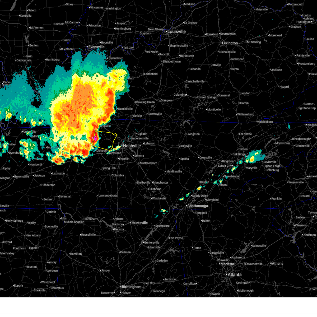
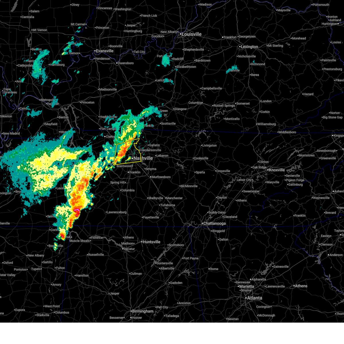
| 4/5/2025 4:40 PM CDT | Multiple trees dow in cheatham county TN, 0.1 miles NW of Pegram, TN |
| 4/5/2025 4:34 PM CDT |
 At 433 pm cdt, severe thunderstorms were located along a line extending from near ashland city to kingston springs to 11 miles east of centerville, moving east at 50 mph (radar indicated). Hazards include 70 mph wind gusts and half dollar size hail. Hail damage to vehicles is expected. expect considerable tree damage. wind damage is also likely to mobile homes, roofs, and outbuildings. locations impacted include, madison, bon aqua, hermitage, belle meade, natchez trace at highway 96, fairview, berry hill, ashland city, white bluff, oak hill, forest hills, ridgetop, bells bend, brentwood, lyles, nashville, whites creek, bellevue, antioch, and lakewood. this includes the following highways, interstate 40 between mile markers 174 and 222. interstate 65 between mile markers 67 and 97. interstate 24 between mile markers 29 and 63. Interstate 840 between mile markers 1 and 14. At 433 pm cdt, severe thunderstorms were located along a line extending from near ashland city to kingston springs to 11 miles east of centerville, moving east at 50 mph (radar indicated). Hazards include 70 mph wind gusts and half dollar size hail. Hail damage to vehicles is expected. expect considerable tree damage. wind damage is also likely to mobile homes, roofs, and outbuildings. locations impacted include, madison, bon aqua, hermitage, belle meade, natchez trace at highway 96, fairview, berry hill, ashland city, white bluff, oak hill, forest hills, ridgetop, bells bend, brentwood, lyles, nashville, whites creek, bellevue, antioch, and lakewood. this includes the following highways, interstate 40 between mile markers 174 and 222. interstate 65 between mile markers 67 and 97. interstate 24 between mile markers 29 and 63. Interstate 840 between mile markers 1 and 14.
|
| 4/5/2025 4:21 PM CDT |
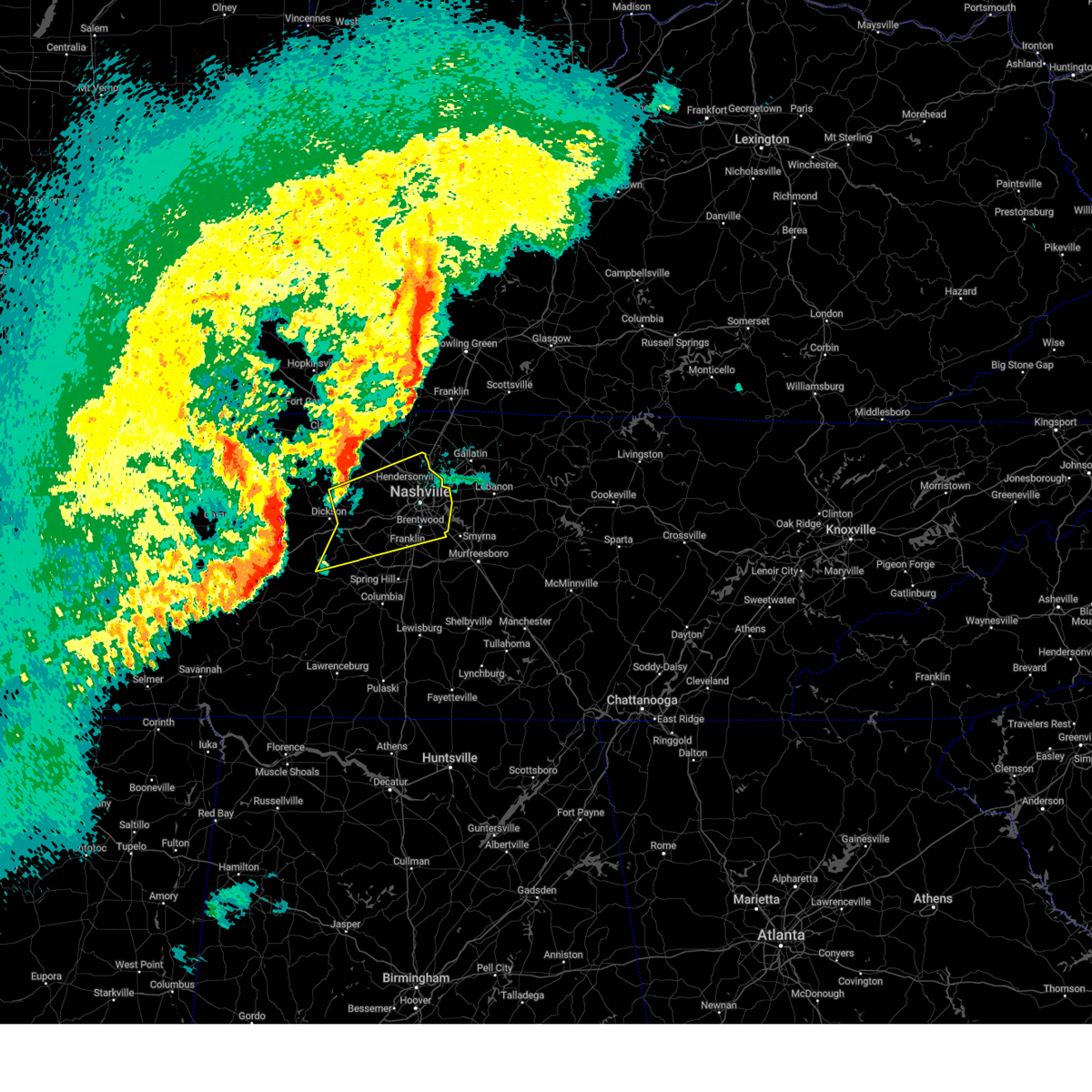 Svrohx the national weather service in nashville has issued a * severe thunderstorm warning for, davidson county in middle tennessee, eastern dickson county in middle tennessee, northern williamson county in middle tennessee, cheatham county in middle tennessee, northeastern hickman county in middle tennessee, south central robertson county in middle tennessee, * until 515 pm cdt. * at 420 pm cdt, severe thunderstorms were located along a line extending from 10 miles north of dickson to near white bluff to centerville, moving northeast at 65 mph (radar indicated). Hazards include 70 mph wind gusts and quarter size hail. Hail damage to vehicles is expected. expect considerable tree damage. Wind damage is also likely to mobile homes, roofs, and outbuildings. Svrohx the national weather service in nashville has issued a * severe thunderstorm warning for, davidson county in middle tennessee, eastern dickson county in middle tennessee, northern williamson county in middle tennessee, cheatham county in middle tennessee, northeastern hickman county in middle tennessee, south central robertson county in middle tennessee, * until 515 pm cdt. * at 420 pm cdt, severe thunderstorms were located along a line extending from 10 miles north of dickson to near white bluff to centerville, moving northeast at 65 mph (radar indicated). Hazards include 70 mph wind gusts and quarter size hail. Hail damage to vehicles is expected. expect considerable tree damage. Wind damage is also likely to mobile homes, roofs, and outbuildings.
|
| 4/3/2025 6:21 PM CDT |
 Svrohx the national weather service in nashville has issued a * severe thunderstorm warning for, southwestern davidson county in middle tennessee, northwestern williamson county in middle tennessee, south central cheatham county in middle tennessee, * until 700 pm cdt. * at 621 pm cdt, a severe thunderstorm was located over fairview, or 14 miles southeast of dickson, moving northeast at 40 mph (radar indicated). Hazards include 60 mph wind gusts and penny size hail. expect damage to roofs, siding, and trees Svrohx the national weather service in nashville has issued a * severe thunderstorm warning for, southwestern davidson county in middle tennessee, northwestern williamson county in middle tennessee, south central cheatham county in middle tennessee, * until 700 pm cdt. * at 621 pm cdt, a severe thunderstorm was located over fairview, or 14 miles southeast of dickson, moving northeast at 40 mph (radar indicated). Hazards include 60 mph wind gusts and penny size hail. expect damage to roofs, siding, and trees
|
| 4/3/2025 3:38 AM CDT |
 Torohx the national weather service in nashville has issued a * tornado warning for, southern davidson county in middle tennessee, northern williamson county in middle tennessee, * until 415 am cdt. * at 338 am cdt, a severe thunderstorm capable of producing a tornado was located near fairview, or 10 miles northwest of franklin, moving northeast at 45 mph (radar indicated rotation). Hazards include tornado and quarter size hail. Flying debris will be dangerous to those caught without shelter. mobile homes will be damaged or destroyed. damage to roofs, windows, and vehicles will occur. tree damage is likely. this dangerous storm will be near, forest hills, brentwood, bellevue, and belle meade around 345 am cdt. oak hill around 350 am cdt. other locations impacted by this tornadic thunderstorm include berry hill and natchez trace at highway 96. this includes the following highways, interstate 40 between mile markers 192 and 218. interstate 65 between mile markers 66 and 86. Interstate 24 between mile markers 47 and 63. Torohx the national weather service in nashville has issued a * tornado warning for, southern davidson county in middle tennessee, northern williamson county in middle tennessee, * until 415 am cdt. * at 338 am cdt, a severe thunderstorm capable of producing a tornado was located near fairview, or 10 miles northwest of franklin, moving northeast at 45 mph (radar indicated rotation). Hazards include tornado and quarter size hail. Flying debris will be dangerous to those caught without shelter. mobile homes will be damaged or destroyed. damage to roofs, windows, and vehicles will occur. tree damage is likely. this dangerous storm will be near, forest hills, brentwood, bellevue, and belle meade around 345 am cdt. oak hill around 350 am cdt. other locations impacted by this tornadic thunderstorm include berry hill and natchez trace at highway 96. this includes the following highways, interstate 40 between mile markers 192 and 218. interstate 65 between mile markers 66 and 86. Interstate 24 between mile markers 47 and 63.
|
| 4/3/2025 3:23 AM CDT |
 Svrohx the national weather service in nashville has issued a * severe thunderstorm warning for, davidson county in middle tennessee, southwestern sumner county in middle tennessee, northwestern williamson county in middle tennessee, west central wilson county in middle tennessee, southeastern cheatham county in middle tennessee, * until 400 am cdt. * at 323 am cdt, a severe thunderstorm was located near pegram, or 13 miles south of ashland city, moving northeast at 45 mph (radar indicated). Hazards include 60 mph wind gusts and quarter size hail. Hail damage to vehicles is expected. Expect wind damage to roofs, siding, and trees. Svrohx the national weather service in nashville has issued a * severe thunderstorm warning for, davidson county in middle tennessee, southwestern sumner county in middle tennessee, northwestern williamson county in middle tennessee, west central wilson county in middle tennessee, southeastern cheatham county in middle tennessee, * until 400 am cdt. * at 323 am cdt, a severe thunderstorm was located near pegram, or 13 miles south of ashland city, moving northeast at 45 mph (radar indicated). Hazards include 60 mph wind gusts and quarter size hail. Hail damage to vehicles is expected. Expect wind damage to roofs, siding, and trees.
|
| 4/3/2025 2:54 AM CDT |
 Torohx the national weather service in nashville has issued a * tornado warning for, davidson county in middle tennessee, southwestern sumner county in middle tennessee, northeastern williamson county in middle tennessee, northwestern wilson county in middle tennessee, * until 345 am cdt. * at 254 am cdt, a severe thunderstorm capable of producing a tornado was located over forest hills, or 8 miles north of franklin, moving northeast at 45 mph (radar indicated rotation). Hazards include tornado and golf ball size hail. Flying debris will be dangerous to those caught without shelter. mobile homes will be damaged or destroyed. damage to roofs, windows, and vehicles will occur. Tree damage is likely. Torohx the national weather service in nashville has issued a * tornado warning for, davidson county in middle tennessee, southwestern sumner county in middle tennessee, northeastern williamson county in middle tennessee, northwestern wilson county in middle tennessee, * until 345 am cdt. * at 254 am cdt, a severe thunderstorm capable of producing a tornado was located over forest hills, or 8 miles north of franklin, moving northeast at 45 mph (radar indicated rotation). Hazards include tornado and golf ball size hail. Flying debris will be dangerous to those caught without shelter. mobile homes will be damaged or destroyed. damage to roofs, windows, and vehicles will occur. Tree damage is likely.
|
| 4/3/2025 2:36 AM CDT |
 Torohx the national weather service in nashville has issued a * tornado warning for, davidson county in middle tennessee, williamson county in middle tennessee, southeastern cheatham county in middle tennessee, * until 300 am cdt. * at 236 am cdt, a severe thunderstorm capable of producing a tornado was located over fairview, or 13 miles west of franklin, moving northeast at 70 mph (radar indicated rotation). Hazards include tornado and quarter size hail. Flying debris will be dangerous to those caught without shelter. mobile homes will be damaged or destroyed. damage to roofs, windows, and vehicles will occur. Tree damage is likely. Torohx the national weather service in nashville has issued a * tornado warning for, davidson county in middle tennessee, williamson county in middle tennessee, southeastern cheatham county in middle tennessee, * until 300 am cdt. * at 236 am cdt, a severe thunderstorm capable of producing a tornado was located over fairview, or 13 miles west of franklin, moving northeast at 70 mph (radar indicated rotation). Hazards include tornado and quarter size hail. Flying debris will be dangerous to those caught without shelter. mobile homes will be damaged or destroyed. damage to roofs, windows, and vehicles will occur. Tree damage is likely.
|
| 4/3/2025 2:16 AM CDT |
 At 216 am cdt, a severe thunderstorm was located over goodlettsville, or 12 miles northeast of nashville, moving northeast at 45 mph (radar indicated). Hazards include 60 mph wind gusts and quarter size hail. Hail damage to vehicles is expected. expect wind damage to roofs, siding, and trees. locations impacted include, madison, portland, hermitage, belle meade, millersville, gallatin, hendersonville, greenbrier, berry hill, cottontown, mount juliet, ashland city, green hill, ridgetop, goodlettsville, bells bend, nashville, white house, whites creek, and bellevue. this includes the following highways, interstate 40 between mile markers 195 and 226. interstate 65 between mile markers 80 and 113. Interstate 24 between mile markers 31 and 52. At 216 am cdt, a severe thunderstorm was located over goodlettsville, or 12 miles northeast of nashville, moving northeast at 45 mph (radar indicated). Hazards include 60 mph wind gusts and quarter size hail. Hail damage to vehicles is expected. expect wind damage to roofs, siding, and trees. locations impacted include, madison, portland, hermitage, belle meade, millersville, gallatin, hendersonville, greenbrier, berry hill, cottontown, mount juliet, ashland city, green hill, ridgetop, goodlettsville, bells bend, nashville, white house, whites creek, and bellevue. this includes the following highways, interstate 40 between mile markers 195 and 226. interstate 65 between mile markers 80 and 113. Interstate 24 between mile markers 31 and 52.
|
| 4/3/2025 2:16 AM CDT |
 the severe thunderstorm warning has been cancelled and is no longer in effect the severe thunderstorm warning has been cancelled and is no longer in effect
|
| 4/3/2025 2:00 AM CDT |
 Svrohx the national weather service in nashville has issued a * severe thunderstorm warning for, davidson county in middle tennessee, east central dickson county in middle tennessee, western sumner county in middle tennessee, northwestern williamson county in middle tennessee, northwestern wilson county in middle tennessee, cheatham county in middle tennessee, southeastern robertson county in middle tennessee, * until 245 am cdt. * at 200 am cdt, a severe thunderstorm was located near joelton, or 8 miles northwest of nashville, moving northeast at 45 mph (radar indicated). Hazards include 60 mph wind gusts and quarter size hail. Hail damage to vehicles is expected. Expect wind damage to roofs, siding, and trees. Svrohx the national weather service in nashville has issued a * severe thunderstorm warning for, davidson county in middle tennessee, east central dickson county in middle tennessee, western sumner county in middle tennessee, northwestern williamson county in middle tennessee, northwestern wilson county in middle tennessee, cheatham county in middle tennessee, southeastern robertson county in middle tennessee, * until 245 am cdt. * at 200 am cdt, a severe thunderstorm was located near joelton, or 8 miles northwest of nashville, moving northeast at 45 mph (radar indicated). Hazards include 60 mph wind gusts and quarter size hail. Hail damage to vehicles is expected. Expect wind damage to roofs, siding, and trees.
|
| 4/3/2025 1:21 AM CDT |
 Svrohx the national weather service in nashville has issued a * severe thunderstorm warning for, davidson county in middle tennessee, dickson county in middle tennessee, northwestern williamson county in middle tennessee, cheatham county in middle tennessee, northeastern hickman county in middle tennessee, * until 200 am cdt. * at 121 am cdt, a severe thunderstorm was located over dickson, moving northeast at 50 mph (radar indicated). Hazards include 60 mph wind gusts and quarter size hail. Hail damage to vehicles is expected. Expect wind damage to roofs, siding, and trees. Svrohx the national weather service in nashville has issued a * severe thunderstorm warning for, davidson county in middle tennessee, dickson county in middle tennessee, northwestern williamson county in middle tennessee, cheatham county in middle tennessee, northeastern hickman county in middle tennessee, * until 200 am cdt. * at 121 am cdt, a severe thunderstorm was located over dickson, moving northeast at 50 mph (radar indicated). Hazards include 60 mph wind gusts and quarter size hail. Hail damage to vehicles is expected. Expect wind damage to roofs, siding, and trees.
|
| 4/3/2025 12:32 AM CDT |
 the severe thunderstorm warning has been cancelled and is no longer in effect the severe thunderstorm warning has been cancelled and is no longer in effect
|
| 4/3/2025 12:32 AM CDT |
 At 1231 am cdt, severe thunderstorms were located along a line extending from 8 miles north of cross plains to 7 miles northwest of white bluff, moving east at 50 mph (radar indicated). Hazards include 60 mph wind gusts and quarter size hail. Hail damage to vehicles is expected. expect wind damage to roofs, siding, and trees. locations impacted include, madison, charlotte, portland, millersville, hendersonville, greenbrier, cottontown, orlinda, pleasant view, cedar hill, ashland city, white bluff, ridgetop, cheatham dam, goodlettsville, adams, mitchellville, bells bend, nashville, and white house. this includes the following highways, interstate 40 between mile markers 201 and 212. interstate 65 between mile markers 82 and 121. Interstate 24 between mile markers 18 and 49. At 1231 am cdt, severe thunderstorms were located along a line extending from 8 miles north of cross plains to 7 miles northwest of white bluff, moving east at 50 mph (radar indicated). Hazards include 60 mph wind gusts and quarter size hail. Hail damage to vehicles is expected. expect wind damage to roofs, siding, and trees. locations impacted include, madison, charlotte, portland, millersville, hendersonville, greenbrier, cottontown, orlinda, pleasant view, cedar hill, ashland city, white bluff, ridgetop, cheatham dam, goodlettsville, adams, mitchellville, bells bend, nashville, and white house. this includes the following highways, interstate 40 between mile markers 201 and 212. interstate 65 between mile markers 82 and 121. Interstate 24 between mile markers 18 and 49.
|
| 4/3/2025 12:07 AM CDT |
 Svrohx the national weather service in nashville has issued a * severe thunderstorm warning for, central davidson county in middle tennessee, dickson county in middle tennessee, eastern montgomery county in middle tennessee, western sumner county in middle tennessee, cheatham county in middle tennessee, robertson county in middle tennessee, * until 100 am cdt. * at 1206 am cdt, severe thunderstorms were located along a line extending from near guthrie to 8 miles northwest of dickson, moving east at 50 mph (radar indicated). Hazards include 60 mph wind gusts and quarter size hail. Hail damage to vehicles is expected. Expect wind damage to roofs, siding, and trees. Svrohx the national weather service in nashville has issued a * severe thunderstorm warning for, central davidson county in middle tennessee, dickson county in middle tennessee, eastern montgomery county in middle tennessee, western sumner county in middle tennessee, cheatham county in middle tennessee, robertson county in middle tennessee, * until 100 am cdt. * at 1206 am cdt, severe thunderstorms were located along a line extending from near guthrie to 8 miles northwest of dickson, moving east at 50 mph (radar indicated). Hazards include 60 mph wind gusts and quarter size hail. Hail damage to vehicles is expected. Expect wind damage to roofs, siding, and trees.
|
| 4/2/2025 5:49 PM CDT |
 At 549 pm cdt, a severe thunderstorm was located near ashland city, moving northeast at 45 mph (radar indicated). Hazards include 60 mph wind gusts and quarter size hail. Hail damage to vehicles is expected. expect wind damage to roofs, siding, and trees. locations impacted include, pleasant view, cheatham dam, beaman park, ashland city, joelton, pegram, and kingston springs. This includes interstate 24 between mile markers 29 and 34. At 549 pm cdt, a severe thunderstorm was located near ashland city, moving northeast at 45 mph (radar indicated). Hazards include 60 mph wind gusts and quarter size hail. Hail damage to vehicles is expected. expect wind damage to roofs, siding, and trees. locations impacted include, pleasant view, cheatham dam, beaman park, ashland city, joelton, pegram, and kingston springs. This includes interstate 24 between mile markers 29 and 34.
|
| 4/2/2025 5:40 PM CDT |
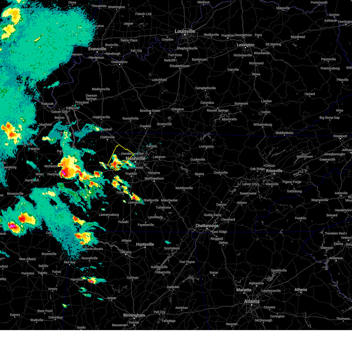 Svrohx the national weather service in nashville has issued a * severe thunderstorm warning for, northwestern davidson county in middle tennessee, eastern dickson county in middle tennessee, cheatham county in middle tennessee, * until 615 pm cdt. * at 540 pm cdt, a severe thunderstorm was located over white bluff, or 9 miles northeast of dickson, moving northeast at 45 mph (radar indicated). Hazards include 60 mph wind gusts and quarter size hail. Hail damage to vehicles is expected. Expect wind damage to roofs, siding, and trees. Svrohx the national weather service in nashville has issued a * severe thunderstorm warning for, northwestern davidson county in middle tennessee, eastern dickson county in middle tennessee, cheatham county in middle tennessee, * until 615 pm cdt. * at 540 pm cdt, a severe thunderstorm was located over white bluff, or 9 miles northeast of dickson, moving northeast at 45 mph (radar indicated). Hazards include 60 mph wind gusts and quarter size hail. Hail damage to vehicles is expected. Expect wind damage to roofs, siding, and trees.
|
| 3/30/2025 11:16 PM CDT |
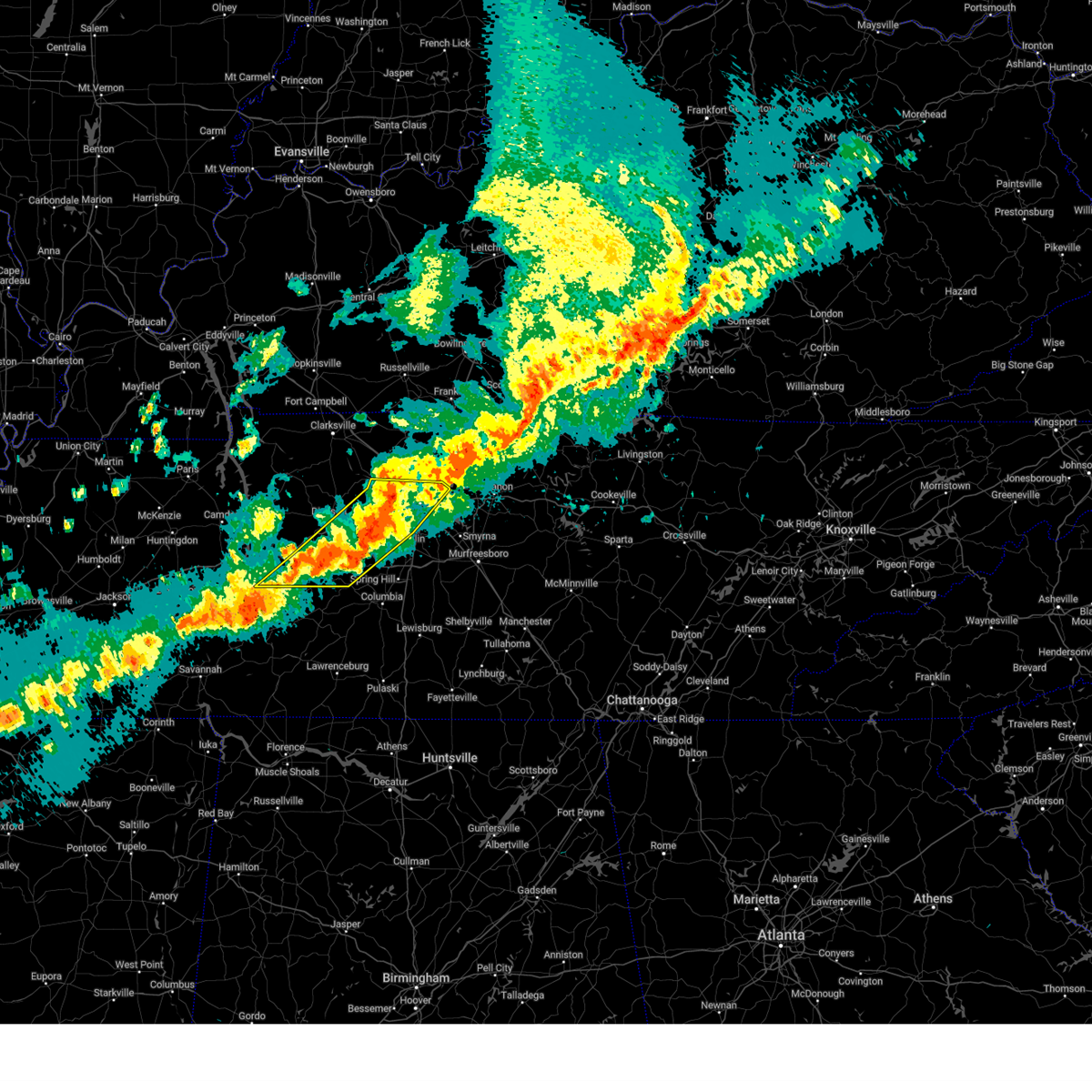 the severe thunderstorm warning has been cancelled and is no longer in effect the severe thunderstorm warning has been cancelled and is no longer in effect
|
| 3/30/2025 11:16 PM CDT |
 At 1115 pm cdt, severe thunderstorms were located along a line extending from near joelton to near fairview to near centerville, moving east at 40 mph (radar indicated). Hazards include 70 mph wind gusts and quarter size hail. Hail damage to vehicles is expected. expect considerable tree damage. wind damage is also likely to mobile homes, roofs, and outbuildings. locations impacted include, madison, bon aqua, belle meade, primm springs, natchez trace at highway 96, fairview, berry hill, ashland city, white bluff, leipers fork, nunnelly, oak hill, dickson, forest hills, bells bend, lyles, nashville, whites creek, bellevue, and lakewood. this includes the following highways, interstate 40 between mile markers 165 and 215. interstate 65 between mile markers 77 and 92. interstate 24 between mile markers 41 and 53. Interstate 840 between mile markers 1 and 17. At 1115 pm cdt, severe thunderstorms were located along a line extending from near joelton to near fairview to near centerville, moving east at 40 mph (radar indicated). Hazards include 70 mph wind gusts and quarter size hail. Hail damage to vehicles is expected. expect considerable tree damage. wind damage is also likely to mobile homes, roofs, and outbuildings. locations impacted include, madison, bon aqua, belle meade, primm springs, natchez trace at highway 96, fairview, berry hill, ashland city, white bluff, leipers fork, nunnelly, oak hill, dickson, forest hills, bells bend, lyles, nashville, whites creek, bellevue, and lakewood. this includes the following highways, interstate 40 between mile markers 165 and 215. interstate 65 between mile markers 77 and 92. interstate 24 between mile markers 41 and 53. Interstate 840 between mile markers 1 and 17.
|
| 3/30/2025 10:41 PM CDT |
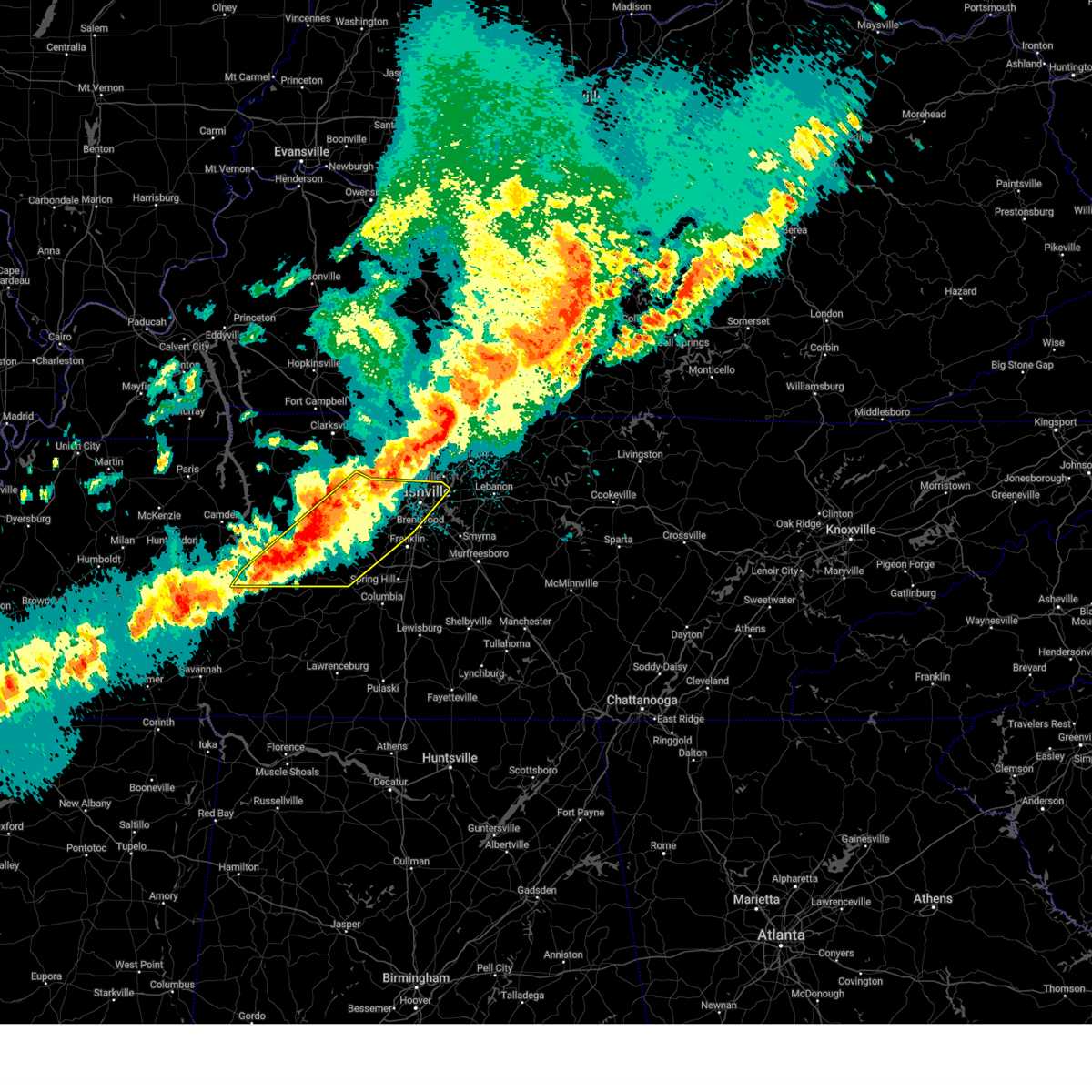 Svrohx the national weather service in nashville has issued a * severe thunderstorm warning for, central davidson county in middle tennessee, dickson county in middle tennessee, northwestern maury county in middle tennessee, northwestern williamson county in middle tennessee, southern cheatham county in middle tennessee, northern perry county in middle tennessee, southeastern humphreys county in middle tennessee, hickman county in middle tennessee, * until 1145 pm cdt. * at 1040 pm cdt, severe thunderstorms were located along a line extending from 8 miles north of white bluff to 7 miles southwest of dickson to 9 miles north of linden, moving east at 40 mph (radar indicated). Hazards include 60 mph wind gusts and quarter size hail. Hail damage to vehicles is expected. Expect wind damage to roofs, siding, and trees. Svrohx the national weather service in nashville has issued a * severe thunderstorm warning for, central davidson county in middle tennessee, dickson county in middle tennessee, northwestern maury county in middle tennessee, northwestern williamson county in middle tennessee, southern cheatham county in middle tennessee, northern perry county in middle tennessee, southeastern humphreys county in middle tennessee, hickman county in middle tennessee, * until 1145 pm cdt. * at 1040 pm cdt, severe thunderstorms were located along a line extending from 8 miles north of white bluff to 7 miles southwest of dickson to 9 miles north of linden, moving east at 40 mph (radar indicated). Hazards include 60 mph wind gusts and quarter size hail. Hail damage to vehicles is expected. Expect wind damage to roofs, siding, and trees.
|
| 3/19/2025 9:53 PM CDT |
 At 951 pm cdt, a severe thunderstorm was located over fairview, or 12 miles east of dickson, moving northeast at 55 mph (radar indicated). Hazards include 60 mph wind gusts and penny size hail. Expect damage to roofs, siding, and trees. locations impacted include, fairview, kingston springs, belle meade, bells bend, bellevue, natchez trace at highway 96, pegram, forest hills, and brentwood. This includes interstate 40 between mile markers 183 and 203. At 951 pm cdt, a severe thunderstorm was located over fairview, or 12 miles east of dickson, moving northeast at 55 mph (radar indicated). Hazards include 60 mph wind gusts and penny size hail. Expect damage to roofs, siding, and trees. locations impacted include, fairview, kingston springs, belle meade, bells bend, bellevue, natchez trace at highway 96, pegram, forest hills, and brentwood. This includes interstate 40 between mile markers 183 and 203.
|
| 3/19/2025 9:53 PM CDT |
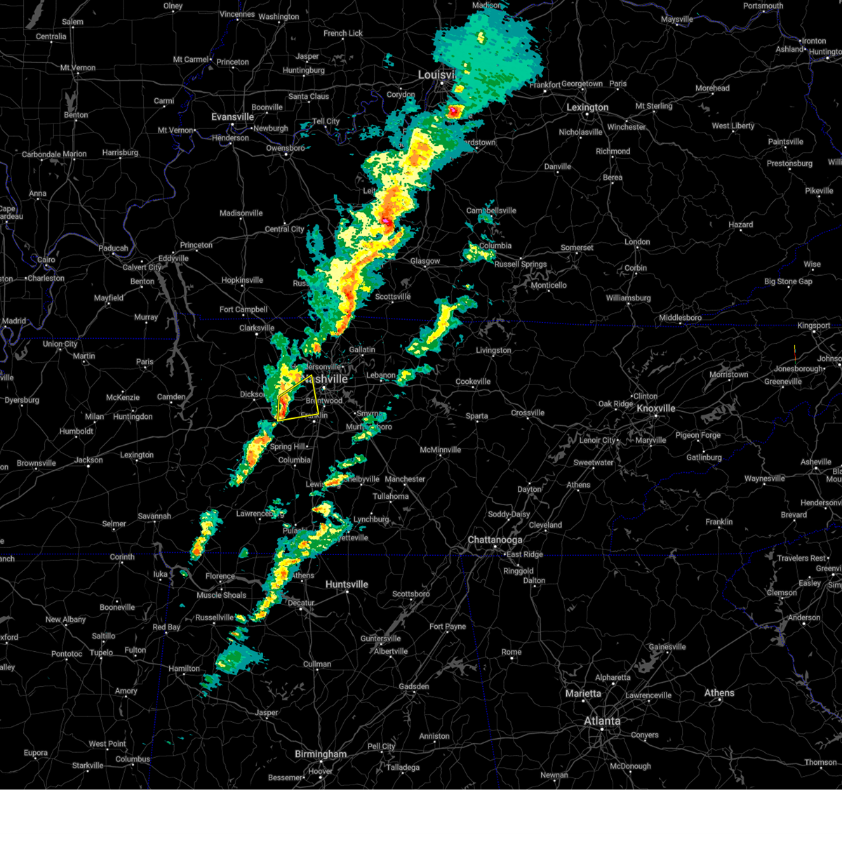 the severe thunderstorm warning has been cancelled and is no longer in effect the severe thunderstorm warning has been cancelled and is no longer in effect
|
| 3/19/2025 9:33 PM CDT |
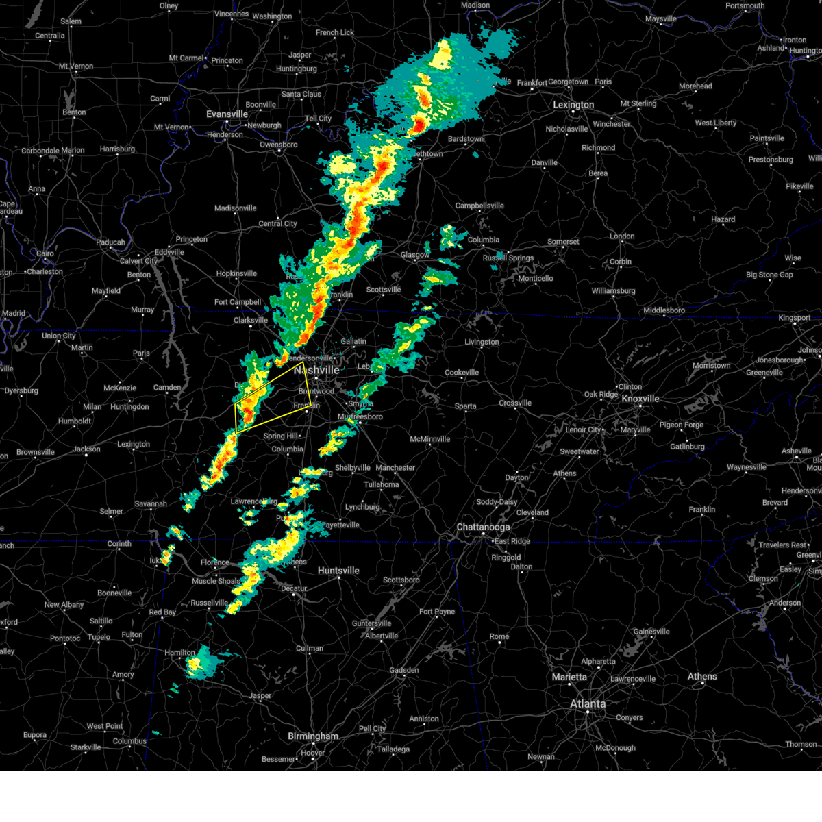 Svrohx the national weather service in nashville has issued a * severe thunderstorm warning for, southwestern davidson county in middle tennessee, southeastern dickson county in middle tennessee, northwestern williamson county in middle tennessee, southeastern cheatham county in middle tennessee, northeastern hickman county in middle tennessee, * until 1015 pm cdt. * at 933 pm cdt, a severe thunderstorm was located near centerville, moving northeast at 55 mph (radar indicated). Hazards include 60 mph wind gusts and penny size hail. expect damage to roofs, siding, and trees Svrohx the national weather service in nashville has issued a * severe thunderstorm warning for, southwestern davidson county in middle tennessee, southeastern dickson county in middle tennessee, northwestern williamson county in middle tennessee, southeastern cheatham county in middle tennessee, northeastern hickman county in middle tennessee, * until 1015 pm cdt. * at 933 pm cdt, a severe thunderstorm was located near centerville, moving northeast at 55 mph (radar indicated). Hazards include 60 mph wind gusts and penny size hail. expect damage to roofs, siding, and trees
|
| 2/15/2025 9:13 PM CST |
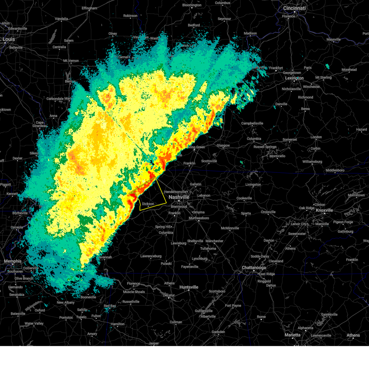 Svrohx the national weather service in nashville has issued a * severe thunderstorm warning for, dickson county in middle tennessee, southern montgomery county in middle tennessee, eastern houston county in middle tennessee, western cheatham county in middle tennessee, * until 1000 pm cst. * at 913 pm cst, a severe thunderstorm was located 7 miles north of mcewen, or 7 miles southeast of erin, moving northeast at 60 mph (radar indicated). Hazards include 60 mph wind gusts and quarter size hail. Hail damage to vehicles is expected. Expect wind damage to roofs, siding, and trees. Svrohx the national weather service in nashville has issued a * severe thunderstorm warning for, dickson county in middle tennessee, southern montgomery county in middle tennessee, eastern houston county in middle tennessee, western cheatham county in middle tennessee, * until 1000 pm cst. * at 913 pm cst, a severe thunderstorm was located 7 miles north of mcewen, or 7 miles southeast of erin, moving northeast at 60 mph (radar indicated). Hazards include 60 mph wind gusts and quarter size hail. Hail damage to vehicles is expected. Expect wind damage to roofs, siding, and trees.
|
| 9/24/2024 2:25 PM CDT |
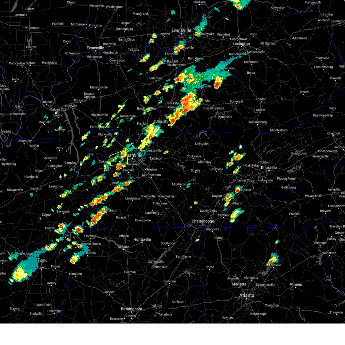 The storm which prompted the warning has weakened below severe limits, and no longer poses an immediate threat to life or property. therefore, the warning will be allowed to expire. a severe thunderstorm watch remains in effect until 700 pm cdt for middle tennessee. The storm which prompted the warning has weakened below severe limits, and no longer poses an immediate threat to life or property. therefore, the warning will be allowed to expire. a severe thunderstorm watch remains in effect until 700 pm cdt for middle tennessee.
|
| 9/24/2024 2:05 PM CDT |
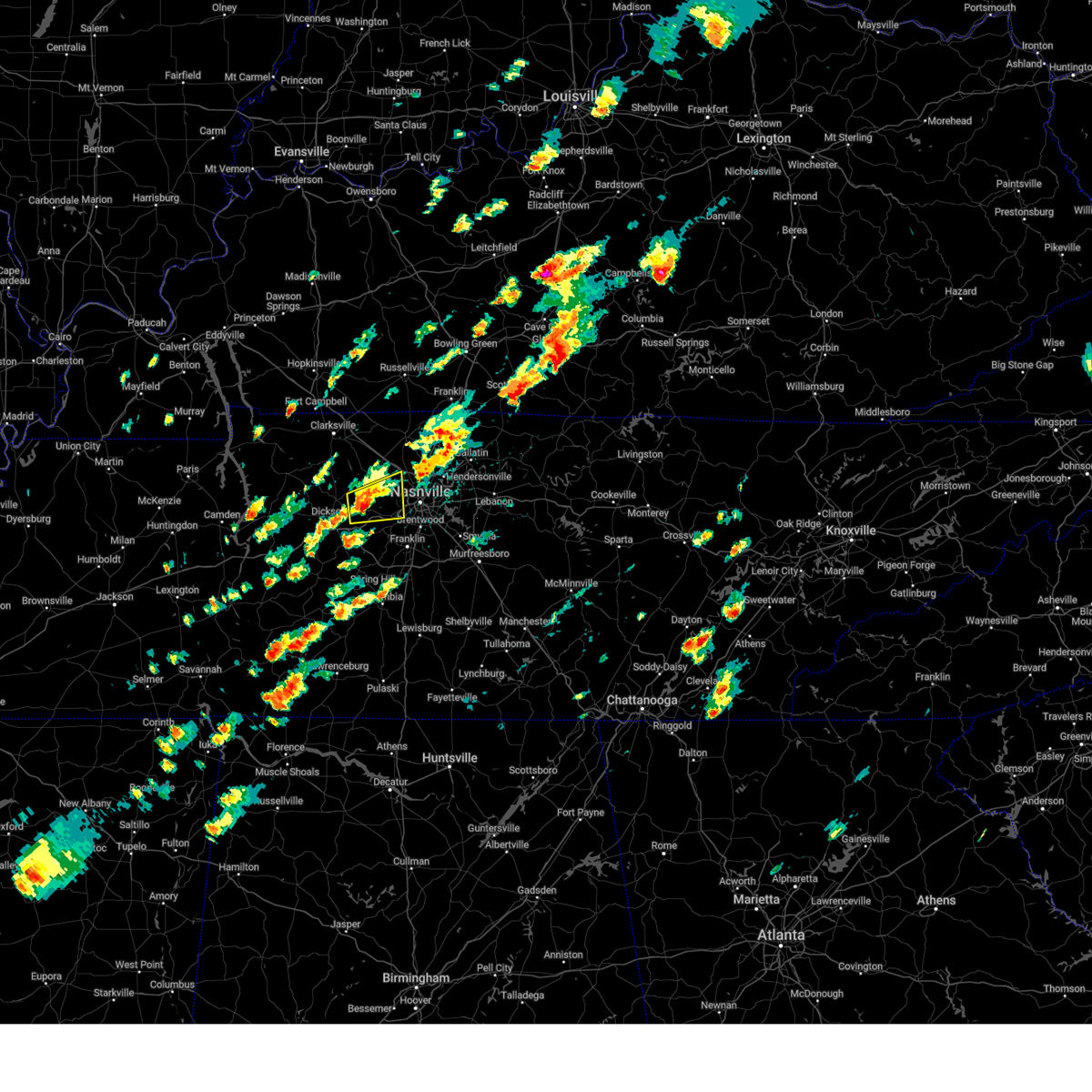 At 205 pm cdt, a severe thunderstorm was located near white bluff, or 9 miles southwest of ashland city, moving east at 35 mph (radar indicated). Hazards include 60 mph wind gusts and penny size hail. Expect damage to roofs, siding, and trees. locations impacted include, ashland city, white bluff, kingston springs, pegram, beaman park, and bells bend. This includes interstate 40 between mile markers 186 and 201. At 205 pm cdt, a severe thunderstorm was located near white bluff, or 9 miles southwest of ashland city, moving east at 35 mph (radar indicated). Hazards include 60 mph wind gusts and penny size hail. Expect damage to roofs, siding, and trees. locations impacted include, ashland city, white bluff, kingston springs, pegram, beaman park, and bells bend. This includes interstate 40 between mile markers 186 and 201.
|
| 9/24/2024 1:47 PM CDT |
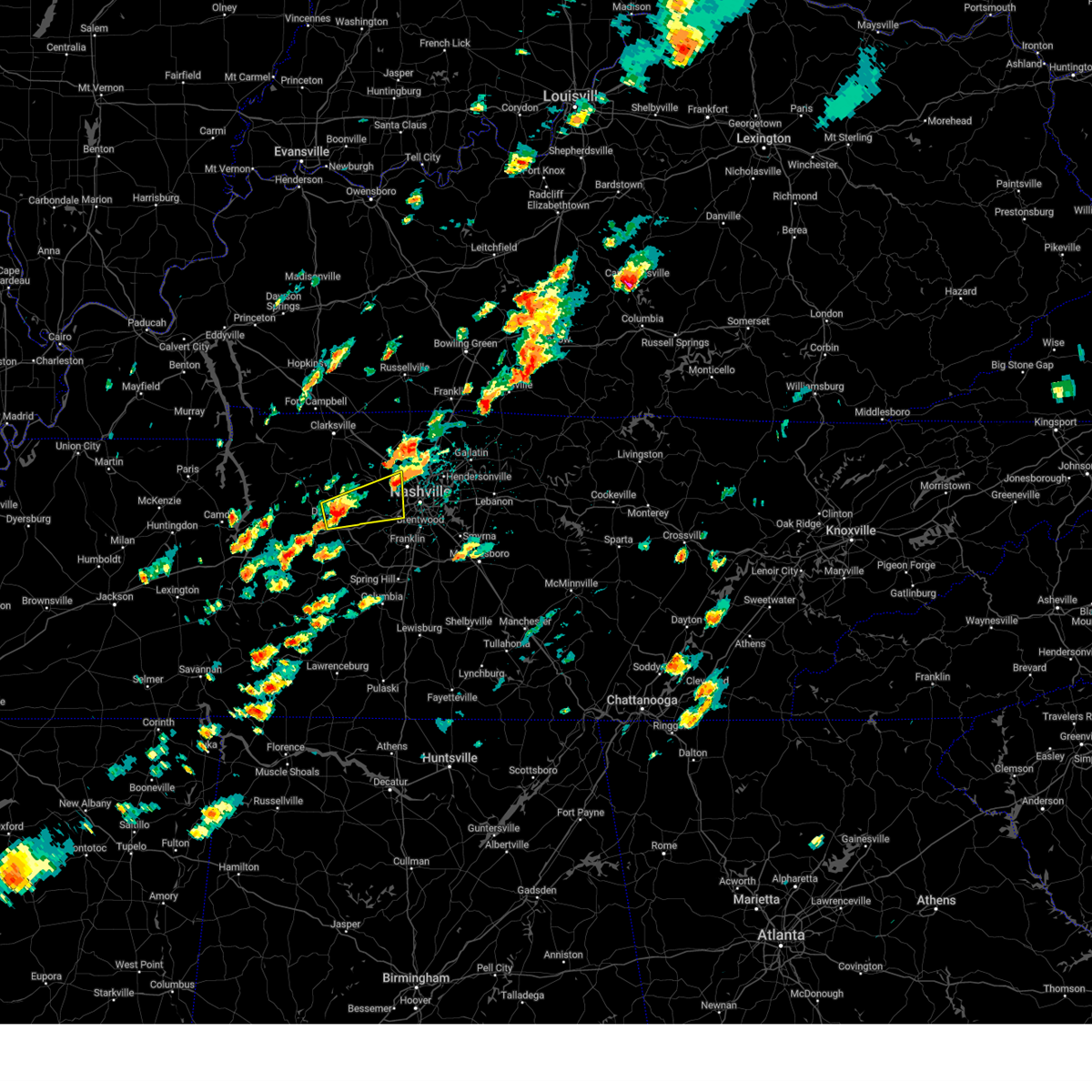 Svrohx the national weather service in nashville has issued a * severe thunderstorm warning for, northwestern davidson county in middle tennessee, southeastern dickson county in middle tennessee, southeastern cheatham county in middle tennessee, * until 230 pm cdt. * at 147 pm cdt, a severe thunderstorm was located near dickson, moving east at 35 mph (radar indicated). Hazards include 60 mph wind gusts and quarter size hail. Hail damage to vehicles is expected. Expect wind damage to roofs, siding, and trees. Svrohx the national weather service in nashville has issued a * severe thunderstorm warning for, northwestern davidson county in middle tennessee, southeastern dickson county in middle tennessee, southeastern cheatham county in middle tennessee, * until 230 pm cdt. * at 147 pm cdt, a severe thunderstorm was located near dickson, moving east at 35 mph (radar indicated). Hazards include 60 mph wind gusts and quarter size hail. Hail damage to vehicles is expected. Expect wind damage to roofs, siding, and trees.
|
| 7/30/2024 10:19 PM CDT |
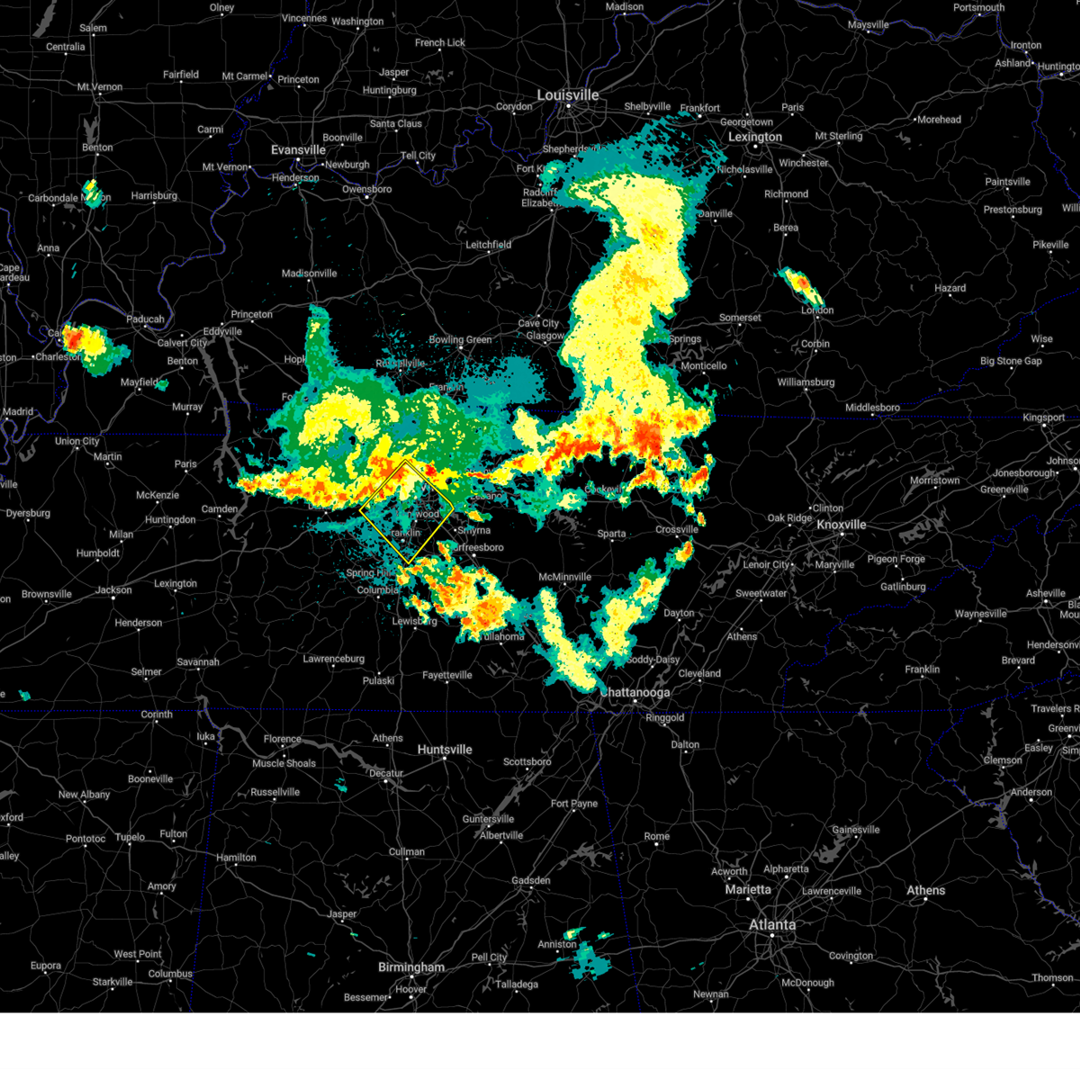 Svrohx the national weather service in nashville has issued a * severe thunderstorm warning for, davidson county in middle tennessee, northeastern williamson county in middle tennessee, southeastern cheatham county in middle tennessee, * until 1100 pm cdt. * at 1019 pm cdt, severe thunderstorms were located along a line extending from near joelton to pegram, moving southeast at 30 mph (radar indicated). Hazards include 70 mph wind gusts. Expect considerable tree damage. Damage is likely to mobile homes, roofs, and outbuildings. Svrohx the national weather service in nashville has issued a * severe thunderstorm warning for, davidson county in middle tennessee, northeastern williamson county in middle tennessee, southeastern cheatham county in middle tennessee, * until 1100 pm cdt. * at 1019 pm cdt, severe thunderstorms were located along a line extending from near joelton to pegram, moving southeast at 30 mph (radar indicated). Hazards include 70 mph wind gusts. Expect considerable tree damage. Damage is likely to mobile homes, roofs, and outbuildings.
|
| 7/30/2024 9:55 PM CDT |
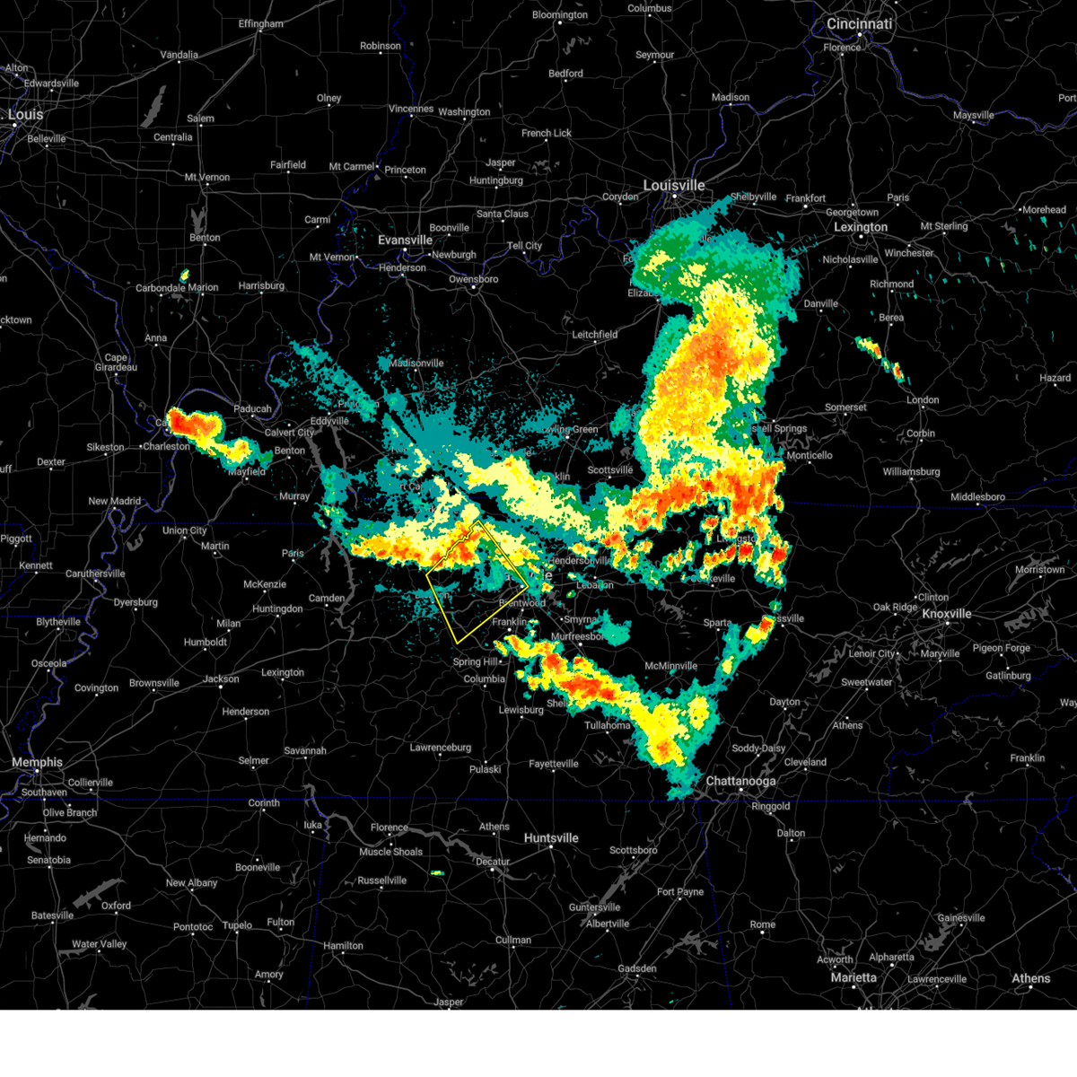 Svrohx the national weather service in nashville has issued a * severe thunderstorm warning for, western davidson county in middle tennessee, eastern dickson county in middle tennessee, northwestern williamson county in middle tennessee, cheatham county in middle tennessee, northeastern hickman county in middle tennessee, southwestern robertson county in middle tennessee, * until 1030 pm cdt. * at 954 pm cdt, severe thunderstorms were located along a line extending from near coopertown to charlotte, moving southeast at 30 mph (radar indicated). Hazards include 70 mph wind gusts and penny size hail. Expect considerable tree damage. Damage is likely to mobile homes, roofs, and outbuildings. Svrohx the national weather service in nashville has issued a * severe thunderstorm warning for, western davidson county in middle tennessee, eastern dickson county in middle tennessee, northwestern williamson county in middle tennessee, cheatham county in middle tennessee, northeastern hickman county in middle tennessee, southwestern robertson county in middle tennessee, * until 1030 pm cdt. * at 954 pm cdt, severe thunderstorms were located along a line extending from near coopertown to charlotte, moving southeast at 30 mph (radar indicated). Hazards include 70 mph wind gusts and penny size hail. Expect considerable tree damage. Damage is likely to mobile homes, roofs, and outbuildings.
|
| 5/26/2024 2:56 PM CDT |
 Svrohx the national weather service in nashville has issued a * severe thunderstorm warning for, davidson county in middle tennessee, northwestern rutherford county in middle tennessee, williamson county in middle tennessee, south central cheatham county in middle tennessee, * until 345 pm cdt. * at 255 pm cdt, a severe thunderstorm was located near fairview, or 10 miles west of franklin, moving east at 35 mph (radar indicated). Hazards include golf ball size hail and 60 mph wind gusts. People and animals outdoors will be injured. expect hail damage to roofs, siding, windows, and vehicles. Expect wind damage to roofs, siding, and trees. Svrohx the national weather service in nashville has issued a * severe thunderstorm warning for, davidson county in middle tennessee, northwestern rutherford county in middle tennessee, williamson county in middle tennessee, south central cheatham county in middle tennessee, * until 345 pm cdt. * at 255 pm cdt, a severe thunderstorm was located near fairview, or 10 miles west of franklin, moving east at 35 mph (radar indicated). Hazards include golf ball size hail and 60 mph wind gusts. People and animals outdoors will be injured. expect hail damage to roofs, siding, windows, and vehicles. Expect wind damage to roofs, siding, and trees.
|
| 5/26/2024 2:49 PM CDT |
 At 249 pm cdt, a severe thunderstorm was located over fairview, or 12 miles west of franklin, moving east at 35 mph (radar indicated). Hazards include golf ball size hail and 60 mph wind gusts. People and animals outdoors will be injured. expect hail damage to roofs, siding, windows, and vehicles. expect wind damage to roofs, siding, and trees. locations impacted include, franklin, ashland city, kingston springs, pegram, fairview, bellevue, and natchez trace at highway 96. this includes the following highways, interstate 40 between mile markers 178 and 198. Interstate 840 between mile markers 1 and 13. At 249 pm cdt, a severe thunderstorm was located over fairview, or 12 miles west of franklin, moving east at 35 mph (radar indicated). Hazards include golf ball size hail and 60 mph wind gusts. People and animals outdoors will be injured. expect hail damage to roofs, siding, windows, and vehicles. expect wind damage to roofs, siding, and trees. locations impacted include, franklin, ashland city, kingston springs, pegram, fairview, bellevue, and natchez trace at highway 96. this includes the following highways, interstate 40 between mile markers 178 and 198. Interstate 840 between mile markers 1 and 13.
|
| 5/26/2024 2:48 PM CDT |
 the severe thunderstorm warning has been cancelled and is no longer in effect the severe thunderstorm warning has been cancelled and is no longer in effect
|
| 5/26/2024 2:48 PM CDT |
 At 248 pm cdt, severe thunderstorms were located along a line extending from near lafayette to near franklin, moving east at 50 mph (radar indicated). Hazards include 60 mph wind gusts and nickel size hail. Expect damage to roofs, siding, and trees. locations impacted include, murfreesboro, franklin, lebanon, hartsville, nashville, hendersonville, smyrna, brentwood, la vergne, mount juliet, nolensville, forest hills, oak hill, belle meade, kingston springs, lakewood, pegram, hermitage, fairview, and walterhill. this includes the following highways, interstate 40 between mile markers 182 and 243. interstate 65 between mile markers 67 and 87. interstate 24 between mile markers 47 and 71. Interstate 840 between mile markers 56 and 76. At 248 pm cdt, severe thunderstorms were located along a line extending from near lafayette to near franklin, moving east at 50 mph (radar indicated). Hazards include 60 mph wind gusts and nickel size hail. Expect damage to roofs, siding, and trees. locations impacted include, murfreesboro, franklin, lebanon, hartsville, nashville, hendersonville, smyrna, brentwood, la vergne, mount juliet, nolensville, forest hills, oak hill, belle meade, kingston springs, lakewood, pegram, hermitage, fairview, and walterhill. this includes the following highways, interstate 40 between mile markers 182 and 243. interstate 65 between mile markers 67 and 87. interstate 24 between mile markers 47 and 71. Interstate 840 between mile markers 56 and 76.
|
| 5/26/2024 2:35 PM CDT |
 At 234 pm cdt, a severe thunderstorm was located near fairview, or 9 miles southeast of dickson, moving east at 35 mph (radar indicated). Hazards include ping pong ball size hail and 60 mph wind gusts. People and animals outdoors will be injured. expect hail damage to roofs, siding, windows, and vehicles. expect wind damage to roofs, siding, and trees. locations impacted include, franklin, dickson, ashland city, white bluff, kingston springs, pegram, burns, fairview, bellevue, bon aqua, lyles, and natchez trace at highway 96. this includes the following highways, interstate 40 between mile markers 169 and 198. Interstate 840 between mile markers 1 and 13. At 234 pm cdt, a severe thunderstorm was located near fairview, or 9 miles southeast of dickson, moving east at 35 mph (radar indicated). Hazards include ping pong ball size hail and 60 mph wind gusts. People and animals outdoors will be injured. expect hail damage to roofs, siding, windows, and vehicles. expect wind damage to roofs, siding, and trees. locations impacted include, franklin, dickson, ashland city, white bluff, kingston springs, pegram, burns, fairview, bellevue, bon aqua, lyles, and natchez trace at highway 96. this includes the following highways, interstate 40 between mile markers 169 and 198. Interstate 840 between mile markers 1 and 13.
|
| 5/26/2024 2:33 PM CDT |
 At 233 pm cdt, severe thunderstorms were located along a line extending from near westmoreland to near fairview, moving east at 50 mph (radar indicated). Hazards include 60 mph wind gusts and nickel size hail. Expect damage to roofs, siding, and trees. locations impacted include, murfreesboro, franklin, gallatin, lebanon, lafayette, hartsville, nashville, madison, hendersonville, smyrna, brentwood, la vergne, mount juliet, goodlettsville, nolensville, forest hills, oak hill, belle meade, kingston springs, and lakewood. this includes the following highways, interstate 40 between mile markers 182 and 243. interstate 65 between mile markers 67 and 95. interstate 24 between mile markers 41 and 71. Interstate 840 between mile markers 56 and 76. At 233 pm cdt, severe thunderstorms were located along a line extending from near westmoreland to near fairview, moving east at 50 mph (radar indicated). Hazards include 60 mph wind gusts and nickel size hail. Expect damage to roofs, siding, and trees. locations impacted include, murfreesboro, franklin, gallatin, lebanon, lafayette, hartsville, nashville, madison, hendersonville, smyrna, brentwood, la vergne, mount juliet, goodlettsville, nolensville, forest hills, oak hill, belle meade, kingston springs, and lakewood. this includes the following highways, interstate 40 between mile markers 182 and 243. interstate 65 between mile markers 67 and 95. interstate 24 between mile markers 41 and 71. Interstate 840 between mile markers 56 and 76.
|
| 5/26/2024 2:18 PM CDT |
 At 218 pm cdt, severe thunderstorms were located along a line extending from 7 miles southwest of westmoreland to near burns, moving east at 50 mph (radar indicated). Hazards include 60 mph wind gusts and nickel size hail. Expect damage to roofs, siding, and trees. locations impacted include, murfreesboro, franklin, gallatin, lebanon, ashland city, lafayette, hartsville, nashville, madison, hendersonville, smyrna, brentwood, la vergne, mount juliet, goodlettsville, millersville, nolensville, forest hills, oak hill, and belle meade. this includes the following highways, interstate 40 between mile markers 182 and 243. interstate 65 between mile markers 67 and 101. interstate 24 between mile markers 33 and 71. Interstate 840 between mile markers 56 and 76. At 218 pm cdt, severe thunderstorms were located along a line extending from 7 miles southwest of westmoreland to near burns, moving east at 50 mph (radar indicated). Hazards include 60 mph wind gusts and nickel size hail. Expect damage to roofs, siding, and trees. locations impacted include, murfreesboro, franklin, gallatin, lebanon, ashland city, lafayette, hartsville, nashville, madison, hendersonville, smyrna, brentwood, la vergne, mount juliet, goodlettsville, millersville, nolensville, forest hills, oak hill, and belle meade. this includes the following highways, interstate 40 between mile markers 182 and 243. interstate 65 between mile markers 67 and 101. interstate 24 between mile markers 33 and 71. Interstate 840 between mile markers 56 and 76.
|
| 5/26/2024 2:18 PM CDT |
 the severe thunderstorm warning has been cancelled and is no longer in effect the severe thunderstorm warning has been cancelled and is no longer in effect
|
| 5/26/2024 2:17 PM CDT |
 Svrohx the national weather service in nashville has issued a * severe thunderstorm warning for, southwestern davidson county in middle tennessee, southern dickson county in middle tennessee, northwestern williamson county in middle tennessee, southeastern cheatham county in middle tennessee, northeastern hickman county in middle tennessee, * until 300 pm cdt. * at 216 pm cdt, a severe thunderstorm was located 7 miles southwest of dickson, moving east at 35 mph (radar indicated). Hazards include 60 mph wind gusts and quarter size hail. Hail damage to vehicles is expected. Expect wind damage to roofs, siding, and trees. Svrohx the national weather service in nashville has issued a * severe thunderstorm warning for, southwestern davidson county in middle tennessee, southern dickson county in middle tennessee, northwestern williamson county in middle tennessee, southeastern cheatham county in middle tennessee, northeastern hickman county in middle tennessee, * until 300 pm cdt. * at 216 pm cdt, a severe thunderstorm was located 7 miles southwest of dickson, moving east at 35 mph (radar indicated). Hazards include 60 mph wind gusts and quarter size hail. Hail damage to vehicles is expected. Expect wind damage to roofs, siding, and trees.
|
| 5/26/2024 2:04 PM CDT |
 the severe thunderstorm warning has been cancelled and is no longer in effect the severe thunderstorm warning has been cancelled and is no longer in effect
|
| 5/26/2024 2:04 PM CDT |
 At 204 pm cdt, severe thunderstorms were located along a line extending from near coopertown to near white bluff to near dickson, moving east at 50 mph (radar indicated). Hazards include 60 mph wind gusts and nickel size hail. Expect damage to roofs, siding, and trees. locations impacted include, springfield, dickson, ashland city, coopertown, white bluff, kingston springs, pegram, burns, pleasant view, charlotte, cedar hill, and cheatham dam. this includes the following highways, interstate 40 between mile markers 161 and 181, and between mile markers 185 and 191. interstate 24 between mile markers 19 and 31. Interstate 840 between mile markers 1 and 6. At 204 pm cdt, severe thunderstorms were located along a line extending from near coopertown to near white bluff to near dickson, moving east at 50 mph (radar indicated). Hazards include 60 mph wind gusts and nickel size hail. Expect damage to roofs, siding, and trees. locations impacted include, springfield, dickson, ashland city, coopertown, white bluff, kingston springs, pegram, burns, pleasant view, charlotte, cedar hill, and cheatham dam. this includes the following highways, interstate 40 between mile markers 161 and 181, and between mile markers 185 and 191. interstate 24 between mile markers 19 and 31. Interstate 840 between mile markers 1 and 6.
|
| 5/26/2024 1:55 PM CDT |
 the severe thunderstorm warning has been cancelled and is no longer in effect the severe thunderstorm warning has been cancelled and is no longer in effect
|
| 5/26/2024 1:55 PM CDT |
 At 154 pm cdt, severe thunderstorms were located along a line extending from 8 miles northwest of coopertown to near ashland city to near dickson, moving east at 45 mph (radar indicated). Hazards include 60 mph wind gusts and nickel size hail. Expect damage to roofs, siding, and trees. locations impacted include, springfield, dickson, ashland city, coopertown, white bluff, kingston springs, pegram, mcewen, burns, pleasant view, charlotte, adams, vanleer, cedar hill, slayden, and cheatham dam. this includes the following highways, interstate 40 between mile markers 161 and 181, and between mile markers 185 and 191. interstate 24 between mile markers 18 and 31. Interstate 840 between mile markers 1 and 6. At 154 pm cdt, severe thunderstorms were located along a line extending from 8 miles northwest of coopertown to near ashland city to near dickson, moving east at 45 mph (radar indicated). Hazards include 60 mph wind gusts and nickel size hail. Expect damage to roofs, siding, and trees. locations impacted include, springfield, dickson, ashland city, coopertown, white bluff, kingston springs, pegram, mcewen, burns, pleasant view, charlotte, adams, vanleer, cedar hill, slayden, and cheatham dam. this includes the following highways, interstate 40 between mile markers 161 and 181, and between mile markers 185 and 191. interstate 24 between mile markers 18 and 31. Interstate 840 between mile markers 1 and 6.
|
| 5/26/2024 1:53 PM CDT |
 Svrohx the national weather service in nashville has issued a * severe thunderstorm warning for, davidson county in middle tennessee, northwestern rutherford county in middle tennessee, sumner county in middle tennessee, northern williamson county in middle tennessee, wilson county in middle tennessee, cheatham county in middle tennessee, western macon county in middle tennessee, trousdale county in middle tennessee, robertson county in middle tennessee, * until 300 pm cdt. * at 153 pm cdt, severe thunderstorms were located along a line extending from near springfield to 6 miles west of dickson, moving east at 50 mph (radar indicated). Hazards include 60 mph wind gusts and nickel size hail. expect damage to roofs, siding, and trees Svrohx the national weather service in nashville has issued a * severe thunderstorm warning for, davidson county in middle tennessee, northwestern rutherford county in middle tennessee, sumner county in middle tennessee, northern williamson county in middle tennessee, wilson county in middle tennessee, cheatham county in middle tennessee, western macon county in middle tennessee, trousdale county in middle tennessee, robertson county in middle tennessee, * until 300 pm cdt. * at 153 pm cdt, severe thunderstorms were located along a line extending from near springfield to 6 miles west of dickson, moving east at 50 mph (radar indicated). Hazards include 60 mph wind gusts and nickel size hail. expect damage to roofs, siding, and trees
|
| 5/26/2024 1:40 PM CDT |
 At 140 pm cdt, severe thunderstorms were located along a line extending from 8 miles southeast of clarksville to 12 miles north of white bluff to near mcewen, moving east at 50 mph (radar indicated). Hazards include 60 mph wind gusts and nickel size hail. Expect damage to roofs, siding, and trees. locations impacted include, springfield, dickson, ashland city, waverly, clarksville, coopertown, white bluff, kingston springs, pegram, mcewen, burns, pleasant view, charlotte, adams, vanleer, cedar hill, slayden, cheatham dam, and cunningham. this includes the following highways, interstate 40 between mile markers 161 and 181, and between mile markers 185 and 191. interstate 24 between mile markers 11 and 31. Interstate 840 between mile markers 1 and 6. At 140 pm cdt, severe thunderstorms were located along a line extending from 8 miles southeast of clarksville to 12 miles north of white bluff to near mcewen, moving east at 50 mph (radar indicated). Hazards include 60 mph wind gusts and nickel size hail. Expect damage to roofs, siding, and trees. locations impacted include, springfield, dickson, ashland city, waverly, clarksville, coopertown, white bluff, kingston springs, pegram, mcewen, burns, pleasant view, charlotte, adams, vanleer, cedar hill, slayden, cheatham dam, and cunningham. this includes the following highways, interstate 40 between mile markers 161 and 181, and between mile markers 185 and 191. interstate 24 between mile markers 11 and 31. Interstate 840 between mile markers 1 and 6.
|
| 5/26/2024 1:25 PM CDT |
 the severe thunderstorm warning has been cancelled and is no longer in effect the severe thunderstorm warning has been cancelled and is no longer in effect
|
| 5/26/2024 1:25 PM CDT |
 At 125 pm cdt, severe thunderstorms were located along a line extending from 10 miles southwest of clarksville to 9 miles east of erin to waverly, moving east at 45 mph (radar indicated). Hazards include 60 mph wind gusts and nickel size hail. Expect damage to roofs, siding, and trees. locations impacted include, clarksville, springfield, dickson, ashland city, waverly, camden, erin, coopertown, white bluff, kingston springs, pegram, new johnsonville, mcewen, burns, pleasant view, charlotte, adams, vanleer, cedar hill, and cumberland city. this includes the following highways, interstate 40 between mile markers 161 and 181, and between mile markers 185 and 191. interstate 24 between mile markers 7 and 31. Interstate 840 between mile markers 1 and 6. At 125 pm cdt, severe thunderstorms were located along a line extending from 10 miles southwest of clarksville to 9 miles east of erin to waverly, moving east at 45 mph (radar indicated). Hazards include 60 mph wind gusts and nickel size hail. Expect damage to roofs, siding, and trees. locations impacted include, clarksville, springfield, dickson, ashland city, waverly, camden, erin, coopertown, white bluff, kingston springs, pegram, new johnsonville, mcewen, burns, pleasant view, charlotte, adams, vanleer, cedar hill, and cumberland city. this includes the following highways, interstate 40 between mile markers 161 and 181, and between mile markers 185 and 191. interstate 24 between mile markers 7 and 31. Interstate 840 between mile markers 1 and 6.
|
| 5/26/2024 1:14 PM CDT |
 Svrohx the national weather service in nashville has issued a * severe thunderstorm warning for, dickson county in middle tennessee, montgomery county in middle tennessee, southeastern stewart county in middle tennessee, houston county in middle tennessee, cheatham county in middle tennessee, humphreys county in middle tennessee, northeastern hickman county in middle tennessee, western robertson county in middle tennessee, * until 215 pm cdt. * at 114 pm cdt, severe thunderstorms were located along a line extending from 11 miles northeast of tennessee ridge to near erin to near new johnsonville, moving east at 45 mph (radar indicated). Hazards include 60 mph wind gusts and nickel size hail. expect damage to roofs, siding, and trees Svrohx the national weather service in nashville has issued a * severe thunderstorm warning for, dickson county in middle tennessee, montgomery county in middle tennessee, southeastern stewart county in middle tennessee, houston county in middle tennessee, cheatham county in middle tennessee, humphreys county in middle tennessee, northeastern hickman county in middle tennessee, western robertson county in middle tennessee, * until 215 pm cdt. * at 114 pm cdt, severe thunderstorms were located along a line extending from 11 miles northeast of tennessee ridge to near erin to near new johnsonville, moving east at 45 mph (radar indicated). Hazards include 60 mph wind gusts and nickel size hail. expect damage to roofs, siding, and trees
|
| 5/9/2024 2:42 AM CDT |
 the severe thunderstorm warning has been cancelled and is no longer in effect the severe thunderstorm warning has been cancelled and is no longer in effect
|
| 5/9/2024 2:36 AM CDT |
 At 235 am cdt, a severe thunderstorm was located near fairview, or 9 miles southeast of dickson, moving east at 45 mph (radar indicated). Hazards include 60 mph wind gusts and penny size hail. Expect damage to roofs, siding, and trees. locations impacted include, franklin, columbia, dickson, centerville, spring hill, forest hills, white bluff, kingston springs, thompson's station, pegram, burns, bellevue, fairview, bon aqua, bells bend, primm springs, lyles, natchez trace at highway 96, santa fe, and hampshire. this includes the following highways, interstate 40 between mile markers 165 and 202. interstate 65 between mile markers 48 and 63. Interstate 840 between mile markers 1 and 32. At 235 am cdt, a severe thunderstorm was located near fairview, or 9 miles southeast of dickson, moving east at 45 mph (radar indicated). Hazards include 60 mph wind gusts and penny size hail. Expect damage to roofs, siding, and trees. locations impacted include, franklin, columbia, dickson, centerville, spring hill, forest hills, white bluff, kingston springs, thompson's station, pegram, burns, bellevue, fairview, bon aqua, bells bend, primm springs, lyles, natchez trace at highway 96, santa fe, and hampshire. this includes the following highways, interstate 40 between mile markers 165 and 202. interstate 65 between mile markers 48 and 63. Interstate 840 between mile markers 1 and 32.
|
| 5/9/2024 2:17 AM CDT |
 Svrohx the national weather service in nashville has issued a * severe thunderstorm warning for, southwestern davidson county in middle tennessee, northern lewis county in middle tennessee, southern dickson county in middle tennessee, northern maury county in middle tennessee, williamson county in middle tennessee, south central cheatham county in middle tennessee, hickman county in middle tennessee, * until 300 am cdt. * at 216 am cdt, a severe thunderstorm was located 8 miles northwest of centerville, moving east at 45 mph (radar indicated). Hazards include 60 mph wind gusts and penny size hail. expect damage to roofs, siding, and trees Svrohx the national weather service in nashville has issued a * severe thunderstorm warning for, southwestern davidson county in middle tennessee, northern lewis county in middle tennessee, southern dickson county in middle tennessee, northern maury county in middle tennessee, williamson county in middle tennessee, south central cheatham county in middle tennessee, hickman county in middle tennessee, * until 300 am cdt. * at 216 am cdt, a severe thunderstorm was located 8 miles northwest of centerville, moving east at 45 mph (radar indicated). Hazards include 60 mph wind gusts and penny size hail. expect damage to roofs, siding, and trees
|
| 5/8/2024 4:57 PM CDT |
 At 456 pm cdt, a severe thunderstorm was located 9 miles northwest of ashland city, moving northeast at 70 mph (radar indicated). Hazards include 60 mph wind gusts and quarter size hail. Hail damage to vehicles is expected. expect wind damage to roofs, siding, and trees. locations impacted include, dickson, ashland city, erin, white bluff, kingston springs, pegram, mcewen, tennessee ridge, pleasant view, charlotte, vanleer, slayden, cheatham dam, and cunningham. This includes interstate 24 between mile markers 16 and 17. At 456 pm cdt, a severe thunderstorm was located 9 miles northwest of ashland city, moving northeast at 70 mph (radar indicated). Hazards include 60 mph wind gusts and quarter size hail. Hail damage to vehicles is expected. expect wind damage to roofs, siding, and trees. locations impacted include, dickson, ashland city, erin, white bluff, kingston springs, pegram, mcewen, tennessee ridge, pleasant view, charlotte, vanleer, slayden, cheatham dam, and cunningham. This includes interstate 24 between mile markers 16 and 17.
|
| 5/8/2024 4:30 PM CDT |
 Svrohx the national weather service in nashville has issued a * severe thunderstorm warning for, dickson county in middle tennessee, southern montgomery county in middle tennessee, houston county in middle tennessee, central cheatham county in middle tennessee, northern humphreys county in middle tennessee, * until 515 pm cdt. * at 429 pm cdt, a severe thunderstorm was located near mcewen, or 9 miles south of erin, moving northeast at 70 mph (radar indicated). Hazards include 60 mph wind gusts and quarter size hail. Hail damage to vehicles is expected. Expect wind damage to roofs, siding, and trees. Svrohx the national weather service in nashville has issued a * severe thunderstorm warning for, dickson county in middle tennessee, southern montgomery county in middle tennessee, houston county in middle tennessee, central cheatham county in middle tennessee, northern humphreys county in middle tennessee, * until 515 pm cdt. * at 429 pm cdt, a severe thunderstorm was located near mcewen, or 9 miles south of erin, moving northeast at 70 mph (radar indicated). Hazards include 60 mph wind gusts and quarter size hail. Hail damage to vehicles is expected. Expect wind damage to roofs, siding, and trees.
|
| 3/14/2024 10:10 PM CDT |
 the severe thunderstorm warning has been cancelled and is no longer in effect the severe thunderstorm warning has been cancelled and is no longer in effect
|
| 3/14/2024 9:59 PM CDT |
 Svrohx the national weather service in nashville has issued a * severe thunderstorm warning for, northwestern davidson county in middle tennessee, southeastern cheatham county in middle tennessee, south central robertson county in middle tennessee, * until 1045 pm cdt. * at 959 pm cdt, a severe thunderstorm was located over ashland city, moving northeast at 40 mph (radar indicated). Hazards include 60 mph wind gusts and quarter size hail. Hail damage to vehicles is expected. Expect wind damage to roofs, siding, and trees. Svrohx the national weather service in nashville has issued a * severe thunderstorm warning for, northwestern davidson county in middle tennessee, southeastern cheatham county in middle tennessee, south central robertson county in middle tennessee, * until 1045 pm cdt. * at 959 pm cdt, a severe thunderstorm was located over ashland city, moving northeast at 40 mph (radar indicated). Hazards include 60 mph wind gusts and quarter size hail. Hail damage to vehicles is expected. Expect wind damage to roofs, siding, and trees.
|
| 12/9/2023 4:27 PM CST |
 At 427 pm cst, a confirmed large and extremely dangerous tornado was located near ashland city, moving east at 40 mph. this is a particularly dangerous situation. take cover now! (radar confirmed tornado). Hazards include damaging tornado. You are in a life-threatening situation. flying debris may be deadly to those caught without shelter. mobile homes will be destroyed. considerable damage to homes, businesses, and vehicles is likely and complete destruction is possible. the tornado will be near, madison and goodlettsville around 440 pm cst. other locations impacted by this tornadic thunderstorm include beaman park, whites creek, and bells bend. this includes the following highways, interstate 40 between mile markers 202 and 209, and near mile marker 211. interstate 65 between mile markers 85 and 97. Interstate 24 between mile markers 30 and 49. At 427 pm cst, a confirmed large and extremely dangerous tornado was located near ashland city, moving east at 40 mph. this is a particularly dangerous situation. take cover now! (radar confirmed tornado). Hazards include damaging tornado. You are in a life-threatening situation. flying debris may be deadly to those caught without shelter. mobile homes will be destroyed. considerable damage to homes, businesses, and vehicles is likely and complete destruction is possible. the tornado will be near, madison and goodlettsville around 440 pm cst. other locations impacted by this tornadic thunderstorm include beaman park, whites creek, and bells bend. this includes the following highways, interstate 40 between mile markers 202 and 209, and near mile marker 211. interstate 65 between mile markers 85 and 97. Interstate 24 between mile markers 30 and 49.
|
| 12/9/2023 4:17 PM CST |
 At 417 pm cst, a confirmed large and extremely dangerous tornado was located over ashland city, moving east at 40 mph. this is a particularly dangerous situation. take cover now! (radar confirmed tornado). Hazards include damaging tornado. You are in a life-threatening situation. flying debris may be deadly to those caught without shelter. mobile homes will be destroyed. considerable damage to homes, businesses, and vehicles is likely and complete destruction is possible. the tornado will be near, ashland city around 420 pm cst. joelton around 430 pm cst. goodlettsville around 440 pm cst. other locations impacted by this tornadic thunderstorm include beaman park, whites creek, and bells bend. this includes the following highways, interstate 40 between mile markers 201 and 211. interstate 65 between mile markers 85 and 97. Interstate 24 between mile markers 30 and 49. At 417 pm cst, a confirmed large and extremely dangerous tornado was located over ashland city, moving east at 40 mph. this is a particularly dangerous situation. take cover now! (radar confirmed tornado). Hazards include damaging tornado. You are in a life-threatening situation. flying debris may be deadly to those caught without shelter. mobile homes will be destroyed. considerable damage to homes, businesses, and vehicles is likely and complete destruction is possible. the tornado will be near, ashland city around 420 pm cst. joelton around 430 pm cst. goodlettsville around 440 pm cst. other locations impacted by this tornadic thunderstorm include beaman park, whites creek, and bells bend. this includes the following highways, interstate 40 between mile markers 201 and 211. interstate 65 between mile markers 85 and 97. Interstate 24 between mile markers 30 and 49.
|
| 12/9/2023 4:09 PM CST |
 At 409 pm cst, a confirmed large and extremely dangerous tornado was located near white bluff, or 8 miles southwest of ashland city, moving east at 40 mph. this is a particularly dangerous situation. take cover now! (radar confirmed tornado). Hazards include damaging tornado. You are in a life-threatening situation. flying debris may be deadly to those caught without shelter. mobile homes will be destroyed. considerable damage to homes, businesses, and vehicles is likely and complete destruction is possible. the tornado will be near, ashland city around 415 pm cst. joelton around 430 pm cst. other locations impacted by this tornadic thunderstorm include beaman park, whites creek, and bells bend. this includes the following highways, interstate 40 between mile markers 201 and 211. interstate 65 between mile markers 85 and 97. Interstate 24 between mile markers 30 and 49. At 409 pm cst, a confirmed large and extremely dangerous tornado was located near white bluff, or 8 miles southwest of ashland city, moving east at 40 mph. this is a particularly dangerous situation. take cover now! (radar confirmed tornado). Hazards include damaging tornado. You are in a life-threatening situation. flying debris may be deadly to those caught without shelter. mobile homes will be destroyed. considerable damage to homes, businesses, and vehicles is likely and complete destruction is possible. the tornado will be near, ashland city around 415 pm cst. joelton around 430 pm cst. other locations impacted by this tornadic thunderstorm include beaman park, whites creek, and bells bend. this includes the following highways, interstate 40 between mile markers 201 and 211. interstate 65 between mile markers 85 and 97. Interstate 24 between mile markers 30 and 49.
|
| 12/9/2023 4:06 PM CST |
 At 406 pm cst, a severe thunderstorm capable of producing a tornado was located 5 miles southwest of dickson, moving east at 45 mph (radar indicated rotation). Hazards include tornado. Flying debris will be dangerous to those caught without shelter. mobile homes will be damaged or destroyed. damage to roofs, windows, and vehicles will occur. tree damage is likely. this dangerous storm will be near, dickson and burns around 410 pm cst. white bluff around 420 pm cst. kingston springs around 425 pm cst. this includes the following highways, interstate 40 between mile markers 164 and 189. Interstate 840 between mile markers 1 and 4. At 406 pm cst, a severe thunderstorm capable of producing a tornado was located 5 miles southwest of dickson, moving east at 45 mph (radar indicated rotation). Hazards include tornado. Flying debris will be dangerous to those caught without shelter. mobile homes will be damaged or destroyed. damage to roofs, windows, and vehicles will occur. tree damage is likely. this dangerous storm will be near, dickson and burns around 410 pm cst. white bluff around 420 pm cst. kingston springs around 425 pm cst. this includes the following highways, interstate 40 between mile markers 164 and 189. Interstate 840 between mile markers 1 and 4.
|
| 12/9/2023 4:01 PM CST |
 At 401 pm cst, a severe thunderstorm capable of producing a tornado was located over white bluff, or 9 miles northeast of dickson, moving east at 55 mph (radar indicated rotation). Hazards include tornado. Flying debris will be dangerous to those caught without shelter. mobile homes will be damaged or destroyed. damage to roofs, windows, and vehicles will occur. tree damage is likely. this dangerous storm will be near, white bluff around 405 pm cst. ashland city and pegram around 410 pm cst. This includes interstate 40 between mile markers 185 and 191. At 401 pm cst, a severe thunderstorm capable of producing a tornado was located over white bluff, or 9 miles northeast of dickson, moving east at 55 mph (radar indicated rotation). Hazards include tornado. Flying debris will be dangerous to those caught without shelter. mobile homes will be damaged or destroyed. damage to roofs, windows, and vehicles will occur. tree damage is likely. this dangerous storm will be near, white bluff around 405 pm cst. ashland city and pegram around 410 pm cst. This includes interstate 40 between mile markers 185 and 191.
|
| 12/9/2023 3:52 PM CST |
 At 352 pm cst, a severe thunderstorm was located near mcewen, or 8 miles southeast of waverly, moving east at 50 mph (radar indicated). Hazards include 60 mph wind gusts and nickel size hail. expect damage to roofs, siding, and trees At 352 pm cst, a severe thunderstorm was located near mcewen, or 8 miles southeast of waverly, moving east at 50 mph (radar indicated). Hazards include 60 mph wind gusts and nickel size hail. expect damage to roofs, siding, and trees
|
| 12/9/2023 3:44 PM CST |
 At 343 pm cst, a severe thunderstorm capable of producing a tornado was located near dickson, moving east at 50 mph (radar indicated rotation). Hazards include tornado. Flying debris will be dangerous to those caught without shelter. mobile homes will be damaged or destroyed. damage to roofs, windows, and vehicles will occur. tree damage is likely. this dangerous storm will be near, dickson and burns around 350 pm cst. white bluff around 355 pm cst. pegram around 405 pm cst. ashland city around 410 pm cst. other locations impacted by this tornadic thunderstorm include charlotte. This includes interstate 40 between mile markers 185 and 191. At 343 pm cst, a severe thunderstorm capable of producing a tornado was located near dickson, moving east at 50 mph (radar indicated rotation). Hazards include tornado. Flying debris will be dangerous to those caught without shelter. mobile homes will be damaged or destroyed. damage to roofs, windows, and vehicles will occur. tree damage is likely. this dangerous storm will be near, dickson and burns around 350 pm cst. white bluff around 355 pm cst. pegram around 405 pm cst. ashland city around 410 pm cst. other locations impacted by this tornadic thunderstorm include charlotte. This includes interstate 40 between mile markers 185 and 191.
|
| 8/13/2023 3:27 PM CDT |
 At 326 pm cdt, severe thunderstorms were located along a line extending from near greenbrier to near brentwood, moving east at 40 mph (radar indicated). Hazards include 60 mph wind gusts. Expect damage to roofs, siding, and trees. locations impacted include, murfreesboro, franklin, gallatin, lebanon, springfield, nashville, madison, hendersonville, smyrna, brentwood, la vergne, mount juliet, goodlettsville, white house, millersville, greenbrier, nolensville, forest hills, oak hill and coopertown. this includes the following highways, interstate 40 between mile markers 192 and 232. interstate 65 between mile markers 63 and 109. interstate 24 near mile marker 28, and between mile markers 32 and 74. interstate 840 between mile markers 53 and 72. hail threat, radar indicated max hail size, <. 75 in wind threat, radar indicated max wind gust, 60 mph. At 326 pm cdt, severe thunderstorms were located along a line extending from near greenbrier to near brentwood, moving east at 40 mph (radar indicated). Hazards include 60 mph wind gusts. Expect damage to roofs, siding, and trees. locations impacted include, murfreesboro, franklin, gallatin, lebanon, springfield, nashville, madison, hendersonville, smyrna, brentwood, la vergne, mount juliet, goodlettsville, white house, millersville, greenbrier, nolensville, forest hills, oak hill and coopertown. this includes the following highways, interstate 40 between mile markers 192 and 232. interstate 65 between mile markers 63 and 109. interstate 24 near mile marker 28, and between mile markers 32 and 74. interstate 840 between mile markers 53 and 72. hail threat, radar indicated max hail size, <. 75 in wind threat, radar indicated max wind gust, 60 mph.
|
| 8/13/2023 3:13 PM CDT |
 At 312 pm cdt, severe thunderstorms were located along a line extending from 6 miles southwest of coopertown to 8 miles west of franklin, moving east at 40 mph (radar indicated). Hazards include 60 mph wind gusts. Expect damage to roofs, siding, and trees. locations impacted include, murfreesboro, franklin, gallatin, lebanon, springfield, ashland city, nashville, madison, hendersonville, smyrna, brentwood, la vergne, mount juliet, goodlettsville, white house, millersville, greenbrier, nolensville, forest hills and oak hill. this includes the following highways, interstate 40 between mile markers 182 and 232. interstate 65 between mile markers 63 and 109. interstate 24 between mile markers 22 and 74. interstate 840 between mile markers 7 and 16, and between mile markers 53 and 72. hail threat, radar indicated max hail size, <. 75 in wind threat, radar indicated max wind gust, 60 mph. At 312 pm cdt, severe thunderstorms were located along a line extending from 6 miles southwest of coopertown to 8 miles west of franklin, moving east at 40 mph (radar indicated). Hazards include 60 mph wind gusts. Expect damage to roofs, siding, and trees. locations impacted include, murfreesboro, franklin, gallatin, lebanon, springfield, ashland city, nashville, madison, hendersonville, smyrna, brentwood, la vergne, mount juliet, goodlettsville, white house, millersville, greenbrier, nolensville, forest hills and oak hill. this includes the following highways, interstate 40 between mile markers 182 and 232. interstate 65 between mile markers 63 and 109. interstate 24 between mile markers 22 and 74. interstate 840 between mile markers 7 and 16, and between mile markers 53 and 72. hail threat, radar indicated max hail size, <. 75 in wind threat, radar indicated max wind gust, 60 mph.
|
| 8/13/2023 2:57 PM CDT |
 At 257 pm cdt, severe thunderstorms were located along a line extending from 10 miles northwest of ashland city to near fairview, moving east at 40 mph (radar indicated). Hazards include 60 mph wind gusts. expect damage to roofs, siding, and trees At 257 pm cdt, severe thunderstorms were located along a line extending from 10 miles northwest of ashland city to near fairview, moving east at 40 mph (radar indicated). Hazards include 60 mph wind gusts. expect damage to roofs, siding, and trees
|
| 8/13/2023 2:45 PM CDT |
 At 245 pm cdt, severe thunderstorms were located along a line extending from oak grove to 9 miles north of white bluff to 9 miles northeast of centerville, moving east at 40 mph (radar indicated). Hazards include 60 mph wind gusts. Expect damage to roofs, siding, and trees. locations impacted include, clarksville, springfield, dickson, oak grove, ashland city, centerville, fort campbell, coopertown, white bluff, kingston springs, pegram, burns, guthrie, fairview, pleasant view, charlotte, adams, vanleer, cedar hill and slayden. this includes the following highways, interstate 40 between mile markers 152 and 159, and between mile markers 161 and 191. interstate 24 between mile markers 1 and 31. interstate 840 between mile markers 1 and 14. hail threat, radar indicated max hail size, <. 75 in wind threat, radar indicated max wind gust, 60 mph. At 245 pm cdt, severe thunderstorms were located along a line extending from oak grove to 9 miles north of white bluff to 9 miles northeast of centerville, moving east at 40 mph (radar indicated). Hazards include 60 mph wind gusts. Expect damage to roofs, siding, and trees. locations impacted include, clarksville, springfield, dickson, oak grove, ashland city, centerville, fort campbell, coopertown, white bluff, kingston springs, pegram, burns, guthrie, fairview, pleasant view, charlotte, adams, vanleer, cedar hill and slayden. this includes the following highways, interstate 40 between mile markers 152 and 159, and between mile markers 161 and 191. interstate 24 between mile markers 1 and 31. interstate 840 between mile markers 1 and 14. hail threat, radar indicated max hail size, <. 75 in wind threat, radar indicated max wind gust, 60 mph.
|
| 8/13/2023 2:09 PM CDT |
 At 209 pm cdt, severe thunderstorms were located along a line extending from near big rock to mcewen to hurricane mills, moving east at 50 mph (radar indicated). Hazards include 60 mph wind gusts. expect damage to roofs, siding, and trees At 209 pm cdt, severe thunderstorms were located along a line extending from near big rock to mcewen to hurricane mills, moving east at 50 mph (radar indicated). Hazards include 60 mph wind gusts. expect damage to roofs, siding, and trees
|
| 8/12/2023 11:09 AM CDT |
 At 1109 am cdt, a severe thunderstorm was located near dickson, moving east at 40 mph (radar indicated). Hazards include 60 mph wind gusts. expect damage to roofs, siding, and trees At 1109 am cdt, a severe thunderstorm was located near dickson, moving east at 40 mph (radar indicated). Hazards include 60 mph wind gusts. expect damage to roofs, siding, and trees
|
| 7/20/2023 1:21 PM CDT |
 The severe thunderstorm warning for northwestern davidson, dickson, cheatham, northeastern hickman and southwestern robertson counties will expire at 130 pm cdt, the storms which prompted the warning have weakened below severe limits, and no longer pose an immediate threat to life or property. therefore, the warning will be allowed to expire. however gusty winds and heavy rain are still possible with these thunderstorms. a severe thunderstorm watch remains in effect until 700 pm cdt for middle tennessee. The severe thunderstorm warning for northwestern davidson, dickson, cheatham, northeastern hickman and southwestern robertson counties will expire at 130 pm cdt, the storms which prompted the warning have weakened below severe limits, and no longer pose an immediate threat to life or property. therefore, the warning will be allowed to expire. however gusty winds and heavy rain are still possible with these thunderstorms. a severe thunderstorm watch remains in effect until 700 pm cdt for middle tennessee.
|
| 7/20/2023 1:03 PM CDT |
 At 102 pm cdt, severe thunderstorms were located along a line extending from 8 miles west of coopertown to 9 miles north of dickson, moving southeast at 35 mph (radar indicated). Hazards include 60 mph wind gusts and penny size hail. Expect damage to roofs, siding, and trees. locations impacted include, dickson, ashland city, nashville, madison, forest hills, coopertown, white bluff, belle meade, kingston springs, lakewood, pegram, burns, bellevue, joelton, pleasant view, charlotte, vanleer, slayden, cheatham dam and bells bend. this includes the following highways, interstate 40 between mile markers 171 and 181, and between mile markers 185 and 211. interstate 65 between mile markers 82 and 93. interstate 24 between mile markers 18 and 49. interstate 840 between mile markers 1 and 5. hail threat, radar indicated max hail size, 0. 75 in wind threat, radar indicated max wind gust, 60 mph. At 102 pm cdt, severe thunderstorms were located along a line extending from 8 miles west of coopertown to 9 miles north of dickson, moving southeast at 35 mph (radar indicated). Hazards include 60 mph wind gusts and penny size hail. Expect damage to roofs, siding, and trees. locations impacted include, dickson, ashland city, nashville, madison, forest hills, coopertown, white bluff, belle meade, kingston springs, lakewood, pegram, burns, bellevue, joelton, pleasant view, charlotte, vanleer, slayden, cheatham dam and bells bend. this includes the following highways, interstate 40 between mile markers 171 and 181, and between mile markers 185 and 211. interstate 65 between mile markers 82 and 93. interstate 24 between mile markers 18 and 49. interstate 840 between mile markers 1 and 5. hail threat, radar indicated max hail size, 0. 75 in wind threat, radar indicated max wind gust, 60 mph.
|
| 7/20/2023 12:51 PM CDT |
 At 1250 pm cdt, severe thunderstorms were located along a line extending from 9 miles southeast of clarksville to 11 miles east of erin, moving southeast at 35 mph (radar indicated). Hazards include 60 mph wind gusts and penny size hail. expect damage to roofs, siding, and trees At 1250 pm cdt, severe thunderstorms were located along a line extending from 9 miles southeast of clarksville to 11 miles east of erin, moving southeast at 35 mph (radar indicated). Hazards include 60 mph wind gusts and penny size hail. expect damage to roofs, siding, and trees
|
| 7/18/2023 3:55 PM CDT |
 At 355 pm cdt, severe thunderstorms were located along a line extending from near thompson`s station to 7 miles north of mount pleasant to 9 miles west of hohenwald, moving southeast at 55 mph (radar indicated). Hazards include 60 mph wind gusts and penny size hail. Expect damage to roofs, siding, and trees. locations impacted include, franklin, columbia, dickson, hohenwald, centerville, linden, spring hill, mount pleasant, white bluff, kingston springs, thompson`s station, pegram, burns, fairview, lobelville, gordonsburg, kimmins, bon aqua, primm springs and natchez trace at highway 96. this includes the following highways, interstate 40 between mile markers 166 and 192. interstate 65 between mile markers 50 and 63. interstate 840 between mile markers 1 and 32. hail threat, radar indicated max hail size, 0. 75 in wind threat, radar indicated max wind gust, 60 mph. At 355 pm cdt, severe thunderstorms were located along a line extending from near thompson`s station to 7 miles north of mount pleasant to 9 miles west of hohenwald, moving southeast at 55 mph (radar indicated). Hazards include 60 mph wind gusts and penny size hail. Expect damage to roofs, siding, and trees. locations impacted include, franklin, columbia, dickson, hohenwald, centerville, linden, spring hill, mount pleasant, white bluff, kingston springs, thompson`s station, pegram, burns, fairview, lobelville, gordonsburg, kimmins, bon aqua, primm springs and natchez trace at highway 96. this includes the following highways, interstate 40 between mile markers 166 and 192. interstate 65 between mile markers 50 and 63. interstate 840 between mile markers 1 and 32. hail threat, radar indicated max hail size, 0. 75 in wind threat, radar indicated max wind gust, 60 mph.
|
| 7/18/2023 3:43 PM CDT |
 At 343 pm cdt, severe thunderstorms were located along a line extending from near cross plains to near nashville to burns, moving east at 50 mph (radar indicated). Hazards include 70 mph wind gusts and quarter size hail. Hail damage to vehicles is expected. expect considerable tree damage. wind damage is also likely to mobile homes, roofs, and outbuildings. locations impacted include, franklin, gallatin, lebanon, springfield, ashland city, nashville, madison, hendersonville, smyrna, brentwood, la vergne, mount juliet, goodlettsville, white house, millersville, greenbrier, nolensville, forest hills, oak hill and coopertown. this includes the following highways, interstate 40 between mile markers 191 and 243. interstate 65 between mile markers 66 and 121. interstate 24 between mile markers 31 and 65. interstate 840 between mile markers 64 and 76. thunderstorm damage threat, considerable hail threat, radar indicated max hail size, 1. 00 in wind threat, radar indicated max wind gust, 70 mph. At 343 pm cdt, severe thunderstorms were located along a line extending from near cross plains to near nashville to burns, moving east at 50 mph (radar indicated). Hazards include 70 mph wind gusts and quarter size hail. Hail damage to vehicles is expected. expect considerable tree damage. wind damage is also likely to mobile homes, roofs, and outbuildings. locations impacted include, franklin, gallatin, lebanon, springfield, ashland city, nashville, madison, hendersonville, smyrna, brentwood, la vergne, mount juliet, goodlettsville, white house, millersville, greenbrier, nolensville, forest hills, oak hill and coopertown. this includes the following highways, interstate 40 between mile markers 191 and 243. interstate 65 between mile markers 66 and 121. interstate 24 between mile markers 31 and 65. interstate 840 between mile markers 64 and 76. thunderstorm damage threat, considerable hail threat, radar indicated max hail size, 1. 00 in wind threat, radar indicated max wind gust, 70 mph.
|
| 7/18/2023 3:21 PM CDT |
 At 320 pm cdt, severe thunderstorms were located along a line extending from 10 miles south of russellville to near ashland city to 7 miles northeast of mcewen, moving east at 50 mph (radar indicated). Hazards include 70 mph wind gusts and penny size hail. Expect considerable tree damage. Damage is likely to mobile homes, roofs, and outbuildings. At 320 pm cdt, severe thunderstorms were located along a line extending from 10 miles south of russellville to near ashland city to 7 miles northeast of mcewen, moving east at 50 mph (radar indicated). Hazards include 70 mph wind gusts and penny size hail. Expect considerable tree damage. Damage is likely to mobile homes, roofs, and outbuildings.
|
| 7/18/2023 3:12 PM CDT |
 At 311 pm cdt, severe thunderstorms were located along a line extending from 14 miles northwest of white bluff to near mcewen to near camden, moving southeast at 55 mph (radar indicated). Hazards include 70 mph wind gusts and penny size hail. Expect considerable tree damage. Damage is likely to mobile homes, roofs, and outbuildings. At 311 pm cdt, severe thunderstorms were located along a line extending from 14 miles northwest of white bluff to near mcewen to near camden, moving southeast at 55 mph (radar indicated). Hazards include 70 mph wind gusts and penny size hail. Expect considerable tree damage. Damage is likely to mobile homes, roofs, and outbuildings.
|
| 7/8/2023 4:12 PM CDT |
 At 412 pm cdt, a severe thunderstorm was located over kingston springs, or 12 miles south of ashland city, moving southeast at 10 mph (radar indicated). Hazards include 60 mph wind gusts. expect damage to roofs, siding, and trees At 412 pm cdt, a severe thunderstorm was located over kingston springs, or 12 miles south of ashland city, moving southeast at 10 mph (radar indicated). Hazards include 60 mph wind gusts. expect damage to roofs, siding, and trees
|
| 7/8/2023 3:29 PM CDT |
 At 329 pm cdt, a severe thunderstorm was located 7 miles north of white bluff, or 8 miles west of ashland city, moving east at 10 mph (radar indicated). Hazards include 60 mph wind gusts and penny size hail. expect damage to roofs, siding, and trees At 329 pm cdt, a severe thunderstorm was located 7 miles north of white bluff, or 8 miles west of ashland city, moving east at 10 mph (radar indicated). Hazards include 60 mph wind gusts and penny size hail. expect damage to roofs, siding, and trees
|
| 7/1/2023 1:14 PM CDT |
 At 112 pm cdt, severe thunderstorms were located along a line extending from near greenbrier to near thompson`s station, moving east at 50 mph (radar indicated). Hazards include 70 mph wind gusts and penny size hail. Expect considerable tree damage. Damage is likely to mobile homes, roofs, and outbuildings. At 112 pm cdt, severe thunderstorms were located along a line extending from near greenbrier to near thompson`s station, moving east at 50 mph (radar indicated). Hazards include 70 mph wind gusts and penny size hail. Expect considerable tree damage. Damage is likely to mobile homes, roofs, and outbuildings.
|
| 7/1/2023 12:52 PM CDT |
 At 1251 pm cdt, severe thunderstorms were located along a line extending from 8 miles northwest of ashland city to near kingston springs to 9 miles south of fairview, moving east at 70 mph (radar indicated). Hazards include 70 mph wind gusts and nickel size hail. Expect considerable tree damage. Damage is likely to mobile homes, roofs, and outbuildings. At 1251 pm cdt, severe thunderstorms were located along a line extending from 8 miles northwest of ashland city to near kingston springs to 9 miles south of fairview, moving east at 70 mph (radar indicated). Hazards include 70 mph wind gusts and nickel size hail. Expect considerable tree damage. Damage is likely to mobile homes, roofs, and outbuildings.
|
| 6/30/2023 8:41 PM CDT |
 At 841 pm cdt, a severe thunderstorm was located near joelton, or near ashland city, moving south at 15 mph (radar indicated). Hazards include 60 mph wind gusts and quarter size hail. Hail damage to vehicles is expected. Expect wind damage to roofs, siding, and trees. At 841 pm cdt, a severe thunderstorm was located near joelton, or near ashland city, moving south at 15 mph (radar indicated). Hazards include 60 mph wind gusts and quarter size hail. Hail damage to vehicles is expected. Expect wind damage to roofs, siding, and trees.
|
| 6/11/2023 2:59 PM CDT |
 At 259 pm cdt, a severe thunderstorm was located near white bluff, or 10 miles southwest of ashland city, moving east at 35 mph (radar indicated). Hazards include ping pong ball size hail and 60 mph wind gusts. People and animals outdoors will be injured. expect hail damage to roofs, siding, windows, and vehicles. Expect wind damage to roofs, siding, and trees. At 259 pm cdt, a severe thunderstorm was located near white bluff, or 10 miles southwest of ashland city, moving east at 35 mph (radar indicated). Hazards include ping pong ball size hail and 60 mph wind gusts. People and animals outdoors will be injured. expect hail damage to roofs, siding, windows, and vehicles. Expect wind damage to roofs, siding, and trees.
|
| 6/4/2023 4:20 PM CDT |
 At 420 pm cdt, a severe thunderstorm was located over bellevue, or 11 miles southwest of nashville, moving southwest at 10 mph (radar indicated). Hazards include 60 mph wind gusts and quarter size hail. Hail damage to vehicles is expected. Expect wind damage to roofs, siding, and trees. At 420 pm cdt, a severe thunderstorm was located over bellevue, or 11 miles southwest of nashville, moving southwest at 10 mph (radar indicated). Hazards include 60 mph wind gusts and quarter size hail. Hail damage to vehicles is expected. Expect wind damage to roofs, siding, and trees.
|
| 4/5/2023 3:47 PM CDT |
 At 347 pm cdt, a severe thunderstorm was located near pegram, or 7 miles south of ashland city, moving northeast at 50 mph (radar indicated). Hazards include 60 mph wind gusts and nickel size hail. expect damage to roofs, siding, and trees At 347 pm cdt, a severe thunderstorm was located near pegram, or 7 miles south of ashland city, moving northeast at 50 mph (radar indicated). Hazards include 60 mph wind gusts and nickel size hail. expect damage to roofs, siding, and trees
|
| 3/24/2023 10:22 PM CDT |
 At 1022 pm cdt, severe thunderstorms were located along a line extending from near pegram to 7 miles southeast of fairview to near mount pleasant, moving east at 60 mph (radar indicated). Hazards include 70 mph wind gusts and nickel size hail. Expect considerable tree damage. Damage is likely to mobile homes, roofs, and outbuildings. At 1022 pm cdt, severe thunderstorms were located along a line extending from near pegram to 7 miles southeast of fairview to near mount pleasant, moving east at 60 mph (radar indicated). Hazards include 70 mph wind gusts and nickel size hail. Expect considerable tree damage. Damage is likely to mobile homes, roofs, and outbuildings.
|
| 3/24/2023 10:18 PM CDT |
 At 1017 pm cdt, severe thunderstorms were located along a line extending from near white bluff to 8 miles south of fairview to 7 miles northwest of mount pleasant, moving east at 70 mph (radar indicated). Hazards include 70 mph wind gusts and quarter size hail. Hail damage to vehicles is expected. expect considerable tree damage. wind damage is also likely to mobile homes, roofs, and outbuildings. locations impacted include, dickson, centerville, white bluff, kingston springs, pegram, burns, fairview, charlotte, gordonsburg, bon aqua, primm springs, lyles, santa fe, hampshire, williamsport and leipers fork. this includes the following highways, interstate 40 between mile markers 166 and 191. interstate 840 between mile markers 1 and 19. thunderstorm damage threat, considerable hail threat, radar indicated max hail size, 1. 00 in wind threat, radar indicated max wind gust, 70 mph. At 1017 pm cdt, severe thunderstorms were located along a line extending from near white bluff to 8 miles south of fairview to 7 miles northwest of mount pleasant, moving east at 70 mph (radar indicated). Hazards include 70 mph wind gusts and quarter size hail. Hail damage to vehicles is expected. expect considerable tree damage. wind damage is also likely to mobile homes, roofs, and outbuildings. locations impacted include, dickson, centerville, white bluff, kingston springs, pegram, burns, fairview, charlotte, gordonsburg, bon aqua, primm springs, lyles, santa fe, hampshire, williamsport and leipers fork. this includes the following highways, interstate 40 between mile markers 166 and 191. interstate 840 between mile markers 1 and 19. thunderstorm damage threat, considerable hail threat, radar indicated max hail size, 1. 00 in wind threat, radar indicated max wind gust, 70 mph.
|
| 3/24/2023 10:08 PM CDT |
 At 1007 pm cdt, severe thunderstorms were located along a line extending from near dickson to 6 miles east of centerville to 6 miles east of hohenwald, moving east at 70 mph (radar indicated). Hazards include 70 mph wind gusts and quarter size hail. Hail damage to vehicles is expected. expect considerable tree damage. wind damage is also likely to mobile homes, roofs, and outbuildings. locations impacted include, dickson, hohenwald, centerville, white bluff, kingston springs, pegram, burns, fairview, charlotte, gordonsburg, kimmins, bon aqua, primm springs, lyles, santa fe, pinewood, hampshire, williamsport, leipers fork and nunnelly. this includes the following highways, interstate 40 between mile markers 158 and 191. interstate 840 between mile markers 1 and 19. thunderstorm damage threat, considerable hail threat, radar indicated max hail size, 1. 00 in wind threat, radar indicated max wind gust, 70 mph. At 1007 pm cdt, severe thunderstorms were located along a line extending from near dickson to 6 miles east of centerville to 6 miles east of hohenwald, moving east at 70 mph (radar indicated). Hazards include 70 mph wind gusts and quarter size hail. Hail damage to vehicles is expected. expect considerable tree damage. wind damage is also likely to mobile homes, roofs, and outbuildings. locations impacted include, dickson, hohenwald, centerville, white bluff, kingston springs, pegram, burns, fairview, charlotte, gordonsburg, kimmins, bon aqua, primm springs, lyles, santa fe, pinewood, hampshire, williamsport, leipers fork and nunnelly. this includes the following highways, interstate 40 between mile markers 158 and 191. interstate 840 between mile markers 1 and 19. thunderstorm damage threat, considerable hail threat, radar indicated max hail size, 1. 00 in wind threat, radar indicated max wind gust, 70 mph.
|
| 3/24/2023 9:55 PM CDT |
 At 954 pm cdt, severe thunderstorms were located along a line extending from 6 miles south of mcewen to 9 miles southwest of centerville to 8 miles west of hohenwald, moving east at 80 mph (radar indicated). Hazards include 60 mph wind gusts and quarter size hail. Hail damage to vehicles is expected. Expect wind damage to roofs, siding, and trees. At 954 pm cdt, severe thunderstorms were located along a line extending from 6 miles south of mcewen to 9 miles southwest of centerville to 8 miles west of hohenwald, moving east at 80 mph (radar indicated). Hazards include 60 mph wind gusts and quarter size hail. Hail damage to vehicles is expected. Expect wind damage to roofs, siding, and trees.
|
| 3/3/2023 11:20 AM CST |
 At 1119 am cst, a severe thunderstorm was located over bellevue, or 10 miles southwest of nashville, moving northeast at 65 mph (radar indicated). Hazards include 70 mph wind gusts. Expect considerable tree damage. Damage is likely to mobile homes, roofs, and outbuildings. At 1119 am cst, a severe thunderstorm was located over bellevue, or 10 miles southwest of nashville, moving northeast at 65 mph (radar indicated). Hazards include 70 mph wind gusts. Expect considerable tree damage. Damage is likely to mobile homes, roofs, and outbuildings.
|
| 11/29/2022 6:17 PM CST |
 At 616 pm cst, a severe thunderstorm was located over ashland city, moving northeast at 65 mph (trained weather spotters). Hazards include ping pong ball size hail and 60 mph wind gusts. People and animals outdoors will be injured. expect hail damage to roofs, siding, windows, and vehicles. expect wind damage to roofs, siding, and trees. locations impacted include, springfield, ashland city, hendersonville, goodlettsville, millersville, greenbrier, coopertown, ridgetop, joelton, pleasant view, beaman park and whites creek. this includes the following highways, interstate 65 between mile markers 96 and 105. interstate 24 between mile markers 23 and 41. hail threat, observed max hail size, 1. 50 in wind threat, radar indicated max wind gust, 60 mph. At 616 pm cst, a severe thunderstorm was located over ashland city, moving northeast at 65 mph (trained weather spotters). Hazards include ping pong ball size hail and 60 mph wind gusts. People and animals outdoors will be injured. expect hail damage to roofs, siding, windows, and vehicles. expect wind damage to roofs, siding, and trees. locations impacted include, springfield, ashland city, hendersonville, goodlettsville, millersville, greenbrier, coopertown, ridgetop, joelton, pleasant view, beaman park and whites creek. this includes the following highways, interstate 65 between mile markers 96 and 105. interstate 24 between mile markers 23 and 41. hail threat, observed max hail size, 1. 50 in wind threat, radar indicated max wind gust, 60 mph.
|
| 11/29/2022 6:06 PM CST |
 At 606 pm cst, a severe thunderstorm was located over white bluff, or 10 miles northeast of dickson, moving northeast at 65 mph (radar indicated). Hazards include 60 mph wind gusts and half dollar size hail. Hail damage to vehicles is expected. Expect wind damage to roofs, siding, and trees. At 606 pm cst, a severe thunderstorm was located over white bluff, or 10 miles northeast of dickson, moving northeast at 65 mph (radar indicated). Hazards include 60 mph wind gusts and half dollar size hail. Hail damage to vehicles is expected. Expect wind damage to roofs, siding, and trees.
|
| 10/12/2022 4:20 PM CDT |
 The tornado warning for southwestern davidson, north central williamson and south central cheatham counties will expire at 430 pm cdt, the tornado threat has diminished. however, large hail and damaging winds remain likely and a severe thunderstorm warning remains in effect for the area. however gusty winds are still possible with this thunderstorm. a severe thunderstorm watch remains in effect until 1000 pm cdt for middle tennessee. The tornado warning for southwestern davidson, north central williamson and south central cheatham counties will expire at 430 pm cdt, the tornado threat has diminished. however, large hail and damaging winds remain likely and a severe thunderstorm warning remains in effect for the area. however gusty winds are still possible with this thunderstorm. a severe thunderstorm watch remains in effect until 1000 pm cdt for middle tennessee.
|
| 10/12/2022 4:09 PM CDT |
 At 408 pm cdt, a severe squall line capable of producing both tornadoes and extensive straight line wind damage was located near bellevue, or 12 miles northwest of franklin, moving east at 40 mph (radar indicated rotation). Hazards include tornado. Flying debris will be dangerous to those caught without shelter. mobile homes will be damaged or destroyed. damage to roofs, windows, and vehicles will occur. tree damage is likely. these dangerous storms will be near, franklin, forest hills and belle meade around 420 pm cdt. brentwood around 425 pm cdt. other locations impacted by this tornadic thunderstorm include natchez trace at highway 96 and bells bend. This includes interstate 40 between mile markers 191 and 204. At 408 pm cdt, a severe squall line capable of producing both tornadoes and extensive straight line wind damage was located near bellevue, or 12 miles northwest of franklin, moving east at 40 mph (radar indicated rotation). Hazards include tornado. Flying debris will be dangerous to those caught without shelter. mobile homes will be damaged or destroyed. damage to roofs, windows, and vehicles will occur. tree damage is likely. these dangerous storms will be near, franklin, forest hills and belle meade around 420 pm cdt. brentwood around 425 pm cdt. other locations impacted by this tornadic thunderstorm include natchez trace at highway 96 and bells bend. This includes interstate 40 between mile markers 191 and 204.
|
| 10/12/2022 3:54 PM CDT |
 At 354 pm cdt, severe thunderstorms capable of producing both tornadoes and extensive straight line wind damage were located near white bluff, or 10 miles east of dickson, moving east at 40 mph (radar indicated rotation). Hazards include tornado. Flying debris will be dangerous to those caught without shelter. mobile homes will be damaged or destroyed. damage to roofs, windows, and vehicles will occur. tree damage is likely. these dangerous storms will be near, kingston springs around 400 pm cdt. pegram around 405 pm cdt. bellevue around 415 pm cdt. franklin, forest hills and belle meade around 420 pm cdt. brentwood around 425 pm cdt. other locations impacted by this tornadic thunderstorm include natchez trace at highway 96 and bells bend. this includes the following highways, interstate 40 between mile markers 178 and 204. Interstate 840 between mile markers 3 and 4, and between mile markers 7 and 10. At 354 pm cdt, severe thunderstorms capable of producing both tornadoes and extensive straight line wind damage were located near white bluff, or 10 miles east of dickson, moving east at 40 mph (radar indicated rotation). Hazards include tornado. Flying debris will be dangerous to those caught without shelter. mobile homes will be damaged or destroyed. damage to roofs, windows, and vehicles will occur. tree damage is likely. these dangerous storms will be near, kingston springs around 400 pm cdt. pegram around 405 pm cdt. bellevue around 415 pm cdt. franklin, forest hills and belle meade around 420 pm cdt. brentwood around 425 pm cdt. other locations impacted by this tornadic thunderstorm include natchez trace at highway 96 and bells bend. this includes the following highways, interstate 40 between mile markers 178 and 204. Interstate 840 between mile markers 3 and 4, and between mile markers 7 and 10.
|
| 10/12/2022 3:52 PM CDT |
 At 352 pm cdt, severe thunderstorms were located along a line extending from near white bluff to 10 miles east of centerville, moving east at 40 mph (radar indicated). Hazards include 60 mph wind gusts and nickel size hail. Expect damage to roofs, siding, and trees. locations impacted include, ashland city, white bluff, kingston springs, pegram, burns, fairview, bellevue, bells bend, primm springs, leipers fork and natchez trace at highway 96. this includes the following highways, interstate 40 between mile markers 176 and 202. Interstate 840 between mile markers 1 and 23. At 352 pm cdt, severe thunderstorms were located along a line extending from near white bluff to 10 miles east of centerville, moving east at 40 mph (radar indicated). Hazards include 60 mph wind gusts and nickel size hail. Expect damage to roofs, siding, and trees. locations impacted include, ashland city, white bluff, kingston springs, pegram, burns, fairview, bellevue, bells bend, primm springs, leipers fork and natchez trace at highway 96. this includes the following highways, interstate 40 between mile markers 176 and 202. Interstate 840 between mile markers 1 and 23.
|
| 10/12/2022 3:36 PM CDT |
 At 336 pm cdt, severe thunderstorms were located along a line extending from 7 miles north of dickson to centerville, moving east at 40 mph (radar indicated). Hazards include 60 mph wind gusts and nickel size hail. expect damage to roofs, siding, and trees At 336 pm cdt, severe thunderstorms were located along a line extending from 7 miles north of dickson to centerville, moving east at 40 mph (radar indicated). Hazards include 60 mph wind gusts and nickel size hail. expect damage to roofs, siding, and trees
|
| 7/26/2022 2:50 PM CDT |
 The severe thunderstorm warning for central davidson, northeastern dickson, southern sumner, northwestern wilson, cheatham and southeastern robertson counties will expire at 300 pm cdt, the storms which prompted the warning have weakened below severe limits, and no longer pose an immediate threat to life or property. therefore, the warning will be allowed to expire. to report severe weather, contact your nearest law enforcement agency. they will relay your report to the national weather service nashville. The severe thunderstorm warning for central davidson, northeastern dickson, southern sumner, northwestern wilson, cheatham and southeastern robertson counties will expire at 300 pm cdt, the storms which prompted the warning have weakened below severe limits, and no longer pose an immediate threat to life or property. therefore, the warning will be allowed to expire. to report severe weather, contact your nearest law enforcement agency. they will relay your report to the national weather service nashville.
|
| 7/26/2022 2:12 PM CDT |
 At 211 pm cdt, severe thunderstorms were located along a line extending from near springfield to near vanleen, moving southeast at 30 mph (radar indicated). Hazards include 60 mph wind gusts. expect damage to roofs, siding, and trees At 211 pm cdt, severe thunderstorms were located along a line extending from near springfield to near vanleen, moving southeast at 30 mph (radar indicated). Hazards include 60 mph wind gusts. expect damage to roofs, siding, and trees
|
| 6/17/2022 9:58 AM CDT |
 At 956 am cdt, severe thunderstorms were located along a line extending from near ashland city to near white bluff to near mcewen, moving south at 60 mph (radar indicated). Hazards include 60 mph wind gusts. expect damage to roofs, siding, and trees At 956 am cdt, severe thunderstorms were located along a line extending from near ashland city to near white bluff to near mcewen, moving south at 60 mph (radar indicated). Hazards include 60 mph wind gusts. expect damage to roofs, siding, and trees
|
| 6/17/2022 9:35 AM CDT |
 At 935 am cdt, severe thunderstorms were located along a line extending from 10 miles west of coopertown to 11 miles southeast of clarksville to near tennessee ridge, moving southeast at 55 mph (radar indicated). Hazards include 60 mph wind gusts. expect damage to roofs, siding, and trees At 935 am cdt, severe thunderstorms were located along a line extending from 10 miles west of coopertown to 11 miles southeast of clarksville to near tennessee ridge, moving southeast at 55 mph (radar indicated). Hazards include 60 mph wind gusts. expect damage to roofs, siding, and trees
|
| 4/13/2022 7:33 PM CDT |
 At 732 pm cdt, severe thunderstorms were located along a line extending from near ashland city to near pegram to 10 miles south of fairview, moving east at 65 mph (radar indicated). Hazards include 70 mph wind gusts. Expect considerable tree damage. damage is likely to mobile homes, roofs, and outbuildings. locations impacted include, franklin, columbia, dickson, ashland city, nashville, madison, hendersonville, brentwood, la vergne, spring hill, goodlettsville, nolensville, forest hills, oak hill, white bluff, belle meade, kingston springs, lakewood, thompson`s station and pegram. this includes the following highways, interstate 40 between mile markers 173 and 223. interstate 65 between mile markers 51 and 98. interstate 24 between mile markers 36 and 63. interstate 840 between mile markers 1 and 42. thunderstorm damage threat, considerable hail threat, radar indicated max hail size, <. 75 in wind threat, radar indicated max wind gust, 70 mph. At 732 pm cdt, severe thunderstorms were located along a line extending from near ashland city to near pegram to 10 miles south of fairview, moving east at 65 mph (radar indicated). Hazards include 70 mph wind gusts. Expect considerable tree damage. damage is likely to mobile homes, roofs, and outbuildings. locations impacted include, franklin, columbia, dickson, ashland city, nashville, madison, hendersonville, brentwood, la vergne, spring hill, goodlettsville, nolensville, forest hills, oak hill, white bluff, belle meade, kingston springs, lakewood, thompson`s station and pegram. this includes the following highways, interstate 40 between mile markers 173 and 223. interstate 65 between mile markers 51 and 98. interstate 24 between mile markers 36 and 63. interstate 840 between mile markers 1 and 42. thunderstorm damage threat, considerable hail threat, radar indicated max hail size, <. 75 in wind threat, radar indicated max wind gust, 70 mph.
|
| 4/13/2022 7:16 PM CDT |
 At 716 pm cdt, severe thunderstorms were located along a line extending from 7 miles north of dickson to near burns to centerville, moving east at 65 mph (radar indicated). Hazards include 70 mph wind gusts. Expect considerable tree damage. Damage is likely to mobile homes, roofs, and outbuildings. At 716 pm cdt, severe thunderstorms were located along a line extending from 7 miles north of dickson to near burns to centerville, moving east at 65 mph (radar indicated). Hazards include 70 mph wind gusts. Expect considerable tree damage. Damage is likely to mobile homes, roofs, and outbuildings.
|
| 12/11/2021 3:05 AM CST | Multiple trees were blown down on cars on indian springs rd and pond creek roa in cheatham county TN, 5.3 miles SSW of Pegram, TN |
| 12/6/2021 5:09 AM CST |
 At 508 am cst, severe thunderstorms were located along a line extending from cross plains to joelton to white bluff, moving east at 55 mph (radar indicated). Hazards include 60 mph wind gusts. expect damage to roofs, siding, and trees At 508 am cst, severe thunderstorms were located along a line extending from cross plains to joelton to white bluff, moving east at 55 mph (radar indicated). Hazards include 60 mph wind gusts. expect damage to roofs, siding, and trees
|
| 12/6/2021 5:01 AM CST |
 At 500 am cst, severe thunderstorms were located along a line extending from adairville to ashland city to dickson, moving east at 55 mph (radar indicated). Hazards include 60 mph wind gusts. Expect damage to roofs, siding, and trees. locations impacted include, springfield, ashland city, coopertown, kingston springs, pegram, pleasant view, charlotte, adams, vanleer, cedar hill and cheatham dam. This includes interstate 24 between mile markers 20 and 31. At 500 am cst, severe thunderstorms were located along a line extending from adairville to ashland city to dickson, moving east at 55 mph (radar indicated). Hazards include 60 mph wind gusts. Expect damage to roofs, siding, and trees. locations impacted include, springfield, ashland city, coopertown, kingston springs, pegram, pleasant view, charlotte, adams, vanleer, cedar hill and cheatham dam. This includes interstate 24 between mile markers 20 and 31.
|
| 12/6/2021 4:39 AM CST |
 At 439 am cst, severe thunderstorms were located along a line extending from clarksville to erin, moving east at 55 mph (radar indicated). Hazards include 60 mph wind gusts. expect damage to roofs, siding, and trees At 439 am cst, severe thunderstorms were located along a line extending from clarksville to erin, moving east at 55 mph (radar indicated). Hazards include 60 mph wind gusts. expect damage to roofs, siding, and trees
|
| 7/31/2021 10:33 PM CDT |
 At 1032 pm cdt, severe thunderstorms were located along a line extending from pegram to leipers fork, moving southeast at 50 mph (radar indicated). Hazards include 60 mph wind gusts. Expect damage to roofs, siding, and trees. locations impacted include, franklin, brentwood, spring hill, nolensville, forest hills, oak hill, belle meade, kingston springs, thompson`s station, pegram, bellevue, antioch, fairview, bells bend, natchez trace at highway 96 and leipers fork. this includes the following highways, interstate 40 between mile markers 182 and 203. interstate 65 between mile markers 50 and 79. interstate 24 between mile markers 57 and 60. Interstate 840 between mile markers 7 and 40. At 1032 pm cdt, severe thunderstorms were located along a line extending from pegram to leipers fork, moving southeast at 50 mph (radar indicated). Hazards include 60 mph wind gusts. Expect damage to roofs, siding, and trees. locations impacted include, franklin, brentwood, spring hill, nolensville, forest hills, oak hill, belle meade, kingston springs, thompson`s station, pegram, bellevue, antioch, fairview, bells bend, natchez trace at highway 96 and leipers fork. this includes the following highways, interstate 40 between mile markers 182 and 203. interstate 65 between mile markers 50 and 79. interstate 24 between mile markers 57 and 60. Interstate 840 between mile markers 7 and 40.
|
| 7/31/2021 10:19 PM CDT |
 At 1018 pm cdt, severe thunderstorms were located along a line extending from white bluff to near fairview, moving southeast at 50 mph (radar indicated). Hazards include 60 mph wind gusts. expect damage to roofs, siding, and trees At 1018 pm cdt, severe thunderstorms were located along a line extending from white bluff to near fairview, moving southeast at 50 mph (radar indicated). Hazards include 60 mph wind gusts. expect damage to roofs, siding, and trees
|
| 7/31/2021 9:57 PM CDT |
 The national weather service in nashville has issued a * severe thunderstorm warning for. dickson county in middle tennessee. southeastern montgomery county in middle tennessee. northwestern williamson county in middle tennessee. Cheatham county in middle tennessee. The national weather service in nashville has issued a * severe thunderstorm warning for. dickson county in middle tennessee. southeastern montgomery county in middle tennessee. northwestern williamson county in middle tennessee. Cheatham county in middle tennessee.
|
| 6/21/2021 2:54 PM CDT |
 At 253 pm cdt, a severe thunderstorm was located near ashland city, moving east at 40 mph (radar indicated). Hazards include 60 mph wind gusts. Expect damage to roofs, siding, and trees. locations impacted include, ashland city, nashville, goodlettsville, forest hills, oak hill, belle meade, kingston springs, pegram, joelton, berry hill, bells bend, whites creek and beaman park. this includes the following highways, interstate 40 between mile markers 197 and 213. interstate 65 between mile markers 77 and 93. Interstate 24 between mile markers 29 and 53. At 253 pm cdt, a severe thunderstorm was located near ashland city, moving east at 40 mph (radar indicated). Hazards include 60 mph wind gusts. Expect damage to roofs, siding, and trees. locations impacted include, ashland city, nashville, goodlettsville, forest hills, oak hill, belle meade, kingston springs, pegram, joelton, berry hill, bells bend, whites creek and beaman park. this includes the following highways, interstate 40 between mile markers 197 and 213. interstate 65 between mile markers 77 and 93. Interstate 24 between mile markers 29 and 53.
|
| 6/21/2021 2:36 PM CDT |
 At 235 pm cdt, a severe thunderstorm was located 8 miles west of ashland city, moving east at 40 mph (radar indicated). Hazards include 60 mph wind gusts. expect damage to roofs, siding, and trees At 235 pm cdt, a severe thunderstorm was located 8 miles west of ashland city, moving east at 40 mph (radar indicated). Hazards include 60 mph wind gusts. expect damage to roofs, siding, and trees
|
| 5/6/2021 5:09 PM CDT |
 At 508 pm cdt, severe thunderstorms were located along a line extending from near greenbrier to 10 miles south of fairview, moving east at 55 mph (radar indicated). Hazards include 60 mph wind gusts. expect damage to roofs, siding, and trees At 508 pm cdt, severe thunderstorms were located along a line extending from near greenbrier to 10 miles south of fairview, moving east at 55 mph (radar indicated). Hazards include 60 mph wind gusts. expect damage to roofs, siding, and trees
|
| 5/6/2021 4:59 PM CDT |
 At 459 pm cdt, severe thunderstorms were located along a line extending from 6 miles west of coopertown to near burns to 10 miles west of centerville, moving east at 45 mph (radar indicated). Hazards include 60 mph wind gusts. Expect damage to roofs, siding, and trees. locations impacted include, dickson, ashland city, centerville, coopertown, white bluff, kingston springs, pegram, burns, fairview, pleasant view, charlotte, bon aqua, cheatham dam, primm springs, lyles, pinewood and nunnelly. this includes the following highways, interstate 40 between mile markers 160 and 191. interstate 24 between mile markers 21 and 31. Interstate 840 between mile markers 1 and 11. At 459 pm cdt, severe thunderstorms were located along a line extending from 6 miles west of coopertown to near burns to 10 miles west of centerville, moving east at 45 mph (radar indicated). Hazards include 60 mph wind gusts. Expect damage to roofs, siding, and trees. locations impacted include, dickson, ashland city, centerville, coopertown, white bluff, kingston springs, pegram, burns, fairview, pleasant view, charlotte, bon aqua, cheatham dam, primm springs, lyles, pinewood and nunnelly. this includes the following highways, interstate 40 between mile markers 160 and 191. interstate 24 between mile markers 21 and 31. Interstate 840 between mile markers 1 and 11.
|
| 5/6/2021 4:44 PM CDT |
 At 443 pm cdt, severe thunderstorms were located along a line extending from 12 miles south of clarksville to 7 miles northwest of dickson to 13 miles north of linden, moving east at 45 mph (radar indicated). Hazards include 60 mph wind gusts. expect damage to roofs, siding, and trees At 443 pm cdt, severe thunderstorms were located along a line extending from 12 miles south of clarksville to 7 miles northwest of dickson to 13 miles north of linden, moving east at 45 mph (radar indicated). Hazards include 60 mph wind gusts. expect damage to roofs, siding, and trees
|
| 5/4/2021 5:39 AM CDT |
 At 539 am cdt, severe thunderstorms were located along a line extending from 9 miles east of guthrie to near white bluff, moving east at 45 mph (radar indicated). Hazards include 60 mph wind gusts and penny size hail. expect damage to roofs, siding, and trees At 539 am cdt, severe thunderstorms were located along a line extending from 9 miles east of guthrie to near white bluff, moving east at 45 mph (radar indicated). Hazards include 60 mph wind gusts and penny size hail. expect damage to roofs, siding, and trees
|
| 3/27/2021 6:56 AM CDT |
 At 656 am cdt, severe thunderstorms were located along a line extending from near ashland city to 12 miles east of centerville, moving east at 35 mph (radar indicated). Hazards include 60 mph wind gusts and quarter size hail. Hail damage to vehicles is expected. expect wind damage to roofs, siding, and trees. locations impacted include, franklin, ashland city, nashville, madison, hendersonville, brentwood, spring hill, goodlettsville, millersville, nolensville, forest hills, oak hill, belle meade, kingston springs, lakewood, thompson`s station, pegram, hermitage, fairview and bellevue. this includes the following highways, interstate 40 between mile markers 183 and 219. interstate 65 between mile markers 54 and 101. interstate 24 between mile markers 32 and 59. Interstate 840 between mile markers 8 and 39. At 656 am cdt, severe thunderstorms were located along a line extending from near ashland city to 12 miles east of centerville, moving east at 35 mph (radar indicated). Hazards include 60 mph wind gusts and quarter size hail. Hail damage to vehicles is expected. expect wind damage to roofs, siding, and trees. locations impacted include, franklin, ashland city, nashville, madison, hendersonville, brentwood, spring hill, goodlettsville, millersville, nolensville, forest hills, oak hill, belle meade, kingston springs, lakewood, thompson`s station, pegram, hermitage, fairview and bellevue. this includes the following highways, interstate 40 between mile markers 183 and 219. interstate 65 between mile markers 54 and 101. interstate 24 between mile markers 32 and 59. Interstate 840 between mile markers 8 and 39.
|
| 3/27/2021 6:42 AM CDT |
 At 642 am cdt, severe thunderstorms were located along a line extending from 7 miles north of white bluff to near centerville, moving east at 35 mph (radar indicated). Hazards include 60 mph wind gusts and quarter size hail. Hail damage to vehicles is expected. Expect wind damage to roofs, siding, and trees. At 642 am cdt, severe thunderstorms were located along a line extending from 7 miles north of white bluff to near centerville, moving east at 35 mph (radar indicated). Hazards include 60 mph wind gusts and quarter size hail. Hail damage to vehicles is expected. Expect wind damage to roofs, siding, and trees.
|
| 3/27/2021 6:30 AM CDT |
 At 630 am cdt, severe thunderstorms were located along a line extending from charlotte to 9 miles west of centerville, moving east at 40 mph (radar indicated). Hazards include 60 mph wind gusts and half dollar size hail. Hail damage to vehicles is expected. expect wind damage to roofs, siding, and trees. locations impacted include, dickson, white bluff, kingston springs, pegram, mcewen, burns, charlotte, bon aqua, pinewood, lyles and bucksnort. this includes the following highways, interstate 40 between mile markers 148 and 189. Interstate 840 between mile markers 1 and 7. At 630 am cdt, severe thunderstorms were located along a line extending from charlotte to 9 miles west of centerville, moving east at 40 mph (radar indicated). Hazards include 60 mph wind gusts and half dollar size hail. Hail damage to vehicles is expected. expect wind damage to roofs, siding, and trees. locations impacted include, dickson, white bluff, kingston springs, pegram, mcewen, burns, charlotte, bon aqua, pinewood, lyles and bucksnort. this includes the following highways, interstate 40 between mile markers 148 and 189. Interstate 840 between mile markers 1 and 7.
|
| 3/27/2021 6:17 AM CDT |
 At 617 am cdt, a severe thunderstorm was located near hurricane mills, or 10 miles southeast of waverly, moving northeast at 45 mph (radar indicated). Hazards include 60 mph wind gusts and half dollar size hail. Hail damage to vehicles is expected. Expect wind damage to roofs, siding, and trees. At 617 am cdt, a severe thunderstorm was located near hurricane mills, or 10 miles southeast of waverly, moving northeast at 45 mph (radar indicated). Hazards include 60 mph wind gusts and half dollar size hail. Hail damage to vehicles is expected. Expect wind damage to roofs, siding, and trees.
|
| 2/28/2021 7:32 PM CST |
 At 732 pm cst, severe thunderstorms were located along a line extending from near greenbrier to near kingston springs, moving east at 65 mph (radar indicated). Hazards include 60 mph wind gusts. expect damage to roofs, siding, and trees At 732 pm cst, severe thunderstorms were located along a line extending from near greenbrier to near kingston springs, moving east at 65 mph (radar indicated). Hazards include 60 mph wind gusts. expect damage to roofs, siding, and trees
|
| 2/28/2021 7:20 PM CST |
 At 719 pm cst, severe thunderstorms were located along a line extending from coopertown to near kingston springs, moving east at 65 mph (radar indicated). Hazards include 60 mph wind gusts. Expect damage to roofs, siding, and trees. locations impacted include, springfield, dickson, ashland city, nashville, madison, goodlettsville, coopertown, white bluff, belle meade, kingston springs, pegram, burns, joelton, pleasant view, charlotte, berry hill, cheatham dam, bells bend, whites creek and beaman park. this includes the following highways, interstate 40 between mile markers 186 and 193, and between mile markers 197 and 214. interstate 65 between mile markers 80 and 93. Interstate 24 between mile markers 21 and 53. At 719 pm cst, severe thunderstorms were located along a line extending from coopertown to near kingston springs, moving east at 65 mph (radar indicated). Hazards include 60 mph wind gusts. Expect damage to roofs, siding, and trees. locations impacted include, springfield, dickson, ashland city, nashville, madison, goodlettsville, coopertown, white bluff, belle meade, kingston springs, pegram, burns, joelton, pleasant view, charlotte, berry hill, cheatham dam, bells bend, whites creek and beaman park. this includes the following highways, interstate 40 between mile markers 186 and 193, and between mile markers 197 and 214. interstate 65 between mile markers 80 and 93. Interstate 24 between mile markers 21 and 53.
|
| 2/28/2021 7:06 PM CST |
 At 706 pm cst, severe thunderstorms were located along a line extending from 11 miles northwest of ashland city to dickson, moving east at 65 mph (radar indicated). Hazards include 60 mph wind gusts. expect damage to roofs, siding, and trees At 706 pm cst, severe thunderstorms were located along a line extending from 11 miles northwest of ashland city to dickson, moving east at 65 mph (radar indicated). Hazards include 60 mph wind gusts. expect damage to roofs, siding, and trees
|
| 10/23/2020 6:06 PM CDT |
 At 605 pm cdt, a severe thunderstorm was located over pegram, or 10 miles south of ashland city, moving east at 25 mph (radar indicated). Hazards include 60 mph wind gusts and penny size hail. expect damage to roofs, siding, and trees At 605 pm cdt, a severe thunderstorm was located over pegram, or 10 miles south of ashland city, moving east at 25 mph (radar indicated). Hazards include 60 mph wind gusts and penny size hail. expect damage to roofs, siding, and trees
|
| 9/1/2020 4:22 PM CDT |
 At 421 pm cdt, a severe thunderstorm was located near fairview, or 15 miles southeast of dickson, moving northeast at 55 mph (radar indicated). Hazards include 60 mph wind gusts. expect damage to roofs, siding, and trees At 421 pm cdt, a severe thunderstorm was located near fairview, or 15 miles southeast of dickson, moving northeast at 55 mph (radar indicated). Hazards include 60 mph wind gusts. expect damage to roofs, siding, and trees
|
| 8/28/2020 12:40 PM CDT |
 At 1239 pm cdt, a severe thunderstorm was located over pegram, or 10 miles south of ashland city, moving northeast at 45 mph (radar indicated). Hazards include 60 mph wind gusts. expect damage to roofs, siding, and trees At 1239 pm cdt, a severe thunderstorm was located over pegram, or 10 miles south of ashland city, moving northeast at 45 mph (radar indicated). Hazards include 60 mph wind gusts. expect damage to roofs, siding, and trees
|
| 8/28/2020 12:34 PM CDT |
 At 1234 pm cdt, severe thunderstorms were located along a line extending from near white bluff to near fairview, moving northeast at 45 mph (radar indicated). Hazards include 60 mph wind gusts. Expect damage to roofs, siding, and trees. locations impacted include, ashland city, kingston springs, pegram, fairview and natchez trace at highway 96. This includes interstate 40 between mile markers 183 and 196. At 1234 pm cdt, severe thunderstorms were located along a line extending from near white bluff to near fairview, moving northeast at 45 mph (radar indicated). Hazards include 60 mph wind gusts. Expect damage to roofs, siding, and trees. locations impacted include, ashland city, kingston springs, pegram, fairview and natchez trace at highway 96. This includes interstate 40 between mile markers 183 and 196.
|
| 8/28/2020 12:25 PM CDT |
 At 1225 pm cdt, severe thunderstorms were located along a line extending from near white bluff to near fairview, moving northeast at 40 mph (radar indicated). Hazards include 60 mph wind gusts. Expect damage to roofs, siding, and trees. locations impacted include, ashland city, white bluff, kingston springs, pegram, burns, fairview and natchez trace at highway 96. this includes the following highways, interstate 40 between mile markers 178 and 196. Interstate 840 between mile markers 9 and 11. At 1225 pm cdt, severe thunderstorms were located along a line extending from near white bluff to near fairview, moving northeast at 40 mph (radar indicated). Hazards include 60 mph wind gusts. Expect damage to roofs, siding, and trees. locations impacted include, ashland city, white bluff, kingston springs, pegram, burns, fairview and natchez trace at highway 96. this includes the following highways, interstate 40 between mile markers 178 and 196. Interstate 840 between mile markers 9 and 11.
|
| 8/28/2020 12:13 PM CDT |
 At 1212 pm cdt, severe thunderstorms were located along a line extending from near burns to 10 miles southeast of centerville, moving northeast at 45 mph (radar indicated). Hazards include 60 mph wind gusts. expect damage to roofs, siding, and trees At 1212 pm cdt, severe thunderstorms were located along a line extending from near burns to 10 miles southeast of centerville, moving northeast at 45 mph (radar indicated). Hazards include 60 mph wind gusts. expect damage to roofs, siding, and trees
|
| 8/28/2020 11:47 AM CDT |
 At 1146 am cdt, severe thunderstorms were located along a line extending from 11 miles east of erin to near dickson, moving northeast at 40 mph (radar indicated). Hazards include 60 mph wind gusts. Expect damage to roofs, siding, and trees. locations impacted include, dickson, white bluff, kingston springs, pegram, burns, charlotte, vanleer, slayden, cheatham dam and cunningham. this includes the following highways, interstate 40 between mile markers 164 and 176, and between mile markers 185 and 191. Interstate 24 between mile markers 14 and 17. At 1146 am cdt, severe thunderstorms were located along a line extending from 11 miles east of erin to near dickson, moving northeast at 40 mph (radar indicated). Hazards include 60 mph wind gusts. Expect damage to roofs, siding, and trees. locations impacted include, dickson, white bluff, kingston springs, pegram, burns, charlotte, vanleer, slayden, cheatham dam and cunningham. this includes the following highways, interstate 40 between mile markers 164 and 176, and between mile markers 185 and 191. Interstate 24 between mile markers 14 and 17.
|
| 8/28/2020 11:37 AM CDT |
 At 1137 am cdt, severe thunderstorms were located along a line extending from 7 miles east of erin to 8 miles southwest of dickson, moving northeast at 40 mph (radar indicated). Hazards include 60 mph wind gusts. expect damage to roofs, siding, and trees At 1137 am cdt, severe thunderstorms were located along a line extending from 7 miles east of erin to 8 miles southwest of dickson, moving northeast at 40 mph (radar indicated). Hazards include 60 mph wind gusts. expect damage to roofs, siding, and trees
|
| 5/3/2020 4:22 PM CDT |
 At 422 pm cdt, severe thunderstorms were located along a line extending from 6 miles north of white bluff to near burns to near centerville, moving east at 45 mph (radar indicated). Hazards include 70 mph wind gusts and penny size hail. Expect considerable tree damage. damage is likely to mobile homes, roofs, and outbuildings. locations impacted include, dickson, white bluff, kingston springs, pegram, burns, fairview, bon aqua, primm springs and lyles. this includes the following highways, interstate 40 between mile markers 174 and 190. Interstate 840 between mile markers 1 and 12. At 422 pm cdt, severe thunderstorms were located along a line extending from 6 miles north of white bluff to near burns to near centerville, moving east at 45 mph (radar indicated). Hazards include 70 mph wind gusts and penny size hail. Expect considerable tree damage. damage is likely to mobile homes, roofs, and outbuildings. locations impacted include, dickson, white bluff, kingston springs, pegram, burns, fairview, bon aqua, primm springs and lyles. this includes the following highways, interstate 40 between mile markers 174 and 190. Interstate 840 between mile markers 1 and 12.
|
| 5/3/2020 4:17 PM CDT |
 At 417 pm cdt, severe thunderstorms were located along a line extending from near white bluff to near fairview to 8 miles east of centerville, moving east at 60 mph (radar indicated). Hazards include 70 mph wind gusts and penny size hail. Expect considerable tree damage. Damage is likely to mobile homes, roofs, and outbuildings. At 417 pm cdt, severe thunderstorms were located along a line extending from near white bluff to near fairview to 8 miles east of centerville, moving east at 60 mph (radar indicated). Hazards include 70 mph wind gusts and penny size hail. Expect considerable tree damage. Damage is likely to mobile homes, roofs, and outbuildings.
|
| 5/3/2020 3:54 PM CDT |
 At 354 pm cdt, severe thunderstorms were located along a line extending from 8 miles southeast of erin to 6 miles south of mcewen to 8 miles south of hurricane mills, moving east at 45 mph (radar indicated). Hazards include 70 mph wind gusts and penny size hail. Expect considerable tree damage. Damage is likely to mobile homes, roofs, and outbuildings. At 354 pm cdt, severe thunderstorms were located along a line extending from 8 miles southeast of erin to 6 miles south of mcewen to 8 miles south of hurricane mills, moving east at 45 mph (radar indicated). Hazards include 70 mph wind gusts and penny size hail. Expect considerable tree damage. Damage is likely to mobile homes, roofs, and outbuildings.
|
| 4/8/2020 9:41 PM CDT |
 At 940 pm cdt, severe thunderstorms were located along a line extending from near coopertown to near ashland city to 9 miles northwest of white bluff, moving southeast at 55 mph (radar indicated). Hazards include 60 mph wind gusts and quarter size hail. Hail damage to vehicles is expected. Expect wind damage to roofs, siding, and trees. At 940 pm cdt, severe thunderstorms were located along a line extending from near coopertown to near ashland city to 9 miles northwest of white bluff, moving southeast at 55 mph (radar indicated). Hazards include 60 mph wind gusts and quarter size hail. Hail damage to vehicles is expected. Expect wind damage to roofs, siding, and trees.
|
| 3/28/2020 10:54 PM CDT |
 At 1053 pm cdt, severe thunderstorms were located along a line extending from cumberland furnace to near burns, moving east at 55 mph (radar indicated). Hazards include 60 mph wind gusts and penny size hail. expect damage to roofs, siding, and trees At 1053 pm cdt, severe thunderstorms were located along a line extending from cumberland furnace to near burns, moving east at 55 mph (radar indicated). Hazards include 60 mph wind gusts and penny size hail. expect damage to roofs, siding, and trees
|
| 3/3/2020 12:19 AM CST |
 At 1219 am cst, a severe thunderstorm was located near ashland city, moving east at 45 mph (trained weather spotters). Hazards include tennis ball size hail and 60 mph wind gusts. People and animals outdoors will be injured. expect hail damage to roofs, siding, windows, and vehicles. expect wind damage to roofs, siding, and trees. locations impacted include, ashland city, nashville, madison, hendersonville, mount juliet, goodlettsville, millersville, belle meade, lakewood, hermitage, old hickory, joelton, rural hill, berry hill, bells bend, whites creek, beaman park and percy priest lake. this includes the following highways, interstate 40 between mile markers 200 and 225. interstate 65 between mile markers 80 and 101. Interstate 24 between mile markers 31 and 53. At 1219 am cst, a severe thunderstorm was located near ashland city, moving east at 45 mph (trained weather spotters). Hazards include tennis ball size hail and 60 mph wind gusts. People and animals outdoors will be injured. expect hail damage to roofs, siding, windows, and vehicles. expect wind damage to roofs, siding, and trees. locations impacted include, ashland city, nashville, madison, hendersonville, mount juliet, goodlettsville, millersville, belle meade, lakewood, hermitage, old hickory, joelton, rural hill, berry hill, bells bend, whites creek, beaman park and percy priest lake. this includes the following highways, interstate 40 between mile markers 200 and 225. interstate 65 between mile markers 80 and 101. Interstate 24 between mile markers 31 and 53.
|
| 3/3/2020 12:11 AM CST |
 At 1210 am cst, a severe thunderstorm was located near white bluff, or 7 miles southwest of ashland city, moving east at 55 mph (radar indicated). Hazards include 60 mph wind gusts and half dollar size hail. Hail damage to vehicles is expected. Expect wind damage to roofs, siding, and trees. At 1210 am cst, a severe thunderstorm was located near white bluff, or 7 miles southwest of ashland city, moving east at 55 mph (radar indicated). Hazards include 60 mph wind gusts and half dollar size hail. Hail damage to vehicles is expected. Expect wind damage to roofs, siding, and trees.
|
| 1/14/2020 1:24 AM CST |
 At 124 am cst, a severe thunderstorm was located near fairview, or 15 miles west of franklin, moving northeast at 55 mph (radar indicated). Hazards include 60 mph wind gusts. Expect damage to roofs, siding, and trees. locations impacted include, franklin, forest hills, belle meade, kingston springs, pegram, fairview, bellevue, bells bend, leipers fork and natchez trace at highway 96. this includes the following highways, interstate 40 between mile markers 182 and 202. Interstate 840 between mile markers 7 and 14. At 124 am cst, a severe thunderstorm was located near fairview, or 15 miles west of franklin, moving northeast at 55 mph (radar indicated). Hazards include 60 mph wind gusts. Expect damage to roofs, siding, and trees. locations impacted include, franklin, forest hills, belle meade, kingston springs, pegram, fairview, bellevue, bells bend, leipers fork and natchez trace at highway 96. this includes the following highways, interstate 40 between mile markers 182 and 202. Interstate 840 between mile markers 7 and 14.
|
| 1/14/2020 1:13 AM CST |
 At 113 am cst, a severe thunderstorm was located 8 miles south of burns, or 11 miles southeast of dickson, moving east at 55 mph (radar indicated). Hazards include 60 mph wind gusts and penny size hail. expect damage to roofs, siding, and trees At 113 am cst, a severe thunderstorm was located 8 miles south of burns, or 11 miles southeast of dickson, moving east at 55 mph (radar indicated). Hazards include 60 mph wind gusts and penny size hail. expect damage to roofs, siding, and trees
|
| 1/11/2020 8:25 AM CST |
 At 824 am cst, severe thunderstorms were located along a line extending from near coopertown to 7 miles southeast of burns, moving northeast at 30 mph (radar indicated). Hazards include 60 mph wind gusts. expect damage to roofs, siding, and trees At 824 am cst, severe thunderstorms were located along a line extending from near coopertown to 7 miles southeast of burns, moving northeast at 30 mph (radar indicated). Hazards include 60 mph wind gusts. expect damage to roofs, siding, and trees
|
| 1/11/2020 7:42 AM CST |
 At 742 am cst, severe thunderstorms were located along a line extending from near mcewen to 11 miles west of centerville to 9 miles northwest of waynesboro, moving northeast at 45 mph (radar indicated). Hazards include 60 mph wind gusts. expect damage to roofs, siding, and trees At 742 am cst, severe thunderstorms were located along a line extending from near mcewen to 11 miles west of centerville to 9 miles northwest of waynesboro, moving northeast at 45 mph (radar indicated). Hazards include 60 mph wind gusts. expect damage to roofs, siding, and trees
|
| 6/27/2019 5:41 PM CDT |
 At 540 pm cdt, a severe thunderstorm was located over pegram, or 11 miles south of ashland city, moving north at 35 mph (radar indicated). Hazards include 60 mph wind gusts. expect damage to roofs, siding, and trees At 540 pm cdt, a severe thunderstorm was located over pegram, or 11 miles south of ashland city, moving north at 35 mph (radar indicated). Hazards include 60 mph wind gusts. expect damage to roofs, siding, and trees
|
| 6/21/2019 7:44 PM CDT |
 At 744 pm cdt, severe thunderstorms were located along a line extending from near joelton to near pegram to 6 miles southeast of burns, moving southeast at 45 mph (radar indicated). Hazards include 60 mph wind gusts and nickel size hail. Expect damage to roofs, siding, and trees. locations impacted include, franklin, ashland city, nashville, madison, smyrna, brentwood, la vergne, spring hill, mount juliet, nolensville, forest hills, oak hill, white bluff, belle meade, kingston springs, lakewood, thompson`s station, pegram, hermitage and fairview. this includes the following highways, interstate 40 between mile markers 174 and 228. interstate 65 between mile markers 55 and 93. interstate 24 between mile markers 34 and 69. Interstate 840 between mile markers 1 and 35, and between mile markers 66 and 72. At 744 pm cdt, severe thunderstorms were located along a line extending from near joelton to near pegram to 6 miles southeast of burns, moving southeast at 45 mph (radar indicated). Hazards include 60 mph wind gusts and nickel size hail. Expect damage to roofs, siding, and trees. locations impacted include, franklin, ashland city, nashville, madison, smyrna, brentwood, la vergne, spring hill, mount juliet, nolensville, forest hills, oak hill, white bluff, belle meade, kingston springs, lakewood, thompson`s station, pegram, hermitage and fairview. this includes the following highways, interstate 40 between mile markers 174 and 228. interstate 65 between mile markers 55 and 93. interstate 24 between mile markers 34 and 69. Interstate 840 between mile markers 1 and 35, and between mile markers 66 and 72.
|
| 6/21/2019 7:29 PM CDT |
 At 728 pm cdt, severe thunderstorms were located along a line extending from near coopertown to near white bluff to near dickson, moving southeast at 45 mph (radar indicated). Hazards include 60 mph wind gusts and nickel size hail. expect damage to roofs, siding, and trees At 728 pm cdt, severe thunderstorms were located along a line extending from near coopertown to near white bluff to near dickson, moving southeast at 45 mph (radar indicated). Hazards include 60 mph wind gusts and nickel size hail. expect damage to roofs, siding, and trees
|
| 6/19/2019 7:07 PM CDT |
 At 707 pm cdt, a severe thunderstorm was located over burns, moving east at 40 mph (radar indicated). Hazards include 60 mph wind gusts and quarter size hail. Hail damage to vehicles is expected. expect wind damage to roofs, siding, and trees. locations impacted include, dickson, white bluff, kingston springs, pegram, burns and fairview. this includes the following highways, interstate 40 between mile markers 168 and 190. Interstate 840 between mile markers 1 and 4. At 707 pm cdt, a severe thunderstorm was located over burns, moving east at 40 mph (radar indicated). Hazards include 60 mph wind gusts and quarter size hail. Hail damage to vehicles is expected. expect wind damage to roofs, siding, and trees. locations impacted include, dickson, white bluff, kingston springs, pegram, burns and fairview. this includes the following highways, interstate 40 between mile markers 168 and 190. Interstate 840 between mile markers 1 and 4.
|
| 6/19/2019 6:55 PM CDT |
 At 655 pm cdt, a severe thunderstorm was located near dickson, moving east at 40 mph (radar indicated). Hazards include 60 mph wind gusts and quarter size hail. Hail damage to vehicles is expected. Expect wind damage to roofs, siding, and trees. At 655 pm cdt, a severe thunderstorm was located near dickson, moving east at 40 mph (radar indicated). Hazards include 60 mph wind gusts and quarter size hail. Hail damage to vehicles is expected. Expect wind damage to roofs, siding, and trees.
|
| 4/13/2019 9:23 PM CDT |
 At 923 pm cdt, a severe thunderstorm was located 9 miles southeast of centerville, moving north at 45 mph (radar indicated). Hazards include quarter size hail. damage to vehicles is expected At 923 pm cdt, a severe thunderstorm was located 9 miles southeast of centerville, moving north at 45 mph (radar indicated). Hazards include quarter size hail. damage to vehicles is expected
|
| 4/7/2019 4:00 PM CDT |
 At 359 pm cdt, severe thunderstorms were located along a line extending from 6 miles south of white bluff to 12 miles southwest of fairview, moving northeast at 45 mph (radar indicated). Hazards include 60 mph wind gusts. Expect damage to roofs, siding, and trees. Locations impacted include, spring hill, kingston springs, thompson`s station, pegram, fairview, leipers fork and natchez trace at highway 96. At 359 pm cdt, severe thunderstorms were located along a line extending from 6 miles south of white bluff to 12 miles southwest of fairview, moving northeast at 45 mph (radar indicated). Hazards include 60 mph wind gusts. Expect damage to roofs, siding, and trees. Locations impacted include, spring hill, kingston springs, thompson`s station, pegram, fairview, leipers fork and natchez trace at highway 96.
|
| 4/7/2019 3:48 PM CDT |
 At 347 pm cdt, severe thunderstorms were located along a line extending from near burns to 10 miles east of centerville, moving northeast at 45 mph (radar indicated). Hazards include 60 mph wind gusts. expect damage to roofs, siding, and trees At 347 pm cdt, severe thunderstorms were located along a line extending from near burns to 10 miles east of centerville, moving northeast at 45 mph (radar indicated). Hazards include 60 mph wind gusts. expect damage to roofs, siding, and trees
|
| 3/30/2019 6:14 PM CDT |
 At 613 pm cdt, severe thunderstorms were located along a line extending from near ashland city to 9 miles south of white bluff, moving east at 60 mph (radar indicated). Hazards include 60 mph wind gusts. expect damage to roofs, siding, and trees At 613 pm cdt, severe thunderstorms were located along a line extending from near ashland city to 9 miles south of white bluff, moving east at 60 mph (radar indicated). Hazards include 60 mph wind gusts. expect damage to roofs, siding, and trees
|
| 2/6/2019 8:12 PM CST |
 At 812 pm cst, a severe thunderstorm capable of producing a tornado was located over pegram, or 14 miles south of ashland city, moving east at 40 mph (radar indicated rotation). Hazards include tornado. Flying debris will be dangerous to those caught without shelter. mobile homes will be damaged or destroyed. damage to roofs, windows, and vehicles will occur. tree damage is likely. this tornadic thunderstorm will remain over mainly rural areas of southwestern davidson, northwestern williamson and south central cheatham counties. This includes interstate 40 between mile markers 182 and 197. At 812 pm cst, a severe thunderstorm capable of producing a tornado was located over pegram, or 14 miles south of ashland city, moving east at 40 mph (radar indicated rotation). Hazards include tornado. Flying debris will be dangerous to those caught without shelter. mobile homes will be damaged or destroyed. damage to roofs, windows, and vehicles will occur. tree damage is likely. this tornadic thunderstorm will remain over mainly rural areas of southwestern davidson, northwestern williamson and south central cheatham counties. This includes interstate 40 between mile markers 182 and 197.
|
| 2/6/2019 7:58 PM CST |
 At 758 pm cst, a severe thunderstorm capable of producing a tornado was located near white bluff, or 9 miles east of dickson, moving east at 40 mph (radar indicated rotation). Hazards include tornado. Flying debris will be dangerous to those caught without shelter. mobile homes will be damaged or destroyed. damage to roofs, windows, and vehicles will occur. tree damage is likely. this dangerous storm will be near, kingston springs and fairview around 805 pm cst. pegram around 815 pm cst. other locations impacted by this tornadic thunderstorm include natchez trace at highway 96. this includes the following highways, interstate 40 between mile markers 177 and 197. Interstate 840 between mile markers 1 and 3. At 758 pm cst, a severe thunderstorm capable of producing a tornado was located near white bluff, or 9 miles east of dickson, moving east at 40 mph (radar indicated rotation). Hazards include tornado. Flying debris will be dangerous to those caught without shelter. mobile homes will be damaged or destroyed. damage to roofs, windows, and vehicles will occur. tree damage is likely. this dangerous storm will be near, kingston springs and fairview around 805 pm cst. pegram around 815 pm cst. other locations impacted by this tornadic thunderstorm include natchez trace at highway 96. this includes the following highways, interstate 40 between mile markers 177 and 197. Interstate 840 between mile markers 1 and 3.
|
| 12/31/2018 1:57 PM CST |
 At 157 pm cst, severe thunderstorms were located along a line extending from 6 miles north of springfield to 11 miles southwest of fairview, moving east at 55 mph (radar indicated). Hazards include 60 mph wind gusts. expect damage to roofs, siding, and trees At 157 pm cst, severe thunderstorms were located along a line extending from 6 miles north of springfield to 11 miles southwest of fairview, moving east at 55 mph (radar indicated). Hazards include 60 mph wind gusts. expect damage to roofs, siding, and trees
|
| 6/27/2018 4:05 PM CDT |
 At 404 pm cdt, a severe thunderstorm was located near dickson, moving east at 25 mph (radar indicated. at 355 pm cdt, the dickson airport measured a wind gust of 52 mph with this storm). Hazards include 60 mph wind gusts. expect damage to roofs, siding, and trees At 404 pm cdt, a severe thunderstorm was located near dickson, moving east at 25 mph (radar indicated. at 355 pm cdt, the dickson airport measured a wind gust of 52 mph with this storm). Hazards include 60 mph wind gusts. expect damage to roofs, siding, and trees
|
| 6/10/2018 6:07 PM CDT |
 At 607 pm cdt, a severe thunderstorm was located near pegram, or 10 miles south of ashland city, moving south at 15 mph (radar indicated). Hazards include 60 mph wind gusts and nickel size hail. Expect damage to roofs, siding, and trees. locations impacted include, kingston springs, pegram and bellevue. This includes interstate 40 between mile markers 188 and 200. At 607 pm cdt, a severe thunderstorm was located near pegram, or 10 miles south of ashland city, moving south at 15 mph (radar indicated). Hazards include 60 mph wind gusts and nickel size hail. Expect damage to roofs, siding, and trees. locations impacted include, kingston springs, pegram and bellevue. This includes interstate 40 between mile markers 188 and 200.
|
| 6/10/2018 5:51 PM CDT |
 At 551 pm cdt, a severe thunderstorm was located near pegram, or 7 miles south of ashland city, moving south at 15 mph (radar indicated). Hazards include 60 mph wind gusts and nickel size hail. expect damage to roofs, siding, and trees At 551 pm cdt, a severe thunderstorm was located near pegram, or 7 miles south of ashland city, moving south at 15 mph (radar indicated). Hazards include 60 mph wind gusts and nickel size hail. expect damage to roofs, siding, and trees
|
| 6/1/2018 2:36 AM CDT |
 The severe thunderstorm warning for northwestern williamson and south central cheatham counties will expire at 245 am cdt, the storm which prompted the warning has weakened below severe limits, and no longer poses an immediate threat to life or property. therefore, the warning will be allowed to expire. however gusty winds are still possible with this thunderstorm. The severe thunderstorm warning for northwestern williamson and south central cheatham counties will expire at 245 am cdt, the storm which prompted the warning has weakened below severe limits, and no longer poses an immediate threat to life or property. therefore, the warning will be allowed to expire. however gusty winds are still possible with this thunderstorm.
|
| 6/1/2018 2:30 AM CDT |
 At 230 am cdt, a severe thunderstorm was located near kingston springs, or 12 miles east of dickson, moving east at 30 mph (radar indicated). Hazards include 60 mph wind gusts and penny size hail. Expect damage to roofs, siding, and trees. locations impacted include, kingston springs, pegram and fairview. This includes interstate 40 between mile markers 182 and 190. At 230 am cdt, a severe thunderstorm was located near kingston springs, or 12 miles east of dickson, moving east at 30 mph (radar indicated). Hazards include 60 mph wind gusts and penny size hail. Expect damage to roofs, siding, and trees. locations impacted include, kingston springs, pegram and fairview. This includes interstate 40 between mile markers 182 and 190.
|
| 6/1/2018 2:18 AM CDT |
 At 218 am cdt, a severe thunderstorm was located near burns, or 7 miles southeast of dickson, moving east at 30 mph (radar indicated). Hazards include 60 mph wind gusts and penny size hail. expect damage to roofs, siding, and trees At 218 am cdt, a severe thunderstorm was located near burns, or 7 miles southeast of dickson, moving east at 30 mph (radar indicated). Hazards include 60 mph wind gusts and penny size hail. expect damage to roofs, siding, and trees
|
| 4/3/2018 9:13 PM CDT |
 At 913 pm cdt, severe thunderstorms were located along a line extending from 10 miles east of guthrie to kingston springs, moving east at 65 mph (radar indicated). Hazards include 60 mph wind gusts and penny size hail. Expect damage to roofs, siding, and trees. Locations impacted include, springfield, ashland city, coopertown, kingston springs, pegram, joelton, pleasant view, cedar hill, beaman park and bells bend. At 913 pm cdt, severe thunderstorms were located along a line extending from 10 miles east of guthrie to kingston springs, moving east at 65 mph (radar indicated). Hazards include 60 mph wind gusts and penny size hail. Expect damage to roofs, siding, and trees. Locations impacted include, springfield, ashland city, coopertown, kingston springs, pegram, joelton, pleasant view, cedar hill, beaman park and bells bend.
|
| 4/3/2018 8:54 PM CDT |
 At 853 pm cdt, severe thunderstorms were located along a line extending from near clarksville to near dickson, moving east at 60 mph (radar indicated). Hazards include 60 mph wind gusts and penny size hail. expect damage to roofs, siding, and trees At 853 pm cdt, severe thunderstorms were located along a line extending from near clarksville to near dickson, moving east at 60 mph (radar indicated). Hazards include 60 mph wind gusts and penny size hail. expect damage to roofs, siding, and trees
|
| 2/24/2018 10:17 PM CST |
 At 1016 pm cst, a severe thunderstorm was located over madison, or 7 miles north of nashville, moving east at 55 mph (radar indicated). Hazards include 60 mph wind gusts. Expect damage to roofs, siding, and trees. locations impacted include, gallatin, lebanon, ashland city, nashville, madison, hendersonville, brentwood, mount juliet, goodlettsville, millersville, forest hills, oak hill, white bluff, belle meade, kingston springs, lakewood, pegram, ridgetop, hermitage and rural hill. A tornado watch remains in effect until 200 am cst for middle tennessee. At 1016 pm cst, a severe thunderstorm was located over madison, or 7 miles north of nashville, moving east at 55 mph (radar indicated). Hazards include 60 mph wind gusts. Expect damage to roofs, siding, and trees. locations impacted include, gallatin, lebanon, ashland city, nashville, madison, hendersonville, brentwood, mount juliet, goodlettsville, millersville, forest hills, oak hill, white bluff, belle meade, kingston springs, lakewood, pegram, ridgetop, hermitage and rural hill. A tornado watch remains in effect until 200 am cst for middle tennessee.
|
| 2/24/2018 9:59 PM CST |
 At 959 pm cst, a severe thunderstorm was located near ashland city, moving east at 55 mph (radar indicated). Hazards include 60 mph wind gusts. expect damage to roofs, siding, and trees At 959 pm cst, a severe thunderstorm was located near ashland city, moving east at 55 mph (radar indicated). Hazards include 60 mph wind gusts. expect damage to roofs, siding, and trees
|
| 11/18/2017 4:25 PM CST |
 At 424 pm cst, severe thunderstorms were located along a line extending from cross plains to leiper`s fork, moving east at 50 mph (radar indicated). Hazards include 70 mph wind gusts. Expect considerable tree damage. Damage is likely to mobile homes, roofs, and outbuildings. At 424 pm cst, severe thunderstorms were located along a line extending from cross plains to leiper`s fork, moving east at 50 mph (radar indicated). Hazards include 70 mph wind gusts. Expect considerable tree damage. Damage is likely to mobile homes, roofs, and outbuildings.
|
| 11/18/2017 4:12 PM CST |
 At 412 pm cst, severe thunderstorms were located along a line extending from cedar hill to fairview, moving east at 60 mph (radar indicated). Hazards include 70 mph wind gusts. Expect considerable tree damage. damage is likely to mobile homes, roofs, and outbuildings. Locations impacted include, franklin, springfield, dickson, ashland city, clarksville, brentwood, greenbrier, forest hills, coopertown, white bluff, belle meade, kingston springs, pegram, ridgetop, cross plains, burns, fairview, bellevue, joelton and pleasant view. At 412 pm cst, severe thunderstorms were located along a line extending from cedar hill to fairview, moving east at 60 mph (radar indicated). Hazards include 70 mph wind gusts. Expect considerable tree damage. damage is likely to mobile homes, roofs, and outbuildings. Locations impacted include, franklin, springfield, dickson, ashland city, clarksville, brentwood, greenbrier, forest hills, coopertown, white bluff, belle meade, kingston springs, pegram, ridgetop, cross plains, burns, fairview, bellevue, joelton and pleasant view.
|
| 11/18/2017 4:00 PM CST |
 At 359 pm cst, severe thunderstorms were located along a line extending from guthrie to centerville, moving east at 60 mph (radar indicated). Hazards include 70 mph wind gusts. Expect considerable tree damage. Damage is likely to mobile homes, roofs, and outbuildings. At 359 pm cst, severe thunderstorms were located along a line extending from guthrie to centerville, moving east at 60 mph (radar indicated). Hazards include 70 mph wind gusts. Expect considerable tree damage. Damage is likely to mobile homes, roofs, and outbuildings.
|
| 7/5/2017 9:38 PM CDT |
 At 938 pm cdt, severe thunderstorms were located along a line extending from 7 miles northwest of kingston springs to near fairview to 11 miles northeast of centerville, moving east at 35 mph (radar indicated). Hazards include 60 mph wind gusts. expect damage to roofs, siding, and trees At 938 pm cdt, severe thunderstorms were located along a line extending from 7 miles northwest of kingston springs to near fairview to 11 miles northeast of centerville, moving east at 35 mph (radar indicated). Hazards include 60 mph wind gusts. expect damage to roofs, siding, and trees
|
| 7/5/2017 9:09 PM CDT |
 At 909 pm cdt, a cluster of severe thunderstorms was located near dickson, moving northeast at 40 mph (radar indicated). Hazards include 60 mph wind gusts. expect damage to roofs, siding, and trees At 909 pm cdt, a cluster of severe thunderstorms was located near dickson, moving northeast at 40 mph (radar indicated). Hazards include 60 mph wind gusts. expect damage to roofs, siding, and trees
|
| 7/3/2017 12:27 PM CDT |
 The national weather service in nashville has issued a * severe thunderstorm warning for. southwestern davidson county in middle tennessee. east central dickson county in middle tennessee. southeastern cheatham county in middle tennessee. Until 100 pm cdt. The national weather service in nashville has issued a * severe thunderstorm warning for. southwestern davidson county in middle tennessee. east central dickson county in middle tennessee. southeastern cheatham county in middle tennessee. Until 100 pm cdt.
|
| 7/2/2017 4:02 PM CDT |
 At 402 pm cdt, a severe thunderstorm was located near bellevue, or 11 miles west of nashville, moving east at 20 mph (radar indicated). Hazards include 60 mph wind gusts. expect damage to roofs, siding, and trees At 402 pm cdt, a severe thunderstorm was located near bellevue, or 11 miles west of nashville, moving east at 20 mph (radar indicated). Hazards include 60 mph wind gusts. expect damage to roofs, siding, and trees
|
| 5/27/2017 8:04 PM CDT |
 At 803 pm cdt, a severe thunderstorm was located 9 miles southeast of burns, or 12 miles southeast of dickson, moving east at 35 mph (radar indicated). Hazards include 70 mph wind gusts and quarter size hail. Hail damage to vehicles is expected. expect considerable tree damage. wind damage is also likely to mobile homes, roofs, and outbuildings. locations impacted include, franklin, dickson, ashland city, centerville, nashville, brentwood, spring hill, nolensville, forest hills, oak hill, coopertown, white bluff, belle meade, kingston springs, thompson`s station, pegram, mcewen, burns, hurricane mills and fairview. Nashville sounds baseball will also be impacted. At 803 pm cdt, a severe thunderstorm was located 9 miles southeast of burns, or 12 miles southeast of dickson, moving east at 35 mph (radar indicated). Hazards include 70 mph wind gusts and quarter size hail. Hail damage to vehicles is expected. expect considerable tree damage. wind damage is also likely to mobile homes, roofs, and outbuildings. locations impacted include, franklin, dickson, ashland city, centerville, nashville, brentwood, spring hill, nolensville, forest hills, oak hill, coopertown, white bluff, belle meade, kingston springs, thompson`s station, pegram, mcewen, burns, hurricane mills and fairview. Nashville sounds baseball will also be impacted.
|
| 5/27/2017 7:49 PM CDT |
 At 749 pm cdt, a severe thunderstorm was located near burns, or 9 miles southeast of dickson, moving east at 70 mph (radar indicated). Hazards include 70 mph wind gusts and quarter size hail. Hail damage to vehicles is expected. expect considerable tree damage. Wind damage is also likely to mobile homes, roofs, and outbuildings. At 749 pm cdt, a severe thunderstorm was located near burns, or 9 miles southeast of dickson, moving east at 70 mph (radar indicated). Hazards include 70 mph wind gusts and quarter size hail. Hail damage to vehicles is expected. expect considerable tree damage. Wind damage is also likely to mobile homes, roofs, and outbuildings.
|
| 5/27/2017 7:36 PM CDT |
 At 735 pm cdt, a severe thunderstorm was located over antioch, or 10 miles southeast of nashville, moving east at 40 mph (radar indicated). Hazards include 70 mph wind gusts and quarter size hail. Hail damage to vehicles is expected. expect considerable tree damage. wind damage is also likely to mobile homes, roofs, and outbuildings. Locations impacted include, murfreesboro, franklin, lebanon, smyrna, brentwood, la vergne, mount juliet, nolensville, forest hills, oak hill, belle meade, kingston springs, thompson`s station, pegram, watertown, walterhill, rural hill, bellevue, antioch and belinda city. At 735 pm cdt, a severe thunderstorm was located over antioch, or 10 miles southeast of nashville, moving east at 40 mph (radar indicated). Hazards include 70 mph wind gusts and quarter size hail. Hail damage to vehicles is expected. expect considerable tree damage. wind damage is also likely to mobile homes, roofs, and outbuildings. Locations impacted include, murfreesboro, franklin, lebanon, smyrna, brentwood, la vergne, mount juliet, nolensville, forest hills, oak hill, belle meade, kingston springs, thompson`s station, pegram, watertown, walterhill, rural hill, bellevue, antioch and belinda city.
|
| 5/27/2017 7:20 PM CDT |
 At 720 pm cdt, a severe thunderstorm was located over dickson, moving southeast at 55 mph (radar indicated). Hazards include 70 mph wind gusts and quarter size hail. Hail damage to vehicles is expected. expect considerable tree damage. Wind damage is also likely to mobile homes, roofs, and outbuildings. At 720 pm cdt, a severe thunderstorm was located over dickson, moving southeast at 55 mph (radar indicated). Hazards include 70 mph wind gusts and quarter size hail. Hail damage to vehicles is expected. expect considerable tree damage. Wind damage is also likely to mobile homes, roofs, and outbuildings.
|
| 5/27/2017 7:18 PM CDT |
 At 718 pm cdt, a severe thunderstorm was located over nashville, moving southeast at 60 mph (radar indicated). Hazards include 70 mph wind gusts and quarter size hail. Hail damage to vehicles is expected. expect considerable tree damage. Wind damage is also likely to mobile homes, roofs, and outbuildings. At 718 pm cdt, a severe thunderstorm was located over nashville, moving southeast at 60 mph (radar indicated). Hazards include 70 mph wind gusts and quarter size hail. Hail damage to vehicles is expected. expect considerable tree damage. Wind damage is also likely to mobile homes, roofs, and outbuildings.
|
| 5/27/2017 6:44 PM CDT |
 At 644 pm cdt, a line of severe thunderstorm was centered near ashland city, moving southeast at 55 mph (radar indicated). Hazards include 70 mph wind gusts and quarter size hail. Hail damage to vehicles is expected. expect considerable tree damage. Wind damage is also likely to mobile homes, roofs, and outbuildings. At 644 pm cdt, a line of severe thunderstorm was centered near ashland city, moving southeast at 55 mph (radar indicated). Hazards include 70 mph wind gusts and quarter size hail. Hail damage to vehicles is expected. expect considerable tree damage. Wind damage is also likely to mobile homes, roofs, and outbuildings.
|
| 5/27/2017 4:13 PM CDT |
 At 413 pm cdt, a severe thunderstorm was located over kingston springs, or 15 miles east of dickson, moving east at 30 mph (trained weather spotters). Hazards include quarter size hail. damage to vehicles is expected At 413 pm cdt, a severe thunderstorm was located over kingston springs, or 15 miles east of dickson, moving east at 30 mph (trained weather spotters). Hazards include quarter size hail. damage to vehicles is expected
|
| 5/20/2017 4:00 PM CDT |
 At 359 pm cdt, a severe thunderstorm was located over fairview, or 10 miles northwest of franklin, moving northeast at 50 mph (radar indicated). Hazards include 60 mph wind gusts. Expect damage to roofs, siding, and trees. Locations impacted include, brentwood, forest hills, belle meade, kingston springs, pegram, fairview, bellevue, leipers fork and natchez trace at highway 96. At 359 pm cdt, a severe thunderstorm was located over fairview, or 10 miles northwest of franklin, moving northeast at 50 mph (radar indicated). Hazards include 60 mph wind gusts. Expect damage to roofs, siding, and trees. Locations impacted include, brentwood, forest hills, belle meade, kingston springs, pegram, fairview, bellevue, leipers fork and natchez trace at highway 96.
|
| 5/20/2017 3:44 PM CDT |
 At 344 pm cdt, a severe thunderstorm was located 11 miles southwest of fairview, or 17 miles west of franklin, moving northeast at 50 mph (radar indicated). Hazards include 60 mph wind gusts. expect damage to roofs, siding, and trees At 344 pm cdt, a severe thunderstorm was located 11 miles southwest of fairview, or 17 miles west of franklin, moving northeast at 50 mph (radar indicated). Hazards include 60 mph wind gusts. expect damage to roofs, siding, and trees
|
| 5/20/2017 3:22 PM CDT |
 At 321 pm cdt, a severe thunderstorm was located over white bluff, or 9 miles east of dickson, moving northeast at 55 mph (radar indicated). Hazards include 60 mph wind gusts. expect damage to roofs, siding, and trees At 321 pm cdt, a severe thunderstorm was located over white bluff, or 9 miles east of dickson, moving northeast at 55 mph (radar indicated). Hazards include 60 mph wind gusts. expect damage to roofs, siding, and trees
|
| 4/23/2017 12:29 PM CDT | Quarter sized hail reported 0.1 miles NW of Pegram, TN, dime to quarter size hail covering the ground |
| 3/9/2017 10:44 PM CST |
 At 1044 pm cst, a severe thunderstorm was located near belle meade, or near nashville, moving east at 55 mph (radar indicated). Hazards include 60 mph wind gusts. Expect damage to roofs, siding, and trees. Locations impacted include, ashland city, nashville, brentwood, goodlettsville, forest hills, oak hill, coopertown, white bluff, belle meade, kingston springs, pegram, ridgetop, burns, bellevue, fairview, joelton, pleasant view, berry hill, bon aqua and bells bend. At 1044 pm cst, a severe thunderstorm was located near belle meade, or near nashville, moving east at 55 mph (radar indicated). Hazards include 60 mph wind gusts. Expect damage to roofs, siding, and trees. Locations impacted include, ashland city, nashville, brentwood, goodlettsville, forest hills, oak hill, coopertown, white bluff, belle meade, kingston springs, pegram, ridgetop, burns, bellevue, fairview, joelton, pleasant view, berry hill, bon aqua and bells bend.
|
| 3/9/2017 10:32 PM CST |
 At 1032 pm cst, a severe thunderstorm was located near kingston springs, or 7 miles southwest of ashland city, moving east at 55 mph (radar indicated). Hazards include 60 mph wind gusts. expect damage to roofs, siding, and trees At 1032 pm cst, a severe thunderstorm was located near kingston springs, or 7 miles southwest of ashland city, moving east at 55 mph (radar indicated). Hazards include 60 mph wind gusts. expect damage to roofs, siding, and trees
|
| 3/9/2017 8:14 PM CST |
 At 814 pm cst, a severe thunderstorm was located near white bluff, or 11 miles southwest of ashland city, moving northeast at 55 mph (radar indicated). Hazards include 60 mph wind gusts and quarter size hail. Hail damage to vehicles is expected. Expect wind damage to roofs, siding, and trees. At 814 pm cst, a severe thunderstorm was located near white bluff, or 11 miles southwest of ashland city, moving northeast at 55 mph (radar indicated). Hazards include 60 mph wind gusts and quarter size hail. Hail damage to vehicles is expected. Expect wind damage to roofs, siding, and trees.
|
| 3/1/2017 6:39 AM CST |
 At 638 am cst, severe thunderstorms were located along a line extending from 12 miles south of clarksville to white bluff to near centerville, moving east at 70 mph (radar indicated). Hazards include 70 mph wind gusts and quarter size hail. Hail damage to vehicles is expected. expect considerable tree damage. wind damage is also likely to mobile homes, roofs, and outbuildings. locations impacted include, franklin, springfield, dickson, ashland city, centerville, nashville, brentwood, goodlettsville, greenbrier, forest hills, oak hill, coopertown, white bluff, belle meade, kingston springs, pegram, ridgetop, burns, fairview and bellevue. A tornado watch remains in effect until 1000 am cst for middle tennessee. At 638 am cst, severe thunderstorms were located along a line extending from 12 miles south of clarksville to white bluff to near centerville, moving east at 70 mph (radar indicated). Hazards include 70 mph wind gusts and quarter size hail. Hail damage to vehicles is expected. expect considerable tree damage. wind damage is also likely to mobile homes, roofs, and outbuildings. locations impacted include, franklin, springfield, dickson, ashland city, centerville, nashville, brentwood, goodlettsville, greenbrier, forest hills, oak hill, coopertown, white bluff, belle meade, kingston springs, pegram, ridgetop, burns, fairview and bellevue. A tornado watch remains in effect until 1000 am cst for middle tennessee.
|
| 3/1/2017 6:24 AM CST |
 At 624 am cst, severe thunderstorms were located along a line extending from 8 miles east of erin to near dickson to 11 miles west of centerville, moving east at 70 mph (radar indicated). Hazards include 70 mph wind gusts. Expect considerable tree damage. Damage is likely to mobile homes, roofs, and outbuildings. At 624 am cst, severe thunderstorms were located along a line extending from 8 miles east of erin to near dickson to 11 miles west of centerville, moving east at 70 mph (radar indicated). Hazards include 70 mph wind gusts. Expect considerable tree damage. Damage is likely to mobile homes, roofs, and outbuildings.
|
| 2/7/2017 9:53 AM CST |
 At 952 am cst, severe thunderstorms were located along a line extending from near ashland city to bon aqua, moving east at 45 mph (radar indicated). Hazards include 60 mph wind gusts and penny size hail. Expect damage to roofs, siding, and trees. Locations impacted include, franklin, ashland city, nashville, madison, brentwood, spring hill, forest hills, oak hill, belle meade, kingston springs, thompson`s station, pegram, bellevue, fairview, berry hill, thompsons station, bells bend, primm springs, whites creek and natchez trace at highway 96. At 952 am cst, severe thunderstorms were located along a line extending from near ashland city to bon aqua, moving east at 45 mph (radar indicated). Hazards include 60 mph wind gusts and penny size hail. Expect damage to roofs, siding, and trees. Locations impacted include, franklin, ashland city, nashville, madison, brentwood, spring hill, forest hills, oak hill, belle meade, kingston springs, thompson`s station, pegram, bellevue, fairview, berry hill, thompsons station, bells bend, primm springs, whites creek and natchez trace at highway 96.
|
| 2/7/2017 9:44 AM CST |
 At 944 am cst, severe thunderstorms were located along a line extending from ashland city to bon aqua, moving east at 50 mph (radar indicated). Hazards include 60 mph wind gusts and penny size hail. expect damage to roofs, siding, and trees At 944 am cst, severe thunderstorms were located along a line extending from ashland city to bon aqua, moving east at 50 mph (radar indicated). Hazards include 60 mph wind gusts and penny size hail. expect damage to roofs, siding, and trees
|
| 9/10/2016 4:36 PM CDT |
 At 435 pm cdt, severe thunderstorms were located along a line extending from goodlettsville to near fairview, moving east at 35 mph (public. at 433 pm...trees were blown down in fairview with these storms). Hazards include 60 mph wind gusts and half inch size hail. Expect damage to roofs. siding. and trees. locations impacted include, franklin, nashville, madison, hendersonville, brentwood, goodlettsville, millersville, forest hills, oak hill, belle meade, kingston springs, lakewood, pegram, hermitage, bellevue, old hickory, fairview, berry hill, whites creek and bells bend. The vanderbilt stadium and the tennessee state fair in nashville will also be impacted. At 435 pm cdt, severe thunderstorms were located along a line extending from goodlettsville to near fairview, moving east at 35 mph (public. at 433 pm...trees were blown down in fairview with these storms). Hazards include 60 mph wind gusts and half inch size hail. Expect damage to roofs. siding. and trees. locations impacted include, franklin, nashville, madison, hendersonville, brentwood, goodlettsville, millersville, forest hills, oak hill, belle meade, kingston springs, lakewood, pegram, hermitage, bellevue, old hickory, fairview, berry hill, whites creek and bells bend. The vanderbilt stadium and the tennessee state fair in nashville will also be impacted.
|
| 9/10/2016 4:28 PM CDT |
 At 428 pm cdt, severe thunderstorms were located along a line extending from near goodlettsville to near kingston springs, moving east at 35 mph (radar indicated). Hazards include 60 mph wind gusts and penny size hail. Expect damage to roofs. siding. And trees. At 428 pm cdt, severe thunderstorms were located along a line extending from near goodlettsville to near kingston springs, moving east at 35 mph (radar indicated). Hazards include 60 mph wind gusts and penny size hail. Expect damage to roofs. siding. And trees.
|
| 8/27/2016 4:27 PM CDT |
 At 427 pm cdt, severe thunderstorms were located along a line extending from near pegram to 11 miles southwest of fairview, moving northwest at 20 mph (radar indicated). Hazards include 60 mph wind gusts and penny size hail. Expect damage to roofs. siding. And trees. At 427 pm cdt, severe thunderstorms were located along a line extending from near pegram to 11 miles southwest of fairview, moving northwest at 20 mph (radar indicated). Hazards include 60 mph wind gusts and penny size hail. Expect damage to roofs. siding. And trees.
|
| 8/27/2016 4:19 PM CDT |
 At 419 pm cdt, a severe thunderstorm was located over pegram, or 11 miles south of ashland city, moving northwest at 15 mph (radar indicated). Hazards include 60 mph wind gusts. Expect damage to roofs. siding. and trees. Locations impacted include, ashland city, belle meade, kingston springs, pegram, bellevue, beaman park, natchez trace at highway 96 and bells bend. At 419 pm cdt, a severe thunderstorm was located over pegram, or 11 miles south of ashland city, moving northwest at 15 mph (radar indicated). Hazards include 60 mph wind gusts. Expect damage to roofs. siding. and trees. Locations impacted include, ashland city, belle meade, kingston springs, pegram, bellevue, beaman park, natchez trace at highway 96 and bells bend.
|
| 8/27/2016 4:08 PM CDT |
 At 407 pm cdt, a severe thunderstorm was located over bellevue, or 12 miles southwest of nashville, moving northwest at 15 mph (radar indicated). Hazards include 60 mph wind gusts. Expect damage to roofs. siding. and trees. Locations impacted include, ashland city, nashville, forest hills, oak hill, belle meade, kingston springs, pegram, bellevue, berry hill, beaman park, bells bend and natchez trace at highway 96. At 407 pm cdt, a severe thunderstorm was located over bellevue, or 12 miles southwest of nashville, moving northwest at 15 mph (radar indicated). Hazards include 60 mph wind gusts. Expect damage to roofs. siding. and trees. Locations impacted include, ashland city, nashville, forest hills, oak hill, belle meade, kingston springs, pegram, bellevue, berry hill, beaman park, bells bend and natchez trace at highway 96.
|
| 8/27/2016 3:44 PM CDT |
 At 344 pm cdt, an area of severe thunderstorms was centered over forest hills, or 8 miles north of franklin, moving northwest at 15 mph (radar indicated). Hazards include 60 mph wind gusts. Expect damage to roofs. siding. And trees. At 344 pm cdt, an area of severe thunderstorms was centered over forest hills, or 8 miles north of franklin, moving northwest at 15 mph (radar indicated). Hazards include 60 mph wind gusts. Expect damage to roofs. siding. And trees.
|
| 7/22/2016 6:25 PM CDT | The severe thunderstorm warning for western davidson and southeastern cheatham counties will expire at 630 pm cdt, the storm which prompted the warning has weakened below severe limits, and no longer poses an immediate threat to life or property. therefore the warning will be allowed to expire. however heavy rain is still possible with this thunderstorm. |
| 7/22/2016 6:11 PM CDT |
 At 611 pm cdt, a severe thunderstorm was located over belle meade, or near nashville, and is nearly stationary (radar indicated). Hazards include 60 mph wind gusts and quarter size hail. Hail damage to vehicles is expected. expect wind damage to roofs, siding, and trees. Locations impacted include, ashland city, nashville, forest hills, oak hill, belle meade, pegram, bellevue, berry hill, beaman park, whites creek and bells bend. At 611 pm cdt, a severe thunderstorm was located over belle meade, or near nashville, and is nearly stationary (radar indicated). Hazards include 60 mph wind gusts and quarter size hail. Hail damage to vehicles is expected. expect wind damage to roofs, siding, and trees. Locations impacted include, ashland city, nashville, forest hills, oak hill, belle meade, pegram, bellevue, berry hill, beaman park, whites creek and bells bend.
|
| 7/22/2016 5:53 PM CDT |
 At 553 pm cdt, a severe thunderstorm was located near belle meade, or near nashville, moving northwest at 5 mph (radar indicated). Hazards include 60 mph wind gusts and quarter size hail. Hail damage to vehicles is expected. Expect wind damage to roofs, siding, and trees. At 553 pm cdt, a severe thunderstorm was located near belle meade, or near nashville, moving northwest at 5 mph (radar indicated). Hazards include 60 mph wind gusts and quarter size hail. Hail damage to vehicles is expected. Expect wind damage to roofs, siding, and trees.
|
| 7/8/2016 9:22 PM CDT |
 The severe thunderstorm warning for southwestern davidson and northern williamson counties will expire at 930 pm cdt, the storm which prompted the warning has moved out of the area. therefore the warning will be allowed to expire. a severe thunderstorm watch remains in effect until midnight cdt for middle tennessee. The severe thunderstorm warning for southwestern davidson and northern williamson counties will expire at 930 pm cdt, the storm which prompted the warning has moved out of the area. therefore the warning will be allowed to expire. a severe thunderstorm watch remains in effect until midnight cdt for middle tennessee.
|
| 7/8/2016 8:58 PM CDT |
 At 858 pm cdt, a severe thunderstorm was located near fairview, or 12 miles northwest of franklin, moving east at 20 mph. this is a very dangerous storm (radar indicated). Hazards include 80 mph wind gusts and quarter size hail. Flying debris will be dangerous to those caught without shelter. mobile homes will be heavily damaged. expect considerable damage to roofs, windows, and vehicles. Extensive tree damage and power outages are likely. At 858 pm cdt, a severe thunderstorm was located near fairview, or 12 miles northwest of franklin, moving east at 20 mph. this is a very dangerous storm (radar indicated). Hazards include 80 mph wind gusts and quarter size hail. Flying debris will be dangerous to those caught without shelter. mobile homes will be heavily damaged. expect considerable damage to roofs, windows, and vehicles. Extensive tree damage and power outages are likely.
|
| 7/8/2016 8:43 PM CDT |
 At 843 pm cdt, severe thunderstorms were located along a line extending from near portland to near fairview, moving east at 55 mph (radar indicated). Hazards include 60 mph wind gusts and quarter size hail. Hail damage to vehicles is expected. expect wind damage to roofs, siding, and trees. Locations impacted include, franklin, gallatin, springfield, ashland city, nashville, madison, hendersonville, brentwood, goodlettsville, white house, millersville, greenbrier, forest hills, oak hill, coopertown, white bluff, belle meade, kingston springs, lakewood and pegram. At 843 pm cdt, severe thunderstorms were located along a line extending from near portland to near fairview, moving east at 55 mph (radar indicated). Hazards include 60 mph wind gusts and quarter size hail. Hail damage to vehicles is expected. expect wind damage to roofs, siding, and trees. Locations impacted include, franklin, gallatin, springfield, ashland city, nashville, madison, hendersonville, brentwood, goodlettsville, white house, millersville, greenbrier, forest hills, oak hill, coopertown, white bluff, belle meade, kingston springs, lakewood and pegram.
|
| 7/8/2016 8:25 PM CDT |
 At 824 pm cdt, severe thunderstorms were located along a line extending from 1springfield to near white bluff, moving east at 45 mph (radar indicated). Hazards include 60 mph wind gusts and quarter size hail. Hail damage to vehicles is expected. Expect wind damage to roofs, siding, and trees. At 824 pm cdt, severe thunderstorms were located along a line extending from 1springfield to near white bluff, moving east at 45 mph (radar indicated). Hazards include 60 mph wind gusts and quarter size hail. Hail damage to vehicles is expected. Expect wind damage to roofs, siding, and trees.
|
| 7/8/2016 8:18 PM CDT |
 At 818 pm cdt, severe thunderstorms were located along a line extending from 10 miles east of guthrie to near dickson, moving east at 55 mph (radar indicated). Hazards include 60 mph wind gusts and quarter size hail. Hail damage to vehicles is expected. expect wind damage to roofs, siding, and trees. Locations impacted include, clarksville, springfield, dickson, ashland city, coopertown, white bluff, kingston springs, pegram, burns, pleasant view, charlotte, adams, vanleer, cedar hill, slayden, cheatham dam and cunningham. At 818 pm cdt, severe thunderstorms were located along a line extending from 10 miles east of guthrie to near dickson, moving east at 55 mph (radar indicated). Hazards include 60 mph wind gusts and quarter size hail. Hail damage to vehicles is expected. expect wind damage to roofs, siding, and trees. Locations impacted include, clarksville, springfield, dickson, ashland city, coopertown, white bluff, kingston springs, pegram, burns, pleasant view, charlotte, adams, vanleer, cedar hill, slayden, cheatham dam and cunningham.
|
| 7/8/2016 8:00 PM CDT |
 At 800 pm cdt, severe thunderstorms were located along a line extending from near clarksville to near mcewen, moving east at 50 mph (radar indicated). Hazards include 60 mph wind gusts and penny size hail. Expect damage to roofs. siding. And trees. At 800 pm cdt, severe thunderstorms were located along a line extending from near clarksville to near mcewen, moving east at 50 mph (radar indicated). Hazards include 60 mph wind gusts and penny size hail. Expect damage to roofs. siding. And trees.
|
| 7/6/2016 4:06 PM CDT |
 At 406 pm cdt, severe thunderstorms were located along a line extending from westmoreland to bellevue, moving east at 50 mph (radar indicated and spotter reported. at 350 pm cdt...trees were blown down in cross plains and ashland city with these storms. at 404 pm cdt, dime size hail was reported near portland). Hazards include 60 mph wind gusts and penny size hail. Expect damage to roofs. siding. and trees. Locations impacted include, gallatin, lebanon, springfield, lafayette, hartsville, nashville, madison, hendersonville, mount juliet, goodlettsville, white house, millersville, greenbrier, forest hills, oak hill, belle meade, lakewood, westmoreland, pegram and ridgetop. At 406 pm cdt, severe thunderstorms were located along a line extending from westmoreland to bellevue, moving east at 50 mph (radar indicated and spotter reported. at 350 pm cdt...trees were blown down in cross plains and ashland city with these storms. at 404 pm cdt, dime size hail was reported near portland). Hazards include 60 mph wind gusts and penny size hail. Expect damage to roofs. siding. and trees. Locations impacted include, gallatin, lebanon, springfield, lafayette, hartsville, nashville, madison, hendersonville, mount juliet, goodlettsville, white house, millersville, greenbrier, forest hills, oak hill, belle meade, lakewood, westmoreland, pegram and ridgetop.
|
| 7/6/2016 3:56 PM CDT |
 At 355 pm cdt, severe thunderstorms were located along a line extending from 8 miles northwest of westmoreland to pegram, moving east at 55 mph (radar indicated). Hazards include 60 mph wind gusts and penny size hail. Expect damage to roofs. siding. And trees. At 355 pm cdt, severe thunderstorms were located along a line extending from 8 miles northwest of westmoreland to pegram, moving east at 55 mph (radar indicated). Hazards include 60 mph wind gusts and penny size hail. Expect damage to roofs. siding. And trees.
|
| 7/6/2016 3:51 PM CDT |
 At 350 pm cdt, severe thunderstorms were located along a line extending from springfield to kingston springs, moving east at 40 mph (radar indicated). Hazards include 60 mph wind gusts and penny size hail. Expect damage to roofs. siding. and trees. Locations impacted include, springfield, dickson, ashland city, coopertown, white bluff, kingston springs, pegram, pleasant view, charlotte, adams and cedar hill. At 350 pm cdt, severe thunderstorms were located along a line extending from springfield to kingston springs, moving east at 40 mph (radar indicated). Hazards include 60 mph wind gusts and penny size hail. Expect damage to roofs. siding. and trees. Locations impacted include, springfield, dickson, ashland city, coopertown, white bluff, kingston springs, pegram, pleasant view, charlotte, adams and cedar hill.
|
| 7/6/2016 3:48 PM CDT | A 4-6 diameter tree dow in cheatham county TN, 3 miles SW of Pegram, TN |
| 7/6/2016 3:37 PM CDT |
 At 336 pm cdt, severe thunderstorms were located along a line extending from guthrie to near dickson, moving east at 45 mph (radar indicated). Hazards include 60 mph wind gusts and penny size hail. Expect damage to roofs. siding. and trees. Locations impacted include, springfield, dickson, ashland city, coopertown, white bluff, kingston springs, pegram, pleasant view, charlotte, adams, cedar hill and cheatham dam. At 336 pm cdt, severe thunderstorms were located along a line extending from guthrie to near dickson, moving east at 45 mph (radar indicated). Hazards include 60 mph wind gusts and penny size hail. Expect damage to roofs. siding. and trees. Locations impacted include, springfield, dickson, ashland city, coopertown, white bluff, kingston springs, pegram, pleasant view, charlotte, adams, cedar hill and cheatham dam.
|
| 7/6/2016 3:25 PM CDT |
 At 324 pm cdt, severe thunderstorms were located along a line extending from guthrie to near dickson, moving east at 45 mph (radar indicated and law enforcement reported. at 311 pm cdt, a wind gust of 54 mph was measured at clarksville outlaw field with these storms. in addition, numerous trees have been blown down across montgomery and stewart counties with these storms). Hazards include 60 mph wind gusts and penny size hail. Expect damage to roofs. siding. and trees. Locations impacted include, clarksville, springfield, dickson, ashland city, coopertown, white bluff, kingston springs, pegram, mcewen, burns, pleasant view, charlotte, adams, vanleer, cedar hill, slayden, cheatham dam and cunningham. At 324 pm cdt, severe thunderstorms were located along a line extending from guthrie to near dickson, moving east at 45 mph (radar indicated and law enforcement reported. at 311 pm cdt, a wind gust of 54 mph was measured at clarksville outlaw field with these storms. in addition, numerous trees have been blown down across montgomery and stewart counties with these storms). Hazards include 60 mph wind gusts and penny size hail. Expect damage to roofs. siding. and trees. Locations impacted include, clarksville, springfield, dickson, ashland city, coopertown, white bluff, kingston springs, pegram, mcewen, burns, pleasant view, charlotte, adams, vanleer, cedar hill, slayden, cheatham dam and cunningham.
|
| 7/6/2016 3:15 PM CDT |
 At 314 pm cdt, severe thunderstorms were located along a line extending from near oak grove to mcewen, moving east at 40 mph (radar indicated. at 300 pm cdt...numerous trees were reported down in stewart county with these storms). Hazards include 60 mph wind gusts and penny size hail. Expect damage to roofs. siding. And trees. At 314 pm cdt, severe thunderstorms were located along a line extending from near oak grove to mcewen, moving east at 40 mph (radar indicated. at 300 pm cdt...numerous trees were reported down in stewart county with these storms). Hazards include 60 mph wind gusts and penny size hail. Expect damage to roofs. siding. And trees.
|
| 6/15/2016 3:29 PM CDT |
 At 328 pm cdt, severe thunderstorms were located along a line extending from near mcewen to 8 miles west of ashland city, moving southeast at 40 mph (radar indicated). Hazards include 60 mph wind gusts. Expect damage to roofs. siding. And trees. At 328 pm cdt, severe thunderstorms were located along a line extending from near mcewen to 8 miles west of ashland city, moving southeast at 40 mph (radar indicated). Hazards include 60 mph wind gusts. Expect damage to roofs. siding. And trees.
|
| 5/12/2016 1:13 PM CDT |
 At 113 pm cdt, a severe thunderstorm was located near bellevue, or 10 miles west of nashville, moving northeast at 40 mph (radar indicated). Hazards include 60 mph wind gusts and penny size hail. Expect damage to roofs. siding. And trees. At 113 pm cdt, a severe thunderstorm was located near bellevue, or 10 miles west of nashville, moving northeast at 40 mph (radar indicated). Hazards include 60 mph wind gusts and penny size hail. Expect damage to roofs. siding. And trees.
|
| 5/1/2016 5:26 PM CDT |
 At 525 pm cdt, a severe thunderstorm was located near pegram, or 14 miles northwest of franklin, moving east at 25 mph (radar indicated). Hazards include 60 mph wind gusts and quarter size hail. Hail damage to vehicles is expected. expect wind damage to roofs, siding, and trees. Locations impacted include, brentwood, forest hills, belle meade, kingston springs, pegram, fairview, bellevue, natchez trace at highway 96 and bells bend. At 525 pm cdt, a severe thunderstorm was located near pegram, or 14 miles northwest of franklin, moving east at 25 mph (radar indicated). Hazards include 60 mph wind gusts and quarter size hail. Hail damage to vehicles is expected. expect wind damage to roofs, siding, and trees. Locations impacted include, brentwood, forest hills, belle meade, kingston springs, pegram, fairview, bellevue, natchez trace at highway 96 and bells bend.
|
| 5/1/2016 5:11 PM CDT |
 At 510 pm cdt, a severe thunderstorm was located near kingston springs, or 13 miles east of dickson, moving east at 30 mph (radar indicated). Hazards include 60 mph wind gusts and quarter size hail. Hail damage to vehicles is expected. Expect wind damage to roofs, siding, and trees. At 510 pm cdt, a severe thunderstorm was located near kingston springs, or 13 miles east of dickson, moving east at 30 mph (radar indicated). Hazards include 60 mph wind gusts and quarter size hail. Hail damage to vehicles is expected. Expect wind damage to roofs, siding, and trees.
|
| 3/31/2016 4:37 PM CDT |
 At 436 pm cdt, severe thunderstorms were located along a line extending from 11 miles northwest of ashland city to near white bluff to near dickson, moving northeast at 55 mph (radar indicated). Hazards include 60 mph wind gusts and penny size hail. Expect damage to roofs. siding. And trees. At 436 pm cdt, severe thunderstorms were located along a line extending from 11 miles northwest of ashland city to near white bluff to near dickson, moving northeast at 55 mph (radar indicated). Hazards include 60 mph wind gusts and penny size hail. Expect damage to roofs. siding. And trees.
|
| 12/23/2015 8:24 PM CST | At 823 pm cst, a severe thunderstorm capable of producing a tornado was located over pegram, or 10 miles south of ashland city, moving northeast at 55 mph (radar indicated rotation). Hazards include tornado. Flying debris will be dangerous to those caught without shelter. mobile homes will be damaged or destroyed. damage to roofs, windows and vehicles will occur. tree damage is likely. this dangerous storm will be near, belle meade around 835 pm cst. nashville, oak hill and joelton around 840 pm cst. madison around 845 pm cst. Other locations impacted by this tornadic thunderstorm include beaman park, whites creek, bells bend and berry hill. |
| 12/23/2015 8:17 PM CST | The national weather service in nashville has issued a * tornado warning for. central davidson county in middle tennessee. southeastern cheatham county in middle tennessee. east central dickson county in middle tennessee. Until 845 pm cst. |
| 12/23/2015 8:12 PM CST | At 812 pm cst, a severe thunderstorm was located over kingston springs, or 9 miles south of ashland city, moving northeast at 55 mph (radar indicated). Hazards include 60 mph wind gusts and penny size hail. Expect damage to roofs. Siding and trees. |
| 12/23/2015 7:37 PM CST | The tornado warning for north central williamson and southwestern davidson counties will expire at 745 pm cst, the storm which prompted the warning has moved out of the area. therefore the warning will be allowed to expire. a tornado watch remains in effect until 1100 pm cst for central tennessee. |
| 12/23/2015 7:20 PM CST | At 719 pm cst, a severe thunderstorm capable of producing a tornado was located over bellevue, or 10 miles northwest of franklin, moving northeast at 40 mph (radar indicated rotation). Hazards include tornado. Flying debris will be dangerous to those caught without shelter. mobile homes will be damaged or destroyed. damage to roofs, windows and vehicles will occur. tree damage is likely. this dangerous storm will be near, brentwood and forest hills around 725 pm cst. belle meade around 730 pm cst. oak hill around 735 pm cst. Other locations impacted by this tornadic thunderstorm include natchez trace at highway 96, bells bend and berry hill. |
| 12/23/2015 7:08 PM CST | At 707 pm cst, a severe thunderstorm capable of producing a tornado was located near fairview, or 12 miles west of franklin, moving northeast at 40 mph (radar indicated rotation). Hazards include tornado. Flying debris will be dangerous to those caught without shelter. mobile homes will be damaged or destroyed. damage to roofs, windows and vehicles will occur. tree damage is likely. this dangerous storm will be near, bellevue around 720 pm cst. brentwood around 725 pm cst. forest hills and belle meade around 730 pm cst. oak hill around 735 pm cst. Other locations impacted by this tornadic thunderstorm include natchez trace at highway 96, bells bend and berry hill. |
| 7/14/2015 3:06 PM CDT |
 The severe thunderstorm warning for southwestern davidson, northwestern williamson and southeastern cheatham counties will expire at 315 pm cdt, the storm which prompted the warning has moved out of the area. therefore the warning will be allowed to expire, but a new warning has been issued. a severe thunderstorm watch remains in effect until 900 pm cdt for middle tennessee. The severe thunderstorm warning for southwestern davidson, northwestern williamson and southeastern cheatham counties will expire at 315 pm cdt, the storm which prompted the warning has moved out of the area. therefore the warning will be allowed to expire, but a new warning has been issued. a severe thunderstorm watch remains in effect until 900 pm cdt for middle tennessee.
|
| 7/14/2015 2:50 PM CDT |
 At 250 pm cdt, a severe thunderstorm was located over pegram, or 11 miles south of ashland city, moving east at 40 mph (radar indicated). Hazards include 60 mph wind gusts and quarter size hail. Hail damage to vehicles is expected. expect wind damage to roofs, siding and trees. this severe storm will be near, bellevue around 300 pm cdt. brentwood, forest hills and belle meade around 305 pm cdt. Other locations impacted by this severe thunderstorm include natchez trace at highway 96, bells bend and leipers fork. At 250 pm cdt, a severe thunderstorm was located over pegram, or 11 miles south of ashland city, moving east at 40 mph (radar indicated). Hazards include 60 mph wind gusts and quarter size hail. Hail damage to vehicles is expected. expect wind damage to roofs, siding and trees. this severe storm will be near, bellevue around 300 pm cdt. brentwood, forest hills and belle meade around 305 pm cdt. Other locations impacted by this severe thunderstorm include natchez trace at highway 96, bells bend and leipers fork.
|
| 7/14/2015 2:41 PM CDT |
 At 241 pm cdt, a severe thunderstorm was located over white bluff, or 11 miles east of dickson, moving east at 30 mph (radar indicated). Hazards include 60 mph wind gusts and quarter size hail. Hail damage to vehicles is expected. expect wind damage to roofs, siding and trees. this severe thunderstorm will be near, fairview and kingston springs around 250 pm cdt. pegram around 255 pm cdt. franklin, brentwood, forest hills, belle meade and bellevue around 315 pm cdt. Other locations impacted by this severe thunderstorm include natchez trace at highway 96, bells bend and leipers fork. At 241 pm cdt, a severe thunderstorm was located over white bluff, or 11 miles east of dickson, moving east at 30 mph (radar indicated). Hazards include 60 mph wind gusts and quarter size hail. Hail damage to vehicles is expected. expect wind damage to roofs, siding and trees. this severe thunderstorm will be near, fairview and kingston springs around 250 pm cdt. pegram around 255 pm cdt. franklin, brentwood, forest hills, belle meade and bellevue around 315 pm cdt. Other locations impacted by this severe thunderstorm include natchez trace at highway 96, bells bend and leipers fork.
|
| 7/7/2015 5:51 PM CDT |
 At 551 pm cdt, a severe thunderstorm was located near fairview, or 12 miles east of dickson, moving east at 45 mph (radar indicated). Hazards include 60 mph wind gusts. Expect damage to roofs. siding and trees. this severe storm will be near, kingston springs around 555 pm cdt. Pegram around 600 pm cdt. At 551 pm cdt, a severe thunderstorm was located near fairview, or 12 miles east of dickson, moving east at 45 mph (radar indicated). Hazards include 60 mph wind gusts. Expect damage to roofs. siding and trees. this severe storm will be near, kingston springs around 555 pm cdt. Pegram around 600 pm cdt.
|
| 7/7/2015 5:31 PM CDT |
 At 531 pm cdt, a severe thunderstorm was located near dickson, moving east at 45 mph (radar indicated). Hazards include 60 mph wind gusts. Expect damage to roofs. siding and trees. this severe thunderstorm will be near, dickson around 535 pm cdt. burns around 540 pm cdt. white bluff around 545 pm cdt. fairview around 550 pm cdt. kingston springs around 555 pm cdt. pegram around 600 pm cdt. Other locations impacted by this severe thunderstorm include bon aqua and lyles. At 531 pm cdt, a severe thunderstorm was located near dickson, moving east at 45 mph (radar indicated). Hazards include 60 mph wind gusts. Expect damage to roofs. siding and trees. this severe thunderstorm will be near, dickson around 535 pm cdt. burns around 540 pm cdt. white bluff around 545 pm cdt. fairview around 550 pm cdt. kingston springs around 555 pm cdt. pegram around 600 pm cdt. Other locations impacted by this severe thunderstorm include bon aqua and lyles.
|
| 6/8/2015 2:59 PM CDT |
 At 256 pm cdt, a severe thunderstorm was located 5 miles northeast of white bluff, and moving east at 35 mph (radar indicated). Hazards include 60 mph wind gusts and quarter size hail. Hail damage to vehicles is expected. expect wind damage to roofs, siding and trees. the severe thunderstorm will be near, pegram around 305 pm cdt. bellevue around 320 pm cdt. belle meade around 325 pm cdt. nashville and oak hill around 335 pm cdt. other locations in the warning include bells bend and berry hill. Those attending the country music festival are in the path of this storm and should prepare for dangerous weather conditions. At 256 pm cdt, a severe thunderstorm was located 5 miles northeast of white bluff, and moving east at 35 mph (radar indicated). Hazards include 60 mph wind gusts and quarter size hail. Hail damage to vehicles is expected. expect wind damage to roofs, siding and trees. the severe thunderstorm will be near, pegram around 305 pm cdt. bellevue around 320 pm cdt. belle meade around 325 pm cdt. nashville and oak hill around 335 pm cdt. other locations in the warning include bells bend and berry hill. Those attending the country music festival are in the path of this storm and should prepare for dangerous weather conditions.
|
| 5/30/2015 5:21 PM CDT | The severe thunderstorm warning for east central montgomery, western cheatham, eastern dickson and western robertson counties will expire at 530 pm cdt, the line of storms which prompted the warning has weakened below severe limits, and no longer poses an immediate threat to life or property. however, small hail and gusty winds are still possible with these thunderstorms. |
| 5/30/2015 5:15 PM CDT | At 513 pm cdt, severe thunderstorms were located along a line extending from 11 miles northwest of ashland city to 7 miles southwest of ashland city, and moving northeast at 45 mph (radar indicated). Hazards include 60 mph wind gusts and quarter size hail. Hail damage to vehicles is expected. expect wind damage to roofs, siding and trees. Severe thunderstorms will affect mainly rural areas of east central montgomery, eastern dickson, western cheatham and western robertson counties, including the following locations, adams. |
| 5/30/2015 4:56 PM CDT | At 454 pm cdt, severe thunderstorms were located along a line extending from 11 miles northwest of white bluff to burns, and moving northeast at 45 mph (radar indicated). Hazards include 60 mph wind gusts and quarter size hail. Hail damage to vehicles is expected. expect wind damage to roofs, siding and trees. severe thunderstorms will be near, white bluff around 505 pm cdt. kingston springs around 510 pm cdt. Other locations in the warning include cheatham dam and adams. |
| 5/27/2015 1:02 PM CDT | At 1259 pm cdt, a severe thunderstorm was located near bellevue, and moving east at 30 mph (radar indicated). Hazards include quarter size hail. Damage to vehicles is expected. the severe thunderstorm will be near, belle meade and forest hills around 110 pm cdt. oak hill around 115 pm cdt. nashville around 120 pm cdt. antioch around 125 pm cdt. hermitage around 140 pm cdt. mount juliet and belinda city around 145 pm cdt. Other locations in the warning include berry hill and percy priest lake. |
| 4/20/2015 12:55 AM CDT | At 1252 am cdt, a severe thunderstorm was located 6 miles southwest of joelton, and moving east at 40 mph (radar indicated). Hazards include 60 mph wind gusts. Expect damage to roofs. siding and trees. the severe thunderstorm will be near, joelton and nashville around 100 am cdt. other locations in the warning include whites creek. 75in. |
| 4/20/2015 12:49 AM CDT | At 1247 am cdt, a severe thunderstorm was located 6 miles southeast of ashland city, and moving east at 45 mph (radar indicated). Hazards include 60 mph wind gusts and penny size hail. Expect damage to roofs. siding and trees. the severe thunderstorm will be near, joelton and nashville around 100 am cdt. madison around 105 am cdt. other locations in the warning include beaman park and whites creek. 0. 75in. |
| 4/20/2015 12:39 AM CDT | At 1236 am cdt, a severe thunderstorm was located 7 miles northeast of white bluff, and moving northeast at 40 mph (radar indicated). Hazards include 60 mph wind gusts and penny size hail. Expect damage to roofs. siding and trees. the severe thunderstorm will be near, ashland city around 1245 am cdt. joelton around 100 am cdt. ridgetop and greenbrier around 110 am cdt. other locations in the warning include beaman park and whites creek. 0. 75in. |
| 4/3/2015 5:02 PM CDT | The national weather service in nashville has issued a * severe thunderstorm warning for. davidson county in middle tennessee. south central sumner county in middle tennessee. western wilson county in middle tennessee. Until 545 pm cdt. |
| 4/2/2015 4:09 PM CDT | The national weather service in nashville has issued a * severe thunderstorm warning for. south central cheatham county in middle tennessee. western davidson county in middle tennessee. northern williamson county in middle tennessee. Until 445 pm cdt. |
Hail Maps for Pegram, TN
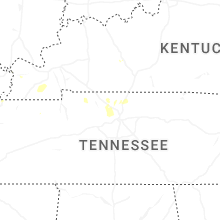
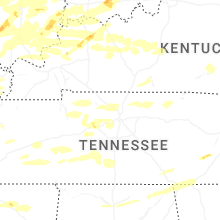
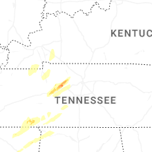
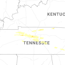
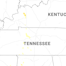


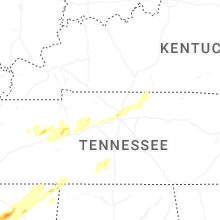


Connect with Interactive Hail Maps