

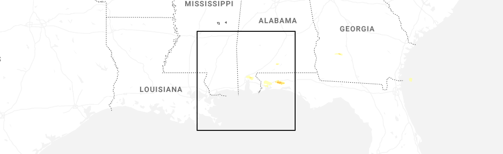
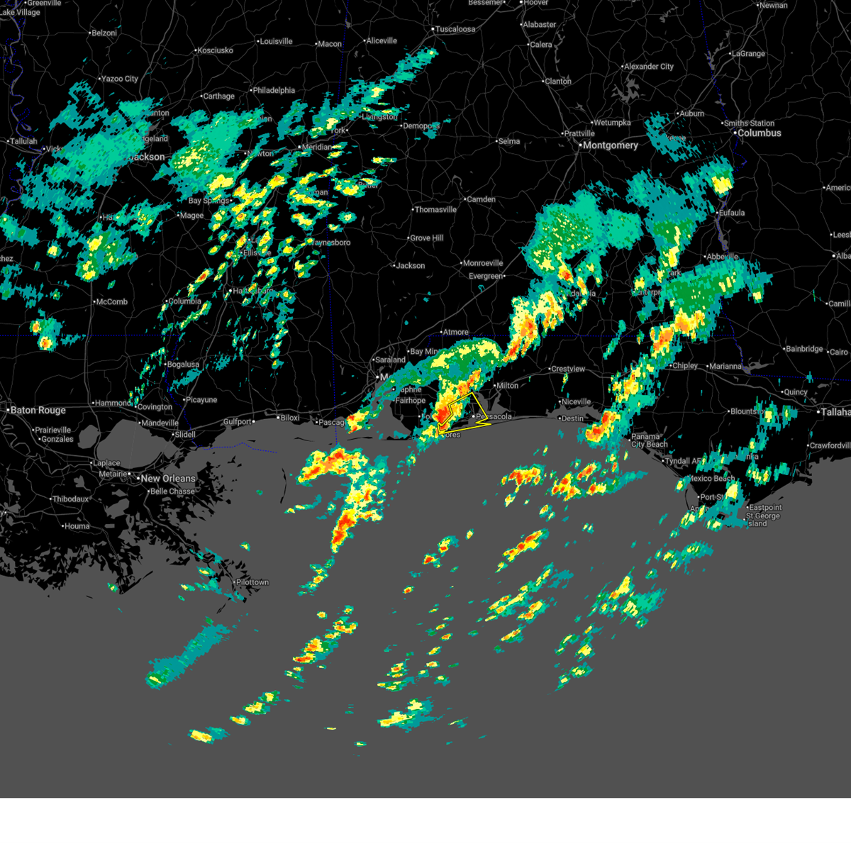
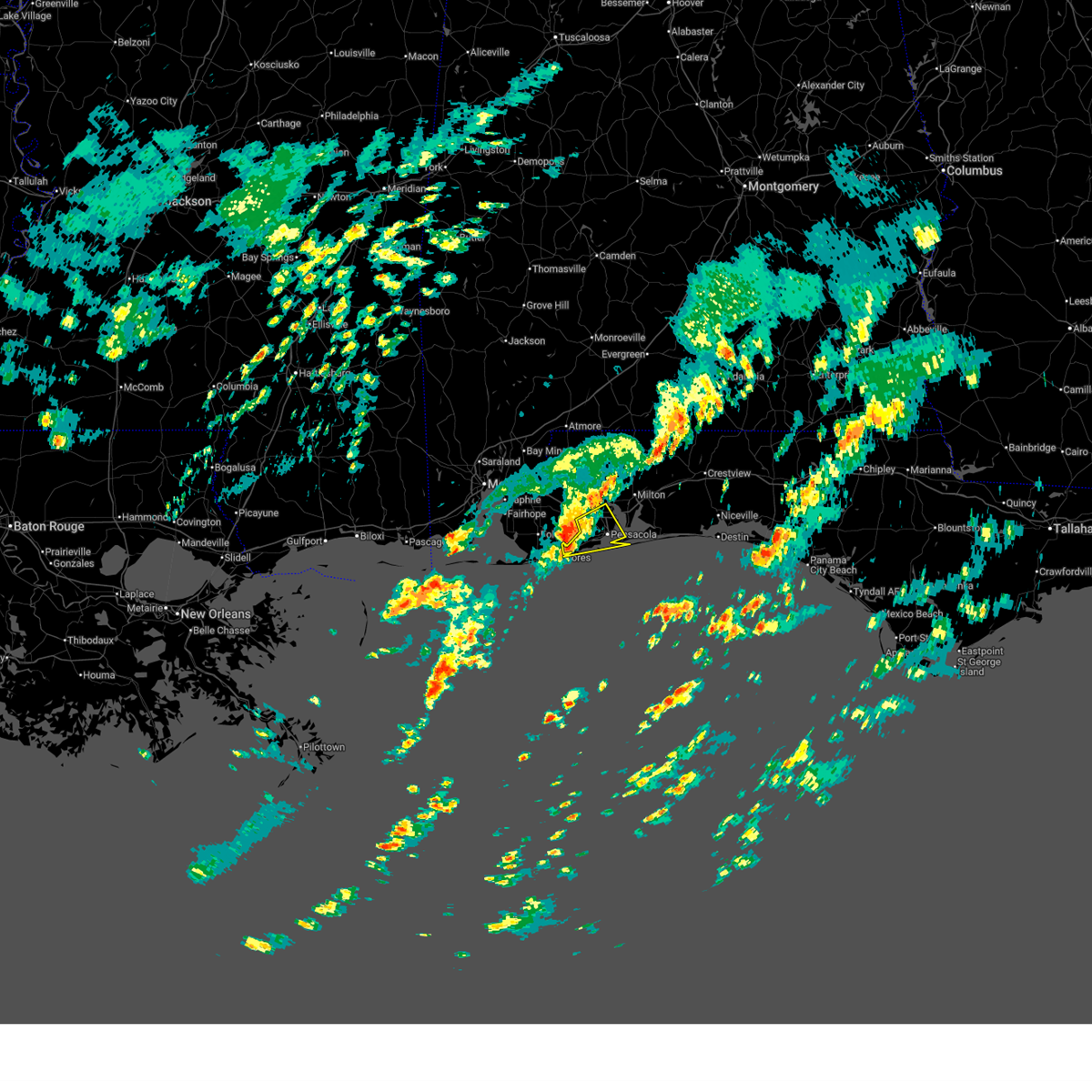
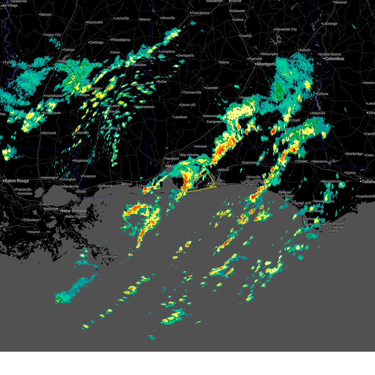
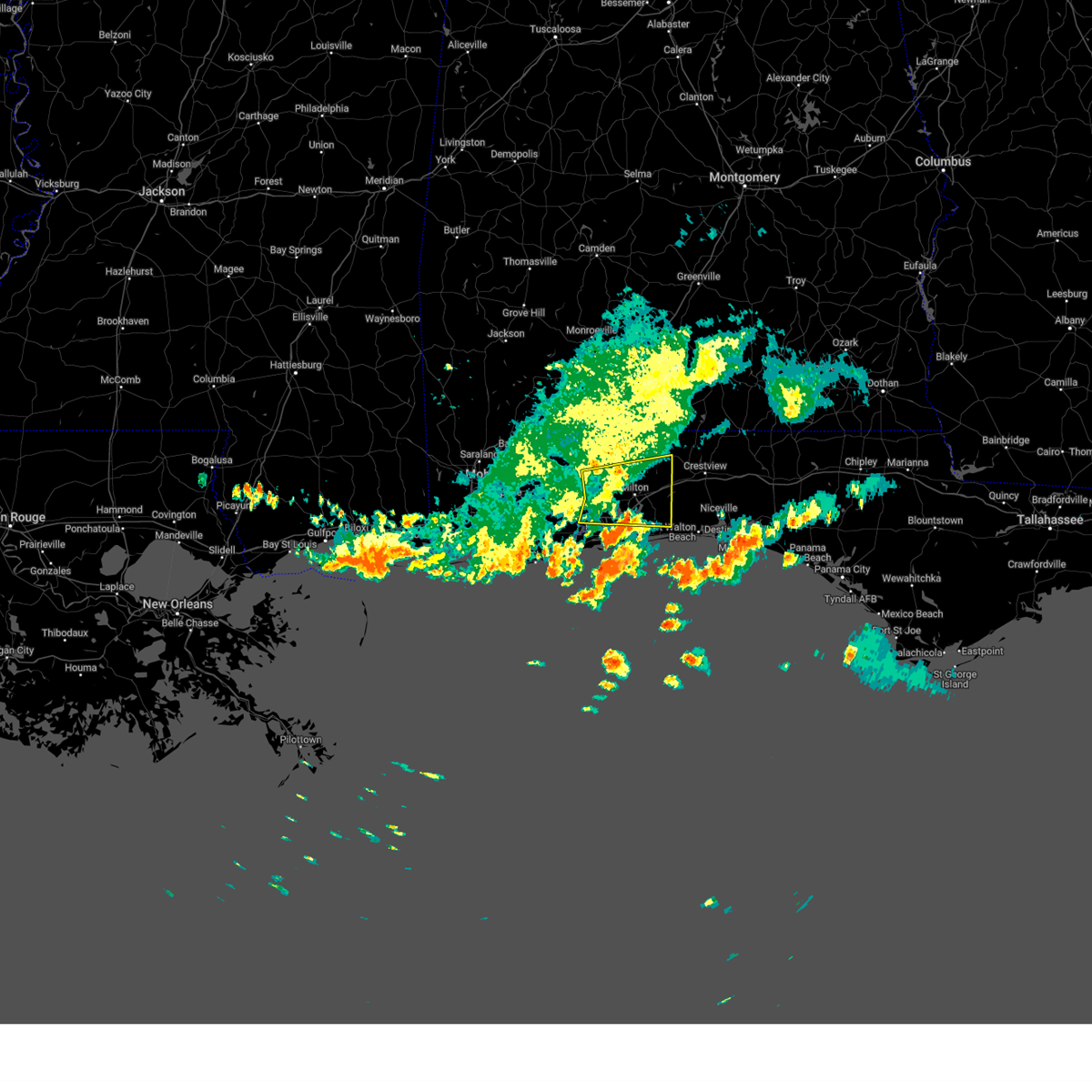
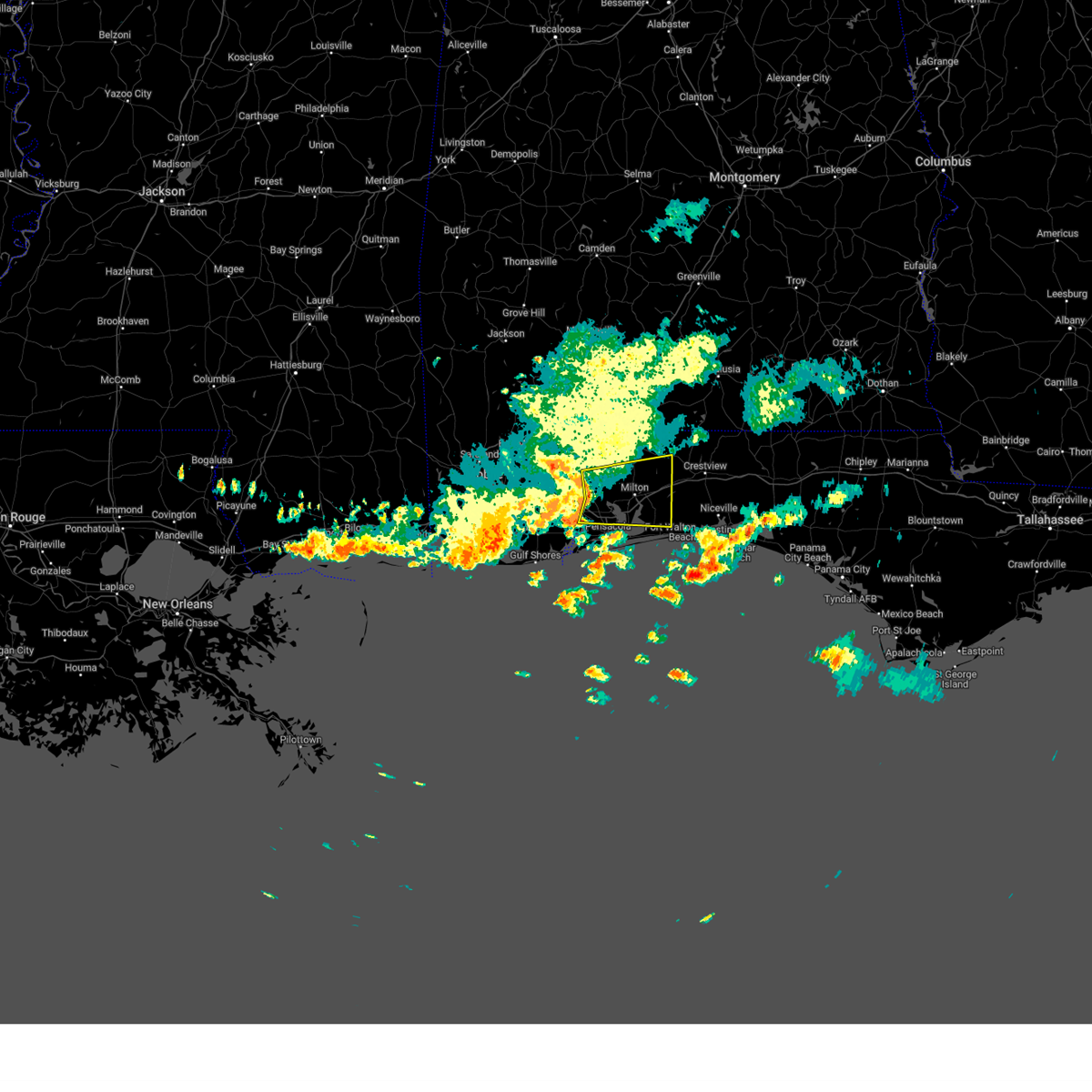
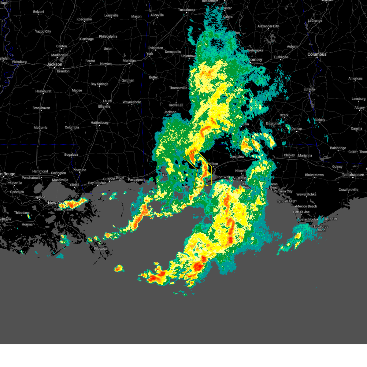
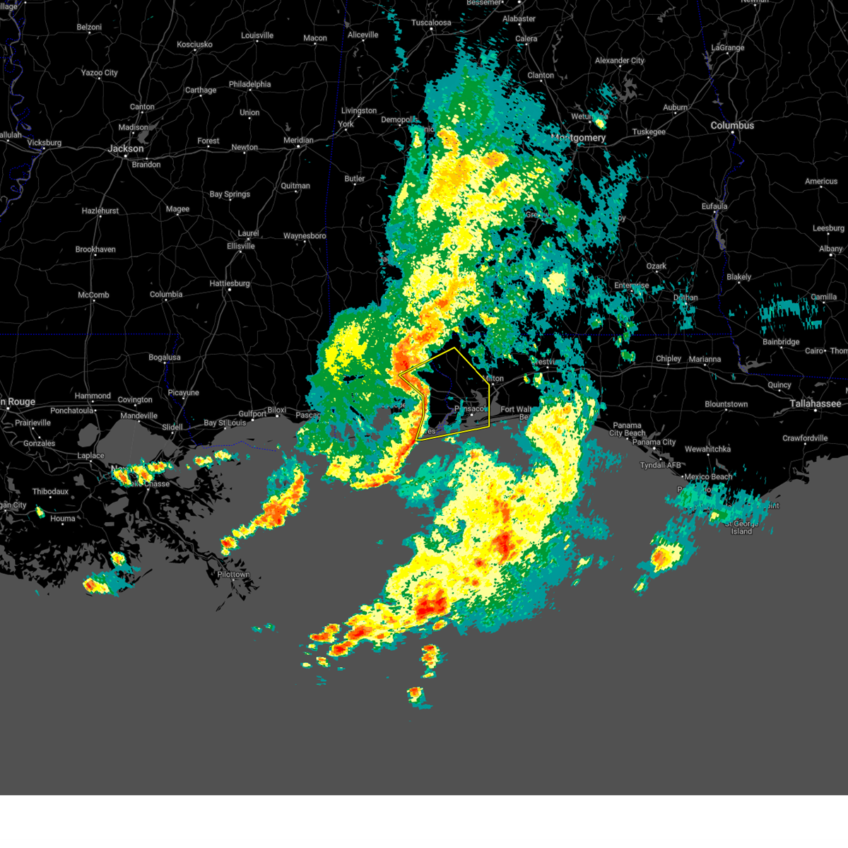
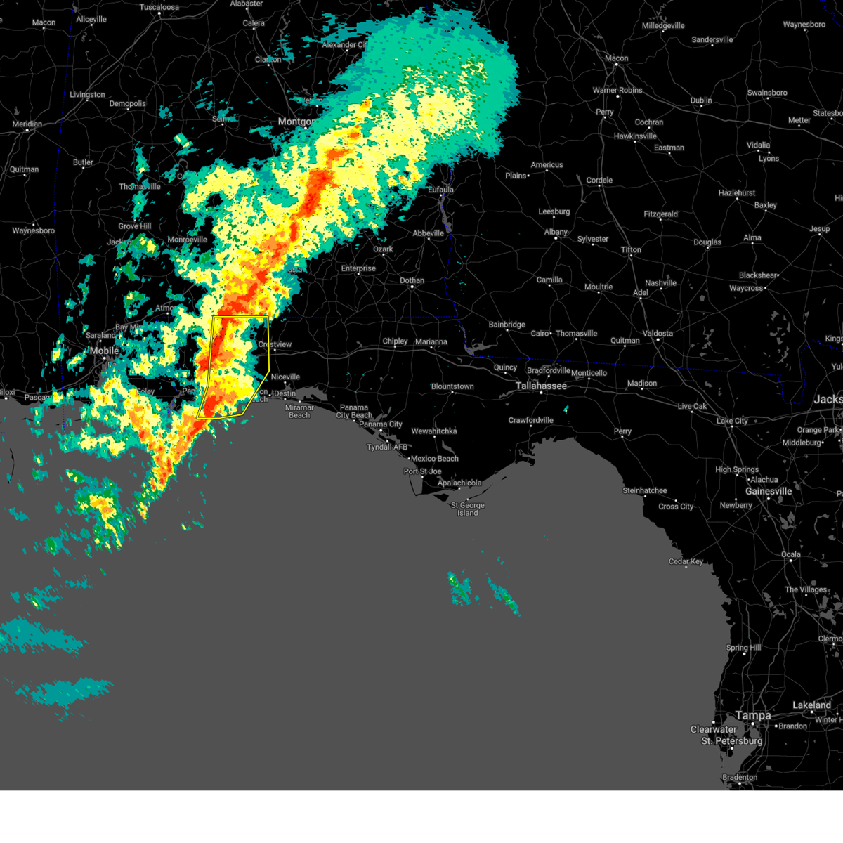
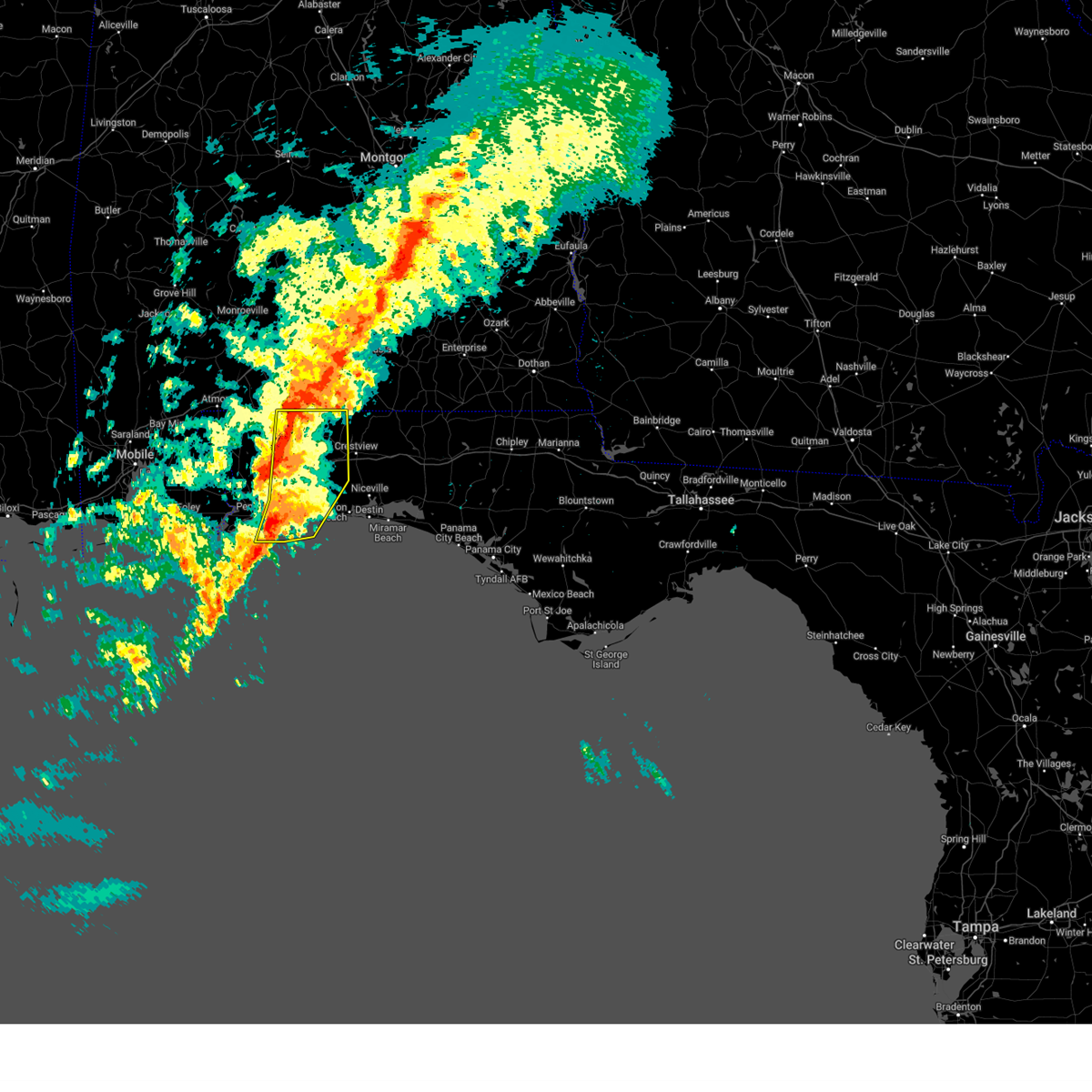
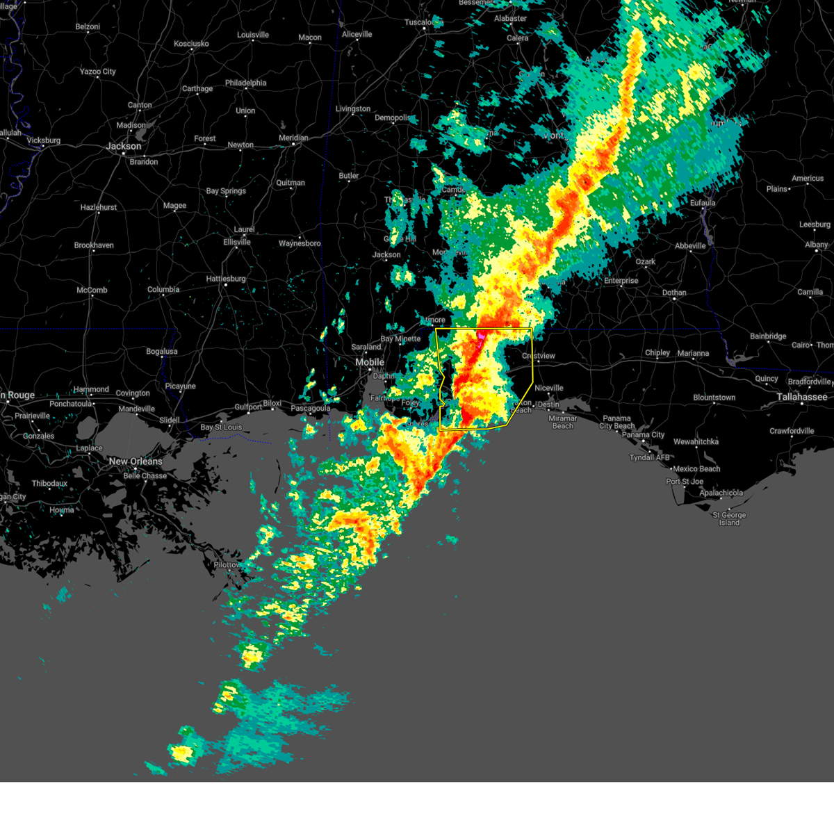
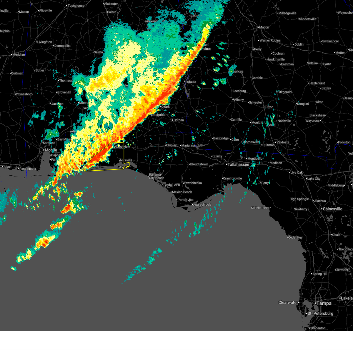
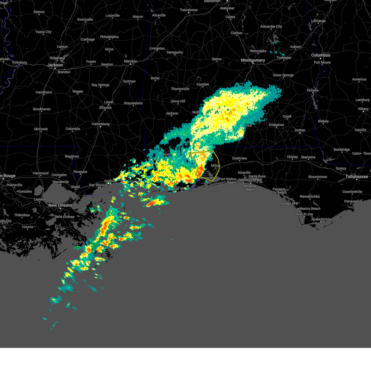
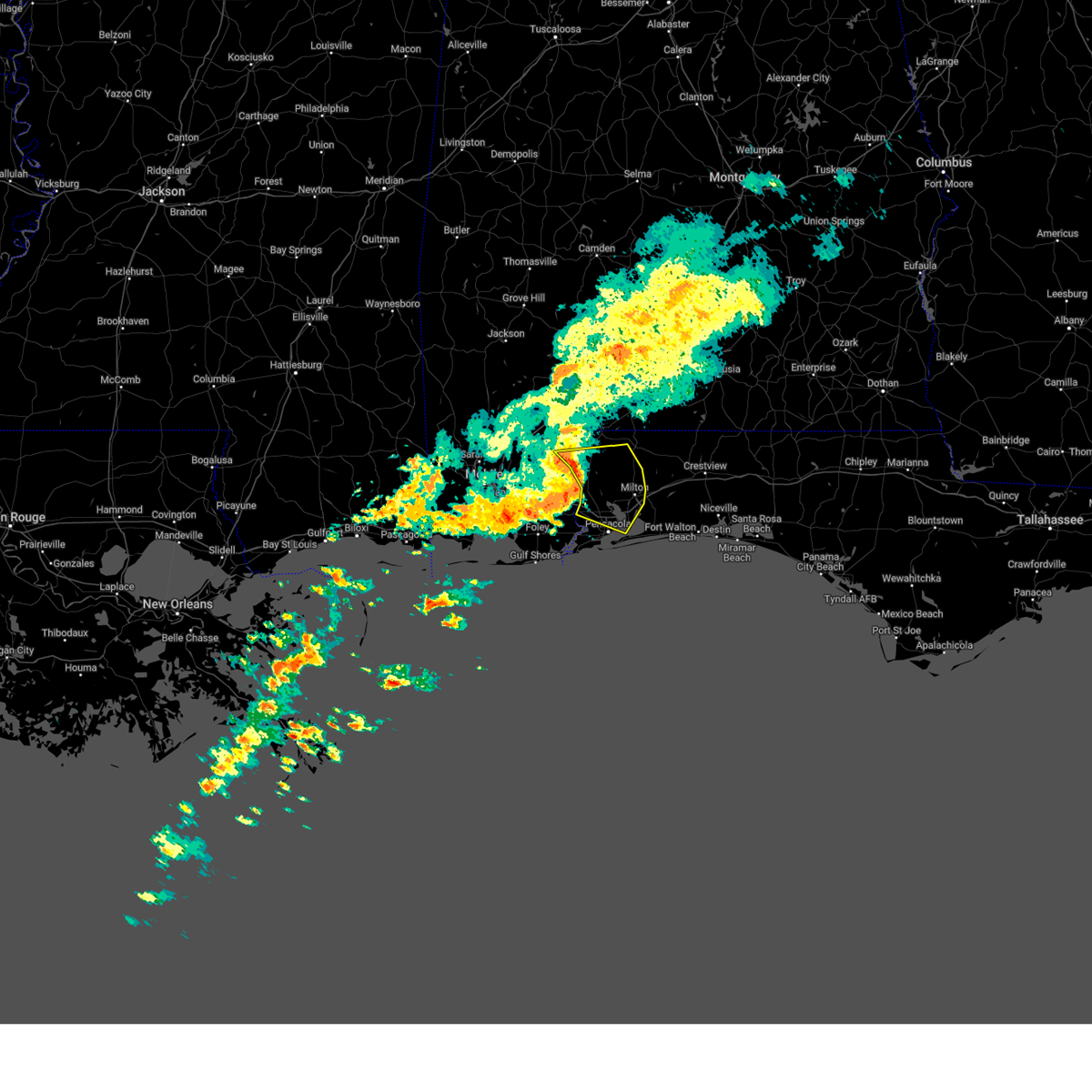
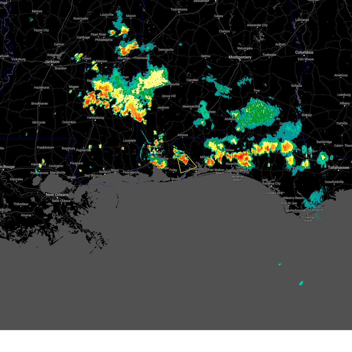
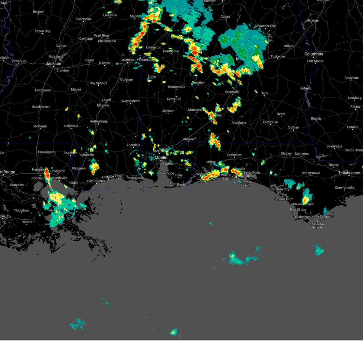
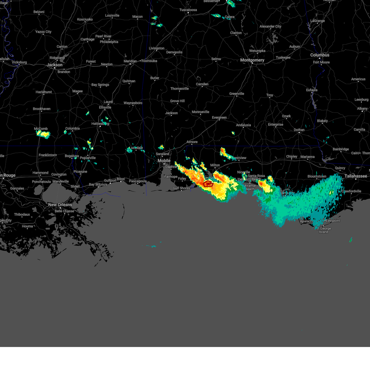
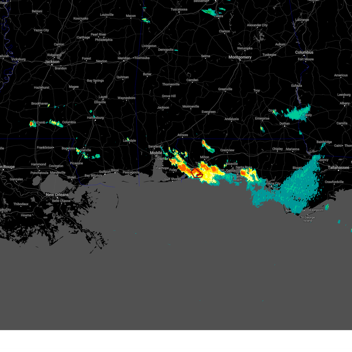
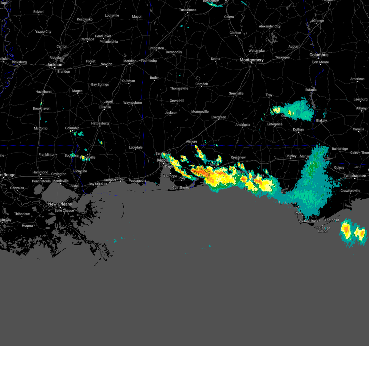
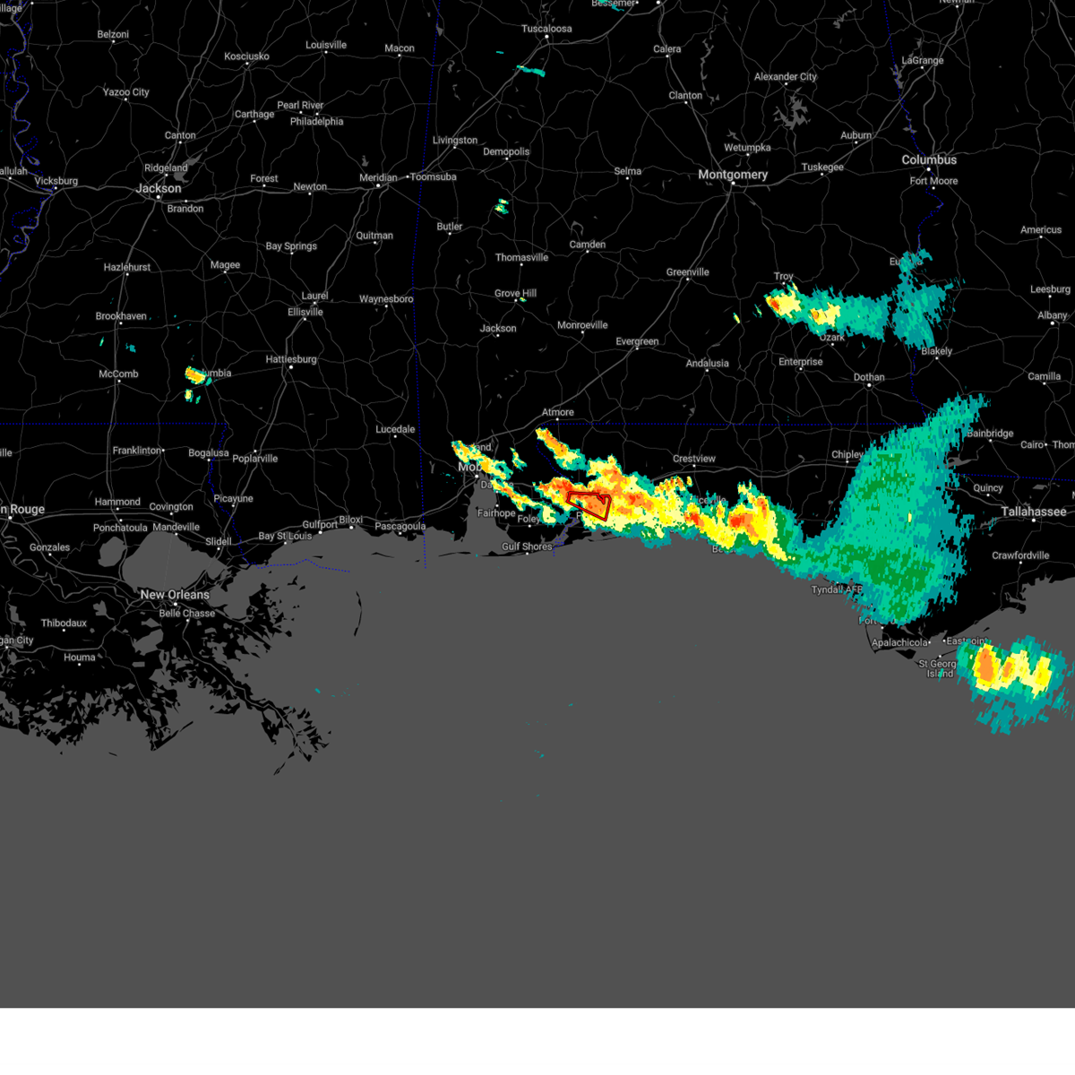
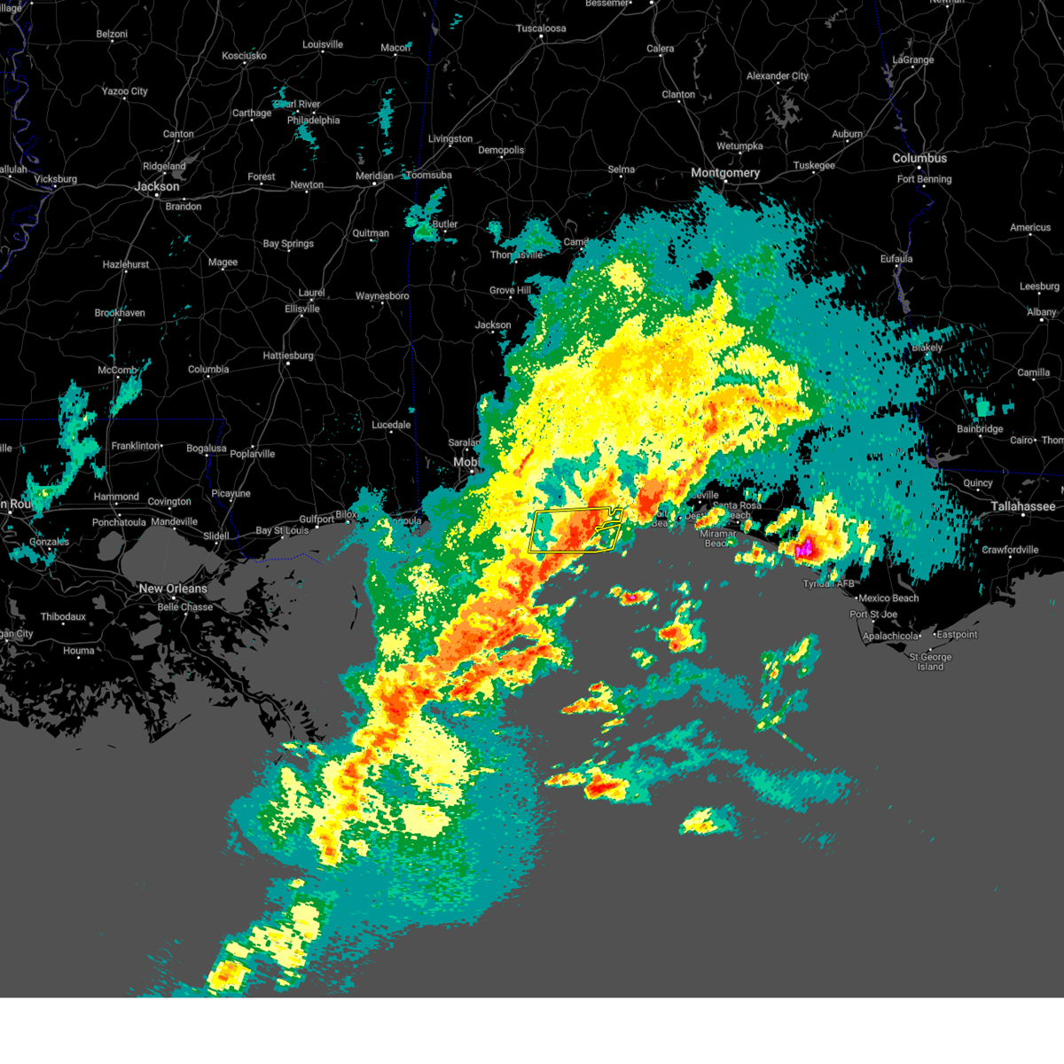
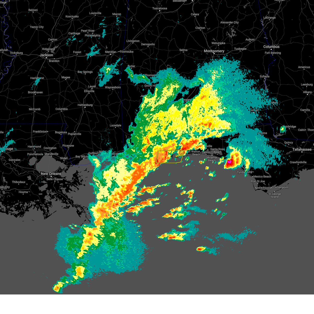
Hail Map for Pensacola, FL
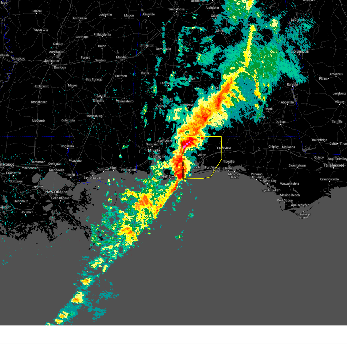
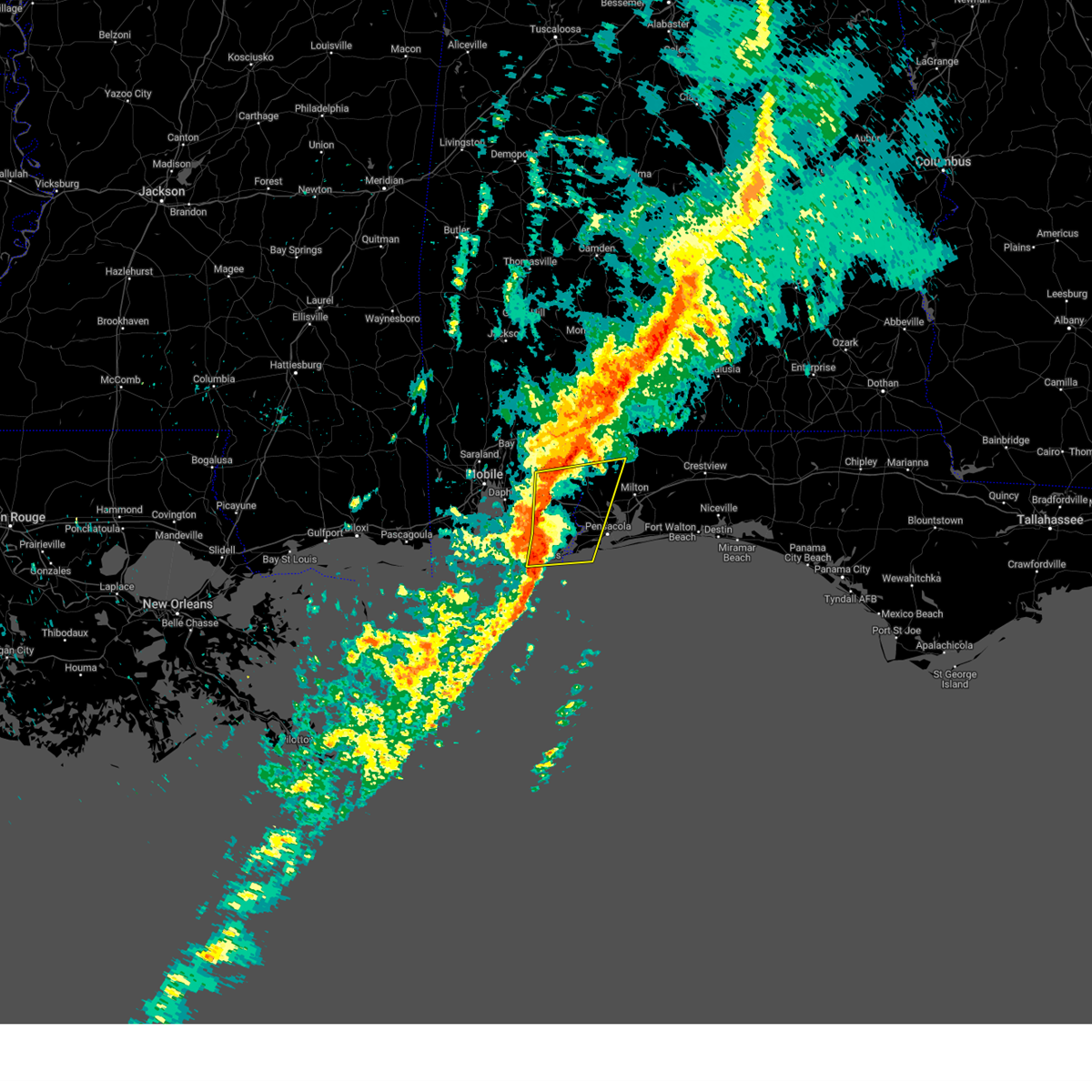
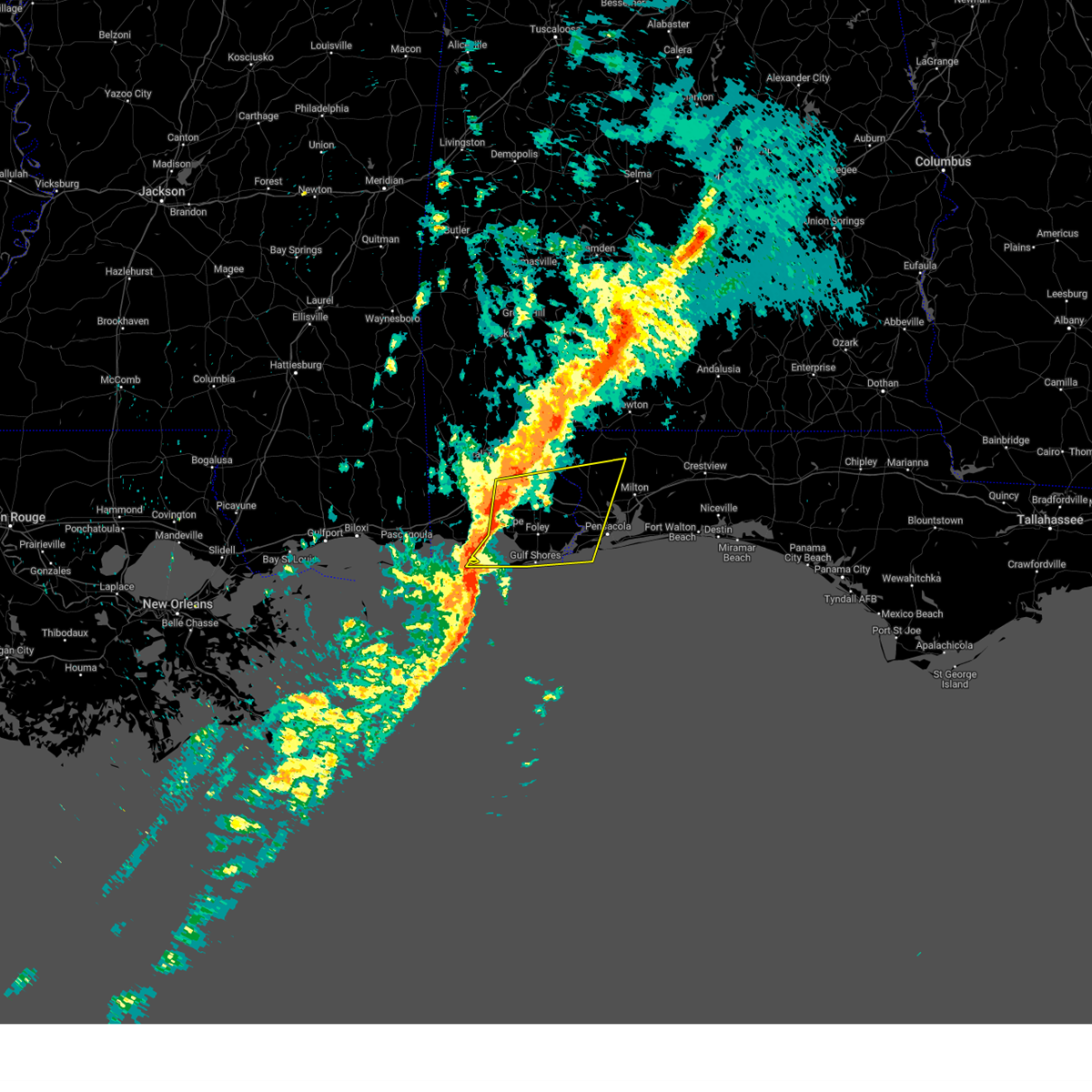
The Pensacola, FL area has had 11 reports of on-the-ground hail by trained spotters, and has been under severe weather warnings 9 times during the past 12 months. Doppler radar has detected hail at or near Pensacola, FL on 49 occasions, including 3 occasions during the past year.
| Name: | Pensacola, FL |
| Where Located: | 50.9 miles W of Miramar Beach, FL |
| Map: | Google Map for Pensacola, FL |
| Population: | 51923 |
| Housing Units: | 26848 |
| More Info: | Search Google for Pensacola, FL |
2
The Top Recent Hail Date for Pensacola, FL is Saturday, January 3, 2026 (12th out of 49)
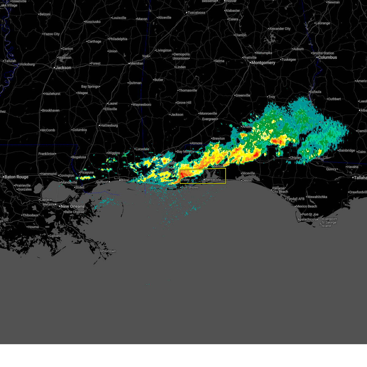
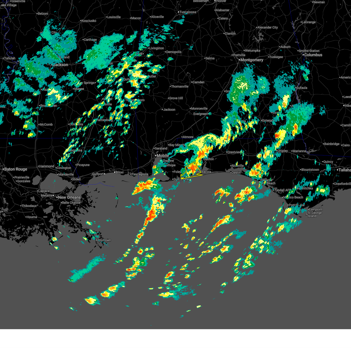
Hail and Wind Damage Spotted near Pensacola, FL
| Date / Time | Report Details |
|---|---|
| 5/7/2026 10:19 AM CDT |
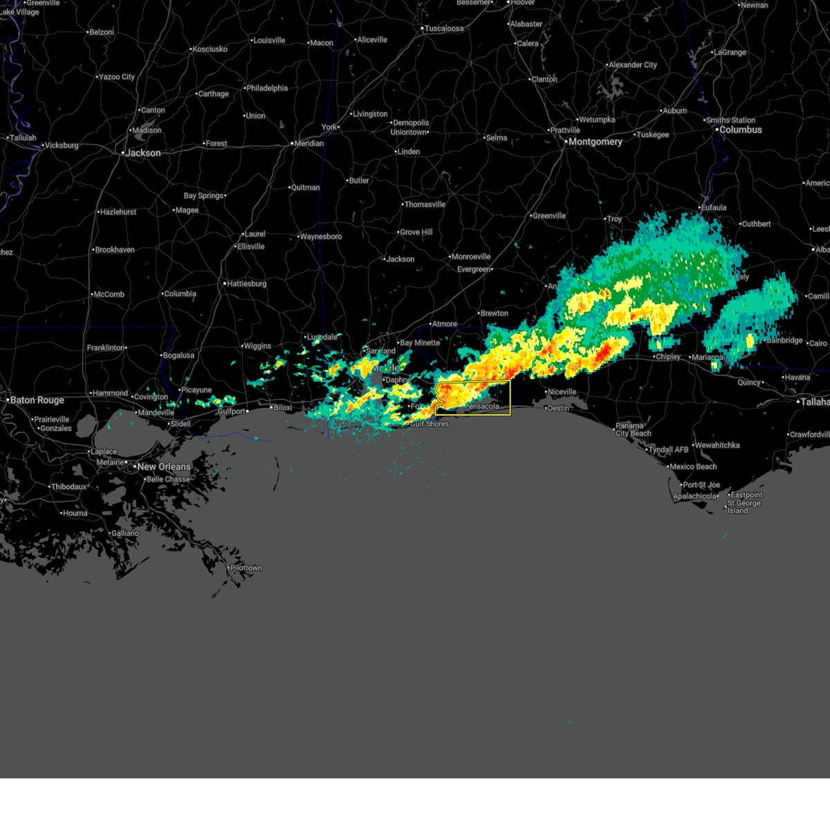 At 1018 am cdt, a severe thunderstorm was located over west pensacola, moving east at 50 mph (radar indicated). Hazards include 60 mph wind gusts and penny size hail. Expect damage to roofs, siding, and trees. Locations impacted include, pensacola, ferry pass, brent, west pensacola, ensley, warrington, gonzalez, gulf breeze, goulding, lillian, myrtle grove, oriole beach, navarre, navarre beach, and floridatown. At 1018 am cdt, a severe thunderstorm was located over west pensacola, moving east at 50 mph (radar indicated). Hazards include 60 mph wind gusts and penny size hail. Expect damage to roofs, siding, and trees. Locations impacted include, pensacola, ferry pass, brent, west pensacola, ensley, warrington, gonzalez, gulf breeze, goulding, lillian, myrtle grove, oriole beach, navarre, navarre beach, and floridatown.
|
| 5/7/2026 10:19 AM CDT |
 the severe thunderstorm warning has been cancelled and is no longer in effect the severe thunderstorm warning has been cancelled and is no longer in effect
|
| 5/7/2026 9:56 AM CDT |
 Svrmob the national weather service in mobile has issued a * severe thunderstorm warning for, southeastern baldwin county in southwestern alabama, southern santa rosa county in northwestern florida, southeastern escambia county in northwestern florida, * until 1045 am cdt. * at 956 am cdt, a severe thunderstorm was located over elberta, or 5 miles northeast of foley, moving east at 50 mph (radar indicated). Hazards include 60 mph wind gusts and quarter size hail. Hail damage to vehicles is expected. Expect wind damage to roofs, siding, and trees. Svrmob the national weather service in mobile has issued a * severe thunderstorm warning for, southeastern baldwin county in southwestern alabama, southern santa rosa county in northwestern florida, southeastern escambia county in northwestern florida, * until 1045 am cdt. * at 956 am cdt, a severe thunderstorm was located over elberta, or 5 miles northeast of foley, moving east at 50 mph (radar indicated). Hazards include 60 mph wind gusts and quarter size hail. Hail damage to vehicles is expected. Expect wind damage to roofs, siding, and trees.
|
| 3/16/2026 6:38 AM CDT |
 the severe thunderstorm warning has been cancelled and is no longer in effect the severe thunderstorm warning has been cancelled and is no longer in effect
|
| 3/16/2026 6:24 AM CDT |
 the severe thunderstorm warning has been cancelled and is no longer in effect the severe thunderstorm warning has been cancelled and is no longer in effect
|
| 3/16/2026 6:24 AM CDT |
 At 624 am cdt, a severe thunderstorm was located over lillian, or 9 miles northeast of orange beach, moving east at 45 mph (radar indicated). Hazards include 60 mph wind gusts and quarter size hail. Hail damage to vehicles is expected. expect wind damage to roofs, siding, and trees. Locations impacted include, pensacola, ferry pass, brent, west pensacola, ensley, warrington, gulf breeze, goulding, myrtle grove, and perdido beach. At 624 am cdt, a severe thunderstorm was located over lillian, or 9 miles northeast of orange beach, moving east at 45 mph (radar indicated). Hazards include 60 mph wind gusts and quarter size hail. Hail damage to vehicles is expected. expect wind damage to roofs, siding, and trees. Locations impacted include, pensacola, ferry pass, brent, west pensacola, ensley, warrington, gulf breeze, goulding, myrtle grove, and perdido beach.
|
| 3/16/2026 6:13 AM CDT |
 Svrmob the national weather service in mobile has issued a * severe thunderstorm warning for, southeastern baldwin county in southwestern alabama, south central escambia county in northwestern florida, * until 700 am cdt. * at 612 am cdt, a severe thunderstorm was located 4 miles south of elberta, or 4 miles northwest of orange beach, moving east at 45 mph (radar indicated). Hazards include 60 mph wind gusts and quarter size hail. Hail damage to vehicles is expected. Expect wind damage to roofs, siding, and trees. Svrmob the national weather service in mobile has issued a * severe thunderstorm warning for, southeastern baldwin county in southwestern alabama, south central escambia county in northwestern florida, * until 700 am cdt. * at 612 am cdt, a severe thunderstorm was located 4 miles south of elberta, or 4 miles northwest of orange beach, moving east at 45 mph (radar indicated). Hazards include 60 mph wind gusts and quarter size hail. Hail damage to vehicles is expected. Expect wind damage to roofs, siding, and trees.
|
| 1/25/2026 12:40 PM CST | Pensacola high schoo in escambia county FL, 3.3 miles NNW of Pensacola, FL |
| 10/27/2025 12:17 AM CDT | the severe thunderstorm warning has been cancelled and is no longer in effect |
| 10/26/2025 11:40 PM CDT | Svrmob the national weather service in mobile has issued a * severe thunderstorm warning for, south central escambia county in northwestern florida, * until 1230 am cdt. * at 1140 pm cdt, a severe thunderstorm was located 5 miles north of lillian, or 7 miles west of ensley, moving east at 25 mph (radar indicated). Hazards include 60 mph wind gusts and quarter size hail. Hail damage to vehicles is expected. Expect wind damage to roofs, siding, and trees. |
| 6/9/2025 11:04 PM CDT |
 the severe thunderstorm warning has been cancelled and is no longer in effect the severe thunderstorm warning has been cancelled and is no longer in effect
|
| 6/9/2025 10:34 PM CDT |
 Svrmob the national weather service in mobile has issued a * severe thunderstorm warning for, santa rosa county in northwestern florida, central escambia county in northwestern florida, * until 1130 pm cdt. * at 1033 pm cdt, severe thunderstorms were located along a line extending from 4 miles northwest of molino to near gonzalez to 6 miles west of ensley, moving east at 40 mph (radar indicated). Hazards include 60 mph wind gusts. expect damage to roofs, siding, and trees Svrmob the national weather service in mobile has issued a * severe thunderstorm warning for, santa rosa county in northwestern florida, central escambia county in northwestern florida, * until 1130 pm cdt. * at 1033 pm cdt, severe thunderstorms were located along a line extending from 4 miles northwest of molino to near gonzalez to 6 miles west of ensley, moving east at 40 mph (radar indicated). Hazards include 60 mph wind gusts. expect damage to roofs, siding, and trees
|
| 5/29/2025 10:53 AM CDT |
 the severe thunderstorm warning has been cancelled and is no longer in effect the severe thunderstorm warning has been cancelled and is no longer in effect
|
| 5/29/2025 10:53 AM CDT |
 At 1052 am cdt, severe thunderstorms were located along a line extending from 8 miles southwest of jay to point baker to near oriole beach, moving east at 45 mph (radar indicated). Hazards include 60 mph wind gusts. Expect damage to roofs, siding, and trees. Locations impacted include, cinco bayou, ocean city, mary esther, fort walton beach, shalimar, crestview, wright, point baker, lake lorraine, oriole beach, navarre beach, pea ridge, pace, baker, roeville, bagdad, floridatown, eglin afb, milton, and navarre. At 1052 am cdt, severe thunderstorms were located along a line extending from 8 miles southwest of jay to point baker to near oriole beach, moving east at 45 mph (radar indicated). Hazards include 60 mph wind gusts. Expect damage to roofs, siding, and trees. Locations impacted include, cinco bayou, ocean city, mary esther, fort walton beach, shalimar, crestview, wright, point baker, lake lorraine, oriole beach, navarre beach, pea ridge, pace, baker, roeville, bagdad, floridatown, eglin afb, milton, and navarre.
|
| 5/29/2025 10:40 AM CDT |
 The storms which prompted the warning have moved out of the warned area. therefore, the warning will be allowed to expire. however, gusty winds are still possible with these thunderstorms. remember, a severe thunderstorm warning still remains in effect for escambia county, florida until 1115 am cdt. The storms which prompted the warning have moved out of the warned area. therefore, the warning will be allowed to expire. however, gusty winds are still possible with these thunderstorms. remember, a severe thunderstorm warning still remains in effect for escambia county, florida until 1115 am cdt.
|
| 5/29/2025 10:37 AM CDT |
 Svrmob the national weather service in mobile has issued a * severe thunderstorm warning for, western okaloosa county in northwestern florida, santa rosa county in northwestern florida, central escambia county in northwestern florida, * until 1115 am cdt. * at 1037 am cdt, severe thunderstorms were located along a line extending from 8 miles northwest of molino to 4 miles northwest of pace to 3 miles southeast of warrington, moving east at 45 mph (radar indicated). Hazards include 60 mph wind gusts. expect damage to roofs, siding, and trees Svrmob the national weather service in mobile has issued a * severe thunderstorm warning for, western okaloosa county in northwestern florida, santa rosa county in northwestern florida, central escambia county in northwestern florida, * until 1115 am cdt. * at 1037 am cdt, severe thunderstorms were located along a line extending from 8 miles northwest of molino to 4 miles northwest of pace to 3 miles southeast of warrington, moving east at 45 mph (radar indicated). Hazards include 60 mph wind gusts. expect damage to roofs, siding, and trees
|
| 5/29/2025 10:32 AM CDT |
 At 1032 am cdt, severe thunderstorms were located along a line extending from 9 miles south of bratt to 5 miles northeast of gonzalez to warrington, moving east at 45 mph (radar indicated). Hazards include 60 mph wind gusts. Expect damage to roofs, siding, and trees. Locations impacted include, west pensacola, warrington, gulf breeze, pensacola, pensacola beach, brent, oriole beach, myrtle grove, goulding, pea ridge, ferry pass, ensley, molino, gonzalez, pace, and floridatown. At 1032 am cdt, severe thunderstorms were located along a line extending from 9 miles south of bratt to 5 miles northeast of gonzalez to warrington, moving east at 45 mph (radar indicated). Hazards include 60 mph wind gusts. Expect damage to roofs, siding, and trees. Locations impacted include, west pensacola, warrington, gulf breeze, pensacola, pensacola beach, brent, oriole beach, myrtle grove, goulding, pea ridge, ferry pass, ensley, molino, gonzalez, pace, and floridatown.
|
| 5/29/2025 9:59 AM CDT |
 Svrmob the national weather service in mobile has issued a * severe thunderstorm warning for, southeastern baldwin county in southwestern alabama, southwestern santa rosa county in northwestern florida, escambia county in northwestern florida, * until 1045 am cdt. * at 959 am cdt, severe thunderstorms were located along a line extending from near loxley to 5 miles east of robertsdale to 4 miles north of elberta, moving east at 40 mph (radar indicated). Hazards include 60 mph wind gusts. expect damage to roofs, siding, and trees Svrmob the national weather service in mobile has issued a * severe thunderstorm warning for, southeastern baldwin county in southwestern alabama, southwestern santa rosa county in northwestern florida, escambia county in northwestern florida, * until 1045 am cdt. * at 959 am cdt, severe thunderstorms were located along a line extending from near loxley to 5 miles east of robertsdale to 4 miles north of elberta, moving east at 40 mph (radar indicated). Hazards include 60 mph wind gusts. expect damage to roofs, siding, and trees
|
| 3/31/2025 10:57 AM CDT | Asos station kpns pensacola observed a wind gust to 63mp in escambia county FL, 1.9 miles WSW of Pensacola, FL |
| 3/4/2025 11:04 PM CST |
 the severe thunderstorm warning has been cancelled and is no longer in effect the severe thunderstorm warning has been cancelled and is no longer in effect
|
| 3/4/2025 11:04 PM CST |
 At 1103 pm cst, severe thunderstorms were located along a line extending from 12 miles east of riverview to 6 miles northeast of roeville to navarre to 10 miles south of pensacola beach, moving east at 65 mph (radar indicated). Hazards include 70 mph wind gusts. Expect considerable tree damage. damage is likely to mobile homes, roofs, and outbuildings. Locations impacted include, oriole beach, gulf breeze, navarre beach, pea ridge, pensacola beach, baker, roeville, bagdad, point baker, milton, and navarre. At 1103 pm cst, severe thunderstorms were located along a line extending from 12 miles east of riverview to 6 miles northeast of roeville to navarre to 10 miles south of pensacola beach, moving east at 65 mph (radar indicated). Hazards include 70 mph wind gusts. Expect considerable tree damage. damage is likely to mobile homes, roofs, and outbuildings. Locations impacted include, oriole beach, gulf breeze, navarre beach, pea ridge, pensacola beach, baker, roeville, bagdad, point baker, milton, and navarre.
|
| 3/4/2025 10:54 PM CST | Reported by kpns pensacola international airpor in escambia county FL, 1.9 miles WSW of Pensacola, FL |
| 3/4/2025 10:54 PM CST |
 At 1053 pm cst, severe thunderstorms were located along a line extending from 5 miles southeast of riverview to point baker to near oriole beach to 16 miles southwest of pensacola beach, moving east at 50 mph (observed. a 70 mph gust was just reported at pensacola nas). Hazards include 70 mph wind gusts. Expect considerable tree damage. damage is likely to mobile homes, roofs, and outbuildings. Locations impacted include, west pensacola, warrington, pensacola, jay, pensacola beach, point baker, myrtle grove, goulding, pea ridge, ferry pass, ensley, gonzalez, baker, pace, roeville, floridatown, flomaton, gulf breeze, bratt, and century. At 1053 pm cst, severe thunderstorms were located along a line extending from 5 miles southeast of riverview to point baker to near oriole beach to 16 miles southwest of pensacola beach, moving east at 50 mph (observed. a 70 mph gust was just reported at pensacola nas). Hazards include 70 mph wind gusts. Expect considerable tree damage. damage is likely to mobile homes, roofs, and outbuildings. Locations impacted include, west pensacola, warrington, pensacola, jay, pensacola beach, point baker, myrtle grove, goulding, pea ridge, ferry pass, ensley, gonzalez, baker, pace, roeville, floridatown, flomaton, gulf breeze, bratt, and century.
|
| 3/4/2025 10:40 PM CST | Recorded at knpa - pensacola na in escambia county FL, 10.4 miles NE of Pensacola, FL |
| 3/4/2025 10:24 PM CST |
 Svrmob the national weather service in mobile has issued a * severe thunderstorm warning for, western okaloosa county in northwestern florida, santa rosa county in northwestern florida, escambia county in northwestern florida, * until 1115 pm cst. * at 1024 pm cst, severe thunderstorms were located along a line extending from 8 miles southeast of bratt to 7 miles west of gonzalez to near myrtle grove to 18 miles south of gulf shores, moving east at 65 mph (radar indicated). Hazards include 60 mph wind gusts. expect damage to roofs, siding, and trees Svrmob the national weather service in mobile has issued a * severe thunderstorm warning for, western okaloosa county in northwestern florida, santa rosa county in northwestern florida, escambia county in northwestern florida, * until 1115 pm cst. * at 1024 pm cst, severe thunderstorms were located along a line extending from 8 miles southeast of bratt to 7 miles west of gonzalez to near myrtle grove to 18 miles south of gulf shores, moving east at 65 mph (radar indicated). Hazards include 60 mph wind gusts. expect damage to roofs, siding, and trees
|
| 3/4/2025 10:13 PM CST |
 At 1013 pm cst, severe thunderstorms were located along a line extending from 11 miles west of molino to 6 miles east of summerdale to 3 miles west of perdido beach to 11 miles south of gulf shores, moving east at 60 mph (radar indicated). Hazards include 60 mph wind gusts. Expect damage to roofs, siding, and trees. Locations impacted include, west pensacola, warrington, perdido beach, summerdale, orange beach, myrtle grove, lillian, gulf shores, ensley, molino, gonzalez, elberta, foley, bon secour, and robertsdale. At 1013 pm cst, severe thunderstorms were located along a line extending from 11 miles west of molino to 6 miles east of summerdale to 3 miles west of perdido beach to 11 miles south of gulf shores, moving east at 60 mph (radar indicated). Hazards include 60 mph wind gusts. Expect damage to roofs, siding, and trees. Locations impacted include, west pensacola, warrington, perdido beach, summerdale, orange beach, myrtle grove, lillian, gulf shores, ensley, molino, gonzalez, elberta, foley, bon secour, and robertsdale.
|
| 3/4/2025 9:44 PM CST |
 Svrmob the national weather service in mobile has issued a * severe thunderstorm warning for, southern baldwin county in southwestern alabama, west central santa rosa county in northwestern florida, central escambia county in northwestern florida, * until 1045 pm cst. * at 943 pm cst, severe thunderstorms were located along a line extending from daphne to 3 miles southwest of point clear to dauphin island to 15 miles south of fort morgan, moving east at 50 mph (radar indicated). Hazards include 60 mph wind gusts. expect damage to roofs, siding, and trees Svrmob the national weather service in mobile has issued a * severe thunderstorm warning for, southern baldwin county in southwestern alabama, west central santa rosa county in northwestern florida, central escambia county in northwestern florida, * until 1045 pm cst. * at 943 pm cst, severe thunderstorms were located along a line extending from daphne to 3 miles southwest of point clear to dauphin island to 15 miles south of fort morgan, moving east at 50 mph (radar indicated). Hazards include 60 mph wind gusts. expect damage to roofs, siding, and trees
|
| 2/16/2025 3:59 AM CST |
 Svrmob the national weather service in mobile has issued a * severe thunderstorm warning for, okaloosa county in northwestern florida, southeastern santa rosa county in northwestern florida, southeastern escambia county in northwestern florida, * until 445 am cst. * at 359 am cst, severe thunderstorms were located along a line extending from 3 miles south of baker to 11 miles southeast of roeville to oriole beach, moving east at 45 mph (radar indicated). Hazards include 60 mph wind gusts. expect damage to roofs, siding, and trees Svrmob the national weather service in mobile has issued a * severe thunderstorm warning for, okaloosa county in northwestern florida, southeastern santa rosa county in northwestern florida, southeastern escambia county in northwestern florida, * until 445 am cst. * at 359 am cst, severe thunderstorms were located along a line extending from 3 miles south of baker to 11 miles southeast of roeville to oriole beach, moving east at 45 mph (radar indicated). Hazards include 60 mph wind gusts. expect damage to roofs, siding, and trees
|
| 2/11/2025 4:22 PM CST | Multiple reports of damage in the ferry pass area with roofs ripped off buildings and power lines knocked down. possible tornad in escambia county FL, 4.6 miles SSW of Pensacola, FL |
| 12/27/2024 11:13 PM CST |
 the severe thunderstorm warning has been cancelled and is no longer in effect the severe thunderstorm warning has been cancelled and is no longer in effect
|
| 12/27/2024 10:43 PM CST |
 Svrmob the national weather service in mobile has issued a * severe thunderstorm warning for, western santa rosa county in northwestern florida, central escambia county in northwestern florida, * until 1130 pm cst. * at 1043 pm cst, severe thunderstorms were located along a line extending from 7 miles south of bratt to 5 miles southwest of molino to 6 miles west of gonzalez to 6 miles north of lillian, moving east at 20 mph (radar indicated). Hazards include 60 mph wind gusts and nickel size hail. expect damage to roofs, siding, and trees Svrmob the national weather service in mobile has issued a * severe thunderstorm warning for, western santa rosa county in northwestern florida, central escambia county in northwestern florida, * until 1130 pm cst. * at 1043 pm cst, severe thunderstorms were located along a line extending from 7 miles south of bratt to 5 miles southwest of molino to 6 miles west of gonzalez to 6 miles north of lillian, moving east at 20 mph (radar indicated). Hazards include 60 mph wind gusts and nickel size hail. expect damage to roofs, siding, and trees
|
| 5/17/2024 3:26 AM CDT |
 The storms which prompted the warning have weakened below severe limits, and no longer pose an immediate threat to life or property. therefore, the warning will be allowed to expire. The storms which prompted the warning have weakened below severe limits, and no longer pose an immediate threat to life or property. therefore, the warning will be allowed to expire.
|
| 5/17/2024 3:15 AM CDT |
 At 314 am cdt, severe thunderstorms were located along a line extending from 3 miles east of ferry pass to 6 miles southeast of pensacola beach, moving east at 45 mph (radar indicated). Hazards include 60 mph wind gusts. Expect damage to roofs, siding, and trees. Locations impacted include, bagdad, oriole beach, navarre, floridatown, navarre beach, and pensacola beach. At 314 am cdt, severe thunderstorms were located along a line extending from 3 miles east of ferry pass to 6 miles southeast of pensacola beach, moving east at 45 mph (radar indicated). Hazards include 60 mph wind gusts. Expect damage to roofs, siding, and trees. Locations impacted include, bagdad, oriole beach, navarre, floridatown, navarre beach, and pensacola beach.
|
| 5/17/2024 2:41 AM CDT |
 Svrmob the national weather service in mobile has issued a * severe thunderstorm warning for, southern santa rosa county in northwestern florida, southeastern escambia county in northwestern florida, * until 330 am cdt. * at 241 am cdt, severe thunderstorms were located along a line extending from 4 miles north of elberta to 7 miles southeast of orange beach, moving east at 50 mph (radar indicated). Hazards include 60 mph wind gusts. expect damage to roofs, siding, and trees Svrmob the national weather service in mobile has issued a * severe thunderstorm warning for, southern santa rosa county in northwestern florida, southeastern escambia county in northwestern florida, * until 330 am cdt. * at 241 am cdt, severe thunderstorms were located along a line extending from 4 miles north of elberta to 7 miles southeast of orange beach, moving east at 50 mph (radar indicated). Hazards include 60 mph wind gusts. expect damage to roofs, siding, and trees
|
| 5/13/2024 10:38 AM CDT |
 Svrmob the national weather service in mobile has issued a * severe thunderstorm warning for, okaloosa county in northwestern florida, southeastern santa rosa county in northwestern florida, southeastern escambia county in northwestern florida, * until 1115 am cdt. * at 1036 am cdt, severe thunderstorms were located along a line extending from 13 miles west of laurel hill to 8 miles southwest of baker to 3 miles southwest of warrington, moving southeast at 30 mph. these are destructive storms for much of okaloosa county and portions of southeastern santa rosa and escambia counties, including crestview and portions of interstate 10 (radar indicated). Hazards include 80 mph wind gusts. Flying debris will be dangerous to those caught without shelter. mobile homes will be heavily damaged. expect considerable damage to roofs, windows, and vehicles. Extensive tree damage and power outages are likely. Svrmob the national weather service in mobile has issued a * severe thunderstorm warning for, okaloosa county in northwestern florida, southeastern santa rosa county in northwestern florida, southeastern escambia county in northwestern florida, * until 1115 am cdt. * at 1036 am cdt, severe thunderstorms were located along a line extending from 13 miles west of laurel hill to 8 miles southwest of baker to 3 miles southwest of warrington, moving southeast at 30 mph. these are destructive storms for much of okaloosa county and portions of southeastern santa rosa and escambia counties, including crestview and portions of interstate 10 (radar indicated). Hazards include 80 mph wind gusts. Flying debris will be dangerous to those caught without shelter. mobile homes will be heavily damaged. expect considerable damage to roofs, windows, and vehicles. Extensive tree damage and power outages are likely.
|
| 5/13/2024 10:24 AM CDT |
 At 1023 am cdt, severe thunderstorms were located along a line extending from 4 miles north of roeville to 4 miles south of floridatown to 5 miles southwest of bon secour, moving southeast at 40 mph. these are destructive storms for locations near whiting field, allentown, baker (radar indicated). Hazards include 80 mph wind gusts. Flying debris will be dangerous to those caught without shelter. mobile homes will be heavily damaged. expect considerable damage to roofs, windows, and vehicles. extensive tree damage and power outages are likely. Locations impacted include, pensacola, ferry pass, brent, west pensacola, wright, fort walton beach, ensley, warrington, gonzalez, gulf shores, foley, pace, milton, gulf breeze, orange beach, goulding, mary esther, robertsdale, bagdad, and ocean city. At 1023 am cdt, severe thunderstorms were located along a line extending from 4 miles north of roeville to 4 miles south of floridatown to 5 miles southwest of bon secour, moving southeast at 40 mph. these are destructive storms for locations near whiting field, allentown, baker (radar indicated). Hazards include 80 mph wind gusts. Flying debris will be dangerous to those caught without shelter. mobile homes will be heavily damaged. expect considerable damage to roofs, windows, and vehicles. extensive tree damage and power outages are likely. Locations impacted include, pensacola, ferry pass, brent, west pensacola, wright, fort walton beach, ensley, warrington, gonzalez, gulf shores, foley, pace, milton, gulf breeze, orange beach, goulding, mary esther, robertsdale, bagdad, and ocean city.
|
| 5/13/2024 10:14 AM CDT |
 Svrmob the national weather service in mobile has issued a * severe thunderstorm warning for, southeastern baldwin county in southwestern alabama, western okaloosa county in northwestern florida, santa rosa county in northwestern florida, escambia county in northwestern florida, * until 1100 am cdt. * at 1014 am cdt, severe thunderstorms were located along a line extending from 9 miles north of point baker to 3 miles southwest of floridatown to 7 miles west of bon secour, moving southeast at 40 mph (radar indicated). Hazards include 70 mph wind gusts. Expect considerable tree damage. Damage is likely to mobile homes, roofs, and outbuildings. Svrmob the national weather service in mobile has issued a * severe thunderstorm warning for, southeastern baldwin county in southwestern alabama, western okaloosa county in northwestern florida, santa rosa county in northwestern florida, escambia county in northwestern florida, * until 1100 am cdt. * at 1014 am cdt, severe thunderstorms were located along a line extending from 9 miles north of point baker to 3 miles southwest of floridatown to 7 miles west of bon secour, moving southeast at 40 mph (radar indicated). Hazards include 70 mph wind gusts. Expect considerable tree damage. Damage is likely to mobile homes, roofs, and outbuildings.
|
| 5/13/2024 9:52 AM CDT |
 At 951 am cdt, severe thunderstorms were located along a line extending from 3 miles west of brewton to 5 miles northeast of gonzalez to summerdale, moving southeast at 55 mph (radar indicated). Hazards include 70 mph wind gusts and penny size hail. Expect considerable tree damage. damage is likely to mobile homes, roofs, and outbuildings. Locations impacted include, pensacola, ferry pass, brent, west pensacola, ensley, daphne, warrington, gonzalez, pace, milton, brewton, goulding, robertsdale, century, flomaton, bagdad, loxley, lillian, myrtle grove, and east brewton. At 951 am cdt, severe thunderstorms were located along a line extending from 3 miles west of brewton to 5 miles northeast of gonzalez to summerdale, moving southeast at 55 mph (radar indicated). Hazards include 70 mph wind gusts and penny size hail. Expect considerable tree damage. damage is likely to mobile homes, roofs, and outbuildings. Locations impacted include, pensacola, ferry pass, brent, west pensacola, ensley, daphne, warrington, gonzalez, pace, milton, brewton, goulding, robertsdale, century, flomaton, bagdad, loxley, lillian, myrtle grove, and east brewton.
|
| 5/13/2024 9:31 AM CDT |
 Svrmob the national weather service in mobile has issued a * severe thunderstorm warning for, central baldwin county in southwestern alabama, southern escambia county in south central alabama, santa rosa county in northwestern florida, escambia county in northwestern florida, * until 1015 am cdt. * at 930 am cdt, severe thunderstorms were located along a line extending from 4 miles southwest of i65 and al 113 to 11 miles west of molino to near fairhope, moving southeast at 55 mph. these are destructive storms for northerm baldwin, southwestern escambia alabama, and northwestern escambia florida counties (radar indicated). Hazards include 80 mph wind gusts and nickel size hail. Flying debris will be dangerous to those caught without shelter. mobile homes will be heavily damaged. expect considerable damage to roofs, windows, and vehicles. Extensive tree damage and power outages are likely. Svrmob the national weather service in mobile has issued a * severe thunderstorm warning for, central baldwin county in southwestern alabama, southern escambia county in south central alabama, santa rosa county in northwestern florida, escambia county in northwestern florida, * until 1015 am cdt. * at 930 am cdt, severe thunderstorms were located along a line extending from 4 miles southwest of i65 and al 113 to 11 miles west of molino to near fairhope, moving southeast at 55 mph. these are destructive storms for northerm baldwin, southwestern escambia alabama, and northwestern escambia florida counties (radar indicated). Hazards include 80 mph wind gusts and nickel size hail. Flying debris will be dangerous to those caught without shelter. mobile homes will be heavily damaged. expect considerable damage to roofs, windows, and vehicles. Extensive tree damage and power outages are likely.
|
| 5/10/2024 4:29 AM CDT |
 The storms which prompted the warning have moved out of the area. therefore, the warning will be allowed to expire. however, gusty winds are still possible with these thunderstorms. a severe thunderstorm watch remains in effect until 700 am cdt for northwestern florida. The storms which prompted the warning have moved out of the area. therefore, the warning will be allowed to expire. however, gusty winds are still possible with these thunderstorms. a severe thunderstorm watch remains in effect until 700 am cdt for northwestern florida.
|
| 5/10/2024 4:17 AM CDT |
 At 417 am cdt, severe thunderstorms were located along a line extending from 5 miles west of wright to 5 miles southwest of navarre to 11 miles south of pensacola beach to 18 miles southeast of perdido beach, moving east at 60 mph (radar indicated). Hazards include 60 mph wind gusts. Expect damage to roofs, siding, and trees. Locations impacted include, pensacola, brent, west pensacola, warrington, gulf breeze, orange beach, goulding, myrtle grove, oriole beach, navarre, navarre beach, and pensacola beach. At 417 am cdt, severe thunderstorms were located along a line extending from 5 miles west of wright to 5 miles southwest of navarre to 11 miles south of pensacola beach to 18 miles southeast of perdido beach, moving east at 60 mph (radar indicated). Hazards include 60 mph wind gusts. Expect damage to roofs, siding, and trees. Locations impacted include, pensacola, brent, west pensacola, warrington, gulf breeze, orange beach, goulding, myrtle grove, oriole beach, navarre, navarre beach, and pensacola beach.
|
| 5/10/2024 4:01 AM CDT | Storm damage reported in escambia county FL, 1.9 miles WSW of Pensacola, FL |
| 5/10/2024 3:39 AM CDT |
 Svrmob the national weather service in mobile has issued a * severe thunderstorm warning for, southern baldwin county in southwestern alabama, southwestern okaloosa county in northwestern florida, central santa rosa county in northwestern florida, southeastern escambia county in northwestern florida, * until 430 am cdt. * at 338 am cdt, severe thunderstorms were located along a line extending from 3 miles south of molino to 8 miles northeast of elberta to near foley to 7 miles northeast of fort morgan, moving east at 60 mph (radar indicated). Hazards include 60 mph wind gusts. expect damage to roofs, siding, and trees Svrmob the national weather service in mobile has issued a * severe thunderstorm warning for, southern baldwin county in southwestern alabama, southwestern okaloosa county in northwestern florida, central santa rosa county in northwestern florida, southeastern escambia county in northwestern florida, * until 430 am cdt. * at 338 am cdt, severe thunderstorms were located along a line extending from 3 miles south of molino to 8 miles northeast of elberta to near foley to 7 miles northeast of fort morgan, moving east at 60 mph (radar indicated). Hazards include 60 mph wind gusts. expect damage to roofs, siding, and trees
|
| 4/30/2024 2:54 PM CDT |
 the severe thunderstorm warning has been cancelled and is no longer in effect the severe thunderstorm warning has been cancelled and is no longer in effect
|
| 4/30/2024 2:30 PM CDT |
 Svrmob the national weather service in mobile has issued a * severe thunderstorm warning for, southern okaloosa county in northwestern florida, southeastern santa rosa county in northwestern florida, southeastern escambia county in northwestern florida, * until 315 pm cdt. * at 230 pm cdt, a severe thunderstorm was located over destin, moving southeast at 10 mph (radar indicated). Hazards include 60 mph wind gusts. expect damage to roofs, siding, and trees Svrmob the national weather service in mobile has issued a * severe thunderstorm warning for, southern okaloosa county in northwestern florida, southeastern santa rosa county in northwestern florida, southeastern escambia county in northwestern florida, * until 315 pm cdt. * at 230 pm cdt, a severe thunderstorm was located over destin, moving southeast at 10 mph (radar indicated). Hazards include 60 mph wind gusts. expect damage to roofs, siding, and trees
|
| 4/10/2024 2:01 PM CDT |
 At 201 pm cdt, severe thunderstorms were located along a line extending from 8 miles southeast of riverview to 12 miles northeast of roeville to 6 miles south of bagdad to 4 miles south of pensacola beach, moving east at 45 mph (radar indicated). Hazards include 60 mph wind gusts and penny size hail. Expect damage to roofs, siding, and trees. Locations impacted include, wright, crestview, milton, gulf breeze, mary esther, bagdad, baker, oriole beach, navarre, riverview, pensacola beach, point baker, navarre beach, pea ridge, and roeville. At 201 pm cdt, severe thunderstorms were located along a line extending from 8 miles southeast of riverview to 12 miles northeast of roeville to 6 miles south of bagdad to 4 miles south of pensacola beach, moving east at 45 mph (radar indicated). Hazards include 60 mph wind gusts and penny size hail. Expect damage to roofs, siding, and trees. Locations impacted include, wright, crestview, milton, gulf breeze, mary esther, bagdad, baker, oriole beach, navarre, riverview, pensacola beach, point baker, navarre beach, pea ridge, and roeville.
|
| 4/10/2024 1:55 PM CDT |
 The tornado threat has diminished and the tornado warning has been expired. however, large hail and damaging winds remain likely and a severe thunderstorm warning remains in effect for the area. however, gusty winds are still possible with this thunderstorm. a tornado watch remains in effect until 500 pm cdt for northwestern florida. remember, a severe thunderstorm warning still remains in effect for escambia and santa rosa counties until 230 pm cdt. The tornado threat has diminished and the tornado warning has been expired. however, large hail and damaging winds remain likely and a severe thunderstorm warning remains in effect for the area. however, gusty winds are still possible with this thunderstorm. a tornado watch remains in effect until 500 pm cdt for northwestern florida. remember, a severe thunderstorm warning still remains in effect for escambia and santa rosa counties until 230 pm cdt.
|
| 4/10/2024 1:43 PM CDT |
 At 143 pm cdt, a severe thunderstorm capable of producing a tornado was located over ferry pass, moving east at 45 mph (radar indicated rotation). Hazards include tornado. Flying debris will be dangerous to those caught without shelter. mobile homes will be damaged or destroyed. damage to roofs, windows, and vehicles will occur. tree damage is likely. This dangerous storm will be near, bagdad and pea ridge around 150 pm cdt. At 143 pm cdt, a severe thunderstorm capable of producing a tornado was located over ferry pass, moving east at 45 mph (radar indicated rotation). Hazards include tornado. Flying debris will be dangerous to those caught without shelter. mobile homes will be damaged or destroyed. damage to roofs, windows, and vehicles will occur. tree damage is likely. This dangerous storm will be near, bagdad and pea ridge around 150 pm cdt.
|
| 4/10/2024 1:36 PM CDT | Large tree down near sears blvd and olive rd in pensacola... fl. photos relayed on social medi in escambia county FL, 4.4 miles SE of Pensacola, FL |
| 4/10/2024 1:36 PM CDT |
 Svrmob the national weather service in mobile has issued a * severe thunderstorm warning for, southeastern escambia county in south central alabama, southwestern covington county in south central alabama, okaloosa county in northwestern florida, santa rosa county in northwestern florida, eastern escambia county in northwestern florida, * until 230 pm cdt. * at 136 pm cdt, severe thunderstorms were located along a line extending from 3 miles east of flomaton to 10 miles northeast of molino to near brent to 9 miles southeast of perdido beach, moving east at 45 mph (radar indicated). Hazards include 60 mph wind gusts and penny size hail. expect damage to roofs, siding, and trees Svrmob the national weather service in mobile has issued a * severe thunderstorm warning for, southeastern escambia county in south central alabama, southwestern covington county in south central alabama, okaloosa county in northwestern florida, santa rosa county in northwestern florida, eastern escambia county in northwestern florida, * until 230 pm cdt. * at 136 pm cdt, severe thunderstorms were located along a line extending from 3 miles east of flomaton to 10 miles northeast of molino to near brent to 9 miles southeast of perdido beach, moving east at 45 mph (radar indicated). Hazards include 60 mph wind gusts and penny size hail. expect damage to roofs, siding, and trees
|
| 4/10/2024 1:34 PM CDT | Large tree down in bellview community off of pine forest road. photo relayed on social medi in escambia county FL, 6.2 miles E of Pensacola, FL |
| 4/10/2024 1:34 PM CDT |
 the severe thunderstorm warning has been cancelled and is no longer in effect the severe thunderstorm warning has been cancelled and is no longer in effect
|
| 4/10/2024 1:34 PM CDT |
 At 134 pm cdt, severe thunderstorms were located along a line extending from 3 miles east of century to 9 miles northwest of point baker to 3 miles southwest of ensley to 8 miles southeast of perdido beach, moving east at 45 mph (radar indicated). Hazards include 60 mph wind gusts and penny size hail. Expect damage to roofs, siding, and trees. Locations impacted include, pensacola, ferry pass, brent, west pensacola, ensley, warrington, gonzalez, pace, milton, gulf breeze, goulding, century, flomaton, bagdad, myrtle grove, molino, jay, point baker, pea ridge, and roeville. At 134 pm cdt, severe thunderstorms were located along a line extending from 3 miles east of century to 9 miles northwest of point baker to 3 miles southwest of ensley to 8 miles southeast of perdido beach, moving east at 45 mph (radar indicated). Hazards include 60 mph wind gusts and penny size hail. Expect damage to roofs, siding, and trees. Locations impacted include, pensacola, ferry pass, brent, west pensacola, ensley, warrington, gonzalez, pace, milton, gulf breeze, goulding, century, flomaton, bagdad, myrtle grove, molino, jay, point baker, pea ridge, and roeville.
|
| 4/10/2024 1:33 PM CDT |
 Tormob the national weather service in mobile has issued a * tornado warning for, southwestern santa rosa county in northwestern florida, south central escambia county in northwestern florida, * until 200 pm cdt. * at 133 pm cdt, a severe thunderstorm capable of producing a tornado was located near ensley, moving east at 45 mph (radar indicated rotation). Hazards include tornado. Flying debris will be dangerous to those caught without shelter. mobile homes will be damaged or destroyed. damage to roofs, windows, and vehicles will occur. tree damage is likely. this dangerous storm will be near, ferry pass, brent, and goulding around 140 pm cdt. floridatown around 145 pm cdt. Bagdad and pea ridge around 150 pm cdt. Tormob the national weather service in mobile has issued a * tornado warning for, southwestern santa rosa county in northwestern florida, south central escambia county in northwestern florida, * until 200 pm cdt. * at 133 pm cdt, a severe thunderstorm capable of producing a tornado was located near ensley, moving east at 45 mph (radar indicated rotation). Hazards include tornado. Flying debris will be dangerous to those caught without shelter. mobile homes will be damaged or destroyed. damage to roofs, windows, and vehicles will occur. tree damage is likely. this dangerous storm will be near, ferry pass, brent, and goulding around 140 pm cdt. floridatown around 145 pm cdt. Bagdad and pea ridge around 150 pm cdt.
|
| 4/10/2024 1:03 PM CDT |
 At 103 pm cdt, severe thunderstorms were located along a line extending from 6 miles southwest of atmore to 12 miles west of gonzalez to 6 miles west of gulf shores, moving east at 40 mph (radar indicated). Hazards include 60 mph wind gusts and penny size hail. Expect damage to roofs, siding, and trees. Locations impacted include, pensacola, ferry pass, brent, west pensacola, ensley, warrington, gonzalez, gulf shores, foley, pace, milton, gulf breeze, orange beach, goulding, robertsdale, century, bagdad, lillian, myrtle grove, and magnolia springs. At 103 pm cdt, severe thunderstorms were located along a line extending from 6 miles southwest of atmore to 12 miles west of gonzalez to 6 miles west of gulf shores, moving east at 40 mph (radar indicated). Hazards include 60 mph wind gusts and penny size hail. Expect damage to roofs, siding, and trees. Locations impacted include, pensacola, ferry pass, brent, west pensacola, ensley, warrington, gonzalez, gulf shores, foley, pace, milton, gulf breeze, orange beach, goulding, robertsdale, century, bagdad, lillian, myrtle grove, and magnolia springs.
|
| 4/10/2024 12:54 PM CDT |
 Svrmob the national weather service in mobile has issued a * severe thunderstorm warning for, southeastern baldwin county in southwestern alabama, western santa rosa county in northwestern florida, escambia county in northwestern florida, * until 145 pm cdt. * at 1254 pm cdt, severe thunderstorms were located along a line extending from 8 miles northeast of bay minette to 7 miles northeast of robertsdale to 7 miles east of fort morgan, moving east at 40 mph (radar indicated). Hazards include 60 mph wind gusts and penny size hail. expect damage to roofs, siding, and trees Svrmob the national weather service in mobile has issued a * severe thunderstorm warning for, southeastern baldwin county in southwestern alabama, western santa rosa county in northwestern florida, escambia county in northwestern florida, * until 145 pm cdt. * at 1254 pm cdt, severe thunderstorms were located along a line extending from 8 miles northeast of bay minette to 7 miles northeast of robertsdale to 7 miles east of fort morgan, moving east at 40 mph (radar indicated). Hazards include 60 mph wind gusts and penny size hail. expect damage to roofs, siding, and trees
|
| 3/9/2024 2:49 AM CST |
 the severe thunderstorm warning has been cancelled and is no longer in effect the severe thunderstorm warning has been cancelled and is no longer in effect
|
| 3/9/2024 2:38 AM CST |
 At 238 am cst, a severe thunderstorm was located over bagdad, moving east at 70 mph (radar indicated). Hazards include 60 mph wind gusts and quarter size hail. Hail damage to vehicles is expected. expect wind damage to roofs, siding, and trees. Locations impacted include, ferry pass, brent, ensley, gonzalez, pace, milton, goulding, bagdad, pea ridge, roeville, floridatown, and point baker. At 238 am cst, a severe thunderstorm was located over bagdad, moving east at 70 mph (radar indicated). Hazards include 60 mph wind gusts and quarter size hail. Hail damage to vehicles is expected. expect wind damage to roofs, siding, and trees. Locations impacted include, ferry pass, brent, ensley, gonzalez, pace, milton, goulding, bagdad, pea ridge, roeville, floridatown, and point baker.
|
| 3/9/2024 2:38 AM CST |
 the severe thunderstorm warning has been cancelled and is no longer in effect the severe thunderstorm warning has been cancelled and is no longer in effect
|
| 3/9/2024 2:30 AM CST | Quarter sized hail reported 7.2 miles ESE of Pensacola, FL, several reports of at least quarter size hail in the bellview community. pictures and reports via social media. |
| 3/9/2024 2:25 AM CST |
 At 225 am cst, a severe thunderstorm was located 4 miles west of ensley, moving east at 65 mph (radar indicated). Hazards include golf ball size hail and 60 mph wind gusts. People and animals outdoors will be injured. expect hail damage to roofs, siding, windows, and vehicles. expect wind damage to roofs, siding, and trees. Locations impacted include, pensacola, ferry pass, brent, west pensacola, ensley, warrington, gonzalez, pace, milton, goulding, bagdad, lillian, myrtle grove, perdido beach, elberta, point baker, pea ridge, roeville, and floridatown. At 225 am cst, a severe thunderstorm was located 4 miles west of ensley, moving east at 65 mph (radar indicated). Hazards include golf ball size hail and 60 mph wind gusts. People and animals outdoors will be injured. expect hail damage to roofs, siding, windows, and vehicles. expect wind damage to roofs, siding, and trees. Locations impacted include, pensacola, ferry pass, brent, west pensacola, ensley, warrington, gonzalez, pace, milton, goulding, bagdad, lillian, myrtle grove, perdido beach, elberta, point baker, pea ridge, roeville, and floridatown.
|
| 3/9/2024 2:17 AM CST |
 Svrmob the national weather service in mobile has issued a * severe thunderstorm warning for, southeastern baldwin county in southwestern alabama, central santa rosa county in northwestern florida, south central escambia county in northwestern florida, * until 300 am cst. * at 217 am cst, a severe thunderstorm was located 4 miles northwest of lillian, or 11 miles east of foley, moving east at 65 mph (radar indicated). Hazards include 60 mph wind gusts and quarter size hail. Hail damage to vehicles is expected. Expect wind damage to roofs, siding, and trees. Svrmob the national weather service in mobile has issued a * severe thunderstorm warning for, southeastern baldwin county in southwestern alabama, central santa rosa county in northwestern florida, south central escambia county in northwestern florida, * until 300 am cst. * at 217 am cst, a severe thunderstorm was located 4 miles northwest of lillian, or 11 miles east of foley, moving east at 65 mph (radar indicated). Hazards include 60 mph wind gusts and quarter size hail. Hail damage to vehicles is expected. Expect wind damage to roofs, siding, and trees.
|
| 1/9/2024 6:08 AM CST |
 At 607 am cst, severe thunderstorms were located along a line extending from 5 miles southwest of andalusia to navarre, moving east at 50 mph (radar indicated). Hazards include 60 mph wind gusts. Expect damage to roofs, siding, and trees. Locations impacted include, milton, bagdad, baker, oriole beach, navarre, navarre beach, and roeville. At 607 am cst, severe thunderstorms were located along a line extending from 5 miles southwest of andalusia to navarre, moving east at 50 mph (radar indicated). Hazards include 60 mph wind gusts. Expect damage to roofs, siding, and trees. Locations impacted include, milton, bagdad, baker, oriole beach, navarre, navarre beach, and roeville.
|
| 1/9/2024 5:42 AM CST | Measured by kpn in escambia county FL, 1.9 miles WSW of Pensacola, FL |
| 1/9/2024 5:26 AM CST |
 At 525 am cst, severe thunderstorms were located along a line extending from 4 miles south of castleberry to 4 miles east of perdido beach, moving east at 40 mph (radar indicated). Hazards include 60 mph wind gusts. expect damage to roofs, siding, and trees At 525 am cst, severe thunderstorms were located along a line extending from 4 miles south of castleberry to 4 miles east of perdido beach, moving east at 40 mph (radar indicated). Hazards include 60 mph wind gusts. expect damage to roofs, siding, and trees
|
| 1/9/2024 5:26 AM CST |
 The national weather service in mobile has issued a * severe thunderstorm warning for. eastern escambia county in south central alabama. southeastern conecuh county in south central alabama. southern covington county in south central alabama. Western okaloosa county in northwestern florida. The national weather service in mobile has issued a * severe thunderstorm warning for. eastern escambia county in south central alabama. southeastern conecuh county in south central alabama. southern covington county in south central alabama. Western okaloosa county in northwestern florida.
|
| 1/9/2024 4:48 AM CST |
 At 447 am cst, severe thunderstorms were located along a line extending from near mccullough to 5 miles south of point clear, moving east at 40 mph (radar indicated). Hazards include 70 mph wind gusts. Expect considerable tree damage. Damage is likely to mobile homes, roofs, and outbuildings. At 447 am cst, severe thunderstorms were located along a line extending from near mccullough to 5 miles south of point clear, moving east at 40 mph (radar indicated). Hazards include 70 mph wind gusts. Expect considerable tree damage. Damage is likely to mobile homes, roofs, and outbuildings.
|
| 1/9/2024 2:26 AM CST |
 At 226 am cst, a severe thunderstorm was located 5 miles southwest of bagdad, moving northeast at 65 mph (radar indicated). Hazards include 70 mph wind gusts. Expect considerable tree damage. damage is likely to mobile homes, roofs, and outbuildings. Locations impacted include, pensacola, ferry pass, brent, pace, milton, goulding, bagdad, baker, oriole beach, laurel hill, point baker, pea ridge, roeville, and floridatown. At 226 am cst, a severe thunderstorm was located 5 miles southwest of bagdad, moving northeast at 65 mph (radar indicated). Hazards include 70 mph wind gusts. Expect considerable tree damage. damage is likely to mobile homes, roofs, and outbuildings. Locations impacted include, pensacola, ferry pass, brent, pace, milton, goulding, bagdad, baker, oriole beach, laurel hill, point baker, pea ridge, roeville, and floridatown.
|
| 1/9/2024 2:24 AM CST | Storm damage reported in escambia county FL, 1.1 miles WSW of Pensacola, FL |
| 1/9/2024 2:22 AM CST |
 At 222 am cst, a severe thunderstorm was located 6 miles southeast of ferry pass, moving northeast at 65 mph (radar indicated). Hazards include 60 mph wind gusts. expect damage to roofs, siding, and trees At 222 am cst, a severe thunderstorm was located 6 miles southeast of ferry pass, moving northeast at 65 mph (radar indicated). Hazards include 60 mph wind gusts. expect damage to roofs, siding, and trees
|
| 7/30/2023 6:11 PM CDT |
 At 611 pm cdt, a severe thunderstorm was located 10 miles southwest of molino, or 12 miles northwest of gonzalez, moving south at 15 mph (radar indicated). Hazards include 60 mph wind gusts and quarter size hail. Hail damage to vehicles is expected. Expect wind damage to roofs, siding, and trees. At 611 pm cdt, a severe thunderstorm was located 10 miles southwest of molino, or 12 miles northwest of gonzalez, moving south at 15 mph (radar indicated). Hazards include 60 mph wind gusts and quarter size hail. Hail damage to vehicles is expected. Expect wind damage to roofs, siding, and trees.
|
| 7/8/2023 2:23 PM CDT |
 At 223 pm cdt, a severe thunderstorm was located over oriole beach, or 4 miles northeast of gulf breeze, moving southeast at 10 mph (radar indicated). Hazards include 60 mph wind gusts and penny size hail. expect damage to roofs, siding, and trees At 223 pm cdt, a severe thunderstorm was located over oriole beach, or 4 miles northeast of gulf breeze, moving southeast at 10 mph (radar indicated). Hazards include 60 mph wind gusts and penny size hail. expect damage to roofs, siding, and trees
|
| 6/26/2023 3:56 AM CDT |
 At 356 am cdt, severe thunderstorms were located along a line extending from 3 miles west of laurel hill to 7 miles northwest of baker to roeville to 5 miles northeast of oriole beach, moving southeast at 40 mph (radar indicated). Hazards include 60 mph wind gusts. expect damage to roofs, siding, and trees At 356 am cdt, severe thunderstorms were located along a line extending from 3 miles west of laurel hill to 7 miles northwest of baker to roeville to 5 miles northeast of oriole beach, moving southeast at 40 mph (radar indicated). Hazards include 60 mph wind gusts. expect damage to roofs, siding, and trees
|
| 6/26/2023 3:37 AM CDT |
 The severe thunderstorm warning for southern baldwin, southern santa rosa and southwestern escambia counties will expire at 345 am cdt, the storms which prompted the warning have weakened below severe limits. therefore, the warning will be allowed to expire. however gusty winds are still possible with these thunderstorms. a severe thunderstorm watch remains in effect until 500 am cdt for southwestern alabama. The severe thunderstorm warning for southern baldwin, southern santa rosa and southwestern escambia counties will expire at 345 am cdt, the storms which prompted the warning have weakened below severe limits. therefore, the warning will be allowed to expire. however gusty winds are still possible with these thunderstorms. a severe thunderstorm watch remains in effect until 500 am cdt for southwestern alabama.
|
| 6/26/2023 3:00 AM CDT |
 At 259 am cdt, severe thunderstorms were located along a line extending from 13 miles southwest of bratt to 3 miles east of loxley to 5 miles east of alabama port to 9 miles west of dauphin island, moving southeast at 50 mph (radar indicated). Hazards include 60 mph wind gusts. expect damage to roofs, siding, and trees At 259 am cdt, severe thunderstorms were located along a line extending from 13 miles southwest of bratt to 3 miles east of loxley to 5 miles east of alabama port to 9 miles west of dauphin island, moving southeast at 50 mph (radar indicated). Hazards include 60 mph wind gusts. expect damage to roofs, siding, and trees
|
| 6/18/2023 11:28 AM CDT |
 At 1127 am cdt, severe thunderstorms were located along a line extending from 10 miles northeast of roeville to 7 miles north of navarre, moving east at 55 mph. these are destructive storms for holt, niceville, eglin afb, and fort walton beach! (radar indicated). Hazards include 80 mph wind gusts. Flying debris will be dangerous to those caught without shelter. mobile homes will be heavily damaged. expect considerable damage to roofs, windows, and vehicles. Extensive tree damage and power outages are likely. At 1127 am cdt, severe thunderstorms were located along a line extending from 10 miles northeast of roeville to 7 miles north of navarre, moving east at 55 mph. these are destructive storms for holt, niceville, eglin afb, and fort walton beach! (radar indicated). Hazards include 80 mph wind gusts. Flying debris will be dangerous to those caught without shelter. mobile homes will be heavily damaged. expect considerable damage to roofs, windows, and vehicles. Extensive tree damage and power outages are likely.
|
| 6/16/2023 9:41 AM CDT |
 At 939 am cdt, severe thunderstorms were located along a line extending from 4 miles southwest of eglin air force base to 4 miles east of destin to 10 miles south of mary esther, moving southeast at 50 mph (radar indicated). Hazards include 60 mph wind gusts. Expect damage to roofs, siding, and trees. locations impacted include, wright, fort walton beach, crestview, niceville, destin, eglin afb, milton, valparaiso, gulf breeze, mary esther, bagdad, ocean city, lake lorraine, oriole beach, navarre, shalimar, cinco bayou, pensacola beach, navarre beach and roeville. hail threat, radar indicated max hail size, <. 75 in wind threat, radar indicated max wind gust, 60 mph. At 939 am cdt, severe thunderstorms were located along a line extending from 4 miles southwest of eglin air force base to 4 miles east of destin to 10 miles south of mary esther, moving southeast at 50 mph (radar indicated). Hazards include 60 mph wind gusts. Expect damage to roofs, siding, and trees. locations impacted include, wright, fort walton beach, crestview, niceville, destin, eglin afb, milton, valparaiso, gulf breeze, mary esther, bagdad, ocean city, lake lorraine, oriole beach, navarre, shalimar, cinco bayou, pensacola beach, navarre beach and roeville. hail threat, radar indicated max hail size, <. 75 in wind threat, radar indicated max wind gust, 60 mph.
|
| 6/16/2023 8:59 AM CDT |
 At 859 am cdt, severe thunderstorms were located along a line extending from 8 miles west of baker to 4 miles east of roeville to ferry pass, moving southeast at 60 mph (radar indicated). Hazards include 70 mph wind gusts and penny size hail. Expect considerable tree damage. Damage is likely to mobile homes, roofs, and outbuildings. At 859 am cdt, severe thunderstorms were located along a line extending from 8 miles west of baker to 4 miles east of roeville to ferry pass, moving southeast at 60 mph (radar indicated). Hazards include 70 mph wind gusts and penny size hail. Expect considerable tree damage. Damage is likely to mobile homes, roofs, and outbuildings.
|
| 6/16/2023 8:31 AM CDT |
 At 830 am cdt, severe thunderstorms were located along a line extending from 9 miles southwest of bratt to fort morgan, moving east at 50 mph (radar indicated). Hazards include 60 mph wind gusts and quarter size hail. Hail damage to vehicles is expected. Expect wind damage to roofs, siding, and trees. At 830 am cdt, severe thunderstorms were located along a line extending from 9 miles southwest of bratt to fort morgan, moving east at 50 mph (radar indicated). Hazards include 60 mph wind gusts and quarter size hail. Hail damage to vehicles is expected. Expect wind damage to roofs, siding, and trees.
|
| 6/16/2023 7:40 AM CDT |
 At 740 am cdt, a severe thunderstorm was located 8 miles east of stapleton, or 8 miles northeast of loxley, moving east at 35 mph (radar indicated). Hazards include 60 mph wind gusts and quarter size hail. Hail damage to vehicles is expected. Expect wind damage to roofs, siding, and trees. At 740 am cdt, a severe thunderstorm was located 8 miles east of stapleton, or 8 miles northeast of loxley, moving east at 35 mph (radar indicated). Hazards include 60 mph wind gusts and quarter size hail. Hail damage to vehicles is expected. Expect wind damage to roofs, siding, and trees.
|
| 6/15/2023 8:58 PM CDT |
 At 857 pm cdt, a confirmed large and extremely dangerous tornado was located over gulf breeze, moving southeast at 15 mph. this is a particularly dangerous situation. take cover now! (law enforcement confirmed tornado). Hazards include damaging tornado. You are in a life-threatening situation. flying debris may be deadly to those caught without shelter. mobile homes will be destroyed. considerable damage to homes, businesses, and vehicles is likely and complete destruction is possible. The tornado will be near, pensacola beach around 910 pm cdt. At 857 pm cdt, a confirmed large and extremely dangerous tornado was located over gulf breeze, moving southeast at 15 mph. this is a particularly dangerous situation. take cover now! (law enforcement confirmed tornado). Hazards include damaging tornado. You are in a life-threatening situation. flying debris may be deadly to those caught without shelter. mobile homes will be destroyed. considerable damage to homes, businesses, and vehicles is likely and complete destruction is possible. The tornado will be near, pensacola beach around 910 pm cdt.
|
| 6/15/2023 8:52 PM CDT |
 At 851 pm cdt, a confirmed tornado was located over pensacola bay moving towards fort pickens and pensacola beach, moving southeast at 15 mph. 911 center reporting damage (law enforcement confirmed tornado). Hazards include damaging tornado. Flying debris will be dangerous to those caught without shelter. mobile homes will be damaged or destroyed. damage to roofs, windows, and vehicles will occur. tree damage is likely. This tornado will be near, pensacola beach around 905 pm cdt. At 851 pm cdt, a confirmed tornado was located over pensacola bay moving towards fort pickens and pensacola beach, moving southeast at 15 mph. 911 center reporting damage (law enforcement confirmed tornado). Hazards include damaging tornado. Flying debris will be dangerous to those caught without shelter. mobile homes will be damaged or destroyed. damage to roofs, windows, and vehicles will occur. tree damage is likely. This tornado will be near, pensacola beach around 905 pm cdt.
|
| 6/15/2023 8:49 PM CDT |
 At 848 pm cdt, a severe thunderstorm capable of producing a tornado was located near gulf breeze, moving southeast at 15 mph (radar indicated rotation). Hazards include tornado. Flying debris will be dangerous to those caught without shelter. mobile homes will be damaged or destroyed. damage to roofs, windows, and vehicles will occur. tree damage is likely. This dangerous storm will be near, pensacola beach around 905 pm cdt. At 848 pm cdt, a severe thunderstorm capable of producing a tornado was located near gulf breeze, moving southeast at 15 mph (radar indicated rotation). Hazards include tornado. Flying debris will be dangerous to those caught without shelter. mobile homes will be damaged or destroyed. damage to roofs, windows, and vehicles will occur. tree damage is likely. This dangerous storm will be near, pensacola beach around 905 pm cdt.
|
| 6/15/2023 8:35 PM CDT |
 At 835 pm cdt, a severe thunderstorm capable of producing a tornado was located over west pensacola, moving southeast at 15 mph (radar indicated rotation). Hazards include tornado. Flying debris will be dangerous to those caught without shelter. mobile homes will be damaged or destroyed. damage to roofs, windows, and vehicles will occur. tree damage is likely. this dangerous storm will be near, pensacola around 840 pm cdt. Pensacola beach around 915 pm cdt. At 835 pm cdt, a severe thunderstorm capable of producing a tornado was located over west pensacola, moving southeast at 15 mph (radar indicated rotation). Hazards include tornado. Flying debris will be dangerous to those caught without shelter. mobile homes will be damaged or destroyed. damage to roofs, windows, and vehicles will occur. tree damage is likely. this dangerous storm will be near, pensacola around 840 pm cdt. Pensacola beach around 915 pm cdt.
|
| 6/15/2023 8:01 PM CDT |
 At 800 pm cdt, a severe thunderstorm was located over ensley, moving southeast at 20 mph (radar indicated). Hazards include 60 mph wind gusts and quarter size hail. Hail damage to vehicles is expected. expect wind damage to roofs, siding, and trees. Locations impacted include, ferry pass, ensley and gonzalez. At 800 pm cdt, a severe thunderstorm was located over ensley, moving southeast at 20 mph (radar indicated). Hazards include 60 mph wind gusts and quarter size hail. Hail damage to vehicles is expected. expect wind damage to roofs, siding, and trees. Locations impacted include, ferry pass, ensley and gonzalez.
|
| 6/15/2023 7:39 PM CDT |
 At 739 pm cdt, a severe thunderstorm capable of producing a tornado was located 6 miles west of gonzalez, moving east at 20 mph (radar indicated rotation). Hazards include tornado and quarter size hail. Flying debris will be dangerous to those caught without shelter. mobile homes will be damaged or destroyed. damage to roofs, windows, and vehicles will occur. tree damage is likely. this dangerous storm will be near, gonzalez around 800 pm cdt. ensley around 805 pm cdt. Ferry pass and brent around 820 pm cdt. At 739 pm cdt, a severe thunderstorm capable of producing a tornado was located 6 miles west of gonzalez, moving east at 20 mph (radar indicated rotation). Hazards include tornado and quarter size hail. Flying debris will be dangerous to those caught without shelter. mobile homes will be damaged or destroyed. damage to roofs, windows, and vehicles will occur. tree damage is likely. this dangerous storm will be near, gonzalez around 800 pm cdt. ensley around 805 pm cdt. Ferry pass and brent around 820 pm cdt.
|
| 6/15/2023 7:23 PM CDT |
 At 723 pm cdt, a severe thunderstorm was located 13 miles southwest of molino, or 13 miles northeast of robertsdale, moving east at 20 mph (radar indicated). Hazards include 60 mph wind gusts and quarter size hail. Hail damage to vehicles is expected. Expect wind damage to roofs, siding, and trees. At 723 pm cdt, a severe thunderstorm was located 13 miles southwest of molino, or 13 miles northeast of robertsdale, moving east at 20 mph (radar indicated). Hazards include 60 mph wind gusts and quarter size hail. Hail damage to vehicles is expected. Expect wind damage to roofs, siding, and trees.
|
| 5/16/2023 2:17 PM CDT |
 At 216 pm cdt, a severe thunderstorm was located near gonzalez, moving east at 5 mph (radar indicated). Hazards include 60 mph wind gusts and quarter size hail. Hail damage to vehicles is expected. Expect wind damage to roofs, siding, and trees. At 216 pm cdt, a severe thunderstorm was located near gonzalez, moving east at 5 mph (radar indicated). Hazards include 60 mph wind gusts and quarter size hail. Hail damage to vehicles is expected. Expect wind damage to roofs, siding, and trees.
|
| 4/27/2023 12:55 PM CDT |
 The severe thunderstorm warning for southeastern baldwin and south central escambia counties will expire at 100 pm cdt, the storms which prompted the warning have weakened below severe limits, and have exited the warned area. therefore, the warning will be allowed to expire. however small hail, gusty winds and heavy rain are still possible with these thunderstorms. a severe thunderstorm watch remains in effect until 200 pm cdt for southwestern alabama, and northwestern florida. The severe thunderstorm warning for southeastern baldwin and south central escambia counties will expire at 100 pm cdt, the storms which prompted the warning have weakened below severe limits, and have exited the warned area. therefore, the warning will be allowed to expire. however small hail, gusty winds and heavy rain are still possible with these thunderstorms. a severe thunderstorm watch remains in effect until 200 pm cdt for southwestern alabama, and northwestern florida.
|
| 4/27/2023 12:27 PM CDT |
 At 1226 pm cdt, severe thunderstorms were located along a line extending from 3 miles west of perdido beach to 4 miles south of orange beach, moving east at 40 mph (radar indicated). Hazards include 60 mph wind gusts. expect damage to roofs, siding, and trees At 1226 pm cdt, severe thunderstorms were located along a line extending from 3 miles west of perdido beach to 4 miles south of orange beach, moving east at 40 mph (radar indicated). Hazards include 60 mph wind gusts. expect damage to roofs, siding, and trees
|
| 4/27/2023 12:11 PM CDT | Half Dollar sized hail reported 3.5 miles SSW of Pensacola, FL, multiple reports and videos on social media of half dollar size hail falling in ne pensacola. |
| 4/27/2023 12:06 PM CDT | Quarter sized hail reported 3 miles WSW of Pensacola, FL, viewer report of quarter size hail at the intersection of langley and scenic hwy in pensacola... fl. |
| 4/27/2023 12:04 PM CDT |
 At 1203 pm cdt, a severe thunderstorm was located near ferry pass, moving northeast at 25 mph (radar indicated). Hazards include 60 mph wind gusts and half dollar size hail. Hail damage to vehicles is expected. expect wind damage to roofs, siding, and trees. locations impacted include, pensacola, ferry pass, brent, ensley, gulf breeze, goulding, oriole beach, pea ridge and floridatown. hail threat, radar indicated max hail size, 1. 25 in wind threat, radar indicated max wind gust, 60 mph. At 1203 pm cdt, a severe thunderstorm was located near ferry pass, moving northeast at 25 mph (radar indicated). Hazards include 60 mph wind gusts and half dollar size hail. Hail damage to vehicles is expected. expect wind damage to roofs, siding, and trees. locations impacted include, pensacola, ferry pass, brent, ensley, gulf breeze, goulding, oriole beach, pea ridge and floridatown. hail threat, radar indicated max hail size, 1. 25 in wind threat, radar indicated max wind gust, 60 mph.
|
| 4/27/2023 12:02 PM CDT | Quarter sized hail reported 1.1 miles WSW of Pensacola, FL, pensacola faa tower called to report quarter hail at kpns. |
| 4/27/2023 11:38 AM CDT |
 At 1138 am cdt, a severe thunderstorm was located over myrtle grove, or over west pensacola, moving northeast at 25 mph (radar indicated). Hazards include 60 mph wind gusts and quarter size hail. Hail damage to vehicles is expected. Expect wind damage to roofs, siding, and trees. At 1138 am cdt, a severe thunderstorm was located over myrtle grove, or over west pensacola, moving northeast at 25 mph (radar indicated). Hazards include 60 mph wind gusts and quarter size hail. Hail damage to vehicles is expected. Expect wind damage to roofs, siding, and trees.
|
| 4/15/2023 4:09 PM CDT |
 At 408 pm cdt, severe thunderstorms were located along a line extending from 12 miles southeast of jay to 7 miles east of bagdad to 10 miles southeast of pensacola beach, moving east at 50 mph (public. at 403 pm public reported wind gusts of 55 to 60 mph in bagdad). Hazards include 70 mph wind gusts and penny size hail. Expect considerable tree damage. damage is likely to mobile homes, roofs, and outbuildings. locations impacted include, wright, fort walton beach, crestview, niceville, destin, eglin afb, milton, valparaiso, gulf breeze, mary esther, bagdad, ocean city, lake lorraine, baker, oriole beach, navarre, shalimar, cinco bayou, point baker and navarre beach. thunderstorm damage threat, considerable hail threat, radar indicated max hail size, 0. 75 in wind threat, observed max wind gust, 70 mph. At 408 pm cdt, severe thunderstorms were located along a line extending from 12 miles southeast of jay to 7 miles east of bagdad to 10 miles southeast of pensacola beach, moving east at 50 mph (public. at 403 pm public reported wind gusts of 55 to 60 mph in bagdad). Hazards include 70 mph wind gusts and penny size hail. Expect considerable tree damage. damage is likely to mobile homes, roofs, and outbuildings. locations impacted include, wright, fort walton beach, crestview, niceville, destin, eglin afb, milton, valparaiso, gulf breeze, mary esther, bagdad, ocean city, lake lorraine, baker, oriole beach, navarre, shalimar, cinco bayou, point baker and navarre beach. thunderstorm damage threat, considerable hail threat, radar indicated max hail size, 0. 75 in wind threat, observed max wind gust, 70 mph.
|
| 4/15/2023 4:02 PM CDT |
 At 401 pm cdt, severe thunderstorms were located along a line extending from 10 miles southeast of jay to roeville to 5 miles northeast of oriole beach to 9 miles south of pensacola beach, moving northeast at 65 mph (trained weather spotters). Hazards include 70 mph wind gusts and penny size hail. Expect considerable tree damage. damage is likely to mobile homes, roofs, and outbuildings. locations impacted include, pensacola, ferry pass, brent, west pensacola, ensley, warrington, pace, milton, gulf breeze, goulding, bagdad, oriole beach, navarre, pensacola beach, point baker, pea ridge, roeville and floridatown. thunderstorm damage threat, considerable hail threat, radar indicated max hail size, 0. 75 in wind threat, observed max wind gust, 70 mph. At 401 pm cdt, severe thunderstorms were located along a line extending from 10 miles southeast of jay to roeville to 5 miles northeast of oriole beach to 9 miles south of pensacola beach, moving northeast at 65 mph (trained weather spotters). Hazards include 70 mph wind gusts and penny size hail. Expect considerable tree damage. damage is likely to mobile homes, roofs, and outbuildings. locations impacted include, pensacola, ferry pass, brent, west pensacola, ensley, warrington, pace, milton, gulf breeze, goulding, bagdad, oriole beach, navarre, pensacola beach, point baker, pea ridge, roeville and floridatown. thunderstorm damage threat, considerable hail threat, radar indicated max hail size, 0. 75 in wind threat, observed max wind gust, 70 mph.
|
| 4/15/2023 3:59 PM CDT |
 At 358 pm cdt, severe thunderstorms were located along a line extending from 6 miles southeast of jay to bagdad to 8 miles south of pensacola beach, moving east at 50 mph (radar indicated). Hazards include 70 mph wind gusts and penny size hail. Expect considerable tree damage. Damage is likely to mobile homes, roofs, and outbuildings. At 358 pm cdt, severe thunderstorms were located along a line extending from 6 miles southeast of jay to bagdad to 8 miles south of pensacola beach, moving east at 50 mph (radar indicated). Hazards include 70 mph wind gusts and penny size hail. Expect considerable tree damage. Damage is likely to mobile homes, roofs, and outbuildings.
|
| 4/15/2023 3:45 PM CDT | Broadcast media reports a tree fell onto a house in myrtle grove resulting in structural damag in escambia county FL, 6.9 miles ENE of Pensacola, FL |
| 4/15/2023 3:32 PM CDT |
 At 330 pm cdt, severe thunderstorms were located along a line extending from 9 miles west of molino to 11 miles north of lillian to elberta to 4 miles west of bon secour, moving east at 60 mph (trained weather spotters. at 315 pm trained spotter reports winds gusting to 60 to 70 mph near loxley. a mesonet site near loxley also reported a 58 mph gust). Hazards include 70 mph wind gusts and penny size hail. Expect considerable tree damage. damage is likely to mobile homes, roofs, and outbuildings. locations impacted include, pensacola, ferry pass, brent, west pensacola, ensley, warrington, gonzalez, gulf shores, foley, pace, milton, gulf breeze, orange beach, goulding, bagdad, lillian, myrtle grove, oriole beach, bon secour and navarre. thunderstorm damage threat, considerable hail threat, radar indicated max hail size, 0. 75 in wind threat, observed max wind gust, 70 mph. At 330 pm cdt, severe thunderstorms were located along a line extending from 9 miles west of molino to 11 miles north of lillian to elberta to 4 miles west of bon secour, moving east at 60 mph (trained weather spotters. at 315 pm trained spotter reports winds gusting to 60 to 70 mph near loxley. a mesonet site near loxley also reported a 58 mph gust). Hazards include 70 mph wind gusts and penny size hail. Expect considerable tree damage. damage is likely to mobile homes, roofs, and outbuildings. locations impacted include, pensacola, ferry pass, brent, west pensacola, ensley, warrington, gonzalez, gulf shores, foley, pace, milton, gulf breeze, orange beach, goulding, bagdad, lillian, myrtle grove, oriole beach, bon secour and navarre. thunderstorm damage threat, considerable hail threat, radar indicated max hail size, 0. 75 in wind threat, observed max wind gust, 70 mph.
|
| 4/15/2023 3:16 PM CDT |
 At 314 pm cdt, severe thunderstorms were located along a line extending from 5 miles southeast of bay minette to 4 miles northeast of loxley to near silverhill to 8 miles south of point clear, moving southeast at 55 mph (radar indicated). Hazards include 70 mph wind gusts and penny size hail. Expect considerable tree damage. Damage is likely to mobile homes, roofs, and outbuildings. At 314 pm cdt, severe thunderstorms were located along a line extending from 5 miles southeast of bay minette to 4 miles northeast of loxley to near silverhill to 8 miles south of point clear, moving southeast at 55 mph (radar indicated). Hazards include 70 mph wind gusts and penny size hail. Expect considerable tree damage. Damage is likely to mobile homes, roofs, and outbuildings.
|
| 12/30/2022 1:57 PM CST |
 At 155 pm cst, severe thunderstorms were located along a line extending from 3 miles south of riverview to 6 miles north of point baker to brent, moving east at 25 mph (radar indicated). Hazards include 60 mph wind gusts. Expect damage to roofs, siding, and trees. locations impacted include, pensacola, ferry pass, brent, west pensacola, ensley, warrington, pace, milton, goulding, bagdad, navarre, jay, pollard, point baker, pea ridge, roeville and floridatown. hail threat, radar indicated max hail size, <. 75 in wind threat, radar indicated max wind gust, 60 mph. At 155 pm cst, severe thunderstorms were located along a line extending from 3 miles south of riverview to 6 miles north of point baker to brent, moving east at 25 mph (radar indicated). Hazards include 60 mph wind gusts. Expect damage to roofs, siding, and trees. locations impacted include, pensacola, ferry pass, brent, west pensacola, ensley, warrington, pace, milton, goulding, bagdad, navarre, jay, pollard, point baker, pea ridge, roeville and floridatown. hail threat, radar indicated max hail size, <. 75 in wind threat, radar indicated max wind gust, 60 mph.
|
| 12/30/2022 1:28 PM CST |
 At 127 pm cst, severe thunderstorms were located along a line extending from 4 miles north of i65 and al 21 to 6 miles south of century to 3 miles southwest of gonzalez to gulf shores, moving east at 30 mph (radar indicated). Hazards include 60 mph wind gusts. expect damage to roofs, siding, and trees At 127 pm cst, severe thunderstorms were located along a line extending from 4 miles north of i65 and al 21 to 6 miles south of century to 3 miles southwest of gonzalez to gulf shores, moving east at 30 mph (radar indicated). Hazards include 60 mph wind gusts. expect damage to roofs, siding, and trees
|
| 12/30/2022 1:12 PM CST |
 At 111 pm cst, severe thunderstorms were located along a line extending from 3 miles southeast of bratt to near molino to 3 miles north of lillian to 3 miles northwest of orange beach, moving east at 30 mph (radar indicated). Hazards include 60 mph wind gusts. Expect damage to roofs, siding, and trees. Locations impacted include, pensacola, ferry pass, brent, west pensacola, ensley, warrington, gonzalez, atmore, pace, gulf breeze, brewton, orange beach, goulding, century, flomaton, lillian, myrtle grove, mccullough, east brewton and molino. At 111 pm cst, severe thunderstorms were located along a line extending from 3 miles southeast of bratt to near molino to 3 miles north of lillian to 3 miles northwest of orange beach, moving east at 30 mph (radar indicated). Hazards include 60 mph wind gusts. Expect damage to roofs, siding, and trees. Locations impacted include, pensacola, ferry pass, brent, west pensacola, ensley, warrington, gonzalez, atmore, pace, gulf breeze, brewton, orange beach, goulding, century, flomaton, lillian, myrtle grove, mccullough, east brewton and molino.
|
| 12/30/2022 12:42 PM CST |
 At 1241 pm cst, severe thunderstorms were located along a line extending from 8 miles east of bay minette to 11 miles east of stapleton to near summerdale to 8 miles west of bon secour, moving east at 30 mph (radar indicated). Hazards include 60 mph wind gusts. expect damage to roofs, siding, and trees At 1241 pm cst, severe thunderstorms were located along a line extending from 8 miles east of bay minette to 11 miles east of stapleton to near summerdale to 8 miles west of bon secour, moving east at 30 mph (radar indicated). Hazards include 60 mph wind gusts. expect damage to roofs, siding, and trees
|
| 11/30/2022 6:32 AM CST |
 At 631 am cst, severe thunderstorms were located along a line extending from 3 miles northeast of bagdad to 7 miles southeast of pea ridge to 3 miles east of pensacola to warrington, moving east at 45 mph (radar indicated). Hazards include 60 mph wind gusts. expect damage to roofs, siding, and trees At 631 am cst, severe thunderstorms were located along a line extending from 3 miles northeast of bagdad to 7 miles southeast of pea ridge to 3 miles east of pensacola to warrington, moving east at 45 mph (radar indicated). Hazards include 60 mph wind gusts. expect damage to roofs, siding, and trees
|
| 11/30/2022 5:38 AM CST |
 At 537 am cst, severe thunderstorms were located along a line extending from 3 miles east of loxley to near silverhill to fairhope to 7 miles west of point clear, moving east at 55 mph (radar indicated). Hazards include 60 mph wind gusts. expect damage to roofs, siding, and trees At 537 am cst, severe thunderstorms were located along a line extending from 3 miles east of loxley to near silverhill to fairhope to 7 miles west of point clear, moving east at 55 mph (radar indicated). Hazards include 60 mph wind gusts. expect damage to roofs, siding, and trees
|
| 8/15/2022 5:39 PM CDT |
 At 538 pm cdt, a severe thunderstorm was located over myrtle grove, or 4 miles west of west pensacola, moving southeast at 5 mph. quarter sized hail has been reported with this storm (radar indicated). Hazards include 60 mph wind gusts and quarter size hail. Hail damage to vehicles is expected. expect wind damage to roofs, siding, and trees. locations impacted include, pensacola, brent, west pensacola, ensley, warrington, goulding and myrtle grove. hail threat, observed max hail size, 1. 00 in wind threat, radar indicated max wind gust, 60 mph. At 538 pm cdt, a severe thunderstorm was located over myrtle grove, or 4 miles west of west pensacola, moving southeast at 5 mph. quarter sized hail has been reported with this storm (radar indicated). Hazards include 60 mph wind gusts and quarter size hail. Hail damage to vehicles is expected. expect wind damage to roofs, siding, and trees. locations impacted include, pensacola, brent, west pensacola, ensley, warrington, goulding and myrtle grove. hail threat, observed max hail size, 1. 00 in wind threat, radar indicated max wind gust, 60 mph.
|
| 8/15/2022 5:33 PM CDT | Quarter sized hail reported 6.7 miles E of Pensacola, FL, reports of quarter size hail west of the bellview community. report via social media. |
| 8/15/2022 5:24 PM CDT |
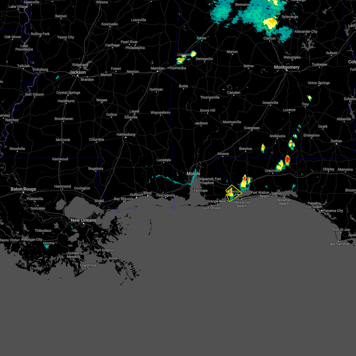 At 524 pm cdt, a severe thunderstorm was located 4 miles northwest of myrtle grove, or 5 miles northwest of west pensacola, moving southeast at 5 mph (radar indicated). Hazards include 60 mph wind gusts and nickel size hail. expect damage to roofs, siding, and trees At 524 pm cdt, a severe thunderstorm was located 4 miles northwest of myrtle grove, or 5 miles northwest of west pensacola, moving southeast at 5 mph (radar indicated). Hazards include 60 mph wind gusts and nickel size hail. expect damage to roofs, siding, and trees
|
| 7/15/2022 5:12 PM CDT |
 At 512 pm cdt, a severe thunderstorm was located 6 miles north of oriole beach, or 8 miles east of ferry pass, moving southwest at 10 mph (radar indicated). Hazards include 60 mph wind gusts and penny size hail. expect damage to roofs, siding, and trees At 512 pm cdt, a severe thunderstorm was located 6 miles north of oriole beach, or 8 miles east of ferry pass, moving southwest at 10 mph (radar indicated). Hazards include 60 mph wind gusts and penny size hail. expect damage to roofs, siding, and trees
|
| 6/10/2022 5:42 PM CDT |
 The severe thunderstorm warning for southeastern baldwin, west central okaloosa, central santa rosa and south central escambia counties will expire at 545 pm cdt, the storms which prompted the warning have moved out of the area. therefore, the warning will be allowed to expire. a severe thunderstorm watch remains in effect until 800 pm cdt for southwestern alabama, and northwestern florida. remember, a severe thunderstorm warning still remains in effect for southeastern santa rosa county and northwestern okaloosa county until 630 pm cdt. The severe thunderstorm warning for southeastern baldwin, west central okaloosa, central santa rosa and south central escambia counties will expire at 545 pm cdt, the storms which prompted the warning have moved out of the area. therefore, the warning will be allowed to expire. a severe thunderstorm watch remains in effect until 800 pm cdt for southwestern alabama, and northwestern florida. remember, a severe thunderstorm warning still remains in effect for southeastern santa rosa county and northwestern okaloosa county until 630 pm cdt.
|
| 6/10/2022 5:36 PM CDT |
 At 535 pm cdt, severe thunderstorms were located along a line extending from 8 miles east of roeville to pensacola beach, moving east at 25 mph (radar indicated). Hazards include 60 mph wind gusts and penny size hail. expect damage to roofs, siding, and trees At 535 pm cdt, severe thunderstorms were located along a line extending from 8 miles east of roeville to pensacola beach, moving east at 25 mph (radar indicated). Hazards include 60 mph wind gusts and penny size hail. expect damage to roofs, siding, and trees
|
| 6/10/2022 5:21 PM CDT |
 At 520 pm cdt, severe thunderstorms were located along a line extending from pea ridge to perdido beach, moving east at 20 mph (radar indicated. at 509 pm a wind gust to 59 mph was reported at the pensacola airport). Hazards include 60 mph wind gusts and quarter size hail. Hail damage to vehicles is expected. expect wind damage to roofs, siding, and trees. locations impacted include, pensacola, ferry pass, brent, west pensacola, ensley, warrington, gonzalez, pace, milton, gulf breeze, orange beach, goulding, bagdad, lillian, myrtle grove, oriole beach, perdido beach, pensacola beach, point baker and pea ridge. hail threat, radar indicated max hail size, 1. 00 in wind threat, observed max wind gust, 60 mph. At 520 pm cdt, severe thunderstorms were located along a line extending from pea ridge to perdido beach, moving east at 20 mph (radar indicated. at 509 pm a wind gust to 59 mph was reported at the pensacola airport). Hazards include 60 mph wind gusts and quarter size hail. Hail damage to vehicles is expected. expect wind damage to roofs, siding, and trees. locations impacted include, pensacola, ferry pass, brent, west pensacola, ensley, warrington, gonzalez, pace, milton, gulf breeze, orange beach, goulding, bagdad, lillian, myrtle grove, oriole beach, perdido beach, pensacola beach, point baker and pea ridge. hail threat, radar indicated max hail size, 1. 00 in wind threat, observed max wind gust, 60 mph.
|
| 6/10/2022 5:09 PM CDT | Kpns at pensacola international airport measured a 59 mph thunderstorm wind gus in escambia county FL, 1.9 miles WSW of Pensacola, FL |
| 6/10/2022 5:05 PM CDT |
 At 504 pm cdt, severe thunderstorms were located along a line extending from near pace to 3 miles west of perdido beach, moving east at 20 mph (radar indicated). Hazards include 60 mph wind gusts and quarter size hail. Hail damage to vehicles is expected. Expect wind damage to roofs, siding, and trees. At 504 pm cdt, severe thunderstorms were located along a line extending from near pace to 3 miles west of perdido beach, moving east at 20 mph (radar indicated). Hazards include 60 mph wind gusts and quarter size hail. Hail damage to vehicles is expected. Expect wind damage to roofs, siding, and trees.
|
| 5/25/2022 5:14 AM CDT |
 At 514 am cdt, a severe thunderstorm capable of producing a tornado was located over ferry pass, moving north at 30 mph (radar indicated rotation). Hazards include tornado. Flying debris will be dangerous to those caught without shelter. mobile homes will be damaged or destroyed. damage to roofs, windows, and vehicles will occur. tree damage is likely. this dangerous storm will be near, floridatown around 520 am cdt. pace around 525 am cdt. Molino around 540 am cdt. At 514 am cdt, a severe thunderstorm capable of producing a tornado was located over ferry pass, moving north at 30 mph (radar indicated rotation). Hazards include tornado. Flying debris will be dangerous to those caught without shelter. mobile homes will be damaged or destroyed. damage to roofs, windows, and vehicles will occur. tree damage is likely. this dangerous storm will be near, floridatown around 520 am cdt. pace around 525 am cdt. Molino around 540 am cdt.
|
| 5/15/2022 4:43 PM CDT |
 At 442 pm cdt, a cluster of severe thunderstorms was located 6 miles southeast of pea ridge, or 6 miles southwest of bagdad, moving southwest at 10 mph (radar indicated). Hazards include 60 mph wind gusts and quarter size hail. Hail damage to vehicles is expected. expect wind damage to roofs, siding, and trees. Locations impacted include, pensacola, ferry pass, brent, west pensacola, ensley, warrington, gonzalez, pace, milton, gulf breeze, goulding, bagdad, lillian, myrtle grove, oriole beach, navarre, pensacola beach, point baker, navarre beach and pea ridge. At 442 pm cdt, a cluster of severe thunderstorms was located 6 miles southeast of pea ridge, or 6 miles southwest of bagdad, moving southwest at 10 mph (radar indicated). Hazards include 60 mph wind gusts and quarter size hail. Hail damage to vehicles is expected. expect wind damage to roofs, siding, and trees. Locations impacted include, pensacola, ferry pass, brent, west pensacola, ensley, warrington, gonzalez, pace, milton, gulf breeze, goulding, bagdad, lillian, myrtle grove, oriole beach, navarre, pensacola beach, point baker, navarre beach and pea ridge.
|
| 5/15/2022 4:20 PM CDT |
 At 420 pm cdt, a severe thunderstorm was located 7 miles south of bagdad, moving southwest at 15 mph (radar indicated). Hazards include golf ball size hail and 60 mph wind gusts. People and animals outdoors will be injured. expect hail damage to roofs, siding, windows, and vehicles. expect wind damage to roofs, siding, and trees. Locations impacted include, pensacola, ferry pass, brent, west pensacola, ensley, warrington, gonzalez, pace, milton, gulf breeze, goulding, bagdad, lillian, myrtle grove, oriole beach, navarre, pensacola beach, point baker, navarre beach and pea ridge. At 420 pm cdt, a severe thunderstorm was located 7 miles south of bagdad, moving southwest at 15 mph (radar indicated). Hazards include golf ball size hail and 60 mph wind gusts. People and animals outdoors will be injured. expect hail damage to roofs, siding, windows, and vehicles. expect wind damage to roofs, siding, and trees. Locations impacted include, pensacola, ferry pass, brent, west pensacola, ensley, warrington, gonzalez, pace, milton, gulf breeze, goulding, bagdad, lillian, myrtle grove, oriole beach, navarre, pensacola beach, point baker, navarre beach and pea ridge.
|
| 5/15/2022 4:15 PM CDT | Quarter sized hail reported 3.6 miles SSE of Pensacola, FL, public photos of quarter size hail around 4:15 pm cdt. |
| 5/15/2022 4:12 PM CDT |
 At 411 pm cdt, a cluster of severe thunderstorms was located 5 miles south of bagdad, moving southwest at 10 mph (radar indicated). Hazards include 60 mph wind gusts and quarter size hail. Hail damage to vehicles is expected. Expect wind damage to roofs, siding, and trees. At 411 pm cdt, a cluster of severe thunderstorms was located 5 miles south of bagdad, moving southwest at 10 mph (radar indicated). Hazards include 60 mph wind gusts and quarter size hail. Hail damage to vehicles is expected. Expect wind damage to roofs, siding, and trees.
|
| 5/6/2022 4:59 AM CDT |
 At 457 am cdt, severe thunderstorms were located along a line extending from 8 miles north of roeville to 6 miles north of oriole beach to 15 miles southwest of pensacola beach, moving east at 50 mph (radar indicated). Hazards include 60 mph wind gusts. expect damage to roofs, siding, and trees At 457 am cdt, severe thunderstorms were located along a line extending from 8 miles north of roeville to 6 miles north of oriole beach to 15 miles southwest of pensacola beach, moving east at 50 mph (radar indicated). Hazards include 60 mph wind gusts. expect damage to roofs, siding, and trees
|
| 5/6/2022 4:41 AM CDT | Broadcast media reports trees downed and snapped in the riverview area along scenic highwa in escambia county FL, 5.2 miles S of Pensacola, FL |
| 5/6/2022 4:40 AM CDT |
 At 440 am cdt, severe thunderstorms were located along a line extending from east brewton to 7 miles southeast of jay to 4 miles southwest of point baker to warrington, moving east at 55 mph (radar indicated). Hazards include 70 mph wind gusts. Expect considerable tree damage. damage is likely to mobile homes, roofs, and outbuildings. Locations impacted include, pensacola, ferry pass, brent, west pensacola, ensley, warrington, gonzalez, pace, milton, gulf breeze, brewton, goulding, century, flomaton, bagdad, myrtle grove, oriole beach, navarre, east brewton and molino. At 440 am cdt, severe thunderstorms were located along a line extending from east brewton to 7 miles southeast of jay to 4 miles southwest of point baker to warrington, moving east at 55 mph (radar indicated). Hazards include 70 mph wind gusts. Expect considerable tree damage. damage is likely to mobile homes, roofs, and outbuildings. Locations impacted include, pensacola, ferry pass, brent, west pensacola, ensley, warrington, gonzalez, pace, milton, gulf breeze, brewton, goulding, century, flomaton, bagdad, myrtle grove, oriole beach, navarre, east brewton and molino.
|
| 5/6/2022 4:26 AM CDT |
 At 426 am cdt, severe thunderstorms were located along a line extending from 3 miles north of flomaton to 6 miles north of molino to 4 miles northwest of gonzalez to perdido beach, moving east at 55 mph (radar indicated). Hazards include 70 mph wind gusts. Expect considerable tree damage. damage is likely to mobile homes, roofs, and outbuildings. Locations impacted include, pensacola, ferry pass, brent, west pensacola, ensley, warrington, gonzalez, pace, milton, gulf breeze, brewton, orange beach, goulding, century, flomaton, bagdad, lillian, myrtle grove, oriole beach and navarre. At 426 am cdt, severe thunderstorms were located along a line extending from 3 miles north of flomaton to 6 miles north of molino to 4 miles northwest of gonzalez to perdido beach, moving east at 55 mph (radar indicated). Hazards include 70 mph wind gusts. Expect considerable tree damage. damage is likely to mobile homes, roofs, and outbuildings. Locations impacted include, pensacola, ferry pass, brent, west pensacola, ensley, warrington, gonzalez, pace, milton, gulf breeze, brewton, orange beach, goulding, century, flomaton, bagdad, lillian, myrtle grove, oriole beach and navarre.
|
| 5/6/2022 4:12 AM CDT |
 At 412 am cdt, severe thunderstorms were located along a line extending from atmore to 12 miles west of molino to 10 miles east of robertsdale to bon secour, moving east at 55 mph (radar indicated). Hazards include 60 mph wind gusts. expect damage to roofs, siding, and trees At 412 am cdt, severe thunderstorms were located along a line extending from atmore to 12 miles west of molino to 10 miles east of robertsdale to bon secour, moving east at 55 mph (radar indicated). Hazards include 60 mph wind gusts. expect damage to roofs, siding, and trees
|
| 4/17/2022 11:32 PM CDT |
 At 1132 pm cdt, a severe thunderstorm capable of producing a tornado was located over milton, moving east at 40 mph (radar indicated rotation). Hazards include tornado. Flying debris will be dangerous to those caught without shelter. mobile homes will be damaged or destroyed. damage to roofs, windows, and vehicles will occur. tree damage is likely. This tornadic thunderstorm will remain over mainly rural areas of central santa rosa county. At 1132 pm cdt, a severe thunderstorm capable of producing a tornado was located over milton, moving east at 40 mph (radar indicated rotation). Hazards include tornado. Flying debris will be dangerous to those caught without shelter. mobile homes will be damaged or destroyed. damage to roofs, windows, and vehicles will occur. tree damage is likely. This tornadic thunderstorm will remain over mainly rural areas of central santa rosa county.
|
| 4/17/2022 11:16 PM CDT | Storm damage reported in escambia county FL, 1.1 miles WSW of Pensacola, FL |
| 4/17/2022 11:14 PM CDT | Public weather station report near brent lane and i-10 are in escambia county FL, 3.3 miles NNW of Pensacola, FL |
| 4/17/2022 11:12 PM CDT |
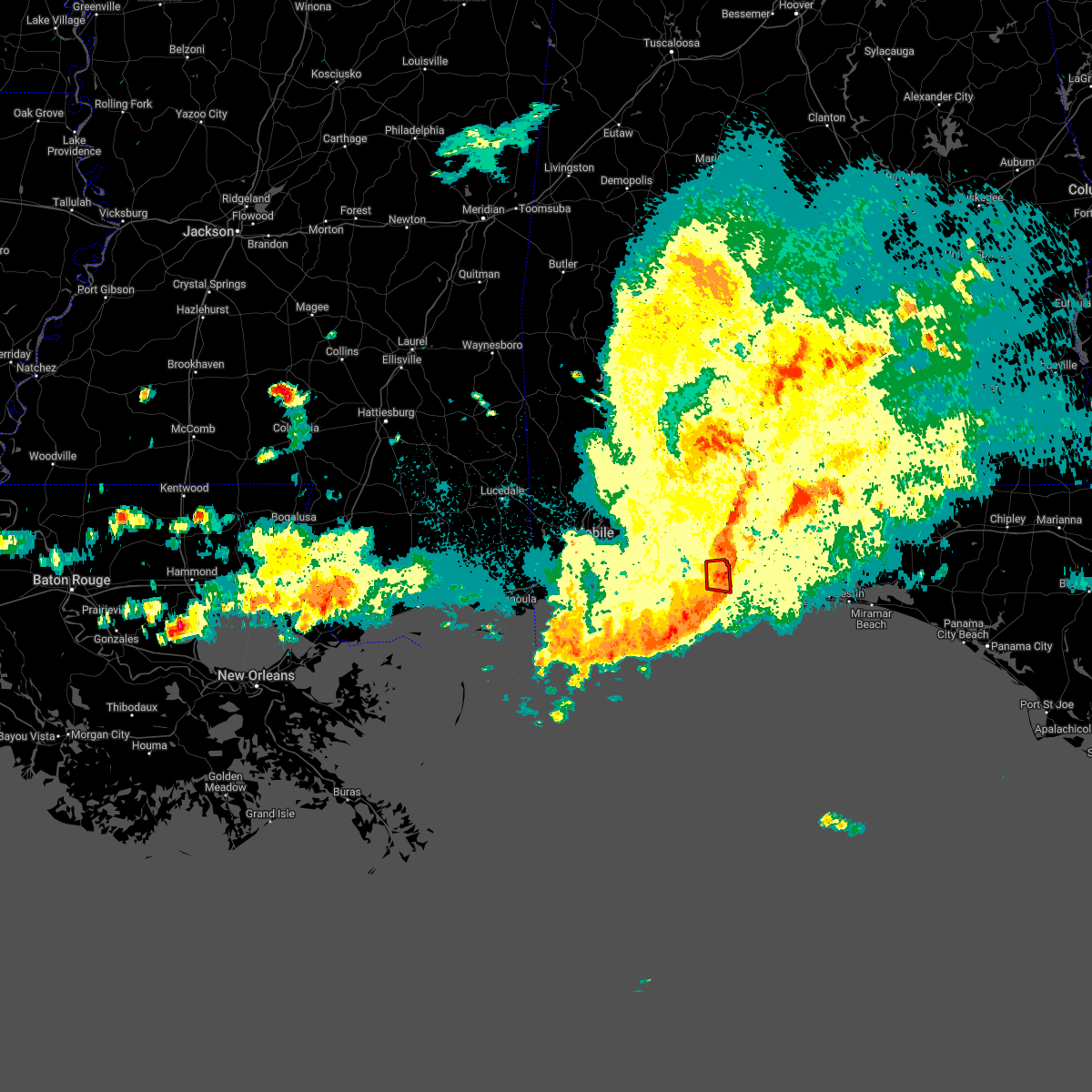 At 1112 pm cdt, a severe thunderstorm capable of producing a tornado was located over ferry pass, moving east at 40 mph (radar indicated rotation). Hazards include tornado. Flying debris will be dangerous to those caught without shelter. mobile homes will be damaged or destroyed. damage to roofs, windows, and vehicles will occur. tree damage is likely. This tornadic thunderstorm will remain over mainly rural areas of central escambia county. At 1112 pm cdt, a severe thunderstorm capable of producing a tornado was located over ferry pass, moving east at 40 mph (radar indicated rotation). Hazards include tornado. Flying debris will be dangerous to those caught without shelter. mobile homes will be damaged or destroyed. damage to roofs, windows, and vehicles will occur. tree damage is likely. This tornadic thunderstorm will remain over mainly rural areas of central escambia county.
|
| 4/17/2022 11:08 PM CDT | Trees down. photos relayed on social medi in escambia county FL, 6.4 miles ENE of Pensacola, FL |
| 4/17/2022 11:04 PM CDT |
 At 1103 pm cdt, a severe thunderstorm capable of producing a tornado was located 4 miles west of ensley, moving east at 40 mph. another severe thunderstorm capable of producing a tornado was located over quintette, moving east at 40 mph (radar indicated rotation). Hazards include tornado. Flying debris will be dangerous to those caught without shelter. mobile homes will be damaged or destroyed. damage to roofs, windows, and vehicles will occur. tree damage is likely. this dangerous storm will be near, ferry pass and brent around 1115 pm cdt. pace, floridatown and pea ridge around 1120 pm cdt. Bagdad around 1130 pm cdt. At 1103 pm cdt, a severe thunderstorm capable of producing a tornado was located 4 miles west of ensley, moving east at 40 mph. another severe thunderstorm capable of producing a tornado was located over quintette, moving east at 40 mph (radar indicated rotation). Hazards include tornado. Flying debris will be dangerous to those caught without shelter. mobile homes will be damaged or destroyed. damage to roofs, windows, and vehicles will occur. tree damage is likely. this dangerous storm will be near, ferry pass and brent around 1115 pm cdt. pace, floridatown and pea ridge around 1120 pm cdt. Bagdad around 1130 pm cdt.
|
| 4/17/2022 10:49 PM CDT |
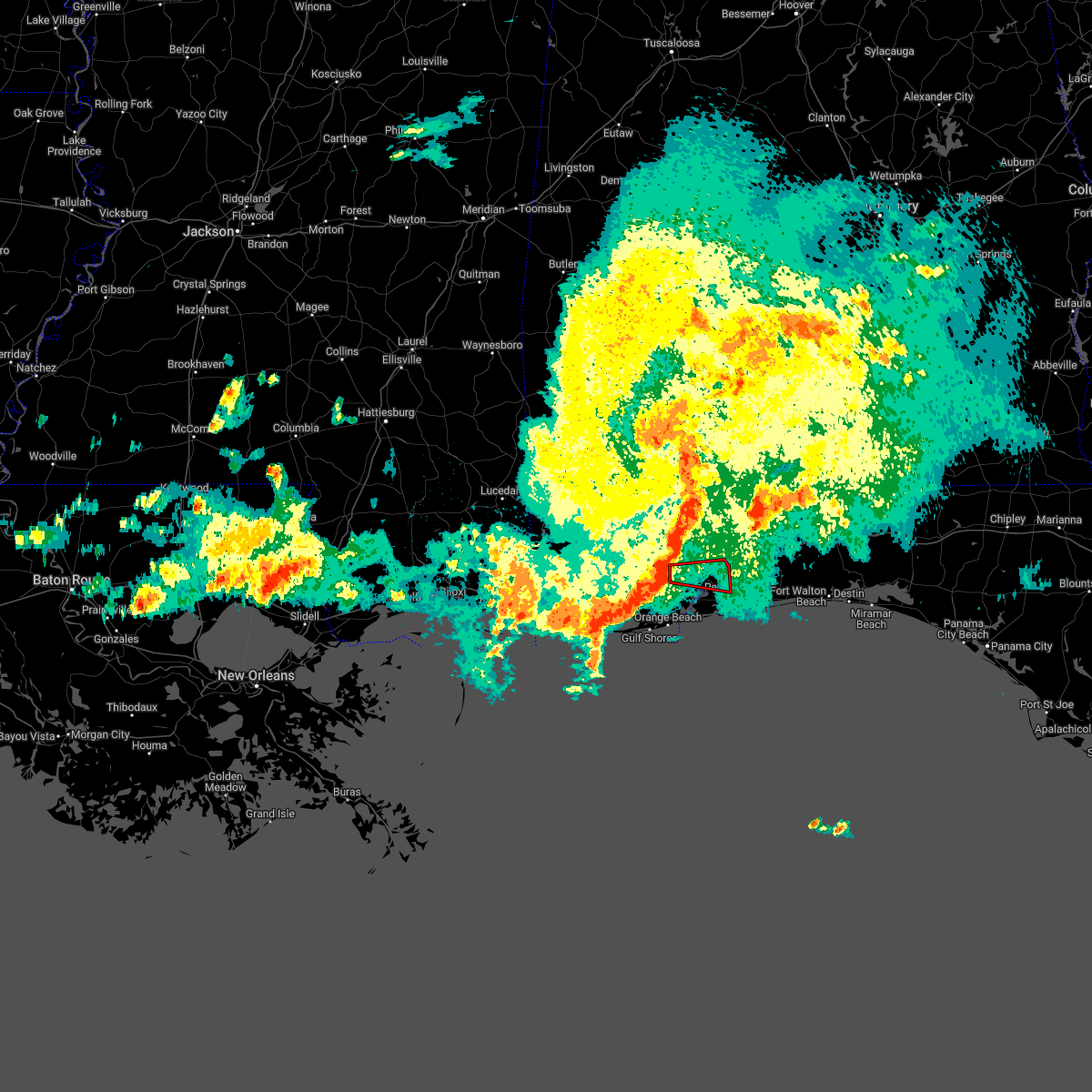 At 1049 pm cdt, a severe thunderstorm capable of producing a tornado was located 9 miles northeast of elberta, or 10 miles east of robertsdale, moving east at 40 mph (radar indicated rotation). Hazards include tornado. Flying debris will be dangerous to those caught without shelter. mobile homes will be damaged or destroyed. damage to roofs, windows, and vehicles will occur. tree damage is likely. this dangerous storm will be near, ensley and gonzalez around 1110 pm cdt. Brent and goulding around 1115 pm cdt. At 1049 pm cdt, a severe thunderstorm capable of producing a tornado was located 9 miles northeast of elberta, or 10 miles east of robertsdale, moving east at 40 mph (radar indicated rotation). Hazards include tornado. Flying debris will be dangerous to those caught without shelter. mobile homes will be damaged or destroyed. damage to roofs, windows, and vehicles will occur. tree damage is likely. this dangerous storm will be near, ensley and gonzalez around 1110 pm cdt. Brent and goulding around 1115 pm cdt.
|
| 4/17/2022 10:40 PM CDT |
 At 1040 pm cdt, a severe thunderstorm capable of producing a tornado was located near robertsdale, moving east at 45 mph (radar indicated rotation). Hazards include tornado. Flying debris will be dangerous to those caught without shelter. mobile homes will be damaged or destroyed. damage to roofs, windows, and vehicles will occur. tree damage is likely. this dangerous storm will be near, ensley and gonzalez around 1110 pm cdt. Brent and goulding around 1115 pm cdt. At 1040 pm cdt, a severe thunderstorm capable of producing a tornado was located near robertsdale, moving east at 45 mph (radar indicated rotation). Hazards include tornado. Flying debris will be dangerous to those caught without shelter. mobile homes will be damaged or destroyed. damage to roofs, windows, and vehicles will occur. tree damage is likely. this dangerous storm will be near, ensley and gonzalez around 1110 pm cdt. Brent and goulding around 1115 pm cdt.
|
| 4/17/2022 10:34 PM CDT |
 At 1032 pm cdt, severe thunderstorms were located along a line extending from 11 miles southeast of bay minette to 5 miles southeast of alabama port, moving southeast at 45 mph (radar indicated). Hazards include 70 mph wind gusts and penny size hail. Expect considerable tree damage. Damage is likely to mobile homes, roofs, and outbuildings. At 1032 pm cdt, severe thunderstorms were located along a line extending from 11 miles southeast of bay minette to 5 miles southeast of alabama port, moving southeast at 45 mph (radar indicated). Hazards include 70 mph wind gusts and penny size hail. Expect considerable tree damage. Damage is likely to mobile homes, roofs, and outbuildings.
|
| 4/17/2022 10:34 PM CDT |
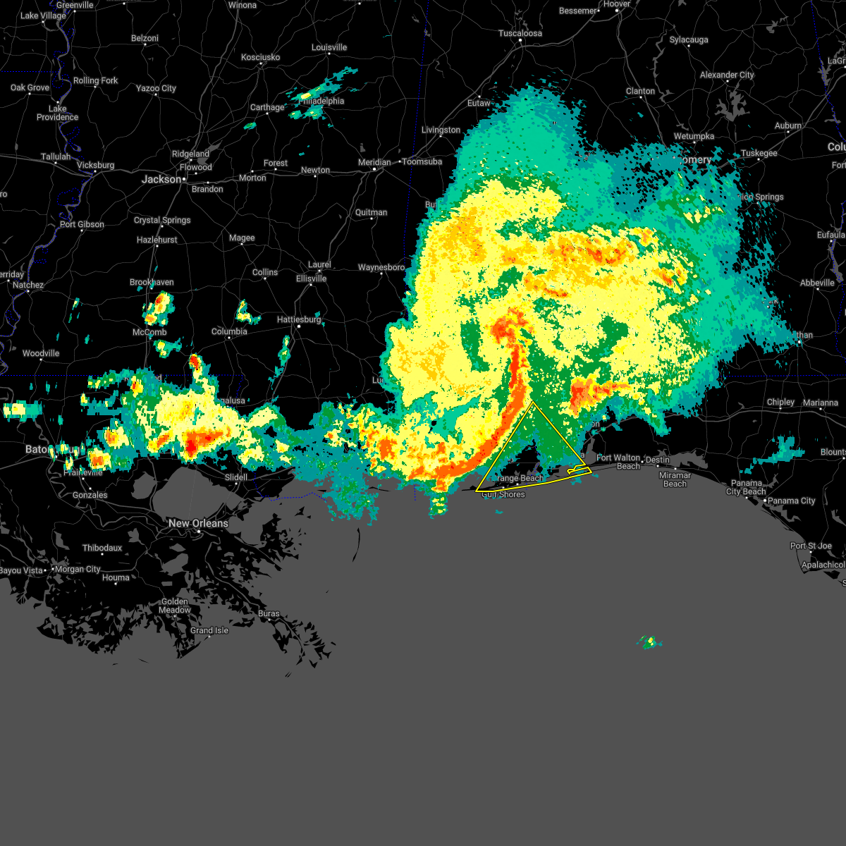 At 1032 pm cdt, severe thunderstorms were located along a line extending from 11 miles southeast of bay minette to 5 miles southeast of alabama port, moving southeast at 45 mph (radar indicated). Hazards include 70 mph wind gusts and penny size hail. Expect considerable tree damage. Damage is likely to mobile homes, roofs, and outbuildings. At 1032 pm cdt, severe thunderstorms were located along a line extending from 11 miles southeast of bay minette to 5 miles southeast of alabama port, moving southeast at 45 mph (radar indicated). Hazards include 70 mph wind gusts and penny size hail. Expect considerable tree damage. Damage is likely to mobile homes, roofs, and outbuildings.
|
| 3/31/2022 1:23 AM CDT |
 The tornado warning for southwestern okaloosa and southern santa rosa counties will expire at 130 am cdt, the tornadic thunderstorm which prompted the warning has moved out of the warned area. therefore, the warning will be allowed to expire. a tornado watch remains in effect until 400 am cdt for northwestern florida. remember, a severe thunderstorm warning still remains in effect for portions of southern santa rosa and southwestern okaloosa counties. The tornado warning for southwestern okaloosa and southern santa rosa counties will expire at 130 am cdt, the tornadic thunderstorm which prompted the warning has moved out of the warned area. therefore, the warning will be allowed to expire. a tornado watch remains in effect until 400 am cdt for northwestern florida. remember, a severe thunderstorm warning still remains in effect for portions of southern santa rosa and southwestern okaloosa counties.
|
| 3/31/2022 1:15 AM CDT |
 At 114 am cdt, severe thunderstorms were located along a line extending from 17 miles east of riverview to 6 miles south of baker to pensacola beach, moving east at 35 mph (radar indicated). Hazards include 70 mph wind gusts and quarter size hail. Hail damage to vehicles is expected. expect considerable tree damage. Wind damage is also likely to mobile homes, roofs, and outbuildings. At 114 am cdt, severe thunderstorms were located along a line extending from 17 miles east of riverview to 6 miles south of baker to pensacola beach, moving east at 35 mph (radar indicated). Hazards include 70 mph wind gusts and quarter size hail. Hail damage to vehicles is expected. expect considerable tree damage. Wind damage is also likely to mobile homes, roofs, and outbuildings.
|
| 3/31/2022 1:03 AM CDT |
 At 103 am cdt, severe thunderstorms were located along a line extending from 9 miles southeast of riverview to 8 miles east of roeville to 11 miles southeast of perdido beach, moving east at 40 mph (radar indicated). Hazards include 70 mph wind gusts and ping pong ball size hail. People and animals outdoors will be injured. expect hail damage to roofs, siding, windows, and vehicles. expect considerable tree damage. wind damage is also likely to mobile homes, roofs, and outbuildings. Locations impacted include, pensacola, ferry pass, brent, west pensacola, warrington, crestview, pace, milton, gulf breeze, goulding, bagdad, myrtle grove, baker, oriole beach, navarre, laurel hill, pensacola beach, point baker, pea ridge and roeville. At 103 am cdt, severe thunderstorms were located along a line extending from 9 miles southeast of riverview to 8 miles east of roeville to 11 miles southeast of perdido beach, moving east at 40 mph (radar indicated). Hazards include 70 mph wind gusts and ping pong ball size hail. People and animals outdoors will be injured. expect hail damage to roofs, siding, windows, and vehicles. expect considerable tree damage. wind damage is also likely to mobile homes, roofs, and outbuildings. Locations impacted include, pensacola, ferry pass, brent, west pensacola, warrington, crestview, pace, milton, gulf breeze, goulding, bagdad, myrtle grove, baker, oriole beach, navarre, laurel hill, pensacola beach, point baker, pea ridge and roeville.
|
| 3/31/2022 12:56 AM CDT |
 At 1255 am cdt, a severe thunderstorm capable of producing a tornado was located near bagdad, moving northeast at 40 mph (radar indicated rotation). Hazards include tornado. Flying debris will be dangerous to those caught without shelter. mobile homes will be damaged or destroyed. damage to roofs, windows, and vehicles will occur. tree damage is likely. This tornadic thunderstorm will remain over mainly rural areas of southwestern okaloosa and southern santa rosa counties. At 1255 am cdt, a severe thunderstorm capable of producing a tornado was located near bagdad, moving northeast at 40 mph (radar indicated rotation). Hazards include tornado. Flying debris will be dangerous to those caught without shelter. mobile homes will be damaged or destroyed. damage to roofs, windows, and vehicles will occur. tree damage is likely. This tornadic thunderstorm will remain over mainly rural areas of southwestern okaloosa and southern santa rosa counties.
|
| 3/31/2022 12:41 AM CDT |
 At 1241 am cdt, a severe thunderstorm capable of producing a tornado was located near pea ridge, or 4 miles southeast of pace, moving northeast at 40 mph (radar indicated rotation). Hazards include tornado. Flying debris will be dangerous to those caught without shelter. mobile homes will be damaged or destroyed. damage to roofs, windows, and vehicles will occur. tree damage is likely. This dangerous storm will be near, milton and bagdad around 1250 am cdt. At 1241 am cdt, a severe thunderstorm capable of producing a tornado was located near pea ridge, or 4 miles southeast of pace, moving northeast at 40 mph (radar indicated rotation). Hazards include tornado. Flying debris will be dangerous to those caught without shelter. mobile homes will be damaged or destroyed. damage to roofs, windows, and vehicles will occur. tree damage is likely. This dangerous storm will be near, milton and bagdad around 1250 am cdt.
|
| 3/31/2022 12:40 AM CDT | Pensacola asos measured a wind gust of 50 knot in escambia county FL, 1.1 miles WSW of Pensacola, FL |
| 3/31/2022 12:20 AM CDT |
 At 1219 am cdt, a severe thunderstorm was located over beulah and gonzalez, moving northeast at 60 mph (radar indicated). Hazards include 70 mph wind gusts and ping pong ball size hail. People and animals outdoors will be injured. expect hail damage to roofs, siding, windows, and vehicles. expect considerable tree damage. wind damage is also likely to mobile homes, roofs, and outbuildings. Locations impacted include, pensacola, ferry pass, brent, west pensacola, ensley, warrington, crestview, gonzalez, gulf shores, foley, pace, milton, gulf breeze, orange beach, goulding, century, bagdad, lillian, myrtle grove and baker. At 1219 am cdt, a severe thunderstorm was located over beulah and gonzalez, moving northeast at 60 mph (radar indicated). Hazards include 70 mph wind gusts and ping pong ball size hail. People and animals outdoors will be injured. expect hail damage to roofs, siding, windows, and vehicles. expect considerable tree damage. wind damage is also likely to mobile homes, roofs, and outbuildings. Locations impacted include, pensacola, ferry pass, brent, west pensacola, ensley, warrington, crestview, gonzalez, gulf shores, foley, pace, milton, gulf breeze, orange beach, goulding, century, bagdad, lillian, myrtle grove and baker.
|
| 3/31/2022 12:16 AM CDT |
 At 1215 am cdt, severe thunderstorms were located along a line extending from century to 3 miles west of ensley to 12 miles southeast of fort morgan, moving northeast at 70 mph (radar indicated). Hazards include 70 mph wind gusts. Expect considerable tree damage. Damage is likely to mobile homes, roofs, and outbuildings. At 1215 am cdt, severe thunderstorms were located along a line extending from century to 3 miles west of ensley to 12 miles southeast of fort morgan, moving northeast at 70 mph (radar indicated). Hazards include 70 mph wind gusts. Expect considerable tree damage. Damage is likely to mobile homes, roofs, and outbuildings.
|
| 3/30/2022 11:23 PM CDT |
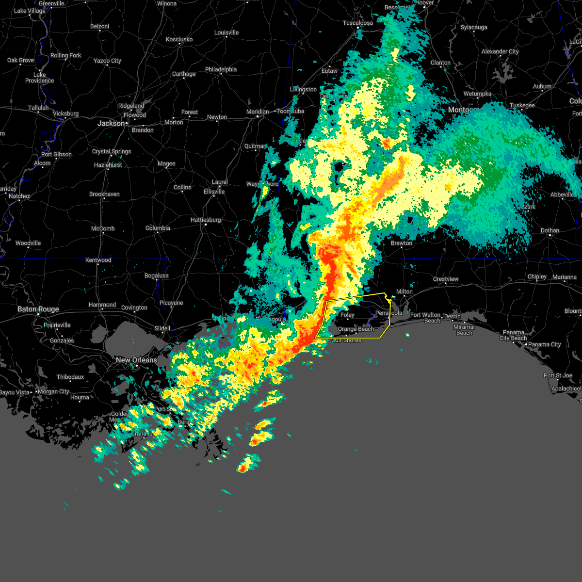 At 1122 pm cdt, severe thunderstorms were located along a line extending from near stapleton to point clear to fort morgan, moving east at 40 mph (radar indicated). Hazards include 70 mph wind gusts. Expect considerable tree damage. Damage is likely to mobile homes, roofs, and outbuildings. At 1122 pm cdt, severe thunderstorms were located along a line extending from near stapleton to point clear to fort morgan, moving east at 40 mph (radar indicated). Hazards include 70 mph wind gusts. Expect considerable tree damage. Damage is likely to mobile homes, roofs, and outbuildings.
|
| 3/23/2022 12:34 AM CDT |
 At 1233 am cdt, severe thunderstorms were located along a line extending from 6 miles southeast of bay minette to 5 miles southwest of bon secour, moving east at 40 mph (radar indicated). Hazards include 60 mph wind gusts. expect damage to roofs, siding, and trees At 1233 am cdt, severe thunderstorms were located along a line extending from 6 miles southeast of bay minette to 5 miles southwest of bon secour, moving east at 40 mph (radar indicated). Hazards include 60 mph wind gusts. expect damage to roofs, siding, and trees
|
| 3/18/2022 11:54 AM CDT |
 At 1153 am cdt, severe thunderstorms were located along a line extending from 12 miles east of riverview to near foley, moving east at 30 mph (radar indicated). Hazards include 60 mph wind gusts and quarter size hail. Hail damage to vehicles is expected. Expect wind damage to roofs, siding, and trees. At 1153 am cdt, severe thunderstorms were located along a line extending from 12 miles east of riverview to near foley, moving east at 30 mph (radar indicated). Hazards include 60 mph wind gusts and quarter size hail. Hail damage to vehicles is expected. Expect wind damage to roofs, siding, and trees.
|
| 3/18/2022 11:19 AM CDT |
 At 1118 am cdt, severe thunderstorms were located along a line extending from 12 miles southwest of river falls to 3 miles south of elberta, moving southeast at 35 mph (radar indicated). Hazards include 70 mph wind gusts and quarter size hail. Hail damage to vehicles is expected. expect considerable tree damage. wind damage is also likely to mobile homes, roofs, and outbuildings. locations impacted include, pensacola, ferry pass, brent, west pensacola, ensley, warrington, gonzalez, gulf shores, foley, pace, milton, gulf breeze, brewton, orange beach, goulding, robertsdale, point clear, century, flomaton and bagdad. thunderstorm damage threat, considerable hail threat, radar indicated max hail size, 1. 00 in wind threat, radar indicated max wind gust, 70 mph. At 1118 am cdt, severe thunderstorms were located along a line extending from 12 miles southwest of river falls to 3 miles south of elberta, moving southeast at 35 mph (radar indicated). Hazards include 70 mph wind gusts and quarter size hail. Hail damage to vehicles is expected. expect considerable tree damage. wind damage is also likely to mobile homes, roofs, and outbuildings. locations impacted include, pensacola, ferry pass, brent, west pensacola, ensley, warrington, gonzalez, gulf shores, foley, pace, milton, gulf breeze, brewton, orange beach, goulding, robertsdale, point clear, century, flomaton and bagdad. thunderstorm damage threat, considerable hail threat, radar indicated max hail size, 1. 00 in wind threat, radar indicated max wind gust, 70 mph.
|
| 3/18/2022 11:07 AM CDT |
 At 1107 am cdt, severe thunderstorms were located along a line extending from 13 miles southwest of red level to near foley, moving southeast at 20 mph (radar indicated). Hazards include 60 mph wind gusts and quarter size hail. Hail damage to vehicles is expected. Expect wind damage to roofs, siding, and trees. At 1107 am cdt, severe thunderstorms were located along a line extending from 13 miles southwest of red level to near foley, moving southeast at 20 mph (radar indicated). Hazards include 60 mph wind gusts and quarter size hail. Hail damage to vehicles is expected. Expect wind damage to roofs, siding, and trees.
|
| 8/29/2021 3:56 PM CDT |
 At 356 pm cdt, a severe thunderstorm capable of producing a tornado was located over myrtle grove, or over west pensacola, moving northwest at 40 mph (radar indicated rotation). Hazards include tornado. Flying debris will be dangerous to those caught without shelter. mobile homes will be damaged or destroyed. damage to roofs, windows, and vehicles will occur. tree damage is likely. this dangerous storm will be near, ensley around 405 pm cdt. Gonzalez around 415 pm cdt. At 356 pm cdt, a severe thunderstorm capable of producing a tornado was located over myrtle grove, or over west pensacola, moving northwest at 40 mph (radar indicated rotation). Hazards include tornado. Flying debris will be dangerous to those caught without shelter. mobile homes will be damaged or destroyed. damage to roofs, windows, and vehicles will occur. tree damage is likely. this dangerous storm will be near, ensley around 405 pm cdt. Gonzalez around 415 pm cdt.
|
| 8/29/2021 3:45 PM CDT |
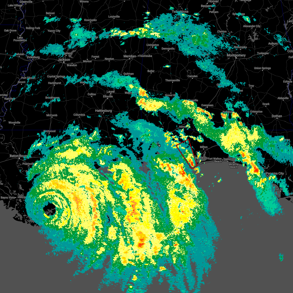 At 345 pm cdt, a severe thunderstorm capable of producing a tornado was located 4 miles south of warrington, moving northwest at 25 mph (radar indicated rotation). Hazards include tornado. Flying debris will be dangerous to those caught without shelter. mobile homes will be damaged or destroyed. damage to roofs, windows, and vehicles will occur. tree damage is likely. this dangerous storm will be near, warrington around 355 pm cdt. west pensacola and myrtle grove around 405 pm cdt. lillian around 410 pm cdt. ensley around 415 pm cdt. Gonzalez around 430 pm cdt. At 345 pm cdt, a severe thunderstorm capable of producing a tornado was located 4 miles south of warrington, moving northwest at 25 mph (radar indicated rotation). Hazards include tornado. Flying debris will be dangerous to those caught without shelter. mobile homes will be damaged or destroyed. damage to roofs, windows, and vehicles will occur. tree damage is likely. this dangerous storm will be near, warrington around 355 pm cdt. west pensacola and myrtle grove around 405 pm cdt. lillian around 410 pm cdt. ensley around 415 pm cdt. Gonzalez around 430 pm cdt.
|
| 8/29/2021 8:41 AM CDT |
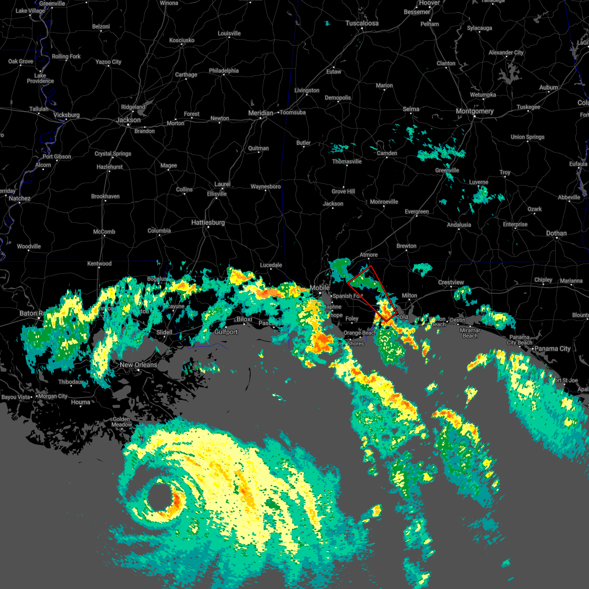 At 841 am cdt, a severe thunderstorm capable of producing a tornado was located over ensley, moving northwest at 35 mph (radar indicated rotation). Hazards include tornado. Flying debris will be dangerous to those caught without shelter. mobile homes will be damaged or destroyed. damage to roofs, windows, and vehicles will occur. tree damage is likely. This dangerous storm will be near, gonzalez around 850 am cdt. At 841 am cdt, a severe thunderstorm capable of producing a tornado was located over ensley, moving northwest at 35 mph (radar indicated rotation). Hazards include tornado. Flying debris will be dangerous to those caught without shelter. mobile homes will be damaged or destroyed. damage to roofs, windows, and vehicles will occur. tree damage is likely. This dangerous storm will be near, gonzalez around 850 am cdt.
|
| 7/29/2021 7:44 PM CDT |
 At 744 pm cdt, severe thunderstorms were located along a line extending from gonzalez to 3 miles west of ensley to near west pensacola, moving west at 15 mph (radar indicated). Hazards include 60 mph wind gusts. expect damage to roofs, siding, and trees At 744 pm cdt, severe thunderstorms were located along a line extending from gonzalez to 3 miles west of ensley to near west pensacola, moving west at 15 mph (radar indicated). Hazards include 60 mph wind gusts. expect damage to roofs, siding, and trees
|
| 6/24/2021 2:05 PM CDT |
 At 205 pm cdt, a severe thunderstorm was located 4 miles south of bagdad, moving west at 15 mph (radar indicated). Hazards include 60 mph wind gusts and penny size hail. Expect damage to roofs, siding, and trees. Locations impacted include, bagdad. At 205 pm cdt, a severe thunderstorm was located 4 miles south of bagdad, moving west at 15 mph (radar indicated). Hazards include 60 mph wind gusts and penny size hail. Expect damage to roofs, siding, and trees. Locations impacted include, bagdad.
|
| 6/24/2021 1:46 PM CDT |
 At 145 pm cdt, a severe thunderstorm was located 5 miles southeast of bagdad, moving west at 10 mph (radar indicated). Hazards include 60 mph wind gusts and penny size hail. Expect damage to roofs, siding, and trees. Locations impacted include, gulf breeze, bagdad, oriole beach, navarre, navarre beach and pensacola beach. At 145 pm cdt, a severe thunderstorm was located 5 miles southeast of bagdad, moving west at 10 mph (radar indicated). Hazards include 60 mph wind gusts and penny size hail. Expect damage to roofs, siding, and trees. Locations impacted include, gulf breeze, bagdad, oriole beach, navarre, navarre beach and pensacola beach.
|
| 6/24/2021 1:35 PM CDT |
 At 135 pm cdt, a severe thunderstorm was located 7 miles southeast of bagdad, moving southwest at 10 mph (radar indicated). Hazards include 60 mph wind gusts. expect damage to roofs, siding, and trees At 135 pm cdt, a severe thunderstorm was located 7 miles southeast of bagdad, moving southwest at 10 mph (radar indicated). Hazards include 60 mph wind gusts. expect damage to roofs, siding, and trees
|
| 6/19/2021 11:02 AM CDT |
 At 1101 am cdt, severe thunderstorms were located along a line extending from 9 miles northeast of point baker to near roeville to 4 miles south of bagdad, moving northeast at 25 mph (radar indicated). Hazards include 60 mph wind gusts. Expect damage to roofs, siding, and trees. Locations impacted include, pace, milton, bagdad, pea ridge, roeville, floridatown and point baker. At 1101 am cdt, severe thunderstorms were located along a line extending from 9 miles northeast of point baker to near roeville to 4 miles south of bagdad, moving northeast at 25 mph (radar indicated). Hazards include 60 mph wind gusts. Expect damage to roofs, siding, and trees. Locations impacted include, pace, milton, bagdad, pea ridge, roeville, floridatown and point baker.
|
| 6/19/2021 10:32 AM CDT |
 At 1031 am cdt, severe thunderstorms were located along a line extending from 3 miles west of point baker to 3 miles south of pea ridge to 3 miles east of pensacola, moving northeast at 25 mph (radar indicated). Hazards include 60 mph wind gusts. expect damage to roofs, siding, and trees At 1031 am cdt, severe thunderstorms were located along a line extending from 3 miles west of point baker to 3 miles south of pea ridge to 3 miles east of pensacola, moving northeast at 25 mph (radar indicated). Hazards include 60 mph wind gusts. expect damage to roofs, siding, and trees
|
| 5/12/2021 7:23 AM CDT |
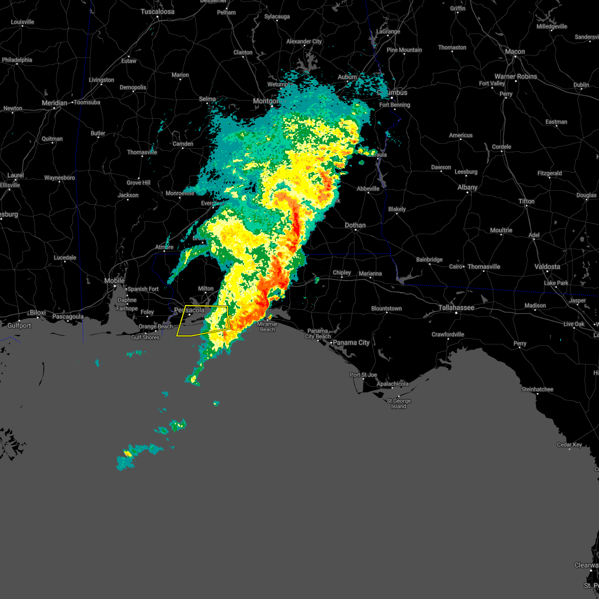 The severe thunderstorm warning for southeastern santa rosa and southeastern escambia counties will expire at 730 am cdt, the storms which prompted the warning have moved out of the area. therefore, the warning will be allowed to expire. however heavy rain is still possible with these thunderstorms. The severe thunderstorm warning for southeastern santa rosa and southeastern escambia counties will expire at 730 am cdt, the storms which prompted the warning have moved out of the area. therefore, the warning will be allowed to expire. however heavy rain is still possible with these thunderstorms.
|
| 5/12/2021 6:21 AM CDT |
 At 621 am cdt, severe thunderstorms were located along a line extending from 3 miles east of pensacola to 11 miles southwest of pensacola beach, moving east at 45 mph (radar indicated). Hazards include 60 mph wind gusts. expect damage to roofs, siding, and trees At 621 am cdt, severe thunderstorms were located along a line extending from 3 miles east of pensacola to 11 miles southwest of pensacola beach, moving east at 45 mph (radar indicated). Hazards include 60 mph wind gusts. expect damage to roofs, siding, and trees
|
| 5/12/2021 6:12 AM CDT | Pensacola airport measures thunderstorm wind gust to 58mp in escambia county FL, 1.4 miles SW of Pensacola, FL |
| 5/12/2021 6:11 AM CDT |
 At 610 am cdt, a severe thunderstorm was located over pace, moving east at 50 mph (radar indicated). Hazards include 60 mph wind gusts. expect damage to roofs, siding, and trees At 610 am cdt, a severe thunderstorm was located over pace, moving east at 50 mph (radar indicated). Hazards include 60 mph wind gusts. expect damage to roofs, siding, and trees
|
| 4/24/2021 6:36 AM CDT |
 At 636 am cdt, severe thunderstorms were located along a line extending from 6 miles southeast of andalusia to 15 miles west of laurel hill to 12 miles northwest of baker to 5 miles northeast of robertsdale, moving east at 55 mph (radar indicated). Hazards include 60 mph wind gusts. Expect damage to roofs, siding, and trees. Locations impacted include, midtown mobile, downtown mobile, prichard, ferry pass, brent, ensley, daphne, crestview, fairhope, gonzalez, bay minette, pace, milton, chickasaw, spanish fort, robertsdale, bagdad, loxley, baker and stapleton. At 636 am cdt, severe thunderstorms were located along a line extending from 6 miles southeast of andalusia to 15 miles west of laurel hill to 12 miles northwest of baker to 5 miles northeast of robertsdale, moving east at 55 mph (radar indicated). Hazards include 60 mph wind gusts. Expect damage to roofs, siding, and trees. Locations impacted include, midtown mobile, downtown mobile, prichard, ferry pass, brent, ensley, daphne, crestview, fairhope, gonzalez, bay minette, pace, milton, chickasaw, spanish fort, robertsdale, bagdad, loxley, baker and stapleton.
|
| 4/24/2021 6:05 AM CDT |
 At 602 am cdt, severe thunderstorms were located along a line extending from 8 miles southeast of castleberry to pollard to 8 miles southeast of bratt to tillmans corner, moving east at 55 mph. mobile 911 call center reports structural damage and intense winds. radar also showing winds near 80 mph a few hundred feet off the surface. these are very dangerous storms (law enforcement). Hazards include 80 mph wind gusts. Flying debris will be dangerous to those caught without shelter. mobile homes will be heavily damaged. expect considerable damage to roofs, windows, and vehicles. extensive tree damage and power outages are likely. Locations impacted include, midtown mobile, downtown mobile, prichard, ferry pass, brent, west pensacola, ensley, daphne, tillmans corner, crestview, fairhope, saraland, gonzalez, gulf shores, bay minette, foley, pace, milton, theodore and chickasaw. At 602 am cdt, severe thunderstorms were located along a line extending from 8 miles southeast of castleberry to pollard to 8 miles southeast of bratt to tillmans corner, moving east at 55 mph. mobile 911 call center reports structural damage and intense winds. radar also showing winds near 80 mph a few hundred feet off the surface. these are very dangerous storms (law enforcement). Hazards include 80 mph wind gusts. Flying debris will be dangerous to those caught without shelter. mobile homes will be heavily damaged. expect considerable damage to roofs, windows, and vehicles. extensive tree damage and power outages are likely. Locations impacted include, midtown mobile, downtown mobile, prichard, ferry pass, brent, west pensacola, ensley, daphne, tillmans corner, crestview, fairhope, saraland, gonzalez, gulf shores, bay minette, foley, pace, milton, theodore and chickasaw.
|
| 4/24/2021 5:57 AM CDT |
 At 556 am cdt, severe thunderstorms were located along a line extending from 5 miles southeast of castleberry to flomaton to 7 miles south of bratt to near tillmans corner, moving east at 55 mph (radar indicated). Hazards include 70 mph wind gusts. Expect considerable tree damage. Damage is likely to mobile homes, roofs, and outbuildings. At 556 am cdt, severe thunderstorms were located along a line extending from 5 miles southeast of castleberry to flomaton to 7 miles south of bratt to near tillmans corner, moving east at 55 mph (radar indicated). Hazards include 70 mph wind gusts. Expect considerable tree damage. Damage is likely to mobile homes, roofs, and outbuildings.
|
| 4/15/2021 7:45 AM CDT |
 At 745 am cdt, severe thunderstorms were located along a line extending from 5 miles east of point clear to 6 miles southwest of magnolia springs to 4 miles northeast of fort morgan, moving east at 35 mph (radar indicated). Hazards include 60 mph wind gusts and quarter size hail. Hail damage to vehicles is expected. Expect wind damage to roofs, siding, and trees. At 745 am cdt, severe thunderstorms were located along a line extending from 5 miles east of point clear to 6 miles southwest of magnolia springs to 4 miles northeast of fort morgan, moving east at 35 mph (radar indicated). Hazards include 60 mph wind gusts and quarter size hail. Hail damage to vehicles is expected. Expect wind damage to roofs, siding, and trees.
|
| 4/10/2021 7:35 AM CDT |
 At 733 am cdt, severe thunderstorms were located along a line extending from 7 miles east of roeville to 3 miles southeast of pensacola beach, moving east at 50 mph (radar indicated). Hazards include 70 mph wind gusts and quarter size hail. Hail damage to vehicles is expected. expect considerable tree damage. Wind damage is also likely to mobile homes, roofs, and outbuildings. At 733 am cdt, severe thunderstorms were located along a line extending from 7 miles east of roeville to 3 miles southeast of pensacola beach, moving east at 50 mph (radar indicated). Hazards include 70 mph wind gusts and quarter size hail. Hail damage to vehicles is expected. expect considerable tree damage. Wind damage is also likely to mobile homes, roofs, and outbuildings.
|
| 4/10/2021 7:21 AM CDT |
 At 720 am cdt, severe thunderstorms were located along a line extending from near bagdad to 17 miles southeast of orange beach, moving east at 60 mph (radar indicated). Hazards include 70 mph wind gusts and quarter size hail. Hail damage to vehicles is expected. expect considerable tree damage. wind damage is also likely to mobile homes, roofs, and outbuildings. Locations impacted include, pensacola, ferry pass, brent, west pensacola, wright, ensley, warrington, pace, gulf breeze, goulding, mary esther, bagdad, myrtle grove, oriole beach, navarre, pensacola beach, navarre beach, pea ridge and floridatown. At 720 am cdt, severe thunderstorms were located along a line extending from near bagdad to 17 miles southeast of orange beach, moving east at 60 mph (radar indicated). Hazards include 70 mph wind gusts and quarter size hail. Hail damage to vehicles is expected. expect considerable tree damage. wind damage is also likely to mobile homes, roofs, and outbuildings. Locations impacted include, pensacola, ferry pass, brent, west pensacola, wright, ensley, warrington, pace, gulf breeze, goulding, mary esther, bagdad, myrtle grove, oriole beach, navarre, pensacola beach, navarre beach, pea ridge and floridatown.
|
| 4/10/2021 7:20 AM CDT | Roof torn off of the emerald republic brewing compan in escambia county FL, 4.1 miles NNE of Pensacola, FL |
| 4/10/2021 7:18 AM CDT | Kpns at the pensacola international airport gusted to 66 mp in escambia county FL, 1.9 miles WSW of Pensacola, FL |
| 4/10/2021 6:52 AM CDT |
 At 652 am cdt, severe thunderstorms were located along a line extending from 10 miles southwest of molino to 9 miles southwest of gulf shores, moving east at 50 mph (radar indicated). Hazards include 60 mph wind gusts and quarter size hail. Hail damage to vehicles is expected. Expect wind damage to roofs, siding, and trees. At 652 am cdt, severe thunderstorms were located along a line extending from 10 miles southwest of molino to 9 miles southwest of gulf shores, moving east at 50 mph (radar indicated). Hazards include 60 mph wind gusts and quarter size hail. Hail damage to vehicles is expected. Expect wind damage to roofs, siding, and trees.
|
| 4/10/2021 5:44 AM CDT |
 At 543 am cdt, severe thunderstorms were located along a line extending from 8 miles northwest of laurel hill to 8 miles north of navarre to 7 miles south of gulf shores, moving east at 45 mph (radar indicated). Hazards include 60 mph wind gusts and penny size hail. expect damage to roofs, siding, and trees At 543 am cdt, severe thunderstorms were located along a line extending from 8 miles northwest of laurel hill to 8 miles north of navarre to 7 miles south of gulf shores, moving east at 45 mph (radar indicated). Hazards include 60 mph wind gusts and penny size hail. expect damage to roofs, siding, and trees
|
| 4/10/2021 4:53 AM CDT |
 At 452 am cdt, severe thunderstorms were located along a line extending from near pollard to 4 miles north of molino to 7 miles west of bon secour to 13 miles southeast of petit bois island, moving east at 60 mph (radar indicated). Hazards include 60 mph wind gusts and penny size hail. expect damage to roofs, siding, and trees At 452 am cdt, severe thunderstorms were located along a line extending from near pollard to 4 miles north of molino to 7 miles west of bon secour to 13 miles southeast of petit bois island, moving east at 60 mph (radar indicated). Hazards include 60 mph wind gusts and penny size hail. expect damage to roofs, siding, and trees
|
| 4/10/2021 3:53 AM CDT |
 At 353 am cdt, severe thunderstorms were located along a line extending from 7 miles southwest of belknap to flomaton to midtown mobile to 4 miles northeast of gulf park estates, moving east at 40 mph (radar indicated). Hazards include 60 mph wind gusts and quarter size hail. Hail damage to vehicles is expected. Expect wind damage to roofs, siding, and trees. At 353 am cdt, severe thunderstorms were located along a line extending from 7 miles southwest of belknap to flomaton to midtown mobile to 4 miles northeast of gulf park estates, moving east at 40 mph (radar indicated). Hazards include 60 mph wind gusts and quarter size hail. Hail damage to vehicles is expected. Expect wind damage to roofs, siding, and trees.
|
| 2/18/2021 1:49 AM CST |
 At 148 am cst, severe thunderstorms were located along a line extending from 3 miles southeast of pea ridge to near oriole beach to 6 miles south of pensacola beach, moving east at 45 mph (radar indicated). Hazards include 60 mph wind gusts and penny size hail. expect damage to roofs, siding, and trees At 148 am cst, severe thunderstorms were located along a line extending from 3 miles southeast of pea ridge to near oriole beach to 6 miles south of pensacola beach, moving east at 45 mph (radar indicated). Hazards include 60 mph wind gusts and penny size hail. expect damage to roofs, siding, and trees
|
| 10/28/2020 6:32 PM CDT |
 At 630 pm cdt, a severe thunderstorm capable of producing a tornado was located over oriole beach, or 6 miles east of gulf breeze, moving north at 40 mph (radar indicated rotation). Hazards include tornado. Flying debris will be dangerous to those caught without shelter. mobile homes will be damaged or destroyed. damage to roofs, windows, and vehicles will occur. tree damage is likely. this dangerous storm will be near, pea ridge and floridatown around 650 pm cdt. Pace around 655 pm cdt. At 630 pm cdt, a severe thunderstorm capable of producing a tornado was located over oriole beach, or 6 miles east of gulf breeze, moving north at 40 mph (radar indicated rotation). Hazards include tornado. Flying debris will be dangerous to those caught without shelter. mobile homes will be damaged or destroyed. damage to roofs, windows, and vehicles will occur. tree damage is likely. this dangerous storm will be near, pea ridge and floridatown around 650 pm cdt. Pace around 655 pm cdt.
|
| 10/28/2020 6:21 PM CDT |
 At 619 pm cdt, a severe thunderstorm capable of producing a tornado was located 7 miles southeast of pensacola beach, or 9 miles southeast of gulf breeze, moving north at 45 mph (radar indicated rotation). Hazards include tornado. Flying debris will be dangerous to those caught without shelter. mobile homes will be damaged or destroyed. damage to roofs, windows, and vehicles will occur. tree damage is likely. this dangerous storm will be near, oriole beach around 630 pm cdt. Ferry pass, pace, floridatown and pea ridge around 645 pm cdt. At 619 pm cdt, a severe thunderstorm capable of producing a tornado was located 7 miles southeast of pensacola beach, or 9 miles southeast of gulf breeze, moving north at 45 mph (radar indicated rotation). Hazards include tornado. Flying debris will be dangerous to those caught without shelter. mobile homes will be damaged or destroyed. damage to roofs, windows, and vehicles will occur. tree damage is likely. this dangerous storm will be near, oriole beach around 630 pm cdt. Ferry pass, pace, floridatown and pea ridge around 645 pm cdt.
|
| 10/10/2020 2:19 AM CDT |
 At 219 am cdt, a severe thunderstorm capable of producing a tornado was located 5 miles north of oriole beach, or 8 miles northeast of gulf breeze, moving north at 30 mph (radar indicated rotation). Hazards include tornado. Flying debris will be dangerous to those caught without shelter. mobile homes will be damaged or destroyed. damage to roofs, windows, and vehicles will occur. tree damage is likely. this dangerous storm will be near, bagdad and floridatown around 235 am cdt. pace, milton and pea ridge around 240 am cdt. Point baker around 250 am cdt. At 219 am cdt, a severe thunderstorm capable of producing a tornado was located 5 miles north of oriole beach, or 8 miles northeast of gulf breeze, moving north at 30 mph (radar indicated rotation). Hazards include tornado. Flying debris will be dangerous to those caught without shelter. mobile homes will be damaged or destroyed. damage to roofs, windows, and vehicles will occur. tree damage is likely. this dangerous storm will be near, bagdad and floridatown around 235 am cdt. pace, milton and pea ridge around 240 am cdt. Point baker around 250 am cdt.
|
| 9/16/2020 6:15 AM CDT | Multiple trees down in residential yard in bellview... fl. reported through social medi in escambia county FL, 6.2 miles E of Pensacola, FL |
| 9/15/2020 11:36 PM CDT |
 At 1136 pm cdt, a severe thunderstorm capable of producing a tornado was located 4 miles southwest of navarre beach, or 15 miles west of mary esther, moving northwest at 55 mph (radar indicated rotation). Hazards include tornado. Flying debris will be dangerous to those caught without shelter. mobile homes will be damaged or destroyed. damage to roofs, windows, and vehicles will occur. tree damage is likely. this dangerous storm will be near, navarre around 1140 pm cdt. oriole beach around 1145 pm cdt. ferry pass, brent, pace, floridatown and pea ridge around 1200 am cdt. Ensley and gonzalez around 1205 am cdt. At 1136 pm cdt, a severe thunderstorm capable of producing a tornado was located 4 miles southwest of navarre beach, or 15 miles west of mary esther, moving northwest at 55 mph (radar indicated rotation). Hazards include tornado. Flying debris will be dangerous to those caught without shelter. mobile homes will be damaged or destroyed. damage to roofs, windows, and vehicles will occur. tree damage is likely. this dangerous storm will be near, navarre around 1140 pm cdt. oriole beach around 1145 pm cdt. ferry pass, brent, pace, floridatown and pea ridge around 1200 am cdt. Ensley and gonzalez around 1205 am cdt.
|
| 7/12/2020 9:19 PM CDT |
 At 919 pm cdt, a cluster of severe thunderstorms was located 10 miles northwest of lillian, or 12 miles east of robertsdale, moving southeast at 25 mph (radar indicated). Hazards include 60 mph wind gusts. Expect damage to roofs, siding, and trees. Locations impacted include, pensacola, brent, west pensacola, ensley, warrington, gonzalez, goulding, lillian, myrtle grove and perdido beach. At 919 pm cdt, a cluster of severe thunderstorms was located 10 miles northwest of lillian, or 12 miles east of robertsdale, moving southeast at 25 mph (radar indicated). Hazards include 60 mph wind gusts. Expect damage to roofs, siding, and trees. Locations impacted include, pensacola, brent, west pensacola, ensley, warrington, gonzalez, goulding, lillian, myrtle grove and perdido beach.
|
| 7/12/2020 9:01 PM CDT |
 The national weather service in mobile has issued a * severe thunderstorm warning for. southeastern baldwin county in southwestern alabama. south central escambia county in northwestern florida. until 945 pm cdt. At 900 pm cdt, a cluster of severe thunderstorms was located 5. The national weather service in mobile has issued a * severe thunderstorm warning for. southeastern baldwin county in southwestern alabama. south central escambia county in northwestern florida. until 945 pm cdt. At 900 pm cdt, a cluster of severe thunderstorms was located 5.
|
| 7/12/2020 9:01 PM CDT |
 At 900 pm cdt, a cluster of severe thunderstorms was located 5 miles northeast of robertsdale, moving southeast at 25 mph (radar indicated). Hazards include 60 mph wind gusts. expect damage to roofs, siding, and trees At 900 pm cdt, a cluster of severe thunderstorms was located 5 miles northeast of robertsdale, moving southeast at 25 mph (radar indicated). Hazards include 60 mph wind gusts. expect damage to roofs, siding, and trees
|
| 7/12/2020 6:45 PM CDT |
 At 645 pm cdt, a severe thunderstorm was located 6 miles south of mary esther, moving southeast at 50 mph (radar indicated). Hazards include 60 mph wind gusts. Expect damage to roofs, siding, and trees. Locations impacted include, mary esther, oriole beach, navarre and navarre beach. At 645 pm cdt, a severe thunderstorm was located 6 miles south of mary esther, moving southeast at 50 mph (radar indicated). Hazards include 60 mph wind gusts. Expect damage to roofs, siding, and trees. Locations impacted include, mary esther, oriole beach, navarre and navarre beach.
|
| 7/12/2020 6:16 PM CDT |
 At 615 pm cdt, a severe thunderstorm was located 4 miles south of bagdad, moving southeast at 50 mph (radar indicated). Hazards include 60 mph wind gusts. expect damage to roofs, siding, and trees At 615 pm cdt, a severe thunderstorm was located 4 miles south of bagdad, moving southeast at 50 mph (radar indicated). Hazards include 60 mph wind gusts. expect damage to roofs, siding, and trees
|
| 6/24/2020 3:46 PM CDT |
 At 346 pm cdt, a severe thunderstorm was located over ensley, moving northeast at 25 mph (radar indicated). Hazards include 60 mph wind gusts. expect damage to roofs, siding, and trees At 346 pm cdt, a severe thunderstorm was located over ensley, moving northeast at 25 mph (radar indicated). Hazards include 60 mph wind gusts. expect damage to roofs, siding, and trees
|
| 6/24/2020 2:56 PM CDT |
 At 256 pm cdt, severe thunderstorms were located along a line extending from 6 miles west of i65 and al 113 to 12 miles south of gulf shores, moving east at 35 mph (radar indicated). Hazards include 60 mph wind gusts. expect damage to roofs, siding, and trees At 256 pm cdt, severe thunderstorms were located along a line extending from 6 miles west of i65 and al 113 to 12 miles south of gulf shores, moving east at 35 mph (radar indicated). Hazards include 60 mph wind gusts. expect damage to roofs, siding, and trees
|
| 4/23/2020 2:13 PM CDT |
 At 213 pm cdt, a severe thunderstorm was located 4 miles northeast of oriole beach, or 8 miles northeast of gulf breeze, moving east at 60 mph (radar indicated). Hazards include 60 mph wind gusts and quarter size hail. Hail damage to vehicles is expected. Expect wind damage to roofs, siding, and trees. At 213 pm cdt, a severe thunderstorm was located 4 miles northeast of oriole beach, or 8 miles northeast of gulf breeze, moving east at 60 mph (radar indicated). Hazards include 60 mph wind gusts and quarter size hail. Hail damage to vehicles is expected. Expect wind damage to roofs, siding, and trees.
|
| 4/23/2020 1:47 PM CDT |
 At 146 pm cdt, a severe thunderstorm was located 5 miles east of perdido beach, or 9 miles southwest of warrington, moving east at 60 mph (radar indicated). Hazards include 60 mph wind gusts and quarter size hail. Hail damage to vehicles is expected. expect wind damage to roofs, siding, and trees. Locations impacted include, pensacola, ferry pass, brent, west pensacola, warrington, gulf breeze, goulding, myrtle grove, perdido beach and pensacola beach. At 146 pm cdt, a severe thunderstorm was located 5 miles east of perdido beach, or 9 miles southwest of warrington, moving east at 60 mph (radar indicated). Hazards include 60 mph wind gusts and quarter size hail. Hail damage to vehicles is expected. expect wind damage to roofs, siding, and trees. Locations impacted include, pensacola, ferry pass, brent, west pensacola, warrington, gulf breeze, goulding, myrtle grove, perdido beach and pensacola beach.
|
| 4/23/2020 1:29 PM CDT |
 At 129 pm cdt, a severe thunderstorm was located over orange beach, moving east at 50 mph (radar indicated). Hazards include 60 mph wind gusts and quarter size hail. Hail damage to vehicles is expected. Expect wind damage to roofs, siding, and trees. At 129 pm cdt, a severe thunderstorm was located over orange beach, moving east at 50 mph (radar indicated). Hazards include 60 mph wind gusts and quarter size hail. Hail damage to vehicles is expected. Expect wind damage to roofs, siding, and trees.
|
| 4/23/2020 12:11 PM CDT |
 At 1211 pm cdt, a severe thunderstorm was located 4 miles northwest of navarre, or 10 miles south of bagdad, moving northeast at 70 mph (radar indicated). Hazards include 60 mph wind gusts and quarter size hail. Hail damage to vehicles is expected. expect wind damage to roofs, siding, and trees. Locations impacted include, pensacola, brent, west pensacola, warrington, gulf breeze, goulding, myrtle grove, oriole beach, navarre, navarre beach and pensacola beach. At 1211 pm cdt, a severe thunderstorm was located 4 miles northwest of navarre, or 10 miles south of bagdad, moving northeast at 70 mph (radar indicated). Hazards include 60 mph wind gusts and quarter size hail. Hail damage to vehicles is expected. expect wind damage to roofs, siding, and trees. Locations impacted include, pensacola, brent, west pensacola, warrington, gulf breeze, goulding, myrtle grove, oriole beach, navarre, navarre beach and pensacola beach.
|
| 4/23/2020 11:57 AM CDT |
 The national weather service in mobile has issued a * severe thunderstorm warning for. southeastern santa rosa county in northwestern florida. southeastern escambia county in northwestern florida. until 1245 pm cdt. At 1157 am cdt, a severe thunderstorm was located over warrington,. The national weather service in mobile has issued a * severe thunderstorm warning for. southeastern santa rosa county in northwestern florida. southeastern escambia county in northwestern florida. until 1245 pm cdt. At 1157 am cdt, a severe thunderstorm was located over warrington,.
|
| 4/20/2020 1:17 AM CDT |
 At 115 am cdt, severe thunderstorms were located along a line extending from 3 miles north of wright to elberta, moving east at 75 mph (radar indicated). Hazards include 60 mph wind gusts and penny size hail. Expect damage to roofs, siding, and trees. Locations impacted include, pensacola, ferry pass, brent, west pensacola, wright, fort walton beach, ensley, warrington, niceville, gonzalez, destin, eglin afb, pace, milton, valparaiso, gulf breeze, goulding, mary esther, bagdad and ocean city. At 115 am cdt, severe thunderstorms were located along a line extending from 3 miles north of wright to elberta, moving east at 75 mph (radar indicated). Hazards include 60 mph wind gusts and penny size hail. Expect damage to roofs, siding, and trees. Locations impacted include, pensacola, ferry pass, brent, west pensacola, wright, fort walton beach, ensley, warrington, niceville, gonzalez, destin, eglin afb, pace, milton, valparaiso, gulf breeze, goulding, mary esther, bagdad and ocean city.
|
| 4/20/2020 12:54 AM CDT |
 At 1254 am cdt, severe thunderstorms were located along a line extending from 7 miles north of oriole beach to 3 miles east of alabama port, moving east at 75 mph (radar indicated). Hazards include 60 mph wind gusts and penny size hail. expect damage to roofs, siding, and trees At 1254 am cdt, severe thunderstorms were located along a line extending from 7 miles north of oriole beach to 3 miles east of alabama port, moving east at 75 mph (radar indicated). Hazards include 60 mph wind gusts and penny size hail. expect damage to roofs, siding, and trees
|
| 4/20/2020 12:36 AM CDT |
 At 1236 am cdt, severe thunderstorms were located along a line extending from 4 miles southwest of baker to 8 miles northeast of navarre to 5 miles southwest of warrington, moving east at 60 mph (radar indicated). Hazards include 70 mph wind gusts. Expect considerable tree damage. damage is likely to mobile homes, roofs, and outbuildings. Locations impacted include, pensacola, ferry pass, brent, west pensacola, wright, fort walton beach, ensley, warrington, crestview, niceville, gonzalez, destin, gulf shores, eglin afb, foley, pace, milton, valparaiso, gulf breeze and orange beach. At 1236 am cdt, severe thunderstorms were located along a line extending from 4 miles southwest of baker to 8 miles northeast of navarre to 5 miles southwest of warrington, moving east at 60 mph (radar indicated). Hazards include 70 mph wind gusts. Expect considerable tree damage. damage is likely to mobile homes, roofs, and outbuildings. Locations impacted include, pensacola, ferry pass, brent, west pensacola, wright, fort walton beach, ensley, warrington, crestview, niceville, gonzalez, destin, gulf shores, eglin afb, foley, pace, milton, valparaiso, gulf breeze and orange beach.
|
| 4/20/2020 12:10 AM CDT |
 At 1209 am cdt, severe thunderstorms were located along a line extending from 7 miles east of molino to ensley to 3 miles northwest of bon secour, moving east at 60 mph (radar indicated). Hazards include 70 mph wind gusts. Expect considerable tree damage. Damage is likely to mobile homes, roofs, and outbuildings. At 1209 am cdt, severe thunderstorms were located along a line extending from 7 miles east of molino to ensley to 3 miles northwest of bon secour, moving east at 60 mph (radar indicated). Hazards include 70 mph wind gusts. Expect considerable tree damage. Damage is likely to mobile homes, roofs, and outbuildings.
|
| 4/19/2020 11:14 PM CDT |
 At 1114 pm cdt, severe thunderstorms were located along a line extending from stockton to tillmans corner to 3 miles east of gautier, moving east at 55 mph (radar indicated). Hazards include 60 mph wind gusts. expect damage to roofs, siding, and trees At 1114 pm cdt, severe thunderstorms were located along a line extending from stockton to tillmans corner to 3 miles east of gautier, moving east at 55 mph (radar indicated). Hazards include 60 mph wind gusts. expect damage to roofs, siding, and trees
|
| 4/13/2020 1:11 AM CDT |
 At 111 am cdt, a severe thunderstorm was located 5 miles southwest of pensacola beach, or 5 miles southwest of gulf breeze, moving northeast at 60 mph (radar indicated). Hazards include 60 mph wind gusts and penny size hail. Expect damage to roofs, siding, and trees. Locations impacted include, gulf breeze, oriole beach, navarre, navarre beach and pensacola beach. At 111 am cdt, a severe thunderstorm was located 5 miles southwest of pensacola beach, or 5 miles southwest of gulf breeze, moving northeast at 60 mph (radar indicated). Hazards include 60 mph wind gusts and penny size hail. Expect damage to roofs, siding, and trees. Locations impacted include, gulf breeze, oriole beach, navarre, navarre beach and pensacola beach.
|
| 4/13/2020 12:57 AM CDT |
 At 1257 am cdt, a severe thunderstorm was located 6 miles southwest of gulf breeze, moving northeast at 55 mph (radar indicated). Hazards include 60 mph wind gusts and quarter size hail. Hail damage to vehicles is expected. Expect wind damage to roofs, siding, and trees. At 1257 am cdt, a severe thunderstorm was located 6 miles southwest of gulf breeze, moving northeast at 55 mph (radar indicated). Hazards include 60 mph wind gusts and quarter size hail. Hail damage to vehicles is expected. Expect wind damage to roofs, siding, and trees.
|
| 3/31/2020 12:09 PM CDT |
 At 1209 pm cdt, severe thunderstorms were located along a line extending from near eglin afb to 3 miles northeast of navarre beach to near gulf breeze, moving east at 60 mph (radar indicated). Hazards include 60 mph wind gusts. Expect damage to roofs, siding, and trees. Locations impacted include, pace, milton, bagdad, oriole beach, navarre, pea ridge and floridatown. At 1209 pm cdt, severe thunderstorms were located along a line extending from near eglin afb to 3 miles northeast of navarre beach to near gulf breeze, moving east at 60 mph (radar indicated). Hazards include 60 mph wind gusts. Expect damage to roofs, siding, and trees. Locations impacted include, pace, milton, bagdad, oriole beach, navarre, pea ridge and floridatown.
|
| 3/31/2020 11:54 AM CDT |
 At 1153 am cdt, severe thunderstorms were located along a line extending from 12 miles northeast of navarre to 7 miles north of oriole beach to 3 miles northeast of lillian, moving east at 60 mph (radar indicated). Hazards include 60 mph wind gusts. Expect damage to roofs, siding, and trees. Locations impacted include, pensacola, ferry pass, brent, west pensacola, ensley, warrington, gonzalez, pace, milton, goulding, bagdad, myrtle grove, navarre, pea ridge and floridatown. At 1153 am cdt, severe thunderstorms were located along a line extending from 12 miles northeast of navarre to 7 miles north of oriole beach to 3 miles northeast of lillian, moving east at 60 mph (radar indicated). Hazards include 60 mph wind gusts. Expect damage to roofs, siding, and trees. Locations impacted include, pensacola, ferry pass, brent, west pensacola, ensley, warrington, gonzalez, pace, milton, goulding, bagdad, myrtle grove, navarre, pea ridge and floridatown.
|
| 3/31/2020 11:50 AM CDT | Large oak tree snappe in escambia county FL, 6.4 miles ENE of Pensacola, FL |
| 3/31/2020 11:34 AM CDT |
 At 1134 am cdt, severe thunderstorms were located along a line extending from 3 miles north of pea ridge to 3 miles west of gonzalez to robertsdale, moving east at 60 mph (radar indicated). Hazards include 60 mph wind gusts. expect damage to roofs, siding, and trees At 1134 am cdt, severe thunderstorms were located along a line extending from 3 miles north of pea ridge to 3 miles west of gonzalez to robertsdale, moving east at 60 mph (radar indicated). Hazards include 60 mph wind gusts. expect damage to roofs, siding, and trees
|
| 1/11/2020 2:29 PM CST |
 At 229 pm cst, severe thunderstorms were located along a line extending from 17 miles southwest of river falls to gulf breeze, moving east at 40 mph (radar indicated). Hazards include 60 mph wind gusts. expect damage to roofs, siding, and trees At 229 pm cst, severe thunderstorms were located along a line extending from 17 miles southwest of river falls to gulf breeze, moving east at 40 mph (radar indicated). Hazards include 60 mph wind gusts. expect damage to roofs, siding, and trees
|
| 1/11/2020 2:14 PM CST |
 At 213 pm cst, severe thunderstorms were located along a line extending from 6 miles southeast of castleberry to 6 miles south of warrington, moving east at 40 mph (radar indicated). Hazards include 60 mph wind gusts. Expect damage to roofs, siding, and trees. Locations impacted include, pensacola, ferry pass, brent, west pensacola, ensley, warrington, gonzalez, pace, milton, gulf breeze, brewton, goulding, bagdad, myrtle grove, oriole beach, east brewton, jay, pollard, riverview and pensacola beach. At 213 pm cst, severe thunderstorms were located along a line extending from 6 miles southeast of castleberry to 6 miles south of warrington, moving east at 40 mph (radar indicated). Hazards include 60 mph wind gusts. Expect damage to roofs, siding, and trees. Locations impacted include, pensacola, ferry pass, brent, west pensacola, ensley, warrington, gonzalez, pace, milton, gulf breeze, brewton, goulding, bagdad, myrtle grove, oriole beach, east brewton, jay, pollard, riverview and pensacola beach.
|
| 1/11/2020 1:47 PM CST |
 At 147 pm cst, severe thunderstorms were located along a line extending from 9 miles east of i65 and al 113 to 3 miles east of orange beach, moving east at 45 mph (radar indicated). Hazards include 60 mph wind gusts. expect damage to roofs, siding, and trees At 147 pm cst, severe thunderstorms were located along a line extending from 9 miles east of i65 and al 113 to 3 miles east of orange beach, moving east at 45 mph (radar indicated). Hazards include 60 mph wind gusts. expect damage to roofs, siding, and trees
|
| 12/17/2019 1:15 AM CST |
 At 115 am cst, a severe thunderstorm capable of producing a tornado was located over gulf breeze, moving northeast at 25 mph (radar indicated rotation). Hazards include tornado. Flying debris will be dangerous to those caught without shelter. mobile homes will be damaged or destroyed. damage to roofs, windows, and vehicles will occur. tree damage is likely. this dangerous storm will be near, gulf breeze and pensacola beach around 120 am cst. Oriole beach around 130 am cst. At 115 am cst, a severe thunderstorm capable of producing a tornado was located over gulf breeze, moving northeast at 25 mph (radar indicated rotation). Hazards include tornado. Flying debris will be dangerous to those caught without shelter. mobile homes will be damaged or destroyed. damage to roofs, windows, and vehicles will occur. tree damage is likely. this dangerous storm will be near, gulf breeze and pensacola beach around 120 am cst. Oriole beach around 130 am cst.
|
| 7/9/2019 12:23 PM CDT |
 The severe thunderstorm warning for west central santa rosa and south central escambia counties will expire at 1230 pm cdt, the storm which prompted the warning has weakened below severe limits, and no longer poses an immediate threat to life or property. therefore, the warning will be allowed to expire. The severe thunderstorm warning for west central santa rosa and south central escambia counties will expire at 1230 pm cdt, the storm which prompted the warning has weakened below severe limits, and no longer poses an immediate threat to life or property. therefore, the warning will be allowed to expire.
|
| 7/9/2019 11:57 AM CDT |
 At 1157 am cdt, a severe thunderstorm was located over pace, moving southwest at 5 mph (radar indicated). Hazards include 70 mph wind gusts and quarter size hail. Hail damage to vehicles is expected. expect considerable tree damage. wind damage is also likely to mobile homes, roofs, and outbuildings. Locations impacted include, pensacola, ferry pass, brent, west pensacola, ensley, gonzalez, pace, goulding, pea ridge and floridatown. At 1157 am cdt, a severe thunderstorm was located over pace, moving southwest at 5 mph (radar indicated). Hazards include 70 mph wind gusts and quarter size hail. Hail damage to vehicles is expected. expect considerable tree damage. wind damage is also likely to mobile homes, roofs, and outbuildings. Locations impacted include, pensacola, ferry pass, brent, west pensacola, ensley, gonzalez, pace, goulding, pea ridge and floridatown.
|
| 7/9/2019 11:51 AM CDT |
 The national weather service in mobile has issued a * severe thunderstorm warning for. west central santa rosa county in northwestern florida. south central escambia county in northwestern florida. until 1230 pm cdt. At 1151 am cdt, a severe thunderstorm was located over pace, moving. The national weather service in mobile has issued a * severe thunderstorm warning for. west central santa rosa county in northwestern florida. south central escambia county in northwestern florida. until 1230 pm cdt. At 1151 am cdt, a severe thunderstorm was located over pace, moving.
|
| 7/9/2019 11:51 AM CDT |
 At 1151 am cdt, a severe thunderstorm was located over pace, moving southwest at 5 mph (radar indicated). Hazards include 60 mph wind gusts. expect damage to roofs, siding, and trees At 1151 am cdt, a severe thunderstorm was located over pace, moving southwest at 5 mph (radar indicated). Hazards include 60 mph wind gusts. expect damage to roofs, siding, and trees
|
| 7/5/2019 5:47 PM CDT |
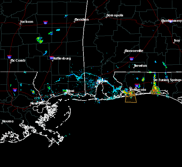 At 547 pm cdt, a severe thunderstorm was located over gulf breeze, moving south at 5 mph (radar indicated). Hazards include 60 mph wind gusts. expect damage to roofs, siding, and trees At 547 pm cdt, a severe thunderstorm was located over gulf breeze, moving south at 5 mph (radar indicated). Hazards include 60 mph wind gusts. expect damage to roofs, siding, and trees
|
| 5/13/2019 3:07 AM CDT |
 The national weather service in mobile has issued a * severe thunderstorm warning for. southwestern santa rosa county in northwestern florida. central escambia county in northwestern florida. until 345 am cdt. At 306 am cdt, a severe thunderstorm was located over ensley,. The national weather service in mobile has issued a * severe thunderstorm warning for. southwestern santa rosa county in northwestern florida. central escambia county in northwestern florida. until 345 am cdt. At 306 am cdt, a severe thunderstorm was located over ensley,.
|
| 5/12/2019 9:59 AM CDT | Trees and tree limbs down in the pine forest area near mers ln. time estimated by rada in escambia county FL, 5.5 miles E of Pensacola, FL |
| 5/12/2019 8:59 AM CDT | Corrects previous tstm wnd dmg report from 1 ene bellview. trees and tree limbs down in the pine forest area near mers ln. time estimated by rada in escambia county FL, 5.5 miles E of Pensacola, FL |
| 5/12/2019 8:57 AM CDT | Trees down near nas pensacola. time estimated from rada in escambia county FL, 10.1 miles NE of Pensacola, FL |
| 5/12/2019 8:39 AM CDT |
 The national weather service in mobile has issued a * severe thunderstorm warning for. southern santa rosa county in northwestern florida. southeastern escambia county in northwestern florida. until 915 am cdt. At 838 am cdt, severe thunderstorms were located along a line. The national weather service in mobile has issued a * severe thunderstorm warning for. southern santa rosa county in northwestern florida. southeastern escambia county in northwestern florida. until 915 am cdt. At 838 am cdt, severe thunderstorms were located along a line.
|
| 4/25/2019 5:26 PM CDT |
 At 525 pm cdt, severe thunderstorms were located along a line extending from 4 miles east of fort morgan to 11 miles southwest of gulf shores to 32 miles southeast of dauphin island, moving east at 45 mph (radar indicated). Hazards include 60 mph wind gusts. expect damage to roofs, siding, and trees At 525 pm cdt, severe thunderstorms were located along a line extending from 4 miles east of fort morgan to 11 miles southwest of gulf shores to 32 miles southeast of dauphin island, moving east at 45 mph (radar indicated). Hazards include 60 mph wind gusts. expect damage to roofs, siding, and trees
|
| 4/18/2019 9:07 PM CDT |
 The severe thunderstorm warning for southeastern baldwin, eastern escambia, western santa rosa and escambia counties will expire at 915 pm cdt, the storms which prompted the warning have weakened below severe limits, and the warning will be allowed to expire. however gusty winds are still possible with these thunderstorms. a tornado watch remains in effect until 1100 pm cdt for south central and southwestern alabama, and northwestern florida. The severe thunderstorm warning for southeastern baldwin, eastern escambia, western santa rosa and escambia counties will expire at 915 pm cdt, the storms which prompted the warning have weakened below severe limits, and the warning will be allowed to expire. however gusty winds are still possible with these thunderstorms. a tornado watch remains in effect until 1100 pm cdt for south central and southwestern alabama, and northwestern florida.
|
| 4/18/2019 8:50 PM CDT |
 At 849 pm cdt, severe thunderstorms were located along a line extending from 3 miles southwest of castleberry to 8 miles southeast of gulf shores, moving east at 30 mph (radar indicated). Hazards include 60 mph wind gusts. Expect damage to roofs, siding, and trees. Locations impacted include, pensacola, ferry pass, brent, west pensacola, ensley, warrington, gonzalez, pace, milton, gulf breeze, brewton, orange beach, goulding, century, flomaton, lillian, myrtle grove, east brewton, molino and perdido beach. At 849 pm cdt, severe thunderstorms were located along a line extending from 3 miles southwest of castleberry to 8 miles southeast of gulf shores, moving east at 30 mph (radar indicated). Hazards include 60 mph wind gusts. Expect damage to roofs, siding, and trees. Locations impacted include, pensacola, ferry pass, brent, west pensacola, ensley, warrington, gonzalez, pace, milton, gulf breeze, brewton, orange beach, goulding, century, flomaton, lillian, myrtle grove, east brewton, molino and perdido beach.
|
| 4/18/2019 8:13 PM CDT |
 At 813 pm cdt, severe thunderstorms were located along a line extending from near i65 and al 113 to 11 miles southeast of fort morgan, moving east at 30 mph (radar indicated). Hazards include 60 mph wind gusts. expect damage to roofs, siding, and trees At 813 pm cdt, severe thunderstorms were located along a line extending from near i65 and al 113 to 11 miles southeast of fort morgan, moving east at 30 mph (radar indicated). Hazards include 60 mph wind gusts. expect damage to roofs, siding, and trees
|
| 12/2/2018 2:57 AM CST |
 The severe thunderstorm warning for central santa rosa and south central escambia counties will expire at 300 am cst, the storm which prompted the warning has weakened below severe limits. therefore, the warning will be allowed to expire. gusty winds are still possible with this thunderstorm. The severe thunderstorm warning for central santa rosa and south central escambia counties will expire at 300 am cst, the storm which prompted the warning has weakened below severe limits. therefore, the warning will be allowed to expire. gusty winds are still possible with this thunderstorm.
|
| 12/2/2018 2:13 AM CST |
 At 213 am cst, a severe thunderstorm was located over myrtle grove, or 4 miles west of west pensacola, moving east at 40 mph (radar indicated). Hazards include 60 mph wind gusts. expect damage to roofs, siding, and trees At 213 am cst, a severe thunderstorm was located over myrtle grove, or 4 miles west of west pensacola, moving east at 40 mph (radar indicated). Hazards include 60 mph wind gusts. expect damage to roofs, siding, and trees
|
| 11/12/2018 11:15 AM CST |
 At 1115 am cst, a severe thunderstorm capable of producing a tornado was located over pensacola beach, or 4 miles southeast of gulf breeze, moving northeast at 30 mph (radar indicated rotation). Hazards include tornado. Flying debris will be dangerous to those caught without shelter. mobile homes will be damaged or destroyed. damage to roofs, windows, and vehicles will occur. tree damage is likely. this dangerous storm will be near, oriole beach around 1125 am cst. Milton and bagdad around 1200 pm cst. At 1115 am cst, a severe thunderstorm capable of producing a tornado was located over pensacola beach, or 4 miles southeast of gulf breeze, moving northeast at 30 mph (radar indicated rotation). Hazards include tornado. Flying debris will be dangerous to those caught without shelter. mobile homes will be damaged or destroyed. damage to roofs, windows, and vehicles will occur. tree damage is likely. this dangerous storm will be near, oriole beach around 1125 am cst. Milton and bagdad around 1200 pm cst.
|
| 11/12/2018 9:07 AM CST |
 At 907 am cst, a severe thunderstorm capable of producing a tornado was located over gulf breeze, moving northeast at 20 mph (radar indicated rotation). Hazards include tornado and quarter size hail. Flying debris will be dangerous to those caught without shelter. mobile homes will be damaged or destroyed. damage to roofs, windows, and vehicles will occur. tree damage is likely. this dangerous storm will be near, pensacola beach around 910 am cst. gulf breeze around 915 am cst. Oriole beach around 920 am cst. At 907 am cst, a severe thunderstorm capable of producing a tornado was located over gulf breeze, moving northeast at 20 mph (radar indicated rotation). Hazards include tornado and quarter size hail. Flying debris will be dangerous to those caught without shelter. mobile homes will be damaged or destroyed. damage to roofs, windows, and vehicles will occur. tree damage is likely. this dangerous storm will be near, pensacola beach around 910 am cst. gulf breeze around 915 am cst. Oriole beach around 920 am cst.
|
| 11/12/2018 8:59 AM CST |
 At 859 am cst, a severe thunderstorm capable of producing a tornado was located 4 miles southwest of pensacola beach, or 5 miles south of gulf breeze, moving northeast at 25 mph (radar indicated rotation). Hazards include tornado and quarter size hail. Flying debris will be dangerous to those caught without shelter. mobile homes will be damaged or destroyed. damage to roofs, windows, and vehicles will occur. tree damage is likely. this dangerous storm will be near, gulf breeze and pensacola beach around 910 am cst. Oriole beach around 920 am cst. At 859 am cst, a severe thunderstorm capable of producing a tornado was located 4 miles southwest of pensacola beach, or 5 miles south of gulf breeze, moving northeast at 25 mph (radar indicated rotation). Hazards include tornado and quarter size hail. Flying debris will be dangerous to those caught without shelter. mobile homes will be damaged or destroyed. damage to roofs, windows, and vehicles will occur. tree damage is likely. this dangerous storm will be near, gulf breeze and pensacola beach around 910 am cst. Oriole beach around 920 am cst.
|
| 11/12/2018 8:56 AM CST |
 At 854 am cst, a severe thunderstorm was located 6 miles southwest of pensacola beach, or 7 miles south of gulf breeze, moving northeast at 25 mph. a tornado could form with little or no advanced warning (radar indicated). Hazards include 60 mph wind gusts and penny size hail. expect damage to roofs, siding, and trees At 854 am cst, a severe thunderstorm was located 6 miles southwest of pensacola beach, or 7 miles south of gulf breeze, moving northeast at 25 mph. a tornado could form with little or no advanced warning (radar indicated). Hazards include 60 mph wind gusts and penny size hail. expect damage to roofs, siding, and trees
|
| 11/1/2018 10:40 AM CDT |
 At 1040 am cdt, severe thunderstorms were located along a line extending from 3 miles northwest of navarre to 5 miles southwest of navarre beach, moving east at 45 mph (radar indicated). Hazards include 60 to 70 mph wind gusts. Expect considerable tree damage. damage is likely to mobile homes, roofs, and outbuildings. locations impacted include, oriole beach, navarre and navarre beach. A tornado watch remains in effect until 100 pm cdt for northwestern florida. At 1040 am cdt, severe thunderstorms were located along a line extending from 3 miles northwest of navarre to 5 miles southwest of navarre beach, moving east at 45 mph (radar indicated). Hazards include 60 to 70 mph wind gusts. Expect considerable tree damage. damage is likely to mobile homes, roofs, and outbuildings. locations impacted include, oriole beach, navarre and navarre beach. A tornado watch remains in effect until 100 pm cdt for northwestern florida.
|
| 11/1/2018 10:18 AM CDT |
 At 1017 am cdt, severe thunderstorms were located along a line extending from 4 miles south of warrington to 9 miles south of pensacola beach, moving northeast at 45 mph (radar indicated). Hazards include 60 to 70 mph wind gusts. Expect considerable tree damage. Damage is likely to mobile homes, roofs, and outbuildings. At 1017 am cdt, severe thunderstorms were located along a line extending from 4 miles south of warrington to 9 miles south of pensacola beach, moving northeast at 45 mph (radar indicated). Hazards include 60 to 70 mph wind gusts. Expect considerable tree damage. Damage is likely to mobile homes, roofs, and outbuildings.
|
| 11/1/2018 8:07 AM CDT |
 At 807 am cdt, severe thunderstorms were located along a line extending from 10 miles west of molino to 3 miles east of summerdale to fort morgan, moving east at 40 mph (radar indicated). Hazards include 60 mph wind gusts. expect damage to roofs, siding, and trees At 807 am cdt, severe thunderstorms were located along a line extending from 10 miles west of molino to 3 miles east of summerdale to fort morgan, moving east at 40 mph (radar indicated). Hazards include 60 mph wind gusts. expect damage to roofs, siding, and trees
|
| 6/28/2018 7:52 PM CDT | Several trees and power lines down across the southern part of the count in escambia county FL, 5.6 miles E of Pensacola, FL |
| 6/28/2018 7:34 PM CDT |
 At 734 pm cdt, severe thunderstorms were located along a line extending from 3 miles south of bay minette to 3 miles west of pace to 4 miles west of santa rosa beach, moving southeast at 55 mph (radar indicated). Hazards include 60 mph wind gusts. expect damage to roofs, siding, and trees At 734 pm cdt, severe thunderstorms were located along a line extending from 3 miles south of bay minette to 3 miles west of pace to 4 miles west of santa rosa beach, moving southeast at 55 mph (radar indicated). Hazards include 60 mph wind gusts. expect damage to roofs, siding, and trees
|
| 6/10/2018 3:41 PM CDT |
 The severe thunderstorm warning for southeastern santa rosa county will expire at 345 pm cdt, the storm which prompted the warning has weakened below severe limits. therefore, the warning will be allowed to expire. however heavy rain and frequent lightning can be expected with this thunderstorm. The severe thunderstorm warning for southeastern santa rosa county will expire at 345 pm cdt, the storm which prompted the warning has weakened below severe limits. therefore, the warning will be allowed to expire. however heavy rain and frequent lightning can be expected with this thunderstorm.
|
| 6/10/2018 3:22 PM CDT |
 At 321 pm cdt, a severe thunderstorm was located 5 miles southeast of pea ridge, or 5 miles southwest of bagdad, moving southeast at 15 mph (radar indicated). Hazards include 60 mph wind gusts and penny size hail. Expect damage to roofs, siding, and trees. Locations impacted include, bagdad and pea ridge. At 321 pm cdt, a severe thunderstorm was located 5 miles southeast of pea ridge, or 5 miles southwest of bagdad, moving southeast at 15 mph (radar indicated). Hazards include 60 mph wind gusts and penny size hail. Expect damage to roofs, siding, and trees. Locations impacted include, bagdad and pea ridge.
|
| 6/10/2018 3:05 PM CDT |
 At 305 pm cdt, a severe thunderstorm was located over floridatown, or near pace, moving southeast at 15 mph (radar indicated). Hazards include 60 mph wind gusts and quarter size hail. Hail damage to vehicles is expected. Expect wind damage to roofs, siding, and trees. At 305 pm cdt, a severe thunderstorm was located over floridatown, or near pace, moving southeast at 15 mph (radar indicated). Hazards include 60 mph wind gusts and quarter size hail. Hail damage to vehicles is expected. Expect wind damage to roofs, siding, and trees.
|
| 6/2/2018 5:26 PM CDT |
 At 459 pm cdt, a severe thunderstorm was located near ferry pass, moving southeast at 20 mph (radar indicated). Hazards include 60 mph wind gusts and penny size hail. expect damage to roofs, siding, and trees At 459 pm cdt, a severe thunderstorm was located near ferry pass, moving southeast at 20 mph (radar indicated). Hazards include 60 mph wind gusts and penny size hail. expect damage to roofs, siding, and trees
|
| 6/2/2018 5:00 PM CDT |
 At 459 pm cdt, a severe thunderstorm was located near ferry pass, moving southeast at 20 mph (radar indicated). Hazards include 60 mph wind gusts and penny size hail. expect damage to roofs, siding, and trees At 459 pm cdt, a severe thunderstorm was located near ferry pass, moving southeast at 20 mph (radar indicated). Hazards include 60 mph wind gusts and penny size hail. expect damage to roofs, siding, and trees
|
| 4/22/2018 3:49 PM CDT |
 At 349 pm cdt, a severe thunderstorm was located over ensley, moving north at 25 mph (radar indicated). Hazards include 60 mph wind gusts. expect damage to roofs, siding, and trees At 349 pm cdt, a severe thunderstorm was located over ensley, moving north at 25 mph (radar indicated). Hazards include 60 mph wind gusts. expect damage to roofs, siding, and trees
|
| 2/7/2018 11:05 AM CST |
 The severe thunderstorm warning for southeastern baldwin, southern santa rosa and southeastern escambia counties will expire at 1115 am cst, the storm which prompted the warning has weakened below severe limits, and no longer poses an immediate threat to life or property. therefore the warning will be allowed to expire. however heavy rain is still possible with this thunderstorm. The severe thunderstorm warning for southeastern baldwin, southern santa rosa and southeastern escambia counties will expire at 1115 am cst, the storm which prompted the warning has weakened below severe limits, and no longer poses an immediate threat to life or property. therefore the warning will be allowed to expire. however heavy rain is still possible with this thunderstorm.
|
| 2/7/2018 10:45 AM CST |
 At 1044 am cst, a severe thunderstorm was located over myrtle grove, or over west pensacola, moving east at 35 mph (radar indicated). Hazards include 60 mph wind gusts and quarter size hail. Hail damage to vehicles is expected. expect wind damage to roofs, siding, and trees. Locations impacted include, pensacola, ferry pass, brent, west pensacola, ensley, warrington, gulf breeze, orange beach, goulding, lillian, myrtle grove, oriole beach, navarre, perdido beach, elberta, pensacola beach and navarre beach. At 1044 am cst, a severe thunderstorm was located over myrtle grove, or over west pensacola, moving east at 35 mph (radar indicated). Hazards include 60 mph wind gusts and quarter size hail. Hail damage to vehicles is expected. expect wind damage to roofs, siding, and trees. Locations impacted include, pensacola, ferry pass, brent, west pensacola, ensley, warrington, gulf breeze, orange beach, goulding, lillian, myrtle grove, oriole beach, navarre, perdido beach, elberta, pensacola beach and navarre beach.
|
| 2/7/2018 10:25 AM CST |
 At 1025 am cst, a severe thunderstorm was located near perdido beach, or 8 miles north of orange beach, moving east at 45 mph (radar indicated). Hazards include 60 mph wind gusts and quarter size hail. Hail damage to vehicles is expected. Expect wind damage to roofs, siding, and trees. At 1025 am cst, a severe thunderstorm was located near perdido beach, or 8 miles north of orange beach, moving east at 45 mph (radar indicated). Hazards include 60 mph wind gusts and quarter size hail. Hail damage to vehicles is expected. Expect wind damage to roofs, siding, and trees.
|
| 10/22/2017 1:00 PM CDT |
 The national weather service in mobile has issued a * tornado warning for. southeastern baldwin county in southwestern alabama. central santa rosa county in northwestern florida. central escambia county in northwestern florida. Until 130 pm cdt. The national weather service in mobile has issued a * tornado warning for. southeastern baldwin county in southwestern alabama. central santa rosa county in northwestern florida. central escambia county in northwestern florida. Until 130 pm cdt.
|
| 7/27/2017 6:39 PM CDT |
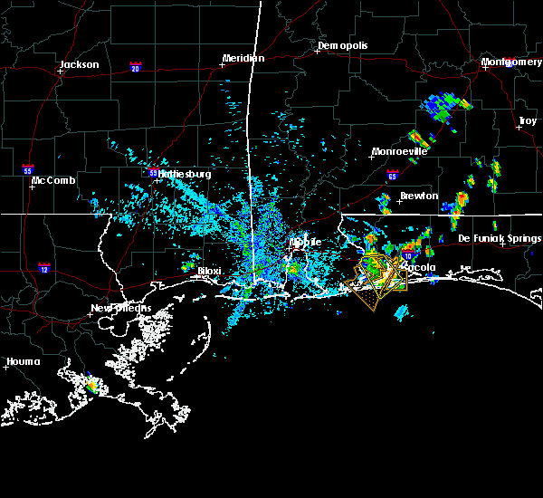 At 638 pm cdt, severe thunderstorms were located along a line extending from ensley to oriole beach, moving southwest at 10 mph (radar indicated). Hazards include 60 mph wind gusts. Expect damage to roofs, siding, and trees. Locations impacted include, pensacola, ferry pass, brent, west pensacola, ensley, warrington, gonzalez, gulf breeze, goulding, myrtle grove, oriole beach and pensacola beach. At 638 pm cdt, severe thunderstorms were located along a line extending from ensley to oriole beach, moving southwest at 10 mph (radar indicated). Hazards include 60 mph wind gusts. Expect damage to roofs, siding, and trees. Locations impacted include, pensacola, ferry pass, brent, west pensacola, ensley, warrington, gonzalez, gulf breeze, goulding, myrtle grove, oriole beach and pensacola beach.
|
| 7/27/2017 6:14 PM CDT |
 At 614 pm cdt, severe thunderstorms were located along a line extending from near pace to near oriole beach, moving southwest at 10 mph (radar indicated). Hazards include 60 mph wind gusts. expect damage to roofs, siding, and trees At 614 pm cdt, severe thunderstorms were located along a line extending from near pace to near oriole beach, moving southwest at 10 mph (radar indicated). Hazards include 60 mph wind gusts. expect damage to roofs, siding, and trees
|
| 6/21/2017 6:41 PM CDT | Trees down... powerlines down...and cosmetic damage to homes near aquamarine ave and emerald av in escambia county FL, 4.1 miles ENE of Pensacola, FL |
| 6/21/2017 6:39 PM CDT | Trees down... powerlines down...and cosmetic damage to homes near north kirk st and west brainerd s in escambia county FL, 4.4 miles NE of Pensacola, FL |
| 5/12/2017 2:35 PM CDT |
 At 235 pm cdt, severe thunderstorms were located along a line extending from 6 miles east of molino to gonzalez to near lillian, moving east at 40 mph (radar indicated). Hazards include 60 mph wind gusts. expect damage to roofs, siding, and trees At 235 pm cdt, severe thunderstorms were located along a line extending from 6 miles east of molino to gonzalez to near lillian, moving east at 40 mph (radar indicated). Hazards include 60 mph wind gusts. expect damage to roofs, siding, and trees
|
| 4/3/2017 11:10 AM CDT |
 At 1109 am cdt, severe thunderstorms were located along a line extending from 6 miles east of ferry pass to 16 miles south of pensacola beach, moving east at 40 mph (radar indicated). Hazards include 60 mph wind gusts and quarter size hail. Hail damage to vehicles is expected. expect wind damage to roofs, siding, and trees. locations impacted include, pensacola, ferry pass, brent, west pensacola, warrington, pace, milton, gulf breeze, goulding, bagdad, myrtle grove, oriole beach, navarre, pensacola beach, navarre beach, pea ridge and floridatown. A tornado watch remains in effect until 100 pm cdt for northwestern florida. At 1109 am cdt, severe thunderstorms were located along a line extending from 6 miles east of ferry pass to 16 miles south of pensacola beach, moving east at 40 mph (radar indicated). Hazards include 60 mph wind gusts and quarter size hail. Hail damage to vehicles is expected. expect wind damage to roofs, siding, and trees. locations impacted include, pensacola, ferry pass, brent, west pensacola, warrington, pace, milton, gulf breeze, goulding, bagdad, myrtle grove, oriole beach, navarre, pensacola beach, navarre beach, pea ridge and floridatown. A tornado watch remains in effect until 100 pm cdt for northwestern florida.
|
| 4/3/2017 10:46 AM CDT |
 At 1046 am cdt, severe thunderstorms were located along a line extending from near lillian to 13 miles south of warrington, moving east at 30 mph (radar indicated). Hazards include 60 mph wind gusts and quarter size hail. Hail damage to vehicles is expected. Expect wind damage to roofs, siding, and trees. At 1046 am cdt, severe thunderstorms were located along a line extending from near lillian to 13 miles south of warrington, moving east at 30 mph (radar indicated). Hazards include 60 mph wind gusts and quarter size hail. Hail damage to vehicles is expected. Expect wind damage to roofs, siding, and trees.
|
| 4/3/2017 10:34 AM CDT |
 At 1033 am cdt, severe thunderstorms were located along a line extending from near ensley to 20 miles south of gulf shores to 38 miles south of fort morgan, moving east at 35 mph. the severe thunderstorm line is organizing along the coast and a new warning will likely be needed to replace the eastern portion of this warning by 1045 am cdt (radar indicated). Hazards include 60 mph wind gusts and quarter size hail. Hail damage to vehicles is expected. expect wind damage to roofs, siding, and trees. locations impacted include, pensacola, ferry pass, brent, west pensacola, ensley, warrington, gonzalez, gulf shores, foley, pace, milton, gulf breeze, orange beach, goulding, robertsdale, bagdad, lillian, myrtle grove, oriole beach and bon secour. a tornado watch remains in effect until 1100 am cdt for southwestern alabama. A tornado watch also remains in effect until 100 pm cdt for northwestern florida. At 1033 am cdt, severe thunderstorms were located along a line extending from near ensley to 20 miles south of gulf shores to 38 miles south of fort morgan, moving east at 35 mph. the severe thunderstorm line is organizing along the coast and a new warning will likely be needed to replace the eastern portion of this warning by 1045 am cdt (radar indicated). Hazards include 60 mph wind gusts and quarter size hail. Hail damage to vehicles is expected. expect wind damage to roofs, siding, and trees. locations impacted include, pensacola, ferry pass, brent, west pensacola, ensley, warrington, gonzalez, gulf shores, foley, pace, milton, gulf breeze, orange beach, goulding, robertsdale, bagdad, lillian, myrtle grove, oriole beach and bon secour. a tornado watch remains in effect until 1100 am cdt for southwestern alabama. A tornado watch also remains in effect until 100 pm cdt for northwestern florida.
|
| 4/3/2017 9:43 AM CDT |
 At 942 am cdt, severe thunderstorms were located along a line extending from near elberta to 23 miles south of orange beach, moving northeast at 35 mph (radar indicated). Hazards include 60 mph wind gusts and quarter size hail. Hail damage to vehicles is expected. Expect wind damage to roofs, siding, and trees. At 942 am cdt, severe thunderstorms were located along a line extending from near elberta to 23 miles south of orange beach, moving northeast at 35 mph (radar indicated). Hazards include 60 mph wind gusts and quarter size hail. Hail damage to vehicles is expected. Expect wind damage to roofs, siding, and trees.
|
| 2/7/2017 4:04 PM CST |
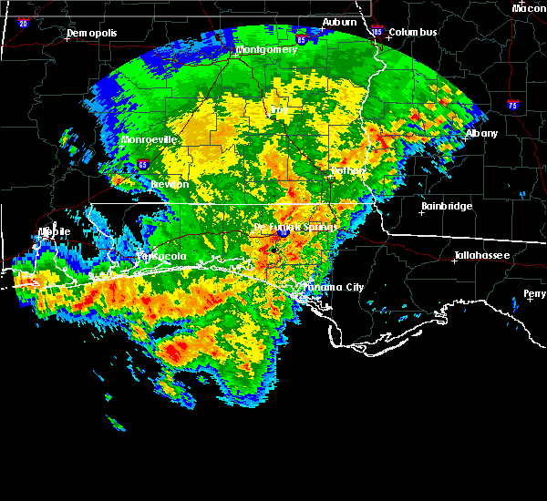 At 404 pm cst, a severe thunderstorm was located near perdido beach, or 9 miles southwest of warrington, moving east at 60 mph (radar indicated). Hazards include 60 mph wind gusts. expect damage to roofs, siding, and trees At 404 pm cst, a severe thunderstorm was located near perdido beach, or 9 miles southwest of warrington, moving east at 60 mph (radar indicated). Hazards include 60 mph wind gusts. expect damage to roofs, siding, and trees
|
| 2/7/2017 4:04 PM CST |
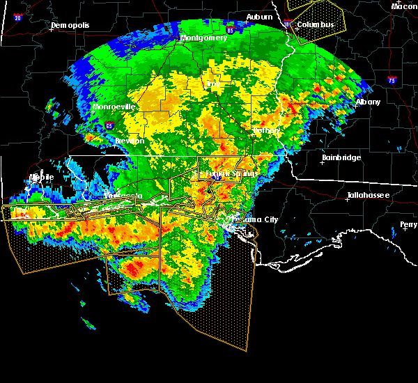 At 404 pm cst, a severe thunderstorm was located near perdido beach, or 9 miles southwest of warrington, moving east at 60 mph (radar indicated). Hazards include 60 mph wind gusts. expect damage to roofs, siding, and trees At 404 pm cst, a severe thunderstorm was located near perdido beach, or 9 miles southwest of warrington, moving east at 60 mph (radar indicated). Hazards include 60 mph wind gusts. expect damage to roofs, siding, and trees
|
| 2/7/2017 3:35 PM CST |
 At 334 pm cst, severe thunderstorms were located along a line extending from 9 miles northwest of eglin air force base to near navarre beach to gulf shores, moving east at 65 mph (radar indicated). Hazards include 70 mph wind gusts and quarter size hail. Hail damage to vehicles is expected. expect considerable tree damage. wind damage is also likely to mobile homes, roofs, and outbuildings. locations impacted include, pensacola, brent, west pensacola, wright, fort walton beach, warrington, niceville, destin, gulf shores, eglin afb, foley, valparaiso, gulf breeze, orange beach, goulding, mary esther, ocean city, lake lorraine, lillian and myrtle grove. A tornado watch remains in effect until 600 pm cst for southwestern alabama, and northwestern florida. At 334 pm cst, severe thunderstorms were located along a line extending from 9 miles northwest of eglin air force base to near navarre beach to gulf shores, moving east at 65 mph (radar indicated). Hazards include 70 mph wind gusts and quarter size hail. Hail damage to vehicles is expected. expect considerable tree damage. wind damage is also likely to mobile homes, roofs, and outbuildings. locations impacted include, pensacola, brent, west pensacola, wright, fort walton beach, warrington, niceville, destin, gulf shores, eglin afb, foley, valparaiso, gulf breeze, orange beach, goulding, mary esther, ocean city, lake lorraine, lillian and myrtle grove. A tornado watch remains in effect until 600 pm cst for southwestern alabama, and northwestern florida.
|
| 2/7/2017 3:01 PM CST |
 At 301 pm cst, severe thunderstorms were located along a line extending from roeville to near warrington to near orange beach, moving east at 60 mph (radar indicated). Hazards include 70 mph wind gusts and half dollar size hail. Hail damage to vehicles is expected. expect considerable tree damage. Wind damage is also likely to mobile homes, roofs, and outbuildings. At 301 pm cst, severe thunderstorms were located along a line extending from roeville to near warrington to near orange beach, moving east at 60 mph (radar indicated). Hazards include 70 mph wind gusts and half dollar size hail. Hail damage to vehicles is expected. expect considerable tree damage. Wind damage is also likely to mobile homes, roofs, and outbuildings.
|
| 1/22/2017 10:46 AM CST |
 At 1046 am cst, a severe thunderstorm was located near bagdad, moving northeast at 50 mph (radar indicated). Hazards include 60 mph wind gusts. Expect damage to roofs, siding, and trees. locations impacted include, pensacola, milton, gulf breeze, bagdad, oriole beach, perdido beach, pea ridge and floridatown. A tornado watch remains in effect until 200 pm cst for southwestern alabama, and northwestern florida. At 1046 am cst, a severe thunderstorm was located near bagdad, moving northeast at 50 mph (radar indicated). Hazards include 60 mph wind gusts. Expect damage to roofs, siding, and trees. locations impacted include, pensacola, milton, gulf breeze, bagdad, oriole beach, perdido beach, pea ridge and floridatown. A tornado watch remains in effect until 200 pm cst for southwestern alabama, and northwestern florida.
|
| 1/22/2017 9:59 AM CST |
 At 958 am cst, severe thunderstorms were located along a line extending from 7 miles northwest of gonzalez to near ensley to lillian, moving northeast at 55 mph. a new severe thunderstorm warning may be required soon for these storms (radar indicated). Hazards include 60 mph wind gusts and quarter size hail. Hail damage to vehicles is expected. expect wind damage to roofs, siding, and trees. locations impacted include, pensacola, ferry pass, brent, ensley, gonzalez and lillian. A tornado watch remains in effect until 200 pm cst for southwestern alabama, and northwestern florida. At 958 am cst, severe thunderstorms were located along a line extending from 7 miles northwest of gonzalez to near ensley to lillian, moving northeast at 55 mph. a new severe thunderstorm warning may be required soon for these storms (radar indicated). Hazards include 60 mph wind gusts and quarter size hail. Hail damage to vehicles is expected. expect wind damage to roofs, siding, and trees. locations impacted include, pensacola, ferry pass, brent, ensley, gonzalez and lillian. A tornado watch remains in effect until 200 pm cst for southwestern alabama, and northwestern florida.
|
| 1/22/2017 9:31 AM CST |
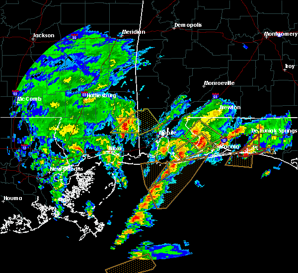 At 931 am cst, a severe thunderstorm was located over foley, moving northeast at 50 mph (radar indicated). Hazards include quarter size hail. damage to vehicles is expected At 931 am cst, a severe thunderstorm was located over foley, moving northeast at 50 mph (radar indicated). Hazards include quarter size hail. damage to vehicles is expected
|
| 1/21/2017 9:37 PM CST |
 At 936 pm cst, a severe thunderstorm was located near oriole beach, or 9 miles east of gulf breeze, moving northeast at 45 mph (radar indicated). Hazards include 60 mph wind gusts and quarter size hail. Hail damage to vehicles is expected. Expect wind damage to roofs, siding, and trees. At 936 pm cst, a severe thunderstorm was located near oriole beach, or 9 miles east of gulf breeze, moving northeast at 45 mph (radar indicated). Hazards include 60 mph wind gusts and quarter size hail. Hail damage to vehicles is expected. Expect wind damage to roofs, siding, and trees.
|
| 1/21/2017 7:56 PM CST |
 The severe thunderstorm warning for east central baldwin, central escambia and western santa rosa counties will expire at 800 pm cst, the storm which prompted the warning has moved out of the area. therefore the warning will be allowed to expire. a tornado watch remains in effect until 300 am cst for southwestern alabama, and northwestern florida. The severe thunderstorm warning for east central baldwin, central escambia and western santa rosa counties will expire at 800 pm cst, the storm which prompted the warning has moved out of the area. therefore the warning will be allowed to expire. a tornado watch remains in effect until 300 am cst for southwestern alabama, and northwestern florida.
|
| 1/21/2017 7:36 PM CST |
 At 736 pm cst, a severe thunderstorm was located near gonzalez, moving northeast at 50 mph (radar indicated). Hazards include golf ball size hail and 60 mph wind gusts. People and animals outdoors will be injured. expect hail damage to roofs, siding, windows, and vehicles. expect wind damage to roofs, siding, and trees. locations impacted include, pensacola, ferry pass, brent, ensley, gonzalez, pace, bagdad, molino, floridatown and pea ridge. A tornado watch remains in effect until 300 am cst for southwestern alabama, and northwestern florida. At 736 pm cst, a severe thunderstorm was located near gonzalez, moving northeast at 50 mph (radar indicated). Hazards include golf ball size hail and 60 mph wind gusts. People and animals outdoors will be injured. expect hail damage to roofs, siding, windows, and vehicles. expect wind damage to roofs, siding, and trees. locations impacted include, pensacola, ferry pass, brent, ensley, gonzalez, pace, bagdad, molino, floridatown and pea ridge. A tornado watch remains in effect until 300 am cst for southwestern alabama, and northwestern florida.
|
| 1/21/2017 7:15 PM CST |
 At 714 pm cst, a severe thunderstorm was located over foley, moving northeast at 65 mph (radar indicated). Hazards include golf ball size hail and 60 mph wind gusts. People and animals outdoors will be injured. expect hail damage to roofs, siding, windows, and vehicles. Expect wind damage to roofs, siding, and trees. At 714 pm cst, a severe thunderstorm was located over foley, moving northeast at 65 mph (radar indicated). Hazards include golf ball size hail and 60 mph wind gusts. People and animals outdoors will be injured. expect hail damage to roofs, siding, windows, and vehicles. Expect wind damage to roofs, siding, and trees.
|
| 1/2/2017 8:32 PM CST |
 At 831 pm cst, severe thunderstorms were located along a line extending from 6 miles northwest of pace, to pea ridge, to near oriole beach, to near perdido beach, moving east at 55 mph (radar indicated). Hazards include 60 mph wind gusts and penny size hail. Expect damage to roofs, siding, and trees. Locations impacted include, pensacola, ferry pass, brent, west pensacola, ensley, warrington, gonzalez, pace, milton, gulf breeze, goulding, bagdad, myrtle grove, oriole beach, navarre, perdido beach, navarre beach, pea ridge, floridatown and pensacola beach. At 831 pm cst, severe thunderstorms were located along a line extending from 6 miles northwest of pace, to pea ridge, to near oriole beach, to near perdido beach, moving east at 55 mph (radar indicated). Hazards include 60 mph wind gusts and penny size hail. Expect damage to roofs, siding, and trees. Locations impacted include, pensacola, ferry pass, brent, west pensacola, ensley, warrington, gonzalez, pace, milton, gulf breeze, goulding, bagdad, myrtle grove, oriole beach, navarre, perdido beach, navarre beach, pea ridge, floridatown and pensacola beach.
|
| 1/2/2017 8:20 PM CST |
 At 819 pm cst, severe thunderstorms were located along a line extending from 6 miles southwest of molino, to gonzalez, to myrtle grove, to orange beach, moving northeast at 60 mph (radar indicated). Hazards include 60 mph wind gusts and quarter size hail. Hail damage to vehicles is expected. expect wind damage to roofs, siding, and trees. Locations impacted include, pensacola, ferry pass, brent, west pensacola, ensley, warrington, gonzalez, foley, pace, milton, gulf breeze, orange beach, goulding, bagdad, lillian, myrtle grove, oriole beach, navarre, molino and perdido beach. At 819 pm cst, severe thunderstorms were located along a line extending from 6 miles southwest of molino, to gonzalez, to myrtle grove, to orange beach, moving northeast at 60 mph (radar indicated). Hazards include 60 mph wind gusts and quarter size hail. Hail damage to vehicles is expected. expect wind damage to roofs, siding, and trees. Locations impacted include, pensacola, ferry pass, brent, west pensacola, ensley, warrington, gonzalez, foley, pace, milton, gulf breeze, orange beach, goulding, bagdad, lillian, myrtle grove, oriole beach, navarre, molino and perdido beach.
|
| 1/2/2017 8:00 PM CST |
 At 800 pm cst, severe thunderstorms were located along a line extending from near robertsdale to near elberta to near perdido beach to near gulf shores, moving east at 60 mph (radar indicated). Hazards include 60 mph wind gusts and quarter size hail. Hail damage to vehicles is expected. Expect wind damage to roofs, siding, and trees. At 800 pm cst, severe thunderstorms were located along a line extending from near robertsdale to near elberta to near perdido beach to near gulf shores, moving east at 60 mph (radar indicated). Hazards include 60 mph wind gusts and quarter size hail. Hail damage to vehicles is expected. Expect wind damage to roofs, siding, and trees.
|
| 1/2/2017 6:29 PM CST |
 At 628 pm cst, severe thunderstorms were located along a line extending from red level, to 7 miles south of andalusia, to near laurel hill, to near crestview, to near pensacola beach, moving east at 45 mph (radar indicated). Hazards include 60 mph wind gusts and nickel size hail. Expect damage to roofs, siding, and trees. locations impacted include, pensacola, ferry pass, brent, west pensacola, wright, fort walton beach, ensley, warrington, crestview, niceville, gonzalez, destin, gulf shores, andalusia, eglin afb, foley, pace, milton, opp and valparaiso. A tornado watch remains in effect until 800 pm cst for south central and southwestern alabama, and northwestern florida. At 628 pm cst, severe thunderstorms were located along a line extending from red level, to 7 miles south of andalusia, to near laurel hill, to near crestview, to near pensacola beach, moving east at 45 mph (radar indicated). Hazards include 60 mph wind gusts and nickel size hail. Expect damage to roofs, siding, and trees. locations impacted include, pensacola, ferry pass, brent, west pensacola, wright, fort walton beach, ensley, warrington, crestview, niceville, gonzalez, destin, gulf shores, andalusia, eglin afb, foley, pace, milton, opp and valparaiso. A tornado watch remains in effect until 800 pm cst for south central and southwestern alabama, and northwestern florida.
|
| 1/2/2017 6:13 PM CST |
 At 612 pm cst, severe thunderstorms were located along a line extending from 8 miles east of evergreen, to 13 miles southwest of river falls, to 10 miles north of baker, to 9 miles east of roeville, to 9 miles south of warrington, moving east at 45 mph (radar indicated). Hazards include 60 mph wind gusts and nickel size hail. Expect damage to roofs, siding, and trees. locations impacted include, pensacola, ferry pass, brent, west pensacola, wright, fort walton beach, ensley, warrington, crestview, niceville, gonzalez, destin, gulf shores, andalusia, eglin afb, foley, pace, milton, opp and valparaiso. A tornado watch remains in effect until 800 pm cst for south central and southwestern alabama, and northwestern florida. At 612 pm cst, severe thunderstorms were located along a line extending from 8 miles east of evergreen, to 13 miles southwest of river falls, to 10 miles north of baker, to 9 miles east of roeville, to 9 miles south of warrington, moving east at 45 mph (radar indicated). Hazards include 60 mph wind gusts and nickel size hail. Expect damage to roofs, siding, and trees. locations impacted include, pensacola, ferry pass, brent, west pensacola, wright, fort walton beach, ensley, warrington, crestview, niceville, gonzalez, destin, gulf shores, andalusia, eglin afb, foley, pace, milton, opp and valparaiso. A tornado watch remains in effect until 800 pm cst for south central and southwestern alabama, and northwestern florida.
|
| 1/2/2017 5:47 PM CST |
 At 546 pm cst, severe thunderstorms were located along a line extending from 13 miles southeast of beatrice to 7 miles northwest of brewton to near century to near magnolia springs to near fort morgan, moving east at 35 mph (radar indicated). Hazards include 60 mph wind gusts and quarter size hail. Hail damage to vehicles is expected. expect wind damage to roofs, siding, and trees. locations impacted include, downtown mobile, pensacola, ferry pass, brent, west pensacola, ensley, daphne, warrington, fairhope, gonzalez, gulf shores, foley, pace, gulf breeze, brewton, orange beach, spanish fort, goulding, robertsdale and evergreen. A tornado watch remains in effect until 800 pm cst for south central and southwestern alabama, and northwestern florida. At 546 pm cst, severe thunderstorms were located along a line extending from 13 miles southeast of beatrice to 7 miles northwest of brewton to near century to near magnolia springs to near fort morgan, moving east at 35 mph (radar indicated). Hazards include 60 mph wind gusts and quarter size hail. Hail damage to vehicles is expected. expect wind damage to roofs, siding, and trees. locations impacted include, downtown mobile, pensacola, ferry pass, brent, west pensacola, ensley, daphne, warrington, fairhope, gonzalez, gulf shores, foley, pace, gulf breeze, brewton, orange beach, spanish fort, goulding, robertsdale and evergreen. A tornado watch remains in effect until 800 pm cst for south central and southwestern alabama, and northwestern florida.
|
| 1/2/2017 5:42 PM CST |
 At 541 pm cst, severe thunderstorms were located along a line extending from near repton to near brewton to 8 miles east of jay to gulf shores, moving east at 45 mph (radar indicated). Hazards include 60 mph wind gusts and up to quarter size hail. expect damage to roofs, siding, and trees At 541 pm cst, severe thunderstorms were located along a line extending from near repton to near brewton to 8 miles east of jay to gulf shores, moving east at 45 mph (radar indicated). Hazards include 60 mph wind gusts and up to quarter size hail. expect damage to roofs, siding, and trees
|
| 1/2/2017 5:30 PM CST |
 At 528 pm cst, severe thunderstorms were located along a line extending from near beatrice, to near i65 and al 113, to near bratt, to near i10 and i65, to near alabama port, moving east at 45 mph (radar indicated). Hazards include 60 mph wind gusts and quarter size hail. Hail damage to vehicles is expected. expect wind damage to roofs, siding, and trees. locations impacted include, downtown mobile, midtown mobile, pensacola, prichard, ferry pass, brent, west pensacola, ensley, daphne, tillmans corner, warrington, fairhope, gonzalez, gulf shores, bay minette, atmore, foley, pace, monroeville and theodore. A tornado watch remains in effect until 800 pm cst for south central and southwestern alabama, and northwestern florida. At 528 pm cst, severe thunderstorms were located along a line extending from near beatrice, to near i65 and al 113, to near bratt, to near i10 and i65, to near alabama port, moving east at 45 mph (radar indicated). Hazards include 60 mph wind gusts and quarter size hail. Hail damage to vehicles is expected. expect wind damage to roofs, siding, and trees. locations impacted include, downtown mobile, midtown mobile, pensacola, prichard, ferry pass, brent, west pensacola, ensley, daphne, tillmans corner, warrington, fairhope, gonzalez, gulf shores, bay minette, atmore, foley, pace, monroeville and theodore. A tornado watch remains in effect until 800 pm cst for south central and southwestern alabama, and northwestern florida.
|
| 1/2/2017 5:15 PM CST |
 At 513 pm cst, severe thunderstorms were located along a line extending from near beatrice to near uriah to near poarch creek reservation to daphne to near alabama port, moving east at 35 mph (radar indicated). Hazards include 60 mph wind gusts and quarter size hail. Hail damage to vehicles is expected. expect wind damage to roofs, siding, and trees. locations impacted include, downtown mobile, midtown mobile, pensacola, prichard, ferry pass, brent, west pensacola, ensley, daphne, tillmans corner, warrington, fairhope, gonzalez, gulf shores, bay minette, atmore, foley, pace, monroeville and theodore. A tornado watch remains in effect until 800 pm cst for south central and southwestern alabama, and northwestern florida. At 513 pm cst, severe thunderstorms were located along a line extending from near beatrice to near uriah to near poarch creek reservation to daphne to near alabama port, moving east at 35 mph (radar indicated). Hazards include 60 mph wind gusts and quarter size hail. Hail damage to vehicles is expected. expect wind damage to roofs, siding, and trees. locations impacted include, downtown mobile, midtown mobile, pensacola, prichard, ferry pass, brent, west pensacola, ensley, daphne, tillmans corner, warrington, fairhope, gonzalez, gulf shores, bay minette, atmore, foley, pace, monroeville and theodore. A tornado watch remains in effect until 800 pm cst for south central and southwestern alabama, and northwestern florida.
|
| 1/2/2017 4:55 PM CST |
 At 454 pm cst, severe thunderstorms were located along a line extending from 7 miles west of vredenburgh to 13 miles southeast of jackson to 8 miles northeast of stockton to near i10 and i65 to near grand bay, moving east at 35 mph (radar indicated). Hazards include 60 mph wind gusts and quarter size hail. Hail damage to vehicles is expected. Expect wind damage to roofs, siding, and trees. At 454 pm cst, severe thunderstorms were located along a line extending from 7 miles west of vredenburgh to 13 miles southeast of jackson to 8 miles northeast of stockton to near i10 and i65 to near grand bay, moving east at 35 mph (radar indicated). Hazards include 60 mph wind gusts and quarter size hail. Hail damage to vehicles is expected. Expect wind damage to roofs, siding, and trees.
|
| 1/2/2017 4:15 PM CST |
 At 415 pm cst, a severe thunderstorm was located over gulf breeze, moving northeast at 35 mph (radar indicated). Hazards include 60 mph wind gusts. expect damage to roofs, siding, and trees At 415 pm cst, a severe thunderstorm was located over gulf breeze, moving northeast at 35 mph (radar indicated). Hazards include 60 mph wind gusts. expect damage to roofs, siding, and trees
|
| 1/2/2017 4:04 PM CST |
 At 403 pm cst, an area of severe thunderstorms was generally located along a line extending from near pace to near goulding to 10 miles south of warrington, moving northeast at 30 mph (radar indicated). Hazards include 60 mph wind gusts. Expect damage to roofs, siding, and trees. locations impacted include, pensacola, ferry pass, brent, west pensacola, wright, fort walton beach, ensley, warrington, crestview, niceville, gonzalez, destin, eglin afb, pace, milton, valparaiso, gulf breeze, goulding, mary esther and bagdad. A tornado watch remains in effect until 800 pm cst for northwestern florida. At 403 pm cst, an area of severe thunderstorms was generally located along a line extending from near pace to near goulding to 10 miles south of warrington, moving northeast at 30 mph (radar indicated). Hazards include 60 mph wind gusts. Expect damage to roofs, siding, and trees. locations impacted include, pensacola, ferry pass, brent, west pensacola, wright, fort walton beach, ensley, warrington, crestview, niceville, gonzalez, destin, eglin afb, pace, milton, valparaiso, gulf breeze, goulding, mary esther and bagdad. A tornado watch remains in effect until 800 pm cst for northwestern florida.
|
| 1/2/2017 3:17 PM CST |
 At 317 pm cst, severe thunderstorms were located along a line extending from near gonzalez to myrtle grove to 10 miles southeast of perdido beach, moving east at 45 mph (radar indicated). Hazards include 70 mph wind gusts and quarter size hail. Hail damage to vehicles is expected. expect considerable tree damage. Wind damage is also likely to mobile homes, roofs, and outbuildings. At 317 pm cst, severe thunderstorms were located along a line extending from near gonzalez to myrtle grove to 10 miles southeast of perdido beach, moving east at 45 mph (radar indicated). Hazards include 70 mph wind gusts and quarter size hail. Hail damage to vehicles is expected. expect considerable tree damage. Wind damage is also likely to mobile homes, roofs, and outbuildings.
|
| 1/2/2017 3:00 PM CST |
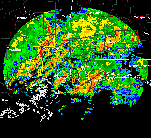 At 259 pm cst, a severe thunderstorm capable of producing a tornado was located over perdido beach, or near orange beach, moving northeast at 50 mph (radar indicated rotation). Hazards include tornado. Flying debris will be dangerous to those caught without shelter. mobile homes will be damaged or destroyed. damage to roofs, windows, and vehicles will occur. tree damage is likely. this dangerous storm will be near, pensacola around 305 pm cst. lillian around 310 pm cst. warrington and myrtle grove around 315 pm cst. west pensacola around 320 pm cst. Brent, ensley, gonzalez and goulding around 325 pm cst. At 259 pm cst, a severe thunderstorm capable of producing a tornado was located over perdido beach, or near orange beach, moving northeast at 50 mph (radar indicated rotation). Hazards include tornado. Flying debris will be dangerous to those caught without shelter. mobile homes will be damaged or destroyed. damage to roofs, windows, and vehicles will occur. tree damage is likely. this dangerous storm will be near, pensacola around 305 pm cst. lillian around 310 pm cst. warrington and myrtle grove around 315 pm cst. west pensacola around 320 pm cst. Brent, ensley, gonzalez and goulding around 325 pm cst.
|
| 1/2/2017 2:46 PM CST |
 At 246 pm cst, a severe thunderstorm capable of producing a tornado was located over gulf shores, moving northeast at 45 mph (radar indicated rotation). Hazards include tornado. Flying debris will be dangerous to those caught without shelter. mobile homes will be damaged or destroyed. damage to roofs, windows, and vehicles will occur. tree damage is likely. this dangerous storm will be near, foley around 250 pm cst. pensacola and orange beach around 300 pm cst. perdido beach and elberta around 305 pm cst. lillian around 315 pm cst. west pensacola, warrington and myrtle grove around 325 pm cst. Brent, ensley, gonzalez and goulding around 330 pm cst. At 246 pm cst, a severe thunderstorm capable of producing a tornado was located over gulf shores, moving northeast at 45 mph (radar indicated rotation). Hazards include tornado. Flying debris will be dangerous to those caught without shelter. mobile homes will be damaged or destroyed. damage to roofs, windows, and vehicles will occur. tree damage is likely. this dangerous storm will be near, foley around 250 pm cst. pensacola and orange beach around 300 pm cst. perdido beach and elberta around 305 pm cst. lillian around 315 pm cst. west pensacola, warrington and myrtle grove around 325 pm cst. Brent, ensley, gonzalez and goulding around 330 pm cst.
|
| 1/2/2017 2:46 PM CST |
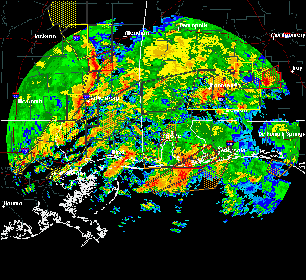 At 246 pm cst, a severe thunderstorm capable of producing a tornado was located over gulf shores, moving northeast at 45 mph (radar indicated rotation). Hazards include tornado. Flying debris will be dangerous to those caught without shelter. mobile homes will be damaged or destroyed. damage to roofs, windows, and vehicles will occur. tree damage is likely. this dangerous storm will be near, foley around 250 pm cst. pensacola and orange beach around 300 pm cst. perdido beach and elberta around 305 pm cst. lillian around 315 pm cst. west pensacola, warrington and myrtle grove around 325 pm cst. Brent, ensley, gonzalez and goulding around 330 pm cst. At 246 pm cst, a severe thunderstorm capable of producing a tornado was located over gulf shores, moving northeast at 45 mph (radar indicated rotation). Hazards include tornado. Flying debris will be dangerous to those caught without shelter. mobile homes will be damaged or destroyed. damage to roofs, windows, and vehicles will occur. tree damage is likely. this dangerous storm will be near, foley around 250 pm cst. pensacola and orange beach around 300 pm cst. perdido beach and elberta around 305 pm cst. lillian around 315 pm cst. west pensacola, warrington and myrtle grove around 325 pm cst. Brent, ensley, gonzalez and goulding around 330 pm cst.
|
| 1/2/2017 2:33 PM CST |
 At 232 pm cst, a severe thunderstorm capable of producing a tornado was located 10 miles southeast of fort morgan, or 13 miles southwest of gulf shores, moving northeast at 40 mph (radar indicated rotation). Hazards include tornado. Flying debris will be dangerous to those caught without shelter. mobile homes will be damaged or destroyed. damage to roofs, windows, and vehicles will occur. tree damage is likely. this dangerous storm will be near, gulf shores around 250 pm cst. foley and bon secour around 255 pm cst. pensacola and orange beach around 305 pm cst. elberta around 310 pm cst. perdido beach around 315 pm cst. lillian around 320 pm cst. Brent, west pensacola, ensley, warrington, goulding and myrtle grove around 330 pm cst. At 232 pm cst, a severe thunderstorm capable of producing a tornado was located 10 miles southeast of fort morgan, or 13 miles southwest of gulf shores, moving northeast at 40 mph (radar indicated rotation). Hazards include tornado. Flying debris will be dangerous to those caught without shelter. mobile homes will be damaged or destroyed. damage to roofs, windows, and vehicles will occur. tree damage is likely. this dangerous storm will be near, gulf shores around 250 pm cst. foley and bon secour around 255 pm cst. pensacola and orange beach around 305 pm cst. elberta around 310 pm cst. perdido beach around 315 pm cst. lillian around 320 pm cst. Brent, west pensacola, ensley, warrington, goulding and myrtle grove around 330 pm cst.
|
| 1/2/2017 2:33 PM CST |
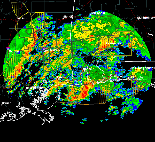 At 232 pm cst, a severe thunderstorm capable of producing a tornado was located 10 miles southeast of fort morgan, or 13 miles southwest of gulf shores, moving northeast at 40 mph (radar indicated rotation). Hazards include tornado. Flying debris will be dangerous to those caught without shelter. mobile homes will be damaged or destroyed. damage to roofs, windows, and vehicles will occur. tree damage is likely. this dangerous storm will be near, gulf shores around 250 pm cst. foley and bon secour around 255 pm cst. pensacola and orange beach around 305 pm cst. elberta around 310 pm cst. perdido beach around 315 pm cst. lillian around 320 pm cst. Brent, west pensacola, ensley, warrington, goulding and myrtle grove around 330 pm cst. At 232 pm cst, a severe thunderstorm capable of producing a tornado was located 10 miles southeast of fort morgan, or 13 miles southwest of gulf shores, moving northeast at 40 mph (radar indicated rotation). Hazards include tornado. Flying debris will be dangerous to those caught without shelter. mobile homes will be damaged or destroyed. damage to roofs, windows, and vehicles will occur. tree damage is likely. this dangerous storm will be near, gulf shores around 250 pm cst. foley and bon secour around 255 pm cst. pensacola and orange beach around 305 pm cst. elberta around 310 pm cst. perdido beach around 315 pm cst. lillian around 320 pm cst. Brent, west pensacola, ensley, warrington, goulding and myrtle grove around 330 pm cst.
|
| 1/1/2017 3:50 AM CST | Wind damage reported in ensley...florida. several structures damaged near chemstrand and ray roads. reported by escambia ema officials in escambia county FL, 5.3 miles SE of Pensacola, FL |
| 9/25/2016 2:37 PM CDT |
 At 237 pm cdt, a severe thunderstorm was located over milton, moving south at 20 mph (radar indicated). Hazards include 60 mph wind gusts. Expect damage to roofs. siding. And trees. At 237 pm cdt, a severe thunderstorm was located over milton, moving south at 20 mph (radar indicated). Hazards include 60 mph wind gusts. Expect damage to roofs. siding. And trees.
|
| 9/24/2016 4:57 PM CDT |
 At 457 pm cdt, a severe thunderstorm was located over floridatown, or over pace, moving south at 10 mph (radar indicated). Hazards include 60 mph wind gusts and quarter size hail. Hail damage to vehicles is expected. Expect wind damage to roofs, siding, and trees. At 457 pm cdt, a severe thunderstorm was located over floridatown, or over pace, moving south at 10 mph (radar indicated). Hazards include 60 mph wind gusts and quarter size hail. Hail damage to vehicles is expected. Expect wind damage to roofs, siding, and trees.
|
| 9/24/2016 4:24 PM CDT |
 At 424 pm cdt, a severe thunderstorm was located near navarre, or 11 miles east of gulf breeze, moving southwest at 15 mph (radar indicated). Hazards include 60 mph wind gusts and quarter size hail. Hail damage to vehicles is expected. Expect wind damage to roofs, siding, and trees. At 424 pm cdt, a severe thunderstorm was located near navarre, or 11 miles east of gulf breeze, moving southwest at 15 mph (radar indicated). Hazards include 60 mph wind gusts and quarter size hail. Hail damage to vehicles is expected. Expect wind damage to roofs, siding, and trees.
|
| 6/17/2016 8:12 PM CDT | The severe thunderstorm warning for southern baldwin, southwestern mobile, southeastern escambia, southern santa rosa and southern okaloosa counties will expire at 815 pm cdt, the storms which prompted the warning have moved out of the area. therefore the warning will be allowed to expire. |
| 6/17/2016 8:12 PM CDT | The severe thunderstorm warning for southern baldwin, southwestern mobile, southeastern escambia, southern santa rosa and southern okaloosa counties will expire at 815 pm cdt, the storms which prompted the warning have moved out of the area. therefore the warning will be allowed to expire. |
| 6/17/2016 7:53 PM CDT |
 At 752 pm cdt, severe thunderstorms were located along a line extending from 6 miles southeast of gautier to near fort gaines to near perdido beach to navarre to 7 miles north of santa rosa beach, moving southeast at 55 mph. wind damage will likely occur along a gust front ahead of the rain and lightning and will continue with the thunderstorms that follow (trained weather spotters). Hazards include 60 mph wind gusts. Expect damage to roofs. siding. and trees. Locations impacted include, pensacola, ferry pass, brent, west pensacola, wright, fort walton beach, ensley, daphne, tillmans corner, warrington, fairhope, niceville, gonzalez, destin, gulf shores, eglin afb, foley, pace, milton and theodore. At 752 pm cdt, severe thunderstorms were located along a line extending from 6 miles southeast of gautier to near fort gaines to near perdido beach to navarre to 7 miles north of santa rosa beach, moving southeast at 55 mph. wind damage will likely occur along a gust front ahead of the rain and lightning and will continue with the thunderstorms that follow (trained weather spotters). Hazards include 60 mph wind gusts. Expect damage to roofs. siding. and trees. Locations impacted include, pensacola, ferry pass, brent, west pensacola, wright, fort walton beach, ensley, daphne, tillmans corner, warrington, fairhope, niceville, gonzalez, destin, gulf shores, eglin afb, foley, pace, milton and theodore.
|
| 6/17/2016 7:20 PM CDT |
 At 719 pm cdt, severe thunderstorms were located along a line extending from 6 miles northwest of vancleave to near tillmans corner to 8 miles east of robertsdale to near point baker to 12 miles north of eglin air force base, moving southeast at 45 mph. wind damage will likely occur along a gust front ahead of the rain and lightning and will continue with the thunderstorms that follow (trained weather spotters. numerous reports of wind damage and measured gusts to 60 mph have been received). Hazards include 60 mph wind gusts and penny size hail. Expect damage to roofs. siding. And trees. At 719 pm cdt, severe thunderstorms were located along a line extending from 6 miles northwest of vancleave to near tillmans corner to 8 miles east of robertsdale to near point baker to 12 miles north of eglin air force base, moving southeast at 45 mph. wind damage will likely occur along a gust front ahead of the rain and lightning and will continue with the thunderstorms that follow (trained weather spotters. numerous reports of wind damage and measured gusts to 60 mph have been received). Hazards include 60 mph wind gusts and penny size hail. Expect damage to roofs. siding. And trees.
|
| 6/17/2016 6:59 PM CDT |
 At 658 pm cdt, severe thunderstorms were located along a line extending from near maxie to 9 miles south of lucedale to near stapleton to 7 miles northwest of baker, moving south at 45 mph. wind damage will likely occur along a gust front ahead of the rain and lightning and will continue with the thunderstorms that follow (trained weather spotters. numerous trees have been reported blown down. there have also been several measured wind gusts of 60 mph). Hazards include 60 mph wind gusts and penny size hail. Expect damage to roofs. siding. and trees. Locations impacted include, downtown mobile, midtown mobile, pensacola, prichard, ferry pass, ensley, daphne, tillmans corner, fairhope, saraland, gonzalez, bay minette, atmore, foley, pace, milton, theodore, chickasaw, satsuma and spanish fort. At 658 pm cdt, severe thunderstorms were located along a line extending from near maxie to 9 miles south of lucedale to near stapleton to 7 miles northwest of baker, moving south at 45 mph. wind damage will likely occur along a gust front ahead of the rain and lightning and will continue with the thunderstorms that follow (trained weather spotters. numerous trees have been reported blown down. there have also been several measured wind gusts of 60 mph). Hazards include 60 mph wind gusts and penny size hail. Expect damage to roofs. siding. and trees. Locations impacted include, downtown mobile, midtown mobile, pensacola, prichard, ferry pass, ensley, daphne, tillmans corner, fairhope, saraland, gonzalez, bay minette, atmore, foley, pace, milton, theodore, chickasaw, satsuma and spanish fort.
|
| 6/17/2016 6:24 PM CDT |
 At 622 pm cdt, severe thunderstorms were located along a line extending from near new augusta to 6 miles west of leakesville to near mount vernon to near i65 and al 113, moving south at 45 mph. wind damage will likely occur along a gust front ahead of the rain and lightning and will continue with the thunderstorms that follow (radar indicated). Hazards include 60 mph wind gusts and nickel size hail. Expect damage to roofs. siding. And trees. At 622 pm cdt, severe thunderstorms were located along a line extending from near new augusta to 6 miles west of leakesville to near mount vernon to near i65 and al 113, moving south at 45 mph. wind damage will likely occur along a gust front ahead of the rain and lightning and will continue with the thunderstorms that follow (radar indicated). Hazards include 60 mph wind gusts and nickel size hail. Expect damage to roofs. siding. And trees.
|
| 3/26/2016 5:35 PM CDT |
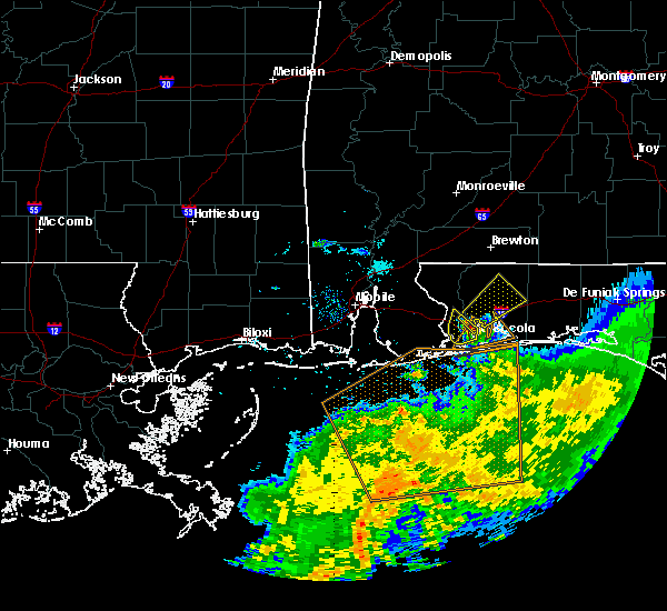 At 534 pm cdt, a severe thunderstorm was located over ensley, moving northeast at 40 mph (radar indicated). Hazards include 60 mph wind gusts and quarter size hail. Hail damage to vehicles is expected. Expect wind damage to roofs, siding, and trees. At 534 pm cdt, a severe thunderstorm was located over ensley, moving northeast at 40 mph (radar indicated). Hazards include 60 mph wind gusts and quarter size hail. Hail damage to vehicles is expected. Expect wind damage to roofs, siding, and trees.
|
| 3/26/2016 5:33 PM CDT | Quarter sized hail reported 5.1 miles SSE of Pensacola, FL, 1 inch hail reported near deluna lanes on hummingbird blvd. time from radar |
| 3/26/2016 5:26 PM CDT |
 At 526 pm cdt, a severe thunderstorm was located over bellview, moving northeast at 40 mph (radar indicated). Hazards include 60 mph wind gusts and half dollar size hail. Hail damage to vehicles is expected. expect wind damage to roofs, siding, and trees. Locations impacted include, pensacola, gonzalez, ferry pass, pensacola international airport, myrtle grove, goulding, ensley, brent, bellview and west pensacola. At 526 pm cdt, a severe thunderstorm was located over bellview, moving northeast at 40 mph (radar indicated). Hazards include 60 mph wind gusts and half dollar size hail. Hail damage to vehicles is expected. expect wind damage to roofs, siding, and trees. Locations impacted include, pensacola, gonzalez, ferry pass, pensacola international airport, myrtle grove, goulding, ensley, brent, bellview and west pensacola.
|
| 3/26/2016 5:16 PM CDT |
 At 515 pm cdt, a severe thunderstorm was located over lillian, or near myrtle grove, moving northeast at 30 mph (radar indicated). Hazards include 60 mph wind gusts and half dollar size hail. Hail damage to vehicles is expected. expect wind damage to roofs, siding, and trees. Locations impacted include, pensacola, gonzalez, ferry pass, pensacola international airport, myrtle grove, goulding, ensley, brent, bellview, west pensacola and lillian. At 515 pm cdt, a severe thunderstorm was located over lillian, or near myrtle grove, moving northeast at 30 mph (radar indicated). Hazards include 60 mph wind gusts and half dollar size hail. Hail damage to vehicles is expected. expect wind damage to roofs, siding, and trees. Locations impacted include, pensacola, gonzalez, ferry pass, pensacola international airport, myrtle grove, goulding, ensley, brent, bellview, west pensacola and lillian.
|
| 3/26/2016 5:16 PM CDT |
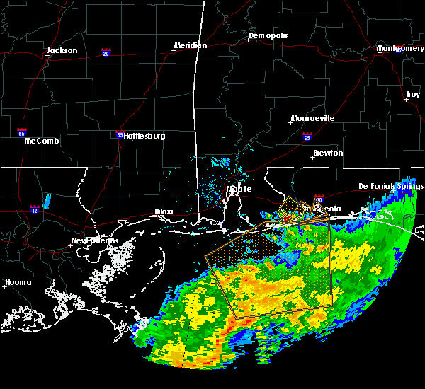 At 515 pm cdt, a severe thunderstorm was located over lillian, or near myrtle grove, moving northeast at 30 mph (radar indicated). Hazards include 60 mph wind gusts and half dollar size hail. Hail damage to vehicles is expected. expect wind damage to roofs, siding, and trees. Locations impacted include, pensacola, gonzalez, ferry pass, pensacola international airport, myrtle grove, goulding, ensley, brent, bellview, west pensacola and lillian. At 515 pm cdt, a severe thunderstorm was located over lillian, or near myrtle grove, moving northeast at 30 mph (radar indicated). Hazards include 60 mph wind gusts and half dollar size hail. Hail damage to vehicles is expected. expect wind damage to roofs, siding, and trees. Locations impacted include, pensacola, gonzalez, ferry pass, pensacola international airport, myrtle grove, goulding, ensley, brent, bellview, west pensacola and lillian.
|
| 3/26/2016 4:59 PM CDT |
 At 459 pm cdt, a severe thunderstorm was located near perdido beach, or near orange beach, moving northeast at 40 mph (radar indicated). Hazards include golf ball size hail and 60 mph wind gusts. People and animals outdoors will be injured. expect hail damage to roofs, siding, windows, and vehicles. expect wind damage to roofs, siding, and trees. Locations impacted include, pensacola, orange beach, gonzalez, ferry pass, pensacola international airport, myrtle grove, goulding, ensley, brent, bellview, west pensacola, johnsons beach and lillian. At 459 pm cdt, a severe thunderstorm was located near perdido beach, or near orange beach, moving northeast at 40 mph (radar indicated). Hazards include golf ball size hail and 60 mph wind gusts. People and animals outdoors will be injured. expect hail damage to roofs, siding, windows, and vehicles. expect wind damage to roofs, siding, and trees. Locations impacted include, pensacola, orange beach, gonzalez, ferry pass, pensacola international airport, myrtle grove, goulding, ensley, brent, bellview, west pensacola, johnsons beach and lillian.
|
| 3/26/2016 4:52 PM CDT |
 At 452 pm cdt, a severe thunderstorm was located near orange beach, moving northeast at 30 mph (radar indicated). Hazards include 60 mph wind gusts and quarter size hail. Hail damage to vehicles is expected. Expect wind damage to roofs, siding, and trees. At 452 pm cdt, a severe thunderstorm was located near orange beach, moving northeast at 30 mph (radar indicated). Hazards include 60 mph wind gusts and quarter size hail. Hail damage to vehicles is expected. Expect wind damage to roofs, siding, and trees.
|
| 3/24/2016 2:45 PM CDT | Quarter sized hail reported 5.9 miles S of Pensacola, FL, report of quarter sized hail on the campus of university of west florida via social media. |
| 3/24/2016 2:41 PM CDT |
 At 241 pm cdt, severe thunderstorms were located along a line extending from 12 miles north of baker to pensacola to 12 miles south of orange beach, moving east at 50 mph (radar indicated). Hazards include 60 mph wind gusts and nickel size hail. Expect damage to roofs. siding. And trees. At 241 pm cdt, severe thunderstorms were located along a line extending from 12 miles north of baker to pensacola to 12 miles south of orange beach, moving east at 50 mph (radar indicated). Hazards include 60 mph wind gusts and nickel size hail. Expect damage to roofs. siding. And trees.
|
| 3/17/2016 9:50 PM CDT |
 At 949 pm cdt, severe thunderstorms were located along a line extending from near ferry pass to near johnsons beach, moving southeast at 35 mph (radar indicated). Hazards include 60 mph wind gusts and quarter size hail. Hail damage to vehicles is expected. Expect wind damage to roofs, siding, and trees. At 949 pm cdt, severe thunderstorms were located along a line extending from near ferry pass to near johnsons beach, moving southeast at 35 mph (radar indicated). Hazards include 60 mph wind gusts and quarter size hail. Hail damage to vehicles is expected. Expect wind damage to roofs, siding, and trees.
|
| 3/17/2016 9:30 PM CDT |
 At 928 pm cdt, severe thunderstorms were located along a line extending from 9 miles north of lillian to near east end of dauphin, moving south at 45 mph (radar indicated). Hazards include 60 mph wind gusts and nickel size hail. Expect damage to roofs. siding. And trees. At 928 pm cdt, severe thunderstorms were located along a line extending from 9 miles north of lillian to near east end of dauphin, moving south at 45 mph (radar indicated). Hazards include 60 mph wind gusts and nickel size hail. Expect damage to roofs. siding. And trees.
|
| 3/17/2016 9:30 PM CDT |
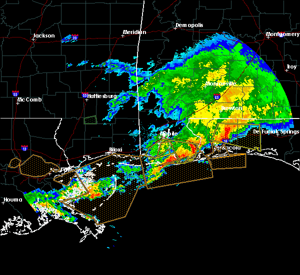 At 928 pm cdt, severe thunderstorms were located along a line extending from 9 miles north of lillian to near east end of dauphin, moving south at 45 mph (radar indicated). Hazards include 60 mph wind gusts and nickel size hail. Expect damage to roofs. siding. And trees. At 928 pm cdt, severe thunderstorms were located along a line extending from 9 miles north of lillian to near east end of dauphin, moving south at 45 mph (radar indicated). Hazards include 60 mph wind gusts and nickel size hail. Expect damage to roofs. siding. And trees.
|
| 3/17/2016 2:47 PM CDT |
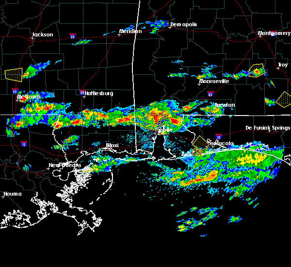 At 246 pm cdt, doppler radar indicated a severe thunderstorm capable of producing up to half dollar size hail and damaging winds in excess of 60 mph. this storm was located near myrtle grove, and moving northeast at 20 to 25 mph. At 246 pm cdt, doppler radar indicated a severe thunderstorm capable of producing up to half dollar size hail and damaging winds in excess of 60 mph. this storm was located near myrtle grove, and moving northeast at 20 to 25 mph.
|
| 2/23/2016 8:12 PM CST |
 At 811 pm cst, a large and extremely dangerous tornado was located over ferry pass, moving northeast at 50 mph. this is a particularly dangerous situation (radar indicated rotation). Hazards include damaging tornado. You are in a life threatening situation. flying debris may be deadly to those caught without shelter. mobile homes will be destroyed. considerable damage to homes, businesses, and vehicles is likely and complete destruction is possible. the tornado will be near, mulat and floridatown around 815 pm cst. pace and pea ridge around 820 pm cst. milton and bagdad around 825 pm cst. Roeville, whiting field and point baker around 830 pm cst. At 811 pm cst, a large and extremely dangerous tornado was located over ferry pass, moving northeast at 50 mph. this is a particularly dangerous situation (radar indicated rotation). Hazards include damaging tornado. You are in a life threatening situation. flying debris may be deadly to those caught without shelter. mobile homes will be destroyed. considerable damage to homes, businesses, and vehicles is likely and complete destruction is possible. the tornado will be near, mulat and floridatown around 815 pm cst. pace and pea ridge around 820 pm cst. milton and bagdad around 825 pm cst. Roeville, whiting field and point baker around 830 pm cst.
|
| 2/23/2016 8:04 PM CST |
 At 803 pm cst, a severe thunderstorm capable of producing a tornado was located over west pensacola, moving northeast at 50 mph (radar indicated rotation). Hazards include tornado and quarter size hail. Flying debris will be dangerous to those caught without shelter. mobile homes will be damaged or destroyed. damage to roofs, windows, and vehicles will occur. tree damage is likely. This dangerous storm will be near, pensacola international airport and ferry pass around 810 pm cst. At 803 pm cst, a severe thunderstorm capable of producing a tornado was located over west pensacola, moving northeast at 50 mph (radar indicated rotation). Hazards include tornado and quarter size hail. Flying debris will be dangerous to those caught without shelter. mobile homes will be damaged or destroyed. damage to roofs, windows, and vehicles will occur. tree damage is likely. This dangerous storm will be near, pensacola international airport and ferry pass around 810 pm cst.
|
| 2/23/2016 7:54 PM CST |
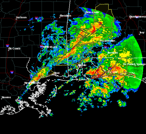 At 754 pm cst, a severe thunderstorm capable of producing a tornado was located near johnsons beach, or near myrtle grove, moving northeast at 45 mph (radar indicated rotation). Hazards include tornado and quarter size hail. Flying debris will be dangerous to those caught without shelter. mobile homes will be damaged or destroyed. damage to roofs, windows, and vehicles will occur. tree damage is likely. this dangerous storm will be near, myrtle grove, west pensacola, bellview and warrington around 805 pm cst. brent, goulding and ensley around 810 pm cst. Ferry pass, pensacola international airport and gonzalez around 815 pm cst. At 754 pm cst, a severe thunderstorm capable of producing a tornado was located near johnsons beach, or near myrtle grove, moving northeast at 45 mph (radar indicated rotation). Hazards include tornado and quarter size hail. Flying debris will be dangerous to those caught without shelter. mobile homes will be damaged or destroyed. damage to roofs, windows, and vehicles will occur. tree damage is likely. this dangerous storm will be near, myrtle grove, west pensacola, bellview and warrington around 805 pm cst. brent, goulding and ensley around 810 pm cst. Ferry pass, pensacola international airport and gonzalez around 815 pm cst.
|
| 2/23/2016 7:44 PM CST |
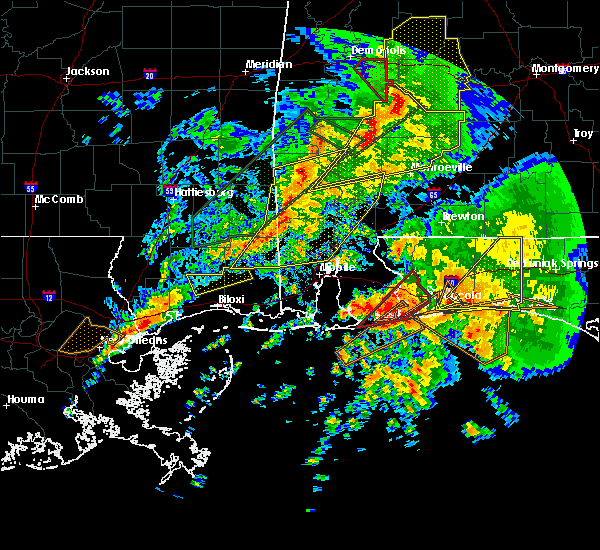 At 743 pm cst, a large and extremely dangerous tornado was located near perdido beach, or near orange beach, moving northeast at 40 mph. this is a particularly dangerous situation (radar indicated rotation). Hazards include damaging tornado. You are in a life threatening situation. flying debris may be deadly to those caught without shelter. mobile homes will be destroyed. considerable damage to homes, businesses, and vehicles is likely and complete destruction is possible. the tornado will be near, johnsons beach around 750 pm cst. lillian around 755 pm cst. myrtle grove and warrington around 805 pm cst. west pensacola and bellview around 810 pm cst. Brent, goulding, pensacola international airport, ferry pass and ensley around 815 pm cst. At 743 pm cst, a large and extremely dangerous tornado was located near perdido beach, or near orange beach, moving northeast at 40 mph. this is a particularly dangerous situation (radar indicated rotation). Hazards include damaging tornado. You are in a life threatening situation. flying debris may be deadly to those caught without shelter. mobile homes will be destroyed. considerable damage to homes, businesses, and vehicles is likely and complete destruction is possible. the tornado will be near, johnsons beach around 750 pm cst. lillian around 755 pm cst. myrtle grove and warrington around 805 pm cst. west pensacola and bellview around 810 pm cst. Brent, goulding, pensacola international airport, ferry pass and ensley around 815 pm cst.
|
| 2/23/2016 7:34 PM CST |
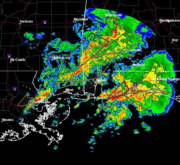 At 732 pm cst, a large and extremely dangerous tornado was located near orange beach, moving northeast at 35 mph. this is a particularly dangerous situation (radar indicated rotation). Hazards include damaging tornado. You are in a life threatening situation. flying debris may be deadly to those caught without shelter. mobile homes will be destroyed. considerable damage to homes, businesses, and vehicles is likely and complete destruction is possible. the tornado will be near, perdido beach around 750 pm cst. johnsons beach around 755 pm cst. lillian around 800 pm cst. myrtle grove and warrington around 810 pm cst. West pensacola, bellview, brent, goulding, ensley, pensacola international airport and ferry pass around 815 pm cst. At 732 pm cst, a large and extremely dangerous tornado was located near orange beach, moving northeast at 35 mph. this is a particularly dangerous situation (radar indicated rotation). Hazards include damaging tornado. You are in a life threatening situation. flying debris may be deadly to those caught without shelter. mobile homes will be destroyed. considerable damage to homes, businesses, and vehicles is likely and complete destruction is possible. the tornado will be near, perdido beach around 750 pm cst. johnsons beach around 755 pm cst. lillian around 800 pm cst. myrtle grove and warrington around 810 pm cst. West pensacola, bellview, brent, goulding, ensley, pensacola international airport and ferry pass around 815 pm cst.
|
| 2/23/2016 7:13 PM CST |
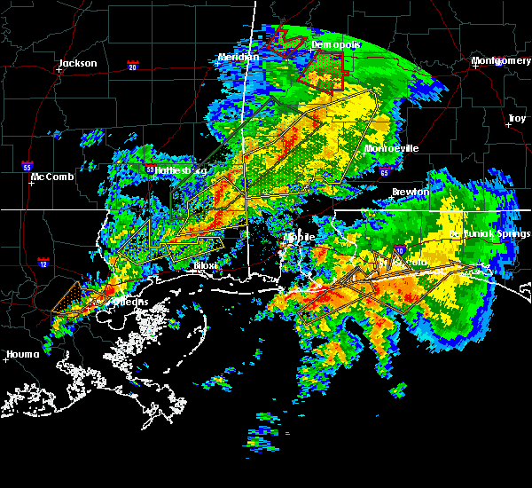 At 712 pm cst, a large and extremely dangerous tornado was located 8 miles south of gulf shores, moving northeast at 40 mph. this is a particularly dangerous situation (radar indicated rotation). Hazards include damaging tornado. You are in a life threatening situation. flying debris may be deadly to those caught without shelter. mobile homes will be destroyed. considerable damage to homes, businesses, and vehicles is likely and complete destruction is possible. the tornado will be near, foley around 725 pm cst. pensacola and orange beach around 735 pm cst. perdido beach around 740 pm cst. johnsons beach around 745 pm cst. lillian around 750 pm cst. bellview, myrtle grove and west pensacola around 800 pm cst. brent and goulding around 805 pm cst. Gonzalez, ensley, ferry pass and pensacola international airport around 810 pm cst. At 712 pm cst, a large and extremely dangerous tornado was located 8 miles south of gulf shores, moving northeast at 40 mph. this is a particularly dangerous situation (radar indicated rotation). Hazards include damaging tornado. You are in a life threatening situation. flying debris may be deadly to those caught without shelter. mobile homes will be destroyed. considerable damage to homes, businesses, and vehicles is likely and complete destruction is possible. the tornado will be near, foley around 725 pm cst. pensacola and orange beach around 735 pm cst. perdido beach around 740 pm cst. johnsons beach around 745 pm cst. lillian around 750 pm cst. bellview, myrtle grove and west pensacola around 800 pm cst. brent and goulding around 805 pm cst. Gonzalez, ensley, ferry pass and pensacola international airport around 810 pm cst.
|
| 2/15/2016 6:02 PM CST | Pensacola asos measured a wind gust of 60 mp in escambia county FL, 0.5 miles SW of Pensacola, FL |
| 2/15/2016 5:59 PM CST |
 At 559 pm cst, severe thunderstorms were located along a line extending from 12 miles northwest of baker to 8 miles northeast of roeville to near oriole beach to near johnsons beach, moving east at 60 mph (radar indicated). Hazards include 70 mph wind gusts and quarter size hail. Hail damage to vehicles is expected. expect considerable tree damage. Wind damage is also likely to mobile homes, roofs, and outbuildings. At 559 pm cst, severe thunderstorms were located along a line extending from 12 miles northwest of baker to 8 miles northeast of roeville to near oriole beach to near johnsons beach, moving east at 60 mph (radar indicated). Hazards include 70 mph wind gusts and quarter size hail. Hail damage to vehicles is expected. expect considerable tree damage. Wind damage is also likely to mobile homes, roofs, and outbuildings.
|
| 2/15/2016 5:53 PM CST | 18-wheeler slammed against a tree in a walmart parking lot. wind damage to stores at a neighboring strip mal in escambia county FL, 2.6 miles SSW of Pensacola, FL |
| 2/15/2016 5:53 PM CST | Tree blown down on a ca in escambia county FL, 3.2 miles SSW of Pensacola, FL |
| 2/15/2016 5:50 PM CST | Damage to an awning at a truck sto in escambia county FL, 4.6 miles SSE of Pensacola, FL |
| 2/15/2016 5:50 PM CST | Tree blown down on a car near nine mile and guid in escambia county FL, 5.1 miles SSE of Pensacola, FL |
| 2/15/2016 5:50 PM CST | Public reports large uprooted tre in escambia county FL, 7.3 miles NE of Pensacola, FL |
| 2/15/2016 5:46 PM CST | Tree blown down on a truck at timberlake mobile home par in escambia county FL, 4.4 miles E of Pensacola, FL |
| 1/22/2016 12:24 AM CST | Pensacola naval air station asos reported a 73mph wind gust with thunderstorm passag in escambia county FL, 10.4 miles NE of Pensacola, FL |
| 12/28/2015 10:30 AM CST | Numerous trees down across the are in escambia county FL, 6.4 miles ENE of Pensacola, FL |
| 12/28/2015 9:30 AM CST | Public report via photo...light pole down on vehicle in drugstore parking lo in escambia county FL, 5.8 miles SE of Pensacola, FL |
| 12/28/2015 9:30 AM CST |
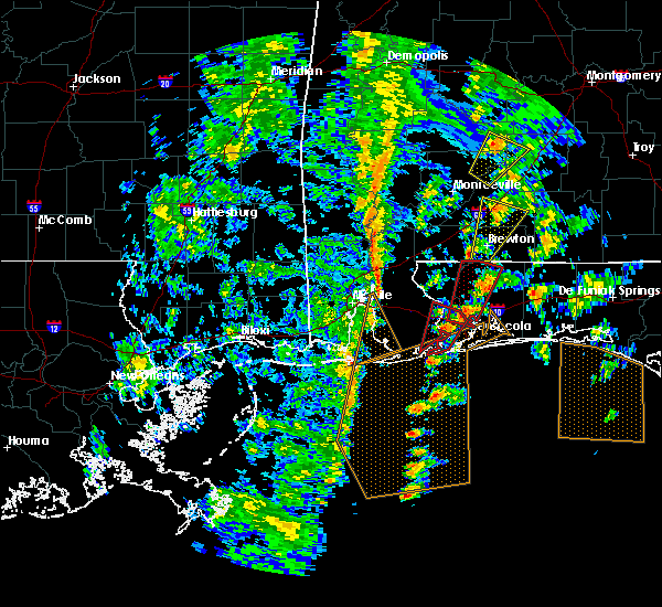 At 929 am cst, a severe thunderstorm capable of producing a tornado was located near gonzalez, moving north at 45 mph (radar indicated rotation). Hazards include tornado. Flying debris will be dangerous to those caught without shelter. mobile homes will be damaged or destroyed. damage to roofs, windows and vehicles will occur. tree damage is likely. this dangerous storm will be near, molino around 940 am cst. whitfield around 1000 am cst. Jay around 1005 am cst. At 929 am cst, a severe thunderstorm capable of producing a tornado was located near gonzalez, moving north at 45 mph (radar indicated rotation). Hazards include tornado. Flying debris will be dangerous to those caught without shelter. mobile homes will be damaged or destroyed. damage to roofs, windows and vehicles will occur. tree damage is likely. this dangerous storm will be near, molino around 940 am cst. whitfield around 1000 am cst. Jay around 1005 am cst.
|
| 12/28/2015 8:55 AM CST |
 At 855 am cst, a severe thunderstorm capable of producing a tornado was located over ferry pass, moving north at 40 mph (radar indicated rotation). Hazards include tornado. Flying debris will be dangerous to those caught without shelter. mobile homes will be damaged or destroyed. damage to roofs, windows and vehicles will occur. tree damage is likely. this dangerous storm will be near, mulat around 900 am cst. pace, floridatown and pea ridge around 905 am cst. milton around 910 am cst. point baker around 915 am cst. Whiting field around 920 am cst. At 855 am cst, a severe thunderstorm capable of producing a tornado was located over ferry pass, moving north at 40 mph (radar indicated rotation). Hazards include tornado. Flying debris will be dangerous to those caught without shelter. mobile homes will be damaged or destroyed. damage to roofs, windows and vehicles will occur. tree damage is likely. this dangerous storm will be near, mulat around 900 am cst. pace, floridatown and pea ridge around 905 am cst. milton around 910 am cst. point baker around 915 am cst. Whiting field around 920 am cst.
|
| 12/28/2015 8:45 AM CST | Trees and wooden fence down on w fairfield dr between patricia dr and lillian hw in escambia county FL, 6.4 miles ENE of Pensacola, FL |
| 12/28/2015 8:45 AM CST | Trees and wooden fence down on w fairfield dr between patricia dr and lillian hw in escambia county FL, 6.4 miles ENE of Pensacola, FL |
| 12/28/2015 8:45 AM CST | Large fence knocked dow in escambia county FL, 3.3 miles NNW of Pensacola, FL |
| 12/28/2015 8:45 AM CST | Large fence knocked dow in escambia county FL, 3.3 miles NNW of Pensacola, FL |
| 12/28/2015 8:45 AM CST | Trampoline tossed into the trees on klondike r in escambia county FL, 6.6 miles ESE of Pensacola, FL |
| 12/28/2015 8:45 AM CST | Power poles snapped and lines down. trees dow in escambia county FL, 5.4 miles NE of Pensacola, FL |
| 12/28/2015 8:39 AM CST |
 At 839 am cst, a severe thunderstorm capable of producing a tornado was located over warrington, moving northeast at 40 mph (radar indicated rotation). Hazards include tornado. Flying debris will be dangerous to those caught without shelter. mobile homes will be damaged or destroyed. damage to roofs, windows and vehicles will occur. tree damage is likely. this dangerous storm will be near, west pensacola around 845 am cst. goulding and brent around 850 am cst. ferry pass, pensacola international airport and ensley around 855 am cst. pace, floridatown, pea ridge and mulat around 905 am cst. bagdad around 910 am cst. milton and point baker around 915 am cst. Whiting field and roeville around 920 am cst. At 839 am cst, a severe thunderstorm capable of producing a tornado was located over warrington, moving northeast at 40 mph (radar indicated rotation). Hazards include tornado. Flying debris will be dangerous to those caught without shelter. mobile homes will be damaged or destroyed. damage to roofs, windows and vehicles will occur. tree damage is likely. this dangerous storm will be near, west pensacola around 845 am cst. goulding and brent around 850 am cst. ferry pass, pensacola international airport and ensley around 855 am cst. pace, floridatown, pea ridge and mulat around 905 am cst. bagdad around 910 am cst. milton and point baker around 915 am cst. Whiting field and roeville around 920 am cst.
|
| 12/28/2015 8:30 AM CST | Numerous public reports of trees down in the vicinity of this locatio in escambia county FL, 5.8 miles SE of Pensacola, FL |
| 11/18/2015 1:36 AM CST |
 At 135 am cst, a severe thunderstorm was located near gulf breeze, moving north at 30 mph (radar indicated). Hazards include 60 mph wind gusts. Expect damage to roofs. Siding and trees. At 135 am cst, a severe thunderstorm was located near gulf breeze, moving north at 30 mph (radar indicated). Hazards include 60 mph wind gusts. Expect damage to roofs. Siding and trees.
|
| 7/29/2015 2:54 PM CDT |
 At 253 pm cdt, a severe thunderstorm capable of producing damaging winds over 60 mph was located near mulat, or near pensacola international airport, moving south at 15 mph. At 253 pm cdt, a severe thunderstorm capable of producing damaging winds over 60 mph was located near mulat, or near pensacola international airport, moving south at 15 mph.
|
| 7/29/2015 2:32 PM CDT |
 At 231 pm cdt, a severe thunderstorm capable of producing damaging winds over 60 mph was located over mulat, or near pace, and moving south at 15 mph. At 231 pm cdt, a severe thunderstorm capable of producing damaging winds over 60 mph was located over mulat, or near pace, and moving south at 15 mph.
|
| 4/25/2015 3:26 PM CDT | At 326 pm cdt, a line of severe thunderstorms capable of producing damaging winds over 60 mph was located along a line extending from near bay minette to near magnolia springs to 10 miles southeast of sand island, and moving east at 60 mph. |
| 4/25/2015 3:26 PM CDT | At 326 pm cdt, a line of severe thunderstorms capable of producing damaging winds over 60 mph was located along a line extending from near bay minette to near magnolia springs to 10 miles southeast of sand island, and moving east at 60 mph. |
| 4/19/2015 5:35 AM CDT | At 535 am cdt, a severe thunderstorm capable of producing damaging winds over 60 mph was located near whiting field, or 11 miles north of milton, moving northeast at 50 mph. |
| 4/19/2015 5:17 AM CDT | At 516 am cdt, a severe thunderstorm capable of producing damaging winds over 60 mph was located over gonzalez, and moving northeast at 50 mph. |
| 4/7/2014 8:25 AM CDT | 30 foot tall tree down on house and car located on 60th avenu in escambia county FL, 3.2 miles NNE of Pensacola, FL |
| 4/5/2014 2:46 PM CDT | Quarter sized hail reported 1.4 miles SW of Pensacola, FL, hail fell for approx 60 seconds. measured by storm spotter. |
| 3/28/2014 10:00 AM CDT | Trained spotter reports tree branches down along gregory s in escambia county FL, 3.2 miles N of Pensacola, FL |
| 7/22/2013 5:44 PM CDT | Trees and powerlines down on lloyd st and scenic hw in escambia county FL, 3.2 miles NNE of Pensacola, FL |
| 7/13/2013 1:30 PM CDT | Quarter sized hail reported 6.7 miles E of Pensacola, FL, penny and quarter sized hail |
| 6/29/2013 1:30 AM CDT | Thunderstorm wind damage reported at the blue wahoos stadium by a stadium employee. 200 ft of outfiled wall knocked down...15 porta-johns knocked over and two tents dam in escambia county FL, 3.2 miles NNE of Pensacola, FL |
| 4/11/2013 7:23 PM CDT | Measured at the pensacola aso in escambia county FL, 3.3 miles NNW of Pensacola, FL |
| 8/10/2012 11:45 AM CDT | High winds damaged a hobby lobby store on n davis highway in pensacola. reported by pensacola new journa in escambia county FL, 3.3 miles NNW of Pensacola, FL |
| 8/2/2012 2:00 PM CDT | Windows blown out of a bus at 9th and college blv in escambia county FL, 3.2 miles NNE of Pensacola, FL |
| 8/2/2012 1:00 PM CDT | Report of a tree on a home and power lines down in pensacola. highest measured wind gust of 49 mph recorded just west of pensacola airpor in escambia county FL, 3.2 miles NNE of Pensacola, FL |
| 8/2/2012 12:30 PM CDT | Several reports of trees and powerlines down from 1230-1245p in escambia county FL, 3.2 miles NNE of Pensacola, FL |
| 1/1/0001 12:00 AM | Several large tree limbs down across escambia count in escambia county FL, 3.2 miles NNE of Pensacola, FL |
| 1/1/0001 12:00 AM | Pensacola regional airport recorded a gust of 59 mp in escambia county FL, 1.1 miles WSW of Pensacola, FL |
| 1/1/0001 12:00 AM | Golf Ball sized hail reported 5.6 miles E of Pensacola, FL, golfall size hail reported at publix |
Hail Maps for Pensacola, FL
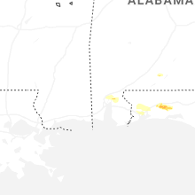
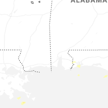
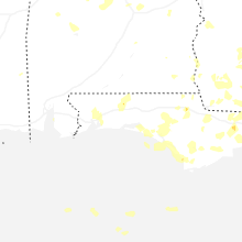
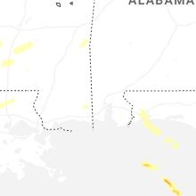


Connect with Interactive Hail Maps