

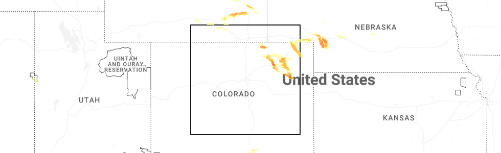
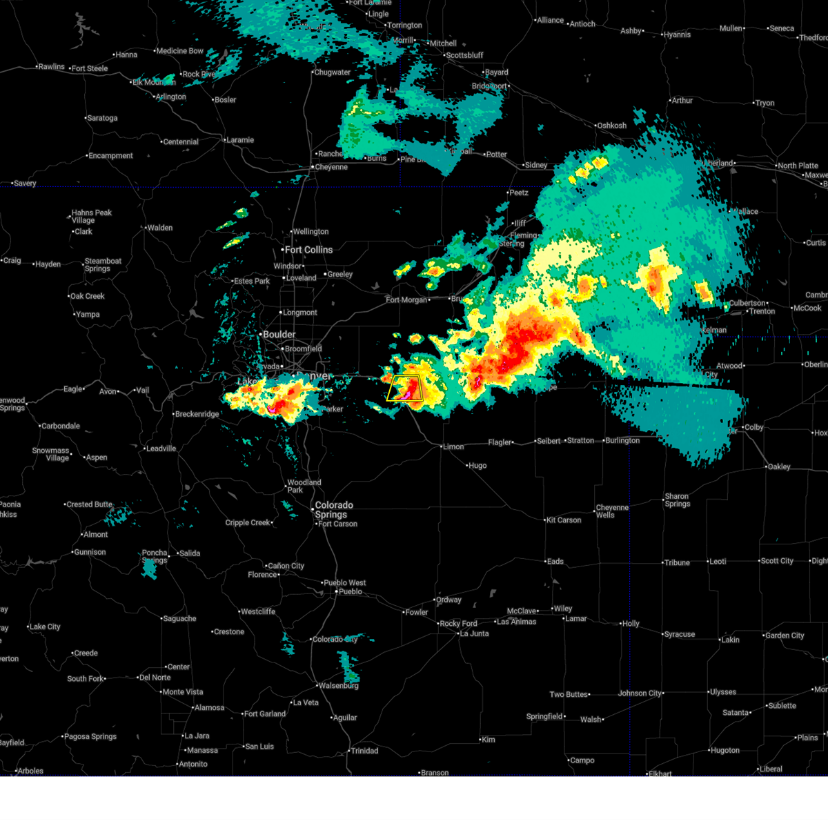
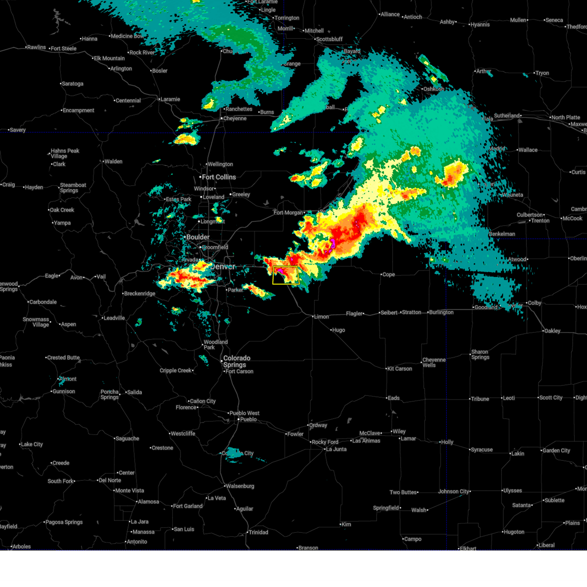
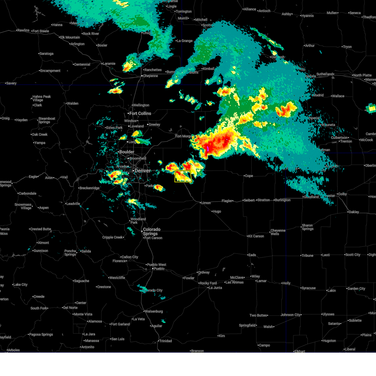
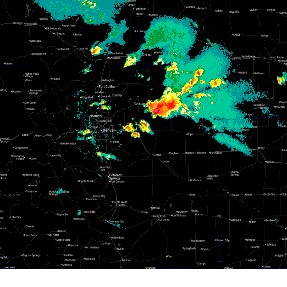
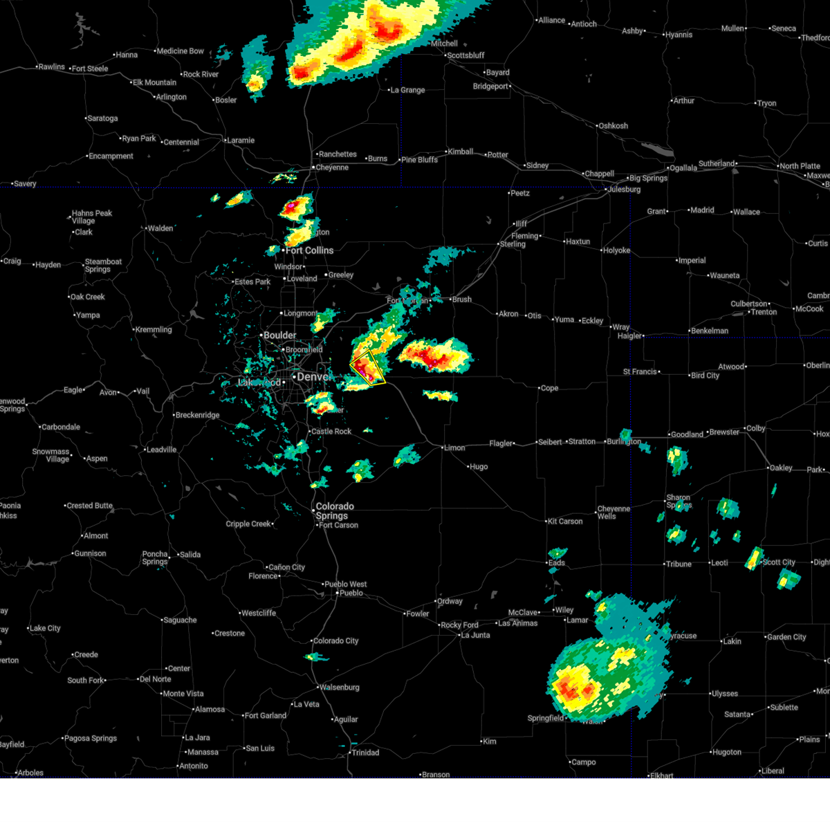
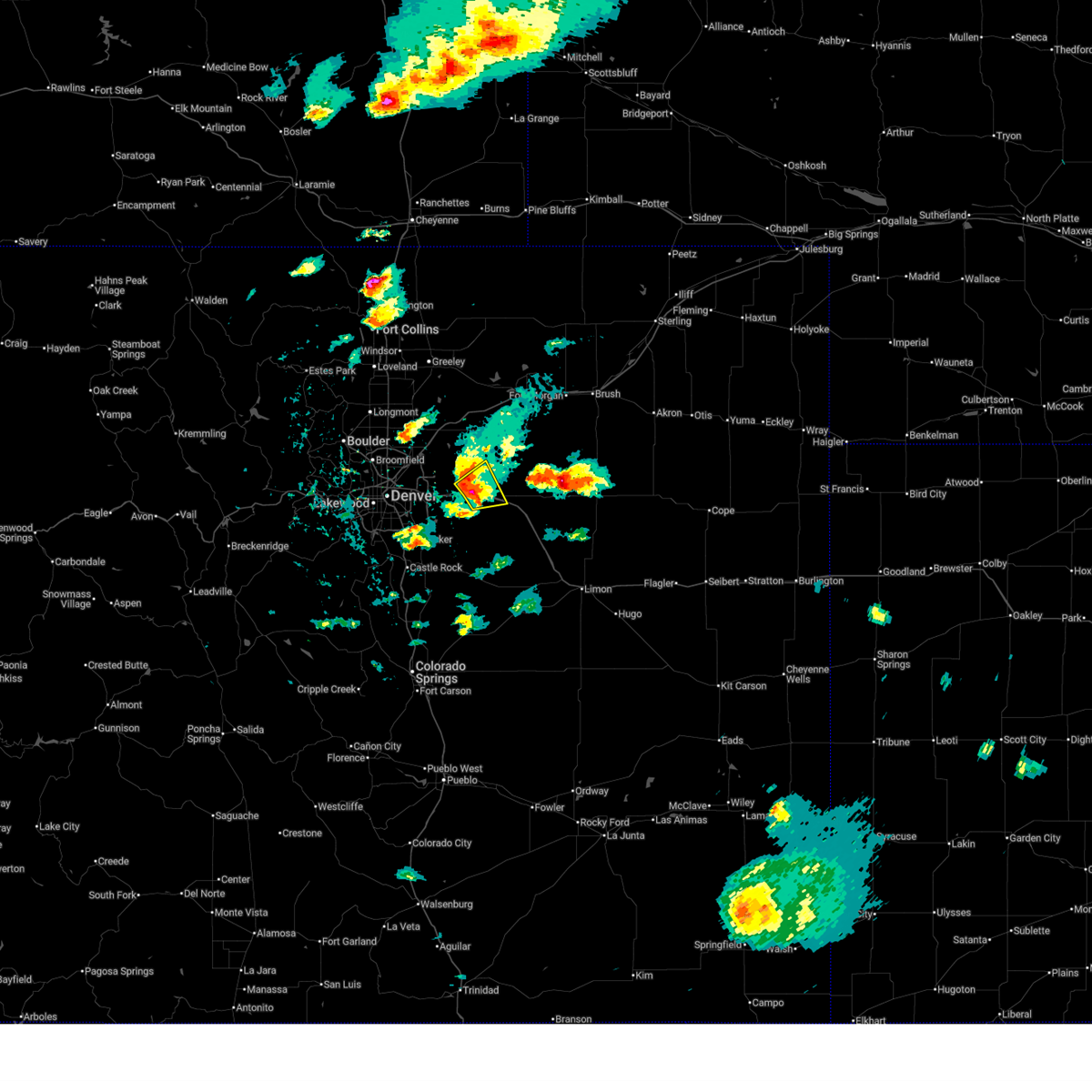
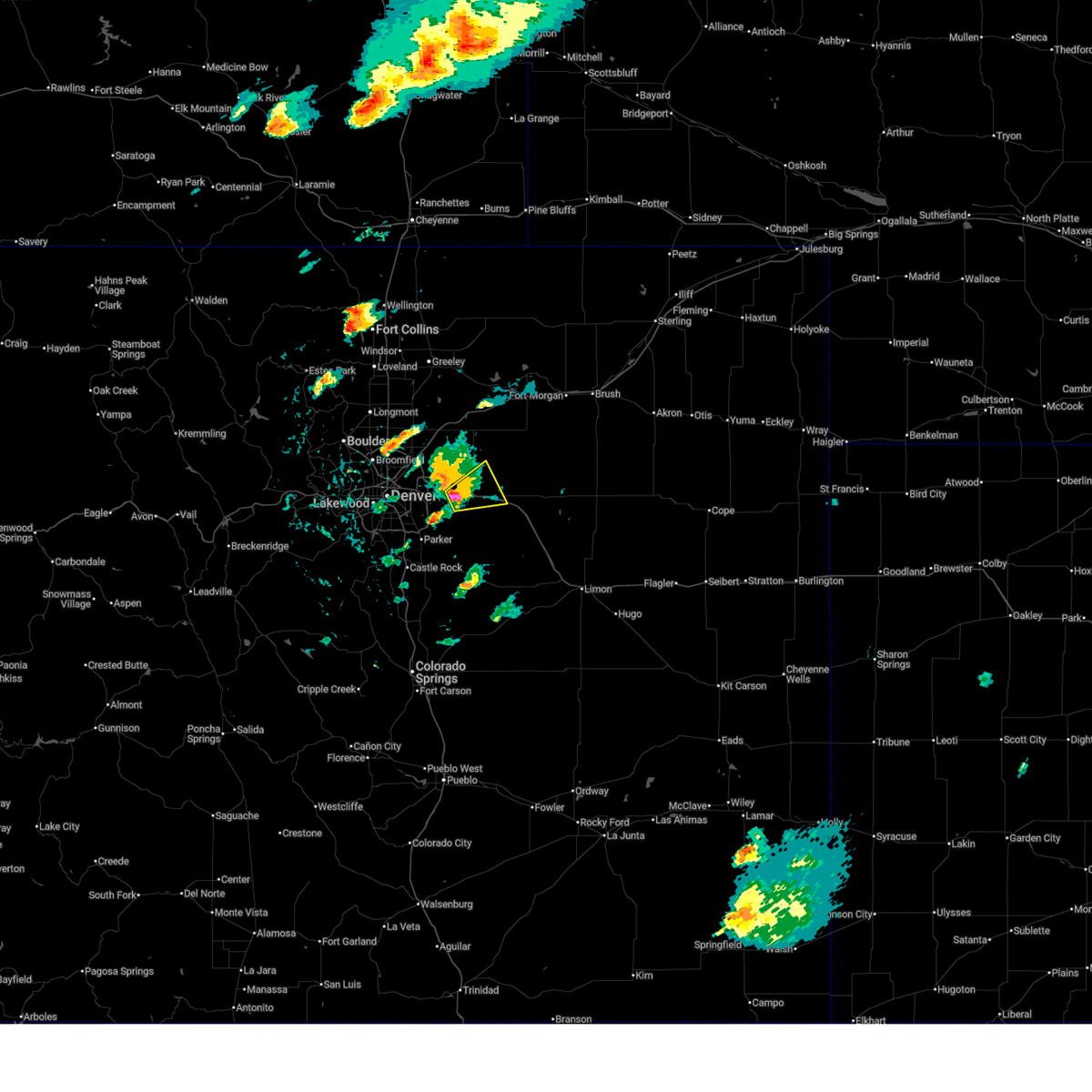
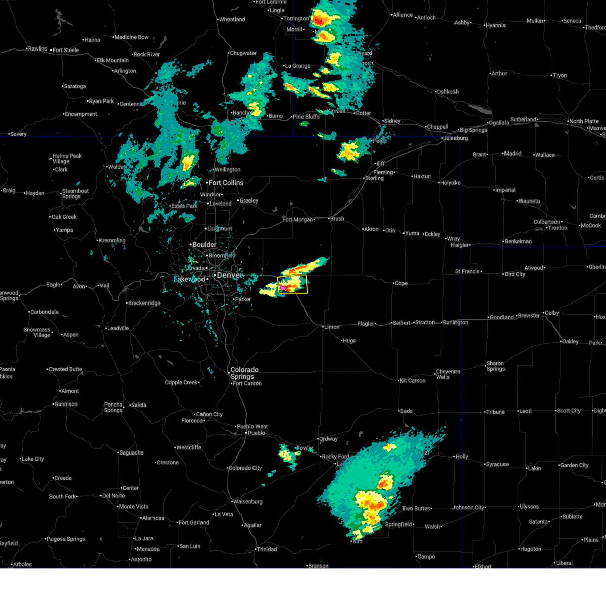
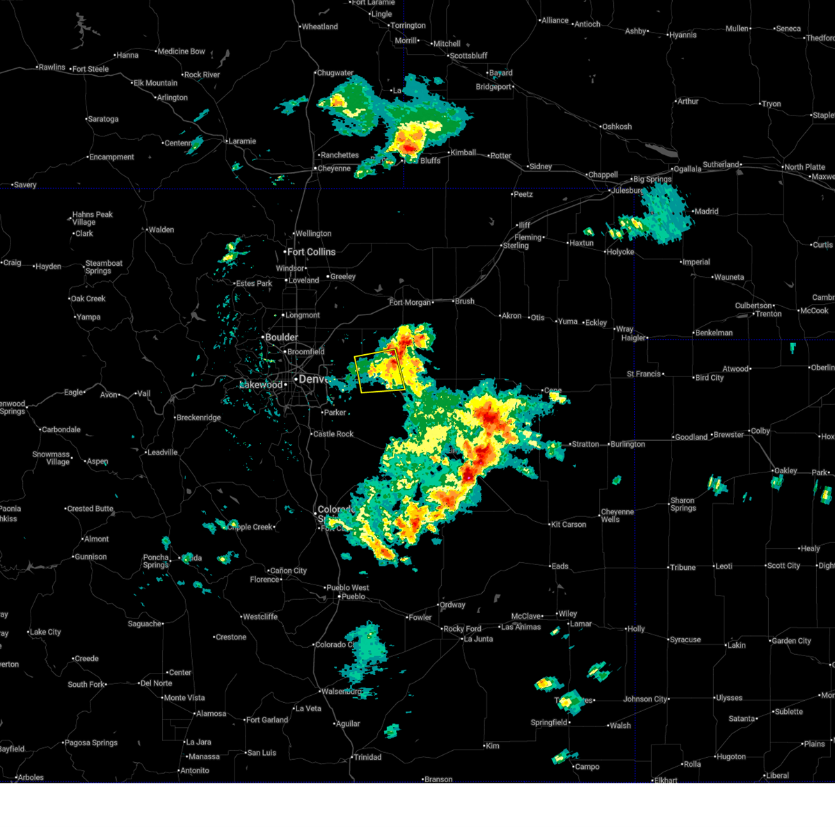
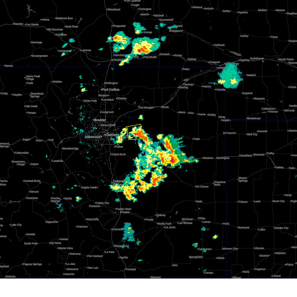
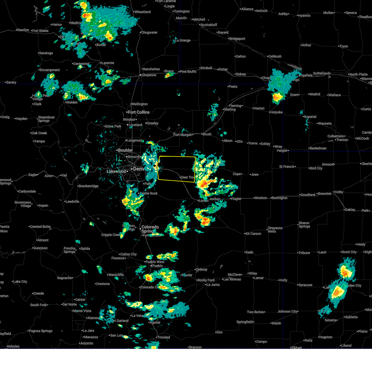
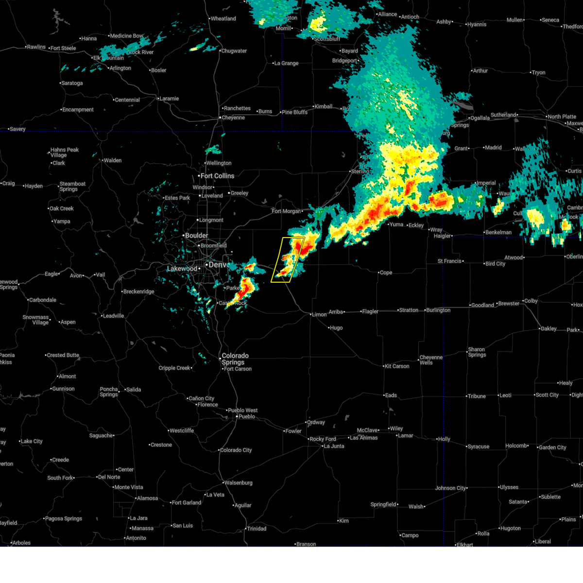
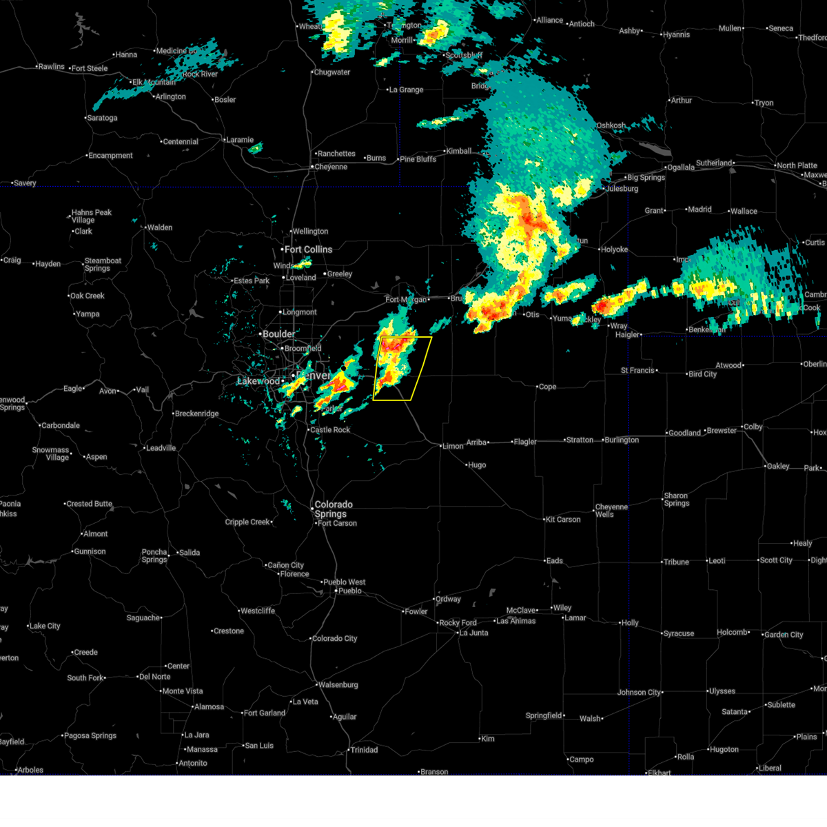
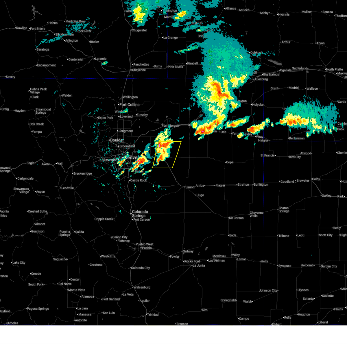
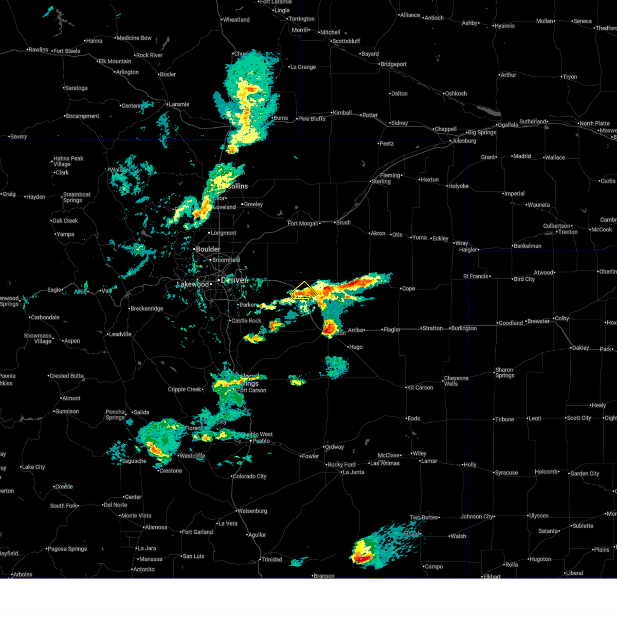
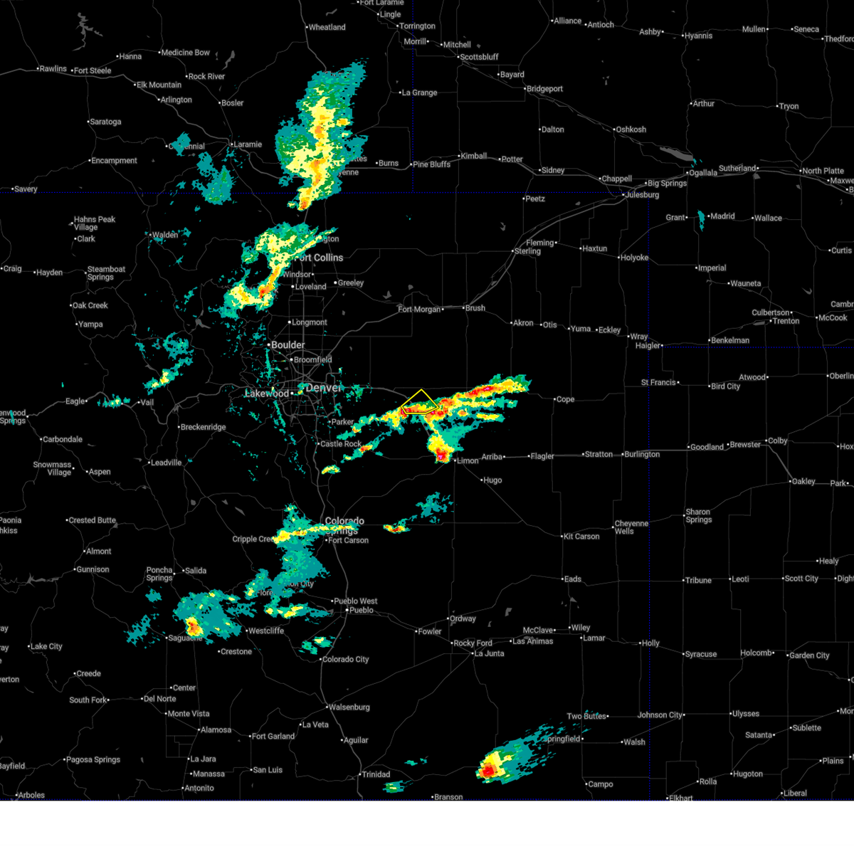
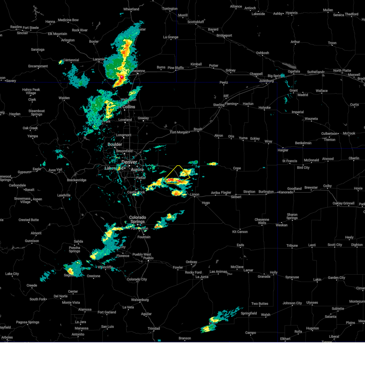
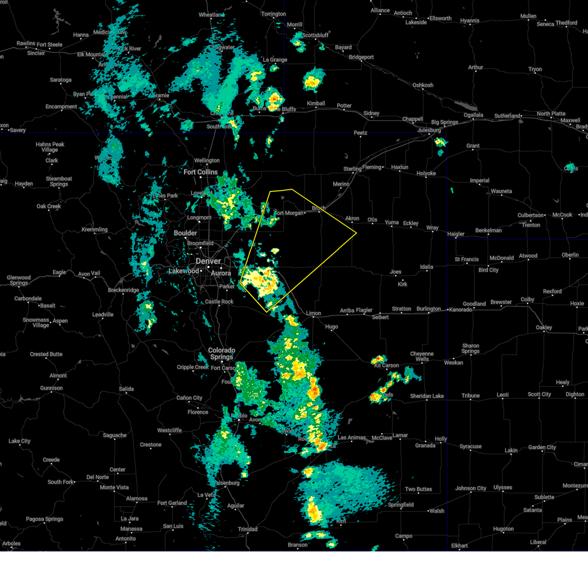
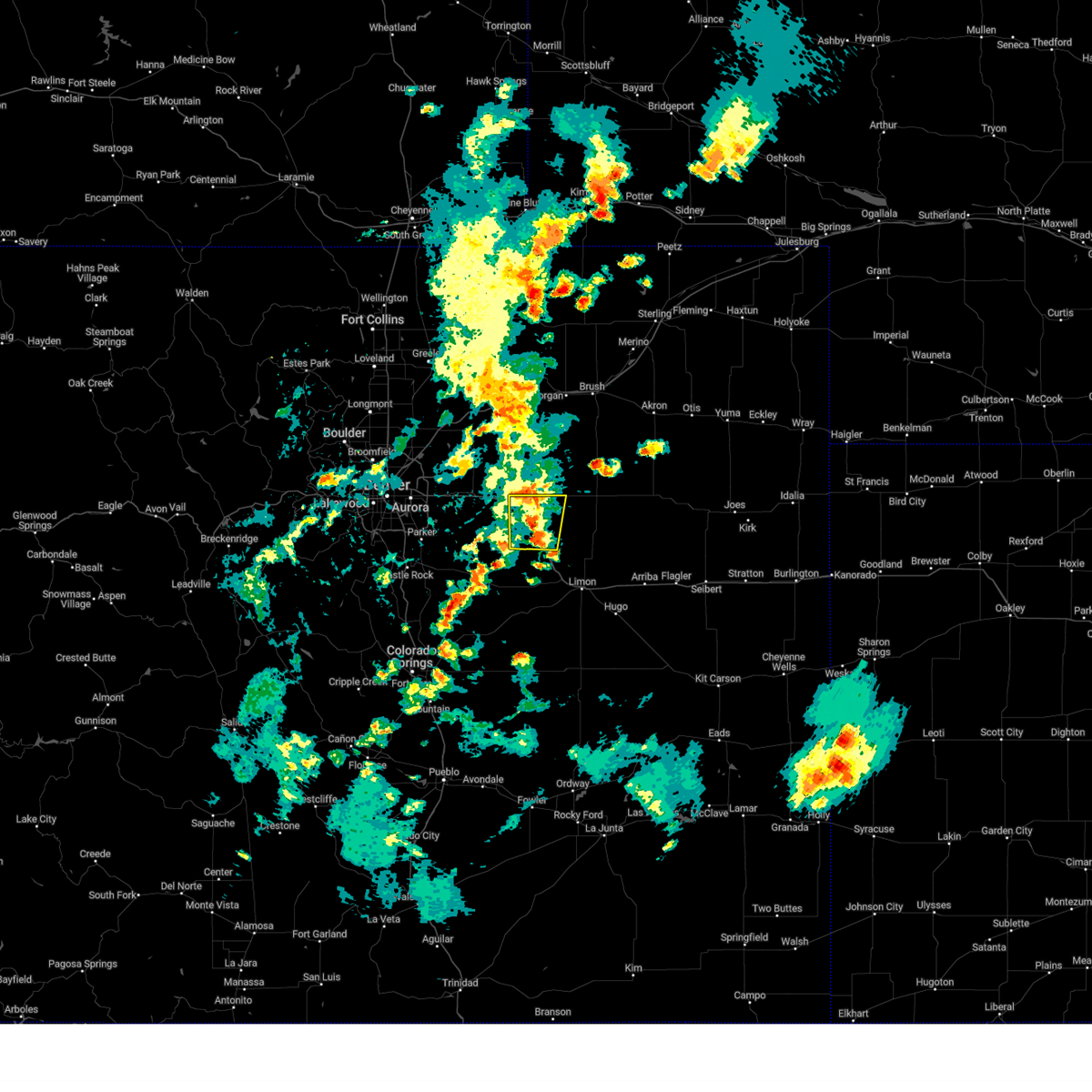
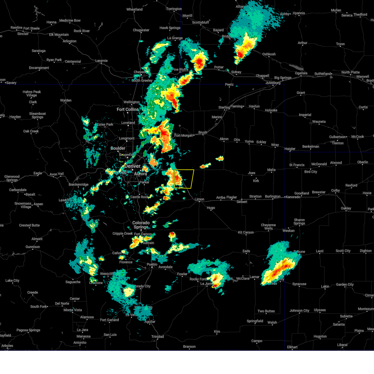
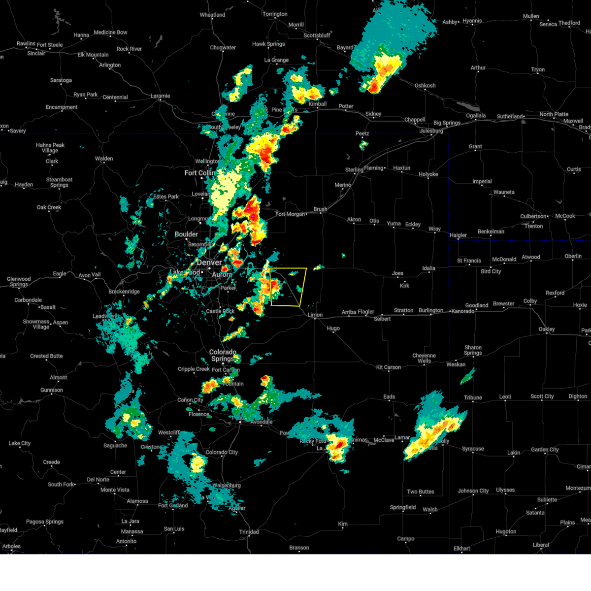
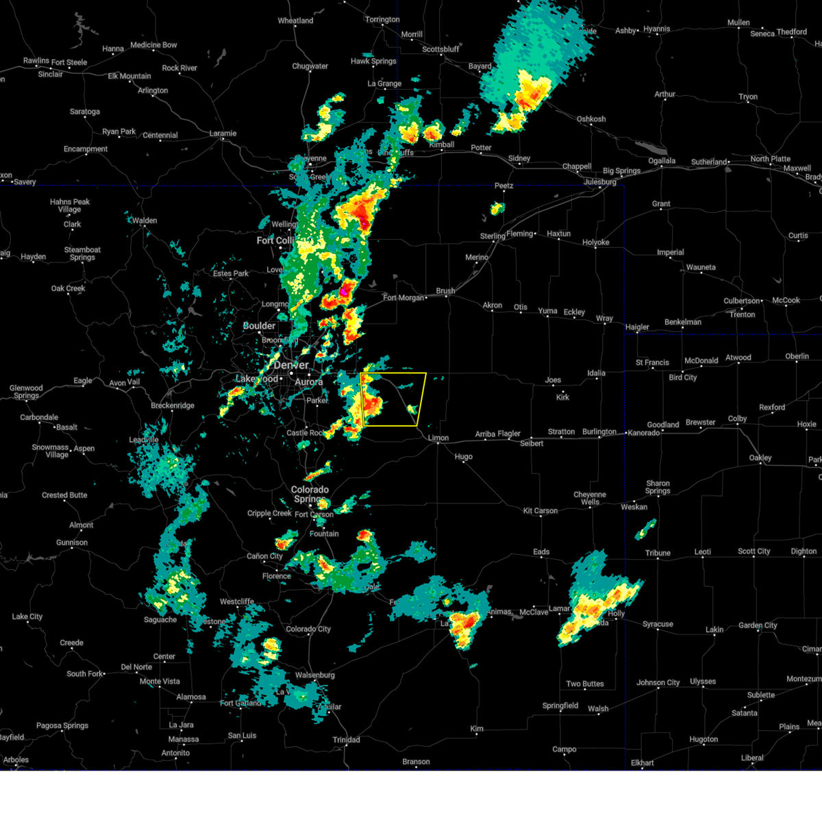
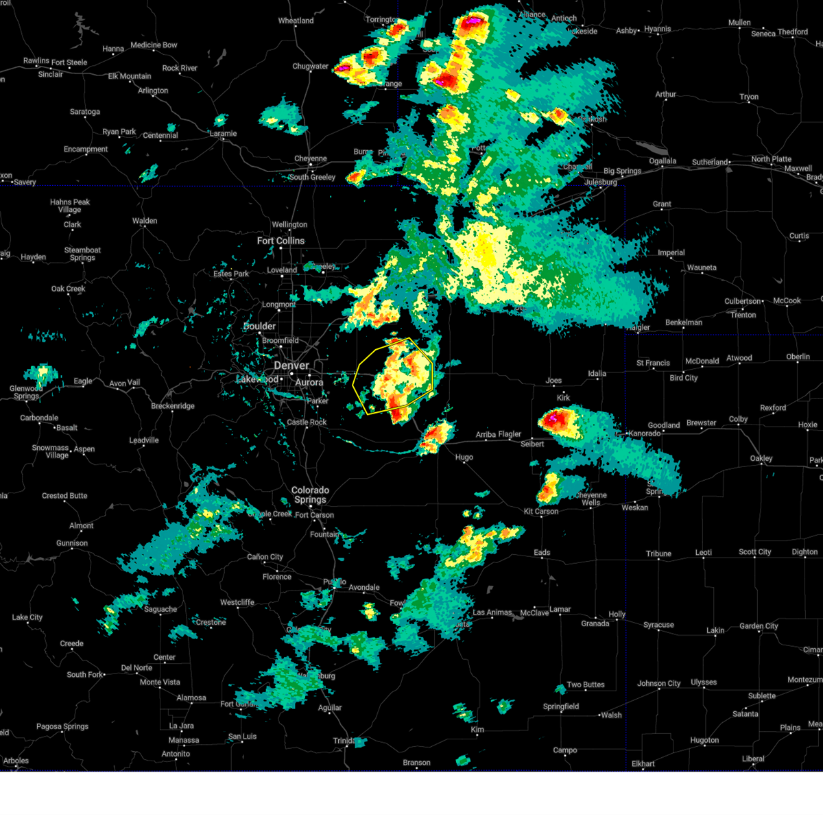
Hail Map for Peoria, CO
The Peoria, CO area has had 0 reports of on-the-ground hail by trained spotters, and has been under severe weather warnings 29 times during the past 12 months. Doppler radar has detected hail at or near Peoria, CO on 126 occasions, including 12 occasions during the past year.
| Name: | Peoria, CO |
| Where Located: | 45.5 miles E of Denver, CO |
| Map: | Google Map for Peoria, CO |
| Population: | 163 |
| Housing Units: | 75 |
| More Info: | Search Google for Peoria, CO |
1
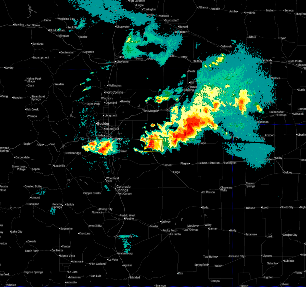
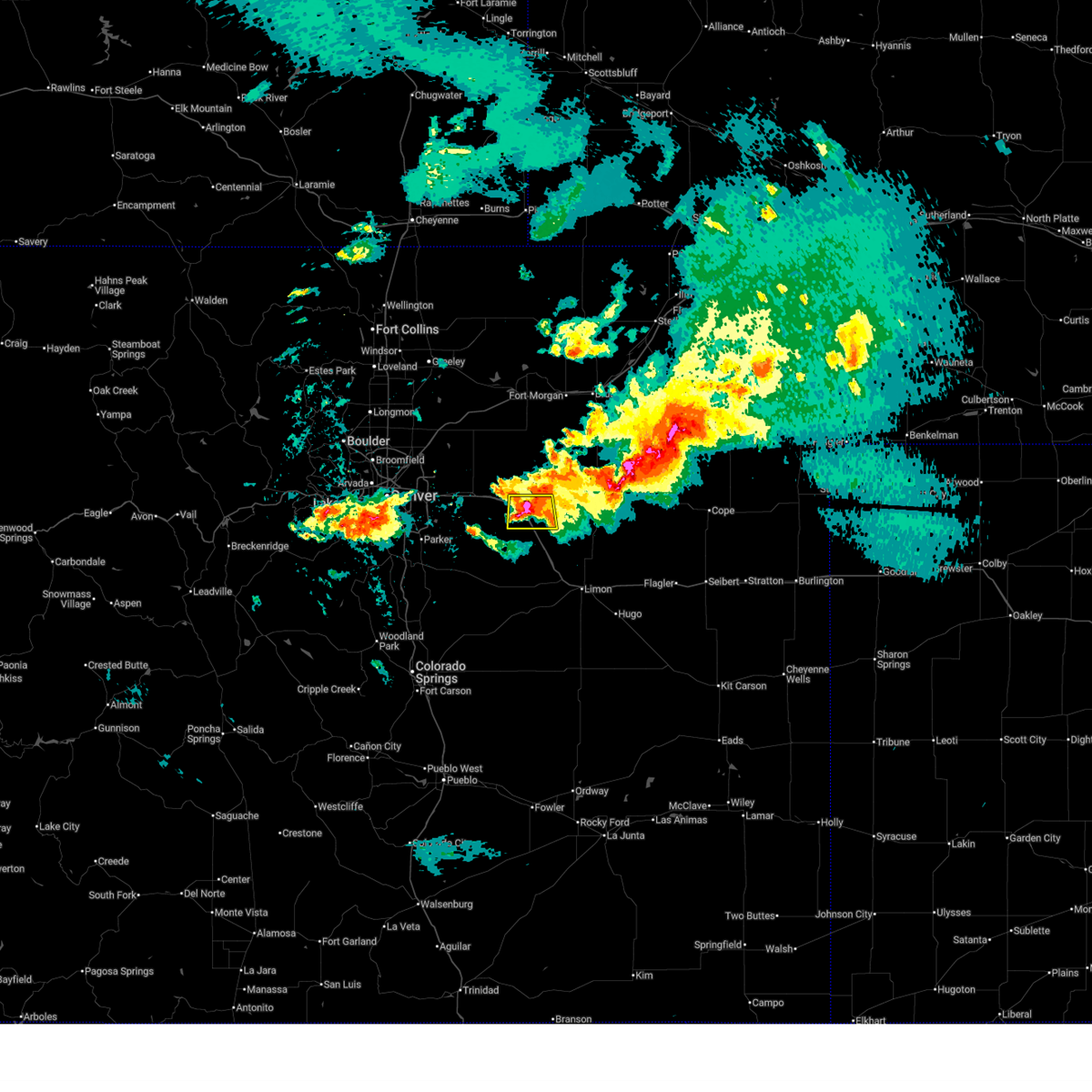
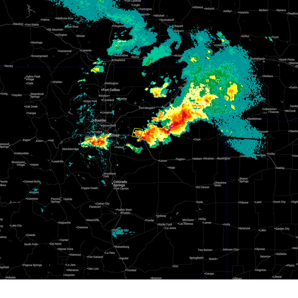
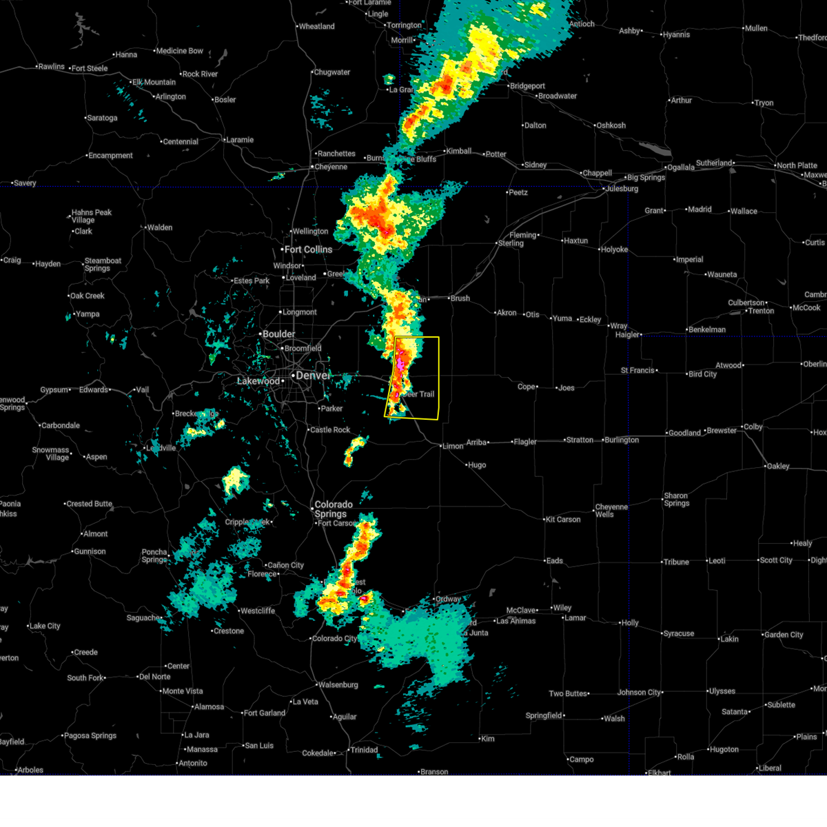
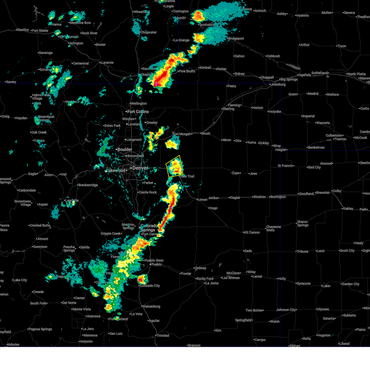
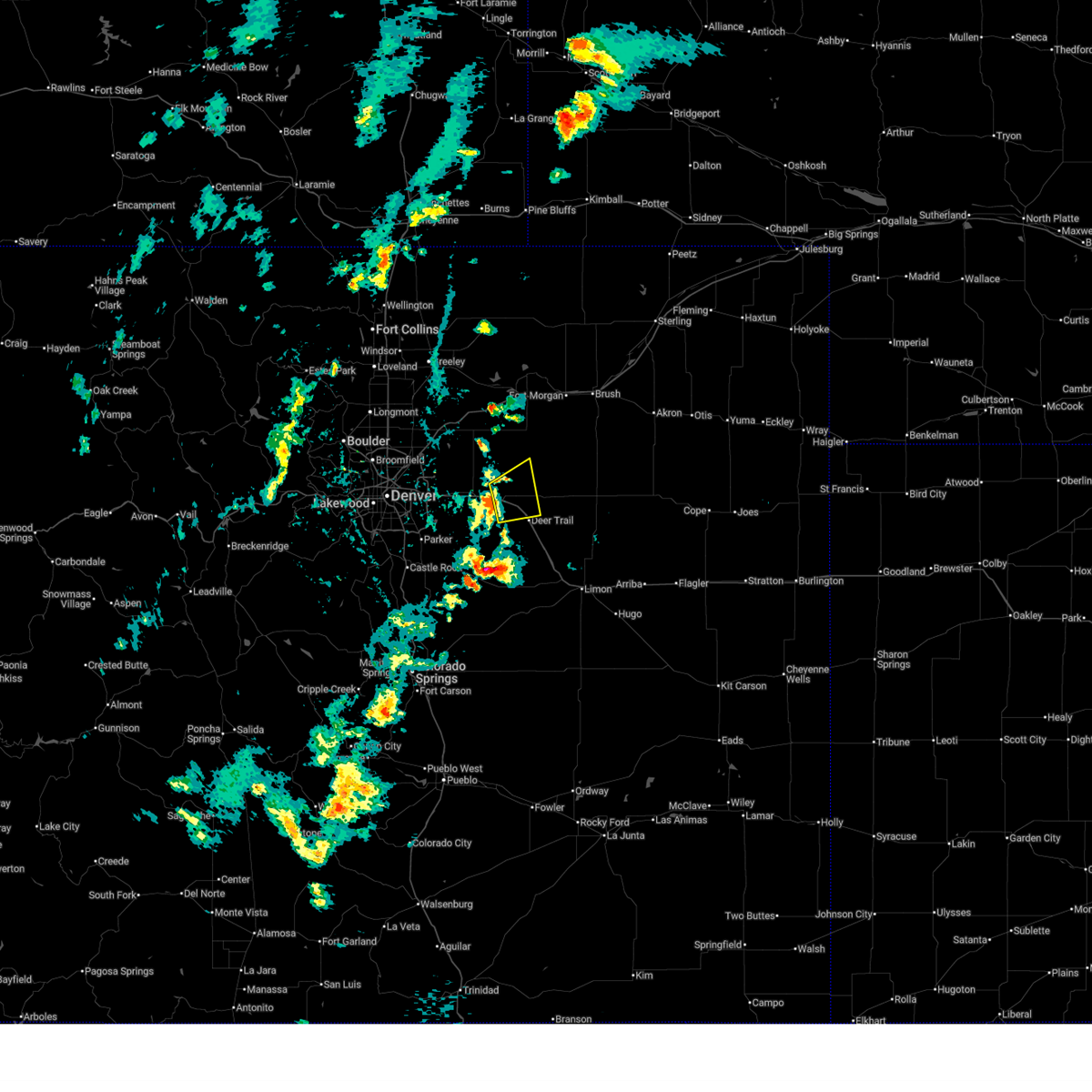
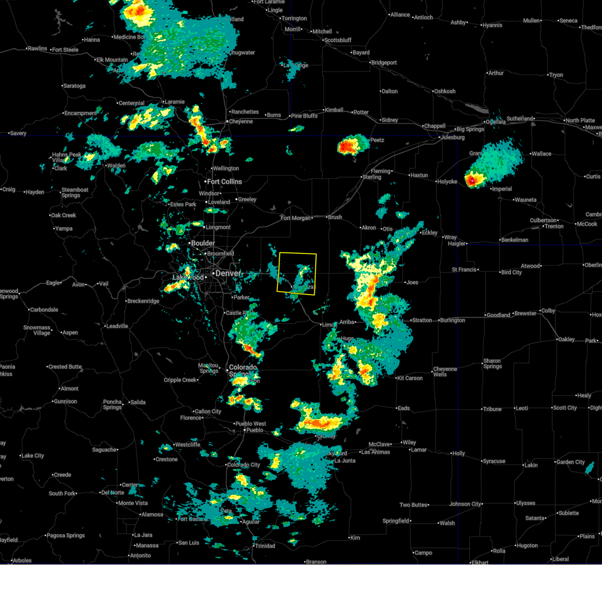
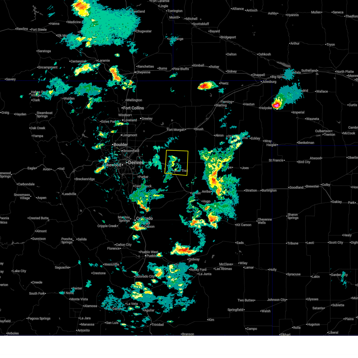
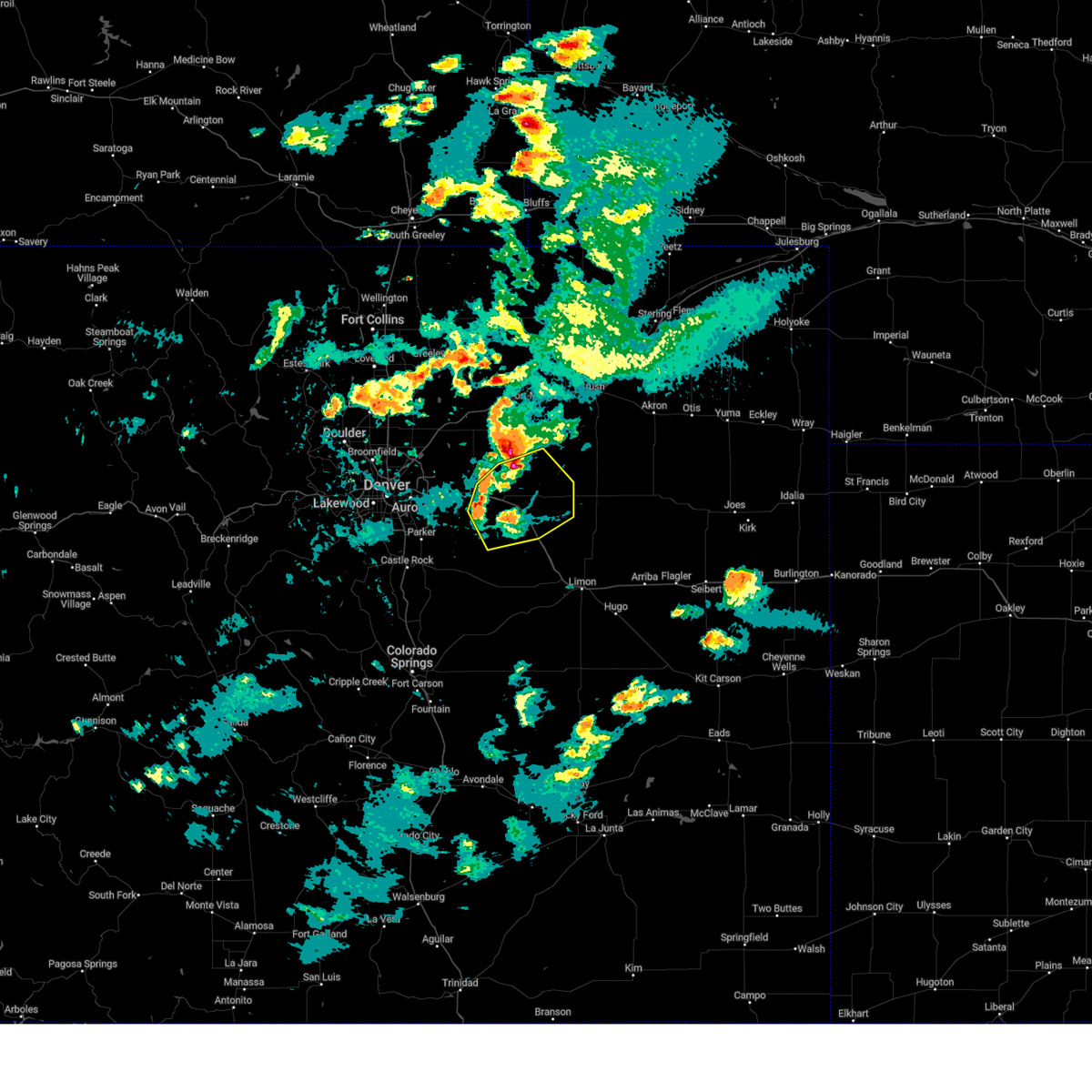
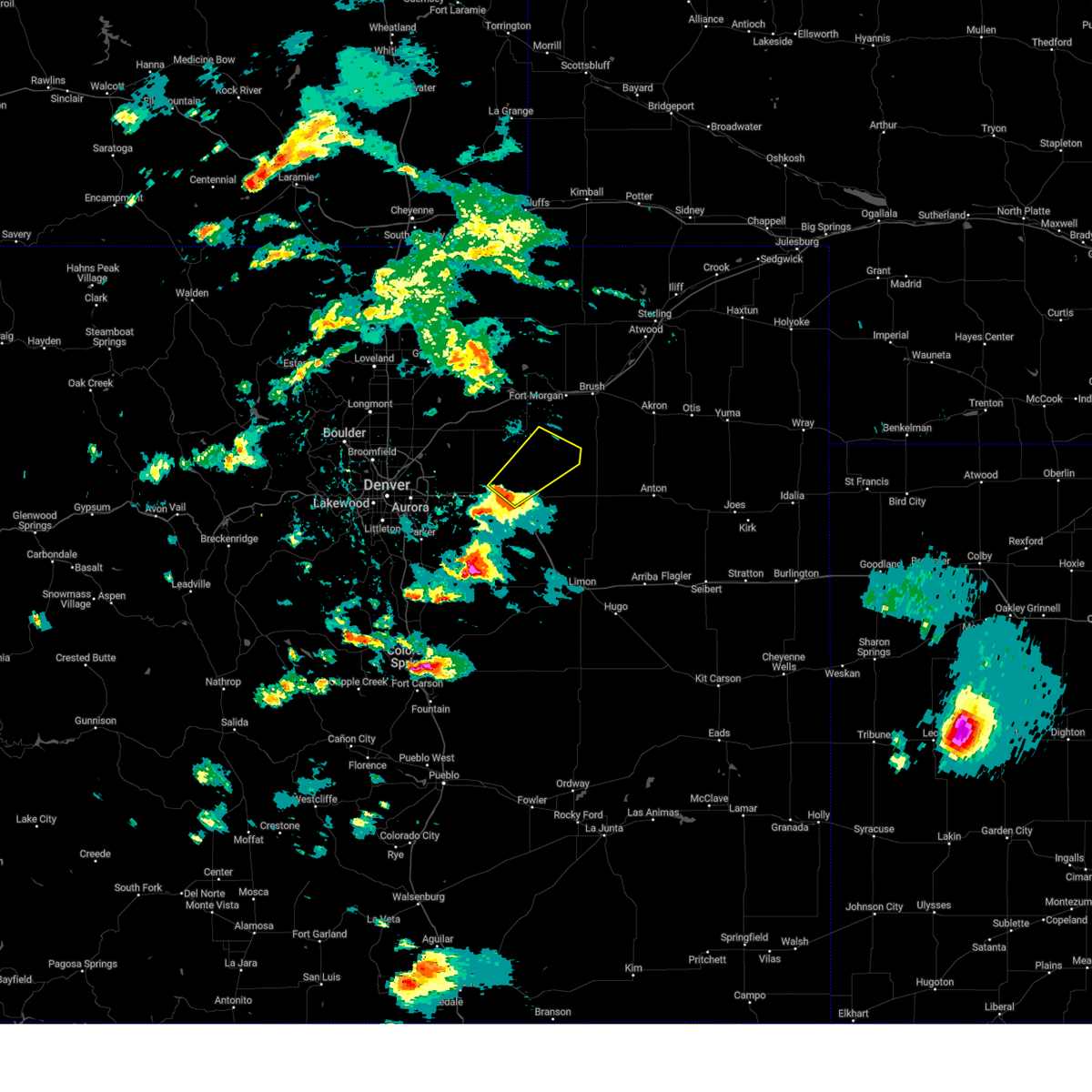
The Top Recent Hail Date for Peoria, CO is Wednesday, June 24, 2026 (12th out of 126)
Hail and Wind Damage Spotted near Peoria, CO
| Date / Time | Report Details |
|---|---|
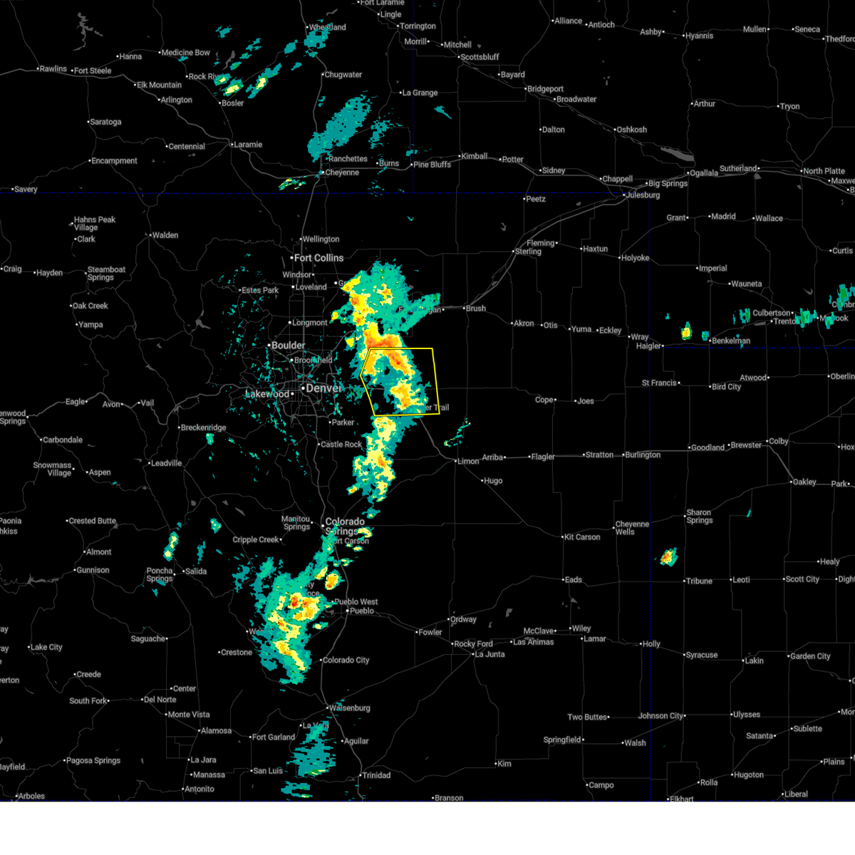
| 6/24/2026 11:22 PM MDT |
 the severe thunderstorm warning has been cancelled and is no longer in effect the severe thunderstorm warning has been cancelled and is no longer in effect
|
| 6/24/2026 11:01 PM MDT |
 Svrbou the national weather service in denver has issued a * severe thunderstorm warning for, central arapahoe and eastern arapahoe county in northeastern colorado, * until 1130 pm mdt. * at 1101 pm mdt, a severe thunderstorm was located 5 miles northwest of deer trail, or 35 miles northwest of limon, moving southeast at 15 mph (radar indicated). Hazards include quarter size hail. damage to vehicles is expected Svrbou the national weather service in denver has issued a * severe thunderstorm warning for, central arapahoe and eastern arapahoe county in northeastern colorado, * until 1130 pm mdt. * at 1101 pm mdt, a severe thunderstorm was located 5 miles northwest of deer trail, or 35 miles northwest of limon, moving southeast at 15 mph (radar indicated). Hazards include quarter size hail. damage to vehicles is expected
|
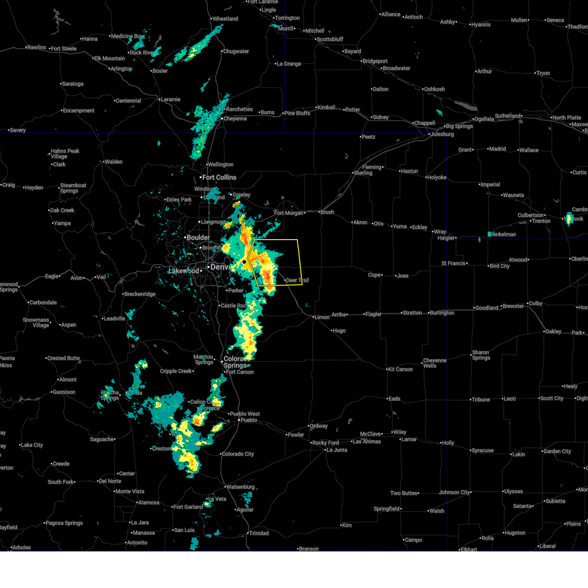
| 6/24/2026 10:32 PM MDT |
 At 1032 pm mdt, a severe thunderstorm was located 6 miles west of cottonwood valley, or 26 miles northwest of limon, moving east at 15 mph (radar indicated). Hazards include 60 mph wind gusts and quarter size hail. Hail damage to vehicles is expected. expect wind damage to roofs, siding, and trees. Locations impacted include, deer trail and cottonwood valley. At 1032 pm mdt, a severe thunderstorm was located 6 miles west of cottonwood valley, or 26 miles northwest of limon, moving east at 15 mph (radar indicated). Hazards include 60 mph wind gusts and quarter size hail. Hail damage to vehicles is expected. expect wind damage to roofs, siding, and trees. Locations impacted include, deer trail and cottonwood valley.
|
| 6/24/2026 10:22 PM MDT |
 The severe thunderstorm warning that was previously in effect has been reissued for eastern arapahoe county. please refer to those bulletins for the latest severe weather information. a tornado watch remains in effect until 1100 pm mdt wednesday for a portion of northeast colorado. The severe thunderstorm warning that was previously in effect has been reissued for eastern arapahoe county. please refer to those bulletins for the latest severe weather information. a tornado watch remains in effect until 1100 pm mdt wednesday for a portion of northeast colorado.
|
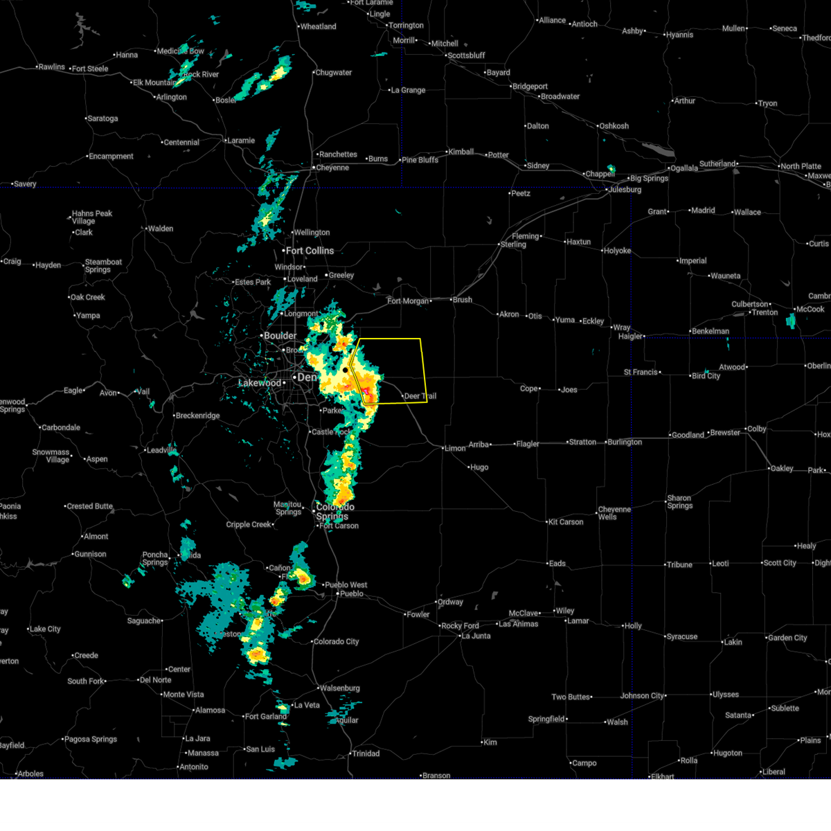
| 6/24/2026 10:08 PM MDT |
 Svrbou the national weather service in denver has issued a * severe thunderstorm warning for, northeastern elbert county in east central colorado, central arapahoe and eastern arapahoe county in northeastern colorado, * until 1100 pm mdt. * at 1008 pm mdt, a severe thunderstorm was located over deer trail, or 29 miles northwest of limon, moving east at 15 mph (radar indicated). Hazards include two inch hail and 60 mph wind gusts. People and animals outdoors will be injured. expect hail damage to roofs, siding, windows, and vehicles. Expect wind damage to roofs, siding, and trees. Svrbou the national weather service in denver has issued a * severe thunderstorm warning for, northeastern elbert county in east central colorado, central arapahoe and eastern arapahoe county in northeastern colorado, * until 1100 pm mdt. * at 1008 pm mdt, a severe thunderstorm was located over deer trail, or 29 miles northwest of limon, moving east at 15 mph (radar indicated). Hazards include two inch hail and 60 mph wind gusts. People and animals outdoors will be injured. expect hail damage to roofs, siding, windows, and vehicles. Expect wind damage to roofs, siding, and trees.
|
| 6/24/2026 9:56 PM MDT |
 At 956 pm mdt, a severe thunderstorm was located near deer trail, or 32 miles northwest of limon, moving east at 15 mph (radar indicated). Hazards include ping pong ball size hail and 60 mph wind gusts. People and animals outdoors will be injured. expect hail damage to roofs, siding, windows, and vehicles. expect wind damage to roofs, siding, and trees. Locations impacted include, deer trail. At 956 pm mdt, a severe thunderstorm was located near deer trail, or 32 miles northwest of limon, moving east at 15 mph (radar indicated). Hazards include ping pong ball size hail and 60 mph wind gusts. People and animals outdoors will be injured. expect hail damage to roofs, siding, windows, and vehicles. expect wind damage to roofs, siding, and trees. Locations impacted include, deer trail.
|
| 6/24/2026 9:51 PM MDT |
 The storm which prompted the warning has weakened below severe limits, and no longer poses an immediate threat to life or property. therefore, the warning will be allowed to expire. a tornado watch remains in effect until 1100 pm mdt wednesday for a portion of northeast colorado. The storm which prompted the warning has weakened below severe limits, and no longer poses an immediate threat to life or property. therefore, the warning will be allowed to expire. a tornado watch remains in effect until 1100 pm mdt wednesday for a portion of northeast colorado.
|
| 6/24/2026 9:40 PM MDT |
 At 940 pm mdt, a severe thunderstorm was located near deer trail, or 34 miles northwest of limon, moving east at 15 mph (radar indicated). Hazards include tennis ball size hail and 60 mph wind gusts. People and animals outdoors will be injured. expect hail damage to roofs, siding, windows, and vehicles. expect wind damage to roofs, siding, and trees. Locations impacted include, deer trail. At 940 pm mdt, a severe thunderstorm was located near deer trail, or 34 miles northwest of limon, moving east at 15 mph (radar indicated). Hazards include tennis ball size hail and 60 mph wind gusts. People and animals outdoors will be injured. expect hail damage to roofs, siding, windows, and vehicles. expect wind damage to roofs, siding, and trees. Locations impacted include, deer trail.
|
| 6/24/2026 9:39 PM MDT |
 At 939 pm mdt, a severe thunderstorm was located 4 miles north of byers, or 39 miles east of denver, moving east at 15 mph (radar indicated). Hazards include ping pong ball size hail and 60 mph wind gusts. People and animals outdoors will be injured. expect hail damage to roofs, siding, windows, and vehicles. expect wind damage to roofs, siding, and trees. Locations impacted include, byers and strasburg. At 939 pm mdt, a severe thunderstorm was located 4 miles north of byers, or 39 miles east of denver, moving east at 15 mph (radar indicated). Hazards include ping pong ball size hail and 60 mph wind gusts. People and animals outdoors will be injured. expect hail damage to roofs, siding, windows, and vehicles. expect wind damage to roofs, siding, and trees. Locations impacted include, byers and strasburg.
|
| 6/24/2026 9:30 PM MDT |
 Svrbou the national weather service in denver has issued a * severe thunderstorm warning for, central arapahoe and eastern arapahoe county in northeastern colorado, * until 1015 pm mdt. * at 930 pm mdt, a severe thunderstorm was located 6 miles northwest of deer trail, or 36 miles northwest of limon, moving east at 15 mph (radar indicated). Hazards include ping pong ball size hail and 60 mph wind gusts. People and animals outdoors will be injured. expect hail damage to roofs, siding, windows, and vehicles. Expect wind damage to roofs, siding, and trees. Svrbou the national weather service in denver has issued a * severe thunderstorm warning for, central arapahoe and eastern arapahoe county in northeastern colorado, * until 1015 pm mdt. * at 930 pm mdt, a severe thunderstorm was located 6 miles northwest of deer trail, or 36 miles northwest of limon, moving east at 15 mph (radar indicated). Hazards include ping pong ball size hail and 60 mph wind gusts. People and animals outdoors will be injured. expect hail damage to roofs, siding, windows, and vehicles. Expect wind damage to roofs, siding, and trees.
|
| 6/24/2026 9:18 PM MDT |
 Svrbou the national weather service in denver has issued a * severe thunderstorm warning for, south central adams county in northeastern colorado, central arapahoe county in northeastern colorado, * until 1000 pm mdt. * at 918 pm mdt, a severe thunderstorm was located near strasburg, or 35 miles east of denver, moving east at 15 mph (radar indicated). Hazards include ping pong ball size hail and 60 mph wind gusts. People and animals outdoors will be injured. expect hail damage to roofs, siding, windows, and vehicles. Expect wind damage to roofs, siding, and trees. Svrbou the national weather service in denver has issued a * severe thunderstorm warning for, south central adams county in northeastern colorado, central arapahoe county in northeastern colorado, * until 1000 pm mdt. * at 918 pm mdt, a severe thunderstorm was located near strasburg, or 35 miles east of denver, moving east at 15 mph (radar indicated). Hazards include ping pong ball size hail and 60 mph wind gusts. People and animals outdoors will be injured. expect hail damage to roofs, siding, windows, and vehicles. Expect wind damage to roofs, siding, and trees.
|
| 6/1/2026 3:26 PM MDT |
 At 326 pm mdt, a severe thunderstorm was located near bennett, or 31 miles east of denver, moving northeast at 15 mph (radar indicated). Hazards include two inch hail and 60 mph wind gusts. People and animals outdoors will be injured. expect hail damage to roofs, siding, windows, and vehicles. expect wind damage to roofs, siding, and trees. hail may accumulate on roadways causing hazardous travel. Locations impacted include, bennett, strasburg and byers. At 326 pm mdt, a severe thunderstorm was located near bennett, or 31 miles east of denver, moving northeast at 15 mph (radar indicated). Hazards include two inch hail and 60 mph wind gusts. People and animals outdoors will be injured. expect hail damage to roofs, siding, windows, and vehicles. expect wind damage to roofs, siding, and trees. hail may accumulate on roadways causing hazardous travel. Locations impacted include, bennett, strasburg and byers.
|
| 6/1/2026 3:15 PM MDT |
 At 315 pm mdt, a severe thunderstorm was located over bennett, or 28 miles east of denver, moving northeast at 15 mph (radar indicated). Hazards include two inch hail and 60 mph wind gusts. People and animals outdoors will be injured. expect hail damage to roofs, siding, windows, and vehicles. expect wind damage to roofs, siding, and trees. hail may accumulate on roadways causing hazardous travel. Locations impacted include, northeastern aurora, bennett, strasburg and byers. At 315 pm mdt, a severe thunderstorm was located over bennett, or 28 miles east of denver, moving northeast at 15 mph (radar indicated). Hazards include two inch hail and 60 mph wind gusts. People and animals outdoors will be injured. expect hail damage to roofs, siding, windows, and vehicles. expect wind damage to roofs, siding, and trees. hail may accumulate on roadways causing hazardous travel. Locations impacted include, northeastern aurora, bennett, strasburg and byers.
|
| 6/1/2026 2:52 PM MDT |
 Svrbou the national weather service in denver has issued a * severe thunderstorm warning for, south central adams county in northeastern colorado, central arapahoe county in northeastern colorado, * until 345 pm mdt. * at 252 pm mdt, a severe thunderstorm was located over manila village, or 23 miles east of denver, moving northeast at 15 mph (radar indicated). Hazards include two inch hail and 60 mph wind gusts. People and animals outdoors will be injured. expect hail damage to roofs, siding, windows, and vehicles. expect wind damage to roofs, siding, and trees. Hail may accumulate on roadways causing hazardous travel. Svrbou the national weather service in denver has issued a * severe thunderstorm warning for, south central adams county in northeastern colorado, central arapahoe county in northeastern colorado, * until 345 pm mdt. * at 252 pm mdt, a severe thunderstorm was located over manila village, or 23 miles east of denver, moving northeast at 15 mph (radar indicated). Hazards include two inch hail and 60 mph wind gusts. People and animals outdoors will be injured. expect hail damage to roofs, siding, windows, and vehicles. expect wind damage to roofs, siding, and trees. Hail may accumulate on roadways causing hazardous travel.
|
| 5/21/2026 3:41 PM MDT |
 At 341 pm mdt, a severe thunderstorm was located 4 miles west of deer trail, or 33 miles northwest of limon, moving east at 20 mph (radar indicated). Hazards include 60 mph wind gusts and quarter size hail. Hail damage to vehicles is expected. expect wind damage to roofs, siding, and trees. Locations impacted include, deer trail. At 341 pm mdt, a severe thunderstorm was located 4 miles west of deer trail, or 33 miles northwest of limon, moving east at 20 mph (radar indicated). Hazards include 60 mph wind gusts and quarter size hail. Hail damage to vehicles is expected. expect wind damage to roofs, siding, and trees. Locations impacted include, deer trail.
|
| 5/21/2026 3:30 PM MDT |
 Svrbou the national weather service in denver has issued a * severe thunderstorm warning for, central arapahoe and eastern arapahoe county in northeastern colorado, * until 415 pm mdt. * at 330 pm mdt, a severe thunderstorm was located 7 miles south of byers, or 35 miles northwest of limon, moving east at 20 mph (radar indicated). Hazards include 60 mph wind gusts and quarter size hail. Hail damage to vehicles is expected. Expect wind damage to roofs, siding, and trees. Svrbou the national weather service in denver has issued a * severe thunderstorm warning for, central arapahoe and eastern arapahoe county in northeastern colorado, * until 415 pm mdt. * at 330 pm mdt, a severe thunderstorm was located 7 miles south of byers, or 35 miles northwest of limon, moving east at 20 mph (radar indicated). Hazards include 60 mph wind gusts and quarter size hail. Hail damage to vehicles is expected. Expect wind damage to roofs, siding, and trees.
|
| 9/16/2025 4:58 PM MDT | The storm which prompted the warning has weakened below severe limits, and no longer poses an immediate threat to life or property. therefore, the warning will be allowed to expire. however, small hail and gusty winds are still possible with this thunderstorm. |
| 9/16/2025 4:35 PM MDT | Svrbou the national weather service in denver has issued a * severe thunderstorm warning for, southeastern adams county in northeastern colorado, north central arapahoe county in northeastern colorado, * until 500 pm mdt. * at 435 pm mdt, a severe thunderstorm was located 7 miles northeast of byers, or 37 miles southwest of fort morgan, moving east at 35 mph (radar indicated). Hazards include quarter size hail. damage to vehicles is expected |
| 8/18/2025 3:34 PM MDT |
 the severe thunderstorm warning has been cancelled and is no longer in effect the severe thunderstorm warning has been cancelled and is no longer in effect
|
| 8/18/2025 3:10 PM MDT |
 Svrbou the national weather service in denver has issued a * severe thunderstorm warning for, south central adams county in northeastern colorado, north central arapahoe county in northeastern colorado, * until 345 pm mdt. * at 310 pm mdt, a severe thunderstorm was located 5 miles northwest of byers, or 36 miles east of denver, moving northwest at 10 mph (radar indicated). Hazards include 60 mph wind gusts and quarter size hail. Hail damage to vehicles is expected. expect wind damage to roofs, siding, and trees. Hail may accumulate on roadways causing hazardous travel. Svrbou the national weather service in denver has issued a * severe thunderstorm warning for, south central adams county in northeastern colorado, north central arapahoe county in northeastern colorado, * until 345 pm mdt. * at 310 pm mdt, a severe thunderstorm was located 5 miles northwest of byers, or 36 miles east of denver, moving northwest at 10 mph (radar indicated). Hazards include 60 mph wind gusts and quarter size hail. Hail damage to vehicles is expected. expect wind damage to roofs, siding, and trees. Hail may accumulate on roadways causing hazardous travel.
|
| 8/2/2025 4:50 PM MDT |
 the severe thunderstorm warning has been cancelled and is no longer in effect the severe thunderstorm warning has been cancelled and is no longer in effect
|
| 8/2/2025 4:34 PM MDT |
 At 434 pm mdt, a severe thunderstorm was located 8 miles south of strasburg, or 34 miles east of denver, moving east at 25 mph (radar indicated). Hazards include 60 mph wind gusts. Expect damage to roofs, siding, and trees. Locations impacted include, byers. At 434 pm mdt, a severe thunderstorm was located 8 miles south of strasburg, or 34 miles east of denver, moving east at 25 mph (radar indicated). Hazards include 60 mph wind gusts. Expect damage to roofs, siding, and trees. Locations impacted include, byers.
|
| 8/2/2025 4:19 PM MDT |
 Svrbou the national weather service in denver has issued a * severe thunderstorm warning for, north central elbert county in east central colorado, central arapahoe county in northeastern colorado, * until 500 pm mdt. * at 419 pm mdt, a severe thunderstorm was located 6 miles south of bennett, or 28 miles east of denver, moving east at 25 mph (radar indicated). Hazards include 70 mph wind gusts. Expect considerable tree damage. Damage is likely to mobile homes, roofs, and outbuildings. Svrbou the national weather service in denver has issued a * severe thunderstorm warning for, north central elbert county in east central colorado, central arapahoe county in northeastern colorado, * until 500 pm mdt. * at 419 pm mdt, a severe thunderstorm was located 6 miles south of bennett, or 28 miles east of denver, moving east at 25 mph (radar indicated). Hazards include 70 mph wind gusts. Expect considerable tree damage. Damage is likely to mobile homes, roofs, and outbuildings.
|
| 7/24/2025 6:12 PM MDT |
 Svrbou the national weather service in denver has issued a * severe thunderstorm warning for, northeastern elbert county in east central colorado, eastern adams county in northeastern colorado, eastern arapahoe county in northeastern colorado, * until 715 pm mdt. * at 612 pm mdt, severe thunderstorms were located along a line from 4 miles west of adena to near deer trail, or along a line from 19 miles southwest of fort morgan to 28 miles northwest of limon, moving east at 15 mph (radar indicated). Hazards include 60 mph wind gusts and quarter size hail. Hail damage to vehicles is expected. Expect wind damage to roofs, siding, and trees. Svrbou the national weather service in denver has issued a * severe thunderstorm warning for, northeastern elbert county in east central colorado, eastern adams county in northeastern colorado, eastern arapahoe county in northeastern colorado, * until 715 pm mdt. * at 612 pm mdt, severe thunderstorms were located along a line from 4 miles west of adena to near deer trail, or along a line from 19 miles southwest of fort morgan to 28 miles northwest of limon, moving east at 15 mph (radar indicated). Hazards include 60 mph wind gusts and quarter size hail. Hail damage to vehicles is expected. Expect wind damage to roofs, siding, and trees.
|
| 7/14/2025 4:46 PM MDT |
 The storms which prompted the warning have weakened below severe limits, and no longer pose an immediate threat to life or property. therefore, the warning has been allowed to expire. however, small hail and heavy rain are still possible with these thunderstorms. The storms which prompted the warning have weakened below severe limits, and no longer pose an immediate threat to life or property. therefore, the warning has been allowed to expire. however, small hail and heavy rain are still possible with these thunderstorms.
|
| 7/14/2025 4:04 PM MDT |
 Svrbou the national weather service in denver has issued a * severe thunderstorm warning for, south central adams county in northeastern colorado, eastern arapahoe county in northeastern colorado, * until 445 pm mdt. * at 404 pm mdt, severe thunderstorms were located along a line from 7 miles northeast of strasburg to 6 miles south of byers, or along a line from 37 miles east of denver to 37 miles northwest of limon, moving northeast at 15 mph (radar indicated). Hazards include 60 mph wind gusts and quarter size hail. Hail damage to vehicles is expected. Expect wind damage to roofs, siding, and trees. Svrbou the national weather service in denver has issued a * severe thunderstorm warning for, south central adams county in northeastern colorado, eastern arapahoe county in northeastern colorado, * until 445 pm mdt. * at 404 pm mdt, severe thunderstorms were located along a line from 7 miles northeast of strasburg to 6 miles south of byers, or along a line from 37 miles east of denver to 37 miles northwest of limon, moving northeast at 15 mph (radar indicated). Hazards include 60 mph wind gusts and quarter size hail. Hail damage to vehicles is expected. Expect wind damage to roofs, siding, and trees.
|
| 7/10/2025 3:35 PM MDT |
 The storm which prompted the warning has weakened below severe limits, and no longer poses an immediate threat to life or property. therefore, the warning will be allowed to expire. a severe thunderstorm watch remains in effect until 900 pm mdt thursday for portions of east central and northeast colorado. The storm which prompted the warning has weakened below severe limits, and no longer poses an immediate threat to life or property. therefore, the warning will be allowed to expire. a severe thunderstorm watch remains in effect until 900 pm mdt thursday for portions of east central and northeast colorado.
|
| 7/10/2025 3:24 PM MDT |
 At 324 pm mdt, a severe thunderstorm was located 8 miles east of byers, or 39 miles southwest of fort morgan, moving east at 35 mph (radar indicated). Hazards include 60 mph wind gusts. Expect damage to roofs, siding, and trees. Locations impacted include, deer trail, leader, cottonwood valley and shamrock. At 324 pm mdt, a severe thunderstorm was located 8 miles east of byers, or 39 miles southwest of fort morgan, moving east at 35 mph (radar indicated). Hazards include 60 mph wind gusts. Expect damage to roofs, siding, and trees. Locations impacted include, deer trail, leader, cottonwood valley and shamrock.
|
| 7/10/2025 3:00 PM MDT |
 Svrbou the national weather service in denver has issued a * severe thunderstorm warning for, northern elbert county in east central colorado, southeastern adams county in northeastern colorado, eastern arapahoe county in northeastern colorado, * until 345 pm mdt. * at 300 pm mdt, a severe thunderstorm was located over strasburg, or 32 miles east of denver, moving east at 35 mph (multiple weather stations reported a 58 mph wind gust). Hazards include 60 mph wind gusts. expect damage to roofs, siding, and trees Svrbou the national weather service in denver has issued a * severe thunderstorm warning for, northern elbert county in east central colorado, southeastern adams county in northeastern colorado, eastern arapahoe county in northeastern colorado, * until 345 pm mdt. * at 300 pm mdt, a severe thunderstorm was located over strasburg, or 32 miles east of denver, moving east at 35 mph (multiple weather stations reported a 58 mph wind gust). Hazards include 60 mph wind gusts. expect damage to roofs, siding, and trees
|
| 6/24/2025 3:11 PM MDT |
 The storms which prompted the warning have weakened below severe limits, and no longer pose an immediate threat to life or property. therefore, the warning will be allowed to expire. however, strong, gusty winds up to 50-55 mph are still possible with these thunderstorms. the winds will start before the storms arrive at your location. a severe thunderstorm watch remains in effect until 800 pm mdt tuesday for a portion of northeast colorado. The storms which prompted the warning have weakened below severe limits, and no longer pose an immediate threat to life or property. therefore, the warning will be allowed to expire. however, strong, gusty winds up to 50-55 mph are still possible with these thunderstorms. the winds will start before the storms arrive at your location. a severe thunderstorm watch remains in effect until 800 pm mdt tuesday for a portion of northeast colorado.
|
| 6/24/2025 2:51 PM MDT |
 At 251 pm mdt, severe thunderstorms were located along a line from 8 miles south of prospect valley to over deer trail, or along a line from 35 miles northeast of denver to 31 miles northwest of limon, moving northeast at 25 mph (law enforcement reported. tree damage was reported near bennett. at 235 pm, an automated weather station on i-70 near bennett recorded a 62 mph wind gust). Hazards include 60 mph wind gusts and small hail. Expect damage to roofs, siding, and trees. Locations impacted include, bennett, deer trail, byers, leader and strasburg. At 251 pm mdt, severe thunderstorms were located along a line from 8 miles south of prospect valley to over deer trail, or along a line from 35 miles northeast of denver to 31 miles northwest of limon, moving northeast at 25 mph (law enforcement reported. tree damage was reported near bennett. at 235 pm, an automated weather station on i-70 near bennett recorded a 62 mph wind gust). Hazards include 60 mph wind gusts and small hail. Expect damage to roofs, siding, and trees. Locations impacted include, bennett, deer trail, byers, leader and strasburg.
|
| 6/24/2025 2:34 PM MDT |
 Svrbou the national weather service in denver has issued a * severe thunderstorm warning for, eastern adams county in northeastern colorado, eastern arapahoe county in northeastern colorado, * until 315 pm mdt. * at 234 pm mdt, severe thunderstorms were located along a line from 6 miles north of bennett to 6 miles west of deer trail, or along a line from 29 miles east of denver to 33 miles northwest of limon, moving northeast at 20 mph (radar indicated). Hazards include 60 mph wind gusts and small hail. expect damage to roofs, siding, and trees Svrbou the national weather service in denver has issued a * severe thunderstorm warning for, eastern adams county in northeastern colorado, eastern arapahoe county in northeastern colorado, * until 315 pm mdt. * at 234 pm mdt, severe thunderstorms were located along a line from 6 miles north of bennett to 6 miles west of deer trail, or along a line from 29 miles east of denver to 33 miles northwest of limon, moving northeast at 20 mph (radar indicated). Hazards include 60 mph wind gusts and small hail. expect damage to roofs, siding, and trees
|
| 6/17/2025 6:16 AM MDT |
 The storms which prompted the warning have weakened below severe limits, and have exited the warned area. therefore, the warning has been allowed to expire. however, small hail and heavy rain are still possible with these thunderstorms. a severe thunderstorm watch remains in effect until 800 am mdt for a portion of northeast colorado. The storms which prompted the warning have weakened below severe limits, and have exited the warned area. therefore, the warning has been allowed to expire. however, small hail and heavy rain are still possible with these thunderstorms. a severe thunderstorm watch remains in effect until 800 am mdt for a portion of northeast colorado.
|
| 6/17/2025 5:43 AM MDT |
 At 543 am mdt, severe thunderstorms were located along a line from over hoyt to 10 miles south of byers, or along a line from 23 miles southwest of fort morgan to 36 miles northwest of limon, moving east at 15 mph (radar indicated). Hazards include ping pong ball size hail. People and animals outdoors will be injured. expect damage to roofs, siding, windows, and vehicles. Locations impacted include, deer trail, leader and byers. At 543 am mdt, severe thunderstorms were located along a line from over hoyt to 10 miles south of byers, or along a line from 23 miles southwest of fort morgan to 36 miles northwest of limon, moving east at 15 mph (radar indicated). Hazards include ping pong ball size hail. People and animals outdoors will be injured. expect damage to roofs, siding, windows, and vehicles. Locations impacted include, deer trail, leader and byers.
|
| 6/17/2025 5:31 AM MDT |
 Svrbou the national weather service in denver has issued a * severe thunderstorm warning for, eastern adams county in northeastern colorado, eastern arapahoe county in northeastern colorado, * until 615 am mdt. * at 531 am mdt, severe thunderstorms were located along a line from over hoyt to 10 miles southwest of byers, or along a line from 24 miles southwest of fort morgan to 36 miles east of denver, moving east at 15 mph (radar indicated). Hazards include ping pong ball size hail. People and animals outdoors will be injured. Expect damage to roofs, siding, windows, and vehicles. Svrbou the national weather service in denver has issued a * severe thunderstorm warning for, eastern adams county in northeastern colorado, eastern arapahoe county in northeastern colorado, * until 615 am mdt. * at 531 am mdt, severe thunderstorms were located along a line from over hoyt to 10 miles southwest of byers, or along a line from 24 miles southwest of fort morgan to 36 miles east of denver, moving east at 15 mph (radar indicated). Hazards include ping pong ball size hail. People and animals outdoors will be injured. Expect damage to roofs, siding, windows, and vehicles.
|
| 6/6/2025 3:09 PM MDT |
 the severe thunderstorm warning has been cancelled and is no longer in effect the severe thunderstorm warning has been cancelled and is no longer in effect
|
| 6/6/2025 3:04 PM MDT |
 the severe thunderstorm warning has been cancelled and is no longer in effect the severe thunderstorm warning has been cancelled and is no longer in effect
|
| 6/6/2025 3:04 PM MDT |
 At 304 pm mdt, a severe thunderstorm was located near deer trail, or 28 miles northwest of limon, moving northeast at 20 mph (radar indicated). Hazards include quarter size hail. Damage to vehicles is expected. hail may accumulate on roadways causing hazardous travel. Locations impacted include, deer trail. At 304 pm mdt, a severe thunderstorm was located near deer trail, or 28 miles northwest of limon, moving northeast at 20 mph (radar indicated). Hazards include quarter size hail. Damage to vehicles is expected. hail may accumulate on roadways causing hazardous travel. Locations impacted include, deer trail.
|
| 6/6/2025 2:43 PM MDT |
 At 243 pm mdt, a severe thunderstorm was located near deer trail, or 29 miles northwest of limon, moving northeast at 20 mph (radar indicated). Hazards include two inch hail. People and animals outdoors will be injured. expect damage to roofs, siding, windows, and vehicles. hail may accumulate on roadways causing hazardous travel. Locations impacted include, deer trail and interstate 70. At 243 pm mdt, a severe thunderstorm was located near deer trail, or 29 miles northwest of limon, moving northeast at 20 mph (radar indicated). Hazards include two inch hail. People and animals outdoors will be injured. expect damage to roofs, siding, windows, and vehicles. hail may accumulate on roadways causing hazardous travel. Locations impacted include, deer trail and interstate 70.
|
| 6/6/2025 2:26 PM MDT |
 Svrbou the national weather service in denver has issued a * severe thunderstorm warning for, north central elbert county in east central colorado, eastern arapahoe county in northeastern colorado, * until 315 pm mdt. * at 226 pm mdt, a severe thunderstorm was located 9 miles southwest of deer trail, or 30 miles northwest of limon, moving northeast at 20 mph (radar indicated). Hazards include quarter size hail. damage to vehicles is expected Svrbou the national weather service in denver has issued a * severe thunderstorm warning for, north central elbert county in east central colorado, eastern arapahoe county in northeastern colorado, * until 315 pm mdt. * at 226 pm mdt, a severe thunderstorm was located 9 miles southwest of deer trail, or 30 miles northwest of limon, moving northeast at 20 mph (radar indicated). Hazards include quarter size hail. damage to vehicles is expected
|
| 9/17/2024 4:04 PM MDT |
 Svrbou the national weather service in denver colorado has issued a * severe thunderstorm warning for, south central weld county in northeastern colorado, north central elbert county in east central colorado, arapahoe county in northeastern colorado, morgan county in northeastern colorado, west central washington county in northeastern colorado, adams county in northeastern colorado, * until 445 pm mdt. * at 403 pm mdt, severe thunderstorms were located along a line extending from near strasburg to 6 miles southwest of deer trail, or along a line extending from 34 miles east of denver to 30 miles northwest of limon, moving northeast at 70 mph (radar indicated. at 353 pm mdt, a 62 mph wind gust was reported northeast of kiowa). Hazards include 60 mph wind gusts. expect damage to roofs, siding, and trees Svrbou the national weather service in denver colorado has issued a * severe thunderstorm warning for, south central weld county in northeastern colorado, north central elbert county in east central colorado, arapahoe county in northeastern colorado, morgan county in northeastern colorado, west central washington county in northeastern colorado, adams county in northeastern colorado, * until 445 pm mdt. * at 403 pm mdt, severe thunderstorms were located along a line extending from near strasburg to 6 miles southwest of deer trail, or along a line extending from 34 miles east of denver to 30 miles northwest of limon, moving northeast at 70 mph (radar indicated. at 353 pm mdt, a 62 mph wind gust was reported northeast of kiowa). Hazards include 60 mph wind gusts. expect damage to roofs, siding, and trees
|
| 8/13/2024 5:10 PM MDT |
 The storm which prompted the warning has weakened below severe limits, and no longer poses an immediate threat to life or property. therefore, the warning will be allowed to expire. however, gusty winds and heavy rain are still possible with this thunderstorm. a severe thunderstorm watch remains in effect until 100 am mdt for northeastern and east central colorado. The storm which prompted the warning has weakened below severe limits, and no longer poses an immediate threat to life or property. therefore, the warning will be allowed to expire. however, gusty winds and heavy rain are still possible with this thunderstorm. a severe thunderstorm watch remains in effect until 100 am mdt for northeastern and east central colorado.
|
| 8/13/2024 4:50 PM MDT |
 At 450 pm mdt, a severe thunderstorm was located over deer trail, or 30 miles northwest of limon, moving east at 30 mph (radar indicated). Hazards include 60 mph wind gusts and penny size hail. Expect damage to roofs, siding, and trees. Locations impacted include, deer trail and agate. At 450 pm mdt, a severe thunderstorm was located over deer trail, or 30 miles northwest of limon, moving east at 30 mph (radar indicated). Hazards include 60 mph wind gusts and penny size hail. Expect damage to roofs, siding, and trees. Locations impacted include, deer trail and agate.
|
| 8/13/2024 4:38 PM MDT |
 At 438 pm mdt, a severe thunderstorm was located 5 miles west of deer trail, or 32 miles northwest of limon, moving east at 30 mph (radar indicated). Hazards include 70 mph wind gusts and quarter size hail. Expect considerable tree damage. damage is likely to mobile homes, roofs, and outbuildings. hail damage to vehicles is expected. Locations impacted include, deer trail, agate, and byers. At 438 pm mdt, a severe thunderstorm was located 5 miles west of deer trail, or 32 miles northwest of limon, moving east at 30 mph (radar indicated). Hazards include 70 mph wind gusts and quarter size hail. Expect considerable tree damage. damage is likely to mobile homes, roofs, and outbuildings. hail damage to vehicles is expected. Locations impacted include, deer trail, agate, and byers.
|
| 8/13/2024 4:26 PM MDT |
 Svrbou the national weather service in denver colorado has issued a * severe thunderstorm warning for, northeastern elbert county in east central colorado, eastern arapahoe county in northeastern colorado, * until 515 pm mdt. * at 426 pm mdt, a severe thunderstorm was located 10 miles south of byers, or 35 miles northwest of limon, moving east at 30 mph (radar indicated). Hazards include 60 mph wind gusts and quarter size hail. Expect damage to roofs, siding, and trees. Hail damage to vehicles is expected. Svrbou the national weather service in denver colorado has issued a * severe thunderstorm warning for, northeastern elbert county in east central colorado, eastern arapahoe county in northeastern colorado, * until 515 pm mdt. * at 426 pm mdt, a severe thunderstorm was located 10 miles south of byers, or 35 miles northwest of limon, moving east at 30 mph (radar indicated). Hazards include 60 mph wind gusts and quarter size hail. Expect damage to roofs, siding, and trees. Hail damage to vehicles is expected.
|
| 8/7/2024 5:46 PM MDT |
 the severe thunderstorm warning has been cancelled and is no longer in effect the severe thunderstorm warning has been cancelled and is no longer in effect
|
| 8/7/2024 5:09 PM MDT |
 Svrbou the national weather service in denver colorado has issued a * severe thunderstorm warning for, north central elbert county in east central colorado, eastern arapahoe county in northeastern colorado, eastern adams county in northeastern colorado, * until 600 pm mdt. * at 509 pm mdt, a severe thunderstorm was located near leader, or 30 miles southwest of fort morgan, moving southeast at 35 mph (radar indicated). Hazards include ping pong ball size hail and 60 mph wind gusts. Expect damage to roofs, siding, and trees. people and animals outdoors will be injured. Expect hail damage to roofs, siding, windows, and vehicles. Svrbou the national weather service in denver colorado has issued a * severe thunderstorm warning for, north central elbert county in east central colorado, eastern arapahoe county in northeastern colorado, eastern adams county in northeastern colorado, * until 600 pm mdt. * at 509 pm mdt, a severe thunderstorm was located near leader, or 30 miles southwest of fort morgan, moving southeast at 35 mph (radar indicated). Hazards include ping pong ball size hail and 60 mph wind gusts. Expect damage to roofs, siding, and trees. people and animals outdoors will be injured. Expect hail damage to roofs, siding, windows, and vehicles.
|
| 7/3/2024 3:42 PM MDT |
 At 342 pm mdt, a severe thunderstorm was located 4 miles southwest of deer trail, or 29 miles northwest of limon, moving east at 15 mph (radar indicated). Hazards include quarter size hail. Damage to vehicles is expected. Locations impacted include, deer trail and agate. At 342 pm mdt, a severe thunderstorm was located 4 miles southwest of deer trail, or 29 miles northwest of limon, moving east at 15 mph (radar indicated). Hazards include quarter size hail. Damage to vehicles is expected. Locations impacted include, deer trail and agate.
|
| 7/3/2024 3:24 PM MDT |
 Svrbou the national weather service in denver colorado has issued a * severe thunderstorm warning for, northeastern elbert county in east central colorado, eastern arapahoe county in northeastern colorado, * until 400 pm mdt. * at 322 pm mdt, a couple of severe thunderstorms were located 9 miles southwest of deer trail, or 33 miles northwest of limon, moving east at 15 mph (radar indicated). Hazards include quarter size hail. damage to vehicles is expected Svrbou the national weather service in denver colorado has issued a * severe thunderstorm warning for, northeastern elbert county in east central colorado, eastern arapahoe county in northeastern colorado, * until 400 pm mdt. * at 322 pm mdt, a couple of severe thunderstorms were located 9 miles southwest of deer trail, or 33 miles northwest of limon, moving east at 15 mph (radar indicated). Hazards include quarter size hail. damage to vehicles is expected
|
| 6/8/2024 5:13 PM MDT |
 The storms which prompted the warning have moved out of the area. therefore, the warning will be allowed to expire. a severe thunderstorm watch remains in effect until 700 pm mdt for northeastern and east central colorado. The storms which prompted the warning have moved out of the area. therefore, the warning will be allowed to expire. a severe thunderstorm watch remains in effect until 700 pm mdt for northeastern and east central colorado.
|
| 6/8/2024 4:42 PM MDT |
 Svrbou the national weather service in denver colorado has issued a * severe thunderstorm warning for, north central elbert county in east central colorado, eastern arapahoe county in northeastern colorado, southeastern adams county in northeastern colorado, * until 515 pm mdt. * at 441 pm mdt, severe thunderstorms were located along a line extending from 8 miles north of cottonwood valley to 11 miles southwest of deer trail, or along a line extending from 34 miles south of fort morgan to 31 miles northwest of limon, moving southeast at 25 mph (radar indicated). Hazards include 60 mph wind gusts and quarter size hail. Expect damage to roofs, siding, and trees. hail damage to vehicles is expected. Severe thunderstorms will be near, cottonwood valley around 445 pm mdt. Svrbou the national weather service in denver colorado has issued a * severe thunderstorm warning for, north central elbert county in east central colorado, eastern arapahoe county in northeastern colorado, southeastern adams county in northeastern colorado, * until 515 pm mdt. * at 441 pm mdt, severe thunderstorms were located along a line extending from 8 miles north of cottonwood valley to 11 miles southwest of deer trail, or along a line extending from 34 miles south of fort morgan to 31 miles northwest of limon, moving southeast at 25 mph (radar indicated). Hazards include 60 mph wind gusts and quarter size hail. Expect damage to roofs, siding, and trees. hail damage to vehicles is expected. Severe thunderstorms will be near, cottonwood valley around 445 pm mdt.
|
| 6/8/2024 2:10 PM MDT |
 Svrbou the national weather service in denver colorado has issued a * severe thunderstorm warning for, northeastern elbert county in east central colorado, southeastern arapahoe county in northeastern colorado, * until 245 pm mdt. * at 210 pm mdt, a severe thunderstorm was located 5 miles southwest of deer trail, or 31 miles northwest of limon, moving east at 50 mph (radar indicated). Hazards include 60 mph wind gusts and quarter size hail. Expect damage to roofs, siding, and trees. Hail damage to vehicles is expected. Svrbou the national weather service in denver colorado has issued a * severe thunderstorm warning for, northeastern elbert county in east central colorado, southeastern arapahoe county in northeastern colorado, * until 245 pm mdt. * at 210 pm mdt, a severe thunderstorm was located 5 miles southwest of deer trail, or 31 miles northwest of limon, moving east at 50 mph (radar indicated). Hazards include 60 mph wind gusts and quarter size hail. Expect damage to roofs, siding, and trees. Hail damage to vehicles is expected.
|
| 6/8/2024 1:50 PM MDT |
 the severe thunderstorm warning has been cancelled and is no longer in effect the severe thunderstorm warning has been cancelled and is no longer in effect
|
| 6/8/2024 1:50 PM MDT |
 At 149 pm mdt, severe thunderstorms were located along a line extending from near deer trail to 6 miles north of kiowa, or along a line extending from 30 miles northwest of limon to 32 miles southeast of denver, moving east at 40 mph (radar indicated). Hazards include 60 mph wind gusts and half dollar size hail. Expect damage to roofs, siding, and trees. hail damage to vehicles is expected. Locations impacted include, deer trail, agate, and cottonwood valley. At 149 pm mdt, severe thunderstorms were located along a line extending from near deer trail to 6 miles north of kiowa, or along a line extending from 30 miles northwest of limon to 32 miles southeast of denver, moving east at 40 mph (radar indicated). Hazards include 60 mph wind gusts and half dollar size hail. Expect damage to roofs, siding, and trees. hail damage to vehicles is expected. Locations impacted include, deer trail, agate, and cottonwood valley.
|
| 6/8/2024 1:34 PM MDT |
 Svrbou the national weather service in denver colorado has issued a * severe thunderstorm warning for, northern elbert county in east central colorado, eastern arapahoe county in northeastern colorado, southeastern adams county in northeastern colorado, * until 215 pm mdt. * at 134 pm mdt, severe thunderstorms were located along a line extending from 5 miles south of byers to near ponderosa park, or along a line extending from 36 miles northwest of limon to 28 miles southeast of denver, moving east at 45 mph (radar indicated). Hazards include 60 mph wind gusts and quarter size hail. Expect damage to roofs, siding, and trees. Hail damage to vehicles is expected. Svrbou the national weather service in denver colorado has issued a * severe thunderstorm warning for, northern elbert county in east central colorado, eastern arapahoe county in northeastern colorado, southeastern adams county in northeastern colorado, * until 215 pm mdt. * at 134 pm mdt, severe thunderstorms were located along a line extending from 5 miles south of byers to near ponderosa park, or along a line extending from 36 miles northwest of limon to 28 miles southeast of denver, moving east at 45 mph (radar indicated). Hazards include 60 mph wind gusts and quarter size hail. Expect damage to roofs, siding, and trees. Hail damage to vehicles is expected.
|
| 5/31/2024 5:29 PM MDT |
 The storm which prompted the warning has weakened below severe limits, and has exited the warned area. therefore, the warning will be allowed to expire. however, hail up to nickel size is still possible with this thunderstorm. a severe thunderstorm watch remains in effect until 1100 pm mdt for east central colorado. The storm which prompted the warning has weakened below severe limits, and has exited the warned area. therefore, the warning will be allowed to expire. however, hail up to nickel size is still possible with this thunderstorm. a severe thunderstorm watch remains in effect until 1100 pm mdt for east central colorado.
|
| 5/31/2024 5:12 PM MDT |
 At 512 pm mdt, a severe thunderstorm was located 4 miles northwest of deer trail, or 34 miles northwest of limon, moving northeast at 15 mph (radar indicated). Hazards include half dollar size hail. Damage to vehicles is expected. This severe storm will be near, deer trail around 515 pm mdt. At 512 pm mdt, a severe thunderstorm was located 4 miles northwest of deer trail, or 34 miles northwest of limon, moving northeast at 15 mph (radar indicated). Hazards include half dollar size hail. Damage to vehicles is expected. This severe storm will be near, deer trail around 515 pm mdt.
|
| 5/31/2024 5:00 PM MDT |
 Svrbou the national weather service in denver colorado has issued a * severe thunderstorm warning for, eastern arapahoe county in northeastern colorado, * until 530 pm mdt. * at 459 pm mdt, a severe thunderstorm was located 6 miles west of deer trail, or 35 miles northwest of limon, moving northeast at 15 mph (radar indicated). Hazards include half dollar size hail. Damage to vehicles is expected. This severe thunderstorm will be near, deer trail around 505 pm mdt. Svrbou the national weather service in denver colorado has issued a * severe thunderstorm warning for, eastern arapahoe county in northeastern colorado, * until 530 pm mdt. * at 459 pm mdt, a severe thunderstorm was located 6 miles west of deer trail, or 35 miles northwest of limon, moving northeast at 15 mph (radar indicated). Hazards include half dollar size hail. Damage to vehicles is expected. This severe thunderstorm will be near, deer trail around 505 pm mdt.
|
| 5/31/2024 4:47 PM MDT |
 At 446 pm mdt, a severe thunderstorm was located 6 miles south of byers, or 35 miles northwest of limon, moving northeast at 25 mph (radar indicated). Hazards include half dollar size hail. Damage to vehicles is expected. Locations impacted include, deer trail and byers. At 446 pm mdt, a severe thunderstorm was located 6 miles south of byers, or 35 miles northwest of limon, moving northeast at 25 mph (radar indicated). Hazards include half dollar size hail. Damage to vehicles is expected. Locations impacted include, deer trail and byers.
|
| 5/31/2024 4:33 PM MDT |
 Svrbou the national weather service in denver colorado has issued a * severe thunderstorm warning for, north central elbert county in east central colorado, central arapahoe county in northeastern colorado, * until 500 pm mdt. * at 433 pm mdt, a severe thunderstorm was located 10 miles south of byers, or 36 miles northwest of limon, moving northeast at 25 mph (radar indicated). Hazards include half dollar size hail. Damage to vehicles is expected. This severe thunderstorm will remain over mainly rural areas of north central elbert and central arapahoe counties. Svrbou the national weather service in denver colorado has issued a * severe thunderstorm warning for, north central elbert county in east central colorado, central arapahoe county in northeastern colorado, * until 500 pm mdt. * at 433 pm mdt, a severe thunderstorm was located 10 miles south of byers, or 36 miles northwest of limon, moving northeast at 25 mph (radar indicated). Hazards include half dollar size hail. Damage to vehicles is expected. This severe thunderstorm will remain over mainly rural areas of north central elbert and central arapahoe counties.
|
| 5/30/2024 11:45 PM MDT |
 The severe thunderstorm which prompted the warning has weakened. moved out of the warned area. therefore, the warning has been allowed to expire. The severe thunderstorm which prompted the warning has weakened. moved out of the warned area. therefore, the warning has been allowed to expire.
|
| 5/30/2024 11:44 PM MDT |
 The storms which prompted the warning have weakened below severe limits, and no longer pose an immediate threat to life or property. therefore, the warning will be allowed to expire. however, small hail and gusty winds are still possible with these thunderstorms. The storms which prompted the warning have weakened below severe limits, and no longer pose an immediate threat to life or property. therefore, the warning will be allowed to expire. however, small hail and gusty winds are still possible with these thunderstorms.
|
| 5/30/2024 11:26 PM MDT |
 At 1126 pm mdt, severe thunderstorms were located along a line extending from 3 miles northwest of byers to 7 miles east of arapahoe park, or along a line extending from 42 miles southwest of fort morgan to 21 miles east of denver, moving southeast at 15 mph (trained weather spotters). Hazards include 60 mph wind gusts and half dollar size hail. Expect damage to roofs, siding, and trees. hail damage to vehicles is expected. Locations impacted include, bennett, strasburg, and byers. At 1126 pm mdt, severe thunderstorms were located along a line extending from 3 miles northwest of byers to 7 miles east of arapahoe park, or along a line extending from 42 miles southwest of fort morgan to 21 miles east of denver, moving southeast at 15 mph (trained weather spotters). Hazards include 60 mph wind gusts and half dollar size hail. Expect damage to roofs, siding, and trees. hail damage to vehicles is expected. Locations impacted include, bennett, strasburg, and byers.
|
| 5/30/2024 10:57 PM MDT |
 Svrbou the national weather service in denver colorado has issued a * severe thunderstorm warning for, northwestern elbert county in east central colorado, central arapahoe county in northeastern colorado, south central adams county in northeastern colorado, * until 1145 pm mdt. * at 1056 pm mdt, severe thunderstorms were located along a line extending from 5 miles north of bennett to near arapahoe park, or along a line extending from 44 miles southwest of fort morgan to 13 miles east of denver, moving southeast at 15 mph (trained weather spotters). Hazards include golf ball size hail and 60 mph wind gusts. Expect damage to roofs, siding, and trees. people and animals outdoors will be injured. Expect hail damage to roofs, siding, windows, and vehicles. Svrbou the national weather service in denver colorado has issued a * severe thunderstorm warning for, northwestern elbert county in east central colorado, central arapahoe county in northeastern colorado, south central adams county in northeastern colorado, * until 1145 pm mdt. * at 1056 pm mdt, severe thunderstorms were located along a line extending from 5 miles north of bennett to near arapahoe park, or along a line extending from 44 miles southwest of fort morgan to 13 miles east of denver, moving southeast at 15 mph (trained weather spotters). Hazards include golf ball size hail and 60 mph wind gusts. Expect damage to roofs, siding, and trees. people and animals outdoors will be injured. Expect hail damage to roofs, siding, windows, and vehicles.
|
| 5/30/2024 10:47 PM MDT |
 Svrbou the national weather service in denver colorado has issued a * severe thunderstorm warning for, northeastern elbert county in east central colorado, eastern arapahoe county in northeastern colorado, southeastern adams county in northeastern colorado, * until 1145 pm mdt. * at 1047 pm mdt, a severe thunderstorm was located 6 miles south of leader, or 34 miles southwest of fort morgan, moving south at 15 mph (radar indicated). Hazards include half dollar size hail. damage to vehicles is expected Svrbou the national weather service in denver colorado has issued a * severe thunderstorm warning for, northeastern elbert county in east central colorado, eastern arapahoe county in northeastern colorado, southeastern adams county in northeastern colorado, * until 1145 pm mdt. * at 1047 pm mdt, a severe thunderstorm was located 6 miles south of leader, or 34 miles southwest of fort morgan, moving south at 15 mph (radar indicated). Hazards include half dollar size hail. damage to vehicles is expected
|
| 8/28/2023 7:22 PM MDT |
 The severe thunderstorm warning for eastern arapahoe and southeastern adams counties will expire at 730 pm mdt, the storm which prompted the warning has moved out of the area. therefore, the warning will be allowed to expire. however gusty winds are still possible with this thunderstorm. The severe thunderstorm warning for eastern arapahoe and southeastern adams counties will expire at 730 pm mdt, the storm which prompted the warning has moved out of the area. therefore, the warning will be allowed to expire. however gusty winds are still possible with this thunderstorm.
|
| 8/28/2023 7:02 PM MDT |
 At 701 pm mdt, a severe thunderstorm was located 8 miles south of leader, or 34 miles south of fort morgan, moving east at 30 mph (radar indicated). Hazards include 60 mph wind gusts and quarter size hail. Expect damage to roofs, siding, and trees. hail damage to vehicles is expected. this severe thunderstorm will remain over mainly rural areas of eastern arapahoe and southeastern adams counties. hail threat, radar indicated max hail size, 1. 00 in wind threat, radar indicated max wind gust, 60 mph. At 701 pm mdt, a severe thunderstorm was located 8 miles south of leader, or 34 miles south of fort morgan, moving east at 30 mph (radar indicated). Hazards include 60 mph wind gusts and quarter size hail. Expect damage to roofs, siding, and trees. hail damage to vehicles is expected. this severe thunderstorm will remain over mainly rural areas of eastern arapahoe and southeastern adams counties. hail threat, radar indicated max hail size, 1. 00 in wind threat, radar indicated max wind gust, 60 mph.
|
| 8/28/2023 6:38 PM MDT |
 At 637 pm mdt, a severe thunderstorm was located near leader, or 29 miles southwest of fort morgan, moving south at 30 mph (radar indicated). Hazards include 70 mph wind gusts and ping pong ball size hail. Expect considerable tree damage. damage is likely to mobile homes, roofs, and outbuildings. people and animals outdoors will be injured. expect hail damage to roofs, siding, windows, and vehicles. this severe thunderstorm will be near, leader around 645 pm mdt. other locations in the path of this severe thunderstorm include deer trail. thunderstorm damage threat, considerable hail threat, radar indicated max hail size, 1. 50 in wind threat, radar indicated max wind gust, 70 mph. At 637 pm mdt, a severe thunderstorm was located near leader, or 29 miles southwest of fort morgan, moving south at 30 mph (radar indicated). Hazards include 70 mph wind gusts and ping pong ball size hail. Expect considerable tree damage. damage is likely to mobile homes, roofs, and outbuildings. people and animals outdoors will be injured. expect hail damage to roofs, siding, windows, and vehicles. this severe thunderstorm will be near, leader around 645 pm mdt. other locations in the path of this severe thunderstorm include deer trail. thunderstorm damage threat, considerable hail threat, radar indicated max hail size, 1. 50 in wind threat, radar indicated max wind gust, 70 mph.
|
| 8/2/2023 8:56 PM MDT |
 At 855 pm mdt, severe thunderstorms were located along a line extending from westminster to aurora to near ponderosa park, or along a line extending from 9 miles northwest of denver to 61 miles southwest of fort morgan to 37 miles north of colorado springs, moving northeast at 35 mph (radar indicated). Hazards include 60 mph wind gusts. Expect damage to roofs, siding, and trees. severe thunderstorms will be near, watkins around 905 pm mdt. d. i. a terminal and concourses and manila village around 910 pm mdt. brighton around 915 pm mdt. other locations in the path of these severe thunderstorms include northeastern commerce city, denver international airport, todd creek, barr lake, lochbuie, hudson, strasburg, byers and prospect valley. hail threat, radar indicated max hail size, <. 75 in wind threat, radar indicated max wind gust, 60 mph. At 855 pm mdt, severe thunderstorms were located along a line extending from westminster to aurora to near ponderosa park, or along a line extending from 9 miles northwest of denver to 61 miles southwest of fort morgan to 37 miles north of colorado springs, moving northeast at 35 mph (radar indicated). Hazards include 60 mph wind gusts. Expect damage to roofs, siding, and trees. severe thunderstorms will be near, watkins around 905 pm mdt. d. i. a terminal and concourses and manila village around 910 pm mdt. brighton around 915 pm mdt. other locations in the path of these severe thunderstorms include northeastern commerce city, denver international airport, todd creek, barr lake, lochbuie, hudson, strasburg, byers and prospect valley. hail threat, radar indicated max hail size, <. 75 in wind threat, radar indicated max wind gust, 60 mph.
|
| 7/20/2023 2:35 PM MDT |
 At 235 pm mdt, a severe thunderstorm was located 7 miles northeast of byers, or 37 miles southwest of fort morgan, moving northeast at 45 mph (radar indicated). Hazards include 60 mph wind gusts and half dollar size hail. Expect damage to roofs, siding, and trees. hail damage to vehicles is expected. this severe thunderstorm will be near, leader around 245 pm mdt. other locations in the path of this severe thunderstorm include adena and shamrock. hail threat, radar indicated max hail size, 1. 25 in wind threat, radar indicated max wind gust, 60 mph. At 235 pm mdt, a severe thunderstorm was located 7 miles northeast of byers, or 37 miles southwest of fort morgan, moving northeast at 45 mph (radar indicated). Hazards include 60 mph wind gusts and half dollar size hail. Expect damage to roofs, siding, and trees. hail damage to vehicles is expected. this severe thunderstorm will be near, leader around 245 pm mdt. other locations in the path of this severe thunderstorm include adena and shamrock. hail threat, radar indicated max hail size, 1. 25 in wind threat, radar indicated max wind gust, 60 mph.
|
| 7/8/2023 3:28 PM MDT |
 At 327 pm mdt, a severe thunderstorm was located near byers, or 36 miles east of denver, moving southeast at 35 mph (radar indicated). Hazards include 60 mph wind gusts and quarter size hail. the storm is capable of producing a landspout tornado. Expect damage to roofs, siding, and trees. hail damage to vehicles is expected. Locations impacted include, deer trail. At 327 pm mdt, a severe thunderstorm was located near byers, or 36 miles east of denver, moving southeast at 35 mph (radar indicated). Hazards include 60 mph wind gusts and quarter size hail. the storm is capable of producing a landspout tornado. Expect damage to roofs, siding, and trees. hail damage to vehicles is expected. Locations impacted include, deer trail.
|
| 7/8/2023 3:11 PM MDT |
 At 311 pm mdt, a severe thunderstorm was located 7 miles north of strasburg, or 32 miles east of denver, moving southeast at 30 mph (radar indicated). Hazards include 60 mph wind gusts and quarter size hail. Expect damage to roofs, siding, and trees. hail damage to vehicles is expected. this severe thunderstorm will be near, bennett around 315 pm mdt. strasburg around 325 pm mdt. byers around 330 pm mdt. other locations in the path of this severe thunderstorm include deer trail. hail threat, radar indicated max hail size, 1. 00 in wind threat, radar indicated max wind gust, 60 mph. At 311 pm mdt, a severe thunderstorm was located 7 miles north of strasburg, or 32 miles east of denver, moving southeast at 30 mph (radar indicated). Hazards include 60 mph wind gusts and quarter size hail. Expect damage to roofs, siding, and trees. hail damage to vehicles is expected. this severe thunderstorm will be near, bennett around 315 pm mdt. strasburg around 325 pm mdt. byers around 330 pm mdt. other locations in the path of this severe thunderstorm include deer trail. hail threat, radar indicated max hail size, 1. 00 in wind threat, radar indicated max wind gust, 60 mph.
|
| 7/4/2023 9:09 PM MDT |
 The severe thunderstorm warning for northwestern elbert and central arapahoe counties will expire at 915 pm mdt, the storm which prompted the warning has weakened below severe limits, and no longer poses an immediate threat to life or property. therefore, the warning will be allowed to expire. however heavy rain is still possible with this thunderstorm. a severe thunderstorm watch remains in effect until 1100 pm mdt for northeastern and east central colorado. The severe thunderstorm warning for northwestern elbert and central arapahoe counties will expire at 915 pm mdt, the storm which prompted the warning has weakened below severe limits, and no longer poses an immediate threat to life or property. therefore, the warning will be allowed to expire. however heavy rain is still possible with this thunderstorm. a severe thunderstorm watch remains in effect until 1100 pm mdt for northeastern and east central colorado.
|
| 7/4/2023 8:53 PM MDT |
 At 852 pm mdt, a severe thunderstorm was located 12 miles south of strasburg, or 32 miles east of denver, moving southeast at 35 mph (radar indicated). Hazards include 60 mph wind gusts. Expect damage to roofs, siding, and trees. locations impacted include, bennett. hail threat, radar indicated max hail size, <. 75 in wind threat, radar indicated max wind gust, 60 mph. At 852 pm mdt, a severe thunderstorm was located 12 miles south of strasburg, or 32 miles east of denver, moving southeast at 35 mph (radar indicated). Hazards include 60 mph wind gusts. Expect damage to roofs, siding, and trees. locations impacted include, bennett. hail threat, radar indicated max hail size, <. 75 in wind threat, radar indicated max wind gust, 60 mph.
|
| 7/4/2023 8:44 PM MDT |
 At 844 pm mdt, a severe thunderstorm was located 9 miles south of bennett, or 28 miles east of denver, moving southeast at 35 mph (radar indicated). Hazards include 60 mph wind gusts. Expect damage to roofs, siding, and trees. this severe thunderstorm will remain over mainly rural areas of northwestern elbert and central arapahoe counties. hail threat, radar indicated max hail size, <. 75 in wind threat, radar indicated max wind gust, 60 mph. At 844 pm mdt, a severe thunderstorm was located 9 miles south of bennett, or 28 miles east of denver, moving southeast at 35 mph (radar indicated). Hazards include 60 mph wind gusts. Expect damage to roofs, siding, and trees. this severe thunderstorm will remain over mainly rural areas of northwestern elbert and central arapahoe counties. hail threat, radar indicated max hail size, <. 75 in wind threat, radar indicated max wind gust, 60 mph.
|
| 6/29/2023 5:28 PM MDT |
 At 528 pm mdt, a severe thunderstorm was located near bennett, or 29 miles east of denver, moving east at 20 mph (radar indicated). Hazards include two inch hail and 60 mph wind gusts. Expect damage to roofs, siding, and trees. people and animals outdoors will be injured. Expect hail damage to roofs, siding, windows, and vehicles. At 528 pm mdt, a severe thunderstorm was located near bennett, or 29 miles east of denver, moving east at 20 mph (radar indicated). Hazards include two inch hail and 60 mph wind gusts. Expect damage to roofs, siding, and trees. people and animals outdoors will be injured. Expect hail damage to roofs, siding, windows, and vehicles.
|
| 6/21/2023 8:17 PM MDT |
 At 816 pm mdt, a severe thunderstorm was located 6 miles southwest of deer trail, or 29 miles northwest of limon, moving east at 10 mph (radar indicated). Hazards include 60 mph wind gusts and quarter size hail. Expect damage to roofs, siding, and trees. Hail damage to vehicles is expected. At 816 pm mdt, a severe thunderstorm was located 6 miles southwest of deer trail, or 29 miles northwest of limon, moving east at 10 mph (radar indicated). Hazards include 60 mph wind gusts and quarter size hail. Expect damage to roofs, siding, and trees. Hail damage to vehicles is expected.
|
| 5/28/2023 6:26 PM MDT |
 At 625 pm mdt, a severe thunderstorm was located 4 miles north of byers, or 39 miles east of denver, moving southeast at 15 mph (radar indicated). Hazards include ping pong ball size hail. People and animals outdoors will be injured. expect damage to roofs, siding, windows, and vehicles. this severe thunderstorm will be near, byers around 630 pm mdt. Other locations in the path of this severe thunderstorm include deer trail. At 625 pm mdt, a severe thunderstorm was located 4 miles north of byers, or 39 miles east of denver, moving southeast at 15 mph (radar indicated). Hazards include ping pong ball size hail. People and animals outdoors will be injured. expect damage to roofs, siding, windows, and vehicles. this severe thunderstorm will be near, byers around 630 pm mdt. Other locations in the path of this severe thunderstorm include deer trail.
|
| 5/26/2023 5:39 PM MDT |
 The severe thunderstorm warning for eastern arapahoe and eastern adams counties will expire at 545 pm mdt, the storm which prompted the warning has weakened below severe limits, and no longer poses an immediate threat to life or property. therefore, the warning will be allowed to expire. however small hail is still possible with this thunderstorm. a severe thunderstorm watch remains in effect until 900 pm mdt for northeastern colorado. The severe thunderstorm warning for eastern arapahoe and eastern adams counties will expire at 545 pm mdt, the storm which prompted the warning has weakened below severe limits, and no longer poses an immediate threat to life or property. therefore, the warning will be allowed to expire. however small hail is still possible with this thunderstorm. a severe thunderstorm watch remains in effect until 900 pm mdt for northeastern colorado.
|
| 5/26/2023 5:23 PM MDT |
 At 523 pm mdt, a severe thunderstorm was located 4 miles southwest of shamrock, or 28 miles south of fort morgan, moving northeast at 30 mph (radar indicated). Hazards include 60 mph wind gusts and quarter size hail. Expect damage to roofs, siding, and trees. hail damage to vehicles is expected. Locations impacted include, deer trail, cottonwood valley and shamrock. At 523 pm mdt, a severe thunderstorm was located 4 miles southwest of shamrock, or 28 miles south of fort morgan, moving northeast at 30 mph (radar indicated). Hazards include 60 mph wind gusts and quarter size hail. Expect damage to roofs, siding, and trees. hail damage to vehicles is expected. Locations impacted include, deer trail, cottonwood valley and shamrock.
|
| 5/26/2023 4:55 PM MDT |
 At 454 pm mdt, a severe thunderstorm was located 5 miles northwest of deer trail, or 36 miles northwest of limon, moving east at 30 mph (radar indicated). Hazards include 60 mph wind gusts and quarter size hail. Expect damage to roofs, siding, and trees. Hail damage to vehicles is expected. At 454 pm mdt, a severe thunderstorm was located 5 miles northwest of deer trail, or 36 miles northwest of limon, moving east at 30 mph (radar indicated). Hazards include 60 mph wind gusts and quarter size hail. Expect damage to roofs, siding, and trees. Hail damage to vehicles is expected.
|
| 5/25/2023 8:02 PM MDT |
 At 800 pm mdt, a severe thunderstorm was located near shamrock, or 26 miles south of fort morgan, moving northeast at 25 mph (radar indicated). Hazards include quarter size hail. Damage to vehicles is expected. locations impacted include, shamrock. hail threat, radar indicated max hail size, 1. 00 in wind threat, radar indicated max wind gust, <50 mph. At 800 pm mdt, a severe thunderstorm was located near shamrock, or 26 miles south of fort morgan, moving northeast at 25 mph (radar indicated). Hazards include quarter size hail. Damage to vehicles is expected. locations impacted include, shamrock. hail threat, radar indicated max hail size, 1. 00 in wind threat, radar indicated max wind gust, <50 mph.
|
| 5/25/2023 7:40 PM MDT |
 At 739 pm mdt, a severe thunderstorm was located 9 miles southwest of shamrock, or 33 miles south of fort morgan, moving northeast at 40 mph (radar indicated). Hazards include quarter size hail. Damage to vehicles is expected. this severe thunderstorm will be near, shamrock around 755 pm mdt. hail threat, radar indicated max hail size, 1. 00 in wind threat, radar indicated max wind gust, <50 mph. At 739 pm mdt, a severe thunderstorm was located 9 miles southwest of shamrock, or 33 miles south of fort morgan, moving northeast at 40 mph (radar indicated). Hazards include quarter size hail. Damage to vehicles is expected. this severe thunderstorm will be near, shamrock around 755 pm mdt. hail threat, radar indicated max hail size, 1. 00 in wind threat, radar indicated max wind gust, <50 mph.
|
| 5/10/2023 5:14 PM MDT |
 At 514 pm mdt, a severe thunderstorm capable of producing a tornado was located near byers, or 37 miles east of denver, moving northeast at 25 mph (radar indicated rotation). Hazards include tornado and quarter size hail. Flying debris will be dangerous to those caught without shelter. mobile homes will be damaged or destroyed. damage to roofs, windows, and vehicles will occur. tree damage is likely. Locations impacted include, strasburg and byers. At 514 pm mdt, a severe thunderstorm capable of producing a tornado was located near byers, or 37 miles east of denver, moving northeast at 25 mph (radar indicated rotation). Hazards include tornado and quarter size hail. Flying debris will be dangerous to those caught without shelter. mobile homes will be damaged or destroyed. damage to roofs, windows, and vehicles will occur. tree damage is likely. Locations impacted include, strasburg and byers.
|
| 5/10/2023 5:04 PM MDT |
 At 503 pm mdt, a severe thunderstorm capable of producing a tornado was located 6 miles southwest of byers, or 35 miles east of denver, moving northeast at 20 mph (radar indicated rotation). Hazards include tornado and quarter size hail. Flying debris will be dangerous to those caught without shelter. mobile homes will be damaged or destroyed. damage to roofs, windows, and vehicles will occur. Tree damage is likely. At 503 pm mdt, a severe thunderstorm capable of producing a tornado was located 6 miles southwest of byers, or 35 miles east of denver, moving northeast at 20 mph (radar indicated rotation). Hazards include tornado and quarter size hail. Flying debris will be dangerous to those caught without shelter. mobile homes will be damaged or destroyed. damage to roofs, windows, and vehicles will occur. Tree damage is likely.
|
| 5/10/2023 4:51 PM MDT |
 At 451 pm mdt, a severe thunderstorm capable of producing a tornado was located 11 miles south of strasburg, or 34 miles east of denver, moving north at 20 mph (radar indicated rotation). Hazards include tornado and golf ball size hail. Flying debris will be dangerous to those caught without shelter. mobile homes will be damaged or destroyed. damage to roofs, windows, and vehicles will occur. Tree damage is likely. At 451 pm mdt, a severe thunderstorm capable of producing a tornado was located 11 miles south of strasburg, or 34 miles east of denver, moving north at 20 mph (radar indicated rotation). Hazards include tornado and golf ball size hail. Flying debris will be dangerous to those caught without shelter. mobile homes will be damaged or destroyed. damage to roofs, windows, and vehicles will occur. Tree damage is likely.
|
| 5/10/2023 4:35 PM MDT |
 At 435 pm mdt, a severe thunderstorm was located over deer trail, or 32 miles northwest of limon, moving north at 20 mph (radar indicated). Hazards include 60 mph wind gusts and half dollar size hail. Expect damage to roofs, siding, and trees. hail damage to vehicles is expected. this severe thunderstorm will remain over mainly rural areas of eastern arapahoe and southeastern adams counties. hail threat, radar indicated max hail size, 1. 25 in wind threat, radar indicated max wind gust, 60 mph. At 435 pm mdt, a severe thunderstorm was located over deer trail, or 32 miles northwest of limon, moving north at 20 mph (radar indicated). Hazards include 60 mph wind gusts and half dollar size hail. Expect damage to roofs, siding, and trees. hail damage to vehicles is expected. this severe thunderstorm will remain over mainly rural areas of eastern arapahoe and southeastern adams counties. hail threat, radar indicated max hail size, 1. 25 in wind threat, radar indicated max wind gust, 60 mph.
|
| 6/7/2022 3:02 PM MDT |
 At 302 pm mdt, a severe thunderstorm was located over byers, or 39 miles east of denver, moving east at 25 mph (radar indicated). Hazards include 60 mph wind gusts and quarter size hail. Expect damage to roofs, siding, and trees. Hail damage to vehicles is expected. At 302 pm mdt, a severe thunderstorm was located over byers, or 39 miles east of denver, moving east at 25 mph (radar indicated). Hazards include 60 mph wind gusts and quarter size hail. Expect damage to roofs, siding, and trees. Hail damage to vehicles is expected.
|
| 5/1/2022 7:13 PM MDT |
 At 712 pm mdt, a severe thunderstorm was located near deer trail, or 27 miles northwest of limon, moving northeast at 30 mph (radar indicated). Hazards include 60 mph wind gusts and quarter size hail. Expect damage to roofs, siding, and trees. hail damage to vehicles is expected. Locations impacted include, deer trail and agate. At 712 pm mdt, a severe thunderstorm was located near deer trail, or 27 miles northwest of limon, moving northeast at 30 mph (radar indicated). Hazards include 60 mph wind gusts and quarter size hail. Expect damage to roofs, siding, and trees. hail damage to vehicles is expected. Locations impacted include, deer trail and agate.
|
| 5/1/2022 7:00 PM MDT |
 At 659 pm mdt, a severe thunderstorm was located 9 miles west of agate, or 27 miles northwest of limon, moving northeast at 30 mph (radar indicated). Hazards include 60 mph wind gusts and quarter size hail. Expect damage to roofs, siding, and trees. Hail damage to vehicles is expected. At 659 pm mdt, a severe thunderstorm was located 9 miles west of agate, or 27 miles northwest of limon, moving northeast at 30 mph (radar indicated). Hazards include 60 mph wind gusts and quarter size hail. Expect damage to roofs, siding, and trees. Hail damage to vehicles is expected.
|
| 8/19/2021 4:32 PM MDT |
 At 432 pm mdt, a severe thunderstorm was located 4 miles south of byers, or 37 miles east of denver, moving east at 35 mph (radar indicated). Hazards include 70 mph wind gusts and quarter size hail. Expect considerable tree damage. damage is likely to mobile homes, roofs, and outbuildings. hail damage to vehicles is expected. this severe thunderstorm will remain over mainly rural areas of central arapahoe county. thunderstorm damage threat, considerable hail threat, radar indicated max hail size, 1. 00 in wind threat, radar indicated max wind gust, 70 mph. At 432 pm mdt, a severe thunderstorm was located 4 miles south of byers, or 37 miles east of denver, moving east at 35 mph (radar indicated). Hazards include 70 mph wind gusts and quarter size hail. Expect considerable tree damage. damage is likely to mobile homes, roofs, and outbuildings. hail damage to vehicles is expected. this severe thunderstorm will remain over mainly rural areas of central arapahoe county. thunderstorm damage threat, considerable hail threat, radar indicated max hail size, 1. 00 in wind threat, radar indicated max wind gust, 70 mph.
|
| 8/20/2020 5:24 PM MDT |
 At 524 pm mdt, a severe thunderstorm was located 5 miles west of deer trail, or 33 miles northwest of limon, moving southeast at 25 mph (radar indicated). Hazards include 60 mph wind gusts and quarter size hail. Expect damage to roofs, siding, and trees. Hail damage to vehicles is expected. At 524 pm mdt, a severe thunderstorm was located 5 miles west of deer trail, or 33 miles northwest of limon, moving southeast at 25 mph (radar indicated). Hazards include 60 mph wind gusts and quarter size hail. Expect damage to roofs, siding, and trees. Hail damage to vehicles is expected.
|
| 8/5/2020 3:28 PM MDT |
 The severe thunderstorm warning for central arapahoe and south central adams counties will expire at 330 pm mdt, the storm which prompted the warning has weakened below severe limits, and has exited the warned area. therefore, the warning will be allowed to expire. however small hail, heavy rain and gusty winds are still possible with this thunderstorm. a severe thunderstorm watch remains in effect until 900 pm mdt for northeastern colorado. The severe thunderstorm warning for central arapahoe and south central adams counties will expire at 330 pm mdt, the storm which prompted the warning has weakened below severe limits, and has exited the warned area. therefore, the warning will be allowed to expire. however small hail, heavy rain and gusty winds are still possible with this thunderstorm. a severe thunderstorm watch remains in effect until 900 pm mdt for northeastern colorado.
|
| 8/5/2020 3:13 PM MDT |
 At 313 pm mdt, a severe thunderstorm was located over byers, or 38 miles east of denver, moving northeast at 15 mph (radar indicated). Hazards include ping pong ball size hail and 60 mph wind gusts. Expect damage to roofs, siding, and trees. people and animals outdoors will be injured. expect hail damage to roofs, siding, windows, and vehicles. Locations impacted include, bennett, deer trail, strasburg, byers and manila village. At 313 pm mdt, a severe thunderstorm was located over byers, or 38 miles east of denver, moving northeast at 15 mph (radar indicated). Hazards include ping pong ball size hail and 60 mph wind gusts. Expect damage to roofs, siding, and trees. people and animals outdoors will be injured. expect hail damage to roofs, siding, windows, and vehicles. Locations impacted include, bennett, deer trail, strasburg, byers and manila village.
|
| 8/5/2020 3:03 PM MDT |
 At 302 pm mdt, a severe thunderstorm was located near byers, or 39 miles northwest of limon, moving northeast at 15 mph (radar indicated). Hazards include golf ball size hail and 60 mph wind gusts. brief landspout tornadoes are also possible with this storm. Expect damage to roofs, siding, and trees. people and animals outdoors will be injured. expect hail damage to roofs, siding, windows, and vehicles. Locations impacted include, bennett, deer trail, strasburg, byers and manila village. At 302 pm mdt, a severe thunderstorm was located near byers, or 39 miles northwest of limon, moving northeast at 15 mph (radar indicated). Hazards include golf ball size hail and 60 mph wind gusts. brief landspout tornadoes are also possible with this storm. Expect damage to roofs, siding, and trees. people and animals outdoors will be injured. expect hail damage to roofs, siding, windows, and vehicles. Locations impacted include, bennett, deer trail, strasburg, byers and manila village.
|
| 8/5/2020 2:43 PM MDT |
 At 243 pm mdt, a severe thunderstorm was located 7 miles south of bennett, or 26 miles east of denver, moving northeast at 15 mph (radar indicated). Hazards include 60 mph wind gusts and quarter size hail. Expect damage to roofs, siding, and trees. Hail damage to vehicles is expected. At 243 pm mdt, a severe thunderstorm was located 7 miles south of bennett, or 26 miles east of denver, moving northeast at 15 mph (radar indicated). Hazards include 60 mph wind gusts and quarter size hail. Expect damage to roofs, siding, and trees. Hail damage to vehicles is expected.
|
| 7/9/2020 10:53 PM MDT |
 At 1052 pm mdt, a severe thunderstorm was located 9 miles southwest of deer trail, or 34 miles northwest of limon, moving east at 25 mph (radar indicated). Hazards include 60 mph wind gusts and quarter size hail. Expect damage to roofs, siding, and trees. Hail damage to vehicles is expected. At 1052 pm mdt, a severe thunderstorm was located 9 miles southwest of deer trail, or 34 miles northwest of limon, moving east at 25 mph (radar indicated). Hazards include 60 mph wind gusts and quarter size hail. Expect damage to roofs, siding, and trees. Hail damage to vehicles is expected.
|
| 7/9/2020 10:02 PM MDT |
 At 1002 pm mdt, a severe thunderstorm was located 13 miles south of bennett, or 28 miles southeast of denver, moving southeast at 35 mph (radar indicated). Hazards include 60 mph wind gusts and quarter size hail. Expect damage to roofs, siding, and trees. hail damage to vehicles is expected. Locations impacted include, eastern aurora, bennett, watkins, strasburg, byers and manila village. At 1002 pm mdt, a severe thunderstorm was located 13 miles south of bennett, or 28 miles southeast of denver, moving southeast at 35 mph (radar indicated). Hazards include 60 mph wind gusts and quarter size hail. Expect damage to roofs, siding, and trees. hail damage to vehicles is expected. Locations impacted include, eastern aurora, bennett, watkins, strasburg, byers and manila village.
|
| 7/9/2020 9:40 PM MDT |
 At 939 pm mdt, a severe thunderstorm was located near watkins, or 18 miles east of denver, moving southeast at 30 mph (radar indicated). Hazards include 60 mph wind gusts and quarter size hail. Expect damage to roofs, siding, and trees. Hail damage to vehicles is expected. At 939 pm mdt, a severe thunderstorm was located near watkins, or 18 miles east of denver, moving southeast at 30 mph (radar indicated). Hazards include 60 mph wind gusts and quarter size hail. Expect damage to roofs, siding, and trees. Hail damage to vehicles is expected.
|
| 7/7/2020 2:46 PM MDT |
 At 243 pm mdt, a severe thunderstorm was located near byers, or 38 miles northwest of limon, moving east at 20 mph (radar indicated. an automated weather station in bennett reported a 61 mph wind gust at 232 pm). Hazards include 60 mph wind gusts. Expect damage to roofs, siding, and trees. Locations impacted include, bennett, deer trail, strasburg and byers. At 243 pm mdt, a severe thunderstorm was located near byers, or 38 miles northwest of limon, moving east at 20 mph (radar indicated. an automated weather station in bennett reported a 61 mph wind gust at 232 pm). Hazards include 60 mph wind gusts. Expect damage to roofs, siding, and trees. Locations impacted include, bennett, deer trail, strasburg and byers.
|
| 7/7/2020 2:28 PM MDT |
 At 227 pm mdt, a severe thunderstorm was located near byers, or 36 miles east of denver, moving east at 20 mph (radar indicated). Hazards include 60 mph wind gusts. expect damage to roofs, siding, and trees At 227 pm mdt, a severe thunderstorm was located near byers, or 36 miles east of denver, moving east at 20 mph (radar indicated). Hazards include 60 mph wind gusts. expect damage to roofs, siding, and trees
|
| 6/6/2020 5:18 PM MDT |
 At 517 pm mdt, severe thunderstorms were located along a line extending from 9 miles south of kimball airport to 5 miles northeast of antelope springs to near leader, or along a line extending from 12 miles south of kimball to 18 miles northeast of fort morgan to 48 miles north of limon, moving northeast at 60 mph (radar indicated). Hazards include 70 mph wind gusts. Expect considerable tree damage. Damage is likely to mobile homes, roofs, and outbuildings. At 517 pm mdt, severe thunderstorms were located along a line extending from 9 miles south of kimball airport to 5 miles northeast of antelope springs to near leader, or along a line extending from 12 miles south of kimball to 18 miles northeast of fort morgan to 48 miles north of limon, moving northeast at 60 mph (radar indicated). Hazards include 70 mph wind gusts. Expect considerable tree damage. Damage is likely to mobile homes, roofs, and outbuildings.
|
| 6/6/2020 4:44 PM MDT |
 At 444 pm mdt, severe thunderstorms were located along a line extending from 8 miles south of grover to near orchard to 5 miles southwest of leader to 3 miles east of elbert, or along a line extending from 40 miles southeast of cheyenne to 20 miles west of fort morgan to 43 miles east of denver to 27 miles northeast of colorado springs, moving east at 35 mph. these are very dangerous storms (radar indicated). Hazards include 80 mph wind gusts. Flying debris will be dangerous to those caught without shelter. mobile homes will be heavily damaged. expect considerable damage to roofs, windows, and vehicles. extensive tree damage and power outages are likely. locations impacted include, eastern denver, southeastern greeley, aurora, eastern centennial, southeastern highlands ranch, castle rock, eastern commerce city, parker, elbert, greenwood village, lone tree, denver international airport, d. i. A terminal and concourses, lochbuie, hudson, bennett, kersey, elizabeth, keenesburg and kiowa. At 444 pm mdt, severe thunderstorms were located along a line extending from 8 miles south of grover to near orchard to 5 miles southwest of leader to 3 miles east of elbert, or along a line extending from 40 miles southeast of cheyenne to 20 miles west of fort morgan to 43 miles east of denver to 27 miles northeast of colorado springs, moving east at 35 mph. these are very dangerous storms (radar indicated). Hazards include 80 mph wind gusts. Flying debris will be dangerous to those caught without shelter. mobile homes will be heavily damaged. expect considerable damage to roofs, windows, and vehicles. extensive tree damage and power outages are likely. locations impacted include, eastern denver, southeastern greeley, aurora, eastern centennial, southeastern highlands ranch, castle rock, eastern commerce city, parker, elbert, greenwood village, lone tree, denver international airport, d. i. A terminal and concourses, lochbuie, hudson, bennett, kersey, elizabeth, keenesburg and kiowa.
|
| 6/6/2020 4:36 PM MDT |
 At 433 pm mdt, severe thunderstorms were located along a line extending from 4 miles northwest of briggsdale to near bennett, or along a line extending from 25 miles northeast of greeley to 26 miles east of denver, moving northeast at 60 mph (radar indicated). Hazards include 80 mph wind gusts. Expect considerable tree damage. Damage is likely to mobile homes, roofs, and outbuildings. At 433 pm mdt, severe thunderstorms were located along a line extending from 4 miles northwest of briggsdale to near bennett, or along a line extending from 25 miles northeast of greeley to 26 miles east of denver, moving northeast at 60 mph (radar indicated). Hazards include 80 mph wind gusts. Expect considerable tree damage. Damage is likely to mobile homes, roofs, and outbuildings.
|
| 6/6/2020 3:56 PM MDT |
 At 355 pm mdt, severe thunderstorms were located along a line extending from 6 miles south of carr to 3 miles east of dacono to aurora to 5 miles east of greenland, or along a line extending from 21 miles northeast of fort collins to 24 miles south of greeley to 10 miles east of denver to 22 miles north of colorado springs, moving northeast at 60 mph. these are very dangerous storms (radar indicated). Hazards include 80 mph wind gusts. Flying debris will be dangerous to those caught without shelter. mobile homes will be heavily damaged. expect considerable damage to roofs, windows, and vehicles. Extensive tree damage and power outages are likely. At 355 pm mdt, severe thunderstorms were located along a line extending from 6 miles south of carr to 3 miles east of dacono to aurora to 5 miles east of greenland, or along a line extending from 21 miles northeast of fort collins to 24 miles south of greeley to 10 miles east of denver to 22 miles north of colorado springs, moving northeast at 60 mph. these are very dangerous storms (radar indicated). Hazards include 80 mph wind gusts. Flying debris will be dangerous to those caught without shelter. mobile homes will be heavily damaged. expect considerable damage to roofs, windows, and vehicles. Extensive tree damage and power outages are likely.
|
| 6/4/2020 2:08 PM MDT |
 At 206 pm mdt, the leading edge of strong winds from a severe thunderstorm were located along a line extending from 6 miles southwest of prospect valley to 6 miles north of manila village to 3 miles southwest of watkins, or along a line extending from 32 miles southeast of greeley to 58 miles northwest of limon to 16 miles east of denver, moving east at 40 mph (radar indicated). Hazards include 60 mph wind gusts. Expect damage to roofs, siding, and trees. locations impacted include, northeastern denver, northern aurora, thornton, southeastern westminster, commerce city, northglenn, brighton, federal heights, denver international airport, d. i. A terminal and concourses, frederick, fort lupton, lochbuie, dacono, hudson, bennett, manila village, strasburg, watkins and byers. At 206 pm mdt, the leading edge of strong winds from a severe thunderstorm were located along a line extending from 6 miles southwest of prospect valley to 6 miles north of manila village to 3 miles southwest of watkins, or along a line extending from 32 miles southeast of greeley to 58 miles northwest of limon to 16 miles east of denver, moving east at 40 mph (radar indicated). Hazards include 60 mph wind gusts. Expect damage to roofs, siding, and trees. locations impacted include, northeastern denver, northern aurora, thornton, southeastern westminster, commerce city, northglenn, brighton, federal heights, denver international airport, d. i. A terminal and concourses, frederick, fort lupton, lochbuie, dacono, hudson, bennett, manila village, strasburg, watkins and byers.
|
| 6/4/2020 1:43 PM MDT |
 At 141 pm mdt, strong winds from a severe thunderstorm were located along a line extending from 3 miles southeast of fort lupton to 4 miles south of barr lake to denver, or along a line extending from 26 miles south of greeley to 71 miles northwest of limon to 61 miles north of colorado springs, moving east at 40 mph (radar indicated). Hazards include 60 mph wind gusts. expect damage to roofs, siding, and trees At 141 pm mdt, strong winds from a severe thunderstorm were located along a line extending from 3 miles southeast of fort lupton to 4 miles south of barr lake to denver, or along a line extending from 26 miles south of greeley to 71 miles northwest of limon to 61 miles north of colorado springs, moving east at 40 mph (radar indicated). Hazards include 60 mph wind gusts. expect damage to roofs, siding, and trees
|
| 9/8/2019 7:12 PM MDT |
 The severe thunderstorm warning for south central weld, eastern arapahoe, western morgan, southwestern washington and eastern adams counties will expire at 715 pm mdt, the storms which prompted the warning have weakened below severe limits, and no longer pose an immediate threat to life or property. therefore, the warning will be allowed to expire. however gusty winds up to 45 mph are still possible with these thunderstorms. a severe thunderstorm watch remains in effect until 900 pm mdt for northeastern colorado. The severe thunderstorm warning for south central weld, eastern arapahoe, western morgan, southwestern washington and eastern adams counties will expire at 715 pm mdt, the storms which prompted the warning have weakened below severe limits, and no longer pose an immediate threat to life or property. therefore, the warning will be allowed to expire. however gusty winds up to 45 mph are still possible with these thunderstorms. a severe thunderstorm watch remains in effect until 900 pm mdt for northeastern colorado.
|
| 9/8/2019 6:48 PM MDT |
 At 646 pm mdt, severe thunderstorms were located along a line extending from 6 miles east of barnesville to near cottonwood valley, or along a line extending from 20 miles east of greeley to 25 miles north of limon, moving east and northeast at 35 mph (radar indicated). Hazards include 60 mph wind gusts and quarter size hail. Expect damage to roofs, siding, and trees. hail damage to vehicles is expected. Locations impacted include, kersey, wiggins, deer trail, hoyt, shamrock, leader, weldona, twelve-mile corner, jackson reservoir, orchard, adena, prospect valley, cottonwood valley, riverside reservoir, last chance, goodrich and roggen. At 646 pm mdt, severe thunderstorms were located along a line extending from 6 miles east of barnesville to near cottonwood valley, or along a line extending from 20 miles east of greeley to 25 miles north of limon, moving east and northeast at 35 mph (radar indicated). Hazards include 60 mph wind gusts and quarter size hail. Expect damage to roofs, siding, and trees. hail damage to vehicles is expected. Locations impacted include, kersey, wiggins, deer trail, hoyt, shamrock, leader, weldona, twelve-mile corner, jackson reservoir, orchard, adena, prospect valley, cottonwood valley, riverside reservoir, last chance, goodrich and roggen.
|
| 9/8/2019 6:34 PM MDT |
 At 633 pm mdt, severe thunderstorms were located along a line extending from kersey to near deer trail, or along a line extending from 10 miles east of greeley to 29 miles northwest of limon, moving east at 25 mph (radar indicated). Hazards include 60 mph wind gusts and quarter size hail. a brief weak landspout tornado is also possible with these line of storms. Expect damage to roofs, siding, and trees. Hail damage to vehicles is expected. At 633 pm mdt, severe thunderstorms were located along a line extending from kersey to near deer trail, or along a line extending from 10 miles east of greeley to 29 miles northwest of limon, moving east at 25 mph (radar indicated). Hazards include 60 mph wind gusts and quarter size hail. a brief weak landspout tornado is also possible with these line of storms. Expect damage to roofs, siding, and trees. Hail damage to vehicles is expected.
|
| 9/8/2019 6:22 PM MDT |
 At 621 pm mdt, severe thunderstorms were located along a line extending from 4 miles west of roggen to 5 miles southeast of byers, or along a line extending from 22 miles southeast of greeley to 36 miles northwest of limon, moving northeast at 20 mph (radar indicated. automated wind sensors reported a 60 mph wind gust with this storm near hudson). Hazards include 60 mph wind gusts and quarter size hail. Expect damage to roofs, siding, and trees. hail damage to vehicles is expected. Locations impacted include, hudson, bennett, keenesburg, byers, prospect valley, strasburg and roggen. At 621 pm mdt, severe thunderstorms were located along a line extending from 4 miles west of roggen to 5 miles southeast of byers, or along a line extending from 22 miles southeast of greeley to 36 miles northwest of limon, moving northeast at 20 mph (radar indicated. automated wind sensors reported a 60 mph wind gust with this storm near hudson). Hazards include 60 mph wind gusts and quarter size hail. Expect damage to roofs, siding, and trees. hail damage to vehicles is expected. Locations impacted include, hudson, bennett, keenesburg, byers, prospect valley, strasburg and roggen.
|
| 9/8/2019 6:05 PM MDT |
 At 604 pm mdt, severe thunderstorms were located along a line extending from 4 miles northwest of keenesburg to 8 miles southwest of byers, or along a line extending from 20 miles southeast of greeley to 40 miles northwest of limon, moving northeast at 15 mph (radar indicated). Hazards include 60 mph wind gusts and quarter size hail. brief weak landspouts are also possible with this line of storms. Expect damage to roofs, siding, and trees. Hail damage to vehicles is expected. At 604 pm mdt, severe thunderstorms were located along a line extending from 4 miles northwest of keenesburg to 8 miles southwest of byers, or along a line extending from 20 miles southeast of greeley to 40 miles northwest of limon, moving northeast at 15 mph (radar indicated). Hazards include 60 mph wind gusts and quarter size hail. brief weak landspouts are also possible with this line of storms. Expect damage to roofs, siding, and trees. Hail damage to vehicles is expected.
|
| 8/11/2019 2:27 PM MDT |
 At 227 pm mdt, a severe thunderstorm was located 9 miles southwest of deer trail, or 34 miles northwest of limon, moving east at 15 mph (radar indicated). Hazards include 60 mph wind gusts and quarter size hail. Expect damage to roofs, siding, and trees. hail damage to vehicles is expected. This severe thunderstorm will remain over mainly rural areas of north central elbert and south central arapahoe counties. At 227 pm mdt, a severe thunderstorm was located 9 miles southwest of deer trail, or 34 miles northwest of limon, moving east at 15 mph (radar indicated). Hazards include 60 mph wind gusts and quarter size hail. Expect damage to roofs, siding, and trees. hail damage to vehicles is expected. This severe thunderstorm will remain over mainly rural areas of north central elbert and south central arapahoe counties.
|
| 6/8/2019 6:23 PM MDT |
 The severe thunderstorm warning for eastern arapahoe and south central adams counties will expire at 630 pm mdt, the storm which prompted the warning has moved out of the area. therefore, the warning will be allowed to expire. however small hail is still possible with this thunderstorm. a severe thunderstorm watch remains in effect until 900 pm mdt for northeastern colorado. The severe thunderstorm warning for eastern arapahoe and south central adams counties will expire at 630 pm mdt, the storm which prompted the warning has moved out of the area. therefore, the warning will be allowed to expire. however small hail is still possible with this thunderstorm. a severe thunderstorm watch remains in effect until 900 pm mdt for northeastern colorado.
|
| 6/8/2019 5:58 PM MDT |
 At 558 pm mdt, a severe thunderstorm was located near byers, or 41 miles northwest of limon, moving southeast at 45 mph (radar indicated). Hazards include ping pong ball size hail and 60 mph wind gusts. Expect damage to roofs, siding, and trees. people and animals outdoors will be injured. Expect hail damage to roofs, siding, windows, and vehicles. At 558 pm mdt, a severe thunderstorm was located near byers, or 41 miles northwest of limon, moving southeast at 45 mph (radar indicated). Hazards include ping pong ball size hail and 60 mph wind gusts. Expect damage to roofs, siding, and trees. people and animals outdoors will be injured. Expect hail damage to roofs, siding, windows, and vehicles.
|
| 8/14/2018 7:29 PM MDT |
 At 729 pm mdt, severe thunderstorms were located along a line extending from near manila village to near arapahoe park, moving southeast at 10 mph (radar indicated). Hazards include 70 mph wind gusts and quarter size hail. Expect considerable tree damage. damage is likely to mobile homes, roofs, and outbuildings. Hail damage to vehicles is expected. At 729 pm mdt, severe thunderstorms were located along a line extending from near manila village to near arapahoe park, moving southeast at 10 mph (radar indicated). Hazards include 70 mph wind gusts and quarter size hail. Expect considerable tree damage. damage is likely to mobile homes, roofs, and outbuildings. Hail damage to vehicles is expected.
|
| 8/7/2018 7:24 PM MDT |
 At 723 pm mdt, a severe thunderstorm was located over byers, or 37 miles east of denver, moving southeast at 45 mph (radar indicated). Hazards include 60 mph wind gusts and quarter size hail. Expect damage to roofs, siding, and trees. Hail damage to vehicles is expected. At 723 pm mdt, a severe thunderstorm was located over byers, or 37 miles east of denver, moving southeast at 45 mph (radar indicated). Hazards include 60 mph wind gusts and quarter size hail. Expect damage to roofs, siding, and trees. Hail damage to vehicles is expected.
|
| 8/6/2018 9:00 PM MDT |
 At 900 pm mdt, a severe thunderstorm was located near bennett, or 30 miles east of denver, moving southeast at 20 mph (radar indicated). Hazards include 60 mph wind gusts and quarter size hail. Expect damage to roofs, siding, and trees. Hail damage to vehicles is expected. At 900 pm mdt, a severe thunderstorm was located near bennett, or 30 miles east of denver, moving southeast at 20 mph (radar indicated). Hazards include 60 mph wind gusts and quarter size hail. Expect damage to roofs, siding, and trees. Hail damage to vehicles is expected.
|
| 7/29/2018 8:27 PM MDT |
 At 826 pm mdt, severe thunderstorms were located along a line extending from 4 miles west of leader to 3 miles east of byers to 11 miles south of strasburg, or along a line extending from 31 miles southwest of fort morgan to 39 miles northwest of limon to 32 miles east of denver, moving southeast at 40 mph (radar indicated). Hazards include two inch hail and 60 mph wind gusts. Expect damage to roofs, siding, and trees. people and animals outdoors will be injured. Expect hail damage to roofs, siding, windows, and vehicles. At 826 pm mdt, severe thunderstorms were located along a line extending from 4 miles west of leader to 3 miles east of byers to 11 miles south of strasburg, or along a line extending from 31 miles southwest of fort morgan to 39 miles northwest of limon to 32 miles east of denver, moving southeast at 40 mph (radar indicated). Hazards include two inch hail and 60 mph wind gusts. Expect damage to roofs, siding, and trees. people and animals outdoors will be injured. Expect hail damage to roofs, siding, windows, and vehicles.
|
| 7/29/2018 8:18 PM MDT |
 At 818 pm mdt, a severe thunderstorm was located near byers, or 40 miles east of denver, moving southeast at 50 mph (trained weather spotters reported 2 inch diameter hail near strasburg and bennett around 815 pm ). Hazards include two inch hail and 60 mph wind gusts. Expect damage to roofs, siding, and trees. people and animals outdoors will be injured. expect hail damage to roofs, siding, windows, and vehicles. locations impacted include, deer trail, strasburg and byers. A tornado watch remains in effect until 900 pm mdt for northeastern and east central colorado. At 818 pm mdt, a severe thunderstorm was located near byers, or 40 miles east of denver, moving southeast at 50 mph (trained weather spotters reported 2 inch diameter hail near strasburg and bennett around 815 pm ). Hazards include two inch hail and 60 mph wind gusts. Expect damage to roofs, siding, and trees. people and animals outdoors will be injured. expect hail damage to roofs, siding, windows, and vehicles. locations impacted include, deer trail, strasburg and byers. A tornado watch remains in effect until 900 pm mdt for northeastern and east central colorado.
|
| 7/29/2018 7:59 PM MDT |
 The national weather service in denver colorado has issued a * severe thunderstorm warning for. central arapahoe county in northeastern colorado. central adams county in northeastern colorado. until 830 pm mdt. At 758 pm mdt, a severe thunderstorm was located 6 miles south of. The national weather service in denver colorado has issued a * severe thunderstorm warning for. central arapahoe county in northeastern colorado. central adams county in northeastern colorado. until 830 pm mdt. At 758 pm mdt, a severe thunderstorm was located 6 miles south of.
|
| 7/27/2018 4:23 PM MDT |
 At 347 pm mdt, a severe thunderstorm was located 10 miles southwest of deer trail, or 33 miles northwest of limon, moving southeast at 25 mph (radar indicated). Hazards include 60 mph wind gusts and quarter size hail. Expect damage to roofs, siding, and trees. Hail damage to vehicles is expected. At 347 pm mdt, a severe thunderstorm was located 10 miles southwest of deer trail, or 33 miles northwest of limon, moving southeast at 25 mph (radar indicated). Hazards include 60 mph wind gusts and quarter size hail. Expect damage to roofs, siding, and trees. Hail damage to vehicles is expected.
|
| 7/27/2018 3:47 PM MDT |
 At 347 pm mdt, a severe thunderstorm was located 10 miles southwest of deer trail, or 33 miles northwest of limon, moving southeast at 25 mph (radar indicated). Hazards include 60 mph wind gusts and quarter size hail. Expect damage to roofs, siding, and trees. Hail damage to vehicles is expected. At 347 pm mdt, a severe thunderstorm was located 10 miles southwest of deer trail, or 33 miles northwest of limon, moving southeast at 25 mph (radar indicated). Hazards include 60 mph wind gusts and quarter size hail. Expect damage to roofs, siding, and trees. Hail damage to vehicles is expected.
|
| 6/22/2018 11:13 AM MDT |
 At 1112 am mdt, severe thunderstorms were located along a line extending from 4 miles west of adena to 4 miles northwest of deer trail, or along a line extending from 20 miles southwest of fort morgan to 34 miles northwest of limon, moving east at 30 mph (radar indicated). Hazards include 60 mph wind gusts and quarter size hail. Expect damage to roofs, siding, and trees. hail damage to vehicles is expected. Locations impacted include, deer trail, cottonwood valley, shamrock and leader. At 1112 am mdt, severe thunderstorms were located along a line extending from 4 miles west of adena to 4 miles northwest of deer trail, or along a line extending from 20 miles southwest of fort morgan to 34 miles northwest of limon, moving east at 30 mph (radar indicated). Hazards include 60 mph wind gusts and quarter size hail. Expect damage to roofs, siding, and trees. hail damage to vehicles is expected. Locations impacted include, deer trail, cottonwood valley, shamrock and leader.
|
| 6/22/2018 10:51 AM MDT |
 At 1051 am mdt, a severe thunderstorm was located 5 miles west of leader, or 30 miles southwest of fort morgan, moving east at 30 mph (radar indicated). Hazards include ping pong ball size hail and 60 mph wind gusts. Expect damage to roofs, siding, and trees. people and animals outdoors will be injured. Expect hail damage to roofs, siding, windows, and vehicles. At 1051 am mdt, a severe thunderstorm was located 5 miles west of leader, or 30 miles southwest of fort morgan, moving east at 30 mph (radar indicated). Hazards include ping pong ball size hail and 60 mph wind gusts. Expect damage to roofs, siding, and trees. people and animals outdoors will be injured. Expect hail damage to roofs, siding, windows, and vehicles.
|
| 6/19/2018 2:57 PM MDT |
 At 256 pm mdt, a severe thunderstorm capable of producing a tornado was located 13 miles north of kiowa, or 33 miles southeast of denver, moving east at 20 mph (radar indicated rotation). Hazards include tornado. Flying debris will be dangerous to those caught without shelter. mobile homes will be damaged or destroyed. damage to roofs, windows, and vehicles will occur. tree damage is likely. This tornadic thunderstorm will remain over mainly rural areas of north central elbert and south central arapahoe counties. At 256 pm mdt, a severe thunderstorm capable of producing a tornado was located 13 miles north of kiowa, or 33 miles southeast of denver, moving east at 20 mph (radar indicated rotation). Hazards include tornado. Flying debris will be dangerous to those caught without shelter. mobile homes will be damaged or destroyed. damage to roofs, windows, and vehicles will occur. tree damage is likely. This tornadic thunderstorm will remain over mainly rural areas of north central elbert and south central arapahoe counties.
|
| 6/17/2018 4:06 PM MDT |
 At 406 pm mdt, a severe thunderstorm was located 4 miles northeast of deer trail, or 30 miles northwest of limon, moving northeast at 20 mph (radar indicated). Hazards include 60 mph wind gusts and quarter size hail. Expect damage to roofs, siding, and trees. hail damage to vehicles is expected. Locations impacted include, deer trail. At 406 pm mdt, a severe thunderstorm was located 4 miles northeast of deer trail, or 30 miles northwest of limon, moving northeast at 20 mph (radar indicated). Hazards include 60 mph wind gusts and quarter size hail. Expect damage to roofs, siding, and trees. hail damage to vehicles is expected. Locations impacted include, deer trail.
|
| 6/17/2018 3:52 PM MDT |
 At 352 pm mdt, a severe thunderstorm was located over deer trail, or 29 miles northwest of limon, moving northeast at 20 mph (radar indicated). Hazards include 60 mph wind gusts and quarter size hail. Expect damage to roofs, siding, and trees. Hail damage to vehicles is expected. At 352 pm mdt, a severe thunderstorm was located over deer trail, or 29 miles northwest of limon, moving northeast at 20 mph (radar indicated). Hazards include 60 mph wind gusts and quarter size hail. Expect damage to roofs, siding, and trees. Hail damage to vehicles is expected.
|
| 5/14/2018 2:33 PM MDT |
 At 232 pm mdt, a severe thunderstorm was located over deer trail, or 30 miles northwest of limon, moving east at 15 mph (radar indicated). Hazards include 60 mph wind gusts and quarter size hail. Hail damage to vehicles is expected. expect wind damage to roofs, siding, and trees. Locations impacted include, deer trail. At 232 pm mdt, a severe thunderstorm was located over deer trail, or 30 miles northwest of limon, moving east at 15 mph (radar indicated). Hazards include 60 mph wind gusts and quarter size hail. Hail damage to vehicles is expected. expect wind damage to roofs, siding, and trees. Locations impacted include, deer trail.
|
| 5/14/2018 2:07 PM MDT |
 At 205 pm mdt, a severe thunderstorm was located 7 miles south of byers, or 35 miles northwest of limon, moving east at 15 mph (radar indicated). Hazards include 60 mph wind gusts and quarter size hail. Hail damage to vehicles is expected. Expect wind damage to roofs, siding, and trees. At 205 pm mdt, a severe thunderstorm was located 7 miles south of byers, or 35 miles northwest of limon, moving east at 15 mph (radar indicated). Hazards include 60 mph wind gusts and quarter size hail. Hail damage to vehicles is expected. Expect wind damage to roofs, siding, and trees.
|
| 5/14/2018 2:06 PM MDT |
 The national weather service in denver colorado has issued a * severe thunderstorm warning for. north central elbert county in east central colorado. eastern arapahoe county in northeastern colorado. until 245 pm mdt. At 205 pm mdt, a severe thunderstorm was located 7 miles south of. The national weather service in denver colorado has issued a * severe thunderstorm warning for. north central elbert county in east central colorado. eastern arapahoe county in northeastern colorado. until 245 pm mdt. At 205 pm mdt, a severe thunderstorm was located 7 miles south of.
|
| 5/14/2018 2:02 PM MDT |
 At 202 pm mdt, severe thunderstorms were located along a line extending from near byers to 12 miles south of bennett, or along a line extending from 42 miles northwest of limon to 30 miles east of denver, moving east at 15 mph (radar indicated). Hazards include 60 mph wind gusts and quarter size hail. Hail damage to vehicles is expected. expect wind damage to roofs, siding, and trees. Locations impacted include, strasburg and byers. At 202 pm mdt, severe thunderstorms were located along a line extending from near byers to 12 miles south of bennett, or along a line extending from 42 miles northwest of limon to 30 miles east of denver, moving east at 15 mph (radar indicated). Hazards include 60 mph wind gusts and quarter size hail. Hail damage to vehicles is expected. expect wind damage to roofs, siding, and trees. Locations impacted include, strasburg and byers.
|
| 5/14/2018 1:45 PM MDT |
 At 145 pm mdt, severe thunderstorms were located along a line extending from near strasburg to 11 miles east of arapahoe park, or along a line extending from 45 miles northwest of limon to 27 miles southeast of denver, moving east at 15 mph (radar indicated). Hazards include 60 mph wind gusts and quarter size hail. Hail damage to vehicles is expected. Expect wind damage to roofs, siding, and trees. At 145 pm mdt, severe thunderstorms were located along a line extending from near strasburg to 11 miles east of arapahoe park, or along a line extending from 45 miles northwest of limon to 27 miles southeast of denver, moving east at 15 mph (radar indicated). Hazards include 60 mph wind gusts and quarter size hail. Hail damage to vehicles is expected. Expect wind damage to roofs, siding, and trees.
|
| 9/17/2017 4:36 PM MDT |
 At 435 pm mdt, a severe thunderstorm was located 5 miles west of deer trail, or 34 miles northwest of limon, moving northeast at 45 mph (radar indicated). Hazards include 60 mph wind gusts and penny size hail. expect damage to roofs, siding, and trees At 435 pm mdt, a severe thunderstorm was located 5 miles west of deer trail, or 34 miles northwest of limon, moving northeast at 45 mph (radar indicated). Hazards include 60 mph wind gusts and penny size hail. expect damage to roofs, siding, and trees
|
| 8/15/2017 4:34 PM MDT |
 At 429 pm mdt, a severe thunderstorm was located 10 miles southeast of arapahoe park, or 26 miles southeast of denver, moving north at 10 mph. another thunderstorm was 5 miles east of castle rock, also moving north at 10 mph (radar indicated). Hazards include 60 mph wind gusts and half dollar size hail. Hail damage to vehicles is expected. expect wind damage to roofs, siding, and trees. Locations impacted include, castle rock, eastern parker, bennett, elizabeth, ponderosa park, the pinery, franktown and strasburg. At 429 pm mdt, a severe thunderstorm was located 10 miles southeast of arapahoe park, or 26 miles southeast of denver, moving north at 10 mph. another thunderstorm was 5 miles east of castle rock, also moving north at 10 mph (radar indicated). Hazards include 60 mph wind gusts and half dollar size hail. Hail damage to vehicles is expected. expect wind damage to roofs, siding, and trees. Locations impacted include, castle rock, eastern parker, bennett, elizabeth, ponderosa park, the pinery, franktown and strasburg.
|
| 8/15/2017 4:02 PM MDT |
 At 400 pm mdt, a severe thunderstorm was located 10 miles north of kiowa, or 31 miles southeast of denver, moving northeast at 20 mph. another severe thunderstorm was located 4 miles east of castle rock, also moving northeast at 20 mph (radar indicated). Hazards include 60 mph wind gusts and half dollar size hail. Hail damage to vehicles is expected. Expect wind damage to roofs, siding, and trees. At 400 pm mdt, a severe thunderstorm was located 10 miles north of kiowa, or 31 miles southeast of denver, moving northeast at 20 mph. another severe thunderstorm was located 4 miles east of castle rock, also moving northeast at 20 mph (radar indicated). Hazards include 60 mph wind gusts and half dollar size hail. Hail damage to vehicles is expected. Expect wind damage to roofs, siding, and trees.
|
| 8/10/2017 4:13 PM MDT |
 At 413 pm mdt, a severe thunderstorm was located 4 miles northeast of keenesburg, or 23 miles southeast of greeley, moving southeast at 45 mph (radar indicated). Hazards include 70 mph wind gusts and ping pong ball size hail. People and animals outdoors will be injured. expect hail damage to roofs, siding, windows, and vehicles. expect considerable tree damage. Wind damage is also likely to mobile homes, roofs, and outbuildings. At 413 pm mdt, a severe thunderstorm was located 4 miles northeast of keenesburg, or 23 miles southeast of greeley, moving southeast at 45 mph (radar indicated). Hazards include 70 mph wind gusts and ping pong ball size hail. People and animals outdoors will be injured. expect hail damage to roofs, siding, windows, and vehicles. expect considerable tree damage. Wind damage is also likely to mobile homes, roofs, and outbuildings.
|
| 5/8/2017 3:00 PM MDT |
 At 259 pm mdt, a severe thunderstorm capable of producing a tornado was located 7 miles southwest of agate, or 23 miles northwest of limon, moving north at 15 mph (weather spotters have reported a funnel cloud 10 miles to the northwest of simla at 258 pm mdt). Hazards include tornado and golf ball size hail. Flying debris will be dangerous to those caught without shelter. mobile homes will be damaged or destroyed. damage to roofs, windows, and vehicles will occur. tree damage is likely. Locations impacted include, deer trail. At 259 pm mdt, a severe thunderstorm capable of producing a tornado was located 7 miles southwest of agate, or 23 miles northwest of limon, moving north at 15 mph (weather spotters have reported a funnel cloud 10 miles to the northwest of simla at 258 pm mdt). Hazards include tornado and golf ball size hail. Flying debris will be dangerous to those caught without shelter. mobile homes will be damaged or destroyed. damage to roofs, windows, and vehicles will occur. tree damage is likely. Locations impacted include, deer trail.
|
| 5/8/2017 2:50 PM MDT |
 At 249 pm mdt, a severe thunderstorm capable of producing a tornado was located 10 miles southwest of agate, or 22 miles west of limon, moving north at 15 mph (radar indicated rotation). Hazards include tornado and golf ball size hail. Flying debris will be dangerous to those caught without shelter. mobile homes will be damaged or destroyed. damage to roofs, windows, and vehicles will occur. Tree damage is likely. At 249 pm mdt, a severe thunderstorm capable of producing a tornado was located 10 miles southwest of agate, or 22 miles west of limon, moving north at 15 mph (radar indicated rotation). Hazards include tornado and golf ball size hail. Flying debris will be dangerous to those caught without shelter. mobile homes will be damaged or destroyed. damage to roofs, windows, and vehicles will occur. Tree damage is likely.
|
| 8/19/2016 4:46 PM MDT |
 At 446 pm mdt, a severe thunderstorm was located near hoyt, or 24 miles southwest of fort morgan, moving southeast at 30 mph (radar indicated). Hazards include two inch hail and 60 mph wind gusts. People and animals outdoors will be injured. expect hail damage to roofs, siding, windows, and vehicles. expect wind damage to roofs, siding, and trees. Locations impacted include, bennett, byers, strasburg, leader, hoyt and shamrock. At 446 pm mdt, a severe thunderstorm was located near hoyt, or 24 miles southwest of fort morgan, moving southeast at 30 mph (radar indicated). Hazards include two inch hail and 60 mph wind gusts. People and animals outdoors will be injured. expect hail damage to roofs, siding, windows, and vehicles. expect wind damage to roofs, siding, and trees. Locations impacted include, bennett, byers, strasburg, leader, hoyt and shamrock.
|
| 8/19/2016 4:29 PM MDT |
 At 428 pm mdt, a severe thunderstorm was located 7 miles west of hoyt, or 25 miles southwest of fort morgan, moving southeast at 30 mph. strong outflow from other storms was located 5 miles east of denver international airport (radar indicated). Hazards include 60 mph wind gusts and half dollar size hail. Hail damage to vehicles is expected. Expect wind damage to roofs, siding, and trees. At 428 pm mdt, a severe thunderstorm was located 7 miles west of hoyt, or 25 miles southwest of fort morgan, moving southeast at 30 mph. strong outflow from other storms was located 5 miles east of denver international airport (radar indicated). Hazards include 60 mph wind gusts and half dollar size hail. Hail damage to vehicles is expected. Expect wind damage to roofs, siding, and trees.
|
| 7/24/2016 4:28 PM MDT |
 At 428 pm mdt, a severe thunderstorm was located 9 miles south of leader, or 36 miles south of fort morgan, moving east at 30 mph (radar indicated). Hazards include 60 mph wind gusts and quarter size hail. Hail damage to vehicles is expected. Expect wind damage to roofs, siding, and trees. At 428 pm mdt, a severe thunderstorm was located 9 miles south of leader, or 36 miles south of fort morgan, moving east at 30 mph (radar indicated). Hazards include 60 mph wind gusts and quarter size hail. Hail damage to vehicles is expected. Expect wind damage to roofs, siding, and trees.
|
| 7/24/2016 3:57 PM MDT |
 At 356 pm mdt, a severe thunderstorm was located 14 miles south of byers, or 36 miles northwest of limon, moving east at 30 mph (radar indicated). Hazards include 60 mph wind gusts and nickel size hail. Expect damage to roofs. siding. and trees. Locations impacted include, bennett, byers and strasburg. At 356 pm mdt, a severe thunderstorm was located 14 miles south of byers, or 36 miles northwest of limon, moving east at 30 mph (radar indicated). Hazards include 60 mph wind gusts and nickel size hail. Expect damage to roofs. siding. and trees. Locations impacted include, bennett, byers and strasburg.
|
| 7/24/2016 3:34 PM MDT |
 At 334 pm mdt, a severe thunderstorm was located 7 miles north of kiowa, or 31 miles southeast of denver, moving east at 30 mph (radar indicated). Hazards include 60 mph wind gusts and nickel size hail. Expect damage to roofs. siding. And trees. At 334 pm mdt, a severe thunderstorm was located 7 miles north of kiowa, or 31 miles southeast of denver, moving east at 30 mph (radar indicated). Hazards include 60 mph wind gusts and nickel size hail. Expect damage to roofs. siding. And trees.
|
| 6/13/2016 4:48 PM MDT |
 At 448 pm mdt, a severe thunderstorm was located near deer trail, or 31 miles northwest of limon, moving northeast at 35 mph (radar indicated). Hazards include golf ball size hail and 60 mph wind gusts. People and animals outdoors will be injured. expect hail damage to roofs, siding, windows, and vehicles. Expect wind damage to roofs, siding, and trees. At 448 pm mdt, a severe thunderstorm was located near deer trail, or 31 miles northwest of limon, moving northeast at 35 mph (radar indicated). Hazards include golf ball size hail and 60 mph wind gusts. People and animals outdoors will be injured. expect hail damage to roofs, siding, windows, and vehicles. Expect wind damage to roofs, siding, and trees.
|
| 5/7/2016 2:51 PM MDT |
 The severe thunderstorm warning for southeastern arapahoe and north central elbert counties will expire at 300 pm mdt, the storm which prompted the warning has moved out of the area. therefore the warning will be allowed to expire. a tornado watch remains in effect until 700 pm mdt for northeastern colorado. The severe thunderstorm warning for southeastern arapahoe and north central elbert counties will expire at 300 pm mdt, the storm which prompted the warning has moved out of the area. therefore the warning will be allowed to expire. a tornado watch remains in effect until 700 pm mdt for northeastern colorado.
|
| 5/7/2016 2:35 PM MDT |
 At 235 pm mdt, a severe thunderstorm was located over deer trail, or 32 miles northwest of limon, moving northeast at 40 mph (radar indicated). Hazards include golf ball size hail and 60 mph wind gusts. People and animals outdoors will be injured. expect hail damage to roofs, siding, windows and vehicles. Expect wind damage to roofs, siding and trees. At 235 pm mdt, a severe thunderstorm was located over deer trail, or 32 miles northwest of limon, moving northeast at 40 mph (radar indicated). Hazards include golf ball size hail and 60 mph wind gusts. People and animals outdoors will be injured. expect hail damage to roofs, siding, windows and vehicles. Expect wind damage to roofs, siding and trees.
|
| 5/7/2016 2:26 PM MDT |
 At 226 pm mdt, a severe thunderstorm was located 8 miles west of deer trail, or 34 miles northwest of limon, moving northeast at 35 mph (radar indicated). Hazards include ping pong ball size hail and 60 mph wind gusts. People and animals outdoors will be injured. expect hail damage to roofs, siding, windows and vehicles. expect wind damage to roofs, siding and trees. locations impacted include, deer trail. A tornado watch remains in effect until 700 pm mdt for northeastern colorado. At 226 pm mdt, a severe thunderstorm was located 8 miles west of deer trail, or 34 miles northwest of limon, moving northeast at 35 mph (radar indicated). Hazards include ping pong ball size hail and 60 mph wind gusts. People and animals outdoors will be injured. expect hail damage to roofs, siding, windows and vehicles. expect wind damage to roofs, siding and trees. locations impacted include, deer trail. A tornado watch remains in effect until 700 pm mdt for northeastern colorado.
|
| 5/7/2016 2:08 PM MDT |
 At 208 pm mdt, a severe thunderstorm was located 11 miles northeast of kiowa, or 33 miles west of limon, moving northeast at 35 mph (radar indicated). Hazards include 60 mph wind gusts and half dollar size hail. Hail damage to vehicles is expected. Expect wind damage to roofs, siding and trees. At 208 pm mdt, a severe thunderstorm was located 11 miles northeast of kiowa, or 33 miles west of limon, moving northeast at 35 mph (radar indicated). Hazards include 60 mph wind gusts and half dollar size hail. Hail damage to vehicles is expected. Expect wind damage to roofs, siding and trees.
|
| 8/17/2015 3:56 PM MDT |
 At 356 pm mdt, severe thunderstorms were located along a line extending from 6 miles west of hoyt to 8 miles south of byers, or along a line extending from 28 miles southwest of fort morgan to 37 miles east of denver, moving southeast at 35 mph (radar indicated). Hazards include ping pong ball size hail and 60 mph wind gusts. People and animals outdoors will be injured. expect hail damage to roofs, siding, windows and vehicles. Expect wind damage to roofs, siding and trees. At 356 pm mdt, severe thunderstorms were located along a line extending from 6 miles west of hoyt to 8 miles south of byers, or along a line extending from 28 miles southwest of fort morgan to 37 miles east of denver, moving southeast at 35 mph (radar indicated). Hazards include ping pong ball size hail and 60 mph wind gusts. People and animals outdoors will be injured. expect hail damage to roofs, siding, windows and vehicles. Expect wind damage to roofs, siding and trees.
|
| 6/25/2015 5:21 PM MDT |
 At 520 pm mdt, a severe thunderstorm was located 5 miles south of strasburg, or 34 miles east of denver, moving southeast at 30 mph (trained weather spotters). Hazards include ping pong ball size hail and 60 mph wind gusts. People and animals outdoors will be injured. expect hail damage to roofs, siding, windows and vehicles. expect wind damage to roofs, siding and trees. Locations impacted include, bennett, deer trail, byers and strasburg. At 520 pm mdt, a severe thunderstorm was located 5 miles south of strasburg, or 34 miles east of denver, moving southeast at 30 mph (trained weather spotters). Hazards include ping pong ball size hail and 60 mph wind gusts. People and animals outdoors will be injured. expect hail damage to roofs, siding, windows and vehicles. expect wind damage to roofs, siding and trees. Locations impacted include, bennett, deer trail, byers and strasburg.
|
| 6/25/2015 4:56 PM MDT |
 At 455 pm mdt, a severe thunderstorm was located 7 miles northeast of bennett, or 32 miles east of denver, moving southeast at 30 mph. another severe storm was located over bennett (trained weather spotters). Hazards include ping pong ball size hail and 60 mph wind gusts. People and animals outdoors will be injured. expect hail damage to roofs, siding, windows and vehicles. Expect wind damage to roofs, siding and trees. At 455 pm mdt, a severe thunderstorm was located 7 miles northeast of bennett, or 32 miles east of denver, moving southeast at 30 mph. another severe storm was located over bennett (trained weather spotters). Hazards include ping pong ball size hail and 60 mph wind gusts. People and animals outdoors will be injured. expect hail damage to roofs, siding, windows and vehicles. Expect wind damage to roofs, siding and trees.
|
| 6/7/2015 8:51 PM MDT | The severe thunderstorm warning for eastern arapahoe county will expire at 900 pm mdt, the storm which prompted the warning has weakened below severe limits, and no longer poses an immediate threat to life or property. therefore the warning will be allowed to expire. |
| 6/7/2015 8:35 PM MDT | At 835 pm mdt, a severe thunderstorm was located near deer trail, or 29 miles northwest of limon, moving east at 25 mph (radar indicated). Hazards include 60 mph wind gusts. Expect damage to roofs. siding and trees. Locations impacted include, deer trail. |
| 6/7/2015 8:24 PM MDT | At 823 pm mdt, a severe thunderstorm was located near deer trail, or 33 miles northwest of limon, moving east at 20 mph (radar indicated). Hazards include 60 mph wind gusts. Expect damage to roofs. Siding and trees. |
| 6/5/2015 3:04 PM MDT | At 302 pm mdt, a severe thunderstorm capable of producing a tornado was located 8 miles south of bennett, or 29 miles east of denver, moving northeast at 25 mph. ham radio spotters report that this thunderstorm appears capable of producing funnel clouds or a brief tornado (radar indicated rotation). Hazards include tornado and half dollar size hail. Flying debris will be dangerous to those caught without shelter. mobile homes will be damaged or destroyed. damage to roofs, windows and vehicles will occur. Tree damage is likely. |
| 6/3/2015 9:15 PM MDT | At 915 pm mdt, a severe thunderstorm was located near byers, or 37 miles east of denver, moving east at 30 mph (radar indicated). Hazards include ping pong ball size hail. People and animals outdoors will be injured. Expect damage to roofs, siding, windows and vehicles. |
| 5/24/2015 1:00 PM MDT | At 100 pm mdt, a severe thunderstorm capable of producing a tornado was located 4 miles northwest of deer trail, or 35 miles northwest of limon, moving east at 15 mph (weather spotters reported funnel cloud). Hazards include tornado. Expect damage to mobile homes. Roofs and vehicles. |
| 5/24/2015 12:43 PM MDT | At 1242 pm mdt, a severe thunderstorm capable of producing a tornado was located 6 miles west of deer trail, or 33 miles northwest of limon, moving east at 15 mph (weather spotters have reported a funnel cloud). Hazards include tornado. Expect damage to mobile homes. roofs and vehicles. This tornadic thunderstorm will remain over mainly rural areas of north central elbert and south central arapahoe counties. |
| 5/24/2015 12:33 PM MDT | At 1233 pm mdt, a severe thunderstorm capable of producing a tornado was located 8 miles south of byers, or 35 miles northwest of limon, moving east at 15 mph (radar indicated rotation). Hazards include tornado. Expect damage to mobile homes. roofs and vehicles. This tornadic thunderstorm will remain over mainly rural areas of north central elbert and south central arapahoe counties. |
| 5/23/2015 2:36 PM MDT | At 236 pm mdt, a severe thunderstorm was located 4 miles southeast of byers, or 37 miles northwest of limon, moving northeast at 35 mph (radar indicated). Hazards include quarter size hail. damage to vehicles is expected |
| 7/31/2013 8:14 PM MDT | Aluminum siding and roofing partially peeled off sheds. minor tree damag in arapahoe county CO, 3.3 miles SE of Peoria, CO |
Hail Maps for Peoria, CO

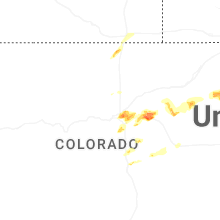
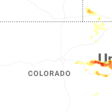
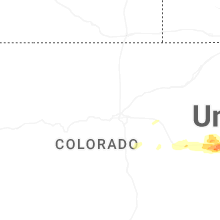
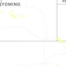
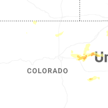
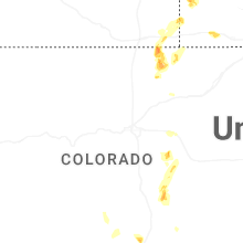

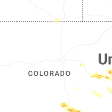
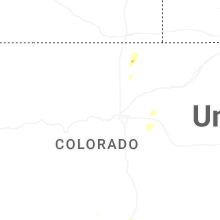


Connect with Interactive Hail Maps