

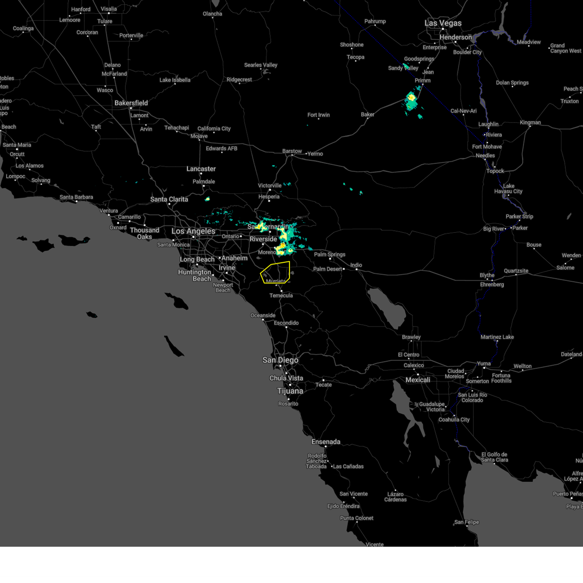
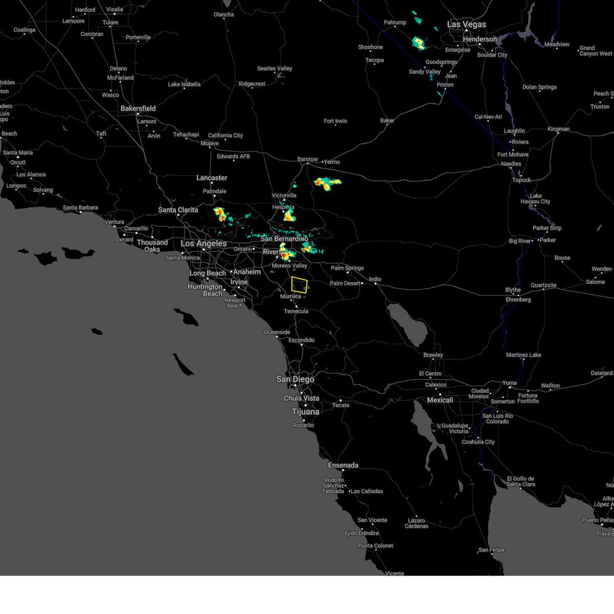
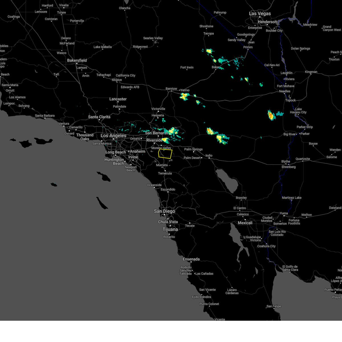
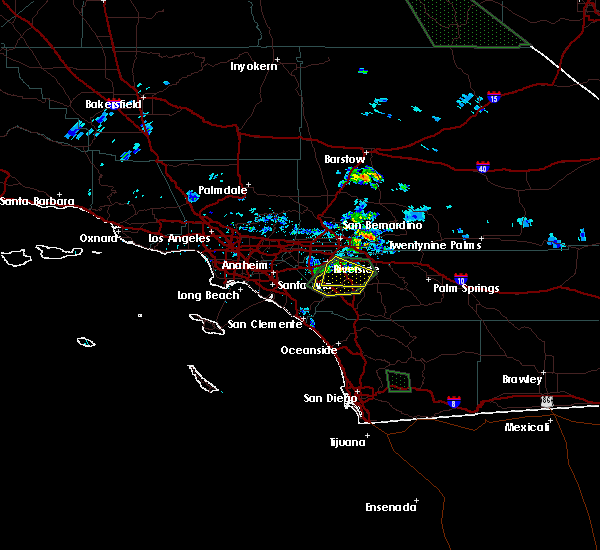
Hail Map for Perris, CA
The Perris, CA area has had 1 report of on-the-ground hail by trained spotters, and has been under severe weather warnings 4 times during the past 12 months. Doppler radar has detected hail at or near Perris, CA on 7 occasions.
| Name: | Perris, CA |
| Where Located: | 52.2 miles WSW of Yucca Valley, CA |
| Map: | Google Map for Perris, CA |
| Population: | 68386 |
| Housing Units: | 17906 |
| More Info: | Search Google for Perris, CA |
5
The Top Recent Hail Date for Perris, CA is Sunday, September 8, 2024 (3rd out of 7)

Hail and Wind Damage Spotted near Perris, CA
| Date / Time | Report Details |
|---|---|
| 2/18/2026 2:28 AM PST |
 Svrsgx the national weather service in san diego has issued a * severe thunderstorm warning for, san bernardino county in southern california, riverside county in southern california, northwestern san diego county in southwestern california, eastern orange county in southwestern california, * until 330 am pst. * at 226 am pst, a band of severe thunderstorms extended from newport beach to san bernardino and was moving slowly southeast into southern orange county and western riverside county (radar indicated). Hazards include 60 mph wind gusts. expect damage to roofs, siding, and trees Svrsgx the national weather service in san diego has issued a * severe thunderstorm warning for, san bernardino county in southern california, riverside county in southern california, northwestern san diego county in southwestern california, eastern orange county in southwestern california, * until 330 am pst. * at 226 am pst, a band of severe thunderstorms extended from newport beach to san bernardino and was moving slowly southeast into southern orange county and western riverside county (radar indicated). Hazards include 60 mph wind gusts. expect damage to roofs, siding, and trees
|
| 8/25/2025 4:46 PM PDT | Report of a tree down blocking the emerett ln in perris. nearby sce orange avenue station reported a peak wind gust of 41 mph at 420 p in riverside county CA, 3.3 miles SW of Perris, CA |
| 8/25/2025 3:59 PM PDT |
 The storm which prompted the warning has weakened below severe limits, and no longer poses an immediate threat to life or property. therefore, the warning will be allowed to expire. The storm which prompted the warning has weakened below severe limits, and no longer poses an immediate threat to life or property. therefore, the warning will be allowed to expire.
|
| 8/25/2025 3:17 PM PDT |
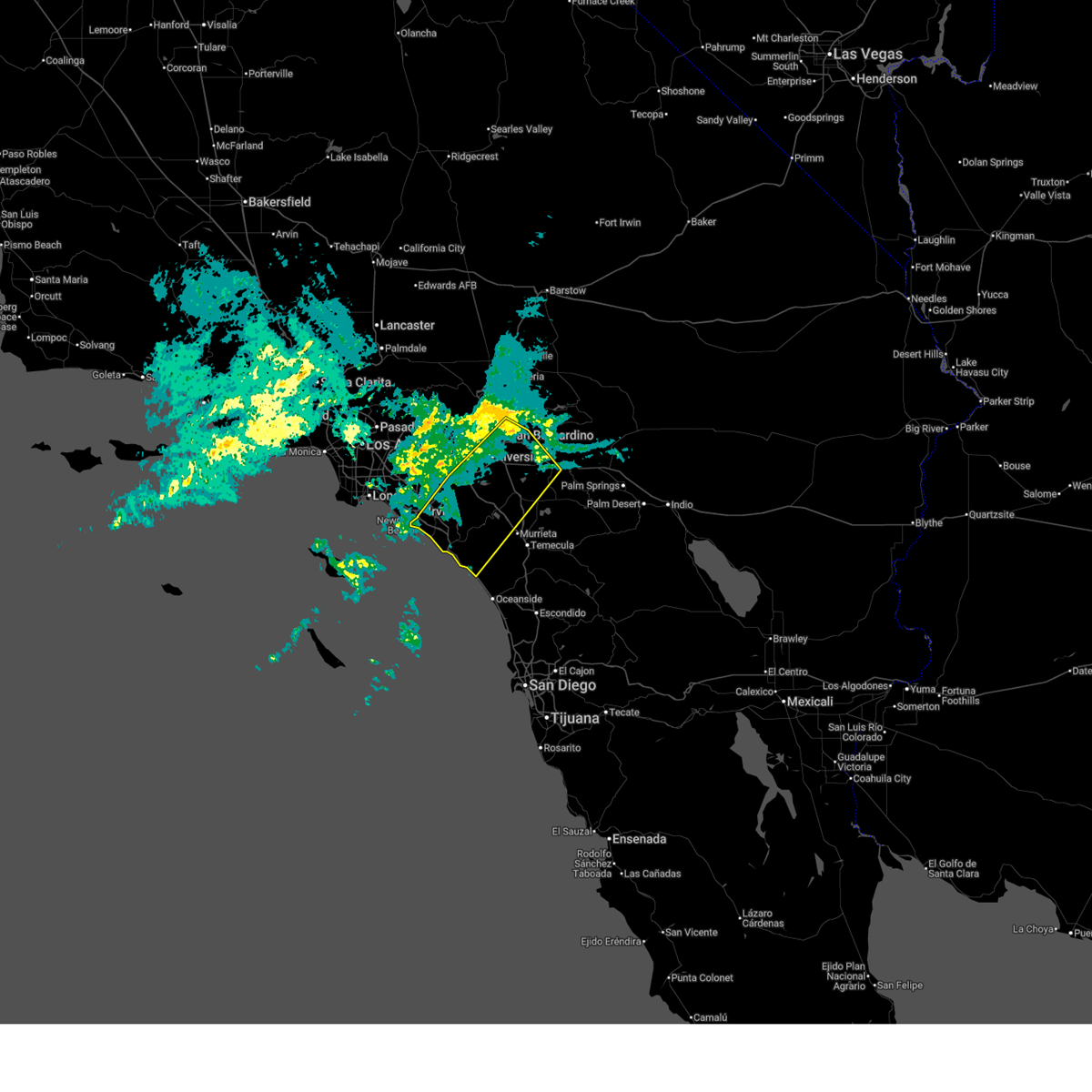
 At 316 pm pdt, a severe thunderstorm was located over menifee, or 8 miles east of lake elsinore, moving south at 35 mph (radar indicated). Hazards include 70 mph wind gusts and quarter size hail. a site near perris reported a 76 mph wind gust. Hail damage to vehicles is expected. expect considerable tree damage. wind damage is also likely to mobile homes, roofs, and outbuildings. Locations impacted include, moreno valley, hemet, perris, san jacinto, western beaumont, march afb, sun city, menifee, calimesa, lakeview, romoland, juniper springs, lake perris recreation area, nuevo, and homeland. At 316 pm pdt, a severe thunderstorm was located over menifee, or 8 miles east of lake elsinore, moving south at 35 mph (radar indicated). Hazards include 70 mph wind gusts and quarter size hail. a site near perris reported a 76 mph wind gust. Hail damage to vehicles is expected. expect considerable tree damage. wind damage is also likely to mobile homes, roofs, and outbuildings. Locations impacted include, moreno valley, hemet, perris, san jacinto, western beaumont, march afb, sun city, menifee, calimesa, lakeview, romoland, juniper springs, lake perris recreation area, nuevo, and homeland.
|
| 8/25/2025 3:06 PM PDT |
 Svrsgx the national weather service in san diego has issued a * severe thunderstorm warning for, riverside county in southern california, * until 400 pm pdt. * at 306 pm pdt, a severe thunderstorm was located near sun city, or 8 miles northwest of hemet, mostly stationary (radar indicated). Hazards include 60 mph wind gusts and quarter size hail. Hail damage to vehicles is expected. Expect wind damage to roofs, siding, and trees. Svrsgx the national weather service in san diego has issued a * severe thunderstorm warning for, riverside county in southern california, * until 400 pm pdt. * at 306 pm pdt, a severe thunderstorm was located near sun city, or 8 miles northwest of hemet, mostly stationary (radar indicated). Hazards include 60 mph wind gusts and quarter size hail. Hail damage to vehicles is expected. Expect wind damage to roofs, siding, and trees.
|
| 9/8/2024 5:24 PM PDT |
 At 523 pm pdt, a severe thunderstorm was located near menifee, or 8 miles north of temecula, moving south at 5 mph (radar indicated). Hazards include 60 mph wind gusts and quarter size hail. Hail damage to vehicles is expected. expect wind damage to roofs, siding, and trees. Locations impacted include, lake elsinore, murrieta, perris, menifee, sun city, wildomar, canyon lake, homeland, romoland, quail valley, sedco hills, lakeland village, and winchester. At 523 pm pdt, a severe thunderstorm was located near menifee, or 8 miles north of temecula, moving south at 5 mph (radar indicated). Hazards include 60 mph wind gusts and quarter size hail. Hail damage to vehicles is expected. expect wind damage to roofs, siding, and trees. Locations impacted include, lake elsinore, murrieta, perris, menifee, sun city, wildomar, canyon lake, homeland, romoland, quail valley, sedco hills, lakeland village, and winchester.
|
| 9/8/2024 4:50 PM PDT |
 Svrsgx the national weather service in san diego has issued a * severe thunderstorm warning for, riverside county in southern california, * until 545 pm pdt. * at 450 pm pdt, a severe thunderstorm was located over menifee, or 7 miles east of lake elsinore, moving south at 5 mph (radar indicated). Hazards include 60 mph wind gusts and quarter size hail. Hail damage to vehicles is expected. Expect wind damage to roofs, siding, and trees. Svrsgx the national weather service in san diego has issued a * severe thunderstorm warning for, riverside county in southern california, * until 545 pm pdt. * at 450 pm pdt, a severe thunderstorm was located over menifee, or 7 miles east of lake elsinore, moving south at 5 mph (radar indicated). Hazards include 60 mph wind gusts and quarter size hail. Hail damage to vehicles is expected. Expect wind damage to roofs, siding, and trees.
|
| 9/8/2024 4:42 PM PDT | Chp reports numerous trees down in peri in riverside county CA, 0.6 miles SW of Perris, CA |
| 9/8/2024 4:32 PM PDT |
 At 432 pm pdt, a severe thunderstorm was located over perris, or 8 miles northeast of lake elsinore, and is nearly stationary (public reported quarter sized hail south of perris). Hazards include 60 mph wind gusts and quarter size hail. Hail damage to vehicles is expected. expect wind damage to roofs, siding, and trees. Locations impacted include, moreno valley, perris, sun city, march afb, menifee, homeland, lakeview, nuevo, romoland, lake perris recreation area, winchester, and quail valley. At 432 pm pdt, a severe thunderstorm was located over perris, or 8 miles northeast of lake elsinore, and is nearly stationary (public reported quarter sized hail south of perris). Hazards include 60 mph wind gusts and quarter size hail. Hail damage to vehicles is expected. expect wind damage to roofs, siding, and trees. Locations impacted include, moreno valley, perris, sun city, march afb, menifee, homeland, lakeview, nuevo, romoland, lake perris recreation area, winchester, and quail valley.
|
| 9/8/2024 4:28 PM PDT | Quarter sized hail reported 2.7 miles NW of Perris, CA, public reported quarter sized hail south of peris. |
| 9/8/2024 4:22 PM PDT |
 Svrsgx the national weather service in san diego has issued a * severe thunderstorm warning for, riverside county in southern california, * until 515 pm pdt. * at 422 pm pdt, a severe thunderstorm was located over perris, or 8 miles northeast of lake elsinore, and is nearly stationary (radar indicated). Hazards include 60 mph wind gusts and quarter size hail. Hail damage to vehicles is expected. Expect wind damage to roofs, siding, and trees. Svrsgx the national weather service in san diego has issued a * severe thunderstorm warning for, riverside county in southern california, * until 515 pm pdt. * at 422 pm pdt, a severe thunderstorm was located over perris, or 8 miles northeast of lake elsinore, and is nearly stationary (radar indicated). Hazards include 60 mph wind gusts and quarter size hail. Hail damage to vehicles is expected. Expect wind damage to roofs, siding, and trees.
|
| 9/8/2024 2:42 PM PDT |
 the severe thunderstorm warning has been cancelled and is no longer in effect the severe thunderstorm warning has been cancelled and is no longer in effect
|
| 9/8/2024 2:30 PM PDT |
 At 230 pm pdt, a severe thunderstorm was located over menifee, or 8 miles west of hemet, moving northwest at 10 mph (radar indicated). Hazards include 60 mph wind gusts and quarter size hail. Hail damage to vehicles is expected. expect wind damage to roofs, siding, and trees. Locations impacted include, hemet, perris, menifee, sun city, homeland, romoland, and winchester. At 230 pm pdt, a severe thunderstorm was located over menifee, or 8 miles west of hemet, moving northwest at 10 mph (radar indicated). Hazards include 60 mph wind gusts and quarter size hail. Hail damage to vehicles is expected. expect wind damage to roofs, siding, and trees. Locations impacted include, hemet, perris, menifee, sun city, homeland, romoland, and winchester.
|
| 9/8/2024 2:24 PM PDT |
 Svrsgx the national weather service in san diego has issued a * severe thunderstorm warning for, riverside county in southern california, * until 315 pm pdt. * at 224 pm pdt, a severe thunderstorm was located over menifee, or 8 miles west of hemet, moving northwest at 10 mph (radar indicated). Hazards include 60 mph wind gusts and quarter size hail. Hail damage to vehicles is expected. Expect wind damage to roofs, siding, and trees. Svrsgx the national weather service in san diego has issued a * severe thunderstorm warning for, riverside county in southern california, * until 315 pm pdt. * at 224 pm pdt, a severe thunderstorm was located over menifee, or 8 miles west of hemet, moving northwest at 10 mph (radar indicated). Hazards include 60 mph wind gusts and quarter size hail. Hail damage to vehicles is expected. Expect wind damage to roofs, siding, and trees.
|
| 9/7/2024 3:48 PM PDT |
 At 348 pm pdt, a severe thunderstorm was located near perris, or 8 miles south of moreno valley, moving east at 10 mph (radar indicated). Hazards include 60 mph wind gusts and half dollar size hail. Hail damage to vehicles is expected. expect wind damage to roofs, siding, and trees. Locations impacted include, moreno valley, hemet, perris, san jacinto, sun city, march afb, menifee, homeland, lakeview, romoland, lake perris recreation area, nuevo, and winchester. At 348 pm pdt, a severe thunderstorm was located near perris, or 8 miles south of moreno valley, moving east at 10 mph (radar indicated). Hazards include 60 mph wind gusts and half dollar size hail. Hail damage to vehicles is expected. expect wind damage to roofs, siding, and trees. Locations impacted include, moreno valley, hemet, perris, san jacinto, sun city, march afb, menifee, homeland, lakeview, romoland, lake perris recreation area, nuevo, and winchester.
|
| 9/7/2024 3:40 PM PDT |
 Svrsgx the national weather service in san diego has issued a * severe thunderstorm warning for, riverside county in southern california, * until 415 pm pdt. * at 340 pm pdt, a severe thunderstorm was located over perris, or 8 miles south of moreno valley, moving east at 10 mph (radar indicated). Hazards include 60 mph wind gusts and quarter size hail. Hail damage to vehicles is expected. Expect wind damage to roofs, siding, and trees. Svrsgx the national weather service in san diego has issued a * severe thunderstorm warning for, riverside county in southern california, * until 415 pm pdt. * at 340 pm pdt, a severe thunderstorm was located over perris, or 8 miles south of moreno valley, moving east at 10 mph (radar indicated). Hazards include 60 mph wind gusts and quarter size hail. Hail damage to vehicles is expected. Expect wind damage to roofs, siding, and trees.
|
| 8/16/2018 3:21 PM PDT |
 At 317 pm pdt, a severe thunderstorm was located between lake elsinore and nuevo and moving southwest at about 10 mph. strong winds and blowing dust has been reported in nuevo (radar indicated). Hazards include 60 mph wind gusts. Expect damage to roofs, siding, and trees. Locations impacted include, moreno valley, lake elsinore, hemet, hwy 243 between banning and idyllwild, murrieta, perris, san jacinto, southeastern beaumont, menifee, sun city, temescal valley, lake mathews, wildomar, canyon lake, homeland, lake perris recreation area, lakeland village, saboba indian reservation, nuevo and lakeview. At 317 pm pdt, a severe thunderstorm was located between lake elsinore and nuevo and moving southwest at about 10 mph. strong winds and blowing dust has been reported in nuevo (radar indicated). Hazards include 60 mph wind gusts. Expect damage to roofs, siding, and trees. Locations impacted include, moreno valley, lake elsinore, hemet, hwy 243 between banning and idyllwild, murrieta, perris, san jacinto, southeastern beaumont, menifee, sun city, temescal valley, lake mathews, wildomar, canyon lake, homeland, lake perris recreation area, lakeland village, saboba indian reservation, nuevo and lakeview.
|
| 8/16/2018 2:34 PM PDT |
 At 231 pm pdt, a severe thunderstorm was located about 5 miles southwest of beaumont and moving southwest at about 15 mph (radar indicated). Hazards include 60 mph wind gusts. expect damage to roofs, siding, and trees At 231 pm pdt, a severe thunderstorm was located about 5 miles southwest of beaumont and moving southwest at about 15 mph (radar indicated). Hazards include 60 mph wind gusts. expect damage to roofs, siding, and trees
|
| 9/2/2017 5:29 PM PDT |
 At 528 pm pdt, a severe thunderstorm was located near temescal valley, or near lake elsinore, moving west at 15 mph (radar indicated). Hazards include 60 mph wind gusts and penny size hail. expect damage to roofs, siding, and trees At 528 pm pdt, a severe thunderstorm was located near temescal valley, or near lake elsinore, moving west at 15 mph (radar indicated). Hazards include 60 mph wind gusts and penny size hail. expect damage to roofs, siding, and trees
|
| 8/1/2017 5:55 PM PDT | Chp report of a tree down along ramona expy... report time uncertai in riverside county CA, 3.8 miles S of Perris, CA |
| 8/1/2017 4:40 PM PDT |
 The severe thunderstorm warning for riverside county will expire at 445 pm pdt, the severe thunderstorm which prompted the warning has weakened. therefore, the warning will be allowed to expire. The severe thunderstorm warning for riverside county will expire at 445 pm pdt, the severe thunderstorm which prompted the warning has weakened. therefore, the warning will be allowed to expire.
|
| 8/1/2017 4:23 PM PDT | Power lines down via ch in riverside county CA, 5.3 miles SE of Perris, CA |
| 8/1/2017 4:00 PM PDT |
 At 359 pm pdt, a severe thunderstorm was located near woodcrest, or 9 miles southeast of riverside, and is nearly stationary (radar indicated). Hazards include 60 mph wind gusts and penny size hail. expect damage to roofs, siding, and trees At 359 pm pdt, a severe thunderstorm was located near woodcrest, or 9 miles southeast of riverside, and is nearly stationary (radar indicated). Hazards include 60 mph wind gusts and penny size hail. expect damage to roofs, siding, and trees
|
| 8/1/2017 3:57 PM PDT |
 At 355 pm pdt, a severe thunderstorm was located over temescal valley, moving northwest at 5 mph (radar indicated). Hazards include 60 mph wind gusts and nickel size hail. expect damage to roofs, siding, powerlines and trees At 355 pm pdt, a severe thunderstorm was located over temescal valley, moving northwest at 5 mph (radar indicated). Hazards include 60 mph wind gusts and nickel size hail. expect damage to roofs, siding, powerlines and trees
|
| 8/1/2017 3:37 PM PDT | Tree and power lines across stree in riverside county CA, 3.5 miles ENE of Perris, CA |
| 8/1/2017 3:33 PM PDT |
 At 331 pm pdt, a severe thunderstorm was between perris and lake elsinore, and is nearly stationary (radar indicated). Hazards include 60 mph wind gusts and nickel size hail. Expect damage to roofs, siding, powerlines and trees. Locations impacted include, riverside, moreno valley, western lake elsinore, perris, san jacinto, march airforce base, woodcrest, lake mathews, sun city, temescal valley, menifee and homeland. At 331 pm pdt, a severe thunderstorm was between perris and lake elsinore, and is nearly stationary (radar indicated). Hazards include 60 mph wind gusts and nickel size hail. Expect damage to roofs, siding, powerlines and trees. Locations impacted include, riverside, moreno valley, western lake elsinore, perris, san jacinto, march airforce base, woodcrest, lake mathews, sun city, temescal valley, menifee and homeland.
|
| 8/1/2017 3:29 PM PDT | Tree down blocking entire roa in riverside county CA, 5.7 miles SE of Perris, CA |
| 8/1/2017 3:23 PM PDT |
 At 322 pm pdt, a severe thunderstorm was located over northwestern lake elsinore, and is nearly stationary (radar indicated). Hazards include 60 mph wind gusts and nickel size hail. expect damage to roofs, siding, and trees At 322 pm pdt, a severe thunderstorm was located over northwestern lake elsinore, and is nearly stationary (radar indicated). Hazards include 60 mph wind gusts and nickel size hail. expect damage to roofs, siding, and trees
|
| 8/1/2017 3:01 PM PDT |
 At 259 pm pdt, a severe thunderstorm was located over perris, nuevo, and lakeview and is nearly stationary (radar indicated). Hazards include 60 mph wind gusts and nickel size hail. expect damage to roofs, siding,power lines and trees At 259 pm pdt, a severe thunderstorm was located over perris, nuevo, and lakeview and is nearly stationary (radar indicated). Hazards include 60 mph wind gusts and nickel size hail. expect damage to roofs, siding,power lines and trees
|
| 3/7/2016 7:58 AM PST |
 The national weather service in san diego has issued a * severe thunderstorm warning for. eastern orange county in southwestern california. san bernardino county in southern california. riverside county in southern california. Northwestern san diego county in southwestern california. The national weather service in san diego has issued a * severe thunderstorm warning for. eastern orange county in southwestern california. san bernardino county in southern california. riverside county in southern california. Northwestern san diego county in southwestern california.
|
| 3/7/2016 7:43 AM PST |
 At 740 am pst, doppler radar indicated a line of severe thunderstorms capable of producing damaging wind gusts of 45 to 60 mph over eastern orange county. this line of storms was located near canyon lake, moving east at 30 mph. the storms will progress eastward over the next hour, impacting the inland empire and northwest san diego county. locations impacted include but are not limited to, riverside, san bernardino, oceanside, ontario, irvine, moreno valley, corona, rialto, tustin, chino, redlands. At 740 am pst, doppler radar indicated a line of severe thunderstorms capable of producing damaging wind gusts of 45 to 60 mph over eastern orange county. this line of storms was located near canyon lake, moving east at 30 mph. the storms will progress eastward over the next hour, impacting the inland empire and northwest san diego county. locations impacted include but are not limited to, riverside, san bernardino, oceanside, ontario, irvine, moreno valley, corona, rialto, tustin, chino, redlands.
|
| 3/7/2016 7:10 AM PST |
 At 706 am pst, doppler radar indicated a line of severe thunderstorms capable of producing damaging wind gusts of 45 to 60 mph moving through central orange county. this line of storms was located near el toro, moving east at 35 mph. the stroms will progress eastward over the next hour, impacting the inland empire and northwest san diego county. locations impacted include, santa ana, anaheim, riverside, huntington beach, san bernardino, oceanside, ontario, irvine, fontana, orange, rancho cucamonga, corona, costa mesa, mission viejo, rialto. At 706 am pst, doppler radar indicated a line of severe thunderstorms capable of producing damaging wind gusts of 45 to 60 mph moving through central orange county. this line of storms was located near el toro, moving east at 35 mph. the stroms will progress eastward over the next hour, impacting the inland empire and northwest san diego county. locations impacted include, santa ana, anaheim, riverside, huntington beach, san bernardino, oceanside, ontario, irvine, fontana, orange, rancho cucamonga, corona, costa mesa, mission viejo, rialto.
|
| 3/7/2016 6:36 AM PST |
 At 635 am pst, doppler radar indicated a line of severe thunderstorms capable of producing damaging wind gusts of 45 to 60 mph approaching the orange county coast. the leading edge of the storms was located 5 miles southwest of seal beach, and moving east at 35 mph. At 635 am pst, doppler radar indicated a line of severe thunderstorms capable of producing damaging wind gusts of 45 to 60 mph approaching the orange county coast. the leading edge of the storms was located 5 miles southwest of seal beach, and moving east at 35 mph.
|
| 1/6/2016 1:12 PM PST |
 At 106 pm pst, doppler radar indicated a severe thunderstorm capable of producing damaging winds in excess of 60 mph. this storm was located near corona, moving northeast at 20 mph. locations impacted include, santa ana, anaheim, riverside, garden grove, ontario, irvine, moreno valley, fontana, orange, corona, mission viejo, rialto, tustin, chino, el toro, yorba linda, colton, placentia, perris and laguna hills. At 106 pm pst, doppler radar indicated a severe thunderstorm capable of producing damaging winds in excess of 60 mph. this storm was located near corona, moving northeast at 20 mph. locations impacted include, santa ana, anaheim, riverside, garden grove, ontario, irvine, moreno valley, fontana, orange, corona, mission viejo, rialto, tustin, chino, el toro, yorba linda, colton, placentia, perris and laguna hills.
|
| 1/6/2016 12:46 PM PST |
 At 1244 pm pst, doppler radar indicated a severe thunderstorm capable of producing damaging winds in excess of 60 mph. this storm was located over southwestern corona, and moving northeast at 25 mph. a line of storms will be capable of severe wind and heavy rain. cities of tustin and norco are in the path of the severe storm. At 1244 pm pst, doppler radar indicated a severe thunderstorm capable of producing damaging winds in excess of 60 mph. this storm was located over southwestern corona, and moving northeast at 25 mph. a line of storms will be capable of severe wind and heavy rain. cities of tustin and norco are in the path of the severe storm.
|
| 9/9/2015 3:12 PM PDT | The severe thunderstorm warning for san bernardino and riverside counties will expire at 315 pm pdt, the storm which prompted the warning has weakened below severe limits, and no longer poses an immediate threat to life or property. therefore the warning will be allowed to expire. however heavy rain is still possible with a thunderstorm near perris over the next hour. |
| 9/9/2015 2:40 PM PDT |
 At 230 pm pdt, doppler radar indicated a group of severe thunderstorms moving west around 5 mph, capable of producing damaging winds in excess of 60 mph. a wind gust to 49 mph was observed at lake mathews at 216 pm. nickel size hail may also accompany the damaging winds. locations impacted include, ontario, moreno valley, rancho cucamonga, corona, upland, chino, montclair, norco, mira loma, glen avon, pedley, home gardens, woodcrest and march afb. At 230 pm pdt, doppler radar indicated a group of severe thunderstorms moving west around 5 mph, capable of producing damaging winds in excess of 60 mph. a wind gust to 49 mph was observed at lake mathews at 216 pm. nickel size hail may also accompany the damaging winds. locations impacted include, ontario, moreno valley, rancho cucamonga, corona, upland, chino, montclair, norco, mira loma, glen avon, pedley, home gardens, woodcrest and march afb.
|
| 9/9/2015 2:23 PM PDT |
 The severe thunderstorm warning for riverside county will expire at 230 pm pdt, the storms which prompted the warning have moved out of the area. therefore the warning will be allowed to expire. The severe thunderstorm warning for riverside county will expire at 230 pm pdt, the storms which prompted the warning have moved out of the area. therefore the warning will be allowed to expire.
|
| 9/9/2015 2:10 PM PDT |
 At 209 pm pdt, doppler radar indicated a few severe thunderstorms capable of producing quarter size hail and damaging winds in excess of 60 mph. these storms were nearly stationary. flash flooding is also possible near these storms. At 209 pm pdt, doppler radar indicated a few severe thunderstorms capable of producing quarter size hail and damaging winds in excess of 60 mph. these storms were nearly stationary. flash flooding is also possible near these storms.
|
| 9/9/2015 2:03 PM PDT |
 At 154 pm pdt, doppler radar continued to indicate a cluster of severe thunderstorms capable of producing quarter size hail and damaging winds in excess of 60 mph. these storms were along a line from stretching from wildomar to san jacinto. these storms were moving slowly north northwest at 5 to 10 mph. locations impacted include, hemet, sun city, east hemet, valle vista, idyllwild-pine cove and winchester. At 154 pm pdt, doppler radar continued to indicate a cluster of severe thunderstorms capable of producing quarter size hail and damaging winds in excess of 60 mph. these storms were along a line from stretching from wildomar to san jacinto. these storms were moving slowly north northwest at 5 to 10 mph. locations impacted include, hemet, sun city, east hemet, valle vista, idyllwild-pine cove and winchester.
|
| 9/9/2015 1:30 PM PDT |
 At 128 pm pdt, doppler radar indicated a cluster of severe thunderstorms capable of producing quarter size hail and damaging winds in excess of 60 mph. these storms were located 15 miles east of temecula and were moving north northwest at 5 mph. At 128 pm pdt, doppler radar indicated a cluster of severe thunderstorms capable of producing quarter size hail and damaging winds in excess of 60 mph. these storms were located 15 miles east of temecula and were moving north northwest at 5 mph.
|
| 9/8/2015 5:26 PM PDT |
 The severe thunderstorm warning for riverside county will expire at 530 pm pdt, the storms which prompted the warning has weakened below severe limits, and no longer pose an immediate threat to life or property. therefore the warning will be allowed to expire. however small hail is still possible with these thunderstorms. The severe thunderstorm warning for riverside county will expire at 530 pm pdt, the storms which prompted the warning has weakened below severe limits, and no longer pose an immediate threat to life or property. therefore the warning will be allowed to expire. however small hail is still possible with these thunderstorms.
|
| 9/8/2015 5:13 PM PDT |
 At 504 pm pdt, doppler radar continued to indicate a cluster of severe thunderstorms capable of producing quarter size hail and damaging winds in excess of 60 mph. these storms were located along a line from sun city to beaumont and were nearly stationary. at 455 pm pdt, a nws spotter near san jacinto had reported dime sized hail. at 500 pm pdt, a member from the public reported quarter sized hail near beaumont. locations impacted include, hemet, perris, san jacinto, sun city, east hemet, wildomar, valle vista, canyon lake, nuevo, homeland, idyllwild-pine cove, sedco hills, romoland, winchester, quail valley and lakeview. At 504 pm pdt, doppler radar continued to indicate a cluster of severe thunderstorms capable of producing quarter size hail and damaging winds in excess of 60 mph. these storms were located along a line from sun city to beaumont and were nearly stationary. at 455 pm pdt, a nws spotter near san jacinto had reported dime sized hail. at 500 pm pdt, a member from the public reported quarter sized hail near beaumont. locations impacted include, hemet, perris, san jacinto, sun city, east hemet, wildomar, valle vista, canyon lake, nuevo, homeland, idyllwild-pine cove, sedco hills, romoland, winchester, quail valley and lakeview.
|
| 9/8/2015 4:35 PM PDT |
 At 433 pm pdt, doppler radar indicated a cluster of severe thunderstorms capable of producing quarter size hail and damaging winds in excess of 60 mph. these storms were located from sun city to idyllwild. At 433 pm pdt, doppler radar indicated a cluster of severe thunderstorms capable of producing quarter size hail and damaging winds in excess of 60 mph. these storms were located from sun city to idyllwild.
|
| 7/19/2015 2:55 PM PDT |
 The severe thunderstorm warning for riverside county will expire at 300 pm pdt, the storm which prompted the warning has weakened below severe limits, and no longer pose an immediate threat to life or property. therefore the warning will be allowed to expire. to report severe weather, contact your nearest law enforcement agency. they will relay your report to the national weather service san diego. The severe thunderstorm warning for riverside county will expire at 300 pm pdt, the storm which prompted the warning has weakened below severe limits, and no longer pose an immediate threat to life or property. therefore the warning will be allowed to expire. to report severe weather, contact your nearest law enforcement agency. they will relay your report to the national weather service san diego.
|
| 7/19/2015 2:15 PM PDT |
 At 206 pm pdt, doppler radar continued to indicate a severe thunderstorm capable of producing damaging winds in excess of 60 mph. this storm was located over perris and was moving northwest at 10 to 15 mph. locations impacted include, hemet, perris, lake elsinore, san jacinto, sun city, wildomar, canyon lake, woodcrest, lakeland village, nuevo, homeland, sedco hills, romoland, winchester, quail valley and lakeview. At 206 pm pdt, doppler radar continued to indicate a severe thunderstorm capable of producing damaging winds in excess of 60 mph. this storm was located over perris and was moving northwest at 10 to 15 mph. locations impacted include, hemet, perris, lake elsinore, san jacinto, sun city, wildomar, canyon lake, woodcrest, lakeland village, nuevo, homeland, sedco hills, romoland, winchester, quail valley and lakeview.
|
| 7/19/2015 1:55 PM PDT |
 At 154 pm pdt, doppler radar indicated a severe thunderstorm capable of producing damaging winds in excess of 60 mph. this storm was located 5 miles east of sun city, and moving west northwest at 10 mph. At 154 pm pdt, doppler radar indicated a severe thunderstorm capable of producing damaging winds in excess of 60 mph. this storm was located 5 miles east of sun city, and moving west northwest at 10 mph.
|
| 8/12/2012 4:30 PM PDT | Time estimated...west side of perris on olive street and california highway 74... small and large tree limbs down. on ellis street just north of ca route 74...two power in riverside county CA, 0.6 miles SW of Perris, CA |
| 1/1/0001 12:00 AM | Power lines down at south d and east 7th streets in perris due to win in riverside county CA, 0.6 miles SW of Perris, CA |
| 1/1/0001 12:00 AM | Power lines down at ethanac road and evans road west of romoland around 300 pm due to win in riverside county CA, 3.7 miles NW of Perris, CA |
Hail Maps for Perris, CA


Connect with Interactive Hail Maps