

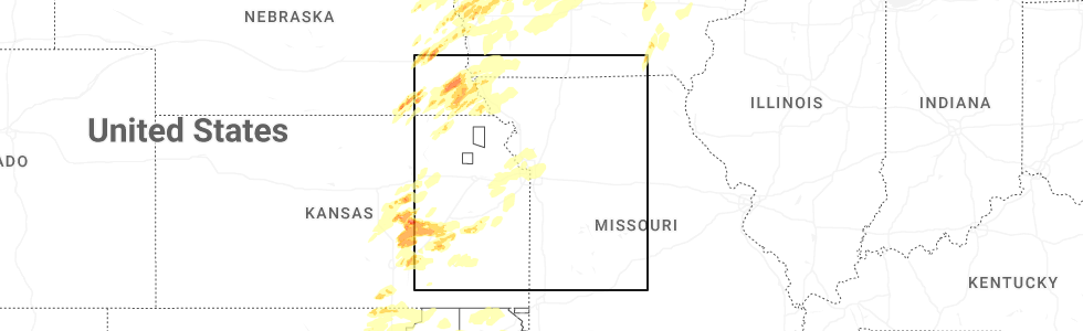
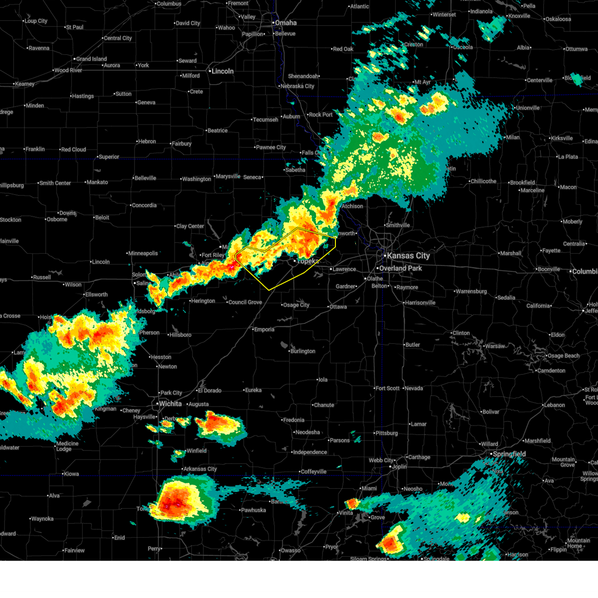
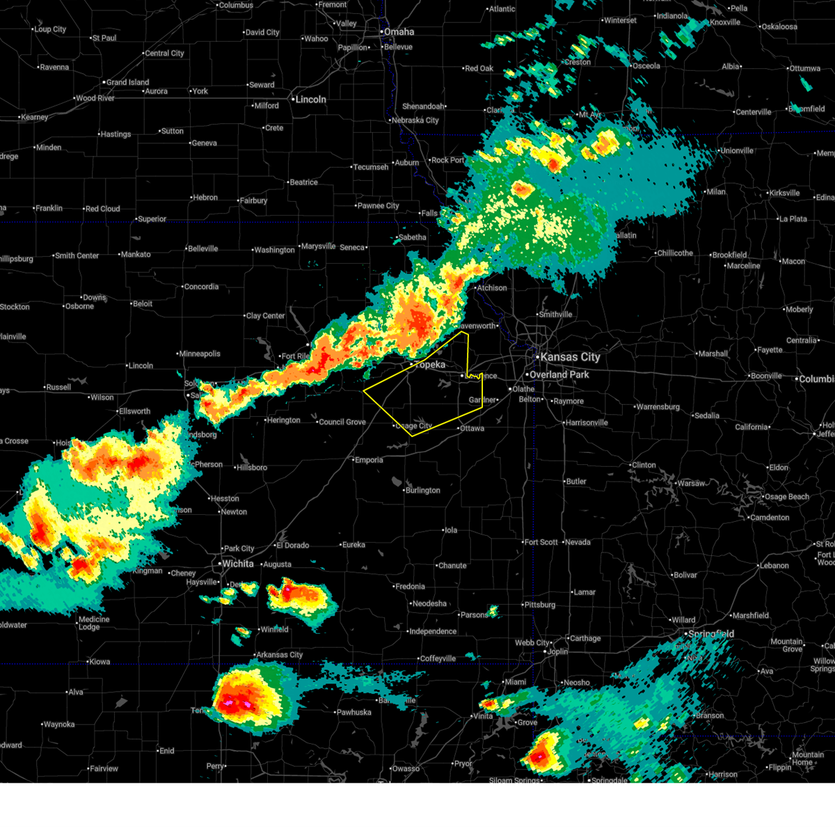
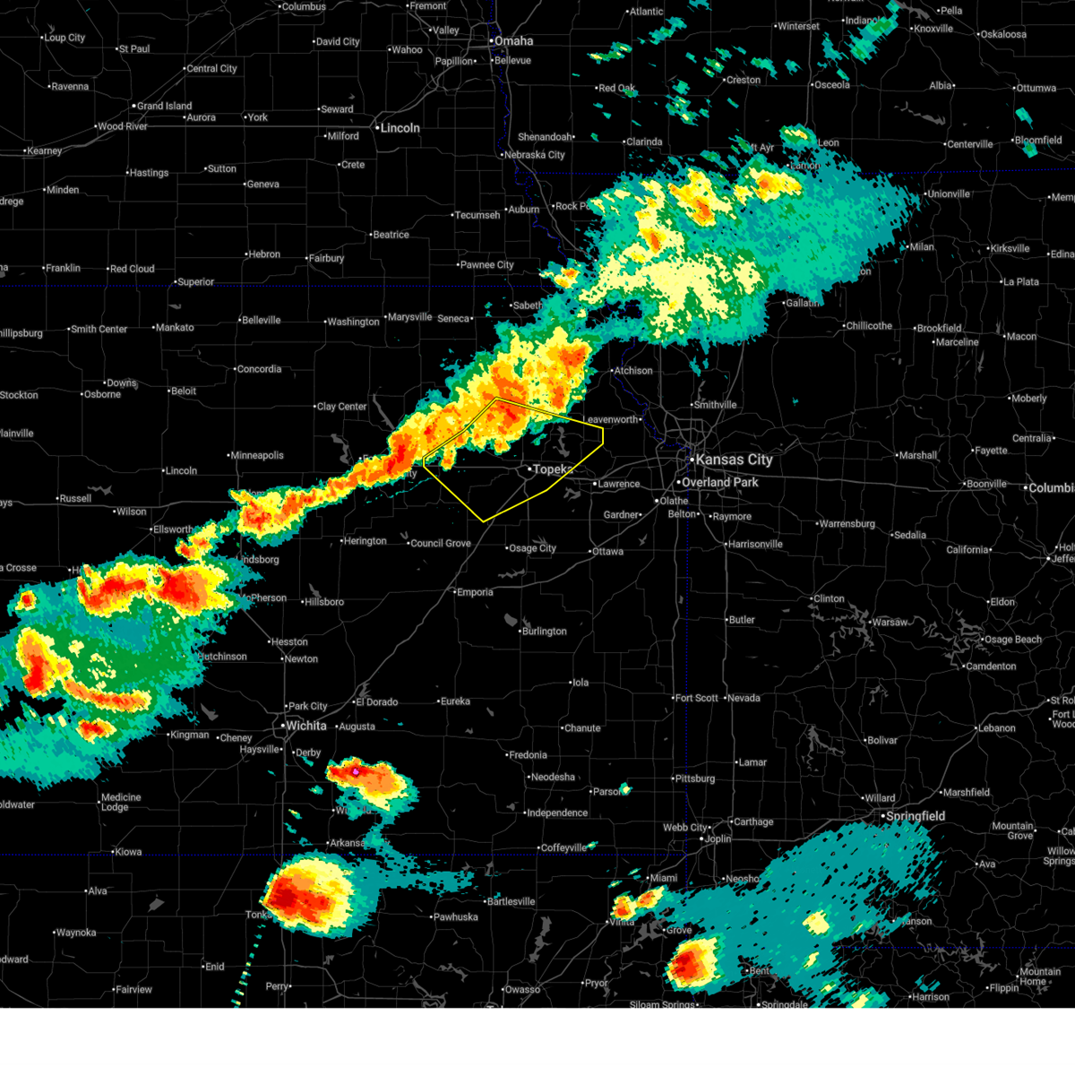
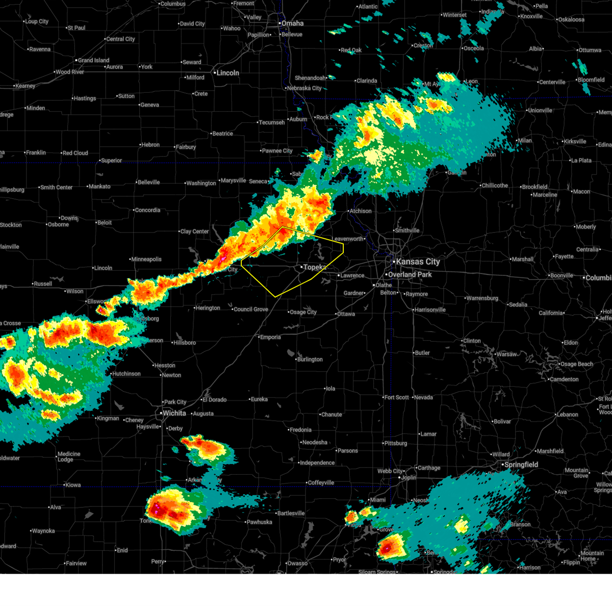
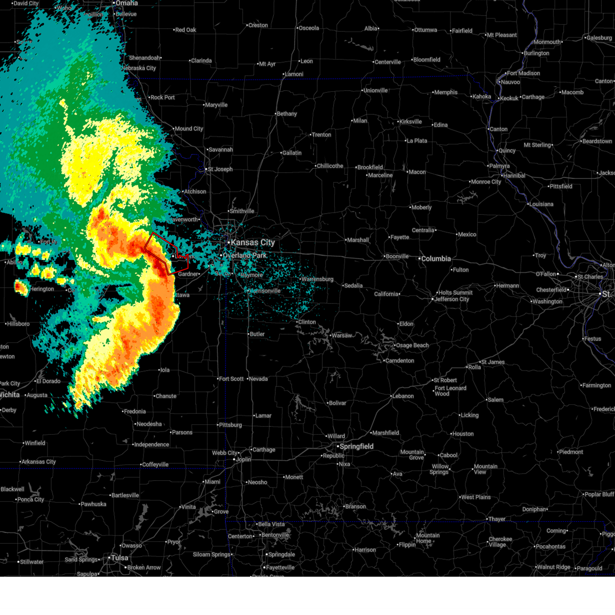
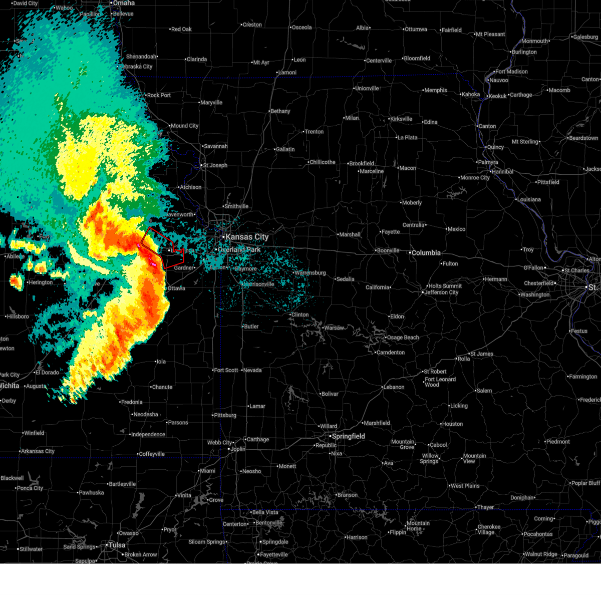
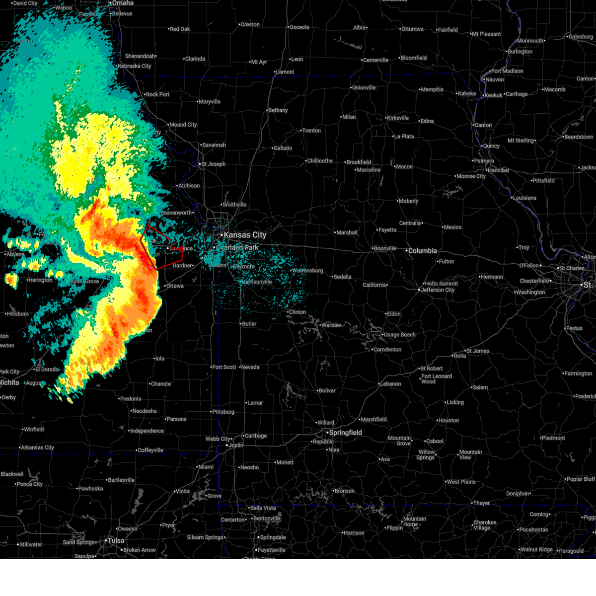
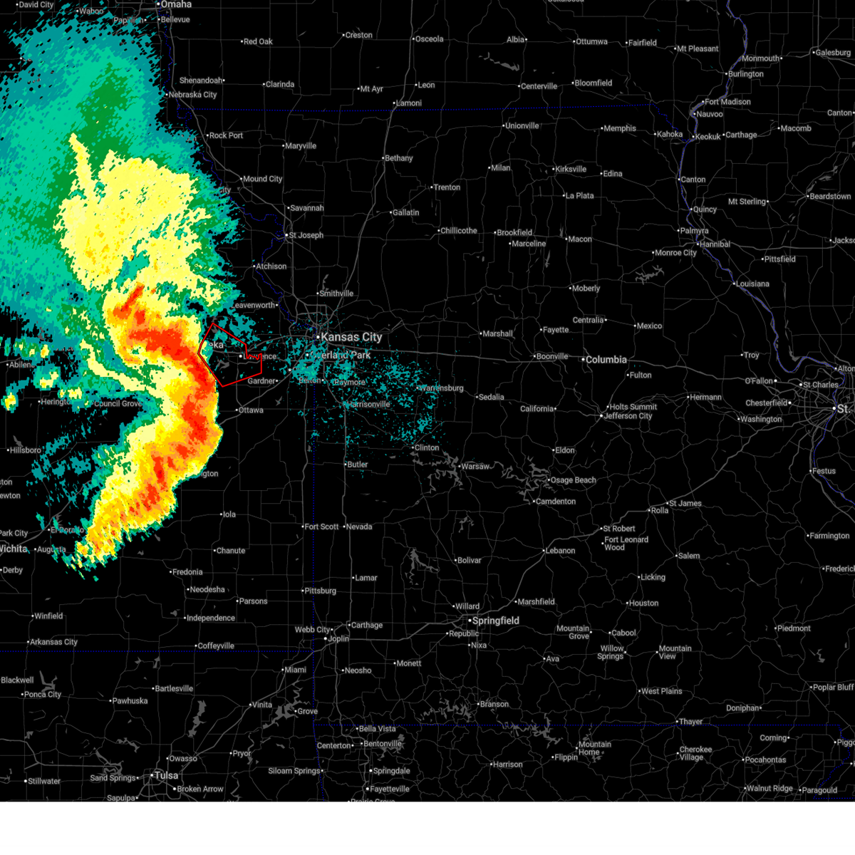
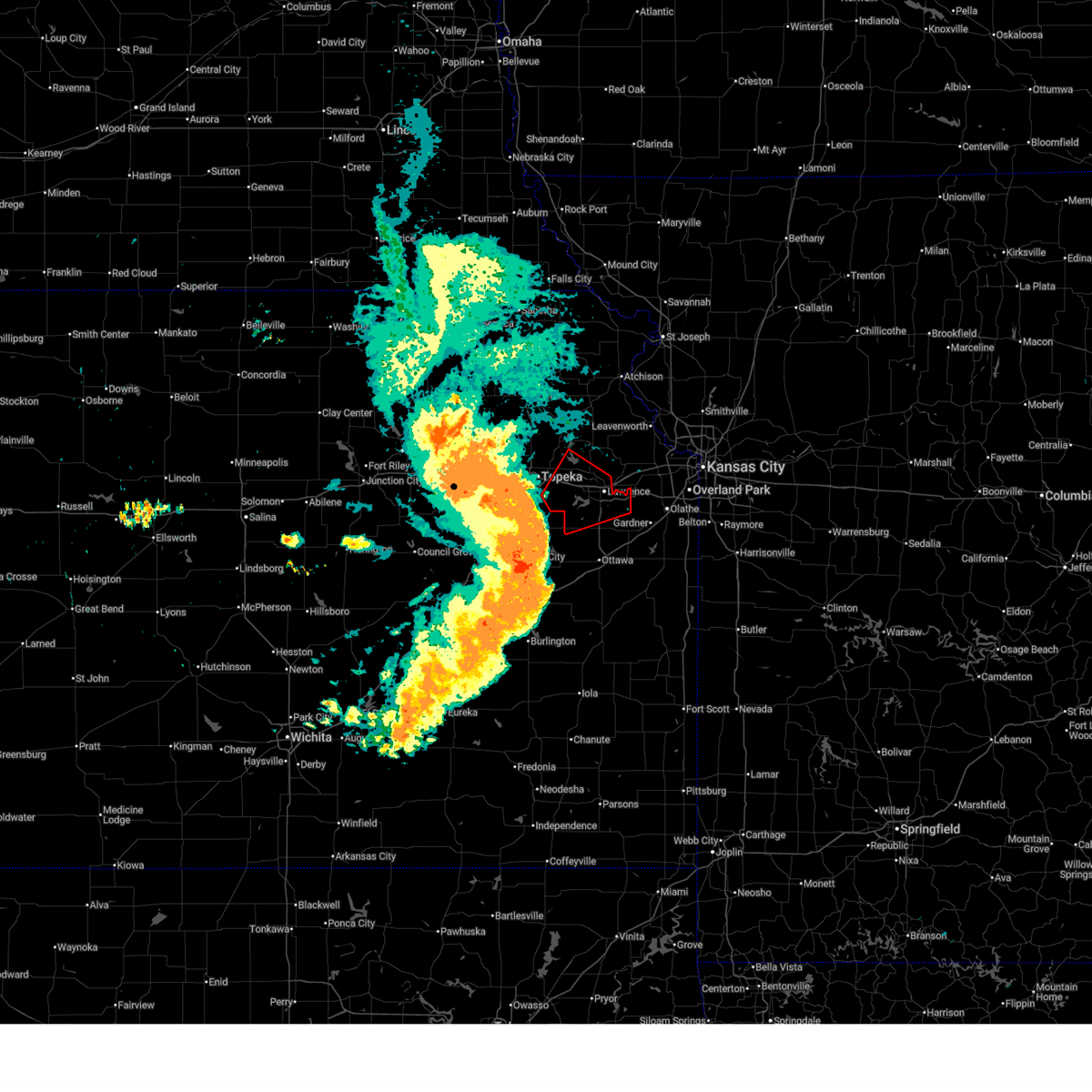
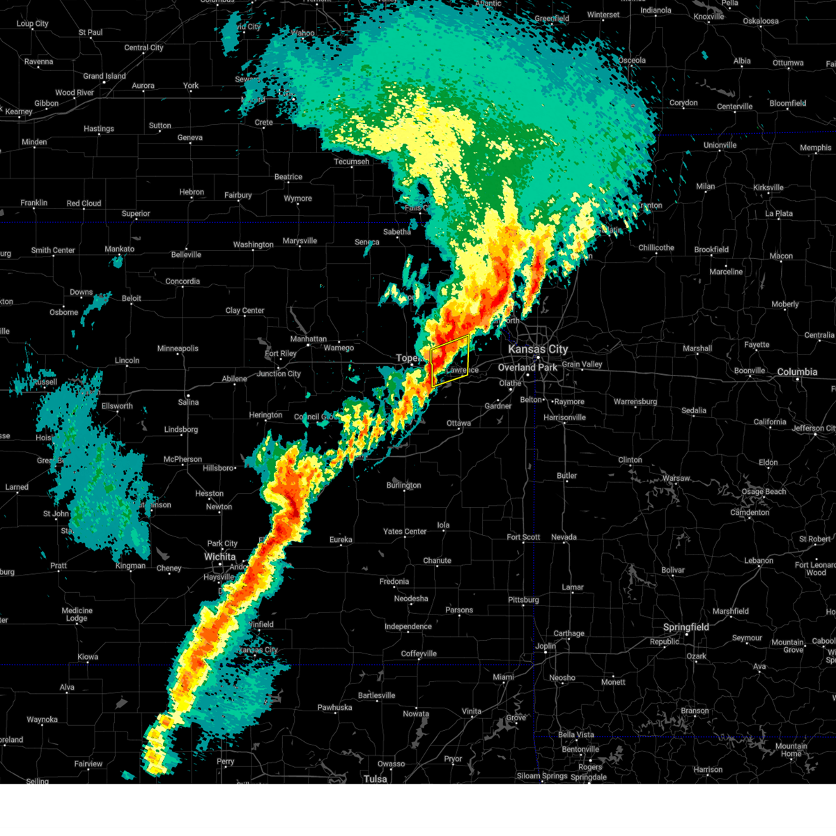
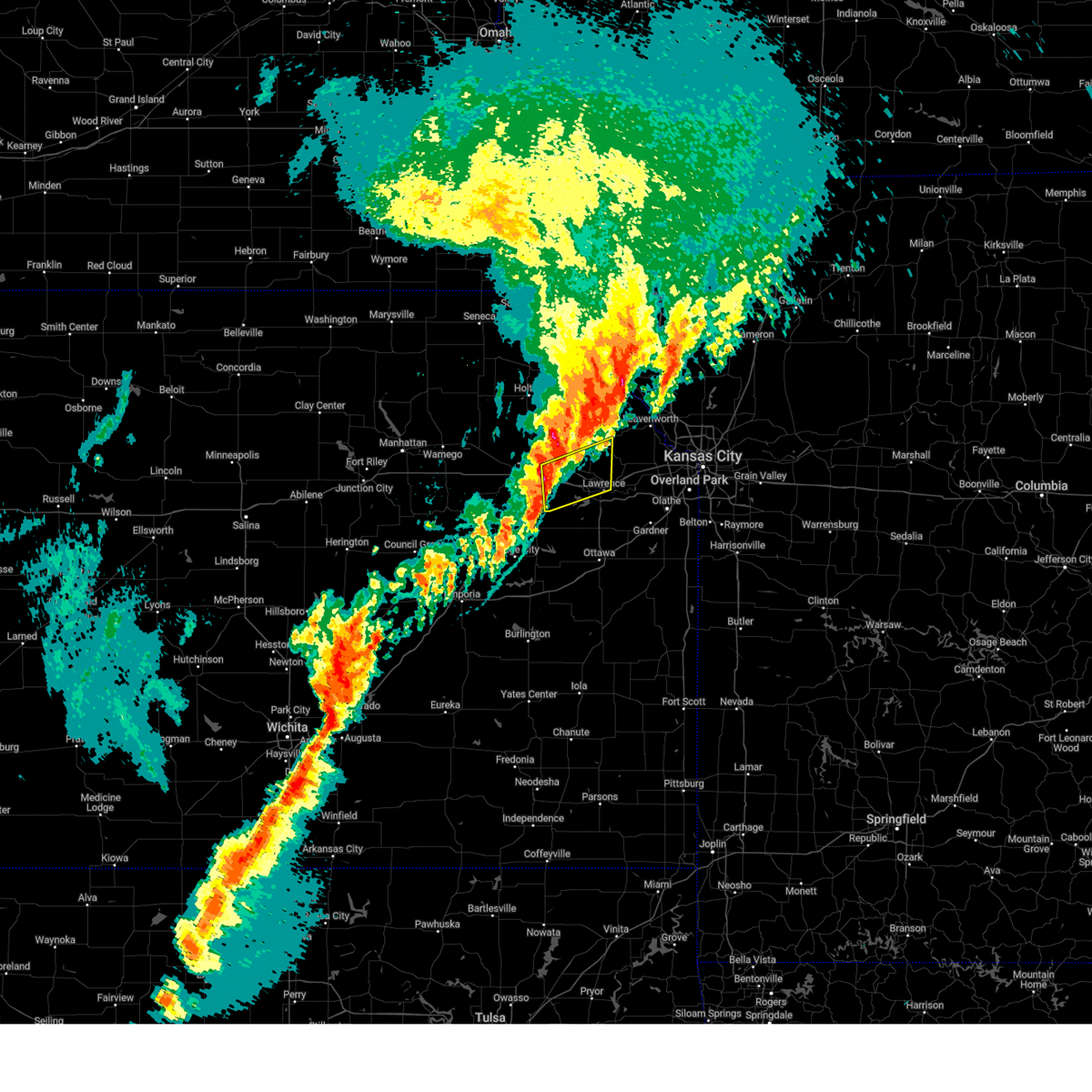
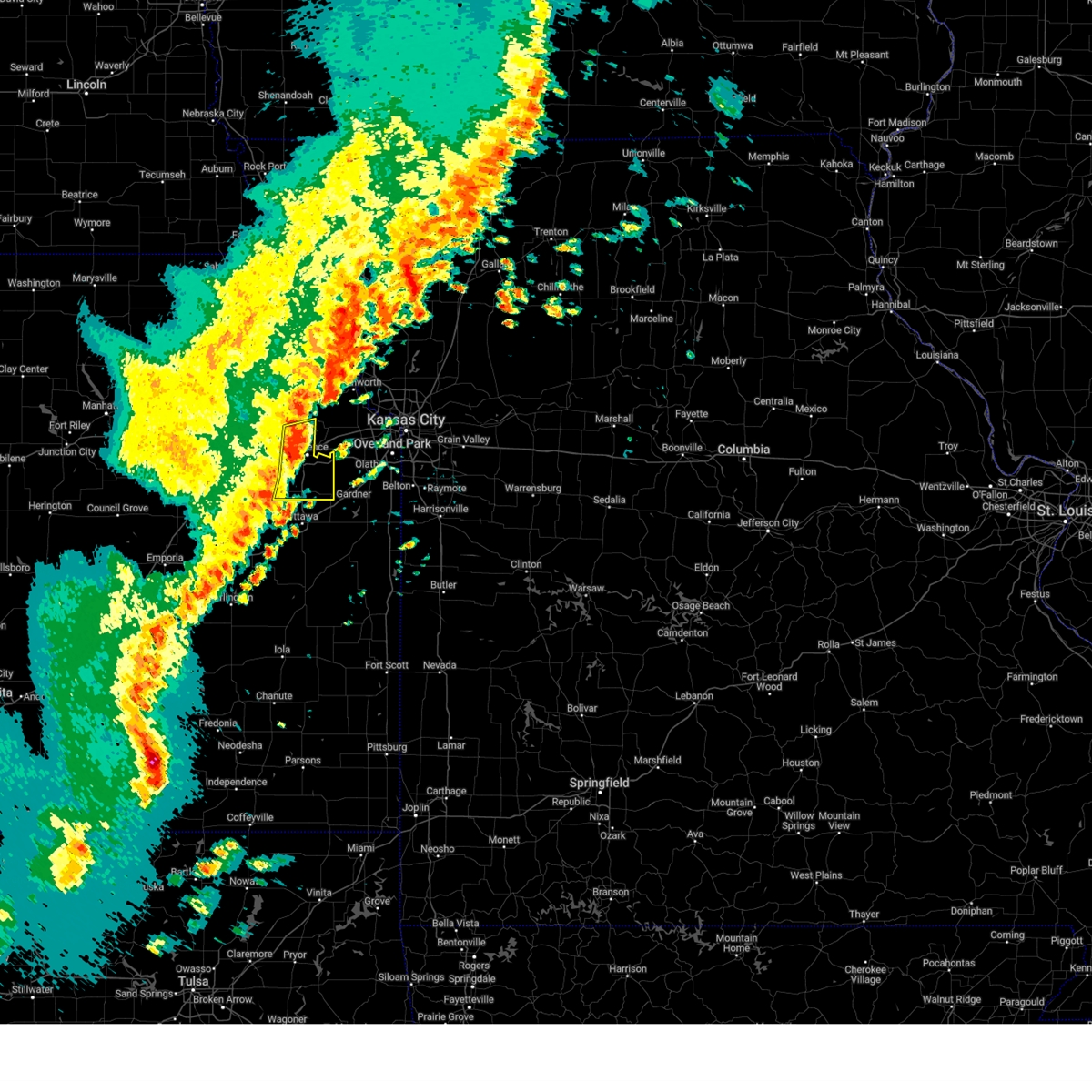
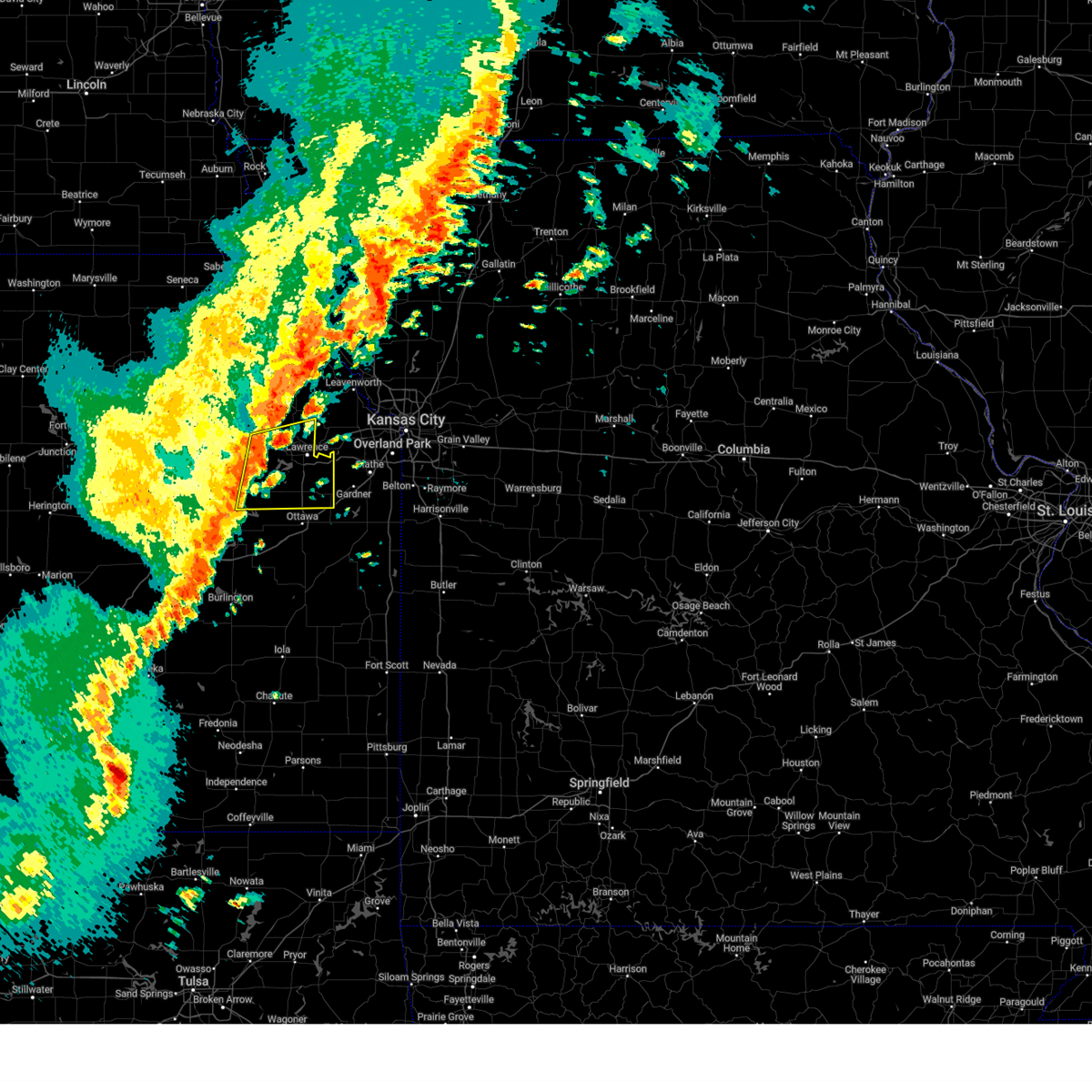
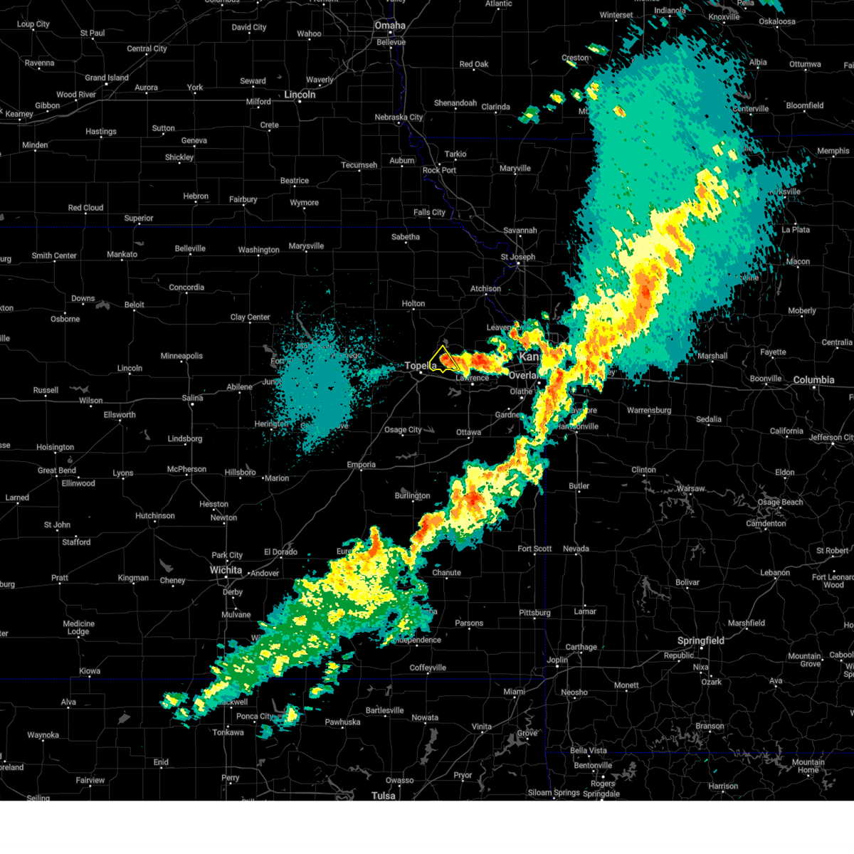
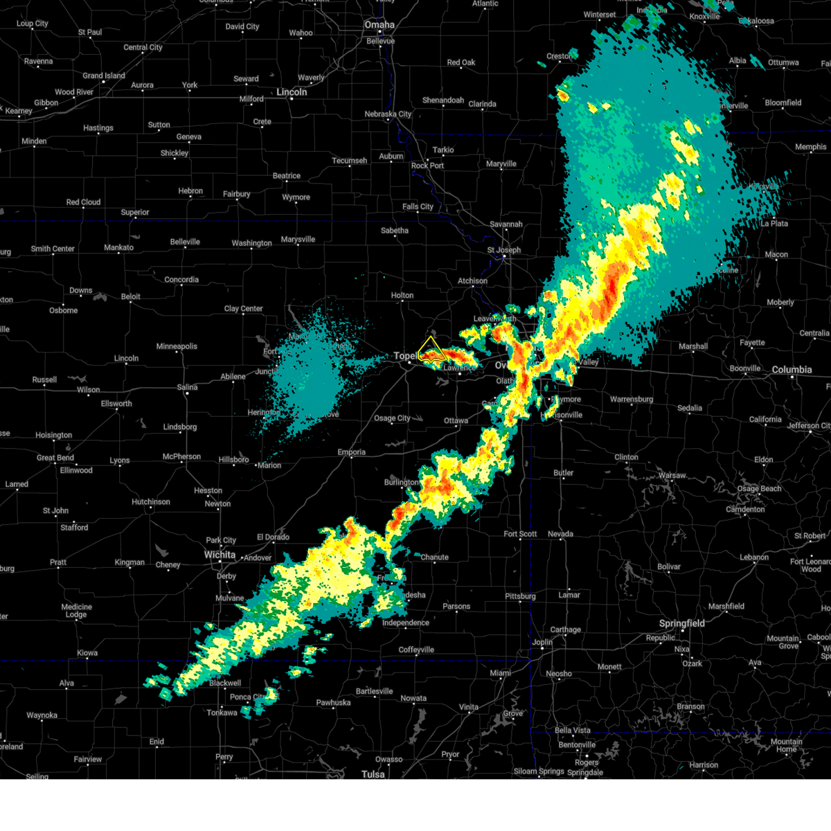
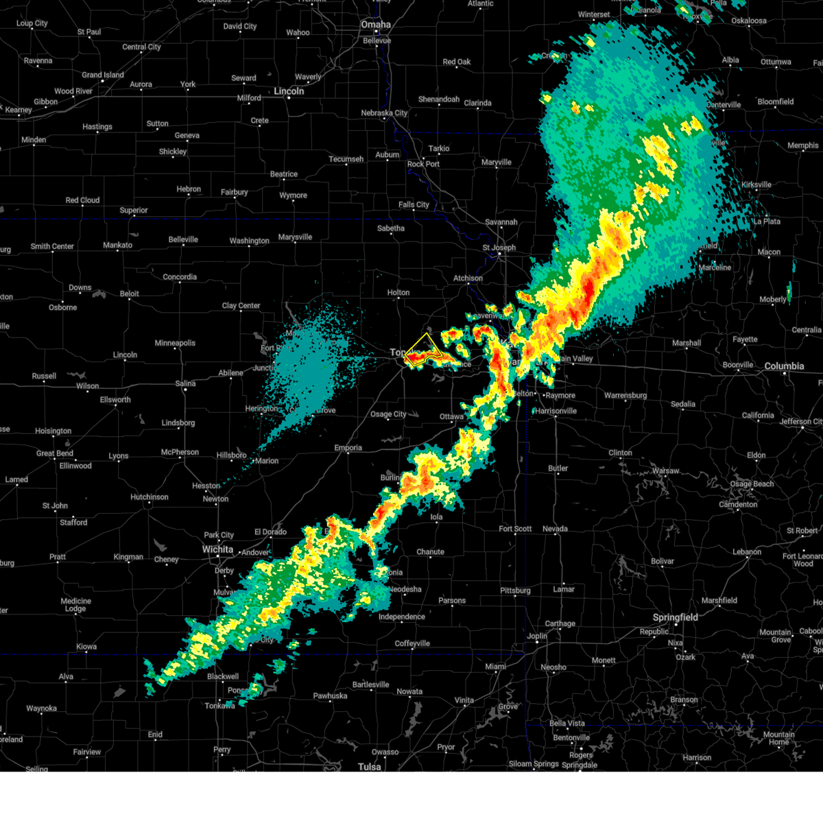
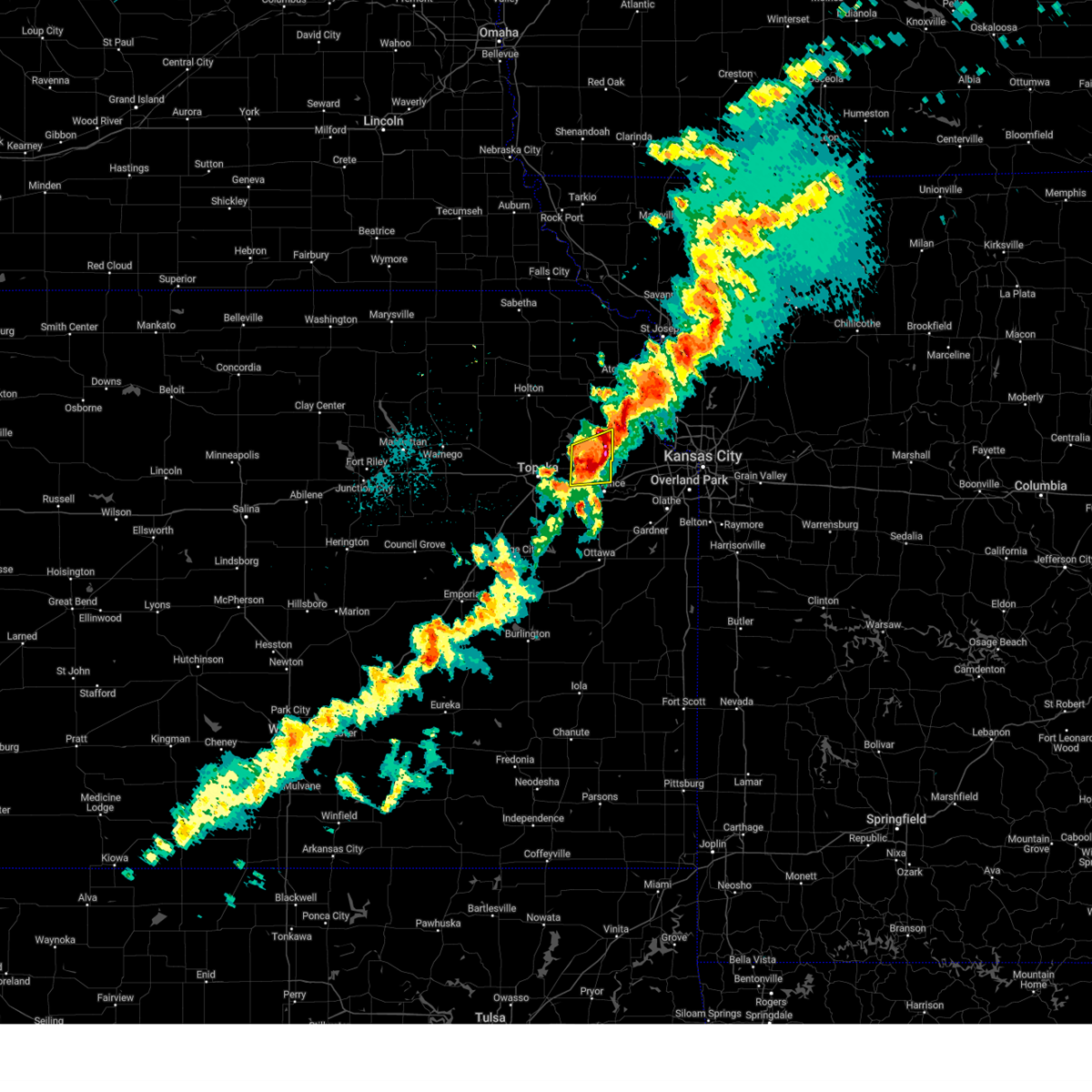
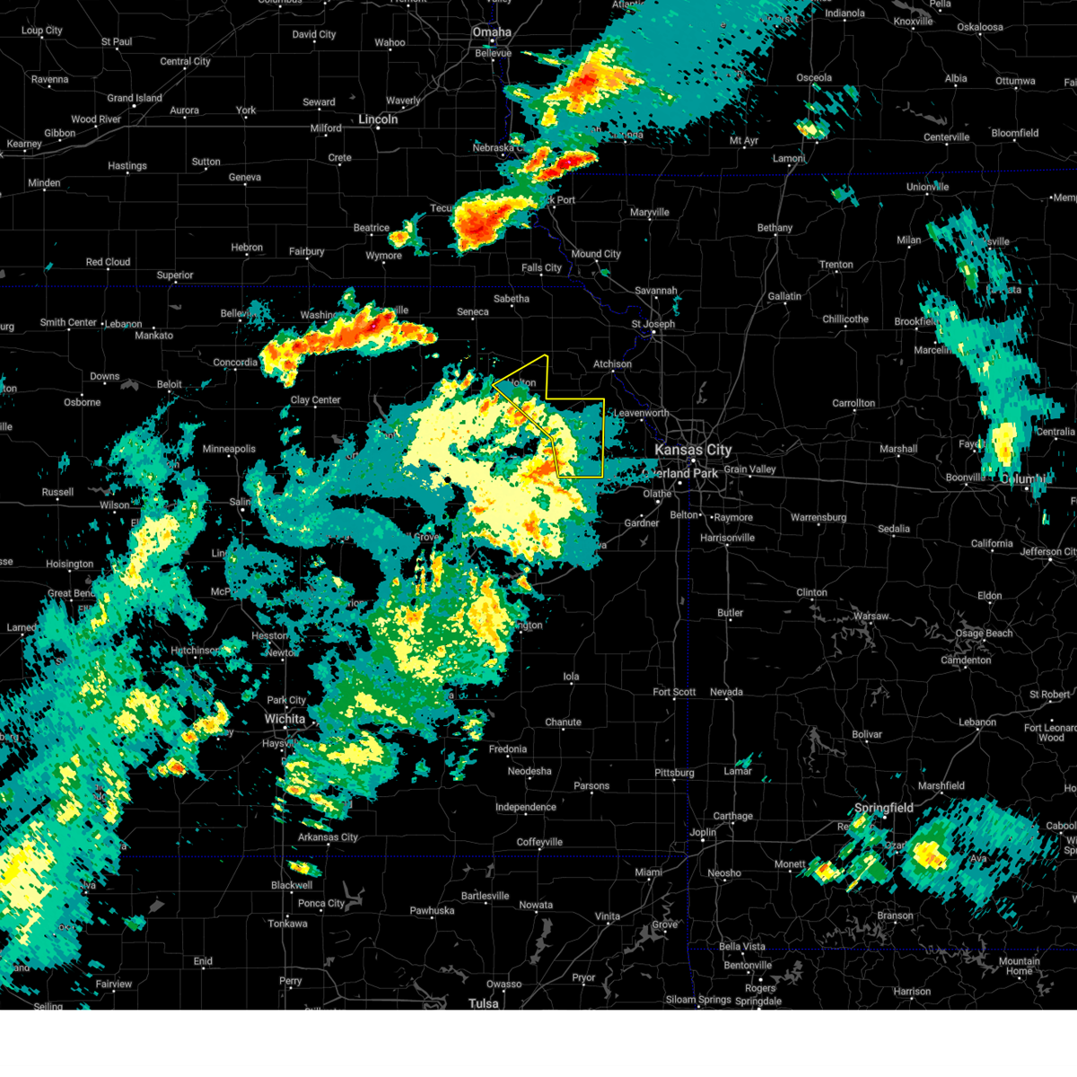
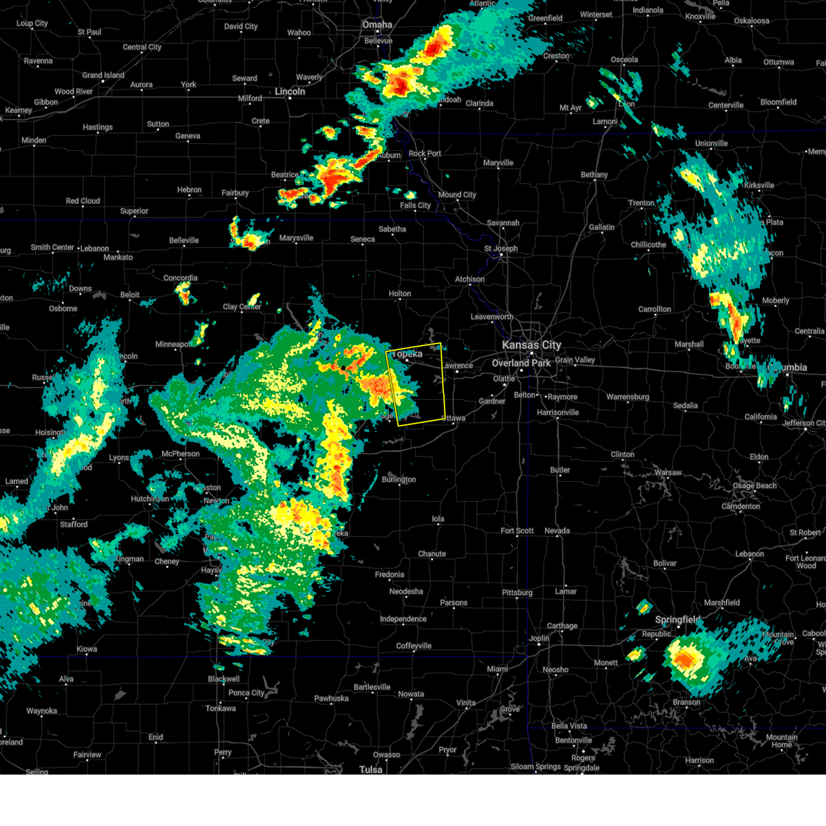
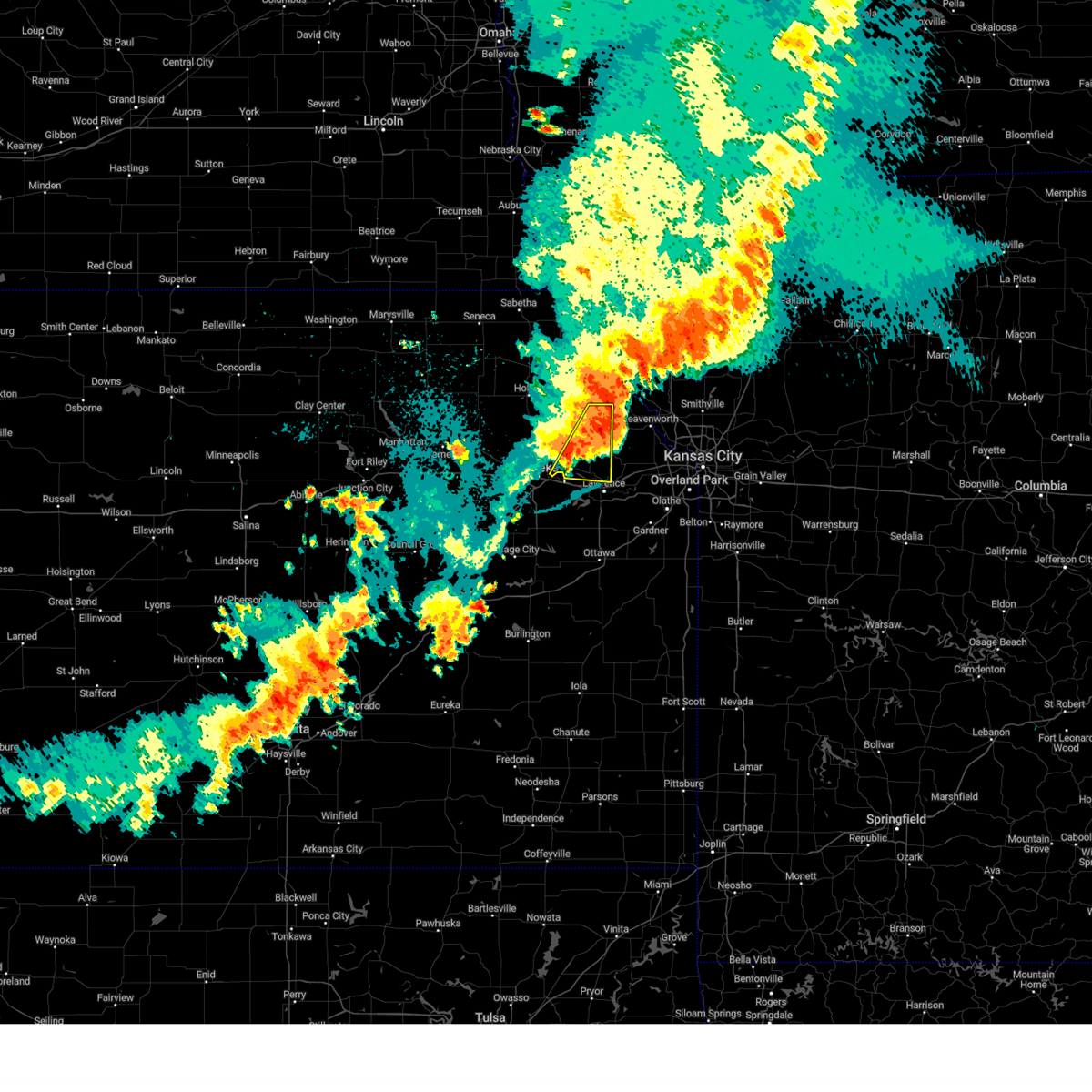
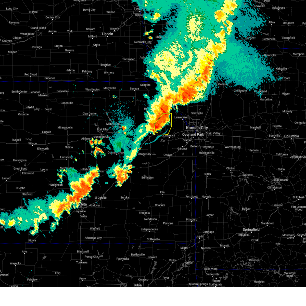
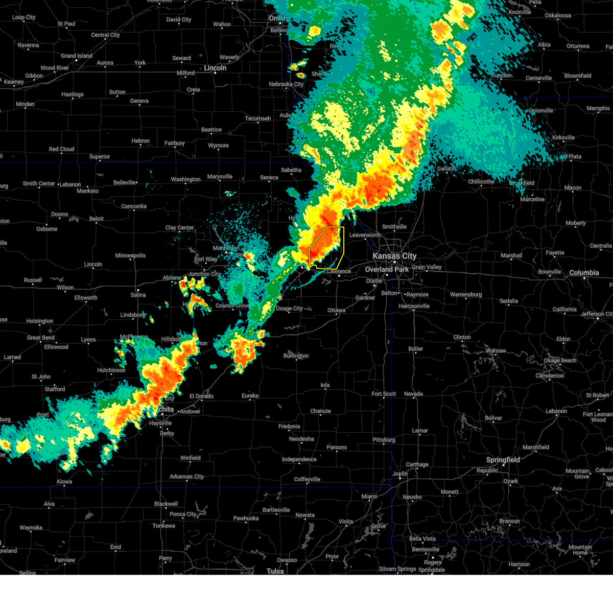
Hail Map for Perry, KS
The Perry, KS area has had 7 reports of on-the-ground hail by trained spotters, and has been under severe weather warnings 42 times during the past 12 months. Doppler radar has detected hail at or near Perry, KS on 61 occasions, including 2 occasions during the past year.
| Name: | Perry, KS |
| Where Located: | 43.5 miles W of Kansas City, MO |
| Map: | Google Map for Perry, KS |
| Population: | 929 |
| Housing Units: | 392 |
| More Info: | Search Google for Perry, KS |
0
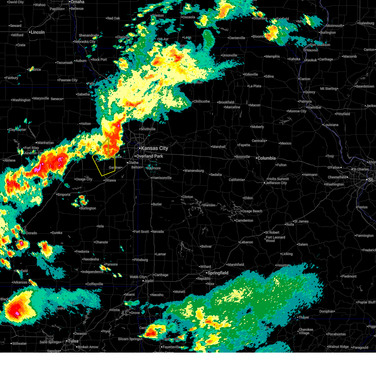
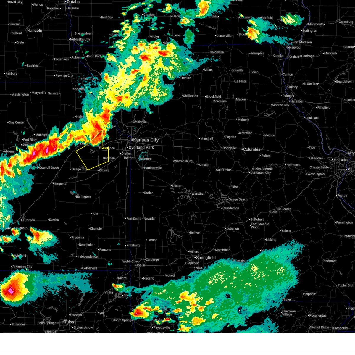
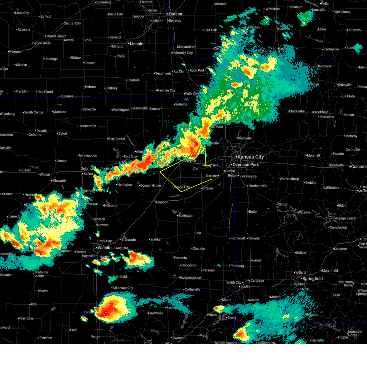
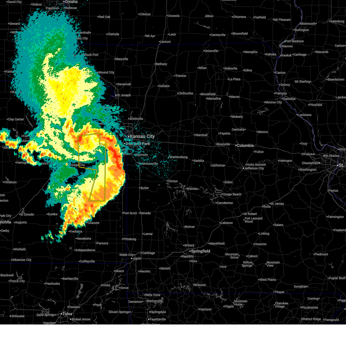
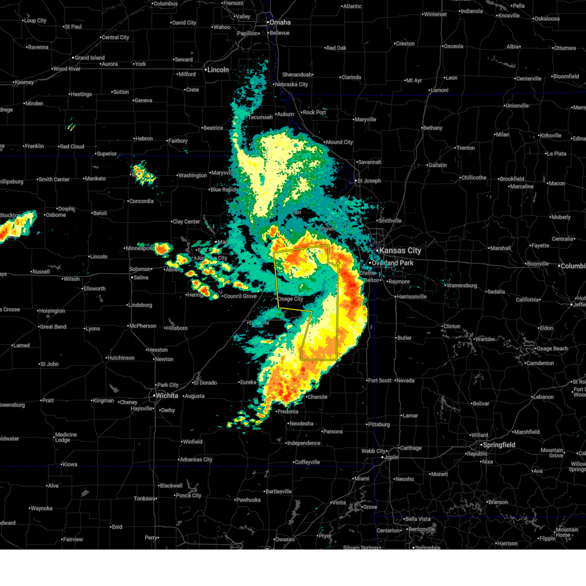
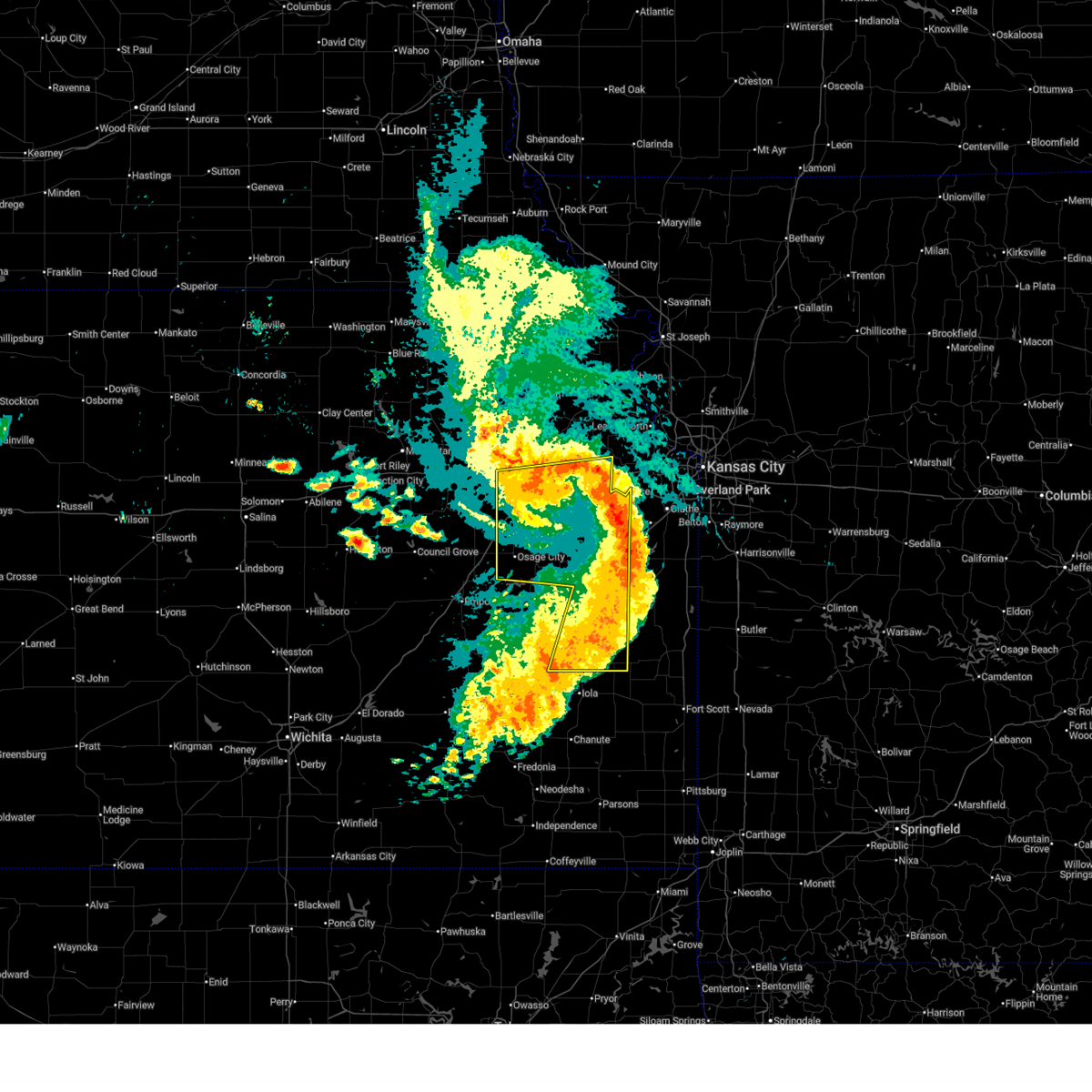
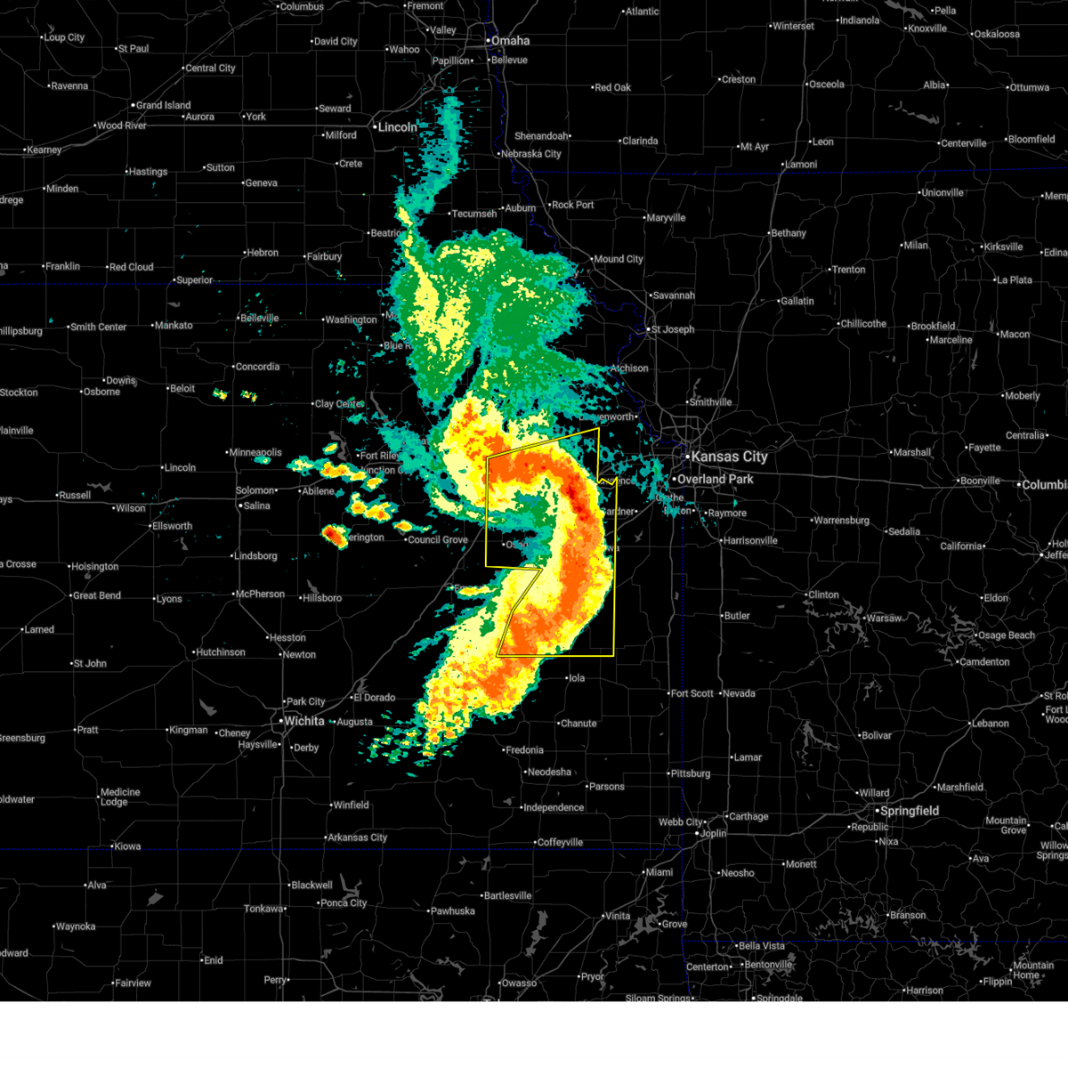
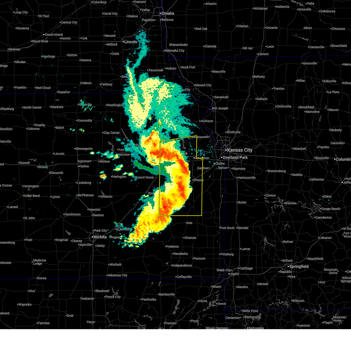
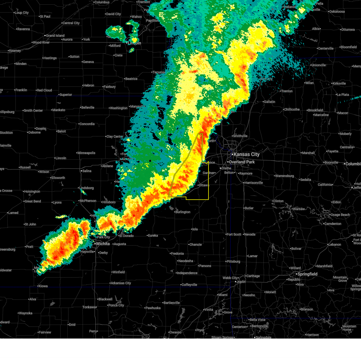
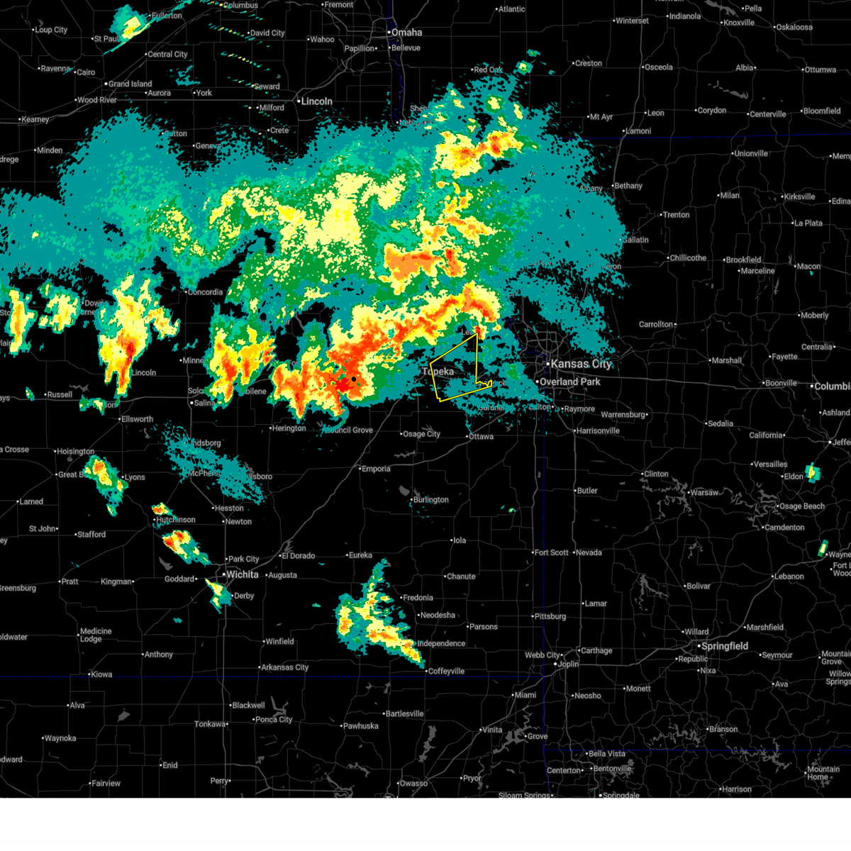
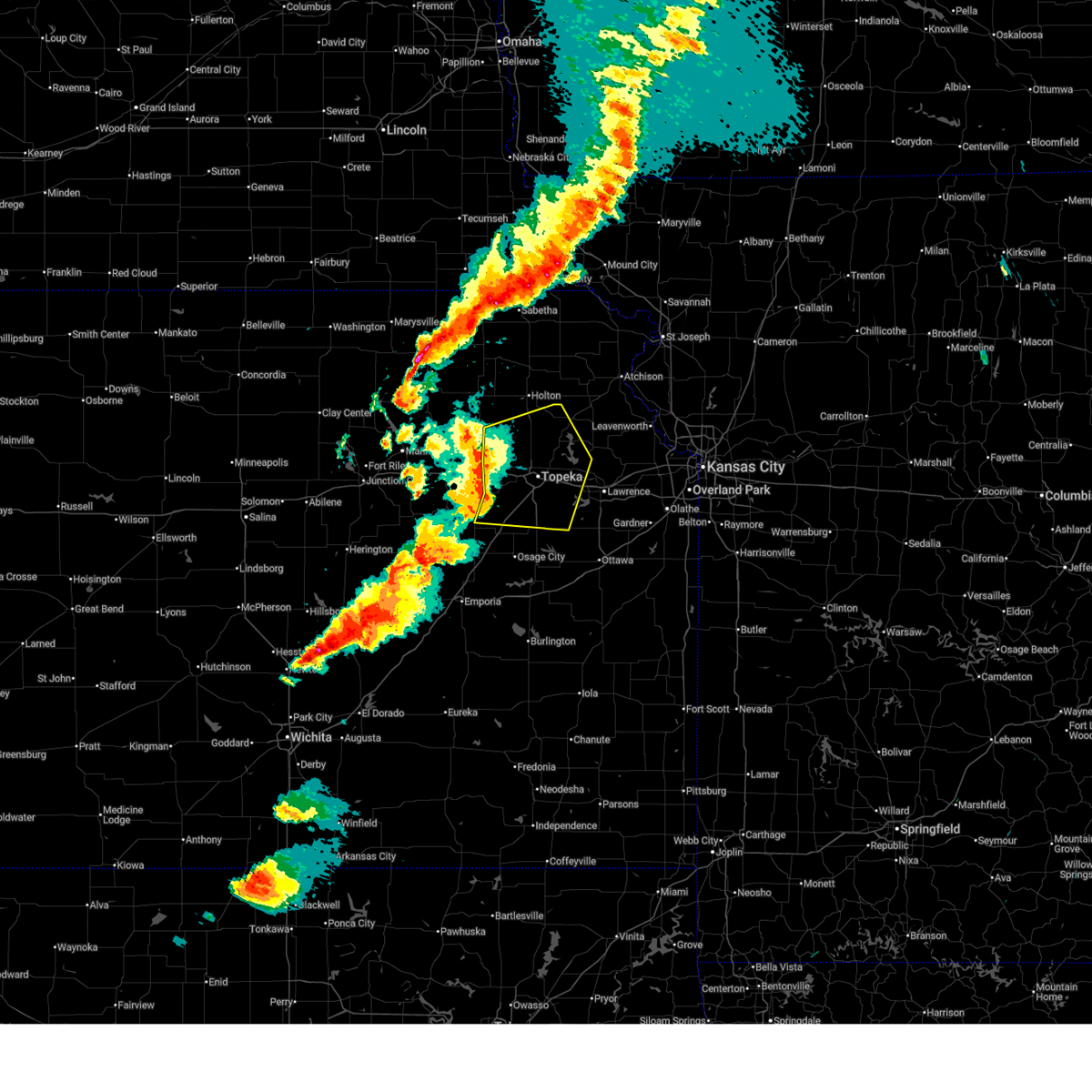
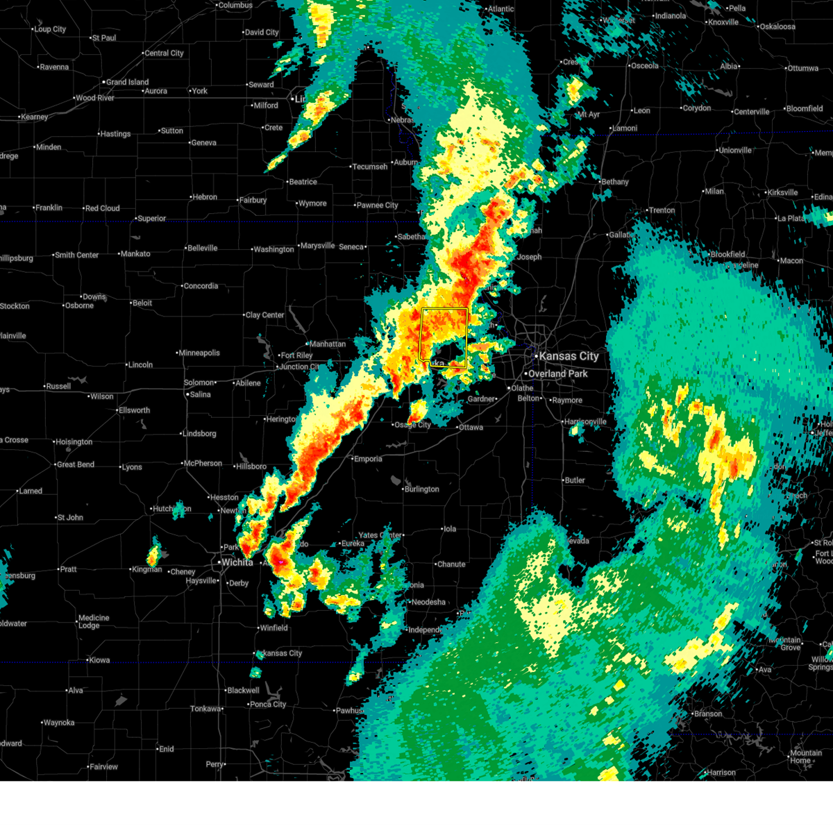
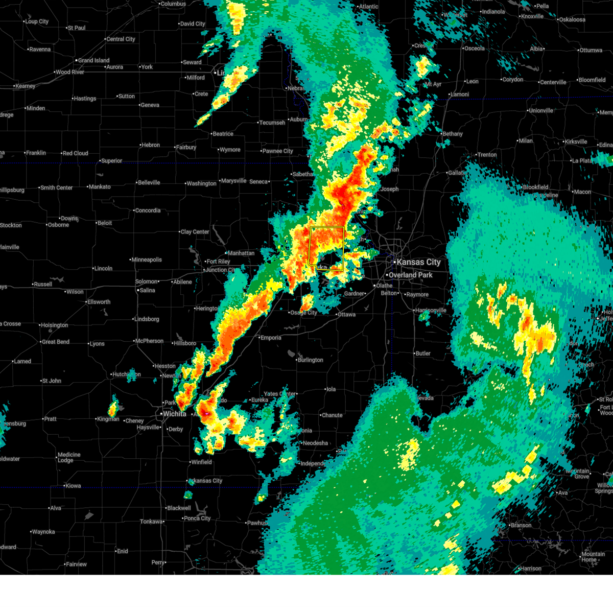
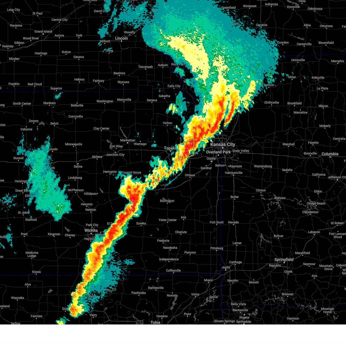
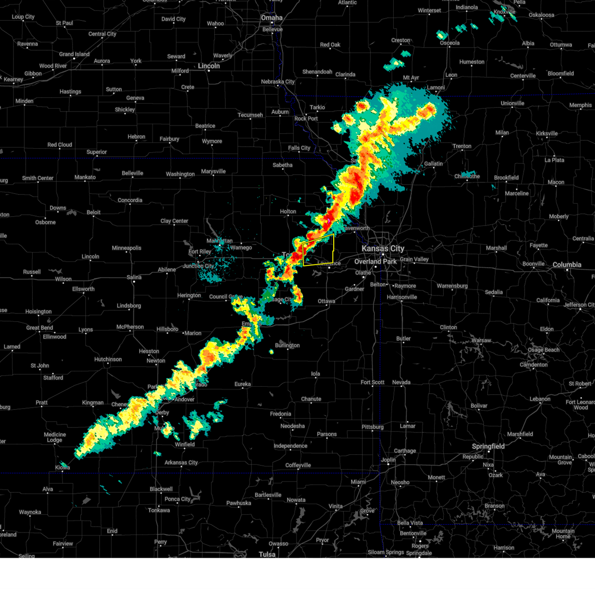
The Top Recent Hail Date for Perry, KS is Thursday, April 23, 2026 (59th out of 61)
Hail and Wind Damage Spotted near Perry, KS
| Date / Time | Report Details |
|---|---|
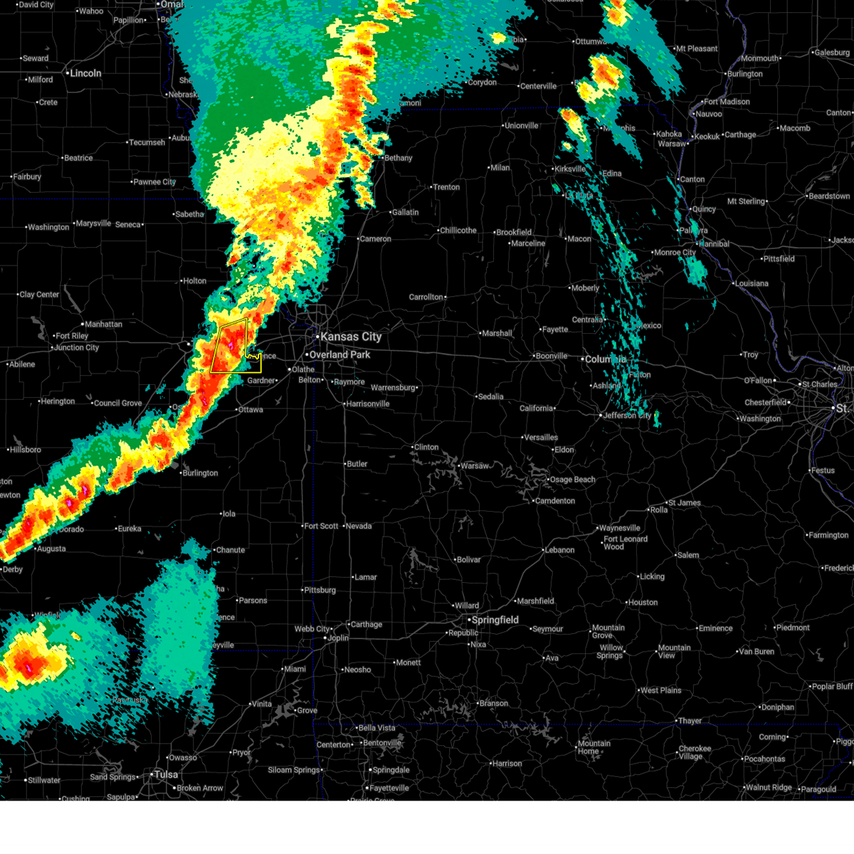
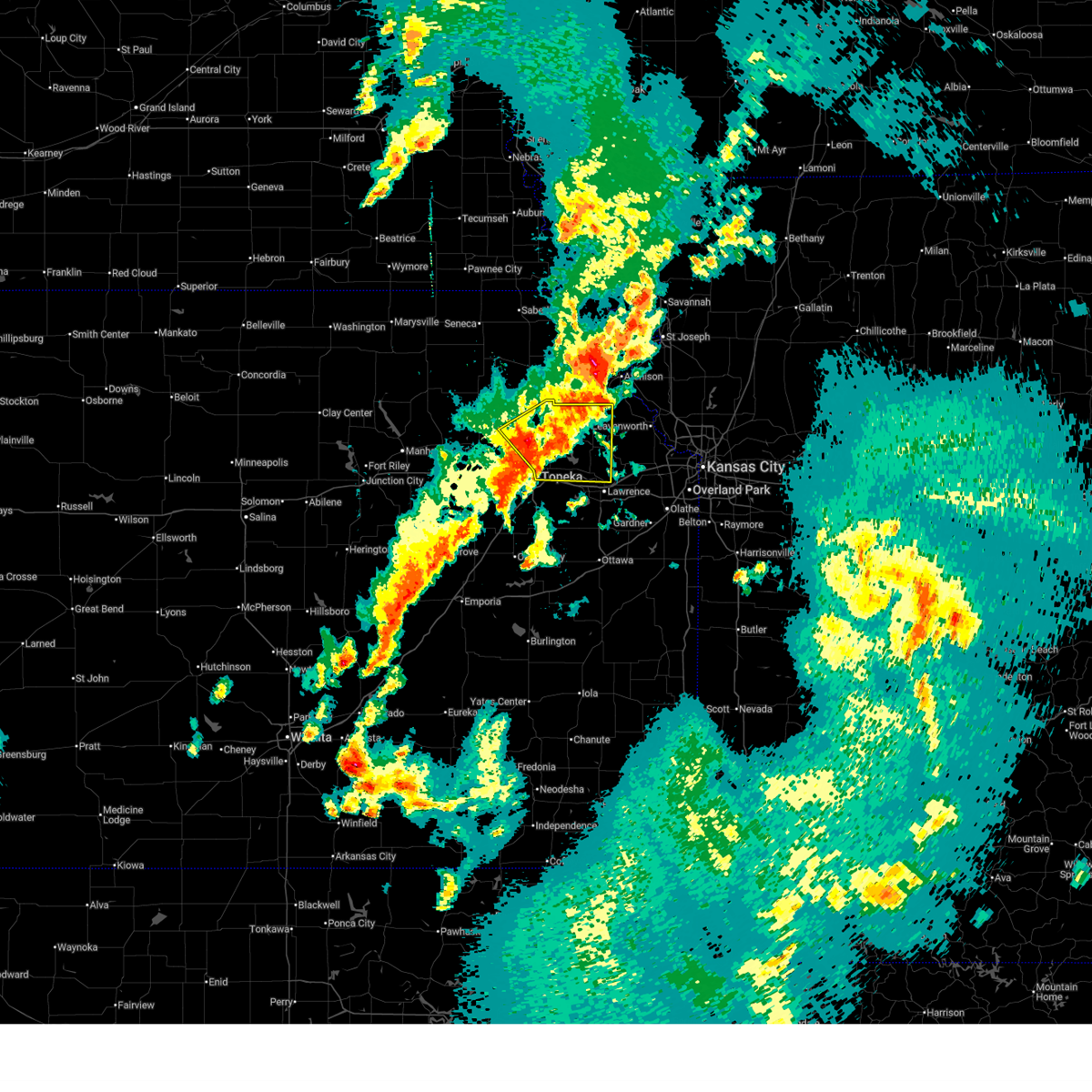
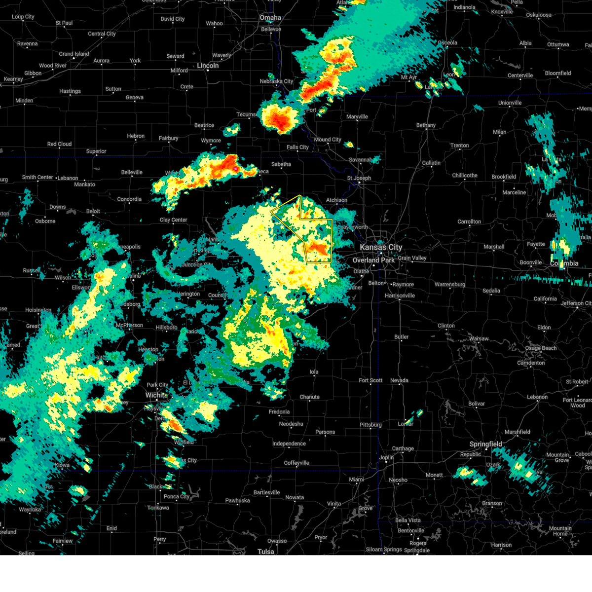
| 6/13/2026 8:09 PM CDT |
 At 808 pm cdt, severe thunderstorms were located along a line extending from near lone star to near eudora to 5 miles northwest of basehor, moving southeast at 55 mph (automated weather observation system. the asos at lawrence airport measured a 63 mph wind gust at 8 pm). Hazards include 70 mph wind gusts and nickel size hail. Expect considerable tree damage. damage is likely to mobile homes, roofs, and outbuildings. locations impacted include, lawrence, baldwin city, eudora, perry, mclouth, lecompton, clinton, lone star, pleasant grove, clinton lake, vinland, and williamstown. This includes kansas turnpike between mile markers 191 and 205. At 808 pm cdt, severe thunderstorms were located along a line extending from near lone star to near eudora to 5 miles northwest of basehor, moving southeast at 55 mph (automated weather observation system. the asos at lawrence airport measured a 63 mph wind gust at 8 pm). Hazards include 70 mph wind gusts and nickel size hail. Expect considerable tree damage. damage is likely to mobile homes, roofs, and outbuildings. locations impacted include, lawrence, baldwin city, eudora, perry, mclouth, lecompton, clinton, lone star, pleasant grove, clinton lake, vinland, and williamstown. This includes kansas turnpike between mile markers 191 and 205.
|
| 6/13/2026 8:00 PM CDT |
 At 759 pm cdt, severe thunderstorms were located along a line extending from near richland to 3 miles northeast of lawrence to 5 miles northeast of mclouth, moving southeast at 55 mph (radar indicated). Hazards include 70 mph wind gusts and quarter size hail. Hail damage to vehicles is expected. expect considerable tree damage. wind damage is also likely to mobile homes, roofs, and outbuildings. locations impacted include, southern topeka, lawrence, baldwin city, eudora, richland, overbrook, centropolis, perry, mclouth, lecompton, clinton, lone star, pleasant grove, vinland, williamstown, clinton lake, globe, and berryton. This includes kansas turnpike between mile markers 189 and 205. At 759 pm cdt, severe thunderstorms were located along a line extending from near richland to 3 miles northeast of lawrence to 5 miles northeast of mclouth, moving southeast at 55 mph (radar indicated). Hazards include 70 mph wind gusts and quarter size hail. Hail damage to vehicles is expected. expect considerable tree damage. wind damage is also likely to mobile homes, roofs, and outbuildings. locations impacted include, southern topeka, lawrence, baldwin city, eudora, richland, overbrook, centropolis, perry, mclouth, lecompton, clinton, lone star, pleasant grove, vinland, williamstown, clinton lake, globe, and berryton. This includes kansas turnpike between mile markers 189 and 205.
|
| 6/13/2026 7:47 PM CDT | Fire chief estimated 60 to 70 mph winds west of perr in jefferson county KS, 2.4 miles ESE of Perry, KS |
| 6/13/2026 7:47 PM CDT |
 At 747 pm cdt, severe thunderstorms were located along a line extending from 5 miles north of harveyville to perry to near winchester, moving southeast at 55 mph (fire department. at 7:45 pm, fire chief reported 60-70 mph winds 1 mile west of perry). Hazards include 70 mph wind gusts and quarter size hail. Hail damage to vehicles is expected. expect considerable tree damage. wind damage is also likely to mobile homes, roofs, and outbuildings. locations impacted include, topeka, lawrence, baldwin city, carbondale, oskaloosa, tecumseh, eudora, richland, auburn, overbrook, lyndon, centropolis, burlingame, perry, mclouth, scranton, lecompton, clinton, lone star, and harveyville. This includes kansas turnpike between mile markers 156 and 205. At 747 pm cdt, severe thunderstorms were located along a line extending from 5 miles north of harveyville to perry to near winchester, moving southeast at 55 mph (fire department. at 7:45 pm, fire chief reported 60-70 mph winds 1 mile west of perry). Hazards include 70 mph wind gusts and quarter size hail. Hail damage to vehicles is expected. expect considerable tree damage. wind damage is also likely to mobile homes, roofs, and outbuildings. locations impacted include, topeka, lawrence, baldwin city, carbondale, oskaloosa, tecumseh, eudora, richland, auburn, overbrook, lyndon, centropolis, burlingame, perry, mclouth, scranton, lecompton, clinton, lone star, and harveyville. This includes kansas turnpike between mile markers 156 and 205.
|
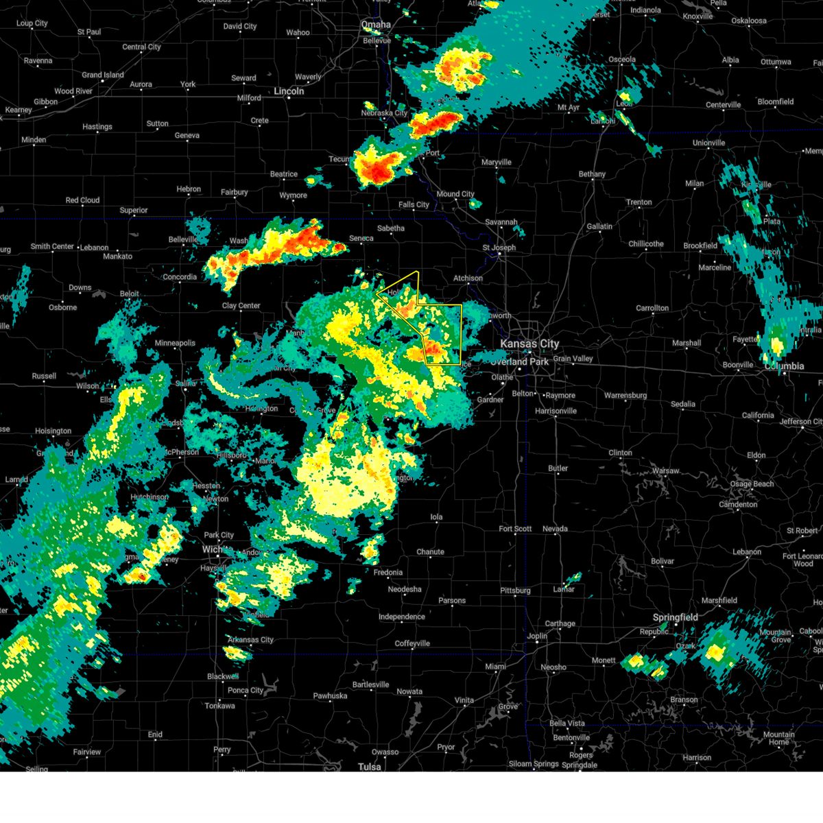
| 6/13/2026 7:43 PM CDT |
 the severe thunderstorm warning has been cancelled and is no longer in effect the severe thunderstorm warning has been cancelled and is no longer in effect
|
| 6/13/2026 7:43 PM CDT |
 At 742 pm cdt, severe thunderstorms were located along a line extending from near eskridge to 4 miles east of grantville to 3 miles northeast of ozawkie, moving southeast at 50 mph (radar indicated). Hazards include 70 mph wind gusts and quarter size hail. Hail damage to vehicles is expected. expect considerable tree damage. wind damage is also likely to mobile homes, roofs, and outbuildings. locations impacted include, topeka, rossville, oskaloosa, alma, eskridge, tecumseh, dover, silver lake, auburn, perry, mclouth, meriden, hoyt, ozawkie, lecompton, maple hill, mcfarland, harveyville, paxico, and willard. this includes the following highways, interstate 70 between mile markers 323 and 355. Kansas turnpike between mile markers 160 and 191. At 742 pm cdt, severe thunderstorms were located along a line extending from near eskridge to 4 miles east of grantville to 3 miles northeast of ozawkie, moving southeast at 50 mph (radar indicated). Hazards include 70 mph wind gusts and quarter size hail. Hail damage to vehicles is expected. expect considerable tree damage. wind damage is also likely to mobile homes, roofs, and outbuildings. locations impacted include, topeka, rossville, oskaloosa, alma, eskridge, tecumseh, dover, silver lake, auburn, perry, mclouth, meriden, hoyt, ozawkie, lecompton, maple hill, mcfarland, harveyville, paxico, and willard. this includes the following highways, interstate 70 between mile markers 323 and 355. Kansas turnpike between mile markers 160 and 191.
|
| 6/13/2026 7:41 PM CDT |
 At 740 pm cdt, severe thunderstorms were located along a line extending from 3 miles south of keene to 4 miles west of perry to 4 miles southeast of valley falls, moving southeast at 60 mph (radar indicated). Hazards include 70 mph wind gusts and quarter size hail. Hail damage to vehicles is expected. expect considerable tree damage. wind damage is also likely to mobile homes, roofs, and outbuildings. locations impacted include, topeka, lawrence, baldwin city, carbondale, oskaloosa, tecumseh, eudora, richland, auburn, overbrook, lyndon, centropolis, burlingame, perry, mclouth, scranton, lecompton, clinton, lone star, and harveyville. This includes kansas turnpike between mile markers 156 and 205. At 740 pm cdt, severe thunderstorms were located along a line extending from 3 miles south of keene to 4 miles west of perry to 4 miles southeast of valley falls, moving southeast at 60 mph (radar indicated). Hazards include 70 mph wind gusts and quarter size hail. Hail damage to vehicles is expected. expect considerable tree damage. wind damage is also likely to mobile homes, roofs, and outbuildings. locations impacted include, topeka, lawrence, baldwin city, carbondale, oskaloosa, tecumseh, eudora, richland, auburn, overbrook, lyndon, centropolis, burlingame, perry, mclouth, scranton, lecompton, clinton, lone star, and harveyville. This includes kansas turnpike between mile markers 156 and 205.
|
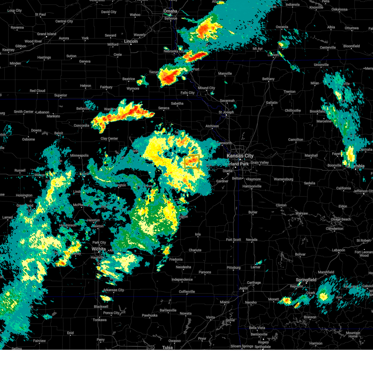
| 6/13/2026 7:30 PM CDT |
 At 728 pm cdt, severe thunderstorms were located along a line extending from 4 miles southeast of alma to near meriden to 4 miles southeast of denison, moving southeast at 65 mph (trained weather spotters. at 7:26 pm, 6 inch diameter tree limbs were reported down near silver lake). Hazards include 70 mph wind gusts and quarter size hail. Hail damage to vehicles is expected. expect considerable tree damage. wind damage is also likely to mobile homes, roofs, and outbuildings. locations impacted include, topeka, rossville, oskaloosa, alma, eskridge, tecumseh, st. marys, dover, silver lake, auburn, perry, mclouth, meriden, hoyt, ozawkie, lecompton, maple hill, mayetta, mcfarland, and harveyville. this includes the following highways, interstate 70 between mile markers 323 and 355. Kansas turnpike between mile markers 160 and 191. At 728 pm cdt, severe thunderstorms were located along a line extending from 4 miles southeast of alma to near meriden to 4 miles southeast of denison, moving southeast at 65 mph (trained weather spotters. at 7:26 pm, 6 inch diameter tree limbs were reported down near silver lake). Hazards include 70 mph wind gusts and quarter size hail. Hail damage to vehicles is expected. expect considerable tree damage. wind damage is also likely to mobile homes, roofs, and outbuildings. locations impacted include, topeka, rossville, oskaloosa, alma, eskridge, tecumseh, st. marys, dover, silver lake, auburn, perry, mclouth, meriden, hoyt, ozawkie, lecompton, maple hill, mayetta, mcfarland, and harveyville. this includes the following highways, interstate 70 between mile markers 323 and 355. Kansas turnpike between mile markers 160 and 191.
|
| 6/13/2026 7:17 PM CDT |
 Svrtop the national weather service in topeka has issued a * severe thunderstorm warning for, central jefferson county in northeastern kansas, shawnee county in east central kansas, northeastern wabaunsee county in east central kansas, northwestern douglas county in east central kansas, northwestern osage county in east central kansas, southeastern pottawatomie county in northeastern kansas, southern jackson county in northeastern kansas, * until 800 pm cdt. * at 717 pm cdt, severe thunderstorms were located along a line extending from 5 miles west of alma to 3 miles east of st. marys to near mayetta, moving southeast at 50 mph (radar indicated). Hazards include 70 mph wind gusts and half dollar size hail. Hail damage to vehicles is expected. expect considerable tree damage. Wind damage is also likely to mobile homes, roofs, and outbuildings. Svrtop the national weather service in topeka has issued a * severe thunderstorm warning for, central jefferson county in northeastern kansas, shawnee county in east central kansas, northeastern wabaunsee county in east central kansas, northwestern douglas county in east central kansas, northwestern osage county in east central kansas, southeastern pottawatomie county in northeastern kansas, southern jackson county in northeastern kansas, * until 800 pm cdt. * at 717 pm cdt, severe thunderstorms were located along a line extending from 5 miles west of alma to 3 miles east of st. marys to near mayetta, moving southeast at 50 mph (radar indicated). Hazards include 70 mph wind gusts and half dollar size hail. Hail damage to vehicles is expected. expect considerable tree damage. Wind damage is also likely to mobile homes, roofs, and outbuildings.
|
| 6/9/2026 1:06 AM CDT |
 At 105 am cdt, severe thunderstorms were located along a line extending from 5 miles northeast of basehor to near louisburg to 4 miles west of pleasanton, moving east at 50 mph. severe thunderstorm winds were occurring well behind this line of thunderstorms (trained weather spotters). Hazards include 60 mph wind gusts. Expect damage to roofs, siding, and trees. locations impacted include, northeastern topeka, lawrence, ottawa, baldwin city, garnett, tecumseh, eudora, richland, wellsville, overbrook, centropolis, perry, pomona, lecompton, clinton, richmond, colony, lone star, greeley, and lane. this includes the following highways, interstate 35 between mile markers 181 and 198. Kansas turnpike between mile markers 181 and 205. At 105 am cdt, severe thunderstorms were located along a line extending from 5 miles northeast of basehor to near louisburg to 4 miles west of pleasanton, moving east at 50 mph. severe thunderstorm winds were occurring well behind this line of thunderstorms (trained weather spotters). Hazards include 60 mph wind gusts. Expect damage to roofs, siding, and trees. locations impacted include, northeastern topeka, lawrence, ottawa, baldwin city, garnett, tecumseh, eudora, richland, wellsville, overbrook, centropolis, perry, pomona, lecompton, clinton, richmond, colony, lone star, greeley, and lane. this includes the following highways, interstate 35 between mile markers 181 and 198. Kansas turnpike between mile markers 181 and 205.
|
| 6/9/2026 12:56 AM CDT |
 At 1255 am cdt, severe thunderstorms were located along a line extending from near basehor to 4 miles west of louisburg to near mound city, moving east at 50 mph. severe thunderstorm winds were occurring well behind this line of thunderstorms (trained weather spotters). Hazards include 70 mph wind gusts. Expect considerable tree damage. damage is likely to mobile homes, roofs, and outbuildings. locations impacted include, topeka, lawrence, ottawa, baldwin city, garnett, osage city, carbondale, tecumseh, eudora, richland, wellsville, auburn, overbrook, lyndon, centropolis, perry, pomona, scranton, lecompton, and clinton. this includes the following highways, interstate 35 between mile markers 174 and 198. interstate 70 between mile markers 351 and 355. Kansas turnpike between mile markers 166 and 205. At 1255 am cdt, severe thunderstorms were located along a line extending from near basehor to 4 miles west of louisburg to near mound city, moving east at 50 mph. severe thunderstorm winds were occurring well behind this line of thunderstorms (trained weather spotters). Hazards include 70 mph wind gusts. Expect considerable tree damage. damage is likely to mobile homes, roofs, and outbuildings. locations impacted include, topeka, lawrence, ottawa, baldwin city, garnett, osage city, carbondale, tecumseh, eudora, richland, wellsville, auburn, overbrook, lyndon, centropolis, perry, pomona, scranton, lecompton, and clinton. this includes the following highways, interstate 35 between mile markers 174 and 198. interstate 70 between mile markers 351 and 355. Kansas turnpike between mile markers 166 and 205.
|
| 6/9/2026 12:43 AM CDT |
 Svrtop the national weather service in topeka has issued a * severe thunderstorm warning for, franklin county in east central kansas, southern jefferson county in northeastern kansas, shawnee county in east central kansas, anderson county in east central kansas, douglas county in east central kansas, osage county in east central kansas, southeastern coffey county in east central kansas, * until 115 am cdt. * at 1242 am cdt, severe thunderstorms were located along a line extending from 3 miles north of tonganoxie to 4 miles northwest of paola to 4 miles north of blue mound, moving east at 50 mph. severe thunderstorms winds were occurring well behind this line of thunderstorms (trained weather spotters). Hazards include 70 mph wind gusts. Expect considerable tree damage. Damage is likely to mobile homes, roofs, and outbuildings. Svrtop the national weather service in topeka has issued a * severe thunderstorm warning for, franklin county in east central kansas, southern jefferson county in northeastern kansas, shawnee county in east central kansas, anderson county in east central kansas, douglas county in east central kansas, osage county in east central kansas, southeastern coffey county in east central kansas, * until 115 am cdt. * at 1242 am cdt, severe thunderstorms were located along a line extending from 3 miles north of tonganoxie to 4 miles northwest of paola to 4 miles north of blue mound, moving east at 50 mph. severe thunderstorms winds were occurring well behind this line of thunderstorms (trained weather spotters). Hazards include 70 mph wind gusts. Expect considerable tree damage. Damage is likely to mobile homes, roofs, and outbuildings.
|
| 6/9/2026 12:32 AM CDT | Storm damage reported in jefferson county KS, 3.4 miles SSE of Perry, KS |
| 6/9/2026 12:31 AM CDT |
 At 1230 am cdt, severe thunderstorms were located along a line extending from 4 miles southeast of oskaloosa to 5 miles south of wellsville to 6 miles north of lone elm, moving east at 50 mph (trained weather spotters). Hazards include 70 mph wind gusts and quarter size hail. Hail damage to vehicles is expected. expect considerable tree damage. wind damage is also likely to mobile homes, roofs, and outbuildings. locations impacted include, topeka, lawrence, ottawa, baldwin city, garnett, osage city, burlington, carbondale, oskaloosa, tecumseh, eudora, richland, wellsville, dover, silver lake, auburn, overbrook, lyndon, centropolis, and burlingame. this includes the following highways, interstate 35 between mile markers 162 and 198. interstate 70 between mile markers 347 and 355. Kansas turnpike between mile markers 155 and 205. At 1230 am cdt, severe thunderstorms were located along a line extending from 4 miles southeast of oskaloosa to 5 miles south of wellsville to 6 miles north of lone elm, moving east at 50 mph (trained weather spotters). Hazards include 70 mph wind gusts and quarter size hail. Hail damage to vehicles is expected. expect considerable tree damage. wind damage is also likely to mobile homes, roofs, and outbuildings. locations impacted include, topeka, lawrence, ottawa, baldwin city, garnett, osage city, burlington, carbondale, oskaloosa, tecumseh, eudora, richland, wellsville, dover, silver lake, auburn, overbrook, lyndon, centropolis, and burlingame. this includes the following highways, interstate 35 between mile markers 162 and 198. interstate 70 between mile markers 347 and 355. Kansas turnpike between mile markers 155 and 205.
|
| 6/9/2026 12:31 AM CDT |
 the severe thunderstorm warning has been cancelled and is no longer in effect the severe thunderstorm warning has been cancelled and is no longer in effect
|
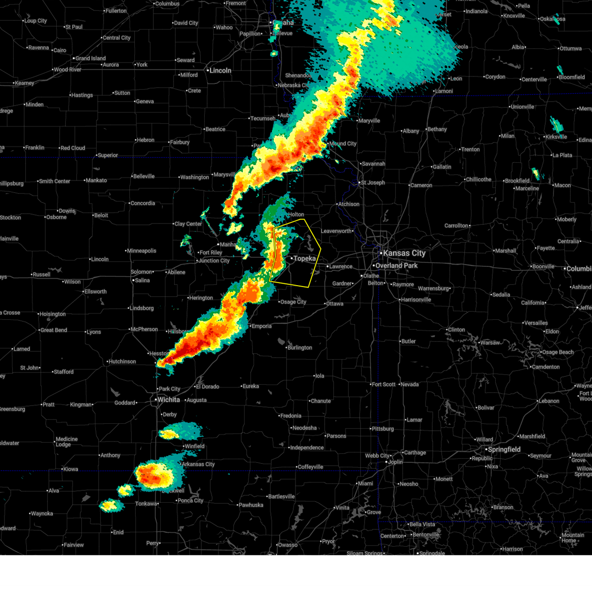
| 6/9/2026 12:24 AM CDT |
 The tornado threat has diminished and the tornado warning has been cancelled. however, large hail and damaging winds remain likely and a severe thunderstorm warning remains in effect for the area. a severe thunderstorm watch remains in effect until 100 am cdt for northeastern and east central kansas. The tornado threat has diminished and the tornado warning has been cancelled. however, large hail and damaging winds remain likely and a severe thunderstorm warning remains in effect for the area. a severe thunderstorm watch remains in effect until 100 am cdt for northeastern and east central kansas.
|
| 6/9/2026 12:22 AM CDT |
 At 1221 am cdt, a severe thunderstorm capable of producing a tornado was located over southeastern lawrence, moving northeast at 55 mph (radar indicated rotation). Hazards include tornado. Flying debris will be dangerous to those caught without shelter. mobile homes will be damaged or destroyed. damage to roofs, windows, and vehicles will occur. tree damage is likely. locations impacted include, lawrence, eudora, perry, lecompton, pleasant grove, vinland, williamstown, and perry lake. This includes kansas turnpike between mile markers 186 and 205. At 1221 am cdt, a severe thunderstorm capable of producing a tornado was located over southeastern lawrence, moving northeast at 55 mph (radar indicated rotation). Hazards include tornado. Flying debris will be dangerous to those caught without shelter. mobile homes will be damaged or destroyed. damage to roofs, windows, and vehicles will occur. tree damage is likely. locations impacted include, lawrence, eudora, perry, lecompton, pleasant grove, vinland, williamstown, and perry lake. This includes kansas turnpike between mile markers 186 and 205.
|
| 6/9/2026 12:15 AM CDT |
 At 1215 am cdt, a severe thunderstorm capable of producing a tornado was located near lone star, moving northeast at 55 mph (radar indicated rotation). Hazards include tornado. Flying debris will be dangerous to those caught without shelter. mobile homes will be damaged or destroyed. damage to roofs, windows, and vehicles will occur. tree damage is likely. locations impacted include, lawrence, eudora, perry, lecompton, clinton, lone star, pleasant grove, clinton lake, vinland, williamstown, and perry lake. This includes kansas turnpike between mile markers 186 and 205. At 1215 am cdt, a severe thunderstorm capable of producing a tornado was located near lone star, moving northeast at 55 mph (radar indicated rotation). Hazards include tornado. Flying debris will be dangerous to those caught without shelter. mobile homes will be damaged or destroyed. damage to roofs, windows, and vehicles will occur. tree damage is likely. locations impacted include, lawrence, eudora, perry, lecompton, clinton, lone star, pleasant grove, clinton lake, vinland, williamstown, and perry lake. This includes kansas turnpike between mile markers 186 and 205.
|
| 6/9/2026 12:12 AM CDT |
 At 1211 am cdt, a severe thunderstorm capable of producing a tornado was located over lone star, moving northeast at 50 mph (radar indicated rotation). Hazards include tornado. Flying debris will be dangerous to those caught without shelter. mobile homes will be damaged or destroyed. damage to roofs, windows, and vehicles will occur. tree damage is likely. locations impacted include, lawrence, eudora, perry, lecompton, clinton, lone star, pleasant grove, clinton lake, vinland, globe, williamstown, and perry lake. This includes kansas turnpike between mile markers 185 and 205. At 1211 am cdt, a severe thunderstorm capable of producing a tornado was located over lone star, moving northeast at 50 mph (radar indicated rotation). Hazards include tornado. Flying debris will be dangerous to those caught without shelter. mobile homes will be damaged or destroyed. damage to roofs, windows, and vehicles will occur. tree damage is likely. locations impacted include, lawrence, eudora, perry, lecompton, clinton, lone star, pleasant grove, clinton lake, vinland, globe, williamstown, and perry lake. This includes kansas turnpike between mile markers 185 and 205.
|
| 6/9/2026 12:12 AM CDT |
 At 1211 am cdt, severe thunderstorms were located along a line extending from near meriden to 4 miles south of centropolis to westphalia, moving east at 50 mph (trained weather spotters). Hazards include 70 mph wind gusts and nickel size hail. Expect considerable tree damage. damage is likely to mobile homes, roofs, and outbuildings. locations impacted include, topeka, lawrence, ottawa, baldwin city, garnett, osage city, burlington, carbondale, oskaloosa, tecumseh, eudora, richland, wellsville, dover, silver lake, auburn, overbrook, lyndon, centropolis, and lebo. this includes the following highways, interstate 35 between mile markers 143 and 198. interstate 70 between mile markers 347 and 355. kansas turnpike between mile markers 155 and 205. A tornado warning remains in effect for southern jefferson, southeastern shawnee, and douglas counties until 1230 am. At 1211 am cdt, severe thunderstorms were located along a line extending from near meriden to 4 miles south of centropolis to westphalia, moving east at 50 mph (trained weather spotters). Hazards include 70 mph wind gusts and nickel size hail. Expect considerable tree damage. damage is likely to mobile homes, roofs, and outbuildings. locations impacted include, topeka, lawrence, ottawa, baldwin city, garnett, osage city, burlington, carbondale, oskaloosa, tecumseh, eudora, richland, wellsville, dover, silver lake, auburn, overbrook, lyndon, centropolis, and lebo. this includes the following highways, interstate 35 between mile markers 143 and 198. interstate 70 between mile markers 347 and 355. kansas turnpike between mile markers 155 and 205. A tornado warning remains in effect for southern jefferson, southeastern shawnee, and douglas counties until 1230 am.
|
| 6/9/2026 12:07 AM CDT |
 Tortop the national weather service in topeka has issued a * tornado warning for, southern jefferson county in northeastern kansas, southeastern shawnee county in east central kansas, douglas county in east central kansas, * until 1230 am cdt. * at 1206 am cdt, a severe thunderstorm capable of producing a tornado was located 4 miles northwest of globe, moving northeast at 45 mph (radar indicated rotation). Hazards include tornado. Flying debris will be dangerous to those caught without shelter. mobile homes will be damaged or destroyed. damage to roofs, windows, and vehicles will occur. Tree damage is likely. Tortop the national weather service in topeka has issued a * tornado warning for, southern jefferson county in northeastern kansas, southeastern shawnee county in east central kansas, douglas county in east central kansas, * until 1230 am cdt. * at 1206 am cdt, a severe thunderstorm capable of producing a tornado was located 4 miles northwest of globe, moving northeast at 45 mph (radar indicated rotation). Hazards include tornado. Flying debris will be dangerous to those caught without shelter. mobile homes will be damaged or destroyed. damage to roofs, windows, and vehicles will occur. Tree damage is likely.
|
| 6/8/2026 11:52 PM CDT |
 At 1151 pm cdt, severe thunderstorms were located along a line extending from 6 miles southeast of delia to 3 miles north of lyndon to 4 miles south of john redmond reservoir, moving east at 50 mph (emergency management. at 11:50 pm, 70-80 mph winds were reported at melvern lake). Hazards include 70 mph wind gusts and nickel size hail. Expect considerable tree damage. damage is likely to mobile homes, roofs, and outbuildings. locations impacted include, topeka, lawrence, ottawa, baldwin city, garnett, osage city, burlington, carbondale, rossville, oskaloosa, tecumseh, eudora, richland, wellsville, dover, silver lake, auburn, overbrook, lyndon, and centropolis. this includes the following highways, interstate 35 between mile markers 143 and 198. interstate 70 between mile markers 347 and 355. Kansas turnpike between mile markers 155 and 205. At 1151 pm cdt, severe thunderstorms were located along a line extending from 6 miles southeast of delia to 3 miles north of lyndon to 4 miles south of john redmond reservoir, moving east at 50 mph (emergency management. at 11:50 pm, 70-80 mph winds were reported at melvern lake). Hazards include 70 mph wind gusts and nickel size hail. Expect considerable tree damage. damage is likely to mobile homes, roofs, and outbuildings. locations impacted include, topeka, lawrence, ottawa, baldwin city, garnett, osage city, burlington, carbondale, rossville, oskaloosa, tecumseh, eudora, richland, wellsville, dover, silver lake, auburn, overbrook, lyndon, and centropolis. this includes the following highways, interstate 35 between mile markers 143 and 198. interstate 70 between mile markers 347 and 355. Kansas turnpike between mile markers 155 and 205.
|
| 6/8/2026 11:42 PM CDT |
 Svrtop the national weather service in topeka has issued a * severe thunderstorm warning for, franklin county in east central kansas, jefferson county in northeastern kansas, shawnee county in east central kansas, anderson county in east central kansas, douglas county in east central kansas, osage county in east central kansas, southern jackson county in northeastern kansas, coffey county in east central kansas, east central lyon county in east central kansas, * until 1245 am cdt. * at 1141 pm cdt, severe thunderstorms were located along a line extending from near delia to near osage city to 6 miles northwest of gridley, moving east at 50 mph (trained spotter. at 11:40 pm, 61 mph wind gust was reported in eskridge). Hazards include 60 mph wind gusts and quarter size hail. Hail damage to vehicles is expected. Expect wind damage to roofs, siding, and trees. Svrtop the national weather service in topeka has issued a * severe thunderstorm warning for, franklin county in east central kansas, jefferson county in northeastern kansas, shawnee county in east central kansas, anderson county in east central kansas, douglas county in east central kansas, osage county in east central kansas, southern jackson county in northeastern kansas, coffey county in east central kansas, east central lyon county in east central kansas, * until 1245 am cdt. * at 1141 pm cdt, severe thunderstorms were located along a line extending from near delia to near osage city to 6 miles northwest of gridley, moving east at 50 mph (trained spotter. at 11:40 pm, 61 mph wind gust was reported in eskridge). Hazards include 60 mph wind gusts and quarter size hail. Hail damage to vehicles is expected. Expect wind damage to roofs, siding, and trees.
|
| 5/18/2026 8:57 PM CDT |
 At 857 pm cdt, severe thunderstorms were located along a line extending from 6 miles south of lewis and clark village to near linwood to 4 miles west of princeton, moving east at 60 mph (radar indicated). Hazards include 70 mph wind gusts and nickel size hail. Expect considerable tree damage. damage is likely to mobile homes, roofs, and outbuildings. locations impacted include, lawrence, ottawa, baldwin city, carbondale, oskaloosa, eudora, richland, wellsville, overbrook, lyndon, centropolis, perry, mclouth, pomona, scranton, lecompton, clinton, winchester, richmond, and williamsburg. this includes the following highways, interstate 35 between mile markers 156 and 198. Kansas turnpike between mile markers 189 and 205. At 857 pm cdt, severe thunderstorms were located along a line extending from 6 miles south of lewis and clark village to near linwood to 4 miles west of princeton, moving east at 60 mph (radar indicated). Hazards include 70 mph wind gusts and nickel size hail. Expect considerable tree damage. damage is likely to mobile homes, roofs, and outbuildings. locations impacted include, lawrence, ottawa, baldwin city, carbondale, oskaloosa, eudora, richland, wellsville, overbrook, lyndon, centropolis, perry, mclouth, pomona, scranton, lecompton, clinton, winchester, richmond, and williamsburg. this includes the following highways, interstate 35 between mile markers 156 and 198. Kansas turnpike between mile markers 189 and 205.
|
| 5/18/2026 8:28 PM CDT |
 Svrtop the national weather service in topeka has issued a * severe thunderstorm warning for, franklin county in east central kansas, jefferson county in northeastern kansas, eastern shawnee county in east central kansas, douglas county in east central kansas, osage county in east central kansas, * until 915 pm cdt. * at 828 pm cdt, severe thunderstorms were located along a line extending from 4 miles northwest of winchester to near berryton to near lebo, moving east at 60 mph (radar indicated). Hazards include 70 mph wind gusts and nickel size hail. Expect considerable tree damage. Damage is likely to mobile homes, roofs, and outbuildings. Svrtop the national weather service in topeka has issued a * severe thunderstorm warning for, franklin county in east central kansas, jefferson county in northeastern kansas, eastern shawnee county in east central kansas, douglas county in east central kansas, osage county in east central kansas, * until 915 pm cdt. * at 828 pm cdt, severe thunderstorms were located along a line extending from 4 miles northwest of winchester to near berryton to near lebo, moving east at 60 mph (radar indicated). Hazards include 70 mph wind gusts and nickel size hail. Expect considerable tree damage. Damage is likely to mobile homes, roofs, and outbuildings.
|
| 4/27/2026 4:33 AM CDT |
 Svrtop the national weather service in topeka has issued a * severe thunderstorm warning for, southeastern jefferson county in northeastern kansas, douglas county in east central kansas, * until 515 am cdt. * at 433 am cdt, a severe thunderstorm was located 4 miles north of carbondale, moving east at 45 mph (radar indicated). Hazards include 60 mph wind gusts and quarter size hail. Hail damage to vehicles is expected. Expect wind damage to roofs, siding, and trees. Svrtop the national weather service in topeka has issued a * severe thunderstorm warning for, southeastern jefferson county in northeastern kansas, douglas county in east central kansas, * until 515 am cdt. * at 433 am cdt, a severe thunderstorm was located 4 miles north of carbondale, moving east at 45 mph (radar indicated). Hazards include 60 mph wind gusts and quarter size hail. Hail damage to vehicles is expected. Expect wind damage to roofs, siding, and trees.
|
| 4/27/2026 3:50 AM CDT |
 The storm which prompted the warning has weakened below severe limits, and no longer poses an immediate threat to life or property. therefore, the warning will be allowed to expire. a severe thunderstorm watch remains in effect until 1000 am cdt for northeastern and east central kansas. The storm which prompted the warning has weakened below severe limits, and no longer poses an immediate threat to life or property. therefore, the warning will be allowed to expire. a severe thunderstorm watch remains in effect until 1000 am cdt for northeastern and east central kansas.
|
| 4/27/2026 3:36 AM CDT |
 At 335 am cdt, a severe thunderstorm was located near williamstown, moving east at 40 mph (radar indicated). Hazards include 60 mph wind gusts and half dollar size hail. Hail damage to vehicles is expected. expect wind damage to roofs, siding, and trees. locations impacted include, lawrence, oskaloosa, eudora, perry, mclouth, lecompton, clinton, clinton lake, williamstown, and grantville. This includes kansas turnpike between mile markers 186 and 205. At 335 am cdt, a severe thunderstorm was located near williamstown, moving east at 40 mph (radar indicated). Hazards include 60 mph wind gusts and half dollar size hail. Hail damage to vehicles is expected. expect wind damage to roofs, siding, and trees. locations impacted include, lawrence, oskaloosa, eudora, perry, mclouth, lecompton, clinton, clinton lake, williamstown, and grantville. This includes kansas turnpike between mile markers 186 and 205.
|
| 4/27/2026 3:27 AM CDT |
 The severe thunderstorm which prompted the warning has been given a new warning across jefferson and northern douglas county. a severe thunderstorm watch remains in effect until 400 am cdt for northeastern and east central kansas. remember, a severe thunderstorm warning still remains in effect for jefferson and northern douglas counties until 400am. The severe thunderstorm which prompted the warning has been given a new warning across jefferson and northern douglas county. a severe thunderstorm watch remains in effect until 400 am cdt for northeastern and east central kansas. remember, a severe thunderstorm warning still remains in effect for jefferson and northern douglas counties until 400am.
|
| 4/27/2026 3:25 AM CDT |
 Svrtop the national weather service in topeka has issued a * severe thunderstorm warning for, central jefferson county in northeastern kansas, southeastern shawnee county in east central kansas, northern douglas county in east central kansas, * until 400 am cdt. * at 325 am cdt, a severe thunderstorm was located over lecompton, moving east at 40 mph (radar indicated). Hazards include 70 mph wind gusts and ping pong ball size hail. People and animals outdoors will be injured. expect hail damage to roofs, siding, windows, and vehicles. expect considerable tree damage. Wind damage is also likely to mobile homes, roofs, and outbuildings. Svrtop the national weather service in topeka has issued a * severe thunderstorm warning for, central jefferson county in northeastern kansas, southeastern shawnee county in east central kansas, northern douglas county in east central kansas, * until 400 am cdt. * at 325 am cdt, a severe thunderstorm was located over lecompton, moving east at 40 mph (radar indicated). Hazards include 70 mph wind gusts and ping pong ball size hail. People and animals outdoors will be injured. expect hail damage to roofs, siding, windows, and vehicles. expect considerable tree damage. Wind damage is also likely to mobile homes, roofs, and outbuildings.
|
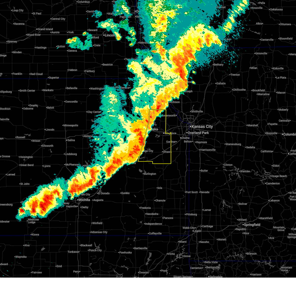
| 4/27/2026 3:18 AM CDT |
 At 317 am cdt, a severe thunderstorm was located near ozawkie, moving northeast at 40 mph (radar indicated). Hazards include golf ball size hail and 70 mph wind gusts. People and animals outdoors will be injured. expect hail damage to roofs, siding, windows, and vehicles. expect considerable tree damage. wind damage is also likely to mobile homes, roofs, and outbuildings. locations impacted include, northeastern topeka, lawrence, oskaloosa, tecumseh, richland, perry, mclouth, meriden, ozawkie, lecompton, clinton, winchester, williamstown, perry lake, grantville, and clinton lake. This includes kansas turnpike between mile markers 181 and 205. At 317 am cdt, a severe thunderstorm was located near ozawkie, moving northeast at 40 mph (radar indicated). Hazards include golf ball size hail and 70 mph wind gusts. People and animals outdoors will be injured. expect hail damage to roofs, siding, windows, and vehicles. expect considerable tree damage. wind damage is also likely to mobile homes, roofs, and outbuildings. locations impacted include, northeastern topeka, lawrence, oskaloosa, tecumseh, richland, perry, mclouth, meriden, ozawkie, lecompton, clinton, winchester, williamstown, perry lake, grantville, and clinton lake. This includes kansas turnpike between mile markers 181 and 205.
|
| 4/27/2026 3:18 AM CDT |
 the severe thunderstorm warning has been cancelled and is no longer in effect the severe thunderstorm warning has been cancelled and is no longer in effect
|
| 4/27/2026 3:09 AM CDT |
 At 307 am cdt, a severe thunderstorm was located near meriden, moving northeast at 40 mph (radar indicated. several reports of 1-1.75" hail in topeka beginning around 250am has been observed). Hazards include golf ball size hail and 70 mph wind gusts. People and animals outdoors will be injured. expect hail damage to roofs, siding, windows, and vehicles. expect considerable tree damage. wind damage is also likely to mobile homes, roofs, and outbuildings. locations impacted include, topeka, lawrence, carbondale, valley falls, oskaloosa, tecumseh, richland, perry, mclouth, meriden, hoyt, ozawkie, nortonville, lecompton, clinton, winchester, pauline, williamstown, perry lake, and grantville. this includes the following highways, interstate 70 between mile markers 354 and 355. Kansas turnpike between mile markers 170 and 206. At 307 am cdt, a severe thunderstorm was located near meriden, moving northeast at 40 mph (radar indicated. several reports of 1-1.75" hail in topeka beginning around 250am has been observed). Hazards include golf ball size hail and 70 mph wind gusts. People and animals outdoors will be injured. expect hail damage to roofs, siding, windows, and vehicles. expect considerable tree damage. wind damage is also likely to mobile homes, roofs, and outbuildings. locations impacted include, topeka, lawrence, carbondale, valley falls, oskaloosa, tecumseh, richland, perry, mclouth, meriden, hoyt, ozawkie, nortonville, lecompton, clinton, winchester, pauline, williamstown, perry lake, and grantville. this includes the following highways, interstate 70 between mile markers 354 and 355. Kansas turnpike between mile markers 170 and 206.
|
| 4/27/2026 2:52 AM CDT |
 Svrtop the national weather service in topeka has issued a * severe thunderstorm warning for, jefferson county in northeastern kansas, shawnee county in east central kansas, east central wabaunsee county in east central kansas, northwestern douglas county in east central kansas, northern osage county in east central kansas, southeastern jackson county in northeastern kansas, * until 330 am cdt. * at 252 am cdt, a severe thunderstorm was located over northern topeka, moving northeast at 40 mph (trained weather spotters reporting golf ball sized hail in north topeka near hwy 24 and hwy 75 around 250 am). Hazards include two inch hail and 70 mph wind gusts. People and animals outdoors will be injured. expect hail damage to roofs, siding, windows, and vehicles. expect considerable tree damage. Wind damage is also likely to mobile homes, roofs, and outbuildings. Svrtop the national weather service in topeka has issued a * severe thunderstorm warning for, jefferson county in northeastern kansas, shawnee county in east central kansas, east central wabaunsee county in east central kansas, northwestern douglas county in east central kansas, northern osage county in east central kansas, southeastern jackson county in northeastern kansas, * until 330 am cdt. * at 252 am cdt, a severe thunderstorm was located over northern topeka, moving northeast at 40 mph (trained weather spotters reporting golf ball sized hail in north topeka near hwy 24 and hwy 75 around 250 am). Hazards include two inch hail and 70 mph wind gusts. People and animals outdoors will be injured. expect hail damage to roofs, siding, windows, and vehicles. expect considerable tree damage. Wind damage is also likely to mobile homes, roofs, and outbuildings.
|
| 4/23/2026 8:17 PM CDT |
 At 817 pm cdt, a severe thunderstorm was located 4 miles west of tonganoxie, moving east at 55 mph (radar indicated). Hazards include 70 mph wind gusts and quarter size hail. Hail damage to vehicles is expected. expect considerable tree damage. wind damage is also likely to mobile homes, roofs, and outbuildings. locations impacted include, lawrence, eudora, perry, mclouth, lecompton, clinton, lone star, clinton lake, and williamstown. This includes kansas turnpike between mile markers 192 and 205. At 817 pm cdt, a severe thunderstorm was located 4 miles west of tonganoxie, moving east at 55 mph (radar indicated). Hazards include 70 mph wind gusts and quarter size hail. Hail damage to vehicles is expected. expect considerable tree damage. wind damage is also likely to mobile homes, roofs, and outbuildings. locations impacted include, lawrence, eudora, perry, mclouth, lecompton, clinton, lone star, clinton lake, and williamstown. This includes kansas turnpike between mile markers 192 and 205.
|
| 4/23/2026 8:08 PM CDT | Storm damage reported in jefferson county KS, 4.4 miles ESE of Perry, KS |
| 4/23/2026 8:05 PM CDT | Emergency manager relayed fire chief in perry report of 60 mph winds and pea size hai in jefferson county KS, 0.6 miles SE of Perry, KS |
| 4/23/2026 7:50 PM CDT |
 Svrtop the national weather service in topeka has issued a * severe thunderstorm warning for, southern jefferson county in northeastern kansas, southeastern shawnee county in east central kansas, northwestern douglas county in east central kansas, * until 815 pm cdt. * at 750 pm cdt, a severe thunderstorm was located near tecumseh, moving northeast at 40 mph (radar indicated). Hazards include 60 mph wind gusts and half dollar size hail. Hail damage to vehicles is expected. Expect wind damage to roofs, siding, and trees. Svrtop the national weather service in topeka has issued a * severe thunderstorm warning for, southern jefferson county in northeastern kansas, southeastern shawnee county in east central kansas, northwestern douglas county in east central kansas, * until 815 pm cdt. * at 750 pm cdt, a severe thunderstorm was located near tecumseh, moving northeast at 40 mph (radar indicated). Hazards include 60 mph wind gusts and half dollar size hail. Hail damage to vehicles is expected. Expect wind damage to roofs, siding, and trees.
|
| 4/23/2026 7:20 PM CDT |
 At 720 pm cdt, severe thunderstorms were located along a line extending from 3 miles northwest of valley falls to near perry lake to 3 miles west of clinton lake, moving east at 40 mph (radar indicated). Hazards include 60 mph wind gusts and nickel size hail. Expect damage to roofs, siding, and trees. locations impacted include, topeka, lawrence, valley falls, oskaloosa, tecumseh, richland, perry, mclouth, meriden, ozawkie, nortonville, lecompton, clinton, winchester, lone star, pauline, williamstown, perry lake, grantville, and clinton lake. This includes kansas turnpike between mile markers 172 and 204. At 720 pm cdt, severe thunderstorms were located along a line extending from 3 miles northwest of valley falls to near perry lake to 3 miles west of clinton lake, moving east at 40 mph (radar indicated). Hazards include 60 mph wind gusts and nickel size hail. Expect damage to roofs, siding, and trees. locations impacted include, topeka, lawrence, valley falls, oskaloosa, tecumseh, richland, perry, mclouth, meriden, ozawkie, nortonville, lecompton, clinton, winchester, lone star, pauline, williamstown, perry lake, grantville, and clinton lake. This includes kansas turnpike between mile markers 172 and 204.
|
| 4/23/2026 7:09 PM CDT |
 Svrtop the national weather service in topeka has issued a * severe thunderstorm warning for, jefferson county in northeastern kansas, eastern shawnee county in east central kansas, northwestern douglas county in east central kansas, northeastern osage county in east central kansas, southeastern jackson county in northeastern kansas, * until 800 pm cdt. * at 708 pm cdt, severe thunderstorms were located along a line extending from 3 miles south of denison to near grantville to 3 miles west of richland, moving east at 40 mph (radar indicated). Hazards include 70 mph wind gusts and quarter size hail. Hail damage to vehicles is expected. expect considerable tree damage. Wind damage is also likely to mobile homes, roofs, and outbuildings. Svrtop the national weather service in topeka has issued a * severe thunderstorm warning for, jefferson county in northeastern kansas, eastern shawnee county in east central kansas, northwestern douglas county in east central kansas, northeastern osage county in east central kansas, southeastern jackson county in northeastern kansas, * until 800 pm cdt. * at 708 pm cdt, severe thunderstorms were located along a line extending from 3 miles south of denison to near grantville to 3 miles west of richland, moving east at 40 mph (radar indicated). Hazards include 70 mph wind gusts and quarter size hail. Hail damage to vehicles is expected. expect considerable tree damage. Wind damage is also likely to mobile homes, roofs, and outbuildings.
|
| 4/23/2026 7:02 PM CDT |
 the severe thunderstorm warning has been cancelled and is no longer in effect the severe thunderstorm warning has been cancelled and is no longer in effect
|
| 4/23/2026 7:02 PM CDT |
 At 701 pm cdt, severe thunderstorms were located along a line extending from near mayetta to topeka to 4 miles southeast of auburn, moving east at 40 mph (trained weather spotters. a 60 mph wind gust was reported in west topeka). Hazards include 70 mph wind gusts and half dollar size hail. Hail damage to vehicles is expected. expect considerable tree damage. wind damage is also likely to mobile homes, roofs, and outbuildings. locations impacted include, topeka, carbondale, valley falls, tecumseh, richland, silver lake, auburn, overbrook, perry, meriden, hoyt, ozawkie, lecompton, mayetta, denison, pauline, perry lake, grantville, potawatomi reservation, and berryton. this includes the following highways, interstate 70 between mile markers 350 and 355. Kansas turnpike between mile markers 161 and 195. At 701 pm cdt, severe thunderstorms were located along a line extending from near mayetta to topeka to 4 miles southeast of auburn, moving east at 40 mph (trained weather spotters. a 60 mph wind gust was reported in west topeka). Hazards include 70 mph wind gusts and half dollar size hail. Hail damage to vehicles is expected. expect considerable tree damage. wind damage is also likely to mobile homes, roofs, and outbuildings. locations impacted include, topeka, carbondale, valley falls, tecumseh, richland, silver lake, auburn, overbrook, perry, meriden, hoyt, ozawkie, lecompton, mayetta, denison, pauline, perry lake, grantville, potawatomi reservation, and berryton. this includes the following highways, interstate 70 between mile markers 350 and 355. Kansas turnpike between mile markers 161 and 195.
|
| 4/23/2026 6:40 PM CDT |
 Svrtop the national weather service in topeka has issued a * severe thunderstorm warning for, western jefferson county in northeastern kansas, shawnee county in east central kansas, southeastern wabaunsee county in east central kansas, northwestern douglas county in east central kansas, northern osage county in east central kansas, southern jackson county in northeastern kansas, * until 715 pm cdt. * at 639 pm cdt, severe thunderstorms were located along a line extending from delia to near dover to 3 miles west of harveyville, moving east at 40 mph (radar indicated). Hazards include 70 mph wind gusts and half dollar size hail. Hail damage to vehicles is expected. expect considerable tree damage. Wind damage is also likely to mobile homes, roofs, and outbuildings. Svrtop the national weather service in topeka has issued a * severe thunderstorm warning for, western jefferson county in northeastern kansas, shawnee county in east central kansas, southeastern wabaunsee county in east central kansas, northwestern douglas county in east central kansas, northern osage county in east central kansas, southern jackson county in northeastern kansas, * until 715 pm cdt. * at 639 pm cdt, severe thunderstorms were located along a line extending from delia to near dover to 3 miles west of harveyville, moving east at 40 mph (radar indicated). Hazards include 70 mph wind gusts and half dollar size hail. Hail damage to vehicles is expected. expect considerable tree damage. Wind damage is also likely to mobile homes, roofs, and outbuildings.
|
| 3/6/2026 10:43 PM CST |
 the severe thunderstorm warning has been cancelled and is no longer in effect the severe thunderstorm warning has been cancelled and is no longer in effect
|
| 3/6/2026 10:43 PM CST |
 At 1042 pm cst, severe thunderstorms were located along a line extending from near perry lake to perry to near clinton, moving northeast at 55 mph (radar indicated). Hazards include 60 mph wind gusts and penny size hail. Expect damage to roofs, siding, and trees. locations impacted include, lawrence, oskaloosa, eudora, perry, mclouth, ozawkie, lecompton, clinton, winchester, clinton lake, williamstown, and perry lake. This includes kansas turnpike between mile markers 189 and 205. At 1042 pm cst, severe thunderstorms were located along a line extending from near perry lake to perry to near clinton, moving northeast at 55 mph (radar indicated). Hazards include 60 mph wind gusts and penny size hail. Expect damage to roofs, siding, and trees. locations impacted include, lawrence, oskaloosa, eudora, perry, mclouth, ozawkie, lecompton, clinton, winchester, clinton lake, williamstown, and perry lake. This includes kansas turnpike between mile markers 189 and 205.
|
| 3/6/2026 10:37 PM CST |
 Svrtop the national weather service in topeka has issued a * severe thunderstorm warning for, southern jefferson county in northeastern kansas, eastern shawnee county in east central kansas, northern douglas county in east central kansas, * until 1115 pm cst. * at 1037 pm cst, severe thunderstorms were located along a line extending from near meriden to 4 miles southeast of grantville to 3 miles southeast of richland, moving northeast at 50 mph (radar indicated). Hazards include 60 mph wind gusts and penny size hail. expect damage to roofs, siding, and trees Svrtop the national weather service in topeka has issued a * severe thunderstorm warning for, southern jefferson county in northeastern kansas, eastern shawnee county in east central kansas, northern douglas county in east central kansas, * until 1115 pm cst. * at 1037 pm cst, severe thunderstorms were located along a line extending from near meriden to 4 miles southeast of grantville to 3 miles southeast of richland, moving northeast at 50 mph (radar indicated). Hazards include 60 mph wind gusts and penny size hail. expect damage to roofs, siding, and trees
|
| 7/17/2025 3:04 AM CDT | Time estimated. 5 inch diameter tree branch dow in jefferson county KS, 0.5 miles S of Perry, KS |
| 5/19/2025 8:16 PM CDT |
 The leading edge of the storms where the strongest winds were expected to be is moving out of the area. therefore, the warning has been allowed to expire. a tornado watch remains in effect until 900 pm cdt for northeastern and east central kansas. The leading edge of the storms where the strongest winds were expected to be is moving out of the area. therefore, the warning has been allowed to expire. a tornado watch remains in effect until 900 pm cdt for northeastern and east central kansas.
|
| 5/19/2025 8:09 PM CDT |
 At 809 pm cdt, severe thunderstorms were located along a line extending from 3 miles west of easton to near mclouth to near williamstown, moving east at 60 mph (radar indicated). Hazards include 60 mph wind gusts and penny size hail. Expect damage to roofs, siding, and trees. Locations impacted include, northern lawrence, oskaloosa, perry, mclouth, lecompton, winchester, and williamstown. At 809 pm cdt, severe thunderstorms were located along a line extending from 3 miles west of easton to near mclouth to near williamstown, moving east at 60 mph (radar indicated). Hazards include 60 mph wind gusts and penny size hail. Expect damage to roofs, siding, and trees. Locations impacted include, northern lawrence, oskaloosa, perry, mclouth, lecompton, winchester, and williamstown.
|
| 5/19/2025 7:57 PM CDT |
 the severe thunderstorm warning has been cancelled and is no longer in effect the severe thunderstorm warning has been cancelled and is no longer in effect
|
| 5/19/2025 7:57 PM CDT |
 At 756 pm cdt, severe thunderstorms were located along a line extending from 3 miles southwest of valley falls to near perry lake to 4 miles southeast of tecumseh, moving east at 40 mph (radar indicated). Hazards include 60 mph wind gusts and penny size hail. Expect damage to roofs, siding, and trees. Locations impacted include, northern lawrence, valley falls, oskaloosa, perry, mclouth, meriden, ozawkie, nortonville, lecompton, winchester, williamstown, perry lake, and grantville. At 756 pm cdt, severe thunderstorms were located along a line extending from 3 miles southwest of valley falls to near perry lake to 4 miles southeast of tecumseh, moving east at 40 mph (radar indicated). Hazards include 60 mph wind gusts and penny size hail. Expect damage to roofs, siding, and trees. Locations impacted include, northern lawrence, valley falls, oskaloosa, perry, mclouth, meriden, ozawkie, nortonville, lecompton, winchester, williamstown, perry lake, and grantville.
|
| 5/19/2025 7:43 PM CDT |
 Svrtop the national weather service in topeka has issued a * severe thunderstorm warning for, jefferson county in northeastern kansas, northeastern shawnee county in east central kansas, northwestern douglas county in east central kansas, southeastern jackson county in northeastern kansas, * until 815 pm cdt. * at 743 pm cdt, severe thunderstorms were located along a line extending from 3 miles northeast of hoyt to near grantville to near pauline, moving east at 45 mph (radar indicated). Hazards include 60 mph wind gusts and penny size hail. expect damage to roofs, siding, and trees Svrtop the national weather service in topeka has issued a * severe thunderstorm warning for, jefferson county in northeastern kansas, northeastern shawnee county in east central kansas, northwestern douglas county in east central kansas, southeastern jackson county in northeastern kansas, * until 815 pm cdt. * at 743 pm cdt, severe thunderstorms were located along a line extending from 3 miles northeast of hoyt to near grantville to near pauline, moving east at 45 mph (radar indicated). Hazards include 60 mph wind gusts and penny size hail. expect damage to roofs, siding, and trees
|
| 4/23/2025 5:00 PM CDT | Storm damage reported in jefferson county KS, 3.3 miles SE of Perry, KS |
| 4/2/2025 3:41 AM CDT |
 The storm which prompted the warning has weakened below severe limits, and no longer poses an immediate threat to life or property. therefore, the warning will be allowed to expire. however, small hail is still possible with this thunderstorm. a severe thunderstorm watch remains in effect until 600 am cdt for northeastern and east central kansas. The storm which prompted the warning has weakened below severe limits, and no longer poses an immediate threat to life or property. therefore, the warning will be allowed to expire. however, small hail is still possible with this thunderstorm. a severe thunderstorm watch remains in effect until 600 am cdt for northeastern and east central kansas.
|
| 4/2/2025 3:30 AM CDT |
 the severe thunderstorm warning has been cancelled and is no longer in effect the severe thunderstorm warning has been cancelled and is no longer in effect
|
| 4/2/2025 3:30 AM CDT |
 At 330 am cdt, a severe thunderstorm was located over perry, moving northeast at 55 mph (radar indicated). Hazards include quarter size hail. Damage to vehicles is expected. locations impacted include, williamstown, mclouth, perry, lecompton, lawrence, and oskaloosa. This includes kansas turnpike between mile markers 189 and 205. At 330 am cdt, a severe thunderstorm was located over perry, moving northeast at 55 mph (radar indicated). Hazards include quarter size hail. Damage to vehicles is expected. locations impacted include, williamstown, mclouth, perry, lecompton, lawrence, and oskaloosa. This includes kansas turnpike between mile markers 189 and 205.
|
| 4/2/2025 3:19 AM CDT |
 Svrtop the national weather service in topeka has issued a * severe thunderstorm warning for, southern jefferson county in northeastern kansas, southeastern shawnee county in east central kansas, northwestern douglas county in east central kansas, * until 345 am cdt. * at 319 am cdt, a severe thunderstorm was located 4 miles south of tecumseh, moving northeast at 55 mph (radar indicated). Hazards include quarter size hail. damage to vehicles is expected Svrtop the national weather service in topeka has issued a * severe thunderstorm warning for, southern jefferson county in northeastern kansas, southeastern shawnee county in east central kansas, northwestern douglas county in east central kansas, * until 345 am cdt. * at 319 am cdt, a severe thunderstorm was located 4 miles south of tecumseh, moving northeast at 55 mph (radar indicated). Hazards include quarter size hail. damage to vehicles is expected
|
| 10/30/2024 7:02 PM CDT |
 At 702 pm cdt, severe thunderstorms were located along a line extending from 5 miles west of tonganoxie to near vinland to near centropolis, moving east at 50 mph (radar indicated). Hazards include 60 mph wind gusts. Expect damage to roofs, siding, and trees. locations impacted include, lawrence, baldwin city, eudora, perry, lecompton, clinton, lone star, pleasant grove, clinton lake, vinland, globe, and williamstown. This includes kansas turnpike between mile markers 194 and 205. At 702 pm cdt, severe thunderstorms were located along a line extending from 5 miles west of tonganoxie to near vinland to near centropolis, moving east at 50 mph (radar indicated). Hazards include 60 mph wind gusts. Expect damage to roofs, siding, and trees. locations impacted include, lawrence, baldwin city, eudora, perry, lecompton, clinton, lone star, pleasant grove, clinton lake, vinland, globe, and williamstown. This includes kansas turnpike between mile markers 194 and 205.
|
| 10/30/2024 7:02 PM CDT |
 the severe thunderstorm warning has been cancelled and is no longer in effect the severe thunderstorm warning has been cancelled and is no longer in effect
|
| 10/30/2024 6:42 PM CDT |
 Svrtop the national weather service in topeka has issued a * severe thunderstorm warning for, northern franklin county in east central kansas, southern jefferson county in northeastern kansas, southeastern shawnee county in east central kansas, douglas county in east central kansas, northeastern osage county in east central kansas, * until 730 pm cdt. * at 641 pm cdt, severe thunderstorms were located along a line extending from near grantville to near overbrook to 3 miles north of pomona lake, moving east at 45 mph (radar indicated). Hazards include 60 mph wind gusts. expect damage to roofs, siding, and trees Svrtop the national weather service in topeka has issued a * severe thunderstorm warning for, northern franklin county in east central kansas, southern jefferson county in northeastern kansas, southeastern shawnee county in east central kansas, douglas county in east central kansas, northeastern osage county in east central kansas, * until 730 pm cdt. * at 641 pm cdt, severe thunderstorms were located along a line extending from near grantville to near overbrook to 3 miles north of pomona lake, moving east at 45 mph (radar indicated). Hazards include 60 mph wind gusts. expect damage to roofs, siding, and trees
|
| 10/24/2024 9:51 PM CDT |
 The storm which prompted the warning has weakened below severe limits, and no longer poses an immediate threat to life or property. therefore, the warning will be allowed to expire. The storm which prompted the warning has weakened below severe limits, and no longer poses an immediate threat to life or property. therefore, the warning will be allowed to expire.
|
| 10/24/2024 9:38 PM CDT |
 At 937 pm cdt, a severe thunderstorm was located over grantville, moving northeast at 25 mph (radar indicated). Hazards include 60 mph wind gusts and quarter size hail. Hail damage to vehicles is expected. expect wind damage to roofs, siding, and trees. Locations impacted include, perry, grantville, and perry lake. At 937 pm cdt, a severe thunderstorm was located over grantville, moving northeast at 25 mph (radar indicated). Hazards include 60 mph wind gusts and quarter size hail. Hail damage to vehicles is expected. expect wind damage to roofs, siding, and trees. Locations impacted include, perry, grantville, and perry lake.
|
| 10/24/2024 9:38 PM CDT |
 the severe thunderstorm warning has been cancelled and is no longer in effect the severe thunderstorm warning has been cancelled and is no longer in effect
|
| 10/24/2024 9:32 PM CDT |
 Svrtop the national weather service in topeka has issued a * severe thunderstorm warning for, southwestern jefferson county in northeastern kansas, east central shawnee county in east central kansas, * until 1000 pm cdt. * at 932 pm cdt, a severe thunderstorm was located over tecumseh, moving northeast at 25 mph (radar indicated). Hazards include 60 mph wind gusts and quarter size hail. Hail damage to vehicles is expected. Expect wind damage to roofs, siding, and trees. Svrtop the national weather service in topeka has issued a * severe thunderstorm warning for, southwestern jefferson county in northeastern kansas, east central shawnee county in east central kansas, * until 1000 pm cdt. * at 932 pm cdt, a severe thunderstorm was located over tecumseh, moving northeast at 25 mph (radar indicated). Hazards include 60 mph wind gusts and quarter size hail. Hail damage to vehicles is expected. Expect wind damage to roofs, siding, and trees.
|
| 10/24/2024 8:27 PM CDT |
 the severe thunderstorm warning has been cancelled and is no longer in effect the severe thunderstorm warning has been cancelled and is no longer in effect
|
| 10/24/2024 8:27 PM CDT |
 At 827 pm cdt, a severe thunderstorm was located over mclouth, moving east at 50 mph (radar indicated). Hazards include 70 mph wind gusts and nickel size hail. Expect considerable tree damage. damage is likely to mobile homes, roofs, and outbuildings. locations impacted include, northern lawrence, oskaloosa, perry, mclouth, lecompton, williamstown, and perry lake. This includes kansas turnpike between mile markers 191 and 192. At 827 pm cdt, a severe thunderstorm was located over mclouth, moving east at 50 mph (radar indicated). Hazards include 70 mph wind gusts and nickel size hail. Expect considerable tree damage. damage is likely to mobile homes, roofs, and outbuildings. locations impacted include, northern lawrence, oskaloosa, perry, mclouth, lecompton, williamstown, and perry lake. This includes kansas turnpike between mile markers 191 and 192.
|
| 10/24/2024 8:09 PM CDT |
 Svrtop the national weather service in topeka has issued a * severe thunderstorm warning for, southern jefferson county in northeastern kansas, east central shawnee county in east central kansas, northwestern douglas county in east central kansas, * until 845 pm cdt. * at 808 pm cdt, a severe thunderstorm was located 4 miles southwest of perry lake, moving east at 50 mph (radar indicated). Hazards include 70 mph wind gusts and penny size hail. Expect considerable tree damage. Damage is likely to mobile homes, roofs, and outbuildings. Svrtop the national weather service in topeka has issued a * severe thunderstorm warning for, southern jefferson county in northeastern kansas, east central shawnee county in east central kansas, northwestern douglas county in east central kansas, * until 845 pm cdt. * at 808 pm cdt, a severe thunderstorm was located 4 miles southwest of perry lake, moving east at 50 mph (radar indicated). Hazards include 70 mph wind gusts and penny size hail. Expect considerable tree damage. Damage is likely to mobile homes, roofs, and outbuildings.
|
| 9/21/2024 7:54 PM CDT |
 The storms which prompted the warning have weakened below severe limits, and no longer pose an immediate threat to life or property. therefore, the warning will be allowed to expire. however, small hail, gusty winds and heavy rain are still possible with these thunderstorms. The storms which prompted the warning have weakened below severe limits, and no longer pose an immediate threat to life or property. therefore, the warning will be allowed to expire. however, small hail, gusty winds and heavy rain are still possible with these thunderstorms.
|
| 9/21/2024 7:44 PM CDT |
 At 743 pm cdt, severe thunderstorms were located along a line extending from near holton to 4 miles east of ozawkie to near lecompton, moving east at 25 mph (fire department estimated 60 mph wind gusts 3 miles southeast of grantville at 737 pm cdt). Hazards include 60 mph wind gusts. Expect damage to roofs, siding, and trees. locations impacted include, northern lawrence, holton, valley falls, oskaloosa, perry, mclouth, ozawkie, nortonville, lecompton, winchester, whiting, denison, circleville, williamstown, and perry lake. This includes kansas turnpike near mile marker 190. At 743 pm cdt, severe thunderstorms were located along a line extending from near holton to 4 miles east of ozawkie to near lecompton, moving east at 25 mph (fire department estimated 60 mph wind gusts 3 miles southeast of grantville at 737 pm cdt). Hazards include 60 mph wind gusts. Expect damage to roofs, siding, and trees. locations impacted include, northern lawrence, holton, valley falls, oskaloosa, perry, mclouth, ozawkie, nortonville, lecompton, winchester, whiting, denison, circleville, williamstown, and perry lake. This includes kansas turnpike near mile marker 190.
|
| 9/21/2024 7:41 PM CDT |
 The storms which prompted the warning have moved out of the area. therefore, the warning will be allowed to expire. remember, a severe thunderstorm warning still remains in effect for jefferson and northwest douglas counties. The storms which prompted the warning have moved out of the area. therefore, the warning will be allowed to expire. remember, a severe thunderstorm warning still remains in effect for jefferson and northwest douglas counties.
|
| 9/21/2024 7:38 PM CDT |
 At 738 pm cdt, severe thunderstorms were located along a line extending from 3 miles southwest of perry lake to 3 miles north of clinton lake to near pomona, moving east at 35 mph (radar indicated). Hazards include 60 mph wind gusts. Expect damage to roofs, siding, and trees. locations impacted include, northeastern topeka, tecumseh, perry, lecompton, and grantville. This includes kansas turnpike between mile markers 180 and 195. At 738 pm cdt, severe thunderstorms were located along a line extending from 3 miles southwest of perry lake to 3 miles north of clinton lake to near pomona, moving east at 35 mph (radar indicated). Hazards include 60 mph wind gusts. Expect damage to roofs, siding, and trees. locations impacted include, northeastern topeka, tecumseh, perry, lecompton, and grantville. This includes kansas turnpike between mile markers 180 and 195.
|
| 9/21/2024 7:38 PM CDT |
 the severe thunderstorm warning has been cancelled and is no longer in effect the severe thunderstorm warning has been cancelled and is no longer in effect
|
| 9/21/2024 7:37 PM CDT | Storm damage reported in jefferson county KS, 6.4 miles E of Perry, KS |
| 9/21/2024 7:36 PM CDT |
 Svrtop the national weather service in topeka has issued a * severe thunderstorm warning for, jefferson county in northeastern kansas, northwestern douglas county in east central kansas, eastern jackson county in northeastern kansas, * until 800 pm cdt. * at 735 pm cdt, severe thunderstorms were located along a line extending from near circleville to 4 miles northeast of ozawkie to near lecompton, moving east at 40 mph (radar indicated). Hazards include 60 mph wind gusts. expect damage to roofs, siding, and trees Svrtop the national weather service in topeka has issued a * severe thunderstorm warning for, jefferson county in northeastern kansas, northwestern douglas county in east central kansas, eastern jackson county in northeastern kansas, * until 800 pm cdt. * at 735 pm cdt, severe thunderstorms were located along a line extending from near circleville to 4 miles northeast of ozawkie to near lecompton, moving east at 40 mph (radar indicated). Hazards include 60 mph wind gusts. expect damage to roofs, siding, and trees
|
| 9/21/2024 7:27 PM CDT |
 At 727 pm cdt, severe thunderstorms were located along a line extending from 4 miles southwest of meriden to 5 miles northwest of clinton lake to near pomona lake, moving east at 30 mph (radar indicated). Hazards include 60 mph wind gusts. Expect damage to roofs, siding, and trees. locations impacted include, eastern topeka, tecumseh, richland, overbrook, centropolis, perry, lecompton, clinton, pomona lake, grantville, clinton lake, globe, and berryton. This includes kansas turnpike between mile markers 178 and 195. At 727 pm cdt, severe thunderstorms were located along a line extending from 4 miles southwest of meriden to 5 miles northwest of clinton lake to near pomona lake, moving east at 30 mph (radar indicated). Hazards include 60 mph wind gusts. Expect damage to roofs, siding, and trees. locations impacted include, eastern topeka, tecumseh, richland, overbrook, centropolis, perry, lecompton, clinton, pomona lake, grantville, clinton lake, globe, and berryton. This includes kansas turnpike between mile markers 178 and 195.
|
| 9/21/2024 7:19 PM CDT |
 At 718 pm cdt, severe thunderstorms were located along a line extending from 4 miles northwest of grantville to 5 miles north of richland to near pomona lake, moving east at 35 mph (national weather service employee estimated 60 mph in west topeka at 704 pm cdt). Hazards include 60 mph wind gusts. Expect damage to roofs, siding, and trees. locations impacted include, topeka, carbondale, tecumseh, richland, silver lake, auburn, overbrook, lyndon, centropolis, perry, scranton, lecompton, clinton, pauline, pomona lake, grantville, clinton lake, globe, and berryton. this includes the following highways, interstate 70 between mile markers 352 and 355. Kansas turnpike between mile markers 168 and 195. At 718 pm cdt, severe thunderstorms were located along a line extending from 4 miles northwest of grantville to 5 miles north of richland to near pomona lake, moving east at 35 mph (national weather service employee estimated 60 mph in west topeka at 704 pm cdt). Hazards include 60 mph wind gusts. Expect damage to roofs, siding, and trees. locations impacted include, topeka, carbondale, tecumseh, richland, silver lake, auburn, overbrook, lyndon, centropolis, perry, scranton, lecompton, clinton, pauline, pomona lake, grantville, clinton lake, globe, and berryton. this includes the following highways, interstate 70 between mile markers 352 and 355. Kansas turnpike between mile markers 168 and 195.
|
| 9/21/2024 7:05 PM CDT |
 At 703 pm cdt, severe thunderstorms were located along a line extending from 4 miles northwest of topeka to near pauline to 3 miles northeast of lyndon, moving east at 35 mph (at 653 pm cdt...the public reported 3 inch tree branch broken 2 miles west-southwest of the western topeka city limits). Hazards include 60 mph wind gusts. Expect damage to roofs, siding, and trees. locations impacted include, topeka, carbondale, tecumseh, richland, silver lake, auburn, overbrook, lyndon, centropolis, perry, scranton, lecompton, clinton, pauline, pomona lake, grantville, clinton lake, globe, and berryton. this includes the following highways, interstate 70 between mile markers 352 and 355. Kansas turnpike between mile markers 168 and 195. At 703 pm cdt, severe thunderstorms were located along a line extending from 4 miles northwest of topeka to near pauline to 3 miles northeast of lyndon, moving east at 35 mph (at 653 pm cdt...the public reported 3 inch tree branch broken 2 miles west-southwest of the western topeka city limits). Hazards include 60 mph wind gusts. Expect damage to roofs, siding, and trees. locations impacted include, topeka, carbondale, tecumseh, richland, silver lake, auburn, overbrook, lyndon, centropolis, perry, scranton, lecompton, clinton, pauline, pomona lake, grantville, clinton lake, globe, and berryton. this includes the following highways, interstate 70 between mile markers 352 and 355. Kansas turnpike between mile markers 168 and 195.
|
| 9/21/2024 6:57 PM CDT |
 Svrtop the national weather service in topeka has issued a * severe thunderstorm warning for, northwestern franklin county in east central kansas, southwestern jefferson county in northeastern kansas, eastern shawnee county in east central kansas, western douglas county in east central kansas, northeastern osage county in east central kansas, * until 745 pm cdt. * at 657 pm cdt, severe thunderstorms were located along a line extending from 3 miles southeast of silver lake to pauline to near lyndon, moving east at 35 mph (radar indicated). Hazards include 60 mph wind gusts. expect damage to roofs, siding, and trees Svrtop the national weather service in topeka has issued a * severe thunderstorm warning for, northwestern franklin county in east central kansas, southwestern jefferson county in northeastern kansas, eastern shawnee county in east central kansas, western douglas county in east central kansas, northeastern osage county in east central kansas, * until 745 pm cdt. * at 657 pm cdt, severe thunderstorms were located along a line extending from 3 miles southeast of silver lake to pauline to near lyndon, moving east at 35 mph (radar indicated). Hazards include 60 mph wind gusts. expect damage to roofs, siding, and trees
|
| 8/14/2024 10:56 PM CDT |
 Svrtop the national weather service in topeka has issued a * severe thunderstorm warning for, jefferson county in northeastern kansas, northwestern douglas county in east central kansas, * until 1130 pm cdt. * at 1054 pm cdt, severe thunderstorms were located along a line extending from 5 miles east of nortonville to 3 miles northwest of oskaloosa to 3 miles east of grantville, moving east at 40 mph (trained weather spotters. at 1048 pm, trained spotters reported 60 mph winds 2 se of meriden. large tree limbs have also been reported down at clark road and us 24 hwy). Hazards include 70 mph wind gusts. Expect considerable tree damage. Damage is likely to mobile homes, roofs, and outbuildings. Svrtop the national weather service in topeka has issued a * severe thunderstorm warning for, jefferson county in northeastern kansas, northwestern douglas county in east central kansas, * until 1130 pm cdt. * at 1054 pm cdt, severe thunderstorms were located along a line extending from 5 miles east of nortonville to 3 miles northwest of oskaloosa to 3 miles east of grantville, moving east at 40 mph (trained weather spotters. at 1048 pm, trained spotters reported 60 mph winds 2 se of meriden. large tree limbs have also been reported down at clark road and us 24 hwy). Hazards include 70 mph wind gusts. Expect considerable tree damage. Damage is likely to mobile homes, roofs, and outbuildings.
|
| 8/14/2024 10:52 PM CDT |
 the severe thunderstorm warning has been cancelled and is no longer in effect the severe thunderstorm warning has been cancelled and is no longer in effect
|
| 8/14/2024 10:52 PM CDT |
 At 1051 pm cdt, severe thunderstorms were located along a line extending from near elwood to 3 miles northwest of oskaloosa to near richland, moving east at 45 mph (trained weather spotters. at 1048, a 58 mph wind gust was measured at 66th and clark road, around 3 se of meriden). Hazards include 70 mph wind gusts. Expect considerable tree damage. damage is likely to mobile homes, roofs, and outbuildings. Locations impacted include, valley falls, oskaloosa, perry, mclouth, meriden, ozawkie, nortonville, lecompton, winchester, williamstown, perry lake, and grantville. At 1051 pm cdt, severe thunderstorms were located along a line extending from near elwood to 3 miles northwest of oskaloosa to near richland, moving east at 45 mph (trained weather spotters. at 1048, a 58 mph wind gust was measured at 66th and clark road, around 3 se of meriden). Hazards include 70 mph wind gusts. Expect considerable tree damage. damage is likely to mobile homes, roofs, and outbuildings. Locations impacted include, valley falls, oskaloosa, perry, mclouth, meriden, ozawkie, nortonville, lecompton, winchester, williamstown, perry lake, and grantville.
|
| 8/14/2024 10:43 PM CDT |
 At 1042 pm cdt, severe thunderstorms were located along a line extending from wathena to ozawkie to near carbondale, moving east at 45 mph (trained weather spotters. several reports from automated weather stations and of 60-70 mph wind gusts near and north of topeka). Hazards include 70 mph wind gusts. Expect considerable tree damage. damage is likely to mobile homes, roofs, and outbuildings. locations impacted include, topeka, northwestern lawrence, valley falls, oskaloosa, tecumseh, perry, mclouth, meriden, ozawkie, nortonville, lecompton, clinton, winchester, williamstown, perry lake, grantville, and clinton lake. This includes kansas turnpike between mile markers 177 and 199. At 1042 pm cdt, severe thunderstorms were located along a line extending from wathena to ozawkie to near carbondale, moving east at 45 mph (trained weather spotters. several reports from automated weather stations and of 60-70 mph wind gusts near and north of topeka). Hazards include 70 mph wind gusts. Expect considerable tree damage. damage is likely to mobile homes, roofs, and outbuildings. locations impacted include, topeka, northwestern lawrence, valley falls, oskaloosa, tecumseh, perry, mclouth, meriden, ozawkie, nortonville, lecompton, clinton, winchester, williamstown, perry lake, grantville, and clinton lake. This includes kansas turnpike between mile markers 177 and 199.
|
| 8/14/2024 10:43 PM CDT |
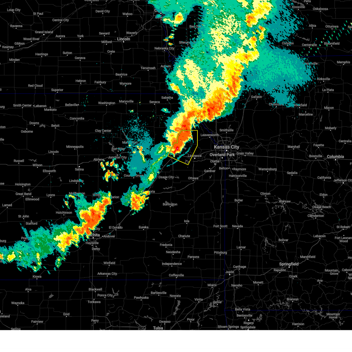 the severe thunderstorm warning has been cancelled and is no longer in effect the severe thunderstorm warning has been cancelled and is no longer in effect
|
| 8/14/2024 10:27 PM CDT |
 At 1026 pm cdt, severe thunderstorms were located along a line extending from 5 miles southwest of troy to 4 miles west of meriden to 4 miles northwest of burlingame, moving east at 45 mph (trained weather spotters. 1026 pm, off-duty nws employee reported 60 mph wind gusts). Hazards include 70 mph wind gusts. Expect considerable tree damage. damage is likely to mobile homes, roofs, and outbuildings. locations impacted include, topeka, northwestern lawrence, valley falls, oskaloosa, tecumseh, richland, silver lake, auburn, perry, mclouth, meriden, hoyt, ozawkie, nortonville, lecompton, clinton, winchester, pauline, williamstown, and perry lake. this includes the following highways, interstate 70 between mile markers 350 and 355. Kansas turnpike between mile markers 167 and 199. At 1026 pm cdt, severe thunderstorms were located along a line extending from 5 miles southwest of troy to 4 miles west of meriden to 4 miles northwest of burlingame, moving east at 45 mph (trained weather spotters. 1026 pm, off-duty nws employee reported 60 mph wind gusts). Hazards include 70 mph wind gusts. Expect considerable tree damage. damage is likely to mobile homes, roofs, and outbuildings. locations impacted include, topeka, northwestern lawrence, valley falls, oskaloosa, tecumseh, richland, silver lake, auburn, perry, mclouth, meriden, hoyt, ozawkie, nortonville, lecompton, clinton, winchester, pauline, williamstown, and perry lake. this includes the following highways, interstate 70 between mile markers 350 and 355. Kansas turnpike between mile markers 167 and 199.
|
| 8/14/2024 10:27 PM CDT |
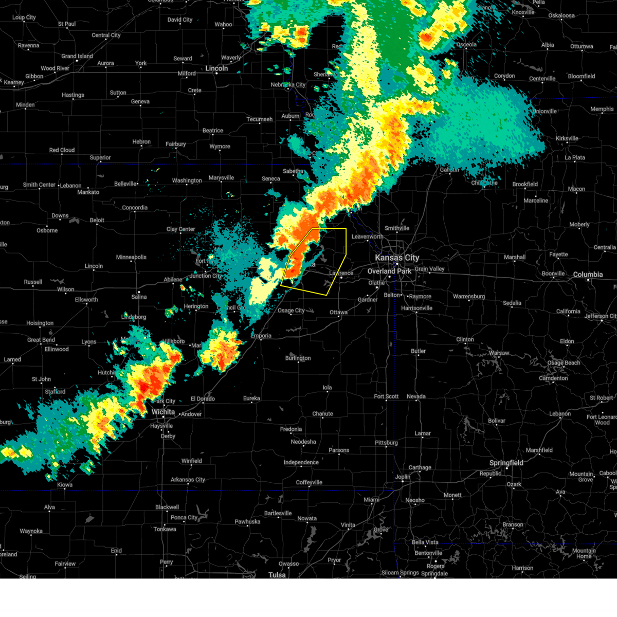 the severe thunderstorm warning has been cancelled and is no longer in effect the severe thunderstorm warning has been cancelled and is no longer in effect
|
| 8/14/2024 10:11 PM CDT |
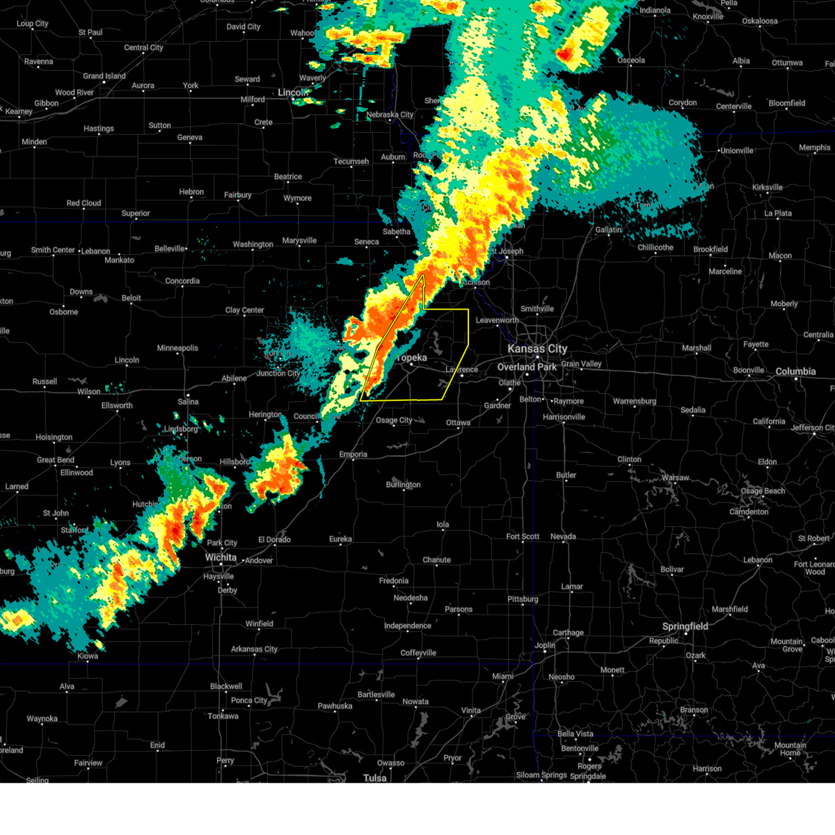 Svrtop the national weather service in topeka has issued a * severe thunderstorm warning for, jefferson county in northeastern kansas, shawnee county in east central kansas, southeastern wabaunsee county in east central kansas, northwestern douglas county in east central kansas, northern osage county in east central kansas, eastern jackson county in northeastern kansas, * until 1100 pm cdt. * at 1011 pm cdt, severe thunderstorms were located along a line extending from 4 miles southwest of denton to 3 miles northeast of silver lake to 5 miles west of harveyville, moving east at 45 mph (radar indicated). Hazards include 60 mph wind gusts. expect damage to roofs, siding, and trees Svrtop the national weather service in topeka has issued a * severe thunderstorm warning for, jefferson county in northeastern kansas, shawnee county in east central kansas, southeastern wabaunsee county in east central kansas, northwestern douglas county in east central kansas, northern osage county in east central kansas, eastern jackson county in northeastern kansas, * until 1100 pm cdt. * at 1011 pm cdt, severe thunderstorms were located along a line extending from 4 miles southwest of denton to 3 miles northeast of silver lake to 5 miles west of harveyville, moving east at 45 mph (radar indicated). Hazards include 60 mph wind gusts. expect damage to roofs, siding, and trees
|
| 7/31/2024 10:42 PM CDT |
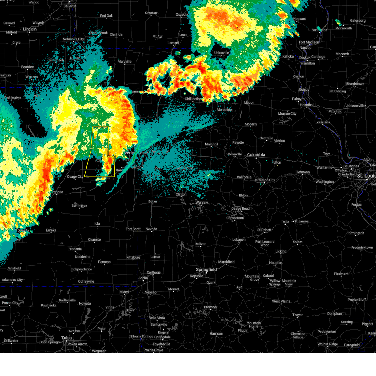 The storms which prompted the warning have moved out of the area. therefore, the warning will be allowed to expire. however, gusty winds are still possible with these thunderstorms. a severe thunderstorm watch remains in effect until 100 am cdt for northeastern and east central kansas. The storms which prompted the warning have moved out of the area. therefore, the warning will be allowed to expire. however, gusty winds are still possible with these thunderstorms. a severe thunderstorm watch remains in effect until 100 am cdt for northeastern and east central kansas.
|
| 7/31/2024 10:21 PM CDT |
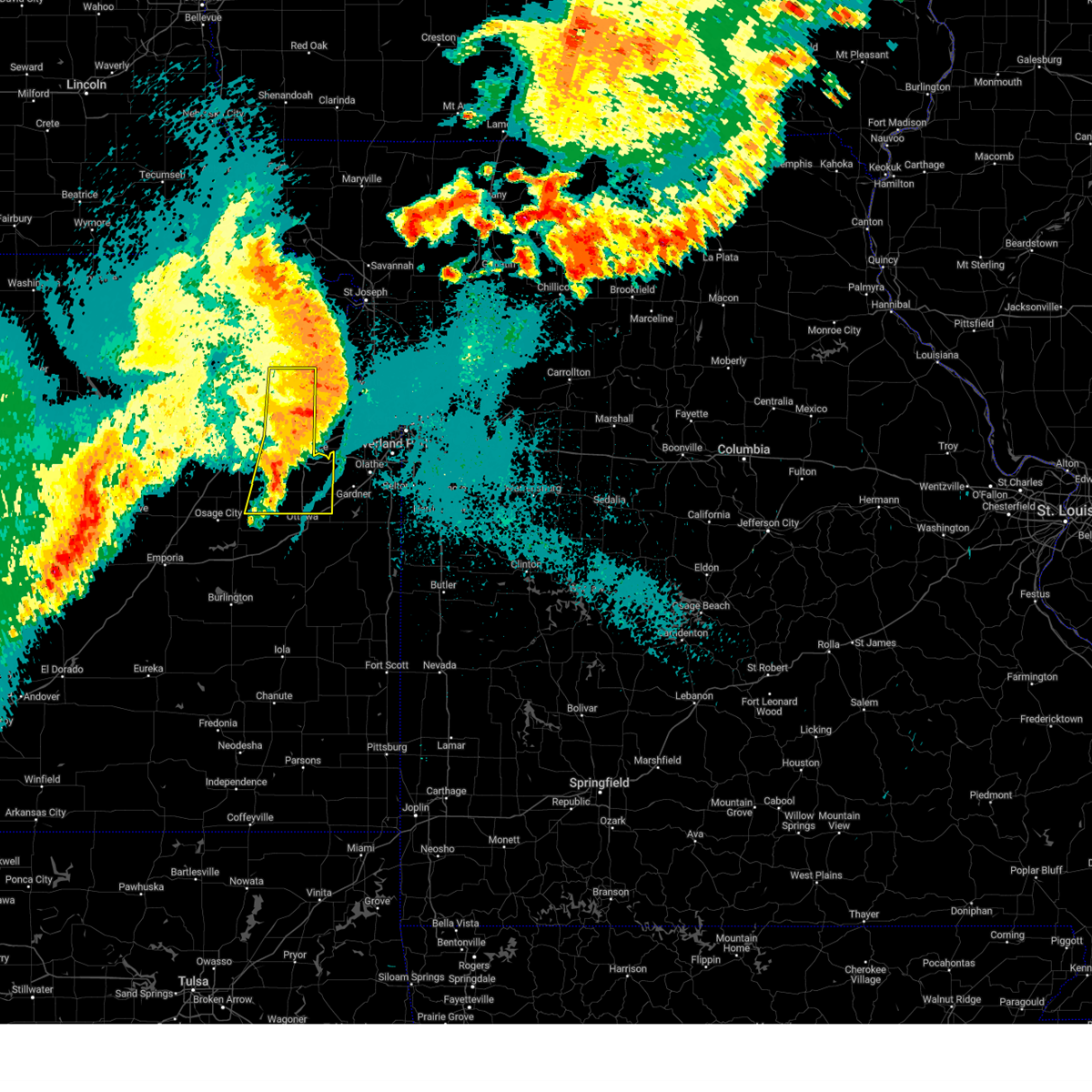 At 1020 pm cdt, severe thunderstorms were located along a line extending from 5 miles northwest of easton to 3 miles east of williamstown to 4 miles northeast of pomona lake, moving east at 25 mph (trained weather spotters. this storm has produced widespread tree damage and power line damage in the cities of lawrence and topeka and surrounding areas). Hazards include 60 mph wind gusts and nickel size hail. Expect damage to roofs, siding, and trees. locations impacted include, lawrence, baldwin city, valley falls, oskaloosa, eudora, richland, wellsville, overbrook, centropolis, perry, mclouth, ozawkie, nortonville, lecompton, clinton, winchester, lone star, pleasant grove, vinland, and williamstown. this includes the following highways, interstate 35 between mile markers 194 and 198. Kansas turnpike between mile markers 187 and 205. At 1020 pm cdt, severe thunderstorms were located along a line extending from 5 miles northwest of easton to 3 miles east of williamstown to 4 miles northeast of pomona lake, moving east at 25 mph (trained weather spotters. this storm has produced widespread tree damage and power line damage in the cities of lawrence and topeka and surrounding areas). Hazards include 60 mph wind gusts and nickel size hail. Expect damage to roofs, siding, and trees. locations impacted include, lawrence, baldwin city, valley falls, oskaloosa, eudora, richland, wellsville, overbrook, centropolis, perry, mclouth, ozawkie, nortonville, lecompton, clinton, winchester, lone star, pleasant grove, vinland, and williamstown. this includes the following highways, interstate 35 between mile markers 194 and 198. Kansas turnpike between mile markers 187 and 205.
|
| 7/31/2024 10:10 PM CDT |
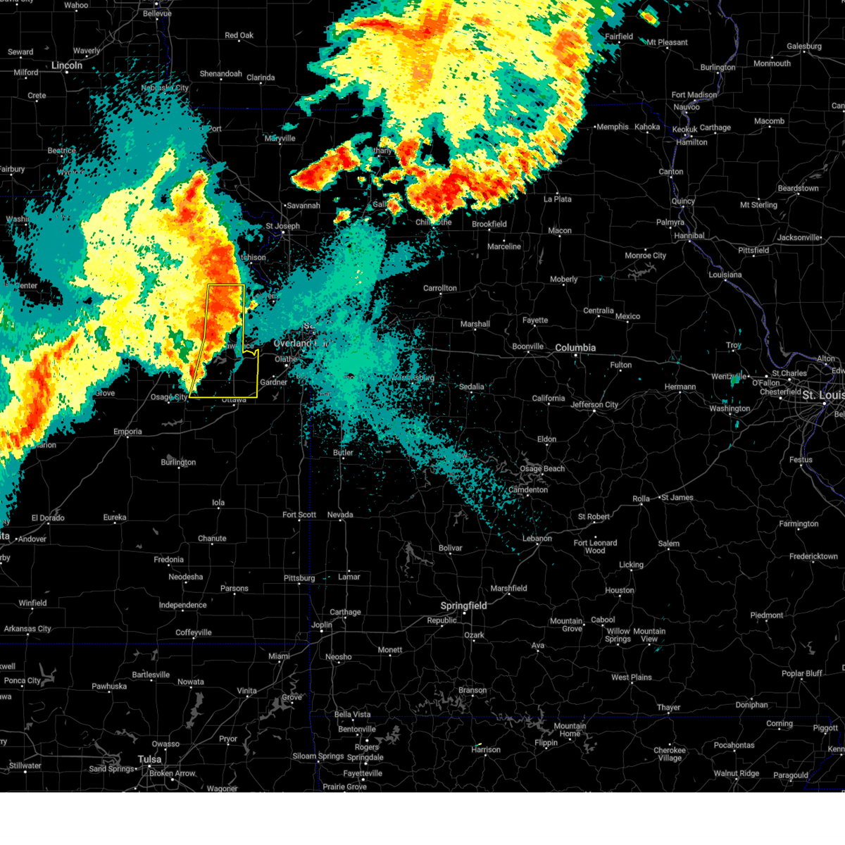 Svrtop the national weather service in topeka has issued a * severe thunderstorm warning for, northern franklin county in east central kansas, jefferson county in northeastern kansas, southeastern shawnee county in east central kansas, douglas county in east central kansas, northeastern osage county in east central kansas, * until 1045 pm cdt. * at 1009 pm cdt, severe thunderstorms were located along a line extending from 3 miles east of nortonville to williamstown to near pomona lake, moving east at 25 mph (trained weather spotters. this line of storms has a history of producing 60-70 mph wind gusts). Hazards include 60 mph wind gusts and nickel size hail. expect damage to roofs, siding, and trees Svrtop the national weather service in topeka has issued a * severe thunderstorm warning for, northern franklin county in east central kansas, jefferson county in northeastern kansas, southeastern shawnee county in east central kansas, douglas county in east central kansas, northeastern osage county in east central kansas, * until 1045 pm cdt. * at 1009 pm cdt, severe thunderstorms were located along a line extending from 3 miles east of nortonville to williamstown to near pomona lake, moving east at 25 mph (trained weather spotters. this line of storms has a history of producing 60-70 mph wind gusts). Hazards include 60 mph wind gusts and nickel size hail. expect damage to roofs, siding, and trees
|
| 7/31/2024 9:38 PM CDT |
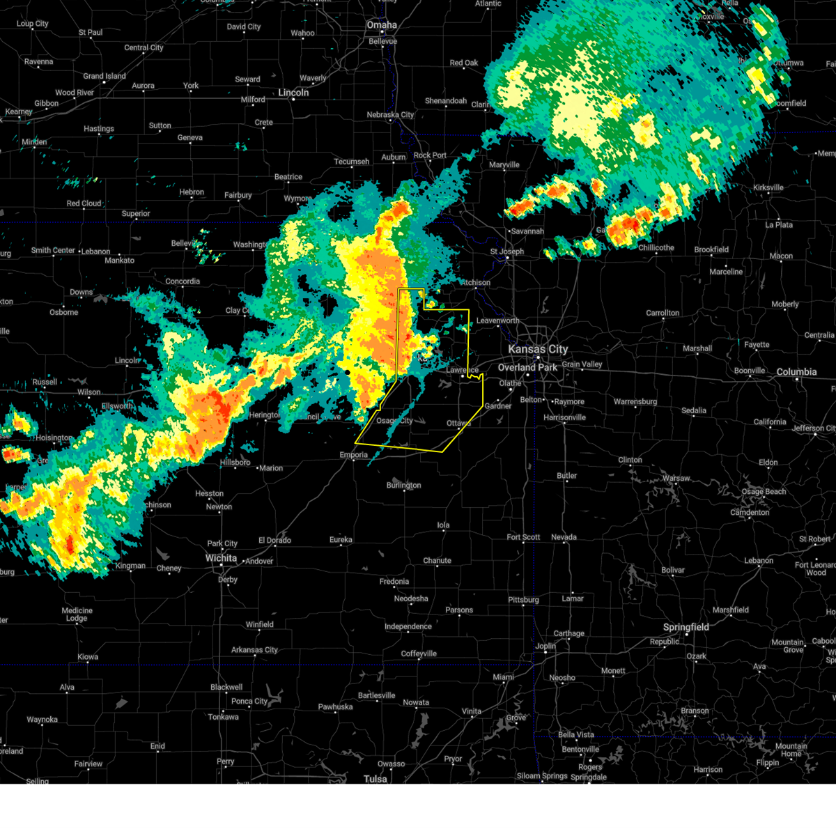 Svrtop the national weather service in topeka has issued a * severe thunderstorm warning for, western franklin county in east central kansas, jefferson county in northeastern kansas, shawnee county in east central kansas, douglas county in east central kansas, osage county in east central kansas, eastern jackson county in northeastern kansas, northeastern lyon county in east central kansas, * until 1015 pm cdt. * at 937 pm cdt, severe thunderstorms were located along a line extending from 4 miles east of holton to near richland to near olpe, moving east at 35 mph (trained weather spotters. 60 to 70 mph wind gusts have been reported along this line from dover to st. marys as the line passed). Hazards include 60 mph wind gusts and nickel size hail. expect damage to roofs, siding, and trees Svrtop the national weather service in topeka has issued a * severe thunderstorm warning for, western franklin county in east central kansas, jefferson county in northeastern kansas, shawnee county in east central kansas, douglas county in east central kansas, osage county in east central kansas, eastern jackson county in northeastern kansas, northeastern lyon county in east central kansas, * until 1015 pm cdt. * at 937 pm cdt, severe thunderstorms were located along a line extending from 4 miles east of holton to near richland to near olpe, moving east at 35 mph (trained weather spotters. 60 to 70 mph wind gusts have been reported along this line from dover to st. marys as the line passed). Hazards include 60 mph wind gusts and nickel size hail. expect damage to roofs, siding, and trees
|
| 7/31/2024 9:18 PM CDT |
 At 916 pm cdt, severe thunderstorms were located along a line extending from 4 miles southwest of circleville to 3 miles southwest of auburn to 3 miles west of olpe, moving east at 45 mph (trained weather spotters. wind gust of 70 mph were reported in dover at 913pm, and 68mph wind gusts were reported 2 miles nw of wamego at 854pm). Hazards include 70 mph wind gusts and nickel size hail. Expect considerable tree damage. damage is likely to mobile homes, roofs, and outbuildings. locations impacted include, topeka, emporia, holton, osage city, carbondale, valley falls, rossville, eskridge, tecumseh, st. marys, richland, dover, silver lake, auburn, overbrook, lyndon, lebo, burlingame, perry, and americus. this includes the following highways, interstate 35 between mile markers 128 and 162. interstate 70 between mile markers 337 and 355. Kansas turnpike between mile markers 117 and 195. At 916 pm cdt, severe thunderstorms were located along a line extending from 4 miles southwest of circleville to 3 miles southwest of auburn to 3 miles west of olpe, moving east at 45 mph (trained weather spotters. wind gust of 70 mph were reported in dover at 913pm, and 68mph wind gusts were reported 2 miles nw of wamego at 854pm). Hazards include 70 mph wind gusts and nickel size hail. Expect considerable tree damage. damage is likely to mobile homes, roofs, and outbuildings. locations impacted include, topeka, emporia, holton, osage city, carbondale, valley falls, rossville, eskridge, tecumseh, st. marys, richland, dover, silver lake, auburn, overbrook, lyndon, lebo, burlingame, perry, and americus. this includes the following highways, interstate 35 between mile markers 128 and 162. interstate 70 between mile markers 337 and 355. Kansas turnpike between mile markers 117 and 195.
|
| 7/31/2024 9:07 PM CDT |
 Svrtop the national weather service in topeka has issued a * severe thunderstorm warning for, northwestern franklin county in east central kansas, western jefferson county in northeastern kansas, shawnee county in east central kansas, eastern wabaunsee county in east central kansas, western douglas county in east central kansas, osage county in east central kansas, eastern pottawatomie county in northeastern kansas, southeastern nemaha county in northeastern kansas, jackson county in northeastern kansas, western coffey county in east central kansas, lyon county in east central kansas, * until 945 pm cdt. * at 906 pm cdt, severe thunderstorms were located along a line extending from 3 miles southeast of havensville to 6 miles north of harveyville to 10 miles west of olpe, moving east at 45 mph (radar indicated). Hazards include 60 mph wind gusts and nickel size hail. expect damage to roofs, siding, and trees Svrtop the national weather service in topeka has issued a * severe thunderstorm warning for, northwestern franklin county in east central kansas, western jefferson county in northeastern kansas, shawnee county in east central kansas, eastern wabaunsee county in east central kansas, western douglas county in east central kansas, osage county in east central kansas, eastern pottawatomie county in northeastern kansas, southeastern nemaha county in northeastern kansas, jackson county in northeastern kansas, western coffey county in east central kansas, lyon county in east central kansas, * until 945 pm cdt. * at 906 pm cdt, severe thunderstorms were located along a line extending from 3 miles southeast of havensville to 6 miles north of harveyville to 10 miles west of olpe, moving east at 45 mph (radar indicated). Hazards include 60 mph wind gusts and nickel size hail. expect damage to roofs, siding, and trees
|
| 7/16/2024 7:46 AM CDT |
 At 745 am cdt, severe thunderstorms were located along a line extending from near oskaloosa to 4 miles north of lawrence to lone star, moving east at 55 mph (at 7:45am, nws employees in lawrence estimated 70mph wind gusts). Hazards include 70 mph wind gusts and penny size hail. Expect considerable tree damage. damage is likely to mobile homes, roofs, and outbuildings. locations impacted include, lawrence, oskaloosa, eudora, perry, mclouth, nortonville, lecompton, clinton, winchester, lone star, pleasant grove, vinland, williamstown, and clinton lake. This includes kansas turnpike between mile markers 192 and 205. At 745 am cdt, severe thunderstorms were located along a line extending from near oskaloosa to 4 miles north of lawrence to lone star, moving east at 55 mph (at 7:45am, nws employees in lawrence estimated 70mph wind gusts). Hazards include 70 mph wind gusts and penny size hail. Expect considerable tree damage. damage is likely to mobile homes, roofs, and outbuildings. locations impacted include, lawrence, oskaloosa, eudora, perry, mclouth, nortonville, lecompton, clinton, winchester, lone star, pleasant grove, vinland, williamstown, and clinton lake. This includes kansas turnpike between mile markers 192 and 205.
|
| 7/16/2024 7:38 AM CDT | Large tree uprooted. time based on radar dat in jefferson county KS, 0.5 miles S of Perry, KS |
| 7/16/2024 7:36 AM CDT |
 At 736 am cdt, severe thunderstorms were located along a line extending from near ozawkie to near williamstown to 3 miles southwest of clinton lake, moving east at 55 mph (radar indicated). Hazards include 70 mph wind gusts and nickel size hail. Expect considerable tree damage. damage is likely to mobile homes, roofs, and outbuildings. locations impacted include, topeka, western lawrence, valley falls, oskaloosa, tecumseh, richland, perry, mclouth, meriden, hoyt, ozawkie, nortonville, lecompton, clinton, winchester, mayetta, lone star, denison, pauline, and williamstown. this includes the following highways, interstate 70 between mile markers 354 and 355. Kansas turnpike between mile markers 170 and 202. At 736 am cdt, severe thunderstorms were located along a line extending from near ozawkie to near williamstown to 3 miles southwest of clinton lake, moving east at 55 mph (radar indicated). Hazards include 70 mph wind gusts and nickel size hail. Expect considerable tree damage. damage is likely to mobile homes, roofs, and outbuildings. locations impacted include, topeka, western lawrence, valley falls, oskaloosa, tecumseh, richland, perry, mclouth, meriden, hoyt, ozawkie, nortonville, lecompton, clinton, winchester, mayetta, lone star, denison, pauline, and williamstown. this includes the following highways, interstate 70 between mile markers 354 and 355. Kansas turnpike between mile markers 170 and 202.
|
| 7/16/2024 7:33 AM CDT |
 Svrtop the national weather service in topeka has issued a * severe thunderstorm warning for, eastern jefferson county in northeastern kansas, central douglas county in east central kansas, * until 800 am cdt. * at 733 am cdt, severe thunderstorms were located along a line extending from near ozawkie to near lecompton to richland, moving east at 55 mph (at 7:25am, the automated weather station at topeka billard airport measured a 68mph wind gust). Hazards include 70 mph wind gusts and nickel size hail. Expect considerable tree damage. Damage is likely to mobile homes, roofs, and outbuildings. Svrtop the national weather service in topeka has issued a * severe thunderstorm warning for, eastern jefferson county in northeastern kansas, central douglas county in east central kansas, * until 800 am cdt. * at 733 am cdt, severe thunderstorms were located along a line extending from near ozawkie to near lecompton to richland, moving east at 55 mph (at 7:25am, the automated weather station at topeka billard airport measured a 68mph wind gust). Hazards include 70 mph wind gusts and nickel size hail. Expect considerable tree damage. Damage is likely to mobile homes, roofs, and outbuildings.
|
| 7/16/2024 7:30 AM CDT |
 At 728 am cdt, severe thunderstorms were located along a line extending from 4 miles north of meriden to 3 miles west of lecompton to near richland, moving east at 55 mph (at 7:25 am, automated weather station at topeka billard airport measured a 68 mph wind gusts). Hazards include 70 mph wind gusts and nickel size hail. Expect considerable tree damage. damage is likely to mobile homes, roofs, and outbuildings. locations impacted include, topeka, western lawrence, valley falls, rossville, oskaloosa, tecumseh, richland, dover, silver lake, auburn, perry, mclouth, meriden, hoyt, ozawkie, nortonville, lecompton, clinton, winchester, and mayetta. this includes the following highways, interstate 70 between mile markers 346 and 355. Kansas turnpike between mile markers 170 and 202. At 728 am cdt, severe thunderstorms were located along a line extending from 4 miles north of meriden to 3 miles west of lecompton to near richland, moving east at 55 mph (at 7:25 am, automated weather station at topeka billard airport measured a 68 mph wind gusts). Hazards include 70 mph wind gusts and nickel size hail. Expect considerable tree damage. damage is likely to mobile homes, roofs, and outbuildings. locations impacted include, topeka, western lawrence, valley falls, rossville, oskaloosa, tecumseh, richland, dover, silver lake, auburn, perry, mclouth, meriden, hoyt, ozawkie, nortonville, lecompton, clinton, winchester, and mayetta. this includes the following highways, interstate 70 between mile markers 346 and 355. Kansas turnpike between mile markers 170 and 202.
|
| 7/16/2024 7:30 AM CDT |
 the severe thunderstorm warning has been cancelled and is no longer in effect the severe thunderstorm warning has been cancelled and is no longer in effect
|
| 7/16/2024 7:25 AM CDT | Report from mping: shingles blown off. time estimated from radar dat in jefferson county KS, 5.6 miles ESE of Perry, KS |
| 7/16/2024 7:18 AM CDT |
 At 718 am cdt, severe thunderstorms were located along a line extending from near mayetta to near grantville to 3 miles east of auburn, moving east at 60 mph (at 7:11 am, a storm chaser and trained spotter reported 60 to 70 mph winds 5 miles east of silver lake). Hazards include 70 mph wind gusts and nickel size hail. Expect considerable tree damage. damage is likely to mobile homes, roofs, and outbuildings. locations impacted include, topeka, western lawrence, valley falls, rossville, oskaloosa, tecumseh, st. marys, richland, dover, silver lake, perry, mclouth, meriden, hoyt, ozawkie, nortonville, lecompton, maple hill, clinton, and winchester. this includes the following highways, interstate 70 between mile markers 336 and 355. Kansas turnpike between mile markers 170 and 202. At 718 am cdt, severe thunderstorms were located along a line extending from near mayetta to near grantville to 3 miles east of auburn, moving east at 60 mph (at 7:11 am, a storm chaser and trained spotter reported 60 to 70 mph winds 5 miles east of silver lake). Hazards include 70 mph wind gusts and nickel size hail. Expect considerable tree damage. damage is likely to mobile homes, roofs, and outbuildings. locations impacted include, topeka, western lawrence, valley falls, rossville, oskaloosa, tecumseh, st. marys, richland, dover, silver lake, perry, mclouth, meriden, hoyt, ozawkie, nortonville, lecompton, maple hill, clinton, and winchester. this includes the following highways, interstate 70 between mile markers 336 and 355. Kansas turnpike between mile markers 170 and 202.
|
| 7/16/2024 7:09 AM CDT |
 Svrtop the national weather service in topeka has issued a * severe thunderstorm warning for, jefferson county in northeastern kansas, shawnee county in east central kansas, northeastern wabaunsee county in east central kansas, northwestern douglas county in east central kansas, southeastern pottawatomie county in northeastern kansas, southern jackson county in northeastern kansas, * until 745 am cdt. * at 709 am cdt, severe thunderstorms were located along a line extending from potawatomi reservation to 5 miles east of silver lake to 3 miles southeast of dover, moving east at 65 mph (radar indicated). Hazards include 70 mph wind gusts and nickel size hail. Expect considerable tree damage. Damage is likely to mobile homes, roofs, and outbuildings. Svrtop the national weather service in topeka has issued a * severe thunderstorm warning for, jefferson county in northeastern kansas, shawnee county in east central kansas, northeastern wabaunsee county in east central kansas, northwestern douglas county in east central kansas, southeastern pottawatomie county in northeastern kansas, southern jackson county in northeastern kansas, * until 745 am cdt. * at 709 am cdt, severe thunderstorms were located along a line extending from potawatomi reservation to 5 miles east of silver lake to 3 miles southeast of dover, moving east at 65 mph (radar indicated). Hazards include 70 mph wind gusts and nickel size hail. Expect considerable tree damage. Damage is likely to mobile homes, roofs, and outbuildings.
|
| 6/28/2024 9:12 PM CDT |
 The storms which prompted the warning have weakened below severe limits, and no longer pose an immediate threat to life or property. therefore, the warning will be allowed to expire. however, small hail, gusty winds and heavy rain are still possible with these thunderstorms. a tornado watch remains in effect until 1100 pm cdt for northeastern and east central kansas. The storms which prompted the warning have weakened below severe limits, and no longer pose an immediate threat to life or property. therefore, the warning will be allowed to expire. however, small hail, gusty winds and heavy rain are still possible with these thunderstorms. a tornado watch remains in effect until 1100 pm cdt for northeastern and east central kansas.
|
| 6/28/2024 9:03 PM CDT |
 At 902 pm cdt, severe thunderstorms were located along a line extending from lecompton to lawrence to lone star, moving east at 40 mph (radar indicated). Hazards include 60 mph wind gusts and penny size hail. Expect damage to roofs, siding, and trees. locations impacted include, lawrence, perry, lecompton, clinton, lone star, pleasant grove, and williamstown. This includes kansas turnpike between mile markers 194 and 205. At 902 pm cdt, severe thunderstorms were located along a line extending from lecompton to lawrence to lone star, moving east at 40 mph (radar indicated). Hazards include 60 mph wind gusts and penny size hail. Expect damage to roofs, siding, and trees. locations impacted include, lawrence, perry, lecompton, clinton, lone star, pleasant grove, and williamstown. This includes kansas turnpike between mile markers 194 and 205.
|
| 6/28/2024 8:53 PM CDT |
 the severe thunderstorm warning has been cancelled and is no longer in effect the severe thunderstorm warning has been cancelled and is no longer in effect
|
| 6/28/2024 8:53 PM CDT |
 At 853 pm cdt, severe thunderstorms were located along a line extending from near williamstown to 3 miles northeast of clinton lake to near richland, moving east at 45 mph (radar indicated). Hazards include 60 mph wind gusts and nickel size hail. Expect damage to roofs, siding, and trees. locations impacted include, lawrence, perry, lecompton, clinton, lone star, pleasant grove, clinton lake, and williamstown. This includes kansas turnpike between mile markers 189 and 205. At 853 pm cdt, severe thunderstorms were located along a line extending from near williamstown to 3 miles northeast of clinton lake to near richland, moving east at 45 mph (radar indicated). Hazards include 60 mph wind gusts and nickel size hail. Expect damage to roofs, siding, and trees. locations impacted include, lawrence, perry, lecompton, clinton, lone star, pleasant grove, clinton lake, and williamstown. This includes kansas turnpike between mile markers 189 and 205.
|
| 6/28/2024 8:49 PM CDT |
 At 849 pm cdt, a severe thunderstorm was located over perry, moving east at 25 mph (radar indicated). Hazards include 60 mph wind gusts and penny size hail. Expect damage to roofs, siding, and trees. locations impacted include, northern lawrence, tecumseh, perry, lecompton, williamstown, perry lake, and grantville. This includes kansas turnpike between mile markers 184 and 200. At 849 pm cdt, a severe thunderstorm was located over perry, moving east at 25 mph (radar indicated). Hazards include 60 mph wind gusts and penny size hail. Expect damage to roofs, siding, and trees. locations impacted include, northern lawrence, tecumseh, perry, lecompton, williamstown, perry lake, and grantville. This includes kansas turnpike between mile markers 184 and 200.
|
| 6/28/2024 8:41 PM CDT |
 Svrtop the national weather service in topeka has issued a * severe thunderstorm warning for, southern jefferson county in northeastern kansas, southeastern shawnee county in east central kansas, northwestern douglas county in east central kansas, * until 915 pm cdt. * at 840 pm cdt, severe thunderstorms were located along a line extending from near lecompton to 5 miles north of richland to 4 miles southwest of berryton, moving east at 40 mph (radar indicated). Hazards include 60 mph wind gusts and nickel size hail. expect damage to roofs, siding, and trees Svrtop the national weather service in topeka has issued a * severe thunderstorm warning for, southern jefferson county in northeastern kansas, southeastern shawnee county in east central kansas, northwestern douglas county in east central kansas, * until 915 pm cdt. * at 840 pm cdt, severe thunderstorms were located along a line extending from near lecompton to 5 miles north of richland to 4 miles southwest of berryton, moving east at 40 mph (radar indicated). Hazards include 60 mph wind gusts and nickel size hail. expect damage to roofs, siding, and trees
|
| 6/28/2024 8:33 PM CDT |
 At 831 pm cdt, a severe thunderstorm was located 4 miles west of perry, moving east at 30 mph (radar indicated). Hazards include 60 mph wind gusts and quarter size hail. Hail damage to vehicles is expected. expect wind damage to roofs, siding, and trees. locations impacted include, northern lawrence, oskaloosa, tecumseh, perry, mclouth, lecompton, williamstown, perry lake, and grantville. this includes kansas turnpike between mile markers 184 and 200. At 622 pm cdt, the automated weather station at billard field recorded a 61 mph wind gust. At 831 pm cdt, a severe thunderstorm was located 4 miles west of perry, moving east at 30 mph (radar indicated). Hazards include 60 mph wind gusts and quarter size hail. Hail damage to vehicles is expected. expect wind damage to roofs, siding, and trees. locations impacted include, northern lawrence, oskaloosa, tecumseh, perry, mclouth, lecompton, williamstown, perry lake, and grantville. this includes kansas turnpike between mile markers 184 and 200. At 622 pm cdt, the automated weather station at billard field recorded a 61 mph wind gust.
|
| 6/28/2024 8:26 PM CDT |
 Svrtop the national weather service in topeka has issued a * severe thunderstorm warning for, southern jefferson county in northeastern kansas, northeastern shawnee county in east central kansas, northwestern douglas county in east central kansas, * until 900 pm cdt. * at 825 pm cdt, a severe thunderstorm was located near grantville, moving east at 35 mph (radar indicated). Hazards include 60 mph wind gusts and quarter size hail. Hail damage to vehicles is expected. Expect wind damage to roofs, siding, and trees. Svrtop the national weather service in topeka has issued a * severe thunderstorm warning for, southern jefferson county in northeastern kansas, northeastern shawnee county in east central kansas, northwestern douglas county in east central kansas, * until 900 pm cdt. * at 825 pm cdt, a severe thunderstorm was located near grantville, moving east at 35 mph (radar indicated). Hazards include 60 mph wind gusts and quarter size hail. Hail damage to vehicles is expected. Expect wind damage to roofs, siding, and trees.
|
| 5/19/2024 11:09 PM CDT |
 The storms which prompted the warning have weakened below severe limits, and no longer pose an immediate threat to life or property. therefore, the warning will be allowed to expire. however, gusty winds are still expected with these thunderstorms. a severe thunderstorm watch remains in effect until 200 am cdt for northeastern and east central kansas. remember, a severe thunderstorm warning still remains in effect for northern jefferson and northeastern jackson counties until 1130 pm. The storms which prompted the warning have weakened below severe limits, and no longer pose an immediate threat to life or property. therefore, the warning will be allowed to expire. however, gusty winds are still expected with these thunderstorms. a severe thunderstorm watch remains in effect until 200 am cdt for northeastern and east central kansas. remember, a severe thunderstorm warning still remains in effect for northern jefferson and northeastern jackson counties until 1130 pm.
|
| 5/19/2024 10:26 PM CDT |
 Svrtop the national weather service in topeka has issued a * severe thunderstorm warning for, southern jefferson county in northeastern kansas, shawnee county in east central kansas, northeastern wabaunsee county in east central kansas, southeastern pottawatomie county in northeastern kansas, southern jackson county in northeastern kansas, * until 1115 pm cdt. * at 1026 pm cdt, severe thunderstorms were located along a line extending from near rossville to near perry, moving northeast at 20 mph (radar indicated). Hazards include 60 mph wind gusts and nickel size hail. expect damage to roofs, siding, and trees Svrtop the national weather service in topeka has issued a * severe thunderstorm warning for, southern jefferson county in northeastern kansas, shawnee county in east central kansas, northeastern wabaunsee county in east central kansas, southeastern pottawatomie county in northeastern kansas, southern jackson county in northeastern kansas, * until 1115 pm cdt. * at 1026 pm cdt, severe thunderstorms were located along a line extending from near rossville to near perry, moving northeast at 20 mph (radar indicated). Hazards include 60 mph wind gusts and nickel size hail. expect damage to roofs, siding, and trees
|
| 5/19/2024 10:20 PM CDT |
 the severe thunderstorm warning has been cancelled and is no longer in effect the severe thunderstorm warning has been cancelled and is no longer in effect
|
| 5/19/2024 10:20 PM CDT |
 At 1019 pm cdt, severe thunderstorms were located along a line extending from 5 miles northeast of lawrence to 6 miles northwest of paola to 5 miles west of mound city, moving northeast at 55 mph (radar indicated). Hazards include 60 mph wind gusts and quarter size hail. Hail damage to vehicles is expected. expect wind damage to roofs, siding, and trees. locations impacted include, lawrence, baldwin city, eudora, wellsville, perry, lecompton, clinton, lone star, greeley, lane, rantoul, pleasant grove, vinland, williamstown, and clinton lake. this includes the following highways, interstate 35 between mile markers 192 and 198. Kansas turnpike between mile markers 190 and 205. At 1019 pm cdt, severe thunderstorms were located along a line extending from 5 miles northeast of lawrence to 6 miles northwest of paola to 5 miles west of mound city, moving northeast at 55 mph (radar indicated). Hazards include 60 mph wind gusts and quarter size hail. Hail damage to vehicles is expected. expect wind damage to roofs, siding, and trees. locations impacted include, lawrence, baldwin city, eudora, wellsville, perry, lecompton, clinton, lone star, greeley, lane, rantoul, pleasant grove, vinland, williamstown, and clinton lake. this includes the following highways, interstate 35 between mile markers 192 and 198. Kansas turnpike between mile markers 190 and 205.
|
| 5/19/2024 10:02 PM CDT |
 At 1002 pm cdt, severe thunderstorms were located along a line extending from 3 miles north of clinton lake to 3 miles northwest of rantoul to near kincaid, moving northeast at 55 mph (radar indicated). Hazards include 60 mph wind gusts and quarter size hail. Hail damage to vehicles is expected. expect wind damage to roofs, siding, and trees. locations impacted include, lawrence, ottawa, baldwin city, garnett, eudora, richland, wellsville, centropolis, perry, lecompton, clinton, richmond, lone star, greeley, princeton, lane, rantoul, kincaid, pleasant grove, and lone elm. this includes the following highways, interstate 35 between mile markers 179 and 198. Kansas turnpike between mile markers 190 and 205. At 1002 pm cdt, severe thunderstorms were located along a line extending from 3 miles north of clinton lake to 3 miles northwest of rantoul to near kincaid, moving northeast at 55 mph (radar indicated). Hazards include 60 mph wind gusts and quarter size hail. Hail damage to vehicles is expected. expect wind damage to roofs, siding, and trees. locations impacted include, lawrence, ottawa, baldwin city, garnett, eudora, richland, wellsville, centropolis, perry, lecompton, clinton, richmond, lone star, greeley, princeton, lane, rantoul, kincaid, pleasant grove, and lone elm. this includes the following highways, interstate 35 between mile markers 179 and 198. Kansas turnpike between mile markers 190 and 205.
|
| 5/19/2024 9:48 PM CDT |
 Svrtop the national weather service in topeka has issued a * severe thunderstorm warning for, jefferson county in northeastern kansas, shawnee county in east central kansas, northeastern wabaunsee county in east central kansas, northwestern douglas county in east central kansas, north central osage county in east central kansas, southeastern pottawatomie county in northeastern kansas, jackson county in northeastern kansas, * until 1030 pm cdt. * at 948 pm cdt, severe thunderstorms were located along a line extending from 3 miles southeast of belvue to 3 miles southeast of auburn, moving northeast at 35 mph (radar indicated). Hazards include 60 mph wind gusts and quarter size hail. Hail damage to vehicles is expected. Expect wind damage to roofs, siding, and trees. Svrtop the national weather service in topeka has issued a * severe thunderstorm warning for, jefferson county in northeastern kansas, shawnee county in east central kansas, northeastern wabaunsee county in east central kansas, northwestern douglas county in east central kansas, north central osage county in east central kansas, southeastern pottawatomie county in northeastern kansas, jackson county in northeastern kansas, * until 1030 pm cdt. * at 948 pm cdt, severe thunderstorms were located along a line extending from 3 miles southeast of belvue to 3 miles southeast of auburn, moving northeast at 35 mph (radar indicated). Hazards include 60 mph wind gusts and quarter size hail. Hail damage to vehicles is expected. Expect wind damage to roofs, siding, and trees.
|
| 5/19/2024 9:45 PM CDT |
 Svrtop the national weather service in topeka has issued a * severe thunderstorm warning for, franklin county in east central kansas, southeastern jefferson county in northeastern kansas, southeastern shawnee county in east central kansas, anderson county in east central kansas, douglas county in east central kansas, northeastern osage county in east central kansas, * until 1030 pm cdt. * at 945 pm cdt, severe thunderstorms were located along a line extending from 3 miles south of berryton to 5 miles northeast of williamsburg to 4 miles south of colony, moving northeast at 50 mph (radar indicated). Hazards include 70 mph wind gusts and quarter size hail. Hail damage to vehicles is expected. expect considerable tree damage. Wind damage is also likely to mobile homes, roofs, and outbuildings. Svrtop the national weather service in topeka has issued a * severe thunderstorm warning for, franklin county in east central kansas, southeastern jefferson county in northeastern kansas, southeastern shawnee county in east central kansas, anderson county in east central kansas, douglas county in east central kansas, northeastern osage county in east central kansas, * until 1030 pm cdt. * at 945 pm cdt, severe thunderstorms were located along a line extending from 3 miles south of berryton to 5 miles northeast of williamsburg to 4 miles south of colony, moving northeast at 50 mph (radar indicated). Hazards include 70 mph wind gusts and quarter size hail. Hail damage to vehicles is expected. expect considerable tree damage. Wind damage is also likely to mobile homes, roofs, and outbuildings.
|
| 4/30/2024 8:14 PM CDT | Report from mping: trees uprooted or snapped; roof blown of in jefferson county KS, 3.4 miles WNW of Perry, KS |
| 4/30/2024 8:13 PM CDT | Report from mping: 3-inch tree limbs broken; power poles broke in jefferson county KS, 3.4 miles WNW of Perry, KS |
| 4/30/2024 7:11 PM CDT | Golf Ball sized hail reported 6 miles W of Perry, KS |
| 4/30/2024 7:09 PM CDT | Quarter sized hail reported 5.1 miles SW of Perry, KS |
| 4/30/2024 7:07 PM CDT |
 At 707 pm cdt, a confirmed tornado was located 1 south of williamstown, moving east at 25 mph (weather spotters confirmed tornado). Hazards include damaging tornado and two inch hail. Flying debris will be dangerous to those caught without shelter. mobile homes will be damaged or destroyed. damage to roofs, windows, and vehicles will occur. tree damage is likely. locations impacted include, lawrence, perry, lecompton, and williamstown. This includes kansas turnpike between mile markers 190 and 205. At 707 pm cdt, a confirmed tornado was located 1 south of williamstown, moving east at 25 mph (weather spotters confirmed tornado). Hazards include damaging tornado and two inch hail. Flying debris will be dangerous to those caught without shelter. mobile homes will be damaged or destroyed. damage to roofs, windows, and vehicles will occur. tree damage is likely. locations impacted include, lawrence, perry, lecompton, and williamstown. This includes kansas turnpike between mile markers 190 and 205.
|
| 4/30/2024 7:06 PM CDT | Hen Egg sized hail reported 3.3 miles W of Perry, KS |
| 4/30/2024 7:03 PM CDT | Ping Pong Ball sized hail reported 0.8 miles SW of Perry, KS, report from mping: ping pong ball (1.50 in.). |
| 4/30/2024 7:02 PM CDT | Quarter sized hail reported 3.4 miles WNW of Perry, KS |
| 4/30/2024 7:01 PM CDT |
 At 700 pm cdt, a severe thunderstorm capable of producing a tornado was located over lecompton, moving southeast at 25 mph (radar indicated rotation). Hazards include tornado and ping pong ball size hail. Flying debris will be dangerous to those caught without shelter. mobile homes will be damaged or destroyed. damage to roofs, windows, and vehicles will occur. tree damage is likely. locations impacted include, perry, meriden, lecompton, perry lake, and grantville. This includes kansas turnpike between mile markers 193 and 194. At 700 pm cdt, a severe thunderstorm capable of producing a tornado was located over lecompton, moving southeast at 25 mph (radar indicated rotation). Hazards include tornado and ping pong ball size hail. Flying debris will be dangerous to those caught without shelter. mobile homes will be damaged or destroyed. damage to roofs, windows, and vehicles will occur. tree damage is likely. locations impacted include, perry, meriden, lecompton, perry lake, and grantville. This includes kansas turnpike between mile markers 193 and 194.
|
| 4/30/2024 7:01 PM CDT |
 the tornado warning has been cancelled and is no longer in effect the tornado warning has been cancelled and is no longer in effect
|
| 4/30/2024 6:59 PM CDT |
 the tornado warning has been cancelled and is no longer in effect the tornado warning has been cancelled and is no longer in effect
|
| 4/30/2024 6:59 PM CDT |
 At 659 pm cdt, a severe thunderstorm capable of producing a tornado was located near grantville, moving east at 15 mph (radar indicated rotation). Hazards include tornado and ping pong ball size hail. Flying debris will be dangerous to those caught without shelter. mobile homes will be damaged or destroyed. damage to roofs, windows, and vehicles will occur. tree damage is likely. locations impacted include, perry, meriden, lecompton, perry lake, and grantville. This includes kansas turnpike between mile markers 189 and 194. At 659 pm cdt, a severe thunderstorm capable of producing a tornado was located near grantville, moving east at 15 mph (radar indicated rotation). Hazards include tornado and ping pong ball size hail. Flying debris will be dangerous to those caught without shelter. mobile homes will be damaged or destroyed. damage to roofs, windows, and vehicles will occur. tree damage is likely. locations impacted include, perry, meriden, lecompton, perry lake, and grantville. This includes kansas turnpike between mile markers 189 and 194.
|
| 4/30/2024 6:57 PM CDT |
 Tortop the national weather service in topeka has issued a * tornado warning for, southern jefferson county in northeastern kansas, northwestern douglas county in east central kansas, * until 730 pm cdt. * at 656 pm cdt, a severe thunderstorm capable of producing a tornado was located over lecompton, moving east at 30 mph (radar indicated rotation). Hazards include tornado. Flying debris will be dangerous to those caught without shelter. mobile homes will be damaged or destroyed. damage to roofs, windows, and vehicles will occur. Tree damage is likely. Tortop the national weather service in topeka has issued a * tornado warning for, southern jefferson county in northeastern kansas, northwestern douglas county in east central kansas, * until 730 pm cdt. * at 656 pm cdt, a severe thunderstorm capable of producing a tornado was located over lecompton, moving east at 30 mph (radar indicated rotation). Hazards include tornado. Flying debris will be dangerous to those caught without shelter. mobile homes will be damaged or destroyed. damage to roofs, windows, and vehicles will occur. Tree damage is likely.
|
| 4/30/2024 6:54 PM CDT | Estimated 70-80 mph wind in jefferson county KS, 6.1 miles ESE of Perry, KS |
| 4/30/2024 6:51 PM CDT |
 At 651 pm cdt, a confirmed tornado was located near grantville, moving east at 15 mph (public confirmed tornado 2 miles northwest of grantville). Hazards include damaging tornado and ping pong ball size hail. Flying debris will be dangerous to those caught without shelter. mobile homes will be damaged or destroyed. damage to roofs, windows, and vehicles will occur. tree damage is likely. locations impacted include, northern topeka, tecumseh, perry, meriden, lecompton, perry lake, and grantville. This includes kansas turnpike between mile markers 181 and 194. At 651 pm cdt, a confirmed tornado was located near grantville, moving east at 15 mph (public confirmed tornado 2 miles northwest of grantville). Hazards include damaging tornado and ping pong ball size hail. Flying debris will be dangerous to those caught without shelter. mobile homes will be damaged or destroyed. damage to roofs, windows, and vehicles will occur. tree damage is likely. locations impacted include, northern topeka, tecumseh, perry, meriden, lecompton, perry lake, and grantville. This includes kansas turnpike between mile markers 181 and 194.
|
| 4/30/2024 6:45 PM CDT |
 At 644 pm cdt, a severe thunderstorm capable of producing a tornado was located 2 miles north-northwest grantville, moving east at 20 mph (radar indicated rotation). Hazards include tornado and ping pong ball size hail. Flying debris will be dangerous to those caught without shelter. mobile homes will be damaged or destroyed. damage to roofs, windows, and vehicles will occur. tree damage is likely. locations impacted include, northern topeka, tecumseh, perry, meriden, lecompton, perry lake, and grantville. This includes kansas turnpike between mile markers 181 and 194. At 644 pm cdt, a severe thunderstorm capable of producing a tornado was located 2 miles north-northwest grantville, moving east at 20 mph (radar indicated rotation). Hazards include tornado and ping pong ball size hail. Flying debris will be dangerous to those caught without shelter. mobile homes will be damaged or destroyed. damage to roofs, windows, and vehicles will occur. tree damage is likely. locations impacted include, northern topeka, tecumseh, perry, meriden, lecompton, perry lake, and grantville. This includes kansas turnpike between mile markers 181 and 194.
|
| 4/30/2024 6:42 PM CDT |
 At 642 pm cdt, a severe thunderstorm capable of producing a tornado was located near grantville, moving east at 15 mph (radar indicated rotation). Hazards include tornado and ping pong ball size hail. Flying debris will be dangerous to those caught without shelter. mobile homes will be damaged or destroyed. damage to roofs, windows, and vehicles will occur. tree damage is likely. locations impacted include, northern topeka, tecumseh, perry, meriden, lecompton, perry lake, and grantville. This includes kansas turnpike between mile markers 181 and 194. At 642 pm cdt, a severe thunderstorm capable of producing a tornado was located near grantville, moving east at 15 mph (radar indicated rotation). Hazards include tornado and ping pong ball size hail. Flying debris will be dangerous to those caught without shelter. mobile homes will be damaged or destroyed. damage to roofs, windows, and vehicles will occur. tree damage is likely. locations impacted include, northern topeka, tecumseh, perry, meriden, lecompton, perry lake, and grantville. This includes kansas turnpike between mile markers 181 and 194.
|
| 4/30/2024 6:39 PM CDT |
 At 638 pm cdt, a severe thunderstorm capable of producing a tornado was located 3 miles northwest of grantville, moving east at 15 mph (radar indicated rotation). Hazards include tornado and ping pong ball size hail. Flying debris will be dangerous to those caught without shelter. mobile homes will be damaged or destroyed. damage to roofs, windows, and vehicles will occur. tree damage is likely. locations impacted include, northern topeka, tecumseh, perry, meriden, lecompton, perry lake, and grantville. this includes the following highways, interstate 70 near mile marker 355. Kansas turnpike between mile markers 181 and 194. At 638 pm cdt, a severe thunderstorm capable of producing a tornado was located 3 miles northwest of grantville, moving east at 15 mph (radar indicated rotation). Hazards include tornado and ping pong ball size hail. Flying debris will be dangerous to those caught without shelter. mobile homes will be damaged or destroyed. damage to roofs, windows, and vehicles will occur. tree damage is likely. locations impacted include, northern topeka, tecumseh, perry, meriden, lecompton, perry lake, and grantville. this includes the following highways, interstate 70 near mile marker 355. Kansas turnpike between mile markers 181 and 194.
|
| 4/30/2024 6:36 PM CDT |
 Tortop the national weather service in topeka has issued a * tornado warning for, southwestern jefferson county in northeastern kansas, northeastern shawnee county in east central kansas, northwestern douglas county in east central kansas, * until 715 pm cdt. * at 636 pm cdt, a severe thunderstorm capable of producing a tornado was located 3 miles northwest of grantville, moving east at 15 mph (radar indicated rotation). Hazards include tornado and ping pong ball size hail. Flying debris will be dangerous to those caught without shelter. mobile homes will be damaged or destroyed. damage to roofs, windows, and vehicles will occur. Tree damage is likely. Tortop the national weather service in topeka has issued a * tornado warning for, southwestern jefferson county in northeastern kansas, northeastern shawnee county in east central kansas, northwestern douglas county in east central kansas, * until 715 pm cdt. * at 636 pm cdt, a severe thunderstorm capable of producing a tornado was located 3 miles northwest of grantville, moving east at 15 mph (radar indicated rotation). Hazards include tornado and ping pong ball size hail. Flying debris will be dangerous to those caught without shelter. mobile homes will be damaged or destroyed. damage to roofs, windows, and vehicles will occur. Tree damage is likely.
|
| 4/30/2024 6:31 PM CDT |
 Tortop the national weather service in topeka has issued a * tornado warning for, southwestern jefferson county in northeastern kansas, northeastern shawnee county in east central kansas, northwestern douglas county in east central kansas, * until 715 pm cdt. * at 631 pm cdt, a severe thunderstorm capable of producing a tornado was located near grantville, moving southeast at 25 mph (radar indicated rotation). Hazards include tornado and ping pong ball size hail. Flying debris will be dangerous to those caught without shelter. mobile homes will be damaged or destroyed. damage to roofs, windows, and vehicles will occur. Tree damage is likely. Tortop the national weather service in topeka has issued a * tornado warning for, southwestern jefferson county in northeastern kansas, northeastern shawnee county in east central kansas, northwestern douglas county in east central kansas, * until 715 pm cdt. * at 631 pm cdt, a severe thunderstorm capable of producing a tornado was located near grantville, moving southeast at 25 mph (radar indicated rotation). Hazards include tornado and ping pong ball size hail. Flying debris will be dangerous to those caught without shelter. mobile homes will be damaged or destroyed. damage to roofs, windows, and vehicles will occur. Tree damage is likely.
|
| 4/18/2024 2:48 AM CDT |
 the severe thunderstorm warning has been cancelled and is no longer in effect the severe thunderstorm warning has been cancelled and is no longer in effect
|
| 4/18/2024 2:48 AM CDT |
 At 248 am cdt, severe thunderstorms were located along a line extending from 3 miles northwest of easton to 4 miles north of williamstown to 3 miles west of clinton lake, moving southeast at 45 mph (radar indicated). Hazards include 70 mph wind gusts and quarter size hail. Hail damage to vehicles is expected. expect considerable tree damage. wind damage is also likely to mobile homes, roofs, and outbuildings. locations impacted include, lawrence, valley falls, oskaloosa, eudora, perry, mclouth, ozawkie, nortonville, lecompton, winchester, williamstown, and perry lake. This includes kansas turnpike between mile markers 190 and 205. At 248 am cdt, severe thunderstorms were located along a line extending from 3 miles northwest of easton to 4 miles north of williamstown to 3 miles west of clinton lake, moving southeast at 45 mph (radar indicated). Hazards include 70 mph wind gusts and quarter size hail. Hail damage to vehicles is expected. expect considerable tree damage. wind damage is also likely to mobile homes, roofs, and outbuildings. locations impacted include, lawrence, valley falls, oskaloosa, eudora, perry, mclouth, ozawkie, nortonville, lecompton, winchester, williamstown, and perry lake. This includes kansas turnpike between mile markers 190 and 205.
|
| 4/18/2024 2:37 AM CDT |
 the severe thunderstorm warning has been cancelled and is no longer in effect the severe thunderstorm warning has been cancelled and is no longer in effect
|
| 4/18/2024 2:37 AM CDT |
 At 236 am cdt, severe thunderstorms were located along a line extending from near effingham to near perry lake to near berryton, moving southeast at 50 mph (radar indicated). Hazards include 70 mph wind gusts and quarter size hail. Hail damage to vehicles is expected. expect considerable tree damage. wind damage is also likely to mobile homes, roofs, and outbuildings. locations impacted include, eastern topeka, lawrence, valley falls, oskaloosa, tecumseh, eudora, perry, mclouth, meriden, ozawkie, nortonville, lecompton, winchester, williamstown, perry lake, and grantville. This includes kansas turnpike between mile markers 182 and 205. At 236 am cdt, severe thunderstorms were located along a line extending from near effingham to near perry lake to near berryton, moving southeast at 50 mph (radar indicated). Hazards include 70 mph wind gusts and quarter size hail. Hail damage to vehicles is expected. expect considerable tree damage. wind damage is also likely to mobile homes, roofs, and outbuildings. locations impacted include, eastern topeka, lawrence, valley falls, oskaloosa, tecumseh, eudora, perry, mclouth, meriden, ozawkie, nortonville, lecompton, winchester, williamstown, perry lake, and grantville. This includes kansas turnpike between mile markers 182 and 205.
|
| 4/18/2024 2:24 AM CDT |
 Svrtop the national weather service in topeka has issued a * severe thunderstorm warning for, jefferson county in northeastern kansas, eastern shawnee county in east central kansas, douglas county in east central kansas, eastern jackson county in northeastern kansas, * until 315 am cdt. * at 224 am cdt, severe thunderstorms were located along a line extending from near muscotah to 3 miles north of meriden to 5 miles north of auburn, moving southeast at 50 mph (radar indicated). Hazards include 70 mph wind gusts and quarter size hail. Hail damage to vehicles is expected. expect considerable tree damage. Wind damage is also likely to mobile homes, roofs, and outbuildings. Svrtop the national weather service in topeka has issued a * severe thunderstorm warning for, jefferson county in northeastern kansas, eastern shawnee county in east central kansas, douglas county in east central kansas, eastern jackson county in northeastern kansas, * until 315 am cdt. * at 224 am cdt, severe thunderstorms were located along a line extending from near muscotah to 3 miles north of meriden to 5 miles north of auburn, moving southeast at 50 mph (radar indicated). Hazards include 70 mph wind gusts and quarter size hail. Hail damage to vehicles is expected. expect considerable tree damage. Wind damage is also likely to mobile homes, roofs, and outbuildings.
|
| 4/18/2024 1:08 AM CDT |
 the severe thunderstorm warning has been cancelled and is no longer in effect the severe thunderstorm warning has been cancelled and is no longer in effect
|
| 4/18/2024 1:00 AM CDT |
 At 100 am cdt, a severe thunderstorm was located near lecompton, moving east at 25 mph (radar indicated). Hazards include quarter size hail. Damage to vehicles is expected. locations impacted include, lawrence, perry, lecompton, clinton, lone star, clinton lake, and williamstown. This includes kansas turnpike between mile markers 190 and 201. At 100 am cdt, a severe thunderstorm was located near lecompton, moving east at 25 mph (radar indicated). Hazards include quarter size hail. Damage to vehicles is expected. locations impacted include, lawrence, perry, lecompton, clinton, lone star, clinton lake, and williamstown. This includes kansas turnpike between mile markers 190 and 201.
|
| 4/18/2024 1:00 AM CDT |
 the severe thunderstorm warning has been cancelled and is no longer in effect the severe thunderstorm warning has been cancelled and is no longer in effect
|
| 4/18/2024 12:55 AM CDT |
 the severe thunderstorm warning has been cancelled and is no longer in effect the severe thunderstorm warning has been cancelled and is no longer in effect
|
| 4/18/2024 12:55 AM CDT |
 At 1255 am cdt, a severe thunderstorm was located 4 miles southwest of lecompton, moving east at 25 mph (radar indicated). Hazards include quarter size hail. Damage to vehicles is expected. locations impacted include, lawrence, perry, lecompton, clinton, lone star, clinton lake, and williamstown. This includes kansas turnpike between mile markers 185 and 201. At 1255 am cdt, a severe thunderstorm was located 4 miles southwest of lecompton, moving east at 25 mph (radar indicated). Hazards include quarter size hail. Damage to vehicles is expected. locations impacted include, lawrence, perry, lecompton, clinton, lone star, clinton lake, and williamstown. This includes kansas turnpike between mile markers 185 and 201.
|
| 4/18/2024 12:45 AM CDT |
 Svrtop the national weather service in topeka has issued a * severe thunderstorm warning for, southwestern jefferson county in northeastern kansas, southeastern shawnee county in east central kansas, northwestern douglas county in east central kansas, northeastern osage county in east central kansas, * until 130 am cdt. * at 1245 am cdt, a severe thunderstorm was located near berryton, moving east at 25 mph (radar indicated). Hazards include quarter size hail. damage to vehicles is expected Svrtop the national weather service in topeka has issued a * severe thunderstorm warning for, southwestern jefferson county in northeastern kansas, southeastern shawnee county in east central kansas, northwestern douglas county in east central kansas, northeastern osage county in east central kansas, * until 130 am cdt. * at 1245 am cdt, a severe thunderstorm was located near berryton, moving east at 25 mph (radar indicated). Hazards include quarter size hail. damage to vehicles is expected
|
| 4/18/2024 12:06 AM CDT |
 The storm which prompted the warning has weakened below severe limits, and no longer poses an immediate threat to life or property. therefore, the warning will be allowed to expire. however, small hail is still possible with this thunderstorm. a severe thunderstorm watch remains in effect until 600 am cdt for northeastern and east central kansas. The storm which prompted the warning has weakened below severe limits, and no longer poses an immediate threat to life or property. therefore, the warning will be allowed to expire. however, small hail is still possible with this thunderstorm. a severe thunderstorm watch remains in effect until 600 am cdt for northeastern and east central kansas.
|
| 4/17/2024 11:45 PM CDT |
 At 1145 pm cdt, a severe thunderstorm was located near grantville, moving northeast at 30 mph (radar indicated). Hazards include 60 mph wind gusts and quarter size hail. Hail damage to vehicles is expected. expect wind damage to roofs, siding, and trees. locations impacted include, oskaloosa, tecumseh, perry, mclouth, lecompton, williamstown, perry lake, and grantville. This includes kansas turnpike between mile markers 185 and 192. At 1145 pm cdt, a severe thunderstorm was located near grantville, moving northeast at 30 mph (radar indicated). Hazards include 60 mph wind gusts and quarter size hail. Hail damage to vehicles is expected. expect wind damage to roofs, siding, and trees. locations impacted include, oskaloosa, tecumseh, perry, mclouth, lecompton, williamstown, perry lake, and grantville. This includes kansas turnpike between mile markers 185 and 192.
|
| 4/17/2024 11:34 PM CDT |
 Svrtop the national weather service in topeka has issued a * severe thunderstorm warning for, southern jefferson county in northeastern kansas, east central shawnee county in east central kansas, northwestern douglas county in east central kansas, * until 1215 am cdt. * at 1134 pm cdt, a severe thunderstorm was located over tecumseh, moving northeast at 30 mph (radar indicated). Hazards include 60 mph wind gusts and quarter size hail. Hail damage to vehicles is expected. Expect wind damage to roofs, siding, and trees. Svrtop the national weather service in topeka has issued a * severe thunderstorm warning for, southern jefferson county in northeastern kansas, east central shawnee county in east central kansas, northwestern douglas county in east central kansas, * until 1215 am cdt. * at 1134 pm cdt, a severe thunderstorm was located over tecumseh, moving northeast at 30 mph (radar indicated). Hazards include 60 mph wind gusts and quarter size hail. Hail damage to vehicles is expected. Expect wind damage to roofs, siding, and trees.
|
| 4/16/2024 6:49 AM CDT |
 the tornado warning has been cancelled and is no longer in effect the tornado warning has been cancelled and is no longer in effect
|
| 4/16/2024 6:49 AM CDT |
 At 648 am cdt, a severe thunderstorm capable of producing a tornado was located near perry, moving northeast at 45 mph (radar indicated rotation). Hazards include tornado. Flying debris will be dangerous to those caught without shelter. mobile homes will be damaged or destroyed. damage to roofs, windows, and vehicles will occur. tree damage is likely. Locations impacted include, oskaloosa, perry, and perry lake. At 648 am cdt, a severe thunderstorm capable of producing a tornado was located near perry, moving northeast at 45 mph (radar indicated rotation). Hazards include tornado. Flying debris will be dangerous to those caught without shelter. mobile homes will be damaged or destroyed. damage to roofs, windows, and vehicles will occur. tree damage is likely. Locations impacted include, oskaloosa, perry, and perry lake.
|
| 4/16/2024 6:44 AM CDT |
 At 643 am cdt, a severe thunderstorm capable of producing a tornado was located 3 miles west of lecompton, moving northeast at 45 mph (radar indicated rotation). Hazards include tornado. Flying debris will be dangerous to those caught without shelter. mobile homes will be damaged or destroyed. damage to roofs, windows, and vehicles will occur. tree damage is likely. Locations impacted include, oskaloosa, perry, lecompton, and perry lake. At 643 am cdt, a severe thunderstorm capable of producing a tornado was located 3 miles west of lecompton, moving northeast at 45 mph (radar indicated rotation). Hazards include tornado. Flying debris will be dangerous to those caught without shelter. mobile homes will be damaged or destroyed. damage to roofs, windows, and vehicles will occur. tree damage is likely. Locations impacted include, oskaloosa, perry, lecompton, and perry lake.
|
| 4/16/2024 6:40 AM CDT |
 Tortop the national weather service in topeka has issued a * tornado warning for, southeastern jefferson county in northeastern kansas, northwestern douglas county in east central kansas, * until 715 am cdt. * at 639 am cdt, a severe thunderstorm capable of producing a tornado was located near lecompton, moving northeast at 45 mph (radar indicated rotation). Hazards include tornado. Flying debris will be dangerous to those caught without shelter. mobile homes will be damaged or destroyed. damage to roofs, windows, and vehicles will occur. Tree damage is likely. Tortop the national weather service in topeka has issued a * tornado warning for, southeastern jefferson county in northeastern kansas, northwestern douglas county in east central kansas, * until 715 am cdt. * at 639 am cdt, a severe thunderstorm capable of producing a tornado was located near lecompton, moving northeast at 45 mph (radar indicated rotation). Hazards include tornado. Flying debris will be dangerous to those caught without shelter. mobile homes will be damaged or destroyed. damage to roofs, windows, and vehicles will occur. Tree damage is likely.
|
| 9/16/2023 5:39 PM CDT |
 The severe thunderstorm warning for southwestern jefferson and northwestern douglas counties will expire at 545 pm cdt, the storm which prompted the warning has weakened below severe limits, and no longer poses an immediate threat to life or property. therefore, the warning will be allowed to expire. however small hail and gusty winds are still possible with this thunderstorm. The severe thunderstorm warning for southwestern jefferson and northwestern douglas counties will expire at 545 pm cdt, the storm which prompted the warning has weakened below severe limits, and no longer poses an immediate threat to life or property. therefore, the warning will be allowed to expire. however small hail and gusty winds are still possible with this thunderstorm.
|
| 9/16/2023 5:18 PM CDT |
 At 518 pm cdt, a severe thunderstorm was located near perry lake, moving southeast at 35 mph (radar indicated). Hazards include 60 mph wind gusts and half dollar size hail. Hail damage to vehicles is expected. expect wind damage to roofs, siding, and trees. locations impacted include, northern lawrence, perry, meriden, ozawkie, lecompton, williamstown and perry lake. this includes kansas turnpike between mile markers 189 and 199. hail threat, radar indicated max hail size, 1. 25 in wind threat, radar indicated max wind gust, 60 mph. At 518 pm cdt, a severe thunderstorm was located near perry lake, moving southeast at 35 mph (radar indicated). Hazards include 60 mph wind gusts and half dollar size hail. Hail damage to vehicles is expected. expect wind damage to roofs, siding, and trees. locations impacted include, northern lawrence, perry, meriden, ozawkie, lecompton, williamstown and perry lake. this includes kansas turnpike between mile markers 189 and 199. hail threat, radar indicated max hail size, 1. 25 in wind threat, radar indicated max wind gust, 60 mph.
|
| 9/16/2023 5:11 PM CDT |
 At 510 pm cdt, a severe thunderstorm was located near perry lake, moving southeast at 35 mph (trained weather spotters. at 508 pm cdt, emergency management reported two inch hail at village green golf course). Hazards include two inch hail and 60 mph wind gusts. People and animals outdoors will be injured. expect hail damage to roofs, siding, windows, and vehicles. Expect wind damage to roofs, siding, and trees. At 510 pm cdt, a severe thunderstorm was located near perry lake, moving southeast at 35 mph (trained weather spotters. at 508 pm cdt, emergency management reported two inch hail at village green golf course). Hazards include two inch hail and 60 mph wind gusts. People and animals outdoors will be injured. expect hail damage to roofs, siding, windows, and vehicles. Expect wind damage to roofs, siding, and trees.
|
| 7/14/2023 5:52 PM CDT | Report from mping: trees uprooted or snapped; roof blown of in jefferson county KS, 0.5 miles S of Perry, KS |
| 7/14/2023 3:00 PM CDT | Personal weather statio in jefferson county KS, 5.5 miles SW of Perry, KS |
| 7/14/2023 2:57 PM CDT | Report from mping: 3-inch tree limbs broken; power poles broken. delayed repor in jefferson county KS, 4.9 miles W of Perry, KS |
| 7/14/2023 2:57 PM CDT | Up statio in jefferson county KS, 4.5 miles WNW of Perry, KS |
| 7/14/2023 2:52 PM CDT | Fire chief estimating 70 mph wind gus in jefferson county KS, 0.5 miles S of Perry, KS |
| 7/14/2023 2:48 PM CDT |
 At 247 pm cdt, severe thunderstorms were located along a line extending from near williamstown to 3 miles southeast of overbrook, moving east at 35 mph. these are destructive storms! (emergency management). Hazards include 80 mph wind gusts and nickel size hail. Flying debris will be dangerous to those caught without shelter. mobile homes will be heavily damaged. expect considerable damage to roofs, windows, and vehicles. Extensive tree damage and power outages are likely. At 247 pm cdt, severe thunderstorms were located along a line extending from near williamstown to 3 miles southeast of overbrook, moving east at 35 mph. these are destructive storms! (emergency management). Hazards include 80 mph wind gusts and nickel size hail. Flying debris will be dangerous to those caught without shelter. mobile homes will be heavily damaged. expect considerable damage to roofs, windows, and vehicles. Extensive tree damage and power outages are likely.
|
| 7/14/2023 2:41 PM CDT | Power lines down... significant damages to trees... homes... vehicles with many power lines down across perry. time estimated from rada in jefferson county KS, 0.6 miles SE of Perry, KS |
| 7/14/2023 2:41 PM CDT | Multiple trees snapped in perry... one as large as 36 inches in diamete in jefferson county KS, 0.5 miles ENE of Perry, KS |
| 7/14/2023 2:31 PM CDT |
 At 231 pm cdt, a severe thunderstorm capable of producing a tornado was located near grantville, moving east at 40 mph (radar indicated rotation). Hazards include tornado and quarter size hail. Flying debris will be dangerous to those caught without shelter. mobile homes will be damaged or destroyed. damage to roofs, windows, and vehicles will occur. Tree damage is likely. At 231 pm cdt, a severe thunderstorm capable of producing a tornado was located near grantville, moving east at 40 mph (radar indicated rotation). Hazards include tornado and quarter size hail. Flying debris will be dangerous to those caught without shelter. mobile homes will be damaged or destroyed. damage to roofs, windows, and vehicles will occur. Tree damage is likely.
|
| 7/14/2023 2:27 PM CDT |
 At 226 pm cdt, a severe thunderstorm was located over northwestern topeka, moving east at 35 mph (trained weather spotters estimated 75 mph winds near silver lake at 220 pm cdt). Hazards include 70 mph wind gusts and nickel size hail. Expect considerable tree damage. damage is likely to mobile homes, roofs, and outbuildings. locations impacted include, topeka, lawrence, baldwin city, carbondale, rossville, tecumseh, eudora, richland, dover, silver lake, auburn, overbrook, perry, scranton, lecompton, maple hill, clinton, lone star, willard and pleasant grove. this includes the following highways, interstate 70 between mile markers 340 and 355. kansas turnpike between mile markers 160 and 205. thunderstorm damage threat, considerable hail threat, radar indicated max hail size, 0. 88 in wind threat, observed max wind gust, 70 mph. At 226 pm cdt, a severe thunderstorm was located over northwestern topeka, moving east at 35 mph (trained weather spotters estimated 75 mph winds near silver lake at 220 pm cdt). Hazards include 70 mph wind gusts and nickel size hail. Expect considerable tree damage. damage is likely to mobile homes, roofs, and outbuildings. locations impacted include, topeka, lawrence, baldwin city, carbondale, rossville, tecumseh, eudora, richland, dover, silver lake, auburn, overbrook, perry, scranton, lecompton, maple hill, clinton, lone star, willard and pleasant grove. this includes the following highways, interstate 70 between mile markers 340 and 355. kansas turnpike between mile markers 160 and 205. thunderstorm damage threat, considerable hail threat, radar indicated max hail size, 0. 88 in wind threat, observed max wind gust, 70 mph.
|
| 7/14/2023 2:03 PM CDT |
 At 203 pm cdt, a severe thunderstorm was located over willard, moving east at 35 mph (radar indicated). Hazards include 70 mph wind gusts and quarter size hail. Hail damage to vehicles is expected. expect considerable tree damage. Wind damage is also likely to mobile homes, roofs, and outbuildings. At 203 pm cdt, a severe thunderstorm was located over willard, moving east at 35 mph (radar indicated). Hazards include 70 mph wind gusts and quarter size hail. Hail damage to vehicles is expected. expect considerable tree damage. Wind damage is also likely to mobile homes, roofs, and outbuildings.
|
| 7/4/2023 11:48 PM CDT |
 At 1147 pm cdt, severe thunderstorms were located along a line extending from near easton to lawrence to 4 miles northeast of overbrook, moving southeast at 45 mph (law enforcement reported 60 mph winds 4 miles north of perry). Hazards include 60 mph wind gusts and quarter size hail. Hail damage to vehicles is expected. expect wind damage to roofs, siding, and trees. locations impacted include, southeastern topeka, lawrence, valley falls, oskaloosa, tecumseh, richland, perry, mclouth, ozawkie, nortonville, lecompton, clinton, winchester, lone star, williamstown, perry lake, grantville, clinton lake and berryton. this includes kansas turnpike between mile markers 182 and 205. hail threat, radar indicated max hail size, 1. 00 in wind threat, radar indicated max wind gust, 60 mph. At 1147 pm cdt, severe thunderstorms were located along a line extending from near easton to lawrence to 4 miles northeast of overbrook, moving southeast at 45 mph (law enforcement reported 60 mph winds 4 miles north of perry). Hazards include 60 mph wind gusts and quarter size hail. Hail damage to vehicles is expected. expect wind damage to roofs, siding, and trees. locations impacted include, southeastern topeka, lawrence, valley falls, oskaloosa, tecumseh, richland, perry, mclouth, ozawkie, nortonville, lecompton, clinton, winchester, lone star, williamstown, perry lake, grantville, clinton lake and berryton. this includes kansas turnpike between mile markers 182 and 205. hail threat, radar indicated max hail size, 1. 00 in wind threat, radar indicated max wind gust, 60 mph.
|
| 7/4/2023 11:43 PM CDT | Estimated wind gust with visibility of 100 feet in the rai in jefferson county KS, 4.6 miles S of Perry, KS |
| 7/4/2023 11:43 PM CDT |
 At 1142 pm cdt, severe thunderstorms were located along a line extending from near easton to 4 miles north of lawrence to 3 miles northeast of overbrook, moving southeast at 45 mph (emergency management 3 miles west of oskaloosa). Hazards include 60 mph wind gusts and quarter size hail. Hail damage to vehicles is expected. expect wind damage to roofs, siding, and trees. locations impacted include, topeka, lawrence, valley falls, oskaloosa, tecumseh, richland, perry, mclouth, meriden, ozawkie, nortonville, lecompton, clinton, winchester, lone star, pauline, williamstown, perry lake, grantville and clinton lake. this includes kansas turnpike between mile markers 172 and 205. hail threat, radar indicated max hail size, 1. 00 in wind threat, radar indicated max wind gust, 60 mph. At 1142 pm cdt, severe thunderstorms were located along a line extending from near easton to 4 miles north of lawrence to 3 miles northeast of overbrook, moving southeast at 45 mph (emergency management 3 miles west of oskaloosa). Hazards include 60 mph wind gusts and quarter size hail. Hail damage to vehicles is expected. expect wind damage to roofs, siding, and trees. locations impacted include, topeka, lawrence, valley falls, oskaloosa, tecumseh, richland, perry, mclouth, meriden, ozawkie, nortonville, lecompton, clinton, winchester, lone star, pauline, williamstown, perry lake, grantville and clinton lake. this includes kansas turnpike between mile markers 172 and 205. hail threat, radar indicated max hail size, 1. 00 in wind threat, radar indicated max wind gust, 60 mph.
|
| 7/4/2023 11:29 PM CDT |
 At 1128 pm cdt, severe thunderstorms were located along a line extending from near easton to near perry to 4 miles north of burlingame, moving southeast at 45 mph (radar indicated). Hazards include 70 mph wind gusts and penny size hail. Expect considerable tree damage. damage is likely to mobile homes, roofs, and outbuildings. locations impacted include, topeka, lawrence, valley falls, rossville, oskaloosa, tecumseh, richland, dover, silver lake, auburn, perry, mclouth, meriden, hoyt, ozawkie, nortonville, lecompton, maple hill, clinton and winchester. this includes the following highways, interstate 70 between mile markers 335 and 355. kansas turnpike between mile markers 166 and 205. thunderstorm damage threat, considerable hail threat, radar indicated max hail size, 0. 75 in wind threat, radar indicated max wind gust, 70 mph. At 1128 pm cdt, severe thunderstorms were located along a line extending from near easton to near perry to 4 miles north of burlingame, moving southeast at 45 mph (radar indicated). Hazards include 70 mph wind gusts and penny size hail. Expect considerable tree damage. damage is likely to mobile homes, roofs, and outbuildings. locations impacted include, topeka, lawrence, valley falls, rossville, oskaloosa, tecumseh, richland, dover, silver lake, auburn, perry, mclouth, meriden, hoyt, ozawkie, nortonville, lecompton, maple hill, clinton and winchester. this includes the following highways, interstate 70 between mile markers 335 and 355. kansas turnpike between mile markers 166 and 205. thunderstorm damage threat, considerable hail threat, radar indicated max hail size, 0. 75 in wind threat, radar indicated max wind gust, 70 mph.
|
| 7/4/2023 11:16 PM CDT |
 At 1115 pm cdt, severe thunderstorms were located along a line extending from near nortonville to 3 miles north of grantville to 5 miles north of harveyville, moving southeast at 45 mph. these are destructive storms for the warned area (public weather station in denison). Hazards include 80 mph wind gusts and penny size hail. Flying debris will be dangerous to those caught without shelter. mobile homes will be heavily damaged. expect considerable damage to roofs, windows, and vehicles. Extensive tree damage and power outages are likely. At 1115 pm cdt, severe thunderstorms were located along a line extending from near nortonville to 3 miles north of grantville to 5 miles north of harveyville, moving southeast at 45 mph. these are destructive storms for the warned area (public weather station in denison). Hazards include 80 mph wind gusts and penny size hail. Flying debris will be dangerous to those caught without shelter. mobile homes will be heavily damaged. expect considerable damage to roofs, windows, and vehicles. Extensive tree damage and power outages are likely.
|
| 7/4/2023 11:07 PM CDT |
 At 1107 pm cdt, severe thunderstorms were located along a line extending from 6 miles east of savannah to 5 miles southwest of lewis and clark village to near dover, moving east at 55 mph (radar indicated). Hazards include 70 mph wind gusts and penny size hail. Expect considerable tree damage. damage is likely to mobile homes, roofs, and outbuildings. locations impacted include, topeka, northwestern lawrence, wamego, holton, hiawatha, horton, valley falls, rossville, oskaloosa, alma, tecumseh, st. marys, richland, dover, silver lake, auburn, perry, mclouth, meriden and hoyt. this includes the following highways, interstate 70 between mile markers 314 and 355. kansas turnpike between mile markers 165 and 202. thunderstorm damage threat, considerable hail threat, radar indicated max hail size, 0. 75 in wind threat, radar indicated max wind gust, 70 mph. At 1107 pm cdt, severe thunderstorms were located along a line extending from 6 miles east of savannah to 5 miles southwest of lewis and clark village to near dover, moving east at 55 mph (radar indicated). Hazards include 70 mph wind gusts and penny size hail. Expect considerable tree damage. damage is likely to mobile homes, roofs, and outbuildings. locations impacted include, topeka, northwestern lawrence, wamego, holton, hiawatha, horton, valley falls, rossville, oskaloosa, alma, tecumseh, st. marys, richland, dover, silver lake, auburn, perry, mclouth, meriden and hoyt. this includes the following highways, interstate 70 between mile markers 314 and 355. kansas turnpike between mile markers 165 and 202. thunderstorm damage threat, considerable hail threat, radar indicated max hail size, 0. 75 in wind threat, radar indicated max wind gust, 70 mph.
|
| 7/4/2023 11:04 PM CDT |
 At 1104 pm cdt, severe thunderstorms were located along a line extending from 4 miles southeast of savannah to 6 miles southwest of atchison to near dover, moving east at 55 mph (radar indicated). Hazards include 70 mph wind gusts and penny size hail. Expect considerable tree damage. damage is likely to mobile homes, roofs, and outbuildings. locations impacted include, topeka, northwestern lawrence, wamego, holton, hiawatha, sabetha, horton, valley falls, rossville, oskaloosa, alma, tecumseh, st. marys, richland, dover, silver lake, auburn, perry, mclouth and meriden. this includes the following highways, interstate 70 between mile markers 309 and 355. kansas turnpike between mile markers 165 and 202. thunderstorm damage threat, considerable hail threat, radar indicated max hail size, 0. 75 in wind threat, radar indicated max wind gust, 70 mph. At 1104 pm cdt, severe thunderstorms were located along a line extending from 4 miles southeast of savannah to 6 miles southwest of atchison to near dover, moving east at 55 mph (radar indicated). Hazards include 70 mph wind gusts and penny size hail. Expect considerable tree damage. damage is likely to mobile homes, roofs, and outbuildings. locations impacted include, topeka, northwestern lawrence, wamego, holton, hiawatha, sabetha, horton, valley falls, rossville, oskaloosa, alma, tecumseh, st. marys, richland, dover, silver lake, auburn, perry, mclouth and meriden. this includes the following highways, interstate 70 between mile markers 309 and 355. kansas turnpike between mile markers 165 and 202. thunderstorm damage threat, considerable hail threat, radar indicated max hail size, 0. 75 in wind threat, radar indicated max wind gust, 70 mph.
|
| 7/4/2023 10:42 PM CDT |
 At 1042 pm cdt, severe thunderstorms were located along a line extending from 3 miles southeast of oregon to near muscotah to near alma, moving east at 55 mph (radar indicated). Hazards include 70 mph wind gusts and penny size hail. Expect considerable tree damage. Damage is likely to mobile homes, roofs, and outbuildings. At 1042 pm cdt, severe thunderstorms were located along a line extending from 3 miles southeast of oregon to near muscotah to near alma, moving east at 55 mph (radar indicated). Hazards include 70 mph wind gusts and penny size hail. Expect considerable tree damage. Damage is likely to mobile homes, roofs, and outbuildings.
|
| 6/30/2023 8:45 PM CDT |
 At 845 pm cdt, severe thunderstorms were located along a line extending from 3 miles northeast of ozawkie to 3 miles northwest of lawrence, moving east at 45 mph (trained weather spotters). Hazards include 60 mph wind gusts and quarter size hail. Hail damage to vehicles is expected. expect wind damage to roofs, siding, and trees. locations impacted include, northern lawrence, oskaloosa, perry, mclouth, meriden, ozawkie, lecompton, winchester, williamstown and perry lake. this includes kansas turnpike between mile markers 190 and 191, between mile markers 195 and 201, and between mile markers 203 and 205. hail threat, radar indicated max hail size, 1. 00 in wind threat, observed max wind gust, 60 mph. At 845 pm cdt, severe thunderstorms were located along a line extending from 3 miles northeast of ozawkie to 3 miles northwest of lawrence, moving east at 45 mph (trained weather spotters). Hazards include 60 mph wind gusts and quarter size hail. Hail damage to vehicles is expected. expect wind damage to roofs, siding, and trees. locations impacted include, northern lawrence, oskaloosa, perry, mclouth, meriden, ozawkie, lecompton, winchester, williamstown and perry lake. this includes kansas turnpike between mile markers 190 and 191, between mile markers 195 and 201, and between mile markers 203 and 205. hail threat, radar indicated max hail size, 1. 00 in wind threat, observed max wind gust, 60 mph.
|
| 6/30/2023 8:40 PM CDT |
 At 839 pm cdt, severe thunderstorms were located along a line extending from near ozawkie to 3 miles south of lecompton, moving east at 40 mph (trained weather spotters). Hazards include 60 mph wind gusts and quarter size hail. Hail damage to vehicles is expected. expect wind damage to roofs, siding, and trees. locations impacted include, northeastern topeka, lawrence, oskaloosa, tecumseh, perry, mclouth, meriden, ozawkie, lecompton, winchester, williamstown, perry lake and grantville. this includes kansas turnpike between mile markers 183 and 205. hail threat, radar indicated max hail size, 1. 00 in wind threat, observed max wind gust, 60 mph. At 839 pm cdt, severe thunderstorms were located along a line extending from near ozawkie to 3 miles south of lecompton, moving east at 40 mph (trained weather spotters). Hazards include 60 mph wind gusts and quarter size hail. Hail damage to vehicles is expected. expect wind damage to roofs, siding, and trees. locations impacted include, northeastern topeka, lawrence, oskaloosa, tecumseh, perry, mclouth, meriden, ozawkie, lecompton, winchester, williamstown, perry lake and grantville. this includes kansas turnpike between mile markers 183 and 205. hail threat, radar indicated max hail size, 1. 00 in wind threat, observed max wind gust, 60 mph.
|
| 6/30/2023 8:11 PM CDT |
 At 810 pm cdt, severe thunderstorms were located along a line extending from near hoyt to 4 miles north of carbondale, moving east at 45 mph. these are destructive storms for portions of shawnee, douglas and jefferson counties (at 8:10 pm, trained weather spotters reported 70 to 80 mph winds 7 miles west-southwest of topeka). Hazards include 80 mph wind gusts and two inch hail. Flying debris will be dangerous to those caught without shelter. mobile homes will be heavily damaged. expect considerable damage to roofs, windows, and vehicles. Extensive tree damage and power outages are likely. At 810 pm cdt, severe thunderstorms were located along a line extending from near hoyt to 4 miles north of carbondale, moving east at 45 mph. these are destructive storms for portions of shawnee, douglas and jefferson counties (at 8:10 pm, trained weather spotters reported 70 to 80 mph winds 7 miles west-southwest of topeka). Hazards include 80 mph wind gusts and two inch hail. Flying debris will be dangerous to those caught without shelter. mobile homes will be heavily damaged. expect considerable damage to roofs, windows, and vehicles. Extensive tree damage and power outages are likely.
|
| 4/19/2023 10:15 PM CDT |
 At 1014 pm cdt, a severe thunderstorm was located 4 miles south of lecompton, moving northeast at 30 mph (emergency management for jefferson county reported a 60 mph wind gust 1 mile west of perry at 1012 pm). Hazards include 60 mph wind gusts. Expect damage to roofs, siding, and trees. locations impacted include, lawrence, eudora, perry, lecompton, clinton, clinton lake and williamstown. this includes kansas turnpike between mile markers 191 and 205. hail threat, radar indicated max hail size, <. 75 in wind threat, radar indicated max wind gust, 60 mph. At 1014 pm cdt, a severe thunderstorm was located 4 miles south of lecompton, moving northeast at 30 mph (emergency management for jefferson county reported a 60 mph wind gust 1 mile west of perry at 1012 pm). Hazards include 60 mph wind gusts. Expect damage to roofs, siding, and trees. locations impacted include, lawrence, eudora, perry, lecompton, clinton, clinton lake and williamstown. this includes kansas turnpike between mile markers 191 and 205. hail threat, radar indicated max hail size, <. 75 in wind threat, radar indicated max wind gust, 60 mph.
|
| 4/19/2023 10:12 PM CDT | Highway signs are snapped at the posts. 60-70 mph wind gusts reported by fire chie in jefferson county KS, 1.1 miles ESE of Perry, KS |
| 4/19/2023 10:09 PM CDT |
 At 1009 pm cdt, a severe thunderstorm was located near clinton lake, moving northeast at 30 mph (radar indicated). Hazards include 60 mph wind gusts and quarter size hail. Hail damage to vehicles is expected. expect wind damage to roofs, siding, and trees. locations impacted include, lawrence, eudora, perry, lecompton, clinton, clinton lake and williamstown. this includes kansas turnpike between mile markers 189 and 205. hail threat, radar indicated max hail size, 1. 00 in wind threat, radar indicated max wind gust, 60 mph. At 1009 pm cdt, a severe thunderstorm was located near clinton lake, moving northeast at 30 mph (radar indicated). Hazards include 60 mph wind gusts and quarter size hail. Hail damage to vehicles is expected. expect wind damage to roofs, siding, and trees. locations impacted include, lawrence, eudora, perry, lecompton, clinton, clinton lake and williamstown. this includes kansas turnpike between mile markers 189 and 205. hail threat, radar indicated max hail size, 1. 00 in wind threat, radar indicated max wind gust, 60 mph.
|
| 4/19/2023 10:03 PM CDT |
 At 1002 pm cdt, a severe thunderstorm was located 4 miles west of clinton lake, moving northeast at 30 mph (radar indicated). Hazards include ping pong ball size hail and 60 mph wind gusts. People and animals outdoors will be injured. expect hail damage to roofs, siding, windows, and vehicles. expect wind damage to roofs, siding, and trees. locations impacted include, lawrence, eudora, richland, perry, lecompton, clinton, lone star, clinton lake and williamstown. this includes kansas turnpike between mile markers 186 and 205. hail threat, radar indicated max hail size, 1. 50 in wind threat, radar indicated max wind gust, 60 mph. At 1002 pm cdt, a severe thunderstorm was located 4 miles west of clinton lake, moving northeast at 30 mph (radar indicated). Hazards include ping pong ball size hail and 60 mph wind gusts. People and animals outdoors will be injured. expect hail damage to roofs, siding, windows, and vehicles. expect wind damage to roofs, siding, and trees. locations impacted include, lawrence, eudora, richland, perry, lecompton, clinton, lone star, clinton lake and williamstown. this includes kansas turnpike between mile markers 186 and 205. hail threat, radar indicated max hail size, 1. 50 in wind threat, radar indicated max wind gust, 60 mph.
|
| 4/19/2023 9:57 PM CDT |
 At 957 pm cdt, a severe thunderstorm was located near richland, moving east at 30 mph (radar indicated). Hazards include 60 mph wind gusts and half dollar size hail. Hail damage to vehicles is expected. Expect wind damage to roofs, siding, and trees. At 957 pm cdt, a severe thunderstorm was located near richland, moving east at 30 mph (radar indicated). Hazards include 60 mph wind gusts and half dollar size hail. Hail damage to vehicles is expected. Expect wind damage to roofs, siding, and trees.
|
| 4/19/2023 9:51 PM CDT |
 At 951 pm cdt, a severe thunderstorm was located 4 miles north of richland, moving northeast at 35 mph (radar indicated). Hazards include 60 mph wind gusts and half dollar size hail. Hail damage to vehicles is expected. expect wind damage to roofs, siding, and trees. locations impacted include, lawrence, richland, perry, lecompton, clinton, clinton lake, berryton and williamstown. this includes kansas turnpike between mile markers 185 and 205. hail threat, radar indicated max hail size, 1. 25 in wind threat, radar indicated max wind gust, 60 mph. At 951 pm cdt, a severe thunderstorm was located 4 miles north of richland, moving northeast at 35 mph (radar indicated). Hazards include 60 mph wind gusts and half dollar size hail. Hail damage to vehicles is expected. expect wind damage to roofs, siding, and trees. locations impacted include, lawrence, richland, perry, lecompton, clinton, clinton lake, berryton and williamstown. this includes kansas turnpike between mile markers 185 and 205. hail threat, radar indicated max hail size, 1. 25 in wind threat, radar indicated max wind gust, 60 mph.
|
| 4/19/2023 9:44 PM CDT |
 At 944 pm cdt, a severe thunderstorm was located 4 miles north of richland, moving northeast at 40 mph (radar indicated). Hazards include 60 mph wind gusts and quarter size hail. Hail damage to vehicles is expected. expect wind damage to roofs, siding, and trees. locations impacted include, southeastern topeka, lawrence, carbondale, richland, perry, lecompton, clinton, clinton lake, pauline, berryton and williamstown. this includes kansas turnpike between mile markers 185 and 205. hail threat, radar indicated max hail size, 1. 00 in wind threat, radar indicated max wind gust, 60 mph. At 944 pm cdt, a severe thunderstorm was located 4 miles north of richland, moving northeast at 40 mph (radar indicated). Hazards include 60 mph wind gusts and quarter size hail. Hail damage to vehicles is expected. expect wind damage to roofs, siding, and trees. locations impacted include, southeastern topeka, lawrence, carbondale, richland, perry, lecompton, clinton, clinton lake, pauline, berryton and williamstown. this includes kansas turnpike between mile markers 185 and 205. hail threat, radar indicated max hail size, 1. 00 in wind threat, radar indicated max wind gust, 60 mph.
|
| 4/19/2023 9:33 PM CDT |
 At 933 pm cdt, a severe thunderstorm was located 4 miles north of carbondale, moving northeast at 30 mph (radar indicated). Hazards include ping pong ball size hail and 60 mph wind gusts. People and animals outdoors will be injured. expect hail damage to roofs, siding, windows, and vehicles. expect wind damage to roofs, siding, and trees. locations impacted include, southeastern topeka, lawrence, carbondale, richland, perry, scranton, lecompton, clinton, clinton lake, pauline, berryton and williamstown. this includes kansas turnpike between mile markers 172 and 176, near mile marker 178, and between mile markers 185 and 205. hail threat, radar indicated max hail size, 1. 50 in wind threat, radar indicated max wind gust, 60 mph. At 933 pm cdt, a severe thunderstorm was located 4 miles north of carbondale, moving northeast at 30 mph (radar indicated). Hazards include ping pong ball size hail and 60 mph wind gusts. People and animals outdoors will be injured. expect hail damage to roofs, siding, windows, and vehicles. expect wind damage to roofs, siding, and trees. locations impacted include, southeastern topeka, lawrence, carbondale, richland, perry, scranton, lecompton, clinton, clinton lake, pauline, berryton and williamstown. this includes kansas turnpike between mile markers 172 and 176, near mile marker 178, and between mile markers 185 and 205. hail threat, radar indicated max hail size, 1. 50 in wind threat, radar indicated max wind gust, 60 mph.
|
| 4/19/2023 9:23 PM CDT |
 At 921 pm cdt, a severe thunderstorm was located 4 miles southwest of berryton, moving northeast at 40 mph. a second severe storm was located 2 miles southwest of lepcomton (radar indicated). Hazards include 60 mph wind gusts and quarter size hail. Hail damage to vehicles is expected. expect wind damage to roofs, siding, and trees. locations impacted include, southeastern topeka, lawrence, carbondale, richland, auburn, burlingame, perry, scranton, lecompton, clinton, pauline, williamstown, clinton lake and berryton. this includes kansas turnpike between mile markers 163 and 176, near mile marker 178, and between mile markers 185 and 205. hail threat, radar indicated max hail size, 1. 00 in wind threat, radar indicated max wind gust, 60 mph. At 921 pm cdt, a severe thunderstorm was located 4 miles southwest of berryton, moving northeast at 40 mph. a second severe storm was located 2 miles southwest of lepcomton (radar indicated). Hazards include 60 mph wind gusts and quarter size hail. Hail damage to vehicles is expected. expect wind damage to roofs, siding, and trees. locations impacted include, southeastern topeka, lawrence, carbondale, richland, auburn, burlingame, perry, scranton, lecompton, clinton, pauline, williamstown, clinton lake and berryton. this includes kansas turnpike between mile markers 163 and 176, near mile marker 178, and between mile markers 185 and 205. hail threat, radar indicated max hail size, 1. 00 in wind threat, radar indicated max wind gust, 60 mph.
|
| 4/19/2023 9:12 PM CDT |
 At 909 pm cdt, a severe thunderstorm was located 4 miles northwest of scranton, moving northeast at 40 mph. a second severe thunderstorm was located 2 miles south of pauline. a third severe thunderstorms was located 3 miles northeast of lawrence (radar indicated). Hazards include ping pong ball size hail and 60 mph wind gusts. a second severe thunderstorm was 2 miles southeast of pauline, and a third severe thunderstorm. People and animals outdoors will be injured. expect hail damage to roofs, siding, windows, and vehicles. Expect wind damage to roofs, siding, and trees. At 909 pm cdt, a severe thunderstorm was located 4 miles northwest of scranton, moving northeast at 40 mph. a second severe thunderstorm was located 2 miles south of pauline. a third severe thunderstorms was located 3 miles northeast of lawrence (radar indicated). Hazards include ping pong ball size hail and 60 mph wind gusts. a second severe thunderstorm was 2 miles southeast of pauline, and a third severe thunderstorm. People and animals outdoors will be injured. expect hail damage to roofs, siding, windows, and vehicles. Expect wind damage to roofs, siding, and trees.
|
| 4/19/2023 8:52 PM CDT |
 At 851 pm cdt, a severe thunderstorm was located near harveyville, moving northeast at 35 mph. a second severe thunderstorms was located 2 miles south of lepcompton, moving northeast at 35 mph (radar indicated). Hazards include 60 mph wind gusts and quarter size hail. Hail damage to vehicles is expected. expect wind damage to roofs, siding, and trees. locations impacted include, southeastern topeka, lawrence, carbondale, eudora, richland, auburn, burlingame, perry, scranton, lecompton, clinton, harveyville, pauline, williamstown, clinton lake and berryton. this includes kansas turnpike between mile markers 152 and 179, and between mile markers 184 and 205. hail threat, radar indicated max hail size, 1. 00 in wind threat, radar indicated max wind gust, 60 mph. At 851 pm cdt, a severe thunderstorm was located near harveyville, moving northeast at 35 mph. a second severe thunderstorms was located 2 miles south of lepcompton, moving northeast at 35 mph (radar indicated). Hazards include 60 mph wind gusts and quarter size hail. Hail damage to vehicles is expected. expect wind damage to roofs, siding, and trees. locations impacted include, southeastern topeka, lawrence, carbondale, eudora, richland, auburn, burlingame, perry, scranton, lecompton, clinton, harveyville, pauline, williamstown, clinton lake and berryton. this includes kansas turnpike between mile markers 152 and 179, and between mile markers 184 and 205. hail threat, radar indicated max hail size, 1. 00 in wind threat, radar indicated max wind gust, 60 mph.
|
| 4/19/2023 8:43 PM CDT |
 At 843 pm cdt, a severe thunderstorm was located 5 miles southwest of auburn, moving east at 25 mph (radar indicated). Hazards include 60 mph wind gusts and quarter size hail. Hail damage to vehicles is expected. expect wind damage to roofs, siding, and trees. locations impacted include, southeastern topeka, lawrence, carbondale, eudora, richland, auburn, burlingame, perry, scranton, lecompton, clinton, harveyville, pauline, williamstown, clinton lake and berryton. this includes kansas turnpike between mile markers 152 and 179, and between mile markers 184 and 205. hail threat, radar indicated max hail size, 1. 00 in wind threat, radar indicated max wind gust, 60 mph. At 843 pm cdt, a severe thunderstorm was located 5 miles southwest of auburn, moving east at 25 mph (radar indicated). Hazards include 60 mph wind gusts and quarter size hail. Hail damage to vehicles is expected. expect wind damage to roofs, siding, and trees. locations impacted include, southeastern topeka, lawrence, carbondale, eudora, richland, auburn, burlingame, perry, scranton, lecompton, clinton, harveyville, pauline, williamstown, clinton lake and berryton. this includes kansas turnpike between mile markers 152 and 179, and between mile markers 184 and 205. hail threat, radar indicated max hail size, 1. 00 in wind threat, radar indicated max wind gust, 60 mph.
|
| 4/19/2023 8:29 PM CDT |
 At 828 pm cdt, a severe thunderstorm was located near harveyville, moving northeast at 35 mph. a second severe thunderstorms was located 5 miles east of berryton moving east-northeast at 35 mph (radar indicated). Hazards include 60 mph wind gusts and quarter size hail. Hail damage to vehicles is expected. Expect wind damage to roofs, siding, and trees. At 828 pm cdt, a severe thunderstorm was located near harveyville, moving northeast at 35 mph. a second severe thunderstorms was located 5 miles east of berryton moving east-northeast at 35 mph (radar indicated). Hazards include 60 mph wind gusts and quarter size hail. Hail damage to vehicles is expected. Expect wind damage to roofs, siding, and trees.
|
| 4/19/2023 8:08 PM CDT |
 At 808 pm cdt, severe thunderstorms were located along a line extending from 4 miles southeast of hoyt to 3 miles east of grantville to clinton, moving northeast at 45 mph (radar indicated). Hazards include 70 mph wind gusts and half dollar size hail. Hail damage to vehicles is expected. expect considerable tree damage. wind damage is also likely to mobile homes, roofs, and outbuildings. locations impacted include, topeka, lawrence, carbondale, valley falls, oskaloosa, tecumseh, richland, dover, auburn, perry, meriden, scranton, ozawkie, lecompton, clinton, pauline, williamstown, perry lake, grantville and clinton lake. this includes the following highways, interstate 70 between mile markers 349 and 355. kansas turnpike between mile markers 163 and 205. thunderstorm damage threat, considerable hail threat, radar indicated max hail size, 1. 25 in wind threat, observed max wind gust, 70 mph. At 808 pm cdt, severe thunderstorms were located along a line extending from 4 miles southeast of hoyt to 3 miles east of grantville to clinton, moving northeast at 45 mph (radar indicated). Hazards include 70 mph wind gusts and half dollar size hail. Hail damage to vehicles is expected. expect considerable tree damage. wind damage is also likely to mobile homes, roofs, and outbuildings. locations impacted include, topeka, lawrence, carbondale, valley falls, oskaloosa, tecumseh, richland, dover, auburn, perry, meriden, scranton, ozawkie, lecompton, clinton, pauline, williamstown, perry lake, grantville and clinton lake. this includes the following highways, interstate 70 between mile markers 349 and 355. kansas turnpike between mile markers 163 and 205. thunderstorm damage threat, considerable hail threat, radar indicated max hail size, 1. 25 in wind threat, observed max wind gust, 70 mph.
|
| 4/19/2023 7:45 PM CDT |
 At 744 pm cdt, severe thunderstorms were located along a line extending from willard to 4 miles north of auburn to near carbondale, moving northeast at 45 mph (public. at 744 pm, the public reported a 68 mph wind gust near dover). Hazards include 70 mph wind gusts and half dollar size hail. Hail damage to vehicles is expected. expect considerable tree damage. wind damage is also likely to mobile homes, roofs, and outbuildings. locations impacted include, topeka, lawrence, carbondale, valley falls, rossville, oskaloosa, tecumseh, richland, dover, silver lake, auburn, perry, meriden, scranton, ozawkie, lecompton, maple hill, clinton, willard and pauline. this includes the following highways, interstate 70 between mile markers 337 and 355. kansas turnpike between mile markers 162 and 205. thunderstorm damage threat, considerable hail threat, radar indicated max hail size, 1. 25 in wind threat, observed max wind gust, 70 mph. At 744 pm cdt, severe thunderstorms were located along a line extending from willard to 4 miles north of auburn to near carbondale, moving northeast at 45 mph (public. at 744 pm, the public reported a 68 mph wind gust near dover). Hazards include 70 mph wind gusts and half dollar size hail. Hail damage to vehicles is expected. expect considerable tree damage. wind damage is also likely to mobile homes, roofs, and outbuildings. locations impacted include, topeka, lawrence, carbondale, valley falls, rossville, oskaloosa, tecumseh, richland, dover, silver lake, auburn, perry, meriden, scranton, ozawkie, lecompton, maple hill, clinton, willard and pauline. this includes the following highways, interstate 70 between mile markers 337 and 355. kansas turnpike between mile markers 162 and 205. thunderstorm damage threat, considerable hail threat, radar indicated max hail size, 1. 25 in wind threat, observed max wind gust, 70 mph.
|
| 4/19/2023 7:40 PM CDT |
 At 740 pm cdt, severe thunderstorms were located along a line extending from near maple hill to 3 miles north of auburn to scranton, moving northeast at 45 mph (radar indicated). Hazards include 70 mph wind gusts and half dollar size hail. Hail damage to vehicles is expected. expect considerable tree damage. Wind damage is also likely to mobile homes, roofs, and outbuildings. At 740 pm cdt, severe thunderstorms were located along a line extending from near maple hill to 3 miles north of auburn to scranton, moving northeast at 45 mph (radar indicated). Hazards include 70 mph wind gusts and half dollar size hail. Hail damage to vehicles is expected. expect considerable tree damage. Wind damage is also likely to mobile homes, roofs, and outbuildings.
|
| 4/4/2023 9:34 PM CDT |
 At 933 pm cdt, a severe thunderstorm was located near clinton lake, moving northeast at 70 mph (radar indicated). Hazards include 60 mph wind gusts and quarter size hail. Hail damage to vehicles is expected. expect wind damage to roofs, siding, and trees. locations impacted include, lawrence, perry, lecompton, clinton, clinton lake, williamstown and perry lake. this includes kansas turnpike between mile markers 186 and 205. hail threat, radar indicated max hail size, 1. 00 in wind threat, radar indicated max wind gust, 60 mph. At 933 pm cdt, a severe thunderstorm was located near clinton lake, moving northeast at 70 mph (radar indicated). Hazards include 60 mph wind gusts and quarter size hail. Hail damage to vehicles is expected. expect wind damage to roofs, siding, and trees. locations impacted include, lawrence, perry, lecompton, clinton, clinton lake, williamstown and perry lake. this includes kansas turnpike between mile markers 186 and 205. hail threat, radar indicated max hail size, 1. 00 in wind threat, radar indicated max wind gust, 60 mph.
|
| 4/4/2023 9:26 PM CDT |
 The severe thunderstorm warning for southern jefferson, eastern shawnee, northwestern douglas, southeastern wabaunsee, northern osage and northeastern lyon counties will expire at 930 pm cdt, the storm which prompted the warning has moved out of the area. therefore, the warning will be allowed to expire. a severe thunderstorm watch remains in effect until midnight cdt for northeastern and east central kansas. remember, a severe thunderstorm warning still remains in effect for eastern shawnee, western douglas, and southern jefferson counties. The severe thunderstorm warning for southern jefferson, eastern shawnee, northwestern douglas, southeastern wabaunsee, northern osage and northeastern lyon counties will expire at 930 pm cdt, the storm which prompted the warning has moved out of the area. therefore, the warning will be allowed to expire. a severe thunderstorm watch remains in effect until midnight cdt for northeastern and east central kansas. remember, a severe thunderstorm warning still remains in effect for eastern shawnee, western douglas, and southern jefferson counties.
|
| 4/4/2023 9:24 PM CDT |
 At 923 pm cdt, a severe thunderstorm was located near carbondale, moving northeast at 70 mph (emergency management. at 912 pm, nickel-sized hail was reported 1 mile ese of burlingame). Hazards include 60 mph wind gusts and quarter size hail. Hail damage to vehicles is expected. Expect wind damage to roofs, siding, and trees. At 923 pm cdt, a severe thunderstorm was located near carbondale, moving northeast at 70 mph (emergency management. at 912 pm, nickel-sized hail was reported 1 mile ese of burlingame). Hazards include 60 mph wind gusts and quarter size hail. Hail damage to vehicles is expected. Expect wind damage to roofs, siding, and trees.
|
| 4/4/2023 9:05 PM CDT |
 At 904 pm cdt, a severe thunderstorm was located 4 miles southwest of burlingame, moving northeast at 75 mph (radar indicated). Hazards include ping pong ball size hail and 60 mph wind gusts. People and animals outdoors will be injured. expect hail damage to roofs, siding, windows, and vehicles. expect wind damage to roofs, siding, and trees. locations impacted include, topeka, carbondale, oskaloosa, tecumseh, richland, auburn, overbrook, burlingame, perry, mclouth, meriden, scranton, lecompton, harveyville, pauline, williamstown, perry lake, grantville and berryton. this includes the following highways, interstate 70 near mile marker 355. kansas turnpike between mile markers 148 and 198. hail threat, radar indicated max hail size, 1. 50 in wind threat, radar indicated max wind gust, 60 mph. At 904 pm cdt, a severe thunderstorm was located 4 miles southwest of burlingame, moving northeast at 75 mph (radar indicated). Hazards include ping pong ball size hail and 60 mph wind gusts. People and animals outdoors will be injured. expect hail damage to roofs, siding, windows, and vehicles. expect wind damage to roofs, siding, and trees. locations impacted include, topeka, carbondale, oskaloosa, tecumseh, richland, auburn, overbrook, burlingame, perry, mclouth, meriden, scranton, lecompton, harveyville, pauline, williamstown, perry lake, grantville and berryton. this includes the following highways, interstate 70 near mile marker 355. kansas turnpike between mile markers 148 and 198. hail threat, radar indicated max hail size, 1. 50 in wind threat, radar indicated max wind gust, 60 mph.
|
| 4/4/2023 8:41 PM CDT |
 At 840 pm cdt, severe thunderstorms were located along a line extending from near meriden to near pauline to near admire, moving east at 30 mph (radar indicated). Hazards include 60 mph wind gusts and quarter size hail. Hail damage to vehicles is expected. Expect wind damage to roofs, siding, and trees. At 840 pm cdt, severe thunderstorms were located along a line extending from near meriden to near pauline to near admire, moving east at 30 mph (radar indicated). Hazards include 60 mph wind gusts and quarter size hail. Hail damage to vehicles is expected. Expect wind damage to roofs, siding, and trees.
|
| 2/27/2023 12:49 AM CST |
 At 1249 am cst, severe thunderstorms were located along a line extending from 3 miles south of robinson to 5 miles southeast of lancaster to 3 miles southwest of mclouth, moving northeast at 60 mph (radar indicated). Hazards include 60 mph wind gusts. Expect damage to roofs, siding, and trees. locations impacted include, horton, oskaloosa, perry, mclouth, nortonville, winchester, everest, robinson and willis. hail threat, radar indicated max hail size, <. 75 in wind threat, radar indicated max wind gust, 60 mph. At 1249 am cst, severe thunderstorms were located along a line extending from 3 miles south of robinson to 5 miles southeast of lancaster to 3 miles southwest of mclouth, moving northeast at 60 mph (radar indicated). Hazards include 60 mph wind gusts. Expect damage to roofs, siding, and trees. locations impacted include, horton, oskaloosa, perry, mclouth, nortonville, winchester, everest, robinson and willis. hail threat, radar indicated max hail size, <. 75 in wind threat, radar indicated max wind gust, 60 mph.
|
| 2/27/2023 12:40 AM CST |
 At 1240 am cst, severe thunderstorms were located along a line extending from near everest to near nortonville to williamstown, moving northeast at 60 mph (radar indicated). Hazards include 60 mph wind gusts. Expect damage to roofs, siding, and trees. locations impacted include, horton, valley falls, oskaloosa, perry, mclouth, ozawkie, nortonville, lecompton, winchester, everest, robinson, whiting, willis, williamstown and perry lake. this includes kansas turnpike between mile markers 189 and 194. hail threat, radar indicated max hail size, <. 75 in wind threat, radar indicated max wind gust, 60 mph. At 1240 am cst, severe thunderstorms were located along a line extending from near everest to near nortonville to williamstown, moving northeast at 60 mph (radar indicated). Hazards include 60 mph wind gusts. Expect damage to roofs, siding, and trees. locations impacted include, horton, valley falls, oskaloosa, perry, mclouth, ozawkie, nortonville, lecompton, winchester, everest, robinson, whiting, willis, williamstown and perry lake. this includes kansas turnpike between mile markers 189 and 194. hail threat, radar indicated max hail size, <. 75 in wind threat, radar indicated max wind gust, 60 mph.
|
| 2/27/2023 12:29 AM CST |
 At 1228 am cst, severe thunderstorms were located along a line extending from near horton to 3 miles southwest of valley falls to richland, moving northeast at 60 mph (radar indicated). Hazards include 60 mph wind gusts. Expect damage to roofs, siding, and trees. locations impacted include, northeastern topeka, holton, horton, valley falls, oskaloosa, tecumseh, richland, perry, mclouth, meriden, ozawkie, nortonville, lecompton, winchester, everest, robinson, whiting, denison, willis and williamstown. this includes kansas turnpike between mile markers 182 and 195. hail threat, radar indicated max hail size, <. 75 in wind threat, radar indicated max wind gust, 60 mph. At 1228 am cst, severe thunderstorms were located along a line extending from near horton to 3 miles southwest of valley falls to richland, moving northeast at 60 mph (radar indicated). Hazards include 60 mph wind gusts. Expect damage to roofs, siding, and trees. locations impacted include, northeastern topeka, holton, horton, valley falls, oskaloosa, tecumseh, richland, perry, mclouth, meriden, ozawkie, nortonville, lecompton, winchester, everest, robinson, whiting, denison, willis and williamstown. this includes kansas turnpike between mile markers 182 and 195. hail threat, radar indicated max hail size, <. 75 in wind threat, radar indicated max wind gust, 60 mph.
|
| 2/27/2023 12:13 AM CST |
 At 1212 am cst, severe thunderstorms were located along a line extending from near holton to 6 miles north of topeka to 6 miles south of scranton, moving northeast at 60 mph (radar indicated). Hazards include 60 mph wind gusts. expect damage to roofs, siding, and trees At 1212 am cst, severe thunderstorms were located along a line extending from near holton to 6 miles north of topeka to 6 miles south of scranton, moving northeast at 60 mph (radar indicated). Hazards include 60 mph wind gusts. expect damage to roofs, siding, and trees
|
| 8/3/2022 7:45 AM CDT | 15 inch diameter tree snapped half way up and corn blown over in the fiel in jefferson county KS, 3.8 miles W of Perry, KS |
| 6/8/2022 12:51 AM CDT |
 The severe thunderstorm warning for southeastern jefferson, southeastern shawnee, douglas and northern osage counties will expire at 100 am cdt, the storms which prompted the warning have weakened below severe limits, and have exited the warned area. therefore, the warning will be allowed to expire. however gusty winds and heavy rain are still possible with these thunderstorms. a severe thunderstorm watch remains in effect until 500 am cdt for northeastern and east central kansas. The severe thunderstorm warning for southeastern jefferson, southeastern shawnee, douglas and northern osage counties will expire at 100 am cdt, the storms which prompted the warning have weakened below severe limits, and have exited the warned area. therefore, the warning will be allowed to expire. however gusty winds and heavy rain are still possible with these thunderstorms. a severe thunderstorm watch remains in effect until 500 am cdt for northeastern and east central kansas.
|
| 6/8/2022 12:44 AM CDT |
 At 1244 am cdt, severe thunderstorms were located along a line extending from 4 miles north of lawrence to near overbrook to near osage city, moving southeast at 55 mph (forbes asos recored a 60 mph wind gust). Hazards include 60 mph wind gusts. Expect damage to roofs, siding, and trees. locations impacted include, southern topeka, lawrence, baldwin city, carbondale, richland, overbrook, burlingame, perry, scranton, lecompton, clinton, lone star, pleasant grove, williamstown, clinton lake, globe, berryton and vinland. this includes kansas turnpike between mile markers 184 and 205. hail threat, radar indicated max hail size, <. 75 in wind threat, observed max wind gust, 60 mph. At 1244 am cdt, severe thunderstorms were located along a line extending from 4 miles north of lawrence to near overbrook to near osage city, moving southeast at 55 mph (forbes asos recored a 60 mph wind gust). Hazards include 60 mph wind gusts. Expect damage to roofs, siding, and trees. locations impacted include, southern topeka, lawrence, baldwin city, carbondale, richland, overbrook, burlingame, perry, scranton, lecompton, clinton, lone star, pleasant grove, williamstown, clinton lake, globe, berryton and vinland. this includes kansas turnpike between mile markers 184 and 205. hail threat, radar indicated max hail size, <. 75 in wind threat, observed max wind gust, 60 mph.
|
| 6/8/2022 12:34 AM CDT |
 At 1234 am cdt, severe thunderstorms were located along a line extending from near perry to 3 miles south of berryton to 6 miles south of harveyville, moving southeast at 55 mph (radar indicated). Hazards include 60 mph wind gusts. Expect damage to roofs, siding, and trees. locations impacted include, topeka, lawrence, baldwin city, carbondale, tecumseh, richland, auburn, overbrook, burlingame, perry, scranton, lecompton, clinton, lone star, harveyville, pleasant grove, pauline, williamstown, grantville and clinton lake. this includes kansas turnpike between mile markers 156 and 205. hail threat, radar indicated max hail size, <. 75 in wind threat, radar indicated max wind gust, 60 mph. At 1234 am cdt, severe thunderstorms were located along a line extending from near perry to 3 miles south of berryton to 6 miles south of harveyville, moving southeast at 55 mph (radar indicated). Hazards include 60 mph wind gusts. Expect damage to roofs, siding, and trees. locations impacted include, topeka, lawrence, baldwin city, carbondale, tecumseh, richland, auburn, overbrook, burlingame, perry, scranton, lecompton, clinton, lone star, harveyville, pleasant grove, pauline, williamstown, grantville and clinton lake. this includes kansas turnpike between mile markers 156 and 205. hail threat, radar indicated max hail size, <. 75 in wind threat, radar indicated max wind gust, 60 mph.
|
| 6/8/2022 12:20 AM CDT |
 At 1220 am cdt, severe thunderstorms were located along a line extending from 3 miles southwest of meriden to 3 miles southeast of dover to 6 miles north of allen, moving southeast at 55 mph (radar indicated). Hazards include 60 mph wind gusts. expect damage to roofs, siding, and trees At 1220 am cdt, severe thunderstorms were located along a line extending from 3 miles southwest of meriden to 3 miles southeast of dover to 6 miles north of allen, moving southeast at 55 mph (radar indicated). Hazards include 60 mph wind gusts. expect damage to roofs, siding, and trees
|
| 5/17/2022 10:34 PM CDT |
 At 1034 pm cdt, severe thunderstorms were located along a line extending from near williamstown to 3 miles east of globe, moving east at 40 mph (radar indicated). Hazards include 60 mph wind gusts and quarter size hail. Hail damage to vehicles is expected. expect wind damage to roofs, siding, and trees. locations impacted include, lawrence, baldwin city, oskaloosa, eudora, perry, mclouth, meriden, lecompton, clinton, lone star, pleasant grove, vinland, williamstown, perry lake, grantville, clinton lake and globe. this includes kansas turnpike between mile markers 189 and 205. hail threat, radar indicated max hail size, 1. 00 in wind threat, radar indicated max wind gust, 60 mph. At 1034 pm cdt, severe thunderstorms were located along a line extending from near williamstown to 3 miles east of globe, moving east at 40 mph (radar indicated). Hazards include 60 mph wind gusts and quarter size hail. Hail damage to vehicles is expected. expect wind damage to roofs, siding, and trees. locations impacted include, lawrence, baldwin city, oskaloosa, eudora, perry, mclouth, meriden, lecompton, clinton, lone star, pleasant grove, vinland, williamstown, perry lake, grantville, clinton lake and globe. this includes kansas turnpike between mile markers 189 and 205. hail threat, radar indicated max hail size, 1. 00 in wind threat, radar indicated max wind gust, 60 mph.
|
| 5/17/2022 10:07 PM CDT |
 At 1006 pm cdt, severe thunderstorms were located along a line extending from near grantville to near scranton, moving east at 45 mph (trained weather spotters). Hazards include 60 mph wind gusts and quarter size hail. Hail damage to vehicles is expected. Expect wind damage to roofs, siding, and trees. At 1006 pm cdt, severe thunderstorms were located along a line extending from near grantville to near scranton, moving east at 45 mph (trained weather spotters). Hazards include 60 mph wind gusts and quarter size hail. Hail damage to vehicles is expected. Expect wind damage to roofs, siding, and trees.
|
| 5/15/2022 7:49 AM CDT |
 At 747 am cdt, severe thunderstorms were located along a line extending from 4 miles west of leavenworth to near lone star, moving east at 30 mph (trained weather spotters. at 734 am a trained spotter reported 60 to 65 wind gusts in northwest lawrence). Hazards include 60 mph wind gusts and nickel size hail. Expect damage to roofs, siding, and trees. locations impacted include, lawrence, oskaloosa, eudora, perry, mclouth, lecompton, clinton, winchester, lone star, pleasant grove, vinland, williamstown and clinton lake. this includes kansas turnpike between mile markers 190 and 205. hail threat, radar indicated max hail size, 0. 88 in wind threat, observed max wind gust, 60 mph. At 747 am cdt, severe thunderstorms were located along a line extending from 4 miles west of leavenworth to near lone star, moving east at 30 mph (trained weather spotters. at 734 am a trained spotter reported 60 to 65 wind gusts in northwest lawrence). Hazards include 60 mph wind gusts and nickel size hail. Expect damage to roofs, siding, and trees. locations impacted include, lawrence, oskaloosa, eudora, perry, mclouth, lecompton, clinton, winchester, lone star, pleasant grove, vinland, williamstown and clinton lake. this includes kansas turnpike between mile markers 190 and 205. hail threat, radar indicated max hail size, 0. 88 in wind threat, observed max wind gust, 60 mph.
|
| 5/15/2022 7:30 AM CDT | Fire chief reported 60 mph winds and zero visibilit in jefferson county KS, 0.5 miles S of Perry, KS |
| 5/15/2022 7:22 AM CDT |
 At 721 am cdt, severe thunderstorms were located along a line extending from 3 miles northeast of winchester to richland, moving east at 30 mph (trained weather spotters. at 720 am topeka billard airport reported a wind gust to 61 mph). Hazards include 60 mph wind gusts and nickel size hail. expect damage to roofs, siding, and trees At 721 am cdt, severe thunderstorms were located along a line extending from 3 miles northeast of winchester to richland, moving east at 30 mph (trained weather spotters. at 720 am topeka billard airport reported a wind gust to 61 mph). Hazards include 60 mph wind gusts and nickel size hail. expect damage to roofs, siding, and trees
|
| 4/29/2022 9:56 PM CDT |
 At 955 pm cdt, severe thunderstorms were located along a line extending from easton to 3 miles southwest of mclouth to 4 miles northeast of lawrence to near globe, moving east at 55 mph (emergency management. at 9:48pm, a 70mph wind gust was reported 2 miles west-northwest of perry). Hazards include 70 mph wind gusts and penny size hail. Expect considerable tree damage. damage is likely to mobile homes, roofs, and outbuildings. locations impacted include, lawrence, baldwin city, carbondale, valley falls, oskaloosa, eudora, richland, overbrook, perry, mclouth, scranton, ozawkie, nortonville, lecompton, clinton, winchester, lone star, pleasant grove, vinland and williamstown. this includes kansas turnpike between mile markers 188 and 205. thunderstorm damage threat, considerable hail threat, radar indicated max hail size, 0. 75 in wind threat, observed max wind gust, 70 mph. At 955 pm cdt, severe thunderstorms were located along a line extending from easton to 3 miles southwest of mclouth to 4 miles northeast of lawrence to near globe, moving east at 55 mph (emergency management. at 9:48pm, a 70mph wind gust was reported 2 miles west-northwest of perry). Hazards include 70 mph wind gusts and penny size hail. Expect considerable tree damage. damage is likely to mobile homes, roofs, and outbuildings. locations impacted include, lawrence, baldwin city, carbondale, valley falls, oskaloosa, eudora, richland, overbrook, perry, mclouth, scranton, ozawkie, nortonville, lecompton, clinton, winchester, lone star, pleasant grove, vinland and williamstown. this includes kansas turnpike between mile markers 188 and 205. thunderstorm damage threat, considerable hail threat, radar indicated max hail size, 0. 75 in wind threat, observed max wind gust, 70 mph.
|
| 4/29/2022 9:48 PM CDT | Storm damage reported in jefferson county KS, 2.4 miles ESE of Perry, KS |
| 4/29/2022 9:47 PM CDT |
 At 947 pm cdt, severe thunderstorms were located along a line extending from 3 miles northeast of winchester to 4 miles southwest of oskaloosa to 3 miles south of williamstown to 4 miles southwest of globe, moving east at 55 mph (radar indicated). Hazards include 60 mph wind gusts and penny size hail. expect damage to roofs, siding, and trees At 947 pm cdt, severe thunderstorms were located along a line extending from 3 miles northeast of winchester to 4 miles southwest of oskaloosa to 3 miles south of williamstown to 4 miles southwest of globe, moving east at 55 mph (radar indicated). Hazards include 60 mph wind gusts and penny size hail. expect damage to roofs, siding, and trees
|
| 4/29/2022 9:43 PM CDT |
 At 942 pm cdt, severe thunderstorms were located along a line extending from near hoyt to 3 miles north of berryton to near scranton, moving east at 40 mph (a 76 mph wind gust was reported at forbes field in topeka at 9:34 pm cdt). Hazards include 70 mph wind gusts and nickel size hail. Expect considerable tree damage. damage is likely to mobile homes, roofs, and outbuildings. locations impacted include, topeka, carbondale, valley falls, tecumseh, richland, silver lake, auburn, overbrook, burlingame, perry, meriden, scranton, hoyt, ozawkie, lecompton, pauline, perry lake, grantville and berryton. this includes the following highways, interstate 70 between mile markers 351 and 355. kansas turnpike between mile markers 155 and 193. thunderstorm damage threat, considerable hail threat, radar indicated max hail size, 0. 88 in wind threat, observed max wind gust, 70 mph. At 942 pm cdt, severe thunderstorms were located along a line extending from near hoyt to 3 miles north of berryton to near scranton, moving east at 40 mph (a 76 mph wind gust was reported at forbes field in topeka at 9:34 pm cdt). Hazards include 70 mph wind gusts and nickel size hail. Expect considerable tree damage. damage is likely to mobile homes, roofs, and outbuildings. locations impacted include, topeka, carbondale, valley falls, tecumseh, richland, silver lake, auburn, overbrook, burlingame, perry, meriden, scranton, hoyt, ozawkie, lecompton, pauline, perry lake, grantville and berryton. this includes the following highways, interstate 70 between mile markers 351 and 355. kansas turnpike between mile markers 155 and 193. thunderstorm damage threat, considerable hail threat, radar indicated max hail size, 0. 88 in wind threat, observed max wind gust, 70 mph.
|
| 4/29/2022 9:24 PM CDT |
 At 923 pm cdt, severe thunderstorms were located along a line extending from 4 miles northeast of rossville to near auburn to near harveyville, moving east at 40 mph (radar indicated). Hazards include 60 mph wind gusts and nickel size hail. expect damage to roofs, siding, and trees At 923 pm cdt, severe thunderstorms were located along a line extending from 4 miles northeast of rossville to near auburn to near harveyville, moving east at 40 mph (radar indicated). Hazards include 60 mph wind gusts and nickel size hail. expect damage to roofs, siding, and trees
|
| 4/23/2022 7:40 PM CDT |
 At 739 pm cdt, severe thunderstorms were located along a line extending from 4 miles south of winchester to 3 miles northeast of williamstown to 4 miles south of lecompton, moving northeast at 55 mph (radar indicated). Hazards include 60 mph wind gusts and penny size hail. Expect damage to roofs, siding, and trees. locations impacted include, lawrence, oskaloosa, eudora, richland, perry, mclouth, lecompton, clinton, clinton lake and williamstown. this includes kansas turnpike between mile markers 187 and 205. hail threat, radar indicated max hail size, 0. 75 in wind threat, radar indicated max wind gust, 60 mph. At 739 pm cdt, severe thunderstorms were located along a line extending from 4 miles south of winchester to 3 miles northeast of williamstown to 4 miles south of lecompton, moving northeast at 55 mph (radar indicated). Hazards include 60 mph wind gusts and penny size hail. Expect damage to roofs, siding, and trees. locations impacted include, lawrence, oskaloosa, eudora, richland, perry, mclouth, lecompton, clinton, clinton lake and williamstown. this includes kansas turnpike between mile markers 187 and 205. hail threat, radar indicated max hail size, 0. 75 in wind threat, radar indicated max wind gust, 60 mph.
|
| 4/23/2022 7:19 PM CDT |
 At 719 pm cdt, severe thunderstorms were located along a line extending from 3 miles north of grantville to 3 miles northeast of berryton to 3 miles north of carbondale, moving northeast at 55 mph (radar indicated. at 716 pm cdt, forbes field measured a 61 mph wind gust). Hazards include 60 mph wind gusts and quarter size hail. Hail damage to vehicles is expected. Expect wind damage to roofs, siding, and trees. At 719 pm cdt, severe thunderstorms were located along a line extending from 3 miles north of grantville to 3 miles northeast of berryton to 3 miles north of carbondale, moving northeast at 55 mph (radar indicated. at 716 pm cdt, forbes field measured a 61 mph wind gust). Hazards include 60 mph wind gusts and quarter size hail. Hail damage to vehicles is expected. Expect wind damage to roofs, siding, and trees.
|
| 3/29/2022 8:25 PM CDT |
 At 823 pm cdt, severe thunderstorms were located along a line extending from near lewis and clark village to 4 miles southwest of tonganoxie to 5 miles west of centropolis, moving east at 40 mph (trained weather spotters. at 8:15pm, trained weather spotter reported quarter size hail 4 miles west of overbrook). Hazards include 60 mph wind gusts and quarter size hail. Hail damage to vehicles is expected. expect wind damage to roofs, siding, and trees. locations impacted include, lawrence, ottawa, baldwin city, oskaloosa, eudora, overbrook, lyndon, centropolis, mclouth, pomona, lecompton, clinton, winchester, lone star, pleasant grove, vinland, williamstown, pomona lake, clinton lake and globe. this includes the following highways, interstate 35 between mile markers 188 and 192. kansas turnpike between mile markers 193 and 205. hail threat, observed max hail size, 1. 00 in wind threat, radar indicated max wind gust, 60 mph. At 823 pm cdt, severe thunderstorms were located along a line extending from near lewis and clark village to 4 miles southwest of tonganoxie to 5 miles west of centropolis, moving east at 40 mph (trained weather spotters. at 8:15pm, trained weather spotter reported quarter size hail 4 miles west of overbrook). Hazards include 60 mph wind gusts and quarter size hail. Hail damage to vehicles is expected. expect wind damage to roofs, siding, and trees. locations impacted include, lawrence, ottawa, baldwin city, oskaloosa, eudora, overbrook, lyndon, centropolis, mclouth, pomona, lecompton, clinton, winchester, lone star, pleasant grove, vinland, williamstown, pomona lake, clinton lake and globe. this includes the following highways, interstate 35 between mile markers 188 and 192. kansas turnpike between mile markers 193 and 205. hail threat, observed max hail size, 1. 00 in wind threat, radar indicated max wind gust, 60 mph.
|
| 3/29/2022 8:10 PM CDT |
 At 809 pm cdt, severe thunderstorms were located along a line extending from near denton to near williamstown to near pomona lake, moving east at 35 mph (radar indicated). Hazards include 60 mph wind gusts and nickel size hail. expect damage to roofs, siding, and trees At 809 pm cdt, severe thunderstorms were located along a line extending from near denton to near williamstown to near pomona lake, moving east at 35 mph (radar indicated). Hazards include 60 mph wind gusts and nickel size hail. expect damage to roofs, siding, and trees
|
| 3/29/2022 7:49 PM CDT |
 At 747 pm cdt, severe thunderstorms were located along a line extending from near everest to 4 miles north of richland to 3 miles northeast of melvern lake, moving east at 45 mph (trained weather spotters. at 7:45pm, trained spotter estimated 60mph wind gusts in topeka). Hazards include 60 mph wind gusts and nickel size hail. Expect damage to roofs, siding, and trees. locations impacted include, topeka, lawrence, holton, osage city, carbondale, valley falls, oskaloosa, tecumseh, richland, overbrook, lyndon, centropolis, perry, mclouth, pomona, meriden, scranton, hoyt, ozawkie and nortonville. this includes the following highways, interstate 35 between mile markers 160 and 175. kansas turnpike between mile markers 175 and 206. hail threat, radar indicated max hail size, 0. 88 in wind threat, observed max wind gust, 60 mph. At 747 pm cdt, severe thunderstorms were located along a line extending from near everest to 4 miles north of richland to 3 miles northeast of melvern lake, moving east at 45 mph (trained weather spotters. at 7:45pm, trained spotter estimated 60mph wind gusts in topeka). Hazards include 60 mph wind gusts and nickel size hail. Expect damage to roofs, siding, and trees. locations impacted include, topeka, lawrence, holton, osage city, carbondale, valley falls, oskaloosa, tecumseh, richland, overbrook, lyndon, centropolis, perry, mclouth, pomona, meriden, scranton, hoyt, ozawkie and nortonville. this includes the following highways, interstate 35 between mile markers 160 and 175. kansas turnpike between mile markers 175 and 206. hail threat, radar indicated max hail size, 0. 88 in wind threat, observed max wind gust, 60 mph.
|
| 3/29/2022 7:38 PM CDT |
 At 737 pm cdt, severe thunderstorms were located along a line extending from near whiting to near berryton to 3 miles east of reading, moving east at 45 mph (radar indicated). Hazards include 60 mph wind gusts and nickel size hail. expect damage to roofs, siding, and trees At 737 pm cdt, severe thunderstorms were located along a line extending from near whiting to near berryton to 3 miles east of reading, moving east at 45 mph (radar indicated). Hazards include 60 mph wind gusts and nickel size hail. expect damage to roofs, siding, and trees
|
| 12/15/2021 5:37 PM CST | Delayed report: mesonet station up091 1.9 e williamstown (upr in jefferson county KS, 5.2 miles WNW of Perry, KS |
| 12/15/2021 5:20 PM CST | Multiple power poles down... tree damage across cit in jefferson county KS, 0.5 miles S of Perry, KS |
| 12/15/2021 5:15 PM CST | Storm damage reported in jefferson county KS, 3.3 miles SE of Perry, KS |
| 8/20/2021 10:43 PM CDT |
 The severe thunderstorm warning for southeastern jefferson and central douglas counties will expire at 1045 pm cdt, the storm which prompted the warning has moved out of the area. therefore, the warning will be allowed to expire. a severe thunderstorm watch remains in effect until 200 am cdt for northeastern and east central kansas. The severe thunderstorm warning for southeastern jefferson and central douglas counties will expire at 1045 pm cdt, the storm which prompted the warning has moved out of the area. therefore, the warning will be allowed to expire. a severe thunderstorm watch remains in effect until 200 am cdt for northeastern and east central kansas.
|
| 8/20/2021 10:32 PM CDT |
 At 1032 pm cdt, a severe thunderstorm was located over eudora, moving east at 40 mph (radar indicated). Hazards include 60 mph wind gusts. Expect damage to roofs, siding, and trees. locations impacted include, lawrence, oskaloosa, eudora, perry, mclouth, lecompton, clinton, lone star, pleasant grove, vinland, williamstown, perry lake and clinton lake. this includes kansas turnpike between mile markers 194 and 205. hail threat, radar indicated max hail size, <. 75 in wind threat, radar indicated max wind gust, 60 mph. At 1032 pm cdt, a severe thunderstorm was located over eudora, moving east at 40 mph (radar indicated). Hazards include 60 mph wind gusts. Expect damage to roofs, siding, and trees. locations impacted include, lawrence, oskaloosa, eudora, perry, mclouth, lecompton, clinton, lone star, pleasant grove, vinland, williamstown, perry lake and clinton lake. this includes kansas turnpike between mile markers 194 and 205. hail threat, radar indicated max hail size, <. 75 in wind threat, radar indicated max wind gust, 60 mph.
|
| 8/20/2021 10:25 PM CDT |
 At 1024 pm cdt, a severe thunderstorm was located near lawrence, moving east at 40 mph (radar indicated). Hazards include 60 mph wind gusts. Expect damage to roofs, siding, and trees. locations impacted include, lawrence, oskaloosa, eudora, perry, mclouth, meriden, lecompton, clinton, lone star, pleasant grove, vinland, williamstown, perry lake, grantville and clinton lake. this includes kansas turnpike between mile markers 189 and 205. hail threat, radar indicated max hail size, <. 75 in wind threat, radar indicated max wind gust, 60 mph. At 1024 pm cdt, a severe thunderstorm was located near lawrence, moving east at 40 mph (radar indicated). Hazards include 60 mph wind gusts. Expect damage to roofs, siding, and trees. locations impacted include, lawrence, oskaloosa, eudora, perry, mclouth, meriden, lecompton, clinton, lone star, pleasant grove, vinland, williamstown, perry lake, grantville and clinton lake. this includes kansas turnpike between mile markers 189 and 205. hail threat, radar indicated max hail size, <. 75 in wind threat, radar indicated max wind gust, 60 mph.
|
| 8/20/2021 10:02 PM CDT |
 At 1001 pm cdt, a severe thunderstorm was located 4 miles west of lawrence, moving east at 40 mph (radar indicated). Hazards include 60 mph wind gusts. Expect damage to roofs, siding, and trees. locations impacted include, eastern topeka, tecumseh, richland, perry, lecompton, clinton, clinton lake, berryton and grantville. this includes kansas turnpike between mile markers 180 and 195. hail threat, radar indicated max hail size, <. 75 in wind threat, radar indicated max wind gust, 60 mph. At 1001 pm cdt, a severe thunderstorm was located 4 miles west of lawrence, moving east at 40 mph (radar indicated). Hazards include 60 mph wind gusts. Expect damage to roofs, siding, and trees. locations impacted include, eastern topeka, tecumseh, richland, perry, lecompton, clinton, clinton lake, berryton and grantville. this includes kansas turnpike between mile markers 180 and 195. hail threat, radar indicated max hail size, <. 75 in wind threat, radar indicated max wind gust, 60 mph.
|
| 8/20/2021 10:00 PM CDT |
 At 1000 pm cdt, a severe thunderstorm was located 4 miles west of clinton lake, moving east at 40 mph (radar indicated). Hazards include 60 mph wind gusts. expect damage to roofs, siding, and trees At 1000 pm cdt, a severe thunderstorm was located 4 miles west of clinton lake, moving east at 40 mph (radar indicated). Hazards include 60 mph wind gusts. expect damage to roofs, siding, and trees
|
| 8/20/2021 9:43 PM CDT |
 At 943 pm cdt, a severe thunderstorm was located over pauline, moving east at 40 mph (radar indicated). Hazards include 60 mph wind gusts. expect damage to roofs, siding, and trees At 943 pm cdt, a severe thunderstorm was located over pauline, moving east at 40 mph (radar indicated). Hazards include 60 mph wind gusts. expect damage to roofs, siding, and trees
|
| 7/10/2021 2:35 AM CDT |
 The severe thunderstorm warning for franklin, jefferson, eastern morris, eastern shawnee, southern wabaunsee, douglas, osage, northern coffey and northern lyon counties will expire at 245 am cdt, the storms which prompted the warning have weakened below severe limits, and no longer pose an immediate threat to life or property. therefore, the warning will be allowed to expire. however gusty winds are still possible with these thunderstorms. a severe thunderstorm watch remains in effect until 500 am cdt for northeastern and east central kansas. The severe thunderstorm warning for franklin, jefferson, eastern morris, eastern shawnee, southern wabaunsee, douglas, osage, northern coffey and northern lyon counties will expire at 245 am cdt, the storms which prompted the warning have weakened below severe limits, and no longer pose an immediate threat to life or property. therefore, the warning will be allowed to expire. however gusty winds are still possible with these thunderstorms. a severe thunderstorm watch remains in effect until 500 am cdt for northeastern and east central kansas.
|
| 7/10/2021 2:19 AM CDT |
 At 218 am cdt, severe thunderstorms were located along a line extending from 3 miles southwest of lawrence to near pomona lake to 5 miles east of admire to 4 miles east of council grove, moving southeast at 55 mph (60 mph winds were reported at 204 am at forbes field in topeka). Hazards include 60 mph wind gusts. Expect damage to roofs, siding, and trees. locations impacted include, topeka, lawrence, emporia, ottawa, baldwin city, osage city, council grove, carbondale, valley falls, oskaloosa, eskridge, tecumseh, eudora, richland, wellsville, auburn, overbrook, lyndon, centropolis and lebo. this includes the following highways, interstate 35 between mile markers 128 and 131, and between mile markers 145 and 198. Kansas turnpike between mile markers 127 and 205. At 218 am cdt, severe thunderstorms were located along a line extending from 3 miles southwest of lawrence to near pomona lake to 5 miles east of admire to 4 miles east of council grove, moving southeast at 55 mph (60 mph winds were reported at 204 am at forbes field in topeka). Hazards include 60 mph wind gusts. Expect damage to roofs, siding, and trees. locations impacted include, topeka, lawrence, emporia, ottawa, baldwin city, osage city, council grove, carbondale, valley falls, oskaloosa, eskridge, tecumseh, eudora, richland, wellsville, auburn, overbrook, lyndon, centropolis and lebo. this includes the following highways, interstate 35 between mile markers 128 and 131, and between mile markers 145 and 198. Kansas turnpike between mile markers 127 and 205.
|
| 7/10/2021 1:58 AM CDT |
 At 157 am cdt, severe thunderstorms were located along a line extending from 3 miles south of meriden to 4 miles southwest of auburn to 7 miles southwest of eskridge to near parkerville, moving southeast at 60 mph (56 mph wind gust was measured at 155 am at topeka billard airport). Hazards include 60 mph wind gusts. expect damage to roofs, siding, and trees At 157 am cdt, severe thunderstorms were located along a line extending from 3 miles south of meriden to 4 miles southwest of auburn to 7 miles southwest of eskridge to near parkerville, moving southeast at 60 mph (56 mph wind gust was measured at 155 am at topeka billard airport). Hazards include 60 mph wind gusts. expect damage to roofs, siding, and trees
|
| 6/25/2021 4:31 PM CDT |
 At 431 pm cdt, a severe thunderstorm was located near perry lake, moving northeast at 65 mph (radar indicated). Hazards include 60 mph wind gusts and penny size hail. Expect damage to roofs, siding, and trees. Locations impacted include, northeastern topeka, northern lawrence, valley falls, oskaloosa, tecumseh, perry, mclouth, meriden, ozawkie, nortonville, lecompton, winchester, denison, williamstown, perry lake and grantville. At 431 pm cdt, a severe thunderstorm was located near perry lake, moving northeast at 65 mph (radar indicated). Hazards include 60 mph wind gusts and penny size hail. Expect damage to roofs, siding, and trees. Locations impacted include, northeastern topeka, northern lawrence, valley falls, oskaloosa, tecumseh, perry, mclouth, meriden, ozawkie, nortonville, lecompton, winchester, denison, williamstown, perry lake and grantville.
|
| 6/25/2021 4:16 PM CDT |
 At 416 pm cdt, severe thunderstorms were located along a line extending from 4 miles northwest of tonganoxie to 3 miles west of meriden, moving northeast at 30 mph (radar indicated). Hazards include 60 mph wind gusts and penny size hail. Expect damage to roofs, siding, and trees. Locations impacted include, northeastern topeka, northern lawrence, valley falls, oskaloosa, tecumseh, perry, mclouth, meriden, ozawkie, nortonville, lecompton, winchester, denison, williamstown, perry lake and grantville. At 416 pm cdt, severe thunderstorms were located along a line extending from 4 miles northwest of tonganoxie to 3 miles west of meriden, moving northeast at 30 mph (radar indicated). Hazards include 60 mph wind gusts and penny size hail. Expect damage to roofs, siding, and trees. Locations impacted include, northeastern topeka, northern lawrence, valley falls, oskaloosa, tecumseh, perry, mclouth, meriden, ozawkie, nortonville, lecompton, winchester, denison, williamstown, perry lake and grantville.
|
| 6/25/2021 3:57 PM CDT |
 At 357 pm cdt, severe thunderstorms were located along a line extending from 6 miles northeast of lawrence to topeka, moving northeast at 30 mph (radar indicated). Hazards include 60 mph wind gusts and penny size hail. expect damage to roofs, siding, and trees At 357 pm cdt, severe thunderstorms were located along a line extending from 6 miles northeast of lawrence to topeka, moving northeast at 30 mph (radar indicated). Hazards include 60 mph wind gusts and penny size hail. expect damage to roofs, siding, and trees
|
| 6/25/2021 4:42 AM CDT |
 The severe thunderstorm warning for jefferson county will expire at 445 am cdt, the storms which prompted the warning have weakened below severe limits, and no longer pose an immediate threat to life or property. therefore, the warning will be allowed to expire. however gusty winds and heavy rain are still possible with these thunderstorms. The severe thunderstorm warning for jefferson county will expire at 445 am cdt, the storms which prompted the warning have weakened below severe limits, and no longer pose an immediate threat to life or property. therefore, the warning will be allowed to expire. however gusty winds and heavy rain are still possible with these thunderstorms.
|
| 6/25/2021 4:28 AM CDT |
 At 428 am cdt, severe thunderstorms were located along a line extending from 3 miles north of winchester to near oskaloosa, moving northeast at 50 mph (radar indicated). Hazards include 70 mph wind gusts and penny size hail. Expect considerable tree damage. damage is likely to mobile homes, roofs, and outbuildings. Locations impacted include, valley falls, oskaloosa, perry, mclouth, ozawkie, winchester and perry lake. At 428 am cdt, severe thunderstorms were located along a line extending from 3 miles north of winchester to near oskaloosa, moving northeast at 50 mph (radar indicated). Hazards include 70 mph wind gusts and penny size hail. Expect considerable tree damage. damage is likely to mobile homes, roofs, and outbuildings. Locations impacted include, valley falls, oskaloosa, perry, mclouth, ozawkie, winchester and perry lake.
|
| 6/25/2021 4:17 AM CDT |
 At 417 am cdt, severe thunderstorms were located along a line extending from 4 miles southeast of valley falls to 3 miles southeast of perry lake, moving northeast at 45 mph (radar indicated). Hazards include 70 mph wind gusts and penny size hail. Expect considerable tree damage. damage is likely to mobile homes, roofs, and outbuildings. locations impacted include, northern lawrence, valley falls, oskaloosa, perry, mclouth, meriden, ozawkie, lecompton, winchester, williamstown and perry lake. This includes kansas turnpike between mile markers 192 and 202. At 417 am cdt, severe thunderstorms were located along a line extending from 4 miles southeast of valley falls to 3 miles southeast of perry lake, moving northeast at 45 mph (radar indicated). Hazards include 70 mph wind gusts and penny size hail. Expect considerable tree damage. damage is likely to mobile homes, roofs, and outbuildings. locations impacted include, northern lawrence, valley falls, oskaloosa, perry, mclouth, meriden, ozawkie, lecompton, winchester, williamstown and perry lake. This includes kansas turnpike between mile markers 192 and 202.
|
| 6/25/2021 4:11 AM CDT |
 At 410 am cdt, severe thunderstorms were located along a line extending from 4 miles northwest of ozawkie to 4 miles northwest of lawrence, moving northeast at 50 mph (trained weather spotters. this storm has a history of producing wind gusts of 60 to 70 mph). Hazards include 70 mph wind gusts and penny size hail. Expect considerable tree damage. Damage is likely to mobile homes, roofs, and outbuildings. At 410 am cdt, severe thunderstorms were located along a line extending from 4 miles northwest of ozawkie to 4 miles northwest of lawrence, moving northeast at 50 mph (trained weather spotters. this storm has a history of producing wind gusts of 60 to 70 mph). Hazards include 70 mph wind gusts and penny size hail. Expect considerable tree damage. Damage is likely to mobile homes, roofs, and outbuildings.
|
| 6/25/2021 4:01 AM CDT |
 At 400 am cdt, severe thunderstorms were located along a line extending from hoyt to 4 miles northwest of clinton lake, moving northeast at 35 mph (law enforcement. at 354 am cdt, a 58 mph wind gust was measured at topeka`s billard airport). Hazards include 70 mph wind gusts and penny size hail. Expect considerable tree damage. damage is likely to mobile homes, roofs, and outbuildings. locations impacted include, northeastern topeka, northwestern lawrence, valley falls, oskaloosa, tecumseh, perry, mclouth, meriden, hoyt, ozawkie, nortonville, lecompton, winchester, mayetta, denison, williamstown, perry lake and grantville. This includes kansas turnpike between mile markers 183 and 201. At 400 am cdt, severe thunderstorms were located along a line extending from hoyt to 4 miles northwest of clinton lake, moving northeast at 35 mph (law enforcement. at 354 am cdt, a 58 mph wind gust was measured at topeka`s billard airport). Hazards include 70 mph wind gusts and penny size hail. Expect considerable tree damage. damage is likely to mobile homes, roofs, and outbuildings. locations impacted include, northeastern topeka, northwestern lawrence, valley falls, oskaloosa, tecumseh, perry, mclouth, meriden, hoyt, ozawkie, nortonville, lecompton, winchester, mayetta, denison, williamstown, perry lake and grantville. This includes kansas turnpike between mile markers 183 and 201.
|
| 6/25/2021 3:51 AM CDT |
 At 350 am cdt, severe thunderstorms were located along a line extending from hoyt to 3 miles west of clinton lake, moving east at 45 mph (law enforcement. at 344 am cdt, wind gusts of 77 mph were measured at forbes field in topeka). Hazards include 70 mph wind gusts and penny size hail. Expect considerable tree damage. damage is likely to mobile homes, roofs, and outbuildings. locations impacted include, topeka, northwestern lawrence, valley falls, oskaloosa, tecumseh, richland, perry, mclouth, meriden, hoyt, ozawkie, nortonville, lecompton, winchester, mayetta, denison, williamstown, perry lake, grantville and potawatomi reservation. This includes kansas turnpike between mile markers 178 and 201. At 350 am cdt, severe thunderstorms were located along a line extending from hoyt to 3 miles west of clinton lake, moving east at 45 mph (law enforcement. at 344 am cdt, wind gusts of 77 mph were measured at forbes field in topeka). Hazards include 70 mph wind gusts and penny size hail. Expect considerable tree damage. damage is likely to mobile homes, roofs, and outbuildings. locations impacted include, topeka, northwestern lawrence, valley falls, oskaloosa, tecumseh, richland, perry, mclouth, meriden, hoyt, ozawkie, nortonville, lecompton, winchester, mayetta, denison, williamstown, perry lake, grantville and potawatomi reservation. This includes kansas turnpike between mile markers 178 and 201.
|
| 6/25/2021 3:45 AM CDT |
 At 344 am cdt, severe thunderstorms were located along a line extending from 4 miles southeast of potawatomi reservation to 4 miles east of berryton, moving northeast at 45 mph (radar indicated. at 3:34 am cdt, a 59 mph wind gust was measured at forbes field in topeka). Hazards include 60 mph wind gusts and penny size hail. expect damage to roofs, siding, and trees At 344 am cdt, severe thunderstorms were located along a line extending from 4 miles southeast of potawatomi reservation to 4 miles east of berryton, moving northeast at 45 mph (radar indicated. at 3:34 am cdt, a 59 mph wind gust was measured at forbes field in topeka). Hazards include 60 mph wind gusts and penny size hail. expect damage to roofs, siding, and trees
|
| 6/24/2021 10:26 PM CDT |
 The severe thunderstorm warning for jefferson county will expire at 1030 pm cdt, the storms which prompted the warning have moved out of the area. therefore, the warning will be allowed to expire. a severe thunderstorm watch remains in effect until 300 am cdt for northeastern and east central kansas. The severe thunderstorm warning for jefferson county will expire at 1030 pm cdt, the storms which prompted the warning have moved out of the area. therefore, the warning will be allowed to expire. a severe thunderstorm watch remains in effect until 300 am cdt for northeastern and east central kansas.
|
| 6/24/2021 10:10 PM CDT |
 At 1010 pm cdt, severe thunderstorms were located along a line extending from near winchester to 3 miles southeast of perry lake, moving east at 40 mph (radar indicated). Hazards include 60 mph wind gusts and penny size hail. Expect damage to roofs, siding, and trees. Locations impacted include, oskaloosa, perry, mclouth, ozawkie, nortonville, winchester, williamstown and perry lake. At 1010 pm cdt, severe thunderstorms were located along a line extending from near winchester to 3 miles southeast of perry lake, moving east at 40 mph (radar indicated). Hazards include 60 mph wind gusts and penny size hail. Expect damage to roofs, siding, and trees. Locations impacted include, oskaloosa, perry, mclouth, ozawkie, nortonville, winchester, williamstown and perry lake.
|
| 6/24/2021 9:56 PM CDT |
 At 956 pm cdt, severe thunderstorms were located along a line extending from near nortonville to near meriden, moving east at 35 mph (radar indicated). Hazards include 60 mph wind gusts and penny size hail. expect damage to roofs, siding, and trees At 956 pm cdt, severe thunderstorms were located along a line extending from near nortonville to near meriden, moving east at 35 mph (radar indicated). Hazards include 60 mph wind gusts and penny size hail. expect damage to roofs, siding, and trees
|
| 6/11/2021 2:40 PM CDT |
 At 240 pm cdt, severe thunderstorms were located along a line extending from 5 miles southwest of easton to near berryton, moving southeast at 30 mph (radar indicated). Hazards include 70 mph wind gusts and penny size hail. Expect considerable tree damage. damage is likely to mobile homes, roofs, and outbuildings. severe thunderstorms will be near, mclouth around 250 pm cdt. richland around 300 pm cdt. Other locations in the path of these severe thunderstorms include clinton, clinton lake, lone star and globe. At 240 pm cdt, severe thunderstorms were located along a line extending from 5 miles southwest of easton to near berryton, moving southeast at 30 mph (radar indicated). Hazards include 70 mph wind gusts and penny size hail. Expect considerable tree damage. damage is likely to mobile homes, roofs, and outbuildings. severe thunderstorms will be near, mclouth around 250 pm cdt. richland around 300 pm cdt. Other locations in the path of these severe thunderstorms include clinton, clinton lake, lone star and globe.
|
| 6/11/2021 2:16 PM CDT |
 At 215 pm cdt, severe thunderstorms were located along a line extending from near mclouth to topeka, moving south at 30 mph. these are very dangerous storms (emergency management). Hazards include 80 mph wind gusts and quarter size hail. Flying debris will be dangerous to those caught without shelter. mobile homes will be heavily damaged. expect considerable damage to roofs, windows, and vehicles. extensive tree damage and power outages are likely. these severe storms will be near, clinton and lawrence around 240 pm cdt. Eudora and globe around 255 pm cdt. At 215 pm cdt, severe thunderstorms were located along a line extending from near mclouth to topeka, moving south at 30 mph. these are very dangerous storms (emergency management). Hazards include 80 mph wind gusts and quarter size hail. Flying debris will be dangerous to those caught without shelter. mobile homes will be heavily damaged. expect considerable damage to roofs, windows, and vehicles. extensive tree damage and power outages are likely. these severe storms will be near, clinton and lawrence around 240 pm cdt. Eudora and globe around 255 pm cdt.
|
| 6/11/2021 2:03 PM CDT |
 At 203 pm cdt, severe thunderstorms were located along a line extending from winchester to 6 miles north of topeka, moving southeast at 50 mph (radar indicated). Hazards include 70 mph wind gusts. Expect considerable tree damage. damage is likely to mobile homes, roofs, and outbuildings. severe thunderstorms will be near, mclouth around 215 pm cdt. Other locations in the path of these severe thunderstorms include lecompton, lawrence, clinton, clinton lake, lone star, pleasant grove, globe, baldwin city and vinland. At 203 pm cdt, severe thunderstorms were located along a line extending from winchester to 6 miles north of topeka, moving southeast at 50 mph (radar indicated). Hazards include 70 mph wind gusts. Expect considerable tree damage. damage is likely to mobile homes, roofs, and outbuildings. severe thunderstorms will be near, mclouth around 215 pm cdt. Other locations in the path of these severe thunderstorms include lecompton, lawrence, clinton, clinton lake, lone star, pleasant grove, globe, baldwin city and vinland.
|
| 5/8/2021 11:43 PM CDT |
 The severe thunderstorm warning for jefferson, northeastern shawnee and southeastern jackson counties will expire at 1145 pm cdt, the storms which prompted the warning have moved out of the area. therefore, the warning will be allowed to expire. however gusty winds are still possible with these thunderstorms through 1200 am. a tornado watch remains in effect until 100 am cdt for northeastern and east central kansas. The severe thunderstorm warning for jefferson, northeastern shawnee and southeastern jackson counties will expire at 1145 pm cdt, the storms which prompted the warning have moved out of the area. therefore, the warning will be allowed to expire. however gusty winds are still possible with these thunderstorms through 1200 am. a tornado watch remains in effect until 100 am cdt for northeastern and east central kansas.
|
| 5/8/2021 11:16 PM CDT |
 At 1115 pm cdt, severe thunderstorms were located along a line extending from 4 miles east of nortonville to near perry, moving east at 45 mph (emergency management). Hazards include 70 mph wind gusts and nickel size hail. Expect considerable tree damage. damage is likely to mobile homes, roofs, and outbuildings. Locations impacted include, northeastern topeka, valley falls, oskaloosa, perry, mclouth, meriden, ozawkie, nortonville, winchester, williamstown, perry lake and grantville. At 1115 pm cdt, severe thunderstorms were located along a line extending from 4 miles east of nortonville to near perry, moving east at 45 mph (emergency management). Hazards include 70 mph wind gusts and nickel size hail. Expect considerable tree damage. damage is likely to mobile homes, roofs, and outbuildings. Locations impacted include, northeastern topeka, valley falls, oskaloosa, perry, mclouth, meriden, ozawkie, nortonville, winchester, williamstown, perry lake and grantville.
|
| 5/8/2021 11:00 PM CDT |
 At 1059 pm cdt, severe thunderstorms were located along a line extending from near denison to 4 miles east of silver lake, moving east at 35 mph (radar indicated). Hazards include 60 mph wind gusts and nickel size hail. expect damage to roofs, siding, and trees At 1059 pm cdt, severe thunderstorms were located along a line extending from near denison to 4 miles east of silver lake, moving east at 35 mph (radar indicated). Hazards include 60 mph wind gusts and nickel size hail. expect damage to roofs, siding, and trees
|
| 7/9/2020 3:48 AM CDT |
 A severe thunderstorm warning remains in effect until 415 am cdt for northeastern franklin. southeastern jefferson. douglas and northeastern osage counties. At 347 am cdt, severe thunderstorms were located along a line extending from 4 miles northwest of tonganoxie to lawrence to 3 miles southwest of globe, moving southeast at 45 mph. A severe thunderstorm warning remains in effect until 415 am cdt for northeastern franklin. southeastern jefferson. douglas and northeastern osage counties. At 347 am cdt, severe thunderstorms were located along a line extending from 4 miles northwest of tonganoxie to lawrence to 3 miles southwest of globe, moving southeast at 45 mph.
|
| 7/9/2020 3:28 AM CDT |
 A severe thunderstorm warning remains in effect until 415 am cdt for northeastern franklin. jefferson. southeastern shawnee. douglas and northeastern osage counties. At 327 am cdt, severe thunderstorms were located along a line extending from 3 miles east of nortonville to perry to near carbondale, moving east at 50 mph. A severe thunderstorm warning remains in effect until 415 am cdt for northeastern franklin. jefferson. southeastern shawnee. douglas and northeastern osage counties. At 327 am cdt, severe thunderstorms were located along a line extending from 3 miles east of nortonville to perry to near carbondale, moving east at 50 mph.
|
| 5/4/2020 9:42 AM CDT |
 At 941 am cdt, a severe thunderstorm was located over williamstown, moving east at 45 mph (trained weather spotters). Hazards include 60 mph wind gusts and quarter size hail. Hail damage to vehicles is expected. expect wind damage to roofs, siding, and trees. Locations impacted include, lawrence, oskaloosa, eudora, perry, mclouth, meriden, ozawkie, lecompton, winchester, williamstown and perry lake. At 941 am cdt, a severe thunderstorm was located over williamstown, moving east at 45 mph (trained weather spotters). Hazards include 60 mph wind gusts and quarter size hail. Hail damage to vehicles is expected. expect wind damage to roofs, siding, and trees. Locations impacted include, lawrence, oskaloosa, eudora, perry, mclouth, meriden, ozawkie, lecompton, winchester, williamstown and perry lake.
|
| 5/4/2020 9:24 AM CDT |
 At 923 am cdt, a severe thunderstorm was located over grantville, moving east at 35 mph (trained weather spotters. at 920 am 70 mph wind gusts were reported at the nws office in topeka). Hazards include 70 mph wind gusts and ping pong ball size hail. People and animals outdoors will be injured. expect hail damage to roofs, siding, windows, and vehicles. expect considerable tree damage. wind damage is also likely to mobile homes, roofs, and outbuildings. Locations impacted include, topeka, lawrence, oskaloosa, tecumseh, eudora, perry, mclouth, meriden, hoyt, ozawkie, lecompton, winchester, pauline, williamstown, perry lake, grantville and berryton. At 923 am cdt, a severe thunderstorm was located over grantville, moving east at 35 mph (trained weather spotters. at 920 am 70 mph wind gusts were reported at the nws office in topeka). Hazards include 70 mph wind gusts and ping pong ball size hail. People and animals outdoors will be injured. expect hail damage to roofs, siding, windows, and vehicles. expect considerable tree damage. wind damage is also likely to mobile homes, roofs, and outbuildings. Locations impacted include, topeka, lawrence, oskaloosa, tecumseh, eudora, perry, mclouth, meriden, hoyt, ozawkie, lecompton, winchester, pauline, williamstown, perry lake, grantville and berryton.
|
| 5/4/2020 9:06 AM CDT |
 At 905 am cdt, a severe thunderstorm was located near silver lake, moving east at 35 mph (trained weather spotters. this storm has had a history of producing hail at least to the size of quarters). Hazards include ping pong ball size hail and 60 mph wind gusts. People and animals outdoors will be injured. expect hail damage to roofs, siding, windows, and vehicles. Expect wind damage to roofs, siding, and trees. At 905 am cdt, a severe thunderstorm was located near silver lake, moving east at 35 mph (trained weather spotters. this storm has had a history of producing hail at least to the size of quarters). Hazards include ping pong ball size hail and 60 mph wind gusts. People and animals outdoors will be injured. expect hail damage to roofs, siding, windows, and vehicles. Expect wind damage to roofs, siding, and trees.
|
| 4/11/2020 7:56 PM CDT |
 At 756 pm cdt, a severe thunderstorm was located over northwestern topeka, moving northeast at 45 mph (radar indicated). Hazards include tennis ball size hail and 60 mph wind gusts. People and animals outdoors will be injured. expect hail damage to roofs, siding, windows, and vehicles. Expect wind damage to roofs, siding, and trees. At 756 pm cdt, a severe thunderstorm was located over northwestern topeka, moving northeast at 45 mph (radar indicated). Hazards include tennis ball size hail and 60 mph wind gusts. People and animals outdoors will be injured. expect hail damage to roofs, siding, windows, and vehicles. Expect wind damage to roofs, siding, and trees.
|
| 9/27/2019 7:44 PM CDT |
 At 744 pm cdt, a severe thunderstorm was located near berryton, moving east at 35 mph (trained weather spotters reported golf ball size hail near carbondale at 740 pm). Hazards include two inch hail and 60 mph wind gusts. People and animals outdoors will be injured. expect hail damage to roofs, siding, windows, and vehicles. expect wind damage to roofs, siding, and trees. locations impacted include, lawrence, carbondale, eudora, richland, lecompton, clinton, lone star, pleasant grove, clinton lake and williamstown. This includes kansas turnpike between mile markers 189 and 205. At 744 pm cdt, a severe thunderstorm was located near berryton, moving east at 35 mph (trained weather spotters reported golf ball size hail near carbondale at 740 pm). Hazards include two inch hail and 60 mph wind gusts. People and animals outdoors will be injured. expect hail damage to roofs, siding, windows, and vehicles. expect wind damage to roofs, siding, and trees. locations impacted include, lawrence, carbondale, eudora, richland, lecompton, clinton, lone star, pleasant grove, clinton lake and williamstown. This includes kansas turnpike between mile markers 189 and 205.
|
| 9/27/2019 7:40 PM CDT |
 At 740 pm cdt, a severe thunderstorm was located near berryton, moving east at 35 mph (trained weather spotters). Hazards include golf ball size hail and 60 mph wind gusts. People and animals outdoors will be injured. expect hail damage to roofs, siding, windows, and vehicles. expect wind damage to roofs, siding, and trees. locations impacted include, lawrence, carbondale, eudora, richland, lecompton, clinton, lone star, pleasant grove, clinton lake and williamstown. This includes kansas turnpike between mile markers 189 and 205. At 740 pm cdt, a severe thunderstorm was located near berryton, moving east at 35 mph (trained weather spotters). Hazards include golf ball size hail and 60 mph wind gusts. People and animals outdoors will be injured. expect hail damage to roofs, siding, windows, and vehicles. expect wind damage to roofs, siding, and trees. locations impacted include, lawrence, carbondale, eudora, richland, lecompton, clinton, lone star, pleasant grove, clinton lake and williamstown. This includes kansas turnpike between mile markers 189 and 205.
|
| 9/27/2019 7:35 PM CDT |
 At 735 pm cdt, a severe thunderstorm was located 4 miles north of carbondale, moving east at 35 mph (radar indicated). Hazards include golf ball size hail and 60 mph wind gusts. People and animals outdoors will be injured. expect hail damage to roofs, siding, windows, and vehicles. Expect wind damage to roofs, siding, and trees. At 735 pm cdt, a severe thunderstorm was located 4 miles north of carbondale, moving east at 35 mph (radar indicated). Hazards include golf ball size hail and 60 mph wind gusts. People and animals outdoors will be injured. expect hail damage to roofs, siding, windows, and vehicles. Expect wind damage to roofs, siding, and trees.
|
| 8/18/2019 1:35 AM CDT | Half Dollar sized hail reported 6.1 miles W of Perry, KS, quarter to half dollar size hail. |
| 8/17/2019 3:27 AM CDT | Power lines down at bridge and main in perr in jefferson county KS, 0.6 miles SE of Perry, KS |
| 8/17/2019 3:10 AM CDT |
 At 309 am cdt, severe thunderstorms were located along a line extending from 7 miles north of tonganoxie to 3 miles west of linwood to 4 miles west of baldwin city, moving southeast at 35 mph (automated weather station at the lawrence airport measured a 69 mph wind gusts at 257 am). Hazards include 70 mph wind gusts and penny size hail. Expect considerable tree damage. damage is likely to mobile homes, roofs, and outbuildings. locations impacted include, lawrence, baldwin city, oskaloosa, eudora, perry, mclouth, lecompton, clinton, lone star, pleasant grove, vinland, williamstown and clinton lake. This includes kansas turnpike between mile markers 190 and 205. At 309 am cdt, severe thunderstorms were located along a line extending from 7 miles north of tonganoxie to 3 miles west of linwood to 4 miles west of baldwin city, moving southeast at 35 mph (automated weather station at the lawrence airport measured a 69 mph wind gusts at 257 am). Hazards include 70 mph wind gusts and penny size hail. Expect considerable tree damage. damage is likely to mobile homes, roofs, and outbuildings. locations impacted include, lawrence, baldwin city, oskaloosa, eudora, perry, mclouth, lecompton, clinton, lone star, pleasant grove, vinland, williamstown and clinton lake. This includes kansas turnpike between mile markers 190 and 205.
|
| 8/17/2019 3:06 AM CDT |
 At 304 am cdt, severe thunderstorms were located along a line extending from 6 miles northeast of mclouth to 4 miles northwest of linwood to 5 miles south of pleasant grove, moving southeast at 45 mph (emergency management estimated 73 mph winds with stop sign flatten 2 miles north-northwest of perry at 249 pm). Hazards include 70 mph wind gusts and penny size hail. Expect considerable tree damage. damage is likely to mobile homes, roofs, and outbuildings. locations impacted include, lawrence, baldwin city, oskaloosa, tecumseh, eudora, perry, mclouth, lecompton, clinton, winchester, lone star, pleasant grove, vinland, williamstown, perry lake, grantville and clinton lake. This includes kansas turnpike between mile markers 185 and 205. At 304 am cdt, severe thunderstorms were located along a line extending from 6 miles northeast of mclouth to 4 miles northwest of linwood to 5 miles south of pleasant grove, moving southeast at 45 mph (emergency management estimated 73 mph winds with stop sign flatten 2 miles north-northwest of perry at 249 pm). Hazards include 70 mph wind gusts and penny size hail. Expect considerable tree damage. damage is likely to mobile homes, roofs, and outbuildings. locations impacted include, lawrence, baldwin city, oskaloosa, tecumseh, eudora, perry, mclouth, lecompton, clinton, winchester, lone star, pleasant grove, vinland, williamstown, perry lake, grantville and clinton lake. This includes kansas turnpike between mile markers 185 and 205.
|
| 8/17/2019 3:01 AM CDT |
 A severe thunderstorm warning remains in effect until 330 am cdt for jefferson. eastern shawnee and douglas counties. at 259 am cdt, severe thunderstorms were located along a line extending from 5 miles southwest of easton to 5 miles southwest of tonganoxie to 3 miles northeast of globe, moving southeast at 45 mph. hazard. 70 mph wind gusts and penny size hail. A severe thunderstorm warning remains in effect until 330 am cdt for jefferson. eastern shawnee and douglas counties. at 259 am cdt, severe thunderstorms were located along a line extending from 5 miles southwest of easton to 5 miles southwest of tonganoxie to 3 miles northeast of globe, moving southeast at 45 mph. hazard. 70 mph wind gusts and penny size hail.
|
| 8/17/2019 2:49 AM CDT | Stop sign blown awa in jefferson county KS, 2.4 miles ESE of Perry, KS |
| 8/17/2019 2:42 AM CDT |
 The national weather service in topeka has issued a * severe thunderstorm warning for. jefferson county in northeastern kansas. eastern shawnee county in east central kansas. douglas county in east central kansas. Until 330 am cdt. The national weather service in topeka has issued a * severe thunderstorm warning for. jefferson county in northeastern kansas. eastern shawnee county in east central kansas. douglas county in east central kansas. Until 330 am cdt.
|
| 8/17/2019 2:34 AM CDT |
 A severe thunderstorm warning remains in effect until 245 am cdt for northern franklin. jefferson. shawnee. douglas. northeastern osage and southeastern jackson counties. At 233 am cdt, severe thunderstorms were located along a line extending from 5 miles northwest of easton to 4 miles northeast of perry to near pauline, moving east at 70 mph. A severe thunderstorm warning remains in effect until 245 am cdt for northern franklin. jefferson. shawnee. douglas. northeastern osage and southeastern jackson counties. At 233 am cdt, severe thunderstorms were located along a line extending from 5 miles northwest of easton to 4 miles northeast of perry to near pauline, moving east at 70 mph.
|
| 8/17/2019 2:21 AM CDT |
 At 217 am cdt, severe thunderstorms were located along a line extending from 5 miles north of valley falls to 4 miles southwest of meriden to near keene, moving southeast at 40 mph. an isolated severe thunderstorms was producing ping pong hail 1 mile west of mclouth (radar indicated). Hazards include 60 mph wind gusts and quarter size hail. Hail damage to vehicles is expected. expect wind damage to roofs, siding, and trees. locations impacted include, topeka, lawrence, ottawa, baldwin city, holton, carbondale, valley falls, rossville, oskaloosa, tecumseh, eudora, richland, wellsville, dover, silver lake, auburn, overbrook, centropolis, perry and mclouth. this includes the following highways, interstate 35 between mile markers 188 and 198. interstate 70 between mile markers 333 and 355. kansas turnpike between mile markers 164 and 205. Spotter reported ping pong size hail 1 mile west of mclouth at 215 am. At 217 am cdt, severe thunderstorms were located along a line extending from 5 miles north of valley falls to 4 miles southwest of meriden to near keene, moving southeast at 40 mph. an isolated severe thunderstorms was producing ping pong hail 1 mile west of mclouth (radar indicated). Hazards include 60 mph wind gusts and quarter size hail. Hail damage to vehicles is expected. expect wind damage to roofs, siding, and trees. locations impacted include, topeka, lawrence, ottawa, baldwin city, holton, carbondale, valley falls, rossville, oskaloosa, tecumseh, eudora, richland, wellsville, dover, silver lake, auburn, overbrook, centropolis, perry and mclouth. this includes the following highways, interstate 35 between mile markers 188 and 198. interstate 70 between mile markers 333 and 355. kansas turnpike between mile markers 164 and 205. Spotter reported ping pong size hail 1 mile west of mclouth at 215 am.
|
| 8/17/2019 2:01 AM CDT |
 A severe thunderstorm warning remains in effect until 245 am cdt for northern franklin. jefferson. shawnee. northern wabaunsee. douglas. northern osage. southeastern pottawatomie and southern jackson counties. At 201 am cdt, severe thunderstorms were located along a line extending from 4 miles northeast of denison to 5 miles north of. A severe thunderstorm warning remains in effect until 245 am cdt for northern franklin. jefferson. shawnee. northern wabaunsee. douglas. northern osage. southeastern pottawatomie and southern jackson counties. At 201 am cdt, severe thunderstorms were located along a line extending from 4 miles northeast of denison to 5 miles north of.
|
| 8/17/2019 1:59 AM CDT | 12 inch diameter tree down at us 59 and 35th roa in jefferson county KS, 4.2 miles SW of Perry, KS |
| 8/17/2019 1:43 AM CDT |
 At 142 am cdt, severe thunderstorms were located along a line extending from 5 miles north of potawatomi reservation to near belvue to 6 miles northwest of volland, moving east at 70 mph (radar indicated). Hazards include 70 mph wind gusts and quarter size hail. Hail damage to vehicles is expected. expect considerable tree damage. Wind damage is also likely to mobile homes, roofs, and outbuildings. At 142 am cdt, severe thunderstorms were located along a line extending from 5 miles north of potawatomi reservation to near belvue to 6 miles northwest of volland, moving east at 70 mph (radar indicated). Hazards include 70 mph wind gusts and quarter size hail. Hail damage to vehicles is expected. expect considerable tree damage. Wind damage is also likely to mobile homes, roofs, and outbuildings.
|
| 8/17/2019 1:41 AM CDT | Storm damage reported in jefferson county KS, 0.5 miles S of Perry, KS |
| 8/17/2019 1:37 AM CDT | Storm damage reported in jefferson county KS, 2.4 miles ESE of Perry, KS |
| 8/17/2019 1:29 AM CDT |
 At 128 am cdt, a severe thunderstorm was located 4 miles southwest of lecompton, moving east at 15 mph. a second severe thunderstorm was located 4 miles south of lawrence, moving east at 20 mph (radar indicated). Hazards include 60 mph wind gusts and quarter size hail. Hail damage to vehicles is expected. Expect wind damage to roofs, siding, and trees. At 128 am cdt, a severe thunderstorm was located 4 miles southwest of lecompton, moving east at 15 mph. a second severe thunderstorm was located 4 miles south of lawrence, moving east at 20 mph (radar indicated). Hazards include 60 mph wind gusts and quarter size hail. Hail damage to vehicles is expected. Expect wind damage to roofs, siding, and trees.
|
| 8/17/2019 12:47 AM CDT |
 At 1247 am cdt, a severe thunderstorm was located near berryton, moving east at 20 mph (radar indicated). Hazards include golf ball size hail and 60 mph wind gusts. People and animals outdoors will be injured. expect hail damage to roofs, siding, windows, and vehicles. expect wind damage to roofs, siding, and trees. locations impacted include, topeka, lawrence, oskaloosa, tecumseh, eudora, perry, mclouth, meriden, lecompton, clinton, pauline, williamstown, perry lake, grantville, clinton lake and berryton. This includes kansas turnpike between mile markers 174 and 205. At 1247 am cdt, a severe thunderstorm was located near berryton, moving east at 20 mph (radar indicated). Hazards include golf ball size hail and 60 mph wind gusts. People and animals outdoors will be injured. expect hail damage to roofs, siding, windows, and vehicles. expect wind damage to roofs, siding, and trees. locations impacted include, topeka, lawrence, oskaloosa, tecumseh, eudora, perry, mclouth, meriden, lecompton, clinton, pauline, williamstown, perry lake, grantville, clinton lake and berryton. This includes kansas turnpike between mile markers 174 and 205.
|
| 8/17/2019 12:32 AM CDT |
 At 1231 am cdt, a severe thunderstorm was located over grantville, moving east at 30 mph (trained weather spotters at the nws office in topeka, billard field). Hazards include half dollar size hail. Damage to vehicles is expected. locations impacted include, topeka, lawrence, oskaloosa, tecumseh, eudora, perry, mclouth, meriden, lecompton, clinton, pauline, williamstown, perry lake, grantville, clinton lake and berryton. this includes the following highways, interstate 70 between mile markers 354 and 355. Kansas turnpike between mile markers 172 and 205. At 1231 am cdt, a severe thunderstorm was located over grantville, moving east at 30 mph (trained weather spotters at the nws office in topeka, billard field). Hazards include half dollar size hail. Damage to vehicles is expected. locations impacted include, topeka, lawrence, oskaloosa, tecumseh, eudora, perry, mclouth, meriden, lecompton, clinton, pauline, williamstown, perry lake, grantville, clinton lake and berryton. this includes the following highways, interstate 70 between mile markers 354 and 355. Kansas turnpike between mile markers 172 and 205.
|
| 8/17/2019 12:19 AM CDT |
 A severe thunderstorm warning remains in effect until 1245 am cdt for southern jefferson. eastern shawnee and northern douglas counties. at 1217 am cdt, a severe thunderstorm was located near grantville, moving east at 40 mph. hazard. Half dollar size hail. A severe thunderstorm warning remains in effect until 1245 am cdt for southern jefferson. eastern shawnee and northern douglas counties. at 1217 am cdt, a severe thunderstorm was located near grantville, moving east at 40 mph. hazard. Half dollar size hail.
|
| 8/17/2019 12:09 AM CDT |
 At 1206 am cdt, a severe thunderstorm was located 4 miles southwest of lecompton, moving east at 20 mph. as second severe thunderstorm was located 4 miles north of topeka, moving east at 20 mph (trained weather spotters). Hazards include half dollar size hail. Damage to vehicles is expected. locations impacted include, topeka, lawrence, oskaloosa, tecumseh, eudora, richland, perry, mclouth, meriden, lecompton, clinton, pauline, williamstown, perry lake, grantville, clinton lake and berryton. this includes the following highways, interstate 70 between mile markers 352 and 355. Kansas turnpike between mile markers 168 and 205. At 1206 am cdt, a severe thunderstorm was located 4 miles southwest of lecompton, moving east at 20 mph. as second severe thunderstorm was located 4 miles north of topeka, moving east at 20 mph (trained weather spotters). Hazards include half dollar size hail. Damage to vehicles is expected. locations impacted include, topeka, lawrence, oskaloosa, tecumseh, eudora, richland, perry, mclouth, meriden, lecompton, clinton, pauline, williamstown, perry lake, grantville, clinton lake and berryton. this includes the following highways, interstate 70 between mile markers 352 and 355. Kansas turnpike between mile markers 168 and 205.
|
| 8/17/2019 12:06 AM CDT |
 At 1149 pm cdt, a severe thunderstorm was located over southwestern topeka, moving east at 35 mph. a second severe thunderstorm was located across northwest shawnee county (trained weather spotters in west central topeka). Hazards include quarter size hail. damage to vehicles is expected At 1149 pm cdt, a severe thunderstorm was located over southwestern topeka, moving east at 35 mph. a second severe thunderstorm was located across northwest shawnee county (trained weather spotters in west central topeka). Hazards include quarter size hail. damage to vehicles is expected
|
| 8/16/2019 11:50 PM CDT |
 At 1149 pm cdt, a severe thunderstorm was located over southwestern topeka, moving east at 35 mph. a second severe thunderstorm was located across northwest shawnee county (trained weather spotters in west central topeka). Hazards include quarter size hail. damage to vehicles is expected At 1149 pm cdt, a severe thunderstorm was located over southwestern topeka, moving east at 35 mph. a second severe thunderstorm was located across northwest shawnee county (trained weather spotters in west central topeka). Hazards include quarter size hail. damage to vehicles is expected
|
| 8/7/2019 7:26 AM CDT |
 At 725 am cdt, severe thunderstorms were located along a line extending from 5 miles east of vinland to 3 miles northeast of williamsburg to near hartford, moving southeast at 50 mph (radar indicated). Hazards include 60 mph wind gusts. Expect damage to roofs, siding, and trees. locations impacted include, lawrence, ottawa, baldwin city, garnett, osage city, burlington, eudora, wellsville, overbrook, lyndon, centropolis, lebo, perry, pomona, lecompton, waverly, clinton, richmond, williamsburg and new strawn. this includes the following highways, interstate 35 between mile markers 142 and 198. Kansas turnpike between mile markers 140 and 146, and between mile markers 192 and 205. At 725 am cdt, severe thunderstorms were located along a line extending from 5 miles east of vinland to 3 miles northeast of williamsburg to near hartford, moving southeast at 50 mph (radar indicated). Hazards include 60 mph wind gusts. Expect damage to roofs, siding, and trees. locations impacted include, lawrence, ottawa, baldwin city, garnett, osage city, burlington, eudora, wellsville, overbrook, lyndon, centropolis, lebo, perry, pomona, lecompton, waverly, clinton, richmond, williamsburg and new strawn. this includes the following highways, interstate 35 between mile markers 142 and 198. Kansas turnpike between mile markers 140 and 146, and between mile markers 192 and 205.
|
| 8/7/2019 7:09 AM CDT |
 At 706 am cdt, severe thunderstorms were located along a line extending from 4 miles north of lawrence to near pomona lake to 5 miles northeast of emporia, moving southeast at 50 mph (the asos at forbes field measured a 61 mph wind gust at 700 am). Hazards include 60 mph wind gusts and penny size hail. Expect damage to roofs, siding, and trees. locations impacted include, topeka, lawrence, emporia, ottawa, baldwin city, garnett, osage city, burlington, carbondale, tecumseh, eudora, richland, wellsville, auburn, overbrook, lyndon, centropolis, lebo, burlingame and perry. this includes the following highways, interstate 35 between mile markers 129 and 198. Kansas turnpike between mile markers 129 and 205. At 706 am cdt, severe thunderstorms were located along a line extending from 4 miles north of lawrence to near pomona lake to 5 miles northeast of emporia, moving southeast at 50 mph (the asos at forbes field measured a 61 mph wind gust at 700 am). Hazards include 60 mph wind gusts and penny size hail. Expect damage to roofs, siding, and trees. locations impacted include, topeka, lawrence, emporia, ottawa, baldwin city, garnett, osage city, burlington, carbondale, tecumseh, eudora, richland, wellsville, auburn, overbrook, lyndon, centropolis, lebo, burlingame and perry. this includes the following highways, interstate 35 between mile markers 129 and 198. Kansas turnpike between mile markers 129 and 205.
|
| 8/7/2019 7:04 AM CDT |
 At 702 am cdt, severe thunderstorms were located along a line extending from near williamstown to 4 miles southeast of scranton to 5 miles east of americus, moving southeast at 50 mph (asos at forbes field, measured a wind gust of 59 mph at 653 am). Hazards include 60 mph wind gusts and penny size hail. Expect damage to roofs, siding, and trees. locations impacted include, topeka, lawrence, emporia, ottawa, baldwin city, garnett, osage city, burlington, carbondale, eskridge, tecumseh, eudora, richland, wellsville, auburn, overbrook, lyndon, centropolis, lebo and burlingame. this includes the following highways, interstate 35 between mile markers 128 and 198. Kansas turnpike between mile markers 128 and 205. At 702 am cdt, severe thunderstorms were located along a line extending from near williamstown to 4 miles southeast of scranton to 5 miles east of americus, moving southeast at 50 mph (asos at forbes field, measured a wind gust of 59 mph at 653 am). Hazards include 60 mph wind gusts and penny size hail. Expect damage to roofs, siding, and trees. locations impacted include, topeka, lawrence, emporia, ottawa, baldwin city, garnett, osage city, burlington, carbondale, eskridge, tecumseh, eudora, richland, wellsville, auburn, overbrook, lyndon, centropolis, lebo and burlingame. this includes the following highways, interstate 35 between mile markers 128 and 198. Kansas turnpike between mile markers 128 and 205.
|
| 8/7/2019 6:54 AM CDT |
 At 653 am cdt, severe thunderstorms were located along a line extending from 4 miles north of perry to near scranton to 4 miles northeast of americus, moving southeast at 50 mph (radar indicated). Hazards include 60 mph wind gusts and penny size hail. expect damage to roofs, siding, and trees At 653 am cdt, severe thunderstorms were located along a line extending from 4 miles north of perry to near scranton to 4 miles northeast of americus, moving southeast at 50 mph (radar indicated). Hazards include 60 mph wind gusts and penny size hail. expect damage to roofs, siding, and trees
|
| 8/7/2019 6:48 AM CDT |
 At 647 am cdt, severe thunderstorms were located along a line extending from 4 miles southwest of winchester to 4 miles south of auburn to near dunlap, moving southeast at 50 mph (trained weather spotter, 2 miles northwest of dover). Hazards include 60 mph wind gusts and penny size hail. Expect damage to roofs, siding, and trees. locations impacted include, topeka, emporia, osage city, council grove, carbondale, valley falls, rossville, oskaloosa, eskridge, tecumseh, richland, dover, silver lake, auburn, overbrook, burlingame, perry, americus, mclouth and meriden. this includes the following highways, interstate 35 between mile markers 128 and 132. interstate 70 between mile markers 336 and 355. Kansas turnpike between mile markers 125 and 198. At 647 am cdt, severe thunderstorms were located along a line extending from 4 miles southwest of winchester to 4 miles south of auburn to near dunlap, moving southeast at 50 mph (trained weather spotter, 2 miles northwest of dover). Hazards include 60 mph wind gusts and penny size hail. Expect damage to roofs, siding, and trees. locations impacted include, topeka, emporia, osage city, council grove, carbondale, valley falls, rossville, oskaloosa, eskridge, tecumseh, richland, dover, silver lake, auburn, overbrook, burlingame, perry, americus, mclouth and meriden. this includes the following highways, interstate 35 between mile markers 128 and 132. interstate 70 between mile markers 336 and 355. Kansas turnpike between mile markers 125 and 198.
|
| 8/7/2019 6:39 AM CDT |
 At 638 am cdt, severe thunderstorms were located along a line extending from near valley falls to 4 miles east of dover to near council grove, moving southeast at 50 mph (radar indicated). Hazards include 60 mph wind gusts and penny size hail. Expect damage to roofs, siding, and trees. locations impacted include, topeka, emporia, holton, osage city, council grove, carbondale, valley falls, rossville, oskaloosa, alma, eskridge, tecumseh, st. marys, richland, dover, silver lake, auburn, overbrook, burlingame and perry. this includes the following highways, interstate 35 between mile markers 128 and 132. interstate 70 between mile markers 325 and 355. Kansas turnpike between mile markers 125 and 198. At 638 am cdt, severe thunderstorms were located along a line extending from near valley falls to 4 miles east of dover to near council grove, moving southeast at 50 mph (radar indicated). Hazards include 60 mph wind gusts and penny size hail. Expect damage to roofs, siding, and trees. locations impacted include, topeka, emporia, holton, osage city, council grove, carbondale, valley falls, rossville, oskaloosa, alma, eskridge, tecumseh, st. marys, richland, dover, silver lake, auburn, overbrook, burlingame and perry. this includes the following highways, interstate 35 between mile markers 128 and 132. interstate 70 between mile markers 325 and 355. Kansas turnpike between mile markers 125 and 198.
|
| 8/7/2019 6:21 AM CDT |
 At 621 am cdt, severe thunderstorms were located along a line extending from 4 miles north of denison to near maple hill to near parkerville, moving southeast at 50 mph (radar indicated). Hazards include 60 mph wind gusts and penny size hail. expect damage to roofs, siding, and trees At 621 am cdt, severe thunderstorms were located along a line extending from 4 miles north of denison to near maple hill to near parkerville, moving southeast at 50 mph (radar indicated). Hazards include 60 mph wind gusts and penny size hail. expect damage to roofs, siding, and trees
|
| 7/10/2019 8:06 AM CDT |
 At 804 am cdt, severe thunderstorms were located along a line extending from near lancaster to 3 miles south of winchester to 5 miles northwest of clinton lake, moving east at 50 mph (emergency management reported 60 mph winds in ozawkie at 8 am). Hazards include 60 mph wind gusts and penny size hail. Expect damage to roofs, siding, and trees. locations impacted include, topeka, lawrence, holton, horton, valley falls, oskaloosa, tecumseh, eudora, perry, mclouth, meriden, hoyt, ozawkie, nortonville, lecompton, clinton, winchester, mayetta, everest and whiting. this includes the following highways, interstate 70 between mile markers 353 and 355. Kansas turnpike between mile markers 173 and 205. At 804 am cdt, severe thunderstorms were located along a line extending from near lancaster to 3 miles south of winchester to 5 miles northwest of clinton lake, moving east at 50 mph (emergency management reported 60 mph winds in ozawkie at 8 am). Hazards include 60 mph wind gusts and penny size hail. Expect damage to roofs, siding, and trees. locations impacted include, topeka, lawrence, holton, horton, valley falls, oskaloosa, tecumseh, eudora, perry, mclouth, meriden, hoyt, ozawkie, nortonville, lecompton, clinton, winchester, mayetta, everest and whiting. this includes the following highways, interstate 70 between mile markers 353 and 355. Kansas turnpike between mile markers 173 and 205.
|
| 7/10/2019 7:57 AM CDT |
 At 757 am cdt, severe thunderstorms were located along a line extending from 4 miles west of lancaster to 4 miles northeast of ozawkie to 3 miles northeast of berryton, moving east at 50 mph (radar indicated). Hazards include 60 mph wind gusts and penny size hail. expect damage to roofs, siding, and trees At 757 am cdt, severe thunderstorms were located along a line extending from 4 miles west of lancaster to 4 miles northeast of ozawkie to 3 miles northeast of berryton, moving east at 50 mph (radar indicated). Hazards include 60 mph wind gusts and penny size hail. expect damage to roofs, siding, and trees
|
| 6/22/2019 8:55 PM CDT |
 The severe thunderstorm warning for southwestern jefferson, southeastern shawnee and northwestern douglas counties will expire at 900 pm cdt, the storm which prompted the warning has weakened below severe limits, and no longer poses an immediate threat to life or property. therefore, the warning will be allowed to expire. however gusty winds and heavy rain are still possible with this thunderstorm. a severe thunderstorm watch remains in effect until 1000 pm cdt for northeastern and east central kansas. The severe thunderstorm warning for southwestern jefferson, southeastern shawnee and northwestern douglas counties will expire at 900 pm cdt, the storm which prompted the warning has weakened below severe limits, and no longer poses an immediate threat to life or property. therefore, the warning will be allowed to expire. however gusty winds and heavy rain are still possible with this thunderstorm. a severe thunderstorm watch remains in effect until 1000 pm cdt for northeastern and east central kansas.
|
| 6/22/2019 8:41 PM CDT |
 At 841 pm cdt, a severe thunderstorm was located near berryton, moving east at 50 mph (radar indicated). Hazards include 60 mph wind gusts. expect damage to roofs, siding, and trees At 841 pm cdt, a severe thunderstorm was located near berryton, moving east at 50 mph (radar indicated). Hazards include 60 mph wind gusts. expect damage to roofs, siding, and trees
|
| 6/21/2019 9:48 AM CDT |
 At 946 am cdt, severe thunderstorms were located along a line extending from near weston to 4 miles east of vinland to 5 miles north of new strawn, moving east at 55 mph (trained weather spotters 4 miles south-southwest of quenemo). Hazards include 60 mph wind gusts. Expect damage to roofs, siding, and trees. locations impacted include, lawrence, ottawa, baldwin city, osage city, oskaloosa, eudora, wellsville, overbrook, lyndon, centropolis, lebo, perry, mclouth, pomona, scranton, nortonville, lecompton, waverly, clinton and winchester. this includes the following highways, interstate 35 between mile markers 134 and 198. Kansas turnpike between mile markers 191 and 205. At 946 am cdt, severe thunderstorms were located along a line extending from near weston to 4 miles east of vinland to 5 miles north of new strawn, moving east at 55 mph (trained weather spotters 4 miles south-southwest of quenemo). Hazards include 60 mph wind gusts. Expect damage to roofs, siding, and trees. locations impacted include, lawrence, ottawa, baldwin city, osage city, oskaloosa, eudora, wellsville, overbrook, lyndon, centropolis, lebo, perry, mclouth, pomona, scranton, nortonville, lecompton, waverly, clinton and winchester. this includes the following highways, interstate 35 between mile markers 134 and 198. Kansas turnpike between mile markers 191 and 205.
|
| 6/21/2019 9:44 AM CDT |
 At 942 am cdt, severe thunderstorms were located along a line extending from 3 miles southwest of weston to near vinland to 4 miles south of lebo, moving east at 55 mph (trained weather spotters...1 mile east of lawrence at 938 am). Hazards include 60 mph wind gusts. Expect damage to roofs, siding, and trees. locations impacted include, lawrence, ottawa, baldwin city, osage city, carbondale, oskaloosa, eudora, richland, wellsville, overbrook, lyndon, centropolis, lebo, burlingame, perry, mclouth, pomona, scranton, nortonville and lecompton. this includes the following highways, interstate 35 between mile markers 134 and 198. Kansas turnpike between mile markers 189 and 205. At 942 am cdt, severe thunderstorms were located along a line extending from 3 miles southwest of weston to near vinland to 4 miles south of lebo, moving east at 55 mph (trained weather spotters...1 mile east of lawrence at 938 am). Hazards include 60 mph wind gusts. Expect damage to roofs, siding, and trees. locations impacted include, lawrence, ottawa, baldwin city, osage city, carbondale, oskaloosa, eudora, richland, wellsville, overbrook, lyndon, centropolis, lebo, burlingame, perry, mclouth, pomona, scranton, nortonville and lecompton. this includes the following highways, interstate 35 between mile markers 134 and 198. Kansas turnpike between mile markers 189 and 205.
|
| 6/21/2019 9:35 AM CDT | Tree limb damage and power lines down around perry. time estimated from rada in jefferson county KS, 0.5 miles S of Perry, KS |
| 6/21/2019 9:35 AM CDT |
 At 934 am cdt, severe thunderstorms were located along a line extending from 5 miles northeast of easton to near lawrence to near neosho rapids, moving east at 55 mph (radar indicated). Hazards include 60 mph wind gusts and penny size hail. Expect damage to roofs, siding, and trees. locations impacted include, southeastern topeka, lawrence, ottawa, baldwin city, osage city, carbondale, valley falls, oskaloosa, tecumseh, eudora, richland, wellsville, overbrook, lyndon, centropolis, lebo, burlingame, perry, mclouth and pomona. this includes the following highways, interstate 35 between mile markers 134 and 198. Kansas turnpike between mile markers 180 and 205. At 934 am cdt, severe thunderstorms were located along a line extending from 5 miles northeast of easton to near lawrence to near neosho rapids, moving east at 55 mph (radar indicated). Hazards include 60 mph wind gusts and penny size hail. Expect damage to roofs, siding, and trees. locations impacted include, southeastern topeka, lawrence, ottawa, baldwin city, osage city, carbondale, valley falls, oskaloosa, tecumseh, eudora, richland, wellsville, overbrook, lyndon, centropolis, lebo, burlingame, perry, mclouth and pomona. this includes the following highways, interstate 35 between mile markers 134 and 198. Kansas turnpike between mile markers 180 and 205.
|
| 6/21/2019 9:26 AM CDT |
 At 925 am cdt, severe thunderstorms were located along a line extending from 4 miles north of easton to near lone star to 3 miles west of lebo, moving east at 55 mph (radar indicated). Hazards include 60 mph wind gusts and penny size hail. expect damage to roofs, siding, and trees At 925 am cdt, severe thunderstorms were located along a line extending from 4 miles north of easton to near lone star to 3 miles west of lebo, moving east at 55 mph (radar indicated). Hazards include 60 mph wind gusts and penny size hail. expect damage to roofs, siding, and trees
|
| 6/21/2019 9:15 AM CDT |
 At 914 am cdt, severe thunderstorms were located along a line extending from 3 miles northeast of nortonville to 3 miles north of richland to 9 miles west of olpe, moving east at 55 mph (radar indicated). Hazards include 60 mph wind gusts and penny size hail. Expect damage to roofs, siding, and trees. locations impacted include, topeka, lawrence, emporia, osage city, burlington, carbondale, valley falls, oskaloosa, eskridge, tecumseh, eudora, richland, dover, silver lake, auburn, overbrook, lyndon, centropolis, lebo and burlingame. this includes the following highways, interstate 35 between mile markers 128 and 169. interstate 70 between mile markers 348 and 355. Kansas turnpike between mile markers 117 and 205. At 914 am cdt, severe thunderstorms were located along a line extending from 3 miles northeast of nortonville to 3 miles north of richland to 9 miles west of olpe, moving east at 55 mph (radar indicated). Hazards include 60 mph wind gusts and penny size hail. Expect damage to roofs, siding, and trees. locations impacted include, topeka, lawrence, emporia, osage city, burlington, carbondale, valley falls, oskaloosa, eskridge, tecumseh, eudora, richland, dover, silver lake, auburn, overbrook, lyndon, centropolis, lebo and burlingame. this includes the following highways, interstate 35 between mile markers 128 and 169. interstate 70 between mile markers 348 and 355. Kansas turnpike between mile markers 117 and 205.
|
| 6/21/2019 8:58 AM CDT |
 At 842 am cdt, severe thunderstorms were located along a line extending from everest to 4 miles west of cottonwood falls, moving east at 55 mph (radar indicated). Hazards include 60 mph wind gusts and penny size hail. expect damage to roofs, siding, and trees At 842 am cdt, severe thunderstorms were located along a line extending from everest to 4 miles west of cottonwood falls, moving east at 55 mph (radar indicated). Hazards include 60 mph wind gusts and penny size hail. expect damage to roofs, siding, and trees
|
| 6/21/2019 8:43 AM CDT |
 At 842 am cdt, severe thunderstorms were located along a line extending from everest to 4 miles west of cottonwood falls, moving east at 55 mph (radar indicated). Hazards include 60 mph wind gusts and penny size hail. expect damage to roofs, siding, and trees At 842 am cdt, severe thunderstorms were located along a line extending from everest to 4 miles west of cottonwood falls, moving east at 55 mph (radar indicated). Hazards include 60 mph wind gusts and penny size hail. expect damage to roofs, siding, and trees
|
| 5/6/2019 6:35 PM CDT |
 At 634 pm cdt, a severe thunderstorm was located over auburn, moving southeast at 40 mph (radar indicated). Hazards include 60 mph wind gusts and half dollar size hail. Hail damage to vehicles is expected. expect wind damage to roofs, siding, and trees. locations impacted include, topeka, carbondale, tecumseh, richland, dover, silver lake, auburn, overbrook, perry, scranton, willard, pauline, grantville, keene and berryton. this includes the following highways, interstate 70 between mile markers 343 and 355. Kansas turnpike between mile markers 163 and 192. At 634 pm cdt, a severe thunderstorm was located over auburn, moving southeast at 40 mph (radar indicated). Hazards include 60 mph wind gusts and half dollar size hail. Hail damage to vehicles is expected. expect wind damage to roofs, siding, and trees. locations impacted include, topeka, carbondale, tecumseh, richland, dover, silver lake, auburn, overbrook, perry, scranton, willard, pauline, grantville, keene and berryton. this includes the following highways, interstate 70 between mile markers 343 and 355. Kansas turnpike between mile markers 163 and 192.
|
| 5/6/2019 6:25 PM CDT |
 At 624 pm cdt, a severe thunderstorm was located near dover, moving southeast at 40 mph (radar indicated). Hazards include 60 mph wind gusts and half dollar size hail. Hail damage to vehicles is expected. Expect wind damage to roofs, siding, and trees. At 624 pm cdt, a severe thunderstorm was located near dover, moving southeast at 40 mph (radar indicated). Hazards include 60 mph wind gusts and half dollar size hail. Hail damage to vehicles is expected. Expect wind damage to roofs, siding, and trees.
|
| 7/19/2018 3:52 PM CDT |
 At 351 pm cdt, severe thunderstorms were located along a line extending from 3 miles west of easton to near vinland to 4 miles east of pomona, moving east at 50 mph. these are very dangerous storms (trained weather spotters). Hazards include 80 mph wind gusts and quarter size hail. Flying debris will be dangerous to those caught without shelter. mobile homes will be heavily damaged. expect considerable damage to roofs, windows, and vehicles. extensive tree damage and power outages are likely. locations impacted include, lawrence, ottawa, baldwin city, valley falls, oskaloosa, eudora, richland, wellsville, overbrook, centropolis, perry, mclouth, pomona, ozawkie, nortonville, lecompton, clinton, winchester, lone star and pleasant grove. this includes the following highways, interstate 35 between mile markers 183 and 198. Kansas turnpike between mile markers 188 and 205. At 351 pm cdt, severe thunderstorms were located along a line extending from 3 miles west of easton to near vinland to 4 miles east of pomona, moving east at 50 mph. these are very dangerous storms (trained weather spotters). Hazards include 80 mph wind gusts and quarter size hail. Flying debris will be dangerous to those caught without shelter. mobile homes will be heavily damaged. expect considerable damage to roofs, windows, and vehicles. extensive tree damage and power outages are likely. locations impacted include, lawrence, ottawa, baldwin city, valley falls, oskaloosa, eudora, richland, wellsville, overbrook, centropolis, perry, mclouth, pomona, ozawkie, nortonville, lecompton, clinton, winchester, lone star and pleasant grove. this includes the following highways, interstate 35 between mile markers 183 and 198. Kansas turnpike between mile markers 188 and 205.
|
| 7/19/2018 3:43 PM CDT |
 At 341 pm cdt, severe thunderstorms were located along a line extending from near nortonville to 3 miles southwest of lawrence to 3 miles northwest of pomona, moving east at 55 mph. this is a dangerous situation! widespread damaging winds are occurring! take shelter now! (trained weather spotters. measured severe winds of around 70 to 85 mph have been reported with these storms!). Hazards include 90 mph wind gusts and quarter size hail. You are in a life-threatening situation. flying debris may be deadly to those caught without shelter. mobile homes will be heavily damaged or destroyed. homes and businesses will have substantial roof and window damage. expect extensive tree damage and power outages. locations impacted include, topeka, lawrence, ottawa, baldwin city, carbondale, valley falls, oskaloosa, tecumseh, eudora, richland, wellsville, overbrook, centropolis, burlingame, perry, mclouth, pomona, meriden, scranton and hoyt. this includes the following highways, interstate 35 between mile markers 183 and 198. Kansas turnpike between mile markers 171 and 205. At 341 pm cdt, severe thunderstorms were located along a line extending from near nortonville to 3 miles southwest of lawrence to 3 miles northwest of pomona, moving east at 55 mph. this is a dangerous situation! widespread damaging winds are occurring! take shelter now! (trained weather spotters. measured severe winds of around 70 to 85 mph have been reported with these storms!). Hazards include 90 mph wind gusts and quarter size hail. You are in a life-threatening situation. flying debris may be deadly to those caught without shelter. mobile homes will be heavily damaged or destroyed. homes and businesses will have substantial roof and window damage. expect extensive tree damage and power outages. locations impacted include, topeka, lawrence, ottawa, baldwin city, carbondale, valley falls, oskaloosa, tecumseh, eudora, richland, wellsville, overbrook, centropolis, burlingame, perry, mclouth, pomona, meriden, scranton and hoyt. this includes the following highways, interstate 35 between mile markers 183 and 198. Kansas turnpike between mile markers 171 and 205.
|
| 7/19/2018 3:30 PM CDT |
 At 328 pm cdt, severe thunderstorms were located along a line extending from 3 miles northwest of valley falls to 4 miles northwest of clinton lake to 4 miles north of lyndon, moving east at 45 mph. this is a dangerous situation! widespread damaging winds are occurring! take shelter now! (trained weather spotters. a measured severe wind gust of 82 mph has been reported on the west side of the topeka area, just west of downtown topeka . widespread measured severe winds are occurring. widespread damaging winds are occurring). Hazards include 90 mph wind gusts and quarter size hail. You are in a life-threatening situation. flying debris may be deadly to those caught without shelter. mobile homes will be heavily damaged or destroyed. homes and businesses will have substantial roof and window damage. expect extensive tree damage and power outages. locations impacted include, topeka, lawrence, ottawa, baldwin city, carbondale, valley falls, oskaloosa, tecumseh, eudora, richland, wellsville, overbrook, centropolis, burlingame, perry, mclouth, pomona, meriden, scranton and hoyt. this includes the following highways, interstate 35 between mile markers 183 and 198. Kansas turnpike between mile markers 171 and 205. At 328 pm cdt, severe thunderstorms were located along a line extending from 3 miles northwest of valley falls to 4 miles northwest of clinton lake to 4 miles north of lyndon, moving east at 45 mph. this is a dangerous situation! widespread damaging winds are occurring! take shelter now! (trained weather spotters. a measured severe wind gust of 82 mph has been reported on the west side of the topeka area, just west of downtown topeka . widespread measured severe winds are occurring. widespread damaging winds are occurring). Hazards include 90 mph wind gusts and quarter size hail. You are in a life-threatening situation. flying debris may be deadly to those caught without shelter. mobile homes will be heavily damaged or destroyed. homes and businesses will have substantial roof and window damage. expect extensive tree damage and power outages. locations impacted include, topeka, lawrence, ottawa, baldwin city, carbondale, valley falls, oskaloosa, tecumseh, eudora, richland, wellsville, overbrook, centropolis, burlingame, perry, mclouth, pomona, meriden, scranton and hoyt. this includes the following highways, interstate 35 between mile markers 183 and 198. Kansas turnpike between mile markers 171 and 205.
|
| 7/19/2018 3:20 PM CDT |
 At 300 pm cdt, severe thunderstorms were located along a line extending from 6 miles south of soldier to 3 miles north of dover to 7 miles north of allen, moving east at 45 mph. these are very dangerous storms. widespread damaging winds are occurring (trained weather spotters. automated weather observations are indicating measured severe winds with these storms). Hazards include 80 mph wind gusts and quarter size hail. Flying debris will be dangerous to those caught without shelter. mobile homes will be heavily damaged. expect considerable damage to roofs, windows, and vehicles. Extensive tree damage and power outages are likely. At 300 pm cdt, severe thunderstorms were located along a line extending from 6 miles south of soldier to 3 miles north of dover to 7 miles north of allen, moving east at 45 mph. these are very dangerous storms. widespread damaging winds are occurring (trained weather spotters. automated weather observations are indicating measured severe winds with these storms). Hazards include 80 mph wind gusts and quarter size hail. Flying debris will be dangerous to those caught without shelter. mobile homes will be heavily damaged. expect considerable damage to roofs, windows, and vehicles. Extensive tree damage and power outages are likely.
|
| 7/19/2018 3:02 PM CDT |
 At 300 pm cdt, severe thunderstorms were located along a line extending from 6 miles south of soldier to 3 miles north of dover to 7 miles north of allen, moving east at 45 mph. these are very dangerous storms. widespread damaging winds are occurring (trained weather spotters. automated weather observations are indicating measured severe winds with these storms). Hazards include 80 mph wind gusts and quarter size hail. Flying debris will be dangerous to those caught without shelter. mobile homes will be heavily damaged. expect considerable damage to roofs, windows, and vehicles. Extensive tree damage and power outages are likely. At 300 pm cdt, severe thunderstorms were located along a line extending from 6 miles south of soldier to 3 miles north of dover to 7 miles north of allen, moving east at 45 mph. these are very dangerous storms. widespread damaging winds are occurring (trained weather spotters. automated weather observations are indicating measured severe winds with these storms). Hazards include 80 mph wind gusts and quarter size hail. Flying debris will be dangerous to those caught without shelter. mobile homes will be heavily damaged. expect considerable damage to roofs, windows, and vehicles. Extensive tree damage and power outages are likely.
|
| 6/30/2018 10:15 PM CDT |
 At 1014 pm cdt, severe thunderstorms were located along a line extending from near oskaloosa to 3 miles northwest of linwood, moving northeast at 45 mph (doppler radar indicated). Hazards include 70 mph wind gusts. Expect considerable tree damage. damage is likely to mobile homes, roofs, and outbuildings. locations impacted include, lawrence, oskaloosa, eudora, perry, mclouth, lecompton, williamstown and perry lake. This includes kansas turnpike between mile markers 196 and 205. At 1014 pm cdt, severe thunderstorms were located along a line extending from near oskaloosa to 3 miles northwest of linwood, moving northeast at 45 mph (doppler radar indicated). Hazards include 70 mph wind gusts. Expect considerable tree damage. damage is likely to mobile homes, roofs, and outbuildings. locations impacted include, lawrence, oskaloosa, eudora, perry, mclouth, lecompton, williamstown and perry lake. This includes kansas turnpike between mile markers 196 and 205.
|
| 6/30/2018 10:03 PM CDT | Multiple tree limbs dow in jefferson county KS, 4.4 miles W of Perry, KS |
| 6/30/2018 10:02 PM CDT |
 At 1002 pm cdt, severe thunderstorms were located along a line extending from near ozawkie to 5 miles east of williamstown to near edgerton, moving northeast at 45 mph (trained weather spotters). Hazards include 70 mph wind gusts. Expect considerable tree damage. damage is likely to mobile homes, roofs, and outbuildings. locations impacted include, lawrence, baldwin city, oskaloosa, eudora, perry, mclouth, lecompton, vinland, williamstown and perry lake. This includes kansas turnpike between mile markers 196 and 205. At 1002 pm cdt, severe thunderstorms were located along a line extending from near ozawkie to 5 miles east of williamstown to near edgerton, moving northeast at 45 mph (trained weather spotters). Hazards include 70 mph wind gusts. Expect considerable tree damage. damage is likely to mobile homes, roofs, and outbuildings. locations impacted include, lawrence, baldwin city, oskaloosa, eudora, perry, mclouth, lecompton, vinland, williamstown and perry lake. This includes kansas turnpike between mile markers 196 and 205.
|
| 6/30/2018 9:59 PM CDT |
 At 959 pm cdt, severe thunderstorms were located along a line extending from 3 miles southwest of ozawkie to 4 miles southeast of williamstown to near edgerton, moving northeast at 45 mph (radar indicated). Hazards include 60 mph wind gusts. expect damage to roofs, siding, and trees At 959 pm cdt, severe thunderstorms were located along a line extending from 3 miles southwest of ozawkie to 4 miles southeast of williamstown to near edgerton, moving northeast at 45 mph (radar indicated). Hazards include 60 mph wind gusts. expect damage to roofs, siding, and trees
|
| 6/26/2018 12:17 PM CDT |
 At 1217 pm cdt, severe thunderstorms were located along a line extending from 4 miles south of tonganoxie to 4 miles southeast of williamstown to 4 miles southeast of grantville, moving east at 45 mph (radar indicated). Hazards include 60 mph wind gusts and quarter size hail. Hail damage to vehicles is expected. expect wind damage to roofs, siding, and trees. locations impacted include, lawrence, eudora, perry, lecompton and williamstown. This includes kansas turnpike between mile markers 189 and 205. At 1217 pm cdt, severe thunderstorms were located along a line extending from 4 miles south of tonganoxie to 4 miles southeast of williamstown to 4 miles southeast of grantville, moving east at 45 mph (radar indicated). Hazards include 60 mph wind gusts and quarter size hail. Hail damage to vehicles is expected. expect wind damage to roofs, siding, and trees. locations impacted include, lawrence, eudora, perry, lecompton and williamstown. This includes kansas turnpike between mile markers 189 and 205.
|
| 6/26/2018 12:01 PM CDT |
 At 1200 pm cdt, severe thunderstorms were located along a line extending from near williamstown to 3 miles west of lecompton to topeka, moving east at 50 mph (radar indicated). Hazards include 60 mph wind gusts and quarter size hail. Hail damage to vehicles is expected. expect wind damage to roofs, siding, and trees. locations impacted include, topeka, lawrence, tecumseh, eudora, perry, lecompton, williamstown, perry lake and grantville. this includes the following highways, interstate 70 near mile marker 355. Kansas turnpike between mile markers 177 and 205. At 1200 pm cdt, severe thunderstorms were located along a line extending from near williamstown to 3 miles west of lecompton to topeka, moving east at 50 mph (radar indicated). Hazards include 60 mph wind gusts and quarter size hail. Hail damage to vehicles is expected. expect wind damage to roofs, siding, and trees. locations impacted include, topeka, lawrence, tecumseh, eudora, perry, lecompton, williamstown, perry lake and grantville. this includes the following highways, interstate 70 near mile marker 355. Kansas turnpike between mile markers 177 and 205.
|
| 6/26/2018 11:53 AM CDT |
 At 1152 am cdt, severe thunderstorms were located along a line extending from perry to tecumseh to 3 miles southeast of silver lake, moving east at 50 mph (radar indicated). Hazards include 60 mph wind gusts and quarter size hail. Hail damage to vehicles is expected. expect wind damage to roofs, siding, and trees. locations impacted include, topeka, lawrence, tecumseh, eudora, silver lake, perry, lecompton, williamstown, perry lake and grantville. this includes the following highways, interstate 70 between mile markers 351 and 355. Kansas turnpike between mile markers 176 and 205. At 1152 am cdt, severe thunderstorms were located along a line extending from perry to tecumseh to 3 miles southeast of silver lake, moving east at 50 mph (radar indicated). Hazards include 60 mph wind gusts and quarter size hail. Hail damage to vehicles is expected. expect wind damage to roofs, siding, and trees. locations impacted include, topeka, lawrence, tecumseh, eudora, silver lake, perry, lecompton, williamstown, perry lake and grantville. this includes the following highways, interstate 70 between mile markers 351 and 355. Kansas turnpike between mile markers 176 and 205.
|
| 6/26/2018 11:44 AM CDT |
 At 1143 am cdt, a severe thunderstorm was located over northeastern topeka, moving east at 45 mph (radar indicated). Hazards include 60 mph wind gusts and quarter size hail. Hail damage to vehicles is expected. expect wind damage to roofs, siding, and trees. locations impacted include, topeka, lawrence, tecumseh, eudora, silver lake, perry, lecompton, williamstown, perry lake and grantville. this includes the following highways, interstate 70 between mile markers 351 and 355. Kansas turnpike between mile markers 176 and 205. At 1143 am cdt, a severe thunderstorm was located over northeastern topeka, moving east at 45 mph (radar indicated). Hazards include 60 mph wind gusts and quarter size hail. Hail damage to vehicles is expected. expect wind damage to roofs, siding, and trees. locations impacted include, topeka, lawrence, tecumseh, eudora, silver lake, perry, lecompton, williamstown, perry lake and grantville. this includes the following highways, interstate 70 between mile markers 351 and 355. Kansas turnpike between mile markers 176 and 205.
|
| 6/26/2018 11:35 AM CDT |
 At 1135 am cdt, a severe thunderstorm was located near silver lake, moving east at 45 mph (radar indicated). Hazards include 60 mph wind gusts and quarter size hail. Hail damage to vehicles is expected. Expect wind damage to roofs, siding, and trees. At 1135 am cdt, a severe thunderstorm was located near silver lake, moving east at 45 mph (radar indicated). Hazards include 60 mph wind gusts and quarter size hail. Hail damage to vehicles is expected. Expect wind damage to roofs, siding, and trees.
|
| 6/11/2018 11:47 PM CDT |
 At 1147 pm cdt, severe thunderstorms were located along a line extending from near eudora to 5 miles northwest of globe to 3 miles east of harveyville, moving south at 30 mph (radar indicated). Hazards include 70 mph wind gusts and quarter size hail. Hail damage to vehicles is expected. expect considerable tree damage. wind damage is also likely to mobile homes, roofs, and outbuildings. locations impacted include, topeka, lawrence, ottawa, baldwin city, osage city, carbondale, eudora, richland, wellsville, dover, auburn, overbrook, lyndon, centropolis, burlingame, perry, pomona, scranton, lecompton and clinton. this includes the following highways, interstate 35 between mile markers 188 and 198. Kansas turnpike between mile markers 155 and 205. At 1147 pm cdt, severe thunderstorms were located along a line extending from near eudora to 5 miles northwest of globe to 3 miles east of harveyville, moving south at 30 mph (radar indicated). Hazards include 70 mph wind gusts and quarter size hail. Hail damage to vehicles is expected. expect considerable tree damage. wind damage is also likely to mobile homes, roofs, and outbuildings. locations impacted include, topeka, lawrence, ottawa, baldwin city, osage city, carbondale, eudora, richland, wellsville, dover, auburn, overbrook, lyndon, centropolis, burlingame, perry, pomona, scranton, lecompton and clinton. this includes the following highways, interstate 35 between mile markers 188 and 198. Kansas turnpike between mile markers 155 and 205.
|
| 6/11/2018 11:40 PM CDT |
 At 1139 pm cdt, severe thunderstorms were located along a line extending from 4 miles west of tonganoxie to 4 miles east of tecumseh to 3 miles north of dover, moving south at 45 mph (radar indicated). Hazards include 60 mph wind gusts and quarter size hail. Hail damage to vehicles is expected. Expect wind damage to roofs, siding, and trees. At 1139 pm cdt, severe thunderstorms were located along a line extending from 4 miles west of tonganoxie to 4 miles east of tecumseh to 3 miles north of dover, moving south at 45 mph (radar indicated). Hazards include 60 mph wind gusts and quarter size hail. Hail damage to vehicles is expected. Expect wind damage to roofs, siding, and trees.
|
| 6/11/2018 11:29 PM CDT |
 At 1129 pm cdt, severe thunderstorms were located along a line extending from 5 miles southwest of tonganoxie to 5 miles northwest of clinton lake to 3 miles south of dover, moving south at 40 mph (radar indicated). Hazards include 70 mph wind gusts and quarter size hail. Hail damage to vehicles is expected. expect considerable tree damage. Wind damage is also likely to mobile homes, roofs, and outbuildings. At 1129 pm cdt, severe thunderstorms were located along a line extending from 5 miles southwest of tonganoxie to 5 miles northwest of clinton lake to 3 miles south of dover, moving south at 40 mph (radar indicated). Hazards include 70 mph wind gusts and quarter size hail. Hail damage to vehicles is expected. expect considerable tree damage. Wind damage is also likely to mobile homes, roofs, and outbuildings.
|
| 6/11/2018 11:16 PM CDT |
 At 1116 pm cdt, severe thunderstorms were located along a line extending from 5 miles southwest of tonganoxie to near paxico, moving south at 40 mph (radar indicated). Hazards include 70 mph wind gusts and quarter size hail. Hail damage to vehicles is expected. expect considerable tree damage. wind damage is also likely to mobile homes, roofs, and outbuildings. locations impacted include, topeka, lawrence, holton, carbondale, valley falls, rossville, oskaloosa, tecumseh, eudora, st. marys, richland, dover, silver lake, auburn, perry, mclouth, meriden, hoyt, ozawkie and nortonville. this includes the following highways, interstate 70 between mile markers 337 and 355. Kansas turnpike between mile markers 161 and 205. At 1116 pm cdt, severe thunderstorms were located along a line extending from 5 miles southwest of tonganoxie to near paxico, moving south at 40 mph (radar indicated). Hazards include 70 mph wind gusts and quarter size hail. Hail damage to vehicles is expected. expect considerable tree damage. wind damage is also likely to mobile homes, roofs, and outbuildings. locations impacted include, topeka, lawrence, holton, carbondale, valley falls, rossville, oskaloosa, tecumseh, eudora, st. marys, richland, dover, silver lake, auburn, perry, mclouth, meriden, hoyt, ozawkie and nortonville. this includes the following highways, interstate 70 between mile markers 337 and 355. Kansas turnpike between mile markers 161 and 205.
|
| 6/11/2018 11:01 PM CDT |
 At 1101 pm cdt, severe thunderstorms were located along a line extending from 4 miles southeast of mclouth to 4 miles southwest of st. marys, moving south at 30 mph (radar indicated). Hazards include 70 mph wind gusts and quarter size hail. Hail damage to vehicles is expected. expect considerable tree damage. wind damage is also likely to mobile homes, roofs, and outbuildings. locations impacted include, topeka, lawrence, holton, carbondale, valley falls, rossville, oskaloosa, tecumseh, eudora, st. marys, richland, dover, silver lake, auburn, perry, mclouth, meriden, hoyt, ozawkie and nortonville. this includes the following highways, interstate 70 between mile markers 337 and 355. Kansas turnpike between mile markers 161 and 205. At 1101 pm cdt, severe thunderstorms were located along a line extending from 4 miles southeast of mclouth to 4 miles southwest of st. marys, moving south at 30 mph (radar indicated). Hazards include 70 mph wind gusts and quarter size hail. Hail damage to vehicles is expected. expect considerable tree damage. wind damage is also likely to mobile homes, roofs, and outbuildings. locations impacted include, topeka, lawrence, holton, carbondale, valley falls, rossville, oskaloosa, tecumseh, eudora, st. marys, richland, dover, silver lake, auburn, perry, mclouth, meriden, hoyt, ozawkie and nortonville. this includes the following highways, interstate 70 between mile markers 337 and 355. Kansas turnpike between mile markers 161 and 205.
|
| 6/11/2018 10:50 PM CDT |
 At 1049 pm cdt, severe thunderstorms were located along a line extending from 3 miles northeast of mclouth to 4 miles east of delia to 4 miles south of belvue, moving south at 45 mph (radar indicated). Hazards include 70 mph wind gusts and quarter size hail. Hail damage to vehicles is expected. expect considerable tree damage. wind damage is also likely to mobile homes, roofs, and outbuildings. locations impacted include, topeka, lawrence, holton, carbondale, valley falls, rossville, oskaloosa, tecumseh, eudora, st. marys, richland, dover, silver lake, auburn, perry, mclouth, meriden, hoyt, ozawkie and nortonville. this includes the following highways, interstate 70 between mile markers 337 and 355. Kansas turnpike between mile markers 161 and 205. At 1049 pm cdt, severe thunderstorms were located along a line extending from 3 miles northeast of mclouth to 4 miles east of delia to 4 miles south of belvue, moving south at 45 mph (radar indicated). Hazards include 70 mph wind gusts and quarter size hail. Hail damage to vehicles is expected. expect considerable tree damage. wind damage is also likely to mobile homes, roofs, and outbuildings. locations impacted include, topeka, lawrence, holton, carbondale, valley falls, rossville, oskaloosa, tecumseh, eudora, st. marys, richland, dover, silver lake, auburn, perry, mclouth, meriden, hoyt, ozawkie and nortonville. this includes the following highways, interstate 70 between mile markers 337 and 355. Kansas turnpike between mile markers 161 and 205.
|
| 6/11/2018 10:41 PM CDT |
 At 1040 pm cdt, severe thunderstorms were located along a line extending from 3 miles west of easton to near potawatomi reservation to near belvue, moving south at 45 mph (law enforcement reported 60 mph winds with this line of storms). Hazards include 60 mph wind gusts and quarter size hail. Hail damage to vehicles is expected. Expect wind damage to roofs, siding, and trees. At 1040 pm cdt, severe thunderstorms were located along a line extending from 3 miles west of easton to near potawatomi reservation to near belvue, moving south at 45 mph (law enforcement reported 60 mph winds with this line of storms). Hazards include 60 mph wind gusts and quarter size hail. Hail damage to vehicles is expected. Expect wind damage to roofs, siding, and trees.
|
| 5/29/2018 3:52 AM CDT |
 At 352 am cdt, a severe thunderstorm was located near perry, moving northeast at 15 mph (radar indicated). Hazards include half dollar size hail. damage to vehicles is expected At 352 am cdt, a severe thunderstorm was located near perry, moving northeast at 15 mph (radar indicated). Hazards include half dollar size hail. damage to vehicles is expected
|
| 5/14/2018 8:42 PM CDT |
 At 841 pm cdt, a severe thunderstorm was located near grantville, moving east at 30 mph. this storm has shown signs of weakening over the past 5 to 10 minutes (radar indicated). Hazards include quarter size hail. Damage to vehicles is expected. Locations impacted include, oskaloosa, perry, mclouth, lecompton, williamstown and perry lake. At 841 pm cdt, a severe thunderstorm was located near grantville, moving east at 30 mph. this storm has shown signs of weakening over the past 5 to 10 minutes (radar indicated). Hazards include quarter size hail. Damage to vehicles is expected. Locations impacted include, oskaloosa, perry, mclouth, lecompton, williamstown and perry lake.
|
| 5/14/2018 8:35 PM CDT |
 At 835 pm cdt, a severe thunderstorm was located over grantville, moving northeast at 35 mph (radar indicated). Hazards include ping pong ball size hail. People and animals outdoors will be injured. Expect damage to roofs, siding, windows, and vehicles. At 835 pm cdt, a severe thunderstorm was located over grantville, moving northeast at 35 mph (radar indicated). Hazards include ping pong ball size hail. People and animals outdoors will be injured. Expect damage to roofs, siding, windows, and vehicles.
|
| 5/3/2018 10:39 PM CDT |
 The severe thunderstorm warning for southwestern jefferson, southeastern shawnee and northwestern douglas counties will expire at 1045 pm cdt, the storm which prompted the warning has weakened below severe limits, and no longer poses an immediate threat to life or property. therefore the warning will be allowed to expire. however gusty winds and heavy rain are still possible with this thunderstorm. The severe thunderstorm warning for southwestern jefferson, southeastern shawnee and northwestern douglas counties will expire at 1045 pm cdt, the storm which prompted the warning has weakened below severe limits, and no longer poses an immediate threat to life or property. therefore the warning will be allowed to expire. however gusty winds and heavy rain are still possible with this thunderstorm.
|
| 5/3/2018 10:32 PM CDT |
 At 1031 pm cdt, a severe thunderstorm was located 4 miles northeast of berryton, moving east at 50 mph (radar indicated). Hazards include 60 mph wind gusts. Expect damage to roofs, siding, and trees. this severe storm will be near, southwestern lawrence, perry, lecompton, clinton, lone star, clinton lake and williamstown around 1045 pm cdt. This includes kansas turnpike between mile markers 175 and 198. At 1031 pm cdt, a severe thunderstorm was located 4 miles northeast of berryton, moving east at 50 mph (radar indicated). Hazards include 60 mph wind gusts. Expect damage to roofs, siding, and trees. this severe storm will be near, southwestern lawrence, perry, lecompton, clinton, lone star, clinton lake and williamstown around 1045 pm cdt. This includes kansas turnpike between mile markers 175 and 198.
|
| 5/3/2018 10:19 PM CDT |
 At 1019 pm cdt, a severe thunderstorm was located 6 miles north of auburn, moving east at 45 mph (radar indicated). Hazards include 60 mph wind gusts. Expect damage to roofs, siding, and trees. this severe thunderstorm will be near, topeka, pauline and berryton around 1030 pm cdt. tecumseh and grantville around 1035 pm cdt. southwestern lawrence, perry, lecompton, clinton, clinton lake and williamstown around 1045 pm cdt. this includes the following highways, interstate 70 between mile markers 349 and 355. Kansas turnpike between mile markers 169 and 198. At 1019 pm cdt, a severe thunderstorm was located 6 miles north of auburn, moving east at 45 mph (radar indicated). Hazards include 60 mph wind gusts. Expect damage to roofs, siding, and trees. this severe thunderstorm will be near, topeka, pauline and berryton around 1030 pm cdt. tecumseh and grantville around 1035 pm cdt. southwestern lawrence, perry, lecompton, clinton, clinton lake and williamstown around 1045 pm cdt. this includes the following highways, interstate 70 between mile markers 349 and 355. Kansas turnpike between mile markers 169 and 198.
|
| 10/21/2017 5:51 PM CDT |
 At 551 pm cdt, severe thunderstorms were located along a line extending from 3 miles north of williamstown to 3 miles southeast of lecompton to near lone star to 4 miles northeast of pomona lake, moving east at 20 mph (radar indicated). Hazards include 60 mph wind gusts and penny size hail. Expect damage to roofs, siding, and trees. locations impacted include, lawrence, baldwin city, carbondale, tecumseh, eudora, richland, wellsville, overbrook, centropolis, perry, lecompton, clinton, lone star, pleasant grove, vinland, williamstown, pomona lake, grantville, clinton lake and globe. This includes kansas turnpike between mile markers 183 and 205. At 551 pm cdt, severe thunderstorms were located along a line extending from 3 miles north of williamstown to 3 miles southeast of lecompton to near lone star to 4 miles northeast of pomona lake, moving east at 20 mph (radar indicated). Hazards include 60 mph wind gusts and penny size hail. Expect damage to roofs, siding, and trees. locations impacted include, lawrence, baldwin city, carbondale, tecumseh, eudora, richland, wellsville, overbrook, centropolis, perry, lecompton, clinton, lone star, pleasant grove, vinland, williamstown, pomona lake, grantville, clinton lake and globe. This includes kansas turnpike between mile markers 183 and 205.
|
| 10/21/2017 5:33 PM CDT |
 At 533 pm cdt, severe thunderstorms were located along a line extending from 4 miles northeast of perry lake to 3 miles north of perry to 4 miles north of clinton lake to overbrook, moving northeast at 55 mph (radar indicated). Hazards include 60 mph wind gusts and penny size hail. Expect damage to roofs, siding, and trees. locations impacted include, lawrence, baldwin city, carbondale, tecumseh, eudora, richland, wellsville, overbrook, centropolis, perry, lecompton, clinton, lone star, pleasant grove, vinland, williamstown, pomona lake, grantville, clinton lake and globe. This includes kansas turnpike between mile markers 183 and 205. At 533 pm cdt, severe thunderstorms were located along a line extending from 4 miles northeast of perry lake to 3 miles north of perry to 4 miles north of clinton lake to overbrook, moving northeast at 55 mph (radar indicated). Hazards include 60 mph wind gusts and penny size hail. Expect damage to roofs, siding, and trees. locations impacted include, lawrence, baldwin city, carbondale, tecumseh, eudora, richland, wellsville, overbrook, centropolis, perry, lecompton, clinton, lone star, pleasant grove, vinland, williamstown, pomona lake, grantville, clinton lake and globe. This includes kansas turnpike between mile markers 183 and 205.
|
| 10/21/2017 5:27 PM CDT |
 At 527 pm cdt, severe thunderstorms were located along a line extending from near perry lake to near perry to 3 miles northeast of richland to 4 miles southwest of overbrook, moving northeast at 55 mph (radar indicated). Hazards include 60 mph wind gusts and quarter size hail. Hail damage to vehicles is expected. expect wind damage to roofs, siding, and trees. locations impacted include, eastern topeka, lawrence, baldwin city, carbondale, tecumseh, eudora, richland, wellsville, overbrook, centropolis, perry, scranton, lecompton, clinton, lone star, pleasant grove, vinland, williamstown, pomona lake and grantville. This includes kansas turnpike between mile markers 179 and 205. At 527 pm cdt, severe thunderstorms were located along a line extending from near perry lake to near perry to 3 miles northeast of richland to 4 miles southwest of overbrook, moving northeast at 55 mph (radar indicated). Hazards include 60 mph wind gusts and quarter size hail. Hail damage to vehicles is expected. expect wind damage to roofs, siding, and trees. locations impacted include, eastern topeka, lawrence, baldwin city, carbondale, tecumseh, eudora, richland, wellsville, overbrook, centropolis, perry, scranton, lecompton, clinton, lone star, pleasant grove, vinland, williamstown, pomona lake and grantville. This includes kansas turnpike between mile markers 179 and 205.
|
| 10/21/2017 5:04 PM CDT |
 At 504 pm cdt, severe thunderstorms were located along a line extending from topeka to 5 miles south of scranton, moving east at 40 mph (radar indicated). Hazards include 60 mph wind gusts and quarter size hail. Hail damage to vehicles is expected. Expect wind damage to roofs, siding, and trees. At 504 pm cdt, severe thunderstorms were located along a line extending from topeka to 5 miles south of scranton, moving east at 40 mph (radar indicated). Hazards include 60 mph wind gusts and quarter size hail. Hail damage to vehicles is expected. Expect wind damage to roofs, siding, and trees.
|
| 8/21/2017 9:26 PM CDT |
 At 925 pm cdt, a severe thunderstorm was located near lawrence, moving east at 45 mph (radar indicated). Hazards include 60 mph wind gusts and nickel size hail. Expect damage to roofs, siding, and trees. locations impacted include, lawrence, eudora, perry, lecompton and williamstown. This includes kansas turnpike between mile markers 195 and 205. At 925 pm cdt, a severe thunderstorm was located near lawrence, moving east at 45 mph (radar indicated). Hazards include 60 mph wind gusts and nickel size hail. Expect damage to roofs, siding, and trees. locations impacted include, lawrence, eudora, perry, lecompton and williamstown. This includes kansas turnpike between mile markers 195 and 205.
|
| 8/21/2017 9:13 PM CDT |
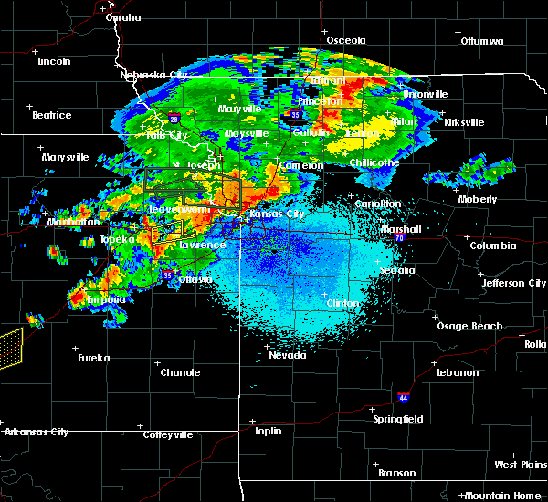 At 913 pm cdt, a severe thunderstorm was located near clinton lake, moving east at 45 mph (radar indicated). Hazards include 60 mph wind gusts and nickel size hail. expect damage to roofs, siding, and trees At 913 pm cdt, a severe thunderstorm was located near clinton lake, moving east at 45 mph (radar indicated). Hazards include 60 mph wind gusts and nickel size hail. expect damage to roofs, siding, and trees
|
| 6/17/2017 8:01 PM CDT |
 At 801 pm cdt, a severe thunderstorm was located 4 miles east of tecumseh, moving southeast at 20 mph (radar indicated). Hazards include 60 mph wind gusts and quarter size hail. Hail damage to vehicles is expected. expect wind damage to roofs, siding, and trees. locations impacted include, northeastern topeka, tecumseh, perry, lecompton and grantville. This includes kansas turnpike between mile markers 183 and 194. At 801 pm cdt, a severe thunderstorm was located 4 miles east of tecumseh, moving southeast at 20 mph (radar indicated). Hazards include 60 mph wind gusts and quarter size hail. Hail damage to vehicles is expected. expect wind damage to roofs, siding, and trees. locations impacted include, northeastern topeka, tecumseh, perry, lecompton and grantville. This includes kansas turnpike between mile markers 183 and 194.
|
| 6/17/2017 7:47 PM CDT |
 At 746 pm cdt, a severe thunderstorm was located over northeastern topeka, moving southeast at 15 mph (trained weather spotters half dollar size hail 4 miles north of topeka at 727 pm cdt). Hazards include 60 mph wind gusts and half dollar size hail. Hail damage to vehicles is expected. Expect wind damage to roofs, siding, and trees. At 746 pm cdt, a severe thunderstorm was located over northeastern topeka, moving southeast at 15 mph (trained weather spotters half dollar size hail 4 miles north of topeka at 727 pm cdt). Hazards include 60 mph wind gusts and half dollar size hail. Hail damage to vehicles is expected. Expect wind damage to roofs, siding, and trees.
|
| 6/17/2017 7:33 PM CDT |
 At 731 pm cdt, a severe thunderstorm was located 4 miles north of topeka, moving southeast at 20 mph (radar indicated). Hazards include golf ball size hail and 60 mph wind gusts. People and animals outdoors will be injured. expect hail damage to roofs, siding, windows, and vehicles. expect wind damage to roofs, siding, and trees. locations impacted include, northeastern topeka, tecumseh, perry, meriden, lecompton, perry lake and grantville. this includes kansas turnpike between mile markers 191 and 194. At 730 pm cdt, a storm spotter reported quarter size hail 8 miles north-northwest of topeka. At 731 pm cdt, a severe thunderstorm was located 4 miles north of topeka, moving southeast at 20 mph (radar indicated). Hazards include golf ball size hail and 60 mph wind gusts. People and animals outdoors will be injured. expect hail damage to roofs, siding, windows, and vehicles. expect wind damage to roofs, siding, and trees. locations impacted include, northeastern topeka, tecumseh, perry, meriden, lecompton, perry lake and grantville. this includes kansas turnpike between mile markers 191 and 194. At 730 pm cdt, a storm spotter reported quarter size hail 8 miles north-northwest of topeka.
|
| 6/17/2017 7:24 PM CDT |
 At 718 pm cdt, a severe thunderstorm was located 5 miles south of hoyt, moving east-southeast at 15 mph (radar indicated). Hazards include 60 mph wind gusts and quarter size hail. Hail damage to vehicles is expected. Expect wind damage to roofs, siding, and trees. At 718 pm cdt, a severe thunderstorm was located 5 miles south of hoyt, moving east-southeast at 15 mph (radar indicated). Hazards include 60 mph wind gusts and quarter size hail. Hail damage to vehicles is expected. Expect wind damage to roofs, siding, and trees.
|
| 6/17/2017 7:18 PM CDT |
 At 718 pm cdt, a severe thunderstorm was located 5 miles south of hoyt, moving east-southeast at 15 mph (radar indicated). Hazards include 60 mph wind gusts and quarter size hail. Hail damage to vehicles is expected. Expect wind damage to roofs, siding, and trees. At 718 pm cdt, a severe thunderstorm was located 5 miles south of hoyt, moving east-southeast at 15 mph (radar indicated). Hazards include 60 mph wind gusts and quarter size hail. Hail damage to vehicles is expected. Expect wind damage to roofs, siding, and trees.
|
| 6/17/2017 1:12 AM CDT |
 The severe thunderstorm warning for southeastern jefferson, east central shawnee and central douglas counties will expire at 115 am cdt, the storms which prompted the warning have moved out of the area. therefore the warning will be allowed to expire. however small hail, gusty winds and heavy rain are still possible with these thunderstorms. a severe thunderstorm watch remains in effect until 400 am cdt for northeastern and east central kansas. remember, a severe thunderstorm warning still remains in effect until 400 am cdt. The severe thunderstorm warning for southeastern jefferson, east central shawnee and central douglas counties will expire at 115 am cdt, the storms which prompted the warning have moved out of the area. therefore the warning will be allowed to expire. however small hail, gusty winds and heavy rain are still possible with these thunderstorms. a severe thunderstorm watch remains in effect until 400 am cdt for northeastern and east central kansas. remember, a severe thunderstorm warning still remains in effect until 400 am cdt.
|
| 6/17/2017 12:45 AM CDT |
 At 1242 am cdt, severe thunderstorms were located along a line extending from near easton to 4 miles northeast of lawrence to clinton lake, moving southeast at 40 mph (radar indicated). Hazards include 70 mph wind gusts and quarter size hail. Hail damage to vehicles is expected. expect considerable tree damage. wind damage is also likely to mobile homes, roofs, and outbuildings. locations impacted include, lawrence, clinton lake, eudora and williams town. this includes kansas turnpike between mile markers 189 and 205. at 1235 am cdt,. A national weather service employee estimated 60 mph wind gusts in west lawrence. At 1242 am cdt, severe thunderstorms were located along a line extending from near easton to 4 miles northeast of lawrence to clinton lake, moving southeast at 40 mph (radar indicated). Hazards include 70 mph wind gusts and quarter size hail. Hail damage to vehicles is expected. expect considerable tree damage. wind damage is also likely to mobile homes, roofs, and outbuildings. locations impacted include, lawrence, clinton lake, eudora and williams town. this includes kansas turnpike between mile markers 189 and 205. at 1235 am cdt,. A national weather service employee estimated 60 mph wind gusts in west lawrence.
|
| 6/17/2017 12:36 AM CDT |
 At 1235 am cdt, severe thunderstorms were located along a line extending from 5 miles east of nortonville to 6 miles east of williamstown to 5 miles northwest of clinton lake, moving southeast at 55 mph. these are very dangerous storms (radar indicated). Hazards include 80 mph wind gusts east of lake perry. Flying debris will be dangerous to those caught without shelter. mobile homes will be heavily damaged. expect considerable damage to roofs, windows, and vehicles. extensive tree damage and power outages are likely. severe thunderstorms will be near, lawrence and eudora around 1245 am cdt. pleasant grove around 1250 am cdt. vinland around 1255 am cdt. baldwin city around 100 am cdt. This includes kansas turnpike between mile markers 189 and 205. At 1235 am cdt, severe thunderstorms were located along a line extending from 5 miles east of nortonville to 6 miles east of williamstown to 5 miles northwest of clinton lake, moving southeast at 55 mph. these are very dangerous storms (radar indicated). Hazards include 80 mph wind gusts east of lake perry. Flying debris will be dangerous to those caught without shelter. mobile homes will be heavily damaged. expect considerable damage to roofs, windows, and vehicles. extensive tree damage and power outages are likely. severe thunderstorms will be near, lawrence and eudora around 1245 am cdt. pleasant grove around 1250 am cdt. vinland around 1255 am cdt. baldwin city around 100 am cdt. This includes kansas turnpike between mile markers 189 and 205.
|
| 6/17/2017 12:22 AM CDT |
 At 1222 am cdt, severe thunderstorms were located along a line extending from 3 miles southwest of effingham to near oskaloosa to near grantville, moving southeast at 65 mph (radar indicated). Hazards include 60 mph wind gusts. Expect damage to roofs, siding, and trees. these severe storms will be near, oskaloosa around 1225 am cdt. perry and mclouth around 1230 am cdt. northern lawrence, winchester and williamstown around 1235 am cdt. This includes kansas turnpike near mile marker 207. At 1222 am cdt, severe thunderstorms were located along a line extending from 3 miles southwest of effingham to near oskaloosa to near grantville, moving southeast at 65 mph (radar indicated). Hazards include 60 mph wind gusts. Expect damage to roofs, siding, and trees. these severe storms will be near, oskaloosa around 1225 am cdt. perry and mclouth around 1230 am cdt. northern lawrence, winchester and williamstown around 1235 am cdt. This includes kansas turnpike near mile marker 207.
|
| 6/17/2017 12:11 AM CDT |
 At 1209 am cdt, a severe thunderstorm was located 6 miles south of mclouth, moving south at 45 mph. a second line of severe thunderstorms will move into western jefferson county (radar indicated). Hazards include 60 mph wind gusts and quarter size hail. Hail damage to vehicles is expected. expect wind damage to roofs, siding, and trees. this severe storm will be near, lawrence around 1215 am cdt. eudora around 1225 am cdt. pleasant grove and vinland around 1230 am cdt. This includes kansas turnpike between mile markers 189 and 205. At 1209 am cdt, a severe thunderstorm was located 6 miles south of mclouth, moving south at 45 mph. a second line of severe thunderstorms will move into western jefferson county (radar indicated). Hazards include 60 mph wind gusts and quarter size hail. Hail damage to vehicles is expected. expect wind damage to roofs, siding, and trees. this severe storm will be near, lawrence around 1215 am cdt. eudora around 1225 am cdt. pleasant grove and vinland around 1230 am cdt. This includes kansas turnpike between mile markers 189 and 205.
|
| 6/17/2017 12:07 AM CDT |
 At 1206 am cdt, severe thunderstorms were located along a line extending from near netawaka to 4 miles south of denison to 6 miles north of silver lake, moving southeast at 65 mph (radar indicated). Hazards include 60 mph wind gusts. Expect damage to roofs, siding, and trees. severe thunderstorms will be near, valley falls around 1210 am cdt. meriden and ozawkie around 1215 am cdt. perry lake around 1220 am cdt. oskaloosa around 1225 am cdt. perry, mclouth, nortonville and williamstown around 1230 am cdt. northern lawrence and winchester around 1235 am cdt. This includes kansas turnpike near mile marker 207. At 1206 am cdt, severe thunderstorms were located along a line extending from near netawaka to 4 miles south of denison to 6 miles north of silver lake, moving southeast at 65 mph (radar indicated). Hazards include 60 mph wind gusts. Expect damage to roofs, siding, and trees. severe thunderstorms will be near, valley falls around 1210 am cdt. meriden and ozawkie around 1215 am cdt. perry lake around 1220 am cdt. oskaloosa around 1225 am cdt. perry, mclouth, nortonville and williamstown around 1230 am cdt. northern lawrence and winchester around 1235 am cdt. This includes kansas turnpike near mile marker 207.
|
| 6/16/2017 11:57 PM CDT |
 At 1155 pm cdt, severe thunderstorms were located along a line extending from 3 miles northwest of ozawkie to 3 miles northwest of mclouth to 5 miles west of leavenworth, moving southeast at 40 mph (emergency management estimated 70 mph winds 4 miles oskaloosa). Hazards include 70 mph wind gusts. Expect considerable tree damage. Damage is likely to mobile homes, roofs, and outbuildings. At 1155 pm cdt, severe thunderstorms were located along a line extending from 3 miles northwest of ozawkie to 3 miles northwest of mclouth to 5 miles west of leavenworth, moving southeast at 40 mph (emergency management estimated 70 mph winds 4 miles oskaloosa). Hazards include 70 mph wind gusts. Expect considerable tree damage. Damage is likely to mobile homes, roofs, and outbuildings.
|
| 6/15/2017 8:53 PM CDT |
 The severe thunderstorm warning for jefferson county will expire at 900 pm cdt, the storm which prompted the warning has moved out of the area. therefore the warning will be allowed to expire. a severe thunderstorm watch remains in effect until 200 am cdt for northeastern and east central kansas. The severe thunderstorm warning for jefferson county will expire at 900 pm cdt, the storm which prompted the warning has moved out of the area. therefore the warning will be allowed to expire. a severe thunderstorm watch remains in effect until 200 am cdt for northeastern and east central kansas.
|
| 6/15/2017 8:44 PM CDT |
 At 843 pm cdt, a severe thunderstorm was located near winchester, moving east at 30 mph (radar indicated). Hazards include 60 mph wind gusts and quarter size hail. Hail damage to vehicles is expected. expect wind damage to roofs, siding, and trees. Locations impacted include, valley falls, oskaloosa, perry, mclouth, ozawkie, nortonville, lecompton, winchester, williamstown and perry lake. At 843 pm cdt, a severe thunderstorm was located near winchester, moving east at 30 mph (radar indicated). Hazards include 60 mph wind gusts and quarter size hail. Hail damage to vehicles is expected. expect wind damage to roofs, siding, and trees. Locations impacted include, valley falls, oskaloosa, perry, mclouth, ozawkie, nortonville, lecompton, winchester, williamstown and perry lake.
|
| 6/15/2017 8:34 PM CDT |
 At 833 pm cdt, a severe thunderstorm was located 4 miles northwest of oskaloosa, moving east at 30 mph (emergency management reported power lines down 4 miles north of oskaloosa at 833 pm). Hazards include 60 mph wind gusts and quarter size hail. Hail damage to vehicles is expected. expect wind damage to roofs, siding, and trees. Locations impacted include, valley falls, oskaloosa, perry, mclouth, meriden, ozawkie, nortonville, lecompton, winchester, williamstown, perry lake and grantville. At 833 pm cdt, a severe thunderstorm was located 4 miles northwest of oskaloosa, moving east at 30 mph (emergency management reported power lines down 4 miles north of oskaloosa at 833 pm). Hazards include 60 mph wind gusts and quarter size hail. Hail damage to vehicles is expected. expect wind damage to roofs, siding, and trees. Locations impacted include, valley falls, oskaloosa, perry, mclouth, meriden, ozawkie, nortonville, lecompton, winchester, williamstown, perry lake and grantville.
|
| 6/15/2017 8:22 PM CDT |
 At 822 pm cdt, a severe thunderstorm was located over ozawkie, moving east at 30 mph (radar indicated). Hazards include 60 mph wind gusts and quarter size hail. Hail damage to vehicles is expected. Expect wind damage to roofs, siding, and trees. At 822 pm cdt, a severe thunderstorm was located over ozawkie, moving east at 30 mph (radar indicated). Hazards include 60 mph wind gusts and quarter size hail. Hail damage to vehicles is expected. Expect wind damage to roofs, siding, and trees.
|
| 5/18/2017 9:34 PM CDT |
 At 933 pm cdt, severe thunderstorms were located along a line extending from 3 miles southeast of meriden to 4 miles west of baldwin city, moving northeast at 60 mph (radar indicated). Hazards include 70 mph wind gusts and penny size hail. Expect considerable tree damage. damage is likely to mobile homes, roofs, and outbuildings. locations impacted include, lawrence, valley falls, oskaloosa, tecumseh, eudora, centropolis, perry, mclouth, ozawkie, nortonville, lecompton, clinton, winchester, lone star, pleasant grove, vinland, williamstown, perry lake, grantville and clinton lake. this includes kansas turnpike between mile markers 185 and 205. A tornado watch remains in effect until 1000 pm cdt for northeastern and east central kansas. At 933 pm cdt, severe thunderstorms were located along a line extending from 3 miles southeast of meriden to 4 miles west of baldwin city, moving northeast at 60 mph (radar indicated). Hazards include 70 mph wind gusts and penny size hail. Expect considerable tree damage. damage is likely to mobile homes, roofs, and outbuildings. locations impacted include, lawrence, valley falls, oskaloosa, tecumseh, eudora, centropolis, perry, mclouth, ozawkie, nortonville, lecompton, clinton, winchester, lone star, pleasant grove, vinland, williamstown, perry lake, grantville and clinton lake. this includes kansas turnpike between mile markers 185 and 205. A tornado watch remains in effect until 1000 pm cdt for northeastern and east central kansas.
|
| 5/18/2017 9:22 PM CDT |
 The national weather service in topeka has issued a * severe thunderstorm warning for. northwestern franklin county in east central kansas. jefferson county in northeastern kansas. east central shawnee county in east central kansas. Douglas county in east central kansas. The national weather service in topeka has issued a * severe thunderstorm warning for. northwestern franklin county in east central kansas. jefferson county in northeastern kansas. east central shawnee county in east central kansas. Douglas county in east central kansas.
|
| 3/29/2017 7:44 PM CDT |
 A severe thunderstorm warning remains in effect until 800 pm cdt for southeastern jefferson and northwestern douglas counties. at 742 pm cdt, a severe thunderstorm was located near lecompton, moving north-northeast at 50 mph. hazard. 60 mph wind gusts and quarter size hail. source. Radar indicated. A severe thunderstorm warning remains in effect until 800 pm cdt for southeastern jefferson and northwestern douglas counties. at 742 pm cdt, a severe thunderstorm was located near lecompton, moving north-northeast at 50 mph. hazard. 60 mph wind gusts and quarter size hail. source. Radar indicated.
|
| 3/29/2017 7:36 PM CDT |
 At 735 pm cdt, a severe thunderstorm was located 6 miles northwest of clinton lake, moving north at 45 mph (radar indicated). Hazards include 60 mph wind gusts and quarter size hail. Hail damage to vehicles is expected. expect wind damage to roofs, siding, and trees. Locations impacted include, perry, lecompton, williamstown and perry lake. At 735 pm cdt, a severe thunderstorm was located 6 miles northwest of clinton lake, moving north at 45 mph (radar indicated). Hazards include 60 mph wind gusts and quarter size hail. Hail damage to vehicles is expected. expect wind damage to roofs, siding, and trees. Locations impacted include, perry, lecompton, williamstown and perry lake.
|
| 3/29/2017 7:27 PM CDT |
 At 727 pm cdt, a severe thunderstorm was located over richland, moving northeast at 40 mph (radar indicated). Hazards include 60 mph wind gusts and quarter size hail. Hail damage to vehicles is expected. Expect wind damage to roofs, siding, and trees. At 727 pm cdt, a severe thunderstorm was located over richland, moving northeast at 40 mph (radar indicated). Hazards include 60 mph wind gusts and quarter size hail. Hail damage to vehicles is expected. Expect wind damage to roofs, siding, and trees.
|
| 3/6/2017 7:13 PM CST |
 At 712 pm cst, a severe thunderstorm was located over overbrook, with a separate severe thunderstorm located near pleasant grove, moving northeast at 65 mph. this is a very dangerous storm (trained weather spotters have reported up to 80 mph winds with this line of storms). Hazards include baseball size hail and 70 mph wind gusts. the largest hail is likely to impact eastern douglas county. People and animals outdoors will be severely injured. expect shattered windows, extensive damage to roofs, siding, and vehicles. locations impacted include, lawrence, baldwin city, carbondale, eudora, richland, overbrook, perry, mclouth, scranton, lecompton, clinton, lone star, pleasant grove, vinland, williamstown, clinton lake, globe and berryton. this includes kansas turnpike between mile markers 186 and 205. A tornado watch remains in effect until 1000 pm cst for northeastern and east central kansas. At 712 pm cst, a severe thunderstorm was located over overbrook, with a separate severe thunderstorm located near pleasant grove, moving northeast at 65 mph. this is a very dangerous storm (trained weather spotters have reported up to 80 mph winds with this line of storms). Hazards include baseball size hail and 70 mph wind gusts. the largest hail is likely to impact eastern douglas county. People and animals outdoors will be severely injured. expect shattered windows, extensive damage to roofs, siding, and vehicles. locations impacted include, lawrence, baldwin city, carbondale, eudora, richland, overbrook, perry, mclouth, scranton, lecompton, clinton, lone star, pleasant grove, vinland, williamstown, clinton lake, globe and berryton. this includes kansas turnpike between mile markers 186 and 205. A tornado watch remains in effect until 1000 pm cst for northeastern and east central kansas.
|
| 3/6/2017 6:59 PM CST |
 At 655 pm cst, severe thunderstorms were located along a line extending from 5 miles east of nortonville to carbondale, moving northeast at 60 mph. these are very dangerous storms (the fire department estimated an 80 mph wind gust...4 miles northwest of lecompton at 651 pm cdt). Hazards include 80 mph wind gusts and quarter size hail. Flying debris will be dangerous to those caught without shelter. mobile homes will be heavily damaged. expect considerable damage to roofs, windows, and vehicles. extensive tree damage and power outages are likely. locations impacted include, topeka, lawrence, baldwin city, carbondale, valley falls, oskaloosa, tecumseh, eudora, richland, auburn, overbrook, perry, mclouth, meriden, scranton, ozawkie, nortonville, lecompton, clinton and winchester. this includes kansas turnpike between mile markers 164 and 205. A tornado watch remains in effect until 1000 pm cst for northeastern and east central kansas. At 655 pm cst, severe thunderstorms were located along a line extending from 5 miles east of nortonville to carbondale, moving northeast at 60 mph. these are very dangerous storms (the fire department estimated an 80 mph wind gust...4 miles northwest of lecompton at 651 pm cdt). Hazards include 80 mph wind gusts and quarter size hail. Flying debris will be dangerous to those caught without shelter. mobile homes will be heavily damaged. expect considerable damage to roofs, windows, and vehicles. extensive tree damage and power outages are likely. locations impacted include, topeka, lawrence, baldwin city, carbondale, valley falls, oskaloosa, tecumseh, eudora, richland, auburn, overbrook, perry, mclouth, meriden, scranton, ozawkie, nortonville, lecompton, clinton and winchester. this includes kansas turnpike between mile markers 164 and 205. A tornado watch remains in effect until 1000 pm cst for northeastern and east central kansas.
|
| 3/6/2017 6:56 PM CST | Power poles down and trees down ... south of 24 and phillips road in jefferson county KS, 5 miles W of Perry, KS |
| 3/6/2017 6:51 PM CST | Estimated 80 mph winds near k 24 and 237 road in jefferson county KS, 3.4 miles ESE of Perry, KS |
| 3/6/2017 6:47 PM CST |
 At 646 pm cst, severe thunderstorms were located along a line extending from 4 miles west of nortonville to 3 miles south of auburn, moving northeast at 55 mph (radar indicated). Hazards include 60 mph wind gusts and nickel size hail. expect damage to roofs, siding, and trees At 646 pm cst, severe thunderstorms were located along a line extending from 4 miles west of nortonville to 3 miles south of auburn, moving northeast at 55 mph (radar indicated). Hazards include 60 mph wind gusts and nickel size hail. expect damage to roofs, siding, and trees
|
| 8/19/2016 7:26 PM CDT |
 At 724 pm cdt, severe thunderstorms were located along a line extending from near perry lake to clinton lake, moving east at 35 mph (fire department. at 702 pm power lines were downed by thunderstorms winds along k4 highway south of meridian). Hazards include 60 mph wind gusts. Expect damage to roofs. siding. and trees. locations impacted include, lawrence, oskaloosa, eudora, perry, mclouth, meriden, ozawkie, lecompton, clinton, lone star, williamstown, clinton lake and perry lake. This includes kansas turnpike between mile markers 189 and 205. At 724 pm cdt, severe thunderstorms were located along a line extending from near perry lake to clinton lake, moving east at 35 mph (fire department. at 702 pm power lines were downed by thunderstorms winds along k4 highway south of meridian). Hazards include 60 mph wind gusts. Expect damage to roofs. siding. and trees. locations impacted include, lawrence, oskaloosa, eudora, perry, mclouth, meriden, ozawkie, lecompton, clinton, lone star, williamstown, clinton lake and perry lake. This includes kansas turnpike between mile markers 189 and 205.
|
| 8/19/2016 7:20 PM CDT |
 At 719 pm cdt, severe thunderstorms were located along a line extending from near perry lake to near clinton lake, moving east at 35 mph (radar indicated). Hazards include 60 mph wind gusts. Expect damage to roofs. siding. and trees. locations impacted include, lawrence, oskaloosa, eudora, perry, mclouth, meriden, ozawkie, lecompton, clinton, lone star, williamstown, clinton lake and perry lake. This includes kansas turnpike between mile markers 189 and 205. At 719 pm cdt, severe thunderstorms were located along a line extending from near perry lake to near clinton lake, moving east at 35 mph (radar indicated). Hazards include 60 mph wind gusts. Expect damage to roofs. siding. and trees. locations impacted include, lawrence, oskaloosa, eudora, perry, mclouth, meriden, ozawkie, lecompton, clinton, lone star, williamstown, clinton lake and perry lake. This includes kansas turnpike between mile markers 189 and 205.
|
| 8/19/2016 7:15 PM CDT | 12 inch limb broken off healthy tree in jefferson county KS, 0.3 miles NNW of Perry, KS |
| 8/19/2016 7:12 PM CDT |
 At 711 pm cdt, severe thunderstorms were located along a line extending from 3 miles southeast of meriden to 3 miles west of clinton lake, moving east at 35 mph (radar indicated). Hazards include 60 mph wind gusts. Expect damage to roofs. siding. and trees. locations impacted include, lawrence, oskaloosa, tecumseh, eudora, richland, perry, mclouth, meriden, ozawkie, lecompton, clinton, lone star, williamstown, berryton, perry lake, clinton lake and grantville. This includes kansas turnpike between mile markers 181 and 205. At 711 pm cdt, severe thunderstorms were located along a line extending from 3 miles southeast of meriden to 3 miles west of clinton lake, moving east at 35 mph (radar indicated). Hazards include 60 mph wind gusts. Expect damage to roofs. siding. and trees. locations impacted include, lawrence, oskaloosa, tecumseh, eudora, richland, perry, mclouth, meriden, ozawkie, lecompton, clinton, lone star, williamstown, berryton, perry lake, clinton lake and grantville. This includes kansas turnpike between mile markers 181 and 205.
|
| 8/19/2016 6:48 PM CDT |
 At 648 pm cdt, severe thunderstorms were located along a line extending from 5 miles east of silver lake to 4 miles southwest of berryton, moving east at 35 mph (trained weather spotters). Hazards include 60 mph wind gusts. Expect damage to roofs. siding. And trees. At 648 pm cdt, severe thunderstorms were located along a line extending from 5 miles east of silver lake to 4 miles southwest of berryton, moving east at 35 mph (trained weather spotters). Hazards include 60 mph wind gusts. Expect damage to roofs. siding. And trees.
|
| 7/13/2016 9:36 AM CDT |
 At 934 am cdt, severe thunderstorms were located along a line extending from denison to near richland, moving east at 50 mph (trained weather spotters). Hazards include 70 mph wind gusts and nickel size hail. Expect considerable tree damage. Damage is likely to mobile homes, roofs, and outbuildings. At 934 am cdt, severe thunderstorms were located along a line extending from denison to near richland, moving east at 50 mph (trained weather spotters). Hazards include 70 mph wind gusts and nickel size hail. Expect considerable tree damage. Damage is likely to mobile homes, roofs, and outbuildings.
|
| 7/7/2016 4:48 AM CDT |
 At 447 am cdt, severe thunderstorms were located along a line extending from near perry lake to near auburn, moving east at 45 mph (emergency management. at 442 am cdt...reports of power lines down on the west side of topeka). Hazards include 60 mph wind gusts and penny size hail. Expect damage to roofs. siding. and trees. locations impacted include, topeka, lawrence, carbondale, oskaloosa, eskridge, tecumseh, eudora, richland, dover, silver lake, auburn, overbrook, perry, mclouth, meriden, scranton, ozawkie, lecompton, clinton and lone star. this includes the following highways, interstate 70 between mile markers 344 and 355. Kansas turnpike between mile markers 158 and 205. At 447 am cdt, severe thunderstorms were located along a line extending from near perry lake to near auburn, moving east at 45 mph (emergency management. at 442 am cdt...reports of power lines down on the west side of topeka). Hazards include 60 mph wind gusts and penny size hail. Expect damage to roofs. siding. and trees. locations impacted include, topeka, lawrence, carbondale, oskaloosa, eskridge, tecumseh, eudora, richland, dover, silver lake, auburn, overbrook, perry, mclouth, meriden, scranton, ozawkie, lecompton, clinton and lone star. this includes the following highways, interstate 70 between mile markers 344 and 355. Kansas turnpike between mile markers 158 and 205.
|
| 7/7/2016 4:30 AM CDT |
 At 429 am cdt, severe thunderstorms were located along a line extending from near hoyt to near eskridge, moving east at 45 mph (radar indicated). Hazards include 60 mph wind gusts and penny size hail. Expect damage to roofs. siding. And trees. At 429 am cdt, severe thunderstorms were located along a line extending from near hoyt to near eskridge, moving east at 45 mph (radar indicated). Hazards include 60 mph wind gusts and penny size hail. Expect damage to roofs. siding. And trees.
|
| 6/15/2016 8:57 PM CDT |
 At 856 pm cdt, a severe thunderstorm was located near berryton, moving east at 30 mph (trained weather spotters. the storm has produced sporadic wind gusts up to 60 mph and quarter sized hail across southern topeka). Hazards include 60 mph wind gusts and quarter size hail. Hail damage to vehicles is expected. Expect wind damage to roofs, siding, and trees. At 856 pm cdt, a severe thunderstorm was located near berryton, moving east at 30 mph (trained weather spotters. the storm has produced sporadic wind gusts up to 60 mph and quarter sized hail across southern topeka). Hazards include 60 mph wind gusts and quarter size hail. Hail damage to vehicles is expected. Expect wind damage to roofs, siding, and trees.
|
| 5/26/2016 4:49 PM CDT | Power line down in jefferson county KS, 3.4 miles SSW of Perry, KS |
| 5/26/2016 4:42 PM CDT |
 At 441 pm cdt, severe thunderstorms were located along a line extending from near oskaloosa to near williamstown to near lone star, moving east at 50 mph. winds of 60 to 70 mph were reported in perry around 440 pm (radar indicated). Hazards include 70 mph wind gusts. Expect considerable tree damage. damage is likely to mobile homes, roofs, and outbuildings. locations impacted include, lawrence, oskaloosa, eudora, perry, mclouth, lecompton, clinton, lone star, pleasant grove, clinton lake and williamstown. this includes kansas turnpike between mile markers 192 and 205. A tornado watch remains in effect until 1000 pm cdt for northeastern kansas. At 441 pm cdt, severe thunderstorms were located along a line extending from near oskaloosa to near williamstown to near lone star, moving east at 50 mph. winds of 60 to 70 mph were reported in perry around 440 pm (radar indicated). Hazards include 70 mph wind gusts. Expect considerable tree damage. damage is likely to mobile homes, roofs, and outbuildings. locations impacted include, lawrence, oskaloosa, eudora, perry, mclouth, lecompton, clinton, lone star, pleasant grove, clinton lake and williamstown. this includes kansas turnpike between mile markers 192 and 205. A tornado watch remains in effect until 1000 pm cdt for northeastern kansas.
|
| 5/26/2016 4:40 PM CDT | 60-70 mph in jefferson county KS, 0.3 miles NNW of Perry, KS |
| 5/26/2016 4:36 PM CDT |
 At 434 pm cdt, severe thunderstorms were located along a line extending from ozawkie to perry to near richland, moving east at 50 mph (radar indicated). Hazards include 70 mph wind gusts and penny size hail. Expect considerable tree damage. damage is likely to mobile homes, roofs, and outbuildings. locations impacted include, lawrence, oskaloosa, eudora, richland, perry, mclouth, lecompton, clinton, lone star, pleasant grove, williamstown, clinton lake. this includes kansas turnpike between mile markers 184 and 205. A tornado watch remains in effect until 1000 pm cdt for northeastern kansas. At 434 pm cdt, severe thunderstorms were located along a line extending from ozawkie to perry to near richland, moving east at 50 mph (radar indicated). Hazards include 70 mph wind gusts and penny size hail. Expect considerable tree damage. damage is likely to mobile homes, roofs, and outbuildings. locations impacted include, lawrence, oskaloosa, eudora, richland, perry, mclouth, lecompton, clinton, lone star, pleasant grove, williamstown, clinton lake. this includes kansas turnpike between mile markers 184 and 205. A tornado watch remains in effect until 1000 pm cdt for northeastern kansas.
|
| 5/26/2016 4:24 PM CDT |
 At 424 pm cdt, severe thunderstorms were located along a line extending from meriden to near overbrook, moving east at 50 mph. trees were reported down in silver lake (radar indicated). Hazards include 60 mph wind gusts and quarter size hail. Hail damage to vehicles is expected. Expect wind damage to roofs, siding, and trees. At 424 pm cdt, severe thunderstorms were located along a line extending from meriden to near overbrook, moving east at 50 mph. trees were reported down in silver lake (radar indicated). Hazards include 60 mph wind gusts and quarter size hail. Hail damage to vehicles is expected. Expect wind damage to roofs, siding, and trees.
|
| 5/26/2016 4:23 PM CDT |
 At 422 pm cdt, a severe thunderstorm was located west of meriden, moving northeast at 50 mph (public. at 412pm...public reported wind damage and power line damage in silver lake). Hazards include 60 mph wind gusts. Expect damage to roofs. siding. and trees. locations impacted include, topeka, tecumseh, silver lake, perry, meriden, hoyt, ozawkie, berryton, perry lake, grantville and pauline. this includes the following highways, interstate 70 between mile markers 353 and 355. kansas turnpike between mile markers 173 and 188. A tornado watch remains in effect until 1000 pm cdt for northeastern kansas. At 422 pm cdt, a severe thunderstorm was located west of meriden, moving northeast at 50 mph (public. at 412pm...public reported wind damage and power line damage in silver lake). Hazards include 60 mph wind gusts. Expect damage to roofs. siding. and trees. locations impacted include, topeka, tecumseh, silver lake, perry, meriden, hoyt, ozawkie, berryton, perry lake, grantville and pauline. this includes the following highways, interstate 70 between mile markers 353 and 355. kansas turnpike between mile markers 173 and 188. A tornado watch remains in effect until 1000 pm cdt for northeastern kansas.
|
| 5/26/2016 4:15 PM CDT |
 At 415 pm cdt, a severe thunderstorm was located 6 miles southwest of meriden, moving northeast at 55 mph (radar indicated). Hazards include 60 mph wind gusts. Expect damage to roofs. siding. and trees. locations impacted include, topeka, tecumseh, silver lake, perry, meriden, hoyt, ozawkie, berryton, perry lake, grantville and pauline. this includes the following highways, interstate 70 between mile markers 353 and 355. kansas turnpike between mile markers 173 and 188. A tornado watch remains in effect until 1000 pm cdt for northeastern kansas. At 415 pm cdt, a severe thunderstorm was located 6 miles southwest of meriden, moving northeast at 55 mph (radar indicated). Hazards include 60 mph wind gusts. Expect damage to roofs. siding. and trees. locations impacted include, topeka, tecumseh, silver lake, perry, meriden, hoyt, ozawkie, berryton, perry lake, grantville and pauline. this includes the following highways, interstate 70 between mile markers 353 and 355. kansas turnpike between mile markers 173 and 188. A tornado watch remains in effect until 1000 pm cdt for northeastern kansas.
|
| 5/26/2016 4:05 PM CDT |
 At 405 pm cdt, a severe thunderstorm was located over silver lake, moving northeast at 55 mph. radar indicates wind gusts near 70 mph are possible near silver lake and willard (radar indicated). Hazards include 60 mph wind gusts. Expect damage to roofs. siding. And trees. At 405 pm cdt, a severe thunderstorm was located over silver lake, moving northeast at 55 mph. radar indicates wind gusts near 70 mph are possible near silver lake and willard (radar indicated). Hazards include 60 mph wind gusts. Expect damage to roofs. siding. And trees.
|
| 5/26/2016 8:27 AM CDT | Baseball sized hail reported 4.9 miles W of Perry, KS, local firemen were the trained spotters reporting the hail. |
| 4/27/2016 3:14 PM CDT |
 At 314 pm cdt, a severe thunderstorm was located near williamstown, moving northeast at 30 mph (radar indicated). Hazards include quarter size hail. Damage to vehicles is expected. locations impacted include, lawrence, perry, mclouth, lecompton and williamstown. This includes kansas turnpike between mile markers 195 and 204. At 314 pm cdt, a severe thunderstorm was located near williamstown, moving northeast at 30 mph (radar indicated). Hazards include quarter size hail. Damage to vehicles is expected. locations impacted include, lawrence, perry, mclouth, lecompton and williamstown. This includes kansas turnpike between mile markers 195 and 204.
|
| 4/27/2016 2:59 PM CDT |
 At 259 pm cdt, a severe thunderstorm was located over clinton lake, moving northeast at 30 mph (radar indicated). Hazards include 60 mph wind gusts and quarter size hail. Hail damage to vehicles is expected. Expect wind damage to roofs, siding, and trees. At 259 pm cdt, a severe thunderstorm was located over clinton lake, moving northeast at 30 mph (radar indicated). Hazards include 60 mph wind gusts and quarter size hail. Hail damage to vehicles is expected. Expect wind damage to roofs, siding, and trees.
|
| 4/24/2016 9:46 PM CDT |
 At 946 pm cdt, severe thunderstorms were located along a line extending from near mayetta to near hoyt to 8 miles northwest of topeka, moving east at 40 mph (radar indicated). Hazards include 70 mph wind gusts. Expect considerable tree damage. Damage is likely to mobile homes, roofs, and outbuildings. At 946 pm cdt, severe thunderstorms were located along a line extending from near mayetta to near hoyt to 8 miles northwest of topeka, moving east at 40 mph (radar indicated). Hazards include 70 mph wind gusts. Expect considerable tree damage. Damage is likely to mobile homes, roofs, and outbuildings.
|
| 8/8/2015 5:43 AM CDT | The severe thunderstorm warning for shawnee, northwestern franklin, douglas, northern osage and southern jefferson counties will expire at 545 am cdt, the storm which prompted the warning has weakened below severe limits, and no longer pose an immediate threat to life or property. therefore the warning will be allowed to expire. however gusty winds and heavy rain are still possible with this thunderstorm. |
| 8/8/2015 5:26 AM CDT |
 At 525 am cdt, a severe thunderstorm was located over clinton, moving east at 30 mph (radar indicated). Hazards include 60 mph wind gusts and quarter size hail. Hail damage to vehicles is expected. expect wind damage to roofs, siding and trees. locations impacted include, topeka, lawrence, baldwin city, carbondale, tecumseh, richland, auburn, overbrook, centropolis, perry, mclouth, meriden, scranton, lecompton, clinton, lone star, pleasant grove, williamstown, globe and vinland. this includes the following highways, interstate 35 between mile markers 191 and 192. interstate 70 between mile markers 353 and 355. Kansas turnpike between mile markers 161 and 205. At 525 am cdt, a severe thunderstorm was located over clinton, moving east at 30 mph (radar indicated). Hazards include 60 mph wind gusts and quarter size hail. Hail damage to vehicles is expected. expect wind damage to roofs, siding and trees. locations impacted include, topeka, lawrence, baldwin city, carbondale, tecumseh, richland, auburn, overbrook, centropolis, perry, mclouth, meriden, scranton, lecompton, clinton, lone star, pleasant grove, williamstown, globe and vinland. this includes the following highways, interstate 35 between mile markers 191 and 192. interstate 70 between mile markers 353 and 355. Kansas turnpike between mile markers 161 and 205.
|
| 8/8/2015 4:53 AM CDT |
 At 452 am cdt, a severe thunderstorm was located over southeastern topeka, moving east at 35 mph (trained weather spotters). Hazards include 60 mph wind gusts and quarter size hail. Hail damage to vehicles is expected. Expect wind damage to roofs, siding and trees. At 452 am cdt, a severe thunderstorm was located over southeastern topeka, moving east at 35 mph (trained weather spotters). Hazards include 60 mph wind gusts and quarter size hail. Hail damage to vehicles is expected. Expect wind damage to roofs, siding and trees.
|
| 6/26/2015 1:41 AM CDT |
 At 139 am cdt, severe thunderstorms were located along a line extending from near mclouth to 5 miles northeast of lawrence to near clinton lake to globe to near melvern, moving east at 40 mph (trained weather spotters reported 70 mph near lyndon... trees down in topeka, and 60 mph was measured at forbes field). Hazards include 70 mph wind gusts and penny size hail. Expect considerable tree damage. damage is likely to mobile homes, roofs and outbuildings. the strongest winds of 70 mph or greater are likely impacting osage, southern douglas, and northern franklin counties. locations impacted include, southeastern topeka, lawrence, ottawa, baldwin city, osage city, carbondale, oskaloosa, tecumseh, eudora, richland, wellsville, overbrook, lyndon, centropolis, perry, mclouth, pomona, scranton, lecompton and clinton. this includes the following highways, interstate 35 between mile markers 170 and 198. Kansas turnpike between mile markers 182 and 205. At 139 am cdt, severe thunderstorms were located along a line extending from near mclouth to 5 miles northeast of lawrence to near clinton lake to globe to near melvern, moving east at 40 mph (trained weather spotters reported 70 mph near lyndon... trees down in topeka, and 60 mph was measured at forbes field). Hazards include 70 mph wind gusts and penny size hail. Expect considerable tree damage. damage is likely to mobile homes, roofs and outbuildings. the strongest winds of 70 mph or greater are likely impacting osage, southern douglas, and northern franklin counties. locations impacted include, southeastern topeka, lawrence, ottawa, baldwin city, osage city, carbondale, oskaloosa, tecumseh, eudora, richland, wellsville, overbrook, lyndon, centropolis, perry, mclouth, pomona, scranton, lecompton and clinton. this includes the following highways, interstate 35 between mile markers 170 and 198. Kansas turnpike between mile markers 182 and 205.
|
| 6/26/2015 1:19 AM CDT |
 At 117 am cdt, severe thunderstorms were located along a line extending from near ozawkie to near richland to near osage city, moving east at 45 mph (radar indicated. trained spotters have also reported trees down in the topeka area). Hazards include 60 to 70 mph wind gusts and penny size hail. Expect considerable tree damage. damage is likely to mobile homes, roofs and outbuildings. The strongest winds with this storm are expected to impact osage, southern shawnee, southern douglas, and franklin counties. At 117 am cdt, severe thunderstorms were located along a line extending from near ozawkie to near richland to near osage city, moving east at 45 mph (radar indicated. trained spotters have also reported trees down in the topeka area). Hazards include 60 to 70 mph wind gusts and penny size hail. Expect considerable tree damage. damage is likely to mobile homes, roofs and outbuildings. The strongest winds with this storm are expected to impact osage, southern shawnee, southern douglas, and franklin counties.
|
| 6/5/2015 2:53 AM CDT | At 249 am cdt, severe thunderstorms were located along a line extending from perry lake to richland to overbrook, and moving southeast at 25 mph (radar indicated). Hazards include 60 mph wind gusts and penny size hail. Expect damage to roofs. siding and trees. locations impacted include, pomona lake, perry, lecompton, clinton, clinton lake, globe, lone star and williamstown. This includes the kansas turnpike between mile markers 184 and 197. |
| 6/5/2015 2:42 AM CDT | At 238 am cdt, severe thunderstorms were located along a line extending from grantville to richland to osage city, and moving southeast at 25 mph (radar indicated). Hazards include 60 mph wind gusts and penny size hail. Expect damage to roofs. siding and trees. locations impacted include, perry lake, overbrook, lyndon, pomona lake, perry, lecompton, clinton lake, clinton, lone star and williamstown. This includes the kansas turnpike between mile markers 164 and 197. |
| 6/5/2015 2:28 AM CDT | At 225 am cdt, severe thunderstorms were located along a line extending from meriden to topeka to berryton to osage city, and moving southeast at 25 mph (radar indicated). Hazards include 60 mph wind gusts and penny size hail. Expect damage to roofs. Siding and trees. |
| 6/4/2015 9:55 PM CDT | At 953 pm cdt, a severe thunderstorm was located near tecumseh, and moving east at 25 mph. this storm is also producing torrential rainfall (radar indicated). Hazards include 60 mph wind gusts and quarter size hail. Hail damage to vehicles is expected. expect wind damage to roofs, siding and trees. locations impacted include, perry, lecompton, clinton lake, clinton and williamstown. This includes the kansas turnpike between mile markers 174 and 197. |
| 6/4/2015 9:42 PM CDT | At 940 pm cdt, a severe thunderstorm was located near tecumseh, and moving east at 25 mph (radar indicated). Hazards include 60 mph wind gusts and half dollar size hail. Hail damage to vehicles is expected. Expect wind damage to roofs, siding and trees. |
| 5/16/2015 6:43 PM CDT | At 641 pm cdt, severe thunderstorms were located along a line extending from tecumseh to lecompton to pomona, and moving northeast at 50 mph (radar indicated). Hazards include 60 mph wind gusts. Expect damage to roofs. Siding and trees. |
| 1/1/0001 12:00 AM | Reports of dock braking loose from the lake perry marina. wind speed unknown in jefferson county KS, 4.2 miles SSE of Perry, KS |
| 1/1/0001 12:00 AM | Well formed gustnado developed along the frontal boundary and rear flank boundary intersection...near williamstown on hwy24. winds inside the feature were sustained aro in jefferson county KS, 3.4 miles WNW of Perry, KS |
| 1/1/0001 12:00 AM | Update...nws survey crew identified areas of enhanced wind damage from well formed gustnado in williamstown. two center pivot irrigations were flipped over...a large ou in jefferson county KS, 3.4 miles WNW of Perry, KS |
Hail Maps for Perry, KS
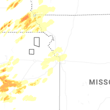
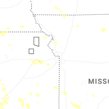


Connect with Interactive Hail Maps