

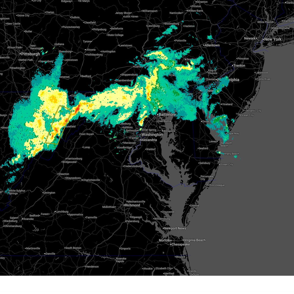
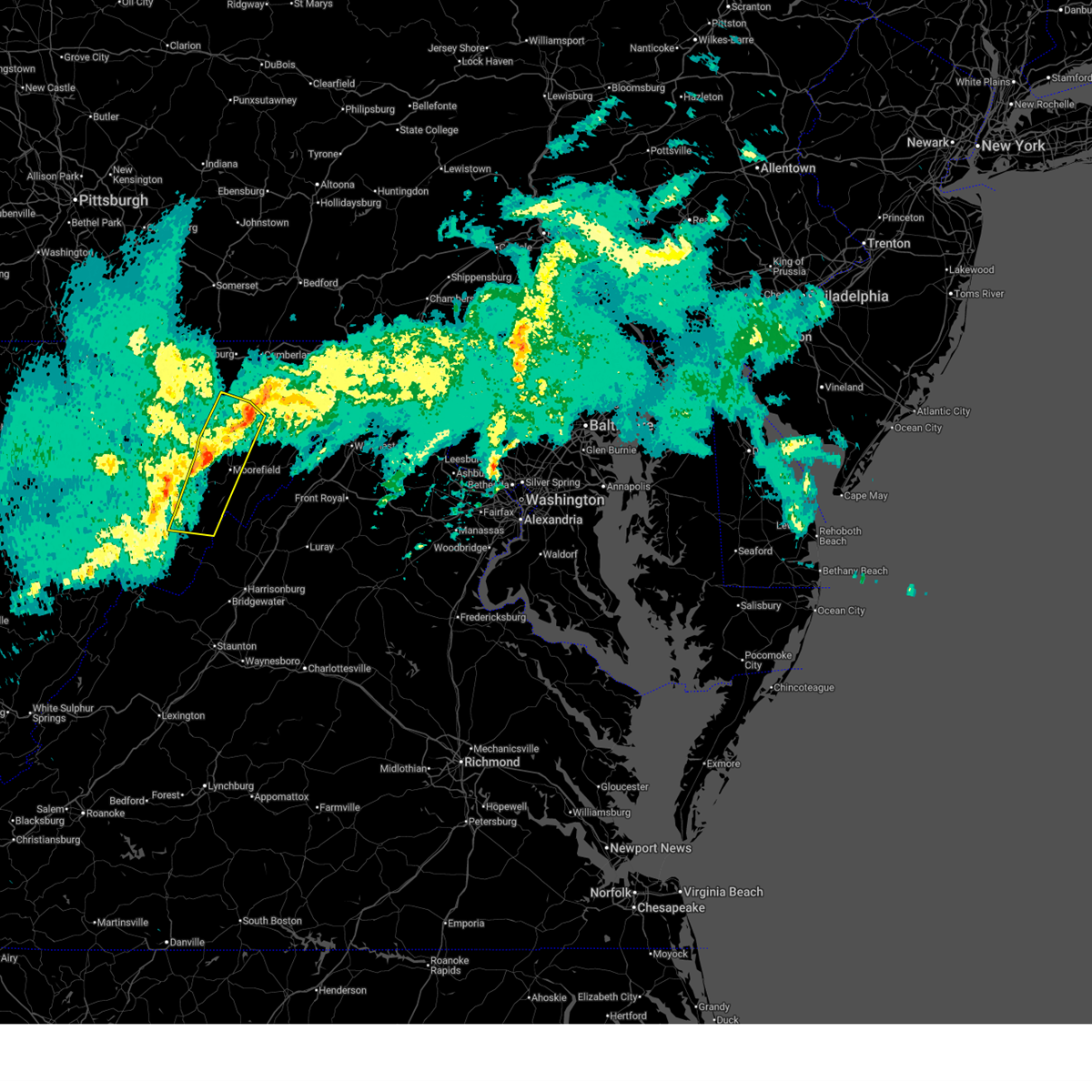
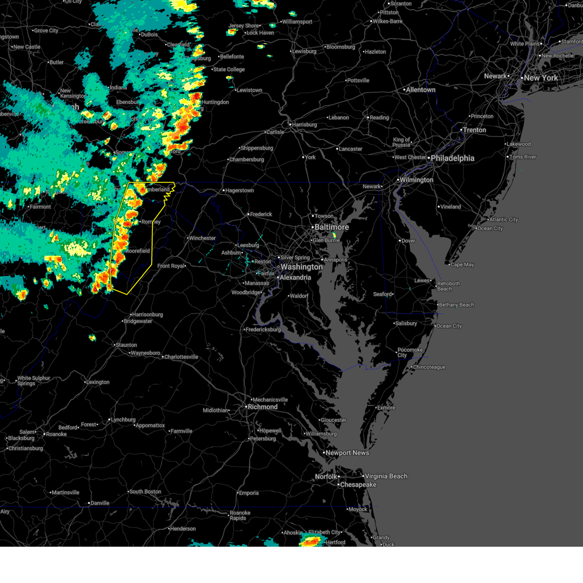
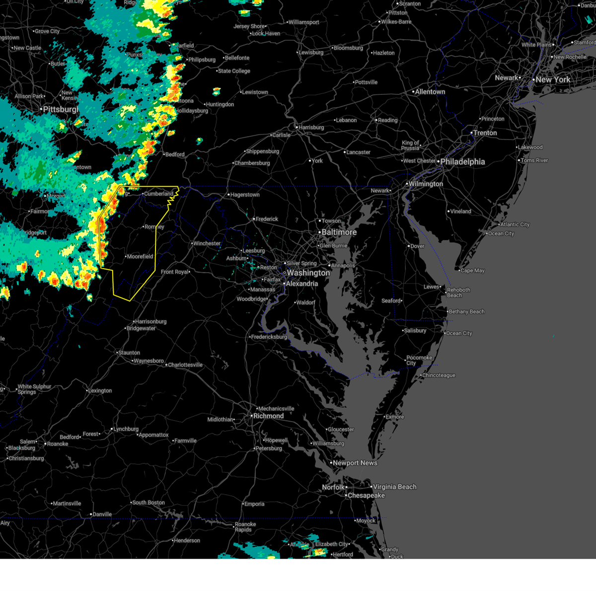
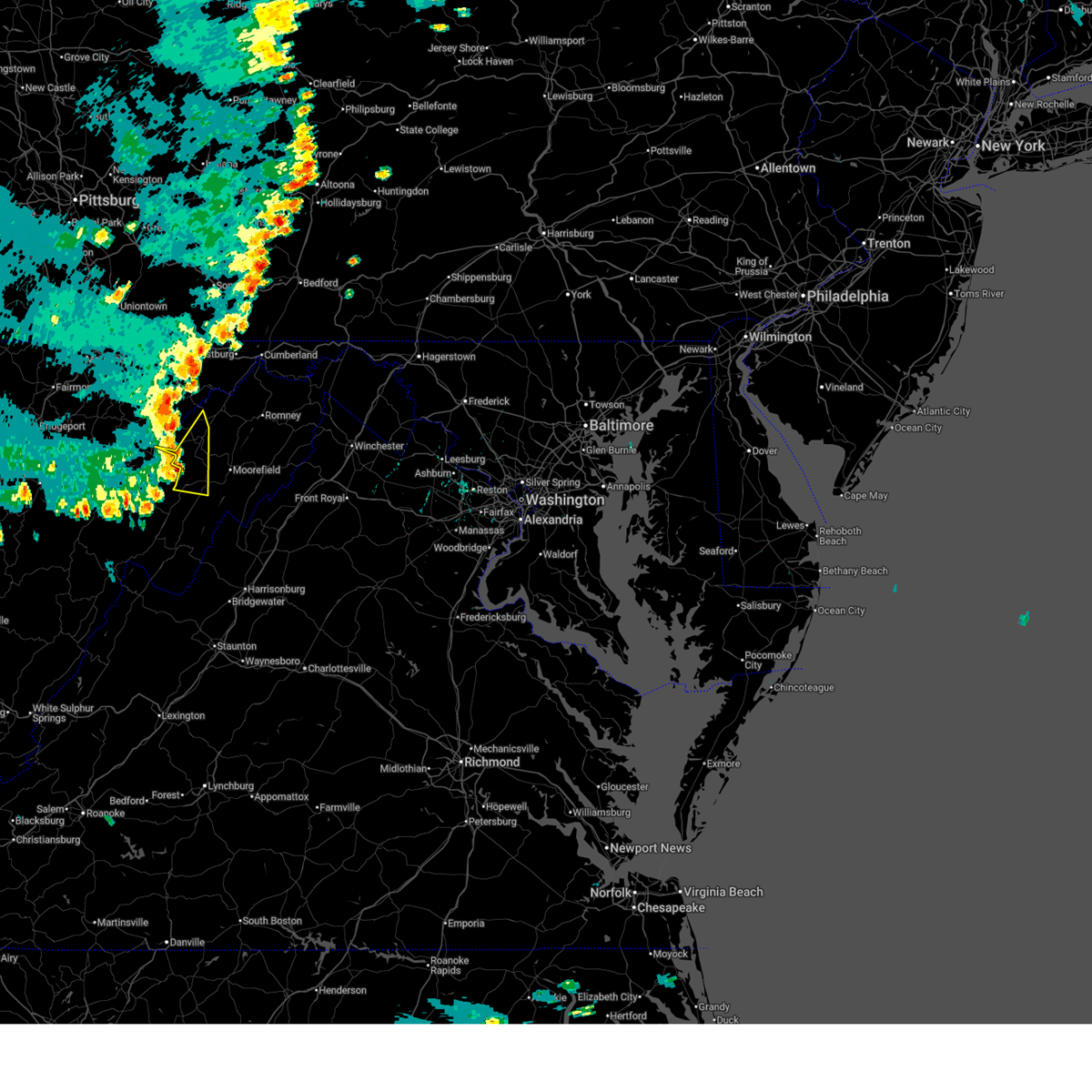
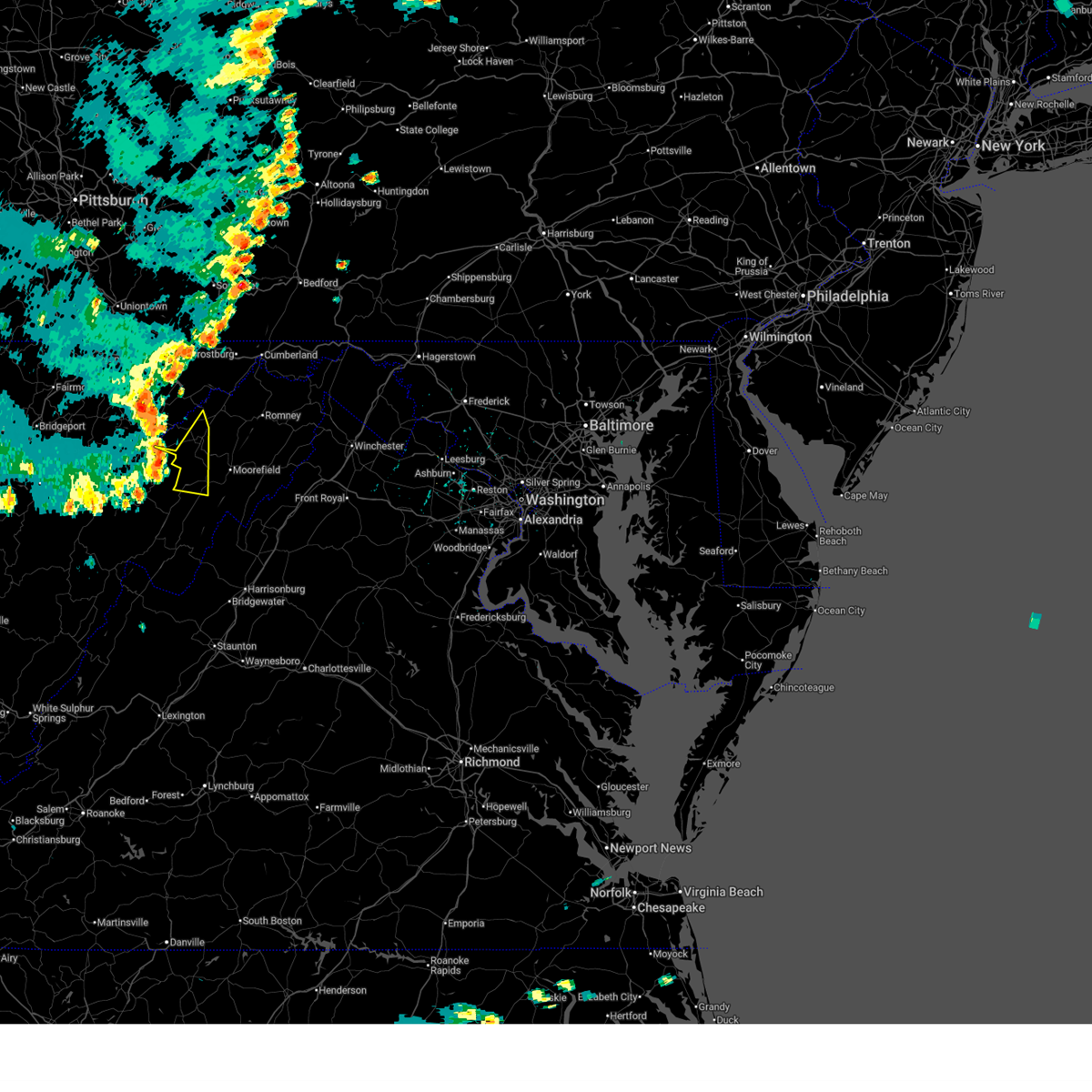
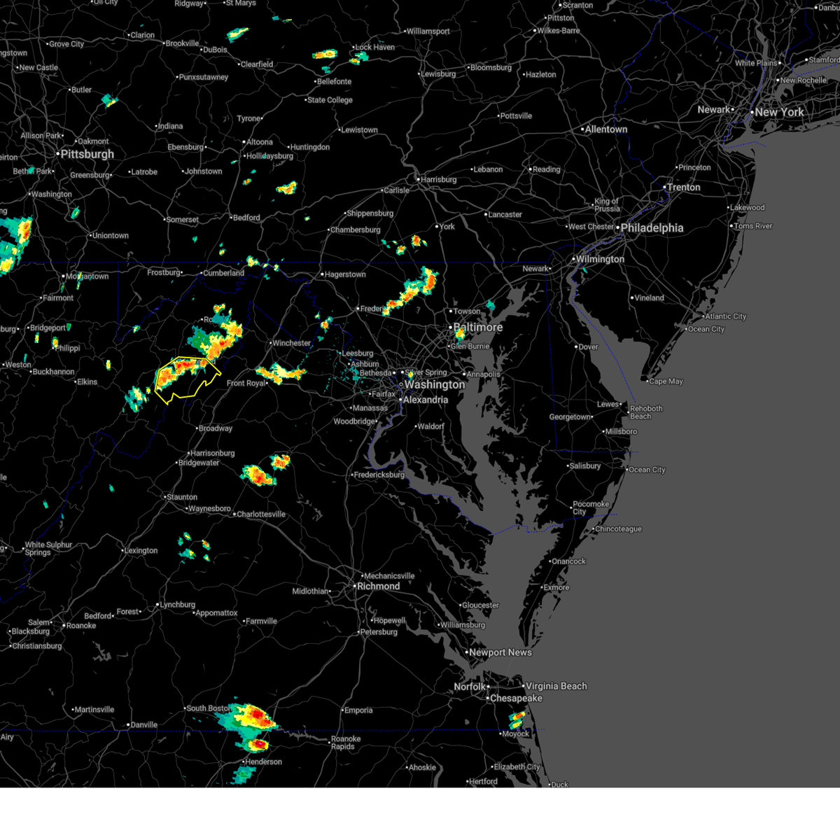
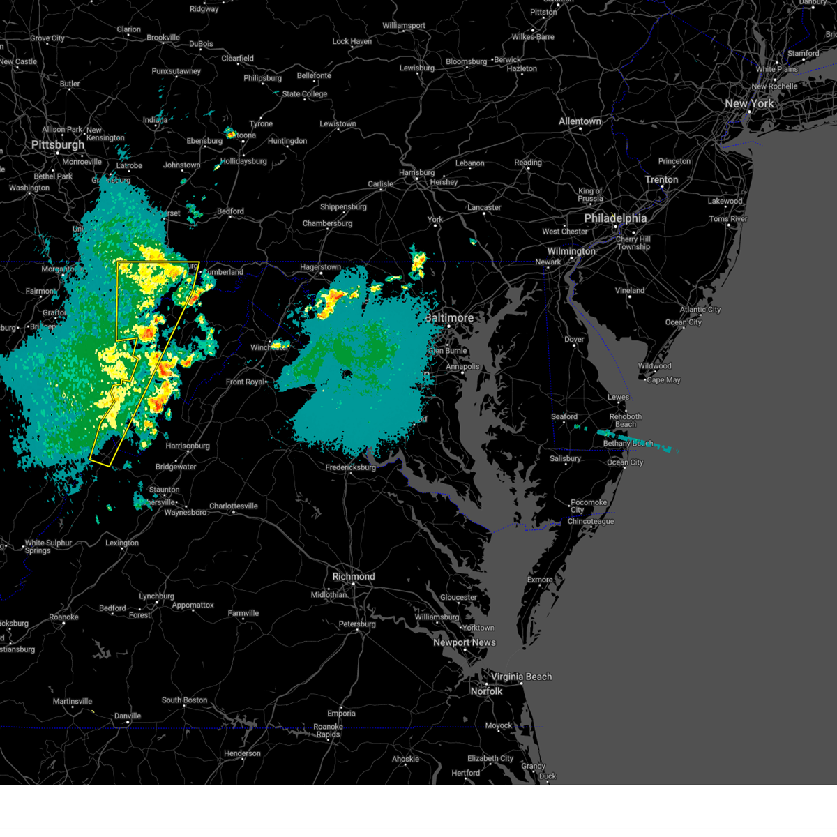
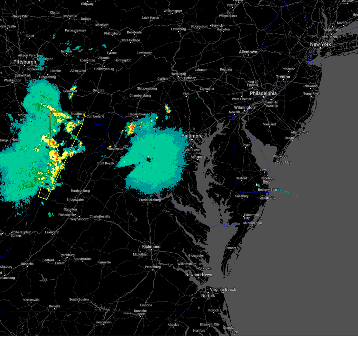
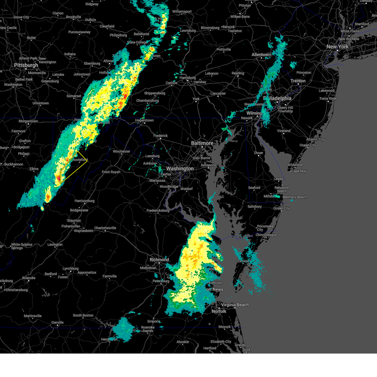
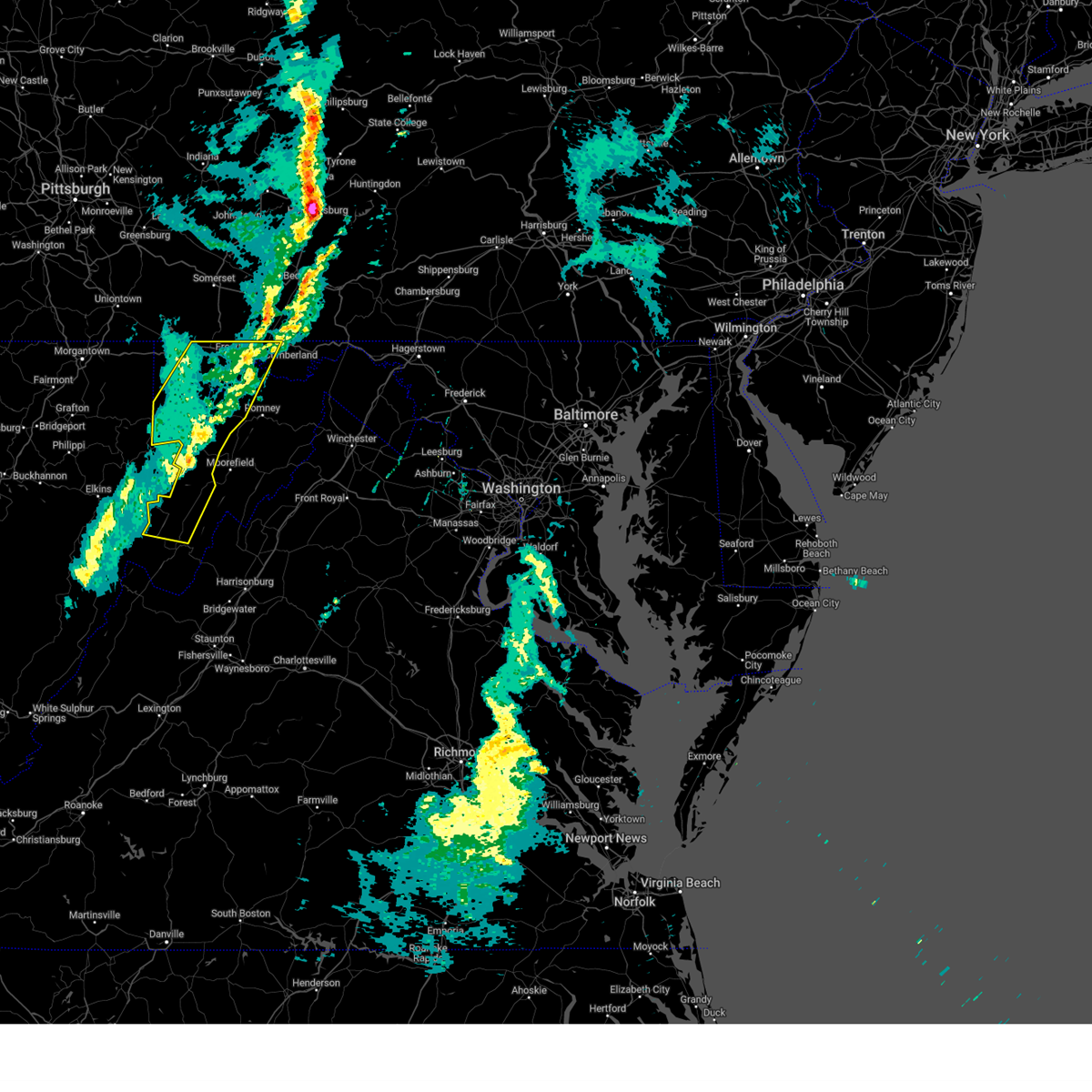
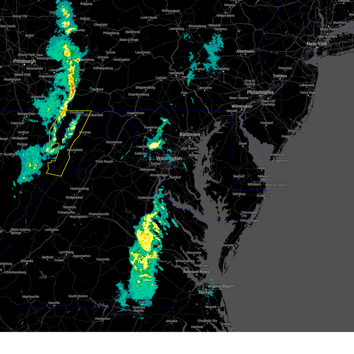
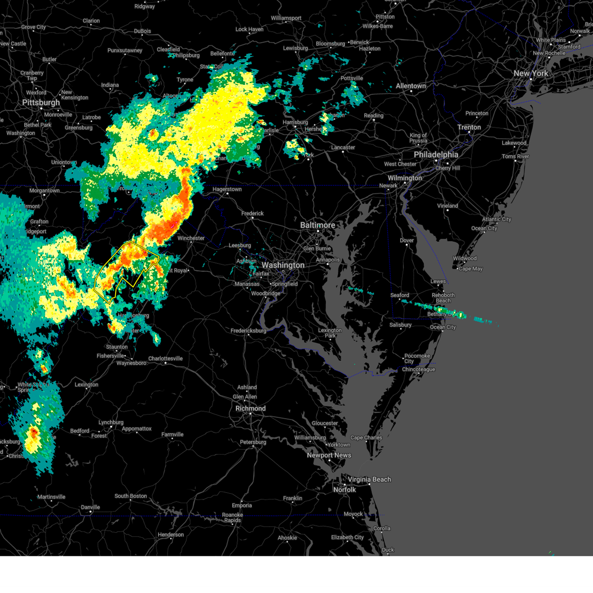
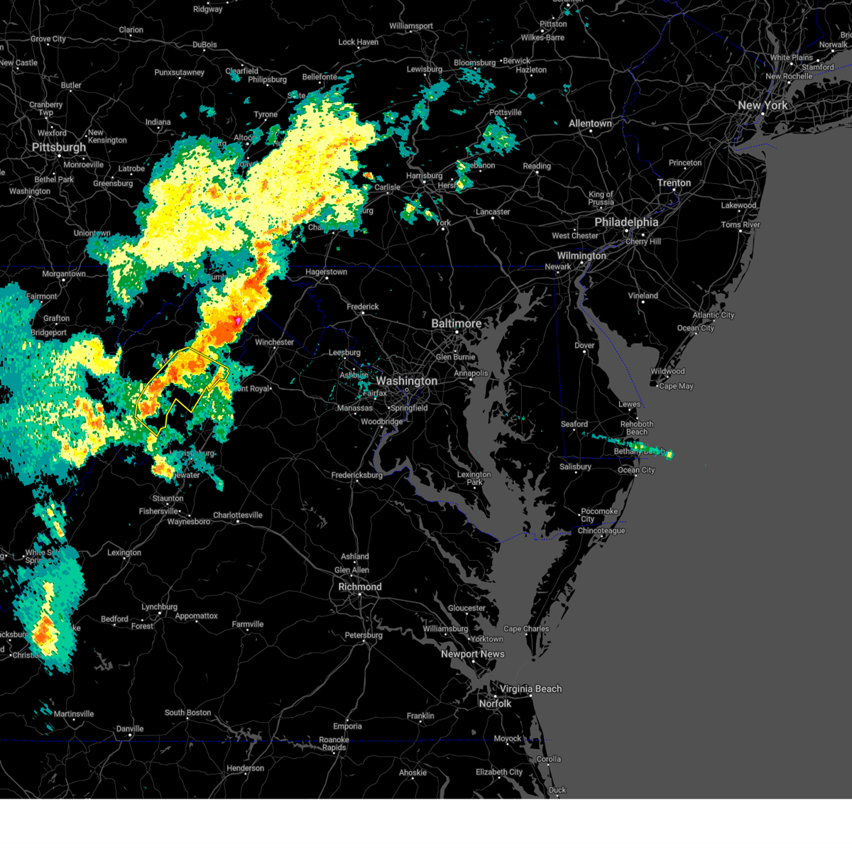
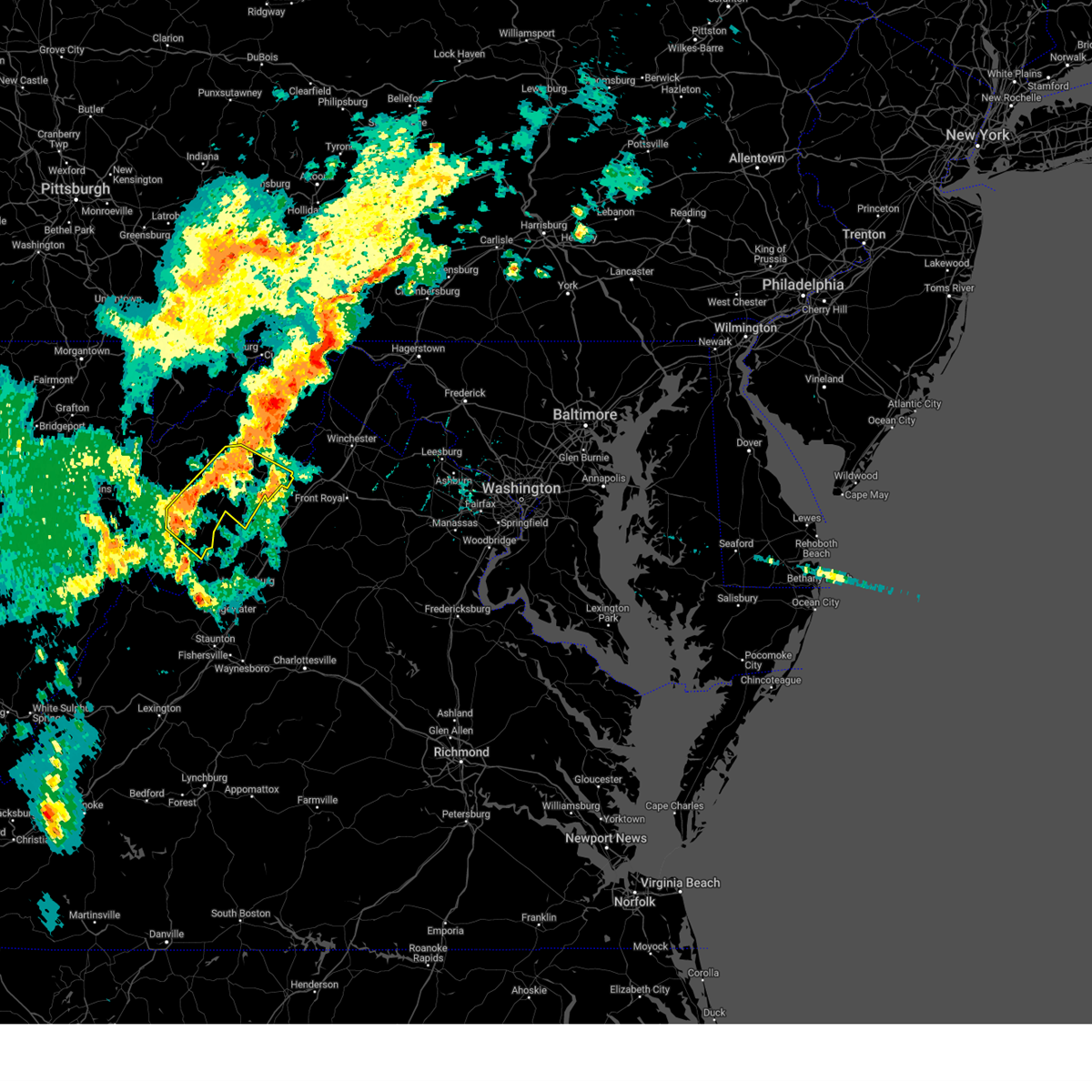
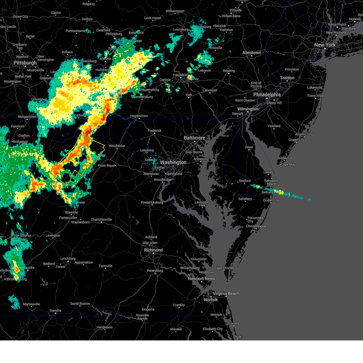
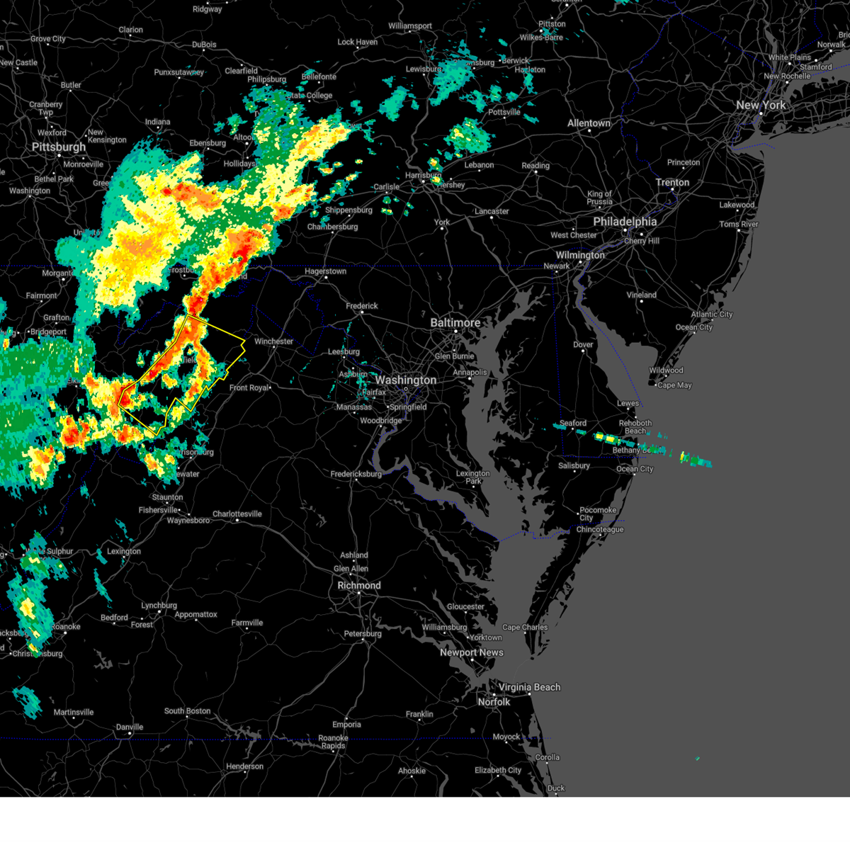
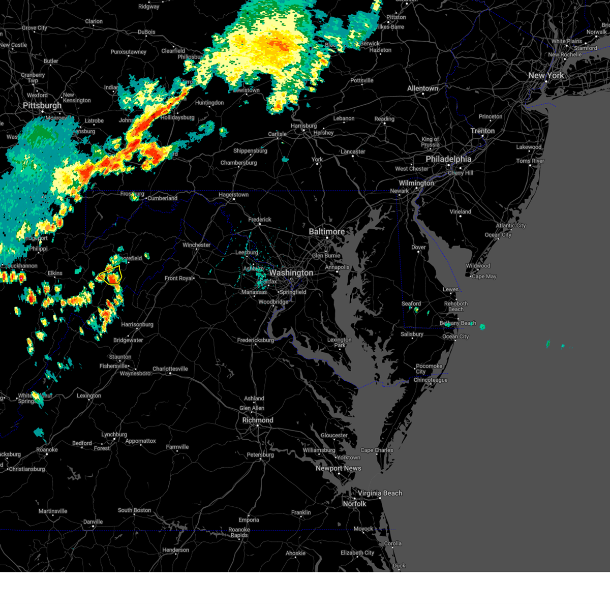
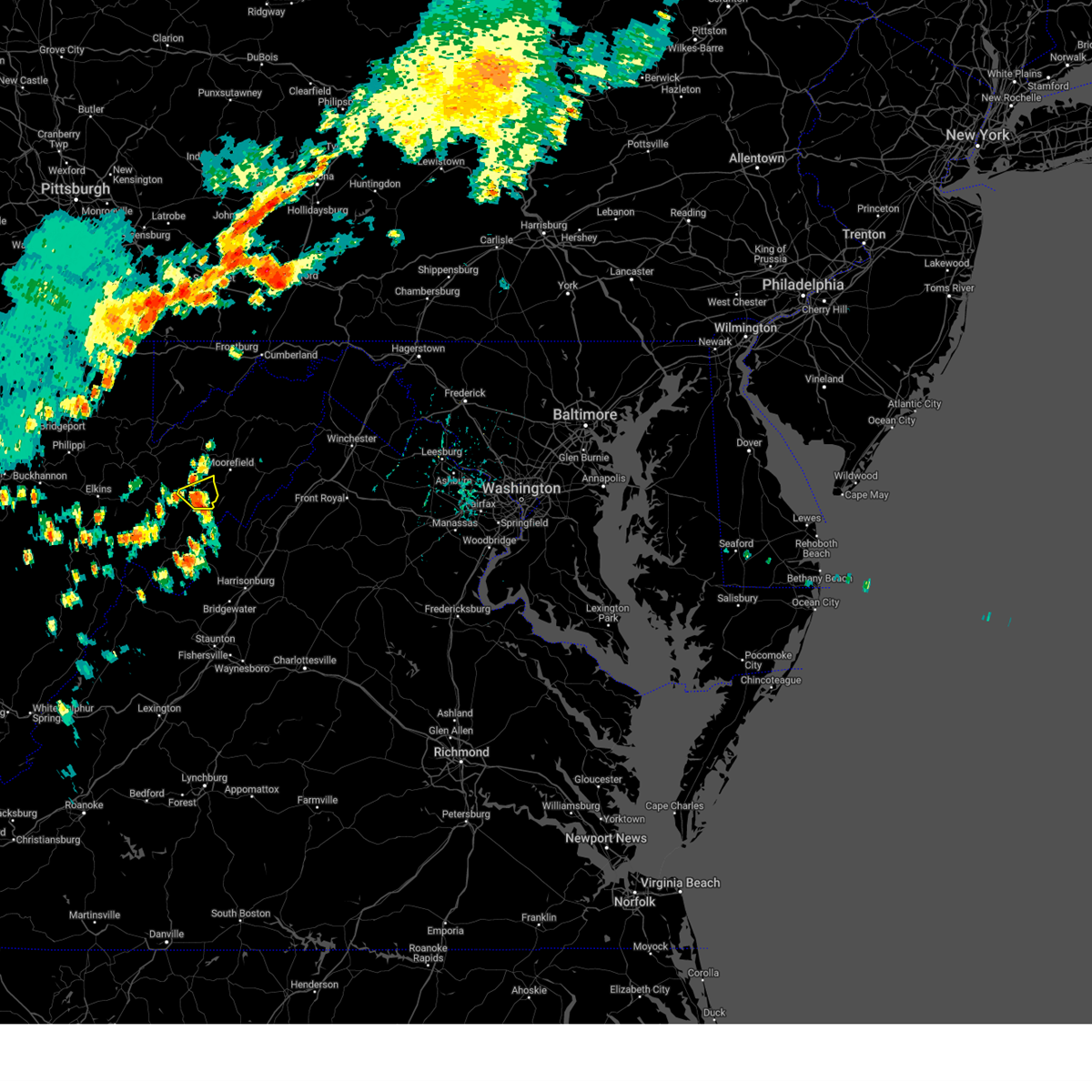
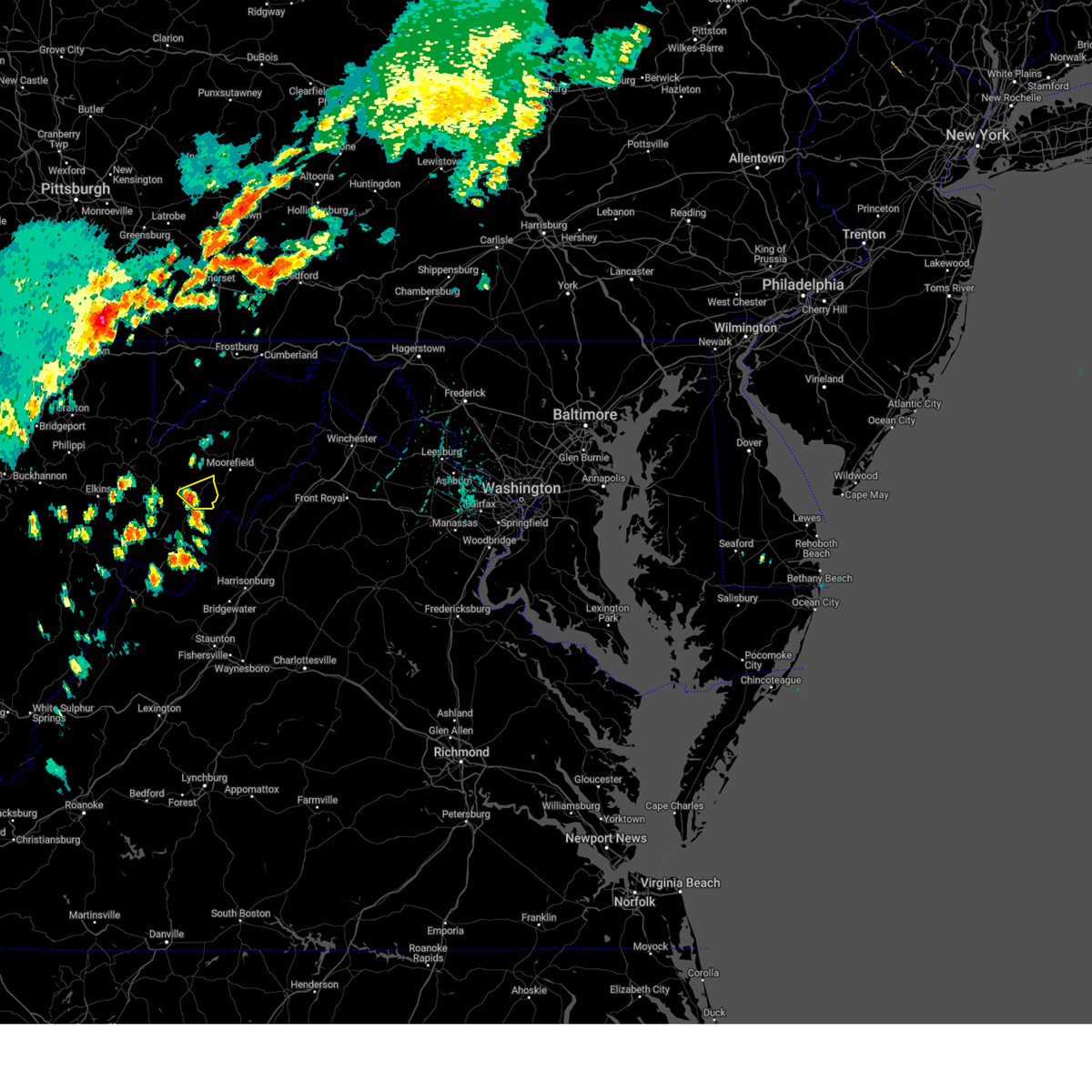
Hail Map for Petersburg, WV
The Petersburg, WV area has had 8 reports of on-the-ground hail by trained spotters, and has been under severe weather warnings 6 times during the past 12 months. Doppler radar has detected hail at or near Petersburg, WV on 22 occasions.
| Name: | Petersburg, WV |
| Where Located: | 38.9 miles E of Elkins, WV |
| Map: | Google Map for Petersburg, WV |
| Population: | 2467 |
| Housing Units: | 1310 |
| More Info: | Search Google for Petersburg, WV |
0
The Top Recent Hail Date for Petersburg, WV is Thursday, August 29, 2024 (6th out of 22)

Hail and Wind Damage Spotted near Petersburg, WV
| Date / Time | Report Details |
|---|---|
| 7/4/2026 4:18 PM EDT | Trees were down along morgantown roa in grant county WV, 7.6 miles SSW of Petersburg, WV |
| 6/18/2026 8:25 AM EDT |
 The storms which prompted the warning have moved out of the area. therefore, the warning will be allowed to expire. however, gusty winds are still possible with these thunderstorms. a severe thunderstorm watch remains in effect until noon edt for western virginia, and eastern west virginia. The storms which prompted the warning have moved out of the area. therefore, the warning will be allowed to expire. however, gusty winds are still possible with these thunderstorms. a severe thunderstorm watch remains in effect until noon edt for western virginia, and eastern west virginia.
|
| 6/18/2026 8:06 AM EDT |
 Svrlwx the national weather service in sterling virginia has issued a * severe thunderstorm warning for, southwestern allegany county in western maryland, northwestern rockingham county in western virginia, northeastern pendleton county in eastern west virginia, grant county in eastern west virginia, south central mineral county in eastern west virginia, western hardy county in eastern west virginia, southwestern hampshire county in eastern west virginia, * until 830 am edt. * at 806 am edt, severe thunderstorms were located along a line extending from near keyser to 6 miles east of davis to 8 miles south of hendricks, moving east at 65 mph (radar indicated). Hazards include 60 mph wind gusts. Damaging winds will cause some trees and large branches to fall. this could injure those outdoors, as well as damage homes and vehicles. roadways may become blocked by downed trees. localized power outages are possible. Unsecured light objects may become projectiles. Svrlwx the national weather service in sterling virginia has issued a * severe thunderstorm warning for, southwestern allegany county in western maryland, northwestern rockingham county in western virginia, northeastern pendleton county in eastern west virginia, grant county in eastern west virginia, south central mineral county in eastern west virginia, western hardy county in eastern west virginia, southwestern hampshire county in eastern west virginia, * until 830 am edt. * at 806 am edt, severe thunderstorms were located along a line extending from near keyser to 6 miles east of davis to 8 miles south of hendricks, moving east at 65 mph (radar indicated). Hazards include 60 mph wind gusts. Damaging winds will cause some trees and large branches to fall. this could injure those outdoors, as well as damage homes and vehicles. roadways may become blocked by downed trees. localized power outages are possible. Unsecured light objects may become projectiles.
|
| 6/11/2026 5:51 PM EDT |
 At 551 pm edt, severe thunderstorms were located along a line extending from 6 miles southeast of lake gordon to near keyser to 8 miles north of moorefield to near mathias, moving east at 35 mph (radar indicated). Hazards include 60 mph wind gusts. Damaging winds will cause some trees and large branches to fall. this could injure those outdoors, as well as damage homes and vehicles. roadways may become blocked by downed trees. localized power outages are possible. unsecured light objects may become projectiles. Locations impacted include, cumberland, frostburg, keyser, moorefield, petersburg, romney, bel air, paw paw, rough run, la vale, fort ashby, ridgeley, basye-bryce mountain, mathias, cresaptown, potomac park, basye, wiley ford, eckhart mines, and mount savage. At 551 pm edt, severe thunderstorms were located along a line extending from 6 miles southeast of lake gordon to near keyser to 8 miles north of moorefield to near mathias, moving east at 35 mph (radar indicated). Hazards include 60 mph wind gusts. Damaging winds will cause some trees and large branches to fall. this could injure those outdoors, as well as damage homes and vehicles. roadways may become blocked by downed trees. localized power outages are possible. unsecured light objects may become projectiles. Locations impacted include, cumberland, frostburg, keyser, moorefield, petersburg, romney, bel air, paw paw, rough run, la vale, fort ashby, ridgeley, basye-bryce mountain, mathias, cresaptown, potomac park, basye, wiley ford, eckhart mines, and mount savage.
|
| 6/11/2026 5:26 PM EDT |
 Svrlwx the national weather service in sterling virginia has issued a * severe thunderstorm warning for, allegany county in western maryland, central garrett county in western maryland, west central shenandoah county in northwestern virginia, northwestern rockingham county in western virginia, northeastern pendleton county in eastern west virginia, grant county in eastern west virginia, mineral county in eastern west virginia, hardy county in eastern west virginia, central hampshire county in eastern west virginia, * until 615 pm edt. * at 526 pm edt, severe thunderstorms were located along a line extending from 6 miles north of la vale to kitzmiller to 10 miles east of bayard to near petersburg, moving east at 35 mph (radar indicated). Hazards include 60 mph wind gusts. Damaging winds will cause some trees and large branches to fall. this could injure those outdoors, as well as damage homes and vehicles. roadways may become blocked by downed trees. localized power outages are possible. Unsecured light objects may become projectiles. Svrlwx the national weather service in sterling virginia has issued a * severe thunderstorm warning for, allegany county in western maryland, central garrett county in western maryland, west central shenandoah county in northwestern virginia, northwestern rockingham county in western virginia, northeastern pendleton county in eastern west virginia, grant county in eastern west virginia, mineral county in eastern west virginia, hardy county in eastern west virginia, central hampshire county in eastern west virginia, * until 615 pm edt. * at 526 pm edt, severe thunderstorms were located along a line extending from 6 miles north of la vale to kitzmiller to 10 miles east of bayard to near petersburg, moving east at 35 mph (radar indicated). Hazards include 60 mph wind gusts. Damaging winds will cause some trees and large branches to fall. this could injure those outdoors, as well as damage homes and vehicles. roadways may become blocked by downed trees. localized power outages are possible. Unsecured light objects may become projectiles.
|
| 6/11/2026 5:15 PM EDT |
 At 514 pm edt, severe thunderstorms were located along a line extending from near deer park to 8 miles northwest of petersburg to 13 miles west of upper tract, moving southeast at 40 mph (radar indicated). Hazards include 60 mph wind gusts. Damaging winds will cause some trees and large branches to fall. this could injure those outdoors, as well as damage homes and vehicles. roadways may become blocked by downed trees. localized power outages are possible. unsecured light objects may become projectiles. Locations impacted include, petersburg, streby, maysville, cabins, hopeville, hartmansville, kline gap, mount pisgah, scherr, and bismarck. At 514 pm edt, severe thunderstorms were located along a line extending from near deer park to 8 miles northwest of petersburg to 13 miles west of upper tract, moving southeast at 40 mph (radar indicated). Hazards include 60 mph wind gusts. Damaging winds will cause some trees and large branches to fall. this could injure those outdoors, as well as damage homes and vehicles. roadways may become blocked by downed trees. localized power outages are possible. unsecured light objects may become projectiles. Locations impacted include, petersburg, streby, maysville, cabins, hopeville, hartmansville, kline gap, mount pisgah, scherr, and bismarck.
|
| 6/11/2026 5:03 PM EDT |
 Svrlwx the national weather service in sterling virginia has issued a * severe thunderstorm warning for, central grant county in eastern west virginia, southwestern mineral county in eastern west virginia, * until 530 pm edt. * at 502 pm edt, a severe thunderstorm was located over davis, moving east at 35 mph (radar indicated). Hazards include 60 mph wind gusts. Damaging winds will cause some trees and large branches to fall. this could injure those outdoors, as well as damage homes and vehicles. roadways may become blocked by downed trees. localized power outages are possible. Unsecured light objects may become projectiles. Svrlwx the national weather service in sterling virginia has issued a * severe thunderstorm warning for, central grant county in eastern west virginia, southwestern mineral county in eastern west virginia, * until 530 pm edt. * at 502 pm edt, a severe thunderstorm was located over davis, moving east at 35 mph (radar indicated). Hazards include 60 mph wind gusts. Damaging winds will cause some trees and large branches to fall. this could injure those outdoors, as well as damage homes and vehicles. roadways may become blocked by downed trees. localized power outages are possible. Unsecured light objects may become projectiles.
|
| 6/25/2025 1:29 PM EDT |
 Svrlwx the national weather service in sterling virginia has issued a * severe thunderstorm warning for, southeastern grant county in eastern west virginia, hardy county in eastern west virginia, * until 200 pm edt. * at 129 pm edt, severe thunderstorms were located along a line extending from 6 miles east of moorefield to near rough run, moving southeast at 10 mph (radar indicated). Hazards include 60 mph wind gusts. Damaging winds will cause some trees and large branches to fall. this could injure those outdoors, as well as damage homes and vehicles. roadways may become blocked by downed trees. localized power outages are possible. Unsecured light objects may become projectiles. Svrlwx the national weather service in sterling virginia has issued a * severe thunderstorm warning for, southeastern grant county in eastern west virginia, hardy county in eastern west virginia, * until 200 pm edt. * at 129 pm edt, severe thunderstorms were located along a line extending from 6 miles east of moorefield to near rough run, moving southeast at 10 mph (radar indicated). Hazards include 60 mph wind gusts. Damaging winds will cause some trees and large branches to fall. this could injure those outdoors, as well as damage homes and vehicles. roadways may become blocked by downed trees. localized power outages are possible. Unsecured light objects may become projectiles.
|
| 5/30/2025 5:20 PM EDT | Multiple trees blew down along cr-28/7 jordan run roa in grant county WV, 7.6 miles ESE of Petersburg, WV |
| 4/30/2025 12:25 AM EDT |
 The storms which prompted the warning have weakened below severe limits, and no longer pose an immediate threat to life or property. therefore, the warning will be allowed to expire. however, gusty winds and heavy rain are still possible with these thunderstorms. The storms which prompted the warning have weakened below severe limits, and no longer pose an immediate threat to life or property. therefore, the warning will be allowed to expire. however, gusty winds and heavy rain are still possible with these thunderstorms.
|
| 4/30/2025 12:10 AM EDT |
 At 1210 am edt, severe thunderstorms were located along a line extending from near kitzmiller to 7 miles south of brandywine, moving east at 60 mph (radar indicated). Hazards include 60 mph wind gusts. Damaging winds will cause some trees and large branches to fall. this could injure those outdoors, as well as damage homes and vehicles. roadways may become blocked by downed trees. localized power outages are possible. unsecured light objects may become projectiles. Locations impacted include, potomac park, franklin, lonaconing, keyser, dogwood flats, arthur, bittinger, hutton, new creek, oakland, lahmansville, mccoole, brady, cabins, deer park, big run state park, kline gap, williamsport, piney grove, and kitzmiller. At 1210 am edt, severe thunderstorms were located along a line extending from near kitzmiller to 7 miles south of brandywine, moving east at 60 mph (radar indicated). Hazards include 60 mph wind gusts. Damaging winds will cause some trees and large branches to fall. this could injure those outdoors, as well as damage homes and vehicles. roadways may become blocked by downed trees. localized power outages are possible. unsecured light objects may become projectiles. Locations impacted include, potomac park, franklin, lonaconing, keyser, dogwood flats, arthur, bittinger, hutton, new creek, oakland, lahmansville, mccoole, brady, cabins, deer park, big run state park, kline gap, williamsport, piney grove, and kitzmiller.
|
| 4/29/2025 11:41 PM EDT |
 Svrlwx the national weather service in sterling virginia has issued a * severe thunderstorm warning for, western allegany county in western maryland, garrett county in western maryland, western highland county in western virginia, western pendleton county in eastern west virginia, grant county in eastern west virginia, western mineral county in eastern west virginia, * until 1230 am edt. * at 1140 pm edt, severe thunderstorms were located along a line extending from near kingwood to 10 miles northeast of greenbank, moving east at 60 mph (radar indicated). Hazards include 60 mph wind gusts. Damaging winds will cause some trees and large branches to fall. this could injure those outdoors, as well as damage homes and vehicles. roadways may become blocked by downed trees. localized power outages are possible. Unsecured light objects may become projectiles. Svrlwx the national weather service in sterling virginia has issued a * severe thunderstorm warning for, western allegany county in western maryland, garrett county in western maryland, western highland county in western virginia, western pendleton county in eastern west virginia, grant county in eastern west virginia, western mineral county in eastern west virginia, * until 1230 am edt. * at 1140 pm edt, severe thunderstorms were located along a line extending from near kingwood to 10 miles northeast of greenbank, moving east at 60 mph (radar indicated). Hazards include 60 mph wind gusts. Damaging winds will cause some trees and large branches to fall. this could injure those outdoors, as well as damage homes and vehicles. roadways may become blocked by downed trees. localized power outages are possible. Unsecured light objects may become projectiles.
|
| 4/3/2025 7:17 AM EDT |
 the severe thunderstorm warning has been cancelled and is no longer in effect the severe thunderstorm warning has been cancelled and is no longer in effect
|
| 4/3/2025 6:58 AM EDT |
 Svrlwx the national weather service in sterling virginia has issued a * severe thunderstorm warning for, southwestern garrett county in western maryland, northeastern pendleton county in eastern west virginia, grant county in eastern west virginia, southwestern mineral county in eastern west virginia, northwestern hardy county in eastern west virginia, west central hampshire county in eastern west virginia, * until 745 am edt. * at 658 am edt, severe thunderstorms were located along a line extending from near loch lynn heights to near hambleton to 6 miles southwest of parsons, moving east at 55 mph (radar indicated). Hazards include 60 mph wind gusts. Damaging winds will cause some trees and large branches to fall. this could injure those outdoors, as well as damage homes and vehicles. roadways may become blocked by downed trees. localized power outages are possible. Unsecured light objects may become projectiles. Svrlwx the national weather service in sterling virginia has issued a * severe thunderstorm warning for, southwestern garrett county in western maryland, northeastern pendleton county in eastern west virginia, grant county in eastern west virginia, southwestern mineral county in eastern west virginia, northwestern hardy county in eastern west virginia, west central hampshire county in eastern west virginia, * until 745 am edt. * at 658 am edt, severe thunderstorms were located along a line extending from near loch lynn heights to near hambleton to 6 miles southwest of parsons, moving east at 55 mph (radar indicated). Hazards include 60 mph wind gusts. Damaging winds will cause some trees and large branches to fall. this could injure those outdoors, as well as damage homes and vehicles. roadways may become blocked by downed trees. localized power outages are possible. Unsecured light objects may become projectiles.
|
| 3/16/2025 3:32 PM EDT |
 Svrlwx the national weather service in sterling virginia has issued a * severe thunderstorm warning for, northeastern pendleton county in eastern west virginia, southeastern grant county in eastern west virginia, northwestern hardy county in eastern west virginia, * until 415 pm edt. * at 332 pm edt, a severe thunderstorm was located near upper tract, or 12 miles north of franklin, moving northeast at 45 mph (radar indicated). Hazards include 60 mph wind gusts and quarter size hail. Damaging winds will cause some trees and large branches to fall. this could injure those outdoors, as well as damage homes and vehicles. roadways may become blocked by downed trees. localized power outages are possible. Unsecured light objects may become projectiles. Svrlwx the national weather service in sterling virginia has issued a * severe thunderstorm warning for, northeastern pendleton county in eastern west virginia, southeastern grant county in eastern west virginia, northwestern hardy county in eastern west virginia, * until 415 pm edt. * at 332 pm edt, a severe thunderstorm was located near upper tract, or 12 miles north of franklin, moving northeast at 45 mph (radar indicated). Hazards include 60 mph wind gusts and quarter size hail. Damaging winds will cause some trees and large branches to fall. this could injure those outdoors, as well as damage homes and vehicles. roadways may become blocked by downed trees. localized power outages are possible. Unsecured light objects may become projectiles.
|
| 3/16/2025 2:21 PM EDT |
 the severe thunderstorm warning has been cancelled and is no longer in effect the severe thunderstorm warning has been cancelled and is no longer in effect
|
| 3/16/2025 1:44 PM EDT |
 Svrlwx the national weather service in sterling virginia has issued a * severe thunderstorm warning for, western allegany county in western maryland, garrett county in western maryland, northern pendleton county in eastern west virginia, grant county in eastern west virginia, mineral county in eastern west virginia, * until 245 pm edt. * at 144 pm edt, severe thunderstorms were located along a line extending from grantsville to 9 miles south of davis, moving east at 30 mph (radar indicated). Hazards include 60 mph wind gusts. Damaging winds will cause some trees and large branches to fall. this could injure those outdoors, as well as damage homes and vehicles. roadways may become blocked by downed trees. localized power outages are possible. Unsecured light objects may become projectiles. Svrlwx the national weather service in sterling virginia has issued a * severe thunderstorm warning for, western allegany county in western maryland, garrett county in western maryland, northern pendleton county in eastern west virginia, grant county in eastern west virginia, mineral county in eastern west virginia, * until 245 pm edt. * at 144 pm edt, severe thunderstorms were located along a line extending from grantsville to 9 miles south of davis, moving east at 30 mph (radar indicated). Hazards include 60 mph wind gusts. Damaging winds will cause some trees and large branches to fall. this could injure those outdoors, as well as damage homes and vehicles. roadways may become blocked by downed trees. localized power outages are possible. Unsecured light objects may become projectiles.
|
| 8/31/2024 5:03 PM EDT |
 the severe thunderstorm warning has been cancelled and is no longer in effect the severe thunderstorm warning has been cancelled and is no longer in effect
|
| 8/31/2024 4:49 PM EDT |
 At 449 pm edt, severe thunderstorms were located along a line extending from 11 miles west of wardensville to 6 miles south of moorefield to upper tract, moving southeast at 15 mph (radar indicated). Hazards include 60 mph wind gusts. Damaging winds will cause some trees and large branches to fall. this could injure those outdoors, as well as damage homes and vehicles. roadways may become blocked by downed trees. localized power outages are possible. unsecured light objects may become projectiles. Locations impacted include, moorefield, petersburg, rough run, upper tract, mathias, bean settlement, landes, brushy run, deer run, seymourville, ruddle, masonville, perry, lost city, lost river, oak flat, dorcas, fisher, baker, and brake. At 449 pm edt, severe thunderstorms were located along a line extending from 11 miles west of wardensville to 6 miles south of moorefield to upper tract, moving southeast at 15 mph (radar indicated). Hazards include 60 mph wind gusts. Damaging winds will cause some trees and large branches to fall. this could injure those outdoors, as well as damage homes and vehicles. roadways may become blocked by downed trees. localized power outages are possible. unsecured light objects may become projectiles. Locations impacted include, moorefield, petersburg, rough run, upper tract, mathias, bean settlement, landes, brushy run, deer run, seymourville, ruddle, masonville, perry, lost city, lost river, oak flat, dorcas, fisher, baker, and brake.
|
| 8/31/2024 4:38 PM EDT |
 the severe thunderstorm warning has been cancelled and is no longer in effect the severe thunderstorm warning has been cancelled and is no longer in effect
|
| 8/31/2024 4:38 PM EDT |
 At 438 pm edt, severe thunderstorms were located along a line extending from 12 miles south of romney to near moorefield to near upper tract, moving southeast at 15 mph (radar indicated). Hazards include 60 mph wind gusts. Damaging winds will cause some trees and large branches to fall. this could injure those outdoors, as well as damage homes and vehicles. roadways may become blocked by downed trees. localized power outages are possible. unsecured light objects may become projectiles. Locations impacted include, moorefield, petersburg, rough run, upper tract, mathias, bean settlement, landes, arthur, brushy run, deer run, seymourville, ruddle, masonville, perry, lost city, cabins, lost river, oak flat, dorcas, and fisher. At 438 pm edt, severe thunderstorms were located along a line extending from 12 miles south of romney to near moorefield to near upper tract, moving southeast at 15 mph (radar indicated). Hazards include 60 mph wind gusts. Damaging winds will cause some trees and large branches to fall. this could injure those outdoors, as well as damage homes and vehicles. roadways may become blocked by downed trees. localized power outages are possible. unsecured light objects may become projectiles. Locations impacted include, moorefield, petersburg, rough run, upper tract, mathias, bean settlement, landes, arthur, brushy run, deer run, seymourville, ruddle, masonville, perry, lost city, cabins, lost river, oak flat, dorcas, and fisher.
|
| 8/31/2024 4:29 PM EDT |
 At 429 pm edt, severe thunderstorms were located along a line extending from near romney to 12 miles northeast of moorefield to 7 miles north of upper tract, moving east at 20 mph (radar indicated). Hazards include 60 mph wind gusts. Damaging winds will cause some trees and large branches to fall. this could injure those outdoors, as well as damage homes and vehicles. roadways may become blocked by downed trees. localized power outages are possible. unsecured light objects may become projectiles. Locations impacted include, moorefield, petersburg, romney, rough run, wardensville, upper tract, mathias, burlington, russelldale, bean settlement, yellow spring, shanks, landes, arthur, brushy run, deer run, seymourville, lahmansville, ruddle, and masonville. At 429 pm edt, severe thunderstorms were located along a line extending from near romney to 12 miles northeast of moorefield to 7 miles north of upper tract, moving east at 20 mph (radar indicated). Hazards include 60 mph wind gusts. Damaging winds will cause some trees and large branches to fall. this could injure those outdoors, as well as damage homes and vehicles. roadways may become blocked by downed trees. localized power outages are possible. unsecured light objects may become projectiles. Locations impacted include, moorefield, petersburg, romney, rough run, wardensville, upper tract, mathias, burlington, russelldale, bean settlement, yellow spring, shanks, landes, arthur, brushy run, deer run, seymourville, lahmansville, ruddle, and masonville.
|
| 8/31/2024 4:18 PM EDT |
 Svrlwx the national weather service in sterling virginia has issued a * severe thunderstorm warning for, northeastern pendleton county in eastern west virginia, southeastern grant county in eastern west virginia, south central mineral county in eastern west virginia, hardy county in eastern west virginia, southern hampshire county in eastern west virginia, * until 515 pm edt. * at 418 pm edt, severe thunderstorms were located along a line extending from near romney to 10 miles north of moorefield to near petersburg, moving east at 20 mph (radar indicated). Hazards include 60 mph wind gusts. Damaging winds will cause some trees and large branches to fall. this could injure those outdoors, as well as damage homes and vehicles. roadways may become blocked by downed trees. localized power outages are possible. Unsecured light objects may become projectiles. Svrlwx the national weather service in sterling virginia has issued a * severe thunderstorm warning for, northeastern pendleton county in eastern west virginia, southeastern grant county in eastern west virginia, south central mineral county in eastern west virginia, hardy county in eastern west virginia, southern hampshire county in eastern west virginia, * until 515 pm edt. * at 418 pm edt, severe thunderstorms were located along a line extending from near romney to 10 miles north of moorefield to near petersburg, moving east at 20 mph (radar indicated). Hazards include 60 mph wind gusts. Damaging winds will cause some trees and large branches to fall. this could injure those outdoors, as well as damage homes and vehicles. roadways may become blocked by downed trees. localized power outages are possible. Unsecured light objects may become projectiles.
|
| 8/31/2024 2:56 PM EDT | Tree down at the intersection of johnson run rd and kellers ridge rd in grant county WV, 2.3 miles E of Petersburg, WV |
| 8/31/2024 2:56 PM EDT |
 The storm which prompted the warning has weakened below severe limits, and no longer poses an immediate threat to life or property. therefore, the warning will be allowed to expire. however, small hail, gusty winds and heavy rain are still possible with this thunderstorm. a severe thunderstorm watch remains in effect until 700 pm edt for eastern west virginia. to report severe weather, contact your nearest law enforcement agency. they will relay your report to the national weather service sterling virginia. The storm which prompted the warning has weakened below severe limits, and no longer poses an immediate threat to life or property. therefore, the warning will be allowed to expire. however, small hail, gusty winds and heavy rain are still possible with this thunderstorm. a severe thunderstorm watch remains in effect until 700 pm edt for eastern west virginia. to report severe weather, contact your nearest law enforcement agency. they will relay your report to the national weather service sterling virginia.
|
| 8/31/2024 2:49 PM EDT |
 At 249 pm edt, a severe thunderstorm was located over rough run, moving east at 10 mph (radar indicated). Hazards include 60 mph wind gusts and penny size hail. Damaging winds will cause some trees and large branches to fall. this could injure those outdoors, as well as damage homes and vehicles. roadways may become blocked by downed trees. localized power outages are possible. unsecured light objects may become projectiles. Locations impacted include, petersburg, rough run, masonville, welton, landes, dorcas, and hopeville. At 249 pm edt, a severe thunderstorm was located over rough run, moving east at 10 mph (radar indicated). Hazards include 60 mph wind gusts and penny size hail. Damaging winds will cause some trees and large branches to fall. this could injure those outdoors, as well as damage homes and vehicles. roadways may become blocked by downed trees. localized power outages are possible. unsecured light objects may become projectiles. Locations impacted include, petersburg, rough run, masonville, welton, landes, dorcas, and hopeville.
|
| 8/31/2024 2:32 PM EDT |
 Svrlwx the national weather service in sterling virginia has issued a * severe thunderstorm warning for, southeastern grant county in eastern west virginia, * until 300 pm edt. * at 232 pm edt, a severe thunderstorm was located near rough run, moving east at 10 mph (radar indicated). Hazards include 60 mph wind gusts and quarter size hail. Damaging winds will cause some trees and large branches to fall. this could injure those outdoors, as well as damage homes and vehicles. roadways may become blocked by downed trees. localized power outages are possible. Unsecured light objects may become projectiles. Svrlwx the national weather service in sterling virginia has issued a * severe thunderstorm warning for, southeastern grant county in eastern west virginia, * until 300 pm edt. * at 232 pm edt, a severe thunderstorm was located near rough run, moving east at 10 mph (radar indicated). Hazards include 60 mph wind gusts and quarter size hail. Damaging winds will cause some trees and large branches to fall. this could injure those outdoors, as well as damage homes and vehicles. roadways may become blocked by downed trees. localized power outages are possible. Unsecured light objects may become projectiles.
|
| 5/26/2024 8:17 PM EDT |
 Svrlwx the national weather service in sterling virginia has issued a * severe thunderstorm warning for, northeastern garrett county in western maryland, western allegany county in western maryland, shenandoah county in northwestern virginia, southwestern rappahannock county in northwestern virginia, northwestern madison county in northwestern virginia, northeastern rockingham county in western virginia, page county in northwestern virginia, northwestern greene county in central virginia, eastern grant county in eastern west virginia, mineral county in eastern west virginia, east central pendleton county in eastern west virginia, hardy county in eastern west virginia, western hampshire county in eastern west virginia, * until 915 pm edt. * at 817 pm edt, severe thunderstorms were located along a line extending from friendsville to near deer park to 6 miles west of rough run to near brandywine to 13 miles west of dale enterprise, moving northeast at 35 mph (radar indicated). Hazards include 60 mph wind gusts and quarter size hail. Damaging winds will cause some trees and large branches to fall. this could injure those outdoors, as well as damage homes and vehicles. roadways may become blocked by downed trees. localized power outages are possible. Unsecured light objects may become projectiles. Svrlwx the national weather service in sterling virginia has issued a * severe thunderstorm warning for, northeastern garrett county in western maryland, western allegany county in western maryland, shenandoah county in northwestern virginia, southwestern rappahannock county in northwestern virginia, northwestern madison county in northwestern virginia, northeastern rockingham county in western virginia, page county in northwestern virginia, northwestern greene county in central virginia, eastern grant county in eastern west virginia, mineral county in eastern west virginia, east central pendleton county in eastern west virginia, hardy county in eastern west virginia, western hampshire county in eastern west virginia, * until 915 pm edt. * at 817 pm edt, severe thunderstorms were located along a line extending from friendsville to near deer park to 6 miles west of rough run to near brandywine to 13 miles west of dale enterprise, moving northeast at 35 mph (radar indicated). Hazards include 60 mph wind gusts and quarter size hail. Damaging winds will cause some trees and large branches to fall. this could injure those outdoors, as well as damage homes and vehicles. roadways may become blocked by downed trees. localized power outages are possible. Unsecured light objects may become projectiles.
|
| 5/26/2024 8:01 PM EDT |
 At 801 pm edt, severe thunderstorms were located along a line extending from 8 miles southwest of farmington to mountain lake park to near upper tract, moving northeast at 50 mph (radar indicated). Hazards include 60 mph wind gusts. Damaging winds will cause some trees and large branches to fall. this could injure those outdoors, as well as damage homes and vehicles. roadways may become blocked by downed trees. localized power outages are possible. unsecured light objects may become projectiles. Locations impacted include, petersburg, mountain lake park, oakland, bayard, bittinger, rough run, grantsville, loch lynn heights, friendsville, deer park, accident, elk garden, brandywine, kitzmiller, upper tract, hutton, big run state park, merrill, keysers ridge, and mineral spring. At 801 pm edt, severe thunderstorms were located along a line extending from 8 miles southwest of farmington to mountain lake park to near upper tract, moving northeast at 50 mph (radar indicated). Hazards include 60 mph wind gusts. Damaging winds will cause some trees and large branches to fall. this could injure those outdoors, as well as damage homes and vehicles. roadways may become blocked by downed trees. localized power outages are possible. unsecured light objects may become projectiles. Locations impacted include, petersburg, mountain lake park, oakland, bayard, bittinger, rough run, grantsville, loch lynn heights, friendsville, deer park, accident, elk garden, brandywine, kitzmiller, upper tract, hutton, big run state park, merrill, keysers ridge, and mineral spring.
|
| 5/26/2024 7:31 PM EDT |
 Svrlwx the national weather service in sterling virginia has issued a * severe thunderstorm warning for, garrett county in western maryland, northern augusta county in western virginia, eastern pendleton county in eastern west virginia, grant county in eastern west virginia, southwestern mineral county in eastern west virginia, * until 830 pm edt. * at 730 pm edt, severe thunderstorms were located along a line extending from near fairmont to 6 miles northwest of parsons to 13 miles northeast of greenbank, moving northeast at 45 mph (radar indicated). Hazards include 60 mph wind gusts. Damaging winds will cause some trees and large branches to fall. this could injure those outdoors, as well as damage homes and vehicles. roadways may become blocked by downed trees. localized power outages are possible. Unsecured light objects may become projectiles. Svrlwx the national weather service in sterling virginia has issued a * severe thunderstorm warning for, garrett county in western maryland, northern augusta county in western virginia, eastern pendleton county in eastern west virginia, grant county in eastern west virginia, southwestern mineral county in eastern west virginia, * until 830 pm edt. * at 730 pm edt, severe thunderstorms were located along a line extending from near fairmont to 6 miles northwest of parsons to 13 miles northeast of greenbank, moving northeast at 45 mph (radar indicated). Hazards include 60 mph wind gusts. Damaging winds will cause some trees and large branches to fall. this could injure those outdoors, as well as damage homes and vehicles. roadways may become blocked by downed trees. localized power outages are possible. Unsecured light objects may become projectiles.
|
| 9/9/2023 2:55 PM EDT | Numerous trees limbs and wires blew down along johnson run road. hail accumulated in drift in grant county WV, 0.4 miles SSE of Petersburg, WV |
| 8/7/2023 3:21 PM EDT |
 At 321 pm edt, severe thunderstorms were located along a line extending from near fort ashby to near rough run, moving east at 55 mph (radar indicated). Hazards include 60 mph wind gusts and quarter size hail. Damaging winds will cause some trees and large branches to fall. this could injure those outdoors, as well as damage homes and vehicles. roadways may become blocked by downed trees. localized power outages are possible. unsecured light objects may become projectiles. locations impacted include, moorefield, petersburg, romney, wardensville, elk garden, capon bridge, burlington, russelldale, yellow spring, arthur, new creek, lahmansville, perry, delray, williamsport, capon springs, ridgeville, old fields, purgitsville and emoryville. hail threat, radar indicated max hail size, 1. 00 in wind threat, radar indicated max wind gust, 60 mph. At 321 pm edt, severe thunderstorms were located along a line extending from near fort ashby to near rough run, moving east at 55 mph (radar indicated). Hazards include 60 mph wind gusts and quarter size hail. Damaging winds will cause some trees and large branches to fall. this could injure those outdoors, as well as damage homes and vehicles. roadways may become blocked by downed trees. localized power outages are possible. unsecured light objects may become projectiles. locations impacted include, moorefield, petersburg, romney, wardensville, elk garden, capon bridge, burlington, russelldale, yellow spring, arthur, new creek, lahmansville, perry, delray, williamsport, capon springs, ridgeville, old fields, purgitsville and emoryville. hail threat, radar indicated max hail size, 1. 00 in wind threat, radar indicated max wind gust, 60 mph.
|
| 8/7/2023 3:19 PM EDT | Trees down across from welton par in grant county WV, 2.1 miles WSW of Petersburg, WV |
| 8/7/2023 3:15 PM EDT | Wind gust of 53 knots measured at petersburg airpor in grant county WV, 0.7 miles ENE of Petersburg, WV |
| 8/7/2023 3:06 PM EDT |
 At 306 pm edt, severe thunderstorms were located along a line extending from near piedmont to upper tract, moving east at 55 mph (radar indicated). Hazards include 60 mph wind gusts and quarter size hail. Damaging winds will cause some trees and large branches to fall. this could injure those outdoors, as well as damage homes and vehicles. roadways may become blocked by downed trees. localized power outages are possible. unsecured light objects may become projectiles. locations impacted include, moorefield, petersburg, romney, bayard, rough run, wardensville, elk garden, kitzmiller, upper tract, mathias, capon bridge, burlington, gorman, russelldale, yellow spring, arthur, brushy run, new creek, lahmansville and perry. hail threat, radar indicated max hail size, 1. 00 in wind threat, radar indicated max wind gust, 60 mph. At 306 pm edt, severe thunderstorms were located along a line extending from near piedmont to upper tract, moving east at 55 mph (radar indicated). Hazards include 60 mph wind gusts and quarter size hail. Damaging winds will cause some trees and large branches to fall. this could injure those outdoors, as well as damage homes and vehicles. roadways may become blocked by downed trees. localized power outages are possible. unsecured light objects may become projectiles. locations impacted include, moorefield, petersburg, romney, bayard, rough run, wardensville, elk garden, kitzmiller, upper tract, mathias, capon bridge, burlington, gorman, russelldale, yellow spring, arthur, brushy run, new creek, lahmansville and perry. hail threat, radar indicated max hail size, 1. 00 in wind threat, radar indicated max wind gust, 60 mph.
|
| 8/7/2023 2:55 PM EDT |
 At 254 pm edt, severe thunderstorms were located along a line extending from near kitzmiller to 7 miles west of upper tract, moving east at 65 mph (radar indicated). Hazards include 60 mph wind gusts and quarter size hail. Damaging winds will cause some trees and large branches to fall. this could injure those outdoors, as well as damage homes and vehicles. roadways may become blocked by downed trees. localized power outages are possible. Unsecured light objects may become projectiles. At 254 pm edt, severe thunderstorms were located along a line extending from near kitzmiller to 7 miles west of upper tract, moving east at 65 mph (radar indicated). Hazards include 60 mph wind gusts and quarter size hail. Damaging winds will cause some trees and large branches to fall. this could injure those outdoors, as well as damage homes and vehicles. roadways may become blocked by downed trees. localized power outages are possible. Unsecured light objects may become projectiles.
|
| 8/7/2023 2:43 PM EDT | Trees down north of north fork highway in cabins resulting in closed road in grant county WV, 4.4 miles E of Petersburg, WV |
| 7/28/2023 5:22 PM EDT |
 At 522 pm edt, a severe thunderstorm was located over parsons, moving east at 35 mph (radar indicated). Hazards include 60 mph wind gusts. Damaging winds will cause some trees and large branches to fall. this could injure those outdoors, as well as damage homes and vehicles. roadways may become blocked by downed trees. localized power outages are possible. Unsecured light objects may become projectiles. At 522 pm edt, a severe thunderstorm was located over parsons, moving east at 35 mph (radar indicated). Hazards include 60 mph wind gusts. Damaging winds will cause some trees and large branches to fall. this could injure those outdoors, as well as damage homes and vehicles. roadways may become blocked by downed trees. localized power outages are possible. Unsecured light objects may become projectiles.
|
| 7/27/2023 4:57 PM EDT |
 At 457 pm edt, a severe thunderstorm was located 7 miles east of davis, moving east at 20 mph (radar indicated). Hazards include 60 mph wind gusts and quarter size hail. Damaging winds will cause some trees and large branches to fall. this could injure those outdoors, as well as damage homes and vehicles. roadways may become blocked by downed trees. localized power outages are possible. Unsecured light objects may become projectiles. At 457 pm edt, a severe thunderstorm was located 7 miles east of davis, moving east at 20 mph (radar indicated). Hazards include 60 mph wind gusts and quarter size hail. Damaging winds will cause some trees and large branches to fall. this could injure those outdoors, as well as damage homes and vehicles. roadways may become blocked by downed trees. localized power outages are possible. Unsecured light objects may become projectiles.
|
| 7/17/2023 5:31 PM EDT |
 At 531 pm edt, a severe thunderstorm was located over rough run, moving northeast at 30 mph (radar indicated). Hazards include 60 mph wind gusts and quarter size hail. Damaging winds will cause some trees and large branches to fall. this could injure those outdoors, as well as damage homes and vehicles. roadways may become blocked by downed trees. localized power outages are possible. Unsecured light objects may become projectiles. At 531 pm edt, a severe thunderstorm was located over rough run, moving northeast at 30 mph (radar indicated). Hazards include 60 mph wind gusts and quarter size hail. Damaging winds will cause some trees and large branches to fall. this could injure those outdoors, as well as damage homes and vehicles. roadways may become blocked by downed trees. localized power outages are possible. Unsecured light objects may become projectiles.
|
| 7/2/2023 10:49 PM EDT |
 At 1049 pm edt, severe thunderstorms were located along a line extending from near bittinger to 6 miles south of kitzmiller to 9 miles west of petersburg, moving east at 45 mph (radar indicated). Hazards include 60 mph wind gusts. Damaging winds will cause some trees and large branches to fall. this could injure those outdoors, as well as damage homes and vehicles. roadways may become blocked by downed trees. localized power outages are possible. unsecured light objects may become projectiles. locations impacted include, petersburg, mountain lake park, oakland, bayard, loch lynn heights, deer park, elk garden, kitzmiller, franklin, luke, gorman, deep creek lake state park, swallow falls state park, big run state park, mccomas beach, merrill, mchenry, arthur, hartmansville and new creek. hail threat, radar indicated max hail size, <. 75 in wind threat, radar indicated max wind gust, 60 mph. At 1049 pm edt, severe thunderstorms were located along a line extending from near bittinger to 6 miles south of kitzmiller to 9 miles west of petersburg, moving east at 45 mph (radar indicated). Hazards include 60 mph wind gusts. Damaging winds will cause some trees and large branches to fall. this could injure those outdoors, as well as damage homes and vehicles. roadways may become blocked by downed trees. localized power outages are possible. unsecured light objects may become projectiles. locations impacted include, petersburg, mountain lake park, oakland, bayard, loch lynn heights, deer park, elk garden, kitzmiller, franklin, luke, gorman, deep creek lake state park, swallow falls state park, big run state park, mccomas beach, merrill, mchenry, arthur, hartmansville and new creek. hail threat, radar indicated max hail size, <. 75 in wind threat, radar indicated max wind gust, 60 mph.
|
| 7/2/2023 10:21 PM EDT |
 At 1021 pm edt, severe thunderstorms were located along a line extending from near terra alta to 8 miles southeast of hendricks, moving east at 40 mph (radar indicated). Hazards include 60 mph wind gusts. Damaging winds will cause some trees and large branches to fall. this could injure those outdoors, as well as damage homes and vehicles. roadways may become blocked by downed trees. localized power outages are possible. Unsecured light objects may become projectiles. At 1021 pm edt, severe thunderstorms were located along a line extending from near terra alta to 8 miles southeast of hendricks, moving east at 40 mph (radar indicated). Hazards include 60 mph wind gusts. Damaging winds will cause some trees and large branches to fall. this could injure those outdoors, as well as damage homes and vehicles. roadways may become blocked by downed trees. localized power outages are possible. Unsecured light objects may become projectiles.
|
| 7/1/2023 3:50 PM EDT |
 At 350 pm edt, severe thunderstorms were located along a line extending from near moorefield to 7 miles south of rough run, moving east at 30 mph (radar indicated). Hazards include 60 mph wind gusts and quarter size hail. Damaging winds will cause some trees and large branches to fall. this could injure those outdoors, as well as damage homes and vehicles. roadways may become blocked by downed trees. localized power outages are possible. Unsecured light objects may become projectiles. At 350 pm edt, severe thunderstorms were located along a line extending from near moorefield to 7 miles south of rough run, moving east at 30 mph (radar indicated). Hazards include 60 mph wind gusts and quarter size hail. Damaging winds will cause some trees and large branches to fall. this could injure those outdoors, as well as damage homes and vehicles. roadways may become blocked by downed trees. localized power outages are possible. Unsecured light objects may become projectiles.
|
| 7/23/2022 5:05 PM EDT | Tree down on petersburg pike near brushy run roa in pendleton county WV, 12.5 miles NNE of Petersburg, WV |
| 7/23/2022 4:54 PM EDT |
 At 454 pm edt, a severe thunderstorm was located near petersburg, moving east at 20 mph (radar indicated). Hazards include 60 mph wind gusts and quarter size hail. Damaging winds will cause some trees and large branches to fall. this could injure those outdoors, as well as damage homes and vehicles. roadways may become blocked by downed trees. localized power outages are possible. Unsecured light objects may become projectiles. At 454 pm edt, a severe thunderstorm was located near petersburg, moving east at 20 mph (radar indicated). Hazards include 60 mph wind gusts and quarter size hail. Damaging winds will cause some trees and large branches to fall. this could injure those outdoors, as well as damage homes and vehicles. roadways may become blocked by downed trees. localized power outages are possible. Unsecured light objects may become projectiles.
|
| 7/23/2022 4:43 PM EDT |
 At 443 pm edt, a severe thunderstorm was located 7 miles west of rough run, moving east at 15 mph (radar indicated). Hazards include 60 mph wind gusts and quarter size hail. Damaging winds will cause some trees and large branches to fall. this could injure those outdoors, as well as damage homes and vehicles. roadways may become blocked by downed trees. localized power outages are possible. unsecured light objects may become projectiles. locations impacted include, petersburg, streby, maysville, cabins, hopeville, arthur, kline gap and seymourville. hail threat, radar indicated max hail size, 1. 00 in wind threat, radar indicated max wind gust, 60 mph. At 443 pm edt, a severe thunderstorm was located 7 miles west of rough run, moving east at 15 mph (radar indicated). Hazards include 60 mph wind gusts and quarter size hail. Damaging winds will cause some trees and large branches to fall. this could injure those outdoors, as well as damage homes and vehicles. roadways may become blocked by downed trees. localized power outages are possible. unsecured light objects may become projectiles. locations impacted include, petersburg, streby, maysville, cabins, hopeville, arthur, kline gap and seymourville. hail threat, radar indicated max hail size, 1. 00 in wind threat, radar indicated max wind gust, 60 mph.
|
| 7/23/2022 4:40 PM EDT | A tree blew down near brick school rd and ridge r in grant county WV, 3.6 miles SSE of Petersburg, WV |
| 7/23/2022 4:35 PM EDT | Trees and lines were blown down on north fork hwy near corners r in grant county WV, 4.4 miles E of Petersburg, WV |
| 7/23/2022 4:16 PM EDT |
 At 416 pm edt, a severe thunderstorm was located 11 miles west of petersburg, moving northeast at 20 mph (radar indicated). Hazards include 60 mph wind gusts and quarter size hail. Damaging winds will cause some trees and large branches to fall. this could injure those outdoors, as well as damage homes and vehicles. roadways may become blocked by downed trees. localized power outages are possible. Unsecured light objects may become projectiles. At 416 pm edt, a severe thunderstorm was located 11 miles west of petersburg, moving northeast at 20 mph (radar indicated). Hazards include 60 mph wind gusts and quarter size hail. Damaging winds will cause some trees and large branches to fall. this could injure those outdoors, as well as damage homes and vehicles. roadways may become blocked by downed trees. localized power outages are possible. Unsecured light objects may become projectiles.
|
| 7/12/2022 3:52 PM EDT | Tree reported down on upper patterson creek road near seymoursville roa in grant county WV, 4 miles SSW of Petersburg, WV |
| 7/12/2022 3:50 PM EDT | A few trees down around the city of petersbur in grant county WV, 0.4 miles SSE of Petersburg, WV |
| 7/12/2022 3:41 PM EDT | Tree reported down on the 4700 block of jordan run roa in grant county WV, 7 miles ESE of Petersburg, WV |
| 7/12/2022 3:08 PM EDT |
 At 307 pm edt, severe thunderstorms were located along a line extending from elk garden to near davis, moving east at 50 mph (radar indicated). Hazards include 60 mph wind gusts and quarter size hail. Damaging winds will cause some trees and large branches to fall. this could injure those outdoors, as well as damage homes and vehicles. roadways may become blocked by downed trees. localized power outages are possible. Unsecured light objects may become projectiles. At 307 pm edt, severe thunderstorms were located along a line extending from elk garden to near davis, moving east at 50 mph (radar indicated). Hazards include 60 mph wind gusts and quarter size hail. Damaging winds will cause some trees and large branches to fall. this could injure those outdoors, as well as damage homes and vehicles. roadways may become blocked by downed trees. localized power outages are possible. Unsecured light objects may become projectiles.
|
| 7/1/2022 5:50 PM EDT | Tree damage was reported near petersburg... including near the intersection of cr-220/2 johnson run road near airport roa in grant county WV, 1.2 miles ENE of Petersburg, WV |
| 7/1/2022 5:38 PM EDT |
 At 538 pm edt, a severe thunderstorm was located over petersburg, moving northeast at 20 mph (radar indicated). Hazards include 60 mph wind gusts and quarter size hail. Damaging winds will cause some trees and large branches to fall. this could injure those outdoors, as well as damage homes and vehicles. roadways may become blocked by downed trees. localized power outages are possible. Unsecured light objects may become projectiles. At 538 pm edt, a severe thunderstorm was located over petersburg, moving northeast at 20 mph (radar indicated). Hazards include 60 mph wind gusts and quarter size hail. Damaging winds will cause some trees and large branches to fall. this could injure those outdoors, as well as damage homes and vehicles. roadways may become blocked by downed trees. localized power outages are possible. Unsecured light objects may become projectiles.
|
| 6/8/2022 5:05 PM EDT |
 At 504 pm edt, a severe thunderstorm was located over upper tract, or 10 miles north of franklin, moving northeast at 25 mph (radar indicated). Hazards include 60 mph wind gusts and quarter size hail. Damaging winds will cause some trees and large branches to fall. this could injure those outdoors, as well as damage homes and vehicles. roadways may become blocked by downed trees. localized power outages are possible. Unsecured light objects may become projectiles. At 504 pm edt, a severe thunderstorm was located over upper tract, or 10 miles north of franklin, moving northeast at 25 mph (radar indicated). Hazards include 60 mph wind gusts and quarter size hail. Damaging winds will cause some trees and large branches to fall. this could injure those outdoors, as well as damage homes and vehicles. roadways may become blocked by downed trees. localized power outages are possible. Unsecured light objects may become projectiles.
|
| 5/21/2022 8:43 PM EDT |
 At 843 pm edt, a severe thunderstorm was located over petersburg, moving northeast at 5 mph (radar indicated). Hazards include 60 mph wind gusts and quarter size hail. Damaging winds will cause some trees and large branches to fall. this could injure those outdoors, as well as damage homes and vehicles. roadways may become blocked by downed trees. localized power outages are possible. Unsecured light objects may become projectiles. At 843 pm edt, a severe thunderstorm was located over petersburg, moving northeast at 5 mph (radar indicated). Hazards include 60 mph wind gusts and quarter size hail. Damaging winds will cause some trees and large branches to fall. this could injure those outdoors, as well as damage homes and vehicles. roadways may become blocked by downed trees. localized power outages are possible. Unsecured light objects may become projectiles.
|
| 8/28/2021 6:38 PM EDT | Branches and wires down in and near maysvill in grant county WV, 9 miles SSE of Petersburg, WV |
| 8/26/2021 3:58 PM EDT | 2 trees down along lunice creek highway just se of maysvill in grant county WV, 7.4 miles S of Petersburg, WV |
| 8/26/2021 3:57 PM EDT | Tree down on house on the 100 block of beagle boot lane in grant county WV, 5.5 miles SSE of Petersburg, WV |
| 8/26/2021 3:33 PM EDT |
 At 333 pm edt, a severe thunderstorm was located 7 miles west of rough run, moving east at 10 mph (radar indicated). Hazards include 60 mph wind gusts and quarter size hail. Damaging winds will cause some trees and large branches to fall. this could injure those outdoors, as well as damage homes and vehicles. roadways may become blocked by downed trees. localized power outages are possible. unsecured light objects may become projectiles. locations impacted include, petersburg, rough run, masonville, milam, welton, cabins, landes, hopeville, dorcas and brake. hail threat, radar indicated max hail size, 1. 00 in wind threat, radar indicated max wind gust, 60 mph. At 333 pm edt, a severe thunderstorm was located 7 miles west of rough run, moving east at 10 mph (radar indicated). Hazards include 60 mph wind gusts and quarter size hail. Damaging winds will cause some trees and large branches to fall. this could injure those outdoors, as well as damage homes and vehicles. roadways may become blocked by downed trees. localized power outages are possible. unsecured light objects may become projectiles. locations impacted include, petersburg, rough run, masonville, milam, welton, cabins, landes, hopeville, dorcas and brake. hail threat, radar indicated max hail size, 1. 00 in wind threat, radar indicated max wind gust, 60 mph.
|
| 8/26/2021 3:20 PM EDT |
 At 320 pm edt, a severe thunderstorm was located 10 miles west of rough run, moving east at 10 mph (radar indicated). Hazards include 60 mph wind gusts and quarter size hail. Damaging winds will cause some trees and large branches to fall. this could injure those outdoors, as well as damage homes and vehicles. roadways may become blocked by downed trees. localized power outages are possible. Unsecured light objects may become projectiles. At 320 pm edt, a severe thunderstorm was located 10 miles west of rough run, moving east at 10 mph (radar indicated). Hazards include 60 mph wind gusts and quarter size hail. Damaging winds will cause some trees and large branches to fall. this could injure those outdoors, as well as damage homes and vehicles. roadways may become blocked by downed trees. localized power outages are possible. Unsecured light objects may become projectiles.
|
| 6/28/2021 6:14 PM EDT | Two trees blew down near the intersection of cr-7 ridge road and windy hill driv in grant county WV, 2.6 miles SSE of Petersburg, WV |
| 6/28/2021 5:59 PM EDT | Trees were reported blown down in petersburg... including near the intersection of water street and judy stree in grant county WV, 0.3 miles NNE of Petersburg, WV |
| 6/28/2021 5:54 PM EDT |
 At 554 pm edt, a severe thunderstorm was located over petersburg, moving northwest at 15 mph (radar indicated). Hazards include 60 mph wind gusts. Damaging winds will cause some trees and large branches to fall. this could injure those outdoors, as well as damage homes and vehicles. roadways may become blocked by downed trees. localized power outages are possible. Unsecured light objects may become projectiles. At 554 pm edt, a severe thunderstorm was located over petersburg, moving northwest at 15 mph (radar indicated). Hazards include 60 mph wind gusts. Damaging winds will cause some trees and large branches to fall. this could injure those outdoors, as well as damage homes and vehicles. roadways may become blocked by downed trees. localized power outages are possible. Unsecured light objects may become projectiles.
|
| 4/9/2021 3:40 PM EDT | Golf Ball sized hail reported 0.6 miles SW of Petersburg, WV, golf ball hail reported at the petersburg high school |
| 4/9/2021 3:39 PM EDT | Ping Pong Ball sized hail reported 0.4 miles SSE of Petersburg, WV |
| 4/9/2021 3:38 PM EDT | Quarter sized hail reported 0.4 miles SSE of Petersburg, WV |
| 4/9/2021 3:38 PM EDT |
 At 338 pm edt, a severe thunderstorm was located over petersburg, moving east at 15 mph (radar indicated). Hazards include 60 mph wind gusts and half dollar size hail. Damaging winds will cause some trees and large branches to fall. this could injure those outdoors, as well as damage homes and vehicles. roadways may become blocked by downed trees. localized power outages are possible. Unsecured light objects may become projectiles. At 338 pm edt, a severe thunderstorm was located over petersburg, moving east at 15 mph (radar indicated). Hazards include 60 mph wind gusts and half dollar size hail. Damaging winds will cause some trees and large branches to fall. this could injure those outdoors, as well as damage homes and vehicles. roadways may become blocked by downed trees. localized power outages are possible. Unsecured light objects may become projectiles.
|
| 4/9/2021 3:32 PM EDT |
 At 332 pm edt, a severe thunderstorm was located over petersburg, moving east at 15 mph (radar indicated). Hazards include 60 mph wind gusts and quarter size hail. Damaging winds will cause some trees and large branches to fall. this could injure those outdoors, as well as damage homes and vehicles. roadways may become blocked by downed trees. localized power outages are possible. unsecured light objects may become projectiles. Locations impacted include, petersburg, arthur and seymourville. At 332 pm edt, a severe thunderstorm was located over petersburg, moving east at 15 mph (radar indicated). Hazards include 60 mph wind gusts and quarter size hail. Damaging winds will cause some trees and large branches to fall. this could injure those outdoors, as well as damage homes and vehicles. roadways may become blocked by downed trees. localized power outages are possible. unsecured light objects may become projectiles. Locations impacted include, petersburg, arthur and seymourville.
|
| 4/9/2021 3:19 PM EDT |
 At 318 pm edt, a severe thunderstorm was located near petersburg, moving east at 15 mph (radar indicated). Hazards include 60 mph wind gusts and quarter size hail. Damaging winds will cause some trees and large branches to fall. this could injure those outdoors, as well as damage homes and vehicles. roadways may become blocked by downed trees. localized power outages are possible. unsecured light objects may become projectiles. Locations impacted include, petersburg, kline gap, streby, cabins, seymourville and arthur. At 318 pm edt, a severe thunderstorm was located near petersburg, moving east at 15 mph (radar indicated). Hazards include 60 mph wind gusts and quarter size hail. Damaging winds will cause some trees and large branches to fall. this could injure those outdoors, as well as damage homes and vehicles. roadways may become blocked by downed trees. localized power outages are possible. unsecured light objects may become projectiles. Locations impacted include, petersburg, kline gap, streby, cabins, seymourville and arthur.
|
| 4/9/2021 3:05 PM EDT |
 The national weather service in sterling virginia has issued a * severe thunderstorm warning for. central grant county in eastern west virginia. until 345 pm edt. At 305 pm edt, a severe thunderstorm was located 9 miles west of petersburg, moving east at 15 mph. The national weather service in sterling virginia has issued a * severe thunderstorm warning for. central grant county in eastern west virginia. until 345 pm edt. At 305 pm edt, a severe thunderstorm was located 9 miles west of petersburg, moving east at 15 mph.
|
| 8/1/2020 8:05 PM EDT |
 The severe thunderstorm warning for southeastern grant county will expire at 815 pm edt, the storm which prompted the warning has weakened below severe limits, and no longer poses an immediate threat to life or property. therefore, the warning will be allowed to expire. The severe thunderstorm warning for southeastern grant county will expire at 815 pm edt, the storm which prompted the warning has weakened below severe limits, and no longer poses an immediate threat to life or property. therefore, the warning will be allowed to expire.
|
| 8/1/2020 7:41 PM EDT |
 At 740 pm edt, a severe thunderstorm was located 10 miles west of petersburg, moving east at 15 mph (radar indicated). Hazards include 60 mph wind gusts and quarter size hail. Damaging winds will cause some trees and large branches to fall. this could injure those outdoors, as well as damage homes and vehicles. roadways may become blocked by downed trees. localized power outages are possible. unsecured light objects may become projectiles. Locations impacted include, petersburg, rough run, masonville, welton, cabins, landes, hopeville and dorcas. At 740 pm edt, a severe thunderstorm was located 10 miles west of petersburg, moving east at 15 mph (radar indicated). Hazards include 60 mph wind gusts and quarter size hail. Damaging winds will cause some trees and large branches to fall. this could injure those outdoors, as well as damage homes and vehicles. roadways may become blocked by downed trees. localized power outages are possible. unsecured light objects may become projectiles. Locations impacted include, petersburg, rough run, masonville, welton, cabins, landes, hopeville and dorcas.
|
| 8/1/2020 7:24 PM EDT |
 At 723 pm edt, a severe thunderstorm was located 12 miles southeast of davis, moving east at 15 mph (radar indicated). Hazards include 60 mph wind gusts and quarter size hail. Damaging winds will cause some trees and large branches to fall. this could injure those outdoors, as well as damage homes and vehicles. roadways may become blocked by downed trees. localized power outages are possible. Unsecured light objects may become projectiles. At 723 pm edt, a severe thunderstorm was located 12 miles southeast of davis, moving east at 15 mph (radar indicated). Hazards include 60 mph wind gusts and quarter size hail. Damaging winds will cause some trees and large branches to fall. this could injure those outdoors, as well as damage homes and vehicles. roadways may become blocked by downed trees. localized power outages are possible. Unsecured light objects may become projectiles.
|
| 8/1/2020 3:35 PM EDT |
 At 335 pm edt, a severe thunderstorm was located over rough run, moving east at 20 mph (radar indicated). Hazards include 60 mph wind gusts. Damaging winds will cause some trees and large branches to fall. this could injure those outdoors, as well as damage homes and vehicles. roadways may become blocked by downed trees. localized power outages are possible. Unsecured light objects may become projectiles. At 335 pm edt, a severe thunderstorm was located over rough run, moving east at 20 mph (radar indicated). Hazards include 60 mph wind gusts. Damaging winds will cause some trees and large branches to fall. this could injure those outdoors, as well as damage homes and vehicles. roadways may become blocked by downed trees. localized power outages are possible. Unsecured light objects may become projectiles.
|
| 7/22/2020 1:11 PM EDT | 2 trees down on point drive near 220 in grant county WV, 1.7 miles NNW of Petersburg, WV |
| 7/22/2020 1:00 PM EDT |
 At 1259 pm edt, a severe thunderstorm was located near petersburg, moving east at 15 mph (radar indicated). Hazards include 60 mph wind gusts and quarter size hail. Damaging winds will cause some trees and large branches to fall. this could injure those outdoors, as well as damage homes and vehicles. roadways may become blocked by downed trees. localized power outages are possible. Unsecured light objects may become projectiles. At 1259 pm edt, a severe thunderstorm was located near petersburg, moving east at 15 mph (radar indicated). Hazards include 60 mph wind gusts and quarter size hail. Damaging winds will cause some trees and large branches to fall. this could injure those outdoors, as well as damage homes and vehicles. roadways may become blocked by downed trees. localized power outages are possible. Unsecured light objects may become projectiles.
|
| 7/10/2020 6:42 PM EDT |
 At 642 pm edt, a severe thunderstorm was located near rough run, moving northeast at 20 mph (radar indicated). Hazards include 60 mph wind gusts and quarter size hail. Damaging winds will cause some trees and large branches to fall. this could injure those outdoors, as well as damage homes and vehicles. roadways may become blocked by downed trees. localized power outages are possible. Unsecured light objects may become projectiles. At 642 pm edt, a severe thunderstorm was located near rough run, moving northeast at 20 mph (radar indicated). Hazards include 60 mph wind gusts and quarter size hail. Damaging winds will cause some trees and large branches to fall. this could injure those outdoors, as well as damage homes and vehicles. roadways may become blocked by downed trees. localized power outages are possible. Unsecured light objects may become projectiles.
|
| 7/10/2020 6:15 PM EDT |
 At 615 pm edt, a severe thunderstorm was located near upper tract, or 11 miles west of rough run, moving northeast at 15 mph (radar indicated). Hazards include 60 mph wind gusts and quarter size hail. Damaging winds will cause some trees and large branches to fall. this could injure those outdoors, as well as damage homes and vehicles. roadways may become blocked by downed trees. localized power outages are possible. Unsecured light objects may become projectiles. At 615 pm edt, a severe thunderstorm was located near upper tract, or 11 miles west of rough run, moving northeast at 15 mph (radar indicated). Hazards include 60 mph wind gusts and quarter size hail. Damaging winds will cause some trees and large branches to fall. this could injure those outdoors, as well as damage homes and vehicles. roadways may become blocked by downed trees. localized power outages are possible. Unsecured light objects may become projectiles.
|
| 4/9/2020 3:20 AM EDT |
 The severe thunderstorm warning for grant and western hardy counties will expire at 330 am edt, the storms which prompted the warning have weakened below severe limits, and have exited the warned area. therefore, the warning will be allowed to expire. a severe thunderstorm watch remains in effect until 600 am edt for western virginia, and eastern west virginia. to report severe weather, contact your nearest law enforcement agency. they will relay your report to the national weather service sterling virginia. The severe thunderstorm warning for grant and western hardy counties will expire at 330 am edt, the storms which prompted the warning have weakened below severe limits, and have exited the warned area. therefore, the warning will be allowed to expire. a severe thunderstorm watch remains in effect until 600 am edt for western virginia, and eastern west virginia. to report severe weather, contact your nearest law enforcement agency. they will relay your report to the national weather service sterling virginia.
|
| 4/9/2020 2:52 AM EDT |
 At 251 am edt, severe thunderstorms were located along a line extending from near hendricks to near greenbank, moving east at 65 mph (radar indicated). Hazards include 60 mph wind gusts. Damaging winds will cause some trees and large branches to fall. this could injure those outdoors, as well as damage homes and vehicles. roadways may become blocked by downed trees. localized power outages are possible. Unsecured light objects may become projectiles. At 251 am edt, severe thunderstorms were located along a line extending from near hendricks to near greenbank, moving east at 65 mph (radar indicated). Hazards include 60 mph wind gusts. Damaging winds will cause some trees and large branches to fall. this could injure those outdoors, as well as damage homes and vehicles. roadways may become blocked by downed trees. localized power outages are possible. Unsecured light objects may become projectiles.
|
| 4/8/2020 3:19 AM EDT |
 At 319 am edt, severe thunderstorms were located along a line extending from near paw paw to 7 miles southeast of romney to bayard, moving southeast at 40 mph (radar indicated). Hazards include 60 mph wind gusts. Damaging winds will cause some trees and large branches to fall. this could injure those outdoors, as well as damage homes and vehicles. roadways may become blocked by downed trees. localized power outages are possible. unsecured light objects may become projectiles. Locations impacted include, moorefield, petersburg, romney, bayard, burlington, gorman, russelldale, bean settlement, shanks, arthur, beechwood, hartmansville, seymourville, lahmansville, cabins, delray, fisher, medley, kline gap and kirby. At 319 am edt, severe thunderstorms were located along a line extending from near paw paw to 7 miles southeast of romney to bayard, moving southeast at 40 mph (radar indicated). Hazards include 60 mph wind gusts. Damaging winds will cause some trees and large branches to fall. this could injure those outdoors, as well as damage homes and vehicles. roadways may become blocked by downed trees. localized power outages are possible. unsecured light objects may become projectiles. Locations impacted include, moorefield, petersburg, romney, bayard, burlington, gorman, russelldale, bean settlement, shanks, arthur, beechwood, hartmansville, seymourville, lahmansville, cabins, delray, fisher, medley, kline gap and kirby.
|
| 4/8/2020 3:03 AM EDT |
 At 303 am edt, severe thunderstorms were located along a line extending from near paw paw to near fort ashby to deer park, moving southeast at 60 mph (radar indicated). Hazards include 60 mph wind gusts. Damaging winds will cause some trees and large branches to fall. this could injure those outdoors, as well as damage homes and vehicles. roadways may become blocked by downed trees. localized power outages are possible. unsecured light objects may become projectiles. Locations impacted include, keyser, moorefield, petersburg, romney, bayard, fort ashby, elk garden, kitzmiller, springfield, green spring, burlington, oldtown, gorman, russelldale, arthur, new creek, lahmansville, mccoole, cabins and delray. At 303 am edt, severe thunderstorms were located along a line extending from near paw paw to near fort ashby to deer park, moving southeast at 60 mph (radar indicated). Hazards include 60 mph wind gusts. Damaging winds will cause some trees and large branches to fall. this could injure those outdoors, as well as damage homes and vehicles. roadways may become blocked by downed trees. localized power outages are possible. unsecured light objects may become projectiles. Locations impacted include, keyser, moorefield, petersburg, romney, bayard, fort ashby, elk garden, kitzmiller, springfield, green spring, burlington, oldtown, gorman, russelldale, arthur, new creek, lahmansville, mccoole, cabins and delray.
|
| 4/8/2020 2:29 AM EDT |
 At 229 am edt, severe thunderstorms were located along a line extending from near berlin to near accident to 6 miles east of point marion, moving southeast at 65 mph (radar indicated). Hazards include 60 mph wind gusts. Damaging winds will cause some trees and large branches to fall. this could injure those outdoors, as well as damage homes and vehicles. roadways may become blocked by downed trees. localized power outages are possible. Unsecured light objects may become projectiles. At 229 am edt, severe thunderstorms were located along a line extending from near berlin to near accident to 6 miles east of point marion, moving southeast at 65 mph (radar indicated). Hazards include 60 mph wind gusts. Damaging winds will cause some trees and large branches to fall. this could injure those outdoors, as well as damage homes and vehicles. roadways may become blocked by downed trees. localized power outages are possible. Unsecured light objects may become projectiles.
|
| 3/3/2020 10:28 PM EST |
 At 1028 pm est, severe thunderstorms were located along a line extending from 11 miles southwest of romney to 6 miles north of upper tract, moving southeast at 45 mph (trained weather spotters). Hazards include 60 mph wind gusts. Damaging winds will cause some trees and large branches to fall. this could injure those outdoors, as well as damage homes and vehicles. roadways may become blocked by downed trees. localized power outages are possible. Unsecured light objects may become projectiles. At 1028 pm est, severe thunderstorms were located along a line extending from 11 miles southwest of romney to 6 miles north of upper tract, moving southeast at 45 mph (trained weather spotters). Hazards include 60 mph wind gusts. Damaging winds will cause some trees and large branches to fall. this could injure those outdoors, as well as damage homes and vehicles. roadways may become blocked by downed trees. localized power outages are possible. Unsecured light objects may become projectiles.
|
| 3/3/2020 10:15 PM EST | Storm damage reported in grant county WV, 0.7 miles ENE of Petersburg, WV |
| 8/20/2019 2:15 PM EDT | Two trees down near intersection of morgantown and knobly road in grant county WV, 10.1 miles S of Petersburg, WV |
| 8/18/2019 5:48 PM EDT | Reports of multiple trees down in the arthur area near rt. 4 in grant county WV, 5.3 miles S of Petersburg, WV |
| 7/30/2019 4:40 PM EDT | Numerous large tree limbs down blocking roadways in the maysville are in grant county WV, 9 miles SSE of Petersburg, WV |
| 7/21/2019 6:53 PM EDT |
 The severe thunderstorm warning for northeastern grant and northwestern hardy counties will expire at 700 pm edt, the storms which prompted the warning have weakened below severe limits, and no longer pose an immediate threat to life or property. therefore, the warning will be allowed to expire. The severe thunderstorm warning for northeastern grant and northwestern hardy counties will expire at 700 pm edt, the storms which prompted the warning have weakened below severe limits, and no longer pose an immediate threat to life or property. therefore, the warning will be allowed to expire.
|
| 7/21/2019 6:44 PM EDT |
 At 643 pm edt, severe thunderstorms were located along a line extending from near petersburg to near moorefield, moving northeast at 30 mph (radar indicated). Hazards include 60 mph wind gusts and quarter size hail. Damaging winds will cause some trees and large branches to fall. this could injure those outdoors, as well as damage homes and vehicles. roadways may become blocked by downed trees. localized power outages are possible. unsecured light objects may become projectiles. Locations impacted include, moorefield, petersburg, maysville, old fields, arthur, scherr, seymourville, lahmansville, streby, rig, mcneill, fisher, medley, kline gap and welton. At 643 pm edt, severe thunderstorms were located along a line extending from near petersburg to near moorefield, moving northeast at 30 mph (radar indicated). Hazards include 60 mph wind gusts and quarter size hail. Damaging winds will cause some trees and large branches to fall. this could injure those outdoors, as well as damage homes and vehicles. roadways may become blocked by downed trees. localized power outages are possible. unsecured light objects may become projectiles. Locations impacted include, moorefield, petersburg, maysville, old fields, arthur, scherr, seymourville, lahmansville, streby, rig, mcneill, fisher, medley, kline gap and welton.
|
| 7/21/2019 6:18 PM EDT | Two trees downed across cr 220/2 in grant county WV, 1.7 miles E of Petersburg, WV |
| 7/21/2019 6:12 PM EDT |
 At 612 pm edt, severe thunderstorms were located along a line extending from 12 miles south of davis to near rough run to 7 miles west of mathias, moving north at 25 mph (radar indicated). Hazards include 60 mph wind gusts and quarter size hail. Damaging winds will cause some trees and large branches to fall. this could injure those outdoors, as well as damage homes and vehicles. roadways may become blocked by downed trees. localized power outages are possible. Unsecured light objects may become projectiles. At 612 pm edt, severe thunderstorms were located along a line extending from 12 miles south of davis to near rough run to 7 miles west of mathias, moving north at 25 mph (radar indicated). Hazards include 60 mph wind gusts and quarter size hail. Damaging winds will cause some trees and large branches to fall. this could injure those outdoors, as well as damage homes and vehicles. roadways may become blocked by downed trees. localized power outages are possible. Unsecured light objects may become projectiles.
|
| 6/29/2019 5:00 PM EDT | Multiple trees down along south mill creek roa in grant county WV, 7.3 miles N of Petersburg, WV |
| 6/24/2019 10:41 PM EDT |
 At 1040 pm edt, a severe thunderstorm was located near moorefield, moving east at 30 mph (radar indicated). Hazards include 60 mph wind gusts. Damaging winds will cause some trees and large branches to fall. this could injure those outdoors, as well as damage homes and vehicles. roadways may become blocked by downed trees. localized power outages are possible. unsecured light objects may become projectiles. Locations impacted include, moorefield, petersburg, rig, mcneill, old fields, welton, arthur, fisher, seymourville, lahmansville and medley. At 1040 pm edt, a severe thunderstorm was located near moorefield, moving east at 30 mph (radar indicated). Hazards include 60 mph wind gusts. Damaging winds will cause some trees and large branches to fall. this could injure those outdoors, as well as damage homes and vehicles. roadways may become blocked by downed trees. localized power outages are possible. unsecured light objects may become projectiles. Locations impacted include, moorefield, petersburg, rig, mcneill, old fields, welton, arthur, fisher, seymourville, lahmansville and medley.
|
| 6/24/2019 10:22 PM EDT |
 At 1022 pm edt, a severe thunderstorm was located 7 miles northwest of petersburg, moving east at 35 mph (radar indicated). Hazards include 60 mph wind gusts. Damaging winds will cause some trees and large branches to fall. this could injure those outdoors, as well as damage homes and vehicles. roadways may become blocked by downed trees. localized power outages are possible. Unsecured light objects may become projectiles. At 1022 pm edt, a severe thunderstorm was located 7 miles northwest of petersburg, moving east at 35 mph (radar indicated). Hazards include 60 mph wind gusts. Damaging winds will cause some trees and large branches to fall. this could injure those outdoors, as well as damage homes and vehicles. roadways may become blocked by downed trees. localized power outages are possible. Unsecured light objects may become projectiles.
|
| 6/24/2019 9:09 PM EDT |
 At 908 pm edt, a severe thunderstorm was located near petersburg, moving east at 30 mph (radar indicated). Hazards include 60 mph wind gusts and quarter size hail. Damaging winds will cause some trees and large branches to fall. this could injure those outdoors, as well as damage homes and vehicles. roadways may become blocked by downed trees. localized power outages are possible. Unsecured light objects may become projectiles. At 908 pm edt, a severe thunderstorm was located near petersburg, moving east at 30 mph (radar indicated). Hazards include 60 mph wind gusts and quarter size hail. Damaging winds will cause some trees and large branches to fall. this could injure those outdoors, as well as damage homes and vehicles. roadways may become blocked by downed trees. localized power outages are possible. Unsecured light objects may become projectiles.
|
| 6/24/2019 9:09 PM EDT |
 The tornado warning for northeastern pendleton, southeastern grant and west central hardy counties will expire at 915 pm edt, circulation as indicated by national weather service radar has weakened, thus the tornado warning will be allowed to expire. however, a severe thunderstorm warning is now in effect until 1000 pm edt for southern grant and central hardy counties in the eastern panhandle of west virginia. The tornado warning for northeastern pendleton, southeastern grant and west central hardy counties will expire at 915 pm edt, circulation as indicated by national weather service radar has weakened, thus the tornado warning will be allowed to expire. however, a severe thunderstorm warning is now in effect until 1000 pm edt for southern grant and central hardy counties in the eastern panhandle of west virginia.
|
| 6/24/2019 9:07 PM EDT |
 At 907 pm edt, a severe thunderstorm was located near petersburg, moving east at 30 mph (radar indicated). Hazards include 60 mph wind gusts and quarter size hail. Damaging winds will cause some trees and large branches to fall. this could injure those outdoors, as well as damage homes and vehicles. roadways may become blocked by downed trees. localized power outages are possible. Unsecured light objects may become projectiles. At 907 pm edt, a severe thunderstorm was located near petersburg, moving east at 30 mph (radar indicated). Hazards include 60 mph wind gusts and quarter size hail. Damaging winds will cause some trees and large branches to fall. this could injure those outdoors, as well as damage homes and vehicles. roadways may become blocked by downed trees. localized power outages are possible. Unsecured light objects may become projectiles.
|
| 6/24/2019 8:54 PM EDT |
 At 854 pm edt, a severe thunderstorm capable of producing a tornado was located near rough run, moving east at 30 mph (radar indicated rotation). Hazards include tornado and quarter size hail. For those in the direct path of a tornado touchdown, flying debris will be dangerous to those caught without shelter. damage to roofs, siding, and windows may occur. mobile homes may be damaged or destroyed. tree damage is likely. This tornadic thunderstorm will remain over mainly rural areas of northeastern pendleton, southeastern grant and west central hardy counties, including the following locations, dorcas, masonville and landes. At 854 pm edt, a severe thunderstorm capable of producing a tornado was located near rough run, moving east at 30 mph (radar indicated rotation). Hazards include tornado and quarter size hail. For those in the direct path of a tornado touchdown, flying debris will be dangerous to those caught without shelter. damage to roofs, siding, and windows may occur. mobile homes may be damaged or destroyed. tree damage is likely. This tornadic thunderstorm will remain over mainly rural areas of northeastern pendleton, southeastern grant and west central hardy counties, including the following locations, dorcas, masonville and landes.
|
| 6/24/2019 8:41 PM EDT |
 The severe thunderstorm warning for northern pendleton and central grant counties will expire at 845 pm edt, however, a tornado warning still remains in effect for the extreme northern portion of pendleton county and southwestern hardy county until 8:45 pm edt. this tornado warning is likely to be extended to include the towns of landes and dorcas wv. The severe thunderstorm warning for northern pendleton and central grant counties will expire at 845 pm edt, however, a tornado warning still remains in effect for the extreme northern portion of pendleton county and southwestern hardy county until 8:45 pm edt. this tornado warning is likely to be extended to include the towns of landes and dorcas wv.
|
| 6/24/2019 8:25 PM EDT |
 At 824 pm edt, severe thunderstorms were located along a line extending from 10 miles southeast of davis to 8 miles northwest of upper tract, moving east at 25 mph (radar indicated). Hazards include 60 mph wind gusts and quarter size hail. Damaging winds will cause some trees and large branches to fall. this could injure those outdoors, as well as damage homes and vehicles. roadways may become blocked by downed trees. localized power outages are possible. unsecured light objects may become projectiles. Locations impacted include, petersburg, rough run, streby, seneca rocks, maysville, onego, cabins, landes, hopeville, brushy run and kline gap. At 824 pm edt, severe thunderstorms were located along a line extending from 10 miles southeast of davis to 8 miles northwest of upper tract, moving east at 25 mph (radar indicated). Hazards include 60 mph wind gusts and quarter size hail. Damaging winds will cause some trees and large branches to fall. this could injure those outdoors, as well as damage homes and vehicles. roadways may become blocked by downed trees. localized power outages are possible. unsecured light objects may become projectiles. Locations impacted include, petersburg, rough run, streby, seneca rocks, maysville, onego, cabins, landes, hopeville, brushy run and kline gap.
|
| 6/24/2019 8:02 PM EDT |
 At 801 pm edt, severe thunderstorms were located along a line extending from near thomas to 14 miles northwest of upper tract, moving northeast at 30 mph (radar indicated). Hazards include 60 mph wind gusts and quarter size hail. Damaging winds will cause some trees and large branches to fall. this could injure those outdoors, as well as damage homes and vehicles. roadways may become blocked by downed trees. localized power outages are possible. Unsecured light objects may become projectiles. At 801 pm edt, severe thunderstorms were located along a line extending from near thomas to 14 miles northwest of upper tract, moving northeast at 30 mph (radar indicated). Hazards include 60 mph wind gusts and quarter size hail. Damaging winds will cause some trees and large branches to fall. this could injure those outdoors, as well as damage homes and vehicles. roadways may become blocked by downed trees. localized power outages are possible. Unsecured light objects may become projectiles.
|
| 6/2/2019 2:56 PM EDT |
 At 255 pm edt, a severe thunderstorm was located near hendricks, or near parsons, moving southeast at 25 mph (radar indicated). Hazards include 60 mph wind gusts and quarter size hail. Damaging winds will cause some trees and large branches to fall. this could injure those outdoors, as well as damage homes and vehicles. roadways may become blocked by downed trees. localized power outages are possible. Unsecured light objects may become projectiles. At 255 pm edt, a severe thunderstorm was located near hendricks, or near parsons, moving southeast at 25 mph (radar indicated). Hazards include 60 mph wind gusts and quarter size hail. Damaging winds will cause some trees and large branches to fall. this could injure those outdoors, as well as damage homes and vehicles. roadways may become blocked by downed trees. localized power outages are possible. Unsecured light objects may become projectiles.
|
| 5/25/2019 8:07 PM EDT |
 At 807 pm edt, a severe thunderstorm was located over hendricks, or near parsons, moving east at 30 mph (radar indicated). Hazards include 60 mph wind gusts and quarter size hail. Damaging winds will cause some trees and large branches to fall. this could injure those outdoors, as well as damage homes and vehicles. roadways may become blocked by downed trees. localized power outages are possible. Unsecured light objects may become projectiles. At 807 pm edt, a severe thunderstorm was located over hendricks, or near parsons, moving east at 30 mph (radar indicated). Hazards include 60 mph wind gusts and quarter size hail. Damaging winds will cause some trees and large branches to fall. this could injure those outdoors, as well as damage homes and vehicles. roadways may become blocked by downed trees. localized power outages are possible. Unsecured light objects may become projectiles.
|
| 4/19/2019 4:54 PM EDT |
 At 454 pm edt, a severe thunderstorm was located over moorefield, moving northeast at 45 mph (radar indicated). Hazards include 60 mph wind gusts. Damaging winds will cause some trees and large branches to fall. this could injure those outdoors, as well as damage homes and vehicles. roadways may become blocked by downed trees. localized power outages are possible. unsecured light objects may become projectiles. Locations impacted include, moorefield, petersburg, bean settlement, old fields, welton, arthur, seymourville, lahmansville, rig, masonville, mcneill, dorcas, fisher, medley, williamsport and brake. At 454 pm edt, a severe thunderstorm was located over moorefield, moving northeast at 45 mph (radar indicated). Hazards include 60 mph wind gusts. Damaging winds will cause some trees and large branches to fall. this could injure those outdoors, as well as damage homes and vehicles. roadways may become blocked by downed trees. localized power outages are possible. unsecured light objects may become projectiles. Locations impacted include, moorefield, petersburg, bean settlement, old fields, welton, arthur, seymourville, lahmansville, rig, masonville, mcneill, dorcas, fisher, medley, williamsport and brake.
|
| 4/19/2019 4:36 PM EDT |
 At 436 pm edt, a severe thunderstorm was located over rough run, moving northeast at 45 mph (radar indicated). Hazards include 60 mph wind gusts. Damaging winds will cause some trees and large branches to fall. this could injure those outdoors, as well as damage homes and vehicles. roadways may become blocked by downed trees. localized power outages are possible. Unsecured light objects may become projectiles. At 436 pm edt, a severe thunderstorm was located over rough run, moving northeast at 45 mph (radar indicated). Hazards include 60 mph wind gusts. Damaging winds will cause some trees and large branches to fall. this could injure those outdoors, as well as damage homes and vehicles. roadways may become blocked by downed trees. localized power outages are possible. Unsecured light objects may become projectiles.
|
| 4/19/2019 4:31 PM EDT | Numerous trees reported down near south mill creek dam... on the 1100 block of south mill creek roa in grant county WV, 9.4 miles N of Petersburg, WV |
| 4/19/2019 3:31 PM EDT | Numerous trees reported down near south mill creek dam... on the 1100 block of south mill creek roa in grant county WV, 9.4 miles N of Petersburg, WV |
| 4/19/2019 3:30 PM EDT | Multiple trees reported down near the 1100 block of south mill creek roa in grant county WV, 0.4 miles SSE of Petersburg, WV |
| 4/19/2019 3:30 PM EDT | Numerous trees reported down near south mill creek dam... on the 1100 block of south mill creek roa in grant county WV, 9.4 miles N of Petersburg, WV |
| 4/14/2019 10:12 PM EDT |
 At 1012 pm edt, severe thunderstorms were located along a line extending from 6 miles south of davis to near snowshoe, moving east at 50 mph. trees and wires were blown down in association with this line over greenbrier county west virginia (emergency management). Hazards include 60 mph wind gusts. Damaging winds will cause some trees and large branches to fall. this could injure those outdoors, as well as damage homes and vehicles. roadways may become blocked by downed trees. localized power outages are possible. unsecured light objects may become projectiles. Locations impacted include, moorefield, petersburg, franklin, monterey, rough run, brandywine, upper tract, arthur, brushy run, head waters, deer run, lahmansville, williamsville, cabins, oak flat, dorcas, kline gap, hightown, onego and mill gap. At 1012 pm edt, severe thunderstorms were located along a line extending from 6 miles south of davis to near snowshoe, moving east at 50 mph. trees and wires were blown down in association with this line over greenbrier county west virginia (emergency management). Hazards include 60 mph wind gusts. Damaging winds will cause some trees and large branches to fall. this could injure those outdoors, as well as damage homes and vehicles. roadways may become blocked by downed trees. localized power outages are possible. unsecured light objects may become projectiles. Locations impacted include, moorefield, petersburg, franklin, monterey, rough run, brandywine, upper tract, arthur, brushy run, head waters, deer run, lahmansville, williamsville, cabins, oak flat, dorcas, kline gap, hightown, onego and mill gap.
|
| 4/14/2019 10:09 PM EDT |
 At 1009 pm edt, severe thunderstorms were located along a line extending from 6 miles south of davis to near snowshoe, moving east at 50 mph (radar indicated). Hazards include 60 mph wind gusts. Damaging winds will cause some trees and large branches to fall. this could injure those outdoors, as well as damage homes and vehicles. roadways may become blocked by downed trees. localized power outages are possible. Unsecured light objects may become projectiles. At 1009 pm edt, severe thunderstorms were located along a line extending from 6 miles south of davis to near snowshoe, moving east at 50 mph (radar indicated). Hazards include 60 mph wind gusts. Damaging winds will cause some trees and large branches to fall. this could injure those outdoors, as well as damage homes and vehicles. roadways may become blocked by downed trees. localized power outages are possible. Unsecured light objects may become projectiles.
|
| 8/30/2018 6:34 PM EDT |
 At 634 pm edt, a severe thunderstorm was located 9 miles southwest of petersburg, moving northeast at 15 mph (radar indicated). Hazards include 60 mph wind gusts and quarter size hail. Damaging winds will cause some trees and large branches to fall. this could injure those outdoors, as well as damage homes and vehicles. roadways may become blocked by downed trees. localized power outages are possible. unsecured light objects may become projectiles. Locations impacted include, petersburg, landes, hopeville and cabins. At 634 pm edt, a severe thunderstorm was located 9 miles southwest of petersburg, moving northeast at 15 mph (radar indicated). Hazards include 60 mph wind gusts and quarter size hail. Damaging winds will cause some trees and large branches to fall. this could injure those outdoors, as well as damage homes and vehicles. roadways may become blocked by downed trees. localized power outages are possible. unsecured light objects may become projectiles. Locations impacted include, petersburg, landes, hopeville and cabins.
|
| 8/30/2018 6:10 PM EDT |
 The national weather service in sterling virginia has issued a * severe thunderstorm warning for. north central pendleton county in eastern west virginia. south central grant county in eastern west virginia. until 715 pm edt. At 610 pm edt, a severe thunderstorm was located near upper tract,. The national weather service in sterling virginia has issued a * severe thunderstorm warning for. north central pendleton county in eastern west virginia. south central grant county in eastern west virginia. until 715 pm edt. At 610 pm edt, a severe thunderstorm was located near upper tract,.
|
| 5/15/2018 9:17 PM EDT |
 At 916 pm edt, a severe thunderstorm was located near thomas, moving east at 20 mph (radar indicated). Hazards include 60 mph wind gusts and quarter size hail. Damaging winds will cause some trees and large branches to fall. this could injure those outdoors, as well as damage homes and vehicles. roadways may become blocked by downed trees. localized power outages are possible. Unsecured light objects may become projectiles. At 916 pm edt, a severe thunderstorm was located near thomas, moving east at 20 mph (radar indicated). Hazards include 60 mph wind gusts and quarter size hail. Damaging winds will cause some trees and large branches to fall. this could injure those outdoors, as well as damage homes and vehicles. roadways may become blocked by downed trees. localized power outages are possible. Unsecured light objects may become projectiles.
|
| 5/14/2018 5:13 PM EDT |
 At 513 pm edt, severe thunderstorms were located along a line extending from 8 miles northeast of mathias to 9 miles east of brandywine, moving southeast at 60 mph (radar indicated). Hazards include 60 mph wind gusts and quarter size hail. Damaging winds will cause some trees and large branches to fall. this could injure those outdoors, as well as damage homes and vehicles. roadways may become blocked by downed trees. localized power outages are possible. unsecured light objects may become projectiles. Locations impacted include, moorefield, petersburg, franklin, rough run, brandywine, upper tract, bean settlement, landes, arthur, brushy run, deer run, seymourville, lahmansville, ruddle, masonville, cabins, oak flat, dorcas, fisher and medley. At 513 pm edt, severe thunderstorms were located along a line extending from 8 miles northeast of mathias to 9 miles east of brandywine, moving southeast at 60 mph (radar indicated). Hazards include 60 mph wind gusts and quarter size hail. Damaging winds will cause some trees and large branches to fall. this could injure those outdoors, as well as damage homes and vehicles. roadways may become blocked by downed trees. localized power outages are possible. unsecured light objects may become projectiles. Locations impacted include, moorefield, petersburg, franklin, rough run, brandywine, upper tract, bean settlement, landes, arthur, brushy run, deer run, seymourville, lahmansville, ruddle, masonville, cabins, oak flat, dorcas, fisher and medley.
|
| 5/14/2018 4:39 PM EDT |
 At 439 pm edt, severe thunderstorms were located along a line extending from 7 miles southeast of bayard to 15 miles east of dailey, moving southeast at 55 mph (radar indicated). Hazards include 70 mph wind gusts and half dollar size hail. Damaging winds will cause some trees and large branches to fall. this could injure those outdoors, as well as damage homes and vehicles. roadways may become blocked by downed trees. localized power outages are possible. Unsecured light objects may become projectiles. At 439 pm edt, severe thunderstorms were located along a line extending from 7 miles southeast of bayard to 15 miles east of dailey, moving southeast at 55 mph (radar indicated). Hazards include 70 mph wind gusts and half dollar size hail. Damaging winds will cause some trees and large branches to fall. this could injure those outdoors, as well as damage homes and vehicles. roadways may become blocked by downed trees. localized power outages are possible. Unsecured light objects may become projectiles.
|
| 7/22/2017 4:35 PM EDT | Tree down on route 42 just outside of maysvill in grant county WV, 9 miles SSE of Petersburg, WV |
| 6/14/2017 2:45 PM EDT | A few trees down north of petersbur in grant county WV, 3.9 miles S of Petersburg, WV |
| 3/1/2017 11:50 AM EST | Storm damage reported in grant county WV, 1 miles N of Petersburg, WV |
| 3/1/2017 11:50 AM EST | Trees/lines down in petersburg and cabins in grant county WV, 0.4 miles SSE of Petersburg, WV |
| 6/24/2016 5:14 PM EDT |
 At 513 pm edt, a severe thunderstorm was located over rough run, moving south at 25 mph (radar indicated). Hazards include 60 mph wind gusts and quarter size hail. Damaging winds will cause some trees and large branches to fall. this could injure those outdoors, as well as damage homes and vehicles. roadways may become blocked by downed trees. localized power outages are possible. unsecured light objects may become projectiles. Locations impacted include, petersburg, rough run, dorcas, milam, landes, welton, masonville and brake. At 513 pm edt, a severe thunderstorm was located over rough run, moving south at 25 mph (radar indicated). Hazards include 60 mph wind gusts and quarter size hail. Damaging winds will cause some trees and large branches to fall. this could injure those outdoors, as well as damage homes and vehicles. roadways may become blocked by downed trees. localized power outages are possible. unsecured light objects may become projectiles. Locations impacted include, petersburg, rough run, dorcas, milam, landes, welton, masonville and brake.
|
| 6/24/2016 5:06 PM EDT | Trees down on knob rd and durgon rd. both near south mill creek rd in grant county WV, 1.7 miles NNW of Petersburg, WV |
| 6/24/2016 5:05 PM EDT | Tree down on route 220 2 in grant county WV, 2.3 miles E of Petersburg, WV |
| 6/24/2016 5:01 PM EDT | Quarter sized hail reported 0.4 miles SSE of Petersburg, WV |
| 6/24/2016 5:01 PM EDT | Half Dollar sized hail reported 0.5 miles WNW of Petersburg, WV, tree down on car on south grove st |
| 6/24/2016 5:01 PM EDT | Tree down on car on south grove st in grant county WV, 0.5 miles WNW of Petersburg, WV |
| 6/24/2016 4:57 PM EDT | Tree down on lunice creek hwy north of petersburg in grant county WV, 1.8 miles S of Petersburg, WV |
| 6/24/2016 4:50 PM EDT |
 At 450 pm edt, a severe thunderstorm was located near petersburg, moving south at 25 mph (radar indicated). Hazards include 60 mph wind gusts and quarter size hail. Damaging winds will cause some trees and large branches to fall. this could injure those outdoors, as well as damage homes and vehicles. roadways may become blocked by downed trees. localized power outages are possible. Unsecured light objects may become projectiles. At 450 pm edt, a severe thunderstorm was located near petersburg, moving south at 25 mph (radar indicated). Hazards include 60 mph wind gusts and quarter size hail. Damaging winds will cause some trees and large branches to fall. this could injure those outdoors, as well as damage homes and vehicles. roadways may become blocked by downed trees. localized power outages are possible. Unsecured light objects may become projectiles.
|
| 6/24/2016 4:45 PM EDT | 3 inch diameter tree branches blocked road to house set on fire by lightning in grant county WV, 8 miles SE of Petersburg, WV |
| 6/24/2016 4:35 PM EDT | 3 inch diameter tree branches blocked road to house set on fire by lightning in grant county WV, 4.7 miles SSE of Petersburg, WV |
| 6/21/2016 4:58 PM EDT |
 At 457 pm edt, a severe thunderstorm was located near thomas, moving southeast at 25 mph (radar indicated). Hazards include 60 mph wind gusts and quarter size hail. Damaging winds will cause some trees and large branches to fall. this could injure those outdoors, as well as damage homes and vehicles. roadways may become blocked by downed trees. localized power outages are possible. Unsecured light objects may become projectiles. At 457 pm edt, a severe thunderstorm was located near thomas, moving southeast at 25 mph (radar indicated). Hazards include 60 mph wind gusts and quarter size hail. Damaging winds will cause some trees and large branches to fall. this could injure those outdoors, as well as damage homes and vehicles. roadways may become blocked by downed trees. localized power outages are possible. Unsecured light objects may become projectiles.
|
| 6/21/2016 4:17 PM EDT |
 At 417 pm edt, a severe thunderstorm was located near davis, moving southeast at 35 mph (radar indicated). Hazards include 60 mph wind gusts and quarter size hail. Damaging winds will cause some trees and large branches to fall. this could injure those outdoors, as well as damage homes and vehicles. roadways may become blocked by downed trees. localized power outages are possible. Unsecured light objects may become projectiles. At 417 pm edt, a severe thunderstorm was located near davis, moving southeast at 35 mph (radar indicated). Hazards include 60 mph wind gusts and quarter size hail. Damaging winds will cause some trees and large branches to fall. this could injure those outdoors, as well as damage homes and vehicles. roadways may become blocked by downed trees. localized power outages are possible. Unsecured light objects may become projectiles.
|
| 6/16/2016 6:39 PM EDT |
 At 639 pm edt, severe thunderstorms were located along a line extending from 7 miles southeast of lake gordon to 6 miles southeast of fort ashby to near rough run to 12 miles west of brandywine, moving southeast at 40 mph (radar indicated). Hazards include 60 mph wind gusts and quarter size hail. Damaging winds will cause some trees and large branches to fall. this could injure those outdoors, as well as damage homes and vehicles. roadways may become blocked by downed trees. localized power outages are possible. unsecured light objects may become projectiles. Locations impacted include, cumberland, moorefield, petersburg, romney, hancock, paw paw, brandywine, rough run, fort ashby, berkeley springs, ridgeley, upper tract, mathias, potomac park, wiley ford, franklin, springfield, great cacapon, capon bridge and green spring. At 639 pm edt, severe thunderstorms were located along a line extending from 7 miles southeast of lake gordon to 6 miles southeast of fort ashby to near rough run to 12 miles west of brandywine, moving southeast at 40 mph (radar indicated). Hazards include 60 mph wind gusts and quarter size hail. Damaging winds will cause some trees and large branches to fall. this could injure those outdoors, as well as damage homes and vehicles. roadways may become blocked by downed trees. localized power outages are possible. unsecured light objects may become projectiles. Locations impacted include, cumberland, moorefield, petersburg, romney, hancock, paw paw, brandywine, rough run, fort ashby, berkeley springs, ridgeley, upper tract, mathias, potomac park, wiley ford, franklin, springfield, great cacapon, capon bridge and green spring.
|
| 6/16/2016 6:01 PM EDT |
 At 600 pm edt, severe thunderstorms were located along a line extending from near frostburg to westernport to near bayard to near dailey, moving southeast at 45 mph (radar indicated). Hazards include 60 mph wind gusts and quarter size hail. Damaging winds will cause some trees and large branches to fall. this could injure those outdoors, as well as damage homes and vehicles. roadways may become blocked by downed trees. localized power outages are possible. Unsecured light objects may become projectiles. At 600 pm edt, severe thunderstorms were located along a line extending from near frostburg to westernport to near bayard to near dailey, moving southeast at 45 mph (radar indicated). Hazards include 60 mph wind gusts and quarter size hail. Damaging winds will cause some trees and large branches to fall. this could injure those outdoors, as well as damage homes and vehicles. roadways may become blocked by downed trees. localized power outages are possible. Unsecured light objects may become projectiles.
|
| 6/16/2016 1:04 PM EDT |
 At 104 pm edt, doppler radar indicated a severe thunderstorm capable of producing damaging winds in excess of 60 mph. this storm was located over bayard, and moving southeast at 35 mph. At 104 pm edt, doppler radar indicated a severe thunderstorm capable of producing damaging winds in excess of 60 mph. this storm was located over bayard, and moving southeast at 35 mph.
|
| 7/8/2014 4:54 PM EDT | Trees down throughout county at multiple location in grant county WV, 0.4 miles SSE of Petersburg, WV |
| 7/8/2014 4:50 PM EDT | Multiple trees down on rt 42 in maysville in grant county WV, 7.3 miles S of Petersburg, WV |
| 7/3/2014 4:18 PM EDT | Roof and siding was ripped off chicken coops in grant county WV, 4.5 miles NNW of Petersburg, WV |
| 7/3/2014 4:18 PM EDT | Multiple trees down on mill creek rd near rough run in grant county WV, 7.2 miles N of Petersburg, WV |
| 6/8/2014 6:12 PM EDT | Many trees down...some trees down on campers in hardy county WV, 8.6 miles NNW of Petersburg, WV |
| 6/8/2014 6:10 PM EDT | Roof blown off of house and power lines down in creitz village subdivision in grant county WV, 3.9 miles NNW of Petersburg, WV |
| 11/18/2013 12:02 AM EST | Tree blocking southbound rt 220 28 near the hickory hill community in hardy county WV, 3.2 miles W of Petersburg, WV |
| 7/19/2013 4:49 PM EDT | Tree down on corners r in grant county WV, 4.5 miles ESE of Petersburg, WV |
| 7/19/2013 4:44 PM EDT | Tree down on south fork r in hardy county WV, 12.8 miles N of Petersburg, WV |
| 7/19/2013 4:44 PM EDT | Tree down on 18000 block of s. fork rd in hardy county WV, 11.1 miles NNW of Petersburg, WV |
| 7/19/2013 3:58 PM EDT | Tree down on south fork r in hardy county WV, 12.8 miles N of Petersburg, WV |
| 7/19/2013 3:08 PM EDT | Tree down at east ave adn grant s in grant county WV, 0.5 miles WNW of Petersburg, WV |
| 7/19/2013 3:06 PM EDT | Tree down on johnson run rd in grant county WV, 0.4 miles SSE of Petersburg, WV |
| 7/24/2012 12:52 PM EDT | Trees down near seymourville in grant county WV, 4.7 miles SSW of Petersburg, WV |
| 7/18/2012 6:20 PM EDT | A few trees across hinkle mountain road near intersection of county rt in hardy county WV, 12.8 miles N of Petersburg, WV |
| 6/29/2012 8:46 PM EDT | Storm damage reported in grant county WV, 0.6 miles SW of Petersburg, WV |
| 6/29/2012 8:44 PM EDT | Numerous trees down across the county in grant county WV, 0.4 miles SSE of Petersburg, WV |
| 6/29/2012 8:39 PM EDT | Electrical wires down on rockinghorse road between broiling brook parkway and randolph roa in grant county WV, 4.2 miles SSW of Petersburg, WV |
| 6/29/2012 8:36 PM EDT | Four trees dow in grant county WV, 7 miles SSE of Petersburg, WV |
| 1/1/0001 12:00 AM | Two trees across durgan road as well as several branches on powerline in hardy county WV, 4.2 miles W of Petersburg, WV |
| 1/1/0001 12:00 AM | A few trees knocked down across roadway near intersection of corners road and north fork highwa in grant county WV, 3.9 miles E of Petersburg, WV |
| 1/1/0001 12:00 AM | Storm damage reported in grant county WV, 7 miles SSE of Petersburg, WV |
| 1/1/0001 12:00 AM | Tree down across a portion of us 220 near pendleton county line. road not completely blocke in grant county WV, 9 miles NNE of Petersburg, WV |
| 1/1/0001 12:00 AM | Trees down between petersburg and maysville on route 4 in grant county WV, 5.3 miles S of Petersburg, WV |
| 1/1/0001 12:00 AM | Trees down on route 28 between petersburg and hopevill in grant county WV, 4.9 miles E of Petersburg, WV |
| 1/1/0001 12:00 AM | Storm damage reported in grant county WV, 3.1 miles NW of Petersburg, WV |
| 1/1/0001 12:00 AM | Quarter sized hail reported 3.1 miles NW of Petersburg, WV |
| 1/1/0001 12:00 AM | Tree uprooted in grant county WV, 3.8 miles N of Petersburg, WV |
| 1/1/0001 12:00 AM | Trees down along tom cox road in dorcus area in grant county WV, 2.3 miles N of Petersburg, WV |
| 1/1/0001 12:00 AM | Storm damage reported in grant county WV, 7 miles SSE of Petersburg, WV |
| 1/1/0001 12:00 AM | A tree was down along the elkhorn roa in grant county WV, 4.3 miles NNW of Petersburg, WV |
| 1/1/0001 12:00 AM | Ping Pong Ball sized hail reported 6.7 miles NNW of Petersburg, WV |
| 1/1/0001 12:00 AM | Storm damage reported in grant county WV, 6.6 miles N of Petersburg, WV |
| 1/1/0001 12:00 AM | Ping Pong Ball sized hail reported 6.6 miles N of Petersburg, WV |
Hail Maps for Petersburg, WV


Connect with Interactive Hail Maps