

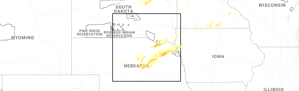
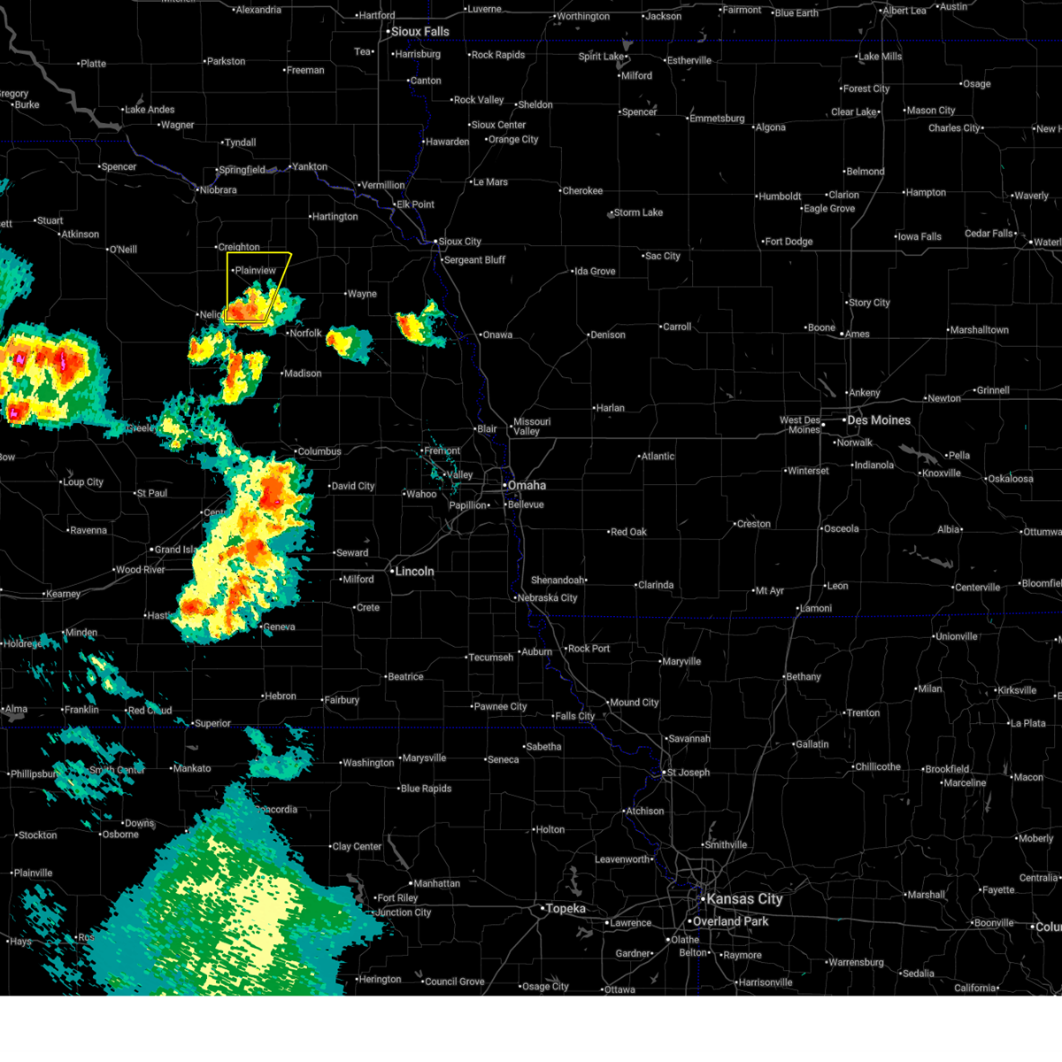
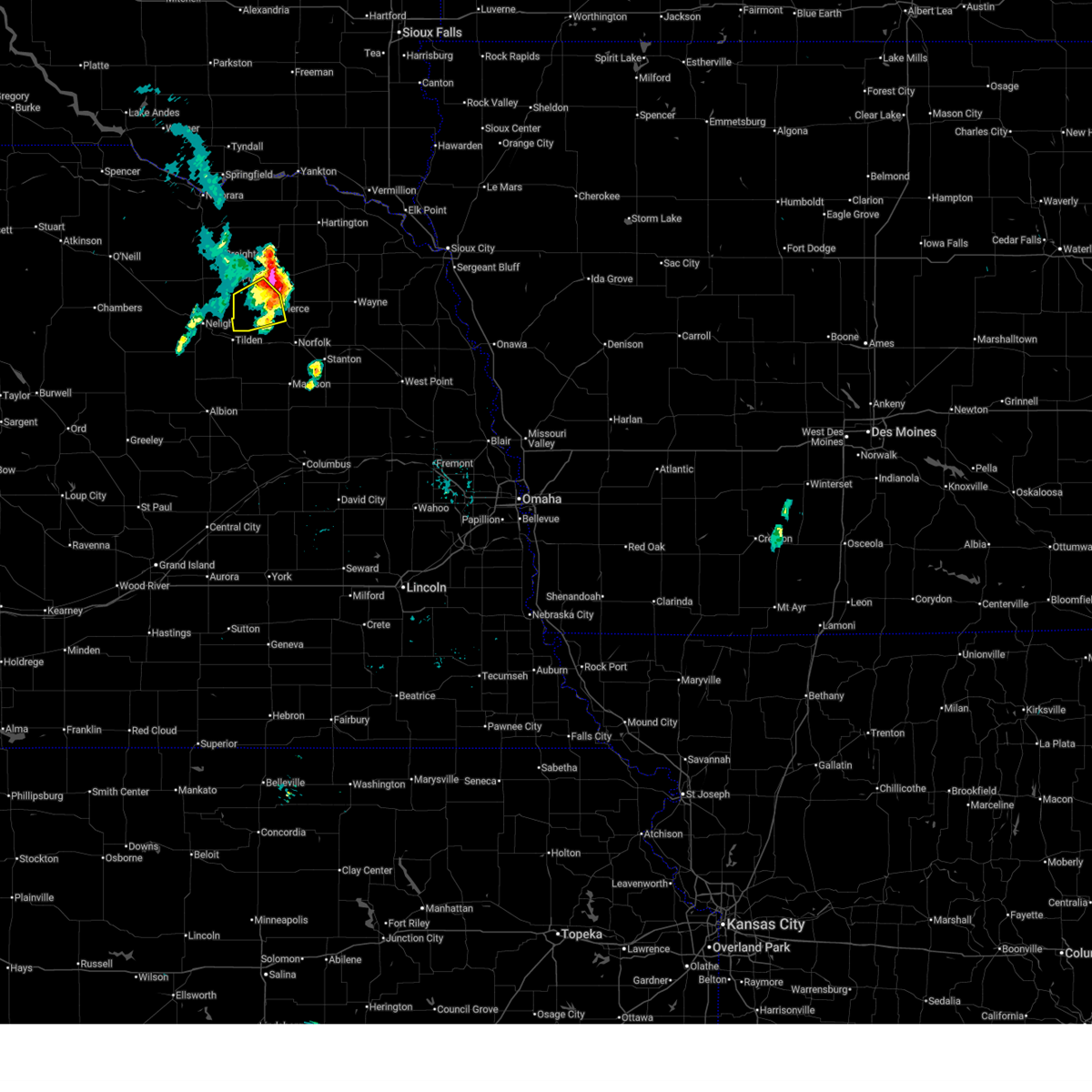
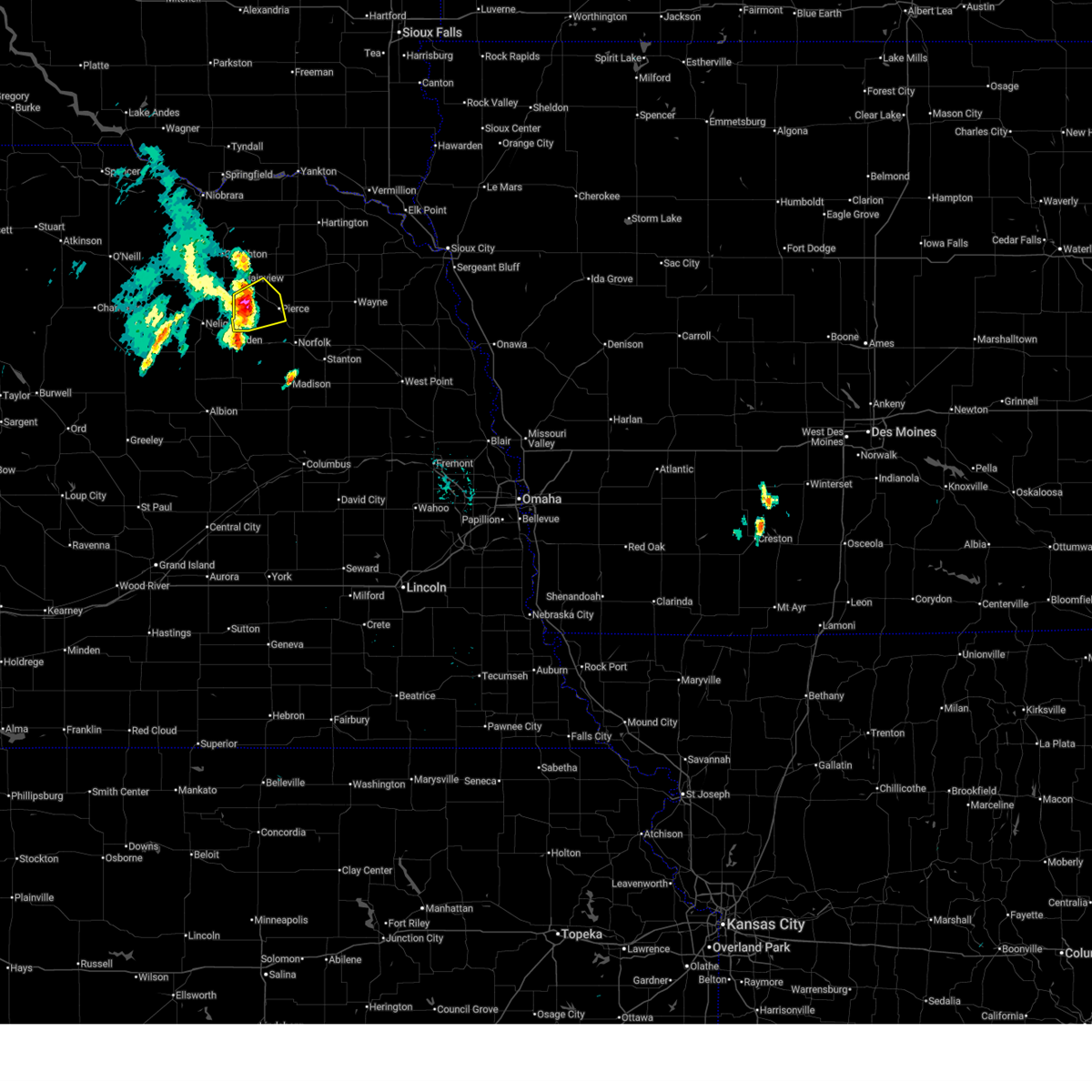
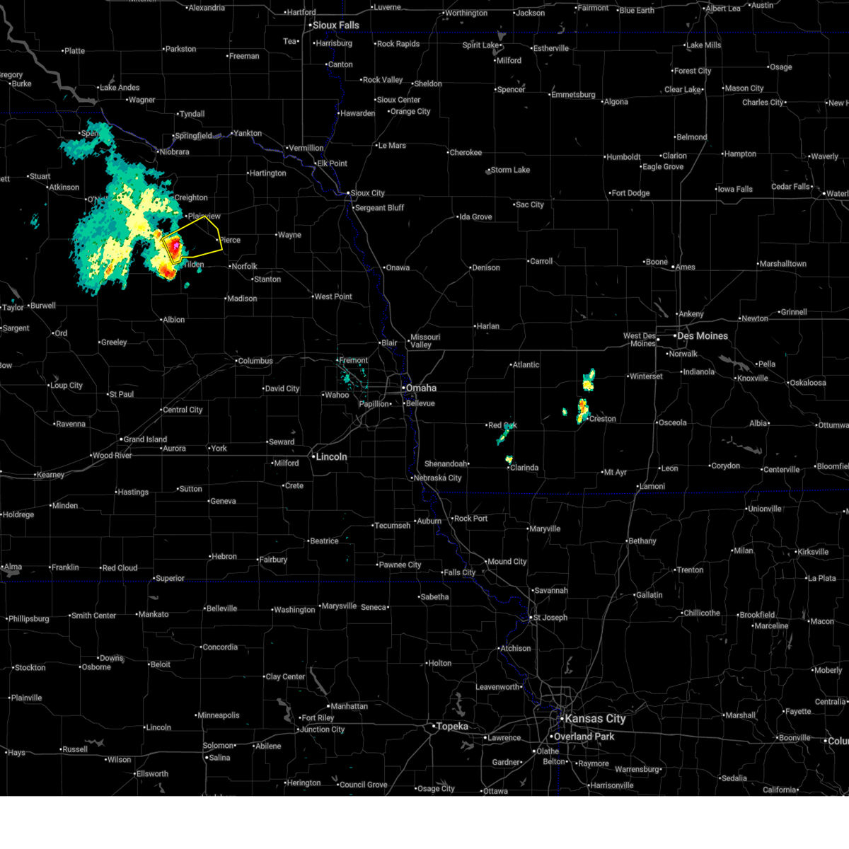
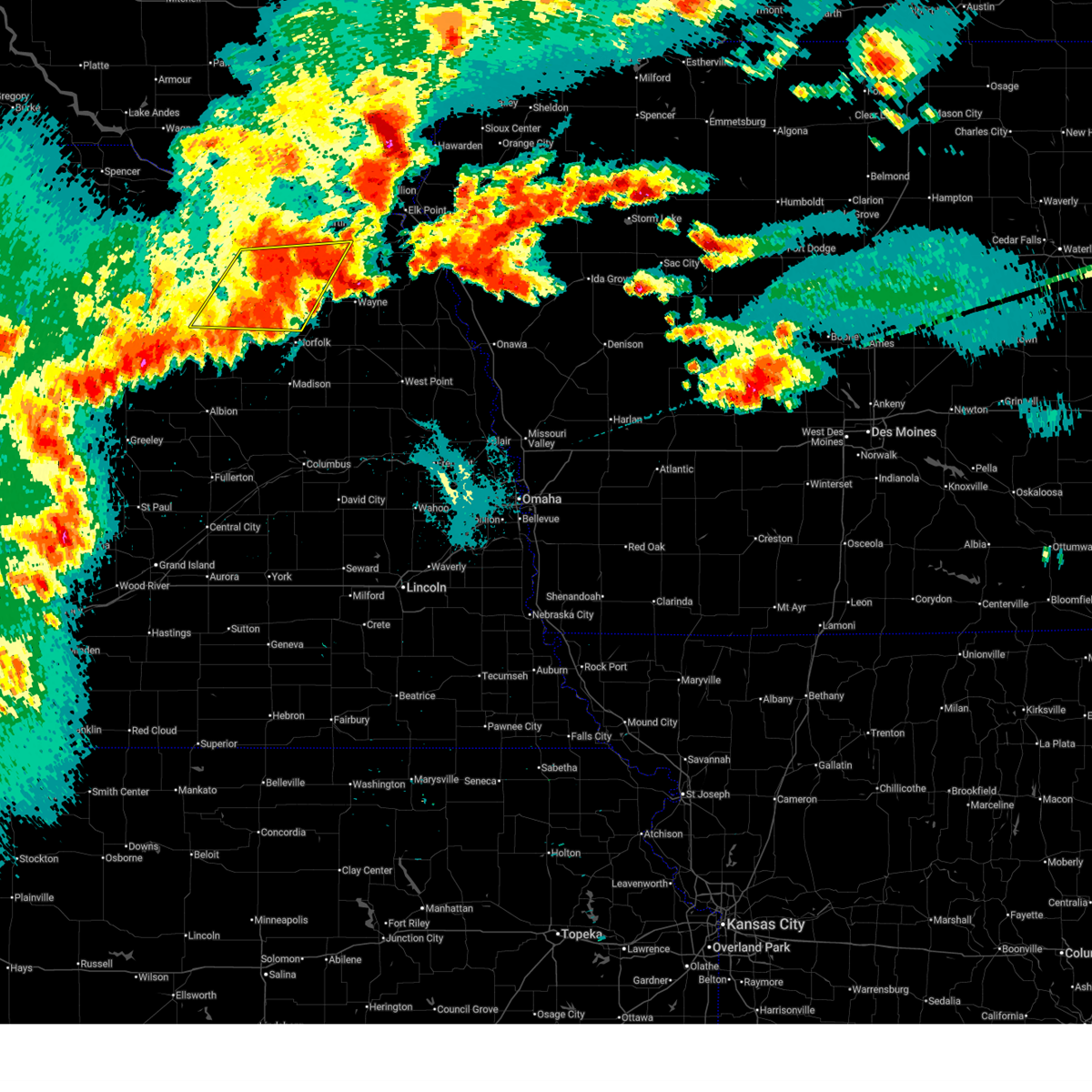
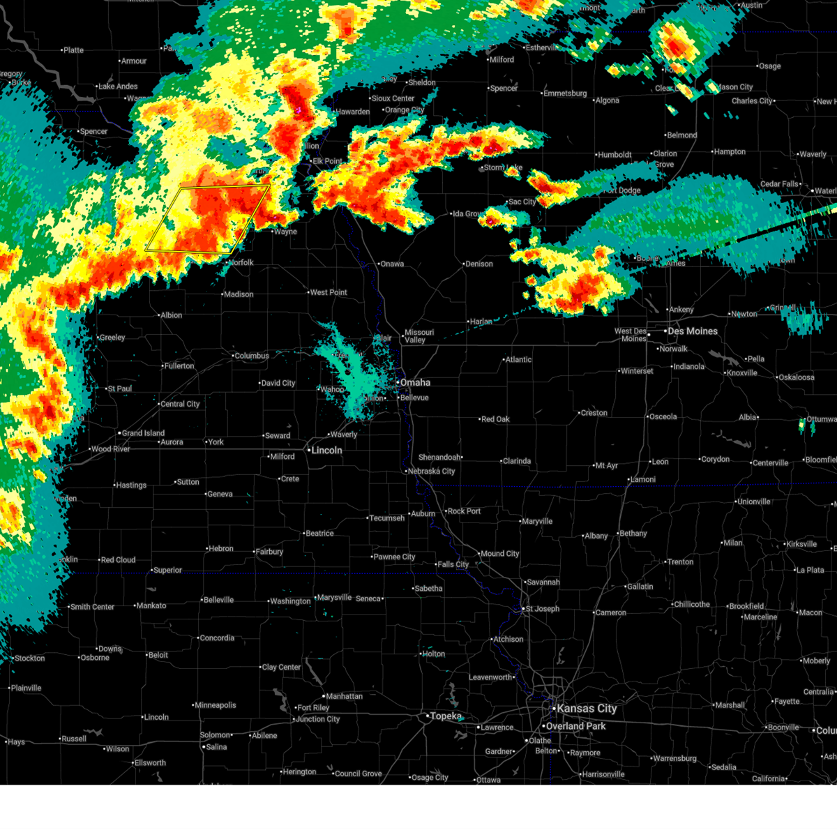
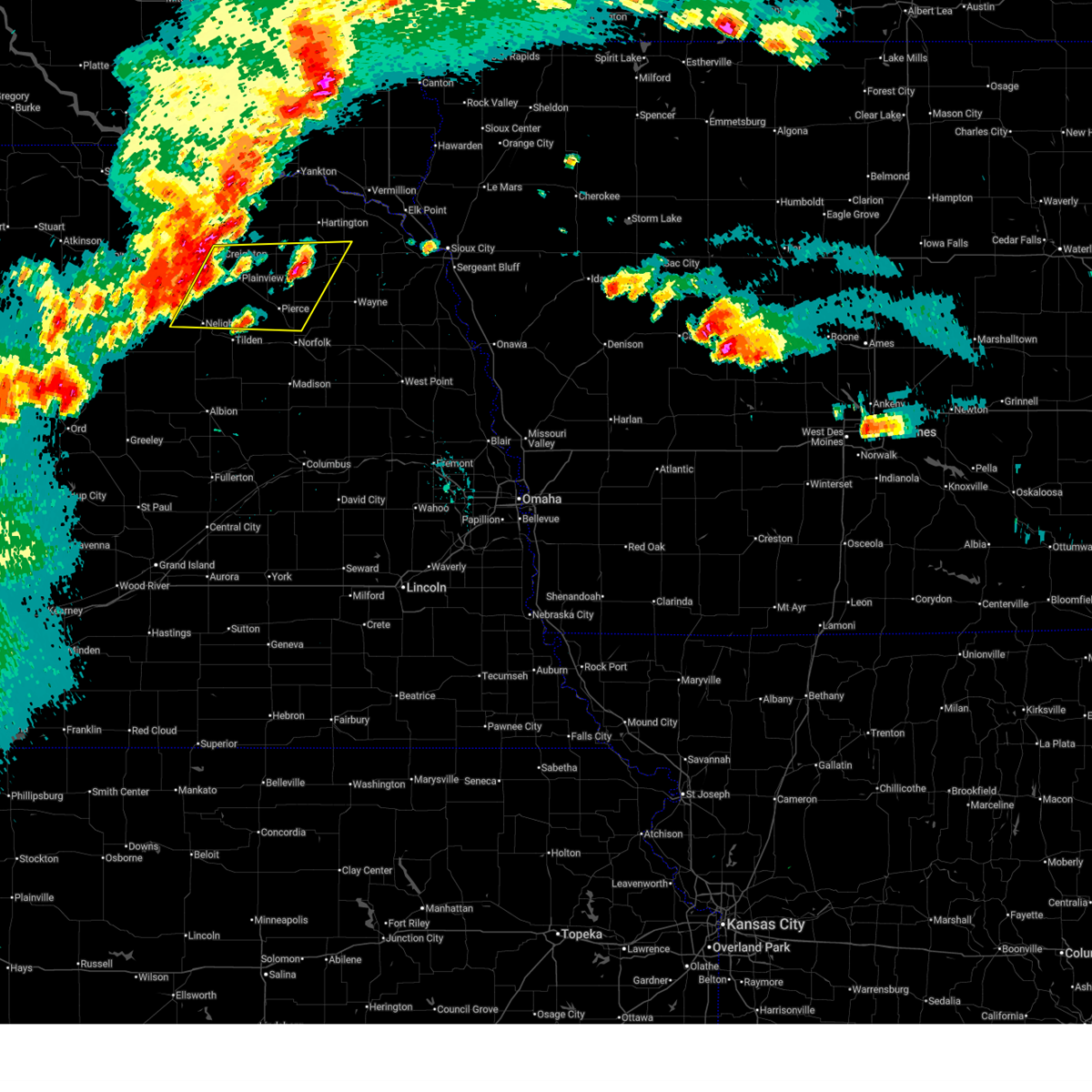
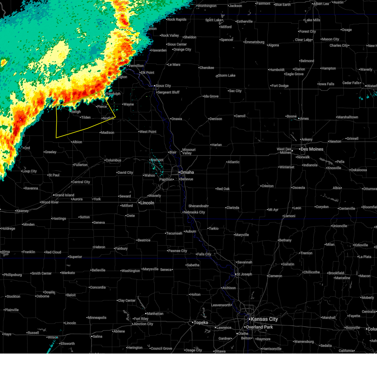
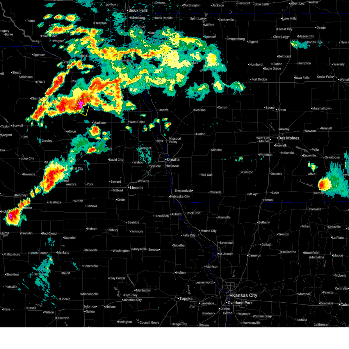
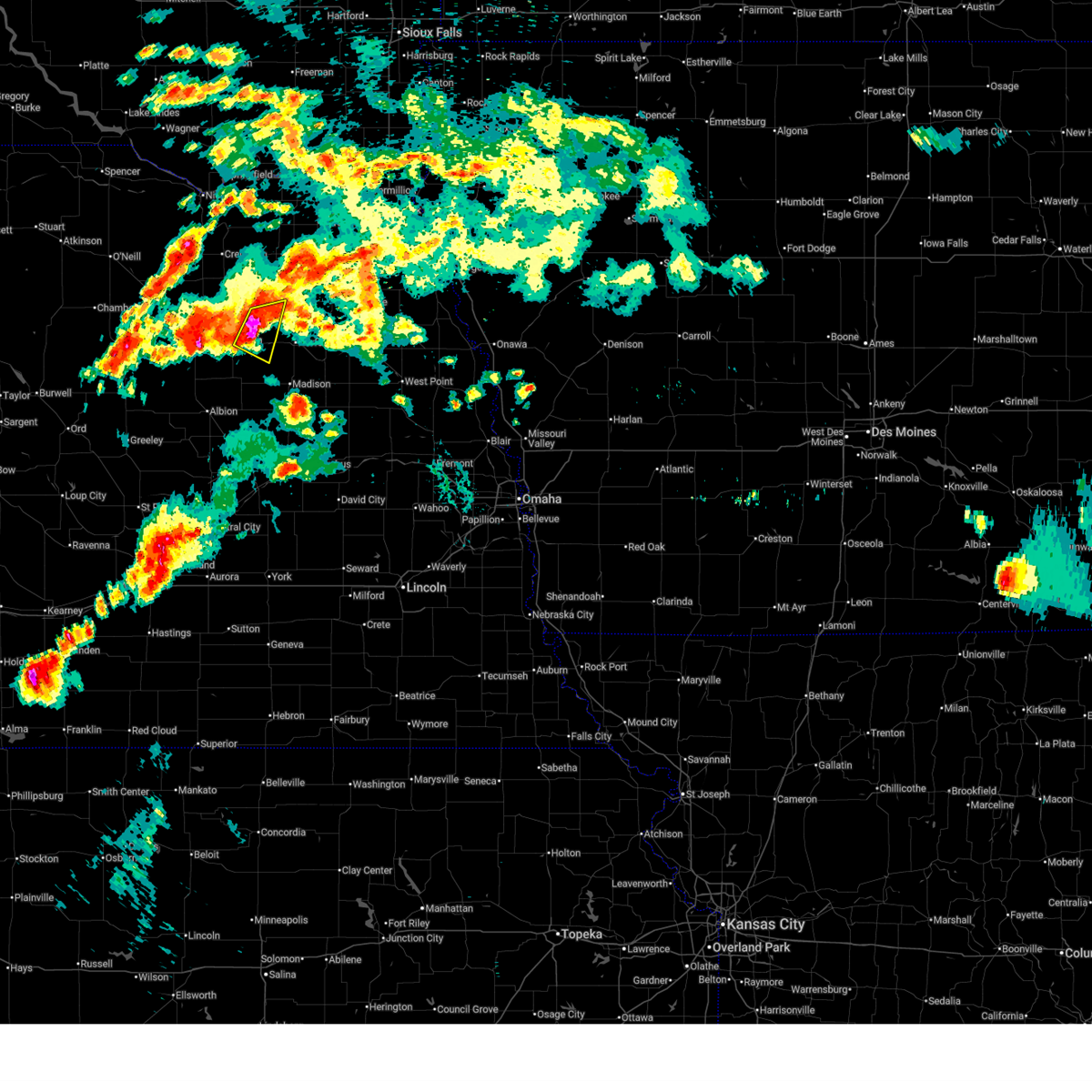
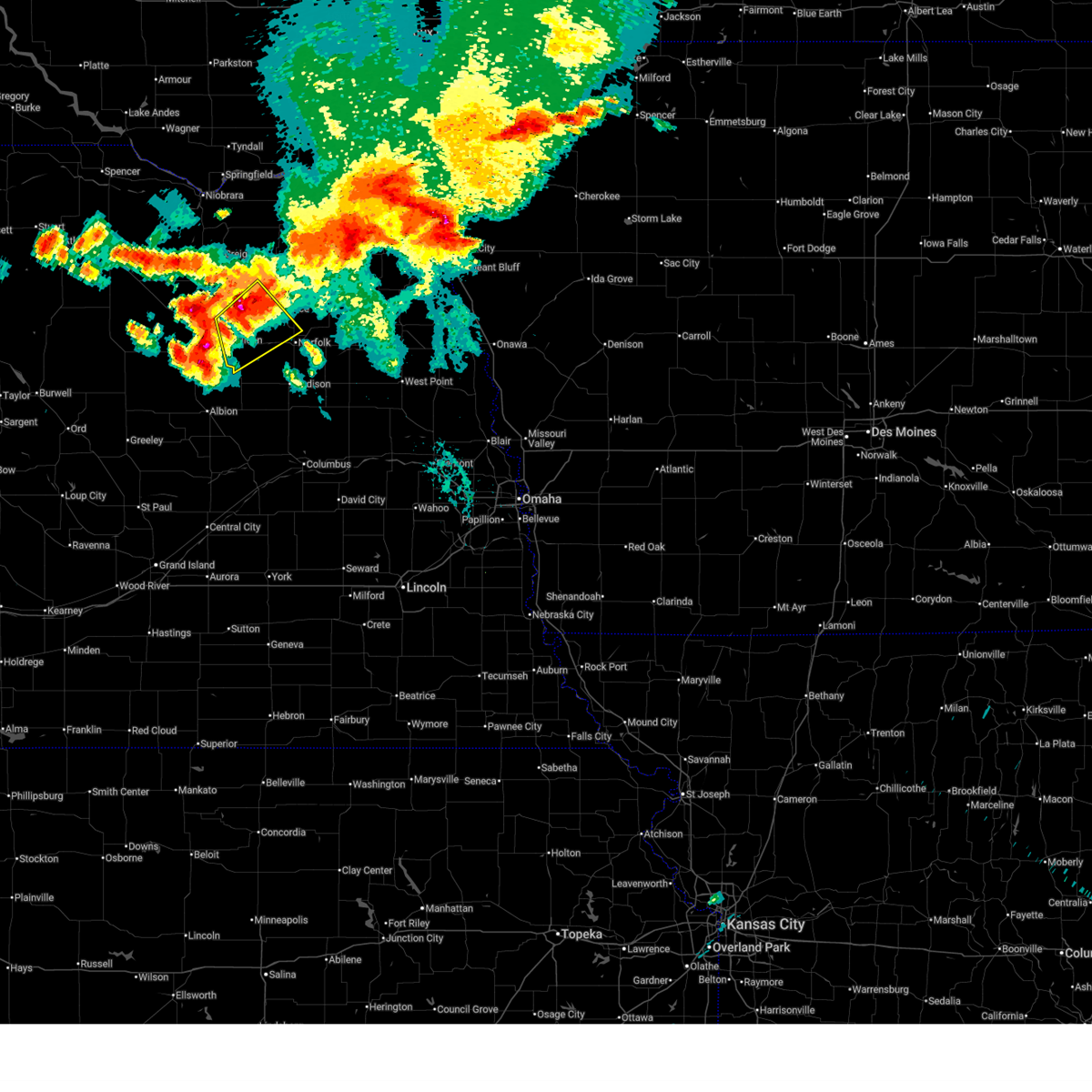
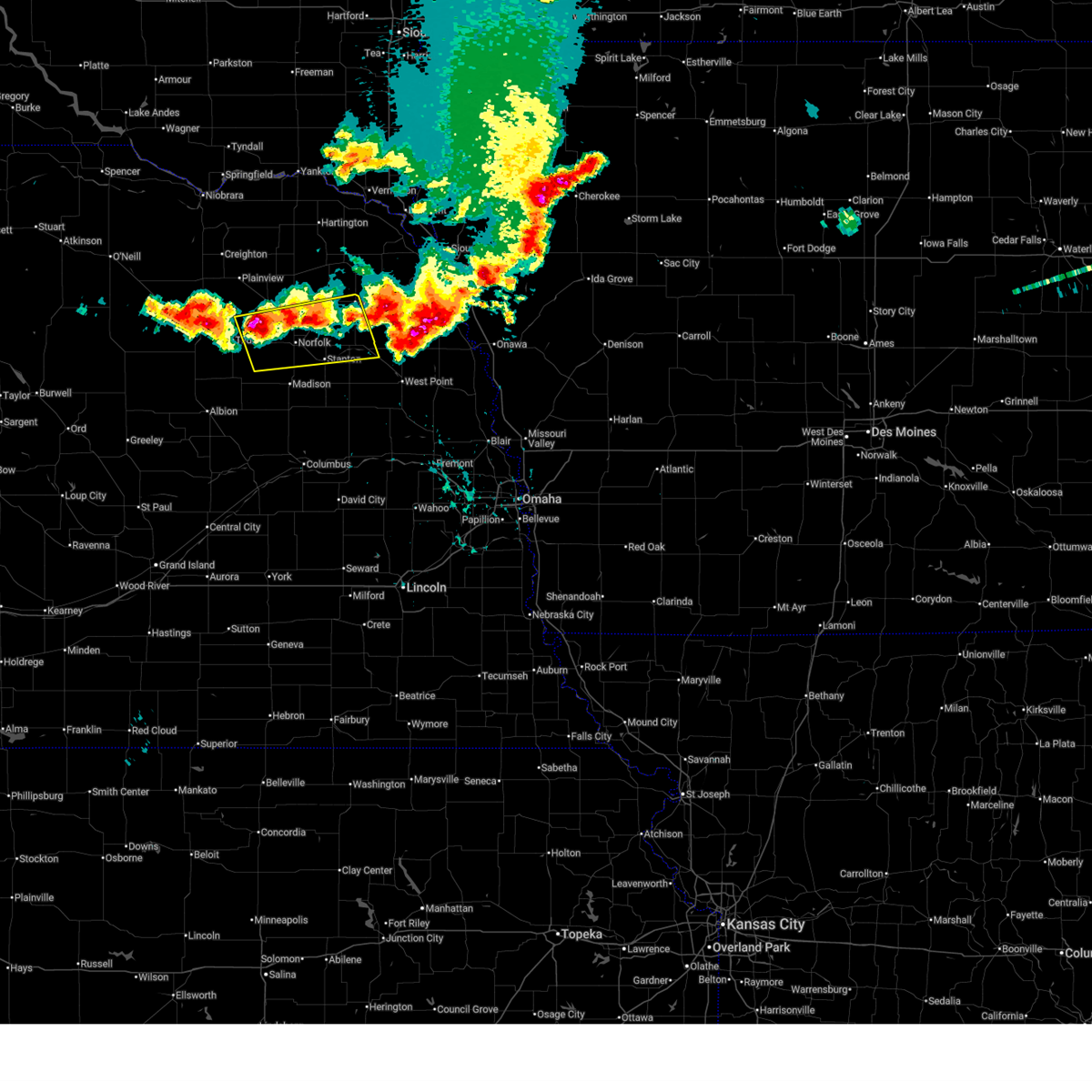
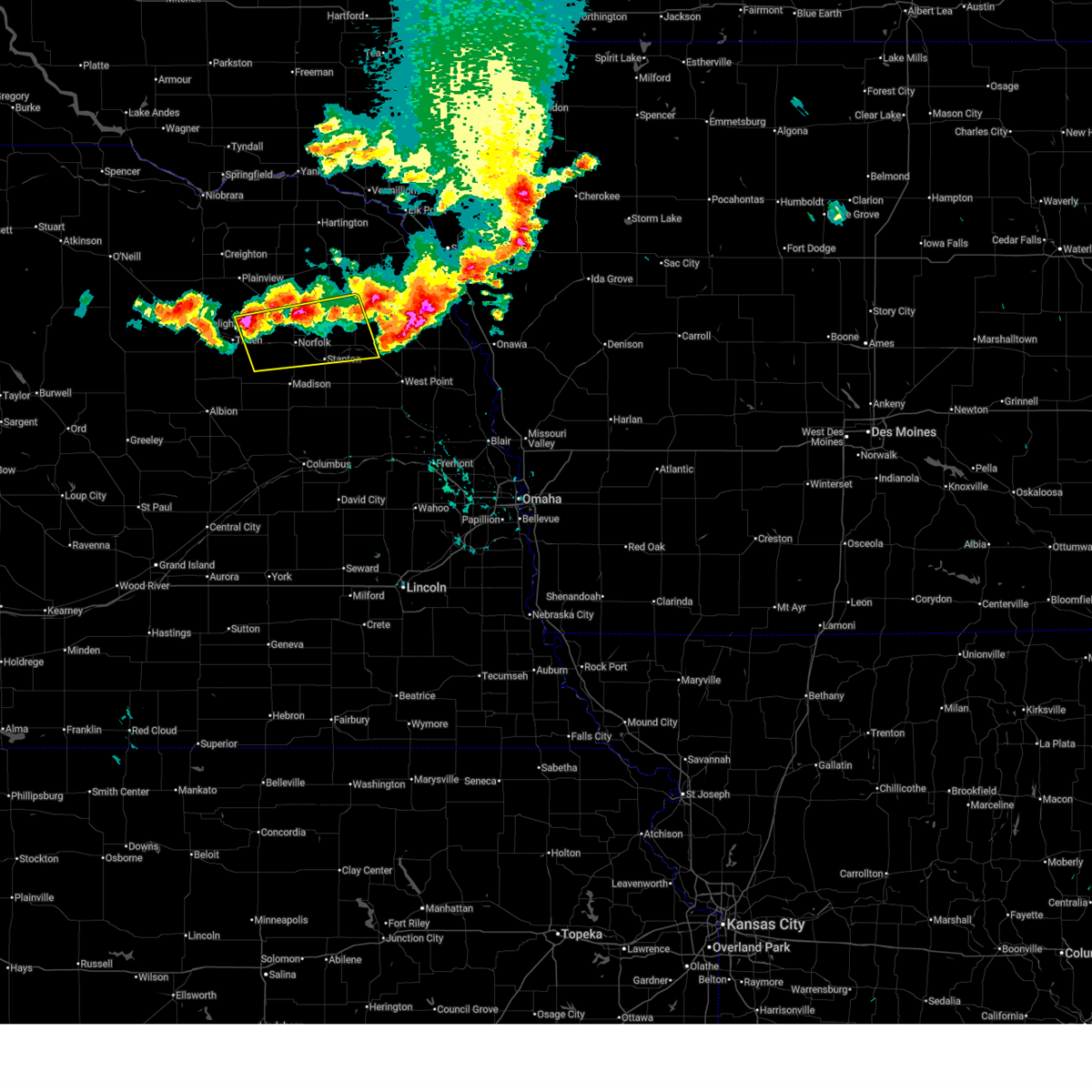
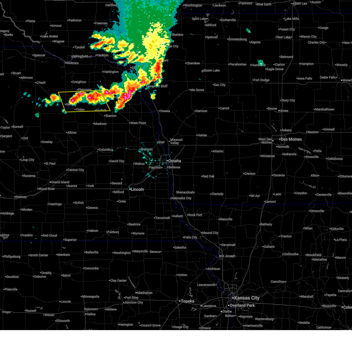
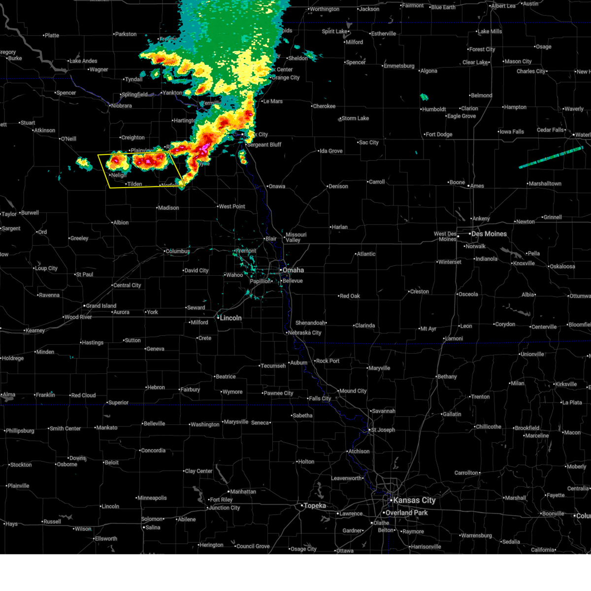
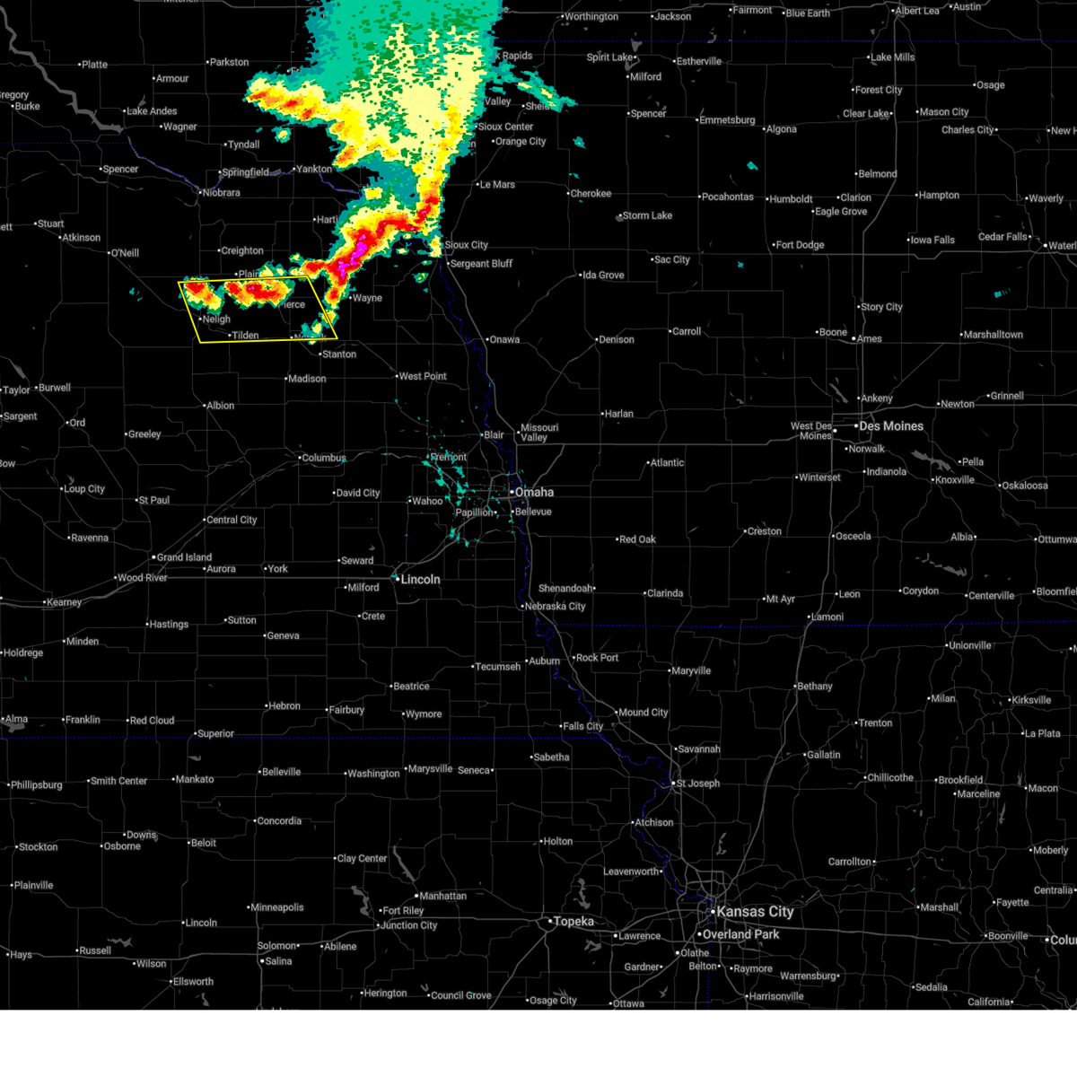
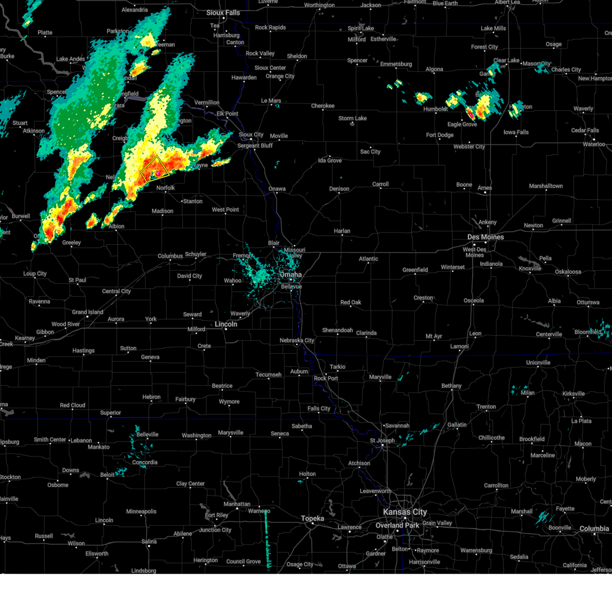
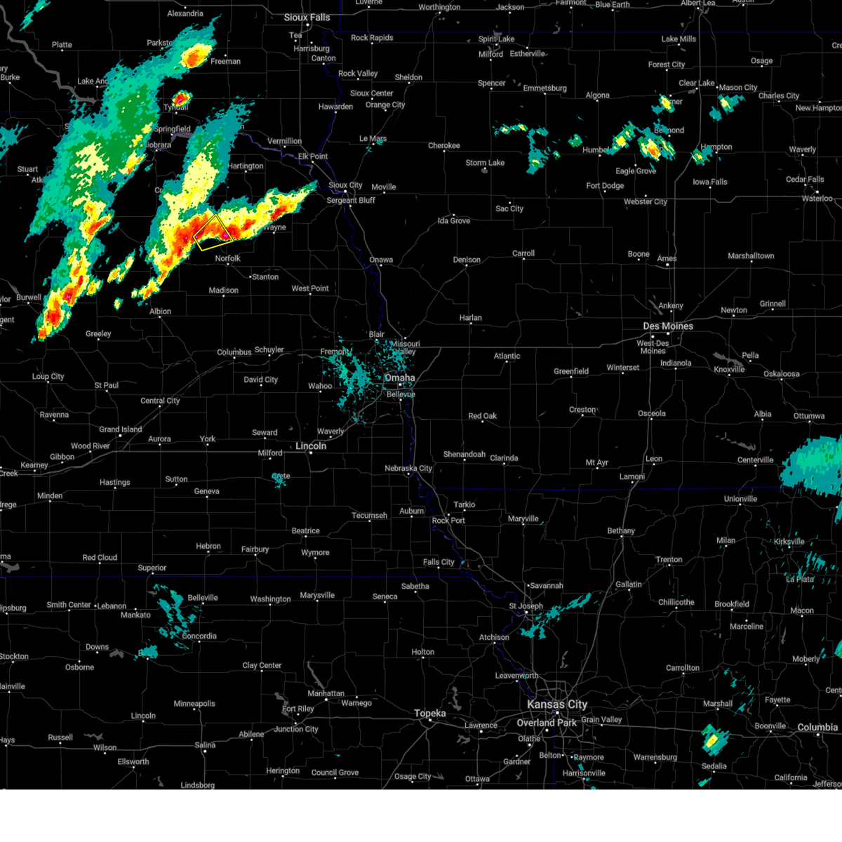
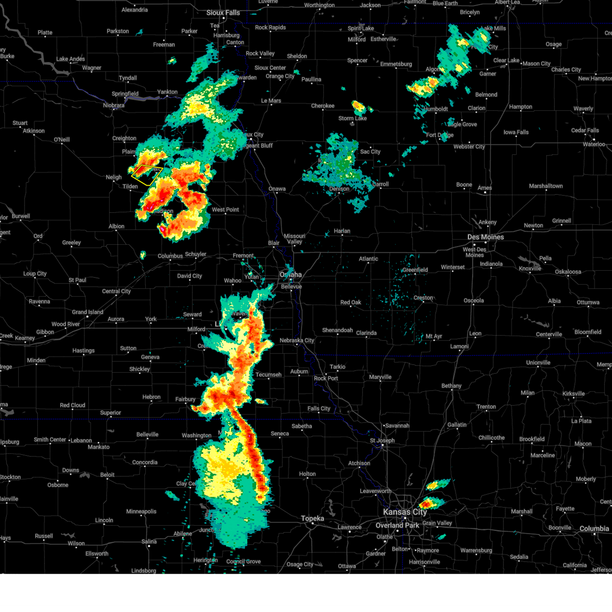
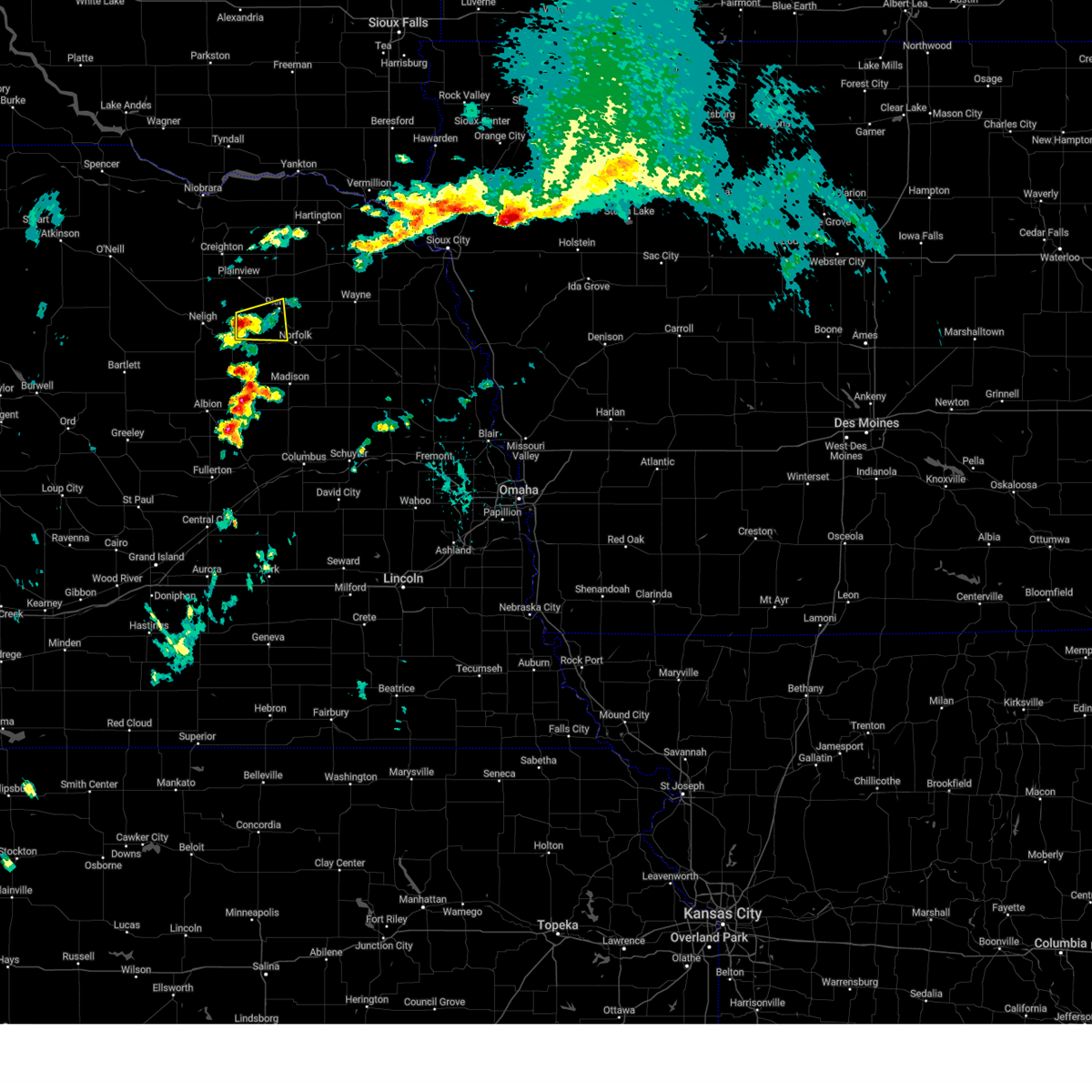
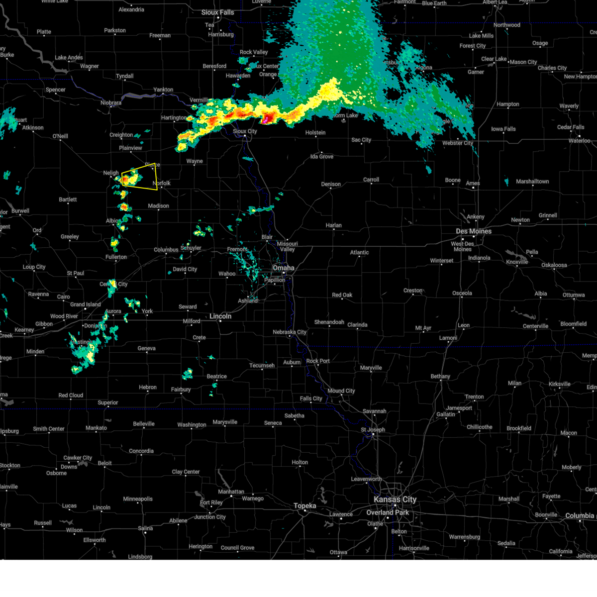
Hail Map for Pierce, NE
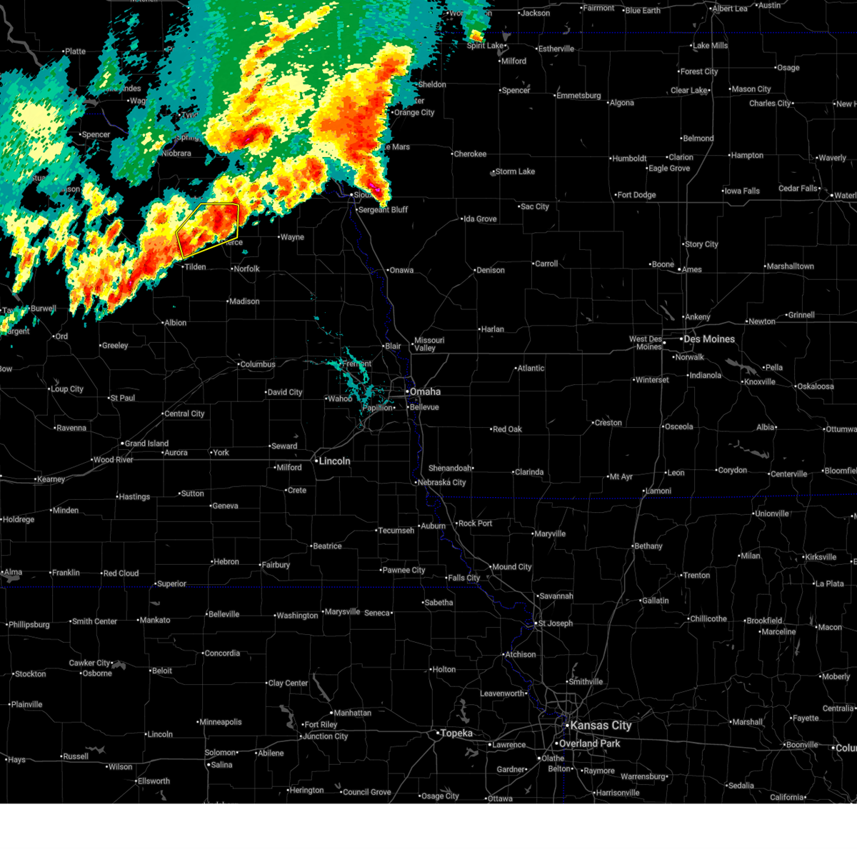
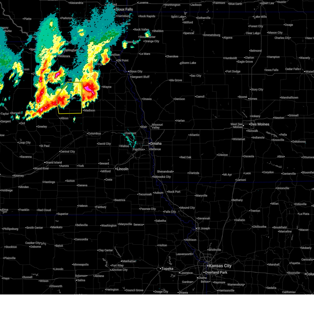
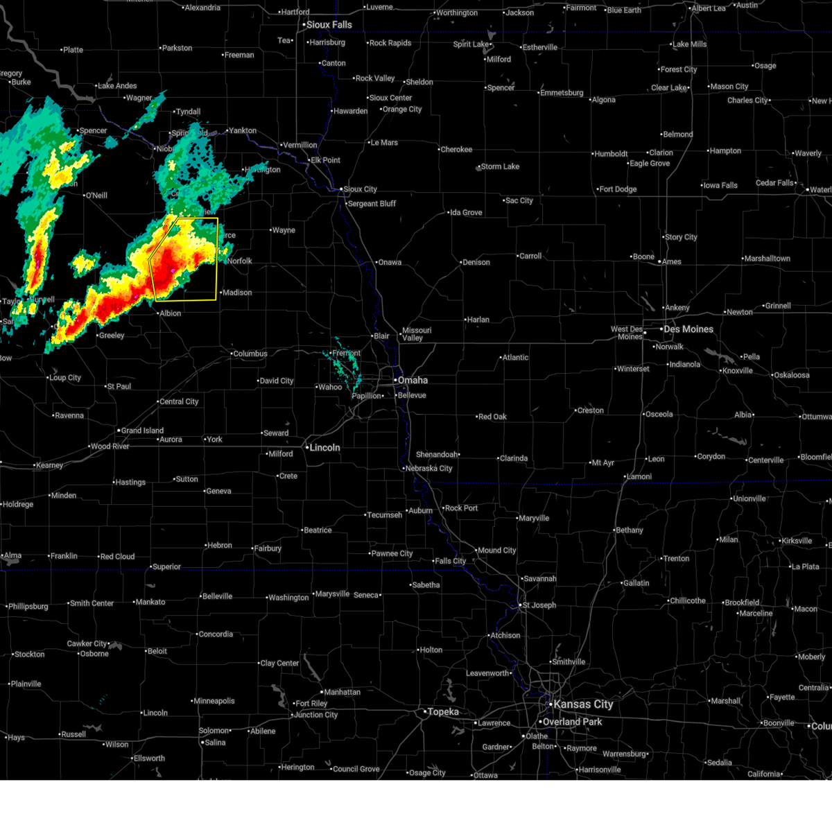
The Pierce, NE area has had 20 reports of on-the-ground hail by trained spotters, and has been under severe weather warnings 19 times during the past 12 months. Doppler radar has detected hail at or near Pierce, NE on 89 occasions, including 6 occasions during the past year.
| Name: | Pierce, NE |
| Where Located: | 60 miles ESE of Oneill, NE |
| Map: | Google Map for Pierce, NE |
| Population: | 1767 |
| Housing Units: | 747 |
| More Info: | Search Google for Pierce, NE |
1
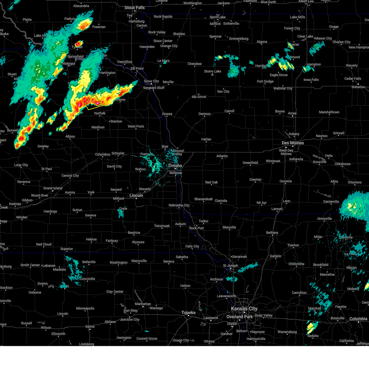
The Top Recent Hail Date for Pierce, NE is Monday, June 29, 2026 (26th out of 89)
Hail and Wind Damage Spotted near Pierce, NE
| Date / Time | Report Details |
|---|---|
| 6/30/2026 1:43 AM CDT |
 Svroax the national weather service in omaha has issued a * severe thunderstorm warning for, pierce county in northeastern nebraska, east central antelope county in northeastern nebraska, * until 230 am cdt. * at 143 am cdt, a severe thunderstorm was located 10 miles north of tilden, or 13 miles east of neligh, moving northeast at 50 mph (radar indicated). Hazards include 60 mph wind gusts and quarter size hail. Hail damage to vehicles is expected. Expect wind damage to roofs, siding, and trees. Svroax the national weather service in omaha has issued a * severe thunderstorm warning for, pierce county in northeastern nebraska, east central antelope county in northeastern nebraska, * until 230 am cdt. * at 143 am cdt, a severe thunderstorm was located 10 miles north of tilden, or 13 miles east of neligh, moving northeast at 50 mph (radar indicated). Hazards include 60 mph wind gusts and quarter size hail. Hail damage to vehicles is expected. Expect wind damage to roofs, siding, and trees.
|
| 6/30/2026 12:27 AM CDT |
 The storms which prompted the warning have moved out of the area. therefore, the warning will be allowed to expire. a severe thunderstorm watch remains in effect until 400 am cdt for northeastern nebraska. remember, a severe thunderstorm warning still remains in effect for far eastern madison and southern pierce counties until 1245 am. The storms which prompted the warning have moved out of the area. therefore, the warning will be allowed to expire. a severe thunderstorm watch remains in effect until 400 am cdt for northeastern nebraska. remember, a severe thunderstorm warning still remains in effect for far eastern madison and southern pierce counties until 1245 am.
|
| 6/29/2026 11:43 PM CDT |
 Svroax the national weather service in omaha has issued a * severe thunderstorm warning for, madison county in northeastern nebraska, southwestern pierce county in northeastern nebraska, southeastern antelope county in northeastern nebraska, northeastern boone county in northeastern nebraska, * until 1230 am cdt. * at 1143 pm cdt, severe thunderstorms were located along a line extending from 2 miles east of oakdale to 6 miles southwest of tilden, moving northeast at 25 mph (radar indicated). Hazards include 60 mph wind gusts and quarter size hail. Hail damage to vehicles is expected. expect wind damage to roofs, siding, and trees. severe thunderstorms will be near, tilden around 1150 pm cdt. Meadow grove around 1155 pm cdt. Svroax the national weather service in omaha has issued a * severe thunderstorm warning for, madison county in northeastern nebraska, southwestern pierce county in northeastern nebraska, southeastern antelope county in northeastern nebraska, northeastern boone county in northeastern nebraska, * until 1230 am cdt. * at 1143 pm cdt, severe thunderstorms were located along a line extending from 2 miles east of oakdale to 6 miles southwest of tilden, moving northeast at 25 mph (radar indicated). Hazards include 60 mph wind gusts and quarter size hail. Hail damage to vehicles is expected. expect wind damage to roofs, siding, and trees. severe thunderstorms will be near, tilden around 1150 pm cdt. Meadow grove around 1155 pm cdt.
|
| 6/9/2026 9:22 PM CDT |
 Svroax the national weather service in omaha has issued a * severe thunderstorm warning for, pierce county in northeastern nebraska, * until 1000 pm cdt. * at 922 pm cdt, a severe thunderstorm was located 10 miles northeast of tilden, or 14 miles east of neligh, moving northeast at 40 mph (radar indicated). Hazards include 60 mph wind gusts and quarter size hail. Hail damage to vehicles is expected. expect wind damage to roofs, siding, and trees. This severe thunderstorm will be near, osmond around 940 pm cdt. Svroax the national weather service in omaha has issued a * severe thunderstorm warning for, pierce county in northeastern nebraska, * until 1000 pm cdt. * at 922 pm cdt, a severe thunderstorm was located 10 miles northeast of tilden, or 14 miles east of neligh, moving northeast at 40 mph (radar indicated). Hazards include 60 mph wind gusts and quarter size hail. Hail damage to vehicles is expected. expect wind damage to roofs, siding, and trees. This severe thunderstorm will be near, osmond around 940 pm cdt.
|
| 5/25/2026 9:46 PM CDT |
 At 946 pm cdt, a severe thunderstorm was located 3 miles northwest of pierce, or 15 miles northwest of norfolk, moving northeast at 20 mph (public. these storms have a history of producing quarter sized hail near oakdale and a 61 mph wind gust near neligh). Hazards include 60 mph wind gusts and quarter size hail. Hail damage to vehicles is expected. expect wind damage to roofs, siding, and trees. Locations impacted include, neligh, pierce, oakdale, foster, and willow creek state recreation area. At 946 pm cdt, a severe thunderstorm was located 3 miles northwest of pierce, or 15 miles northwest of norfolk, moving northeast at 20 mph (public. these storms have a history of producing quarter sized hail near oakdale and a 61 mph wind gust near neligh). Hazards include 60 mph wind gusts and quarter size hail. Hail damage to vehicles is expected. expect wind damage to roofs, siding, and trees. Locations impacted include, neligh, pierce, oakdale, foster, and willow creek state recreation area.
|
| 5/25/2026 9:38 PM CDT |
 At 938 pm cdt, a severe thunderstorm was located 4 miles northwest of pierce, or 16 miles northwest of norfolk, moving northeast at 30 mph (public. at 919 pm, quarter sized hail was reported near oakdale). Hazards include 60 mph wind gusts and quarter size hail. Hail damage to vehicles is expected. expect wind damage to roofs, siding, and trees. Locations impacted include, neligh, pierce, oakdale, foster, and willow creek state recreation area. At 938 pm cdt, a severe thunderstorm was located 4 miles northwest of pierce, or 16 miles northwest of norfolk, moving northeast at 30 mph (public. at 919 pm, quarter sized hail was reported near oakdale). Hazards include 60 mph wind gusts and quarter size hail. Hail damage to vehicles is expected. expect wind damage to roofs, siding, and trees. Locations impacted include, neligh, pierce, oakdale, foster, and willow creek state recreation area.
|
| 5/25/2026 9:12 PM CDT |
 Svroax the national weather service in omaha has issued a * severe thunderstorm warning for, western pierce county in northeastern nebraska, east central antelope county in northeastern nebraska, * until 1000 pm cdt. * at 911 pm cdt, a severe thunderstorm was located 5 miles northeast of oakdale, or 7 miles east of neligh, moving northeast at 30 mph (radar indicated). Hazards include 60 mph wind gusts and quarter size hail. Hail damage to vehicles is expected. expect wind damage to roofs, siding, and trees. This severe thunderstorm will remain over mainly rural areas of western pierce and east central antelope counties, including the following locations, willow creek state recreation area and foster. Svroax the national weather service in omaha has issued a * severe thunderstorm warning for, western pierce county in northeastern nebraska, east central antelope county in northeastern nebraska, * until 1000 pm cdt. * at 911 pm cdt, a severe thunderstorm was located 5 miles northeast of oakdale, or 7 miles east of neligh, moving northeast at 30 mph (radar indicated). Hazards include 60 mph wind gusts and quarter size hail. Hail damage to vehicles is expected. expect wind damage to roofs, siding, and trees. This severe thunderstorm will remain over mainly rural areas of western pierce and east central antelope counties, including the following locations, willow creek state recreation area and foster.
|
| 8/15/2025 8:56 AM CDT |
 The storm which prompted the warning has moved out of the area. therefore, the warning will be allowed to expire. remember, a severe thunderstorm warning still remains in effect for northwestern wayne county in northeastern nebraska, northeastern pierce county in northeastern nebraska, southeastern knox county in northeastern nebraska, and southwestern cedar county in northeastern nebraska. The storm which prompted the warning has moved out of the area. therefore, the warning will be allowed to expire. remember, a severe thunderstorm warning still remains in effect for northwestern wayne county in northeastern nebraska, northeastern pierce county in northeastern nebraska, southeastern knox county in northeastern nebraska, and southwestern cedar county in northeastern nebraska.
|
| 8/15/2025 8:36 AM CDT |
 the severe thunderstorm warning has been cancelled and is no longer in effect the severe thunderstorm warning has been cancelled and is no longer in effect
|
| 8/15/2025 8:36 AM CDT |
 At 835 am cdt, a severe thunderstorm was located 8 miles west of pierce, or 17 miles east of neligh, moving northeast at 35 mph (radar indicated). Hazards include 60 mph wind gusts and quarter size hail. Hail damage to vehicles is expected. expect wind damage to roofs, siding, and trees. Locations impacted include, pierce, foster, and willow creek state recreation area. At 835 am cdt, a severe thunderstorm was located 8 miles west of pierce, or 17 miles east of neligh, moving northeast at 35 mph (radar indicated). Hazards include 60 mph wind gusts and quarter size hail. Hail damage to vehicles is expected. expect wind damage to roofs, siding, and trees. Locations impacted include, pierce, foster, and willow creek state recreation area.
|
| 8/15/2025 8:23 AM CDT |
 Svroax the national weather service in omaha has issued a * severe thunderstorm warning for, southwestern pierce county in northeastern nebraska, east central antelope county in northeastern nebraska, * until 900 am cdt. * at 822 am cdt, a severe thunderstorm was located 8 miles north of tilden, or 9 miles east of neligh, moving east at 35 mph (radar indicated). Hazards include 60 mph wind gusts and quarter size hail. Hail damage to vehicles is expected. Expect wind damage to roofs, siding, and trees. Svroax the national weather service in omaha has issued a * severe thunderstorm warning for, southwestern pierce county in northeastern nebraska, east central antelope county in northeastern nebraska, * until 900 am cdt. * at 822 am cdt, a severe thunderstorm was located 8 miles north of tilden, or 9 miles east of neligh, moving east at 35 mph (radar indicated). Hazards include 60 mph wind gusts and quarter size hail. Hail damage to vehicles is expected. Expect wind damage to roofs, siding, and trees.
|
| 7/29/2025 9:13 PM CDT |
 Svroax the national weather service in omaha has issued a * severe thunderstorm warning for, northwestern wayne county in northeastern nebraska, pierce county in northeastern nebraska, east central antelope county in northeastern nebraska, southeastern knox county in northeastern nebraska, southern cedar county in northeastern nebraska, * until 945 pm cdt. * at 913 pm cdt, severe thunderstorms were located along a line extending from 6 miles southwest of randolph to 6 miles north of meadow grove, moving east at 15 mph (public). Hazards include 70 mph wind gusts. Expect considerable tree damage. damage is likely to mobile homes, roofs, and outbuildings. severe thunderstorms will be near, pierce around 920 pm cdt. Randolph around 925 pm cdt. Svroax the national weather service in omaha has issued a * severe thunderstorm warning for, northwestern wayne county in northeastern nebraska, pierce county in northeastern nebraska, east central antelope county in northeastern nebraska, southeastern knox county in northeastern nebraska, southern cedar county in northeastern nebraska, * until 945 pm cdt. * at 913 pm cdt, severe thunderstorms were located along a line extending from 6 miles southwest of randolph to 6 miles north of meadow grove, moving east at 15 mph (public). Hazards include 70 mph wind gusts. Expect considerable tree damage. damage is likely to mobile homes, roofs, and outbuildings. severe thunderstorms will be near, pierce around 920 pm cdt. Randolph around 925 pm cdt.
|
| 7/29/2025 9:09 PM CDT |
 At 909 pm cdt, severe thunderstorms were located along a line extending from 6 miles southeast of osmond to 6 miles north of meadow grove, moving southeast at 30 mph (public). Hazards include 70 mph wind gusts. Expect considerable tree damage. damage is likely to mobile homes, roofs, and outbuildings. Locations impacted include, pierce and hadar. At 909 pm cdt, severe thunderstorms were located along a line extending from 6 miles southeast of osmond to 6 miles north of meadow grove, moving southeast at 30 mph (public). Hazards include 70 mph wind gusts. Expect considerable tree damage. damage is likely to mobile homes, roofs, and outbuildings. Locations impacted include, pierce and hadar.
|
| 7/29/2025 8:48 PM CDT | Storm damage reported in pierce county NE, 0.5 miles ESE of Pierce, NE |
| 7/29/2025 8:15 PM CDT |
 Svroax the national weather service in omaha has issued a * severe thunderstorm warning for, northwestern wayne county in northeastern nebraska, pierce county in northeastern nebraska, northern antelope county in northeastern nebraska, southeastern knox county in northeastern nebraska, southern cedar county in northeastern nebraska, * until 915 pm cdt. * at 815 pm cdt, severe thunderstorms were located along a line extending from 4 miles east of creighton to 4 miles north of neligh, moving east at 15 mph (public). Hazards include 60 mph wind gusts. Expect damage to roofs, siding, and trees. severe thunderstorms will be near, plainview around 820 pm cdt. Other locations in the path of these severe thunderstorms include osmond and wausa. Svroax the national weather service in omaha has issued a * severe thunderstorm warning for, northwestern wayne county in northeastern nebraska, pierce county in northeastern nebraska, northern antelope county in northeastern nebraska, southeastern knox county in northeastern nebraska, southern cedar county in northeastern nebraska, * until 915 pm cdt. * at 815 pm cdt, severe thunderstorms were located along a line extending from 4 miles east of creighton to 4 miles north of neligh, moving east at 15 mph (public). Hazards include 60 mph wind gusts. Expect damage to roofs, siding, and trees. severe thunderstorms will be near, plainview around 820 pm cdt. Other locations in the path of these severe thunderstorms include osmond and wausa.
|
| 7/15/2025 8:31 PM CDT |
 Svroax the national weather service in omaha has issued a * severe thunderstorm warning for, northern madison county in northeastern nebraska, southwestern wayne county in northeastern nebraska, pierce county in northeastern nebraska, antelope county in northeastern nebraska, northern boone county in northeastern nebraska, northwestern stanton county in northeastern nebraska, * until 915 pm cdt. * at 831 pm cdt, severe thunderstorms were located along a line extending from 4 miles east of osmond to 9 miles southwest of plainview to 4 miles southwest of clearwater, moving south at 20 mph (radar indicated). Hazards include 60 mph wind gusts and penny size hail. Expect damage to roofs, siding, and trees. severe thunderstorms will be near, neligh around 835 pm cdt. pierce and oakdale around 845 pm cdt. Other locations in the path of these severe thunderstorms include tilden and elgin. Svroax the national weather service in omaha has issued a * severe thunderstorm warning for, northern madison county in northeastern nebraska, southwestern wayne county in northeastern nebraska, pierce county in northeastern nebraska, antelope county in northeastern nebraska, northern boone county in northeastern nebraska, northwestern stanton county in northeastern nebraska, * until 915 pm cdt. * at 831 pm cdt, severe thunderstorms were located along a line extending from 4 miles east of osmond to 9 miles southwest of plainview to 4 miles southwest of clearwater, moving south at 20 mph (radar indicated). Hazards include 60 mph wind gusts and penny size hail. Expect damage to roofs, siding, and trees. severe thunderstorms will be near, neligh around 835 pm cdt. pierce and oakdale around 845 pm cdt. Other locations in the path of these severe thunderstorms include tilden and elgin.
|
| 7/10/2025 6:25 PM CDT |
 At 625 pm cdt, severe thunderstorms were located along a line extending from 8 miles southwest of pierce to meadow grove, moving east at 25 mph (radar indicated). Hazards include 60 mph wind gusts and quarter size hail. Hail damage to vehicles is expected. expect wind damage to roofs, siding, and trees. These severe storms will be near, battle creek around 630 pm cdt. At 625 pm cdt, severe thunderstorms were located along a line extending from 8 miles southwest of pierce to meadow grove, moving east at 25 mph (radar indicated). Hazards include 60 mph wind gusts and quarter size hail. Hail damage to vehicles is expected. expect wind damage to roofs, siding, and trees. These severe storms will be near, battle creek around 630 pm cdt.
|
| 7/10/2025 6:25 PM CDT |
 the severe thunderstorm warning has been cancelled and is no longer in effect the severe thunderstorm warning has been cancelled and is no longer in effect
|
| 7/10/2025 6:11 PM CDT |
 At 611 pm cdt, severe thunderstorms were located along a line extending from 9 miles north of meadow grove to near tilden, moving east at 25 mph (radar indicated). Hazards include half dollar size hail. Damage to vehicles is expected. Locations impacted include, meadow grove and battle creek. At 611 pm cdt, severe thunderstorms were located along a line extending from 9 miles north of meadow grove to near tilden, moving east at 25 mph (radar indicated). Hazards include half dollar size hail. Damage to vehicles is expected. Locations impacted include, meadow grove and battle creek.
|
| 7/10/2025 5:54 PM CDT |
 Svroax the national weather service in omaha has issued a * severe thunderstorm warning for, northwestern madison county in northeastern nebraska, southern pierce county in northeastern nebraska, southeastern antelope county in northeastern nebraska, * until 700 pm cdt. * at 554 pm cdt, severe thunderstorms were located along a line extending from 10 miles northeast of neligh to 3 miles northeast of oakdale, moving east at 20 mph (radar indicated). Hazards include golf ball size hail. People and animals outdoors will be injured. expect damage to roofs, siding, windows, and vehicles. severe thunderstorms will be near, tilden around 605 pm cdt. Other locations in the path of these severe thunderstorms include pierce. Svroax the national weather service in omaha has issued a * severe thunderstorm warning for, northwestern madison county in northeastern nebraska, southern pierce county in northeastern nebraska, southeastern antelope county in northeastern nebraska, * until 700 pm cdt. * at 554 pm cdt, severe thunderstorms were located along a line extending from 10 miles northeast of neligh to 3 miles northeast of oakdale, moving east at 20 mph (radar indicated). Hazards include golf ball size hail. People and animals outdoors will be injured. expect damage to roofs, siding, windows, and vehicles. severe thunderstorms will be near, tilden around 605 pm cdt. Other locations in the path of these severe thunderstorms include pierce.
|
| 7/7/2025 7:51 PM CDT | Quarter sized hail reported 10.8 miles E of Pierce, NE, mix of nickel to quarter size hail at 7:51 pm. |
| 7/7/2025 7:51 PM CDT |
 Svroax the national weather service in omaha has issued a * severe thunderstorm warning for, northern madison county in northeastern nebraska, southern pierce county in northeastern nebraska, southeastern antelope county in northeastern nebraska, * until 830 pm cdt. * at 750 pm cdt, a severe thunderstorm was located 7 miles north of meadow grove, or 15 miles east of neligh, moving southeast at 15 mph (radar indicated). Hazards include 60 mph wind gusts and quarter size hail. Hail damage to vehicles is expected. expect wind damage to roofs, siding, and trees. This severe thunderstorm will be near, meadow grove around 805 pm cdt. Svroax the national weather service in omaha has issued a * severe thunderstorm warning for, northern madison county in northeastern nebraska, southern pierce county in northeastern nebraska, southeastern antelope county in northeastern nebraska, * until 830 pm cdt. * at 750 pm cdt, a severe thunderstorm was located 7 miles north of meadow grove, or 15 miles east of neligh, moving southeast at 15 mph (radar indicated). Hazards include 60 mph wind gusts and quarter size hail. Hail damage to vehicles is expected. expect wind damage to roofs, siding, and trees. This severe thunderstorm will be near, meadow grove around 805 pm cdt.
|
| 6/16/2025 5:36 PM CDT |
 At 535 pm cdt, severe thunderstorms were located along a line extending from 2 miles north of hoskins to 6 miles north of meadow grove, moving southeast at 25 mph (radar indicated). Hazards include 60 mph wind gusts and half dollar size hail. Hail damage to vehicles is expected. expect wind damage to roofs, siding, and trees. these severe storms will be near, norfolk, hadar, and hoskins around 540 pm cdt. Other locations in the path of these severe thunderstorms include pilger and wisner. At 535 pm cdt, severe thunderstorms were located along a line extending from 2 miles north of hoskins to 6 miles north of meadow grove, moving southeast at 25 mph (radar indicated). Hazards include 60 mph wind gusts and half dollar size hail. Hail damage to vehicles is expected. expect wind damage to roofs, siding, and trees. these severe storms will be near, norfolk, hadar, and hoskins around 540 pm cdt. Other locations in the path of these severe thunderstorms include pilger and wisner.
|
| 6/16/2025 5:26 PM CDT |
 Svroax the national weather service in omaha has issued a * severe thunderstorm warning for, northern madison county in northeastern nebraska, northwestern cuming county in northeastern nebraska, southwestern wayne county in northeastern nebraska, southern pierce county in northeastern nebraska, northern stanton county in northeastern nebraska, * until 615 pm cdt. * at 525 pm cdt, severe thunderstorms were located along a line extending from 6 miles north of hoskins to 7 miles northeast of tilden, moving east at 25 mph (radar indicated). Hazards include 60 mph wind gusts and quarter size hail. Hail damage to vehicles is expected. expect wind damage to roofs, siding, and trees. severe thunderstorms will be near, pierce and hadar around 530 pm cdt. winside and hoskins around 535 pm cdt. Norfolk around 545 pm cdt. Svroax the national weather service in omaha has issued a * severe thunderstorm warning for, northern madison county in northeastern nebraska, northwestern cuming county in northeastern nebraska, southwestern wayne county in northeastern nebraska, southern pierce county in northeastern nebraska, northern stanton county in northeastern nebraska, * until 615 pm cdt. * at 525 pm cdt, severe thunderstorms were located along a line extending from 6 miles north of hoskins to 7 miles northeast of tilden, moving east at 25 mph (radar indicated). Hazards include 60 mph wind gusts and quarter size hail. Hail damage to vehicles is expected. expect wind damage to roofs, siding, and trees. severe thunderstorms will be near, pierce and hadar around 530 pm cdt. winside and hoskins around 535 pm cdt. Norfolk around 545 pm cdt.
|
| 6/16/2025 5:15 PM CDT | Quarter sized hail reported 2.7 miles WSW of Pierce, NE, law enforcement report of hail up to quarter sized along with heavy rain. |
| 6/16/2025 5:11 PM CDT | Half Dollar sized hail reported 0.1 miles S of Pierce, NE, accompanied by 45 mph winds. |
| 6/16/2025 5:08 PM CDT |
 At 508 pm cdt, severe thunderstorms were located along a line extending from 9 miles northeast of neligh to 4 miles northeast of pierce, moving southeast at 25 mph (radar indicated). Hazards include 60 mph wind gusts and quarter size hail. Hail damage to vehicles is expected. expect wind damage to roofs, siding, and trees. Locations impacted include, pierce, hadar, hoskins and norfolk. At 508 pm cdt, severe thunderstorms were located along a line extending from 9 miles northeast of neligh to 4 miles northeast of pierce, moving southeast at 25 mph (radar indicated). Hazards include 60 mph wind gusts and quarter size hail. Hail damage to vehicles is expected. expect wind damage to roofs, siding, and trees. Locations impacted include, pierce, hadar, hoskins and norfolk.
|
| 6/16/2025 5:05 PM CDT | Quarter sized hail reported 2.1 miles SE of Pierce, NE, public report of hail estimated up to 1 inch in diameter. |
| 6/16/2025 4:50 PM CDT |
 At 449 pm cdt, severe thunderstorms were located along a line extending from 10 miles north of neligh to 7 miles south of randolph, moving east at 30 mph (radar indicated). Hazards include 60 mph wind gusts and quarter size hail. Hail damage to vehicles is expected. expect wind damage to roofs, siding, and trees. these severe storms will be near, pierce around 455 pm cdt. Other locations in the path of these severe thunderstorms include hoskins and hadar. At 449 pm cdt, severe thunderstorms were located along a line extending from 10 miles north of neligh to 7 miles south of randolph, moving east at 30 mph (radar indicated). Hazards include 60 mph wind gusts and quarter size hail. Hail damage to vehicles is expected. expect wind damage to roofs, siding, and trees. these severe storms will be near, pierce around 455 pm cdt. Other locations in the path of these severe thunderstorms include hoskins and hadar.
|
| 6/16/2025 4:39 PM CDT |
 Svroax the national weather service in omaha has issued a * severe thunderstorm warning for, northern madison county in northeastern nebraska, western wayne county in northeastern nebraska, pierce county in northeastern nebraska, eastern antelope county in northeastern nebraska, northwestern stanton county in northeastern nebraska, * until 530 pm cdt. * at 439 pm cdt, severe thunderstorms were located along a line extending from 7 miles southeast of orchard to 4 miles north of pierce, moving southeast at 25 mph (radar indicated). Hazards include 60 mph wind gusts and quarter size hail. Hail damage to vehicles is expected. expect wind damage to roofs, siding, and trees. severe thunderstorms will be near, pierce around 445 pm cdt. Other locations in the path of these severe thunderstorms include hadar and hoskins. Svroax the national weather service in omaha has issued a * severe thunderstorm warning for, northern madison county in northeastern nebraska, western wayne county in northeastern nebraska, pierce county in northeastern nebraska, eastern antelope county in northeastern nebraska, northwestern stanton county in northeastern nebraska, * until 530 pm cdt. * at 439 pm cdt, severe thunderstorms were located along a line extending from 7 miles southeast of orchard to 4 miles north of pierce, moving southeast at 25 mph (radar indicated). Hazards include 60 mph wind gusts and quarter size hail. Hail damage to vehicles is expected. expect wind damage to roofs, siding, and trees. severe thunderstorms will be near, pierce around 445 pm cdt. Other locations in the path of these severe thunderstorms include hadar and hoskins.
|
| 8/26/2024 6:25 PM CDT | Quarter sized hail reported 6.4 miles SW of Pierce, NE |
| 7/7/2024 4:29 PM CDT |
 The storm which prompted the warning has weakened below severe limits, and no longer poses an immediate threat to life or property. therefore, the warning will be allowed to expire. however, small hail, gusty winds and heavy rain are still possible with this thunderstorm. The storm which prompted the warning has weakened below severe limits, and no longer poses an immediate threat to life or property. therefore, the warning will be allowed to expire. however, small hail, gusty winds and heavy rain are still possible with this thunderstorm.
|
| 7/7/2024 4:29 PM CDT |
 the severe thunderstorm warning has been cancelled and is no longer in effect the severe thunderstorm warning has been cancelled and is no longer in effect
|
| 7/7/2024 4:13 PM CDT |
 At 411 pm cdt, a severe thunderstorm was located 3 miles east of pierce, or 12 miles north of norfolk, moving east at 15 mph (radar indicated). Hazards include 60 mph wind gusts and quarter size hail. Hail damage to vehicles is expected. expect wind damage to roofs, siding, and trees. Locations impacted include, pierce and willow creek state recreation area. At 411 pm cdt, a severe thunderstorm was located 3 miles east of pierce, or 12 miles north of norfolk, moving east at 15 mph (radar indicated). Hazards include 60 mph wind gusts and quarter size hail. Hail damage to vehicles is expected. expect wind damage to roofs, siding, and trees. Locations impacted include, pierce and willow creek state recreation area.
|
| 7/7/2024 4:11 PM CDT |
 Svroax the national weather service in omaha has issued a * severe thunderstorm warning for, southeastern pierce county in northeastern nebraska, * until 500 pm cdt. * at 410 pm cdt, a severe thunderstorm was located near pierce, or 12 miles north of norfolk, moving east at 15 mph (radar indicated). Hazards include 60 mph wind gusts and quarter size hail. Hail damage to vehicles is expected. Expect wind damage to roofs, siding, and trees. Svroax the national weather service in omaha has issued a * severe thunderstorm warning for, southeastern pierce county in northeastern nebraska, * until 500 pm cdt. * at 410 pm cdt, a severe thunderstorm was located near pierce, or 12 miles north of norfolk, moving east at 15 mph (radar indicated). Hazards include 60 mph wind gusts and quarter size hail. Hail damage to vehicles is expected. Expect wind damage to roofs, siding, and trees.
|
| 7/7/2024 3:51 PM CDT |
 At 350 pm cdt, a severe thunderstorm was located 3 miles west of pierce, or 13 miles northwest of norfolk, moving northeast at 10 mph (radar indicated). Hazards include 60 mph wind gusts and quarter size hail. Hail damage to vehicles is expected. expect wind damage to roofs, siding, and trees. Locations impacted include, pierce and willow creek state recreation area. At 350 pm cdt, a severe thunderstorm was located 3 miles west of pierce, or 13 miles northwest of norfolk, moving northeast at 10 mph (radar indicated). Hazards include 60 mph wind gusts and quarter size hail. Hail damage to vehicles is expected. expect wind damage to roofs, siding, and trees. Locations impacted include, pierce and willow creek state recreation area.
|
| 7/7/2024 3:42 PM CDT |
 Svroax the national weather service in omaha has issued a * severe thunderstorm warning for, pierce county in northeastern nebraska, * until 430 pm cdt. * at 341 pm cdt, a severe thunderstorm was located 4 miles west of pierce, or 14 miles northwest of norfolk, moving northeast at 10 mph (radar indicated). Hazards include 60 mph wind gusts and quarter size hail. Hail damage to vehicles is expected. Expect wind damage to roofs, siding, and trees. Svroax the national weather service in omaha has issued a * severe thunderstorm warning for, pierce county in northeastern nebraska, * until 430 pm cdt. * at 341 pm cdt, a severe thunderstorm was located 4 miles west of pierce, or 14 miles northwest of norfolk, moving northeast at 10 mph (radar indicated). Hazards include 60 mph wind gusts and quarter size hail. Hail damage to vehicles is expected. Expect wind damage to roofs, siding, and trees.
|
| 6/25/2024 5:54 PM CDT | Quarter sized hail reported 10.8 miles E of Pierce, NE, trained spotter reported hail ranging from penny to quarter sized. |
| 6/25/2024 5:41 PM CDT |
 At 541 pm cdt, a severe thunderstorm was located 10 miles north of tilden, or 13 miles east of neligh, moving southeast at 10 mph (radar indicated). Hazards include two inch hail and 60 mph wind gusts. People and animals outdoors will be injured. expect hail damage to roofs, siding, windows, and vehicles. expect wind damage to roofs, siding, and trees. Locations impacted include, plainview, tilden, and foster. At 541 pm cdt, a severe thunderstorm was located 10 miles north of tilden, or 13 miles east of neligh, moving southeast at 10 mph (radar indicated). Hazards include two inch hail and 60 mph wind gusts. People and animals outdoors will be injured. expect hail damage to roofs, siding, windows, and vehicles. expect wind damage to roofs, siding, and trees. Locations impacted include, plainview, tilden, and foster.
|
| 6/25/2024 5:32 PM CDT |
 At 532 pm cdt, a severe thunderstorm was located 9 miles south of plainview, or 12 miles northeast of neligh, moving southeast at 10 mph (radar indicated). Hazards include 60 mph wind gusts and half dollar size hail. Hail damage to vehicles is expected. expect wind damage to roofs, siding, and trees. Locations impacted include, plainview, tilden, and foster. At 532 pm cdt, a severe thunderstorm was located 9 miles south of plainview, or 12 miles northeast of neligh, moving southeast at 10 mph (radar indicated). Hazards include 60 mph wind gusts and half dollar size hail. Hail damage to vehicles is expected. expect wind damage to roofs, siding, and trees. Locations impacted include, plainview, tilden, and foster.
|
| 6/25/2024 5:25 PM CDT |
 Svroax the national weather service in omaha has issued a * severe thunderstorm warning for, northwestern madison county in northeastern nebraska, southwestern pierce county in northeastern nebraska, east central antelope county in northeastern nebraska, * until 615 pm cdt. * at 524 pm cdt, a severe thunderstorm was located 9 miles northeast of neligh, moving southeast at 10 mph (radar indicated). Hazards include 60 mph wind gusts and quarter size hail. Hail damage to vehicles is expected. Expect wind damage to roofs, siding, and trees. Svroax the national weather service in omaha has issued a * severe thunderstorm warning for, northwestern madison county in northeastern nebraska, southwestern pierce county in northeastern nebraska, east central antelope county in northeastern nebraska, * until 615 pm cdt. * at 524 pm cdt, a severe thunderstorm was located 9 miles northeast of neligh, moving southeast at 10 mph (radar indicated). Hazards include 60 mph wind gusts and quarter size hail. Hail damage to vehicles is expected. Expect wind damage to roofs, siding, and trees.
|
| 6/15/2024 6:38 PM CDT |
 the severe thunderstorm warning has been cancelled and is no longer in effect the severe thunderstorm warning has been cancelled and is no longer in effect
|
| 6/15/2024 6:38 PM CDT |
 At 638 pm cdt, a severe thunderstorm was located 8 miles west of pierce, or 17 miles east of neligh, moving southeast at 30 mph (radar indicated). Hazards include 60 mph wind gusts and quarter size hail. Hail damage to vehicles is expected. expect wind damage to roofs, siding, and trees. Locations impacted include, pierce and willow creek state recreation area. At 638 pm cdt, a severe thunderstorm was located 8 miles west of pierce, or 17 miles east of neligh, moving southeast at 30 mph (radar indicated). Hazards include 60 mph wind gusts and quarter size hail. Hail damage to vehicles is expected. expect wind damage to roofs, siding, and trees. Locations impacted include, pierce and willow creek state recreation area.
|
| 6/15/2024 6:20 PM CDT |
 Svroax the national weather service in omaha has issued a * severe thunderstorm warning for, southern pierce county in northeastern nebraska, northeastern antelope county in northeastern nebraska, * until 700 pm cdt. * at 619 pm cdt, a severe thunderstorm was located 7 miles south of plainview, or 15 miles northeast of neligh, moving southeast at 20 mph (radar indicated). Hazards include golf ball size hail and 60 mph wind gusts. People and animals outdoors will be injured. expect hail damage to roofs, siding, windows, and vehicles. Expect wind damage to roofs, siding, and trees. Svroax the national weather service in omaha has issued a * severe thunderstorm warning for, southern pierce county in northeastern nebraska, northeastern antelope county in northeastern nebraska, * until 700 pm cdt. * at 619 pm cdt, a severe thunderstorm was located 7 miles south of plainview, or 15 miles northeast of neligh, moving southeast at 20 mph (radar indicated). Hazards include golf ball size hail and 60 mph wind gusts. People and animals outdoors will be injured. expect hail damage to roofs, siding, windows, and vehicles. Expect wind damage to roofs, siding, and trees.
|
| 5/24/2024 1:01 AM CDT |
 At 101 am cdt, severe thunderstorms were located along a line extending from 3 miles northeast of meckling to 8 miles south of maskell to 3 miles west of carroll, moving northeast at 45 mph (radar indicated). Hazards include 60 mph wind gusts and quarter size hail. Hail damage to vehicles is expected. expect wind damage to roofs, siding, and trees. Locations impacted include, hartington, pierce, laurel, randolph, coleridge, hadar, belden, mclean, sholes, willow creek state recreation area, the highway 81 and 20 junction, and camp assurance. At 101 am cdt, severe thunderstorms were located along a line extending from 3 miles northeast of meckling to 8 miles south of maskell to 3 miles west of carroll, moving northeast at 45 mph (radar indicated). Hazards include 60 mph wind gusts and quarter size hail. Hail damage to vehicles is expected. expect wind damage to roofs, siding, and trees. Locations impacted include, hartington, pierce, laurel, randolph, coleridge, hadar, belden, mclean, sholes, willow creek state recreation area, the highway 81 and 20 junction, and camp assurance.
|
| 5/24/2024 1:01 AM CDT |
 the severe thunderstorm warning has been cancelled and is no longer in effect the severe thunderstorm warning has been cancelled and is no longer in effect
|
| 5/24/2024 12:41 AM CDT |
 At 1241 am cdt, severe thunderstorms were located along a line extending from near wynot to near belden to near hadar, moving east at 30 mph (radar indicated). Hazards include 60 mph wind gusts and quarter size hail. Hail damage to vehicles is expected. expect wind damage to roofs, siding, and trees. Locations impacted include, hartington, pierce, laurel, tilden, randolph, osmond, wausa, coleridge, oakdale, hadar, fordyce, belden, pleasant valley, magnet, foster, mclean, sholes, camp assurance, willow creek state recreation area, and the highway 81 and 20 junction. At 1241 am cdt, severe thunderstorms were located along a line extending from near wynot to near belden to near hadar, moving east at 30 mph (radar indicated). Hazards include 60 mph wind gusts and quarter size hail. Hail damage to vehicles is expected. expect wind damage to roofs, siding, and trees. Locations impacted include, hartington, pierce, laurel, tilden, randolph, osmond, wausa, coleridge, oakdale, hadar, fordyce, belden, pleasant valley, magnet, foster, mclean, sholes, camp assurance, willow creek state recreation area, and the highway 81 and 20 junction.
|
| 5/24/2024 12:23 AM CDT |
 Svroax the national weather service in omaha has issued a * severe thunderstorm warning for, northwestern madison county in northeastern nebraska, northwestern wayne county in northeastern nebraska, pierce county in northeastern nebraska, southeastern antelope county in northeastern nebraska, southeastern knox county in northeastern nebraska, southern cedar county in northeastern nebraska, * until 115 am cdt. * at 1223 am cdt, a severe thunderstorm was located 5 miles north of pierce, or 17 miles north of norfolk, moving northeast at 40 mph (radar indicated). Hazards include 60 mph wind gusts and quarter size hail. Hail damage to vehicles is expected. Expect wind damage to roofs, siding, and trees. Svroax the national weather service in omaha has issued a * severe thunderstorm warning for, northwestern madison county in northeastern nebraska, northwestern wayne county in northeastern nebraska, pierce county in northeastern nebraska, southeastern antelope county in northeastern nebraska, southeastern knox county in northeastern nebraska, southern cedar county in northeastern nebraska, * until 115 am cdt. * at 1223 am cdt, a severe thunderstorm was located 5 miles north of pierce, or 17 miles north of norfolk, moving northeast at 40 mph (radar indicated). Hazards include 60 mph wind gusts and quarter size hail. Hail damage to vehicles is expected. Expect wind damage to roofs, siding, and trees.
|
| 4/15/2024 11:15 PM CDT |
 Svroax the national weather service in omaha has issued a * severe thunderstorm warning for, pierce county in northeastern nebraska, northeastern antelope county in northeastern nebraska, eastern knox county in northeastern nebraska, western cedar county in northeastern nebraska, * until midnight cdt. * at 1115 pm cdt, a severe thunderstorm was located 7 miles west of pierce, or 18 miles northwest of norfolk, moving north at 45 mph (radar indicated). Hazards include quarter size hail. damage to vehicles is expected Svroax the national weather service in omaha has issued a * severe thunderstorm warning for, pierce county in northeastern nebraska, northeastern antelope county in northeastern nebraska, eastern knox county in northeastern nebraska, western cedar county in northeastern nebraska, * until midnight cdt. * at 1115 pm cdt, a severe thunderstorm was located 7 miles west of pierce, or 18 miles northwest of norfolk, moving north at 45 mph (radar indicated). Hazards include quarter size hail. damage to vehicles is expected
|
| 7/24/2023 2:40 AM CDT |
 At 237 am cdt, a severe thunderstorm was located 5 miles southwest of randolph, or 19 miles north of norfolk, moving east at 40 mph (radar indicated). Hazards include ping pong ball size hail. People and animals outdoors will be injured. expect damage to roofs, siding, windows, and vehicles. locations impacted include, randolph, osmond, hoskins, carroll, mclean, sholes and the highway 81 and 20 junction. hail threat, radar indicated max hail size, 1. 50 in wind threat, radar indicated max wind gust, <50 mph. At 237 am cdt, a severe thunderstorm was located 5 miles southwest of randolph, or 19 miles north of norfolk, moving east at 40 mph (radar indicated). Hazards include ping pong ball size hail. People and animals outdoors will be injured. expect damage to roofs, siding, windows, and vehicles. locations impacted include, randolph, osmond, hoskins, carroll, mclean, sholes and the highway 81 and 20 junction. hail threat, radar indicated max hail size, 1. 50 in wind threat, radar indicated max wind gust, <50 mph.
|
| 7/24/2023 2:36 AM CDT |
 The severe thunderstorm warning for southwestern pierce and east central antelope counties will expire at 245 am cdt, the storm which prompted the warning has moved out of the area. therefore, the warning will be allowed to expire. however small hail and gusty winds are still possible with this thunderstorm. a severe thunderstorm watch remains in effect until 900 am cdt for northeastern nebraska. The severe thunderstorm warning for southwestern pierce and east central antelope counties will expire at 245 am cdt, the storm which prompted the warning has moved out of the area. therefore, the warning will be allowed to expire. however small hail and gusty winds are still possible with this thunderstorm. a severe thunderstorm watch remains in effect until 900 am cdt for northeastern nebraska.
|
| 7/24/2023 2:21 AM CDT |
 At 220 am cdt, a severe thunderstorm was located near osmond, or 24 miles northwest of norfolk, moving southeast at 40 mph (radar indicated). Hazards include ping pong ball size hail. People and animals outdoors will be injured. expect damage to roofs, siding, windows, and vehicles. locations impacted include, pierce. hail threat, radar indicated max hail size, 1. 50 in wind threat, radar indicated max wind gust, <50 mph. At 220 am cdt, a severe thunderstorm was located near osmond, or 24 miles northwest of norfolk, moving southeast at 40 mph (radar indicated). Hazards include ping pong ball size hail. People and animals outdoors will be injured. expect damage to roofs, siding, windows, and vehicles. locations impacted include, pierce. hail threat, radar indicated max hail size, 1. 50 in wind threat, radar indicated max wind gust, <50 mph.
|
| 7/24/2023 2:18 AM CDT |
 At 217 am cdt, a severe thunderstorm was located 3 miles northwest of osmond, or 25 miles northeast of neligh, moving east at 40 mph (radar indicated). Hazards include ping pong ball size hail. People and animals outdoors will be injured. Expect damage to roofs, siding, windows, and vehicles. At 217 am cdt, a severe thunderstorm was located 3 miles northwest of osmond, or 25 miles northeast of neligh, moving east at 40 mph (radar indicated). Hazards include ping pong ball size hail. People and animals outdoors will be injured. Expect damage to roofs, siding, windows, and vehicles.
|
| 7/24/2023 2:07 AM CDT |
 At 207 am cdt, a severe thunderstorm was located 3 miles north of plainview, or 22 miles northeast of neligh, moving southeast at 40 mph (radar indicated). Hazards include ping pong ball size hail. People and animals outdoors will be injured. expect damage to roofs, siding, windows, and vehicles. this severe storm will be near, plainview around 210 am cdt. other locations in the path of this severe thunderstorm include osmond and pierce. hail threat, radar indicated max hail size, 1. 50 in wind threat, radar indicated max wind gust, <50 mph. At 207 am cdt, a severe thunderstorm was located 3 miles north of plainview, or 22 miles northeast of neligh, moving southeast at 40 mph (radar indicated). Hazards include ping pong ball size hail. People and animals outdoors will be injured. expect damage to roofs, siding, windows, and vehicles. this severe storm will be near, plainview around 210 am cdt. other locations in the path of this severe thunderstorm include osmond and pierce. hail threat, radar indicated max hail size, 1. 50 in wind threat, radar indicated max wind gust, <50 mph.
|
| 7/24/2023 1:56 AM CDT |
 At 155 am cdt, a severe thunderstorm was located over creighton, or 23 miles north of neligh, moving southeast at 40 mph (radar indicated). Hazards include quarter size hail. Damage to vehicles is expected. this severe thunderstorm will be near, plainview around 210 am cdt. other locations in the path of this severe thunderstorm include osmond and pierce. hail threat, radar indicated max hail size, 1. 00 in wind threat, radar indicated max wind gust, <50 mph. At 155 am cdt, a severe thunderstorm was located over creighton, or 23 miles north of neligh, moving southeast at 40 mph (radar indicated). Hazards include quarter size hail. Damage to vehicles is expected. this severe thunderstorm will be near, plainview around 210 am cdt. other locations in the path of this severe thunderstorm include osmond and pierce. hail threat, radar indicated max hail size, 1. 00 in wind threat, radar indicated max wind gust, <50 mph.
|
| 7/12/2023 4:59 AM CDT |
 At 459 am cdt, severe thunderstorms were located along a line extending from 5 miles northwest of martinsburg to 5 miles northwest of pilger to 3 miles north of primrose, moving southeast at 70 mph (radar indicated). Hazards include 70 mph wind gusts and quarter size hail. Hail damage to vehicles is expected. expect considerable tree damage. wind damage is also likely to mobile homes, roofs, and outbuildings. these severe thunderstorms will remain over mainly rural areas of madison, wayne, southern pierce, southern antelope, eastern cedar, northern boone and northwestern stanton counties, including the following locations, loretto, willow creek state recreation area, obert, the highway 84 and 15 junction, brooky bottom, camp assurance and sholes. thunderstorm damage threat, considerable hail threat, radar indicated max hail size, 1. 00 in wind threat, observed max wind gust, 70 mph. At 459 am cdt, severe thunderstorms were located along a line extending from 5 miles northwest of martinsburg to 5 miles northwest of pilger to 3 miles north of primrose, moving southeast at 70 mph (radar indicated). Hazards include 70 mph wind gusts and quarter size hail. Hail damage to vehicles is expected. expect considerable tree damage. wind damage is also likely to mobile homes, roofs, and outbuildings. these severe thunderstorms will remain over mainly rural areas of madison, wayne, southern pierce, southern antelope, eastern cedar, northern boone and northwestern stanton counties, including the following locations, loretto, willow creek state recreation area, obert, the highway 84 and 15 junction, brooky bottom, camp assurance and sholes. thunderstorm damage threat, considerable hail threat, radar indicated max hail size, 1. 00 in wind threat, observed max wind gust, 70 mph.
|
| 7/12/2023 4:41 AM CDT |
 At 441 am cdt, severe thunderstorms were located along a line extending from 5 miles south of wynot to 7 miles southeast of bartlett, moving southeast at 55 mph (radar indicated). Hazards include 70 mph wind gusts and quarter size hail. Hail damage to vehicles is expected. expect considerable tree damage. wind damage is also likely to mobile homes, roofs, and outbuildings. these severe thunderstorms will remain over mainly rural areas of madison, wayne, pierce, antelope, cedar, northern boone and northwestern stanton counties, including the following locations, loretto, mclean, brunswick, the highway 84 and 15 junction, magnet, pleasant valley, brooky bottom, bow valley, menominee and camp assurance. thunderstorm damage threat, considerable hail threat, radar indicated max hail size, 1. 00 in wind threat, radar indicated max wind gust, 70 mph. At 441 am cdt, severe thunderstorms were located along a line extending from 5 miles south of wynot to 7 miles southeast of bartlett, moving southeast at 55 mph (radar indicated). Hazards include 70 mph wind gusts and quarter size hail. Hail damage to vehicles is expected. expect considerable tree damage. wind damage is also likely to mobile homes, roofs, and outbuildings. these severe thunderstorms will remain over mainly rural areas of madison, wayne, pierce, antelope, cedar, northern boone and northwestern stanton counties, including the following locations, loretto, mclean, brunswick, the highway 84 and 15 junction, magnet, pleasant valley, brooky bottom, bow valley, menominee and camp assurance. thunderstorm damage threat, considerable hail threat, radar indicated max hail size, 1. 00 in wind threat, radar indicated max wind gust, 70 mph.
|
| 7/12/2023 4:20 AM CDT |
 At 420 am cdt, severe thunderstorms were located along a line extending from 5 miles northeast of crofton to 11 miles northwest of ericson, moving southeast at 55 mph (radar indicated). Hazards include 70 mph wind gusts and quarter size hail. Hail damage to vehicles is expected. expect considerable tree damage. wind damage is also likely to mobile homes, roofs, and outbuildings. severe thunderstorms will be near, yankton and crofton around 425 am cdt. fordyce and st. helena around 430 am cdt. hartington and wynot around 435 am cdt. thunderstorm damage threat, considerable hail threat, radar indicated max hail size, 1. 00 in wind threat, radar indicated max wind gust, 70 mph. At 420 am cdt, severe thunderstorms were located along a line extending from 5 miles northeast of crofton to 11 miles northwest of ericson, moving southeast at 55 mph (radar indicated). Hazards include 70 mph wind gusts and quarter size hail. Hail damage to vehicles is expected. expect considerable tree damage. wind damage is also likely to mobile homes, roofs, and outbuildings. severe thunderstorms will be near, yankton and crofton around 425 am cdt. fordyce and st. helena around 430 am cdt. hartington and wynot around 435 am cdt. thunderstorm damage threat, considerable hail threat, radar indicated max hail size, 1. 00 in wind threat, radar indicated max wind gust, 70 mph.
|
| 7/10/2023 6:06 PM CDT |
 At 605 pm cdt, a severe thunderstorm was located 6 miles west of hadar, or 8 miles northwest of norfolk, moving southeast at 40 mph (radar indicated). Hazards include 60 mph wind gusts and quarter size hail. Hail damage to vehicles is expected. expect wind damage to roofs, siding, and trees. locations impacted include, norfolk, pierce, battle creek, meadow grove, hadar, foster and willow creek state recreation area. hail threat, radar indicated max hail size, 1. 00 in wind threat, observed max wind gust, 60 mph. At 605 pm cdt, a severe thunderstorm was located 6 miles west of hadar, or 8 miles northwest of norfolk, moving southeast at 40 mph (radar indicated). Hazards include 60 mph wind gusts and quarter size hail. Hail damage to vehicles is expected. expect wind damage to roofs, siding, and trees. locations impacted include, norfolk, pierce, battle creek, meadow grove, hadar, foster and willow creek state recreation area. hail threat, radar indicated max hail size, 1. 00 in wind threat, observed max wind gust, 60 mph.
|
| 7/10/2023 5:55 PM CDT |
 At 555 pm cdt, a severe thunderstorm was located 6 miles west of pierce, or 15 miles northwest of norfolk, moving southeast at 35 mph (trained weather spotters). Hazards include 60 mph wind gusts and quarter size hail. Hail damage to vehicles is expected. expect wind damage to roofs, siding, and trees. locations impacted include, hadar, norfolk and battle creek. hail threat, radar indicated max hail size, 1. 00 in wind threat, observed max wind gust, 60 mph. At 555 pm cdt, a severe thunderstorm was located 6 miles west of pierce, or 15 miles northwest of norfolk, moving southeast at 35 mph (trained weather spotters). Hazards include 60 mph wind gusts and quarter size hail. Hail damage to vehicles is expected. expect wind damage to roofs, siding, and trees. locations impacted include, hadar, norfolk and battle creek. hail threat, radar indicated max hail size, 1. 00 in wind threat, observed max wind gust, 60 mph.
|
| 7/10/2023 5:38 PM CDT |
 At 538 pm cdt, a severe thunderstorm was located 4 miles southeast of plainview, or 19 miles northeast of neligh, moving southeast at 40 mph (radar indicated). Hazards include 60 mph wind gusts and half dollar size hail. Hail damage to vehicles is expected. expect wind damage to roofs, siding, and trees. this severe thunderstorm will be near, pierce around 555 pm cdt. other locations in the path of this severe thunderstorm include hadar, norfolk and battle creek. hail threat, radar indicated max hail size, 1. 25 in wind threat, radar indicated max wind gust, 60 mph. At 538 pm cdt, a severe thunderstorm was located 4 miles southeast of plainview, or 19 miles northeast of neligh, moving southeast at 40 mph (radar indicated). Hazards include 60 mph wind gusts and half dollar size hail. Hail damage to vehicles is expected. expect wind damage to roofs, siding, and trees. this severe thunderstorm will be near, pierce around 555 pm cdt. other locations in the path of this severe thunderstorm include hadar, norfolk and battle creek. hail threat, radar indicated max hail size, 1. 25 in wind threat, radar indicated max wind gust, 60 mph.
|
| 7/4/2023 3:24 PM CDT |
 At 324 pm cdt, a severe thunderstorm was located 6 miles north of meadow grove, or 16 miles northwest of norfolk, moving east at 25 mph (radar indicated). Hazards include quarter size hail. Damage to vehicles is expected. locations impacted include, pierce and willow creek state recreation area. hail threat, radar indicated max hail size, 1. 00 in wind threat, radar indicated max wind gust, <50 mph. At 324 pm cdt, a severe thunderstorm was located 6 miles north of meadow grove, or 16 miles northwest of norfolk, moving east at 25 mph (radar indicated). Hazards include quarter size hail. Damage to vehicles is expected. locations impacted include, pierce and willow creek state recreation area. hail threat, radar indicated max hail size, 1. 00 in wind threat, radar indicated max wind gust, <50 mph.
|
| 7/4/2023 3:09 PM CDT |
 At 308 pm cdt, a severe thunderstorm was located 4 miles north of tilden, or 9 miles east of neligh, moving east at 25 mph (radar indicated). Hazards include quarter size hail. damage to vehicles is expected At 308 pm cdt, a severe thunderstorm was located 4 miles north of tilden, or 9 miles east of neligh, moving east at 25 mph (radar indicated). Hazards include quarter size hail. damage to vehicles is expected
|
| 6/24/2023 3:52 AM CDT |
 The severe thunderstorm warning for madison, northwestern wayne, platte, pierce, southeastern antelope, southwestern cedar and eastern boone counties will expire at 400 am cdt, the storms which prompted the warning have moved out of the area. therefore, the warning will be allowed to expire. however gusty winds and heavy rain are still possible with these thunderstorms. a severe thunderstorm watch remains in effect until 600 am cdt for northeastern nebraska. The severe thunderstorm warning for madison, northwestern wayne, platte, pierce, southeastern antelope, southwestern cedar and eastern boone counties will expire at 400 am cdt, the storms which prompted the warning have moved out of the area. therefore, the warning will be allowed to expire. however gusty winds and heavy rain are still possible with these thunderstorms. a severe thunderstorm watch remains in effect until 600 am cdt for northeastern nebraska.
|
| 6/24/2023 3:21 AM CDT |
 At 321 am cdt, severe thunderstorms were located along a line extending from 3 miles northwest of plainview to 7 miles south of tilden to 5 miles northeast of albion to 2 miles northwest of belgrade, moving east at 40 mph (radar indicated). Hazards include 60 mph wind gusts and quarter size hail. Hail damage to vehicles is expected. expect wind damage to roofs, siding, and trees. severe thunderstorms will be near, plainview and tilden around 325 am cdt. newman grove around 330 am cdt. meadow grove around 335 am cdt. osmond, st. edward and lindsay around 340 am cdt. other locations in the path of these severe thunderstorms include battle creek, norfolk, humphrey, madison, randolph, platte center and monroe. hail threat, radar indicated max hail size, 1. 00 in wind threat, radar indicated max wind gust, 60 mph. At 321 am cdt, severe thunderstorms were located along a line extending from 3 miles northwest of plainview to 7 miles south of tilden to 5 miles northeast of albion to 2 miles northwest of belgrade, moving east at 40 mph (radar indicated). Hazards include 60 mph wind gusts and quarter size hail. Hail damage to vehicles is expected. expect wind damage to roofs, siding, and trees. severe thunderstorms will be near, plainview and tilden around 325 am cdt. newman grove around 330 am cdt. meadow grove around 335 am cdt. osmond, st. edward and lindsay around 340 am cdt. other locations in the path of these severe thunderstorms include battle creek, norfolk, humphrey, madison, randolph, platte center and monroe. hail threat, radar indicated max hail size, 1. 00 in wind threat, radar indicated max wind gust, 60 mph.
|
| 6/24/2023 3:05 AM CDT |
 At 305 am cdt, severe thunderstorms were located along a line extending from 9 miles southwest of creighton to 2 miles southeast of elgin to 4 miles northeast of cedar rapids, moving east at 60 mph (trained weather spotters). Hazards include 70 mph wind gusts and quarter size hail. Hail damage to vehicles is expected. expect considerable tree damage. wind damage is also likely to mobile homes, roofs, and outbuildings. locations impacted include, oakdale, plainview, tilden, st. edward, meadow grove, osmond, lindsay, battle creek, norfolk, humphrey, hadar and creston. thunderstorm damage threat, considerable hail threat, radar indicated max hail size, 1. 00 in wind threat, radar indicated max wind gust, 70 mph. At 305 am cdt, severe thunderstorms were located along a line extending from 9 miles southwest of creighton to 2 miles southeast of elgin to 4 miles northeast of cedar rapids, moving east at 60 mph (trained weather spotters). Hazards include 70 mph wind gusts and quarter size hail. Hail damage to vehicles is expected. expect considerable tree damage. wind damage is also likely to mobile homes, roofs, and outbuildings. locations impacted include, oakdale, plainview, tilden, st. edward, meadow grove, osmond, lindsay, battle creek, norfolk, humphrey, hadar and creston. thunderstorm damage threat, considerable hail threat, radar indicated max hail size, 1. 00 in wind threat, radar indicated max wind gust, 70 mph.
|
| 6/24/2023 2:45 AM CDT |
 At 245 am cdt, severe thunderstorms were located along a line extending from 4 miles south of page to 10 miles northeast of bartlett to 6 miles south of spalding, moving east at 55 mph (trained weather spotters). Hazards include 70 mph wind gusts and quarter size hail. Hail damage to vehicles is expected. expect considerable tree damage. wind damage is also likely to mobile homes, roofs, and outbuildings. severe thunderstorms will be near, cedar rapids, orchard and primrose around 255 am cdt. elgin and petersburg around 300 am cdt. albion around 305 am cdt. other locations in the path of these severe thunderstorms include oakdale, tilden, st. edward, plainview, meadow grove, lindsay, battle creek, osmond and humphrey. thunderstorm damage threat, considerable hail threat, radar indicated max hail size, 1. 00 in wind threat, radar indicated max wind gust, 70 mph. At 245 am cdt, severe thunderstorms were located along a line extending from 4 miles south of page to 10 miles northeast of bartlett to 6 miles south of spalding, moving east at 55 mph (trained weather spotters). Hazards include 70 mph wind gusts and quarter size hail. Hail damage to vehicles is expected. expect considerable tree damage. wind damage is also likely to mobile homes, roofs, and outbuildings. severe thunderstorms will be near, cedar rapids, orchard and primrose around 255 am cdt. elgin and petersburg around 300 am cdt. albion around 305 am cdt. other locations in the path of these severe thunderstorms include oakdale, tilden, st. edward, plainview, meadow grove, lindsay, battle creek, osmond and humphrey. thunderstorm damage threat, considerable hail threat, radar indicated max hail size, 1. 00 in wind threat, radar indicated max wind gust, 70 mph.
|
| 5/12/2023 5:11 PM CDT |
 At 511 pm cdt, a severe thunderstorm capable of producing a tornado was located 5 miles southwest of pierce, or 10 miles northwest of norfolk, moving north at 30 mph (radar indicated rotation). Hazards include tornado. Flying debris will be dangerous to those caught without shelter. mobile homes will be damaged or destroyed. damage to roofs, windows, and vehicles will occur. tree damage is likely. this dangerous storm will be near, pierce around 520 pm cdt. Other locations in the path of this tornadic thunderstorm include osmond. At 511 pm cdt, a severe thunderstorm capable of producing a tornado was located 5 miles southwest of pierce, or 10 miles northwest of norfolk, moving north at 30 mph (radar indicated rotation). Hazards include tornado. Flying debris will be dangerous to those caught without shelter. mobile homes will be damaged or destroyed. damage to roofs, windows, and vehicles will occur. tree damage is likely. this dangerous storm will be near, pierce around 520 pm cdt. Other locations in the path of this tornadic thunderstorm include osmond.
|
| 10/23/2022 6:03 PM CDT |
 At 603 pm cdt, a severe thunderstorm was located 6 miles west of carroll, or 16 miles west of wayne, moving northeast at 65 mph (radar indicated). Hazards include 60 mph wind gusts and quarter size hail. Hail damage to vehicles is expected. expect wind damage to roofs, siding, and trees. this severe thunderstorm will remain over mainly rural areas of northeastern madison, western wayne, southeastern pierce, south central cedar and northwestern stanton counties, including the following locations, willow creek state recreation area, the highway 81 and 20 junction and sholes. hail threat, radar indicated max hail size, 1. 00 in wind threat, radar indicated max wind gust, 60 mph. At 603 pm cdt, a severe thunderstorm was located 6 miles west of carroll, or 16 miles west of wayne, moving northeast at 65 mph (radar indicated). Hazards include 60 mph wind gusts and quarter size hail. Hail damage to vehicles is expected. expect wind damage to roofs, siding, and trees. this severe thunderstorm will remain over mainly rural areas of northeastern madison, western wayne, southeastern pierce, south central cedar and northwestern stanton counties, including the following locations, willow creek state recreation area, the highway 81 and 20 junction and sholes. hail threat, radar indicated max hail size, 1. 00 in wind threat, radar indicated max wind gust, 60 mph.
|
| 10/23/2022 6:01 PM CDT | Personal weather statio in pierce county NE, 4.1 miles W of Pierce, NE |
| 10/23/2022 5:42 PM CDT |
 At 541 pm cdt, a severe thunderstorm was located over battle creek, or 10 miles west of norfolk, moving northeast at 65 mph (radar indicated). Hazards include 60 mph wind gusts and up to quarter size hail. Hail damage to vehicles is expected. expect wind damage to roofs, siding, and trees. this severe thunderstorm will be near, norfolk and hadar around 550 pm cdt. pierce and hoskins around 555 pm cdt. other locations in the path of this severe thunderstorm include randolph and carroll. hail threat, radar indicated max hail size, 1. 00 in wind threat, radar indicated max wind gust, 60 mph. At 541 pm cdt, a severe thunderstorm was located over battle creek, or 10 miles west of norfolk, moving northeast at 65 mph (radar indicated). Hazards include 60 mph wind gusts and up to quarter size hail. Hail damage to vehicles is expected. expect wind damage to roofs, siding, and trees. this severe thunderstorm will be near, norfolk and hadar around 550 pm cdt. pierce and hoskins around 555 pm cdt. other locations in the path of this severe thunderstorm include randolph and carroll. hail threat, radar indicated max hail size, 1. 00 in wind threat, radar indicated max wind gust, 60 mph.
|
| 10/23/2022 5:27 PM CDT |
 At 526 pm cdt, a severe thunderstorm was located 3 miles northeast of meadow grove, or 13 miles west of norfolk, moving northeast at 60 mph (radar indicated). Hazards include 70 mph wind gusts and up to quarter size hail. Hail damage to vehicles is expected. expect considerable tree damage. wind damage is also likely to mobile homes, roofs, and outbuildings. locations impacted include, pierce. thunderstorm damage threat, considerable hail threat, radar indicated max hail size, 1. 00 in wind threat, observed max wind gust, 70 mph. At 526 pm cdt, a severe thunderstorm was located 3 miles northeast of meadow grove, or 13 miles west of norfolk, moving northeast at 60 mph (radar indicated). Hazards include 70 mph wind gusts and up to quarter size hail. Hail damage to vehicles is expected. expect considerable tree damage. wind damage is also likely to mobile homes, roofs, and outbuildings. locations impacted include, pierce. thunderstorm damage threat, considerable hail threat, radar indicated max hail size, 1. 00 in wind threat, observed max wind gust, 70 mph.
|
| 10/23/2022 5:10 PM CDT |
 At 509 pm cdt, a severe thunderstorm was located 8 miles northwest of newman grove, or 12 miles northeast of albion, moving northeast at 60 mph (radar indicated. at 508 pm, winds of 58 mph was reported albion airport). Hazards include 70 mph wind gusts. Expect considerable tree damage. damage is likely to mobile homes, roofs, and outbuildings. this severe thunderstorm will be near, battle creek, tilden and meadow grove around 525 pm cdt. other locations in the path of this severe thunderstorm include pierce. thunderstorm damage threat, considerable hail threat, radar indicated max hail size, <. 75 in wind threat, observed max wind gust, 70 mph. At 509 pm cdt, a severe thunderstorm was located 8 miles northwest of newman grove, or 12 miles northeast of albion, moving northeast at 60 mph (radar indicated. at 508 pm, winds of 58 mph was reported albion airport). Hazards include 70 mph wind gusts. Expect considerable tree damage. damage is likely to mobile homes, roofs, and outbuildings. this severe thunderstorm will be near, battle creek, tilden and meadow grove around 525 pm cdt. other locations in the path of this severe thunderstorm include pierce. thunderstorm damage threat, considerable hail threat, radar indicated max hail size, <. 75 in wind threat, observed max wind gust, 70 mph.
|
| 7/5/2022 4:21 PM CDT |
 At 420 pm cdt, severe thunderstorms were located along a line extending from near newcastle to 7 miles west of elgin, moving southeast at 35 mph (radar indicated). Hazards include 60 mph wind gusts and penny size hail. Expect damage to roofs, siding, and trees. locations impacted include, neligh, hartington, pierce, plainview, creighton, laurel, tilden, randolph, osmond, elgin, wausa, coleridge, clearwater, oakdale, wynot, belden, pleasant valley, brunswick, royal and magnet. hail threat, radar indicated max hail size, 0. 75 in wind threat, radar indicated max wind gust, 60 mph. At 420 pm cdt, severe thunderstorms were located along a line extending from near newcastle to 7 miles west of elgin, moving southeast at 35 mph (radar indicated). Hazards include 60 mph wind gusts and penny size hail. Expect damage to roofs, siding, and trees. locations impacted include, neligh, hartington, pierce, plainview, creighton, laurel, tilden, randolph, osmond, elgin, wausa, coleridge, clearwater, oakdale, wynot, belden, pleasant valley, brunswick, royal and magnet. hail threat, radar indicated max hail size, 0. 75 in wind threat, radar indicated max wind gust, 60 mph.
|
| 7/5/2022 4:10 PM CDT |
 At 410 pm cdt, severe thunderstorms were located along a line extending from 3 miles southeast of vermillion to 7 miles southwest of clearwater, moving southeast at 35 mph (radar indicated). Hazards include 60 mph wind gusts and quarter size hail. Hail damage to vehicles is expected. expect wind damage to roofs, siding, and trees. locations impacted include, elgin. hail threat, radar indicated max hail size, 1. 00 in wind threat, radar indicated max wind gust, 60 mph. At 410 pm cdt, severe thunderstorms were located along a line extending from 3 miles southeast of vermillion to 7 miles southwest of clearwater, moving southeast at 35 mph (radar indicated). Hazards include 60 mph wind gusts and quarter size hail. Hail damage to vehicles is expected. expect wind damage to roofs, siding, and trees. locations impacted include, elgin. hail threat, radar indicated max hail size, 1. 00 in wind threat, radar indicated max wind gust, 60 mph.
|
| 7/5/2022 4:00 PM CDT |
 At 359 pm cdt, severe thunderstorms were located along a line extending from 2 miles north of vermillion to 6 miles west of clearwater, moving southeast at 35 mph (radar indicated). Hazards include 60 mph wind gusts and quarter size hail. Hail damage to vehicles is expected. expect wind damage to roofs, siding, and trees. severe thunderstorms will be near, clearwater around 405 pm cdt. other locations in the path of these severe thunderstorms include elgin. hail threat, radar indicated max hail size, 1. 00 in wind threat, radar indicated max wind gust, 60 mph. At 359 pm cdt, severe thunderstorms were located along a line extending from 2 miles north of vermillion to 6 miles west of clearwater, moving southeast at 35 mph (radar indicated). Hazards include 60 mph wind gusts and quarter size hail. Hail damage to vehicles is expected. expect wind damage to roofs, siding, and trees. severe thunderstorms will be near, clearwater around 405 pm cdt. other locations in the path of these severe thunderstorms include elgin. hail threat, radar indicated max hail size, 1. 00 in wind threat, radar indicated max wind gust, 60 mph.
|
| 5/12/2022 4:12 PM CDT |
 At 411 pm cdt, severe thunderstorms were located along a line extending from near santee to 6 miles northeast of bloomfield to 6 miles east of wausa to near hoskins, moving northeast at 70 mph. these are destructive storms! (radar indicated). Hazards include 90 mph wind gusts and penny size hail. You are in a life-threatening situation. flying debris may be deadly to those caught without shelter. mobile homes will be heavily damaged or destroyed. homes and businesses will have substantial roof and window damage. expect extensive tree damage and power outages. these severe storms will be near, crofton around 415 pm cdt. other locations in the path of these severe thunderstorms include hartington, fordyce, yankton, wayne, st. helena, laurel and wynot. thunderstorm damage threat, destructive hail threat, radar indicated max hail size, 0. 75 in wind threat, radar indicated max wind gust, 90 mph. At 411 pm cdt, severe thunderstorms were located along a line extending from near santee to 6 miles northeast of bloomfield to 6 miles east of wausa to near hoskins, moving northeast at 70 mph. these are destructive storms! (radar indicated). Hazards include 90 mph wind gusts and penny size hail. You are in a life-threatening situation. flying debris may be deadly to those caught without shelter. mobile homes will be heavily damaged or destroyed. homes and businesses will have substantial roof and window damage. expect extensive tree damage and power outages. these severe storms will be near, crofton around 415 pm cdt. other locations in the path of these severe thunderstorms include hartington, fordyce, yankton, wayne, st. helena, laurel and wynot. thunderstorm damage threat, destructive hail threat, radar indicated max hail size, 0. 75 in wind threat, radar indicated max wind gust, 90 mph.
|
| 5/12/2022 3:59 PM CDT |
 At 358 pm cdt, severe thunderstorms were located along a line extending from 5 miles north of verdigre to 2 miles northeast of pierce, moving northeast at 75 mph. these are destructive storms! (radar indicated). Hazards include 90 mph wind gusts and penny size hail. You are in a life-threatening situation. flying debris may be deadly to those caught without shelter. mobile homes will be heavily damaged or destroyed. homes and businesses will have substantial roof and window damage. expect extensive tree damage and power outages. severe thunderstorms will be near, randolph around 410 pm cdt. santee and belden around 415 pm cdt. other locations in the path of these severe thunderstorms include laurel, coleridge, hartington and wynot. thunderstorm damage threat, destructive hail threat, radar indicated max hail size, 0. 75 in wind threat, radar indicated max wind gust, 90 mph. At 358 pm cdt, severe thunderstorms were located along a line extending from 5 miles north of verdigre to 2 miles northeast of pierce, moving northeast at 75 mph. these are destructive storms! (radar indicated). Hazards include 90 mph wind gusts and penny size hail. You are in a life-threatening situation. flying debris may be deadly to those caught without shelter. mobile homes will be heavily damaged or destroyed. homes and businesses will have substantial roof and window damage. expect extensive tree damage and power outages. severe thunderstorms will be near, randolph around 410 pm cdt. santee and belden around 415 pm cdt. other locations in the path of these severe thunderstorms include laurel, coleridge, hartington and wynot. thunderstorm damage threat, destructive hail threat, radar indicated max hail size, 0. 75 in wind threat, radar indicated max wind gust, 90 mph.
|
| 5/12/2022 3:55 PM CDT |
 At 354 pm cdt, severe thunderstorms were located along a line extending from 2 miles southeast of creighton to near norfolk, moving east at 70 mph. these are destructive storms for the warned area (radar indicated). Hazards include 90 mph wind gusts and nickel size hail. You are in a life-threatening situation. flying debris may be deadly to those caught without shelter. mobile homes will be heavily damaged or destroyed. homes and businesses will have substantial roof and window damage. expect extensive tree damage and power outages. these severe storms will be near, hadar and hoskins around 400 pm cdt. other locations in the path of these severe thunderstorms include osmond, wausa, randolph and belden. thunderstorm damage threat, destructive hail threat, radar indicated max hail size, 0. 88 in wind threat, radar indicated max wind gust, 90 mph. At 354 pm cdt, severe thunderstorms were located along a line extending from 2 miles southeast of creighton to near norfolk, moving east at 70 mph. these are destructive storms for the warned area (radar indicated). Hazards include 90 mph wind gusts and nickel size hail. You are in a life-threatening situation. flying debris may be deadly to those caught without shelter. mobile homes will be heavily damaged or destroyed. homes and businesses will have substantial roof and window damage. expect extensive tree damage and power outages. these severe storms will be near, hadar and hoskins around 400 pm cdt. other locations in the path of these severe thunderstorms include osmond, wausa, randolph and belden. thunderstorm damage threat, destructive hail threat, radar indicated max hail size, 0. 88 in wind threat, radar indicated max wind gust, 90 mph.
|
| 5/12/2022 3:40 PM CDT |
 At 340 pm cdt, severe thunderstorms were located along a line extending from 7 miles north of neligh to 7 miles west of madison, moving northeast at 70 mph (radar indicated). Hazards include 70 mph wind gusts and quarter size hail. Hail damage to vehicles is expected. expect considerable tree damage. wind damage is also likely to mobile homes, roofs, and outbuildings. severe thunderstorms will be near, plainview around 355 pm cdt. hadar and hoskins around 400 pm cdt. other locations in the path of these severe thunderstorms include randolph and belden. thunderstorm damage threat, considerable hail threat, radar indicated max hail size, 1. 00 in wind threat, radar indicated max wind gust, 70 mph. At 340 pm cdt, severe thunderstorms were located along a line extending from 7 miles north of neligh to 7 miles west of madison, moving northeast at 70 mph (radar indicated). Hazards include 70 mph wind gusts and quarter size hail. Hail damage to vehicles is expected. expect considerable tree damage. wind damage is also likely to mobile homes, roofs, and outbuildings. severe thunderstorms will be near, plainview around 355 pm cdt. hadar and hoskins around 400 pm cdt. other locations in the path of these severe thunderstorms include randolph and belden. thunderstorm damage threat, considerable hail threat, radar indicated max hail size, 1. 00 in wind threat, radar indicated max wind gust, 70 mph.
|
| 8/30/2021 11:54 PM CDT |
 At 1153 pm cdt, a severe thunderstorm was located over pierce, or 10 miles northwest of norfolk, moving southeast at 20 mph (radar indicated). Hazards include 60 mph wind gusts and quarter size hail. Hail damage to vehicles is expected. Expect wind damage to roofs, siding, and trees. At 1153 pm cdt, a severe thunderstorm was located over pierce, or 10 miles northwest of norfolk, moving southeast at 20 mph (radar indicated). Hazards include 60 mph wind gusts and quarter size hail. Hail damage to vehicles is expected. Expect wind damage to roofs, siding, and trees.
|
| 8/30/2021 11:45 PM CDT |
 At 1145 pm cdt, a severe thunderstorm was located over pierce, or 11 miles northwest of norfolk, moving southeast at 20 mph (radar indicated). Hazards include 60 mph wind gusts and half dollar size hail. Hail damage to vehicles is expected. expect wind damage to roofs, siding, and trees. locations impacted include, pierce, hadar and willow creek state recreation area. hail threat, radar indicated max hail size, 1. 25 in wind threat, radar indicated max wind gust, 60 mph. At 1145 pm cdt, a severe thunderstorm was located over pierce, or 11 miles northwest of norfolk, moving southeast at 20 mph (radar indicated). Hazards include 60 mph wind gusts and half dollar size hail. Hail damage to vehicles is expected. expect wind damage to roofs, siding, and trees. locations impacted include, pierce, hadar and willow creek state recreation area. hail threat, radar indicated max hail size, 1. 25 in wind threat, radar indicated max wind gust, 60 mph.
|
| 8/30/2021 11:30 PM CDT |
 At 1130 pm cdt, a severe thunderstorm was located near pierce, or 16 miles northwest of norfolk, moving southeast at 10 mph (radar indicated). Hazards include 60 mph wind gusts and half dollar size hail. Hail damage to vehicles is expected. expect wind damage to roofs, siding, and trees. locations impacted include, pierce, osmond, hadar, foster, mclean, willow creek state recreation area and the highway 81 and 20 junction. hail threat, radar indicated max hail size, 1. 25 in wind threat, radar indicated max wind gust, 60 mph. At 1130 pm cdt, a severe thunderstorm was located near pierce, or 16 miles northwest of norfolk, moving southeast at 10 mph (radar indicated). Hazards include 60 mph wind gusts and half dollar size hail. Hail damage to vehicles is expected. expect wind damage to roofs, siding, and trees. locations impacted include, pierce, osmond, hadar, foster, mclean, willow creek state recreation area and the highway 81 and 20 junction. hail threat, radar indicated max hail size, 1. 25 in wind threat, radar indicated max wind gust, 60 mph.
|
| 8/30/2021 11:13 PM CDT |
 At 1112 pm cdt, a severe thunderstorm was located 5 miles northwest of pierce, or 17 miles northwest of norfolk, moving southeast at 15 mph (radar indicated). Hazards include two inch hail and 60 mph wind gusts. People and animals outdoors will be injured. expect hail damage to roofs, siding, windows, and vehicles. expect wind damage to roofs, siding, and trees. locations impacted include, pierce, osmond, hadar, foster, mclean, willow creek state recreation area and the highway 81 and 20 junction. thunderstorm damage threat, considerable hail threat, radar indicated max hail size, 2. 00 in wind threat, radar indicated max wind gust, 60 mph. At 1112 pm cdt, a severe thunderstorm was located 5 miles northwest of pierce, or 17 miles northwest of norfolk, moving southeast at 15 mph (radar indicated). Hazards include two inch hail and 60 mph wind gusts. People and animals outdoors will be injured. expect hail damage to roofs, siding, windows, and vehicles. expect wind damage to roofs, siding, and trees. locations impacted include, pierce, osmond, hadar, foster, mclean, willow creek state recreation area and the highway 81 and 20 junction. thunderstorm damage threat, considerable hail threat, radar indicated max hail size, 2. 00 in wind threat, radar indicated max wind gust, 60 mph.
|
| 8/30/2021 11:06 PM CDT |
 At 1105 pm cdt, a severe thunderstorm was located over osmond, or 22 miles northwest of norfolk, moving southeast at 20 mph (radar indicated). Hazards include golf ball size hail and 60 mph wind gusts. People and animals outdoors will be injured. expect hail damage to roofs, siding, windows, and vehicles. Expect wind damage to roofs, siding, and trees. At 1105 pm cdt, a severe thunderstorm was located over osmond, or 22 miles northwest of norfolk, moving southeast at 20 mph (radar indicated). Hazards include golf ball size hail and 60 mph wind gusts. People and animals outdoors will be injured. expect hail damage to roofs, siding, windows, and vehicles. Expect wind damage to roofs, siding, and trees.
|
| 8/28/2021 9:01 PM CDT |
 At 901 pm cdt, a severe thunderstorm was located near madison, or 14 miles south of norfolk, moving east at 35 mph (radar indicated). Hazards include 60 mph wind gusts and penny size hail. Expect damage to roofs, siding, and trees. locations impacted include, norfolk, madison, pierce, battle creek, newman grove, meadow grove, hadar, lindsay, humphrey, tarnov, cornlea and willow creek state recreation area. hail threat, radar indicated max hail size, 0. 75 in wind threat, radar indicated max wind gust, 60 mph. At 901 pm cdt, a severe thunderstorm was located near madison, or 14 miles south of norfolk, moving east at 35 mph (radar indicated). Hazards include 60 mph wind gusts and penny size hail. Expect damage to roofs, siding, and trees. locations impacted include, norfolk, madison, pierce, battle creek, newman grove, meadow grove, hadar, lindsay, humphrey, tarnov, cornlea and willow creek state recreation area. hail threat, radar indicated max hail size, 0. 75 in wind threat, radar indicated max wind gust, 60 mph.
|
| 8/28/2021 8:50 PM CDT |
 At 849 pm cdt, a severe thunderstorm was located 9 miles south of battle creek, or 17 miles southwest of norfolk, moving east at 35 mph (radar indicated). Hazards include 60 mph wind gusts and penny size hail. Expect damage to roofs, siding, and trees. locations impacted include, norfolk, madison, pierce, battle creek, newman grove, meadow grove, hadar, lindsay, tilden, humphrey, tarnov, cornlea and willow creek state recreation area. hail threat, radar indicated max hail size, 0. 75 in wind threat, radar indicated max wind gust, 60 mph. At 849 pm cdt, a severe thunderstorm was located 9 miles south of battle creek, or 17 miles southwest of norfolk, moving east at 35 mph (radar indicated). Hazards include 60 mph wind gusts and penny size hail. Expect damage to roofs, siding, and trees. locations impacted include, norfolk, madison, pierce, battle creek, newman grove, meadow grove, hadar, lindsay, tilden, humphrey, tarnov, cornlea and willow creek state recreation area. hail threat, radar indicated max hail size, 0. 75 in wind threat, radar indicated max wind gust, 60 mph.
|
| 8/28/2021 8:21 PM CDT |
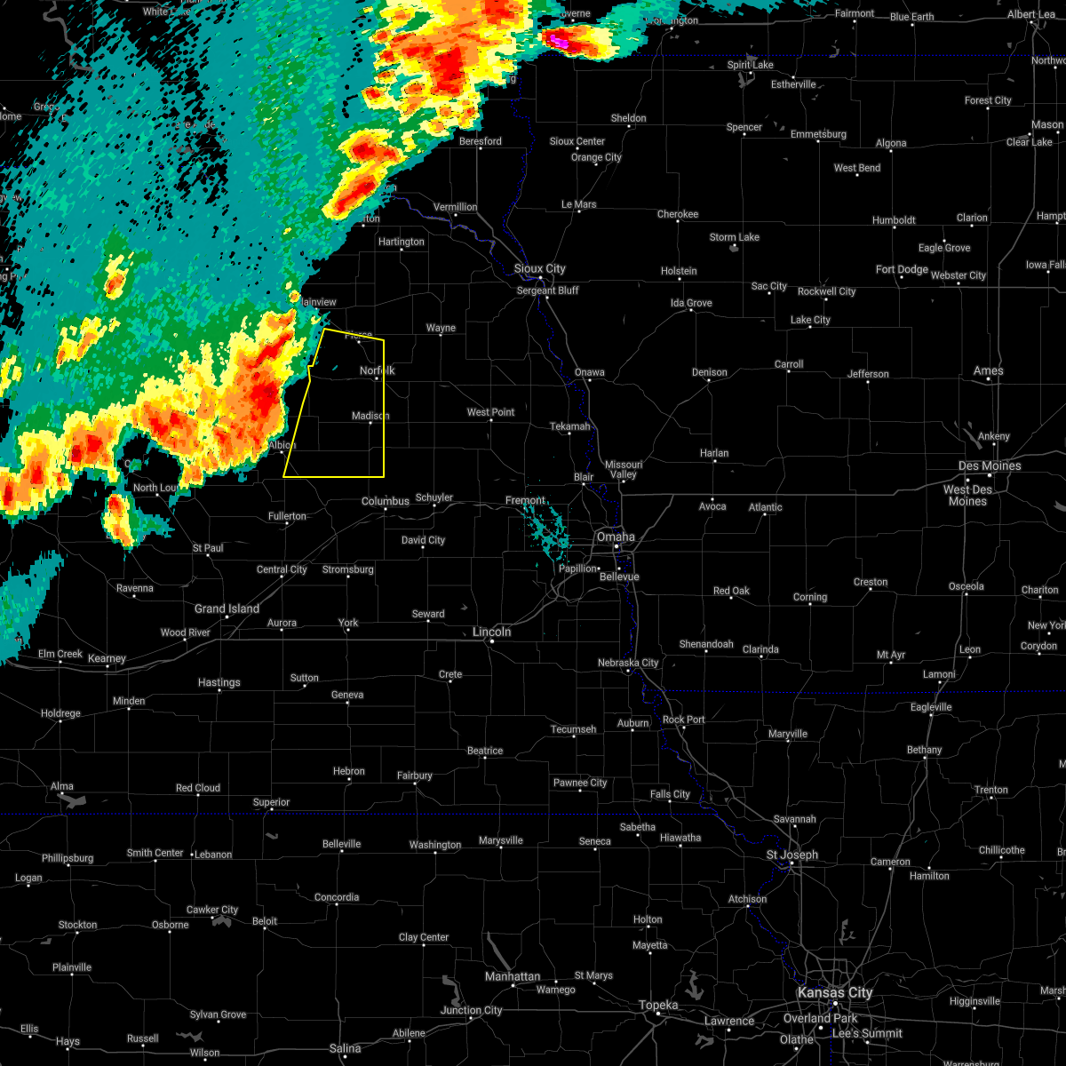 At 821 pm cdt, a severe thunderstorm was located 5 miles northeast of petersburg, or 30 miles west of norfolk, moving east at 35 mph (radar indicated). Hazards include 60 mph wind gusts and nickel size hail. expect damage to roofs, siding, and trees At 821 pm cdt, a severe thunderstorm was located 5 miles northeast of petersburg, or 30 miles west of norfolk, moving east at 35 mph (radar indicated). Hazards include 60 mph wind gusts and nickel size hail. expect damage to roofs, siding, and trees
|
| 8/27/2021 12:24 AM CDT |
 The severe thunderstorm warning for northern madison, western wayne and southeastern pierce counties will expire at 1230 am cdt, the storm which prompted the warning has weakened below severe limits, and no longer poses an immediate threat to life or property. therefore, the warning will be allowed to expire. however gusty winds are still possible with this thunderstorm. a severe thunderstorm watch remains in effect until 300 am cdt for northeastern nebraska. The severe thunderstorm warning for northern madison, western wayne and southeastern pierce counties will expire at 1230 am cdt, the storm which prompted the warning has weakened below severe limits, and no longer poses an immediate threat to life or property. therefore, the warning will be allowed to expire. however gusty winds are still possible with this thunderstorm. a severe thunderstorm watch remains in effect until 300 am cdt for northeastern nebraska.
|
| 8/27/2021 12:09 AM CDT |
 At 1209 am cdt, a severe thunderstorm was located 6 miles north of battle creek, or 9 miles west of norfolk, moving northeast at 30 mph (radar indicated). Hazards include quarter size hail. Damage to vehicles is expected. locations impacted include, norfolk, pierce, hadar and hoskins. hail threat, radar indicated max hail size, 1. 00 in wind threat, radar indicated max wind gust, <50 mph. At 1209 am cdt, a severe thunderstorm was located 6 miles north of battle creek, or 9 miles west of norfolk, moving northeast at 30 mph (radar indicated). Hazards include quarter size hail. Damage to vehicles is expected. locations impacted include, norfolk, pierce, hadar and hoskins. hail threat, radar indicated max hail size, 1. 00 in wind threat, radar indicated max wind gust, <50 mph.
|
| 8/26/2021 11:52 PM CDT |
 At 1151 pm cdt, a severe thunderstorm was located over meadow grove, or 17 miles west of norfolk, moving northeast at 45 mph (radar indicated). Hazards include quarter size hail. Damage to vehicles is expected. this severe thunderstorm will be near, battle creek around 1200 am cdt. hadar around 1210 am cdt. other locations in the path of this severe thunderstorm include pierce. hail threat, radar indicated max hail size, 1. 00 in wind threat, radar indicated max wind gust, <50 mph. At 1151 pm cdt, a severe thunderstorm was located over meadow grove, or 17 miles west of norfolk, moving northeast at 45 mph (radar indicated). Hazards include quarter size hail. Damage to vehicles is expected. this severe thunderstorm will be near, battle creek around 1200 am cdt. hadar around 1210 am cdt. other locations in the path of this severe thunderstorm include pierce. hail threat, radar indicated max hail size, 1. 00 in wind threat, radar indicated max wind gust, <50 mph.
|
| 7/9/2021 11:00 PM CDT |
 At 1100 pm cdt, a severe thunderstorm was located 5 miles northwest of stanton, or 6 miles southeast of norfolk, moving east at 60 mph (radar indicated). Hazards include 60 mph wind gusts and nickel size hail. Expect damage to roofs, siding, and trees. this severe thunderstorm will be near, stanton around 1105 pm cdt. pilger around 1115 pm cdt. wisner around 1120 pm cdt. other locations in the path of this severe thunderstorm include beemer and west point. People attending madison county fairgrounds should seek safe shelter immediately!. At 1100 pm cdt, a severe thunderstorm was located 5 miles northwest of stanton, or 6 miles southeast of norfolk, moving east at 60 mph (radar indicated). Hazards include 60 mph wind gusts and nickel size hail. Expect damage to roofs, siding, and trees. this severe thunderstorm will be near, stanton around 1105 pm cdt. pilger around 1115 pm cdt. wisner around 1120 pm cdt. other locations in the path of this severe thunderstorm include beemer and west point. People attending madison county fairgrounds should seek safe shelter immediately!.
|
| 7/9/2021 10:55 PM CDT | Trees down east of pierc in pierce county NE, 3.1 miles W of Pierce, NE |
| 7/9/2021 10:48 PM CDT |
 At 1047 pm cdt, a severe thunderstorm was located near hadar, or 6 miles northwest of norfolk, moving east at 50 mph (radar indicated). Hazards include 60 mph wind gusts and quarter size hail. Hail damage to vehicles is expected. expect wind damage to roofs, siding, and trees. Locations impacted include, norfolk, wayne, pierce, plainview, battle creek, randolph, osmond, winside, meadow grove, hadar, hoskins, carroll, laurel, tilden, belden, magnet, foster, mclean, sholes and camp assurance. At 1047 pm cdt, a severe thunderstorm was located near hadar, or 6 miles northwest of norfolk, moving east at 50 mph (radar indicated). Hazards include 60 mph wind gusts and quarter size hail. Hail damage to vehicles is expected. expect wind damage to roofs, siding, and trees. Locations impacted include, norfolk, wayne, pierce, plainview, battle creek, randolph, osmond, winside, meadow grove, hadar, hoskins, carroll, laurel, tilden, belden, magnet, foster, mclean, sholes and camp assurance.
|
| 7/9/2021 10:37 PM CDT |
 At 1037 pm cdt, a severe thunderstorm was located 6 miles southwest of pierce, or 14 miles northwest of norfolk, moving east at 50 mph (radar indicated). Hazards include 60 mph wind gusts and quarter size hail. Hail damage to vehicles is expected. expect wind damage to roofs, siding, and trees. Locations impacted include, norfolk, wayne, pierce, neligh, plainview, battle creek, creighton, randolph, osmond, wausa, coleridge, winside, oakdale, meadow grove, hadar, hoskins, carroll, laurel, tilden and brunswick. At 1037 pm cdt, a severe thunderstorm was located 6 miles southwest of pierce, or 14 miles northwest of norfolk, moving east at 50 mph (radar indicated). Hazards include 60 mph wind gusts and quarter size hail. Hail damage to vehicles is expected. expect wind damage to roofs, siding, and trees. Locations impacted include, norfolk, wayne, pierce, neligh, plainview, battle creek, creighton, randolph, osmond, wausa, coleridge, winside, oakdale, meadow grove, hadar, hoskins, carroll, laurel, tilden and brunswick.
|
| 7/9/2021 10:26 PM CDT |
 At 1026 pm cdt, a severe thunderstorm was located 8 miles south of plainview, or 23 miles northwest of norfolk, moving southeast at 50 mph (radar indicated). Hazards include 60 mph wind gusts and quarter size hail. Hail damage to vehicles is expected. expect wind damage to roofs, siding, and trees. Locations impacted include, pierce, hadar, norfolk and hoskins. At 1026 pm cdt, a severe thunderstorm was located 8 miles south of plainview, or 23 miles northwest of norfolk, moving southeast at 50 mph (radar indicated). Hazards include 60 mph wind gusts and quarter size hail. Hail damage to vehicles is expected. expect wind damage to roofs, siding, and trees. Locations impacted include, pierce, hadar, norfolk and hoskins.
|
| 7/9/2021 10:12 PM CDT |
 At 1011 pm cdt, severe thunderstorms were located along a line extending from randolph to 4 miles northeast of neligh, moving southeast at 65 mph (radar indicated). Hazards include 60 mph wind gusts and quarter size hail. Hail damage to vehicles is expected. expect wind damage to roofs, siding, and trees. severe thunderstorms will be near, randolph around 1015 pm cdt. meadow grove and carroll around 1025 pm cdt. wayne and battle creek around 1030 pm cdt. Other locations in the path of these severe thunderstorms include hadar and norfolk. At 1011 pm cdt, severe thunderstorms were located along a line extending from randolph to 4 miles northeast of neligh, moving southeast at 65 mph (radar indicated). Hazards include 60 mph wind gusts and quarter size hail. Hail damage to vehicles is expected. expect wind damage to roofs, siding, and trees. severe thunderstorms will be near, randolph around 1015 pm cdt. meadow grove and carroll around 1025 pm cdt. wayne and battle creek around 1030 pm cdt. Other locations in the path of these severe thunderstorms include hadar and norfolk.
|
| 6/24/2021 1:25 AM CDT |
 At 124 am cdt, a severe thunderstorm was located 5 miles west of pilger, or 13 miles east of norfolk, moving east at 35 mph. this is a very dangerous storm with a history of producing 80 mph gusts and uprooting trees (radar indicated). Hazards include 80 mph wind gusts and penny size hail. Flying debris will be dangerous to those caught without shelter. mobile homes will be heavily damaged. expect considerable damage to roofs, windows, and vehicles. extensive tree damage and power outages are likely. locations impacted include, norfolk, columbus, madison, pierce, albion, stanton, battle creek, newman grove, st. Edward, winside, leigh, cedar rapids, pilger, platte center, petersburg, meadow grove, hadar, hoskins, monroe and lindsay. At 124 am cdt, a severe thunderstorm was located 5 miles west of pilger, or 13 miles east of norfolk, moving east at 35 mph. this is a very dangerous storm with a history of producing 80 mph gusts and uprooting trees (radar indicated). Hazards include 80 mph wind gusts and penny size hail. Flying debris will be dangerous to those caught without shelter. mobile homes will be heavily damaged. expect considerable damage to roofs, windows, and vehicles. extensive tree damage and power outages are likely. locations impacted include, norfolk, columbus, madison, pierce, albion, stanton, battle creek, newman grove, st. Edward, winside, leigh, cedar rapids, pilger, platte center, petersburg, meadow grove, hadar, hoskins, monroe and lindsay.
|
| 6/24/2021 1:08 AM CDT |
 At 107 am cdt, a severe thunderstorm was located near norfolk, moving east at 35 mph. this is a very dangerous storm (a 84 mph gust was recorded at the albion airport at 12:55am). Hazards include 80 mph wind gusts and penny size hail. Flying debris will be dangerous to those caught without shelter. mobile homes will be heavily damaged. expect considerable damage to roofs, windows, and vehicles. extensive tree damage and power outages are likely. Locations impacted include, stanton and pilger. At 107 am cdt, a severe thunderstorm was located near norfolk, moving east at 35 mph. this is a very dangerous storm (a 84 mph gust was recorded at the albion airport at 12:55am). Hazards include 80 mph wind gusts and penny size hail. Flying debris will be dangerous to those caught without shelter. mobile homes will be heavily damaged. expect considerable damage to roofs, windows, and vehicles. extensive tree damage and power outages are likely. Locations impacted include, stanton and pilger.
|
| 6/24/2021 12:58 AM CDT |
 At 1257 am cdt, a severe thunderstorm was located near norfolk, moving east at 35 mph. this is a very dangerous storm (law enforcement). Hazards include 80 mph wind gusts and penny size hail. Flying debris will be dangerous to those caught without shelter. mobile homes will be heavily damaged. expect considerable damage to roofs, windows, and vehicles. extensive tree damage and power outages are likely. this severe thunderstorm will be near, hoskins around 110 am cdt. Other locations in the path of this severe thunderstorm include stanton and pilger. At 1257 am cdt, a severe thunderstorm was located near norfolk, moving east at 35 mph. this is a very dangerous storm (law enforcement). Hazards include 80 mph wind gusts and penny size hail. Flying debris will be dangerous to those caught without shelter. mobile homes will be heavily damaged. expect considerable damage to roofs, windows, and vehicles. extensive tree damage and power outages are likely. this severe thunderstorm will be near, hoskins around 110 am cdt. Other locations in the path of this severe thunderstorm include stanton and pilger.
|
| 6/24/2021 12:36 AM CDT |
 At 1235 am cdt, a severe thunderstorm was located 7 miles southwest of beemer, or 27 miles southeast of norfolk, moving southeast at 45 mph (law enforcement reported large trees down in neligh, ne). Hazards include 60 mph wind gusts and penny size hail. Expect damage to roofs, siding, and trees. This severe thunderstorm will remain over mainly rural areas of madison, southwestern wayne, pierce, antelope and northwestern stanton counties, including the following locations, royal, willow creek state recreation area, brunswick, foster and tilden. At 1235 am cdt, a severe thunderstorm was located 7 miles southwest of beemer, or 27 miles southeast of norfolk, moving southeast at 45 mph (law enforcement reported large trees down in neligh, ne). Hazards include 60 mph wind gusts and penny size hail. Expect damage to roofs, siding, and trees. This severe thunderstorm will remain over mainly rural areas of madison, southwestern wayne, pierce, antelope and northwestern stanton counties, including the following locations, royal, willow creek state recreation area, brunswick, foster and tilden.
|
| 6/24/2021 12:12 AM CDT |
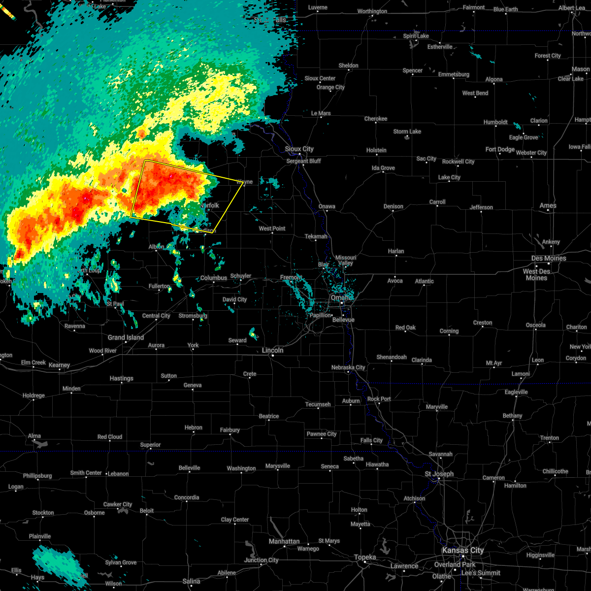 At 1212 am cdt, a severe thunderstorm was located 9 miles northeast of neligh, or 30 miles northwest of norfolk, moving southeast at 25 mph (radar indicated). Hazards include 60 mph wind gusts and quarter size hail. Hail damage to vehicles is expected. expect wind damage to roofs, siding, and trees. this severe thunderstorm will be near, pierce around 1240 am cdt. battle creek around 1245 am cdt. norfolk and hadar around 1250 am cdt. hoskins around 1255 am cdt. Other locations impacted by this severe thunderstorm include royal, willow creek state recreation area, brunswick, foster and tilden. At 1212 am cdt, a severe thunderstorm was located 9 miles northeast of neligh, or 30 miles northwest of norfolk, moving southeast at 25 mph (radar indicated). Hazards include 60 mph wind gusts and quarter size hail. Hail damage to vehicles is expected. expect wind damage to roofs, siding, and trees. this severe thunderstorm will be near, pierce around 1240 am cdt. battle creek around 1245 am cdt. norfolk and hadar around 1250 am cdt. hoskins around 1255 am cdt. Other locations impacted by this severe thunderstorm include royal, willow creek state recreation area, brunswick, foster and tilden.
|
| 6/22/2021 5:08 PM CDT |
 At 508 pm cdt, a severe thunderstorm was located 9 miles northeast of neligh, or 26 miles northwest of norfolk, moving southeast at 20 mph (radar indicated). Hazards include golf ball size hail and 60 mph wind gusts. People and animals outdoors will be injured. expect hail damage to roofs, siding, windows, and vehicles. expect wind damage to roofs, siding, and trees. this severe storm will be near, meadow grove around 530 pm cdt. Other locations impacted by this severe thunderstorm include willow creek state recreation area and tilden. At 508 pm cdt, a severe thunderstorm was located 9 miles northeast of neligh, or 26 miles northwest of norfolk, moving southeast at 20 mph (radar indicated). Hazards include golf ball size hail and 60 mph wind gusts. People and animals outdoors will be injured. expect hail damage to roofs, siding, windows, and vehicles. expect wind damage to roofs, siding, and trees. this severe storm will be near, meadow grove around 530 pm cdt. Other locations impacted by this severe thunderstorm include willow creek state recreation area and tilden.
|
| 6/22/2021 4:57 PM CDT |
 At 457 pm cdt, a severe thunderstorm was located 9 miles northeast of neligh, or 29 miles northwest of norfolk, moving southeast at 25 mph (radar indicated). Hazards include 60 mph wind gusts and half dollar size hail. Hail damage to vehicles is expected. expect wind damage to roofs, siding, and trees. this severe storm will be near, meadow grove around 530 pm cdt. Other locations impacted by this severe thunderstorm include willow creek state recreation area, brunswick and tilden. At 457 pm cdt, a severe thunderstorm was located 9 miles northeast of neligh, or 29 miles northwest of norfolk, moving southeast at 25 mph (radar indicated). Hazards include 60 mph wind gusts and half dollar size hail. Hail damage to vehicles is expected. expect wind damage to roofs, siding, and trees. this severe storm will be near, meadow grove around 530 pm cdt. Other locations impacted by this severe thunderstorm include willow creek state recreation area, brunswick and tilden.
|
| 6/22/2021 4:48 PM CDT |
 At 448 pm cdt, a severe thunderstorm was located 10 miles southwest of plainview, or 33 miles northwest of norfolk, moving southeast at 20 mph (radar indicated). Hazards include half dollar size hail. Damage to vehicles is expected. This severe thunderstorm will remain over mainly rural areas of northwestern madison, southwestern pierce and northeastern antelope counties, including the following locations, willow creek state recreation area, brunswick and tilden. At 448 pm cdt, a severe thunderstorm was located 10 miles southwest of plainview, or 33 miles northwest of norfolk, moving southeast at 20 mph (radar indicated). Hazards include half dollar size hail. Damage to vehicles is expected. This severe thunderstorm will remain over mainly rural areas of northwestern madison, southwestern pierce and northeastern antelope counties, including the following locations, willow creek state recreation area, brunswick and tilden.
|
| 6/11/2021 6:27 AM CDT |
 The severe thunderstorm warning for northwestern wayne, pierce, antelope, southern knox and cedar counties will expire at 630 am cdt, the storms which prompted the warning have weakened. therefore, the warning will be allowed to expire. however gusty winds are still possible with these thunderstorms. a severe thunderstorm watch remains in effect until 1100 am cdt for northeastern nebraska. The severe thunderstorm warning for northwestern wayne, pierce, antelope, southern knox and cedar counties will expire at 630 am cdt, the storms which prompted the warning have weakened. therefore, the warning will be allowed to expire. however gusty winds are still possible with these thunderstorms. a severe thunderstorm watch remains in effect until 1100 am cdt for northeastern nebraska.
|
| 6/11/2021 6:07 AM CDT |
 At 607 am cdt, severe thunderstorms were located along a line extending from near wynot to 5 miles southwest of hartington to near ewing, moving southeast at 40 mph (radar indicated). Hazards include 60 mph wind gusts. Expect damage to roofs, siding, and trees. these severe storms will be near, hartington and wynot around 610 am cdt. coleridge around 615 am cdt. Other locations in the path of these severe thunderstorms include neligh. At 607 am cdt, severe thunderstorms were located along a line extending from near wynot to 5 miles southwest of hartington to near ewing, moving southeast at 40 mph (radar indicated). Hazards include 60 mph wind gusts. Expect damage to roofs, siding, and trees. these severe storms will be near, hartington and wynot around 610 am cdt. coleridge around 615 am cdt. Other locations in the path of these severe thunderstorms include neligh.
|
| 6/11/2021 5:55 AM CDT |
 At 554 am cdt, severe thunderstorms were located along a line extending from near yankton to 7 miles northeast of bloomfield to 6 miles northwest of orchard, moving southeast at 40 mph (radar indicated). Hazards include 60 mph wind gusts. Expect damage to roofs, siding, and trees. severe thunderstorms will be near, hartington around 605 am cdt. wynot around 610 am cdt. Other locations in the path of these severe thunderstorms include neligh and coleridge. At 554 am cdt, severe thunderstorms were located along a line extending from near yankton to 7 miles northeast of bloomfield to 6 miles northwest of orchard, moving southeast at 40 mph (radar indicated). Hazards include 60 mph wind gusts. Expect damage to roofs, siding, and trees. severe thunderstorms will be near, hartington around 605 am cdt. wynot around 610 am cdt. Other locations in the path of these severe thunderstorms include neligh and coleridge.
|
| 7/6/2020 7:20 PM CDT |
 At 719 pm cdt, a severe thunderstorm was located 10 miles north of meadow grove, or 21 miles northwest of norfolk, moving southeast at 20 mph (radar indicated). Hazards include 60 mph wind gusts and quarter size hail. Hail damage to vehicles is expected. Expect wind damage to roofs, siding, and trees. At 719 pm cdt, a severe thunderstorm was located 10 miles north of meadow grove, or 21 miles northwest of norfolk, moving southeast at 20 mph (radar indicated). Hazards include 60 mph wind gusts and quarter size hail. Hail damage to vehicles is expected. Expect wind damage to roofs, siding, and trees.
|
| 6/22/2020 3:13 PM CDT |
 The severe thunderstorm warning for southeastern pierce county will expire at 315 pm cdt, the storm which prompted the warning has weakened below severe limits, and no longer poses an immediate threat to life or property. therefore, the warning will be allowed to expire. however small hail and gusty winds are still possible with this thunderstorm. The severe thunderstorm warning for southeastern pierce county will expire at 315 pm cdt, the storm which prompted the warning has weakened below severe limits, and no longer poses an immediate threat to life or property. therefore, the warning will be allowed to expire. however small hail and gusty winds are still possible with this thunderstorm.
|
| 6/22/2020 2:52 PM CDT |
 At 252 pm cdt, a severe thunderstorm was located 5 miles north of pierce, or 16 miles north of norfolk, moving southeast at 25 mph (radar indicated). Hazards include 60 mph wind gusts and half dollar size hail. Hail damage to vehicles is expected. expect wind damage to roofs, siding, and trees. Locations impacted include, pierce and hadar. At 252 pm cdt, a severe thunderstorm was located 5 miles north of pierce, or 16 miles north of norfolk, moving southeast at 25 mph (radar indicated). Hazards include 60 mph wind gusts and half dollar size hail. Hail damage to vehicles is expected. expect wind damage to roofs, siding, and trees. Locations impacted include, pierce and hadar.
|
| 6/22/2020 2:40 PM CDT |
 At 240 pm cdt, a severe thunderstorm was located 5 miles southeast of osmond, or 20 miles north of norfolk, moving southeast at 25 mph (radar indicated). Hazards include 60 mph wind gusts and half dollar size hail. Hail damage to vehicles is expected. Expect wind damage to roofs, siding, and trees. At 240 pm cdt, a severe thunderstorm was located 5 miles southeast of osmond, or 20 miles north of norfolk, moving southeast at 25 mph (radar indicated). Hazards include 60 mph wind gusts and half dollar size hail. Hail damage to vehicles is expected. Expect wind damage to roofs, siding, and trees.
|
| 5/24/2020 3:03 AM CDT |
 At 302 am cdt, severe thunderstorms were located along a line extending from 8 miles southwest of lewis and clark state recreation area to 5 miles northeast of wausa to near pierce, moving northeast at 60 mph (this storm has a history of producing 75 mph wind gusts). Hazards include 75 mph wind gusts and penny size hail. Expect considerable tree damage. damage is likely to mobile homes, roofs, and outbuildings. locations impacted include, wayne, pierce, hartington, bloomfield, randolph, osmond, wausa, coleridge, winside, hadar, hoskins, carroll, wynot, laurel, crofton, pleasant valley, fordyce, belden, st. Helena and magnet. At 302 am cdt, severe thunderstorms were located along a line extending from 8 miles southwest of lewis and clark state recreation area to 5 miles northeast of wausa to near pierce, moving northeast at 60 mph (this storm has a history of producing 75 mph wind gusts). Hazards include 75 mph wind gusts and penny size hail. Expect considerable tree damage. damage is likely to mobile homes, roofs, and outbuildings. locations impacted include, wayne, pierce, hartington, bloomfield, randolph, osmond, wausa, coleridge, winside, hadar, hoskins, carroll, wynot, laurel, crofton, pleasant valley, fordyce, belden, st. Helena and magnet.
|
| 5/24/2020 2:50 AM CDT |
 At 250 am cdt, severe thunderstorms were located along a line extending from 9 miles northwest of bloomfield to 4 miles west of wausa to 6 miles north of meadow grove, moving northeast at 50 mph (radar indicated). Hazards include 60 mph wind gusts and penny size hail. Expect damage to roofs, siding, and trees. locations impacted include, wayne, pierce, hartington, plainview, bloomfield, randolph, osmond, wausa, coleridge, winside, hadar, hoskins, carroll, wynot, laurel, crofton, pleasant valley, fordyce, belden and st. Helena. At 250 am cdt, severe thunderstorms were located along a line extending from 9 miles northwest of bloomfield to 4 miles west of wausa to 6 miles north of meadow grove, moving northeast at 50 mph (radar indicated). Hazards include 60 mph wind gusts and penny size hail. Expect damage to roofs, siding, and trees. locations impacted include, wayne, pierce, hartington, plainview, bloomfield, randolph, osmond, wausa, coleridge, winside, hadar, hoskins, carroll, wynot, laurel, crofton, pleasant valley, fordyce, belden and st. Helena.
|
| 5/24/2020 2:33 AM CDT |
 At 232 am cdt, severe thunderstorms were located along a line extending from 8 miles southeast of niobrara to 9 miles northeast of oakdale, moving northeast at 50 mph (radar indicated. these storms have a history of producing wind gusts near 70). Hazards include 70 mph wind gusts. Expect considerable tree damage. Damage is likely to mobile homes, roofs, and outbuildings. At 232 am cdt, severe thunderstorms were located along a line extending from 8 miles southeast of niobrara to 9 miles northeast of oakdale, moving northeast at 50 mph (radar indicated. these storms have a history of producing wind gusts near 70). Hazards include 70 mph wind gusts. Expect considerable tree damage. Damage is likely to mobile homes, roofs, and outbuildings.
|
| 5/5/2020 6:56 PM CDT |
 The severe thunderstorm warning for southeastern pierce county will expire at 700 pm cdt, the storm which prompted the warning has moved out of the area. therefore, the warning will be allowed to expire. however gusty winds are still possible with this thunderstorm. The severe thunderstorm warning for southeastern pierce county will expire at 700 pm cdt, the storm which prompted the warning has moved out of the area. therefore, the warning will be allowed to expire. however gusty winds are still possible with this thunderstorm.
|
| 5/5/2020 6:50 PM CDT |
 At 650 pm cdt, a severe thunderstorm was located near hadar, or 5 miles west of norfolk, moving southeast at 40 mph (radar indicated). Hazards include 60 mph wind gusts and half dollar size hail. Hail damage to vehicles is expected. expect wind damage to roofs, siding, and trees. Locations impacted include, pierce, hadar and willow creek state recreation area. At 650 pm cdt, a severe thunderstorm was located near hadar, or 5 miles west of norfolk, moving southeast at 40 mph (radar indicated). Hazards include 60 mph wind gusts and half dollar size hail. Hail damage to vehicles is expected. expect wind damage to roofs, siding, and trees. Locations impacted include, pierce, hadar and willow creek state recreation area.
|
| 5/5/2020 6:39 PM CDT |
 At 639 pm cdt, a severe thunderstorm was located near pierce, or 13 miles northwest of norfolk, moving southeast at 35 mph (radar indicated). Hazards include 60 mph wind gusts and half dollar size hail. Hail damage to vehicles is expected. expect wind damage to roofs, siding, and trees. Locations impacted include, pierce, hadar, foster and willow creek state recreation area. At 639 pm cdt, a severe thunderstorm was located near pierce, or 13 miles northwest of norfolk, moving southeast at 35 mph (radar indicated). Hazards include 60 mph wind gusts and half dollar size hail. Hail damage to vehicles is expected. expect wind damage to roofs, siding, and trees. Locations impacted include, pierce, hadar, foster and willow creek state recreation area.
|
| 5/5/2020 6:36 PM CDT |
 At 635 pm cdt, a severe thunderstorm was located 5 miles west of pierce, or 16 miles northwest of norfolk, moving southeast at 35 mph (radar indicated). Hazards include 60 mph wind gusts and half dollar size hail. Hail damage to vehicles is expected. expect wind damage to roofs, siding, and trees. Locations impacted include, pierce, hadar, foster and willow creek state recreation area. At 635 pm cdt, a severe thunderstorm was located 5 miles west of pierce, or 16 miles northwest of norfolk, moving southeast at 35 mph (radar indicated). Hazards include 60 mph wind gusts and half dollar size hail. Hail damage to vehicles is expected. expect wind damage to roofs, siding, and trees. Locations impacted include, pierce, hadar, foster and willow creek state recreation area.
|
| 5/5/2020 6:31 PM CDT |
 At 630 pm cdt, a severe thunderstorm was located 7 miles northwest of pierce, or 19 miles northwest of norfolk, moving southeast at 40 mph (radar indicated). Hazards include 60 mph wind gusts and half dollar size hail. Hail damage to vehicles is expected. Expect wind damage to roofs, siding, and trees. At 630 pm cdt, a severe thunderstorm was located 7 miles northwest of pierce, or 19 miles northwest of norfolk, moving southeast at 40 mph (radar indicated). Hazards include 60 mph wind gusts and half dollar size hail. Hail damage to vehicles is expected. Expect wind damage to roofs, siding, and trees.
|
| 7/13/2019 3:08 AM CDT |
 At 307 am cdt, severe thunderstorms were located along a line extending from near winside to 7 miles southwest of stanton to 5 miles northwest of platte center, moving east at 45 mph. the strongest storms were located in stanton county and northern platte county (radar indicated). Hazards include 60 mph wind gusts and quarter size hail. Hail damage to vehicles is expected. expect wind damage to roofs, siding, and trees. Locations impacted include, norfolk, madison, pierce, stanton, battle creek, clarkson, winside, leigh, pilger, platte center, hadar, hoskins, lindsay, creston, humphrey, tarnov, cornlea, the highway 15 and 32 junction, lake north babcock campground and circle h trailer park. At 307 am cdt, severe thunderstorms were located along a line extending from near winside to 7 miles southwest of stanton to 5 miles northwest of platte center, moving east at 45 mph. the strongest storms were located in stanton county and northern platte county (radar indicated). Hazards include 60 mph wind gusts and quarter size hail. Hail damage to vehicles is expected. expect wind damage to roofs, siding, and trees. Locations impacted include, norfolk, madison, pierce, stanton, battle creek, clarkson, winside, leigh, pilger, platte center, hadar, hoskins, lindsay, creston, humphrey, tarnov, cornlea, the highway 15 and 32 junction, lake north babcock campground and circle h trailer park.
|
| 7/13/2019 2:58 AM CDT |
 At 257 am cdt, severe thunderstorms were located along a line extending from hoskins to 5 miles northwest of platte center, moving east at 45 mph. the strongest storms in this line were near norfolk and also near lindsay (radar indicated). Hazards include 65 mph wind gusts and half dollar size hail. Hail damage to vehicles is expected. expect wind damage to roofs, siding, and trees. Locations impacted include, norfolk, madison, pierce, stanton, battle creek, clarkson, winside, leigh, pilger, platte center, hadar, hoskins, lindsay, creston, humphrey, tarnov, cornlea, the highway 15 and 32 junction, lake north babcock campground and circle h trailer park. At 257 am cdt, severe thunderstorms were located along a line extending from hoskins to 5 miles northwest of platte center, moving east at 45 mph. the strongest storms in this line were near norfolk and also near lindsay (radar indicated). Hazards include 65 mph wind gusts and half dollar size hail. Hail damage to vehicles is expected. expect wind damage to roofs, siding, and trees. Locations impacted include, norfolk, madison, pierce, stanton, battle creek, clarkson, winside, leigh, pilger, platte center, hadar, hoskins, lindsay, creston, humphrey, tarnov, cornlea, the highway 15 and 32 junction, lake north babcock campground and circle h trailer park.
|
| 7/13/2019 2:48 AM CDT |
 At 247 am cdt, severe thunderstorms were located along a line extending from hadar to 6 miles northwest of monroe, moving east at 45 mph. the strongest part of this line of storms should affect the norfolk area (radar indicated). Hazards include 65 mph wind gusts and half dollar size hail. Hail damage to vehicles is expected. expect wind damage to roofs, siding, and trees. Locations impacted include, norfolk, madison, pierce, stanton, battle creek, clarkson, winside, leigh, pilger, platte center, hadar, hoskins, lindsay, creston, humphrey, tarnov, cornlea, the highway 15 and 32 junction, lake north babcock campground and circle h trailer park. At 247 am cdt, severe thunderstorms were located along a line extending from hadar to 6 miles northwest of monroe, moving east at 45 mph. the strongest part of this line of storms should affect the norfolk area (radar indicated). Hazards include 65 mph wind gusts and half dollar size hail. Hail damage to vehicles is expected. expect wind damage to roofs, siding, and trees. Locations impacted include, norfolk, madison, pierce, stanton, battle creek, clarkson, winside, leigh, pilger, platte center, hadar, hoskins, lindsay, creston, humphrey, tarnov, cornlea, the highway 15 and 32 junction, lake north babcock campground and circle h trailer park.
|
| 7/13/2019 2:42 AM CDT |
 At 241 am cdt, severe thunderstorms were located along a line extending from 5 miles southwest of pierce to 7 miles east of st. edward, moving east at 45 mph (radar indicated). Hazards include 60 mph wind gusts and quarter size hail. Hail damage to vehicles is expected. Expect wind damage to roofs, siding, and trees. At 241 am cdt, severe thunderstorms were located along a line extending from 5 miles southwest of pierce to 7 miles east of st. edward, moving east at 45 mph (radar indicated). Hazards include 60 mph wind gusts and quarter size hail. Hail damage to vehicles is expected. Expect wind damage to roofs, siding, and trees.
|
| 7/5/2019 4:03 AM CDT |
 At 403 am cdt, severe thunderstorms were located along a line extending from 8 miles northeast of amelia to 12 miles north of bartlett to 7 miles southeast of ericson, moving east at 35 mph (radar indicated). Hazards include 60 mph wind gusts. expect damage to roofs, siding, and trees At 403 am cdt, severe thunderstorms were located along a line extending from 8 miles northeast of amelia to 12 miles north of bartlett to 7 miles southeast of ericson, moving east at 35 mph (radar indicated). Hazards include 60 mph wind gusts. expect damage to roofs, siding, and trees
|
| 6/24/2018 4:48 PM CDT |
 At 448 pm cdt, a severe thunderstorm was located over hadar, or 5 miles northwest of norfolk, moving northwest at 15 mph (radar indicated). Hazards include 60 mph wind gusts and quarter size hail. Hail damage to vehicles is expected. Expect wind damage to roofs, siding, and trees. At 448 pm cdt, a severe thunderstorm was located over hadar, or 5 miles northwest of norfolk, moving northwest at 15 mph (radar indicated). Hazards include 60 mph wind gusts and quarter size hail. Hail damage to vehicles is expected. Expect wind damage to roofs, siding, and trees.
|
| 6/1/2018 9:41 PM CDT |
 At 940 pm cdt, a severe thunderstorm was located 11 miles northeast of oakdale, or 22 miles northwest of norfolk, moving northeast at 45 mph (trained weather spotters. 60 mph winds were reported 2 miles north of meadow grove). Hazards include 70 mph wind gusts and ping pong ball size hail. People and animals outdoors will be injured. expect hail damage to roofs, siding, windows, and vehicles. expect considerable tree damage. wind damage is also likely to mobile homes, roofs, and outbuildings. locations impacted include, pierce, neligh, plainview, osmond, oakdale, tilden, foster, mclean and willow creek state recreation area. this includes the following highways, highway 275 in nebraska between mile markers 34 and 57. highway 81 in nebraska between mile markers 169 and 177. highway 20 in nebraska between mile markers 349 and 373. A tornado watch remains in effect until 1100 pm cdt for northeastern nebraska. At 940 pm cdt, a severe thunderstorm was located 11 miles northeast of oakdale, or 22 miles northwest of norfolk, moving northeast at 45 mph (trained weather spotters. 60 mph winds were reported 2 miles north of meadow grove). Hazards include 70 mph wind gusts and ping pong ball size hail. People and animals outdoors will be injured. expect hail damage to roofs, siding, windows, and vehicles. expect considerable tree damage. wind damage is also likely to mobile homes, roofs, and outbuildings. locations impacted include, pierce, neligh, plainview, osmond, oakdale, tilden, foster, mclean and willow creek state recreation area. this includes the following highways, highway 275 in nebraska between mile markers 34 and 57. highway 81 in nebraska between mile markers 169 and 177. highway 20 in nebraska between mile markers 349 and 373. A tornado watch remains in effect until 1100 pm cdt for northeastern nebraska.
|
| 6/1/2018 9:36 PM CDT |
 At 935 pm cdt, a severe thunderstorm was located 6 miles east of neligh, or 26 miles west of norfolk, moving northeast at 40 mph (spotter reported). Hazards include 70 mph wind gusts and ping pong ball size hail. strong winds have knocked down power lines and power is out in neligh. People and animals outdoors will be injured. expect hail damage to roofs, siding, windows, and vehicles. expect considerable tree damage. wind damage is also likely to mobile homes, roofs, and outbuildings. locations impacted include, pierce, neligh, plainview, osmond, oakdale, tilden, foster, mclean and willow creek state recreation area. this includes the following highways, highway 275 in nebraska between mile markers 34 and 57. highway 81 in nebraska between mile markers 169 and 177. highway 20 in nebraska between mile markers 349 and 373. A tornado watch remains in effect until 1100 pm cdt for northeastern nebraska. At 935 pm cdt, a severe thunderstorm was located 6 miles east of neligh, or 26 miles west of norfolk, moving northeast at 40 mph (spotter reported). Hazards include 70 mph wind gusts and ping pong ball size hail. strong winds have knocked down power lines and power is out in neligh. People and animals outdoors will be injured. expect hail damage to roofs, siding, windows, and vehicles. expect considerable tree damage. wind damage is also likely to mobile homes, roofs, and outbuildings. locations impacted include, pierce, neligh, plainview, osmond, oakdale, tilden, foster, mclean and willow creek state recreation area. this includes the following highways, highway 275 in nebraska between mile markers 34 and 57. highway 81 in nebraska between mile markers 169 and 177. highway 20 in nebraska between mile markers 349 and 373. A tornado watch remains in effect until 1100 pm cdt for northeastern nebraska.
|
| 6/1/2018 9:29 PM CDT |
 At 929 pm cdt, a severe thunderstorm was located near neligh, or 28 miles west of norfolk, moving northeast at 45 mph (radar indicated). Hazards include ping pong ball size hail and 60 mph wind gusts. People and animals outdoors will be injured. expect hail damage to roofs, siding, windows, and vehicles. Expect wind damage to roofs, siding, and trees. At 929 pm cdt, a severe thunderstorm was located near neligh, or 28 miles west of norfolk, moving northeast at 45 mph (radar indicated). Hazards include ping pong ball size hail and 60 mph wind gusts. People and animals outdoors will be injured. expect hail damage to roofs, siding, windows, and vehicles. Expect wind damage to roofs, siding, and trees.
|
| 8/24/2017 9:09 AM CDT |
 At 909 am cdt, a severe thunderstorm was located 5 miles southeast of osmond, or 18 miles north of norfolk, moving east at 15 mph (radar indicated). Hazards include 60 mph wind gusts and quarter size hail. Hail damage to vehicles is expected. Expect wind damage to roofs, siding, and trees. At 909 am cdt, a severe thunderstorm was located 5 miles southeast of osmond, or 18 miles north of norfolk, moving east at 15 mph (radar indicated). Hazards include 60 mph wind gusts and quarter size hail. Hail damage to vehicles is expected. Expect wind damage to roofs, siding, and trees.
|
| 7/10/2017 11:56 PM CDT |
 The national weather service in omaha has issued a * severe thunderstorm warning for. northeastern madison county in northeastern nebraska. wayne county in northeastern nebraska. northwestern cuming county in northeastern nebraska. Southeastern pierce county in northeastern nebraska. The national weather service in omaha has issued a * severe thunderstorm warning for. northeastern madison county in northeastern nebraska. wayne county in northeastern nebraska. northwestern cuming county in northeastern nebraska. Southeastern pierce county in northeastern nebraska.
|
| 7/10/2017 11:48 PM CDT |
 At 1147 pm cdt, a severe thunderstorm was located near battle creek, or 8 miles west of norfolk, moving east at 30 mph (radar indicated). Hazards include 60 mph wind gusts and quarter size hail. Hail damage to vehicles is expected. expect wind damage to roofs, siding, and trees. locations impacted include, norfolk, pierce, battle creek, meadow grove, hadar, tilden and willow creek state recreation area. this includes the following highways, highway 275 in nebraska between mile markers 53 and 78. Highway 81 in nebraska between mile markers 146 and 171. At 1147 pm cdt, a severe thunderstorm was located near battle creek, or 8 miles west of norfolk, moving east at 30 mph (radar indicated). Hazards include 60 mph wind gusts and quarter size hail. Hail damage to vehicles is expected. expect wind damage to roofs, siding, and trees. locations impacted include, norfolk, pierce, battle creek, meadow grove, hadar, tilden and willow creek state recreation area. this includes the following highways, highway 275 in nebraska between mile markers 53 and 78. Highway 81 in nebraska between mile markers 146 and 171.
|
| 7/10/2017 11:32 PM CDT |
 At 1131 pm cdt, a severe thunderstorm was located over meadow grove, or 16 miles west of norfolk, moving east at 30 mph (radar indicated). Hazards include 60 mph wind gusts and quarter size hail. Hail damage to vehicles is expected. Expect wind damage to roofs, siding, and trees. At 1131 pm cdt, a severe thunderstorm was located over meadow grove, or 16 miles west of norfolk, moving east at 30 mph (radar indicated). Hazards include 60 mph wind gusts and quarter size hail. Hail damage to vehicles is expected. Expect wind damage to roofs, siding, and trees.
|
| 6/29/2017 11:38 AM CDT |
 The severe thunderstorm warning for northwestern wayne, pierce and southwestern cedar counties will expire at 445 pm cdt, the storm which prompted the warning has weakened below severe limits, and has exited the warned area. therefore, the warning will be allowed to expire. a severe thunderstorm watch remains in effect until 1100 pm cdt for northeastern nebraska. The severe thunderstorm warning for northwestern wayne, pierce and southwestern cedar counties will expire at 445 pm cdt, the storm which prompted the warning has weakened below severe limits, and has exited the warned area. therefore, the warning will be allowed to expire. a severe thunderstorm watch remains in effect until 1100 pm cdt for northeastern nebraska.
|
| 6/29/2017 11:06 AM CDT |
 At 405 pm cdt, a severe thunderstorm was located 7 miles south of plainview, or 24 miles northwest of norfolk, moving east at 35 mph (radar indicated). Hazards include 60 mph wind gusts and half dollar size hail. Hail damage to vehicles is expected. Expect wind damage to roofs, siding, and trees. At 405 pm cdt, a severe thunderstorm was located 7 miles south of plainview, or 24 miles northwest of norfolk, moving east at 35 mph (radar indicated). Hazards include 60 mph wind gusts and half dollar size hail. Hail damage to vehicles is expected. Expect wind damage to roofs, siding, and trees.
|
| 6/16/2017 5:01 PM CDT |
 At 501 pm cdt, a severe thunderstorm capable of producing a tornado was located 5 miles northeast of meadow grove, or 11 miles west of norfolk, moving southeast at 35 mph (radar indicated rotation). Hazards include tornado and ping pong ball size hail. Flying debris will be dangerous to those caught without shelter. mobile homes will be damaged or destroyed. damage to roofs, windows, and vehicles will occur. tree damage is likely. this dangerous storm will be near, battle creek around 510 pm cdt. norfolk around 515 pm cdt. other locations impacted by this tornadic thunderstorm include willow creek state recreation area. this includes the following highways, highway 275 in nebraska between mile markers 61 and 78. Highway 81 in nebraska between mile markers 146 and 166. At 501 pm cdt, a severe thunderstorm capable of producing a tornado was located 5 miles northeast of meadow grove, or 11 miles west of norfolk, moving southeast at 35 mph (radar indicated rotation). Hazards include tornado and ping pong ball size hail. Flying debris will be dangerous to those caught without shelter. mobile homes will be damaged or destroyed. damage to roofs, windows, and vehicles will occur. tree damage is likely. this dangerous storm will be near, battle creek around 510 pm cdt. norfolk around 515 pm cdt. other locations impacted by this tornadic thunderstorm include willow creek state recreation area. this includes the following highways, highway 275 in nebraska between mile markers 61 and 78. Highway 81 in nebraska between mile markers 146 and 166.
|
| 6/16/2017 4:44 PM CDT |
 At 444 pm cdt, a severe thunderstorm capable of producing a tornado was located 8 miles west of pierce, or 16 miles northwest of norfolk, moving southeast at 30 mph (radar indicated rotation). Hazards include tornado and quarter size hail. Flying debris will be dangerous to those caught without shelter. mobile homes will be damaged or destroyed. damage to roofs, windows, and vehicles will occur. tree damage is likely. this dangerous storm will be near, pierce around 455 pm cdt. battle creek around 505 pm cdt. hadar around 510 pm cdt. norfolk around 515 pm cdt. other locations impacted by this tornadic thunderstorm include willow creek state recreation area. this includes the following highways, highway 275 in nebraska between mile markers 61 and 78. Highway 81 in nebraska between mile markers 146 and 166. At 444 pm cdt, a severe thunderstorm capable of producing a tornado was located 8 miles west of pierce, or 16 miles northwest of norfolk, moving southeast at 30 mph (radar indicated rotation). Hazards include tornado and quarter size hail. Flying debris will be dangerous to those caught without shelter. mobile homes will be damaged or destroyed. damage to roofs, windows, and vehicles will occur. tree damage is likely. this dangerous storm will be near, pierce around 455 pm cdt. battle creek around 505 pm cdt. hadar around 510 pm cdt. norfolk around 515 pm cdt. other locations impacted by this tornadic thunderstorm include willow creek state recreation area. this includes the following highways, highway 275 in nebraska between mile markers 61 and 78. Highway 81 in nebraska between mile markers 146 and 166.
|
| 6/16/2017 4:34 PM CDT |
 At 434 pm cdt, a severe thunderstorm was located 4 miles southwest of plainview, or 27 miles northwest of norfolk, moving east at 25 mph (radar indicated). Hazards include 60 mph wind gusts and quarter size hail. Hail damage to vehicles is expected. expect wind damage to roofs, siding, and trees. locations impacted include, pierce, plainview, osmond, hadar, foster and willow creek state recreation area. this includes the following highways, highway 81 in nebraska between mile markers 163 and 177. Highway 20 in nebraska between mile markers 352 and 363. At 434 pm cdt, a severe thunderstorm was located 4 miles southwest of plainview, or 27 miles northwest of norfolk, moving east at 25 mph (radar indicated). Hazards include 60 mph wind gusts and quarter size hail. Hail damage to vehicles is expected. expect wind damage to roofs, siding, and trees. locations impacted include, pierce, plainview, osmond, hadar, foster and willow creek state recreation area. this includes the following highways, highway 81 in nebraska between mile markers 163 and 177. Highway 20 in nebraska between mile markers 352 and 363.
|
| 6/16/2017 4:15 PM CDT |
 At 415 pm cdt, a severe thunderstorm was located 10 miles southwest of creighton, or 34 miles east of o`neill, moving east at 35 mph (radar indicated). Hazards include 60 mph wind gusts and quarter size hail. Hail damage to vehicles is expected. Expect wind damage to roofs, siding, and trees. At 415 pm cdt, a severe thunderstorm was located 10 miles southwest of creighton, or 34 miles east of o`neill, moving east at 35 mph (radar indicated). Hazards include 60 mph wind gusts and quarter size hail. Hail damage to vehicles is expected. Expect wind damage to roofs, siding, and trees.
|
| 4/15/2017 6:14 PM CDT |
 At 614 pm cdt, severe thunderstorms were located along a line extending from 4 miles southeast of pierce to near newman grove, moving east at 30 mph (radar indicated). Hazards include ping pong ball size hail and 60 mph wind gusts. People and animals outdoors will be injured. expect hail damage to roofs, siding, windows, and vehicles. expect wind damage to roofs, siding, and trees. locations impacted include, norfolk, pierce, battle creek, newman grove, hadar, hoskins, lindsay and willow creek state recreation area. this includes the following highways, highway 275 in nebraska between mile markers 64 and 74. Highway 81 in nebraska between mile markers 155 and 169. At 614 pm cdt, severe thunderstorms were located along a line extending from 4 miles southeast of pierce to near newman grove, moving east at 30 mph (radar indicated). Hazards include ping pong ball size hail and 60 mph wind gusts. People and animals outdoors will be injured. expect hail damage to roofs, siding, windows, and vehicles. expect wind damage to roofs, siding, and trees. locations impacted include, norfolk, pierce, battle creek, newman grove, hadar, hoskins, lindsay and willow creek state recreation area. this includes the following highways, highway 275 in nebraska between mile markers 64 and 74. Highway 81 in nebraska between mile markers 155 and 169.
|
| 4/15/2017 6:05 PM CDT | Quarter sized hail reported 0.1 miles S of Pierce, NE |
| 4/15/2017 6:03 PM CDT |
 At 603 pm cdt, severe thunderstorms were located along a line extending from near pierce to 6 miles west of newman grove, moving east at 25 mph (radar indicated). Hazards include 60 mph wind gusts and quarter size hail. Hail damage to vehicles is expected. Expect wind damage to roofs, siding, and trees. At 603 pm cdt, severe thunderstorms were located along a line extending from near pierce to 6 miles west of newman grove, moving east at 25 mph (radar indicated). Hazards include 60 mph wind gusts and quarter size hail. Hail damage to vehicles is expected. Expect wind damage to roofs, siding, and trees.
|
| 8/11/2016 5:04 PM CDT |
 At 504 pm cdt, severe thunderstorms were located along a line extending from near randolph to near norfolk, moving northeast at 20 mph (radar indicated). Hazards include 60 mph wind gusts and penny size hail. Expect damage to roofs. siding. and trees. locations impacted include, pierce, hadar, mclean, the highway 81 and 20 junction and willow creek state recreation area. this includes the following highways, highway 81 in nebraska between milemarkers 161 and 182. Highway 20 in nebraska between mile markers 370 and 377. At 504 pm cdt, severe thunderstorms were located along a line extending from near randolph to near norfolk, moving northeast at 20 mph (radar indicated). Hazards include 60 mph wind gusts and penny size hail. Expect damage to roofs. siding. and trees. locations impacted include, pierce, hadar, mclean, the highway 81 and 20 junction and willow creek state recreation area. this includes the following highways, highway 81 in nebraska between milemarkers 161 and 182. Highway 20 in nebraska between mile markers 370 and 377.
|
| 8/11/2016 4:56 PM CDT |
 At 456 pm cdt, severe thunderstorms were located along a line extending from 3 miles west of randolph to near norfolk, moving east at 40 mph (radar indicated). Hazards include 60 mph wind gusts and quarter size hail. Hail damage to vehicles is expected. expect wind damage to roofs, siding, and trees. locations impacted include, pierce, battle creek, osmond, hadar, foster, mclean, the highway 81 and 20 junction and willow creek state recreation area. this includes the following highways, highway 275 in nebraska between mile markers 64 and 70. highway 81 in nebraska between milemarkers 160 and 182. Highway 20 in nebraska between mile markers 367 and 377. At 456 pm cdt, severe thunderstorms were located along a line extending from 3 miles west of randolph to near norfolk, moving east at 40 mph (radar indicated). Hazards include 60 mph wind gusts and quarter size hail. Hail damage to vehicles is expected. expect wind damage to roofs, siding, and trees. locations impacted include, pierce, battle creek, osmond, hadar, foster, mclean, the highway 81 and 20 junction and willow creek state recreation area. this includes the following highways, highway 275 in nebraska between mile markers 64 and 70. highway 81 in nebraska between milemarkers 160 and 182. Highway 20 in nebraska between mile markers 367 and 377.
|
| 8/11/2016 4:49 PM CDT |
 At 449 pm cdt, severe thunderstorms were located along a line extending from 4 miles west of randolph to 5 miles east of oakdale, moving northeast at 20 mph (radar indicated). Hazards include 60 mph wind gusts and quarter size hail. Hail damage to vehicles is expected. expect wind damage to roofs, siding, and trees. locations impacted include, pierce, battle creek, osmond, meadow grove, hadar, foster, mclean, the highway 81 and 20 junction and willow creek state recreation area. this includes the following highways, highway 275 in nebraska between mile markers 61 and 70. highway 81 in nebraska between milemarkers 160 and 182. Highway 20 in nebraska between mile markers 363 and 377. At 449 pm cdt, severe thunderstorms were located along a line extending from 4 miles west of randolph to 5 miles east of oakdale, moving northeast at 20 mph (radar indicated). Hazards include 60 mph wind gusts and quarter size hail. Hail damage to vehicles is expected. expect wind damage to roofs, siding, and trees. locations impacted include, pierce, battle creek, osmond, meadow grove, hadar, foster, mclean, the highway 81 and 20 junction and willow creek state recreation area. this includes the following highways, highway 275 in nebraska between mile markers 61 and 70. highway 81 in nebraska between milemarkers 160 and 182. Highway 20 in nebraska between mile markers 363 and 377.
|
| 8/11/2016 4:42 PM CDT |
 At 441 pm cdt, severe thunderstorms were located along a line extending from 5 miles west of randolph to 3 miles east of oakdale, moving northeast at 35 mph (radar indicated). Hazards include 60 mph wind gusts and quarter size hail. Hail damage to vehicles is expected. expect wind damage to roofs, siding, and trees. locations impacted include, norfolk, pierce, battle creek, osmond, meadow grove, hadar, tilden, foster, mclean, the highway 81 and 20 junction and willow creek state recreation area. this includes the following highways, highway 275 in nebraska between mile markers 50 and 70. highway 81 in nebraska between milemarkers 160 and 182. Highway 20 in nebraska between mile markers 363 and 377. At 441 pm cdt, severe thunderstorms were located along a line extending from 5 miles west of randolph to 3 miles east of oakdale, moving northeast at 35 mph (radar indicated). Hazards include 60 mph wind gusts and quarter size hail. Hail damage to vehicles is expected. expect wind damage to roofs, siding, and trees. locations impacted include, norfolk, pierce, battle creek, osmond, meadow grove, hadar, tilden, foster, mclean, the highway 81 and 20 junction and willow creek state recreation area. this includes the following highways, highway 275 in nebraska between mile markers 50 and 70. highway 81 in nebraska between milemarkers 160 and 182. Highway 20 in nebraska between mile markers 363 and 377.
|
| 8/11/2016 4:36 PM CDT |
 At 435 pm cdt, severe thunderstorms were located along a line extending from 3 miles southeast of osmond to near elgin, moving northeast at 20 mph (radar indicated). Hazards include 60 mph wind gusts and quarter size hail. Hail damage to vehicles is expected. expect wind damage to roofs, siding, and trees. locations impacted include, norfolk, pierce, battle creek, osmond, elgin, oakdale, meadow grove, hadar, tilden, foster, mclean, willow creek state recreation area and the highway 81 and 20 junction. this includes the following highways, highway 275 in nebraska between mile markers 45 and 70. highway 81 in nebraska between milemarkers 160 and 182. Highway 20 in nebraska between mile markers 360 and 377. At 435 pm cdt, severe thunderstorms were located along a line extending from 3 miles southeast of osmond to near elgin, moving northeast at 20 mph (radar indicated). Hazards include 60 mph wind gusts and quarter size hail. Hail damage to vehicles is expected. expect wind damage to roofs, siding, and trees. locations impacted include, norfolk, pierce, battle creek, osmond, elgin, oakdale, meadow grove, hadar, tilden, foster, mclean, willow creek state recreation area and the highway 81 and 20 junction. this includes the following highways, highway 275 in nebraska between mile markers 45 and 70. highway 81 in nebraska between milemarkers 160 and 182. Highway 20 in nebraska between mile markers 360 and 377.
|
| 8/11/2016 4:27 PM CDT |
 At 426 pm cdt, severe thunderstorms were located along a line extending from 5 miles south of osmond to near elgin, moving northeast at 20 mph (radar indicated). Hazards include 60 mph wind gusts and quarter size hail. Hail damage to vehicles is expected. Expect wind damage to roofs, siding, and trees. At 426 pm cdt, severe thunderstorms were located along a line extending from 5 miles south of osmond to near elgin, moving northeast at 20 mph (radar indicated). Hazards include 60 mph wind gusts and quarter size hail. Hail damage to vehicles is expected. Expect wind damage to roofs, siding, and trees.
|
| 7/6/2016 10:57 PM CDT | The severe thunderstorm warning for pierce, southeastern knox and east central antelope counties will expire at 1100 pm cdt, the severe thunderstorm which prompted the warning has weakened. however small hail and gusty winds to 50 mph are still possible with this thunderstorm. a severe thunderstorm watch remains in effect until 200 am cdt for northeastern nebraska. |
| 7/6/2016 10:48 PM CDT |
 At 1048 pm cdt, a severe thunderstorm was located 5 miles north of pierce, or 17 miles north of norfolk, moving east at 30 mph (radar indicated). Hazards include 60 mph wind gusts and penny size hail. Expect damage to roofs. siding and trees. Locations impacted include, pierce, plainview, osmond, foster, mclean and the highway 81 and 20 junction. At 1048 pm cdt, a severe thunderstorm was located 5 miles north of pierce, or 17 miles north of norfolk, moving east at 30 mph (radar indicated). Hazards include 60 mph wind gusts and penny size hail. Expect damage to roofs. siding and trees. Locations impacted include, pierce, plainview, osmond, foster, mclean and the highway 81 and 20 junction.
|
| 7/6/2016 10:37 PM CDT |
 At 1037 pm cdt, a severe thunderstorm was located 5 miles east of osmond, or 21 miles north of norfolk, moving east at 35 mph (radar indicated). Hazards include 60 mph wind gusts and nickel size hail. Expect damage to roofs. siding and trees. Locations impacted include, pierce, plainview, osmond, foster, mclean and the highway 81 and 20 junction. At 1037 pm cdt, a severe thunderstorm was located 5 miles east of osmond, or 21 miles north of norfolk, moving east at 35 mph (radar indicated). Hazards include 60 mph wind gusts and nickel size hail. Expect damage to roofs. siding and trees. Locations impacted include, pierce, plainview, osmond, foster, mclean and the highway 81 and 20 junction.
|
| 7/6/2016 10:31 PM CDT |
 At 1031 pm cdt, a severe thunderstorm was located near osmond, or 22 miles north of norfolk, moving east at 40 mph (radar indicated). Hazards include 60 mph wind gusts and nickel size hail. Expect damage to roofs. siding and trees. Locations impacted include, pierce, plainview, osmond, foster, mclean and the highway 81 and 20 junction. At 1031 pm cdt, a severe thunderstorm was located near osmond, or 22 miles north of norfolk, moving east at 40 mph (radar indicated). Hazards include 60 mph wind gusts and nickel size hail. Expect damage to roofs. siding and trees. Locations impacted include, pierce, plainview, osmond, foster, mclean and the highway 81 and 20 junction.
|
| 7/6/2016 10:08 PM CDT |
 At 1008 pm cdt, a severe thunderstorm was located near plainview, or 30 miles northwest of norfolk, moving east at 45 mph. this is a very dangerous storm (radar indicated). Hazards include 80 mph wind gusts and nickel size hail. Flying debris will be dangerous to those caught without shelter. mobile homes will be heavily damaged. expect considerable damage to roofs, windows and vehicles. Extensive tree damage and power outages are likely. At 1008 pm cdt, a severe thunderstorm was located near plainview, or 30 miles northwest of norfolk, moving east at 45 mph. this is a very dangerous storm (radar indicated). Hazards include 80 mph wind gusts and nickel size hail. Flying debris will be dangerous to those caught without shelter. mobile homes will be heavily damaged. expect considerable damage to roofs, windows and vehicles. Extensive tree damage and power outages are likely.
|
| 6/20/2016 3:16 PM CDT |
 At 316 pm cdt, a severe thunderstorm was located near hadar, or 7 miles northwest of norfolk, moving southeast at 30 mph (radar indicated). Hazards include 60 mph wind gusts and half dollar size hail. Hail damage to vehicles is expected. expect wind damage to roofs, siding and trees. locations impacted include, pierce and hadar. This includes highway 81 in nebraska between milemarkers 161 and 169. At 316 pm cdt, a severe thunderstorm was located near hadar, or 7 miles northwest of norfolk, moving southeast at 30 mph (radar indicated). Hazards include 60 mph wind gusts and half dollar size hail. Hail damage to vehicles is expected. expect wind damage to roofs, siding and trees. locations impacted include, pierce and hadar. This includes highway 81 in nebraska between milemarkers 161 and 169.
|
| 6/20/2016 3:09 PM CDT |
 At 309 pm cdt, a severe thunderstorm was located near pierce, or 10 miles northwest of norfolk, moving southeast at 30 mph (radar indicated). Hazards include 60 mph wind gusts and quarter size hail. Hail damage to vehicles is expected. expect wind damage to roofs, siding and trees. locations impacted include, pierce, hadar and willow creek state recreation area. This includes highway 81 in nebraska between milemarkers 161 and 169. At 309 pm cdt, a severe thunderstorm was located near pierce, or 10 miles northwest of norfolk, moving southeast at 30 mph (radar indicated). Hazards include 60 mph wind gusts and quarter size hail. Hail damage to vehicles is expected. expect wind damage to roofs, siding and trees. locations impacted include, pierce, hadar and willow creek state recreation area. This includes highway 81 in nebraska between milemarkers 161 and 169.
|
| 6/20/2016 3:05 PM CDT | Quarter sized hail reported 0.8 miles NE of Pierce, NE |
| 6/20/2016 3:03 PM CDT |
 At 303 pm cdt, a severe thunderstorm was located near pierce, or 14 miles northwest of norfolk, moving southeast at 30 mph (radar indicated). Hazards include 60 mph wind gusts and quarter size hail. Hail damage to vehicles is expected. Expect wind damage to roofs, siding and trees. At 303 pm cdt, a severe thunderstorm was located near pierce, or 14 miles northwest of norfolk, moving southeast at 30 mph (radar indicated). Hazards include 60 mph wind gusts and quarter size hail. Hail damage to vehicles is expected. Expect wind damage to roofs, siding and trees.
|
| 6/17/2016 11:53 PM CDT |
 At 1152 pm cdt, severe thunderstorms were located along a line extending from 10 miles east of cumminsville to 4 miles northeast of madison, moving south at 20 mph (spotter reported. at 1150 pm large trees were reported down in meadow grove). Hazards include 60 mph wind gusts. Expect damage to roofs. siding and trees. locations impacted include, norfolk, madison, pierce, neligh, plainview, battle creek, newman grove, elgin, clearwater, orchard, petersburg, oakdale, meadow grove, hadar, tilden, brunswick, royal, foster, willow creek state recreation area and loretto. this includes the following highways, highway 275 in nebraska between mile markers 25 and 74. highway 81 in nebraska between milemarkers 136 and 177. Highway 20 in nebraska between mile markers 329 and 357. At 1152 pm cdt, severe thunderstorms were located along a line extending from 10 miles east of cumminsville to 4 miles northeast of madison, moving south at 20 mph (spotter reported. at 1150 pm large trees were reported down in meadow grove). Hazards include 60 mph wind gusts. Expect damage to roofs. siding and trees. locations impacted include, norfolk, madison, pierce, neligh, plainview, battle creek, newman grove, elgin, clearwater, orchard, petersburg, oakdale, meadow grove, hadar, tilden, brunswick, royal, foster, willow creek state recreation area and loretto. this includes the following highways, highway 275 in nebraska between mile markers 25 and 74. highway 81 in nebraska between milemarkers 136 and 177. Highway 20 in nebraska between mile markers 329 and 357.
|
| 6/17/2016 11:53 PM CDT |
 A severe thunderstorm warning remains in effect until midnight cdt for antelope. northern boone. madison. north central platte and pierce counties. at 1152 pm cdt. severe thunderstorms were located along a line extending from 10 miles east of cumminsville to 4 miles northeast of madison. Moving south at 20 mph. A severe thunderstorm warning remains in effect until midnight cdt for antelope. northern boone. madison. north central platte and pierce counties. at 1152 pm cdt. severe thunderstorms were located along a line extending from 10 miles east of cumminsville to 4 miles northeast of madison. Moving south at 20 mph.
|
| 6/17/2016 11:31 PM CDT |
 The national weather service in omaha has issued a * severe thunderstorm warning for. antelope county in northeastern nebraska. northern boone county in northeastern nebraska. madison county in northeastern nebraska. North central platte county in northeastern nebraska. The national weather service in omaha has issued a * severe thunderstorm warning for. antelope county in northeastern nebraska. northern boone county in northeastern nebraska. madison county in northeastern nebraska. North central platte county in northeastern nebraska.
|
| 6/17/2016 11:31 PM CDT |
 At 1131 pm cdt, severe thunderstorms were located along a line extending from 5 miles south of knievels corner to 5 miles southeast of norfolk, moving south at 20 mph (radar indicated). Hazards include 60 mph wind gusts. Expect damage to roofs. Siding and trees. At 1131 pm cdt, severe thunderstorms were located along a line extending from 5 miles south of knievels corner to 5 miles southeast of norfolk, moving south at 20 mph (radar indicated). Hazards include 60 mph wind gusts. Expect damage to roofs. Siding and trees.
|
| 6/17/2016 10:51 PM CDT |
 At 1050 pm cdt, severe thunderstorms were located along a line extending from 6 miles east of hoskins to 5 miles northwest of orchard, moving south at 35 mph (radar indicated). Hazards include 60 mph wind gusts. Expect damage to roofs. Siding and trees. At 1050 pm cdt, severe thunderstorms were located along a line extending from 6 miles east of hoskins to 5 miles northwest of orchard, moving south at 35 mph (radar indicated). Hazards include 60 mph wind gusts. Expect damage to roofs. Siding and trees.
|
| 9/22/2015 9:35 AM CDT |
 At 935 am cdt, a severe thunderstorm was located over hadar, or 6 miles north of norfolk, moving southeast at 15 mph (radar indicated). Hazards include quarter size hail. Damage to vehicles is expected. locations impacted include, pierce, winside and hoskins. This includes highway 81 in nebraska between milemarkers 163 and 174. At 935 am cdt, a severe thunderstorm was located over hadar, or 6 miles north of norfolk, moving southeast at 15 mph (radar indicated). Hazards include quarter size hail. Damage to vehicles is expected. locations impacted include, pierce, winside and hoskins. This includes highway 81 in nebraska between milemarkers 163 and 174.
|
| 9/22/2015 9:12 AM CDT | Ping Pong Ball sized hail reported 0.1 miles S of Pierce, NE |
| 9/22/2015 9:12 AM CDT | Golf Ball sized hail reported 0.1 miles S of Pierce, NE |
| 9/22/2015 9:12 AM CDT |
 At 910 am cdt, a severe thunderstorm was located over pierce, or 11 miles north of norfolk, moving east at 20 mph (trained weather spotter in pierce reported quarter size hail at 909 am). Hazards include quarter size hail. damage to vehicles is expected At 910 am cdt, a severe thunderstorm was located over pierce, or 11 miles north of norfolk, moving east at 20 mph (trained weather spotter in pierce reported quarter size hail at 909 am). Hazards include quarter size hail. damage to vehicles is expected
|
| 9/22/2015 9:08 AM CDT | Quarter sized hail reported 0.1 miles S of Pierce, NE, ground is covered with hail...leaves being stripped from trees. |
| 7/17/2015 10:10 PM CDT |
 At 1010 pm cdt, severe thunderstorms were located along a line extending from near randolph to 6 miles southwest of pierce, moving east at 40 mph (radar indicated). Hazards include ping pong ball size hail and 60 mph wind gusts. People and animals outdoors will be injured. expect hail damage to roofs, siding, windows and vehicles. Expect wind damage to roofs, siding and trees. At 1010 pm cdt, severe thunderstorms were located along a line extending from near randolph to 6 miles southwest of pierce, moving east at 40 mph (radar indicated). Hazards include ping pong ball size hail and 60 mph wind gusts. People and animals outdoors will be injured. expect hail damage to roofs, siding, windows and vehicles. Expect wind damage to roofs, siding and trees.
|
| 7/17/2015 7:32 PM CDT |
 At 732 pm cdt, a severe thunderstorm was located 7 miles south of plainview, or 23 miles northwest of norfolk, moving east at 15 mph (radar indicated). Hazards include ping pong ball size hail and 60 mph wind gusts. People and animals outdoors will be injured. expect hail damage to roofs, siding, windows and vehicles. expect wind damage to roofs, siding and trees. locations impacted include, pierce, osmond, foster and willow creek state recreation area. This includes highway 20 in nebraska between mile markers 360 and 367. At 732 pm cdt, a severe thunderstorm was located 7 miles south of plainview, or 23 miles northwest of norfolk, moving east at 15 mph (radar indicated). Hazards include ping pong ball size hail and 60 mph wind gusts. People and animals outdoors will be injured. expect hail damage to roofs, siding, windows and vehicles. expect wind damage to roofs, siding and trees. locations impacted include, pierce, osmond, foster and willow creek state recreation area. This includes highway 20 in nebraska between mile markers 360 and 367.
|
| 7/17/2015 7:26 PM CDT | Hen Egg sized hail reported 9.7 miles E of Pierce, NE |
| 7/17/2015 7:16 PM CDT |
 At 715 pm cdt, a severe thunderstorm was located 7 miles south of plainview, or 25 miles northwest of norfolk, moving northeast at 15 mph (radar indicated). Hazards include ping pong ball size hail and 60 mph wind gusts. People and animals outdoors will be injured. expect hail damage to roofs, siding, windows and vehicles. Expect wind damage to roofs, siding and trees. At 715 pm cdt, a severe thunderstorm was located 7 miles south of plainview, or 25 miles northwest of norfolk, moving northeast at 15 mph (radar indicated). Hazards include ping pong ball size hail and 60 mph wind gusts. People and animals outdoors will be injured. expect hail damage to roofs, siding, windows and vehicles. Expect wind damage to roofs, siding and trees.
|
| 6/6/2015 7:14 PM CDT | At 713 pm cdt, a severe thunderstorm was located over pierce, or 11 miles north of norfolk, moving northeast at 20 mph (radar indicated). Hazards include quarter size hail. Damage to vehicles is expected. locations impacted include, pierce. this includes highway 81 in nebraska between milemarkers 166 and 177. locally heavy rain is also likely. A tornado watch remains in effect until 900 pm cdt for northeastern nebraska. |
| 6/6/2015 7:09 PM CDT | Quarter sized hail reported 3.1 miles E of Pierce, NE |
| 6/6/2015 7:03 PM CDT | At 703 pm cdt, a severe thunderstorm was located over pierce, or 11 miles northwest of norfolk, moving east at 25 mph (radar indicated). Hazards include quarter size hail. damage to vehicles is expected |
| 6/6/2015 7:03 PM CDT | At 703 pm cdt, a severe thunderstorm was located over pierce, or 11 miles northwest of norfolk, moving east at 25 mph (radar indicated). Hazards include quarter size hail. damage to vehicles is expected |
| 6/30/2014 11:07 AM CDT | Ping Pong Ball sized hail reported 0.1 miles S of Pierce, NE |
| 6/30/2014 8:30 AM CDT | Also quarter size hai in pierce county NE, 4.2 miles S of Pierce, NE |
| 4/27/2014 8:30 PM CDT | Half Dollar sized hail reported 4.2 miles S of Pierce, NE, ground was white from hail. |
| 4/27/2014 8:25 PM CDT | Quarter sized hail reported 0.1 miles S of Pierce, NE, ground covered with pea size hail... a few up to the size of quarters. |
| 5/27/2012 5:37 PM CDT | Golf Ball sized hail reported 0.1 miles S of Pierce, NE |
| 1/1/0001 12:00 AM | Ping Pong Ball sized hail reported 6.3 miles S of Pierce, NE |
| 1/1/0001 12:00 AM | Ping Pong Ball sized hail reported 1 miles E of Pierce, NE, most of the hail was quarter-sized...but a few were larger /ping-pong sized/ |
| 1/1/0001 12:00 AM | Golf Ball sized hail reported 0.1 miles S of Pierce, NE |
| 1/1/0001 12:00 AM | Home north of willow lake lost roof. estimated wind speed was 70 mp in pierce county NE, 2.8 miles NE of Pierce, NE |
| 1/1/0001 12:00 AM | Farmsteads with significant outbuilding damage north and east of pierc in pierce county NE, 3.9 miles SSW of Pierce, NE |
Hail Maps for Pierce, NE
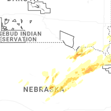
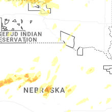
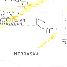
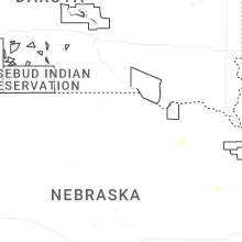
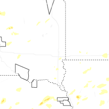
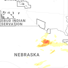
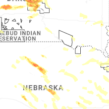

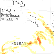


Connect with Interactive Hail Maps