

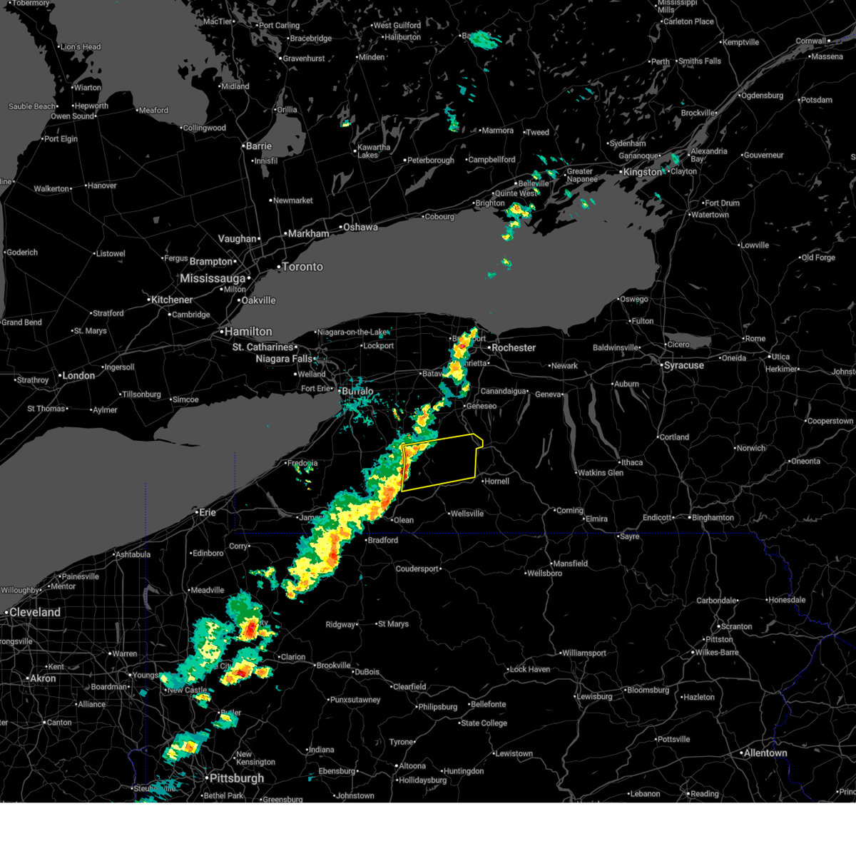
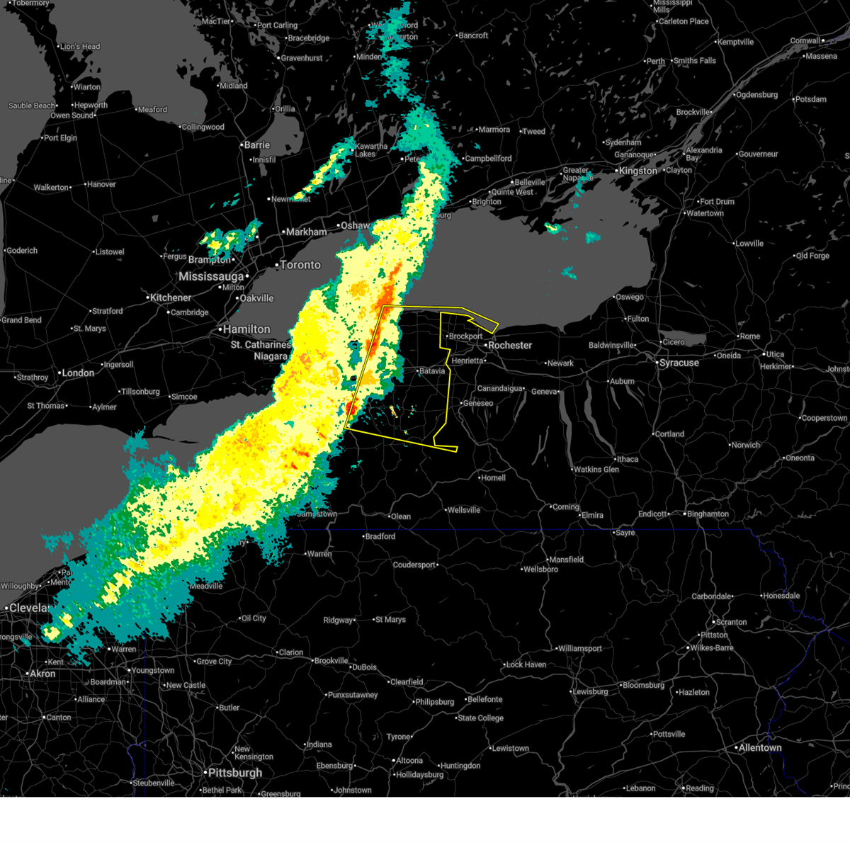
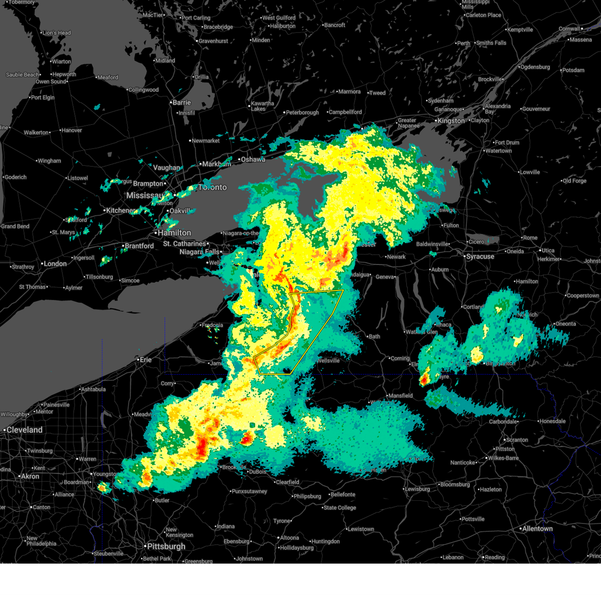
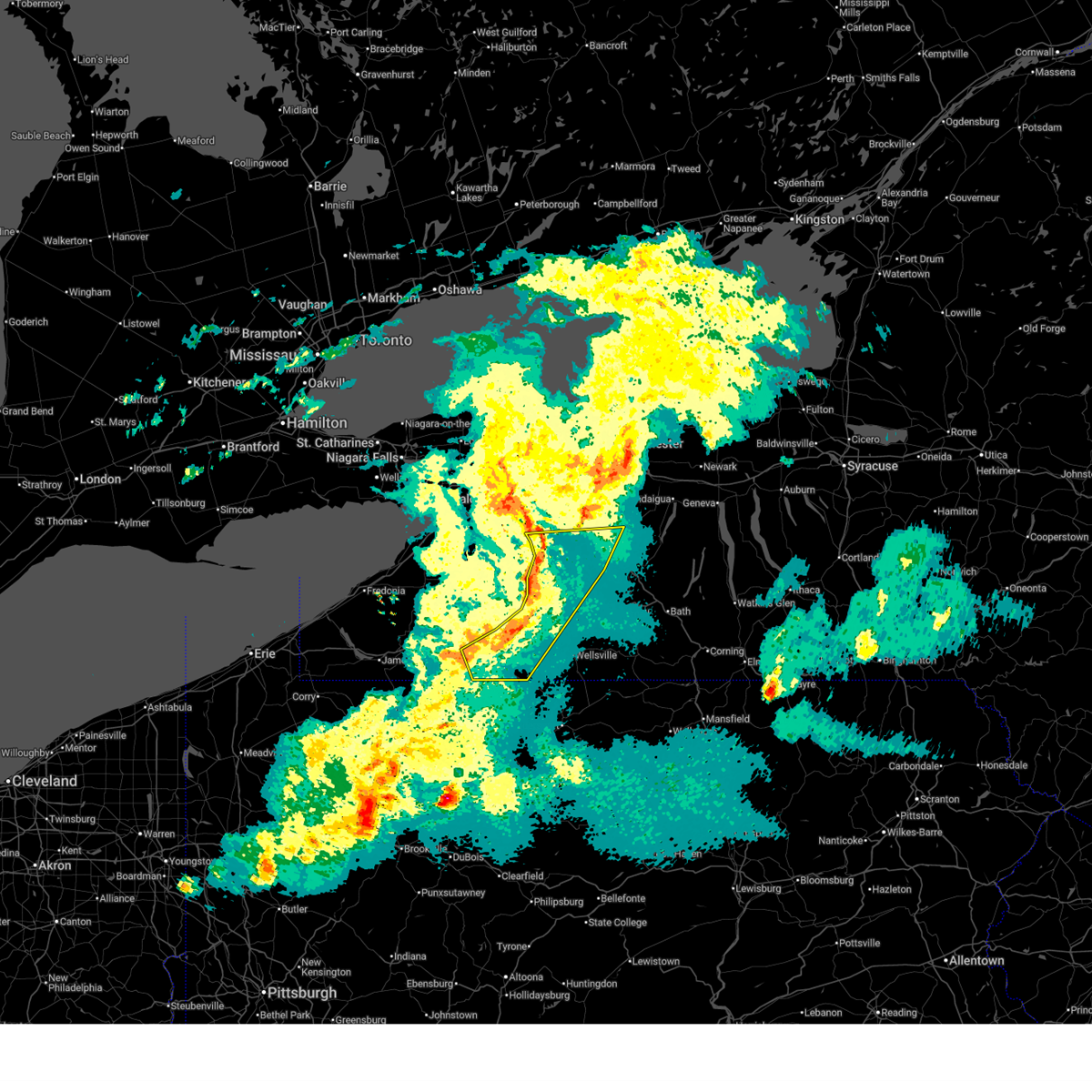
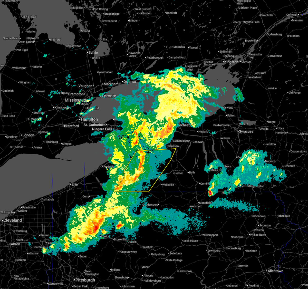
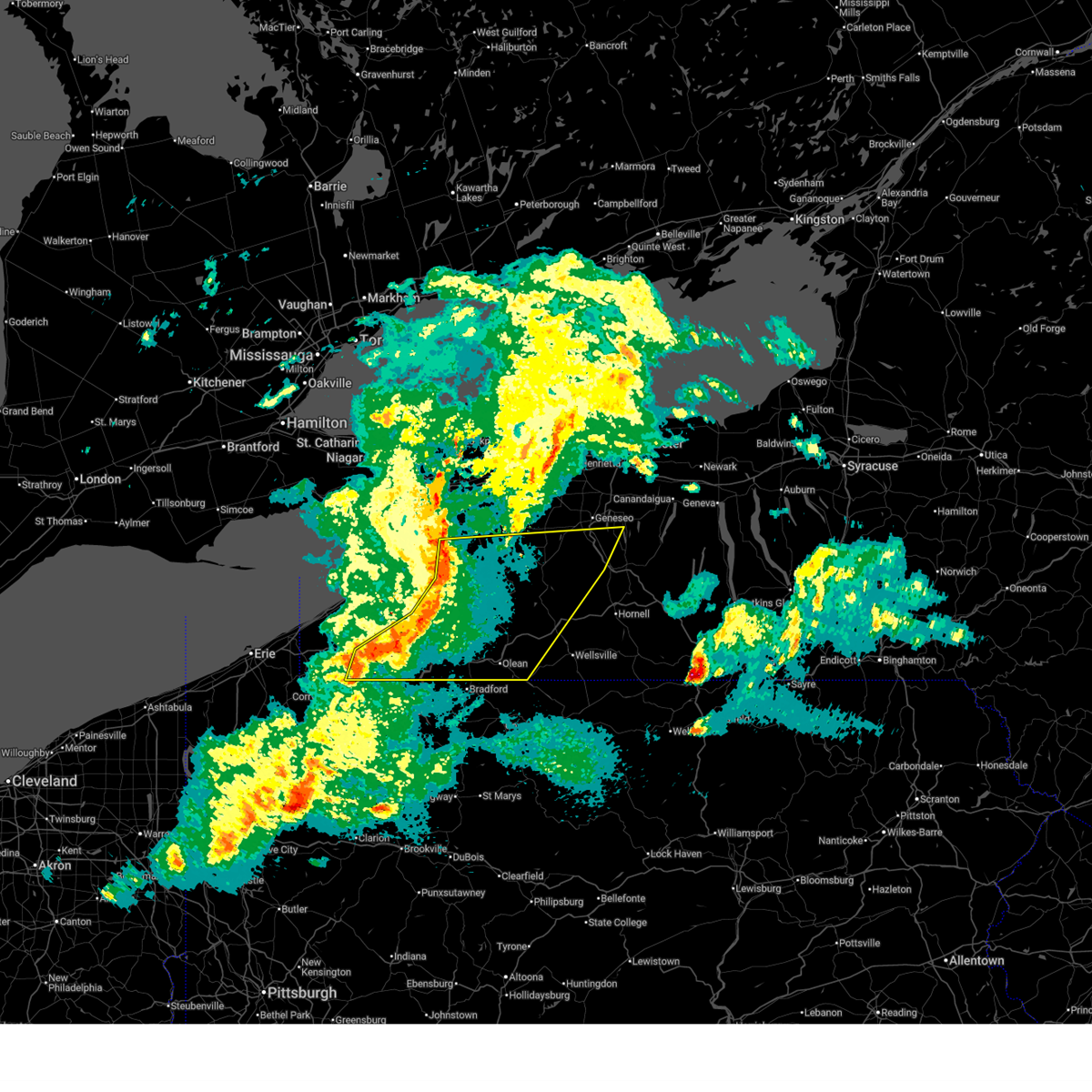
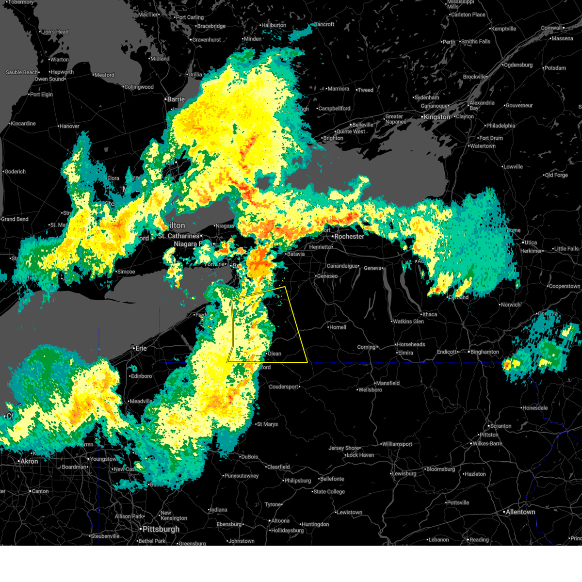
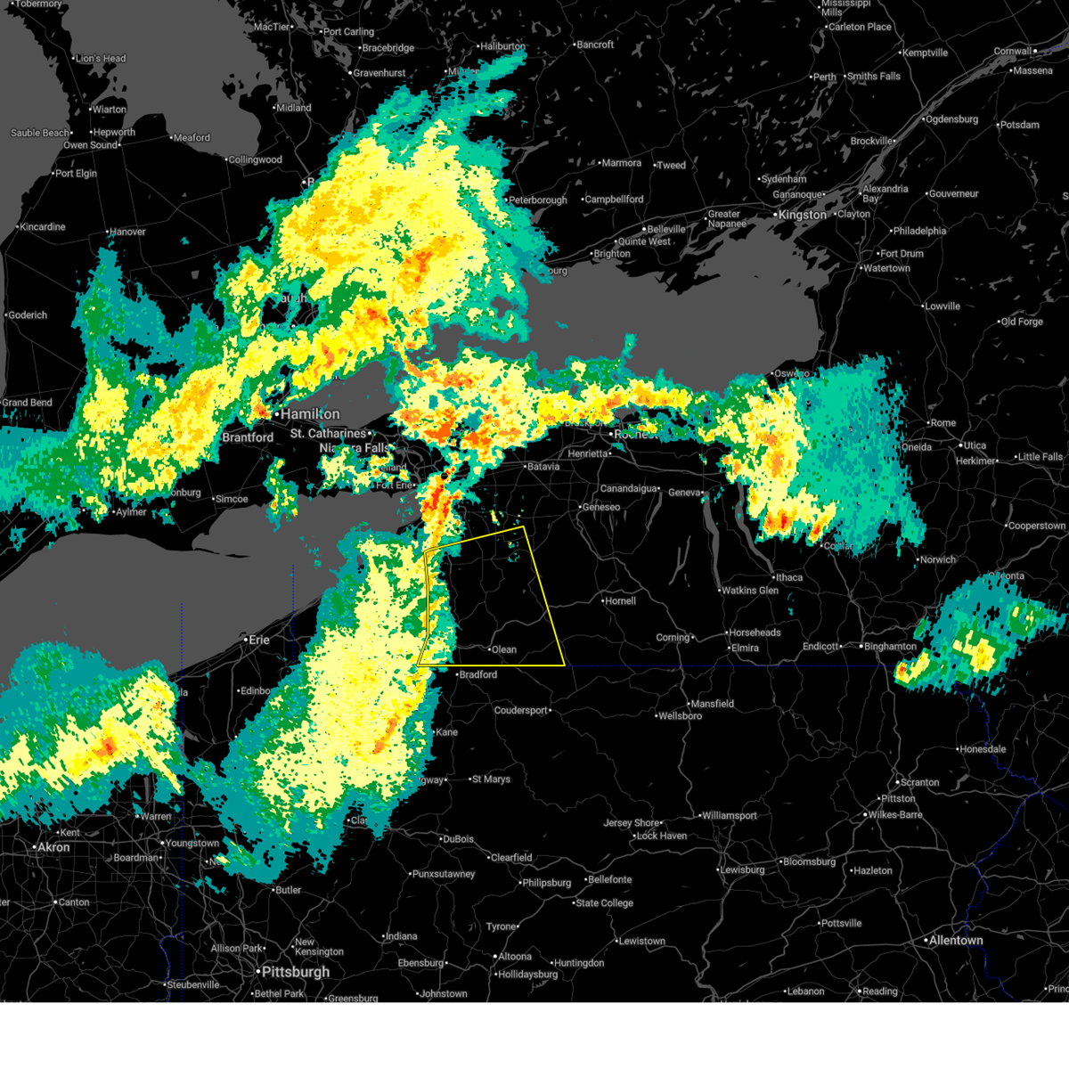
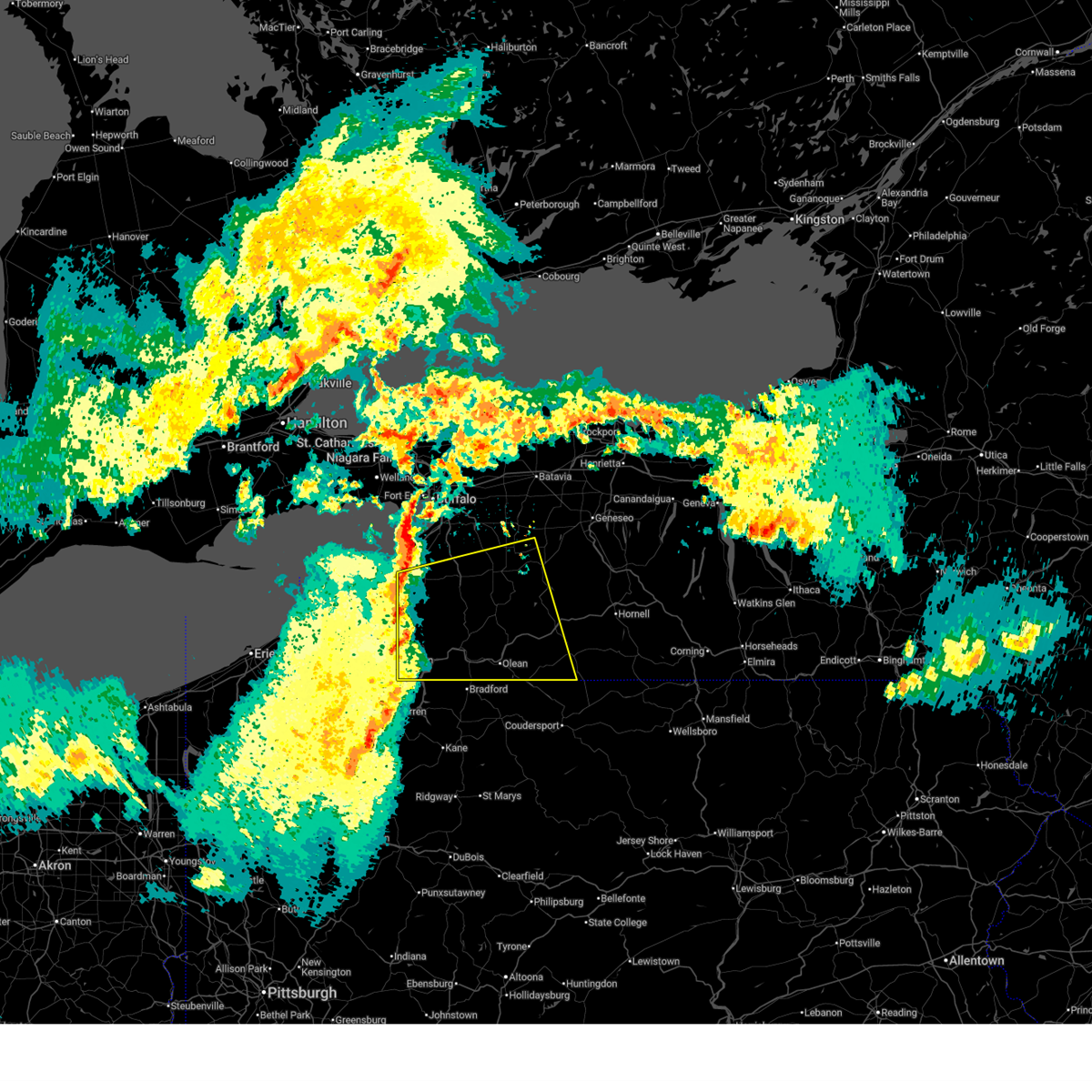
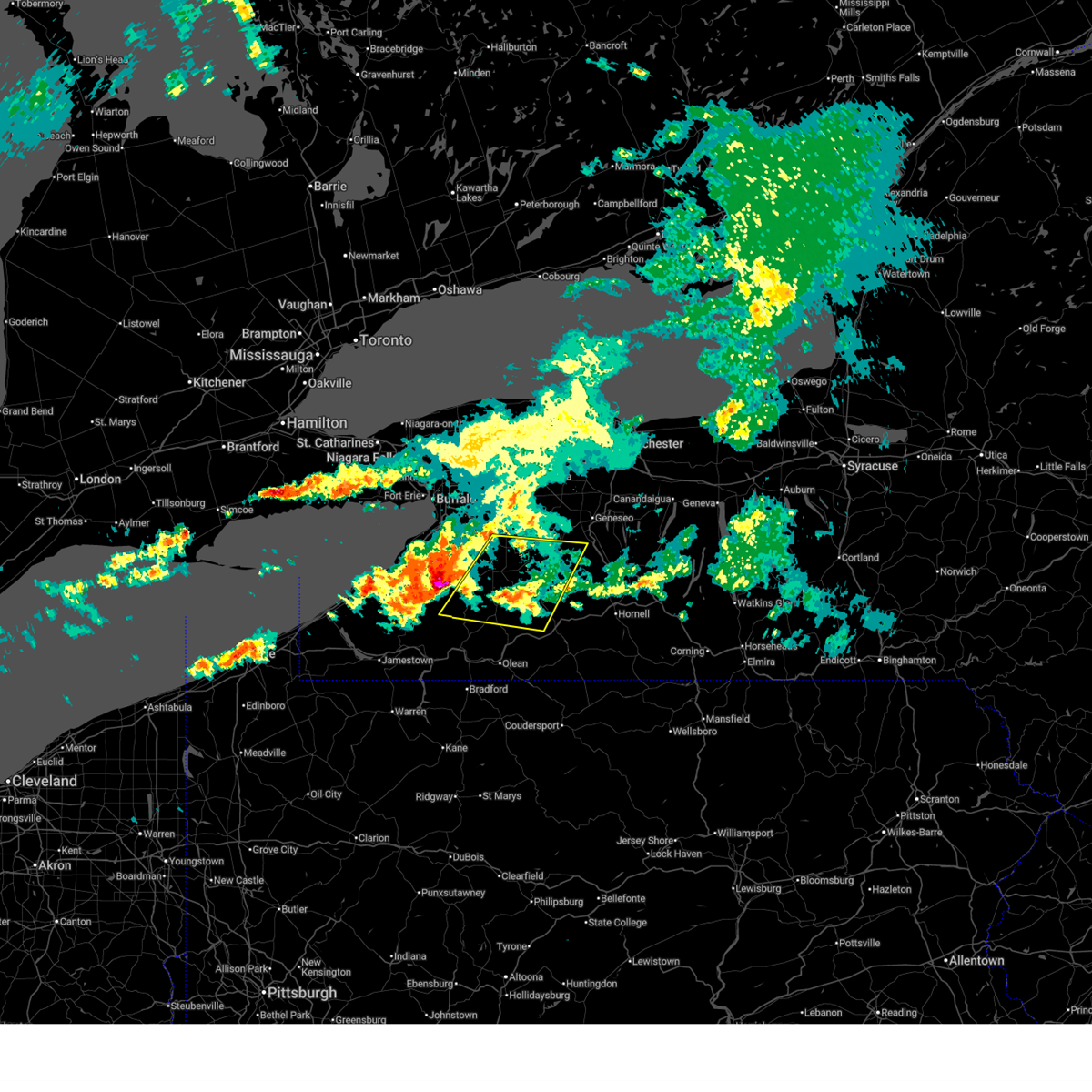
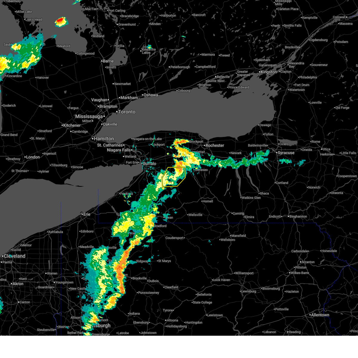
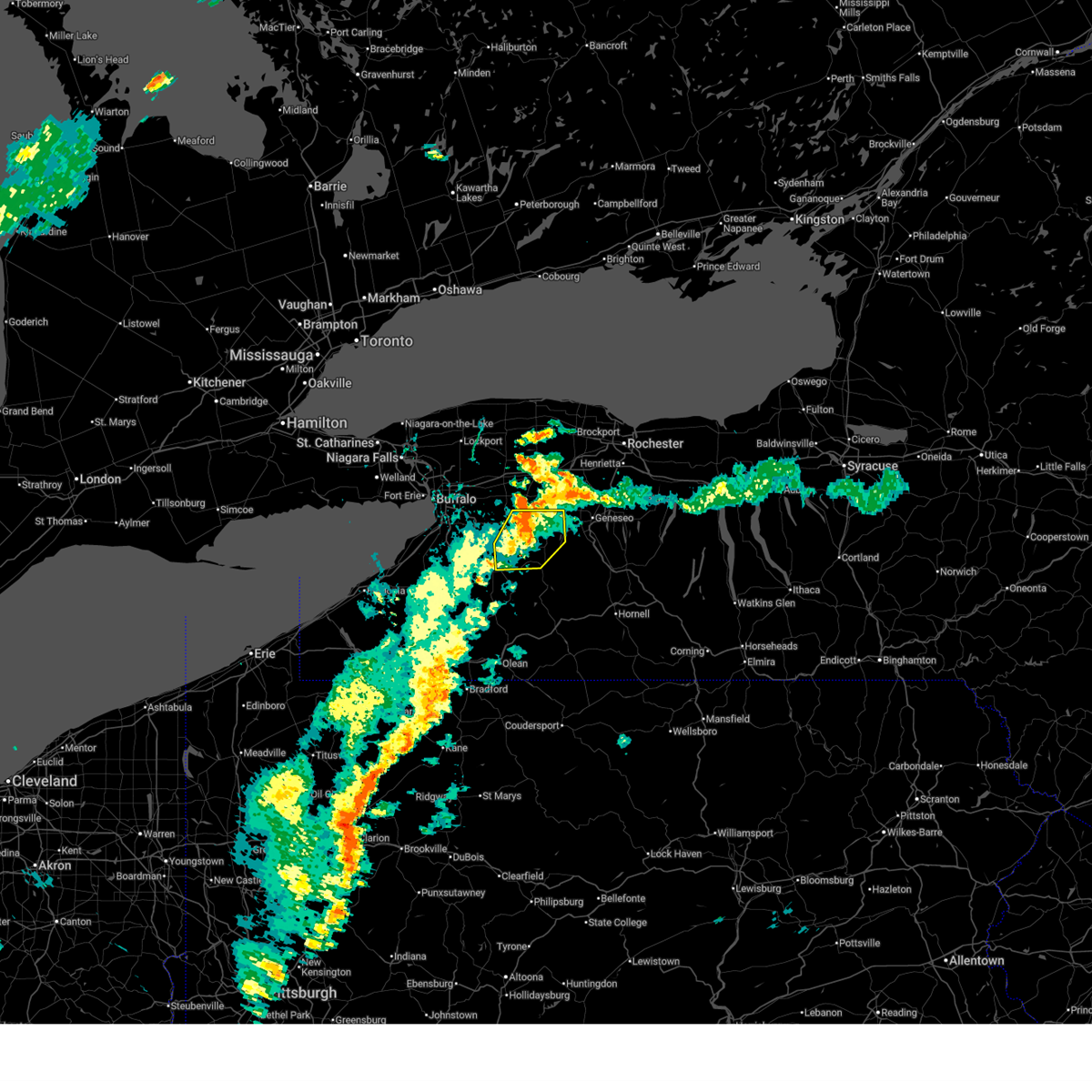
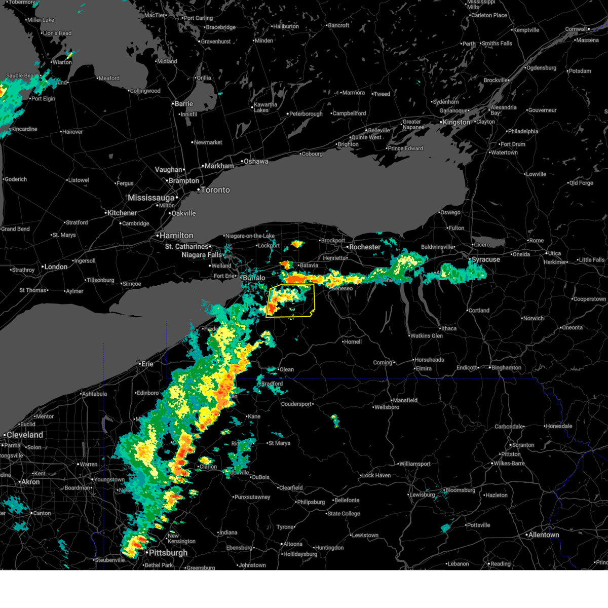
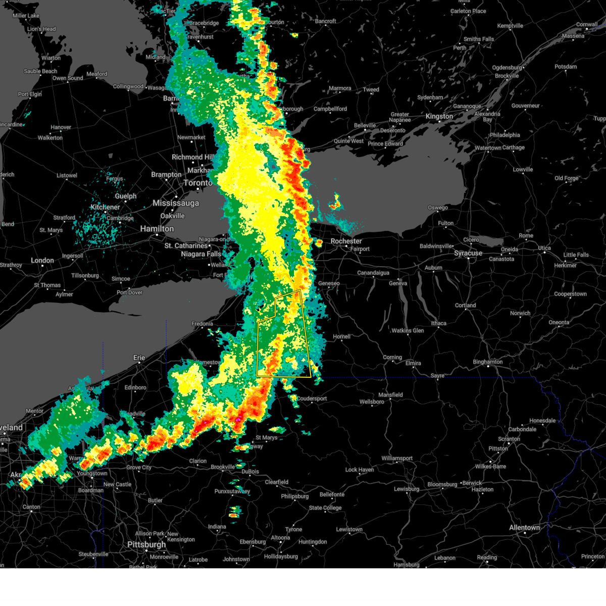
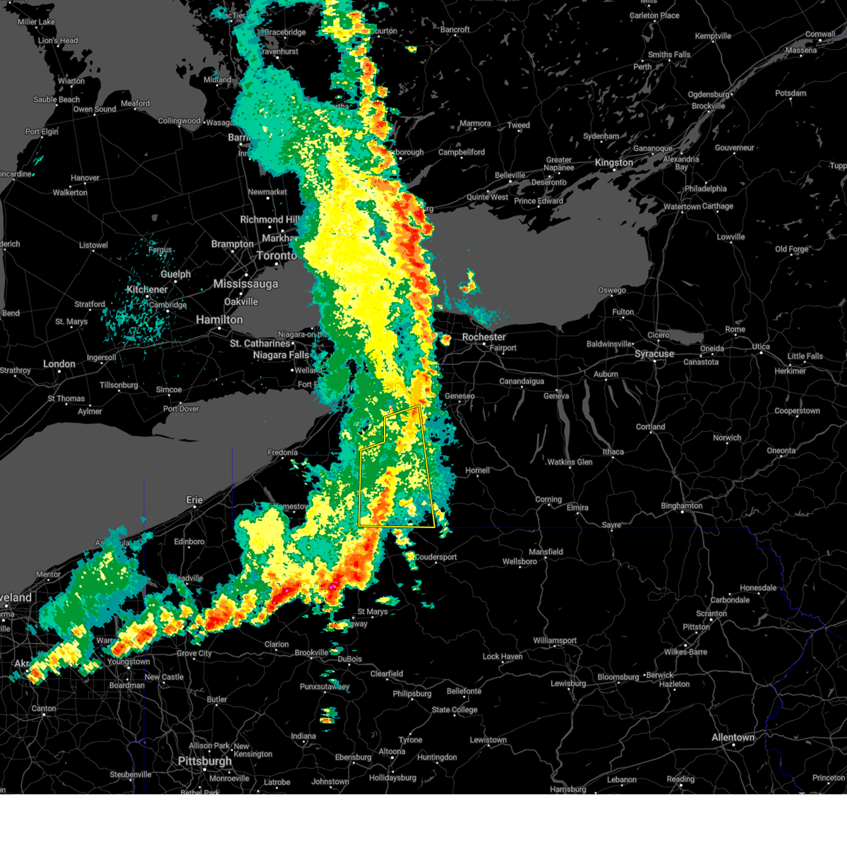
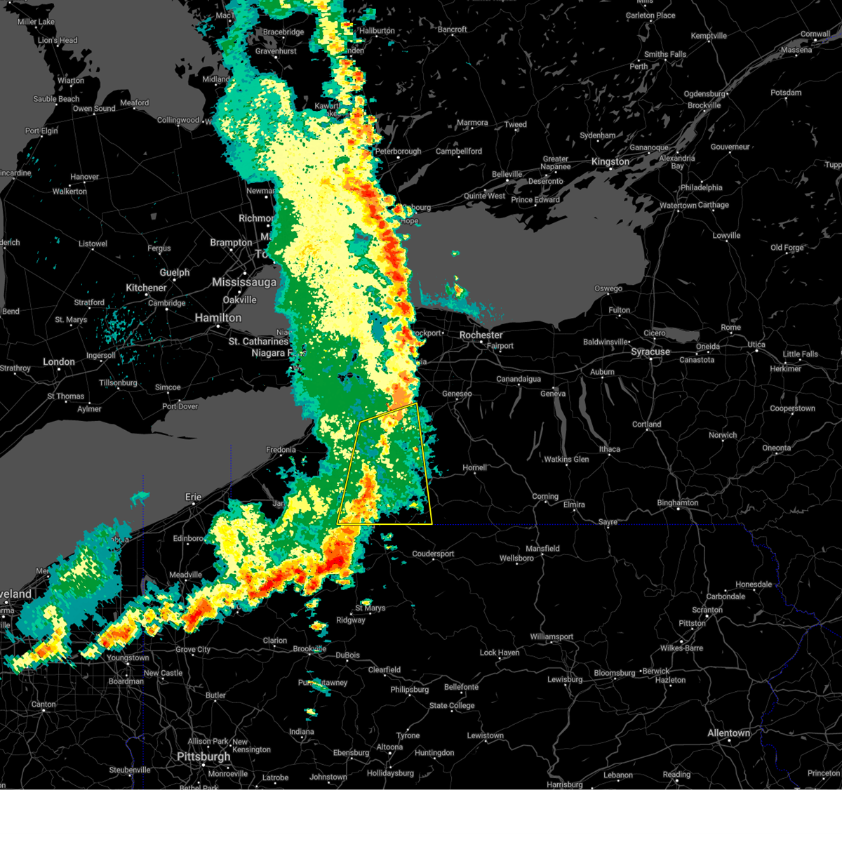
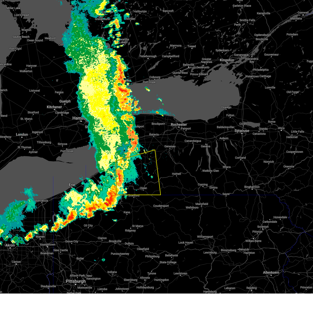
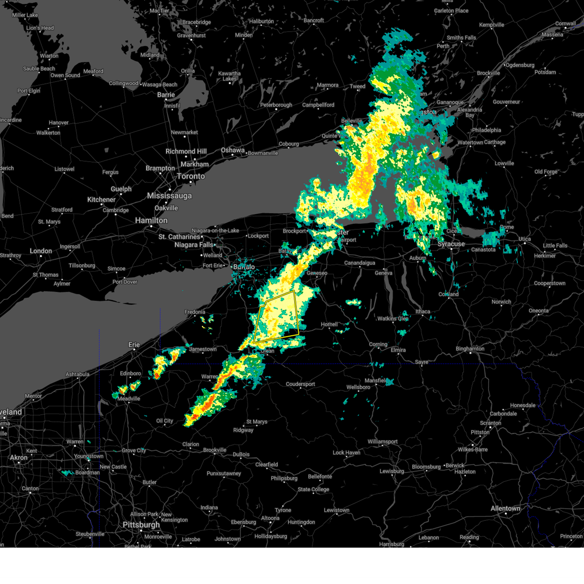
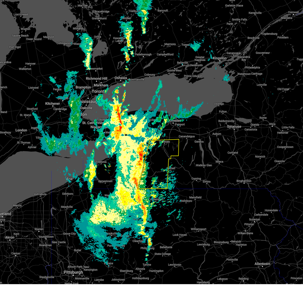
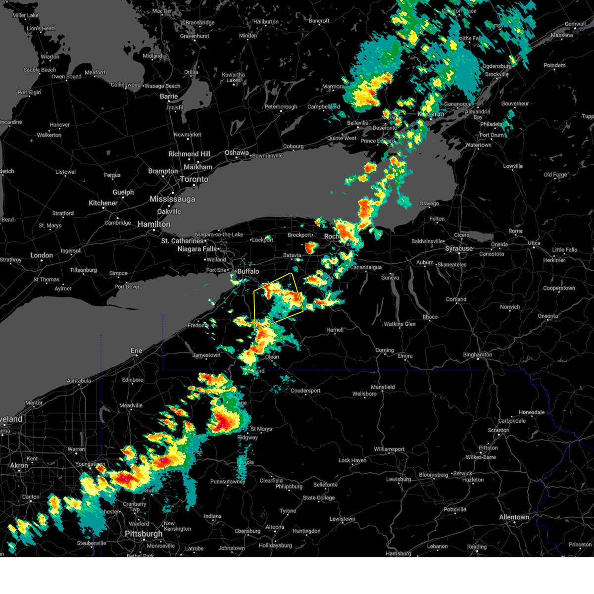
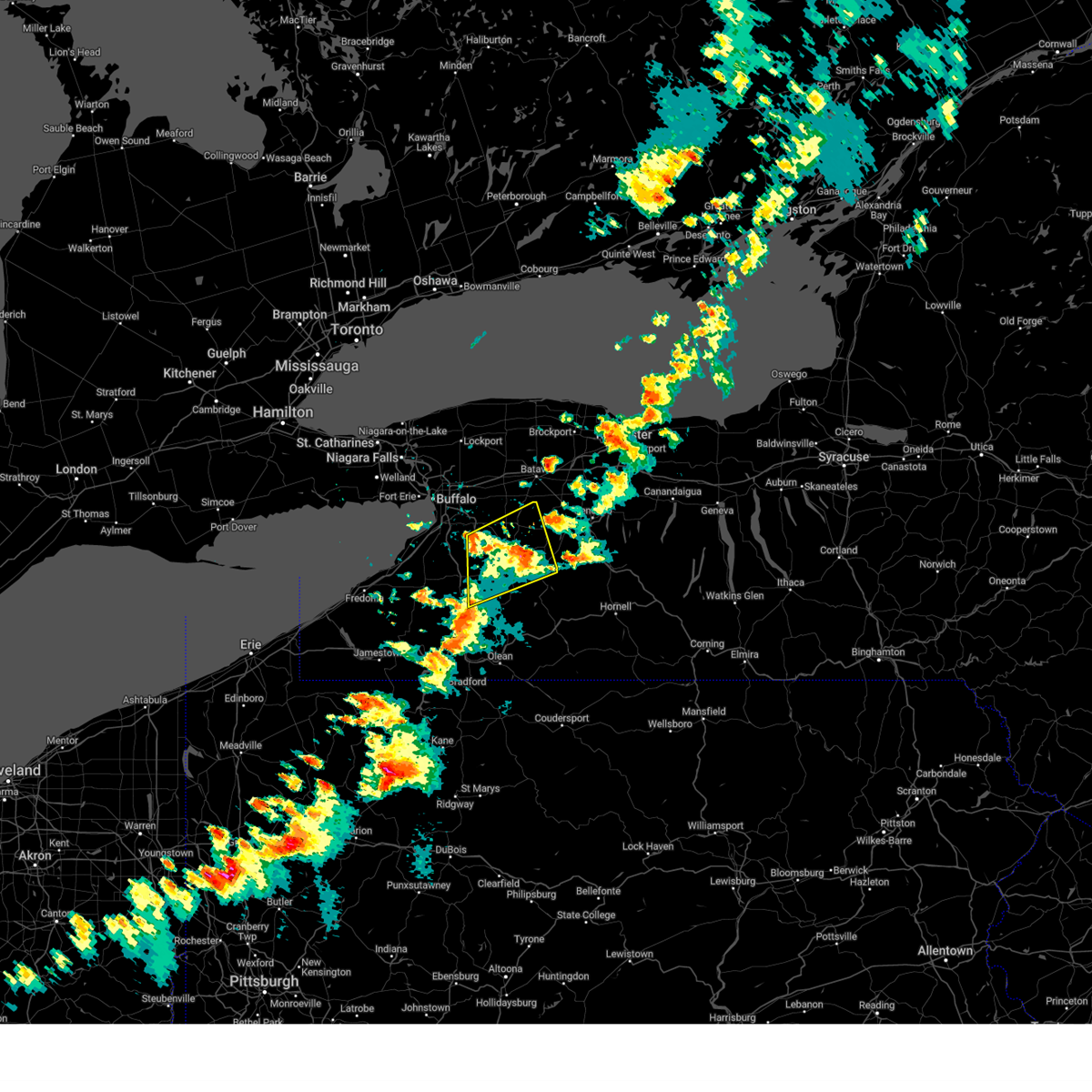
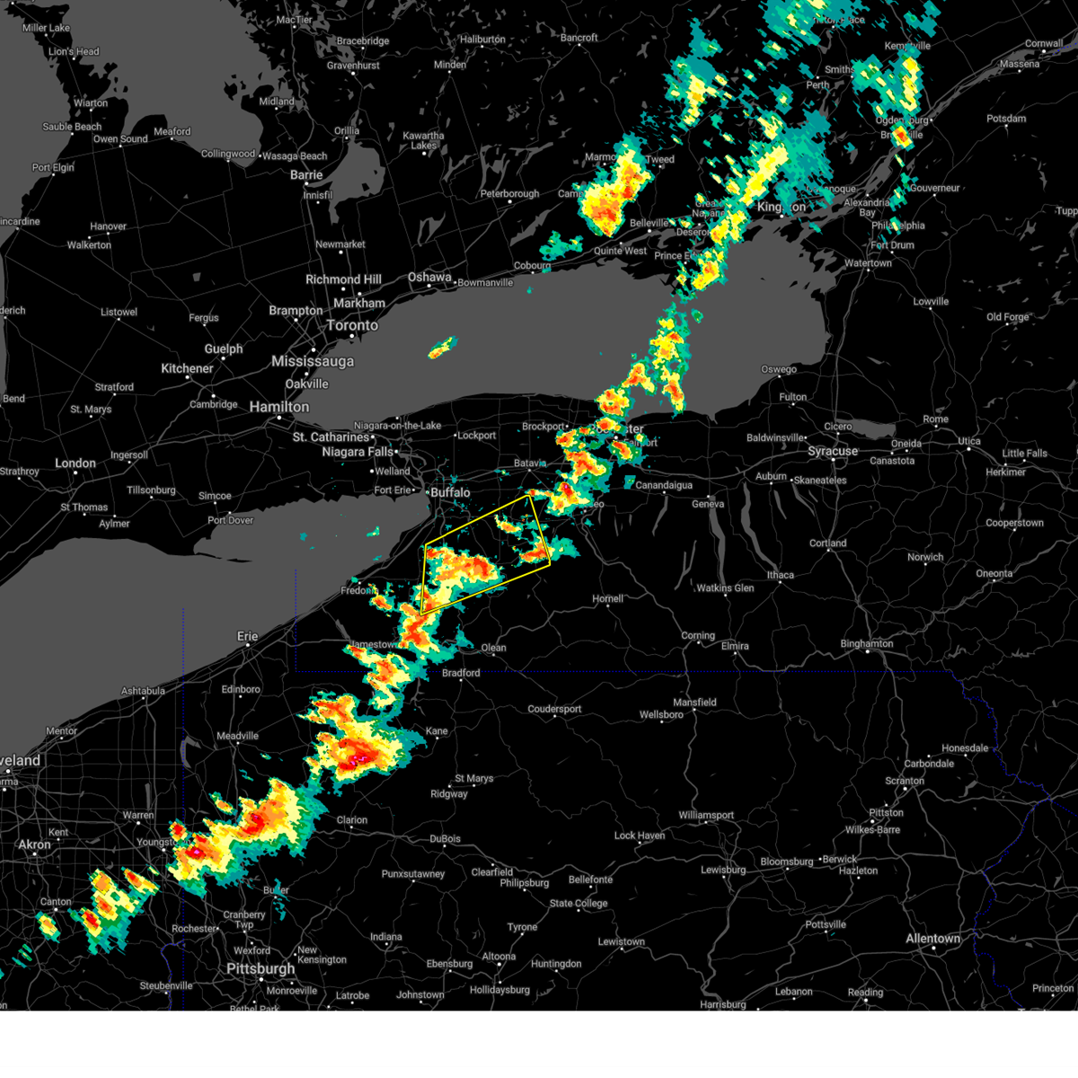
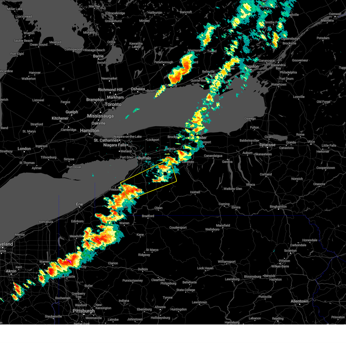
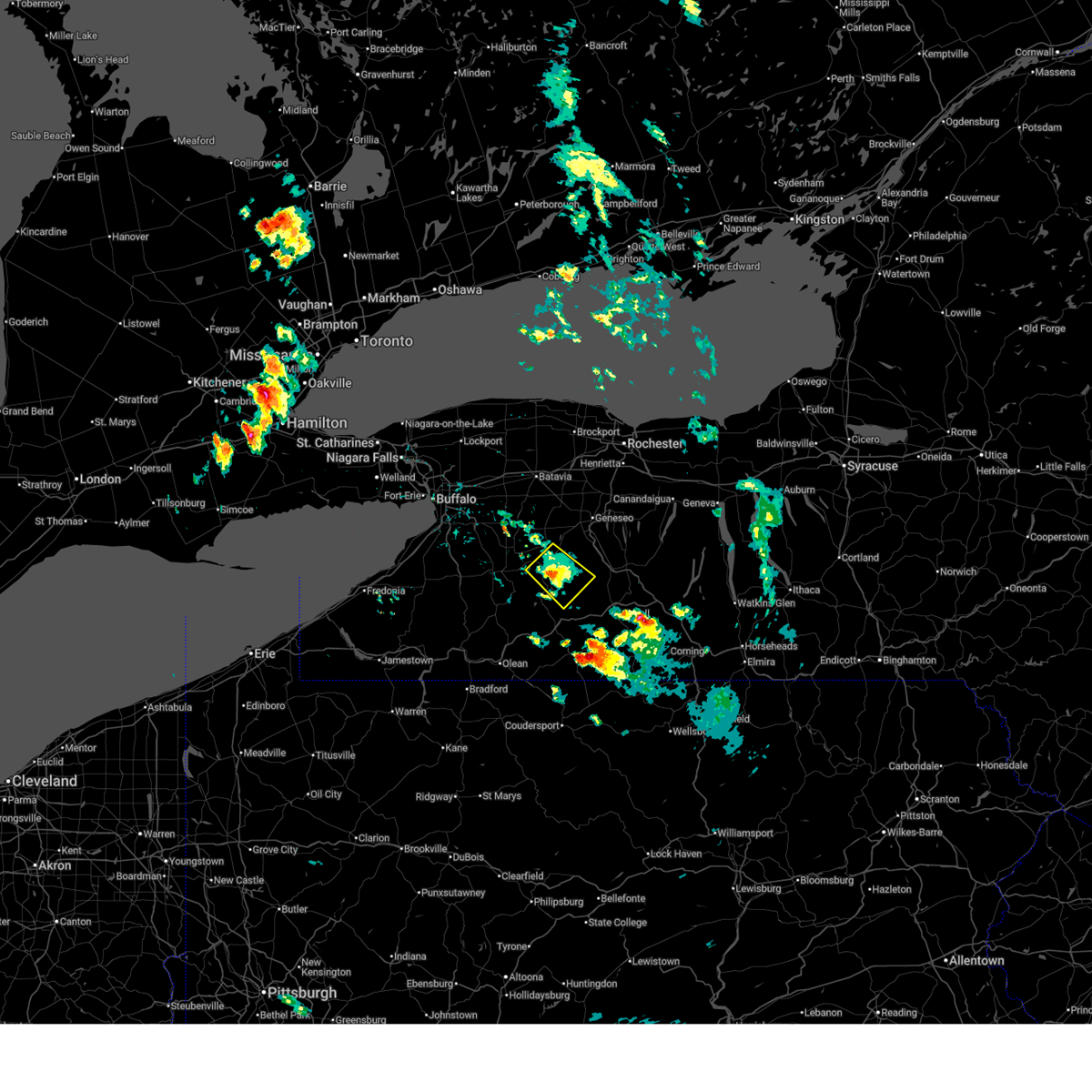
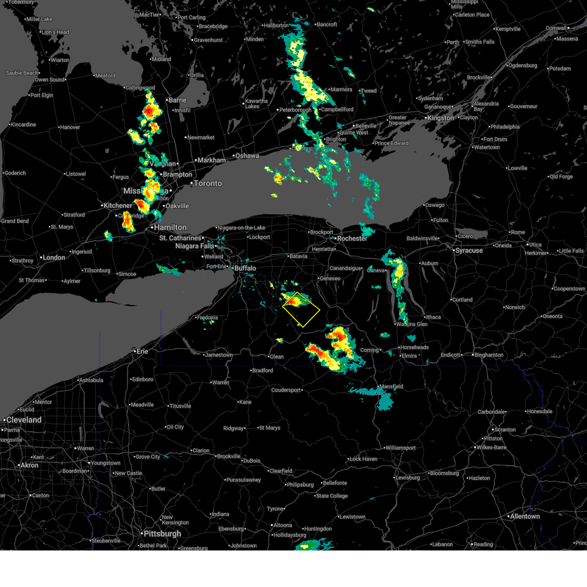
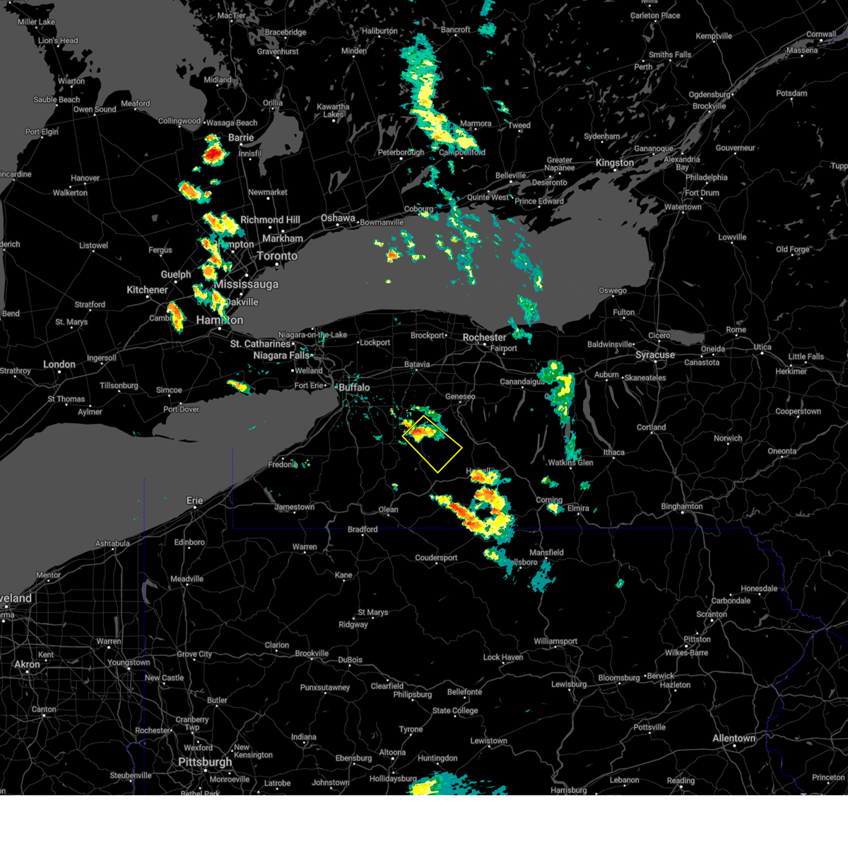
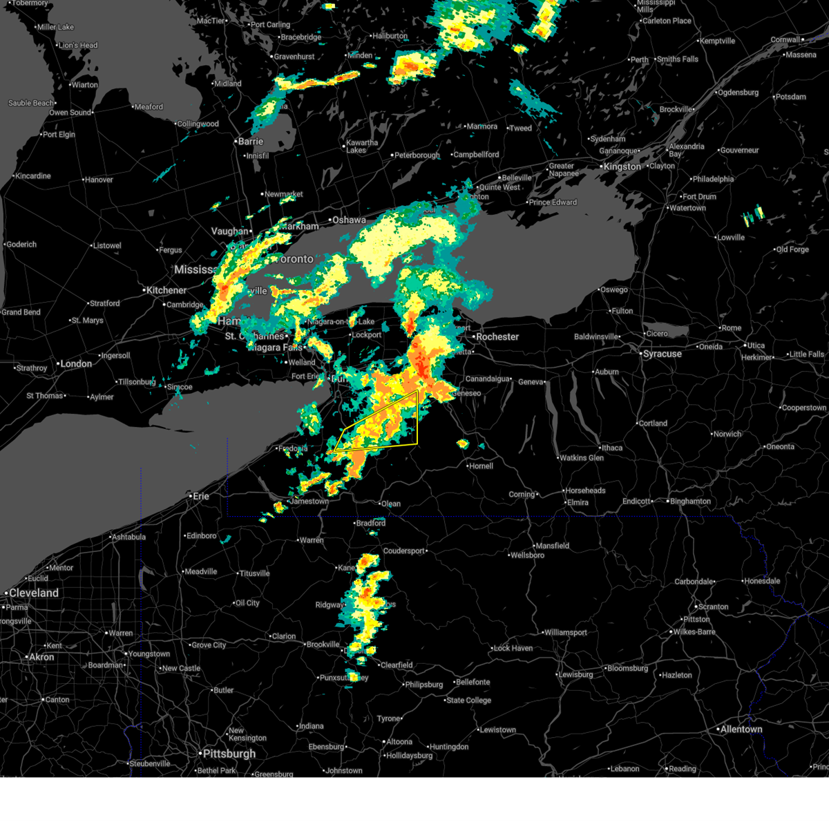
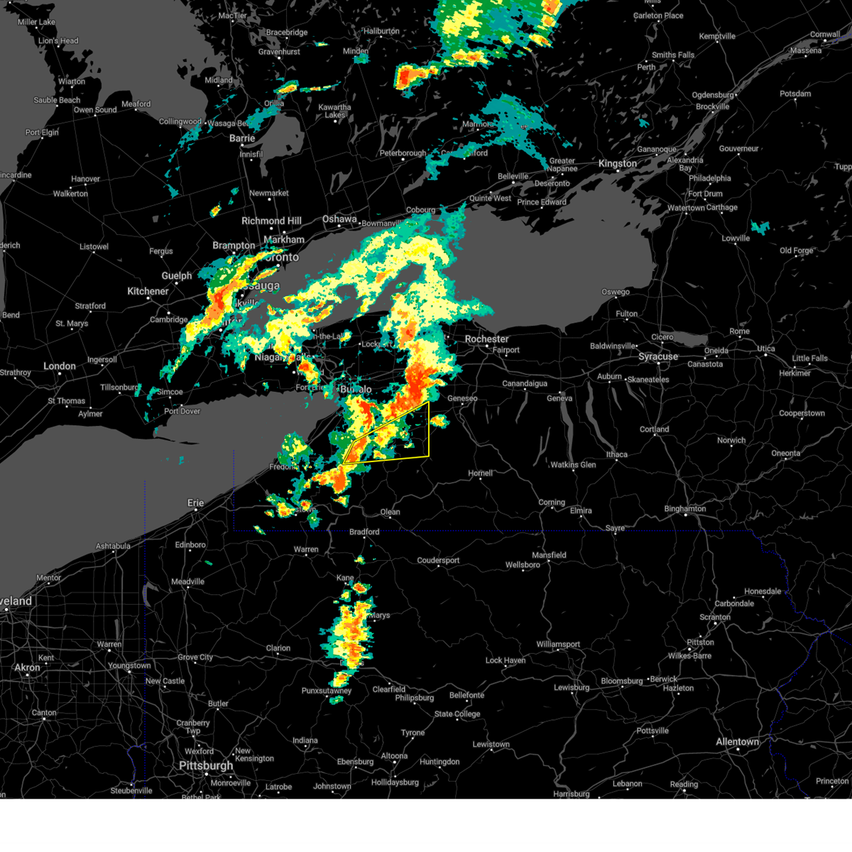
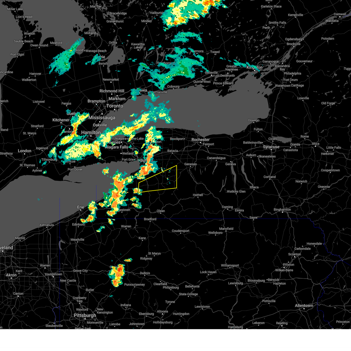
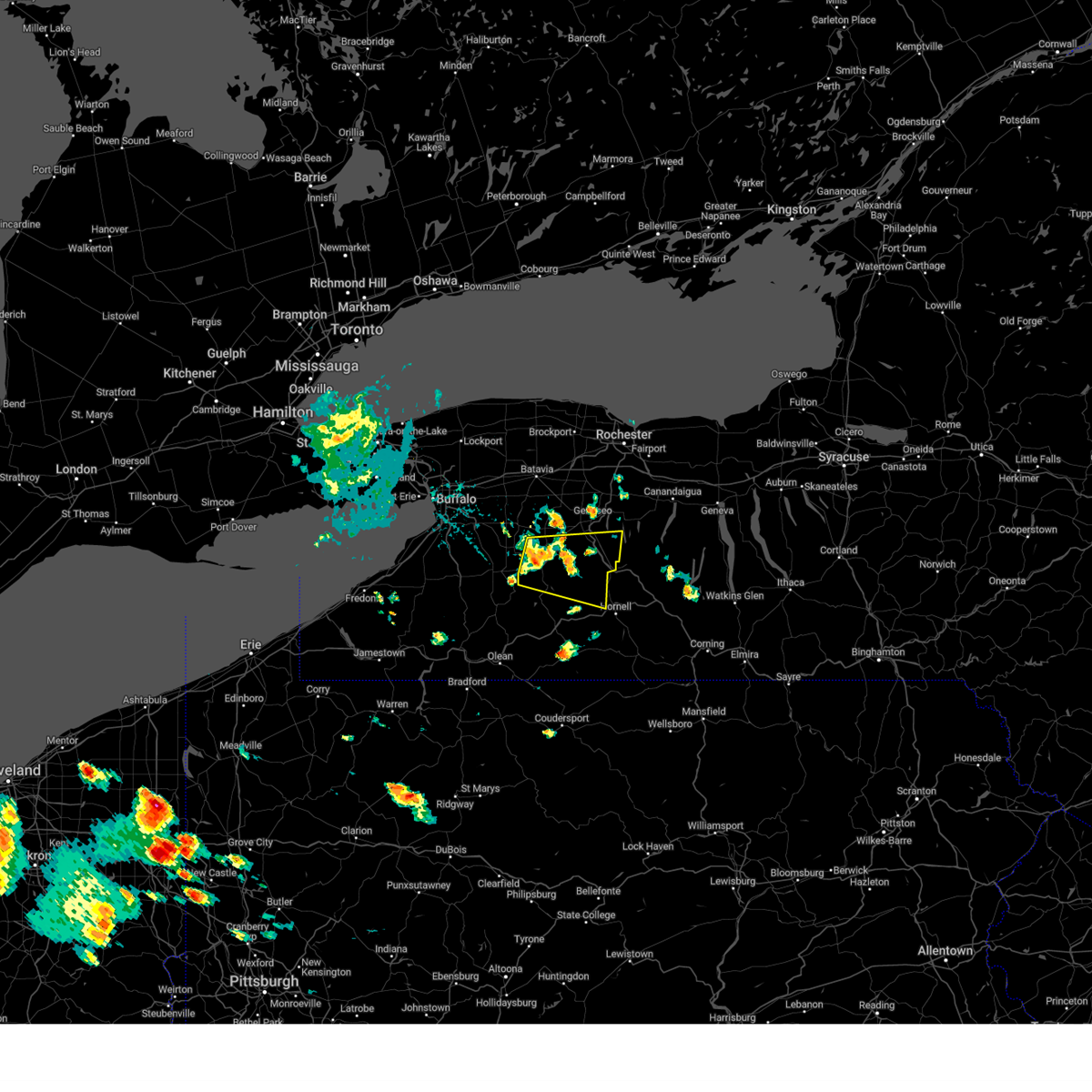
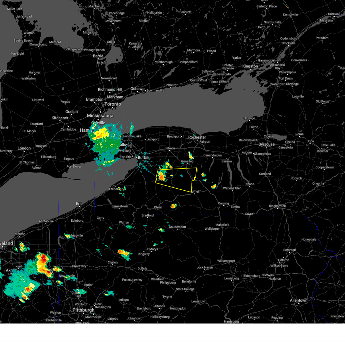
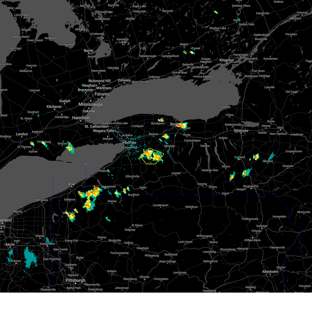
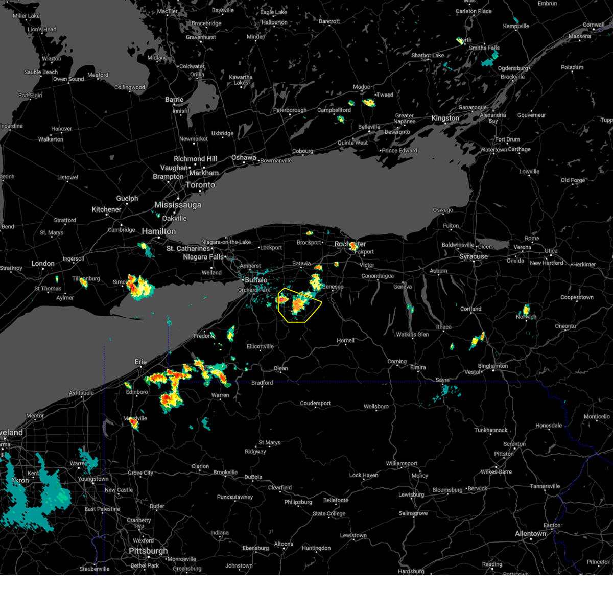
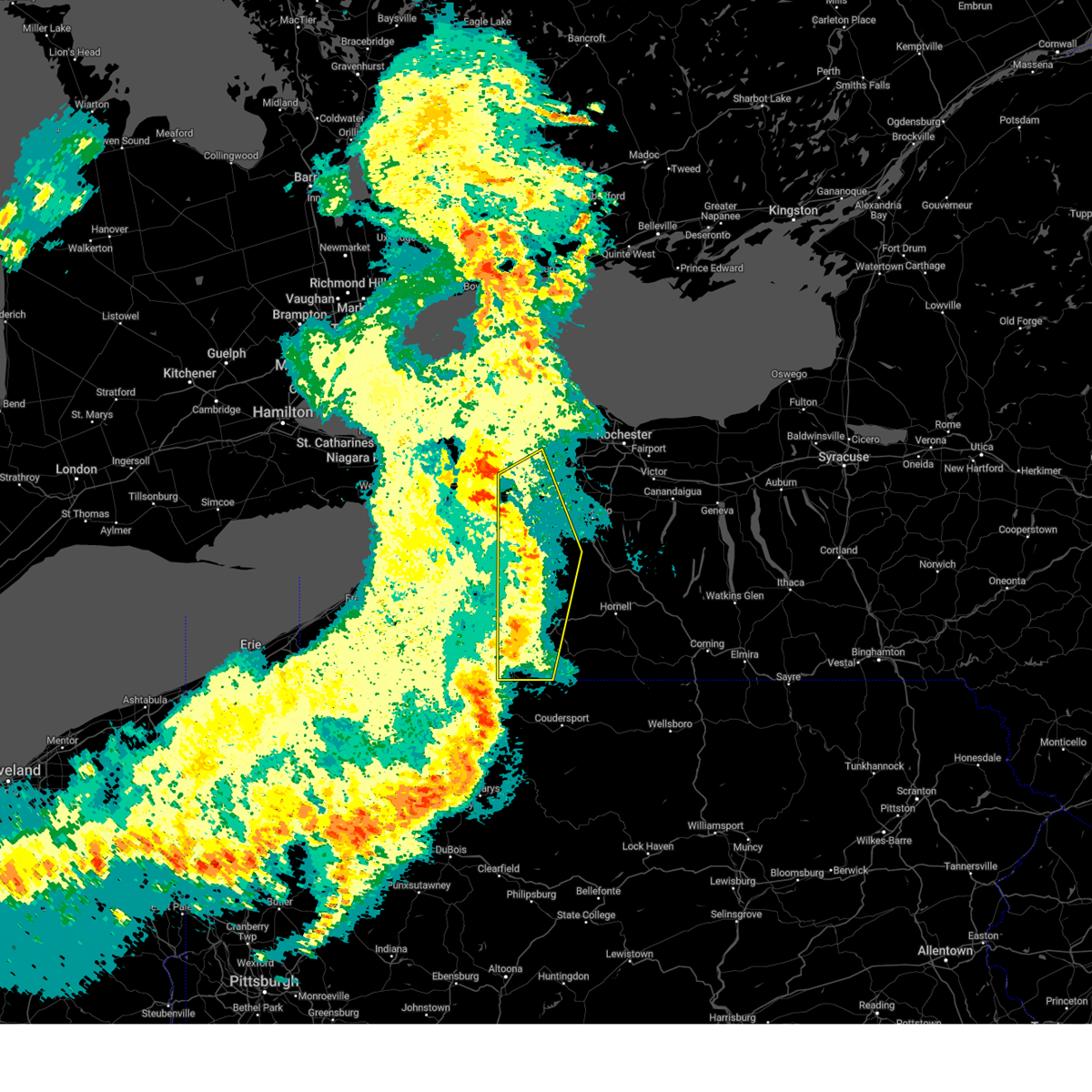
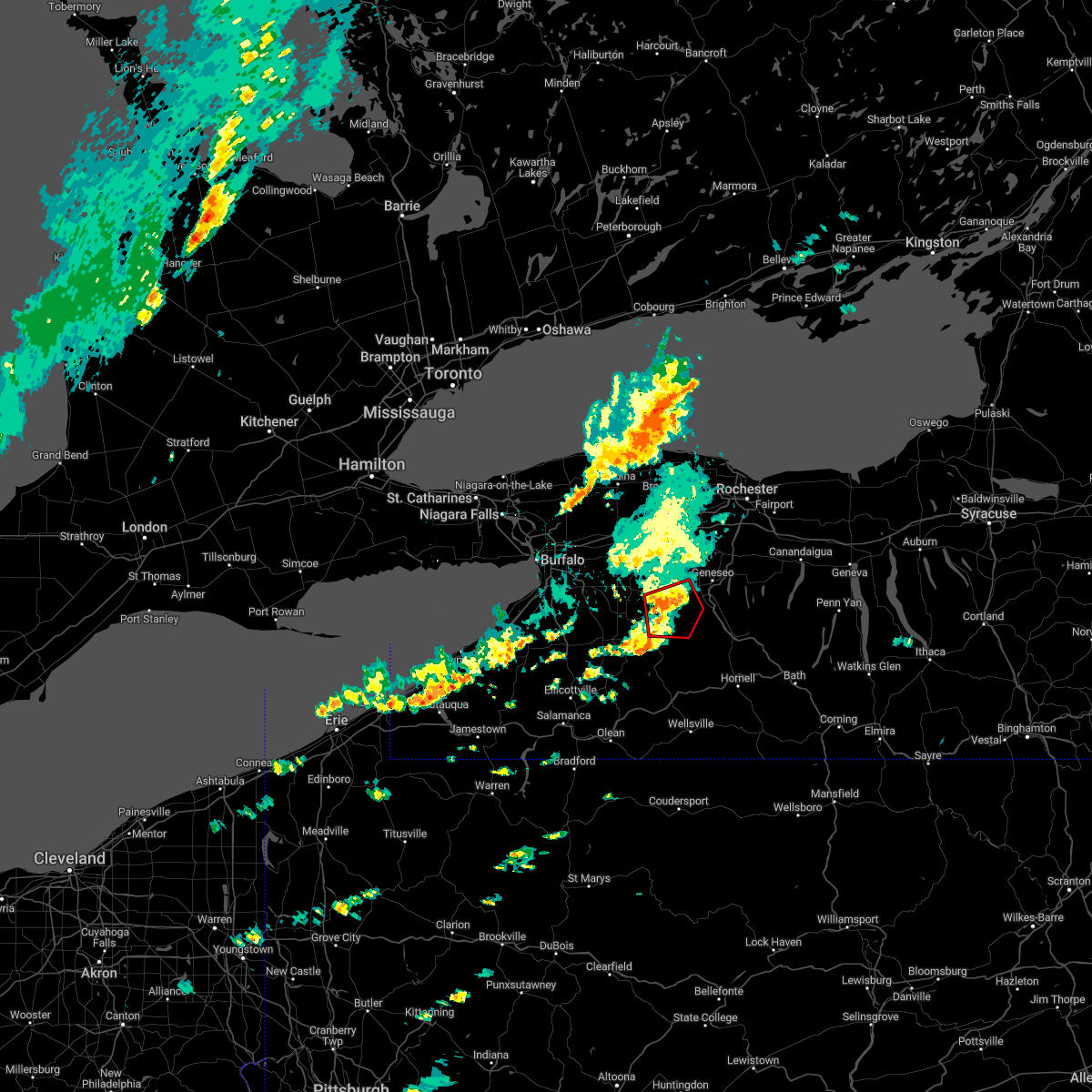
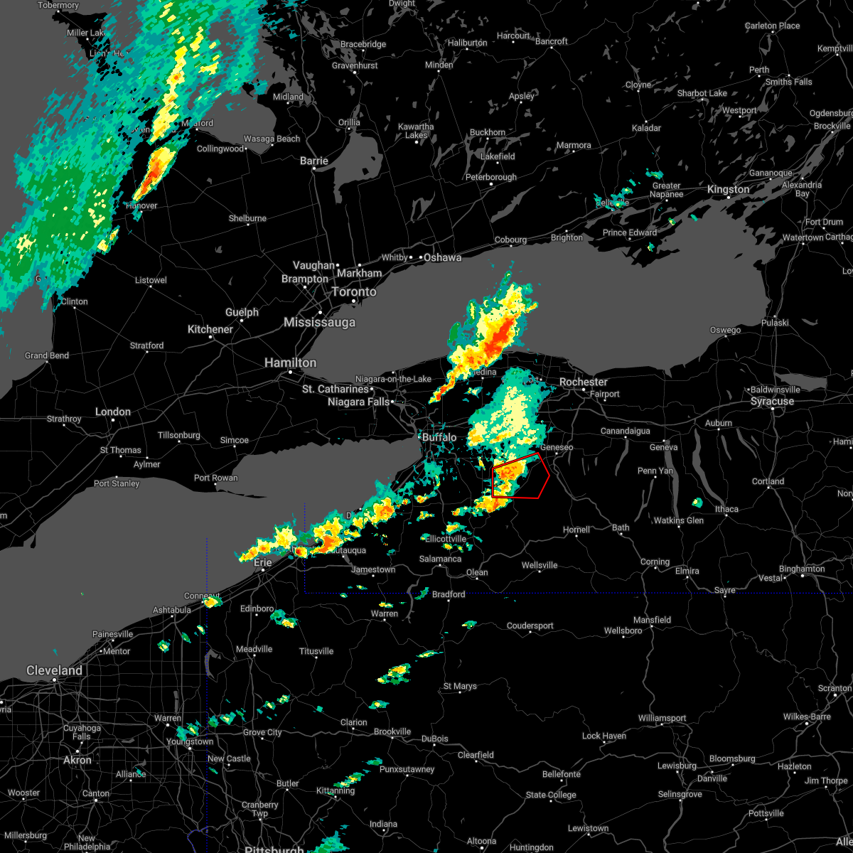
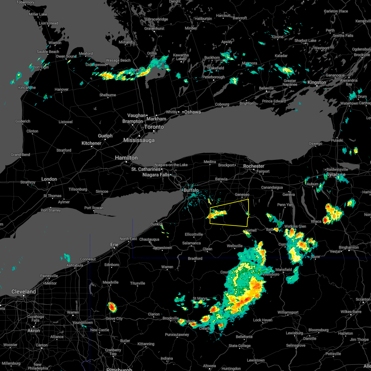
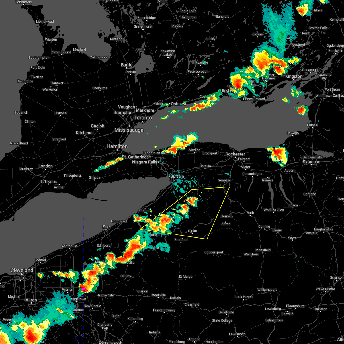
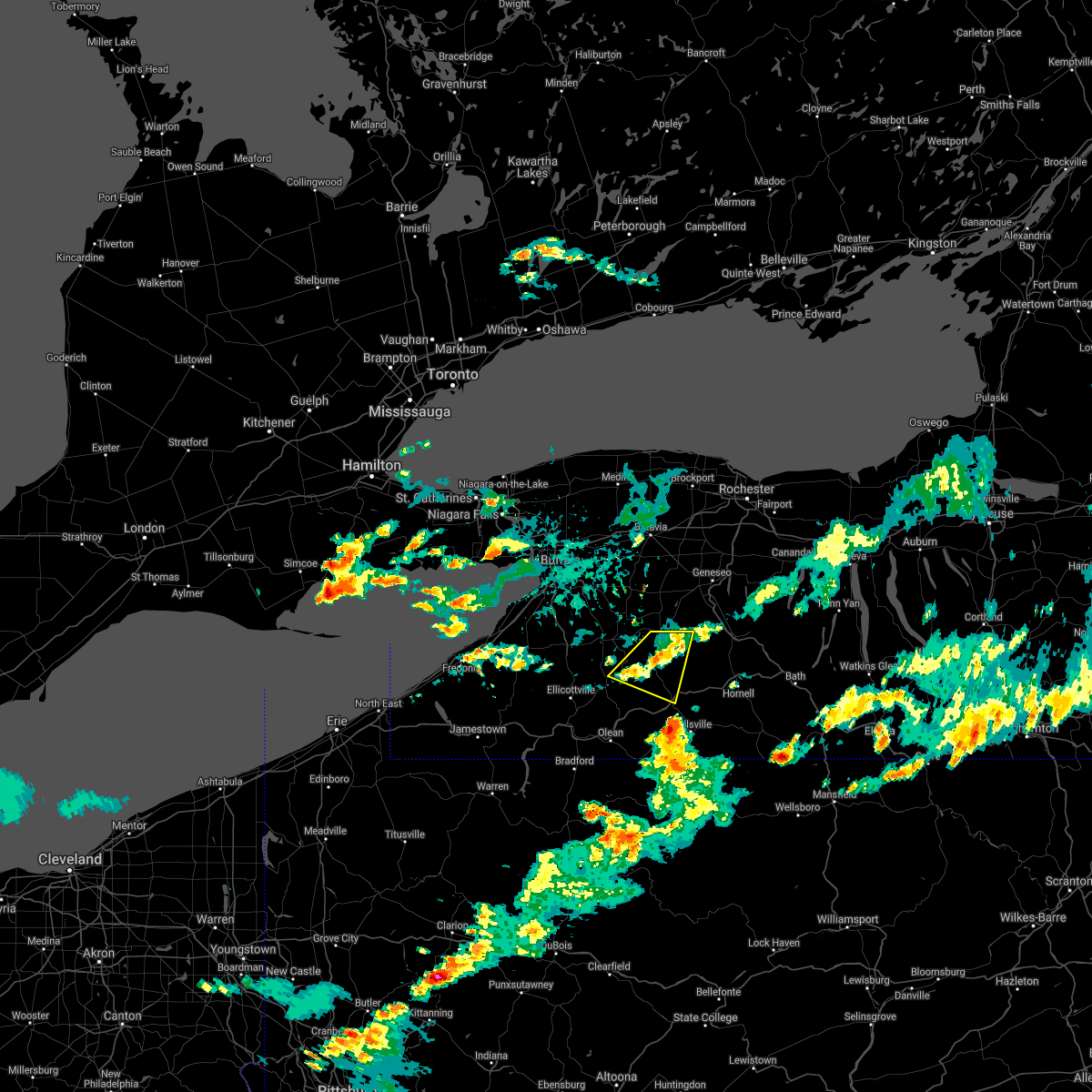
Hail Map for Pike, NY
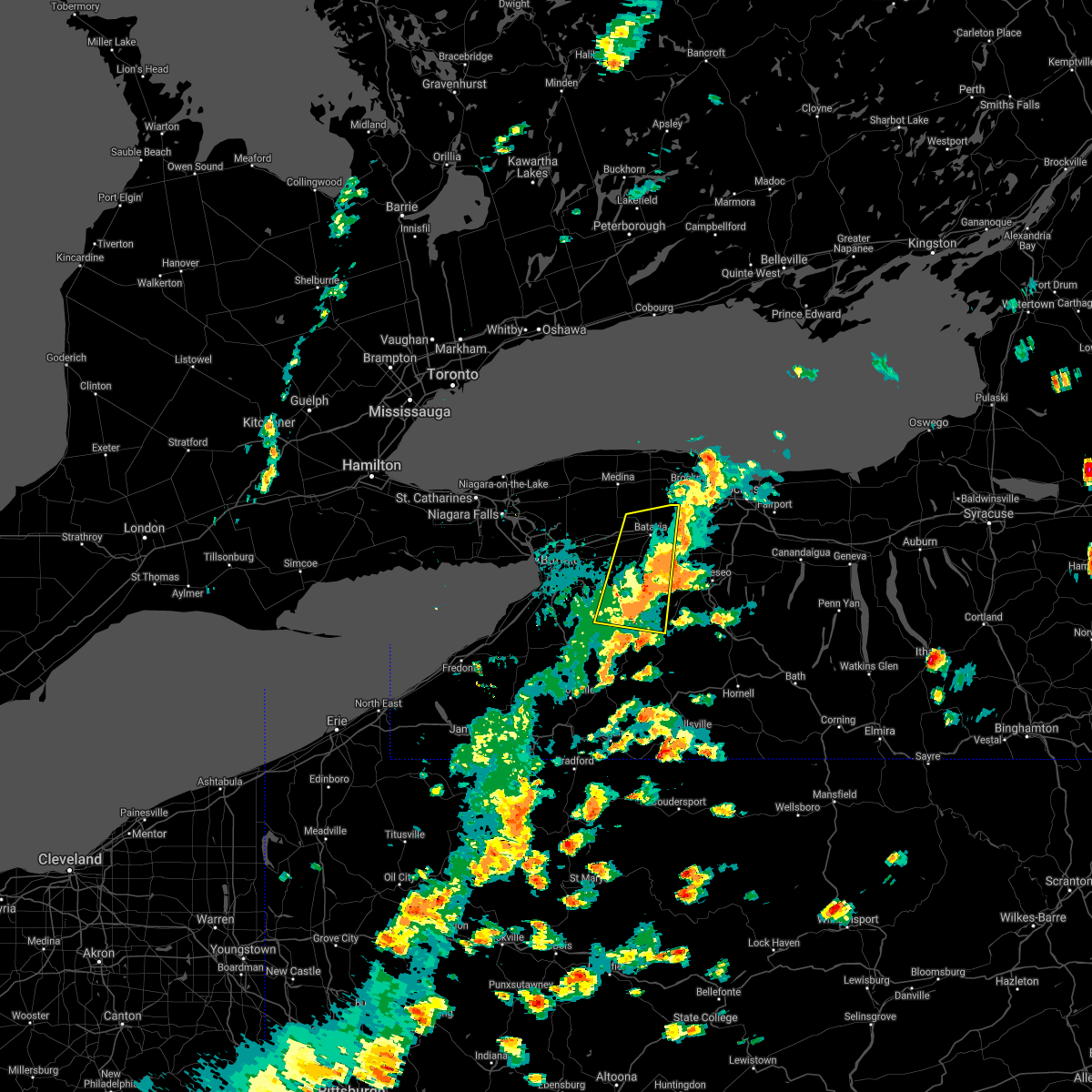
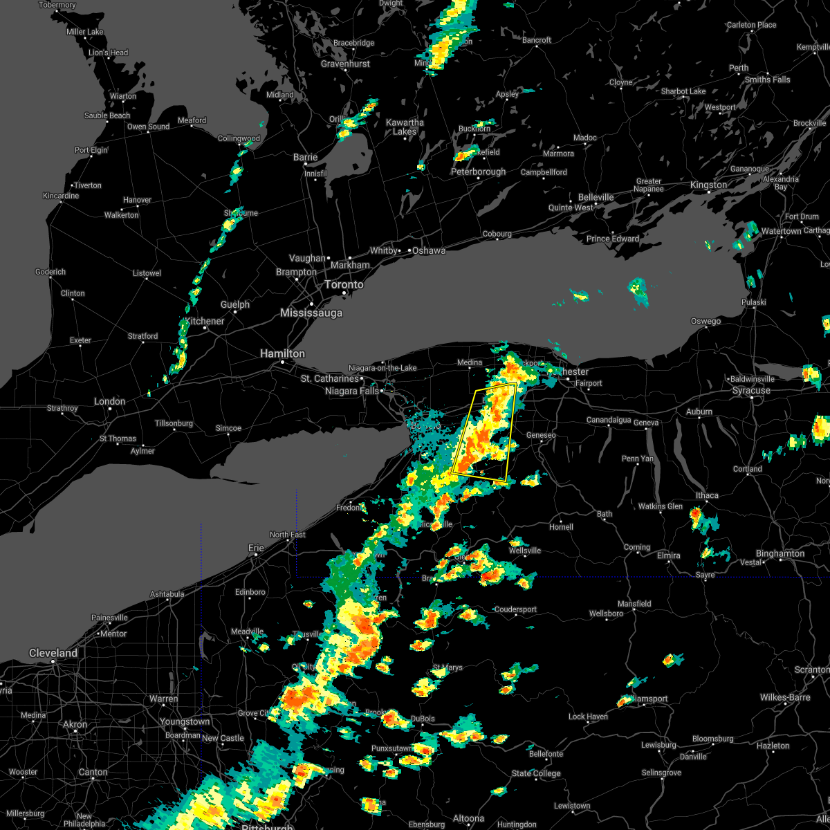
The Pike, NY area has had 0 reports of on-the-ground hail by trained spotters, and has been under severe weather warnings 12 times during the past 12 months. Doppler radar has detected hail at or near Pike, NY on 17 occasions.
| Name: | Pike, NY |
| Where Located: | 43.6 miles ESE of Buffalo, NY |
| Map: | Google Map for Pike, NY |
| Population: | 371 |
| Housing Units: | 145 |
| More Info: | Search Google for Pike, NY |
5
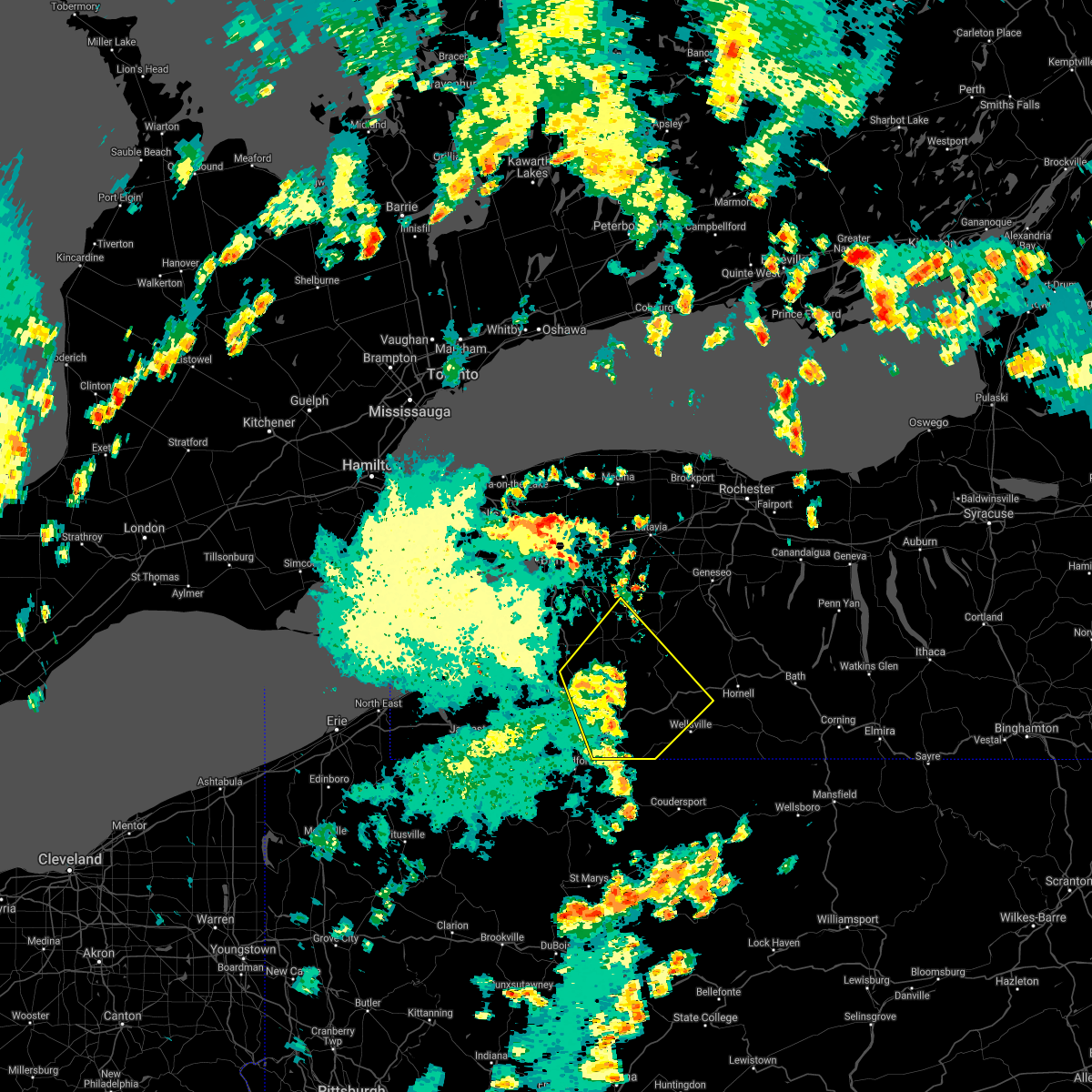
The Top Recent Hail Date for Pike, NY is Saturday, September 21, 2024 (1st out of 17)

Hail and Wind Damage Spotted near Pike, NY
| Date / Time | Report Details |
|---|---|
| 5/13/2026 2:11 PM EDT |
 Svrbuf the national weather service in buffalo has issued a * severe thunderstorm warning for, southeastern wyoming county in western new york, east central cattaraugus county in western new york, southwestern livingston county in western new york, northern allegany county in western new york, * until 315 pm edt. * at 210 pm edt, a severe thunderstorm was located over rushford, or 21 miles north of olean, moving east at 30 mph (radar indicated). Hazards include 60 mph wind gusts and penny size hail. expect damage to roofs, siding, and trees Svrbuf the national weather service in buffalo has issued a * severe thunderstorm warning for, southeastern wyoming county in western new york, east central cattaraugus county in western new york, southwestern livingston county in western new york, northern allegany county in western new york, * until 315 pm edt. * at 210 pm edt, a severe thunderstorm was located over rushford, or 21 miles north of olean, moving east at 30 mph (radar indicated). Hazards include 60 mph wind gusts and penny size hail. expect damage to roofs, siding, and trees
|
| 5/9/2026 7:09 PM EDT |
 Svrbuf the national weather service in buffalo has issued a * severe thunderstorm warning for, wyoming county in western new york, northeastern erie county in western new york, eastern niagara county in western new york, orleans county in western new york, north central allegany county in western new york, genesee county in western new york, * until 800 pm edt. * at 709 pm edt, severe thunderstorms were located along a line extending from 7 miles north of medina to near colden, moving east at 35 mph (radar indicated). Hazards include 60 mph wind gusts and quarter size hail. Hail damage to vehicles is expected. Expect wind damage to roofs, siding, and trees. Svrbuf the national weather service in buffalo has issued a * severe thunderstorm warning for, wyoming county in western new york, northeastern erie county in western new york, eastern niagara county in western new york, orleans county in western new york, north central allegany county in western new york, genesee county in western new york, * until 800 pm edt. * at 709 pm edt, severe thunderstorms were located along a line extending from 7 miles north of medina to near colden, moving east at 35 mph (radar indicated). Hazards include 60 mph wind gusts and quarter size hail. Hail damage to vehicles is expected. Expect wind damage to roofs, siding, and trees.
|
| 4/15/2026 8:53 PM EDT |
 The storms which prompted the warning have moved out of the warned area. therefore, the warning will be allowed to expire. remember, a severe thunderstorm warning still remains in effect for parts of allegany and livingston counties until 9:30 pm. The storms which prompted the warning have moved out of the warned area. therefore, the warning will be allowed to expire. remember, a severe thunderstorm warning still remains in effect for parts of allegany and livingston counties until 9:30 pm.
|
| 4/15/2026 8:33 PM EDT |
 At 833 pm edt, severe thunderstorms were located along a line extending from letchworth state park to near belfast to near allegany, moving east at 55 mph (radar indicated). Hazards include 60 mph wind gusts. Expect damage to roofs, siding, and trees. locations impacted include, olean, letchworth state park, perry, warsaw, mount morris, conesus, allegany, belfast, cuba, and rushford. this includes the following highways, interstate 390 between exits 6 and 7. Interstate 86 between exits 23 and 31. At 833 pm edt, severe thunderstorms were located along a line extending from letchworth state park to near belfast to near allegany, moving east at 55 mph (radar indicated). Hazards include 60 mph wind gusts. Expect damage to roofs, siding, and trees. locations impacted include, olean, letchworth state park, perry, warsaw, mount morris, conesus, allegany, belfast, cuba, and rushford. this includes the following highways, interstate 390 between exits 6 and 7. Interstate 86 between exits 23 and 31.
|
| 4/15/2026 8:21 PM EDT |
 the severe thunderstorm warning has been cancelled and is no longer in effect the severe thunderstorm warning has been cancelled and is no longer in effect
|
| 4/15/2026 8:21 PM EDT |
 At 820 pm edt, severe thunderstorms were located along a line extending from 7 miles southwest of warsaw to 6 miles southeast of franklinville to 6 miles southwest of allegany, moving east at 45 mph (radar indicated). Hazards include 60 mph wind gusts and penny size hail. Expect damage to roofs, siding, and trees. locations impacted include, olean, salamanca, letchworth state park, allegany state park, springville, perry, warsaw, mount morris, conesus, and ashford. this includes the following highways, interstate 390 between exits 6 and 7. Interstate 86 between exits 17 and 31. At 820 pm edt, severe thunderstorms were located along a line extending from 7 miles southwest of warsaw to 6 miles southeast of franklinville to 6 miles southwest of allegany, moving east at 45 mph (radar indicated). Hazards include 60 mph wind gusts and penny size hail. Expect damage to roofs, siding, and trees. locations impacted include, olean, salamanca, letchworth state park, allegany state park, springville, perry, warsaw, mount morris, conesus, and ashford. this includes the following highways, interstate 390 between exits 6 and 7. Interstate 86 between exits 17 and 31.
|
| 4/15/2026 7:57 PM EDT |
 Svrbuf the national weather service in buffalo has issued a * severe thunderstorm warning for, southern wyoming county in western new york, cattaraugus county in western new york, southeastern erie county in western new york, southern livingston county in western new york, southeastern chautauqua county in western new york, western allegany county in western new york, * until 900 pm edt. * at 756 pm edt, severe thunderstorms were located along a line extending from near north boston to near jamestown west, moving east at 55 mph (radar indicated). Hazards include 60 mph wind gusts and penny size hail. expect damage to roofs, siding, and trees Svrbuf the national weather service in buffalo has issued a * severe thunderstorm warning for, southern wyoming county in western new york, cattaraugus county in western new york, southeastern erie county in western new york, southern livingston county in western new york, southeastern chautauqua county in western new york, western allegany county in western new york, * until 900 pm edt. * at 756 pm edt, severe thunderstorms were located along a line extending from near north boston to near jamestown west, moving east at 55 mph (radar indicated). Hazards include 60 mph wind gusts and penny size hail. expect damage to roofs, siding, and trees
|
| 3/31/2026 8:15 PM EDT |
 the severe thunderstorm warning has been cancelled and is no longer in effect the severe thunderstorm warning has been cancelled and is no longer in effect
|
| 3/31/2026 8:01 PM EDT |
 the severe thunderstorm warning has been cancelled and is no longer in effect the severe thunderstorm warning has been cancelled and is no longer in effect
|
| 3/31/2026 8:01 PM EDT |
 At 801 pm edt, severe thunderstorms were located along a line extending from near boston to near allegany state park, moving east at 50 mph (radar indicated). Hazards include 60 mph wind gusts. Expect damage to roofs, siding, and trees. locations impacted include, olean, salamanca, allegany state park, springville, ashford, arcade, allegany, franklinville, belfast, and cuba. This includes interstate 86 between exits 18 and 30. At 801 pm edt, severe thunderstorms were located along a line extending from near boston to near allegany state park, moving east at 50 mph (radar indicated). Hazards include 60 mph wind gusts. Expect damage to roofs, siding, and trees. locations impacted include, olean, salamanca, allegany state park, springville, ashford, arcade, allegany, franklinville, belfast, and cuba. This includes interstate 86 between exits 18 and 30.
|
| 3/31/2026 7:42 PM EDT |
 Svrbuf the national weather service in buffalo has issued a * severe thunderstorm warning for, southwestern wyoming county in western new york, cattaraugus county in western new york, southern erie county in western new york, southeastern chautauqua county in western new york, western allegany county in western new york, * until 830 pm edt. * at 741 pm edt, a severe thunderstorm was located 12 miles southwest of gowanda, or 13 miles southeast of fredonia, moving east at 60 mph (radar indicated). Hazards include 60 mph wind gusts. expect damage to roofs, siding, and trees Svrbuf the national weather service in buffalo has issued a * severe thunderstorm warning for, southwestern wyoming county in western new york, cattaraugus county in western new york, southern erie county in western new york, southeastern chautauqua county in western new york, western allegany county in western new york, * until 830 pm edt. * at 741 pm edt, a severe thunderstorm was located 12 miles southwest of gowanda, or 13 miles southeast of fredonia, moving east at 60 mph (radar indicated). Hazards include 60 mph wind gusts. expect damage to roofs, siding, and trees
|
| 3/31/2026 3:26 PM EDT |
 Svrbuf the national weather service in buffalo has issued a * severe thunderstorm warning for, southern wyoming county in western new york, northeastern cattaraugus county in western new york, southeastern erie county in western new york, southwestern livingston county in western new york, northwestern allegany county in western new york, * until 415 pm edt. * at 324 pm edt, a cluster of severe thunderstorms were located near springville, or 18 miles south of hamburg, moving east at 45 mph (radar indicated). Hazards include 60 mph wind gusts and half dollar size hail. Hail damage to vehicles is expected. Expect wind damage to roofs, siding, and trees. Svrbuf the national weather service in buffalo has issued a * severe thunderstorm warning for, southern wyoming county in western new york, northeastern cattaraugus county in western new york, southeastern erie county in western new york, southwestern livingston county in western new york, northwestern allegany county in western new york, * until 415 pm edt. * at 324 pm edt, a cluster of severe thunderstorms were located near springville, or 18 miles south of hamburg, moving east at 45 mph (radar indicated). Hazards include 60 mph wind gusts and half dollar size hail. Hail damage to vehicles is expected. Expect wind damage to roofs, siding, and trees.
|
| 6/27/2025 6:02 PM EDT |
 the severe thunderstorm warning has been cancelled and is no longer in effect the severe thunderstorm warning has been cancelled and is no longer in effect
|
| 6/27/2025 5:42 PM EDT |
 the severe thunderstorm warning has been cancelled and is no longer in effect the severe thunderstorm warning has been cancelled and is no longer in effect
|
| 6/27/2025 5:42 PM EDT |
 At 542 pm edt, a severe thunderstorm was located over warsaw, or 13 miles northwest of letchworth state park, moving east at 35 mph (radar indicated). Hazards include 60 mph wind gusts. Expect damage to roofs, siding, and trees. Locations impacted include, perry, warsaw, arcade, varysburg, sheldon, eagle, pike, castile, silver springs, and wyoming. At 542 pm edt, a severe thunderstorm was located over warsaw, or 13 miles northwest of letchworth state park, moving east at 35 mph (radar indicated). Hazards include 60 mph wind gusts. Expect damage to roofs, siding, and trees. Locations impacted include, perry, warsaw, arcade, varysburg, sheldon, eagle, pike, castile, silver springs, and wyoming.
|
| 6/27/2025 5:20 PM EDT |
 Svrbuf the national weather service in buffalo has issued a * severe thunderstorm warning for, wyoming county in western new york, southeastern erie county in western new york, * until 615 pm edt. * at 520 pm edt, a severe thunderstorm was located 7 miles north of chaffee, or 11 miles southeast of east aurora, moving east at 25 mph (radar indicated). Hazards include 60 mph wind gusts. expect damage to roofs, siding, and trees Svrbuf the national weather service in buffalo has issued a * severe thunderstorm warning for, wyoming county in western new york, southeastern erie county in western new york, * until 615 pm edt. * at 520 pm edt, a severe thunderstorm was located 7 miles north of chaffee, or 11 miles southeast of east aurora, moving east at 25 mph (radar indicated). Hazards include 60 mph wind gusts. expect damage to roofs, siding, and trees
|
| 5/16/2025 6:20 AM EDT |
 At 619 am edt, a severe thunderstorm was located near rushford, or 22 miles north of olean, moving east at 40 mph (radar indicated). Hazards include 60 mph wind gusts and quarter size hail. Hail damage to vehicles is expected. expect wind damage to roofs, siding, and trees. locations impacted include, alma, vandalia, carrollton, limestone, fillmore, ashford, bliss, great valley, belfast, and pike. This includes interstate 86 between exits 23 and 29. At 619 am edt, a severe thunderstorm was located near rushford, or 22 miles north of olean, moving east at 40 mph (radar indicated). Hazards include 60 mph wind gusts and quarter size hail. Hail damage to vehicles is expected. expect wind damage to roofs, siding, and trees. locations impacted include, alma, vandalia, carrollton, limestone, fillmore, ashford, bliss, great valley, belfast, and pike. This includes interstate 86 between exits 23 and 29.
|
| 5/16/2025 6:20 AM EDT |
 the severe thunderstorm warning has been cancelled and is no longer in effect the severe thunderstorm warning has been cancelled and is no longer in effect
|
| 5/16/2025 6:10 AM EDT |
 At 609 am edt, a severe thunderstorm was located over franklinville, or 20 miles northeast of salamanca, moving east at 40 mph (radar indicated). Hazards include 60 mph wind gusts and quarter size hail. Hail damage to vehicles is expected. expect wind damage to roofs, siding, and trees. locations impacted include, alma, vandalia, carrollton, limestone, ellicottville, fillmore, ashford, bliss, great valley, and belfast. This includes interstate 86 between exits 19 and 29. At 609 am edt, a severe thunderstorm was located over franklinville, or 20 miles northeast of salamanca, moving east at 40 mph (radar indicated). Hazards include 60 mph wind gusts and quarter size hail. Hail damage to vehicles is expected. expect wind damage to roofs, siding, and trees. locations impacted include, alma, vandalia, carrollton, limestone, ellicottville, fillmore, ashford, bliss, great valley, and belfast. This includes interstate 86 between exits 19 and 29.
|
| 5/16/2025 5:35 AM EDT |
 Svrbuf the national weather service in buffalo has issued a * severe thunderstorm warning for, southwestern wyoming county in western new york, cattaraugus county in western new york, southern erie county in western new york, western allegany county in western new york, * until 630 am edt. * at 535 am edt, a severe thunderstorm was located 8 miles south of gowanda, or 15 miles northwest of salamanca, moving east at 40 mph (radar indicated). Hazards include 60 mph wind gusts and quarter size hail. Hail damage to vehicles is expected. Expect wind damage to roofs, siding, and trees. Svrbuf the national weather service in buffalo has issued a * severe thunderstorm warning for, southwestern wyoming county in western new york, cattaraugus county in western new york, southern erie county in western new york, western allegany county in western new york, * until 630 am edt. * at 535 am edt, a severe thunderstorm was located 8 miles south of gowanda, or 15 miles northwest of salamanca, moving east at 40 mph (radar indicated). Hazards include 60 mph wind gusts and quarter size hail. Hail damage to vehicles is expected. Expect wind damage to roofs, siding, and trees.
|
| 4/29/2025 6:05 PM EDT |
 the severe thunderstorm warning has been cancelled and is no longer in effect the severe thunderstorm warning has been cancelled and is no longer in effect
|
| 4/29/2025 6:05 PM EDT |
 At 605 pm edt, severe thunderstorms were located along a line extending from 6 miles north of houghton to near ferguson corners, moving east at 60 mph (radar indicated). Hazards include 60 mph wind gusts and penny size hail. Expect damage to roofs, siding, and trees. locations impacted include, ossian center, fillmore, livonia, swain, bliss, springwater, hunt, gorham, bristol, and pike. this includes the following highways, interstate 390 between exits 4 and 7. Interstate 90 between exits 42 and 44. At 605 pm edt, severe thunderstorms were located along a line extending from 6 miles north of houghton to near ferguson corners, moving east at 60 mph (radar indicated). Hazards include 60 mph wind gusts and penny size hail. Expect damage to roofs, siding, and trees. locations impacted include, ossian center, fillmore, livonia, swain, bliss, springwater, hunt, gorham, bristol, and pike. this includes the following highways, interstate 390 between exits 4 and 7. Interstate 90 between exits 42 and 44.
|
| 4/29/2025 5:42 PM EDT |
 Svrbuf the national weather service in buffalo has issued a * severe thunderstorm warning for, south central wayne county in western new york, wyoming county in western new york, northeastern cattaraugus county in western new york, southeastern erie county in western new york, livingston county in western new york, northern allegany county in western new york, southeastern monroe county in western new york, ontario county in western new york, * until 645 pm edt. * at 541 pm edt, severe thunderstorms were located along a line extending from near ashford hollow to bloomfield, moving east at 65 mph (radar indicated). Hazards include 60 mph wind gusts and penny size hail. expect damage to roofs, siding, and trees Svrbuf the national weather service in buffalo has issued a * severe thunderstorm warning for, south central wayne county in western new york, wyoming county in western new york, northeastern cattaraugus county in western new york, southeastern erie county in western new york, livingston county in western new york, northern allegany county in western new york, southeastern monroe county in western new york, ontario county in western new york, * until 645 pm edt. * at 541 pm edt, severe thunderstorms were located along a line extending from near ashford hollow to bloomfield, moving east at 65 mph (radar indicated). Hazards include 60 mph wind gusts and penny size hail. expect damage to roofs, siding, and trees
|
| 4/21/2025 7:39 PM EDT |
 the severe thunderstorm warning has been cancelled and is no longer in effect the severe thunderstorm warning has been cancelled and is no longer in effect
|
| 4/21/2025 7:20 PM EDT |
 At 720 pm edt, a severe thunderstorm was located near franklinville, or 19 miles north of olean, moving east at 35 mph (radar indicated). Hazards include 60 mph wind gusts. Expect damage to roofs, siding, and trees. Locations impacted include, arcade, franklinville, belfast, rushford, houghton, yorkshire, caneadea, eagle, pike, and delevan. At 720 pm edt, a severe thunderstorm was located near franklinville, or 19 miles north of olean, moving east at 35 mph (radar indicated). Hazards include 60 mph wind gusts. Expect damage to roofs, siding, and trees. Locations impacted include, arcade, franklinville, belfast, rushford, houghton, yorkshire, caneadea, eagle, pike, and delevan.
|
| 4/21/2025 7:20 PM EDT |
 the severe thunderstorm warning has been cancelled and is no longer in effect the severe thunderstorm warning has been cancelled and is no longer in effect
|
| 4/21/2025 6:41 PM EDT |
 Svrbuf the national weather service in buffalo has issued a * severe thunderstorm warning for, southwestern wyoming county in western new york, central cattaraugus county in western new york, southeastern erie county in western new york, northwestern allegany county in western new york, * until 800 pm edt. * at 641 pm edt, a severe thunderstorm was located 9 miles northwest of salamanca, moving east at 35 mph (radar indicated). Hazards include 60 mph wind gusts and quarter size hail. Hail damage to vehicles is expected. Expect wind damage to roofs, siding, and trees. Svrbuf the national weather service in buffalo has issued a * severe thunderstorm warning for, southwestern wyoming county in western new york, central cattaraugus county in western new york, southeastern erie county in western new york, northwestern allegany county in western new york, * until 800 pm edt. * at 641 pm edt, a severe thunderstorm was located 9 miles northwest of salamanca, moving east at 35 mph (radar indicated). Hazards include 60 mph wind gusts and quarter size hail. Hail damage to vehicles is expected. Expect wind damage to roofs, siding, and trees.
|
| 3/16/2025 3:30 PM EDT |
 The storm which prompted the warning has moved out of the area. therefore, the warning will be allowed to expire. a severe thunderstorm watch remains in effect until 700 pm edt for western new york. The storm which prompted the warning has moved out of the area. therefore, the warning will be allowed to expire. a severe thunderstorm watch remains in effect until 700 pm edt for western new york.
|
| 3/16/2025 3:01 PM EDT |
 At 301 pm edt, a severe thunderstorm was located near cuba, or 13 miles northwest of wellsville, moving northeast at 45 mph (radar indicated). Hazards include 60 mph wind gusts. Expect damage to roofs, siding, and trees. locations impacted include, alma, wyoming, ossian center, belmont, fillmore, livonia, swain, covington, springwater, and hunt. this includes the following highways, interstate 390 between exits 4 and 8. Interstate 86 between exits 28 and 33. At 301 pm edt, a severe thunderstorm was located near cuba, or 13 miles northwest of wellsville, moving northeast at 45 mph (radar indicated). Hazards include 60 mph wind gusts. Expect damage to roofs, siding, and trees. locations impacted include, alma, wyoming, ossian center, belmont, fillmore, livonia, swain, covington, springwater, and hunt. this includes the following highways, interstate 390 between exits 4 and 8. Interstate 86 between exits 28 and 33.
|
| 3/16/2025 2:50 PM EDT |
 At 249 pm edt, severe thunderstorms were located along a line extending from 21 miles north of newfane to lockport to lackawanna, moving northeast at 60 mph (radar indicated). Hazards include 60 mph wind gusts and quarter size hail. Hail damage to vehicles is expected. expect wind damage to roofs, siding, and trees. locations impacted include, angola, clarence center, fort niagara state park, bliss, depew, colden, newfane, pembroke, woodlawn beach state park, and lewiston. This includes interstate 90 between exits 48 and 57a. At 249 pm edt, severe thunderstorms were located along a line extending from 21 miles north of newfane to lockport to lackawanna, moving northeast at 60 mph (radar indicated). Hazards include 60 mph wind gusts and quarter size hail. Hail damage to vehicles is expected. expect wind damage to roofs, siding, and trees. locations impacted include, angola, clarence center, fort niagara state park, bliss, depew, colden, newfane, pembroke, woodlawn beach state park, and lewiston. This includes interstate 90 between exits 48 and 57a.
|
| 3/16/2025 2:37 PM EDT |
 Svrbuf the national weather service in buffalo has issued a * severe thunderstorm warning for, eastern wyoming county in western new york, southeastern cattaraugus county in western new york, livingston county in western new york, allegany county in western new york, southwestern ontario county in western new york, * until 330 pm edt. * at 236 pm edt, a severe thunderstorm was located over allegany, or near olean, moving northeast at 55 mph (radar indicated). Hazards include 60 mph wind gusts and quarter size hail. Hail damage to vehicles is expected. Expect wind damage to roofs, siding, and trees. Svrbuf the national weather service in buffalo has issued a * severe thunderstorm warning for, eastern wyoming county in western new york, southeastern cattaraugus county in western new york, livingston county in western new york, allegany county in western new york, southwestern ontario county in western new york, * until 330 pm edt. * at 236 pm edt, a severe thunderstorm was located over allegany, or near olean, moving northeast at 55 mph (radar indicated). Hazards include 60 mph wind gusts and quarter size hail. Hail damage to vehicles is expected. Expect wind damage to roofs, siding, and trees.
|
| 3/16/2025 2:19 PM EDT |
 Svrbuf the national weather service in buffalo has issued a * severe thunderstorm warning for, wyoming county in western new york, erie county in western new york, niagara county in western new york, orleans county in western new york, genesee county in western new york, * until 315 pm edt. * at 218 pm edt, severe thunderstorms were located along a line extending from 9 miles northwest of fort niagara state park to 8 miles southwest of grand island to 6 miles northwest of silver creek, moving northeast at 65 mph (radar indicated). Hazards include 60 mph wind gusts and quarter size hail. Hail damage to vehicles is expected. Expect wind damage to roofs, siding, and trees. Svrbuf the national weather service in buffalo has issued a * severe thunderstorm warning for, wyoming county in western new york, erie county in western new york, niagara county in western new york, orleans county in western new york, genesee county in western new york, * until 315 pm edt. * at 218 pm edt, severe thunderstorms were located along a line extending from 9 miles northwest of fort niagara state park to 8 miles southwest of grand island to 6 miles northwest of silver creek, moving northeast at 65 mph (radar indicated). Hazards include 60 mph wind gusts and quarter size hail. Hail damage to vehicles is expected. Expect wind damage to roofs, siding, and trees.
|
| 10/6/2024 6:57 PM EDT |
 The storm which prompted the warning has moved out of the area. therefore, the warning will be allowed to expire. however, heavy rain is still possible with this thunderstorm. a severe thunderstorm watch remains in effect until 1100 pm edt for western new york. to report severe weather, contact your nearest law enforcement agency. they will relay your report to the national weather service buffalo. The storm which prompted the warning has moved out of the area. therefore, the warning will be allowed to expire. however, heavy rain is still possible with this thunderstorm. a severe thunderstorm watch remains in effect until 1100 pm edt for western new york. to report severe weather, contact your nearest law enforcement agency. they will relay your report to the national weather service buffalo.
|
| 10/6/2024 6:48 PM EDT |
 At 648 pm edt, a severe thunderstorm was located near warsaw, or 10 miles west of letchworth state park, moving northeast at 55 mph (radar indicated). Hazards include 60 mph wind gusts and quarter size hail. Hail damage to vehicles is expected. expect wind damage to roofs, siding, and trees. Locations impacted include, springville, warsaw, arcade, chaffee, east concord, varysburg, yorkshire, holland, sardinia, and sheldon. At 648 pm edt, a severe thunderstorm was located near warsaw, or 10 miles west of letchworth state park, moving northeast at 55 mph (radar indicated). Hazards include 60 mph wind gusts and quarter size hail. Hail damage to vehicles is expected. expect wind damage to roofs, siding, and trees. Locations impacted include, springville, warsaw, arcade, chaffee, east concord, varysburg, yorkshire, holland, sardinia, and sheldon.
|
| 10/6/2024 6:33 PM EDT |
 At 633 pm edt, a severe thunderstorm was located over arcade, or 18 miles southeast of east aurora, moving east at 60 mph (radar indicated). Hazards include 60 mph wind gusts and quarter size hail. Hail damage to vehicles is expected. expect wind damage to roofs, siding, and trees. Locations impacted include, boston, springville, warsaw, colden, arcade, ashford hollow, chaffee, east concord, varysburg, and north boston. At 633 pm edt, a severe thunderstorm was located over arcade, or 18 miles southeast of east aurora, moving east at 60 mph (radar indicated). Hazards include 60 mph wind gusts and quarter size hail. Hail damage to vehicles is expected. expect wind damage to roofs, siding, and trees. Locations impacted include, boston, springville, warsaw, colden, arcade, ashford hollow, chaffee, east concord, varysburg, and north boston.
|
| 10/6/2024 6:33 PM EDT |
 the severe thunderstorm warning has been cancelled and is no longer in effect the severe thunderstorm warning has been cancelled and is no longer in effect
|
| 10/6/2024 6:11 PM EDT |
 Svrbuf the national weather service in buffalo has issued a * severe thunderstorm warning for, wyoming county in western new york, northern cattaraugus county in western new york, southern erie county in western new york, northeastern chautauqua county in western new york, northwestern allegany county in western new york, * until 700 pm edt. * at 610 pm edt, a severe thunderstorm was located 10 miles southwest of gowanda, or 14 miles southeast of fredonia, moving northeast at 55 mph (radar indicated). Hazards include 60 mph wind gusts and quarter size hail. Hail damage to vehicles is expected. Expect wind damage to roofs, siding, and trees. Svrbuf the national weather service in buffalo has issued a * severe thunderstorm warning for, wyoming county in western new york, northern cattaraugus county in western new york, southern erie county in western new york, northeastern chautauqua county in western new york, northwestern allegany county in western new york, * until 700 pm edt. * at 610 pm edt, a severe thunderstorm was located 10 miles southwest of gowanda, or 14 miles southeast of fredonia, moving northeast at 55 mph (radar indicated). Hazards include 60 mph wind gusts and quarter size hail. Hail damage to vehicles is expected. Expect wind damage to roofs, siding, and trees.
|
| 9/21/2024 5:26 PM EDT |
 The storm which prompted the warning has weakened below severe limits, and no longer poses an immediate threat to life or property. therefore, the warning will be allowed to expire. The storm which prompted the warning has weakened below severe limits, and no longer poses an immediate threat to life or property. therefore, the warning will be allowed to expire.
|
| 9/21/2024 5:06 PM EDT |
 At 505 pm edt, a severe thunderstorm was located over portageville, or 8 miles southwest of letchworth state park, moving southeast at 10 mph (radar indicated). Hazards include golf ball size hail and 60 mph wind gusts. People and animals outdoors will be injured. expect hail damage to roofs, siding, windows, and vehicles. expect wind damage to roofs, siding, and trees. Locations impacted include, letchworth state park, portageville, nunda, pike, castile, silver springs, gainesville, short tract, fillmore, and swain. At 505 pm edt, a severe thunderstorm was located over portageville, or 8 miles southwest of letchworth state park, moving southeast at 10 mph (radar indicated). Hazards include golf ball size hail and 60 mph wind gusts. People and animals outdoors will be injured. expect hail damage to roofs, siding, windows, and vehicles. expect wind damage to roofs, siding, and trees. Locations impacted include, letchworth state park, portageville, nunda, pike, castile, silver springs, gainesville, short tract, fillmore, and swain.
|
| 9/21/2024 4:42 PM EDT |
 Svrbuf the national weather service in buffalo has issued a * severe thunderstorm warning for, southeastern wyoming county in western new york, southwestern livingston county in western new york, north central allegany county in western new york, * until 530 pm edt. * at 442 pm edt, a severe thunderstorm was located near portageville, or 9 miles west of letchworth state park, moving southeast at 15 mph (radar indicated). Hazards include 60 mph wind gusts and quarter size hail. Hail damage to vehicles is expected. Expect wind damage to roofs, siding, and trees. Svrbuf the national weather service in buffalo has issued a * severe thunderstorm warning for, southeastern wyoming county in western new york, southwestern livingston county in western new york, north central allegany county in western new york, * until 530 pm edt. * at 442 pm edt, a severe thunderstorm was located near portageville, or 9 miles west of letchworth state park, moving southeast at 15 mph (radar indicated). Hazards include 60 mph wind gusts and quarter size hail. Hail damage to vehicles is expected. Expect wind damage to roofs, siding, and trees.
|
| 7/15/2024 3:57 PM EDT |
 The storm which prompted the warning has weakened below severe limits, and no longer poses an immediate threat to life or property. therefore, the warning will be allowed to expire. however, heavy rain is still possible with this thunderstorm. a severe thunderstorm watch remains in effect until 700 pm edt for western new york. The storm which prompted the warning has weakened below severe limits, and no longer poses an immediate threat to life or property. therefore, the warning will be allowed to expire. however, heavy rain is still possible with this thunderstorm. a severe thunderstorm watch remains in effect until 700 pm edt for western new york.
|
| 7/15/2024 3:40 PM EDT |
 At 339 pm edt, a severe thunderstorm was located over springville, or 16 miles southeast of hamburg, moving east at 35 mph (radar indicated). Hazards include 60 mph wind gusts. Expect damage to roofs, siding, and trees. Locations impacted include, springville, warsaw, arcade, east concord, chaffee, concord, yorkshire, holland, sardinia, and eagle. At 339 pm edt, a severe thunderstorm was located over springville, or 16 miles southeast of hamburg, moving east at 35 mph (radar indicated). Hazards include 60 mph wind gusts. Expect damage to roofs, siding, and trees. Locations impacted include, springville, warsaw, arcade, east concord, chaffee, concord, yorkshire, holland, sardinia, and eagle.
|
| 7/15/2024 3:06 PM EDT |
 Svrbuf the national weather service in buffalo has issued a * severe thunderstorm warning for, western wyoming county in western new york, northeastern cattaraugus county in western new york, southeastern erie county in western new york, northwestern allegany county in western new york, * until 400 pm edt. * at 306 pm edt, a severe thunderstorm was located near gowanda, or 17 miles south of hamburg, moving northeast at 45 mph (radar indicated). Hazards include 60 mph wind gusts. expect damage to roofs, siding, and trees Svrbuf the national weather service in buffalo has issued a * severe thunderstorm warning for, western wyoming county in western new york, northeastern cattaraugus county in western new york, southeastern erie county in western new york, northwestern allegany county in western new york, * until 400 pm edt. * at 306 pm edt, a severe thunderstorm was located near gowanda, or 17 miles south of hamburg, moving northeast at 45 mph (radar indicated). Hazards include 60 mph wind gusts. expect damage to roofs, siding, and trees
|
| 6/22/2024 5:41 PM EDT |
 Svrbuf the national weather service in buffalo has issued a * severe thunderstorm warning for, southeastern wyoming county in western new york, southwestern livingston county in western new york, north central allegany county in western new york, * until 630 pm edt. * at 541 pm edt, a severe thunderstorm was located over portageville, or near letchworth state park, moving east at 15 mph (radar indicated). Hazards include 60 mph wind gusts. expect damage to roofs, siding, and trees Svrbuf the national weather service in buffalo has issued a * severe thunderstorm warning for, southeastern wyoming county in western new york, southwestern livingston county in western new york, north central allegany county in western new york, * until 630 pm edt. * at 541 pm edt, a severe thunderstorm was located over portageville, or near letchworth state park, moving east at 15 mph (radar indicated). Hazards include 60 mph wind gusts. expect damage to roofs, siding, and trees
|
| 6/17/2024 3:20 PM EDT |
 the severe thunderstorm warning has been cancelled and is no longer in effect the severe thunderstorm warning has been cancelled and is no longer in effect
|
| 6/17/2024 3:20 PM EDT |
 At 320 pm edt, a severe thunderstorm was located near portageville, or 9 miles southwest of letchworth state park, moving east at 25 mph (radar indicated). Hazards include 60 mph wind gusts and quarter size hail. Hail damage to vehicles is expected. expect wind damage to roofs, siding, and trees. locations impacted include, dansville, letchworth state park, perry, mount morris, conesus, portageville, houghton, groveland, nunda, and eagle. This includes interstate 390 between exits 4 and 6. At 320 pm edt, a severe thunderstorm was located near portageville, or 9 miles southwest of letchworth state park, moving east at 25 mph (radar indicated). Hazards include 60 mph wind gusts and quarter size hail. Hail damage to vehicles is expected. expect wind damage to roofs, siding, and trees. locations impacted include, dansville, letchworth state park, perry, mount morris, conesus, portageville, houghton, groveland, nunda, and eagle. This includes interstate 390 between exits 4 and 6.
|
| 6/17/2024 2:57 PM EDT |
 Svrbuf the national weather service in buffalo has issued a * severe thunderstorm warning for, southern wyoming county in western new york, northeastern cattaraugus county in western new york, southwestern livingston county in western new york, northern allegany county in western new york, * until 400 pm edt. * at 257 pm edt, a severe thunderstorm was located near arcade, or 18 miles southeast of east aurora, moving east at 25 mph (radar indicated). Hazards include 60 mph wind gusts and quarter size hail. Hail damage to vehicles is expected. Expect wind damage to roofs, siding, and trees. Svrbuf the national weather service in buffalo has issued a * severe thunderstorm warning for, southern wyoming county in western new york, northeastern cattaraugus county in western new york, southwestern livingston county in western new york, northern allegany county in western new york, * until 400 pm edt. * at 257 pm edt, a severe thunderstorm was located near arcade, or 18 miles southeast of east aurora, moving east at 25 mph (radar indicated). Hazards include 60 mph wind gusts and quarter size hail. Hail damage to vehicles is expected. Expect wind damage to roofs, siding, and trees.
|
| 12/3/2023 5:05 PM EST |
 At 505 pm est, severe thunderstorms were located along a line extending from perry to near letchworth state park to near houghton, moving northeast at 40 mph (radar indicated). Hazards include 60 mph wind gusts and quarter size hail. Hail damage to vehicles is expected. expect wind damage to roofs, siding, and trees. locations impacted include, geneseo, dansville, letchworth state park, alfred, perry, warsaw, mount morris, conesus, lima, and belfast. this includes the following highways, interstate 390 between exits 4 and 9. Interstate 86 between exits 30 and 33. At 505 pm est, severe thunderstorms were located along a line extending from perry to near letchworth state park to near houghton, moving northeast at 40 mph (radar indicated). Hazards include 60 mph wind gusts and quarter size hail. Hail damage to vehicles is expected. expect wind damage to roofs, siding, and trees. locations impacted include, geneseo, dansville, letchworth state park, alfred, perry, warsaw, mount morris, conesus, lima, and belfast. this includes the following highways, interstate 390 between exits 4 and 9. Interstate 86 between exits 30 and 33.
|
| 12/3/2023 4:46 PM EST |
 At 445 pm est, severe thunderstorms were located along a line extending from near varysburg to near rushford, moving east at 30 mph (radar indicated). Hazards include 60 mph wind gusts and quarter size hail. Hail damage to vehicles is expected. Expect wind damage to roofs, siding, and trees. At 445 pm est, severe thunderstorms were located along a line extending from near varysburg to near rushford, moving east at 30 mph (radar indicated). Hazards include 60 mph wind gusts and quarter size hail. Hail damage to vehicles is expected. Expect wind damage to roofs, siding, and trees.
|
| 7/25/2023 4:04 PM EDT |
 At 403 pm edt, a severe thunderstorm was located near varysburg, or 12 miles southeast of east aurora, moving southeast at 5 mph (radar indicated). Hazards include 60 mph wind gusts and penny size hail. Expect damage to roofs, siding, and trees. locations impacted include, letchworth state park, perry, warsaw, varysburg, eagle, pike, castile, silver springs, gainesville, and hermitage. hail threat, radar indicated max hail size, 0. 75 in wind threat, radar indicated max wind gust, 60 mph. At 403 pm edt, a severe thunderstorm was located near varysburg, or 12 miles southeast of east aurora, moving southeast at 5 mph (radar indicated). Hazards include 60 mph wind gusts and penny size hail. Expect damage to roofs, siding, and trees. locations impacted include, letchworth state park, perry, warsaw, varysburg, eagle, pike, castile, silver springs, gainesville, and hermitage. hail threat, radar indicated max hail size, 0. 75 in wind threat, radar indicated max wind gust, 60 mph.
|
| 7/25/2023 3:42 PM EDT |
 At 342 pm edt, a severe thunderstorm was located near varysburg, or 10 miles east of east aurora, moving southeast at 5 mph (radar indicated). Hazards include 60 mph wind gusts and quarter size hail. Hail damage to vehicles is expected. Expect wind damage to roofs, siding, and trees. At 342 pm edt, a severe thunderstorm was located near varysburg, or 10 miles east of east aurora, moving southeast at 5 mph (radar indicated). Hazards include 60 mph wind gusts and quarter size hail. Hail damage to vehicles is expected. Expect wind damage to roofs, siding, and trees.
|
| 7/20/2023 8:38 PM EDT |
 At 837 pm edt, severe thunderstorms were located along a line extending from just southeast of alden to 7 miles southwest of warsaw to near weston mills, moving northeast at 50 mph (radar indicated). Hazards include 60 mph wind gusts. Expect damage to trees and power lines. locations impacted include, batavia, olean, darien lakes state park, letchworth state park, pembroke, perry, warsaw, bennington, attica, and pavilion. this includes the following highways, interstate 90 between exits 48 and 48a. interstate 86 between exits 26 and 31. hail threat, radar indicated max hail size, <. 75 in wind threat, radar indicated max wind gust, 60 mph. At 837 pm edt, severe thunderstorms were located along a line extending from just southeast of alden to 7 miles southwest of warsaw to near weston mills, moving northeast at 50 mph (radar indicated). Hazards include 60 mph wind gusts. Expect damage to trees and power lines. locations impacted include, batavia, olean, darien lakes state park, letchworth state park, pembroke, perry, warsaw, bennington, attica, and pavilion. this includes the following highways, interstate 90 between exits 48 and 48a. interstate 86 between exits 26 and 31. hail threat, radar indicated max hail size, <. 75 in wind threat, radar indicated max wind gust, 60 mph.
|
| 7/20/2023 8:07 PM EDT |
 At 806 pm edt, severe thunderstorms were located along a line extending from near hamburg to near allegany state park, moving east at 45 mph (radar indicated). Hazards include 60 mph wind gusts. expect damage to trees and power lines At 806 pm edt, severe thunderstorms were located along a line extending from near hamburg to near allegany state park, moving east at 45 mph (radar indicated). Hazards include 60 mph wind gusts. expect damage to trees and power lines
|
| 4/1/2023 3:35 PM EDT |
 At 334 pm edt, a severe thunderstorm was located near warsaw, or 7 miles northwest of letchworth state park, moving east at 45 mph (radar indicated). Hazards include 60 mph wind gusts. Expect damage to trees and power lines. locations impacted include, batavia, olean, letchworth state park, le roy, perry, warsaw, attica, pavilion, byron and allegany. this includes the following highways, interstate 90 between exits 47 and 48. interstate 86 between exits 24 and 28. hail threat, radar indicated max hail size, <. 75 in wind threat, radar indicated max wind gust, 60 mph. At 334 pm edt, a severe thunderstorm was located near warsaw, or 7 miles northwest of letchworth state park, moving east at 45 mph (radar indicated). Hazards include 60 mph wind gusts. Expect damage to trees and power lines. locations impacted include, batavia, olean, letchworth state park, le roy, perry, warsaw, attica, pavilion, byron and allegany. this includes the following highways, interstate 90 between exits 47 and 48. interstate 86 between exits 24 and 28. hail threat, radar indicated max hail size, <. 75 in wind threat, radar indicated max wind gust, 60 mph.
|
| 4/1/2023 3:21 PM EDT |
 At 320 pm edt, a severe thunderstorm was located near oakfield, or 7 miles north of batavia, moving east at 55 mph (radar indicated). Hazards include 60 mph wind gusts. Expect damage to trees and power lines. locations impacted include, clarence, batavia, olean, east aurora, salamanca, allegany state park, darien lakes state park, letchworth state park, elma and marilla. this includes the following highways, interstate 90 between exits 47 and 48a. interstate 86 between exits 20 and 28. hail threat, radar indicated max hail size, <. 75 in wind threat, radar indicated max wind gust, 60 mph. At 320 pm edt, a severe thunderstorm was located near oakfield, or 7 miles north of batavia, moving east at 55 mph (radar indicated). Hazards include 60 mph wind gusts. Expect damage to trees and power lines. locations impacted include, clarence, batavia, olean, east aurora, salamanca, allegany state park, darien lakes state park, letchworth state park, elma and marilla. this includes the following highways, interstate 90 between exits 47 and 48a. interstate 86 between exits 20 and 28. hail threat, radar indicated max hail size, <. 75 in wind threat, radar indicated max wind gust, 60 mph.
|
| 4/1/2023 2:52 PM EDT |
 At 250 pm edt, severe thunderstorms were located along a line extending from near medina to near houghton to marshburg, moving east at 70 mph (radar indicated). Hazards include 60 mph wind gusts and penny size hail. expect damage to trees and power lines At 250 pm edt, severe thunderstorms were located along a line extending from near medina to near houghton to marshburg, moving east at 70 mph (radar indicated). Hazards include 60 mph wind gusts and penny size hail. expect damage to trees and power lines
|
| 4/1/2023 2:26 PM EDT |
 At 225 pm edt, a severe thunderstorm was located 9 miles northwest of derby, or 12 miles west of lackawanna, moving northeast at 55 mph (radar indicated). Hazards include 60 mph wind gusts and penny size hail. expect damage to trees and power lines At 225 pm edt, a severe thunderstorm was located 9 miles northwest of derby, or 12 miles west of lackawanna, moving northeast at 55 mph (radar indicated). Hazards include 60 mph wind gusts and penny size hail. expect damage to trees and power lines
|
| 9/22/2022 1:07 AM EDT |
 At 106 am edt, a severe thunderstorm was located over houghton, or 18 miles southwest of letchworth state park, moving east at 40 mph (radar indicated). Hazards include 70 mph wind gusts and quarter size hail. Minor damage to vehicles is possible. expect considerable tree damage. wind damage is also likely to mobile homes, roofs, and outbuildings. locations impacted include, dansville, letchworth state park, alfred, belfast, rushford, houghton, portageville, caneadea, springwater and nunda. this includes the following highways, interstate 390 between exits 4 and 5. Interstate 86 between exits 31 and 33. At 106 am edt, a severe thunderstorm was located over houghton, or 18 miles southwest of letchworth state park, moving east at 40 mph (radar indicated). Hazards include 70 mph wind gusts and quarter size hail. Minor damage to vehicles is possible. expect considerable tree damage. wind damage is also likely to mobile homes, roofs, and outbuildings. locations impacted include, dansville, letchworth state park, alfred, belfast, rushford, houghton, portageville, caneadea, springwater and nunda. this includes the following highways, interstate 390 between exits 4 and 5. Interstate 86 between exits 31 and 33.
|
| 9/22/2022 12:35 AM EDT |
 At 1234 am edt, a severe thunderstorm was located near arcade, or 18 miles south of east aurora, moving east at 45 mph (radar indicated). Hazards include 60 mph wind gusts and quarter size hail. Minor damage to vehicles is possible. Expect wind damage to trees and power lines. At 1234 am edt, a severe thunderstorm was located near arcade, or 18 miles south of east aurora, moving east at 45 mph (radar indicated). Hazards include 60 mph wind gusts and quarter size hail. Minor damage to vehicles is possible. Expect wind damage to trees and power lines.
|
| 8/29/2022 3:34 PM EDT |
 At 333 pm edt, severe thunderstorms were located along a line extending from near boston to 6 miles north of scandia, moving east at 30 mph (radar indicated). Hazards include 60 mph wind gusts. Expect damage to trees and power lines. locations impacted include, batavia, olean, hamburg, east aurora, salamanca, allegany state park, darien lakes state park, letchworth state park, boston and eden. this includes the following highways, interstate 90 exit 47 and near exit 57a. interstate 86 between exits 15 and 28. hail threat, radar indicated max hail size, <. 75 in wind threat, radar indicated max wind gust, 60 mph. At 333 pm edt, severe thunderstorms were located along a line extending from near boston to 6 miles north of scandia, moving east at 30 mph (radar indicated). Hazards include 60 mph wind gusts. Expect damage to trees and power lines. locations impacted include, batavia, olean, hamburg, east aurora, salamanca, allegany state park, darien lakes state park, letchworth state park, boston and eden. this includes the following highways, interstate 90 exit 47 and near exit 57a. interstate 86 between exits 15 and 28. hail threat, radar indicated max hail size, <. 75 in wind threat, radar indicated max wind gust, 60 mph.
|
| 8/29/2022 3:05 PM EDT | At 304 pm edt, severe thunderstorms were located along a line extending from near colden to near frewsburg, moving northeast at 35 mph (radar indicated). Hazards include 60 mph wind gusts. expect damage to trees and power lines |
| 7/28/2022 10:53 AM EDT |
 At 1053 am edt, a radar confirmed tornado was located near warsaw, or near letchworth state park, moving east at 30 mph (radar confirmed tornado). Hazards include damaging tornado. Flying debris will be dangerous to those caught without shelter. mobile homes will be damaged or destroyed. damage to roofs, windows, and vehicles will occur. tree damage is likely. Locations impacted include, letchworth state park, perry, warsaw, portageville, nunda, pike, castile, silver springs, and gainesville. At 1053 am edt, a radar confirmed tornado was located near warsaw, or near letchworth state park, moving east at 30 mph (radar confirmed tornado). Hazards include damaging tornado. Flying debris will be dangerous to those caught without shelter. mobile homes will be damaged or destroyed. damage to roofs, windows, and vehicles will occur. tree damage is likely. Locations impacted include, letchworth state park, perry, warsaw, portageville, nunda, pike, castile, silver springs, and gainesville.
|
| 7/28/2022 10:47 AM EDT |
 At 1046 am edt, a severe thunderstorm capable of producing a tornado was located 7 miles south of warsaw, or 10 miles west of letchworth state park, moving east at 30 mph (radar indicated rotation). Hazards include tornado. Flying debris will be dangerous to those caught without shelter. mobile homes will be damaged or destroyed. damage to roofs, windows, and vehicles will occur. tree damage is likely. Locations impacted include, letchworth state park, perry, warsaw, portageville, nunda, pike, castile, silver springs, and gainesville. At 1046 am edt, a severe thunderstorm capable of producing a tornado was located 7 miles south of warsaw, or 10 miles west of letchworth state park, moving east at 30 mph (radar indicated rotation). Hazards include tornado. Flying debris will be dangerous to those caught without shelter. mobile homes will be damaged or destroyed. damage to roofs, windows, and vehicles will occur. tree damage is likely. Locations impacted include, letchworth state park, perry, warsaw, portageville, nunda, pike, castile, silver springs, and gainesville.
|
| 7/28/2022 10:37 AM EDT |
 At 1036 am edt, a severe thunderstorm capable of producing a tornado was located 9 miles northeast of arcade, or 16 miles west of letchworth state park, moving east at 30 mph (radar indicated rotation). Hazards include tornado. Flying debris will be dangerous to those caught without shelter. mobile homes will be damaged or destroyed. damage to roofs, windows, and vehicles will occur. Tree damage is likely. At 1036 am edt, a severe thunderstorm capable of producing a tornado was located 9 miles northeast of arcade, or 16 miles west of letchworth state park, moving east at 30 mph (radar indicated rotation). Hazards include tornado. Flying debris will be dangerous to those caught without shelter. mobile homes will be damaged or destroyed. damage to roofs, windows, and vehicles will occur. Tree damage is likely.
|
| 7/25/2022 12:34 AM EDT |
 At 1231 am edt, a line of severe thunderstorms was located from caledonia to perry to east aurora, moving east at 45 mph (radar indicated). Hazards include 60 mph wind gusts. Expect damage to trees and power lines. locations impacted include, batavia, geneseo, east aurora, darien lakes state park, letchworth state park, henrietta, marilla, le roy, springville and pembroke. this includes the following highways, interstate 390 between exits 6 and 12. interstate 90 between exits 48a and 46. hail threat, radar indicated max hail size, <. 75 in wind threat, radar indicated max wind gust, 60 mph. At 1231 am edt, a line of severe thunderstorms was located from caledonia to perry to east aurora, moving east at 45 mph (radar indicated). Hazards include 60 mph wind gusts. Expect damage to trees and power lines. locations impacted include, batavia, geneseo, east aurora, darien lakes state park, letchworth state park, henrietta, marilla, le roy, springville and pembroke. this includes the following highways, interstate 390 between exits 6 and 12. interstate 90 between exits 48a and 46. hail threat, radar indicated max hail size, <. 75 in wind threat, radar indicated max wind gust, 60 mph.
|
| 7/24/2022 11:57 PM EDT |
 At 1157 pm edt, a severe thunderstorm was located near wales center, or 8 miles southeast of east aurora, moving east at 45 mph (radar indicated). Hazards include 60 mph wind gusts. expect damage to trees and power lines At 1157 pm edt, a severe thunderstorm was located near wales center, or 8 miles southeast of east aurora, moving east at 45 mph (radar indicated). Hazards include 60 mph wind gusts. expect damage to trees and power lines
|
| 7/24/2022 4:14 PM EDT |
 At 412 pm edt, a severe thunderstorm was located over portageville, or near letchworth state park, moving east at 45 mph (radar indicated). Hazards include 60 mph wind gusts and quarter size hail. Minor damage to vehicles is possible. expect wind damage to trees and power lines. locations impacted include, dansville, letchworth state park, perry, mount morris, portageville, groveland, nunda, pike, castile and ossian. this includes interstate 390 between exits 4 and 7. hail threat, radar indicated max hail size, 1. 00 in wind threat, radar indicated max wind gust, 60 mph. At 412 pm edt, a severe thunderstorm was located over portageville, or near letchworth state park, moving east at 45 mph (radar indicated). Hazards include 60 mph wind gusts and quarter size hail. Minor damage to vehicles is possible. expect wind damage to trees and power lines. locations impacted include, dansville, letchworth state park, perry, mount morris, portageville, groveland, nunda, pike, castile and ossian. this includes interstate 390 between exits 4 and 7. hail threat, radar indicated max hail size, 1. 00 in wind threat, radar indicated max wind gust, 60 mph.
|
| 7/24/2022 4:00 PM EDT |
 At 400 pm edt, a severe thunderstorm was located 8 miles east of arcade, or 15 miles west of letchworth state park, moving east at 40 mph (radar indicated). Hazards include 60 mph wind gusts and quarter size hail. Minor damage to vehicles is possible. expect wind damage to trees and power lines. locations impacted include, dansville, letchworth state park, perry, mount morris, portageville, houghton, groveland, nunda, eagle and pike. this includes interstate 390 between exits 4 and 7. hail threat, radar indicated max hail size, 1. 00 in wind threat, radar indicated max wind gust, 60 mph. At 400 pm edt, a severe thunderstorm was located 8 miles east of arcade, or 15 miles west of letchworth state park, moving east at 40 mph (radar indicated). Hazards include 60 mph wind gusts and quarter size hail. Minor damage to vehicles is possible. expect wind damage to trees and power lines. locations impacted include, dansville, letchworth state park, perry, mount morris, portageville, houghton, groveland, nunda, eagle and pike. this includes interstate 390 between exits 4 and 7. hail threat, radar indicated max hail size, 1. 00 in wind threat, radar indicated max wind gust, 60 mph.
|
| 7/24/2022 3:43 PM EDT |
 At 343 pm edt, a severe thunderstorm was located over arcade, or 17 miles southeast of east aurora, moving east at 45 mph (radar indicated). Hazards include 60 mph wind gusts and quarter size hail. Minor damage to vehicles is possible. Expect wind damage to trees and power lines. At 343 pm edt, a severe thunderstorm was located over arcade, or 17 miles southeast of east aurora, moving east at 45 mph (radar indicated). Hazards include 60 mph wind gusts and quarter size hail. Minor damage to vehicles is possible. Expect wind damage to trees and power lines.
|
| 7/21/2022 12:39 AM EDT |
 At 1238 am edt, a severe thunderstorm was located 7 miles south of warsaw, or 10 miles west of letchworth state park, moving northeast at 45 mph (radar indicated). Hazards include 60 mph wind gusts. expect damage to trees and power lines At 1238 am edt, a severe thunderstorm was located 7 miles south of warsaw, or 10 miles west of letchworth state park, moving northeast at 45 mph (radar indicated). Hazards include 60 mph wind gusts. expect damage to trees and power lines
|
| 6/16/2022 3:36 PM EDT |
 At 335 pm edt, severe thunderstorms were located along a line extending from arcade to near falconer, moving east at 45 mph (radar indicated). Hazards include 60 mph wind gusts and quarter size hail. Minor damage to vehicles is possible. Expect wind damage to trees and power lines. At 335 pm edt, severe thunderstorms were located along a line extending from arcade to near falconer, moving east at 45 mph (radar indicated). Hazards include 60 mph wind gusts and quarter size hail. Minor damage to vehicles is possible. Expect wind damage to trees and power lines.
|
| 5/21/2022 8:43 PM EDT |
 At 842 pm edt, a severe thunderstorm was located near mount morris, or near letchworth state park, moving northeast at 45 mph (radar indicated). Hazards include 60 mph wind gusts and quarter size hail. Minor damage to vehicles is possible. expect wind damage to trees and power lines. locations impacted include, geneseo, dansville, letchworth state park, perry, warsaw, mount morris, pavilion, portageville, houghton and york. this includes interstate 390 between exits 4 and 7. hail threat, radar indicated max hail size, 1. 00 in wind threat, radar indicated max wind gust, 60 mph. At 842 pm edt, a severe thunderstorm was located near mount morris, or near letchworth state park, moving northeast at 45 mph (radar indicated). Hazards include 60 mph wind gusts and quarter size hail. Minor damage to vehicles is possible. expect wind damage to trees and power lines. locations impacted include, geneseo, dansville, letchworth state park, perry, warsaw, mount morris, pavilion, portageville, houghton and york. this includes interstate 390 between exits 4 and 7. hail threat, radar indicated max hail size, 1. 00 in wind threat, radar indicated max wind gust, 60 mph.
|
| 5/21/2022 7:58 PM EDT |
 At 758 pm edt, a severe thunderstorm was located near franklinville, or 21 miles north of olean, moving northeast at 45 mph (radar indicated). Hazards include 60 mph wind gusts and quarter size hail. Minor damage to vehicles is possible. Expect wind damage to trees and power lines. At 758 pm edt, a severe thunderstorm was located near franklinville, or 21 miles north of olean, moving northeast at 45 mph (radar indicated). Hazards include 60 mph wind gusts and quarter size hail. Minor damage to vehicles is possible. Expect wind damage to trees and power lines.
|
| 4/25/2022 6:47 PM EDT |
 At 646 pm edt, a severe thunderstorm was located near portageville, or 8 miles west of letchworth state park, moving east at 45 mph (radar indicated). Hazards include 60 mph wind gusts. Expect damage to trees and power lines. locations impacted include, geneseo, letchworth state park, perry, warsaw, mount morris, portageville, york, nunda, pike and castile. this includes interstate 390 between exits 6 and 7. hail threat, radar indicated max hail size, <. 75 in wind threat, radar indicated max wind gust, 60 mph. At 646 pm edt, a severe thunderstorm was located near portageville, or 8 miles west of letchworth state park, moving east at 45 mph (radar indicated). Hazards include 60 mph wind gusts. Expect damage to trees and power lines. locations impacted include, geneseo, letchworth state park, perry, warsaw, mount morris, portageville, york, nunda, pike and castile. this includes interstate 390 between exits 6 and 7. hail threat, radar indicated max hail size, <. 75 in wind threat, radar indicated max wind gust, 60 mph.
|
| 4/25/2022 6:21 PM EDT |
 At 621 pm edt, a severe thunderstorm was located over chaffee, or 15 miles south of east aurora, moving east at 45 mph (radar indicated). Hazards include 60 mph wind gusts. expect damage to trees and power lines At 621 pm edt, a severe thunderstorm was located over chaffee, or 15 miles south of east aurora, moving east at 45 mph (radar indicated). Hazards include 60 mph wind gusts. expect damage to trees and power lines
|
| 9/13/2021 1:12 AM EDT |
 The severe thunderstorm warning for wyoming, eastern cattaraugus, livingston and allegany counties will expire at 115 am edt, the storms which prompted the warning have weakened below severe limits, and have exited the warned area. therefore, the warning will be allowed to expire. a severe thunderstorm watch remains in effect until 200 am edt for western new york. to report severe weather, contact your nearest law enforcement agency. they will relay your report to the national weather service buffalo. The severe thunderstorm warning for wyoming, eastern cattaraugus, livingston and allegany counties will expire at 115 am edt, the storms which prompted the warning have weakened below severe limits, and have exited the warned area. therefore, the warning will be allowed to expire. a severe thunderstorm watch remains in effect until 200 am edt for western new york. to report severe weather, contact your nearest law enforcement agency. they will relay your report to the national weather service buffalo.
|
| 9/13/2021 12:43 AM EDT |
 At 1242 am edt, severe thunderstorms were located along a line extending from near letchworth state park to belfast to weston mills, moving east at 75 mph (radar indicated). Hazards include 60 mph wind gusts. Expect damage to trees and power lines. locations impacted include, olean, geneseo, dansville, wellsville, letchworth state park, allegany state park, alfred, perry, warsaw and mount morris. this includes the following highways, interstate 390 between exits 4 and 8. interstate 86 between exits 23 and 33. hail threat, radar indicated max hail size, <. 75 in wind threat, radar indicated max wind gust, 60 mph. At 1242 am edt, severe thunderstorms were located along a line extending from near letchworth state park to belfast to weston mills, moving east at 75 mph (radar indicated). Hazards include 60 mph wind gusts. Expect damage to trees and power lines. locations impacted include, olean, geneseo, dansville, wellsville, letchworth state park, allegany state park, alfred, perry, warsaw and mount morris. this includes the following highways, interstate 390 between exits 4 and 8. interstate 86 between exits 23 and 33. hail threat, radar indicated max hail size, <. 75 in wind threat, radar indicated max wind gust, 60 mph.
|
| 9/13/2021 12:18 AM EDT |
 At 1217 am edt, severe thunderstorms were located along a line extending from near wales center to near ashford hollow to 10 miles west of salamanca, moving east at 70 mph (radar indicated). Hazards include 70 mph wind gusts. Expect considerable tree damage. damage is likely to mobile homes, roofs, and outbuildings. locations impacted include, west seneca, olean, geneseo, east aurora, salamanca, dansville, wellsville, allegany state park, letchworth state park and elma. this includes the following highways, interstate 390 between exits 4 and 8. interstate 86 between exits 14 and 33. thunderstorm damage threat, considerable hail threat, radar indicated max hail size, <. 75 in wind threat, radar indicated max wind gust, 70 mph. At 1217 am edt, severe thunderstorms were located along a line extending from near wales center to near ashford hollow to 10 miles west of salamanca, moving east at 70 mph (radar indicated). Hazards include 70 mph wind gusts. Expect considerable tree damage. damage is likely to mobile homes, roofs, and outbuildings. locations impacted include, west seneca, olean, geneseo, east aurora, salamanca, dansville, wellsville, allegany state park, letchworth state park and elma. this includes the following highways, interstate 390 between exits 4 and 8. interstate 86 between exits 14 and 33. thunderstorm damage threat, considerable hail threat, radar indicated max hail size, <. 75 in wind threat, radar indicated max wind gust, 70 mph.
|
| 9/12/2021 11:49 PM EDT |
 At 1148 pm edt, severe thunderstorms were located along a line extending from 14 miles northwest of angola on the lake to near silver creek to mayville, moving east at 70 mph (radar indicated). Hazards include 60 mph wind gusts. expect damage to trees and power lines At 1148 pm edt, severe thunderstorms were located along a line extending from 14 miles northwest of angola on the lake to near silver creek to mayville, moving east at 70 mph (radar indicated). Hazards include 60 mph wind gusts. expect damage to trees and power lines
|
| 8/13/2021 11:12 PM EDT |
 At 1112 pm edt, a severe thunderstorm was located 7 miles southeast of wales center, or 11 miles southeast of east aurora, moving northeast at 35 mph (radar indicated). Hazards include 60 mph wind gusts and penny size hail. Expect damage to trees and power lines. locations impacted include, arcade, houghton, varysburg, chaffee, yorkshire, holland, sardinia, sheldon, eagle and pike. hail threat, radar indicated max hail size, 0. 75 in wind threat, radar indicated max wind gust, 60 mph. At 1112 pm edt, a severe thunderstorm was located 7 miles southeast of wales center, or 11 miles southeast of east aurora, moving northeast at 35 mph (radar indicated). Hazards include 60 mph wind gusts and penny size hail. Expect damage to trees and power lines. locations impacted include, arcade, houghton, varysburg, chaffee, yorkshire, holland, sardinia, sheldon, eagle and pike. hail threat, radar indicated max hail size, 0. 75 in wind threat, radar indicated max wind gust, 60 mph.
|
| 8/13/2021 10:51 PM EDT |
 At 1050 pm edt, a severe thunderstorm was located near east concord, or 17 miles south of east aurora, moving east at 20 mph (radar indicated). Hazards include 60 mph wind gusts and penny size hail. expect damage to trees and power lines At 1050 pm edt, a severe thunderstorm was located near east concord, or 17 miles south of east aurora, moving east at 20 mph (radar indicated). Hazards include 60 mph wind gusts and penny size hail. expect damage to trees and power lines
|
| 8/11/2021 7:16 AM EDT |
 At 715 am edt, a severe thunderstorm was located near warsaw, or 12 miles west of letchworth state park, moving east at 35 mph (radar indicated). Hazards include 60 mph wind gusts. expect damage to trees and power lines At 715 am edt, a severe thunderstorm was located near warsaw, or 12 miles west of letchworth state park, moving east at 35 mph (radar indicated). Hazards include 60 mph wind gusts. expect damage to trees and power lines
|
| 7/20/2021 9:09 PM EDT |
 At 908 pm edt, a severe thunderstorm was located near rushford, or 20 miles southwest of letchworth state park, moving east at 25 mph (radar indicated). Hazards include 60 mph wind gusts and quarter size hail. Minor damage to vehicles is possible. expect wind damage to roofs, siding, and trees. locations impacted include, belfast, rushford, houghton, portageville, caneadea, pike, angelica, short tract, fillmore and hunt. This includes interstate 86 near exit 30. At 908 pm edt, a severe thunderstorm was located near rushford, or 20 miles southwest of letchworth state park, moving east at 25 mph (radar indicated). Hazards include 60 mph wind gusts and quarter size hail. Minor damage to vehicles is possible. expect wind damage to roofs, siding, and trees. locations impacted include, belfast, rushford, houghton, portageville, caneadea, pike, angelica, short tract, fillmore and hunt. This includes interstate 86 near exit 30.
|
| 7/20/2021 8:39 PM EDT |
 At 839 pm edt, a severe thunderstorm was located near arcade, or 19 miles south of east aurora, moving east at 25 mph (radar indicated). Hazards include 60 mph wind gusts and quarter size hail. Minor damage to vehicles is possible. Expect wind damage to roofs, siding, and trees. At 839 pm edt, a severe thunderstorm was located near arcade, or 19 miles south of east aurora, moving east at 25 mph (radar indicated). Hazards include 60 mph wind gusts and quarter size hail. Minor damage to vehicles is possible. Expect wind damage to roofs, siding, and trees.
|
| 7/17/2021 4:16 PM EDT |
 At 414 pm edt, a severe thunderstorm was located near arcade, or 18 miles southwest of letchworth state park, moving northeast at 20 mph (radar indicated). Hazards include 60 mph wind gusts. Expect damage to roofs, siding, and trees. Locations impacted include, houghton, eagle, pike, gainesville, short tract, rossburg, hermitage, fillmore and bliss. At 414 pm edt, a severe thunderstorm was located near arcade, or 18 miles southwest of letchworth state park, moving northeast at 20 mph (radar indicated). Hazards include 60 mph wind gusts. Expect damage to roofs, siding, and trees. Locations impacted include, houghton, eagle, pike, gainesville, short tract, rossburg, hermitage, fillmore and bliss.
|
| 7/17/2021 3:46 PM EDT |
 At 346 pm edt, a severe thunderstorm was located near arcade, or 22 miles south of east aurora, moving east at 20 mph (radar indicated). Hazards include 60 mph wind gusts. expect damage to roofs, siding, and trees At 346 pm edt, a severe thunderstorm was located near arcade, or 22 miles south of east aurora, moving east at 20 mph (radar indicated). Hazards include 60 mph wind gusts. expect damage to roofs, siding, and trees
|
| 7/13/2021 6:36 PM EDT |
 At 634 pm edt, severe thunderstorms were located along a line extending from near ashford to near olean, moving northeast at 55 mph (radar indicated). Hazards include 60 mph wind gusts. Expect damage to roofs, siding, and trees. locations impacted include, olean, ashford, arcade, allegany, franklinville, belfast, cuba, rushford, chaffee and weston mills. This includes interstate 86 between exits 24 and 32. At 634 pm edt, severe thunderstorms were located along a line extending from near ashford to near olean, moving northeast at 55 mph (radar indicated). Hazards include 60 mph wind gusts. Expect damage to roofs, siding, and trees. locations impacted include, olean, ashford, arcade, allegany, franklinville, belfast, cuba, rushford, chaffee and weston mills. This includes interstate 86 between exits 24 and 32.
|
| 6/21/2021 3:24 PM EDT |
 The severe thunderstorm warning for wyoming, east central erie and central genesee counties will expire at 330 pm edt, the storm which prompted the warning has moved out of the area and has been replaced by another warning. therefore, the warning will be allowed to expire. a severe thunderstorm watch remains in effect until 800 pm edt for western new york. The severe thunderstorm warning for wyoming, east central erie and central genesee counties will expire at 330 pm edt, the storm which prompted the warning has moved out of the area and has been replaced by another warning. therefore, the warning will be allowed to expire. a severe thunderstorm watch remains in effect until 800 pm edt for western new york.
|
| 6/21/2021 3:05 PM EDT |
 At 305 pm edt, a severe thunderstorm was located near batavia, moving east at 45 mph (radar indicated). Hazards include 60 mph wind gusts and penny size hail. Expect damage to roofs, siding, and trees. locations impacted include, batavia, darien lakes state park, warsaw, bennington, attica, byron, oakfield, varysburg, holland and stafford. This includes interstate 90 near exit 48. At 305 pm edt, a severe thunderstorm was located near batavia, moving east at 45 mph (radar indicated). Hazards include 60 mph wind gusts and penny size hail. Expect damage to roofs, siding, and trees. locations impacted include, batavia, darien lakes state park, warsaw, bennington, attica, byron, oakfield, varysburg, holland and stafford. This includes interstate 90 near exit 48.
|
| 6/21/2021 2:44 PM EDT |
 At 244 pm edt, a severe thunderstorm was located over alden, or near darien lakes state park, moving east at 50 mph (radar indicated). Hazards include 60 mph wind gusts and penny size hail. expect damage to roofs, siding, and trees At 244 pm edt, a severe thunderstorm was located over alden, or near darien lakes state park, moving east at 50 mph (radar indicated). Hazards include 60 mph wind gusts and penny size hail. expect damage to roofs, siding, and trees
|
| 11/15/2020 4:18 PM EST |
 At 417 pm est, severe thunderstorms were located along a line extending from hilton to near cuba, moving east at 65 mph (radar indicated). Hazards include 60 mph wind gusts. Expect damage to roofs, siding, and trees. locations impacted include, olean, brockport, hamlin beach state park, letchworth state park, le roy, perry, warsaw, pavilion, churchville and allegany. this includes the following highways, interstate 90 near exit 47. Interstate 86 between exits 24 and 28. At 417 pm est, severe thunderstorms were located along a line extending from hilton to near cuba, moving east at 65 mph (radar indicated). Hazards include 60 mph wind gusts. Expect damage to roofs, siding, and trees. locations impacted include, olean, brockport, hamlin beach state park, letchworth state park, le roy, perry, warsaw, pavilion, churchville and allegany. this includes the following highways, interstate 90 near exit 47. Interstate 86 between exits 24 and 28.
|
| 11/15/2020 4:01 PM EST |
 At 401 pm est, severe thunderstorms were located along a line extending from 6 miles northeast of point breeze to near salamanca, moving east at 65 mph (radar indicated). Hazards include 60 mph wind gusts. Expect damage to roofs, siding, and trees. locations impacted include, batavia, olean, brockport, albion, salamanca, hamlin beach state park, allegany state park, letchworth state park, le roy and perry. this includes the following highways, interstate 90 between exits 48 and 47. Interstate 86 between exits 21 and 28. At 401 pm est, severe thunderstorms were located along a line extending from 6 miles northeast of point breeze to near salamanca, moving east at 65 mph (radar indicated). Hazards include 60 mph wind gusts. Expect damage to roofs, siding, and trees. locations impacted include, batavia, olean, brockport, albion, salamanca, hamlin beach state park, allegany state park, letchworth state park, le roy and perry. this includes the following highways, interstate 90 between exits 48 and 47. Interstate 86 between exits 21 and 28.
|
| 11/15/2020 3:44 PM EST |
 At 342 pm est, severe thunderstorms were located along a line extending from 8 miles west of waterport to 10 miles east of frewsburg, moving east at 65 mph (radar indicated). Hazards include 70 mph wind gusts. Expect considerable tree damage. damage is likely to mobile homes, roofs, and outbuildings. locations impacted include, medina, lyndonville, albion, corfu, oakfield, batavia, alden, east aurora, holland, attica, warsaw, springville, little valley, ellicottville, and randolph. this includes the following highways, interstate 90 between exits 48a and 47. Interstate 86 between exits 14 and 28. At 342 pm est, severe thunderstorms were located along a line extending from 8 miles west of waterport to 10 miles east of frewsburg, moving east at 65 mph (radar indicated). Hazards include 70 mph wind gusts. Expect considerable tree damage. damage is likely to mobile homes, roofs, and outbuildings. locations impacted include, medina, lyndonville, albion, corfu, oakfield, batavia, alden, east aurora, holland, attica, warsaw, springville, little valley, ellicottville, and randolph. this includes the following highways, interstate 90 between exits 48a and 47. Interstate 86 between exits 14 and 28.
|
| 11/15/2020 3:24 PM EST |
 At 323 pm est, severe thunderstorms were located along a line extending from 6 miles west of newfane to 6 miles south of jamestown west, moving east at 65 mph (radar indicated). Hazards include 70 mph wind gusts. Expect considerable tree damage. Damage is likely to mobile homes, roofs, and outbuildings. At 323 pm est, severe thunderstorms were located along a line extending from 6 miles west of newfane to 6 miles south of jamestown west, moving east at 65 mph (radar indicated). Hazards include 70 mph wind gusts. Expect considerable tree damage. Damage is likely to mobile homes, roofs, and outbuildings.
|
| 7/29/2020 3:30 PM EDT |
 At 330 pm edt, a severe thunderstorm was located near portageville, or 7 miles south of letchworth state park, moving east at 45 mph (radar indicated). Hazards include 60 mph wind gusts and penny size hail. Expect damage to roofs, siding, and trees. locations impacted include, dansville, letchworth state park, belfast, portageville, houghton, caneadea, nunda, pike, ossian and canaseraga. This includes interstate 390 between exits 4 and 5. At 330 pm edt, a severe thunderstorm was located near portageville, or 7 miles south of letchworth state park, moving east at 45 mph (radar indicated). Hazards include 60 mph wind gusts and penny size hail. Expect damage to roofs, siding, and trees. locations impacted include, dansville, letchworth state park, belfast, portageville, houghton, caneadea, nunda, pike, ossian and canaseraga. This includes interstate 390 between exits 4 and 5.
|
| 7/29/2020 3:12 PM EDT |
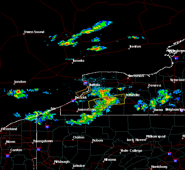 At 311 pm edt, a severe thunderstorm was located 8 miles east of arcade, or 17 miles southwest of letchworth state park, moving east at 45 mph (radar indicated). Hazards include 60 mph wind gusts and quarter size hail. Minor damage to vehicles is possible. expect wind damage to roofs, siding, and trees. locations impacted include, dansville, letchworth state park, arcade, belfast, rushford, houghton, portageville, caneadea, nunda and eagle. This includes interstate 390 between exits 4 and 5. At 311 pm edt, a severe thunderstorm was located 8 miles east of arcade, or 17 miles southwest of letchworth state park, moving east at 45 mph (radar indicated). Hazards include 60 mph wind gusts and quarter size hail. Minor damage to vehicles is possible. expect wind damage to roofs, siding, and trees. locations impacted include, dansville, letchworth state park, arcade, belfast, rushford, houghton, portageville, caneadea, nunda and eagle. This includes interstate 390 between exits 4 and 5.
|
| 7/29/2020 2:49 PM EDT |
 At 248 pm edt, a severe thunderstorm was located near ashford hollow, or 18 miles north of salamanca, moving east at 30 mph (radar indicated). Hazards include 60 mph wind gusts and quarter size hail. Minor damage to vehicles is possible. Expect wind damage to roofs, siding, and trees. At 248 pm edt, a severe thunderstorm was located near ashford hollow, or 18 miles north of salamanca, moving east at 30 mph (radar indicated). Hazards include 60 mph wind gusts and quarter size hail. Minor damage to vehicles is possible. Expect wind damage to roofs, siding, and trees.
|
| 7/19/2020 2:56 PM EDT |
 At 255 pm edt, severe thunderstorms were located along a line extending from near mount morris to near houghton, moving east at 45 mph (radar indicated). Hazards include 60 mph wind gusts. Expect damage to roofs, siding, and trees. locations impacted include, geneseo, letchworth state park, perry, mount morris, portageville, groveland, nunda, pike, castile and ossian. This includes interstate 390 between exits 6 and 7. At 255 pm edt, severe thunderstorms were located along a line extending from near mount morris to near houghton, moving east at 45 mph (radar indicated). Hazards include 60 mph wind gusts. Expect damage to roofs, siding, and trees. locations impacted include, geneseo, letchworth state park, perry, mount morris, portageville, groveland, nunda, pike, castile and ossian. This includes interstate 390 between exits 6 and 7.
|
| 7/19/2020 2:29 PM EDT |
 At 229 pm edt, a severe thunderstorm was located over arcade, or 17 miles southeast of east aurora, moving east at 40 mph (radar indicated). Hazards include 60 mph wind gusts. expect damage to roofs, siding, and trees At 229 pm edt, a severe thunderstorm was located over arcade, or 17 miles southeast of east aurora, moving east at 40 mph (radar indicated). Hazards include 60 mph wind gusts. expect damage to roofs, siding, and trees
|
| 5/29/2020 3:10 PM EDT |
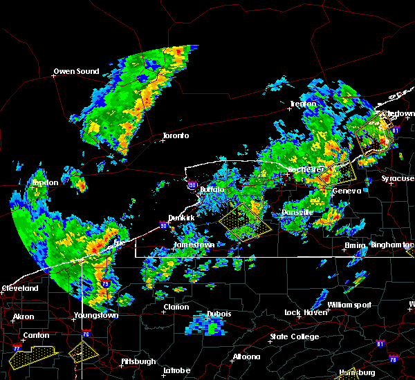 The severe thunderstorm warning for southern wyoming, northeastern cattaraugus, southeastern erie, southwestern livingston and northern allegany counties will expire at 315 pm edt, the storm which prompted the warning has weakened below severe limits, and has exited the warned area. therefore, the warning will be allowed to expire. The severe thunderstorm warning for southern wyoming, northeastern cattaraugus, southeastern erie, southwestern livingston and northern allegany counties will expire at 315 pm edt, the storm which prompted the warning has weakened below severe limits, and has exited the warned area. therefore, the warning will be allowed to expire.
|
| 5/29/2020 2:41 PM EDT |
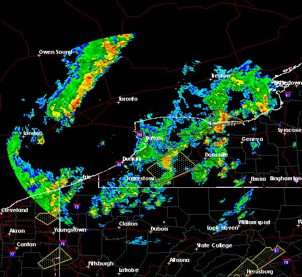 At 241 pm edt, a severe thunderstorm was located near arcade and moving northeast at 45 mph (radar indicated). Hazards include 60 mph wind gusts. Expect damage to roofs, siding, and trees. Locations impacted include, letchworth state park, arcade, belfast, rushford, houghton, chaffee, portageville, yorkshire, sardinia and caneadea. At 241 pm edt, a severe thunderstorm was located near arcade and moving northeast at 45 mph (radar indicated). Hazards include 60 mph wind gusts. Expect damage to roofs, siding, and trees. Locations impacted include, letchworth state park, arcade, belfast, rushford, houghton, chaffee, portageville, yorkshire, sardinia and caneadea.
|
| 5/29/2020 2:22 PM EDT |
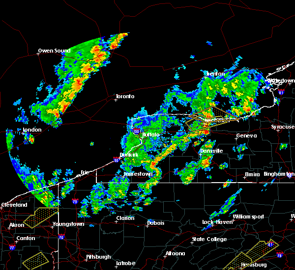 At 222 pm edt, a severe thunderstorm was located near ashford and moving northeast at 45 mph (radar indicated). Hazards include 60 mph wind gusts. expect damage to roofs, siding, and trees At 222 pm edt, a severe thunderstorm was located near ashford and moving northeast at 45 mph (radar indicated). Hazards include 60 mph wind gusts. expect damage to roofs, siding, and trees
|
| 5/15/2020 3:02 PM EDT |
 At 301 pm edt, a severe thunderstorm was located over letchworth state park, moving east at 45 mph (radar indicated). Hazards include 60 mph wind gusts and quarter size hail. Minor damage to vehicles is possible. Expect wind damage to roofs, siding, and trees. At 301 pm edt, a severe thunderstorm was located over letchworth state park, moving east at 45 mph (radar indicated). Hazards include 60 mph wind gusts and quarter size hail. Minor damage to vehicles is possible. Expect wind damage to roofs, siding, and trees.
|
| 7/6/2019 12:27 PM EDT |
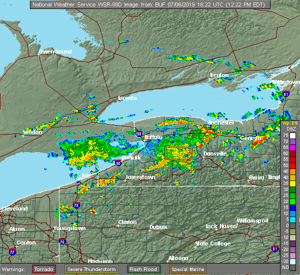 At 1226 pm edt, a severe thunderstorm was located over letchworth state park, moving east at 35 mph (radar indicated). Hazards include 60 mph wind gusts. Expect damage to roofs, siding, and trees. Locations impacted include, letchworth state park, perry, warsaw, portageville, nunda, pike, castile, silver springs, gainesville and hermitage. At 1226 pm edt, a severe thunderstorm was located over letchworth state park, moving east at 35 mph (radar indicated). Hazards include 60 mph wind gusts. Expect damage to roofs, siding, and trees. Locations impacted include, letchworth state park, perry, warsaw, portageville, nunda, pike, castile, silver springs, gainesville and hermitage.
|
| 7/6/2019 11:56 AM EDT |
 At 1156 am edt, a severe thunderstorm was located 8 miles northeast of chaffee, or 16 miles southeast of east aurora, moving east at 35 mph (radar indicated). Hazards include 60 mph wind gusts. expect damage to roofs, siding, and trees At 1156 am edt, a severe thunderstorm was located 8 miles northeast of chaffee, or 16 miles southeast of east aurora, moving east at 35 mph (radar indicated). Hazards include 60 mph wind gusts. expect damage to roofs, siding, and trees
|
| 5/25/2019 7:49 PM EDT |
 At 748 pm edt, severe thunderstorms were located along a line extending from avon to near portageville, moving east at 45 mph (radar indicated). Hazards include 60 mph wind gusts. Expect damage to roofs, siding, and trees. locations impacted include, canandaigua, geneseo, dansville, letchworth state park, perry, warsaw, avon, mount morris, victor and honeoye falls. this includes the following highways, interstate 390 between exits 4 and 11. Interstate 90 between exits 45 and 43. At 748 pm edt, severe thunderstorms were located along a line extending from avon to near portageville, moving east at 45 mph (radar indicated). Hazards include 60 mph wind gusts. Expect damage to roofs, siding, and trees. locations impacted include, canandaigua, geneseo, dansville, letchworth state park, perry, warsaw, avon, mount morris, victor and honeoye falls. this includes the following highways, interstate 390 between exits 4 and 11. Interstate 90 between exits 45 and 43.
|
| 5/25/2019 7:29 PM EDT |
 At 729 pm edt, severe thunderstorms were located along a line extending from near batavia to 6 miles southeast of wales center, moving east at 35 mph (radar indicated). Hazards include 60 mph wind gusts. expect damage to roofs, siding, and trees At 729 pm edt, severe thunderstorms were located along a line extending from near batavia to 6 miles southeast of wales center, moving east at 35 mph (radar indicated). Hazards include 60 mph wind gusts. expect damage to roofs, siding, and trees
|
| 5/25/2019 7:09 PM EDT |
 At 708 pm edt, a severe thunderstorm was located 12 miles northwest of salamanca, moving northeast at 50 mph (radar indicated). Hazards include 60 mph wind gusts and quarter size hail. Minor damage to vehicles is possible. Expect wind damage to roofs, siding, and trees. At 708 pm edt, a severe thunderstorm was located 12 miles northwest of salamanca, moving northeast at 50 mph (radar indicated). Hazards include 60 mph wind gusts and quarter size hail. Minor damage to vehicles is possible. Expect wind damage to roofs, siding, and trees.
|
| 4/14/2019 10:07 PM EDT |
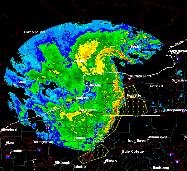 The severe thunderstorm warning for southern wyoming, southeastern cattaraugus, southwestern livingston and western allegany counties will expire at 1015 pm edt, the storm which prompted the warning has moved out of the area. therefore, the warning will be allowed to expire. a tornado watch remains in effect until 300 am edt for western new york. The severe thunderstorm warning for southern wyoming, southeastern cattaraugus, southwestern livingston and western allegany counties will expire at 1015 pm edt, the storm which prompted the warning has moved out of the area. therefore, the warning will be allowed to expire. a tornado watch remains in effect until 300 am edt for western new york.
|
| 4/14/2019 9:45 PM EDT |
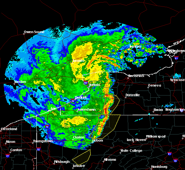 At 945 pm edt, a severe thunderstorm was located near belfast, or 18 miles south of letchworth state park, moving northeast at 45 mph (law enforcement). Hazards include 60 mph wind gusts. Expect damage to roofs, siding, and trees. locations impacted include, olean, letchworth state park, belfast, cuba, rushford, houghton, portageville, weston mills, caneadea and hinsdale. A tornado watch remains in effect until 300 am edt for western new york. At 945 pm edt, a severe thunderstorm was located near belfast, or 18 miles south of letchworth state park, moving northeast at 45 mph (law enforcement). Hazards include 60 mph wind gusts. Expect damage to roofs, siding, and trees. locations impacted include, olean, letchworth state park, belfast, cuba, rushford, houghton, portageville, weston mills, caneadea and hinsdale. A tornado watch remains in effect until 300 am edt for western new york.
|
| 4/14/2019 9:28 PM EDT |
 At 927 pm edt, a severe thunderstorm was located near franklinville, or 16 miles north of olean, moving northeast at 50 mph (law enforcement). Hazards include 60 mph wind gusts. expect damage to roofs, siding, and trees At 927 pm edt, a severe thunderstorm was located near franklinville, or 16 miles north of olean, moving northeast at 50 mph (law enforcement). Hazards include 60 mph wind gusts. expect damage to roofs, siding, and trees
|
| 9/21/2018 6:39 PM EDT |
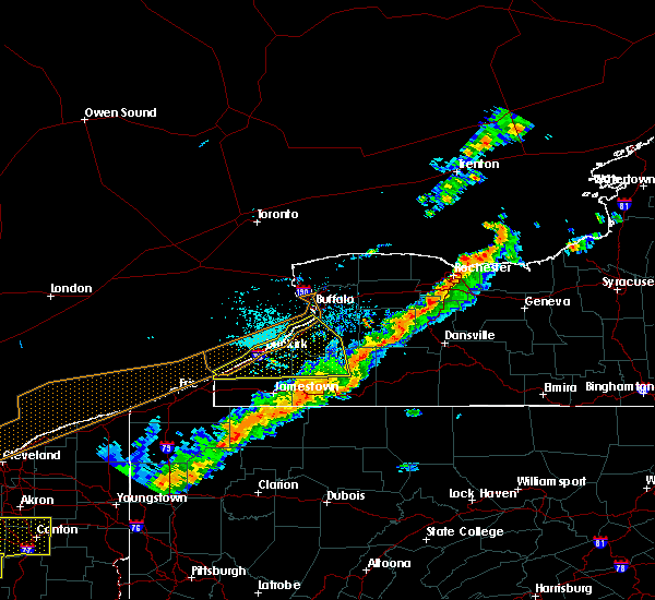 A severe thunderstorm warning remains in effect until 700 pm edt for wyoming. cattaraugus and western allegany counties. at 636 pm edt, severe thunderstorms were located along a line extending from near warsaw to allegany state park, moving east at 60 mph. hazard. 60 mph wind gusts. A severe thunderstorm warning remains in effect until 700 pm edt for wyoming. cattaraugus and western allegany counties. at 636 pm edt, severe thunderstorms were located along a line extending from near warsaw to allegany state park, moving east at 60 mph. hazard. 60 mph wind gusts.
|
| 9/21/2018 6:31 PM EDT |
 The national weather service in buffalo has issued a * severe thunderstorm warning for. southwestern wayne county in western new york. wyoming county in western new york. livingston county in western new york. Southern monroe county in western new york. The national weather service in buffalo has issued a * severe thunderstorm warning for. southwestern wayne county in western new york. wyoming county in western new york. livingston county in western new york. Southern monroe county in western new york.
|
| 9/21/2018 6:11 PM EDT |
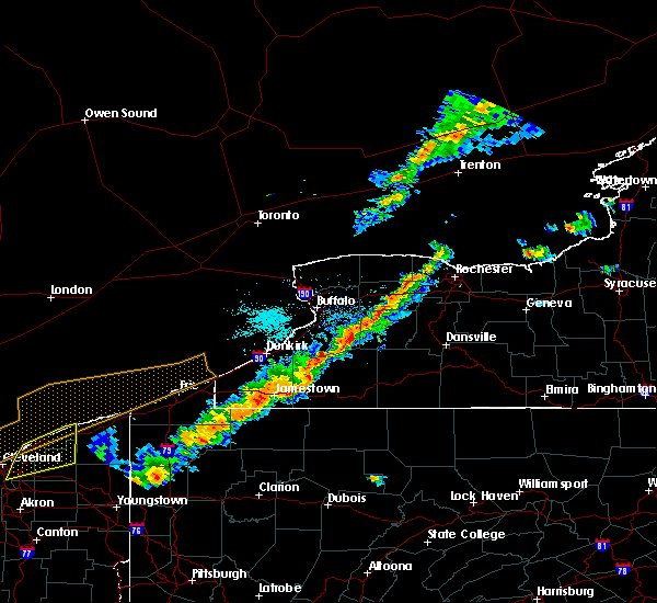 A severe thunderstorm warning remains in effect until 700 pm edt for wyoming. cattaraugus. southeastern erie. southeastern chautauqua and western allegany counties. At 611 pm edt, severe thunderstorms were located along a line extending from near darien lakes state park to near lakewood, moving east at 60 mph. A severe thunderstorm warning remains in effect until 700 pm edt for wyoming. cattaraugus. southeastern erie. southeastern chautauqua and western allegany counties. At 611 pm edt, severe thunderstorms were located along a line extending from near darien lakes state park to near lakewood, moving east at 60 mph.
|
| 9/21/2018 5:54 PM EDT |
 At 553 pm edt, severe thunderstorms were located along a line extending from west seneca to near clymer, moving east at 60 mph (radar indicated). Hazards include 60 mph wind gusts. expect damage to roofs, siding, and trees At 553 pm edt, severe thunderstorms were located along a line extending from west seneca to near clymer, moving east at 60 mph (radar indicated). Hazards include 60 mph wind gusts. expect damage to roofs, siding, and trees
|
| 6/13/2018 6:00 PM EDT |
 At 600 pm edt, severe thunderstorms were located along a line extending from near arcade to 7 miles southeast of springville to near ashford hollow, moving east at 45 mph (radar indicated). Hazards include 60 mph wind gusts and half dollar size hail. Minor damage to vehicles is possible. expect wind damage to roofs, siding, and trees. Locations impacted include, olean, dansville, wellsville, letchworth state park, alfred, ashford, arcade and allegany. At 600 pm edt, severe thunderstorms were located along a line extending from near arcade to 7 miles southeast of springville to near ashford hollow, moving east at 45 mph (radar indicated). Hazards include 60 mph wind gusts and half dollar size hail. Minor damage to vehicles is possible. expect wind damage to roofs, siding, and trees. Locations impacted include, olean, dansville, wellsville, letchworth state park, alfred, ashford, arcade and allegany.
|
| 6/13/2018 5:50 PM EDT |
 At 550 pm edt, severe thunderstorms were located along a line extending from near chaffee to near springville to near gowanda, moving east at 45 mph (radar indicated). Hazards include 60 mph wind gusts and penny size hail. expect damage to roofs, siding, and trees At 550 pm edt, severe thunderstorms were located along a line extending from near chaffee to near springville to near gowanda, moving east at 45 mph (radar indicated). Hazards include 60 mph wind gusts and penny size hail. expect damage to roofs, siding, and trees
|
| 10/15/2017 4:57 PM EDT |
 At 456 pm edt, severe thunderstorms were located along a line extending from 9 miles north of ontario to avon to near rushford, moving east at 50 mph (radar indicated). Hazards include 60 mph wind gusts. Expect wind damage to trees and power lines. locations impacted include, rochester, irondequoit, canandaigua, geneseo, east rochester, webster, fairport and dansville. this includes the following highways, interstate 390 between exits 4 and 12. Interstate 90 between exits 46 and 43. At 456 pm edt, severe thunderstorms were located along a line extending from 9 miles north of ontario to avon to near rushford, moving east at 50 mph (radar indicated). Hazards include 60 mph wind gusts. Expect wind damage to trees and power lines. locations impacted include, rochester, irondequoit, canandaigua, geneseo, east rochester, webster, fairport and dansville. this includes the following highways, interstate 390 between exits 4 and 12. Interstate 90 between exits 46 and 43.
|
| 10/15/2017 4:36 PM EDT |
 At 432 pm edt, severe thunderstorms were located along a line extending from near hilton to near pavilion to ashford hollow, moving east at 50 mph (radar indicated). Hazards include 60 mph wind gusts. expect wind damage to trees and power lines At 432 pm edt, severe thunderstorms were located along a line extending from near hilton to near pavilion to ashford hollow, moving east at 50 mph (radar indicated). Hazards include 60 mph wind gusts. expect wind damage to trees and power lines
|
| 8/22/2017 3:24 PM EDT |
 At 324 pm edt, severe thunderstorms were located along a line extending from near warsaw to near scandia, moving east at 50 mph (radar indicated). Hazards include 60 mph wind gusts. Expect wind damage to trees and power lines. locations impacted include, jamestown, geneseo, salamanca, letchworth state park, allegany state park, perry, warsaw and avon. this includes the following highways, interstate 390 between exits 9 and 10. interstate 86 between exits 14 and 21. A tornado watch remains in effect until 900 pm edt for western new york. At 324 pm edt, severe thunderstorms were located along a line extending from near warsaw to near scandia, moving east at 50 mph (radar indicated). Hazards include 60 mph wind gusts. Expect wind damage to trees and power lines. locations impacted include, jamestown, geneseo, salamanca, letchworth state park, allegany state park, perry, warsaw and avon. this includes the following highways, interstate 390 between exits 9 and 10. interstate 86 between exits 14 and 21. A tornado watch remains in effect until 900 pm edt for western new york.
|
| 8/22/2017 3:20 PM EDT |
 At 320 pm edt, severe thunderstorms were located along a line extending from 7 miles south of varysburg to near ashford to 6 miles north of scandia, moving east at 55 mph (radar indicated). Hazards include 60 mph wind gusts. expect wind damage to trees and power lines At 320 pm edt, severe thunderstorms were located along a line extending from 7 miles south of varysburg to near ashford to 6 miles north of scandia, moving east at 55 mph (radar indicated). Hazards include 60 mph wind gusts. expect wind damage to trees and power lines
|
| 8/22/2017 3:09 PM EDT |
 At 309 pm edt, severe thunderstorms were located along a line extending from near attica to near lottsville, moving east at 30 mph (radar indicated). Hazards include 60 mph wind gusts. Expect wind damage to trees and power lines. locations impacted include, jamestown, geneseo, salamanca, letchworth state park, allegany state park, springville, perry and warsaw. this includes the following highways, interstate 390 between exits 9 and 10. interstate 86 between exits 11 and 21. A tornado watch remains in effect until 900 pm edt for western new york. At 309 pm edt, severe thunderstorms were located along a line extending from near attica to near lottsville, moving east at 30 mph (radar indicated). Hazards include 60 mph wind gusts. Expect wind damage to trees and power lines. locations impacted include, jamestown, geneseo, salamanca, letchworth state park, allegany state park, springville, perry and warsaw. this includes the following highways, interstate 390 between exits 9 and 10. interstate 86 between exits 11 and 21. A tornado watch remains in effect until 900 pm edt for western new york.
|
| 8/22/2017 2:48 PM EDT |
 At 248 pm edt, severe thunderstorms were located along a line extending from near bennington to near columbus, moving east at 25 mph (radar indicated). Hazards include 60 mph wind gusts. expect wind damage to trees and power lines At 248 pm edt, severe thunderstorms were located along a line extending from near bennington to near columbus, moving east at 25 mph (radar indicated). Hazards include 60 mph wind gusts. expect wind damage to trees and power lines
|
| 8/22/2017 2:20 PM EDT |
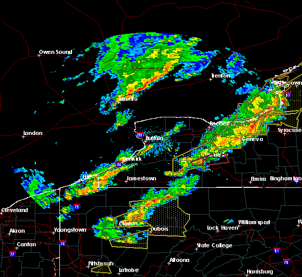 At 220 pm edt, a severe thunderstorm was located 7 miles west of south dansville, or 7 miles southwest of dansville, moving east at 35 mph (radar indicated). Hazards include 60 mph wind gusts and penny size hail. Expect wind damage to trees and power lines. locations impacted include, dansville, letchworth state park, mount morris, conesus, belfast, rushford, naples and houghton. this includes interstate 390 between exits 4 and 7. A tornado watch remains in effect until 900 pm edt for western new york. At 220 pm edt, a severe thunderstorm was located 7 miles west of south dansville, or 7 miles southwest of dansville, moving east at 35 mph (radar indicated). Hazards include 60 mph wind gusts and penny size hail. Expect wind damage to trees and power lines. locations impacted include, dansville, letchworth state park, mount morris, conesus, belfast, rushford, naples and houghton. this includes interstate 390 between exits 4 and 7. A tornado watch remains in effect until 900 pm edt for western new york.
|
| 8/22/2017 1:56 PM EDT |
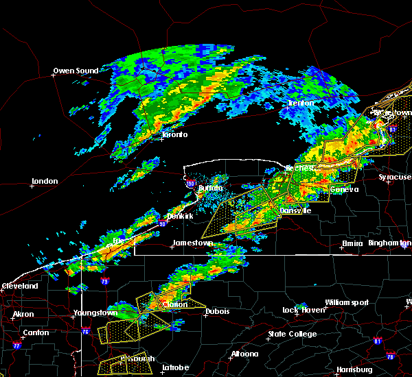 At 155 pm edt, a severe thunderstorm was located over rushford, or 21 miles north of olean, moving northeast at 60 mph (radar indicated). Hazards include 60 mph wind gusts and penny size hail. expect wind damage to trees and power lines At 155 pm edt, a severe thunderstorm was located over rushford, or 21 miles north of olean, moving northeast at 60 mph (radar indicated). Hazards include 60 mph wind gusts and penny size hail. expect wind damage to trees and power lines
|
| 8/22/2017 1:43 PM EDT |
 At 142 pm edt, a severe thunderstorm was located near rushford, or 20 miles southwest of letchworth state park, moving east at 35 mph (radar indicated). Hazards include 60 mph wind gusts and quarter size hail. Minor damage to vehicles is possible. expect wind damage to trees and power lines. locations impacted include, geneseo, dansville, letchworth state park, springville, perry, warsaw, mount morris and pavilion. this includes interstate 390 between exits 4 and 7. A tornado watch remains in effect until 900 pm edt for western new york. At 142 pm edt, a severe thunderstorm was located near rushford, or 20 miles southwest of letchworth state park, moving east at 35 mph (radar indicated). Hazards include 60 mph wind gusts and quarter size hail. Minor damage to vehicles is possible. expect wind damage to trees and power lines. locations impacted include, geneseo, dansville, letchworth state park, springville, perry, warsaw, mount morris and pavilion. this includes interstate 390 between exits 4 and 7. A tornado watch remains in effect until 900 pm edt for western new york.
|
| 8/22/2017 1:21 PM EDT |
 At 121 pm edt, a severe thunderstorm was located near franklinville, or 21 miles northeast of salamanca, moving east at 70 mph (radar indicated). Hazards include 60 mph wind gusts and quarter size hail. Minor damage to vehicles is possible. expect wind damage to trees and power lines. locations impacted include, geneseo, dansville, letchworth state park, boston, springville, perry, warsaw and colden. this includes interstate 390 between exits 4 and 7. A tornado watch remains in effect until 900 pm edt for western new york. At 121 pm edt, a severe thunderstorm was located near franklinville, or 21 miles northeast of salamanca, moving east at 70 mph (radar indicated). Hazards include 60 mph wind gusts and quarter size hail. Minor damage to vehicles is possible. expect wind damage to trees and power lines. locations impacted include, geneseo, dansville, letchworth state park, boston, springville, perry, warsaw and colden. this includes interstate 390 between exits 4 and 7. A tornado watch remains in effect until 900 pm edt for western new york.
|
| 8/22/2017 12:55 PM EDT |
 At 1254 pm edt, a severe thunderstorm was located near springville, or 14 miles south of hamburg, moving east at 45 mph (radar indicated). Hazards include 60 mph wind gusts. expect wind damage to trees and power lines At 1254 pm edt, a severe thunderstorm was located near springville, or 14 miles south of hamburg, moving east at 45 mph (radar indicated). Hazards include 60 mph wind gusts. expect wind damage to trees and power lines
|
| 7/20/2017 1:24 PM EDT |
 The severe thunderstorm warning for wyoming, northeastern cattaraugus, eastern erie, southwestern livingston and northwestern allegany counties will expire at 130 pm edt, the storm which prompted the warning has moved out of the area and or replaced by another warning. therefore this warning will be allowed to expire. a severe thunderstorm watch remains in effect until 800 pm edt for western new york. The severe thunderstorm warning for wyoming, northeastern cattaraugus, eastern erie, southwestern livingston and northwestern allegany counties will expire at 130 pm edt, the storm which prompted the warning has moved out of the area and or replaced by another warning. therefore this warning will be allowed to expire. a severe thunderstorm watch remains in effect until 800 pm edt for western new york.
|
| 7/20/2017 1:23 PM EDT |
 At 122 pm edt, a severe thunderstorm was located near rushford, or 19 miles southwest of letchworth state park, moving southeast at 40 mph (radar indicated). Hazards include 70 mph wind gusts and quarter size hail. Minor damage to vehicles is possible. expect considerable tree damage. Wind damage is also likely to mobile homes, roofs, and outbuildings. At 122 pm edt, a severe thunderstorm was located near rushford, or 19 miles southwest of letchworth state park, moving southeast at 40 mph (radar indicated). Hazards include 70 mph wind gusts and quarter size hail. Minor damage to vehicles is possible. expect considerable tree damage. Wind damage is also likely to mobile homes, roofs, and outbuildings.
|
| 7/20/2017 1:09 PM EDT |
 At 109 pm edt, a severe thunderstorm was located 8 miles south of varysburg, or 16 miles west of letchworth state park, moving east at 50 mph (radar indicated). Hazards include 60 mph wind gusts and quarter size hail. Minor damage to vehicles is possible. expect wind damage to trees and power lines. locations impacted include, geneseo, letchworth state park, perry, warsaw, mount morris, arcade, houghton and chaffee. This includes interstate 390 between exits 6 and 7. At 109 pm edt, a severe thunderstorm was located 8 miles south of varysburg, or 16 miles west of letchworth state park, moving east at 50 mph (radar indicated). Hazards include 60 mph wind gusts and quarter size hail. Minor damage to vehicles is possible. expect wind damage to trees and power lines. locations impacted include, geneseo, letchworth state park, perry, warsaw, mount morris, arcade, houghton and chaffee. This includes interstate 390 between exits 6 and 7.
|
| 7/20/2017 1:06 PM EDT |
 At 106 pm edt, a severe thunderstorm capable of producing a tornado was located near chaffee, or 14 miles southeast of east aurora, moving east at 40 mph (radar indicated rotation). Hazards include tornado. Flying debris will be dangerous to those caught without shelter. mobile homes will be damaged or destroyed. damage to roofs, windows, and vehicles will occur. tree damage is likely. Locations impacted include, arcade, houghton, chaffee, yorkshire, eagle, pike, castile and silver springs. At 106 pm edt, a severe thunderstorm capable of producing a tornado was located near chaffee, or 14 miles southeast of east aurora, moving east at 40 mph (radar indicated rotation). Hazards include tornado. Flying debris will be dangerous to those caught without shelter. mobile homes will be damaged or destroyed. damage to roofs, windows, and vehicles will occur. tree damage is likely. Locations impacted include, arcade, houghton, chaffee, yorkshire, eagle, pike, castile and silver springs.
|
| 7/20/2017 12:55 PM EDT |
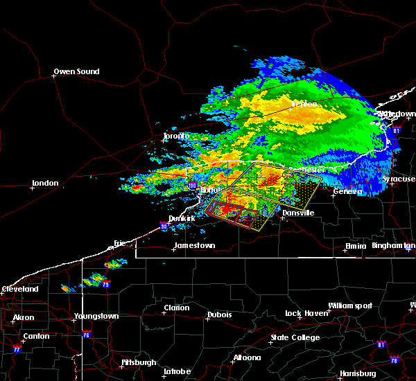 At 1254 pm edt, a severe thunderstorm capable of producing a tornado was located near colden, or 7 miles south of east aurora, moving east at 40 mph (radar indicated rotation). Hazards include tornado. Flying debris will be dangerous to those caught without shelter. mobile homes will be damaged or destroyed. damage to roofs, windows, and vehicles will occur. Tree damage is likely. At 1254 pm edt, a severe thunderstorm capable of producing a tornado was located near colden, or 7 miles south of east aurora, moving east at 40 mph (radar indicated rotation). Hazards include tornado. Flying debris will be dangerous to those caught without shelter. mobile homes will be damaged or destroyed. damage to roofs, windows, and vehicles will occur. Tree damage is likely.
|
| 7/20/2017 12:49 PM EDT |
 At 1249 pm edt, a severe thunderstorm was located over wales center, or 7 miles east of east aurora, moving east at 55 mph (radar indicated). Hazards include 60 mph wind gusts and penny size hail. Expect wind damage to trees and power lines. locations impacted include, geneseo, east aurora, darien lakes state park, letchworth state park, elma, marilla, perry and warsaw. This includes interstate 390 between exits 6 and 7. At 1249 pm edt, a severe thunderstorm was located over wales center, or 7 miles east of east aurora, moving east at 55 mph (radar indicated). Hazards include 60 mph wind gusts and penny size hail. Expect wind damage to trees and power lines. locations impacted include, geneseo, east aurora, darien lakes state park, letchworth state park, elma, marilla, perry and warsaw. This includes interstate 390 between exits 6 and 7.
|
| 7/20/2017 12:31 PM EDT |
 At 1230 pm edt, a severe thunderstorm was located over blasdell, or over lackawanna, moving east at 30 mph (radar indicated). Hazards include 60 mph wind gusts and penny size hail. expect wind damage to trees and power lines At 1230 pm edt, a severe thunderstorm was located over blasdell, or over lackawanna, moving east at 30 mph (radar indicated). Hazards include 60 mph wind gusts and penny size hail. expect wind damage to trees and power lines
|
| 6/18/2017 5:28 PM EDT |
 At 528 pm edt, severe thunderstorms were located along a line extending from 6 miles northwest of houghton to 6 miles northeast of belfast to near shinglehouse, moving northeast at 55 mph (radar indicated). Hazards include 60 mph wind gusts. expect wind damage to trees and power lines At 528 pm edt, severe thunderstorms were located along a line extending from 6 miles northwest of houghton to 6 miles northeast of belfast to near shinglehouse, moving northeast at 55 mph (radar indicated). Hazards include 60 mph wind gusts. expect wind damage to trees and power lines
|
| 6/18/2017 5:12 PM EDT |
 At 512 pm edt, severe thunderstorms were located along a line extending from near geneseo to 7 miles east of portageville, moving northeast at 40 mph (radar indicated). Hazards include 60 mph wind gusts. Expect wind damage to trees and power lines. locations impacted include, geneseo, dansville, letchworth state park, perry, warsaw, avon, mount morris and conesus. This includes interstate 390 between exits 5 and 10. At 512 pm edt, severe thunderstorms were located along a line extending from near geneseo to 7 miles east of portageville, moving northeast at 40 mph (radar indicated). Hazards include 60 mph wind gusts. Expect wind damage to trees and power lines. locations impacted include, geneseo, dansville, letchworth state park, perry, warsaw, avon, mount morris and conesus. This includes interstate 390 between exits 5 and 10.
|
| 6/18/2017 4:49 PM EDT |
 At 449 pm edt, a severe thunderstorm was located 8 miles north of houghton, or 13 miles southwest of letchworth state park, moving northeast at 35 mph (radar indicated). Hazards include 60 mph wind gusts. expect wind damage to trees and power lines At 449 pm edt, a severe thunderstorm was located 8 miles north of houghton, or 13 miles southwest of letchworth state park, moving northeast at 35 mph (radar indicated). Hazards include 60 mph wind gusts. expect wind damage to trees and power lines
|
| 5/30/2017 1:34 PM EDT |
 At 133 pm edt, a severe thunderstorm was located near springville, or 20 miles south of east aurora, moving east at 40 mph (radar indicated). Hazards include 60 mph wind gusts and quarter size hail. Minor damage to vehicles is possible. Expect wind damage to trees and power lines. At 133 pm edt, a severe thunderstorm was located near springville, or 20 miles south of east aurora, moving east at 40 mph (radar indicated). Hazards include 60 mph wind gusts and quarter size hail. Minor damage to vehicles is possible. Expect wind damage to trees and power lines.
|
| 5/19/2017 12:02 AM EDT |
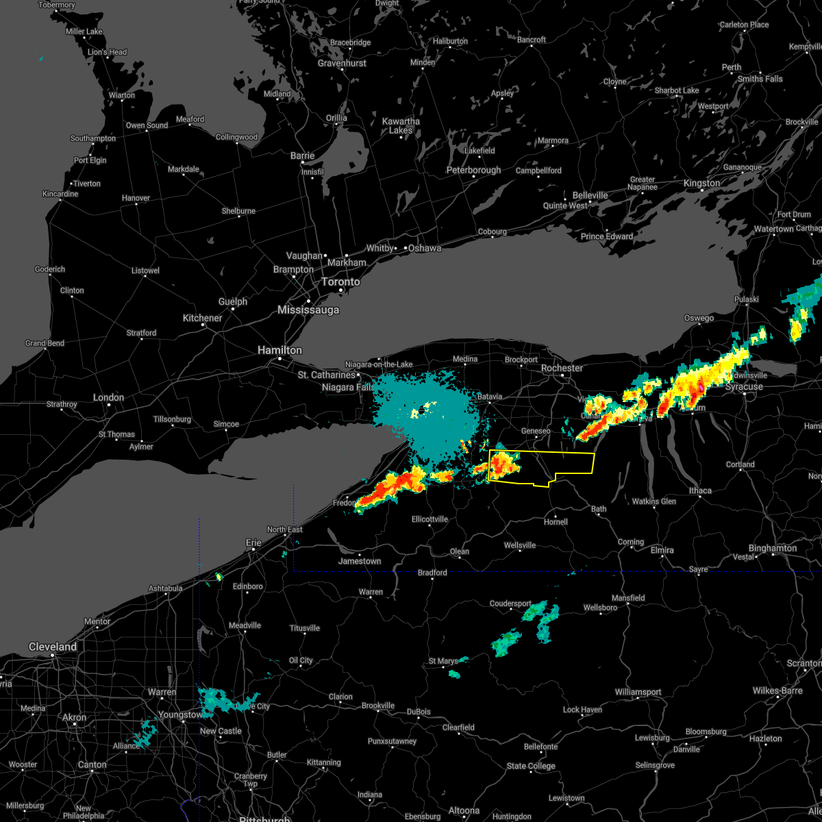 At 1202 am edt, a severe thunderstorm was located near portageville, or near letchworth state park, moving east at 50 mph (radar indicated). Hazards include 60 mph wind gusts and penny size hail. expect wind damage to trees and power lines At 1202 am edt, a severe thunderstorm was located near portageville, or near letchworth state park, moving east at 50 mph (radar indicated). Hazards include 60 mph wind gusts and penny size hail. expect wind damage to trees and power lines
|
| 5/18/2017 3:57 PM EDT |
 At 357 pm edt, a severe thunderstorm was located 9 miles northeast of arcade, or 16 miles west of letchworth state park, moving east at 50 mph (radar indicated). Hazards include quarter size hail. minor damage to vehicles is possible At 357 pm edt, a severe thunderstorm was located 9 miles northeast of arcade, or 16 miles west of letchworth state park, moving east at 50 mph (radar indicated). Hazards include quarter size hail. minor damage to vehicles is possible
|
| 5/18/2017 3:52 PM EDT |
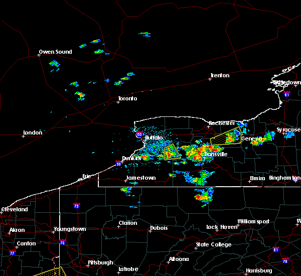 At 352 pm edt, a severe thunderstorm was located near chaffee, or 9 miles southeast of east aurora, moving northeast at 45 mph (radar indicated). Hazards include 60 mph wind gusts and quarter size hail. Minor damage to vehicles is possible. expect wind damage to trees and power lines. Locations impacted include, arcade, varysburg, yorkshire, sheldon, eagle, pike, strykersville and hermitage. At 352 pm edt, a severe thunderstorm was located near chaffee, or 9 miles southeast of east aurora, moving northeast at 45 mph (radar indicated). Hazards include 60 mph wind gusts and quarter size hail. Minor damage to vehicles is possible. expect wind damage to trees and power lines. Locations impacted include, arcade, varysburg, yorkshire, sheldon, eagle, pike, strykersville and hermitage.
|
| 5/18/2017 3:34 PM EDT |
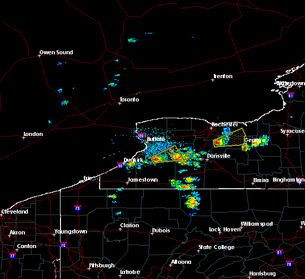 At 333 pm edt, a severe thunderstorm was located near boston, or 11 miles southeast of hamburg, moving northeast at 45 mph (radar indicated). Hazards include 60 mph wind gusts and half dollar size hail. Minor damage to vehicles is possible. expect wind damage to trees and power lines. Locations impacted include, springville, colden, arcade, east concord, varysburg, chaffee, concord and yorkshire. At 333 pm edt, a severe thunderstorm was located near boston, or 11 miles southeast of hamburg, moving northeast at 45 mph (radar indicated). Hazards include 60 mph wind gusts and half dollar size hail. Minor damage to vehicles is possible. expect wind damage to trees and power lines. Locations impacted include, springville, colden, arcade, east concord, varysburg, chaffee, concord and yorkshire.
|
| 5/18/2017 3:17 PM EDT |
 At 317 pm edt, a severe thunderstorm was located over gowanda, or 16 miles south of hamburg, moving northeast at 45 mph (radar indicated). Hazards include 60 mph wind gusts and quarter size hail. Minor damage to vehicles is possible. Expect wind damage to trees and power lines. At 317 pm edt, a severe thunderstorm was located over gowanda, or 16 miles south of hamburg, moving northeast at 45 mph (radar indicated). Hazards include 60 mph wind gusts and quarter size hail. Minor damage to vehicles is possible. Expect wind damage to trees and power lines.
|
| 5/1/2017 4:31 PM EDT |
 At 430 pm edt, severe thunderstorms were located along a line extending from near point breeze to near brockport to near warsaw, moving northeast at 60 mph (radar indicated). Hazards include 70 mph wind gusts. Expect considerable tree damage. damage is likely to mobile homes, roofs, and outbuildings. locations impacted include, batavia, medina, albion, le roy, warsaw, attica, pavilion and byron. this includes interstate 90 near exit 48. A tornado watch remains in effect until 1000 pm edt for western new york. At 430 pm edt, severe thunderstorms were located along a line extending from near point breeze to near brockport to near warsaw, moving northeast at 60 mph (radar indicated). Hazards include 70 mph wind gusts. Expect considerable tree damage. damage is likely to mobile homes, roofs, and outbuildings. locations impacted include, batavia, medina, albion, le roy, warsaw, attica, pavilion and byron. this includes interstate 90 near exit 48. A tornado watch remains in effect until 1000 pm edt for western new york.
|
| 5/1/2017 4:11 PM EDT |
 At 409 pm edt, severe thunderstorms were located along a line extending from near middleport to near oakfield to near chaffee, moving northeast at 50 mph (radar indicated). Hazards include 70 mph wind gusts. Expect considerable tree damage. damage is likely to mobile homes, roofs, and outbuildings. although not an immediate threat, this storm is capable of producing a tornado. locations impacted include, batavia, medina, albion, darien lakes state park, newfane, le roy, pembroke and warsaw. this includes interstate 90 between exits 48a and 48. A tornado watch remains in effect until 1000 pm edt for western new york. At 409 pm edt, severe thunderstorms were located along a line extending from near middleport to near oakfield to near chaffee, moving northeast at 50 mph (radar indicated). Hazards include 70 mph wind gusts. Expect considerable tree damage. damage is likely to mobile homes, roofs, and outbuildings. although not an immediate threat, this storm is capable of producing a tornado. locations impacted include, batavia, medina, albion, darien lakes state park, newfane, le roy, pembroke and warsaw. this includes interstate 90 between exits 48a and 48. A tornado watch remains in effect until 1000 pm edt for western new york.
|
| 5/1/2017 3:47 PM EDT |
 At 347 pm edt, severe thunderstorms were located along a line extending from lockport to near alden to springville, moving northeast at 60 mph (radar indicated). Hazards include 70 mph wind gusts. Expect considerable tree damage. Damage is likely to mobile homes, roofs, and outbuildings. At 347 pm edt, severe thunderstorms were located along a line extending from lockport to near alden to springville, moving northeast at 60 mph (radar indicated). Hazards include 70 mph wind gusts. Expect considerable tree damage. Damage is likely to mobile homes, roofs, and outbuildings.
|
| 9/17/2016 7:26 PM EDT | The severe thunderstorm warning for western genesee and wyoming counties will expire at 730 pm edt, the storms which prompted the warning have weakened below severe limits, and have exited the warned area. therefore, the warning will be allowed to expire. however gusty winds and heavy rain are still possible with these thunderstorms. |
| 9/17/2016 7:13 PM EDT |
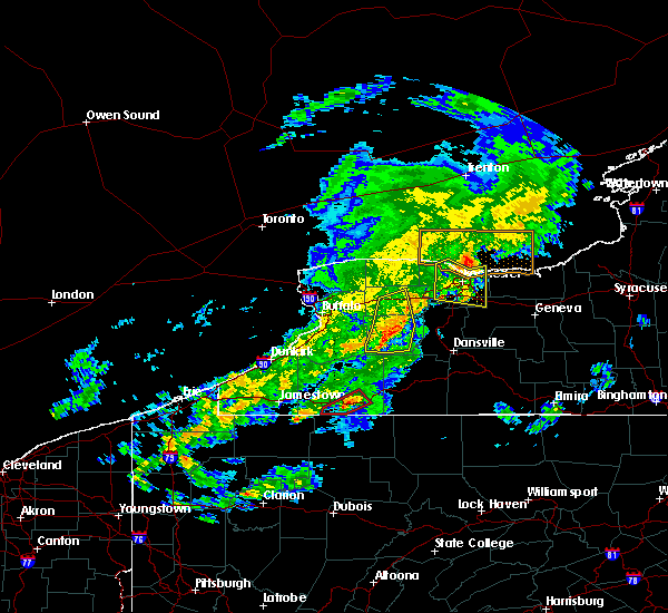 At 712 pm edt, severe thunderstorms were located along a line extending from near batavia to near pavilion to 8 miles northeast of arcade to 6 miles southeast of east concord, moving east at 50 mph (radar indicated). Hazards include 60 mph wind gusts. Expect damage to roofs. siding. and trees. locations impacted include, batavia, warsaw, attica, arcade, varysburg, stafford, eagle and pike. This includes interstate 90 near exit 48. At 712 pm edt, severe thunderstorms were located along a line extending from near batavia to near pavilion to 8 miles northeast of arcade to 6 miles southeast of east concord, moving east at 50 mph (radar indicated). Hazards include 60 mph wind gusts. Expect damage to roofs. siding. and trees. locations impacted include, batavia, warsaw, attica, arcade, varysburg, stafford, eagle and pike. This includes interstate 90 near exit 48.
|
| 9/17/2016 6:42 PM EDT |
 At 642 pm edt, severe thunderstorms were located along a line extending from near lackawanna to near orchard park to near gowanda to 8 miles southeast of fredonia, moving east at 50 mph (radar indicated). Hazards include 60 mph wind gusts. Expect damage to roofs. siding. And trees. At 642 pm edt, severe thunderstorms were located along a line extending from near lackawanna to near orchard park to near gowanda to 8 miles southeast of fredonia, moving east at 50 mph (radar indicated). Hazards include 60 mph wind gusts. Expect damage to roofs. siding. And trees.
|
| 8/25/2016 7:06 PM EDT |
 At 705 pm edt, a severe thunderstorm was located over arcade, or 19 miles south of east aurora, moving east at 20 mph (radar indicated). Hazards include 60 mph wind gusts and quarter size hail. Hail damage to vehicles is expected. expect wind damage to roofs, siding, and trees. Locations impacted include, springville, arcade, rushford, east concord, chaffee, houghton, yorkshire and sardinia. At 705 pm edt, a severe thunderstorm was located over arcade, or 19 miles south of east aurora, moving east at 20 mph (radar indicated). Hazards include 60 mph wind gusts and quarter size hail. Hail damage to vehicles is expected. expect wind damage to roofs, siding, and trees. Locations impacted include, springville, arcade, rushford, east concord, chaffee, houghton, yorkshire and sardinia.
|
| 8/25/2016 6:37 PM EDT |
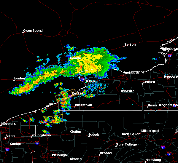 At 637 pm edt, a severe thunderstorm was located over springville, or 17 miles southeast of hamburg, moving east at 20 mph (radar indicated). Hazards include 60 mph wind gusts and quarter size hail. Hail damage to vehicles is expected. Expect wind damage to roofs, siding, and trees. At 637 pm edt, a severe thunderstorm was located over springville, or 17 miles southeast of hamburg, moving east at 20 mph (radar indicated). Hazards include 60 mph wind gusts and quarter size hail. Hail damage to vehicles is expected. Expect wind damage to roofs, siding, and trees.
|
| 7/25/2016 12:30 PM EDT |
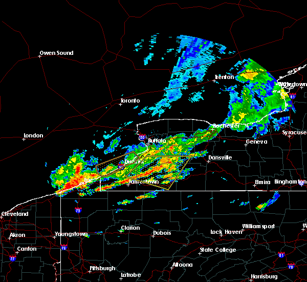 At 1230 pm edt, severe thunderstorms were located along a line extending from chaffee to 10 miles northeast of falconer, moving east at 25 mph (radar indicated). Hazards include 60 mph wind gusts. Expect damage to roofs. siding. and trees. Locations impacted include, olean, salamanca, allegany state park, springville, ashford, arcade, allegany and franklinville. At 1230 pm edt, severe thunderstorms were located along a line extending from chaffee to 10 miles northeast of falconer, moving east at 25 mph (radar indicated). Hazards include 60 mph wind gusts. Expect damage to roofs. siding. and trees. Locations impacted include, olean, salamanca, allegany state park, springville, ashford, arcade, allegany and franklinville.
|
| 7/25/2016 12:05 PM EDT |
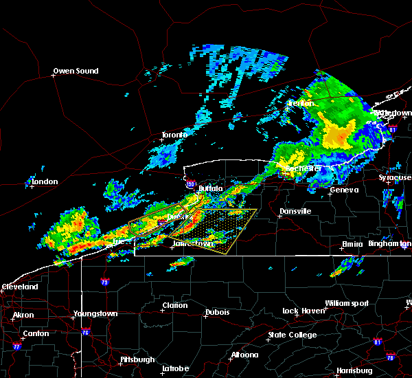 At 1205 pm edt, severe thunderstorms were located along a line extending from near boston to 11 miles north of falconer, moving east at 40 mph (radar indicated). Hazards include 60 mph wind gusts. Expect damage to roofs. siding. And trees. At 1205 pm edt, severe thunderstorms were located along a line extending from near boston to 11 miles north of falconer, moving east at 40 mph (radar indicated). Hazards include 60 mph wind gusts. Expect damage to roofs. siding. And trees.
|
| 7/25/2016 9:25 AM EDT |
 The severe thunderstorm warning for southwestern livingston, northeastern allegany and southeastern wyoming counties will expire at 930 am edt, the storm which prompted the warning has weakened below severe limits, and has exited the warned area. therefore, the warning will be allowed to expire. The severe thunderstorm warning for southwestern livingston, northeastern allegany and southeastern wyoming counties will expire at 930 am edt, the storm which prompted the warning has weakened below severe limits, and has exited the warned area. therefore, the warning will be allowed to expire.
|
| 7/25/2016 9:14 AM EDT |
 At 913 am edt, a severe thunderstorm was located 9 miles northwest of arkport, or 11 miles southwest of dansville, moving southeast at 45 mph (radar indicated). Hazards include 60 mph wind gusts. Expect damage to roofs. siding. and trees. Locations impacted include, dansville, letchworth state park, houghton, portageville, nunda, pike, ossian and canaseraga. At 913 am edt, a severe thunderstorm was located 9 miles northwest of arkport, or 11 miles southwest of dansville, moving southeast at 45 mph (radar indicated). Hazards include 60 mph wind gusts. Expect damage to roofs. siding. and trees. Locations impacted include, dansville, letchworth state park, houghton, portageville, nunda, pike, ossian and canaseraga.
|
| 7/25/2016 9:00 AM EDT |
 At 859 am edt, a severe thunderstorm was located near portageville, or 9 miles southwest of letchworth state park, moving east at 60 mph (radar indicated). Hazards include 60 mph wind gusts. Expect damage to roofs. siding. and trees. Locations impacted include, dansville, letchworth state park, alfred, warsaw, arcade, belfast, houghton and portageville. At 859 am edt, a severe thunderstorm was located near portageville, or 9 miles southwest of letchworth state park, moving east at 60 mph (radar indicated). Hazards include 60 mph wind gusts. Expect damage to roofs. siding. and trees. Locations impacted include, dansville, letchworth state park, alfred, warsaw, arcade, belfast, houghton and portageville.
|
| 7/25/2016 8:35 AM EDT |
 At 834 am edt, a cluster of severe thunderstorms was located over chaffee, or 13 miles southeast of east aurora, moving southeast at 45 mph (radar indicated). Hazards include 60 mph wind gusts. Expect damage to roofs. siding. And trees. At 834 am edt, a cluster of severe thunderstorms was located over chaffee, or 13 miles southeast of east aurora, moving southeast at 45 mph (radar indicated). Hazards include 60 mph wind gusts. Expect damage to roofs. siding. And trees.
|
| 7/18/2016 5:37 AM EDT |
 At 537 am edt, severe thunderstorms were located along a line extending from near warsaw to 6 miles northeast of arcade, moving east at 45 mph (radar indicated). Hazards include 60 mph wind gusts. Expect damage to roofs. siding. and trees. Locations impacted include, geneseo, dansville, letchworth state park, perry, warsaw, mount morris, conesus and portageville. At 537 am edt, severe thunderstorms were located along a line extending from near warsaw to 6 miles northeast of arcade, moving east at 45 mph (radar indicated). Hazards include 60 mph wind gusts. Expect damage to roofs. siding. and trees. Locations impacted include, geneseo, dansville, letchworth state park, perry, warsaw, mount morris, conesus and portageville.
|
| 7/18/2016 5:10 AM EDT |
 At 509 am edt, severe thunderstorms were located along a line extending from near bennington to near east concord, moving east at 55 mph (radar indicated). Hazards include 60 mph wind gusts. Expect damage to roofs. siding. And trees. At 509 am edt, severe thunderstorms were located along a line extending from near bennington to near east concord, moving east at 55 mph (radar indicated). Hazards include 60 mph wind gusts. Expect damage to roofs. siding. And trees.
|
| 6/20/2016 11:39 PM EDT |
 The severe thunderstorm warning for southeastern erie, southwestern livingston, northeastern cattaraugus, northern allegany and southwestern wyoming counties will expire at 1145 pm edt, the severe thunderstorm which prompted the warning has been replaced by another warning. a severe thunderstorm watch remains in effect until 100 am edt for western new york. The severe thunderstorm warning for southeastern erie, southwestern livingston, northeastern cattaraugus, northern allegany and southwestern wyoming counties will expire at 1145 pm edt, the severe thunderstorm which prompted the warning has been replaced by another warning. a severe thunderstorm watch remains in effect until 100 am edt for western new york.
|
| 6/20/2016 11:34 PM EDT |
 At 1134 pm edt, a severe thunderstorm was located near portageville, or 9 miles south of letchworth state park, moving southeast at 15 mph (radar indicated). Hazards include 60 mph wind gusts and quarter size hail. Hail damage to vehicles is expected. Expect wind damage to roofs, siding, and trees. At 1134 pm edt, a severe thunderstorm was located near portageville, or 9 miles south of letchworth state park, moving southeast at 15 mph (radar indicated). Hazards include 60 mph wind gusts and quarter size hail. Hail damage to vehicles is expected. Expect wind damage to roofs, siding, and trees.
|
| 6/20/2016 11:21 PM EDT |
 At 1120 pm edt, a severe thunderstorm was located near houghton, or 14 miles southwest of letchworth state park, moving southeast at 30 mph (radar indicated). Hazards include 60 mph wind gusts and quarter size hail. Hail damage to vehicles is expected. expect wind damage to roofs, siding, and trees. Locations impacted include, letchworth state park, springville, arcade, franklinville, belfast, rushford, chaffee and houghton. At 1120 pm edt, a severe thunderstorm was located near houghton, or 14 miles southwest of letchworth state park, moving southeast at 30 mph (radar indicated). Hazards include 60 mph wind gusts and quarter size hail. Hail damage to vehicles is expected. expect wind damage to roofs, siding, and trees. Locations impacted include, letchworth state park, springville, arcade, franklinville, belfast, rushford, chaffee and houghton.
|
| 6/20/2016 11:04 PM EDT |
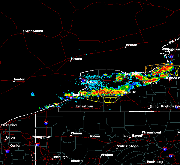 At 1104 pm edt, a severe thunderstorm was located near portageville, or near letchworth state park, moving southeast at 40 mph (radar indicated). Hazards include 60 mph wind gusts and quarter size hail. Hail damage to vehicles is expected. expect wind damage to roofs, siding, and trees. Locations impacted include, dansville, letchworth state park, arcade, portageville, groveland, springwater, nunda and eagle. At 1104 pm edt, a severe thunderstorm was located near portageville, or near letchworth state park, moving southeast at 40 mph (radar indicated). Hazards include 60 mph wind gusts and quarter size hail. Hail damage to vehicles is expected. expect wind damage to roofs, siding, and trees. Locations impacted include, dansville, letchworth state park, arcade, portageville, groveland, springwater, nunda and eagle.
|
| 6/20/2016 10:58 PM EDT |
 At 1058 pm edt, a severe thunderstorm was located near arcade, or 17 miles west of letchworth state park, moving southeast at 30 mph (radar indicated). Hazards include 60 mph wind gusts and quarter size hail. Hail damage to vehicles is expected. Expect wind damage to roofs, siding, and trees. At 1058 pm edt, a severe thunderstorm was located near arcade, or 17 miles west of letchworth state park, moving southeast at 30 mph (radar indicated). Hazards include 60 mph wind gusts and quarter size hail. Hail damage to vehicles is expected. Expect wind damage to roofs, siding, and trees.
|
| 6/20/2016 10:39 PM EDT |
 At 1038 pm edt, a severe thunderstorm was located near letchworth state park, moving southeast at 45 mph (radar indicated). Hazards include 60 mph wind gusts and quarter size hail. Hail damage to vehicles is expected. Expect wind damage to roofs, siding, and trees. At 1038 pm edt, a severe thunderstorm was located near letchworth state park, moving southeast at 45 mph (radar indicated). Hazards include 60 mph wind gusts and quarter size hail. Hail damage to vehicles is expected. Expect wind damage to roofs, siding, and trees.
|
| 6/5/2016 5:56 PM EDT |
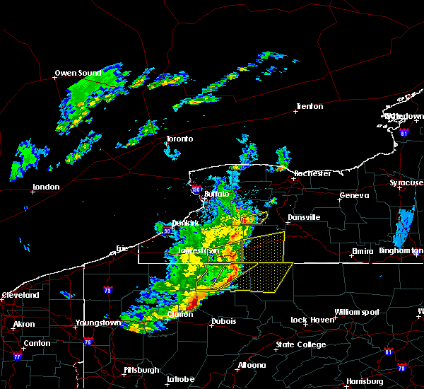 At 556 pm edt, a severe thunderstorm was located 9 miles northeast of arcade, or 15 miles west of letchworth state park, moving east at 30 mph (radar indicated). Hazards include 60 mph wind gusts. Expect damage to roofs. siding. and trees. Locations impacted include, letchworth state park, portageville, eagle, pike, castile, silver springs, gainesville and hermitage. At 556 pm edt, a severe thunderstorm was located 9 miles northeast of arcade, or 15 miles west of letchworth state park, moving east at 30 mph (radar indicated). Hazards include 60 mph wind gusts. Expect damage to roofs. siding. and trees. Locations impacted include, letchworth state park, portageville, eagle, pike, castile, silver springs, gainesville and hermitage.
|
| 6/5/2016 5:31 PM EDT |
 At 531 pm edt, a severe thunderstorm was located over chaffee, or 13 miles southeast of east aurora, moving east at 25 mph (radar indicated). Hazards include 60 mph wind gusts. Expect damage to roofs. siding. And trees. At 531 pm edt, a severe thunderstorm was located over chaffee, or 13 miles southeast of east aurora, moving east at 25 mph (radar indicated). Hazards include 60 mph wind gusts. Expect damage to roofs. siding. And trees.
|
| 9/9/2015 12:14 PM EDT |
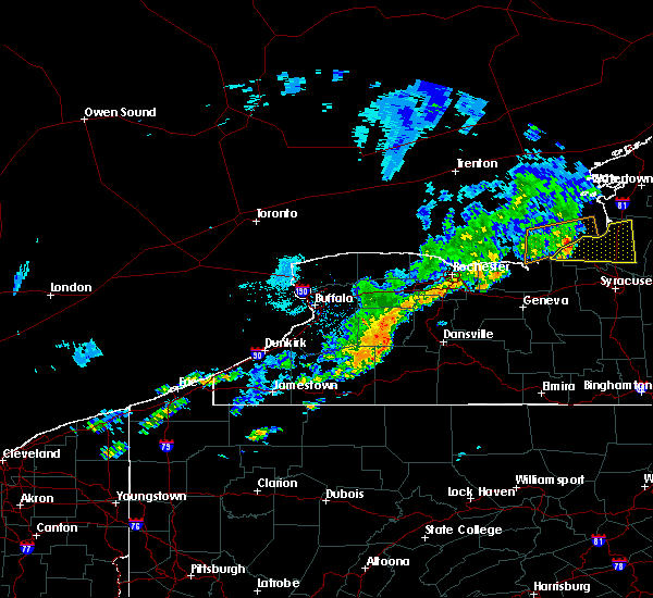 At 1212 pm edt, doppler radar indicated a severe thunderstorm capable of producing damaging winds in excess of 60 mph. this storm was located near portageville, or 9 miles southwest of letchworth state park, and moving east at 40 mph. At 1212 pm edt, doppler radar indicated a severe thunderstorm capable of producing damaging winds in excess of 60 mph. this storm was located near portageville, or 9 miles southwest of letchworth state park, and moving east at 40 mph.
|
| 7/14/2015 4:18 PM EDT |
 At 417 pm edt, doppler radar indicated a severe thunderstorm capable of producing damaging winds in excess of 60 mph. this storm was located near houghton, or 17 miles south of letchworth state park, and moving northeast at 20 mph. half inch hail may also accompany the damaging winds. At 417 pm edt, doppler radar indicated a severe thunderstorm capable of producing damaging winds in excess of 60 mph. this storm was located near houghton, or 17 miles south of letchworth state park, and moving northeast at 20 mph. half inch hail may also accompany the damaging winds.
|
| 6/12/2015 4:31 PM EDT |
 At 430 pm edt, doppler radar indicated a severe thunderstorm capable of producing damaging winds in excess of 60 mph. this storm was located over warsaw, or 12 miles northwest of letchworth state park, moving east at 50 mph. nickel size hail may also accompany the damaging winds. locations impacted include, geneseo, dansville, letchworth state park, perry, warsaw, mount morris, attica and conesus. a tornado watch remains in effect until 1100 pm edt for western new york. At 430 pm edt, doppler radar indicated a severe thunderstorm capable of producing damaging winds in excess of 60 mph. this storm was located over warsaw, or 12 miles northwest of letchworth state park, moving east at 50 mph. nickel size hail may also accompany the damaging winds. locations impacted include, geneseo, dansville, letchworth state park, perry, warsaw, mount morris, attica and conesus. a tornado watch remains in effect until 1100 pm edt for western new york.
|
| 6/12/2015 4:15 PM EDT |
 At 415 pm edt, doppler radar indicated a severe thunderstorm capable of producing half dollar size hail and damaging winds in excess of 60 mph. this storm was located near wales center, or 9 miles east of east aurora, and moving east at 50 mph. At 415 pm edt, doppler radar indicated a severe thunderstorm capable of producing half dollar size hail and damaging winds in excess of 60 mph. this storm was located near wales center, or 9 miles east of east aurora, and moving east at 50 mph.
|
| 4/20/2015 4:39 PM EDT | At 438 pm edt, national weather service doppler radar continued to indicate a severe thunderstorm capable of producing damaging winds in excess of 60 mph. this storm was located near black creek, or 15 miles northeast of olean, moving northeast at 45 mph. some locations in the warning include, caneadea, houghton, short tract,. |
| 4/20/2015 4:19 PM EDT | At 417 pm edt, national weather service doppler radar indicated a severe thunderstorm capable of producing damaging winds in excess of 60 mph. this storm was located near st. bonaventure, or near olean, and moving northeast at 45 mph. * some locations in the warning include, hinsdale, cuba, rushford, belfast, houghton,. |
Hail Maps for Pike, NY


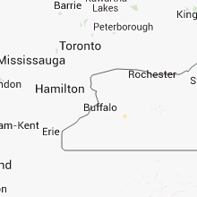

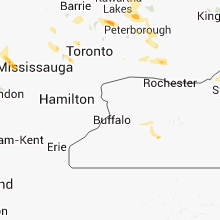


Connect with Interactive Hail Maps