

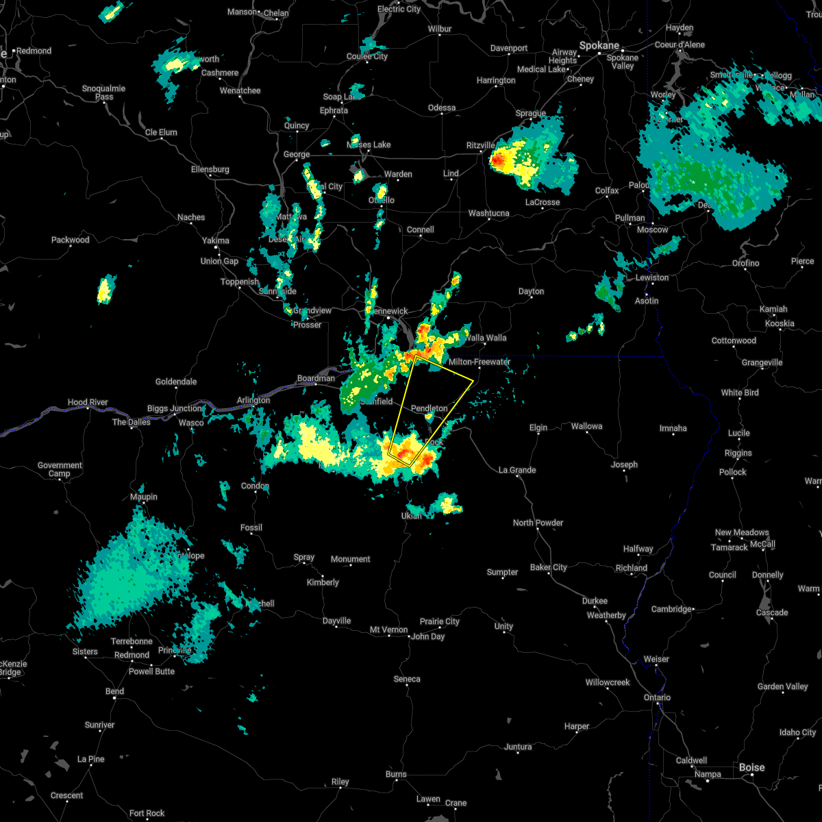
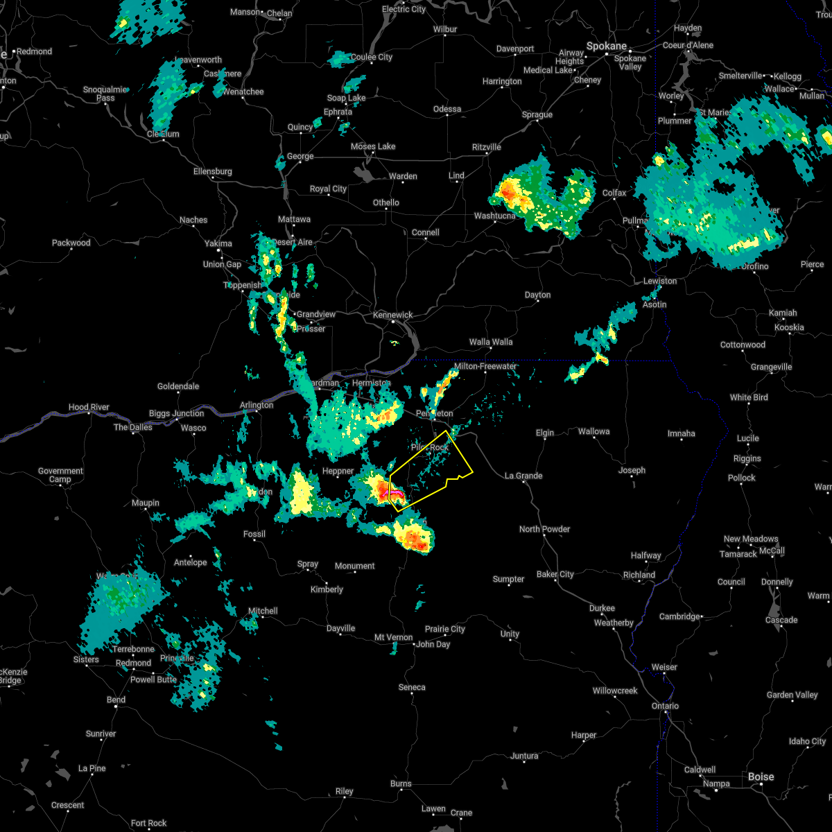
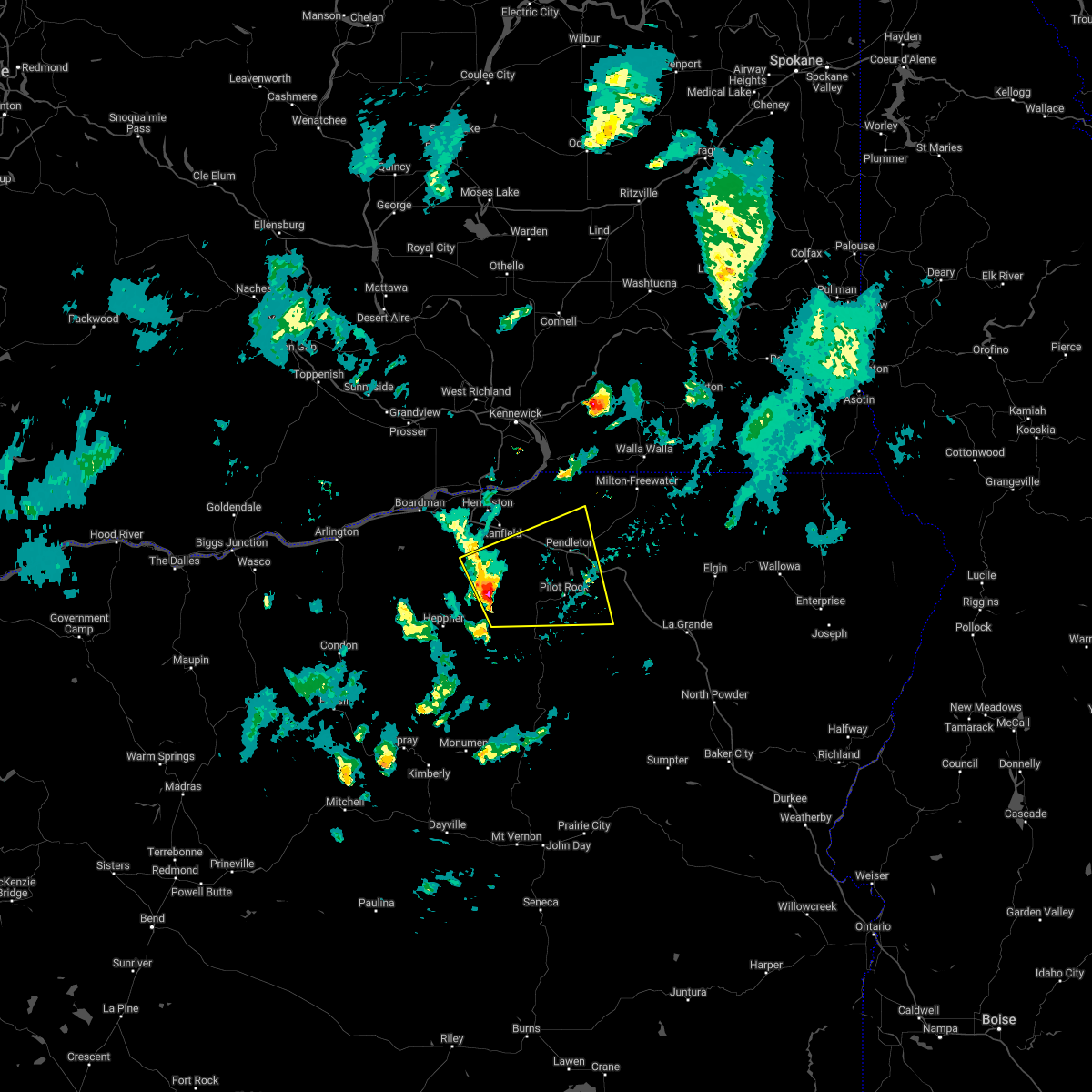
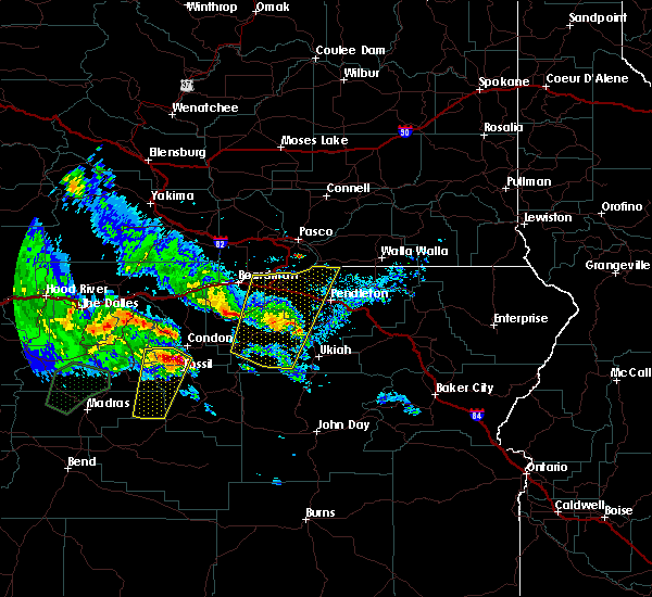
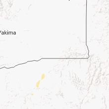
Hail Map for Pilot Rock, OR
The Pilot Rock, OR area has had 2 reports of on-the-ground hail by trained spotters, and has been under severe weather warnings 0 times during the past 12 months. Doppler radar has detected hail at or near Pilot Rock, OR on 6 occasions.
| Name: | Pilot Rock, OR |
| Where Located: | 46.7 miles SSW of Walla Walla, WA |
| Map: | Google Map for Pilot Rock, OR |
| Population: | 1502 |
| Housing Units: | 649 |
| More Info: | Search Google for Pilot Rock, OR |
5
The Top Recent Hail Date for Pilot Rock, OR is Friday, May 6, 2022 (1st out of 6)

Hail and Wind Damage Spotted near Pilot Rock, OR
| Date / Time | Report Details |
|---|---|
| 7/2/2022 7:40 PM PDT | Power outage in umatilla county OR, 0.5 miles NNW of Pilot Rock, OR |
| 7/2/2022 7:34 PM PDT |
 At 733 pm pdt, a severe thunderstorm was located 11 miles south of rieth, or 12 miles southwest of pendleton, moving northeast at 30 mph (radar indicated). Hazards include 70 mph wind gusts and half dollar size hail. Hail damage to vehicles is expected. expect considerable tree damage. Wind damage is also likely to mobile homes, roofs, and outbuildings. At 733 pm pdt, a severe thunderstorm was located 11 miles south of rieth, or 12 miles southwest of pendleton, moving northeast at 30 mph (radar indicated). Hazards include 70 mph wind gusts and half dollar size hail. Hail damage to vehicles is expected. expect considerable tree damage. Wind damage is also likely to mobile homes, roofs, and outbuildings.
|
| 7/2/2022 7:00 PM PDT |
 At 700 pm pdt, a severe thunderstorm was located 12 miles northwest of ukiah, or 23 miles east of heppner, moving northeast at 20 mph (radar indicated). Hazards include 60 mph wind gusts and quarter size hail. Hail damage to vehicles is expected. Expect wind damage to roofs, siding, and trees. At 700 pm pdt, a severe thunderstorm was located 12 miles northwest of ukiah, or 23 miles east of heppner, moving northeast at 20 mph (radar indicated). Hazards include 60 mph wind gusts and quarter size hail. Hail damage to vehicles is expected. Expect wind damage to roofs, siding, and trees.
|
| 7/2/2022 3:05 PM PDT | Quarter sized hail reported 15.5 miles WNW of Pilot Rock, OR, indian lake campground. time estimated from radar. social media report. |
| 5/6/2022 6:30 PM PDT | Quarter sized hail reported 1.7 miles SSW of Pilot Rock, OR, pouring rain. |
| 5/6/2022 6:01 PM PDT |
 At 601 pm pdt, a severe thunderstorm was located 13 miles southwest of rieth, or 15 miles southwest of pendleton, moving east at 40 mph (radar indicated). Hazards include 60 mph wind gusts and quarter size hail. Hail damage to vehicles is expected. Expect wind damage to roofs, siding, and trees. At 601 pm pdt, a severe thunderstorm was located 13 miles southwest of rieth, or 15 miles southwest of pendleton, moving east at 40 mph (radar indicated). Hazards include 60 mph wind gusts and quarter size hail. Hail damage to vehicles is expected. Expect wind damage to roofs, siding, and trees.
|
| 5/30/2020 3:46 PM PDT |
 At 345 pm pdt, a severe thunderstorm was located 15 miles south of rieth, or 18 miles southwest of pendleton, moving north at 45 mph (radar indicated). Hazards include 60 mph wind gusts and quarter size hail. Hail damage to vehicles is expected. Expect wind damage to roofs, siding, and trees. At 345 pm pdt, a severe thunderstorm was located 15 miles south of rieth, or 18 miles southwest of pendleton, moving north at 45 mph (radar indicated). Hazards include 60 mph wind gusts and quarter size hail. Hail damage to vehicles is expected. Expect wind damage to roofs, siding, and trees.
|
| 8/9/2019 8:43 PM PDT |
 At 842 pm pdt, a severe thunderstorm was located near echo, or 10 miles southeast of hermiston, moving north at 30 mph (radar indicated). Hazards include 60 mph wind gusts and quarter size hail. Hail damage to vehicles is expected. expect wind damage to roofs, siding, and trees. Locations impacted include, hermiston, pendleton, boardman, heppner, umatilla, stanfield, irrigon, echo, lexington, alderdale, plymouth, wallula, holdman, paterson, rieth and western umatilla reservation. At 842 pm pdt, a severe thunderstorm was located near echo, or 10 miles southeast of hermiston, moving north at 30 mph (radar indicated). Hazards include 60 mph wind gusts and quarter size hail. Hail damage to vehicles is expected. expect wind damage to roofs, siding, and trees. Locations impacted include, hermiston, pendleton, boardman, heppner, umatilla, stanfield, irrigon, echo, lexington, alderdale, plymouth, wallula, holdman, paterson, rieth and western umatilla reservation.
|
| 8/9/2019 8:35 PM PDT |
 At 835 pm pdt, a severe thunderstorm was located 8 miles southwest of rieth, or 12 miles southwest of pendleton, and is nearly stationary (radar indicated). Hazards include 60 mph wind gusts and quarter size hail. Hail damage to vehicles is expected. Expect wind damage to roofs, siding, and trees. At 835 pm pdt, a severe thunderstorm was located 8 miles southwest of rieth, or 12 miles southwest of pendleton, and is nearly stationary (radar indicated). Hazards include 60 mph wind gusts and quarter size hail. Hail damage to vehicles is expected. Expect wind damage to roofs, siding, and trees.
|
| 5/8/2018 8:04 PM PDT |
 At 803 pm pdt, severe thunderstorms were located along a line extending from 8 miles north of touchet to 7 miles north of lehman hot springs, moving east at 40 mph (public). Hazards include 65 mph wind gusts. Expect damage to roofs, siding, and trees. Locations impacted include, walla walla, pendleton, meacham, college place, milton-freewater, athena, weston, adams, prescott, helix, dixie, thorn hollow, tollgate, umapine, wallula, cayuse, bingham springs, garrett, umatilla reservation and touchet. At 803 pm pdt, severe thunderstorms were located along a line extending from 8 miles north of touchet to 7 miles north of lehman hot springs, moving east at 40 mph (public). Hazards include 65 mph wind gusts. Expect damage to roofs, siding, and trees. Locations impacted include, walla walla, pendleton, meacham, college place, milton-freewater, athena, weston, adams, prescott, helix, dixie, thorn hollow, tollgate, umapine, wallula, cayuse, bingham springs, garrett, umatilla reservation and touchet.
|
| 5/8/2018 7:39 PM PDT |
 At 738 pm pdt, severe thunderstorms were located along a line extending from near wallula to 9 miles northeast of ukiah, moving east at 40 mph (public). Hazards include 60 mph wind gusts. expect damage to roofs, siding, and trees At 738 pm pdt, severe thunderstorms were located along a line extending from near wallula to 9 miles northeast of ukiah, moving east at 40 mph (public). Hazards include 60 mph wind gusts. expect damage to roofs, siding, and trees
|
| 5/4/2016 7:46 PM PDT |
 At 741 pm pdt, trained weather spotters reported severe thunderstorms producing damaging winds in excess of 60 mph. these storms are located over northern umatilla and morrow counties. the winds will push across the washington border and the lower columbia basin and the foothills of washington over the next hour. locations impacted include, kennewick, pasco, richland, walla walla, hermiston, pendleton, prosser, connell, boardman, dayton, meacham, west richland, grandview, college place, milton-freewater, umatilla, benton city, stanfield, irrigon and pilot rock. At 741 pm pdt, trained weather spotters reported severe thunderstorms producing damaging winds in excess of 60 mph. these storms are located over northern umatilla and morrow counties. the winds will push across the washington border and the lower columbia basin and the foothills of washington over the next hour. locations impacted include, kennewick, pasco, richland, walla walla, hermiston, pendleton, prosser, connell, boardman, dayton, meacham, west richland, grandview, college place, milton-freewater, umatilla, benton city, stanfield, irrigon and pilot rock.
|
| 5/4/2016 7:20 PM PDT |
 At 719 pm pdt, the public reported a line of severe thunderstorms producing damaging winds in excess of 60 mph. these storms were located along a line extending from 9 miles northeast of ione to umatilla reservation, and moving north at 30 mph. At 719 pm pdt, the public reported a line of severe thunderstorms producing damaging winds in excess of 60 mph. these storms were located along a line extending from 9 miles northeast of ione to umatilla reservation, and moving north at 30 mph.
|
| 6/28/2015 9:51 PM PDT |
 At 949 pm pdt, doppler radar indicated a severe thunderstorm capable of producing damaging winds in excess of 60 mph. this storm was located 17 miles northwest of ukiah, or 18 miles east of heppner, and moving north at 40 mph. At 949 pm pdt, doppler radar indicated a severe thunderstorm capable of producing damaging winds in excess of 60 mph. this storm was located 17 miles northwest of ukiah, or 18 miles east of heppner, and moving north at 40 mph.
|
| 5/31/2015 7:22 PM PDT | At 719 pm pdt, national weather service employees indicated a severe thunderstorm capable of producing quarter size hail and damaging winds in excess of 60 mph. this storm was also producing blowing dust, which was reducing visibility to near zero. this storm was located near holdman, or 16 miles north of pendleton, moving northeast at 45 mph. locations impacted include, walla walla, hermiston, pendleton, college place, milton-freewater, pilot rock, athena, weston, adams, helix, umapine, garrett, holdman, cayuse, wallula, mission, touchet, rieth, northwestern umatilla reservation and lowden. |
| 5/31/2015 7:22 PM PDT | At 719 pm pdt, national weather service employees indicated a severe thunderstorm capable of producing quarter size hail and damaging winds in excess of 60 mph. this storm was also producing blowing dust, which was reducing visibility to near zero. this storm was located near holdman, or 16 miles north of pendleton, moving northeast at 45 mph. locations impacted include, walla walla, hermiston, pendleton, college place, milton-freewater, pilot rock, athena, weston, adams, helix, umapine, garrett, holdman, cayuse, wallula, mission, touchet, rieth, northwestern umatilla reservation and lowden. |
| 5/31/2015 6:55 PM PDT | At 653 pm pdt, doppler radar indicated a severe thunderstorm capable of producing quarter size hail and damaging winds in excess of 60 mph. this storm was located near echo, or 11 miles southeast of hermiston, and moving northeast at 40 mph. |
| 5/31/2015 6:55 PM PDT | At 653 pm pdt, doppler radar indicated a severe thunderstorm capable of producing quarter size hail and damaging winds in excess of 60 mph. this storm was located near echo, or 11 miles southeast of hermiston, and moving northeast at 40 mph. |
| 9/15/2013 6:00 PM PDT | Lots of limbs and part of tree down.reported on social medi in umatilla county OR, 0.5 miles NNW of Pilot Rock, OR |
| 8/16/2013 5:35 PM PDT | Lots of tree limbs dow in umatilla county OR, 7.8 miles NW of Pilot Rock, OR |
| 8/16/2013 5:00 PM PDT | 3/4 inch hail and funnel cloud in umatilla county OR, 13.2 miles NE of Pilot Rock, OR |
| 7/7/2012 4:20 PM PDT | Strong wind gust from an approaching thunderstorm broke off walnut tree limb approximately 12 to 18 inches in diameter. um- in umatilla county OR, 4.8 miles NNW of Pilot Rock, OR |
Hail Maps for Pilot Rock, OR


Connect with Interactive Hail Maps