

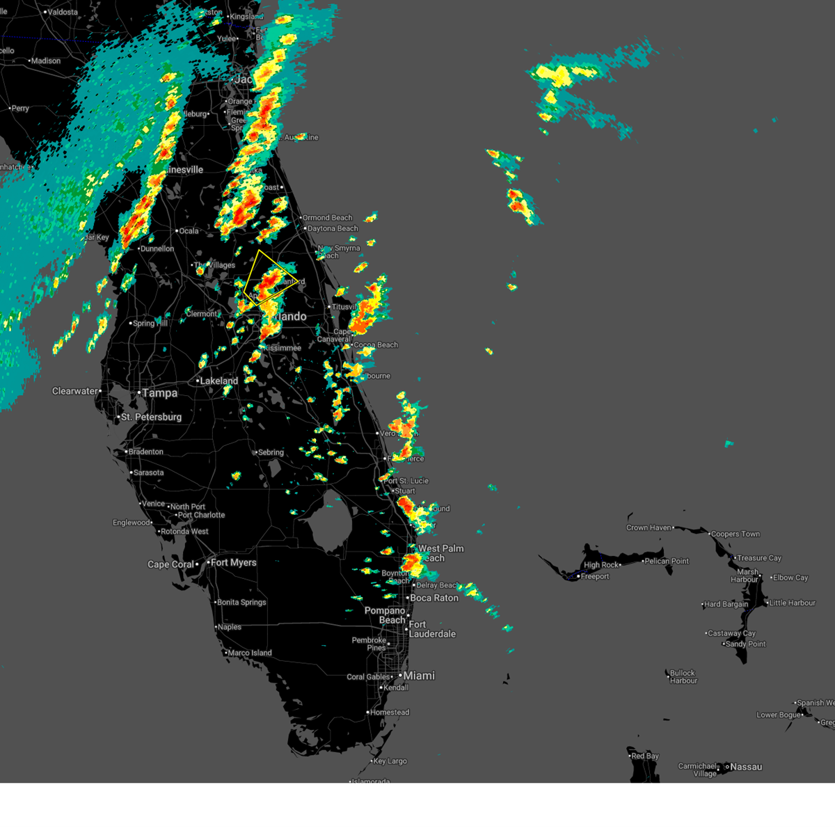
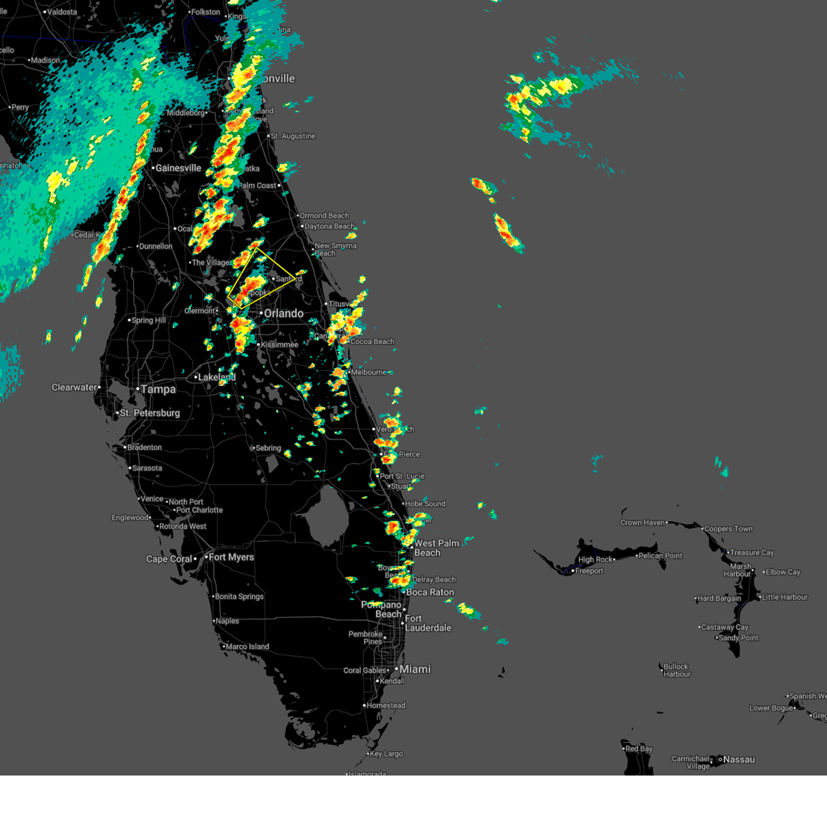
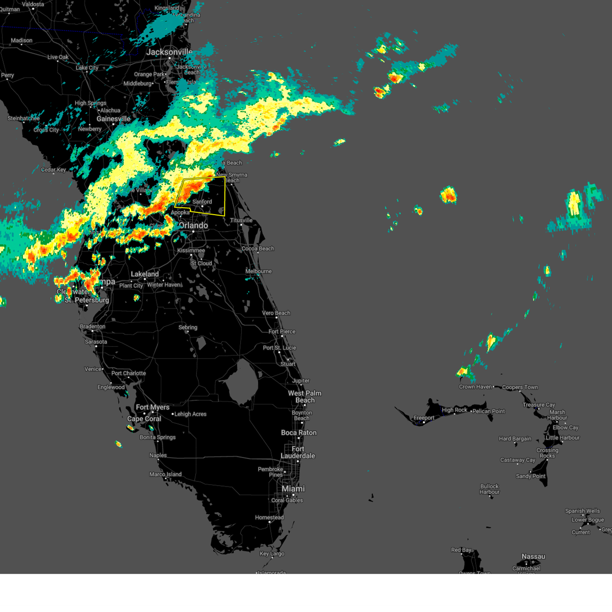
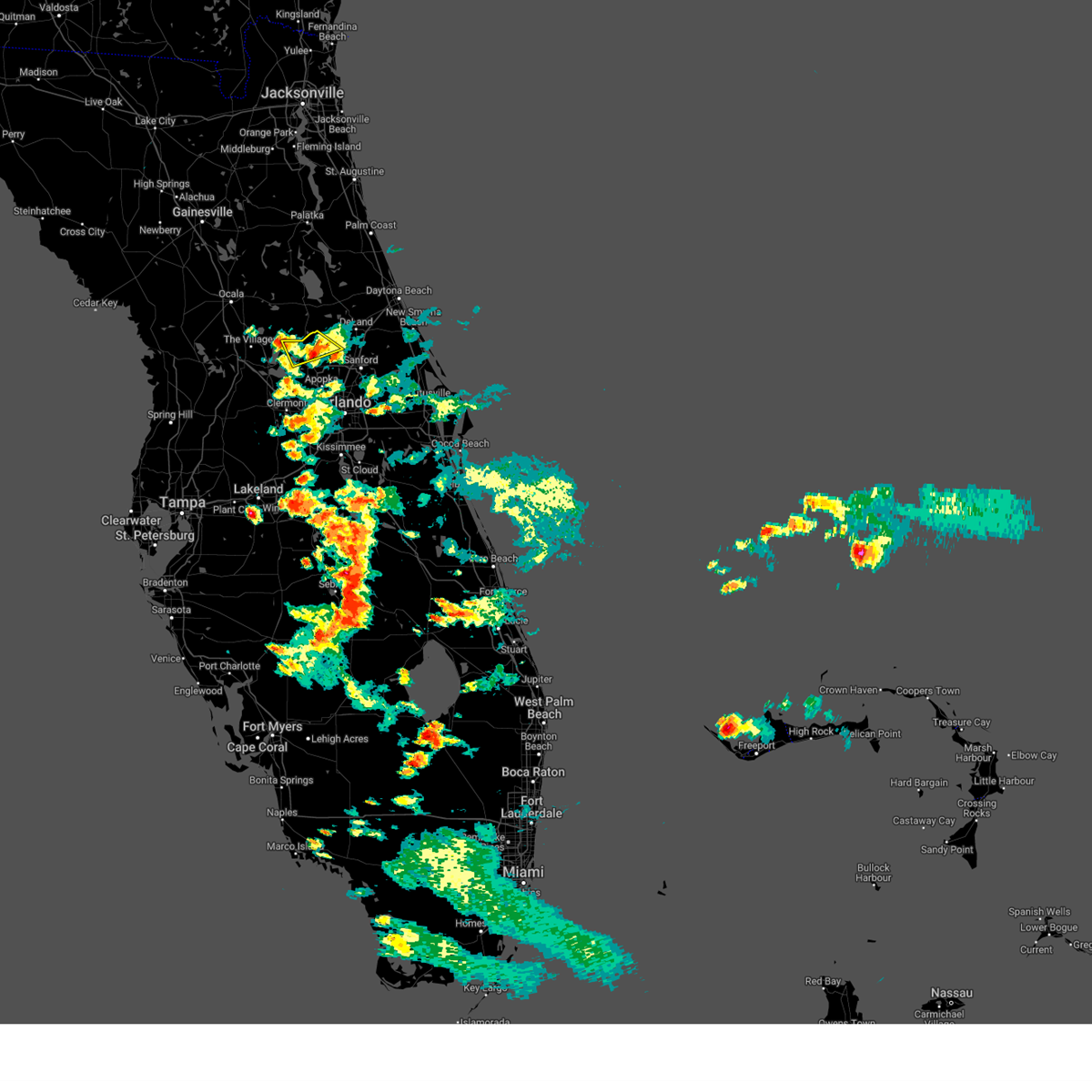
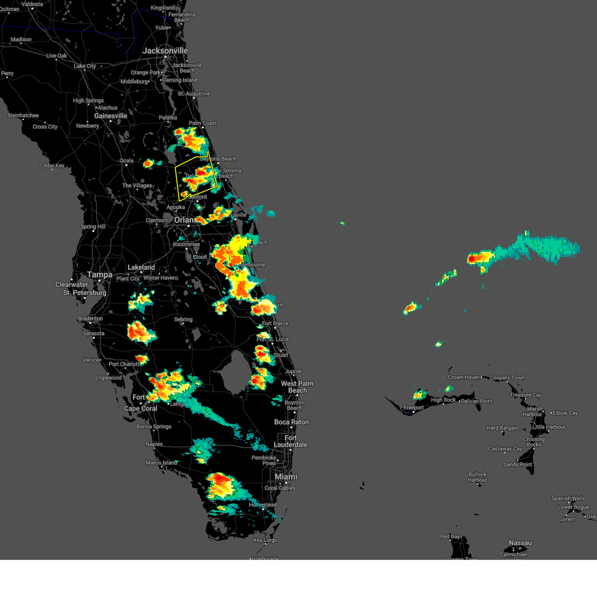
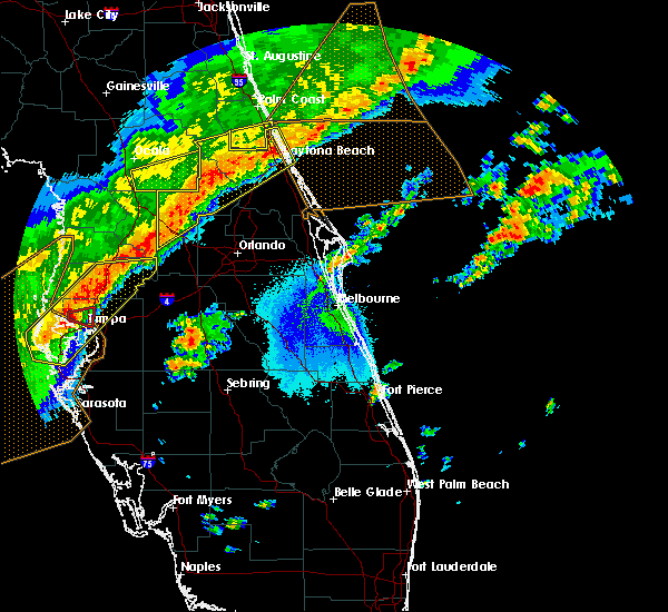
Hail Map for Pine Lakes, FL
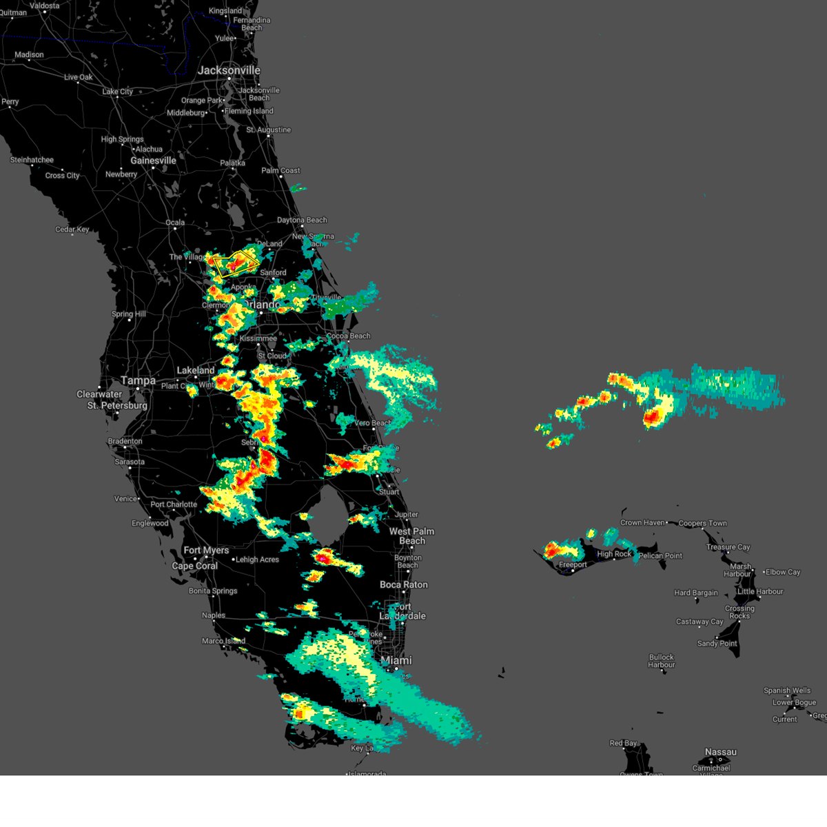
The Pine Lakes, FL area has had 0 reports of on-the-ground hail by trained spotters, and has been under severe weather warnings 2 times during the past 12 months. Doppler radar has detected hail at or near Pine Lakes, FL on 55 occasions.
| Name: | Pine Lakes, FL |
| Where Located: | 27.7 miles N of Orlando, FL |
| Map: | Google Map for Pine Lakes, FL |
| Population: | 862 |
| Housing Units: | 386 |
| More Info: | Search Google for Pine Lakes, FL |
3
The Top Recent Hail Date for Pine Lakes, FL is Tuesday, May 27, 2025 (8th out of 55)

Hail and Wind Damage Spotted near Pine Lakes, FL
| Date / Time | Report Details |
|---|---|
| 3/16/2026 2:18 PM EDT |
 At 217 pm edt, a severe thunderstorm was located near wekiva springs, or near lake mary, moving northeast at 40 mph (radar indicated). Hazards include 60 mph wind gusts and quarter size hail. Hail damage to vehicles is expected. expect wind damage to roofs, siding, and trees. Locations impacted include, deltona, sanford, apopka, altamonte springs, and winter springs. At 217 pm edt, a severe thunderstorm was located near wekiva springs, or near lake mary, moving northeast at 40 mph (radar indicated). Hazards include 60 mph wind gusts and quarter size hail. Hail damage to vehicles is expected. expect wind damage to roofs, siding, and trees. Locations impacted include, deltona, sanford, apopka, altamonte springs, and winter springs.
|
| 3/16/2026 2:01 PM EDT |
 Svrmlb the national weather service in melbourne has issued a * severe thunderstorm warning for, northwestern seminole county in east central florida, east central lake county in east central florida, northwestern orange county in east central florida, south central volusia county in east central florida, * until 230 pm edt. * at 200 pm edt, a severe thunderstorm was located over wekiwa springs state park, or near apopka, moving northeast at 30 mph (radar indicated). Hazards include 60 mph wind gusts and quarter size hail. Hail damage to vehicles is expected. Expect wind damage to roofs, siding, and trees. Svrmlb the national weather service in melbourne has issued a * severe thunderstorm warning for, northwestern seminole county in east central florida, east central lake county in east central florida, northwestern orange county in east central florida, south central volusia county in east central florida, * until 230 pm edt. * at 200 pm edt, a severe thunderstorm was located over wekiwa springs state park, or near apopka, moving northeast at 30 mph (radar indicated). Hazards include 60 mph wind gusts and quarter size hail. Hail damage to vehicles is expected. Expect wind damage to roofs, siding, and trees.
|
| 5/31/2025 5:39 AM EDT |
 Svrmlb the national weather service in melbourne has issued a * severe thunderstorm warning for, central seminole county in east central florida, northeastern lake county in east central florida, central volusia county in east central florida, * until 615 am edt. * at 539 am edt, a severe thunderstorm was located over cassia, moving east at 40 mph (radar indicated). Hazards include 60 mph wind gusts. expect damage to roofs, siding, and trees Svrmlb the national weather service in melbourne has issued a * severe thunderstorm warning for, central seminole county in east central florida, northeastern lake county in east central florida, central volusia county in east central florida, * until 615 am edt. * at 539 am edt, a severe thunderstorm was located over cassia, moving east at 40 mph (radar indicated). Hazards include 60 mph wind gusts. expect damage to roofs, siding, and trees
|
| 5/24/2025 6:00 PM EDT |
 the severe thunderstorm warning has been cancelled and is no longer in effect the severe thunderstorm warning has been cancelled and is no longer in effect
|
| 5/24/2025 5:45 PM EDT |
 At 545 pm edt, a severe thunderstorm was located near pittman, or near eustis, moving southeast at 10 mph (radar indicated). Hazards include 60 mph wind gusts and quarter size hail. Hail damage to vehicles is expected. expect wind damage to roofs, siding, and trees. Locations impacted include, eustis, tavares, mount dora, paisley, and cassia. At 545 pm edt, a severe thunderstorm was located near pittman, or near eustis, moving southeast at 10 mph (radar indicated). Hazards include 60 mph wind gusts and quarter size hail. Hail damage to vehicles is expected. expect wind damage to roofs, siding, and trees. Locations impacted include, eustis, tavares, mount dora, paisley, and cassia.
|
| 5/24/2025 5:29 PM EDT |
 Svrmlb the national weather service in melbourne has issued a * severe thunderstorm warning for, central lake county in east central florida, * until 615 pm edt. * at 528 pm edt, a severe thunderstorm was located over pittman, or 7 miles north of eustis, moving southeast at 10 mph (radar indicated). Hazards include 60 mph wind gusts and quarter size hail. Hail damage to vehicles is expected. Expect wind damage to roofs, siding, and trees. Svrmlb the national weather service in melbourne has issued a * severe thunderstorm warning for, central lake county in east central florida, * until 615 pm edt. * at 528 pm edt, a severe thunderstorm was located over pittman, or 7 miles north of eustis, moving southeast at 10 mph (radar indicated). Hazards include 60 mph wind gusts and quarter size hail. Hail damage to vehicles is expected. Expect wind damage to roofs, siding, and trees.
|
| 5/24/2025 4:54 PM EDT |
 The storms which prompted the warning have weakened below severe limits, and no longer poses an immediate threat to life or property. therefore, the warning will be allowed to expire. however small hail and gusty winds are still possible with these thunderstorms. The storms which prompted the warning have weakened below severe limits, and no longer poses an immediate threat to life or property. therefore, the warning will be allowed to expire. however small hail and gusty winds are still possible with these thunderstorms.
|
| 5/24/2025 4:38 PM EDT |
 At 436 pm edt, a severe thunderstorm was located northeast of deland airport, or 7 miles northeast of deland, moving northeast at 5 mph. another strong storm within the severe weather warning was located just west of deland with very little movement (radar indicated). Hazards include 60 mph wind gusts and quarter size hail. Hail damage to vehicles is expected. expect wind damage to roofs, siding, and trees. Locations impacted include, deltona, daytona beach, deland, orange city, and lake helen. At 436 pm edt, a severe thunderstorm was located northeast of deland airport, or 7 miles northeast of deland, moving northeast at 5 mph. another strong storm within the severe weather warning was located just west of deland with very little movement (radar indicated). Hazards include 60 mph wind gusts and quarter size hail. Hail damage to vehicles is expected. expect wind damage to roofs, siding, and trees. Locations impacted include, deltona, daytona beach, deland, orange city, and lake helen.
|
| 5/24/2025 4:23 PM EDT |
 Svrmlb the national weather service in melbourne has issued a * severe thunderstorm warning for, northeastern lake county in east central florida, central volusia county in east central florida, * until 500 pm edt. * at 422 pm edt, a severe thunderstorm was located near deland airport, or near deland. movement was nearly stationary (radar indicated). Hazards include 60 mph wind gusts and quarter size hail. Hail damage to vehicles is expected. Expect wind damage to roofs, siding, and trees. Svrmlb the national weather service in melbourne has issued a * severe thunderstorm warning for, northeastern lake county in east central florida, central volusia county in east central florida, * until 500 pm edt. * at 422 pm edt, a severe thunderstorm was located near deland airport, or near deland. movement was nearly stationary (radar indicated). Hazards include 60 mph wind gusts and quarter size hail. Hail damage to vehicles is expected. Expect wind damage to roofs, siding, and trees.
|
| 6/6/2024 7:31 PM EDT |
 At 730 pm edt, severe thunderstorms were located along a line extending from wekiva springs to near lake jessup to near christmas, moving northeast at 25 mph (radar indicated). Hazards include 60 mph wind gusts and quarter size hail. Hail damage to vehicles is expected. expect wind damage to roofs, siding, and trees. Locations impacted include, orlando, deltona, sanford, apopka, and altamonte springs. At 730 pm edt, severe thunderstorms were located along a line extending from wekiva springs to near lake jessup to near christmas, moving northeast at 25 mph (radar indicated). Hazards include 60 mph wind gusts and quarter size hail. Hail damage to vehicles is expected. expect wind damage to roofs, siding, and trees. Locations impacted include, orlando, deltona, sanford, apopka, and altamonte springs.
|
| 6/6/2024 7:26 PM EDT |
 Svrmlb the national weather service in melbourne has issued a * severe thunderstorm warning for, seminole county in east central florida, east central lake county in east central florida, central orange county in east central florida, south central volusia county in east central florida, * until 800 pm edt. * at 725 pm edt, severe thunderstorms were located along a line extending from wekiva springs to near oviedo to near christmas, moving northeast at 25 mph (radar indicated). Hazards include 60 mph wind gusts and quarter size hail. Hail damage to vehicles is expected. Expect wind damage to roofs, siding, and trees. Svrmlb the national weather service in melbourne has issued a * severe thunderstorm warning for, seminole county in east central florida, east central lake county in east central florida, central orange county in east central florida, south central volusia county in east central florida, * until 800 pm edt. * at 725 pm edt, severe thunderstorms were located along a line extending from wekiva springs to near oviedo to near christmas, moving northeast at 25 mph (radar indicated). Hazards include 60 mph wind gusts and quarter size hail. Hail damage to vehicles is expected. Expect wind damage to roofs, siding, and trees.
|
| 5/18/2024 3:29 PM EDT |
 Svrmlb the national weather service in melbourne has issued a * severe thunderstorm warning for, northwestern seminole county in east central florida, central lake county in east central florida, northwestern orange county in east central florida, * until 400 pm edt. * at 329 pm edt, a severe thunderstorm was located over tavares, moving east at 35 mph (radar indicated). Hazards include 60 mph wind gusts and quarter size hail. Hail damage to vehicles is expected. Expect wind damage to roofs, siding, and trees. Svrmlb the national weather service in melbourne has issued a * severe thunderstorm warning for, northwestern seminole county in east central florida, central lake county in east central florida, northwestern orange county in east central florida, * until 400 pm edt. * at 329 pm edt, a severe thunderstorm was located over tavares, moving east at 35 mph (radar indicated). Hazards include 60 mph wind gusts and quarter size hail. Hail damage to vehicles is expected. Expect wind damage to roofs, siding, and trees.
|
| 5/15/2024 6:44 AM EDT |
 The storm which prompted the warning has weakened below severe limits, and no longer poses an immediate threat to life or property. therefore, the warning will be allowed to expire. however small hail, gusty winds and heavy rain are still possible with this thunderstorm. a tornado watch remains in effect until 1100 am edt for east central florida. The storm which prompted the warning has weakened below severe limits, and no longer poses an immediate threat to life or property. therefore, the warning will be allowed to expire. however small hail, gusty winds and heavy rain are still possible with this thunderstorm. a tornado watch remains in effect until 1100 am edt for east central florida.
|
| 5/15/2024 6:35 AM EDT |
 At 634 am edt, a severe thunderstorm was located over deland, moving northeast at 30 mph (radar indicated). Hazards include 60 mph wind gusts and quarter size hail. Hail damage to vehicles is expected. expect wind damage to roofs, siding, and trees. Locations impacted include, deltona, deland, mount dora, orange city, and lake helen. At 634 am edt, a severe thunderstorm was located over deland, moving northeast at 30 mph (radar indicated). Hazards include 60 mph wind gusts and quarter size hail. Hail damage to vehicles is expected. expect wind damage to roofs, siding, and trees. Locations impacted include, deltona, deland, mount dora, orange city, and lake helen.
|
| 5/15/2024 6:09 AM EDT |
 Svrmlb the national weather service in melbourne has issued a * severe thunderstorm warning for, northeastern lake county in east central florida, central volusia county in east central florida, * until 645 am edt. * at 609 am edt, a severe thunderstorm was located near cassia, moving east at 45 mph (radar indicated). Hazards include 60 mph wind gusts and quarter size hail. Hail damage to vehicles is expected. Expect wind damage to roofs, siding, and trees. Svrmlb the national weather service in melbourne has issued a * severe thunderstorm warning for, northeastern lake county in east central florida, central volusia county in east central florida, * until 645 am edt. * at 609 am edt, a severe thunderstorm was located near cassia, moving east at 45 mph (radar indicated). Hazards include 60 mph wind gusts and quarter size hail. Hail damage to vehicles is expected. Expect wind damage to roofs, siding, and trees.
|
| 2/4/2024 6:57 PM EST |
 At 656 pm est, a severe thunderstorm was located over tavares, moving northeast at 30 mph (radar indicated). Hazards include 60 mph wind gusts and quarter size hail. Hail damage to vehicles is expected. Expect wind damage to roofs, siding, and trees. At 656 pm est, a severe thunderstorm was located over tavares, moving northeast at 30 mph (radar indicated). Hazards include 60 mph wind gusts and quarter size hail. Hail damage to vehicles is expected. Expect wind damage to roofs, siding, and trees.
|
| 1/9/2024 5:21 PM EST |
 The national weather service in melbourne has issued a * severe thunderstorm warning for. seminole county in east central florida. central lake county in east central florida. orange county in east central florida. Volusia county in east central florida. The national weather service in melbourne has issued a * severe thunderstorm warning for. seminole county in east central florida. central lake county in east central florida. orange county in east central florida. Volusia county in east central florida.
|
| 1/9/2024 5:07 PM EST |
 At 506 pm est, severe thunderstorms were located along a line extending from near pierson to mid florida lakes to 12 miles southwest of lake louisa, moving northeast at 70 mph (radar indicated). Hazards include 60 mph wind gusts. Expect damage to roofs, siding, and trees. Locations impacted include, apopka, ocoee, winter garden, leesburg, and eustis. At 506 pm est, severe thunderstorms were located along a line extending from near pierson to mid florida lakes to 12 miles southwest of lake louisa, moving northeast at 70 mph (radar indicated). Hazards include 60 mph wind gusts. Expect damage to roofs, siding, and trees. Locations impacted include, apopka, ocoee, winter garden, leesburg, and eustis.
|
| 1/9/2024 4:46 PM EST |
 At 446 pm est, severe thunderstorms were located along a line extending from lake george to near leesburg to 6 miles east of dade city, moving northeast at 65 mph (radar indicated). Hazards include 60 mph wind gusts. expect damage to roofs, siding, and trees At 446 pm est, severe thunderstorms were located along a line extending from lake george to near leesburg to 6 miles east of dade city, moving northeast at 65 mph (radar indicated). Hazards include 60 mph wind gusts. expect damage to roofs, siding, and trees
|
| 10/12/2023 4:45 AM EDT |
 At 445 am edt, a severe thunderstorm capable of producing a tornado was located near barberville, moving northeast at 55 mph (radar indicated rotation). Hazards include tornado. Flying debris will be dangerous to those caught without shelter. mobile homes will be damaged or destroyed. damage to roofs, windows, and vehicles will occur. tree damage is likely. this dangerous storm will be near, deleon springs and barberville around 450 am edt. Other locations impacted by this tornadic thunderstorm include eldridge. At 445 am edt, a severe thunderstorm capable of producing a tornado was located near barberville, moving northeast at 55 mph (radar indicated rotation). Hazards include tornado. Flying debris will be dangerous to those caught without shelter. mobile homes will be damaged or destroyed. damage to roofs, windows, and vehicles will occur. tree damage is likely. this dangerous storm will be near, deleon springs and barberville around 450 am edt. Other locations impacted by this tornadic thunderstorm include eldridge.
|
| 10/12/2023 4:37 AM EDT |
 At 436 am edt, a severe thunderstorm capable of producing a tornado was located near paisley, moving northeast at 55 mph. another storm capable of producing a tornado is near lake yale (radar indicated rotation). Hazards include tornado. Flying debris will be dangerous to those caught without shelter. mobile homes will be damaged or destroyed. damage to roofs, windows, and vehicles will occur. tree damage is likely. this dangerous storm will be near, deleon springs and paisley around 440 am edt. barberville around 450 am edt. Other locations impacted by this tornadic thunderstorm include eldridge. At 436 am edt, a severe thunderstorm capable of producing a tornado was located near paisley, moving northeast at 55 mph. another storm capable of producing a tornado is near lake yale (radar indicated rotation). Hazards include tornado. Flying debris will be dangerous to those caught without shelter. mobile homes will be damaged or destroyed. damage to roofs, windows, and vehicles will occur. tree damage is likely. this dangerous storm will be near, deleon springs and paisley around 440 am edt. barberville around 450 am edt. Other locations impacted by this tornadic thunderstorm include eldridge.
|
| 10/12/2023 4:26 AM EDT |
 At 425 am edt, a severe thunderstorm capable of producing a tornado was located over leesburg airport, or over lake griffin, moving northeast at 60 mph (radar indicated rotation). Hazards include tornado. Flying debris will be dangerous to those caught without shelter. mobile homes will be damaged or destroyed. damage to roofs, windows, and vehicles will occur. tree damage is likely. this dangerous storm will be near, eustis, tavares, and lisbon around 430 am edt. paisley and pittman around 440 am edt. deleon springs around 450 am edt. barberville around 500 am edt. Other locations impacted by this tornadic thunderstorm include pine lakes. At 425 am edt, a severe thunderstorm capable of producing a tornado was located over leesburg airport, or over lake griffin, moving northeast at 60 mph (radar indicated rotation). Hazards include tornado. Flying debris will be dangerous to those caught without shelter. mobile homes will be damaged or destroyed. damage to roofs, windows, and vehicles will occur. tree damage is likely. this dangerous storm will be near, eustis, tavares, and lisbon around 430 am edt. paisley and pittman around 440 am edt. deleon springs around 450 am edt. barberville around 500 am edt. Other locations impacted by this tornadic thunderstorm include pine lakes.
|
| 10/12/2023 4:18 AM EDT |
 At 418 am edt, a severe thunderstorm capable of producing a tornado was located over leesburg, moving northeast at 55 mph (radar indicated rotation). Hazards include tornado. Flying debris will be dangerous to those caught without shelter. mobile homes will be damaged or destroyed. damage to roofs, windows, and vehicles will occur. tree damage is likely. this dangerous storm will be near, leesburg, eustis, and tavares around 420 am edt. pittman around 430 am edt. paisley around 440 am edt. Other locations impacted by this tornadic thunderstorm include forest hills. At 418 am edt, a severe thunderstorm capable of producing a tornado was located over leesburg, moving northeast at 55 mph (radar indicated rotation). Hazards include tornado. Flying debris will be dangerous to those caught without shelter. mobile homes will be damaged or destroyed. damage to roofs, windows, and vehicles will occur. tree damage is likely. this dangerous storm will be near, leesburg, eustis, and tavares around 420 am edt. pittman around 430 am edt. paisley around 440 am edt. Other locations impacted by this tornadic thunderstorm include forest hills.
|
| 10/12/2023 4:06 AM EDT |
 At 405 am edt, a severe thunderstorm capable of producing a tornado was located over lake griffin, moving northeast at 45 mph (radar indicated rotation). Hazards include tornado. Flying debris will be dangerous to those caught without shelter. mobile homes will be damaged or destroyed. damage to roofs, windows, and vehicles will occur. tree damage is likely. this dangerous storm will be near, eustis, tavares, and lisbon around 410 am edt. paisley and pittman around 420 am edt. Other locations impacted by this tornadic thunderstorm include forest hills. At 405 am edt, a severe thunderstorm capable of producing a tornado was located over lake griffin, moving northeast at 45 mph (radar indicated rotation). Hazards include tornado. Flying debris will be dangerous to those caught without shelter. mobile homes will be damaged or destroyed. damage to roofs, windows, and vehicles will occur. tree damage is likely. this dangerous storm will be near, eustis, tavares, and lisbon around 410 am edt. paisley and pittman around 420 am edt. Other locations impacted by this tornadic thunderstorm include forest hills.
|
| 9/11/2023 7:57 PM EDT |
 The severe thunderstorm warning for east central lake and central volusia counties will expire at 800 pm edt, the storm which prompted the warning has weakened below severe limits, and no longer poses an immediate threat to life or property. therefore, the warning will be allowed to expire. however gusty winds and heavy rain are still possible with this thunderstorm. The severe thunderstorm warning for east central lake and central volusia counties will expire at 800 pm edt, the storm which prompted the warning has weakened below severe limits, and no longer poses an immediate threat to life or property. therefore, the warning will be allowed to expire. however gusty winds and heavy rain are still possible with this thunderstorm.
|
| 9/11/2023 7:34 PM EDT |
 At 734 pm edt, a severe thunderstorm was located near cassia, moving southeast at 10 mph (radar indicated). Hazards include 60 mph wind gusts and quarter size hail. Hail damage to vehicles is expected. expect wind damage to roofs, siding, and trees. Locations impacted include, deltona, deland, orange city, debary, and west deland. At 734 pm edt, a severe thunderstorm was located near cassia, moving southeast at 10 mph (radar indicated). Hazards include 60 mph wind gusts and quarter size hail. Hail damage to vehicles is expected. expect wind damage to roofs, siding, and trees. Locations impacted include, deltona, deland, orange city, debary, and west deland.
|
| 9/11/2023 7:15 PM EDT |
 At 714 pm edt, a severe thunderstorm was located 7 miles east of paisley, moving east at 10 mph (radar indicated). Hazards include 60 mph wind gusts and quarter size hail. Hail damage to vehicles is expected. Expect wind damage to roofs, siding, and trees. At 714 pm edt, a severe thunderstorm was located 7 miles east of paisley, moving east at 10 mph (radar indicated). Hazards include 60 mph wind gusts and quarter size hail. Hail damage to vehicles is expected. Expect wind damage to roofs, siding, and trees.
|
| 5/22/2023 6:06 PM EDT |
 At 606 pm edt, a severe thunderstorm was located near sorrento, or near mount plymouth, moving southeast at 20 mph (radar indicated). Hazards include 60 mph wind gusts and penny size hail. expect damage to roofs, siding, and trees At 606 pm edt, a severe thunderstorm was located near sorrento, or near mount plymouth, moving southeast at 20 mph (radar indicated). Hazards include 60 mph wind gusts and penny size hail. expect damage to roofs, siding, and trees
|
| 5/22/2023 6:00 PM EDT |
 At 600 pm edt, a severe thunderstorm was located near paisley, moving southeast at 15 mph (radar indicated). Hazards include 60 mph wind gusts and penny size hail. Expect damage to roofs, siding, and trees. Locations impacted include, mount dora, paisley, cassia, mount plymouth and sorrento. At 600 pm edt, a severe thunderstorm was located near paisley, moving southeast at 15 mph (radar indicated). Hazards include 60 mph wind gusts and penny size hail. Expect damage to roofs, siding, and trees. Locations impacted include, mount dora, paisley, cassia, mount plymouth and sorrento.
|
| 5/22/2023 5:48 PM EDT |
 At 548 pm edt, a severe thunderstorm was located over paisley, moving southeast at 15 mph (radar indicated). Hazards include 60 mph wind gusts and penny size hail. expect damage to roofs, siding, and trees At 548 pm edt, a severe thunderstorm was located over paisley, moving southeast at 15 mph (radar indicated). Hazards include 60 mph wind gusts and penny size hail. expect damage to roofs, siding, and trees
|
| 4/26/2023 3:53 PM EDT |
 At 353 pm edt, a severe thunderstorm was located near cassia, moving southeast at 25 mph (radar indicated). Hazards include 60 mph wind gusts and quarter size hail. Hail damage to vehicles is expected. Expect wind damage to roofs, siding, and trees. At 353 pm edt, a severe thunderstorm was located near cassia, moving southeast at 25 mph (radar indicated). Hazards include 60 mph wind gusts and quarter size hail. Hail damage to vehicles is expected. Expect wind damage to roofs, siding, and trees.
|
| 4/26/2023 3:21 PM EDT |
 At 321 pm edt, a severe thunderstorm was located near paisley, moving southeast at 25 mph (radar indicated). Hazards include 60 mph wind gusts and quarter size hail. Hail damage to vehicles is expected. Expect wind damage to roofs, siding, and trees. At 321 pm edt, a severe thunderstorm was located near paisley, moving southeast at 25 mph (radar indicated). Hazards include 60 mph wind gusts and quarter size hail. Hail damage to vehicles is expected. Expect wind damage to roofs, siding, and trees.
|
| 4/24/2023 4:28 PM EDT |
 The severe thunderstorm warning for northeastern lake county will expire at 430 pm edt, the severe thunderstorm which prompted the warning has weakened and moved out of the warned area. therefore, the warning will be allowed to expire. The severe thunderstorm warning for northeastern lake county will expire at 430 pm edt, the severe thunderstorm which prompted the warning has weakened and moved out of the warned area. therefore, the warning will be allowed to expire.
|
| 4/24/2023 4:16 PM EDT |
 At 416 pm edt, a severe thunderstorm was located near cassia, moving northwest at 25 mph (radar indicated). Hazards include 60 mph wind gusts and quarter size hail. Hail damage to vehicles is expected. expect wind damage to roofs, siding, and trees. locations impacted include, pine lakes. hail threat, radar indicated max hail size, 1. 00 in wind threat, radar indicated max wind gust, 60 mph. At 416 pm edt, a severe thunderstorm was located near cassia, moving northwest at 25 mph (radar indicated). Hazards include 60 mph wind gusts and quarter size hail. Hail damage to vehicles is expected. expect wind damage to roofs, siding, and trees. locations impacted include, pine lakes. hail threat, radar indicated max hail size, 1. 00 in wind threat, radar indicated max wind gust, 60 mph.
|
| 4/24/2023 4:14 PM EDT |
 At 414 pm edt, a severe thunderstorm was located over cassia, moving north at 15 mph (radar indicated). Hazards include 60 mph wind gusts and quarter size hail. Hail damage to vehicles is expected. expect wind damage to roofs, siding, and trees. locations impacted include, paisley, cassia, forest hills, fullerville and lake kathryn. hail threat, radar indicated max hail size, 1. 00 in wind threat, radar indicated max wind gust, 60 mph. At 414 pm edt, a severe thunderstorm was located over cassia, moving north at 15 mph (radar indicated). Hazards include 60 mph wind gusts and quarter size hail. Hail damage to vehicles is expected. expect wind damage to roofs, siding, and trees. locations impacted include, paisley, cassia, forest hills, fullerville and lake kathryn. hail threat, radar indicated max hail size, 1. 00 in wind threat, radar indicated max wind gust, 60 mph.
|
| 4/24/2023 4:03 PM EDT |
 At 403 pm edt, a severe thunderstorm was located over cassia, moving northwest at 15 mph (radar indicated). Hazards include 60 mph wind gusts and quarter size hail. Hail damage to vehicles is expected. expect wind damage to roofs, siding, and trees. locations impacted include, pine lakes. hail threat, radar indicated max hail size, 1. 00 in wind threat, radar indicated max wind gust, 60 mph. At 403 pm edt, a severe thunderstorm was located over cassia, moving northwest at 15 mph (radar indicated). Hazards include 60 mph wind gusts and quarter size hail. Hail damage to vehicles is expected. expect wind damage to roofs, siding, and trees. locations impacted include, pine lakes. hail threat, radar indicated max hail size, 1. 00 in wind threat, radar indicated max wind gust, 60 mph.
|
| 4/24/2023 4:01 PM EDT |
 At 401 pm edt, a severe thunderstorm was located over cassia, moving north at 20 mph (radar indicated). Hazards include 60 mph wind gusts and quarter size hail. Hail damage to vehicles is expected. Expect wind damage to roofs, siding, and trees. At 401 pm edt, a severe thunderstorm was located over cassia, moving north at 20 mph (radar indicated). Hazards include 60 mph wind gusts and quarter size hail. Hail damage to vehicles is expected. Expect wind damage to roofs, siding, and trees.
|
| 4/24/2023 3:51 PM EDT |
 At 350 pm edt, a severe thunderstorm was located near cassia, moving north at 25 mph (radar indicated). Hazards include 60 mph wind gusts and quarter size hail. Hail damage to vehicles is expected. expect wind damage to roofs, siding, and trees. locations impacted include, cassia, debary, heathrow and pine lakes. hail threat, radar indicated max hail size, 1. 00 in wind threat, radar indicated max wind gust, 60 mph. At 350 pm edt, a severe thunderstorm was located near cassia, moving north at 25 mph (radar indicated). Hazards include 60 mph wind gusts and quarter size hail. Hail damage to vehicles is expected. expect wind damage to roofs, siding, and trees. locations impacted include, cassia, debary, heathrow and pine lakes. hail threat, radar indicated max hail size, 1. 00 in wind threat, radar indicated max wind gust, 60 mph.
|
| 4/24/2023 3:37 PM EDT |
 At 337 pm edt, a severe thunderstorm was located over wekiwa springs state park, or near mount plymouth, moving northeast at 10 mph (radar indicated). Hazards include 60 mph wind gusts and quarter size hail. Hail damage to vehicles is expected. Expect wind damage to roofs, siding, and trees. At 337 pm edt, a severe thunderstorm was located over wekiwa springs state park, or near mount plymouth, moving northeast at 10 mph (radar indicated). Hazards include 60 mph wind gusts and quarter size hail. Hail damage to vehicles is expected. Expect wind damage to roofs, siding, and trees.
|
| 8/17/2022 1:05 PM EDT |
 At 105 pm edt, a severe thunderstorm was located near orange city, moving east at 15 mph (radar indicated). Hazards include 60 mph wind gusts and penny size hail. expect damage to roofs, siding, and trees At 105 pm edt, a severe thunderstorm was located near orange city, moving east at 15 mph (radar indicated). Hazards include 60 mph wind gusts and penny size hail. expect damage to roofs, siding, and trees
|
| 6/18/2022 1:59 PM EDT |
 At 159 pm edt, a severe thunderstorm was located near cassia, moving southeast at 15 mph (radar indicated). Hazards include 60 mph wind gusts and penny size hail. expect damage to roofs, siding, and trees At 159 pm edt, a severe thunderstorm was located near cassia, moving southeast at 15 mph (radar indicated). Hazards include 60 mph wind gusts and penny size hail. expect damage to roofs, siding, and trees
|
| 5/21/2022 6:56 PM EDT |
 At 656 pm edt, a severe thunderstorm was located near orange city, moving north at 25 mph (radar indicated). Hazards include 60 mph wind gusts and quarter size hail. Hail damage to vehicles is expected. Expect wind damage to roofs, siding, and trees. At 656 pm edt, a severe thunderstorm was located near orange city, moving north at 25 mph (radar indicated). Hazards include 60 mph wind gusts and quarter size hail. Hail damage to vehicles is expected. Expect wind damage to roofs, siding, and trees.
|
| 4/2/2022 2:42 PM EDT |
 At 242 pm edt, a severe thunderstorm was located over mount dora, moving east at 30 mph (radar indicated). Hazards include 60 mph wind gusts and nickel size hail. Expect damage to roofs, siding, and trees. locations impacted include, apopka, eustis, tavares, mount dora and zellwood. hail threat, radar indicated max hail size, 0. 88 in wind threat, radar indicated max wind gust, 60 mph. At 242 pm edt, a severe thunderstorm was located over mount dora, moving east at 30 mph (radar indicated). Hazards include 60 mph wind gusts and nickel size hail. Expect damage to roofs, siding, and trees. locations impacted include, apopka, eustis, tavares, mount dora and zellwood. hail threat, radar indicated max hail size, 0. 88 in wind threat, radar indicated max wind gust, 60 mph.
|
| 4/2/2022 2:30 PM EDT |
 At 229 pm edt, severe thunderstorms were located along a line extending from near barberville to near deland airport to 6 miles west of orange city, moving east at 25 mph (radar indicated). Hazards include 60 mph wind gusts and penny size hail. expect damage to roofs, siding, and trees At 229 pm edt, severe thunderstorms were located along a line extending from near barberville to near deland airport to 6 miles west of orange city, moving east at 25 mph (radar indicated). Hazards include 60 mph wind gusts and penny size hail. expect damage to roofs, siding, and trees
|
| 4/2/2022 2:26 PM EDT |
 At 226 pm edt, a severe thunderstorm was located over tavares, moving east at 30 mph (radar indicated). Hazards include 60 mph wind gusts and nickel size hail. expect damage to roofs, siding, and trees At 226 pm edt, a severe thunderstorm was located over tavares, moving east at 30 mph (radar indicated). Hazards include 60 mph wind gusts and nickel size hail. expect damage to roofs, siding, and trees
|
| 3/12/2022 9:30 AM EST |
 At 930 am est, severe thunderstorms were located along a line extending from 6 miles northeast of ormond-by-the-sea to near ocoee to 9 miles southwest of lake louisa, moving east at 60 mph (radar indicated). Hazards include 60 mph wind gusts and penny size hail. expect damage to roofs, siding, and trees At 930 am est, severe thunderstorms were located along a line extending from 6 miles northeast of ormond-by-the-sea to near ocoee to 9 miles southwest of lake louisa, moving east at 60 mph (radar indicated). Hazards include 60 mph wind gusts and penny size hail. expect damage to roofs, siding, and trees
|
| 3/12/2022 8:43 AM EST |
 At 842 am est, severe thunderstorms were located along a line extending from near lake george to near lady lake and into sumter county, moving east at 55 mph (radar indicated). Hazards include 60 mph wind gusts and penny size hail. expect damage to roofs, siding, and trees At 842 am est, severe thunderstorms were located along a line extending from near lake george to near lady lake and into sumter county, moving east at 55 mph (radar indicated). Hazards include 60 mph wind gusts and penny size hail. expect damage to roofs, siding, and trees
|
| 10/28/2021 2:40 PM EDT |
 At 239 pm edt, a severe thunderstorm was located over clermont, or near ferndale, moving northeast at 40 mph (radar indicated). Hazards include 60 mph wind gusts. Expect damage to roofs, siding, and trees. Locations impacted include, orlando, sanford, apopka, altamonte springs and ocoee. At 239 pm edt, a severe thunderstorm was located over clermont, or near ferndale, moving northeast at 40 mph (radar indicated). Hazards include 60 mph wind gusts. Expect damage to roofs, siding, and trees. Locations impacted include, orlando, sanford, apopka, altamonte springs and ocoee.
|
| 10/28/2021 2:19 PM EDT |
 At 218 pm edt, a severe thunderstorm was located 9 miles south of groveland, moving northeast at 40 mph (radar indicated). Hazards include 60 mph wind gusts. expect damage to roofs, siding, and trees At 218 pm edt, a severe thunderstorm was located 9 miles south of groveland, moving northeast at 40 mph (radar indicated). Hazards include 60 mph wind gusts. expect damage to roofs, siding, and trees
|
| 10/28/2021 2:09 PM EDT |
 At 208 pm edt, a severe thunderstorm was located over zellwood, moving northeast at 60 mph (radar indicated). Hazards include 60 mph wind gusts. Expect damage to roofs, siding, and trees. locations impacted include, apopka, eustis, tavares, mount dora and howey-in-the-hills. hail threat, radar indicated max hail size, <. 75 in wind threat, radar indicated max wind gust, 60 mph. At 208 pm edt, a severe thunderstorm was located over zellwood, moving northeast at 60 mph (radar indicated). Hazards include 60 mph wind gusts. Expect damage to roofs, siding, and trees. locations impacted include, apopka, eustis, tavares, mount dora and howey-in-the-hills. hail threat, radar indicated max hail size, <. 75 in wind threat, radar indicated max wind gust, 60 mph.
|
| 10/28/2021 1:38 PM EDT |
 At 137 pm edt, a severe thunderstorm was located 7 miles southeast of bushnell, moving northeast at 60 mph (radar indicated). Hazards include 60 mph wind gusts. expect damage to roofs, siding, and trees At 137 pm edt, a severe thunderstorm was located 7 miles southeast of bushnell, moving northeast at 60 mph (radar indicated). Hazards include 60 mph wind gusts. expect damage to roofs, siding, and trees
|
| 4/25/2021 9:07 AM EDT |
 The severe thunderstorm warning for northwestern seminole, east central lake and central volusia counties will expire at 915 am edt, the storm which prompted the warning has weakened below severe limits, and no longer poses an immediate threat to life or property. therefore, the warning will be allowed to expire. however gusty winds, frequent lightning, and heavy rain are still possible with this thunderstorm. The severe thunderstorm warning for northwestern seminole, east central lake and central volusia counties will expire at 915 am edt, the storm which prompted the warning has weakened below severe limits, and no longer poses an immediate threat to life or property. therefore, the warning will be allowed to expire. however gusty winds, frequent lightning, and heavy rain are still possible with this thunderstorm.
|
| 4/25/2021 8:54 AM EDT |
 At 854 am edt, a severe thunderstorm was located over cassia, moving east at 30 mph (radar indicated). Hazards include 60 mph wind gusts and penny size hail. Expect damage to roofs, siding, and trees. Locations impacted include, deltona, sanford, lake mary, orange city and cassia. At 854 am edt, a severe thunderstorm was located over cassia, moving east at 30 mph (radar indicated). Hazards include 60 mph wind gusts and penny size hail. Expect damage to roofs, siding, and trees. Locations impacted include, deltona, sanford, lake mary, orange city and cassia.
|
| 4/25/2021 8:39 AM EDT |
 The national weather service in melbourne has issued a * severe thunderstorm warning for. northwestern seminole county in east central florida. east central lake county in east central florida. central volusia county in east central florida. Until 915 am edt. The national weather service in melbourne has issued a * severe thunderstorm warning for. northwestern seminole county in east central florida. east central lake county in east central florida. central volusia county in east central florida. Until 915 am edt.
|
| 8/21/2020 4:09 PM EDT |
 At 408 pm edt, a severe thunderstorm was located over lake mary, moving northeast at 25 mph. at 408 pm a wind gust of 56 mph was measured at the sanford airport (radar indicated). Hazards include 60 mph wind gusts and nickel size hail. Expect damage to roofs, siding, and trees. Locations impacted include, deltona, sanford, apopka, altamonte springs and oviedo. At 408 pm edt, a severe thunderstorm was located over lake mary, moving northeast at 25 mph. at 408 pm a wind gust of 56 mph was measured at the sanford airport (radar indicated). Hazards include 60 mph wind gusts and nickel size hail. Expect damage to roofs, siding, and trees. Locations impacted include, deltona, sanford, apopka, altamonte springs and oviedo.
|
| 8/21/2020 3:57 PM EDT |
 At 357 pm edt, a severe thunderstorm was located near lake mary, moving northeast at 20 mph (radar indicated). Hazards include 60 mph wind gusts and nickel size hail. expect damage to roofs, siding, and trees At 357 pm edt, a severe thunderstorm was located near lake mary, moving northeast at 20 mph (radar indicated). Hazards include 60 mph wind gusts and nickel size hail. expect damage to roofs, siding, and trees
|
| 6/6/2020 9:23 PM EDT |
 At 922 pm edt, a severe squall line capable of producing both tornadoes and extensive straight line wind damage was located from altoona to paisley, and south to cassia, moving northeast at 30 mph (radar indicated rotation). Hazards include tornado. Flying debris will be dangerous to those caught without shelter. mobile homes will be damaged or destroyed. damage to roofs, windows, and vehicles will occur. tree damage is likely. Locations impacted include, paisley, cassia, pittman, forest hills and lake kathryn. At 922 pm edt, a severe squall line capable of producing both tornadoes and extensive straight line wind damage was located from altoona to paisley, and south to cassia, moving northeast at 30 mph (radar indicated rotation). Hazards include tornado. Flying debris will be dangerous to those caught without shelter. mobile homes will be damaged or destroyed. damage to roofs, windows, and vehicles will occur. tree damage is likely. Locations impacted include, paisley, cassia, pittman, forest hills and lake kathryn.
|
| 6/6/2020 9:14 PM EDT |
 At 913 pm edt, severe thunderstormss capable of producing both tornadoes and extensive straight line wind damage were located along a line from lady lake to near eustis to mt. plymouth, moving northeast at 35 mph (radar indicated rotation). Hazards include tornado. Flying debris will be dangerous to those caught without shelter. mobile homes will be damaged or destroyed. damage to roofs, windows, and vehicles will occur. Tree damage is likely. At 913 pm edt, severe thunderstormss capable of producing both tornadoes and extensive straight line wind damage were located along a line from lady lake to near eustis to mt. plymouth, moving northeast at 35 mph (radar indicated rotation). Hazards include tornado. Flying debris will be dangerous to those caught without shelter. mobile homes will be damaged or destroyed. damage to roofs, windows, and vehicles will occur. Tree damage is likely.
|
| 6/6/2020 8:01 PM EDT |
 At 800 pm edt, a severe thunderstorm capable of producing a tornado was located near deland, moving north at 15 mph (radar indicated rotation). Hazards include tornado. Flying debris will be dangerous to those caught without shelter. mobile homes will be damaged or destroyed. damage to roofs, windows, and vehicles will occur. Tree damage is likely. At 800 pm edt, a severe thunderstorm capable of producing a tornado was located near deland, moving north at 15 mph (radar indicated rotation). Hazards include tornado. Flying debris will be dangerous to those caught without shelter. mobile homes will be damaged or destroyed. damage to roofs, windows, and vehicles will occur. Tree damage is likely.
|
| 4/24/2020 6:25 AM EDT |
 The severe thunderstorm warning for lake and northwestern volusia counties will expire at 630 am edt, the storms which prompted the warning have weakened below severe limits, and are exiting the warned area. therefore, the warning will be allowed to expire. however gusty winds and heavy rain are still possible with these thunderstorms. a tornado watch remains in effect until 1100 am edt for east central florida. to report severe weather, contact your nearest law enforcement agency. they will relay your report to the national weather service melbourne. The severe thunderstorm warning for lake and northwestern volusia counties will expire at 630 am edt, the storms which prompted the warning have weakened below severe limits, and are exiting the warned area. therefore, the warning will be allowed to expire. however gusty winds and heavy rain are still possible with these thunderstorms. a tornado watch remains in effect until 1100 am edt for east central florida. to report severe weather, contact your nearest law enforcement agency. they will relay your report to the national weather service melbourne.
|
| 4/24/2020 5:59 AM EDT |
 At 559 am edt, severe thunderstorms were located along a line extending from near daytona international speedway to paisley to near mascotte, moving northeast at 45 mph (radar indicated). Hazards include 60 mph wind gusts. Expect damage to roofs, siding, and trees. Locations impacted include, daytona beach, port orange, ormond beach, deland and leesburg. At 559 am edt, severe thunderstorms were located along a line extending from near daytona international speedway to paisley to near mascotte, moving northeast at 45 mph (radar indicated). Hazards include 60 mph wind gusts. Expect damage to roofs, siding, and trees. Locations impacted include, daytona beach, port orange, ormond beach, deland and leesburg.
|
| 4/24/2020 5:35 AM EDT |
 At 535 am edt, severe thunderstorms were located along a line extending from 8 miles west of ormond beach to near pittman to near bushnell, moving east at 35 mph (radar indicated). Hazards include 60 mph wind gusts. expect damage to roofs, siding, and trees At 535 am edt, severe thunderstorms were located along a line extending from 8 miles west of ormond beach to near pittman to near bushnell, moving east at 35 mph (radar indicated). Hazards include 60 mph wind gusts. expect damage to roofs, siding, and trees
|
| 4/20/2020 10:42 AM EDT |
 At 1041 am edt, a severe thunderstorm was located 8 miles northeast of bushnell, moving east at 45 to 50 mph (radar indicated). Hazards include 60 mph wind gusts and quarter size hail. Hail damage to vehicles is expected. Expect wind damage to roofs, siding, and trees. At 1041 am edt, a severe thunderstorm was located 8 miles northeast of bushnell, moving east at 45 to 50 mph (radar indicated). Hazards include 60 mph wind gusts and quarter size hail. Hail damage to vehicles is expected. Expect wind damage to roofs, siding, and trees.
|
| 2/6/2020 11:46 PM EST |
 At 1146 pm est, severe thunderstorms were located along a line extending from 6 miles northeast of barberville to 10 miles southwest of lake louisa, moving east at 50 mph (radar indicated). Hazards include 70 mph wind gusts. Expect considerable tree damage. damage is likely to mobile homes, roofs, and outbuildings. Locations impacted include, orlando, deltona, daytona beach, sanford and apopka. At 1146 pm est, severe thunderstorms were located along a line extending from 6 miles northeast of barberville to 10 miles southwest of lake louisa, moving east at 50 mph (radar indicated). Hazards include 70 mph wind gusts. Expect considerable tree damage. damage is likely to mobile homes, roofs, and outbuildings. Locations impacted include, orlando, deltona, daytona beach, sanford and apopka.
|
| 2/6/2020 11:18 PM EST |
 At 1117 pm est, severe thunderstorms were located along a line extending from near pierson to 9 miles west of four corners, moving east at 50 mph (radar indicated). Hazards include 70 mph wind gusts. Expect considerable tree damage. Damage is likely to mobile homes, roofs, and outbuildings. At 1117 pm est, severe thunderstorms were located along a line extending from near pierson to 9 miles west of four corners, moving east at 50 mph (radar indicated). Hazards include 70 mph wind gusts. Expect considerable tree damage. Damage is likely to mobile homes, roofs, and outbuildings.
|
| 1/4/2020 10:59 AM EST |
 At 1057 am est, doppler radar indicated a possible tornado. this cell possibly produced a brief tornado and it continues to indicate a close rotation near eustis, moving northeast at 40 mph (law enforcement confirmed tornado). Hazards include damaging tornado. Flying debris will be dangerous to those caught without shelter. mobile homes will be damaged or destroyed. damage to roofs, windows, and vehicles will occur. tree damage is likely. the tornado will be near, paisley around 1110 am est. Other locations impacted by this tornadic thunderstorm include lake kathryn. At 1057 am est, doppler radar indicated a possible tornado. this cell possibly produced a brief tornado and it continues to indicate a close rotation near eustis, moving northeast at 40 mph (law enforcement confirmed tornado). Hazards include damaging tornado. Flying debris will be dangerous to those caught without shelter. mobile homes will be damaged or destroyed. damage to roofs, windows, and vehicles will occur. tree damage is likely. the tornado will be near, paisley around 1110 am est. Other locations impacted by this tornadic thunderstorm include lake kathryn.
|
| 7/31/2019 4:42 PM EDT |
 The severe thunderstorm warning for lake county will expire at 445 pm edt, the storms which prompted the warning have weakened below severe limits, and no longer pose an immediate threat to life or property. therefore, the warning will be allowed to expire. however small hail, very gusty winds up to around 50 mph and heavy rain are still possible with these thunderstorms. a flood advisory remains in effect for much of the warned area. The severe thunderstorm warning for lake county will expire at 445 pm edt, the storms which prompted the warning have weakened below severe limits, and no longer pose an immediate threat to life or property. therefore, the warning will be allowed to expire. however small hail, very gusty winds up to around 50 mph and heavy rain are still possible with these thunderstorms. a flood advisory remains in effect for much of the warned area.
|
| 7/31/2019 4:27 PM EDT |
 At 411 pm edt, a severe thunderstorm was located near paisley or alexander springs, moving south at 5 mph (radar indicated). Hazards include 60 mph wind gusts and penny size hail. expect damage to roofs, siding, and trees At 411 pm edt, a severe thunderstorm was located near paisley or alexander springs, moving south at 5 mph (radar indicated). Hazards include 60 mph wind gusts and penny size hail. expect damage to roofs, siding, and trees
|
| 7/31/2019 4:12 PM EDT |
 At 411 pm edt, a severe thunderstorm was located near paisley or alexander springs, moving south at 5 mph (radar indicated). Hazards include 60 mph wind gusts and penny size hail. expect damage to roofs, siding, and trees At 411 pm edt, a severe thunderstorm was located near paisley or alexander springs, moving south at 5 mph (radar indicated). Hazards include 60 mph wind gusts and penny size hail. expect damage to roofs, siding, and trees
|
| 5/5/2019 2:14 PM EDT |
 At 213 pm edt, severe thunderstorms were located along a line extending from near zellwood to near winter haven, moving east at 50 mph (radar indicated). Hazards include 60 mph wind gusts and nickel size hail. expect damage to roofs, siding, and trees At 213 pm edt, severe thunderstorms were located along a line extending from near zellwood to near winter haven, moving east at 50 mph (radar indicated). Hazards include 60 mph wind gusts and nickel size hail. expect damage to roofs, siding, and trees
|
| 5/4/2019 3:24 PM EDT |
 At 324 pm edt, a severe thunderstorm was located near lake mary, moving northeast at 10 mph (radar indicated). Hazards include 60 mph wind gusts and quarter size hail. Hail damage to vehicles is expected. Expect wind damage to roofs, siding, and trees. At 324 pm edt, a severe thunderstorm was located near lake mary, moving northeast at 10 mph (radar indicated). Hazards include 60 mph wind gusts and quarter size hail. Hail damage to vehicles is expected. Expect wind damage to roofs, siding, and trees.
|
| 5/4/2019 3:20 PM EDT |
 At 319 pm edt, a severe thunderstorm was located near mount plymouth, moving northeast at 30 mph (radar indicated). Hazards include 60 mph wind gusts and nickel size hail. Expect damage to roofs, siding, and trees. Locations impacted include, apopka, lake mary, mount dora, cassia and mount plymouth. At 319 pm edt, a severe thunderstorm was located near mount plymouth, moving northeast at 30 mph (radar indicated). Hazards include 60 mph wind gusts and nickel size hail. Expect damage to roofs, siding, and trees. Locations impacted include, apopka, lake mary, mount dora, cassia and mount plymouth.
|
| 5/4/2019 3:10 PM EDT |
 At 310 pm edt, a severe thunderstorm was located over zellwood, moving northeast at 25 mph (radar indicated). Hazards include 60 mph wind gusts and nickel size hail. Expect damage to roofs, siding, and trees. Locations impacted include, apopka, altamonte springs, winter springs, casselberry and lake mary. At 310 pm edt, a severe thunderstorm was located over zellwood, moving northeast at 25 mph (radar indicated). Hazards include 60 mph wind gusts and nickel size hail. Expect damage to roofs, siding, and trees. Locations impacted include, apopka, altamonte springs, winter springs, casselberry and lake mary.
|
| 5/4/2019 2:54 PM EDT |
 At 253 pm edt, a severe thunderstorm was located near howey-in-the-hills, or near astatula, moving northeast at 25 mph (radar indicated). Hazards include 60 mph wind gusts and quarter size hail. Hail damage to vehicles is expected. Expect wind damage to roofs, siding, and trees. At 253 pm edt, a severe thunderstorm was located near howey-in-the-hills, or near astatula, moving northeast at 25 mph (radar indicated). Hazards include 60 mph wind gusts and quarter size hail. Hail damage to vehicles is expected. Expect wind damage to roofs, siding, and trees.
|
| 4/19/2019 1:51 PM EDT |
 At 149 pm edt, severe thunderstorms were located along a line extending from lake george to eustis to near mascotte, moving northeast at 60 mph (radar indicated). Hazards include 60 mph wind gusts. Expect damage to roofs, siding, and trees. Locations impacted include, apopka, ocoee, winter garden, leesburg and eustis. At 149 pm edt, severe thunderstorms were located along a line extending from lake george to eustis to near mascotte, moving northeast at 60 mph (radar indicated). Hazards include 60 mph wind gusts. Expect damage to roofs, siding, and trees. Locations impacted include, apopka, ocoee, winter garden, leesburg and eustis.
|
| 4/19/2019 1:30 PM EDT |
 At 128 pm edt, severe thunderstorms were located along a line extending from ocala south to tarrytown in southern sumter county, moving northeast at 60 mph (radar indicated). Hazards include 60 mph wind gusts. expect damage to roofs, siding, and trees At 128 pm edt, severe thunderstorms were located along a line extending from ocala south to tarrytown in southern sumter county, moving northeast at 60 mph (radar indicated). Hazards include 60 mph wind gusts. expect damage to roofs, siding, and trees
|
| 1/24/2019 5:34 AM EST |
 At 533 am est, severe thunderstorms were located along a line extending from near altoona to fruitland park to near mascotte to 9 miles east of dade city, moving east-northeast at 55 mph (radar indicated). Hazards include 60 mph wind gusts. expect damage to roofs, siding, and trees At 533 am est, severe thunderstorms were located along a line extending from near altoona to fruitland park to near mascotte to 9 miles east of dade city, moving east-northeast at 55 mph (radar indicated). Hazards include 60 mph wind gusts. expect damage to roofs, siding, and trees
|
| 8/16/2018 6:25 PM EDT |
 At 613 pm edt, a severe thunderstorm was located 7 miles northeast of paisley, moving northwest at 10 mph (radar indicated). Hazards include 60 mph wind gusts and quarter size hail. Hail damage to vehicles is expected. Expect wind damage to roofs, siding, and trees. At 613 pm edt, a severe thunderstorm was located 7 miles northeast of paisley, moving northwest at 10 mph (radar indicated). Hazards include 60 mph wind gusts and quarter size hail. Hail damage to vehicles is expected. Expect wind damage to roofs, siding, and trees.
|
| 8/16/2018 6:13 PM EDT |
 At 613 pm edt, a severe thunderstorm was located 7 miles northeast of paisley, moving northwest at 10 mph (radar indicated). Hazards include 60 mph wind gusts and quarter size hail. Hail damage to vehicles is expected. Expect wind damage to roofs, siding, and trees. At 613 pm edt, a severe thunderstorm was located 7 miles northeast of paisley, moving northwest at 10 mph (radar indicated). Hazards include 60 mph wind gusts and quarter size hail. Hail damage to vehicles is expected. Expect wind damage to roofs, siding, and trees.
|
| 7/22/2018 3:23 PM EDT |
 The severe thunderstorm warning for northeastern lake and central volusia counties will expire at 330 pm edt, the storm which prompted the warning has weakened below severe limits, and has exited the warned area. therefore, the warning will be allowed to expire. a severe thunderstorm watch remains in effect until 800 pm edt for east central florida. to report severe weather, contact your nearest law enforcement agency. they will relay your report to the national weather service melbourne. The severe thunderstorm warning for northeastern lake and central volusia counties will expire at 330 pm edt, the storm which prompted the warning has weakened below severe limits, and has exited the warned area. therefore, the warning will be allowed to expire. a severe thunderstorm watch remains in effect until 800 pm edt for east central florida. to report severe weather, contact your nearest law enforcement agency. they will relay your report to the national weather service melbourne.
|
| 7/22/2018 3:03 PM EDT |
 At 303 pm edt, a severe thunderstorm was located near debary, moving east at 30 mph (radar indicated). Hazards include 60 mph wind gusts. Expect damage to roofs, siding, and trees. Locations impacted include, deltona, sanford, deland, orange city and lake helen. At 303 pm edt, a severe thunderstorm was located near debary, moving east at 30 mph (radar indicated). Hazards include 60 mph wind gusts. Expect damage to roofs, siding, and trees. Locations impacted include, deltona, sanford, deland, orange city and lake helen.
|
| 7/22/2018 2:46 PM EDT |
 At 245 pm edt, a severe thunderstorm was located near paisley, moving east at 30 mph (radar indicated). Hazards include 60 mph wind gusts. expect damage to roofs, siding, and trees At 245 pm edt, a severe thunderstorm was located near paisley, moving east at 30 mph (radar indicated). Hazards include 60 mph wind gusts. expect damage to roofs, siding, and trees
|
| 4/15/2018 3:35 PM EDT |
 The severe thunderstorm warning for east central lake and northwestern orange counties will expire at 345 pm edt, the storm which prompted the warning has moved out of the area. therefore the warning will be allowed to expire. The severe thunderstorm warning for east central lake and northwestern orange counties will expire at 345 pm edt, the storm which prompted the warning has moved out of the area. therefore the warning will be allowed to expire.
|
| 4/15/2018 3:20 PM EDT |
 At 320 pm edt, severe thunderstorms were located along a line extending from near lake george to near cassia, moving northeast at 45 mph (radar indicated). Hazards include 60 mph wind gusts. expect damage to roofs, siding, and trees At 320 pm edt, severe thunderstorms were located along a line extending from near lake george to near cassia, moving northeast at 45 mph (radar indicated). Hazards include 60 mph wind gusts. expect damage to roofs, siding, and trees
|
| 4/15/2018 3:08 PM EDT |
 At 307 pm edt, a severe thunderstorm was located over apopka, moving north at 50 mph (radar indicated). Hazards include 60 mph wind gusts. expect damage to roofs, siding, and trees At 307 pm edt, a severe thunderstorm was located over apopka, moving north at 50 mph (radar indicated). Hazards include 60 mph wind gusts. expect damage to roofs, siding, and trees
|
| 9/10/2017 8:51 PM EDT |
 At 851 pm edt, a severe thunderstorm capable of producing a tornado was located over maytown, or near scottsmoor, moving west at 75 mph (radar indicated rotation). Hazards include tornado. Flying debris will be dangerous to those caught without shelter. mobile homes will be damaged or destroyed. damage to roofs, windows, and vehicles will occur. Tree damage is likely. At 851 pm edt, a severe thunderstorm capable of producing a tornado was located over maytown, or near scottsmoor, moving west at 75 mph (radar indicated rotation). Hazards include tornado. Flying debris will be dangerous to those caught without shelter. mobile homes will be damaged or destroyed. damage to roofs, windows, and vehicles will occur. Tree damage is likely.
|
| 9/10/2017 6:42 PM EDT |
 The tornado warning for central seminole, northeastern lake and central volusia counties will expire at 645 pm edt, the storm which prompted the warning has moved out of the area. therefore the warning will be allowed to expire. a tornado watch remains in effect until midnight edt for east central florida. The tornado warning for central seminole, northeastern lake and central volusia counties will expire at 645 pm edt, the storm which prompted the warning has moved out of the area. therefore the warning will be allowed to expire. a tornado watch remains in effect until midnight edt for east central florida.
|
| 9/10/2017 6:15 PM EDT |
 At 614 pm edt, a new severe thunderstorm capable of producing a tornado was located near osteen, or near geneva, moving northwest at 55 mph (radar indicated rotation). Hazards include tornado. Flying debris will be dangerous to those caught without shelter. mobile homes will be damaged or destroyed. damage to roofs, windows, and vehicles will occur. Tree damage is likely. At 614 pm edt, a new severe thunderstorm capable of producing a tornado was located near osteen, or near geneva, moving northwest at 55 mph (radar indicated rotation). Hazards include tornado. Flying debris will be dangerous to those caught without shelter. mobile homes will be damaged or destroyed. damage to roofs, windows, and vehicles will occur. Tree damage is likely.
|
| 7/17/2017 5:10 PM EDT |
 The severe thunderstorm warning for east central lake county will expire at 515 pm edt, the storm which prompted the warning has weakened below severe limits, and no longer poses an immediate threat to life or property. therefore the warning will be allowed to expire. however gusty winds and heavy rain are still possible with this thunderstorm. The severe thunderstorm warning for east central lake county will expire at 515 pm edt, the storm which prompted the warning has weakened below severe limits, and no longer poses an immediate threat to life or property. therefore the warning will be allowed to expire. however gusty winds and heavy rain are still possible with this thunderstorm.
|
| 7/17/2017 4:38 PM EDT |
 At 437 pm edt, a severe thunderstorm was located over mount plymouth, moving north at 5 to 10 mph (radar indicated). Hazards include 60 mph wind gusts and quarter size hail. Hail damage to vehicles is expected. Expect wind damage to roofs, siding, and trees. At 437 pm edt, a severe thunderstorm was located over mount plymouth, moving north at 5 to 10 mph (radar indicated). Hazards include 60 mph wind gusts and quarter size hail. Hail damage to vehicles is expected. Expect wind damage to roofs, siding, and trees.
|
| 5/30/2017 7:41 PM EDT |
 At 740 pm edt, a severe thunderstorm was located near wekiwa springs state park, or near mount plymouth, moving northeast at 5 mph (radar indicated). Hazards include 60 mph wind gusts and quarter size hail. Hail damage to vehicles is expected. Expect wind damage to roofs, siding, and trees. At 740 pm edt, a severe thunderstorm was located near wekiwa springs state park, or near mount plymouth, moving northeast at 5 mph (radar indicated). Hazards include 60 mph wind gusts and quarter size hail. Hail damage to vehicles is expected. Expect wind damage to roofs, siding, and trees.
|
| 4/4/2017 1:41 PM EDT |
 At 140 pm edt, a severe thunderstorm was located over mount dora, moving east-southeast at 15 mph (radar indicated). Hazards include 60 mph wind gusts and quarter size hail. Hail damage to vehicles is expected. expect wind damage to roofs, siding, and trees. Locations impacted include, apopka, leesburg, eustis, tavares and mount dora. At 140 pm edt, a severe thunderstorm was located over mount dora, moving east-southeast at 15 mph (radar indicated). Hazards include 60 mph wind gusts and quarter size hail. Hail damage to vehicles is expected. expect wind damage to roofs, siding, and trees. Locations impacted include, apopka, leesburg, eustis, tavares and mount dora.
|
| 4/4/2017 1:12 PM EDT |
 At 111 pm edt, a severe thunderstorm was located over tavares, moving east at 25 mph (radar indicated). Hazards include 60 mph wind gusts and quarter size hail. Hail damage to vehicles is expected. Expect wind damage to roofs, siding, and trees. At 111 pm edt, a severe thunderstorm was located over tavares, moving east at 25 mph (radar indicated). Hazards include 60 mph wind gusts and quarter size hail. Hail damage to vehicles is expected. Expect wind damage to roofs, siding, and trees.
|
| 2/15/2017 4:25 PM EST |
 At 425 pm est, a severe thunderstorm was located near cassia, moving east at 45 mph (radar indicated). Hazards include 60 mph wind gusts and nickel size hail. expect damage to roofs, siding, and trees At 425 pm est, a severe thunderstorm was located near cassia, moving east at 45 mph (radar indicated). Hazards include 60 mph wind gusts and nickel size hail. expect damage to roofs, siding, and trees
|
| 2/15/2017 3:56 PM EST |
 At 356 pm est, a severe thunderstorm was located over lisbon, moving east at 50 mph (radar indicated). Hazards include 60 mph wind gusts and nickel size hail. expect damage to roofs, siding, and trees At 356 pm est, a severe thunderstorm was located over lisbon, moving east at 50 mph (radar indicated). Hazards include 60 mph wind gusts and nickel size hail. expect damage to roofs, siding, and trees
|
| 2/15/2017 3:37 PM EST |
 At 336 pm est, a severe thunderstorm was located over wildwood, moving east at 50 mph (radar indicated). Hazards include 60 mph wind gusts and penny size hail. expect damage to roofs, siding, and trees At 336 pm est, a severe thunderstorm was located over wildwood, moving east at 50 mph (radar indicated). Hazards include 60 mph wind gusts and penny size hail. expect damage to roofs, siding, and trees
|
| 1/22/2017 7:53 PM EST |
 At 752 pm est, a line of severe thunderstorms was located from pierson to eustis, moving northeast at 65 mph (radar indicated). Hazards include 60 mph wind gusts and quarter size hail. Hail damage to vehicles is expected. Expect wind damage to roofs, siding, and trees. At 752 pm est, a line of severe thunderstorms was located from pierson to eustis, moving northeast at 65 mph (radar indicated). Hazards include 60 mph wind gusts and quarter size hail. Hail damage to vehicles is expected. Expect wind damage to roofs, siding, and trees.
|
| 1/22/2017 7:12 PM EST |
 At 709 pm est, two strong and dangerous tornadoes were indicated by radar. the first was located 7 miles northeast of deland airport, and rapidly approaching daytona beach. the second was near umatilla moving toward pine lake and lake mack. movement was northeast at 60 mph. this is a particularly dangerous situation. take cover now! (radar indicated rotation). Hazards include damaging tornadoes. You are in a life-threatening situation. flying debris may be deadly to those caught without shelter. mobile homes will be destroyed. considerable damage to homes, businesses, and vehicles is likely and complete destruction is possible. the tornadoes will be near, ormond beach, holly hill and daytona beach shores around 720 pm est. near pine lake and lack mack between 720 and 725 pm. Other locations impacted by this tornadic thunderstorm include lake woodruff. At 709 pm est, two strong and dangerous tornadoes were indicated by radar. the first was located 7 miles northeast of deland airport, and rapidly approaching daytona beach. the second was near umatilla moving toward pine lake and lake mack. movement was northeast at 60 mph. this is a particularly dangerous situation. take cover now! (radar indicated rotation). Hazards include damaging tornadoes. You are in a life-threatening situation. flying debris may be deadly to those caught without shelter. mobile homes will be destroyed. considerable damage to homes, businesses, and vehicles is likely and complete destruction is possible. the tornadoes will be near, ormond beach, holly hill and daytona beach shores around 720 pm est. near pine lake and lack mack between 720 and 725 pm. Other locations impacted by this tornadic thunderstorm include lake woodruff.
|
| 1/22/2017 6:58 PM EST |
 At 657 pm est, a strong tornado was indicated by radar over deland, moving northeast at 60 mph. this is a particularly dangerous situation. take cover now! (radar indicated rotation). Hazards include damaging tornado. You are in a life-threatening situation. flying debris may be deadly to those caught without shelter. mobile homes will be destroyed. considerable damage to homes, businesses, and vehicles is likely and complete destruction is possible. the tornado will be near, deland and deland airport around 700 pm est. daytona beach, daytona international speedway and daytona beach airport around 720 pm est. ormond beach, holly hill and daytona beach shores around 730 pm est. Other locations impacted by this tornadic thunderstorm include lake woodruff. At 657 pm est, a strong tornado was indicated by radar over deland, moving northeast at 60 mph. this is a particularly dangerous situation. take cover now! (radar indicated rotation). Hazards include damaging tornado. You are in a life-threatening situation. flying debris may be deadly to those caught without shelter. mobile homes will be destroyed. considerable damage to homes, businesses, and vehicles is likely and complete destruction is possible. the tornado will be near, deland and deland airport around 700 pm est. daytona beach, daytona international speedway and daytona beach airport around 720 pm est. ormond beach, holly hill and daytona beach shores around 730 pm est. Other locations impacted by this tornadic thunderstorm include lake woodruff.
|
| 1/22/2017 6:44 PM EST |
 At 644 pm est, a severe thunderstorm capable of producing a tornado was located near paisley, moving northeast at 60 mph (radar indicated rotation). Hazards include tornado and quarter size hail. Flying debris will be dangerous to those caught without shelter. mobile homes will be damaged or destroyed. damage to roofs, windows, and vehicles will occur. tree damage is likely. this dangerous storm will be near, deland airport around 700 pm est. ormond beach, holly hill and daytona beach shores around 720 pm est. Other locations impacted by this tornadic thunderstorm include lake woodruff. At 644 pm est, a severe thunderstorm capable of producing a tornado was located near paisley, moving northeast at 60 mph (radar indicated rotation). Hazards include tornado and quarter size hail. Flying debris will be dangerous to those caught without shelter. mobile homes will be damaged or destroyed. damage to roofs, windows, and vehicles will occur. tree damage is likely. this dangerous storm will be near, deland airport around 700 pm est. ormond beach, holly hill and daytona beach shores around 720 pm est. Other locations impacted by this tornadic thunderstorm include lake woodruff.
|
| 1/22/2017 6:39 PM EST |
 At 637 pm est, severe thunderstorms were located near cassia, mount dora, and mount plymouth, moving northeast at 40 to 50 mph (radar indicated). Hazards include 70 mph wind gusts and quarter size hail. Hail damage to vehicles is expected. expect considerable tree damage. Wind damage is also likely to mobile homes, roofs, and outbuildings. At 637 pm est, severe thunderstorms were located near cassia, mount dora, and mount plymouth, moving northeast at 40 to 50 mph (radar indicated). Hazards include 70 mph wind gusts and quarter size hail. Hail damage to vehicles is expected. expect considerable tree damage. Wind damage is also likely to mobile homes, roofs, and outbuildings.
|
| 1/7/2017 6:29 AM EST |
 At 628 am est, strong to severe thunderstorms were located near eustis, cassia, and deland, moving northeast at 45 to 50 mph (radar indicated). Hazards include 60 mph wind gusts and penny size hail. Expect damage to roofs, siding, and trees. Locations impacted include, deltona, deland, eustis, tavares and mount dora. At 628 am est, strong to severe thunderstorms were located near eustis, cassia, and deland, moving northeast at 45 to 50 mph (radar indicated). Hazards include 60 mph wind gusts and penny size hail. Expect damage to roofs, siding, and trees. Locations impacted include, deltona, deland, eustis, tavares and mount dora.
|
| 1/7/2017 6:09 AM EST |
 At 608 am est, a severe thunderstorm was located near eustis, moving northeast at 50 mph (radar indicated). Hazards include 60 mph wind gusts and penny size hail. expect damage to roofs, siding, and trees At 608 am est, a severe thunderstorm was located near eustis, moving northeast at 50 mph (radar indicated). Hazards include 60 mph wind gusts and penny size hail. expect damage to roofs, siding, and trees
|
| 9/1/2016 3:36 PM EDT |
 At 336 pm edt, severe thunderstorms were located along a line extending from near cassia to near lake mary, moving north at 35 mph (radar indicated). Hazards include 60 mph wind gusts. Expect damage to roofs. siding. And trees. At 336 pm edt, severe thunderstorms were located along a line extending from near cassia to near lake mary, moving north at 35 mph (radar indicated). Hazards include 60 mph wind gusts. Expect damage to roofs. siding. And trees.
|
| 8/13/2016 6:35 PM EDT |
 At 635 pm edt, a severe thunderstorm was located over cassia, moving northwest at 15 mph (radar indicated). Hazards include 60 mph wind gusts. Expect damage to roofs. siding. And trees. At 635 pm edt, a severe thunderstorm was located over cassia, moving northwest at 15 mph (radar indicated). Hazards include 60 mph wind gusts. Expect damage to roofs. siding. And trees.
|
| 3/26/2016 7:57 PM EDT | The severe thunderstorm warning for east central lake, northwestern seminole and south central volusia counties will expire at 800 pm edt, the storm which prompted the warning has weakened just below severe limits and will be allowed to expire. however, small hail, gusty winds and heavy rain are still possible with this thunderstorm. |
| 3/26/2016 7:28 PM EDT |
 At 727 pm edt, a severe thunderstorm was located near mount plymouth, moving east at 15 mph (radar indicated). Hazards include 60 mph wind gusts and quarter size hail. Hail damage to vehicles is expected. expect wind damage to roofs, siding, and trees. Locations impacted include, deltona, sanford, deland, eustis and mount dora. At 727 pm edt, a severe thunderstorm was located near mount plymouth, moving east at 15 mph (radar indicated). Hazards include 60 mph wind gusts and quarter size hail. Hail damage to vehicles is expected. expect wind damage to roofs, siding, and trees. Locations impacted include, deltona, sanford, deland, eustis and mount dora.
|
| 3/26/2016 6:59 PM EDT |
 At 658 pm edt, a severe thunderstorm was located near sorrento, or near mount plymouth, moving east-northeast at 25 mph (radar indicated). Hazards include 60 mph wind gusts and quarter size hail. Hail damage to vehicles is expected. Expect wind damage to roofs, siding, and trees. At 658 pm edt, a severe thunderstorm was located near sorrento, or near mount plymouth, moving east-northeast at 25 mph (radar indicated). Hazards include 60 mph wind gusts and quarter size hail. Hail damage to vehicles is expected. Expect wind damage to roofs, siding, and trees.
|
| 3/24/2016 8:27 PM EDT |
 At 827 pm edt, a severe thunderstorm was located near emeralda, moving northeast at 15 mph (radar indicated). Hazards include 60 mph wind gusts and half dollar size hail. Hail damage to vehicles is expected. Expect wind damage to roofs, siding, and trees. At 827 pm edt, a severe thunderstorm was located near emeralda, moving northeast at 15 mph (radar indicated). Hazards include 60 mph wind gusts and half dollar size hail. Hail damage to vehicles is expected. Expect wind damage to roofs, siding, and trees.
|
| 1/22/2016 10:34 AM EST | The national weather service in melbourne has issued a * severe thunderstorm warning for. northwestern orange county in east central florida. east central lake county in east central florida. northwestern seminole county in east central florida. Central volusia county in east central florida. |
| 7/11/2015 5:48 PM EDT |
 At 548 pm edt, doppler radar indicated a severe thunderstorm capable of producing damaging winds in excess of 60 mph. this storm was located over wekiwa springs state park, or near mount plymouth, and moving south at 15 mph. penny size hail may also accompany the damaging winds. At 548 pm edt, doppler radar indicated a severe thunderstorm capable of producing damaging winds in excess of 60 mph. this storm was located over wekiwa springs state park, or near mount plymouth, and moving south at 15 mph. penny size hail may also accompany the damaging winds.
|
| 7/4/2015 5:42 PM EDT |
 At 537 pm edt, doppler radar continued to indicate severe thunderstorms capable of producing damaging winds in excess of 60 mph. these storms were located near paisley and just north of altoona. the storms were nearly stationary. locations impacted include, cassia, paisley, lake mack-forest hills, forest hills and lake kathryn. other strong storms were located near umatilla, tavares, and just east of leesburg. At 537 pm edt, doppler radar continued to indicate severe thunderstorms capable of producing damaging winds in excess of 60 mph. these storms were located near paisley and just north of altoona. the storms were nearly stationary. locations impacted include, cassia, paisley, lake mack-forest hills, forest hills and lake kathryn. other strong storms were located near umatilla, tavares, and just east of leesburg.
|
| 7/4/2015 5:21 PM EDT |
 At 520 pm edt, doppler radar indicated a severe thunderstorm capable of producing damaging winds in excess of 60 mph. this storm was located 7 miles southwest of deleon springs. this storm was nearly stationary and was increasing in both size and intensity. At 520 pm edt, doppler radar indicated a severe thunderstorm capable of producing damaging winds in excess of 60 mph. this storm was located 7 miles southwest of deleon springs. this storm was nearly stationary and was increasing in both size and intensity.
|
| 6/18/2015 4:52 PM EDT | At 450 pm edt, doppler radar indicated a severe thunderstorm capable of producing damaging winds in excess of 60 mph. this storm was located between forest hills and cassia. this storm was nearly stationary. locations impacted include, cassia, paisley, lake mack-forest hills, and lake kathryn. |
| 6/18/2015 4:17 PM EDT | At 416 pm edt, doppler radar indicated a severe thunderstorm capable of producing damaging winds in excess of 60 mph. this storm was located over paisley. this storm was nearly stationary. |
| 6/5/2015 5:07 PM EDT | The severe thunderstorm warning for northeastern lake county will expire at 515 pm edt, the storm which prompted the warning has weakened below severe limits, and no longer poses an immediate threat to life or property. therefore the warning will be allowed to expire. however gusty winds, frequent lightning and heavy rain are still possible with this thunderstorm. |
| 6/5/2015 4:56 PM EDT | At 456 pm edt, doppler radar indicated a severe thunderstorm capable of producing quarter size hail and damaging winds in excess of 60 mph. this storm was located near cassia, moving east at around 20 mph. locations impacted include, cassia, paisley, hontoon island state park, lake mack-forest hills and forest hills. |
| 6/5/2015 4:38 PM EDT | At 437 pm edt, doppler radar indicated a severe thunderstorm capable of producing quarter size hail and damaging winds in excess of 60 mph. this storm was located near cassia, moving east at around 20 mph. locations impacted include, cassia, paisley, pittman, umatilla and lake dorr. |
| 6/5/2015 4:15 PM EDT | At 413 pm edt, doppler radar indicated a severe thunderstorm capable of producing quarter size hail and damaging winds in excess of 60 mph. this storm was located near pittman, or 8 miles southeast of juniper springs, and moving southeast at 15 to 20 mph. |
Hail Maps for Pine Lakes, FL


Connect with Interactive Hail Maps