

Hail Map for Pine Mountain Club, CA
The Pine Mountain Club, CA area has had 0 reports of on-the-ground hail by trained spotters, and has been under severe weather warnings 0 times during the past 12 months. Doppler radar has detected hail at or near Pine Mountain Club, CA on 1 occasion.
| Name: | Pine Mountain Club, CA |
| Where Located: | 37.1 miles SSW of Bakersfield, CA |
| Map: | Google Map for Pine Mountain Club, CA |
| Population: | 2315 |
| Housing Units: | 2181 |
| More Info: | Search Google for Pine Mountain Club, CA |
5
The Top Recent Hail Date for Pine Mountain Club, CA is Sunday, July 9, 2017 (1st out of 1)

Hail and Wind Damage Spotted near Pine Mountain Club, CA
| Date / Time | Report Details |
|---|---|
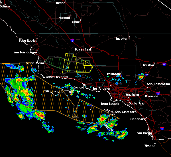
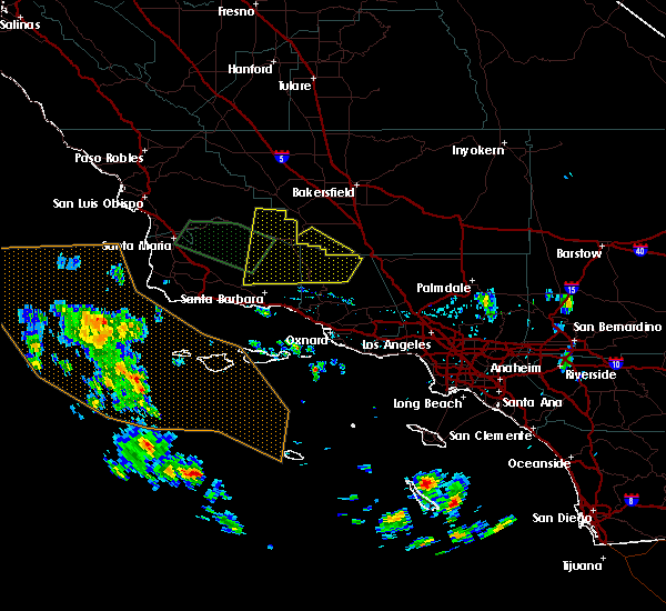
| 5/25/2019 4:25 PM PDT |
 At 403 pm pdt, a severe thunderstorm was located about 7 miles north of mount pinos, or around 31 miles south of bakersfield, moving to the southeast near 20 mph (radar indicated). Hazards include quarter size hail. Damage to vehicles is expected. This severe thunderstorm will remain over mainly rural areas of southwestern kern county, including the following locations, pine mountain club. At 403 pm pdt, a severe thunderstorm was located about 7 miles north of mount pinos, or around 31 miles south of bakersfield, moving to the southeast near 20 mph (radar indicated). Hazards include quarter size hail. Damage to vehicles is expected. This severe thunderstorm will remain over mainly rural areas of southwestern kern county, including the following locations, pine mountain club.
|
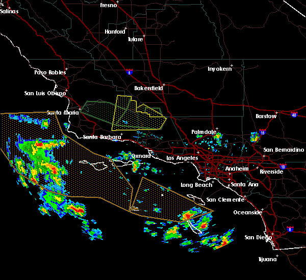
| 5/25/2019 4:04 PM PDT |
 At 403 pm pdt, a severe thunderstorm was located about 7 miles north of mount pinos, or around 31 miles south of bakersfield, moving to the southeast near 20 mph (radar indicated). Hazards include quarter size hail. Damage to vehicles is expected. This severe thunderstorm will remain over mainly rural areas of southwestern kern county, including the following locations, pine mountain club. At 403 pm pdt, a severe thunderstorm was located about 7 miles north of mount pinos, or around 31 miles south of bakersfield, moving to the southeast near 20 mph (radar indicated). Hazards include quarter size hail. Damage to vehicles is expected. This severe thunderstorm will remain over mainly rural areas of southwestern kern county, including the following locations, pine mountain club.
|
| 9/10/2017 6:24 PM PDT |
 The severe thunderstorm warning for south central kern county will expire at 630 pm pdt, the storm which prompted the warning has weakened below severe limits, and no longer poses an immediate threat to life or property. therefore the warning will be allowed to expire. however gusty winds and heavy rain are still possible with this thunderstorm. to report severe weather, contact your nearest law enforcement agency. they will relay your report to the national weather service hanford ca. The severe thunderstorm warning for south central kern county will expire at 630 pm pdt, the storm which prompted the warning has weakened below severe limits, and no longer poses an immediate threat to life or property. therefore the warning will be allowed to expire. however gusty winds and heavy rain are still possible with this thunderstorm. to report severe weather, contact your nearest law enforcement agency. they will relay your report to the national weather service hanford ca.
|
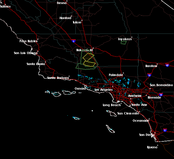
| 9/10/2017 6:12 PM PDT |
 At 612 pm pdt, a severe thunderstorm was located 8 miles south of maricopa, or 34 miles north of ojai, moving northwest at 35 mph (radar indicated). Hazards include 60 mph wind gusts and penny size hail. Expect damage to roofs, siding, and trees. Locations impacted include, mount pinos and pine mountain club. At 612 pm pdt, a severe thunderstorm was located 8 miles south of maricopa, or 34 miles north of ojai, moving northwest at 35 mph (radar indicated). Hazards include 60 mph wind gusts and penny size hail. Expect damage to roofs, siding, and trees. Locations impacted include, mount pinos and pine mountain club.
|
| 9/10/2017 5:57 PM PDT |
 At 556 pm pdt, a severe thunderstorm was located near mount pinos, or 28 miles north of ojai, moving northwest at 35 mph (radar indicated). Hazards include 60 mph wind gusts and penny size hail. expect damage to roofs, siding, and trees At 556 pm pdt, a severe thunderstorm was located near mount pinos, or 28 miles north of ojai, moving northwest at 35 mph (radar indicated). Hazards include 60 mph wind gusts and penny size hail. expect damage to roofs, siding, and trees
|
Hail Maps for Pine Mountain Club, CA

Connect with Interactive Hail Maps