

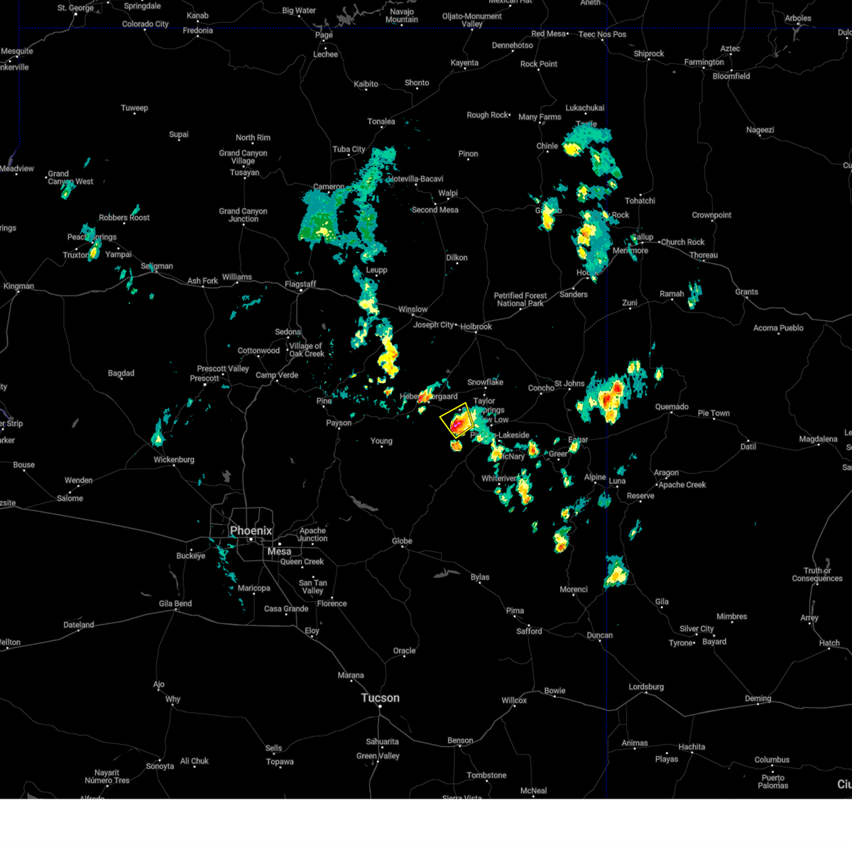
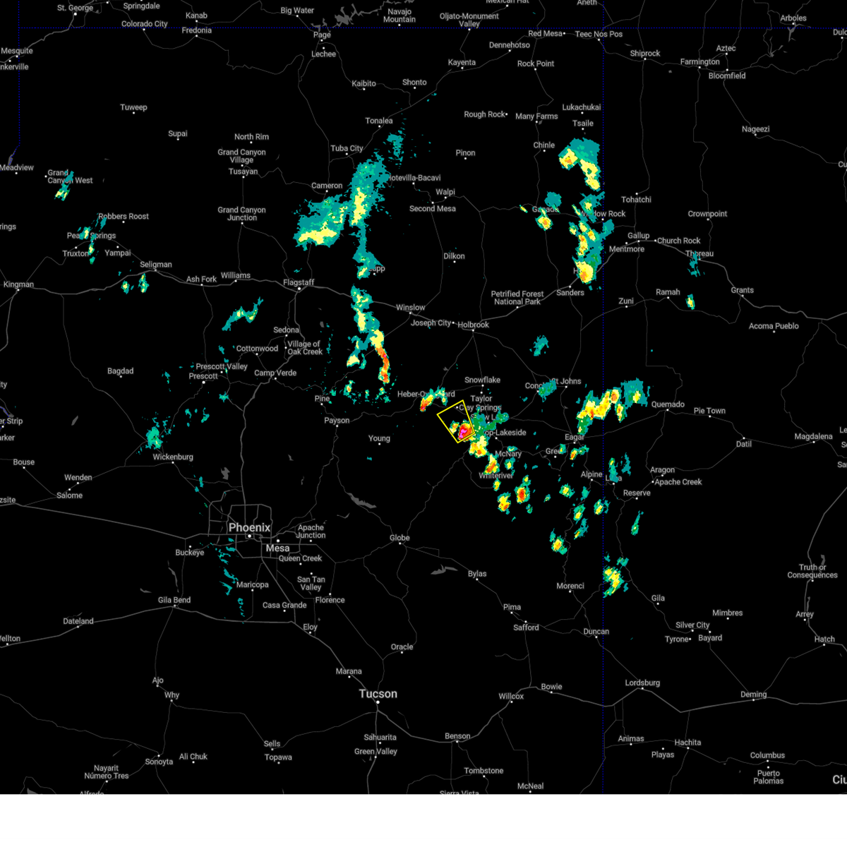
Hail Map for Pinedale, AZ
The Pinedale, AZ area has had 0 reports of on-the-ground hail by trained spotters, and has been under severe weather warnings 4 times during the past 12 months. Doppler radar has detected hail at or near Pinedale, AZ on 25 occasions, including 1 occasion during the past year.
| Name: | Pinedale, AZ |
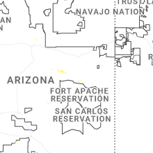
| Where Located: | 13.4 miles WNW of Show Low, AZ |
| Map: | Google Map for Pinedale, AZ |
| Population: | 487 |
| Housing Units: | 332 |
| More Info: | Search Google for Pinedale, AZ |
0
The Top Recent Hail Date for Pinedale, AZ is Tuesday, July 15, 2025 (24th out of 25)
Hail and Wind Damage Spotted near Pinedale, AZ
| Date / Time | Report Details |
|---|---|
| 9/12/2025 5:24 PM MST | The storm which prompted the warning has weakened below severe limits, and no longer poses an immediate threat to life or property. therefore, the warning will be allowed to expire. however, small hail and gusty winds are still possible with this thunderstorm. |
| 9/12/2025 5:04 PM MST | Svrfgz the national weather service in flagstaff has issued a * severe thunderstorm warning for, navajo county in north central arizona, * until 530 pm mst. * at 504 pm mst, a severe thunderstorm was located 7 miles south of aripine, or 22 miles east of forest lakes, moving northeast at 40 mph (radar indicated). Hazards include 60 mph wind gusts and quarter size hail. Hail damage to vehicles is expected. Expect wind damage to roofs, siding, and trees. |
| 7/15/2025 3:48 PM MST |
 the severe thunderstorm warning has been cancelled and is no longer in effect the severe thunderstorm warning has been cancelled and is no longer in effect
|
| 7/15/2025 3:26 PM MST |
 Svrfgz the national weather service in flagstaff has issued a * severe thunderstorm warning for, navajo county in north central arizona, * until 400 pm mst. * at 326 pm mst, a severe thunderstorm was located over linden, or 7 miles west of show low, moving west at 5 mph (radar indicated). Hazards include 60 mph wind gusts and quarter size hail. Hail damage to vehicles is expected. Expect wind damage to roofs, siding, and trees. Svrfgz the national weather service in flagstaff has issued a * severe thunderstorm warning for, navajo county in north central arizona, * until 400 pm mst. * at 326 pm mst, a severe thunderstorm was located over linden, or 7 miles west of show low, moving west at 5 mph (radar indicated). Hazards include 60 mph wind gusts and quarter size hail. Hail damage to vehicles is expected. Expect wind damage to roofs, siding, and trees.
|
| 8/18/2024 3:28 PM MST |
 The storm which prompted the warning has moved out of the area. therefore, the warning will be allowed to expire. however, small hail, gusty winds up to 50 mph and heavy rain are still possible with this thunderstorm. The storm which prompted the warning has moved out of the area. therefore, the warning will be allowed to expire. however, small hail, gusty winds up to 50 mph and heavy rain are still possible with this thunderstorm.
|
| 8/18/2024 3:09 PM MST |
 At 308 pm mst, a severe thunderstorm was located near pinedale, or 16 miles west of show low, moving northwest at 20 mph (radar indicated). Hazards include 60 mph wind gusts and quarter size hail. Hail damage to vehicles is expected. expect wind damage to roofs, siding, and trees. locations impacted include, clay springs, pinedale, burke mountain, and linden. This includes state route 260 between mile markers 321 and 329. At 308 pm mst, a severe thunderstorm was located near pinedale, or 16 miles west of show low, moving northwest at 20 mph (radar indicated). Hazards include 60 mph wind gusts and quarter size hail. Hail damage to vehicles is expected. expect wind damage to roofs, siding, and trees. locations impacted include, clay springs, pinedale, burke mountain, and linden. This includes state route 260 between mile markers 321 and 329.
|
| 8/18/2024 2:51 PM MST |
 Svrfgz the national weather service in flagstaff has issued a * severe thunderstorm warning for, navajo county west of show low in north central arizona, * until 330 pm mst. * at 250 pm mst, a severe thunderstorm was located near red top mountain, or 13 miles southwest of show low, moving northwest at 15 mph (radar indicated). Hazards include 60 mph wind gusts and half dollar size hail. Hail damage to vehicles is expected. Expect wind damage to roofs, siding, and trees. Svrfgz the national weather service in flagstaff has issued a * severe thunderstorm warning for, navajo county west of show low in north central arizona, * until 330 pm mst. * at 250 pm mst, a severe thunderstorm was located near red top mountain, or 13 miles southwest of show low, moving northwest at 15 mph (radar indicated). Hazards include 60 mph wind gusts and half dollar size hail. Hail damage to vehicles is expected. Expect wind damage to roofs, siding, and trees.
|
| 9/13/2023 4:25 PM MST |
 At 423 pm mst, a severe thunderstorm was located near clay springs, or 15 miles northwest of show low, moving southeast at 20 mph (radar indicated). Hazards include 60 mph wind gusts and quarter size hail. Hail damage to vehicles is expected. Expect wind damage to roofs, siding, and trees. At 423 pm mst, a severe thunderstorm was located near clay springs, or 15 miles northwest of show low, moving southeast at 20 mph (radar indicated). Hazards include 60 mph wind gusts and quarter size hail. Hail damage to vehicles is expected. Expect wind damage to roofs, siding, and trees.
|
| 7/17/2022 12:38 PM MST |
 At 1236 pm mst, a severe thunderstorm was located over wagon wheel, or over show low, moving north at 10 to 15 mph (radar indicated). Hazards include 60 mph wind gusts, quarter size hail, and heavy rainfall. Hail damage to vehicles is expected. Expect wind damage to roofs, siding, and trees. At 1236 pm mst, a severe thunderstorm was located over wagon wheel, or over show low, moving north at 10 to 15 mph (radar indicated). Hazards include 60 mph wind gusts, quarter size hail, and heavy rainfall. Hail damage to vehicles is expected. Expect wind damage to roofs, siding, and trees.
|
| 7/9/2021 5:32 PM MST |
 At 531 pm mst, a severe thunderstorm was located near linden, or 7 miles northwest of show low, moving southwest at 15 mph (radar indicated). Hazards include 60 mph wind gusts and quarter size hail. Hail damage to vehicles is expected. Expect wind damage to roofs, siding, and trees. At 531 pm mst, a severe thunderstorm was located near linden, or 7 miles northwest of show low, moving southwest at 15 mph (radar indicated). Hazards include 60 mph wind gusts and quarter size hail. Hail damage to vehicles is expected. Expect wind damage to roofs, siding, and trees.
|
| 8/12/2018 1:17 PM MST |
 At 117 pm mst, a severe thunderstorm was located 13 miles southeast of forest lakes, moving southwest at 5 mph (radar indicated). Hazards include 60 mph wind gusts and quarter size hail. Hail damage to vehicles is expected. Expect wind damage to roofs, siding, and trees. At 117 pm mst, a severe thunderstorm was located 13 miles southeast of forest lakes, moving southwest at 5 mph (radar indicated). Hazards include 60 mph wind gusts and quarter size hail. Hail damage to vehicles is expected. Expect wind damage to roofs, siding, and trees.
|
| 8/9/2018 3:50 PM MST |
 At 349 pm mst, a severe thunderstorm was located 7 miles northwest of taylor, or 22 miles north of show low, moving south at 15 mph (radar indicated). Hazards include 60 mph wind gusts and half dollar size hail. Hail damage to vehicles is expected. expect wind damage to roofs, siding, and trees. locations impacted include, taylor, clay springs, aripine, shumway, snowflake and dry lake. this includes the following highways, state route 277 between mile markers 315 and 336. state route 260 between mile markers 314 and 325. state route 377 between mile markers 5 and 16. State route 77 between mile markers 351 and 374. At 349 pm mst, a severe thunderstorm was located 7 miles northwest of taylor, or 22 miles north of show low, moving south at 15 mph (radar indicated). Hazards include 60 mph wind gusts and half dollar size hail. Hail damage to vehicles is expected. expect wind damage to roofs, siding, and trees. locations impacted include, taylor, clay springs, aripine, shumway, snowflake and dry lake. this includes the following highways, state route 277 between mile markers 315 and 336. state route 260 between mile markers 314 and 325. state route 377 between mile markers 5 and 16. State route 77 between mile markers 351 and 374.
|
| 8/9/2018 3:33 PM MST |
 At 333 pm mst, a severe thunderstorm was located 12 miles north of taylor, or 27 miles north of show low, moving south at 15 mph (radar indicated). Hazards include 60 mph wind gusts and quarter size hail. Hail damage to vehicles is expected. Expect wind damage to roofs, siding, and trees. At 333 pm mst, a severe thunderstorm was located 12 miles north of taylor, or 27 miles north of show low, moving south at 15 mph (radar indicated). Hazards include 60 mph wind gusts and quarter size hail. Hail damage to vehicles is expected. Expect wind damage to roofs, siding, and trees.
|
| 8/15/2016 2:14 PM MST |
 At 214 pm mst, doppler radar indicated a severe thunderstorm capable of producing quarter size hail and damaging winds in excess of 60 mph. this storm was located 8 miles southeast of forest lakes, and moving southeast at 10 mph. At 214 pm mst, doppler radar indicated a severe thunderstorm capable of producing quarter size hail and damaging winds in excess of 60 mph. this storm was located 8 miles southeast of forest lakes, and moving southeast at 10 mph.
|
Hail Maps for Pinedale, AZ


Connect with Interactive Hail Maps