

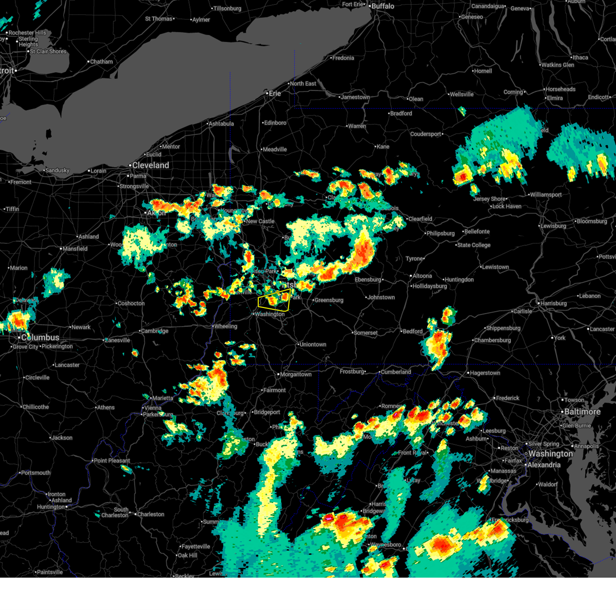
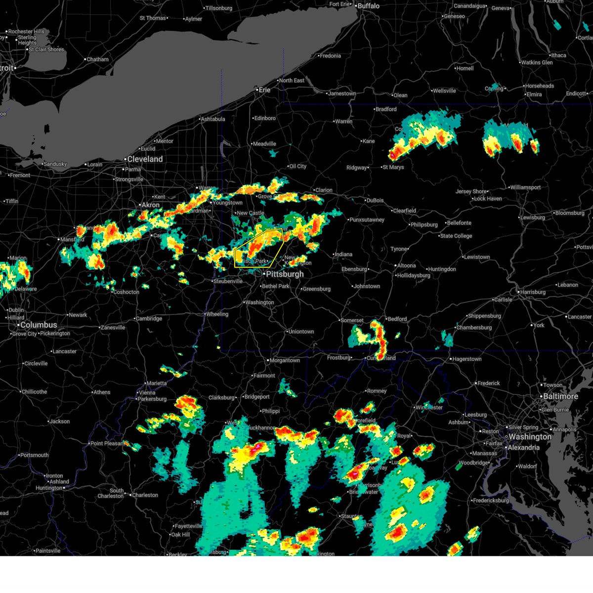
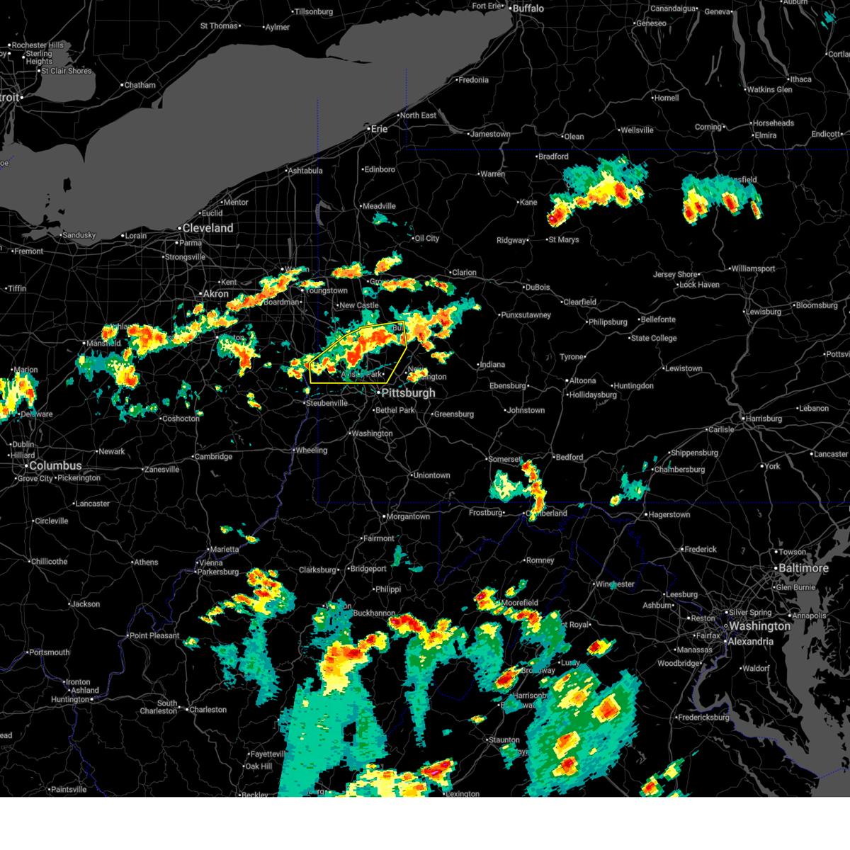
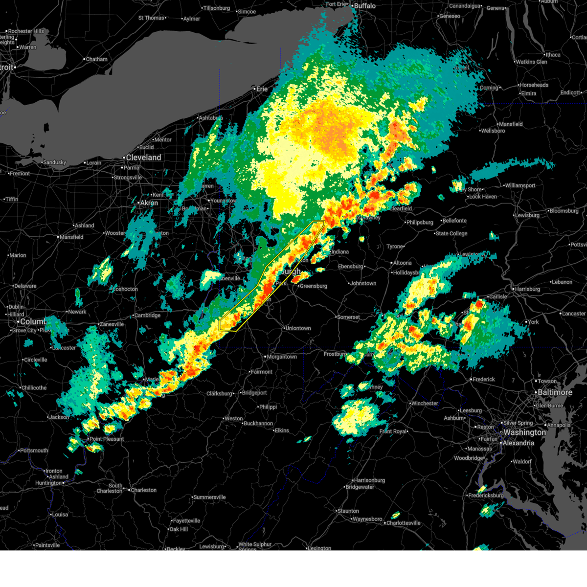
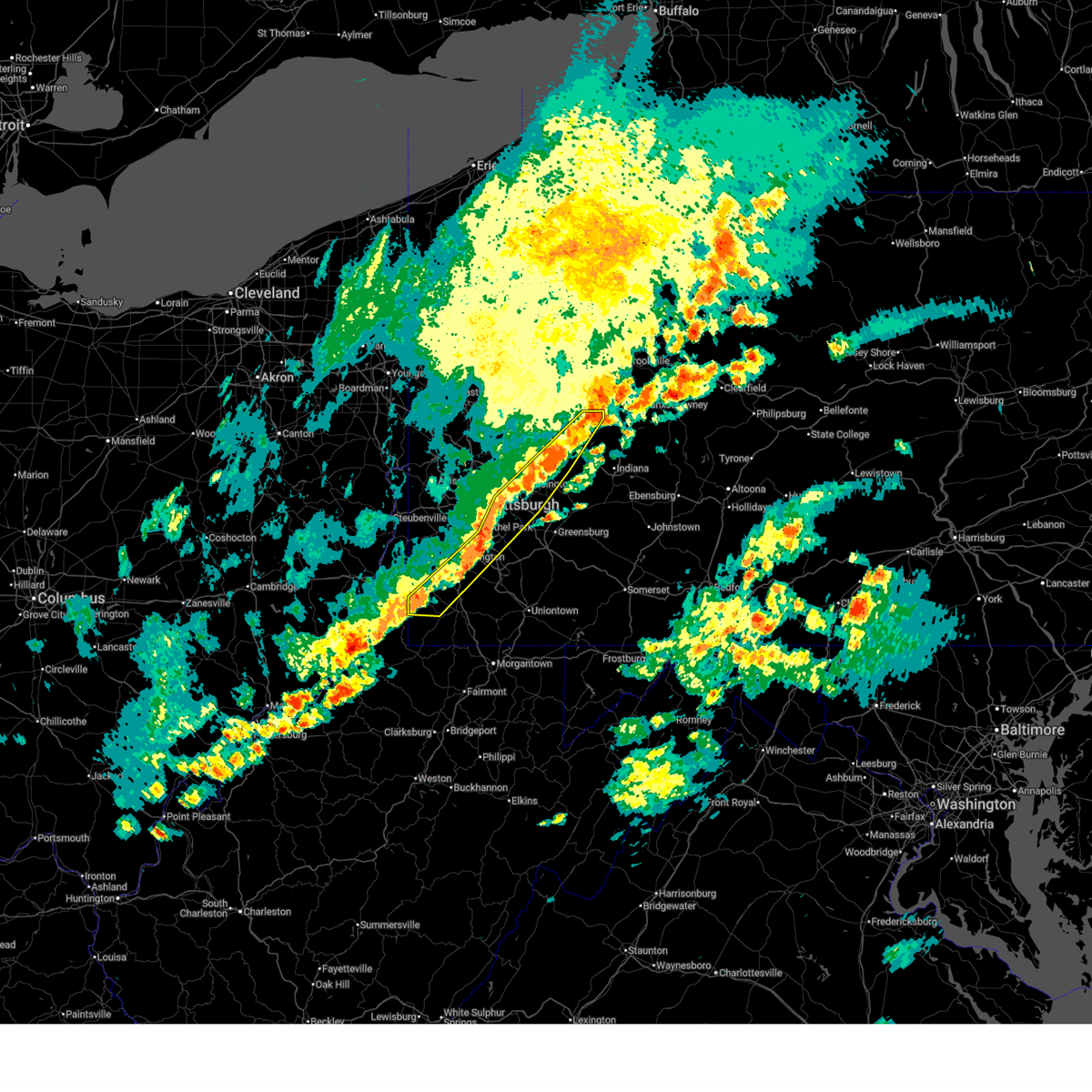
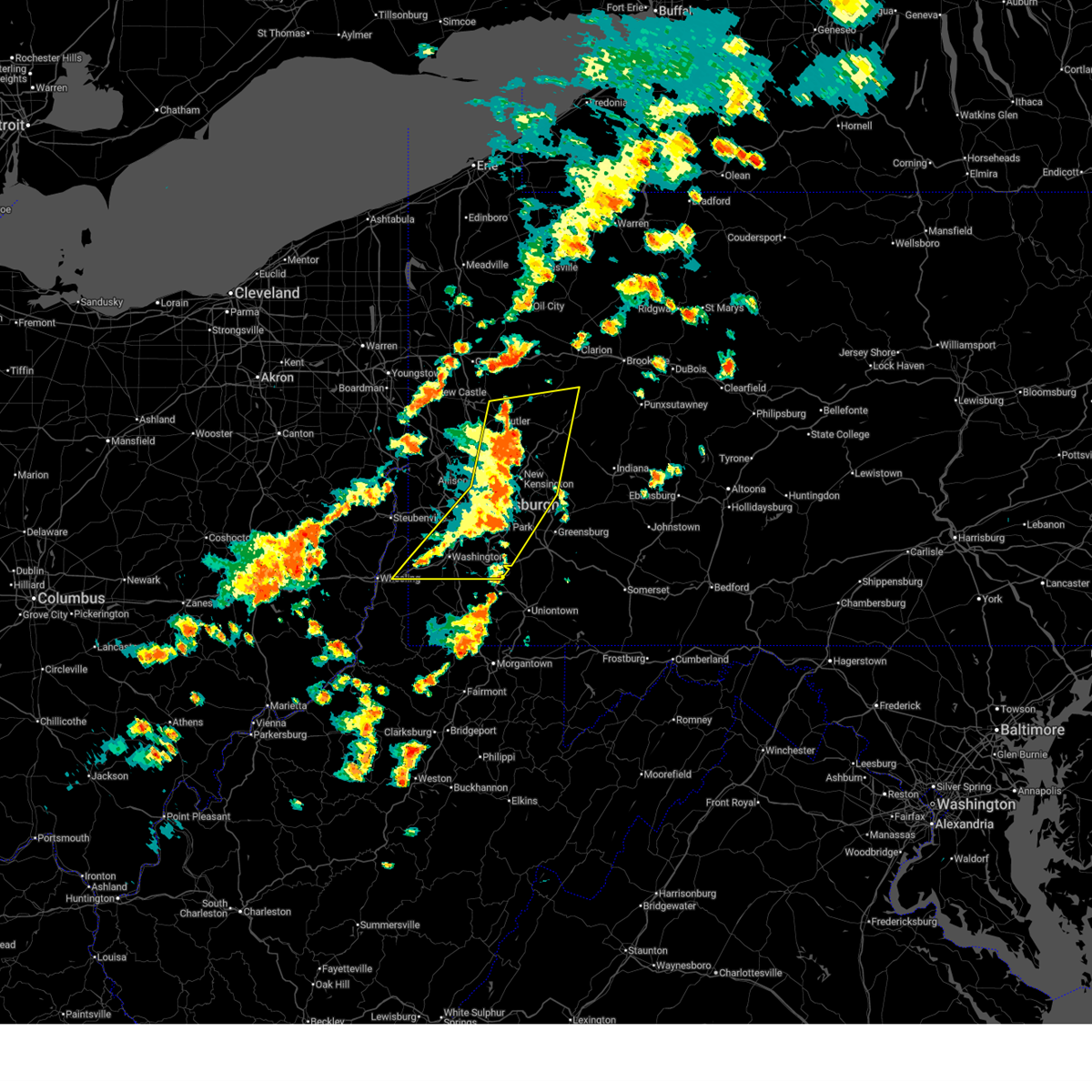
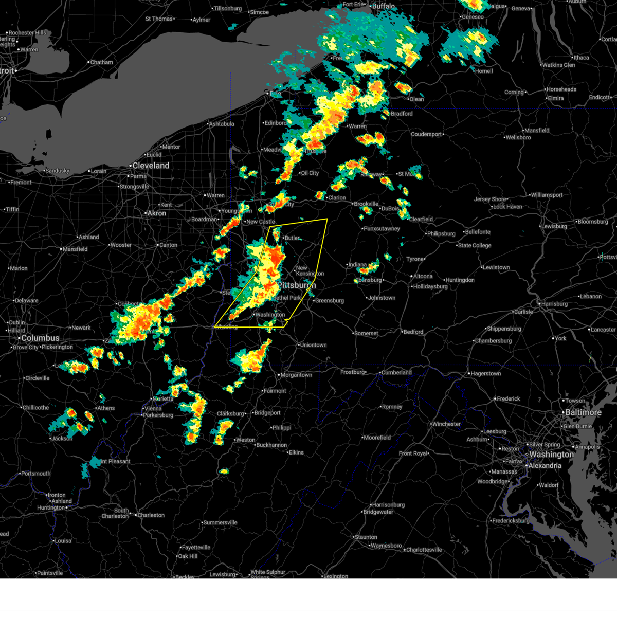
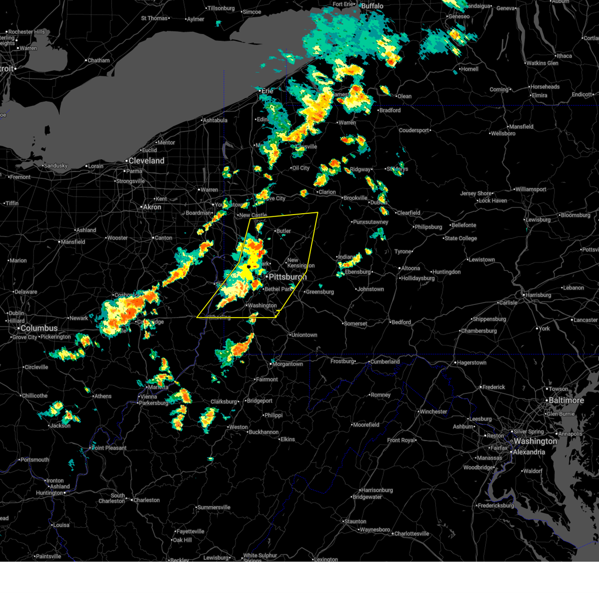
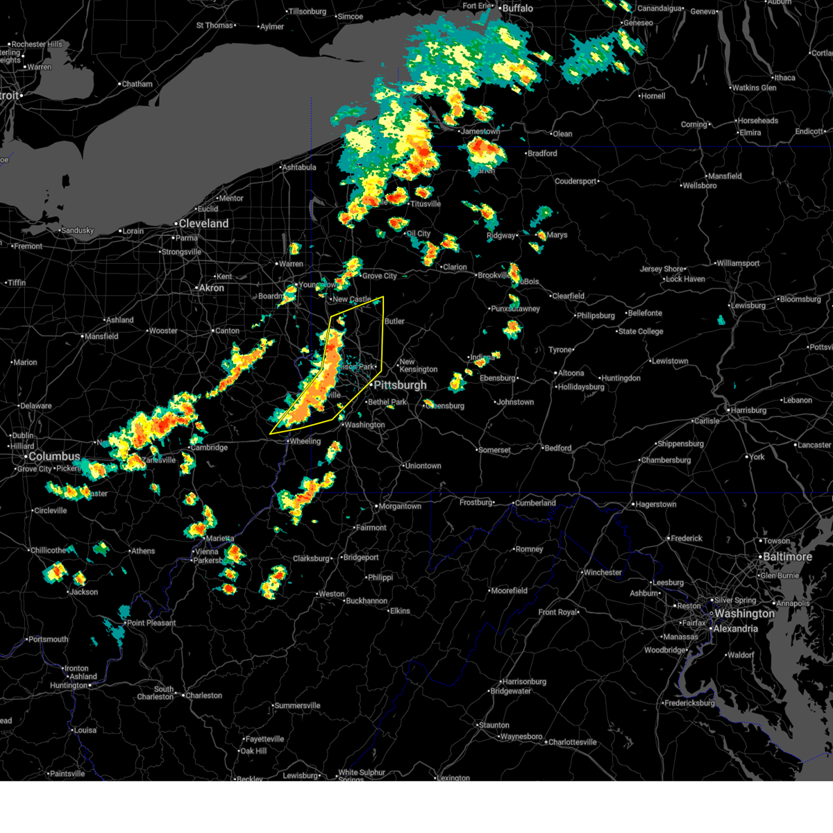
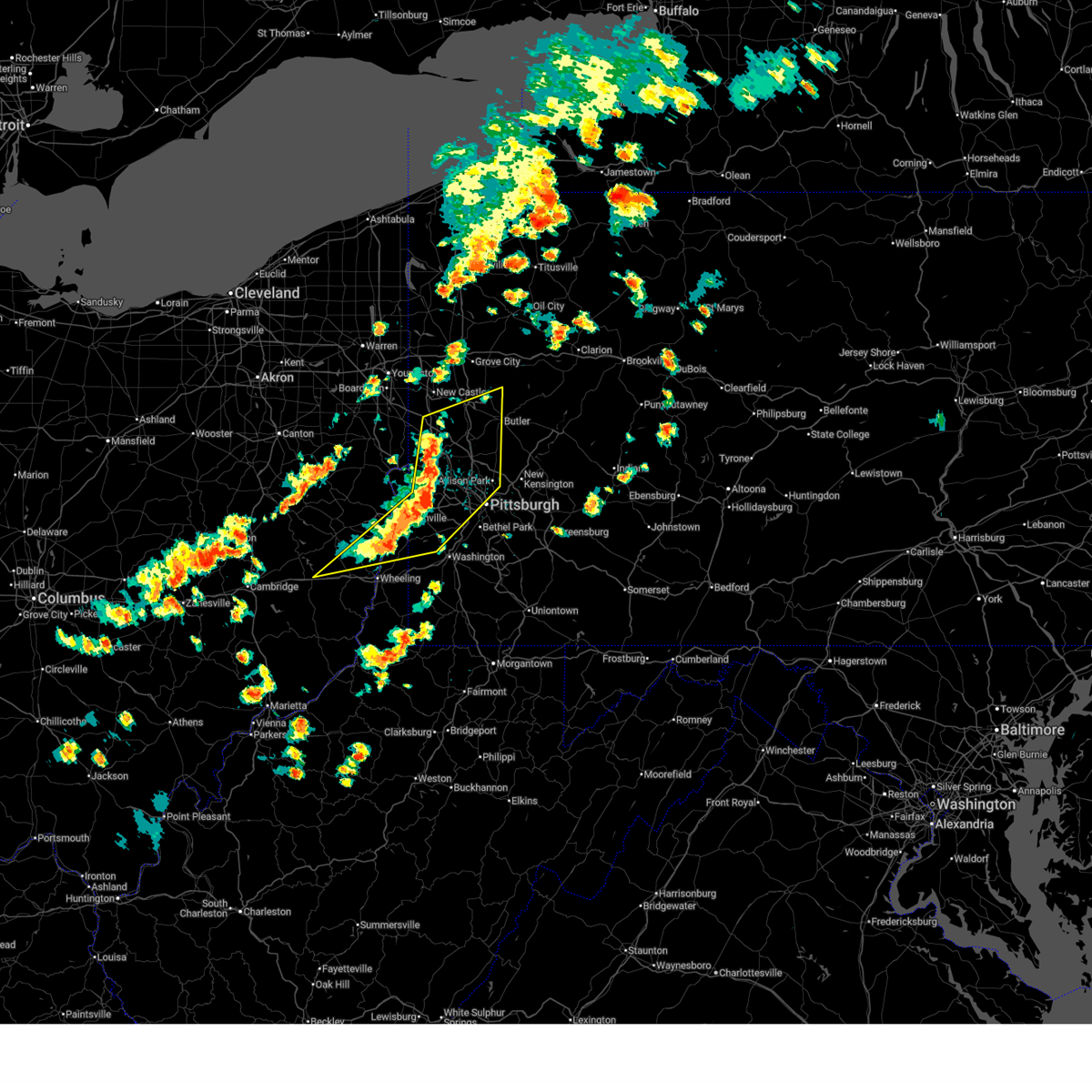
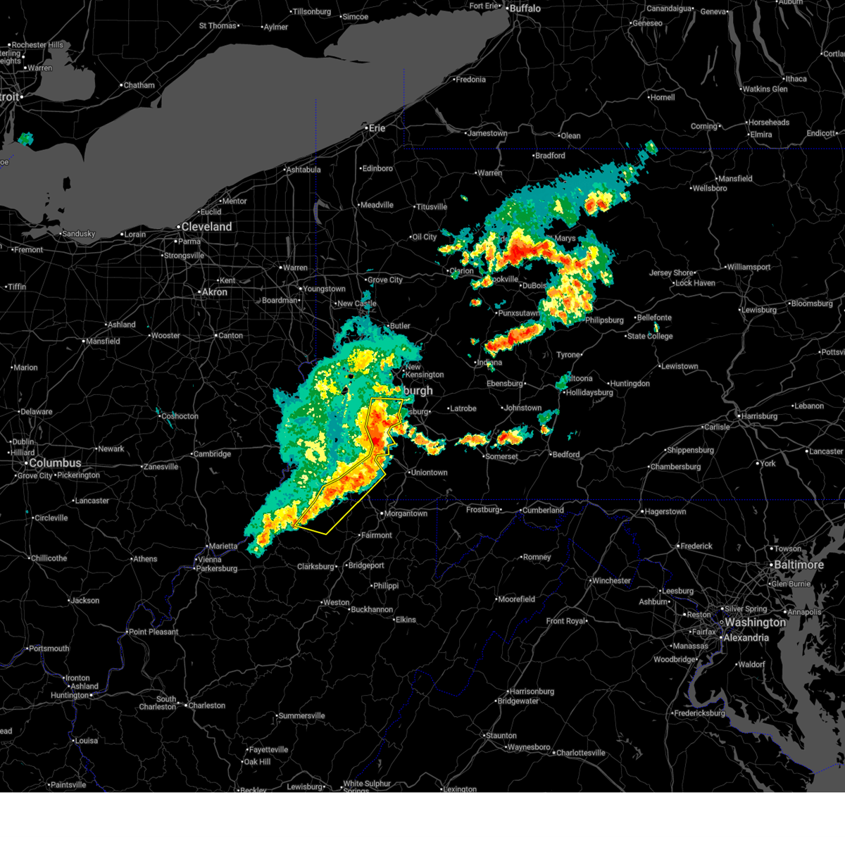
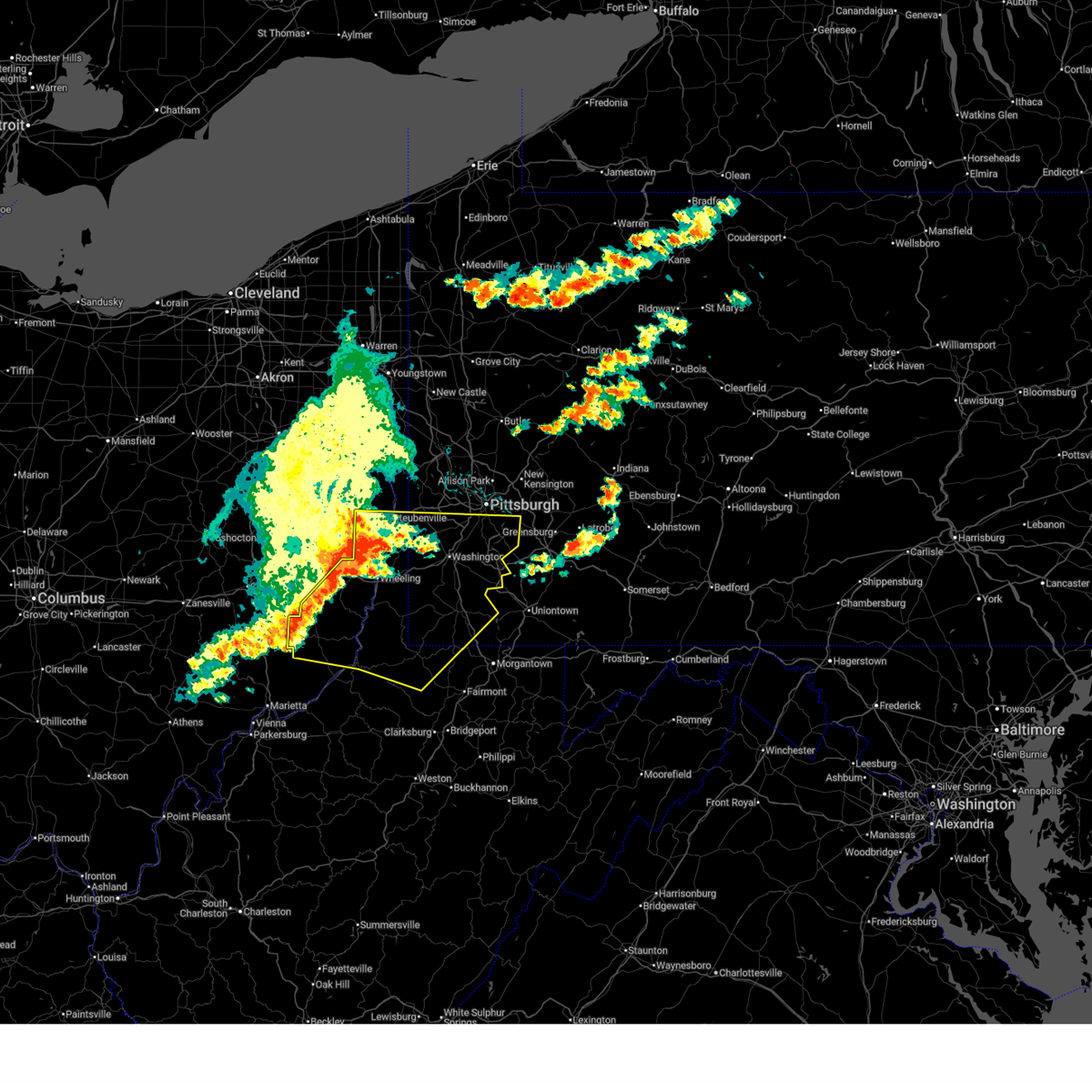
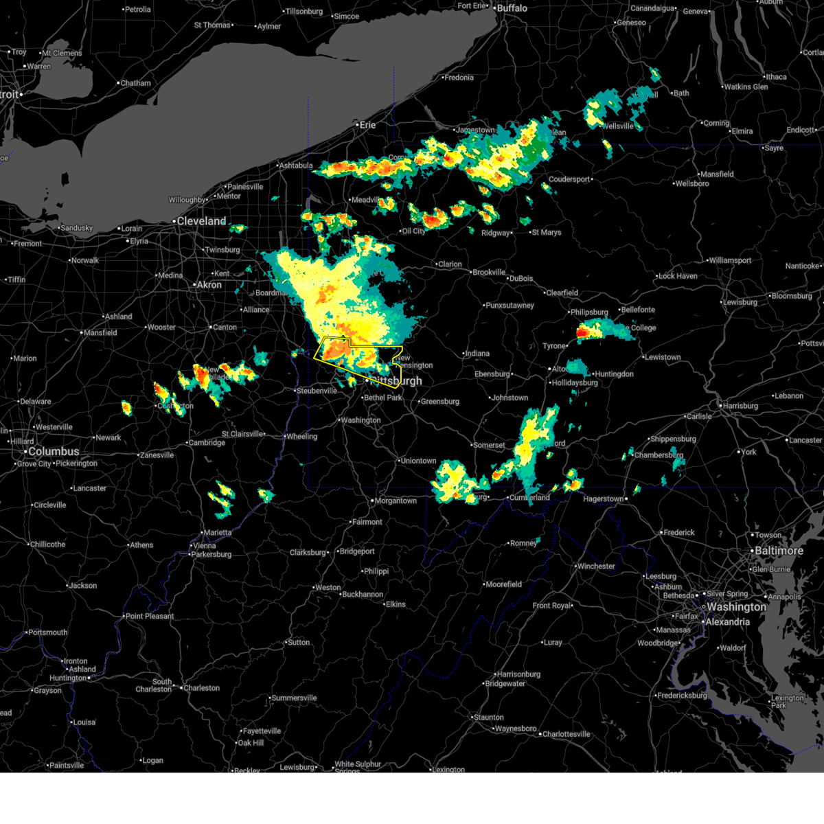
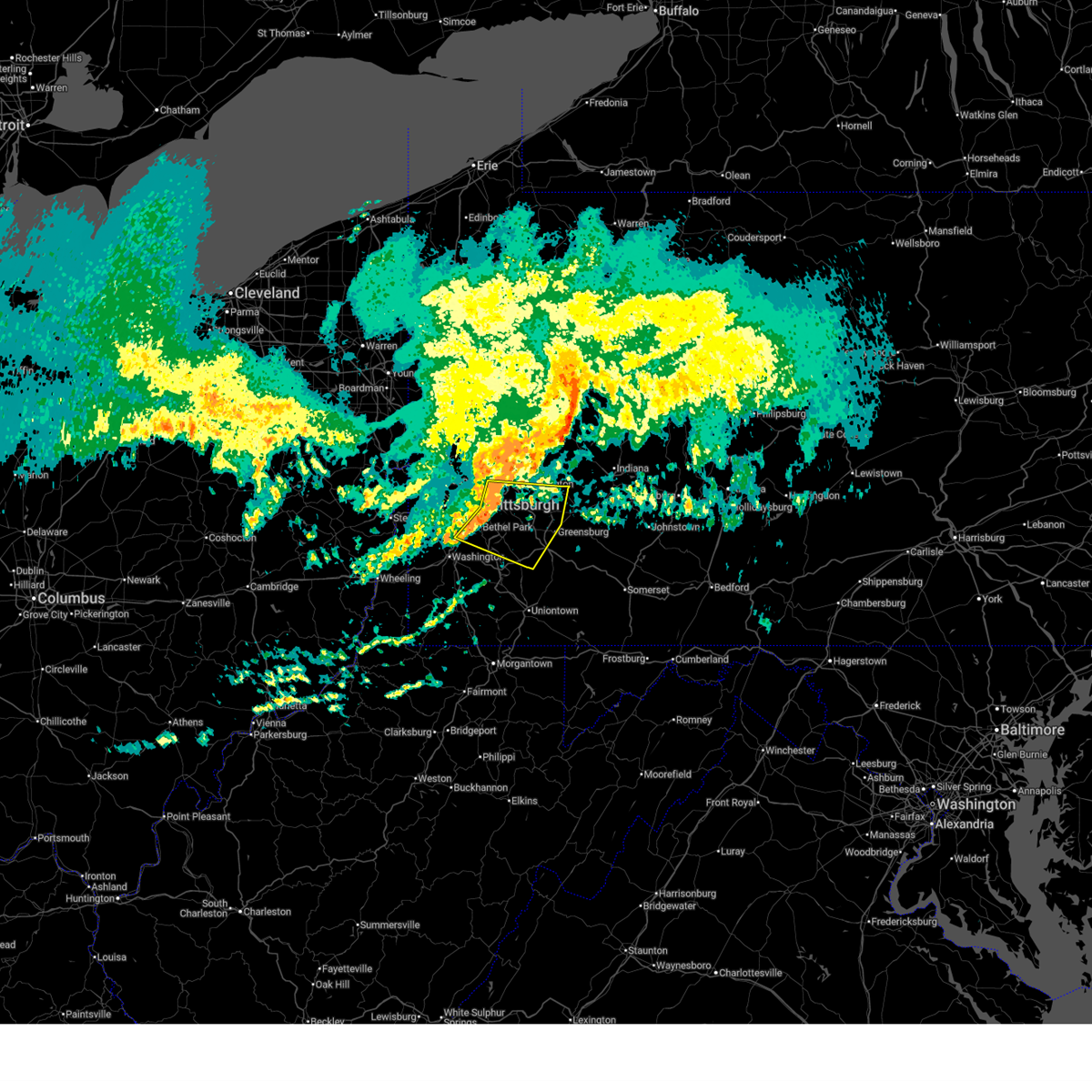
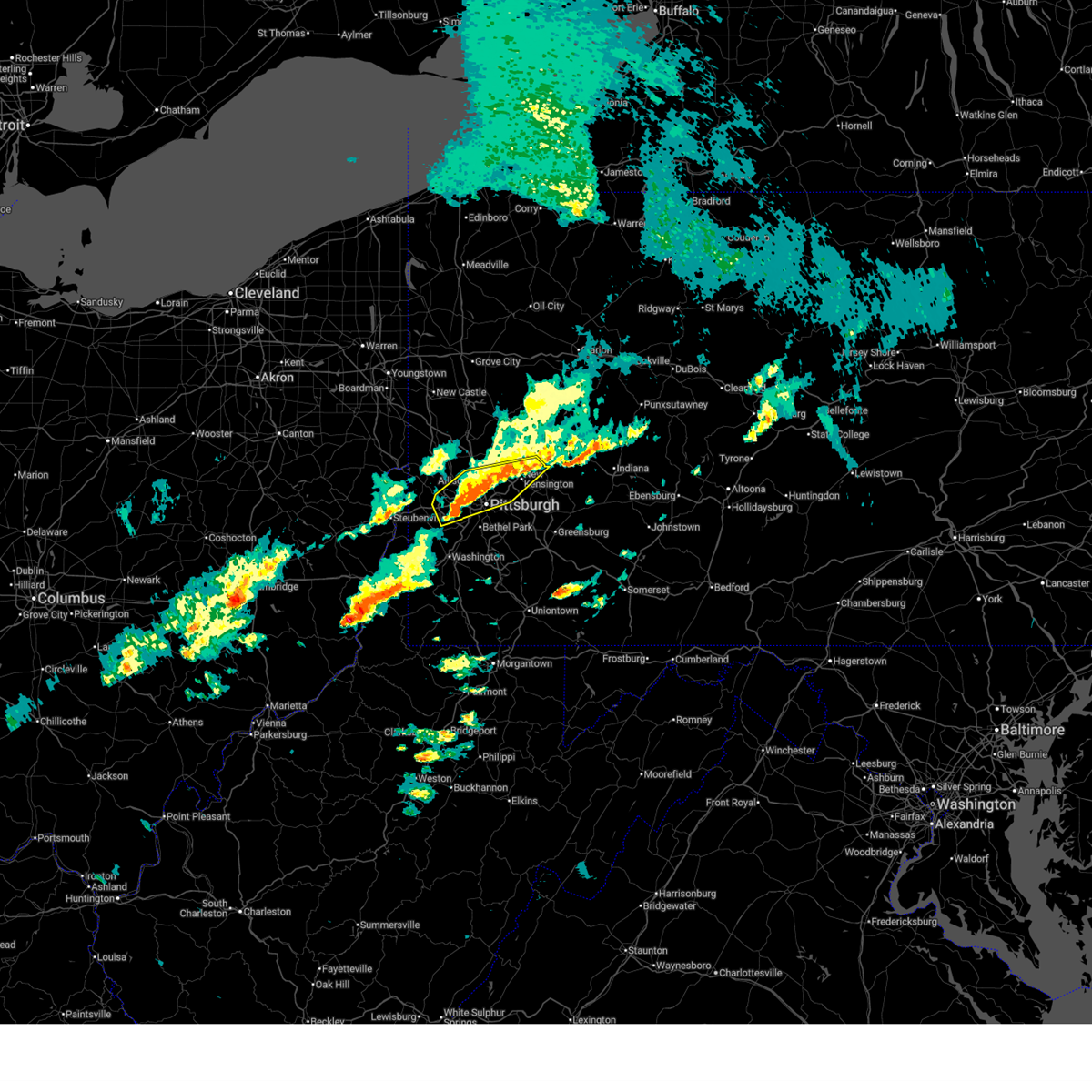
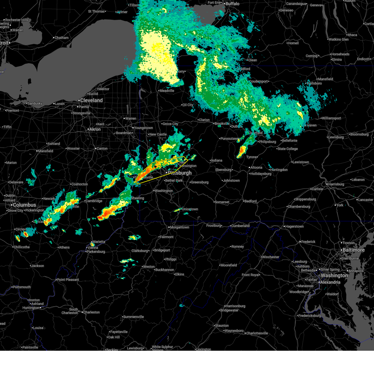
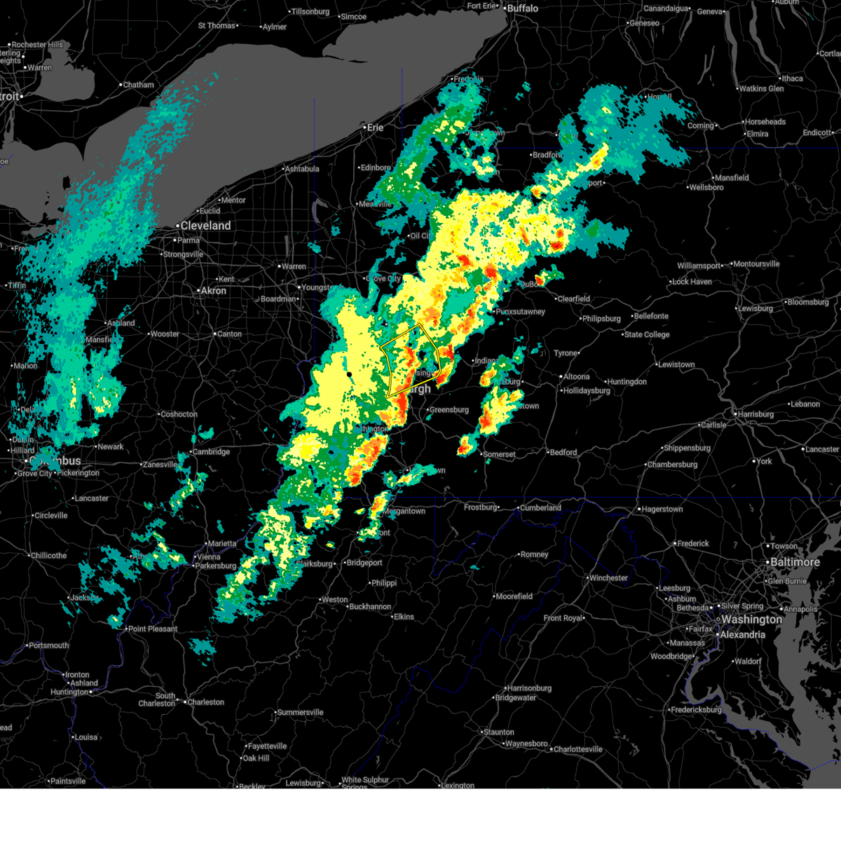
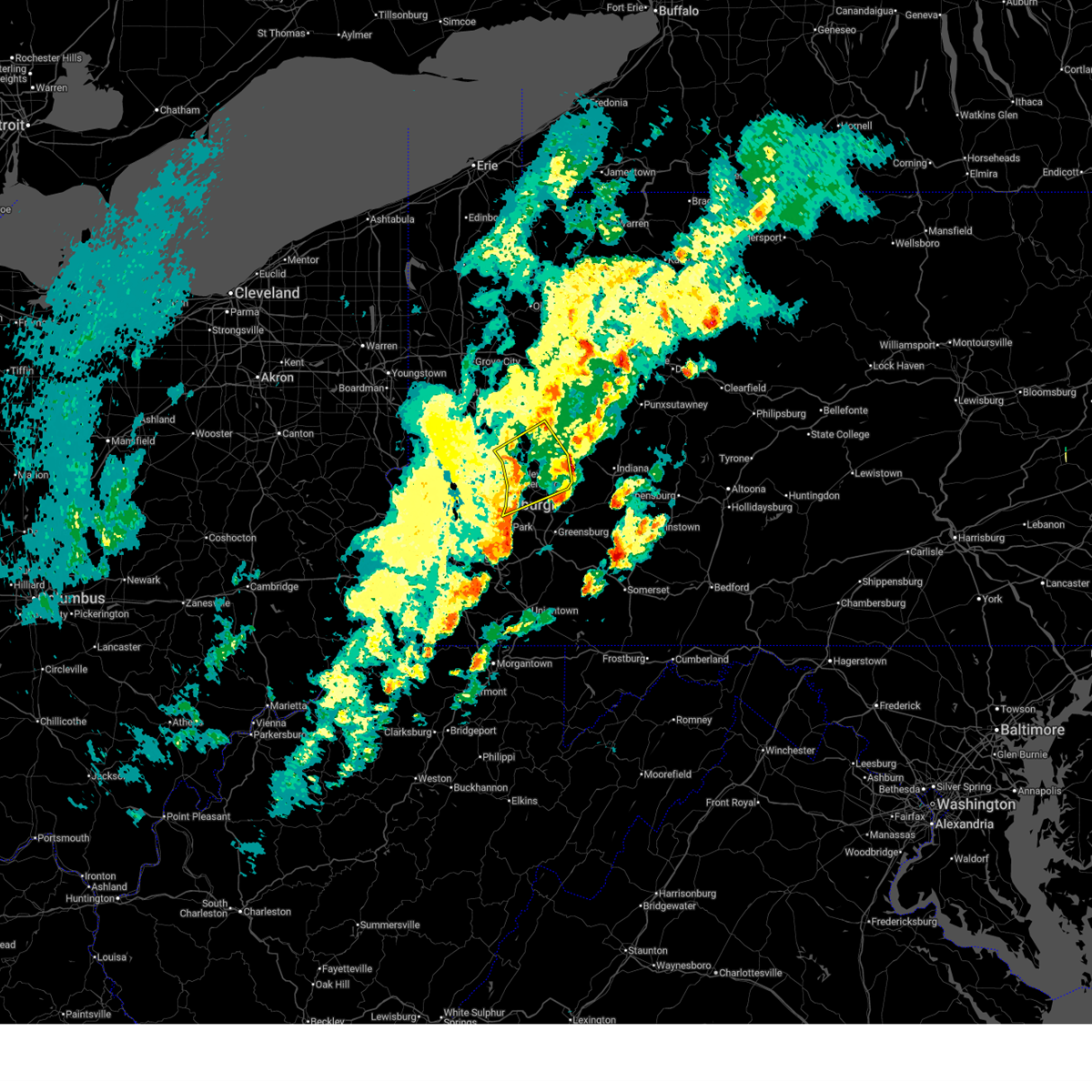
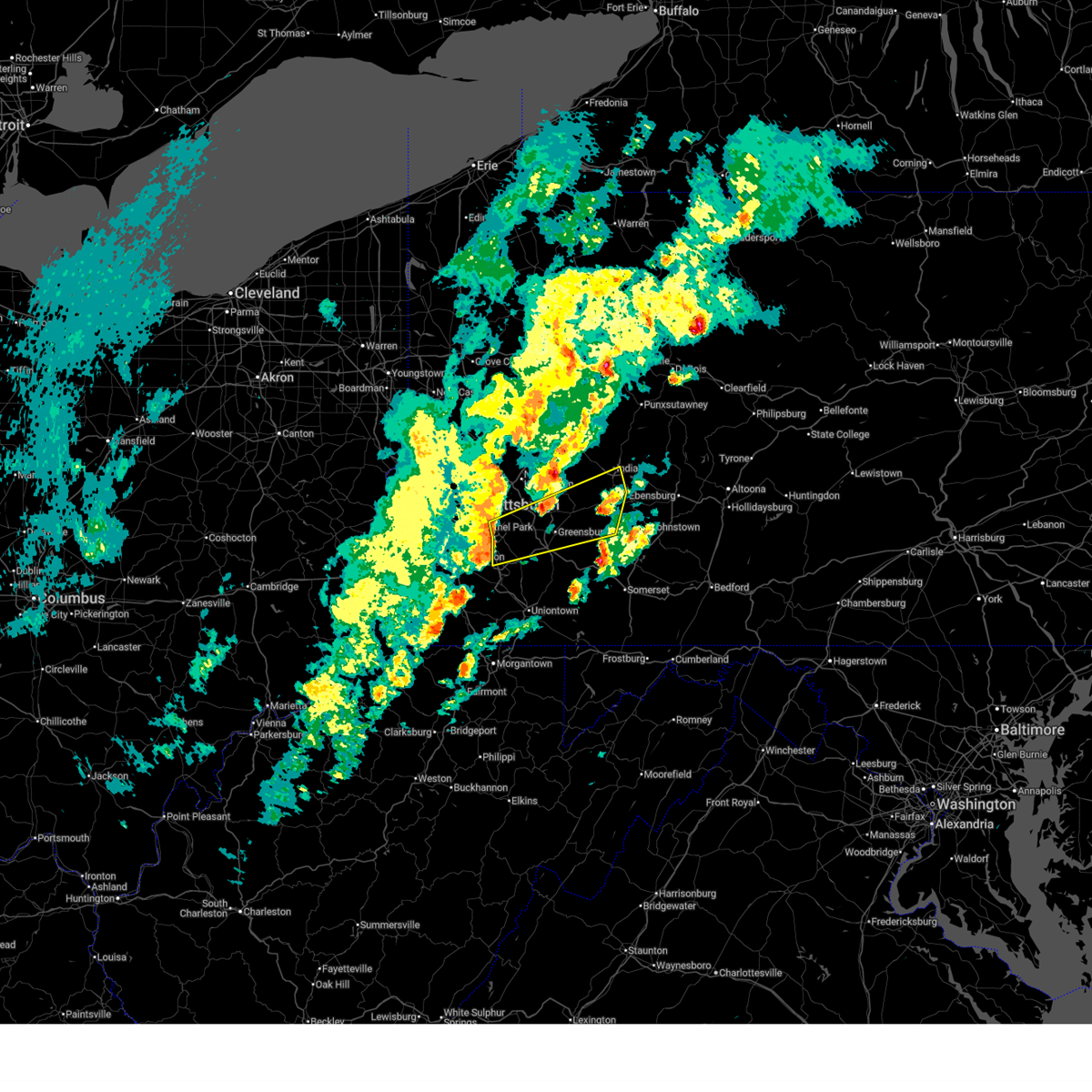
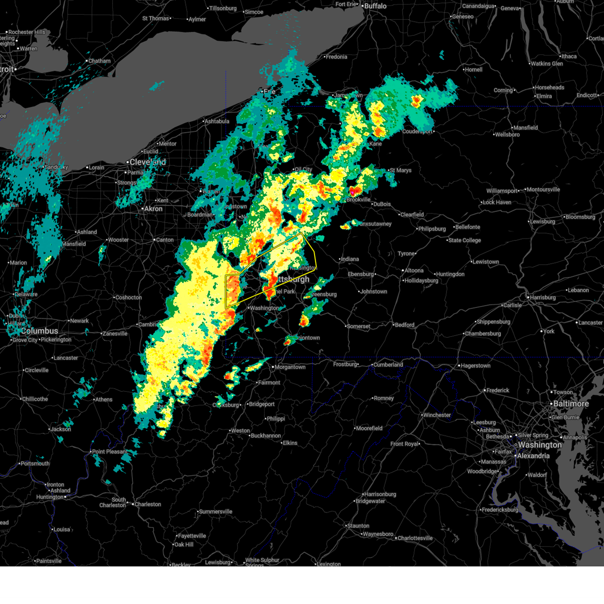
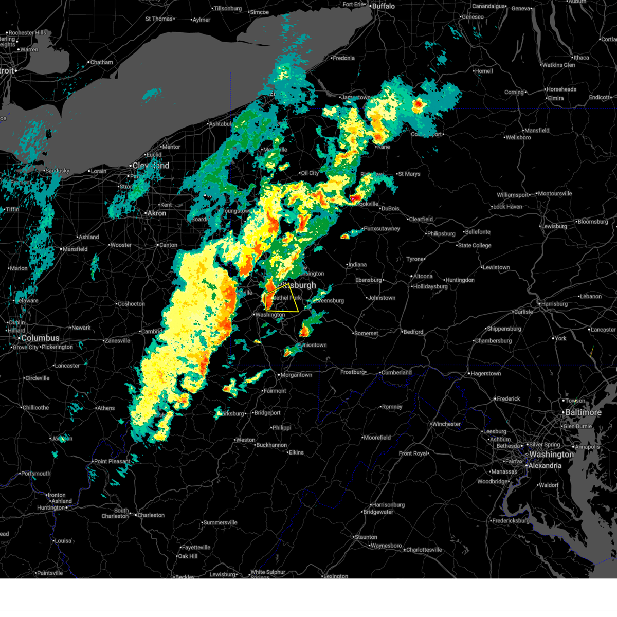
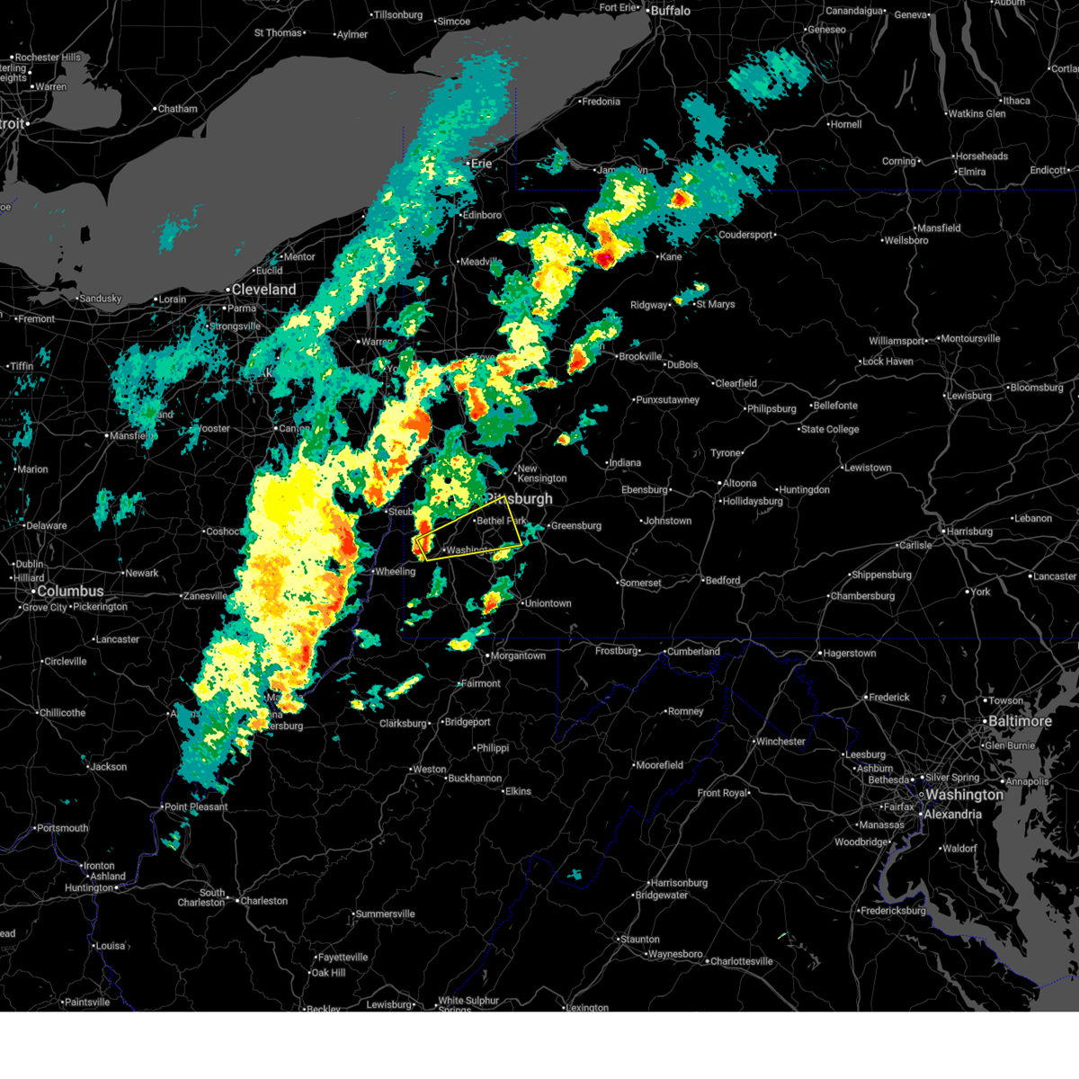
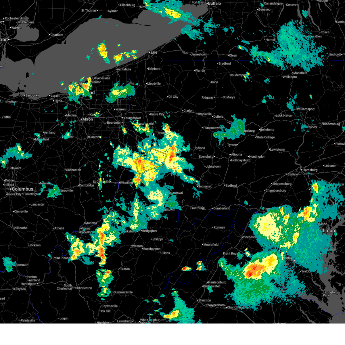
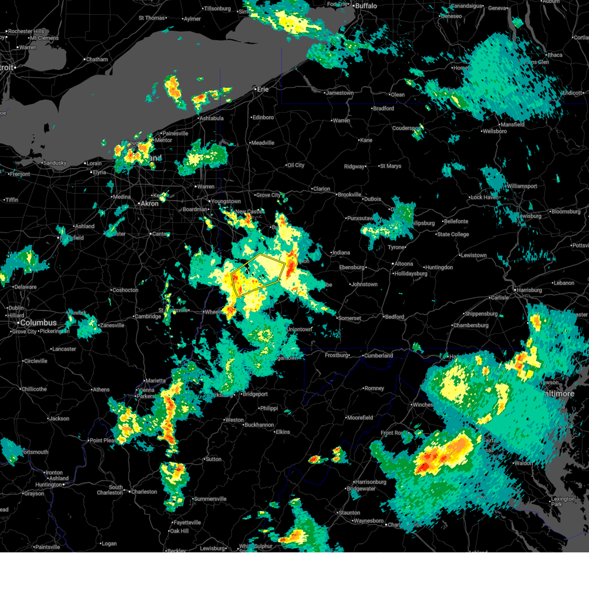
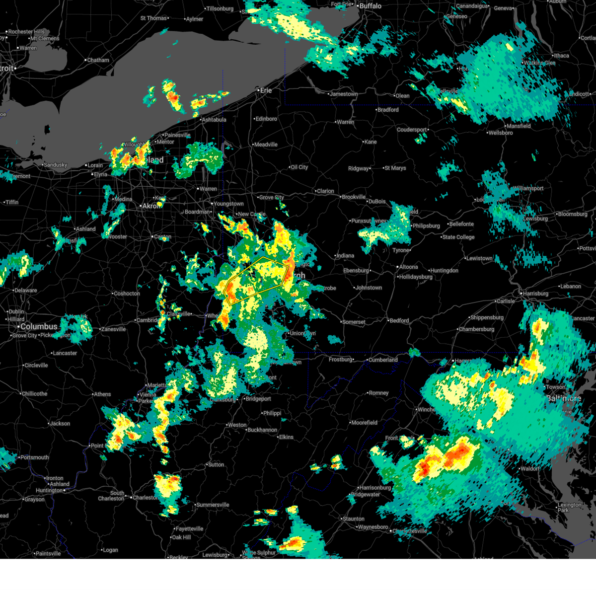
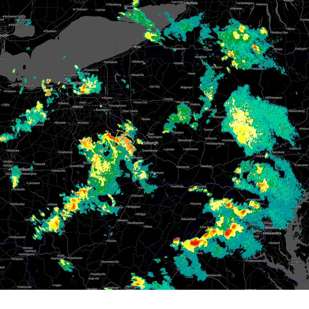
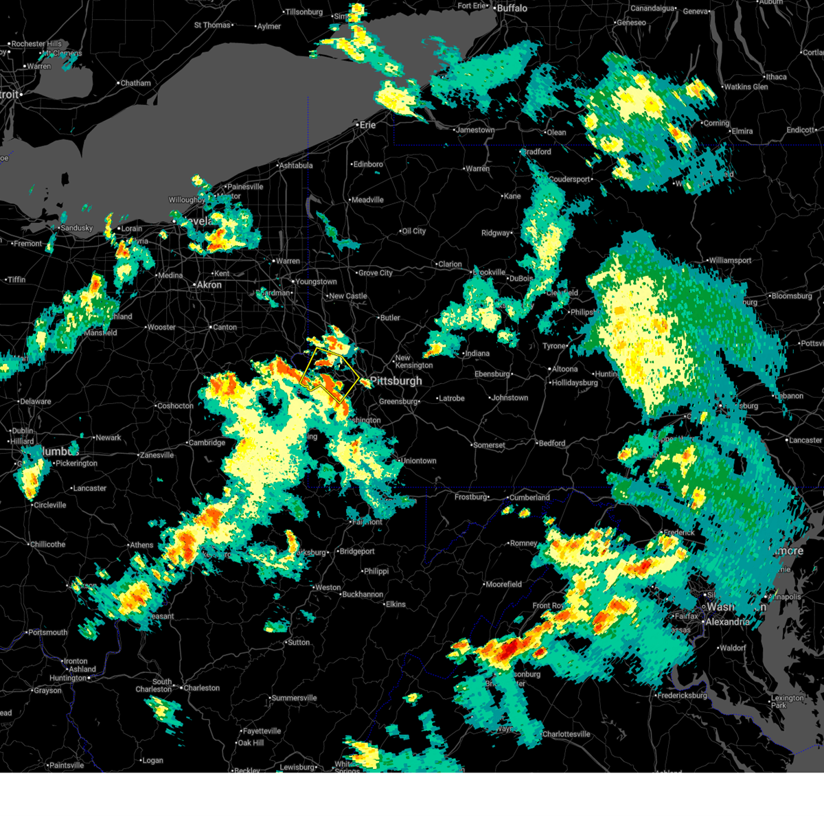
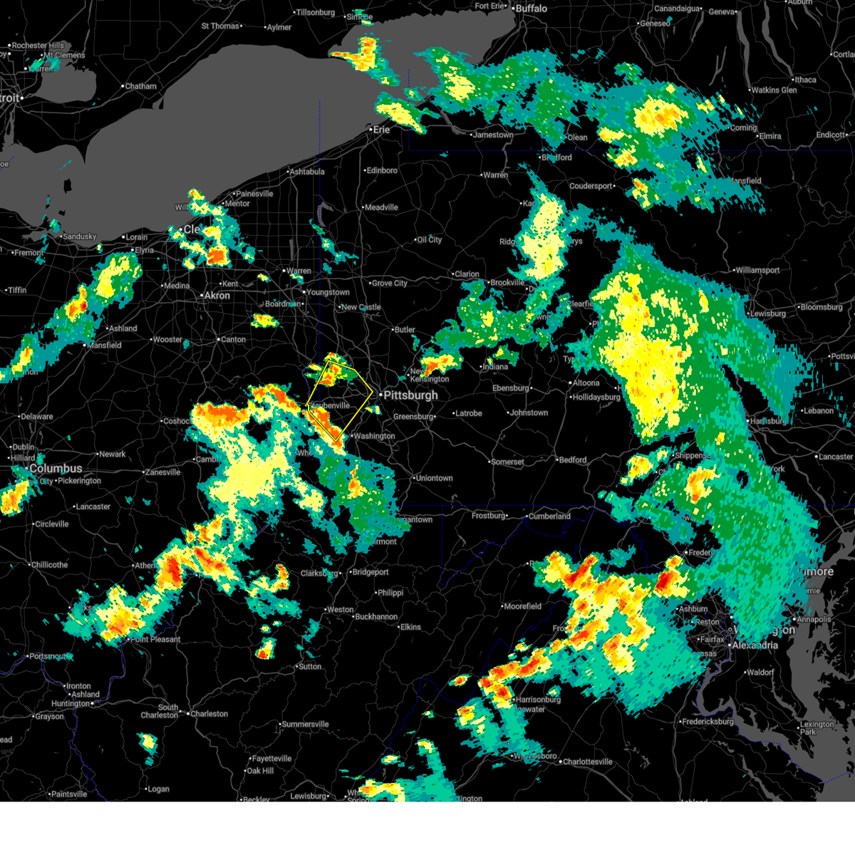
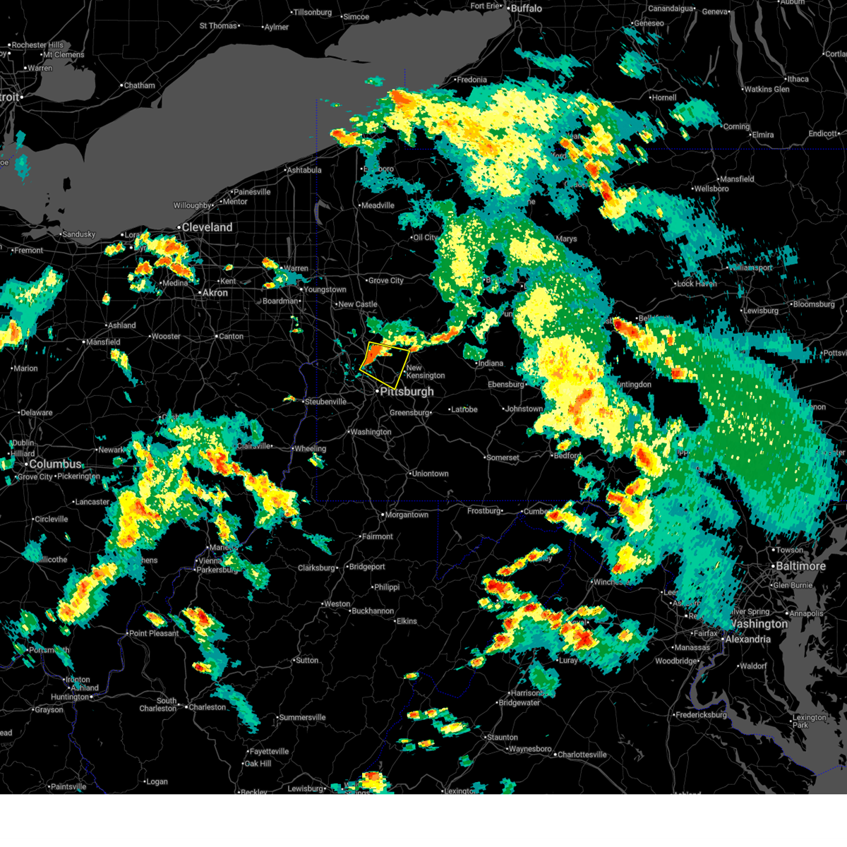
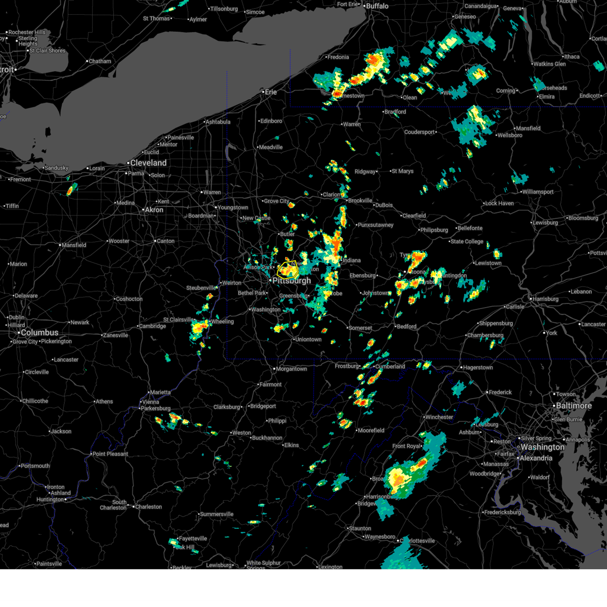
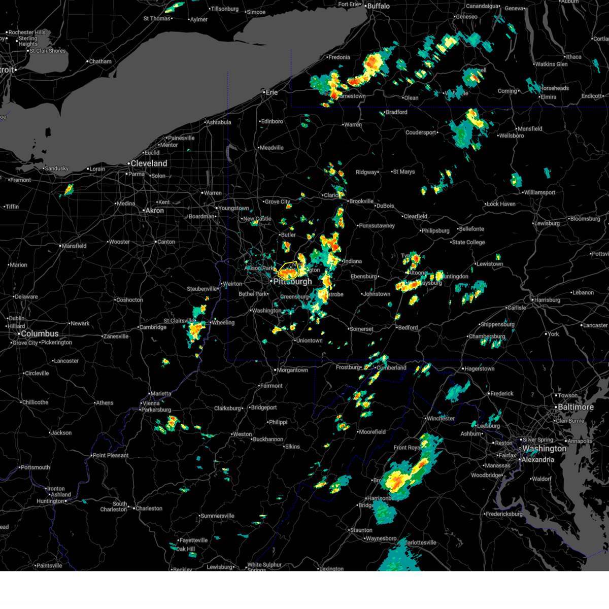
Hail Map for Pittsburgh, PA
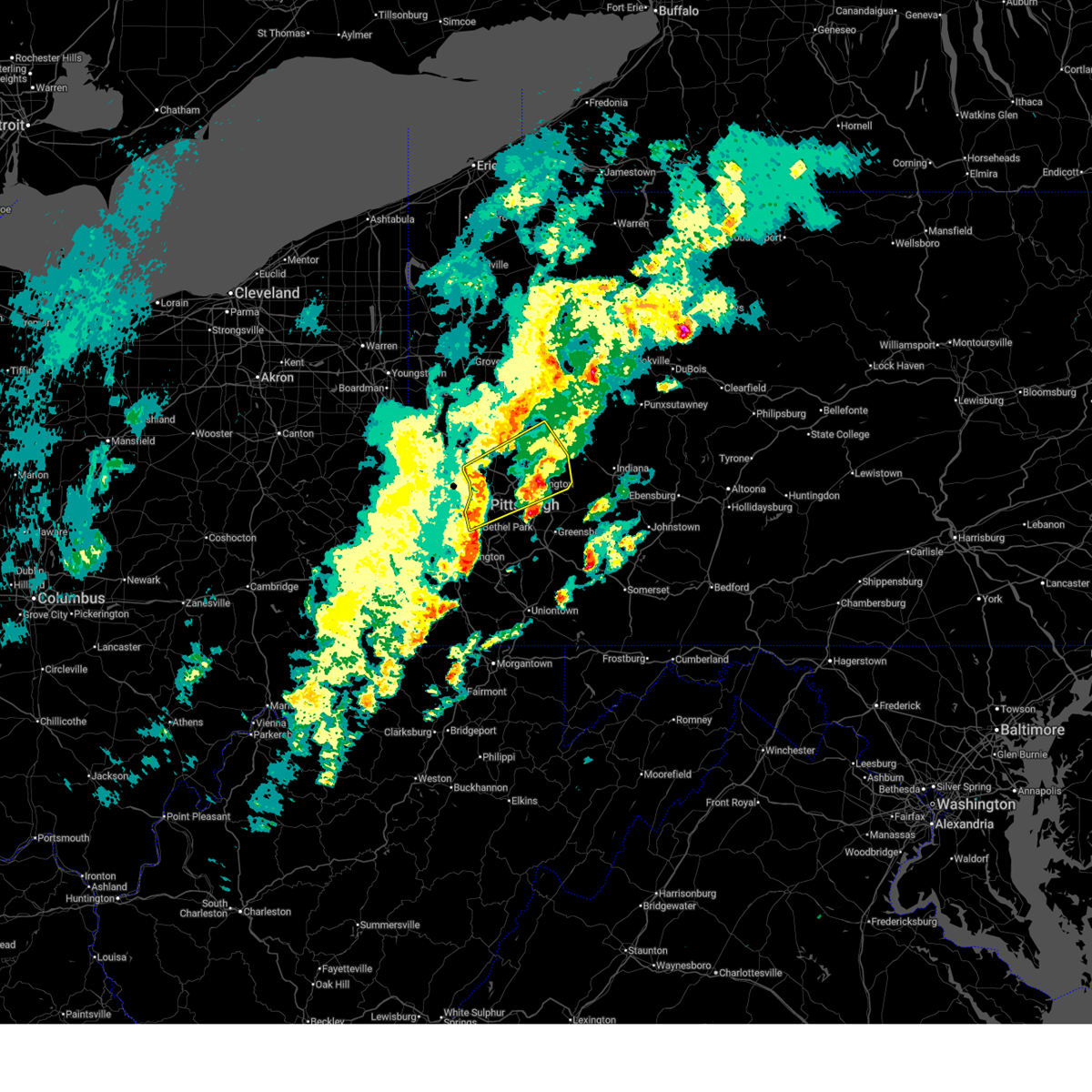
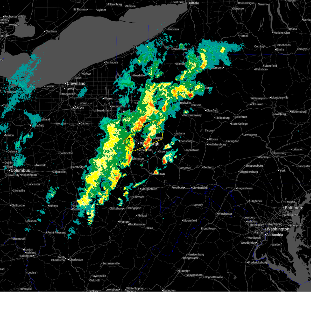
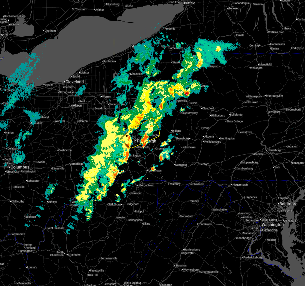
The Pittsburgh, PA area has had 60 reports of on-the-ground hail by trained spotters, and has been under severe weather warnings 74 times during the past 12 months. Doppler radar has detected hail at or near Pittsburgh, PA on 72 occasions, including 1 occasion during the past year.
| Name: | Pittsburgh, PA |
| Where Located: | 1 miles SE of Pittsburgh, PA |
| Map: | Google Map for Pittsburgh, PA |
| Population: | 305704 |
| Housing Units: | 156165 |
| More Info: | Search Google for Pittsburgh, PA |
3
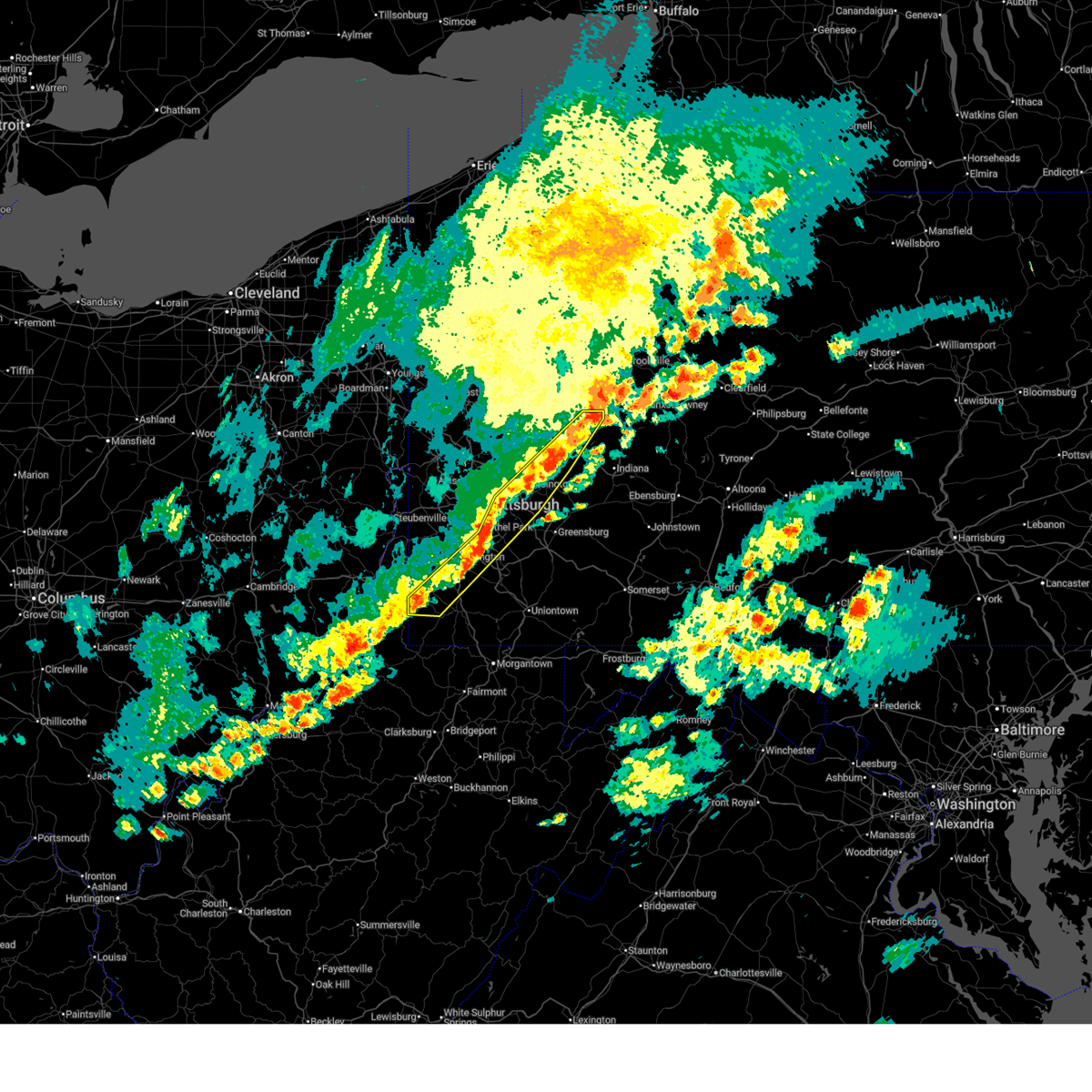
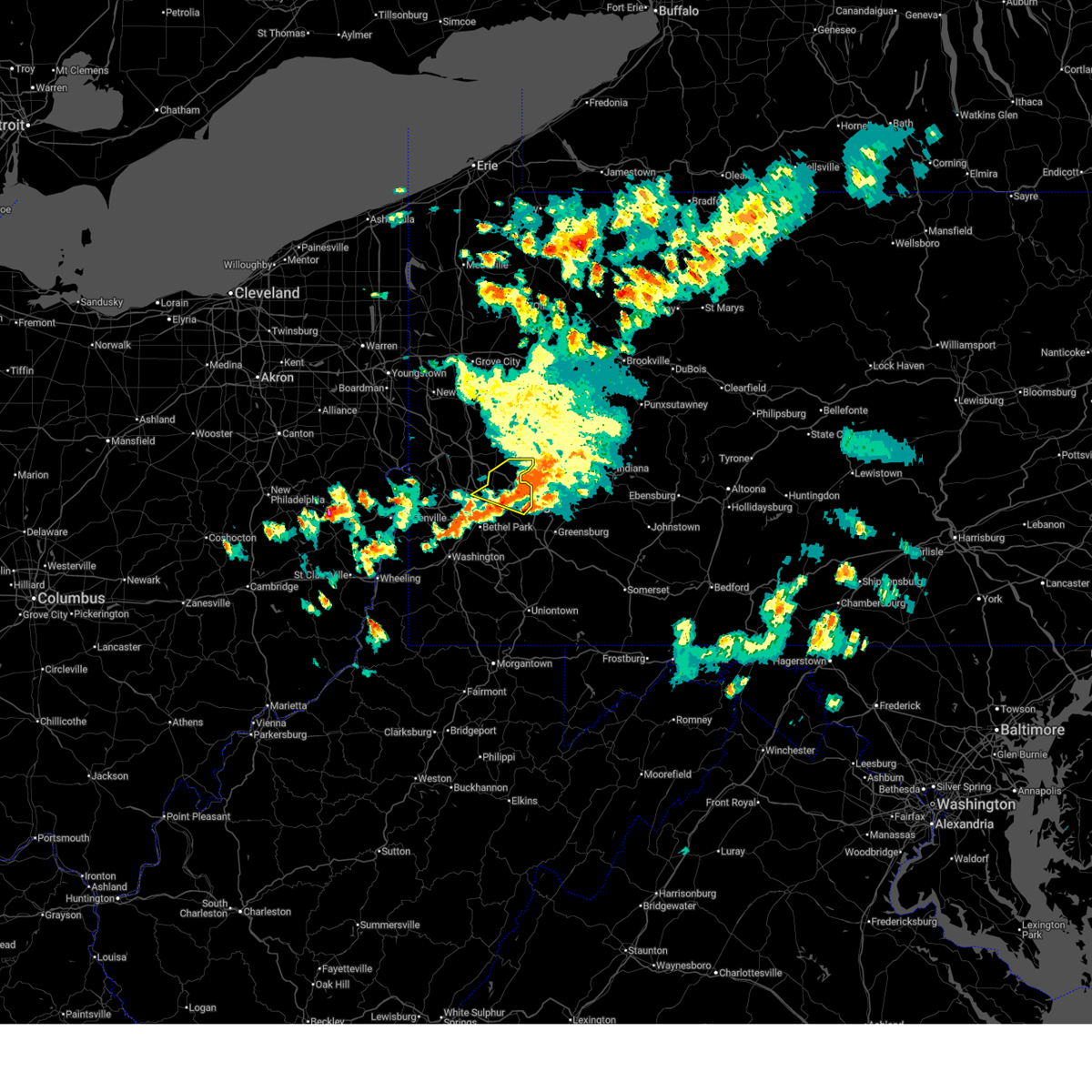
The Top Recent Hail Date for Pittsburgh, PA is Saturday, March 7, 2026 (7th out of 72)

Hail and Wind Damage Spotted near Pittsburgh, PA
| Date / Time | Report Details |
|---|---|
| 7/4/2026 5:22 PM EDT |
 the severe thunderstorm warning has been cancelled and is no longer in effect the severe thunderstorm warning has been cancelled and is no longer in effect
|
| 7/4/2026 5:05 PM EDT |
 At 505 pm edt, a severe thunderstorm was located over mcmurray, moving east at 20 mph (radar indicated). Hazards include 60 mph wind gusts. Expect damage to roofs, siding, and trees. locations impacted include, bethel park, mcmurray, mckeesport, canonsburg, gastonville, west mifflin, baldwin, upper st. Clair, whitehall, south park township, munhall, cecil-bishop, jefferson hills, north versailles, pleasant hills and clairton. At 505 pm edt, a severe thunderstorm was located over mcmurray, moving east at 20 mph (radar indicated). Hazards include 60 mph wind gusts. Expect damage to roofs, siding, and trees. locations impacted include, bethel park, mcmurray, mckeesport, canonsburg, gastonville, west mifflin, baldwin, upper st. Clair, whitehall, south park township, munhall, cecil-bishop, jefferson hills, north versailles, pleasant hills and clairton.
|
| 7/4/2026 4:50 PM EDT |
 Svrpbz the national weather service in pittsburgh has issued a * severe thunderstorm warning for, southeastern allegheny county in southwestern pennsylvania, central washington county in southwestern pennsylvania, * until 530 pm edt. * at 450 pm edt, a severe thunderstorm was located over canonsburg, moving east at 20 mph (radar indicated). Hazards include 60 mph wind gusts. expect damage to roofs, siding, and trees Svrpbz the national weather service in pittsburgh has issued a * severe thunderstorm warning for, southeastern allegheny county in southwestern pennsylvania, central washington county in southwestern pennsylvania, * until 530 pm edt. * at 450 pm edt, a severe thunderstorm was located over canonsburg, moving east at 20 mph (radar indicated). Hazards include 60 mph wind gusts. expect damage to roofs, siding, and trees
|
| 7/4/2026 4:47 PM EDT | Multiple trees down in an area around wible run rd... anderson rd and wetzel rd. some falling trees caused damage to structure in allegheny county PA, 6.3 miles S of Pittsburgh, PA |
| 7/4/2026 4:30 PM EDT |
 At 430 pm edt, a severe thunderstorm was located near shippingport, or 5 miles west of aliquippa, moving east at 25 mph (radar indicated). Hazards include 60 mph wind gusts. Expect damage to roofs, siding, and trees. Locations impacted include, ross township, mccandless township, cranberry, moon township, franklin park, aliquippa, shaler township, hampton township, economy, o'hara township, bellevue, ambridge, wexford and west view. At 430 pm edt, a severe thunderstorm was located near shippingport, or 5 miles west of aliquippa, moving east at 25 mph (radar indicated). Hazards include 60 mph wind gusts. Expect damage to roofs, siding, and trees. Locations impacted include, ross township, mccandless township, cranberry, moon township, franklin park, aliquippa, shaler township, hampton township, economy, o'hara township, bellevue, ambridge, wexford and west view.
|
| 7/4/2026 4:21 PM EDT |
 the severe thunderstorm warning has been cancelled and is no longer in effect the severe thunderstorm warning has been cancelled and is no longer in effect
|
| 7/4/2026 4:21 PM EDT |
 At 421 pm edt, a severe thunderstorm was located over shippingport, or 8 miles east of east liverpool, moving east at 25 mph (radar indicated). Hazards include 60 mph wind gusts. Expect damage to roofs, siding, and trees. Locations impacted include, ross township, mccandless township, cranberry, moon township, franklin park, aliquippa, monaca, shaler township, hampton township, economy, o'hara township, bellevue, ambridge, wexford and west view. At 421 pm edt, a severe thunderstorm was located over shippingport, or 8 miles east of east liverpool, moving east at 25 mph (radar indicated). Hazards include 60 mph wind gusts. Expect damage to roofs, siding, and trees. Locations impacted include, ross township, mccandless township, cranberry, moon township, franklin park, aliquippa, monaca, shaler township, hampton township, economy, o'hara township, bellevue, ambridge, wexford and west view.
|
| 7/4/2026 4:10 PM EDT |
 Svrpbz the national weather service in pittsburgh has issued a * severe thunderstorm warning for, southeastern columbiana county in east central ohio, northwestern allegheny county in southwestern pennsylvania, southern butler county in west central pennsylvania, beaver county in western pennsylvania, hancock county in northern west virginia, * until 515 pm edt. * at 410 pm edt, a severe thunderstorm was located near midland, or near east liverpool, moving east at 25 mph (radar indicated). Hazards include 60 mph wind gusts. expect damage to roofs, siding, and trees Svrpbz the national weather service in pittsburgh has issued a * severe thunderstorm warning for, southeastern columbiana county in east central ohio, northwestern allegheny county in southwestern pennsylvania, southern butler county in west central pennsylvania, beaver county in western pennsylvania, hancock county in northern west virginia, * until 515 pm edt. * at 410 pm edt, a severe thunderstorm was located near midland, or near east liverpool, moving east at 25 mph (radar indicated). Hazards include 60 mph wind gusts. expect damage to roofs, siding, and trees
|
| 6/14/2026 6:52 PM EDT |
 The severe thunderstorm warning that was previously in effect has been reissued for westmoreland, armstrong, allegheny, and washington counties and is in effect until 800 pm edt. please refer to that bulletin for the latest severe weather information. to report severe weather, contact your nearest law enforcement agency. they will send your report to the national weather service office. a severe thunderstorm watch remains in effect until 900 pm edt for a portion of southwest pennsylvania. a tornado watch remains in effect until 1000 pm edt for portions of southwest and west central pennsylvania. The severe thunderstorm warning that was previously in effect has been reissued for westmoreland, armstrong, allegheny, and washington counties and is in effect until 800 pm edt. please refer to that bulletin for the latest severe weather information. to report severe weather, contact your nearest law enforcement agency. they will send your report to the national weather service office. a severe thunderstorm watch remains in effect until 900 pm edt for a portion of southwest pennsylvania. a tornado watch remains in effect until 1000 pm edt for portions of southwest and west central pennsylvania.
|
| 6/14/2026 6:51 PM EDT |
 At 651 pm edt, severe thunderstorms were located along a line from 6 miles southwest of punxsutawney to near fredericktown-millsboro, or along a line from 6 miles southwest of punxsutawney to 11 miles northeast of waynesburg, moving east at 40 mph (radar indicated). Hazards include 60 mph wind gusts and small hail. Expect damage to roofs, siding, and trees. Locations impacted include, penn hills, monroeville, greensburg, mckeesport, indiana, jeannette, latrobe, connellsville, punxsutawney, vandergrift, homer city, apollo, gastonville, plum, west mifflin, murrysville, wilkinsburg and south park township. At 651 pm edt, severe thunderstorms were located along a line from 6 miles southwest of punxsutawney to near fredericktown-millsboro, or along a line from 6 miles southwest of punxsutawney to 11 miles northeast of waynesburg, moving east at 40 mph (radar indicated). Hazards include 60 mph wind gusts and small hail. Expect damage to roofs, siding, and trees. Locations impacted include, penn hills, monroeville, greensburg, mckeesport, indiana, jeannette, latrobe, connellsville, punxsutawney, vandergrift, homer city, apollo, gastonville, plum, west mifflin, murrysville, wilkinsburg and south park township.
|
| 6/14/2026 6:46 PM EDT |
 At 646 pm edt, severe thunderstorms were located along a line from near kittanning to 7 miles northeast of cameron, or along a line from near kittanning to 13 miles southeast of triadelphia, moving east at 35 mph (radar indicated). Hazards include 60 mph wind gusts and small hail. Expect damage to roofs, siding, and trees. Locations impacted include, pittsburgh, penn hills, bethel park, monroeville, mcmurray, mckeesport, washington, vandergrift, apollo, gastonville, plum, west mifflin, baldwin, murrysville, wilkinsburg, whitehall, south park township, new kensington, lower burrell and munhall. At 646 pm edt, severe thunderstorms were located along a line from near kittanning to 7 miles northeast of cameron, or along a line from near kittanning to 13 miles southeast of triadelphia, moving east at 35 mph (radar indicated). Hazards include 60 mph wind gusts and small hail. Expect damage to roofs, siding, and trees. Locations impacted include, pittsburgh, penn hills, bethel park, monroeville, mcmurray, mckeesport, washington, vandergrift, apollo, gastonville, plum, west mifflin, baldwin, murrysville, wilkinsburg, whitehall, south park township, new kensington, lower burrell and munhall.
|
| 6/14/2026 6:46 PM EDT |
 the severe thunderstorm warning has been cancelled and is no longer in effect the severe thunderstorm warning has been cancelled and is no longer in effect
|
| 6/14/2026 6:33 PM EDT |
 At 633 pm edt, severe thunderstorms were located along a line from near west kittanning to 7 miles north of cameron, or along a line from near kittanning to 7 miles east of moundsville, moving east at 35 mph (radar indicated). Hazards include 60 mph wind gusts and small hail. Expect damage to roofs, siding, and trees. Locations impacted include, pittsburgh, penn hills, mount lebanon, bethel park, ross township, monroeville, mcmurray, mckeesport, washington, moundsville, canonsburg, vandergrift, kittanning, apollo, gastonville, shaler township, plum, west mifflin and north side pittsburgh. At 633 pm edt, severe thunderstorms were located along a line from near west kittanning to 7 miles north of cameron, or along a line from near kittanning to 7 miles east of moundsville, moving east at 35 mph (radar indicated). Hazards include 60 mph wind gusts and small hail. Expect damage to roofs, siding, and trees. Locations impacted include, pittsburgh, penn hills, mount lebanon, bethel park, ross township, monroeville, mcmurray, mckeesport, washington, moundsville, canonsburg, vandergrift, kittanning, apollo, gastonville, shaler township, plum, west mifflin and north side pittsburgh.
|
| 6/14/2026 6:30 PM EDT | Large tree down across brighton road near giant eagle. time estimated via rada in allegheny county PA, 5.1 miles SE of Pittsburgh, PA |
| 6/14/2026 6:17 PM EDT |
 the severe thunderstorm warning has been cancelled and is no longer in effect the severe thunderstorm warning has been cancelled and is no longer in effect
|
| 6/14/2026 6:17 PM EDT |
 At 617 pm edt, severe thunderstorms were located along a line from 6 miles east of meadowood to over glen dale, or along a line from 6 miles east of butler to over moundsville, moving east at 35 mph (radar indicated). Hazards include 60 mph wind gusts and small hail. Expect damage to roofs, siding, and trees. Locations impacted include, pittsburgh, penn hills, mount lebanon, bethel park, ross township, wheeling, mccandless township, monroeville, cranberry, moon township, mcmurray, mckeesport, butler, washington, franklin park, moundsville, canonsburg, martins ferry and vandergrift. At 617 pm edt, severe thunderstorms were located along a line from 6 miles east of meadowood to over glen dale, or along a line from 6 miles east of butler to over moundsville, moving east at 35 mph (radar indicated). Hazards include 60 mph wind gusts and small hail. Expect damage to roofs, siding, and trees. Locations impacted include, pittsburgh, penn hills, mount lebanon, bethel park, ross township, wheeling, mccandless township, monroeville, cranberry, moon township, mcmurray, mckeesport, butler, washington, franklin park, moundsville, canonsburg, martins ferry and vandergrift.
|
| 6/14/2026 6:15 PM EDT | Large branches dow in allegheny county PA, 6.5 miles ESE of Pittsburgh, PA |
| 6/14/2026 6:01 PM EDT |
 Svrpbz the national weather service in pittsburgh has issued a * severe thunderstorm warning for, eastern belmont county in east central ohio, allegheny county in southwestern pennsylvania, northwestern greene county in southwestern pennsylvania, washington county in southwestern pennsylvania, northwestern westmoreland county in southwestern pennsylvania, armstrong county in west central pennsylvania, southern butler county in west central pennsylvania, southeastern beaver county in western pennsylvania, brooke county in northern west virginia, marshall county in northern west virginia, ohio county in northern west virginia, * until 700 pm edt. * at 601 pm edt, severe thunderstorms were located along a line from over meridian to 9 miles southwest of st. clairsville, or along a line from near butler to 9 miles southwest of st. clairsville, moving east at 35 mph (radar indicated). Hazards include 60 mph wind gusts and small hail. expect damage to roofs, siding, and trees Svrpbz the national weather service in pittsburgh has issued a * severe thunderstorm warning for, eastern belmont county in east central ohio, allegheny county in southwestern pennsylvania, northwestern greene county in southwestern pennsylvania, washington county in southwestern pennsylvania, northwestern westmoreland county in southwestern pennsylvania, armstrong county in west central pennsylvania, southern butler county in west central pennsylvania, southeastern beaver county in western pennsylvania, brooke county in northern west virginia, marshall county in northern west virginia, ohio county in northern west virginia, * until 700 pm edt. * at 601 pm edt, severe thunderstorms were located along a line from over meridian to 9 miles southwest of st. clairsville, or along a line from near butler to 9 miles southwest of st. clairsville, moving east at 35 mph (radar indicated). Hazards include 60 mph wind gusts and small hail. expect damage to roofs, siding, and trees
|
| 6/11/2026 3:34 PM EDT |
 At 334 pm edt, severe thunderstorms were located along a line from over butler to 9 miles southwest of wolfdale, or along a line from over butler to 8 miles east of valley grove, moving east at 30 mph (law enforcement reported). Hazards include 70 mph wind gusts. Expect considerable tree damage. damage is likely to mobile homes, roofs, and outbuildings. locations impacted include, pittsburgh, penn hills, mount lebanon, bethel park, ross township, mccandless township, monroeville, mcmurray, mckeesport, butler, washington, franklin park, canonsburg, vandergrift, kittanning, apollo, valley grove, gastonville and shaler township. numerous trees and power lines have been reported down with these storms. Areas including fox chapel and oakmont should expect considerable wind damage. At 334 pm edt, severe thunderstorms were located along a line from over butler to 9 miles southwest of wolfdale, or along a line from over butler to 8 miles east of valley grove, moving east at 30 mph (law enforcement reported). Hazards include 70 mph wind gusts. Expect considerable tree damage. damage is likely to mobile homes, roofs, and outbuildings. locations impacted include, pittsburgh, penn hills, mount lebanon, bethel park, ross township, mccandless township, monroeville, mcmurray, mckeesport, butler, washington, franklin park, canonsburg, vandergrift, kittanning, apollo, valley grove, gastonville and shaler township. numerous trees and power lines have been reported down with these storms. Areas including fox chapel and oakmont should expect considerable wind damage.
|
| 6/11/2026 3:27 PM EDT | Large tree down. time estimated via rada in allegheny county PA, 4.4 miles SW of Pittsburgh, PA |
| 6/11/2026 3:24 PM EDT |
 At 324 pm edt, severe thunderstorms were located along a line from over meridian to near valley grove, or along a line from near butler to near valley grove, moving east at 30 mph (law enforcement reported). Hazards include 70 mph wind gusts. Expect considerable tree damage. damage is likely to mobile homes, roofs, and outbuildings. locations impacted include, pittsburgh, penn hills, mount lebanon, bethel park, ross township, wheeling, mccandless township, monroeville, cranberry, moon township, mcmurray, mckeesport, butler, washington, franklin park, canonsburg, vandergrift, kittanning and apollo. Numerous trees and power lines have been reported down with this line of storms. At 324 pm edt, severe thunderstorms were located along a line from over meridian to near valley grove, or along a line from near butler to near valley grove, moving east at 30 mph (law enforcement reported). Hazards include 70 mph wind gusts. Expect considerable tree damage. damage is likely to mobile homes, roofs, and outbuildings. locations impacted include, pittsburgh, penn hills, mount lebanon, bethel park, ross township, wheeling, mccandless township, monroeville, cranberry, moon township, mcmurray, mckeesport, butler, washington, franklin park, canonsburg, vandergrift, kittanning and apollo. Numerous trees and power lines have been reported down with this line of storms.
|
| 6/11/2026 3:10 PM EDT |
 Svrpbz the national weather service in pittsburgh has issued a * severe thunderstorm warning for, northeastern belmont county in east central ohio, southeastern jefferson oh county in east central ohio, allegheny county in southwestern pennsylvania, washington county in southwestern pennsylvania, northwestern westmoreland county in southwestern pennsylvania, southwestern armstrong county in west central pennsylvania, butler county in west central pennsylvania, south central clarion county in west central pennsylvania, eastern beaver county in western pennsylvania, southeastern lawrence county in western pennsylvania, brooke county in northern west virginia, ohio county in northern west virginia, * until 415 pm edt. * at 310 pm edt, severe thunderstorms were located along a line from 7 miles north of zelienople to near west liberty, or along a line from 11 miles west of butler to near clearview, moving east at 30 mph (law enforcement reported). Hazards include 70 mph wind gusts. Expect considerable tree damage. Damage is likely to mobile homes, roofs, and outbuildings. Svrpbz the national weather service in pittsburgh has issued a * severe thunderstorm warning for, northeastern belmont county in east central ohio, southeastern jefferson oh county in east central ohio, allegheny county in southwestern pennsylvania, washington county in southwestern pennsylvania, northwestern westmoreland county in southwestern pennsylvania, southwestern armstrong county in west central pennsylvania, butler county in west central pennsylvania, south central clarion county in west central pennsylvania, eastern beaver county in western pennsylvania, southeastern lawrence county in western pennsylvania, brooke county in northern west virginia, ohio county in northern west virginia, * until 415 pm edt. * at 310 pm edt, severe thunderstorms were located along a line from 7 miles north of zelienople to near west liberty, or along a line from 11 miles west of butler to near clearview, moving east at 30 mph (law enforcement reported). Hazards include 70 mph wind gusts. Expect considerable tree damage. Damage is likely to mobile homes, roofs, and outbuildings.
|
| 6/11/2026 3:01 PM EDT |
 At 301 pm edt, severe thunderstorms were located along a line from near zelienople to near wellsburg, or along a line from 10 miles north of cranberry to near wellsburg, moving east at 40 mph (law enforcement reported). Hazards include 60 mph wind gusts and small hail. Expect damage to roofs, siding, and trees. locations impacted include, pittsburgh, ross township, mccandless township, cranberry, moon township, weirton, butler, franklin park, aliquippa, beaver falls, monaca, wellsburg, west liberty, avella, clearview, shaler township, north side pittsburgh and hampton township. Trees have been reported down in several locations along this line of storms. At 301 pm edt, severe thunderstorms were located along a line from near zelienople to near wellsburg, or along a line from 10 miles north of cranberry to near wellsburg, moving east at 40 mph (law enforcement reported). Hazards include 60 mph wind gusts and small hail. Expect damage to roofs, siding, and trees. locations impacted include, pittsburgh, ross township, mccandless township, cranberry, moon township, weirton, butler, franklin park, aliquippa, beaver falls, monaca, wellsburg, west liberty, avella, clearview, shaler township, north side pittsburgh and hampton township. Trees have been reported down in several locations along this line of storms.
|
| 6/11/2026 2:47 PM EDT |
 At 247 pm edt, severe thunderstorms were located along a line from near ellwood city to near tiltonsville, or along a line from near beaver falls to 6 miles northwest of clearview, moving east at 40 mph (law enforcement reported trees down in steubenville, and also to the west in belmont and harrison counties). Hazards include 60 mph wind gusts and small hail. Expect damage to roofs, siding, and trees. Locations impacted include, pittsburgh, ross township, mccandless township, cranberry, moon township, weirton, steubenville, butler, franklin park, aliquippa, beaver falls, monaca, wellsburg, west liberty, avella, clearview, shaler township, north side pittsburgh, hampton township and scott township. At 247 pm edt, severe thunderstorms were located along a line from near ellwood city to near tiltonsville, or along a line from near beaver falls to 6 miles northwest of clearview, moving east at 40 mph (law enforcement reported trees down in steubenville, and also to the west in belmont and harrison counties). Hazards include 60 mph wind gusts and small hail. Expect damage to roofs, siding, and trees. Locations impacted include, pittsburgh, ross township, mccandless township, cranberry, moon township, weirton, steubenville, butler, franklin park, aliquippa, beaver falls, monaca, wellsburg, west liberty, avella, clearview, shaler township, north side pittsburgh, hampton township and scott township.
|
| 6/11/2026 2:43 PM EDT |
 At 243 pm edt, severe thunderstorms were located along a line from near beaver falls to 7 miles west of tiltonsville, or along a line from near beaver falls to 8 miles northwest of clearview, moving east at 40 mph (radar indicated). Hazards include 60 mph wind gusts and small hail. Expect damage to roofs, siding, and trees. Locations impacted include, pittsburgh, ross township, mccandless township, cranberry, moon township, weirton, steubenville, butler, franklin park, aliquippa, beaver falls, monaca, wellsburg, west liberty, avella, clearview, shaler township, north side pittsburgh, hampton township and scott township. At 243 pm edt, severe thunderstorms were located along a line from near beaver falls to 7 miles west of tiltonsville, or along a line from near beaver falls to 8 miles northwest of clearview, moving east at 40 mph (radar indicated). Hazards include 60 mph wind gusts and small hail. Expect damage to roofs, siding, and trees. Locations impacted include, pittsburgh, ross township, mccandless township, cranberry, moon township, weirton, steubenville, butler, franklin park, aliquippa, beaver falls, monaca, wellsburg, west liberty, avella, clearview, shaler township, north side pittsburgh, hampton township and scott township.
|
| 6/11/2026 2:33 PM EDT |
 Svrpbz the national weather service in pittsburgh has issued a * severe thunderstorm warning for, northern belmont county in east central ohio, southeastern columbiana county in east central ohio, southeastern harrison county in east central ohio, southern jefferson oh county in east central ohio, northwestern allegheny county in southwestern pennsylvania, northwestern washington county in southwestern pennsylvania, southwestern butler county in west central pennsylvania, beaver county in western pennsylvania, southern lawrence county in western pennsylvania, brooke county in northern west virginia, hancock county in northern west virginia, ohio county in northern west virginia, * until 315 pm edt. * at 233 pm edt, severe thunderstorms were located along a line from 6 miles west of beaver falls to 7 miles north of st. clairsville, moving east at 40 mph (radar indicated). Hazards include 60 mph wind gusts and small hail. expect damage to roofs, siding, and trees Svrpbz the national weather service in pittsburgh has issued a * severe thunderstorm warning for, northern belmont county in east central ohio, southeastern columbiana county in east central ohio, southeastern harrison county in east central ohio, southern jefferson oh county in east central ohio, northwestern allegheny county in southwestern pennsylvania, northwestern washington county in southwestern pennsylvania, southwestern butler county in west central pennsylvania, beaver county in western pennsylvania, southern lawrence county in western pennsylvania, brooke county in northern west virginia, hancock county in northern west virginia, ohio county in northern west virginia, * until 315 pm edt. * at 233 pm edt, severe thunderstorms were located along a line from 6 miles west of beaver falls to 7 miles north of st. clairsville, moving east at 40 mph (radar indicated). Hazards include 60 mph wind gusts and small hail. expect damage to roofs, siding, and trees
|
| 6/6/2026 2:55 PM EDT |
 The severe thunderstorm warning that was previously in effect has been reissued for marion, monongalia, greene, wetzel, allegheny, and washington counties and is in effect until 345 pm edt. please refer to that bulletin for the latest severe weather information. to report severe weather, contact your nearest law enforcement agency. they will send your report to the national weather service office. a severe thunderstorm watch remains in effect until 600 pm edt for portions of southwest pennsylvania and northern west virginia. The severe thunderstorm warning that was previously in effect has been reissued for marion, monongalia, greene, wetzel, allegheny, and washington counties and is in effect until 345 pm edt. please refer to that bulletin for the latest severe weather information. to report severe weather, contact your nearest law enforcement agency. they will send your report to the national weather service office. a severe thunderstorm watch remains in effect until 600 pm edt for portions of southwest pennsylvania and northern west virginia.
|
| 6/6/2026 2:51 PM EDT |
 At 251 pm edt, severe thunderstorms were located along a line from over west newton to 8 miles southeast of jacksonburg, or along a line from 8 miles south of mckeesport to 12 miles southwest of mannington, moving east at 55 mph (law enforcement reported tree and power pole damage across belmont county and washington county). Hazards include 70 mph wind gusts and small hail. Expect considerable tree damage. damage is likely to mobile homes, roofs, and outbuildings. Locations impacted include, mount lebanon, bethel park, mckeesport, waynesburg, gastonville, west mifflin, baldwin, whitehall, south park township, munhall, jefferson hills, north versailles, brentwood, dormont, castle shannon, pleasant hills, white oak and monessen. At 251 pm edt, severe thunderstorms were located along a line from over west newton to 8 miles southeast of jacksonburg, or along a line from 8 miles south of mckeesport to 12 miles southwest of mannington, moving east at 55 mph (law enforcement reported tree and power pole damage across belmont county and washington county). Hazards include 70 mph wind gusts and small hail. Expect considerable tree damage. damage is likely to mobile homes, roofs, and outbuildings. Locations impacted include, mount lebanon, bethel park, mckeesport, waynesburg, gastonville, west mifflin, baldwin, whitehall, south park township, munhall, jefferson hills, north versailles, brentwood, dormont, castle shannon, pleasant hills, white oak and monessen.
|
| 6/6/2026 2:38 PM EDT |
 At 238 pm edt, severe thunderstorms were located along a line from over gastonville to 7 miles southwest of pine grove, or along a line from over gastonville to 15 miles southeast of new martinsville, moving east at 55 mph (law enforcement reported). Hazards include 70 mph wind gusts and small hail. Law enforcement reported tree and power pole damage across belmont county and washington county. locations impacted include, mount lebanon, bethel park, mcmurray, mckeesport, washington, canonsburg, new martinsville, waynesburg, gastonville, west mifflin, baldwin, upper st. Clair, scott township, whitehall, south park township, munhall, cecil-bishop, jefferson hills and north versailles. At 238 pm edt, severe thunderstorms were located along a line from over gastonville to 7 miles southwest of pine grove, or along a line from over gastonville to 15 miles southeast of new martinsville, moving east at 55 mph (law enforcement reported). Hazards include 70 mph wind gusts and small hail. Law enforcement reported tree and power pole damage across belmont county and washington county. locations impacted include, mount lebanon, bethel park, mcmurray, mckeesport, washington, canonsburg, new martinsville, waynesburg, gastonville, west mifflin, baldwin, upper st. Clair, scott township, whitehall, south park township, munhall, cecil-bishop, jefferson hills and north versailles.
|
| 6/6/2026 2:27 PM EDT |
 At 227 pm edt, severe thunderstorms were located along a line from over canonsburg to 12 miles south of new martinsville, moving east at 55 mph (law enforcement reported tree and power pole damage across belmont county and washington county). Hazards include 70 mph wind gusts and small hail. Expect considerable tree damage. damage is likely to mobile homes, roofs, and outbuildings. locations impacted include, mount lebanon, bethel park, mcmurray, mckeesport, washington, moundsville, canonsburg, new martinsville, waynesburg, avella, gastonville, west mifflin, baldwin, upper st. Clair, scott township, whitehall, south park township and munhall. At 227 pm edt, severe thunderstorms were located along a line from over canonsburg to 12 miles south of new martinsville, moving east at 55 mph (law enforcement reported tree and power pole damage across belmont county and washington county). Hazards include 70 mph wind gusts and small hail. Expect considerable tree damage. damage is likely to mobile homes, roofs, and outbuildings. locations impacted include, mount lebanon, bethel park, mcmurray, mckeesport, washington, moundsville, canonsburg, new martinsville, waynesburg, avella, gastonville, west mifflin, baldwin, upper st. Clair, scott township, whitehall, south park township and munhall.
|
| 6/6/2026 2:18 PM EDT |
 At 218 pm edt, severe thunderstorms were located along a line from 8 miles north of wolfdale to 17 miles south of woodsfield, or along a line from 7 miles east of avella to 15 miles southwest of new martinsville, moving east at 55 mph (law enforcement reported tree and power line damage across the warned area). Hazards include 60 mph wind gusts and small hail. Expect damage to roofs, siding, and trees. Locations impacted include, mount lebanon, bethel park, wheeling, mcmurray, weirton, mckeesport, washington, moundsville, canonsburg, martins ferry, new martinsville, bellaire, waynesburg, warwood, wellsburg, bethlehem, west liberty and triadelphia. At 218 pm edt, severe thunderstorms were located along a line from 8 miles north of wolfdale to 17 miles south of woodsfield, or along a line from 7 miles east of avella to 15 miles southwest of new martinsville, moving east at 55 mph (law enforcement reported tree and power line damage across the warned area). Hazards include 60 mph wind gusts and small hail. Expect damage to roofs, siding, and trees. Locations impacted include, mount lebanon, bethel park, wheeling, mcmurray, weirton, mckeesport, washington, moundsville, canonsburg, martins ferry, new martinsville, bellaire, waynesburg, warwood, wellsburg, bethlehem, west liberty and triadelphia.
|
| 6/6/2026 1:55 PM EDT |
 Svrpbz the national weather service in pittsburgh has issued a * severe thunderstorm warning for, belmont county in east central ohio, southern jefferson oh county in east central ohio, monroe county in east central ohio, southern allegheny county in southwestern pennsylvania, greene county in southwestern pennsylvania, washington county in southwestern pennsylvania, brooke county in northern west virginia, northwestern marion county in northern west virginia, marshall county in northern west virginia, northwestern monongalia county in northern west virginia, ohio county in northern west virginia, wetzel county in northern west virginia, * until 300 pm edt. * at 155 pm edt, severe thunderstorms were located along a line from over wintersville to 13 miles south of caldwell, or along a line from near steubenville to 13 miles south of caldwell, moving east at 55 mph (law enforcement reported tree and power line damage across the warned area). Hazards include 60 mph wind gusts and small hail. expect damage to roofs, siding, and trees Svrpbz the national weather service in pittsburgh has issued a * severe thunderstorm warning for, belmont county in east central ohio, southern jefferson oh county in east central ohio, monroe county in east central ohio, southern allegheny county in southwestern pennsylvania, greene county in southwestern pennsylvania, washington county in southwestern pennsylvania, brooke county in northern west virginia, northwestern marion county in northern west virginia, marshall county in northern west virginia, northwestern monongalia county in northern west virginia, ohio county in northern west virginia, wetzel county in northern west virginia, * until 300 pm edt. * at 155 pm edt, severe thunderstorms were located along a line from over wintersville to 13 miles south of caldwell, or along a line from near steubenville to 13 miles south of caldwell, moving east at 55 mph (law enforcement reported tree and power line damage across the warned area). Hazards include 60 mph wind gusts and small hail. expect damage to roofs, siding, and trees
|
| 4/14/2026 5:26 PM EDT |
 The storm which prompted the warning has weakened below severe limits, and has exited the warned area. therefore, the warning will be allowed to expire. The storm which prompted the warning has weakened below severe limits, and has exited the warned area. therefore, the warning will be allowed to expire.
|
| 4/14/2026 5:10 PM EDT |
 At 510 pm edt, a severe thunderstorm was located over hampton township, or near ross township, moving east at 40 mph (radar indicated). Hazards include 60 mph wind gusts and small hail. Expect damage to roofs, siding, and trees. Locations impacted include, pittsburgh, penn hills, ross township, monroeville, shaler township, plum, hampton township, wilkinsburg, harrison township, o'hara township, bellevue, west view, forest hills and stowe township. At 510 pm edt, a severe thunderstorm was located over hampton township, or near ross township, moving east at 40 mph (radar indicated). Hazards include 60 mph wind gusts and small hail. Expect damage to roofs, siding, and trees. Locations impacted include, pittsburgh, penn hills, ross township, monroeville, shaler township, plum, hampton township, wilkinsburg, harrison township, o'hara township, bellevue, west view, forest hills and stowe township.
|
| 4/14/2026 4:55 PM EDT |
 At 455 pm edt, a severe thunderstorm was located over franklin park, moving east at 40 mph (radar indicated). Hazards include 60 mph wind gusts and quarter size hail. Hail damage to vehicles is expected. expect wind damage to roofs, siding, and trees. Locations impacted include, pittsburgh, penn hills, ross township, mccandless township, monroeville, moon township, franklin park, shaler township, plum, hampton township, wilkinsburg, harrison township and o'hara township. At 455 pm edt, a severe thunderstorm was located over franklin park, moving east at 40 mph (radar indicated). Hazards include 60 mph wind gusts and quarter size hail. Hail damage to vehicles is expected. expect wind damage to roofs, siding, and trees. Locations impacted include, pittsburgh, penn hills, ross township, mccandless township, monroeville, moon township, franklin park, shaler township, plum, hampton township, wilkinsburg, harrison township and o'hara township.
|
| 4/14/2026 4:55 PM EDT |
 the severe thunderstorm warning has been cancelled and is no longer in effect the severe thunderstorm warning has been cancelled and is no longer in effect
|
| 4/14/2026 4:40 PM EDT |
 Svrpbz the national weather service in pittsburgh has issued a * severe thunderstorm warning for, northern allegheny county in southwestern pennsylvania, central beaver county in western pennsylvania, * until 530 pm edt. * at 440 pm edt, a severe thunderstorm was located near beaver, or near aliquippa, moving east at 40 mph (radar indicated). Hazards include 60 mph wind gusts and quarter size hail. Hail damage to vehicles is expected. Expect wind damage to roofs, siding, and trees. Svrpbz the national weather service in pittsburgh has issued a * severe thunderstorm warning for, northern allegheny county in southwestern pennsylvania, central beaver county in western pennsylvania, * until 530 pm edt. * at 440 pm edt, a severe thunderstorm was located near beaver, or near aliquippa, moving east at 40 mph (radar indicated). Hazards include 60 mph wind gusts and quarter size hail. Hail damage to vehicles is expected. Expect wind damage to roofs, siding, and trees.
|
| 4/1/2026 12:23 AM EDT |
 The storms which prompted the warning have weakened below severe limits, and no longer pose an immediate threat to life or property. therefore, the warning will be allowed to expire. The storms which prompted the warning have weakened below severe limits, and no longer pose an immediate threat to life or property. therefore, the warning will be allowed to expire.
|
| 4/1/2026 12:12 AM EDT |
 The tornado threat has diminished and the tornado warning has been cancelled. however, damaging winds remain likely and a severe thunderstorm warning remains in effect for the area. however, heavy rain is still possible with this thunderstorm. The tornado threat has diminished and the tornado warning has been cancelled. however, damaging winds remain likely and a severe thunderstorm warning remains in effect for the area. however, heavy rain is still possible with this thunderstorm.
|
| 4/1/2026 12:08 AM EDT |
 At 1208 am edt, severe thunderstorms were located along a line from near murrysville to over monongahela, or along a line from 8 miles south of apollo to 8 miles southeast of gastonville, moving east at 50 mph (radar indicated). Hazards include 60 mph wind gusts. Expect damage to roofs, siding, and trees. Locations impacted include, penn hills, bethel park, monroeville, greensburg, mckeesport, jeannette, gastonville, plum, west mifflin, baldwin, murrysville, wilkinsburg, south park township, munhall, jefferson hills and north versailles. At 1208 am edt, severe thunderstorms were located along a line from near murrysville to over monongahela, or along a line from 8 miles south of apollo to 8 miles southeast of gastonville, moving east at 50 mph (radar indicated). Hazards include 60 mph wind gusts. Expect damage to roofs, siding, and trees. Locations impacted include, penn hills, bethel park, monroeville, greensburg, mckeesport, jeannette, gastonville, plum, west mifflin, baldwin, murrysville, wilkinsburg, south park township, munhall, jefferson hills and north versailles.
|
| 4/1/2026 12:05 AM EDT | Tree down on power line in allegheny county PA, 5.6 miles NW of Pittsburgh, PA |
| 4/1/2026 12:00 AM EDT |
 Torpbz the national weather service in pittsburgh has issued a * tornado warning for, east central allegheny county in southwestern pennsylvania, west central westmoreland county in southwestern pennsylvania, * until 1215 am edt. * at midnight edt, a severe thunderstorm capable of producing a tornado was located over duquesne, or over mckeesport, moving east at 45 mph (radar indicated rotation). Hazards include tornado. Flying debris will be dangerous to those caught without shelter. mobile homes will be damaged or destroyed. damage to roofs, windows and vehicles will occur. Tree damage is likely. Torpbz the national weather service in pittsburgh has issued a * tornado warning for, east central allegheny county in southwestern pennsylvania, west central westmoreland county in southwestern pennsylvania, * until 1215 am edt. * at midnight edt, a severe thunderstorm capable of producing a tornado was located over duquesne, or over mckeesport, moving east at 45 mph (radar indicated rotation). Hazards include tornado. Flying debris will be dangerous to those caught without shelter. mobile homes will be damaged or destroyed. damage to roofs, windows and vehicles will occur. Tree damage is likely.
|
| 3/31/2026 11:57 PM EDT |
 At 1157 pm edt, severe thunderstorms were located along a line from over oakmont to over gastonville, or along a line from near penn hills to over gastonville, moving east at 50 mph (radar indicated). Hazards include 60 mph wind gusts. Expect damage to roofs, siding, and trees. locations impacted include, pittsburgh, penn hills, mount lebanon, bethel park, ross township, monroeville, mcmurray, greensburg, mckeesport, jeannette, canonsburg, gastonville, shaler township, plum, west mifflin, north side pittsburgh, baldwin, upper st. Clair and murrysville. At 1157 pm edt, severe thunderstorms were located along a line from over oakmont to over gastonville, or along a line from near penn hills to over gastonville, moving east at 50 mph (radar indicated). Hazards include 60 mph wind gusts. Expect damage to roofs, siding, and trees. locations impacted include, pittsburgh, penn hills, mount lebanon, bethel park, ross township, monroeville, mcmurray, greensburg, mckeesport, jeannette, canonsburg, gastonville, shaler township, plum, west mifflin, north side pittsburgh, baldwin, upper st. Clair and murrysville.
|
| 3/31/2026 11:50 PM EDT | Mesonet station 11510 1 se robinson townshi in allegheny county PA, 6.8 miles ESE of Pittsburgh, PA |
| 3/31/2026 11:41 PM EDT |
 Svrpbz the national weather service in pittsburgh has issued a * severe thunderstorm warning for, allegheny county in southwestern pennsylvania, central washington county in southwestern pennsylvania, western westmoreland county in southwestern pennsylvania, * until 1230 am edt. * at 1141 pm edt, severe thunderstorms were located along a line from over franklin park to near mcdonald, or along a line from over franklin park to near canonsburg, moving east at 50 mph (radar indicated). Hazards include 60 mph wind gusts. expect damage to roofs, siding, and trees Svrpbz the national weather service in pittsburgh has issued a * severe thunderstorm warning for, allegheny county in southwestern pennsylvania, central washington county in southwestern pennsylvania, western westmoreland county in southwestern pennsylvania, * until 1230 am edt. * at 1141 pm edt, severe thunderstorms were located along a line from over franklin park to near mcdonald, or along a line from over franklin park to near canonsburg, moving east at 50 mph (radar indicated). Hazards include 60 mph wind gusts. expect damage to roofs, siding, and trees
|
| 3/11/2026 2:20 PM EDT |
 At 220 pm edt, severe thunderstorms were located along a line from 8 miles southeast of ford city to over penn hills, or along a line from 10 miles southeast of kittanning to over penn hills, moving east at 55 mph (radar indicated). Hazards include 60 mph wind gusts. Expect damage to roofs, siding, and trees. Locations impacted include, penn hills, monroeville, indiana, vandergrift, homer city, apollo, plum, murrysville, wilkinsburg, new kensington, lower burrell, harrison township, o'hara township, oakmont, arnold, tarentum, natrona heights and blairsville. At 220 pm edt, severe thunderstorms were located along a line from 8 miles southeast of ford city to over penn hills, or along a line from 10 miles southeast of kittanning to over penn hills, moving east at 55 mph (radar indicated). Hazards include 60 mph wind gusts. Expect damage to roofs, siding, and trees. Locations impacted include, penn hills, monroeville, indiana, vandergrift, homer city, apollo, plum, murrysville, wilkinsburg, new kensington, lower burrell, harrison township, o'hara township, oakmont, arnold, tarentum, natrona heights and blairsville.
|
| 3/11/2026 2:19 PM EDT |
 At 219 pm edt, severe thunderstorms were located along a line from 8 miles southeast of ford city to over penn hills, or along a line from 10 miles southeast of kittanning to over penn hills, moving east at 55 mph (radar indicated). Hazards include 60 mph wind gusts. Expect damage to roofs, siding, and trees. Locations impacted include, penn hills, monroeville, indiana, vandergrift, homer city, apollo, plum, murrysville, wilkinsburg, new kensington, lower burrell, harrison township, o'hara township, oakmont, arnold, tarentum, natrona heights and blairsville. At 219 pm edt, severe thunderstorms were located along a line from 8 miles southeast of ford city to over penn hills, or along a line from 10 miles southeast of kittanning to over penn hills, moving east at 55 mph (radar indicated). Hazards include 60 mph wind gusts. Expect damage to roofs, siding, and trees. Locations impacted include, penn hills, monroeville, indiana, vandergrift, homer city, apollo, plum, murrysville, wilkinsburg, new kensington, lower burrell, harrison township, o'hara township, oakmont, arnold, tarentum, natrona heights and blairsville.
|
| 3/11/2026 2:11 PM EDT |
 Svrpbz the national weather service in pittsburgh has issued a * severe thunderstorm warning for, northeastern allegheny county in southwestern pennsylvania, northwestern westmoreland county in southwestern pennsylvania, southern armstrong county in west central pennsylvania, southwestern indiana county in west central pennsylvania, * until 300 pm edt. * at 211 pm edt, severe thunderstorms were located along a line from over leechburg to over pittsburgh, or along a line from near vandergrift to over pittsburgh, moving east at 55 mph (radar indicated). Hazards include 60 mph wind gusts. expect damage to roofs, siding, and trees Svrpbz the national weather service in pittsburgh has issued a * severe thunderstorm warning for, northeastern allegheny county in southwestern pennsylvania, northwestern westmoreland county in southwestern pennsylvania, southern armstrong county in west central pennsylvania, southwestern indiana county in west central pennsylvania, * until 300 pm edt. * at 211 pm edt, severe thunderstorms were located along a line from over leechburg to over pittsburgh, or along a line from near vandergrift to over pittsburgh, moving east at 55 mph (radar indicated). Hazards include 60 mph wind gusts. expect damage to roofs, siding, and trees
|
| 3/11/2026 2:11 PM EDT |
 The severe thunderstorm warning that was previously in effect has been reissued for westmoreland and allegheny counties and is in effect until 300 pm edt. please refer to that bulletin for the latest severe weather information. to report severe weather, contact your nearest law enforcement agency. they will send your report to the national weather service office. a tornado watch remains in effect until 800 pm edt wednesday for a portion of southwest pennsylvania. The severe thunderstorm warning that was previously in effect has been reissued for westmoreland and allegheny counties and is in effect until 300 pm edt. please refer to that bulletin for the latest severe weather information. to report severe weather, contact your nearest law enforcement agency. they will send your report to the national weather service office. a tornado watch remains in effect until 800 pm edt wednesday for a portion of southwest pennsylvania.
|
| 3/11/2026 2:06 PM EDT |
 the tornado warning has been cancelled and is no longer in effect the tornado warning has been cancelled and is no longer in effect
|
| 3/11/2026 2:02 PM EDT |
 At 202 pm edt, severe thunderstorms were located along a line from over tarentum to over carnegie, or along a line from 9 miles north of penn hills to near mount lebanon, moving east at 60 mph (radar indicated). Hazards include 60 mph wind gusts. Expect damage to roofs, siding, and trees. Locations impacted include, pittsburgh, penn hills, ross township, mccandless township, moon township, franklin park, shaler township, plum, north side pittsburgh, hampton township, scott township, wilkinsburg, robinson township, new kensington, lower burrell, harrison township, dormont, o'hara township and bellevue. At 202 pm edt, severe thunderstorms were located along a line from over tarentum to over carnegie, or along a line from 9 miles north of penn hills to near mount lebanon, moving east at 60 mph (radar indicated). Hazards include 60 mph wind gusts. Expect damage to roofs, siding, and trees. Locations impacted include, pittsburgh, penn hills, ross township, mccandless township, moon township, franklin park, shaler township, plum, north side pittsburgh, hampton township, scott township, wilkinsburg, robinson township, new kensington, lower burrell, harrison township, dormont, o'hara township and bellevue.
|
| 3/11/2026 2:02 PM EDT |
 the severe thunderstorm warning has been cancelled and is no longer in effect the severe thunderstorm warning has been cancelled and is no longer in effect
|
| 3/11/2026 1:57 PM EDT |
 Torpbz the national weather service in pittsburgh has issued a * tornado warning for, central allegheny county in southwestern pennsylvania, northeastern washington county in southwestern pennsylvania, * until 230 pm edt. * at 157 pm edt, a severe thunderstorm capable of producing a tornado was located over mcdonald, or 8 miles northwest of canonsburg, moving east at 40 mph (radar indicated rotation). Hazards include tornado. Flying debris will be dangerous to those caught without shelter. mobile homes will be damaged or destroyed. damage to roofs, windows and vehicles will occur. Tree damage is likely. Torpbz the national weather service in pittsburgh has issued a * tornado warning for, central allegheny county in southwestern pennsylvania, northeastern washington county in southwestern pennsylvania, * until 230 pm edt. * at 157 pm edt, a severe thunderstorm capable of producing a tornado was located over mcdonald, or 8 miles northwest of canonsburg, moving east at 40 mph (radar indicated rotation). Hazards include tornado. Flying debris will be dangerous to those caught without shelter. mobile homes will be damaged or destroyed. damage to roofs, windows and vehicles will occur. Tree damage is likely.
|
| 3/11/2026 1:41 PM EDT |
 Svrpbz the national weather service in pittsburgh has issued a * severe thunderstorm warning for, northern allegheny county in southwestern pennsylvania, northwestern washington county in southwestern pennsylvania, northwestern westmoreland county in southwestern pennsylvania, southeastern beaver county in western pennsylvania, brooke county in northern west virginia, * until 215 pm edt. * at 141 pm edt, severe thunderstorms were located along a line from over coraopolis to near avella, or along a line from over moon township to near avella, moving east at 60 mph (radar indicated). Hazards include 60 mph wind gusts. expect damage to roofs, siding, and trees Svrpbz the national weather service in pittsburgh has issued a * severe thunderstorm warning for, northern allegheny county in southwestern pennsylvania, northwestern washington county in southwestern pennsylvania, northwestern westmoreland county in southwestern pennsylvania, southeastern beaver county in western pennsylvania, brooke county in northern west virginia, * until 215 pm edt. * at 141 pm edt, severe thunderstorms were located along a line from over coraopolis to near avella, or along a line from over moon township to near avella, moving east at 60 mph (radar indicated). Hazards include 60 mph wind gusts. expect damage to roofs, siding, and trees
|
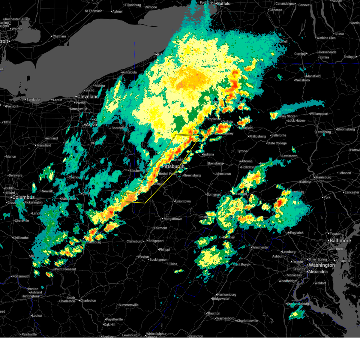
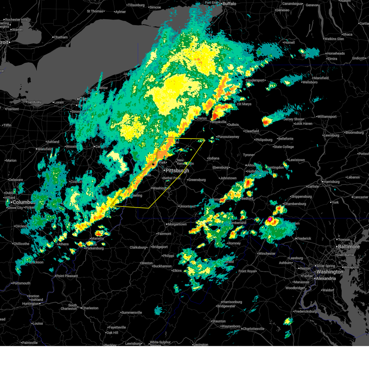
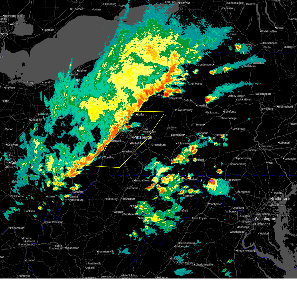
| 3/7/2026 4:56 PM EST |
 The storms which prompted the warning have weakened below severe limits, and no longer pose an immediate threat to life or property. therefore, the warning will be allowed to expire. however, gusty winds and heavy rain are still possible with these thunderstorms. a tornado watch remains in effect until 800 pm est for portions of southwest and west central pennsylvania. The storms which prompted the warning have weakened below severe limits, and no longer pose an immediate threat to life or property. therefore, the warning will be allowed to expire. however, gusty winds and heavy rain are still possible with these thunderstorms. a tornado watch remains in effect until 800 pm est for portions of southwest and west central pennsylvania.
|
| 3/7/2026 4:47 PM EST |
 At 447 pm est, severe thunderstorms were located along a line from 5 miles northwest of tarentum to over penn hills, or along a line from 13 miles northeast of mccandless township to over penn hills, moving northeast at 65 mph (radar indicated). Hazards include 60 mph wind gusts. Expect damage to roofs, siding, and trees. Locations impacted include, penn hills, monroeville, vandergrift, apollo, plum, murrysville, wilkinsburg, new kensington, lower burrell, harrison township, o'hara township, forest hills, wilkins township and oakmont. At 447 pm est, severe thunderstorms were located along a line from 5 miles northwest of tarentum to over penn hills, or along a line from 13 miles northeast of mccandless township to over penn hills, moving northeast at 65 mph (radar indicated). Hazards include 60 mph wind gusts. Expect damage to roofs, siding, and trees. Locations impacted include, penn hills, monroeville, vandergrift, apollo, plum, murrysville, wilkinsburg, new kensington, lower burrell, harrison township, o'hara township, forest hills, wilkins township and oakmont.
|
| 3/7/2026 4:45 PM EST |
 The severe thunderstorm warning that was previously in effect has been reissued for allegheny, westmoreland, and washington counties and is in effect until 530 pm est. please refer to that bulletin for the latest severe weather information. The severe thunderstorm warning that was previously in effect has been reissued for allegheny, westmoreland, and washington counties and is in effect until 530 pm est. please refer to that bulletin for the latest severe weather information.
|
| 3/7/2026 4:45 PM EST |
 Svrpbz the national weather service in pittsburgh has issued a * severe thunderstorm warning for, southeastern allegheny county in southwestern pennsylvania, east central washington county in southwestern pennsylvania, central westmoreland county in southwestern pennsylvania, southwestern indiana county in west central pennsylvania, * until 530 pm est. * at 445 pm est, severe thunderstorms were located along a line from over north braddock to over donora, or along a line from near mckeesport to 9 miles southeast of gastonville, moving northeast at 65 mph (radar indicated). Hazards include 60 mph wind gusts. expect damage to roofs, siding, and trees Svrpbz the national weather service in pittsburgh has issued a * severe thunderstorm warning for, southeastern allegheny county in southwestern pennsylvania, east central washington county in southwestern pennsylvania, central westmoreland county in southwestern pennsylvania, southwestern indiana county in west central pennsylvania, * until 530 pm est. * at 445 pm est, severe thunderstorms were located along a line from over north braddock to over donora, or along a line from near mckeesport to 9 miles southeast of gastonville, moving northeast at 65 mph (radar indicated). Hazards include 60 mph wind gusts. expect damage to roofs, siding, and trees
|
| 3/7/2026 4:36 PM EST |
 At 436 pm est, severe thunderstorms were located along a line from over mccandless township to over mount oliver, or along a line from over mccandless township to over mount lebanon, moving northeast at 65 mph (radar indicated). Hazards include 60 mph wind gusts. Expect damage to roofs, siding, and trees. locations impacted include, pittsburgh, penn hills, mount lebanon, bethel park, ross township, mccandless township, monroeville, franklin park, vandergrift, apollo, shaler township, plum, west mifflin, north side pittsburgh, baldwin, upper st. Clair, murrysville, hampton township, scott township and wilkinsburg. At 436 pm est, severe thunderstorms were located along a line from over mccandless township to over mount oliver, or along a line from over mccandless township to over mount lebanon, moving northeast at 65 mph (radar indicated). Hazards include 60 mph wind gusts. Expect damage to roofs, siding, and trees. locations impacted include, pittsburgh, penn hills, mount lebanon, bethel park, ross township, mccandless township, monroeville, franklin park, vandergrift, apollo, shaler township, plum, west mifflin, north side pittsburgh, baldwin, upper st. Clair, murrysville, hampton township, scott township and wilkinsburg.
|
| 3/7/2026 4:34 PM EST |
 At 434 pm est, a severe thunderstorm was located over gastonville, moving east at 55 mph (radar indicated). Hazards include 60 mph wind gusts and small hail. Expect damage to roofs, siding, and trees. locations impacted include, bethel park, mcmurray, mckeesport, gastonville, west mifflin, baldwin, upper st. Clair, whitehall, south park township, munhall, jefferson hills, north versailles, pleasant hills, white oak, clairton, duquesne, turtle creek and north braddock. At 434 pm est, a severe thunderstorm was located over gastonville, moving east at 55 mph (radar indicated). Hazards include 60 mph wind gusts and small hail. Expect damage to roofs, siding, and trees. locations impacted include, bethel park, mcmurray, mckeesport, gastonville, west mifflin, baldwin, upper st. Clair, whitehall, south park township, munhall, jefferson hills, north versailles, pleasant hills, white oak, clairton, duquesne, turtle creek and north braddock.
|
| 3/7/2026 4:33 PM EST | Wires down on brookline blv in allegheny county PA, 3.3 miles NE of Pittsburgh, PA |
| 3/7/2026 4:27 PM EST |
 At 427 pm est, severe thunderstorms were located along a line from over sewickley to over cecil-bishop, or along a line from over moon township to 5 miles northwest of mcmurray, moving northeast at 65 mph (radar indicated). Hazards include 70 mph wind gusts. Expect considerable tree damage. damage is likely to mobile homes, roofs, and outbuildings. locations impacted include, pittsburgh, penn hills, mount lebanon, bethel park, ross township, mccandless township, monroeville, moon township, franklin park, vandergrift, apollo, shaler township, plum, west mifflin, north side pittsburgh, baldwin, upper st. Clair, murrysville, hampton township and scott township. At 427 pm est, severe thunderstorms were located along a line from over sewickley to over cecil-bishop, or along a line from over moon township to 5 miles northwest of mcmurray, moving northeast at 65 mph (radar indicated). Hazards include 70 mph wind gusts. Expect considerable tree damage. damage is likely to mobile homes, roofs, and outbuildings. locations impacted include, pittsburgh, penn hills, mount lebanon, bethel park, ross township, mccandless township, monroeville, moon township, franklin park, vandergrift, apollo, shaler township, plum, west mifflin, north side pittsburgh, baldwin, upper st. Clair, murrysville, hampton township and scott township.
|
| 3/7/2026 4:27 PM EST |
 the severe thunderstorm warning has been cancelled and is no longer in effect the severe thunderstorm warning has been cancelled and is no longer in effect
|
| 3/7/2026 4:25 PM EST | Old leechburg road trees dow in allegheny county PA, 13.3 miles WSW of Pittsburgh, PA |
| 3/7/2026 4:20 PM EST | Tree and wires down on joan driv in allegheny county PA, 8.4 miles WSW of Pittsburgh, PA |
| 3/7/2026 4:19 PM EST |
 At 419 pm est, severe thunderstorms were located along a line from near imperial to 5 miles northwest of mcgovern, or along a line from 6 miles west of moon township to 6 miles west of canonsburg, moving northeast at 65 mph (radar indicated). Hazards include 70 mph wind gusts. Expect considerable tree damage. damage is likely to mobile homes, roofs, and outbuildings. locations impacted include, pittsburgh, penn hills, mount lebanon, bethel park, ross township, mccandless township, monroeville, moon township, franklin park, vandergrift, apollo, avella, shaler township, plum, west mifflin, north side pittsburgh, baldwin and upper st. Clair. At 419 pm est, severe thunderstorms were located along a line from near imperial to 5 miles northwest of mcgovern, or along a line from 6 miles west of moon township to 6 miles west of canonsburg, moving northeast at 65 mph (radar indicated). Hazards include 70 mph wind gusts. Expect considerable tree damage. damage is likely to mobile homes, roofs, and outbuildings. locations impacted include, pittsburgh, penn hills, mount lebanon, bethel park, ross township, mccandless township, monroeville, moon township, franklin park, vandergrift, apollo, avella, shaler township, plum, west mifflin, north side pittsburgh, baldwin and upper st. Clair.
|
| 3/7/2026 4:14 PM EST |
 At 414 pm est, a severe thunderstorm was located over gastonville, moving east at 50 mph (radar indicated). Hazards include 60 mph wind gusts and half dollar size hail. Hail damage to vehicles is expected. expect wind damage to roofs, siding, and trees. locations impacted include, pittsburgh, mount lebanon, bethel park, mcmurray, mckeesport, gastonville, west mifflin, baldwin, upper st. Clair, wilkinsburg, whitehall, south park township, munhall, jefferson hills, north versailles, brentwood, swissvale and castle shannon. At 414 pm est, a severe thunderstorm was located over gastonville, moving east at 50 mph (radar indicated). Hazards include 60 mph wind gusts and half dollar size hail. Hail damage to vehicles is expected. expect wind damage to roofs, siding, and trees. locations impacted include, pittsburgh, mount lebanon, bethel park, mcmurray, mckeesport, gastonville, west mifflin, baldwin, upper st. Clair, wilkinsburg, whitehall, south park township, munhall, jefferson hills, north versailles, brentwood, swissvale and castle shannon.
|
| 3/7/2026 4:13 PM EST |
 Svrpbz the national weather service in pittsburgh has issued a * severe thunderstorm warning for, allegheny county in southwestern pennsylvania, northwestern washington county in southwestern pennsylvania, northwestern westmoreland county in southwestern pennsylvania, southwestern armstrong county in west central pennsylvania, southeastern butler county in west central pennsylvania, * until 500 pm est. * at 413 pm est, severe thunderstorms were located along a line from 7 miles northeast of weirton to near avella, moving northeast at 65 mph (radar indicated). Hazards include 60 mph wind gusts. expect damage to roofs, siding, and trees Svrpbz the national weather service in pittsburgh has issued a * severe thunderstorm warning for, allegheny county in southwestern pennsylvania, northwestern washington county in southwestern pennsylvania, northwestern westmoreland county in southwestern pennsylvania, southwestern armstrong county in west central pennsylvania, southeastern butler county in west central pennsylvania, * until 500 pm est. * at 413 pm est, severe thunderstorms were located along a line from 7 miles northeast of weirton to near avella, moving northeast at 65 mph (radar indicated). Hazards include 60 mph wind gusts. expect damage to roofs, siding, and trees
|
| 3/7/2026 3:53 PM EST |
 Svrpbz the national weather service in pittsburgh has issued a * severe thunderstorm warning for, southeastern allegheny county in southwestern pennsylvania, central washington county in southwestern pennsylvania, west central westmoreland county in southwestern pennsylvania, * until 445 pm est. * at 353 pm est, a severe thunderstorm was located over wolfdale, or near washington, moving east at 50 mph (radar indicated). Hazards include 60 mph wind gusts and quarter size hail. Hail damage to vehicles is expected. Expect wind damage to roofs, siding, and trees. Svrpbz the national weather service in pittsburgh has issued a * severe thunderstorm warning for, southeastern allegheny county in southwestern pennsylvania, central washington county in southwestern pennsylvania, west central westmoreland county in southwestern pennsylvania, * until 445 pm est. * at 353 pm est, a severe thunderstorm was located over wolfdale, or near washington, moving east at 50 mph (radar indicated). Hazards include 60 mph wind gusts and quarter size hail. Hail damage to vehicles is expected. Expect wind damage to roofs, siding, and trees.
|
| 7/16/2025 9:03 PM EDT |
 the severe thunderstorm warning has been cancelled and is no longer in effect the severe thunderstorm warning has been cancelled and is no longer in effect
|
| 7/16/2025 8:55 PM EDT |
 At 855 pm edt, a severe thunderstorm was located over sturgeon-noblestown, or 7 miles north of canonsburg, moving northeast at 45 mph (radar indicated). Hazards include 60 mph wind gusts. Expect damage to roofs, siding, and trees. locations impacted include, pittsburgh, penn hills, mount lebanon, bethel park, ross township, mccandless township, monroeville, moon township, mcmurray, mckeesport, franklin park, canonsburg, shaler township, plum, west mifflin, north side pittsburgh, baldwin, upper st. Clair, hampton township and scott township. At 855 pm edt, a severe thunderstorm was located over sturgeon-noblestown, or 7 miles north of canonsburg, moving northeast at 45 mph (radar indicated). Hazards include 60 mph wind gusts. Expect damage to roofs, siding, and trees. locations impacted include, pittsburgh, penn hills, mount lebanon, bethel park, ross township, mccandless township, monroeville, moon township, mcmurray, mckeesport, franklin park, canonsburg, shaler township, plum, west mifflin, north side pittsburgh, baldwin, upper st. Clair, hampton township and scott township.
|
| 7/16/2025 8:41 PM EDT |
 Svrpbz the national weather service in pittsburgh has issued a * severe thunderstorm warning for, central allegheny county in southwestern pennsylvania, northwestern washington county in southwestern pennsylvania, * until 930 pm edt. * at 841 pm edt, a severe thunderstorm was located 6 miles northwest of wolfdale, or 6 miles east of avella, moving northeast at 40 mph (radar indicated). Hazards include 60 mph wind gusts. expect damage to roofs, siding, and trees Svrpbz the national weather service in pittsburgh has issued a * severe thunderstorm warning for, central allegheny county in southwestern pennsylvania, northwestern washington county in southwestern pennsylvania, * until 930 pm edt. * at 841 pm edt, a severe thunderstorm was located 6 miles northwest of wolfdale, or 6 miles east of avella, moving northeast at 40 mph (radar indicated). Hazards include 60 mph wind gusts. expect damage to roofs, siding, and trees
|
| 7/16/2025 7:45 PM EDT |
 The storm which prompted the warning has weakened below severe limits, and no longer poses an immediate threat to life or property. therefore, the warning has been allowed to expire. however, gusty winds are still possible with this thunderstorm. The storm which prompted the warning has weakened below severe limits, and no longer poses an immediate threat to life or property. therefore, the warning has been allowed to expire. however, gusty winds are still possible with this thunderstorm.
|
| 7/16/2025 7:35 PM EDT |
 the severe thunderstorm warning has been cancelled and is no longer in effect the severe thunderstorm warning has been cancelled and is no longer in effect
|
| 7/16/2025 7:35 PM EDT |
 At 735 pm edt, a severe thunderstorm was located near moon township, moving northeast at 40 mph (radar indicated). Hazards include 60 mph wind gusts. Expect damage to trees and power lines, resulting in some power outages. Locations impacted include, pittsburgh, moon township, weirton, aliquippa, robinson township, cecil-bishop, kennedy township, ambridge, mckees rocks, coraopolis, sewickley, harmony township, midland, imperial, mcdonald, industry, sturgeon-noblestown, leetsdale, shippingport, and edgeworth. At 735 pm edt, a severe thunderstorm was located near moon township, moving northeast at 40 mph (radar indicated). Hazards include 60 mph wind gusts. Expect damage to trees and power lines, resulting in some power outages. Locations impacted include, pittsburgh, moon township, weirton, aliquippa, robinson township, cecil-bishop, kennedy township, ambridge, mckees rocks, coraopolis, sewickley, harmony township, midland, imperial, mcdonald, industry, sturgeon-noblestown, leetsdale, shippingport, and edgeworth.
|
| 7/16/2025 7:18 PM EDT |
 the severe thunderstorm warning has been cancelled and is no longer in effect the severe thunderstorm warning has been cancelled and is no longer in effect
|
| 7/16/2025 7:18 PM EDT |
 At 718 pm edt, a severe thunderstorm was located near weirton, moving northeast at 40 mph (radar indicated). Hazards include 60 mph wind gusts. Expect damage to trees and power lines, resulting in some power outages. Locations impacted include, pittsburgh, moon township, weirton, steubenville, aliquippa, avella, robinson township, cecil-bishop, kennedy township, ambridge, mckees rocks, coraopolis, sewickley, harmony township, follansbee, wolfdale, midland, hooverson heights, imperial, and mcdonald. At 718 pm edt, a severe thunderstorm was located near weirton, moving northeast at 40 mph (radar indicated). Hazards include 60 mph wind gusts. Expect damage to trees and power lines, resulting in some power outages. Locations impacted include, pittsburgh, moon township, weirton, steubenville, aliquippa, avella, robinson township, cecil-bishop, kennedy township, ambridge, mckees rocks, coraopolis, sewickley, harmony township, follansbee, wolfdale, midland, hooverson heights, imperial, and mcdonald.
|
| 7/16/2025 7:00 PM EDT |
 Svrpbz the national weather service in pittsburgh has issued a * severe thunderstorm warning for, southern beaver county in western pennsylvania, northwestern washington county in southwestern pennsylvania, northwestern allegheny county in southwestern pennsylvania, ohio county in northern west virginia, brooke county in northern west virginia, hancock county in northern west virginia, * until 745 pm edt. * at 700 pm edt, a severe thunderstorm was located over wellsburg, moving northeast at 40 mph (radar indicated). Hazards include 60 mph wind gusts. expect damage to trees and power lines, resulting in some power outages Svrpbz the national weather service in pittsburgh has issued a * severe thunderstorm warning for, southern beaver county in western pennsylvania, northwestern washington county in southwestern pennsylvania, northwestern allegheny county in southwestern pennsylvania, ohio county in northern west virginia, brooke county in northern west virginia, hancock county in northern west virginia, * until 745 pm edt. * at 700 pm edt, a severe thunderstorm was located over wellsburg, moving northeast at 40 mph (radar indicated). Hazards include 60 mph wind gusts. expect damage to trees and power lines, resulting in some power outages
|
| 7/16/2025 6:27 PM EDT |
 At 626 pm edt, a severe thunderstorm was located over gibsonia, or near mccandless township, moving east at 15 mph (radar indicated). Hazards include golf ball size hail and 60 mph wind gusts. People and animals outdoors will be injured. expect hail damage to roofs, siding, windows, and vehicles. expect wind damage to trees and power lines, resulting in some power outages. Locations impacted include, pittsburgh, penn hills, ross township, mccandless township, shaler township, plum, hampton township, wilkinsburg, o'hara township, wexford, oakmont, fox chapel, tarentum, etna, sharpsburg, aspinwall, gibsonia, verona, blawnox, and cheswick. At 626 pm edt, a severe thunderstorm was located over gibsonia, or near mccandless township, moving east at 15 mph (radar indicated). Hazards include golf ball size hail and 60 mph wind gusts. People and animals outdoors will be injured. expect hail damage to roofs, siding, windows, and vehicles. expect wind damage to trees and power lines, resulting in some power outages. Locations impacted include, pittsburgh, penn hills, ross township, mccandless township, shaler township, plum, hampton township, wilkinsburg, o'hara township, wexford, oakmont, fox chapel, tarentum, etna, sharpsburg, aspinwall, gibsonia, verona, blawnox, and cheswick.
|
| 7/16/2025 6:16 PM EDT |
 At 616 pm edt, a severe thunderstorm was located over seven fields, or near cranberry, moving east at 15 mph (radar indicated). Hazards include ping pong ball size hail and 60 mph wind gusts. People and animals outdoors will be injured. expect hail damage to roofs, siding, windows, and vehicles. expect wind damage to trees and power lines, resulting in some power outages. Locations impacted include, pittsburgh, penn hills, ross township, mccandless township, cranberry, franklin park, shaler township, plum, hampton township, wilkinsburg, o'hara township, wexford, oakmont, fox chapel, tarentum, etna, sharpsburg, seven fields, aspinwall, and gibsonia. At 616 pm edt, a severe thunderstorm was located over seven fields, or near cranberry, moving east at 15 mph (radar indicated). Hazards include ping pong ball size hail and 60 mph wind gusts. People and animals outdoors will be injured. expect hail damage to roofs, siding, windows, and vehicles. expect wind damage to trees and power lines, resulting in some power outages. Locations impacted include, pittsburgh, penn hills, ross township, mccandless township, cranberry, franklin park, shaler township, plum, hampton township, wilkinsburg, o'hara township, wexford, oakmont, fox chapel, tarentum, etna, sharpsburg, seven fields, aspinwall, and gibsonia.
|
| 7/16/2025 6:11 PM EDT |
 the severe thunderstorm warning has been cancelled and is no longer in effect the severe thunderstorm warning has been cancelled and is no longer in effect
|
| 7/16/2025 6:11 PM EDT |
 At 611 pm edt, a severe thunderstorm was located over seven fields, or near cranberry, moving east at 15 mph (radar indicated). Hazards include 60 mph wind gusts. Expect damage to trees and power lines, resulting in some power outages. Locations impacted include, pittsburgh, penn hills, ross township, mccandless township, cranberry, franklin park, shaler township, plum, hampton township, wilkinsburg, o'hara township, wexford, oakmont, fox chapel, tarentum, etna, sharpsburg, seven fields, aspinwall, and gibsonia. At 611 pm edt, a severe thunderstorm was located over seven fields, or near cranberry, moving east at 15 mph (radar indicated). Hazards include 60 mph wind gusts. Expect damage to trees and power lines, resulting in some power outages. Locations impacted include, pittsburgh, penn hills, ross township, mccandless township, cranberry, franklin park, shaler township, plum, hampton township, wilkinsburg, o'hara township, wexford, oakmont, fox chapel, tarentum, etna, sharpsburg, seven fields, aspinwall, and gibsonia.
|
| 7/16/2025 6:07 PM EDT |
 Svrpbz the national weather service in pittsburgh has issued a * severe thunderstorm warning for, east central beaver county in western pennsylvania, southern butler county in west central pennsylvania, northeastern allegheny county in southwestern pennsylvania, * until 645 pm edt. * at 607 pm edt, a severe thunderstorm was located over seven fields, or over cranberry, moving east at 15 mph (radar indicated). Hazards include 60 mph wind gusts. expect damage to trees and power lines, resulting in some power outages Svrpbz the national weather service in pittsburgh has issued a * severe thunderstorm warning for, east central beaver county in western pennsylvania, southern butler county in west central pennsylvania, northeastern allegheny county in southwestern pennsylvania, * until 645 pm edt. * at 607 pm edt, a severe thunderstorm was located over seven fields, or over cranberry, moving east at 15 mph (radar indicated). Hazards include 60 mph wind gusts. expect damage to trees and power lines, resulting in some power outages
|
| 7/13/2025 4:06 PM EDT |
 the severe thunderstorm warning has been cancelled and is no longer in effect the severe thunderstorm warning has been cancelled and is no longer in effect
|
| 7/13/2025 3:57 PM EDT |
 At 357 pm edt, a severe thunderstorm was located over arnold, or 7 miles north of penn hills, moving north at 15 mph (radar indicated). Hazards include 60 mph wind gusts. Expect damage to roofs, siding, and trees. Locations impacted include, pittsburgh, penn hills, monroeville, plum, murrysville, new kensington, lower burrell, harrison township, o'hara township, oakmont, fox chapel, arnold, tarentum, sharpsburg, springdale, brackenridge, aspinwall, verona, blawnox and cheswick. At 357 pm edt, a severe thunderstorm was located over arnold, or 7 miles north of penn hills, moving north at 15 mph (radar indicated). Hazards include 60 mph wind gusts. Expect damage to roofs, siding, and trees. Locations impacted include, pittsburgh, penn hills, monroeville, plum, murrysville, new kensington, lower burrell, harrison township, o'hara township, oakmont, fox chapel, arnold, tarentum, sharpsburg, springdale, brackenridge, aspinwall, verona, blawnox and cheswick.
|
| 7/13/2025 3:39 PM EDT |
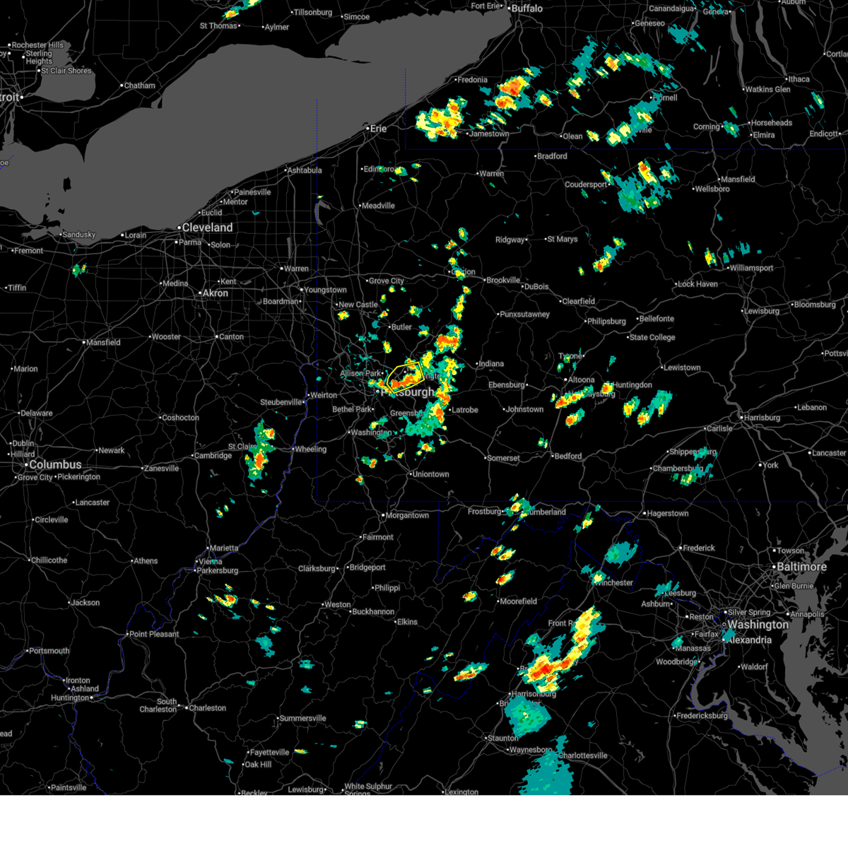 Svrpbz the national weather service in pittsburgh has issued a * severe thunderstorm warning for, northeastern allegheny county in southwestern pennsylvania, northwestern westmoreland county in southwestern pennsylvania, * until 430 pm edt. * at 339 pm edt, a severe thunderstorm was located over springdale, or near penn hills, moving northeast at 25 mph (radar indicated). Hazards include 60 mph wind gusts and small hail. expect damage to roofs, siding, and trees Svrpbz the national weather service in pittsburgh has issued a * severe thunderstorm warning for, northeastern allegheny county in southwestern pennsylvania, northwestern westmoreland county in southwestern pennsylvania, * until 430 pm edt. * at 339 pm edt, a severe thunderstorm was located over springdale, or near penn hills, moving northeast at 25 mph (radar indicated). Hazards include 60 mph wind gusts and small hail. expect damage to roofs, siding, and trees
|
| 6/28/2025 5:28 PM EDT |
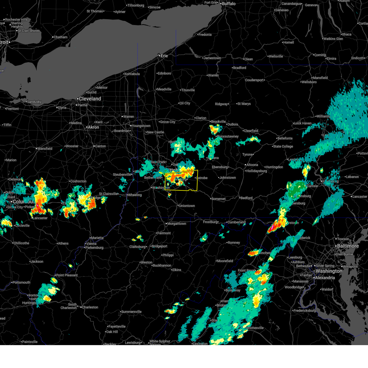 Svrpbz the national weather service in pittsburgh has issued a * severe thunderstorm warning for, southeastern allegheny county in southwestern pennsylvania, east central washington county in southwestern pennsylvania, southwestern westmoreland county in southwestern pennsylvania, * until 615 pm edt. * at 528 pm edt, a severe thunderstorm was located near white oak, or near mckeesport, moving east at 25 mph (radar indicated). Hazards include 60 mph wind gusts. expect damage to roofs, siding, and trees Svrpbz the national weather service in pittsburgh has issued a * severe thunderstorm warning for, southeastern allegheny county in southwestern pennsylvania, east central washington county in southwestern pennsylvania, southwestern westmoreland county in southwestern pennsylvania, * until 615 pm edt. * at 528 pm edt, a severe thunderstorm was located near white oak, or near mckeesport, moving east at 25 mph (radar indicated). Hazards include 60 mph wind gusts. expect damage to roofs, siding, and trees
|
| 6/27/2025 6:01 PM EDT |
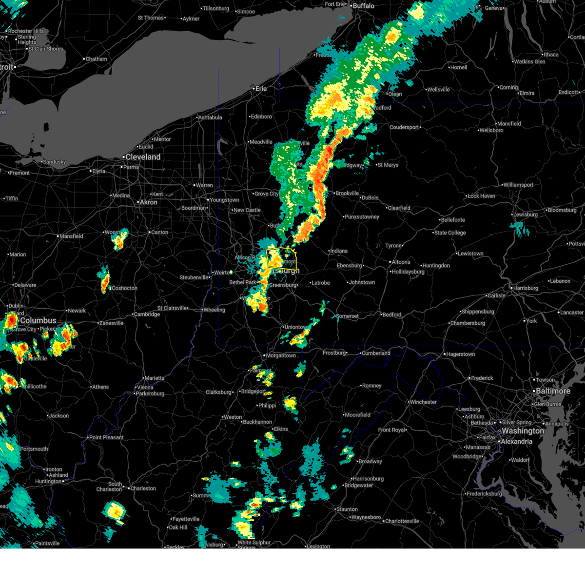 the severe thunderstorm warning has been cancelled and is no longer in effect the severe thunderstorm warning has been cancelled and is no longer in effect
|
| 6/27/2025 5:55 PM EDT |
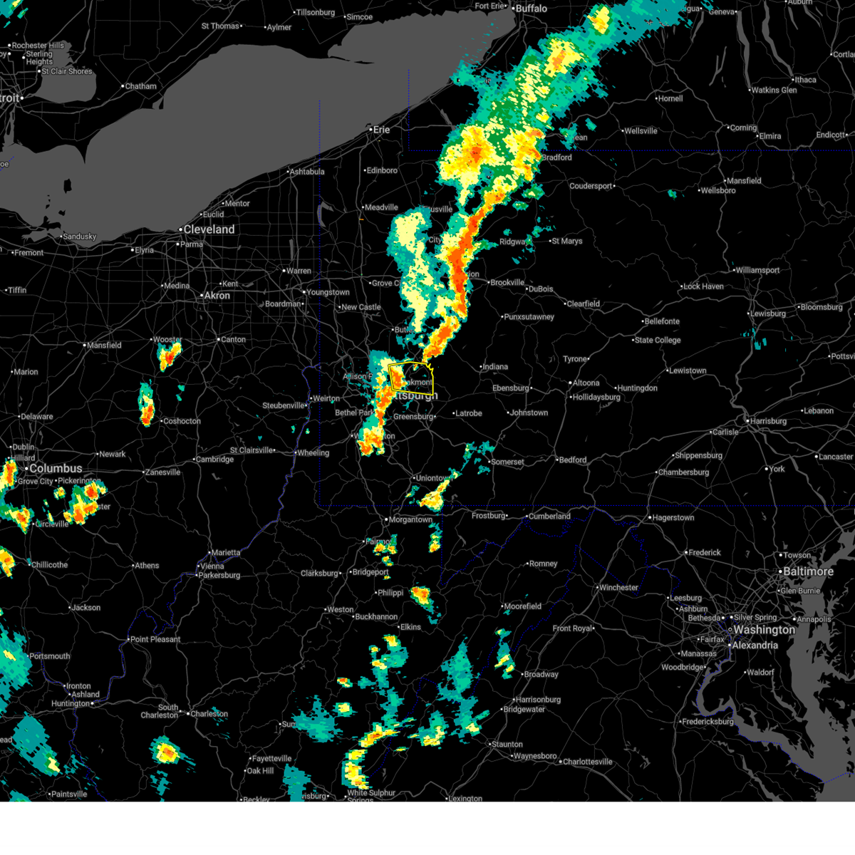 At 555 pm edt, a severe thunderstorm was located over new kensington, or 6 miles northeast of penn hills, moving east at 25 mph (radar indicated). Hazards include 60 mph wind gusts. Expect damage to roofs, siding, and trees. Locations impacted include, pittsburgh, penn hills, monroeville, vandergrift, apollo, plum, murrysville, hampton township, new kensington, lower burrell, harrison township, o'hara township, oakmont, fox chapel, arnold, tarentum, natrona heights, springdale, brackenridge and aspinwall. At 555 pm edt, a severe thunderstorm was located over new kensington, or 6 miles northeast of penn hills, moving east at 25 mph (radar indicated). Hazards include 60 mph wind gusts. Expect damage to roofs, siding, and trees. Locations impacted include, pittsburgh, penn hills, monroeville, vandergrift, apollo, plum, murrysville, hampton township, new kensington, lower burrell, harrison township, o'hara township, oakmont, fox chapel, arnold, tarentum, natrona heights, springdale, brackenridge and aspinwall.
|
| 6/27/2025 5:39 PM EDT |
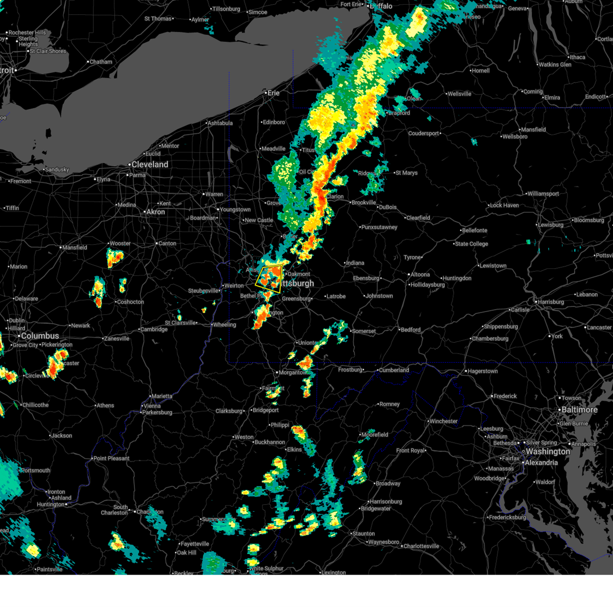 The severe thunderstorm warning that was previously in effect has been reissued for allegheny county and is in effect until 615 pm edt. please refer to that bulletin for the latest severe weather information. however, gusty winds and heavy rain are still possible with this thunderstorm. The severe thunderstorm warning that was previously in effect has been reissued for allegheny county and is in effect until 615 pm edt. please refer to that bulletin for the latest severe weather information. however, gusty winds and heavy rain are still possible with this thunderstorm.
|
| 6/27/2025 5:34 PM EDT |
 Svrpbz the national weather service in pittsburgh has issued a * severe thunderstorm warning for, northeastern allegheny county in southwestern pennsylvania, northwestern westmoreland county in southwestern pennsylvania, * until 615 pm edt. * at 534 pm edt, a severe thunderstorm was located over fox chapel, or 6 miles east of ross township, moving east at 25 mph (radar indicated). Hazards include 60 mph wind gusts. expect damage to roofs, siding, and trees Svrpbz the national weather service in pittsburgh has issued a * severe thunderstorm warning for, northeastern allegheny county in southwestern pennsylvania, northwestern westmoreland county in southwestern pennsylvania, * until 615 pm edt. * at 534 pm edt, a severe thunderstorm was located over fox chapel, or 6 miles east of ross township, moving east at 25 mph (radar indicated). Hazards include 60 mph wind gusts. expect damage to roofs, siding, and trees
|
| 6/27/2025 5:31 PM EDT |
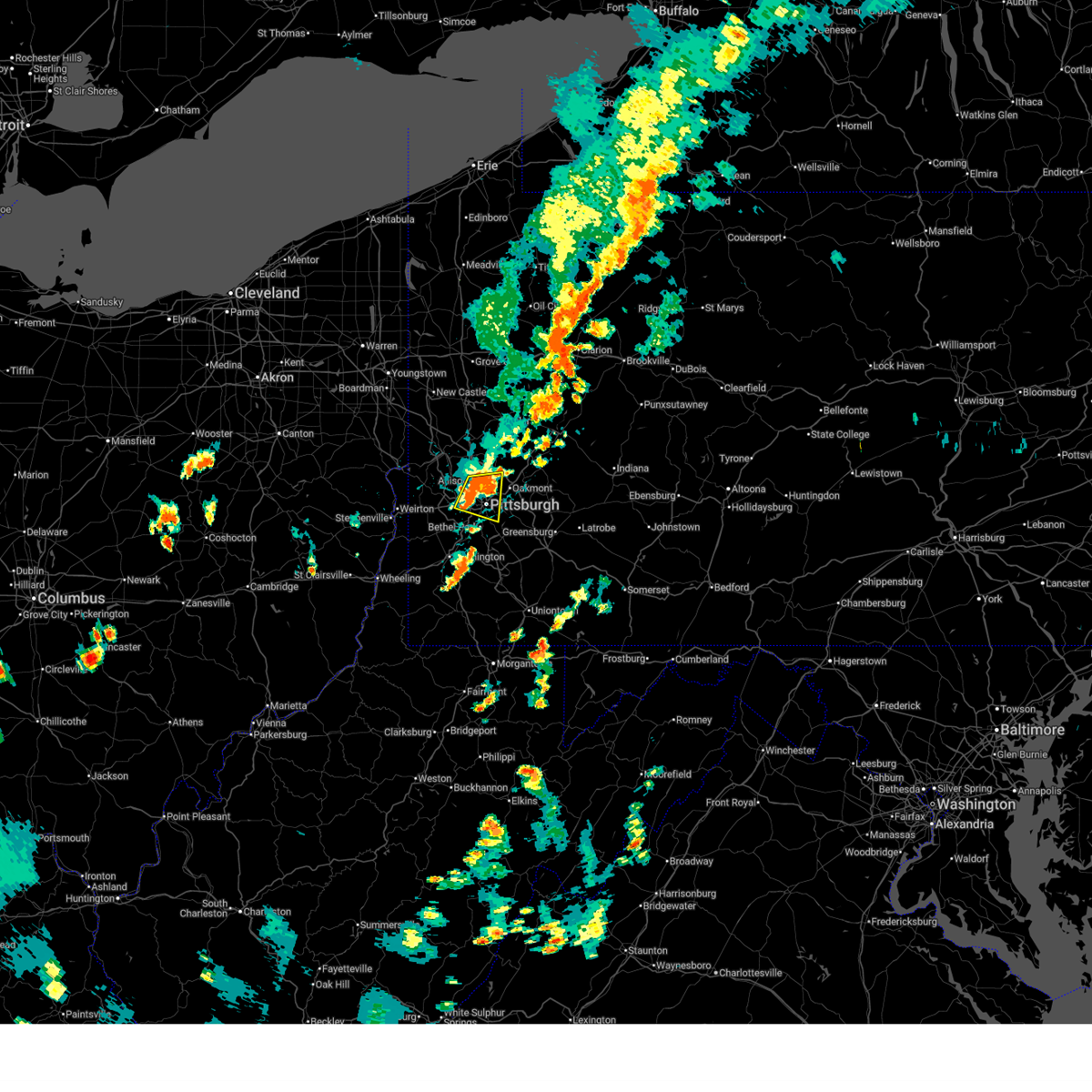 At 531 pm edt, a severe thunderstorm was located over avalon, or near ross township, moving east at 15 mph (radar indicated). Hazards include 60 mph wind gusts. Expect damage to roofs, siding, and trees. Locations impacted include, pittsburgh, mount lebanon, ross township, mccandless township, franklin park, shaler township, west mifflin, north side pittsburgh, baldwin, hampton township, scott township, whitehall, robinson township, munhall, brentwood, dormont, o'hara township, bellevue, castle shannon and carnegie. At 531 pm edt, a severe thunderstorm was located over avalon, or near ross township, moving east at 15 mph (radar indicated). Hazards include 60 mph wind gusts. Expect damage to roofs, siding, and trees. Locations impacted include, pittsburgh, mount lebanon, ross township, mccandless township, franklin park, shaler township, west mifflin, north side pittsburgh, baldwin, hampton township, scott township, whitehall, robinson township, munhall, brentwood, dormont, o'hara township, bellevue, castle shannon and carnegie.
|
| 6/27/2025 5:30 PM EDT | A tree branch that was larger than 3 inches in diameter was down across pinewood terrac in allegheny county PA, 8.6 miles SSE of Pittsburgh, PA |
| 6/27/2025 5:17 PM EDT |
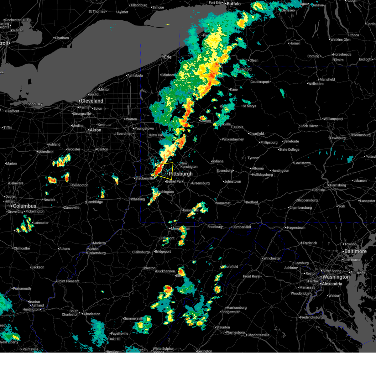 At 517 pm edt, a severe thunderstorm was located over kennedy township, or 5 miles east of moon township, moving east at 15 mph (radar indicated). Hazards include 60 mph wind gusts. Expect damage to roofs, siding, and trees. Locations impacted include, pittsburgh, mount lebanon, ross township, mccandless township, moon township, franklin park, shaler township, west mifflin, north side pittsburgh, baldwin, hampton township, scott township, whitehall, robinson township, munhall, brentwood, dormont, o'hara township, bellevue and castle shannon. At 517 pm edt, a severe thunderstorm was located over kennedy township, or 5 miles east of moon township, moving east at 15 mph (radar indicated). Hazards include 60 mph wind gusts. Expect damage to roofs, siding, and trees. Locations impacted include, pittsburgh, mount lebanon, ross township, mccandless township, moon township, franklin park, shaler township, west mifflin, north side pittsburgh, baldwin, hampton township, scott township, whitehall, robinson township, munhall, brentwood, dormont, o'hara township, bellevue and castle shannon.
|
| 6/27/2025 5:11 PM EDT |
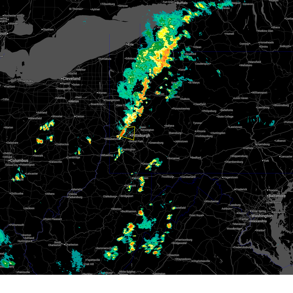 Svrpbz the national weather service in pittsburgh has issued a * severe thunderstorm warning for, central allegheny county in southwestern pennsylvania, * until 545 pm edt. * at 511 pm edt, a severe thunderstorm was located over coraopolis, or near moon township, moving east at 15 mph (radar indicated). Hazards include 60 mph wind gusts. expect damage to roofs, siding, and trees Svrpbz the national weather service in pittsburgh has issued a * severe thunderstorm warning for, central allegheny county in southwestern pennsylvania, * until 545 pm edt. * at 511 pm edt, a severe thunderstorm was located over coraopolis, or near moon township, moving east at 15 mph (radar indicated). Hazards include 60 mph wind gusts. expect damage to roofs, siding, and trees
|
| 6/26/2025 6:22 PM EDT |
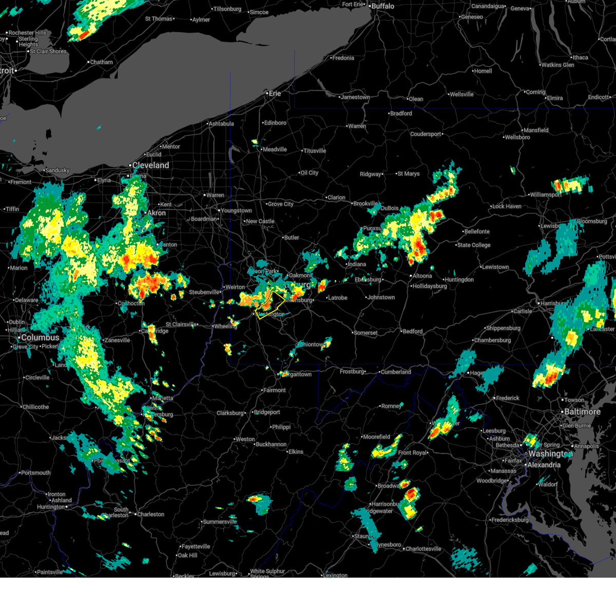 At 622 pm edt, a severe thunderstorm was located near mcmurray, moving southeast at 10 mph (radar indicated). Hazards include 60 mph wind gusts and small hail. Expect damage to roofs, siding, and trees. Locations impacted include, pittsburgh, mount lebanon, bethel park, mcmurray, gastonville, west mifflin, baldwin, whitehall, south park township, jefferson hills, brentwood, castle shannon, pleasant hills, clairton, eighty four and finleyville. At 622 pm edt, a severe thunderstorm was located near mcmurray, moving southeast at 10 mph (radar indicated). Hazards include 60 mph wind gusts and small hail. Expect damage to roofs, siding, and trees. Locations impacted include, pittsburgh, mount lebanon, bethel park, mcmurray, gastonville, west mifflin, baldwin, whitehall, south park township, jefferson hills, brentwood, castle shannon, pleasant hills, clairton, eighty four and finleyville.
|
| 6/26/2025 6:16 PM EDT |
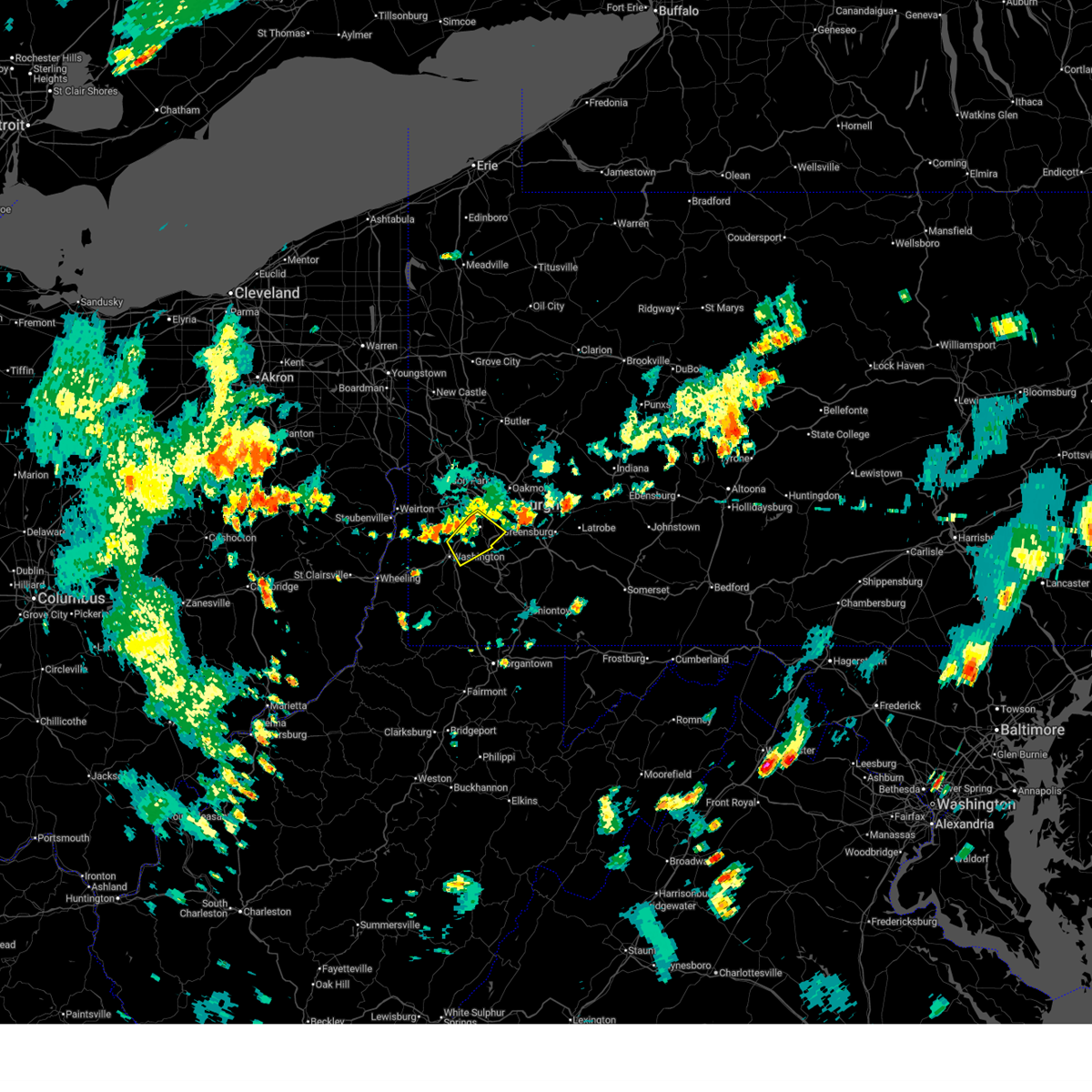 At 616 pm edt, a severe thunderstorm was located near mcmurray, moving southeast at 10 mph (radar indicated). Hazards include 60 mph wind gusts and small hail. Expect damage to roofs, siding, and trees. locations impacted include, pittsburgh, mount lebanon, bethel park, mcmurray, canonsburg, gastonville, west mifflin, baldwin, upper st. Clair, scott township, whitehall, south park township, cecil-bishop, jefferson hills, brentwood, dormont, castle shannon, pleasant hills, carnegie and clairton. At 616 pm edt, a severe thunderstorm was located near mcmurray, moving southeast at 10 mph (radar indicated). Hazards include 60 mph wind gusts and small hail. Expect damage to roofs, siding, and trees. locations impacted include, pittsburgh, mount lebanon, bethel park, mcmurray, canonsburg, gastonville, west mifflin, baldwin, upper st. Clair, scott township, whitehall, south park township, cecil-bishop, jefferson hills, brentwood, dormont, castle shannon, pleasant hills, carnegie and clairton.
|
| 6/26/2025 6:05 PM EDT |
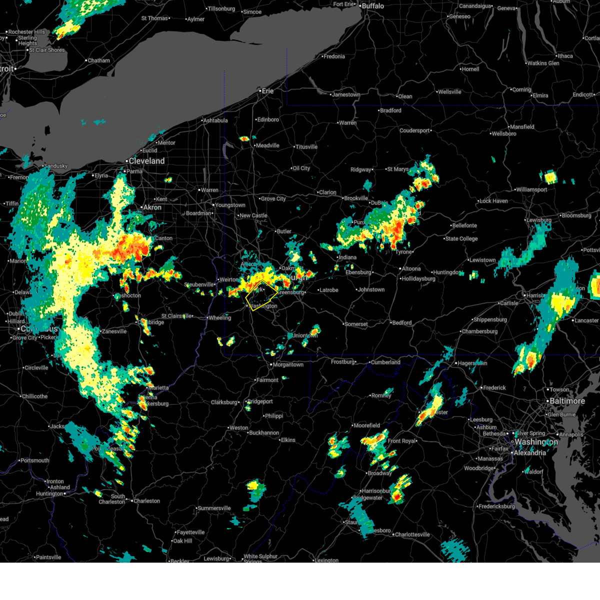 Svrpbz the national weather service in pittsburgh has issued a * severe thunderstorm warning for, south central allegheny county in southwestern pennsylvania, central washington county in southwestern pennsylvania, * until 645 pm edt. * at 605 pm edt, a severe thunderstorm was located near mcmurray, or over canonsburg, moving southeast at 10 mph (radar indicated). Hazards include 60 mph wind gusts and small hail. expect damage to roofs, siding, and trees Svrpbz the national weather service in pittsburgh has issued a * severe thunderstorm warning for, south central allegheny county in southwestern pennsylvania, central washington county in southwestern pennsylvania, * until 645 pm edt. * at 605 pm edt, a severe thunderstorm was located near mcmurray, or over canonsburg, moving southeast at 10 mph (radar indicated). Hazards include 60 mph wind gusts and small hail. expect damage to roofs, siding, and trees
|
| 6/26/2025 6:00 PM EDT |
 The storm which prompted the warning has moved out of the area. therefore, the warning has been allowed to expire. however, gusty winds and heavy rain are still possible with this thunderstorm. to report severe weather, contact your nearest law enforcement agency. they will send your report to the national weather service office. The storm which prompted the warning has moved out of the area. therefore, the warning has been allowed to expire. however, gusty winds and heavy rain are still possible with this thunderstorm. to report severe weather, contact your nearest law enforcement agency. they will send your report to the national weather service office.
|
| 6/26/2025 5:38 PM EDT |
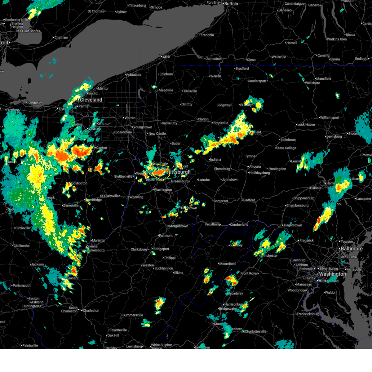 the severe thunderstorm warning has been cancelled and is no longer in effect the severe thunderstorm warning has been cancelled and is no longer in effect
|
| 6/26/2025 5:38 PM EDT |
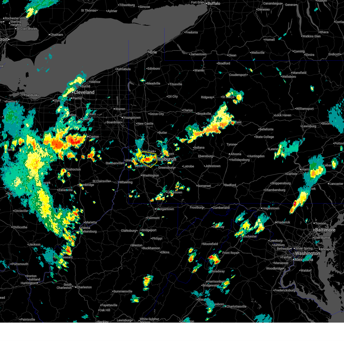 At 538 pm edt, a severe thunderstorm was located over moon township, moving east at 15 mph (radar indicated). Hazards include 60 mph wind gusts. Expect damage to roofs, siding, and trees. locations impacted include, pittsburgh, mount lebanon, bethel park, ross township, moon township, shaler township, north side pittsburgh, baldwin, upper st. Clair, scott township, whitehall, south park township, robinson township, brentwood, dormont, bellevue, castle shannon, carnegie, kennedy township and west view. At 538 pm edt, a severe thunderstorm was located over moon township, moving east at 15 mph (radar indicated). Hazards include 60 mph wind gusts. Expect damage to roofs, siding, and trees. locations impacted include, pittsburgh, mount lebanon, bethel park, ross township, moon township, shaler township, north side pittsburgh, baldwin, upper st. Clair, scott township, whitehall, south park township, robinson township, brentwood, dormont, bellevue, castle shannon, carnegie, kennedy township and west view.
|
| 6/26/2025 5:30 PM EDT | Tree limbs down along 40th st in lawrencevill in allegheny county PA, 2.5 miles SSW of Pittsburgh, PA |
| 6/26/2025 5:25 PM EDT | Tree down on vilsack road. time estimated via rada in allegheny county PA, 7 miles S of Pittsburgh, PA |
| 6/26/2025 5:22 PM EDT |
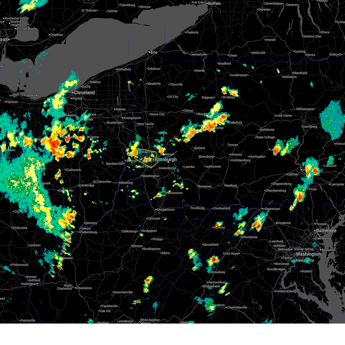 Svrpbz the national weather service in pittsburgh has issued a * severe thunderstorm warning for, western allegheny county in southwestern pennsylvania, north central washington county in southwestern pennsylvania, southeastern beaver county in western pennsylvania, * until 600 pm edt. * at 522 pm edt, a severe thunderstorm was located near moon township, moving east at 15 mph (radar indicated). Hazards include 60 mph wind gusts. expect damage to roofs, siding, and trees Svrpbz the national weather service in pittsburgh has issued a * severe thunderstorm warning for, western allegheny county in southwestern pennsylvania, north central washington county in southwestern pennsylvania, southeastern beaver county in western pennsylvania, * until 600 pm edt. * at 522 pm edt, a severe thunderstorm was located near moon township, moving east at 15 mph (radar indicated). Hazards include 60 mph wind gusts. expect damage to roofs, siding, and trees
|
| 6/19/2025 12:14 AM EDT |
 the severe thunderstorm warning has been cancelled and is no longer in effect the severe thunderstorm warning has been cancelled and is no longer in effect
|
| 6/19/2025 12:14 AM EDT |
 At 1214 am edt, severe thunderstorms were located along a line from 9 miles west of marienville to over murrysville, or along a line from 9 miles west of marienville to 6 miles east of monroeville, moving east at 30 mph (law enforcement reported trees and wires down with this line of storms). Hazards include 60 mph wind gusts. Expect damage to roofs, siding, and trees. Locations impacted include, pittsburgh, penn hills, monroeville, indiana, punxsutawney, clarion, vandergrift, kittanning, brookville, marienville, homer city, apollo, knox, rimersburg, plum, murrysville, wilkinsburg, new kensington, lower burrell and harrison township. At 1214 am edt, severe thunderstorms were located along a line from 9 miles west of marienville to over murrysville, or along a line from 9 miles west of marienville to 6 miles east of monroeville, moving east at 30 mph (law enforcement reported trees and wires down with this line of storms). Hazards include 60 mph wind gusts. Expect damage to roofs, siding, and trees. Locations impacted include, pittsburgh, penn hills, monroeville, indiana, punxsutawney, clarion, vandergrift, kittanning, brookville, marienville, homer city, apollo, knox, rimersburg, plum, murrysville, wilkinsburg, new kensington, lower burrell and harrison township.
|
| 6/18/2025 11:59 PM EDT |
 The storms which prompted the warning have moved out of a portion of the area. a new severe thunderstorm warning has been issued for this line of storms to the east. The storms which prompted the warning have moved out of a portion of the area. a new severe thunderstorm warning has been issued for this line of storms to the east.
|
| 6/18/2025 11:57 PM EDT |
 Svrpbz the national weather service in pittsburgh has issued a * severe thunderstorm warning for, forest county in northwestern pennsylvania, eastern venango county in northwestern pennsylvania, northeastern allegheny county in southwestern pennsylvania, northern westmoreland county in southwestern pennsylvania, armstrong county in west central pennsylvania, eastern butler county in west central pennsylvania, clarion county in west central pennsylvania, indiana county in west central pennsylvania, jefferson pa county in west central pennsylvania, * until 115 am edt. * at 1157 pm edt, severe thunderstorms were located along a line from near tionesta to over penn hills, or along a line from 16 miles northeast of oil city to over penn hills, moving east at 30 mph (law enforcement reported trees and wires down with this line of storms). Hazards include 60 mph wind gusts. expect damage to roofs, siding, and trees Svrpbz the national weather service in pittsburgh has issued a * severe thunderstorm warning for, forest county in northwestern pennsylvania, eastern venango county in northwestern pennsylvania, northeastern allegheny county in southwestern pennsylvania, northern westmoreland county in southwestern pennsylvania, armstrong county in west central pennsylvania, eastern butler county in west central pennsylvania, clarion county in west central pennsylvania, indiana county in west central pennsylvania, jefferson pa county in west central pennsylvania, * until 115 am edt. * at 1157 pm edt, severe thunderstorms were located along a line from near tionesta to over penn hills, or along a line from 16 miles northeast of oil city to over penn hills, moving east at 30 mph (law enforcement reported trees and wires down with this line of storms). Hazards include 60 mph wind gusts. expect damage to roofs, siding, and trees
|
| 6/18/2025 11:42 PM EDT |
 At 1142 pm edt, severe thunderstorms were located along a line from over tionesta to over monongahela, or along a line from 11 miles east of oil city to 5 miles southeast of gastonville, moving east at 45 mph (law enforcement reported trees down with this line of storms). Hazards include 60 mph wind gusts. Expect damage to roofs, siding, and trees. Locations impacted include, pittsburgh, penn hills, mount lebanon, bethel park, ross township, mccandless township, monroeville, mcmurray, mckeesport, butler, franklin park, oil city, jeannette, canonsburg, franklin, clarion, vandergrift, kittanning, apollo and knox. At 1142 pm edt, severe thunderstorms were located along a line from over tionesta to over monongahela, or along a line from 11 miles east of oil city to 5 miles southeast of gastonville, moving east at 45 mph (law enforcement reported trees down with this line of storms). Hazards include 60 mph wind gusts. Expect damage to roofs, siding, and trees. Locations impacted include, pittsburgh, penn hills, mount lebanon, bethel park, ross township, mccandless township, monroeville, mcmurray, mckeesport, butler, franklin park, oil city, jeannette, canonsburg, franklin, clarion, vandergrift, kittanning, apollo and knox.
|
| 6/18/2025 11:42 PM EDT |
 the severe thunderstorm warning has been cancelled and is no longer in effect the severe thunderstorm warning has been cancelled and is no longer in effect
|
| 6/18/2025 11:29 PM EDT |
 the severe thunderstorm warning has been cancelled and is no longer in effect the severe thunderstorm warning has been cancelled and is no longer in effect
|
| 6/18/2025 11:29 PM EDT |
 At 1129 pm edt, severe thunderstorms were located along a line from near oil city to near canonsburg, moving east at 45 mph (law enforcement reported trees down with this line of storms). Hazards include 60 mph wind gusts. Expect damage to roofs, siding, and trees. Locations impacted include, pittsburgh, penn hills, mount lebanon, bethel park, ross township, mccandless township, monroeville, cranberry, moon township, new castle, mcmurray, mckeesport, butler, washington, franklin park, oil city, jeannette, aliquippa, canonsburg and grove city. At 1129 pm edt, severe thunderstorms were located along a line from near oil city to near canonsburg, moving east at 45 mph (law enforcement reported trees down with this line of storms). Hazards include 60 mph wind gusts. Expect damage to roofs, siding, and trees. Locations impacted include, pittsburgh, penn hills, mount lebanon, bethel park, ross township, mccandless township, monroeville, cranberry, moon township, new castle, mcmurray, mckeesport, butler, washington, franklin park, oil city, jeannette, aliquippa, canonsburg and grove city.
|
| 6/18/2025 11:16 PM EDT |
 the severe thunderstorm warning has been cancelled and is no longer in effect the severe thunderstorm warning has been cancelled and is no longer in effect
|
| 6/18/2025 11:16 PM EDT |
 At 1116 pm edt, severe thunderstorms were located along a line from near sugarcreek to over wolfdale, or along a line from 6 miles north of franklin to near washington, moving east at 45 mph (law enforcement reported trees down with this line of storms). Hazards include 60 mph wind gusts. Expect damage to roofs, siding, and trees. Locations impacted include, pittsburgh, penn hills, mount lebanon, bethel park, ross township, mccandless township, monroeville, cranberry, moon township, new castle, mcmurray, weirton, mckeesport, steubenville, butler, franklin park, oil city, jeannette, aliquippa and canonsburg. At 1116 pm edt, severe thunderstorms were located along a line from near sugarcreek to over wolfdale, or along a line from 6 miles north of franklin to near washington, moving east at 45 mph (law enforcement reported trees down with this line of storms). Hazards include 60 mph wind gusts. Expect damage to roofs, siding, and trees. Locations impacted include, pittsburgh, penn hills, mount lebanon, bethel park, ross township, mccandless township, monroeville, cranberry, moon township, new castle, mcmurray, weirton, mckeesport, steubenville, butler, franklin park, oil city, jeannette, aliquippa and canonsburg.
|
| 6/18/2025 10:54 PM EDT |
 Svrpbz the national weather service in pittsburgh has issued a * severe thunderstorm warning for, eastern columbiana county in east central ohio, eastern jefferson oh county in east central ohio, western forest county in northwestern pennsylvania, mercer county in northwestern pennsylvania, venango county in northwestern pennsylvania, allegheny county in southwestern pennsylvania, northern washington county in southwestern pennsylvania, northwestern westmoreland county in southwestern pennsylvania, western armstrong county in west central pennsylvania, butler county in west central pennsylvania, clarion county in west central pennsylvania, beaver county in western pennsylvania, lawrence county in western pennsylvania, brooke county in northern west virginia, hancock county in northern west virginia, * until midnight edt. * at 1054 pm edt, severe thunderstorms were located along a line from 11 miles northeast of greenville to near west liberty, or along a line from 18 miles west of franklin to near west liberty, moving east at 45 mph (law enforcement reported trees were reported down with this line of storms). Hazards include 60 mph wind gusts. expect damage to roofs, siding, and trees Svrpbz the national weather service in pittsburgh has issued a * severe thunderstorm warning for, eastern columbiana county in east central ohio, eastern jefferson oh county in east central ohio, western forest county in northwestern pennsylvania, mercer county in northwestern pennsylvania, venango county in northwestern pennsylvania, allegheny county in southwestern pennsylvania, northern washington county in southwestern pennsylvania, northwestern westmoreland county in southwestern pennsylvania, western armstrong county in west central pennsylvania, butler county in west central pennsylvania, clarion county in west central pennsylvania, beaver county in western pennsylvania, lawrence county in western pennsylvania, brooke county in northern west virginia, hancock county in northern west virginia, * until midnight edt. * at 1054 pm edt, severe thunderstorms were located along a line from 11 miles northeast of greenville to near west liberty, or along a line from 18 miles west of franklin to near west liberty, moving east at 45 mph (law enforcement reported trees were reported down with this line of storms). Hazards include 60 mph wind gusts. expect damage to roofs, siding, and trees
|
| 6/18/2025 6:00 PM EDT |
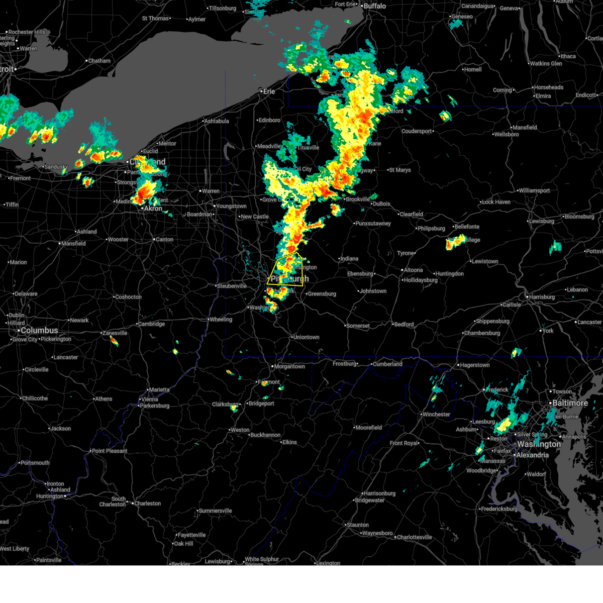 The storm which prompted the warning has weakened below severe limits, and no longer poses an immediate threat to life or property. therefore, the warning has been allowed to expire. however, gusty winds and heavy rain are still possible with this thunderstorm. The storm which prompted the warning has weakened below severe limits, and no longer poses an immediate threat to life or property. therefore, the warning has been allowed to expire. however, gusty winds and heavy rain are still possible with this thunderstorm.
|
| 6/18/2025 5:49 PM EDT |
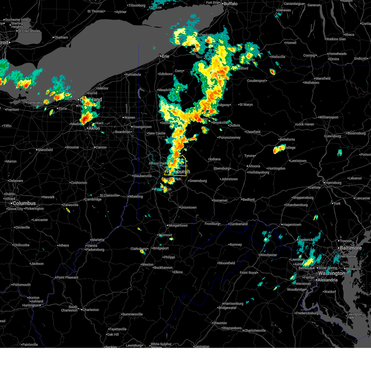 At 549 pm edt, a severe thunderstorm was located over springdale, or near penn hills, moving east at 35 mph (law enforcement reported). Hazards include 60 mph wind gusts. Expect damage to roofs, siding, and trees. locations impacted include, pittsburgh, penn hills, monroeville, shaler township, plum, west mifflin, baldwin, murrysville, hampton township, wilkinsburg, new kensington, lower burrell, munhall, harrison township, north versailles, swissvale, o'hara township, forest hills, wilkins township and oakmont. Tree was reported down in the north hills of pittsburgh. At 549 pm edt, a severe thunderstorm was located over springdale, or near penn hills, moving east at 35 mph (law enforcement reported). Hazards include 60 mph wind gusts. Expect damage to roofs, siding, and trees. locations impacted include, pittsburgh, penn hills, monroeville, shaler township, plum, west mifflin, baldwin, murrysville, hampton township, wilkinsburg, new kensington, lower burrell, munhall, harrison township, north versailles, swissvale, o'hara township, forest hills, wilkins township and oakmont. Tree was reported down in the north hills of pittsburgh.
|
| 6/18/2025 5:48 PM EDT | Tree down at sovereign street and ivory avenu in allegheny county PA, 5.1 miles SSE of Pittsburgh, PA |
| 6/18/2025 5:38 PM EDT |
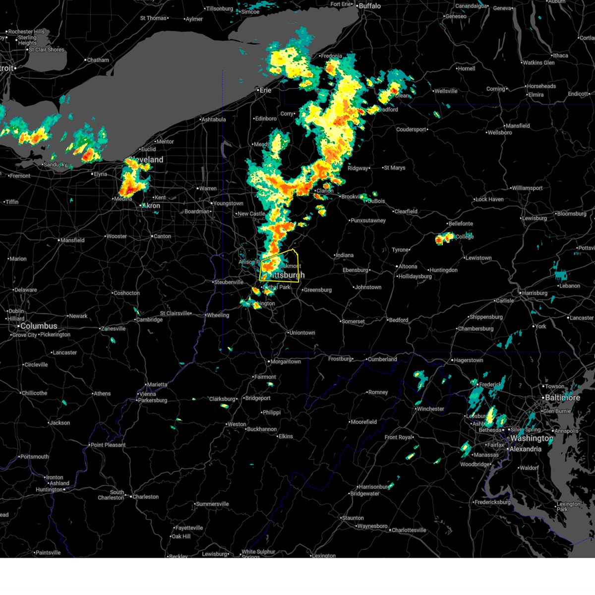 At 538 pm edt, a severe thunderstorm was located over o'hara township, or 6 miles northwest of penn hills, moving east at 35 mph (radar indicated). Hazards include 60 mph wind gusts. Expect damage to roofs, siding, and trees. Locations impacted include, pittsburgh, penn hills, mount lebanon, ross township, mccandless township, monroeville, shaler township, plum, west mifflin, north side pittsburgh, baldwin, murrysville, hampton township, scott township, wilkinsburg, new kensington, lower burrell, munhall, harrison township and north versailles. At 538 pm edt, a severe thunderstorm was located over o'hara township, or 6 miles northwest of penn hills, moving east at 35 mph (radar indicated). Hazards include 60 mph wind gusts. Expect damage to roofs, siding, and trees. Locations impacted include, pittsburgh, penn hills, mount lebanon, ross township, mccandless township, monroeville, shaler township, plum, west mifflin, north side pittsburgh, baldwin, murrysville, hampton township, scott township, wilkinsburg, new kensington, lower burrell, munhall, harrison township and north versailles.
|
| 6/18/2025 5:29 PM EDT |
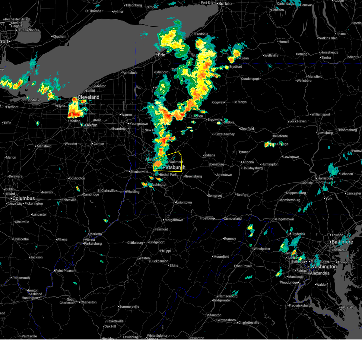 At 529 pm edt, a severe thunderstorm was located over ross township, moving east at 35 mph (radar indicated). Hazards include 60 mph wind gusts. Expect damage to roofs, siding, and trees. Locations impacted include, pittsburgh, penn hills, mount lebanon, ross township, mccandless township, monroeville, franklin park, shaler township, plum, west mifflin, north side pittsburgh, baldwin, murrysville, hampton township, scott township, wilkinsburg, robinson township, new kensington, lower burrell and munhall. At 529 pm edt, a severe thunderstorm was located over ross township, moving east at 35 mph (radar indicated). Hazards include 60 mph wind gusts. Expect damage to roofs, siding, and trees. Locations impacted include, pittsburgh, penn hills, mount lebanon, ross township, mccandless township, monroeville, franklin park, shaler township, plum, west mifflin, north side pittsburgh, baldwin, murrysville, hampton township, scott township, wilkinsburg, robinson township, new kensington, lower burrell and munhall.
|
| 6/18/2025 5:20 PM EDT |
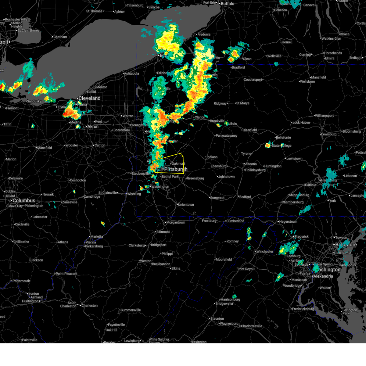 Svrpbz the national weather service in pittsburgh has issued a * severe thunderstorm warning for, central allegheny county in southwestern pennsylvania, northwestern westmoreland county in southwestern pennsylvania, * until 600 pm edt. * at 520 pm edt, a severe thunderstorm was located over kennedy township, or 5 miles southwest of ross township, moving east at 35 mph (radar indicated). Hazards include 60 mph wind gusts. expect damage to roofs, siding, and trees Svrpbz the national weather service in pittsburgh has issued a * severe thunderstorm warning for, central allegheny county in southwestern pennsylvania, northwestern westmoreland county in southwestern pennsylvania, * until 600 pm edt. * at 520 pm edt, a severe thunderstorm was located over kennedy township, or 5 miles southwest of ross township, moving east at 35 mph (radar indicated). Hazards include 60 mph wind gusts. expect damage to roofs, siding, and trees
|
| 6/9/2025 5:56 PM EDT |
 the severe thunderstorm warning has been cancelled and is no longer in effect the severe thunderstorm warning has been cancelled and is no longer in effect
|
| 6/9/2025 5:47 PM EDT |
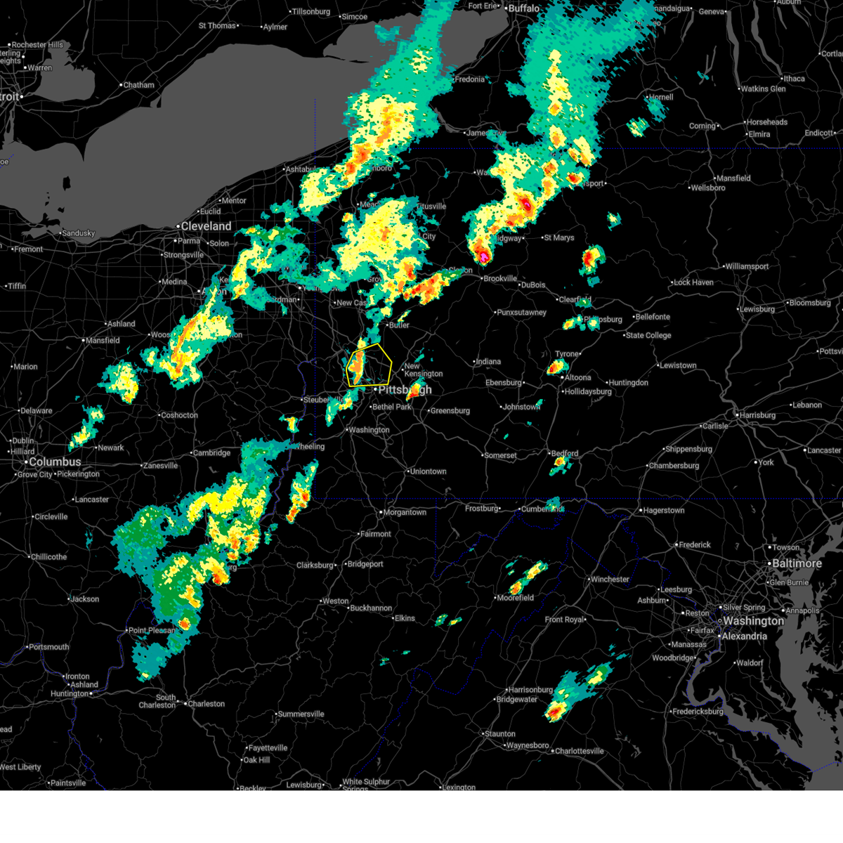 the severe thunderstorm warning has been cancelled and is no longer in effect the severe thunderstorm warning has been cancelled and is no longer in effect
|
| 6/9/2025 5:47 PM EDT |
 At 547 pm edt, severe thunderstorms were located along a line from over cranberry to over moon township, moving northeast at 40 mph (radar indicated). Hazards include 60 mph wind gusts. Expect damage to roofs, siding, and trees. Locations impacted include, pittsburgh, ross township, mccandless township, cranberry, moon township, franklin park, aliquippa, shaler township, hampton township, robinson township, economy, o'hara township, bellevue, kennedy township, ambridge, wexford, west view, stowe township, mckees rocks and coraopolis. At 547 pm edt, severe thunderstorms were located along a line from over cranberry to over moon township, moving northeast at 40 mph (radar indicated). Hazards include 60 mph wind gusts. Expect damage to roofs, siding, and trees. Locations impacted include, pittsburgh, ross township, mccandless township, cranberry, moon township, franklin park, aliquippa, shaler township, hampton township, robinson township, economy, o'hara township, bellevue, kennedy township, ambridge, wexford, west view, stowe township, mckees rocks and coraopolis.
|
| 6/9/2025 5:28 PM EDT |
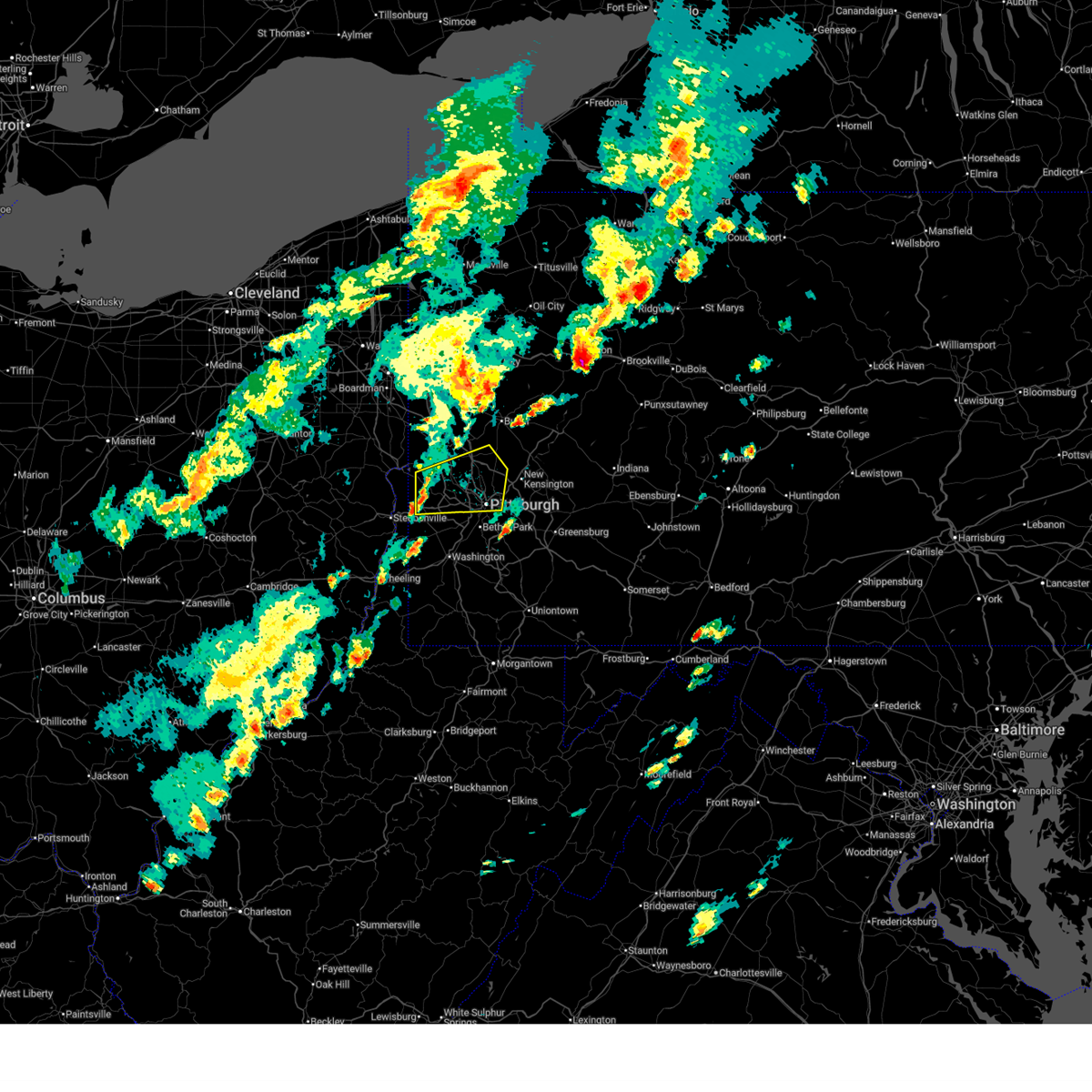 Svrpbz the national weather service in pittsburgh has issued a * severe thunderstorm warning for, northwestern allegheny county in southwestern pennsylvania, northwestern washington county in southwestern pennsylvania, southwestern butler county in west central pennsylvania, southern beaver county in western pennsylvania, * until 615 pm edt. * at 528 pm edt, severe thunderstorms were located along a line from over aliquippa to 8 miles east of weirton, moving northeast at 40 mph (radar indicated). Hazards include 60 mph wind gusts and small hail. expect damage to roofs, siding, and trees Svrpbz the national weather service in pittsburgh has issued a * severe thunderstorm warning for, northwestern allegheny county in southwestern pennsylvania, northwestern washington county in southwestern pennsylvania, southwestern butler county in west central pennsylvania, southern beaver county in western pennsylvania, * until 615 pm edt. * at 528 pm edt, severe thunderstorms were located along a line from over aliquippa to 8 miles east of weirton, moving northeast at 40 mph (radar indicated). Hazards include 60 mph wind gusts and small hail. expect damage to roofs, siding, and trees
|
| 6/8/2025 4:16 PM EDT |
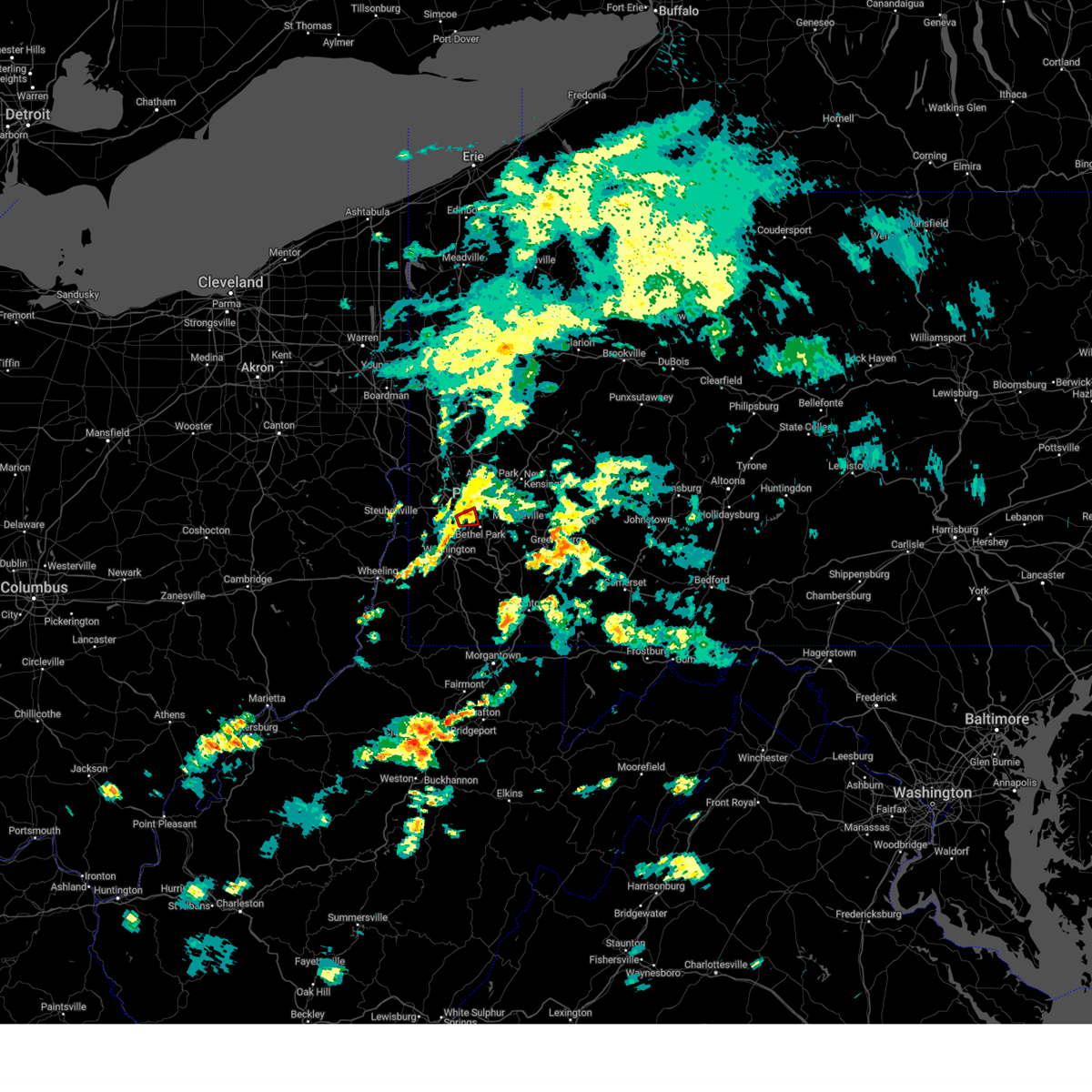 the tornado warning has been cancelled and is no longer in effect the tornado warning has been cancelled and is no longer in effect
|
| 6/8/2025 4:09 PM EDT |
 the tornado warning has been cancelled and is no longer in effect the tornado warning has been cancelled and is no longer in effect
|
| 6/8/2025 4:09 PM EDT |
 At 409 pm edt, a severe thunderstorm capable of producing a tornado was located over bridgeville, or near mount lebanon, moving east at 25 mph (radar indicated rotation). Hazards include tornado. Flying debris will be dangerous to those caught without shelter. mobile homes will be damaged or destroyed. damage to roofs, windows and vehicles will occur. tree damage is likely. locations impacted include, pittsburgh, mount lebanon, bethel park, upper st. Clair, scott township, robinson township, cecil-bishop, carnegie, bridgeville, heidelberg, rosslyn farms, south fayette township and collier township. At 409 pm edt, a severe thunderstorm capable of producing a tornado was located over bridgeville, or near mount lebanon, moving east at 25 mph (radar indicated rotation). Hazards include tornado. Flying debris will be dangerous to those caught without shelter. mobile homes will be damaged or destroyed. damage to roofs, windows and vehicles will occur. tree damage is likely. locations impacted include, pittsburgh, mount lebanon, bethel park, upper st. Clair, scott township, robinson township, cecil-bishop, carnegie, bridgeville, heidelberg, rosslyn farms, south fayette township and collier township.
|
| 6/8/2025 3:55 PM EDT |
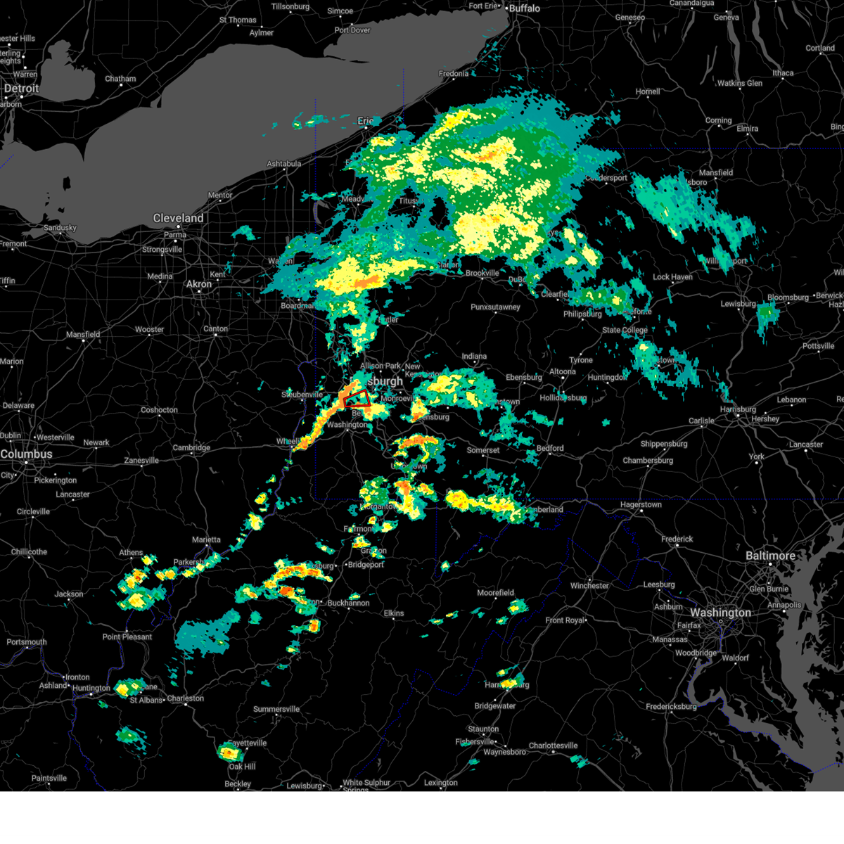 Torpbz the national weather service in pittsburgh has issued a * tornado warning for, west central allegheny county in southwestern pennsylvania, northeastern washington county in southwestern pennsylvania, * until 430 pm edt. * at 355 pm edt, a severe thunderstorm capable of producing a tornado was located over mcdonald, or 7 miles northwest of canonsburg, moving east at 15 mph (radar indicated rotation). Hazards include tornado. Flying debris will be dangerous to those caught without shelter. mobile homes will be damaged or destroyed. damage to roofs, windows and vehicles will occur. Tree damage is likely. Torpbz the national weather service in pittsburgh has issued a * tornado warning for, west central allegheny county in southwestern pennsylvania, northeastern washington county in southwestern pennsylvania, * until 430 pm edt. * at 355 pm edt, a severe thunderstorm capable of producing a tornado was located over mcdonald, or 7 miles northwest of canonsburg, moving east at 15 mph (radar indicated rotation). Hazards include tornado. Flying debris will be dangerous to those caught without shelter. mobile homes will be damaged or destroyed. damage to roofs, windows and vehicles will occur. Tree damage is likely.
|
| 5/17/2025 1:26 AM EDT |
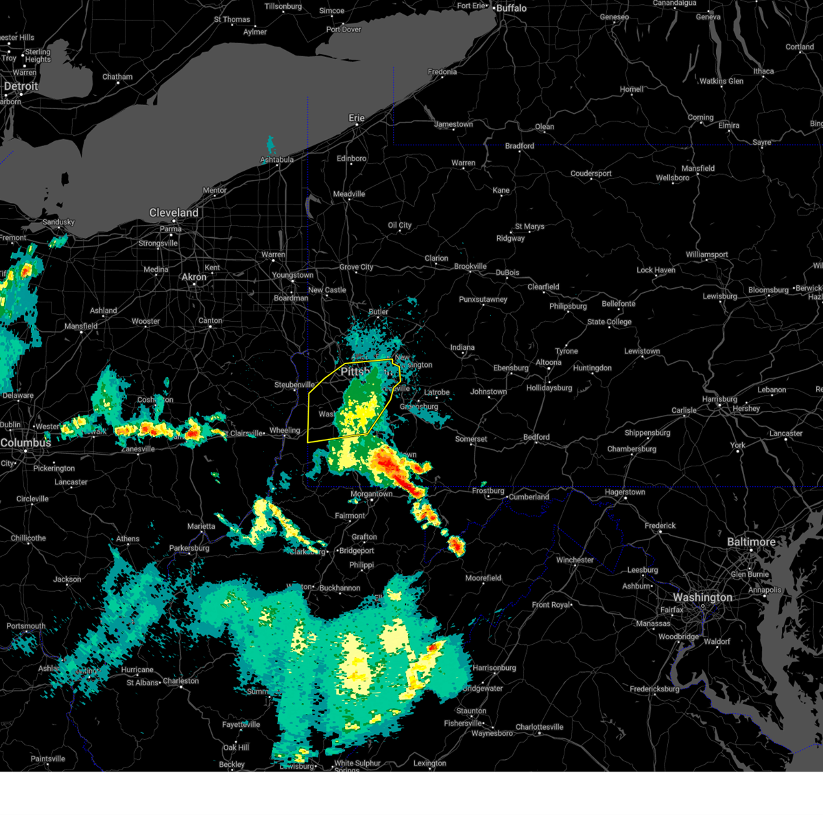 The storms which prompted the warning have weakened below severe limits, and no longer pose an immediate threat to life or property. therefore, the warning will be allowed to expire. however, gusty winds are still possible with these thunderstorms. to report severe weather, contact your nearest law enforcement agency. they will send your report to the national weather service office. a severe thunderstorm watch remains in effect until 400 am edt saturday for a portion of southwest pennsylvania. The storms which prompted the warning have weakened below severe limits, and no longer pose an immediate threat to life or property. therefore, the warning will be allowed to expire. however, gusty winds are still possible with these thunderstorms. to report severe weather, contact your nearest law enforcement agency. they will send your report to the national weather service office. a severe thunderstorm watch remains in effect until 400 am edt saturday for a portion of southwest pennsylvania.
|
| 5/17/2025 1:12 AM EDT |
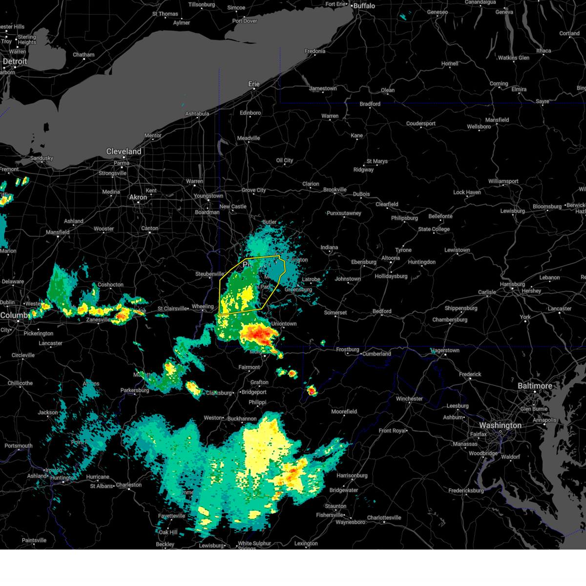 the severe thunderstorm warning has been cancelled and is no longer in effect the severe thunderstorm warning has been cancelled and is no longer in effect
|
| 5/17/2025 1:12 AM EDT |
 At 112 am edt, severe thunderstorms were located along a line from over mccandless township to 7 miles south of washington, moving east at 50 mph (radar indicated). Hazards include 60 mph wind gusts. Expect damage to roofs, siding, and trees. Locations impacted include, pittsburgh, penn hills, mount lebanon, bethel park, ross township, mccandless township, monroeville, moon township, mcmurray, mckeesport, washington, franklin park, canonsburg, avella, gastonville, shaler township, plum, west mifflin, north side pittsburgh and baldwin. At 112 am edt, severe thunderstorms were located along a line from over mccandless township to 7 miles south of washington, moving east at 50 mph (radar indicated). Hazards include 60 mph wind gusts. Expect damage to roofs, siding, and trees. Locations impacted include, pittsburgh, penn hills, mount lebanon, bethel park, ross township, mccandless township, monroeville, moon township, mcmurray, mckeesport, washington, franklin park, canonsburg, avella, gastonville, shaler township, plum, west mifflin, north side pittsburgh and baldwin.
|
| 5/17/2025 1:03 AM EDT |
 the severe thunderstorm warning has been cancelled and is no longer in effect the severe thunderstorm warning has been cancelled and is no longer in effect
|
| 5/17/2025 1:03 AM EDT |
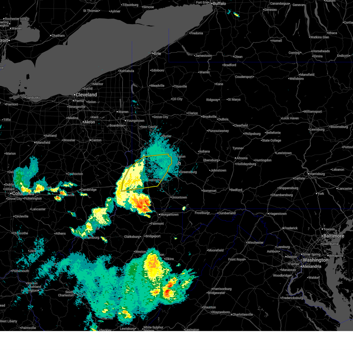 At 103 am edt, severe thunderstorms were located along a line from over franklin park to 11 miles southwest of wolfdale, or along a line from over franklin park to 10 miles east of valley grove, moving east at 50 mph (radar indicated). Hazards include 60 mph wind gusts. Expect damage to roofs, siding, and trees. Locations impacted include, pittsburgh, penn hills, mount lebanon, bethel park, ross township, wheeling, mccandless township, monroeville, moon township, mcmurray, weirton, mckeesport, washington, franklin park, canonsburg, martins ferry, warwood, wellsburg, bethlehem and west liberty. At 103 am edt, severe thunderstorms were located along a line from over franklin park to 11 miles southwest of wolfdale, or along a line from over franklin park to 10 miles east of valley grove, moving east at 50 mph (radar indicated). Hazards include 60 mph wind gusts. Expect damage to roofs, siding, and trees. Locations impacted include, pittsburgh, penn hills, mount lebanon, bethel park, ross township, wheeling, mccandless township, monroeville, moon township, mcmurray, weirton, mckeesport, washington, franklin park, canonsburg, martins ferry, warwood, wellsburg, bethlehem and west liberty.
|
| 5/17/2025 12:42 AM EDT |
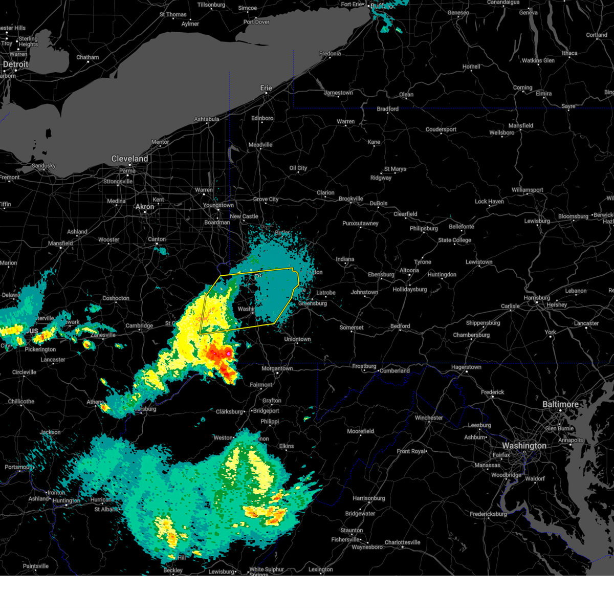 Svrpbz the national weather service in pittsburgh has issued a * severe thunderstorm warning for, northeastern belmont county in east central ohio, southeastern jefferson oh county in east central ohio, allegheny county in southwestern pennsylvania, washington county in southwestern pennsylvania, southwestern beaver county in western pennsylvania, brooke county in northern west virginia, hancock county in northern west virginia, marshall county in northern west virginia, ohio county in northern west virginia, * until 130 am edt. * at 1242 am edt, severe thunderstorms were located along a line from 7 miles south of shippingport to over bellaire, or along a line from 9 miles southeast of east liverpool to over bellaire, moving east at 50 mph (radar indicated). Hazards include 60 mph wind gusts. expect damage to roofs, siding, and trees Svrpbz the national weather service in pittsburgh has issued a * severe thunderstorm warning for, northeastern belmont county in east central ohio, southeastern jefferson oh county in east central ohio, allegheny county in southwestern pennsylvania, washington county in southwestern pennsylvania, southwestern beaver county in western pennsylvania, brooke county in northern west virginia, hancock county in northern west virginia, marshall county in northern west virginia, ohio county in northern west virginia, * until 130 am edt. * at 1242 am edt, severe thunderstorms were located along a line from 7 miles south of shippingport to over bellaire, or along a line from 9 miles southeast of east liverpool to over bellaire, moving east at 50 mph (radar indicated). Hazards include 60 mph wind gusts. expect damage to roofs, siding, and trees
|
| 5/5/2025 6:00 PM EDT |
 the severe thunderstorm warning has been cancelled and is no longer in effect the severe thunderstorm warning has been cancelled and is no longer in effect
|
| 5/5/2025 5:49 PM EDT |
 At 549 pm edt, a severe thunderstorm was located over bridgeville, or near mount lebanon, moving north at 20 mph (radar indicated). Hazards include 60 mph wind gusts and quarter size hail. Hail damage to vehicles is expected. expect wind damage to roofs, siding, and trees. locations impacted include, pittsburgh, mount lebanon, bethel park, ross township, upper st. Clair, scott township, whitehall, robinson township, cecil-bishop, dormont, bellevue, castle shannon, carnegie, kennedy township, stowe township, mckees rocks, crafton, bridgeville, avalon and green tree. At 549 pm edt, a severe thunderstorm was located over bridgeville, or near mount lebanon, moving north at 20 mph (radar indicated). Hazards include 60 mph wind gusts and quarter size hail. Hail damage to vehicles is expected. expect wind damage to roofs, siding, and trees. locations impacted include, pittsburgh, mount lebanon, bethel park, ross township, upper st. Clair, scott township, whitehall, robinson township, cecil-bishop, dormont, bellevue, castle shannon, carnegie, kennedy township, stowe township, mckees rocks, crafton, bridgeville, avalon and green tree.
|
| 5/5/2025 5:49 PM EDT |
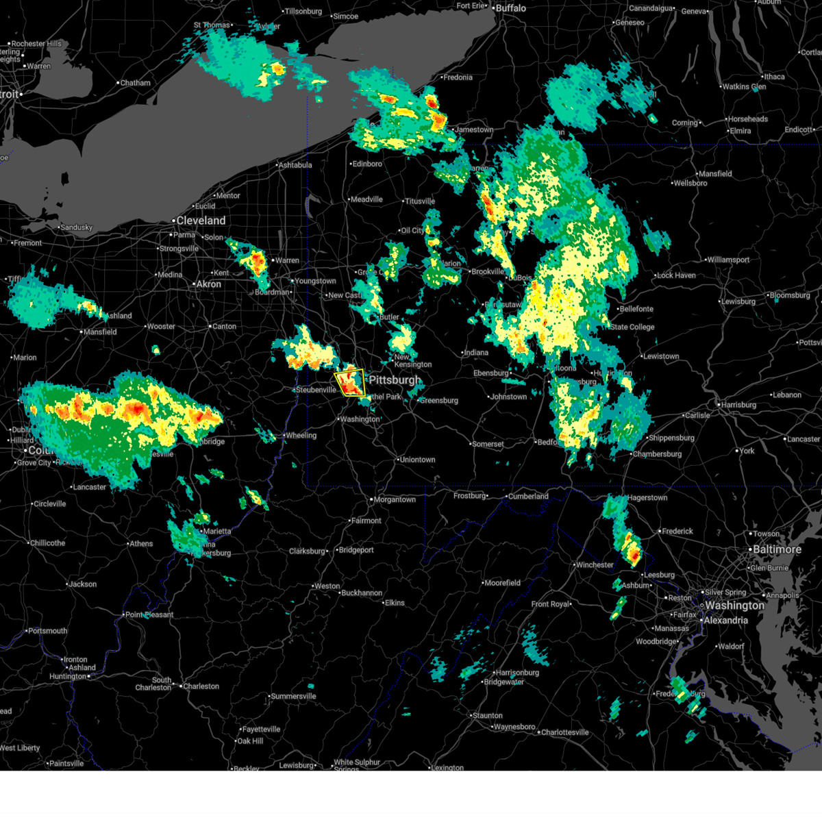 the severe thunderstorm warning has been cancelled and is no longer in effect the severe thunderstorm warning has been cancelled and is no longer in effect
|
| 5/5/2025 5:40 PM EDT |
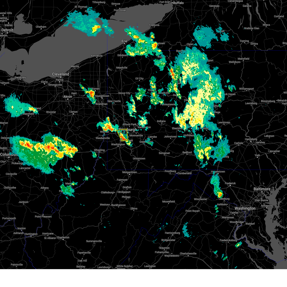 At 540 pm edt, a severe thunderstorm was located over bridgeville, or near mount lebanon, moving north at 20 mph (radar indicated). Hazards include 60 mph wind gusts and quarter size hail. Hail damage to vehicles is expected. expect wind damage to roofs, siding, and trees. locations impacted include, pittsburgh, mount lebanon, bethel park, ross township, mcmurray, baldwin, upper st. Clair, scott township, whitehall, south park township, robinson township, cecil-bishop, dormont, bellevue, castle shannon, carnegie, kennedy township, stowe township, mckees rocks and crafton. At 540 pm edt, a severe thunderstorm was located over bridgeville, or near mount lebanon, moving north at 20 mph (radar indicated). Hazards include 60 mph wind gusts and quarter size hail. Hail damage to vehicles is expected. expect wind damage to roofs, siding, and trees. locations impacted include, pittsburgh, mount lebanon, bethel park, ross township, mcmurray, baldwin, upper st. Clair, scott township, whitehall, south park township, robinson township, cecil-bishop, dormont, bellevue, castle shannon, carnegie, kennedy township, stowe township, mckees rocks and crafton.
|
| 5/5/2025 5:28 PM EDT |
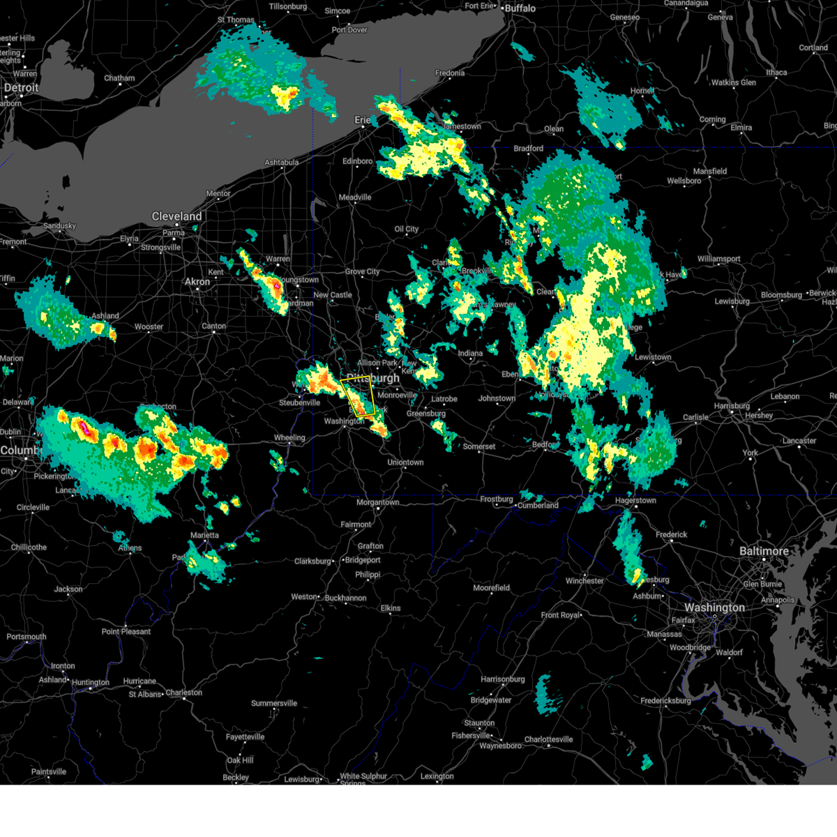 Svrpbz the national weather service in pittsburgh has issued a * severe thunderstorm warning for, southwestern allegheny county in southwestern pennsylvania, central washington county in southwestern pennsylvania, * until 615 pm edt. * at 528 pm edt, a severe thunderstorm was located over mcmurray, moving north at 20 mph (radar indicated). Hazards include 60 mph wind gusts and quarter size hail. Hail damage to vehicles is expected. Expect wind damage to roofs, siding, and trees. Svrpbz the national weather service in pittsburgh has issued a * severe thunderstorm warning for, southwestern allegheny county in southwestern pennsylvania, central washington county in southwestern pennsylvania, * until 615 pm edt. * at 528 pm edt, a severe thunderstorm was located over mcmurray, moving north at 20 mph (radar indicated). Hazards include 60 mph wind gusts and quarter size hail. Hail damage to vehicles is expected. Expect wind damage to roofs, siding, and trees.
|
| 5/2/2025 5:50 PM EDT |
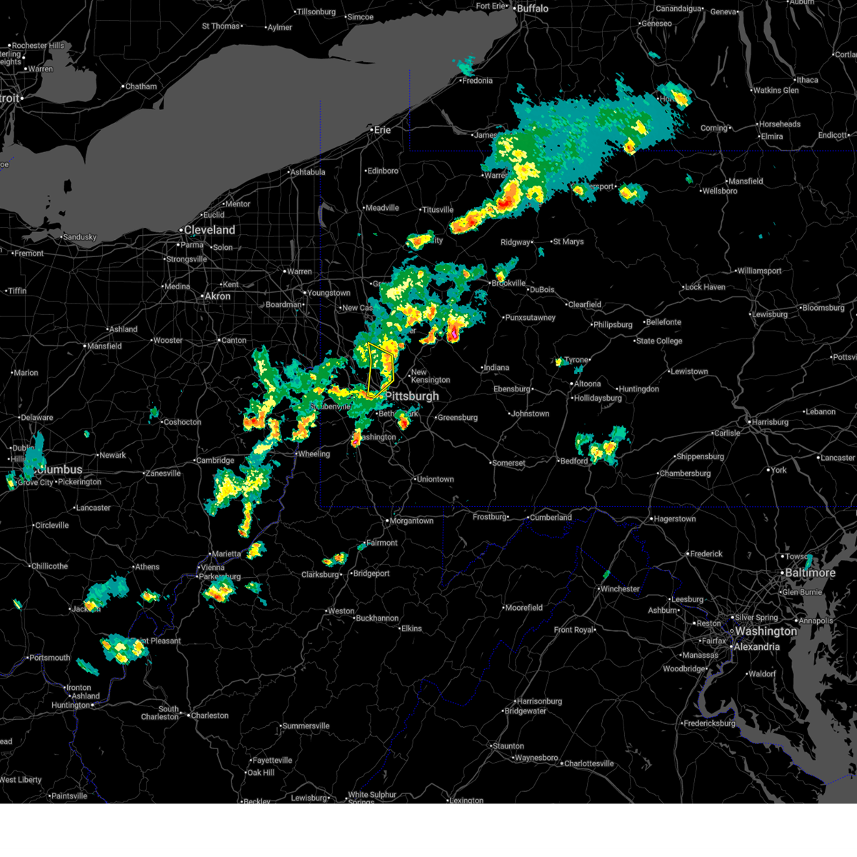 The storms which prompted the warning have weakened below severe limits, and no longer pose an immediate threat to life or property. therefore, the warning will be allowed to expire. to report severe weather, contact your nearest law enforcement agency. they will send your report to the national weather service office. a severe thunderstorm watch remains in effect until 700 pm edt for portions of southwest and west central pennsylvania. The storms which prompted the warning have weakened below severe limits, and no longer pose an immediate threat to life or property. therefore, the warning will be allowed to expire. to report severe weather, contact your nearest law enforcement agency. they will send your report to the national weather service office. a severe thunderstorm watch remains in effect until 700 pm edt for portions of southwest and west central pennsylvania.
|
| 5/2/2025 5:39 PM EDT |
 At 539 pm edt, severe thunderstorms were located along a line from near evans city to over north side pittsburgh, or along a line from 7 miles northeast of cranberry to over pittsburgh, moving east at 40 mph (radar indicated). Hazards include 60 mph wind gusts. Expect damage to roofs, siding, and trees. Locations impacted include, pittsburgh, ross township, mccandless township, cranberry, franklin park, shaler township, hampton township, robinson township, o'hara township, bellevue, kennedy township, wexford, west view, stowe township, mckees rocks, crafton, fox chapel, avalon, millvale and etna. At 539 pm edt, severe thunderstorms were located along a line from near evans city to over north side pittsburgh, or along a line from 7 miles northeast of cranberry to over pittsburgh, moving east at 40 mph (radar indicated). Hazards include 60 mph wind gusts. Expect damage to roofs, siding, and trees. Locations impacted include, pittsburgh, ross township, mccandless township, cranberry, franklin park, shaler township, hampton township, robinson township, o'hara township, bellevue, kennedy township, wexford, west view, stowe township, mckees rocks, crafton, fox chapel, avalon, millvale and etna.
|
| 5/2/2025 5:39 PM EDT |
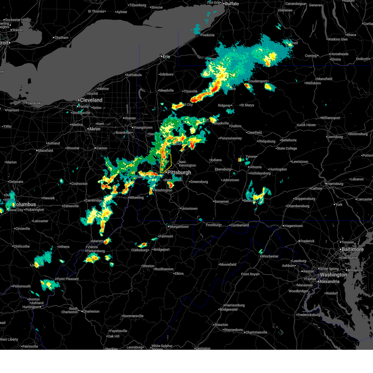 the severe thunderstorm warning has been cancelled and is no longer in effect the severe thunderstorm warning has been cancelled and is no longer in effect
|
| 5/2/2025 5:29 PM EDT |
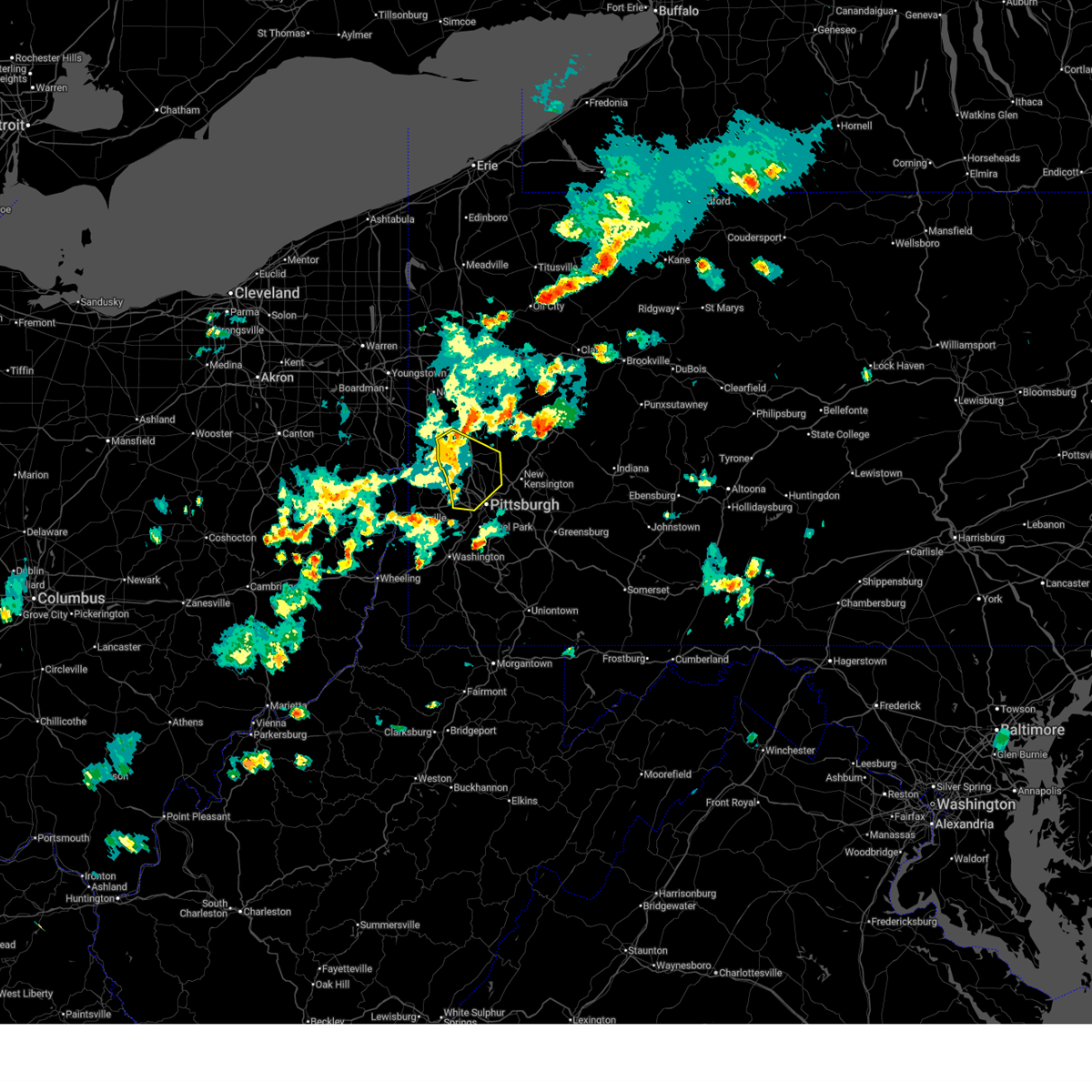 the severe thunderstorm warning has been cancelled and is no longer in effect the severe thunderstorm warning has been cancelled and is no longer in effect
|
| 5/2/2025 5:29 PM EDT |
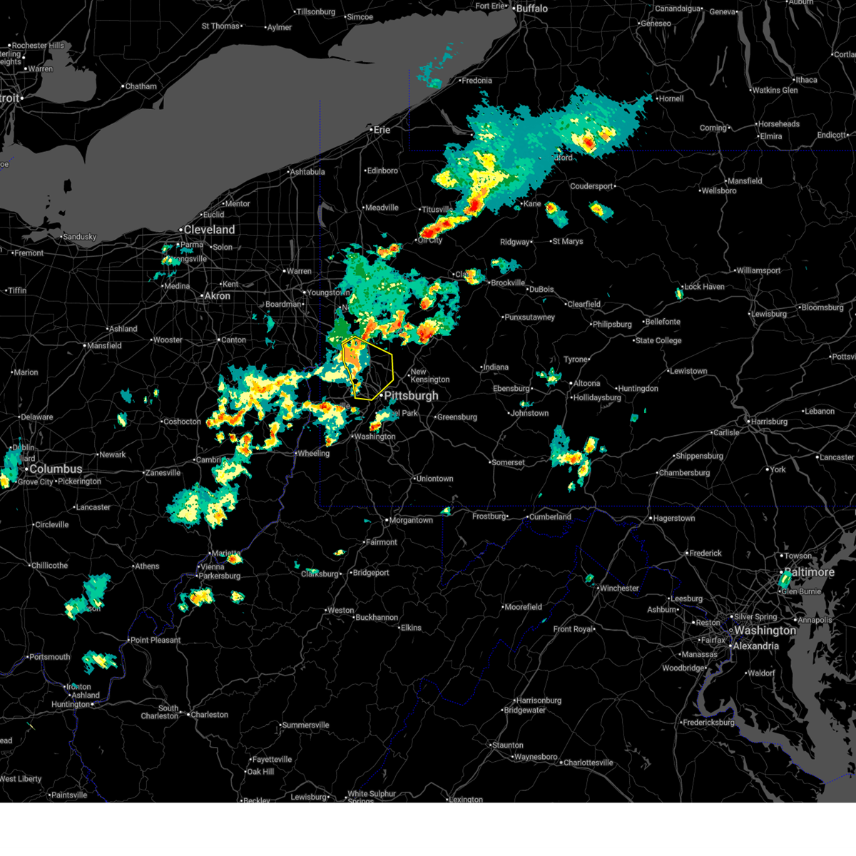 At 529 pm edt, severe thunderstorms were located along a line from over evans city to over sturgeon-noblestown, or along a line from near cranberry to 6 miles west of mount lebanon, moving east at 30 mph (radar indicated). Hazards include 60 mph wind gusts and small hail. Expect damage to roofs, siding, and trees. Locations impacted include, pittsburgh, ross township, mccandless township, cranberry, moon township, franklin park, aliquippa, beaver falls, monaca, shaler township, hampton township, scott township, robinson township, economy, o'hara township, bellevue, carnegie, kennedy township, ambridge and wexford. At 529 pm edt, severe thunderstorms were located along a line from over evans city to over sturgeon-noblestown, or along a line from near cranberry to 6 miles west of mount lebanon, moving east at 30 mph (radar indicated). Hazards include 60 mph wind gusts and small hail. Expect damage to roofs, siding, and trees. Locations impacted include, pittsburgh, ross township, mccandless township, cranberry, moon township, franklin park, aliquippa, beaver falls, monaca, shaler township, hampton township, scott township, robinson township, economy, o'hara township, bellevue, carnegie, kennedy township, ambridge and wexford.
|
| 5/2/2025 5:13 PM EDT |
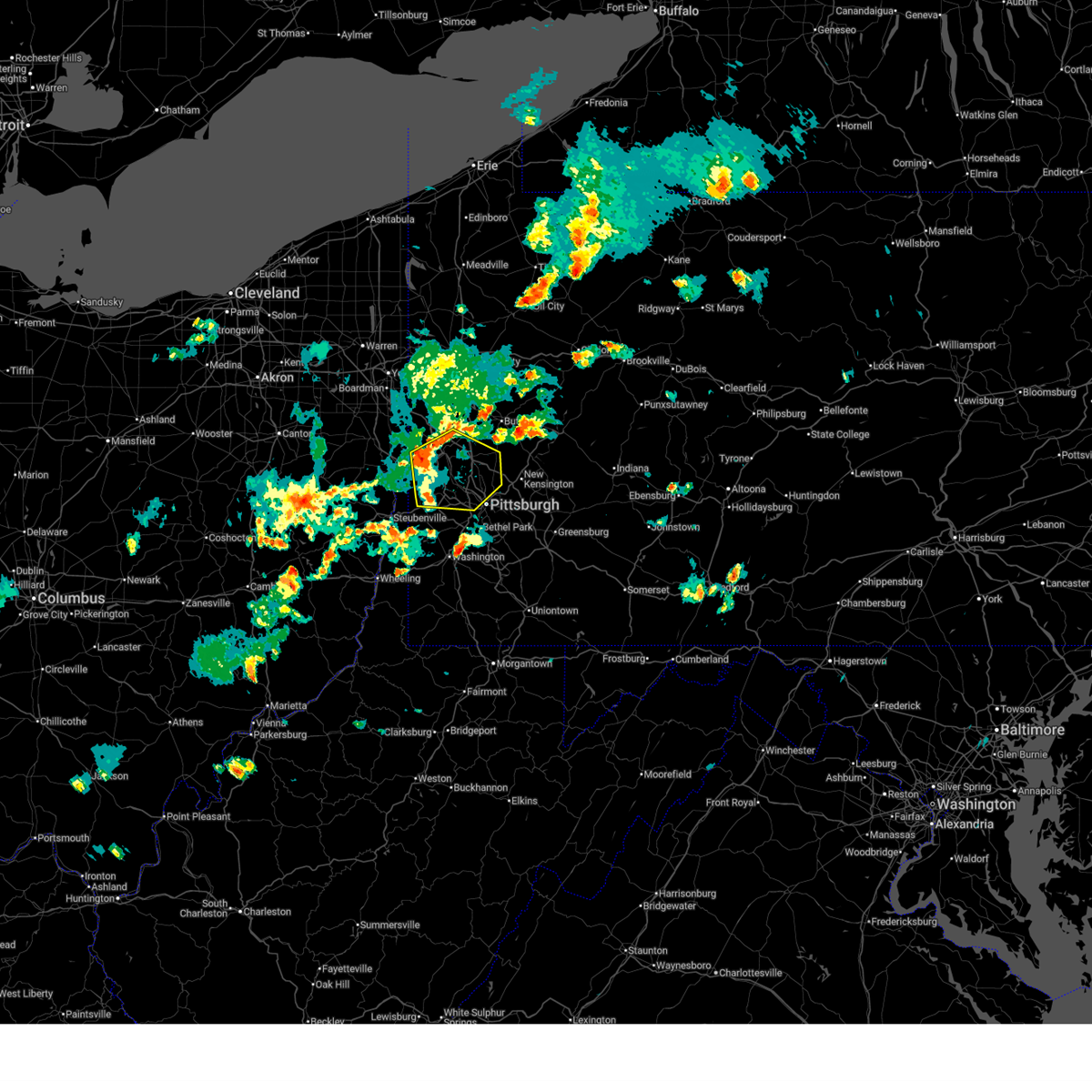 Svrpbz the national weather service in pittsburgh has issued a * severe thunderstorm warning for, northwestern allegheny county in southwestern pennsylvania, northern washington county in southwestern pennsylvania, southwestern butler county in west central pennsylvania, beaver county in western pennsylvania, * until 600 pm edt. * at 513 pm edt, severe thunderstorms were located along a line from over zelienople to near imperial, or along a line from 6 miles northwest of cranberry to 8 miles southwest of moon township, moving east at 30 mph (radar indicated). Hazards include 60 mph wind gusts and quarter size hail. Hail damage to vehicles is expected. Expect wind damage to roofs, siding, and trees. Svrpbz the national weather service in pittsburgh has issued a * severe thunderstorm warning for, northwestern allegheny county in southwestern pennsylvania, northern washington county in southwestern pennsylvania, southwestern butler county in west central pennsylvania, beaver county in western pennsylvania, * until 600 pm edt. * at 513 pm edt, severe thunderstorms were located along a line from over zelienople to near imperial, or along a line from 6 miles northwest of cranberry to 8 miles southwest of moon township, moving east at 30 mph (radar indicated). Hazards include 60 mph wind gusts and quarter size hail. Hail damage to vehicles is expected. Expect wind damage to roofs, siding, and trees.
|
| 4/29/2025 5:26 PM EDT |
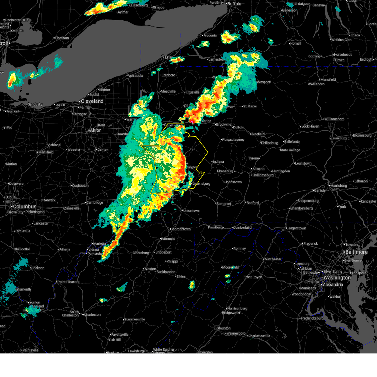 The storms which prompted the warning have moved out of the area. therefore, the warning will be allowed to expire. however, gusty winds are still possible with these thunderstorms. a severe thunderstorm watch remains in effect until 1000 pm edt for western, southwestern and west central pennsylvania. remember, a severe thunderstorm warning still remains in effect for butler, armstrong, and westmoreland counties. The storms which prompted the warning have moved out of the area. therefore, the warning will be allowed to expire. however, gusty winds are still possible with these thunderstorms. a severe thunderstorm watch remains in effect until 1000 pm edt for western, southwestern and west central pennsylvania. remember, a severe thunderstorm warning still remains in effect for butler, armstrong, and westmoreland counties.
|
| 4/29/2025 5:23 PM EDT | Trees down on new texas r in allegheny county PA, 13.9 miles WSW of Pittsburgh, PA |
| 4/29/2025 5:17 PM EDT |
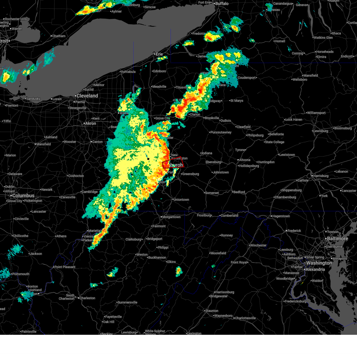 Torpbz the national weather service in pittsburgh has issued a * tornado warning for, east central allegheny county in southwestern pennsylvania, northwestern westmoreland county in southwestern pennsylvania, * until 530 pm edt. * at 517 pm edt, severe thunderstorms capable of producing both tornadoes and extensive straight line wind damage were located over churchill, or over penn hills, moving east at 65 mph (radar indicated rotation). Hazards include tornado. Flying debris will be dangerous to those caught without shelter. mobile homes will be damaged or destroyed. damage to roofs, windows and vehicles will occur. Tree damage is likely. Torpbz the national weather service in pittsburgh has issued a * tornado warning for, east central allegheny county in southwestern pennsylvania, northwestern westmoreland county in southwestern pennsylvania, * until 530 pm edt. * at 517 pm edt, severe thunderstorms capable of producing both tornadoes and extensive straight line wind damage were located over churchill, or over penn hills, moving east at 65 mph (radar indicated rotation). Hazards include tornado. Flying debris will be dangerous to those caught without shelter. mobile homes will be damaged or destroyed. damage to roofs, windows and vehicles will occur. Tree damage is likely.
|
| 4/29/2025 5:16 PM EDT | Trees down near thomas blv in allegheny county PA, 4.7 miles WSW of Pittsburgh, PA |
| 4/29/2025 5:15 PM EDT | Tree down in the front yar in allegheny county PA, 8.7 miles W of Pittsburgh, PA |
| 4/29/2025 5:15 PM EDT | Tree dow in allegheny county PA, 2.9 miles WNW of Pittsburgh, PA |
| 4/29/2025 5:15 PM EDT | Windows blown out of high rise building in downtown pittsburgh. gates cente in allegheny county PA, 1.1 miles SE of Pittsburgh, PA |
| 4/29/2025 5:15 PM EDT | Numerous trees uprooted and large branches dow in allegheny county PA, 6 miles W of Pittsburgh, PA |
| 4/29/2025 5:14 PM EDT | Numerous trees dow in allegheny county PA, 7.8 miles SSW of Pittsburgh, PA |
| 4/29/2025 5:14 PM EDT | Trees down on beechwood blv in allegheny county PA, 2.3 miles W of Pittsburgh, PA |
| 4/29/2025 5:13 PM EDT | Multiple trees dow in allegheny county PA, 6.1 miles SW of Pittsburgh, PA |
| 4/29/2025 5:13 PM EDT | Tree damage at the pittsburgh zo in allegheny county PA, 4.9 miles SW of Pittsburgh, PA |
| 4/29/2025 5:13 PM EDT | Trees and power lines down on beverly roa in allegheny county PA, 4.8 miles NE of Pittsburgh, PA |
| 4/29/2025 5:12 PM EDT | Numerous trees uprooted and snapped in schenley par in allegheny county PA, 2.9 miles W of Pittsburgh, PA |
| 4/29/2025 5:11 PM EDT | Tree and large limbs down. metal chimney cover also blown dow in allegheny county PA, 1 miles NE of Pittsburgh, PA |
| 4/29/2025 5:11 PM EDT | Uprooted trees on christler stree in allegheny county PA, 5.2 miles SSW of Pittsburgh, PA |
| 4/29/2025 5:10 PM EDT | Roof blown off restaurant along west liberty av in allegheny county PA, 2.3 miles NE of Pittsburgh, PA |
| 4/29/2025 5:10 PM EDT | Multiple trees down and shingles blown off of a roo in allegheny county PA, 1.3 miles NNE of Pittsburgh, PA |
| 4/29/2025 5:10 PM EDT | Large tree in the roa in allegheny county PA, 4.3 miles NNE of Pittsburgh, PA |
| 4/29/2025 5:10 PM EDT | Numerous large trees... power lines... and power poles blown down throughout the area. lasted approximately 10 minute in allegheny county PA, 4.8 miles N of Pittsburgh, PA |
| 4/29/2025 5:10 PM EDT |
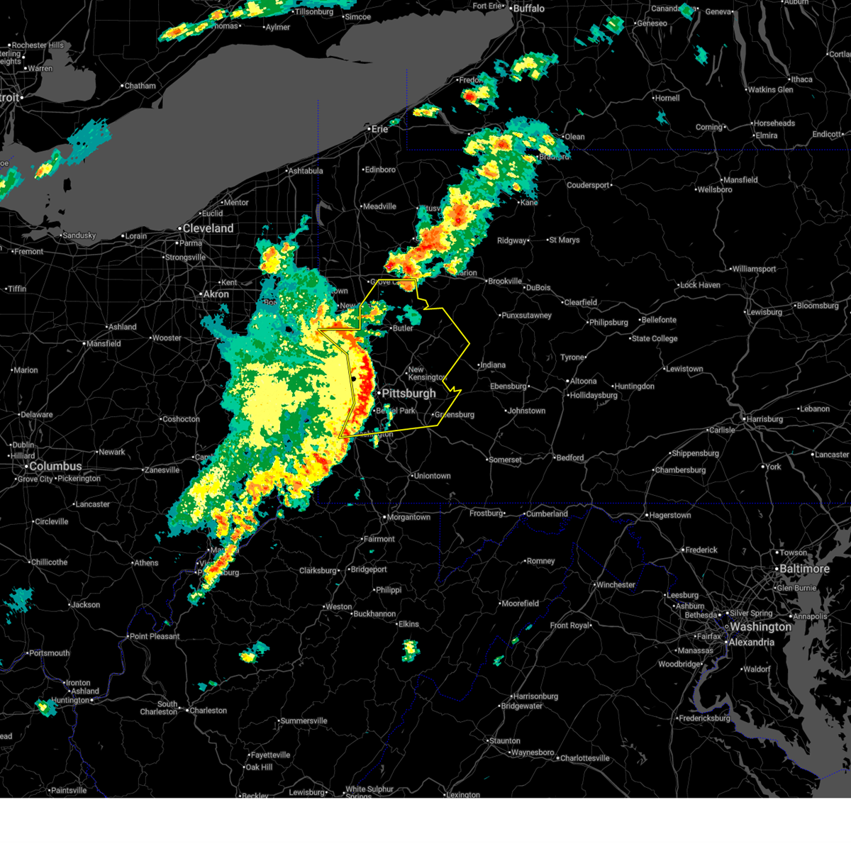 the severe thunderstorm warning has been cancelled and is no longer in effect the severe thunderstorm warning has been cancelled and is no longer in effect
|
| 4/29/2025 5:10 PM EDT |
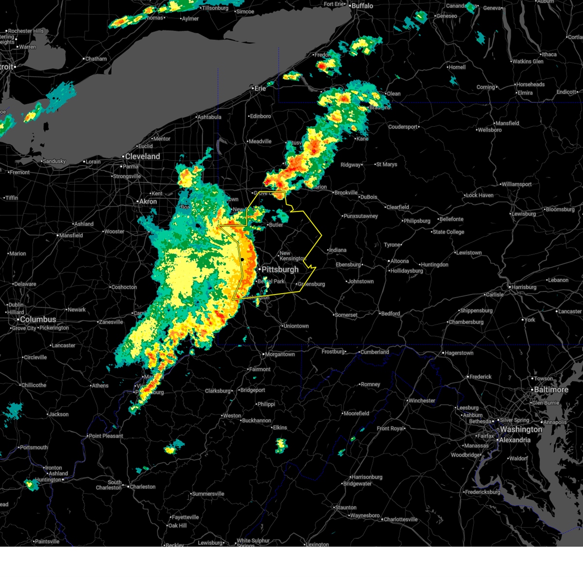 At 509 pm edt, severe thunderstorms were located along a line extending from near ellwood city to near gibsonia to brentwood to mcmurray, moving east at 65 mph. these are destructive storms for allegheny, butler, and armstrong counties (radar indicated). Hazards include 80 mph wind gusts. Extensive tree damage and widespread power outages. mobile homes will be heavily damaged. expect considerable damage to roofs, windows and vehicles. Locations impacted include, pittsburgh, penn hills, mount lebanon, bethel park, ross township, mccandless township, monroeville, cranberry, moon township, mcmurray, greensburg, mckeesport, butler, washington, franklin park, jeannette, aliquippa, canonsburg, beaver falls, and monaca. At 509 pm edt, severe thunderstorms were located along a line extending from near ellwood city to near gibsonia to brentwood to mcmurray, moving east at 65 mph. these are destructive storms for allegheny, butler, and armstrong counties (radar indicated). Hazards include 80 mph wind gusts. Extensive tree damage and widespread power outages. mobile homes will be heavily damaged. expect considerable damage to roofs, windows and vehicles. Locations impacted include, pittsburgh, penn hills, mount lebanon, bethel park, ross township, mccandless township, monroeville, cranberry, moon township, mcmurray, greensburg, mckeesport, butler, washington, franklin park, jeannette, aliquippa, canonsburg, beaver falls, and monaca.
|
| 4/29/2025 5:09 PM EDT | Tree on a home on fruithurst d in allegheny county PA, 4.1 miles NE of Pittsburgh, PA |
| 4/29/2025 5:09 PM EDT | 6 trees blown dow in allegheny county PA, 5 miles NE of Pittsburgh, PA |
| 4/29/2025 5:09 PM EDT | Corrects previous tstm wnd dmg report from 1 ene dormont. trees down on edgebrook av in allegheny county PA, 2.4 miles NE of Pittsburgh, PA |
| 4/29/2025 5:08 PM EDT | Large limbs also dow in allegheny county PA, 3.5 miles NE of Pittsburgh, PA |
| 4/29/2025 5:08 PM EDT | Several limbs dow in allegheny county PA, 6.6 miles SSE of Pittsburgh, PA |
| 4/29/2025 5:07 PM EDT | Part of a tree on home on dewalt driv in allegheny county PA, 3.8 miles NNE of Pittsburgh, PA |
| 4/29/2025 5:07 PM EDT | Corrects previous tstm wnd dmg report from green tree. tree down on iron city driv in allegheny county PA, 4 miles E of Pittsburgh, PA |
| 4/29/2025 5:06 PM EDT | Several trees and large limbs dow in allegheny county PA, 4.6 miles SE of Pittsburgh, PA |
| 4/29/2025 5:05 PM EDT | Large tree dow in allegheny county PA, 7.9 miles NNE of Pittsburgh, PA |
| 4/29/2025 5:03 PM EDT | Multiple trees were blown down on falck rd. damage to a garage roof and deck also reporte in allegheny county PA, 8.5 miles ESE of Pittsburgh, PA |
| 4/29/2025 4:46 PM EDT |
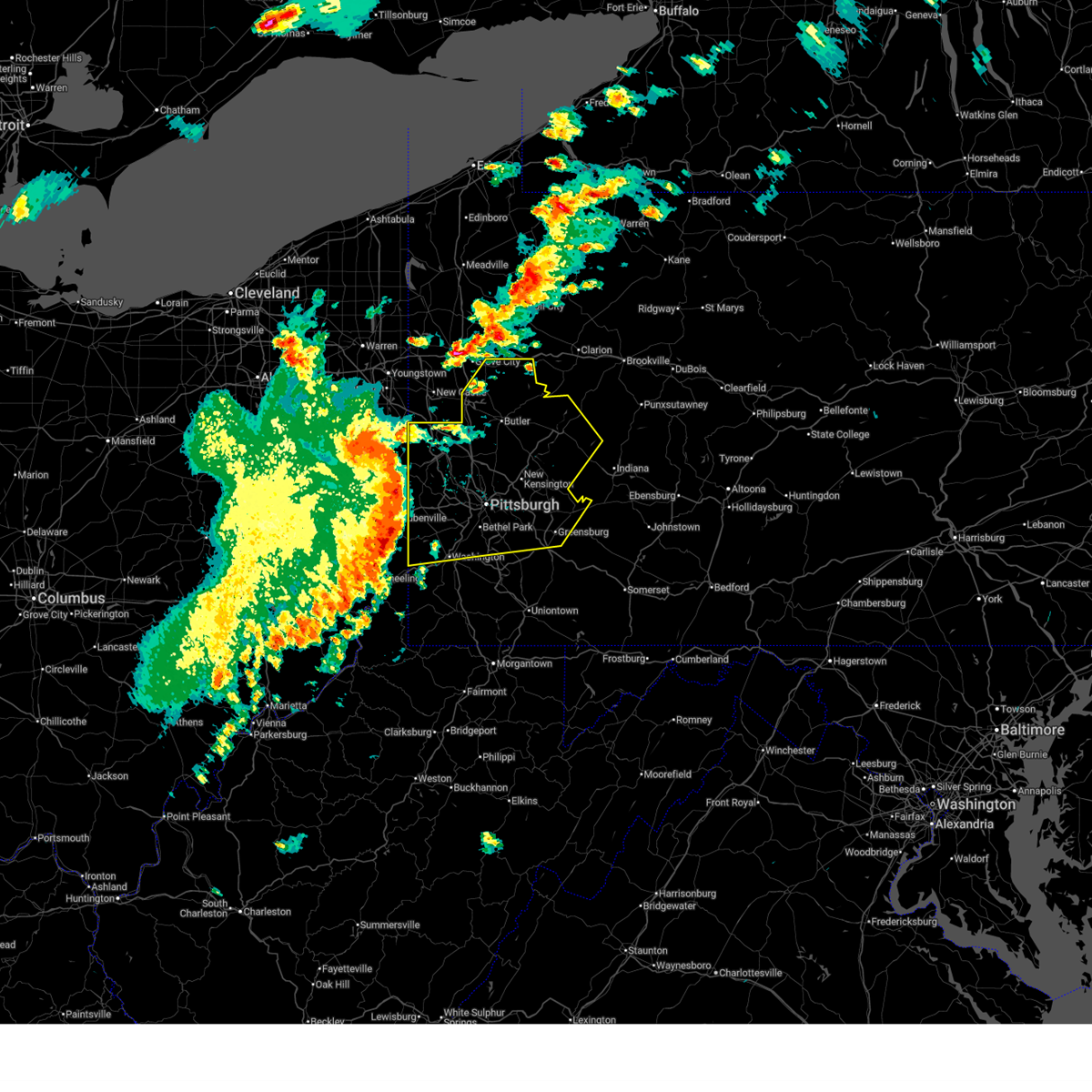 Svrpbz the national weather service in pittsburgh has issued a * severe thunderstorm warning for, eastern columbiana county in east central ohio, beaver county in western pennsylvania, northern washington county in southwestern pennsylvania, southeastern lawrence county in western pennsylvania, butler county in west central pennsylvania, southwestern indiana county in west central pennsylvania, allegheny county in southwestern pennsylvania, northwestern westmoreland county in southwestern pennsylvania, armstrong county in west central pennsylvania, ohio county in northern west virginia, brooke county in northern west virginia, hancock county in northern west virginia, * until 530 pm edt. * at 445 pm edt, severe thunderstorms were located along a line extending from lisbon to near shippingport to near avella to west liberty, moving east at 75 mph. these are destructive storms for southern beaver, northern washington, and allegheny counties (radar indicated). Hazards include 80 mph wind gusts. Extensive tree damage and widespread power outages. mobile homes will be heavily damaged. Expect considerable damage to roofs, windows and vehicles. Svrpbz the national weather service in pittsburgh has issued a * severe thunderstorm warning for, eastern columbiana county in east central ohio, beaver county in western pennsylvania, northern washington county in southwestern pennsylvania, southeastern lawrence county in western pennsylvania, butler county in west central pennsylvania, southwestern indiana county in west central pennsylvania, allegheny county in southwestern pennsylvania, northwestern westmoreland county in southwestern pennsylvania, armstrong county in west central pennsylvania, ohio county in northern west virginia, brooke county in northern west virginia, hancock county in northern west virginia, * until 530 pm edt. * at 445 pm edt, severe thunderstorms were located along a line extending from lisbon to near shippingport to near avella to west liberty, moving east at 75 mph. these are destructive storms for southern beaver, northern washington, and allegheny counties (radar indicated). Hazards include 80 mph wind gusts. Extensive tree damage and widespread power outages. mobile homes will be heavily damaged. Expect considerable damage to roofs, windows and vehicles.
|
| 4/29/2025 4:09 PM EDT | Trees down on edgebrook av in allegheny county PA, 2.4 miles NE of Pittsburgh, PA |
| 4/29/2025 4:07 PM EDT | Tree down on iron city driv in allegheny county PA, 4 miles E of Pittsburgh, PA |
| 4/3/2025 4:57 AM EDT |
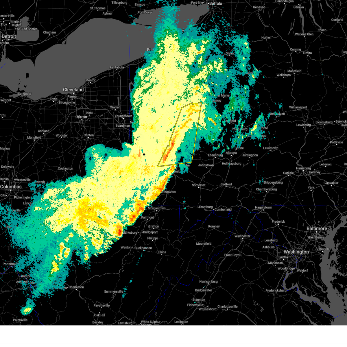 At 457 am edt, severe thunderstorms were located along a line from over clarion to over churchill, or along a line from over clarion to over penn hills, moving northeast at 65 mph (radar indicated). Hazards include 60 mph wind gusts. Expect damage to roofs, siding, and trees. Locations impacted include, pittsburgh, penn hills, monroeville, mckeesport, clarion, vandergrift, kittanning, brookville, apollo, rimersburg, plum, west mifflin, murrysville, wilkinsburg, new kensington, lower burrell, munhall, harrison township, north versailles and swissvale. At 457 am edt, severe thunderstorms were located along a line from over clarion to over churchill, or along a line from over clarion to over penn hills, moving northeast at 65 mph (radar indicated). Hazards include 60 mph wind gusts. Expect damage to roofs, siding, and trees. Locations impacted include, pittsburgh, penn hills, monroeville, mckeesport, clarion, vandergrift, kittanning, brookville, apollo, rimersburg, plum, west mifflin, murrysville, wilkinsburg, new kensington, lower burrell, munhall, harrison township, north versailles and swissvale.
|
| 4/3/2025 4:57 AM EDT |
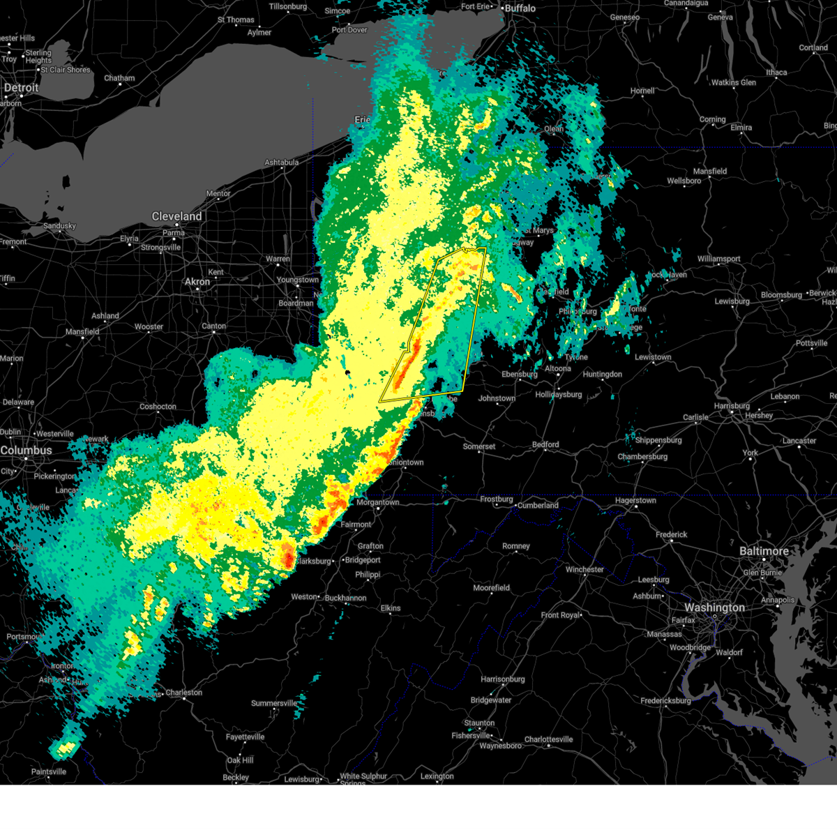 the severe thunderstorm warning has been cancelled and is no longer in effect the severe thunderstorm warning has been cancelled and is no longer in effect
|
| 4/3/2025 4:47 AM EDT |
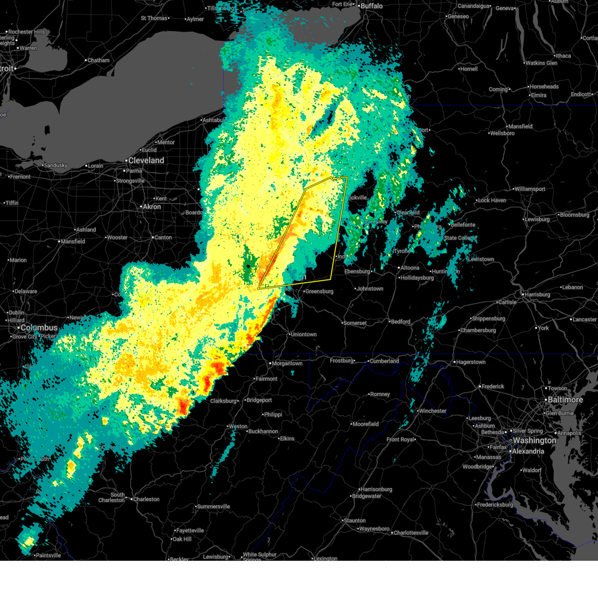 the severe thunderstorm warning has been cancelled and is no longer in effect the severe thunderstorm warning has been cancelled and is no longer in effect
|
| 4/3/2025 4:47 AM EDT |
 At 447 am edt, severe thunderstorms were located along a line from 6 miles south of knox to over dormont, or along a line from 6 miles south of knox to over mount lebanon, moving northeast at 65 mph (radar indicated). Hazards include 60 mph wind gusts. Expect damage to roofs, siding, and trees. locations impacted include, pittsburgh, penn hills, mount lebanon, bethel park, monroeville, mckeesport, clarion, vandergrift, kittanning, brookville, apollo, rimersburg, shaler township, plum, west mifflin, north side pittsburgh, baldwin, upper st. Clair, murrysville and hampton township. At 447 am edt, severe thunderstorms were located along a line from 6 miles south of knox to over dormont, or along a line from 6 miles south of knox to over mount lebanon, moving northeast at 65 mph (radar indicated). Hazards include 60 mph wind gusts. Expect damage to roofs, siding, and trees. locations impacted include, pittsburgh, penn hills, mount lebanon, bethel park, monroeville, mckeesport, clarion, vandergrift, kittanning, brookville, apollo, rimersburg, shaler township, plum, west mifflin, north side pittsburgh, baldwin, upper st. Clair, murrysville and hampton township.
|
| 4/3/2025 4:37 AM EDT |
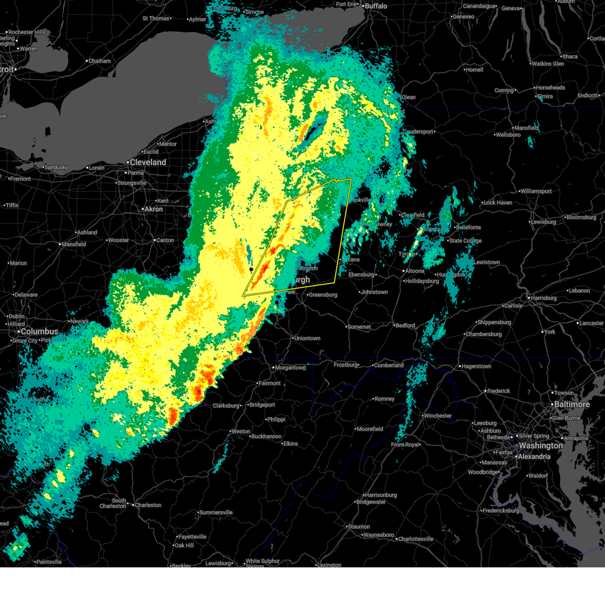 Svrpbz the national weather service in pittsburgh has issued a * severe thunderstorm warning for, allegheny county in southwestern pennsylvania, north central washington county in southwestern pennsylvania, northwestern westmoreland county in southwestern pennsylvania, armstrong county in west central pennsylvania, eastern butler county in west central pennsylvania, clarion county in west central pennsylvania, western indiana county in west central pennsylvania, western jefferson pa county in west central pennsylvania, * until 515 am edt. * at 437 am edt, severe thunderstorms were located along a line from 15 miles northeast of shanor-northvue to over cecil-bishop, or along a line from 13 miles west of rimersburg to 6 miles north of canonsburg, moving northeast at 65 mph (radar indicated). Hazards include 60 mph wind gusts. expect damage to roofs, siding, and trees Svrpbz the national weather service in pittsburgh has issued a * severe thunderstorm warning for, allegheny county in southwestern pennsylvania, north central washington county in southwestern pennsylvania, northwestern westmoreland county in southwestern pennsylvania, armstrong county in west central pennsylvania, eastern butler county in west central pennsylvania, clarion county in west central pennsylvania, western indiana county in west central pennsylvania, western jefferson pa county in west central pennsylvania, * until 515 am edt. * at 437 am edt, severe thunderstorms were located along a line from 15 miles northeast of shanor-northvue to over cecil-bishop, or along a line from 13 miles west of rimersburg to 6 miles north of canonsburg, moving northeast at 65 mph (radar indicated). Hazards include 60 mph wind gusts. expect damage to roofs, siding, and trees
|
| 4/2/2025 2:51 PM EDT |
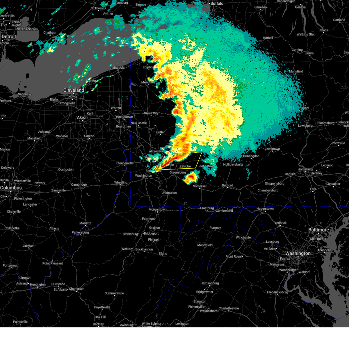 At 251 pm edt, severe thunderstorms were located along a line from 7 miles southeast of apollo to over mckeesport, moving east at 65 mph (public reported). Hazards include quarter size hail. Damage to vehicles is expected. Locations impacted include, pittsburgh, monroeville, greensburg, mckeesport, jeannette, latrobe, homer city, plum, west mifflin, murrysville, south park township, jefferson hills, north versailles, pleasant hills, white oak, clairton, wilkins township, duquesne, turtle creek and north braddock. At 251 pm edt, severe thunderstorms were located along a line from 7 miles southeast of apollo to over mckeesport, moving east at 65 mph (public reported). Hazards include quarter size hail. Damage to vehicles is expected. Locations impacted include, pittsburgh, monroeville, greensburg, mckeesport, jeannette, latrobe, homer city, plum, west mifflin, murrysville, south park township, jefferson hills, north versailles, pleasant hills, white oak, clairton, wilkins township, duquesne, turtle creek and north braddock.
|
| 4/2/2025 2:51 PM EDT |
 the severe thunderstorm warning has been cancelled and is no longer in effect the severe thunderstorm warning has been cancelled and is no longer in effect
|
| 4/2/2025 2:45 PM EDT |
 At 245 pm edt, severe thunderstorms were located along a line from over vandergrift to over wilkins township, or along a line from over vandergrift to near monroeville, moving east at 70 mph (radar indicated). Hazards include quarter size hail. Damage to vehicles is expected. locations impacted include, pittsburgh, penn hills, bethel park, monroeville, greensburg, mckeesport, indiana, jeannette, latrobe, vandergrift, homer city, apollo, plum, west mifflin, baldwin, upper st. Clair, murrysville, wilkinsburg, whitehall and south park township. At 245 pm edt, severe thunderstorms were located along a line from over vandergrift to over wilkins township, or along a line from over vandergrift to near monroeville, moving east at 70 mph (radar indicated). Hazards include quarter size hail. Damage to vehicles is expected. locations impacted include, pittsburgh, penn hills, bethel park, monroeville, greensburg, mckeesport, indiana, jeannette, latrobe, vandergrift, homer city, apollo, plum, west mifflin, baldwin, upper st. Clair, murrysville, wilkinsburg, whitehall and south park township.
|
| 4/2/2025 2:45 PM EDT |
 the severe thunderstorm warning has been cancelled and is no longer in effect the severe thunderstorm warning has been cancelled and is no longer in effect
|
| 4/2/2025 2:43 PM EDT |
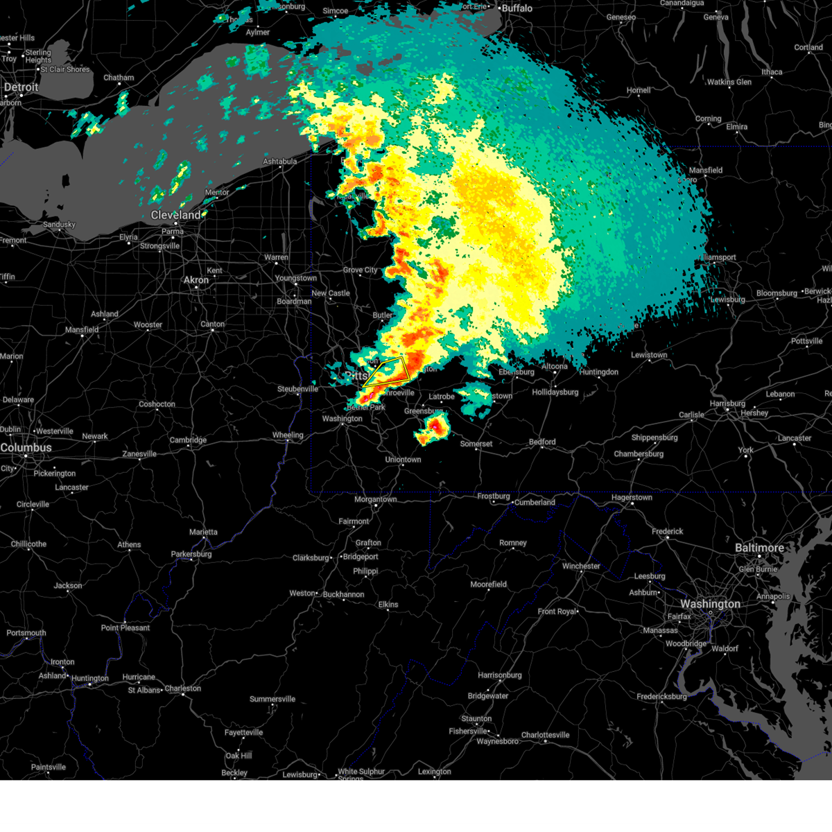 The severe thunderstorm warning that was previously in effect has been reissued for allegheny and westmoreland counties and is in effect until 315 pm edt. please refer to that bulletin for the latest severe weather information. The severe thunderstorm warning that was previously in effect has been reissued for allegheny and westmoreland counties and is in effect until 315 pm edt. please refer to that bulletin for the latest severe weather information.
|
| 4/2/2025 2:40 PM EDT | Half Dollar sized hail reported 7.9 miles SW of Pittsburgh, PA, picture provided via social media. |
| 4/2/2025 2:36 PM EDT |
 At 236 pm edt, a severe thunderstorm was located over new kensington, or 6 miles northeast of penn hills, moving east at 70 mph (radar indicated). Hazards include ping pong ball size hail. People and animals outdoors will be injured. expect damage to roofs, siding, windows, and vehicles. Locations impacted include, pittsburgh, penn hills, monroeville, shaler township, plum, north side pittsburgh, murrysville, hampton township, wilkinsburg, new kensington, lower burrell, harrison township, o'hara township, oakmont, crafton, fox chapel, arnold, tarentum, green tree and millvale. At 236 pm edt, a severe thunderstorm was located over new kensington, or 6 miles northeast of penn hills, moving east at 70 mph (radar indicated). Hazards include ping pong ball size hail. People and animals outdoors will be injured. expect damage to roofs, siding, windows, and vehicles. Locations impacted include, pittsburgh, penn hills, monroeville, shaler township, plum, north side pittsburgh, murrysville, hampton township, wilkinsburg, new kensington, lower burrell, harrison township, o'hara township, oakmont, crafton, fox chapel, arnold, tarentum, green tree and millvale.
|
| 4/2/2025 2:34 PM EDT | Quarter sized hail reported 6.7 miles WSW of Pittsburgh, PA |
| 4/2/2025 2:33 PM EDT |
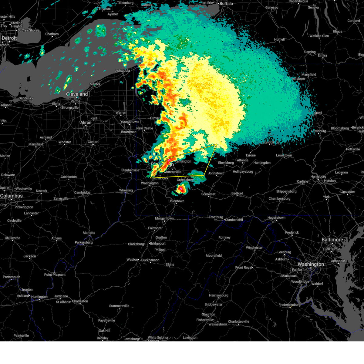 Svrpbz the national weather service in pittsburgh has issued a * severe thunderstorm warning for, eastern allegheny county in southwestern pennsylvania, central washington county in southwestern pennsylvania, central westmoreland county in southwestern pennsylvania, southern armstrong county in west central pennsylvania, central indiana county in west central pennsylvania, * until 315 pm edt. * at 233 pm edt, severe thunderstorms were located along a line from over arnold to over scott township, or along a line from 8 miles north of penn hills to over mount lebanon, moving east at 70 mph (radar indicated). Hazards include half dollar size hail. damage to vehicles is expected Svrpbz the national weather service in pittsburgh has issued a * severe thunderstorm warning for, eastern allegheny county in southwestern pennsylvania, central washington county in southwestern pennsylvania, central westmoreland county in southwestern pennsylvania, southern armstrong county in west central pennsylvania, central indiana county in west central pennsylvania, * until 315 pm edt. * at 233 pm edt, severe thunderstorms were located along a line from over arnold to over scott township, or along a line from 8 miles north of penn hills to over mount lebanon, moving east at 70 mph (radar indicated). Hazards include half dollar size hail. damage to vehicles is expected
|
| 4/2/2025 2:28 PM EDT |
 At 228 pm edt, a severe thunderstorm was located over o'hara township, or 6 miles northwest of penn hills, moving east at 70 mph (public reported). Hazards include golf ball size hail. People and animals outdoors will be injured. expect damage to roofs, siding, windows, and vehicles. Locations impacted include, pittsburgh, penn hills, ross township, mccandless township, monroeville, shaler township, plum, north side pittsburgh, murrysville, hampton township, wilkinsburg, new kensington, lower burrell, harrison township, o'hara township, bellevue, west view, stowe township, oakmont and mckees rocks. At 228 pm edt, a severe thunderstorm was located over o'hara township, or 6 miles northwest of penn hills, moving east at 70 mph (public reported). Hazards include golf ball size hail. People and animals outdoors will be injured. expect damage to roofs, siding, windows, and vehicles. Locations impacted include, pittsburgh, penn hills, ross township, mccandless township, monroeville, shaler township, plum, north side pittsburgh, murrysville, hampton township, wilkinsburg, new kensington, lower burrell, harrison township, o'hara township, bellevue, west view, stowe township, oakmont and mckees rocks.
|
| 4/2/2025 2:22 PM EDT | Quarter sized hail reported 7.2 miles SSE of Pittsburgh, PA |
| 4/2/2025 2:22 PM EDT | Quarter sized hail reported 6.7 miles SE of Pittsburgh, PA, picture provided. |
| 4/2/2025 2:22 PM EDT | Quarter sized hail reported 6 miles SE of Pittsburgh, PA, picture provided. |
| 4/2/2025 2:22 PM EDT | Half Dollar sized hail reported 7.8 miles S of Pittsburgh, PA, size estimated based on picture. |
| 4/2/2025 2:21 PM EDT | Quarter sized hail reported 6.7 miles SSE of Pittsburgh, PA |
| 4/2/2025 2:21 PM EDT | Quarter sized hail reported 7.2 miles SSE of Pittsburgh, PA |
| 4/2/2025 2:21 PM EDT | Quarter sized hail reported 7.8 miles S of Pittsburgh, PA |
| 4/2/2025 2:21 PM EDT | Ping Pong Ball sized hail reported 6.7 miles SSE of Pittsburgh, PA, picture provided. |
| 4/2/2025 2:20 PM EDT | Ping Pong Ball sized hail reported 6.7 miles SE of Pittsburgh, PA, report from mping. |
| 4/2/2025 2:20 PM EDT | Quarter sized hail reported 8 miles SSE of Pittsburgh, PA |
| 4/2/2025 2:20 PM EDT | Ping Pong Ball sized hail reported 6.6 miles SSE of Pittsburgh, PA |
| 4/2/2025 2:20 PM EDT | Ping Pong Ball sized hail reported 7.2 miles SE of Pittsburgh, PA, pictured provided via social media. |
| 4/2/2025 2:20 PM EDT | Half Dollar sized hail reported 6.3 miles SSE of Pittsburgh, PA |
| 4/2/2025 2:18 PM EDT | Ping Pong Ball sized hail reported 8.3 miles SE of Pittsburgh, PA |
| 4/2/2025 2:18 PM EDT |
 the severe thunderstorm warning has been cancelled and is no longer in effect the severe thunderstorm warning has been cancelled and is no longer in effect
|
| 4/2/2025 2:18 PM EDT |
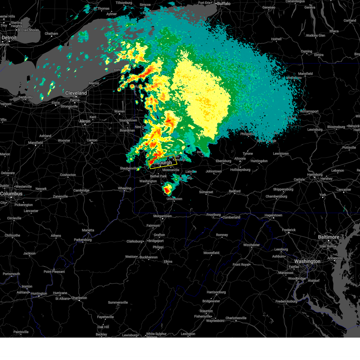 At 218 pm edt, a severe thunderstorm was located over kennedy township, or 5 miles east of moon township, moving east at 70 mph (radar indicated). Hazards include ping pong ball size hail. People and animals outdoors will be injured. expect damage to roofs, siding, windows, and vehicles. Locations impacted include, pittsburgh, penn hills, ross township, mccandless township, monroeville, moon township, franklin park, shaler township, plum, north side pittsburgh, murrysville, hampton township, scott township, wilkinsburg, robinson township, new kensington, lower burrell, harrison township, o'hara township and bellevue. At 218 pm edt, a severe thunderstorm was located over kennedy township, or 5 miles east of moon township, moving east at 70 mph (radar indicated). Hazards include ping pong ball size hail. People and animals outdoors will be injured. expect damage to roofs, siding, windows, and vehicles. Locations impacted include, pittsburgh, penn hills, ross township, mccandless township, monroeville, moon township, franklin park, shaler township, plum, north side pittsburgh, murrysville, hampton township, scott township, wilkinsburg, robinson township, new kensington, lower burrell, harrison township, o'hara township and bellevue.
|
| 4/2/2025 2:17 PM EDT | Half Dollar sized hail reported 8.7 miles SE of Pittsburgh, PA |
| 4/2/2025 2:10 PM EDT |
 Svrpbz the national weather service in pittsburgh has issued a * severe thunderstorm warning for, central allegheny county in southwestern pennsylvania, northwestern washington county in southwestern pennsylvania, northwestern westmoreland county in southwestern pennsylvania, south central beaver county in western pennsylvania, * until 245 pm edt. * at 210 pm edt, a severe thunderstorm was located over imperial, or near moon township, moving east at 70 mph (radar indicated). Hazards include quarter size hail. damage to vehicles is expected Svrpbz the national weather service in pittsburgh has issued a * severe thunderstorm warning for, central allegheny county in southwestern pennsylvania, northwestern washington county in southwestern pennsylvania, northwestern westmoreland county in southwestern pennsylvania, south central beaver county in western pennsylvania, * until 245 pm edt. * at 210 pm edt, a severe thunderstorm was located over imperial, or near moon township, moving east at 70 mph (radar indicated). Hazards include quarter size hail. damage to vehicles is expected
|
| 3/16/2025 12:56 PM EDT |
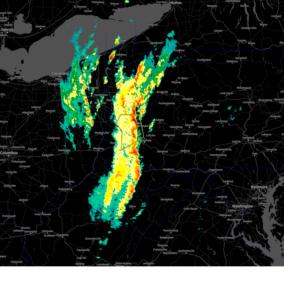 The severe thunderstorm warning that was previously in effect has been reissued for allegheny, butler, armstrong, and westmoreland counties. please refer to those bulletins for the latest severe weather information. to report severe weather, contact your nearest law enforcement agency. they will send your report to the national weather service office. The severe thunderstorm warning that was previously in effect has been reissued for allegheny, butler, armstrong, and westmoreland counties. please refer to those bulletins for the latest severe weather information. to report severe weather, contact your nearest law enforcement agency. they will send your report to the national weather service office.
|
| 3/16/2025 12:50 PM EDT | Downed wires along gulf lab road which has closed the roa in allegheny county PA, 11.2 miles SW of Pittsburgh, PA |
| 3/16/2025 12:48 PM EDT | Power poles snapped at delafield road and rutledge drive. time estimated via rada in allegheny county PA, 6.1 miles SW of Pittsburgh, PA |
| 3/16/2025 12:45 PM EDT | Uprooted some trees on the hillside facing locust avenu in allegheny county PA, 5 miles S of Pittsburgh, PA |
| 3/16/2025 12:43 PM EDT |
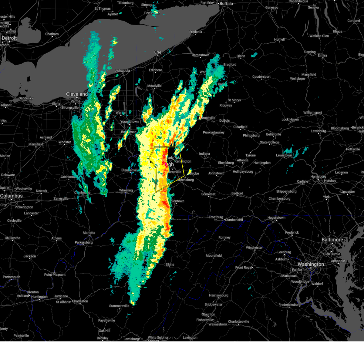 At 1243 pm edt, a severe thunderstorm was located over pittsburgh, moving northeast at 45 mph (radar indicated). Hazards include 70 mph wind gusts and small hail. Expect considerable tree damage. damage is likely to mobile homes, roofs, and outbuildings. Locations impacted include, pittsburgh, penn hills, mount lebanon, bethel park, ross township, mccandless township, monroeville, cranberry, moon township, mcmurray, mckeesport, franklin park, jeannette, aliquippa, gastonville, shaler township, plum, west mifflin, north side pittsburgh and baldwin. At 1243 pm edt, a severe thunderstorm was located over pittsburgh, moving northeast at 45 mph (radar indicated). Hazards include 70 mph wind gusts and small hail. Expect considerable tree damage. damage is likely to mobile homes, roofs, and outbuildings. Locations impacted include, pittsburgh, penn hills, mount lebanon, bethel park, ross township, mccandless township, monroeville, cranberry, moon township, mcmurray, mckeesport, franklin park, jeannette, aliquippa, gastonville, shaler township, plum, west mifflin, north side pittsburgh and baldwin.
|
| 3/16/2025 12:40 PM EDT | Quarter sized hail reported 2.5 miles SSE of Pittsburgh, PA |
| 3/16/2025 12:35 PM EDT | Tree down on pa-28 between 31st street bridge and 16th street bridg in allegheny county PA, 2.2 miles S of Pittsburgh, PA |
| 3/16/2025 12:34 PM EDT |
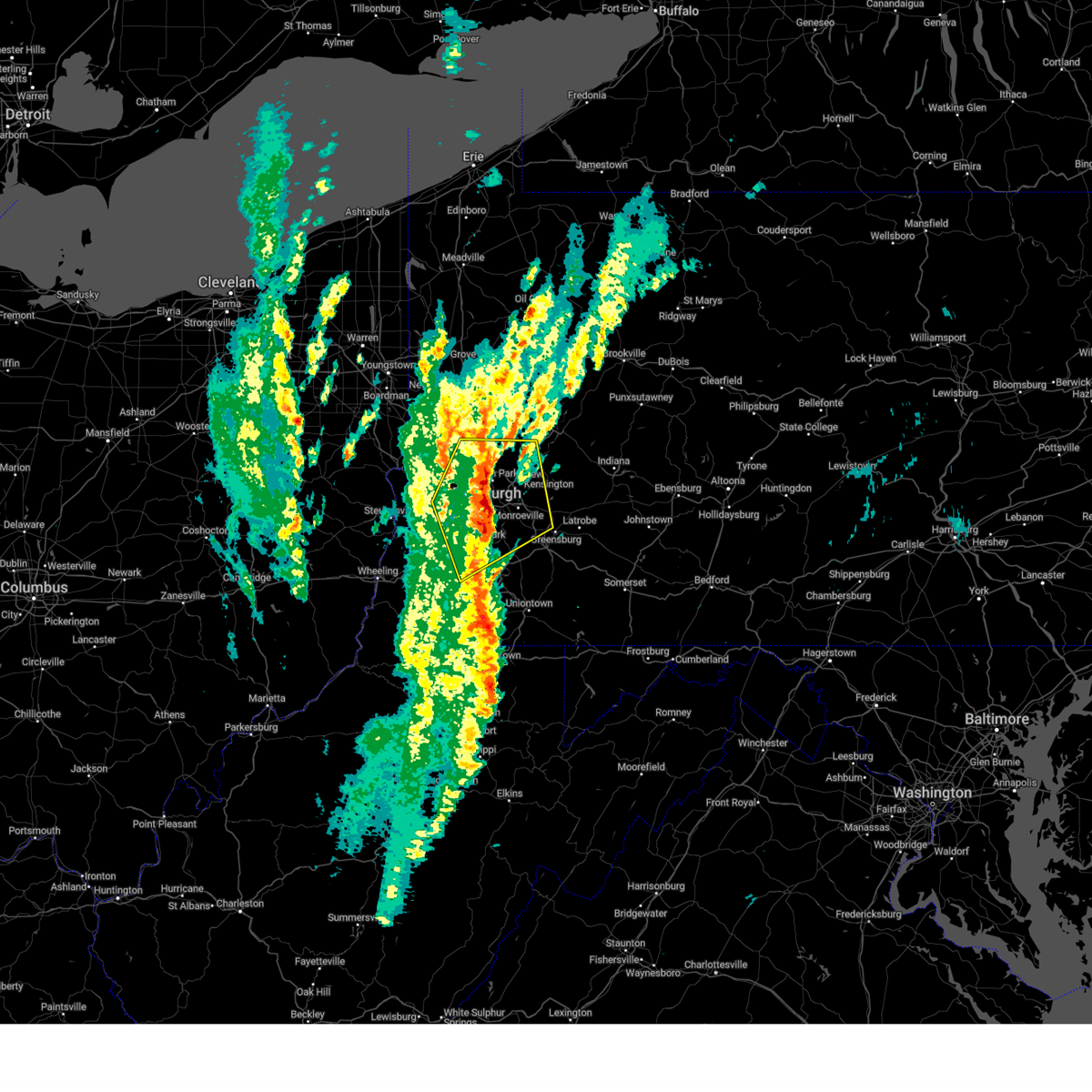 the severe thunderstorm warning has been cancelled and is no longer in effect the severe thunderstorm warning has been cancelled and is no longer in effect
|
| 3/16/2025 12:34 PM EDT |
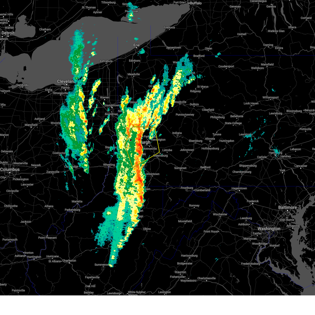 At 1234 pm edt, a severe thunderstorm was located over mount lebanon, moving northeast at 45 mph (radar indicated). Hazards include 70 mph wind gusts and small hail. Expect considerable tree damage. damage is likely to mobile homes, roofs, and outbuildings. Locations impacted include, pittsburgh, penn hills, mount lebanon, bethel park, ross township, mccandless township, monroeville, cranberry, moon township, mcmurray, mckeesport, washington, franklin park, jeannette, aliquippa, canonsburg, gastonville, shaler township, plum and west mifflin. At 1234 pm edt, a severe thunderstorm was located over mount lebanon, moving northeast at 45 mph (radar indicated). Hazards include 70 mph wind gusts and small hail. Expect considerable tree damage. damage is likely to mobile homes, roofs, and outbuildings. Locations impacted include, pittsburgh, penn hills, mount lebanon, bethel park, ross township, mccandless township, monroeville, cranberry, moon township, mcmurray, mckeesport, washington, franklin park, jeannette, aliquippa, canonsburg, gastonville, shaler township, plum and west mifflin.
|
| 3/16/2025 12:30 PM EDT | Large branches dow in allegheny county PA, 7.1 miles NE of Pittsburgh, PA |
| 3/16/2025 12:30 PM EDT | Many large branches of trees down; trash cans and small debris flying everywher in allegheny county PA, 4 miles SW of Pittsburgh, PA |
| 3/16/2025 12:27 PM EDT | Tree snapped... photo provided. time estimate in allegheny county PA, 7.9 miles NE of Pittsburgh, PA |
| 3/16/2025 12:16 PM EDT |
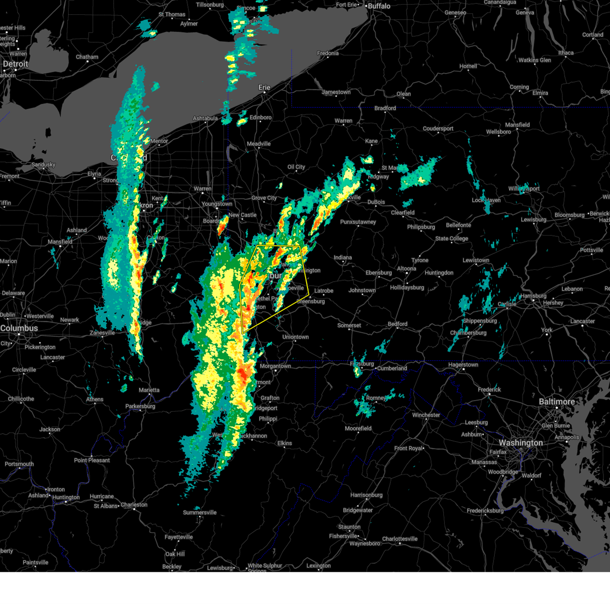 Svrpbz the national weather service in pittsburgh has issued a * severe thunderstorm warning for, allegheny county in southwestern pennsylvania, north central greene county in southwestern pennsylvania, central washington county in southwestern pennsylvania, northwestern westmoreland county in southwestern pennsylvania, southwestern armstrong county in west central pennsylvania, southern butler county in west central pennsylvania, southeastern beaver county in western pennsylvania, * until 100 pm edt. * at 1216 pm edt, a severe thunderstorm was located over mcgovern, or over canonsburg, moving northeast at 45 mph (radar indicated). Hazards include 60 mph wind gusts. expect damage to roofs, siding, and trees Svrpbz the national weather service in pittsburgh has issued a * severe thunderstorm warning for, allegheny county in southwestern pennsylvania, north central greene county in southwestern pennsylvania, central washington county in southwestern pennsylvania, northwestern westmoreland county in southwestern pennsylvania, southwestern armstrong county in west central pennsylvania, southern butler county in west central pennsylvania, southeastern beaver county in western pennsylvania, * until 100 pm edt. * at 1216 pm edt, a severe thunderstorm was located over mcgovern, or over canonsburg, moving northeast at 45 mph (radar indicated). Hazards include 60 mph wind gusts. expect damage to roofs, siding, and trees
|
| 2/27/2025 9:15 PM EST |
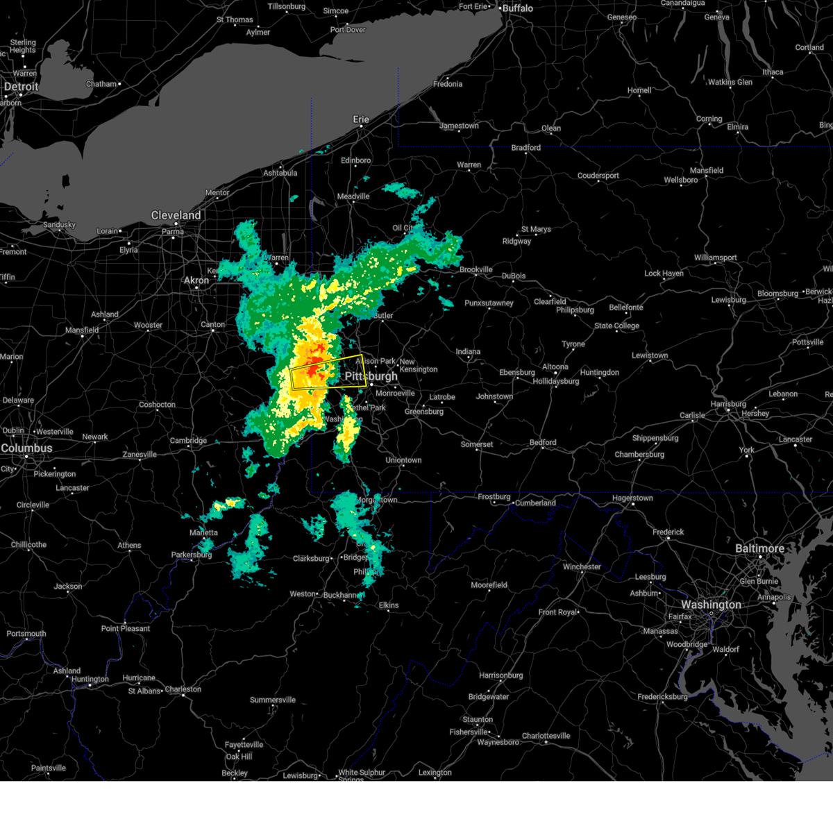 the severe thunderstorm warning has been cancelled and is no longer in effect the severe thunderstorm warning has been cancelled and is no longer in effect
|
| 2/27/2025 9:02 PM EST |
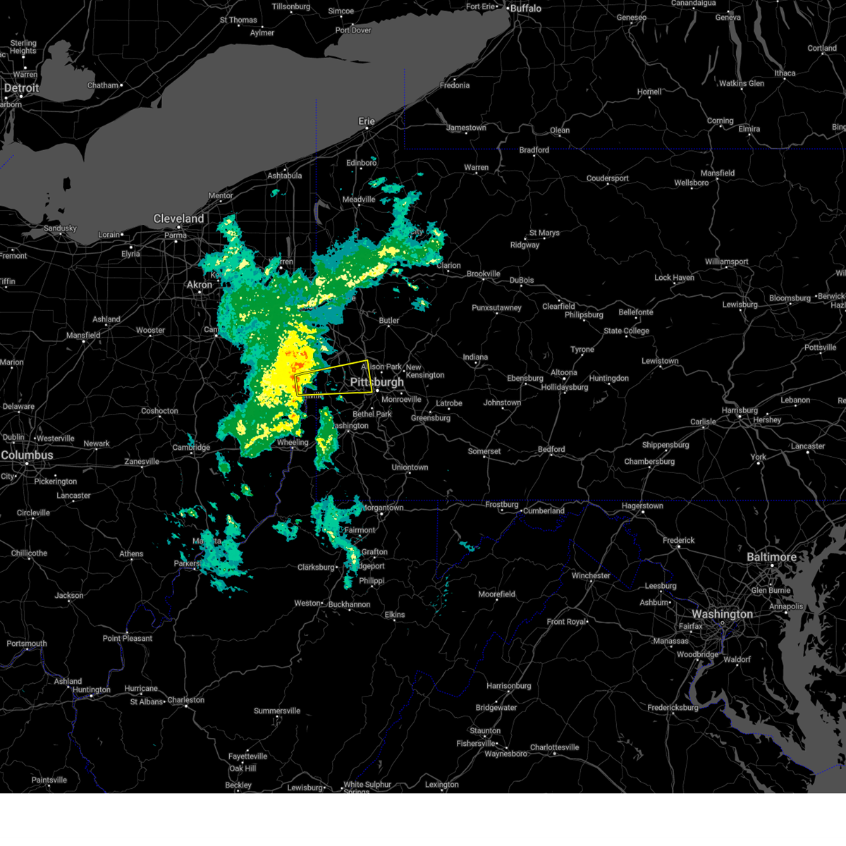 At 902 pm est, a severe thunderstorm was located 6 miles northeast of weirton, moving east at 50 mph (radar indicated). Hazards include quarter size hail and 45 to 50 mph wind. Damage to vehicles is expected. Locations impacted include, pittsburgh, ross township, mccandless township, moon township, weirton, franklin park, aliquippa, robinson township, economy, bellevue, kennedy township, ambridge, stowe township, mckees rocks, crafton, coraopolis, toronto, avalon, sewickley and ingram. At 902 pm est, a severe thunderstorm was located 6 miles northeast of weirton, moving east at 50 mph (radar indicated). Hazards include quarter size hail and 45 to 50 mph wind. Damage to vehicles is expected. Locations impacted include, pittsburgh, ross township, mccandless township, moon township, weirton, franklin park, aliquippa, robinson township, economy, bellevue, kennedy township, ambridge, stowe township, mckees rocks, crafton, coraopolis, toronto, avalon, sewickley and ingram.
|
| 2/27/2025 8:50 PM EST |
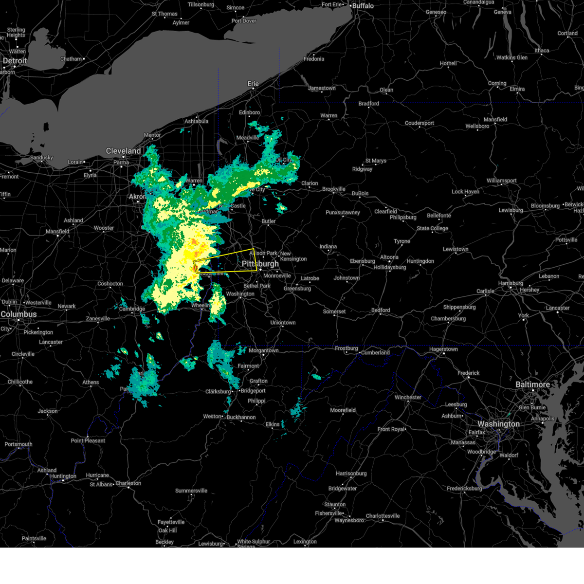 Svrpbz the national weather service in pittsburgh has issued a * severe thunderstorm warning for, northeastern jefferson oh county in east central ohio, northwestern allegheny county in southwestern pennsylvania, northwestern washington county in southwestern pennsylvania, southern beaver county in western pennsylvania, hancock county in northern west virginia, * until 930 pm est. * at 850 pm est, a severe thunderstorm was located 6 miles north of wintersville, or 8 miles northwest of steubenville, moving east at 50 mph (radar indicated). Hazards include quarter size hail and 45 to 50 mph wind. damage to vehicles is expected Svrpbz the national weather service in pittsburgh has issued a * severe thunderstorm warning for, northeastern jefferson oh county in east central ohio, northwestern allegheny county in southwestern pennsylvania, northwestern washington county in southwestern pennsylvania, southern beaver county in western pennsylvania, hancock county in northern west virginia, * until 930 pm est. * at 850 pm est, a severe thunderstorm was located 6 miles north of wintersville, or 8 miles northwest of steubenville, moving east at 50 mph (radar indicated). Hazards include quarter size hail and 45 to 50 mph wind. damage to vehicles is expected
|
| 11/20/2024 5:11 PM EST |
 Portions of the warning have been replaced with a new warning. gusty winds are still possible with these thunderstorms. Portions of the warning have been replaced with a new warning. gusty winds are still possible with these thunderstorms.
|
| 11/20/2024 5:10 PM EST |
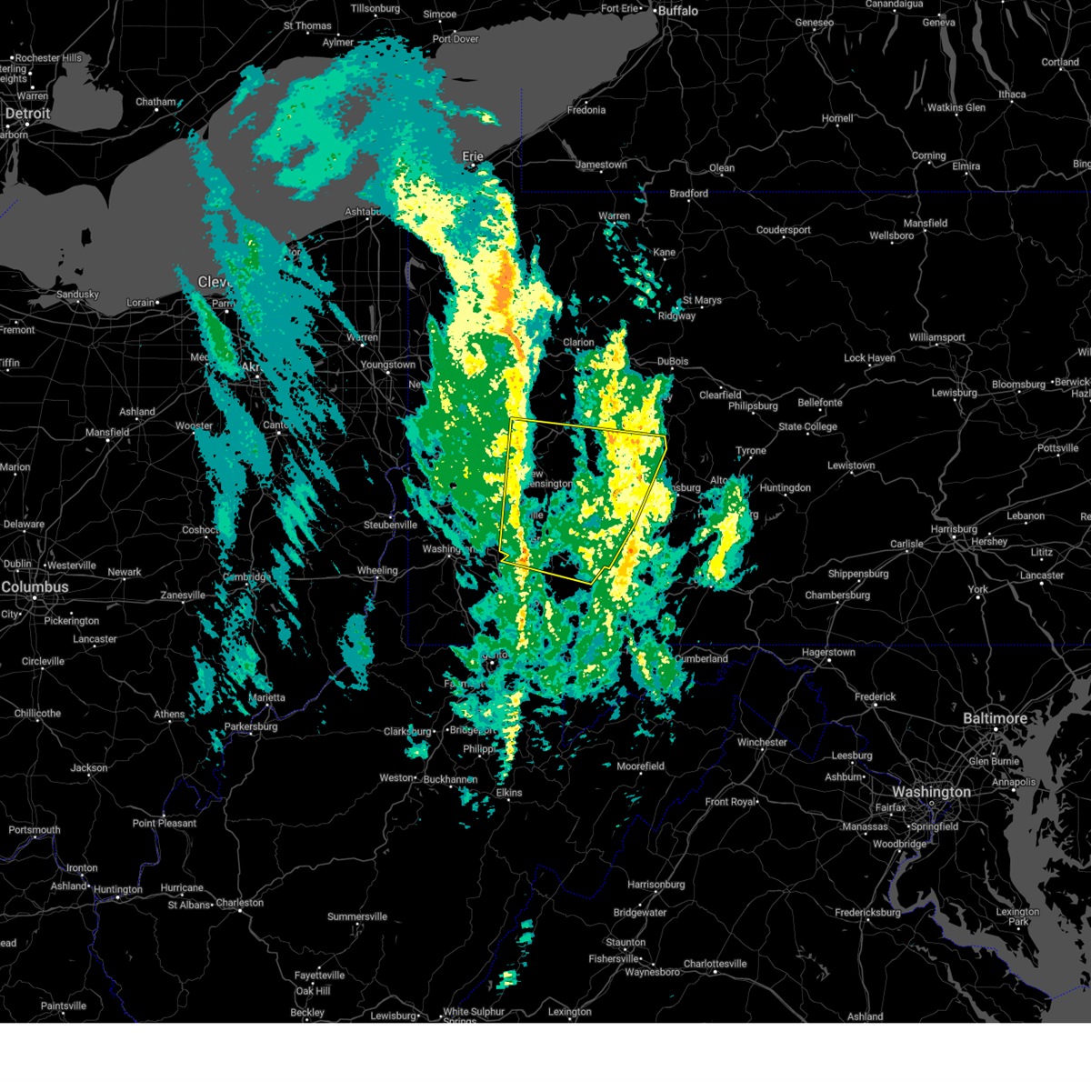 Svrpbz the national weather service in pittsburgh has issued a * severe thunderstorm warning for, eastern allegheny county in southwestern pennsylvania, northeastern fayette county in southwestern pennsylvania, westmoreland county in southwestern pennsylvania, southern armstrong county in west central pennsylvania, southeastern butler county in west central pennsylvania, indiana county in west central pennsylvania, * until 615 pm est. * at 510 pm est, severe thunderstorms were located along a line from 10 miles north of sarver to near perryopolis, or along a line from 8 miles east of butler to 10 miles northwest of connellsville, moving east at 40 mph (radar indicated). Hazards include 60 mph wind gusts. expect damage to roofs, siding, and trees Svrpbz the national weather service in pittsburgh has issued a * severe thunderstorm warning for, eastern allegheny county in southwestern pennsylvania, northeastern fayette county in southwestern pennsylvania, westmoreland county in southwestern pennsylvania, southern armstrong county in west central pennsylvania, southeastern butler county in west central pennsylvania, indiana county in west central pennsylvania, * until 615 pm est. * at 510 pm est, severe thunderstorms were located along a line from 10 miles north of sarver to near perryopolis, or along a line from 8 miles east of butler to 10 miles northwest of connellsville, moving east at 40 mph (radar indicated). Hazards include 60 mph wind gusts. expect damage to roofs, siding, and trees
|
| 11/20/2024 5:05 PM EST | Wires down in fox chapel... aspinwall... and sharpsburg with power outages. time estimated via rada in allegheny county PA, 7.4 miles SW of Pittsburgh, PA |
| 11/20/2024 5:05 PM EST |
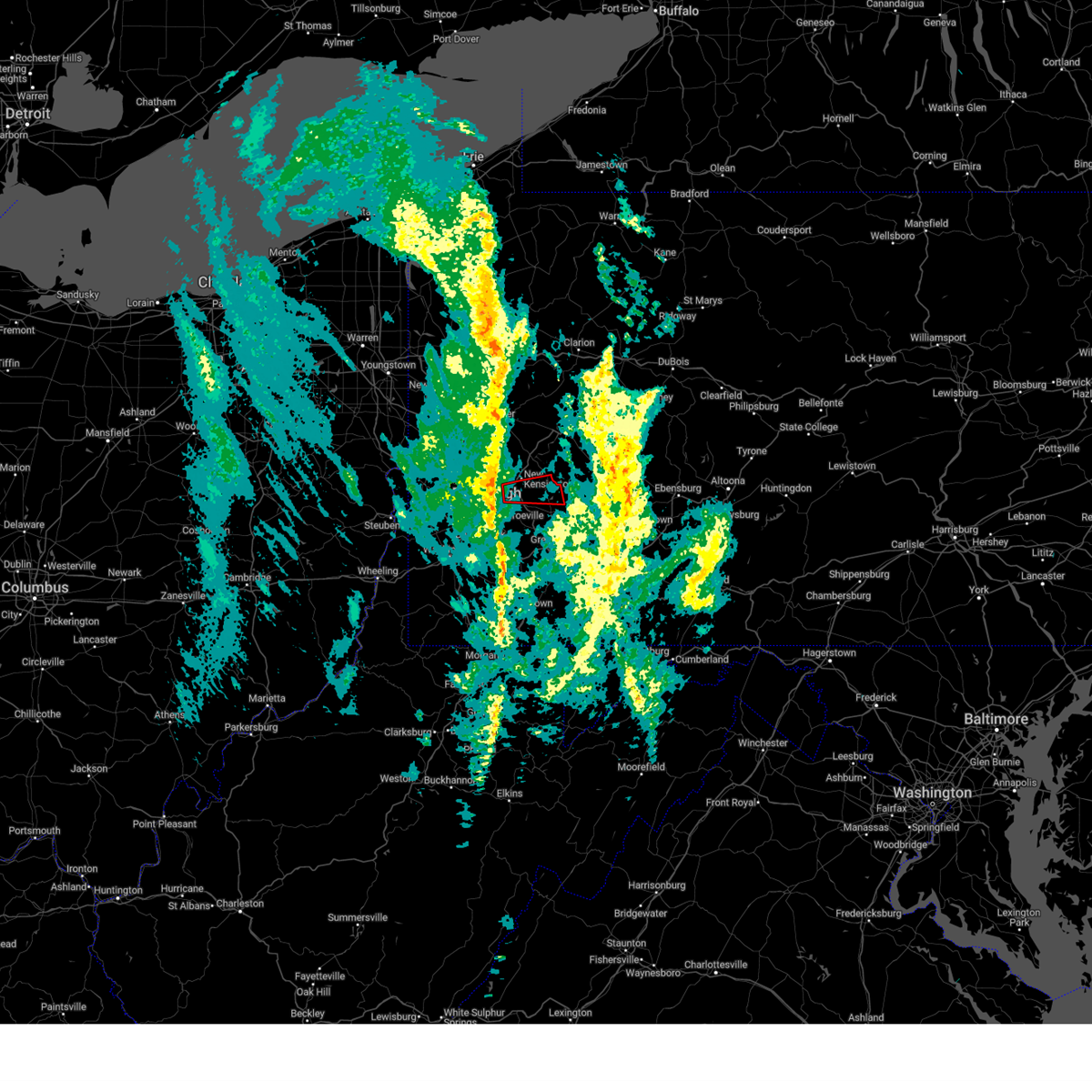 At 505 pm est, a severe thunderstorm capable of producing a tornado was located over verona, or over penn hills, moving east at 40 mph (radar indicated rotation). Hazards include tornado. Flying debris will be dangerous to those caught without shelter. mobile homes will be damaged or destroyed. damage to roofs, windows and vehicles will occur. tree damage is likely. Locations impacted include, pittsburgh, penn hills, monroeville, apollo, plum, murrysville, wilkinsburg, new kensington, lower burrell, o'hara township, oakmont, fox chapel, springdale, churchill, verona, blawnox, cheswick, oklahoma, slickville and north washington. At 505 pm est, a severe thunderstorm capable of producing a tornado was located over verona, or over penn hills, moving east at 40 mph (radar indicated rotation). Hazards include tornado. Flying debris will be dangerous to those caught without shelter. mobile homes will be damaged or destroyed. damage to roofs, windows and vehicles will occur. tree damage is likely. Locations impacted include, pittsburgh, penn hills, monroeville, apollo, plum, murrysville, wilkinsburg, new kensington, lower burrell, o'hara township, oakmont, fox chapel, springdale, churchill, verona, blawnox, cheswick, oklahoma, slickville and north washington.
|
| 11/20/2024 5:03 PM EST | Trees and wires down on dorseyville road between brookdale drive and crest drive. time estimated via rada in allegheny county PA, 6.9 miles SSW of Pittsburgh, PA |
| 11/20/2024 5:00 PM EST | Trees down. time estimated from rada in allegheny county PA, 5.7 miles SW of Pittsburgh, PA |
| 11/20/2024 4:59 PM EST |
 Torpbz the national weather service in pittsburgh has issued a * tornado warning for, east central allegheny county in southwestern pennsylvania, northwestern westmoreland county in southwestern pennsylvania, * until 530 pm est. * at 459 pm est, a severe thunderstorm capable of producing a tornado was located over aspinwall, or near penn hills, moving east at 40 mph (radar indicated rotation). Hazards include tornado. Flying debris will be dangerous to those caught without shelter. mobile homes will be damaged or destroyed. damage to roofs, windows and vehicles will occur. Tree damage is likely. Torpbz the national weather service in pittsburgh has issued a * tornado warning for, east central allegheny county in southwestern pennsylvania, northwestern westmoreland county in southwestern pennsylvania, * until 530 pm est. * at 459 pm est, a severe thunderstorm capable of producing a tornado was located over aspinwall, or near penn hills, moving east at 40 mph (radar indicated rotation). Hazards include tornado. Flying debris will be dangerous to those caught without shelter. mobile homes will be damaged or destroyed. damage to roofs, windows and vehicles will occur. Tree damage is likely.
|
| 11/20/2024 4:59 PM EST |
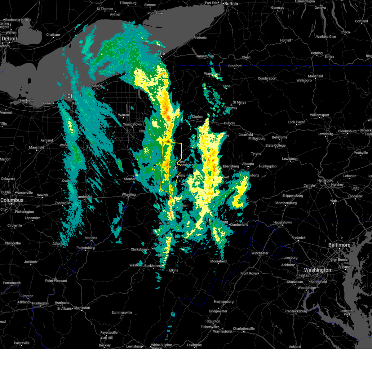 the severe thunderstorm warning has been cancelled and is no longer in effect the severe thunderstorm warning has been cancelled and is no longer in effect
|
| 11/20/2024 4:59 PM EST |
 At 459 pm est, severe thunderstorms were located along a line from 5 miles southeast of oak hills to over gastonville, or along a line from 7 miles south of butler to over gastonville, moving east at 35 mph (measured wind gust). Hazards include 60 mph wind gusts. Expect damage to roofs, siding, and trees. locations impacted include, pittsburgh, penn hills, mount lebanon, bethel park, ross township, mccandless township, monroeville, mcmurray, mckeesport, butler, franklin park, gastonville, shaler township, plum, west mifflin, north side pittsburgh, baldwin, upper st. Clair, murrysville and hampton township. At 459 pm est, severe thunderstorms were located along a line from 5 miles southeast of oak hills to over gastonville, or along a line from 7 miles south of butler to over gastonville, moving east at 35 mph (measured wind gust). Hazards include 60 mph wind gusts. Expect damage to roofs, siding, and trees. locations impacted include, pittsburgh, penn hills, mount lebanon, bethel park, ross township, mccandless township, monroeville, mcmurray, mckeesport, butler, franklin park, gastonville, shaler township, plum, west mifflin, north side pittsburgh, baldwin, upper st. Clair, murrysville and hampton township.
|
| 11/20/2024 4:58 PM EST | Trees and cables down along fern hollow bridge. time estimated via rada in allegheny county PA, 4.5 miles W of Pittsburgh, PA |
| 11/20/2024 4:55 PM EST | Traffic light structure blown down into the intersection of fifth avenue and moorewood avenue. time estimated via rada in allegheny county PA, 2.8 miles WSW of Pittsburgh, PA |
| 11/20/2024 4:55 PM EST | Damage to fence at intersection of hatfield street and 46th stree in allegheny county PA, 3.8 miles SSW of Pittsburgh, PA |
| 11/20/2024 4:55 PM EST | Two trees down in riverview park. time estimated via rada in allegheny county PA, 4 miles SSE of Pittsburgh, PA |
| 11/20/2024 4:43 PM EST |
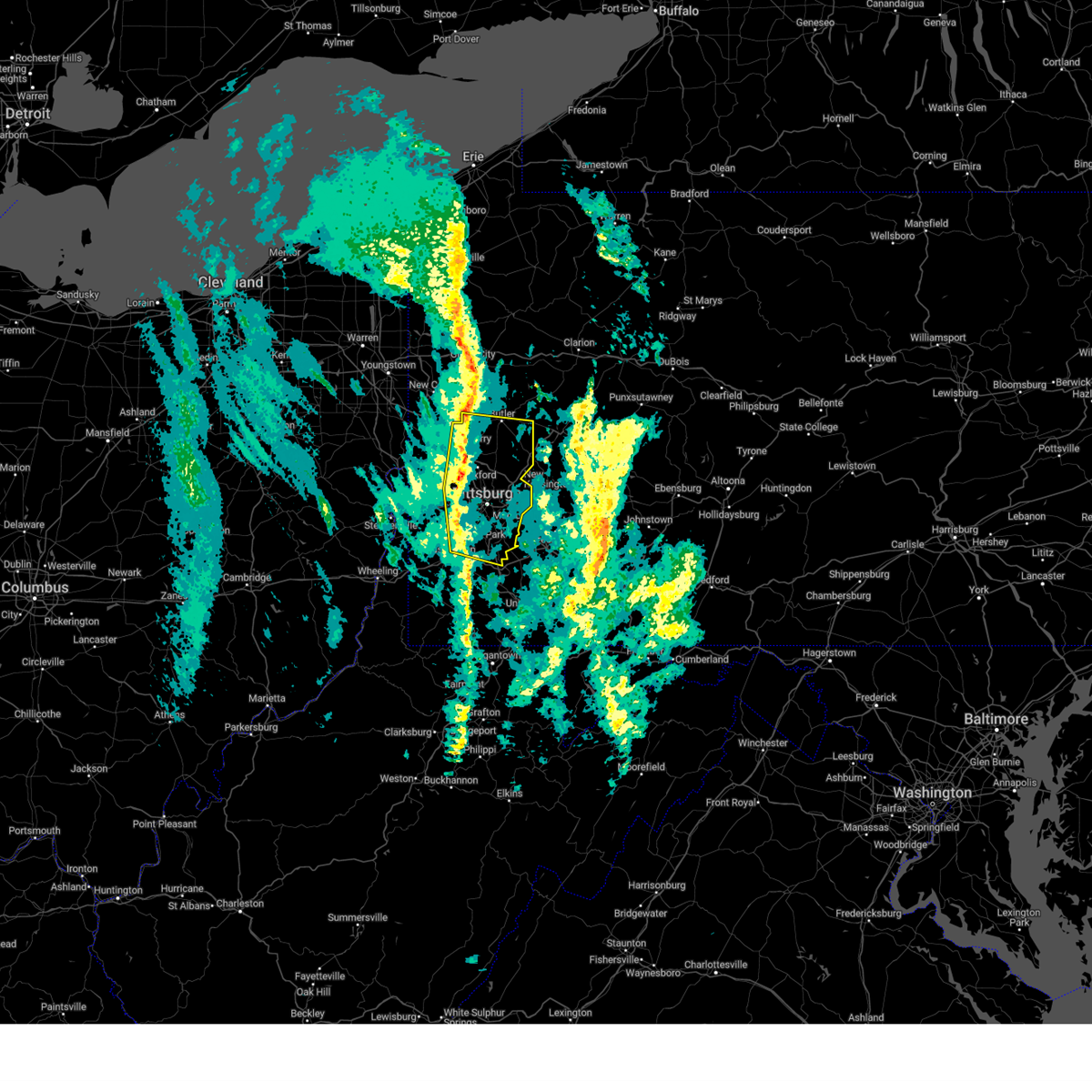 At 443 pm est, severe thunderstorms were located along a line from over evans city to over canonsburg, or along a line from 7 miles northeast of cranberry to over mcmurray, moving east at 35 mph (radar indicated). Hazards include 60 mph wind gusts. Expect damage to roofs, siding, and trees. Locations impacted include, pittsburgh, penn hills, mount lebanon, bethel park, ross township, mccandless township, monroeville, cranberry, moon township, mcmurray, mckeesport, butler, franklin park, aliquippa, canonsburg, gastonville, shaler township, plum, west mifflin and north side pittsburgh. At 443 pm est, severe thunderstorms were located along a line from over evans city to over canonsburg, or along a line from 7 miles northeast of cranberry to over mcmurray, moving east at 35 mph (radar indicated). Hazards include 60 mph wind gusts. Expect damage to roofs, siding, and trees. Locations impacted include, pittsburgh, penn hills, mount lebanon, bethel park, ross township, mccandless township, monroeville, cranberry, moon township, mcmurray, mckeesport, butler, franklin park, aliquippa, canonsburg, gastonville, shaler township, plum, west mifflin and north side pittsburgh.
|
| 11/20/2024 4:24 PM EST |
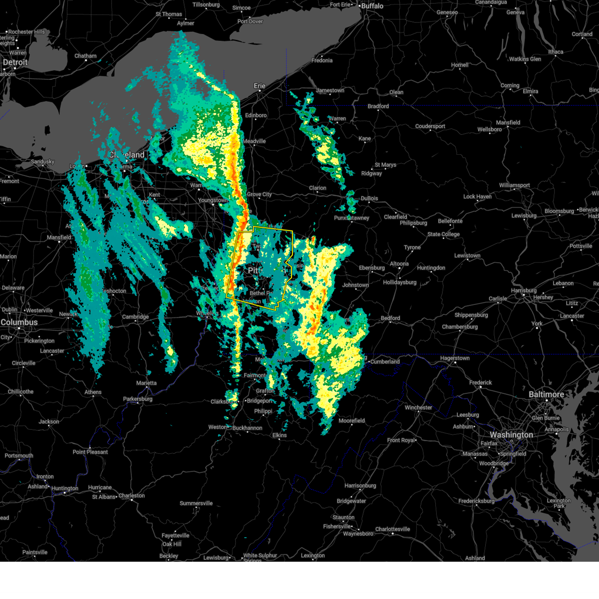 Svrpbz the national weather service in pittsburgh has issued a * severe thunderstorm warning for, allegheny county in southwestern pennsylvania, central washington county in southwestern pennsylvania, southern butler county in west central pennsylvania, beaver county in western pennsylvania, * until 515 pm est. * at 424 pm est, severe thunderstorms were located along a line from near ellwood city to 8 miles north of wolfdale, or along a line from 6 miles northeast of beaver falls to 7 miles east of avella, moving east at 35 mph (radar indicated). Hazards include 60 mph wind gusts. expect damage to roofs, siding, and trees Svrpbz the national weather service in pittsburgh has issued a * severe thunderstorm warning for, allegheny county in southwestern pennsylvania, central washington county in southwestern pennsylvania, southern butler county in west central pennsylvania, beaver county in western pennsylvania, * until 515 pm est. * at 424 pm est, severe thunderstorms were located along a line from near ellwood city to 8 miles north of wolfdale, or along a line from 6 miles northeast of beaver falls to 7 miles east of avella, moving east at 35 mph (radar indicated). Hazards include 60 mph wind gusts. expect damage to roofs, siding, and trees
|
| 10/6/2024 8:23 PM EDT |
 At 823 pm edt, a severe thunderstorm was located over oakmont, or near penn hills, moving southeast at 45 mph (radar indicated). Hazards include 60 mph wind gusts and small hail. Expect damage to roofs, siding, and trees. Locations impacted include, pittsburgh, penn hills, ross township, mccandless township, monroeville, greensburg, vandergrift, apollo, shaler township, plum, murrysville, hampton township, new kensington, lower burrell, harrison township, o'hara township, wilkins township, oakmont, fox chapel and arnold. At 823 pm edt, a severe thunderstorm was located over oakmont, or near penn hills, moving southeast at 45 mph (radar indicated). Hazards include 60 mph wind gusts and small hail. Expect damage to roofs, siding, and trees. Locations impacted include, pittsburgh, penn hills, ross township, mccandless township, monroeville, greensburg, vandergrift, apollo, shaler township, plum, murrysville, hampton township, new kensington, lower burrell, harrison township, o'hara township, wilkins township, oakmont, fox chapel and arnold.
|
| 10/6/2024 8:23 PM EDT |
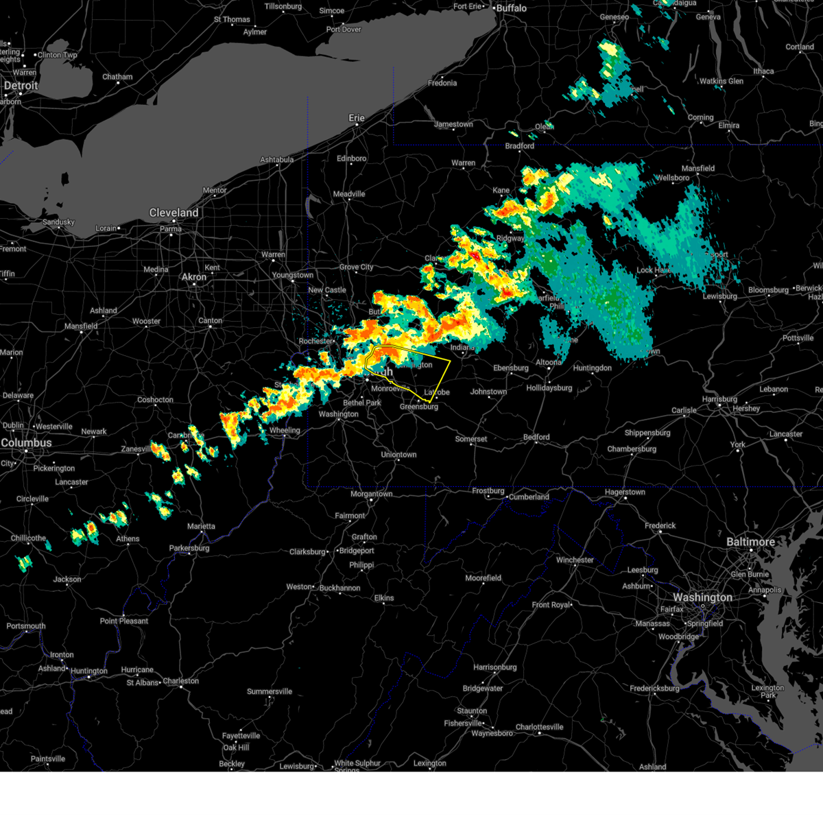 the severe thunderstorm warning has been cancelled and is no longer in effect the severe thunderstorm warning has been cancelled and is no longer in effect
|
| 10/6/2024 8:22 PM EDT | Report of babcock boulevard closed in shaler township due to downed trees and power lines. time estimated based on rada in allegheny county PA, 4.9 miles S of Pittsburgh, PA |
| 10/6/2024 8:10 PM EDT |
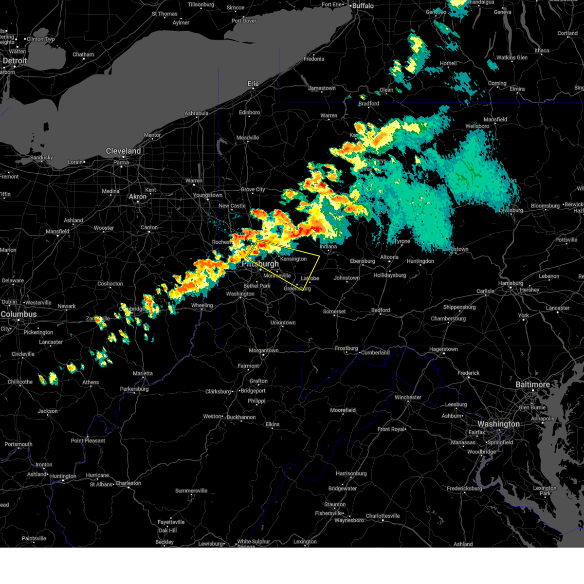 Svrpbz the national weather service in pittsburgh has issued a * severe thunderstorm warning for, northeastern allegheny county in southwestern pennsylvania, northwestern westmoreland county in southwestern pennsylvania, south central armstrong county in west central pennsylvania, south central butler county in west central pennsylvania, southwestern indiana county in west central pennsylvania, * until 900 pm edt. * at 810 pm edt, a severe thunderstorm was located over mccandless township, moving southeast at 45 mph (radar indicated). Hazards include 60 mph wind gusts and small hail. expect damage to roofs, siding, and trees Svrpbz the national weather service in pittsburgh has issued a * severe thunderstorm warning for, northeastern allegheny county in southwestern pennsylvania, northwestern westmoreland county in southwestern pennsylvania, south central armstrong county in west central pennsylvania, south central butler county in west central pennsylvania, southwestern indiana county in west central pennsylvania, * until 900 pm edt. * at 810 pm edt, a severe thunderstorm was located over mccandless township, moving southeast at 45 mph (radar indicated). Hazards include 60 mph wind gusts and small hail. expect damage to roofs, siding, and trees
|
| 8/30/2024 5:46 PM EDT | Tree down on becks run and brownsville roa in allegheny county PA, 2.7 miles N of Pittsburgh, PA |
| 8/29/2024 3:26 PM EDT |
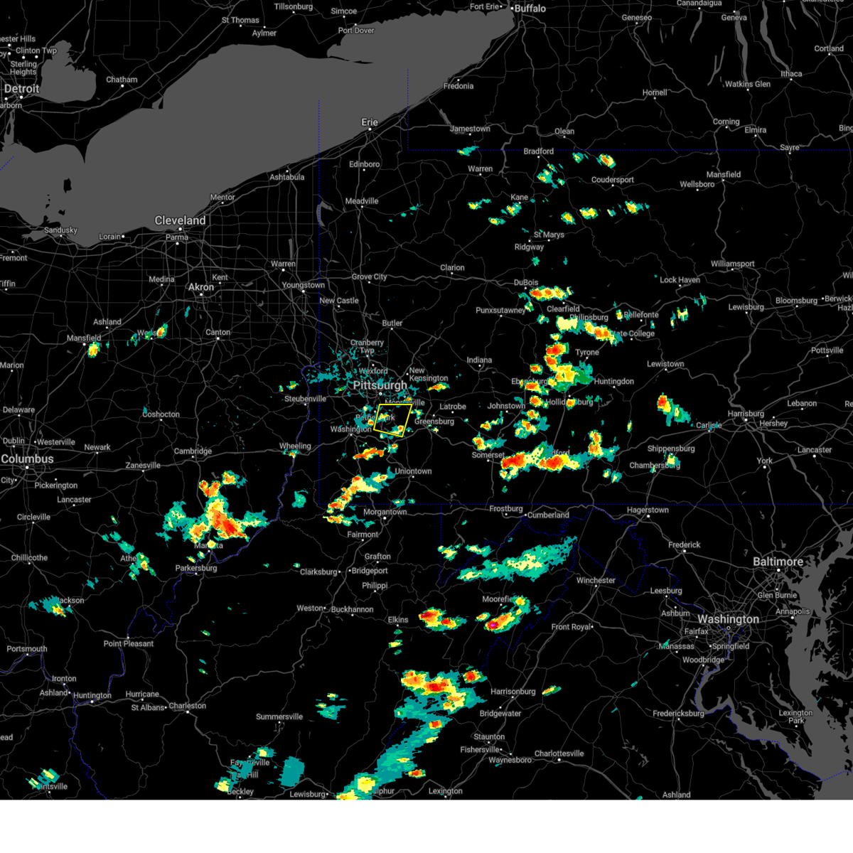 Svrpbz the national weather service in pittsburgh has issued a * severe thunderstorm warning for, southeastern allegheny county in southwestern pennsylvania, east central washington county in southwestern pennsylvania, west central westmoreland county in southwestern pennsylvania, * until 415 pm edt. * at 326 pm edt, a severe thunderstorm was located over jefferson hills, or near gastonville, moving east at 10 mph (radar indicated). Hazards include 60 mph wind gusts. expect damage to roofs, siding, and trees Svrpbz the national weather service in pittsburgh has issued a * severe thunderstorm warning for, southeastern allegheny county in southwestern pennsylvania, east central washington county in southwestern pennsylvania, west central westmoreland county in southwestern pennsylvania, * until 415 pm edt. * at 326 pm edt, a severe thunderstorm was located over jefferson hills, or near gastonville, moving east at 10 mph (radar indicated). Hazards include 60 mph wind gusts. expect damage to roofs, siding, and trees
|
| 8/17/2024 4:29 PM EDT |
 At 429 pm edt, a severe thunderstorm was located over murrysville, or near monroeville, moving east at 40 mph (radar indicated). Hazards include 60 mph wind gusts and quarter size hail. Hail damage to vehicles is expected. expect wind damage to roofs, siding, and trees. Locations impacted include, pittsburgh, penn hills, monroeville, greensburg, mckeesport, jeannette, latrobe, vandergrift, kittanning, apollo, plum, west mifflin, murrysville, wilkinsburg, new kensington, lower burrell, munhall, harrison township, north versailles and swissvale. At 429 pm edt, a severe thunderstorm was located over murrysville, or near monroeville, moving east at 40 mph (radar indicated). Hazards include 60 mph wind gusts and quarter size hail. Hail damage to vehicles is expected. expect wind damage to roofs, siding, and trees. Locations impacted include, pittsburgh, penn hills, monroeville, greensburg, mckeesport, jeannette, latrobe, vandergrift, kittanning, apollo, plum, west mifflin, murrysville, wilkinsburg, new kensington, lower burrell, munhall, harrison township, north versailles and swissvale.
|
| 8/17/2024 4:25 PM EDT | Tree down on old leechburg road in plum. time estimated via rada in allegheny county PA, 14.1 miles WSW of Pittsburgh, PA |
| 8/17/2024 4:19 PM EDT |
 Svrpbz the national weather service in pittsburgh has issued a * severe thunderstorm warning for, eastern allegheny county in southwestern pennsylvania, central westmoreland county in southwestern pennsylvania, southern armstrong county in west central pennsylvania, southeastern butler county in west central pennsylvania, southwestern indiana county in west central pennsylvania, * until 500 pm edt. * at 419 pm edt, a severe thunderstorm was located over wilkins township, or over monroeville, moving east at 40 mph (radar indicated). Hazards include 60 mph wind gusts and quarter size hail. Hail damage to vehicles is expected. Expect wind damage to roofs, siding, and trees. Svrpbz the national weather service in pittsburgh has issued a * severe thunderstorm warning for, eastern allegheny county in southwestern pennsylvania, central westmoreland county in southwestern pennsylvania, southern armstrong county in west central pennsylvania, southeastern butler county in west central pennsylvania, southwestern indiana county in west central pennsylvania, * until 500 pm edt. * at 419 pm edt, a severe thunderstorm was located over wilkins township, or over monroeville, moving east at 40 mph (radar indicated). Hazards include 60 mph wind gusts and quarter size hail. Hail damage to vehicles is expected. Expect wind damage to roofs, siding, and trees.
|
| 8/6/2024 7:43 PM EDT |
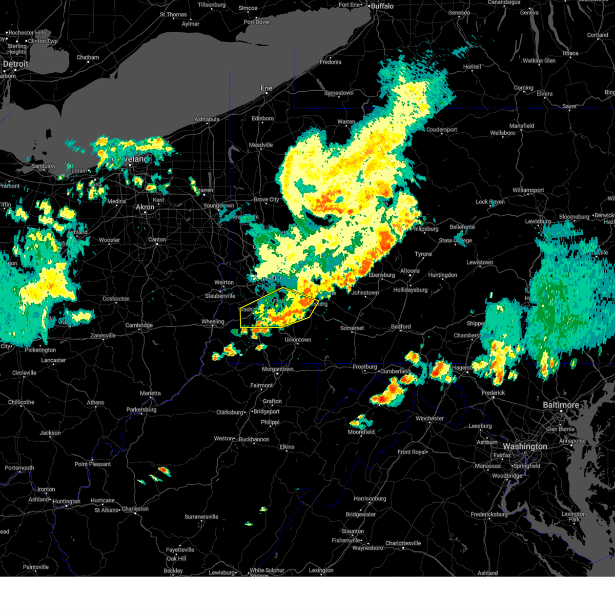 The storms which prompted the warning have moved out of the area. therefore, the warning will be allowed to expire. to report severe weather, contact your nearest law enforcement agency. they will relay your report to the national weather service pittsburgh. remember, a severe thunderstorm warning still remains in effect for washington, fayette, and westmoreland counties until 8:30 pm edt. The storms which prompted the warning have moved out of the area. therefore, the warning will be allowed to expire. to report severe weather, contact your nearest law enforcement agency. they will relay your report to the national weather service pittsburgh. remember, a severe thunderstorm warning still remains in effect for washington, fayette, and westmoreland counties until 8:30 pm edt.
|
| 8/6/2024 7:32 PM EDT |
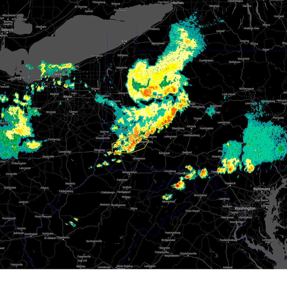 At 732 pm edt, severe thunderstorms were located along a line extending from jeannette to west newton to near east washington, moving east at 50 mph (law enforcement reported wind damage in washington). Hazards include 60 mph wind gusts. Expect damage to trees and power lines, resulting in some power outages. locations impacted include, pittsburgh, bethel park, mcmurray, greensburg, mckeesport, washington, jeannette, canonsburg, gastonville, west mifflin, baldwin, upper st. Clair, whitehall, south park township, munhall, jefferson hills, north versailles, brentwood, castle shannon, and pleasant hills. At 732 pm edt, severe thunderstorms were located along a line extending from jeannette to west newton to near east washington, moving east at 50 mph (law enforcement reported wind damage in washington). Hazards include 60 mph wind gusts. Expect damage to trees and power lines, resulting in some power outages. locations impacted include, pittsburgh, bethel park, mcmurray, greensburg, mckeesport, washington, jeannette, canonsburg, gastonville, west mifflin, baldwin, upper st. Clair, whitehall, south park township, munhall, jefferson hills, north versailles, brentwood, castle shannon, and pleasant hills.
|
| 8/6/2024 7:21 PM EDT |
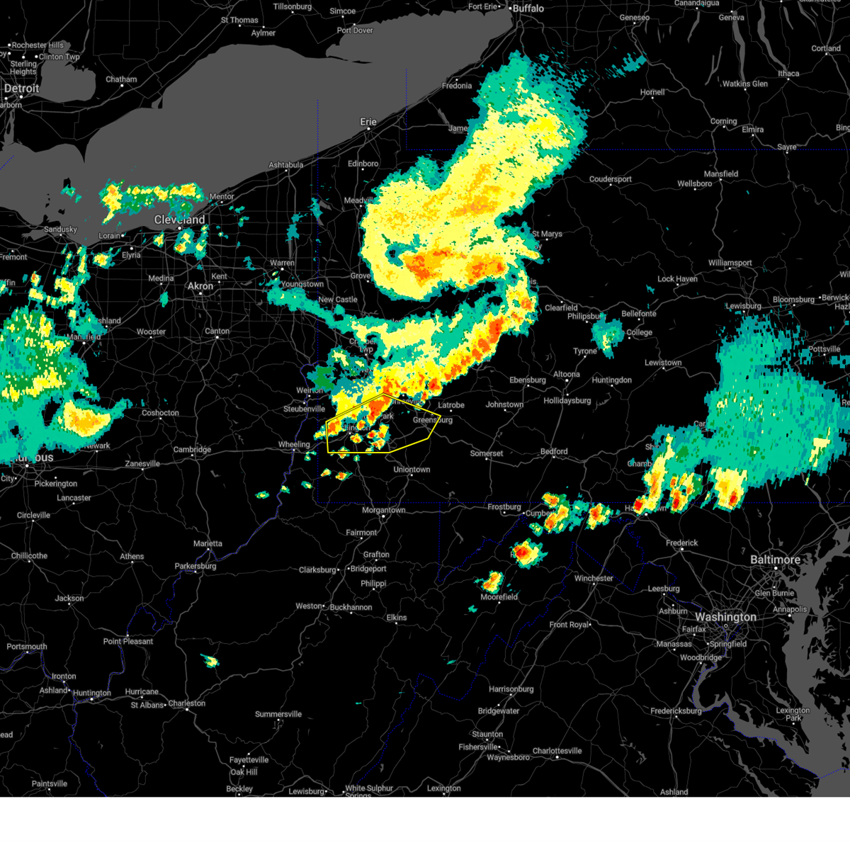 the severe thunderstorm warning has been cancelled and is no longer in effect the severe thunderstorm warning has been cancelled and is no longer in effect
|
| 8/6/2024 7:21 PM EDT |
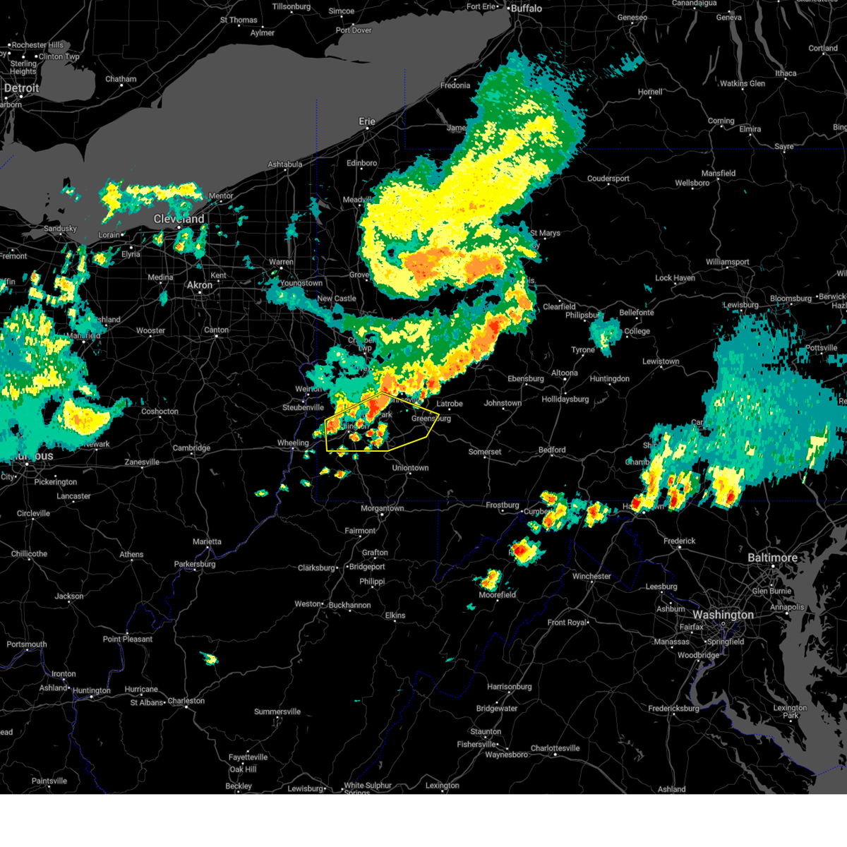 At 721 pm edt, severe thunderstorms were located along a line extending from white oak to near jefferson hills to wolfdale, moving east at 50 mph (radar indicated). Hazards include 60 mph wind gusts. Expect damage to trees and power lines, resulting in some power outages. locations impacted include, pittsburgh, mount lebanon, bethel park, mcmurray, greensburg, mckeesport, washington, jeannette, canonsburg, gastonville, west mifflin, baldwin, upper st. Clair, scott township, whitehall, south park township, munhall, cecil-bishop, jefferson hills, and north versailles. At 721 pm edt, severe thunderstorms were located along a line extending from white oak to near jefferson hills to wolfdale, moving east at 50 mph (radar indicated). Hazards include 60 mph wind gusts. Expect damage to trees and power lines, resulting in some power outages. locations impacted include, pittsburgh, mount lebanon, bethel park, mcmurray, greensburg, mckeesport, washington, jeannette, canonsburg, gastonville, west mifflin, baldwin, upper st. Clair, scott township, whitehall, south park township, munhall, cecil-bishop, jefferson hills, and north versailles.
|
| 8/6/2024 7:06 PM EDT |
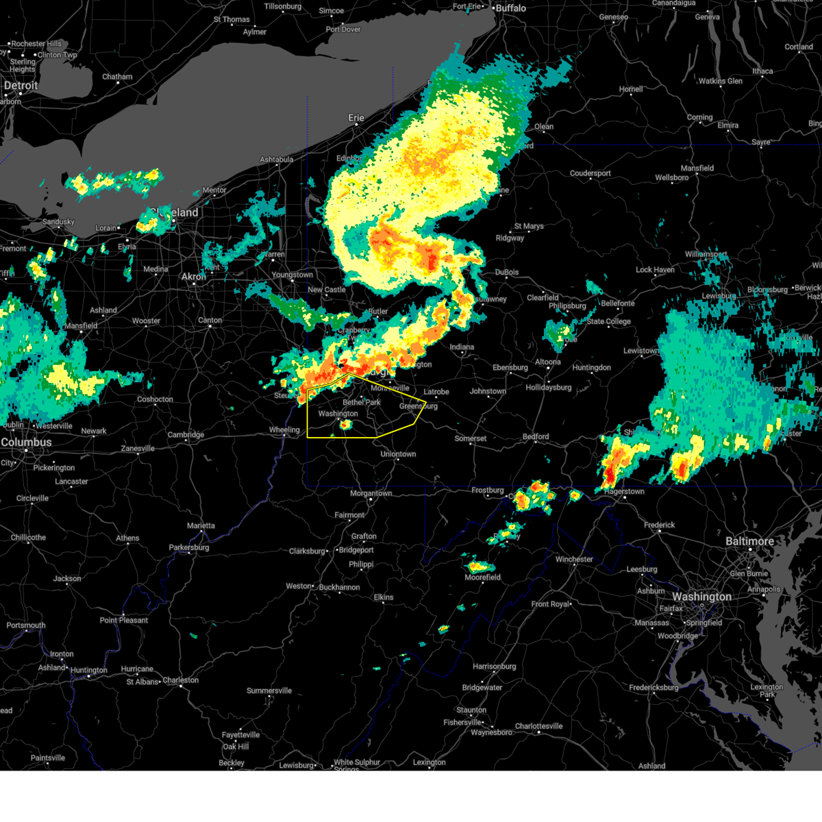 Svrpbz the national weather service in pittsburgh has issued a * severe thunderstorm warning for, washington county in southwestern pennsylvania, southern allegheny county in southwestern pennsylvania, southwestern westmoreland county in southwestern pennsylvania, northwestern fayette county in southwestern pennsylvania, ohio county in northern west virginia, * until 745 pm edt. * at 706 pm edt, severe thunderstorms were located along a line extending from mount oliver to near cecil-bishop to near avella, moving east at 50 mph (radar indicated). Hazards include 60 mph wind gusts. expect damage to trees and power lines, resulting in some power outages Svrpbz the national weather service in pittsburgh has issued a * severe thunderstorm warning for, washington county in southwestern pennsylvania, southern allegheny county in southwestern pennsylvania, southwestern westmoreland county in southwestern pennsylvania, northwestern fayette county in southwestern pennsylvania, ohio county in northern west virginia, * until 745 pm edt. * at 706 pm edt, severe thunderstorms were located along a line extending from mount oliver to near cecil-bishop to near avella, moving east at 50 mph (radar indicated). Hazards include 60 mph wind gusts. expect damage to trees and power lines, resulting in some power outages
|
| 6/26/2024 8:11 PM EDT |
 The storms which prompted the warning have moved out of the area. therefore, the warning will be allowed to expire. however, heavy rain is still possible with these thunderstorms and flash flooding remains possible. severe thunderstorm and tornado warnings remain in effect for central and eastern westmoreland counties until 830 pm. The storms which prompted the warning have moved out of the area. therefore, the warning will be allowed to expire. however, heavy rain is still possible with these thunderstorms and flash flooding remains possible. severe thunderstorm and tornado warnings remain in effect for central and eastern westmoreland counties until 830 pm.
|
| 6/26/2024 7:56 PM EDT |
 the severe thunderstorm warning has been cancelled and is no longer in effect the severe thunderstorm warning has been cancelled and is no longer in effect
|
| 6/26/2024 7:56 PM EDT |
 At 756 pm edt, severe thunderstorms were located along a line from over plum to over south park township, or along a line from 5 miles northeast of penn hills to over gastonville, moving east at 35 mph (radar indicated). Hazards include 70 mph wind gusts. Expect considerable tree damage. damage is likely to mobile homes, roofs, and outbuildings. Locations impacted include, pittsburgh, penn hills, bethel park, monroeville, mckeesport, gastonville, plum, west mifflin, baldwin, murrysville, wilkinsburg, whitehall, south park township, new kensington, lower burrell, munhall, jefferson hills, north versailles, swissvale and o'hara township. At 756 pm edt, severe thunderstorms were located along a line from over plum to over south park township, or along a line from 5 miles northeast of penn hills to over gastonville, moving east at 35 mph (radar indicated). Hazards include 70 mph wind gusts. Expect considerable tree damage. damage is likely to mobile homes, roofs, and outbuildings. Locations impacted include, pittsburgh, penn hills, bethel park, monroeville, mckeesport, gastonville, plum, west mifflin, baldwin, murrysville, wilkinsburg, whitehall, south park township, new kensington, lower burrell, munhall, jefferson hills, north versailles, swissvale and o'hara township.
|
| 6/26/2024 7:50 PM EDT | Limbs down in squirrel hill south in allegheny county PA, 3.5 miles W of Pittsburgh, PA |
| 6/26/2024 7:47 PM EDT |
 the tornado warning has been cancelled and is no longer in effect the tornado warning has been cancelled and is no longer in effect
|
| 6/26/2024 7:43 PM EDT |
 At 743 pm edt, severe thunderstorms were located along a line from over fox chapel to over cecil-bishop, or along a line from 6 miles northwest of penn hills to near canonsburg, moving east at 25 mph (radar indicated). Hazards include 60 mph wind gusts and possible tornado. Expect damage to roofs, siding, and trees. locations impacted include, pittsburgh, penn hills, mount lebanon, bethel park, ross township, monroeville, mcmurray, mckeesport, gastonville, shaler township, plum, west mifflin, north side pittsburgh, baldwin, upper st. Clair, murrysville, hampton township, scott township, wilkinsburg and whitehall. At 743 pm edt, severe thunderstorms were located along a line from over fox chapel to over cecil-bishop, or along a line from 6 miles northwest of penn hills to near canonsburg, moving east at 25 mph (radar indicated). Hazards include 60 mph wind gusts and possible tornado. Expect damage to roofs, siding, and trees. locations impacted include, pittsburgh, penn hills, mount lebanon, bethel park, ross township, monroeville, mcmurray, mckeesport, gastonville, shaler township, plum, west mifflin, north side pittsburgh, baldwin, upper st. Clair, murrysville, hampton township, scott township, wilkinsburg and whitehall.
|
| 6/26/2024 7:42 PM EDT |
 At 742 pm edt, severe thunderstorms capable of producing both tornadoes and extensive straight line wind damage were located over carnegie, or near mount lebanon, moving east at 40 mph (radar indicated rotation). Hazards include tornado. Flying debris will be dangerous to those caught without shelter. mobile homes will be damaged or destroyed. damage to roofs, windows and vehicles will occur. tree damage is likely. Locations impacted include, mount lebanon, west mifflin, baldwin, scott township, robinson township, munhall, dormont, carnegie, green tree, mount oliver, homestead, west homestead, whitaker, rosslyn farms and collier township. At 742 pm edt, severe thunderstorms capable of producing both tornadoes and extensive straight line wind damage were located over carnegie, or near mount lebanon, moving east at 40 mph (radar indicated rotation). Hazards include tornado. Flying debris will be dangerous to those caught without shelter. mobile homes will be damaged or destroyed. damage to roofs, windows and vehicles will occur. tree damage is likely. Locations impacted include, mount lebanon, west mifflin, baldwin, scott township, robinson township, munhall, dormont, carnegie, green tree, mount oliver, homestead, west homestead, whitaker, rosslyn farms and collier township.
|
| 6/26/2024 7:34 PM EDT |
 At 734 pm edt, severe thunderstorms were located along a line from over hampton township to 6 miles northwest of mcgovern, or along a line from over mccandless township to 7 miles west of canonsburg, moving east at 25 mph (radar indicated). Hazards include 70 mph wind gusts and possible tornado. Expect considerable tree damage. damage is likely to mobile homes, roofs, and outbuildings. locations impacted include, pittsburgh, penn hills, mount lebanon, bethel park, ross township, mccandless township, monroeville, mcmurray, mckeesport, franklin park, canonsburg, gastonville, shaler township, plum, west mifflin, north side pittsburgh, baldwin, upper st. Clair, murrysville and hampton township. At 734 pm edt, severe thunderstorms were located along a line from over hampton township to 6 miles northwest of mcgovern, or along a line from over mccandless township to 7 miles west of canonsburg, moving east at 25 mph (radar indicated). Hazards include 70 mph wind gusts and possible tornado. Expect considerable tree damage. damage is likely to mobile homes, roofs, and outbuildings. locations impacted include, pittsburgh, penn hills, mount lebanon, bethel park, ross township, mccandless township, monroeville, mcmurray, mckeesport, franklin park, canonsburg, gastonville, shaler township, plum, west mifflin, north side pittsburgh, baldwin, upper st. Clair, murrysville and hampton township.
|
| 6/26/2024 7:31 PM EDT |
 At 731 pm edt, severe thunderstorms capable of producing both tornadoes and extensive straight line wind damage were located over imperial, or 7 miles south of moon township, moving east at 40 mph (radar indicated rotation). Hazards include tornado. Flying debris will be dangerous to those caught without shelter. mobile homes will be damaged or destroyed. damage to roofs, windows and vehicles will occur. tree damage is likely. Locations impacted include, pittsburgh, penn hills, mount lebanon, west mifflin, north side pittsburgh, baldwin, scott township, wilkinsburg, robinson township, munhall, brentwood, swissvale, dormont, carnegie, crafton, green tree, mount oliver, ingram, homestead and edgewood. At 731 pm edt, severe thunderstorms capable of producing both tornadoes and extensive straight line wind damage were located over imperial, or 7 miles south of moon township, moving east at 40 mph (radar indicated rotation). Hazards include tornado. Flying debris will be dangerous to those caught without shelter. mobile homes will be damaged or destroyed. damage to roofs, windows and vehicles will occur. tree damage is likely. Locations impacted include, pittsburgh, penn hills, mount lebanon, west mifflin, north side pittsburgh, baldwin, scott township, wilkinsburg, robinson township, munhall, brentwood, swissvale, dormont, carnegie, crafton, green tree, mount oliver, ingram, homestead and edgewood.
|
| 6/26/2024 7:28 PM EDT |
 Torpbz the national weather service in pittsburgh has issued a * tornado warning for, central allegheny county in southwestern pennsylvania, * until 800 pm edt. * at 728 pm edt, severe thunderstorms capable of producing both tornadoes and extensive straight line wind damage were located over imperial, or 7 miles southwest of moon township, moving east at 40 mph (radar indicated rotation). Hazards include tornado. Flying debris will be dangerous to those caught without shelter. mobile homes will be damaged or destroyed. damage to roofs, windows and vehicles will occur. Tree damage is likely. Torpbz the national weather service in pittsburgh has issued a * tornado warning for, central allegheny county in southwestern pennsylvania, * until 800 pm edt. * at 728 pm edt, severe thunderstorms capable of producing both tornadoes and extensive straight line wind damage were located over imperial, or 7 miles southwest of moon township, moving east at 40 mph (radar indicated rotation). Hazards include tornado. Flying debris will be dangerous to those caught without shelter. mobile homes will be damaged or destroyed. damage to roofs, windows and vehicles will occur. Tree damage is likely.
|
| 6/26/2024 7:25 PM EDT |
 Svrpbz the national weather service in pittsburgh has issued a * severe thunderstorm warning for, allegheny county in southwestern pennsylvania, northern washington county in southwestern pennsylvania, northwestern westmoreland county in southwestern pennsylvania, * until 815 pm edt. * at 725 pm edt, severe thunderstorms were located along a line from near sewickley to near avella, or along a line from over franklin park to near avella, moving east at 25 mph (radar indicated). Hazards include 60 mph wind gusts. expect damage to roofs, siding, and trees Svrpbz the national weather service in pittsburgh has issued a * severe thunderstorm warning for, allegheny county in southwestern pennsylvania, northern washington county in southwestern pennsylvania, northwestern westmoreland county in southwestern pennsylvania, * until 815 pm edt. * at 725 pm edt, severe thunderstorms were located along a line from near sewickley to near avella, or along a line from over franklin park to near avella, moving east at 25 mph (radar indicated). Hazards include 60 mph wind gusts. expect damage to roofs, siding, and trees
|
| 6/23/2024 7:08 PM EDT |
 The storm which prompted the warning has weakened below severe limits, and no longer poses an immediate threat to life or property. therefore, the warning will be allowed to expire. however, gusty winds and heavy rain are still possible with this thunderstorm. a severe thunderstorm watch remains in effect until 1000 pm edt for southwestern pennsylvania. The storm which prompted the warning has weakened below severe limits, and no longer poses an immediate threat to life or property. therefore, the warning will be allowed to expire. however, gusty winds and heavy rain are still possible with this thunderstorm. a severe thunderstorm watch remains in effect until 1000 pm edt for southwestern pennsylvania.
|
| 6/23/2024 7:04 PM EDT |
 At 703 pm edt, a severe thunderstorm was located over kennedy township, or near ross township, moving southeast at 35 mph (radar indicated). Hazards include 60 mph wind gusts. Expect damage to trees and power lines, resulting in some power outages. Locations impacted include, pittsburgh, ross township, mccandless township, moon township, franklin park, robinson township, bellevue, kennedy township, west view, stowe township, mckees rocks, coraopolis, avalon, sewickley, imperial, emsworth, ben avon, sewickley heights, sewickley hills, and glen osborne. At 703 pm edt, a severe thunderstorm was located over kennedy township, or near ross township, moving southeast at 35 mph (radar indicated). Hazards include 60 mph wind gusts. Expect damage to trees and power lines, resulting in some power outages. Locations impacted include, pittsburgh, ross township, mccandless township, moon township, franklin park, robinson township, bellevue, kennedy township, west view, stowe township, mckees rocks, coraopolis, avalon, sewickley, imperial, emsworth, ben avon, sewickley heights, sewickley hills, and glen osborne.
|
| 6/23/2024 7:04 PM EDT |
 the severe thunderstorm warning has been cancelled and is no longer in effect the severe thunderstorm warning has been cancelled and is no longer in effect
|
| 6/23/2024 6:50 PM EDT |
 At 650 pm edt, a severe thunderstorm was located over ambridge, or over aliquippa, moving east at 30 mph (radar indicated). Hazards include 60 mph wind gusts. Expect damage to trees and power lines, resulting in some power outages. Locations impacted include, pittsburgh, ross township, mccandless township, moon township, franklin park, aliquippa, robinson township, economy, bellevue, kennedy township, ambridge, wexford, west view, stowe township, mckees rocks, coraopolis, avalon, baden, sewickley, and harmony township. At 650 pm edt, a severe thunderstorm was located over ambridge, or over aliquippa, moving east at 30 mph (radar indicated). Hazards include 60 mph wind gusts. Expect damage to trees and power lines, resulting in some power outages. Locations impacted include, pittsburgh, ross township, mccandless township, moon township, franklin park, aliquippa, robinson township, economy, bellevue, kennedy township, ambridge, wexford, west view, stowe township, mckees rocks, coraopolis, avalon, baden, sewickley, and harmony township.
|
| 6/23/2024 6:40 PM EDT |
 Svrpbz the national weather service in pittsburgh has issued a * severe thunderstorm warning for, southern beaver county in western pennsylvania, northwestern washington county in southwestern pennsylvania, northwestern allegheny county in southwestern pennsylvania, * until 715 pm edt. * at 640 pm edt, a severe thunderstorm was located near aliquippa, moving east at 30 mph (radar indicated). Hazards include 60 mph wind gusts. expect damage to trees and power lines, resulting in some power outages Svrpbz the national weather service in pittsburgh has issued a * severe thunderstorm warning for, southern beaver county in western pennsylvania, northwestern washington county in southwestern pennsylvania, northwestern allegheny county in southwestern pennsylvania, * until 715 pm edt. * at 640 pm edt, a severe thunderstorm was located near aliquippa, moving east at 30 mph (radar indicated). Hazards include 60 mph wind gusts. expect damage to trees and power lines, resulting in some power outages
|
| 6/18/2024 4:08 PM EDT |
 The storm which prompted the warning has weakened below severe limits, and no longer poses an immediate threat to life or property. therefore, the warning will be allowed to expire. to report severe weather, contact your nearest law enforcement agency. they will relay your report to the national weather service pittsburgh. The storm which prompted the warning has weakened below severe limits, and no longer poses an immediate threat to life or property. therefore, the warning will be allowed to expire. to report severe weather, contact your nearest law enforcement agency. they will relay your report to the national weather service pittsburgh.
|
| 6/18/2024 3:56 PM EDT |
 At 355 pm edt, a severe thunderstorm was located over plum, or near penn hills, moving northwest at 10 mph (radar indicated). Hazards include 60 mph wind gusts. Expect damage to trees and power lines, resulting in some power outages. Locations impacted include, penn hills, monroeville, plum, murrysville, new kensington, lower burrell, o'hara township, oakmont, arnold, tarentum, springdale, verona, blawnox, and cheswick. At 355 pm edt, a severe thunderstorm was located over plum, or near penn hills, moving northwest at 10 mph (radar indicated). Hazards include 60 mph wind gusts. Expect damage to trees and power lines, resulting in some power outages. Locations impacted include, penn hills, monroeville, plum, murrysville, new kensington, lower burrell, o'hara township, oakmont, arnold, tarentum, springdale, verona, blawnox, and cheswick.
|
| 6/18/2024 3:36 PM EDT | Multiple reports of trees down in plum boro. tree on to a house on cassius stree in allegheny county PA, 13.3 miles WSW of Pittsburgh, PA |
| 6/18/2024 3:36 PM EDT | Tree down on house on ohiopyle drive in allegheny county PA, 14.4 miles WSW of Pittsburgh, PA |
| 6/18/2024 3:33 PM EDT |
 Svrpbz the national weather service in pittsburgh has issued a * severe thunderstorm warning for, northeastern allegheny county in southwestern pennsylvania, northwestern westmoreland county in southwestern pennsylvania, * until 415 pm edt. * at 333 pm edt, a severe thunderstorm was located over plum, or near monroeville, moving northwest at 10 mph (radar indicated). Hazards include 60 mph wind gusts and half dollar size hail. Minor hail damage to vehicles is possible. Expect wind damage to trees and power lines, resulting in some power outages. Svrpbz the national weather service in pittsburgh has issued a * severe thunderstorm warning for, northeastern allegheny county in southwestern pennsylvania, northwestern westmoreland county in southwestern pennsylvania, * until 415 pm edt. * at 333 pm edt, a severe thunderstorm was located over plum, or near monroeville, moving northwest at 10 mph (radar indicated). Hazards include 60 mph wind gusts and half dollar size hail. Minor hail damage to vehicles is possible. Expect wind damage to trees and power lines, resulting in some power outages.
|
| 6/17/2024 6:01 PM EDT |
 The storms which prompted the warning have weakened below severe limits, and have exited the warned area. therefore, the warning has been allowed to expire. however, gusty winds are still possible with these thunderstorms. to report severe weather, contact your nearest law enforcement agency. they will relay your report to the national weather service pittsburgh. The storms which prompted the warning have weakened below severe limits, and have exited the warned area. therefore, the warning has been allowed to expire. however, gusty winds are still possible with these thunderstorms. to report severe weather, contact your nearest law enforcement agency. they will relay your report to the national weather service pittsburgh.
|
| 6/17/2024 5:44 PM EDT |
 At 543 pm edt, severe thunderstorms were located along a line extending from 8 miles west of indiana to near greensburg to near avella, moving southeast at 20 mph (law enforcement and trained spotters). Hazards include 70 mph wind gusts and nickel size hail. Trees snapped and uprooted. power outages can be expected. Locations impacted include, pittsburgh, penn hills, mount lebanon, bethel park, ross township, monroeville, moon township, mcmurray, greensburg, weirton, mckeesport, jeannette, canonsburg, vandergrift, kittanning, apollo, gastonville, shaler township, plum, and west mifflin. At 543 pm edt, severe thunderstorms were located along a line extending from 8 miles west of indiana to near greensburg to near avella, moving southeast at 20 mph (law enforcement and trained spotters). Hazards include 70 mph wind gusts and nickel size hail. Trees snapped and uprooted. power outages can be expected. Locations impacted include, pittsburgh, penn hills, mount lebanon, bethel park, ross township, monroeville, moon township, mcmurray, greensburg, weirton, mckeesport, jeannette, canonsburg, vandergrift, kittanning, apollo, gastonville, shaler township, plum, and west mifflin.
|
| 6/17/2024 5:25 PM EDT | Several trees down on lenora drive in franklin park. time estimated via rada in allegheny county PA, 11.6 miles SSE of Pittsburgh, PA |
| 6/17/2024 5:23 PM EDT |
 Svrpbz the national weather service in pittsburgh has issued a * severe thunderstorm warning for, southern beaver county in western pennsylvania, northern washington county in southwestern pennsylvania, southeastern butler county in west central pennsylvania, western indiana county in west central pennsylvania, allegheny county in southwestern pennsylvania, northwestern westmoreland county in southwestern pennsylvania, southern armstrong county in west central pennsylvania, brooke county in northern west virginia, hancock county in northern west virginia, * until 600 pm edt. * at 522 pm edt, severe thunderstorms were located along a line extending from 8 miles east of ford city to murrysville to near avella, moving southeast at 20 mph (law enforcement and trained spotters reported widespread wind damage across the warned area). Hazards include 70 mph wind gusts and nickel size hail. Trees snapped and uprooted. Power outages can be expected. Svrpbz the national weather service in pittsburgh has issued a * severe thunderstorm warning for, southern beaver county in western pennsylvania, northern washington county in southwestern pennsylvania, southeastern butler county in west central pennsylvania, western indiana county in west central pennsylvania, allegheny county in southwestern pennsylvania, northwestern westmoreland county in southwestern pennsylvania, southern armstrong county in west central pennsylvania, brooke county in northern west virginia, hancock county in northern west virginia, * until 600 pm edt. * at 522 pm edt, severe thunderstorms were located along a line extending from 8 miles east of ford city to murrysville to near avella, moving southeast at 20 mph (law enforcement and trained spotters reported widespread wind damage across the warned area). Hazards include 70 mph wind gusts and nickel size hail. Trees snapped and uprooted. Power outages can be expected.
|
| 6/17/2024 5:20 PM EDT | Estimated 60 mph gusts in allegheny county PA, 2.5 miles SSW of Pittsburgh, PA |
| 6/17/2024 5:14 PM EDT | Large tree snapped and laying across roadway. time estimated via rada in allegheny county PA, 1.7 miles SSE of Pittsburgh, PA |
| 6/17/2024 5:13 PM EDT | Wires down. time estimated via rada in allegheny county PA, 3.6 miles SSW of Pittsburgh, PA |
| 6/17/2024 5:10 PM EDT |
 At 509 pm edt, severe thunderstorms were located along a line extending from 9 miles west of kittanning to near gibsonia to 6 miles east of weirton, moving east at 35 mph (law enforcement and the public reported widespread wind damage across the warned area). Hazards include 70 mph wind gusts and quarter size hail. Minor hail damage to vehicles is possible. trees snapped and uprooted. power outages can be expected. locations impacted include, pittsburgh, penn hills, mount lebanon, bethel park, ross township, mccandless township, cranberry, moon township, weirton, butler, franklin park, aliquippa, vandergrift, kittanning, shaler township, plum, north side pittsburgh, baldwin, upper st. Clair, and hampton township. At 509 pm edt, severe thunderstorms were located along a line extending from 9 miles west of kittanning to near gibsonia to 6 miles east of weirton, moving east at 35 mph (law enforcement and the public reported widespread wind damage across the warned area). Hazards include 70 mph wind gusts and quarter size hail. Minor hail damage to vehicles is possible. trees snapped and uprooted. power outages can be expected. locations impacted include, pittsburgh, penn hills, mount lebanon, bethel park, ross township, mccandless township, cranberry, moon township, weirton, butler, franklin park, aliquippa, vandergrift, kittanning, shaler township, plum, north side pittsburgh, baldwin, upper st. Clair, and hampton township.
|
| 6/17/2024 5:00 PM EDT | Trees down in allegheny county PA, 7.4 miles SSE of Pittsburgh, PA |
| 6/17/2024 5:00 PM EDT |
 At 459 pm edt, severe thunderstorms were located along a line extending from near butler to gibsonia to weirton, moving east at 35 mph (law enforcement and the public are reporting widespread wind damage across the warned area). Hazards include 70 mph wind gusts and quarter size hail. Minor hail damage to vehicles is possible. trees snapped and uprooted. power outages can be expected. locations impacted include, pittsburgh, penn hills, mount lebanon, bethel park, ross township, mccandless township, cranberry, moon township, weirton, butler, franklin park, aliquippa, vandergrift, kittanning, shaler township, plum, north side pittsburgh, baldwin, upper st. Clair, and hampton township. At 459 pm edt, severe thunderstorms were located along a line extending from near butler to gibsonia to weirton, moving east at 35 mph (law enforcement and the public are reporting widespread wind damage across the warned area). Hazards include 70 mph wind gusts and quarter size hail. Minor hail damage to vehicles is possible. trees snapped and uprooted. power outages can be expected. locations impacted include, pittsburgh, penn hills, mount lebanon, bethel park, ross township, mccandless township, cranberry, moon township, weirton, butler, franklin park, aliquippa, vandergrift, kittanning, shaler township, plum, north side pittsburgh, baldwin, upper st. Clair, and hampton township.
|
| 6/17/2024 4:51 PM EDT |
 At 450 pm edt, severe thunderstorms were located along a line extending from shanor-northvue to seven fields to near toronto, moving east at 35 mph (law enforcement reported widespread trees and wires down across beaver county). Hazards include 60 mph wind gusts and quarter size hail. Minor hail damage to vehicles is possible. expect wind damage to trees and power lines, resulting in some power outages. locations impacted include, pittsburgh, penn hills, mount lebanon, bethel park, ross township, mccandless township, cranberry, moon township, weirton, butler, franklin park, aliquippa, vandergrift, kittanning, shaler township, plum, north side pittsburgh, baldwin, upper st. Clair, and hampton township. At 450 pm edt, severe thunderstorms were located along a line extending from shanor-northvue to seven fields to near toronto, moving east at 35 mph (law enforcement reported widespread trees and wires down across beaver county). Hazards include 60 mph wind gusts and quarter size hail. Minor hail damage to vehicles is possible. expect wind damage to trees and power lines, resulting in some power outages. locations impacted include, pittsburgh, penn hills, mount lebanon, bethel park, ross township, mccandless township, cranberry, moon township, weirton, butler, franklin park, aliquippa, vandergrift, kittanning, shaler township, plum, north side pittsburgh, baldwin, upper st. Clair, and hampton township.
|
| 6/17/2024 4:44 PM EDT |
 Svrpbz the national weather service in pittsburgh has issued a * severe thunderstorm warning for, east central jefferson county in east central ohio, southern beaver county in western pennsylvania, northwestern washington county in southwestern pennsylvania, southern butler county in west central pennsylvania, allegheny county in southwestern pennsylvania, northwestern westmoreland county in southwestern pennsylvania, southwestern armstrong county in west central pennsylvania, brooke county in northern west virginia, hancock county in northern west virginia, * until 530 pm edt. * at 444 pm edt, severe thunderstorms were located along a line extending from near shanor-northvue to cranberry to near wintersville, moving east at 35 mph (radar indicated). Hazards include 60 mph wind gusts and quarter size hail. Minor hail damage to vehicles is possible. Expect wind damage to trees and power lines, resulting in some power outages. Svrpbz the national weather service in pittsburgh has issued a * severe thunderstorm warning for, east central jefferson county in east central ohio, southern beaver county in western pennsylvania, northwestern washington county in southwestern pennsylvania, southern butler county in west central pennsylvania, allegheny county in southwestern pennsylvania, northwestern westmoreland county in southwestern pennsylvania, southwestern armstrong county in west central pennsylvania, brooke county in northern west virginia, hancock county in northern west virginia, * until 530 pm edt. * at 444 pm edt, severe thunderstorms were located along a line extending from near shanor-northvue to cranberry to near wintersville, moving east at 35 mph (radar indicated). Hazards include 60 mph wind gusts and quarter size hail. Minor hail damage to vehicles is possible. Expect wind damage to trees and power lines, resulting in some power outages.
|
| 5/26/2024 8:20 PM EDT |
 At 820 pm edt, severe thunderstorms were located along a line extending from 7 miles northeast of ellwood city to near irwin, moving east at 30 mph (public reported trees and wires down). Hazards include 60 mph wind gusts. Expect damage to trees and power lines, resulting in some power outages. Locations impacted include, pittsburgh, penn hills, mccandless township, monroeville, cranberry, butler, vandergrift, kittanning, apollo, shaler township, plum, murrysville, hampton township, wilkinsburg, new kensington, lower burrell, harrison township, north versailles, swissvale, and o'hara township. At 820 pm edt, severe thunderstorms were located along a line extending from 7 miles northeast of ellwood city to near irwin, moving east at 30 mph (public reported trees and wires down). Hazards include 60 mph wind gusts. Expect damage to trees and power lines, resulting in some power outages. Locations impacted include, pittsburgh, penn hills, mccandless township, monroeville, cranberry, butler, vandergrift, kittanning, apollo, shaler township, plum, murrysville, hampton township, wilkinsburg, new kensington, lower burrell, harrison township, north versailles, swissvale, and o'hara township.
|
| 5/26/2024 8:03 PM EDT |
 Svrpbz the national weather service in pittsburgh has issued a * severe thunderstorm warning for, northeastern beaver county in western pennsylvania, central lawrence county in western pennsylvania, butler county in west central pennsylvania, northeastern allegheny county in southwestern pennsylvania, northwestern westmoreland county in southwestern pennsylvania, western armstrong county in west central pennsylvania, * until 845 pm edt. * at 803 pm edt, severe thunderstorms were located along a line extending from near ellwood city to west mifflin, moving east at 30 mph (radar indicated). Hazards include 60 mph wind gusts. expect damage to trees and power lines, resulting in some power outages Svrpbz the national weather service in pittsburgh has issued a * severe thunderstorm warning for, northeastern beaver county in western pennsylvania, central lawrence county in western pennsylvania, butler county in west central pennsylvania, northeastern allegheny county in southwestern pennsylvania, northwestern westmoreland county in southwestern pennsylvania, western armstrong county in west central pennsylvania, * until 845 pm edt. * at 803 pm edt, severe thunderstorms were located along a line extending from near ellwood city to west mifflin, moving east at 30 mph (radar indicated). Hazards include 60 mph wind gusts. expect damage to trees and power lines, resulting in some power outages
|
| 5/26/2024 8:00 PM EDT |
 the severe thunderstorm warning has been cancelled and is no longer in effect the severe thunderstorm warning has been cancelled and is no longer in effect
|
| 5/26/2024 8:00 PM EDT |
 At 800 pm edt, severe thunderstorms were located along a line extending from pleasant hills to 6 miles west of farmington, moving northeast at 40 mph (radar indicated). Hazards include 60 mph wind gusts. Expect damage to trees and power lines, resulting in some power outages. Locations impacted include, monroeville, greensburg, mckeesport, uniontown, jeannette, latrobe, connellsville, plum, west mifflin, murrysville, south park township, jefferson hills, north versailles, pleasant hills, white oak, monessen, clairton, duquesne, turtle creek, and north braddock. At 800 pm edt, severe thunderstorms were located along a line extending from pleasant hills to 6 miles west of farmington, moving northeast at 40 mph (radar indicated). Hazards include 60 mph wind gusts. Expect damage to trees and power lines, resulting in some power outages. Locations impacted include, monroeville, greensburg, mckeesport, uniontown, jeannette, latrobe, connellsville, plum, west mifflin, murrysville, south park township, jefferson hills, north versailles, pleasant hills, white oak, monessen, clairton, duquesne, turtle creek, and north braddock.
|
| 5/26/2024 7:50 PM EDT |
 At 750 pm edt, severe thunderstorms were located along a line extending from south park township to 7 miles east of point marion, moving northeast at 40 mph (radar indicated). Hazards include 60 mph wind gusts. Expect damage to trees and power lines, resulting in some power outages. Locations impacted include, bethel park, monroeville, mcmurray, greensburg, mckeesport, uniontown, jeannette, latrobe, connellsville, gastonville, plum, west mifflin, murrysville, south park township, jefferson hills, north versailles, pleasant hills, white oak, monessen, and clairton. At 750 pm edt, severe thunderstorms were located along a line extending from south park township to 7 miles east of point marion, moving northeast at 40 mph (radar indicated). Hazards include 60 mph wind gusts. Expect damage to trees and power lines, resulting in some power outages. Locations impacted include, bethel park, monroeville, mcmurray, greensburg, mckeesport, uniontown, jeannette, latrobe, connellsville, gastonville, plum, west mifflin, murrysville, south park township, jefferson hills, north versailles, pleasant hills, white oak, monessen, and clairton.
|
| 5/26/2024 7:29 PM EDT |
 Svrpbz the national weather service in pittsburgh has issued a * severe thunderstorm warning for, southeastern washington county in southwestern pennsylvania, southeastern allegheny county in southwestern pennsylvania, westmoreland county in southwestern pennsylvania, eastern greene county in southwestern pennsylvania, fayette county in southwestern pennsylvania, northern monongalia county in northern west virginia, northern preston county in northeastern west virginia, * until 830 pm edt. * at 729 pm edt, severe thunderstorms were located along a line extending from canonsburg to near cassville, moving northeast at 40 mph (radar indicated). Hazards include 60 mph wind gusts. expect damage to trees and power lines, resulting in some power outages Svrpbz the national weather service in pittsburgh has issued a * severe thunderstorm warning for, southeastern washington county in southwestern pennsylvania, southeastern allegheny county in southwestern pennsylvania, westmoreland county in southwestern pennsylvania, eastern greene county in southwestern pennsylvania, fayette county in southwestern pennsylvania, northern monongalia county in northern west virginia, northern preston county in northeastern west virginia, * until 830 pm edt. * at 729 pm edt, severe thunderstorms were located along a line extending from canonsburg to near cassville, moving northeast at 40 mph (radar indicated). Hazards include 60 mph wind gusts. expect damage to trees and power lines, resulting in some power outages
|
| 5/25/2024 7:24 PM EDT |
 the severe thunderstorm warning has been cancelled and is no longer in effect the severe thunderstorm warning has been cancelled and is no longer in effect
|
| 5/25/2024 7:24 PM EDT |
 At 724 pm edt, a severe thunderstorm was located over imperial, or near moon township, moving southeast at 25 mph (radar indicated). Hazards include 60 mph wind gusts and quarter size hail. Minor hail damage to vehicles is possible. expect wind damage to trees and power lines, resulting in some power outages. locations impacted include, pittsburgh, ross township, moon township, canonsburg, upper st. Clair, scott township, robinson township, cecil-bishop, bellevue, carnegie, kennedy township, stowe township, mckees rocks, crafton, coraopolis, bridgeville, avalon, green tree, ingram, and imperial. At 724 pm edt, a severe thunderstorm was located over imperial, or near moon township, moving southeast at 25 mph (radar indicated). Hazards include 60 mph wind gusts and quarter size hail. Minor hail damage to vehicles is possible. expect wind damage to trees and power lines, resulting in some power outages. locations impacted include, pittsburgh, ross township, moon township, canonsburg, upper st. Clair, scott township, robinson township, cecil-bishop, bellevue, carnegie, kennedy township, stowe township, mckees rocks, crafton, coraopolis, bridgeville, avalon, green tree, ingram, and imperial.
|
| 5/25/2024 7:06 PM EDT |
 Svrpbz the national weather service in pittsburgh has issued a * severe thunderstorm warning for, southwestern beaver county in western pennsylvania, northwestern washington county in southwestern pennsylvania, west central allegheny county in southwestern pennsylvania, * until 745 pm edt. * at 706 pm edt, a severe thunderstorm was located 9 miles west of imperial, or 9 miles northeast of weirton, moving southeast at 25 mph (radar indicated). Hazards include 60 mph wind gusts and quarter size hail. Minor hail damage to vehicles is possible. Expect wind damage to trees and power lines, resulting in some power outages. Svrpbz the national weather service in pittsburgh has issued a * severe thunderstorm warning for, southwestern beaver county in western pennsylvania, northwestern washington county in southwestern pennsylvania, west central allegheny county in southwestern pennsylvania, * until 745 pm edt. * at 706 pm edt, a severe thunderstorm was located 9 miles west of imperial, or 9 miles northeast of weirton, moving southeast at 25 mph (radar indicated). Hazards include 60 mph wind gusts and quarter size hail. Minor hail damage to vehicles is possible. Expect wind damage to trees and power lines, resulting in some power outages.
|
| 5/25/2024 6:37 PM EDT |
 The storm which prompted the warning has weakened below severe limits, and has exited the warned area. therefore, the warning will be allowed to expire. to report severe weather, contact your nearest law enforcement agency. they will relay your report to the national weather service pittsburgh. The storm which prompted the warning has weakened below severe limits, and has exited the warned area. therefore, the warning will be allowed to expire. to report severe weather, contact your nearest law enforcement agency. they will relay your report to the national weather service pittsburgh.
|
| 5/25/2024 6:13 PM EDT |
 At 611 pm edt, a severe thunderstorm was located over pleasant hills, or near bethel park, moving southeast at 25 mph (trained weather spotters). Hazards include 60 mph wind gusts and half dollar size hail. Minor hail damage to vehicles is possible. expect wind damage to trees and power lines, resulting in some power outages. locations impacted include, pittsburgh, bethel park, mcmurray, mckeesport, gastonville, west mifflin, baldwin, upper st. Clair, whitehall, south park township, munhall, jefferson hills, north versailles, brentwood, swissvale, pleasant hills, white oak, monessen, clairton, and california. At 611 pm edt, a severe thunderstorm was located over pleasant hills, or near bethel park, moving southeast at 25 mph (trained weather spotters). Hazards include 60 mph wind gusts and half dollar size hail. Minor hail damage to vehicles is possible. expect wind damage to trees and power lines, resulting in some power outages. locations impacted include, pittsburgh, bethel park, mcmurray, mckeesport, gastonville, west mifflin, baldwin, upper st. Clair, whitehall, south park township, munhall, jefferson hills, north versailles, brentwood, swissvale, pleasant hills, white oak, monessen, clairton, and california.
|
| 5/25/2024 5:58 PM EDT |
 At 557 pm edt, a severe thunderstorm was located over mount lebanon, moving southeast at 25 mph (trained weather spotters reported hail up to golf ball size across allegheny county). Hazards include golf ball size hail and 60 mph wind gusts. People and animals outdoors will be injured. expect hail damage to roofs, siding, windows, and vehicles. expect wind damage to trees and power lines, resulting in some power outages. locations impacted include, pittsburgh, penn hills, mount lebanon, bethel park, monroeville, mcmurray, mckeesport, jeannette, canonsburg, gastonville, shaler township, west mifflin, north side pittsburgh, baldwin, upper st. Clair, murrysville, scott township, wilkinsburg, whitehall, and south park township. At 557 pm edt, a severe thunderstorm was located over mount lebanon, moving southeast at 25 mph (trained weather spotters reported hail up to golf ball size across allegheny county). Hazards include golf ball size hail and 60 mph wind gusts. People and animals outdoors will be injured. expect hail damage to roofs, siding, windows, and vehicles. expect wind damage to trees and power lines, resulting in some power outages. locations impacted include, pittsburgh, penn hills, mount lebanon, bethel park, monroeville, mcmurray, mckeesport, jeannette, canonsburg, gastonville, shaler township, west mifflin, north side pittsburgh, baldwin, upper st. Clair, murrysville, scott township, wilkinsburg, whitehall, and south park township.
|
| 5/25/2024 5:50 PM EDT |
 The storm which prompted the warning has moved out of the area. therefore, the warning will be allowed to expire. to report severe weather, contact your nearest law enforcement agency. they will relay your report to the national weather service pittsburgh. remember, a severe thunderstorm warning still remains in effect for washington and allegheny counties until 6:45pm edt. The storm which prompted the warning has moved out of the area. therefore, the warning will be allowed to expire. to report severe weather, contact your nearest law enforcement agency. they will relay your report to the national weather service pittsburgh. remember, a severe thunderstorm warning still remains in effect for washington and allegheny counties until 6:45pm edt.
|
| 5/25/2024 5:44 PM EDT |
 Svrpbz the national weather service in pittsburgh has issued a * severe thunderstorm warning for, northeastern washington county in southwestern pennsylvania, central allegheny county in southwestern pennsylvania, west central westmoreland county in southwestern pennsylvania, * until 645 pm edt. * at 543 pm edt, a severe thunderstorm was located over robinson township, or near mount lebanon, moving southeast at 25 mph (trained weather spotters reported quarter size hail across allegheny county). Hazards include golf ball size hail and 60 mph wind gusts. People and animals outdoors will be injured. expect hail damage to roofs, siding, windows, and vehicles. Expect wind damage to trees and power lines, resulting in some power outages. Svrpbz the national weather service in pittsburgh has issued a * severe thunderstorm warning for, northeastern washington county in southwestern pennsylvania, central allegheny county in southwestern pennsylvania, west central westmoreland county in southwestern pennsylvania, * until 645 pm edt. * at 543 pm edt, a severe thunderstorm was located over robinson township, or near mount lebanon, moving southeast at 25 mph (trained weather spotters reported quarter size hail across allegheny county). Hazards include golf ball size hail and 60 mph wind gusts. People and animals outdoors will be injured. expect hail damage to roofs, siding, windows, and vehicles. Expect wind damage to trees and power lines, resulting in some power outages.
|
| 5/25/2024 5:38 PM EDT | Golf Ball sized hail reported 8 miles ESE of Pittsburgh, PA, observed along coventry drive |
| 5/25/2024 5:37 PM EDT | Ping Pong Ball sized hail reported 6.7 miles SE of Pittsburgh, PA |
| 5/25/2024 5:36 PM EDT | Golf Ball sized hail reported 9 miles ESE of Pittsburgh, PA |
| 5/25/2024 5:32 PM EDT |
 At 531 pm edt, a severe thunderstorm was located over coraopolis, or near moon township, moving southeast at 20 mph (public reported quarter size hail in clinton). Hazards include golf ball size hail and 60 mph wind gusts. People and animals outdoors will be injured. expect hail damage to roofs, siding, windows, and vehicles. expect wind damage to trees and power lines, resulting in some power outages. Locations impacted include, pittsburgh, ross township, mccandless township, moon township, franklin park, aliquippa, robinson township, cecil-bishop, economy, bellevue, kennedy township, ambridge, west view, stowe township, mckees rocks, coraopolis, avalon, sewickley, harmony township, and imperial. At 531 pm edt, a severe thunderstorm was located over coraopolis, or near moon township, moving southeast at 20 mph (public reported quarter size hail in clinton). Hazards include golf ball size hail and 60 mph wind gusts. People and animals outdoors will be injured. expect hail damage to roofs, siding, windows, and vehicles. expect wind damage to trees and power lines, resulting in some power outages. Locations impacted include, pittsburgh, ross township, mccandless township, moon township, franklin park, aliquippa, robinson township, cecil-bishop, economy, bellevue, kennedy township, ambridge, west view, stowe township, mckees rocks, coraopolis, avalon, sewickley, harmony township, and imperial.
|
| 5/25/2024 5:22 PM EDT |
 At 522 pm edt, a severe thunderstorm was located over leetsdale, or over moon township, moving southeast at 20 mph (radar indicated). Hazards include golf ball size hail and 60 mph wind gusts. People and animals outdoors will be injured. expect hail damage to roofs, siding, windows, and vehicles. expect wind damage to trees and power lines, resulting in some power outages. Locations impacted include, pittsburgh, ross township, mccandless township, moon township, franklin park, aliquippa, hampton township, robinson township, cecil-bishop, economy, bellevue, kennedy township, ambridge, west view, stowe township, mckees rocks, coraopolis, avalon, baden, and sewickley. At 522 pm edt, a severe thunderstorm was located over leetsdale, or over moon township, moving southeast at 20 mph (radar indicated). Hazards include golf ball size hail and 60 mph wind gusts. People and animals outdoors will be injured. expect hail damage to roofs, siding, windows, and vehicles. expect wind damage to trees and power lines, resulting in some power outages. Locations impacted include, pittsburgh, ross township, mccandless township, moon township, franklin park, aliquippa, hampton township, robinson township, cecil-bishop, economy, bellevue, kennedy township, ambridge, west view, stowe township, mckees rocks, coraopolis, avalon, baden, and sewickley.
|
| 5/25/2024 5:17 PM EDT |
 the severe thunderstorm warning has been cancelled and is no longer in effect the severe thunderstorm warning has been cancelled and is no longer in effect
|
| 5/25/2024 5:17 PM EDT |
 At 516 pm edt, a severe thunderstorm was located over leetsdale, or near moon township, moving southeast at 20 mph (radar indicated). Hazards include 60 mph wind gusts and half dollar size hail. Minor hail damage to vehicles is possible. expect wind damage to trees and power lines, resulting in some power outages. Locations impacted include, pittsburgh, ross township, mccandless township, moon township, franklin park, aliquippa, hampton township, robinson township, cecil-bishop, economy, bellevue, kennedy township, ambridge, west view, stowe township, mckees rocks, coraopolis, avalon, baden, and sewickley. At 516 pm edt, a severe thunderstorm was located over leetsdale, or near moon township, moving southeast at 20 mph (radar indicated). Hazards include 60 mph wind gusts and half dollar size hail. Minor hail damage to vehicles is possible. expect wind damage to trees and power lines, resulting in some power outages. Locations impacted include, pittsburgh, ross township, mccandless township, moon township, franklin park, aliquippa, hampton township, robinson township, cecil-bishop, economy, bellevue, kennedy township, ambridge, west view, stowe township, mckees rocks, coraopolis, avalon, baden, and sewickley.
|
| 5/25/2024 5:08 PM EDT |
 Svrpbz the national weather service in pittsburgh has issued a * severe thunderstorm warning for, southern beaver county in western pennsylvania, north central washington county in southwestern pennsylvania, northwestern allegheny county in southwestern pennsylvania, hancock county in northern west virginia, * until 600 pm edt. * at 507 pm edt, a severe thunderstorm was located near aliquippa, moving southeast at 20 mph (radar indicated). Hazards include 60 mph wind gusts and quarter size hail. Minor hail damage to vehicles is possible. Expect wind damage to trees and power lines, resulting in some power outages. Svrpbz the national weather service in pittsburgh has issued a * severe thunderstorm warning for, southern beaver county in western pennsylvania, north central washington county in southwestern pennsylvania, northwestern allegheny county in southwestern pennsylvania, hancock county in northern west virginia, * until 600 pm edt. * at 507 pm edt, a severe thunderstorm was located near aliquippa, moving southeast at 20 mph (radar indicated). Hazards include 60 mph wind gusts and quarter size hail. Minor hail damage to vehicles is possible. Expect wind damage to trees and power lines, resulting in some power outages.
|
| 5/25/2024 4:14 PM EDT |
 The storm which prompted the warning has weakened below severe limits, and has exited the warned area. therefore, the warning will be allowed to expire. to report severe weather, contact your nearest law enforcement agency. they will relay your report to the national weather service pittsburgh. The storm which prompted the warning has weakened below severe limits, and has exited the warned area. therefore, the warning will be allowed to expire. to report severe weather, contact your nearest law enforcement agency. they will relay your report to the national weather service pittsburgh.
|
| 5/25/2024 3:26 PM EDT |
 Svrpbz the national weather service in pittsburgh has issued a * severe thunderstorm warning for, northeastern allegheny county in southwestern pennsylvania, northwestern westmoreland county in southwestern pennsylvania, southwestern armstrong county in west central pennsylvania, * until 415 pm edt. * at 326 pm edt, a severe thunderstorm was located over fox chapel, or near mccandless township, moving east at 30 mph (radar indicated). Hazards include 60 mph wind gusts. expect damage to trees and power lines, resulting in some power outages Svrpbz the national weather service in pittsburgh has issued a * severe thunderstorm warning for, northeastern allegheny county in southwestern pennsylvania, northwestern westmoreland county in southwestern pennsylvania, southwestern armstrong county in west central pennsylvania, * until 415 pm edt. * at 326 pm edt, a severe thunderstorm was located over fox chapel, or near mccandless township, moving east at 30 mph (radar indicated). Hazards include 60 mph wind gusts. expect damage to trees and power lines, resulting in some power outages
|
| 5/25/2024 3:17 PM EDT | Tree down on rodi road. time estimated from rada in allegheny county PA, 9.2 miles W of Pittsburgh, PA |
| 5/25/2024 3:10 PM EDT | Trees down at the intersection of sherwodd and morrow roads. time estimated from rada in allegheny county PA, 6.6 miles W of Pittsburgh, PA |
| 5/25/2024 3:04 PM EDT |
 Svrpbz the national weather service in pittsburgh has issued a * severe thunderstorm warning for, east central allegheny county in southwestern pennsylvania, northwestern westmoreland county in southwestern pennsylvania, * until 345 pm edt. * at 304 pm edt, a severe thunderstorm was located over munhall, or near pittsburgh, moving northeast at 30 mph (radar indicated). Hazards include 60 mph wind gusts. expect damage to trees and power lines, resulting in some power outages Svrpbz the national weather service in pittsburgh has issued a * severe thunderstorm warning for, east central allegheny county in southwestern pennsylvania, northwestern westmoreland county in southwestern pennsylvania, * until 345 pm edt. * at 304 pm edt, a severe thunderstorm was located over munhall, or near pittsburgh, moving northeast at 30 mph (radar indicated). Hazards include 60 mph wind gusts. expect damage to trees and power lines, resulting in some power outages
|
| 5/17/2024 4:48 PM EDT |
 At 448 pm edt, a severe thunderstorm capable of producing a tornado was located over blawnox, or over penn hills, moving east at 15 mph (weather spotters reported a funnel cloud). Hazards include tornado. Flying debris will be dangerous to those caught without shelter. mobile homes will be damaged or destroyed. damage to roofs, windows, and vehicles will occur. tree damage is likely. this dangerous storm will be near, penn hills, plum, new kensington, lower burrell, oakmont, springdale, and verona around 455 pm edt. arnold around 500 pm edt. Other locations impacted by this tornadic thunderstorm include cheswick. At 448 pm edt, a severe thunderstorm capable of producing a tornado was located over blawnox, or over penn hills, moving east at 15 mph (weather spotters reported a funnel cloud). Hazards include tornado. Flying debris will be dangerous to those caught without shelter. mobile homes will be damaged or destroyed. damage to roofs, windows, and vehicles will occur. tree damage is likely. this dangerous storm will be near, penn hills, plum, new kensington, lower burrell, oakmont, springdale, and verona around 455 pm edt. arnold around 500 pm edt. Other locations impacted by this tornadic thunderstorm include cheswick.
|
| 5/17/2024 4:42 PM EDT | Multiple trees down in vicinity of jancey ave and wellesley ave in allegheny county PA, 4.6 miles SW of Pittsburgh, PA |
| 5/17/2024 4:40 PM EDT |
 Torpbz the national weather service in pittsburgh has issued a * tornado warning for, east central allegheny county in southwestern pennsylvania, northwestern westmoreland county in southwestern pennsylvania, * until 515 pm edt. * at 440 pm edt, a severe thunderstorm capable of producing a tornado was located over aspinwall, or near penn hills, moving east at 15 mph (radar indicated rotation). Hazards include tornado. Flying debris will be dangerous to those caught without shelter. mobile homes will be damaged or destroyed. damage to roofs, windows, and vehicles will occur. tree damage is likely. this dangerous storm will be near, penn hills, plum, o'hara township, oakmont, fox chapel, aspinwall, verona, and blawnox around 445 pm edt. springdale around 450 pm edt. new kensington and lower burrell around 500 pm edt. arnold around 505 pm edt. Other locations impacted by this tornadic thunderstorm include cheswick. Torpbz the national weather service in pittsburgh has issued a * tornado warning for, east central allegheny county in southwestern pennsylvania, northwestern westmoreland county in southwestern pennsylvania, * until 515 pm edt. * at 440 pm edt, a severe thunderstorm capable of producing a tornado was located over aspinwall, or near penn hills, moving east at 15 mph (radar indicated rotation). Hazards include tornado. Flying debris will be dangerous to those caught without shelter. mobile homes will be damaged or destroyed. damage to roofs, windows, and vehicles will occur. tree damage is likely. this dangerous storm will be near, penn hills, plum, o'hara township, oakmont, fox chapel, aspinwall, verona, and blawnox around 445 pm edt. springdale around 450 pm edt. new kensington and lower burrell around 500 pm edt. arnold around 505 pm edt. Other locations impacted by this tornadic thunderstorm include cheswick.
|
| 5/8/2024 2:15 AM EDT |
 The storm which prompted the warning has weakened below severe limits, and no longer poses an immediate threat to life or property. therefore, the warning has been allowed to expire. however, gusty winds and heavy rain are still possible with this thunderstorm. a tornado watch remains in effect until 400 am edt for southwestern pennsylvania. The storm which prompted the warning has weakened below severe limits, and no longer poses an immediate threat to life or property. therefore, the warning has been allowed to expire. however, gusty winds and heavy rain are still possible with this thunderstorm. a tornado watch remains in effect until 400 am edt for southwestern pennsylvania.
|
| 5/8/2024 2:06 AM EDT |
 At 206 am edt, a severe thunderstorm was located over pleasant hills, or near bethel park, moving east at 40 mph (radar indicated). Hazards include 60 mph wind gusts. Expect damage to trees and power lines, resulting in some power outages. locations impacted include, pittsburgh, bethel park, mckeesport, jeannette, gastonville, west mifflin, baldwin, upper st. Clair, whitehall, south park township, munhall, jefferson hills, north versailles, brentwood, castle shannon, pleasant hills, white oak, clairton, duquesne, and donora. At 206 am edt, a severe thunderstorm was located over pleasant hills, or near bethel park, moving east at 40 mph (radar indicated). Hazards include 60 mph wind gusts. Expect damage to trees and power lines, resulting in some power outages. locations impacted include, pittsburgh, bethel park, mckeesport, jeannette, gastonville, west mifflin, baldwin, upper st. Clair, whitehall, south park township, munhall, jefferson hills, north versailles, brentwood, castle shannon, pleasant hills, white oak, clairton, duquesne, and donora.
|
| 5/8/2024 2:00 AM EDT |
 At 200 am edt, a severe thunderstorm was located over bethel park, moving east at 45 mph (radar indicated). Hazards include 60 mph wind gusts. Expect damage to trees and power lines, resulting in some power outages. locations impacted include, pittsburgh, mount lebanon, bethel park, mckeesport, jeannette, gastonville, west mifflin, baldwin, upper st. Clair, scott township, whitehall, south park township, munhall, jefferson hills, north versailles, brentwood, dormont, castle shannon, pleasant hills, and carnegie. At 200 am edt, a severe thunderstorm was located over bethel park, moving east at 45 mph (radar indicated). Hazards include 60 mph wind gusts. Expect damage to trees and power lines, resulting in some power outages. locations impacted include, pittsburgh, mount lebanon, bethel park, mckeesport, jeannette, gastonville, west mifflin, baldwin, upper st. Clair, scott township, whitehall, south park township, munhall, jefferson hills, north versailles, brentwood, dormont, castle shannon, pleasant hills, and carnegie.
|
| 5/8/2024 1:57 AM EDT |
 The storm which prompted the warning has weakened below severe limits, and no longer appears capable of producing a tornado. therefore, the warning will be allowed to expire. a tornado watch remains in effect until 400 am edt for southwestern pennsylvania. The storm which prompted the warning has weakened below severe limits, and no longer appears capable of producing a tornado. therefore, the warning will be allowed to expire. a tornado watch remains in effect until 400 am edt for southwestern pennsylvania.
|
| 5/8/2024 1:52 AM EDT |
 the tornado warning has been cancelled and is no longer in effect the tornado warning has been cancelled and is no longer in effect
|
| 5/8/2024 1:52 AM EDT |
 At 151 am edt, a severe thunderstorm capable of producing a tornado was located over robinson township, or near moon township, moving southeast at 30 mph (radar indicated rotation). Hazards include tornado. Flying debris will be dangerous to those caught without shelter. mobile homes will be damaged or destroyed. damage to roofs, windows, and vehicles will occur. tree damage is likely. this dangerous storm will be near, pittsburgh, scott township, robinson township, carnegie, kennedy township, stowe township, mckees rocks, crafton, green tree, and ingram around 155 am edt. mount lebanon and dormont around 200 am edt. Other locations impacted by this tornadic thunderstorm include pittsburgh international airport, ben avon heights, sewickley heights, collier township, glen osborne, haysville, edgeworth, enlow, rosslyn farms, and thornburg. At 151 am edt, a severe thunderstorm capable of producing a tornado was located over robinson township, or near moon township, moving southeast at 30 mph (radar indicated rotation). Hazards include tornado. Flying debris will be dangerous to those caught without shelter. mobile homes will be damaged or destroyed. damage to roofs, windows, and vehicles will occur. tree damage is likely. this dangerous storm will be near, pittsburgh, scott township, robinson township, carnegie, kennedy township, stowe township, mckees rocks, crafton, green tree, and ingram around 155 am edt. mount lebanon and dormont around 200 am edt. Other locations impacted by this tornadic thunderstorm include pittsburgh international airport, ben avon heights, sewickley heights, collier township, glen osborne, haysville, edgeworth, enlow, rosslyn farms, and thornburg.
|
| 5/8/2024 1:49 AM EDT |
 the severe thunderstorm warning has been cancelled and is no longer in effect the severe thunderstorm warning has been cancelled and is no longer in effect
|
| 5/8/2024 1:49 AM EDT |
 At 149 am edt, a severe thunderstorm was located over sturgeon-noblestown, or near mount lebanon, moving east at 45 mph (radar indicated). Hazards include 60 mph wind gusts. Expect damage to trees and power lines, resulting in some power outages. locations impacted include, pittsburgh, mount lebanon, bethel park, mcmurray, mckeesport, jeannette, gastonville, west mifflin, baldwin, upper st. Clair, scott township, whitehall, south park township, robinson township, munhall, cecil-bishop, jefferson hills, north versailles, brentwood, and dormont. At 149 am edt, a severe thunderstorm was located over sturgeon-noblestown, or near mount lebanon, moving east at 45 mph (radar indicated). Hazards include 60 mph wind gusts. Expect damage to trees and power lines, resulting in some power outages. locations impacted include, pittsburgh, mount lebanon, bethel park, mcmurray, mckeesport, jeannette, gastonville, west mifflin, baldwin, upper st. Clair, scott township, whitehall, south park township, robinson township, munhall, cecil-bishop, jefferson hills, north versailles, brentwood, and dormont.
|
| 5/8/2024 1:41 AM EDT |
 At 140 am edt, a severe thunderstorm capable of producing a tornado was located near moon township, moving east at 35 mph. another possible tornado was near imperial (radar indicated rotation). Hazards include tornado. Flying debris will be dangerous to those caught without shelter. mobile homes will be damaged or destroyed. damage to roofs, windows, and vehicles will occur. tree damage is likely. this dangerous storm will be near, moon township, robinson township, ambridge, coraopolis, sewickley, imperial, and leetsdale around 145 am edt. kennedy township, stowe township, avalon, emsworth, and ben avon around 150 am edt. pittsburgh, ross township, mccandless township, franklin park, bellevue, west view, and mckees rocks around 155 am edt. ingram around 200 am edt. Other locations impacted by this tornadic thunderstorm include pittsburgh international airport, ben avon heights, sewickley heights, collier township, south heights, bell acres, glen osborne, haysville, sewickley hills, and edgeworth. At 140 am edt, a severe thunderstorm capable of producing a tornado was located near moon township, moving east at 35 mph. another possible tornado was near imperial (radar indicated rotation). Hazards include tornado. Flying debris will be dangerous to those caught without shelter. mobile homes will be damaged or destroyed. damage to roofs, windows, and vehicles will occur. tree damage is likely. this dangerous storm will be near, moon township, robinson township, ambridge, coraopolis, sewickley, imperial, and leetsdale around 145 am edt. kennedy township, stowe township, avalon, emsworth, and ben avon around 150 am edt. pittsburgh, ross township, mccandless township, franklin park, bellevue, west view, and mckees rocks around 155 am edt. ingram around 200 am edt. Other locations impacted by this tornadic thunderstorm include pittsburgh international airport, ben avon heights, sewickley heights, collier township, south heights, bell acres, glen osborne, haysville, sewickley hills, and edgeworth.
|
| 5/8/2024 1:41 AM EDT |
 the tornado warning has been cancelled and is no longer in effect the tornado warning has been cancelled and is no longer in effect
|
| 5/8/2024 1:38 AM EDT |
 Svrpbz the national weather service in pittsburgh has issued a * severe thunderstorm warning for, southern beaver county in western pennsylvania, northern washington county in southwestern pennsylvania, southern allegheny county in southwestern pennsylvania, southwestern westmoreland county in southwestern pennsylvania, north central fayette county in southwestern pennsylvania, * until 215 am edt. * at 137 am edt, a severe thunderstorm was located near imperial, or 9 miles southwest of moon township, moving east at 45 mph (radar indicated). Hazards include 70 mph wind gusts. Trees snapped and uprooted. Power outages can be expected. Svrpbz the national weather service in pittsburgh has issued a * severe thunderstorm warning for, southern beaver county in western pennsylvania, northern washington county in southwestern pennsylvania, southern allegheny county in southwestern pennsylvania, southwestern westmoreland county in southwestern pennsylvania, north central fayette county in southwestern pennsylvania, * until 215 am edt. * at 137 am edt, a severe thunderstorm was located near imperial, or 9 miles southwest of moon township, moving east at 45 mph (radar indicated). Hazards include 70 mph wind gusts. Trees snapped and uprooted. Power outages can be expected.
|
| 5/8/2024 1:26 AM EDT |
 Torpbz the national weather service in pittsburgh has issued a * tornado warning for, southern beaver county in western pennsylvania, northwestern washington county in southwestern pennsylvania, northwestern allegheny county in southwestern pennsylvania, hancock county in northern west virginia, * until 200 am edt. * at 125 am edt, a severe thunderstorm capable of producing a tornado was located near shippingport, or 8 miles southeast of east liverpool, moving east at 35 mph (radar indicated rotation). Hazards include tornado. Flying debris will be dangerous to those caught without shelter. mobile homes will be damaged or destroyed. damage to roofs, windows, and vehicles will occur. tree damage is likely. this dangerous storm will be near, moon township around 135 am edt. ambridge, sewickley, imperial, and leetsdale around 140 am edt. robinson township and coraopolis around 145 am edt. kennedy township, stowe township, avalon, emsworth, and ben avon around 150 am edt. pittsburgh, ross township, mccandless township, franklin park, and mckees rocks around 155 am edt. ingram around 200 am edt. other locations impacted by this tornadic thunderstorm include pittsburgh international airport, ben avon heights, sewickley heights, collier township, south heights, bell acres, glen osborne, haysville, sewickley hills, and edgeworth. This storm has a history of producing a tornado. Torpbz the national weather service in pittsburgh has issued a * tornado warning for, southern beaver county in western pennsylvania, northwestern washington county in southwestern pennsylvania, northwestern allegheny county in southwestern pennsylvania, hancock county in northern west virginia, * until 200 am edt. * at 125 am edt, a severe thunderstorm capable of producing a tornado was located near shippingport, or 8 miles southeast of east liverpool, moving east at 35 mph (radar indicated rotation). Hazards include tornado. Flying debris will be dangerous to those caught without shelter. mobile homes will be damaged or destroyed. damage to roofs, windows, and vehicles will occur. tree damage is likely. this dangerous storm will be near, moon township around 135 am edt. ambridge, sewickley, imperial, and leetsdale around 140 am edt. robinson township and coraopolis around 145 am edt. kennedy township, stowe township, avalon, emsworth, and ben avon around 150 am edt. pittsburgh, ross township, mccandless township, franklin park, and mckees rocks around 155 am edt. ingram around 200 am edt. other locations impacted by this tornadic thunderstorm include pittsburgh international airport, ben avon heights, sewickley heights, collier township, south heights, bell acres, glen osborne, haysville, sewickley hills, and edgeworth. This storm has a history of producing a tornado.
|
| 4/17/2024 7:54 PM EDT | Report of tree down along 28. time estimated based on rada in allegheny county PA, 7.8 miles WSW of Pittsburgh, PA |
| 4/17/2024 7:54 PM EDT |
 A new severe thunderstorm warning is in effect for a portion of the area. a tornado watch remains in effect until midnight edt for southwestern and west central pennsylvania. A new severe thunderstorm warning is in effect for a portion of the area. a tornado watch remains in effect until midnight edt for southwestern and west central pennsylvania.
|
| 4/17/2024 7:53 PM EDT | Tree down on route 28 south between exit 11 and exit 10. one lane close in allegheny county PA, 8.2 miles SW of Pittsburgh, PA |
| 4/17/2024 7:52 PM EDT |
 Svrpbz the national weather service in pittsburgh has issued a * severe thunderstorm warning for, southeastern venango county in northwestern pennsylvania, eastern butler county in west central pennsylvania, northwestern indiana county in west central pennsylvania, northeastern allegheny county in southwestern pennsylvania, western jefferson county in west central pennsylvania, northwestern westmoreland county in southwestern pennsylvania, armstrong county in west central pennsylvania, clarion county in west central pennsylvania, southwestern forest county in northwestern pennsylvania, * until 830 pm edt. * at 751 pm edt, severe thunderstorms were located along a line extending from near shanor-northvue to near sarver to fox chapel, moving northeast at 65 mph (trained weather spotters). Hazards include 70 mph wind gusts. Trees snapped and uprooted. Power outages can be expected. Svrpbz the national weather service in pittsburgh has issued a * severe thunderstorm warning for, southeastern venango county in northwestern pennsylvania, eastern butler county in west central pennsylvania, northwestern indiana county in west central pennsylvania, northeastern allegheny county in southwestern pennsylvania, western jefferson county in west central pennsylvania, northwestern westmoreland county in southwestern pennsylvania, armstrong county in west central pennsylvania, clarion county in west central pennsylvania, southwestern forest county in northwestern pennsylvania, * until 830 pm edt. * at 751 pm edt, severe thunderstorms were located along a line extending from near shanor-northvue to near sarver to fox chapel, moving northeast at 65 mph (trained weather spotters). Hazards include 70 mph wind gusts. Trees snapped and uprooted. Power outages can be expected.
|
| 4/17/2024 7:46 PM EDT |
 At 745 pm edt, severe thunderstorms were located along a line extending from near shanor-northvue to mccandless township to near mcdonald, moving east at 45 mph (law enforcement). Hazards include 70 mph wind gusts. Trees snapped and uprooted. power outages can be expected. Locations impacted include, pittsburgh, penn hills, ross township, mccandless township, monroeville, cranberry, butler, franklin park, shaler township, plum, north side pittsburgh, baldwin, hampton township, scott township, wilkinsburg, robinson township, new kensington, lower burrell, munhall, and harrison township. At 745 pm edt, severe thunderstorms were located along a line extending from near shanor-northvue to mccandless township to near mcdonald, moving east at 45 mph (law enforcement). Hazards include 70 mph wind gusts. Trees snapped and uprooted. power outages can be expected. Locations impacted include, pittsburgh, penn hills, ross township, mccandless township, monroeville, cranberry, butler, franklin park, shaler township, plum, north side pittsburgh, baldwin, hampton township, scott township, wilkinsburg, robinson township, new kensington, lower burrell, munhall, and harrison township.
|
| 4/17/2024 7:46 PM EDT |
 the severe thunderstorm warning has been cancelled and is no longer in effect the severe thunderstorm warning has been cancelled and is no longer in effect
|
| 4/17/2024 7:45 PM EDT | Small tree limbs down less than 2 inches in diamete in allegheny county PA, 7.2 miles SSE of Pittsburgh, PA |
| 4/17/2024 7:45 PM EDT | 60 mph winds estimated. tree blown down onto hous in allegheny county PA, 5.8 miles SE of Pittsburgh, PA |
| 4/17/2024 7:40 PM EDT | Multiple telephone poles down on bidwell street. time estimated from rada in allegheny county PA, 2.4 miles SE of Pittsburgh, PA |
| 4/17/2024 7:39 PM EDT |
 At 738 pm edt, severe thunderstorms were located along a line extending from 7 miles northwest of meridian to near franklin park to 6 miles northeast of avella, moving east at 45 mph (law enforcement). Hazards include 70 mph wind gusts. Trees snapped and uprooted. power outages can be expected. locations impacted include, pittsburgh, penn hills, ross township, mccandless township, monroeville, cranberry, moon township, butler, franklin park, aliquippa, shaler township, plum, north side pittsburgh, baldwin, hampton township, scott township, wilkinsburg, robinson township, new kensington, and lower burrell. These storms have a history of producing damaging wind. At 738 pm edt, severe thunderstorms were located along a line extending from 7 miles northwest of meridian to near franklin park to 6 miles northeast of avella, moving east at 45 mph (law enforcement). Hazards include 70 mph wind gusts. Trees snapped and uprooted. power outages can be expected. locations impacted include, pittsburgh, penn hills, ross township, mccandless township, monroeville, cranberry, moon township, butler, franklin park, aliquippa, shaler township, plum, north side pittsburgh, baldwin, hampton township, scott township, wilkinsburg, robinson township, new kensington, and lower burrell. These storms have a history of producing damaging wind.
|
| 4/17/2024 7:38 PM EDT | Report of multiple trees down on 2 residences. time estimated based on rada in allegheny county PA, 5.8 miles SE of Pittsburgh, PA |
| 4/17/2024 7:32 PM EDT | Report of tree down on vehicle trapping people inside. no injuries reported. time estimated based on rada in allegheny county PA, 11.8 miles SSE of Pittsburgh, PA |
| 4/17/2024 7:26 PM EDT |
 the severe thunderstorm warning has been cancelled and is no longer in effect the severe thunderstorm warning has been cancelled and is no longer in effect
|
| 4/17/2024 7:26 PM EDT |
 At 725 pm edt, severe thunderstorms were located along a line extending from near ellwood city to near aliquippa to hooverson heights, moving east at 45 mph. these are destructive storms for southern butler, beaver and northen allegheny counties (law enforcement). Hazards include 80 mph wind gusts. Extensive tree damage and widespread power outages. mobile homes will be heavily damaged. expect considerable damage to roofs, windows and vehicles. Locations impacted include, pittsburgh, penn hills, ross township, mccandless township, monroeville, cranberry, moon township, butler, franklin park, aliquippa, beaver falls, monaca, shaler township, plum, north side pittsburgh, baldwin, hampton township, scott township, wilkinsburg, and robinson township. At 725 pm edt, severe thunderstorms were located along a line extending from near ellwood city to near aliquippa to hooverson heights, moving east at 45 mph. these are destructive storms for southern butler, beaver and northen allegheny counties (law enforcement). Hazards include 80 mph wind gusts. Extensive tree damage and widespread power outages. mobile homes will be heavily damaged. expect considerable damage to roofs, windows and vehicles. Locations impacted include, pittsburgh, penn hills, ross township, mccandless township, monroeville, cranberry, moon township, butler, franklin park, aliquippa, beaver falls, monaca, shaler township, plum, north side pittsburgh, baldwin, hampton township, scott township, wilkinsburg, and robinson township.
|
| 4/17/2024 7:17 PM EDT |
 the severe thunderstorm warning has been cancelled and is no longer in effect the severe thunderstorm warning has been cancelled and is no longer in effect
|
| 4/17/2024 7:17 PM EDT |
 At 716 pm edt, severe thunderstorms were located along a line extending from near ellwood city to near shippingport to near mingo junction, moving east at 45 mph. these are destructive storms for southern butler, beaver and northen allegheny counties (law enforcement). Hazards include 80 mph wind gusts. Extensive tree damage and widespread power outages. mobile homes will be heavily damaged. expect considerable damage to roofs, windows and vehicles. Locations impacted include, pittsburgh, penn hills, ross township, mccandless township, monroeville, cranberry, moon township, weirton, butler, franklin park, aliquippa, beaver falls, monaca, shaler township, plum, north side pittsburgh, baldwin, hampton township, scott township, and wilkinsburg. At 716 pm edt, severe thunderstorms were located along a line extending from near ellwood city to near shippingport to near mingo junction, moving east at 45 mph. these are destructive storms for southern butler, beaver and northen allegheny counties (law enforcement). Hazards include 80 mph wind gusts. Extensive tree damage and widespread power outages. mobile homes will be heavily damaged. expect considerable damage to roofs, windows and vehicles. Locations impacted include, pittsburgh, penn hills, ross township, mccandless township, monroeville, cranberry, moon township, weirton, butler, franklin park, aliquippa, beaver falls, monaca, shaler township, plum, north side pittsburgh, baldwin, hampton township, scott township, and wilkinsburg.
|
| 4/17/2024 7:14 PM EDT |
 At 713 pm edt, severe thunderstorms were located along a line extending from 6 miles southwest of new castle to near chester to near wintersville, moving east at 45 mph (law enforcement). Hazards include 70 mph wind gusts. Trees snapped and uprooted. power outages can be expected. locations impacted include, pittsburgh, penn hills, mount lebanon, bethel park, ross township, mccandless township, monroeville, cranberry, moon township, new castle, mcmurray, weirton, mckeesport, steubenville, butler, franklin park, east liverpool, aliquippa, canonsburg, and beaver falls. These storms have a history of damaging wind with trees down. At 713 pm edt, severe thunderstorms were located along a line extending from 6 miles southwest of new castle to near chester to near wintersville, moving east at 45 mph (law enforcement). Hazards include 70 mph wind gusts. Trees snapped and uprooted. power outages can be expected. locations impacted include, pittsburgh, penn hills, mount lebanon, bethel park, ross township, mccandless township, monroeville, cranberry, moon township, new castle, mcmurray, weirton, mckeesport, steubenville, butler, franklin park, east liverpool, aliquippa, canonsburg, and beaver falls. These storms have a history of damaging wind with trees down.
|
| 4/17/2024 7:10 PM EDT |
 At 710 pm edt, severe thunderstorms were located along a line extending from 7 miles northeast of east palestine to near chester to near wintersville, moving east at 45 mph (radar indicated). Hazards include 70 mph wind gusts. Trees snapped and uprooted. power outages can be expected. Locations impacted include, pittsburgh, penn hills, mount lebanon, bethel park, ross township, mccandless township, monroeville, cranberry, moon township, new castle, mcmurray, weirton, mckeesport, steubenville, butler, franklin park, east liverpool, aliquippa, canonsburg, and beaver falls. At 710 pm edt, severe thunderstorms were located along a line extending from 7 miles northeast of east palestine to near chester to near wintersville, moving east at 45 mph (radar indicated). Hazards include 70 mph wind gusts. Trees snapped and uprooted. power outages can be expected. Locations impacted include, pittsburgh, penn hills, mount lebanon, bethel park, ross township, mccandless township, monroeville, cranberry, moon township, new castle, mcmurray, weirton, mckeesport, steubenville, butler, franklin park, east liverpool, aliquippa, canonsburg, and beaver falls.
|
| 4/17/2024 6:53 PM EDT |
 Svrpbz the national weather service in pittsburgh has issued a * severe thunderstorm warning for, northeastern harrison county in east central ohio, jefferson county in east central ohio, eastern columbiana county in east central ohio, beaver county in western pennsylvania, butler county in west central pennsylvania, allegheny county in southwestern pennsylvania, west central armstrong county in west central pennsylvania, southwestern clarion county in west central pennsylvania, northern washington county in southwestern pennsylvania, southern lawrence county in western pennsylvania, northwestern westmoreland county in southwestern pennsylvania, brooke county in northern west virginia, hancock county in northern west virginia, * until 800 pm edt. * at 653 pm edt, severe thunderstorms were located along a line extending from columbiana to near wellsville to near cadiz, moving east at 50 mph (radar indicated). Hazards include 70 mph wind gusts. Trees snapped and uprooted. Power outages can be expected. Svrpbz the national weather service in pittsburgh has issued a * severe thunderstorm warning for, northeastern harrison county in east central ohio, jefferson county in east central ohio, eastern columbiana county in east central ohio, beaver county in western pennsylvania, butler county in west central pennsylvania, allegheny county in southwestern pennsylvania, west central armstrong county in west central pennsylvania, southwestern clarion county in west central pennsylvania, northern washington county in southwestern pennsylvania, southern lawrence county in western pennsylvania, northwestern westmoreland county in southwestern pennsylvania, brooke county in northern west virginia, hancock county in northern west virginia, * until 800 pm edt. * at 653 pm edt, severe thunderstorms were located along a line extending from columbiana to near wellsville to near cadiz, moving east at 50 mph (radar indicated). Hazards include 70 mph wind gusts. Trees snapped and uprooted. Power outages can be expected.
|
| 4/15/2024 12:40 AM EDT |
 The storm which prompted the warning has weakened below severe limits, and no longer poses an immediate threat to life or property. therefore, the warning will be allowed to expire. however, small hail and gusty winds are still possible with this thunderstorm. The storm which prompted the warning has weakened below severe limits, and no longer poses an immediate threat to life or property. therefore, the warning will be allowed to expire. however, small hail and gusty winds are still possible with this thunderstorm.
|
| 4/15/2024 12:31 AM EDT |
 At 1230 am edt, a severe thunderstorm was located over pleasant hills, or near mckeesport, moving east at 55 mph (public reported quarter size hail). Hazards include 60 mph wind gusts and quarter size hail. Minor hail damage to vehicles is possible. expect wind damage to trees and power lines, resulting in some power outages. locations impacted include, pittsburgh, penn hills, mount lebanon, bethel park, ross township, monroeville, mcmurray, mckeesport, canonsburg, gastonville, shaler township, west mifflin, north side pittsburgh, baldwin, upper st. Clair, scott township, wilkinsburg, whitehall, south park township, and munhall. At 1230 am edt, a severe thunderstorm was located over pleasant hills, or near mckeesport, moving east at 55 mph (public reported quarter size hail). Hazards include 60 mph wind gusts and quarter size hail. Minor hail damage to vehicles is possible. expect wind damage to trees and power lines, resulting in some power outages. locations impacted include, pittsburgh, penn hills, mount lebanon, bethel park, ross township, monroeville, mcmurray, mckeesport, canonsburg, gastonville, shaler township, west mifflin, north side pittsburgh, baldwin, upper st. Clair, scott township, wilkinsburg, whitehall, south park township, and munhall.
|
| 4/15/2024 12:24 AM EDT |
 the severe thunderstorm warning has been cancelled and is no longer in effect the severe thunderstorm warning has been cancelled and is no longer in effect
|
| 4/15/2024 12:24 AM EDT |
 At 1223 am edt, a severe thunderstorm was located over mount lebanon, moving east at 55 mph (radar indicated). Hazards include 60 mph wind gusts and nickel size hail. Expect damage to trees and power lines, resulting in some power outages. locations impacted include, pittsburgh, penn hills, mount lebanon, bethel park, ross township, monroeville, mcmurray, mckeesport, canonsburg, gastonville, shaler township, west mifflin, north side pittsburgh, baldwin, upper st. Clair, scott township, wilkinsburg, whitehall, south park township, and robinson township. At 1223 am edt, a severe thunderstorm was located over mount lebanon, moving east at 55 mph (radar indicated). Hazards include 60 mph wind gusts and nickel size hail. Expect damage to trees and power lines, resulting in some power outages. locations impacted include, pittsburgh, penn hills, mount lebanon, bethel park, ross township, monroeville, mcmurray, mckeesport, canonsburg, gastonville, shaler township, west mifflin, north side pittsburgh, baldwin, upper st. Clair, scott township, wilkinsburg, whitehall, south park township, and robinson township.
|
| 4/15/2024 12:21 AM EDT | Quarter sized hail reported 7.9 miles NE of Pittsburgh, PA |
| 4/15/2024 12:05 AM EDT |
 Svrpbz the national weather service in pittsburgh has issued a * severe thunderstorm warning for, south central beaver county in western pennsylvania, northern washington county in southwestern pennsylvania, central allegheny county in southwestern pennsylvania, * until 1245 am edt. * at 1205 am edt, a severe thunderstorm was located near imperial, or 10 miles southwest of moon township, moving east at 55 mph (radar indicated). Hazards include 60 mph wind gusts and quarter size hail. Minor hail damage to vehicles is possible. Expect wind damage to trees and power lines, resulting in some power outages. Svrpbz the national weather service in pittsburgh has issued a * severe thunderstorm warning for, south central beaver county in western pennsylvania, northern washington county in southwestern pennsylvania, central allegheny county in southwestern pennsylvania, * until 1245 am edt. * at 1205 am edt, a severe thunderstorm was located near imperial, or 10 miles southwest of moon township, moving east at 55 mph (radar indicated). Hazards include 60 mph wind gusts and quarter size hail. Minor hail damage to vehicles is possible. Expect wind damage to trees and power lines, resulting in some power outages.
|
| 4/14/2024 10:12 PM EDT |
 The storm which prompted the warning has weakened below severe limits, and no longer poses an immediate threat to life or property. therefore, the warning will be allowed to expire. however, small hail is still possible with this thunderstorm. a severe thunderstorm watch remains in effect until 1100 pm edt for western, southwestern and west central pennsylvania. The storm which prompted the warning has weakened below severe limits, and no longer poses an immediate threat to life or property. therefore, the warning will be allowed to expire. however, small hail is still possible with this thunderstorm. a severe thunderstorm watch remains in effect until 1100 pm edt for western, southwestern and west central pennsylvania.
|
| 4/14/2024 9:55 PM EDT |
 At 955 pm edt, a severe thunderstorm was located over wexford, or over mccandless township, moving southeast at 45 mph (radar indicated). Hazards include quarter size hail. Minor damage to vehicles is possible. Locations impacted include, pittsburgh, penn hills, ross township, mccandless township, monroeville, cranberry, franklin park, shaler township, plum, murrysville, hampton township, wilkinsburg, new kensington, lower burrell, harrison township, north versailles, economy, o'hara township, wexford, and west view. At 955 pm edt, a severe thunderstorm was located over wexford, or over mccandless township, moving southeast at 45 mph (radar indicated). Hazards include quarter size hail. Minor damage to vehicles is possible. Locations impacted include, pittsburgh, penn hills, ross township, mccandless township, monroeville, cranberry, franklin park, shaler township, plum, murrysville, hampton township, wilkinsburg, new kensington, lower burrell, harrison township, north versailles, economy, o'hara township, wexford, and west view.
|
| 4/14/2024 9:41 PM EDT |
 the severe thunderstorm warning has been cancelled and is no longer in effect the severe thunderstorm warning has been cancelled and is no longer in effect
|
| 4/14/2024 9:41 PM EDT |
 At 940 pm edt, a severe thunderstorm was located over monaca, moving southeast at 45 mph (radar indicated). Hazards include quarter size hail. Minor damage to vehicles is possible. Locations impacted include, pittsburgh, penn hills, ross township, mccandless township, monroeville, cranberry, franklin park, aliquippa, beaver falls, monaca, shaler township, plum, murrysville, hampton township, wilkinsburg, new kensington, lower burrell, harrison township, north versailles, and economy. At 940 pm edt, a severe thunderstorm was located over monaca, moving southeast at 45 mph (radar indicated). Hazards include quarter size hail. Minor damage to vehicles is possible. Locations impacted include, pittsburgh, penn hills, ross township, mccandless township, monroeville, cranberry, franklin park, aliquippa, beaver falls, monaca, shaler township, plum, murrysville, hampton township, wilkinsburg, new kensington, lower burrell, harrison township, north versailles, and economy.
|
| 4/14/2024 9:36 PM EDT |
 Svrpbz the national weather service in pittsburgh has issued a * severe thunderstorm warning for, northeastern beaver county in western pennsylvania, southwestern butler county in west central pennsylvania, northeastern allegheny county in southwestern pennsylvania, south central armstrong county in west central pennsylvania, * until 1015 pm edt. * at 936 pm edt, a severe thunderstorm was located over rochester, or over monaca, moving southeast at 45 mph (radar indicated). Hazards include quarter size hail. minor damage to vehicles is possible Svrpbz the national weather service in pittsburgh has issued a * severe thunderstorm warning for, northeastern beaver county in western pennsylvania, southwestern butler county in west central pennsylvania, northeastern allegheny county in southwestern pennsylvania, south central armstrong county in west central pennsylvania, * until 1015 pm edt. * at 936 pm edt, a severe thunderstorm was located over rochester, or over monaca, moving southeast at 45 mph (radar indicated). Hazards include quarter size hail. minor damage to vehicles is possible
|
| 8/25/2023 2:24 AM EDT |
 The severe thunderstorm warning for southeastern jefferson, washington, southern allegheny, northwestern westmoreland, northwestern greene, northwestern fayette, ohio and brooke counties will expire at 230 am edt, the storms which prompted the warning have moved out of the area. therefore, the warning will be allowed to expire. The severe thunderstorm warning for southeastern jefferson, washington, southern allegheny, northwestern westmoreland, northwestern greene, northwestern fayette, ohio and brooke counties will expire at 230 am edt, the storms which prompted the warning have moved out of the area. therefore, the warning will be allowed to expire.
|
| 8/25/2023 2:09 AM EDT |
 At 209 am edt, severe thunderstorms were located along a line extending from 7 miles east of delmont to near monessen to 9 miles northwest of waynesburg, moving southeast at 45 mph (radar indicated). Hazards include 60 mph wind gusts. Expect damage to trees and power lines, resulting in some power outages. locations impacted include, pittsburgh, penn hills, mount lebanon, bethel park, monroeville, mcmurray, greensburg, mckeesport, washington, jeannette, canonsburg, wellsburg, west liberty, avella, valley grove, gastonville, shaler township, plum, west mifflin, and north side pittsburgh. hail threat, radar indicated max hail size, <. 75 in wind threat, radar indicated max wind gust, 60 mph. At 209 am edt, severe thunderstorms were located along a line extending from 7 miles east of delmont to near monessen to 9 miles northwest of waynesburg, moving southeast at 45 mph (radar indicated). Hazards include 60 mph wind gusts. Expect damage to trees and power lines, resulting in some power outages. locations impacted include, pittsburgh, penn hills, mount lebanon, bethel park, monroeville, mcmurray, greensburg, mckeesport, washington, jeannette, canonsburg, wellsburg, west liberty, avella, valley grove, gastonville, shaler township, plum, west mifflin, and north side pittsburgh. hail threat, radar indicated max hail size, <. 75 in wind threat, radar indicated max wind gust, 60 mph.
|
| 8/25/2023 1:51 AM EDT |
 At 151 am edt, severe thunderstorms were located along a line extending from near harrison township to upper st. clair to near west liberty, moving southeast at 75 mph (radar indicated). Hazards include 60 mph wind gusts. Expect damage to trees and power lines, resulting in some power outages. locations impacted include, pittsburgh, penn hills, mount lebanon, bethel park, ross township, mccandless township, monroeville, mcmurray, greensburg, weirton, mckeesport, steubenville, washington, franklin park, jeannette, canonsburg, wellsburg, west liberty, avella, and valley grove. hail threat, radar indicated max hail size, <. 75 in wind threat, radar indicated max wind gust, 60 mph. At 151 am edt, severe thunderstorms were located along a line extending from near harrison township to upper st. clair to near west liberty, moving southeast at 75 mph (radar indicated). Hazards include 60 mph wind gusts. Expect damage to trees and power lines, resulting in some power outages. locations impacted include, pittsburgh, penn hills, mount lebanon, bethel park, ross township, mccandless township, monroeville, mcmurray, greensburg, weirton, mckeesport, steubenville, washington, franklin park, jeannette, canonsburg, wellsburg, west liberty, avella, and valley grove. hail threat, radar indicated max hail size, <. 75 in wind threat, radar indicated max wind gust, 60 mph.
|
| 8/25/2023 1:38 AM EDT |
 At 137 am edt, severe thunderstorms were located along a line extending from near oak hills to near imperial to 7 miles west of wintersville, moving southeast at 55 mph (radar indicated). Hazards include 60 mph wind gusts. expect damage to trees and power lines, resulting in some power outages At 137 am edt, severe thunderstorms were located along a line extending from near oak hills to near imperial to 7 miles west of wintersville, moving southeast at 55 mph (radar indicated). Hazards include 60 mph wind gusts. expect damage to trees and power lines, resulting in some power outages
|
| 7/20/2023 10:11 PM EDT |
 The severe thunderstorm warning for southern beaver, southern butler, allegheny, northwestern westmoreland and southern armstrong counties will expire at 1015 pm edt, the storms which prompted the warning have weakened below severe limits, and no longer pose an immediate threat to life or property. therefore, the warning will be allowed to expire. a severe thunderstorm watch remains in effect until 300 am edt for western, southwestern and west central pennsylvania. The severe thunderstorm warning for southern beaver, southern butler, allegheny, northwestern westmoreland and southern armstrong counties will expire at 1015 pm edt, the storms which prompted the warning have weakened below severe limits, and no longer pose an immediate threat to life or property. therefore, the warning will be allowed to expire. a severe thunderstorm watch remains in effect until 300 am edt for western, southwestern and west central pennsylvania.
|
| 7/20/2023 9:54 PM EDT |
 At 954 pm edt, severe thunderstorms were located along a line extending from 10 miles west of indiana to near hampton township to near shippingport, moving southeast at 30 mph (radar indicated). Hazards include 60 mph wind gusts. Expect damage to trees and power lines, resulting in some power outages. locations impacted include, pittsburgh, penn hills, mount lebanon, ross township, mccandless township, monroeville, cranberry, moon township, franklin park, aliquippa, monaca, vandergrift, kittanning, apollo, shaler township, plum, west mifflin, north side pittsburgh, baldwin, and murrysville. hail threat, radar indicated max hail size, <. 75 in wind threat, radar indicated max wind gust, 60 mph. At 954 pm edt, severe thunderstorms were located along a line extending from 10 miles west of indiana to near hampton township to near shippingport, moving southeast at 30 mph (radar indicated). Hazards include 60 mph wind gusts. Expect damage to trees and power lines, resulting in some power outages. locations impacted include, pittsburgh, penn hills, mount lebanon, ross township, mccandless township, monroeville, cranberry, moon township, franklin park, aliquippa, monaca, vandergrift, kittanning, apollo, shaler township, plum, west mifflin, north side pittsburgh, baldwin, and murrysville. hail threat, radar indicated max hail size, <. 75 in wind threat, radar indicated max wind gust, 60 mph.
|
| 7/20/2023 9:34 PM EDT |
 At 934 pm edt, severe thunderstorms were located along a line extending from near ford city to mars to ohioville, moving south at 35 mph (radar indicated). Hazards include 60 mph wind gusts. Expect damage to trees and power lines, resulting in some power outages. locations impacted include, pittsburgh, penn hills, mount lebanon, ross township, mccandless township, monroeville, cranberry, moon township, butler, franklin park, aliquippa, beaver falls, monaca, vandergrift, kittanning, apollo, shaler township, plum, west mifflin, and north side pittsburgh. hail threat, radar indicated max hail size, <. 75 in wind threat, radar indicated max wind gust, 60 mph. At 934 pm edt, severe thunderstorms were located along a line extending from near ford city to mars to ohioville, moving south at 35 mph (radar indicated). Hazards include 60 mph wind gusts. Expect damage to trees and power lines, resulting in some power outages. locations impacted include, pittsburgh, penn hills, mount lebanon, ross township, mccandless township, monroeville, cranberry, moon township, butler, franklin park, aliquippa, beaver falls, monaca, vandergrift, kittanning, apollo, shaler township, plum, west mifflin, and north side pittsburgh. hail threat, radar indicated max hail size, <. 75 in wind threat, radar indicated max wind gust, 60 mph.
|
| 7/20/2023 9:30 PM EDT |
 At 929 pm edt, severe thunderstorms were located along a line extending from kittanning to zelienople to beaver, moving southeast at 30 mph (radar indicated). Hazards include 60 mph wind gusts. Expect damage to trees and power lines, resulting in some power outages. locations impacted include, pittsburgh, penn hills, mount lebanon, ross township, mccandless township, monroeville, cranberry, moon township, new castle, butler, franklin park, aliquippa, beaver falls, monaca, vandergrift, east palestine, kittanning, apollo, shaler township, and plum. hail threat, radar indicated max hail size, <. 75 in wind threat, observed max wind gust, 60 mph. At 929 pm edt, severe thunderstorms were located along a line extending from kittanning to zelienople to beaver, moving southeast at 30 mph (radar indicated). Hazards include 60 mph wind gusts. Expect damage to trees and power lines, resulting in some power outages. locations impacted include, pittsburgh, penn hills, mount lebanon, ross township, mccandless township, monroeville, cranberry, moon township, new castle, butler, franklin park, aliquippa, beaver falls, monaca, vandergrift, east palestine, kittanning, apollo, shaler township, and plum. hail threat, radar indicated max hail size, <. 75 in wind threat, observed max wind gust, 60 mph.
|
| 7/20/2023 9:12 PM EDT |
 At 911 pm edt, severe thunderstorms were located along a line extending from 8 miles northwest of kittanning to near ellwood city to near beaver falls, moving southeast at 30 mph (radar indicated). Hazards include 60 mph wind gusts. expect damage to trees and power lines, resulting in some power outages At 911 pm edt, severe thunderstorms were located along a line extending from 8 miles northwest of kittanning to near ellwood city to near beaver falls, moving southeast at 30 mph (radar indicated). Hazards include 60 mph wind gusts. expect damage to trees and power lines, resulting in some power outages
|
| 7/13/2023 8:48 PM EDT |
 At 847 pm edt, a severe thunderstorm was located over penn hills, moving northeast at 40 mph (radar indicated). Hazards include 60 mph wind gusts and nickel size hail. Expect damage to trees and power lines, resulting in some power outages. locations impacted include, pittsburgh, penn hills, ross township, mccandless township, monroeville, greensburg, mckeesport, franklin park, jeannette, vandergrift, shaler township, plum, west mifflin, north side pittsburgh, baldwin, murrysville, hampton township, wilkinsburg, whitehall, and robinson township. hail threat, radar indicated max hail size, 0. 88 in wind threat, observed max wind gust, 60 mph. At 847 pm edt, a severe thunderstorm was located over penn hills, moving northeast at 40 mph (radar indicated). Hazards include 60 mph wind gusts and nickel size hail. Expect damage to trees and power lines, resulting in some power outages. locations impacted include, pittsburgh, penn hills, ross township, mccandless township, monroeville, greensburg, mckeesport, franklin park, jeannette, vandergrift, shaler township, plum, west mifflin, north side pittsburgh, baldwin, murrysville, hampton township, wilkinsburg, whitehall, and robinson township. hail threat, radar indicated max hail size, 0. 88 in wind threat, observed max wind gust, 60 mph.
|
| 7/13/2023 8:40 PM EDT | Tree down at intersection of gross street and mond way. time estimate in allegheny county PA, 3.2 miles SW of Pittsburgh, PA |
| 7/13/2023 8:39 PM EDT |
 At 839 pm edt, a severe thunderstorm was located over swissvale, or near pittsburgh, moving northeast at 40 mph (radar indicated). Hazards include 60 mph wind gusts and nickel size hail. expect damage to trees and power lines, resulting in some power outages At 839 pm edt, a severe thunderstorm was located over swissvale, or near pittsburgh, moving northeast at 40 mph (radar indicated). Hazards include 60 mph wind gusts and nickel size hail. expect damage to trees and power lines, resulting in some power outages
|
| 7/13/2023 8:35 PM EDT | Large tree down on road near intersection of gross street and friendship avenue. time estimate in allegheny county PA, 3.2 miles SW of Pittsburgh, PA |
| 7/13/2023 8:31 PM EDT |
 At 831 pm edt, a severe thunderstorm was located over mount oliver, or over pittsburgh, moving northeast at 45 mph (radar indicated). Hazards include 60 mph wind gusts and nickel size hail. Expect damage to trees and power lines, resulting in some power outages. locations impacted include, pittsburgh, penn hills, mount lebanon, bethel park, ross township, mccandless township, monroeville, mckeesport, franklin park, jeannette, gastonville, shaler township, plum, west mifflin, north side pittsburgh, baldwin, upper st. clair, murrysville, hampton township, and scott township. hail threat, radar indicated max hail size, 0. 88 in wind threat, radar indicated max wind gust, 60 mph. At 831 pm edt, a severe thunderstorm was located over mount oliver, or over pittsburgh, moving northeast at 45 mph (radar indicated). Hazards include 60 mph wind gusts and nickel size hail. Expect damage to trees and power lines, resulting in some power outages. locations impacted include, pittsburgh, penn hills, mount lebanon, bethel park, ross township, mccandless township, monroeville, mckeesport, franklin park, jeannette, gastonville, shaler township, plum, west mifflin, north side pittsburgh, baldwin, upper st. clair, murrysville, hampton township, and scott township. hail threat, radar indicated max hail size, 0. 88 in wind threat, radar indicated max wind gust, 60 mph.
|
| 7/13/2023 8:23 PM EDT |
 At 823 pm edt, a severe thunderstorm was located over south park township, or near gastonville, moving east at 50 mph (radar indicated). Hazards include 60 mph wind gusts and quarter size hail. Minor hail damage to vehicles is possible. expect wind damage to trees and power lines, resulting in some power outages. locations impacted include, pittsburgh, mount lebanon, bethel park, mcmurray, canonsburg, gastonville, baldwin, upper st. clair, scott township, whitehall, south park township, cecil-bishop, dormont, castle shannon, bridgeville, green tree, monongahela, new eagle, wickerham manor-fisher, and baidland. hail threat, observed max hail size, 1. 00 in wind threat, observed max wind gust, 60 mph. At 823 pm edt, a severe thunderstorm was located over south park township, or near gastonville, moving east at 50 mph (radar indicated). Hazards include 60 mph wind gusts and quarter size hail. Minor hail damage to vehicles is possible. expect wind damage to trees and power lines, resulting in some power outages. locations impacted include, pittsburgh, mount lebanon, bethel park, mcmurray, canonsburg, gastonville, baldwin, upper st. clair, scott township, whitehall, south park township, cecil-bishop, dormont, castle shannon, bridgeville, green tree, monongahela, new eagle, wickerham manor-fisher, and baidland. hail threat, observed max hail size, 1. 00 in wind threat, observed max wind gust, 60 mph.
|
| 7/13/2023 8:21 PM EDT |
 At 820 pm edt, a severe thunderstorm was located over bridgeville, or near mount lebanon, moving northeast at 45 mph (radar indicated). Hazards include 60 mph wind gusts and nickel size hail. expect damage to trees and power lines, resulting in some power outages At 820 pm edt, a severe thunderstorm was located over bridgeville, or near mount lebanon, moving northeast at 45 mph (radar indicated). Hazards include 60 mph wind gusts and nickel size hail. expect damage to trees and power lines, resulting in some power outages
|
| 7/13/2023 8:15 PM EDT |
 At 815 pm edt, a severe thunderstorm was located over mcmurray, moving east at 50 mph (radar indicated). Hazards include 60 mph wind gusts and quarter size hail. Minor hail damage to vehicles is possible. expect wind damage to trees and power lines, resulting in some power outages. locations impacted include, pittsburgh, mount lebanon, bethel park, mcmurray, canonsburg, gastonville, baldwin, upper st. clair, scott township, whitehall, south park township, cecil-bishop, dormont, castle shannon, bridgeville, green tree, monongahela, mcgovern, bentleyville, and new eagle. hail threat, observed max hail size, 1. 00 in wind threat, observed max wind gust, 60 mph. At 815 pm edt, a severe thunderstorm was located over mcmurray, moving east at 50 mph (radar indicated). Hazards include 60 mph wind gusts and quarter size hail. Minor hail damage to vehicles is possible. expect wind damage to trees and power lines, resulting in some power outages. locations impacted include, pittsburgh, mount lebanon, bethel park, mcmurray, canonsburg, gastonville, baldwin, upper st. clair, scott township, whitehall, south park township, cecil-bishop, dormont, castle shannon, bridgeville, green tree, monongahela, mcgovern, bentleyville, and new eagle. hail threat, observed max hail size, 1. 00 in wind threat, observed max wind gust, 60 mph.
|
| 7/13/2023 8:06 PM EDT |
 At 806 pm edt, a severe thunderstorm was located over mcgovern, or near washington, moving east at 50 mph (radar indicated). Hazards include 60 mph wind gusts and penny size hail. Expect damage to trees and power lines, resulting in some power outages. locations impacted include, pittsburgh, mount lebanon, bethel park, mcmurray, washington, canonsburg, gastonville, baldwin, upper st. clair, scott township, whitehall, south park township, cecil-bishop, dormont, castle shannon, carnegie, bridgeville, green tree, monongahela, and wolfdale. hail threat, radar indicated max hail size, 0. 75 in wind threat, observed max wind gust, 60 mph. At 806 pm edt, a severe thunderstorm was located over mcgovern, or near washington, moving east at 50 mph (radar indicated). Hazards include 60 mph wind gusts and penny size hail. Expect damage to trees and power lines, resulting in some power outages. locations impacted include, pittsburgh, mount lebanon, bethel park, mcmurray, washington, canonsburg, gastonville, baldwin, upper st. clair, scott township, whitehall, south park township, cecil-bishop, dormont, castle shannon, carnegie, bridgeville, green tree, monongahela, and wolfdale. hail threat, radar indicated max hail size, 0. 75 in wind threat, observed max wind gust, 60 mph.
|
| 7/13/2023 7:58 PM EDT |
 At 758 pm edt, a severe thunderstorm was located over wolfdale, or near washington, moving east at 50 mph (radar indicated). Hazards include 60 mph wind gusts and quarter size hail. Minor hail damage to vehicles is possible. Expect wind damage to trees and power lines, resulting in some power outages. At 758 pm edt, a severe thunderstorm was located over wolfdale, or near washington, moving east at 50 mph (radar indicated). Hazards include 60 mph wind gusts and quarter size hail. Minor hail damage to vehicles is possible. Expect wind damage to trees and power lines, resulting in some power outages.
|
| 7/6/2023 7:01 PM EDT | Large tree down on sardis rd. time estimated based on rada in allegheny county PA, 15.5 miles WSW of Pittsburgh, PA |
| 6/26/2023 6:54 PM EDT |
 At 654 pm edt, a severe thunderstorm was located over scott township, or over mount lebanon, moving northeast at 25 mph (radar indicated). Hazards include 60 mph wind gusts. Expect damage to trees and power lines, resulting in some power outages. locations impacted include, pittsburgh, mount lebanon, bethel park, mcmurray, canonsburg, gastonville, west mifflin, baldwin, upper st. clair, scott township, whitehall, south park township, robinson township, jefferson hills, brentwood, dormont, castle shannon, pleasant hills, carnegie, and bridgeville. hail threat, radar indicated max hail size, <. 75 in wind threat, radar indicated max wind gust, 60 mph. At 654 pm edt, a severe thunderstorm was located over scott township, or over mount lebanon, moving northeast at 25 mph (radar indicated). Hazards include 60 mph wind gusts. Expect damage to trees and power lines, resulting in some power outages. locations impacted include, pittsburgh, mount lebanon, bethel park, mcmurray, canonsburg, gastonville, west mifflin, baldwin, upper st. clair, scott township, whitehall, south park township, robinson township, jefferson hills, brentwood, dormont, castle shannon, pleasant hills, carnegie, and bridgeville. hail threat, radar indicated max hail size, <. 75 in wind threat, radar indicated max wind gust, 60 mph.
|
| 6/26/2023 6:48 PM EDT |
 At 647 pm edt, a severe thunderstorm was located over bridgeville, or near mount lebanon, moving northeast at 25 mph (radar indicated). Hazards include 60 mph wind gusts and nickel size hail. Expect damage to trees and power lines, resulting in some power outages. locations impacted include, pittsburgh, mount lebanon, bethel park, mcmurray, canonsburg, gastonville, west mifflin, baldwin, upper st. clair, scott township, whitehall, south park township, robinson township, cecil-bishop, jefferson hills, brentwood, dormont, castle shannon, pleasant hills, and carnegie. hail threat, observed max hail size, 0. 88 in wind threat, radar indicated max wind gust, 60 mph. At 647 pm edt, a severe thunderstorm was located over bridgeville, or near mount lebanon, moving northeast at 25 mph (radar indicated). Hazards include 60 mph wind gusts and nickel size hail. Expect damage to trees and power lines, resulting in some power outages. locations impacted include, pittsburgh, mount lebanon, bethel park, mcmurray, canonsburg, gastonville, west mifflin, baldwin, upper st. clair, scott township, whitehall, south park township, robinson township, cecil-bishop, jefferson hills, brentwood, dormont, castle shannon, pleasant hills, and carnegie. hail threat, observed max hail size, 0. 88 in wind threat, radar indicated max wind gust, 60 mph.
|
| 6/26/2023 6:43 PM EDT |
 At 643 pm edt, a severe thunderstorm was located over cecil-bishop, or near mcmurray, moving northeast at 25 mph (radar indicated). Hazards include 60 mph wind gusts. Expect damage to trees and power lines, resulting in some power outages. locations impacted include, pittsburgh, mount lebanon, bethel park, mcmurray, canonsburg, gastonville, west mifflin, baldwin, upper st. clair, scott township, whitehall, south park township, robinson township, cecil-bishop, jefferson hills, brentwood, dormont, castle shannon, pleasant hills, and carnegie. hail threat, radar indicated max hail size, <. 75 in wind threat, radar indicated max wind gust, 60 mph. At 643 pm edt, a severe thunderstorm was located over cecil-bishop, or near mcmurray, moving northeast at 25 mph (radar indicated). Hazards include 60 mph wind gusts. Expect damage to trees and power lines, resulting in some power outages. locations impacted include, pittsburgh, mount lebanon, bethel park, mcmurray, canonsburg, gastonville, west mifflin, baldwin, upper st. clair, scott township, whitehall, south park township, robinson township, cecil-bishop, jefferson hills, brentwood, dormont, castle shannon, pleasant hills, and carnegie. hail threat, radar indicated max hail size, <. 75 in wind threat, radar indicated max wind gust, 60 mph.
|
| 6/26/2023 6:32 PM EDT |
 At 632 pm edt, a severe thunderstorm was located over canonsburg, moving northeast at 25 mph (radar indicated). Hazards include 60 mph wind gusts. expect damage to trees and power lines, resulting in some power outages At 632 pm edt, a severe thunderstorm was located over canonsburg, moving northeast at 25 mph (radar indicated). Hazards include 60 mph wind gusts. expect damage to trees and power lines, resulting in some power outages
|
| 6/26/2023 3:55 PM EDT | Tree down on garag in allegheny county PA, 4.5 miles NNE of Pittsburgh, PA |
| 4/5/2023 8:43 PM EDT |
 The severe thunderstorm warning for central washington and southeastern allegheny counties will expire at 845 pm edt, the storms which prompted the warning have weakened below severe limits, and no longer pose an immediate threat to life or property. therefore, the warning will be allowed to expire. a severe thunderstorm watch remains in effect until 1000 pm edt for southwestern pennsylvania. The severe thunderstorm warning for central washington and southeastern allegheny counties will expire at 845 pm edt, the storms which prompted the warning have weakened below severe limits, and no longer pose an immediate threat to life or property. therefore, the warning will be allowed to expire. a severe thunderstorm watch remains in effect until 1000 pm edt for southwestern pennsylvania.
|
| 4/5/2023 8:37 PM EDT |
 At 837 pm edt, severe thunderstorms were located along a line extending from sharpsburg to 9 miles southwest of waynesburg, moving east at 45 mph (radar indicated). Hazards include 60 mph wind gusts. Expect damage to trees and power lines, resulting in some power outages. locations impacted include, pittsburgh, penn hills, mount lebanon, bethel park, mcmurray, mckeesport, washington, canonsburg, gastonville, west mifflin, north side pittsburgh, and baldwin. hail threat, radar indicated max hail size, <. 75 in wind threat, radar indicated max wind gust, 60 mph. At 837 pm edt, severe thunderstorms were located along a line extending from sharpsburg to 9 miles southwest of waynesburg, moving east at 45 mph (radar indicated). Hazards include 60 mph wind gusts. Expect damage to trees and power lines, resulting in some power outages. locations impacted include, pittsburgh, penn hills, mount lebanon, bethel park, mcmurray, mckeesport, washington, canonsburg, gastonville, west mifflin, north side pittsburgh, and baldwin. hail threat, radar indicated max hail size, <. 75 in wind threat, radar indicated max wind gust, 60 mph.
|
| 4/5/2023 8:32 PM EDT | Wires down along field club road in fox chape in allegheny county PA, 7.9 miles SW of Pittsburgh, PA |
| 4/5/2023 8:23 PM EDT |
 At 823 pm edt, a severe thunderstorm was located over fox chapel, or near ross township, moving east at 55 mph (radar indicated). Hazards include 60 mph wind gusts. Expect damage to trees and power lines, resulting in some power outages. locations impacted include, pittsburgh, penn hills, ross township, mccandless township, monroeville, franklin park, shaler township, plum, murrysville, hampton township, wilkinsburg, and new kensington. hail threat, radar indicated max hail size, <. 75 in wind threat, radar indicated max wind gust, 60 mph. At 823 pm edt, a severe thunderstorm was located over fox chapel, or near ross township, moving east at 55 mph (radar indicated). Hazards include 60 mph wind gusts. Expect damage to trees and power lines, resulting in some power outages. locations impacted include, pittsburgh, penn hills, ross township, mccandless township, monroeville, franklin park, shaler township, plum, murrysville, hampton township, wilkinsburg, and new kensington. hail threat, radar indicated max hail size, <. 75 in wind threat, radar indicated max wind gust, 60 mph.
|
| 4/5/2023 8:22 PM EDT |
 At 821 pm edt, severe thunderstorms were located along a line extending from robinson township to near cameron, moving east at 45 mph (radar indicated). Hazards include 60 mph wind gusts. Expect damage to trees and power lines, resulting in some power outages. locations impacted include, pittsburgh, penn hills, mount lebanon, bethel park, mcmurray, mckeesport, washington, canonsburg, gastonville, west mifflin, north side pittsburgh, and baldwin. hail threat, radar indicated max hail size, <. 75 in wind threat, radar indicated max wind gust, 60 mph. At 821 pm edt, severe thunderstorms were located along a line extending from robinson township to near cameron, moving east at 45 mph (radar indicated). Hazards include 60 mph wind gusts. Expect damage to trees and power lines, resulting in some power outages. locations impacted include, pittsburgh, penn hills, mount lebanon, bethel park, mcmurray, mckeesport, washington, canonsburg, gastonville, west mifflin, north side pittsburgh, and baldwin. hail threat, radar indicated max hail size, <. 75 in wind threat, radar indicated max wind gust, 60 mph.
|
| 4/5/2023 8:13 PM EDT |
 At 812 pm edt, a severe thunderstorm was located over emsworth, or near franklin park, moving east at 55 mph (radar indicated). Hazards include 60 mph wind gusts. expect damage to trees and power lines, resulting in some power outages At 812 pm edt, a severe thunderstorm was located over emsworth, or near franklin park, moving east at 55 mph (radar indicated). Hazards include 60 mph wind gusts. expect damage to trees and power lines, resulting in some power outages
|
| 4/5/2023 8:13 PM EDT |
 At 813 pm edt, severe thunderstorms were located along a line extending from near imperial to near cameron, moving east at 45 mph (radar indicated). Hazards include 60 mph wind gusts. Expect damage to trees and power lines, resulting in some power outages. locations impacted include, pittsburgh, penn hills, mount lebanon, bethel park, mcmurray, mckeesport, washington, canonsburg, waynesburg, gastonville, west mifflin, and north side pittsburgh. hail threat, radar indicated max hail size, <. 75 in wind threat, radar indicated max wind gust, 60 mph. At 813 pm edt, severe thunderstorms were located along a line extending from near imperial to near cameron, moving east at 45 mph (radar indicated). Hazards include 60 mph wind gusts. Expect damage to trees and power lines, resulting in some power outages. locations impacted include, pittsburgh, penn hills, mount lebanon, bethel park, mcmurray, mckeesport, washington, canonsburg, waynesburg, gastonville, west mifflin, and north side pittsburgh. hail threat, radar indicated max hail size, <. 75 in wind threat, radar indicated max wind gust, 60 mph.
|
| 4/5/2023 8:09 PM EDT |
 At 809 pm edt, a severe thunderstorm was located near mars, or 7 miles east of cranberry, moving east at 50 mph (radar indicated). Hazards include 60 mph wind gusts. Expect damage to trees and power lines, resulting in some power outages. locations impacted include, pittsburgh, ross township, mccandless township, cranberry, moon township, franklin park, shaler township, hampton township, robinson township, economy, bellevue, and kennedy township. hail threat, radar indicated max hail size, <. 75 in wind threat, observed max wind gust, 60 mph. At 809 pm edt, a severe thunderstorm was located near mars, or 7 miles east of cranberry, moving east at 50 mph (radar indicated). Hazards include 60 mph wind gusts. Expect damage to trees and power lines, resulting in some power outages. locations impacted include, pittsburgh, ross township, mccandless township, cranberry, moon township, franklin park, shaler township, hampton township, robinson township, economy, bellevue, and kennedy township. hail threat, radar indicated max hail size, <. 75 in wind threat, observed max wind gust, 60 mph.
|
| 4/5/2023 8:04 PM EDT |
 At 804 pm edt, a severe thunderstorm was located over mars, or near cranberry, moving east at 50 mph (radar indicated). Hazards include 60 mph wind gusts. Expect damage to trees and power lines, resulting in some power outages. locations impacted include, pittsburgh, ross township, mccandless township, cranberry, moon township, franklin park, aliquippa, monaca, shaler township, hampton township, robinson township, and economy. hail threat, radar indicated max hail size, <. 75 in wind threat, observed max wind gust, 60 mph. At 804 pm edt, a severe thunderstorm was located over mars, or near cranberry, moving east at 50 mph (radar indicated). Hazards include 60 mph wind gusts. Expect damage to trees and power lines, resulting in some power outages. locations impacted include, pittsburgh, ross township, mccandless township, cranberry, moon township, franklin park, aliquippa, monaca, shaler township, hampton township, robinson township, and economy. hail threat, radar indicated max hail size, <. 75 in wind threat, observed max wind gust, 60 mph.
|
| 4/5/2023 7:59 PM EDT |
 At 759 pm edt, severe thunderstorms were located along a line extending from 6 miles west of imperial to 7 miles southeast of powhatan point, moving east at 45 mph (radar indicated). Hazards include 60 mph wind gusts. expect damage to trees and power lines, resulting in some power outages At 759 pm edt, severe thunderstorms were located along a line extending from 6 miles west of imperial to 7 miles southeast of powhatan point, moving east at 45 mph (radar indicated). Hazards include 60 mph wind gusts. expect damage to trees and power lines, resulting in some power outages
|
| 4/5/2023 7:54 PM EDT |
 At 754 pm edt, a severe thunderstorm was located over economy, or near monaca, moving east at 50 mph (radar indicated). Hazards include 60 mph wind gusts. Expect damage to trees and power lines, resulting in some power outages. locations impacted include, pittsburgh, ross township, mccandless township, cranberry, moon township, franklin park, aliquippa, beaver falls, monaca, shaler township, hampton township, and robinson township. hail threat, radar indicated max hail size, <. 75 in wind threat, observed max wind gust, 60 mph. At 754 pm edt, a severe thunderstorm was located over economy, or near monaca, moving east at 50 mph (radar indicated). Hazards include 60 mph wind gusts. Expect damage to trees and power lines, resulting in some power outages. locations impacted include, pittsburgh, ross township, mccandless township, cranberry, moon township, franklin park, aliquippa, beaver falls, monaca, shaler township, hampton township, and robinson township. hail threat, radar indicated max hail size, <. 75 in wind threat, observed max wind gust, 60 mph.
|
| 4/5/2023 7:43 PM EDT |
 At 742 pm edt, a severe thunderstorm was located over industry, or 7 miles southwest of monaca, moving east at 50 mph (radar indicated). Hazards include 60 mph wind gusts. expect damage to trees and power lines, resulting in some power outages At 742 pm edt, a severe thunderstorm was located over industry, or 7 miles southwest of monaca, moving east at 50 mph (radar indicated). Hazards include 60 mph wind gusts. expect damage to trees and power lines, resulting in some power outages
|
| 4/1/2023 1:40 PM EDT | Tree fell on property on danbury street. time estimated from rada in allegheny county PA, 4 miles SSE of Pittsburgh, PA |
| 4/1/2023 1:34 PM EDT |
 At 134 pm edt, severe thunderstorms were located along a line extending from 10 miles southeast of atlantic to sewickley, moving east at 65 mph (radar indicated). Hazards include 60 mph wind gusts. expect damage to trees and power lines, resulting in some power outages At 134 pm edt, severe thunderstorms were located along a line extending from 10 miles southeast of atlantic to sewickley, moving east at 65 mph (radar indicated). Hazards include 60 mph wind gusts. expect damage to trees and power lines, resulting in some power outages
|
| 4/1/2023 1:33 PM EDT | Trees uprooted at south hills village mall. small hail noted. time based off the rada in allegheny county PA, 7.9 miles NE of Pittsburgh, PA |
| 2/17/2023 4:31 AM EST | Media reported downed tree and wires on beechwood blvd and phillips ave in allegheny county PA, 3.5 miles WSW of Pittsburgh, PA |
| 1/19/2023 8:10 PM EST | Measured by the weatherstem station at the university of pittsburgh in allegheny county PA, 0.8 miles SSW of Pittsburgh, PA |
| 8/29/2022 4:00 PM EDT | Tree down on wires in allegheny county PA, 5 miles W of Pittsburgh, PA |
| 7/23/2022 3:30 PM EDT |
 At 330 pm edt, a severe thunderstorm was located near delmont, or 8 miles north of greensburg, moving east at 40 mph (radar indicated). Hazards include 60 mph wind gusts and quarter size hail. Minor hail damage to vehicles is possible. expect wind damage to trees and power lines, resulting in some power outages. locations impacted include, pittsburgh, penn hills, monroeville, greensburg, mckeesport, uniontown, jeannette, connellsville, vandergrift, waynesburg, apollo, and plum. hail threat, radar indicated max hail size, 1. 00 in wind threat, radar indicated max wind gust, 60 mph. At 330 pm edt, a severe thunderstorm was located near delmont, or 8 miles north of greensburg, moving east at 40 mph (radar indicated). Hazards include 60 mph wind gusts and quarter size hail. Minor hail damage to vehicles is possible. expect wind damage to trees and power lines, resulting in some power outages. locations impacted include, pittsburgh, penn hills, monroeville, greensburg, mckeesport, uniontown, jeannette, connellsville, vandergrift, waynesburg, apollo, and plum. hail threat, radar indicated max hail size, 1. 00 in wind threat, radar indicated max wind gust, 60 mph.
|
| 7/23/2022 3:13 PM EDT | Quarter sized hail reported 7.1 miles W of Pittsburgh, PA |
| 7/23/2022 3:05 PM EDT | Tree down near ppg paints aren in allegheny county PA, 0.8 miles SSW of Pittsburgh, PA |
| 7/23/2022 3:05 PM EDT | Tree down in schenley park in allegheny county PA, 1.5 miles WSW of Pittsburgh, PA |
| 7/23/2022 3:04 PM EDT | Report of large tree limbs down in baldwi in allegheny county PA, 3.4 miles N of Pittsburgh, PA |
| 7/23/2022 3:04 PM EDT |
 At 303 pm edt, a severe thunderstorm was located over forest hills, or near penn hills, moving east at 40 mph (radar indicated). Hazards include 60 mph wind gusts and quarter size hail. Minor hail damage to vehicles is possible. expect wind damage to trees and power lines, resulting in some power outages. locations impacted include, pittsburgh, penn hills, mount lebanon, bethel park, ross township, mccandless township, monroeville, moon township, mcmurray, mckeesport, washington, and franklin park. hail threat, radar indicated max hail size, 1. 00 in wind threat, observed max wind gust, 60 mph. At 303 pm edt, a severe thunderstorm was located over forest hills, or near penn hills, moving east at 40 mph (radar indicated). Hazards include 60 mph wind gusts and quarter size hail. Minor hail damage to vehicles is possible. expect wind damage to trees and power lines, resulting in some power outages. locations impacted include, pittsburgh, penn hills, mount lebanon, bethel park, ross township, mccandless township, monroeville, moon township, mcmurray, mckeesport, washington, and franklin park. hail threat, radar indicated max hail size, 1. 00 in wind threat, observed max wind gust, 60 mph.
|
| 7/23/2022 3:02 PM EDT |
 At 302 pm edt, a severe thunderstorm was located over north braddock, or near mckeesport, moving east at 40 mph (radar indicated). Hazards include 70 mph wind gusts and quarter size hail. Minor hail damage to vehicles is possible. trees snapped and uprooted. Power outages can be expected. At 302 pm edt, a severe thunderstorm was located over north braddock, or near mckeesport, moving east at 40 mph (radar indicated). Hazards include 70 mph wind gusts and quarter size hail. Minor hail damage to vehicles is possible. trees snapped and uprooted. Power outages can be expected.
|
| 7/23/2022 3:00 PM EDT | Numerous trees dow in allegheny county PA, 6.4 miles SSW of Pittsburgh, PA |
| 7/23/2022 2:59 PM EDT | Quarter sized hail reported 6.7 miles SSE of Pittsburgh, PA |
| 7/23/2022 2:59 PM EDT | Quarter sized hail reported 7.2 miles SSE of Pittsburgh, PA |
| 7/23/2022 2:58 PM EDT |
 At 258 pm edt, a severe thunderstorm was located over homestead, or near pittsburgh, moving east at 40 mph (radar indicated). Hazards include 60 mph wind gusts and quarter size hail. Minor hail damage to vehicles is possible. expect wind damage to trees and power lines, resulting in some power outages. locations impacted include, pittsburgh, penn hills, mount lebanon, bethel park, ross township, mccandless township, monroeville, cranberry, moon township, mcmurray, mckeesport, and washington. hail threat, radar indicated max hail size, 1. 00 in wind threat, observed max wind gust, 60 mph. At 258 pm edt, a severe thunderstorm was located over homestead, or near pittsburgh, moving east at 40 mph (radar indicated). Hazards include 60 mph wind gusts and quarter size hail. Minor hail damage to vehicles is possible. expect wind damage to trees and power lines, resulting in some power outages. locations impacted include, pittsburgh, penn hills, mount lebanon, bethel park, ross township, mccandless township, monroeville, cranberry, moon township, mcmurray, mckeesport, and washington. hail threat, radar indicated max hail size, 1. 00 in wind threat, observed max wind gust, 60 mph.
|
| 7/23/2022 2:53 PM EDT | Estimated wind gust of 60 mph plus report of branches and wires dow in allegheny county PA, 4.5 miles NNE of Pittsburgh, PA |
| 7/23/2022 2:53 PM EDT | Estimated wind gust of 60 mph plus report of branches and wires dow in allegheny county PA, 4.5 miles NNE of Pittsburgh, PA |
| 7/23/2022 2:33 PM EDT |
 At 232 pm edt, a severe thunderstorm was located over mcdonald, or 8 miles northwest of canonsburg, moving east at 40 mph (radar indicated). Hazards include 70 mph wind gusts and quarter size hail. Minor hail damage to vehicles is possible. trees snapped and uprooted. power outages can be expected. locations impacted include, pittsburgh, penn hills, mount lebanon, bethel park, ross township, wheeling, mccandless township, monroeville, cranberry, moon township, mcmurray, and weirton. thunderstorm damage threat, considerable hail threat, radar indicated max hail size, 1. 00 in wind threat, observed max wind gust, 70 mph. At 232 pm edt, a severe thunderstorm was located over mcdonald, or 8 miles northwest of canonsburg, moving east at 40 mph (radar indicated). Hazards include 70 mph wind gusts and quarter size hail. Minor hail damage to vehicles is possible. trees snapped and uprooted. power outages can be expected. locations impacted include, pittsburgh, penn hills, mount lebanon, bethel park, ross township, wheeling, mccandless township, monroeville, cranberry, moon township, mcmurray, and weirton. thunderstorm damage threat, considerable hail threat, radar indicated max hail size, 1. 00 in wind threat, observed max wind gust, 70 mph.
|
| 7/23/2022 2:26 PM EDT |
 At 225 pm edt, a severe thunderstorm was located near mcdonald, or 8 miles northeast of avella, moving east at 40 mph (radar indicated). Hazards include 60 mph wind gusts and quarter size hail. Minor hail damage to vehicles is possible. Expect wind damage to trees and power lines, resulting in some power outages. At 225 pm edt, a severe thunderstorm was located near mcdonald, or 8 miles northeast of avella, moving east at 40 mph (radar indicated). Hazards include 60 mph wind gusts and quarter size hail. Minor hail damage to vehicles is possible. Expect wind damage to trees and power lines, resulting in some power outages.
|
| 7/23/2022 2:12 PM EDT | Report of split tree and several tree branches down. time estimated based on rada in allegheny county PA, 5.5 miles W of Pittsburgh, PA |
| 6/22/2022 5:18 PM EDT |
 At 518 pm edt, severe thunderstorms centered over liberty, or over mckeesport, moving southeast at 30 mph (radar indicated). Hazards include 60 mph wind gusts. Expect damage to trees and power lines, resulting in some power outages. locations impacted include, pittsburgh, penn hills, mount lebanon, bethel park, monroeville, mcmurray, greensburg, mckeesport, jeannette, canonsburg, connellsville, and gastonville. hail threat, radar indicated max hail size, <. 75 in wind threat, radar indicated max wind gust, 60 mph. At 518 pm edt, severe thunderstorms centered over liberty, or over mckeesport, moving southeast at 30 mph (radar indicated). Hazards include 60 mph wind gusts. Expect damage to trees and power lines, resulting in some power outages. locations impacted include, pittsburgh, penn hills, mount lebanon, bethel park, monroeville, mcmurray, greensburg, mckeesport, jeannette, canonsburg, connellsville, and gastonville. hail threat, radar indicated max hail size, <. 75 in wind threat, radar indicated max wind gust, 60 mph.
|
| 6/22/2022 5:04 PM EDT | Power lines down in allegheny county PA, 4.7 miles N of Pittsburgh, PA |
| 6/22/2022 5:04 PM EDT | Several trees and wires down in allegheny county PA, 5.5 miles N of Pittsburgh, PA |
| 6/22/2022 5:02 PM EDT |
 At 501 pm edt, severe thunderstorms were centered near mount oliver, or over pittsburgh, moving southeast at 30 mph (radar indicated). Hazards include 60 mph wind gusts. expect damage to trees and power lines, resulting in some power outages At 501 pm edt, severe thunderstorms were centered near mount oliver, or over pittsburgh, moving southeast at 30 mph (radar indicated). Hazards include 60 mph wind gusts. expect damage to trees and power lines, resulting in some power outages
|
| 6/22/2022 5:01 PM EDT | Power lines down in allegheny county PA, 4.5 miles NNE of Pittsburgh, PA |
| 6/22/2022 5:01 PM EDT | Power lines down in allegheny county PA, 5.3 miles NE of Pittsburgh, PA |
| 6/22/2022 5:01 PM EDT | Large tree limbs down and power poles broken in allegheny county PA, 3.3 miles NE of Pittsburgh, PA |
| 6/22/2022 5:00 PM EDT | Large tree limbs down in allegheny county PA, 2.7 miles NE of Pittsburgh, PA |
| 6/22/2022 4:58 PM EDT | Several trees down blocking roadway in allegheny county PA, 7.6 miles NE of Pittsburgh, PA |
| 6/22/2022 4:57 PM EDT | Tree down in east allegheny in allegheny county PA, 2.2 miles S of Pittsburgh, PA |
| 6/22/2022 4:51 PM EDT |
 At 450 pm edt, severe thunderstorms centered over ingram, or near pittsburgh, continue moving southeast at 30 mph (radar indicated). Hazards include 60 mph wind gusts. Expect damage to trees and power lines, resulting in some power outages. locations impacted include, pittsburgh, penn hills, mount lebanon, bethel park, ross township, mccandless township, cranberry, moon township, mcmurray, mckeesport, franklin park, and aliquippa. hail threat, radar indicated max hail size, <. 75 in wind threat, radar indicated max wind gust, 60 mph. At 450 pm edt, severe thunderstorms centered over ingram, or near pittsburgh, continue moving southeast at 30 mph (radar indicated). Hazards include 60 mph wind gusts. Expect damage to trees and power lines, resulting in some power outages. locations impacted include, pittsburgh, penn hills, mount lebanon, bethel park, ross township, mccandless township, cranberry, moon township, mcmurray, mckeesport, franklin park, and aliquippa. hail threat, radar indicated max hail size, <. 75 in wind threat, radar indicated max wind gust, 60 mph.
|
| 6/22/2022 4:39 PM EDT |
 At 438 pm edt, severe thunderstorms centered over coraopolis, or near moon township, are moving southeast at 30 mph (radar indicated). Hazards include 60 mph wind gusts. Expect damage to trees and power lines, resulting in some power outages. locations impacted include, pittsburgh, penn hills, mount lebanon, bethel park, ross township, mccandless township, cranberry, moon township, mcmurray, mckeesport, franklin park, and aliquippa. hail threat, radar indicated max hail size, <. 75 in wind threat, radar indicated max wind gust, 60 mph. At 438 pm edt, severe thunderstorms centered over coraopolis, or near moon township, are moving southeast at 30 mph (radar indicated). Hazards include 60 mph wind gusts. Expect damage to trees and power lines, resulting in some power outages. locations impacted include, pittsburgh, penn hills, mount lebanon, bethel park, ross township, mccandless township, cranberry, moon township, mcmurray, mckeesport, franklin park, and aliquippa. hail threat, radar indicated max hail size, <. 75 in wind threat, radar indicated max wind gust, 60 mph.
|
| 6/22/2022 4:26 PM EDT |
 At 425 pm edt, a cluster of severes thunderstorm centered over ambridge, or near aliquippa, moving southeast at 30 mph (radar indicated). Hazards include 60 mph wind gusts. expect damage to trees and power lines, resulting in some power outages At 425 pm edt, a cluster of severes thunderstorm centered over ambridge, or near aliquippa, moving southeast at 30 mph (radar indicated). Hazards include 60 mph wind gusts. expect damage to trees and power lines, resulting in some power outages
|
| 6/22/2022 3:58 PM EDT |
 The severe thunderstorm warning for south central butler and northeastern allegheny counties will expire at 400 pm edt, the storm which prompted the warning has weakened below severe limits, and no longer poses an immediate threat to life or property. therefore, the warning will be allowed to expire. however gusty winds are still possible with this thunderstorm. a severe thunderstorm watch remains in effect until 1000 pm edt for southwestern and west central pennsylvania. The severe thunderstorm warning for south central butler and northeastern allegheny counties will expire at 400 pm edt, the storm which prompted the warning has weakened below severe limits, and no longer poses an immediate threat to life or property. therefore, the warning will be allowed to expire. however gusty winds are still possible with this thunderstorm. a severe thunderstorm watch remains in effect until 1000 pm edt for southwestern and west central pennsylvania.
|
| 6/22/2022 3:44 PM EDT |
 At 344 pm edt, a severe thunderstorm was located over wexford, or over mccandless township, moving southeast at 15 mph (radar indicated). Hazards include 60 mph wind gusts. Expect damage to trees and power lines, resulting in some power outages. locations impacted include, pittsburgh, penn hills, ross township, mccandless township, franklin park, shaler township, hampton township, o`hara township, bellevue, wexford, west view, and oakmont. hail threat, radar indicated max hail size, <. 75 in wind threat, radar indicated max wind gust, 60 mph. At 344 pm edt, a severe thunderstorm was located over wexford, or over mccandless township, moving southeast at 15 mph (radar indicated). Hazards include 60 mph wind gusts. Expect damage to trees and power lines, resulting in some power outages. locations impacted include, pittsburgh, penn hills, ross township, mccandless township, franklin park, shaler township, hampton township, o`hara township, bellevue, wexford, west view, and oakmont. hail threat, radar indicated max hail size, <. 75 in wind threat, radar indicated max wind gust, 60 mph.
|
| 6/22/2022 3:32 PM EDT |
 At 332 pm edt, a severe thunderstorm was located over wexford, or near franklin park, moving southeast at 15 mph (radar indicated). Hazards include 60 mph wind gusts. Expect damage to trees and power lines, resulting in some power outages. locations impacted include, pittsburgh, penn hills, ross township, mccandless township, cranberry, franklin park, shaler township, hampton township, economy, o`hara township, bellevue, and wexford. hail threat, radar indicated max hail size, <. 75 in wind threat, radar indicated max wind gust, 60 mph. At 332 pm edt, a severe thunderstorm was located over wexford, or near franklin park, moving southeast at 15 mph (radar indicated). Hazards include 60 mph wind gusts. Expect damage to trees and power lines, resulting in some power outages. locations impacted include, pittsburgh, penn hills, ross township, mccandless township, cranberry, franklin park, shaler township, hampton township, economy, o`hara township, bellevue, and wexford. hail threat, radar indicated max hail size, <. 75 in wind threat, radar indicated max wind gust, 60 mph.
|
| 6/22/2022 3:25 PM EDT |
 At 325 pm edt, a severe thunderstorm was located over economy, or near cranberry, moving southeast at 15 mph (radar indicated). Hazards include 60 mph wind gusts. expect damage to trees and power lines, resulting in some power outages At 325 pm edt, a severe thunderstorm was located over economy, or near cranberry, moving southeast at 15 mph (radar indicated). Hazards include 60 mph wind gusts. expect damage to trees and power lines, resulting in some power outages
|
| 5/21/2022 8:33 PM EDT |
 At 833 pm edt, severe thunderstorms were located along a line extending from near sarver to duquesne, moving east at 45 mph (radar indicated). Hazards include 60 mph wind gusts. Expect damage to trees and power lines, resulting in some power outages. locations impacted include, penn hills, monroeville, mckeesport, plum, west mifflin, murrysville, wilkinsburg, new kensington, lower burrell, jefferson hills, harrison township, and north versailles. hail threat, radar indicated max hail size, <. 75 in wind threat, radar indicated max wind gust, 60 mph. At 833 pm edt, severe thunderstorms were located along a line extending from near sarver to duquesne, moving east at 45 mph (radar indicated). Hazards include 60 mph wind gusts. Expect damage to trees and power lines, resulting in some power outages. locations impacted include, penn hills, monroeville, mckeesport, plum, west mifflin, murrysville, wilkinsburg, new kensington, lower burrell, jefferson hills, harrison township, and north versailles. hail threat, radar indicated max hail size, <. 75 in wind threat, radar indicated max wind gust, 60 mph.
|
| 5/21/2022 8:26 PM EDT |
 At 826 pm edt, severe thunderstorms were located along a line extending from near mars to west mifflin, moving east at 45 mph (radar indicated). Hazards include 60 mph wind gusts. Expect damage to trees and power lines, resulting in some power outages. locations impacted include, pittsburgh, penn hills, monroeville, mckeesport, shaler township, plum, west mifflin, baldwin, murrysville, hampton township, wilkinsburg, and whitehall. hail threat, radar indicated max hail size, <. 75 in wind threat, radar indicated max wind gust, 60 mph. At 826 pm edt, severe thunderstorms were located along a line extending from near mars to west mifflin, moving east at 45 mph (radar indicated). Hazards include 60 mph wind gusts. Expect damage to trees and power lines, resulting in some power outages. locations impacted include, pittsburgh, penn hills, monroeville, mckeesport, shaler township, plum, west mifflin, baldwin, murrysville, hampton township, wilkinsburg, and whitehall. hail threat, radar indicated max hail size, <. 75 in wind threat, radar indicated max wind gust, 60 mph.
|
| 5/21/2022 8:17 PM EDT |
 At 817 pm edt, severe thunderstorms were located along a line extending from mars to castle shannon, moving east at 45 mph (radar indicated). Hazards include 60 mph wind gusts. Expect damage to trees and power lines, resulting in some power outages. locations impacted include, pittsburgh, penn hills, mount lebanon, bethel park, ross township, mccandless township, monroeville, mckeesport, franklin park, shaler township, plum, and west mifflin. hail threat, radar indicated max hail size, <. 75 in wind threat, radar indicated max wind gust, 60 mph. At 817 pm edt, severe thunderstorms were located along a line extending from mars to castle shannon, moving east at 45 mph (radar indicated). Hazards include 60 mph wind gusts. Expect damage to trees and power lines, resulting in some power outages. locations impacted include, pittsburgh, penn hills, mount lebanon, bethel park, ross township, mccandless township, monroeville, mckeesport, franklin park, shaler township, plum, and west mifflin. hail threat, radar indicated max hail size, <. 75 in wind threat, radar indicated max wind gust, 60 mph.
|
| 5/21/2022 8:09 PM EDT |
 At 809 pm edt, severe thunderstorms were located along a line extending from near cranberry to bridgeville, moving east at 45 mph (radar indicated). Hazards include 60 mph wind gusts and penny size hail. expect damage to trees and power lines, resulting in some power outages At 809 pm edt, severe thunderstorms were located along a line extending from near cranberry to bridgeville, moving east at 45 mph (radar indicated). Hazards include 60 mph wind gusts and penny size hail. expect damage to trees and power lines, resulting in some power outages
|
| 5/3/2022 6:17 PM EDT | Trees down in allegheny county PA, 6.9 miles N of Pittsburgh, PA |
| 5/3/2022 6:15 PM EDT | Trees down across castle shanno in allegheny county PA, 4.5 miles NNE of Pittsburgh, PA |
| 5/3/2022 6:11 PM EDT |
 At 610 pm edt, severe thunderstorms were located along a line extending from scott township to 8 miles south of east washington, moving northeast at 40 mph (radar indicated). Hazards include 60 mph wind gusts. expect damage to trees and power lines, resulting in some power outages At 610 pm edt, severe thunderstorms were located along a line extending from scott township to 8 miles south of east washington, moving northeast at 40 mph (radar indicated). Hazards include 60 mph wind gusts. expect damage to trees and power lines, resulting in some power outages
|
| 5/3/2022 6:09 PM EDT | Tree down on a gas station in allegheny county PA, 7.9 miles NE of Pittsburgh, PA |
| 5/3/2022 6:05 PM EDT | *** 1 inj *** large tree down on a gas station near bethel church road and east mcmurray road. two cars were also impacted... one driver was injured and taken to a loca in allegheny county PA, 7.9 miles NE of Pittsburgh, PA |
| 5/3/2022 5:51 PM EDT |
 At 551 pm edt, a severe thunderstorm was located over mcdonald, or 7 miles north of canonsburg, moving northeast at 60 mph (radar indicated). Hazards include 60 mph wind gusts. Expect damage to trees and power lines, resulting in some power outages. locations impacted include, pittsburgh, mount lebanon, bethel park, ross township, wheeling, moon township, mcmurray, washington, franklin park, aliquippa, canonsburg, and bethlehem. hail threat, radar indicated max hail size, <. 75 in wind threat, radar indicated max wind gust, 60 mph. At 551 pm edt, a severe thunderstorm was located over mcdonald, or 7 miles north of canonsburg, moving northeast at 60 mph (radar indicated). Hazards include 60 mph wind gusts. Expect damage to trees and power lines, resulting in some power outages. locations impacted include, pittsburgh, mount lebanon, bethel park, ross township, wheeling, moon township, mcmurray, washington, franklin park, aliquippa, canonsburg, and bethlehem. hail threat, radar indicated max hail size, <. 75 in wind threat, radar indicated max wind gust, 60 mph.
|
| 5/3/2022 5:35 PM EDT |
 At 534 pm edt, a line of severe thunderstorms was located near avella, moving northeast at 50 mph (radar indicated). Hazards include 60 mph wind gusts. expect damage to trees and power lines, resulting in some power outages At 534 pm edt, a line of severe thunderstorms was located near avella, moving northeast at 50 mph (radar indicated). Hazards include 60 mph wind gusts. expect damage to trees and power lines, resulting in some power outages
|
| 3/31/2022 11:16 AM EDT |
 At 1116 am edt, severe thunderstorms were located along a line extending from near sarver to near jefferson hills, moving east at 40 mph (radar indicated). Hazards include 60 mph wind gusts. expect damage to trees and power lines, resulting in some power outages At 1116 am edt, severe thunderstorms were located along a line extending from near sarver to near jefferson hills, moving east at 40 mph (radar indicated). Hazards include 60 mph wind gusts. expect damage to trees and power lines, resulting in some power outages
|
| 3/7/2022 4:15 PM EST | Trees and wires down on new texas rd / lindsey l in allegheny county PA, 14.1 miles W of Pittsburgh, PA |
| 3/7/2022 4:07 PM EST | Partial church roof collaps in allegheny county PA, 2 miles WSW of Pittsburgh, PA |
| 3/7/2022 4:05 PM EST | Partial building collapse on 800 block of penn av in allegheny county PA, 5.6 miles W of Pittsburgh, PA |
| 3/7/2022 4:05 PM EST | Numerous trees and powerlines down across the cit in allegheny county PA, 0.8 miles SSW of Pittsburgh, PA |
| 3/7/2022 4:00 PM EST | High voltage lines down at melwood/jewell and melwood/herro in allegheny county PA, 2.5 miles SSW of Pittsburgh, PA |
| 10/21/2021 7:47 PM EDT |
 At 746 pm edt, a severe thunderstorm capable of producing a tornado was located over ross township, moving east at 35 mph (radar indicated rotation). Hazards include tornado. Flying debris will be dangerous to those caught without shelter. mobile homes will be damaged or destroyed. damage to roofs, windows, and vehicles will occur. tree damage is likely. this dangerous storm will be near, pittsburgh, shaler township and gibsonia around 750 pm edt. hampton township, etna and sharpsburg around 755 pm edt. penn hills, plum, new kensington, o`hara township, oakmont, fox chapel, arnold, springdale, aspinwall and verona around 800 pm edt. Other locations impacted by this tornadic thunderstorm include cheswick, russellton, ben avon heights, curtisville, reserve township and pine township. At 746 pm edt, a severe thunderstorm capable of producing a tornado was located over ross township, moving east at 35 mph (radar indicated rotation). Hazards include tornado. Flying debris will be dangerous to those caught without shelter. mobile homes will be damaged or destroyed. damage to roofs, windows, and vehicles will occur. tree damage is likely. this dangerous storm will be near, pittsburgh, shaler township and gibsonia around 750 pm edt. hampton township, etna and sharpsburg around 755 pm edt. penn hills, plum, new kensington, o`hara township, oakmont, fox chapel, arnold, springdale, aspinwall and verona around 800 pm edt. Other locations impacted by this tornadic thunderstorm include cheswick, russellton, ben avon heights, curtisville, reserve township and pine township.
|
| 10/21/2021 7:45 PM EDT | Numerous tree limbs down in allegheny county PA, 10.7 miles SSE of Pittsburgh, PA |
| 10/21/2021 7:40 PM EDT |
 At 740 pm edt, a severe thunderstorm capable of producing a tornado was located over franklin park, moving east at 35 mph (radar indicated rotation). Hazards include tornado. Flying debris will be dangerous to those caught without shelter. mobile homes will be damaged or destroyed. damage to roofs, windows, and vehicles will occur. tree damage is likely. this dangerous storm will be near, ross township, bellevue, west view and mckees rocks around 745 pm edt. pittsburgh, mccandless township, shaler township and gibsonia around 750 pm edt. millvale, etna and sharpsburg around 755 pm edt. penn hills, plum, hampton township, wilkinsburg, new kensington, o`hara township, oakmont, fox chapel, arnold and springdale around 800 pm edt. Other locations impacted by this tornadic thunderstorm include sewickley hills, cheswick, ben avon heights, sewickley heights, reserve township, glenfield, russellton, haysville, glen osborne and curtisville. At 740 pm edt, a severe thunderstorm capable of producing a tornado was located over franklin park, moving east at 35 mph (radar indicated rotation). Hazards include tornado. Flying debris will be dangerous to those caught without shelter. mobile homes will be damaged or destroyed. damage to roofs, windows, and vehicles will occur. tree damage is likely. this dangerous storm will be near, ross township, bellevue, west view and mckees rocks around 745 pm edt. pittsburgh, mccandless township, shaler township and gibsonia around 750 pm edt. millvale, etna and sharpsburg around 755 pm edt. penn hills, plum, hampton township, wilkinsburg, new kensington, o`hara township, oakmont, fox chapel, arnold and springdale around 800 pm edt. Other locations impacted by this tornadic thunderstorm include sewickley hills, cheswick, ben avon heights, sewickley heights, reserve township, glenfield, russellton, haysville, glen osborne and curtisville.
|
| 8/29/2021 4:17 PM EDT |
 At 417 pm edt, a severe thunderstorm was located over sewickley, or over franklin park, moving northeast at 20 mph (radar indicated). Hazards include 60 mph wind gusts. Expect damage to trees and power lines, resulting in some power outages. locations impacted include, pittsburgh, ross township, mccandless township, cranberry, moon township, franklin park, aliquippa, shaler township, north side pittsburgh, hampton township, robinson township, and economy. hail threat, radar indicated max hail size, <. 75 in wind threat, radar indicated max wind gust, 60 mph. At 417 pm edt, a severe thunderstorm was located over sewickley, or over franklin park, moving northeast at 20 mph (radar indicated). Hazards include 60 mph wind gusts. Expect damage to trees and power lines, resulting in some power outages. locations impacted include, pittsburgh, ross township, mccandless township, cranberry, moon township, franklin park, aliquippa, shaler township, north side pittsburgh, hampton township, robinson township, and economy. hail threat, radar indicated max hail size, <. 75 in wind threat, radar indicated max wind gust, 60 mph.
|
| 8/29/2021 4:06 PM EDT |
 At 406 pm edt, a severe thunderstorm was located over moon township, moving northeast at 20 mph (radar indicated). Hazards include 60 mph wind gusts. expect damage to trees and power lines, resulting in some power outages At 406 pm edt, a severe thunderstorm was located over moon township, moving northeast at 20 mph (radar indicated). Hazards include 60 mph wind gusts. expect damage to trees and power lines, resulting in some power outages
|
| 8/13/2021 8:01 PM EDT |
 At 801 pm edt, a severe thunderstorm was located over lower burrell, or near vandergrift, moving northeast at 30 mph (radar indicated). Hazards include 60 mph wind gusts. Expect damage to trees and power lines, resulting in some power outages. locations impacted include, pittsburgh, penn hills, shaler township, plum, murrysville, hampton township, new kensington, lower burrell, harrison township, o`hara township, oakmont, and fox chapel. hail threat, radar indicated max hail size, <. 75 in wind threat, radar indicated max wind gust, 60 mph. At 801 pm edt, a severe thunderstorm was located over lower burrell, or near vandergrift, moving northeast at 30 mph (radar indicated). Hazards include 60 mph wind gusts. Expect damage to trees and power lines, resulting in some power outages. locations impacted include, pittsburgh, penn hills, shaler township, plum, murrysville, hampton township, new kensington, lower burrell, harrison township, o`hara township, oakmont, and fox chapel. hail threat, radar indicated max hail size, <. 75 in wind threat, radar indicated max wind gust, 60 mph.
|
| 8/13/2021 7:42 PM EDT |
 At 742 pm edt, a severe thunderstorm was located over verona, or over penn hills, moving east at 40 mph (radar indicated). Hazards include 60 mph wind gusts. expect damage to trees and power lines, resulting in some power outages At 742 pm edt, a severe thunderstorm was located over verona, or over penn hills, moving east at 40 mph (radar indicated). Hazards include 60 mph wind gusts. expect damage to trees and power lines, resulting in some power outages
|
| 8/13/2021 7:40 PM EDT | Trees down in allegheny county PA, 3.7 miles SW of Pittsburgh, PA |
| 8/13/2021 7:35 PM EDT | Report of branches and small trees downed by win in allegheny county PA, 3.7 miles SW of Pittsburgh, PA |
| 8/13/2021 7:21 PM EDT |
 At 720 pm edt, a severe thunderstorm was located over stowe township, or near ross township, moving east at 30 mph (radar indicated). Hazards include 60 mph wind gusts. expect damage to trees and power lines, resulting in some power outages At 720 pm edt, a severe thunderstorm was located over stowe township, or near ross township, moving east at 30 mph (radar indicated). Hazards include 60 mph wind gusts. expect damage to trees and power lines, resulting in some power outages
|
| 8/13/2021 7:15 PM EDT | Tree limbs and power poles down in allegheny county PA, 7.7 miles ESE of Pittsburgh, PA |
| 8/13/2021 7:12 PM EDT | Report of a 40ft tree down near bellview circl in allegheny county PA, 9 miles ESE of Pittsburgh, PA |
| 8/13/2021 7:04 PM EDT |
 At 704 pm edt, a severe thunderstorm was located over imperial, or near moon township, moving east at 25 mph (radar indicated). Hazards include 60 mph wind gusts. expect damage to trees and power lines, resulting in some power outages At 704 pm edt, a severe thunderstorm was located over imperial, or near moon township, moving east at 25 mph (radar indicated). Hazards include 60 mph wind gusts. expect damage to trees and power lines, resulting in some power outages
|
| 8/12/2021 9:20 PM EDT |
 At 919 pm edt, a severe thunderstorm was located over new stanton, or 8 miles south of jeannette, moving east at 25 mph (radar indicated). Hazards include 60 mph wind gusts. Expect damage to trees and power lines, resulting in some power outages. locations impacted include, pittsburgh, monroeville, greensburg, mckeesport, jeannette, latrobe, west mifflin, murrysville, munhall, jefferson hills, north versailles, and pleasant hills. hail threat, radar indicated max hail size, <. 75 in wind threat, radar indicated max wind gust, 60 mph. At 919 pm edt, a severe thunderstorm was located over new stanton, or 8 miles south of jeannette, moving east at 25 mph (radar indicated). Hazards include 60 mph wind gusts. Expect damage to trees and power lines, resulting in some power outages. locations impacted include, pittsburgh, monroeville, greensburg, mckeesport, jeannette, latrobe, west mifflin, murrysville, munhall, jefferson hills, north versailles, and pleasant hills. hail threat, radar indicated max hail size, <. 75 in wind threat, radar indicated max wind gust, 60 mph.
|
| 8/12/2021 7:53 PM EDT |
 At 753 pm edt, a severe thunderstorm was located near imperial, or 7 miles southwest of moon township, moving east at 45 mph (radar indicated). Hazards include 60 mph wind gusts. expect damage to trees and power lines, resulting in some power outages At 753 pm edt, a severe thunderstorm was located near imperial, or 7 miles southwest of moon township, moving east at 45 mph (radar indicated). Hazards include 60 mph wind gusts. expect damage to trees and power lines, resulting in some power outages
|
| 8/12/2021 7:11 PM EDT | Tree down on sleepy hollow rd in mt lebanon in allegheny county PA, 4.1 miles NE of Pittsburgh, PA |
| 8/12/2021 7:09 PM EDT |
 At 709 pm edt, severe thunderstorms were located along a line extending from new kensington to baldwin to near wolfdale, moving east at 35 mph (radar indicated). Hazards include 60 mph wind gusts. expect damage to trees and power lines, resulting in some power outages At 709 pm edt, severe thunderstorms were located along a line extending from new kensington to baldwin to near wolfdale, moving east at 35 mph (radar indicated). Hazards include 60 mph wind gusts. expect damage to trees and power lines, resulting in some power outages
|
| 8/12/2021 7:07 PM EDT | Tree down on trailer on werner camp road in allegheny county PA, 11.2 miles SW of Pittsburgh, PA |
| 8/12/2021 7:04 PM EDT | Tree down on mayview rd in bridgeville in allegheny county PA, 10 miles NE of Pittsburgh, PA |
| 8/12/2021 7:01 PM EDT |
 At 701 pm edt, severe thunderstorms were located along a line extending from new kensington to castle shannon to near west liberty, moving east at 30 mph (radar indicated). Hazards include 60 mph wind gusts. Expect damage to trees and power lines, resulting in some power outages. locations impacted include, pittsburgh, penn hills, mount lebanon, bethel park, ross township, mccandless township, monroeville, moon township, mcmurray, mckeesport, washington, and franklin park. hail threat, radar indicated max hail size, <. 75 in wind threat, radar indicated max wind gust, 60 mph. At 701 pm edt, severe thunderstorms were located along a line extending from new kensington to castle shannon to near west liberty, moving east at 30 mph (radar indicated). Hazards include 60 mph wind gusts. Expect damage to trees and power lines, resulting in some power outages. locations impacted include, pittsburgh, penn hills, mount lebanon, bethel park, ross township, mccandless township, monroeville, moon township, mcmurray, mckeesport, washington, and franklin park. hail threat, radar indicated max hail size, <. 75 in wind threat, radar indicated max wind gust, 60 mph.
|
| 8/12/2021 7:00 PM EDT | Report of downed trees. time estimated based on rada in allegheny county PA, 1.5 miles WSW of Pittsburgh, PA |
| 8/12/2021 1:07 PM EDT |
 At 107 pm edt, a severe thunderstorm was located over turtle creek, or near monroeville, moving southeast at 40 mph (radar indicated). Hazards include 60 mph wind gusts. Expect damage to trees and power lines, resulting in some power outages. locations impacted include, penn hills, ross township, mccandless township, franklin park, shaler township, plum, hampton township, new kensington, lower burrell, o`hara township, wexford, and oakmont. hail threat, radar indicated max hail size, <. 75 in wind threat, radar indicated max wind gust, 60 mph. At 107 pm edt, a severe thunderstorm was located over turtle creek, or near monroeville, moving southeast at 40 mph (radar indicated). Hazards include 60 mph wind gusts. Expect damage to trees and power lines, resulting in some power outages. locations impacted include, penn hills, ross township, mccandless township, franklin park, shaler township, plum, hampton township, new kensington, lower burrell, o`hara township, wexford, and oakmont. hail threat, radar indicated max hail size, <. 75 in wind threat, radar indicated max wind gust, 60 mph.
|
| 8/12/2021 12:56 PM EDT |
 At 1256 pm edt, a severe thunderstorm was located over millvale, or over pittsburgh, moving southeast at 40 mph (radar indicated). Hazards include 60 mph wind gusts. Expect damage to trees and power lines, resulting in some power outages. locations impacted include, penn hills, ross township, mccandless township, cranberry, franklin park, shaler township, plum, hampton township, new kensington, lower burrell, economy, and o`hara township. hail threat, radar indicated max hail size, <. 75 in wind threat, radar indicated max wind gust, 60 mph. At 1256 pm edt, a severe thunderstorm was located over millvale, or over pittsburgh, moving southeast at 40 mph (radar indicated). Hazards include 60 mph wind gusts. Expect damage to trees and power lines, resulting in some power outages. locations impacted include, penn hills, ross township, mccandless township, cranberry, franklin park, shaler township, plum, hampton township, new kensington, lower burrell, economy, and o`hara township. hail threat, radar indicated max hail size, <. 75 in wind threat, radar indicated max wind gust, 60 mph.
|
| 8/12/2021 12:48 PM EDT |
 At 1248 pm edt, a severe thunderstorm was located over bellevue, or over ross township, moving southeast at 40 mph (radar indicated). Hazards include 60 mph wind gusts. Expect damage to trees and power lines, resulting in some power outages. locations impacted include, pittsburgh, penn hills, ross township, mccandless township, cranberry, franklin park, aliquippa, shaler township, plum, hampton township, wilkinsburg, and new kensington. hail threat, radar indicated max hail size, <. 75 in wind threat, radar indicated max wind gust, 60 mph. At 1248 pm edt, a severe thunderstorm was located over bellevue, or over ross township, moving southeast at 40 mph (radar indicated). Hazards include 60 mph wind gusts. Expect damage to trees and power lines, resulting in some power outages. locations impacted include, pittsburgh, penn hills, ross township, mccandless township, cranberry, franklin park, aliquippa, shaler township, plum, hampton township, wilkinsburg, and new kensington. hail threat, radar indicated max hail size, <. 75 in wind threat, radar indicated max wind gust, 60 mph.
|
| 8/12/2021 12:41 PM EDT |
 At 1241 pm edt, a severe thunderstorm was located over emsworth, or near franklin park, moving southeast at 40 mph (radar indicated). Hazards include 60 mph wind gusts. Expect damage to trees and power lines, resulting in some power outages. locations impacted include, pittsburgh, penn hills, mount lebanon, ross township, mccandless township, cranberry, moon township, franklin park, aliquippa, monaca, shaler township, and plum. hail threat, radar indicated max hail size, <. 75 in wind threat, radar indicated max wind gust, 60 mph. At 1241 pm edt, a severe thunderstorm was located over emsworth, or near franklin park, moving southeast at 40 mph (radar indicated). Hazards include 60 mph wind gusts. Expect damage to trees and power lines, resulting in some power outages. locations impacted include, pittsburgh, penn hills, mount lebanon, ross township, mccandless township, cranberry, moon township, franklin park, aliquippa, monaca, shaler township, and plum. hail threat, radar indicated max hail size, <. 75 in wind threat, radar indicated max wind gust, 60 mph.
|
| 8/12/2021 12:34 PM EDT |
 At 1234 pm edt, a severe thunderstorm was located over leetsdale, or over moon township, moving southeast at 40 mph (radar indicated). Hazards include 60 mph wind gusts. expect damage to trees and power lines, resulting in some power outages At 1234 pm edt, a severe thunderstorm was located over leetsdale, or over moon township, moving southeast at 40 mph (radar indicated). Hazards include 60 mph wind gusts. expect damage to trees and power lines, resulting in some power outages
|
| 8/11/2021 1:56 PM EDT |
 The severe thunderstorm warning for east central washington and south central allegheny counties will expire at 200 pm edt, the storm which prompted the warning has weakened below severe limits, and no longer poses an immediate threat to life or property. therefore, the warning will be allowed to expire. The severe thunderstorm warning for east central washington and south central allegheny counties will expire at 200 pm edt, the storm which prompted the warning has weakened below severe limits, and no longer poses an immediate threat to life or property. therefore, the warning will be allowed to expire.
|
| 8/11/2021 1:42 PM EDT |
 At 142 pm edt, a severe thunderstorm was located over jefferson hills, or over gastonville, moving southeast at 40 mph (radar indicated). Hazards include 60 mph wind gusts. Expect damage to trees and power lines, resulting in some power outages. locations impacted include, pittsburgh, mount lebanon, bethel park, mcmurray, mckeesport, gastonville, west mifflin, baldwin, upper st. clair, scott township, whitehall, and south park township. hail threat, radar indicated max hail size, <. 75 in wind threat, radar indicated max wind gust, 60 mph. At 142 pm edt, a severe thunderstorm was located over jefferson hills, or over gastonville, moving southeast at 40 mph (radar indicated). Hazards include 60 mph wind gusts. Expect damage to trees and power lines, resulting in some power outages. locations impacted include, pittsburgh, mount lebanon, bethel park, mcmurray, mckeesport, gastonville, west mifflin, baldwin, upper st. clair, scott township, whitehall, and south park township. hail threat, radar indicated max hail size, <. 75 in wind threat, radar indicated max wind gust, 60 mph.
|
| 8/11/2021 1:30 PM EDT |
 At 129 pm edt, a severe thunderstorm was located over upper st. clair, or over mcmurray, moving southeast at 40 mph (radar indicated). Hazards include 60 mph wind gusts. expect damage to trees and power lines, resulting in some power outages At 129 pm edt, a severe thunderstorm was located over upper st. clair, or over mcmurray, moving southeast at 40 mph (radar indicated). Hazards include 60 mph wind gusts. expect damage to trees and power lines, resulting in some power outages
|
| 8/11/2021 1:21 PM EDT | Tree down on garvers ferry road in allegheny county PA, 12.8 miles WSW of Pittsburgh, PA |
| 8/11/2021 1:08 PM EDT |
 At 107 pm edt, a severe thunderstorm was located over churchill, or over penn hills, moving southeast at 30 mph (emergency management). Hazards include 60 mph wind gusts. Expect damage to trees and power lines, resulting in some power outages. locations impacted include, pittsburgh, penn hills, mount lebanon, bethel park, ross township, mccandless township, monroeville, mcmurray, mckeesport, gastonville, shaler township, and plum. hail threat, radar indicated max hail size, <. 75 in wind threat, radar indicated max wind gust, 60 mph. At 107 pm edt, a severe thunderstorm was located over churchill, or over penn hills, moving southeast at 30 mph (emergency management). Hazards include 60 mph wind gusts. Expect damage to trees and power lines, resulting in some power outages. locations impacted include, pittsburgh, penn hills, mount lebanon, bethel park, ross township, mccandless township, monroeville, mcmurray, mckeesport, gastonville, shaler township, and plum. hail threat, radar indicated max hail size, <. 75 in wind threat, radar indicated max wind gust, 60 mph.
|
| 8/11/2021 1:08 PM EDT |
 At 108 pm edt, a severe thunderstorm was located over monroeville, moving southeast at 40 mph (emergency management). Hazards include 60 mph wind gusts. Expect damage to trees and power lines, resulting in some power outages. locations impacted include, pittsburgh, mount lebanon, ross township, mccandless township, franklin park, shaler township, north side pittsburgh, hampton township, scott township, robinson township, dormont, and o`hara township. hail threat, radar indicated max hail size, <. 75 in wind threat, radar indicated max wind gust, 60 mph. At 108 pm edt, a severe thunderstorm was located over monroeville, moving southeast at 40 mph (emergency management). Hazards include 60 mph wind gusts. Expect damage to trees and power lines, resulting in some power outages. locations impacted include, pittsburgh, mount lebanon, ross township, mccandless township, franklin park, shaler township, north side pittsburgh, hampton township, scott township, robinson township, dormont, and o`hara township. hail threat, radar indicated max hail size, <. 75 in wind threat, radar indicated max wind gust, 60 mph.
|
| 8/11/2021 1:06 PM EDT | Utility lines down at the intersection of nagley & baywood s in allegheny county PA, 4 miles SW of Pittsburgh, PA |
| 8/11/2021 12:56 PM EDT |
 At 1256 pm edt, a severe thunderstorm was located over aspinwall, or near penn hills, moving southeast at 40 mph (emergency management). Hazards include 60 mph wind gusts. Expect damage to trees and power lines, resulting in some power outages. locations impacted include, pittsburgh, mount lebanon, ross township, mccandless township, cranberry, moon township, weirton, franklin park, aliquippa, shaler township, north side pittsburgh, and hampton township. hail threat, radar indicated max hail size, <. 75 in wind threat, radar indicated max wind gust, 60 mph. At 1256 pm edt, a severe thunderstorm was located over aspinwall, or near penn hills, moving southeast at 40 mph (emergency management). Hazards include 60 mph wind gusts. Expect damage to trees and power lines, resulting in some power outages. locations impacted include, pittsburgh, mount lebanon, ross township, mccandless township, cranberry, moon township, weirton, franklin park, aliquippa, shaler township, north side pittsburgh, and hampton township. hail threat, radar indicated max hail size, <. 75 in wind threat, radar indicated max wind gust, 60 mph.
|
| 8/11/2021 12:54 PM EDT |
 At 1253 pm edt, a severe thunderstorm was located over etna, or near ross township, moving southeast at 30 mph (emergency management). Hazards include 60 mph wind gusts. expect damage to trees and power lines, resulting in some power outages At 1253 pm edt, a severe thunderstorm was located over etna, or near ross township, moving southeast at 30 mph (emergency management). Hazards include 60 mph wind gusts. expect damage to trees and power lines, resulting in some power outages
|
| 8/11/2021 12:25 PM EDT |
 At 1225 pm edt, a severe thunderstorm was located over aliquippa, moving southeast at 40 mph (emergency management). Hazards include 60 mph wind gusts. expect damage to trees and power lines, resulting in some power outages At 1225 pm edt, a severe thunderstorm was located over aliquippa, moving southeast at 40 mph (emergency management). Hazards include 60 mph wind gusts. expect damage to trees and power lines, resulting in some power outages
|
| 8/10/2021 1:34 PM EDT | Tree on powerlines resulting in small fir in allegheny county PA, 7.2 miles SSE of Pittsburgh, PA |
| 7/16/2021 3:59 PM EDT |
 At 359 pm edt, a severe thunderstorm was located near murrysville, or near monroeville, moving east at 40 mph (radar). Hazards include wind gusts to 60 mph. Expect damage to trees and power lines, resulting in some power outages. locations impacted include, pittsburgh, penn hills, ross township, monroeville, shaler township, plum, west mifflin, north side pittsburgh, baldwin, murrysville, wilkinsburg, munhall, this includes the following highways, pennsylvania turnpike between mile markers 48 and 65. Interstate 376 in pennsylvania between mile markers 68 and 84. At 359 pm edt, a severe thunderstorm was located near murrysville, or near monroeville, moving east at 40 mph (radar). Hazards include wind gusts to 60 mph. Expect damage to trees and power lines, resulting in some power outages. locations impacted include, pittsburgh, penn hills, ross township, monroeville, shaler township, plum, west mifflin, north side pittsburgh, baldwin, murrysville, wilkinsburg, munhall, this includes the following highways, pennsylvania turnpike between mile markers 48 and 65. Interstate 376 in pennsylvania between mile markers 68 and 84.
|
| 7/16/2021 3:52 PM EDT |
 At 352 pm edt, a severe thunderstorm was located over wilkins township, or over penn hills, moving east at 40 mph (radar). Hazards include wind gusts to 60 mph. Expect damage to trees and power lines, resulting in some power outages. locations impacted include, pittsburgh, penn hills, mount lebanon, bethel park, ross township, monroeville, mckeesport, jeannette, shaler township, plum, west mifflin, north side pittsburgh, this includes the following highways, pennsylvania turnpike between mile markers 46 and 67. Interstate 376 in pennsylvania between mile markers 68 and 84. At 352 pm edt, a severe thunderstorm was located over wilkins township, or over penn hills, moving east at 40 mph (radar). Hazards include wind gusts to 60 mph. Expect damage to trees and power lines, resulting in some power outages. locations impacted include, pittsburgh, penn hills, mount lebanon, bethel park, ross township, monroeville, mckeesport, jeannette, shaler township, plum, west mifflin, north side pittsburgh, this includes the following highways, pennsylvania turnpike between mile markers 46 and 67. Interstate 376 in pennsylvania between mile markers 68 and 84.
|
| 7/16/2021 3:50 PM EDT |
 At 350 pm edt, a severe thunderstorm was located over etna, or near ross township, moving east at 40 mph (radar). Hazards include wind gusts to 60 mph. Expect damage to trees and power lines, resulting in some power outages. Locations impacted include, pittsburgh, ross township, mccandless township, franklin park, shaler township, north side pittsburgh, o`hara township, bellevue, kennedy township, west view, stowe township, mckees rocks, this includes interstate 79 in pennsylvania near mile marker 73. At 350 pm edt, a severe thunderstorm was located over etna, or near ross township, moving east at 40 mph (radar). Hazards include wind gusts to 60 mph. Expect damage to trees and power lines, resulting in some power outages. Locations impacted include, pittsburgh, ross township, mccandless township, franklin park, shaler township, north side pittsburgh, o`hara township, bellevue, kennedy township, west view, stowe township, mckees rocks, this includes interstate 79 in pennsylvania near mile marker 73.
|
| 7/16/2021 3:42 PM EDT |
 At 342 pm edt, a severe thunderstorm was located over pittsburgh, moving east at 40 mph (radar). Hazards include wind gusts to 60 mph. expect damage to trees and power lines, resulting in some power outages At 342 pm edt, a severe thunderstorm was located over pittsburgh, moving east at 40 mph (radar). Hazards include wind gusts to 60 mph. expect damage to trees and power lines, resulting in some power outages
|
| 7/16/2021 3:23 PM EDT |
 At 322 pm edt, a severe thunderstorm was located near moon township, moving east at 40 mph (radar). Hazards include wind gusts to 60 mph. expect damage to trees and power lines, resulting in some power outages At 322 pm edt, a severe thunderstorm was located near moon township, moving east at 40 mph (radar). Hazards include wind gusts to 60 mph. expect damage to trees and power lines, resulting in some power outages
|
| 7/16/2021 3:22 PM EDT |
 At 322 pm edt, a severe thunderstorm was located near sturgeon-noblestown, or near mount lebanon, moving east at 40 mph (radar). Hazards include wind gusts to 60 mph. Expect damage to trees and power lines, resulting in some power outages. locations impacted include, pittsburgh, mount lebanon, bethel park, ross township, moon township, mcmurray, gastonville, shaler township, west mifflin, north side pittsburgh, baldwin, upper st. clair, this includes the following highways, interstate 79 in pennsylvania between mile markers 49 and 65. Interstate 376 in pennsylvania between mile markers 52 and 74. At 322 pm edt, a severe thunderstorm was located near sturgeon-noblestown, or near mount lebanon, moving east at 40 mph (radar). Hazards include wind gusts to 60 mph. Expect damage to trees and power lines, resulting in some power outages. locations impacted include, pittsburgh, mount lebanon, bethel park, ross township, moon township, mcmurray, gastonville, shaler township, west mifflin, north side pittsburgh, baldwin, upper st. clair, this includes the following highways, interstate 79 in pennsylvania between mile markers 49 and 65. Interstate 376 in pennsylvania between mile markers 52 and 74.
|
| 7/16/2021 3:11 PM EDT |
 At 311 pm edt, a severe thunderstorm was located near mcdonald, or 8 miles southwest of moon township, moving east at 40 mph (radar). Hazards include wind gusts to 60 mph. expect damage to trees and power lines, resulting in some power outages At 311 pm edt, a severe thunderstorm was located near mcdonald, or 8 miles southwest of moon township, moving east at 40 mph (radar). Hazards include wind gusts to 60 mph. expect damage to trees and power lines, resulting in some power outages
|
| 7/16/2021 2:54 PM EDT |
 At 253 pm edt, severe thunderstorms were located along a line extending from near zelienople to 7 miles east of weirton, moving east at 35 mph (radar). Hazards include wind gusts to 60 mph. expect damage to trees and power lines, resulting in some power outages At 253 pm edt, severe thunderstorms were located along a line extending from near zelienople to 7 miles east of weirton, moving east at 35 mph (radar). Hazards include wind gusts to 60 mph. expect damage to trees and power lines, resulting in some power outages
|
| 7/13/2021 4:14 AM EDT |
 At 414 am edt, a severe thunderstorm was located over north versailles, or near mckeesport, moving east at 45 mph (radar). Hazards include wind gusts to 60 mph. Expect damage to trees and power lines, resulting in some power outages. locations impacted include, pittsburgh, penn hills, monroeville, greensburg, mckeesport, jeannette, plum, west mifflin, murrysville, wilkinsburg, munhall, north versailles, this includes the following highways, pennsylvania turnpike between mile markers 54 and 69. Interstate 376 in pennsylvania between mile markers 74 and 84. At 414 am edt, a severe thunderstorm was located over north versailles, or near mckeesport, moving east at 45 mph (radar). Hazards include wind gusts to 60 mph. Expect damage to trees and power lines, resulting in some power outages. locations impacted include, pittsburgh, penn hills, monroeville, greensburg, mckeesport, jeannette, plum, west mifflin, murrysville, wilkinsburg, munhall, north versailles, this includes the following highways, pennsylvania turnpike between mile markers 54 and 69. Interstate 376 in pennsylvania between mile markers 74 and 84.
|
| 7/13/2021 4:10 AM EDT |
 At 410 am edt, a severe thunderstorm was located over duquesne, or over mckeesport, moving east at 45 mph (radar). Hazards include wind gusts to 60 mph. expect damage to trees and power lines, resulting in some power outages At 410 am edt, a severe thunderstorm was located over duquesne, or over mckeesport, moving east at 45 mph (radar). Hazards include wind gusts to 60 mph. expect damage to trees and power lines, resulting in some power outages
|
| 7/13/2021 4:00 AM EDT | Powerlines down on banksville rd in allegheny county PA, 2.7 miles ENE of Pittsburgh, PA |
| 7/13/2021 3:58 AM EDT | Trees and powerlines down on bausman s in allegheny county PA, 1.5 miles NNE of Pittsburgh, PA |
| 7/13/2021 3:48 AM EDT | Trees and powerlines down on wible run rd at hillwood r in allegheny county PA, 5 miles S of Pittsburgh, PA |
| 7/7/2021 7:35 PM EDT |
 At 735 pm edt, a severe thunderstorm was located over baldwin, or near bethel park, moving northeast at 20 mph (radar). Hazards include wind gusts to 60 mph. Expect damage to trees and power lines, resulting in some power outages. Locations impacted include, pittsburgh, bethel park, mckeesport, gastonville, west mifflin, baldwin, whitehall, south park township, jefferson hills, brentwood, pleasant hills, white oak,. At 735 pm edt, a severe thunderstorm was located over baldwin, or near bethel park, moving northeast at 20 mph (radar). Hazards include wind gusts to 60 mph. Expect damage to trees and power lines, resulting in some power outages. Locations impacted include, pittsburgh, bethel park, mckeesport, gastonville, west mifflin, baldwin, whitehall, south park township, jefferson hills, brentwood, pleasant hills, white oak,.
|
| 7/7/2021 7:19 PM EDT |
 At 719 pm edt, a severe thunderstorm was located over bethel park, moving northeast at 20 mph (radar). Hazards include wind gusts to 60 mph. expect damage to trees and power lines, resulting in some power outages At 719 pm edt, a severe thunderstorm was located over bethel park, moving northeast at 20 mph (radar). Hazards include wind gusts to 60 mph. expect damage to trees and power lines, resulting in some power outages
|
| 7/7/2021 5:40 PM EDT | Trees and power lines down; road closure at us 322 in allegheny county PA, 3.6 miles SSE of Pittsburgh, PA |
| 7/7/2021 4:16 PM EDT |
 At 416 pm edt, a severe thunderstorm was located over ross township, moving northwest at 10 mph (radar). Hazards include wind gusts to 60 mph. Expect damage to trees and power lines, resulting in some power outages. Locations impacted include, ross township, mccandless township, shaler township, hampton township, o`hara township, fox chapel, etna, sharpsburg, aspinwall, gibsonia, this includes pennsylvania turnpike between mile markers 39 and 41. At 416 pm edt, a severe thunderstorm was located over ross township, moving northwest at 10 mph (radar). Hazards include wind gusts to 60 mph. Expect damage to trees and power lines, resulting in some power outages. Locations impacted include, ross township, mccandless township, shaler township, hampton township, o`hara township, fox chapel, etna, sharpsburg, aspinwall, gibsonia, this includes pennsylvania turnpike between mile markers 39 and 41.
|
| 7/7/2021 3:55 PM EDT |
 The severe thunderstorm warning for northwestern washington and west central allegheny counties will expire at 400 pm edt, the storm which prompted the warning has weakened below severe limits, and has exited the warned area. therefore, the warning will be allowed to expire. a severe thunderstorm watch remains in effect until 1100 pm edt for southwestern pennsylvania. The severe thunderstorm warning for northwestern washington and west central allegheny counties will expire at 400 pm edt, the storm which prompted the warning has weakened below severe limits, and has exited the warned area. therefore, the warning will be allowed to expire. a severe thunderstorm watch remains in effect until 1100 pm edt for southwestern pennsylvania.
|
| 7/7/2021 3:54 PM EDT | Trees down on vehicle in shaler in allegheny county PA, 6.4 miles SSW of Pittsburgh, PA |
| 7/7/2021 3:53 PM EDT |
 At 353 pm edt, a severe thunderstorm was located over etna, or near ross township, moving northwest at 10 mph (radar). Hazards include wind gusts to 60 mph and quarter-size hail. Minor hail damage to vehicles is possible. Expect wind damage to trees and power lines, resulting in some power outages. At 353 pm edt, a severe thunderstorm was located over etna, or near ross township, moving northwest at 10 mph (radar). Hazards include wind gusts to 60 mph and quarter-size hail. Minor hail damage to vehicles is possible. Expect wind damage to trees and power lines, resulting in some power outages.
|
| 7/7/2021 3:42 PM EDT |
 The severe thunderstorm warning for central washington, central allegheny and northwestern westmoreland counties will expire at 345 pm edt, the storm which prompted the warning has weakened below severe limits, and has exited the warned area. therefore, the warning will be allowed to expire. a severe thunderstorm watch remains in effect until 1100 pm edt for southwestern pennsylvania. remember, a severe thunderstorm warning still remains in effect for allegheny county until 4 pm. The severe thunderstorm warning for central washington, central allegheny and northwestern westmoreland counties will expire at 345 pm edt, the storm which prompted the warning has weakened below severe limits, and has exited the warned area. therefore, the warning will be allowed to expire. a severe thunderstorm watch remains in effect until 1100 pm edt for southwestern pennsylvania. remember, a severe thunderstorm warning still remains in effect for allegheny county until 4 pm.
|
| 7/7/2021 3:37 PM EDT | Shingles blown off structure and tree limbs dow in allegheny county PA, 3.2 miles SW of Pittsburgh, PA |
| 7/7/2021 3:36 PM EDT |
 At 336 pm edt, a severe thunderstorm was located over robinson township, or near moon township, moving northwest at 5 mph (radar). Hazards include wind gusts to 60 mph and quarter-size hail. Minor hail damage to vehicles is possible. Expect wind damage to trees and power lines, resulting in some power outages. At 336 pm edt, a severe thunderstorm was located over robinson township, or near moon township, moving northwest at 5 mph (radar). Hazards include wind gusts to 60 mph and quarter-size hail. Minor hail damage to vehicles is possible. Expect wind damage to trees and power lines, resulting in some power outages.
|
| 7/7/2021 3:35 PM EDT | Shingles blown off structure and tree limbs dow in allegheny county PA, 3.6 miles SW of Pittsburgh, PA |
| 7/7/2021 3:35 PM EDT | Large tree down along west swissvale avenu in allegheny county PA, 5.5 miles W of Pittsburgh, PA |
| 7/7/2021 3:35 PM EDT |
 At 335 pm edt, a severe thunderstorm was located over swissvale, or near penn hills, moving northeast at 10 mph (radar). Hazards include wind gusts to 60 mph. Expect damage to trees and power lines, resulting in some power outages. locations impacted include, pittsburgh, penn hills, mount lebanon, bethel park, monroeville, mcmurray, canonsburg, shaler township, plum, west mifflin, north side pittsburgh, baldwin, this includes the following highways, pennsylvania turnpike between mile markers 49 and 56. interstate 79 in pennsylvania between mile markers 46 and 58. Interstate 376 in pennsylvania between mile markers 64 and 84. At 335 pm edt, a severe thunderstorm was located over swissvale, or near penn hills, moving northeast at 10 mph (radar). Hazards include wind gusts to 60 mph. Expect damage to trees and power lines, resulting in some power outages. locations impacted include, pittsburgh, penn hills, mount lebanon, bethel park, monroeville, mcmurray, canonsburg, shaler township, plum, west mifflin, north side pittsburgh, baldwin, this includes the following highways, pennsylvania turnpike between mile markers 49 and 56. interstate 79 in pennsylvania between mile markers 46 and 58. Interstate 376 in pennsylvania between mile markers 64 and 84.
|
| 7/7/2021 3:25 PM EDT | Report of numerous trees down and power outages. time estimated based on rada in allegheny county PA, 14.1 miles WSW of Pittsburgh, PA |
| 7/7/2021 3:19 PM EDT |
 At 319 pm edt, an area of severe thunderstorms was located over munhall, or near pittsburgh, moving northeast at 10 mph (radar). Hazards include wind gusts to 60 mph and quarter-size hail. Minor hail damage to vehicles is possible. Expect wind damage to trees and power lines, resulting in some power outages. At 319 pm edt, an area of severe thunderstorms was located over munhall, or near pittsburgh, moving northeast at 10 mph (radar). Hazards include wind gusts to 60 mph and quarter-size hail. Minor hail damage to vehicles is possible. Expect wind damage to trees and power lines, resulting in some power outages.
|
| 7/7/2021 3:16 PM EDT | Trees down in swissvale in allegheny county PA, 5 miles W of Pittsburgh, PA |
| 7/7/2021 3:15 PM EDT | Trees down in regent square in allegheny county PA, 4.5 miles W of Pittsburgh, PA |
| 7/7/2021 3:13 PM EDT |
 At 313 pm edt, a severe thunderstorm was located over bethel park, moving northeast at 10 mph (radar). Hazards include wind gusts to 60 mph and quarter-size hail. Minor hail damage to vehicles is possible. expect wind damage to trees and power lines, resulting in some power outages. locations impacted include, pittsburgh, mount lebanon, bethel park, mcmurray, canonsburg, gastonville, west mifflin, baldwin, upper st. clair, scott township, whitehall, south park township, this includes the following highways, interstate 79 in pennsylvania between mile markers 45 and 57. Interstate 376 in pennsylvania between mile markers 65 and 68. At 313 pm edt, a severe thunderstorm was located over bethel park, moving northeast at 10 mph (radar). Hazards include wind gusts to 60 mph and quarter-size hail. Minor hail damage to vehicles is possible. expect wind damage to trees and power lines, resulting in some power outages. locations impacted include, pittsburgh, mount lebanon, bethel park, mcmurray, canonsburg, gastonville, west mifflin, baldwin, upper st. clair, scott township, whitehall, south park township, this includes the following highways, interstate 79 in pennsylvania between mile markers 45 and 57. Interstate 376 in pennsylvania between mile markers 65 and 68.
|
| 7/7/2021 3:12 PM EDT |
 At 312 pm edt, a severe thunderstorm was located over blawnox, or over penn hills, moving northeast at 15 mph (radar). Hazards include wind gusts to 60 mph and quarter-size hail. Minor hail damage to vehicles is possible. expect wind damage to trees and power lines, resulting in some power outages. locations impacted include, pittsburgh, penn hills, monroeville, plum, west mifflin, baldwin, wilkinsburg, munhall, swissvale, o`hara township, forest hills, wilkins township, this includes the following highways, pennsylvania turnpike between mile markers 49 and 55. Interstate 376 in pennsylvania between mile markers 73 and 83. At 312 pm edt, a severe thunderstorm was located over blawnox, or over penn hills, moving northeast at 15 mph (radar). Hazards include wind gusts to 60 mph and quarter-size hail. Minor hail damage to vehicles is possible. expect wind damage to trees and power lines, resulting in some power outages. locations impacted include, pittsburgh, penn hills, monroeville, plum, west mifflin, baldwin, wilkinsburg, munhall, swissvale, o`hara township, forest hills, wilkins township, this includes the following highways, pennsylvania turnpike between mile markers 49 and 55. Interstate 376 in pennsylvania between mile markers 73 and 83.
|
| 7/7/2021 3:10 PM EDT | Trees down and power out in allegheny county PA, 5 miles W of Pittsburgh, PA |
| 7/7/2021 3:01 PM EDT |
 At 301 pm edt, a severe thunderstorm was located over mcmurray, moving northeast at 10 mph (radar). Hazards include wind gusts to 60 mph. expect damage to trees and power lines, resulting in some power outages At 301 pm edt, a severe thunderstorm was located over mcmurray, moving northeast at 10 mph (radar). Hazards include wind gusts to 60 mph. expect damage to trees and power lines, resulting in some power outages
|
| 7/7/2021 2:59 PM EDT |
 At 259 pm edt, a severe thunderstorm was located over edgewood, or near pittsburgh, moving northeast at 15 mph (radar). Hazards include wind gusts to 60 mph. expect damage to trees and power lines, resulting in some power outages At 259 pm edt, a severe thunderstorm was located over edgewood, or near pittsburgh, moving northeast at 15 mph (radar). Hazards include wind gusts to 60 mph. expect damage to trees and power lines, resulting in some power outages
|
| 6/30/2021 6:32 PM EDT |
 At 631 pm edt, a severe thunderstorm was located over leetsdale, or over moon township, moving east at 40 mph (radar). Hazards include wind gusts to 60 mph. Expect damage to trees and power lines, resulting in some power outages. locations impacted include, pittsburgh, ross township, mccandless township, cranberry, moon township, franklin park, aliquippa, beaver falls, monaca, shaler township, hampton township, scott township, this includes the following highways, pennsylvania turnpike between mile markers 23 and 37. interstate 79 in pennsylvania between mile markers 54 and 55, and between mile markers 57 and 82. Interstate 376 in pennsylvania near mile marker 34, and between mile markers 36 and 65. At 631 pm edt, a severe thunderstorm was located over leetsdale, or over moon township, moving east at 40 mph (radar). Hazards include wind gusts to 60 mph. Expect damage to trees and power lines, resulting in some power outages. locations impacted include, pittsburgh, ross township, mccandless township, cranberry, moon township, franklin park, aliquippa, beaver falls, monaca, shaler township, hampton township, scott township, this includes the following highways, pennsylvania turnpike between mile markers 23 and 37. interstate 79 in pennsylvania between mile markers 54 and 55, and between mile markers 57 and 82. Interstate 376 in pennsylvania near mile marker 34, and between mile markers 36 and 65.
|
| 6/30/2021 6:24 PM EDT |
 At 623 pm edt, a severe thunderstorm was located near aliquippa, moving east at 40 mph (radar). Hazards include wind gusts to 60 mph. Expect damage to trees and power lines, resulting in some power outages. locations impacted include, pittsburgh, ross township, mccandless township, cranberry, moon township, franklin park, aliquippa, beaver falls, monaca, shaler township, hampton township, scott township, this includes the following highways, pennsylvania turnpike between mile markers 22 and 37. interstate 79 in pennsylvania between mile markers 54 and 55, and between mile markers 57 and 82. Interstate 376 in pennsylvania between mile markers 32 and 65. At 623 pm edt, a severe thunderstorm was located near aliquippa, moving east at 40 mph (radar). Hazards include wind gusts to 60 mph. Expect damage to trees and power lines, resulting in some power outages. locations impacted include, pittsburgh, ross township, mccandless township, cranberry, moon township, franklin park, aliquippa, beaver falls, monaca, shaler township, hampton township, scott township, this includes the following highways, pennsylvania turnpike between mile markers 22 and 37. interstate 79 in pennsylvania between mile markers 54 and 55, and between mile markers 57 and 82. Interstate 376 in pennsylvania between mile markers 32 and 65.
|
| 6/30/2021 6:15 PM EDT |
 At 615 pm edt, a severe thunderstorm was located over shippingport, or 7 miles east of east liverpool, moving east at 40 mph (radar). Hazards include wind gusts to 60 mph. Expect damage to trees and power lines, resulting in some power outages. locations impacted include, pittsburgh, ross township, mccandless township, cranberry, moon township, franklin park, east liverpool, aliquippa, beaver falls, monaca, shaler township, hampton township, this includes the following highways, pennsylvania turnpike between mile markers 23 and 37. interstate 79 in pennsylvania between mile markers 54 and 55, and between mile markers 57 and 82. Interstate 376 in pennsylvania between mile markers 33 and 65. At 615 pm edt, a severe thunderstorm was located over shippingport, or 7 miles east of east liverpool, moving east at 40 mph (radar). Hazards include wind gusts to 60 mph. Expect damage to trees and power lines, resulting in some power outages. locations impacted include, pittsburgh, ross township, mccandless township, cranberry, moon township, franklin park, east liverpool, aliquippa, beaver falls, monaca, shaler township, hampton township, this includes the following highways, pennsylvania turnpike between mile markers 23 and 37. interstate 79 in pennsylvania between mile markers 54 and 55, and between mile markers 57 and 82. Interstate 376 in pennsylvania between mile markers 33 and 65.
|
| 6/30/2021 6:09 PM EDT |
 At 608 pm edt, a severe thunderstorm was located over chester, or over east liverpool, moving east at 40 mph (radar). Hazards include wind gusts to 60 mph. Expect damage to trees and power lines, resulting in some power outages. locations impacted include, pittsburgh, ross township, mccandless township, cranberry, moon township, franklin park, east liverpool, aliquippa, beaver falls, monaca, wellsville, shaler township, this includes the following highways, pennsylvania turnpike between mile markers 23 and 37. interstate 79 in pennsylvania between mile markers 54 and 55, and between mile markers 57 and 82. Interstate 376 in pennsylvania between mile markers 33 and 65. At 608 pm edt, a severe thunderstorm was located over chester, or over east liverpool, moving east at 40 mph (radar). Hazards include wind gusts to 60 mph. Expect damage to trees and power lines, resulting in some power outages. locations impacted include, pittsburgh, ross township, mccandless township, cranberry, moon township, franklin park, east liverpool, aliquippa, beaver falls, monaca, wellsville, shaler township, this includes the following highways, pennsylvania turnpike between mile markers 23 and 37. interstate 79 in pennsylvania between mile markers 54 and 55, and between mile markers 57 and 82. Interstate 376 in pennsylvania between mile markers 33 and 65.
|
| 6/30/2021 5:58 PM EDT |
 At 557 pm edt, a severe thunderstorm was located near wellsville, moving east at 40 mph (radar). Hazards include wind gusts to 60 mph. expect damage to trees and power lines, resulting in some power outages At 557 pm edt, a severe thunderstorm was located near wellsville, moving east at 40 mph (radar). Hazards include wind gusts to 60 mph. expect damage to trees and power lines, resulting in some power outages
|
| 6/30/2021 3:10 PM EDT |
 The severe thunderstorm warning for southeastern beaver, northwestern washington and northwestern allegheny counties will expire at 315 pm edt, the storm which prompted the warning has weakened below severe limits, and no longer poses an immediate threat to life or property. therefore, the warning will be allowed to expire. however gusty winds and heavy rain are still possible with this thunderstorm. a severe thunderstorm watch remains in effect until 800 pm edt for western and southwestern pennsylvania. a severe thunderstorm watch also remains in effect until 800 pm edt for western and southwestern pennsylvania. The severe thunderstorm warning for southeastern beaver, northwestern washington and northwestern allegheny counties will expire at 315 pm edt, the storm which prompted the warning has weakened below severe limits, and no longer poses an immediate threat to life or property. therefore, the warning will be allowed to expire. however gusty winds and heavy rain are still possible with this thunderstorm. a severe thunderstorm watch remains in effect until 800 pm edt for western and southwestern pennsylvania. a severe thunderstorm watch also remains in effect until 800 pm edt for western and southwestern pennsylvania.
|
| 6/30/2021 2:53 PM EDT |
 At 252 pm edt, a severe thunderstorm was located over imperial, or 7 miles south of moon township, moving northeast at 40 mph (radar). Hazards include wind gusts to 70 mph. Trees snapped and uprooted. power outages can be expected. locations impacted include, pittsburgh, ross township, moon township, franklin park, north side pittsburgh, scott township, robinson township, cecil-bishop, bellevue, carnegie, kennedy township, ambridge, this includes the following highways, interstate 79 in pennsylvania between mile markers 57 and 69. Interstate 376 in pennsylvania between mile markers 49 and 67, and near mile marker 69. At 252 pm edt, a severe thunderstorm was located over imperial, or 7 miles south of moon township, moving northeast at 40 mph (radar). Hazards include wind gusts to 70 mph. Trees snapped and uprooted. power outages can be expected. locations impacted include, pittsburgh, ross township, moon township, franklin park, north side pittsburgh, scott township, robinson township, cecil-bishop, bellevue, carnegie, kennedy township, ambridge, this includes the following highways, interstate 79 in pennsylvania between mile markers 57 and 69. Interstate 376 in pennsylvania between mile markers 49 and 67, and near mile marker 69.
|
| 6/30/2021 2:41 PM EDT |
 At 241 pm edt, a severe thunderstorm was located near avella, moving northeast at 40 mph (radar). Hazards include wind gusts to 70 mph. Trees snapped and uprooted. Power outages can be expected. At 241 pm edt, a severe thunderstorm was located near avella, moving northeast at 40 mph (radar). Hazards include wind gusts to 70 mph. Trees snapped and uprooted. Power outages can be expected.
|
| 6/30/2021 2:07 PM EDT |
 At 206 pm edt, a severe thunderstorm was located near greensburg, moving east at 30 mph (radar). Hazards include wind gusts to 60 mph. Expect damage to trees and power lines, resulting in some power outages. locations impacted include, pittsburgh, penn hills, bethel park, monroeville, mckeesport, jeannette, gastonville, plum, west mifflin, baldwin, murrysville, whitehall, this includes the following highways, interstate 70 in pennsylvania between mile markers 50 and 56. pennsylvania turnpike between mile markers 55 and 74. Interstate 376 in pennsylvania between mile markers 82 and 84. At 206 pm edt, a severe thunderstorm was located near greensburg, moving east at 30 mph (radar). Hazards include wind gusts to 60 mph. Expect damage to trees and power lines, resulting in some power outages. locations impacted include, pittsburgh, penn hills, bethel park, monroeville, mckeesport, jeannette, gastonville, plum, west mifflin, baldwin, murrysville, whitehall, this includes the following highways, interstate 70 in pennsylvania between mile markers 50 and 56. pennsylvania turnpike between mile markers 55 and 74. Interstate 376 in pennsylvania between mile markers 82 and 84.
|
| 6/30/2021 1:23 PM EDT |
 At 123 pm edt, a severe thunderstorm was located over munhall, or near mckeesport, moving east at 25 mph (radar). Hazards include wind gusts to 60 mph and quarter-size hail. Minor hail damage to vehicles is possible. Expect wind damage to trees and power lines, resulting in some power outages. At 123 pm edt, a severe thunderstorm was located over munhall, or near mckeesport, moving east at 25 mph (radar). Hazards include wind gusts to 60 mph and quarter-size hail. Minor hail damage to vehicles is possible. Expect wind damage to trees and power lines, resulting in some power outages.
|
| 6/30/2021 1:17 PM EDT | Report of tree and powerlines down on the 2800 block of sarah street. time estimated based on rada in allegheny county PA, 0.8 miles W of Pittsburgh, PA |
| 6/30/2021 1:15 PM EDT | Quarter sized hail reported 0.8 miles W of Pittsburgh, PA |
| 6/30/2021 1:14 PM EDT |
 At 114 pm edt, a severe thunderstorm was located over castle shannon, or over mount lebanon, and is nearly stationary (radar). Hazards include wind gusts to 60 mph and quarter-size hail. Minor hail damage to vehicles is possible. expect wind damage to trees and power lines, resulting in some power outages. locations impacted include, pittsburgh, penn hills, mount lebanon, bethel park, monroeville, mcmurray, mckeesport, gastonville, plum, west mifflin, north side pittsburgh, baldwin, this includes the following highways, pennsylvania turnpike between mile markers 51 and 59. interstate 79 in pennsylvania near mile marker 47, and between mile markers 49 and 60. Interstate 376 in pennsylvania between mile markers 62 and 84. At 114 pm edt, a severe thunderstorm was located over castle shannon, or over mount lebanon, and is nearly stationary (radar). Hazards include wind gusts to 60 mph and quarter-size hail. Minor hail damage to vehicles is possible. expect wind damage to trees and power lines, resulting in some power outages. locations impacted include, pittsburgh, penn hills, mount lebanon, bethel park, monroeville, mcmurray, mckeesport, gastonville, plum, west mifflin, north side pittsburgh, baldwin, this includes the following highways, pennsylvania turnpike between mile markers 51 and 59. interstate 79 in pennsylvania near mile marker 47, and between mile markers 49 and 60. Interstate 376 in pennsylvania between mile markers 62 and 84.
|
| 6/30/2021 1:06 PM EDT |
 At 106 pm edt, a severe thunderstorm was located over upper st. clair, or over mount lebanon, moving east at 25 mph (radar). Hazards include wind gusts to 60 mph and quarter-size hail. Minor hail damage to vehicles is possible. Expect wind damage to trees and power lines, resulting in some power outages. At 106 pm edt, a severe thunderstorm was located over upper st. clair, or over mount lebanon, moving east at 25 mph (radar). Hazards include wind gusts to 60 mph and quarter-size hail. Minor hail damage to vehicles is possible. Expect wind damage to trees and power lines, resulting in some power outages.
|
| 6/21/2021 4:00 PM EDT |
 At 400 pm edt, a severe thunderstorm was located over murrysville, or 8 miles east of monroeville, moving east at 45 mph (radar). Hazards include wind gusts to 60 mph. Expect damage to trees and power lines, resulting in some power outages. locations impacted include, pittsburgh, penn hills, monroeville, greensburg, mckeesport, jeannette, apollo, plum, west mifflin, baldwin, murrysville, wilkinsburg, this includes the following highways, pennsylvania turnpike between mile markers 52 and 69. Interstate 376 in pennsylvania between mile markers 74 and 84. At 400 pm edt, a severe thunderstorm was located over murrysville, or 8 miles east of monroeville, moving east at 45 mph (radar). Hazards include wind gusts to 60 mph. Expect damage to trees and power lines, resulting in some power outages. locations impacted include, pittsburgh, penn hills, monroeville, greensburg, mckeesport, jeannette, apollo, plum, west mifflin, baldwin, murrysville, wilkinsburg, this includes the following highways, pennsylvania turnpike between mile markers 52 and 69. Interstate 376 in pennsylvania between mile markers 74 and 84.
|
| 6/21/2021 3:58 PM EDT |
 The severe thunderstorm warning for northeastern allegheny and northwestern westmoreland counties will expire at 400 pm edt, the storms which prompted the warning have moved out of the area. therefore, the warning will be allowed to expire. however gusty winds and heavy rain are still possible with these thunderstorms. a severe thunderstorm watch remains in effect until 800 pm edt for southwestern pennsylvania. remember, a severe thunderstorm warning still remains in effect for eastern allegheny, westmoreland counties until 430 pm. The severe thunderstorm warning for northeastern allegheny and northwestern westmoreland counties will expire at 400 pm edt, the storms which prompted the warning have moved out of the area. therefore, the warning will be allowed to expire. however gusty winds and heavy rain are still possible with these thunderstorms. a severe thunderstorm watch remains in effect until 800 pm edt for southwestern pennsylvania. remember, a severe thunderstorm warning still remains in effect for eastern allegheny, westmoreland counties until 430 pm.
|
| 6/21/2021 3:57 PM EDT |
 At 357 pm edt, severe thunderstorms were located along a line extending from green tree to 7 miles southwest of wolfdale, moving east at 15 mph (radar). Hazards include wind gusts to 60 mph. Expect damage to trees and power lines, resulting in some power outages. locations impacted include, pittsburgh, mount lebanon, bethel park, washington, canonsburg, upper st. clair, scott township, cecil-bishop, dormont, castle shannon, carnegie, bridgeville, this includes the following highways, interstate 70 in pennsylvania between mile markers 17 and 19. Interstate 79 in pennsylvania between mile markers 37 and 56. At 357 pm edt, severe thunderstorms were located along a line extending from green tree to 7 miles southwest of wolfdale, moving east at 15 mph (radar). Hazards include wind gusts to 60 mph. Expect damage to trees and power lines, resulting in some power outages. locations impacted include, pittsburgh, mount lebanon, bethel park, washington, canonsburg, upper st. clair, scott township, cecil-bishop, dormont, castle shannon, carnegie, bridgeville, this includes the following highways, interstate 70 in pennsylvania between mile markers 17 and 19. Interstate 79 in pennsylvania between mile markers 37 and 56.
|
| 6/21/2021 3:48 PM EDT |
 At 348 pm edt, severe thunderstorms were located along a line extending from new kensington to green tree, moving east at 40 mph (radar). Hazards include wind gusts to 60 mph. Expect damage to trees and power lines, resulting in some power outages. locations impacted include, pittsburgh, penn hills, ross township, monroeville, shaler township, plum, west mifflin, north side pittsburgh, baldwin, hampton township, scott township, wilkinsburg, this includes the following highways, pennsylvania turnpike between mile markers 42 and 57. interstate 79 in pennsylvania between mile markers 59 and 63. Interstate 376 in pennsylvania between mile markers 60 and 61, and between mile markers 64 and 84. At 348 pm edt, severe thunderstorms were located along a line extending from new kensington to green tree, moving east at 40 mph (radar). Hazards include wind gusts to 60 mph. Expect damage to trees and power lines, resulting in some power outages. locations impacted include, pittsburgh, penn hills, ross township, monroeville, shaler township, plum, west mifflin, north side pittsburgh, baldwin, hampton township, scott township, wilkinsburg, this includes the following highways, pennsylvania turnpike between mile markers 42 and 57. interstate 79 in pennsylvania between mile markers 59 and 63. Interstate 376 in pennsylvania between mile markers 60 and 61, and between mile markers 64 and 84.
|
| 6/21/2021 3:46 PM EDT | Large tree down on 46th stree in allegheny county PA, 3.1 miles SSW of Pittsburgh, PA |
| 6/21/2021 3:45 PM EDT | Large tree limbs down in allegheny county PA, 3.1 miles SSW of Pittsburgh, PA |
| 6/21/2021 3:45 PM EDT |
 At 345 pm edt, a severe thunderstorm was located over penn hills, moving east at 45 mph (radar). Hazards include wind gusts to 60 mph. expect damage to trees and power lines, resulting in some power outages At 345 pm edt, a severe thunderstorm was located over penn hills, moving east at 45 mph (radar). Hazards include wind gusts to 60 mph. expect damage to trees and power lines, resulting in some power outages
|
| 6/21/2021 3:41 PM EDT |
 At 340 pm edt, severe thunderstorms were located along a line extending from robinson township to 6 miles east of valley grove, moving east at 40 mph (radar). Hazards include wind gusts to 60 mph. Expect damage to trees and power lines, resulting in some power outages. locations impacted include, pittsburgh, mount lebanon, bethel park, washington, canonsburg, upper st. clair, scott township, robinson township, cecil-bishop, dormont, castle shannon, carnegie, this includes the following highways, interstate 70 in pennsylvania between mile markers 7 and 19. interstate 79 in pennsylvania between mile markers 37 and 59. Interstate 376 in pennsylvania between mile markers 60 and 66. At 340 pm edt, severe thunderstorms were located along a line extending from robinson township to 6 miles east of valley grove, moving east at 40 mph (radar). Hazards include wind gusts to 60 mph. Expect damage to trees and power lines, resulting in some power outages. locations impacted include, pittsburgh, mount lebanon, bethel park, washington, canonsburg, upper st. clair, scott township, robinson township, cecil-bishop, dormont, castle shannon, carnegie, this includes the following highways, interstate 70 in pennsylvania between mile markers 7 and 19. interstate 79 in pennsylvania between mile markers 37 and 59. Interstate 376 in pennsylvania between mile markers 60 and 66.
|
| 6/21/2021 3:40 PM EDT | Large tree blocking the boulevard of the allies in allegheny county PA, 0.8 miles SSW of Pittsburgh, PA |
| 6/21/2021 3:38 PM EDT | Multiple trees dow in allegheny county PA, 12.8 miles WSW of Pittsburgh, PA |
| 6/21/2021 3:38 PM EDT |
 At 337 pm edt, severe thunderstorms were located along a line extending from near oakmont to near sturgeon-noblestown, moving east at 40 mph (radar). Hazards include wind gusts to 60 mph. Expect damage to trees and power lines, resulting in some power outages. locations impacted include, pittsburgh, penn hills, ross township, mccandless township, monroeville, franklin park, shaler township, plum, west mifflin, north side pittsburgh, baldwin, hampton township, this includes the following highways, pennsylvania turnpike between mile markers 40 and 57. interstate 79 in pennsylvania between mile markers 59 and 67. Interstate 376 in pennsylvania between mile markers 56 and 60, and between mile markers 64 and 84. At 337 pm edt, severe thunderstorms were located along a line extending from near oakmont to near sturgeon-noblestown, moving east at 40 mph (radar). Hazards include wind gusts to 60 mph. Expect damage to trees and power lines, resulting in some power outages. locations impacted include, pittsburgh, penn hills, ross township, mccandless township, monroeville, franklin park, shaler township, plum, west mifflin, north side pittsburgh, baldwin, hampton township, this includes the following highways, pennsylvania turnpike between mile markers 40 and 57. interstate 79 in pennsylvania between mile markers 59 and 67. Interstate 376 in pennsylvania between mile markers 56 and 60, and between mile markers 64 and 84.
|
| 6/21/2021 3:32 PM EDT |
 At 332 pm edt, severe thunderstorms were located along a line extending from 10 miles south of new bethlehem to murrysville, moving east at 60 mph (radar). Hazards include wind gusts to 60 mph. Expect damage to trees and power lines, resulting in some power outages. locations impacted include, pittsburgh, penn hills, monroeville, vandergrift, kittanning, apollo, plum, west mifflin, murrysville, wilkinsburg, new kensington, lower burrell, this includes the following highways, pennsylvania turnpike between mile markers 45 and 64. Interstate 376 in pennsylvania between mile markers 74 and 84. At 332 pm edt, severe thunderstorms were located along a line extending from 10 miles south of new bethlehem to murrysville, moving east at 60 mph (radar). Hazards include wind gusts to 60 mph. Expect damage to trees and power lines, resulting in some power outages. locations impacted include, pittsburgh, penn hills, monroeville, vandergrift, kittanning, apollo, plum, west mifflin, murrysville, wilkinsburg, new kensington, lower burrell, this includes the following highways, pennsylvania turnpike between mile markers 45 and 64. Interstate 376 in pennsylvania between mile markers 74 and 84.
|
| 6/21/2021 3:29 PM EDT |
 At 329 pm edt, severe thunderstorms were located along a line extending from near imperial to west liberty, moving east at 15 mph (radar). Hazards include wind gusts to 60 mph. expect damage to trees and power lines, resulting in some power outages At 329 pm edt, severe thunderstorms were located along a line extending from near imperial to west liberty, moving east at 15 mph (radar). Hazards include wind gusts to 60 mph. expect damage to trees and power lines, resulting in some power outages
|
| 6/21/2021 3:28 PM EDT |
 The severe thunderstorm warning for southeastern beaver, southeastern butler, northern allegheny, northwestern westmoreland and southwestern armstrong counties will expire at 330 pm edt, the storms which prompted the warning have moved out of the area. therefore, the warning will be allowed to expire. however gusty winds and heavy rain are still possible with these thunderstorms. a severe thunderstorm watch remains in effect until 800 pm edt for western, southwestern and west central pennsylvania. remember, a severe thunderstorm warning still remains in effect for allegheny, butler counties until 4 pm. The severe thunderstorm warning for southeastern beaver, southeastern butler, northern allegheny, northwestern westmoreland and southwestern armstrong counties will expire at 330 pm edt, the storms which prompted the warning have moved out of the area. therefore, the warning will be allowed to expire. however gusty winds and heavy rain are still possible with these thunderstorms. a severe thunderstorm watch remains in effect until 800 pm edt for western, southwestern and west central pennsylvania. remember, a severe thunderstorm warning still remains in effect for allegheny, butler counties until 4 pm.
|
| 6/21/2021 3:25 PM EDT |
 At 325 pm edt, severe thunderstorms were located along a line extending from mccandless township to near imperial, moving east at 40 mph (radar). Hazards include wind gusts to 60 mph. expect damage to trees and power lines, resulting in some power outages At 325 pm edt, severe thunderstorms were located along a line extending from mccandless township to near imperial, moving east at 40 mph (radar). Hazards include wind gusts to 60 mph. expect damage to trees and power lines, resulting in some power outages
|
| 6/21/2021 3:21 PM EDT |
 At 321 pm edt, severe thunderstorms were located along a line extending from near kittanning to penn hills, moving east at 60 mph (radar). Hazards include wind gusts to 60 mph. expect damage to trees and power lines, resulting in some power outages At 321 pm edt, severe thunderstorms were located along a line extending from near kittanning to penn hills, moving east at 60 mph (radar). Hazards include wind gusts to 60 mph. expect damage to trees and power lines, resulting in some power outages
|
| 6/21/2021 3:20 PM EDT | Trees down in allegheny county PA, 8.6 miles SW of Pittsburgh, PA |
| 6/21/2021 3:10 PM EDT |
 At 309 pm edt, severe thunderstorms were located along a line extending from 6 miles northwest of west kittanning to near imperial, moving east at 60 mph (radar). Hazards include wind gusts to 60 mph. Expect damage to trees and power lines, resulting in some power outages. locations impacted include, pittsburgh, penn hills, ross township, mccandless township, cranberry, moon township, franklin park, vandergrift, shaler township, plum, north side pittsburgh, hampton township, this includes the following highways, pennsylvania turnpike between mile markers 29 and 52. interstate 79 in pennsylvania between mile markers 62 and 79. Interstate 376 in pennsylvania between mile markers 49 and 52, and between mile markers 69 and 74. At 309 pm edt, severe thunderstorms were located along a line extending from 6 miles northwest of west kittanning to near imperial, moving east at 60 mph (radar). Hazards include wind gusts to 60 mph. Expect damage to trees and power lines, resulting in some power outages. locations impacted include, pittsburgh, penn hills, ross township, mccandless township, cranberry, moon township, franklin park, vandergrift, shaler township, plum, north side pittsburgh, hampton township, this includes the following highways, pennsylvania turnpike between mile markers 29 and 52. interstate 79 in pennsylvania between mile markers 62 and 79. Interstate 376 in pennsylvania between mile markers 49 and 52, and between mile markers 69 and 74.
|
| 6/21/2021 3:05 PM EDT | Trees down on powerlines on highland roa in allegheny county PA, 10.7 miles SSE of Pittsburgh, PA |
| 6/21/2021 2:55 PM EDT |
 At 255 pm edt, severe thunderstorms were located along a line extending from near oak hills to 6 miles east of weirton, moving east at 60 mph (radar). Hazards include wind gusts to 60 mph. expect damage to trees and power lines, resulting in some power outages At 255 pm edt, severe thunderstorms were located along a line extending from near oak hills to 6 miles east of weirton, moving east at 60 mph (radar). Hazards include wind gusts to 60 mph. expect damage to trees and power lines, resulting in some power outages
|
| 6/21/2021 2:50 PM EDT |
 At 250 pm edt, severe thunderstorms were located along a line extending from near evans city to near mcgovern, moving southeast at 60 mph (radar). Hazards include wind gusts to 60 mph. Expect damage to trees and power lines, resulting in some power outages. locations impacted include, pittsburgh, ross township, mccandless township, cranberry, moon township, franklin park, aliquippa, monaca, shaler township, hampton township, robinson township, economy, this includes the following highways, pennsylvania turnpike between mile markers 17 and 39. interstate 79 in pennsylvania between mile markers 60 and 95. Interstate 376 in pennsylvania between mile markers 38 and 62. At 250 pm edt, severe thunderstorms were located along a line extending from near evans city to near mcgovern, moving southeast at 60 mph (radar). Hazards include wind gusts to 60 mph. Expect damage to trees and power lines, resulting in some power outages. locations impacted include, pittsburgh, ross township, mccandless township, cranberry, moon township, franklin park, aliquippa, monaca, shaler township, hampton township, robinson township, economy, this includes the following highways, pennsylvania turnpike between mile markers 17 and 39. interstate 79 in pennsylvania between mile markers 60 and 95. Interstate 376 in pennsylvania between mile markers 38 and 62.
|
| 6/21/2021 2:37 PM EDT |
 At 237 pm edt, severe thunderstorms were located along a line extending from near zelienople to 6 miles east of weirton, moving southeast at 55 mph (radar). Hazards include wind gusts to 60 mph. expect damage to trees and power lines, resulting in some power outages At 237 pm edt, severe thunderstorms were located along a line extending from near zelienople to 6 miles east of weirton, moving southeast at 55 mph (radar). Hazards include wind gusts to 60 mph. expect damage to trees and power lines, resulting in some power outages
|
| 6/14/2021 5:48 PM EDT | Large number of trees reported downed in and around the tow in allegheny county PA, 7.5 miles N of Pittsburgh, PA |
| 6/14/2021 4:00 PM EDT | Tree down on multi-residential bld in allegheny county PA, 6.2 miles NW of Pittsburgh, PA |
| 6/14/2021 3:59 PM EDT | Tree took off roof of building at 1928 edgebrook av in allegheny county PA, 0.8 miles SSW of Pittsburgh, PA |
| 6/14/2021 3:57 PM EDT | Tree down struck residence at 2500 b street... liberty boro. damage unknown in allegheny county PA, 0.8 miles SSW of Pittsburgh, PA |
| 6/14/2021 3:22 PM EDT | Tree down on multi-residential bld in allegheny county PA, 6.2 miles NW of Pittsburgh, PA |
| 6/14/2021 3:20 PM EDT | Bascom ave closed due to tree and wires on roadwa in allegheny county PA, 0.8 miles SSW of Pittsburgh, PA |
| 6/14/2021 3:16 PM EDT |
 At 316 pm edt, a severe thunderstorm was located over pleasant hills, or near mckeesport, moving east at 40 mph (radar). Hazards include wind gusts to 60 mph. Expect damage to trees and power lines, resulting in some power outages. locations impacted include, pittsburgh, mount lebanon, bethel park, mcmurray, mckeesport, jeannette, gastonville, west mifflin, baldwin, upper st. clair, whitehall, south park township, this includes the following highways, pennsylvania turnpike between mile markers 64 and 68. Interstate 376 in pennsylvania between mile markers 73 and 76. At 316 pm edt, a severe thunderstorm was located over pleasant hills, or near mckeesport, moving east at 40 mph (radar). Hazards include wind gusts to 60 mph. Expect damage to trees and power lines, resulting in some power outages. locations impacted include, pittsburgh, mount lebanon, bethel park, mcmurray, mckeesport, jeannette, gastonville, west mifflin, baldwin, upper st. clair, whitehall, south park township, this includes the following highways, pennsylvania turnpike between mile markers 64 and 68. Interstate 376 in pennsylvania between mile markers 73 and 76.
|
| 6/14/2021 3:12 PM EDT | E. wilcox st. closed with wires on the roa in allegheny county PA, 4.8 miles N of Pittsburgh, PA |
| 6/14/2021 3:05 PM EDT | Tree took off roof of building at 1928 edgebrook av in allegheny county PA, 0.8 miles SSW of Pittsburgh, PA |
| 6/14/2021 3:05 PM EDT |
 At 305 pm edt, a severe thunderstorm was located over scott township, or over mount lebanon, moving east at 40 mph (radar). Hazards include wind gusts to 60 mph. expect damage to trees and power lines, resulting in some power outages At 305 pm edt, a severe thunderstorm was located over scott township, or over mount lebanon, moving east at 40 mph (radar). Hazards include wind gusts to 60 mph. expect damage to trees and power lines, resulting in some power outages
|
| 6/14/2021 3:00 PM EDT | Tree down struck residence at 2500 b street... liberty boro. damage unknown in allegheny county PA, 0.8 miles SSW of Pittsburgh, PA |
| 6/14/2021 2:56 PM EDT |
 The severe thunderstorm warning for north central washington and west central allegheny counties will expire at 300 pm edt, the storm which prompted the warning has weakened below severe limits, and no longer poses an immediate threat to life or property. therefore, the warning will be allowed to expire. however small hail and heavy rain are still possible with this thunderstorm. a severe thunderstorm watch remains in effect until 600 pm edt for southwestern pennsylvania. The severe thunderstorm warning for north central washington and west central allegheny counties will expire at 300 pm edt, the storm which prompted the warning has weakened below severe limits, and no longer poses an immediate threat to life or property. therefore, the warning will be allowed to expire. however small hail and heavy rain are still possible with this thunderstorm. a severe thunderstorm watch remains in effect until 600 pm edt for southwestern pennsylvania.
|
| 6/14/2021 2:50 PM EDT | Tree down with wires at 311 e. garden r in allegheny county PA, 4.1 miles N of Pittsburgh, PA |
| 6/14/2021 2:48 PM EDT |
 At 247 pm edt, a severe thunderstorm was located over robinson township, or near moon township, moving southeast at 40 mph (radar). Hazards include wind gusts to 60 mph. Expect damage to trees and power lines, resulting in some power outages. locations impacted include, pittsburgh, mount lebanon, moon township, upper st. clair, scott township, robinson township, cecil-bishop, dormont, bellevue, castle shannon, carnegie, kennedy township, this includes the following highways, interstate 79 in pennsylvania between mile markers 52 and 66. Interstate 376 in pennsylvania between mile markers 52 and 68. At 247 pm edt, a severe thunderstorm was located over robinson township, or near moon township, moving southeast at 40 mph (radar). Hazards include wind gusts to 60 mph. Expect damage to trees and power lines, resulting in some power outages. locations impacted include, pittsburgh, mount lebanon, moon township, upper st. clair, scott township, robinson township, cecil-bishop, dormont, bellevue, castle shannon, carnegie, kennedy township, this includes the following highways, interstate 79 in pennsylvania between mile markers 52 and 66. Interstate 376 in pennsylvania between mile markers 52 and 68.
|
| 6/14/2021 2:33 PM EDT |
 At 233 pm edt, a severe thunderstorm was located near imperial, or near moon township, moving southeast at 40 mph (radar). Hazards include wind gusts to 60 mph. expect damage to trees and power lines, resulting in some power outages At 233 pm edt, a severe thunderstorm was located near imperial, or near moon township, moving southeast at 40 mph (radar). Hazards include wind gusts to 60 mph. expect damage to trees and power lines, resulting in some power outages
|
| 6/13/2021 6:30 PM EDT | Report of multiple trees down. time estimated based on rada in allegheny county PA, 3.1 miles SSW of Pittsburgh, PA |
| 6/13/2021 6:25 PM EDT | Trees reported down and small hai in allegheny county PA, 6.4 miles SSW of Pittsburgh, PA |
| 6/13/2021 6:24 PM EDT | Half Dollar sized hail reported 4 miles WSW of Pittsburgh, PA |
| 6/13/2021 6:21 PM EDT |
 At 621 pm edt, a severe thunderstorm was located over braddock, or near mckeesport, moving southeast at 25 mph (radar). Hazards include wind gusts to 60 mph and quarter-size hail. Minor hail damage to vehicles is possible. expect wind damage to trees and power lines, resulting in some power outages. locations impacted include, pittsburgh, penn hills, mount lebanon, bethel park, monroeville, mckeesport, gastonville, shaler township, plum, west mifflin, north side pittsburgh, baldwin, this includes the following highways, pennsylvania turnpike between mile markers 48 and 66. Interstate 376 in pennsylvania between mile markers 65 and 84. At 621 pm edt, a severe thunderstorm was located over braddock, or near mckeesport, moving southeast at 25 mph (radar). Hazards include wind gusts to 60 mph and quarter-size hail. Minor hail damage to vehicles is possible. expect wind damage to trees and power lines, resulting in some power outages. locations impacted include, pittsburgh, penn hills, mount lebanon, bethel park, monroeville, mckeesport, gastonville, shaler township, plum, west mifflin, north side pittsburgh, baldwin, this includes the following highways, pennsylvania turnpike between mile markers 48 and 66. Interstate 376 in pennsylvania between mile markers 65 and 84.
|
| 6/13/2021 6:15 PM EDT | Quarter sized hail reported 3.5 miles WSW of Pittsburgh, PA |
| 6/13/2021 6:15 PM EDT | Quarter sized hail reported 3 miles WSW of Pittsburgh, PA |
| 6/13/2021 6:15 PM EDT | Picture of tree onto house plus report of additional large branches dow in allegheny county PA, 3 miles WSW of Pittsburgh, PA |
| 6/13/2021 6:11 PM EDT | Large tree uprooted along mintwood stree in allegheny county PA, 2.5 miles SSW of Pittsburgh, PA |
| 6/13/2021 6:10 PM EDT | Large tree limb snapped off near pittsburgh fire bureau station in allegheny county PA, 3.1 miles SSW of Pittsburgh, PA |
| 6/13/2021 6:10 PM EDT | Numerous reports of damage to structures within the cit in allegheny county PA, 0.8 miles SSW of Pittsburgh, PA |
| 6/13/2021 6:00 PM EDT | Trees reported downed around the are in allegheny county PA, 10.7 miles SSE of Pittsburgh, PA |
| 6/13/2021 6:00 PM EDT | A few trees and numerous large branches dow in allegheny county PA, 3.6 miles SSW of Pittsburgh, PA |
| 6/13/2021 6:00 PM EDT | Report of large tree limb down on grandview aven in mount washingto in allegheny county PA, 1.4 miles E of Pittsburgh, PA |
| 6/13/2021 5:59 PM EDT |
 The national weather service in pittsburgh has issued a * severe thunderstorm warning for. east central washington county in southwestern pennsylvania. eastern allegheny county in southwestern pennsylvania. west central westmoreland county in southwestern pennsylvania. Until 645 pm edt. The national weather service in pittsburgh has issued a * severe thunderstorm warning for. east central washington county in southwestern pennsylvania. eastern allegheny county in southwestern pennsylvania. west central westmoreland county in southwestern pennsylvania. Until 645 pm edt.
|
| 6/13/2021 5:58 PM EDT | Large tree limbs down as wel in allegheny county PA, 7.2 miles SSE of Pittsburgh, PA |
| 6/13/2021 5:58 PM EDT | Quarter sized hail reported 7.2 miles SSE of Pittsburgh, PA, large tree limbs down as well. |
| 6/13/2021 5:55 PM EDT | Report of multiple trees dow in allegheny county PA, 6.4 miles SSW of Pittsburgh, PA |
| 6/13/2021 5:53 PM EDT |
 At 553 pm edt, a severe thunderstorm was located over shaler township, or near ross township, moving southeast at 25 mph (radar). Hazards include wind gusts to 60 mph. Expect damage to trees and power lines, resulting in some power outages. locations impacted include, pittsburgh, penn hills, ross township, mccandless township, franklin park, shaler township, plum, north side pittsburgh, hampton township, new kensington, lower burrell, o`hara township, this includes the following highways, pennsylvania turnpike between mile markers 37 and 50. interstate 79 in pennsylvania between mile markers 69 and 70. Interstate 376 in pennsylvania between mile markers 66 and 67, and near mile marker 69. At 553 pm edt, a severe thunderstorm was located over shaler township, or near ross township, moving southeast at 25 mph (radar). Hazards include wind gusts to 60 mph. Expect damage to trees and power lines, resulting in some power outages. locations impacted include, pittsburgh, penn hills, ross township, mccandless township, franklin park, shaler township, plum, north side pittsburgh, hampton township, new kensington, lower burrell, o`hara township, this includes the following highways, pennsylvania turnpike between mile markers 37 and 50. interstate 79 in pennsylvania between mile markers 69 and 70. Interstate 376 in pennsylvania between mile markers 66 and 67, and near mile marker 69.
|
| 6/13/2021 5:33 PM EDT |
 At 532 pm edt, a severe thunderstorm was located over mccandless township, moving southeast at 25 mph (radar). Hazards include wind gusts to 60 mph. expect damage to trees and power lines, resulting in some power outages At 532 pm edt, a severe thunderstorm was located over mccandless township, moving southeast at 25 mph (radar). Hazards include wind gusts to 60 mph. expect damage to trees and power lines, resulting in some power outages
|
| 5/26/2021 5:16 PM EDT | Report of tree branches down and blown over patio furniture in west mifflin. time estimated based on rada in allegheny county PA, 6.2 miles NW of Pittsburgh, PA |
| 5/26/2021 5:15 PM EDT | Reports of trees down across city of pittsburgh. time estimated based on radar in allegheny county PA, 0.8 miles SSW of Pittsburgh, PA |
| 5/26/2021 5:08 PM EDT | Multiple reports of trees and wires down in mt. lebanon. time estimated based on rada in allegheny county PA, 5.3 miles NE of Pittsburgh, PA |
| 11/15/2020 3:08 PM EST |
 At 308 pm est, severe thunderstorms were located along a line extending from near leechburg to near point marion, moving east at 50 mph (law enforcement). Hazards include wind gusts to 60 mph. Expect damage to trees and power lines, resulting in some power outages. locations impacted include, pittsburgh, penn hills, bethel park, monroeville, mckeesport, gastonville, shaler township, plum, west mifflin, baldwin, murrysville, hampton township, this includes the following highways, interstate 70 in pennsylvania between mile markers 29 and 48. pennsylvania turnpike between mile markers 40 and 60. interstate 79 in pennsylvania between mile markers 8 and 14. Interstate 376 in pennsylvania between mile markers 72 and 84. At 308 pm est, severe thunderstorms were located along a line extending from near leechburg to near point marion, moving east at 50 mph (law enforcement). Hazards include wind gusts to 60 mph. Expect damage to trees and power lines, resulting in some power outages. locations impacted include, pittsburgh, penn hills, bethel park, monroeville, mckeesport, gastonville, shaler township, plum, west mifflin, baldwin, murrysville, hampton township, this includes the following highways, interstate 70 in pennsylvania between mile markers 29 and 48. pennsylvania turnpike between mile markers 40 and 60. interstate 79 in pennsylvania between mile markers 8 and 14. Interstate 376 in pennsylvania between mile markers 72 and 84.
|
| 11/15/2020 2:52 PM EST | Trees and wires down in mount lebanon and south park area. tree hit a fire hydrant on beadling road and caused damage to i in allegheny county PA, 5.3 miles NE of Pittsburgh, PA |
| 11/15/2020 2:51 PM EST |
 At 251 pm est, severe thunderstorms were located along a line extending from near sarver to 6 miles north of cassville, moving east at 50 mph (law enforcement). Hazards include wind gusts to 60 mph. Expect damage to trees and power lines, resulting in some power outages. locations impacted include, pittsburgh, penn hills, mount lebanon, bethel park, ross township, mccandless township, monroeville, cranberry, moon township, mcmurray, mckeesport, washington, this includes the following highways, interstate 70 in pennsylvania between mile markers 8 and 48. pennsylvania turnpike between mile markers 23 and 60. interstate 79 in pennsylvania between mile markers 8 and 86. Interstate 376 in pennsylvania between mile markers 54 and 84. At 251 pm est, severe thunderstorms were located along a line extending from near sarver to 6 miles north of cassville, moving east at 50 mph (law enforcement). Hazards include wind gusts to 60 mph. Expect damage to trees and power lines, resulting in some power outages. locations impacted include, pittsburgh, penn hills, mount lebanon, bethel park, ross township, mccandless township, monroeville, cranberry, moon township, mcmurray, mckeesport, washington, this includes the following highways, interstate 70 in pennsylvania between mile markers 8 and 48. pennsylvania turnpike between mile markers 23 and 60. interstate 79 in pennsylvania between mile markers 8 and 86. Interstate 376 in pennsylvania between mile markers 54 and 84.
|
| 11/15/2020 2:43 PM EST |
 The severe thunderstorm warning for northeastern monroe, eastern jefferson, southeastern columbiana, eastern belmont, beaver, southwestern butler, northwestern allegheny, western greene, washington, ohio, northern wetzel, marshall, brooke, northwestern monongalia and hancock counties will expire at 245 pm est, the storms which prompted the warning have moved out of the area. therefore, the warning will be allowed to expire. however gusty winds are still possible with these thunderstorms. a severe thunderstorm watch remains in effect until 400 pm est for east central ohio, western and west central pennsylvania, and northern west virginia. a severe thunderstorm watch also remains in effect until 600 pm est for southwestern pennsylvania, and northern west virginia. remember, a severe thunderstorm warning still remains in effect for allegheny, greene, washington counties until 330 pm est. The severe thunderstorm warning for northeastern monroe, eastern jefferson, southeastern columbiana, eastern belmont, beaver, southwestern butler, northwestern allegheny, western greene, washington, ohio, northern wetzel, marshall, brooke, northwestern monongalia and hancock counties will expire at 245 pm est, the storms which prompted the warning have moved out of the area. therefore, the warning will be allowed to expire. however gusty winds are still possible with these thunderstorms. a severe thunderstorm watch remains in effect until 400 pm est for east central ohio, western and west central pennsylvania, and northern west virginia. a severe thunderstorm watch also remains in effect until 600 pm est for southwestern pennsylvania, and northern west virginia. remember, a severe thunderstorm warning still remains in effect for allegheny, greene, washington counties until 330 pm est.
|
| 11/15/2020 2:36 PM EST |
 At 236 pm est, severe thunderstorms were located along a line extending from mars to 9 miles southwest of waynesburg, moving east at 50 mph (law enforcement). Hazards include wind gusts to 60 mph. expect damage to trees and power lines, resulting in some power outages At 236 pm est, severe thunderstorms were located along a line extending from mars to 9 miles southwest of waynesburg, moving east at 50 mph (law enforcement). Hazards include wind gusts to 60 mph. expect damage to trees and power lines, resulting in some power outages
|
| 11/15/2020 2:30 PM EST |
 At 230 pm est, severe thunderstorms were located along a line extending from rochester to near hundred, moving east at 45 mph (radar). Hazards include wind gusts to 60 mph. Expect damage to trees and power lines, resulting in some power outages. locations impacted include, pittsburgh, ross township, wheeling, mccandless township, cranberry, moon township, weirton, steubenville, washington, franklin park, east liverpool, aliquippa, this includes the following highways, interstate 70 in ohio between mile markers 219 and 225. interstate 70 in west virginia between mile markers 0 and 14. interstate 70 in pennsylvania between mile markers 0 and 24. pennsylvania turnpike between mile markers 20 and 33. interstate 79 in pennsylvania between mile markers 21 and 84. Interstate 376 in pennsylvania between mile markers 32 and 64. At 230 pm est, severe thunderstorms were located along a line extending from rochester to near hundred, moving east at 45 mph (radar). Hazards include wind gusts to 60 mph. Expect damage to trees and power lines, resulting in some power outages. locations impacted include, pittsburgh, ross township, wheeling, mccandless township, cranberry, moon township, weirton, steubenville, washington, franklin park, east liverpool, aliquippa, this includes the following highways, interstate 70 in ohio between mile markers 219 and 225. interstate 70 in west virginia between mile markers 0 and 14. interstate 70 in pennsylvania between mile markers 0 and 24. pennsylvania turnpike between mile markers 20 and 33. interstate 79 in pennsylvania between mile markers 21 and 84. Interstate 376 in pennsylvania between mile markers 32 and 64.
|
| 11/15/2020 2:06 PM EST |
 At 205 pm est, severe thunderstorms were located along a line extending from near calcutta to near new martinsville, moving east at 45 mph (trained weather spotters). Hazards include wind gusts to 70 mph. Trees snapped and uprooted. Power outages can be expected. At 205 pm est, severe thunderstorms were located along a line extending from near calcutta to near new martinsville, moving east at 45 mph (trained weather spotters). Hazards include wind gusts to 70 mph. Trees snapped and uprooted. Power outages can be expected.
|
| 8/27/2020 7:13 PM EDT |
 At 712 pm edt, severe thunderstorms were located along a line extending from near irwin to near clairton to near gastonville, moving southeast at 40 mph (law enforcement). Hazards include wind gusts to 60 mph. Expect damage to trees and power lines, resulting in some power outages. locations impacted include, bethel park, monroeville, mcmurray, greensburg, mckeesport, uniontown, jeannette, latrobe, connellsville, gastonville, west mifflin, baldwin, this includes the following highways, interstate 70 in pennsylvania between mile markers 29 and 57. Pennsylvania turnpike between mile markers 57 and 95. At 712 pm edt, severe thunderstorms were located along a line extending from near irwin to near clairton to near gastonville, moving southeast at 40 mph (law enforcement). Hazards include wind gusts to 60 mph. Expect damage to trees and power lines, resulting in some power outages. locations impacted include, bethel park, monroeville, mcmurray, greensburg, mckeesport, uniontown, jeannette, latrobe, connellsville, gastonville, west mifflin, baldwin, this includes the following highways, interstate 70 in pennsylvania between mile markers 29 and 57. Pennsylvania turnpike between mile markers 57 and 95.
|
| 8/27/2020 6:51 PM EDT | Report of trees down on arch avenue and sleepy hollow road in castle shannon in allegheny county PA, 4.5 miles NNE of Pittsburgh, PA |
| 8/27/2020 6:47 PM EDT | Road closure with wires dow in allegheny county PA, 3.6 miles SSW of Pittsburgh, PA |
| 8/27/2020 6:45 PM EDT | Tree down blocking roadwa in allegheny county PA, 4.5 miles E of Pittsburgh, PA |
| 8/27/2020 6:41 PM EDT |
 At 641 pm edt, severe thunderstorms were located along a line extending from bellevue to near sturgeon-noblestown to 6 miles west of mcdonald, moving southeast at 45 mph (radar). Hazards include wind gusts to 60 mph. expect damage to trees and power lines, resulting in some power outages At 641 pm edt, severe thunderstorms were located along a line extending from bellevue to near sturgeon-noblestown to 6 miles west of mcdonald, moving southeast at 45 mph (radar). Hazards include wind gusts to 60 mph. expect damage to trees and power lines, resulting in some power outages
|
| 8/27/2020 6:39 PM EDT |
 At 639 pm edt, a severe thunderstorm was located near leetsdale, or near moon township, moving southeast at 45 mph (radar). Hazards include wind gusts to 60 mph. Expect damage to trees and power lines, resulting in some power outages. locations impacted include, pittsburgh, mount lebanon, ross township, mccandless township, moon township, franklin park, upper st. clair, scott township, robinson township, economy, dormont, bellevue, this includes the following highways, interstate 79 in pennsylvania between mile markers 53 and 73. Interstate 376 in pennsylvania between mile markers 48 and 68. At 639 pm edt, a severe thunderstorm was located near leetsdale, or near moon township, moving southeast at 45 mph (radar). Hazards include wind gusts to 60 mph. Expect damage to trees and power lines, resulting in some power outages. locations impacted include, pittsburgh, mount lebanon, ross township, mccandless township, moon township, franklin park, upper st. clair, scott township, robinson township, economy, dormont, bellevue, this includes the following highways, interstate 79 in pennsylvania between mile markers 53 and 73. Interstate 376 in pennsylvania between mile markers 48 and 68.
|
| 8/27/2020 6:08 PM EDT |
 At 608 pm edt, a severe thunderstorm was located near calcutta, or near east palestine, moving southeast at 45 mph (radar). Hazards include wind gusts to 60 mph. expect damage to trees and power lines, resulting in some power outages At 608 pm edt, a severe thunderstorm was located near calcutta, or near east palestine, moving southeast at 45 mph (radar). Hazards include wind gusts to 60 mph. expect damage to trees and power lines, resulting in some power outages
|
| 8/22/2020 8:36 PM EDT |
 The severe thunderstorm warning for south central allegheny county will expire at 845 pm edt, the storm which prompted the warning has weakened below severe limits, and no longer poses an immediate threat to life or property. therefore, the warning will be allowed to expire. however heavy rain is still possible with this thunderstorm. The severe thunderstorm warning for south central allegheny county will expire at 845 pm edt, the storm which prompted the warning has weakened below severe limits, and no longer poses an immediate threat to life or property. therefore, the warning will be allowed to expire. however heavy rain is still possible with this thunderstorm.
|
| 8/22/2020 8:28 PM EDT |
 At 827 pm edt, a severe thunderstorm was located over mount lebanon, and is nearly stationary (radar). Hazards include wind gusts to 60 mph and quarter-size hail. Minor hail damage to vehicles is possible. expect wind damage to trees and power lines, resulting in some power outages. locations impacted include, pittsburgh, mount lebanon, bethel park, west mifflin, baldwin, upper st. Clair, scott township, whitehall, south park township, munhall, jefferson hills, brentwood, this includes interstate 376 in pennsylvania between mile markers 65 and 68. At 827 pm edt, a severe thunderstorm was located over mount lebanon, and is nearly stationary (radar). Hazards include wind gusts to 60 mph and quarter-size hail. Minor hail damage to vehicles is possible. expect wind damage to trees and power lines, resulting in some power outages. locations impacted include, pittsburgh, mount lebanon, bethel park, west mifflin, baldwin, upper st. Clair, scott township, whitehall, south park township, munhall, jefferson hills, brentwood, this includes interstate 376 in pennsylvania between mile markers 65 and 68.
|
| 8/22/2020 8:25 PM EDT |
 At 825 pm edt, a severe thunderstorm was located over castle shannon, or over mount lebanon, and is nearly stationary (radar). Hazards include wind gusts to 60 mph and quarter-size hail. Minor hail damage to vehicles is possible. expect wind damage to trees and power lines, resulting in some power outages. locations impacted include, pittsburgh, mount lebanon, bethel park, west mifflin, baldwin, upper st. Clair, scott township, whitehall, south park township, munhall, jefferson hills, brentwood, this includes interstate 376 in pennsylvania between mile markers 65 and 68. At 825 pm edt, a severe thunderstorm was located over castle shannon, or over mount lebanon, and is nearly stationary (radar). Hazards include wind gusts to 60 mph and quarter-size hail. Minor hail damage to vehicles is possible. expect wind damage to trees and power lines, resulting in some power outages. locations impacted include, pittsburgh, mount lebanon, bethel park, west mifflin, baldwin, upper st. Clair, scott township, whitehall, south park township, munhall, jefferson hills, brentwood, this includes interstate 376 in pennsylvania between mile markers 65 and 68.
|
| 8/22/2020 8:19 PM EDT | Large trees down in allegheny county PA, 4.5 miles NNE of Pittsburgh, PA |
| 8/22/2020 8:12 PM EDT | Tree on house on forestview dr in allegheny county PA, 5 miles NE of Pittsburgh, PA |
| 8/22/2020 8:11 PM EDT | Live wires down with road closure at 3900 block brentwood road in allegheny county PA, 4.8 miles N of Pittsburgh, PA |
| 8/22/2020 8:10 PM EDT | Tree blocking roadway at poplar ave at race street in allegheny county PA, 4.8 miles N of Pittsburgh, PA |
| 8/22/2020 8:10 PM EDT | Tree blocking roadway at poplar ave at race street in allegheny county PA, 4.5 miles NNE of Pittsburgh, PA |
| 8/22/2020 8:10 PM EDT |
 At 810 pm edt, a severe thunderstorm was located over castle shannon, or over bethel park, and is nearly stationary (radar). Hazards include wind gusts to 60 mph and quarter-size hail. Minor hail damage to vehicles is possible. Expect wind damage to trees and power lines, resulting in some power outages. At 810 pm edt, a severe thunderstorm was located over castle shannon, or over bethel park, and is nearly stationary (radar). Hazards include wind gusts to 60 mph and quarter-size hail. Minor hail damage to vehicles is possible. Expect wind damage to trees and power lines, resulting in some power outages.
|
| 8/4/2020 3:54 PM EDT |
 The severe thunderstorm warning for east central allegheny and northwestern westmoreland counties will expire at 400 pm edt, the storm which prompted the warning has weakened below severe limits, and no longer poses an immediate threat to life or property. therefore, the warning will be allowed to expire. The severe thunderstorm warning for east central allegheny and northwestern westmoreland counties will expire at 400 pm edt, the storm which prompted the warning has weakened below severe limits, and no longer poses an immediate threat to life or property. therefore, the warning will be allowed to expire.
|
| 8/4/2020 3:40 PM EDT |
 At 340 pm edt, a severe thunderstorm was located over wilkinsburg, or near pittsburgh, moving east at 30 mph (radar). Hazards include wind gusts to 60 mph. Expect damage to trees and power lines, resulting in some power outages. locations impacted include, pittsburgh, penn hills, mount lebanon, ross township, monroeville, shaler township, plum, west mifflin, north side pittsburgh, baldwin, murrysville, wilkinsburg, this includes the following highways, pennsylvania turnpike between mile markers 46 and 62. Interstate 376 in pennsylvania between mile markers 67 and 84. At 340 pm edt, a severe thunderstorm was located over wilkinsburg, or near pittsburgh, moving east at 30 mph (radar). Hazards include wind gusts to 60 mph. Expect damage to trees and power lines, resulting in some power outages. locations impacted include, pittsburgh, penn hills, mount lebanon, ross township, monroeville, shaler township, plum, west mifflin, north side pittsburgh, baldwin, murrysville, wilkinsburg, this includes the following highways, pennsylvania turnpike between mile markers 46 and 62. Interstate 376 in pennsylvania between mile markers 67 and 84.
|
| 8/4/2020 3:26 PM EDT |
 At 326 pm edt, a severe thunderstorm was located over ingram, or near pittsburgh, moving east at 30 mph (radar). Hazards include wind gusts to 60 mph. expect damage to trees and power lines, resulting in some power outages At 326 pm edt, a severe thunderstorm was located over ingram, or near pittsburgh, moving east at 30 mph (radar). Hazards include wind gusts to 60 mph. expect damage to trees and power lines, resulting in some power outages
|
| 7/16/2020 3:30 PM EDT | Tree down on house. no injuries reported. time estimated based on rada in allegheny county PA, 8.4 miles SSE of Pittsburgh, PA |
| 7/16/2020 3:27 PM EDT | Report of tree down on 279 n near bellevue exi in allegheny county PA, 6.9 miles SE of Pittsburgh, PA |
| 7/10/2020 6:41 PM EDT |
 At 640 pm edt, severe thunderstorms were located along a line extending from near ellwood city to etna to near white oak to near uniontown, moving east at 20 mph. several trees and power lines have been reported down with this line of thunderstorms (trained weather spotters). Hazards include wind gusts to 60 mph. Expect damage to trees and power lines, resulting in some power outages. locations impacted include, pittsburgh, penn hills, mount lebanon, bethel park, ross township, mccandless township, monroeville, cranberry, greensburg, mckeesport, butler, franklin park, this includes the following highways, interstate 70 in pennsylvania between mile markers 39 and 57. pennsylvania turnpike between mile markers 21 and 99. interstate 79 in pennsylvania between mile markers 70 and 104. Interstate 376 in pennsylvania between mile markers 67 and 84. At 640 pm edt, severe thunderstorms were located along a line extending from near ellwood city to etna to near white oak to near uniontown, moving east at 20 mph. several trees and power lines have been reported down with this line of thunderstorms (trained weather spotters). Hazards include wind gusts to 60 mph. Expect damage to trees and power lines, resulting in some power outages. locations impacted include, pittsburgh, penn hills, mount lebanon, bethel park, ross township, mccandless township, monroeville, cranberry, greensburg, mckeesport, butler, franklin park, this includes the following highways, interstate 70 in pennsylvania between mile markers 39 and 57. pennsylvania turnpike between mile markers 21 and 99. interstate 79 in pennsylvania between mile markers 70 and 104. Interstate 376 in pennsylvania between mile markers 67 and 84.
|
| 7/10/2020 6:32 PM EDT |
 At 631 pm edt, a severe thunderstorm was located over wilkins township, or near monroeville, moving northeast at 30 mph (radar). Hazards include wind gusts to 60 mph. Expect damage to trees and power lines, resulting in some power outages. locations impacted include, pittsburgh, penn hills, mount lebanon, bethel park, monroeville, mckeesport, shaler township, plum, west mifflin, north side pittsburgh, baldwin, murrysville, this includes the following highways, pennsylvania turnpike between mile markers 45 and 66. Interstate 376 in pennsylvania between mile markers 68 and 84. At 631 pm edt, a severe thunderstorm was located over wilkins township, or near monroeville, moving northeast at 30 mph (radar). Hazards include wind gusts to 60 mph. Expect damage to trees and power lines, resulting in some power outages. locations impacted include, pittsburgh, penn hills, mount lebanon, bethel park, monroeville, mckeesport, shaler township, plum, west mifflin, north side pittsburgh, baldwin, murrysville, this includes the following highways, pennsylvania turnpike between mile markers 45 and 66. Interstate 376 in pennsylvania between mile markers 68 and 84.
|
| 7/10/2020 6:30 PM EDT |
 At 629 pm edt, severe thunderstorms were located along a line extending from near ellwood city to millvale to near liberty to near uniontown, moving east at 20 mph (radar). Hazards include wind gusts to 60 mph. expect damage to trees and power lines, resulting in some power outages At 629 pm edt, severe thunderstorms were located along a line extending from near ellwood city to millvale to near liberty to near uniontown, moving east at 20 mph (radar). Hazards include wind gusts to 60 mph. expect damage to trees and power lines, resulting in some power outages
|
| 7/10/2020 6:15 PM EDT | Power lines down on 3030 fredrick stree in allegheny county PA, 0.8 miles SSW of Pittsburgh, PA |
| 7/10/2020 6:15 PM EDT | Live wires down in allegheny county PA, 9.5 miles SE of Pittsburgh, PA |
| 7/10/2020 6:07 PM EDT | Tree down and through part of a house on the 200 block of w steuben s in allegheny county PA, 5.1 miles E of Pittsburgh, PA |
| 7/10/2020 5:54 PM EDT |
 At 554 pm edt, a severe thunderstorm was located over mcmurray, moving northeast at 30 mph (radar). Hazards include wind gusts to 60 mph. expect damage to trees and power lines, resulting in some power outages At 554 pm edt, a severe thunderstorm was located over mcmurray, moving northeast at 30 mph (radar). Hazards include wind gusts to 60 mph. expect damage to trees and power lines, resulting in some power outages
|
| 7/10/2020 5:43 PM EDT |
 At 543 pm edt, severe thunderstorms were located along a line extending from near new cumberland to 8 miles west of imperial to near mcgovern, moving northeast at 40 mph (radar). Hazards include wind gusts to 60 mph. expect damage to trees and power lines, resulting in some power outages At 543 pm edt, severe thunderstorms were located along a line extending from near new cumberland to 8 miles west of imperial to near mcgovern, moving northeast at 40 mph (radar). Hazards include wind gusts to 60 mph. expect damage to trees and power lines, resulting in some power outages
|
| 7/9/2020 5:45 PM EDT | Report of 2 large trees down in franklin park area in allegheny county PA, 10.4 miles SSE of Pittsburgh, PA |
| 6/21/2020 5:19 PM EDT | Trees reported down in hartwood acre in allegheny county PA, 10.5 miles SSW of Pittsburgh, PA |
| 6/10/2020 10:15 PM EDT |
 At 1015 pm edt, severe thunderstorms were located along a line extending from 7 miles east of hermitage to 6 miles northwest of shanor-northvue to hampton township to mount oliver, moving northeast at 30 mph (radar). Hazards include wind gusts to 60 mph and quarter-size hail. Minor hail damage to vehicles is possible. expect wind damage to trees and power lines, resulting in some power outages. locations impacted include, pittsburgh, penn hills, mccandless township, hermitage, butler, grove city, shaler township, plum, hampton township, new kensington, harrison township, o`hara township, this includes the following highways, pennsylvania turnpike between mile markers 36 and 53. interstate 79 in pennsylvania between mile markers 111 and 138. Interstate 80 in pennsylvania between mile markers 13 and 42. At 1015 pm edt, severe thunderstorms were located along a line extending from 7 miles east of hermitage to 6 miles northwest of shanor-northvue to hampton township to mount oliver, moving northeast at 30 mph (radar). Hazards include wind gusts to 60 mph and quarter-size hail. Minor hail damage to vehicles is possible. expect wind damage to trees and power lines, resulting in some power outages. locations impacted include, pittsburgh, penn hills, mccandless township, hermitage, butler, grove city, shaler township, plum, hampton township, new kensington, harrison township, o`hara township, this includes the following highways, pennsylvania turnpike between mile markers 36 and 53. interstate 79 in pennsylvania between mile markers 111 and 138. Interstate 80 in pennsylvania between mile markers 13 and 42.
|
| 6/10/2020 10:04 PM EDT | Trees and wires down in allegheny county PA, 4.8 miles N of Pittsburgh, PA |
| 6/10/2020 9:52 PM EDT |
 At 951 pm edt, severe thunderstorms were located along a line extending from near maplewood park to near ellwood city to near robinson township to near cecil-bishop, moving northeast at 35 mph (radar). Hazards include wind gusts to 60 mph and quarter-size hail. Minor hail damage to vehicles is possible. Expect wind damage to trees and power lines, resulting in some power outages. At 951 pm edt, severe thunderstorms were located along a line extending from near maplewood park to near ellwood city to near robinson township to near cecil-bishop, moving northeast at 35 mph (radar). Hazards include wind gusts to 60 mph and quarter-size hail. Minor hail damage to vehicles is possible. Expect wind damage to trees and power lines, resulting in some power outages.
|
| 6/4/2020 5:14 PM EDT |
 At 514 pm edt, severe thunderstorms were located along a line extending from near mars to etna to near east washington, moving east at 30 mph (radar). Hazards include wind gusts to 60 mph. Expect damage to trees and power lines, resulting in some power outages. locations impacted include, pittsburgh, penn hills, mount lebanon, bethel park, monroeville, mcmurray, greensburg, mckeesport, indiana, jeannette, latrobe, connellsville, this includes the following highways, interstate 70 in pennsylvania between mile markers 20 and 57. pennsylvania turnpike between mile markers 41 and 99. interstate 79 in pennsylvania between mile markers 29 and 35. Interstate 376 in pennsylvania between mile markers 73 and 84. At 514 pm edt, severe thunderstorms were located along a line extending from near mars to etna to near east washington, moving east at 30 mph (radar). Hazards include wind gusts to 60 mph. Expect damage to trees and power lines, resulting in some power outages. locations impacted include, pittsburgh, penn hills, mount lebanon, bethel park, monroeville, mcmurray, greensburg, mckeesport, indiana, jeannette, latrobe, connellsville, this includes the following highways, interstate 70 in pennsylvania between mile markers 20 and 57. pennsylvania turnpike between mile markers 41 and 99. interstate 79 in pennsylvania between mile markers 29 and 35. Interstate 376 in pennsylvania between mile markers 73 and 84.
|
| 6/4/2020 5:09 PM EDT | Tree down blocking entire roadway in allegheny county PA, 11.6 miles WSW of Pittsburgh, PA |
| 6/4/2020 4:55 PM EDT | Tree down on roadway at allegheny river blvd and washington blv in allegheny county PA, 5.3 miles SW of Pittsburgh, PA |
| 6/4/2020 4:51 PM EDT | Allegheny county 911 reports tree down at scott road and jonquil place in allegheny county PA, 4.5 miles NE of Pittsburgh, PA |
| 6/4/2020 4:45 PM EDT | Tree down blocking all lanes on bower hill rd by painters run r in allegheny county PA, 7.3 miles NE of Pittsburgh, PA |
| 6/4/2020 4:45 PM EDT | Trees and wires down on a vehcile at vanadium rd and insurrection av in allegheny county PA, 6.9 miles NE of Pittsburgh, PA |
| 6/4/2020 4:43 PM EDT |
 At 442 pm edt, severe thunderstorms were located along a line extending from near rochester to moon township to 6 miles west of wolfdale, moving east at 30 mph (radar). Hazards include wind gusts to 60 mph. expect damage to trees and power lines, resulting in some power outages At 442 pm edt, severe thunderstorms were located along a line extending from near rochester to moon township to 6 miles west of wolfdale, moving east at 30 mph (radar). Hazards include wind gusts to 60 mph. expect damage to trees and power lines, resulting in some power outages
|
| 6/4/2020 4:19 PM EDT |
 At 417 pm edt, severe thunderstorms were located along a line extending from near campbell to near east palestine to near shippingport to near wellsburg, moving east at 25 mph (radar). Hazards include wind gusts to 60 mph. Expect damage to trees and power lines, resulting in some power outages. locations impacted include, pittsburgh, penn hills, mount lebanon, bethel park, ross township, mccandless township, monroeville, cranberry, moon township, new castle, mcmurray, weirton, this includes the following highways, interstate 70 in pennsylvania between mile markers 14 and 33. pennsylvania turnpike between mile markers 1 and 56. interstate 79 in pennsylvania between mile markers 32 and 103. Interstate 376 in pennsylvania between mile markers 31 and 84. At 417 pm edt, severe thunderstorms were located along a line extending from near campbell to near east palestine to near shippingport to near wellsburg, moving east at 25 mph (radar). Hazards include wind gusts to 60 mph. Expect damage to trees and power lines, resulting in some power outages. locations impacted include, pittsburgh, penn hills, mount lebanon, bethel park, ross township, mccandless township, monroeville, cranberry, moon township, new castle, mcmurray, weirton, this includes the following highways, interstate 70 in pennsylvania between mile markers 14 and 33. pennsylvania turnpike between mile markers 1 and 56. interstate 79 in pennsylvania between mile markers 32 and 103. Interstate 376 in pennsylvania between mile markers 31 and 84.
|
| 6/4/2020 4:03 PM EDT |
 At 402 pm edt, severe thunderstorms were located along a line extending from near boardman to near east palestine to near midland to 6 miles north of tiltonsville, moving east at 45 mph (radar). Hazards include wind gusts to 60 mph. expect damage to trees and power lines, resulting in some power outages At 402 pm edt, severe thunderstorms were located along a line extending from near boardman to near east palestine to near midland to 6 miles north of tiltonsville, moving east at 45 mph (radar). Hazards include wind gusts to 60 mph. expect damage to trees and power lines, resulting in some power outages
|
| 4/8/2020 1:22 AM EDT |
 At 122 am edt, severe thunderstorms were located along a line extending from 6 miles south of ford city to near cecil-bishop, moving southeast at 65 mph (radar). Hazards include wind gusts to 70 mph. Trees snapped and uprooted. Power outages can be expected. At 122 am edt, severe thunderstorms were located along a line extending from 6 miles south of ford city to near cecil-bishop, moving southeast at 65 mph (radar). Hazards include wind gusts to 70 mph. Trees snapped and uprooted. Power outages can be expected.
|
| 4/8/2020 1:20 AM EDT | Large tree down in a yard. power lines also down around mt. lebanon.. castle shannon borde in allegheny county PA, 5.3 miles NNE of Pittsburgh, PA |
| 4/8/2020 1:20 AM EDT | Penndot instrumentation measurement at interstate 79 northbound at exit 60 crafton in allegheny county PA, 4.5 miles E of Pittsburgh, PA |
| 4/8/2020 1:15 AM EDT | Large tree on house in allegheny county PA, 4.5 miles E of Pittsburgh, PA |
| 4/8/2020 1:12 AM EDT | Tree down on residence in lower burrel in allegheny county PA, 13.1 miles WSW of Pittsburgh, PA |
| 4/8/2020 1:11 AM EDT |
 At 111 am edt, severe thunderstorms were located along a line extending from near sarver to steubenville, moving southeast at 45 mph (radar). Hazards include wind gusts to 70 mph. Trees snapped and uprooted. Power outages can be expected. At 111 am edt, severe thunderstorms were located along a line extending from near sarver to steubenville, moving southeast at 45 mph (radar). Hazards include wind gusts to 70 mph. Trees snapped and uprooted. Power outages can be expected.
|
| 4/8/2020 1:09 AM EDT | Personal report of several trees down in persons yard and at least 1 that hit their hous in allegheny county PA, 8 miles ESE of Pittsburgh, PA |
| 3/28/2020 4:46 PM EDT |
 At 446 pm edt, a severe thunderstorm was located near white oak, or near mckeesport, moving east at 40 mph (radar). Hazards include wind gusts to 60 mph and quarter-size hail. Minor hail damage to vehicles is possible. expect wind damage to trees and power lines, resulting in some power outages. locations impacted include, pittsburgh, bethel park, monroeville, greensburg, mckeesport, jeannette, gastonville, west mifflin, baldwin, whitehall, south park township, munhall, this includes the following highways, interstate 70 in pennsylvania between mile markers 46 and 57. Pennsylvania turnpike between mile markers 62 and 78. At 446 pm edt, a severe thunderstorm was located near white oak, or near mckeesport, moving east at 40 mph (radar). Hazards include wind gusts to 60 mph and quarter-size hail. Minor hail damage to vehicles is possible. expect wind damage to trees and power lines, resulting in some power outages. locations impacted include, pittsburgh, bethel park, monroeville, greensburg, mckeesport, jeannette, gastonville, west mifflin, baldwin, whitehall, south park township, munhall, this includes the following highways, interstate 70 in pennsylvania between mile markers 46 and 57. Pennsylvania turnpike between mile markers 62 and 78.
|
| 3/28/2020 4:31 PM EDT | Half Dollar sized hail reported 7.9 miles NE of Pittsburgh, PA, half dollar hail observed |
| 3/28/2020 4:31 PM EDT |
 At 431 pm edt, a severe thunderstorm was located over arnold, or 7 miles northeast of penn hills, moving east at 40 mph (radar). Hazards include wind gusts to 60 mph and quarter-size hail. Minor hail damage to vehicles is possible. expect wind damage to trees and power lines, resulting in some power outages. locations impacted include, pittsburgh, penn hills, ross township, mccandless township, monroeville, franklin park, vandergrift, apollo, shaler township, plum, north side pittsburgh, murrysville, this includes the following highways, pennsylvania turnpike between mile markers 32 and 62. Interstate 376 in pennsylvania between mile markers 77 and 84. At 431 pm edt, a severe thunderstorm was located over arnold, or 7 miles northeast of penn hills, moving east at 40 mph (radar). Hazards include wind gusts to 60 mph and quarter-size hail. Minor hail damage to vehicles is possible. expect wind damage to trees and power lines, resulting in some power outages. locations impacted include, pittsburgh, penn hills, ross township, mccandless township, monroeville, franklin park, vandergrift, apollo, shaler township, plum, north side pittsburgh, murrysville, this includes the following highways, pennsylvania turnpike between mile markers 32 and 62. Interstate 376 in pennsylvania between mile markers 77 and 84.
|
| 3/28/2020 4:27 PM EDT |
 At 426 pm edt, a severe thunderstorm was located over bethel park, moving east at 50 mph (radar). Hazards include wind gusts to 60 mph and quarter-size hail. Minor hail damage to vehicles is possible. expect wind damage to trees and power lines, resulting in some power outages. locations impacted include, pittsburgh, mount lebanon, bethel park, monroeville, mcmurray, greensburg, mckeesport, jeannette, canonsburg, gastonville, west mifflin, baldwin, this includes the following highways, interstate 70 in pennsylvania between mile markers 46 and 57. pennsylvania turnpike between mile markers 62 and 78. interstate 79 in pennsylvania between mile markers 42 and 59. Interstate 376 in pennsylvania between mile markers 65 and 66. At 426 pm edt, a severe thunderstorm was located over bethel park, moving east at 50 mph (radar). Hazards include wind gusts to 60 mph and quarter-size hail. Minor hail damage to vehicles is possible. expect wind damage to trees and power lines, resulting in some power outages. locations impacted include, pittsburgh, mount lebanon, bethel park, monroeville, mcmurray, greensburg, mckeesport, jeannette, canonsburg, gastonville, west mifflin, baldwin, this includes the following highways, interstate 70 in pennsylvania between mile markers 46 and 57. pennsylvania turnpike between mile markers 62 and 78. interstate 79 in pennsylvania between mile markers 42 and 59. Interstate 376 in pennsylvania between mile markers 65 and 66.
|
| 3/28/2020 4:13 PM EDT |
 At 412 pm edt, a severe thunderstorm was located near mcdonald, or 8 miles northeast of avella, moving east at 45 mph (radar). Hazards include wind gusts to 60 mph and quarter-size hail. Minor hail damage to vehicles is possible. Expect wind damage to trees and power lines, resulting in some power outages. At 412 pm edt, a severe thunderstorm was located near mcdonald, or 8 miles northeast of avella, moving east at 45 mph (radar). Hazards include wind gusts to 60 mph and quarter-size hail. Minor hail damage to vehicles is possible. Expect wind damage to trees and power lines, resulting in some power outages.
|
| 3/28/2020 3:56 PM EDT |
 At 356 pm edt, a severe thunderstorm was located over harmony township, or over aliquippa, moving east at 40 mph (radar). Hazards include wind gusts to 60 mph and quarter-size hail. Minor hail damage to vehicles is possible. Expect wind damage to trees and power lines, resulting in some power outages. At 356 pm edt, a severe thunderstorm was located over harmony township, or over aliquippa, moving east at 40 mph (radar). Hazards include wind gusts to 60 mph and quarter-size hail. Minor hail damage to vehicles is possible. Expect wind damage to trees and power lines, resulting in some power outages.
|
| 1/11/2020 5:43 PM EST |
 The severe thunderstorm warning for central washington and allegheny counties will expire at 545 pm est, the storm that prompted the warning has weakened below severe limits and no longer pose an immediate threat to life and property. therefore, the warning will be allowed to expire. however gusty winds are still possible with this thunderstorm. The severe thunderstorm warning for central washington and allegheny counties will expire at 545 pm est, the storm that prompted the warning has weakened below severe limits and no longer pose an immediate threat to life and property. therefore, the warning will be allowed to expire. however gusty winds are still possible with this thunderstorm.
|
| 1/11/2020 5:33 PM EST |
 At 532 pm est, a severe thunderstorm was located over robinson township, or near mount lebanon, moving east at 45 mph (radar). Hazards include wind gusts to 60 mph. Expect damage to trees and power lines, resulting in some power outages. locations impacted include, pittsburgh, penn hills, mount lebanon, bethel park, ross township, mccandless township, monroeville, moon township, mcmurray, mckeesport, franklin park, canonsburg, this includes the following highways, pennsylvania turnpike between mile markers 38 and 58. interstate 79 in pennsylvania between mile markers 42 and 70. Interstate 376 in pennsylvania between mile markers 56 and 84. At 532 pm est, a severe thunderstorm was located over robinson township, or near mount lebanon, moving east at 45 mph (radar). Hazards include wind gusts to 60 mph. Expect damage to trees and power lines, resulting in some power outages. locations impacted include, pittsburgh, penn hills, mount lebanon, bethel park, ross township, mccandless township, monroeville, moon township, mcmurray, mckeesport, franklin park, canonsburg, this includes the following highways, pennsylvania turnpike between mile markers 38 and 58. interstate 79 in pennsylvania between mile markers 42 and 70. Interstate 376 in pennsylvania between mile markers 56 and 84.
|
| 1/11/2020 5:20 PM EST |
 At 519 pm est, a severe thunderstorm was located near mcdonald, or 9 miles northeast of avella, moving east at 45 mph (radar). Hazards include wind gusts to 60 mph. expect damage to trees and power lines, resulting in some power outages At 519 pm est, a severe thunderstorm was located near mcdonald, or 9 miles northeast of avella, moving east at 45 mph (radar). Hazards include wind gusts to 60 mph. expect damage to trees and power lines, resulting in some power outages
|
| 12/1/2019 5:35 PM EST |
 The severe thunderstorm warning for southern butler and northeastern allegheny counties will expire at 545 pm est, the storms that prompted the warning have weakened below severe limits and no longer pose an immediate threat to life and property. therefore, the warning will be allowed to expire. The severe thunderstorm warning for southern butler and northeastern allegheny counties will expire at 545 pm est, the storms that prompted the warning have weakened below severe limits and no longer pose an immediate threat to life and property. therefore, the warning will be allowed to expire.
|
| 12/1/2019 4:59 PM EST |
 At 459 pm est, severe thunderstorms were located along a line extending from zelienople to robinson township, moving northeast at 30 mph (radar). Hazards include quarter-size hail. minor damage to vehicles is possible At 459 pm est, severe thunderstorms were located along a line extending from zelienople to robinson township, moving northeast at 30 mph (radar). Hazards include quarter-size hail. minor damage to vehicles is possible
|
| 11/27/2019 7:00 PM EST | 2300 bigelow blvd... tree fell on a vehicle. injuries unknow in allegheny county PA, 1.5 miles S of Pittsburgh, PA |
| 9/28/2019 7:29 PM EDT |
 At 729 pm edt, a severe thunderstorm was located over south park township, or over bethel park, moving southeast at 25 mph (radar). Hazards include wind gusts to 60 mph and quarter-size hail. Minor hail damage to vehicles is possible. expect wind damage to trees and power lines, resulting in some power outages. locations impacted include, pittsburgh, mount lebanon, bethel park, mcmurray, mckeesport, gastonville, west mifflin, baldwin, upper st. clair, whitehall, south park township, jefferson hills, this includes the following highways, interstate 70 in pennsylvania between mile markers 39 and 56. Pennsylvania turnpike between mile markers 73 and 75. At 729 pm edt, a severe thunderstorm was located over south park township, or over bethel park, moving southeast at 25 mph (radar). Hazards include wind gusts to 60 mph and quarter-size hail. Minor hail damage to vehicles is possible. expect wind damage to trees and power lines, resulting in some power outages. locations impacted include, pittsburgh, mount lebanon, bethel park, mcmurray, mckeesport, gastonville, west mifflin, baldwin, upper st. clair, whitehall, south park township, jefferson hills, this includes the following highways, interstate 70 in pennsylvania between mile markers 39 and 56. Pennsylvania turnpike between mile markers 73 and 75.
|
| 9/28/2019 7:19 PM EDT | Quarter sized hail reported 7.9 miles NE of Pittsburgh, PA, quarter size hail |
| 9/28/2019 7:15 PM EDT |
 At 715 pm edt, a severe thunderstorm was located over bridgeville, or over mount lebanon, moving southeast at 25 mph (radar). Hazards include wind gusts to 60 mph and quarter-size hail. Minor hail damage to vehicles is possible. Expect wind damage to trees and power lines, resulting in some power outages. At 715 pm edt, a severe thunderstorm was located over bridgeville, or over mount lebanon, moving southeast at 25 mph (radar). Hazards include wind gusts to 60 mph and quarter-size hail. Minor hail damage to vehicles is possible. Expect wind damage to trees and power lines, resulting in some power outages.
|
| 9/28/2019 6:36 PM EDT |
 At 636 pm edt, a severe thunderstorm was located near shippingport, or 8 miles southwest of aliquippa, moving southeast at 30 mph (radar). Hazards include wind gusts to 60 mph and quarter-size hail. Minor hail damage to vehicles is possible. expect wind damage to trees and power lines, resulting in some power outages. locations impacted include, pittsburgh, ross township, mccandless township, moon township, franklin park, aliquippa, hampton township, scott township, robinson township, economy, bellevue, carnegie, this includes the following highways, interstate 79 in pennsylvania between mile markers 53 and 74. Interstate 376 in pennsylvania between mile markers 39 and 65. At 636 pm edt, a severe thunderstorm was located near shippingport, or 8 miles southwest of aliquippa, moving southeast at 30 mph (radar). Hazards include wind gusts to 60 mph and quarter-size hail. Minor hail damage to vehicles is possible. expect wind damage to trees and power lines, resulting in some power outages. locations impacted include, pittsburgh, ross township, mccandless township, moon township, franklin park, aliquippa, hampton township, scott township, robinson township, economy, bellevue, carnegie, this includes the following highways, interstate 79 in pennsylvania between mile markers 53 and 74. Interstate 376 in pennsylvania between mile markers 39 and 65.
|
| 9/28/2019 6:16 PM EDT |
 At 616 pm edt, a severe thunderstorm was located over east liverpool, moving southeast at 30 mph (radar). Hazards include wind gusts to 60 mph. expect damage to trees and power lines, resulting in some power outages At 616 pm edt, a severe thunderstorm was located over east liverpool, moving southeast at 30 mph (radar). Hazards include wind gusts to 60 mph. expect damage to trees and power lines, resulting in some power outages
|
| 8/17/2019 7:37 PM EDT |
 The severe thunderstorm warning for northeastern allegheny, northwestern westmoreland and southwestern armstrong counties will expire at 745 pm edt, the storm that prompted the warning has weakened and the warning will be allowed to expire. The severe thunderstorm warning for northeastern allegheny, northwestern westmoreland and southwestern armstrong counties will expire at 745 pm edt, the storm that prompted the warning has weakened and the warning will be allowed to expire.
|
| 8/17/2019 7:22 PM EDT |
 At 722 pm edt, a severe thunderstorm was located over penn hills, moving east at 25 mph (radar). Hazards include wind gusts to 60 mph. Expect damage to trees and power lines, resulting in some power outages. locations impacted include, pittsburgh, penn hills, monroeville, vandergrift, apollo, shaler township, plum, murrysville, hampton township, wilkinsburg, new kensington, lower burrell, this includes the following highways, pennsylvania turnpike between mile markers 43 and 55. Interstate 376 in pennsylvania between mile markers 75 and 83. At 722 pm edt, a severe thunderstorm was located over penn hills, moving east at 25 mph (radar). Hazards include wind gusts to 60 mph. Expect damage to trees and power lines, resulting in some power outages. locations impacted include, pittsburgh, penn hills, monroeville, vandergrift, apollo, shaler township, plum, murrysville, hampton township, wilkinsburg, new kensington, lower burrell, this includes the following highways, pennsylvania turnpike between mile markers 43 and 55. Interstate 376 in pennsylvania between mile markers 75 and 83.
|
| 8/17/2019 7:15 PM EDT |
 The national weather service in pittsburgh has issued a * severe thunderstorm warning for. northeastern allegheny county in southwestern pennsylvania. northwestern westmoreland county in southwestern pennsylvania. southwestern armstrong county in west central pennsylvania. Until 745 pm edt. The national weather service in pittsburgh has issued a * severe thunderstorm warning for. northeastern allegheny county in southwestern pennsylvania. northwestern westmoreland county in southwestern pennsylvania. southwestern armstrong county in west central pennsylvania. Until 745 pm edt.
|
| 8/17/2019 7:05 PM EDT | Two partial building collapses near butler and 48th in allegheny county PA, 3.8 miles SSW of Pittsburgh, PA |
| 8/17/2019 7:05 PM EDT | Scattered trees down across millvale... reserve... and lawrenceville area in allegheny county PA, 3.6 miles SSW of Pittsburgh, PA |
| 8/17/2019 7:04 PM EDT | Telephone pole down on ca in allegheny county PA, 3.6 miles SSW of Pittsburgh, PA |
| 8/15/2019 3:29 PM EDT |
 At 329 pm edt, a severe thunderstorm was located over south park township, or over gastonville, moving southeast at 10 mph (radar). Hazards include wind gusts to 60 mph and quarter-size hail. Minor hail damage to vehicles is possible. expect wind damage to trees and power lines, resulting in some power outages. Locations impacted include, pittsburgh, mckeesport, west mifflin, baldwin, whitehall, south park township, munhall, jefferson hills, north versailles, brentwood, swissvale, pleasant hills,. At 329 pm edt, a severe thunderstorm was located over south park township, or over gastonville, moving southeast at 10 mph (radar). Hazards include wind gusts to 60 mph and quarter-size hail. Minor hail damage to vehicles is possible. expect wind damage to trees and power lines, resulting in some power outages. Locations impacted include, pittsburgh, mckeesport, west mifflin, baldwin, whitehall, south park township, munhall, jefferson hills, north versailles, brentwood, swissvale, pleasant hills,.
|
| 8/15/2019 3:22 PM EDT |
 At 321 pm edt, a severe thunderstorm was located over south park township, or over bethel park, moving southeast at 10 mph (radar). Hazards include wind gusts to 60 mph and quarter-size hail. Minor hail damage to vehicles is possible. expect wind damage to trees and power lines, resulting in some power outages. locations impacted include, pittsburgh, mount lebanon, bethel park, mckeesport, west mifflin, baldwin, upper st. Clair, whitehall, south park township, munhall, jefferson hills, north versailles, this includes interstate 376 in pennsylvania mile marker 71 and near mile marker 73. At 321 pm edt, a severe thunderstorm was located over south park township, or over bethel park, moving southeast at 10 mph (radar). Hazards include wind gusts to 60 mph and quarter-size hail. Minor hail damage to vehicles is possible. expect wind damage to trees and power lines, resulting in some power outages. locations impacted include, pittsburgh, mount lebanon, bethel park, mckeesport, west mifflin, baldwin, upper st. Clair, whitehall, south park township, munhall, jefferson hills, north versailles, this includes interstate 376 in pennsylvania mile marker 71 and near mile marker 73.
|
| 8/15/2019 3:12 PM EDT | Downed power lines and tree limb in allegheny county PA, 4.1 miles N of Pittsburgh, PA |
| 8/15/2019 3:03 PM EDT | Two trees blocking fort couch r in allegheny county PA, 7 miles NNE of Pittsburgh, PA |
| 8/15/2019 2:59 PM EDT |
 At 259 pm edt, a severe thunderstorm was located over mount lebanon, moving southeast at 10 mph (radar). Hazards include wind gusts to 60 mph. expect damage to trees and power lines, resulting in some power outages At 259 pm edt, a severe thunderstorm was located over mount lebanon, moving southeast at 10 mph (radar). Hazards include wind gusts to 60 mph. expect damage to trees and power lines, resulting in some power outages
|
| 8/15/2019 2:55 PM EDT | Tree fell on house and ruptured gas lin in allegheny county PA, 6.9 miles NE of Pittsburgh, PA |
| 8/8/2019 5:32 PM EDT |
 At 532 pm edt, a severe thunderstorm was located over clairton, or near mckeesport, moving southeast at 30 mph (radar). Hazards include wind gusts to 60 mph. Expect damage to trees and power lines, resulting in some power outages. locations impacted include, pittsburgh, bethel park, mcmurray, mckeesport, gastonville, west mifflin, baldwin, whitehall, south park township, munhall, jefferson hills, north versailles, this includes the following highways, interstate 70 in pennsylvania between mile markers 40 and 51. Pennsylvania turnpike between mile markers 68 and 72. At 532 pm edt, a severe thunderstorm was located over clairton, or near mckeesport, moving southeast at 30 mph (radar). Hazards include wind gusts to 60 mph. Expect damage to trees and power lines, resulting in some power outages. locations impacted include, pittsburgh, bethel park, mcmurray, mckeesport, gastonville, west mifflin, baldwin, whitehall, south park township, munhall, jefferson hills, north versailles, this includes the following highways, interstate 70 in pennsylvania between mile markers 40 and 51. Pennsylvania turnpike between mile markers 68 and 72.
|
| 8/8/2019 5:10 PM EDT |
 At 510 pm edt, a severe thunderstorm was located over mount lebanon, moving southeast at 30 mph (radar). Hazards include wind gusts to 60 mph. Expect damage to trees and power lines, resulting in some power outages. locations impacted include, pittsburgh, mount lebanon, bethel park, mcmurray, mckeesport, gastonville, west mifflin, baldwin, upper st. clair, scott township, whitehall, south park township, this includes the following highways, interstate 70 in pennsylvania between mile markers 40 and 51. pennsylvania turnpike between mile markers 68 and 72. interstate 79 in pennsylvania between mile markers 50 and 62. Interstate 376 in pennsylvania between mile markers 61 and 73. At 510 pm edt, a severe thunderstorm was located over mount lebanon, moving southeast at 30 mph (radar). Hazards include wind gusts to 60 mph. Expect damage to trees and power lines, resulting in some power outages. locations impacted include, pittsburgh, mount lebanon, bethel park, mcmurray, mckeesport, gastonville, west mifflin, baldwin, upper st. clair, scott township, whitehall, south park township, this includes the following highways, interstate 70 in pennsylvania between mile markers 40 and 51. pennsylvania turnpike between mile markers 68 and 72. interstate 79 in pennsylvania between mile markers 50 and 62. Interstate 376 in pennsylvania between mile markers 61 and 73.
|
| 8/8/2019 4:54 PM EDT |
 At 453 pm edt, a severe thunderstorm was located over imperial, or near moon township, moving southeast at 30 mph (radar). Hazards include wind gusts to 60 mph. expect damage to trees and power lines, resulting in some power outages At 453 pm edt, a severe thunderstorm was located over imperial, or near moon township, moving southeast at 30 mph (radar). Hazards include wind gusts to 60 mph. expect damage to trees and power lines, resulting in some power outages
|
| 8/8/2019 4:35 PM EDT |
 The severe thunderstorm warning for southeastern columbiana, northern washington, southern beaver, northern allegheny and northeastern hancock counties will expire at 445 pm edt, the storms that prompted the warning have weakened below severe limits and no longer pose an immediate threat to life and property. therefore, the warning will be allowed to expire. however gusty winds are still possible with these thunderstorms. a severe thunderstorm watch remains in effect until 800 pm edt for east central ohio, western and southwestern pennsylvania, and northern west virginia. The severe thunderstorm warning for southeastern columbiana, northern washington, southern beaver, northern allegheny and northeastern hancock counties will expire at 445 pm edt, the storms that prompted the warning have weakened below severe limits and no longer pose an immediate threat to life and property. therefore, the warning will be allowed to expire. however gusty winds are still possible with these thunderstorms. a severe thunderstorm watch remains in effect until 800 pm edt for east central ohio, western and southwestern pennsylvania, and northern west virginia.
|
| 8/8/2019 4:27 PM EDT |
 At 426 pm edt, severe thunderstorms were located along a line extending from near aliquippa to near shippingport to east liverpool, moving southeast at 30 mph (radar). Hazards include wind gusts to 60 mph. Expect damage to trees and power lines, resulting in some power outages. locations impacted include, pittsburgh, ross township, mccandless township, moon township, franklin park, east liverpool, aliquippa, monaca, wellsville, shaler township, plum, hampton township, this includes the following highways, pennsylvania turnpike mile marker 46 and near mile marker 48. interstate 79 in pennsylvania between mile markers 61 and 75. Interstate 376 in pennsylvania between mile markers 40 and 59. At 426 pm edt, severe thunderstorms were located along a line extending from near aliquippa to near shippingport to east liverpool, moving southeast at 30 mph (radar). Hazards include wind gusts to 60 mph. Expect damage to trees and power lines, resulting in some power outages. locations impacted include, pittsburgh, ross township, mccandless township, moon township, franklin park, east liverpool, aliquippa, monaca, wellsville, shaler township, plum, hampton township, this includes the following highways, pennsylvania turnpike mile marker 46 and near mile marker 48. interstate 79 in pennsylvania between mile markers 61 and 75. Interstate 376 in pennsylvania between mile markers 40 and 59.
|
| 8/8/2019 4:01 PM EDT |
 At 401 pm edt, severe thunderstorms were located along a line extending from ohioville to near calcutta to near lisbon, moving southeast at 30 mph (radar). Hazards include wind gusts to 60 mph and quarter-size hail. Minor hail damage to vehicles is possible. Expect wind damage to trees and power lines, resulting in some power outages. At 401 pm edt, severe thunderstorms were located along a line extending from ohioville to near calcutta to near lisbon, moving southeast at 30 mph (radar). Hazards include wind gusts to 60 mph and quarter-size hail. Minor hail damage to vehicles is possible. Expect wind damage to trees and power lines, resulting in some power outages.
|
| 7/21/2019 2:35 PM EDT |
 The severe thunderstorm warning for central allegheny county will expire at 245 pm edt, the storm that prompted the warning has weakened below severe limits and no longer pose an immediate threat to life and property. therefore, the warning will be allowed to expire. however heavy rain is still possible with this thunderstorm. The severe thunderstorm warning for central allegheny county will expire at 245 pm edt, the storm that prompted the warning has weakened below severe limits and no longer pose an immediate threat to life and property. therefore, the warning will be allowed to expire. however heavy rain is still possible with this thunderstorm.
|
| 7/21/2019 2:31 PM EDT |
 At 230 pm edt, a severe thunderstorm was located over mckees rocks, or near pittsburgh, moving east at 30 mph (radar). Hazards include wind gusts to 60 mph. Expect damage to trees and power lines, resulting in some power outages. locations impacted include, pittsburgh, penn hills, mount lebanon, bethel park, mckeesport, shaler township, west mifflin, north side pittsburgh, baldwin, upper st. clair, scott township, wilkinsburg, this includes the following highways, interstate 79 in pennsylvania between mile markers 53 and 62. Interstate 376 in pennsylvania between mile markers 62 and 77. At 230 pm edt, a severe thunderstorm was located over mckees rocks, or near pittsburgh, moving east at 30 mph (radar). Hazards include wind gusts to 60 mph. Expect damage to trees and power lines, resulting in some power outages. locations impacted include, pittsburgh, penn hills, mount lebanon, bethel park, mckeesport, shaler township, west mifflin, north side pittsburgh, baldwin, upper st. clair, scott township, wilkinsburg, this includes the following highways, interstate 79 in pennsylvania between mile markers 53 and 62. Interstate 376 in pennsylvania between mile markers 62 and 77.
|
| 7/21/2019 2:24 PM EDT |
 At 224 pm edt, a severe thunderstorm was located over robinson township, or near moon township, moving east at 30 mph (radar). Hazards include wind gusts to 60 mph. Expect damage to trees and power lines, resulting in some power outages. locations impacted include, pittsburgh, penn hills, mount lebanon, bethel park, ross township, moon township, mckeesport, shaler township, west mifflin, north side pittsburgh, baldwin, upper st. clair, this includes the following highways, interstate 79 in pennsylvania between mile markers 53 and 67. Interstate 376 in pennsylvania between mile markers 54 and 78. At 224 pm edt, a severe thunderstorm was located over robinson township, or near moon township, moving east at 30 mph (radar). Hazards include wind gusts to 60 mph. Expect damage to trees and power lines, resulting in some power outages. locations impacted include, pittsburgh, penn hills, mount lebanon, bethel park, ross township, moon township, mckeesport, shaler township, west mifflin, north side pittsburgh, baldwin, upper st. clair, this includes the following highways, interstate 79 in pennsylvania between mile markers 53 and 67. Interstate 376 in pennsylvania between mile markers 54 and 78.
|
| 7/21/2019 2:17 PM EDT |
 The national weather service in pittsburgh has issued a * severe thunderstorm warning for. central allegheny county in southwestern pennsylvania. until 245 pm edt. At 216 pm edt, a severe thunderstorm was located over imperial, or near moon township, moving east at 30 mph. The national weather service in pittsburgh has issued a * severe thunderstorm warning for. central allegheny county in southwestern pennsylvania. until 245 pm edt. At 216 pm edt, a severe thunderstorm was located over imperial, or near moon township, moving east at 30 mph.
|
| 7/21/2019 2:03 PM EDT |
 At 157 pm edt, a severe thunderstorm was located near moon township, moving east at 35 mph (radar). Hazards include wind gusts to 60 mph. expect damage to trees and power lines, resulting in some power outages At 157 pm edt, a severe thunderstorm was located near moon township, moving east at 35 mph (radar). Hazards include wind gusts to 60 mph. expect damage to trees and power lines, resulting in some power outages
|
| 7/21/2019 1:58 PM EDT |
 At 157 pm edt, a severe thunderstorm was located near moon township, moving east at 35 mph (radar). Hazards include wind gusts to 60 mph. expect damage to trees and power lines, resulting in some power outages At 157 pm edt, a severe thunderstorm was located near moon township, moving east at 35 mph (radar). Hazards include wind gusts to 60 mph. expect damage to trees and power lines, resulting in some power outages
|
| 7/6/2019 4:57 PM EDT |
 At 457 pm edt, a severe thunderstorm was located over clairton, or near mckeesport, moving east at 35 mph (radar). Hazards include wind gusts to 60 mph. Expect damage to trees and power lines, resulting in some power outages. Locations impacted include, pittsburgh, bethel park, mckeesport, gastonville, west mifflin, baldwin, whitehall, south park township, munhall, jefferson hills, brentwood, pleasant hills, this includes interstate 70 in pennsylvania between mile markers 37 and 43. At 457 pm edt, a severe thunderstorm was located over clairton, or near mckeesport, moving east at 35 mph (radar). Hazards include wind gusts to 60 mph. Expect damage to trees and power lines, resulting in some power outages. Locations impacted include, pittsburgh, bethel park, mckeesport, gastonville, west mifflin, baldwin, whitehall, south park township, munhall, jefferson hills, brentwood, pleasant hills, this includes interstate 70 in pennsylvania between mile markers 37 and 43.
|
| 7/6/2019 4:50 PM EDT |
 At 450 pm edt, a severe thunderstorm was located over jefferson hills, or over gastonville, moving southeast at 35 mph (radar). Hazards include wind gusts to 60 mph. Expect damage to trees and power lines, resulting in some power outages. locations impacted include, pittsburgh, mount lebanon, bethel park, mcmurray, mckeesport, gastonville, west mifflin, baldwin, upper st. clair, scott township, whitehall, south park township, this includes the following highways, interstate 70 in pennsylvania between mile markers 34 and 43. Interstate 79 in pennsylvania between mile markers 56 and 58. At 450 pm edt, a severe thunderstorm was located over jefferson hills, or over gastonville, moving southeast at 35 mph (radar). Hazards include wind gusts to 60 mph. Expect damage to trees and power lines, resulting in some power outages. locations impacted include, pittsburgh, mount lebanon, bethel park, mcmurray, mckeesport, gastonville, west mifflin, baldwin, upper st. clair, scott township, whitehall, south park township, this includes the following highways, interstate 70 in pennsylvania between mile markers 34 and 43. Interstate 79 in pennsylvania between mile markers 56 and 58.
|
| 7/6/2019 4:48 PM EDT | Large branches down in allegheny county PA, 7 miles NNE of Pittsburgh, PA |
| 7/6/2019 4:41 PM EDT |
 At 441 pm edt, a severe thunderstorm was located over bethel park, moving southeast at 35 mph (radar). Hazards include wind gusts to 60 mph. Expect damage to trees and power lines, resulting in some power outages. locations impacted include, pittsburgh, mount lebanon, bethel park, mcmurray, mckeesport, gastonville, west mifflin, baldwin, upper st. clair, scott township, whitehall, south park township, this includes the following highways, interstate 70 in pennsylvania between mile markers 32 and 43. Interstate 79 in pennsylvania between mile markers 48 and 58. At 441 pm edt, a severe thunderstorm was located over bethel park, moving southeast at 35 mph (radar). Hazards include wind gusts to 60 mph. Expect damage to trees and power lines, resulting in some power outages. locations impacted include, pittsburgh, mount lebanon, bethel park, mcmurray, mckeesport, gastonville, west mifflin, baldwin, upper st. clair, scott township, whitehall, south park township, this includes the following highways, interstate 70 in pennsylvania between mile markers 32 and 43. Interstate 79 in pennsylvania between mile markers 48 and 58.
|
| 7/6/2019 4:33 PM EDT |
 At 433 pm edt, a severe thunderstorm was located over bridgeville, or over mount lebanon, moving southeast at 35 mph (radar). Hazards include wind gusts to 60 mph. expect damage to trees and power lines, resulting in some power outages At 433 pm edt, a severe thunderstorm was located over bridgeville, or over mount lebanon, moving southeast at 35 mph (radar). Hazards include wind gusts to 60 mph. expect damage to trees and power lines, resulting in some power outages
|
| 7/6/2019 4:16 PM EDT | Trees down in allegheny county PA, 13.3 miles WSW of Pittsburgh, PA |
| 7/6/2019 4:08 PM EDT |
 At 408 pm edt, a severe thunderstorm was located over springdale, or near penn hills, moving southeast at 15 mph (radar). Hazards include wind gusts to 60 mph. expect damage to trees and power lines, resulting in some power outages At 408 pm edt, a severe thunderstorm was located over springdale, or near penn hills, moving southeast at 15 mph (radar). Hazards include wind gusts to 60 mph. expect damage to trees and power lines, resulting in some power outages
|
| 6/28/2019 9:09 PM EDT |
 At 909 pm edt, a severe thunderstorm was located over west mifflin, or over mckeesport, moving southeast at 10 mph (radar). Hazards include wind gusts to 60 mph. Expect damage to trees and power lines, resulting in some power outages. Locations impacted include, mckeesport, west mifflin, munhall, north versailles, white oak, duquesne, north braddock, glassport, trafford, liberty, wilmerding, braddock,. At 909 pm edt, a severe thunderstorm was located over west mifflin, or over mckeesport, moving southeast at 10 mph (radar). Hazards include wind gusts to 60 mph. Expect damage to trees and power lines, resulting in some power outages. Locations impacted include, mckeesport, west mifflin, munhall, north versailles, white oak, duquesne, north braddock, glassport, trafford, liberty, wilmerding, braddock,.
|
| 6/28/2019 9:01 PM EDT |
 At 901 pm edt, a severe thunderstorm was located over munhall, or near mckeesport, moving southeast at 10 mph (radar). Hazards include wind gusts to 60 mph. expect damage to trees and power lines, resulting in some power outages At 901 pm edt, a severe thunderstorm was located over munhall, or near mckeesport, moving southeast at 10 mph (radar). Hazards include wind gusts to 60 mph. expect damage to trees and power lines, resulting in some power outages
|
| 6/28/2019 8:40 PM EDT |
 At 827 pm edt, a severe thunderstorm was located over pittsburgh, moving southeast at 15 mph (radar). Hazards include wind gusts to 60 mph. Expect damage to trees and power lines, resulting in some power outages. Locations impacted include, pittsburgh, penn hills, ross township, shaler township, west mifflin, north side pittsburgh, baldwin, wilkinsburg, whitehall, munhall, brentwood, swissvale,. At 827 pm edt, a severe thunderstorm was located over pittsburgh, moving southeast at 15 mph (radar). Hazards include wind gusts to 60 mph. Expect damage to trees and power lines, resulting in some power outages. Locations impacted include, pittsburgh, penn hills, ross township, shaler township, west mifflin, north side pittsburgh, baldwin, wilkinsburg, whitehall, munhall, brentwood, swissvale,.
|
| 6/28/2019 8:28 PM EDT | Trees down in allegheny county PA, 2.9 miles E of Pittsburgh, PA |
| 6/28/2019 8:28 PM EDT |
 At 827 pm edt, a severe thunderstorm was located over pittsburgh, moving southeast at 15 mph (radar). Hazards include wind gusts to 60 mph. Expect damage to trees and power lines, resulting in some power outages. Locations impacted include, pittsburgh, penn hills, ross township, shaler township, west mifflin, north side pittsburgh, baldwin, wilkinsburg, whitehall, munhall, brentwood, swissvale,. At 827 pm edt, a severe thunderstorm was located over pittsburgh, moving southeast at 15 mph (radar). Hazards include wind gusts to 60 mph. Expect damage to trees and power lines, resulting in some power outages. Locations impacted include, pittsburgh, penn hills, ross township, shaler township, west mifflin, north side pittsburgh, baldwin, wilkinsburg, whitehall, munhall, brentwood, swissvale,.
|
| 6/28/2019 8:19 PM EDT |
 At 818 pm edt, a severe thunderstorm was located over north side pittsburgh, or over pittsburgh, moving southeast at 15 mph (radar). Hazards include wind gusts to 60 mph. expect damage to trees and power lines, resulting in some power outages At 818 pm edt, a severe thunderstorm was located over north side pittsburgh, or over pittsburgh, moving southeast at 15 mph (radar). Hazards include wind gusts to 60 mph. expect damage to trees and power lines, resulting in some power outages
|
| 6/27/2019 4:57 PM EDT |
 The severe thunderstorm warning for southeastern allegheny county will expire at 500 pm edt, the storm that prompted the warning has weakened and is exiting the warned area. therefore, the warning will be allowed to expire. however heavy rain is still occurring with this thunderstorm. The severe thunderstorm warning for southeastern allegheny county will expire at 500 pm edt, the storm that prompted the warning has weakened and is exiting the warned area. therefore, the warning will be allowed to expire. however heavy rain is still occurring with this thunderstorm.
|
| 6/27/2019 4:48 PM EDT |
 At 447 pm edt, a severe thunderstorm was located over west mifflin, or over mckeesport, moving east at 10 mph (radar). Hazards include wind gusts to 60 mph. Expect damage to trees and power lines, resulting in some power outages. Locations impacted include, pittsburgh, penn hills, monroeville, mckeesport, west mifflin, baldwin, wilkinsburg, whitehall, munhall, jefferson hills, north versailles, brentwood,. At 447 pm edt, a severe thunderstorm was located over west mifflin, or over mckeesport, moving east at 10 mph (radar). Hazards include wind gusts to 60 mph. Expect damage to trees and power lines, resulting in some power outages. Locations impacted include, pittsburgh, penn hills, monroeville, mckeesport, west mifflin, baldwin, wilkinsburg, whitehall, munhall, jefferson hills, north versailles, brentwood,.
|
| 6/27/2019 4:24 PM EDT |
 At 423 pm edt, a severe thunderstorm was located over brentwood, or near pittsburgh, moving east at 5 mph (radar). Hazards include wind gusts to 60 mph. Expect damage to trees and power lines, resulting in some power outages. Locations impacted include, pittsburgh, penn hills, mount lebanon, bethel park, monroeville, mckeesport, plum, west mifflin, north side pittsburgh, baldwin, wilkinsburg, whitehall,. At 423 pm edt, a severe thunderstorm was located over brentwood, or near pittsburgh, moving east at 5 mph (radar). Hazards include wind gusts to 60 mph. Expect damage to trees and power lines, resulting in some power outages. Locations impacted include, pittsburgh, penn hills, mount lebanon, bethel park, monroeville, mckeesport, plum, west mifflin, north side pittsburgh, baldwin, wilkinsburg, whitehall,.
|
| 6/27/2019 4:20 PM EDT | Quarter sized hail reported 2.1 miles NNW of Pittsburgh, PA, estimated dime to quarter size |
| 6/27/2019 4:15 PM EDT |
 At 415 pm edt, a severe thunderstorm was located over brentwood, or near pittsburgh, moving northeast at 15 mph (radar). Hazards include wind gusts to 60 mph and quarter-size hail. Minor hail damage to vehicles is possible. Expect wind damage to trees and power lines, resulting in some power outages. At 415 pm edt, a severe thunderstorm was located over brentwood, or near pittsburgh, moving northeast at 15 mph (radar). Hazards include wind gusts to 60 mph and quarter-size hail. Minor hail damage to vehicles is possible. Expect wind damage to trees and power lines, resulting in some power outages.
|
| 6/27/2019 4:10 PM EDT | Several trees down in allegheny county PA, 6.1 miles W of Pittsburgh, PA |
| 6/24/2019 7:08 PM EDT |
 The severe thunderstorm warning for northern washington, southern beaver, southwestern butler and allegheny counties will expire at 715 pm edt, the storms that prompted the warning have weakened below severe limits and no longer pose an immediate threat to life and property. therefore, the warning will be allowed to expire. however gusty winds and heavy rain with areas of minor flooding are still possible with these thunderstorms. a severe thunderstorm watch remains in effect until 1000 pm edt for western, southwestern and west central pennsylvania. The severe thunderstorm warning for northern washington, southern beaver, southwestern butler and allegheny counties will expire at 715 pm edt, the storms that prompted the warning have weakened below severe limits and no longer pose an immediate threat to life and property. therefore, the warning will be allowed to expire. however gusty winds and heavy rain with areas of minor flooding are still possible with these thunderstorms. a severe thunderstorm watch remains in effect until 1000 pm edt for western, southwestern and west central pennsylvania.
|
| 6/24/2019 6:50 PM EDT |
 At 649 pm edt, severe thunderstorms were located along a line extending from near ambridge to near mcdonald, moving east at 40 mph (radar). Hazards include wind gusts to 60 mph. Expect damage to trees and power lines, resulting in some power outages. Locations impacted include, pittsburgh, penn hills, mount lebanon, bethel park, ross township, mccandless township, monroeville, moon township, mcmurray, mckeesport, franklin park, aliquippa,. At 649 pm edt, severe thunderstorms were located along a line extending from near ambridge to near mcdonald, moving east at 40 mph (radar). Hazards include wind gusts to 60 mph. Expect damage to trees and power lines, resulting in some power outages. Locations impacted include, pittsburgh, penn hills, mount lebanon, bethel park, ross township, mccandless township, monroeville, moon township, mcmurray, mckeesport, franklin park, aliquippa,.
|
| 6/24/2019 6:25 PM EDT |
 At 625 pm edt, severe thunderstorms were located along a line extending from near wellsville to avella, moving east at 50 mph (radar). Hazards include wind gusts to 60 mph. expect damage to trees and power lines, resulting in some power outages At 625 pm edt, severe thunderstorms were located along a line extending from near wellsville to avella, moving east at 50 mph (radar). Hazards include wind gusts to 60 mph. expect damage to trees and power lines, resulting in some power outages
|
| 6/13/2019 3:20 PM EDT |
 At 320 pm edt, a severe thunderstorm was located near imperial, or near moon township, moving northeast at 35 mph (radar). Hazards include wind gusts to 60 mph. damage to trees and power lines At 320 pm edt, a severe thunderstorm was located near imperial, or near moon township, moving northeast at 35 mph (radar). Hazards include wind gusts to 60 mph. damage to trees and power lines
|
| 5/29/2019 2:31 PM EDT | Trees dow in allegheny county PA, 3.6 miles SSW of Pittsburgh, PA |
| 5/29/2019 2:30 PM EDT |
 At 230 pm edt, severe thunderstorms were located along a line extending from ross township to near imperial, moving east at 40 mph (radar). Hazards include wind gusts to 60 mph. Expect damage to trees and power lines, resulting in some power outages. locations impacted include, pittsburgh, penn hills, mount lebanon, ross township, mccandless township, monroeville, moon township, franklin park, shaler township, plum, west mifflin, north side pittsburgh, this includes the following highways, pennsylvania turnpike between mile markers 48 and 58. interstate 79 in pennsylvania between mile markers 58 and 69. Interstate 376 in pennsylvania between mile markers 47 and 84. At 230 pm edt, severe thunderstorms were located along a line extending from ross township to near imperial, moving east at 40 mph (radar). Hazards include wind gusts to 60 mph. Expect damage to trees and power lines, resulting in some power outages. locations impacted include, pittsburgh, penn hills, mount lebanon, ross township, mccandless township, monroeville, moon township, franklin park, shaler township, plum, west mifflin, north side pittsburgh, this includes the following highways, pennsylvania turnpike between mile markers 48 and 58. interstate 79 in pennsylvania between mile markers 58 and 69. Interstate 376 in pennsylvania between mile markers 47 and 84.
|
| 5/29/2019 2:22 PM EDT | Trees and wires dow in allegheny county PA, 7.2 miles SSE of Pittsburgh, PA |
| 5/29/2019 2:05 PM EDT |
 At 205 pm edt, severe thunderstorms were located along a line extending from near chester to near new cumberland to near toronto, moving east at 40 mph (radar). Hazards include wind gusts to 60 mph. expect damage to trees and power lines, resulting in some power outages At 205 pm edt, severe thunderstorms were located along a line extending from near chester to near new cumberland to near toronto, moving east at 40 mph (radar). Hazards include wind gusts to 60 mph. expect damage to trees and power lines, resulting in some power outages
|
| 5/29/2019 1:52 PM EDT |
 At 152 pm edt, severe thunderstorms were located along a line extending from monaca to near ambridge to 6 miles west of leetsdale, moving east at 40 mph (radar). Hazards include wind gusts to 60 mph. expect damage to trees and power lines, resulting in some power outages At 152 pm edt, severe thunderstorms were located along a line extending from monaca to near ambridge to 6 miles west of leetsdale, moving east at 40 mph (radar). Hazards include wind gusts to 60 mph. expect damage to trees and power lines, resulting in some power outages
|
| 5/29/2019 1:41 AM EDT |
 The severe thunderstorm warning for northeastern allegheny and northwestern westmoreland counties will expire at 145 am edt, the storm that prompted the warning has weakened below severe limits and no longer pose an immediate threat to life and property. therefore, the warning will be allowed to expire. however small hail, gusty winds and heavy rain are still possible with this thunderstorm. The severe thunderstorm warning for northeastern allegheny and northwestern westmoreland counties will expire at 145 am edt, the storm that prompted the warning has weakened below severe limits and no longer pose an immediate threat to life and property. therefore, the warning will be allowed to expire. however small hail, gusty winds and heavy rain are still possible with this thunderstorm.
|
| 5/29/2019 1:23 AM EDT |
 At 123 am edt, a severe thunderstorm was located over new kensington, or near penn hills, moving east at 35 mph (radar). Hazards include wind gusts to 60 mph and half dollar-size hail. Minor hail damage to vehicles is possible. expect wind damage to trees and power lines, resulting in some power outages. Locations impacted include, pittsburgh, penn hills, ross township, mccandless township, monroeville, vandergrift, apollo, shaler township, plum, murrysville, hampton township, new kensington, this includes pennsylvania turnpike between mile markers 35 and 55. At 123 am edt, a severe thunderstorm was located over new kensington, or near penn hills, moving east at 35 mph (radar). Hazards include wind gusts to 60 mph and half dollar-size hail. Minor hail damage to vehicles is possible. expect wind damage to trees and power lines, resulting in some power outages. Locations impacted include, pittsburgh, penn hills, ross township, mccandless township, monroeville, vandergrift, apollo, shaler township, plum, murrysville, hampton township, new kensington, this includes pennsylvania turnpike between mile markers 35 and 55.
|
| 5/29/2019 1:22 AM EDT | Trees down over guys run road in allegheny county PA, 9.9 miles SSW of Pittsburgh, PA |
| 5/29/2019 1:08 AM EDT |
 At 108 am edt, a severe thunderstorm was located near hampton township, or 7 miles east of mccandless township, moving east at 35 mph (radar). Hazards include wind gusts to 60 mph and half dollar-size hail. Minor hail damage to vehicles is possible. expect wind damage to trees and power lines, resulting in some power outages. Locations impacted include, pittsburgh, penn hills, ross township, mccandless township, monroeville, vandergrift, apollo, shaler township, plum, murrysville, hampton township, new kensington, this includes pennsylvania turnpike between mile markers 35 and 55. At 108 am edt, a severe thunderstorm was located near hampton township, or 7 miles east of mccandless township, moving east at 35 mph (radar). Hazards include wind gusts to 60 mph and half dollar-size hail. Minor hail damage to vehicles is possible. expect wind damage to trees and power lines, resulting in some power outages. Locations impacted include, pittsburgh, penn hills, ross township, mccandless township, monroeville, vandergrift, apollo, shaler township, plum, murrysville, hampton township, new kensington, this includes pennsylvania turnpike between mile markers 35 and 55.
|
| 5/29/2019 1:00 AM EDT |
 At 1259 am edt, a severe thunderstorm was located over gibsonia, or over mccandless township, moving east at 35 mph (radar). Hazards include wind gusts to 60 mph and half dollar-size hail. Minor hail damage to vehicles is possible. Expect wind damage to trees and power lines, resulting in some power outages. At 1259 am edt, a severe thunderstorm was located over gibsonia, or over mccandless township, moving east at 35 mph (radar). Hazards include wind gusts to 60 mph and half dollar-size hail. Minor hail damage to vehicles is possible. Expect wind damage to trees and power lines, resulting in some power outages.
|
| 5/28/2019 10:20 PM EDT |
 At 1019 pm edt, a severe thunderstorm was located over wilkinsburg, or near pittsburgh, moving east at 45 mph (radar). Hazards include ping pong ball-size hail and wind gusts to 60 mph. People and animals outdoors will be injured. expect hail damage to roofs, siding, windows, and vehicles. expect wind damage to trees and power lines, resulting in some power outages. locations impacted include, pittsburgh, penn hills, mount lebanon, ross township, mccandless township, monroeville, greensburg, mckeesport, jeannette, shaler township, plum, west mifflin, this includes the following highways, interstate 70 in pennsylvania near mile marker 57. pennsylvania turnpike between mile markers 49 and 77. Interstate 376 in pennsylvania between mile markers 67 and 84. At 1019 pm edt, a severe thunderstorm was located over wilkinsburg, or near pittsburgh, moving east at 45 mph (radar). Hazards include ping pong ball-size hail and wind gusts to 60 mph. People and animals outdoors will be injured. expect hail damage to roofs, siding, windows, and vehicles. expect wind damage to trees and power lines, resulting in some power outages. locations impacted include, pittsburgh, penn hills, mount lebanon, ross township, mccandless township, monroeville, greensburg, mckeesport, jeannette, shaler township, plum, west mifflin, this includes the following highways, interstate 70 in pennsylvania near mile marker 57. pennsylvania turnpike between mile markers 49 and 77. Interstate 376 in pennsylvania between mile markers 67 and 84.
|
| 5/28/2019 10:15 PM EDT | Ping Pong Ball sized hail reported 1.5 miles WSW of Pittsburgh, PA, damage to cars. car alarms also activated. |
| 5/28/2019 10:12 PM EDT |
 At 1011 pm edt, a severe thunderstorm was located over bellevue, or over ross township, moving east at 45 mph (radar). Hazards include wind gusts to 60 mph and quarter-size hail. Minor hail damage to vehicles is possible. Expect wind damage to trees and power lines, resulting in some power outages. At 1011 pm edt, a severe thunderstorm was located over bellevue, or over ross township, moving east at 45 mph (radar). Hazards include wind gusts to 60 mph and quarter-size hail. Minor hail damage to vehicles is possible. Expect wind damage to trees and power lines, resulting in some power outages.
|
| 5/25/2019 7:53 PM EDT |
 At 753 pm edt, a severe thunderstorm was located over lower burrell, or 7 miles northeast of penn hills, moving east at 40 mph (radar). Hazards include wind gusts to 60 mph and quarter-size hail. Minor hail damage to vehicles is possible. expect wind damage to trees and power lines, resulting in some power outages. locations impacted include, pittsburgh, penn hills, ross township, mccandless township, monroeville, franklin park, vandergrift, apollo, shaler township, plum, murrysville, hampton township, this includes the following highways, pennsylvania turnpike between mile markers 36 and 61. interstate 79 in pennsylvania between mile markers 69 and 70. Interstate 376 in pennsylvania between mile markers 79 and 84. At 753 pm edt, a severe thunderstorm was located over lower burrell, or 7 miles northeast of penn hills, moving east at 40 mph (radar). Hazards include wind gusts to 60 mph and quarter-size hail. Minor hail damage to vehicles is possible. expect wind damage to trees and power lines, resulting in some power outages. locations impacted include, pittsburgh, penn hills, ross township, mccandless township, monroeville, franklin park, vandergrift, apollo, shaler township, plum, murrysville, hampton township, this includes the following highways, pennsylvania turnpike between mile markers 36 and 61. interstate 79 in pennsylvania between mile markers 69 and 70. Interstate 376 in pennsylvania between mile markers 79 and 84.
|
| 5/25/2019 7:31 PM EDT |
 At 731 pm edt, a severe thunderstorm was located over gibsonia, or near mccandless township, moving southeast at 35 mph (radar). Hazards include wind gusts to 60 mph. expect damage to trees and power lines, resulting in some power outages At 731 pm edt, a severe thunderstorm was located over gibsonia, or near mccandless township, moving southeast at 35 mph (radar). Hazards include wind gusts to 60 mph. expect damage to trees and power lines, resulting in some power outages
|
| 5/18/2019 7:12 PM EDT |
 At 712 pm edt, a severe thunderstorm was located 7 miles east of weirton, moving northeast at 30 mph (radar). Hazards include wind gusts to 60 mph. expect damage to trees and power lines, resulting in some power outages At 712 pm edt, a severe thunderstorm was located 7 miles east of weirton, moving northeast at 30 mph (radar). Hazards include wind gusts to 60 mph. expect damage to trees and power lines, resulting in some power outages
|
| 10/2/2018 3:19 PM EDT |
 At 318 pm edt, a severe thunderstorm was located over imperial, or near moon township, moving east at 35 mph (radar). Hazards include wind gusts to 60 mph. Expect damage to trees and power lines, resulting in some power outages. locations impacted include, pittsburgh, mount lebanon, scott township, robinson township, carnegie, kennedy township, stowe township, mckees rocks, crafton, bridgeville, green tree, ingram, this includes the following highways, interstate 79 in pennsylvania between mile markers 55 and 65. interstate 376 in pennsylvania between mile markers 54 and 66. A tornado watch remains in effect until 1100 pm edt for western and southwestern pennsylvania. At 318 pm edt, a severe thunderstorm was located over imperial, or near moon township, moving east at 35 mph (radar). Hazards include wind gusts to 60 mph. Expect damage to trees and power lines, resulting in some power outages. locations impacted include, pittsburgh, mount lebanon, scott township, robinson township, carnegie, kennedy township, stowe township, mckees rocks, crafton, bridgeville, green tree, ingram, this includes the following highways, interstate 79 in pennsylvania between mile markers 55 and 65. interstate 376 in pennsylvania between mile markers 54 and 66. A tornado watch remains in effect until 1100 pm edt for western and southwestern pennsylvania.
|
| 10/2/2018 3:12 PM EDT |
 At 312 pm edt, a severe thunderstorm was located near imperial, or 7 miles southwest of moon township, moving east at 25 mph (radar). Hazards include wind gusts to 60 mph. Expect damage to trees and power lines, resulting in some power outages. locations impacted include, pittsburgh, mount lebanon, moon township, weirton, upper st. clair, scott township, robinson township, carnegie, kennedy township, stowe township, mckees rocks, crafton, this includes the following highways, interstate 79 in pennsylvania between mile markers 55 and 68. interstate 376 in pennsylvania between mile markers 52 and 66. A tornado watch remains in effect until 1100 pm edt for western and southwestern pennsylvania, and northern west virginia. At 312 pm edt, a severe thunderstorm was located near imperial, or 7 miles southwest of moon township, moving east at 25 mph (radar). Hazards include wind gusts to 60 mph. Expect damage to trees and power lines, resulting in some power outages. locations impacted include, pittsburgh, mount lebanon, moon township, weirton, upper st. clair, scott township, robinson township, carnegie, kennedy township, stowe township, mckees rocks, crafton, this includes the following highways, interstate 79 in pennsylvania between mile markers 55 and 68. interstate 376 in pennsylvania between mile markers 52 and 66. A tornado watch remains in effect until 1100 pm edt for western and southwestern pennsylvania, and northern west virginia.
|
| 10/2/2018 2:56 PM EDT |
 At 256 pm edt, a severe thunderstorm was located near weirton, moving east at 25 mph (radar). Hazards include wind gusts to 60 mph. Expect damage to trees and power lines, resulting in some power outages. locations impacted include, pittsburgh, mount lebanon, moon township, weirton, franklin park, upper st. clair, scott township, robinson township, carnegie, kennedy township, stowe township, mckees rocks, this includes the following highways, interstate 79 in pennsylvania between mile markers 55 and 70. interstate 376 in pennsylvania between mile markers 49 and 66. A tornado watch remains in effect until 1100 pm edt for western and southwestern pennsylvania, and northern west virginia. At 256 pm edt, a severe thunderstorm was located near weirton, moving east at 25 mph (radar). Hazards include wind gusts to 60 mph. Expect damage to trees and power lines, resulting in some power outages. locations impacted include, pittsburgh, mount lebanon, moon township, weirton, franklin park, upper st. clair, scott township, robinson township, carnegie, kennedy township, stowe township, mckees rocks, this includes the following highways, interstate 79 in pennsylvania between mile markers 55 and 70. interstate 376 in pennsylvania between mile markers 49 and 66. A tornado watch remains in effect until 1100 pm edt for western and southwestern pennsylvania, and northern west virginia.
|
| 10/2/2018 2:45 PM EDT |
 At 244 pm edt, a severe thunderstorm was located over weirton, moving east at 25 mph (radar). Hazards include wind gusts to 60 mph. expect damage to trees and power lines, resulting in some power outages At 244 pm edt, a severe thunderstorm was located over weirton, moving east at 25 mph (radar). Hazards include wind gusts to 60 mph. expect damage to trees and power lines, resulting in some power outages
|
| 9/21/2018 8:22 PM EDT |
 A severe thunderstorm warning remains in effect until 845 pm edt for indiana. east central allegheny. northern westmoreland and southeastern armstrong counties. At 822 pm edt, severe thunderstorms were located along a line extending from 12 miles southeast of new bethlehem to near indiana to 9 miles east of apollo to near delmont, moving east at 50 mph. A severe thunderstorm warning remains in effect until 845 pm edt for indiana. east central allegheny. northern westmoreland and southeastern armstrong counties. At 822 pm edt, severe thunderstorms were located along a line extending from 12 miles southeast of new bethlehem to near indiana to 9 miles east of apollo to near delmont, moving east at 50 mph.
|
| 9/21/2018 8:07 PM EDT | Trees and wires down on greensburg road at faulk roa in allegheny county PA, 13.3 miles WSW of Pittsburgh, PA |
| 9/21/2018 7:59 PM EDT | Tree down and blocking the 100 block of north driv in allegheny county PA, 8.6 miles SW of Pittsburgh, PA |
| 9/21/2018 7:58 PM EDT |
 At 757 pm edt, severe thunderstorms were located along a line extending from 7 miles northwest of west kittanning to near ford city to tarentum to etna, moving east at 50 mph (radar). Hazards include wind gusts to 60 mph. expect damage to trees and power lines, resulting in some power outages At 757 pm edt, severe thunderstorms were located along a line extending from 7 miles northwest of west kittanning to near ford city to tarentum to etna, moving east at 50 mph (radar). Hazards include wind gusts to 60 mph. expect damage to trees and power lines, resulting in some power outages
|
| 9/21/2018 7:51 PM EDT | Multiple trees down across ross township. wire down and sparking near bascom avenu in allegheny county PA, 7.2 miles SSE of Pittsburgh, PA |
| 9/21/2018 7:50 PM EDT |
 A severe thunderstorm warning remains in effect until 800 pm edt for southern beaver. southeastern butler. northern allegheny. west central armstrong and southeastern hancock counties. At 749 pm edt, severe thunderstorms were located along a line extending from 6 miles east of meadowood to near gibsonia to emsworth, moving east at 45 mph. A severe thunderstorm warning remains in effect until 800 pm edt for southern beaver. southeastern butler. northern allegheny. west central armstrong and southeastern hancock counties. At 749 pm edt, severe thunderstorms were located along a line extending from 6 miles east of meadowood to near gibsonia to emsworth, moving east at 45 mph.
|
| 9/21/2018 7:29 PM EDT |
 A severe thunderstorm warning remains in effect until 800 pm edt for northeastern jefferson. southern beaver. southern butler. northern allegheny. west central armstrong and central hancock counties. At 729 pm edt, severe thunderstorms were located along a line extending from near meridian to cranberry to 7 miles northwest of. A severe thunderstorm warning remains in effect until 800 pm edt for northeastern jefferson. southern beaver. southern butler. northern allegheny. west central armstrong and central hancock counties. At 729 pm edt, severe thunderstorms were located along a line extending from near meridian to cranberry to 7 miles northwest of.
|
| 9/21/2018 7:29 PM EDT |
 At 729 pm edt, severe thunderstorms were located along a line extending from near meridian to cranberry to 7 miles northwest of imperial, moving east at 45 mph (radar). Hazards include wind gusts to 60 mph. Expect damage to trees and power lines, resulting in some power outages. locations impacted include, pittsburgh, ross township, mccandless township, cranberry, moon township, butler, franklin park, aliquippa, kittanning, shaler township, north side pittsburgh, hampton township, this includes the following highways, pennsylvania turnpike between mile markers 24 and 46. interstate 79 in pennsylvania between mile markers 60 and 84. Parkway north between mile markers 2 and 13. At 729 pm edt, severe thunderstorms were located along a line extending from near meridian to cranberry to 7 miles northwest of imperial, moving east at 45 mph (radar). Hazards include wind gusts to 60 mph. Expect damage to trees and power lines, resulting in some power outages. locations impacted include, pittsburgh, ross township, mccandless township, cranberry, moon township, butler, franklin park, aliquippa, kittanning, shaler township, north side pittsburgh, hampton township, this includes the following highways, pennsylvania turnpike between mile markers 24 and 46. interstate 79 in pennsylvania between mile markers 60 and 84. Parkway north between mile markers 2 and 13.
|
| 9/21/2018 7:29 PM EDT |
 A severe thunderstorm warning remains in effect until 800 pm edt for northeastern jefferson. southern beaver. southern butler. northern allegheny. west central armstrong and central hancock counties. At 729 pm edt, severe thunderstorms were located along a line extending from near meridian to cranberry to 7 miles northwest of. A severe thunderstorm warning remains in effect until 800 pm edt for northeastern jefferson. southern beaver. southern butler. northern allegheny. west central armstrong and central hancock counties. At 729 pm edt, severe thunderstorms were located along a line extending from near meridian to cranberry to 7 miles northwest of.
|
| 9/21/2018 7:09 PM EDT |
 The national weather service in pittsburgh has issued a * severe thunderstorm warning for. northeastern jefferson county in east central ohio. southeastern columbiana county in east central ohio. beaver county in western pennsylvania. Southeastern lawrence county in western pennsylvania. The national weather service in pittsburgh has issued a * severe thunderstorm warning for. northeastern jefferson county in east central ohio. southeastern columbiana county in east central ohio. beaver county in western pennsylvania. Southeastern lawrence county in western pennsylvania.
|
| 8/13/2018 1:54 PM EDT |
 The severe thunderstorm warning for northeastern allegheny county will expire at 200 pm edt, the storm that prompted the warning has weakened below severe limits and no longer pose an immediate threat to life and property. therefore, the warning will be allowed to expire. The severe thunderstorm warning for northeastern allegheny county will expire at 200 pm edt, the storm that prompted the warning has weakened below severe limits and no longer pose an immediate threat to life and property. therefore, the warning will be allowed to expire.
|
| 8/13/2018 1:40 PM EDT |
 The national weather service in pittsburgh has issued a * severe thunderstorm warning for. central allegheny county in southwestern pennsylvania. until 215 pm edt. At 140 pm edt, severe thunderstorms were located along a line extending from ross township to sharpsburg, moving south at 25 mph. The national weather service in pittsburgh has issued a * severe thunderstorm warning for. central allegheny county in southwestern pennsylvania. until 215 pm edt. At 140 pm edt, severe thunderstorms were located along a line extending from ross township to sharpsburg, moving south at 25 mph.
|
| 8/13/2018 1:30 PM EDT |
 The national weather service in pittsburgh has issued a * severe thunderstorm warning for. northeastern allegheny county in southwestern pennsylvania. until 200 pm edt. At 129 pm edt, a severe thunderstorm was located near hampton township, or near penn hills, and is nearly stationary. The national weather service in pittsburgh has issued a * severe thunderstorm warning for. northeastern allegheny county in southwestern pennsylvania. until 200 pm edt. At 129 pm edt, a severe thunderstorm was located near hampton township, or near penn hills, and is nearly stationary.
|
| 8/13/2018 1:08 PM EDT |
 The national weather service in pittsburgh has issued a * severe thunderstorm warning for. northeastern allegheny county in southwestern pennsylvania. northwestern westmoreland county in southwestern pennsylvania. until 130 pm edt. At 107 pm edt, a severe thunderstorm was located near fox chapel,. The national weather service in pittsburgh has issued a * severe thunderstorm warning for. northeastern allegheny county in southwestern pennsylvania. northwestern westmoreland county in southwestern pennsylvania. until 130 pm edt. At 107 pm edt, a severe thunderstorm was located near fox chapel,.
|
| 8/5/2018 2:06 PM EDT | A number of trees down near edgehill ave and windermere driv in allegheny county PA, 3.1 miles NE of Pittsburgh, PA |
| 8/5/2018 2:06 PM EDT | Tree fell on residents porch on grandin ave in allegheny county PA, 4 miles NE of Pittsburgh, PA |
| 7/15/2018 5:44 PM EDT |
 At 544 pm edt, a severe thunderstorm was located over bethel park, moving southwest at 5 mph (public). Hazards include wind gusts to 60 mph and quarter-size hail. Minor hail damage to vehicles is possible. expect wind damage to trees and power lines, resulting in some power outages. locations impacted include, pittsburgh, mount lebanon, bethel park, mcmurray, canonsburg, gastonville, west mifflin, baldwin, upper st. Clair, scott township, whitehall, south park township, this includes interstate 79 in pennsylvania between mile markers 46 and 57. At 544 pm edt, a severe thunderstorm was located over bethel park, moving southwest at 5 mph (public). Hazards include wind gusts to 60 mph and quarter-size hail. Minor hail damage to vehicles is possible. expect wind damage to trees and power lines, resulting in some power outages. locations impacted include, pittsburgh, mount lebanon, bethel park, mcmurray, canonsburg, gastonville, west mifflin, baldwin, upper st. Clair, scott township, whitehall, south park township, this includes interstate 79 in pennsylvania between mile markers 46 and 57.
|
| 7/15/2018 5:42 PM EDT | Mcneilly rd and pearce rd roadway closed due to tree and wires down in the roadwa in allegheny county PA, 3.8 miles NNE of Pittsburgh, PA |
| 7/15/2018 5:31 PM EDT |
 At 531 pm edt, a severe thunderstorm was located over castle shannon, or over mount lebanon, moving south at 10 mph (public). Hazards include wind gusts to 60 mph and quarter-size hail. Minor hail damage to vehicles is possible. expect wind damage to trees and power lines, resulting in some power outages. locations impacted include, pittsburgh, mount lebanon, bethel park, mcmurray, canonsburg, gastonville, west mifflin, north side pittsburgh, baldwin, upper st. clair, scott township, whitehall, this includes the following highways, interstate 79 in pennsylvania between mile markers 46 and 61. Parkway north between mile markers 1 and 3. At 531 pm edt, a severe thunderstorm was located over castle shannon, or over mount lebanon, moving south at 10 mph (public). Hazards include wind gusts to 60 mph and quarter-size hail. Minor hail damage to vehicles is possible. expect wind damage to trees and power lines, resulting in some power outages. locations impacted include, pittsburgh, mount lebanon, bethel park, mcmurray, canonsburg, gastonville, west mifflin, north side pittsburgh, baldwin, upper st. clair, scott township, whitehall, this includes the following highways, interstate 79 in pennsylvania between mile markers 46 and 61. Parkway north between mile markers 1 and 3.
|
| 7/15/2018 5:25 PM EDT | Tree down with live power line in allegheny county PA, 4.9 miles NNE of Pittsburgh, PA |
| 7/15/2018 5:23 PM EDT | Quarter sized hail reported 3.3 miles NE of Pittsburgh, PA, nickel to quarter sized hail |
| 7/15/2018 5:13 PM EDT |
 At 513 pm edt, a severe thunderstorm was located over dormont, or near pittsburgh, moving southwest at 5 mph (radar). Hazards include wind gusts to 60 mph and half dollar-size hail. Minor hail damage to vehicles is possible. Expect wind damage to trees and power lines, resulting in some power outages. At 513 pm edt, a severe thunderstorm was located over dormont, or near pittsburgh, moving southwest at 5 mph (radar). Hazards include wind gusts to 60 mph and half dollar-size hail. Minor hail damage to vehicles is possible. Expect wind damage to trees and power lines, resulting in some power outages.
|
| 7/4/2018 8:27 PM EDT |
 The severe thunderstorm warning for east central allegheny county will expire at 830 pm edt, the storm that prompted the warning has weakened below severe limits and no longer pose an immediate threat to life and property. therefore, the warning will be allowed to expire. however gusty winds and heavy rain are still possible with this thunderstorm. The severe thunderstorm warning for east central allegheny county will expire at 830 pm edt, the storm that prompted the warning has weakened below severe limits and no longer pose an immediate threat to life and property. therefore, the warning will be allowed to expire. however gusty winds and heavy rain are still possible with this thunderstorm.
|
| 7/4/2018 8:25 PM EDT | Large tree down in highland park on wellesley in allegheny county PA, 4.4 miles SW of Pittsburgh, PA |
| 7/4/2018 8:19 PM EDT | Multiple trees down at negley run and jackson s in allegheny county PA, 4.4 miles SW of Pittsburgh, PA |
| 7/4/2018 8:09 PM EDT | Large tree on vehicle along hulton r in allegheny county PA, 11.1 miles WSW of Pittsburgh, PA |
| 7/4/2018 8:09 PM EDT |
 At 809 pm edt, a severe thunderstorm was located over sharpsburg, or near pittsburgh, and is nearly stationary (radar). Hazards include wind gusts to 60 mph. Expect damage to trees and power lines, resulting in some power outages. Locations impacted include, pittsburgh, penn hills, shaler township, plum, west mifflin, baldwin, wilkinsburg, munhall, swissvale, o`hara township, forest hills, oakmont, this includes pennsylvania turnpike near mile marker 49. At 809 pm edt, a severe thunderstorm was located over sharpsburg, or near pittsburgh, and is nearly stationary (radar). Hazards include wind gusts to 60 mph. Expect damage to trees and power lines, resulting in some power outages. Locations impacted include, pittsburgh, penn hills, shaler township, plum, west mifflin, baldwin, wilkinsburg, munhall, swissvale, o`hara township, forest hills, oakmont, this includes pennsylvania turnpike near mile marker 49.
|
| 7/4/2018 8:08 PM EDT | Tree blocking roadway at wagner st. and becks run r in allegheny county PA, 2 miles N of Pittsburgh, PA |
| 7/4/2018 8:08 PM EDT | Tree blocking ramp: fox chapel rd. at n margery d in allegheny county PA, 6.9 miles SW of Pittsburgh, PA |
| 7/4/2018 8:07 PM EDT | Old garage collapsed into roadway with debris on kittanning s in allegheny county PA, 5.2 miles SSW of Pittsburgh, PA |
| 7/4/2018 8:06 PM EDT | Tree blocking 57th st. at duncan s in allegheny county PA, 4.2 miles SSW of Pittsburgh, PA |
| 7/4/2018 8:05 PM EDT | Tree down blocking right lane of route 28 at sharpsburg exi in allegheny county PA, 5.5 miles SSW of Pittsburgh, PA |
| 7/4/2018 7:42 PM EDT |
 At 741 pm edt, a severe thunderstorm was located over pittsburgh, and is nearly stationary (radar). Hazards include wind gusts to 60 mph and quarter-size hail. Minor hail damage to vehicles is possible. Expect wind damage to trees and power lines, resulting in some power outages. At 741 pm edt, a severe thunderstorm was located over pittsburgh, and is nearly stationary (radar). Hazards include wind gusts to 60 mph and quarter-size hail. Minor hail damage to vehicles is possible. Expect wind damage to trees and power lines, resulting in some power outages.
|
| 7/2/2018 7:29 PM EDT | Noblestown road at station street is closed due to fallen tree and down power line in allegheny county PA, 2.5 miles ESE of Pittsburgh, PA |
| 6/13/2018 7:40 PM EDT |
 The severe thunderstorm warning for eastern jefferson, northwestern washington and west central allegheny counties will expire at 745 pm edt, the storm that prompted the warning has weakened below severe limits and no longer pose an immediate threat to life and property. therefore, the warning will be allowed to expire. a severe thunderstorm watch remains in effect until 1100 pm edt for east central ohio, western and southwestern pennsylvania, and northern west virginia. The severe thunderstorm warning for eastern jefferson, northwestern washington and west central allegheny counties will expire at 745 pm edt, the storm that prompted the warning has weakened below severe limits and no longer pose an immediate threat to life and property. therefore, the warning will be allowed to expire. a severe thunderstorm watch remains in effect until 1100 pm edt for east central ohio, western and southwestern pennsylvania, and northern west virginia.
|
| 6/13/2018 7:21 PM EDT |
 At 720 pm edt, a severe thunderstorm was located 7 miles west of mcdonald, or 9 miles northeast of avella, moving east at 35 mph (radar). Hazards include wind gusts to 60 mph and quarter-size hail. Minor hail damage to vehicles is possible. expect wind damage to trees and power lines, resulting in some power outages. This includes interstate 79 in pennsylvania between mile markers 22 and 26, and between mile markers 28 and 33. At 720 pm edt, a severe thunderstorm was located 7 miles west of mcdonald, or 9 miles northeast of avella, moving east at 35 mph (radar). Hazards include wind gusts to 60 mph and quarter-size hail. Minor hail damage to vehicles is possible. expect wind damage to trees and power lines, resulting in some power outages. This includes interstate 79 in pennsylvania between mile markers 22 and 26, and between mile markers 28 and 33.
|
| 6/13/2018 7:14 PM EDT |
 At 713 pm edt, a severe thunderstorm was located over emsworth, or over franklin park, moving southeast at 30 mph (radar). Hazards include wind gusts to 60 mph and quarter-size hail. Minor hail damage to vehicles is possible. expect wind damage to trees and power lines, resulting in some power outages. this includes the following highways, pennsylvania turnpike between mile markers 34 and 41. interstate 79 in pennsylvania between mile markers 34 and 48. Parkway north between mile markers 2 and 13. At 713 pm edt, a severe thunderstorm was located over emsworth, or over franklin park, moving southeast at 30 mph (radar). Hazards include wind gusts to 60 mph and quarter-size hail. Minor hail damage to vehicles is possible. expect wind damage to trees and power lines, resulting in some power outages. this includes the following highways, pennsylvania turnpike between mile markers 34 and 41. interstate 79 in pennsylvania between mile markers 34 and 48. Parkway north between mile markers 2 and 13.
|
| 6/13/2018 7:12 PM EDT |
 At 711 pm edt, a severe thunderstorm was located 7 miles east of weirton, moving east at 35 mph (radar). Hazards include wind gusts to 60 mph and quarter-size hail. Minor hail damage to vehicles is possible. expect wind damage to trees and power lines, resulting in some power outages. This includes interstate 79 in pennsylvania between mile markers 22 and 26, and between mile markers 28 and 33. At 711 pm edt, a severe thunderstorm was located 7 miles east of weirton, moving east at 35 mph (radar). Hazards include wind gusts to 60 mph and quarter-size hail. Minor hail damage to vehicles is possible. expect wind damage to trees and power lines, resulting in some power outages. This includes interstate 79 in pennsylvania between mile markers 22 and 26, and between mile markers 28 and 33.
|
| 6/13/2018 7:12 PM EDT |
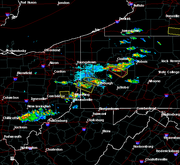 At 711 pm edt, a severe thunderstorm was located 7 miles east of weirton, moving east at 35 mph (radar). Hazards include wind gusts to 60 mph and quarter-size hail. Minor hail damage to vehicles is possible. expect wind damage to trees and power lines, resulting in some power outages. This includes interstate 79 in pennsylvania between mile markers 22 and 26, and between mile markers 28 and 33. At 711 pm edt, a severe thunderstorm was located 7 miles east of weirton, moving east at 35 mph (radar). Hazards include wind gusts to 60 mph and quarter-size hail. Minor hail damage to vehicles is possible. expect wind damage to trees and power lines, resulting in some power outages. This includes interstate 79 in pennsylvania between mile markers 22 and 26, and between mile markers 28 and 33.
|
| 6/13/2018 7:00 PM EDT |
 At 659 pm edt, a severe thunderstorm was located over toronto, or near weirton, moving east at 35 mph (radar). Hazards include wind gusts to 60 mph and quarter-size hail. Minor hail damage to vehicles is possible. Expect wind damage to trees and power lines, resulting in some power outages. At 659 pm edt, a severe thunderstorm was located over toronto, or near weirton, moving east at 35 mph (radar). Hazards include wind gusts to 60 mph and quarter-size hail. Minor hail damage to vehicles is possible. Expect wind damage to trees and power lines, resulting in some power outages.
|
| 6/13/2018 6:48 PM EDT |
 At 648 pm edt, a severe thunderstorm was located near aliquippa, moving southeast at 30 mph (radar). Hazards include wind gusts to 60 mph. expect damage to trees and power lines, resulting in some power outages At 648 pm edt, a severe thunderstorm was located near aliquippa, moving southeast at 30 mph (radar). Hazards include wind gusts to 60 mph. expect damage to trees and power lines, resulting in some power outages
|
| 5/22/2018 7:26 PM EDT |
 At 725 pm edt, a severe thunderstorm was located over mcmurray, moving southeast at 30 mph (radar). Hazards include wind gusts to 70 mph and quarter-size hail. Hail damage to vehicles. trees snapped and uprooted. Power outages. At 725 pm edt, a severe thunderstorm was located over mcmurray, moving southeast at 30 mph (radar). Hazards include wind gusts to 70 mph and quarter-size hail. Hail damage to vehicles. trees snapped and uprooted. Power outages.
|
| 5/22/2018 7:17 PM EDT |
 At 716 pm edt, a severe thunderstorm was located over mcdonald, or 7 miles north of canonsburg, moving southeast at 30 mph (radar). Hazards include wind gusts to 70 mph and quarter-size hail. Hail damage to vehicles. trees snapped and uprooted. power outages. locations impacted include, pittsburgh, mount lebanon, bethel park, mcmurray, canonsburg, avella, upper st. clair, scott township, robinson township, cecil-bishop, dormont, castle shannon, this includes the following highways, interstate 79 in pennsylvania between mile markers 22 and 31. Interstate 376 in pennsylvania between mile markers 55 and 56, and between mile markers 59 and 66. At 716 pm edt, a severe thunderstorm was located over mcdonald, or 7 miles north of canonsburg, moving southeast at 30 mph (radar). Hazards include wind gusts to 70 mph and quarter-size hail. Hail damage to vehicles. trees snapped and uprooted. power outages. locations impacted include, pittsburgh, mount lebanon, bethel park, mcmurray, canonsburg, avella, upper st. clair, scott township, robinson township, cecil-bishop, dormont, castle shannon, this includes the following highways, interstate 79 in pennsylvania between mile markers 22 and 31. Interstate 376 in pennsylvania between mile markers 55 and 56, and between mile markers 59 and 66.
|
| 5/22/2018 6:46 PM EDT |
 At 646 pm edt, a severe thunderstorm was located 7 miles northwest of imperial, or 8 miles west of moon township, moving southeast at 25 mph (radar). Hazards include wind gusts to 60 mph. damage to trees and power lines At 646 pm edt, a severe thunderstorm was located 7 miles northwest of imperial, or 8 miles west of moon township, moving southeast at 25 mph (radar). Hazards include wind gusts to 60 mph. damage to trees and power lines
|
| 5/13/2018 8:17 AM EDT |
 At 817 am edt, severe thunderstorms were located along a line extending from near meridian to baden, moving southeast at 50 mph (radar). Hazards include wind gusts to 60 mph. Expect damage to trees and power lines, resulting in some power outages. locations impacted include, pittsburgh, penn hills, ross township, mccandless township, monroeville, cranberry, butler, franklin park, aliquippa, monaca, shaler township, plum, this includes the following highways, pennsylvania turnpike between mile markers 20 and 58. interstate 79 in pennsylvania between mile markers 40 and 65. Parkway north between mile markers 9 and 13. At 817 am edt, severe thunderstorms were located along a line extending from near meridian to baden, moving southeast at 50 mph (radar). Hazards include wind gusts to 60 mph. Expect damage to trees and power lines, resulting in some power outages. locations impacted include, pittsburgh, penn hills, ross township, mccandless township, monroeville, cranberry, butler, franklin park, aliquippa, monaca, shaler township, plum, this includes the following highways, pennsylvania turnpike between mile markers 20 and 58. interstate 79 in pennsylvania between mile markers 40 and 65. Parkway north between mile markers 9 and 13.
|
| 5/13/2018 8:04 AM EDT |
 At 804 am edt, severe thunderstorms were located along a line extending from near ellwood city to near ohioville, moving east at 55 mph (radar). Hazards include wind gusts to 60 mph. expect damage to trees and power lines, resulting in some power outages At 804 am edt, severe thunderstorms were located along a line extending from near ellwood city to near ohioville, moving east at 55 mph (radar). Hazards include wind gusts to 60 mph. expect damage to trees and power lines, resulting in some power outages
|
| 5/12/2018 5:52 PM EDT |
 At 552 pm edt, a severe thunderstorm was located over donora, or 8 miles southeast of gastonville, moving southeast at 40 mph (radar). Hazards include quarter-size hail. Minor damage to vehicles is possible. locations impacted include, bethel park, mcmurray, mckeesport, jeannette, canonsburg, gastonville, west mifflin, south park township, jefferson hills, north versailles, pleasant hills, white oak, this includes the following highways, interstate 70 in pennsylvania between mile markers 25 and 57. Pennsylvania turnpike between mile markers 65 and 80. At 552 pm edt, a severe thunderstorm was located over donora, or 8 miles southeast of gastonville, moving southeast at 40 mph (radar). Hazards include quarter-size hail. Minor damage to vehicles is possible. locations impacted include, bethel park, mcmurray, mckeesport, jeannette, canonsburg, gastonville, west mifflin, south park township, jefferson hills, north versailles, pleasant hills, white oak, this includes the following highways, interstate 70 in pennsylvania between mile markers 25 and 57. Pennsylvania turnpike between mile markers 65 and 80.
|
| 5/12/2018 5:30 PM EDT |
 The national weather service in pittsburgh has issued a * severe thunderstorm warning for. southeastern washington county in southwestern pennsylvania. southeastern allegheny county in southwestern pennsylvania. southwestern westmoreland county in southwestern pennsylvania. Northeastern greene county in southwestern pennsylvania. The national weather service in pittsburgh has issued a * severe thunderstorm warning for. southeastern washington county in southwestern pennsylvania. southeastern allegheny county in southwestern pennsylvania. southwestern westmoreland county in southwestern pennsylvania. Northeastern greene county in southwestern pennsylvania.
|
| 5/12/2018 4:21 PM EDT |
 At 421 pm edt, a severe thunderstorm was located near wolfdale, or 7 miles west of washington, moving east at 50 mph (radar). Hazards include half dollar-size hail. Minor damage to vehicles is possible. locations impacted include, pittsburgh, mount lebanon, bethel park, mcmurray, washington, canonsburg, avella, gastonville, west mifflin, baldwin, upper st. clair, whitehall, this includes the following highways, interstate 70 in pennsylvania between mile markers 1 and 39. Interstate 79 in pennsylvania between mile markers 22 and 23. At 421 pm edt, a severe thunderstorm was located near wolfdale, or 7 miles west of washington, moving east at 50 mph (radar). Hazards include half dollar-size hail. Minor damage to vehicles is possible. locations impacted include, pittsburgh, mount lebanon, bethel park, mcmurray, washington, canonsburg, avella, gastonville, west mifflin, baldwin, upper st. clair, whitehall, this includes the following highways, interstate 70 in pennsylvania between mile markers 1 and 39. Interstate 79 in pennsylvania between mile markers 22 and 23.
|
| 5/12/2018 4:12 PM EDT |
 At 412 pm edt, a severe thunderstorm was located near west liberty, moving east at 35 mph (radar). Hazards include half dollar-size hail. Minor damage to vehicles is possible. locations impacted include, pittsburgh, mount lebanon, bethel park, mcmurray, washington, canonsburg, west liberty, avella, valley grove, gastonville, west mifflin, baldwin, this includes the following highways, interstate 70 in west virginia near mile marker 14. interstate 70 in pennsylvania between mile markers 0 and 39. Interstate 79 in pennsylvania between mile markers 22 and 23. At 412 pm edt, a severe thunderstorm was located near west liberty, moving east at 35 mph (radar). Hazards include half dollar-size hail. Minor damage to vehicles is possible. locations impacted include, pittsburgh, mount lebanon, bethel park, mcmurray, washington, canonsburg, west liberty, avella, valley grove, gastonville, west mifflin, baldwin, this includes the following highways, interstate 70 in west virginia near mile marker 14. interstate 70 in pennsylvania between mile markers 0 and 39. Interstate 79 in pennsylvania between mile markers 22 and 23.
|
| 5/12/2018 3:54 PM EDT |
 At 354 pm edt, a severe thunderstorm was located near tiltonsville, or near clearview, moving east at 50 mph (radar). Hazards include wind gusts to 60 mph and half dollar-size hail. Minor hail damage to vehicles is possible. Expect wind damage to trees and power lines, resulting in some power outages. At 354 pm edt, a severe thunderstorm was located near tiltonsville, or near clearview, moving east at 50 mph (radar). Hazards include wind gusts to 60 mph and half dollar-size hail. Minor hail damage to vehicles is possible. Expect wind damage to trees and power lines, resulting in some power outages.
|
| 5/12/2018 3:29 PM EDT |
 At 329 pm edt, a severe thunderstorm was located over penn hills, moving east at 45 mph (radar). Hazards include wind gusts to 60 mph and half dollar-size hail. Minor hail damage to vehicles is possible. Expect wind damage to trees and power lines, resulting in some power outages. At 329 pm edt, a severe thunderstorm was located over penn hills, moving east at 45 mph (radar). Hazards include wind gusts to 60 mph and half dollar-size hail. Minor hail damage to vehicles is possible. Expect wind damage to trees and power lines, resulting in some power outages.
|
| 5/12/2018 3:25 PM EDT | Trees down at the intersection of friendship ave. and roup av in allegheny county PA, 3.2 miles SW of Pittsburgh, PA |
| 5/4/2018 6:13 PM EDT |
 At 613 pm edt, severe thunderstorms were located along a line extending from 13 miles southeast of new bethlehem to near oakmont, moving east at 60 mph (radar). Hazards include wind gusts to 60 mph. Expect damage to trees and power lines, resulting in some power outages. locations impacted include, pittsburgh, penn hills, ross township, mccandless township, monroeville, indiana, franklin park, vandergrift, kittanning, homer city, apollo, shaler township, this includes the following highways, pennsylvania turnpike between mile markers 37 and 57. interstate 79 in pennsylvania between mile markers 38 and 41. Parkway north between mile markers 5 and 12. At 613 pm edt, severe thunderstorms were located along a line extending from 13 miles southeast of new bethlehem to near oakmont, moving east at 60 mph (radar). Hazards include wind gusts to 60 mph. Expect damage to trees and power lines, resulting in some power outages. locations impacted include, pittsburgh, penn hills, ross township, mccandless township, monroeville, indiana, franklin park, vandergrift, kittanning, homer city, apollo, shaler township, this includes the following highways, pennsylvania turnpike between mile markers 37 and 57. interstate 79 in pennsylvania between mile markers 38 and 41. Parkway north between mile markers 5 and 12.
|
| 5/4/2018 5:51 PM EDT |
 At 550 pm edt, severe thunderstorms were located along a line extending from near west kittanning to near moon township, moving east at 45 mph (radar). Hazards include wind gusts to 60 mph. expect damage to trees and power lines, resulting in some power outages At 550 pm edt, severe thunderstorms were located along a line extending from near west kittanning to near moon township, moving east at 45 mph (radar). Hazards include wind gusts to 60 mph. expect damage to trees and power lines, resulting in some power outages
|
| 4/3/2018 8:56 PM EDT |
 The severe thunderstorm warning for east central washington, northwestern indiana, southeastern allegheny, northwestern westmoreland and southeastern armstrong counties will expire at 900 pm edt, the storms that prompted the warning have weakened below severe limits and no longer pose an immediate threat to life and property. therefore, the warning will be allowed to expire. however gusty winds are still possible with these thunderstorms. a severe thunderstorm watch remains in effect until 100 am edt for southwestern pennsylvania. The severe thunderstorm warning for east central washington, northwestern indiana, southeastern allegheny, northwestern westmoreland and southeastern armstrong counties will expire at 900 pm edt, the storms that prompted the warning have weakened below severe limits and no longer pose an immediate threat to life and property. therefore, the warning will be allowed to expire. however gusty winds are still possible with these thunderstorms. a severe thunderstorm watch remains in effect until 100 am edt for southwestern pennsylvania.
|
| 4/3/2018 8:33 PM EDT |
 At 833 pm edt, severe thunderstorms were located along a line extending from penn hills to near mcmurray, moving northeast at 60 mph (radar). Hazards include 60 mph wind gusts. expect damage to trees and power lines, resulting in some power outages At 833 pm edt, severe thunderstorms were located along a line extending from penn hills to near mcmurray, moving northeast at 60 mph (radar). Hazards include 60 mph wind gusts. expect damage to trees and power lines, resulting in some power outages
|
| 11/5/2017 7:57 PM EST |
 At 757 pm est, severe thunderstorms were located along a line extending from seven fields to near wexford to near leetsdale, moving east at 40 mph (radar). Hazards include 60 mph wind gusts and quarter-size hail. Minor hail damage to vehicles is possible. Expect wind damage to trees and power lines, resulting in some power outages. At 757 pm est, severe thunderstorms were located along a line extending from seven fields to near wexford to near leetsdale, moving east at 40 mph (radar). Hazards include 60 mph wind gusts and quarter-size hail. Minor hail damage to vehicles is possible. Expect wind damage to trees and power lines, resulting in some power outages.
|
| 8/22/2017 3:16 PM EDT |
 At 316 pm edt, severe thunderstorms were located along a line extending from plum to pitcairn to jefferson hills, moving east at 35 mph (radar). Hazards include 60 mph wind gusts. Expect damage to trees and power lines, resulting in some power outages. Locations impacted include, pittsburgh, penn hills, monroeville, mckeesport, plum, west mifflin, murrysville, wilkinsburg, south park township, new kensington, lower burrell, munhall, this includes pennsylvania turnpike between mile markers 49 and 60. At 316 pm edt, severe thunderstorms were located along a line extending from plum to pitcairn to jefferson hills, moving east at 35 mph (radar). Hazards include 60 mph wind gusts. Expect damage to trees and power lines, resulting in some power outages. Locations impacted include, pittsburgh, penn hills, monroeville, mckeesport, plum, west mifflin, murrysville, wilkinsburg, south park township, new kensington, lower burrell, munhall, this includes pennsylvania turnpike between mile markers 49 and 60.
|
| 8/22/2017 3:01 PM EDT |
 At 301 pm edt, severe thunderstorms were located along a line extending from sharpsburg to homestead to mcmurray, moving east at 35 mph (radar). Hazards include 60 mph wind gusts. Expect damage to trees and power lines, resulting in some power outages. locations impacted include, pittsburgh, penn hills, mount lebanon, bethel park, monroeville, mcmurray, mckeesport, gastonville, shaler township, plum, west mifflin, north side pittsburgh, this includes the following highways, pennsylvania turnpike between mile markers 44 and 60. interstate 79 in pennsylvania between mile markers 22 and 28. Parkway north between mile markers 1 and 2. At 301 pm edt, severe thunderstorms were located along a line extending from sharpsburg to homestead to mcmurray, moving east at 35 mph (radar). Hazards include 60 mph wind gusts. Expect damage to trees and power lines, resulting in some power outages. locations impacted include, pittsburgh, penn hills, mount lebanon, bethel park, monroeville, mcmurray, mckeesport, gastonville, shaler township, plum, west mifflin, north side pittsburgh, this includes the following highways, pennsylvania turnpike between mile markers 44 and 60. interstate 79 in pennsylvania between mile markers 22 and 28. Parkway north between mile markers 1 and 2.
|
| 8/22/2017 2:54 PM EDT |
 At 254 pm edt, severe thunderstorms were located along a line extending from west view to mount oliver to canonsburg, moving east at 30 mph (radar). Hazards include 60 mph wind gusts. damage to trees and power lines At 254 pm edt, severe thunderstorms were located along a line extending from west view to mount oliver to canonsburg, moving east at 30 mph (radar). Hazards include 60 mph wind gusts. damage to trees and power lines
|
| 8/22/2017 2:14 PM EDT | Tree down on lime hollow road at frankstown road in allegheny county PA, 8.9 miles WSW of Pittsburgh, PA |
| 8/22/2017 1:57 PM EDT |
 At 157 pm edt, a severe thunderstorm was located over mount lebanon, moving east at 35 mph (radar). Hazards include 60 mph wind gusts. damage to trees and power lines At 157 pm edt, a severe thunderstorm was located over mount lebanon, moving east at 35 mph (radar). Hazards include 60 mph wind gusts. damage to trees and power lines
|
| 8/22/2017 1:46 PM EDT |
 At 146 pm edt, a severe thunderstorm was located over bridgeville, or near mount lebanon, moving east at 35 mph (radar). Hazards include 60 mph wind gusts. Damage to trees and power lines. locations impacted include, pittsburgh, penn hills, mount lebanon, bethel park, ross township, mcmurray, mckeesport, shaler township, west mifflin, north side pittsburgh, baldwin, upper st. clair, this includes the following highways, interstate 79 in pennsylvania between mile markers 22 and 35. interstate 279 in pennsylvania between mile markers 1 and 7. Interstate 376 in pennsylvania between mile markers 57 and 77. At 146 pm edt, a severe thunderstorm was located over bridgeville, or near mount lebanon, moving east at 35 mph (radar). Hazards include 60 mph wind gusts. Damage to trees and power lines. locations impacted include, pittsburgh, penn hills, mount lebanon, bethel park, ross township, mcmurray, mckeesport, shaler township, west mifflin, north side pittsburgh, baldwin, upper st. clair, this includes the following highways, interstate 79 in pennsylvania between mile markers 22 and 35. interstate 279 in pennsylvania between mile markers 1 and 7. Interstate 376 in pennsylvania between mile markers 57 and 77.
|
| 8/22/2017 1:20 PM EDT |
 At 119 pm edt, a severe thunderstorm was located near avella, moving east at 40 mph (radar). Hazards include 60 mph wind gusts. damage to trees and power lines At 119 pm edt, a severe thunderstorm was located near avella, moving east at 40 mph (radar). Hazards include 60 mph wind gusts. damage to trees and power lines
|
| 8/19/2017 4:43 PM EDT |
 At 442 pm edt, a severe thunderstorm was located over cecil-bishop, or near canonsburg, moving east at 30 mph (radar). Hazards include 60 mph wind gusts. Expect damage to trees and power lines, resulting in some power outages. locations impacted include, pittsburgh, mount lebanon, bethel park, mcmurray, mckeesport, canonsburg, gastonville, west mifflin, baldwin, upper st. Clair, scott township, whitehall, this includes interstate 79 in pennsylvania between mile markers 22 and 30. At 442 pm edt, a severe thunderstorm was located over cecil-bishop, or near canonsburg, moving east at 30 mph (radar). Hazards include 60 mph wind gusts. Expect damage to trees and power lines, resulting in some power outages. locations impacted include, pittsburgh, mount lebanon, bethel park, mcmurray, mckeesport, canonsburg, gastonville, west mifflin, baldwin, upper st. Clair, scott township, whitehall, this includes interstate 79 in pennsylvania between mile markers 22 and 30.
|
| 8/19/2017 4:36 PM EDT | Several trees down and many wires down around the city in allegheny county PA, 0.8 miles SSW of Pittsburgh, PA |
| 8/19/2017 4:32 PM EDT |
 At 431 pm edt, a severe thunderstorm was located over robinson township, or near ross township, moving east at 30 mph (radar). Hazards include 60 mph wind gusts. expect damage to trees and power lines, resulting in some power outages At 431 pm edt, a severe thunderstorm was located over robinson township, or near ross township, moving east at 30 mph (radar). Hazards include 60 mph wind gusts. expect damage to trees and power lines, resulting in some power outages
|
| 8/19/2017 4:26 PM EDT |
 At 425 pm edt, a severe thunderstorm was located over lower burrell, or 7 miles northeast of penn hills, moving east at 35 mph (public). Hazards include quarter-size hail. Minor damage to vehicles is possible. locations impacted include, pittsburgh, penn hills, ross township, mccandless township, monroeville, vandergrift, shaler township, plum, murrysville, hampton township, wilkinsburg, new kensington, this includes the following highways, pennsylvania turnpike between mile markers 40 and 58. Parkway north between mile markers 4 and 9. At 425 pm edt, a severe thunderstorm was located over lower burrell, or 7 miles northeast of penn hills, moving east at 35 mph (public). Hazards include quarter-size hail. Minor damage to vehicles is possible. locations impacted include, pittsburgh, penn hills, ross township, mccandless township, monroeville, vandergrift, shaler township, plum, murrysville, hampton township, wilkinsburg, new kensington, this includes the following highways, pennsylvania turnpike between mile markers 40 and 58. Parkway north between mile markers 4 and 9.
|
| 8/19/2017 4:19 PM EDT |
 At 419 pm edt, a severe thunderstorm was located 7 miles northeast of avella, moving east at 30 mph (radar). Hazards include 60 mph wind gusts. expect damage to trees and power lines, resulting in some power outages At 419 pm edt, a severe thunderstorm was located 7 miles northeast of avella, moving east at 30 mph (radar). Hazards include 60 mph wind gusts. expect damage to trees and power lines, resulting in some power outages
|
| 8/19/2017 3:54 PM EDT |
 At 354 pm edt, a severe thunderstorm was located over wexford, or over franklin park, moving east at 25 mph (radar). Hazards include 60 mph wind gusts and quarter-size hail. Minor hail damage to vehicles is possible. Expect wind damage to trees and power lines, resulting in some power outages. At 354 pm edt, a severe thunderstorm was located over wexford, or over franklin park, moving east at 25 mph (radar). Hazards include 60 mph wind gusts and quarter-size hail. Minor hail damage to vehicles is possible. Expect wind damage to trees and power lines, resulting in some power outages.
|
| 8/4/2017 2:31 PM EDT |
 At 231 pm edt, severe thunderstorms were located along a line extending from midland to coraopolis to whitehall, moving northeast at 45 mph (radar). Hazards include 60 mph wind gusts. Damage to trees and power lines. locations impacted include, pittsburgh, mount lebanon, bethel park, ross township, mccandless township, moon township, mcmurray, franklin park, east liverpool, aliquippa, monaca, gastonville, this includes the following highways, interstate 79 in pennsylvania between mile markers 22 and 47. interstate 279 in pennsylvania between mile markers 1 and 13. Interstate 376 in pennsylvania between mile markers 33 and 73. At 231 pm edt, severe thunderstorms were located along a line extending from midland to coraopolis to whitehall, moving northeast at 45 mph (radar). Hazards include 60 mph wind gusts. Damage to trees and power lines. locations impacted include, pittsburgh, mount lebanon, bethel park, ross township, mccandless township, moon township, mcmurray, franklin park, east liverpool, aliquippa, monaca, gastonville, this includes the following highways, interstate 79 in pennsylvania between mile markers 22 and 47. interstate 279 in pennsylvania between mile markers 1 and 13. Interstate 376 in pennsylvania between mile markers 33 and 73.
|
| 8/4/2017 2:01 PM EDT |
 At 201 pm edt, severe thunderstorms were located along a line extending from follansbee to near avella to 6 miles south of east washington, moving north at 45 mph (radar). Hazards include 60 mph wind gusts. damage to trees and power lines At 201 pm edt, severe thunderstorms were located along a line extending from follansbee to near avella to 6 miles south of east washington, moving north at 45 mph (radar). Hazards include 60 mph wind gusts. damage to trees and power lines
|
| 7/11/2017 5:29 PM EDT |
 At 528 pm edt, a severe thunderstorm was located over robinson township, or near moon township, moving northeast at 25 mph (radar). Hazards include 60 mph wind gusts. Expect damage to trees and power lines, resulting in some power outages. locations impacted include, pittsburgh, penn hills, mount lebanon, ross township, mccandless township, monroeville, cranberry, moon township, franklin park, shaler township, north side pittsburgh, baldwin, this includes the following highways, pennsylvania turnpike between mile markers 30 and 41. interstate 79 in pennsylvania between mile markers 23 and 49. Parkway north between mile markers 1 and 13. At 528 pm edt, a severe thunderstorm was located over robinson township, or near moon township, moving northeast at 25 mph (radar). Hazards include 60 mph wind gusts. Expect damage to trees and power lines, resulting in some power outages. locations impacted include, pittsburgh, penn hills, mount lebanon, ross township, mccandless township, monroeville, cranberry, moon township, franklin park, shaler township, north side pittsburgh, baldwin, this includes the following highways, pennsylvania turnpike between mile markers 30 and 41. interstate 79 in pennsylvania between mile markers 23 and 49. Parkway north between mile markers 1 and 13.
|
| 7/11/2017 5:10 PM EDT |
 At 510 pm edt, a severe thunderstorm was located over mcdonald, or 9 miles south of moon township, moving northeast at 25 mph (radar). Hazards include 60 mph wind gusts. expect damage to trees and power lines, resulting in some power outages At 510 pm edt, a severe thunderstorm was located over mcdonald, or 9 miles south of moon township, moving northeast at 25 mph (radar). Hazards include 60 mph wind gusts. expect damage to trees and power lines, resulting in some power outages
|
| 6/18/2017 4:52 PM EDT |
 The severe thunderstorm warning for east central jefferson, northwestern washington, southern beaver, northwestern allegheny, northeastern brooke and southeastern hancock counties will expire at 500 pm edt, the storm that prompted the warning has weakened and will be allowed to expire. heavy rain is still possible with this thunderstorm. a severe thunderstorm watch remains in effect until 900 pm edt for east central ohio, western and southwestern pennsylvania, and northern west virginia. The severe thunderstorm warning for east central jefferson, northwestern washington, southern beaver, northwestern allegheny, northeastern brooke and southeastern hancock counties will expire at 500 pm edt, the storm that prompted the warning has weakened and will be allowed to expire. heavy rain is still possible with this thunderstorm. a severe thunderstorm watch remains in effect until 900 pm edt for east central ohio, western and southwestern pennsylvania, and northern west virginia.
|
| 6/18/2017 4:35 PM EDT |
 At 435 pm edt, a severe thunderstorm was located 8 miles west of imperial, or 10 miles east of weirton, moving east at 45 mph (radar). Hazards include 60 mph wind gusts. Expect damage to trees and power lines, resulting in some power outages. Locations impacted include, moon township, weirton, steubenville, franklin park, aliquippa, monaca, wellsburg, robinson township, economy, bellevue, kennedy township, ambridge, this includes interstate 79 in pennsylvania between mile markers 32 and 42. At 435 pm edt, a severe thunderstorm was located 8 miles west of imperial, or 10 miles east of weirton, moving east at 45 mph (radar). Hazards include 60 mph wind gusts. Expect damage to trees and power lines, resulting in some power outages. Locations impacted include, moon township, weirton, steubenville, franklin park, aliquippa, monaca, wellsburg, robinson township, economy, bellevue, kennedy township, ambridge, this includes interstate 79 in pennsylvania between mile markers 32 and 42.
|
| 6/18/2017 4:14 PM EDT |
 At 414 pm edt, a severe thunderstorm was located over wintersville, or over steubenville, moving northeast at 45 mph (radar). Hazards include 60 mph wind gusts. expect damage to trees and power lines, resulting in some power outages At 414 pm edt, a severe thunderstorm was located over wintersville, or over steubenville, moving northeast at 45 mph (radar). Hazards include 60 mph wind gusts. expect damage to trees and power lines, resulting in some power outages
|
| 6/15/2017 3:52 PM EDT | Tree and wires down on 17 jefferson street in allegheny county PA, 3.6 miles SSW of Pittsburgh, PA |
| 6/15/2017 3:45 PM EDT |
 At 345 pm edt, a severe thunderstorm was located over carnegie, or near mount lebanon, moving northeast at 45 mph (radar). Hazards include 60 mph wind gusts. expect damage to trees and power lines, resulting in some power outages At 345 pm edt, a severe thunderstorm was located over carnegie, or near mount lebanon, moving northeast at 45 mph (radar). Hazards include 60 mph wind gusts. expect damage to trees and power lines, resulting in some power outages
|
| 6/15/2017 3:40 PM EDT | Trees down on the intersections of ingomar road and saratoga drive... mcknight road and blazier drive in allegheny county PA, 10.7 miles SSE of Pittsburgh, PA |
| 6/15/2017 3:35 PM EDT | Tree down on a car in allegheny county PA, 10 miles SSE of Pittsburgh, PA |
| 6/15/2017 3:35 PM EDT | Tree down across the roadway at 176 w ingomar road in allegheny county PA, 10.8 miles SSE of Pittsburgh, PA |
| 6/13/2017 5:16 PM EDT |
 At 515 pm edt, a severe thunderstorm was located over mckeesport, moving southeast at 10 mph (trained weather spotters). Hazards include 60 mph wind gusts and quarter-size hail. Minor hail damage to vehicles is possible. expect wind damage to trees and power lines, resulting in some power outages. Locations impacted include, pittsburgh, penn hills, monroeville, greensburg, mckeesport, jeannette, plum, west mifflin, baldwin, murrysville, wilkinsburg, whitehall, this includes pennsylvania turnpike between mile markers 55 and 73. At 515 pm edt, a severe thunderstorm was located over mckeesport, moving southeast at 10 mph (trained weather spotters). Hazards include 60 mph wind gusts and quarter-size hail. Minor hail damage to vehicles is possible. expect wind damage to trees and power lines, resulting in some power outages. Locations impacted include, pittsburgh, penn hills, monroeville, greensburg, mckeesport, jeannette, plum, west mifflin, baldwin, murrysville, wilkinsburg, whitehall, this includes pennsylvania turnpike between mile markers 55 and 73.
|
| 6/13/2017 5:08 PM EDT |
 The severe thunderstorm warning for east central allegheny county will expire at 515 pm edt, the storms that prompted the warning have weakened below severe limits and no longer pose an immediate threat to life and property. therefore, the warning will be allowed to expire. The severe thunderstorm warning for east central allegheny county will expire at 515 pm edt, the storms that prompted the warning have weakened below severe limits and no longer pose an immediate threat to life and property. therefore, the warning will be allowed to expire.
|
| 6/13/2017 5:07 PM EDT | Quarter sized hail reported 6.2 miles NW of Pittsburgh, PA |
| 6/13/2017 4:56 PM EDT |
 At 456 pm edt, severe thunderstorms were located along a line extending from near seven fields to ross township, moving east at 10 mph (radar). Hazards include 60 mph wind gusts and quarter-size hail. Minor hail damage to vehicles is possible. expect wind damage to trees and power lines, resulting in some power outages. locations impacted include, pittsburgh, penn hills, ross township, monroeville, franklin park, shaler township, plum, north side pittsburgh, wilkinsburg, swissvale, o`hara township, bellevue, this includes the following highways, pennsylvania turnpike between mile markers 48 and 55. Parkway north between mile markers 1 and 10. At 456 pm edt, severe thunderstorms were located along a line extending from near seven fields to ross township, moving east at 10 mph (radar). Hazards include 60 mph wind gusts and quarter-size hail. Minor hail damage to vehicles is possible. expect wind damage to trees and power lines, resulting in some power outages. locations impacted include, pittsburgh, penn hills, ross township, monroeville, franklin park, shaler township, plum, north side pittsburgh, wilkinsburg, swissvale, o`hara township, bellevue, this includes the following highways, pennsylvania turnpike between mile markers 48 and 55. Parkway north between mile markers 1 and 10.
|
| 6/13/2017 4:54 PM EDT | Quarter sized hail reported 6.2 miles NW of Pittsburgh, PA |
| 6/13/2017 4:51 PM EDT |
 At 450 pm edt, a severe thunderstorm was located over mckeesport, moving east at 10 mph (radar). Hazards include ping pong ball-size hail and 60 mph wind gusts. People and animals outdoors will be injured. expect hail damage to roofs, siding, windows, and vehicles. expect wind damage to trees and power lines, resulting in some power outages. Locations impacted include, pittsburgh, penn hills, monroeville, greensburg, mckeesport, jeannette, plum, west mifflin, baldwin, murrysville, wilkinsburg, whitehall, this includes pennsylvania turnpike between mile markers 55 and 73. At 450 pm edt, a severe thunderstorm was located over mckeesport, moving east at 10 mph (radar). Hazards include ping pong ball-size hail and 60 mph wind gusts. People and animals outdoors will be injured. expect hail damage to roofs, siding, windows, and vehicles. expect wind damage to trees and power lines, resulting in some power outages. Locations impacted include, pittsburgh, penn hills, monroeville, greensburg, mckeesport, jeannette, plum, west mifflin, baldwin, murrysville, wilkinsburg, whitehall, this includes pennsylvania turnpike between mile markers 55 and 73.
|
| 6/13/2017 4:45 PM EDT |
 At 445 pm edt, a severe thunderstorm was located over glassport, or over mckeesport, moving east at 10 mph (radar). Hazards include 60 mph wind gusts and quarter-size hail. Minor hail damage to vehicles is possible. Expect wind damage to trees and power lines, resulting in some power outages. At 445 pm edt, a severe thunderstorm was located over glassport, or over mckeesport, moving east at 10 mph (radar). Hazards include 60 mph wind gusts and quarter-size hail. Minor hail damage to vehicles is possible. Expect wind damage to trees and power lines, resulting in some power outages.
|
| 6/13/2017 4:33 PM EDT |
 At 432 pm edt, severe thunderstorms were located along a line extending from near cranberry to ben avon, moving east at 10 mph (radar). Hazards include 60 mph wind gusts and quarter-size hail. Minor hail damage to vehicles is possible. Expect wind damage to trees and power lines, resulting in some power outages. At 432 pm edt, severe thunderstorms were located along a line extending from near cranberry to ben avon, moving east at 10 mph (radar). Hazards include 60 mph wind gusts and quarter-size hail. Minor hail damage to vehicles is possible. Expect wind damage to trees and power lines, resulting in some power outages.
|
| 6/13/2017 4:17 PM EDT |
 At 417 pm edt, a severe thunderstorm was located over white oak, or near mckeesport, moving southeast at 10 mph (radar). Hazards include 60 mph wind gusts and quarter-size hail. Minor hail damage to vehicles is possible. expect wind damage to trees and power lines, resulting in some power outages. Locations impacted include, pittsburgh, monroeville, mckeesport, west mifflin, munhall, jefferson hills, north versailles, swissvale, white oak, clairton, forest hills, wilkins township, this includes pennsylvania turnpike between mile markers 62 and 68. At 417 pm edt, a severe thunderstorm was located over white oak, or near mckeesport, moving southeast at 10 mph (radar). Hazards include 60 mph wind gusts and quarter-size hail. Minor hail damage to vehicles is possible. expect wind damage to trees and power lines, resulting in some power outages. Locations impacted include, pittsburgh, monroeville, mckeesport, west mifflin, munhall, jefferson hills, north versailles, swissvale, white oak, clairton, forest hills, wilkins township, this includes pennsylvania turnpike between mile markers 62 and 68.
|
| 6/13/2017 3:54 PM EDT |
 At 353 pm edt, a severe thunderstorm was located over west mifflin, or over mckeesport, moving southeast at 10 mph (radar). Hazards include 60 mph wind gusts and quarter-size hail. Minor hail damage to vehicles is possible. Expect wind damage to trees and power lines, resulting in some power outages. At 353 pm edt, a severe thunderstorm was located over west mifflin, or over mckeesport, moving southeast at 10 mph (radar). Hazards include 60 mph wind gusts and quarter-size hail. Minor hail damage to vehicles is possible. Expect wind damage to trees and power lines, resulting in some power outages.
|
| 5/31/2017 5:18 PM EDT | Power pole and trees down around hampton township in allegheny county PA, 11.8 miles SSW of Pittsburgh, PA |
| 5/31/2017 4:36 PM EDT |
 At 436 pm edt, severe thunderstorms were located along a line extending from near ford city to near murrysville to gastonville, moving east at 45 mph (radar). Hazards include 60 mph wind gusts. Expect damage to trees and power lines, resulting in some power outages. Locations impacted include, pittsburgh, penn hills, bethel park, monroeville, mcmurray, greensburg, mckeesport, jeannette, canonsburg, vandergrift, kittanning, apollo, this includes pennsylvania turnpike between mile markers 50 and 72. At 436 pm edt, severe thunderstorms were located along a line extending from near ford city to near murrysville to gastonville, moving east at 45 mph (radar). Hazards include 60 mph wind gusts. Expect damage to trees and power lines, resulting in some power outages. Locations impacted include, pittsburgh, penn hills, bethel park, monroeville, mcmurray, greensburg, mckeesport, jeannette, canonsburg, vandergrift, kittanning, apollo, this includes pennsylvania turnpike between mile markers 50 and 72.
|
| 5/31/2017 4:20 PM EDT |
 At 419 pm edt, severe thunderstorms were located along a line extending from near sarver to penn hills to near canonsburg, moving east at 45 mph (radar). Hazards include 60 mph wind gusts. Expect damage to trees and power lines, resulting in some power outages. locations impacted include, pittsburgh, penn hills, mount lebanon, bethel park, monroeville, mcmurray, greensburg, mckeesport, jeannette, canonsburg, vandergrift, kittanning, this includes the following highways, pennsylvania turnpike between mile markers 41 and 72. interstate 79 in pennsylvania between mile markers 22 and 30. Parkway north between mile markers 1 and 3. At 419 pm edt, severe thunderstorms were located along a line extending from near sarver to penn hills to near canonsburg, moving east at 45 mph (radar). Hazards include 60 mph wind gusts. Expect damage to trees and power lines, resulting in some power outages. locations impacted include, pittsburgh, penn hills, mount lebanon, bethel park, monroeville, mcmurray, greensburg, mckeesport, jeannette, canonsburg, vandergrift, kittanning, this includes the following highways, pennsylvania turnpike between mile markers 41 and 72. interstate 79 in pennsylvania between mile markers 22 and 30. Parkway north between mile markers 1 and 3.
|
| 5/31/2017 4:19 PM EDT | Tree down on wires along roosevelt s in allegheny county PA, 5.7 miles WSW of Pittsburgh, PA |
| 5/31/2017 4:12 PM EDT | Tree down on pj mcardle roadway in allegheny county PA, 1.4 miles E of Pittsburgh, PA |
| 5/31/2017 4:09 PM EDT | Power pole and trees down around hampton township in allegheny county PA, 11.8 miles SSW of Pittsburgh, PA |
| 5/31/2017 4:09 PM EDT | Tree down on kittanning st in allegheny county PA, 6.1 miles SSW of Pittsburgh, PA |
| 5/31/2017 4:06 PM EDT |
 At 406 pm edt, severe thunderstorms were located along a line extending from near oak hills to millvale to near avella, moving east at 45 mph (radar). Hazards include 60 mph wind gusts. expect damage to trees and power lines, resulting in some power outages At 406 pm edt, severe thunderstorms were located along a line extending from near oak hills to millvale to near avella, moving east at 45 mph (radar). Hazards include 60 mph wind gusts. expect damage to trees and power lines, resulting in some power outages
|
| 5/31/2017 4:03 PM EDT |
 At 403 pm edt, severe thunderstorms were located along a line extending from near mars to hampton township to robinson township, moving east at 35 mph (radar). Hazards include 60 mph wind gusts and quarter-size hail. Minor hail damage to vehicles is possible. expect wind damage to trees and power lines, resulting in some power outages. locations impacted include, pittsburgh, ross township, mccandless township, cranberry, moon township, butler, franklin park, shaler township, hampton township, robinson township, o`hara township, bellevue, this includes the following highways, pennsylvania turnpike between mile markers 30 and 45. interstate 79 in pennsylvania between mile markers 29 and 49. Parkway north between mile markers 3 and 13. At 403 pm edt, severe thunderstorms were located along a line extending from near mars to hampton township to robinson township, moving east at 35 mph (radar). Hazards include 60 mph wind gusts and quarter-size hail. Minor hail damage to vehicles is possible. expect wind damage to trees and power lines, resulting in some power outages. locations impacted include, pittsburgh, ross township, mccandless township, cranberry, moon township, butler, franklin park, shaler township, hampton township, robinson township, o`hara township, bellevue, this includes the following highways, pennsylvania turnpike between mile markers 30 and 45. interstate 79 in pennsylvania between mile markers 29 and 49. Parkway north between mile markers 3 and 13.
|
| 5/31/2017 3:44 PM EDT |
 At 343 pm edt, severe thunderstorms were located along a line extending from near monaca to leetsdale to 8 miles west of imperial, moving northeast at 60 mph (radar). Hazards include 60 mph wind gusts and quarter-size hail. Minor hail damage to vehicles is possible. Expect wind damage to trees and power lines, resulting in some power outages. At 343 pm edt, severe thunderstorms were located along a line extending from near monaca to leetsdale to 8 miles west of imperial, moving northeast at 60 mph (radar). Hazards include 60 mph wind gusts and quarter-size hail. Minor hail damage to vehicles is possible. Expect wind damage to trees and power lines, resulting in some power outages.
|
| 5/18/2017 4:43 PM EDT |
 The severe thunderstorm warning for northwestern washington. southeastern beaver and northwestern allegheny counties will expire at 445 pm edt. the storm that prompted the warning has weakened below severe limits and no longer pose an immediate threat to life and property. therefore, the warning will be allowed to expire. However small hail. The severe thunderstorm warning for northwestern washington. southeastern beaver and northwestern allegheny counties will expire at 445 pm edt. the storm that prompted the warning has weakened below severe limits and no longer pose an immediate threat to life and property. therefore, the warning will be allowed to expire. However small hail.
|
| 5/18/2017 4:27 PM EDT |
 At 426 pm edt, a severe thunderstorm was located near imperial, or near moon township, moving northeast at 40 mph (radar). Hazards include 60 mph wind gusts and quarter-size hail. Minor hail damage to vehicles is possible. expect wind damage to trees and power lines, resulting in some power outages. locations impacted include, pittsburgh, ross township, mccandless township, moon township, franklin park, aliquippa, north side pittsburgh, robinson township, economy, bellevue, carnegie, kennedy township, this includes the following highways, pennsylvania turnpike near mile marker 30. interstate 79 in pennsylvania between mile markers 30 and 48. Parkway north between mile markers 1 and 13. At 426 pm edt, a severe thunderstorm was located near imperial, or near moon township, moving northeast at 40 mph (radar). Hazards include 60 mph wind gusts and quarter-size hail. Minor hail damage to vehicles is possible. expect wind damage to trees and power lines, resulting in some power outages. locations impacted include, pittsburgh, ross township, mccandless township, moon township, franklin park, aliquippa, north side pittsburgh, robinson township, economy, bellevue, carnegie, kennedy township, this includes the following highways, pennsylvania turnpike near mile marker 30. interstate 79 in pennsylvania between mile markers 30 and 48. Parkway north between mile markers 1 and 13.
|
| 5/18/2017 4:07 PM EDT |
 At 407 pm edt, a severe thunderstorm was located near weirton, moving northeast at 40 mph (radar). Hazards include 60 mph wind gusts and quarter-size hail. Minor hail damage to vehicles is possible. Expect wind damage to trees and power lines, resulting in some power outages. At 407 pm edt, a severe thunderstorm was located near weirton, moving northeast at 40 mph (radar). Hazards include 60 mph wind gusts and quarter-size hail. Minor hail damage to vehicles is possible. Expect wind damage to trees and power lines, resulting in some power outages.
|
| 5/1/2017 2:55 PM EDT | Power lines down in allegheny county PA, 4.8 miles N of Pittsburgh, PA |
| 5/1/2017 2:52 PM EDT |
 At 252 pm edt, severe thunderstorms were located along a line extending from near sugarcreek to near shanor-northvue to near gibsonia, moving northeast at 45 mph (radar). Hazards include 70 mph wind gusts. Trees snapped and uprooted. power outages can be expected. locations impacted include, pittsburgh, penn hills, mount lebanon, bethel park, ross township, mccandless township, monroeville, mckeesport, butler, shaler township, plum, west mifflin, this includes the following highways, pennsylvania turnpike between mile markers 38 and 58. interstate 80 in pennsylvania between mile markers 30 and 35. parkway north between mile markers 1 and 6. A tornado watch remains in effect until 700 pm edt for southwestern, northwestern and west central pennsylvania. At 252 pm edt, severe thunderstorms were located along a line extending from near sugarcreek to near shanor-northvue to near gibsonia, moving northeast at 45 mph (radar). Hazards include 70 mph wind gusts. Trees snapped and uprooted. power outages can be expected. locations impacted include, pittsburgh, penn hills, mount lebanon, bethel park, ross township, mccandless township, monroeville, mckeesport, butler, shaler township, plum, west mifflin, this includes the following highways, pennsylvania turnpike between mile markers 38 and 58. interstate 80 in pennsylvania between mile markers 30 and 35. parkway north between mile markers 1 and 6. A tornado watch remains in effect until 700 pm edt for southwestern, northwestern and west central pennsylvania.
|
| 5/1/2017 2:50 PM EDT | Stilley road closed due to power lines...between rt 51 and prospect roa in allegheny county PA, 4.7 miles N of Pittsburgh, PA |
| 5/1/2017 2:47 PM EDT |
 At 247 pm edt, severe thunderstorms were located along a line extending from 8 miles east of grove city to butler to near hampton township to upper st. clair, moving east at 35 mph (radar). Hazards include 70 mph wind gusts. Trees snapped and uprooted. Power outages can be expected. At 247 pm edt, severe thunderstorms were located along a line extending from 8 miles east of grove city to butler to near hampton township to upper st. clair, moving east at 35 mph (radar). Hazards include 70 mph wind gusts. Trees snapped and uprooted. Power outages can be expected.
|
| 5/1/2017 2:39 PM EDT |
 At 239 pm edt, severe thunderstorms were located along a line extending from 11 miles southwest of sugarcreek to near meridian to mccandless township, moving northeast at 45 mph (radar). Hazards include 70 mph wind gusts. Trees snapped and uprooted. power outages can be expected. locations impacted include, pittsburgh, penn hills, mount lebanon, bethel park, ross township, mccandless township, monroeville, cranberry, mckeesport, butler, franklin park, grove city, this includes the following highways, pennsylvania turnpike between mile markers 32 and 58. interstate 79 in pennsylvania between mile markers 22 and 36. interstate 80 in pennsylvania between mile markers 23 and 35. parkway north between mile markers 1 and 11. A tornado watch remains in effect until 700 pm edt for southwestern, northwestern and west central pennsylvania. At 239 pm edt, severe thunderstorms were located along a line extending from 11 miles southwest of sugarcreek to near meridian to mccandless township, moving northeast at 45 mph (radar). Hazards include 70 mph wind gusts. Trees snapped and uprooted. power outages can be expected. locations impacted include, pittsburgh, penn hills, mount lebanon, bethel park, ross township, mccandless township, monroeville, cranberry, mckeesport, butler, franklin park, grove city, this includes the following highways, pennsylvania turnpike between mile markers 32 and 58. interstate 79 in pennsylvania between mile markers 22 and 36. interstate 80 in pennsylvania between mile markers 23 and 35. parkway north between mile markers 1 and 11. A tornado watch remains in effect until 700 pm edt for southwestern, northwestern and west central pennsylvania.
|
| 5/1/2017 2:31 PM EDT |
 At 231 pm edt, severe thunderstorms were located along a line extending from 11 miles northwest of grove city to near zelienople to near emsworth, moving northeast at 45 mph (radar). Hazards include 70 mph wind gusts. Trees snapped and uprooted. power outages can be expected. locations impacted include, pittsburgh, penn hills, mount lebanon, bethel park, ross township, mccandless township, monroeville, cranberry, mckeesport, butler, franklin park, grove city, this includes the following highways, pennsylvania turnpike between mile markers 23 and 58. interstate 79 in pennsylvania between mile markers 22 and 92. interstate 80 in pennsylvania between mile markers 15 and 35. parkway north between mile markers 1 and 13. A tornado watch remains in effect until 700 pm edt for western, southwestern, northwestern and west central pennsylvania. At 231 pm edt, severe thunderstorms were located along a line extending from 11 miles northwest of grove city to near zelienople to near emsworth, moving northeast at 45 mph (radar). Hazards include 70 mph wind gusts. Trees snapped and uprooted. power outages can be expected. locations impacted include, pittsburgh, penn hills, mount lebanon, bethel park, ross township, mccandless township, monroeville, cranberry, mckeesport, butler, franklin park, grove city, this includes the following highways, pennsylvania turnpike between mile markers 23 and 58. interstate 79 in pennsylvania between mile markers 22 and 92. interstate 80 in pennsylvania between mile markers 15 and 35. parkway north between mile markers 1 and 13. A tornado watch remains in effect until 700 pm edt for western, southwestern, northwestern and west central pennsylvania.
|
| 5/1/2017 2:05 PM EDT |
 At 204 pm edt, severe thunderstorms were located along a line extending from near hubbard to industry to 7 miles east of weirton, moving northeast at 45 mph (radar). Hazards include 70 mph wind gusts. Trees snapped and uprooted. Power outages can be expected. At 204 pm edt, severe thunderstorms were located along a line extending from near hubbard to industry to 7 miles east of weirton, moving northeast at 45 mph (radar). Hazards include 70 mph wind gusts. Trees snapped and uprooted. Power outages can be expected.
|
| 4/27/2017 8:35 PM EDT |
 At 835 pm edt, a severe thunderstorm was located over sewickley, or near moon township, moving northeast at 50 mph (radar). Hazards include 60 mph wind gusts and quarter-size hail. Hail damage to vehicles is expected. expect wind damage to trees and power lines, resulting in some power outages. locations impacted include, pittsburgh, penn hills, ross township, mccandless township, cranberry, moon township, franklin park, aliquippa, shaler township, plum, hampton township, robinson township, this includes the following highways, pennsylvania turnpike between mile markers 26 and 51. interstate 79 in pennsylvania between mile markers 32 and 53. Parkway north between mile markers 3 and 13. At 835 pm edt, a severe thunderstorm was located over sewickley, or near moon township, moving northeast at 50 mph (radar). Hazards include 60 mph wind gusts and quarter-size hail. Hail damage to vehicles is expected. expect wind damage to trees and power lines, resulting in some power outages. locations impacted include, pittsburgh, penn hills, ross township, mccandless township, cranberry, moon township, franklin park, aliquippa, shaler township, plum, hampton township, robinson township, this includes the following highways, pennsylvania turnpike between mile markers 26 and 51. interstate 79 in pennsylvania between mile markers 32 and 53. Parkway north between mile markers 3 and 13.
|
| 4/27/2017 8:19 PM EDT |
 At 819 pm edt, a severe thunderstorm was located near imperial, or 9 miles southwest of moon township, moving northeast at 50 mph (radar). Hazards include 60 mph wind gusts and quarter-size hail. Hail damage to vehicles is expected. Expect wind damage to trees and power lines, resulting in some power outages. At 819 pm edt, a severe thunderstorm was located near imperial, or 9 miles southwest of moon township, moving northeast at 50 mph (radar). Hazards include 60 mph wind gusts and quarter-size hail. Hail damage to vehicles is expected. Expect wind damage to trees and power lines, resulting in some power outages.
|
| 4/16/2017 5:42 PM EDT |
 At 541 pm edt, a severe thunderstorm was located over monroeville, moving east at 40 mph (radar). Hazards include 60 mph wind gusts. expect damage to trees and power lines, resulting in some power outages At 541 pm edt, a severe thunderstorm was located over monroeville, moving east at 40 mph (radar). Hazards include 60 mph wind gusts. expect damage to trees and power lines, resulting in some power outages
|
| 2/12/2017 7:59 PM EST |
 At 758 pm est, severe thunderstorms were located along a line extending from near blairsville to 7 miles southeast of valley grove, moving east at 45 mph (radar). Hazards include 60 mph wind gusts. expect damage to trees and power lines, resulting in some power outages At 758 pm est, severe thunderstorms were located along a line extending from near blairsville to 7 miles southeast of valley grove, moving east at 45 mph (radar). Hazards include 60 mph wind gusts. expect damage to trees and power lines, resulting in some power outages
|
| 2/12/2017 7:56 PM EST | Tree and wires down in allegheny county PA, 0.8 miles SSW of Pittsburgh, PA |
| 2/12/2017 7:26 PM EST |
 At 725 pm est, severe thunderstorms were located along a line extending from 7 miles northwest of west kittanning to near imperial, moving east at 50 mph (radar). Hazards include 60 mph wind gusts. Expect damage to trees and power lines, resulting in some power outages. locations impacted include, pittsburgh, penn hills, mount lebanon, bethel park, ross township, mccandless township, monroeville, cranberry, moon township, greensburg, weirton, mckeesport, this includes the following highways, pennsylvania turnpike between mile markers 27 and 69. interstate 79 in pennsylvania between mile markers 25 and 51. Parkway north between mile markers 1 and 13. At 725 pm est, severe thunderstorms were located along a line extending from 7 miles northwest of west kittanning to near imperial, moving east at 50 mph (radar). Hazards include 60 mph wind gusts. Expect damage to trees and power lines, resulting in some power outages. locations impacted include, pittsburgh, penn hills, mount lebanon, bethel park, ross township, mccandless township, monroeville, cranberry, moon township, greensburg, weirton, mckeesport, this includes the following highways, pennsylvania turnpike between mile markers 27 and 69. interstate 79 in pennsylvania between mile markers 25 and 51. Parkway north between mile markers 1 and 13.
|
| 2/12/2017 7:25 PM EST | Several trees down in allegheny county PA, 6.7 miles SSE of Pittsburgh, PA |
| 2/12/2017 7:20 PM EST | Tree and wires down on top of an unoccupied car in allegheny county PA, 0.8 miles SSW of Pittsburgh, PA |
| 2/12/2017 7:02 PM EST |
 At 701 pm est, severe thunderstorms were located along a line extending from near meridian to near toronto, moving east at 50 mph (radar). Hazards include 60 mph wind gusts. expect damage to trees and power lines, resulting in some power outages At 701 pm est, severe thunderstorms were located along a line extending from near meridian to near toronto, moving east at 50 mph (radar). Hazards include 60 mph wind gusts. expect damage to trees and power lines, resulting in some power outages
|
| 10/1/2016 6:38 PM EDT |
 The severe thunderstorm warning for northeastern allegheny county will expire at 645 pm edt, the storm which prompted the warning has weakened below severe limits, and no longer pose an immediate threat to life or property. therefore, the warning will be allowed to expire. to report severe weather, contact your nearest law enforcement agency. they will relay your report to the national weather service pittsburgh. The severe thunderstorm warning for northeastern allegheny county will expire at 645 pm edt, the storm which prompted the warning has weakened below severe limits, and no longer pose an immediate threat to life or property. therefore, the warning will be allowed to expire. to report severe weather, contact your nearest law enforcement agency. they will relay your report to the national weather service pittsburgh.
|
| 10/1/2016 6:28 PM EDT |
 At 627 pm edt, a severe thunderstorm was located over fox chapel, or near penn hills, moving north at 15 mph (radar indicated). Hazards include 60 mph wind gusts and quarter size hail. Hail damage to vehicles is expected. expect wind damage to trees and power lines, resulting in some power outages. locations impacted include, pittsburgh, penn hills, ross township, mccandless township, shaler township, hampton township, o`hara township, oakmont, fox chapel, millvale, etna, sharpsburg, aspinwall, gibsonia, verona, blawnox, russellton, curtisville, reserve township and pine township. this includes pennsylvania turnpike between mile markers 34 and 47. Please report severe weather by calling 4 1 2, 2 6 2, 1 9 8 8, posting to the nws pittsburgh facebook page, or using twitter @nwspittsburgh. At 627 pm edt, a severe thunderstorm was located over fox chapel, or near penn hills, moving north at 15 mph (radar indicated). Hazards include 60 mph wind gusts and quarter size hail. Hail damage to vehicles is expected. expect wind damage to trees and power lines, resulting in some power outages. locations impacted include, pittsburgh, penn hills, ross township, mccandless township, shaler township, hampton township, o`hara township, oakmont, fox chapel, millvale, etna, sharpsburg, aspinwall, gibsonia, verona, blawnox, russellton, curtisville, reserve township and pine township. this includes pennsylvania turnpike between mile markers 34 and 47. Please report severe weather by calling 4 1 2, 2 6 2, 1 9 8 8, posting to the nws pittsburgh facebook page, or using twitter @nwspittsburgh.
|
| 10/1/2016 6:12 PM EDT |
 At 612 pm edt, a severe thunderstorm was located over aspinwall, or near penn hills, moving north at 15 mph (radar indicated). Hazards include 60 mph wind gusts and quarter size hail. Hail damage to vehicles is expected. Expect wind damage to trees and power lines, resulting in some power outages. At 612 pm edt, a severe thunderstorm was located over aspinwall, or near penn hills, moving north at 15 mph (radar indicated). Hazards include 60 mph wind gusts and quarter size hail. Hail damage to vehicles is expected. Expect wind damage to trees and power lines, resulting in some power outages.
|
| 9/7/2016 4:11 PM EDT |
 At 411 pm edt, a severe thunderstorm was located over liberty, or over mckeesport, moving east at 30 mph (radar indicated). Hazards include 60 mph wind gusts and penny size hail. Expect damage to trees and power lines. Resulting in some power outages. At 411 pm edt, a severe thunderstorm was located over liberty, or over mckeesport, moving east at 30 mph (radar indicated). Hazards include 60 mph wind gusts and penny size hail. Expect damage to trees and power lines. Resulting in some power outages.
|
| 9/7/2016 3:58 PM EDT |
 At 357 pm edt, a severe thunderstorm was located over homestead, or over pittsburgh, moving east at 20 mph (radar indicated). Hazards include 60 mph wind gusts and nickel size hail. Expect damage to trees and power lines. resulting in some power outages. locations impacted include, pittsburgh, penn hills, monroeville, mckeesport, plum, west mifflin, baldwin, wilkinsburg, munhall, north versailles, brentwood, swissvale, white oak, forest hills, wilkins township, duquesne, turtle creek, north braddock, mount oliver and pitcairn. this includes the following highways, pennsylvania turnpike between mile markers 55 and 56. interstate 376 in pennsylvania between mile markers 72 and 84. Please report severe weather by calling 4 1 2, 2 6 2, 1 9 8 8, posting to the nws pittsburgh facebook page, or using twitter @nwspittsburgh. At 357 pm edt, a severe thunderstorm was located over homestead, or over pittsburgh, moving east at 20 mph (radar indicated). Hazards include 60 mph wind gusts and nickel size hail. Expect damage to trees and power lines. resulting in some power outages. locations impacted include, pittsburgh, penn hills, monroeville, mckeesport, plum, west mifflin, baldwin, wilkinsburg, munhall, north versailles, brentwood, swissvale, white oak, forest hills, wilkins township, duquesne, turtle creek, north braddock, mount oliver and pitcairn. this includes the following highways, pennsylvania turnpike between mile markers 55 and 56. interstate 376 in pennsylvania between mile markers 72 and 84. Please report severe weather by calling 4 1 2, 2 6 2, 1 9 8 8, posting to the nws pittsburgh facebook page, or using twitter @nwspittsburgh.
|
| 9/7/2016 3:48 PM EDT |
 At 348 pm edt, a severe thunderstorm was located over pittsburgh, moving east at 20 mph (radar indicated). Hazards include 60 mph wind gusts and nickel size hail. Expect damage to trees and power lines. Resulting in some power outages. At 348 pm edt, a severe thunderstorm was located over pittsburgh, moving east at 20 mph (radar indicated). Hazards include 60 mph wind gusts and nickel size hail. Expect damage to trees and power lines. Resulting in some power outages.
|
| 8/28/2016 7:34 PM EDT |
 At 734 pm edt, severe thunderstorms were located along a line extending from near gastonville to near east washington, moving southeast at 15 mph (radar indicated). Hazards include 60 mph wind gusts and quarter size hail. Hail damage to vehicles is expected. Expect wind damage to trees and power lines, resulting in some power outages. At 734 pm edt, severe thunderstorms were located along a line extending from near gastonville to near east washington, moving southeast at 15 mph (radar indicated). Hazards include 60 mph wind gusts and quarter size hail. Hail damage to vehicles is expected. Expect wind damage to trees and power lines, resulting in some power outages.
|
| 8/28/2016 7:17 PM EDT |
 At 716 pm edt, a severe thunderstorm was located over wilkinsburg, or over pittsburgh, and is nearly stationary (radar indicated). Hazards include 60 mph wind gusts. Expect damage to trees and power lines. resulting in some power outages. locations impacted include, pittsburgh, penn hills, shaler township, baldwin, wilkinsburg, munhall, brentwood, swissvale, o`hara township, forest hills, millvale, etna, sharpsburg, mount oliver, homestead, edgewood, churchill, aspinwall, rankin and west homestead. this includes the following highways, interstate 279 in pennsylvania near mile marker 1. interstate 376 in pennsylvania between mile markers 70 and 79. Please report severe weather by calling 4 1 2, 2 6 2, 1 9 8 8, posting to the nws pittsburgh facebook page, or using twitter @nwspittsburgh. At 716 pm edt, a severe thunderstorm was located over wilkinsburg, or over pittsburgh, and is nearly stationary (radar indicated). Hazards include 60 mph wind gusts. Expect damage to trees and power lines. resulting in some power outages. locations impacted include, pittsburgh, penn hills, shaler township, baldwin, wilkinsburg, munhall, brentwood, swissvale, o`hara township, forest hills, millvale, etna, sharpsburg, mount oliver, homestead, edgewood, churchill, aspinwall, rankin and west homestead. this includes the following highways, interstate 279 in pennsylvania near mile marker 1. interstate 376 in pennsylvania between mile markers 70 and 79. Please report severe weather by calling 4 1 2, 2 6 2, 1 9 8 8, posting to the nws pittsburgh facebook page, or using twitter @nwspittsburgh.
|
| 8/28/2016 7:10 PM EDT | Quarter sized hail reported 1.8 miles W of Pittsburgh, PA |
| 8/28/2016 7:05 PM EDT | Trees down on carnegie mellon university campus. time estimated from rada in allegheny county PA, 0.8 miles SSW of Pittsburgh, PA |
| 8/28/2016 7:02 PM EDT |
 At 702 pm edt, a severe thunderstorm was located over pittsburgh, and is nearly stationary (radar indicated). Hazards include 60 mph wind gusts. Expect damage to trees and power lines. Resulting in some power outages. At 702 pm edt, a severe thunderstorm was located over pittsburgh, and is nearly stationary (radar indicated). Hazards include 60 mph wind gusts. Expect damage to trees and power lines. Resulting in some power outages.
|
| 8/28/2016 6:55 PM EDT |
 The severe thunderstorm warning for east central allegheny county will expire at 700 pm edt, the storm which prompted the warning has weakened below severe limits, and no longer pose an immediate threat to life or property. therefore, the warning will be allowed to expire. The severe thunderstorm warning for east central allegheny county will expire at 700 pm edt, the storm which prompted the warning has weakened below severe limits, and no longer pose an immediate threat to life or property. therefore, the warning will be allowed to expire.
|
| 8/28/2016 6:31 PM EDT |
 At 631 pm edt, a severe thunderstorm was located over wilkinsburg, or near pittsburgh, moving southeast at 10 mph (radar indicated). Hazards include 60 mph wind gusts and quarter size hail. Hail damage to vehicles is expected. expect wind damage to trees and power lines, resulting in some power outages. locations impacted include, pittsburgh, penn hills, monroeville, mckeesport, plum, west mifflin, baldwin, wilkinsburg, munhall, north versailles, swissvale, o`hara township, white oak, forest hills, wilkins township, oakmont, duquesne, fox chapel, turtle creek and north braddock. this includes the following highways, pennsylvania turnpike between mile markers 52 and 56. interstate 376 in pennsylvania between mile markers 72 and 84. Please report severe weather by calling 4 1 2, 2 6 2, 1 9 8 8, posting to the nws pittsburgh facebook page, or using twitter @nwspittsburgh. At 631 pm edt, a severe thunderstorm was located over wilkinsburg, or near pittsburgh, moving southeast at 10 mph (radar indicated). Hazards include 60 mph wind gusts and quarter size hail. Hail damage to vehicles is expected. expect wind damage to trees and power lines, resulting in some power outages. locations impacted include, pittsburgh, penn hills, monroeville, mckeesport, plum, west mifflin, baldwin, wilkinsburg, munhall, north versailles, swissvale, o`hara township, white oak, forest hills, wilkins township, oakmont, duquesne, fox chapel, turtle creek and north braddock. this includes the following highways, pennsylvania turnpike between mile markers 52 and 56. interstate 376 in pennsylvania between mile markers 72 and 84. Please report severe weather by calling 4 1 2, 2 6 2, 1 9 8 8, posting to the nws pittsburgh facebook page, or using twitter @nwspittsburgh.
|
| 8/28/2016 6:16 PM EDT |
 At 615 pm edt, a severe thunderstorm was located over wilkinsburg, or near pittsburgh, moving southeast at 10 mph (radar indicated). Hazards include 60 mph wind gusts. Expect damage to trees and power lines. Resulting in some power outages. At 615 pm edt, a severe thunderstorm was located over wilkinsburg, or near pittsburgh, moving southeast at 10 mph (radar indicated). Hazards include 60 mph wind gusts. Expect damage to trees and power lines. Resulting in some power outages.
|
| 8/16/2016 6:05 PM EDT |
 At 604 pm edt, severe thunderstorms were located along a line extending from plum to north versailles, moving east at 40 mph (emergency management reports trees and power lines are down in mt lebanon and south fayette). Hazards include 60 mph wind gusts. Expect damage to trees and power lines. resulting in some power outages. locations impacted include, pittsburgh, penn hills, monroeville, greensburg, mckeesport, jeannette, shaler township, plum, west mifflin, baldwin, murrysville, hampton township, wilkinsburg, whitehall, south park township, new kensington, lower burrell, munhall, jefferson hills and north versailles. this includes the following highways, pennsylvania turnpike between mile markers 46 and 74. interstate 376 in pennsylvania between mile markers 73 and 84. Please report severe weather by calling 4 1 2, 2 6 2, 1 9 8 8, posting to the nws pittsburgh facebook page, or using twitter @nwspittsburgh. At 604 pm edt, severe thunderstorms were located along a line extending from plum to north versailles, moving east at 40 mph (emergency management reports trees and power lines are down in mt lebanon and south fayette). Hazards include 60 mph wind gusts. Expect damage to trees and power lines. resulting in some power outages. locations impacted include, pittsburgh, penn hills, monroeville, greensburg, mckeesport, jeannette, shaler township, plum, west mifflin, baldwin, murrysville, hampton township, wilkinsburg, whitehall, south park township, new kensington, lower burrell, munhall, jefferson hills and north versailles. this includes the following highways, pennsylvania turnpike between mile markers 46 and 74. interstate 376 in pennsylvania between mile markers 73 and 84. Please report severe weather by calling 4 1 2, 2 6 2, 1 9 8 8, posting to the nws pittsburgh facebook page, or using twitter @nwspittsburgh.
|
| 8/16/2016 5:50 PM EDT |
 At 550 pm edt, severe thunderstorms were located along a line extending from sharpsburg to brentwood, moving east at 40 mph (radar indicated). Hazards include 60 mph wind gusts. Expect damage to trees and power lines. resulting in some power outages. locations impacted include, pittsburgh, penn hills, mount lebanon, bethel park, ross township, mccandless township, monroeville, greensburg, mckeesport, jeannette, shaler township, plum, west mifflin, north side pittsburgh, baldwin, upper st. clair, murrysville, hampton township, scott township and wilkinsburg. this includes the following highways, pennsylvania turnpike between mile markers 45 and 74. interstate 79 in pennsylvania between mile markers 55 and 62. interstate 279 in pennsylvania between mile markers 1 and 9. interstate 376 in pennsylvania between mile markers 62 and 84. Please report severe weather by calling 4 1 2, 2 6 2, 1 9 8 8, posting to the nws pittsburgh facebook page, or using twitter @nwspittsburgh. At 550 pm edt, severe thunderstorms were located along a line extending from sharpsburg to brentwood, moving east at 40 mph (radar indicated). Hazards include 60 mph wind gusts. Expect damage to trees and power lines. resulting in some power outages. locations impacted include, pittsburgh, penn hills, mount lebanon, bethel park, ross township, mccandless township, monroeville, greensburg, mckeesport, jeannette, shaler township, plum, west mifflin, north side pittsburgh, baldwin, upper st. clair, murrysville, hampton township, scott township and wilkinsburg. this includes the following highways, pennsylvania turnpike between mile markers 45 and 74. interstate 79 in pennsylvania between mile markers 55 and 62. interstate 279 in pennsylvania between mile markers 1 and 9. interstate 376 in pennsylvania between mile markers 62 and 84. Please report severe weather by calling 4 1 2, 2 6 2, 1 9 8 8, posting to the nws pittsburgh facebook page, or using twitter @nwspittsburgh.
|
| 8/16/2016 5:45 PM EDT | Tree and wires down in allegheny county PA, 5.3 miles NE of Pittsburgh, PA |
| 8/16/2016 5:40 PM EDT | Tree and wires down in allegheny county PA, 8 miles ESE of Pittsburgh, PA |
| 8/16/2016 5:35 PM EDT |
 At 535 pm edt, severe thunderstorms were located along a line extending from kennedy township to near sturgeon- noblestown, moving east at 40 mph (radar indicated). Hazards include 60 mph wind gusts. Expect damage to trees and power lines. Resulting in some power outages. At 535 pm edt, severe thunderstorms were located along a line extending from kennedy township to near sturgeon- noblestown, moving east at 40 mph (radar indicated). Hazards include 60 mph wind gusts. Expect damage to trees and power lines. Resulting in some power outages.
|
| 7/25/2016 3:23 PM EDT |
 At 323 pm edt, a severe thunderstorm was located over south park township, or near gastonville, moving east at 30 mph (radar indicated). Hazards include 60 mph wind gusts and quarter size hail. Hail damage to vehicles is expected. expect wind damage to trees and power lines, resulting in some power outages. locations impacted include, pittsburgh, bethel park, mcmurray, mckeesport, gastonville, west mifflin, baldwin, upper st. clair, whitehall, south park township, munhall, jefferson hills, north versailles, brentwood, castle shannon, pleasant hills, white oak, clairton, duquesne and donora. this includes the following highways, interstate 70 in pennsylvania between mile markers 46 and 52. pennsylvania turnpike between mile markers 62 and 68. Please report severe weather by calling 4 1 2, 2 6 2, 1 9 8 8, posting to the nws pittsburgh facebook page, or using twitter @nwspittsburgh. At 323 pm edt, a severe thunderstorm was located over south park township, or near gastonville, moving east at 30 mph (radar indicated). Hazards include 60 mph wind gusts and quarter size hail. Hail damage to vehicles is expected. expect wind damage to trees and power lines, resulting in some power outages. locations impacted include, pittsburgh, bethel park, mcmurray, mckeesport, gastonville, west mifflin, baldwin, upper st. clair, whitehall, south park township, munhall, jefferson hills, north versailles, brentwood, castle shannon, pleasant hills, white oak, clairton, duquesne and donora. this includes the following highways, interstate 70 in pennsylvania between mile markers 46 and 52. pennsylvania turnpike between mile markers 62 and 68. Please report severe weather by calling 4 1 2, 2 6 2, 1 9 8 8, posting to the nws pittsburgh facebook page, or using twitter @nwspittsburgh.
|
| 7/25/2016 3:12 PM EDT |
 At 312 pm edt, a severe thunderstorm was located over wilkins township, or over monroeville, moving east at 25 mph (radar indicated). Hazards include 60 mph wind gusts and quarter size hail. Hail damage to vehicles is expected. Expect wind damage to trees and power lines, resulting in some power outages. At 312 pm edt, a severe thunderstorm was located over wilkins township, or over monroeville, moving east at 25 mph (radar indicated). Hazards include 60 mph wind gusts and quarter size hail. Hail damage to vehicles is expected. Expect wind damage to trees and power lines, resulting in some power outages.
|
| 7/25/2016 3:10 PM EDT | Multiple trees and power lines down in around upper st. clair in allegheny county PA, 7.9 miles NNE of Pittsburgh, PA |
| 7/25/2016 3:08 PM EDT | Multiple trees down and uprooted in whitehall in allegheny county PA, 4.7 miles N of Pittsburgh, PA |
| 7/25/2016 3:07 PM EDT |
 At 307 pm edt, a severe thunderstorm was located over upper st. clair, or near mcmurray, moving east at 30 mph (radar indicated). Hazards include 60 mph wind gusts and quarter size hail. Hail damage to vehicles is expected. Expect wind damage to trees and power lines, resulting in some power outages. At 307 pm edt, a severe thunderstorm was located over upper st. clair, or near mcmurray, moving east at 30 mph (radar indicated). Hazards include 60 mph wind gusts and quarter size hail. Hail damage to vehicles is expected. Expect wind damage to trees and power lines, resulting in some power outages.
|
| 7/24/2016 5:02 PM EDT |
 At 502 pm edt, severe thunderstorms were located along a line extending from near leechburg to north braddock, moving east at 30 mph (radar indicated). Hazards include 60 mph wind gusts. Expect damage to trees and power lines. resulting in some power outages. locations impacted include, monroeville, greensburg, mckeesport, indiana, jeannette, vandergrift, apollo, plum, west mifflin, murrysville, south park township, jefferson hills, north versailles, pleasant hills, white oak, clairton, wilkins township, duquesne, turtle creek and north braddock. this includes the following highways, pennsylvania turnpike between mile markers 55 and 73. interstate 376 in pennsylvania between mile markers 83 and 84. Please report severe weather by calling 4 1 2, 2 6 2, 1 9 8 8, posting to the nws pittsburgh facebook page, or using twitter @nwspittsburgh. At 502 pm edt, severe thunderstorms were located along a line extending from near leechburg to north braddock, moving east at 30 mph (radar indicated). Hazards include 60 mph wind gusts. Expect damage to trees and power lines. resulting in some power outages. locations impacted include, monroeville, greensburg, mckeesport, indiana, jeannette, vandergrift, apollo, plum, west mifflin, murrysville, south park township, jefferson hills, north versailles, pleasant hills, white oak, clairton, wilkins township, duquesne, turtle creek and north braddock. this includes the following highways, pennsylvania turnpike between mile markers 55 and 73. interstate 376 in pennsylvania between mile markers 83 and 84. Please report severe weather by calling 4 1 2, 2 6 2, 1 9 8 8, posting to the nws pittsburgh facebook page, or using twitter @nwspittsburgh.
|
| 7/24/2016 4:48 PM EDT |
 At 448 pm edt, severe thunderstorms were located along a line extending from near freeport to mount oliver, moving east at 30 mph (radar indicated). Hazards include 60 mph wind gusts. Expect damage to trees and power lines. resulting in some power outages. locations impacted include, pittsburgh, penn hills, mount lebanon, bethel park, monroeville, greensburg, mckeesport, indiana, jeannette, vandergrift, apollo, plum, west mifflin, baldwin, upper st. clair, murrysville, wilkinsburg, whitehall, south park township and new kensington. this includes the following highways, pennsylvania turnpike between mile markers 49 and 73. interstate 376 in pennsylvania between mile markers 73 and 84. Please report severe weather by calling 4 1 2, 2 6 2, 1 9 8 8, posting to the nws pittsburgh facebook page, or using twitter @nwspittsburgh. At 448 pm edt, severe thunderstorms were located along a line extending from near freeport to mount oliver, moving east at 30 mph (radar indicated). Hazards include 60 mph wind gusts. Expect damage to trees and power lines. resulting in some power outages. locations impacted include, pittsburgh, penn hills, mount lebanon, bethel park, monroeville, greensburg, mckeesport, indiana, jeannette, vandergrift, apollo, plum, west mifflin, baldwin, upper st. clair, murrysville, wilkinsburg, whitehall, south park township and new kensington. this includes the following highways, pennsylvania turnpike between mile markers 49 and 73. interstate 376 in pennsylvania between mile markers 73 and 84. Please report severe weather by calling 4 1 2, 2 6 2, 1 9 8 8, posting to the nws pittsburgh facebook page, or using twitter @nwspittsburgh.
|
| 7/24/2016 4:42 PM EDT | Trees down at 1224 belmont st and at lime hollow rd and springdale rd in allegheny county PA, 5.7 miles WSW of Pittsburgh, PA |
| 7/24/2016 4:31 PM EDT | Trees down at chartiers ave and hoover st and at west and bridge and w carson st in the city of pittsburgh in allegheny county PA, 2.8 miles ESE of Pittsburgh, PA |
| 7/24/2016 4:25 PM EDT |
 At 425 pm edt, severe thunderstorms were located along a line extending from near sarver to robinson township, moving east at 30 mph (radar indicated). Hazards include 60 mph wind gusts. Expect damage to trees and power lines. Resulting in some power outages. At 425 pm edt, severe thunderstorms were located along a line extending from near sarver to robinson township, moving east at 30 mph (radar indicated). Hazards include 60 mph wind gusts. Expect damage to trees and power lines. Resulting in some power outages.
|
| 7/24/2016 4:22 PM EDT | Trees and wires down at moon run rd and stuebenville pike in robinson tw in allegheny county PA, 7.8 miles E of Pittsburgh, PA |
| 7/24/2016 4:19 PM EDT |
 At 419 pm edt, a severe thunderstorm was located over west view, or over ross township, moving east at 50 mph (radar indicated). Hazards include 60 mph wind gusts. Expect damage to trees and power lines. resulting in some power outages. locations impacted include, pittsburgh, mount lebanon, ross township, mccandless township, moon township, franklin park, shaler township, hampton township, scott township, robinson township, bellevue, carnegie, kennedy township, west view, stowe township, mckees rocks, crafton, coraopolis, avalon and green tree. this includes the following highways, interstate 79 in pennsylvania between mile markers 55 and 70. interstate 279 in pennsylvania between mile markers 5 and 12. interstate 376 in pennsylvania between mile markers 50 and 66. Please report severe weather by calling 4 1 2, 2 6 2, 1 9 8 8, posting to the nws pittsburgh facebook page, or using twitter @nwspittsburgh. At 419 pm edt, a severe thunderstorm was located over west view, or over ross township, moving east at 50 mph (radar indicated). Hazards include 60 mph wind gusts. Expect damage to trees and power lines. resulting in some power outages. locations impacted include, pittsburgh, mount lebanon, ross township, mccandless township, moon township, franklin park, shaler township, hampton township, scott township, robinson township, bellevue, carnegie, kennedy township, west view, stowe township, mckees rocks, crafton, coraopolis, avalon and green tree. this includes the following highways, interstate 79 in pennsylvania between mile markers 55 and 70. interstate 279 in pennsylvania between mile markers 5 and 12. interstate 376 in pennsylvania between mile markers 50 and 66. Please report severe weather by calling 4 1 2, 2 6 2, 1 9 8 8, posting to the nws pittsburgh facebook page, or using twitter @nwspittsburgh.
|
| 7/24/2016 4:10 PM EDT |
 At 410 pm edt, a severe thunderstorm was located over coraopolis, or over moon township, moving east at 50 mph (radar indicated). Hazards include 60 mph wind gusts. Expect damage to trees and power lines. resulting in some power outages. locations impacted include, pittsburgh, mount lebanon, ross township, mccandless township, moon township, franklin park, aliquippa, shaler township, hampton township, scott township, robinson township, bellevue, carnegie, kennedy township, ambridge, west view, stowe township, mckees rocks, crafton and coraopolis. this includes the following highways, interstate 79 in pennsylvania between mile markers 55 and 70. interstate 279 in pennsylvania between mile markers 5 and 12. interstate 376 in pennsylvania between mile markers 47 and 66. Please report severe weather by calling 4 1 2, 2 6 2, 1 9 8 8, posting to the nws pittsburgh facebook page, or using twitter @nwspittsburgh. At 410 pm edt, a severe thunderstorm was located over coraopolis, or over moon township, moving east at 50 mph (radar indicated). Hazards include 60 mph wind gusts. Expect damage to trees and power lines. resulting in some power outages. locations impacted include, pittsburgh, mount lebanon, ross township, mccandless township, moon township, franklin park, aliquippa, shaler township, hampton township, scott township, robinson township, bellevue, carnegie, kennedy township, ambridge, west view, stowe township, mckees rocks, crafton and coraopolis. this includes the following highways, interstate 79 in pennsylvania between mile markers 55 and 70. interstate 279 in pennsylvania between mile markers 5 and 12. interstate 376 in pennsylvania between mile markers 47 and 66. Please report severe weather by calling 4 1 2, 2 6 2, 1 9 8 8, posting to the nws pittsburgh facebook page, or using twitter @nwspittsburgh.
|
| 7/24/2016 4:00 PM EDT |
 At 400 pm edt, a severe thunderstorm was located near leetsdale, or near moon township, moving east at 50 mph (radar indicated). Hazards include 60 mph wind gusts. Expect damage to trees and power lines. resulting in some power outages. locations impacted include, pittsburgh, mount lebanon, ross township, mccandless township, moon township, franklin park, aliquippa, shaler township, hampton township, scott township, robinson township, bellevue, carnegie, kennedy township, ambridge, west view, stowe township, mckees rocks, crafton and coraopolis. this includes the following highways, interstate 79 in pennsylvania between mile markers 55 and 70. interstate 279 in pennsylvania between mile markers 5 and 12. interstate 376 in pennsylvania between mile markers 44 and 66. Please report severe weather by calling 4 1 2, 2 6 2, 1 9 8 8, posting to the nws pittsburgh facebook page, or using twitter @nwspittsburgh. At 400 pm edt, a severe thunderstorm was located near leetsdale, or near moon township, moving east at 50 mph (radar indicated). Hazards include 60 mph wind gusts. Expect damage to trees and power lines. resulting in some power outages. locations impacted include, pittsburgh, mount lebanon, ross township, mccandless township, moon township, franklin park, aliquippa, shaler township, hampton township, scott township, robinson township, bellevue, carnegie, kennedy township, ambridge, west view, stowe township, mckees rocks, crafton and coraopolis. this includes the following highways, interstate 79 in pennsylvania between mile markers 55 and 70. interstate 279 in pennsylvania between mile markers 5 and 12. interstate 376 in pennsylvania between mile markers 44 and 66. Please report severe weather by calling 4 1 2, 2 6 2, 1 9 8 8, posting to the nws pittsburgh facebook page, or using twitter @nwspittsburgh.
|
| 7/24/2016 3:49 PM EDT |
 At 349 pm edt, a severe thunderstorm was located near chester, or near east liverpool, moving east at 50 mph (radar indicated). Hazards include 60 mph wind gusts. Expect damage to trees and power lines. Resulting in some power outages. At 349 pm edt, a severe thunderstorm was located near chester, or near east liverpool, moving east at 50 mph (radar indicated). Hazards include 60 mph wind gusts. Expect damage to trees and power lines. Resulting in some power outages.
|
| 7/14/2016 8:10 PM EDT | Tree down in allegheny county PA, 7.2 miles SSE of Pittsburgh, PA |
| 7/14/2016 8:00 PM EDT | Tree down in allegheny county PA, 6.7 miles SSE of Pittsburgh, PA |
| 6/16/2016 4:36 PM EDT | Trees and branches down on blackhawk rd and wightman rd in allegheny county PA, 4 miles W of Pittsburgh, PA |
| 6/16/2016 4:28 PM EDT |
 At 428 pm edt, severe thunderstorms were located along a line extending from swissvale to near gastonville, moving east at 30 mph (law enforcement). Hazards include 60 mph wind gusts and quarter size hail. Hail damage to vehicles is expected. expect wind damage to trees and power lines, resulting in some power outages. locations impacted include, pittsburgh, penn hills, mount lebanon, bethel park, monroeville, mcmurray, mckeesport, gastonville, plum, west mifflin, north side pittsburgh, baldwin, upper st. clair, scott township, wilkinsburg, whitehall, south park township, robinson township, munhall and jefferson hills. this includes the following highways, interstate 70 in pennsylvania between mile markers 24 and 40. pennsylvania turnpike between mile markers 55 and 57. interstate 79 in pennsylvania between mile markers 54 and 56. interstate 279 in pennsylvania between mile markers 1 and 2. interstate 376 in pennsylvania between mile markers 64 and 84. Please report severe weather by calling 4 1 2, 2 6 2, 1 9 8 8, posting to the nws pittsburgh facebook page, or using twitter @nwspittsburgh. At 428 pm edt, severe thunderstorms were located along a line extending from swissvale to near gastonville, moving east at 30 mph (law enforcement). Hazards include 60 mph wind gusts and quarter size hail. Hail damage to vehicles is expected. expect wind damage to trees and power lines, resulting in some power outages. locations impacted include, pittsburgh, penn hills, mount lebanon, bethel park, monroeville, mcmurray, mckeesport, gastonville, plum, west mifflin, north side pittsburgh, baldwin, upper st. clair, scott township, wilkinsburg, whitehall, south park township, robinson township, munhall and jefferson hills. this includes the following highways, interstate 70 in pennsylvania between mile markers 24 and 40. pennsylvania turnpike between mile markers 55 and 57. interstate 79 in pennsylvania between mile markers 54 and 56. interstate 279 in pennsylvania between mile markers 1 and 2. interstate 376 in pennsylvania between mile markers 64 and 84. Please report severe weather by calling 4 1 2, 2 6 2, 1 9 8 8, posting to the nws pittsburgh facebook page, or using twitter @nwspittsburgh.
|
| 6/16/2016 4:17 PM EDT | Tree down on wires on spring garden ave in allegheny county PA, 2.2 miles S of Pittsburgh, PA |
| 6/16/2016 4:10 PM EDT | Tree down on ridge road in allegheny county PA, 8 miles ESE of Pittsburgh, PA |
| 6/16/2016 3:57 PM EDT |
 At 355 pm edt, severe thunderstorms were located along a line extending from near sturgeon-noblestown to near wolfdale, moving east at 30 mph (radar indicated). Hazards include 60 mph wind gusts and quarter size hail. Hail damage to vehicles is expected. expect wind damage to trees and power lines, resulting in some power outages. locations impacted include, pittsburgh, penn hills, mount lebanon, bethel park, monroeville, mcmurray, mckeesport, washington, canonsburg, gastonville, plum, west mifflin, north side pittsburgh, baldwin, upper st. clair, scott township, wilkinsburg, whitehall, south park township and robinson township. this includes the following highways, interstate 70 in pennsylvania between mile markers 10 and 40. pennsylvania turnpike between mile markers 55 and 57. interstate 79 in pennsylvania between mile markers 50 and 61, and between mile markers 29 and 49. interstate 279 in pennsylvania between mile markers 1 and 2. interstate 376 in pennsylvania between mile markers 55 and 84. Please report severe weather by calling 4 1 2, 2 6 2, 1 9 8 8, posting to the nws pittsburgh facebook page, or using twitter @nwspittsburgh. At 355 pm edt, severe thunderstorms were located along a line extending from near sturgeon-noblestown to near wolfdale, moving east at 30 mph (radar indicated). Hazards include 60 mph wind gusts and quarter size hail. Hail damage to vehicles is expected. expect wind damage to trees and power lines, resulting in some power outages. locations impacted include, pittsburgh, penn hills, mount lebanon, bethel park, monroeville, mcmurray, mckeesport, washington, canonsburg, gastonville, plum, west mifflin, north side pittsburgh, baldwin, upper st. clair, scott township, wilkinsburg, whitehall, south park township and robinson township. this includes the following highways, interstate 70 in pennsylvania between mile markers 10 and 40. pennsylvania turnpike between mile markers 55 and 57. interstate 79 in pennsylvania between mile markers 50 and 61, and between mile markers 29 and 49. interstate 279 in pennsylvania between mile markers 1 and 2. interstate 376 in pennsylvania between mile markers 55 and 84. Please report severe weather by calling 4 1 2, 2 6 2, 1 9 8 8, posting to the nws pittsburgh facebook page, or using twitter @nwspittsburgh.
|
| 6/16/2016 3:43 PM EDT |
 At 342 pm edt, severe thunderstorms were located along a line extending from near imperial to near west liberty, moving east at 30 mph (radar indicated). Hazards include 60 mph wind gusts and quarter size hail. Hail damage to vehicles is expected. Expect wind damage to trees and power lines, resulting in some power outages. At 342 pm edt, severe thunderstorms were located along a line extending from near imperial to near west liberty, moving east at 30 mph (radar indicated). Hazards include 60 mph wind gusts and quarter size hail. Hail damage to vehicles is expected. Expect wind damage to trees and power lines, resulting in some power outages.
|
| 5/2/2016 4:25 AM EDT | Quarter sized hail reported 1.4 miles E of Pittsburgh, PA |
| 5/2/2016 4:20 AM EDT | Quarter sized hail reported 2.5 miles SSW of Pittsburgh, PA |
| 5/2/2016 4:15 AM EDT | Golf Ball sized hail reported 8 miles ESE of Pittsburgh, PA, numerous reports...quarter to golf ball size hail. |
| 5/2/2016 4:15 AM EDT | Quarter sized hail reported 5.8 miles SE of Pittsburgh, PA |
| 5/2/2016 4:15 AM EDT |
 At 415 am edt, a severe thunderstorm was located over stowe township, or near ross township, moving east at 45 mph (radar indicated. quarter size hail was reported in imperial). Hazards include 60 mph wind gusts and quarter size hail. Hail damage to vehicles is expected. expect wind damage to trees and power lines, resulting in some power outages. locations impacted include, pittsburgh, penn hills, mount lebanon, bethel park, ross township, mccandless township, monroeville, moon township, mcmurray, mckeesport, franklin park, canonsburg, gastonville, shaler township, plum, west mifflin, north side pittsburgh, baldwin, upper st. clair and hampton township. this includes the following highways, pennsylvania turnpike between mile markers 35 and 50. interstate 79 in pennsylvania between mile markers 50 and 73, and between mile markers 46 and 49. interstate 279 in pennsylvania between mile markers 1 and 13. interstate 376 in pennsylvania between mile markers 58 and 81. Please report severe weather by calling 4 1 2, 2 6 2, 1 9 8 8, posting to the nws pittsburgh facebook page, or using twitter @nwspittsburgh. At 415 am edt, a severe thunderstorm was located over stowe township, or near ross township, moving east at 45 mph (radar indicated. quarter size hail was reported in imperial). Hazards include 60 mph wind gusts and quarter size hail. Hail damage to vehicles is expected. expect wind damage to trees and power lines, resulting in some power outages. locations impacted include, pittsburgh, penn hills, mount lebanon, bethel park, ross township, mccandless township, monroeville, moon township, mcmurray, mckeesport, franklin park, canonsburg, gastonville, shaler township, plum, west mifflin, north side pittsburgh, baldwin, upper st. clair and hampton township. this includes the following highways, pennsylvania turnpike between mile markers 35 and 50. interstate 79 in pennsylvania between mile markers 50 and 73, and between mile markers 46 and 49. interstate 279 in pennsylvania between mile markers 1 and 13. interstate 376 in pennsylvania between mile markers 58 and 81. Please report severe weather by calling 4 1 2, 2 6 2, 1 9 8 8, posting to the nws pittsburgh facebook page, or using twitter @nwspittsburgh.
|
| 5/2/2016 3:58 AM EDT |
 At 358 am edt, a severe thunderstorm was located near imperial, or near moon township, moving east at 40 mph (radar indicated). Hazards include 60 mph wind gusts and quarter size hail. Hail damage to vehicles is expected. Expect wind damage to trees and power lines, resulting in some power outages. At 358 am edt, a severe thunderstorm was located near imperial, or near moon township, moving east at 40 mph (radar indicated). Hazards include 60 mph wind gusts and quarter size hail. Hail damage to vehicles is expected. Expect wind damage to trees and power lines, resulting in some power outages.
|
| 9/9/2015 5:28 PM EDT | The severe thunderstorm warning for northeastern allegheny, southwestern armstrong and northwestern westmoreland counties will expire at 530 pm edt, the storm which prompted the warning has weakened below severe limits, and no longer poses an immediate threat to life or property. therefore the warning will be allowed to expire. however heavy rain is still possible with this thunderstorm. |
| 9/9/2015 5:17 PM EDT |
 At 516 pm edt, a severe thunderstorm was located over oakmont, or near penn hills, moving northeast at 10 mph (radar indicated). Hazards include 60 mph wind gusts and quarter size hail. Hail damage to vehicles is expected. expect wind damage to trees and some power outages. Locations impacted include, pittsburgh, penn hills, ross township, mccandless township, vandergrift, apollo, shaler township, plum, murrysville, hampton township, wilkinsburg, new kensington, lower burrell, harrison township, o`hara township, oakmont, fox chapel, arnold, tarentum and natrona heights. At 516 pm edt, a severe thunderstorm was located over oakmont, or near penn hills, moving northeast at 10 mph (radar indicated). Hazards include 60 mph wind gusts and quarter size hail. Hail damage to vehicles is expected. expect wind damage to trees and some power outages. Locations impacted include, pittsburgh, penn hills, ross township, mccandless township, vandergrift, apollo, shaler township, plum, murrysville, hampton township, wilkinsburg, new kensington, lower burrell, harrison township, o`hara township, oakmont, fox chapel, arnold, tarentum and natrona heights.
|
| 9/9/2015 4:52 PM EDT |
 At 452 pm edt, a severe thunderstorm was located near fox chapel, or near penn hills, moving northeast at 15 mph (radar indicated). Hazards include 60 mph wind gusts and quarter size hail. Hail damage to vehicles is expected. Expect wind damage to trees and some power outages. At 452 pm edt, a severe thunderstorm was located near fox chapel, or near penn hills, moving northeast at 15 mph (radar indicated). Hazards include 60 mph wind gusts and quarter size hail. Hail damage to vehicles is expected. Expect wind damage to trees and some power outages.
|
| 8/3/2015 8:54 PM EDT |
 The severe thunderstorm warning for southeastern allegheny, southwestern westmoreland and northeastern washington counties will expire at 900 pm edt, the storm which prompted the warning has weakened below severe limits and exited the warned area. therefore the warning will be allowed to expire. The severe thunderstorm warning for southeastern allegheny, southwestern westmoreland and northeastern washington counties will expire at 900 pm edt, the storm which prompted the warning has weakened below severe limits and exited the warned area. therefore the warning will be allowed to expire.
|
| 8/3/2015 8:25 PM EDT | Quarter sized hail reported 4.5 miles NNE of Pittsburgh, PA, quarter sized hail |
| 8/3/2015 8:21 PM EDT |
 At 820 pm edt, a severe thunderstorm was located over castle shannon, or over mount lebanon, moving east at 25 mph (trained weather spotters). Hazards include 60 mph wind gusts and quarter size hail. Hail damage to vehicles is expected. Expect wind damage to trees and some power outages. At 820 pm edt, a severe thunderstorm was located over castle shannon, or over mount lebanon, moving east at 25 mph (trained weather spotters). Hazards include 60 mph wind gusts and quarter size hail. Hail damage to vehicles is expected. Expect wind damage to trees and some power outages.
|
| 8/3/2015 8:18 PM EDT | Quarter sized hail reported 4 miles NE of Pittsburgh, PA, quarter sized hail |
| 8/3/2015 8:17 PM EDT | Quarter sized hail reported 1.4 miles E of Pittsburgh, PA, dime to quarter sized hail |
| 8/3/2015 8:15 PM EDT | Quarter sized hail reported 4 miles E of Pittsburgh, PA, pea...then dime...nickel...quarter sized hail |
| 8/3/2015 8:04 PM EDT |
 At 803 pm edt, a severe thunderstorm was located over robinson township, or 7 miles northwest of mount lebanon, moving east at 25 mph (trained weather spotters). Hazards include 60 mph wind gusts and quarter size hail. Hail damage to vehicles is expected. expect wind damage to trees and some power outages. locations impacted include, pittsburgh, mount lebanon, bethel park, ross township, moon township, shaler township, north side pittsburgh, baldwin, upper st. Clair, hampton township, scott township, whitehall, south park township, robinson township, jefferson hills, brentwood, dormont, bellevue, castle shannon and pleasant hills. At 803 pm edt, a severe thunderstorm was located over robinson township, or 7 miles northwest of mount lebanon, moving east at 25 mph (trained weather spotters). Hazards include 60 mph wind gusts and quarter size hail. Hail damage to vehicles is expected. expect wind damage to trees and some power outages. locations impacted include, pittsburgh, mount lebanon, bethel park, ross township, moon township, shaler township, north side pittsburgh, baldwin, upper st. Clair, hampton township, scott township, whitehall, south park township, robinson township, jefferson hills, brentwood, dormont, bellevue, castle shannon and pleasant hills.
|
| 8/3/2015 7:42 PM EDT |
 At 741 pm edt, a severe thunderstorm was located near imperial, or 8 miles southwest of moon township, moving east at 25 mph (radar indicated). Hazards include 60 mph wind gusts and quarter size hail. Hail damage to vehicles is expected. Expect wind damage to trees and some power outages. At 741 pm edt, a severe thunderstorm was located near imperial, or 8 miles southwest of moon township, moving east at 25 mph (radar indicated). Hazards include 60 mph wind gusts and quarter size hail. Hail damage to vehicles is expected. Expect wind damage to trees and some power outages.
|
| 8/3/2015 7:31 PM EDT |
 At 730 pm edt, a severe thunderstorm was located 8 miles east of weirton, moving east at 30 mph (radar indicated). Hazards include 60 mph wind gusts and quarter size hail. Hail damage to vehicles is expected. expect wind damage to trees and some power outages. locations impacted include, pittsburgh, mount lebanon, moon township, canonsburg, upper st. Clair, scott township, robinson township, cecil-bishop, carnegie, kennedy township, stowe township, mckees rocks, crafton, bridgeville, green tree, ingram, imperial, mcdonald, sturgeon-noblestown and oakdale. At 730 pm edt, a severe thunderstorm was located 8 miles east of weirton, moving east at 30 mph (radar indicated). Hazards include 60 mph wind gusts and quarter size hail. Hail damage to vehicles is expected. expect wind damage to trees and some power outages. locations impacted include, pittsburgh, mount lebanon, moon township, canonsburg, upper st. Clair, scott township, robinson township, cecil-bishop, carnegie, kennedy township, stowe township, mckees rocks, crafton, bridgeville, green tree, ingram, imperial, mcdonald, sturgeon-noblestown and oakdale.
|
| 8/3/2015 7:07 PM EDT |
 At 707 pm edt, a severe thunderstorm was located over new cumberland, or near weirton, moving east at 30 mph (radar indicated). Hazards include 60 mph wind gusts and quarter size hail. Hail damage to vehicles is expected. Expect wind damage to trees and some power outages. At 707 pm edt, a severe thunderstorm was located over new cumberland, or near weirton, moving east at 30 mph (radar indicated). Hazards include 60 mph wind gusts and quarter size hail. Hail damage to vehicles is expected. Expect wind damage to trees and some power outages.
|
| 8/3/2015 5:43 PM EDT |
 At 543 pm edt, a severe thunderstorm was located over upper st. clair, or near bethel park, moving east at 40 mph (radar indicated). Hazards include 60 mph wind gusts and nickel size hail. expect damage to trees and some power outages At 543 pm edt, a severe thunderstorm was located over upper st. clair, or near bethel park, moving east at 40 mph (radar indicated). Hazards include 60 mph wind gusts and nickel size hail. expect damage to trees and some power outages
|
| 8/3/2015 5:35 PM EDT |
 At 534 pm edt, a severe thunderstorm was located over cecil-bishop, or near canonsburg, moving east at 35 mph (trained weather spotters). Hazards include 60 mph wind gusts and quarter size hail. Hail damage to vehicles is expected. expect wind damage to trees and some power outages. locations impacted include, pittsburgh, mount lebanon, bethel park, moon township, mcmurray, canonsburg, gastonville, shaler township, north side pittsburgh, baldwin, upper st. Clair, scott township, whitehall, south park township, robinson township, cecil-bishop, brentwood, dormont, bellevue and castle shannon. At 534 pm edt, a severe thunderstorm was located over cecil-bishop, or near canonsburg, moving east at 35 mph (trained weather spotters). Hazards include 60 mph wind gusts and quarter size hail. Hail damage to vehicles is expected. expect wind damage to trees and some power outages. locations impacted include, pittsburgh, mount lebanon, bethel park, moon township, mcmurray, canonsburg, gastonville, shaler township, north side pittsburgh, baldwin, upper st. Clair, scott township, whitehall, south park township, robinson township, cecil-bishop, brentwood, dormont, bellevue and castle shannon.
|
| 8/3/2015 5:17 PM EDT |
 At 516 pm edt, a severe thunderstorm was located 8 miles west of imperial, or 9 miles east of weirton, moving east at 35 mph (trained weather spotters). Hazards include 60 mph wind gusts and quarter size hail. Hail damage to vehicles is expected. expect wind damage to trees and some power outages. locations impacted include, pittsburgh, mount lebanon, bethel park, moon township, mcmurray, canonsburg, gastonville, north side pittsburgh, baldwin, upper st. Clair, scott township, whitehall, south park township, robinson township, cecil-bishop, brentwood, dormont, bellevue, castle shannon and pleasant hills. At 516 pm edt, a severe thunderstorm was located 8 miles west of imperial, or 9 miles east of weirton, moving east at 35 mph (trained weather spotters). Hazards include 60 mph wind gusts and quarter size hail. Hail damage to vehicles is expected. expect wind damage to trees and some power outages. locations impacted include, pittsburgh, mount lebanon, bethel park, moon township, mcmurray, canonsburg, gastonville, north side pittsburgh, baldwin, upper st. Clair, scott township, whitehall, south park township, robinson township, cecil-bishop, brentwood, dormont, bellevue, castle shannon and pleasant hills.
|
| 8/3/2015 5:00 PM EDT |
 At 459 pm edt, a severe thunderstorm was located over mckeesport, moving east at 25 mph (radar indicated). Hazards include 60 mph wind gusts and quarter size hail. Hail damage to vehicles is expected. expect wind damage to trees and some power outages. Locations impacted include, pittsburgh, penn hills, monroeville, mckeesport, plum, west mifflin, murrysville, munhall, jefferson hills, north versailles, swissvale, white oak, clairton, forest hills, wilkins township, duquesne, turtle creek, north braddock, glassport and irwin. At 459 pm edt, a severe thunderstorm was located over mckeesport, moving east at 25 mph (radar indicated). Hazards include 60 mph wind gusts and quarter size hail. Hail damage to vehicles is expected. expect wind damage to trees and some power outages. Locations impacted include, pittsburgh, penn hills, monroeville, mckeesport, plum, west mifflin, murrysville, munhall, jefferson hills, north versailles, swissvale, white oak, clairton, forest hills, wilkins township, duquesne, turtle creek, north braddock, glassport and irwin.
|
| 8/3/2015 4:57 PM EDT |
 At 456 pm edt, a severe thunderstorm was located over toronto, or over weirton, moving east at 35 mph (trained weather spotters). Hazards include 60 mph wind gusts and quarter size hail. Hail damage to vehicles is expected. Expect wind damage to trees and some power outages. At 456 pm edt, a severe thunderstorm was located over toronto, or over weirton, moving east at 35 mph (trained weather spotters). Hazards include 60 mph wind gusts and quarter size hail. Hail damage to vehicles is expected. Expect wind damage to trees and some power outages.
|
| 8/3/2015 4:41 PM EDT |
 At 440 pm edt, a severe thunderstorm was located over castle shannon, or over mount lebanon, moving east at 30 mph (radar indicated). Hazards include 60 mph wind gusts and quarter size hail. Hail damage to vehicles is expected. expect wind damage to trees and some power outages. locations impacted include, pittsburgh, penn hills, mount lebanon, bethel park, monroeville, mckeesport, shaler township, plum, west mifflin, north side pittsburgh, baldwin, upper st. Clair, murrysville, scott township, wilkinsburg, whitehall, south park township, robinson township, munhall and jefferson hills. At 440 pm edt, a severe thunderstorm was located over castle shannon, or over mount lebanon, moving east at 30 mph (radar indicated). Hazards include 60 mph wind gusts and quarter size hail. Hail damage to vehicles is expected. expect wind damage to trees and some power outages. locations impacted include, pittsburgh, penn hills, mount lebanon, bethel park, monroeville, mckeesport, shaler township, plum, west mifflin, north side pittsburgh, baldwin, upper st. Clair, murrysville, scott township, wilkinsburg, whitehall, south park township, robinson township, munhall and jefferson hills.
|
| 8/3/2015 4:22 PM EDT |
 At 422 pm edt, a severe thunderstorm was located over mcdonald, or near canonsburg, moving east at 30 mph (radar indicated). Hazards include 60 mph wind gusts and quarter size hail. Hail damage to vehicles is expected. Expect wind damage to trees and some power outages. At 422 pm edt, a severe thunderstorm was located over mcdonald, or near canonsburg, moving east at 30 mph (radar indicated). Hazards include 60 mph wind gusts and quarter size hail. Hail damage to vehicles is expected. Expect wind damage to trees and some power outages.
|
| 7/7/2015 8:04 PM EDT |
 At 803 pm edt, severe thunderstorms were located along a line extending from near monroeville to near connellsville, moving northeast at 45 mph (radar indicated). Hazards include 60 mph wind gusts. expect damage to trees and some power outages At 803 pm edt, severe thunderstorms were located along a line extending from near monroeville to near connellsville, moving northeast at 45 mph (radar indicated). Hazards include 60 mph wind gusts. expect damage to trees and some power outages
|
| 7/7/2015 7:47 PM EDT |
 At 746 pm edt, a severe thunderstorm was located over leetsdale, or over moon township, moving northeast at 35 mph (radar indicated). Hazards include 60 mph wind gusts. expect damage to trees and some power outages locations impacted include, ross township, mccandless township, cranberry, moon township, franklin park, aliquippa, shaler township, hampton township, robinson township, economy, o`hara township, bellevue, kennedy township, ambridge, wexford, west view, stowe township, coraopolis, fox chapel and avalon At 746 pm edt, a severe thunderstorm was located over leetsdale, or over moon township, moving northeast at 35 mph (radar indicated). Hazards include 60 mph wind gusts. expect damage to trees and some power outages locations impacted include, ross township, mccandless township, cranberry, moon township, franklin park, aliquippa, shaler township, hampton township, robinson township, economy, o`hara township, bellevue, kennedy township, ambridge, wexford, west view, stowe township, coraopolis, fox chapel and avalon
|
| 7/7/2015 7:27 PM EDT |
 At 727 pm edt, a severe thunderstorm was located near imperial, or 8 miles southwest of moon township, moving northeast at 35 mph (radar indicated). Hazards include 60 mph wind gusts. expect damage to trees and some power outages At 727 pm edt, a severe thunderstorm was located near imperial, or 8 miles southwest of moon township, moving northeast at 35 mph (radar indicated). Hazards include 60 mph wind gusts. expect damage to trees and some power outages
|
| 6/30/2015 6:30 PM EDT |
 At 630 pm edt, a severe thunderstorm was located over glassport, or over mckeesport, moving northeast at 20 mph (radar indicated). Hazards include 60 mph wind gusts and quarter size hail. Hail damage to vehicles is expected. Expect wind damage to roofs, siding and trees. At 630 pm edt, a severe thunderstorm was located over glassport, or over mckeesport, moving northeast at 20 mph (radar indicated). Hazards include 60 mph wind gusts and quarter size hail. Hail damage to vehicles is expected. Expect wind damage to roofs, siding and trees.
|
| 6/30/2015 6:11 PM EDT |
 At 611 pm edt, a severe thunderstorm was located over hampton township, or near mccandless township, moving east at 35 mph (radar indicated). Hazards include 60 mph wind gusts. Expect damage to roofs. siding and trees. Locations impacted include, pittsburgh, penn hills, ross township, mccandless township, franklin park, shaler township, plum, hampton township, new kensington, lower burrell, harrison township, o`hara township, bellevue, kennedy township, wexford, west view, stowe township, oakmont, mckees rocks and fox chapel. At 611 pm edt, a severe thunderstorm was located over hampton township, or near mccandless township, moving east at 35 mph (radar indicated). Hazards include 60 mph wind gusts. Expect damage to roofs. siding and trees. Locations impacted include, pittsburgh, penn hills, ross township, mccandless township, franklin park, shaler township, plum, hampton township, new kensington, lower burrell, harrison township, o`hara township, bellevue, kennedy township, wexford, west view, stowe township, oakmont, mckees rocks and fox chapel.
|
| 6/30/2015 6:10 PM EDT | Large tree down on car in central northside in allegheny county PA, 1.5 miles S of Pittsburgh, PA |
| 6/30/2015 6:04 PM EDT | One tree down blockin roadway on twin hills drive in allegheny county PA, 4 miles ENE of Pittsburgh, PA |
| 6/30/2015 5:56 PM EDT |
 At 555 pm edt, a severe thunderstorm was located over franklin park, moving east at 35 mph (radar indicated). Hazards include 60 mph wind gusts. Expect damage to roofs. Siding and trees. At 555 pm edt, a severe thunderstorm was located over franklin park, moving east at 35 mph (radar indicated). Hazards include 60 mph wind gusts. Expect damage to roofs. Siding and trees.
|
| 6/30/2015 5:41 PM EDT |
 At 541 pm edt, a severe thunderstorm was located over moon township, moving east at 35 mph (radar indicated). Hazards include 60 mph wind gusts and nickel size hail. Expect damage to roofs. siding and trees. Locations impacted include, pittsburgh, mount lebanon, ross township, mccandless township, moon township, franklin park, aliquippa, shaler township, north side pittsburgh, baldwin, hampton township, scott township, robinson township, economy, dormont, bellevue, carnegie, kennedy township, ambridge and wexford. At 541 pm edt, a severe thunderstorm was located over moon township, moving east at 35 mph (radar indicated). Hazards include 60 mph wind gusts and nickel size hail. Expect damage to roofs. siding and trees. Locations impacted include, pittsburgh, mount lebanon, ross township, mccandless township, moon township, franklin park, aliquippa, shaler township, north side pittsburgh, baldwin, hampton township, scott township, robinson township, economy, dormont, bellevue, carnegie, kennedy township, ambridge and wexford.
|
| 6/30/2015 5:27 PM EDT |
 At 527 pm edt, a severe thunderstorm was located 8 miles west of imperial, or 10 miles northeast of weirton, moving east at 35 mph (radar indicated). Hazards include 60 mph wind gusts and nickel size hail. Expect damage to roofs. Siding and trees. At 527 pm edt, a severe thunderstorm was located 8 miles west of imperial, or 10 miles northeast of weirton, moving east at 35 mph (radar indicated). Hazards include 60 mph wind gusts and nickel size hail. Expect damage to roofs. Siding and trees.
|
| 6/23/2015 2:40 PM EDT |
 The severe thunderstorm warning for east central allegheny and west central westmoreland counties will expire at 245 pm edt, the storm which prompted the warning has weakened below severe limits, and no longer poses an immediate threat to life or property. therefore the warning will be allowed to expire. a severe thunderstorm watch remains in effect until 1000 pm edt for southwestern pennsylvania. The severe thunderstorm warning for east central allegheny and west central westmoreland counties will expire at 245 pm edt, the storm which prompted the warning has weakened below severe limits, and no longer poses an immediate threat to life or property. therefore the warning will be allowed to expire. a severe thunderstorm watch remains in effect until 1000 pm edt for southwestern pennsylvania.
|
| 6/23/2015 2:37 PM EDT |
 At 237 pm edt, a severe thunderstorm was located over penn hills, moving east at 25 mph (radar indicated). Hazards include 60 mph wind gusts. Expect damage to roofs. siding and trees. Locations impacted include, pittsburgh, penn hills, ross township, monroeville, shaler township, plum, murrysville, wilkinsburg, north versailles, swissvale, o`hara township, forest hills, wilkins township, oakmont, fox chapel, turtle creek, north braddock, millvale, etna and sharpsburg. At 237 pm edt, a severe thunderstorm was located over penn hills, moving east at 25 mph (radar indicated). Hazards include 60 mph wind gusts. Expect damage to roofs. siding and trees. Locations impacted include, pittsburgh, penn hills, ross township, monroeville, shaler township, plum, murrysville, wilkinsburg, north versailles, swissvale, o`hara township, forest hills, wilkins township, oakmont, fox chapel, turtle creek, north braddock, millvale, etna and sharpsburg.
|
| 6/23/2015 2:15 PM EDT |
 At 215 pm edt, a severe thunderstorm was located over shaler township, or over ross township, moving east at 25 mph (radar indicated). Hazards include 60 mph wind gusts and quarter size hail. Hail damage to vehicles is expected. Expect wind damage to roofs, siding and trees. At 215 pm edt, a severe thunderstorm was located over shaler township, or over ross township, moving east at 25 mph (radar indicated). Hazards include 60 mph wind gusts and quarter size hail. Hail damage to vehicles is expected. Expect wind damage to roofs, siding and trees.
|
| 6/23/2015 1:51 PM EDT |
 At 151 pm edt, severe thunderstorms were located along a line extending from near hampton township to sewickley to 6 miles west of moon township, moving southeast at 35 mph (radar indicated). Hazards include 60 mph wind gusts and quarter size hail. Hail damage to vehicles is expected. Expect wind damage to roofs, siding and trees. At 151 pm edt, severe thunderstorms were located along a line extending from near hampton township to sewickley to 6 miles west of moon township, moving southeast at 35 mph (radar indicated). Hazards include 60 mph wind gusts and quarter size hail. Hail damage to vehicles is expected. Expect wind damage to roofs, siding and trees.
|
| 6/23/2015 12:53 PM EDT |
 At 1253 pm edt, a severe thunderstorm was located over oakmont, or over penn hills, moving east at 30 mph (radar indicated). Hazards include 60 mph wind gusts and quarter size hail. Hail damage to vehicles is expected. expect tree damage. Locations impacted include, pittsburgh, penn hills, monroeville, vandergrift, plum, murrysville, wilkinsburg, new kensington, lower burrell, swissvale, o`hara township, forest hills, wilkins township, oakmont, fox chapel, turtle creek, arnold, tarentum, springdale and pitcairn. At 1253 pm edt, a severe thunderstorm was located over oakmont, or over penn hills, moving east at 30 mph (radar indicated). Hazards include 60 mph wind gusts and quarter size hail. Hail damage to vehicles is expected. expect tree damage. Locations impacted include, pittsburgh, penn hills, monroeville, vandergrift, plum, murrysville, wilkinsburg, new kensington, lower burrell, swissvale, o`hara township, forest hills, wilkins township, oakmont, fox chapel, turtle creek, arnold, tarentum, springdale and pitcairn.
|
| 6/23/2015 12:36 PM EDT |
 At 1236 pm edt, a severe thunderstorm was located over shaler township, or over ross township, moving east at 30 mph (radar indicated). Hazards include 60 mph wind gusts and quarter size hail. Hail damage to vehicles is expected. Expect wind damage to trees. At 1236 pm edt, a severe thunderstorm was located over shaler township, or over ross township, moving east at 30 mph (radar indicated). Hazards include 60 mph wind gusts and quarter size hail. Hail damage to vehicles is expected. Expect wind damage to trees.
|
| 6/18/2015 9:27 PM EDT | At 925 pm edt, a severe thunderstorm was located over forest hills, or near monroeville, moving east at 35 mph (radar indicated). Hazards include 60 mph wind gusts. Expect damage to roofs. siding and trees. locations impacted include, pittsburgh, penn hills, mount lebanon, bethel park, ross township, monroeville, mcmurray, mckeesport, vandergrift, gastonville, shaler township, plum, west mifflin, north side pittsburgh, baldwin, upper st. Clair, murrysville, hampton township, scott township and wilkinsburg. |
| 6/18/2015 9:14 PM EDT | At 910 pm edt, a severe thunderstorm was located over north side pittsburgh, or over pittsburgh, moving east at 35 mph, with the line of strongest winds extending from north of mccandles township and extending south to upper st clair (radar indicated). Hazards include 60 mph wind gusts. Expect damage to roofs. siding and trees. Locations impacted include, pittsburgh, penn hills, mount lebanon, bethel park, ross township, mccandless township, monroeville, cranberry, moon township, mcmurray, mckeesport, franklin park, canonsburg, vandergrift, gastonville, shaler township, plum, west mifflin, north side pittsburgh and baldwin. |
| 6/18/2015 8:56 PM EDT | The severe thunderstorm warning for northeastern jefferson, eastern columbiana, beaver, southwestern butler, northwestern washington, southwestern lawrence, northwestern allegheny, hancock and northeastern brooke counties will expire at 900 pm edt, the severe thunderstorm which prompted the warning continues to be severe but has moved east of the initial warned area. this warning will be allowed to expire, but has been followed up with another severe thunderstorm warning. a severe thunderstorm watch remains in effect until 1100 pm edt for east central ohio, southwestern pennsylvania and northern west virginia. |
| 6/18/2015 8:56 PM EDT | The severe thunderstorm warning for northeastern jefferson, eastern columbiana, beaver, southwestern butler, northwestern washington, southwestern lawrence, northwestern allegheny, hancock and northeastern brooke counties will expire at 900 pm edt, the severe thunderstorm which prompted the warning continues to be severe but has moved east of the initial warned area. this warning will be allowed to expire, but has been followed up with another severe thunderstorm warning. a severe thunderstorm watch remains in effect until 1100 pm edt for east central ohio, southwestern pennsylvania and northern west virginia. |
| 6/18/2015 8:56 PM EDT | The severe thunderstorm warning for northeastern jefferson, eastern columbiana, beaver, southwestern butler, northwestern washington, southwestern lawrence, northwestern allegheny, hancock and northeastern brooke counties will expire at 900 pm edt, the severe thunderstorm which prompted the warning continues to be severe but has moved east of the initial warned area. this warning will be allowed to expire, but has been followed up with another severe thunderstorm warning. a severe thunderstorm watch remains in effect until 1100 pm edt for east central ohio, southwestern pennsylvania and northern west virginia. |
| 6/18/2015 8:49 PM EDT | At 846 pm edt, a severe thunderstorm was located over moon township, moving southeast at 35 mph (radar indicated). Hazards include 60 mph wind gusts. Expect damage to roofs. Siding and trees. |
| 6/18/2015 8:10 PM EDT | At 810 pm edt, a severe thunderstorm was located over new waterford, or near columbiana, moving east at 45 mph (radar indicated). Hazards include 70 mph wind gusts. Expect considerable tree damage. Damage is likely to mobile homes, roofs and outbuildings. |
| 6/18/2015 8:10 PM EDT | At 810 pm edt, a severe thunderstorm was located over new waterford, or near columbiana, moving east at 45 mph (radar indicated). Hazards include 70 mph wind gusts. Expect considerable tree damage. Damage is likely to mobile homes, roofs and outbuildings. |
| 6/18/2015 8:10 PM EDT | At 810 pm edt, a severe thunderstorm was located over new waterford, or near columbiana, moving east at 45 mph (radar indicated). Hazards include 70 mph wind gusts. Expect considerable tree damage. Damage is likely to mobile homes, roofs and outbuildings. |
| 6/14/2015 10:15 PM EDT | Trees and wires down on banksville rd in allegheny county PA, 2.7 miles ENE of Pittsburgh, PA |
| 6/14/2015 10:06 PM EDT |
 The severe thunderstorm warning for northeastern allegheny county will expire at 1015 pm edt, the storm which prompted the warning has moved out of the area. therefore the warning will be allowed to expire. The severe thunderstorm warning for northeastern allegheny county will expire at 1015 pm edt, the storm which prompted the warning has moved out of the area. therefore the warning will be allowed to expire.
|
| 6/14/2015 9:56 PM EDT |
 At 955 pm edt, severe thunderstorms were located along a line extending from near imperial to near mcdonald, moving east at 45 mph (radar indicated). Hazards include 60 mph wind gusts and penny size hail. Expect damage to roofs. Siding and trees. At 955 pm edt, severe thunderstorms were located along a line extending from near imperial to near mcdonald, moving east at 45 mph (radar indicated). Hazards include 60 mph wind gusts and penny size hail. Expect damage to roofs. Siding and trees.
|
| 6/14/2015 9:45 PM EDT |
 At 945 pm edt, a severe thunderstorm was located near arnold, or near penn hills, moving east at 40 mph (radar indicated). Hazards include 60 mph wind gusts. Expect damage to roofs. siding and trees. Locations impacted include, pittsburgh, penn hills, ross township, mccandless township, franklin park, shaler township, plum, hampton township, wilkinsburg, robinson township, o`hara township, bellevue, kennedy township, west view, forest hills, stowe township, wilkins township, oakmont, mckees rocks and fox chapel. At 945 pm edt, a severe thunderstorm was located near arnold, or near penn hills, moving east at 40 mph (radar indicated). Hazards include 60 mph wind gusts. Expect damage to roofs. siding and trees. Locations impacted include, pittsburgh, penn hills, ross township, mccandless township, franklin park, shaler township, plum, hampton township, wilkinsburg, robinson township, o`hara township, bellevue, kennedy township, west view, forest hills, stowe township, wilkins township, oakmont, mckees rocks and fox chapel.
|
| 6/14/2015 9:28 PM EDT |
 At 928 pm edt, a severe thunderstorm was located over wexford, or over franklin park, moving east at 40 mph (radar indicated). Hazards include 60 mph wind gusts. Expect damage to roofs. Siding and trees. At 928 pm edt, a severe thunderstorm was located over wexford, or over franklin park, moving east at 40 mph (radar indicated). Hazards include 60 mph wind gusts. Expect damage to roofs. Siding and trees.
|
| 6/12/2015 6:29 PM EDT |
 At 629 pm edt, severe thunderstorms were located along a line extending from 8 miles southeast of new bethlehem to north braddock, moving east at 55 mph (radar indicated). Hazards include 60 mph wind gusts. Expect damage to roofs. siding and trees. Locations impacted include, pittsburgh, penn hills, mount lebanon, ross township, mccandless township, monroeville, greensburg, mckeesport, indiana, jeannette, latrobe, punxsutawney, vandergrift, kittanning, homer city, apollo, shaler township, plum, west mifflin and north side pittsburgh. At 629 pm edt, severe thunderstorms were located along a line extending from 8 miles southeast of new bethlehem to north braddock, moving east at 55 mph (radar indicated). Hazards include 60 mph wind gusts. Expect damage to roofs. siding and trees. Locations impacted include, pittsburgh, penn hills, mount lebanon, ross township, mccandless township, monroeville, greensburg, mckeesport, indiana, jeannette, latrobe, punxsutawney, vandergrift, kittanning, homer city, apollo, shaler township, plum, west mifflin and north side pittsburgh.
|
| 6/12/2015 6:21 PM EDT |
 At 621 pm edt, severe thunderstorms were located along a line extending from near new bethlehem to mount oliver, moving east at 55 mph (radar indicated). Hazards include 60 mph wind gusts. Expect damage to roofs. siding and trees. Locations impacted include, pittsburgh, penn hills, mount lebanon, ross township, mccandless township, monroeville, moon township, greensburg, mckeesport, indiana, franklin park, jeannette, latrobe, punxsutawney, vandergrift, kittanning, homer city, apollo, shaler township and plum. At 621 pm edt, severe thunderstorms were located along a line extending from near new bethlehem to mount oliver, moving east at 55 mph (radar indicated). Hazards include 60 mph wind gusts. Expect damage to roofs. siding and trees. Locations impacted include, pittsburgh, penn hills, mount lebanon, ross township, mccandless township, monroeville, moon township, greensburg, mckeesport, indiana, franklin park, jeannette, latrobe, punxsutawney, vandergrift, kittanning, homer city, apollo, shaler township and plum.
|
| 6/12/2015 6:12 PM EDT | Storm damage reported in allegheny county PA, 2.5 miles SSW of Pittsburgh, PA |
| 6/12/2015 6:10 PM EDT |
 At 610 pm edt, severe thunderstorms were located along a line extending from near rimersburg to carnegie, moving east at 45 mph (radar indicated). Hazards include 60 mph wind gusts. Expect damage to roofs. siding and trees. Locations impacted include, pittsburgh, penn hills, mount lebanon, ross township, mccandless township, monroeville, cranberry, moon township, greensburg, mckeesport, indiana, butler, franklin park, jeannette, latrobe, punxsutawney, vandergrift, kittanning, homer city and apollo. At 610 pm edt, severe thunderstorms were located along a line extending from near rimersburg to carnegie, moving east at 45 mph (radar indicated). Hazards include 60 mph wind gusts. Expect damage to roofs. siding and trees. Locations impacted include, pittsburgh, penn hills, mount lebanon, ross township, mccandless township, monroeville, cranberry, moon township, greensburg, mckeesport, indiana, butler, franklin park, jeannette, latrobe, punxsutawney, vandergrift, kittanning, homer city and apollo.
|
| 6/12/2015 5:58 PM EDT |
 At 558 pm edt, severe thunderstorms were located along a line extending from 7 miles southwest of rimersburg to near imperial, moving east at 55 mph (radar indicated). Hazards include 60 mph wind gusts. Expect damage to roofs. Siding and trees. At 558 pm edt, severe thunderstorms were located along a line extending from 7 miles southwest of rimersburg to near imperial, moving east at 55 mph (radar indicated). Hazards include 60 mph wind gusts. Expect damage to roofs. Siding and trees.
|
| 6/12/2015 5:54 PM EDT |
 At 554 pm edt, severe thunderstorms were located along a line extending from meridian to imperial, moving east at 40 mph (radar indicated). Hazards include 60 mph wind gusts. Expect damage to roofs. siding and trees. Locations impacted include, pittsburgh, ross township, mccandless township, cranberry, moon township, butler, franklin park, aliquippa, beaver falls, monaca, hampton township, scott township, robinson township, economy, bellevue, carnegie, ellwood city, kennedy township, ambridge and wexford. At 554 pm edt, severe thunderstorms were located along a line extending from meridian to imperial, moving east at 40 mph (radar indicated). Hazards include 60 mph wind gusts. Expect damage to roofs. siding and trees. Locations impacted include, pittsburgh, ross township, mccandless township, cranberry, moon township, butler, franklin park, aliquippa, beaver falls, monaca, hampton township, scott township, robinson township, economy, bellevue, carnegie, ellwood city, kennedy township, ambridge and wexford.
|
| 6/12/2015 5:45 PM EDT |
 At 545 pm edt, severe thunderstorms were located along a line extending from near meridian to 6 miles west of imperial, moving east at 40 mph (radar indicated). Hazards include 60 mph wind gusts. Expect damage to roofs. siding and trees. Locations impacted include, pittsburgh, ross township, mccandless township, cranberry, moon township, new castle, butler, franklin park, east liverpool, aliquippa, beaver falls, monaca, east palestine, wellsville, hampton township, scott township, robinson township, economy, bellevue and carnegie. At 545 pm edt, severe thunderstorms were located along a line extending from near meridian to 6 miles west of imperial, moving east at 40 mph (radar indicated). Hazards include 60 mph wind gusts. Expect damage to roofs. siding and trees. Locations impacted include, pittsburgh, ross township, mccandless township, cranberry, moon township, new castle, butler, franklin park, east liverpool, aliquippa, beaver falls, monaca, east palestine, wellsville, hampton township, scott township, robinson township, economy, bellevue and carnegie.
|
| 6/12/2015 5:34 PM EDT |
 At 534 pm edt, severe thunderstorms were located along a line extending from near ellwood city to near new cumberland, moving east at 50 mph (radar indicated). Hazards include 60 mph wind gusts. Expect damage to roofs. siding and trees. Locations impacted include, pittsburgh, ross township, mccandless township, cranberry, moon township, new castle, butler, franklin park, east liverpool, aliquippa, beaver falls, monaca, east palestine, wellsville, hampton township, scott township, robinson township, economy, bellevue and carnegie. At 534 pm edt, severe thunderstorms were located along a line extending from near ellwood city to near new cumberland, moving east at 50 mph (radar indicated). Hazards include 60 mph wind gusts. Expect damage to roofs. siding and trees. Locations impacted include, pittsburgh, ross township, mccandless township, cranberry, moon township, new castle, butler, franklin park, east liverpool, aliquippa, beaver falls, monaca, east palestine, wellsville, hampton township, scott township, robinson township, economy, bellevue and carnegie.
|
| 6/12/2015 5:30 PM EDT |
 The national weather service in pittsburgh has issued a * severe thunderstorm warning for. southeastern columbiana county in east central ohio. beaver county in western pennsylvania. southern butler county in west central pennsylvania. Northwestern washington county in southwestern pennsylvania. The national weather service in pittsburgh has issued a * severe thunderstorm warning for. southeastern columbiana county in east central ohio. beaver county in western pennsylvania. southern butler county in west central pennsylvania. Northwestern washington county in southwestern pennsylvania.
|
| 6/12/2015 5:30 PM EDT |
 At 529 pm edt, severe thunderstorms were located along a line extending from near ellwood city to near new cumberland, moving east at 45 mph (radar indicated). Hazards include 60 mph wind gusts. Expect damage to roofs. Siding and trees. At 529 pm edt, severe thunderstorms were located along a line extending from near ellwood city to near new cumberland, moving east at 45 mph (radar indicated). Hazards include 60 mph wind gusts. Expect damage to roofs. Siding and trees.
|
| 5/30/2015 2:05 PM EDT | Several large trees down on federal street in the north shore in allegheny county PA, 2 miles SE of Pittsburgh, PA |
| 5/30/2015 2:05 PM EDT | *** 2 inj *** several large trees down on federal street in the north shore in allegheny county PA, 2 miles SE of Pittsburgh, PA |
| 5/29/2015 4:41 PM EDT | At 441 pm edt, a severe thunderstorm was located over hampton township, or near mccandless township, moving northeast at 25 mph (trained weather spotters). Hazards include 60 mph wind gusts and quarter size hail. Hail damage to vehicles is expected. Expect wind damage to roofs, siding and trees. |
| 5/11/2015 8:38 PM EDT | At 837 pm edt, a severe thunderstorm was located near imperial, or 7 miles southwest of moon township, moving northeast at 45 mph (law enforcement. at 830pm numerous trees were reported down in hancock county). Hazards include 60 mph wind gusts. Expect damage to roofs. siding and trees. locations impacted include, pittsburgh, ross township, mccandless township, moon township, franklin park, aliquippa, shaler township, north side pittsburgh, hampton township, robinson township, economy, bellevue, carnegie, kennedy township, ambridge, wexford, west view, stowe township, mckees rocks and crafton. 75in. |
| 5/11/2015 8:25 PM EDT | At 824 pm edt, a severe thunderstorm was located near weirton, moving northeast at 40 mph (radar indicated). Hazards include 60 mph wind gusts. Expect damage to roofs. Siding and trees. |
| 4/9/2015 6:17 PM EDT | The national weather service in pittsburgh has issued a * severe thunderstorm warning for. northwestern fayette county in southwestern pennsylvania. central greene county in southwestern pennsylvania. southwestern armstrong county in west central pennsylvania. Southern butler county in west central pennsylvania. |
| 4/9/2015 5:56 PM EDT | The national weather service in pittsburgh has issued a * severe thunderstorm warning for. northwestern greene county in southwestern pennsylvania. beaver county in western pennsylvania. southwestern butler county in west central pennsylvania. Washington county in southwestern pennsylvania. |
| 4/9/2015 5:56 PM EDT | The national weather service in pittsburgh has issued a * severe thunderstorm warning for. northwestern greene county in southwestern pennsylvania. beaver county in western pennsylvania. southwestern butler county in west central pennsylvania. Washington county in southwestern pennsylvania. |
| 4/9/2015 5:50 PM EDT | A severe thunderstorm warning remains in effect until 600 pm edt for northwestern greene. beaver. washington. western allegheny. hancock. ohio. northeastern marshall and brooke counties. at 549 pm edt. severe thunderstorms were located along a line extending from blackhawk to near avella to near sherrard. Moving northeast at 70 mph. |
| 4/9/2015 5:50 PM EDT | A severe thunderstorm warning remains in effect until 600 pm edt for northwestern greene. beaver. washington. western allegheny. hancock. ohio. northeastern marshall and brooke counties. at 549 pm edt. severe thunderstorms were located along a line extending from blackhawk to near avella to near sherrard. Moving northeast at 70 mph. |
| 4/9/2015 5:29 PM EDT | The national weather service in pittsburgh has issued a * severe thunderstorm warning for. jefferson county in east central ohio. eastern belmont county in east central ohio. northwestern greene county in southwestern pennsylvania. Beaver county in western pennsylvania. |
| 4/9/2015 5:29 PM EDT | The national weather service in pittsburgh has issued a * severe thunderstorm warning for. jefferson county in east central ohio. eastern belmont county in east central ohio. northwestern greene county in southwestern pennsylvania. Beaver county in western pennsylvania. |
| 4/9/2015 5:29 PM EDT | The national weather service in pittsburgh has issued a * severe thunderstorm warning for. jefferson county in east central ohio. eastern belmont county in east central ohio. northwestern greene county in southwestern pennsylvania. Beaver county in western pennsylvania. |
| 8/12/2014 4:10 PM EDT | Tree snapped with estimated 65mph wind on mt. washington. time estimated by rada in allegheny county PA, 0.8 miles SSW of Pittsburgh, PA |
| 8/12/2014 4:06 PM EDT | Tree down blocking the roadway on mt pleasant and beech roads in allegheny county PA, 3.6 miles S of Pittsburgh, PA |
| 6/11/2014 6:15 PM EDT | Large limb down in bellevue in allegheny county PA, 0.8 miles SSW of Pittsburgh, PA |
| 6/11/2014 6:12 PM EDT | Large tree down on route 60 near west end village in allegheny county PA, 0.8 miles SSW of Pittsburgh, PA |
| 6/11/2014 6:12 PM EDT | Trees and wires down in allegheny county PA, 4.9 miles SSE of Pittsburgh, PA |
| 6/11/2014 6:10 PM EDT | Trees and wires down in west end on middletown roa in allegheny county PA, 0.8 miles SSW of Pittsburgh, PA |
| 6/11/2014 6:07 PM EDT | Trees and wires down along berry street near charlton street and middletown roa in allegheny county PA, 4.2 miles ESE of Pittsburgh, PA |
| 5/27/2014 8:35 PM EDT | Numerous trees down in allegheny county PA, 0.8 miles SSW of Pittsburgh, PA |
| 5/27/2014 8:30 PM EDT | Trees down bedford ave in hill distric in allegheny county PA, 0.8 miles SSW of Pittsburgh, PA |
| 5/27/2014 8:30 PM EDT | Trees down bedford ave in hill distric in allegheny county PA, 0.8 miles SSW of Pittsburgh, PA |
| 5/27/2014 8:28 PM EDT | Large tree blocking peoples road in allegheny county PA, 0.8 miles SSW of Pittsburgh, PA |
| 12/22/2013 3:18 AM EST | Trees and wires down...centered around the south hills in allegheny county PA, 0.8 miles SSW of Pittsburgh, PA |
| 7/16/2013 3:54 PM EDT | Single tree down on wellsley st in pittsburgh in allegheny county PA, 0.8 miles SSW of Pittsburgh, PA |
| 6/28/2013 5:25 PM EDT | Trees and wires down at spring garden ave and borough st in allegheny county PA, 2.9 miles S of Pittsburgh, PA |
| 6/28/2013 1:51 PM EDT | Quarter sized hail reported 4.5 miles E of Pittsburgh, PA |
| 6/28/2013 1:45 PM EDT | Quarter sized hail reported 6.8 miles ESE of Pittsburgh, PA, penny to quarter sized |
| 6/25/2013 7:20 PM EDT | Multiple trees down on mcardle roadway on the southside in allegheny county PA, 0.8 miles SSW of Pittsburgh, PA |
| 6/25/2013 7:15 PM EDT | Trees down on fifth avenu in allegheny county PA, 2.8 miles WSW of Pittsburgh, PA |
| 6/25/2013 7:11 PM EDT | Tree down blocking lower mcardle roadway in allegheny county PA, 0.8 miles SSW of Pittsburgh, PA |
| 6/25/2013 7:03 PM EDT | Trees down on fifth avenu in allegheny county PA, 2.5 miles SSW of Pittsburgh, PA |
| 6/25/2013 6:55 PM EDT | Trees down near fort duquesne boulevard and 7th stree in allegheny county PA, 1.6 miles ESE of Pittsburgh, PA |
| 6/13/2013 5:46 AM EDT | Lane restriction on rt 51 and whited st outbound lane closed till tree is removed also debri running off hillside on mifflin rd between interboro and lebano in allegheny county PA, 0.8 miles SSW of Pittsburgh, PA |
| 6/13/2013 4:33 AM EDT | Tree down blocking butler st at baker st in allegheny county PA, 4.6 miles SW of Pittsburgh, PA |
| 6/13/2013 4:33 AM EDT | Tree down blocking beachwood blvd in allegheny county PA, 3.5 miles WSW of Pittsburgh, PA |
| 6/13/2013 4:30 AM EDT | Trees and power lines down blocking stonella and hiawatha st in allegheny county PA, 4.6 miles SE of Pittsburgh, PA |
| 6/13/2013 4:30 AM EDT | Large trees down over roadway in allegheny county PA, 4.6 miles SSE of Pittsburgh, PA |
| 4/16/2013 7:49 PM EDT | Trees and wires down in allegheny county PA, 1.6 miles ESE of Pittsburgh, PA |
| 4/16/2013 7:45 PM EDT | Quarter sized hail reported 8 miles ESE of Pittsburgh, PA |
| 4/10/2013 7:02 PM EDT | Quarter sized hail reported 7.2 miles SSE of Pittsburgh, PA |
| 4/10/2013 6:03 PM EDT | Quarter sized hail reported 4.8 miles N of Pittsburgh, PA, lasted about 2-3 minutes |
| 4/10/2013 6:00 PM EDT | Golf Ball sized hail reported 6.9 miles N of Pittsburgh, PA |
| 9/22/2012 8:06 PM EDT | Tree down in allegheny county PA, 0.8 miles SSW of Pittsburgh, PA |
| 9/22/2012 8:00 PM EDT | Tree down in allegheny county PA, 0.8 miles SSW of Pittsburgh, PA |
| 9/22/2012 7:59 PM EDT | Tree down in allegheny county PA, 0.8 miles SSW of Pittsburgh, PA |
| 9/22/2012 7:55 PM EDT | Tree down in allegheny county PA, 0.8 miles SSW of Pittsburgh, PA |
| 9/22/2012 7:51 PM EDT | Tree down in allegheny county PA, 0.8 miles SSW of Pittsburgh, PA |
| 9/22/2012 7:30 PM EDT | Tree down in allegheny county PA, 0.8 miles SSW of Pittsburgh, PA |
| 7/24/2012 8:27 AM EDT | Half Dollar sized hail reported 8.9 miles WSW of Pittsburgh, PA, event occurred between 812 am 07/24/2012 and 827 am 07/24/2012 |
| 7/24/2012 8:12 AM EDT | Half Dollar sized hail reported 0.8 miles SSW of Pittsburgh, PA |
| 1/1/0001 12:00 AM | Trees and power lines down in allegheny county PA, 0.8 miles SSW of Pittsburgh, PA |
| 1/1/0001 12:00 AM | Trees and power lines down in allegheny county PA, 0.8 miles SSW of Pittsburgh, PA |
| 1/1/0001 12:00 AM | Large trees blown down... blocking washington blvd near highland par in allegheny county PA, 4 miles WSW of Pittsburgh, PA |
| 1/1/0001 12:00 AM | Large trees blown down... blocking washington blvd near highland par in allegheny county PA, 4.9 miles SW of Pittsburgh, PA |
| 1/1/0001 12:00 AM | Large trees blown down... blocking washington blvd near highland par in allegheny county PA, 5.1 miles SW of Pittsburgh, PA |
| 3/23/2011 5:21 PM EDT | Golf Ball sized hail reported 0.8 miles SSW of Pittsburgh, PA, oakland section |
| 1/1/0001 12:00 AM | Quarter sized hail reported 5.3 miles NW of Pittsburgh, PA |
| 3/23/2011 5:18 PM EDT | Quarter sized hail reported 0.8 miles SSW of Pittsburgh, PA |
| 3/23/2011 5:17 PM EDT | Half Dollar sized hail reported 0.8 miles SSW of Pittsburgh, PA, parkway north hazlet st exit |
| 3/23/2011 5:16 PM EDT | Golf Ball sized hail reported 0.8 miles SSW of Pittsburgh, PA, oakland section |
| 3/23/2011 3:55 PM EDT | Half Dollar sized hail reported 0.8 miles SSW of Pittsburgh, PA |
Hail Maps for Pittsburgh, PA
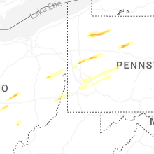

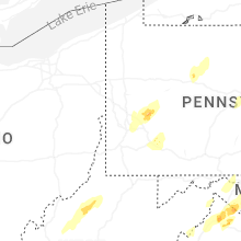


Connect with Interactive Hail Maps