

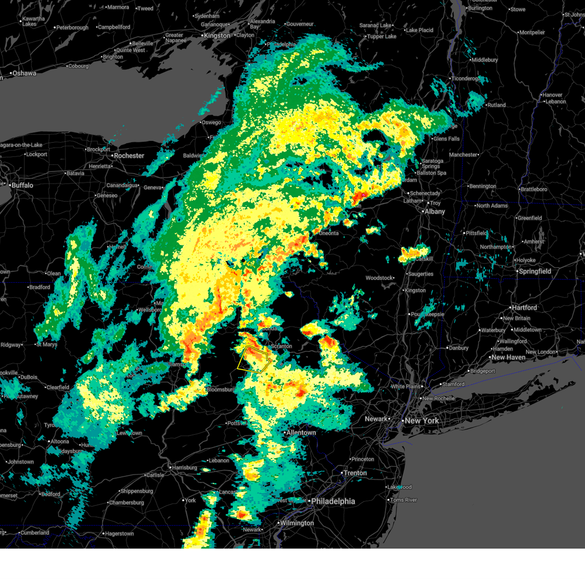
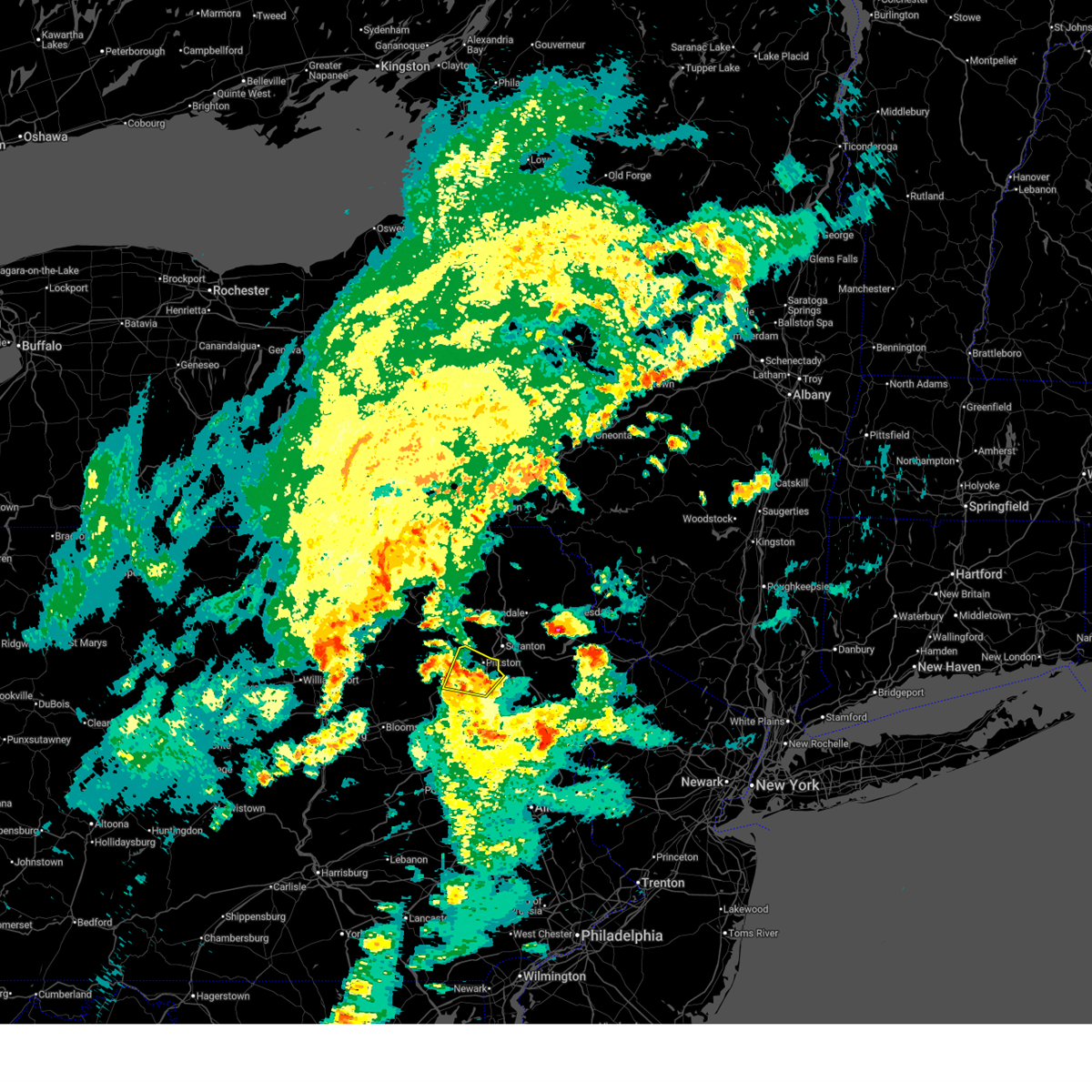
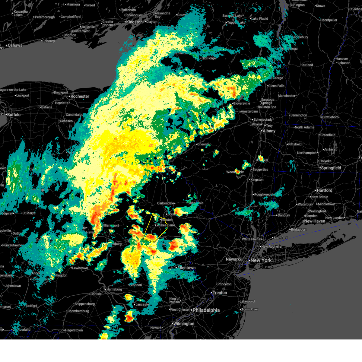
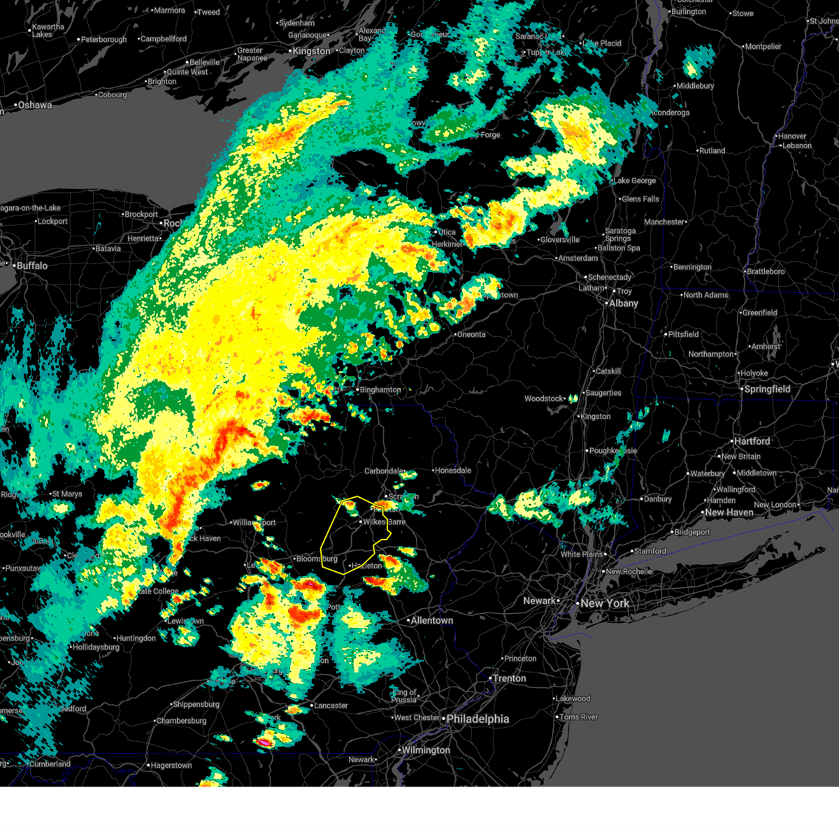
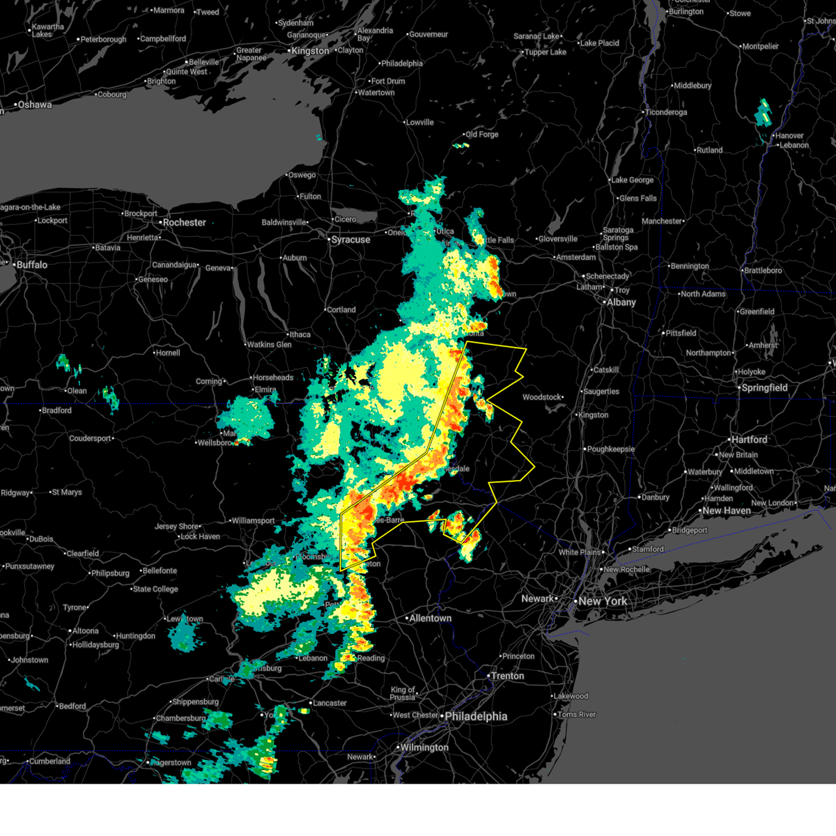
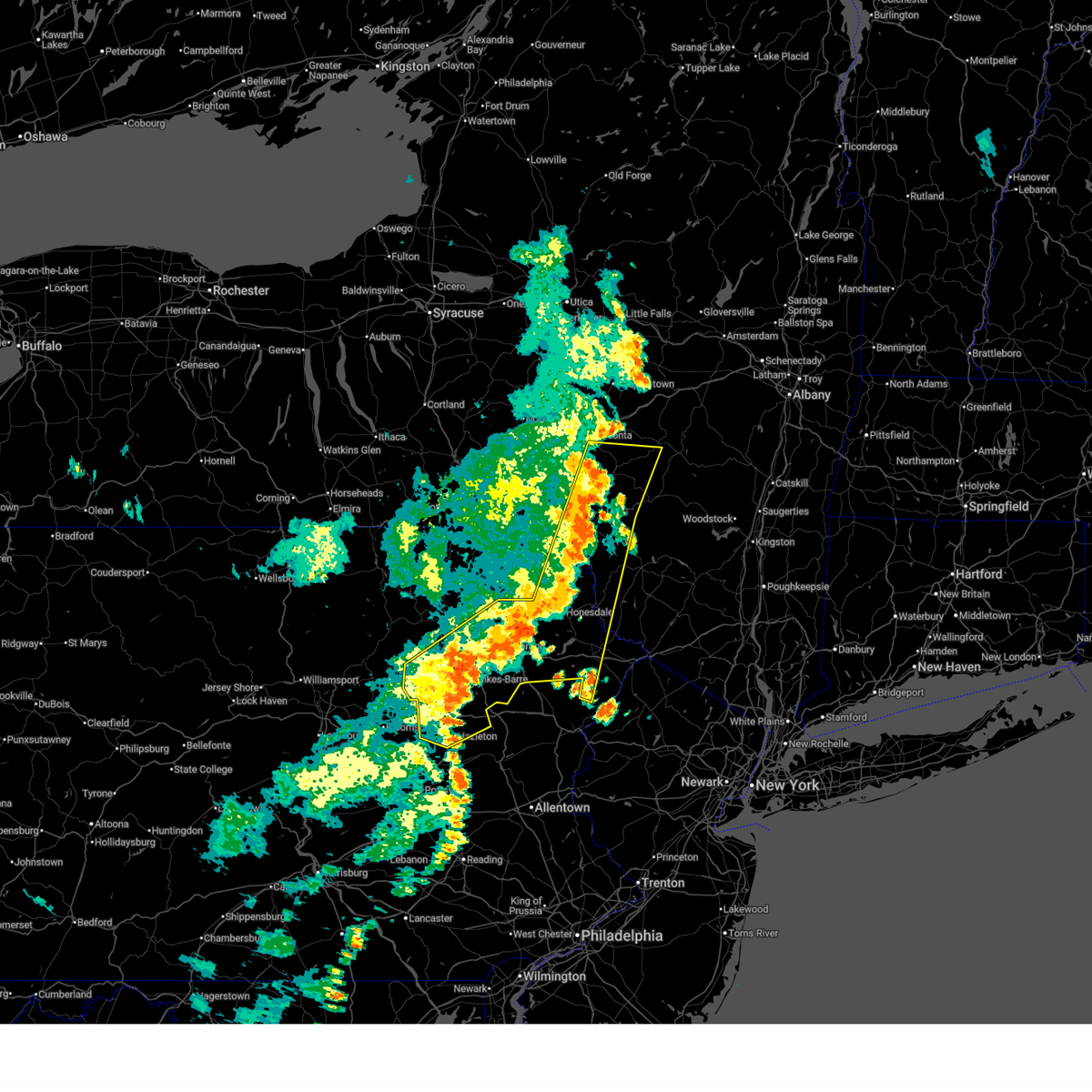
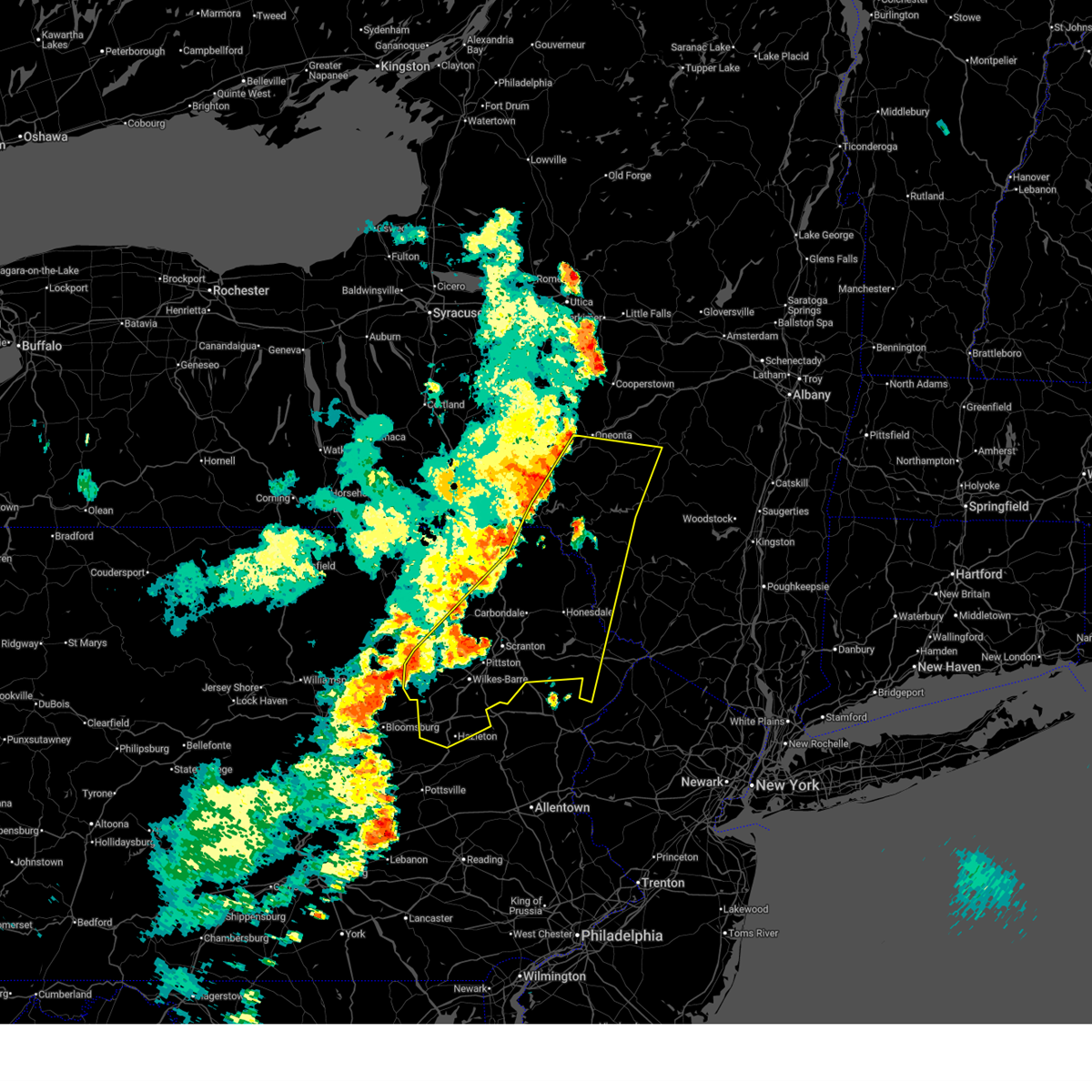
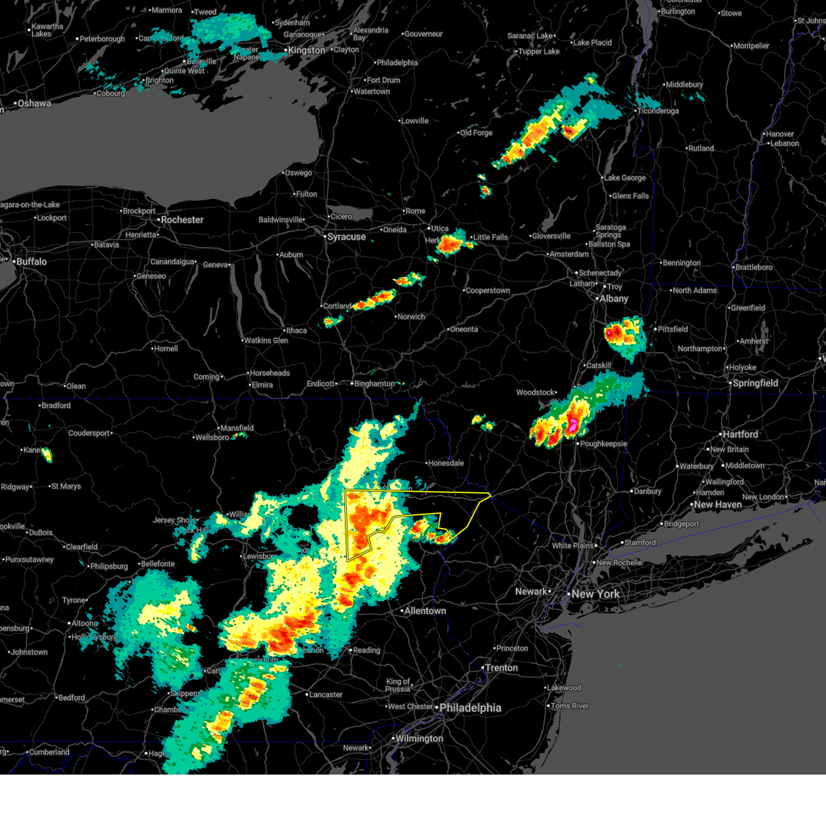
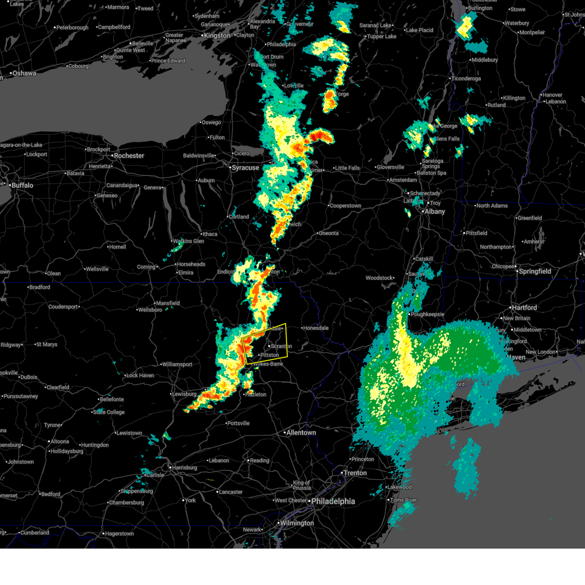
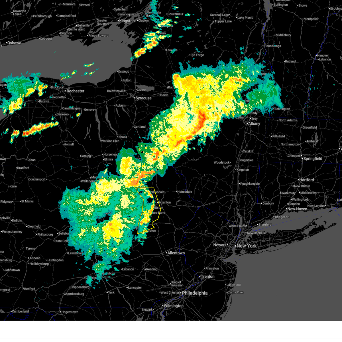
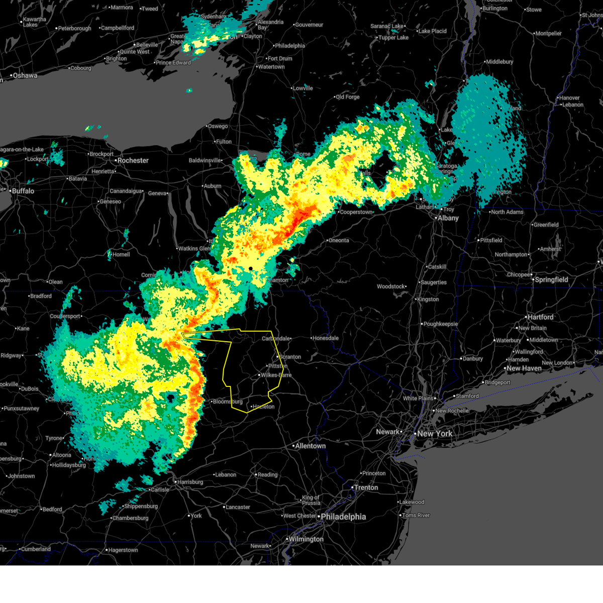
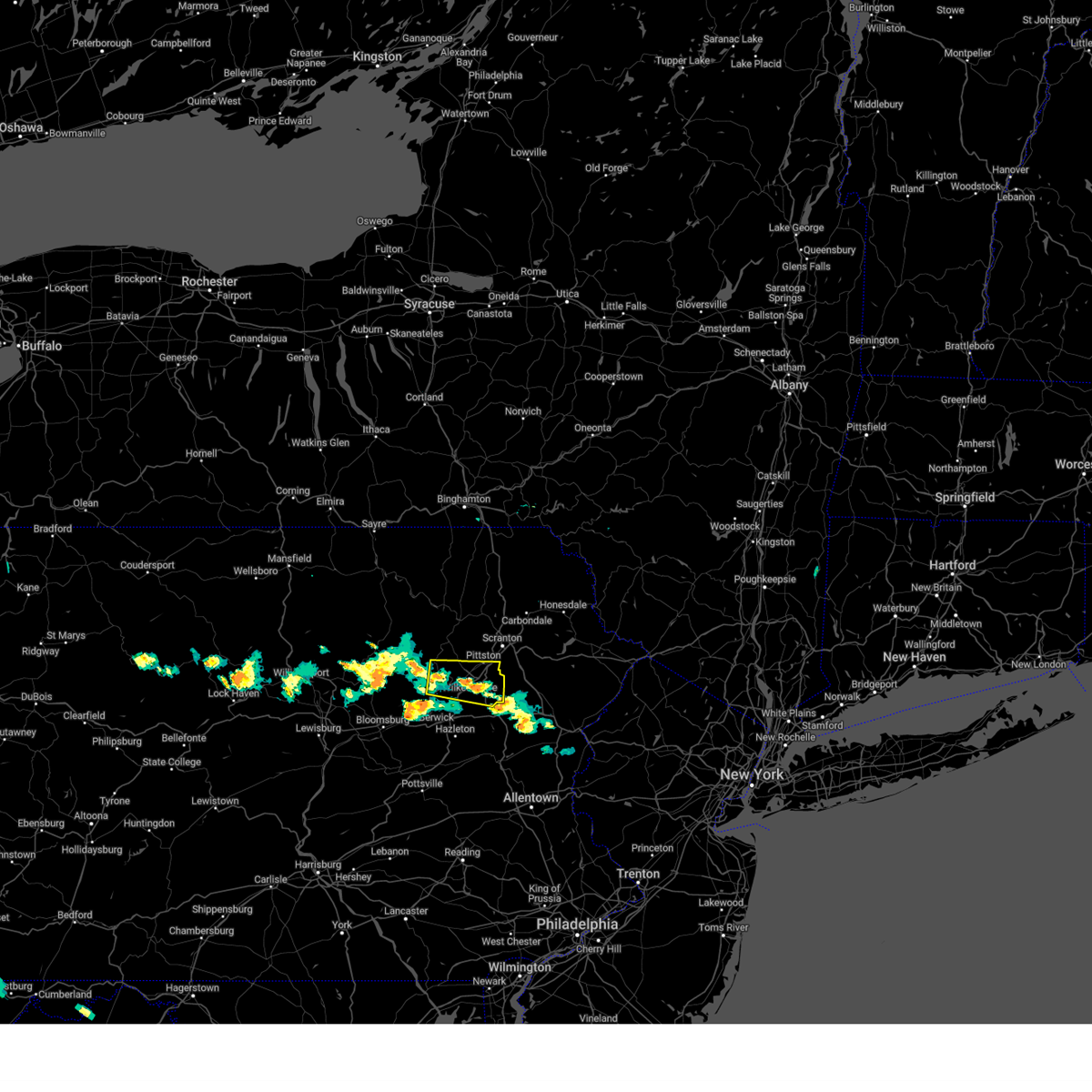
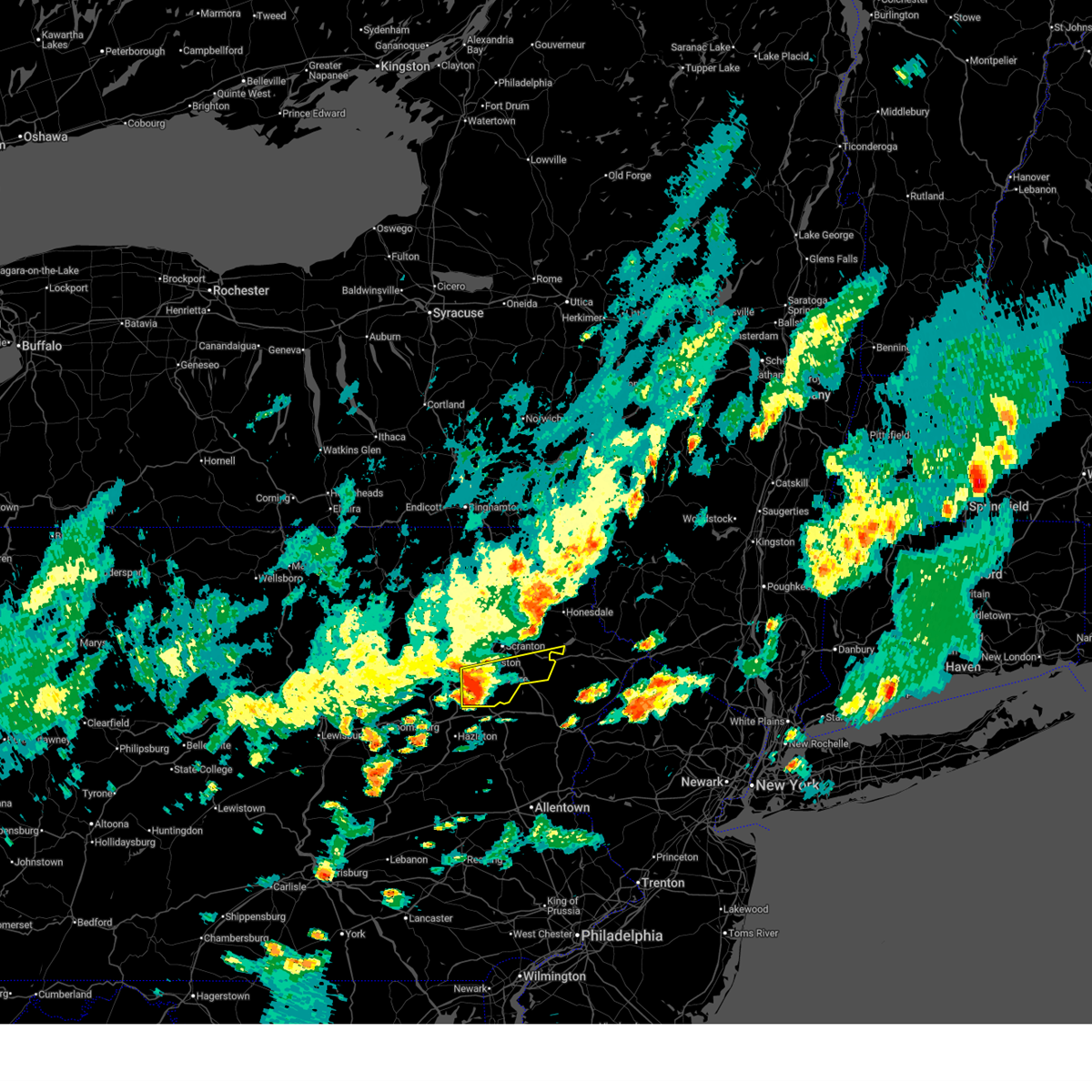
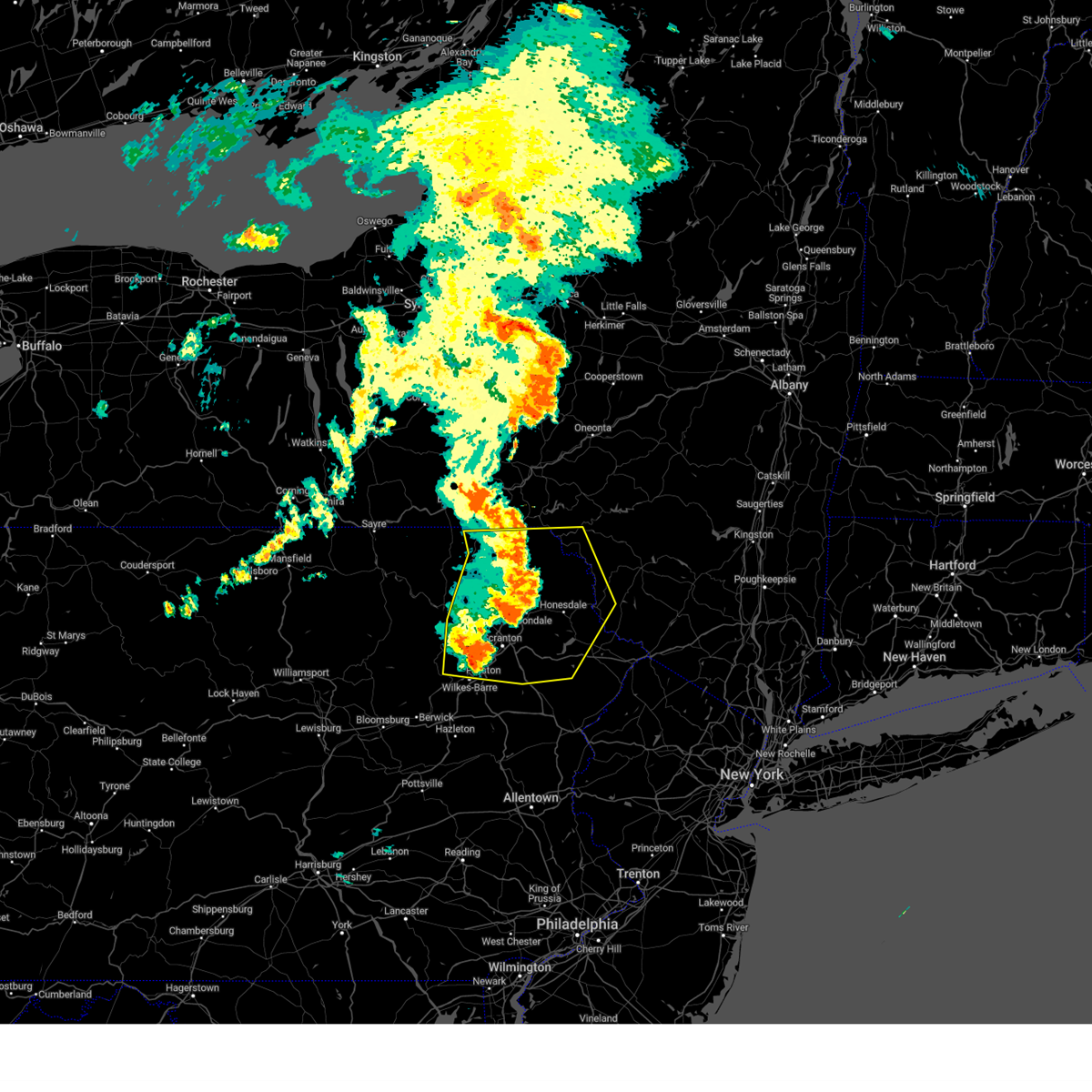
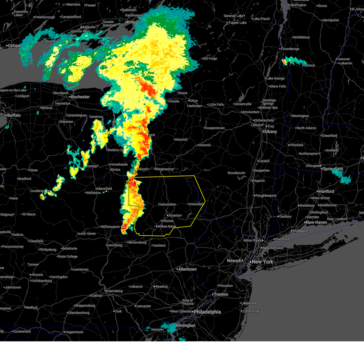
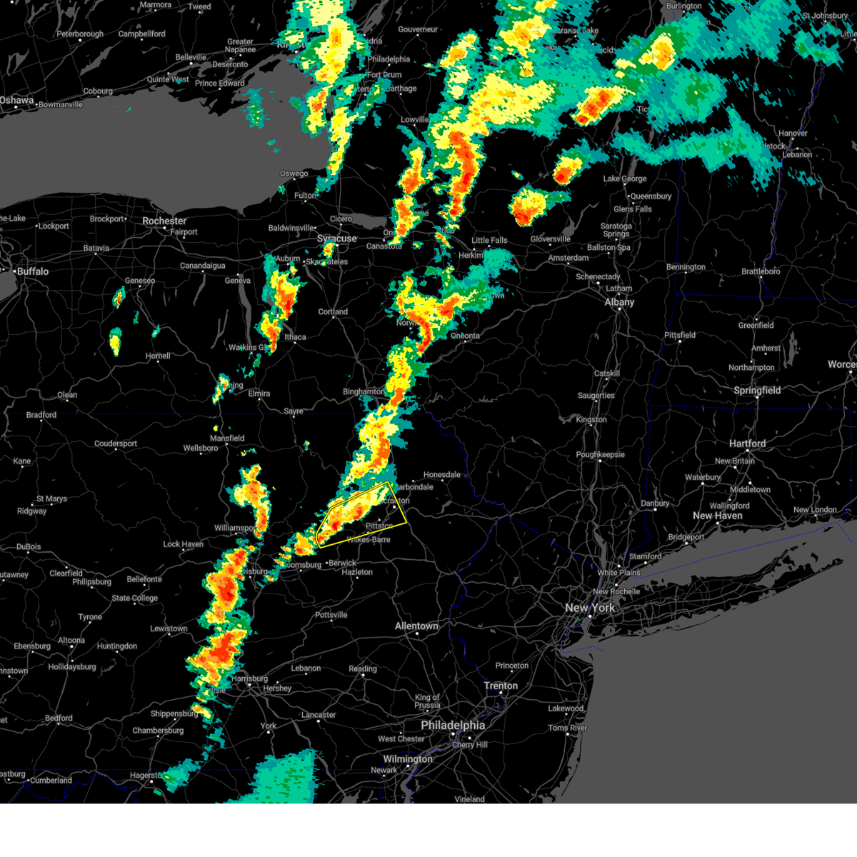
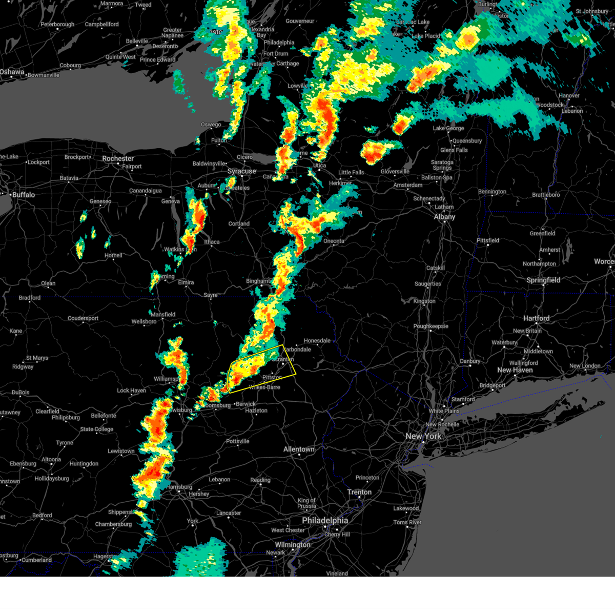
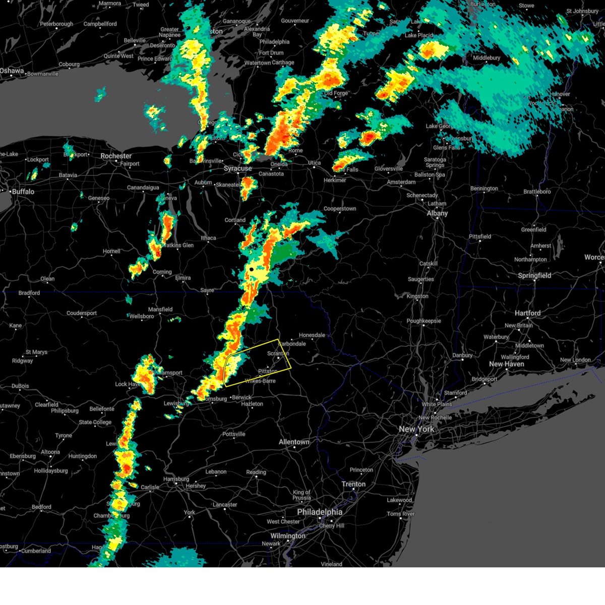
Hail Map for Pittston, PA
The Pittston, PA area has had 5 reports of on-the-ground hail by trained spotters, and has been under severe weather warnings 11 times during the past 12 months. Doppler radar has detected hail at or near Pittston, PA on 28 occasions, including 1 occasion during the past year.
| Name: | Pittston, PA |
| Where Located: | 8.8 miles SW of Scranton, PA |
| Map: | Google Map for Pittston, PA |
| Population: | 7739 |
| Housing Units: | 3907 |
| More Info: | Search Google for Pittston, PA |
0
The Top Recent Hail Date for Pittston, PA is Wednesday, August 13, 2025 (21st out of 28)

Hail and Wind Damage Spotted near Pittston, PA
| Date / Time | Report Details |
|---|---|
| 6/14/2026 9:25 PM EDT |
 The storm which prompted the warning has weakened below severe limits, and has exited the warned area. therefore, the warning will be allowed to expire. a severe thunderstorm watch remains in effect until 100 am edt for northeastern pennsylvania. The storm which prompted the warning has weakened below severe limits, and has exited the warned area. therefore, the warning will be allowed to expire. a severe thunderstorm watch remains in effect until 100 am edt for northeastern pennsylvania.
|
| 6/14/2026 9:18 PM EDT |
 At 918 pm edt, a severe thunderstorm was located over elmhurst, or near scranton, moving northeast at 55 mph (radar indicated). Hazards include 60 mph wind gusts. Expect damage to roofs, siding, and trees. Locations impacted include, wilkes-barre, kingston, nanticoke, plains, pittston, plymouth, moosic, exeter, swoyersville, and duryea. At 918 pm edt, a severe thunderstorm was located over elmhurst, or near scranton, moving northeast at 55 mph (radar indicated). Hazards include 60 mph wind gusts. Expect damage to roofs, siding, and trees. Locations impacted include, wilkes-barre, kingston, nanticoke, plains, pittston, plymouth, moosic, exeter, swoyersville, and duryea.
|
| 6/14/2026 8:54 PM EDT |
 At 854 pm edt, a severe thunderstorm was located over fairview heights, or near wilkes-barre, moving northeast at 55 mph (radar indicated). Hazards include 60 mph wind gusts and quarter size hail. Hail damage to vehicles is expected. expect wind damage to roofs, siding, and trees. Locations impacted include, wilkes-barre, kingston, nanticoke, plains, pittston, plymouth, moosic, exeter, swoyersville, and duryea. At 854 pm edt, a severe thunderstorm was located over fairview heights, or near wilkes-barre, moving northeast at 55 mph (radar indicated). Hazards include 60 mph wind gusts and quarter size hail. Hail damage to vehicles is expected. expect wind damage to roofs, siding, and trees. Locations impacted include, wilkes-barre, kingston, nanticoke, plains, pittston, plymouth, moosic, exeter, swoyersville, and duryea.
|
| 6/14/2026 8:28 PM EDT |
 Svrbgm the national weather service in binghamton has issued a * severe thunderstorm warning for, luzerne county in northeastern pennsylvania, * until 930 pm edt. * at 828 pm edt, a severe thunderstorm was located near brandonville, or near shenandoah, moving northeast at 55 mph (radar indicated). Hazards include 60 mph wind gusts and quarter size hail. Hail damage to vehicles is expected. Expect wind damage to roofs, siding, and trees. Svrbgm the national weather service in binghamton has issued a * severe thunderstorm warning for, luzerne county in northeastern pennsylvania, * until 930 pm edt. * at 828 pm edt, a severe thunderstorm was located near brandonville, or near shenandoah, moving northeast at 55 mph (radar indicated). Hazards include 60 mph wind gusts and quarter size hail. Hail damage to vehicles is expected. Expect wind damage to roofs, siding, and trees.
|
| 6/11/2026 8:39 PM EDT |
 Svrbgm the national weather service in binghamton has issued a * severe thunderstorm warning for, central delaware county in central new york, sullivan county in central new york, lackawanna county in northeastern pennsylvania, wayne county in northeastern pennsylvania, central luzerne county in northeastern pennsylvania, pike county in northeastern pennsylvania, * until 945 pm edt. * at 839 pm edt, severe thunderstorms were located along a line extending from near delhi to near roscoe to near narrowsburg to mount cobb to wilkes-barre to near weatherly, moving southeast at 25 mph (radar indicated). Hazards include 60 mph wind gusts and quarter size hail. Hail damage to vehicles is expected. Expect wind damage to roofs, siding, and trees. Svrbgm the national weather service in binghamton has issued a * severe thunderstorm warning for, central delaware county in central new york, sullivan county in central new york, lackawanna county in northeastern pennsylvania, wayne county in northeastern pennsylvania, central luzerne county in northeastern pennsylvania, pike county in northeastern pennsylvania, * until 945 pm edt. * at 839 pm edt, severe thunderstorms were located along a line extending from near delhi to near roscoe to near narrowsburg to mount cobb to wilkes-barre to near weatherly, moving southeast at 25 mph (radar indicated). Hazards include 60 mph wind gusts and quarter size hail. Hail damage to vehicles is expected. Expect wind damage to roofs, siding, and trees.
|
| 6/11/2026 8:31 PM EDT |
 At 830 pm edt, severe thunderstorms were located along a line extending from near franklin to east branch to near rutledgedale to near dunmore to near drums, moving southeast at 30 mph (radar indicated). Hazards include 60 mph wind gusts and quarter size hail. Hail damage to vehicles is expected. expect wind damage to roofs, siding, and trees. Locations impacted include, rockland, scranton, wilkes-barre, falls, hazleton, muhlenberg, dunmore, kingston, nanticoke, and plains. At 830 pm edt, severe thunderstorms were located along a line extending from near franklin to east branch to near rutledgedale to near dunmore to near drums, moving southeast at 30 mph (radar indicated). Hazards include 60 mph wind gusts and quarter size hail. Hail damage to vehicles is expected. expect wind damage to roofs, siding, and trees. Locations impacted include, rockland, scranton, wilkes-barre, falls, hazleton, muhlenberg, dunmore, kingston, nanticoke, and plains.
|
| 6/11/2026 7:51 PM EDT |
 Svrbgm the national weather service in binghamton has issued a * severe thunderstorm warning for, south central otsego county in central new york, southeastern broome county in central new york, delaware county in central new york, western sullivan county in central new york, eastern susquehanna county in northeastern pennsylvania, lackawanna county in northeastern pennsylvania, wayne county in northeastern pennsylvania, luzerne county in northeastern pennsylvania, western pike county in northeastern pennsylvania, wyoming county in northeastern pennsylvania, * until 845 pm edt. * at 751 pm edt, severe thunderstorms were located along a line extending from near oneonta to near deposit to near thompson to moosic to near huntington mills, moving east at 40 mph (radar indicated). Hazards include 60 mph wind gusts and quarter size hail. Hail damage to vehicles is expected. Expect wind damage to roofs, siding, and trees. Svrbgm the national weather service in binghamton has issued a * severe thunderstorm warning for, south central otsego county in central new york, southeastern broome county in central new york, delaware county in central new york, western sullivan county in central new york, eastern susquehanna county in northeastern pennsylvania, lackawanna county in northeastern pennsylvania, wayne county in northeastern pennsylvania, luzerne county in northeastern pennsylvania, western pike county in northeastern pennsylvania, wyoming county in northeastern pennsylvania, * until 845 pm edt. * at 751 pm edt, severe thunderstorms were located along a line extending from near oneonta to near deposit to near thompson to moosic to near huntington mills, moving east at 40 mph (radar indicated). Hazards include 60 mph wind gusts and quarter size hail. Hail damage to vehicles is expected. Expect wind damage to roofs, siding, and trees.
|
| 6/6/2026 5:39 PM EDT |
 Svrbgm the national weather service in binghamton has issued a * severe thunderstorm warning for, southern lackawanna county in northeastern pennsylvania, southwestern wayne county in northeastern pennsylvania, eastern luzerne county in northeastern pennsylvania, pike county in northeastern pennsylvania, * until 645 pm edt. * at 539 pm edt, severe thunderstorms were located along a line extending from old forge to near weatherly, moving east at 45 mph (radar indicated). Hazards include 60 mph wind gusts and penny size hail. expect damage to roofs, siding, and trees Svrbgm the national weather service in binghamton has issued a * severe thunderstorm warning for, southern lackawanna county in northeastern pennsylvania, southwestern wayne county in northeastern pennsylvania, eastern luzerne county in northeastern pennsylvania, pike county in northeastern pennsylvania, * until 645 pm edt. * at 539 pm edt, severe thunderstorms were located along a line extending from old forge to near weatherly, moving east at 45 mph (radar indicated). Hazards include 60 mph wind gusts and penny size hail. expect damage to roofs, siding, and trees
|
| 11/5/2025 8:28 PM EST | the severe thunderstorm warning has been cancelled and is no longer in effect |
| 11/5/2025 8:28 PM EST | At 828 pm est, a severe thunderstorm was located over mehoopany, or near tunkhannock, moving east at 60 mph (radar indicated). Hazards include 60 mph wind gusts. Expect damage to roofs, siding, and trees. Locations impacted include, scranton, falls, dunmore, carbondale, old forge, pittston, archbald, blakely, taylor, and dickson city. |
| 11/5/2025 8:08 PM EST | Svrbgm the national weather service in binghamton has issued a * severe thunderstorm warning for, southern susquehanna county in northeastern pennsylvania, lackawanna county in northeastern pennsylvania, northeastern luzerne county in northeastern pennsylvania, southeastern bradford county in northeastern pennsylvania, wyoming county in northeastern pennsylvania, * until 915 pm est. * at 808 pm est, a severe thunderstorm was located over sugar run, or over wyalusing, moving east at 60 mph (radar indicated). Hazards include 60 mph wind gusts. expect damage to roofs, siding, and trees |
| 7/3/2025 4:40 PM EDT | Trees down on wires... bending power poles over state route 92. reported via pema. radar-estimated tim in luzerne county PA, 4.9 miles SSE of Pittston, PA |
| 6/19/2025 8:34 PM EDT |
 Svrbgm the national weather service in binghamton has issued a * severe thunderstorm warning for, lackawanna county in northeastern pennsylvania, northeastern luzerne county in northeastern pennsylvania, southeastern wyoming county in northeastern pennsylvania, * until 915 pm edt. * at 834 pm edt, a severe thunderstorm was located near old forge, or near pittston, moving east at 50 mph (radar indicated). Hazards include 60 mph wind gusts. expect damage to roofs, siding, and trees Svrbgm the national weather service in binghamton has issued a * severe thunderstorm warning for, lackawanna county in northeastern pennsylvania, northeastern luzerne county in northeastern pennsylvania, southeastern wyoming county in northeastern pennsylvania, * until 915 pm edt. * at 834 pm edt, a severe thunderstorm was located near old forge, or near pittston, moving east at 50 mph (radar indicated). Hazards include 60 mph wind gusts. expect damage to roofs, siding, and trees
|
| 6/19/2025 7:29 PM EDT |
 Svrbgm the national weather service in binghamton has issued a * severe thunderstorm warning for, northern luzerne county in northeastern pennsylvania, southeastern bradford county in northeastern pennsylvania, wyoming county in northeastern pennsylvania, * until 830 pm edt. * at 728 pm edt, a severe thunderstorm was located 7 miles northwest of ricketts glen state park, or 17 miles southwest of wyalusing, moving east at 45 mph (radar indicated). Hazards include 60 mph wind gusts. expect damage to roofs, siding, and trees Svrbgm the national weather service in binghamton has issued a * severe thunderstorm warning for, northern luzerne county in northeastern pennsylvania, southeastern bradford county in northeastern pennsylvania, wyoming county in northeastern pennsylvania, * until 830 pm edt. * at 728 pm edt, a severe thunderstorm was located 7 miles northwest of ricketts glen state park, or 17 miles southwest of wyalusing, moving east at 45 mph (radar indicated). Hazards include 60 mph wind gusts. expect damage to roofs, siding, and trees
|
| 5/6/2025 3:34 PM EDT |
 Svrbgm the national weather service in binghamton has issued a * severe thunderstorm warning for, southern lackawanna county in northeastern pennsylvania, northeastern luzerne county in northeastern pennsylvania, * until 415 pm edt. * at 334 pm edt, a severe thunderstorm was located near stoddartsville, or 12 miles southeast of pittston, moving north at 15 mph (radar indicated). Hazards include 60 mph wind gusts and quarter size hail. Hail damage to vehicles is expected. Expect wind damage to roofs, siding, and trees. Svrbgm the national weather service in binghamton has issued a * severe thunderstorm warning for, southern lackawanna county in northeastern pennsylvania, northeastern luzerne county in northeastern pennsylvania, * until 415 pm edt. * at 334 pm edt, a severe thunderstorm was located near stoddartsville, or 12 miles southeast of pittston, moving north at 15 mph (radar indicated). Hazards include 60 mph wind gusts and quarter size hail. Hail damage to vehicles is expected. Expect wind damage to roofs, siding, and trees.
|
| 4/29/2025 8:41 PM EDT |
 The storms which prompted the warning have weakened below severe limits, and have exited the warned area. therefore, the warning will be allowed to expire. a severe thunderstorm watch remains in effect until 1000 pm edt for northeastern pennsylvania. The storms which prompted the warning have weakened below severe limits, and have exited the warned area. therefore, the warning will be allowed to expire. a severe thunderstorm watch remains in effect until 1000 pm edt for northeastern pennsylvania.
|
| 4/29/2025 8:31 PM EDT |
 the severe thunderstorm warning has been cancelled and is no longer in effect the severe thunderstorm warning has been cancelled and is no longer in effect
|
| 4/29/2025 8:31 PM EDT |
 At 831 pm edt, severe thunderstorms were located along a line extending from near auburn center to wilkes-barre to grier city-park crest, moving east at 70 mph (radar indicated). Hazards include 60 mph wind gusts. Expect damage to roofs, siding, and trees. Locations impacted include, mountain mills, glen summit, meshoppen, orange, miners mills, glendale, nicholson, walls corners, lake sheridan, and dalton. At 831 pm edt, severe thunderstorms were located along a line extending from near auburn center to wilkes-barre to grier city-park crest, moving east at 70 mph (radar indicated). Hazards include 60 mph wind gusts. Expect damage to roofs, siding, and trees. Locations impacted include, mountain mills, glen summit, meshoppen, orange, miners mills, glendale, nicholson, walls corners, lake sheridan, and dalton.
|
| 4/29/2025 7:59 PM EDT |
 Svrbgm the national weather service in binghamton has issued a * severe thunderstorm warning for, western lackawanna county in northeastern pennsylvania, luzerne county in northeastern pennsylvania, southern bradford county in northeastern pennsylvania, wyoming county in northeastern pennsylvania, * until 845 pm edt. * at 758 pm edt, severe thunderstorms were located along a line extending from near lincoln falls to eyers grove to klingerstown, moving east at 70 mph (radar indicated). Hazards include 60 mph wind gusts. expect damage to roofs, siding, and trees Svrbgm the national weather service in binghamton has issued a * severe thunderstorm warning for, western lackawanna county in northeastern pennsylvania, luzerne county in northeastern pennsylvania, southern bradford county in northeastern pennsylvania, wyoming county in northeastern pennsylvania, * until 845 pm edt. * at 758 pm edt, severe thunderstorms were located along a line extending from near lincoln falls to eyers grove to klingerstown, moving east at 70 mph (radar indicated). Hazards include 60 mph wind gusts. expect damage to roofs, siding, and trees
|
| 8/28/2024 6:06 PM EDT |
 Svrbgm the national weather service in binghamton has issued a * severe thunderstorm warning for, central luzerne county in northeastern pennsylvania, * until 645 pm edt. * at 606 pm edt, a severe thunderstorm was located near muhlenberg, or 9 miles west of wilkes-barre, moving east at 25 mph (radar indicated). Hazards include 60 mph wind gusts and quarter size hail. Hail damage to vehicles is expected. Expect wind damage to roofs, siding, and trees. Svrbgm the national weather service in binghamton has issued a * severe thunderstorm warning for, central luzerne county in northeastern pennsylvania, * until 645 pm edt. * at 606 pm edt, a severe thunderstorm was located near muhlenberg, or 9 miles west of wilkes-barre, moving east at 25 mph (radar indicated). Hazards include 60 mph wind gusts and quarter size hail. Hail damage to vehicles is expected. Expect wind damage to roofs, siding, and trees.
|
| 7/17/2024 5:41 PM EDT |
 Svrbgm the national weather service in binghamton has issued a * severe thunderstorm warning for, southeastern lackawanna county in northeastern pennsylvania, southwestern wayne county in northeastern pennsylvania, northeastern luzerne county in northeastern pennsylvania, * until 630 pm edt. * at 541 pm edt, a severe thunderstorm was located near wilkes-barre, moving east at 45 mph (radar indicated). Hazards include 60 mph wind gusts and quarter size hail. Hail damage to vehicles is expected. Expect wind damage to roofs, siding, and trees. Svrbgm the national weather service in binghamton has issued a * severe thunderstorm warning for, southeastern lackawanna county in northeastern pennsylvania, southwestern wayne county in northeastern pennsylvania, northeastern luzerne county in northeastern pennsylvania, * until 630 pm edt. * at 541 pm edt, a severe thunderstorm was located near wilkes-barre, moving east at 45 mph (radar indicated). Hazards include 60 mph wind gusts and quarter size hail. Hail damage to vehicles is expected. Expect wind damage to roofs, siding, and trees.
|
| 7/17/2024 5:32 PM EDT |
 At 532 pm edt, a severe thunderstorm was located over bear creek, or near wilkes-barre, moving east at 45 mph (radar indicated). Hazards include 60 mph wind gusts and quarter size hail. Hail damage to vehicles is expected. expect wind damage to roofs, siding, and trees. Locations impacted include, wilkes-barre, kingston, nanticoke, plains, old forge, pittston, plymouth, moosic, exeter, and swoyersville. At 532 pm edt, a severe thunderstorm was located over bear creek, or near wilkes-barre, moving east at 45 mph (radar indicated). Hazards include 60 mph wind gusts and quarter size hail. Hail damage to vehicles is expected. expect wind damage to roofs, siding, and trees. Locations impacted include, wilkes-barre, kingston, nanticoke, plains, old forge, pittston, plymouth, moosic, exeter, and swoyersville.
|
| 7/17/2024 5:28 PM EDT |
 Torbgm the national weather service in binghamton has issued a * tornado warning for, northeastern luzerne county in northeastern pennsylvania, * until 600 pm edt. * at 527 pm edt, a severe thunderstorm capable of producing a tornado was located over sugar notch, or near wilkes-barre, moving east at 40 mph (radar indicated rotation). Hazards include tornado and quarter size hail. Flying debris will be dangerous to those caught without shelter. mobile homes will be damaged or destroyed. damage to roofs, windows, and vehicles will occur. tree damage is likely. This dangerous storm will be near, wilkes-barre, edwardsville, and bear creek around 535 pm edt. Torbgm the national weather service in binghamton has issued a * tornado warning for, northeastern luzerne county in northeastern pennsylvania, * until 600 pm edt. * at 527 pm edt, a severe thunderstorm capable of producing a tornado was located over sugar notch, or near wilkes-barre, moving east at 40 mph (radar indicated rotation). Hazards include tornado and quarter size hail. Flying debris will be dangerous to those caught without shelter. mobile homes will be damaged or destroyed. damage to roofs, windows, and vehicles will occur. tree damage is likely. This dangerous storm will be near, wilkes-barre, edwardsville, and bear creek around 535 pm edt.
|
| 7/17/2024 5:16 PM EDT |
 At 516 pm edt, a severe thunderstorm was located near slocum, or 8 miles southwest of wilkes-barre, moving east at 45 mph (radar indicated). Hazards include 60 mph wind gusts and quarter size hail. Hail damage to vehicles is expected. expect wind damage to roofs, siding, and trees. Locations impacted include, wilkes-barre, muhlenberg, kingston, nanticoke, plains, old forge, pittston, plymouth, moosic, and exeter. At 516 pm edt, a severe thunderstorm was located near slocum, or 8 miles southwest of wilkes-barre, moving east at 45 mph (radar indicated). Hazards include 60 mph wind gusts and quarter size hail. Hail damage to vehicles is expected. expect wind damage to roofs, siding, and trees. Locations impacted include, wilkes-barre, muhlenberg, kingston, nanticoke, plains, old forge, pittston, plymouth, moosic, and exeter.
|
| 7/17/2024 4:52 PM EDT |
 Svrbgm the national weather service in binghamton has issued a * severe thunderstorm warning for, luzerne county in northeastern pennsylvania, * until 545 pm edt. * at 452 pm edt, a severe thunderstorm was located near huntington mills, or 8 miles northwest of berwick, moving east at 45 mph (radar indicated). Hazards include 60 mph wind gusts and quarter size hail. Hail damage to vehicles is expected. Expect wind damage to roofs, siding, and trees. Svrbgm the national weather service in binghamton has issued a * severe thunderstorm warning for, luzerne county in northeastern pennsylvania, * until 545 pm edt. * at 452 pm edt, a severe thunderstorm was located near huntington mills, or 8 miles northwest of berwick, moving east at 45 mph (radar indicated). Hazards include 60 mph wind gusts and quarter size hail. Hail damage to vehicles is expected. Expect wind damage to roofs, siding, and trees.
|
| 7/15/2024 7:30 PM EDT |
 the severe thunderstorm warning has been cancelled and is no longer in effect the severe thunderstorm warning has been cancelled and is no longer in effect
|
| 7/15/2024 7:30 PM EDT |
 At 730 pm edt, severe thunderstorms were located along a line extending from lanesboro to waymart to near pittston, moving east at 45 mph (radar indicated). Hazards include 70 mph wind gusts and penny size hail. Expect considerable tree damage. damage is likely to mobile homes, roofs, and outbuildings. Locations impacted include, scranton, wilkes-barre, falls, dunmore, kingston, plains, carbondale, old forge, pittston, and archbald. At 730 pm edt, severe thunderstorms were located along a line extending from lanesboro to waymart to near pittston, moving east at 45 mph (radar indicated). Hazards include 70 mph wind gusts and penny size hail. Expect considerable tree damage. damage is likely to mobile homes, roofs, and outbuildings. Locations impacted include, scranton, wilkes-barre, falls, dunmore, kingston, plains, carbondale, old forge, pittston, and archbald.
|
| 7/15/2024 7:11 PM EDT |
 At 711 pm edt, severe thunderstorms were located along a line extending from near hallstead to east benton to near edwardsville, moving east at 50 mph (radar indicated). Hazards include 70 mph wind gusts and penny size hail. Expect considerable tree damage. damage is likely to mobile homes, roofs, and outbuildings. Locations impacted include, scranton, wilkes-barre, falls, muhlenberg, dunmore, kingston, nanticoke, plains, carbondale, and old forge. At 711 pm edt, severe thunderstorms were located along a line extending from near hallstead to east benton to near edwardsville, moving east at 50 mph (radar indicated). Hazards include 70 mph wind gusts and penny size hail. Expect considerable tree damage. damage is likely to mobile homes, roofs, and outbuildings. Locations impacted include, scranton, wilkes-barre, falls, muhlenberg, dunmore, kingston, nanticoke, plains, carbondale, and old forge.
|
| 7/15/2024 6:44 PM EDT |
 Svrbgm the national weather service in binghamton has issued a * severe thunderstorm warning for, southwestern delaware county in central new york, southwestern sullivan county in central new york, susquehanna county in northeastern pennsylvania, lackawanna county in northeastern pennsylvania, wayne county in northeastern pennsylvania, luzerne county in northeastern pennsylvania, eastern bradford county in northeastern pennsylvania, northwestern pike county in northeastern pennsylvania, wyoming county in northeastern pennsylvania, * until 745 pm edt. * at 644 pm edt, severe thunderstorms were located along a line extending from near windham to mehoopany to near rohrsburg, moving east at 50 mph (radar indicated). Hazards include 70 mph wind gusts and penny size hail. Expect considerable tree damage. Damage is likely to mobile homes, roofs, and outbuildings. Svrbgm the national weather service in binghamton has issued a * severe thunderstorm warning for, southwestern delaware county in central new york, southwestern sullivan county in central new york, susquehanna county in northeastern pennsylvania, lackawanna county in northeastern pennsylvania, wayne county in northeastern pennsylvania, luzerne county in northeastern pennsylvania, eastern bradford county in northeastern pennsylvania, northwestern pike county in northeastern pennsylvania, wyoming county in northeastern pennsylvania, * until 745 pm edt. * at 644 pm edt, severe thunderstorms were located along a line extending from near windham to mehoopany to near rohrsburg, moving east at 50 mph (radar indicated). Hazards include 70 mph wind gusts and penny size hail. Expect considerable tree damage. Damage is likely to mobile homes, roofs, and outbuildings.
|
| 7/10/2024 8:28 PM EDT |
 Svrbgm the national weather service in binghamton has issued a * severe thunderstorm warning for, northwestern lackawanna county in northeastern pennsylvania, northern luzerne county in northeastern pennsylvania, southeastern wyoming county in northeastern pennsylvania, * until 915 pm edt. * at 828 pm edt, a severe thunderstorm was located near sweet valley, or 11 miles west of wilkes-barre, moving northeast at 30 mph (radar indicated). Hazards include 60 mph wind gusts and penny size hail. expect damage to roofs, siding, and trees Svrbgm the national weather service in binghamton has issued a * severe thunderstorm warning for, northwestern lackawanna county in northeastern pennsylvania, northern luzerne county in northeastern pennsylvania, southeastern wyoming county in northeastern pennsylvania, * until 915 pm edt. * at 828 pm edt, a severe thunderstorm was located near sweet valley, or 11 miles west of wilkes-barre, moving northeast at 30 mph (radar indicated). Hazards include 60 mph wind gusts and penny size hail. expect damage to roofs, siding, and trees
|
| 7/10/2024 8:17 PM EDT |
 At 816 pm edt, a severe thunderstorm was located near clarks summit, or near waverly, moving northeast at 50 mph (radar indicated). Hazards include 60 mph wind gusts and penny size hail. Expect damage to roofs, siding, and trees. Locations impacted include, scranton, wilkes-barre, falls, muhlenberg, dunmore, kingston, nanticoke, plains, old forge, and pittston. At 816 pm edt, a severe thunderstorm was located near clarks summit, or near waverly, moving northeast at 50 mph (radar indicated). Hazards include 60 mph wind gusts and penny size hail. Expect damage to roofs, siding, and trees. Locations impacted include, scranton, wilkes-barre, falls, muhlenberg, dunmore, kingston, nanticoke, plains, old forge, and pittston.
|
| 7/10/2024 7:41 PM EDT |
 Svrbgm the national weather service in binghamton has issued a * severe thunderstorm warning for, central lackawanna county in northeastern pennsylvania, northern luzerne county in northeastern pennsylvania, southern wyoming county in northeastern pennsylvania, * until 830 pm edt. * at 741 pm edt, a severe thunderstorm was located over fairmount spgs, or 14 miles north of berwick, moving northeast at 40 mph (radar indicated). Hazards include 60 mph wind gusts and penny size hail. expect damage to roofs, siding, and trees Svrbgm the national weather service in binghamton has issued a * severe thunderstorm warning for, central lackawanna county in northeastern pennsylvania, northern luzerne county in northeastern pennsylvania, southern wyoming county in northeastern pennsylvania, * until 830 pm edt. * at 741 pm edt, a severe thunderstorm was located over fairmount spgs, or 14 miles north of berwick, moving northeast at 40 mph (radar indicated). Hazards include 60 mph wind gusts and penny size hail. expect damage to roofs, siding, and trees
|
| 7/4/2024 5:10 PM EDT |
 The storm which prompted the warning has weakened below severe limits, and no longer poses an immediate threat to life or property. therefore, the warning will be allowed to expire. The storm which prompted the warning has weakened below severe limits, and no longer poses an immediate threat to life or property. therefore, the warning will be allowed to expire.
|
| 7/4/2024 4:46 PM EDT |
 At 446 pm edt, a severe thunderstorm was located over west wyoming, or near pittston, moving southeast at 15 mph (radar indicated). Hazards include 60 mph wind gusts. Expect damage to roofs, siding, and trees. Locations impacted include, scranton, old forge, pittston, taylor, moosic, exeter, duryea, west pittston, dallas, and harveys lake. At 446 pm edt, a severe thunderstorm was located over west wyoming, or near pittston, moving southeast at 15 mph (radar indicated). Hazards include 60 mph wind gusts. Expect damage to roofs, siding, and trees. Locations impacted include, scranton, old forge, pittston, taylor, moosic, exeter, duryea, west pittston, dallas, and harveys lake.
|
| 7/4/2024 4:46 PM EDT |
 the severe thunderstorm warning has been cancelled and is no longer in effect the severe thunderstorm warning has been cancelled and is no longer in effect
|
| 7/4/2024 4:29 PM EDT |
 Svrbgm the national weather service in binghamton has issued a * severe thunderstorm warning for, west central lackawanna county in northeastern pennsylvania, northern luzerne county in northeastern pennsylvania, southern wyoming county in northeastern pennsylvania, * until 515 pm edt. * at 428 pm edt, severe thunderstorms were located along a line extending from near falls to near beaumont to ricketts glen state park, moving southeast at 10 mph (radar indicated). Hazards include 60 mph wind gusts. expect damage to roofs, siding, and trees Svrbgm the national weather service in binghamton has issued a * severe thunderstorm warning for, west central lackawanna county in northeastern pennsylvania, northern luzerne county in northeastern pennsylvania, southern wyoming county in northeastern pennsylvania, * until 515 pm edt. * at 428 pm edt, severe thunderstorms were located along a line extending from near falls to near beaumont to ricketts glen state park, moving southeast at 10 mph (radar indicated). Hazards include 60 mph wind gusts. expect damage to roofs, siding, and trees
|
| 6/30/2024 1:40 PM EDT |
 the severe thunderstorm warning has been cancelled and is no longer in effect the severe thunderstorm warning has been cancelled and is no longer in effect
|
| 6/30/2024 1:06 PM EDT |
 Svrbgm the national weather service in binghamton has issued a * severe thunderstorm warning for, southeastern lackawanna county in northeastern pennsylvania, northeastern luzerne county in northeastern pennsylvania, * until 200 pm edt. * at 106 pm edt, a severe thunderstorm was located over sugar notch, or near wilkes-barre, moving east at 35 mph (radar indicated). Hazards include 60 mph wind gusts. expect damage to roofs, siding, and trees Svrbgm the national weather service in binghamton has issued a * severe thunderstorm warning for, southeastern lackawanna county in northeastern pennsylvania, northeastern luzerne county in northeastern pennsylvania, * until 200 pm edt. * at 106 pm edt, a severe thunderstorm was located over sugar notch, or near wilkes-barre, moving east at 35 mph (radar indicated). Hazards include 60 mph wind gusts. expect damage to roofs, siding, and trees
|
| 6/26/2024 7:10 PM EDT |
 At 710 pm edt, severe thunderstorms were located along a line extending from clarks summit to mount pocono, moving northeast at 45 mph (law enforcement has reported numerous downed trees and wires in luzerne county). Hazards include 60 mph wind gusts. Expect damage to roofs, siding, and trees. Locations impacted include, scranton, falls, dunmore, carbondale, old forge, bushkill, pittston, archbald, blakely, and taylor. At 710 pm edt, severe thunderstorms were located along a line extending from clarks summit to mount pocono, moving northeast at 45 mph (law enforcement has reported numerous downed trees and wires in luzerne county). Hazards include 60 mph wind gusts. Expect damage to roofs, siding, and trees. Locations impacted include, scranton, falls, dunmore, carbondale, old forge, bushkill, pittston, archbald, blakely, and taylor.
|
| 6/26/2024 6:54 PM EDT |
 Svrbgm the national weather service in binghamton has issued a * severe thunderstorm warning for, southeastern susquehanna county in northeastern pennsylvania, lackawanna county in northeastern pennsylvania, wayne county in northeastern pennsylvania, northeastern luzerne county in northeastern pennsylvania, pike county in northeastern pennsylvania, southeastern wyoming county in northeastern pennsylvania, * until 800 pm edt. * at 654 pm edt, severe thunderstorms were located along a line extending from near west wyoming to meckesville, moving northeast at 45 mph (law enforcement has reported numerous trees and wires down in luzerne county). Hazards include 60 mph wind gusts. expect damage to roofs, siding, and trees Svrbgm the national weather service in binghamton has issued a * severe thunderstorm warning for, southeastern susquehanna county in northeastern pennsylvania, lackawanna county in northeastern pennsylvania, wayne county in northeastern pennsylvania, northeastern luzerne county in northeastern pennsylvania, pike county in northeastern pennsylvania, southeastern wyoming county in northeastern pennsylvania, * until 800 pm edt. * at 654 pm edt, severe thunderstorms were located along a line extending from near west wyoming to meckesville, moving northeast at 45 mph (law enforcement has reported numerous trees and wires down in luzerne county). Hazards include 60 mph wind gusts. expect damage to roofs, siding, and trees
|
| 6/26/2024 5:31 PM EDT | Svrbgm the national weather service in binghamton has issued a * severe thunderstorm warning for, central luzerne county in northeastern pennsylvania, * until 630 pm edt. * at 530 pm edt, a severe thunderstorm was located over lightstreet, or near bloomsburg, moving east at 35 mph (radar indicated). Hazards include 60 mph wind gusts and quarter size hail. Hail damage to vehicles is expected. Expect wind damage to roofs, siding, and trees. |
| 6/22/2024 2:35 PM EDT |
 At 235 pm edt, a severe thunderstorm was located over elmhurst, or near scranton, moving east at 25 mph (radar indicated). Hazards include 60 mph wind gusts and penny size hail. Expect damage to roofs, siding, and trees. Locations impacted include, scranton, dunmore, old forge, pittston, blakely, taylor, dickson city, moosic, olyphant, and duryea. At 235 pm edt, a severe thunderstorm was located over elmhurst, or near scranton, moving east at 25 mph (radar indicated). Hazards include 60 mph wind gusts and penny size hail. Expect damage to roofs, siding, and trees. Locations impacted include, scranton, dunmore, old forge, pittston, blakely, taylor, dickson city, moosic, olyphant, and duryea.
|
| 6/22/2024 2:16 PM EDT |
 Svrbgm the national weather service in binghamton has issued a * severe thunderstorm warning for, central lackawanna county in northeastern pennsylvania, southwestern wayne county in northeastern pennsylvania, northeastern luzerne county in northeastern pennsylvania, * until 300 pm edt. * at 215 pm edt, a severe thunderstorm was located over old forge, or near scranton, moving east at 25 mph (radar indicated). Hazards include 60 mph wind gusts and nickel size hail. expect damage to roofs, siding, and trees Svrbgm the national weather service in binghamton has issued a * severe thunderstorm warning for, central lackawanna county in northeastern pennsylvania, southwestern wayne county in northeastern pennsylvania, northeastern luzerne county in northeastern pennsylvania, * until 300 pm edt. * at 215 pm edt, a severe thunderstorm was located over old forge, or near scranton, moving east at 25 mph (radar indicated). Hazards include 60 mph wind gusts and nickel size hail. expect damage to roofs, siding, and trees
|
| 6/21/2024 8:07 PM EDT |
 the severe thunderstorm warning has been cancelled and is no longer in effect the severe thunderstorm warning has been cancelled and is no longer in effect
|
| 6/21/2024 8:07 PM EDT |
 At 806 pm edt, a severe thunderstorm was located near glendale, or 9 miles southeast of pittston, moving southeast at 20 mph (radar indicated). Hazards include 60 mph wind gusts and penny size hail. Expect damage to roofs, siding, and trees. Locations impacted include, scranton, wilkes-barre, dunmore, kingston, plains, old forge, pittston, taylor, moosic, and exeter. At 806 pm edt, a severe thunderstorm was located near glendale, or 9 miles southeast of pittston, moving southeast at 20 mph (radar indicated). Hazards include 60 mph wind gusts and penny size hail. Expect damage to roofs, siding, and trees. Locations impacted include, scranton, wilkes-barre, dunmore, kingston, plains, old forge, pittston, taylor, moosic, and exeter.
|
| 6/21/2024 8:05 PM EDT |
 Svrbgm the national weather service in binghamton has issued a * severe thunderstorm warning for, northeastern luzerne county in northeastern pennsylvania, * until 845 pm edt. * at 804 pm edt, a severe thunderstorm was located near harveys lake, or 7 miles northwest of wilkes-barre, moving southeast at 20 mph (radar indicated). Hazards include 60 mph wind gusts and penny size hail. expect damage to roofs, siding, and trees Svrbgm the national weather service in binghamton has issued a * severe thunderstorm warning for, northeastern luzerne county in northeastern pennsylvania, * until 845 pm edt. * at 804 pm edt, a severe thunderstorm was located near harveys lake, or 7 miles northwest of wilkes-barre, moving southeast at 20 mph (radar indicated). Hazards include 60 mph wind gusts and penny size hail. expect damage to roofs, siding, and trees
|
| 6/21/2024 7:48 PM EDT |
 Svrbgm the national weather service in binghamton has issued a * severe thunderstorm warning for, southern lackawanna county in northeastern pennsylvania, southwestern wayne county in northeastern pennsylvania, northeastern luzerne county in northeastern pennsylvania, southeastern wyoming county in northeastern pennsylvania, * until 830 pm edt. * at 748 pm edt, a severe thunderstorm was located over pittston, moving southeast at 20 mph (radar indicated). Hazards include 60 mph wind gusts and penny size hail. expect damage to roofs, siding, and trees Svrbgm the national weather service in binghamton has issued a * severe thunderstorm warning for, southern lackawanna county in northeastern pennsylvania, southwestern wayne county in northeastern pennsylvania, northeastern luzerne county in northeastern pennsylvania, southeastern wyoming county in northeastern pennsylvania, * until 830 pm edt. * at 748 pm edt, a severe thunderstorm was located over pittston, moving southeast at 20 mph (radar indicated). Hazards include 60 mph wind gusts and penny size hail. expect damage to roofs, siding, and trees
|
| 6/21/2024 7:20 PM EDT | Tree limbs broken; shingles blown of in luzerne county PA, 0.7 miles NW of Pittston, PA |
| 4/14/2024 6:48 PM EDT |
 At 647 pm edt, a severe thunderstorm was located near sweet valley, or 10 miles west of wilkes-barre, moving east at 55 mph (radar indicated). Hazards include ping pong ball size hail and 60 mph wind gusts. People and animals outdoors will be injured. expect hail damage to roofs, siding, windows, and vehicles. expect wind damage to roofs, siding, and trees. Locations impacted include, wilkes-barre, muhlenberg, kingston, nanticoke, plains, pittston, plymouth, exeter, swoyersville, and west pittston. At 647 pm edt, a severe thunderstorm was located near sweet valley, or 10 miles west of wilkes-barre, moving east at 55 mph (radar indicated). Hazards include ping pong ball size hail and 60 mph wind gusts. People and animals outdoors will be injured. expect hail damage to roofs, siding, windows, and vehicles. expect wind damage to roofs, siding, and trees. Locations impacted include, wilkes-barre, muhlenberg, kingston, nanticoke, plains, pittston, plymouth, exeter, swoyersville, and west pittston.
|
| 4/14/2024 6:48 PM EDT |
 the severe thunderstorm warning has been cancelled and is no longer in effect the severe thunderstorm warning has been cancelled and is no longer in effect
|
| 4/14/2024 6:40 PM EDT |
 Svrbgm the national weather service in binghamton has issued a * severe thunderstorm warning for, southern lackawanna county in northeastern pennsylvania, southwestern wayne county in northeastern pennsylvania, luzerne county in northeastern pennsylvania, west central pike county in northeastern pennsylvania, southwestern wyoming county in northeastern pennsylvania, * until 730 pm edt. * at 640 pm edt, a severe thunderstorm was located near sweet valley, or 17 miles west of wilkes-barre, moving east at 55 mph (radar indicated). Hazards include 60 mph wind gusts and quarter size hail. Hail damage to vehicles is expected. Expect wind damage to roofs, siding, and trees. Svrbgm the national weather service in binghamton has issued a * severe thunderstorm warning for, southern lackawanna county in northeastern pennsylvania, southwestern wayne county in northeastern pennsylvania, luzerne county in northeastern pennsylvania, west central pike county in northeastern pennsylvania, southwestern wyoming county in northeastern pennsylvania, * until 730 pm edt. * at 640 pm edt, a severe thunderstorm was located near sweet valley, or 17 miles west of wilkes-barre, moving east at 55 mph (radar indicated). Hazards include 60 mph wind gusts and quarter size hail. Hail damage to vehicles is expected. Expect wind damage to roofs, siding, and trees.
|
| 9/9/2023 6:24 PM EDT |
 At 624 pm edt, a severe thunderstorm was located near falls, or 7 miles north of pittston, moving northeast at 25 mph (radar indicated). Hazards include 60 mph wind gusts and quarter size hail. Hail damage to vehicles is expected. Expect wind damage to roofs, siding, and trees. At 624 pm edt, a severe thunderstorm was located near falls, or 7 miles north of pittston, moving northeast at 25 mph (radar indicated). Hazards include 60 mph wind gusts and quarter size hail. Hail damage to vehicles is expected. Expect wind damage to roofs, siding, and trees.
|
| 9/7/2023 4:34 PM EDT |
 At 434 pm edt, a severe thunderstorm was located over sugar notch, or near wilkes-barre, moving north at 10 mph (radar indicated). Hazards include 60 mph wind gusts and quarter size hail. Hail damage to vehicles is expected. expect wind damage to roofs, siding, and trees. locations impacted include, wilkes-barre, kingston, nanticoke, plains, pittston, plymouth, exeter, swoyersville, duryea, and west pittston. hail threat, radar indicated max hail size, 1. 00 in wind threat, radar indicated max wind gust, 60 mph. At 434 pm edt, a severe thunderstorm was located over sugar notch, or near wilkes-barre, moving north at 10 mph (radar indicated). Hazards include 60 mph wind gusts and quarter size hail. Hail damage to vehicles is expected. expect wind damage to roofs, siding, and trees. locations impacted include, wilkes-barre, kingston, nanticoke, plains, pittston, plymouth, exeter, swoyersville, duryea, and west pittston. hail threat, radar indicated max hail size, 1. 00 in wind threat, radar indicated max wind gust, 60 mph.
|
| 9/7/2023 4:01 PM EDT |
 At 401 pm edt, a severe thunderstorm was located over sugar notch, or near wilkes-barre, moving north at 30 mph (radar indicated). Hazards include 60 mph wind gusts and quarter size hail. Hail damage to vehicles is expected. Expect wind damage to roofs, siding, and trees. At 401 pm edt, a severe thunderstorm was located over sugar notch, or near wilkes-barre, moving north at 30 mph (radar indicated). Hazards include 60 mph wind gusts and quarter size hail. Hail damage to vehicles is expected. Expect wind damage to roofs, siding, and trees.
|
| 9/7/2023 1:23 PM EDT |
 At 123 pm edt, a severe thunderstorm was located near glendale, or near pittston, moving northeast at 15 mph (radar indicated). Hazards include 60 mph wind gusts and quarter size hail. Hail damage to vehicles is expected. Expect wind damage to roofs, siding, and trees. At 123 pm edt, a severe thunderstorm was located near glendale, or near pittston, moving northeast at 15 mph (radar indicated). Hazards include 60 mph wind gusts and quarter size hail. Hail damage to vehicles is expected. Expect wind damage to roofs, siding, and trees.
|
| 7/29/2023 4:42 PM EDT |
 At 442 pm edt, a severe thunderstorm was located over old forge, or near pittston, moving east at 30 mph (radar indicated). Hazards include 60 mph wind gusts. Expect damage to roofs, siding, and trees. Locations impacted include, scranton, dunmore, old forge, pittston, taylor, moosic, exeter, olyphant, duryea and west pittston. At 442 pm edt, a severe thunderstorm was located over old forge, or near pittston, moving east at 30 mph (radar indicated). Hazards include 60 mph wind gusts. Expect damage to roofs, siding, and trees. Locations impacted include, scranton, dunmore, old forge, pittston, taylor, moosic, exeter, olyphant, duryea and west pittston.
|
| 7/29/2023 4:34 PM EDT |
 At 434 pm edt, a severe thunderstorm was located over west wyoming, or over pittston, moving east at 30 mph (radar indicated). Hazards include 60 mph wind gusts. expect damage to roofs, siding, and trees At 434 pm edt, a severe thunderstorm was located over west wyoming, or over pittston, moving east at 30 mph (radar indicated). Hazards include 60 mph wind gusts. expect damage to roofs, siding, and trees
|
| 7/27/2023 5:38 PM EDT |
 At 536 pm edt, severe thunderstorms were located along a line extending from huntington mills to near bear creek village to near pecks pond, moving east at 60 mph (radar indicated). Hazards include 60 mph wind gusts and penny size hail. expect damage to roofs, siding, and trees At 536 pm edt, severe thunderstorms were located along a line extending from huntington mills to near bear creek village to near pecks pond, moving east at 60 mph (radar indicated). Hazards include 60 mph wind gusts and penny size hail. expect damage to roofs, siding, and trees
|
| 7/27/2023 5:22 PM EDT |
 At 521 pm edt, severe thunderstorms were located along a line extending from near unionville to near pecks pond to near moscow to near fairmount spgs, moving southeast at 25 mph (radar indicated). Hazards include 60 mph wind gusts and penny size hail. Expect damage to roofs, siding, and trees. locations impacted include, scranton, wilkes-barre, muhlenberg, dunmore, kingston, nanticoke, plains, old forge, pittston and taylor. hail threat, radar indicated max hail size, 0. 75 in wind threat, radar indicated max wind gust, 60 mph. At 521 pm edt, severe thunderstorms were located along a line extending from near unionville to near pecks pond to near moscow to near fairmount spgs, moving southeast at 25 mph (radar indicated). Hazards include 60 mph wind gusts and penny size hail. Expect damage to roofs, siding, and trees. locations impacted include, scranton, wilkes-barre, muhlenberg, dunmore, kingston, nanticoke, plains, old forge, pittston and taylor. hail threat, radar indicated max hail size, 0. 75 in wind threat, radar indicated max wind gust, 60 mph.
|
| 7/27/2023 4:56 PM EDT |
 At 456 pm edt, severe thunderstorms were located along a line extending from near millrift to near hawley to near scranton to ricketts glen state park, moving east at 35 mph (radar indicated). Hazards include 60 mph wind gusts and penny size hail. expect damage to roofs, siding, and trees At 456 pm edt, severe thunderstorms were located along a line extending from near millrift to near hawley to near scranton to ricketts glen state park, moving east at 35 mph (radar indicated). Hazards include 60 mph wind gusts and penny size hail. expect damage to roofs, siding, and trees
|
| 7/27/2023 4:38 PM EDT |
 At 438 pm edt, severe thunderstorms were located along a line extending from phillipsport to glen spey to mount cobb to near falls to near ricketts glen state park, moving southeast at 20 mph (radar indicated). Hazards include 60 mph wind gusts and penny size hail. Expect damage to roofs, siding, and trees. locations impacted include, scranton, falls, dunmore, carbondale, old forge, pittston, archbald, monticello, blakely and taylor. hail threat, radar indicated max hail size, 0. 75 in wind threat, radar indicated max wind gust, 60 mph. At 438 pm edt, severe thunderstorms were located along a line extending from phillipsport to glen spey to mount cobb to near falls to near ricketts glen state park, moving southeast at 20 mph (radar indicated). Hazards include 60 mph wind gusts and penny size hail. Expect damage to roofs, siding, and trees. locations impacted include, scranton, falls, dunmore, carbondale, old forge, pittston, archbald, monticello, blakely and taylor. hail threat, radar indicated max hail size, 0. 75 in wind threat, radar indicated max wind gust, 60 mph.
|
| 7/27/2023 4:12 PM EDT |
 At 412 pm edt, severe thunderstorms were located along a line extending from south fallsburg to near lackawaxen to archbald to kasson brook, moving southeast at 35 mph (radar indicated). Hazards include 60 mph wind gusts and penny size hail. expect damage to roofs, siding, and trees At 412 pm edt, severe thunderstorms were located along a line extending from south fallsburg to near lackawaxen to archbald to kasson brook, moving southeast at 35 mph (radar indicated). Hazards include 60 mph wind gusts and penny size hail. expect damage to roofs, siding, and trees
|
| 7/21/2023 12:51 AM EDT |
 The severe thunderstorm warning for lackawanna, luzerne and wyoming counties will expire at 100 am edt, the storms which prompted the warning have weakened below severe limits, and no longer pose an immediate threat to life or property. therefore, the warning will be allowed to expire. a severe thunderstorm watch remains in effect until 300 am edt for northeastern pennsylvania. The severe thunderstorm warning for lackawanna, luzerne and wyoming counties will expire at 100 am edt, the storms which prompted the warning have weakened below severe limits, and no longer pose an immediate threat to life or property. therefore, the warning will be allowed to expire. a severe thunderstorm watch remains in effect until 300 am edt for northeastern pennsylvania.
|
| 7/21/2023 12:25 AM EDT |
 At 1224 am edt, severe thunderstorms were located along a line extending from near evans falls to mount carmel, moving east at 40 mph (radar indicated). Hazards include 60 mph wind gusts. Expect damage to roofs, siding, and trees. locations impacted include, scranton, wilkes-barre, falls, hazleton, muhlenberg, dunmore, kingston, nanticoke, plains and carbondale. hail threat, radar indicated max hail size, <. 75 in wind threat, radar indicated max wind gust, 60 mph. At 1224 am edt, severe thunderstorms were located along a line extending from near evans falls to mount carmel, moving east at 40 mph (radar indicated). Hazards include 60 mph wind gusts. Expect damage to roofs, siding, and trees. locations impacted include, scranton, wilkes-barre, falls, hazleton, muhlenberg, dunmore, kingston, nanticoke, plains and carbondale. hail threat, radar indicated max hail size, <. 75 in wind threat, radar indicated max wind gust, 60 mph.
|
| 7/20/2023 11:53 PM EDT |
 At 1152 pm edt, severe thunderstorms were located along a line extending from 7 miles southeast of new albany to near hummels wharf, moving east at 40 mph (radar indicated). Hazards include 60 mph wind gusts. expect damage to roofs, siding, and trees At 1152 pm edt, severe thunderstorms were located along a line extending from 7 miles southeast of new albany to near hummels wharf, moving east at 40 mph (radar indicated). Hazards include 60 mph wind gusts. expect damage to roofs, siding, and trees
|
| 7/17/2023 9:42 PM EDT | Corrects previous tstm wnd dmg report from pittston. tree and wires down at luzerne avenue and susquehanna avenue. time estimated from rada in luzerne county PA, 0.2 miles S of Pittston, PA |
| 7/17/2023 9:42 PM EDT | Corrects previous tstm wnd dmg report from pittston. tree and wires down at luzerne avenue and susquehanna avenue. time estimated from rada in luzerne county PA, 0.2 miles S of Pittston, PA |
| 7/17/2023 9:40 PM EDT |
 At 940 pm edt, a severe thunderstorm was located over pittston, moving northeast at 30 mph (radar indicated). Hazards include 60 mph wind gusts and quarter size hail. Hail damage to vehicles is expected. Expect wind damage to roofs, siding, and trees. At 940 pm edt, a severe thunderstorm was located over pittston, moving northeast at 30 mph (radar indicated). Hazards include 60 mph wind gusts and quarter size hail. Hail damage to vehicles is expected. Expect wind damage to roofs, siding, and trees.
|
| 7/9/2023 11:52 AM EDT |
 The severe thunderstorm warning for lackawanna, southwestern wayne and northeastern luzerne counties will expire at noon edt, the storms which prompted the warning have weakened below severe limits, and no longer pose an immediate threat to life or property. therefore, the warning will be allowed to expire. however gusty winds and heavy rain are still possible with these thunderstorms. a severe thunderstorm watch remains in effect until 600 pm edt for northeastern pennsylvania. The severe thunderstorm warning for lackawanna, southwestern wayne and northeastern luzerne counties will expire at noon edt, the storms which prompted the warning have weakened below severe limits, and no longer pose an immediate threat to life or property. therefore, the warning will be allowed to expire. however gusty winds and heavy rain are still possible with these thunderstorms. a severe thunderstorm watch remains in effect until 600 pm edt for northeastern pennsylvania.
|
| 7/9/2023 11:17 AM EDT |
 At 1117 am edt, severe thunderstorms were located along a line extending from near west wyoming to near lake harmony, moving east at 20 mph (radar indicated). Hazards include 60 mph wind gusts and penny size hail. Expect damage to roofs, siding, and trees. locations impacted include, wilkes-barre, hazleton, kingston, plains, old forge, pittston, moosic, exeter, swoyersville and duryea. hail threat, radar indicated max hail size, 0. 75 in wind threat, radar indicated max wind gust, 60 mph. At 1117 am edt, severe thunderstorms were located along a line extending from near west wyoming to near lake harmony, moving east at 20 mph (radar indicated). Hazards include 60 mph wind gusts and penny size hail. Expect damage to roofs, siding, and trees. locations impacted include, wilkes-barre, hazleton, kingston, plains, old forge, pittston, moosic, exeter, swoyersville and duryea. hail threat, radar indicated max hail size, 0. 75 in wind threat, radar indicated max wind gust, 60 mph.
|
| 7/9/2023 11:14 AM EDT |
 At 1114 am edt, severe thunderstorms were located along a line extending from near falls to stoddartsville, moving northeast at 10 mph (radar indicated). Hazards include 60 mph wind gusts and penny size hail. expect damage to roofs, siding, and trees At 1114 am edt, severe thunderstorms were located along a line extending from near falls to stoddartsville, moving northeast at 10 mph (radar indicated). Hazards include 60 mph wind gusts and penny size hail. expect damage to roofs, siding, and trees
|
| 7/9/2023 10:57 AM EDT |
 At 1056 am edt, severe thunderstorms were located along a line extending from near harveys lake to white haven, moving east at 20 mph (radar indicated). Hazards include 60 mph wind gusts and penny size hail. Expect damage to roofs, siding, and trees. locations impacted include, wilkes-barre, hazleton, kingston, nanticoke, plains, old forge, pittston, plymouth, moosic and exeter. hail threat, radar indicated max hail size, 0. 75 in wind threat, radar indicated max wind gust, 60 mph. At 1056 am edt, severe thunderstorms were located along a line extending from near harveys lake to white haven, moving east at 20 mph (radar indicated). Hazards include 60 mph wind gusts and penny size hail. Expect damage to roofs, siding, and trees. locations impacted include, wilkes-barre, hazleton, kingston, nanticoke, plains, old forge, pittston, plymouth, moosic and exeter. hail threat, radar indicated max hail size, 0. 75 in wind threat, radar indicated max wind gust, 60 mph.
|
| 7/9/2023 10:45 AM EDT |
 At 1045 am edt, severe thunderstorms were located along a line extending from near harveys lake to near woodside-drifton, moving northeast at 20 mph (radar indicated). Hazards include 60 mph wind gusts and penny size hail. expect damage to roofs, siding, and trees At 1045 am edt, severe thunderstorms were located along a line extending from near harveys lake to near woodside-drifton, moving northeast at 20 mph (radar indicated). Hazards include 60 mph wind gusts and penny size hail. expect damage to roofs, siding, and trees
|
| 7/7/2023 5:43 PM EDT |
 At 542 pm edt, a severe thunderstorm was located over pittston, moving east at 15 mph (radar indicated). Hazards include 60 mph wind gusts and quarter size hail. Hail damage to vehicles is expected. expect wind damage to roofs, siding, and trees. locations impacted include, scranton, dunmore, old forge, pittston, taylor, moosic, exeter, duryea, west pittston and wyoming. hail threat, radar indicated max hail size, 1. 00 in wind threat, radar indicated max wind gust, 60 mph. At 542 pm edt, a severe thunderstorm was located over pittston, moving east at 15 mph (radar indicated). Hazards include 60 mph wind gusts and quarter size hail. Hail damage to vehicles is expected. expect wind damage to roofs, siding, and trees. locations impacted include, scranton, dunmore, old forge, pittston, taylor, moosic, exeter, duryea, west pittston and wyoming. hail threat, radar indicated max hail size, 1. 00 in wind threat, radar indicated max wind gust, 60 mph.
|
| 7/7/2023 5:32 PM EDT | Corrects the time previous tstm wnd dmg report from west pittston. trees down blocking roadway. time estimated by rada in luzerne county PA, 1.1 miles ESE of Pittston, PA |
| 7/7/2023 5:32 PM EDT |
 At 532 pm edt, a severe thunderstorm was located over pittston, moving east at 15 mph (radar indicated). Hazards include 60 mph wind gusts and quarter size hail. Hail damage to vehicles is expected. Expect wind damage to roofs, siding, and trees. At 532 pm edt, a severe thunderstorm was located over pittston, moving east at 15 mph (radar indicated). Hazards include 60 mph wind gusts and quarter size hail. Hail damage to vehicles is expected. Expect wind damage to roofs, siding, and trees.
|
| 7/7/2023 4:32 PM EDT | Trees down blocking roadway. time estimated by rada in luzerne county PA, 1.1 miles ESE of Pittston, PA |
| 2/21/2023 3:47 PM EST |
 At 346 pm est, severe thunderstorms were located along a line extending from near new milford to near west wyoming, moving east at 40 mph (radar indicated). Hazards include 60 mph wind gusts and dime size hail. Expect damage to roofs, siding, and trees. locations impacted include, scranton, falls, dunmore, carbondale, old forge, pittston, archbald, blakely, taylor and dickson city. hail threat, radar indicated max hail size, 0. 75 in wind threat, radar indicated max wind gust, 60 mph. At 346 pm est, severe thunderstorms were located along a line extending from near new milford to near west wyoming, moving east at 40 mph (radar indicated). Hazards include 60 mph wind gusts and dime size hail. Expect damage to roofs, siding, and trees. locations impacted include, scranton, falls, dunmore, carbondale, old forge, pittston, archbald, blakely, taylor and dickson city. hail threat, radar indicated max hail size, 0. 75 in wind threat, radar indicated max wind gust, 60 mph.
|
| 2/21/2023 3:31 PM EST |
 At 331 pm est, severe thunderstorms were located along a line extending from near montrose to near harveys lake, moving east at 40 mph (radar indicated). Hazards include 60 mph wind gusts and penny size hail. expect damage to roofs, siding, and trees At 331 pm est, severe thunderstorms were located along a line extending from near montrose to near harveys lake, moving east at 40 mph (radar indicated). Hazards include 60 mph wind gusts and penny size hail. expect damage to roofs, siding, and trees
|
| 7/24/2022 6:28 PM EDT | Report from mping: 1-inch tree limbs broken; shingles blown of in luzerne county PA, 0.6 miles ESE of Pittston, PA |
| 7/24/2022 6:01 PM EDT |
 At 600 pm edt, a severe thunderstorm was located over harveys lake, or 10 miles northwest of wilkes-barre, moving east at 45 mph (radar indicated). Hazards include 70 mph wind gusts. Expect considerable tree damage. damage is likely to mobile homes, roofs, and outbuildings. this severe thunderstorm will be near, edwardsville and luzerne around 610 pm edt. wilkes-barre and west wyoming around 615 pm edt. pittston and old forge around 620 pm edt. moosic and glendale around 625 pm edt. scranton, dunmore and dickson city around 630 pm edt. thunderstorm damage threat, considerable hail threat, radar indicated max hail size, <. 75 in wind threat, radar indicated max wind gust, 70 mph. At 600 pm edt, a severe thunderstorm was located over harveys lake, or 10 miles northwest of wilkes-barre, moving east at 45 mph (radar indicated). Hazards include 70 mph wind gusts. Expect considerable tree damage. damage is likely to mobile homes, roofs, and outbuildings. this severe thunderstorm will be near, edwardsville and luzerne around 610 pm edt. wilkes-barre and west wyoming around 615 pm edt. pittston and old forge around 620 pm edt. moosic and glendale around 625 pm edt. scranton, dunmore and dickson city around 630 pm edt. thunderstorm damage threat, considerable hail threat, radar indicated max hail size, <. 75 in wind threat, radar indicated max wind gust, 70 mph.
|
| 7/24/2022 5:48 PM EDT |
 At 548 pm edt, severe thunderstorms were located along a line extending from near brackney to near mehoopany to near danville, moving east at 30 mph (radar indicated). Hazards include 60 mph wind gusts. Expect damage to roofs, siding, and trees. severe thunderstorms will be near, tunkhannock, montrose and mehoopany around 555 pm edt. great bend and osterhout around 600 pm edt. falls, hallstead and new milford around 605 pm edt. factoryville, la plume and wallsville around 615 pm edt. waverly, clarks summit and susquehanna around 620 pm edt. scranton, nescopeck and east benton around 625 pm edt. dunmore, dickson city and nuremburg around 630 pm edt. archbald, olyphant and mayfield around 635 pm edt. hail threat, radar indicated max hail size, <. 75 in wind threat, radar indicated max wind gust, 60 mph. At 548 pm edt, severe thunderstorms were located along a line extending from near brackney to near mehoopany to near danville, moving east at 30 mph (radar indicated). Hazards include 60 mph wind gusts. Expect damage to roofs, siding, and trees. severe thunderstorms will be near, tunkhannock, montrose and mehoopany around 555 pm edt. great bend and osterhout around 600 pm edt. falls, hallstead and new milford around 605 pm edt. factoryville, la plume and wallsville around 615 pm edt. waverly, clarks summit and susquehanna around 620 pm edt. scranton, nescopeck and east benton around 625 pm edt. dunmore, dickson city and nuremburg around 630 pm edt. archbald, olyphant and mayfield around 635 pm edt. hail threat, radar indicated max hail size, <. 75 in wind threat, radar indicated max wind gust, 60 mph.
|
| 7/1/2022 5:37 PM EDT | Quarter sized hail reported 2.7 miles WSW of Pittston, PA |
| 6/1/2022 5:24 PM EDT |
 At 523 pm edt, a severe thunderstorm was located over dunmore, or near scranton, moving southeast at 25 mph (radar indicated). Hazards include 70 mph wind gusts and quarter size hail. Hail damage to vehicles is expected. expect considerable tree damage. Wind damage is also likely to mobile homes, roofs, and outbuildings. At 523 pm edt, a severe thunderstorm was located over dunmore, or near scranton, moving southeast at 25 mph (radar indicated). Hazards include 70 mph wind gusts and quarter size hail. Hail damage to vehicles is expected. expect considerable tree damage. Wind damage is also likely to mobile homes, roofs, and outbuildings.
|
| 5/16/2022 2:17 PM EDT |
 At 217 pm edt, severe thunderstorms were located along a line extending from thompson to near royal to near old forge, moving northeast at 40 mph (radar indicated). Hazards include 60 mph wind gusts and penny size hail. Expect damage to roofs, siding, and trees. locations impacted include, scranton, dunmore, carbondale, old forge, pittston, archbald, blakely, taylor, dickson city and moosic. hail threat, radar indicated max hail size, 0. 75 in wind threat, radar indicated max wind gust, 60 mph. At 217 pm edt, severe thunderstorms were located along a line extending from thompson to near royal to near old forge, moving northeast at 40 mph (radar indicated). Hazards include 60 mph wind gusts and penny size hail. Expect damage to roofs, siding, and trees. locations impacted include, scranton, dunmore, carbondale, old forge, pittston, archbald, blakely, taylor, dickson city and moosic. hail threat, radar indicated max hail size, 0. 75 in wind threat, radar indicated max wind gust, 60 mph.
|
| 5/16/2022 1:47 PM EDT |
 At 147 pm edt, severe thunderstorms were located along a line extending from hop bottom to near factoryville to near edwardsville, moving northeast at 40 mph (radar indicated). Hazards include 60 mph wind gusts and penny size hail. expect damage to roofs, siding, and trees At 147 pm edt, severe thunderstorms were located along a line extending from hop bottom to near factoryville to near edwardsville, moving northeast at 40 mph (radar indicated). Hazards include 60 mph wind gusts and penny size hail. expect damage to roofs, siding, and trees
|
| 3/31/2022 6:10 PM EDT |
 At 610 pm edt, severe thunderstorms were located along a line extending from near deposit to near bethany to near scranton, moving northeast at 65 mph (radar indicated). Hazards include 60 mph wind gusts and nickel size hail. Expect damage to roofs, siding, and trees. Locations impacted include, scranton, wilkes-barre, falls, dunmore, kingston, nanticoke, plains, carbondale, old forge and pittston. At 610 pm edt, severe thunderstorms were located along a line extending from near deposit to near bethany to near scranton, moving northeast at 65 mph (radar indicated). Hazards include 60 mph wind gusts and nickel size hail. Expect damage to roofs, siding, and trees. Locations impacted include, scranton, wilkes-barre, falls, dunmore, kingston, nanticoke, plains, carbondale, old forge and pittston.
|
| 3/31/2022 5:44 PM EDT |
 At 544 pm edt, severe thunderstorms were located along a line extending from near new milford to near dickson city to near muhlenberg, moving northeast at 65 mph (radar indicated). Hazards include 60 mph wind gusts and nickel size hail. expect damage to roofs, siding, and trees At 544 pm edt, severe thunderstorms were located along a line extending from near new milford to near dickson city to near muhlenberg, moving northeast at 65 mph (radar indicated). Hazards include 60 mph wind gusts and nickel size hail. expect damage to roofs, siding, and trees
|
| 3/31/2022 5:33 PM EDT |
 At 532 pm edt, severe thunderstorms were located along a line extending from near rush to near falls to shickshinny, moving northeast at 55 mph (radar indicated). Hazards include 60 mph wind gusts and penny size hail. Expect damage to roofs, siding, and trees. Locations impacted include, wilkes-barre, falls, muhlenberg, kingston, nanticoke, plains, old forge, pittston, plymouth and exeter. At 532 pm edt, severe thunderstorms were located along a line extending from near rush to near falls to shickshinny, moving northeast at 55 mph (radar indicated). Hazards include 60 mph wind gusts and penny size hail. Expect damage to roofs, siding, and trees. Locations impacted include, wilkes-barre, falls, muhlenberg, kingston, nanticoke, plains, old forge, pittston, plymouth and exeter.
|
| 3/31/2022 5:06 PM EDT |
 At 505 pm edt, severe thunderstorms were located along a line extending from near new albany to near ricketts glen state park to near waller, moving northeast at 65 mph (radar indicated). Hazards include 60 mph wind gusts and penny size hail. expect damage to roofs, siding, and trees At 505 pm edt, severe thunderstorms were located along a line extending from near new albany to near ricketts glen state park to near waller, moving northeast at 65 mph (radar indicated). Hazards include 60 mph wind gusts and penny size hail. expect damage to roofs, siding, and trees
|
| 3/19/2022 6:08 PM EDT |
 At 608 pm edt, a severe thunderstorm was located near gouldsboro, or 12 miles southeast of scranton, moving east at 50 mph (radar indicated). Hazards include 60 mph wind gusts. Expect damage to roofs, siding, and trees. locations impacted include, scranton, wilkes-barre, dunmore, kingston, plains, old forge, pittston, taylor, moosic and exeter. hail threat, radar indicated max hail size, <. 75 in wind threat, radar indicated max wind gust, 60 mph. At 608 pm edt, a severe thunderstorm was located near gouldsboro, or 12 miles southeast of scranton, moving east at 50 mph (radar indicated). Hazards include 60 mph wind gusts. Expect damage to roofs, siding, and trees. locations impacted include, scranton, wilkes-barre, dunmore, kingston, plains, old forge, pittston, taylor, moosic and exeter. hail threat, radar indicated max hail size, <. 75 in wind threat, radar indicated max wind gust, 60 mph.
|
| 3/19/2022 5:44 PM EDT |
 At 543 pm edt, a severe thunderstorm was located over sugar notch, or near wilkes-barre, moving east at 40 mph (radar indicated). Hazards include 60 mph wind gusts. expect damage to roofs, siding, and trees At 543 pm edt, a severe thunderstorm was located over sugar notch, or near wilkes-barre, moving east at 40 mph (radar indicated). Hazards include 60 mph wind gusts. expect damage to roofs, siding, and trees
|
| 3/7/2022 7:31 PM EST |
 At 731 pm est, severe thunderstorms were located along a line extending from franklin to conyngham, moving east at 60 mph (radar indicated). Hazards include 60 mph wind gusts. expect damage to roofs, siding, and trees At 731 pm est, severe thunderstorms were located along a line extending from franklin to conyngham, moving east at 60 mph (radar indicated). Hazards include 60 mph wind gusts. expect damage to roofs, siding, and trees
|
| 3/7/2022 7:26 PM EST |
 At 726 pm est, severe thunderstorms were located along a line extending from near west end to wallsville, moving east at 70 mph (radar indicated). Hazards include 60 mph wind gusts. Expect damage to roofs, siding, and trees. locations impacted include, scranton, binghamton, wilkes-barre, falls, muhlenberg, kingston, nanticoke, plains, old forge and pittston. hail threat, radar indicated max hail size, <. 75 in wind threat, radar indicated max wind gust, 60 mph. At 726 pm est, severe thunderstorms were located along a line extending from near west end to wallsville, moving east at 70 mph (radar indicated). Hazards include 60 mph wind gusts. Expect damage to roofs, siding, and trees. locations impacted include, scranton, binghamton, wilkes-barre, falls, muhlenberg, kingston, nanticoke, plains, old forge and pittston. hail threat, radar indicated max hail size, <. 75 in wind threat, radar indicated max wind gust, 60 mph.
|
| 3/7/2022 6:53 PM EST |
 At 652 pm est, severe thunderstorms were located along a line extending from near willet to new albany, moving east at 70 mph (radar indicated). Hazards include 60 mph wind gusts. expect damage to roofs, siding, and trees At 652 pm est, severe thunderstorms were located along a line extending from near willet to new albany, moving east at 70 mph (radar indicated). Hazards include 60 mph wind gusts. expect damage to roofs, siding, and trees
|
| 9/15/2021 5:13 PM EDT |
 At 512 pm edt, a severe thunderstorm was located over penobscot, or near wilkes-barre, moving east at 35 mph (radar indicated). Hazards include 60 mph wind gusts and nickel size hail. Expect damage to roofs, siding, and trees. locations impacted include, scranton, wilkes-barre, kingston, nanticoke, plains, old forge, pittston, plymouth, moosic and exeter. hail threat, radar indicated max hail size, 0. 88 in wind threat, radar indicated max wind gust, 60 mph. At 512 pm edt, a severe thunderstorm was located over penobscot, or near wilkes-barre, moving east at 35 mph (radar indicated). Hazards include 60 mph wind gusts and nickel size hail. Expect damage to roofs, siding, and trees. locations impacted include, scranton, wilkes-barre, kingston, nanticoke, plains, old forge, pittston, plymouth, moosic and exeter. hail threat, radar indicated max hail size, 0. 88 in wind threat, radar indicated max wind gust, 60 mph.
|
| 9/15/2021 4:49 PM EDT |
 At 449 pm edt, a severe thunderstorm was located over pond hill, or 10 miles northeast of berwick, moving east at 35 mph (radar indicated). Hazards include 60 mph wind gusts and nickel size hail. expect damage to roofs, siding, and trees At 449 pm edt, a severe thunderstorm was located over pond hill, or 10 miles northeast of berwick, moving east at 35 mph (radar indicated). Hazards include 60 mph wind gusts and nickel size hail. expect damage to roofs, siding, and trees
|
| 8/12/2021 9:31 PM EDT |
 At 931 pm edt, a severe thunderstorm was located over central, or 16 miles northwest of berwick, moving east at 40 mph (radar indicated). Hazards include 60 mph wind gusts and penny size hail. expect damage to roofs, siding, and trees At 931 pm edt, a severe thunderstorm was located over central, or 16 miles northwest of berwick, moving east at 40 mph (radar indicated). Hazards include 60 mph wind gusts and penny size hail. expect damage to roofs, siding, and trees
|
| 8/12/2021 2:59 PM EDT |
 At 258 pm edt, severe thunderstorms were located along a line extending from la plume to near scranton to near bear creek village to near mountain top, moving southeast at 60 mph (radar indicated). Hazards include 60 mph wind gusts and penny size hail. expect damage to roofs, siding, and trees At 258 pm edt, severe thunderstorms were located along a line extending from la plume to near scranton to near bear creek village to near mountain top, moving southeast at 60 mph (radar indicated). Hazards include 60 mph wind gusts and penny size hail. expect damage to roofs, siding, and trees
|
| 8/12/2021 2:49 PM EDT |
 At 247 pm edt, severe thunderstorms were located along a line extending from near clarks summit to pittston to sugar notch, moving east at 60 mph (radar indicated). Hazards include 70 mph wind gusts. Expect considerable tree damage. damage is likely to mobile homes, roofs, and outbuildings. locations impacted include, scranton, wilkes-barre, falls, muhlenberg, dunmore, kingston, nanticoke, plains, old forge and pittston. thunderstorm damage threat, considerable hail threat, radar indicated max hail size, <. 75 in wind threat, radar indicated max wind gust, 70 mph. At 247 pm edt, severe thunderstorms were located along a line extending from near clarks summit to pittston to sugar notch, moving east at 60 mph (radar indicated). Hazards include 70 mph wind gusts. Expect considerable tree damage. damage is likely to mobile homes, roofs, and outbuildings. locations impacted include, scranton, wilkes-barre, falls, muhlenberg, dunmore, kingston, nanticoke, plains, old forge and pittston. thunderstorm damage threat, considerable hail threat, radar indicated max hail size, <. 75 in wind threat, radar indicated max wind gust, 70 mph.
|
| 8/12/2021 2:14 PM EDT |
 At 212 pm edt, severe thunderstorms were located along a line extending from near new albany to 6 miles northwest of ricketts glen state park to near biggertown, moving east at 60 mph (radar indicated). Hazards include 70 mph wind gusts. Expect considerable tree damage. Damage is likely to mobile homes, roofs, and outbuildings. At 212 pm edt, severe thunderstorms were located along a line extending from near new albany to 6 miles northwest of ricketts glen state park to near biggertown, moving east at 60 mph (radar indicated). Hazards include 70 mph wind gusts. Expect considerable tree damage. Damage is likely to mobile homes, roofs, and outbuildings.
|
| 8/1/2021 6:15 PM EDT |
 At 615 pm edt, a severe thunderstorm was located near bear creek village, or near pittston, moving east at 50 mph (radar indicated). Hazards include 60 mph wind gusts and nickel size hail. Expect damage to roofs, siding, and trees. Locations impacted include, scranton, wilkes-barre, dunmore, kingston, nanticoke, plains, old forge, pittston, taylor and plymouth. At 615 pm edt, a severe thunderstorm was located near bear creek village, or near pittston, moving east at 50 mph (radar indicated). Hazards include 60 mph wind gusts and nickel size hail. Expect damage to roofs, siding, and trees. Locations impacted include, scranton, wilkes-barre, dunmore, kingston, nanticoke, plains, old forge, pittston, taylor and plymouth.
|
| 8/1/2021 5:50 PM EDT |
 At 550 pm edt, a severe thunderstorm was located over sweet valley, or 12 miles west of wilkes-barre, moving east at 50 mph (radar indicated). Hazards include 60 mph wind gusts and nickel size hail. expect damage to roofs, siding, and trees At 550 pm edt, a severe thunderstorm was located over sweet valley, or 12 miles west of wilkes-barre, moving east at 50 mph (radar indicated). Hazards include 60 mph wind gusts and nickel size hail. expect damage to roofs, siding, and trees
|
| 7/27/2021 7:12 PM EDT |
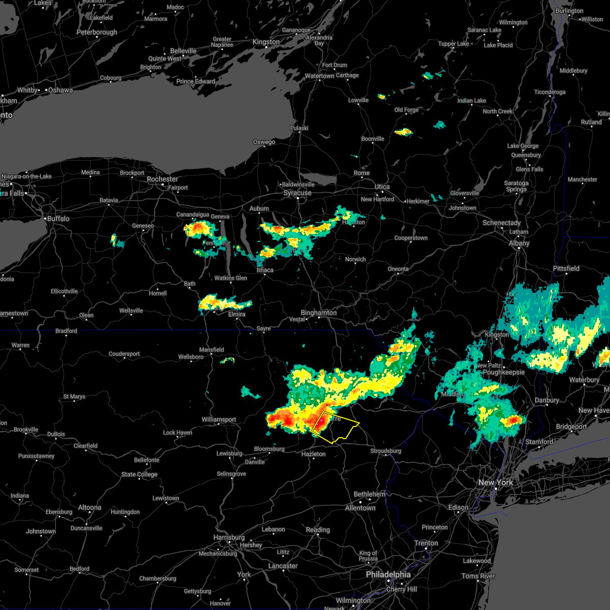 At 711 pm edt, a severe thunderstorm was located over wilkes-barre, moving southeast at 35 mph (radar indicated). Hazards include 60 mph wind gusts and quarter size hail. Hail damage to vehicles is expected. Expect wind damage to roofs, siding, and trees. At 711 pm edt, a severe thunderstorm was located over wilkes-barre, moving southeast at 35 mph (radar indicated). Hazards include 60 mph wind gusts and quarter size hail. Hail damage to vehicles is expected. Expect wind damage to roofs, siding, and trees.
|
| 7/27/2021 4:52 PM EDT |
 At 450 pm edt, severe thunderstorms were located along a line extending from near peabrook to near lovelton, moving east at 40 mph (law enforcement). Hazards include 60 mph wind gusts. Expect damage to roofs, siding, and trees. Locations impacted include, scranton, falls, dunmore, fallsburg, carbondale, old forge, pittston, archbald, monticello and blakely. At 450 pm edt, severe thunderstorms were located along a line extending from near peabrook to near lovelton, moving east at 40 mph (law enforcement). Hazards include 60 mph wind gusts. Expect damage to roofs, siding, and trees. Locations impacted include, scranton, falls, dunmore, fallsburg, carbondale, old forge, pittston, archbald, monticello and blakely.
|
| 7/27/2021 4:22 PM EDT |
 At 421 pm edt, severe thunderstorms were located along a line extending from hancock to near overton, moving east at 40 mph (law enforcement). Hazards include 60 mph wind gusts. expect damage to roofs, siding, and trees At 421 pm edt, severe thunderstorms were located along a line extending from hancock to near overton, moving east at 40 mph (law enforcement). Hazards include 60 mph wind gusts. expect damage to roofs, siding, and trees
|
| 7/11/2021 10:51 PM EDT |
 The severe thunderstorm warning for southern lackawanna and northeastern luzerne counties will expire at 1100 pm edt, the storms which prompted the warning have weakened below severe limits, and no longer pose an immediate threat to life or property. therefore, the warning will be allowed to expire. The severe thunderstorm warning for southern lackawanna and northeastern luzerne counties will expire at 1100 pm edt, the storms which prompted the warning have weakened below severe limits, and no longer pose an immediate threat to life or property. therefore, the warning will be allowed to expire.
|
| 7/11/2021 10:13 PM EDT |
 At 1013 pm edt, severe thunderstorms were located along a line extending from west wyoming to near white haven, moving east at 30 mph (radar indicated). Hazards include 60 mph wind gusts. expect damage to roofs, siding, and trees At 1013 pm edt, severe thunderstorms were located along a line extending from west wyoming to near white haven, moving east at 30 mph (radar indicated). Hazards include 60 mph wind gusts. expect damage to roofs, siding, and trees
|
| 7/11/2021 9:59 PM EDT |
 At 959 pm edt, severe thunderstorms were located along a line extending from near edwardsville to sugar notch to near drums, moving northeast at 30 mph (radar indicated). Hazards include 60 mph wind gusts. Expect damage to roofs, siding, and trees. Locations impacted include, wilkes-barre, kingston, nanticoke, plains, plymouth, exeter, swoyersville, edwardsville, larksville and forty fort. At 959 pm edt, severe thunderstorms were located along a line extending from near edwardsville to sugar notch to near drums, moving northeast at 30 mph (radar indicated). Hazards include 60 mph wind gusts. Expect damage to roofs, siding, and trees. Locations impacted include, wilkes-barre, kingston, nanticoke, plains, plymouth, exeter, swoyersville, edwardsville, larksville and forty fort.
|
| 7/11/2021 9:45 PM EDT |
 At 944 pm edt, severe thunderstorms were located along a line extending from muhlenberg to pond hill to near rock glen, moving northeast at 30 mph (radar indicated). Hazards include 60 mph wind gusts. expect damage to roofs, siding, and trees At 944 pm edt, severe thunderstorms were located along a line extending from muhlenberg to pond hill to near rock glen, moving northeast at 30 mph (radar indicated). Hazards include 60 mph wind gusts. expect damage to roofs, siding, and trees
|
| 7/11/2021 8:51 PM EDT |
 At 851 pm edt, severe thunderstorms were located along a line extending from jerseytown to buckhorn to trevorton, moving east at 40 mph (radar indicated). Hazards include 60 mph wind gusts. expect damage to roofs, siding, and trees At 851 pm edt, severe thunderstorms were located along a line extending from jerseytown to buckhorn to trevorton, moving east at 40 mph (radar indicated). Hazards include 60 mph wind gusts. expect damage to roofs, siding, and trees
|
| 7/7/2021 8:50 PM EDT |
 At 850 pm edt, severe thunderstorms were located along a line extending from near mansfield to rohrsburg, moving east at 50 mph (radar indicated). Hazards include 60 mph wind gusts and quarter size hail. Hail damage to vehicles is expected. Expect wind damage to roofs, siding, and trees. At 850 pm edt, severe thunderstorms were located along a line extending from near mansfield to rohrsburg, moving east at 50 mph (radar indicated). Hazards include 60 mph wind gusts and quarter size hail. Hail damage to vehicles is expected. Expect wind damage to roofs, siding, and trees.
|
| 7/6/2021 4:41 PM EDT |
 At 441 pm edt, severe thunderstorms were located along a line extending from near white sulphur springs to near hawley to stoddartsville, moving east at 70 mph (radar indicated). Hazards include 60 mph wind gusts. expect damage to roofs, siding, and trees At 441 pm edt, severe thunderstorms were located along a line extending from near white sulphur springs to near hawley to stoddartsville, moving east at 70 mph (radar indicated). Hazards include 60 mph wind gusts. expect damage to roofs, siding, and trees
|
| 7/6/2021 4:29 PM EDT |
 At 429 pm edt, severe thunderstorms were located along a line extending from near union dale to elmhurst to near sugar notch, moving east at 40 mph (radar indicated). Hazards include 60 mph wind gusts and quarter size hail. Hail damage to vehicles is expected. expect wind damage to roofs, siding, and trees. Locations impacted include, scranton, wilkes-barre, dunmore, kingston, nanticoke, plains, carbondale, old forge, pittston and archbald. At 429 pm edt, severe thunderstorms were located along a line extending from near union dale to elmhurst to near sugar notch, moving east at 40 mph (radar indicated). Hazards include 60 mph wind gusts and quarter size hail. Hail damage to vehicles is expected. expect wind damage to roofs, siding, and trees. Locations impacted include, scranton, wilkes-barre, dunmore, kingston, nanticoke, plains, carbondale, old forge, pittston and archbald.
|
| 7/6/2021 4:06 PM EDT |
 At 406 pm edt, severe thunderstorms were located along a line extending from near harford to near falls to near huntington mills, moving east at 40 mph (radar indicated). Hazards include 60 mph wind gusts and quarter size hail. Hail damage to vehicles is expected. Expect wind damage to roofs, siding, and trees. At 406 pm edt, severe thunderstorms were located along a line extending from near harford to near falls to near huntington mills, moving east at 40 mph (radar indicated). Hazards include 60 mph wind gusts and quarter size hail. Hail damage to vehicles is expected. Expect wind damage to roofs, siding, and trees.
|
| 7/6/2021 3:50 PM EDT |
 At 349 pm edt, severe thunderstorms were located along a line extending from near rush to evans falls to sweet valley, moving east at 40 mph (radar indicated). Hazards include 60 mph wind gusts and penny size hail. Expect damage to roofs, siding, and trees. Locations impacted include, scranton, wilkes-barre, falls, muhlenberg, dunmore, kingston, nanticoke, plains, old forge and pittston. At 349 pm edt, severe thunderstorms were located along a line extending from near rush to evans falls to sweet valley, moving east at 40 mph (radar indicated). Hazards include 60 mph wind gusts and penny size hail. Expect damage to roofs, siding, and trees. Locations impacted include, scranton, wilkes-barre, falls, muhlenberg, dunmore, kingston, nanticoke, plains, old forge and pittston.
|
| 7/6/2021 3:28 PM EDT |
 At 327 pm edt, severe thunderstorms were located along a line extending from rome to near lovelton to near ricketts glen state park, moving east at 40 mph (radar indicated). Hazards include 60 mph wind gusts. expect damage to roofs, siding, and trees At 327 pm edt, severe thunderstorms were located along a line extending from rome to near lovelton to near ricketts glen state park, moving east at 40 mph (radar indicated). Hazards include 60 mph wind gusts. expect damage to roofs, siding, and trees
|
| 6/21/2021 7:37 PM EDT |
 At 737 pm edt, severe thunderstorms were located along a line extending from near equinunk to mount cobb to near conyngham, moving east at 30 mph (radar indicated). Hazards include 60 mph wind gusts and quarter size hail. Hail damage to vehicles is expected. expect wind damage to roofs, siding, and trees. Locations impacted include, scranton, wilkes-barre, hazleton, dunmore, kingston, nanticoke, plains, carbondale, old forge and pittston. At 737 pm edt, severe thunderstorms were located along a line extending from near equinunk to mount cobb to near conyngham, moving east at 30 mph (radar indicated). Hazards include 60 mph wind gusts and quarter size hail. Hail damage to vehicles is expected. expect wind damage to roofs, siding, and trees. Locations impacted include, scranton, wilkes-barre, hazleton, dunmore, kingston, nanticoke, plains, carbondale, old forge and pittston.
|
| 6/21/2021 7:09 PM EDT |
 At 709 pm edt, severe thunderstorms were located along a line extending from near pleasant mount to near old forge to mifflinville, moving east at 30 mph (radar indicated). Hazards include 60 mph wind gusts and quarter size hail. Hail damage to vehicles is expected. Expect wind damage to roofs, siding, and trees. At 709 pm edt, severe thunderstorms were located along a line extending from near pleasant mount to near old forge to mifflinville, moving east at 30 mph (radar indicated). Hazards include 60 mph wind gusts and quarter size hail. Hail damage to vehicles is expected. Expect wind damage to roofs, siding, and trees.
|
| 5/26/2021 4:20 PM EDT |
 At 420 pm edt, a severe thunderstorm was located near falls, or 7 miles north of pittston, moving east at 35 mph (radar indicated). Hazards include 60 mph wind gusts and penny size hail. Expect damage to roofs, siding, and trees. Locations impacted include, scranton, falls, dunmore, old forge, pittston, taylor, dickson city, moosic, exeter and vernon. At 420 pm edt, a severe thunderstorm was located near falls, or 7 miles north of pittston, moving east at 35 mph (radar indicated). Hazards include 60 mph wind gusts and penny size hail. Expect damage to roofs, siding, and trees. Locations impacted include, scranton, falls, dunmore, old forge, pittston, taylor, dickson city, moosic, exeter and vernon.
|
| 5/26/2021 4:09 PM EDT |
 At 408 pm edt, a severe thunderstorm was located over beaumont, or 9 miles south of tunkhannock, moving east at 35 mph (radar indicated). Hazards include 60 mph wind gusts and nickel size hail. expect damage to roofs, siding, and trees At 408 pm edt, a severe thunderstorm was located over beaumont, or 9 miles south of tunkhannock, moving east at 35 mph (radar indicated). Hazards include 60 mph wind gusts and nickel size hail. expect damage to roofs, siding, and trees
|
| 7/19/2020 7:14 PM EDT |
 At 713 pm edt, severe thunderstorms were located along a line extending from near waymart to clarks summit to near falls to sweet valley, moving east at 35 mph (radar indicated). Hazards include 60 mph wind gusts and penny size hail. expect damage to roofs, siding, and trees At 713 pm edt, severe thunderstorms were located along a line extending from near waymart to clarks summit to near falls to sweet valley, moving east at 35 mph (radar indicated). Hazards include 60 mph wind gusts and penny size hail. expect damage to roofs, siding, and trees
|
| 6/28/2020 3:30 PM EDT |
 At 330 pm edt, severe thunderstorms were located along a line extending from near pittston to greentown, moving southeast at 25 mph (radar indicated). Hazards include 60 mph wind gusts and quarter size hail. Hail damage to vehicles is expected. Expect wind damage to roofs, siding, and trees. At 330 pm edt, severe thunderstorms were located along a line extending from near pittston to greentown, moving southeast at 25 mph (radar indicated). Hazards include 60 mph wind gusts and quarter size hail. Hail damage to vehicles is expected. Expect wind damage to roofs, siding, and trees.
|
| 10/31/2019 8:52 PM EDT |
 At 852 pm edt, a severe thunderstorm was located over blakeslee, or 13 miles west of mount pocono, moving northeast at 65 mph (radar indicated). Hazards include 60 mph wind gusts. Expect damage to roofs, siding, and trees. Locations impacted include, scranton, wilkes-barre, kingston, plains, old forge, pittston, taylor, moosic, exeter and swoyersville. At 852 pm edt, a severe thunderstorm was located over blakeslee, or 13 miles west of mount pocono, moving northeast at 65 mph (radar indicated). Hazards include 60 mph wind gusts. Expect damage to roofs, siding, and trees. Locations impacted include, scranton, wilkes-barre, kingston, plains, old forge, pittston, taylor, moosic, exeter and swoyersville.
|
| 10/31/2019 8:33 PM EDT |
 At 832 pm edt, a severe thunderstorm was located over drifton, or over hazleton, moving northeast at 65 mph (radar indicated). Hazards include 60 mph wind gusts. expect damage to roofs, siding, and trees At 832 pm edt, a severe thunderstorm was located over drifton, or over hazleton, moving northeast at 65 mph (radar indicated). Hazards include 60 mph wind gusts. expect damage to roofs, siding, and trees
|
| 8/8/2019 5:11 PM EDT |
 At 511 pm edt, severe thunderstorms were located along a line extending from livingston manor to near honesdale to near bear creek village, moving east at 50 mph (radar indicated). Hazards include 60 mph wind gusts and penny size hail. expect damage to roofs, siding, and trees At 511 pm edt, severe thunderstorms were located along a line extending from livingston manor to near honesdale to near bear creek village, moving east at 50 mph (radar indicated). Hazards include 60 mph wind gusts and penny size hail. expect damage to roofs, siding, and trees
|
| 8/8/2019 5:04 PM EDT |
 At 502 pm edt, severe thunderstorms were located along a line extending from near athens to near west shokan to harris to near lake ariel, moving east at 40 mph (radar indicated). Hazards include 60 mph wind gusts and penny size hail. Expect damage to roofs, siding, and trees. Locations impacted include, rockland, scranton, wilkes-barre, falls, dunmore, kingston, fallsburg, plains, carbondale and old forge. At 502 pm edt, severe thunderstorms were located along a line extending from near athens to near west shokan to harris to near lake ariel, moving east at 40 mph (radar indicated). Hazards include 60 mph wind gusts and penny size hail. Expect damage to roofs, siding, and trees. Locations impacted include, rockland, scranton, wilkes-barre, falls, dunmore, kingston, fallsburg, plains, carbondale and old forge.
|
| 8/8/2019 4:26 PM EDT |
 At 425 pm edt, severe thunderstorms were located along a line extending from near hobart to near east branch to near gibson to lovelton, moving east at 45 mph (radar indicated). Hazards include 60 mph wind gusts and penny size hail. expect damage to roofs, siding, and trees At 425 pm edt, severe thunderstorms were located along a line extending from near hobart to near east branch to near gibson to lovelton, moving east at 45 mph (radar indicated). Hazards include 60 mph wind gusts and penny size hail. expect damage to roofs, siding, and trees
|
| 7/30/2019 5:55 PM EDT | Trees down across road. constitution ave. and marcy av in luzerne county PA, 2.7 miles WSW of Pittston, PA |
| 7/30/2019 5:37 PM EDT |
 At 535 pm edt, severe thunderstorms were located along a line extending from mayfield to near old forge, moving northeast at 15 mph (trained weather spotters. at 527 pm, a trained spotter reported a wind gust of 70 mph near clarks summit). Hazards include 70 mph wind gusts. Expect considerable tree damage. damage is likely to mobile homes, roofs, and outbuildings. Locations impacted include, scranton, wilkes-barre, dunmore, plains, carbondale, old forge, pittston, archbald, blakely and taylor. At 535 pm edt, severe thunderstorms were located along a line extending from mayfield to near old forge, moving northeast at 15 mph (trained weather spotters. at 527 pm, a trained spotter reported a wind gust of 70 mph near clarks summit). Hazards include 70 mph wind gusts. Expect considerable tree damage. damage is likely to mobile homes, roofs, and outbuildings. Locations impacted include, scranton, wilkes-barre, dunmore, plains, carbondale, old forge, pittston, archbald, blakely and taylor.
|
| 7/30/2019 5:13 PM EDT |
 At 513 pm edt, a severe thunderstorm was located over scranton, moving northeast at 25 mph (radar indicated). Hazards include 60 mph wind gusts and penny size hail. Expect damage to roofs, siding, and trees. Locations impacted include, scranton, wilkes-barre, dunmore, plains, carbondale, old forge, pittston, archbald, blakely and taylor. At 513 pm edt, a severe thunderstorm was located over scranton, moving northeast at 25 mph (radar indicated). Hazards include 60 mph wind gusts and penny size hail. Expect damage to roofs, siding, and trees. Locations impacted include, scranton, wilkes-barre, dunmore, plains, carbondale, old forge, pittston, archbald, blakely and taylor.
|
| 7/30/2019 5:00 PM EDT | Media photos of trees down near cemetery. also reports of trees down in nearby duryea along phoenix stree in luzerne county PA, 0.2 miles S of Pittston, PA |
| 7/30/2019 4:54 PM EDT |
 At 453 pm edt, a severe thunderstorm was located over pittston, moving northeast at 20 mph (radar indicated). Hazards include 60 mph wind gusts and quarter size hail. Hail damage to vehicles is expected. Expect wind damage to roofs, siding, and trees. At 453 pm edt, a severe thunderstorm was located over pittston, moving northeast at 20 mph (radar indicated). Hazards include 60 mph wind gusts and quarter size hail. Hail damage to vehicles is expected. Expect wind damage to roofs, siding, and trees.
|
| 7/22/2019 1:06 AM EDT |
 At 104 am edt, a severe thunderstorm was located near drums, or 7 miles north of hazleton, moving northeast at 20 mph (radar indicated). Hazards include 60 mph wind gusts and quarter size hail. Hail damage to vehicles is expected. Expect wind damage to roofs, siding, and trees. At 104 am edt, a severe thunderstorm was located near drums, or 7 miles north of hazleton, moving northeast at 20 mph (radar indicated). Hazards include 60 mph wind gusts and quarter size hail. Hail damage to vehicles is expected. Expect wind damage to roofs, siding, and trees.
|
| 7/21/2019 4:49 PM EDT |
 At 449 pm edt, a severe thunderstorm was located near ricketts glen state park, or 16 miles north of berwick, moving east at 25 mph (radar indicated). Hazards include 60 mph wind gusts and quarter size hail. Hail damage to vehicles is expected. Expect wind damage to roofs, siding, and trees. At 449 pm edt, a severe thunderstorm was located near ricketts glen state park, or 16 miles north of berwick, moving east at 25 mph (radar indicated). Hazards include 60 mph wind gusts and quarter size hail. Hail damage to vehicles is expected. Expect wind damage to roofs, siding, and trees.
|
| 7/21/2019 4:41 PM EDT |
 The severe thunderstorm warning for west central lackawanna, northeastern luzerne and southern wyoming counties will expire at 445 pm edt, the storms which prompted the warning have weakened below severe limits, and no longer pose an immediate threat to life or property. therefore, the warning will be allowed to expire. The severe thunderstorm warning for west central lackawanna, northeastern luzerne and southern wyoming counties will expire at 445 pm edt, the storms which prompted the warning have weakened below severe limits, and no longer pose an immediate threat to life or property. therefore, the warning will be allowed to expire.
|
| 7/21/2019 4:40 PM EDT | Trees and wires down in luzerne county PA, 0.6 miles ESE of Pittston, PA |
| 7/21/2019 4:16 PM EDT |
 At 415 pm edt, severe thunderstorms were located along a line extending from near clarks summit to noxen, moving east at 30 mph (radar indicated). Hazards include 60 mph wind gusts and quarter size hail. Hail damage to vehicles is expected. expect wind damage to roofs, siding, and trees. Locations impacted include, scranton, dunmore, old forge, pittston, taylor, dickson city, moosic, exeter, vernon and swoyersville. At 415 pm edt, severe thunderstorms were located along a line extending from near clarks summit to noxen, moving east at 30 mph (radar indicated). Hazards include 60 mph wind gusts and quarter size hail. Hail damage to vehicles is expected. expect wind damage to roofs, siding, and trees. Locations impacted include, scranton, dunmore, old forge, pittston, taylor, dickson city, moosic, exeter, vernon and swoyersville.
|
| 7/21/2019 3:45 PM EDT |
 At 345 pm edt, severe thunderstorms were located along a line extending from evans falls to 7 miles west of kasson brook, moving east at 30 mph (radar indicated). Hazards include 60 mph wind gusts and quarter size hail. Hail damage to vehicles is expected. Expect wind damage to roofs, siding, and trees. At 345 pm edt, severe thunderstorms were located along a line extending from evans falls to 7 miles west of kasson brook, moving east at 30 mph (radar indicated). Hazards include 60 mph wind gusts and quarter size hail. Hail damage to vehicles is expected. Expect wind damage to roofs, siding, and trees.
|
| 5/29/2019 4:43 PM EDT |
 At 442 pm edt, severe thunderstorms were located along a line extending from glendale to near white haven to hazleton, moving east at 55 mph (radar indicated). Hazards include 60 mph wind gusts and quarter size hail. Hail damage to vehicles is expected. expect wind damage to roofs, siding, and trees. Locations impacted include, scranton, wilkes-barre, hazleton, dunmore, kingston, plains, old forge, pittston, taylor and moosic. At 442 pm edt, severe thunderstorms were located along a line extending from glendale to near white haven to hazleton, moving east at 55 mph (radar indicated). Hazards include 60 mph wind gusts and quarter size hail. Hail damage to vehicles is expected. expect wind damage to roofs, siding, and trees. Locations impacted include, scranton, wilkes-barre, hazleton, dunmore, kingston, plains, old forge, pittston, taylor and moosic.
|
| 5/29/2019 4:18 PM EDT |
 At 418 pm edt, severe thunderstorms were located along a line extending from near sweet valley to near beach haven to near mainville, moving east at 55 mph (radar indicated). Hazards include 60 mph wind gusts and quarter size hail. Hail damage to vehicles is expected. Expect wind damage to roofs, siding, and trees. At 418 pm edt, severe thunderstorms were located along a line extending from near sweet valley to near beach haven to near mainville, moving east at 55 mph (radar indicated). Hazards include 60 mph wind gusts and quarter size hail. Hail damage to vehicles is expected. Expect wind damage to roofs, siding, and trees.
|
| 5/29/2019 2:30 PM EDT | Large tree down on vehicl in luzerne county PA, 1.6 miles E of Pittston, PA |
| 5/28/2019 7:52 PM EDT |
 The severe thunderstorm warning for southwestern lackawanna and northeastern luzerne counties will expire at 800 pm edt, the storms which prompted the warning have weakened below severe limits, and have exited the warned area. therefore, the warning will be allowed to expire. however heavy rain is still possible with these thunderstorms. a tornado watch remains in effect until 1000 pm edt for northeastern pennsylvania. The severe thunderstorm warning for southwestern lackawanna and northeastern luzerne counties will expire at 800 pm edt, the storms which prompted the warning have weakened below severe limits, and have exited the warned area. therefore, the warning will be allowed to expire. however heavy rain is still possible with these thunderstorms. a tornado watch remains in effect until 1000 pm edt for northeastern pennsylvania.
|
| 5/28/2019 7:28 PM EDT |
 At 727 pm edt, severe thunderstorms were located along a line extending from moosic to near harveys lake, moving southeast at 35 mph (radar indicated). Hazards include 60 mph wind gusts. Expect damage to roofs, siding, and trees. Locations impacted include, scranton, wilkes-barre, kingston, plains, old forge, pittston, taylor, moosic, exeter and swoyersville. At 727 pm edt, severe thunderstorms were located along a line extending from moosic to near harveys lake, moving southeast at 35 mph (radar indicated). Hazards include 60 mph wind gusts. Expect damage to roofs, siding, and trees. Locations impacted include, scranton, wilkes-barre, kingston, plains, old forge, pittston, taylor, moosic, exeter and swoyersville.
|
| 5/28/2019 7:18 PM EDT |
 At 717 pm edt, severe thunderstorms were located along a line extending from near old forge to near harveys lake, moving southeast at 35 mph (radar indicated). Hazards include 60 mph wind gusts. Expect damage to roofs, siding, and trees. Locations impacted include, scranton, wilkes-barre, kingston, plains, old forge, pittston, taylor, moosic, exeter and swoyersville. At 717 pm edt, severe thunderstorms were located along a line extending from near old forge to near harveys lake, moving southeast at 35 mph (radar indicated). Hazards include 60 mph wind gusts. Expect damage to roofs, siding, and trees. Locations impacted include, scranton, wilkes-barre, kingston, plains, old forge, pittston, taylor, moosic, exeter and swoyersville.
|
| 5/28/2019 7:12 PM EDT |
 The severe thunderstorm warning for lackawanna, southwestern wayne, northeastern luzerne and eastern wyoming counties will expire at 715 pm edt, the storm which prompted the warning has moved out of the area. therefore, the warning will be allowed to expire. a tornado watch remains in effect until 1000 pm edt for northeastern pennsylvania. The severe thunderstorm warning for lackawanna, southwestern wayne, northeastern luzerne and eastern wyoming counties will expire at 715 pm edt, the storm which prompted the warning has moved out of the area. therefore, the warning will be allowed to expire. a tornado watch remains in effect until 1000 pm edt for northeastern pennsylvania.
|
| 5/28/2019 6:58 PM EDT |
 At 656 pm edt, a severe thunderstorm was located over evans falls, or near tunkhannock, moving southeast at 40 mph (radar indicated). Hazards include 60 mph wind gusts. expect damage to roofs, siding, and trees At 656 pm edt, a severe thunderstorm was located over evans falls, or near tunkhannock, moving southeast at 40 mph (radar indicated). Hazards include 60 mph wind gusts. expect damage to roofs, siding, and trees
|
| 5/28/2019 6:38 PM EDT |
 At 638 pm edt, a severe thunderstorm was located over elmhurst, or 7 miles east of scranton, moving southeast at 40 mph (emergency management). Hazards include 70 mph wind gusts and ping pong ball size hail. People and animals outdoors will be injured. expect hail damage to roofs, siding, windows, and vehicles. expect considerable tree damage. wind damage is also likely to mobile homes, roofs, and outbuildings. Locations impacted include, scranton, falls, dunmore, old forge, pittston, archbald, blakely, taylor, dickson city and moosic. At 638 pm edt, a severe thunderstorm was located over elmhurst, or 7 miles east of scranton, moving southeast at 40 mph (emergency management). Hazards include 70 mph wind gusts and ping pong ball size hail. People and animals outdoors will be injured. expect hail damage to roofs, siding, windows, and vehicles. expect considerable tree damage. wind damage is also likely to mobile homes, roofs, and outbuildings. Locations impacted include, scranton, falls, dunmore, old forge, pittston, archbald, blakely, taylor, dickson city and moosic.
|
| 5/28/2019 6:18 PM EDT |
 At 616 pm edt, clusters of severe thunderstorms extended from meshoppen to elmhurst. the strongest thunderstorm was located near falls, or near waverly, moving southeast at 35 mph (emergency management. numerous reports of wind damage and golfball sized hail have been associated with these thunderstorms). Hazards include two inch hail and 70 mph wind gusts. People and animals outdoors will be injured. expect hail damage to roofs, siding, windows, and vehicles. expect considerable tree damage. Wind damage is also likely to mobile homes, roofs, and outbuildings. At 616 pm edt, clusters of severe thunderstorms extended from meshoppen to elmhurst. the strongest thunderstorm was located near falls, or near waverly, moving southeast at 35 mph (emergency management. numerous reports of wind damage and golfball sized hail have been associated with these thunderstorms). Hazards include two inch hail and 70 mph wind gusts. People and animals outdoors will be injured. expect hail damage to roofs, siding, windows, and vehicles. expect considerable tree damage. Wind damage is also likely to mobile homes, roofs, and outbuildings.
|
| 5/28/2019 6:08 PM EDT |
 At 607 pm edt, a severe thunderstorm capable of producing a tornado was located over osterhout, or near tunkhannock, moving southeast at 35 mph (radar indicated rotation. damage and golfball sized hail have been reported with this severe thunderstorm). Hazards include tornado and hail up to two inches in diameter. Flying debris will be dangerous to those caught without shelter. mobile homes will be damaged or destroyed. damage to roofs, windows, and vehicles will occur. tree damage is likely. this dangerous storm will be near, falls around 610 pm edt. old forge and west wyoming around 625 pm edt. Wilkes-barre, pittston and moosic around 630 pm edt. At 607 pm edt, a severe thunderstorm capable of producing a tornado was located over osterhout, or near tunkhannock, moving southeast at 35 mph (radar indicated rotation. damage and golfball sized hail have been reported with this severe thunderstorm). Hazards include tornado and hail up to two inches in diameter. Flying debris will be dangerous to those caught without shelter. mobile homes will be damaged or destroyed. damage to roofs, windows, and vehicles will occur. tree damage is likely. this dangerous storm will be near, falls around 610 pm edt. old forge and west wyoming around 625 pm edt. Wilkes-barre, pittston and moosic around 630 pm edt.
|
| 5/28/2019 5:58 PM EDT |
 At 556 pm edt, several severe thunderstorms continue moving southeast across the warned area. the strongest thunderstorm was located tunkhannock, moving southeast at 45 mph (emergency management. numerous reports of wind damage, as well as golfball sized hail have been received with thunderstorms this afternoon). Hazards include two inch hail and 70 mph wind gusts. People and animals outdoors will be injured. expect hail damage to roofs, siding, windows, and vehicles. expect considerable tree damage. wind damage is also likely to mobile homes, roofs, and outbuildings. Locations impacted include, scranton, wilkes-barre, falls, dunmore, kingston, plains, carbondale, old forge, pittston and archbald. At 556 pm edt, several severe thunderstorms continue moving southeast across the warned area. the strongest thunderstorm was located tunkhannock, moving southeast at 45 mph (emergency management. numerous reports of wind damage, as well as golfball sized hail have been received with thunderstorms this afternoon). Hazards include two inch hail and 70 mph wind gusts. People and animals outdoors will be injured. expect hail damage to roofs, siding, windows, and vehicles. expect considerable tree damage. wind damage is also likely to mobile homes, roofs, and outbuildings. Locations impacted include, scranton, wilkes-barre, falls, dunmore, kingston, plains, carbondale, old forge, pittston and archbald.
|
| 5/28/2019 5:38 PM EDT |
 At 537 pm edt, a severe thunderstorm was located over sugar run, or over wyalusing, moving southeast at 45 mph (radar indicated). Hazards include 70 mph wind gusts and ping pong ball size hail. People and animals outdoors will be injured. expect hail damage to roofs, siding, windows, and vehicles. expect considerable tree damage. Wind damage is also likely to mobile homes, roofs, and outbuildings. At 537 pm edt, a severe thunderstorm was located over sugar run, or over wyalusing, moving southeast at 45 mph (radar indicated). Hazards include 70 mph wind gusts and ping pong ball size hail. People and animals outdoors will be injured. expect hail damage to roofs, siding, windows, and vehicles. expect considerable tree damage. Wind damage is also likely to mobile homes, roofs, and outbuildings.
|
| 5/19/2019 8:37 PM EDT |
 At 837 pm edt, severe thunderstorms were located along a line extending from near lake carey to west wyoming, moving east at 35 mph (law enforcement reported trees downed due to wind). Hazards include 60 mph wind gusts and quarter size hail. Hail damage to vehicles is expected. expect wind damage to roofs, siding, and trees. Locations impacted include, scranton, wilkes-barre, falls, dunmore, plains, carbondale, old forge, pittston, archbald and blakely. At 837 pm edt, severe thunderstorms were located along a line extending from near lake carey to west wyoming, moving east at 35 mph (law enforcement reported trees downed due to wind). Hazards include 60 mph wind gusts and quarter size hail. Hail damage to vehicles is expected. expect wind damage to roofs, siding, and trees. Locations impacted include, scranton, wilkes-barre, falls, dunmore, plains, carbondale, old forge, pittston, archbald and blakely.
|
| 5/19/2019 8:25 PM EDT |
 At 824 pm edt, severe thunderstorms were located along a line extending from near tunkhannock to near edwardsville, moving east at 35 mph (several reports of trees downed due to wind with this storm). Hazards include 70 mph wind gusts and quarter size hail. Hail damage to vehicles is expected. Expect wind damage to roofs, siding, and trees. At 824 pm edt, severe thunderstorms were located along a line extending from near tunkhannock to near edwardsville, moving east at 35 mph (several reports of trees downed due to wind with this storm). Hazards include 70 mph wind gusts and quarter size hail. Hail damage to vehicles is expected. Expect wind damage to roofs, siding, and trees.
|
| 5/19/2019 8:15 PM EDT |
 At 814 pm edt, a severe thunderstorm was located near sweet valley, or 15 miles northwest of wilkes-barre, moving northeast at 30 mph (trees have been reported downed due to high winds). Hazards include 70 mph wind gusts and quarter size hail. Hail damage to vehicles is expected. expect considerable tree damage. wind damage is also likely to mobile homes, roofs, and outbuildings. Locations impacted include, wilkes-barre, falls, muhlenberg, kingston, plains, old forge, pittston, plymouth, moosic and exeter. At 814 pm edt, a severe thunderstorm was located near sweet valley, or 15 miles northwest of wilkes-barre, moving northeast at 30 mph (trees have been reported downed due to high winds). Hazards include 70 mph wind gusts and quarter size hail. Hail damage to vehicles is expected. expect considerable tree damage. wind damage is also likely to mobile homes, roofs, and outbuildings. Locations impacted include, wilkes-barre, falls, muhlenberg, kingston, plains, old forge, pittston, plymouth, moosic and exeter.
|
| 5/19/2019 8:02 PM EDT |
 At 802 pm edt, a severe thunderstorm was located near ricketts glen state park, or 17 miles north of berwick, moving northeast at 30 mph (radar indicated). Hazards include 70 mph wind gusts and quarter size hail. Hail damage to vehicles is expected. expect considerable tree damage. wind damage is also likely to mobile homes, roofs, and outbuildings. Locations impacted include, wilkes-barre, falls, muhlenberg, kingston, plains, old forge, pittston, plymouth, moosic and exeter. At 802 pm edt, a severe thunderstorm was located near ricketts glen state park, or 17 miles north of berwick, moving northeast at 30 mph (radar indicated). Hazards include 70 mph wind gusts and quarter size hail. Hail damage to vehicles is expected. expect considerable tree damage. wind damage is also likely to mobile homes, roofs, and outbuildings. Locations impacted include, wilkes-barre, falls, muhlenberg, kingston, plains, old forge, pittston, plymouth, moosic and exeter.
|
| 5/19/2019 7:52 PM EDT |
 At 751 pm edt, a severe thunderstorm was located over central, or 16 miles northwest of berwick, moving northeast at 30 mph (radar indicated). Hazards include 60 mph wind gusts and quarter size hail. Hail damage to vehicles is expected. Expect wind damage to roofs, siding, and trees. At 751 pm edt, a severe thunderstorm was located over central, or 16 miles northwest of berwick, moving northeast at 30 mph (radar indicated). Hazards include 60 mph wind gusts and quarter size hail. Hail damage to vehicles is expected. Expect wind damage to roofs, siding, and trees.
|
| 5/19/2019 7:08 PM EDT |
 At 707 pm edt, severe thunderstorms were located along a line extending from near clarks summit to scranton to near moscow to near pocono pines, moving northeast at 45 mph. damage has previously been reported with this line of severe thunderstorms (trained weather spotters). Hazards include 60 mph wind gusts and quarter size hail. Hail damage to vehicles is expected. expect wind damage to roofs, siding, and trees. Locations impacted include, scranton, wilkes-barre, dunmore, kingston, plains, carbondale, old forge, pittston, archbald and blakely. At 707 pm edt, severe thunderstorms were located along a line extending from near clarks summit to scranton to near moscow to near pocono pines, moving northeast at 45 mph. damage has previously been reported with this line of severe thunderstorms (trained weather spotters). Hazards include 60 mph wind gusts and quarter size hail. Hail damage to vehicles is expected. expect wind damage to roofs, siding, and trees. Locations impacted include, scranton, wilkes-barre, dunmore, kingston, plains, carbondale, old forge, pittston, archbald and blakely.
|
| 5/19/2019 6:53 PM EDT |
 At 651 pm edt, severe thunderstorms were located along a line extending from near beaumont to near west wyoming to bear creek village to near christmans, moving northeast at 40 mph. damage has previously been reported with this line of severe thunderstorms (trained weather spotters). Hazards include 70 mph wind gusts and quarter size hail. Hail damage to vehicles is expected. expect considerable tree damage. wind damage is also likely to mobile homes, roofs, and outbuildings. locations impacted include, scranton, wilkes-barre, falls, hazleton, dunmore, kingston, nanticoke, plains, carbondale and old forge. This line of storms will impact motorists on the pennsylvania turnpike, as well as interstate 81 between the junction of interstates 81 and 80, northward through the wilkes-barre and scranton areas. At 651 pm edt, severe thunderstorms were located along a line extending from near beaumont to near west wyoming to bear creek village to near christmans, moving northeast at 40 mph. damage has previously been reported with this line of severe thunderstorms (trained weather spotters). Hazards include 70 mph wind gusts and quarter size hail. Hail damage to vehicles is expected. expect considerable tree damage. wind damage is also likely to mobile homes, roofs, and outbuildings. locations impacted include, scranton, wilkes-barre, falls, hazleton, dunmore, kingston, nanticoke, plains, carbondale and old forge. This line of storms will impact motorists on the pennsylvania turnpike, as well as interstate 81 between the junction of interstates 81 and 80, northward through the wilkes-barre and scranton areas.
|
| 5/19/2019 6:38 PM EDT |
 At 636 pm edt, severe thunderstorms were located along a line extending from near sweet valley to sugar notch to near white haven to near weatherly, moving northeast at 45 mph. damage has previously been reported with this line of severe thunderstorms (trained weather spotters). Hazards include 70 mph wind gusts and quarter size hail. Hail damage to vehicles is expected. expect considerable tree damage. wind damage is also likely to mobile homes, roofs, and outbuildings. locations impacted include, scranton, wilkes-barre, falls, hazleton, muhlenberg, dunmore, kingston, nanticoke, plains and carbondale. This storm will impact motorists on interstate 81 between hazleton and the wilkes-barre/scranton area. At 636 pm edt, severe thunderstorms were located along a line extending from near sweet valley to sugar notch to near white haven to near weatherly, moving northeast at 45 mph. damage has previously been reported with this line of severe thunderstorms (trained weather spotters). Hazards include 70 mph wind gusts and quarter size hail. Hail damage to vehicles is expected. expect considerable tree damage. wind damage is also likely to mobile homes, roofs, and outbuildings. locations impacted include, scranton, wilkes-barre, falls, hazleton, muhlenberg, dunmore, kingston, nanticoke, plains and carbondale. This storm will impact motorists on interstate 81 between hazleton and the wilkes-barre/scranton area.
|
| 5/19/2019 6:28 PM EDT |
 At 627 pm edt, severe thunderstorms were located along a line extending from near muhlenberg to slocum to drifton to nesquehoning, moving east at 35 mph (trained weather spotters. at 625 pm, trees were reported blown down in hollenback and salem townships). Hazards include 70 mph wind gusts and quarter size hail. Hail damage to vehicles is expected. expect considerable tree damage. wind damage is also likely to mobile homes, roofs, and outbuildings. Locations impacted include, scranton, wilkes-barre, falls, hazleton, muhlenberg, dunmore, kingston, nanticoke, plains and carbondale. At 627 pm edt, severe thunderstorms were located along a line extending from near muhlenberg to slocum to drifton to nesquehoning, moving east at 35 mph (trained weather spotters. at 625 pm, trees were reported blown down in hollenback and salem townships). Hazards include 70 mph wind gusts and quarter size hail. Hail damage to vehicles is expected. expect considerable tree damage. wind damage is also likely to mobile homes, roofs, and outbuildings. Locations impacted include, scranton, wilkes-barre, falls, hazleton, muhlenberg, dunmore, kingston, nanticoke, plains and carbondale.
|
| 5/19/2019 6:09 PM EDT |
 At 608 pm edt, severe thunderstorms were located along a line extending from near rohrsburg to near nescopeck to grier city-park crest to near friedensburg, moving northeast at 45 mph (radar indicated). Hazards include 60 mph wind gusts and quarter size hail. Hail damage to vehicles is expected. Expect wind damage to roofs, siding, and trees. At 608 pm edt, severe thunderstorms were located along a line extending from near rohrsburg to near nescopeck to grier city-park crest to near friedensburg, moving northeast at 45 mph (radar indicated). Hazards include 60 mph wind gusts and quarter size hail. Hail damage to vehicles is expected. Expect wind damage to roofs, siding, and trees.
|
| 4/15/2019 1:48 AM EDT |
 At 148 am edt, severe thunderstorms were located along a line extending from near glenwood to near moosic to near drifton, moving northeast at 70 mph (radar indicated). Hazards include 70 mph wind gusts and nickel size hail. Expect considerable tree damage. Damage is likely to mobile homes, roofs, and outbuildings. At 148 am edt, severe thunderstorms were located along a line extending from near glenwood to near moosic to near drifton, moving northeast at 70 mph (radar indicated). Hazards include 70 mph wind gusts and nickel size hail. Expect considerable tree damage. Damage is likely to mobile homes, roofs, and outbuildings.
|
| 4/15/2019 1:41 AM EDT |
 At 140 am edt, severe thunderstorms were located along a line extending from great bend to la plume to near bear creek, moving northeast at 70 mph (radar indicated). Hazards include 70 mph wind gusts and nickel size hail. Expect considerable tree damage. damage is likely to mobile homes, roofs, and outbuildings. Locations impacted include, scranton, wilkes-barre, falls, hazleton, dunmore, kingston, nanticoke, plains, old forge and pittston. At 140 am edt, severe thunderstorms were located along a line extending from great bend to la plume to near bear creek, moving northeast at 70 mph (radar indicated). Hazards include 70 mph wind gusts and nickel size hail. Expect considerable tree damage. damage is likely to mobile homes, roofs, and outbuildings. Locations impacted include, scranton, wilkes-barre, falls, hazleton, dunmore, kingston, nanticoke, plains, old forge and pittston.
|
| 4/15/2019 1:03 AM EDT |
 At 102 am edt, severe thunderstorms were located along a line extending from monroeton to near biggertown to near knoebels grove, moving northeast at 70 mph (radar indicated). Hazards include 70 mph wind gusts and nickel size hail. Expect considerable tree damage. Damage is likely to mobile homes, roofs, and outbuildings. At 102 am edt, severe thunderstorms were located along a line extending from monroeton to near biggertown to near knoebels grove, moving northeast at 70 mph (radar indicated). Hazards include 70 mph wind gusts and nickel size hail. Expect considerable tree damage. Damage is likely to mobile homes, roofs, and outbuildings.
|
| 10/2/2018 7:21 PM EDT |
 At 721 pm edt, a severe thunderstorm was located over luzerne, or near wilkes-barre, moving east at 30 mph (radar indicated). Hazards include 60 mph wind gusts. Expect damage to roofs, siding, and trees. locations impacted include, wilkes-barre, muhlenberg, kingston, nanticoke, plains, old forge, pittston, plymouth, moosic and exeter. A tornado watch remains in effect until 1100 pm edt for northeastern pennsylvania. At 721 pm edt, a severe thunderstorm was located over luzerne, or near wilkes-barre, moving east at 30 mph (radar indicated). Hazards include 60 mph wind gusts. Expect damage to roofs, siding, and trees. locations impacted include, wilkes-barre, muhlenberg, kingston, nanticoke, plains, old forge, pittston, plymouth, moosic and exeter. A tornado watch remains in effect until 1100 pm edt for northeastern pennsylvania.
|
| 10/2/2018 7:11 PM EDT |
 At 711 pm edt, a severe thunderstorm was located near harveys lake, or 8 miles northwest of wilkes-barre, moving east at 30 mph (radar indicated). Hazards include 60 mph wind gusts. Expect damage to roofs, siding, and trees. locations impacted include, wilkes-barre, muhlenberg, kingston, nanticoke, plains, old forge, pittston, plymouth, moosic and exeter. A tornado watch remains in effect until 1100 pm edt for northeastern pennsylvania. At 711 pm edt, a severe thunderstorm was located near harveys lake, or 8 miles northwest of wilkes-barre, moving east at 30 mph (radar indicated). Hazards include 60 mph wind gusts. Expect damage to roofs, siding, and trees. locations impacted include, wilkes-barre, muhlenberg, kingston, nanticoke, plains, old forge, pittston, plymouth, moosic and exeter. A tornado watch remains in effect until 1100 pm edt for northeastern pennsylvania.
|
| 10/2/2018 6:46 PM EDT |
 At 646 pm edt, a severe thunderstorm was located over ricketts glen state park, or 20 miles north of berwick, moving east at 30 mph (radar indicated). Hazards include 60 mph wind gusts. expect damage to roofs, siding, and trees At 646 pm edt, a severe thunderstorm was located over ricketts glen state park, or 20 miles north of berwick, moving east at 30 mph (radar indicated). Hazards include 60 mph wind gusts. expect damage to roofs, siding, and trees
|
| 10/2/2018 5:52 PM EDT |
 At 552 pm edt, a severe thunderstorm was located over glendale, or over pittston, moving east at 25 mph (radar indicated). Hazards include 70 mph wind gusts and nickel size hail. Expect considerable tree damage. Damage is likely to mobile homes, roofs, and outbuildings. At 552 pm edt, a severe thunderstorm was located over glendale, or over pittston, moving east at 25 mph (radar indicated). Hazards include 70 mph wind gusts and nickel size hail. Expect considerable tree damage. Damage is likely to mobile homes, roofs, and outbuildings.
|
| 9/6/2018 1:40 PM EDT |
 At 139 pm edt, a severe thunderstorm was located over pittston, moving east at 15 mph (radar indicated). Hazards include 60 mph wind gusts and quarter size hail. Hail damage to vehicles is expected. expect wind damage to roofs, siding, and trees. this severe thunderstorm will be near, moosic and glendale around 155 pm edt. dunmore around 210 pm edt. elmhurst around 225 pm edt. Moscow, lehigh and gouldsboro around 230 pm edt. At 139 pm edt, a severe thunderstorm was located over pittston, moving east at 15 mph (radar indicated). Hazards include 60 mph wind gusts and quarter size hail. Hail damage to vehicles is expected. expect wind damage to roofs, siding, and trees. this severe thunderstorm will be near, moosic and glendale around 155 pm edt. dunmore around 210 pm edt. elmhurst around 225 pm edt. Moscow, lehigh and gouldsboro around 230 pm edt.
|
| 6/18/2018 5:16 PM EDT |
 At 515 pm edt, severe thunderstorms were located along a line extending from equinunk to prompton to near tresslarville to west wyoming, moving southeast at 40 mph (radar indicated). Hazards include 60 mph wind gusts. Expect damage to roofs, siding, and trees. these severe storms will be near, honesdale, prompton and bethany around 520 pm edt. damascus and narrowsburg around 525 pm edt. Lehigh and gouldsboro around 530 pm edt. At 515 pm edt, severe thunderstorms were located along a line extending from equinunk to prompton to near tresslarville to west wyoming, moving southeast at 40 mph (radar indicated). Hazards include 60 mph wind gusts. Expect damage to roofs, siding, and trees. these severe storms will be near, honesdale, prompton and bethany around 520 pm edt. damascus and narrowsburg around 525 pm edt. Lehigh and gouldsboro around 530 pm edt.
|
| 6/18/2018 4:44 PM EDT |
 At 444 pm edt, severe thunderstorms were located along a line extending from near susquehanna depot to near lenoxville to near factoryville to evans falls, moving southeast at 35 mph (radar indicated). Hazards include 60 mph wind gusts. Expect damage to roofs, siding, and trees. severe thunderstorms will be near, dalton, royal and lenoxville around 450 pm edt. waverly, clarks summit and clarks green around 455 pm edt. scranton, wilkes-barre and carbondale around 500 pm edt. moosic, waymart and union dale around 505 pm edt. moscow, elmhurst and prompton around 510 pm edt. honesdale, lake ariel and arlington around 515 pm edt. sterling, lehigh and rutledgedale around 520 pm edt. Damascus and greentown around 525 pm edt. At 444 pm edt, severe thunderstorms were located along a line extending from near susquehanna depot to near lenoxville to near factoryville to evans falls, moving southeast at 35 mph (radar indicated). Hazards include 60 mph wind gusts. Expect damage to roofs, siding, and trees. severe thunderstorms will be near, dalton, royal and lenoxville around 450 pm edt. waverly, clarks summit and clarks green around 455 pm edt. scranton, wilkes-barre and carbondale around 500 pm edt. moosic, waymart and union dale around 505 pm edt. moscow, elmhurst and prompton around 510 pm edt. honesdale, lake ariel and arlington around 515 pm edt. sterling, lehigh and rutledgedale around 520 pm edt. Damascus and greentown around 525 pm edt.
|
| 6/13/2018 8:57 PM EDT |
 The national weather service in binghamton has issued a * severe thunderstorm warning for. northwestern lackawanna county in northeastern pennsylvania. luzerne county in northeastern pennsylvania. until 930 pm edt. At 857 pm edt, a severe thunderstorm was located near kasson brook,. The national weather service in binghamton has issued a * severe thunderstorm warning for. northwestern lackawanna county in northeastern pennsylvania. luzerne county in northeastern pennsylvania. until 930 pm edt. At 857 pm edt, a severe thunderstorm was located near kasson brook,.
|
| 5/15/2018 3:37 PM EDT |
 At 334 pm edt, severe thunderstorms were located along a line extending from white sulphur springs to near bethel to near sterling to mcadoo, moving east at 55 mph. several damage reports, associated with this line of thunderstorms, have been received at the national weather service in binghamton. a wind gust between 60 and 65 miles per hour was reported as the line passed over the wilkes- barre/scranton airport (trained weather spotters). Hazards include 70 mph wind gusts and quarter size hail. Hail damage to vehicles is expected. expect considerable tree damage. wind damage is also likely to mobile homes, roofs, and outbuildings. locations impacted include, scranton, wilkes-barre, hazleton, dunmore, kingston, fallsburg, nanticoke, plains, carbondale and port jervis. A tornado watch remains in effect until 800 pm edt for central new york, and northeastern pennsylvania. At 334 pm edt, severe thunderstorms were located along a line extending from white sulphur springs to near bethel to near sterling to mcadoo, moving east at 55 mph. several damage reports, associated with this line of thunderstorms, have been received at the national weather service in binghamton. a wind gust between 60 and 65 miles per hour was reported as the line passed over the wilkes- barre/scranton airport (trained weather spotters). Hazards include 70 mph wind gusts and quarter size hail. Hail damage to vehicles is expected. expect considerable tree damage. wind damage is also likely to mobile homes, roofs, and outbuildings. locations impacted include, scranton, wilkes-barre, hazleton, dunmore, kingston, fallsburg, nanticoke, plains, carbondale and port jervis. A tornado watch remains in effect until 800 pm edt for central new york, and northeastern pennsylvania.
|
| 5/15/2018 3:33 PM EDT |
 At 332 pm edt, severe thunderstorms were located along a line extending from white sulphur springs to near bethel to near sterling to mcadoo, moving east at 55 mph (radar indicated). Hazards include 70 mph wind gusts and quarter size hail. Hail damage to vehicles is expected. expect considerable tree damage. wind damage is also likely to mobile homes, roofs, and outbuildings. locations impacted include, scranton, wilkes-barre, hazleton, dunmore, kingston, fallsburg, nanticoke, plains, carbondale and port jervis. A tornado watch remains in effect until 800 pm edt for central new york, and northeastern pennsylvania. At 332 pm edt, severe thunderstorms were located along a line extending from white sulphur springs to near bethel to near sterling to mcadoo, moving east at 55 mph (radar indicated). Hazards include 70 mph wind gusts and quarter size hail. Hail damage to vehicles is expected. expect considerable tree damage. wind damage is also likely to mobile homes, roofs, and outbuildings. locations impacted include, scranton, wilkes-barre, hazleton, dunmore, kingston, fallsburg, nanticoke, plains, carbondale and port jervis. A tornado watch remains in effect until 800 pm edt for central new york, and northeastern pennsylvania.
|
| 5/15/2018 3:05 PM EDT |
 At 304 pm edt, severe thunderstorms were located along a line extending from stalker to near falls to rupert, moving east at 55 mph (radar indicated). Hazards include 70 mph wind gusts and quarter size hail. Hail damage to vehicles is expected. expect considerable tree damage. wind damage is also likely to mobile homes, roofs, and outbuildings. severe thunderstorms will be near, callicoon, hankins and stalker around 310 pm edt. scranton, dickson city and moosic around 315 pm edt. dunmore, olyphant and white sulphur springs around 320 pm edt. liberty, moscow and conyngham around 325 pm edt. hazleton, west hazleton and south fallsburg around 330 pm edt. fallsburg, sterling and woodridge around 335 pm edt. greentown around 340 pm edt. blooming grove and paupack around 345 pm edt. A tornado watch remains in effect until 800 pm edt for central new york, and northeastern pennsylvania. At 304 pm edt, severe thunderstorms were located along a line extending from stalker to near falls to rupert, moving east at 55 mph (radar indicated). Hazards include 70 mph wind gusts and quarter size hail. Hail damage to vehicles is expected. expect considerable tree damage. wind damage is also likely to mobile homes, roofs, and outbuildings. severe thunderstorms will be near, callicoon, hankins and stalker around 310 pm edt. scranton, dickson city and moosic around 315 pm edt. dunmore, olyphant and white sulphur springs around 320 pm edt. liberty, moscow and conyngham around 325 pm edt. hazleton, west hazleton and south fallsburg around 330 pm edt. fallsburg, sterling and woodridge around 335 pm edt. greentown around 340 pm edt. blooming grove and paupack around 345 pm edt. A tornado watch remains in effect until 800 pm edt for central new york, and northeastern pennsylvania.
|
| 5/15/2018 2:59 PM EDT |
 At 226 pm edt, severe thunderstorms were located along a line extending from near herrickville to near sugar run to near muncy valley, moving east at 50 mph (radar indicated). Hazards include 70 mph wind gusts and quarter size hail. Hail damage to vehicles is expected. expect considerable tree damage. wind damage is also likely to mobile homes, roofs, and outbuildings. severe thunderstorms will be near, laceyville and lovelton around 235 pm edt. mehoopany, meshoppen and forkston around 240 pm edt. tunkhannock, lake carey and osterhout around 250 pm edt. falls and huntington mills around 255 pm edt. muhlenberg, factoryville and nicholson around 300 pm edt. waverly, clarks summit and clarks green around 305 pm edt. scranton, dunmore and dickson city around 310 pm edt. wilkes-barre, carbondale and archbald around 315 pm edt. A tornado watch remains in effect until 800 pm edt for northeastern pennsylvania. At 226 pm edt, severe thunderstorms were located along a line extending from near herrickville to near sugar run to near muncy valley, moving east at 50 mph (radar indicated). Hazards include 70 mph wind gusts and quarter size hail. Hail damage to vehicles is expected. expect considerable tree damage. wind damage is also likely to mobile homes, roofs, and outbuildings. severe thunderstorms will be near, laceyville and lovelton around 235 pm edt. mehoopany, meshoppen and forkston around 240 pm edt. tunkhannock, lake carey and osterhout around 250 pm edt. falls and huntington mills around 255 pm edt. muhlenberg, factoryville and nicholson around 300 pm edt. waverly, clarks summit and clarks green around 305 pm edt. scranton, dunmore and dickson city around 310 pm edt. wilkes-barre, carbondale and archbald around 315 pm edt. A tornado watch remains in effect until 800 pm edt for northeastern pennsylvania.
|
| 5/15/2018 2:27 PM EDT |
 At 226 pm edt, severe thunderstorms were located along a line extending from near herrickville to near sugar run to near muncy valley, moving east at 50 mph (radar indicated). Hazards include 70 mph wind gusts and quarter size hail. Hail damage to vehicles is expected. expect considerable tree damage. wind damage is also likely to mobile homes, roofs, and outbuildings. severe thunderstorms will be near, laceyville and lovelton around 235 pm edt. mehoopany, meshoppen and forkston around 240 pm edt. tunkhannock, lake carey and osterhout around 250 pm edt. falls and huntington mills around 255 pm edt. muhlenberg, factoryville and nicholson around 300 pm edt. waverly, clarks summit and clarks green around 305 pm edt. scranton, dunmore and dickson city around 310 pm edt. wilkes-barre, carbondale and archbald around 315 pm edt. A tornado watch remains in effect until 800 pm edt for northeastern pennsylvania. At 226 pm edt, severe thunderstorms were located along a line extending from near herrickville to near sugar run to near muncy valley, moving east at 50 mph (radar indicated). Hazards include 70 mph wind gusts and quarter size hail. Hail damage to vehicles is expected. expect considerable tree damage. wind damage is also likely to mobile homes, roofs, and outbuildings. severe thunderstorms will be near, laceyville and lovelton around 235 pm edt. mehoopany, meshoppen and forkston around 240 pm edt. tunkhannock, lake carey and osterhout around 250 pm edt. falls and huntington mills around 255 pm edt. muhlenberg, factoryville and nicholson around 300 pm edt. waverly, clarks summit and clarks green around 305 pm edt. scranton, dunmore and dickson city around 310 pm edt. wilkes-barre, carbondale and archbald around 315 pm edt. A tornado watch remains in effect until 800 pm edt for northeastern pennsylvania.
|
| 5/10/2018 6:06 PM EDT |
 At 605 pm edt, severe thunderstorms were located along a line extending from lehigh to near drums, moving southeast at 45 mph (radar indicated. at 5:44 pm dime size hail was reported in duryea). Hazards include 60 mph wind gusts and quarter size hail. Hail damage to vehicles is expected. expect wind damage to roofs, siding, and trees. these severe storms will be near, sterling, lehigh and angels around 610 pm edt. White haven around 620 pm edt. At 605 pm edt, severe thunderstorms were located along a line extending from lehigh to near drums, moving southeast at 45 mph (radar indicated. at 5:44 pm dime size hail was reported in duryea). Hazards include 60 mph wind gusts and quarter size hail. Hail damage to vehicles is expected. expect wind damage to roofs, siding, and trees. these severe storms will be near, sterling, lehigh and angels around 610 pm edt. White haven around 620 pm edt.
|
| 5/10/2018 5:50 PM EDT | Tree down on lockville rd exeter township in luzerne county PA, 6.3 miles SE of Pittston, PA |
| 5/10/2018 5:45 PM EDT |
 At 544 pm edt, severe thunderstorms were located along a line extending from scranton to near huntington mills, moving southeast at 45 mph (radar indicated). Hazards include 60 mph wind gusts and quarter size hail. Hail damage to vehicles is expected. expect wind damage to roofs, siding, and trees. severe thunderstorms will be near, scranton, dunmore and old forge around 550 pm edt. moscow around 555 pm edt. conyngham, sterling and lehigh around 605 pm edt. hazleton, west hazleton and angels around 610 pm edt. Freeland, drifton and woodside-drifton around 615 pm edt. At 544 pm edt, severe thunderstorms were located along a line extending from scranton to near huntington mills, moving southeast at 45 mph (radar indicated). Hazards include 60 mph wind gusts and quarter size hail. Hail damage to vehicles is expected. expect wind damage to roofs, siding, and trees. severe thunderstorms will be near, scranton, dunmore and old forge around 550 pm edt. moscow around 555 pm edt. conyngham, sterling and lehigh around 605 pm edt. hazleton, west hazleton and angels around 610 pm edt. Freeland, drifton and woodside-drifton around 615 pm edt.
|
| 8/22/2017 7:59 PM EDT |
 At 758 pm edt, a severe thunderstorm capable of producing a tornado was located over sugar notch, or near wilkes-barre, moving east at 35 mph (radar indicated rotation). Hazards include tornado. Flying debris will be dangerous to those caught without shelter. mobile homes will be damaged or destroyed. damage to roofs, windows, and vehicles will occur. tree damage is likely. this dangerous storm will be near, edwardsville, fairview hgts and penobscot around 805 pm edt. luzerne around 810 pm edt. wilkes-barre, bear creek and bear creek village around 815 pm edt. pittston around 820 pm edt. Glendale around 825 pm edt. At 758 pm edt, a severe thunderstorm capable of producing a tornado was located over sugar notch, or near wilkes-barre, moving east at 35 mph (radar indicated rotation). Hazards include tornado. Flying debris will be dangerous to those caught without shelter. mobile homes will be damaged or destroyed. damage to roofs, windows, and vehicles will occur. tree damage is likely. this dangerous storm will be near, edwardsville, fairview hgts and penobscot around 805 pm edt. luzerne around 810 pm edt. wilkes-barre, bear creek and bear creek village around 815 pm edt. pittston around 820 pm edt. Glendale around 825 pm edt.
|
| 8/22/2017 7:54 PM EDT |
 At 754 pm edt, a severe thunderstorm was located over scranton, moving east at 30 mph (radar indicated). Hazards include 70 mph wind gusts and quarter size hail. Minor hail damage to vehicles is possible. expect considerable tree damage. wind damage is also likely to mobile homes, roofs, and outbuildings. this severe storm will be near, olyphant around 800 pm edt. moscow and elmhurst around 805 pm edt. mount cobb around 810 pm edt. Lake ariel and tresslarville around 820 pm edt. At 754 pm edt, a severe thunderstorm was located over scranton, moving east at 30 mph (radar indicated). Hazards include 70 mph wind gusts and quarter size hail. Minor hail damage to vehicles is possible. expect considerable tree damage. wind damage is also likely to mobile homes, roofs, and outbuildings. this severe storm will be near, olyphant around 800 pm edt. moscow and elmhurst around 805 pm edt. mount cobb around 810 pm edt. Lake ariel and tresslarville around 820 pm edt.
|
| 8/22/2017 7:43 PM EDT |
 At 742 pm edt, a severe thunderstorm was located over old forge, or near pittston, moving east at 35 mph (radar indicated). Hazards include 60 mph wind gusts and quarter size hail. Minor hail damage to vehicles is possible. expect wind to cause damage to trees, and power lines. this severe thunderstorm will be near, scranton, dunmore and dickson city around 755 pm edt. olyphant and elmhurst around 800 pm edt. moscow around 805 pm edt. mount cobb around 810 pm edt. tresslarville around 815 pm edt. Lake ariel around 820 pm edt. At 742 pm edt, a severe thunderstorm was located over old forge, or near pittston, moving east at 35 mph (radar indicated). Hazards include 60 mph wind gusts and quarter size hail. Minor hail damage to vehicles is possible. expect wind to cause damage to trees, and power lines. this severe thunderstorm will be near, scranton, dunmore and dickson city around 755 pm edt. olyphant and elmhurst around 800 pm edt. moscow around 805 pm edt. mount cobb around 810 pm edt. tresslarville around 815 pm edt. Lake ariel around 820 pm edt.
|
| 8/22/2017 7:37 PM EDT |
 At 737 pm edt, a severe thunderstorm was located over huntington mills, or near berwick, moving east at 40 mph (radar indicated). Hazards include 70 mph wind gusts and quarter size hail. Minor hail damage to vehicles is possible. expect considerable tree damage. wind damage is also likely to mobile homes, roofs, and outbuildings. this severe storm will be near, muhlenberg, shickshinny and pond hill around 745 pm edt. slocum around 750 pm edt. mountain top around 755 pm edt. sugar notch around 800 pm edt. edwardsville, luzerne and penobscot around 805 pm edt. wilkes-barre around 810 pm edt. Bear creek and bear creek village around 815 pm edt. At 737 pm edt, a severe thunderstorm was located over huntington mills, or near berwick, moving east at 40 mph (radar indicated). Hazards include 70 mph wind gusts and quarter size hail. Minor hail damage to vehicles is possible. expect considerable tree damage. wind damage is also likely to mobile homes, roofs, and outbuildings. this severe storm will be near, muhlenberg, shickshinny and pond hill around 745 pm edt. slocum around 750 pm edt. mountain top around 755 pm edt. sugar notch around 800 pm edt. edwardsville, luzerne and penobscot around 805 pm edt. wilkes-barre around 810 pm edt. Bear creek and bear creek village around 815 pm edt.
|
| 8/22/2017 7:30 PM EDT |
 At 730 pm edt, a severe thunderstorm was located near huntington mills, or near berwick, moving east at 40 mph (radar indicated). Hazards include 60 mph wind gusts and quarter size hail. Minor hail damage to vehicles is possible. expect wind to cause damage to trees, and power lines. this severe thunderstorm will be near, huntington mills and east berwick around 735 pm edt. beach haven around 740 pm edt. muhlenberg, shickshinny and pond hill around 745 pm edt. slocum around 750 pm edt. mountain top around 755 pm edt. sugar notch around 800 pm edt. edwardsville, luzerne and penobscot around 805 pm edt. Wilkes-barre around 810 pm edt. At 730 pm edt, a severe thunderstorm was located near huntington mills, or near berwick, moving east at 40 mph (radar indicated). Hazards include 60 mph wind gusts and quarter size hail. Minor hail damage to vehicles is possible. expect wind to cause damage to trees, and power lines. this severe thunderstorm will be near, huntington mills and east berwick around 735 pm edt. beach haven around 740 pm edt. muhlenberg, shickshinny and pond hill around 745 pm edt. slocum around 750 pm edt. mountain top around 755 pm edt. sugar notch around 800 pm edt. edwardsville, luzerne and penobscot around 805 pm edt. Wilkes-barre around 810 pm edt.
|
| 8/22/2017 7:26 PM EDT |
 At 726 pm edt, a severe thunderstorm was located near beaumont, or 8 miles west of pittston, moving east at 40 mph (radar indicated). Hazards include 60 mph wind gusts and quarter size hail. Minor hail damage to vehicles is possible. expect wind to cause damage to trees, and power lines. this severe storm will be near, west wyoming around 730 pm edt. Pittston around 735 pm edt. At 726 pm edt, a severe thunderstorm was located near beaumont, or 8 miles west of pittston, moving east at 40 mph (radar indicated). Hazards include 60 mph wind gusts and quarter size hail. Minor hail damage to vehicles is possible. expect wind to cause damage to trees, and power lines. this severe storm will be near, west wyoming around 730 pm edt. Pittston around 735 pm edt.
|
| 8/22/2017 7:00 PM EDT |
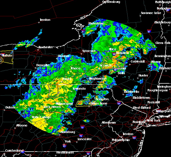 At 700 pm edt, a severe thunderstorm was located near ricketts glen state park, or 18 miles north of berwick, moving east at 35 mph (radar indicated). Hazards include 60 mph wind gusts and quarter size hail. Minor hail damage to vehicles is possible. expect wind to cause damage to trees, and power lines. this severe thunderstorm will be near, sweet valley around 710 pm edt. harveys lake and noxen around 720 pm edt. beaumont and evans falls around 725 pm edt. luzerne around 730 pm edt. falls, west wyoming and back mountain around 735 pm edt. Pittston around 740 pm edt. At 700 pm edt, a severe thunderstorm was located near ricketts glen state park, or 18 miles north of berwick, moving east at 35 mph (radar indicated). Hazards include 60 mph wind gusts and quarter size hail. Minor hail damage to vehicles is possible. expect wind to cause damage to trees, and power lines. this severe thunderstorm will be near, sweet valley around 710 pm edt. harveys lake and noxen around 720 pm edt. beaumont and evans falls around 725 pm edt. luzerne around 730 pm edt. falls, west wyoming and back mountain around 735 pm edt. Pittston around 740 pm edt.
|
| 8/2/2017 2:22 PM EDT |
 At 222 pm edt, a severe thunderstorm was located near clarks summit, or near scranton, moving southeast at 10 mph (radar indicated). Hazards include 60 mph wind gusts and quarter size hail. Minor hail damage to vehicles is possible. expect wind to cause damage to trees, and power lines. this severe thunderstorm will be near, scranton and dickson city around 230 pm edt. old forge around 235 pm edt. pittston around 245 pm edt. dunmore and moosic around 250 pm edt. Moscow, elmhurst and glendale around 300 pm edt. At 222 pm edt, a severe thunderstorm was located near clarks summit, or near scranton, moving southeast at 10 mph (radar indicated). Hazards include 60 mph wind gusts and quarter size hail. Minor hail damage to vehicles is possible. expect wind to cause damage to trees, and power lines. this severe thunderstorm will be near, scranton and dickson city around 230 pm edt. old forge around 235 pm edt. pittston around 245 pm edt. dunmore and moosic around 250 pm edt. Moscow, elmhurst and glendale around 300 pm edt.
|
| 7/20/2017 5:44 PM EDT |
 At 544 pm edt, a severe thunderstorm was located over ledgerdale, or 14 miles south of honesdale, moving southeast at 55 mph (radar indicated). Hazards include 60 mph wind gusts. Expect damage to trees, and power lines. this severe thunderstorm will be near, blooming grove around 550 pm edt. pecks pond around 555 pm edt. Bushkill around 610 pm edt. At 544 pm edt, a severe thunderstorm was located over ledgerdale, or 14 miles south of honesdale, moving southeast at 55 mph (radar indicated). Hazards include 60 mph wind gusts. Expect damage to trees, and power lines. this severe thunderstorm will be near, blooming grove around 550 pm edt. pecks pond around 555 pm edt. Bushkill around 610 pm edt.
|
| 7/20/2017 4:59 PM EDT |
 At 459 pm edt, a severe thunderstorm was located near hop bottom, or 11 miles south of montrose, moving southeast at 50 mph (radar indicated). Hazards include 60 mph wind gusts. Expect damage to trees, and power lines. this severe thunderstorm will be near, factoryville and lenoxville around 505 pm edt. waverly, dalton and la plume around 510 pm edt. clarks summit, clarks green and tompkinsville around 515 pm edt. scranton, carbondale and dunmore around 520 pm edt. elmhurst and mount cobb around 525 pm edt. moscow, tresslarville and lake ariel around 530 pm edt. Sterling and arlington around 535 pm edt. At 459 pm edt, a severe thunderstorm was located near hop bottom, or 11 miles south of montrose, moving southeast at 50 mph (radar indicated). Hazards include 60 mph wind gusts. Expect damage to trees, and power lines. this severe thunderstorm will be near, factoryville and lenoxville around 505 pm edt. waverly, dalton and la plume around 510 pm edt. clarks summit, clarks green and tompkinsville around 515 pm edt. scranton, carbondale and dunmore around 520 pm edt. elmhurst and mount cobb around 525 pm edt. moscow, tresslarville and lake ariel around 530 pm edt. Sterling and arlington around 535 pm edt.
|
| 7/20/2017 4:47 PM EDT |
 At 447 pm edt, a severe thunderstorm was located near kasson brook, or 15 miles south of wyalusing, moving southeast at 55 mph (radar indicated). Hazards include 60 mph wind gusts. Expect damage to trees, and power lines. this severe thunderstorm will be near, kasson brook around 450 pm edt. noxen around 455 pm edt. muhlenberg, harveys lake and sweet valley around 500 pm edt. edwardsville, luzerne and mountain top around 510 pm edt. Wilkes-barre, bear creek and sugar notch around 515 pm edt. At 447 pm edt, a severe thunderstorm was located near kasson brook, or 15 miles south of wyalusing, moving southeast at 55 mph (radar indicated). Hazards include 60 mph wind gusts. Expect damage to trees, and power lines. this severe thunderstorm will be near, kasson brook around 450 pm edt. noxen around 455 pm edt. muhlenberg, harveys lake and sweet valley around 500 pm edt. edwardsville, luzerne and mountain top around 510 pm edt. Wilkes-barre, bear creek and sugar notch around 515 pm edt.
|
| 7/17/2017 2:26 PM EDT |
 At 226 pm edt, a severe thunderstorm was located over bear creek village, or near wilkes-barre, moving northeast at 10 mph (radar indicated). Hazards include half dollar size hail. Minor damage to vehicles is possible. this severe thunderstorm will be near, pittston around 255 pm edt. glendale around 305 pm edt. moosic around 320 pm edt. Dunmore, moscow and elmhurst around 330 pm edt. At 226 pm edt, a severe thunderstorm was located over bear creek village, or near wilkes-barre, moving northeast at 10 mph (radar indicated). Hazards include half dollar size hail. Minor damage to vehicles is possible. this severe thunderstorm will be near, pittston around 255 pm edt. glendale around 305 pm edt. moosic around 320 pm edt. Dunmore, moscow and elmhurst around 330 pm edt.
|
| 7/17/2017 1:24 PM EDT |
 At 123 pm edt, a severe thunderstorm was located over edwardsville, or over wilkes-barre, moving northeast at 15 mph (radar indicated). Hazards include quarter size hail. Minor damage to vehicles is possible. this severe thunderstorm will be near, luzerne around 135 pm edt. bear creek and bear creek village around 140 pm edt. wilkes-barre around 145 pm edt. west wyoming around 150 pm edt. pittston around 200 pm edt. glendale around 210 pm edt. old forge around 215 pm edt. Moosic around 220 pm edt. At 123 pm edt, a severe thunderstorm was located over edwardsville, or over wilkes-barre, moving northeast at 15 mph (radar indicated). Hazards include quarter size hail. Minor damage to vehicles is possible. this severe thunderstorm will be near, luzerne around 135 pm edt. bear creek and bear creek village around 140 pm edt. wilkes-barre around 145 pm edt. west wyoming around 150 pm edt. pittston around 200 pm edt. glendale around 210 pm edt. old forge around 215 pm edt. Moosic around 220 pm edt.
|
| 7/17/2017 12:42 PM EDT |
 The national weather service in binghamton has issued a * severe thunderstorm warning for. northern luzerne county in northeastern pennsylvania. southeastern wyoming county in northeastern pennsylvania. Until 130 pm edt * at 1241 pm edt, a severe thunderstorm was located over shickshinny,. The national weather service in binghamton has issued a * severe thunderstorm warning for. northern luzerne county in northeastern pennsylvania. southeastern wyoming county in northeastern pennsylvania. Until 130 pm edt * at 1241 pm edt, a severe thunderstorm was located over shickshinny,.
|
| 6/30/2017 4:10 PM EDT |
 At 409 pm edt, a severe thunderstorm was located over pittston, moving east at 35 mph (radar indicated). Hazards include 60 mph wind gusts and quarter size hail. Minor hail damage to vehicles is possible. expect wind to cause damage to trees, and power lines. this severe storm will be near, moosic around 415 pm edt. dunmore around 420 pm edt. moscow and elmhurst around 430 pm edt. Lehigh and gouldsboro around 435 pm edt. At 409 pm edt, a severe thunderstorm was located over pittston, moving east at 35 mph (radar indicated). Hazards include 60 mph wind gusts and quarter size hail. Minor hail damage to vehicles is possible. expect wind to cause damage to trees, and power lines. this severe storm will be near, moosic around 415 pm edt. dunmore around 420 pm edt. moscow and elmhurst around 430 pm edt. Lehigh and gouldsboro around 435 pm edt.
|
| 6/30/2017 11:52 AM EDT |
 At 352 pm edt, a severe thunderstorm was located near back mountain, or 7 miles northwest of wilkes-barre, moving east at 40 mph (radar indicated). Hazards include 60 mph wind gusts and quarter size hail. Minor hail damage to vehicles is possible. expect wind to cause damage to trees, and power lines. this severe thunderstorm will be near, pittston around 405 pm edt. old forge, moosic and glendale around 410 pm edt. scranton around 415 pm edt. dunmore around 420 pm edt. moscow and elmhurst around 425 pm edt. Lehigh and gouldsboro around 430 pm edt. At 352 pm edt, a severe thunderstorm was located near back mountain, or 7 miles northwest of wilkes-barre, moving east at 40 mph (radar indicated). Hazards include 60 mph wind gusts and quarter size hail. Minor hail damage to vehicles is possible. expect wind to cause damage to trees, and power lines. this severe thunderstorm will be near, pittston around 405 pm edt. old forge, moosic and glendale around 410 pm edt. scranton around 415 pm edt. dunmore around 420 pm edt. moscow and elmhurst around 425 pm edt. Lehigh and gouldsboro around 430 pm edt.
|
| 5/1/2017 9:24 PM EDT |
 At 923 pm edt, a severe thunderstorm was located over back mountain, or 8 miles northwest of wilkes-barre, moving northeast at 40 to 50 mph (radar indicated). Hazards include 60 mph wind gusts and penny size hail. Expect damage to roofs, siding, and trees. this severe thunderstorm will be near, pittston, falls and west wyoming around 935 pm edt. old forge and glendale around 940 pm edt. moosic around 945 pm edt. scranton, waverly and dunmore around 950 pm edt. archbald, olyphant and tompkinsville around 955 pm edt. mayfield and mount cobb around 1000 pm edt. carbondale around 1005 pm edt. A tornado watch remains in effect until 1000 pm edt for northeastern pennsylvania. At 923 pm edt, a severe thunderstorm was located over back mountain, or 8 miles northwest of wilkes-barre, moving northeast at 40 to 50 mph (radar indicated). Hazards include 60 mph wind gusts and penny size hail. Expect damage to roofs, siding, and trees. this severe thunderstorm will be near, pittston, falls and west wyoming around 935 pm edt. old forge and glendale around 940 pm edt. moosic around 945 pm edt. scranton, waverly and dunmore around 950 pm edt. archbald, olyphant and tompkinsville around 955 pm edt. mayfield and mount cobb around 1000 pm edt. carbondale around 1005 pm edt. A tornado watch remains in effect until 1000 pm edt for northeastern pennsylvania.
|
| 5/1/2017 8:51 PM EDT |
 At 850 pm edt, severe thunderstorms were located along a line extending from jamison city to near rohrsburg to lightstreet, moving northeast at 45 to 55 mph (radar indicated). Hazards include 70 mph wind gusts and quarter size hail. Hail damage to vehicles is expected. expect considerable tree damage. wind damage is also likely to mobile homes, roofs, and outbuildings. severe thunderstorms will be near, huntington mills around 855 pm edt. muhlenberg, nescopeck and east berwick around 900 pm edt. shickshinny, sweet valley and kasson brook around 905 pm edt. harveys lake, slocum and noxen around 910 pm edt. tunkhannock, falls and osterhout around 915 pm edt. edwardsville, luzerne and sugar notch around 920 pm edt. wilkes-barre, pittston and waverly around 925 pm edt. scranton, dunmore and archbald around 930 pm edt. A tornado watch remains in effect until 1000 pm edt for northeastern pennsylvania. At 850 pm edt, severe thunderstorms were located along a line extending from jamison city to near rohrsburg to lightstreet, moving northeast at 45 to 55 mph (radar indicated). Hazards include 70 mph wind gusts and quarter size hail. Hail damage to vehicles is expected. expect considerable tree damage. wind damage is also likely to mobile homes, roofs, and outbuildings. severe thunderstorms will be near, huntington mills around 855 pm edt. muhlenberg, nescopeck and east berwick around 900 pm edt. shickshinny, sweet valley and kasson brook around 905 pm edt. harveys lake, slocum and noxen around 910 pm edt. tunkhannock, falls and osterhout around 915 pm edt. edwardsville, luzerne and sugar notch around 920 pm edt. wilkes-barre, pittston and waverly around 925 pm edt. scranton, dunmore and archbald around 930 pm edt. A tornado watch remains in effect until 1000 pm edt for northeastern pennsylvania.
|
| 5/1/2017 8:29 PM EDT |
 At 828 pm edt, severe thunderstorms were located along a line extending from near deposit to near union dale to near berwick, moving east at 40 mph (radar indicated). Hazards include 60 mph wind gusts and penny size hail. Expect damage to roofs, siding, and trees. severe thunderstorms will be near, forest city, union dale and pleasant mount around 835 pm edt. walton, conyngham and waymart around 845 pm edt. west hazleton, prompton and bethany around 850 pm edt. hazleton, honesdale and rutledgedale around 855 pm edt. freeland, corbett and woodside-drifton around 900 pm edt. damascus, callicoon and hortonville around 905 pm edt. cochecton, white haven and lava around 910 pm edt. fosterdale, hazel and livingston manor around 915 pm edt. A tornado watch remains in effect until 1000 pm edt for central new york, and northeastern pennsylvania. At 828 pm edt, severe thunderstorms were located along a line extending from near deposit to near union dale to near berwick, moving east at 40 mph (radar indicated). Hazards include 60 mph wind gusts and penny size hail. Expect damage to roofs, siding, and trees. severe thunderstorms will be near, forest city, union dale and pleasant mount around 835 pm edt. walton, conyngham and waymart around 845 pm edt. west hazleton, prompton and bethany around 850 pm edt. hazleton, honesdale and rutledgedale around 855 pm edt. freeland, corbett and woodside-drifton around 900 pm edt. damascus, callicoon and hortonville around 905 pm edt. cochecton, white haven and lava around 910 pm edt. fosterdale, hazel and livingston manor around 915 pm edt. A tornado watch remains in effect until 1000 pm edt for central new york, and northeastern pennsylvania.
|
| 5/1/2017 7:49 PM EDT |
 At 748 pm edt, severe thunderstorms were located along a line extending from near vestal center to near rushville to lovelton to iola, moving east at 40 to 50 mph (radar indicated). Hazards include 60 mph wind gusts and penny size hail. Expect damage to roofs, siding, and trees. severe thunderstorms will be near, rush, noxen and mehoopany around 755 pm edt. springville, meshoppen and evans falls around 800 pm edt. tunkhannock, montrose and osterhout around 805 pm edt. falls, nescopeck and hallstead around 810 pm edt. muhlenberg, factoryville and shickshinny around 815 pm edt. waverly, clarks summit and susquehanna around 820 pm edt. scranton, dunmore and dickson city around 825 pm edt. carbondale, archbald and olyphant around 830 pm edt. A tornado watch remains in effect until 1000 pm edt for central new york, and northeastern pennsylvania. At 748 pm edt, severe thunderstorms were located along a line extending from near vestal center to near rushville to lovelton to iola, moving east at 40 to 50 mph (radar indicated). Hazards include 60 mph wind gusts and penny size hail. Expect damage to roofs, siding, and trees. severe thunderstorms will be near, rush, noxen and mehoopany around 755 pm edt. springville, meshoppen and evans falls around 800 pm edt. tunkhannock, montrose and osterhout around 805 pm edt. falls, nescopeck and hallstead around 810 pm edt. muhlenberg, factoryville and shickshinny around 815 pm edt. waverly, clarks summit and susquehanna around 820 pm edt. scranton, dunmore and dickson city around 825 pm edt. carbondale, archbald and olyphant around 830 pm edt. A tornado watch remains in effect until 1000 pm edt for central new york, and northeastern pennsylvania.
|
| 2/25/2017 3:45 PM EST |
 At 345 pm est, severe thunderstorms were located along a line extending from near dunmore to near stoddartsville to nesquehoning, moving northeast at 30 mph (radar indicated). Hazards include 60 mph wind gusts and quarter size hail. Hail damage to vehicles is expected. expect wind damage to roofs, siding, and trees. severe thunderstorms will be near, scranton, dunmore and moosic around 350 pm est. dickson city and olyphant around 355 pm est. archbald, mayfield and mount cobb around 405 pm est. gouldsboro, tresslarville and lake ariel around 410 pm est. carbondale and lehigh around 415 pm est. sterling, waymart and angels around 425 pm est. honesdale and prompton around 430 pm est. Bethany around 435 pm est. At 345 pm est, severe thunderstorms were located along a line extending from near dunmore to near stoddartsville to nesquehoning, moving northeast at 30 mph (radar indicated). Hazards include 60 mph wind gusts and quarter size hail. Hail damage to vehicles is expected. expect wind damage to roofs, siding, and trees. severe thunderstorms will be near, scranton, dunmore and moosic around 350 pm est. dickson city and olyphant around 355 pm est. archbald, mayfield and mount cobb around 405 pm est. gouldsboro, tresslarville and lake ariel around 410 pm est. carbondale and lehigh around 415 pm est. sterling, waymart and angels around 425 pm est. honesdale and prompton around 430 pm est. Bethany around 435 pm est.
|
| 2/25/2017 3:18 PM EST |
 At 318 pm est, a severe thunderstorm was located over olyphant, or near scranton, moving northeast at 55 mph (radar indicated). Hazards include 60 mph wind gusts and quarter size hail. Hail damage to vehicles is expected. expect wind damage to roofs, siding, and trees. This severe storm will be near, carbondale and waymart around 330 pm est. At 318 pm est, a severe thunderstorm was located over olyphant, or near scranton, moving northeast at 55 mph (radar indicated). Hazards include 60 mph wind gusts and quarter size hail. Hail damage to vehicles is expected. expect wind damage to roofs, siding, and trees. This severe storm will be near, carbondale and waymart around 330 pm est.
|
| 2/25/2017 3:06 PM EST |
 At 306 pm est, a severe thunderstorm was located over moosic, or over scranton, moving northeast at 55 mph (radar indicated). Hazards include 60 mph wind gusts and quarter size hail. Hail damage to vehicles is expected. expect wind damage to roofs, siding, and trees. this severe thunderstorm will be near, moscow and elmhurst around 310 pm est. dunmore, dickson city and olyphant around 315 pm est. archbald, mayfield and mount cobb around 320 pm est. carbondale around 325 pm est. Waymart around 330 pm est. At 306 pm est, a severe thunderstorm was located over moosic, or over scranton, moving northeast at 55 mph (radar indicated). Hazards include 60 mph wind gusts and quarter size hail. Hail damage to vehicles is expected. expect wind damage to roofs, siding, and trees. this severe thunderstorm will be near, moscow and elmhurst around 310 pm est. dunmore, dickson city and olyphant around 315 pm est. archbald, mayfield and mount cobb around 320 pm est. carbondale around 325 pm est. Waymart around 330 pm est.
|
| 2/25/2017 2:45 PM EST | Roof blown off a residence in luzerne county PA, 0.2 miles S of Pittston, PA |
| 2/25/2017 2:40 PM EST | Possible tornado. approximately 30 homes damaged... 2 with major damage. roofs off some homes. lots of trees down. some people still trapped. no injuries or deaths repo in luzerne county PA, 3.6 miles WNW of Pittston, PA |
| 2/25/2017 2:40 PM EST |
 At 240 pm est, a severe thunderstorm capable of producing a tornado was located over glendale, or near pittston, moving northeast at 40 mph (radar indicated rotation). Hazards include tornado and quarter size hail. Flying debris will be dangerous to those caught without shelter. mobile homes will be damaged or destroyed. damage to roofs, windows, and vehicles will occur. tree damage is likely. this dangerous storm will be near, scranton, dunmore and dickson city around 255 pm est. olyphant around 300 pm est. archbald, mayfield and mount cobb around 305 pm est. Carbondale around 315 pm est. At 240 pm est, a severe thunderstorm capable of producing a tornado was located over glendale, or near pittston, moving northeast at 40 mph (radar indicated rotation). Hazards include tornado and quarter size hail. Flying debris will be dangerous to those caught without shelter. mobile homes will be damaged or destroyed. damage to roofs, windows, and vehicles will occur. tree damage is likely. this dangerous storm will be near, scranton, dunmore and dickson city around 255 pm est. olyphant around 300 pm est. archbald, mayfield and mount cobb around 305 pm est. Carbondale around 315 pm est.
|
| 2/25/2017 2:31 PM EST |
 At 231 pm est, a severe thunderstorm capable of producing a tornado was located near pittston, moving northeast at 45 mph (radar indicated rotation). Hazards include tornado and half dollar size hail. Flying debris will be dangerous to those caught without shelter. mobile homes will be damaged or destroyed. damage to roofs, windows, and vehicles will occur. tree damage is likely. this dangerous storm will be near, old forge, moosic and glendale around 240 pm est. Scranton around 245 pm est. At 231 pm est, a severe thunderstorm capable of producing a tornado was located near pittston, moving northeast at 45 mph (radar indicated rotation). Hazards include tornado and half dollar size hail. Flying debris will be dangerous to those caught without shelter. mobile homes will be damaged or destroyed. damage to roofs, windows, and vehicles will occur. tree damage is likely. this dangerous storm will be near, old forge, moosic and glendale around 240 pm est. Scranton around 245 pm est.
|
| 2/25/2017 2:22 PM EST |
 At 222 pm est, a severe thunderstorm capable of producing a tornado was located over mountain top, or near wilkes-barre, moving northeast at 55 mph (radar indicated rotation). Hazards include tornado and half dollar size hail. Flying debris will be dangerous to those caught without shelter. mobile homes will be damaged or destroyed. damage to roofs, windows, and vehicles will occur. tree damage is likely. this dangerous storm will be near, pittston and glendale around 235 pm est. old forge and moosic around 240 pm est. Scranton around 245 pm est. At 222 pm est, a severe thunderstorm capable of producing a tornado was located over mountain top, or near wilkes-barre, moving northeast at 55 mph (radar indicated rotation). Hazards include tornado and half dollar size hail. Flying debris will be dangerous to those caught without shelter. mobile homes will be damaged or destroyed. damage to roofs, windows, and vehicles will occur. tree damage is likely. this dangerous storm will be near, pittston and glendale around 235 pm est. old forge and moosic around 240 pm est. Scranton around 245 pm est.
|
| 2/25/2017 2:11 PM EST |
 At 210 pm est, a severe thunderstorm was located over sugar notch, or near wilkes-barre, moving northeast at 55 mph (radar indicated). Hazards include 60 mph wind gusts and quarter size hail. Hail damage to vehicles is expected. expect wind damage to roofs, siding, and trees. this severe thunderstorm will be near, edwardsville around 215 pm est. wilkes-barre, luzerne and west wyoming around 220 pm est. pittston and glendale around 225 pm est. old forge and moosic around 230 pm est. scranton, dunmore and clarks summit around 235 pm est. Dickson city around 240 pm est. At 210 pm est, a severe thunderstorm was located over sugar notch, or near wilkes-barre, moving northeast at 55 mph (radar indicated). Hazards include 60 mph wind gusts and quarter size hail. Hail damage to vehicles is expected. expect wind damage to roofs, siding, and trees. this severe thunderstorm will be near, edwardsville around 215 pm est. wilkes-barre, luzerne and west wyoming around 220 pm est. pittston and glendale around 225 pm est. old forge and moosic around 230 pm est. scranton, dunmore and clarks summit around 235 pm est. Dickson city around 240 pm est.
|
| 7/25/2016 4:15 PM EDT | Spotty trees damag in luzerne county PA, 0.6 miles ESE of Pittston, PA |
| 6/28/2016 3:50 PM EDT |
 At 349 pm edt, a severe thunderstorm was located near shickshinny, or 12 miles northeast of berwick, moving east at 20 mph (radar indicated). Hazards include 60 mph wind gusts and quarter size hail. Hail damage to vehicles is expected. expect wind damage to roofs, siding, and trees. this severe storm will be near, slocum around 355 pm edt. Sugar notch, mountain top and fairview heights around 400 pm edt. At 349 pm edt, a severe thunderstorm was located near shickshinny, or 12 miles northeast of berwick, moving east at 20 mph (radar indicated). Hazards include 60 mph wind gusts and quarter size hail. Hail damage to vehicles is expected. expect wind damage to roofs, siding, and trees. this severe storm will be near, slocum around 355 pm edt. Sugar notch, mountain top and fairview heights around 400 pm edt.
|
| 6/28/2016 3:18 PM EDT |
 At 318 pm edt, a severe thunderstorm was located over huntington mills, or 11 miles north of berwick, moving east at 25 mph (radar indicated). Hazards include 60 mph wind gusts and quarter size hail. Hail damage to vehicles is expected. expect wind damage to roofs, siding, and trees. this severe thunderstorm will be near, shickshinny around 325 pm edt. muhlenberg and pond hill around 330 pm edt. sweet valley around 335 pm edt. mountain top around 345 pm edt. harveys lake around 350 pm edt. sugar notch around 355 pm edt. Wilkes-barre, pittston and edwardsville around 400 pm edt. At 318 pm edt, a severe thunderstorm was located over huntington mills, or 11 miles north of berwick, moving east at 25 mph (radar indicated). Hazards include 60 mph wind gusts and quarter size hail. Hail damage to vehicles is expected. expect wind damage to roofs, siding, and trees. this severe thunderstorm will be near, shickshinny around 325 pm edt. muhlenberg and pond hill around 330 pm edt. sweet valley around 335 pm edt. mountain top around 345 pm edt. harveys lake around 350 pm edt. sugar notch around 355 pm edt. Wilkes-barre, pittston and edwardsville around 400 pm edt.
|
| 3/16/2016 9:40 PM EDT | Quarter sized hail reported 0.2 miles S of Pittston, PA, nickel to quarter size hail |
| 3/16/2016 9:24 PM EDT |
 The national weather service in binghamton has issued a * severe thunderstorm warning for. northeastern luzerne county in northeastern pennsylvania. southern lackawanna county in northeastern pennsylvania. southwestern wayne county in northeastern pennsylvania. West central pike county in northeastern pennsylvania. The national weather service in binghamton has issued a * severe thunderstorm warning for. northeastern luzerne county in northeastern pennsylvania. southern lackawanna county in northeastern pennsylvania. southwestern wayne county in northeastern pennsylvania. West central pike county in northeastern pennsylvania.
|
| 6/30/2015 11:08 PM EDT |
 At 1107 pm edt, a severe thunderstorm was located over old forge, or near pittston, moving northeast at 30 mph (radar indicated). Hazards include 60 mph wind gusts. Expect damage to roofs. siding and trees. this severe storm will be near, moosic around 1110 pm edt. scranton, waverly and clarks summit around 1120 pm edt. dunmore, dickson city and elmhurst around 1125 pm edt. Archbald, olyphant and mayfield around 1130 pm edt. At 1107 pm edt, a severe thunderstorm was located over old forge, or near pittston, moving northeast at 30 mph (radar indicated). Hazards include 60 mph wind gusts. Expect damage to roofs. siding and trees. this severe storm will be near, moosic around 1110 pm edt. scranton, waverly and clarks summit around 1120 pm edt. dunmore, dickson city and elmhurst around 1125 pm edt. Archbald, olyphant and mayfield around 1130 pm edt.
|
| 6/30/2015 10:36 PM EDT |
 At 1036 pm edt, a severe thunderstorm was located near harveys lake, or 9 miles west of wilkes-barre, moving northeast at 30 mph (radar indicated). Hazards include 60 mph wind gusts. Expect damage to roofs. siding and trees. this severe thunderstorm will be near, harveys lake around 1045 pm edt. edwardsville and luzerne around 1050 pm edt. wilkes-barre and west wyoming around 1055 pm edt. pittston and falls around 1100 pm edt. old forge, moosic and glendale around 1110 pm edt. scranton, waverly and clarks summit around 1120 pm edt. dunmore, dickson city and elmhurst around 1125 pm edt. Archbald, olyphant and mayfield around 1130 pm edt. At 1036 pm edt, a severe thunderstorm was located near harveys lake, or 9 miles west of wilkes-barre, moving northeast at 30 mph (radar indicated). Hazards include 60 mph wind gusts. Expect damage to roofs. siding and trees. this severe thunderstorm will be near, harveys lake around 1045 pm edt. edwardsville and luzerne around 1050 pm edt. wilkes-barre and west wyoming around 1055 pm edt. pittston and falls around 1100 pm edt. old forge, moosic and glendale around 1110 pm edt. scranton, waverly and clarks summit around 1120 pm edt. dunmore, dickson city and elmhurst around 1125 pm edt. Archbald, olyphant and mayfield around 1130 pm edt.
|
| 4/10/2013 5:09 PM EDT | Quarter sized hail reported 2.2 miles WSW of Pittston, PA, nssl ping project |
| 9/6/2012 8:55 PM EDT | Quarter sized hail reported 0.2 miles S of Pittston, PA |
| 6/22/2012 2:38 PM EDT | Quarter sized hail reported 0.2 miles S of Pittston, PA |
Hail Maps for Pittston, PA


Connect with Interactive Hail Maps