

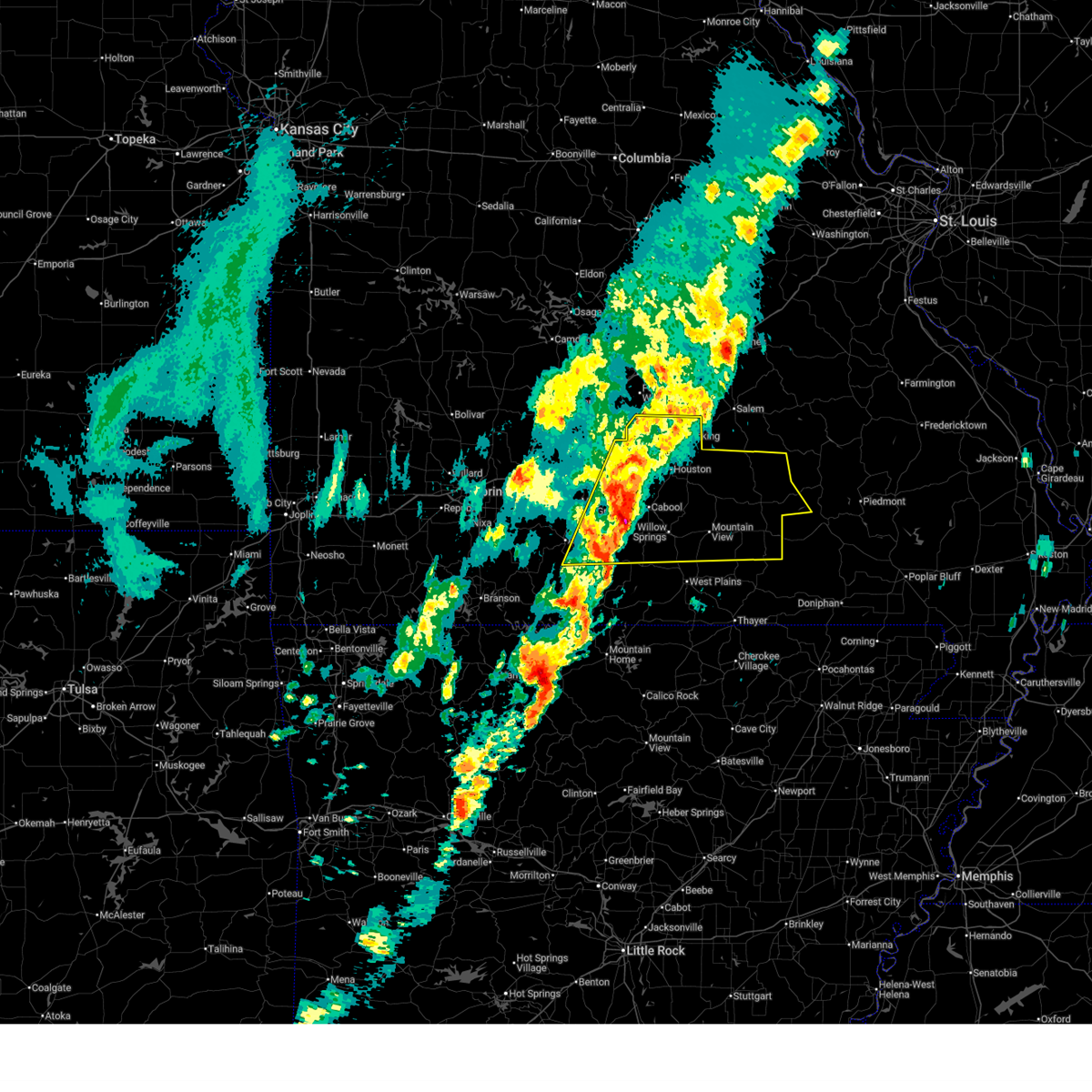
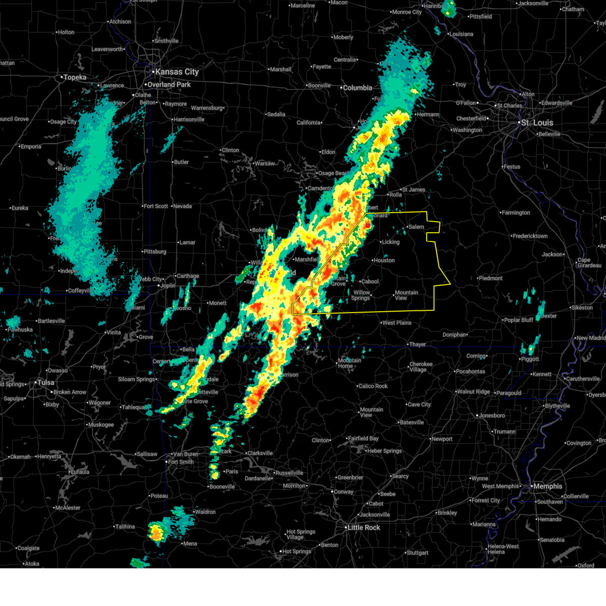
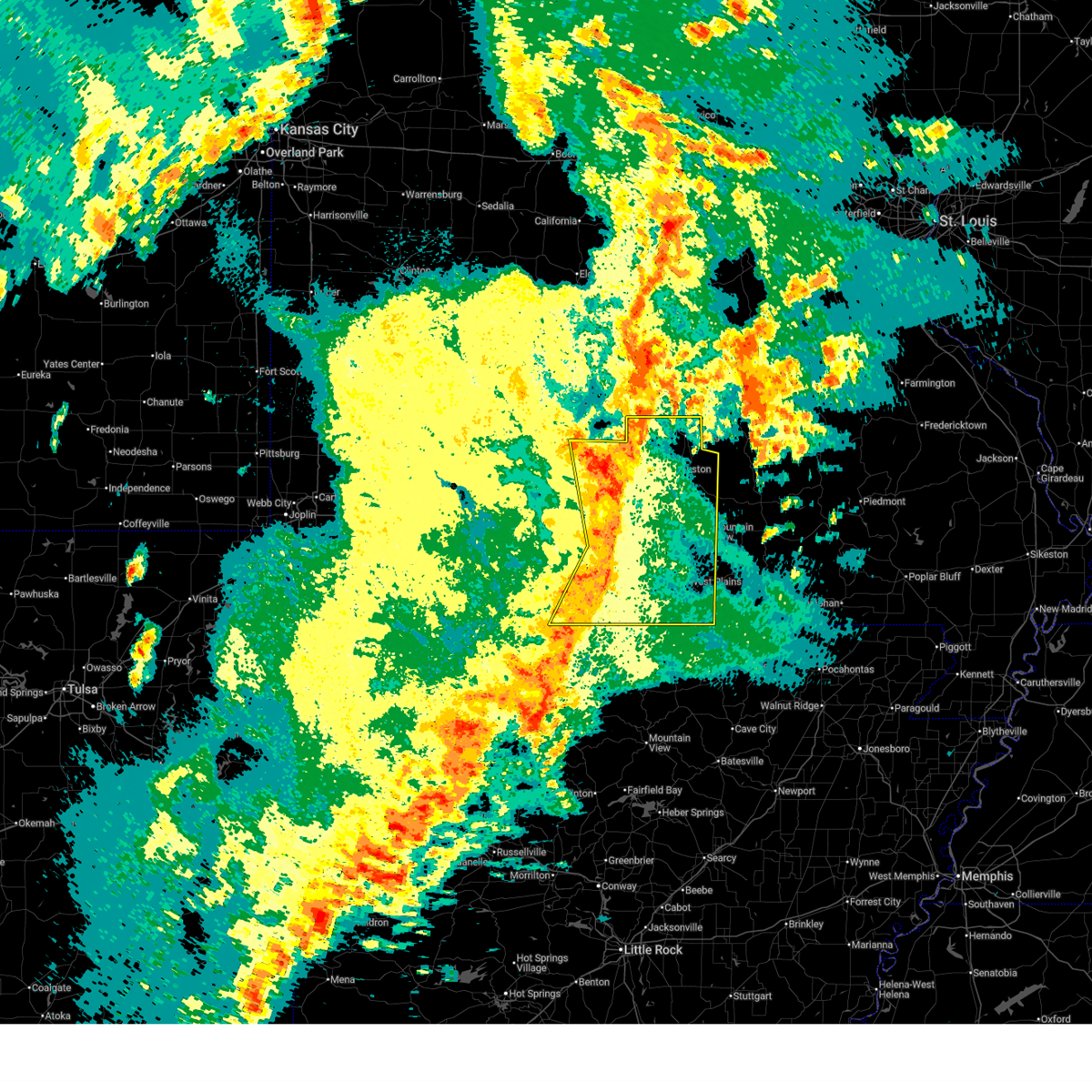
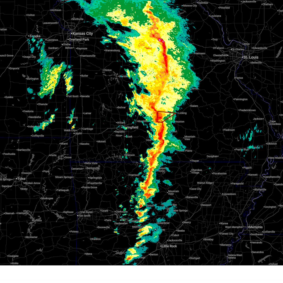
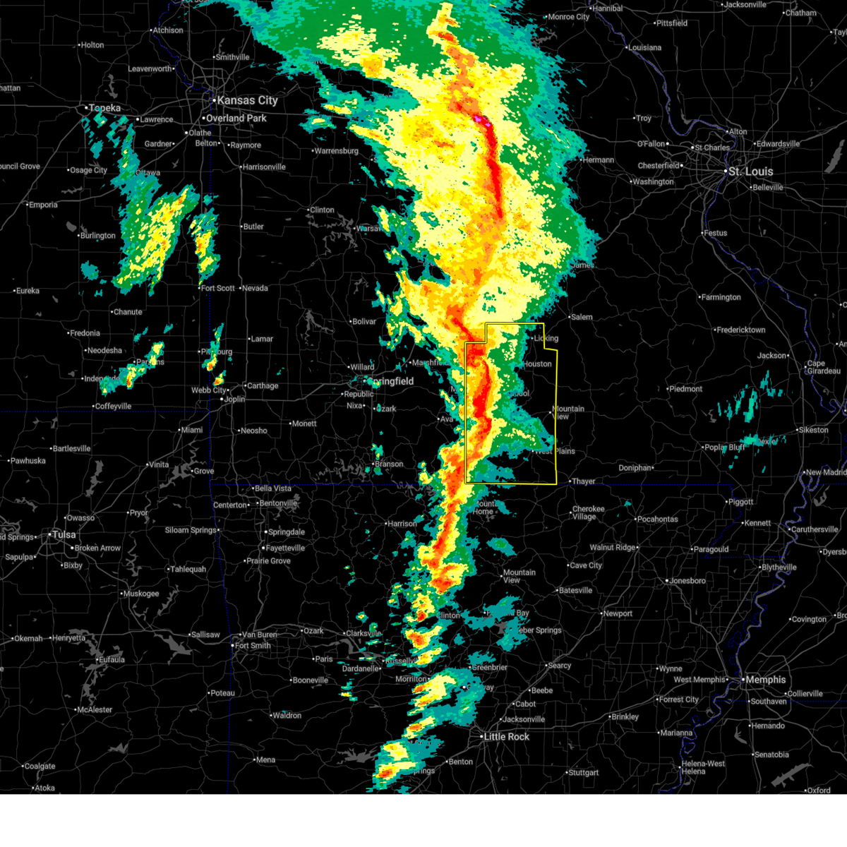
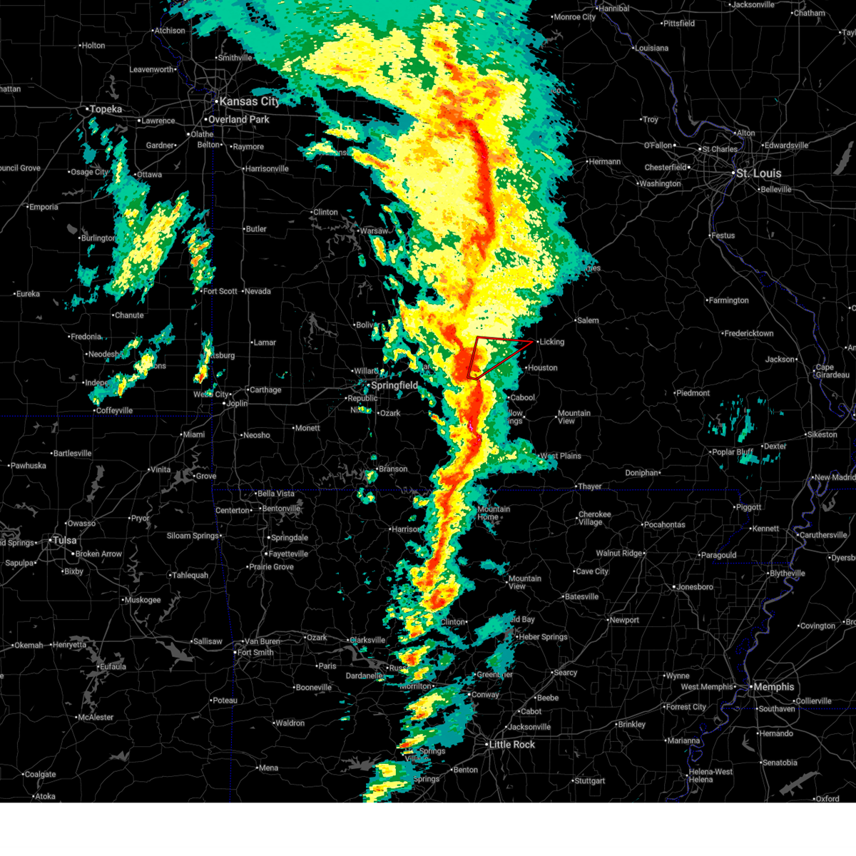
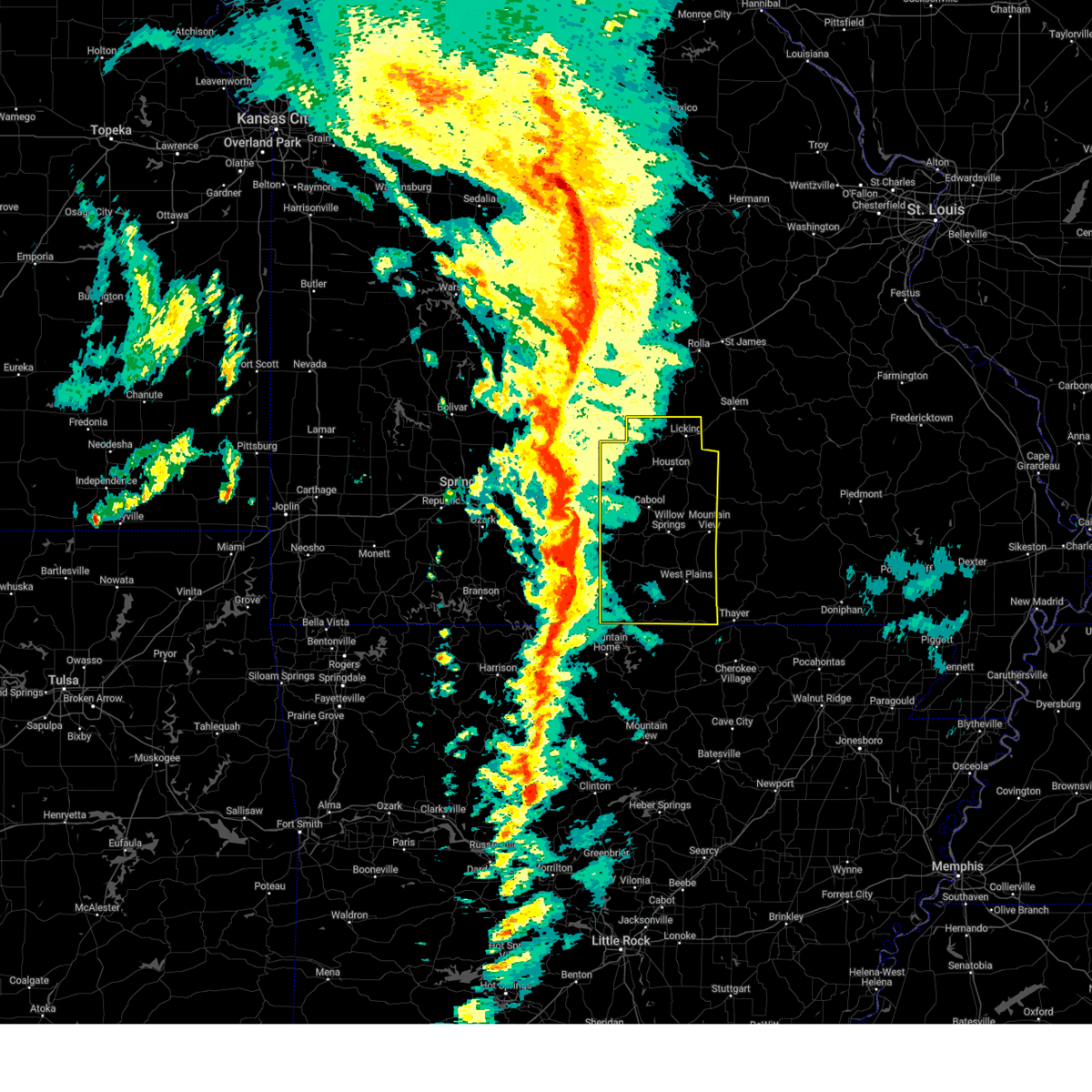
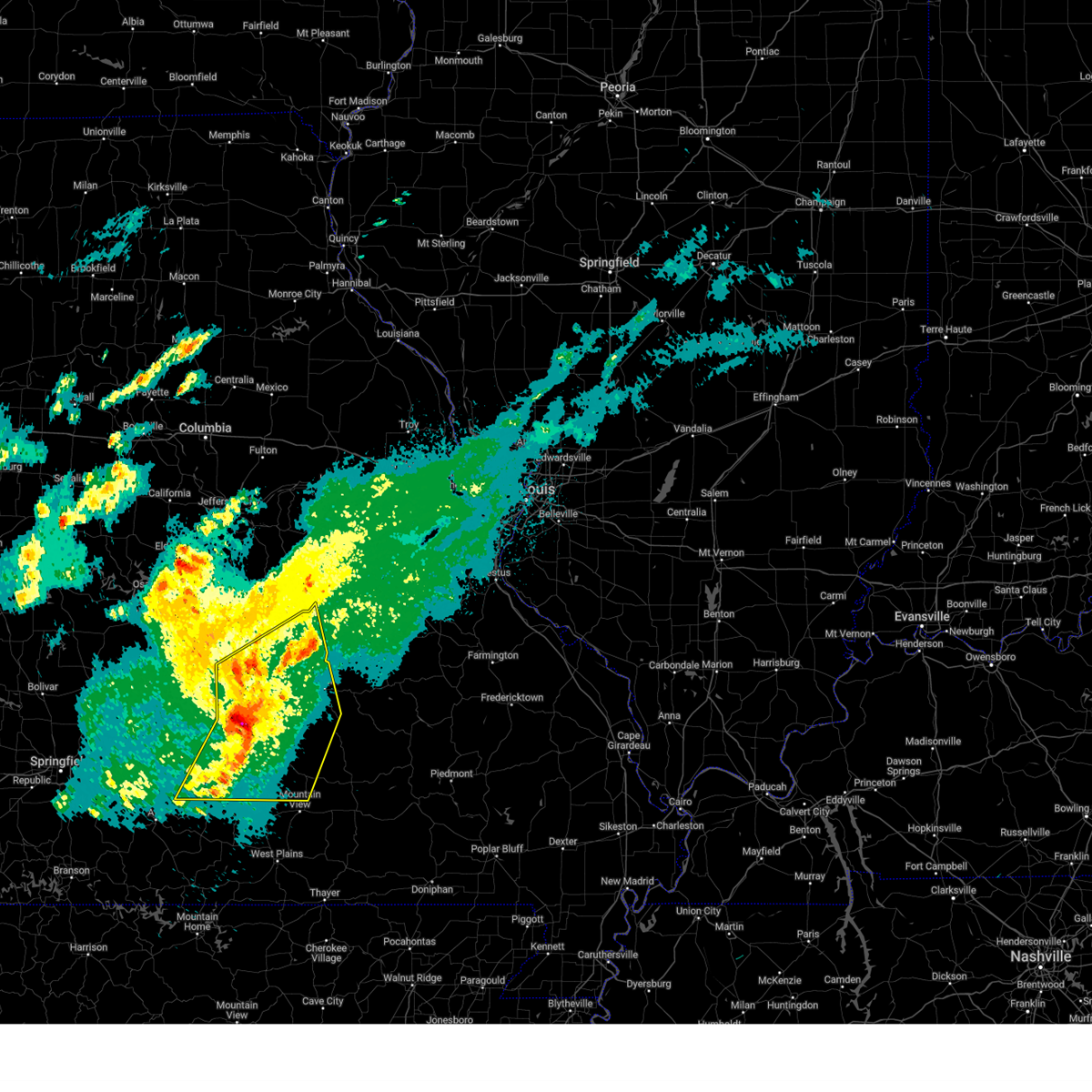
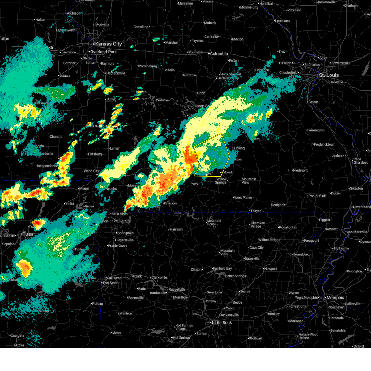
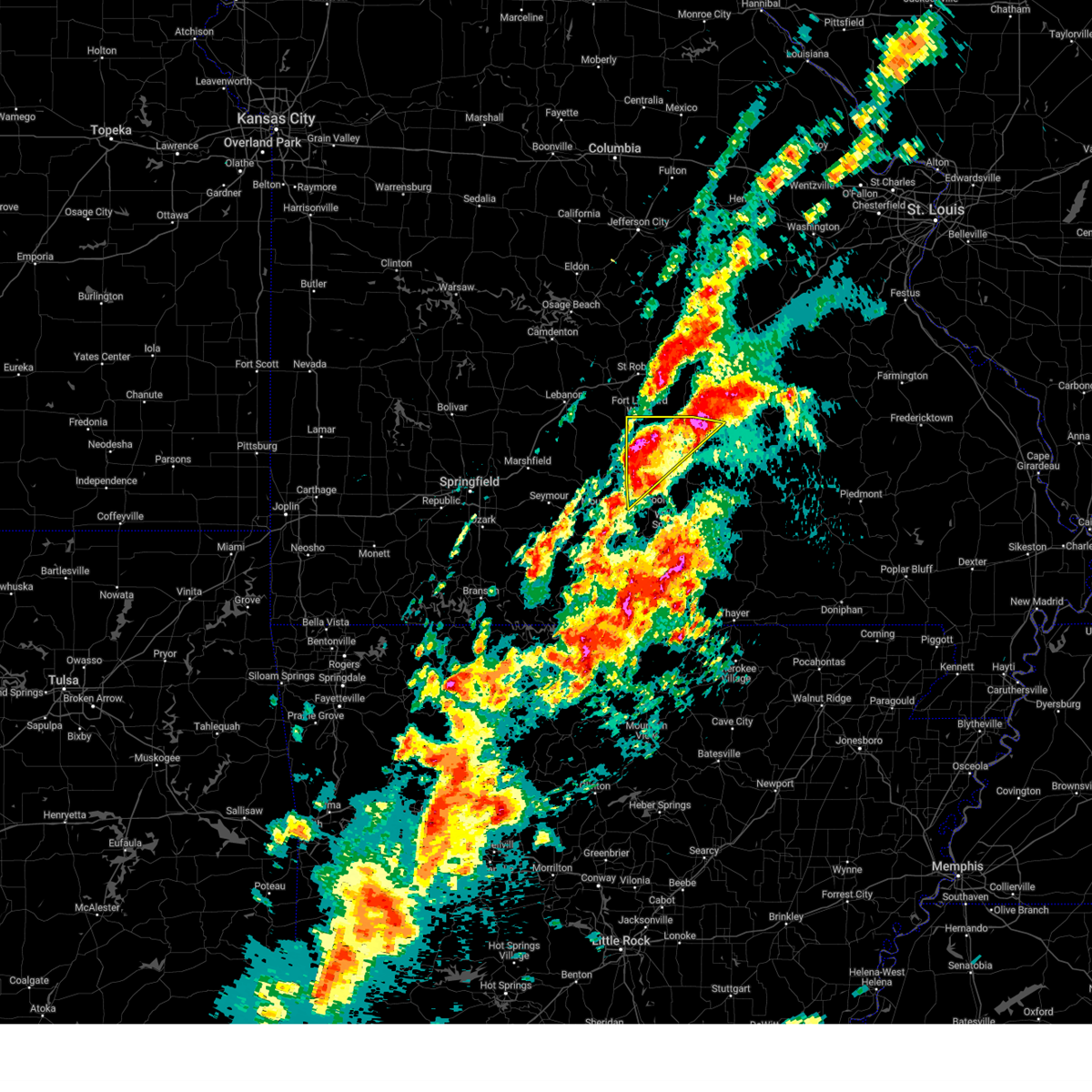
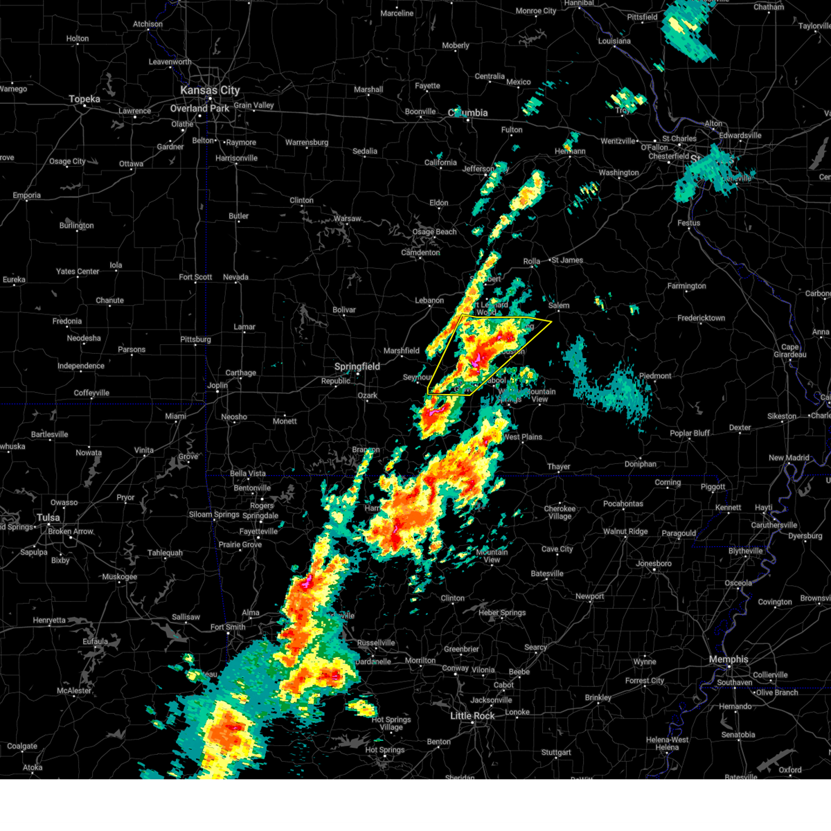
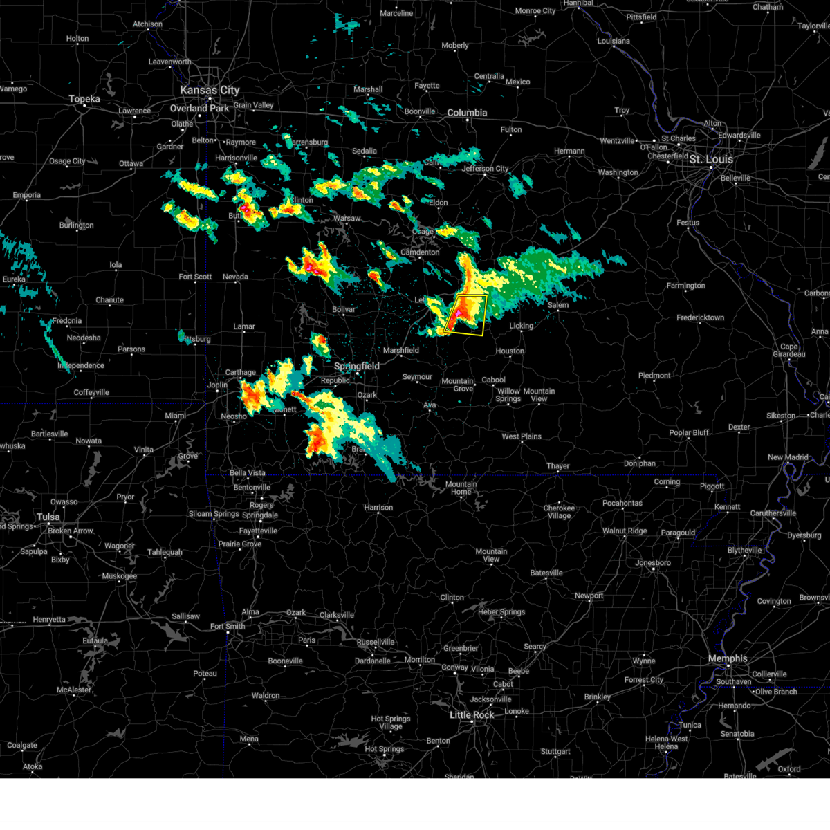
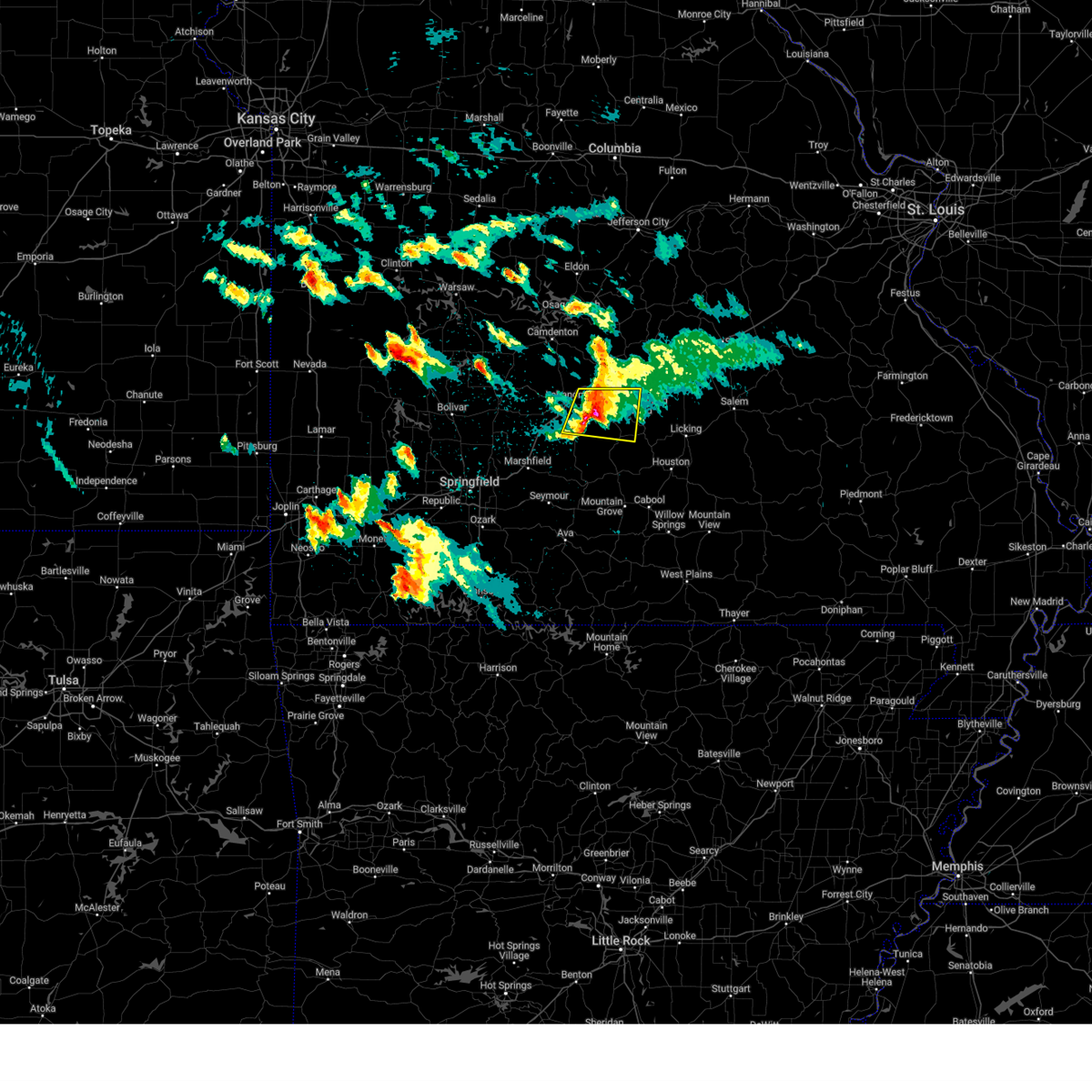
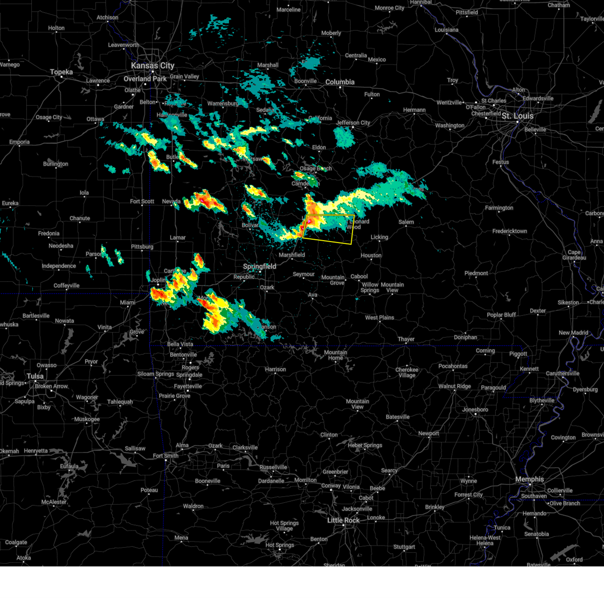
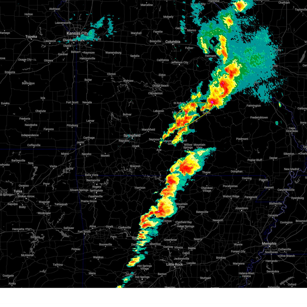
Hail Map for Plato, MO
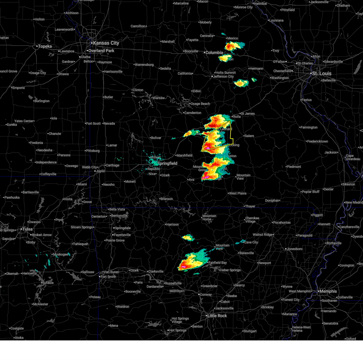
The Plato, MO area has had 23 reports of on-the-ground hail by trained spotters, and has been under severe weather warnings 7 times during the past 12 months. Doppler radar has detected hail at or near Plato, MO on 63 occasions, including 1 occasion during the past year.
| Name: | Plato, MO |
| Where Located: | 38.8 miles WSW of Salem, MO |
| Map: | Google Map for Plato, MO |
| Population: | 109 |
| Housing Units: | 48 |
| More Info: | Search Google for Plato, MO |
0
The Top Recent Hail Date for Plato, MO is Wednesday, March 4, 2026 (42nd out of 63)
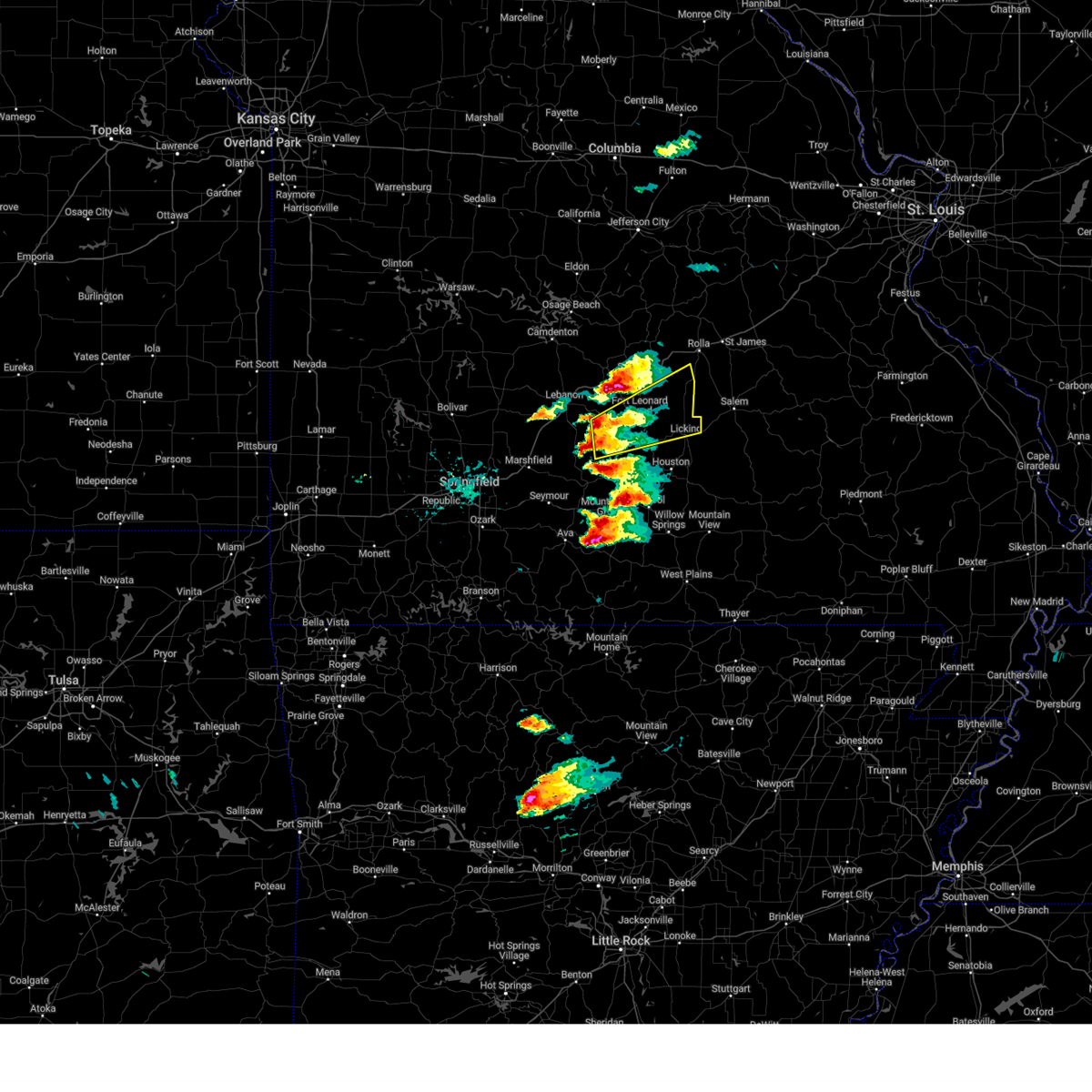
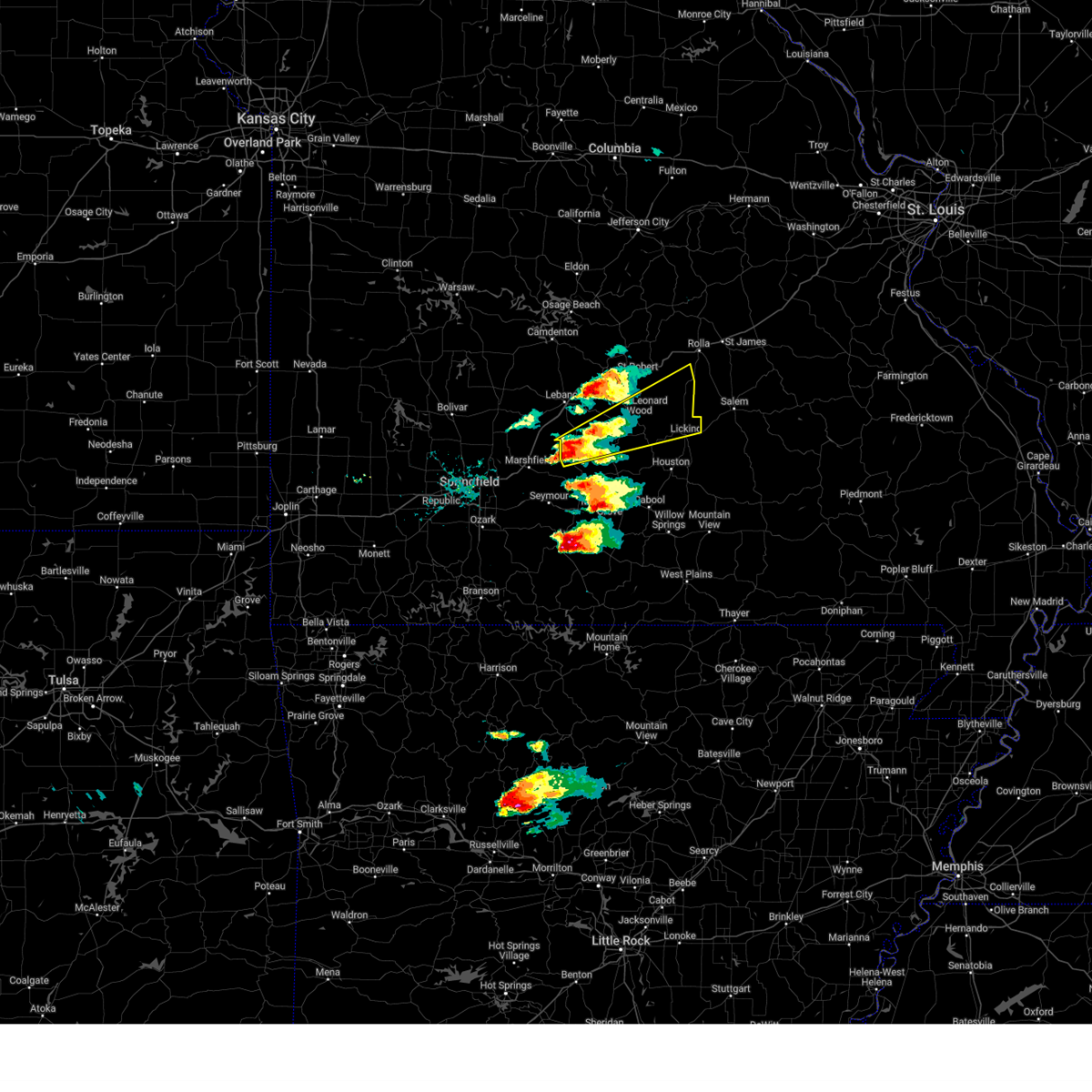
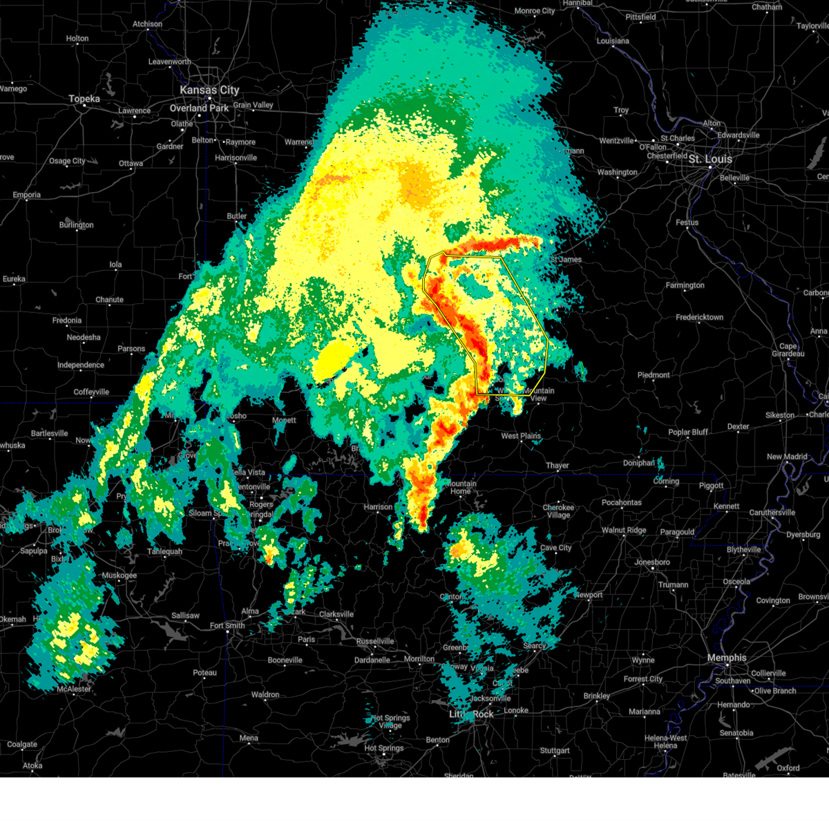
Hail and Wind Damage Spotted near Plato, MO
| Date / Time | Report Details |
|---|---|
| 4/28/2026 12:37 PM CDT |
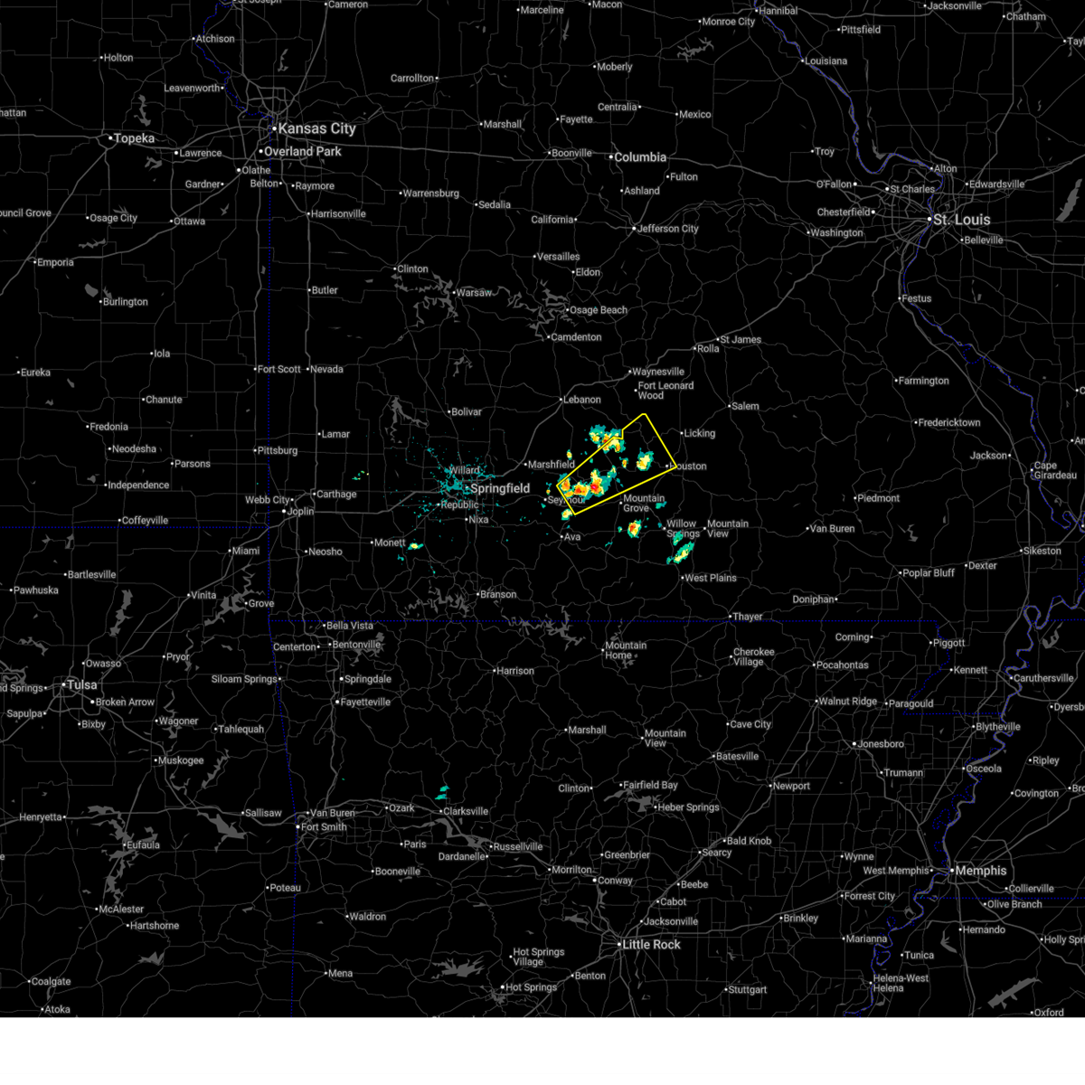
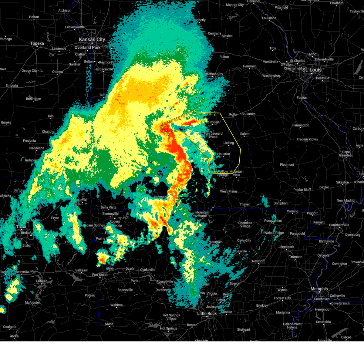
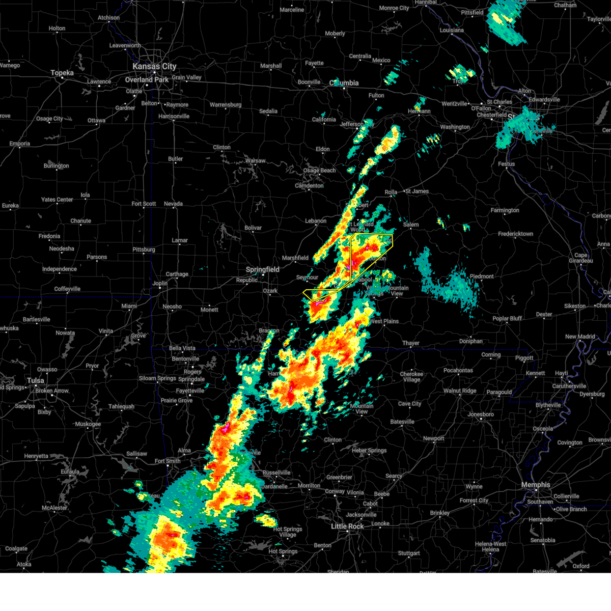
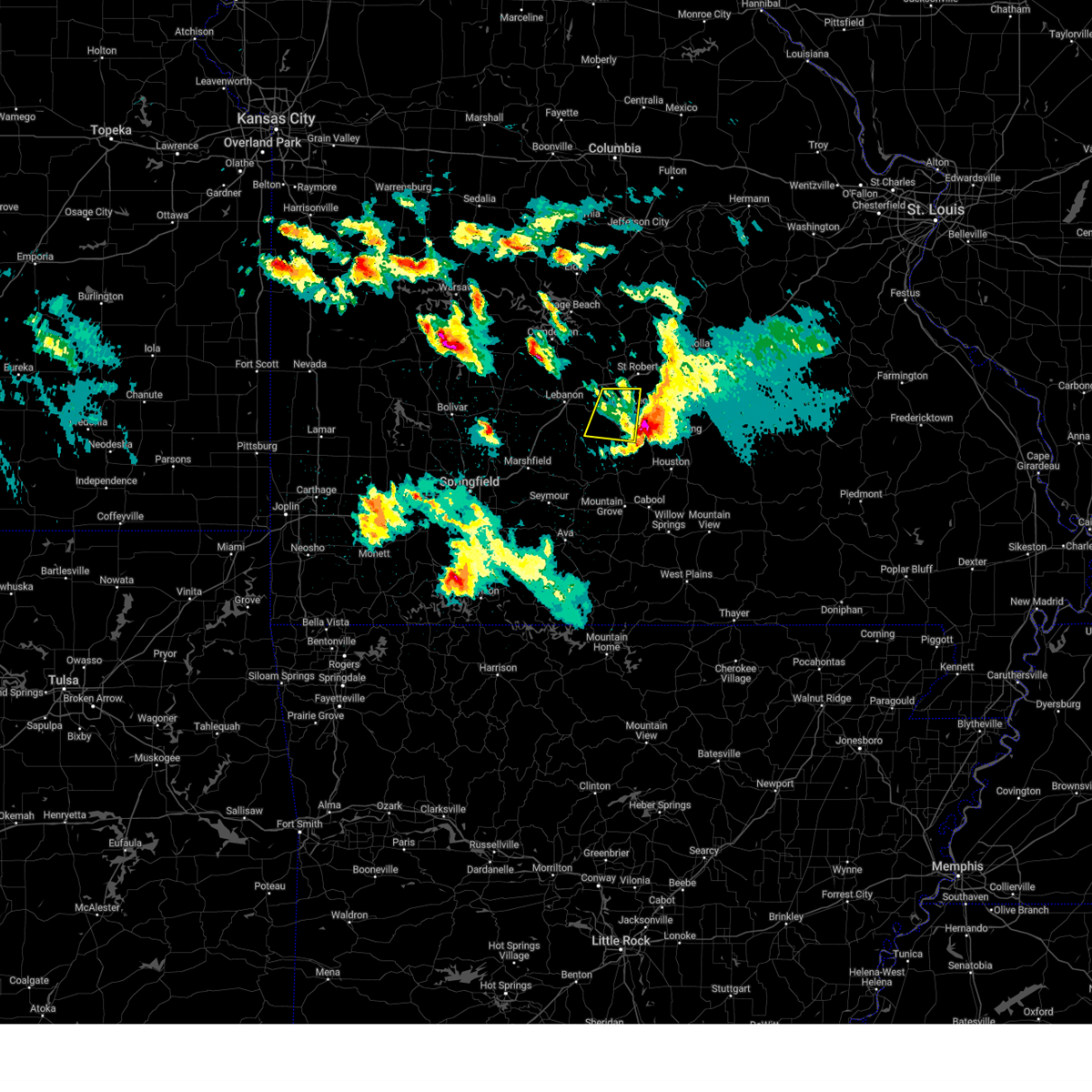
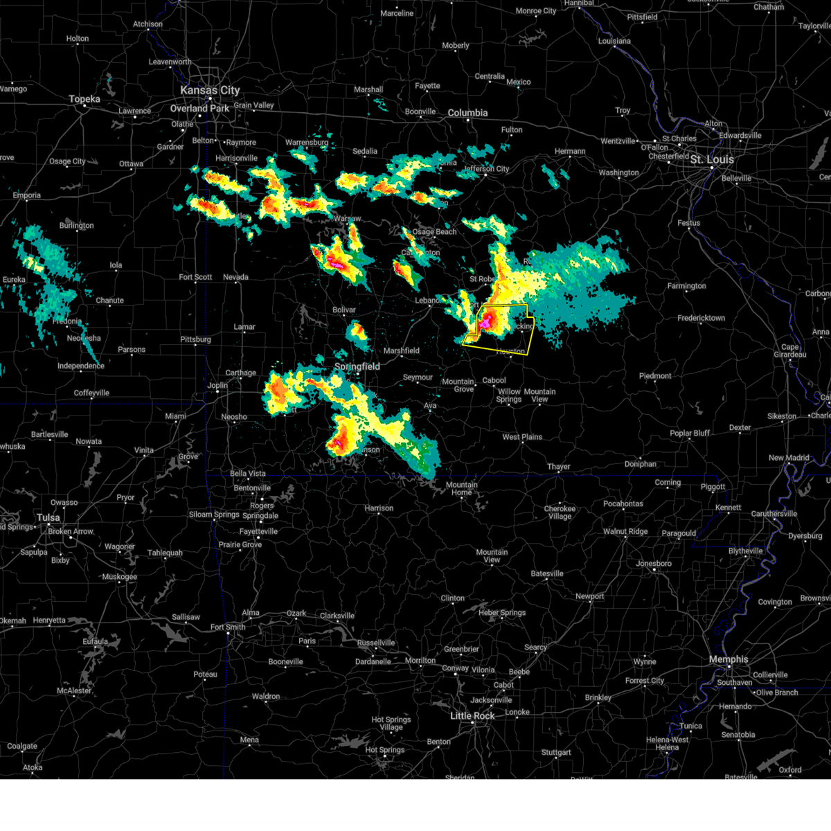
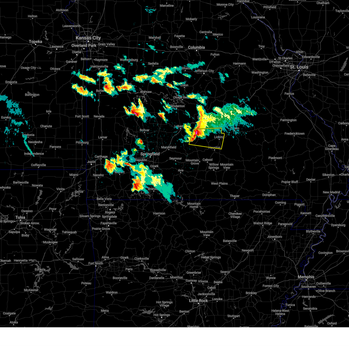
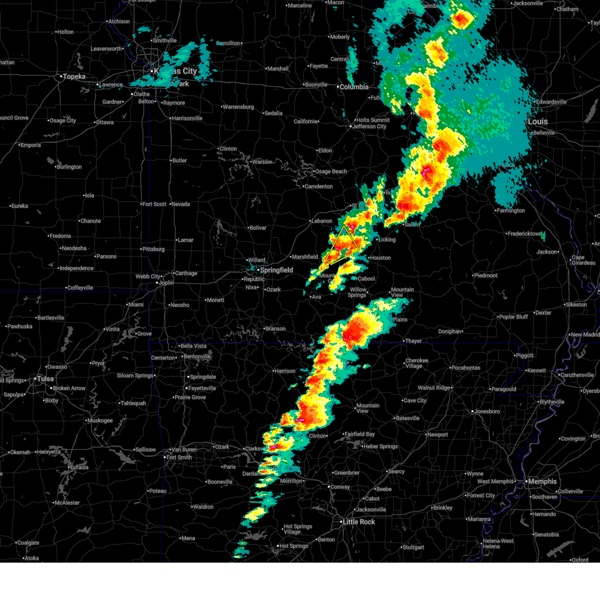
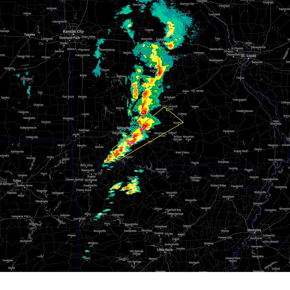
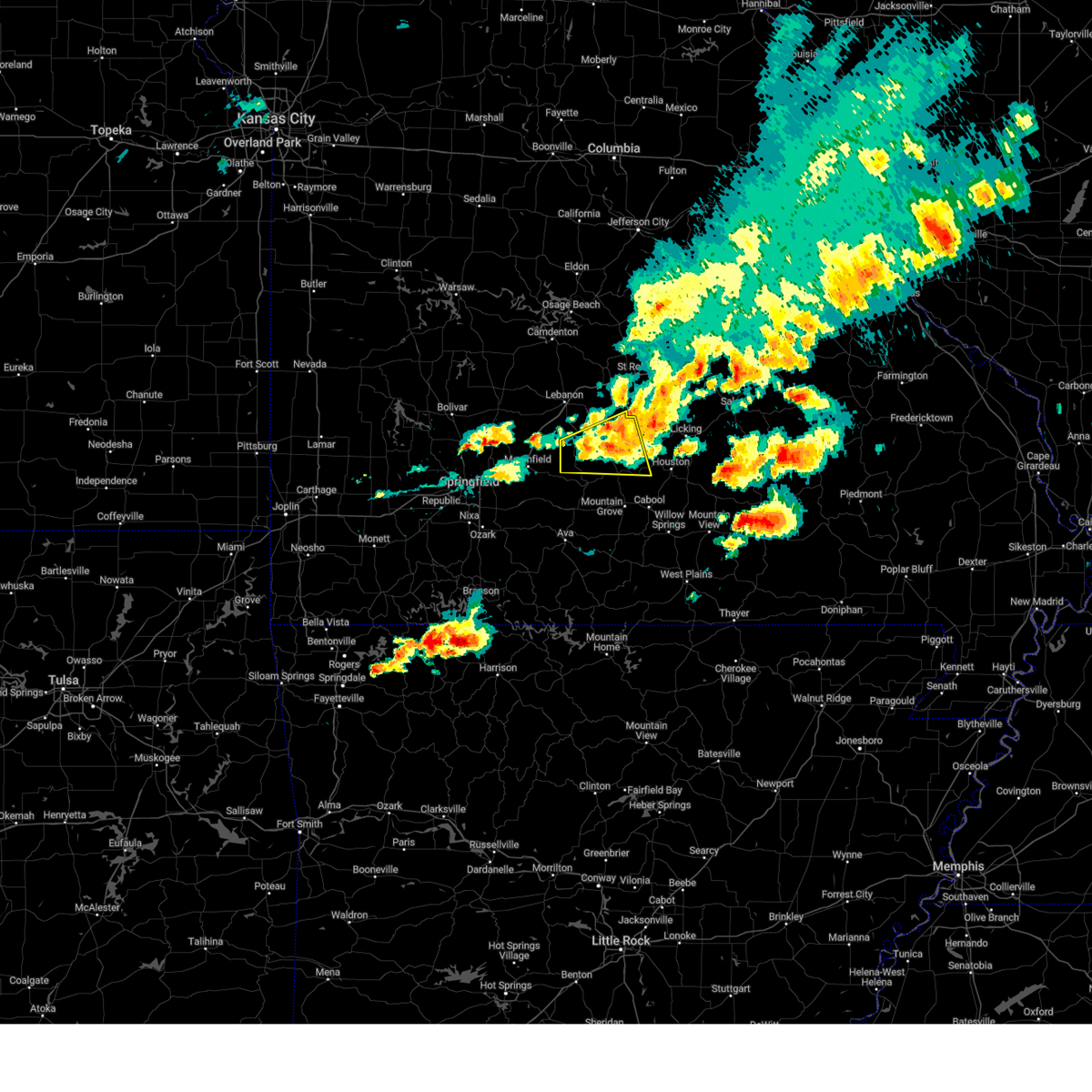
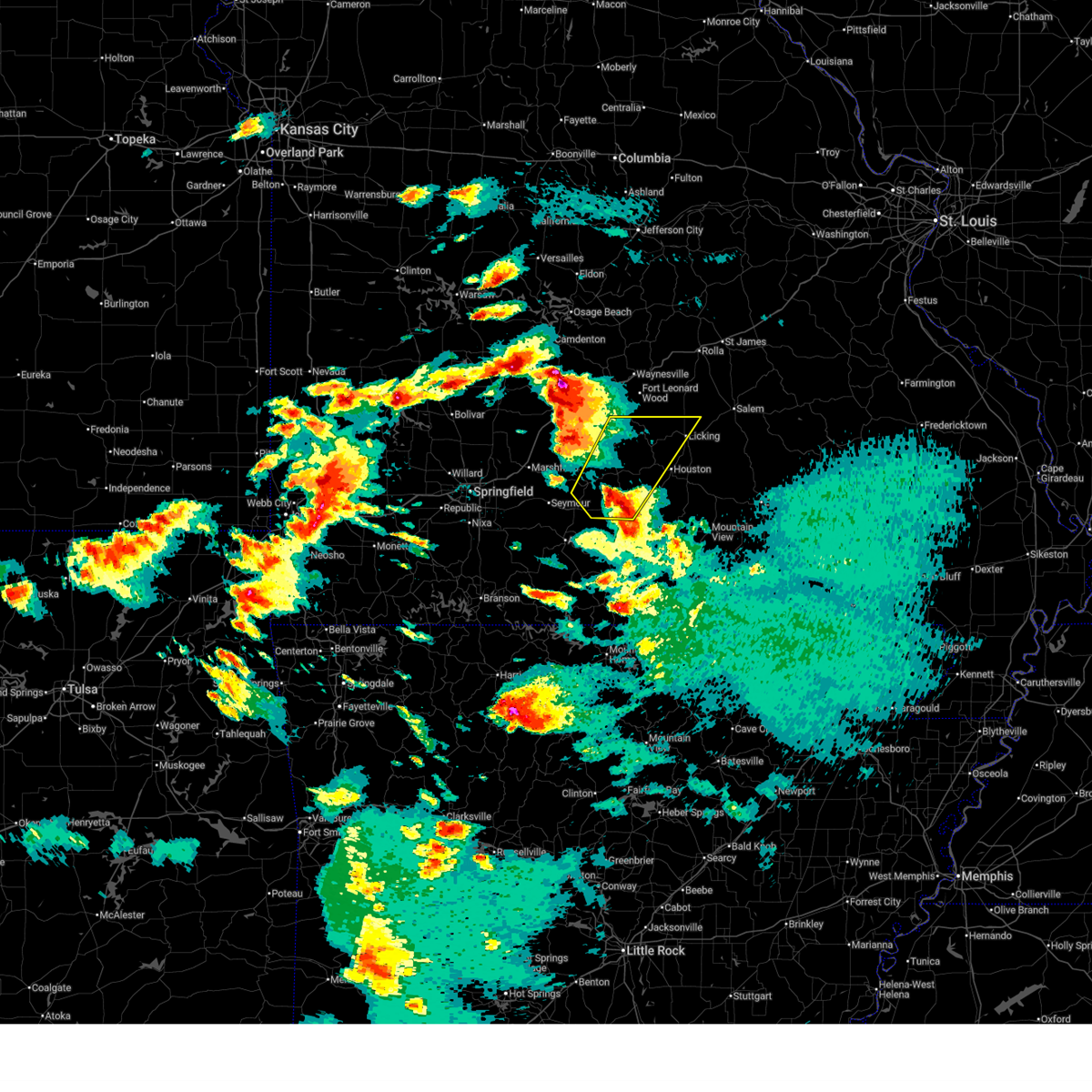 At 1237 pm cdt, a severe thunderstorm was located over norwood, or near mountain grove, moving northeast at 45 mph (trained weather spotters). Hazards include two inch hail and 60 mph wind gusts. People and animals outdoors will be injured. expect hail damage to roofs, siding, windows, and vehicles. expect wind damage to roofs, siding, and trees. Locations impacted include, mountain grove, licking, dawson, norwood, hartville, huggins, plato, competition, manes, bucyrus, hazelton, lynchburg, graff, success, roby, prescott, and bendavis. At 1237 pm cdt, a severe thunderstorm was located over norwood, or near mountain grove, moving northeast at 45 mph (trained weather spotters). Hazards include two inch hail and 60 mph wind gusts. People and animals outdoors will be injured. expect hail damage to roofs, siding, windows, and vehicles. expect wind damage to roofs, siding, and trees. Locations impacted include, mountain grove, licking, dawson, norwood, hartville, huggins, plato, competition, manes, bucyrus, hazelton, lynchburg, graff, success, roby, prescott, and bendavis.
|
| 4/28/2026 12:32 PM CDT |
 Svrsgf the national weather service in springfield has issued a * severe thunderstorm warning for, wright county in southwestern missouri, southeastern laclede county in southwestern missouri, western texas county in south central missouri, * until 130 pm cdt. * at 1232 pm cdt, a severe thunderstorm was located over norwood, or 9 miles southwest of mountain grove, moving northeast at 45 mph (radar indicated). Hazards include golf ball size hail and 60 mph wind gusts. People and animals outdoors will be injured. expect hail damage to roofs, siding, windows, and vehicles. Expect wind damage to roofs, siding, and trees. Svrsgf the national weather service in springfield has issued a * severe thunderstorm warning for, wright county in southwestern missouri, southeastern laclede county in southwestern missouri, western texas county in south central missouri, * until 130 pm cdt. * at 1232 pm cdt, a severe thunderstorm was located over norwood, or 9 miles southwest of mountain grove, moving northeast at 45 mph (radar indicated). Hazards include golf ball size hail and 60 mph wind gusts. People and animals outdoors will be injured. expect hail damage to roofs, siding, windows, and vehicles. Expect wind damage to roofs, siding, and trees.
|
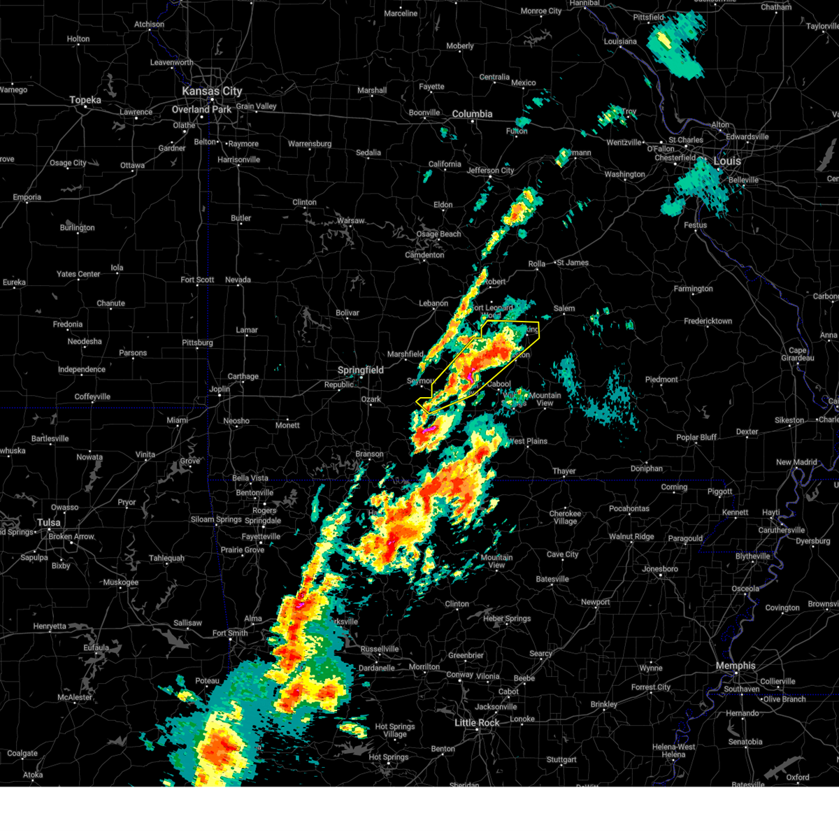
| 4/16/2026 11:40 AM CDT |
 The storm which prompted the warning has weakened below severe limits, and no longer poses an immediate threat to life or property. therefore, the warning will be allowed to expire. to report severe weather, contact your nearest law enforcement agency. they will relay your report to the national weather service springfield. The storm which prompted the warning has weakened below severe limits, and no longer poses an immediate threat to life or property. therefore, the warning will be allowed to expire. to report severe weather, contact your nearest law enforcement agency. they will relay your report to the national weather service springfield.
|
| 4/16/2026 11:06 AM CDT |
 Svrsgf the national weather service in springfield has issued a * severe thunderstorm warning for, central wright county in southwestern missouri, northwestern texas county in south central missouri, * until 1145 am cdt. * at 1105 am cdt, a severe thunderstorm was located near hartville, or 16 miles west of mountain grove, moving northeast at 40 mph (radar indicated). Hazards include quarter size hail. damage to vehicles is expected Svrsgf the national weather service in springfield has issued a * severe thunderstorm warning for, central wright county in southwestern missouri, northwestern texas county in south central missouri, * until 1145 am cdt. * at 1105 am cdt, a severe thunderstorm was located near hartville, or 16 miles west of mountain grove, moving northeast at 40 mph (radar indicated). Hazards include quarter size hail. damage to vehicles is expected
|
| 3/15/2026 3:31 PM CDT |
 the severe thunderstorm warning has been cancelled and is no longer in effect the severe thunderstorm warning has been cancelled and is no longer in effect
|
| 3/15/2026 3:31 PM CDT |
 At 331 pm cdt, severe thunderstorms were located along a line extending from 8 miles southwest of salem to 8 miles north of summersville to 11 miles southwest of willow springs, moving east at 45 mph (radar indicated). Hazards include 60 mph wind gusts and penny size hail. Expect damage to roofs, siding, and trees. Locations impacted include, ozark national scenic riverways, echo bluff state park, current river state park, bryant creek state park, mountain grove, licking, mountain view, willow springs, cabool, houston, winona, dawson, birch tree, norwood, eminence, pomona, summersville, raymondville, huggins, and plato. At 331 pm cdt, severe thunderstorms were located along a line extending from 8 miles southwest of salem to 8 miles north of summersville to 11 miles southwest of willow springs, moving east at 45 mph (radar indicated). Hazards include 60 mph wind gusts and penny size hail. Expect damage to roofs, siding, and trees. Locations impacted include, ozark national scenic riverways, echo bluff state park, current river state park, bryant creek state park, mountain grove, licking, mountain view, willow springs, cabool, houston, winona, dawson, birch tree, norwood, eminence, pomona, summersville, raymondville, huggins, and plato.
|
| 3/15/2026 2:57 PM CDT |
 Svrsgf the national weather service in springfield has issued a * severe thunderstorm warning for, shannon county in south central missouri, wright county in southwestern missouri, douglas county in southwestern missouri, dent county in south central missouri, northern howell county in south central missouri, southeastern pulaski county in central missouri, texas county in south central missouri, southwestern phelps county in east central missouri, northwestern oregon county in south central missouri, * until 345 pm cdt. * at 256 pm cdt, severe thunderstorms were located along a line extending from 12 miles west of licking to 7 miles north of cabool to 12 miles southeast of ava, moving east at 45 mph (radar indicated). Hazards include 60 mph wind gusts and penny size hail. expect damage to roofs, siding, and trees Svrsgf the national weather service in springfield has issued a * severe thunderstorm warning for, shannon county in south central missouri, wright county in southwestern missouri, douglas county in southwestern missouri, dent county in south central missouri, northern howell county in south central missouri, southeastern pulaski county in central missouri, texas county in south central missouri, southwestern phelps county in east central missouri, northwestern oregon county in south central missouri, * until 345 pm cdt. * at 256 pm cdt, severe thunderstorms were located along a line extending from 12 miles west of licking to 7 miles north of cabool to 12 miles southeast of ava, moving east at 45 mph (radar indicated). Hazards include 60 mph wind gusts and penny size hail. expect damage to roofs, siding, and trees
|
| 5/19/2025 9:27 PM CDT |
 Svrsgf the national weather service in springfield has issued a * severe thunderstorm warning for, ozark county in southwestern missouri, wright county in southwestern missouri, eastern douglas county in southwestern missouri, howell county in south central missouri, texas county in south central missouri, * until 1015 pm cdt. * at 926 pm cdt, severe thunderstorms were located along a line extending from 14 miles west of houston to 15 miles south of mountain grove to 6 miles south of gainesville, moving east at 55 mph (radar indicated). Hazards include 60 mph wind gusts. expect damage to roofs, siding, and trees Svrsgf the national weather service in springfield has issued a * severe thunderstorm warning for, ozark county in southwestern missouri, wright county in southwestern missouri, eastern douglas county in southwestern missouri, howell county in south central missouri, texas county in south central missouri, * until 1015 pm cdt. * at 926 pm cdt, severe thunderstorms were located along a line extending from 14 miles west of houston to 15 miles south of mountain grove to 6 miles south of gainesville, moving east at 55 mph (radar indicated). Hazards include 60 mph wind gusts. expect damage to roofs, siding, and trees
|
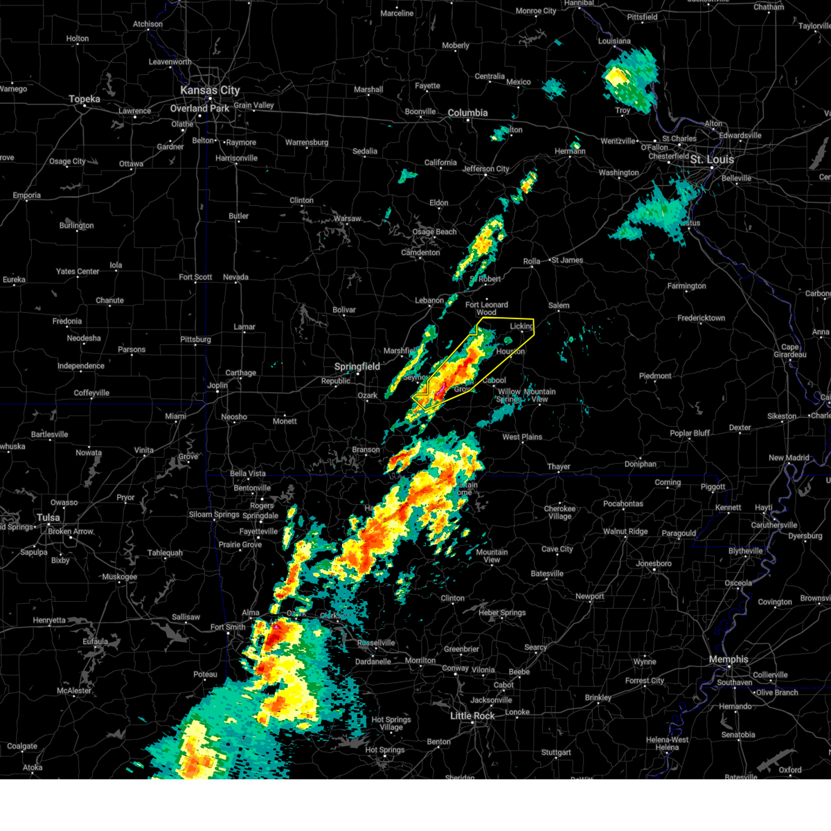
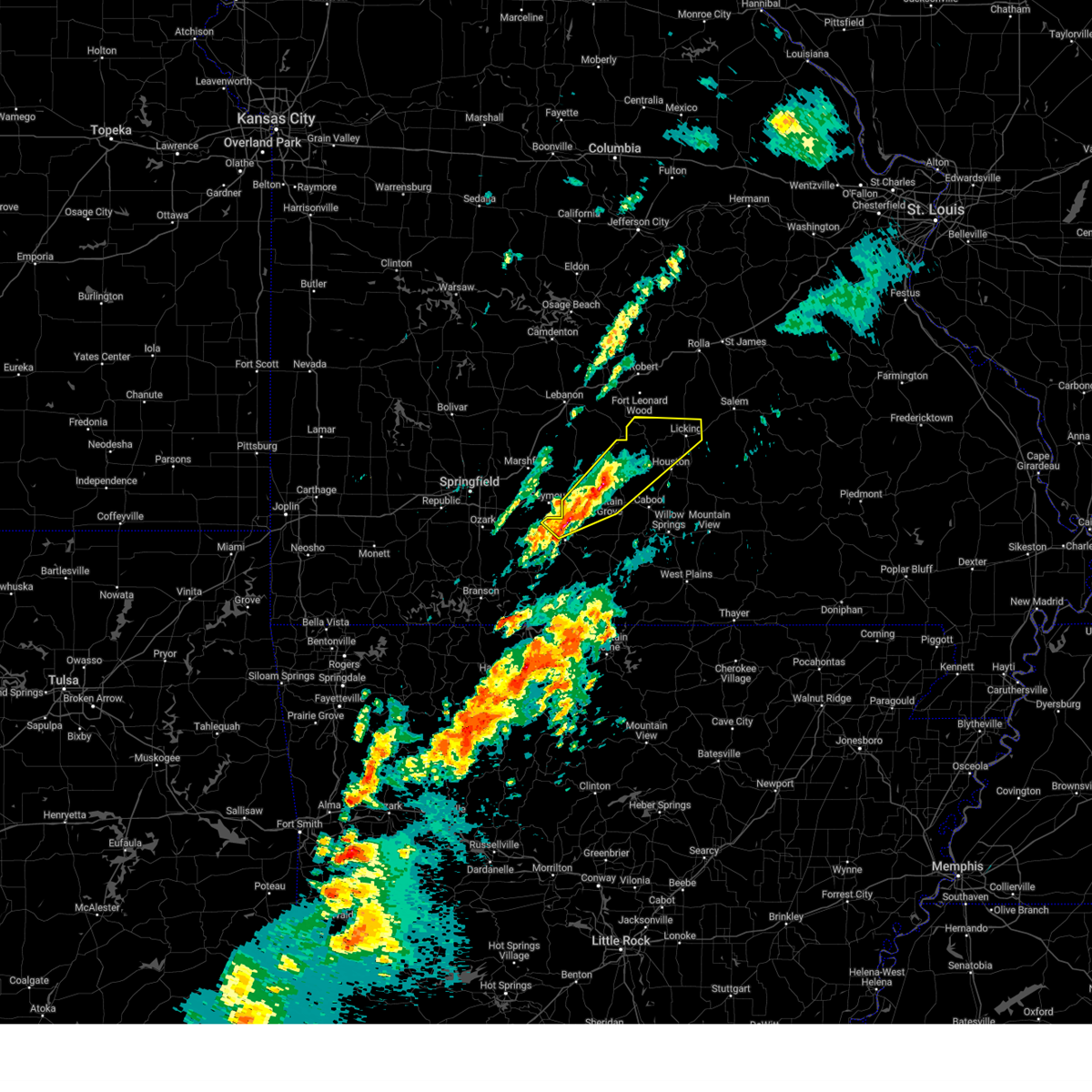
| 5/16/2025 1:15 PM CDT | Hen Egg sized hail reported 4.7 miles WSW of Plato, MO |
| 5/16/2025 1:12 PM CDT | Tennis Ball sized hail reported 0.3 miles NNW of Plato, MO, picture of 2.5 inch hail. |
| 5/16/2025 1:09 PM CDT |
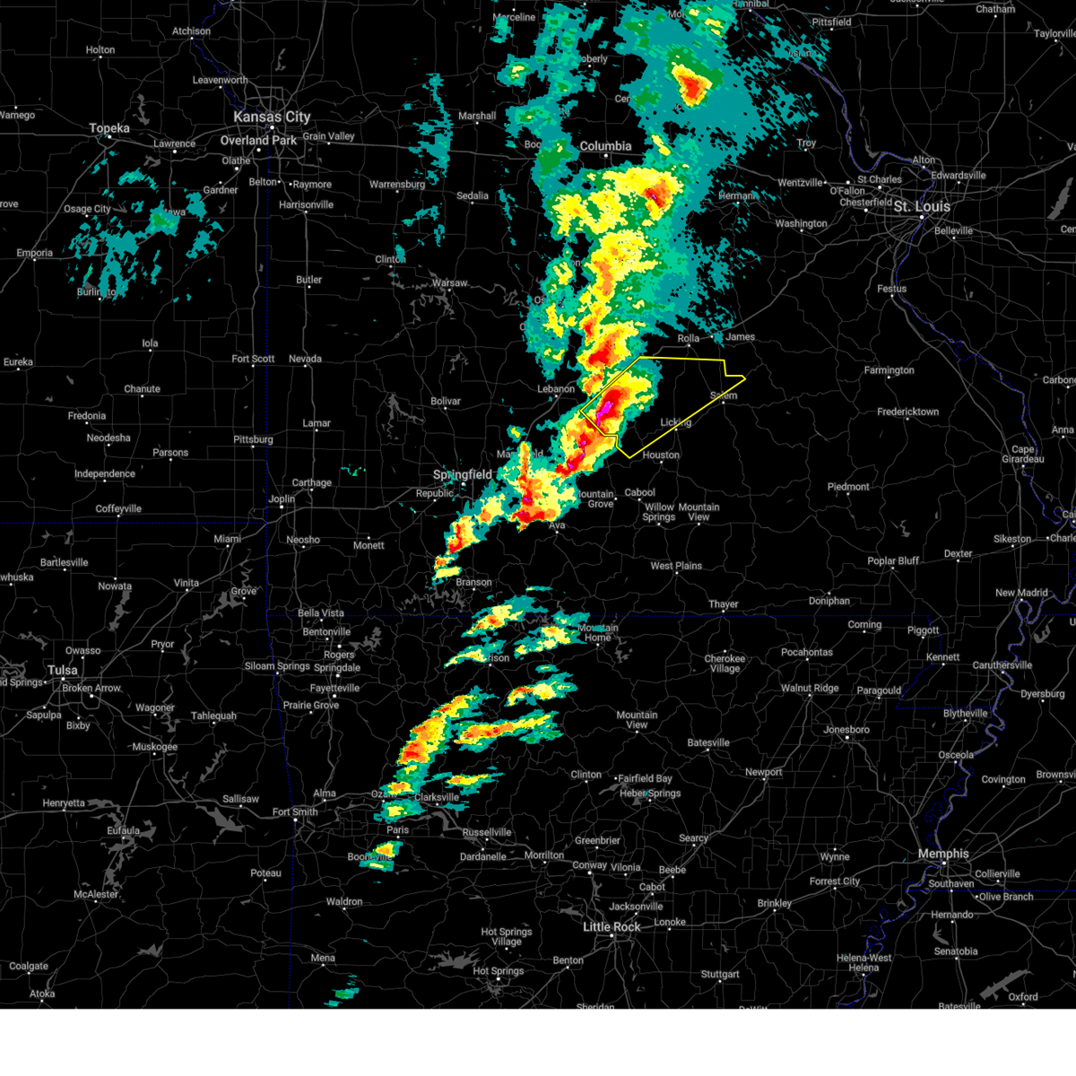
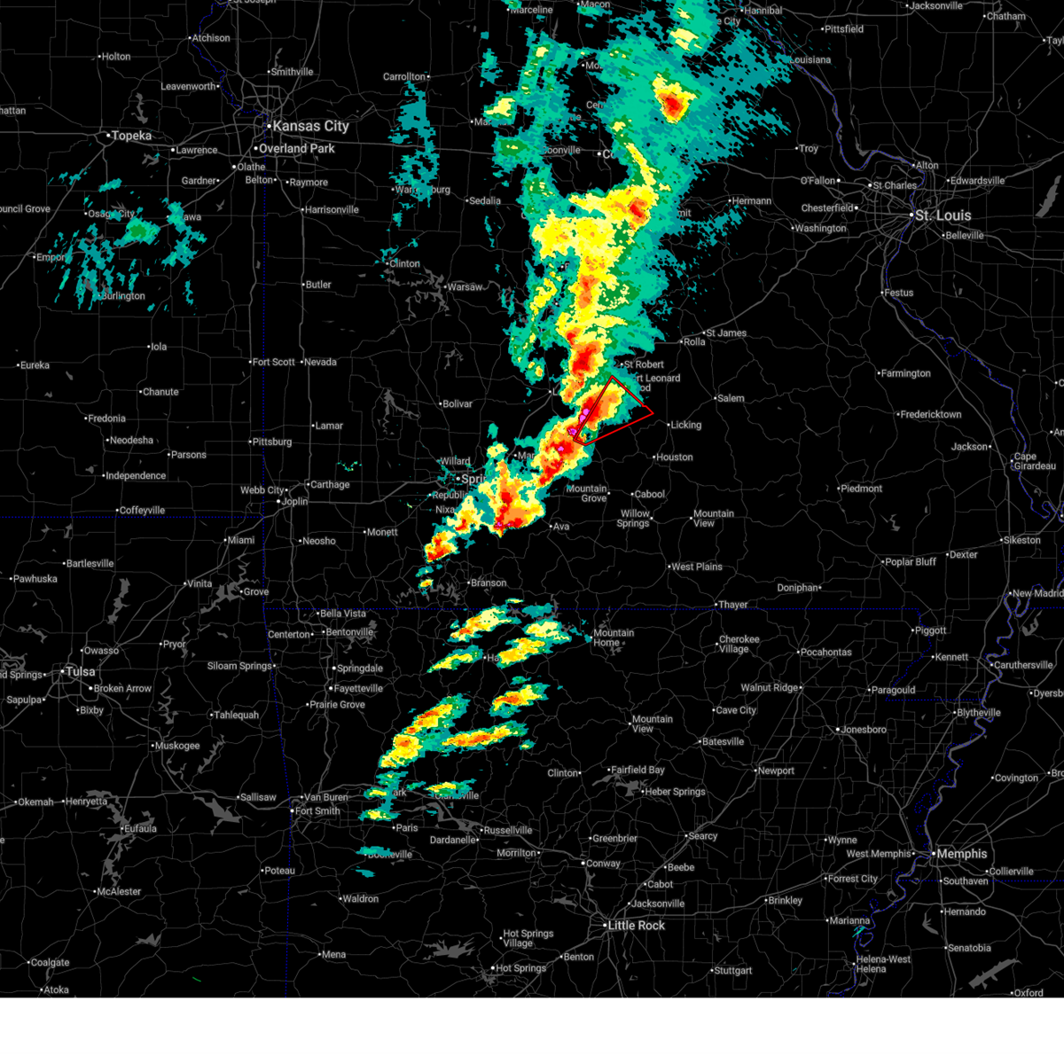
 At 109 pm cdt, a severe thunderstorm was located 16 miles south of fort leonard wood, moving northeast at 60 mph (radar indicated). Hazards include two inch hail and 60 mph wind gusts. People and animals outdoors will be injured. expect hail damage to roofs, siding, windows, and vehicles. expect wind damage to roofs, siding, and trees. locations impacted include, fort leonard wood, licking, edgar springs, plato, roby, beulah, hazelton, and lynchburg. This includes interstate 44 between mile markers 180 and 183. At 109 pm cdt, a severe thunderstorm was located 16 miles south of fort leonard wood, moving northeast at 60 mph (radar indicated). Hazards include two inch hail and 60 mph wind gusts. People and animals outdoors will be injured. expect hail damage to roofs, siding, windows, and vehicles. expect wind damage to roofs, siding, and trees. locations impacted include, fort leonard wood, licking, edgar springs, plato, roby, beulah, hazelton, and lynchburg. This includes interstate 44 between mile markers 180 and 183.
|
| 5/16/2025 1:02 PM CDT |
 At 101 pm cdt, a severe thunderstorm was located 16 miles southwest of fort leonard wood, moving northeast at 60 mph (radar indicated). Hazards include golf ball size hail and 60 mph wind gusts. People and animals outdoors will be injured. expect hail damage to roofs, siding, windows, and vehicles. expect wind damage to roofs, siding, and trees. locations impacted include, fort leonard wood, licking, edgar springs, plato, competition, roby, beulah, hazelton, lynchburg, and falcon. This includes interstate 44 between mile markers 180 and 183. At 101 pm cdt, a severe thunderstorm was located 16 miles southwest of fort leonard wood, moving northeast at 60 mph (radar indicated). Hazards include golf ball size hail and 60 mph wind gusts. People and animals outdoors will be injured. expect hail damage to roofs, siding, windows, and vehicles. expect wind damage to roofs, siding, and trees. locations impacted include, fort leonard wood, licking, edgar springs, plato, competition, roby, beulah, hazelton, lynchburg, and falcon. This includes interstate 44 between mile markers 180 and 183.
|
| 5/16/2025 12:46 PM CDT |
 Svrsgf the national weather service in springfield has issued a * severe thunderstorm warning for, northern wright county in southwestern missouri, southeastern laclede county in southwestern missouri, southeastern pulaski county in central missouri, northwestern texas county in south central missouri, southwestern phelps county in east central missouri, * until 130 pm cdt. * at 1246 pm cdt, a severe thunderstorm was located 12 miles east of niangua, or 15 miles south of lebanon, moving northeast at 60 mph (radar indicated). Hazards include half dollar size hail. damage to vehicles is expected Svrsgf the national weather service in springfield has issued a * severe thunderstorm warning for, northern wright county in southwestern missouri, southeastern laclede county in southwestern missouri, southeastern pulaski county in central missouri, northwestern texas county in south central missouri, southwestern phelps county in east central missouri, * until 130 pm cdt. * at 1246 pm cdt, a severe thunderstorm was located 12 miles east of niangua, or 15 miles south of lebanon, moving northeast at 60 mph (radar indicated). Hazards include half dollar size hail. damage to vehicles is expected
|
| 4/29/2025 10:46 AM CDT |
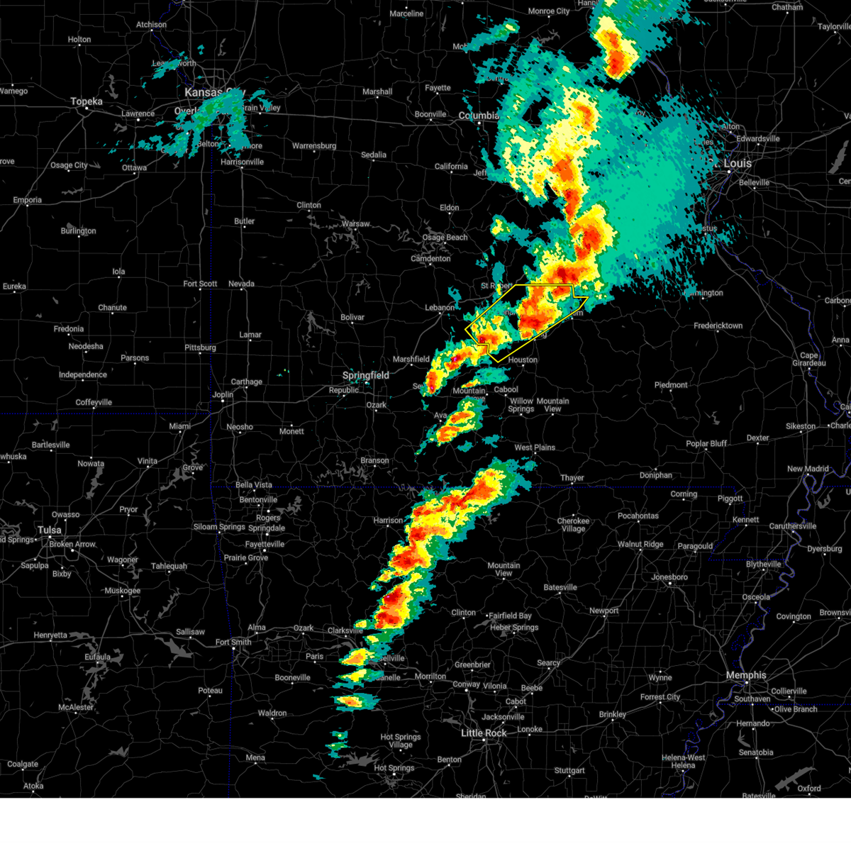
 At 1045 am cdt, severe thunderstorms were located along a line extending from 10 miles southeast of camdenton to 11 miles southwest of fort leonard wood to 9 miles west of houston to near cabool to 12 miles south of mountain grove, moving east at 55 mph (emergency management). Hazards include 70 mph wind gusts and quarter size hail. Hail damage to vehicles is expected. expect considerable tree damage. wind damage is also likely to mobile homes, roofs, and outbuildings. locations impacted include, competition, montauk, crocker, huggins, beulah, lynchburg, sleeper, richland, falcon, success, eunice, stoutland, laquey, yukon, roby, st. robert, clear springs, licking, edgar springs, and solo. This includes interstate 44 between mile markers 131 and 169, and between mile markers 171 and 173. At 1045 am cdt, severe thunderstorms were located along a line extending from 10 miles southeast of camdenton to 11 miles southwest of fort leonard wood to 9 miles west of houston to near cabool to 12 miles south of mountain grove, moving east at 55 mph (emergency management). Hazards include 70 mph wind gusts and quarter size hail. Hail damage to vehicles is expected. expect considerable tree damage. wind damage is also likely to mobile homes, roofs, and outbuildings. locations impacted include, competition, montauk, crocker, huggins, beulah, lynchburg, sleeper, richland, falcon, success, eunice, stoutland, laquey, yukon, roby, st. robert, clear springs, licking, edgar springs, and solo. This includes interstate 44 between mile markers 131 and 169, and between mile markers 171 and 173.
|
| 4/29/2025 10:46 AM CDT |
 the severe thunderstorm warning has been cancelled and is no longer in effect the severe thunderstorm warning has been cancelled and is no longer in effect
|
| 4/29/2025 10:16 AM CDT |
 Svrsgf the national weather service in springfield has issued a * severe thunderstorm warning for, northern dallas county in southwestern missouri, northeastern wright county in southwestern missouri, southwestern dent county in south central missouri, laclede county in southwestern missouri, pulaski county in central missouri, texas county in south central missouri, southwestern phelps county in east central missouri, southern camden county in central missouri, * until 1115 am cdt. * at 1015 am cdt, severe thunderstorms were located along a line extending from 9 miles south of macks creek to 6 miles east of conway to near hartville to near mansfield to 7 miles south of ava, moving east at 55 mph (emergency management). Hazards include 70 mph wind gusts and quarter size hail. Hail damage to vehicles is expected. expect considerable tree damage. Wind damage is also likely to mobile homes, roofs, and outbuildings. Svrsgf the national weather service in springfield has issued a * severe thunderstorm warning for, northern dallas county in southwestern missouri, northeastern wright county in southwestern missouri, southwestern dent county in south central missouri, laclede county in southwestern missouri, pulaski county in central missouri, texas county in south central missouri, southwestern phelps county in east central missouri, southern camden county in central missouri, * until 1115 am cdt. * at 1015 am cdt, severe thunderstorms were located along a line extending from 9 miles south of macks creek to 6 miles east of conway to near hartville to near mansfield to 7 miles south of ava, moving east at 55 mph (emergency management). Hazards include 70 mph wind gusts and quarter size hail. Hail damage to vehicles is expected. expect considerable tree damage. Wind damage is also likely to mobile homes, roofs, and outbuildings.
|
| 4/20/2025 5:53 PM CDT |
 the severe thunderstorm warning has been cancelled and is no longer in effect the severe thunderstorm warning has been cancelled and is no longer in effect
|
| 4/20/2025 5:53 PM CDT |
 At 552 pm cdt, severe thunderstorms were located along a line extending from near doolittle to near raymondville to west plains, moving northeast at 60 mph (public). Hazards include 70 mph wind gusts and nickel size hail. Expect considerable tree damage. damage is likely to mobile homes, roofs, and outbuildings. Locations impacted include, lanton, huggins, tecumseh, pottersville, caulfield, bakersfield, udall, success, eunice, brandsville, hardenville, yukon, roby, clear springs, licking, solo, plato, west plains, pine crest, and simmons. At 552 pm cdt, severe thunderstorms were located along a line extending from near doolittle to near raymondville to west plains, moving northeast at 60 mph (public). Hazards include 70 mph wind gusts and nickel size hail. Expect considerable tree damage. damage is likely to mobile homes, roofs, and outbuildings. Locations impacted include, lanton, huggins, tecumseh, pottersville, caulfield, bakersfield, udall, success, eunice, brandsville, hardenville, yukon, roby, clear springs, licking, solo, plato, west plains, pine crest, and simmons.
|
| 4/20/2025 5:35 PM CDT |
 the tornado warning has been cancelled and is no longer in effect the tornado warning has been cancelled and is no longer in effect
|
| 4/20/2025 5:31 PM CDT |
 the tornado warning has been cancelled and is no longer in effect the tornado warning has been cancelled and is no longer in effect
|
| 4/20/2025 5:31 PM CDT |
 At 530 pm cdt, a severe thunderstorm capable of producing a tornado was located 16 miles northwest of houston, moving northeast at 55 mph (radar indicated rotation). Hazards include tornado. Flying debris will be dangerous to those caught without shelter. mobile homes will be damaged or destroyed. damage to roofs, windows, and vehicles will occur. tree damage is likely. Locations impacted include, plato and success. At 530 pm cdt, a severe thunderstorm capable of producing a tornado was located 16 miles northwest of houston, moving northeast at 55 mph (radar indicated rotation). Hazards include tornado. Flying debris will be dangerous to those caught without shelter. mobile homes will be damaged or destroyed. damage to roofs, windows, and vehicles will occur. tree damage is likely. Locations impacted include, plato and success.
|
| 4/20/2025 5:24 PM CDT |
 At 524 pm cdt, a severe thunderstorm capable of producing a tornado was located 16 miles northeast of hartville, or 18 miles west of houston, moving northeast at 55 mph (radar indicated rotation). Hazards include tornado. Flying debris will be dangerous to those caught without shelter. mobile homes will be damaged or destroyed. damage to roofs, windows, and vehicles will occur. tree damage is likely. Locations impacted include, plato, manes, lynchburg, graff, success, and roby. At 524 pm cdt, a severe thunderstorm capable of producing a tornado was located 16 miles northeast of hartville, or 18 miles west of houston, moving northeast at 55 mph (radar indicated rotation). Hazards include tornado. Flying debris will be dangerous to those caught without shelter. mobile homes will be damaged or destroyed. damage to roofs, windows, and vehicles will occur. tree damage is likely. Locations impacted include, plato, manes, lynchburg, graff, success, and roby.
|
| 4/20/2025 5:23 PM CDT |
 At 522 pm cdt, severe thunderstorms were located along a line extending from near fort leonard wood to 12 miles south of cabool to near gamaliel landing, moving northeast at 60 mph (trained weather spotter reports a measured 80 mph wind gust around 510 pm cdt). Hazards include 70 mph wind gusts and nickel size hail. Expect considerable tree damage. damage is likely to mobile homes, roofs, and outbuildings. Locations impacted include, lanton, manes, brixey, caulfield, bakersfield, success, hardenville, vanzant, plato, west plains, bryant creek state park, pine crest, simmons, zanoni, summersville, pomona, arroll, gentryville, cabool, and siloam springs. At 522 pm cdt, severe thunderstorms were located along a line extending from near fort leonard wood to 12 miles south of cabool to near gamaliel landing, moving northeast at 60 mph (trained weather spotter reports a measured 80 mph wind gust around 510 pm cdt). Hazards include 70 mph wind gusts and nickel size hail. Expect considerable tree damage. damage is likely to mobile homes, roofs, and outbuildings. Locations impacted include, lanton, manes, brixey, caulfield, bakersfield, success, hardenville, vanzant, plato, west plains, bryant creek state park, pine crest, simmons, zanoni, summersville, pomona, arroll, gentryville, cabool, and siloam springs.
|
| 4/20/2025 5:14 PM CDT |
 Torsgf the national weather service in springfield has issued a * tornado warning for, northeastern wright county in southwestern missouri, southeastern laclede county in southwestern missouri, northwestern texas county in south central missouri, * until 545 pm cdt. * at 514 pm cdt, a severe thunderstorm capable of producing a tornado was located 7 miles northeast of hartville, or 13 miles northwest of mountain grove, moving northeast at 55 mph (radar indicated rotation). Hazards include tornado. Flying debris will be dangerous to those caught without shelter. mobile homes will be damaged or destroyed. damage to roofs, windows, and vehicles will occur. Tree damage is likely. Torsgf the national weather service in springfield has issued a * tornado warning for, northeastern wright county in southwestern missouri, southeastern laclede county in southwestern missouri, northwestern texas county in south central missouri, * until 545 pm cdt. * at 514 pm cdt, a severe thunderstorm capable of producing a tornado was located 7 miles northeast of hartville, or 13 miles northwest of mountain grove, moving northeast at 55 mph (radar indicated rotation). Hazards include tornado. Flying debris will be dangerous to those caught without shelter. mobile homes will be damaged or destroyed. damage to roofs, windows, and vehicles will occur. Tree damage is likely.
|
| 4/20/2025 4:57 PM CDT |
 Svrsgf the national weather service in springfield has issued a * severe thunderstorm warning for, eastern ozark county in southwestern missouri, eastern wright county in southwestern missouri, eastern douglas county in southwestern missouri, howell county in south central missouri, texas county in south central missouri, southwestern oregon county in south central missouri, * until 600 pm cdt. * at 456 pm cdt, severe thunderstorms were located along a line extending from 9 miles southeast of lebanon to 10 miles southeast of ava to bull shoals state park, moving northeast at 60 mph (trained spotter report of downed trees in ava at 445 pm cdt). Hazards include 70 mph wind gusts and nickel size hail. Expect considerable tree damage. Damage is likely to mobile homes, roofs, and outbuildings. Svrsgf the national weather service in springfield has issued a * severe thunderstorm warning for, eastern ozark county in southwestern missouri, eastern wright county in southwestern missouri, eastern douglas county in southwestern missouri, howell county in south central missouri, texas county in south central missouri, southwestern oregon county in south central missouri, * until 600 pm cdt. * at 456 pm cdt, severe thunderstorms were located along a line extending from 9 miles southeast of lebanon to 10 miles southeast of ava to bull shoals state park, moving northeast at 60 mph (trained spotter report of downed trees in ava at 445 pm cdt). Hazards include 70 mph wind gusts and nickel size hail. Expect considerable tree damage. Damage is likely to mobile homes, roofs, and outbuildings.
|
| 4/18/2025 11:43 PM CDT |
 Svrsgf the national weather service in springfield has issued a * severe thunderstorm warning for, northwestern shannon county in south central missouri, southeastern wright county in southwestern missouri, western dent county in south central missouri, southeastern pulaski county in central missouri, texas county in south central missouri, phelps county in east central missouri, * until 1230 am cdt. * at 1143 pm cdt, severe thunderstorms were located along a line extending from near st. robert to near houston to 7 miles southeast of mountain grove, moving east at 45 mph (radar indicated). Hazards include 60 mph wind gusts and quarter size hail. Hail damage to vehicles is expected. Expect wind damage to roofs, siding, and trees. Svrsgf the national weather service in springfield has issued a * severe thunderstorm warning for, northwestern shannon county in south central missouri, southeastern wright county in southwestern missouri, western dent county in south central missouri, southeastern pulaski county in central missouri, texas county in south central missouri, phelps county in east central missouri, * until 1230 am cdt. * at 1143 pm cdt, severe thunderstorms were located along a line extending from near st. robert to near houston to 7 miles southeast of mountain grove, moving east at 45 mph (radar indicated). Hazards include 60 mph wind gusts and quarter size hail. Hail damage to vehicles is expected. Expect wind damage to roofs, siding, and trees.
|
| 4/18/2025 11:35 PM CDT |
 At 1134 pm cdt, severe thunderstorms were located along a line extending from 9 miles southwest of fort leonard wood to 11 miles west of houston to near mountain grove, moving east at 45 mph (radar indicated). Hazards include 60 mph wind gusts and quarter size hail. Hail damage to vehicles is expected. expect wind damage to roofs, siding, and trees. Locations impacted include, dawson, competition, manes, huggins, bucyrus, hazelton, lynchburg, graff, falcon, success, norwood, cabool, mountain grove, roby, plato, simmons, houston, bendavis, and fort leonard wood. At 1134 pm cdt, severe thunderstorms were located along a line extending from 9 miles southwest of fort leonard wood to 11 miles west of houston to near mountain grove, moving east at 45 mph (radar indicated). Hazards include 60 mph wind gusts and quarter size hail. Hail damage to vehicles is expected. expect wind damage to roofs, siding, and trees. Locations impacted include, dawson, competition, manes, huggins, bucyrus, hazelton, lynchburg, graff, falcon, success, norwood, cabool, mountain grove, roby, plato, simmons, houston, bendavis, and fort leonard wood.
|
| 4/18/2025 11:10 PM CDT |
 Svrsgf the national weather service in springfield has issued a * severe thunderstorm warning for, wright county in southwestern missouri, southeastern laclede county in southwestern missouri, southeastern pulaski county in central missouri, western texas county in south central missouri, * until 1145 pm cdt. * at 1109 pm cdt, severe thunderstorms were located along a line extending from 10 miles southeast of lebanon to near hartville to near mansfield, moving east at 45 mph (radar indicated). Hazards include 70 mph wind gusts and penny size hail. Expect considerable tree damage. Damage is likely to mobile homes, roofs, and outbuildings. Svrsgf the national weather service in springfield has issued a * severe thunderstorm warning for, wright county in southwestern missouri, southeastern laclede county in southwestern missouri, southeastern pulaski county in central missouri, western texas county in south central missouri, * until 1145 pm cdt. * at 1109 pm cdt, severe thunderstorms were located along a line extending from 10 miles southeast of lebanon to near hartville to near mansfield, moving east at 45 mph (radar indicated). Hazards include 70 mph wind gusts and penny size hail. Expect considerable tree damage. Damage is likely to mobile homes, roofs, and outbuildings.
|
| 4/2/2025 2:28 PM CDT |
 the severe thunderstorm warning has been cancelled and is no longer in effect the severe thunderstorm warning has been cancelled and is no longer in effect
|
| 4/2/2025 2:28 PM CDT |
 At 228 pm cdt, a severe thunderstorm was located 11 miles west of houston, moving northeast at 65 mph (radar indicated). Hazards include golf ball size hail and 60 mph wind gusts. People and animals outdoors will be injured. expect hail damage to roofs, siding, windows, and vehicles. expect wind damage to roofs, siding, and trees. Locations impacted include, roby, huggins, licking, bucyrus, hazelton, plato, prescott, success, houston, and bendavis. At 228 pm cdt, a severe thunderstorm was located 11 miles west of houston, moving northeast at 65 mph (radar indicated). Hazards include golf ball size hail and 60 mph wind gusts. People and animals outdoors will be injured. expect hail damage to roofs, siding, windows, and vehicles. expect wind damage to roofs, siding, and trees. Locations impacted include, roby, huggins, licking, bucyrus, hazelton, plato, prescott, success, houston, and bendavis.
|
| 4/2/2025 1:56 PM CDT |
 Svrsgf the national weather service in springfield has issued a * severe thunderstorm warning for, wright county in southwestern missouri, west central dent county in south central missouri, southeastern laclede county in southwestern missouri, northern texas county in south central missouri, * until 245 pm cdt. * at 156 pm cdt, a severe thunderstorm was located near ava, moving northeast at 65 mph (radar indicated). Hazards include golf ball size hail and 60 mph wind gusts. People and animals outdoors will be injured. expect hail damage to roofs, siding, windows, and vehicles. Expect wind damage to roofs, siding, and trees. Svrsgf the national weather service in springfield has issued a * severe thunderstorm warning for, wright county in southwestern missouri, west central dent county in south central missouri, southeastern laclede county in southwestern missouri, northern texas county in south central missouri, * until 245 pm cdt. * at 156 pm cdt, a severe thunderstorm was located near ava, moving northeast at 65 mph (radar indicated). Hazards include golf ball size hail and 60 mph wind gusts. People and animals outdoors will be injured. expect hail damage to roofs, siding, windows, and vehicles. Expect wind damage to roofs, siding, and trees.
|
| 4/2/2025 1:54 PM CDT |
 the severe thunderstorm warning has been cancelled and is no longer in effect the severe thunderstorm warning has been cancelled and is no longer in effect
|
| 4/2/2025 1:54 PM CDT |
 At 153 pm cdt, a severe thunderstorm was located 11 miles north of mountain grove, moving northeast at 55 mph (broadcast media). Hazards include two inch hail and 60 mph wind gusts. People and animals outdoors will be injured. expect hail damage to roofs, siding, windows, and vehicles. expect wind damage to roofs, siding, and trees. Locations impacted include, mountain grove, roby, huggins, licking, bucyrus, hazelton, plato, prescott, success, bendavis, houston, and ava. At 153 pm cdt, a severe thunderstorm was located 11 miles north of mountain grove, moving northeast at 55 mph (broadcast media). Hazards include two inch hail and 60 mph wind gusts. People and animals outdoors will be injured. expect hail damage to roofs, siding, windows, and vehicles. expect wind damage to roofs, siding, and trees. Locations impacted include, mountain grove, roby, huggins, licking, bucyrus, hazelton, plato, prescott, success, bendavis, houston, and ava.
|
| 4/2/2025 1:45 PM CDT |
 At 144 pm cdt, a severe thunderstorm was located near mountain grove, moving northeast at 65 mph (broadcast media. quarter size hail was reported north of ava when the storms move through that location). Hazards include golf ball size hail and 60 mph wind gusts. People and animals outdoors will be injured. expect hail damage to roofs, siding, windows, and vehicles. expect wind damage to roofs, siding, and trees. Locations impacted include, dawson, mansfield, manes, huggins, bucyrus, hazelton, graff, hartville, success, norwood, mountain grove, roby, licking, plato, prescott, bendavis, houston, and ava. At 144 pm cdt, a severe thunderstorm was located near mountain grove, moving northeast at 65 mph (broadcast media. quarter size hail was reported north of ava when the storms move through that location). Hazards include golf ball size hail and 60 mph wind gusts. People and animals outdoors will be injured. expect hail damage to roofs, siding, windows, and vehicles. expect wind damage to roofs, siding, and trees. Locations impacted include, dawson, mansfield, manes, huggins, bucyrus, hazelton, graff, hartville, success, norwood, mountain grove, roby, licking, plato, prescott, bendavis, houston, and ava.
|
| 4/2/2025 1:30 PM CDT |
 At 129 pm cdt, a severe thunderstorm was located over mansfield, or 13 miles northeast of ava, moving northeast at 55 mph (broadcast media. quarter size hail was reported north of ava). Hazards include 60 mph wind gusts and quarter size hail. Hail damage to vehicles is expected. expect wind damage to roofs, siding, and trees. Locations impacted include, dawson, mansfield, manes, huggins, bucyrus, hazelton, graff, hartville, success, norwood, mountain grove, roby, licking, plato, prescott, bendavis, houston, and ava. At 129 pm cdt, a severe thunderstorm was located over mansfield, or 13 miles northeast of ava, moving northeast at 55 mph (broadcast media. quarter size hail was reported north of ava). Hazards include 60 mph wind gusts and quarter size hail. Hail damage to vehicles is expected. expect wind damage to roofs, siding, and trees. Locations impacted include, dawson, mansfield, manes, huggins, bucyrus, hazelton, graff, hartville, success, norwood, mountain grove, roby, licking, plato, prescott, bendavis, houston, and ava.
|
| 4/2/2025 1:22 PM CDT |
 Svrsgf the national weather service in springfield has issued a * severe thunderstorm warning for, wright county in southwestern missouri, northwestern douglas county in southwestern missouri, northern texas county in south central missouri, * until 215 pm cdt. * at 121 pm cdt, a severe thunderstorm was located near norwood, or 10 miles west of mountain grove, moving northeast at 55 mph (radar indicated). Hazards include 60 mph wind gusts and quarter size hail. Hail damage to vehicles is expected. Expect wind damage to roofs, siding, and trees. Svrsgf the national weather service in springfield has issued a * severe thunderstorm warning for, wright county in southwestern missouri, northwestern douglas county in southwestern missouri, northern texas county in south central missouri, * until 215 pm cdt. * at 121 pm cdt, a severe thunderstorm was located near norwood, or 10 miles west of mountain grove, moving northeast at 55 mph (radar indicated). Hazards include 60 mph wind gusts and quarter size hail. Hail damage to vehicles is expected. Expect wind damage to roofs, siding, and trees.
|
| 1/1/0001 12:00 AM | Quarter sized hail reported 5.2 miles WSW of Plato, MO, mostly penny size with a few quarter size hail stones near roby. |
| 3/30/2025 12:10 PM CDT |
 Svrsgf the national weather service in springfield has issued a * severe thunderstorm warning for, northwestern dent county in south central missouri, southeastern pulaski county in central missouri, northwestern texas county in south central missouri, southern phelps county in east central missouri, * until 1245 pm cdt. * at 1209 pm cdt, a severe thunderstorm was located 12 miles north of licking, or 14 miles east of fort leonard wood, moving northeast at 50 mph (radar indicated). Hazards include 60 mph wind gusts and quarter size hail. Hail damage to vehicles is expected. Expect wind damage to roofs, siding, and trees. Svrsgf the national weather service in springfield has issued a * severe thunderstorm warning for, northwestern dent county in south central missouri, southeastern pulaski county in central missouri, northwestern texas county in south central missouri, southern phelps county in east central missouri, * until 1245 pm cdt. * at 1209 pm cdt, a severe thunderstorm was located 12 miles north of licking, or 14 miles east of fort leonard wood, moving northeast at 50 mph (radar indicated). Hazards include 60 mph wind gusts and quarter size hail. Hail damage to vehicles is expected. Expect wind damage to roofs, siding, and trees.
|
| 3/22/2025 11:57 PM CDT |
 The storm which prompted the warning has moved out of the area. therefore, the warning will be allowed to expire. The storm which prompted the warning has moved out of the area. therefore, the warning will be allowed to expire.
|
| 3/22/2025 11:55 PM CDT | Quarter sized hail reported 4.7 miles WSW of Plato, MO |
| 3/22/2025 11:52 PM CDT | Half Dollar sized hail reported 5.9 miles SW of Plato, MO |
| 3/22/2025 11:52 PM CDT | Hen Egg sized hail reported 5.9 miles SW of Plato, MO |
| 3/22/2025 11:50 PM CDT |
 the severe thunderstorm warning has been cancelled and is no longer in effect the severe thunderstorm warning has been cancelled and is no longer in effect
|
| 3/22/2025 11:50 PM CDT |
 At 1149 pm cdt, a severe thunderstorm was located 10 miles south of fort leonard wood, moving east at 45 mph (radar indicated). Hazards include 60 mph wind gusts and half dollar size hail. Hail damage to vehicles is expected. expect wind damage to roofs, siding, and trees. Locations impacted include, roby, beulah, licking, hazelton, plato, prescott, success, raymondville, and fort leonard wood. At 1149 pm cdt, a severe thunderstorm was located 10 miles south of fort leonard wood, moving east at 45 mph (radar indicated). Hazards include 60 mph wind gusts and half dollar size hail. Hail damage to vehicles is expected. expect wind damage to roofs, siding, and trees. Locations impacted include, roby, beulah, licking, hazelton, plato, prescott, success, raymondville, and fort leonard wood.
|
| 3/22/2025 11:39 PM CDT |
 Svrsgf the national weather service in springfield has issued a * severe thunderstorm warning for, northeastern wright county in southwestern missouri, southeastern laclede county in southwestern missouri, southeastern pulaski county in central missouri, northern texas county in south central missouri, southwestern phelps county in east central missouri, * until 1230 am cdt. * at 1139 pm cdt, a severe thunderstorm was located 10 miles southwest of fort leonard wood, moving east at 45 mph (radar indicated). Hazards include 60 mph wind gusts and half dollar size hail. Hail damage to vehicles is expected. Expect wind damage to roofs, siding, and trees. Svrsgf the national weather service in springfield has issued a * severe thunderstorm warning for, northeastern wright county in southwestern missouri, southeastern laclede county in southwestern missouri, southeastern pulaski county in central missouri, northern texas county in south central missouri, southwestern phelps county in east central missouri, * until 1230 am cdt. * at 1139 pm cdt, a severe thunderstorm was located 10 miles southwest of fort leonard wood, moving east at 45 mph (radar indicated). Hazards include 60 mph wind gusts and half dollar size hail. Hail damage to vehicles is expected. Expect wind damage to roofs, siding, and trees.
|
| 3/22/2025 11:34 PM CDT |
 At 1134 pm cdt, a severe thunderstorm was located 11 miles southwest of fort leonard wood, moving east at 40 mph (radar indicated). Hazards include ping pong ball size hail and 60 mph wind gusts. People and animals outdoors will be injured. expect hail damage to roofs, siding, windows, and vehicles. expect wind damage to roofs, siding, and trees. Locations impacted include, plato, lynchburg, dry knob, falcon, and fort leonard wood. At 1134 pm cdt, a severe thunderstorm was located 11 miles southwest of fort leonard wood, moving east at 40 mph (radar indicated). Hazards include ping pong ball size hail and 60 mph wind gusts. People and animals outdoors will be injured. expect hail damage to roofs, siding, windows, and vehicles. expect wind damage to roofs, siding, and trees. Locations impacted include, plato, lynchburg, dry knob, falcon, and fort leonard wood.
|
| 3/22/2025 11:25 PM CDT |
 At 1125 pm cdt, a severe thunderstorm was located 11 miles east of lebanon, moving east at 40 mph (radar indicated). Hazards include ping pong ball size hail and 60 mph wind gusts. People and animals outdoors will be injured. expect hail damage to roofs, siding, windows, and vehicles. expect wind damage to roofs, siding, and trees. Locations impacted include, plato, twin bridges, lynchburg, dry knob, falcon, and fort leonard wood. At 1125 pm cdt, a severe thunderstorm was located 11 miles east of lebanon, moving east at 40 mph (radar indicated). Hazards include ping pong ball size hail and 60 mph wind gusts. People and animals outdoors will be injured. expect hail damage to roofs, siding, windows, and vehicles. expect wind damage to roofs, siding, and trees. Locations impacted include, plato, twin bridges, lynchburg, dry knob, falcon, and fort leonard wood.
|
| 3/22/2025 11:08 PM CDT |
 Svrsgf the national weather service in springfield has issued a * severe thunderstorm warning for, southern laclede county in southwestern missouri, southwestern pulaski county in central missouri, northwestern texas county in south central missouri, * until midnight cdt. * at 1108 pm cdt, a severe thunderstorm was located over lebanon, moving east at 40 mph (radar indicated). Hazards include ping pong ball size hail and 60 mph wind gusts. People and animals outdoors will be injured. expect hail damage to roofs, siding, windows, and vehicles. Expect wind damage to roofs, siding, and trees. Svrsgf the national weather service in springfield has issued a * severe thunderstorm warning for, southern laclede county in southwestern missouri, southwestern pulaski county in central missouri, northwestern texas county in south central missouri, * until midnight cdt. * at 1108 pm cdt, a severe thunderstorm was located over lebanon, moving east at 40 mph (radar indicated). Hazards include ping pong ball size hail and 60 mph wind gusts. People and animals outdoors will be injured. expect hail damage to roofs, siding, windows, and vehicles. Expect wind damage to roofs, siding, and trees.
|
| 3/14/2025 8:54 PM CDT |
 At 853 pm cdt, a severe thunderstorm was located 11 miles southeast of fort leonard wood, moving northeast at 75 mph (radar indicated). Hazards include two inch hail and 70 mph wind gusts. People and animals outdoors will be injured. expect hail damage to roofs, siding, windows, and vehicles. expect considerable tree damage. wind damage is also likely to mobile homes, roofs, and outbuildings. locations impacted include, fort leonard wood, lenox, beulah, hazelton, lake spring, success, anutt, bangert, roby, howes, edgar springs, lecoma, plato, and licking. This includes interstate 44 between mile markers 180 and 183. At 853 pm cdt, a severe thunderstorm was located 11 miles southeast of fort leonard wood, moving northeast at 75 mph (radar indicated). Hazards include two inch hail and 70 mph wind gusts. People and animals outdoors will be injured. expect hail damage to roofs, siding, windows, and vehicles. expect considerable tree damage. wind damage is also likely to mobile homes, roofs, and outbuildings. locations impacted include, fort leonard wood, lenox, beulah, hazelton, lake spring, success, anutt, bangert, roby, howes, edgar springs, lecoma, plato, and licking. This includes interstate 44 between mile markers 180 and 183.
|
| 3/14/2025 8:54 PM CDT |
 the severe thunderstorm warning has been cancelled and is no longer in effect the severe thunderstorm warning has been cancelled and is no longer in effect
|
| 3/14/2025 8:47 PM CDT |
 Svrsgf the national weather service in springfield has issued a * severe thunderstorm warning for, northeastern wright county in southwestern missouri, southeastern laclede county in southwestern missouri, northwestern texas county in south central missouri, * until 900 pm cdt. * at 846 pm cdt, a severe thunderstorm was located 12 miles northeast of hartville, or 16 miles north of mountain grove, moving northeast at 70 mph (radar indicated). Hazards include two inch hail and 70 mph wind gusts. People and animals outdoors will be injured. expect hail damage to roofs, siding, windows, and vehicles. expect considerable tree damage. Wind damage is also likely to mobile homes, roofs, and outbuildings. Svrsgf the national weather service in springfield has issued a * severe thunderstorm warning for, northeastern wright county in southwestern missouri, southeastern laclede county in southwestern missouri, northwestern texas county in south central missouri, * until 900 pm cdt. * at 846 pm cdt, a severe thunderstorm was located 12 miles northeast of hartville, or 16 miles north of mountain grove, moving northeast at 70 mph (radar indicated). Hazards include two inch hail and 70 mph wind gusts. People and animals outdoors will be injured. expect hail damage to roofs, siding, windows, and vehicles. expect considerable tree damage. Wind damage is also likely to mobile homes, roofs, and outbuildings.
|
| 3/14/2025 8:36 PM CDT | Ping Pong Ball sized hail reported 8.7 miles NE of Plato, MO, report from mping... ping pong ball hail... 1.50 inch. time based on radar. |
| 3/14/2025 8:15 PM CDT |
 Svrsgf the national weather service in springfield has issued a * severe thunderstorm warning for, northwestern dent county in south central missouri, southeastern laclede county in southwestern missouri, southeastern pulaski county in central missouri, northwestern texas county in south central missouri, southern phelps county in east central missouri, * until 900 pm cdt. * at 814 pm cdt, a severe thunderstorm was located 7 miles north of st. james, or 11 miles west of cuba, moving northeast at 60 mph (radar indicated). Hazards include tennis ball size hail and 70 mph wind gusts. People and animals outdoors will be injured. expect hail damage to roofs, siding, windows, and vehicles. expect considerable tree damage. Wind damage is also likely to mobile homes, roofs, and outbuildings. Svrsgf the national weather service in springfield has issued a * severe thunderstorm warning for, northwestern dent county in south central missouri, southeastern laclede county in southwestern missouri, southeastern pulaski county in central missouri, northwestern texas county in south central missouri, southern phelps county in east central missouri, * until 900 pm cdt. * at 814 pm cdt, a severe thunderstorm was located 7 miles north of st. james, or 11 miles west of cuba, moving northeast at 60 mph (radar indicated). Hazards include tennis ball size hail and 70 mph wind gusts. People and animals outdoors will be injured. expect hail damage to roofs, siding, windows, and vehicles. expect considerable tree damage. Wind damage is also likely to mobile homes, roofs, and outbuildings.
|
| 3/14/2025 7:36 PM CDT | Quarter sized hail reported 5.9 miles SW of Plato, MO, report from mping... quarter... 1.00 inch hail. |
| 3/14/2025 7:36 PM CDT | Quarter sized hail reported 6.9 miles SW of Plato, MO, report from mping quarter... 1.00 inch hail. |
| 3/14/2025 7:36 PM CDT | Quarter sized hail reported 7.2 miles SSW of Plato, MO, quarter size hail evening shade. 1.0 inch. |
| 3/14/2025 7:30 PM CDT | Reports of tree damage. possible tornado on the groun in pulaski county MO, 9.2 miles SSW of Plato, MO |
| 3/14/2025 7:18 PM CDT |
 At 717 pm cdt, a severe thunderstorm capable of producing a tornado was located 13 miles southwest of fort leonard wood, moving northeast at 65 mph (radar indicated rotation). Hazards include tornado and tennis ball size hail. Flying debris will be dangerous to those caught without shelter. mobile homes will be damaged or destroyed. damage to roofs, windows, and vehicles will occur. tree damage is likely. Locations impacted include, plato, roby, lynchburg, and fort leonard wood. At 717 pm cdt, a severe thunderstorm capable of producing a tornado was located 13 miles southwest of fort leonard wood, moving northeast at 65 mph (radar indicated rotation). Hazards include tornado and tennis ball size hail. Flying debris will be dangerous to those caught without shelter. mobile homes will be damaged or destroyed. damage to roofs, windows, and vehicles will occur. tree damage is likely. Locations impacted include, plato, roby, lynchburg, and fort leonard wood.
|
| 3/14/2025 7:18 PM CDT |
 the tornado warning has been cancelled and is no longer in effect the tornado warning has been cancelled and is no longer in effect
|
| 3/14/2025 7:14 PM CDT |
 Svrsgf the national weather service in springfield has issued a * severe thunderstorm warning for, northwestern dent county in south central missouri, southeastern laclede county in southwestern missouri, southern pulaski county in central missouri, northwestern texas county in south central missouri, southern phelps county in east central missouri, * until 815 pm cdt. * at 714 pm cdt, a severe thunderstorm was located 12 miles southwest of fort leonard wood, moving northeast at 55 mph (radar indicated). Hazards include tennis ball size hail and 70 mph wind gusts. People and animals outdoors will be injured. expect hail damage to roofs, siding, windows, and vehicles. expect considerable tree damage. Wind damage is also likely to mobile homes, roofs, and outbuildings. Svrsgf the national weather service in springfield has issued a * severe thunderstorm warning for, northwestern dent county in south central missouri, southeastern laclede county in southwestern missouri, southern pulaski county in central missouri, northwestern texas county in south central missouri, southern phelps county in east central missouri, * until 815 pm cdt. * at 714 pm cdt, a severe thunderstorm was located 12 miles southwest of fort leonard wood, moving northeast at 55 mph (radar indicated). Hazards include tennis ball size hail and 70 mph wind gusts. People and animals outdoors will be injured. expect hail damage to roofs, siding, windows, and vehicles. expect considerable tree damage. Wind damage is also likely to mobile homes, roofs, and outbuildings.
|
| 3/14/2025 7:10 PM CDT |
 Torsgf the national weather service in springfield has issued a * tornado warning for, northeastern wright county in southwestern missouri, southeastern laclede county in southwestern missouri, southeastern pulaski county in central missouri, northwestern texas county in south central missouri, * until 745 pm cdt. * at 710 pm cdt, a severe thunderstorm capable of producing a tornado was located 15 miles northeast of hartville, or 21 miles southeast of lebanon, moving northeast at 60 mph (radar indicated rotation). Hazards include tornado and tennis ball size hail. Flying debris will be dangerous to those caught without shelter. mobile homes will be damaged or destroyed. damage to roofs, windows, and vehicles will occur. Tree damage is likely. Torsgf the national weather service in springfield has issued a * tornado warning for, northeastern wright county in southwestern missouri, southeastern laclede county in southwestern missouri, southeastern pulaski county in central missouri, northwestern texas county in south central missouri, * until 745 pm cdt. * at 710 pm cdt, a severe thunderstorm capable of producing a tornado was located 15 miles northeast of hartville, or 21 miles southeast of lebanon, moving northeast at 60 mph (radar indicated rotation). Hazards include tornado and tennis ball size hail. Flying debris will be dangerous to those caught without shelter. mobile homes will be damaged or destroyed. damage to roofs, windows, and vehicles will occur. Tree damage is likely.
|
| 3/14/2025 6:43 PM CDT |
 Svrsgf the national weather service in springfield has issued a * severe thunderstorm warning for, southern webster county in southwestern missouri, wright county in southwestern missouri, northwestern douglas county in southwestern missouri, northwestern taney county in southwestern missouri, christian county in southwestern missouri, southeastern laclede county in southwestern missouri, central stone county in southwestern missouri, northwestern texas county in south central missouri, southeastern greene county in southwestern missouri, * until 745 pm cdt. * at 643 pm cdt, a severe thunderstorm was located over sparta, or 9 miles east of ozark, moving northeast at 65 mph (trained weather spotters. at 630 pm, baseball sized hail was reported near highlandville). Hazards include tennis ball size hail and 70 mph wind gusts. People and animals outdoors will be injured. expect hail damage to roofs, siding, windows, and vehicles. expect considerable tree damage. Wind damage is also likely to mobile homes, roofs, and outbuildings. Svrsgf the national weather service in springfield has issued a * severe thunderstorm warning for, southern webster county in southwestern missouri, wright county in southwestern missouri, northwestern douglas county in southwestern missouri, northwestern taney county in southwestern missouri, christian county in southwestern missouri, southeastern laclede county in southwestern missouri, central stone county in southwestern missouri, northwestern texas county in south central missouri, southeastern greene county in southwestern missouri, * until 745 pm cdt. * at 643 pm cdt, a severe thunderstorm was located over sparta, or 9 miles east of ozark, moving northeast at 65 mph (trained weather spotters. at 630 pm, baseball sized hail was reported near highlandville). Hazards include tennis ball size hail and 70 mph wind gusts. People and animals outdoors will be injured. expect hail damage to roofs, siding, windows, and vehicles. expect considerable tree damage. Wind damage is also likely to mobile homes, roofs, and outbuildings.
|
| 8/15/2024 8:22 PM CDT |
 Svrsgf the national weather service in springfield has issued a * severe thunderstorm warning for, wright county in southwestern missouri, texas county in south central missouri, * until 915 pm cdt. * at 822 pm cdt, severe thunderstorms were located along a line extending from near houston to 13 miles north of mountain grove to 6 miles west of hartville, moving east at 30 mph (radar indicated). Hazards include 60 mph wind gusts and quarter size hail. Hail damage to vehicles is expected. Expect wind damage to roofs, siding, and trees. Svrsgf the national weather service in springfield has issued a * severe thunderstorm warning for, wright county in southwestern missouri, texas county in south central missouri, * until 915 pm cdt. * at 822 pm cdt, severe thunderstorms were located along a line extending from near houston to 13 miles north of mountain grove to 6 miles west of hartville, moving east at 30 mph (radar indicated). Hazards include 60 mph wind gusts and quarter size hail. Hail damage to vehicles is expected. Expect wind damage to roofs, siding, and trees.
|
| 8/15/2024 7:11 PM CDT |
 Svrsgf the national weather service in springfield has issued a * severe thunderstorm warning for, northeastern wright county in southwestern missouri, southeastern laclede county in southwestern missouri, northwestern texas county in south central missouri, southern pulaski county in central missouri, * until 800 pm cdt. * at 711 pm cdt, a severe thunderstorm was located 15 miles north of hartville, or 17 miles southeast of lebanon, moving east at 35 mph (radar indicated). Hazards include 60 mph wind gusts and quarter size hail. Hail damage to vehicles is expected. Expect wind damage to roofs, siding, and trees. Svrsgf the national weather service in springfield has issued a * severe thunderstorm warning for, northeastern wright county in southwestern missouri, southeastern laclede county in southwestern missouri, northwestern texas county in south central missouri, southern pulaski county in central missouri, * until 800 pm cdt. * at 711 pm cdt, a severe thunderstorm was located 15 miles north of hartville, or 17 miles southeast of lebanon, moving east at 35 mph (radar indicated). Hazards include 60 mph wind gusts and quarter size hail. Hail damage to vehicles is expected. Expect wind damage to roofs, siding, and trees.
|
| 7/4/2024 11:50 PM CDT |
 The storms which prompted the warning have weakened below severe limits, and have exited the warned area. therefore, the warning will be allowed to expire. however, gusty winds are still possible with these thunderstorms. The storms which prompted the warning have weakened below severe limits, and have exited the warned area. therefore, the warning will be allowed to expire. however, gusty winds are still possible with these thunderstorms.
|
| 7/4/2024 11:21 PM CDT |
 Svrsgf the national weather service in springfield has issued a * severe thunderstorm warning for, eastern wright county in southwestern missouri, northeastern douglas county in southwestern missouri, northwestern howell county in south central missouri, texas county in south central missouri, * until midnight cdt. * at 1121 pm cdt, severe thunderstorms were located along a line extending from 16 miles northeast of hartville to 7 miles north of mountain grove to 13 miles southeast of norwood, moving east at 30 mph (radar indicated). Hazards include 60 mph wind gusts and penny size hail. expect damage to roofs, siding, and trees Svrsgf the national weather service in springfield has issued a * severe thunderstorm warning for, eastern wright county in southwestern missouri, northeastern douglas county in southwestern missouri, northwestern howell county in south central missouri, texas county in south central missouri, * until midnight cdt. * at 1121 pm cdt, severe thunderstorms were located along a line extending from 16 miles northeast of hartville to 7 miles north of mountain grove to 13 miles southeast of norwood, moving east at 30 mph (radar indicated). Hazards include 60 mph wind gusts and penny size hail. expect damage to roofs, siding, and trees
|
| 7/4/2024 11:18 PM CDT |
 Svrsgf the national weather service in springfield has issued a * severe thunderstorm warning for, northeastern webster county in southwestern missouri, east central dallas county in southwestern missouri, northwestern wright county in southwestern missouri, laclede county in southwestern missouri, northwestern texas county in south central missouri, southwestern pulaski county in central missouri, * until midnight cdt. * at 1115 pm cdt, severe thunderstorms were located along a line extending from 9 miles north of conway to near lebanon, moving northeast at 40 mph (radar indicated). Hazards include 60 mph wind gusts and penny size hail. expect damage to roofs, siding, and trees Svrsgf the national weather service in springfield has issued a * severe thunderstorm warning for, northeastern webster county in southwestern missouri, east central dallas county in southwestern missouri, northwestern wright county in southwestern missouri, laclede county in southwestern missouri, northwestern texas county in south central missouri, southwestern pulaski county in central missouri, * until midnight cdt. * at 1115 pm cdt, severe thunderstorms were located along a line extending from 9 miles north of conway to near lebanon, moving northeast at 40 mph (radar indicated). Hazards include 60 mph wind gusts and penny size hail. expect damage to roofs, siding, and trees
|
| 6/9/2024 2:02 AM CDT |
 Svrsgf the national weather service in springfield has issued a * severe thunderstorm warning for, east central laclede county in southwestern missouri, northwestern texas county in south central missouri, southern pulaski county in central missouri, southwestern phelps county in east central missouri, * until 245 am cdt. * at 202 am cdt, a severe thunderstorm was located near fort leonard wood, moving southeast at 35 mph (radar indicated). Hazards include golf ball size hail and 60 mph wind gusts. People and animals outdoors will be injured. expect hail damage to roofs, siding, windows, and vehicles. Expect wind damage to roofs, siding, and trees. Svrsgf the national weather service in springfield has issued a * severe thunderstorm warning for, east central laclede county in southwestern missouri, northwestern texas county in south central missouri, southern pulaski county in central missouri, southwestern phelps county in east central missouri, * until 245 am cdt. * at 202 am cdt, a severe thunderstorm was located near fort leonard wood, moving southeast at 35 mph (radar indicated). Hazards include golf ball size hail and 60 mph wind gusts. People and animals outdoors will be injured. expect hail damage to roofs, siding, windows, and vehicles. Expect wind damage to roofs, siding, and trees.
|
| 6/9/2024 1:55 AM CDT |
 The storm which prompted the warning has weakened below severe limits, and no longer poses an immediate threat to life or property. therefore, the warning will be allowed to expire. a severe thunderstorm watch remains in effect until 300 am cdt for central, south central and southwestern missouri. The storm which prompted the warning has weakened below severe limits, and no longer poses an immediate threat to life or property. therefore, the warning will be allowed to expire. a severe thunderstorm watch remains in effect until 300 am cdt for central, south central and southwestern missouri.
|
| 6/9/2024 1:38 AM CDT |
 At 138 am cdt, a severe thunderstorm was located 13 miles southwest of fort leonard wood, moving east at 30 mph (radar indicated). Hazards include 60 mph wind gusts and quarter size hail. Hail damage to vehicles is expected. expect wind damage to roofs, siding, and trees. Locations impacted include, fort leonard wood, plato, competition, lynchburg, dry knob, and falcon. At 138 am cdt, a severe thunderstorm was located 13 miles southwest of fort leonard wood, moving east at 30 mph (radar indicated). Hazards include 60 mph wind gusts and quarter size hail. Hail damage to vehicles is expected. expect wind damage to roofs, siding, and trees. Locations impacted include, fort leonard wood, plato, competition, lynchburg, dry knob, and falcon.
|
| 6/9/2024 1:19 AM CDT |
 Svrsgf the national weather service in springfield has issued a * severe thunderstorm warning for, northeastern wright county in southwestern missouri, southeastern laclede county in southwestern missouri, northwestern texas county in south central missouri, southwestern pulaski county in central missouri, * until 200 am cdt. * at 119 am cdt, a severe thunderstorm was located 7 miles southeast of lebanon, moving east at 30 mph (radar indicated). Hazards include 60 mph wind gusts and quarter size hail. Hail damage to vehicles is expected. Expect wind damage to roofs, siding, and trees. Svrsgf the national weather service in springfield has issued a * severe thunderstorm warning for, northeastern wright county in southwestern missouri, southeastern laclede county in southwestern missouri, northwestern texas county in south central missouri, southwestern pulaski county in central missouri, * until 200 am cdt. * at 119 am cdt, a severe thunderstorm was located 7 miles southeast of lebanon, moving east at 30 mph (radar indicated). Hazards include 60 mph wind gusts and quarter size hail. Hail damage to vehicles is expected. Expect wind damage to roofs, siding, and trees.
|
| 6/8/2024 7:57 PM CDT |
 The storm which prompted the warning has weakened below severe limits, and no longer poses an immediate threat to life or property. therefore, the warning will be allowed to expire. however, heavy rain is still possible with this thunderstorm. a severe thunderstorm watch remains in effect until 100 am cdt for central, south central and east central missouri. The storm which prompted the warning has weakened below severe limits, and no longer poses an immediate threat to life or property. therefore, the warning will be allowed to expire. however, heavy rain is still possible with this thunderstorm. a severe thunderstorm watch remains in effect until 100 am cdt for central, south central and east central missouri.
|
| 6/8/2024 7:48 PM CDT |
 At 748 pm cdt, a severe thunderstorm was located 7 miles northeast of licking, or 13 miles west of salem, moving east at 40 mph (radar indicated). Hazards include 60 mph wind gusts and half dollar size hail. Hail damage to vehicles is expected. expect wind damage to roofs, siding, and trees. Locations impacted include, southern fort leonard wood, plato, and roby. At 748 pm cdt, a severe thunderstorm was located 7 miles northeast of licking, or 13 miles west of salem, moving east at 40 mph (radar indicated). Hazards include 60 mph wind gusts and half dollar size hail. Hail damage to vehicles is expected. expect wind damage to roofs, siding, and trees. Locations impacted include, southern fort leonard wood, plato, and roby.
|
| 6/8/2024 7:48 PM CDT |
 the severe thunderstorm warning has been cancelled and is no longer in effect the severe thunderstorm warning has been cancelled and is no longer in effect
|
| 6/8/2024 7:35 PM CDT |
 Svrsgf the national weather service in springfield has issued a * severe thunderstorm warning for, west central dent county in south central missouri, northwestern texas county in south central missouri, southeastern pulaski county in central missouri, southwestern phelps county in east central missouri, * until 800 pm cdt. * at 735 pm cdt, a severe thunderstorm was located near licking, or 16 miles southeast of fort leonard wood, moving east at 40 mph (radar indicated). Hazards include 60 mph wind gusts and half dollar size hail. Hail damage to vehicles is expected. Expect wind damage to roofs, siding, and trees. Svrsgf the national weather service in springfield has issued a * severe thunderstorm warning for, west central dent county in south central missouri, northwestern texas county in south central missouri, southeastern pulaski county in central missouri, southwestern phelps county in east central missouri, * until 800 pm cdt. * at 735 pm cdt, a severe thunderstorm was located near licking, or 16 miles southeast of fort leonard wood, moving east at 40 mph (radar indicated). Hazards include 60 mph wind gusts and half dollar size hail. Hail damage to vehicles is expected. Expect wind damage to roofs, siding, and trees.
|
| 5/26/2024 6:28 PM CDT |
 the severe thunderstorm warning has been cancelled and is no longer in effect the severe thunderstorm warning has been cancelled and is no longer in effect
|
| 5/26/2024 6:12 PM CDT |
 the severe thunderstorm warning has been cancelled and is no longer in effect the severe thunderstorm warning has been cancelled and is no longer in effect
|
| 5/26/2024 6:12 PM CDT |
 At 611 pm cdt, a severe thunderstorm was located 14 miles north of hartville, or 17 miles southeast of lebanon, moving east at 45 mph (radar indicated). Hazards include golf ball size hail and 60 mph wind gusts. People and animals outdoors will be injured. expect hail damage to roofs, siding, windows, and vehicles. expect wind damage to roofs, siding, and trees. Locations impacted include, huggins, plato, competition, manes, lynchburg, graff, grovespring, and bendavis. At 611 pm cdt, a severe thunderstorm was located 14 miles north of hartville, or 17 miles southeast of lebanon, moving east at 45 mph (radar indicated). Hazards include golf ball size hail and 60 mph wind gusts. People and animals outdoors will be injured. expect hail damage to roofs, siding, windows, and vehicles. expect wind damage to roofs, siding, and trees. Locations impacted include, huggins, plato, competition, manes, lynchburg, graff, grovespring, and bendavis.
|
| 5/26/2024 5:45 PM CDT |
 Svrsgf the national weather service in springfield has issued a * severe thunderstorm warning for, northeastern webster county in southwestern missouri, northern wright county in southwestern missouri, southeastern laclede county in southwestern missouri, northwestern texas county in south central missouri, * until 645 pm cdt. * at 545 pm cdt, a severe thunderstorm was located over niangua, or near marshfield, moving east at 35 mph (radar indicated). Hazards include golf ball size hail and 60 mph wind gusts. People and animals outdoors will be injured. expect hail damage to roofs, siding, windows, and vehicles. Expect wind damage to roofs, siding, and trees. Svrsgf the national weather service in springfield has issued a * severe thunderstorm warning for, northeastern webster county in southwestern missouri, northern wright county in southwestern missouri, southeastern laclede county in southwestern missouri, northwestern texas county in south central missouri, * until 645 pm cdt. * at 545 pm cdt, a severe thunderstorm was located over niangua, or near marshfield, moving east at 35 mph (radar indicated). Hazards include golf ball size hail and 60 mph wind gusts. People and animals outdoors will be injured. expect hail damage to roofs, siding, windows, and vehicles. Expect wind damage to roofs, siding, and trees.
|
| 5/24/2024 5:09 PM CDT |
 The storm which prompted the warning has weakened below severe limits, and no longer poses an immediate threat to life or property. therefore, the warning will be allowed to expire. a severe thunderstorm watch remains in effect until 1100 pm cdt for central, south central and southwestern missouri. The storm which prompted the warning has weakened below severe limits, and no longer poses an immediate threat to life or property. therefore, the warning will be allowed to expire. a severe thunderstorm watch remains in effect until 1100 pm cdt for central, south central and southwestern missouri.
|
| 5/24/2024 5:00 PM CDT |
 At 459 pm cdt, a severe thunderstorm was located 13 miles southwest of fort leonard wood, moving east at 25 mph (radar indicated). Hazards include 60 mph wind gusts and half dollar size hail. Hail damage to vehicles is expected. expect wind damage to roofs, siding, and trees. Locations impacted include, southern fort leonard wood, plato, competition, roby, lynchburg, falcon, and success. At 459 pm cdt, a severe thunderstorm was located 13 miles southwest of fort leonard wood, moving east at 25 mph (radar indicated). Hazards include 60 mph wind gusts and half dollar size hail. Hail damage to vehicles is expected. expect wind damage to roofs, siding, and trees. Locations impacted include, southern fort leonard wood, plato, competition, roby, lynchburg, falcon, and success.
|
| 5/24/2024 4:46 PM CDT |
 At 446 pm cdt, a severe thunderstorm was located 17 miles southwest of fort leonard wood, moving east at 25 mph (radar indicated). Hazards include 60 mph wind gusts and half dollar size hail. Hail damage to vehicles is expected. expect wind damage to roofs, siding, and trees. Locations impacted include, southern fort leonard wood, plato, twin bridges, competition, roby, lynchburg, falcon, and success. At 446 pm cdt, a severe thunderstorm was located 17 miles southwest of fort leonard wood, moving east at 25 mph (radar indicated). Hazards include 60 mph wind gusts and half dollar size hail. Hail damage to vehicles is expected. expect wind damage to roofs, siding, and trees. Locations impacted include, southern fort leonard wood, plato, twin bridges, competition, roby, lynchburg, falcon, and success.
|
| 5/24/2024 4:31 PM CDT |
 Svrsgf the national weather service in springfield has issued a * severe thunderstorm warning for, northern wright county in southwestern missouri, southeastern laclede county in southwestern missouri, northwestern texas county in south central missouri, southeastern pulaski county in central missouri, * until 515 pm cdt. * at 430 pm cdt, a severe thunderstorm was located 13 miles southeast of lebanon, moving east at 25 mph (radar indicated). Hazards include 60 mph wind gusts and half dollar size hail. Hail damage to vehicles is expected. Expect wind damage to roofs, siding, and trees. Svrsgf the national weather service in springfield has issued a * severe thunderstorm warning for, northern wright county in southwestern missouri, southeastern laclede county in southwestern missouri, northwestern texas county in south central missouri, southeastern pulaski county in central missouri, * until 515 pm cdt. * at 430 pm cdt, a severe thunderstorm was located 13 miles southeast of lebanon, moving east at 25 mph (radar indicated). Hazards include 60 mph wind gusts and half dollar size hail. Hail damage to vehicles is expected. Expect wind damage to roofs, siding, and trees.
|
| 5/7/2024 2:16 AM CDT |
 At 215 am cdt, severe thunderstorms were located along a line extending from hartville to 6 miles north of ava to near taneyville, moving east at 45 mph (radar indicated). Hazards include 60 mph wind gusts. Expect damage to roofs, siding, and trees. locations impacted include, rolla, fort leonard wood, west plains, lake taneycomo, bryant creek state park, montauk state park, waynesville, mountain grove, st. robert, licking, ava, mountain view, willow springs, cabool, houston, richland, mansfield, dawson, norwood, and doolittle. This includes interstate 44 between mile markers 144 and 169, and between mile markers 171 and 192. At 215 am cdt, severe thunderstorms were located along a line extending from hartville to 6 miles north of ava to near taneyville, moving east at 45 mph (radar indicated). Hazards include 60 mph wind gusts. Expect damage to roofs, siding, and trees. locations impacted include, rolla, fort leonard wood, west plains, lake taneycomo, bryant creek state park, montauk state park, waynesville, mountain grove, st. robert, licking, ava, mountain view, willow springs, cabool, houston, richland, mansfield, dawson, norwood, and doolittle. This includes interstate 44 between mile markers 144 and 169, and between mile markers 171 and 192.
|
| 5/7/2024 2:12 AM CDT |
 Svrsgf the national weather service in springfield has issued a * severe thunderstorm warning for, northern ozark county in southwestern missouri, northwestern shannon county in south central missouri, wright county in southwestern missouri, douglas county in southwestern missouri, northeastern taney county in southwestern missouri, western dent county in south central missouri, southeastern laclede county in southwestern missouri, howell county in south central missouri, texas county in south central missouri, pulaski county in central missouri, phelps county in east central missouri, * until 315 am cdt. * at 212 am cdt, severe thunderstorms were located along a line extending from hartville to 6 miles north of ava to near taneyville, moving east at 45 mph (radar indicated). Hazards include 60 mph wind gusts. expect damage to roofs, siding, and trees Svrsgf the national weather service in springfield has issued a * severe thunderstorm warning for, northern ozark county in southwestern missouri, northwestern shannon county in south central missouri, wright county in southwestern missouri, douglas county in southwestern missouri, northeastern taney county in southwestern missouri, western dent county in south central missouri, southeastern laclede county in southwestern missouri, howell county in south central missouri, texas county in south central missouri, pulaski county in central missouri, phelps county in east central missouri, * until 315 am cdt. * at 212 am cdt, severe thunderstorms were located along a line extending from hartville to 6 miles north of ava to near taneyville, moving east at 45 mph (radar indicated). Hazards include 60 mph wind gusts. expect damage to roofs, siding, and trees
|
| 4/1/2024 11:48 PM CDT | 5 large pine trees down along highway 17 before roubidoux creek bridge. time estimated from rada in texas county MO, 6.6 miles S of Plato, MO |
| 4/1/2024 11:34 PM CDT |
 Torsgf the national weather service in springfield has issued a * tornado warning for, eastern laclede county in southwestern missouri, northwestern texas county in south central missouri, pulaski county in central missouri, southwestern phelps county in east central missouri, * until midnight cdt. * at 1134 pm cdt, severe thunderstorms capable of producing a tornado were located along a line extending from near richland to 7 miles northwest of mountain grove, moving east at 60 mph (radar indicated rotation). Hazards include tornado and quarter size hail. Flying debris will be dangerous to those caught without shelter. mobile homes will be damaged or destroyed. damage to roofs, windows, and vehicles will occur. Tree damage is likely. Torsgf the national weather service in springfield has issued a * tornado warning for, eastern laclede county in southwestern missouri, northwestern texas county in south central missouri, pulaski county in central missouri, southwestern phelps county in east central missouri, * until midnight cdt. * at 1134 pm cdt, severe thunderstorms capable of producing a tornado were located along a line extending from near richland to 7 miles northwest of mountain grove, moving east at 60 mph (radar indicated rotation). Hazards include tornado and quarter size hail. Flying debris will be dangerous to those caught without shelter. mobile homes will be damaged or destroyed. damage to roofs, windows, and vehicles will occur. Tree damage is likely.
|
| 4/1/2024 11:20 PM CDT |
 Svrsgf the national weather service in springfield has issued a * severe thunderstorm warning for, northeastern webster county in southwestern missouri, northern wright county in southwestern missouri, laclede county in southwestern missouri, northern texas county in south central missouri, pulaski county in central missouri, western phelps county in east central missouri, southeastern camden county in central missouri, * until midnight cdt. * at 1120 pm cdt, severe thunderstorms were located along a line extending from 9 miles southeast of osage beach to 8 miles east of niangua, moving east at 50 mph (radar indicated). Hazards include 60 mph wind gusts and quarter size hail. Hail damage to vehicles is expected. Expect wind damage to roofs, siding, and trees. Svrsgf the national weather service in springfield has issued a * severe thunderstorm warning for, northeastern webster county in southwestern missouri, northern wright county in southwestern missouri, laclede county in southwestern missouri, northern texas county in south central missouri, pulaski county in central missouri, western phelps county in east central missouri, southeastern camden county in central missouri, * until midnight cdt. * at 1120 pm cdt, severe thunderstorms were located along a line extending from 9 miles southeast of osage beach to 8 miles east of niangua, moving east at 50 mph (radar indicated). Hazards include 60 mph wind gusts and quarter size hail. Hail damage to vehicles is expected. Expect wind damage to roofs, siding, and trees.
|
| 3/14/2024 5:02 PM CDT |
 Svrsgf the national weather service in springfield has issued a * severe thunderstorm warning for, shannon county in south central missouri, dent county in south central missouri, northern howell county in south central missouri, texas county in south central missouri, southeastern pulaski county in central missouri, southern phelps county in east central missouri, * until 600 pm cdt. * at 501 pm cdt, severe thunderstorms were located along a line extending from fort leonard wood to 10 miles south of raymondville to 8 miles south of willow springs, moving east at 55 mph (law enforcement. this storm has a history of producing widespread wind damage including downing trees and removing roofs). Hazards include 70 mph wind gusts and half dollar size hail. Hail damage to vehicles is expected. expect considerable tree damage. Wind damage is also likely to mobile homes, roofs, and outbuildings. Svrsgf the national weather service in springfield has issued a * severe thunderstorm warning for, shannon county in south central missouri, dent county in south central missouri, northern howell county in south central missouri, texas county in south central missouri, southeastern pulaski county in central missouri, southern phelps county in east central missouri, * until 600 pm cdt. * at 501 pm cdt, severe thunderstorms were located along a line extending from fort leonard wood to 10 miles south of raymondville to 8 miles south of willow springs, moving east at 55 mph (law enforcement. this storm has a history of producing widespread wind damage including downing trees and removing roofs). Hazards include 70 mph wind gusts and half dollar size hail. Hail damage to vehicles is expected. expect considerable tree damage. Wind damage is also likely to mobile homes, roofs, and outbuildings.
|
| 3/14/2024 5:00 PM CDT | Report from roby fire department of trees down and blocking part of highway 17 between roby and success. time estimated from rada in texas county MO, 6.6 miles WNW of Plato, MO |
| 8/13/2023 11:56 PM CDT |
 At 1155 pm cdt, severe thunderstorms were located along a line extending from near crocker to 8 miles south of richland to near conway, moving southeast at 40 mph (radar indicated). Hazards include 60 mph wind gusts and penny size hail. Expect damage to roofs, siding, and trees. locations impacted include, fort leonard wood, lebanon, waynesville, st. robert, richland, dixon, morgan, crocker, stoutland, plato, twin bridges, competition, devil`s elbow, lynchburg, falcon, laquey, swedeborg, ozark springs, jerome and dry knob. This includes interstate 44 near mile marker 120, between mile markers 138 and 169, and between mile markers 171 and 176. At 1155 pm cdt, severe thunderstorms were located along a line extending from near crocker to 8 miles south of richland to near conway, moving southeast at 40 mph (radar indicated). Hazards include 60 mph wind gusts and penny size hail. Expect damage to roofs, siding, and trees. locations impacted include, fort leonard wood, lebanon, waynesville, st. robert, richland, dixon, morgan, crocker, stoutland, plato, twin bridges, competition, devil`s elbow, lynchburg, falcon, laquey, swedeborg, ozark springs, jerome and dry knob. This includes interstate 44 near mile marker 120, between mile markers 138 and 169, and between mile markers 171 and 176.
|
| 8/13/2023 11:40 PM CDT |
 At 1139 pm cdt, severe thunderstorms were located along a line extending from 10 miles west of iberia to 9 miles north of lebanon to 8 miles east of buffalo, moving southeast at 40 mph (radar indicated). Hazards include 60 mph wind gusts and penny size hail. expect damage to roofs, siding, and trees At 1139 pm cdt, severe thunderstorms were located along a line extending from 10 miles west of iberia to 9 miles north of lebanon to 8 miles east of buffalo, moving southeast at 40 mph (radar indicated). Hazards include 60 mph wind gusts and penny size hail. expect damage to roofs, siding, and trees
|
| 7/17/2023 3:12 PM CDT |
 At 312 pm cdt, a severe thunderstorm was located over northern fort leonard wood, moving southeast at 35 mph (radar indicated). Hazards include ping pong ball size hail and 60 mph wind gusts. People and animals outdoors will be injured. expect hail damage to roofs, siding, windows, and vehicles. Expect wind damage to roofs, siding, and trees. At 312 pm cdt, a severe thunderstorm was located over northern fort leonard wood, moving southeast at 35 mph (radar indicated). Hazards include ping pong ball size hail and 60 mph wind gusts. People and animals outdoors will be injured. expect hail damage to roofs, siding, windows, and vehicles. Expect wind damage to roofs, siding, and trees.
|
| 7/1/2023 1:54 PM CDT |
 At 153 pm cdt, a severe thunderstorm was located 13 miles west of houston, moving northeast at 35 mph (radar indicated). Hazards include 60 mph wind gusts and penny size hail. Expect damage to roofs, siding, and trees. locations impacted include, licking, houston, huggins, plato, roby, bucyrus, hazelton, prescott, success and bendavis. hail threat, radar indicated max hail size, 0. 75 in wind threat, radar indicated max wind gust, 60 mph. At 153 pm cdt, a severe thunderstorm was located 13 miles west of houston, moving northeast at 35 mph (radar indicated). Hazards include 60 mph wind gusts and penny size hail. Expect damage to roofs, siding, and trees. locations impacted include, licking, houston, huggins, plato, roby, bucyrus, hazelton, prescott, success and bendavis. hail threat, radar indicated max hail size, 0. 75 in wind threat, radar indicated max wind gust, 60 mph.
|
| 7/1/2023 1:44 PM CDT |
 At 144 pm cdt, a severe thunderstorm was located 12 miles north of mountain grove, moving northeast at 35 mph (radar indicated). Hazards include 60 mph wind gusts and penny size hail. expect damage to roofs, siding, and trees At 144 pm cdt, a severe thunderstorm was located 12 miles north of mountain grove, moving northeast at 35 mph (radar indicated). Hazards include 60 mph wind gusts and penny size hail. expect damage to roofs, siding, and trees
|
| 5/10/2023 6:22 PM CDT | Ping Pong Ball sized hail reported 9.2 miles SW of Plato, MO, trained spotter estimated hail sizes ranging from nickel to ping pong. pictures sent via email. |
| 4/20/2023 3:11 PM CDT |
 At 310 pm cdt, a severe thunderstorm was located 13 miles south of fort leonard wood, moving east at 35 mph (trained weather spotters. this storm produced quarter size hail in plato). Hazards include 60 mph wind gusts and quarter size hail. Hail damage to vehicles is expected. expect wind damage to roofs, siding, and trees. this severe thunderstorm will remain over mainly rural areas of southeastern pulaski and northwestern texas counties, including the following locations, plato, roby, success and hazelton. hail threat, observed max hail size, 1. 00 in wind threat, radar indicated max wind gust, 60 mph. At 310 pm cdt, a severe thunderstorm was located 13 miles south of fort leonard wood, moving east at 35 mph (trained weather spotters. this storm produced quarter size hail in plato). Hazards include 60 mph wind gusts and quarter size hail. Hail damage to vehicles is expected. expect wind damage to roofs, siding, and trees. this severe thunderstorm will remain over mainly rural areas of southeastern pulaski and northwestern texas counties, including the following locations, plato, roby, success and hazelton. hail threat, observed max hail size, 1. 00 in wind threat, radar indicated max wind gust, 60 mph.
|
| 4/20/2023 3:09 PM CDT | Quarter sized hail reported 0.3 miles NNW of Plato, MO |
| 4/20/2023 2:56 PM CDT |
 At 256 pm cdt, severe thunderstorms were located along a line extending from near richland to near waynesville to 14 miles southwest of fort leonard wood, moving northeast at 45 mph (radar indicated). Hazards include 60 mph wind gusts and quarter size hail. Hail damage to vehicles is expected. expect wind damage to roofs, siding, and trees. these severe storms will be near, fort leonard wood around 305 pm cdt. st. robert around 310 pm cdt. other locations impacted by these severe thunderstorms include plato, roby, manes, devil`s elbow, lynchburg, falcon and success. this includes interstate 44 near mile marker 162, and between mile markers 164 and 168. hail threat, radar indicated max hail size, 1. 00 in wind threat, radar indicated max wind gust, 60 mph. At 256 pm cdt, severe thunderstorms were located along a line extending from near richland to near waynesville to 14 miles southwest of fort leonard wood, moving northeast at 45 mph (radar indicated). Hazards include 60 mph wind gusts and quarter size hail. Hail damage to vehicles is expected. expect wind damage to roofs, siding, and trees. these severe storms will be near, fort leonard wood around 305 pm cdt. st. robert around 310 pm cdt. other locations impacted by these severe thunderstorms include plato, roby, manes, devil`s elbow, lynchburg, falcon and success. this includes interstate 44 near mile marker 162, and between mile markers 164 and 168. hail threat, radar indicated max hail size, 1. 00 in wind threat, radar indicated max wind gust, 60 mph.
|
| 4/20/2023 2:41 PM CDT |
 At 240 pm cdt, severe thunderstorms were located along a line extending from 9 miles southwest of richland to 13 miles west of fort leonard wood to 14 miles north of hartville, moving northeast at 45 mph (radar indicated). Hazards include 60 mph wind gusts and quarter size hail. Hail damage to vehicles is expected. expect wind damage to roofs, siding, and trees. severe thunderstorms will be near, richland around 255 pm cdt. waynesville around 300 pm cdt. fort leonard wood and crocker around 305 pm cdt. st. robert around 310 pm cdt. dixon around 320 pm cdt. other locations impacted by these severe thunderstorms include plato, competition, manes, devil`s elbow, lynchburg, grovespring, falcon, success, laquey and roby. this includes interstate 44 between mile markers 138 and 168. hail threat, radar indicated max hail size, 1. 00 in wind threat, radar indicated max wind gust, 60 mph. At 240 pm cdt, severe thunderstorms were located along a line extending from 9 miles southwest of richland to 13 miles west of fort leonard wood to 14 miles north of hartville, moving northeast at 45 mph (radar indicated). Hazards include 60 mph wind gusts and quarter size hail. Hail damage to vehicles is expected. expect wind damage to roofs, siding, and trees. severe thunderstorms will be near, richland around 255 pm cdt. waynesville around 300 pm cdt. fort leonard wood and crocker around 305 pm cdt. st. robert around 310 pm cdt. dixon around 320 pm cdt. other locations impacted by these severe thunderstorms include plato, competition, manes, devil`s elbow, lynchburg, grovespring, falcon, success, laquey and roby. this includes interstate 44 between mile markers 138 and 168. hail threat, radar indicated max hail size, 1. 00 in wind threat, radar indicated max wind gust, 60 mph.
|
| 4/15/2023 5:26 PM CDT |
 At 525 pm cdt, severe thunderstorms were located along a line extending from 10 miles southeast of fort leonard wood to 9 miles west of licking to 12 miles north of mountain grove, moving northeast at 45 mph (radar indicated). Hazards include 60 mph wind gusts and quarter size hail. Hail damage to vehicles is expected. expect wind damage to roofs, siding, and trees. locations impacted include, southwestern fort leonard wood, mountain grove, cabool, huggins, plato, roby, bucyrus, success and bendavis. hail threat, radar indicated max hail size, 1. 00 in wind threat, radar indicated max wind gust, 60 mph. At 525 pm cdt, severe thunderstorms were located along a line extending from 10 miles southeast of fort leonard wood to 9 miles west of licking to 12 miles north of mountain grove, moving northeast at 45 mph (radar indicated). Hazards include 60 mph wind gusts and quarter size hail. Hail damage to vehicles is expected. expect wind damage to roofs, siding, and trees. locations impacted include, southwestern fort leonard wood, mountain grove, cabool, huggins, plato, roby, bucyrus, success and bendavis. hail threat, radar indicated max hail size, 1. 00 in wind threat, radar indicated max wind gust, 60 mph.
|
| 4/15/2023 5:04 PM CDT |
 At 504 pm cdt, severe thunderstorms were located along a line extending from 13 miles east of conway to near hartville to near mansfield, moving east at 45 mph (radar indicated). Hazards include 60 mph wind gusts and quarter size hail. Hail damage to vehicles is expected. expect wind damage to roofs, siding, and trees. locations impacted include, southwestern fort leonard wood, mountain grove, cabool, mansfield, dawson, norwood, hartville, duncan, huggins, plato, competition, manes, bucyrus, lynchburg, graff, grovespring, success, roby, odin and bendavis. hail threat, radar indicated max hail size, 1. 00 in wind threat, radar indicated max wind gust, 60 mph. At 504 pm cdt, severe thunderstorms were located along a line extending from 13 miles east of conway to near hartville to near mansfield, moving east at 45 mph (radar indicated). Hazards include 60 mph wind gusts and quarter size hail. Hail damage to vehicles is expected. expect wind damage to roofs, siding, and trees. locations impacted include, southwestern fort leonard wood, mountain grove, cabool, mansfield, dawson, norwood, hartville, duncan, huggins, plato, competition, manes, bucyrus, lynchburg, graff, grovespring, success, roby, odin and bendavis. hail threat, radar indicated max hail size, 1. 00 in wind threat, radar indicated max wind gust, 60 mph.
|
| 4/15/2023 4:54 PM CDT |
 At 453 pm cdt, severe thunderstorms were located along a line extending from 7 miles northeast of niangua to near hartville to near seymour, moving east at 45 mph (radar indicated). Hazards include 60 mph wind gusts and quarter size hail. Hail damage to vehicles is expected. Expect wind damage to roofs, siding, and trees. At 453 pm cdt, severe thunderstorms were located along a line extending from 7 miles northeast of niangua to near hartville to near seymour, moving east at 45 mph (radar indicated). Hazards include 60 mph wind gusts and quarter size hail. Hail damage to vehicles is expected. Expect wind damage to roofs, siding, and trees.
|
| 2/16/2023 1:27 AM CST |
 At 126 am cst, severe thunderstorms were located along a line extending from 11 miles south of richland to 10 miles west of houston to 11 miles southeast of norwood, moving east at 55 mph (radar indicated). Hazards include 60 mph wind gusts and penny size hail. expect damage to roofs, siding, and trees At 126 am cst, severe thunderstorms were located along a line extending from 11 miles south of richland to 10 miles west of houston to 11 miles southeast of norwood, moving east at 55 mph (radar indicated). Hazards include 60 mph wind gusts and penny size hail. expect damage to roofs, siding, and trees
|
| 8/20/2022 8:04 PM CDT |
 At 804 pm cdt, a severe thunderstorm was located 11 miles north of hartville, or 19 miles southeast of lebanon, moving east at 25 mph (radar indicated). Hazards include 60 mph wind gusts and penny size hail. expect damage to roofs, siding, and trees At 804 pm cdt, a severe thunderstorm was located 11 miles north of hartville, or 19 miles southeast of lebanon, moving east at 25 mph (radar indicated). Hazards include 60 mph wind gusts and penny size hail. expect damage to roofs, siding, and trees
|
| 7/17/2022 4:07 PM CDT |
 At 407 pm cdt, a severe thunderstorm was located 8 miles southwest of fort leonard wood, moving southeast at 25 mph (radar indicated). Hazards include ping pong ball size hail and 60 mph wind gusts. People and animals outdoors will be injured. expect hail damage to roofs, siding, windows, and vehicles. Expect wind damage to roofs, siding, and trees. At 407 pm cdt, a severe thunderstorm was located 8 miles southwest of fort leonard wood, moving southeast at 25 mph (radar indicated). Hazards include ping pong ball size hail and 60 mph wind gusts. People and animals outdoors will be injured. expect hail damage to roofs, siding, windows, and vehicles. Expect wind damage to roofs, siding, and trees.
|
| 7/17/2022 3:55 PM CDT |
 At 354 pm cdt, a severe thunderstorm was located 8 miles southwest of fort leonard wood, moving east at 30 mph (radar indicated). Hazards include ping pong ball size hail and 60 mph wind gusts. People and animals outdoors will be injured. expect hail damage to roofs, siding, windows, and vehicles. expect wind damage to roofs, siding, and trees. locations impacted include, fort leonard wood, plato, roby, falcon, success, hail threat, radar indicated max hail size, 1. 50 in wind threat, radar indicated max wind gust, 60 mph. At 354 pm cdt, a severe thunderstorm was located 8 miles southwest of fort leonard wood, moving east at 30 mph (radar indicated). Hazards include ping pong ball size hail and 60 mph wind gusts. People and animals outdoors will be injured. expect hail damage to roofs, siding, windows, and vehicles. expect wind damage to roofs, siding, and trees. locations impacted include, fort leonard wood, plato, roby, falcon, success, hail threat, radar indicated max hail size, 1. 50 in wind threat, radar indicated max wind gust, 60 mph.
|
| 7/17/2022 3:48 PM CDT |
 At 348 pm cdt, a severe thunderstorm was located 10 miles southwest of fort leonard wood, moving southeast at 30 mph (radar indicated). Hazards include 60 mph wind gusts and quarter size hail. Hail damage to vehicles is expected. Expect wind damage to roofs, siding, and trees. At 348 pm cdt, a severe thunderstorm was located 10 miles southwest of fort leonard wood, moving southeast at 30 mph (radar indicated). Hazards include 60 mph wind gusts and quarter size hail. Hail damage to vehicles is expected. Expect wind damage to roofs, siding, and trees.
|
| 5/21/2022 2:29 AM CDT |
 At 229 am cdt, a severe thunderstorm was located 16 miles southwest of fort leonard wood, moving northeast at 45 mph (radar indicated). Hazards include 60 mph wind gusts and quarter size hail. Hail damage to vehicles is expected. expect wind damage to roofs, siding, and trees. locations impacted include, southwestern fort leonard wood, plato, competition, roby, lynchburg, dry knob, falcon, hail threat, radar indicated max hail size, 1. 00 in wind threat, radar indicated max wind gust, 60 mph. At 229 am cdt, a severe thunderstorm was located 16 miles southwest of fort leonard wood, moving northeast at 45 mph (radar indicated). Hazards include 60 mph wind gusts and quarter size hail. Hail damage to vehicles is expected. expect wind damage to roofs, siding, and trees. locations impacted include, southwestern fort leonard wood, plato, competition, roby, lynchburg, dry knob, falcon, hail threat, radar indicated max hail size, 1. 00 in wind threat, radar indicated max wind gust, 60 mph.
|
| 5/21/2022 2:16 AM CDT |
 At 215 am cdt, a severe thunderstorm was located 13 miles southeast of lebanon, moving northeast at 45 mph (radar indicated). Hazards include 60 mph wind gusts and quarter size hail. Hail damage to vehicles is expected. Expect wind damage to roofs, siding, and trees. At 215 am cdt, a severe thunderstorm was located 13 miles southeast of lebanon, moving northeast at 45 mph (radar indicated). Hazards include 60 mph wind gusts and quarter size hail. Hail damage to vehicles is expected. Expect wind damage to roofs, siding, and trees.
|
| 5/19/2022 2:42 PM CDT |
 At 241 pm cdt, severe thunderstorms were located along a line extending from fort leonard wood to 16 miles west of licking to 13 miles northwest of houston to 9 miles north of mountain grove, moving east at 50 mph (radar indicated). Hazards include 60 mph wind gusts and quarter size hail. Hail damage to vehicles is expected. expect wind damage to roofs, siding, and trees. these severe storms will be near, houston and licking around 300 pm cdt. raymondville around 310 pm cdt. summersville around 320 pm cdt. other locations impacted by these severe thunderstorms include edgar springs, huggins, plato, beulah, bucyrus, hazelton, elk creek, success, eunice and yukon. This includes interstate 44 between mile markers 180 and 183. At 241 pm cdt, severe thunderstorms were located along a line extending from fort leonard wood to 16 miles west of licking to 13 miles northwest of houston to 9 miles north of mountain grove, moving east at 50 mph (radar indicated). Hazards include 60 mph wind gusts and quarter size hail. Hail damage to vehicles is expected. expect wind damage to roofs, siding, and trees. these severe storms will be near, houston and licking around 300 pm cdt. raymondville around 310 pm cdt. summersville around 320 pm cdt. other locations impacted by these severe thunderstorms include edgar springs, huggins, plato, beulah, bucyrus, hazelton, elk creek, success, eunice and yukon. This includes interstate 44 between mile markers 180 and 183.
|
| 5/19/2022 2:31 PM CDT |
 At 231 pm cdt, severe thunderstorms were located along a line extending from 14 miles southeast of lebanon to 15 miles southwest of fort leonard wood to 19 miles north of mountain grove to 7 miles northeast of hartville, moving east at 35 mph (radar indicated). Hazards include 60 mph wind gusts and quarter size hail. Hail damage to vehicles is expected. Expect wind damage to roofs, siding, and trees. At 231 pm cdt, severe thunderstorms were located along a line extending from 14 miles southeast of lebanon to 15 miles southwest of fort leonard wood to 19 miles north of mountain grove to 7 miles northeast of hartville, moving east at 35 mph (radar indicated). Hazards include 60 mph wind gusts and quarter size hail. Hail damage to vehicles is expected. Expect wind damage to roofs, siding, and trees.
|
| 5/19/2022 9:26 AM CDT |
 The severe thunderstorm warning for northeastern wright and northwestern texas counties will expire at 930 am cdt, the storm which prompted the warning has weakened below severe limits, and no longer poses an immediate threat to life or property. therefore, the warning will be allowed to expire. however small hail and gusty winds are still possible with this thunderstorm. to report severe weather, contact your nearest law enforcement agency. they will relay your report to the national weather service springfield. The severe thunderstorm warning for northeastern wright and northwestern texas counties will expire at 930 am cdt, the storm which prompted the warning has weakened below severe limits, and no longer poses an immediate threat to life or property. therefore, the warning will be allowed to expire. however small hail and gusty winds are still possible with this thunderstorm. to report severe weather, contact your nearest law enforcement agency. they will relay your report to the national weather service springfield.
|
| 5/19/2022 9:07 AM CDT |
 At 907 am cdt, a severe thunderstorm was located 15 miles west of houston, moving northeast at 50 mph (radar indicated). Hazards include 60 mph wind gusts and quarter size hail. Hail damage to vehicles is expected. expect wind damage to roofs, siding, and trees. locations impacted include, houston, dawson, raymondville, huggins, plato, manes, bucyrus, hazelton, graff, success, roby, prescott, bendavis, hail threat, radar indicated max hail size, 1. 00 in wind threat, radar indicated max wind gust, 60 mph. At 907 am cdt, a severe thunderstorm was located 15 miles west of houston, moving northeast at 50 mph (radar indicated). Hazards include 60 mph wind gusts and quarter size hail. Hail damage to vehicles is expected. expect wind damage to roofs, siding, and trees. locations impacted include, houston, dawson, raymondville, huggins, plato, manes, bucyrus, hazelton, graff, success, roby, prescott, bendavis, hail threat, radar indicated max hail size, 1. 00 in wind threat, radar indicated max wind gust, 60 mph.
|
| 5/19/2022 8:48 AM CDT |
 At 848 am cdt, a severe thunderstorm was located near hartville, or 12 miles northwest of mountain grove, moving northeast at 50 mph (radar indicated). Hazards include 60 mph wind gusts and quarter size hail. Hail damage to vehicles is expected. Expect wind damage to roofs, siding, and trees. At 848 am cdt, a severe thunderstorm was located near hartville, or 12 miles northwest of mountain grove, moving northeast at 50 mph (radar indicated). Hazards include 60 mph wind gusts and quarter size hail. Hail damage to vehicles is expected. Expect wind damage to roofs, siding, and trees.
|
| 5/14/2022 6:09 PM CDT |
 At 609 pm cdt, a severe thunderstorm was located 10 miles west of fort leonard wood, and is nearly stationary (radar indicated). Hazards include 60 mph wind gusts and half dollar size hail. Hail damage to vehicles is expected. expect wind damage to roofs, siding, and trees. locations impacted include, southwestern fort leonard wood, plato, competition, lynchburg, dry knob, falcon, hail threat, radar indicated max hail size, 1. 25 in wind threat, radar indicated max wind gust, 60 mph. At 609 pm cdt, a severe thunderstorm was located 10 miles west of fort leonard wood, and is nearly stationary (radar indicated). Hazards include 60 mph wind gusts and half dollar size hail. Hail damage to vehicles is expected. expect wind damage to roofs, siding, and trees. locations impacted include, southwestern fort leonard wood, plato, competition, lynchburg, dry knob, falcon, hail threat, radar indicated max hail size, 1. 25 in wind threat, radar indicated max wind gust, 60 mph.
|
| 5/14/2022 6:05 PM CDT |
 At 605 pm cdt, a severe thunderstorm was located 10 miles west of fort leonard wood, and is nearly stationary (radar indicated). Hazards include 60 mph wind gusts and quarter size hail. Hail damage to vehicles is expected. Expect wind damage to roofs, siding, and trees. At 605 pm cdt, a severe thunderstorm was located 10 miles west of fort leonard wood, and is nearly stationary (radar indicated). Hazards include 60 mph wind gusts and quarter size hail. Hail damage to vehicles is expected. Expect wind damage to roofs, siding, and trees.
|
| 4/13/2022 10:33 AM CDT |
 At 1032 am cdt, severe thunderstorms were located along a line extending from 10 miles southwest of fort leonard wood to near norwood, moving northeast at 60 mph (radar indicated). Hazards include 60 mph wind gusts and penny size hail. expect damage to roofs, siding, and trees At 1032 am cdt, severe thunderstorms were located along a line extending from 10 miles southwest of fort leonard wood to near norwood, moving northeast at 60 mph (radar indicated). Hazards include 60 mph wind gusts and penny size hail. expect damage to roofs, siding, and trees
|
| 3/18/2022 7:10 AM CDT |
 The severe thunderstorm warning for eastern ozark, eastern douglas and western texas counties will expire at 715 am cdt, the storms which prompted the warning have weakened below severe limits, and no longer pose an immediate threat to life or property. therefore, the warning will be allowed to expire. however small hail and gusty winds are still possible with these thunderstorms. The severe thunderstorm warning for eastern ozark, eastern douglas and western texas counties will expire at 715 am cdt, the storms which prompted the warning have weakened below severe limits, and no longer pose an immediate threat to life or property. therefore, the warning will be allowed to expire. however small hail and gusty winds are still possible with these thunderstorms.
|
| 3/18/2022 7:03 AM CDT |
 At 702 am cdt, severe thunderstorms were located along a line extending from 14 miles southwest of fort leonard wood to 13 miles northwest of cabool to 6 miles south of mountain grove to near gainesville, moving northeast at 25 mph (radar indicated). Hazards include 60 mph wind gusts and nickel size hail. Expect damage to roofs, siding, and trees. locations impacted include, mountain grove, cabool, gainesville, bakersfield, huggins, plato, tecumseh, bucyrus, udall, success, hardenville, roby, sycamore, vanzant, dora, drury, zanoni, bendavis, hail threat, radar indicated max hail size, 0. 88 in wind threat, radar indicated max wind gust, 60 mph. At 702 am cdt, severe thunderstorms were located along a line extending from 14 miles southwest of fort leonard wood to 13 miles northwest of cabool to 6 miles south of mountain grove to near gainesville, moving northeast at 25 mph (radar indicated). Hazards include 60 mph wind gusts and nickel size hail. Expect damage to roofs, siding, and trees. locations impacted include, mountain grove, cabool, gainesville, bakersfield, huggins, plato, tecumseh, bucyrus, udall, success, hardenville, roby, sycamore, vanzant, dora, drury, zanoni, bendavis, hail threat, radar indicated max hail size, 0. 88 in wind threat, radar indicated max wind gust, 60 mph.
|
| 3/18/2022 6:29 AM CDT |
 At 628 am cdt, severe thunderstorms were located along a line extending from 14 miles east of niangua to near hartville to 8 miles east of ava to near price place, moving northeast at 25 mph (radar indicated). Hazards include 60 mph wind gusts and nickel size hail. expect damage to roofs, siding, and trees At 628 am cdt, severe thunderstorms were located along a line extending from 14 miles east of niangua to near hartville to 8 miles east of ava to near price place, moving northeast at 25 mph (radar indicated). Hazards include 60 mph wind gusts and nickel size hail. expect damage to roofs, siding, and trees
|
| 6/27/2021 3:15 PM CDT |
 At 315 pm cdt, severe thunderstorms were located along a line extending from 9 miles southeast of lebanon to 18 miles southwest of fort leonard wood to 15 miles northeast of hartville, moving northeast at 40 mph (radar indicated). Hazards include 60 mph wind gusts and penny size hail. Expect damage to roofs, siding, and trees. Locations impacted include, fort leonard wood, waynesville, plato, twin bridges, competition, laquey, roby, manes, lynchburg, dry knob, falcon, this includes interstate 44 between mile markers 141 and 155. At 315 pm cdt, severe thunderstorms were located along a line extending from 9 miles southeast of lebanon to 18 miles southwest of fort leonard wood to 15 miles northeast of hartville, moving northeast at 40 mph (radar indicated). Hazards include 60 mph wind gusts and penny size hail. Expect damage to roofs, siding, and trees. Locations impacted include, fort leonard wood, waynesville, plato, twin bridges, competition, laquey, roby, manes, lynchburg, dry knob, falcon, this includes interstate 44 between mile markers 141 and 155.
|
| 6/27/2021 2:59 PM CDT |
 At 259 pm cdt, severe thunderstorms were located along a line extending from 15 miles east of conway to 18 miles east of niangua to 8 miles northeast of hartville, moving northeast at 40 mph (radar indicated). Hazards include 60 mph wind gusts and penny size hail. expect damage to roofs, siding, and trees At 259 pm cdt, severe thunderstorms were located along a line extending from 15 miles east of conway to 18 miles east of niangua to 8 miles northeast of hartville, moving northeast at 40 mph (radar indicated). Hazards include 60 mph wind gusts and penny size hail. expect damage to roofs, siding, and trees
|
| 6/27/2021 2:41 PM CDT |
 At 240 pm cdt, severe thunderstorms were located along a line extending from 9 miles southeast of niangua to near hartville to near mansfield, moving northeast at 45 mph (radar indicated). Hazards include 60 mph wind gusts and quarter size hail. Hail damage to vehicles is expected. expect wind damage to roofs, siding, and trees. Locations impacted include, mountain grove, mansfield, dawson, norwood, hartville, duncan, plato, twin bridges, competition, manes, lynchburg, graff, grovespring, odin, bendavis,. At 240 pm cdt, severe thunderstorms were located along a line extending from 9 miles southeast of niangua to near hartville to near mansfield, moving northeast at 45 mph (radar indicated). Hazards include 60 mph wind gusts and quarter size hail. Hail damage to vehicles is expected. expect wind damage to roofs, siding, and trees. Locations impacted include, mountain grove, mansfield, dawson, norwood, hartville, duncan, plato, twin bridges, competition, manes, lynchburg, graff, grovespring, odin, bendavis,.
|
| 6/27/2021 2:23 PM CDT |
 At 221 pm cdt, a severe thunderstorm was located near mansfield, or 11 miles north of ava, moving northeast at 40 mph (radar indicated). Hazards include 60 mph wind gusts and quarter size hail. Hail damage to vehicles is expected. expect wind damage to roofs, siding, and trees. this storm will impact highway 60 west of mansfield by 230 pm cdt. Locations impacted include, mountain grove, ava, seymour, mansfield, dawson, norwood, hartville, duncan, diggins, plato, twin bridges, competition, manes, lynchburg, graff, grovespring, odin, bendavis,. At 221 pm cdt, a severe thunderstorm was located near mansfield, or 11 miles north of ava, moving northeast at 40 mph (radar indicated). Hazards include 60 mph wind gusts and quarter size hail. Hail damage to vehicles is expected. expect wind damage to roofs, siding, and trees. this storm will impact highway 60 west of mansfield by 230 pm cdt. Locations impacted include, mountain grove, ava, seymour, mansfield, dawson, norwood, hartville, duncan, diggins, plato, twin bridges, competition, manes, lynchburg, graff, grovespring, odin, bendavis,.
|
| 6/27/2021 2:17 PM CDT |
 At 216 pm cdt, severe thunderstorms were located along a line extending from near diggins to near mansfield to near ava, moving northeast at 40 mph (radar indicated). Hazards include 60 mph wind gusts and penny size hail. expect damage to roofs, siding, and trees At 216 pm cdt, severe thunderstorms were located along a line extending from near diggins to near mansfield to near ava, moving northeast at 40 mph (radar indicated). Hazards include 60 mph wind gusts and penny size hail. expect damage to roofs, siding, and trees
|
| 5/27/2021 1:49 PM CDT |
 At 149 pm cdt, severe thunderstorms were located along a line extending from 16 miles east of fort leonard wood to 11 miles west of licking to near hartville, moving east at 45 mph (radar indicated). Hazards include 60 mph wind gusts. Expect damage to roofs, siding, and trees. Locations impacted include, licking, houston, dawson, hartville, raymondville, huggins, plato, manes, bucyrus, hazelton, lynchburg, graff, success, eunice, yukon, roby, solo, simmons, prescott, bendavis,. At 149 pm cdt, severe thunderstorms were located along a line extending from 16 miles east of fort leonard wood to 11 miles west of licking to near hartville, moving east at 45 mph (radar indicated). Hazards include 60 mph wind gusts. Expect damage to roofs, siding, and trees. Locations impacted include, licking, houston, dawson, hartville, raymondville, huggins, plato, manes, bucyrus, hazelton, lynchburg, graff, success, eunice, yukon, roby, solo, simmons, prescott, bendavis,.
|
| 5/27/2021 1:43 PM CDT |
 At 143 pm cdt, severe thunderstorms were located along a line extending from 12 miles east of fort leonard wood to 9 miles west of licking to near hartville, moving east at 45 mph (radar indicated). Hazards include 60 mph wind gusts and penny size hail. Expect damage to roofs, siding, and trees. Locations impacted include, licking, houston, dawson, hartville, raymondville, edgar springs, huggins, plato, manes, beulah, bucyrus, hazelton, graff, success, eunice, yukon, roby, solo, simmons, prescott,. At 143 pm cdt, severe thunderstorms were located along a line extending from 12 miles east of fort leonard wood to 9 miles west of licking to near hartville, moving east at 45 mph (radar indicated). Hazards include 60 mph wind gusts and penny size hail. Expect damage to roofs, siding, and trees. Locations impacted include, licking, houston, dawson, hartville, raymondville, edgar springs, huggins, plato, manes, beulah, bucyrus, hazelton, graff, success, eunice, yukon, roby, solo, simmons, prescott,.
|
| 5/27/2021 1:19 PM CDT |
 At 119 pm cdt, severe thunderstorms were located along a line extending from 8 miles southwest of richland to 14 miles southwest of fort leonard wood to 7 miles west of hartville, moving east at 35 mph (radar indicated). Hazards include 70 mph wind gusts and quarter size hail. Hail damage to vehicles is expected. expect considerable tree damage. Wind damage is also likely to mobile homes, roofs, and outbuildings. At 119 pm cdt, severe thunderstorms were located along a line extending from 8 miles southwest of richland to 14 miles southwest of fort leonard wood to 7 miles west of hartville, moving east at 35 mph (radar indicated). Hazards include 70 mph wind gusts and quarter size hail. Hail damage to vehicles is expected. expect considerable tree damage. Wind damage is also likely to mobile homes, roofs, and outbuildings.
|
| 11/14/2020 8:52 PM CST |
 At 852 pm cst, severe thunderstorms were located along a line extending from 7 miles west of licking to 10 miles northwest of raymondville to near houston, moving east at 40 mph (radar indicated). Hazards include 60 mph wind gusts and quarter size hail. Hail damage to vehicles is expected. expect wind damage to roofs, siding, and trees. Locations impacted include, southern fort leonard wood, montauk state park, ozark national scenic riverways, licking, houston, bunker, raymondville, huggins, plato, montauk, turtle, jadwin, beulah, darien, bucyrus, hazelton, gladden, success, roby, akers,. At 852 pm cst, severe thunderstorms were located along a line extending from 7 miles west of licking to 10 miles northwest of raymondville to near houston, moving east at 40 mph (radar indicated). Hazards include 60 mph wind gusts and quarter size hail. Hail damage to vehicles is expected. expect wind damage to roofs, siding, and trees. Locations impacted include, southern fort leonard wood, montauk state park, ozark national scenic riverways, licking, houston, bunker, raymondville, huggins, plato, montauk, turtle, jadwin, beulah, darien, bucyrus, hazelton, gladden, success, roby, akers,.
|
| 11/14/2020 8:38 PM CST |
 At 838 pm cst, severe thunderstorms were located along a line extending from 8 miles south of fort leonard wood to 18 miles west of licking to 15 miles west of houston, moving east at 120 mph (radar indicated). Hazards include 70 mph wind gusts and quarter size hail. Hail damage to vehicles is expected. expect considerable tree damage. Wind damage is also likely to mobile homes, roofs, and outbuildings. At 838 pm cst, severe thunderstorms were located along a line extending from 8 miles south of fort leonard wood to 18 miles west of licking to 15 miles west of houston, moving east at 120 mph (radar indicated). Hazards include 70 mph wind gusts and quarter size hail. Hail damage to vehicles is expected. expect considerable tree damage. Wind damage is also likely to mobile homes, roofs, and outbuildings.
|
| 8/31/2020 12:12 PM CDT |
 At 1212 pm cdt, severe thunderstorms were located along a line extending from near dixon to 9 miles east of st. robert to fort leonard wood to 14 miles southeast of lebanon, moving southeast at 40 mph (radar indicated). Hazards include 60 mph wind gusts. expect damage to roofs, siding, and trees At 1212 pm cdt, severe thunderstorms were located along a line extending from near dixon to 9 miles east of st. robert to fort leonard wood to 14 miles southeast of lebanon, moving southeast at 40 mph (radar indicated). Hazards include 60 mph wind gusts. expect damage to roofs, siding, and trees
|
| 5/4/2020 2:43 PM CDT |
 At 242 pm cdt, severe thunderstorms were located along a line extending from fort leonard wood to 18 miles northwest of houston to 6 miles northeast of hartville to 6 miles northeast of seymour, moving east at 60 mph. multiple reports of damage to trees and powerlines. these are very dangerous storms (law enforcement). Hazards include 80 mph wind gusts and half dollar size hail. Flying debris will be dangerous to those caught without shelter. mobile homes will be heavily damaged. expect considerable damage to roofs, windows, and vehicles. Extensive tree damage and power outages are likely. At 242 pm cdt, severe thunderstorms were located along a line extending from fort leonard wood to 18 miles northwest of houston to 6 miles northeast of hartville to 6 miles northeast of seymour, moving east at 60 mph. multiple reports of damage to trees and powerlines. these are very dangerous storms (law enforcement). Hazards include 80 mph wind gusts and half dollar size hail. Flying debris will be dangerous to those caught without shelter. mobile homes will be heavily damaged. expect considerable damage to roofs, windows, and vehicles. Extensive tree damage and power outages are likely.
|
| 5/4/2020 1:53 PM CDT |
 At 152 pm cdt, a severe thunderstorm was located 9 miles north of mountain grove, moving east at 50 mph (radar indicated). Hazards include ping pong ball size hail and 60 mph wind gusts. People and animals outdoors will be injured. expect hail damage to roofs, siding, windows, and vehicles. Expect wind damage to roofs, siding, and trees. At 152 pm cdt, a severe thunderstorm was located 9 miles north of mountain grove, moving east at 50 mph (radar indicated). Hazards include ping pong ball size hail and 60 mph wind gusts. People and animals outdoors will be injured. expect hail damage to roofs, siding, windows, and vehicles. Expect wind damage to roofs, siding, and trees.
|
| 4/28/2020 8:08 PM CDT |
 At 808 pm cdt, severe thunderstorms were located along a line extending from 7 miles north of hartville to near norwood to 13 miles north of gainesville to 8 miles north of price place, moving east at 50 mph (radar indicated). Hazards include 70 mph wind gusts. Expect considerable tree damage. Damage is likely to mobile homes, roofs, and outbuildings. At 808 pm cdt, severe thunderstorms were located along a line extending from 7 miles north of hartville to near norwood to 13 miles north of gainesville to 8 miles north of price place, moving east at 50 mph (radar indicated). Hazards include 70 mph wind gusts. Expect considerable tree damage. Damage is likely to mobile homes, roofs, and outbuildings.
|
| 4/20/2020 6:10 PM CDT |
 At 610 pm cdt, a severe thunderstorm was located 14 miles east of lebanon, moving east at 35 mph (radar indicated). Hazards include quarter size hail. damage to vehicles is expected At 610 pm cdt, a severe thunderstorm was located 14 miles east of lebanon, moving east at 35 mph (radar indicated). Hazards include quarter size hail. damage to vehicles is expected
|
| 1/10/2020 7:38 PM CST |
 The severe thunderstorm warning for southeastern pulaski and northwestern texas counties will expire at 745 pm cst, the storms which prompted the warning have weakened below severe limits, and no longer pose an immediate threat to life or property. therefore, the warning will be allowed to expire. however gusty winds are still possible with these thunderstorms. a tornado watch remains in effect until 200 am cst for south central missouri. The severe thunderstorm warning for southeastern pulaski and northwestern texas counties will expire at 745 pm cst, the storms which prompted the warning have weakened below severe limits, and no longer pose an immediate threat to life or property. therefore, the warning will be allowed to expire. however gusty winds are still possible with these thunderstorms. a tornado watch remains in effect until 200 am cst for south central missouri.
|
| 1/10/2020 7:23 PM CST |
 At 723 pm cst, severe thunderstorms were located along a line extending from fort leonard wood to 16 miles west of licking to 15 miles west of houston, moving northeast at 70 mph (radar indicated). Hazards include 60 mph wind gusts and half dollar size hail. Hail damage to vehicles is expected. expect wind damage to roofs, siding, and trees. Locations impacted include, southwestern fort leonard wood, plato, hazelton, roby, success,. At 723 pm cst, severe thunderstorms were located along a line extending from fort leonard wood to 16 miles west of licking to 15 miles west of houston, moving northeast at 70 mph (radar indicated). Hazards include 60 mph wind gusts and half dollar size hail. Hail damage to vehicles is expected. expect wind damage to roofs, siding, and trees. Locations impacted include, southwestern fort leonard wood, plato, hazelton, roby, success,.
|
| 1/10/2020 7:14 PM CST |
 At 714 pm cst, severe thunderstorms were located along a line extending from fort leonard wood to 11 miles north of mountain grove, moving east at 60 mph (radar indicated). Hazards include 60 mph wind gusts and half dollar size hail. Hail damage to vehicles is expected. expect wind damage to roofs, siding, and trees. Locations impacted include, southwestern fort leonard wood, plato, roby, hazelton, lynchburg, graff, success,. At 714 pm cst, severe thunderstorms were located along a line extending from fort leonard wood to 11 miles north of mountain grove, moving east at 60 mph (radar indicated). Hazards include 60 mph wind gusts and half dollar size hail. Hail damage to vehicles is expected. expect wind damage to roofs, siding, and trees. Locations impacted include, southwestern fort leonard wood, plato, roby, hazelton, lynchburg, graff, success,.
|
| 1/10/2020 7:08 PM CST |
 At 708 pm cst, severe thunderstorms were located along a line extending from 7 miles west of fort leonard wood to 8 miles east of hartville, moving northeast at 60 mph (radar indicated). Hazards include 60 mph wind gusts and penny size hail. expect damage to roofs, siding, and trees At 708 pm cst, severe thunderstorms were located along a line extending from 7 miles west of fort leonard wood to 8 miles east of hartville, moving northeast at 60 mph (radar indicated). Hazards include 60 mph wind gusts and penny size hail. expect damage to roofs, siding, and trees
|
| 10/21/2019 2:35 AM CDT |
 At 235 am cdt, a severe thunderstorm capable of producing a tornado was located 13 miles south of fort leonard wood, moving northeast at 45 mph (radar indicated rotation). Hazards include tornado. Flying debris will be dangerous to those caught without shelter. mobile homes will be damaged or destroyed. damage to roofs, windows, and vehicles will occur. tree damage is likely. Locations impacted include, fort leonard wood, plato, hazelton, roby,. At 235 am cdt, a severe thunderstorm capable of producing a tornado was located 13 miles south of fort leonard wood, moving northeast at 45 mph (radar indicated rotation). Hazards include tornado. Flying debris will be dangerous to those caught without shelter. mobile homes will be damaged or destroyed. damage to roofs, windows, and vehicles will occur. tree damage is likely. Locations impacted include, fort leonard wood, plato, hazelton, roby,.
|
| 10/21/2019 2:28 AM CDT |
 At 228 am cdt, a severe thunderstorm capable of producing a tornado was located 17 miles south of fort leonard wood, moving northeast at 45 mph (radar indicated rotation). Hazards include tornado. Flying debris will be dangerous to those caught without shelter. mobile homes will be damaged or destroyed. damage to roofs, windows, and vehicles will occur. Tree damage is likely. At 228 am cdt, a severe thunderstorm capable of producing a tornado was located 17 miles south of fort leonard wood, moving northeast at 45 mph (radar indicated rotation). Hazards include tornado. Flying debris will be dangerous to those caught without shelter. mobile homes will be damaged or destroyed. damage to roofs, windows, and vehicles will occur. Tree damage is likely.
|
| 10/21/2019 2:04 AM CDT |
 At 204 am cdt, severe thunderstorms were located along a line extending from 8 miles north of hartville to 7 miles east of ava, moving east at 45 mph (radar indicated). Hazards include 60 mph wind gusts and penny size hail. expect damage to roofs, siding, and trees At 204 am cdt, severe thunderstorms were located along a line extending from 8 miles north of hartville to 7 miles east of ava, moving east at 45 mph (radar indicated). Hazards include 60 mph wind gusts and penny size hail. expect damage to roofs, siding, and trees
|
| 10/5/2019 5:45 PM CDT | Corrects previous tstm wnd dmg report from 1 nw success. texas county dispatch reported multiple trees down near the intersection of highway 17 and highway m. time esti in texas county MO, 6.9 miles WNW of Plato, MO |
| 10/5/2019 5:32 PM CDT |
 At 532 pm cdt, severe thunderstorms were located along a line extending from 19 miles northeast of hartville to 15 miles west of houston to 10 miles north of mountain grove, moving east at 40 mph (radar indicated). Hazards include 60 mph wind gusts and quarter size hail. Hail damage to vehicles is expected. Expect wind damage to roofs, siding, and trees. At 532 pm cdt, severe thunderstorms were located along a line extending from 19 miles northeast of hartville to 15 miles west of houston to 10 miles north of mountain grove, moving east at 40 mph (radar indicated). Hazards include 60 mph wind gusts and quarter size hail. Hail damage to vehicles is expected. Expect wind damage to roofs, siding, and trees.
|
| 8/26/2019 11:22 PM CDT |
 At 1122 pm cdt, severe thunderstorms were located along a line extending from near fort leonard wood to 10 miles west of licking to 8 miles northwest of houston to 11 miles north of mountain grove, moving east at 45 mph (radar indicated). Hazards include 60 mph wind gusts. Expect damage to roofs, siding, and trees. Locations impacted include, fort leonard wood, licking, houston, raymondville, edgar springs, huggins, plato, beulah, bucyrus, hazelton, success, eunice, yukon, roby, hartshorn, prescott, bendavis,. At 1122 pm cdt, severe thunderstorms were located along a line extending from near fort leonard wood to 10 miles west of licking to 8 miles northwest of houston to 11 miles north of mountain grove, moving east at 45 mph (radar indicated). Hazards include 60 mph wind gusts. Expect damage to roofs, siding, and trees. Locations impacted include, fort leonard wood, licking, houston, raymondville, edgar springs, huggins, plato, beulah, bucyrus, hazelton, success, eunice, yukon, roby, hartshorn, prescott, bendavis,.
|
| 8/26/2019 11:04 PM CDT |
 At 1103 pm cdt, severe thunderstorms were located along a line extending from 10 miles west of fort leonard wood to 20 miles south of waynesville to 13 miles northeast of hartville, moving east at 55 mph (radar indicated). Hazards include 60 mph wind gusts. expect damage to roofs, siding, and trees At 1103 pm cdt, severe thunderstorms were located along a line extending from 10 miles west of fort leonard wood to 20 miles south of waynesville to 13 miles northeast of hartville, moving east at 55 mph (radar indicated). Hazards include 60 mph wind gusts. expect damage to roofs, siding, and trees
|
| 8/7/2019 11:50 AM CDT |
 The severe thunderstorm warning for northeastern wright, southeastern laclede, southeastern pulaski and northwestern texas counties will expire at noon cdt, the storm which prompted the warning has weakened below severe limits, and no longer poses an immediate threat to life or property. therefore, the warning will be allowed to expire. however gusty winds and heavy rain are still possible with this thunderstorm. The severe thunderstorm warning for northeastern wright, southeastern laclede, southeastern pulaski and northwestern texas counties will expire at noon cdt, the storm which prompted the warning has weakened below severe limits, and no longer poses an immediate threat to life or property. therefore, the warning will be allowed to expire. however gusty winds and heavy rain are still possible with this thunderstorm.
|
| 8/7/2019 11:46 AM CDT |
 At 1146 am cdt, a severe thunderstorm was located 8 miles southwest of fort leonard wood, moving southeast at 35 mph (radar indicated). Hazards include 60 mph wind gusts and quarter size hail. Hail damage to vehicles is expected. expect wind damage to roofs, siding, and trees. Locations impacted include, southwestern fort leonard wood, plato, competition, roby, lynchburg, falcon,. At 1146 am cdt, a severe thunderstorm was located 8 miles southwest of fort leonard wood, moving southeast at 35 mph (radar indicated). Hazards include 60 mph wind gusts and quarter size hail. Hail damage to vehicles is expected. expect wind damage to roofs, siding, and trees. Locations impacted include, southwestern fort leonard wood, plato, competition, roby, lynchburg, falcon,.
|
| 8/7/2019 11:31 AM CDT |
 At 1131 am cdt, a severe thunderstorm was located 11 miles east of lebanon, moving southeast at 35 mph (radar indicated). Hazards include 60 mph wind gusts and quarter size hail. Hail damage to vehicles is expected. Expect wind damage to roofs, siding, and trees. At 1131 am cdt, a severe thunderstorm was located 11 miles east of lebanon, moving southeast at 35 mph (radar indicated). Hazards include 60 mph wind gusts and quarter size hail. Hail damage to vehicles is expected. Expect wind damage to roofs, siding, and trees.
|
| 5/21/2019 4:12 PM CDT |
 The tornado warning for northeastern wright, southeastern laclede and northwestern texas counties will expire at 415 pm cdt, the storm which prompted the warning has weakened below severe limits, and has exited the warned area. therefore, the warning will be allowed to expire. a tornado watch remains in effect until 700 pm cdt for south central and southwestern missouri. remember, a severe thunderstorm warning still remains in effect. The tornado warning for northeastern wright, southeastern laclede and northwestern texas counties will expire at 415 pm cdt, the storm which prompted the warning has weakened below severe limits, and has exited the warned area. therefore, the warning will be allowed to expire. a tornado watch remains in effect until 700 pm cdt for south central and southwestern missouri. remember, a severe thunderstorm warning still remains in effect.
|
| 5/21/2019 4:02 PM CDT |
 At 359 pm cdt, a severe thunderstorm was located 13 miles south of fort leonard wood, moving northeast at 45 mph (radar indicated). Hazards include 60 mph wind gusts and quarter size hail. Hail damage to vehicles is expected. Expect wind damage to roofs, siding, and trees. At 359 pm cdt, a severe thunderstorm was located 13 miles south of fort leonard wood, moving northeast at 45 mph (radar indicated). Hazards include 60 mph wind gusts and quarter size hail. Hail damage to vehicles is expected. Expect wind damage to roofs, siding, and trees.
|
| 5/21/2019 3:49 PM CDT |
 At 349 pm cdt, a confirmed tornado was located 17 miles northeast of hartville, or 19 miles southwest of fort leonard wood, moving northeast at 45 mph (law enforcement confirmed tornado). Hazards include damaging tornado and quarter size hail. Flying debris will be dangerous to those caught without shelter. mobile homes will be damaged or destroyed. damage to roofs, windows, and vehicles will occur. tree damage is likely. Locations impacted include, plato, competition, lynchburg, dry knob, falcon,. At 349 pm cdt, a confirmed tornado was located 17 miles northeast of hartville, or 19 miles southwest of fort leonard wood, moving northeast at 45 mph (law enforcement confirmed tornado). Hazards include damaging tornado and quarter size hail. Flying debris will be dangerous to those caught without shelter. mobile homes will be damaged or destroyed. damage to roofs, windows, and vehicles will occur. tree damage is likely. Locations impacted include, plato, competition, lynchburg, dry knob, falcon,.
|
| 5/21/2019 3:38 PM CDT |
 At 337 pm cdt, a confirmed tornado was located near hartville, or 17 miles northwest of mountain grove, moving northeast at 50 mph. at 330 pm cdt there was a report of tornado damage near hartville (law enforcement confirmed tornado). Hazards include damaging tornado. Flying debris will be dangerous to those caught without shelter. mobile homes will be damaged or destroyed. damage to roofs, windows, and vehicles will occur. Tree damage is likely. At 337 pm cdt, a confirmed tornado was located near hartville, or 17 miles northwest of mountain grove, moving northeast at 50 mph. at 330 pm cdt there was a report of tornado damage near hartville (law enforcement confirmed tornado). Hazards include damaging tornado. Flying debris will be dangerous to those caught without shelter. mobile homes will be damaged or destroyed. damage to roofs, windows, and vehicles will occur. Tree damage is likely.
|
| 5/21/2019 12:22 AM CDT |
 At 1221 am cdt, severe thunderstorms were located along a line extending from near freeburg to near vienna to 10 miles northwest of licking to 15 miles south of fort leonard wood, moving northeast at 30 mph (radar indicated). Hazards include 60 mph wind gusts and penny size hail. Expect damage to roofs, siding, and trees. locations impacted include, rolla, st. James, licking, houston, belle, dawson, doolittle, vienna, newburg, edgar springs, huggins, plato, lenox, beulah, lake spring, success, anutt, bangert, roby, simmons, this includes interstate 44 near mile marker 169, and between mile markers 171 and 200. At 1221 am cdt, severe thunderstorms were located along a line extending from near freeburg to near vienna to 10 miles northwest of licking to 15 miles south of fort leonard wood, moving northeast at 30 mph (radar indicated). Hazards include 60 mph wind gusts and penny size hail. Expect damage to roofs, siding, and trees. locations impacted include, rolla, st. James, licking, houston, belle, dawson, doolittle, vienna, newburg, edgar springs, huggins, plato, lenox, beulah, lake spring, success, anutt, bangert, roby, simmons, this includes interstate 44 near mile marker 169, and between mile markers 171 and 200.
|
| 5/20/2019 11:52 PM CDT |
 The national weather service in springfield has issued a * severe thunderstorm warning for. maries county in central missouri. east central wright county in southwestern missouri. northwestern dent county in south central missouri. Eastern pulaski county in central missouri. The national weather service in springfield has issued a * severe thunderstorm warning for. maries county in central missouri. east central wright county in southwestern missouri. northwestern dent county in south central missouri. Eastern pulaski county in central missouri.
|
| 5/20/2019 11:48 PM CDT |
 At 1123 pm cdt, severe thunderstorms were located along a line extending from 12 miles southeast of camdenton to near lebanon to 13 miles east of conway to 9 miles northwest of hartville, moving east at 45 mph (radar indicated). Hazards include 60 mph wind gusts and penny size hail. expect damage to roofs, siding, and trees At 1123 pm cdt, severe thunderstorms were located along a line extending from 12 miles southeast of camdenton to near lebanon to 13 miles east of conway to 9 miles northwest of hartville, moving east at 45 mph (radar indicated). Hazards include 60 mph wind gusts and penny size hail. expect damage to roofs, siding, and trees
|
| 5/20/2019 11:24 PM CDT |
 At 1123 pm cdt, severe thunderstorms were located along a line extending from 12 miles southeast of camdenton to near lebanon to 13 miles east of conway to 9 miles northwest of hartville, moving east at 45 mph (radar indicated). Hazards include 60 mph wind gusts and penny size hail. expect damage to roofs, siding, and trees At 1123 pm cdt, severe thunderstorms were located along a line extending from 12 miles southeast of camdenton to near lebanon to 13 miles east of conway to 9 miles northwest of hartville, moving east at 45 mph (radar indicated). Hazards include 60 mph wind gusts and penny size hail. expect damage to roofs, siding, and trees
|
| 5/18/2019 5:04 PM CDT |
 At 503 pm cdt, severe thunderstorms were located along a line extending from 18 miles northeast of hartville to near ott, moving east at 30 mph (trained weather spotters. these storms have a history of producing damaging winds in the ava and lebanon areas). Hazards include 60 mph wind gusts. Expect damage to roofs, siding, and trees. Locations impacted include, southwestern fort leonard wood, west plains, mountain grove, willow springs, cabool, houston, dawson, pomona, bakersfield, south fork, brandsville, huggins, plato, competition, manes, pottersville, lynchburg, caulfield, falcon, udall, this includes interstate 44 between mile markers 144 and 152. At 503 pm cdt, severe thunderstorms were located along a line extending from 18 miles northeast of hartville to near ott, moving east at 30 mph (trained weather spotters. these storms have a history of producing damaging winds in the ava and lebanon areas). Hazards include 60 mph wind gusts. Expect damage to roofs, siding, and trees. Locations impacted include, southwestern fort leonard wood, west plains, mountain grove, willow springs, cabool, houston, dawson, pomona, bakersfield, south fork, brandsville, huggins, plato, competition, manes, pottersville, lynchburg, caulfield, falcon, udall, this includes interstate 44 between mile markers 144 and 152.
|
| 5/18/2019 4:52 PM CDT |
 At 449 pm cdt, severe thunderstorms were located along a line extending from 16 miles north of hartville to near bakersfield, moving east at 45 mph (radar indicated). Hazards include 60 mph wind gusts. an area of rotation and possible tornado potential exists near mountain grove moving into texas county. Expect damage to roofs, siding, and trees. Locations impacted include, southwestern fort leonard wood, west plains, mountain grove, willow springs, cabool, houston, dawson, norwood, hartville, pomona, bakersfield, south fork, brandsville, huggins, plato, twin bridges, competition, manes, tecumseh, pottersville, this includes interstate 44 between mile markers 133 and 152. At 449 pm cdt, severe thunderstorms were located along a line extending from 16 miles north of hartville to near bakersfield, moving east at 45 mph (radar indicated). Hazards include 60 mph wind gusts. an area of rotation and possible tornado potential exists near mountain grove moving into texas county. Expect damage to roofs, siding, and trees. Locations impacted include, southwestern fort leonard wood, west plains, mountain grove, willow springs, cabool, houston, dawson, norwood, hartville, pomona, bakersfield, south fork, brandsville, huggins, plato, twin bridges, competition, manes, tecumseh, pottersville, this includes interstate 44 between mile markers 133 and 152.
|
| 5/18/2019 4:25 PM CDT |
 At 425 pm cdt, severe thunderstorms were located along a line extending from near conway to near gainesville, moving east at 30 mph (radar indicated). Hazards include 60 mph wind gusts. expect damage to roofs, siding, and trees At 425 pm cdt, severe thunderstorms were located along a line extending from near conway to near gainesville, moving east at 30 mph (radar indicated). Hazards include 60 mph wind gusts. expect damage to roofs, siding, and trees
|
| 4/17/2019 11:06 PM CDT |
 The severe thunderstorm warning for northern texas county will expire at 1115 pm cdt, the storm which prompted the warning has moved out of the area. therefore, the warning will be allowed to expire. to report severe weather, contact your nearest law enforcement agency. they will relay your report to the national weather service springfield. The severe thunderstorm warning for northern texas county will expire at 1115 pm cdt, the storm which prompted the warning has moved out of the area. therefore, the warning will be allowed to expire. to report severe weather, contact your nearest law enforcement agency. they will relay your report to the national weather service springfield.
|
| 4/17/2019 10:41 PM CDT |
 At 1041 pm cdt, a severe thunderstorm was located near houston, moving northeast at 60 mph (radar indicated). Hazards include half dollar size hail. Damage to vehicles is expected. Locations impacted include, licking, houston, raymondville, yukon, roby, hartshorn, bucyrus, hazelton, prescott, success,. At 1041 pm cdt, a severe thunderstorm was located near houston, moving northeast at 60 mph (radar indicated). Hazards include half dollar size hail. Damage to vehicles is expected. Locations impacted include, licking, houston, raymondville, yukon, roby, hartshorn, bucyrus, hazelton, prescott, success,.
|
| 4/17/2019 10:34 PM CDT |
 At 1033 pm cdt, a severe thunderstorm was located near houston, moving northeast at 60 mph (radar indicated). Hazards include quarter size hail. Damage to vehicles is expected. Locations impacted include, licking, houston, raymondville, huggins, bucyrus, hazelton, success, eunice, yukon, roby, hartshorn, solo, simmons, prescott, bendavis,. At 1033 pm cdt, a severe thunderstorm was located near houston, moving northeast at 60 mph (radar indicated). Hazards include quarter size hail. Damage to vehicles is expected. Locations impacted include, licking, houston, raymondville, huggins, bucyrus, hazelton, success, eunice, yukon, roby, hartshorn, solo, simmons, prescott, bendavis,.
|
| 4/17/2019 10:18 PM CDT |
 At 1017 pm cdt, a severe thunderstorm was located near mountain grove, moving northeast at 55 mph (public. this storm has a history of producing nickel to quarter size hail near ava). Hazards include quarter size hail. damage to vehicles is expected At 1017 pm cdt, a severe thunderstorm was located near mountain grove, moving northeast at 55 mph (public. this storm has a history of producing nickel to quarter size hail near ava). Hazards include quarter size hail. damage to vehicles is expected
|
| 3/24/2019 5:02 PM CDT | Tennis Ball sized hail reported 4.7 miles WSW of Plato, MO, public report relayed by media partner. |
| 3/24/2019 5:02 PM CDT | Golf Ball sized hail reported 4.7 miles WSW of Plato, MO, report from fire dept. relayed by media partner. |
| 3/24/2019 5:02 PM CDT | Hen Egg sized hail reported 5.1 miles WNW of Plato, MO, relayed from public. |
| 3/24/2019 5:00 PM CDT |
 At 500 pm cdt, a severe thunderstorm was located 9 miles south of fort leonard wood, moving east at 45 mph (radar indicated). Hazards include ping pong ball size hail. People and animals outdoors will be injured. expect damage to roofs, siding, windows, and vehicles. Locations impacted include, plato, hazelton, roby,. At 500 pm cdt, a severe thunderstorm was located 9 miles south of fort leonard wood, moving east at 45 mph (radar indicated). Hazards include ping pong ball size hail. People and animals outdoors will be injured. expect damage to roofs, siding, windows, and vehicles. Locations impacted include, plato, hazelton, roby,.
|
| 3/24/2019 4:57 PM CDT | Quarter sized hail reported 0.3 miles NNW of Plato, MO, social media. |
| 3/24/2019 4:55 PM CDT |
 At 455 pm cdt, a severe thunderstorm was located 10 miles south of fort leonard wood, moving east at 45 mph (radar indicated). Hazards include ping pong ball size hail. People and animals outdoors will be injured. expect damage to roofs, siding, windows, and vehicles. Locations impacted include, fort leonard wood, plato, hazelton, roby, lynchburg,. At 455 pm cdt, a severe thunderstorm was located 10 miles south of fort leonard wood, moving east at 45 mph (radar indicated). Hazards include ping pong ball size hail. People and animals outdoors will be injured. expect damage to roofs, siding, windows, and vehicles. Locations impacted include, fort leonard wood, plato, hazelton, roby, lynchburg,.
|
| 3/24/2019 4:52 PM CDT | Quarter sized hail reported 3.8 miles ENE of Plato, MO |
| 3/24/2019 4:47 PM CDT |
 At 447 pm cdt, a severe thunderstorm was located 14 miles southwest of fort leonard wood, moving east at 45 mph (radar indicated). Hazards include half dollar size hail. damage to vehicles is expected At 447 pm cdt, a severe thunderstorm was located 14 miles southwest of fort leonard wood, moving east at 45 mph (radar indicated). Hazards include half dollar size hail. damage to vehicles is expected
|
| 2/7/2019 12:39 AM CST |
 At 1239 am cst, severe thunderstorms were located along a line extending from 14 miles north of hartville to near norwood, moving east at 55 mph (radar indicated). Hazards include 60 mph wind gusts and quarter size hail. Hail damage to vehicles is expected. Expect wind damage to roofs, siding, and trees. At 1239 am cst, severe thunderstorms were located along a line extending from 14 miles north of hartville to near norwood, moving east at 55 mph (radar indicated). Hazards include 60 mph wind gusts and quarter size hail. Hail damage to vehicles is expected. Expect wind damage to roofs, siding, and trees.
|
| 2/6/2019 12:07 AM CST |
 At 1206 am cst, a severe thunderstorm was located 14 miles northwest of houston, moving east at 40 mph (radar indicated). Hazards include 60 mph wind gusts and nickel size hail. Expect damage to roofs, siding, and trees. Locations impacted include, licking, plato, roby, bucyrus, hazelton, prescott, success,. At 1206 am cst, a severe thunderstorm was located 14 miles northwest of houston, moving east at 40 mph (radar indicated). Hazards include 60 mph wind gusts and nickel size hail. Expect damage to roofs, siding, and trees. Locations impacted include, licking, plato, roby, bucyrus, hazelton, prescott, success,.
|
| 2/5/2019 11:57 PM CST |
 At 1157 pm cst, a severe thunderstorm was located 15 miles northeast of hartville, or 18 miles north of mountain grove, moving east at 40 mph (radar indicated). Hazards include 60 mph wind gusts and nickel size hail. Expect damage to roofs, siding, and trees. Locations impacted include, licking, huggins, plato, roby, bucyrus, hazelton, graff, prescott, success,. At 1157 pm cst, a severe thunderstorm was located 15 miles northeast of hartville, or 18 miles north of mountain grove, moving east at 40 mph (radar indicated). Hazards include 60 mph wind gusts and nickel size hail. Expect damage to roofs, siding, and trees. Locations impacted include, licking, huggins, plato, roby, bucyrus, hazelton, graff, prescott, success,.
|
| 2/5/2019 11:43 PM CST |
 At 1143 pm cst, a severe thunderstorm was located 7 miles northeast of hartville, or 18 miles northwest of mountain grove, moving east at 40 mph (radar indicated). Hazards include 60 mph wind gusts and nickel size hail. expect damage to roofs, siding, and trees At 1143 pm cst, a severe thunderstorm was located 7 miles northeast of hartville, or 18 miles northwest of mountain grove, moving east at 40 mph (radar indicated). Hazards include 60 mph wind gusts and nickel size hail. expect damage to roofs, siding, and trees
|
| 12/1/2018 1:33 AM CST |
 At 132 am cst, severe thunderstorms were located along a line extending from near niangua to near mansfield to 15 miles northeast of gainesville to near bakersfield, moving east at 55 mph (law enforcement. these storms have a long history of producing wind damage across southern missouri). Hazards include 70 mph wind gusts. Expect considerable tree damage. Damage is likely to mobile homes, roofs, and outbuildings. At 132 am cst, severe thunderstorms were located along a line extending from near niangua to near mansfield to 15 miles northeast of gainesville to near bakersfield, moving east at 55 mph (law enforcement. these storms have a long history of producing wind damage across southern missouri). Hazards include 70 mph wind gusts. Expect considerable tree damage. Damage is likely to mobile homes, roofs, and outbuildings.
|
| 8/19/2018 9:32 PM CDT |
 At 932 pm cdt, severe thunderstorms were located along a line extending from near crocker to near st. robert to 10 miles south of fort leonard wood, moving east at 45 mph (radar indicated). Hazards include 60 mph wind gusts. Expect damage to roofs, siding, and trees. locations impacted include, rolla, fort leonard wood, waynesville, st. robert, richland, dixon, crocker, doolittle, newburg, edgar springs, plato, lenox, beulah, devil`s elbow, hazelton, anutt, laquey, roby, lecoma, swedeborg, this includes interstate 44 between mile markers 149 and 169, and between mile markers 171 and 183. A tornado watch remains in effect until 1100 pm cdt for central, south central and southwestern missouri. At 932 pm cdt, severe thunderstorms were located along a line extending from near crocker to near st. robert to 10 miles south of fort leonard wood, moving east at 45 mph (radar indicated). Hazards include 60 mph wind gusts. Expect damage to roofs, siding, and trees. locations impacted include, rolla, fort leonard wood, waynesville, st. robert, richland, dixon, crocker, doolittle, newburg, edgar springs, plato, lenox, beulah, devil`s elbow, hazelton, anutt, laquey, roby, lecoma, swedeborg, this includes interstate 44 between mile markers 149 and 169, and between mile markers 171 and 183. A tornado watch remains in effect until 1100 pm cdt for central, south central and southwestern missouri.
|
| 8/19/2018 9:16 PM CDT |
 At 916 pm cdt, severe thunderstorms were located along a line extending from near richland to 9 miles southwest of waynesville to 16 miles southwest of fort leonard wood, moving east at 45 mph (radar indicated). Hazards include 60 mph wind gusts. expect damage to roofs, siding, and trees At 916 pm cdt, severe thunderstorms were located along a line extending from near richland to 9 miles southwest of waynesville to 16 miles southwest of fort leonard wood, moving east at 45 mph (radar indicated). Hazards include 60 mph wind gusts. expect damage to roofs, siding, and trees
|
| 6/26/2018 6:26 PM CDT |
 The tornado warning for eastern wright, southeastern laclede, southeastern pulaski and western texas counties will expire at 630 pm cdt, the storms which prompted the warning have weakened below severe limits, and no longer appear capable of producing a tornado. therefore the warning will be allowed to expire. however gusty winds and heavy rain are still possible with these thunderstorms. a severe thunderstorm watch remains in effect until 900 pm cdt for central, south central, southwestern and east central missouri. remember, a severe thunderstorm warning still remains in effect. The tornado warning for eastern wright, southeastern laclede, southeastern pulaski and western texas counties will expire at 630 pm cdt, the storms which prompted the warning have weakened below severe limits, and no longer appear capable of producing a tornado. therefore the warning will be allowed to expire. however gusty winds and heavy rain are still possible with these thunderstorms. a severe thunderstorm watch remains in effect until 900 pm cdt for central, south central, southwestern and east central missouri. remember, a severe thunderstorm warning still remains in effect.
|
| 6/26/2018 6:16 PM CDT |
 At 616 pm cdt, severe thunderstorms capable of producing tornadoes were located along a line extending from 9 miles southwest of fort leonard wood to 13 miles west of licking to near mountain grove, moving east at 55 mph (radar indicated rotation). Hazards include tornado. Flying debris will be dangerous to those caught without shelter. mobile homes will be damaged or destroyed. damage to roofs, windows, and vehicles will occur. tree damage is likely. Locations impacted include, southern fort leonard wood, mountain grove, licking, cabool, houston, dawson, huggins, plato, bucyrus, hazelton, lynchburg, graff, elk creek, success, roby, solo, simmons, prescott, bendavis,. At 616 pm cdt, severe thunderstorms capable of producing tornadoes were located along a line extending from 9 miles southwest of fort leonard wood to 13 miles west of licking to near mountain grove, moving east at 55 mph (radar indicated rotation). Hazards include tornado. Flying debris will be dangerous to those caught without shelter. mobile homes will be damaged or destroyed. damage to roofs, windows, and vehicles will occur. tree damage is likely. Locations impacted include, southern fort leonard wood, mountain grove, licking, cabool, houston, dawson, huggins, plato, bucyrus, hazelton, lynchburg, graff, elk creek, success, roby, solo, simmons, prescott, bendavis,.
|
| 6/26/2018 6:02 PM CDT |
 At 602 pm cdt, severe thunderstorms capable of producing a tornado were located along a line extending from 11 miles east of lebanon to 19 miles southwest of fort leonard wood to near hartville, moving east at 50 mph (radar indicated rotation). Hazards include tornado. Flying debris will be dangerous to those caught without shelter. mobile homes will be damaged or destroyed. damage to roofs, windows, and vehicles will occur. Tree damage is likely. At 602 pm cdt, severe thunderstorms capable of producing a tornado were located along a line extending from 11 miles east of lebanon to 19 miles southwest of fort leonard wood to near hartville, moving east at 50 mph (radar indicated rotation). Hazards include tornado. Flying debris will be dangerous to those caught without shelter. mobile homes will be damaged or destroyed. damage to roofs, windows, and vehicles will occur. Tree damage is likely.
|
| 6/14/2018 5:54 PM CDT |
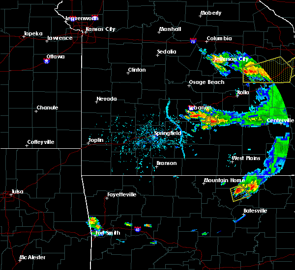 The severe thunderstorm warning for southeastern laclede and northwestern texas counties will expire at 600 pm cdt, the storm which prompted the warning has weakened below severe limits, and no longer poses an immediate threat to life or property. therefore the warning will be allowed to expire. however heavy rain is still possible with this thunderstorm. The severe thunderstorm warning for southeastern laclede and northwestern texas counties will expire at 600 pm cdt, the storm which prompted the warning has weakened below severe limits, and no longer poses an immediate threat to life or property. therefore the warning will be allowed to expire. however heavy rain is still possible with this thunderstorm.
|
| 6/14/2018 5:45 PM CDT | Quarter sized hail reported 3.8 miles ENE of Plato, MO |
| 6/14/2018 5:45 PM CDT |
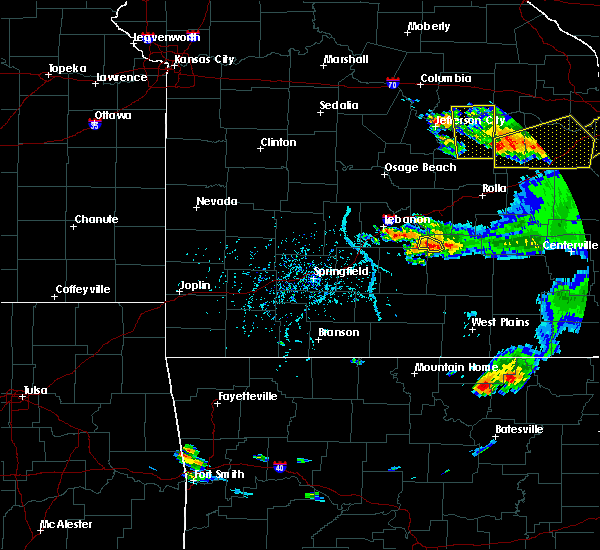 At 544 pm cdt, a severe thunderstorm was located 13 miles south of fort leonard wood, moving east at 10 mph (radar indicated). Hazards include 60 mph wind gusts and quarter size hail. Hail damage to vehicles is expected. expect wind damage to roofs, siding, and trees. Locations impacted include, plato, roby, lynchburg,. At 544 pm cdt, a severe thunderstorm was located 13 miles south of fort leonard wood, moving east at 10 mph (radar indicated). Hazards include 60 mph wind gusts and quarter size hail. Hail damage to vehicles is expected. expect wind damage to roofs, siding, and trees. Locations impacted include, plato, roby, lynchburg,.
|
| 6/14/2018 5:34 PM CDT |
 At 534 pm cdt, a severe thunderstorm was located 14 miles south of fort leonard wood, moving east at 10 mph (radar indicated). Hazards include ping pong ball size hail and 60 mph wind gusts. People and animals outdoors will be injured. expect hail damage to roofs, siding, windows, and vehicles. expect wind damage to roofs, siding, and trees. Locations impacted include, plato, roby, lynchburg, success,. At 534 pm cdt, a severe thunderstorm was located 14 miles south of fort leonard wood, moving east at 10 mph (radar indicated). Hazards include ping pong ball size hail and 60 mph wind gusts. People and animals outdoors will be injured. expect hail damage to roofs, siding, windows, and vehicles. expect wind damage to roofs, siding, and trees. Locations impacted include, plato, roby, lynchburg, success,.
|
| 6/14/2018 5:18 PM CDT |
 At 518 pm cdt, a severe thunderstorm was located 14 miles southwest of fort leonard wood, moving east at 10 mph (radar indicated). Hazards include 60 mph wind gusts and quarter size hail. Hail damage to vehicles is expected. Expect wind damage to roofs, siding, and trees. At 518 pm cdt, a severe thunderstorm was located 14 miles southwest of fort leonard wood, moving east at 10 mph (radar indicated). Hazards include 60 mph wind gusts and quarter size hail. Hail damage to vehicles is expected. Expect wind damage to roofs, siding, and trees.
|
| 5/19/2018 8:13 PM CDT |
 At 813 pm cdt, severe thunderstorms were located along a line extending from 12 miles south of fort leonard wood to 16 miles northwest of houston to 15 miles northeast of hartville, moving east at 35 mph (radar indicated). Hazards include 60 mph wind gusts and quarter size hail. Hail damage to vehicles is expected. Expect wind damage to roofs, siding, and trees. At 813 pm cdt, severe thunderstorms were located along a line extending from 12 miles south of fort leonard wood to 16 miles northwest of houston to 15 miles northeast of hartville, moving east at 35 mph (radar indicated). Hazards include 60 mph wind gusts and quarter size hail. Hail damage to vehicles is expected. Expect wind damage to roofs, siding, and trees.
|
| 5/3/2018 3:10 AM CDT |
 At 310 am cdt, severe thunderstorms were located along a line extending from 16 miles southwest of fort leonard wood to 13 miles northwest of cabool to near mountain grove, moving northeast at 55 mph (radar indicated). Hazards include 60 mph wind gusts. expect damage to roofs, siding, and trees At 310 am cdt, severe thunderstorms were located along a line extending from 16 miles southwest of fort leonard wood to 13 miles northwest of cabool to near mountain grove, moving northeast at 55 mph (radar indicated). Hazards include 60 mph wind gusts. expect damage to roofs, siding, and trees
|
| 5/27/2017 6:57 PM CDT |
 At 657 pm cdt, a severe thunderstorm was located 8 miles southwest of fort leonard wood, moving east at 40 mph (radar indicated). Hazards include half dollar size hail. damage to vehicles is expected At 657 pm cdt, a severe thunderstorm was located 8 miles southwest of fort leonard wood, moving east at 40 mph (radar indicated). Hazards include half dollar size hail. damage to vehicles is expected
|
| 5/27/2017 3:51 PM CDT |
 The severe thunderstorm warning for webster, wright, laclede, pulaski, western texas, southwestern phelps and southeastern camden counties will expire at 400 pm cdt, the storms which prompted the warning have moved out of the area. therefore the warning will be allowed to expire. a tornado watch remains in effect until 700 pm cdt for central, south central, southwestern and east central missouri. severe thunderstorm and tornado warnings remain in effect for areas to the east of this warning. The severe thunderstorm warning for webster, wright, laclede, pulaski, western texas, southwestern phelps and southeastern camden counties will expire at 400 pm cdt, the storms which prompted the warning have moved out of the area. therefore the warning will be allowed to expire. a tornado watch remains in effect until 700 pm cdt for central, south central, southwestern and east central missouri. severe thunderstorm and tornado warnings remain in effect for areas to the east of this warning.
|
| 5/27/2017 3:30 PM CDT | Reported at evening shade... mo. several trees uprooted. via social medi in texas county MO, 6.9 miles SW of Plato, MO |
| 5/27/2017 3:28 PM CDT |
 At 327 pm cdt, severe thunderstorms were located along a line extending from 9 miles southwest of iberia to fort leonard wood to 13 miles north of mountain grove to 6 miles west of mansfield, moving east at 60 mph (emergency management. numerous reports of wind damage have been received with this line of storms). Hazards include 70 mph wind gusts and half dollar size hail. Hail damage to vehicles is expected. expect considerable tree damage. wind damage is also likely to mobile homes, roofs, and outbuildings. locations impacted include, fort leonard wood, lebanon, ha ha tonka state park, marshfield, waynesville, mountain grove, st. robert, licking, houston, seymour, richland, dixon, morgan, mansfield, crocker, fordland, conway, dawson, norwood, hartville, this includes interstate 44 between mile markers 99 and 108, between mile markers 117 and 169, and between mile markers 171 and 174. persons within the severe thunderstorm warning should remain alert for potential tornado warnings. A tornado watch remains in effect until 700 pm cdt for central, south central, southwestern and east central missouri. At 327 pm cdt, severe thunderstorms were located along a line extending from 9 miles southwest of iberia to fort leonard wood to 13 miles north of mountain grove to 6 miles west of mansfield, moving east at 60 mph (emergency management. numerous reports of wind damage have been received with this line of storms). Hazards include 70 mph wind gusts and half dollar size hail. Hail damage to vehicles is expected. expect considerable tree damage. wind damage is also likely to mobile homes, roofs, and outbuildings. locations impacted include, fort leonard wood, lebanon, ha ha tonka state park, marshfield, waynesville, mountain grove, st. robert, licking, houston, seymour, richland, dixon, morgan, mansfield, crocker, fordland, conway, dawson, norwood, hartville, this includes interstate 44 between mile markers 99 and 108, between mile markers 117 and 169, and between mile markers 171 and 174. persons within the severe thunderstorm warning should remain alert for potential tornado warnings. A tornado watch remains in effect until 700 pm cdt for central, south central, southwestern and east central missouri.
|
| 5/27/2017 3:21 PM CDT |
 At 320 pm cdt, severe thunderstorms were located along a line extending from 10 miles northwest of richland to 9 miles west of fort leonard wood to 11 miles northeast of hartville to 9 miles east of sparta, moving east at 55 mph (emergency management. numerous reports of wind damage and large hail have been received with this line of storms). Hazards include 60 mph wind gusts and half dollar size hail. Hail damage to vehicles is expected. expect wind damage to roofs, siding, and trees. locations impacted include, fort leonard wood, lebanon, ha ha tonka state park, marshfield, waynesville, mountain grove, st. robert, licking, houston, seymour, richland, dixon, morgan, mansfield, crocker, fordland, conway, dawson, norwood, hartville, this includes interstate 44 between mile markers 99 and 108, between mile markers 117 and 169, and between mile markers 171 and 174. A tornado watch remains in effect until 700 pm cdt for central, south central, southwestern and east central missouri. At 320 pm cdt, severe thunderstorms were located along a line extending from 10 miles northwest of richland to 9 miles west of fort leonard wood to 11 miles northeast of hartville to 9 miles east of sparta, moving east at 55 mph (emergency management. numerous reports of wind damage and large hail have been received with this line of storms). Hazards include 60 mph wind gusts and half dollar size hail. Hail damage to vehicles is expected. expect wind damage to roofs, siding, and trees. locations impacted include, fort leonard wood, lebanon, ha ha tonka state park, marshfield, waynesville, mountain grove, st. robert, licking, houston, seymour, richland, dixon, morgan, mansfield, crocker, fordland, conway, dawson, norwood, hartville, this includes interstate 44 between mile markers 99 and 108, between mile markers 117 and 169, and between mile markers 171 and 174. A tornado watch remains in effect until 700 pm cdt for central, south central, southwestern and east central missouri.
|
| 5/27/2017 3:00 PM CDT |
 At 300 pm cdt, severe thunderstorms were located along a line extending from near macks creek to near lebanon to 7 miles east of niangua to ozark, moving east at 55 mph (emergency management). Hazards include 60 mph wind gusts and half dollar size hail. Hail damage to vehicles is expected. Expect wind damage to roofs, siding, and trees. At 300 pm cdt, severe thunderstorms were located along a line extending from near macks creek to near lebanon to 7 miles east of niangua to ozark, moving east at 55 mph (emergency management). Hazards include 60 mph wind gusts and half dollar size hail. Hail damage to vehicles is expected. Expect wind damage to roofs, siding, and trees.
|
| 5/26/2017 5:43 AM CDT |
 At 542 am cdt, severe thunderstorms were located along a line extending from 9 miles north of richland to 11 miles west of fort leonard wood to 20 miles south of waynesville, moving east at 50 mph (radar indicated). Hazards include half dollar size hail. Damage to vehicles is expected. locations impacted include, fort leonard wood, lake of the ozarks state park, waynesville, st. Robert, licking, richland, dixon, crocker, iberia, doolittle, vienna, newburg, edgar springs, plato, brumley, beulah, success, laquey, roby, ozark springs, this includes interstate 44 between mile markers 145 and 182. At 542 am cdt, severe thunderstorms were located along a line extending from 9 miles north of richland to 11 miles west of fort leonard wood to 20 miles south of waynesville, moving east at 50 mph (radar indicated). Hazards include half dollar size hail. Damage to vehicles is expected. locations impacted include, fort leonard wood, lake of the ozarks state park, waynesville, st. Robert, licking, richland, dixon, crocker, iberia, doolittle, vienna, newburg, edgar springs, plato, brumley, beulah, success, laquey, roby, ozark springs, this includes interstate 44 between mile markers 145 and 182.
|
| 5/26/2017 5:30 AM CDT |
 At 529 am cdt, severe thunderstorms were located along a line extending from near camdenton to 6 miles northeast of lebanon to 17 miles southwest of fort leonard wood, moving east at 45 mph (radar indicated). Hazards include quarter size hail. damage to vehicles is expected At 529 am cdt, severe thunderstorms were located along a line extending from near camdenton to 6 miles northeast of lebanon to 17 miles southwest of fort leonard wood, moving east at 45 mph (radar indicated). Hazards include quarter size hail. damage to vehicles is expected
|
| 4/29/2017 3:42 AM CDT |
 At 341 am cdt, severe thunderstorms were located along a line extending from 9 miles east of niangua to near mansfield, moving northeast at 45 mph (trained weather spotters. quarter sized hail was reported in mansfield within the last 5 minutes). Hazards include 60 mph wind gusts and quarter size hail. Hail damage to vehicles is expected. expect wind damage to roofs, siding, and trees. Locations impacted include, mountain grove, cabool, mansfield, dawson, norwood, hartville, huggins, plato, competition, manes, lynchburg, graff, grovespring, odin, bendavis,. At 341 am cdt, severe thunderstorms were located along a line extending from 9 miles east of niangua to near mansfield, moving northeast at 45 mph (trained weather spotters. quarter sized hail was reported in mansfield within the last 5 minutes). Hazards include 60 mph wind gusts and quarter size hail. Hail damage to vehicles is expected. expect wind damage to roofs, siding, and trees. Locations impacted include, mountain grove, cabool, mansfield, dawson, norwood, hartville, huggins, plato, competition, manes, lynchburg, graff, grovespring, odin, bendavis,.
|
| 4/29/2017 3:33 AM CDT |
 At 332 am cdt, severe thunderstorms were located along a line extending from 7 miles southeast of niangua to near ava, moving northeast at 45 mph (radar indicated). Hazards include 60 mph wind gusts and quarter size hail. Hail damage to vehicles is expected. Expect wind damage to roofs, siding, and trees. At 332 am cdt, severe thunderstorms were located along a line extending from 7 miles southeast of niangua to near ava, moving northeast at 45 mph (radar indicated). Hazards include 60 mph wind gusts and quarter size hail. Hail damage to vehicles is expected. Expect wind damage to roofs, siding, and trees.
|
| 4/28/2017 10:27 PM CDT |
 At 1026 pm cdt, a severe thunderstorm was located 12 miles west of houston, moving northeast at 45 mph (radar indicated). Hazards include quarter size hail. Damage to vehicles is expected. Locations impacted include, houston, huggins, plato, roby, bucyrus, hazelton, prescott, success, bendavis,. At 1026 pm cdt, a severe thunderstorm was located 12 miles west of houston, moving northeast at 45 mph (radar indicated). Hazards include quarter size hail. Damage to vehicles is expected. Locations impacted include, houston, huggins, plato, roby, bucyrus, hazelton, prescott, success, bendavis,.
|
| 4/28/2017 10:12 PM CDT |
 At 1012 pm cdt, a severe thunderstorm was located 7 miles north of norwood, or 8 miles northwest of mountain grove, moving northeast at 45 mph (radar indicated). Hazards include quarter size hail. damage to vehicles is expected At 1012 pm cdt, a severe thunderstorm was located 7 miles north of norwood, or 8 miles northwest of mountain grove, moving northeast at 45 mph (radar indicated). Hazards include quarter size hail. damage to vehicles is expected
|
| 4/4/2017 11:00 PM CDT | Tree fell on powerline south of plat in texas county MO, 4.4 miles NNW of Plato, MO |
| 4/4/2017 10:16 PM CDT |
 At 1015 pm cdt, severe thunderstorms were located along a line extending from near dixon to fort leonard wood to 11 miles west of licking to 10 miles northwest of houston, moving northeast at 50 mph (radar indicated). Hazards include 60 mph wind gusts and quarter size hail. Hail damage to vehicles is expected. expect wind damage to roofs, siding, and trees. locations impacted include, rolla, fort leonard wood, waynesville, st. robert, licking, doolittle, newburg, edgar springs, huggins, plato, competition, manes, beulah, devil`s elbow, hazelton, lynchburg, graff, success, laquey, roby, hail the size of quaters was reported in waynesville. This includes interstate 44 between mile markers 149 and 169, and between mile markers 171 and 188. At 1015 pm cdt, severe thunderstorms were located along a line extending from near dixon to fort leonard wood to 11 miles west of licking to 10 miles northwest of houston, moving northeast at 50 mph (radar indicated). Hazards include 60 mph wind gusts and quarter size hail. Hail damage to vehicles is expected. expect wind damage to roofs, siding, and trees. locations impacted include, rolla, fort leonard wood, waynesville, st. robert, licking, doolittle, newburg, edgar springs, huggins, plato, competition, manes, beulah, devil`s elbow, hazelton, lynchburg, graff, success, laquey, roby, hail the size of quaters was reported in waynesville. This includes interstate 44 between mile markers 149 and 169, and between mile markers 171 and 188.
|
| 4/4/2017 9:49 PM CDT |
 At 949 pm cdt, severe thunderstorms were located along a line extending from near richland to 7 miles southwest of fort leonard wood to 18 miles south of waynesville to 17 miles southeast of lebanon to 7 miles northeast of hartville, moving northeast at 50 mph (radar indicated). Hazards include 60 mph wind gusts and quarter size hail. Hail damage to vehicles is expected. Expect wind damage to roofs, siding, and trees. At 949 pm cdt, severe thunderstorms were located along a line extending from near richland to 7 miles southwest of fort leonard wood to 18 miles south of waynesville to 17 miles southeast of lebanon to 7 miles northeast of hartville, moving northeast at 50 mph (radar indicated). Hazards include 60 mph wind gusts and quarter size hail. Hail damage to vehicles is expected. Expect wind damage to roofs, siding, and trees.
|
| 3/9/2017 4:20 PM CST | Half Dollar sized hail reported 6 miles SSW of Plato, MO, quarter to half dollar size hail reported on social media with a picture in the evening shade area. time was estimated. |
| 3/7/2017 12:30 AM CST |
 At 1229 am cst, severe thunderstorms were located along a line extending from 7 miles west of salem to 15 miles northeast of gainesville, moving southeast at 45 mph (radar indicated). Hazards include 60 mph wind gusts and penny size hail. Expect damage to roofs, siding, and trees. Locations impacted include, mountain grove, licking, cabool, houston, mansfield, dawson, norwood, summersville, raymondville, huggins, plato, success, eunice, yukon, roby, clear springs, solo, pine crest, simmons, arroll, a tornado watch remains in effect until 300 am cst for south central, southwestern and east central missouri. At 1229 am cst, severe thunderstorms were located along a line extending from 7 miles west of salem to 15 miles northeast of gainesville, moving southeast at 45 mph (radar indicated). Hazards include 60 mph wind gusts and penny size hail. Expect damage to roofs, siding, and trees. Locations impacted include, mountain grove, licking, cabool, houston, mansfield, dawson, norwood, summersville, raymondville, huggins, plato, success, eunice, yukon, roby, clear springs, solo, pine crest, simmons, arroll, a tornado watch remains in effect until 300 am cst for south central, southwestern and east central missouri.
|
| 3/7/2017 12:14 AM CST |
 At 1214 am cst, severe thunderstorms were located along a line extending from 12 miles north of licking to 15 miles north of gainesville, moving east at 50 mph (radar indicated). Hazards include 70 mph wind gusts and quarter size hail. Hail damage to vehicles is expected. expect considerable tree damage. wind damage is also likely to mobile homes, roofs, and outbuildings. Locations impacted include, mountain grove, licking, cabool, houston, seymour, mansfield, dawson, norwood, hartville, summersville, raymondville, huggins, plato, manes, success, eunice, yukon, roby, clear springs, solo, a tornado watch remains in effect until 300 am cst for south central, southwestern and east central missouri. At 1214 am cst, severe thunderstorms were located along a line extending from 12 miles north of licking to 15 miles north of gainesville, moving east at 50 mph (radar indicated). Hazards include 70 mph wind gusts and quarter size hail. Hail damage to vehicles is expected. expect considerable tree damage. wind damage is also likely to mobile homes, roofs, and outbuildings. Locations impacted include, mountain grove, licking, cabool, houston, seymour, mansfield, dawson, norwood, hartville, summersville, raymondville, huggins, plato, manes, success, eunice, yukon, roby, clear springs, solo, a tornado watch remains in effect until 300 am cst for south central, southwestern and east central missouri.
|
| 3/6/2017 11:58 PM CST |
 At 1158 pm cst, severe thunderstorms were located along a line extending from fort leonard wood to 7 miles west of ava, moving southeast at 45 mph (radar indicated). Hazards include 70 mph wind gusts and quarter size hail. Hail damage to vehicles is expected. expect considerable tree damage. Wind damage is also likely to mobile homes, roofs, and outbuildings. At 1158 pm cst, severe thunderstorms were located along a line extending from fort leonard wood to 7 miles west of ava, moving southeast at 45 mph (radar indicated). Hazards include 70 mph wind gusts and quarter size hail. Hail damage to vehicles is expected. expect considerable tree damage. Wind damage is also likely to mobile homes, roofs, and outbuildings.
|
| 3/6/2017 11:37 PM CST |
 At 1137 pm cst, severe thunderstorms were located along a line extending from 16 miles southwest of fort leonard wood to 7 miles southeast of seymour, moving east at 55 mph (radar indicated). Hazards include 70 mph wind gusts and quarter size hail. Hail damage to vehicles is expected. expect considerable tree damage. wind damage is also likely to mobile homes, roofs, and outbuildings. locations impacted include, springfield, nixa, ozark, fort leonard wood, lebanon, marshfield, battlefield, waynesville, mountain grove, rogersville, strafford, clever, seymour, sparta, morgan, mansfield, fremont hills, fordland, conway, dawson, this includes interstate 44 between mile markers 81 and 109, near mile marker 112, between mile markers 120 and 121, and between mile markers 141 and 153. A tornado watch remains in effect until 300 am cst for central, south central, southwestern and east central missouri. At 1137 pm cst, severe thunderstorms were located along a line extending from 16 miles southwest of fort leonard wood to 7 miles southeast of seymour, moving east at 55 mph (radar indicated). Hazards include 70 mph wind gusts and quarter size hail. Hail damage to vehicles is expected. expect considerable tree damage. wind damage is also likely to mobile homes, roofs, and outbuildings. locations impacted include, springfield, nixa, ozark, fort leonard wood, lebanon, marshfield, battlefield, waynesville, mountain grove, rogersville, strafford, clever, seymour, sparta, morgan, mansfield, fremont hills, fordland, conway, dawson, this includes interstate 44 between mile markers 81 and 109, near mile marker 112, between mile markers 120 and 121, and between mile markers 141 and 153. A tornado watch remains in effect until 300 am cst for central, south central, southwestern and east central missouri.
|
| 3/6/2017 11:02 PM CST |
 At 1102 pm cst, severe thunderstorms were located along a line extending from 7 miles north of conway to springfield, moving east at 55 mph (public. numerous reports of wind damage, trees down, and power outages have been reported with these storms). Hazards include 70 mph wind gusts and quarter size hail. Hail damage to vehicles is expected. expect considerable tree damage. Wind damage is also likely to mobile homes, roofs, and outbuildings. At 1102 pm cst, severe thunderstorms were located along a line extending from 7 miles north of conway to springfield, moving east at 55 mph (public. numerous reports of wind damage, trees down, and power outages have been reported with these storms). Hazards include 70 mph wind gusts and quarter size hail. Hail damage to vehicles is expected. expect considerable tree damage. Wind damage is also likely to mobile homes, roofs, and outbuildings.
|
| 3/1/2017 1:34 AM CST |
 At 134 am cst, severe thunderstorms were located along a line extending from 8 miles east of conway to 6 miles southeast of springfield, moving east at 75 mph (radar indicated). Hazards include 60 mph wind gusts and quarter size hail. Hail damage to vehicles is expected. Expect wind damage to roofs, siding, and trees. At 134 am cst, severe thunderstorms were located along a line extending from 8 miles east of conway to 6 miles southeast of springfield, moving east at 75 mph (radar indicated). Hazards include 60 mph wind gusts and quarter size hail. Hail damage to vehicles is expected. Expect wind damage to roofs, siding, and trees.
|
| 10/19/2016 2:45 PM CDT |
 At 244 pm cdt, a severe thunderstorm was 5 miles north of lynchburg, moving east at 40 mph (radar indicated). Hazards include 60 mph wind gusts and quarter size hail. Hail damage to vehicles is expected. Expect wind damage to roofs, siding, and trees. At 244 pm cdt, a severe thunderstorm was 5 miles north of lynchburg, moving east at 40 mph (radar indicated). Hazards include 60 mph wind gusts and quarter size hail. Hail damage to vehicles is expected. Expect wind damage to roofs, siding, and trees.
|
| 8/12/2016 5:26 PM CDT |
 At 526 pm cdt, severe thunderstorms were located along a line extending from 8 miles south of richland to 10 miles southwest of fort leonard wood to 19 miles northeast of hartville, moving northeast at 15 mph (radar indicated). Hazards include 60 mph wind gusts. Expect damage to roofs. siding. And trees. At 526 pm cdt, severe thunderstorms were located along a line extending from 8 miles south of richland to 10 miles southwest of fort leonard wood to 19 miles northeast of hartville, moving northeast at 15 mph (radar indicated). Hazards include 60 mph wind gusts. Expect damage to roofs. siding. And trees.
|
| 7/9/2016 7:53 PM CDT |
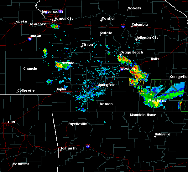 At 753 pm cdt, a severe thunderstorm was located 14 miles northeast of hartville, or 16 miles north of mountain grove, moving east at 5 mph (radar indicated). Hazards include 60 mph wind gusts and quarter size hail. Hail damage to vehicles is expected. Expect wind damage to roofs, siding, and trees. At 753 pm cdt, a severe thunderstorm was located 14 miles northeast of hartville, or 16 miles north of mountain grove, moving east at 5 mph (radar indicated). Hazards include 60 mph wind gusts and quarter size hail. Hail damage to vehicles is expected. Expect wind damage to roofs, siding, and trees.
|
| 6/30/2016 7:30 PM CDT |
 At 729 pm cdt, severe thunderstorms were located along a line extending from 15 miles west of houston to 9 miles west of licking, moving southeast at 40 mph (radar indicated). Hazards include 60 mph wind gusts. Expect damage to roofs. siding. and trees. Locations impacted include, licking, houston, raymondville, huggins, plato, hazelton, bendavis, bucyrus, simmons, roby, success, elk creek, manes, graff, yukon, solo, prescott,. At 729 pm cdt, severe thunderstorms were located along a line extending from 15 miles west of houston to 9 miles west of licking, moving southeast at 40 mph (radar indicated). Hazards include 60 mph wind gusts. Expect damage to roofs. siding. and trees. Locations impacted include, licking, houston, raymondville, huggins, plato, hazelton, bendavis, bucyrus, simmons, roby, success, elk creek, manes, graff, yukon, solo, prescott,.
|
| 6/30/2016 7:14 PM CDT |
 At 714 pm cdt, severe thunderstorms were located along a line extending from 17 miles northeast of hartville to 8 miles south of fort leonard wood, moving southeast at 40 mph (radar indicated). Hazards include 60 mph wind gusts. Expect damage to roofs. siding. And trees. At 714 pm cdt, severe thunderstorms were located along a line extending from 17 miles northeast of hartville to 8 miles south of fort leonard wood, moving southeast at 40 mph (radar indicated). Hazards include 60 mph wind gusts. Expect damage to roofs. siding. And trees.
|
| 3/30/2016 11:47 AM CDT |
 At 1147 am cdt, a severe thunderstorm was located 8 miles northwest of mountain grove, moving northeast at 50 mph (radar indicated). Hazards include quarter size hail. damage to vehicles is expected At 1147 am cdt, a severe thunderstorm was located 8 miles northwest of mountain grove, moving northeast at 50 mph (radar indicated). Hazards include quarter size hail. damage to vehicles is expected
|
| 7/1/2015 11:57 PM CDT | The severe thunderstorm warning for northern texas, pulaski, phelps, maries, and dent counties will expire at midnight cdt, the line of storms which prompted the warning has weakened below severe limits, and no longer poses an immediate threat to life or property. however, heavy rain is still possible with these thunderstorms. a tornado watch remains in effect until midnight cdt thursday morning for southeast kansas and southern missouri. |
| 7/1/2015 10:55 PM CDT |
 At 1052 pm cdt, severe thunderstorms were located along a line extending from 6 miles east of vienna to dixon to richland, and moving southeast at 35 mph (radar indicated). Hazards include 70 mph wind gusts and quarter size hail. Hail damage to vehicles is expected. expect considerable tree damage. Wind damage is also likely to mobile homes, roofs and outbuildings. At 1052 pm cdt, severe thunderstorms were located along a line extending from 6 miles east of vienna to dixon to richland, and moving southeast at 35 mph (radar indicated). Hazards include 70 mph wind gusts and quarter size hail. Hail damage to vehicles is expected. expect considerable tree damage. Wind damage is also likely to mobile homes, roofs and outbuildings.
|
| 6/28/2015 7:38 PM CDT |
 At 736 pm cdt, severe thunderstorms were located along a line extending from 5 miles northwest of lebanon to 12 miles east of lebanon, and moving southeast at 45 mph (radar indicated). Hazards include 60 mph wind gusts and quarter size hail. Hail damage to vehicles is expected. Expect wind damage to roofs, siding and trees. At 736 pm cdt, severe thunderstorms were located along a line extending from 5 miles northwest of lebanon to 12 miles east of lebanon, and moving southeast at 45 mph (radar indicated). Hazards include 60 mph wind gusts and quarter size hail. Hail damage to vehicles is expected. Expect wind damage to roofs, siding and trees.
|
| 5/24/2015 4:41 PM CDT | At 439 pm cdt, a severe thunderstorm was located 10 miles southwest of fort leonard wood, and moving north at 45 mph (radar indicated). Hazards include 60 mph wind gusts. Expect damage to roofs. siding and trees. the severe thunderstorm will be near, fort leonard wood around 455 pm cdt. waynesville around 500 pm cdt. st. robert and devil`s elbow around 505 pm cdt. interstate 44 between mile markers 153 and 168 will also be impacted by the severe thunderstorm. A tornado watch remains in effect until 800 pm cdt sunday evening for southern missouri. |
| 5/17/2015 4:11 AM CDT | At 410 am cdt, severe thunderstorms were located along a line extending from 11 miles northwest of licking to 7 miles northeast of cabool to 18 miles southwest of willow springs, and moving east at 45 mph (radar indicated). Hazards include 60 mph wind gusts. Expect damage to roofs. siding and trees. locations impacted include, cabool, extreme southwestern fort leonard wood, houston, licking, mountain grove, mountain view, raymondville and willow springs. a severe thunderstorm watch remains in effect until 700 am cdt sunday morning for southern missouri. 75in. |
| 5/17/2015 3:35 AM CDT | At 331 am cdt, severe thunderstorms were located along a line extending from 15 miles north of hartville to 6 miles north of norwood to squires, and moving east at 45 mph (radar indicated). Hazards include 60 mph wind gusts and penny size hail. Expect damage to roofs. Siding and trees. |
| 4/2/2015 4:41 PM CDT | A severe thunderstorm warning remains in effect for northern texas. southeastern pulaski and southwestern phelps counties until 530 pm cdt. at 438 pm cdt. a severe thunderstorm was located 9 miles southwest of fort leonard wood. and moving east at 30 mph. hazard. 60 mph wind gusts and quarter size hail. |
| 4/2/2015 4:27 PM CDT | The national weather service in springfield has issued a * severe thunderstorm warning for. southeastern laclede county in southwest missouri. southwestern phelps county in east central missouri. southern pulaski county in central missouri. Northern texas county in south central missouri. |
| 10/9/2014 2:50 PM CDT | Quarter sized hail reported 3.8 miles ENE of Plato, MO, barnards grove winery reported hail up to the size of quarters |
| 10/9/2014 2:50 PM CDT | Quarter sized hail reported 3.9 miles ESE of Plato, MO, barnards grove winery reported hail up to the size of quarters |
| 6/28/2013 2:30 AM CDT | Power outages due to trees and power lines down from the roby area south to near housto in texas county MO, 4.7 miles WSW of Plato, MO |
| 4/10/2013 6:05 PM CDT | Large machine shed blown 40 feet in texas county MO, 6.6 miles N of Plato, MO |
| 6/11/2012 1:14 PM CDT | Thunderstorm wind gusts of 60 mp in texas county MO, 3.3 miles NNW of Plato, MO |
| 6/11/2012 10:24 AM CDT | Storm damage reported in texas county MO, 3.3 miles NNW of Plato, MO |
| 1/1/0001 12:00 AM | Quarter sized hail reported 5.2 miles WSW of Plato, MO |
| 1/1/0001 12:00 AM | Quarter sized hail reported 8.5 miles WNW of Plato, MO |
| 1/1/0001 12:00 AM | Storm damage reported in laclede county MO, 3.8 miles ENE of Plato, MO |
Hail Maps for Plato, MO
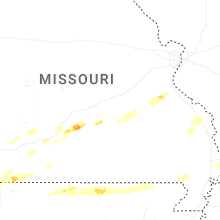


Connect with Interactive Hail Maps