

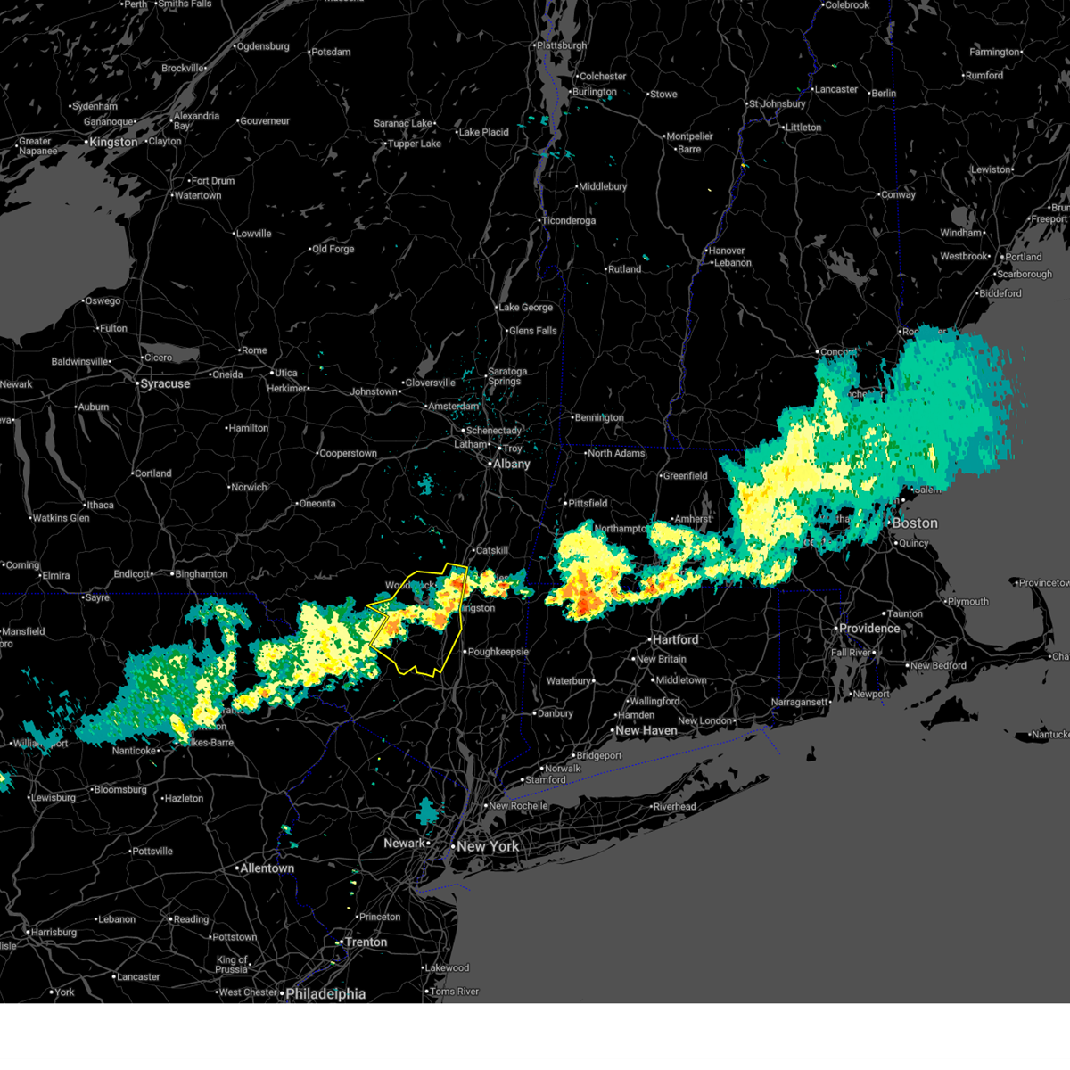
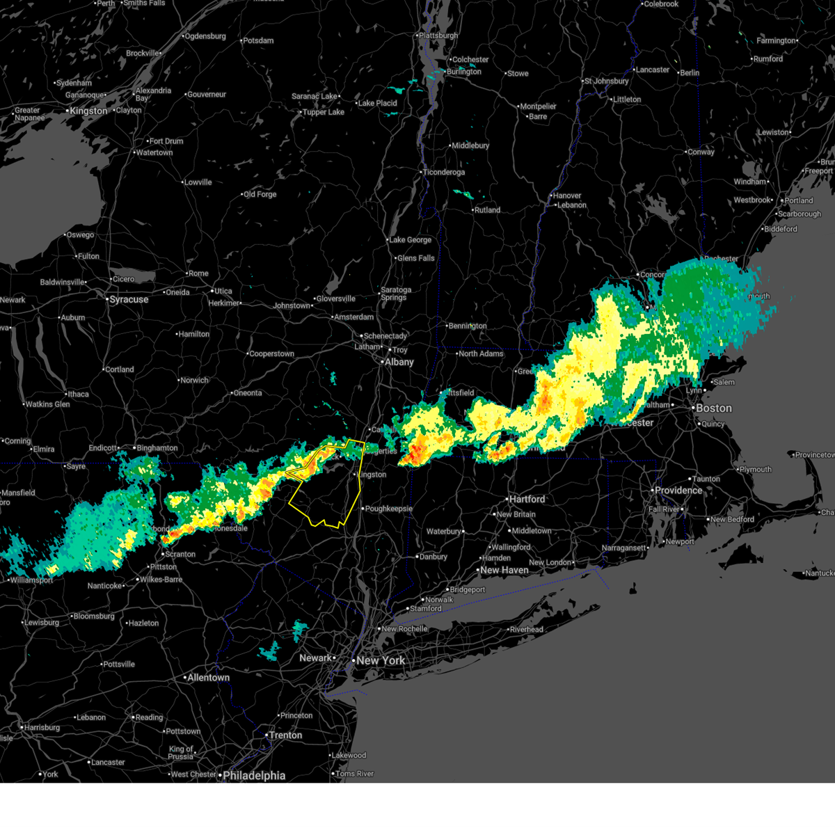
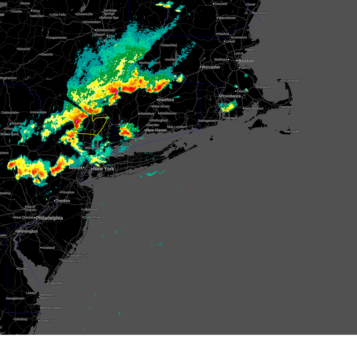
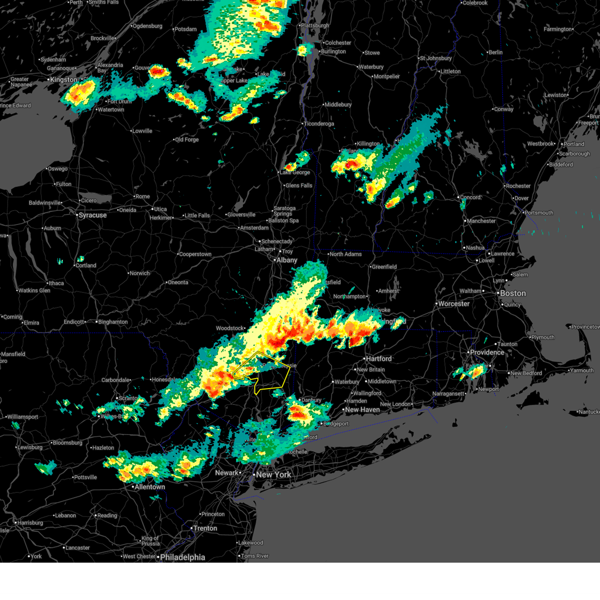
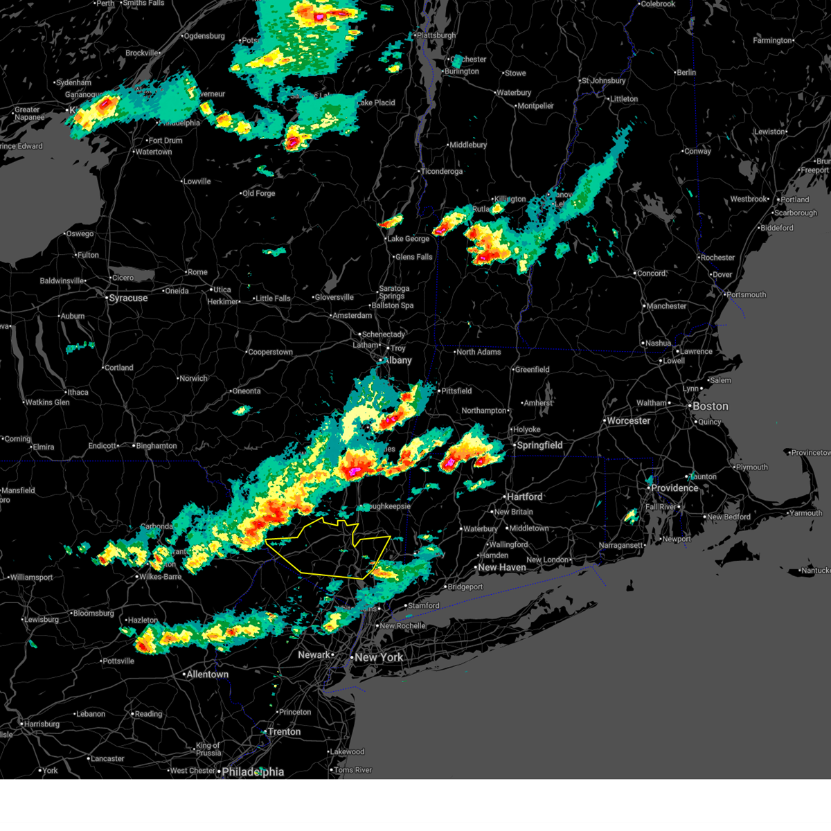
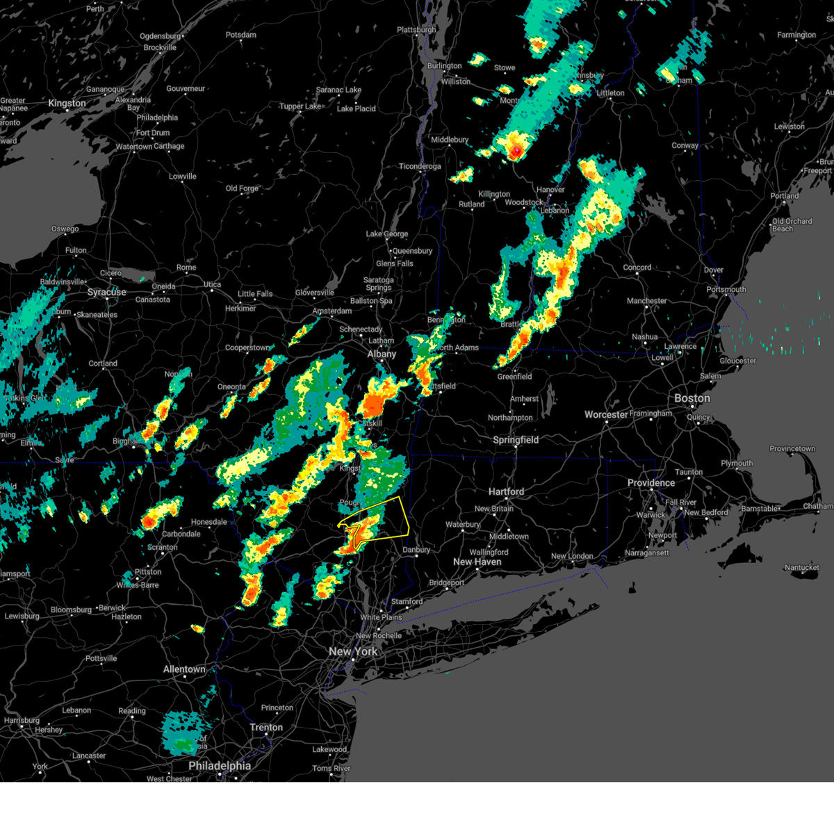
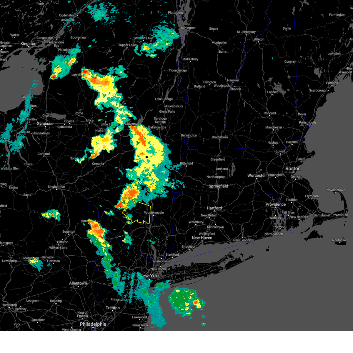
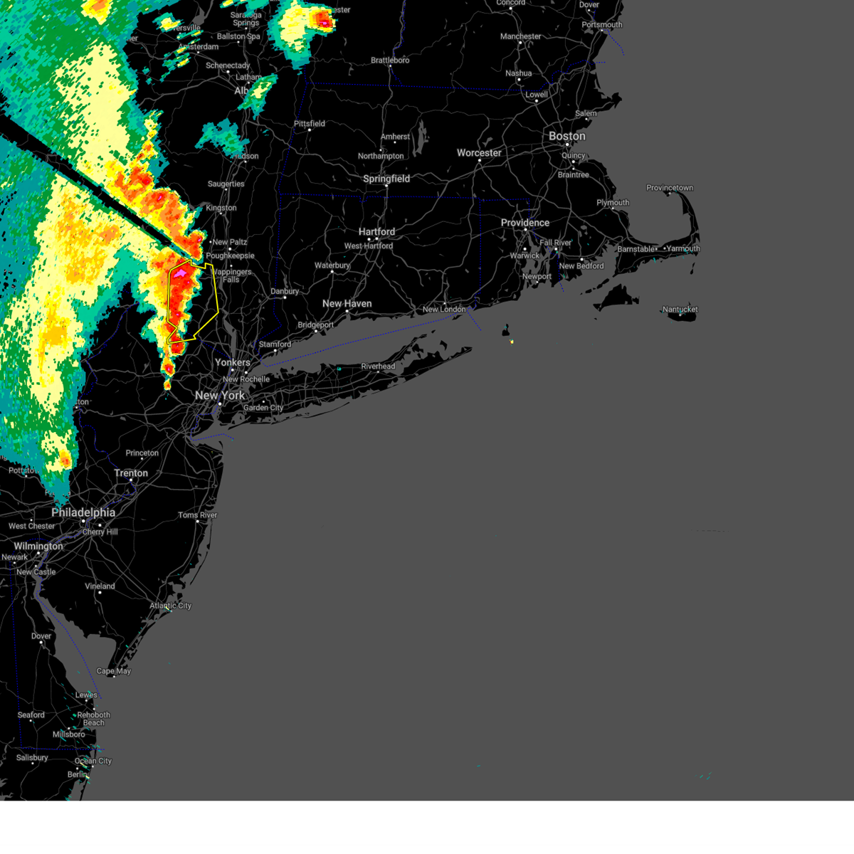
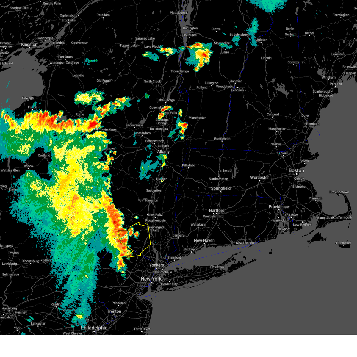
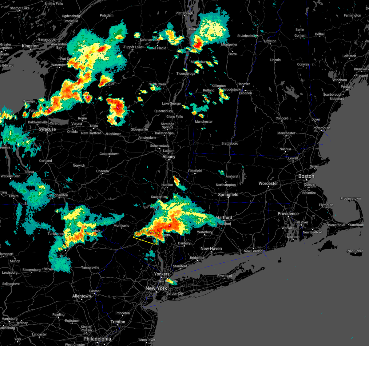
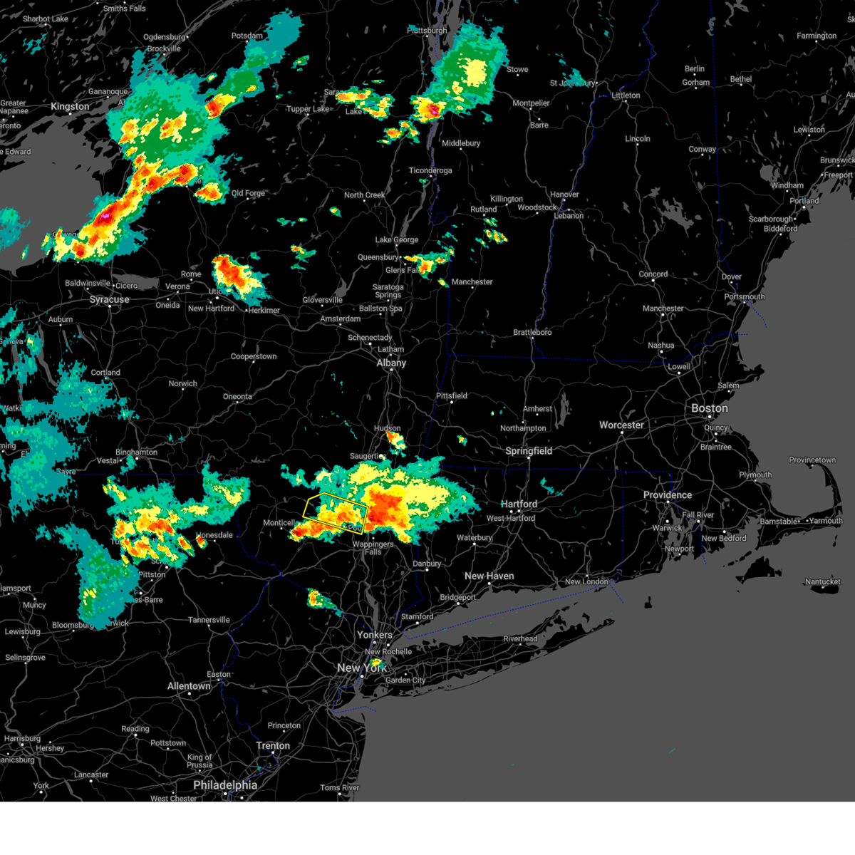
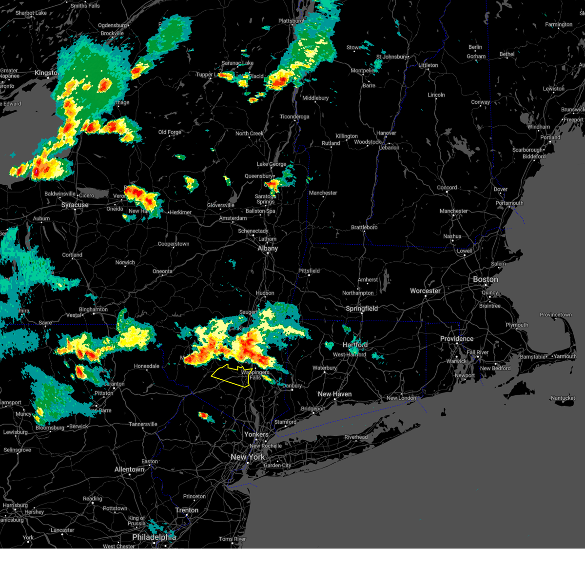
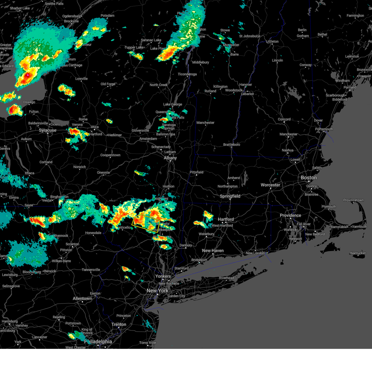
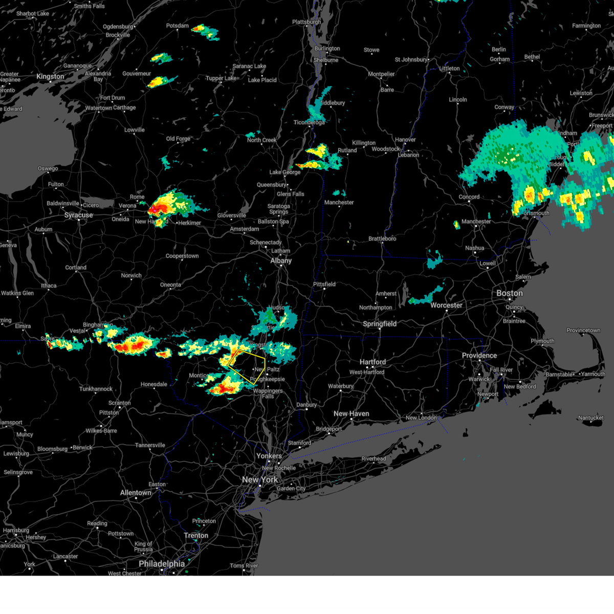
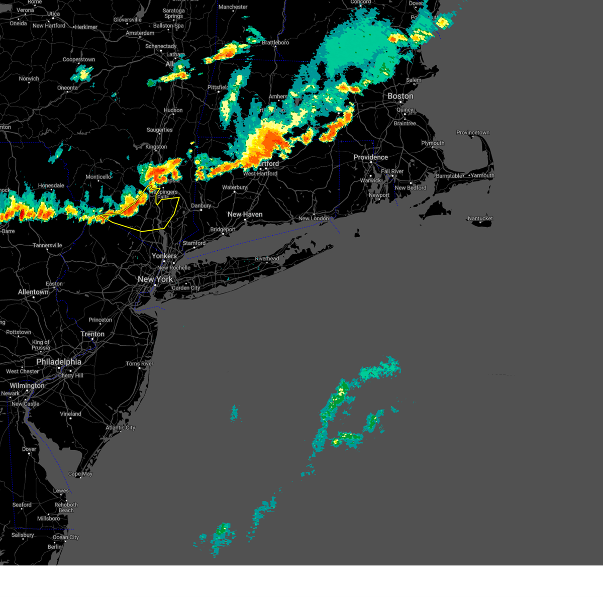
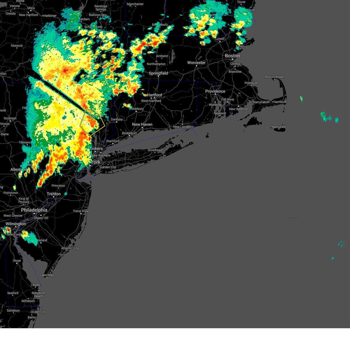
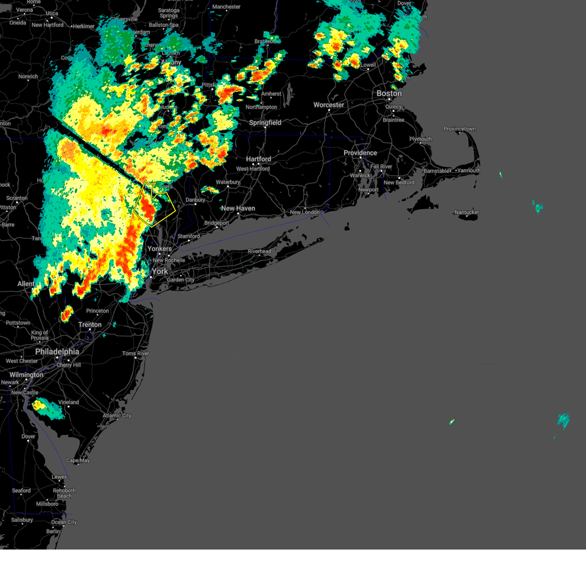
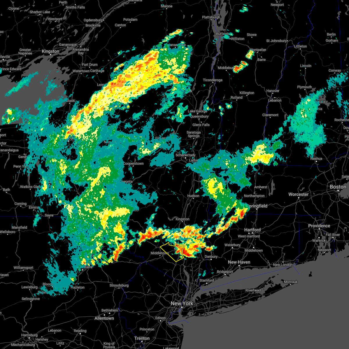
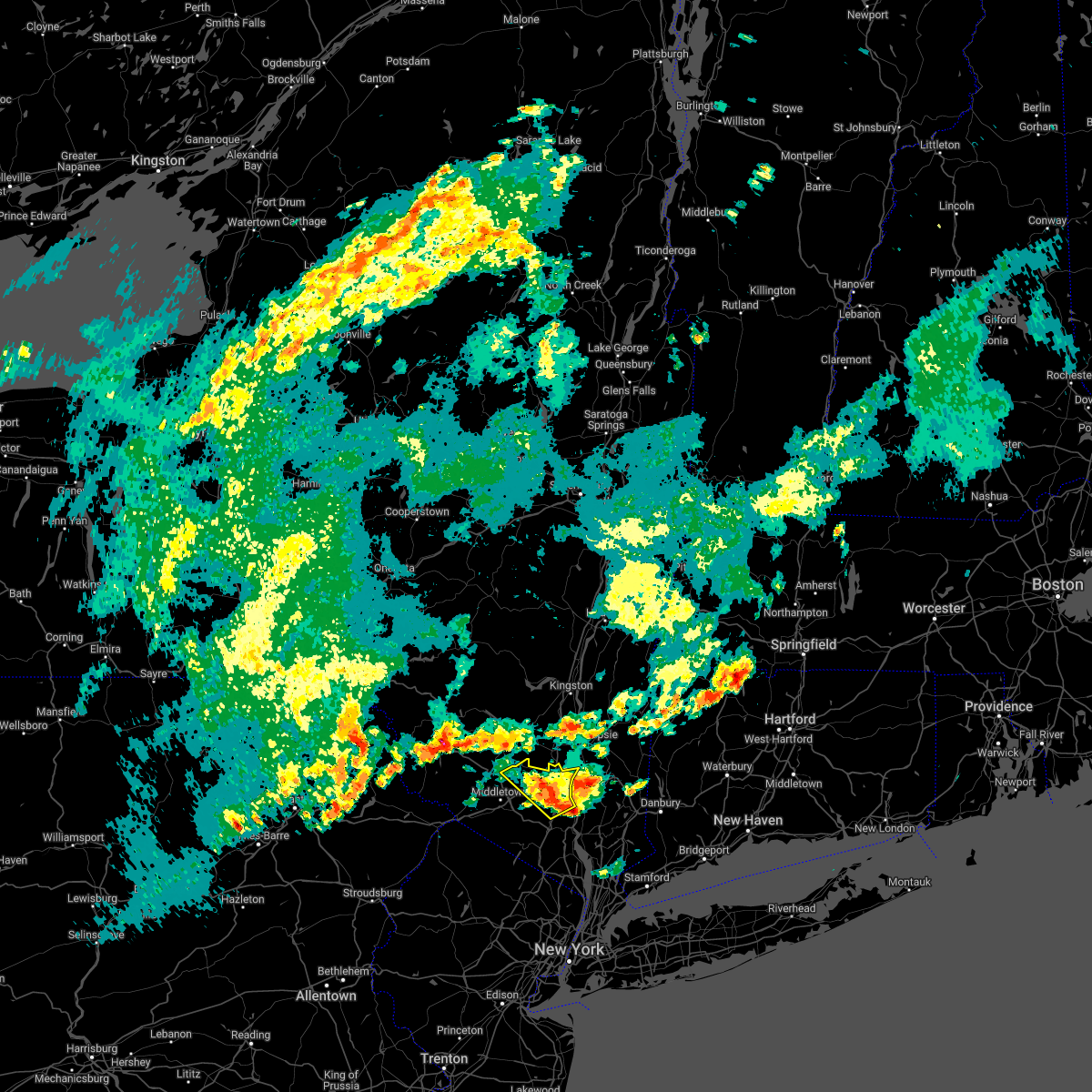
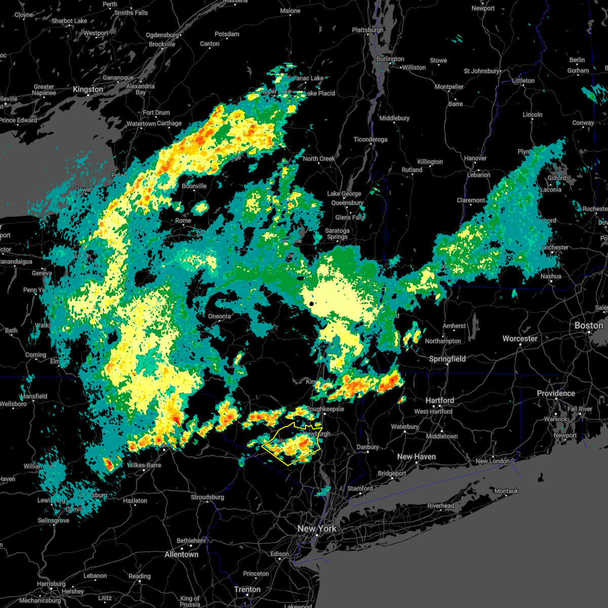
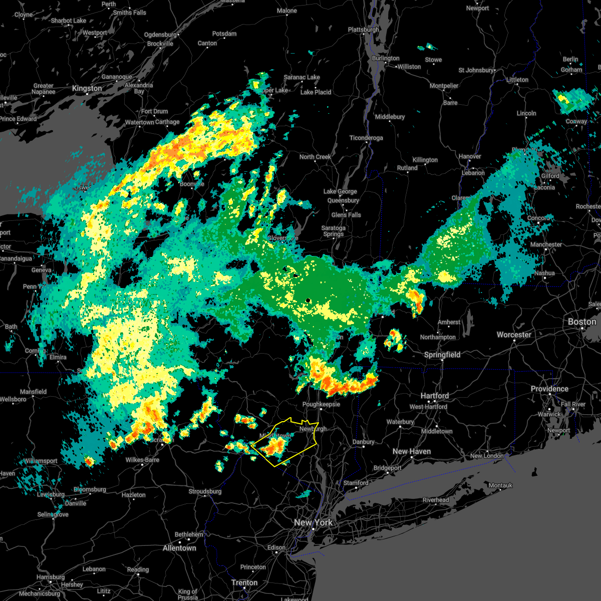
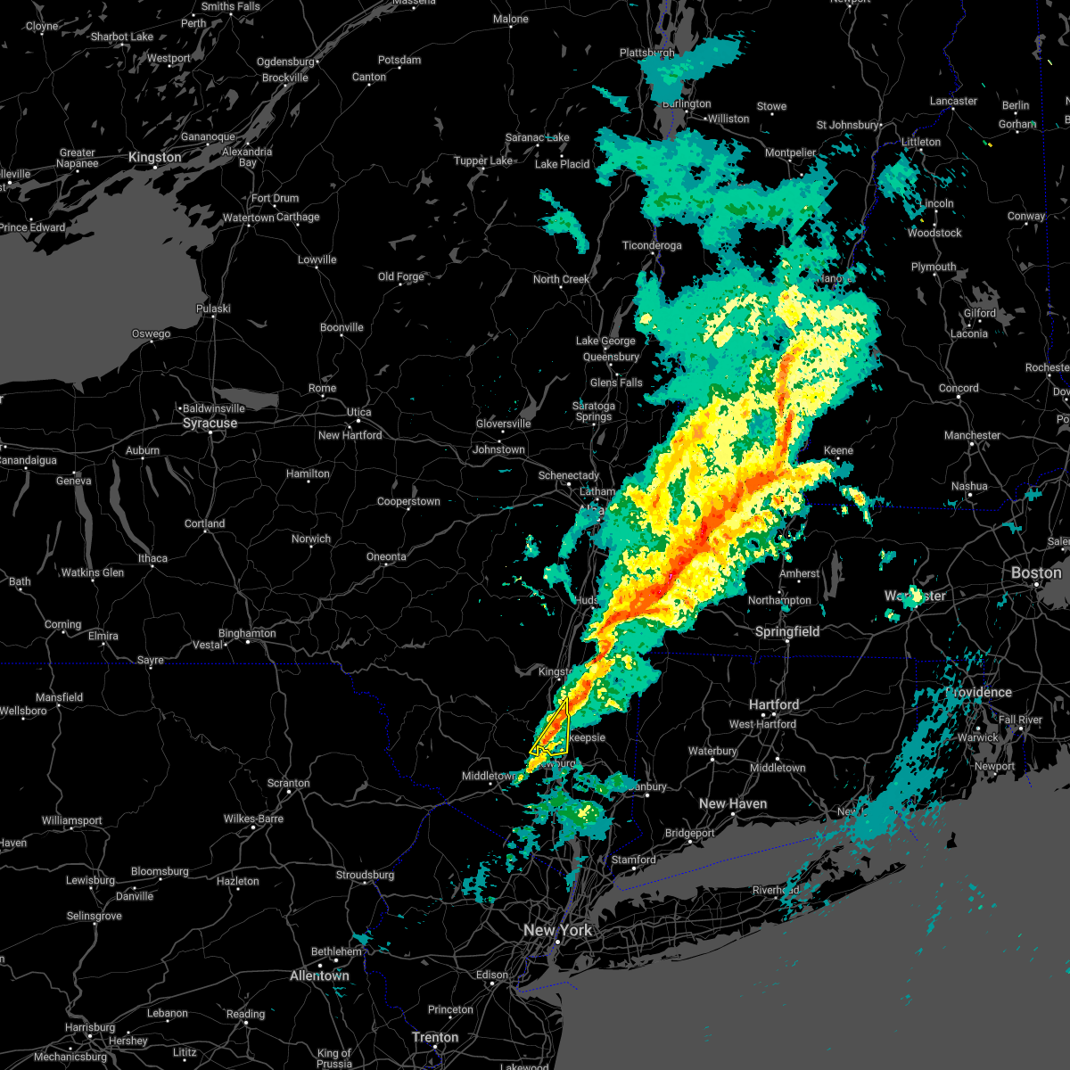
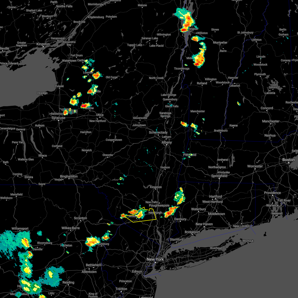
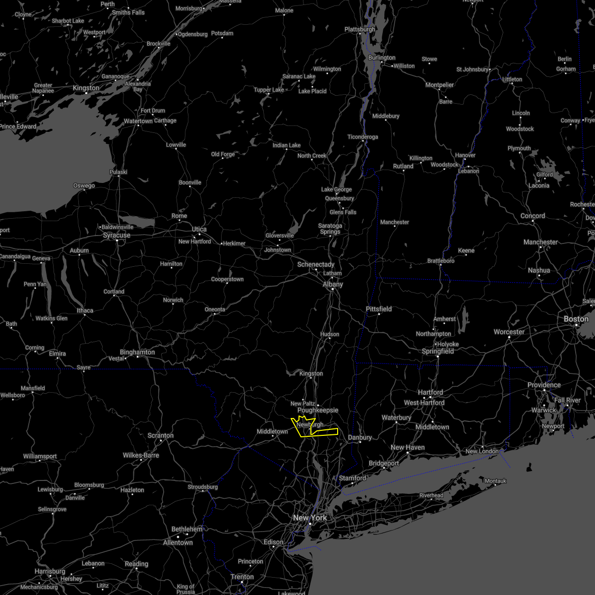
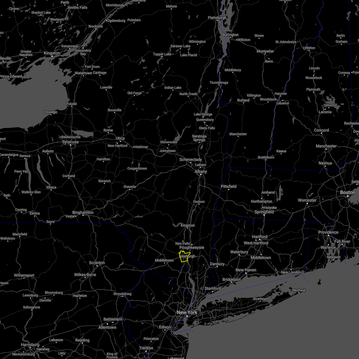
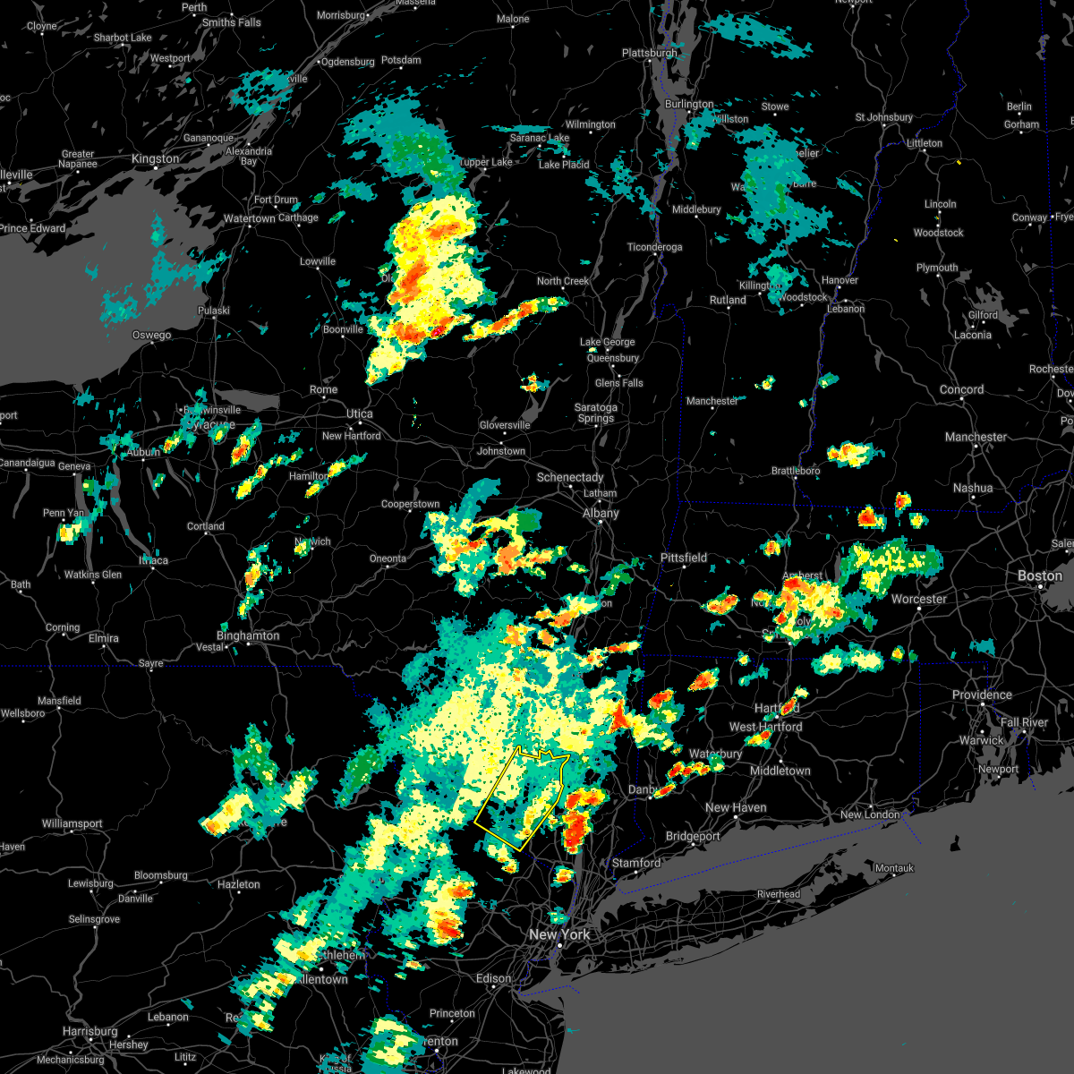
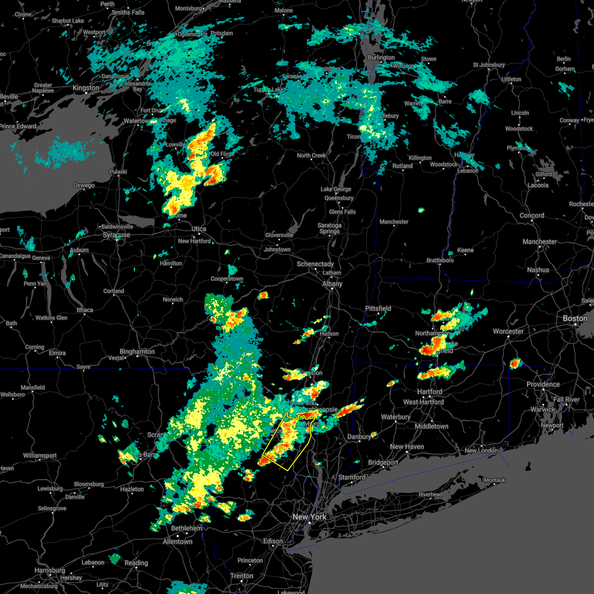
Hail Map for Plattekill, NY
The Plattekill, NY area has had 0 reports of on-the-ground hail by trained spotters, and has been under severe weather warnings 8 times during the past 12 months. Doppler radar has detected hail at or near Plattekill, NY on 24 occasions, including 1 occasion during the past year.
| Name: | Plattekill, NY |
| Where Located: | 64.2 miles N of Brooklyn, NY |
| Map: | Google Map for Plattekill, NY |
| Population: | 1260 |
| Housing Units: | 460 |
| More Info: | Search Google for Plattekill, NY |
0
The Top Recent Hail Date for Plattekill, NY is Saturday, June 6, 2026 (13th out of 24)

Hail and Wind Damage Spotted near Plattekill, NY
| Date / Time | Report Details |
|---|---|
| 4/14/2026 8:41 PM EDT |
 The storms which prompted the warning have weakened below severe limits, and no longer pose an immediate threat to life or property. therefore, the warning will be allowed to expire. however, gusty winds are still possible with these thunderstorms. a severe thunderstorm watch remains in effect until 1000 pm edt for east central new york. The storms which prompted the warning have weakened below severe limits, and no longer pose an immediate threat to life or property. therefore, the warning will be allowed to expire. however, gusty winds are still possible with these thunderstorms. a severe thunderstorm watch remains in effect until 1000 pm edt for east central new york.
|
| 4/14/2026 8:20 PM EDT |
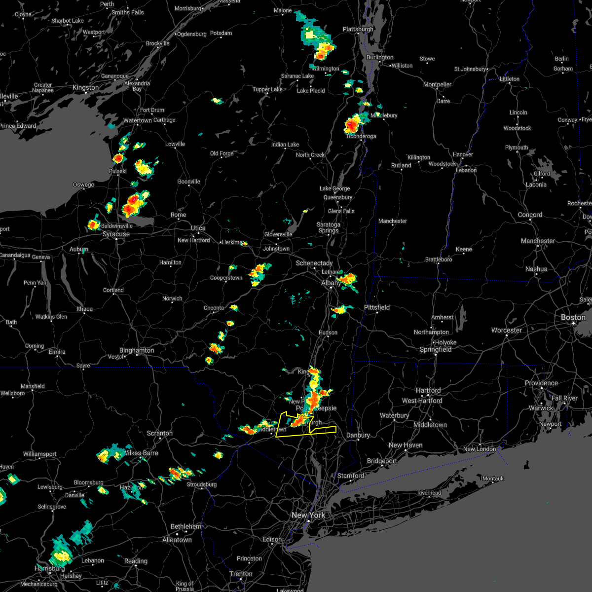
 At 820 pm edt, severe thunderstorms were located along a line extending from near woodstock to near west shokan to near eldred, moving east at 50 mph (radar indicated). Hazards include 60 mph wind gusts and penny size hail. Expect damage to roofs, siding, and trees. Locations impacted include, kingston, new paltz, ellenville, saugerties, wallkill, plattekill, hurley, woodstock, modena, high falls, kerhonkson, tillson, west hurley, napanoch, saugerties south, port ewen, woodland valley campground, west shokan, kenneth l wilson campground, and lake katrine. At 820 pm edt, severe thunderstorms were located along a line extending from near woodstock to near west shokan to near eldred, moving east at 50 mph (radar indicated). Hazards include 60 mph wind gusts and penny size hail. Expect damage to roofs, siding, and trees. Locations impacted include, kingston, new paltz, ellenville, saugerties, wallkill, plattekill, hurley, woodstock, modena, high falls, kerhonkson, tillson, west hurley, napanoch, saugerties south, port ewen, woodland valley campground, west shokan, kenneth l wilson campground, and lake katrine.
|
| 4/14/2026 7:41 PM EDT |
 Svraly the national weather service in albany has issued a * severe thunderstorm warning for, ulster county in east central new york, southwestern greene county in east central new york, * until 845 pm edt. * at 741 pm edt, severe thunderstorms were located along a line extending from near margaretville to near pleasant mount, moving southeast at 45 mph (radar indicated). Hazards include 60 mph wind gusts. expect damage to roofs, siding, and trees Svraly the national weather service in albany has issued a * severe thunderstorm warning for, ulster county in east central new york, southwestern greene county in east central new york, * until 845 pm edt. * at 741 pm edt, severe thunderstorms were located along a line extending from near margaretville to near pleasant mount, moving southeast at 45 mph (radar indicated). Hazards include 60 mph wind gusts. expect damage to roofs, siding, and trees
|
| 7/3/2025 5:39 PM EDT |
 At 539 pm edt, severe thunderstorms were located along a line extending from walden to montgomery to 6 miles east of middletown to goshen to near chester, moving east at 25 mph (radar indicated). Hazards include 60 mph wind gusts and quarter size hail. Minor hail damage to vehicles is possible. expect wind damage to trees and power lines. these severe storms will be near, monroe and walden around 545 pm edt. harriman around 550 pm edt. newburgh around 555 pm edt. new windsor around 600 pm edt. west point around 605 pm edt. cold spring around 610 pm edt. Fahnestock state park around 630 pm edt. At 539 pm edt, severe thunderstorms were located along a line extending from walden to montgomery to 6 miles east of middletown to goshen to near chester, moving east at 25 mph (radar indicated). Hazards include 60 mph wind gusts and quarter size hail. Minor hail damage to vehicles is possible. expect wind damage to trees and power lines. these severe storms will be near, monroe and walden around 545 pm edt. harriman around 550 pm edt. newburgh around 555 pm edt. new windsor around 600 pm edt. west point around 605 pm edt. cold spring around 610 pm edt. Fahnestock state park around 630 pm edt.
|
| 7/3/2025 5:23 PM EDT |
 Svraly the national weather service in albany has issued a * severe thunderstorm warning for, southeastern ulster county in east central new york, southern dutchess county in east central new york, * until 630 pm edt. * at 523 pm edt, a severe thunderstorm was located near walden, moving east at 30 mph (radar indicated). Hazards include 60 mph wind gusts and quarter size hail. Hail damage to vehicles is expected. Expect wind damage to roofs, siding, and trees. Svraly the national weather service in albany has issued a * severe thunderstorm warning for, southeastern ulster county in east central new york, southern dutchess county in east central new york, * until 630 pm edt. * at 523 pm edt, a severe thunderstorm was located near walden, moving east at 30 mph (radar indicated). Hazards include 60 mph wind gusts and quarter size hail. Hail damage to vehicles is expected. Expect wind damage to roofs, siding, and trees.
|
| 7/3/2025 5:01 PM EDT |
 Svrokx the national weather service in upton ny has issued a * severe thunderstorm warning for, northern westchester county in southeastern new york, orange county in southeastern new york, western putnam county in southeastern new york, rockland county in southeastern new york, * until 600 pm edt. * at 500 pm edt, severe thunderstorms were located along a line extending from near woodridge to rock hill to hartwood to near highland lake, moving southeast at 35 mph (radar indicated). Hazards include 60 mph wind gusts and quarter size hail. Minor hail damage to vehicles is possible. expect wind damage to trees and power lines. severe thunderstorms will be near, cuddebackville around 505 pm edt. howells and otisville around 510 pm edt. middletown around 520 pm edt. walden and montgomery around 525 pm edt. goshen around 530 pm edt. chester around 535 pm edt. newburgh and gardnertown around 540 pm edt. monroe and new windsor around 545 pm edt. West point and harriman around 550 pm edt. Svrokx the national weather service in upton ny has issued a * severe thunderstorm warning for, northern westchester county in southeastern new york, orange county in southeastern new york, western putnam county in southeastern new york, rockland county in southeastern new york, * until 600 pm edt. * at 500 pm edt, severe thunderstorms were located along a line extending from near woodridge to rock hill to hartwood to near highland lake, moving southeast at 35 mph (radar indicated). Hazards include 60 mph wind gusts and quarter size hail. Minor hail damage to vehicles is possible. expect wind damage to trees and power lines. severe thunderstorms will be near, cuddebackville around 505 pm edt. howells and otisville around 510 pm edt. middletown around 520 pm edt. walden and montgomery around 525 pm edt. goshen around 530 pm edt. chester around 535 pm edt. newburgh and gardnertown around 540 pm edt. monroe and new windsor around 545 pm edt. West point and harriman around 550 pm edt.
|
| 7/1/2025 5:26 PM EDT |
 the severe thunderstorm warning has been cancelled and is no longer in effect the severe thunderstorm warning has been cancelled and is no longer in effect
|
| 7/1/2025 4:48 PM EDT |
 Svraly the national weather service in albany has issued a * severe thunderstorm warning for, northwestern litchfield county in northern connecticut, southeastern ulster county in east central new york, dutchess county in east central new york, * until 545 pm edt. * at 447 pm edt, severe thunderstorms were located along a line extending from near pine plains to plattekill, moving east at 15 mph (radar indicated). Hazards include 60 mph wind gusts. expect damage to roofs, siding, and trees Svraly the national weather service in albany has issued a * severe thunderstorm warning for, northwestern litchfield county in northern connecticut, southeastern ulster county in east central new york, dutchess county in east central new york, * until 545 pm edt. * at 447 pm edt, severe thunderstorms were located along a line extending from near pine plains to plattekill, moving east at 15 mph (radar indicated). Hazards include 60 mph wind gusts. expect damage to roofs, siding, and trees
|
| 7/24/2024 5:32 PM EDT |
 Svraly the national weather service in albany has issued a * severe thunderstorm warning for, southeastern ulster county in east central new york, * until 615 pm edt. * at 531 pm edt, a severe thunderstorm was located over napanoch, or near ellenville, moving east at 25 mph (radar indicated). Hazards include 60 mph wind gusts and quarter size hail. Hail damage to vehicles is expected. Expect wind damage to roofs, siding, and trees. Svraly the national weather service in albany has issued a * severe thunderstorm warning for, southeastern ulster county in east central new york, * until 615 pm edt. * at 531 pm edt, a severe thunderstorm was located over napanoch, or near ellenville, moving east at 25 mph (radar indicated). Hazards include 60 mph wind gusts and quarter size hail. Hail damage to vehicles is expected. Expect wind damage to roofs, siding, and trees.
|
| 7/17/2024 3:17 PM EDT |
 Svraly the national weather service in albany has issued a * severe thunderstorm warning for, southeastern ulster county in east central new york, southern dutchess county in east central new york, * until 415 pm edt. * at 317 pm edt, a severe thunderstorm was located over beacon, moving east at 25 mph (radar indicated). Hazards include 60 mph wind gusts. expect damage to roofs, siding, and trees Svraly the national weather service in albany has issued a * severe thunderstorm warning for, southeastern ulster county in east central new york, southern dutchess county in east central new york, * until 415 pm edt. * at 317 pm edt, a severe thunderstorm was located over beacon, moving east at 25 mph (radar indicated). Hazards include 60 mph wind gusts. expect damage to roofs, siding, and trees
|
| 6/30/2024 11:27 AM EDT |
 Svraly the national weather service in albany has issued a * severe thunderstorm warning for, ulster county in east central new york, northwestern dutchess county in east central new york, southwestern columbia county in east central new york, southeastern greene county in east central new york, * until noon edt. * at 1126 am edt, severe thunderstorms were located along a line extending from near woodstock to near west shokan to south fallsburg, moving east at 40 mph (radar indicated). Hazards include 60 mph wind gusts and penny size hail. expect damage to roofs, siding, and trees Svraly the national weather service in albany has issued a * severe thunderstorm warning for, ulster county in east central new york, northwestern dutchess county in east central new york, southwestern columbia county in east central new york, southeastern greene county in east central new york, * until noon edt. * at 1126 am edt, severe thunderstorms were located along a line extending from near woodstock to near west shokan to south fallsburg, moving east at 40 mph (radar indicated). Hazards include 60 mph wind gusts and penny size hail. expect damage to roofs, siding, and trees
|
| 6/26/2024 9:17 PM EDT |
 The storms which prompted the warning will move east of the expired warned area, but will move into the new downstream warned area. a severe thunderstorm watch remains in effect until midnight edt for southern connecticut, and southeastern new york. The storms which prompted the warning will move east of the expired warned area, but will move into the new downstream warned area. a severe thunderstorm watch remains in effect until midnight edt for southern connecticut, and southeastern new york.
|
| 6/26/2024 8:55 PM EDT |
 At 854 pm edt, severe thunderstorms were located along a line extending from highland to near hopewell junction to near lake carmel, moving northeast at 45 mph (radar indicated). Hazards include 60 mph wind gusts. Expect damage to roofs, siding, and trees. these severe storms will be near, poughkeepsie, pawling, pleasant valley, highland, and fairview around 900 pm edt. sherman, millbrook, wingdale, and dover plains around 905 pm edt. Other locations impacted by these severe thunderstorms include tuckers corner, stormville, salt point, baker corner, knapps corner, beekman, south dover, lithgow, hoxie corner, and new hamburg. At 854 pm edt, severe thunderstorms were located along a line extending from highland to near hopewell junction to near lake carmel, moving northeast at 45 mph (radar indicated). Hazards include 60 mph wind gusts. Expect damage to roofs, siding, and trees. these severe storms will be near, poughkeepsie, pawling, pleasant valley, highland, and fairview around 900 pm edt. sherman, millbrook, wingdale, and dover plains around 905 pm edt. Other locations impacted by these severe thunderstorms include tuckers corner, stormville, salt point, baker corner, knapps corner, beekman, south dover, lithgow, hoxie corner, and new hamburg.
|
| 6/26/2024 8:32 PM EDT |
 The storms which prompted the warning have moved into eastern orange and western rockland counties and have been replaced by a new warning. a severe thunderstorm watch remains in effect until midnight edt for northeastern new jersey, and southeastern new york. to report severe weather, contact your nearest law enforcement agency. they will relay your report to the national weather service upton ny. The storms which prompted the warning have moved into eastern orange and western rockland counties and have been replaced by a new warning. a severe thunderstorm watch remains in effect until midnight edt for northeastern new jersey, and southeastern new york. to report severe weather, contact your nearest law enforcement agency. they will relay your report to the national weather service upton ny.
|
| 6/26/2024 8:26 PM EDT |
 Svrokx the national weather service in upton ny has issued a * severe thunderstorm warning for, fairfield county in southern connecticut, westchester county in southeastern new york, eastern orange county in southeastern new york, putnam county in southeastern new york, rockland county in southeastern new york, * until 915 pm edt. * at 826 pm edt, severe thunderstorms were located along a line extending from near phillipsport to near west point to near monsey, moving east at 50 mph (radar indicated). Hazards include 60 mph wind gusts. Expect damage to trees and power lines. severe thunderstorms will be near, new city and peekskill around 830 pm edt. newburgh and ossining around 835 pm edt. yorktown heights and fahnestock state park around 840 pm edt. mount kisco and mahopac around 845 pm edt. stamford and brewster around 850 pm edt. danbury and new canaan around 855 pm edt. darien and wilton around 900 pm edt. norwalk and sherman around 905 pm edt. Newtown around 910 pm edt. Svrokx the national weather service in upton ny has issued a * severe thunderstorm warning for, fairfield county in southern connecticut, westchester county in southeastern new york, eastern orange county in southeastern new york, putnam county in southeastern new york, rockland county in southeastern new york, * until 915 pm edt. * at 826 pm edt, severe thunderstorms were located along a line extending from near phillipsport to near west point to near monsey, moving east at 50 mph (radar indicated). Hazards include 60 mph wind gusts. Expect damage to trees and power lines. severe thunderstorms will be near, new city and peekskill around 830 pm edt. newburgh and ossining around 835 pm edt. yorktown heights and fahnestock state park around 840 pm edt. mount kisco and mahopac around 845 pm edt. stamford and brewster around 850 pm edt. danbury and new canaan around 855 pm edt. darien and wilton around 900 pm edt. norwalk and sherman around 905 pm edt. Newtown around 910 pm edt.
|
| 6/26/2024 8:24 PM EDT |
 Svraly the national weather service in albany has issued a * severe thunderstorm warning for, southeastern ulster county in east central new york, southern dutchess county in east central new york, * until 915 pm edt. * at 823 pm edt, severe thunderstorms were located along a line extending from near montgomery to near west point to ramsey, moving northeast at 50 mph (radar indicated). Hazards include 60 mph wind gusts. Expect damage to roofs, siding, and trees. severe thunderstorms will be near, beacon and wallkill around 830 pm edt. plattekill, fishkill, modena, and marlboro around 835 pm edt. milton, wappingers falls, hopewell junction, and myers corner around 840 pm edt. poughkeepsie, highland, and red oaks mill around 845 pm edt. pawling, pleasant valley, and fairview around 850 pm edt. sherman, millbrook, and wingdale around 900 pm edt. dover plains around 905 pm edt. Other locations impacted by these severe thunderstorms include tuckers corner, stormville, salt point, baker corner, knapps corner, beekman, south dover, lithgow, hoxie corner, and new hamburg. Svraly the national weather service in albany has issued a * severe thunderstorm warning for, southeastern ulster county in east central new york, southern dutchess county in east central new york, * until 915 pm edt. * at 823 pm edt, severe thunderstorms were located along a line extending from near montgomery to near west point to ramsey, moving northeast at 50 mph (radar indicated). Hazards include 60 mph wind gusts. Expect damage to roofs, siding, and trees. severe thunderstorms will be near, beacon and wallkill around 830 pm edt. plattekill, fishkill, modena, and marlboro around 835 pm edt. milton, wappingers falls, hopewell junction, and myers corner around 840 pm edt. poughkeepsie, highland, and red oaks mill around 845 pm edt. pawling, pleasant valley, and fairview around 850 pm edt. sherman, millbrook, and wingdale around 900 pm edt. dover plains around 905 pm edt. Other locations impacted by these severe thunderstorms include tuckers corner, stormville, salt point, baker corner, knapps corner, beekman, south dover, lithgow, hoxie corner, and new hamburg.
|
| 6/26/2024 7:49 PM EDT |
 Svrokx the national weather service in upton ny has issued a * severe thunderstorm warning for, northern westchester county in southeastern new york, orange county in southeastern new york, western putnam county in southeastern new york, rockland county in southeastern new york, * until 830 pm edt. * at 749 pm edt, severe thunderstorms were located along a line extending from near smallwood to near unionville to near vernon valley, moving east at 55 mph (radar indicated). Hazards include 60 mph wind gusts and penny size hail. Expect damage to trees and power lines. severe thunderstorms will be near, warwick and florida around 755 pm edt. middletown and goshen around 800 pm edt. monroe around 805 pm edt. pomona and harriman around 810 pm edt. haverstraw and west point around 815 pm edt. Ossining and peekskill around 820 pm edt. Svrokx the national weather service in upton ny has issued a * severe thunderstorm warning for, northern westchester county in southeastern new york, orange county in southeastern new york, western putnam county in southeastern new york, rockland county in southeastern new york, * until 830 pm edt. * at 749 pm edt, severe thunderstorms were located along a line extending from near smallwood to near unionville to near vernon valley, moving east at 55 mph (radar indicated). Hazards include 60 mph wind gusts and penny size hail. Expect damage to trees and power lines. severe thunderstorms will be near, warwick and florida around 755 pm edt. middletown and goshen around 800 pm edt. monroe around 805 pm edt. pomona and harriman around 810 pm edt. haverstraw and west point around 815 pm edt. Ossining and peekskill around 820 pm edt.
|
| 6/23/2024 4:11 PM EDT |
 Svraly the national weather service in albany has issued a * severe thunderstorm warning for, northwestern litchfield county in northern connecticut, southeastern ulster county in east central new york, dutchess county in east central new york, south central columbia county in east central new york, * until 445 pm edt. * at 411 pm edt, a severe thunderstorm was located over hyde park, or 7 miles north of poughkeepsie, moving east at 50 mph (radar indicated). Hazards include 60 mph wind gusts and quarter size hail. Hail damage to vehicles is expected. Expect wind damage to roofs, siding, and trees. Svraly the national weather service in albany has issued a * severe thunderstorm warning for, northwestern litchfield county in northern connecticut, southeastern ulster county in east central new york, dutchess county in east central new york, south central columbia county in east central new york, * until 445 pm edt. * at 411 pm edt, a severe thunderstorm was located over hyde park, or 7 miles north of poughkeepsie, moving east at 50 mph (radar indicated). Hazards include 60 mph wind gusts and quarter size hail. Hail damage to vehicles is expected. Expect wind damage to roofs, siding, and trees.
|
| 6/22/2024 10:41 PM EDT |
 Svraly the national weather service in albany has issued a * severe thunderstorm warning for, southeastern ulster county in east central new york, * until 1115 pm edt. * at 1041 pm edt, a severe thunderstorm was located over grahamsville, or 11 miles east of liberty, moving east at 30 mph (radar indicated). Hazards include 60 mph wind gusts. expect damage to roofs, siding, and trees Svraly the national weather service in albany has issued a * severe thunderstorm warning for, southeastern ulster county in east central new york, * until 1115 pm edt. * at 1041 pm edt, a severe thunderstorm was located over grahamsville, or 11 miles east of liberty, moving east at 30 mph (radar indicated). Hazards include 60 mph wind gusts. expect damage to roofs, siding, and trees
|
| 9/8/2023 4:00 PM EDT |
 At 400 pm edt, severe thunderstorms were located along a line extending from near greenwood lake to near west point to near plattekill, moving northeast at 10 mph (radar indicated). Hazards include 60 mph wind gusts and penny size hail. Expect damage to trees and power lines. severe thunderstorms will be near, newburgh and monroe around 405 pm edt. hail threat, radar indicated max hail size, 0. 75 in wind threat, radar indicated max wind gust, 60 mph. At 400 pm edt, severe thunderstorms were located along a line extending from near greenwood lake to near west point to near plattekill, moving northeast at 10 mph (radar indicated). Hazards include 60 mph wind gusts and penny size hail. Expect damage to trees and power lines. severe thunderstorms will be near, newburgh and monroe around 405 pm edt. hail threat, radar indicated max hail size, 0. 75 in wind threat, radar indicated max wind gust, 60 mph.
|
| 9/7/2023 8:00 PM EDT |
 At 800 pm edt, severe thunderstorms were located along a line extending from near hunter to rhinebeck to near fishkill, moving east at 35 mph (radar indicated). Hazards include 60 mph wind gusts and quarter size hail. Hail damage to vehicles is expected. Expect wind damage to roofs, siding, and trees. At 800 pm edt, severe thunderstorms were located along a line extending from near hunter to rhinebeck to near fishkill, moving east at 35 mph (radar indicated). Hazards include 60 mph wind gusts and quarter size hail. Hail damage to vehicles is expected. Expect wind damage to roofs, siding, and trees.
|
| 9/7/2023 7:54 PM EDT |
 At 754 pm edt, a severe thunderstorm was located near highland, or near poughkeepsie, moving north at 40 mph (radar indicated). Hazards include 60 mph wind gusts and quarter size hail. Hail damage to vehicles is expected. expect wind damage to roofs, siding, and trees. locations impacted include, kingston, new paltz, hudson, catskill, saugerties, rhinebeck, hunter, wallkill, hyde park, milton, plattekill, hurley, woodstock, highland, red hook, windham, athens, prattsville, high falls and tillson. hail threat, radar indicated max hail size, 1. 00 in wind threat, radar indicated max wind gust, 60 mph. At 754 pm edt, a severe thunderstorm was located near highland, or near poughkeepsie, moving north at 40 mph (radar indicated). Hazards include 60 mph wind gusts and quarter size hail. Hail damage to vehicles is expected. expect wind damage to roofs, siding, and trees. locations impacted include, kingston, new paltz, hudson, catskill, saugerties, rhinebeck, hunter, wallkill, hyde park, milton, plattekill, hurley, woodstock, highland, red hook, windham, athens, prattsville, high falls and tillson. hail threat, radar indicated max hail size, 1. 00 in wind threat, radar indicated max wind gust, 60 mph.
|
| 9/7/2023 7:41 PM EDT |
 At 741 pm edt, severe thunderstorms were located along a line extending from near walden to near hawthorne, moving east at 20 mph (radar indicated). Hazards include 60 mph wind gusts. Expect damage to trees and power lines. severe thunderstorms will be near, ridgewood and ramsey around 745 pm edt. newburgh and monsey around 750 pm edt. nanuet and cold spring around 800 pm edt. new city and pearl river around 805 pm edt. peekskill and haverstraw around 810 pm edt. tappan and orangeburg around 815 pm edt. nyack and upper nyack around 820 pm edt. ossining and fahnestock state park around 825 pm edt. tarrytown around 830 pm edt. hail threat, radar indicated max hail size, <. 75 in wind threat, observed max wind gust, 60 mph. At 741 pm edt, severe thunderstorms were located along a line extending from near walden to near hawthorne, moving east at 20 mph (radar indicated). Hazards include 60 mph wind gusts. Expect damage to trees and power lines. severe thunderstorms will be near, ridgewood and ramsey around 745 pm edt. newburgh and monsey around 750 pm edt. nanuet and cold spring around 800 pm edt. new city and pearl river around 805 pm edt. peekskill and haverstraw around 810 pm edt. tappan and orangeburg around 815 pm edt. nyack and upper nyack around 820 pm edt. ossining and fahnestock state park around 825 pm edt. tarrytown around 830 pm edt. hail threat, radar indicated max hail size, <. 75 in wind threat, observed max wind gust, 60 mph.
|
| 9/7/2023 7:23 PM EDT |
 At 723 pm edt, severe thunderstorms were located along a line extending from 6 miles northwest of montgomery to near west milford, moving northeast at 30 mph (radar indicated). Hazards include 60 mph wind gusts and quarter size hail. Minor hail damage to vehicles is possible. expect wind damage to trees and power lines. these severe storms will be near, monroe and walden around 730 pm edt. harriman around 740 pm edt. gardnertown around 745 pm edt. hail threat, radar indicated max hail size, 1. 00 in wind threat, observed max wind gust, 60 mph. At 723 pm edt, severe thunderstorms were located along a line extending from 6 miles northwest of montgomery to near west milford, moving northeast at 30 mph (radar indicated). Hazards include 60 mph wind gusts and quarter size hail. Minor hail damage to vehicles is possible. expect wind damage to trees and power lines. these severe storms will be near, monroe and walden around 730 pm edt. harriman around 740 pm edt. gardnertown around 745 pm edt. hail threat, radar indicated max hail size, 1. 00 in wind threat, observed max wind gust, 60 mph.
|
| 9/7/2023 7:21 PM EDT |
 At 721 pm edt, a severe thunderstorm was located near kerhonkson, or 7 miles northeast of ellenville, moving northeast at 50 mph (radar indicated). Hazards include 60 mph wind gusts and quarter size hail. Hail damage to vehicles is expected. Expect wind damage to roofs, siding, and trees. At 721 pm edt, a severe thunderstorm was located near kerhonkson, or 7 miles northeast of ellenville, moving northeast at 50 mph (radar indicated). Hazards include 60 mph wind gusts and quarter size hail. Hail damage to vehicles is expected. Expect wind damage to roofs, siding, and trees.
|
| 9/7/2023 7:02 PM EDT |
 At 702 pm edt, severe thunderstorms were located along a line extending from haven to highland lake, moving east at 20 mph (radar indicated). Hazards include 60 mph wind gusts. Expect damage to trees and power lines. severe thunderstorms will be near, middletown and warwick around 705 pm edt. florida around 710 pm edt. goshen and greenwood lake around 715 pm edt. chester around 725 pm edt. hail threat, radar indicated max hail size, <. 75 in wind threat, radar indicated max wind gust, 60 mph. At 702 pm edt, severe thunderstorms were located along a line extending from haven to highland lake, moving east at 20 mph (radar indicated). Hazards include 60 mph wind gusts. Expect damage to trees and power lines. severe thunderstorms will be near, middletown and warwick around 705 pm edt. florida around 710 pm edt. goshen and greenwood lake around 715 pm edt. chester around 725 pm edt. hail threat, radar indicated max hail size, <. 75 in wind threat, radar indicated max wind gust, 60 mph.
|
| 8/12/2023 8:56 PM EDT |
 The severe thunderstorm warning for southwestern litchfield, southeastern ulster and southern dutchess counties will expire at 900 pm edt, the storms which prompted the warning are moving out of the area. therefore, the warning will be allowed to expire. however hail, gusty winds and heavy rain are still possible with these thunderstorms, and another severe thunderstorm warning has been issued for southeastern dutchess and southwestern litchfield counties until 930 pm edt. a severe thunderstorm watch remains in effect until midnight edt for northern connecticut, and east central new york. remember, a severe thunderstorm warning still remains in effect for southeastern dutchess and southwestern litchfield counties until 930 pm edt. The severe thunderstorm warning for southwestern litchfield, southeastern ulster and southern dutchess counties will expire at 900 pm edt, the storms which prompted the warning are moving out of the area. therefore, the warning will be allowed to expire. however hail, gusty winds and heavy rain are still possible with these thunderstorms, and another severe thunderstorm warning has been issued for southeastern dutchess and southwestern litchfield counties until 930 pm edt. a severe thunderstorm watch remains in effect until midnight edt for northern connecticut, and east central new york. remember, a severe thunderstorm warning still remains in effect for southeastern dutchess and southwestern litchfield counties until 930 pm edt.
|
| 8/12/2023 8:23 PM EDT |
 The severe thunderstorm warning for southeastern ulster and southwestern dutchess counties will expire at 830 pm edt, the storms which prompted the warning have moved out of portions of the warned area. therefore, the warning will be allowed to expire. however hail, gusty winds, and heavy rain are still possible with these thunderstorms, and another severe thudnerstorm warning has been issed for southeastern ulster and southern dutchess counties until 900 pm edt. a severe thunderstorm watch remains in effect until midnight edt for east central new york. remember, a severe thunderstorm warning still remains in effect for southeastern ulster and southern dutchess counties until 900 pm edt. The severe thunderstorm warning for southeastern ulster and southwestern dutchess counties will expire at 830 pm edt, the storms which prompted the warning have moved out of portions of the warned area. therefore, the warning will be allowed to expire. however hail, gusty winds, and heavy rain are still possible with these thunderstorms, and another severe thudnerstorm warning has been issed for southeastern ulster and southern dutchess counties until 900 pm edt. a severe thunderstorm watch remains in effect until midnight edt for east central new york. remember, a severe thunderstorm warning still remains in effect for southeastern ulster and southern dutchess counties until 900 pm edt.
|
| 8/12/2023 8:13 PM EDT |
 The severe thunderstorm warning for northeastern orange county will expire at 815 pm edt, the storm which prompted the warning has moved out of the area. therefore, the warning will be allowed to expire. however, gusty winds are still possible with this thunderstorm. a severe thunderstorm watch remains in effect until midnight edt for southeastern new york. The severe thunderstorm warning for northeastern orange county will expire at 815 pm edt, the storm which prompted the warning has moved out of the area. therefore, the warning will be allowed to expire. however, gusty winds are still possible with this thunderstorm. a severe thunderstorm watch remains in effect until midnight edt for southeastern new york.
|
| 8/12/2023 8:11 PM EDT |
 At 811 pm edt, severe thunderstorms were located along a line extending from dover plains to myers corner to near bloomingburg, moving east at 30 mph (radar indicated). Hazards include 60 mph wind gusts and half dollar size hail. Hail damage to vehicles is expected. Expect wind damage to roofs, siding, and trees. At 811 pm edt, severe thunderstorms were located along a line extending from dover plains to myers corner to near bloomingburg, moving east at 30 mph (radar indicated). Hazards include 60 mph wind gusts and half dollar size hail. Hail damage to vehicles is expected. Expect wind damage to roofs, siding, and trees.
|
| 8/12/2023 8:03 PM EDT |
 At 802 pm edt, severe thunderstorms were located along a line extending from fairview to near gardnertown to wurtsboro, moving east at 35 mph (radar indicated). Hazards include 60 mph wind gusts and half dollar size hail. Hail damage to vehicles is expected. expect wind damage to roofs, siding, and trees. Locations impacted include, poughkeepsie, beacon, new paltz, ellenville, wallkill, plattekill, wappingers falls, highland, fishkill, modena, marlboro, red oaks mill, myers corner, hopewell junction, lloyd, crawford, gardiner, tuckers corner, forest glen and knapps corner. At 802 pm edt, severe thunderstorms were located along a line extending from fairview to near gardnertown to wurtsboro, moving east at 35 mph (radar indicated). Hazards include 60 mph wind gusts and half dollar size hail. Hail damage to vehicles is expected. expect wind damage to roofs, siding, and trees. Locations impacted include, poughkeepsie, beacon, new paltz, ellenville, wallkill, plattekill, wappingers falls, highland, fishkill, modena, marlboro, red oaks mill, myers corner, hopewell junction, lloyd, crawford, gardiner, tuckers corner, forest glen and knapps corner.
|
| 8/12/2023 7:52 PM EDT |
 At 752 pm edt, a severe thunderstorm was located over bloomingburg, or 8 miles south of ellenville, moving east at 30 mph (radar indicated). Hazards include 60 mph wind gusts and quarter size hail. Minor hail damage to vehicles is possible. expect wind damage to trees and power lines. locations impacted include, newburgh, walden, new windsor, gardnertown, montgomery, orange lake, firthcliffe, vails gate, balmville, cornwall on hudson, maybrook, pine bush, circleville, and bullville. hail threat, radar indicated max hail size, 1. 00 in wind threat, radar indicated max wind gust, 60 mph. At 752 pm edt, a severe thunderstorm was located over bloomingburg, or 8 miles south of ellenville, moving east at 30 mph (radar indicated). Hazards include 60 mph wind gusts and quarter size hail. Minor hail damage to vehicles is possible. expect wind damage to trees and power lines. locations impacted include, newburgh, walden, new windsor, gardnertown, montgomery, orange lake, firthcliffe, vails gate, balmville, cornwall on hudson, maybrook, pine bush, circleville, and bullville. hail threat, radar indicated max hail size, 1. 00 in wind threat, radar indicated max wind gust, 60 mph.
|
| 8/12/2023 7:42 PM EDT |
 The severe thunderstorm warning for southeastern ulster county will expire at 745 pm edt, this warning will be allowed to expire. however hail, gusty winds, and heavy rain remain possible with this thunderstorm and another severe thunderstorm warning has been issued. a severe thunderstorm watch remains in effect until midnight edt for east central new york. remember, a severe thunderstorm warning still remains in effect for portions of ulster and dutchess counties through 830 pm edt. The severe thunderstorm warning for southeastern ulster county will expire at 745 pm edt, this warning will be allowed to expire. however hail, gusty winds, and heavy rain remain possible with this thunderstorm and another severe thunderstorm warning has been issued. a severe thunderstorm watch remains in effect until midnight edt for east central new york. remember, a severe thunderstorm warning still remains in effect for portions of ulster and dutchess counties through 830 pm edt.
|
| 8/12/2023 7:39 PM EDT |
 At 739 pm edt, severe thunderstorms were located along a line extending from near new paltz to near rock hill, moving east at 40 mph (radar indicated). Hazards include 60 mph wind gusts and quarter size hail. Hail damage to vehicles is expected. Expect wind damage to roofs, siding, and trees. At 739 pm edt, severe thunderstorms were located along a line extending from near new paltz to near rock hill, moving east at 40 mph (radar indicated). Hazards include 60 mph wind gusts and quarter size hail. Hail damage to vehicles is expected. Expect wind damage to roofs, siding, and trees.
|
| 8/12/2023 7:29 PM EDT |
 At 728 pm edt, a severe thunderstorm was located over monticello, moving east at 30 mph (radar indicated). Hazards include 60 mph wind gusts and quarter size hail. Minor hail damage to vehicles is possible. Expect wind damage to trees and power lines. At 728 pm edt, a severe thunderstorm was located over monticello, moving east at 30 mph (radar indicated). Hazards include 60 mph wind gusts and quarter size hail. Minor hail damage to vehicles is possible. Expect wind damage to trees and power lines.
|
| 8/12/2023 6:58 PM EDT |
 At 657 pm edt, a severe thunderstorm was located over napanoch, or near ellenville, moving east at 35 mph (radar indicated). Hazards include ping pong ball size hail and 60 mph wind gusts. People and animals outdoors will be injured. expect hail damage to roofs, siding, windows, and vehicles. Expect wind damage to roofs, siding, and trees. At 657 pm edt, a severe thunderstorm was located over napanoch, or near ellenville, moving east at 35 mph (radar indicated). Hazards include ping pong ball size hail and 60 mph wind gusts. People and animals outdoors will be injured. expect hail damage to roofs, siding, windows, and vehicles. Expect wind damage to roofs, siding, and trees.
|
| 8/4/2023 8:45 PM EDT |
 At 845 pm edt, a severe thunderstorm was located near kerhonkson, or 11 miles northwest of new paltz, moving southeast at 20 mph (radar indicated). Hazards include 60 mph wind gusts and quarter size hail. Hail damage to vehicles is expected. Expect wind damage to roofs, siding, and trees. At 845 pm edt, a severe thunderstorm was located near kerhonkson, or 11 miles northwest of new paltz, moving southeast at 20 mph (radar indicated). Hazards include 60 mph wind gusts and quarter size hail. Hail damage to vehicles is expected. Expect wind damage to roofs, siding, and trees.
|
| 7/27/2023 5:42 PM EDT |
 The severe thunderstorm warning for litchfield, southeastern ulster and dutchess counties will expire at 545 pm edt, the storms which prompted the warning have moved out portions of the area and another warning has been issued. therefore, this warning will be allowed to expire. a severe thunderstorm watch remains in effect until 800 pm edt for northern connecticut, and east central new york. remember, a severe thunderstorm warning still remains in effect for portions of dutchess and litchfield county until 630 pm edt. The severe thunderstorm warning for litchfield, southeastern ulster and dutchess counties will expire at 545 pm edt, the storms which prompted the warning have moved out portions of the area and another warning has been issued. therefore, this warning will be allowed to expire. a severe thunderstorm watch remains in effect until 800 pm edt for northern connecticut, and east central new york. remember, a severe thunderstorm warning still remains in effect for portions of dutchess and litchfield county until 630 pm edt.
|
| 7/27/2023 5:14 PM EDT |
 At 514 pm edt, severe thunderstorms were located along a line extending from near gardnertown to 6 miles west of new windsor to florida to near unionville, moving east at 45 mph (radar indicated). Hazards include 70 mph wind gusts and quarter size hail. Minor hail damage to vehicles is possible. expect considerable tree damage. Wind damage is also likely to mobile homes, roofs, and outbuildings. At 514 pm edt, severe thunderstorms were located along a line extending from near gardnertown to 6 miles west of new windsor to florida to near unionville, moving east at 45 mph (radar indicated). Hazards include 70 mph wind gusts and quarter size hail. Minor hail damage to vehicles is possible. expect considerable tree damage. Wind damage is also likely to mobile homes, roofs, and outbuildings.
|
| 7/27/2023 4:55 PM EDT |
 At 454 pm edt, severe thunderstorms were located along a line extending from near hartland to near litchfield to new paltz, moving south at 40 mph (radar indicated). Hazards include 60 mph wind gusts and penny size hail. expect damage to roofs, siding, and trees At 454 pm edt, severe thunderstorms were located along a line extending from near hartland to near litchfield to new paltz, moving south at 40 mph (radar indicated). Hazards include 60 mph wind gusts and penny size hail. expect damage to roofs, siding, and trees
|
| 6/26/2023 5:53 PM EDT |
 The severe thunderstorm warning for northern westchester, northeastern orange, western putnam and rockland counties will expire at 600 pm edt, the storms which prompted the warning have weakened below severe limits, and no longer pose an immediate threat to life or property. therefore, the warning will be allowed to expire. however gusty winds are still possible with these thunderstorms. The severe thunderstorm warning for northern westchester, northeastern orange, western putnam and rockland counties will expire at 600 pm edt, the storms which prompted the warning have weakened below severe limits, and no longer pose an immediate threat to life or property. therefore, the warning will be allowed to expire. however gusty winds are still possible with these thunderstorms.
|
| 6/26/2023 5:39 PM EDT |
 At 539 pm edt, severe thunderstorms were located along a line extending from gardnertown to near peekskill, moving northeast at 30 mph (radar indicated). Hazards include 60 mph wind gusts and penny size hail. Expect damage to trees and power lines. locations impacted include, newburgh, peekskill, mahopac, monroe, west point, cold spring, new windsor, gardnertown, harriman, fahnestock state park, kiryas joel, stony point, jefferson valley, putnam valley and woodbury. hail threat, radar indicated max hail size, 0. 75 in wind threat, radar indicated max wind gust, 60 mph. At 539 pm edt, severe thunderstorms were located along a line extending from gardnertown to near peekskill, moving northeast at 30 mph (radar indicated). Hazards include 60 mph wind gusts and penny size hail. Expect damage to trees and power lines. locations impacted include, newburgh, peekskill, mahopac, monroe, west point, cold spring, new windsor, gardnertown, harriman, fahnestock state park, kiryas joel, stony point, jefferson valley, putnam valley and woodbury. hail threat, radar indicated max hail size, 0. 75 in wind threat, radar indicated max wind gust, 60 mph.
|
| 6/26/2023 5:14 PM EDT |
 At 514 pm edt, severe thunderstorms were located along a line extending from near monroe to nanuet, moving northeast at 35 mph (radar indicated). Hazards include 60 mph wind gusts and quarter size hail. Minor hail damage to vehicles is possible. Expect wind damage to trees and power lines. At 514 pm edt, severe thunderstorms were located along a line extending from near monroe to nanuet, moving northeast at 35 mph (radar indicated). Hazards include 60 mph wind gusts and quarter size hail. Minor hail damage to vehicles is possible. Expect wind damage to trees and power lines.
|
| 6/26/2023 11:04 AM EDT |
 At 1104 am edt, a severe thunderstorm was located over plattekill, or 7 miles northeast of walden, moving northeast at 35 mph (radar indicated). Hazards include 60 mph wind gusts. expect damage to roofs, siding, and trees At 1104 am edt, a severe thunderstorm was located over plattekill, or 7 miles northeast of walden, moving northeast at 35 mph (radar indicated). Hazards include 60 mph wind gusts. expect damage to roofs, siding, and trees
|
| 7/24/2022 8:22 PM EDT |
 At 821 pm edt, severe thunderstorms were located along a line extending from near athens to near red hook to near newburgh, moving east at 40 mph (radar indicated. at 8:15 pm the red hook mesonet site reported a wind gust of 45 mph). Hazards include 60 mph wind gusts. Expect damage to roofs, siding, and trees. locations impacted include, poughkeepsie, kingston, beacon, new paltz, hudson, catskill, saugerties, rhinebeck, pawling, chatham, wallkill, hyde park, milton, plattekill, pleasant valley, hurley, claverack, wappingers falls, amenia and livingston. hail threat, radar indicated max hail size, <. 75 in wind threat, observed max wind gust, 60 mph. At 821 pm edt, severe thunderstorms were located along a line extending from near athens to near red hook to near newburgh, moving east at 40 mph (radar indicated. at 8:15 pm the red hook mesonet site reported a wind gust of 45 mph). Hazards include 60 mph wind gusts. Expect damage to roofs, siding, and trees. locations impacted include, poughkeepsie, kingston, beacon, new paltz, hudson, catskill, saugerties, rhinebeck, pawling, chatham, wallkill, hyde park, milton, plattekill, pleasant valley, hurley, claverack, wappingers falls, amenia and livingston. hail threat, radar indicated max hail size, <. 75 in wind threat, observed max wind gust, 60 mph.
|
| 7/24/2022 8:11 PM EDT |
 At 810 pm edt, severe thunderstorms were located along a line extending from 7 miles north of north-south lake campground to rhinebeck to near gardnertown, moving east at 40 mph (between 7:45 and 7:50 pm, the high falls mesonet camera showed large downed tree limbs as a result of this storm). Hazards include 60 mph wind gusts. Expect damage to roofs, siding, and trees. locations impacted include, poughkeepsie, kingston, beacon, new paltz, hudson, ellenville, catskill, saugerties, rhinebeck, pawling, chatham, hunter, wallkill, hyde park, milton, plattekill, pleasant valley, hurley, claverack and woodstock. hail threat, radar indicated max hail size, <. 75 in wind threat, observed max wind gust, 60 mph. At 810 pm edt, severe thunderstorms were located along a line extending from 7 miles north of north-south lake campground to rhinebeck to near gardnertown, moving east at 40 mph (between 7:45 and 7:50 pm, the high falls mesonet camera showed large downed tree limbs as a result of this storm). Hazards include 60 mph wind gusts. Expect damage to roofs, siding, and trees. locations impacted include, poughkeepsie, kingston, beacon, new paltz, hudson, ellenville, catskill, saugerties, rhinebeck, pawling, chatham, hunter, wallkill, hyde park, milton, plattekill, pleasant valley, hurley, claverack and woodstock. hail threat, radar indicated max hail size, <. 75 in wind threat, observed max wind gust, 60 mph.
|
| 7/24/2022 7:51 PM EDT |
 At 749 pm edt, severe thunderstorms were located along a line extending from near windham to near olivebridge to near bloomingburg, moving east at 40 mph (emergency management reported trees and wires down in the towns of kerhonkson with this line of storms). Hazards include 60 mph wind gusts. expect damage to roofs, siding, and trees At 749 pm edt, severe thunderstorms were located along a line extending from near windham to near olivebridge to near bloomingburg, moving east at 40 mph (emergency management reported trees and wires down in the towns of kerhonkson with this line of storms). Hazards include 60 mph wind gusts. expect damage to roofs, siding, and trees
|
| 7/2/2022 1:39 AM EDT |
 The severe thunderstorm warning for northeastern orange county will expire at 145 am edt, the storm which prompted the warning has moved out of the area. therefore, the warning will be allowed to expire. The severe thunderstorm warning for northeastern orange county will expire at 145 am edt, the storm which prompted the warning has moved out of the area. therefore, the warning will be allowed to expire.
|
| 7/2/2022 1:29 AM EDT |
 At 129 am edt, a severe thunderstorm was located near montgomery, or near walden, moving northeast at 35 mph (radar indicated). Hazards include 60 mph wind gusts and quarter size hail. Minor hail damage to vehicles is possible. expect wind damage to trees and power lines. this severe storm will be near, newburgh and new windsor around 150 am edt. hail threat, radar indicated max hail size, 1. 00 in wind threat, radar indicated max wind gust, 60 mph. At 129 am edt, a severe thunderstorm was located near montgomery, or near walden, moving northeast at 35 mph (radar indicated). Hazards include 60 mph wind gusts and quarter size hail. Minor hail damage to vehicles is possible. expect wind damage to trees and power lines. this severe storm will be near, newburgh and new windsor around 150 am edt. hail threat, radar indicated max hail size, 1. 00 in wind threat, radar indicated max wind gust, 60 mph.
|
| 7/2/2022 1:10 AM EDT |
 At 110 am edt, a severe thunderstorm was located over goshen, moving northeast at 35 mph (radar indicated). Hazards include 60 mph wind gusts and quarter size hail. Minor hail damage to vehicles is possible. expect wind damage to trees and power lines. this severe storm will be near, montgomery around 125 am edt. walden around 135 am edt. newburgh and new windsor around 150 am edt. hail threat, radar indicated max hail size, 1. 00 in wind threat, radar indicated max wind gust, 60 mph. At 110 am edt, a severe thunderstorm was located over goshen, moving northeast at 35 mph (radar indicated). Hazards include 60 mph wind gusts and quarter size hail. Minor hail damage to vehicles is possible. expect wind damage to trees and power lines. this severe storm will be near, montgomery around 125 am edt. walden around 135 am edt. newburgh and new windsor around 150 am edt. hail threat, radar indicated max hail size, 1. 00 in wind threat, radar indicated max wind gust, 60 mph.
|
| 7/2/2022 12:53 AM EDT |
 At 1252 am edt, a severe thunderstorm was located near middletown, moving northeast at 35 mph (radar indicated). Hazards include 60 mph wind gusts and quarter size hail. Minor hail damage to vehicles is possible. expect wind damage to trees and power lines. this severe thunderstorm will be near, goshen around 105 am edt. chester around 110 am edt. montgomery around 125 am edt. walden around 135 am edt. newburgh and new windsor around 145 am edt. hail threat, radar indicated max hail size, 1. 00 in wind threat, radar indicated max wind gust, 60 mph. At 1252 am edt, a severe thunderstorm was located near middletown, moving northeast at 35 mph (radar indicated). Hazards include 60 mph wind gusts and quarter size hail. Minor hail damage to vehicles is possible. expect wind damage to trees and power lines. this severe thunderstorm will be near, goshen around 105 am edt. chester around 110 am edt. montgomery around 125 am edt. walden around 135 am edt. newburgh and new windsor around 145 am edt. hail threat, radar indicated max hail size, 1. 00 in wind threat, radar indicated max wind gust, 60 mph.
|
| 5/22/2022 6:37 PM EDT |
 At 637 pm edt, a severe thunderstorm was located over modena, or near walden, moving east at 30 mph (radar indicated). Hazards include 60 mph wind gusts and penny size hail. expect damage to roofs, siding, and trees At 637 pm edt, a severe thunderstorm was located over modena, or near walden, moving east at 30 mph (radar indicated). Hazards include 60 mph wind gusts and penny size hail. expect damage to roofs, siding, and trees
|
| 5/16/2022 3:26 PM EDT |
 At 326 pm edt, severe thunderstorms were located along a line extending from near grahamsville to near ellenville to near sussex, moving northeast at 50 mph (radar indicated). Hazards include 60 mph wind gusts and quarter size hail. Hail damage to vehicles is expected. Expect wind damage to roofs, siding, and trees. At 326 pm edt, severe thunderstorms were located along a line extending from near grahamsville to near ellenville to near sussex, moving northeast at 50 mph (radar indicated). Hazards include 60 mph wind gusts and quarter size hail. Hail damage to vehicles is expected. Expect wind damage to roofs, siding, and trees.
|
| 3/7/2022 8:59 PM EST |
 At 859 pm est, severe thunderstorms were located along a line extending from staatsburg to plattekill, moving east at 60 mph (radar indicated). Hazards include 60 mph wind gusts. expect damage to roofs, siding, and trees At 859 pm est, severe thunderstorms were located along a line extending from staatsburg to plattekill, moving east at 60 mph (radar indicated). Hazards include 60 mph wind gusts. expect damage to roofs, siding, and trees
|
| 3/7/2022 8:48 PM EST |
 At 847 pm est, severe thunderstorms were located along a line extending from near claverack to near red hook, moving east at 60 mph (radar indicated). Hazards include 60 mph wind gusts. Expect damage to roofs, siding, and trees. These severe thunderstorms will remain over mainly rural areas of eastern ulster county, including the following locations, tuckers corner, rolling meadows, maple hill, glenford, atwood, manorville, katsbaan, shultis corners, sweet meadows and pacama. At 847 pm est, severe thunderstorms were located along a line extending from near claverack to near red hook, moving east at 60 mph (radar indicated). Hazards include 60 mph wind gusts. Expect damage to roofs, siding, and trees. These severe thunderstorms will remain over mainly rural areas of eastern ulster county, including the following locations, tuckers corner, rolling meadows, maple hill, glenford, atwood, manorville, katsbaan, shultis corners, sweet meadows and pacama.
|
| 3/7/2022 8:21 PM EST |
 At 821 pm est, severe thunderstorms were located along a line extending from near lanesville to near grahamsville, moving east at 60 mph (radar indicated). Hazards include 60 mph wind gusts. Expect damage to roofs, siding, and trees. severe thunderstorms will be near, phoenicia and mount tremper around 825 pm est. woodstock and west shokan around 830 pm est. saugerties, olivebridge, west hurley, kenneth l wilson campground, saugerties south and tillson around 835 pm est. kingston, hurley, lake katrine and port ewen around 840 pm est. other locations impacted by these severe thunderstorms include cherrytown, tuckers corner, rolling meadows, maple hill, glenford, atwood, manorville, katsbaan, shultis corners and sweet meadows. please report hail size, damaging winds and reports of trees down to the national weather service by email at alb. stormreport@noaa. gov, on facebook at www. facebook. com/nwsalbany or twitter @nwsalbany hail threat, radar indicated max hail size, <. 75 in wind threat, radar indicated max wind gust, 60 mph. At 821 pm est, severe thunderstorms were located along a line extending from near lanesville to near grahamsville, moving east at 60 mph (radar indicated). Hazards include 60 mph wind gusts. Expect damage to roofs, siding, and trees. severe thunderstorms will be near, phoenicia and mount tremper around 825 pm est. woodstock and west shokan around 830 pm est. saugerties, olivebridge, west hurley, kenneth l wilson campground, saugerties south and tillson around 835 pm est. kingston, hurley, lake katrine and port ewen around 840 pm est. other locations impacted by these severe thunderstorms include cherrytown, tuckers corner, rolling meadows, maple hill, glenford, atwood, manorville, katsbaan, shultis corners and sweet meadows. please report hail size, damaging winds and reports of trees down to the national weather service by email at alb. stormreport@noaa. gov, on facebook at www. facebook. com/nwsalbany or twitter @nwsalbany hail threat, radar indicated max hail size, <. 75 in wind threat, radar indicated max wind gust, 60 mph.
|
| 10/16/2021 4:53 PM EDT |
 At 453 pm edt, severe thunderstorms were located along a line extending from chester to east hanover, moving northeast at 45 mph (radar indicated). Hazards include 60 mph wind gusts. expect damage to trees and power lines At 453 pm edt, severe thunderstorms were located along a line extending from chester to east hanover, moving northeast at 45 mph (radar indicated). Hazards include 60 mph wind gusts. expect damage to trees and power lines
|
| 8/11/2021 5:10 PM EDT |
 At 510 pm edt, a severe thunderstorm was located near middletown, moving east at 10 mph (radar indicated). Hazards include 60 mph wind gusts and quarter size hail. Minor hail damage to vehicles is possible. expect wind damage to trees and power lines. this severe thunderstorm will be near, goshen around 530 pm edt. montgomery around 550 pm edt. walden around 600 pm edt. hail threat, radar indicated max hail size, 1. 00 in wind threat, radar indicated max wind gust, 60 mph. At 510 pm edt, a severe thunderstorm was located near middletown, moving east at 10 mph (radar indicated). Hazards include 60 mph wind gusts and quarter size hail. Minor hail damage to vehicles is possible. expect wind damage to trees and power lines. this severe thunderstorm will be near, goshen around 530 pm edt. montgomery around 550 pm edt. walden around 600 pm edt. hail threat, radar indicated max hail size, 1. 00 in wind threat, radar indicated max wind gust, 60 mph.
|
| 8/11/2021 4:44 PM EDT |
 At 444 pm edt, a severe thunderstorm was located over fishkill, or over beacon, moving east at 25 mph (radar indicated). Hazards include 60 mph wind gusts and quarter size hail. Minor hail damage to vehicles is possible. expect wind damage to trees and power lines. this severe thunderstorm will remain over mainly rural areas of northeastern orange and western putnam counties. a trained spotter has observed frequent lightning and pea sized hail with these storms. hail threat, radar indicated max hail size, 1. 00 in wind threat, radar indicated max wind gust, 60 mph. At 444 pm edt, a severe thunderstorm was located over fishkill, or over beacon, moving east at 25 mph (radar indicated). Hazards include 60 mph wind gusts and quarter size hail. Minor hail damage to vehicles is possible. expect wind damage to trees and power lines. this severe thunderstorm will remain over mainly rural areas of northeastern orange and western putnam counties. a trained spotter has observed frequent lightning and pea sized hail with these storms. hail threat, radar indicated max hail size, 1. 00 in wind threat, radar indicated max wind gust, 60 mph.
|
| 8/11/2021 4:37 PM EDT |
 At 434 pm edt, a severe thunderstorm was located over marlboro, or near beacon, moving east at 15 mph (radar indicated). Hazards include 60 mph wind gusts and quarter size hail. Minor hail damage to vehicles is possible. expect wind damage to trees and power lines. this severe thunderstorm will remain over mainly rural areas of northeastern orange county. a trained weather spotter has reported frequent lightning and pea sized hail with this storm. hail threat, radar indicated max hail size, 1. 00 in wind threat, radar indicated max wind gust, 60 mph. At 434 pm edt, a severe thunderstorm was located over marlboro, or near beacon, moving east at 15 mph (radar indicated). Hazards include 60 mph wind gusts and quarter size hail. Minor hail damage to vehicles is possible. expect wind damage to trees and power lines. this severe thunderstorm will remain over mainly rural areas of northeastern orange county. a trained weather spotter has reported frequent lightning and pea sized hail with this storm. hail threat, radar indicated max hail size, 1. 00 in wind threat, radar indicated max wind gust, 60 mph.
|
| 8/11/2021 4:15 PM EDT |
 At 415 pm edt, a severe thunderstorm was located over walden, moving east at 25 mph (radar indicated). Hazards include 60 mph wind gusts and quarter size hail. Minor hail damage to vehicles is possible. expect wind damage to trees and power lines. this severe thunderstorm will be near, gardnertown around 430 pm edt. newburgh and new windsor around 435 pm edt. hail threat, radar indicated max hail size, 1. 00 in wind threat, radar indicated max wind gust, 60 mph. At 415 pm edt, a severe thunderstorm was located over walden, moving east at 25 mph (radar indicated). Hazards include 60 mph wind gusts and quarter size hail. Minor hail damage to vehicles is possible. expect wind damage to trees and power lines. this severe thunderstorm will be near, gardnertown around 430 pm edt. newburgh and new windsor around 435 pm edt. hail threat, radar indicated max hail size, 1. 00 in wind threat, radar indicated max wind gust, 60 mph.
|
| 8/11/2021 4:13 PM EDT |
 At 412 pm edt, a severe thunderstorm was located over gardnertown, or near walden, moving east at 15 mph (radar indicated). Hazards include 60 mph wind gusts and quarter size hail. Minor hail damage to vehicles is possible. expect wind damage to trees and power lines. this severe thunderstorm will be near, gardnertown around 420 pm edt. newburgh around 425 pm edt. hail threat, radar indicated max hail size, 1. 00 in wind threat, radar indicated max wind gust, 60 mph. At 412 pm edt, a severe thunderstorm was located over gardnertown, or near walden, moving east at 15 mph (radar indicated). Hazards include 60 mph wind gusts and quarter size hail. Minor hail damage to vehicles is possible. expect wind damage to trees and power lines. this severe thunderstorm will be near, gardnertown around 420 pm edt. newburgh around 425 pm edt. hail threat, radar indicated max hail size, 1. 00 in wind threat, radar indicated max wind gust, 60 mph.
|
| 7/17/2021 4:47 PM EDT |
 At 447 pm edt, a severe thunderstorm was located over high falls, or near new paltz, moving northeast at 25 mph (radar indicated). Hazards include 60 mph wind gusts and quarter size hail. Hail damage to vehicles is expected. Expect wind damage to roofs, siding, and trees. At 447 pm edt, a severe thunderstorm was located over high falls, or near new paltz, moving northeast at 25 mph (radar indicated). Hazards include 60 mph wind gusts and quarter size hail. Hail damage to vehicles is expected. Expect wind damage to roofs, siding, and trees.
|
| 6/30/2021 7:56 PM EDT |
 The severe thunderstorm warning for northeastern orange county will expire at 800 pm edt, the storm which prompted the warning has moved out of the area. therefore, the warning will be allowed to expire. a severe thunderstorm watch remains in effect until 1000 pm edt for southeastern new york. The severe thunderstorm warning for northeastern orange county will expire at 800 pm edt, the storm which prompted the warning has moved out of the area. therefore, the warning will be allowed to expire. a severe thunderstorm watch remains in effect until 1000 pm edt for southeastern new york.
|
| 6/30/2021 7:36 PM EDT |
 At 736 pm edt, a severe thunderstorm was located near marlboro, or near newburgh, moving northeast at 35 mph (radar indicated). Hazards include 60 mph wind gusts and penny size hail. Expect damage to trees and power lines. This severe thunderstorm will remain over mainly rural areas of northeastern orange county. At 736 pm edt, a severe thunderstorm was located near marlboro, or near newburgh, moving northeast at 35 mph (radar indicated). Hazards include 60 mph wind gusts and penny size hail. Expect damage to trees and power lines. This severe thunderstorm will remain over mainly rural areas of northeastern orange county.
|
| 6/30/2021 7:12 PM EDT |
 At 712 pm edt, a severe thunderstorm was located near montgomery, or near walden, moving northeast at 35 mph (radar indicated). Hazards include 60 mph wind gusts and penny size hail. Expect damage to trees and power lines. this severe thunderstorm will be near, montgomery around 715 pm edt. walden around 725 pm edt. new windsor and gardnertown around 730 pm edt. Newburgh around 735 pm edt. At 712 pm edt, a severe thunderstorm was located near montgomery, or near walden, moving northeast at 35 mph (radar indicated). Hazards include 60 mph wind gusts and penny size hail. Expect damage to trees and power lines. this severe thunderstorm will be near, montgomery around 715 pm edt. walden around 725 pm edt. new windsor and gardnertown around 730 pm edt. Newburgh around 735 pm edt.
|
| 6/30/2021 6:56 PM EDT |
 At 656 pm edt, a severe thunderstorm was located over wappingers falls, or near poughkeepsie, moving east at 25 mph (radar indicated). Hazards include 70 mph wind gusts and quarter size hail. Hail damage to vehicles is expected. expect considerable tree damage. wind damage is also likely to mobile homes, roofs, and outbuildings. Locations impacted include, poughkeepsie, wappingers falls, highland, hopewell junction, marlboro, red oaks mill, myers corner, wingdale, dover plains, beekman, tuckers corner, knapps corner, south dover, hoxie corner, new hamburg, clove valley, south amenia, poughquag, billings and pleasant ridge. At 656 pm edt, a severe thunderstorm was located over wappingers falls, or near poughkeepsie, moving east at 25 mph (radar indicated). Hazards include 70 mph wind gusts and quarter size hail. Hail damage to vehicles is expected. expect considerable tree damage. wind damage is also likely to mobile homes, roofs, and outbuildings. Locations impacted include, poughkeepsie, wappingers falls, highland, hopewell junction, marlboro, red oaks mill, myers corner, wingdale, dover plains, beekman, tuckers corner, knapps corner, south dover, hoxie corner, new hamburg, clove valley, south amenia, poughquag, billings and pleasant ridge.
|
| 6/30/2021 6:34 PM EDT |
 At 634 pm edt, a severe thunderstorm was located over marlboro, or 7 miles southwest of poughkeepsie, moving east at 45 mph (radar indicated). Hazards include 60 mph wind gusts and penny size hail. expect damage to roofs, siding, and trees At 634 pm edt, a severe thunderstorm was located over marlboro, or 7 miles southwest of poughkeepsie, moving east at 45 mph (radar indicated). Hazards include 60 mph wind gusts and penny size hail. expect damage to roofs, siding, and trees
|
| 6/8/2021 2:27 PM EDT |
 The severe thunderstorm warning for orange county will expire at 230 pm edt, the storm which prompted the warning has weakened below severe limits, and has exited the warned area. therefore, the warning will be allowed to expire. however heavy rain is still possible with this thunderstorm. The severe thunderstorm warning for orange county will expire at 230 pm edt, the storm which prompted the warning has weakened below severe limits, and has exited the warned area. therefore, the warning will be allowed to expire. however heavy rain is still possible with this thunderstorm.
|
| 6/8/2021 1:42 PM EDT |
 At 142 pm edt, a severe thunderstorm was located over marlboro, or near poughkeepsie, moving northeast at 10 mph (radar indicated). Hazards include 60 mph wind gusts. Expect damage to roofs, siding, and trees. Locations impacted include, poughkeepsie, beacon, pawling, plattekill, wappingers falls, fishkill, hopewell junction, marlboro, red oaks mill, myers corner, wingdale, dover plains, east fishkill, beekman, tuckers corner, stormville, baker corner, knapps corner, south dover and hoxie corner. At 142 pm edt, a severe thunderstorm was located over marlboro, or near poughkeepsie, moving northeast at 10 mph (radar indicated). Hazards include 60 mph wind gusts. Expect damage to roofs, siding, and trees. Locations impacted include, poughkeepsie, beacon, pawling, plattekill, wappingers falls, fishkill, hopewell junction, marlboro, red oaks mill, myers corner, wingdale, dover plains, east fishkill, beekman, tuckers corner, stormville, baker corner, knapps corner, south dover and hoxie corner.
|
| 6/8/2021 1:28 PM EDT |
 At 127 pm edt, an area of severe thunderstorms were located over central orange county, moving northeast at 15 mph (radar indicated). Hazards include 60 mph wind gusts and penny size hail. expect damage to trees and power lines At 127 pm edt, an area of severe thunderstorms were located over central orange county, moving northeast at 15 mph (radar indicated). Hazards include 60 mph wind gusts and penny size hail. expect damage to trees and power lines
|
| 6/8/2021 1:16 PM EDT |
 At 115 pm edt, a severe thunderstorm was located over marlboro, or near newburgh, moving northeast at 10 mph (radar indicated). Hazards include 60 mph wind gusts. expect damage to roofs, siding, and trees At 115 pm edt, a severe thunderstorm was located over marlboro, or near newburgh, moving northeast at 10 mph (radar indicated). Hazards include 60 mph wind gusts. expect damage to roofs, siding, and trees
|
| 4/21/2021 2:04 PM EDT |
 At 203 pm edt, a severe thunderstorm was located near gardnertown, or near newburgh, moving northeast at 40 mph (radar indicated). Hazards include 60 mph wind gusts and quarter size hail. Hail damage to vehicles is expected. Expect wind damage to roofs, siding, and trees. At 203 pm edt, a severe thunderstorm was located near gardnertown, or near newburgh, moving northeast at 40 mph (radar indicated). Hazards include 60 mph wind gusts and quarter size hail. Hail damage to vehicles is expected. Expect wind damage to roofs, siding, and trees.
|
| 11/15/2020 8:18 PM EST |
 At 817 pm est, severe thunderstorms were located along a line extending from near saugerties south to new windsor, moving northeast at 45 mph (radar indicated). Hazards include 60 mph wind gusts. expect damage to roofs, siding, and trees At 817 pm est, severe thunderstorms were located along a line extending from near saugerties south to new windsor, moving northeast at 45 mph (radar indicated). Hazards include 60 mph wind gusts. expect damage to roofs, siding, and trees
|
| 11/15/2020 8:08 PM EST |
 The severe thunderstorm warning for ulster, northwestern dutchess and southern greene counties will expire at 815 pm est, the storms which prompted the warning have weakened below severe limits, and no longer pose an immediate threat to life or property. therefore, the warning will be allowed to expire. a severe thunderstorm watch remains in effect until 200 am est for east central new york. The severe thunderstorm warning for ulster, northwestern dutchess and southern greene counties will expire at 815 pm est, the storms which prompted the warning have weakened below severe limits, and no longer pose an immediate threat to life or property. therefore, the warning will be allowed to expire. a severe thunderstorm watch remains in effect until 200 am est for east central new york.
|
| 11/15/2020 7:51 PM EST |
 At 751 pm est, severe thunderstorms were located along a line extending from 7 miles southeast of prattsville to near bloomingburg, moving northeast at 55 mph (radar indicated). Hazards include 60 mph wind gusts. Expect damage to roofs, siding, and trees. Locations impacted include, poughkeepsie, kingston, new paltz, ellenville, saugerties, wallkill, hyde park, plattekill, hurley, woodstock, highland, high falls, tillson, napanoch, woodland valley campground, phoenicia, mount tremper, olivebridge, modena and kerhonkson. At 751 pm est, severe thunderstorms were located along a line extending from 7 miles southeast of prattsville to near bloomingburg, moving northeast at 55 mph (radar indicated). Hazards include 60 mph wind gusts. Expect damage to roofs, siding, and trees. Locations impacted include, poughkeepsie, kingston, new paltz, ellenville, saugerties, wallkill, hyde park, plattekill, hurley, woodstock, highland, high falls, tillson, napanoch, woodland valley campground, phoenicia, mount tremper, olivebridge, modena and kerhonkson.
|
| 11/15/2020 7:17 PM EST |
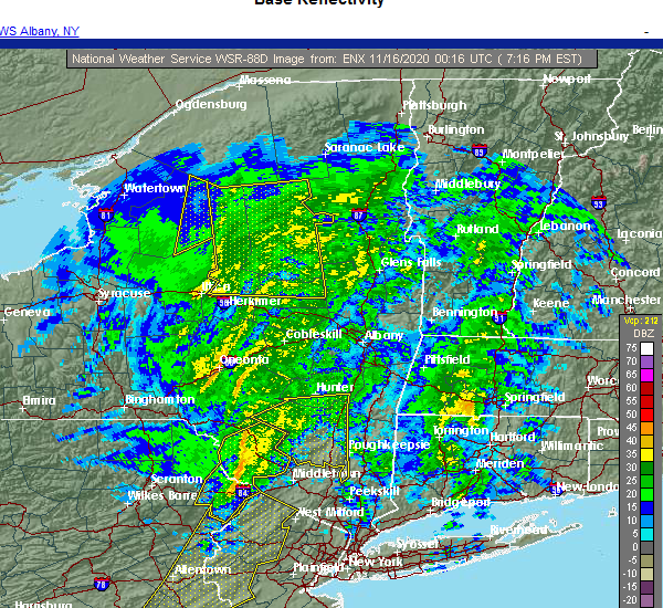 At 715 pm est, a severe thunderstorm was located near shohola, or 9 miles northwest of montague, moving east at 60 mph (radar indicated). Hazards include 60 mph wind gusts. Expect damage to trees and power lines. this severe thunderstorm will be near, port jervis around 725 pm est. cuddebackville and huguenot around 730 pm est. otisville around 735 pm est. middletown and howells around 740 pm est. goshen around 745 pm est. montgomery around 750 pm est. walden around 755 pm est. Newburgh and new windsor around 800 pm est. At 715 pm est, a severe thunderstorm was located near shohola, or 9 miles northwest of montague, moving east at 60 mph (radar indicated). Hazards include 60 mph wind gusts. Expect damage to trees and power lines. this severe thunderstorm will be near, port jervis around 725 pm est. cuddebackville and huguenot around 730 pm est. otisville around 735 pm est. middletown and howells around 740 pm est. goshen around 745 pm est. montgomery around 750 pm est. walden around 755 pm est. Newburgh and new windsor around 800 pm est.
|
| 11/15/2020 7:14 PM EST |
 At 712 pm est, severe thunderstorms were located along a line extending from near roscoe to paradise valley, moving northeast at 65 mph (radar indicated). Hazards include 60 mph wind gusts. expect damage to roofs, siding, and trees At 712 pm est, severe thunderstorms were located along a line extending from near roscoe to paradise valley, moving northeast at 65 mph (radar indicated). Hazards include 60 mph wind gusts. expect damage to roofs, siding, and trees
|
| 7/22/2020 4:28 PM EDT |
 At 428 pm edt, a severe thunderstorm was located over plattekill, or near poughkeepsie, moving northeast at 30 mph (radar indicated). Hazards include 60 mph wind gusts and quarter size hail. Hail damage to vehicles is expected. Expect wind damage to roofs, siding, and trees. At 428 pm edt, a severe thunderstorm was located over plattekill, or near poughkeepsie, moving northeast at 30 mph (radar indicated). Hazards include 60 mph wind gusts and quarter size hail. Hail damage to vehicles is expected. Expect wind damage to roofs, siding, and trees.
|
| 7/19/2020 8:08 PM EDT |
 At 808 pm edt, severe thunderstorms were located along a line extending from near tillson to near new paltz to near ellenville, moving east at 30 mph (radar indicated). Hazards include 60 mph wind gusts. Expect damage to roofs, siding, and trees. severe thunderstorms will be near, new paltz, hurley, tillson and high falls around 815 pm edt. kingston and port ewen around 820 pm edt. highland around 825 pm edt. wallkill, hyde park, fairview, staatsburg and modena around 830 pm edt. poughkeepsie and plattekill around 835 pm edt. red oaks mill and myers corner around 840 pm edt. pleasant valley and marlboro around 845 pm edt. beacon, hopewell junction and stanfordville around 850 pm edt. please report hail size, damaging winds and reports of trees down to the national weather service by email at alb. stormreport@noaa. gov, on facebook at www. facebook. Com/nwsalbany or twitter @nwsalbany. At 808 pm edt, severe thunderstorms were located along a line extending from near tillson to near new paltz to near ellenville, moving east at 30 mph (radar indicated). Hazards include 60 mph wind gusts. Expect damage to roofs, siding, and trees. severe thunderstorms will be near, new paltz, hurley, tillson and high falls around 815 pm edt. kingston and port ewen around 820 pm edt. highland around 825 pm edt. wallkill, hyde park, fairview, staatsburg and modena around 830 pm edt. poughkeepsie and plattekill around 835 pm edt. red oaks mill and myers corner around 840 pm edt. pleasant valley and marlboro around 845 pm edt. beacon, hopewell junction and stanfordville around 850 pm edt. please report hail size, damaging winds and reports of trees down to the national weather service by email at alb. stormreport@noaa. gov, on facebook at www. facebook. Com/nwsalbany or twitter @nwsalbany.
|
| 7/11/2020 6:56 PM EDT |
 At 656 pm edt, a severe thunderstorm was located over modena, or near new paltz, moving northeast at 25 mph (radar indicated). Hazards include 60 mph wind gusts and penny size hail. expect damage to roofs, siding, and trees At 656 pm edt, a severe thunderstorm was located over modena, or near new paltz, moving northeast at 25 mph (radar indicated). Hazards include 60 mph wind gusts and penny size hail. expect damage to roofs, siding, and trees
|
| 6/29/2020 4:58 PM EDT |
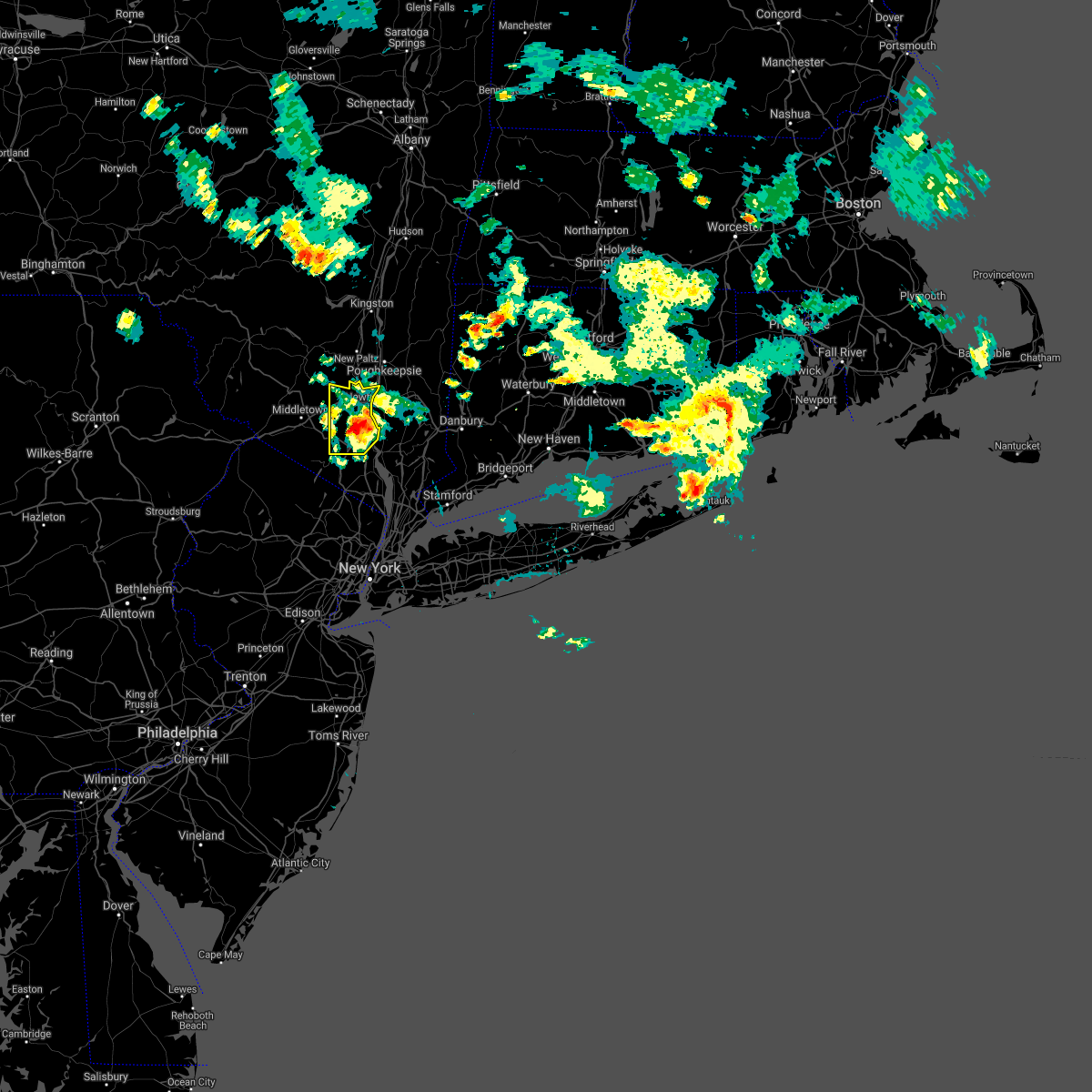 The severe thunderstorm warning for northeastern orange county will expire at 500 pm edt, the storm which prompted the warning has weakened below severe limits, and no longer poses an immediate threat to life or property. therefore, the warning will be allowed to expire. however small hail is still possible with this thunderstorm. The severe thunderstorm warning for northeastern orange county will expire at 500 pm edt, the storm which prompted the warning has weakened below severe limits, and no longer poses an immediate threat to life or property. therefore, the warning will be allowed to expire. however small hail is still possible with this thunderstorm.
|
| 6/29/2020 4:42 PM EDT |
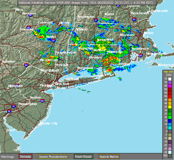 At 440 pm edt, an area of severe thunderstorms were located across northeastern orange county, moving south at 30 mph (radar indicated). Hazards include quarter size hail. Minor damage to vehicles is possible. severe storms will be near, west point around 445 pm edt. monroe around 450 pm edt. Harriman around 455 pm edt. At 440 pm edt, an area of severe thunderstorms were located across northeastern orange county, moving south at 30 mph (radar indicated). Hazards include quarter size hail. Minor damage to vehicles is possible. severe storms will be near, west point around 445 pm edt. monroe around 450 pm edt. Harriman around 455 pm edt.
|
| 6/29/2020 4:22 PM EDT |
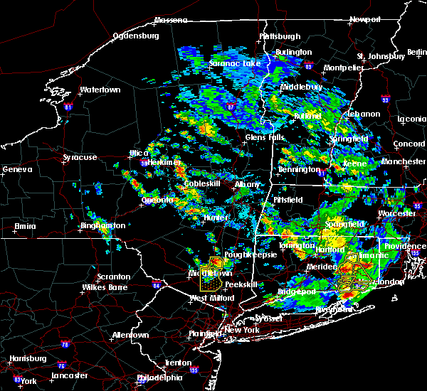 At 421 pm edt, a severe thunderstorm was located over modena, or near new paltz, moving south at 15 mph (radar indicated). Hazards include golf ball size hail and 60 mph wind gusts. People and animals outdoors will be injured. expect hail damage to roofs, siding, windows, and vehicles. expect wind damage to roofs, siding, and trees. Locations impacted include, plattekill, highland, modena, marlboro, barnegat, jenkinstown, oakes, tuckers corner, lattintown, stoneco, clintondale, ardonia, sylva, baileys gap, clintondale station, van keurens and crown heights. At 421 pm edt, a severe thunderstorm was located over modena, or near new paltz, moving south at 15 mph (radar indicated). Hazards include golf ball size hail and 60 mph wind gusts. People and animals outdoors will be injured. expect hail damage to roofs, siding, windows, and vehicles. expect wind damage to roofs, siding, and trees. Locations impacted include, plattekill, highland, modena, marlboro, barnegat, jenkinstown, oakes, tuckers corner, lattintown, stoneco, clintondale, ardonia, sylva, baileys gap, clintondale station, van keurens and crown heights.
|
| 6/29/2020 4:15 PM EDT |
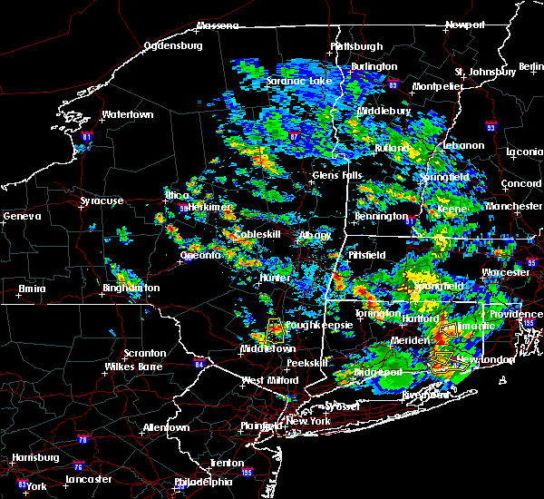 At 414 pm edt, a severe thunderstorm was located near modena, or near new paltz, moving south at 15 mph (radar indicated). Hazards include ping pong ball size hail and 60 mph wind gusts. People and animals outdoors will be injured. expect hail damage to roofs, siding, windows, and vehicles. expect wind damage to roofs, siding, and trees. Locations impacted include, new paltz, plattekill, highland, modena, marlboro, lloyd, barnegat, jenkinstown, oakes, tuckers corner, lattintown, elting corners, ohioville, stoneco, clintondale, ardonia, sylva, baileys gap, clintondale station and putt corners. At 414 pm edt, a severe thunderstorm was located near modena, or near new paltz, moving south at 15 mph (radar indicated). Hazards include ping pong ball size hail and 60 mph wind gusts. People and animals outdoors will be injured. expect hail damage to roofs, siding, windows, and vehicles. expect wind damage to roofs, siding, and trees. Locations impacted include, new paltz, plattekill, highland, modena, marlboro, lloyd, barnegat, jenkinstown, oakes, tuckers corner, lattintown, elting corners, ohioville, stoneco, clintondale, ardonia, sylva, baileys gap, clintondale station and putt corners.
|
| 6/29/2020 4:14 PM EDT |
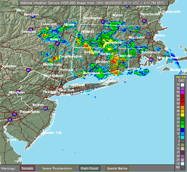 At 414 pm edt, a severe thunderstorm was located over plattekill, or 7 miles northeast of walden, moving south at 35 mph (radar indicated). Hazards include quarter size hail. Minor damage to vehicles is possible. this severe thunderstorm will be near, gardnertown around 425 pm edt. newburgh around 430 pm edt. new windsor around 435 pm edt. west point around 445 pm edt. monroe around 450 pm edt. Harriman around 455 pm edt. At 414 pm edt, a severe thunderstorm was located over plattekill, or 7 miles northeast of walden, moving south at 35 mph (radar indicated). Hazards include quarter size hail. Minor damage to vehicles is possible. this severe thunderstorm will be near, gardnertown around 425 pm edt. newburgh around 430 pm edt. new windsor around 435 pm edt. west point around 445 pm edt. monroe around 450 pm edt. Harriman around 455 pm edt.
|
| 6/29/2020 4:10 PM EDT |
 At 409 pm edt, a severe thunderstorm was located over new paltz, moving south at 20 mph (radar indicated). Hazards include 60 mph wind gusts and half dollar size hail. Hail damage to vehicles is expected. expect wind damage to roofs, siding, and trees. Locations impacted include, new paltz, plattekill, highland, modena, marlboro, lloyd, barnegat, jenkinstown, oakes, tuckers corner, lattintown, elting corners, ohioville, stoneco, clintondale, ardonia, sylva, baileys gap, clintondale station and putt corners. At 409 pm edt, a severe thunderstorm was located over new paltz, moving south at 20 mph (radar indicated). Hazards include 60 mph wind gusts and half dollar size hail. Hail damage to vehicles is expected. expect wind damage to roofs, siding, and trees. Locations impacted include, new paltz, plattekill, highland, modena, marlboro, lloyd, barnegat, jenkinstown, oakes, tuckers corner, lattintown, elting corners, ohioville, stoneco, clintondale, ardonia, sylva, baileys gap, clintondale station and putt corners.
|
| 6/29/2020 3:52 PM EDT |
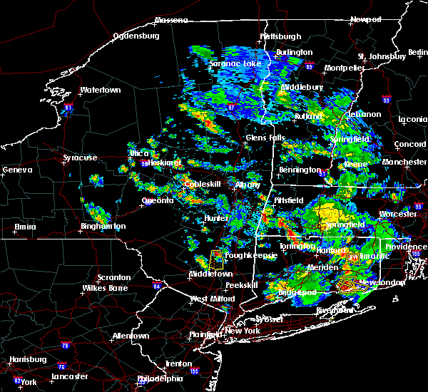 At 352 pm edt, a severe thunderstorm was located near tillson, or near new paltz, moving south at 15 mph (radar indicated). Hazards include quarter size hail. damage to vehicles is expected At 352 pm edt, a severe thunderstorm was located near tillson, or near new paltz, moving south at 15 mph (radar indicated). Hazards include quarter size hail. damage to vehicles is expected
|
| 6/28/2020 1:37 PM EDT |
 The severe thunderstorm warning for southeastern ulster county will expire at 145 pm edt, the storm which prompted the warning has weakened below severe limits, and no longer poses an immediate threat to life or property. therefore, the warning will be allowed to expire. a severe thunderstorm watch remains in effect until 800 pm edt for east central new york. The severe thunderstorm warning for southeastern ulster county will expire at 145 pm edt, the storm which prompted the warning has weakened below severe limits, and no longer poses an immediate threat to life or property. therefore, the warning will be allowed to expire. a severe thunderstorm watch remains in effect until 800 pm edt for east central new york.
|
| 6/28/2020 1:06 PM EDT |
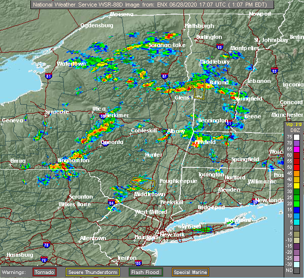 At 106 pm edt, a severe thunderstorm was located over napanoch, or near ellenville, moving east at 20 mph (radar indicated). Hazards include 60 mph wind gusts and quarter size hail. Hail damage to vehicles is expected. Expect wind damage to roofs, siding, and trees. At 106 pm edt, a severe thunderstorm was located over napanoch, or near ellenville, moving east at 20 mph (radar indicated). Hazards include 60 mph wind gusts and quarter size hail. Hail damage to vehicles is expected. Expect wind damage to roofs, siding, and trees.
|
| 10/31/2019 11:55 PM EDT |
 At 1155 pm edt, a severe thunderstorm was located over unionville, or 7 miles southeast of matamoras, moving northeast at 90 mph (radar indicated). Hazards include 60 mph wind gusts. Expect damage to trees and power lines. this severe thunderstorm will be near, florida around 1200 am edt. middletown and goshen around 1205 am edt. Walden and montgomery around 1210 am edt. At 1155 pm edt, a severe thunderstorm was located over unionville, or 7 miles southeast of matamoras, moving northeast at 90 mph (radar indicated). Hazards include 60 mph wind gusts. Expect damage to trees and power lines. this severe thunderstorm will be near, florida around 1200 am edt. middletown and goshen around 1205 am edt. Walden and montgomery around 1210 am edt.
|
| 10/31/2019 11:34 PM EDT |
 At 1134 pm edt, a severe thunderstorm was located over bloomingburg, or 7 miles north of middletown, moving northeast at 40 mph (radar indicated). Hazards include 60 mph wind gusts. Expect damage to trees and power lines. This severe storm will be near, walden and montgomery around 1145 pm edt. At 1134 pm edt, a severe thunderstorm was located over bloomingburg, or 7 miles north of middletown, moving northeast at 40 mph (radar indicated). Hazards include 60 mph wind gusts. Expect damage to trees and power lines. This severe storm will be near, walden and montgomery around 1145 pm edt.
|
| 10/31/2019 10:54 PM EDT |
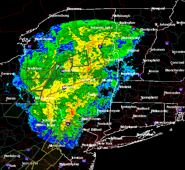 At 1053 pm edt, a severe thunderstorm was located near milford, or near montague, moving northeast at 40 mph (radar indicated). Hazards include 60 mph wind gusts. Expect damage to trees and power lines. this severe thunderstorm will be near, port jervis around 1105 pm edt. middletown around 1125 pm edt. Walden and montgomery around 1145 pm edt. At 1053 pm edt, a severe thunderstorm was located near milford, or near montague, moving northeast at 40 mph (radar indicated). Hazards include 60 mph wind gusts. Expect damage to trees and power lines. this severe thunderstorm will be near, port jervis around 1105 pm edt. middletown around 1125 pm edt. Walden and montgomery around 1145 pm edt.
|
| 8/18/2019 7:19 PM EDT |
 At 718 pm edt, severe thunderstorms were located along a line extending from near westerlo to near north-south lake campground to hurley, moving northeast at 25 mph (radar indicated). Hazards include 60 mph wind gusts. expect damage to roofs, siding, and trees At 718 pm edt, severe thunderstorms were located along a line extending from near westerlo to near north-south lake campground to hurley, moving northeast at 25 mph (radar indicated). Hazards include 60 mph wind gusts. expect damage to roofs, siding, and trees
|
| 8/18/2019 6:14 PM EDT |
 At 613 pm edt, severe thunderstorms were located along a line extending from hobart to monticello, moving east at 30 mph (radar indicated). Hazards include 60 mph wind gusts and quarter size hail. Hail damage to vehicles is expected. Expect wind damage to roofs, siding, and trees. At 613 pm edt, severe thunderstorms were located along a line extending from hobart to monticello, moving east at 30 mph (radar indicated). Hazards include 60 mph wind gusts and quarter size hail. Hail damage to vehicles is expected. Expect wind damage to roofs, siding, and trees.
|
| 8/8/2019 6:15 PM EDT |
 At 614 pm edt, severe thunderstorms were located along a line extending from near hopewell junction to near new windsor to near vernon valley, moving southeast at 45 mph. this line of storms has a history of bringing down trees and power lines (radar indicated). Hazards include 60 mph wind gusts. Expect damage to trees and power lines. severe thunderstorms will be near, newburgh and new windsor around 620 pm edt. west point around 625 pm edt. monroe and cold spring around 630 pm edt. sherman and sloatsburg around 635 pm edt. new fairfield around 640 pm edt. danbury and monsey around 645 pm edt. new city and lake carmel around 650 pm edt. haverstraw and brewster around 655 pm edt. ossining and upper nyack around 700 pm edt. ridgefield around 705 pm edt. mount kisco around 710 pm edt. Redding and bedford around 715 pm edt. At 614 pm edt, severe thunderstorms were located along a line extending from near hopewell junction to near new windsor to near vernon valley, moving southeast at 45 mph. this line of storms has a history of bringing down trees and power lines (radar indicated). Hazards include 60 mph wind gusts. Expect damage to trees and power lines. severe thunderstorms will be near, newburgh and new windsor around 620 pm edt. west point around 625 pm edt. monroe and cold spring around 630 pm edt. sherman and sloatsburg around 635 pm edt. new fairfield around 640 pm edt. danbury and monsey around 645 pm edt. new city and lake carmel around 650 pm edt. haverstraw and brewster around 655 pm edt. ossining and upper nyack around 700 pm edt. ridgefield around 705 pm edt. mount kisco around 710 pm edt. Redding and bedford around 715 pm edt.
|
| 8/8/2019 5:48 PM EDT |
 At 547 pm edt, severe thunderstorms were located along a line extending from near pine plains to near ellenville, moving east at 40 mph (trained weather spotters reported trees and wires down near glasco and kingston). Hazards include 60 mph wind gusts. Expect damage to roofs, siding, and trees. severe thunderstorms will be near, pine plains around 555 pm edt. amenia and millerton around 600 pm edt. sharon around 605 pm edt. wallkill and modena around 610 pm edt. plattekill, falls village and cornwall bridge around 615 pm edt. beacon, norfolk and marlboro around 625 pm edt. torrington, wappingers falls, fishkill and myers corner around 630 pm edt. hopewell junction and winsted around 635 pm edt. Other locations impacted by these severe thunderstorms include norrie heights, atwood, lithgow, hoxie corner, south amenia, pleasant ridge, jackson corners, verbank, bulls bridge and dempsey landing. At 547 pm edt, severe thunderstorms were located along a line extending from near pine plains to near ellenville, moving east at 40 mph (trained weather spotters reported trees and wires down near glasco and kingston). Hazards include 60 mph wind gusts. Expect damage to roofs, siding, and trees. severe thunderstorms will be near, pine plains around 555 pm edt. amenia and millerton around 600 pm edt. sharon around 605 pm edt. wallkill and modena around 610 pm edt. plattekill, falls village and cornwall bridge around 615 pm edt. beacon, norfolk and marlboro around 625 pm edt. torrington, wappingers falls, fishkill and myers corner around 630 pm edt. hopewell junction and winsted around 635 pm edt. Other locations impacted by these severe thunderstorms include norrie heights, atwood, lithgow, hoxie corner, south amenia, pleasant ridge, jackson corners, verbank, bulls bridge and dempsey landing.
|
| 7/22/2019 2:59 PM EDT |
 The national weather service in upton ny has issued a * severe thunderstorm warning for. western passaic county in northeastern new jersey. northwestern bergen county in northeastern new jersey. northern westchester county in southeastern new york. Orange county in southeastern new york. The national weather service in upton ny has issued a * severe thunderstorm warning for. western passaic county in northeastern new jersey. northwestern bergen county in northeastern new jersey. northern westchester county in southeastern new york. Orange county in southeastern new york.
|
| 6/30/2019 1:32 PM EDT |
 At 132 pm edt, a severe thunderstorm was located over wappingers falls, or near poughkeepsie, moving southeast at 30 mph (radar indicated). Hazards include 60 mph wind gusts and quarter size hail. Hail damage to vehicles is expected. expect wind damage to roofs, siding, and trees. this severe thunderstorm will be near, beacon and myers corner around 140 pm edt. fishkill and hopewell junction around 145 pm edt. Other locations impacted by this severe thunderstorm include tuckers corner, stormville, knapps corner, new hamburg, glenham, stoneco, chelsea, wiccopee, colonial heights and groveville. At 132 pm edt, a severe thunderstorm was located over wappingers falls, or near poughkeepsie, moving southeast at 30 mph (radar indicated). Hazards include 60 mph wind gusts and quarter size hail. Hail damage to vehicles is expected. expect wind damage to roofs, siding, and trees. this severe thunderstorm will be near, beacon and myers corner around 140 pm edt. fishkill and hopewell junction around 145 pm edt. Other locations impacted by this severe thunderstorm include tuckers corner, stormville, knapps corner, new hamburg, glenham, stoneco, chelsea, wiccopee, colonial heights and groveville.
|
| 6/26/2019 8:06 PM EDT |
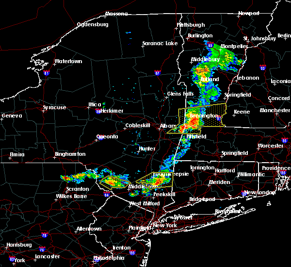 The severe thunderstorm warning for northeastern orange county will expire at 815 pm edt, the storm which prompted the warning is moving out of the area. therefore, the warning will be allowed to expire. The severe thunderstorm warning for northeastern orange county will expire at 815 pm edt, the storm which prompted the warning is moving out of the area. therefore, the warning will be allowed to expire.
|
| 6/26/2019 7:57 PM EDT |
 At 757 pm edt, severe thunderstorms were located along a line extending from near millbrook to near gardnertown, moving east at 25 mph (radar indicated). Hazards include 60 mph wind gusts. Expect damage to roofs, siding, and trees. Locations impacted include, poughkeepsie, beacon, pawling, wallkill, hyde park, plattekill, pleasant valley, wappingers falls, highland, fishkill, millbrook, modena, fairview, hopewell junction, marlboro, red oaks mill, myers corner, wingdale, dover plains and east fishkill. At 757 pm edt, severe thunderstorms were located along a line extending from near millbrook to near gardnertown, moving east at 25 mph (radar indicated). Hazards include 60 mph wind gusts. Expect damage to roofs, siding, and trees. Locations impacted include, poughkeepsie, beacon, pawling, wallkill, hyde park, plattekill, pleasant valley, wappingers falls, highland, fishkill, millbrook, modena, fairview, hopewell junction, marlboro, red oaks mill, myers corner, wingdale, dover plains and east fishkill.
|
| 6/26/2019 7:46 PM EDT |
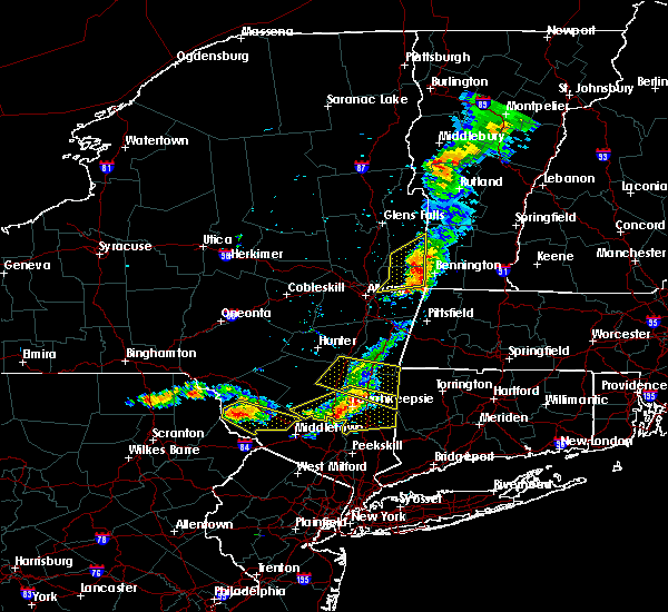 At 745 pm edt, a severe thunderstorm was located over plattekill, or near newburgh, moving east at 30 mph (radar indicated). Hazards include 60 mph wind gusts. expect damage to trees and power lines At 745 pm edt, a severe thunderstorm was located over plattekill, or near newburgh, moving east at 30 mph (radar indicated). Hazards include 60 mph wind gusts. expect damage to trees and power lines
|
| 6/26/2019 7:32 PM EDT |
 At 731 pm edt, severe thunderstorms were located along a line extending from near pleasant valley to walden, moving east at 40 mph (radar indicated). Hazards include 60 mph wind gusts. expect damage to roofs, siding, and trees At 731 pm edt, severe thunderstorms were located along a line extending from near pleasant valley to walden, moving east at 40 mph (radar indicated). Hazards include 60 mph wind gusts. expect damage to roofs, siding, and trees
|
| 4/15/2019 4:01 AM EDT |
 At 401 am edt, a severe thunderstorm was located near montgomery, or near walden, moving northeast at 55 mph (radar indicated). Hazards include 60 mph wind gusts and quarter size hail. Minor hail damage to vehicles is possible. expect wind damage to trees and power lines. this severe storm will be near, new windsor around 405 am edt. Newburgh and gardnertown around 410 am edt. At 401 am edt, a severe thunderstorm was located near montgomery, or near walden, moving northeast at 55 mph (radar indicated). Hazards include 60 mph wind gusts and quarter size hail. Minor hail damage to vehicles is possible. expect wind damage to trees and power lines. this severe storm will be near, new windsor around 405 am edt. Newburgh and gardnertown around 410 am edt.
|
| 4/15/2019 3:48 AM EDT |
 At 348 am edt, a severe thunderstorm was located over goshen, moving northeast at 55 mph (radar indicated). Hazards include 60 mph wind gusts and quarter size hail. Minor hail damage to vehicles is possible. expect wind damage to trees and power lines. this severe storm will be near, montgomery around 400 am edt. walden and new windsor around 405 am edt. Newburgh and gardnertown around 410 am edt. At 348 am edt, a severe thunderstorm was located over goshen, moving northeast at 55 mph (radar indicated). Hazards include 60 mph wind gusts and quarter size hail. Minor hail damage to vehicles is possible. expect wind damage to trees and power lines. this severe storm will be near, montgomery around 400 am edt. walden and new windsor around 405 am edt. Newburgh and gardnertown around 410 am edt.
|
| 4/15/2019 3:36 AM EDT |
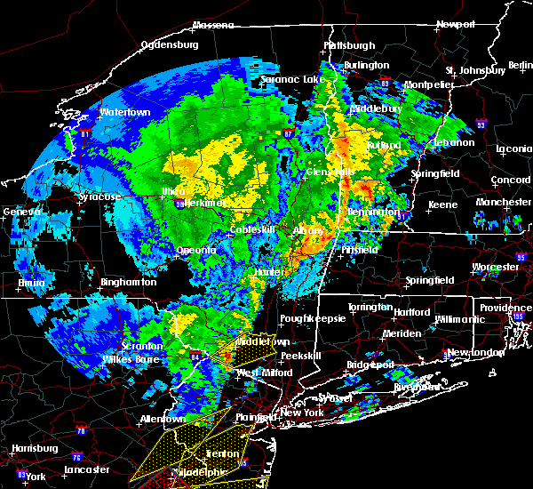 At 336 am edt, a severe thunderstorm was located over unionville, or 8 miles southeast of matamoras, moving northeast at 55 mph (radar indicated). Hazards include 60 mph wind gusts and quarter size hail. Minor hail damage to vehicles is possible. expect wind damage to trees and power lines. this severe thunderstorm will be near, florida around 345 am edt. middletown and goshen around 350 am edt. montgomery around 400 am edt. walden and new windsor around 405 am edt. Newburgh and gardnertown around 410 am edt. At 336 am edt, a severe thunderstorm was located over unionville, or 8 miles southeast of matamoras, moving northeast at 55 mph (radar indicated). Hazards include 60 mph wind gusts and quarter size hail. Minor hail damage to vehicles is possible. expect wind damage to trees and power lines. this severe thunderstorm will be near, florida around 345 am edt. middletown and goshen around 350 am edt. montgomery around 400 am edt. walden and new windsor around 405 am edt. Newburgh and gardnertown around 410 am edt.
|
| 8/17/2018 5:52 PM EDT |
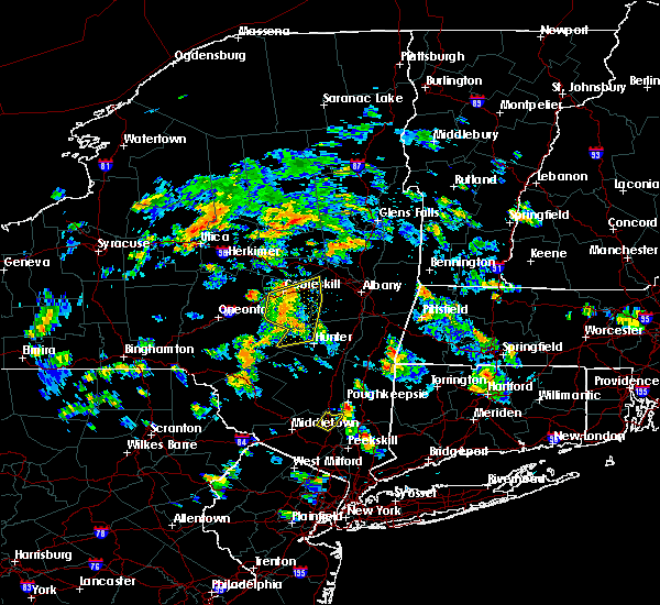 The severe thunderstorm warning for northeastern orange county will expire at 600 pm edt, the storm which prompted the warning has moved out of the area. therefore, the warning will be allowed to expire. a severe thunderstorm watch remains in effect until 1100 pm edt for southeastern new york. The severe thunderstorm warning for northeastern orange county will expire at 600 pm edt, the storm which prompted the warning has moved out of the area. therefore, the warning will be allowed to expire. a severe thunderstorm watch remains in effect until 1100 pm edt for southeastern new york.
|
| 8/17/2018 5:30 PM EDT |
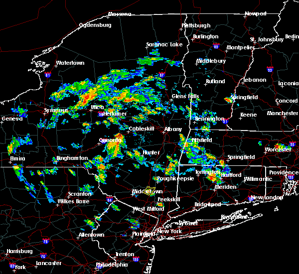 At 530 pm edt, a severe thunderstorm was located over gardnertown, or near newburgh, moving northeast at 30 mph (radar indicated). Hazards include 60 mph wind gusts and quarter size hail. Minor hail damage to vehicles is possible. expect wind damage to trees and power lines. This severe thunderstorm will remain over mainly rural areas of northeastern orange county. At 530 pm edt, a severe thunderstorm was located over gardnertown, or near newburgh, moving northeast at 30 mph (radar indicated). Hazards include 60 mph wind gusts and quarter size hail. Minor hail damage to vehicles is possible. expect wind damage to trees and power lines. This severe thunderstorm will remain over mainly rural areas of northeastern orange county.
|
| 8/3/2018 3:54 PM EDT |
 At 354 pm edt, a severe thunderstorm was located over red oaks mill, or near poughkeepsie, moving north at 35 mph (radar indicated). Hazards include 70 mph wind gusts and quarter size hail. Hail damage to vehicles is expected. expect considerable tree damage. wind damage is also likely to mobile homes, roofs, and outbuildings. this severe storm will be near, poughkeepsie, highland and fairview around 405 pm edt. hyde park and pleasant valley around 410 pm edt. staatsburg around 420 pm edt. kingston, rhinebeck and port ewen around 430 pm edt. red hook and lake katrine around 440 pm edt. saugerties south around 445 pm edt. saugerties around 450 pm edt. Other locations impacted by this severe thunderstorm include norrie heights, maple hill, atwood, lithgow, katsbaan, shultis corners, pacama, hoxie corner, linden acres and elting corners. At 354 pm edt, a severe thunderstorm was located over red oaks mill, or near poughkeepsie, moving north at 35 mph (radar indicated). Hazards include 70 mph wind gusts and quarter size hail. Hail damage to vehicles is expected. expect considerable tree damage. wind damage is also likely to mobile homes, roofs, and outbuildings. this severe storm will be near, poughkeepsie, highland and fairview around 405 pm edt. hyde park and pleasant valley around 410 pm edt. staatsburg around 420 pm edt. kingston, rhinebeck and port ewen around 430 pm edt. red hook and lake katrine around 440 pm edt. saugerties south around 445 pm edt. saugerties around 450 pm edt. Other locations impacted by this severe thunderstorm include norrie heights, maple hill, atwood, lithgow, katsbaan, shultis corners, pacama, hoxie corner, linden acres and elting corners.
|
| 8/3/2018 3:43 PM EDT |
 At 342 pm edt, severe thunderstorms were located along a line extending from near walden to near cold spring, moving northeast at 35 mph (radar indicated). Hazards include 60 mph wind gusts. expect damage to trees and power lines At 342 pm edt, severe thunderstorms were located along a line extending from near walden to near cold spring, moving northeast at 35 mph (radar indicated). Hazards include 60 mph wind gusts. expect damage to trees and power lines
|
| 8/3/2018 3:36 PM EDT |
 At 336 pm edt, a severe thunderstorm was located near fahnestock state park, or near beacon, moving north at 35 mph (radar indicated). Hazards include 60 mph wind gusts and quarter size hail. Hail damage to vehicles is expected. expect wind damage to roofs, siding, and trees. this severe thunderstorm will be near, fishkill around 345 pm edt. wappingers falls, hopewell junction and marlboro around 350 pm edt. myers corner around 355 pm edt. red oaks mill around 400 pm edt. poughkeepsie and fairview around 405 pm edt. pleasant valley and highland around 410 pm edt. hyde park around 415 pm edt. staatsburg and stanfordville around 425 pm edt. Other locations impacted by this severe thunderstorm include norrie heights, maple hill, atwood, lithgow, katsbaan, shultis corners, pacama, hoxie corner, linden acres and elting corners. At 336 pm edt, a severe thunderstorm was located near fahnestock state park, or near beacon, moving north at 35 mph (radar indicated). Hazards include 60 mph wind gusts and quarter size hail. Hail damage to vehicles is expected. expect wind damage to roofs, siding, and trees. this severe thunderstorm will be near, fishkill around 345 pm edt. wappingers falls, hopewell junction and marlboro around 350 pm edt. myers corner around 355 pm edt. red oaks mill around 400 pm edt. poughkeepsie and fairview around 405 pm edt. pleasant valley and highland around 410 pm edt. hyde park around 415 pm edt. staatsburg and stanfordville around 425 pm edt. Other locations impacted by this severe thunderstorm include norrie heights, maple hill, atwood, lithgow, katsbaan, shultis corners, pacama, hoxie corner, linden acres and elting corners.
|
| 7/28/2018 2:52 PM EDT |
 At 252 pm edt, a severe thunderstorm was located over marlboro, or near poughkeepsie, moving northeast at 20 mph (radar indicated). Hazards include 60 mph wind gusts and quarter size hail. Hail damage to vehicles is expected. expect wind damage to roofs, siding, and trees. this severe thunderstorm will be near, wappingers falls around 255 pm edt. poughkeepsie and myers corner around 305 pm edt. red oaks mill around 310 pm edt. pleasant valley and hopewell junction around 315 pm edt. Other locations impacted by this severe thunderstorm include stormville, lattintown, knapps corner, freedom plains, beekman, swartoutville, green haven, titusville, new hamburg and crown heights. At 252 pm edt, a severe thunderstorm was located over marlboro, or near poughkeepsie, moving northeast at 20 mph (radar indicated). Hazards include 60 mph wind gusts and quarter size hail. Hail damage to vehicles is expected. expect wind damage to roofs, siding, and trees. this severe thunderstorm will be near, wappingers falls around 255 pm edt. poughkeepsie and myers corner around 305 pm edt. red oaks mill around 310 pm edt. pleasant valley and hopewell junction around 315 pm edt. Other locations impacted by this severe thunderstorm include stormville, lattintown, knapps corner, freedom plains, beekman, swartoutville, green haven, titusville, new hamburg and crown heights.
|
| 7/17/2018 1:25 PM EDT |
 At 125 pm edt, severe thunderstorms were located along a line extending from near livingston to near pine plains to near pleasant valley to newburgh, moving east at 40 mph (radar indicated). Hazards include 60 mph wind gusts. Expect damage to roofs, siding, and trees. severe thunderstorms will be near, pine plains and stanfordville around 130 pm edt. ancram and millbrook around 135 pm edt. copake, millerton and hopewell junction around 140 pm edt. amenia and dover plains around 145 pm edt. pawling around 155 pm edt. Other locations impacted by these severe thunderstorms include tuckers corner, salt point, ancramdale, norrie heights, kerleys corners, baker corner, beekman, lithgow, hoxie corner and linden acres. At 125 pm edt, severe thunderstorms were located along a line extending from near livingston to near pine plains to near pleasant valley to newburgh, moving east at 40 mph (radar indicated). Hazards include 60 mph wind gusts. Expect damage to roofs, siding, and trees. severe thunderstorms will be near, pine plains and stanfordville around 130 pm edt. ancram and millbrook around 135 pm edt. copake, millerton and hopewell junction around 140 pm edt. amenia and dover plains around 145 pm edt. pawling around 155 pm edt. Other locations impacted by these severe thunderstorms include tuckers corner, salt point, ancramdale, norrie heights, kerleys corners, baker corner, beekman, lithgow, hoxie corner and linden acres.
|
| 7/3/2018 4:13 PM EDT |
 At 412 pm edt, a severe thunderstorm was located near ellenville, moving south at 10 mph (radar indicated). Hazards include 60 mph wind gusts and penny size hail. Expect damage to roofs, siding, and trees. This severe thunderstorm will be near, wallkill around 455 pm edt. At 412 pm edt, a severe thunderstorm was located near ellenville, moving south at 10 mph (radar indicated). Hazards include 60 mph wind gusts and penny size hail. Expect damage to roofs, siding, and trees. This severe thunderstorm will be near, wallkill around 455 pm edt.
|
| 6/18/2018 6:48 PM EDT |
 At 648 pm edt, a severe thunderstorm was located over marlboro, or near beacon, moving east at 45 mph (radar indicated). Hazards include 60 mph wind gusts. Expect damage to roofs, siding, and trees. this severe thunderstorm will be near, myers corner around 655 pm edt. hopewell junction around 700 pm edt. pawling and wingdale around 715 pm edt. Other locations impacted by this severe thunderstorm include tuckers corner, stormville, baker corner, knapps corner, beekman, south dover, new hamburg, glenham, clove valley and poughquag. At 648 pm edt, a severe thunderstorm was located over marlboro, or near beacon, moving east at 45 mph (radar indicated). Hazards include 60 mph wind gusts. Expect damage to roofs, siding, and trees. this severe thunderstorm will be near, myers corner around 655 pm edt. hopewell junction around 700 pm edt. pawling and wingdale around 715 pm edt. Other locations impacted by this severe thunderstorm include tuckers corner, stormville, baker corner, knapps corner, beekman, south dover, new hamburg, glenham, clove valley and poughquag.
|
| 6/18/2018 6:45 PM EDT |
 At 645 pm edt, a severe thunderstorm was located near montgomery, or near goshen, moving east at 25 mph (radar indicated). Hazards include 60 mph wind gusts. Expect damage to trees and power lines. this severe storm will be near, walden around 650 pm edt. gardnertown around 710 pm edt. Newburgh and new windsor around 715 pm edt. At 645 pm edt, a severe thunderstorm was located near montgomery, or near goshen, moving east at 25 mph (radar indicated). Hazards include 60 mph wind gusts. Expect damage to trees and power lines. this severe storm will be near, walden around 650 pm edt. gardnertown around 710 pm edt. Newburgh and new windsor around 715 pm edt.
|
| 6/18/2018 6:25 PM EDT |
 At 624 pm edt, a severe thunderstorm was located over bloomingburg, or near middletown, moving southeast at 45 mph (radar indicated). Hazards include 60 mph wind gusts. Expect damage to trees and power lines. this severe thunderstorm will be near, middletown around 630 pm edt. goshen and montgomery around 640 pm edt. chester around 650 pm edt. monroe around 655 pm edt. New windsor and harriman around 700 pm edt. At 624 pm edt, a severe thunderstorm was located over bloomingburg, or near middletown, moving southeast at 45 mph (radar indicated). Hazards include 60 mph wind gusts. Expect damage to trees and power lines. this severe thunderstorm will be near, middletown around 630 pm edt. goshen and montgomery around 640 pm edt. chester around 650 pm edt. monroe around 655 pm edt. New windsor and harriman around 700 pm edt.
|
| 5/15/2018 4:38 PM EDT |
 At 437 pm edt, severe thunderstorms were located along a line extending from lake carmel to near west point to victory gardens to washington to near coffeetown, moving east at 45 mph. these are very dangerous storms (the new york state mesonet site at beacon reported winds of 78 mph at 420 pm). Hazards include 80 mph wind gusts and penny size hail. Flying debris will be dangerous to those caught without shelter. mobile homes will be heavily damaged. expect considerable damage to roofs, windows, and vehicles. extensive tree damage and power outages are likely. Locations impacted include, yonkers, paterson, stamford, waterbury, danbury, passaic, white plains, wayne, bloomfield, hackensack, shelton, new city, naugatuck, orange and newburgh. At 437 pm edt, severe thunderstorms were located along a line extending from lake carmel to near west point to victory gardens to washington to near coffeetown, moving east at 45 mph. these are very dangerous storms (the new york state mesonet site at beacon reported winds of 78 mph at 420 pm). Hazards include 80 mph wind gusts and penny size hail. Flying debris will be dangerous to those caught without shelter. mobile homes will be heavily damaged. expect considerable damage to roofs, windows, and vehicles. extensive tree damage and power outages are likely. Locations impacted include, yonkers, paterson, stamford, waterbury, danbury, passaic, white plains, wayne, bloomfield, hackensack, shelton, new city, naugatuck, orange and newburgh.
|
| 5/15/2018 4:27 PM EDT |
 The severe thunderstorm warning for eastern ulster county will expire at 430 pm edt, the storms which prompted the warning have moved out of the area. therefore, the warning will be allowed to expire. a tornado watch remains in effect until 800 pm edt for east central new york. The severe thunderstorm warning for eastern ulster county will expire at 430 pm edt, the storms which prompted the warning have moved out of the area. therefore, the warning will be allowed to expire. a tornado watch remains in effect until 800 pm edt for east central new york.
|
| 5/15/2018 4:17 PM EDT |
 At 417 pm edt, severe thunderstorms were located along a line extending from near west hurley to beacon, moving east at 60 mph (radar indicated). Hazards include 70 mph wind gusts and quarter size hail. Hail damage to vehicles is expected. expect considerable tree damage. wind damage is also likely to mobile homes, roofs, and outbuildings. these severe storms will be near, saugerties around 420 pm edt. saugerties south around 425 pm edt. other locations impacted by these severe thunderstorms include tuckers corner, rolling meadows, rosendale, maple hill, glenford, forest glen, atwood, katsbaan, shultis corners and sweet meadows. A tornado watch remains in effect until 800 pm edt for east central new york. At 417 pm edt, severe thunderstorms were located along a line extending from near west hurley to beacon, moving east at 60 mph (radar indicated). Hazards include 70 mph wind gusts and quarter size hail. Hail damage to vehicles is expected. expect considerable tree damage. wind damage is also likely to mobile homes, roofs, and outbuildings. these severe storms will be near, saugerties around 420 pm edt. saugerties south around 425 pm edt. other locations impacted by these severe thunderstorms include tuckers corner, rolling meadows, rosendale, maple hill, glenford, forest glen, atwood, katsbaan, shultis corners and sweet meadows. A tornado watch remains in effect until 800 pm edt for east central new york.
|
| 5/15/2018 4:15 PM EDT |
 At 414 pm edt, a severe thunderstorm capable of producing a tornado was located near plattekill, or near poughkeepsie, moving east at 65 mph (radar indicated rotation). Hazards include tornado and quarter size hail. Flying debris will be dangerous to those caught without shelter. mobile homes will be damaged or destroyed. damage to roofs, windows, and vehicles will occur. tree damage is likely. this dangerous storm will be near, poughkeepsie, myers corner and fairview around 420 pm edt. pleasant valley, red oaks mill and hopewell junction around 425 pm edt. millbrook, dover plains and wingdale around 435 pm edt. Other locations impacted by this tornadic thunderstorm include tuckers corner, salt point, baker corner, beekman, lithgow, hoxie corner, smithfield, south amenia, pleasant ridge and bains corner. At 414 pm edt, a severe thunderstorm capable of producing a tornado was located near plattekill, or near poughkeepsie, moving east at 65 mph (radar indicated rotation). Hazards include tornado and quarter size hail. Flying debris will be dangerous to those caught without shelter. mobile homes will be damaged or destroyed. damage to roofs, windows, and vehicles will occur. tree damage is likely. this dangerous storm will be near, poughkeepsie, myers corner and fairview around 420 pm edt. pleasant valley, red oaks mill and hopewell junction around 425 pm edt. millbrook, dover plains and wingdale around 435 pm edt. Other locations impacted by this tornadic thunderstorm include tuckers corner, salt point, baker corner, beekman, lithgow, hoxie corner, smithfield, south amenia, pleasant ridge and bains corner.
|
| 5/15/2018 4:07 PM EDT |
 At 407 pm edt, a severe thunderstorm capable of producing a tornado was located over wallkill, or near walden, moving east at 50 mph (radar indicated rotation). Hazards include tornado and quarter size hail. Flying debris will be dangerous to those caught without shelter. mobile homes will be damaged or destroyed. damage to roofs, windows, and vehicles will occur. tree damage is likely. this dangerous storm will be near, modena around 410 pm edt. plattekill and marlboro around 415 pm edt. Other locations impacted by this tornadic thunderstorm include tuckers corner, forest glen, dwaarkill, fantinekill, awosting, elting corners, ireland corners, stoneco, honk hill and sylva. At 407 pm edt, a severe thunderstorm capable of producing a tornado was located over wallkill, or near walden, moving east at 50 mph (radar indicated rotation). Hazards include tornado and quarter size hail. Flying debris will be dangerous to those caught without shelter. mobile homes will be damaged or destroyed. damage to roofs, windows, and vehicles will occur. tree damage is likely. this dangerous storm will be near, modena around 410 pm edt. plattekill and marlboro around 415 pm edt. Other locations impacted by this tornadic thunderstorm include tuckers corner, forest glen, dwaarkill, fantinekill, awosting, elting corners, ireland corners, stoneco, honk hill and sylva.
|
| 5/15/2018 4:06 PM EDT |
 At 405 pm edt, severe thunderstorms were located along a line extending from near wallkill to near high point to near dingmans ferry to stormville to near tamaqua, moving east at 110 mph (radar indicated). Hazards include 70 mph wind gusts and quarter size hail. Minor hail damage to vehicles is possible. expect considerable tree damage. wind damage is also likely to mobile homes, roofs, and outbuildings. Locations that could be impacted include, yonkers, paterson, stamford, waterbury, danbury, passaic, white plains, wayne, bloomfield, hackensack, shelton, new city, naugatuck, orange and newburgh. At 405 pm edt, severe thunderstorms were located along a line extending from near wallkill to near high point to near dingmans ferry to stormville to near tamaqua, moving east at 110 mph (radar indicated). Hazards include 70 mph wind gusts and quarter size hail. Minor hail damage to vehicles is possible. expect considerable tree damage. wind damage is also likely to mobile homes, roofs, and outbuildings. Locations that could be impacted include, yonkers, paterson, stamford, waterbury, danbury, passaic, white plains, wayne, bloomfield, hackensack, shelton, new city, naugatuck, orange and newburgh.
|
| 5/15/2018 3:57 PM EDT |
 At 356 pm edt, a severe thunderstorm capable of producing a tornado was located near bloomingburg, or near middletown, moving east at 60 mph (radar indicated rotation). Hazards include tornado and quarter size hail. Flying debris will be dangerous to those caught without shelter. mobile homes will be damaged or destroyed. damage to roofs, windows, and vehicles will occur. tree damage is likely. this dangerous storm will be near, montgomery around 405 pm edt. walden around 410 pm edt. Newburgh and new windsor around 415 pm edt. At 356 pm edt, a severe thunderstorm capable of producing a tornado was located near bloomingburg, or near middletown, moving east at 60 mph (radar indicated rotation). Hazards include tornado and quarter size hail. Flying debris will be dangerous to those caught without shelter. mobile homes will be damaged or destroyed. damage to roofs, windows, and vehicles will occur. tree damage is likely. this dangerous storm will be near, montgomery around 405 pm edt. walden around 410 pm edt. Newburgh and new windsor around 415 pm edt.
|
| 5/15/2018 3:51 PM EDT |
 At 350 pm edt, a severe thunderstorm capable of producing a tornado was located over phillipsport, or 8 miles southwest of ellenville, moving east at 65 mph (radar indicated rotation). Hazards include tornado and quarter size hail. Flying debris will be dangerous to those caught without shelter. mobile homes will be damaged or destroyed. damage to roofs, windows, and vehicles will occur. tree damage is likely. this dangerous storm will be near, ellenville around 355 pm edt. wallkill around 405 pm edt. plattekill and modena around 410 pm edt. marlboro around 415 pm edt. Other locations impacted by this tornadic thunderstorm include tuckers corner, forest glen, dwaarkill, fantinekill, awosting, elting corners, ireland corners, cragsmoor, stoneco and honk hill. At 350 pm edt, a severe thunderstorm capable of producing a tornado was located over phillipsport, or 8 miles southwest of ellenville, moving east at 65 mph (radar indicated rotation). Hazards include tornado and quarter size hail. Flying debris will be dangerous to those caught without shelter. mobile homes will be damaged or destroyed. damage to roofs, windows, and vehicles will occur. tree damage is likely. this dangerous storm will be near, ellenville around 355 pm edt. wallkill around 405 pm edt. plattekill and modena around 410 pm edt. marlboro around 415 pm edt. Other locations impacted by this tornadic thunderstorm include tuckers corner, forest glen, dwaarkill, fantinekill, awosting, elting corners, ireland corners, cragsmoor, stoneco and honk hill.
|
| 5/15/2018 3:42 PM EDT |
 At 342 pm edt, severe thunderstorms were located along a line extending from near willowemoc to otisville, moving east at 55 mph (radar indicated). Hazards include 70 mph wind gusts and quarter size hail. Hail damage to vehicles is expected. expect considerable tree damage. wind damage is also likely to mobile homes, roofs, and outbuildings. severe thunderstorms will be near, west shokan, woodland valley campground and phoenicia around 400 pm edt. kenneth l wilson campground, mount tremper and olivebridge around 405 pm edt. woodstock and west hurley around 410 pm edt. hurley and marlboro around 415 pm edt. kingston, saugerties, lake katrine, saugerties south and port ewen around 420 pm edt. other locations impacted by these severe thunderstorms include cherrytown, tuckers corner, rolling meadows, maple hill, glenford, atwood, katsbaan, shultis corners, sweet meadows and pacama. A tornado watch remains in effect until 800 pm edt for east central new york. At 342 pm edt, severe thunderstorms were located along a line extending from near willowemoc to otisville, moving east at 55 mph (radar indicated). Hazards include 70 mph wind gusts and quarter size hail. Hail damage to vehicles is expected. expect considerable tree damage. wind damage is also likely to mobile homes, roofs, and outbuildings. severe thunderstorms will be near, west shokan, woodland valley campground and phoenicia around 400 pm edt. kenneth l wilson campground, mount tremper and olivebridge around 405 pm edt. woodstock and west hurley around 410 pm edt. hurley and marlboro around 415 pm edt. kingston, saugerties, lake katrine, saugerties south and port ewen around 420 pm edt. other locations impacted by these severe thunderstorms include cherrytown, tuckers corner, rolling meadows, maple hill, glenford, atwood, katsbaan, shultis corners, sweet meadows and pacama. A tornado watch remains in effect until 800 pm edt for east central new york.
|
| 5/15/2018 3:34 PM EDT |
 At 331 pm edt, severe thunderstorms were located along a line extending from hazel to near lava to new boston-morea, moving east at 70 mph (radar indicated). Hazards include 70 mph wind gusts and quarter size hail. Minor hail damage to vehicles is possible. expect considerable tree damage. wind damage is also likely to mobile homes, roofs, and outbuildings. severe thunderstorms will be near, howells around 350 pm edt. montgomery around 400 pm edt. walden around 405 pm edt. newburgh and new windsor around 410 pm edt. fahnestock state park around 420 pm edt. lake carmel around 425 pm edt. brookfield and new fairfield around 435 pm edt. danbury and newtown around 440 pm edt. summit and southbury around 450 pm edt. waterbury and naugatuck around 455 pm edt. Bloomfield and rutherford around 500 pm edt. At 331 pm edt, severe thunderstorms were located along a line extending from hazel to near lava to new boston-morea, moving east at 70 mph (radar indicated). Hazards include 70 mph wind gusts and quarter size hail. Minor hail damage to vehicles is possible. expect considerable tree damage. wind damage is also likely to mobile homes, roofs, and outbuildings. severe thunderstorms will be near, howells around 350 pm edt. montgomery around 400 pm edt. walden around 405 pm edt. newburgh and new windsor around 410 pm edt. fahnestock state park around 420 pm edt. lake carmel around 425 pm edt. brookfield and new fairfield around 435 pm edt. danbury and newtown around 440 pm edt. summit and southbury around 450 pm edt. waterbury and naugatuck around 455 pm edt. Bloomfield and rutherford around 500 pm edt.
|
| 8/22/2017 10:01 PM EDT |
 At 1000 pm edt, a severe thunderstorm was located over myers corner, or near poughkeepsie, moving east at 35 mph (radar indicated). Hazards include 60 mph wind gusts and penny size hail. Expect damage to trees, and power lines. This severe storm will be near, wingdale, poughkeepsie and dover plains around 1025 pm edt. At 1000 pm edt, a severe thunderstorm was located over myers corner, or near poughkeepsie, moving east at 35 mph (radar indicated). Hazards include 60 mph wind gusts and penny size hail. Expect damage to trees, and power lines. This severe storm will be near, wingdale, poughkeepsie and dover plains around 1025 pm edt.
|
| 8/22/2017 9:23 PM EDT |
 At 922 pm edt, a severe thunderstorm was located near montgomery, or near walden, moving east at 35 mph (radar indicated). Hazards include 60 mph wind gusts and penny size hail. Expect damage to trees, and power lines. this severe thunderstorm will be near, wallkill around 935 pm edt. plattekill and modena around 940 pm edt. beacon and marlboro around 950 pm edt. wappingers falls, fishkill and fairview around 955 pm edt. poughkeepsie, myers corner and red oaks mill around 1000 pm edt. hopewell junction around 1005 pm edt. pawling around 1020 pm edt. Wingdale and dover plains around 1025 pm edt. At 922 pm edt, a severe thunderstorm was located near montgomery, or near walden, moving east at 35 mph (radar indicated). Hazards include 60 mph wind gusts and penny size hail. Expect damage to trees, and power lines. this severe thunderstorm will be near, wallkill around 935 pm edt. plattekill and modena around 940 pm edt. beacon and marlboro around 950 pm edt. wappingers falls, fishkill and fairview around 955 pm edt. poughkeepsie, myers corner and red oaks mill around 1000 pm edt. hopewell junction around 1005 pm edt. pawling around 1020 pm edt. Wingdale and dover plains around 1025 pm edt.
|
| 8/22/2017 9:22 PM EDT |
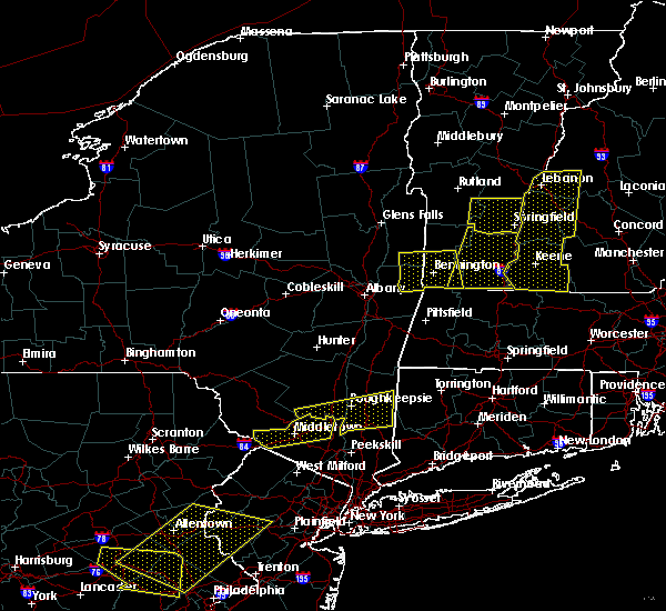 At 922 pm edt, a severe thunderstorm was located over haven, or near middletown, moving east at 50 mph (radar indicated). Hazards include 60 mph wind gusts. Expect damage to roofs, siding, and trees. this severe storm will be near, middletown around 925 pm edt. montgomery around 935 pm edt. Walden around 940 pm edt. At 922 pm edt, a severe thunderstorm was located over haven, or near middletown, moving east at 50 mph (radar indicated). Hazards include 60 mph wind gusts. Expect damage to roofs, siding, and trees. this severe storm will be near, middletown around 925 pm edt. montgomery around 935 pm edt. Walden around 940 pm edt.
|
| 8/22/2017 9:02 PM EDT |
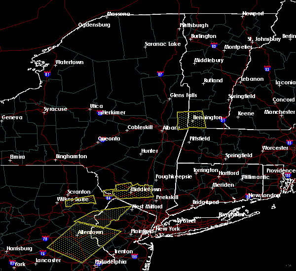 The national weather service in upton ny has issued a * severe thunderstorm warning for. orange county in southeastern new york. Until 945 pm edt * at 901 pm edt, a severe thunderstorm was located over haven, or 7 miles northwest of middletown, moving east at 45 mph. The national weather service in upton ny has issued a * severe thunderstorm warning for. orange county in southeastern new york. Until 945 pm edt * at 901 pm edt, a severe thunderstorm was located over haven, or 7 miles northwest of middletown, moving east at 45 mph.
|
| 8/18/2017 6:37 PM EDT |
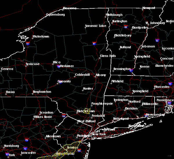 The severe thunderstorm warning for northeastern orange county will expire at 645 pm edt, the severe thunderstorm which prompted the warning has weakened. therefore, the warning will be allowed to expire. a severe thunderstorm watch remains in effect until 900 pm edt for southeastern new york. The severe thunderstorm warning for northeastern orange county will expire at 645 pm edt, the severe thunderstorm which prompted the warning has weakened. therefore, the warning will be allowed to expire. a severe thunderstorm watch remains in effect until 900 pm edt for southeastern new york.
|
| 8/18/2017 6:26 PM EDT |
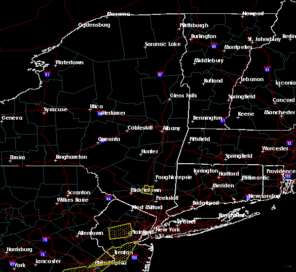 At 626 pm edt, a severe thunderstorm was located over gardnertown, or near newburgh, moving east at 15 mph (radar indicated). Hazards include 60 mph wind gusts. Expect damage to roofs, siding, and trees. This severe storm will be near, newburgh and new windsor around 640 pm edt. At 626 pm edt, a severe thunderstorm was located over gardnertown, or near newburgh, moving east at 15 mph (radar indicated). Hazards include 60 mph wind gusts. Expect damage to roofs, siding, and trees. This severe storm will be near, newburgh and new windsor around 640 pm edt.
|
| 8/18/2017 5:54 PM EDT |
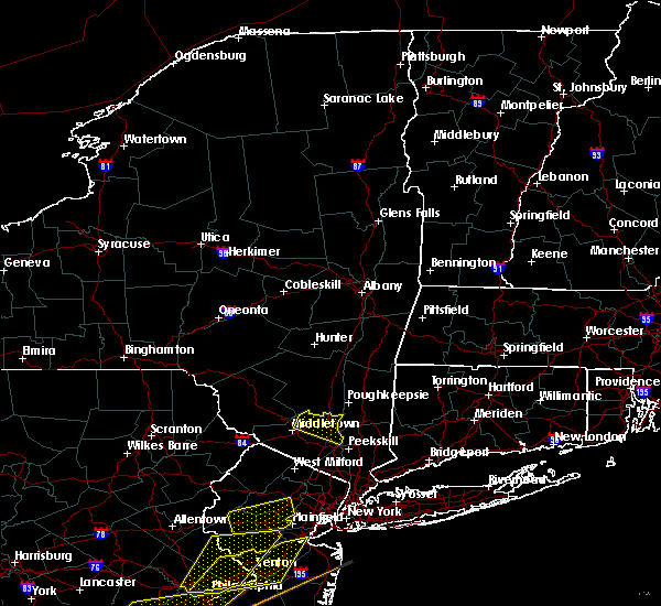 At 554 pm edt, a severe thunderstorm was located over montgomery, or near walden, moving east at 20 mph (radar indicated). Hazards include 60 mph wind gusts. Expect damage to roofs, siding, and trees. this severe thunderstorm will be near, walden around 605 pm edt. gardnertown around 620 pm edt. Newburgh and new windsor around 630 pm edt. At 554 pm edt, a severe thunderstorm was located over montgomery, or near walden, moving east at 20 mph (radar indicated). Hazards include 60 mph wind gusts. Expect damage to roofs, siding, and trees. this severe thunderstorm will be near, walden around 605 pm edt. gardnertown around 620 pm edt. Newburgh and new windsor around 630 pm edt.
|
| 8/2/2017 3:43 PM EDT |
 At 343 pm edt, severe thunderstorms were located along a line extending from near vernon valley to near walden, moving southeast at 10 mph (radar indicated). Hazards include 60 mph wind gusts and penny size hail. Expect damage to roofs, siding, and trees. these severe storms will be near, gardnertown around 405 pm edt. warwick around 410 pm edt. Newburgh and new windsor around 415 pm edt. At 343 pm edt, severe thunderstorms were located along a line extending from near vernon valley to near walden, moving southeast at 10 mph (radar indicated). Hazards include 60 mph wind gusts and penny size hail. Expect damage to roofs, siding, and trees. these severe storms will be near, gardnertown around 405 pm edt. warwick around 410 pm edt. Newburgh and new windsor around 415 pm edt.
|
| 8/2/2017 3:13 PM EDT |
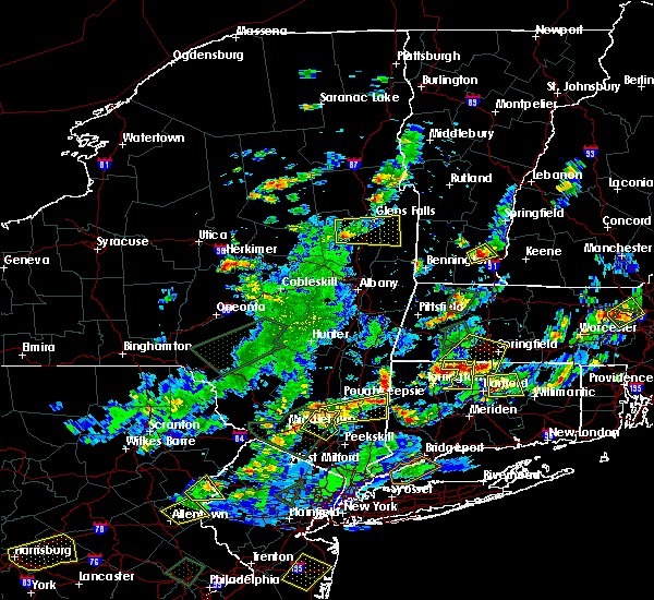 At 313 pm edt, severe thunderstorms were located along a line extending from near vernon valley to modena, moving southeast at 5 mph (radar indicated). Hazards include 60 mph wind gusts and quarter size hail. Hail damage to vehicles is expected. expect wind damage to roofs, siding, and trees. severe thunderstorms will be near, unionville around 320 pm edt. walden and warwick around 410 pm edt. Newburgh and gardnertown around 415 pm edt. At 313 pm edt, severe thunderstorms were located along a line extending from near vernon valley to modena, moving southeast at 5 mph (radar indicated). Hazards include 60 mph wind gusts and quarter size hail. Hail damage to vehicles is expected. expect wind damage to roofs, siding, and trees. severe thunderstorms will be near, unionville around 320 pm edt. walden and warwick around 410 pm edt. Newburgh and gardnertown around 415 pm edt.
|
| 8/2/2017 2:43 PM EDT |
 At 242 pm edt, a severe thunderstorm was located over gardnertown, or near newburgh, moving east at 25 mph (radar indicated). Hazards include quarter size hail. Minor damage to vehicles is possible. this severe thunderstorm will be near, beacon and marlboro around 250 pm edt. wappingers falls and fishkill around 300 pm edt. myers corner and red oaks mill around 305 pm edt. hopewell junction around 315 pm edt. pawling around 340 pm edt. wingdale around 345 pm edt. Other locations impacted by this severe thunderstorm include stormville, baker corner, knapps corner, beekman, south dover, new hamburg, glenham, clove valley, poughquag and billings. At 242 pm edt, a severe thunderstorm was located over gardnertown, or near newburgh, moving east at 25 mph (radar indicated). Hazards include quarter size hail. Minor damage to vehicles is possible. this severe thunderstorm will be near, beacon and marlboro around 250 pm edt. wappingers falls and fishkill around 300 pm edt. myers corner and red oaks mill around 305 pm edt. hopewell junction around 315 pm edt. pawling around 340 pm edt. wingdale around 345 pm edt. Other locations impacted by this severe thunderstorm include stormville, baker corner, knapps corner, beekman, south dover, new hamburg, glenham, clove valley, poughquag and billings.
|
| 8/2/2017 2:36 PM EDT |
 At 235 pm edt, a severe thunderstorm was located near new windsor, or near newburgh, moving northeast at 15 mph (radar indicated). Hazards include 60 mph wind gusts and quarter size hail. Hail damage to vehicles is expected. Expect wind damage to roofs, siding, and trees. At 235 pm edt, a severe thunderstorm was located near new windsor, or near newburgh, moving northeast at 15 mph (radar indicated). Hazards include 60 mph wind gusts and quarter size hail. Hail damage to vehicles is expected. Expect wind damage to roofs, siding, and trees.
|
| 7/13/2017 3:17 PM EDT |
 At 317 pm edt, a severe thunderstorm was located over new paltz, moving east at 20 mph (radar indicated). Hazards include 60 mph wind gusts and quarter size hail. Minor damage to vehicles is possible. expect wind damage to trees, and power lines. this severe thunderstorm will be near, high falls around 320 pm edt. highland around 330 pm edt. hyde park and fairview around 340 pm edt. poughkeepsie and wappingers falls around 345 pm edt. red oaks mill and myers corner around 350 pm edt. pleasant valley around 355 pm edt. hopewell junction around 405 pm edt. millbrook, dover plains and wingdale around 415 pm edt. Other locations impacted by this severe thunderstorm include tuckers corner, stormville, salt point, forest glen, knapps corner, beekman, south dover, hoxie corner, elting corners and clove valley. At 317 pm edt, a severe thunderstorm was located over new paltz, moving east at 20 mph (radar indicated). Hazards include 60 mph wind gusts and quarter size hail. Minor damage to vehicles is possible. expect wind damage to trees, and power lines. this severe thunderstorm will be near, high falls around 320 pm edt. highland around 330 pm edt. hyde park and fairview around 340 pm edt. poughkeepsie and wappingers falls around 345 pm edt. red oaks mill and myers corner around 350 pm edt. pleasant valley around 355 pm edt. hopewell junction around 405 pm edt. millbrook, dover plains and wingdale around 415 pm edt. Other locations impacted by this severe thunderstorm include tuckers corner, stormville, salt point, forest glen, knapps corner, beekman, south dover, hoxie corner, elting corners and clove valley.
|
| 6/30/2017 4:43 PM EDT |
 At 442 pm edt, a severe thunderstorm was located over plattekill, or 7 miles south of new paltz, moving east at 35 mph (radar indicated). Hazards include 60 mph wind gusts and quarter size hail. Minor damage to vehicles is possible. expect wind damage to trees, and power lines. this severe thunderstorm will be near, marlboro around 450 pm edt. wappingers falls and highland around 455 pm edt. poughkeepsie, red oaks mill, myers corner and fairview around 500 pm edt. pleasant valley and hopewell junction around 505 pm edt. millbrook around 520 pm edt. wingdale and dover plains around 530 pm edt. Other locations impacted by this severe thunderstorm include tuckers corner, forest glen, knapps corner, beekman, south dover, hoxie corner, new hamburg, clove valley, ireland corners and poughquag. At 442 pm edt, a severe thunderstorm was located over plattekill, or 7 miles south of new paltz, moving east at 35 mph (radar indicated). Hazards include 60 mph wind gusts and quarter size hail. Minor damage to vehicles is possible. expect wind damage to trees, and power lines. this severe thunderstorm will be near, marlboro around 450 pm edt. wappingers falls and highland around 455 pm edt. poughkeepsie, red oaks mill, myers corner and fairview around 500 pm edt. pleasant valley and hopewell junction around 505 pm edt. millbrook around 520 pm edt. wingdale and dover plains around 530 pm edt. Other locations impacted by this severe thunderstorm include tuckers corner, forest glen, knapps corner, beekman, south dover, hoxie corner, new hamburg, clove valley, ireland corners and poughquag.
|
| 6/19/2017 4:31 PM EDT |
 At 430 pm edt, a severe thunderstorm was located over hamburg, or 10 miles northeast of newton, moving northeast at 45 mph (radar indicated). Hazards include 60 mph wind gusts and penny size hail. Expect damage to roofs, siding, and trees. this severe thunderstorm will be near, unionville around 440 pm edt. upper greenwood lake around 445 pm edt. warwick and greenwood lake around 450 pm edt. florida around 455 pm edt. goshen and chester around 500 pm edt. monroe and harriman around 505 pm edt. Newburgh and west point around 515 pm edt. At 430 pm edt, a severe thunderstorm was located over hamburg, or 10 miles northeast of newton, moving northeast at 45 mph (radar indicated). Hazards include 60 mph wind gusts and penny size hail. Expect damage to roofs, siding, and trees. this severe thunderstorm will be near, unionville around 440 pm edt. upper greenwood lake around 445 pm edt. warwick and greenwood lake around 450 pm edt. florida around 455 pm edt. goshen and chester around 500 pm edt. monroe and harriman around 505 pm edt. Newburgh and west point around 515 pm edt.
|
| 6/19/2017 4:31 PM EDT |
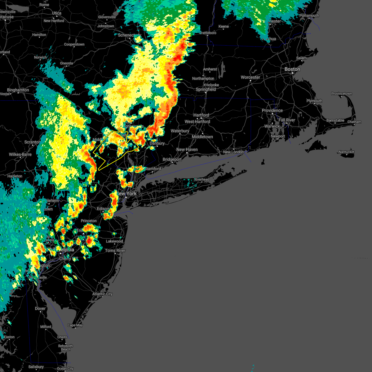 At 430 pm edt, a severe thunderstorm was located over hamburg, or 10 miles northeast of newton, moving northeast at 45 mph (radar indicated). Hazards include 60 mph wind gusts and penny size hail. Expect damage to roofs, siding, and trees. this severe thunderstorm will be near, unionville around 440 pm edt. upper greenwood lake around 445 pm edt. warwick and greenwood lake around 450 pm edt. florida around 455 pm edt. goshen and chester around 500 pm edt. monroe and harriman around 505 pm edt. Newburgh and west point around 515 pm edt. At 430 pm edt, a severe thunderstorm was located over hamburg, or 10 miles northeast of newton, moving northeast at 45 mph (radar indicated). Hazards include 60 mph wind gusts and penny size hail. Expect damage to roofs, siding, and trees. this severe thunderstorm will be near, unionville around 440 pm edt. upper greenwood lake around 445 pm edt. warwick and greenwood lake around 450 pm edt. florida around 455 pm edt. goshen and chester around 500 pm edt. monroe and harriman around 505 pm edt. Newburgh and west point around 515 pm edt.
|
| 6/19/2017 3:33 PM EDT |
 At 333 pm edt, a severe thunderstorm was located over highland, or over poughkeepsie, moving northeast at 30 mph (radar indicated). Hazards include 60 mph wind gusts and quarter size hail. Minor damage to vehicles is possible. expect wind damage to trees, and power lines. this severe storm will be near, fairview and red oaks mill around 340 pm edt. hyde park around 345 pm edt. pleasant valley and staatsburg around 350 pm edt. millbrook and stanfordville around 405 pm edt. Other locations impacted by this severe thunderstorm include tuckers corner, rolling meadows, salt point, norrie heights, kerleys corners, maple hill, lithgow, hoxie corner, linden acres and hillside. At 333 pm edt, a severe thunderstorm was located over highland, or over poughkeepsie, moving northeast at 30 mph (radar indicated). Hazards include 60 mph wind gusts and quarter size hail. Minor damage to vehicles is possible. expect wind damage to trees, and power lines. this severe storm will be near, fairview and red oaks mill around 340 pm edt. hyde park around 345 pm edt. pleasant valley and staatsburg around 350 pm edt. millbrook and stanfordville around 405 pm edt. Other locations impacted by this severe thunderstorm include tuckers corner, rolling meadows, salt point, norrie heights, kerleys corners, maple hill, lithgow, hoxie corner, linden acres and hillside.
|
| 6/19/2017 3:19 PM EDT |
 At 318 pm edt, a severe thunderstorm was located over modena, or near walden, moving northeast at 30 mph (radar indicated). Hazards include 60 mph wind gusts and quarter size hail. Minor damage to vehicles is possible. expect wind damage to trees, and power lines. this severe thunderstorm will be near, new paltz and marlboro around 330 pm edt. poughkeepsie, highland and fairview around 340 pm edt. hyde park and red oaks mill around 345 pm edt. pleasant valley and staatsburg around 350 pm edt. millbrook around 405 pm edt. stanfordville around 410 pm edt. dover plains around 415 pm edt. Other locations impacted by this severe thunderstorm include tuckers corner, rolling meadows, salt point, norrie heights, kerleys corners, maple hill, lithgow, hoxie corner, linden acres and hillside. At 318 pm edt, a severe thunderstorm was located over modena, or near walden, moving northeast at 30 mph (radar indicated). Hazards include 60 mph wind gusts and quarter size hail. Minor damage to vehicles is possible. expect wind damage to trees, and power lines. this severe thunderstorm will be near, new paltz and marlboro around 330 pm edt. poughkeepsie, highland and fairview around 340 pm edt. hyde park and red oaks mill around 345 pm edt. pleasant valley and staatsburg around 350 pm edt. millbrook around 405 pm edt. stanfordville around 410 pm edt. dover plains around 415 pm edt. Other locations impacted by this severe thunderstorm include tuckers corner, rolling meadows, salt point, norrie heights, kerleys corners, maple hill, lithgow, hoxie corner, linden acres and hillside.
|
| 6/19/2017 3:06 PM EDT |
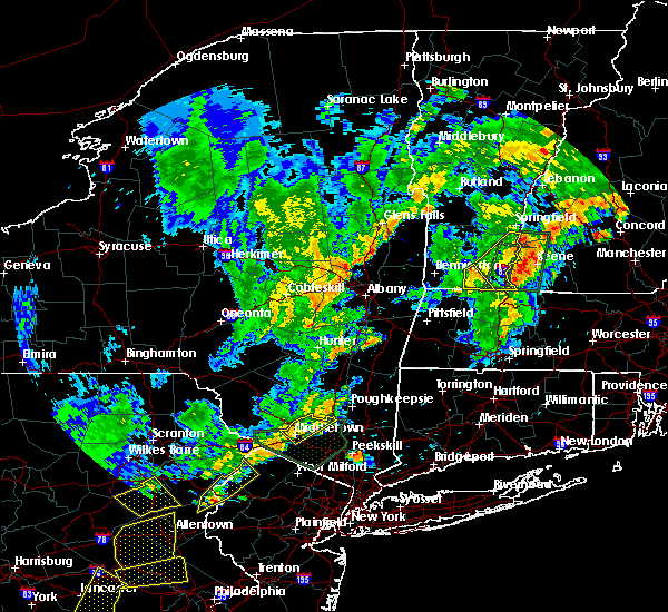 At 305 pm edt, a severe thunderstorm was located over modena, or near new paltz, moving northeast at 40 mph (radar indicated). Hazards include 60 mph wind gusts and quarter size hail. Hail damage to vehicles is expected. expect wind damage to roofs, siding, and trees. This severe thunderstorm will remain over mainly rural areas of northeastern orange county. At 305 pm edt, a severe thunderstorm was located over modena, or near new paltz, moving northeast at 40 mph (radar indicated). Hazards include 60 mph wind gusts and quarter size hail. Hail damage to vehicles is expected. expect wind damage to roofs, siding, and trees. This severe thunderstorm will remain over mainly rural areas of northeastern orange county.
|
| 6/19/2017 2:35 PM EDT |
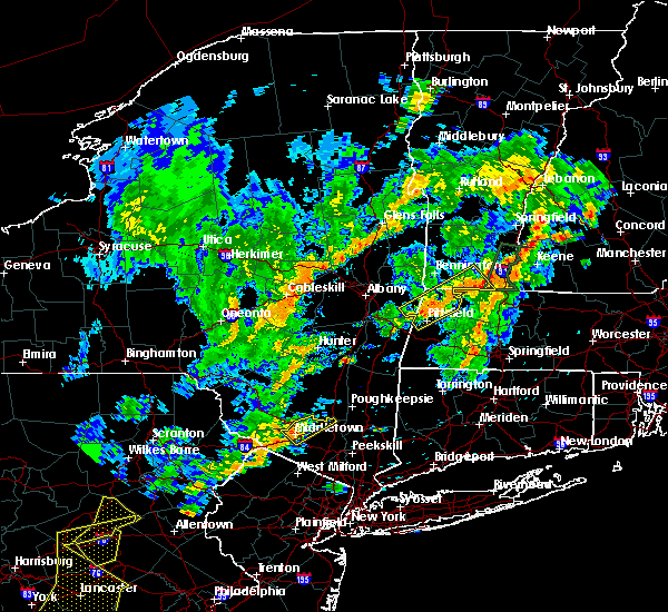 At 235 pm edt, a severe thunderstorm was located near howells, or near middletown, moving northeast at 40 mph (radar indicated). Hazards include 60 mph wind gusts and quarter size hail. Hail damage to vehicles is expected. expect wind damage to roofs, siding, and trees. this severe thunderstorm will be near, montgomery around 245 pm edt. Walden around 250 pm edt. At 235 pm edt, a severe thunderstorm was located near howells, or near middletown, moving northeast at 40 mph (radar indicated). Hazards include 60 mph wind gusts and quarter size hail. Hail damage to vehicles is expected. expect wind damage to roofs, siding, and trees. this severe thunderstorm will be near, montgomery around 245 pm edt. Walden around 250 pm edt.
|
| 6/19/2017 12:27 PM EDT |
 At 1227 pm edt, a severe thunderstorm was located over wappingers falls, or near poughkeepsie, moving northeast at 30 mph (radar indicated). Hazards include 60 mph wind gusts and quarter size hail. Minor damage to vehicles is possible. expect wind damage to trees, and power lines. this severe thunderstorm will be near, poughkeepsie and myers corner around 1235 pm edt. red oaks mill, fairview and hopewell junction around 1240 pm edt. pleasant valley around 1245 pm edt. millbrook around 100 pm edt. dover plains around 110 pm edt. kent around 115 pm edt. amenia around 120 pm edt. sharon around 125 pm edt. Other locations impacted by this severe thunderstorm include tuckers corner, cornwall, salt point, lithgow, hoxie corner, salisbury, smithfield, south amenia, bains corner and washington hollow. At 1227 pm edt, a severe thunderstorm was located over wappingers falls, or near poughkeepsie, moving northeast at 30 mph (radar indicated). Hazards include 60 mph wind gusts and quarter size hail. Minor damage to vehicles is possible. expect wind damage to trees, and power lines. this severe thunderstorm will be near, poughkeepsie and myers corner around 1235 pm edt. red oaks mill, fairview and hopewell junction around 1240 pm edt. pleasant valley around 1245 pm edt. millbrook around 100 pm edt. dover plains around 110 pm edt. kent around 115 pm edt. amenia around 120 pm edt. sharon around 125 pm edt. Other locations impacted by this severe thunderstorm include tuckers corner, cornwall, salt point, lithgow, hoxie corner, salisbury, smithfield, south amenia, bains corner and washington hollow.
|
| 5/31/2017 6:56 PM EDT |
 At 655 pm edt, severe thunderstorms were located along a line extending from near great barrington to near millerton to stanfordville to marlboro, moving east at 40 mph (radar indicated). Hazards include golf ball size hail and 60 mph wind gusts. People and animals outdoors will be injured. expect hail damage to roofs, siding, windows, and vehicles. expect wind damage to roofs, siding, and trees. these severe storms will be near, great barrington, copake, sheffield, millerton and housatonic around 700 pm edt. dover plains around 705 pm edt. amenia, canaan, ashley falls and falls village around 710 pm edt. sharon and sandisfield around 715 pm edt. norfolk, otis, tolland and cornwall bridge around 720 pm edt. pawling around 725 pm edt. wingdale around 730 pm edt. gaylordsville and winsted around 735 pm edt. Other locations impacted by these severe thunderstorms include norrie heights, south canaan, lithgow, hoxie corner, elting corners, wrightville, salisbury, south amenia, harlemville and pleasant ridge. At 655 pm edt, severe thunderstorms were located along a line extending from near great barrington to near millerton to stanfordville to marlboro, moving east at 40 mph (radar indicated). Hazards include golf ball size hail and 60 mph wind gusts. People and animals outdoors will be injured. expect hail damage to roofs, siding, windows, and vehicles. expect wind damage to roofs, siding, and trees. these severe storms will be near, great barrington, copake, sheffield, millerton and housatonic around 700 pm edt. dover plains around 705 pm edt. amenia, canaan, ashley falls and falls village around 710 pm edt. sharon and sandisfield around 715 pm edt. norfolk, otis, tolland and cornwall bridge around 720 pm edt. pawling around 725 pm edt. wingdale around 730 pm edt. gaylordsville and winsted around 735 pm edt. Other locations impacted by these severe thunderstorms include norrie heights, south canaan, lithgow, hoxie corner, elting corners, wrightville, salisbury, south amenia, harlemville and pleasant ridge.
|
| 5/31/2017 6:44 PM EDT |
 At 643 pm edt, severe thunderstorms were located along a line extending from near philmont to ancram to near rhinebeck to wallkill, moving east at 40 mph (radar indicated). Hazards include 60 mph wind gusts and quarter size hail. Hail damage to vehicles is expected. expect wind damage to roofs, siding, and trees. severe thunderstorms will be near, copake, pine plains and ancram around 650 pm edt. great barrington, millerton, stanfordville and housatonic around 655 pm edt. sheffield and millbrook around 700 pm edt. amenia, fishkill and myers corner around 705 pm edt. canaan, falls village, hopewell junction, ashley falls and dover plains around 710 pm edt. kent, sharon and sandisfield around 715 pm edt. norfolk, otis, tolland and cornwall bridge around 720 pm edt. pawling around 725 pm edt. Other locations impacted by these severe thunderstorms include norrie heights, south canaan, lithgow, hoxie corner, elting corners, wrightville, salisbury, south amenia, harlemville and pleasant ridge. At 643 pm edt, severe thunderstorms were located along a line extending from near philmont to ancram to near rhinebeck to wallkill, moving east at 40 mph (radar indicated). Hazards include 60 mph wind gusts and quarter size hail. Hail damage to vehicles is expected. expect wind damage to roofs, siding, and trees. severe thunderstorms will be near, copake, pine plains and ancram around 650 pm edt. great barrington, millerton, stanfordville and housatonic around 655 pm edt. sheffield and millbrook around 700 pm edt. amenia, fishkill and myers corner around 705 pm edt. canaan, falls village, hopewell junction, ashley falls and dover plains around 710 pm edt. kent, sharon and sandisfield around 715 pm edt. norfolk, otis, tolland and cornwall bridge around 720 pm edt. pawling around 725 pm edt. Other locations impacted by these severe thunderstorms include norrie heights, south canaan, lithgow, hoxie corner, elting corners, wrightville, salisbury, south amenia, harlemville and pleasant ridge.
|
| 5/1/2017 9:25 PM EDT |
 At 925 pm edt, severe thunderstorms were located along a line extending from near galway to duanesburg to near windham to hortonville, moving east at 65 mph (radar indicated). Hazards include 70 mph wind gusts. Expect considerable tree damage. Damage is likely to mobile homes, roofs, and outbuildings. At 925 pm edt, severe thunderstorms were located along a line extending from near galway to duanesburg to near windham to hortonville, moving east at 65 mph (radar indicated). Hazards include 70 mph wind gusts. Expect considerable tree damage. Damage is likely to mobile homes, roofs, and outbuildings.
|
| 2/25/2017 6:04 PM EST |
 At 602 pm est, severe thunderstorms were located along a line extending from wappingers falls to pomona, moving east at 40 mph (at 544 pm, winds gusted to 69 mph at montgomery airport). Hazards include 70 mph wind gusts. expect damage to roofs, siding, and trees At 602 pm est, severe thunderstorms were located along a line extending from wappingers falls to pomona, moving east at 40 mph (at 544 pm, winds gusted to 69 mph at montgomery airport). Hazards include 70 mph wind gusts. expect damage to roofs, siding, and trees
|
| 2/25/2017 6:04 PM EST |
 At 603 pm est, severe thunderstorms were located along a line extending from near west hurley to near hyde park to near wappingers falls, moving northeast at 65 mph (radar indicated). Hazards include 60 mph wind gusts and penny size hail. Expect damage to roofs, siding, and trees. Locations impacted include, eastern ulster county toward the hudson river. At 603 pm est, severe thunderstorms were located along a line extending from near west hurley to near hyde park to near wappingers falls, moving northeast at 65 mph (radar indicated). Hazards include 60 mph wind gusts and penny size hail. Expect damage to roofs, siding, and trees. Locations impacted include, eastern ulster county toward the hudson river.
|
| 2/25/2017 5:44 PM EST |
 At 544 pm est, severe thunderstorms were located along a line extending from near ellenville to montgomery to 7 miles south of walden to near upper greenwood lake, moving northeast at 65 mph (radar indicated). Hazards include 60 mph wind gusts. Expect damage to roofs, siding, and trees. severe thunderstorms will be near, walden and new windsor around 550 pm est. newburgh and gardnertown around 555 pm est. west point around 605 pm est. cold spring around 610 pm est. Fahnestock state park around 615 pm est. At 544 pm est, severe thunderstorms were located along a line extending from near ellenville to montgomery to 7 miles south of walden to near upper greenwood lake, moving northeast at 65 mph (radar indicated). Hazards include 60 mph wind gusts. Expect damage to roofs, siding, and trees. severe thunderstorms will be near, walden and new windsor around 550 pm est. newburgh and gardnertown around 555 pm est. west point around 605 pm est. cold spring around 610 pm est. Fahnestock state park around 615 pm est.
|
| 2/25/2017 5:37 PM EST |
 At 536 pm est, severe thunderstorms were located along a line extending from near bloomingburg to near middletown to near warwick to west milford, moving northeast at 95 mph (radar indicated). Hazards include 60 mph wind gusts. Expect damage to roofs, siding, and trees. severe thunderstorms will be near, monroe and montgomery around 540 pm est. walden around 545 pm est. newburgh and new windsor around 550 pm est. west point and cold spring around 555 pm est. Fahnestock state park around 600 pm est. At 536 pm est, severe thunderstorms were located along a line extending from near bloomingburg to near middletown to near warwick to west milford, moving northeast at 95 mph (radar indicated). Hazards include 60 mph wind gusts. Expect damage to roofs, siding, and trees. severe thunderstorms will be near, monroe and montgomery around 540 pm est. walden around 545 pm est. newburgh and new windsor around 550 pm est. west point and cold spring around 555 pm est. Fahnestock state park around 600 pm est.
|
| 2/25/2017 5:33 PM EST |
 At 532 pm est, a severe thunderstorm was located near phillipsport, or near ellenville, moving northeast at 40 mph (radar indicated). Hazards include 60 mph wind gusts and penny size hail. Expect damage to roofs, siding, and trees. this severe thunderstorm will be near, ellenville around 540 pm est. napanoch around 545 pm est. kerhonkson around 550 pm est. new paltz and olivebridge around 600 pm est. tillson and high falls around 605 pm est. hurley around 610 pm est. port ewen around 615 pm est. kingston and lake katrine around 620 pm est. Other locations impacted by this severe thunderstorm include cherrytown, tuckers corner, rolling meadows, maple hill, glenford, atwood, sweet meadows, pacama, brodhead and hillside. At 532 pm est, a severe thunderstorm was located near phillipsport, or near ellenville, moving northeast at 40 mph (radar indicated). Hazards include 60 mph wind gusts and penny size hail. Expect damage to roofs, siding, and trees. this severe thunderstorm will be near, ellenville around 540 pm est. napanoch around 545 pm est. kerhonkson around 550 pm est. new paltz and olivebridge around 600 pm est. tillson and high falls around 605 pm est. hurley around 610 pm est. port ewen around 615 pm est. kingston and lake katrine around 620 pm est. Other locations impacted by this severe thunderstorm include cherrytown, tuckers corner, rolling meadows, maple hill, glenford, atwood, sweet meadows, pacama, brodhead and hillside.
|
| 2/25/2017 5:27 PM EST |
 At 525 pm est, severe thunderstorms were located along a line extending from woodridge to near unionville to near highland lake to near succasunna, moving northeast at 75 mph (radar indicated. at 454 pm, winds gusted to 55 mph at blairstown in northwest new jersey). Hazards include 60 mph wind gusts and penny size hail. Expect damage to roofs, siding, and trees. these severe storms will be near, middletown and howells around 530 pm est. warwick and goshen around 535 pm est. monroe and chester around 540 pm est. West milford and ringwood around 545 pm est. At 525 pm est, severe thunderstorms were located along a line extending from woodridge to near unionville to near highland lake to near succasunna, moving northeast at 75 mph (radar indicated. at 454 pm, winds gusted to 55 mph at blairstown in northwest new jersey). Hazards include 60 mph wind gusts and penny size hail. Expect damage to roofs, siding, and trees. these severe storms will be near, middletown and howells around 530 pm est. warwick and goshen around 535 pm est. monroe and chester around 540 pm est. West milford and ringwood around 545 pm est.
|
| 2/25/2017 5:02 PM EST |
 At 500 pm est, severe thunderstorms were located along a line extending from shohola to near milford to flatbrookville to near oxford to pipersville, moving northeast at 65 mph (radar indicated). Hazards include 60 mph wind gusts. Expect damage to roofs, siding, and trees. severe thunderstorms will be near, port jervis and huguenot around 510 pm est. cuddebackville and otisville around 515 pm est. unionville around 525 pm est. west milford around 530 pm est. middletown and goshen around 535 pm est. warwick and greenwood lake around 540 pm est. Monroe and walden around 545 pm est. At 500 pm est, severe thunderstorms were located along a line extending from shohola to near milford to flatbrookville to near oxford to pipersville, moving northeast at 65 mph (radar indicated). Hazards include 60 mph wind gusts. Expect damage to roofs, siding, and trees. severe thunderstorms will be near, port jervis and huguenot around 510 pm est. cuddebackville and otisville around 515 pm est. unionville around 525 pm est. west milford around 530 pm est. middletown and goshen around 535 pm est. warwick and greenwood lake around 540 pm est. Monroe and walden around 545 pm est.
|
| 8/14/2016 4:35 PM EDT |
 At 434 pm edt, severe thunderstorms were located along a line extending from near tillson to near middletown, moving east at 35 mph (radar indicated). Hazards include 60 mph wind gusts. Expect damage to roofs. siding. and trees. these severe storms will be near, chester around 445 pm edt. Other locations impacted by these severe thunderstorms include pine bush, maybrook, orange lake and scotchtown. At 434 pm edt, severe thunderstorms were located along a line extending from near tillson to near middletown, moving east at 35 mph (radar indicated). Hazards include 60 mph wind gusts. Expect damage to roofs. siding. and trees. these severe storms will be near, chester around 445 pm edt. Other locations impacted by these severe thunderstorms include pine bush, maybrook, orange lake and scotchtown.
|
| 8/14/2016 3:56 PM EDT |
 At 356 pm edt, severe thunderstorms were located along a line extending from 7 miles southwest of west shokan to near highland lake, moving east at 35 mph (radar indicated). Hazards include 60 mph wind gusts. Expect damage to roofs. siding. and trees. severe thunderstorms will be near, middletown around 430 pm edt. goshen around 440 pm edt. walden, chester and montgomery around 445 pm edt. Other locations impacted by these severe thunderstorms include pine bush, maybrook, orange lake and scotchtown. At 356 pm edt, severe thunderstorms were located along a line extending from 7 miles southwest of west shokan to near highland lake, moving east at 35 mph (radar indicated). Hazards include 60 mph wind gusts. Expect damage to roofs. siding. and trees. severe thunderstorms will be near, middletown around 430 pm edt. goshen around 440 pm edt. walden, chester and montgomery around 445 pm edt. Other locations impacted by these severe thunderstorms include pine bush, maybrook, orange lake and scotchtown.
|
| 8/13/2016 10:34 PM EDT |
 At 1034 pm edt, a severe thunderstorm was located near oakland, or 7 miles northeast of port jervis, moving east at 35 mph (radar indicated). Hazards include 60 mph wind gusts. Expect damage to roofs. siding. and trees. this severe thunderstorm will be near, middletown around 1050 pm edt. goshen around 1055 pm edt. walden and montgomery around 1105 pm edt. newburgh, new windsor and gardnertown around 1115 pm edt. Other locations impacted by this severe thunderstorm include washingtonville, maybrook, orange lake, balmville, cornwall on hudson, pine bush, firthcliffe, highland falls, vails gate and scotchtown. At 1034 pm edt, a severe thunderstorm was located near oakland, or 7 miles northeast of port jervis, moving east at 35 mph (radar indicated). Hazards include 60 mph wind gusts. Expect damage to roofs. siding. and trees. this severe thunderstorm will be near, middletown around 1050 pm edt. goshen around 1055 pm edt. walden and montgomery around 1105 pm edt. newburgh, new windsor and gardnertown around 1115 pm edt. Other locations impacted by this severe thunderstorm include washingtonville, maybrook, orange lake, balmville, cornwall on hudson, pine bush, firthcliffe, highland falls, vails gate and scotchtown.
|
| 7/1/2016 5:12 PM EDT |
 At 512 pm edt, severe thunderstorms were located along a line extending from near wappingers falls to near upper greenwood lake, moving east at 35 mph (radar indicated). Hazards include 60 mph wind gusts. Expect damage to roofs. siding. and trees. severe thunderstorms will be near, newburgh and gardnertown around 515 pm edt. ramsey and suffern around 530 pm edt. monsey and new york--newark around 535 pm edt. nanuet, pomona and pearl river around 540 pm edt. new city around 545 pm edt. peekskill, haverstraw, nyack, new fairfield and upper nyack around 550 pm edt. ossining, tarrytown, sherman and north tarrytown around 555 pm edt. mount kisco, brookfield, hawthorne and yorktown heights around 600 pm edt. other locations impacted by these severe thunderstorms include west haverstraw, pleasantville, upper saddle river, west nyack, balmville, highland mills, spring valley, montvale, brewster hill and thiells. A tornado watch remains in effect until 1000 pm edt for southern connecticut, northeastern new jersey, and southeastern new york. At 512 pm edt, severe thunderstorms were located along a line extending from near wappingers falls to near upper greenwood lake, moving east at 35 mph (radar indicated). Hazards include 60 mph wind gusts. Expect damage to roofs. siding. and trees. severe thunderstorms will be near, newburgh and gardnertown around 515 pm edt. ramsey and suffern around 530 pm edt. monsey and new york--newark around 535 pm edt. nanuet, pomona and pearl river around 540 pm edt. new city around 545 pm edt. peekskill, haverstraw, nyack, new fairfield and upper nyack around 550 pm edt. ossining, tarrytown, sherman and north tarrytown around 555 pm edt. mount kisco, brookfield, hawthorne and yorktown heights around 600 pm edt. other locations impacted by these severe thunderstorms include west haverstraw, pleasantville, upper saddle river, west nyack, balmville, highland mills, spring valley, montvale, brewster hill and thiells. A tornado watch remains in effect until 1000 pm edt for southern connecticut, northeastern new jersey, and southeastern new york.
|
| 7/1/2016 3:29 PM EDT |
 At 328 pm edt, a severe thunderstorm was located over marlboro, or near poughkeepsie, moving northeast at 15 mph (radar indicated). Hazards include 60 mph wind gusts and quarter size hail. Hail damage to vehicles is expected. Expect wind damage to roofs, siding, and trees. At 328 pm edt, a severe thunderstorm was located over marlboro, or near poughkeepsie, moving northeast at 15 mph (radar indicated). Hazards include 60 mph wind gusts and quarter size hail. Hail damage to vehicles is expected. Expect wind damage to roofs, siding, and trees.
|
| 7/1/2016 3:23 PM EDT |
 At 322 pm edt, a severe thunderstorm was located over fairview, or over poughkeepsie, moving northeast at 30 mph (radar indicated). Hazards include 60 mph wind gusts and quarter size hail. Hail damage to vehicles is expected. expect wind damage to roofs, siding, and trees. this severe thunderstorm will remain over mainly rural areas of southeastern ulster and central dutchess counties, including the following locations: pleasant plains, arthursburg, colonial heights, haviland, hillside lake, jenkinstown, clove, highland landing, macdonnell heights and netherwood. A tornado watch remains in effect until 1000 pm edt for east central new york. At 322 pm edt, a severe thunderstorm was located over fairview, or over poughkeepsie, moving northeast at 30 mph (radar indicated). Hazards include 60 mph wind gusts and quarter size hail. Hail damage to vehicles is expected. expect wind damage to roofs, siding, and trees. this severe thunderstorm will remain over mainly rural areas of southeastern ulster and central dutchess counties, including the following locations: pleasant plains, arthursburg, colonial heights, haviland, hillside lake, jenkinstown, clove, highland landing, macdonnell heights and netherwood. A tornado watch remains in effect until 1000 pm edt for east central new york.
|
| 7/1/2016 3:12 PM EDT | The severe thunderstorm warning for northeastern orange county will expire at 315 pm edt, the severe thunderstorm which prompted the warning has moved out of the warned area. therefore, the warning will be allowed to expire. a tornado watch remains in effect until 1000 pm edt for southeastern new york. |
| 7/1/2016 2:52 PM EDT |
 At 251 pm edt, a severe thunderstorm was located over wallkill, or over walden, moving northeast at 30 mph (radar indicated). Hazards include 60 mph wind gusts and quarter size hail. Hail damage to vehicles is expected. expect wind damage to roofs, siding, and trees. this severe thunderstorm will be near, plattekill around 300 pm edt. modena around 305 pm edt. marlboro around 310 pm edt. new paltz and wappingers falls around 315 pm edt. highland around 320 pm edt. poughkeepsie, hyde park, fairview and red oaks mill around 325 pm edt. pleasant valley and staatsburg around 330 pm edt. other locations impacted by this severe thunderstorm include libertyville, tuthilltown, pleasant plains, ohioville, galeville, arthursburg, colonial heights, haviland, saint elmo and hillside lake. A tornado watch remains in effect until 1000 pm edt for east central new york. At 251 pm edt, a severe thunderstorm was located over wallkill, or over walden, moving northeast at 30 mph (radar indicated). Hazards include 60 mph wind gusts and quarter size hail. Hail damage to vehicles is expected. expect wind damage to roofs, siding, and trees. this severe thunderstorm will be near, plattekill around 300 pm edt. modena around 305 pm edt. marlboro around 310 pm edt. new paltz and wappingers falls around 315 pm edt. highland around 320 pm edt. poughkeepsie, hyde park, fairview and red oaks mill around 325 pm edt. pleasant valley and staatsburg around 330 pm edt. other locations impacted by this severe thunderstorm include libertyville, tuthilltown, pleasant plains, ohioville, galeville, arthursburg, colonial heights, haviland, saint elmo and hillside lake. A tornado watch remains in effect until 1000 pm edt for east central new york.
|
| 7/1/2016 2:48 PM EDT |
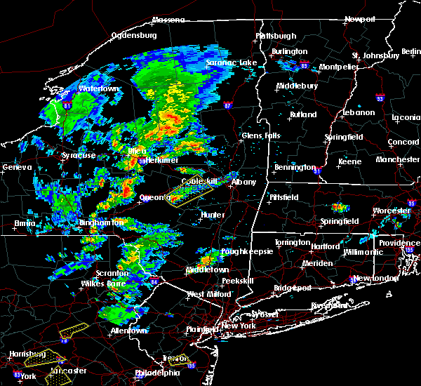 At 247 pm edt, a severe thunderstorm was located over walden, moving northeast at 20 mph (radar indicated). Hazards include 60 mph wind gusts and quarter size hail. Hail damage to vehicles is expected. Expect wind damage to roofs, siding, and trees. At 247 pm edt, a severe thunderstorm was located over walden, moving northeast at 20 mph (radar indicated). Hazards include 60 mph wind gusts and quarter size hail. Hail damage to vehicles is expected. Expect wind damage to roofs, siding, and trees.
|
| 6/5/2016 6:39 PM EDT |
 The severe thunderstorm warning for orange county will expire at 645 pm edt, the storms which prompted the warning are moving out of the warned area. therefore, the warning will be allowed to expire. The severe thunderstorm warning for orange county will expire at 645 pm edt, the storms which prompted the warning are moving out of the warned area. therefore, the warning will be allowed to expire.
|
| 6/5/2016 6:13 PM EDT |
 At 612 pm edt, severe thunderstorms were located along a line extending from near walden to near greenwood lake, moving east at 40 mph (radar indicated). Hazards include 60 mph wind gusts. Expect damage to roofs. siding. and trees. these severe storms will be near, harriman and gardnertown around 625 pm edt. newburgh and new windsor around 630 pm edt. Other locations impacted by these severe thunderstorms include washingtonville, central valley, maybrook, orange lake, balmville, cornwall on hudson, pine bush, highland mills, firthcliffe and kiryas joel. At 612 pm edt, severe thunderstorms were located along a line extending from near walden to near greenwood lake, moving east at 40 mph (radar indicated). Hazards include 60 mph wind gusts. Expect damage to roofs. siding. and trees. these severe storms will be near, harriman and gardnertown around 625 pm edt. newburgh and new windsor around 630 pm edt. Other locations impacted by these severe thunderstorms include washingtonville, central valley, maybrook, orange lake, balmville, cornwall on hudson, pine bush, highland mills, firthcliffe and kiryas joel.
|
| 6/5/2016 5:39 PM EDT |
 At 538 pm edt, severe thunderstorms were located along a line extending from near grahamsville to branchville, moving northeast at 45 mph (radar indicated). Hazards include 60 mph wind gusts. Expect damage to roofs. siding. and trees. severe thunderstorms will be near, unionville around 555 pm edt. warwick and florida around 610 pm edt. goshen and chester around 615 pm edt. monroe around 620 pm edt. montgomery around 625 pm edt. walden around 630 pm edt. new windsor around 635 pm edt. newburgh and gardnertown around 640 pm edt. Other locations impacted by these severe thunderstorms include washingtonville, central valley, maybrook, orange lake, balmville, cornwall on hudson, pine bush, highland mills, firthcliffe and kiryas joel. At 538 pm edt, severe thunderstorms were located along a line extending from near grahamsville to branchville, moving northeast at 45 mph (radar indicated). Hazards include 60 mph wind gusts. Expect damage to roofs. siding. and trees. severe thunderstorms will be near, unionville around 555 pm edt. warwick and florida around 610 pm edt. goshen and chester around 615 pm edt. monroe around 620 pm edt. montgomery around 625 pm edt. walden around 630 pm edt. new windsor around 635 pm edt. newburgh and gardnertown around 640 pm edt. Other locations impacted by these severe thunderstorms include washingtonville, central valley, maybrook, orange lake, balmville, cornwall on hudson, pine bush, highland mills, firthcliffe and kiryas joel.
|
| 2/24/2016 11:22 PM EST |
 At 1121 pm est, severe thunderstorms were located along a line extending from near saugerties to near fahnestock state park, moving northeast at 70 mph (radar indicated). Hazards include 60 mph wind gusts. Expect damage to roofs. siding and trees. severe thunderstorms will be near, saugerties, woodstock, saugerties south and lake katrine around 1125 pm est. clermont, hopewell junction and myers corner around 1130 pm est. hudson, catskill, pawling and livingston around 1135 pm est. claverack, athens, philmont, wingdale, claverack-red mills and lorenz park around 1140 pm est. new milford, sherman, kent, gaylordsville and dover plains around 1145 pm est. new preston around 1150 pm est. cornwall bridge around 1155 pm est. litchfield around 1200 am est. Other locations impacted by these severe thunderstorms include ohioville, arthursburg, the cedars, sharon valley, birch groves, macdonnell heights, east cornwall, mount ross, east kingston and kelly corner. At 1121 pm est, severe thunderstorms were located along a line extending from near saugerties to near fahnestock state park, moving northeast at 70 mph (radar indicated). Hazards include 60 mph wind gusts. Expect damage to roofs. siding and trees. severe thunderstorms will be near, saugerties, woodstock, saugerties south and lake katrine around 1125 pm est. clermont, hopewell junction and myers corner around 1130 pm est. hudson, catskill, pawling and livingston around 1135 pm est. claverack, athens, philmont, wingdale, claverack-red mills and lorenz park around 1140 pm est. new milford, sherman, kent, gaylordsville and dover plains around 1145 pm est. new preston around 1150 pm est. cornwall bridge around 1155 pm est. litchfield around 1200 am est. Other locations impacted by these severe thunderstorms include ohioville, arthursburg, the cedars, sharon valley, birch groves, macdonnell heights, east cornwall, mount ross, east kingston and kelly corner.
|
| 2/24/2016 11:00 PM EST |
 At 1058 pm est, doppler radar indicated a severe thunderstorms moving across the warning area capable of producing damaging winds in excess of 60 mph. these storms were moving northeast at 0 to 50 mph. locations impacted include, white plains, newburgh, middletown, ossining, peekskill, haverstraw, tarrytown, mount kisco, dobbs ferry, port jervis, monroe, walden, nyack, warwick, goshen, sloatsburg, cold spring, nanuet, new city and north tarrytown. At 1058 pm est, doppler radar indicated a severe thunderstorms moving across the warning area capable of producing damaging winds in excess of 60 mph. these storms were moving northeast at 0 to 50 mph. locations impacted include, white plains, newburgh, middletown, ossining, peekskill, haverstraw, tarrytown, mount kisco, dobbs ferry, port jervis, monroe, walden, nyack, warwick, goshen, sloatsburg, cold spring, nanuet, new city and north tarrytown.
|
| 2/24/2016 10:35 PM EST |
 At 1032 pm est, doppler radar indicated an area of thunderstorms capable of producing damaging winds in excess of 60 mph. this activity will move across much of the lower hudson valley of new york. other locations impacted by this severe thunderstorm include west haverstraw, pleasantville, west nyack, balmville, highland mills, spring valley, thiells, irvington, grand view-on-huds and new hempstead. expect strong winds and heavy downpours with this activity. At 1032 pm est, doppler radar indicated an area of thunderstorms capable of producing damaging winds in excess of 60 mph. this activity will move across much of the lower hudson valley of new york. other locations impacted by this severe thunderstorm include west haverstraw, pleasantville, west nyack, balmville, highland mills, spring valley, thiells, irvington, grand view-on-huds and new hempstead. expect strong winds and heavy downpours with this activity.
|
| 7/19/2015 6:25 PM EDT |
 At 624 pm edt, a severe thunderstorm was located over phillipsport, or near ellenville, moving east at 35 mph (radar indicated). Hazards include 60 mph wind gusts and quarter size hail. Hail damage to vehicles is expected. expect wind damage to roofs, siding and trees. this severe thunderstorm will be near, ellenville and napanoch around 635 pm edt. wallkill around 650 pm edt. plattekill and modena around 655 pm edt. new paltz around 700 pm edt. highland around 710 pm edt. Other locations impacted by this severe thunderstorm include pataukunk, libertyville, tuthilltown, ohioville, galeville, springtown, ulsterville, saint elmo, jenkinstown and highland landing. At 624 pm edt, a severe thunderstorm was located over phillipsport, or near ellenville, moving east at 35 mph (radar indicated). Hazards include 60 mph wind gusts and quarter size hail. Hail damage to vehicles is expected. expect wind damage to roofs, siding and trees. this severe thunderstorm will be near, ellenville and napanoch around 635 pm edt. wallkill around 650 pm edt. plattekill and modena around 655 pm edt. new paltz around 700 pm edt. highland around 710 pm edt. Other locations impacted by this severe thunderstorm include pataukunk, libertyville, tuthilltown, ohioville, galeville, springtown, ulsterville, saint elmo, jenkinstown and highland landing.
|
| 6/12/2015 5:23 PM EDT |
 At 522 pm edt, a severe thunderstorm was located near poughkeepsie, moving east at 25 mph (radar indicated). Hazards include 60 mph wind gusts and quarter size hail. Hail damage to vehicles is expected. expect wind damage to roofs, siding and trees. this severe thunderstorm will be near, fairview around 525 pm edt. poughkeepsie and wappingers falls around 530 pm edt. red oaks mill and myers corner around 535 pm edt. pleasant valley around 540 pm edt. hopewell junction around 545 pm edt. pawling and wingdale around 610 pm edt. other locations impacted by this severe thunderstorm include arthursburg, colonial heights, haviland, hillside lake, clove, highland landing, macdonnell heights, dover furnace, new hamburg and lloyd. A tornado watch remains in effect until 1100 pm edt for east central new york. At 522 pm edt, a severe thunderstorm was located near poughkeepsie, moving east at 25 mph (radar indicated). Hazards include 60 mph wind gusts and quarter size hail. Hail damage to vehicles is expected. expect wind damage to roofs, siding and trees. this severe thunderstorm will be near, fairview around 525 pm edt. poughkeepsie and wappingers falls around 530 pm edt. red oaks mill and myers corner around 535 pm edt. pleasant valley around 540 pm edt. hopewell junction around 545 pm edt. pawling and wingdale around 610 pm edt. other locations impacted by this severe thunderstorm include arthursburg, colonial heights, haviland, hillside lake, clove, highland landing, macdonnell heights, dover furnace, new hamburg and lloyd. A tornado watch remains in effect until 1100 pm edt for east central new york.
|
| 6/12/2015 5:20 PM EDT |
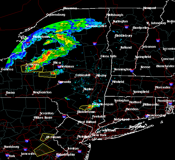 At 519 pm edt, a severe thunderstorm was located near highland, or near poughkeepsie, moving east at 20 mph (radar indicated). Hazards include 60 mph wind gusts and nickel size hail. Expect damage to roofs. siding and trees. this severe storm will be just west of, poughkeepsie around 530 pm edt. other locations impacted by this severe thunderstorm include stoneco, jenkinstown, highland landing, lloyd, clintondale station, oakes, lattintown, tuckers corner, sylva and ardonia. A tornado watch remains in effect until 1100 pm edt for east central new york. At 519 pm edt, a severe thunderstorm was located near highland, or near poughkeepsie, moving east at 20 mph (radar indicated). Hazards include 60 mph wind gusts and nickel size hail. Expect damage to roofs. siding and trees. this severe storm will be just west of, poughkeepsie around 530 pm edt. other locations impacted by this severe thunderstorm include stoneco, jenkinstown, highland landing, lloyd, clintondale station, oakes, lattintown, tuckers corner, sylva and ardonia. A tornado watch remains in effect until 1100 pm edt for east central new york.
|
| 6/12/2015 4:53 PM EDT |
 At 452 pm edt, a severe thunderstorm was located near wallkill, or 7 miles east of ellenville, moving east at 25 mph (radar indicated). Hazards include 60 mph wind gusts and nickel size hail. Expect damage to roofs. siding and trees. this severe storm will be near, new paltz, plattekill and modena around 510 pm edt. highland and marlboro around 525 pm edt. other locations impacted by this severe thunderstorm include libertyville, tuthilltown, galeville, saint elmo, jenkinstown, highland landing, awosting, crawford, lloyd and bruynswick. A tornado watch remains in effect until 1100 pm edt for east central new york. At 452 pm edt, a severe thunderstorm was located near wallkill, or 7 miles east of ellenville, moving east at 25 mph (radar indicated). Hazards include 60 mph wind gusts and nickel size hail. Expect damage to roofs. siding and trees. this severe storm will be near, new paltz, plattekill and modena around 510 pm edt. highland and marlboro around 525 pm edt. other locations impacted by this severe thunderstorm include libertyville, tuthilltown, galeville, saint elmo, jenkinstown, highland landing, awosting, crawford, lloyd and bruynswick. A tornado watch remains in effect until 1100 pm edt for east central new york.
|
| 6/12/2015 4:27 PM EDT |
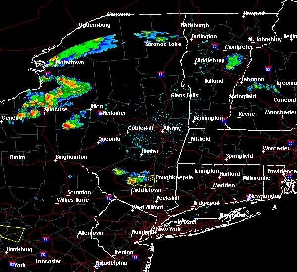 At 427 pm edt, a severe thunderstorm was located over ellenville, moving east at 30 mph (radar indicated). Hazards include 60 mph wind gusts and penny size hail. Expect damage to roofs. siding and trees. this severe thunderstorm will be near, kerhonkson around 430 pm edt. wallkill around 445 pm edt. modena around 450 pm edt. new paltz and plattekill around 455 pm edt. highland and marlboro around 505 pm edt. poughkeepsie around 510 pm edt. other locations impacted by this severe thunderstorm include libertyville, tuthilltown, ohioville, galeville, springtown, ulsterville, saint elmo, jenkinstown, highland landing and awosting. A tornado watch remains in effect until 1100 pm edt for east central new york. At 427 pm edt, a severe thunderstorm was located over ellenville, moving east at 30 mph (radar indicated). Hazards include 60 mph wind gusts and penny size hail. Expect damage to roofs. siding and trees. this severe thunderstorm will be near, kerhonkson around 430 pm edt. wallkill around 445 pm edt. modena around 450 pm edt. new paltz and plattekill around 455 pm edt. highland and marlboro around 505 pm edt. poughkeepsie around 510 pm edt. other locations impacted by this severe thunderstorm include libertyville, tuthilltown, ohioville, galeville, springtown, ulsterville, saint elmo, jenkinstown, highland landing and awosting. A tornado watch remains in effect until 1100 pm edt for east central new york.
|
| 5/27/2015 5:40 PM EDT | At 539 pm edt, severe thunderstorms were located along a line extending from stanfordville to cold spring, moving east at 50 mph (radar indicated). Hazards include 60 mph wind gusts and penny size hail. Expect damage to roofs. siding and trees. severe thunderstorms will be near, millbrook around 545 pm edt. amenia around 550 pm edt. sharon and hopewell junction around 555 pm edt. pawling around 605 pm edt. brookfield, new fairfield and wingdale around 610 pm edt. sherman and gaylordsville around 615 pm edt. new milford and winsted around 620 pm edt. hartland, new preston and woodbury center around 625 pm edt. Other locations impacted by these severe thunderstorms include dean corners, ohioville, arthursburg, sharon valley, birch groves, minortown, macdonnell heights, netherwood, east cornwall and clintondale station. |
| 5/27/2015 5:40 PM EDT | At 539 pm edt, severe thunderstorms were located along a line extending from stanfordville to cold spring, moving east at 50 mph (radar indicated). Hazards include 60 mph wind gusts and penny size hail. Expect damage to roofs. siding and trees. severe thunderstorms will be near, millbrook around 545 pm edt. amenia around 550 pm edt. sharon and hopewell junction around 555 pm edt. pawling around 605 pm edt. brookfield, new fairfield and wingdale around 610 pm edt. sherman and gaylordsville around 615 pm edt. new milford and winsted around 620 pm edt. hartland, new preston and woodbury center around 625 pm edt. Other locations impacted by these severe thunderstorms include dean corners, ohioville, arthursburg, sharon valley, birch groves, minortown, macdonnell heights, netherwood, east cornwall and clintondale station. |
| 5/27/2015 5:29 PM EDT | At 529 pm edt, doppler radar indicated a severe thunderstorm capable of producing quarter size hail and damaging winds in excess of 60 mph. this storm was located near goshen, and moving northeast at 30 mph. * this severe thunderstorm will be near, walden and beaverdam lake-salisbury mills around 540 pm edt. new windsor and gardnertown around 550 pm edt. newburgh around 555 pm edt. other locations impacted by this severe thunderstorm include washingtonville, maybrook, orange lake, cornwall on hudson, balmville, firthcliffe and vails gate. |
| 5/27/2015 5:00 PM EDT | At 459 pm edt, doppler radar indicated a severe thunderstorm capable of producing quarter size hail and damaging winds in excess of 60 mph. this storm was located over otisville, or near middletown, and moving northeast at 50 mph. * this severe thunderstorm will be near, middletown, bloomingburg and mechanicstown around 510 pm edt. goshen around 515 pm edt. montgomery around 520 pm edt. walden around 525 pm edt. gardnertown around 530 pm edt. other locations impacted by this severe thunderstorm include maybrook, orange lake, balmville, pine bush, scotchtown and washingtonville. |
Hail Maps for Plattekill, NY


Connect with Interactive Hail Maps