

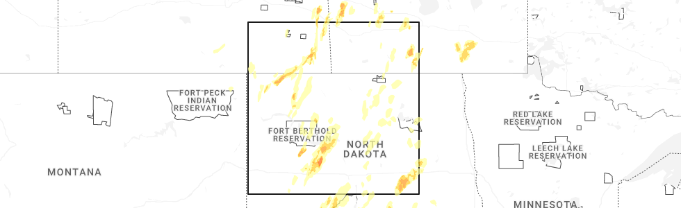
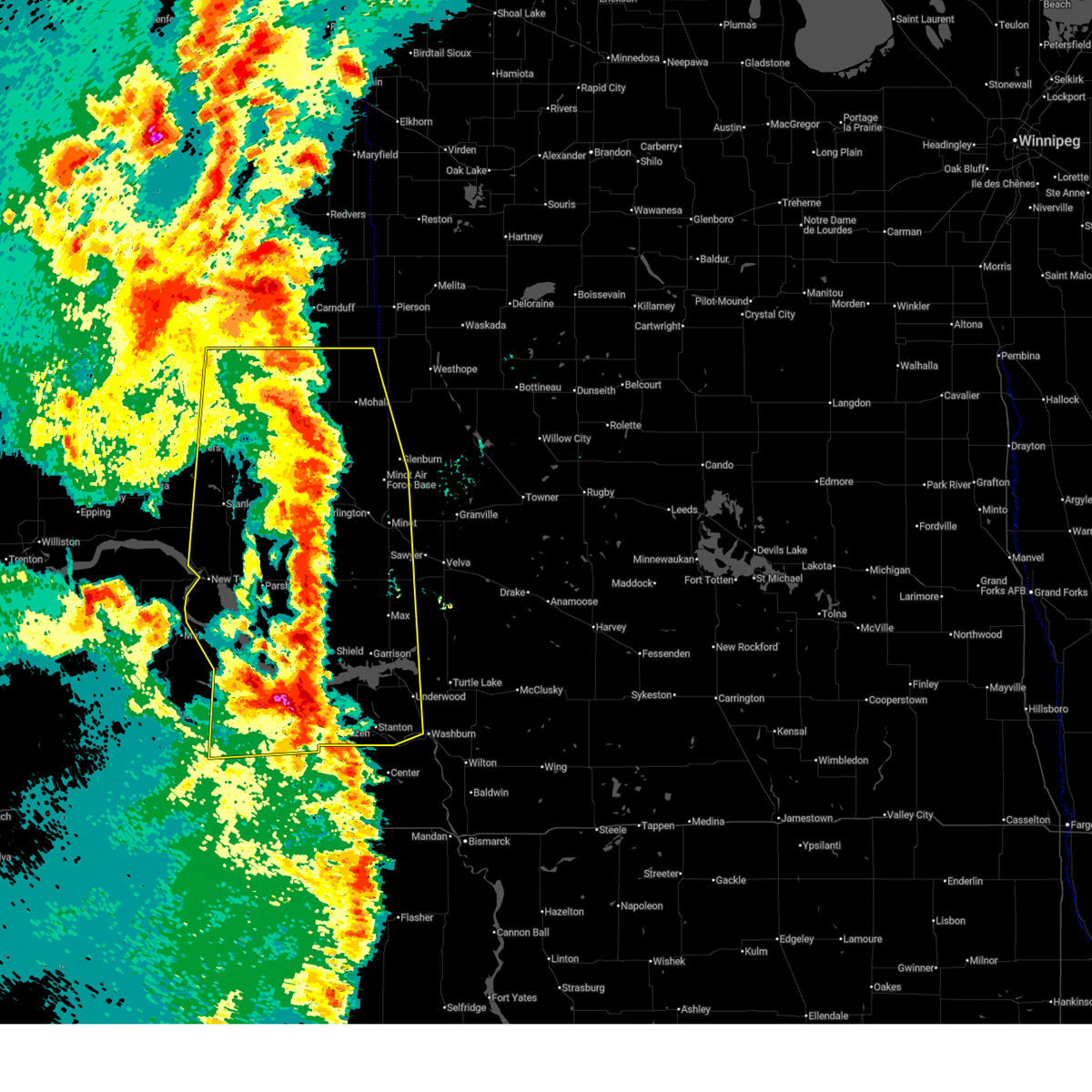
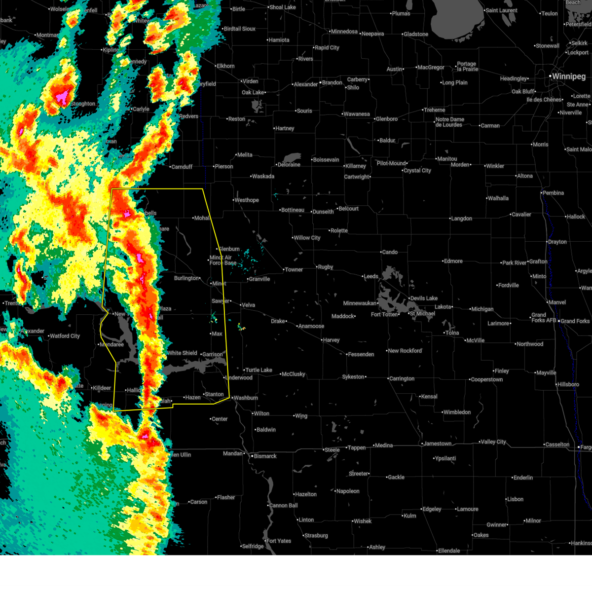
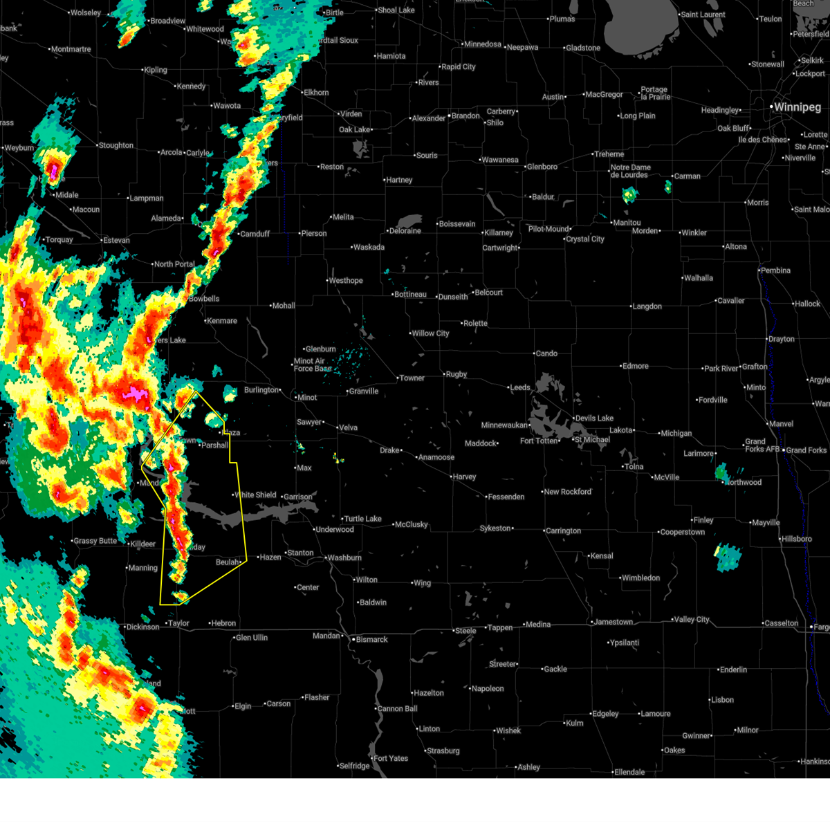
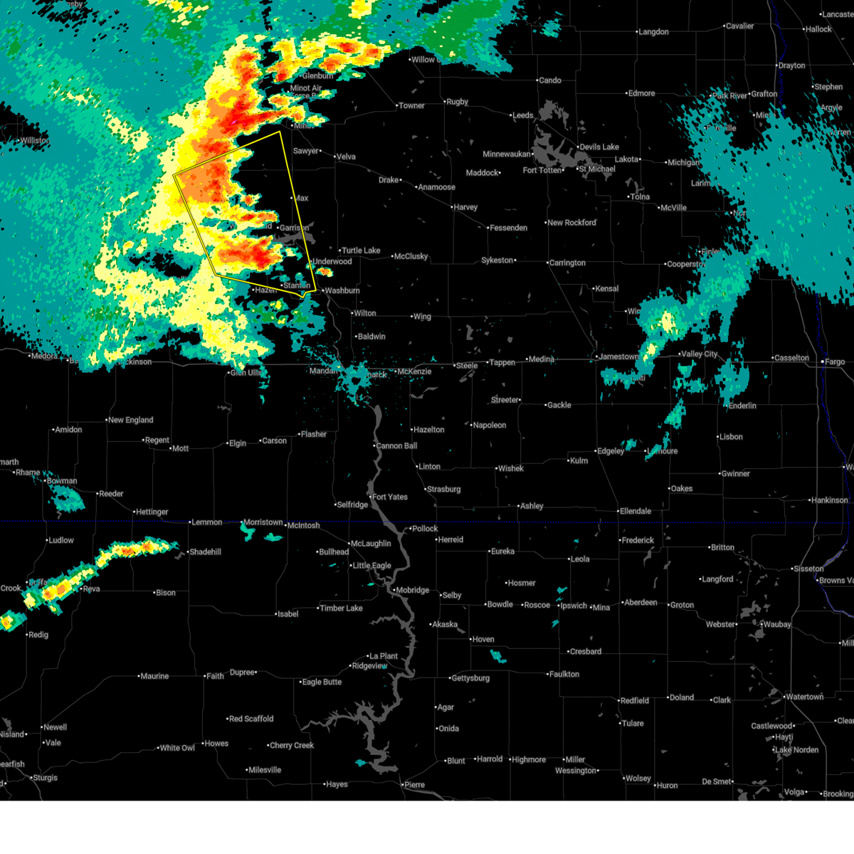
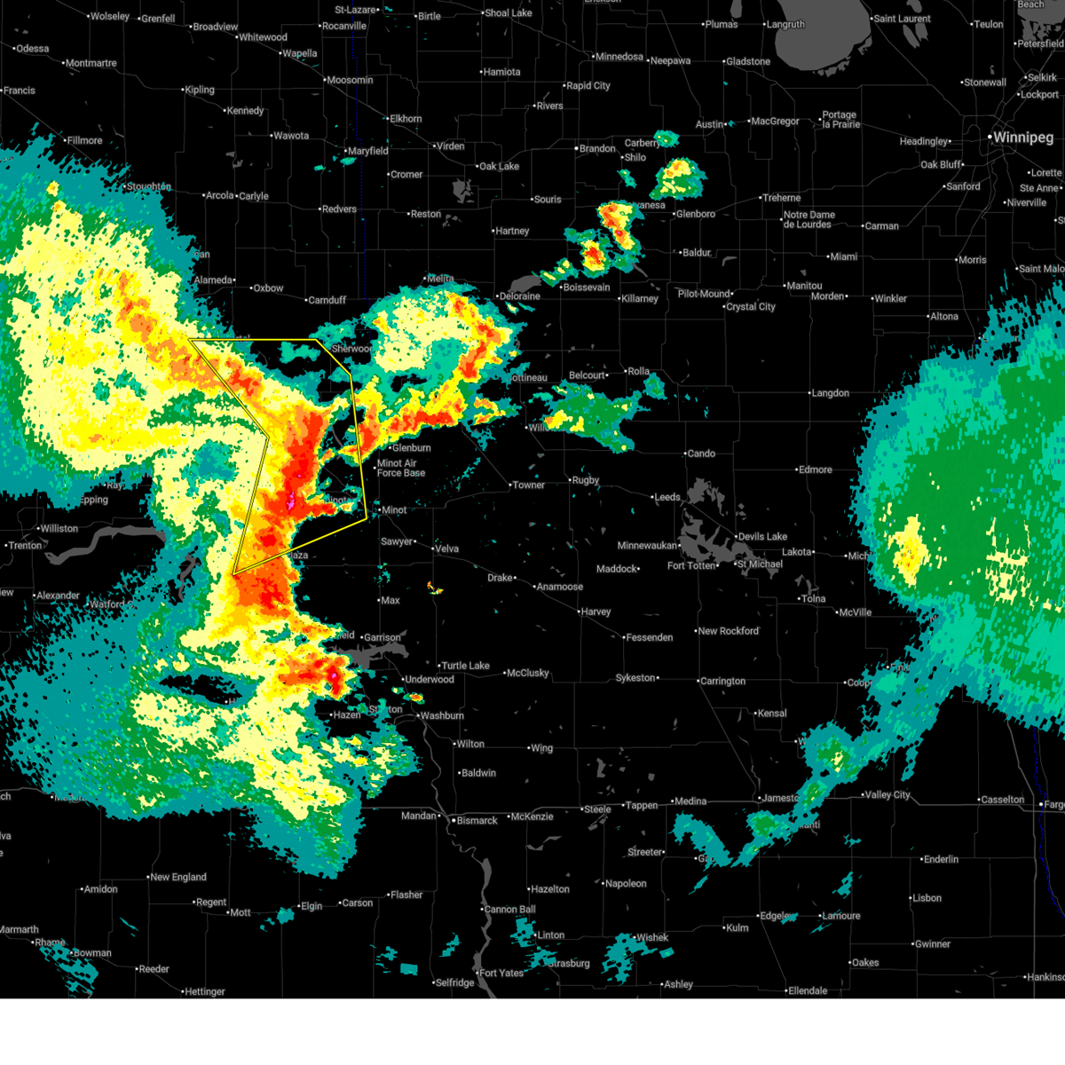
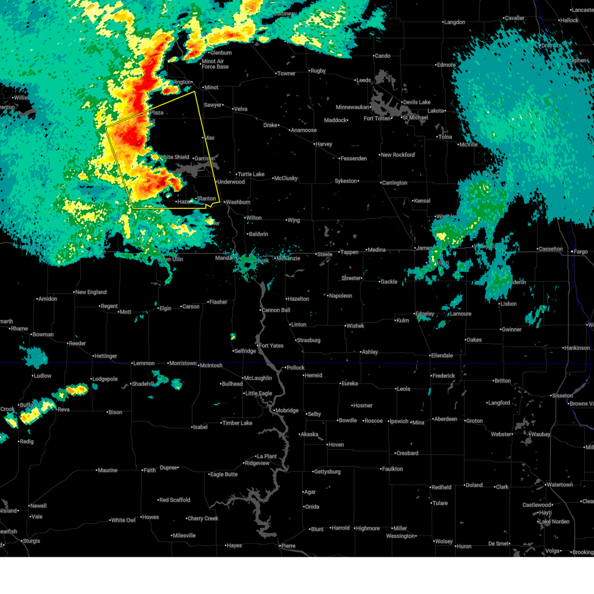
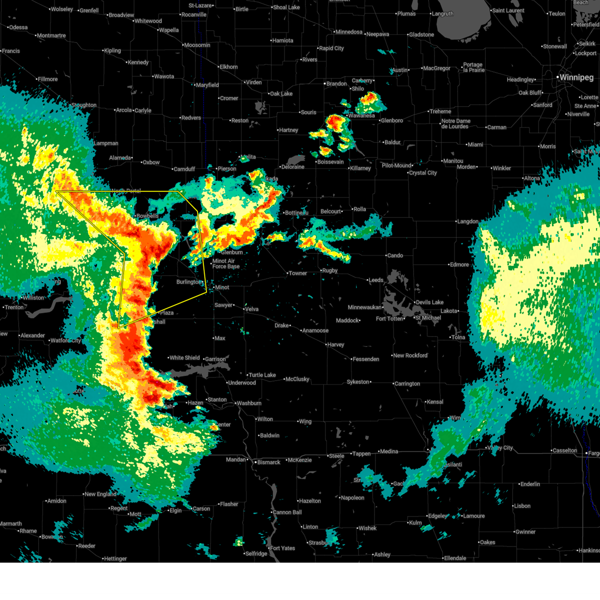
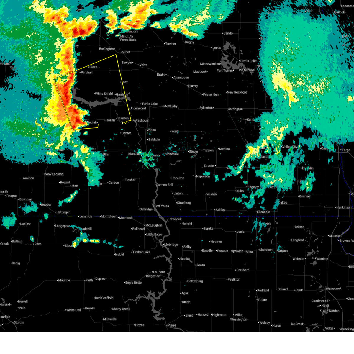
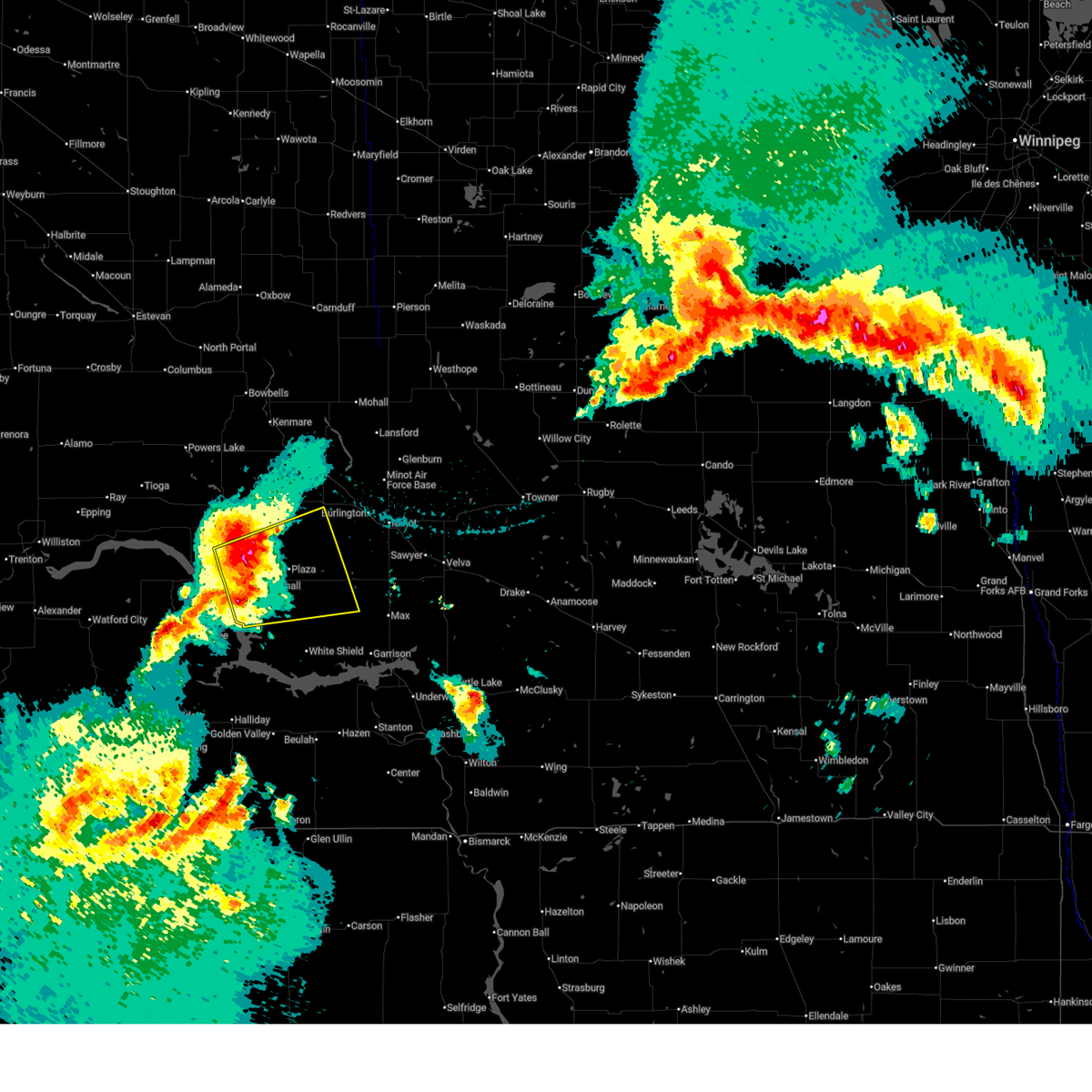
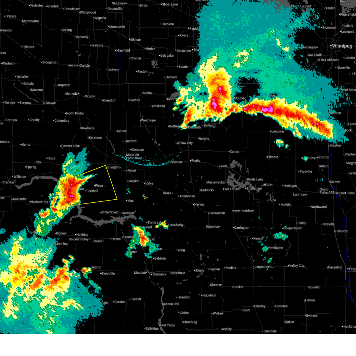
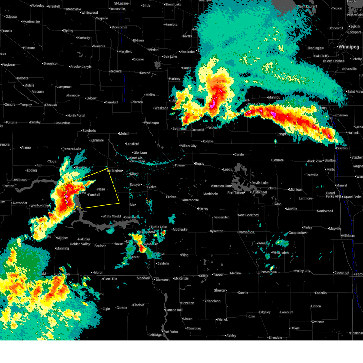
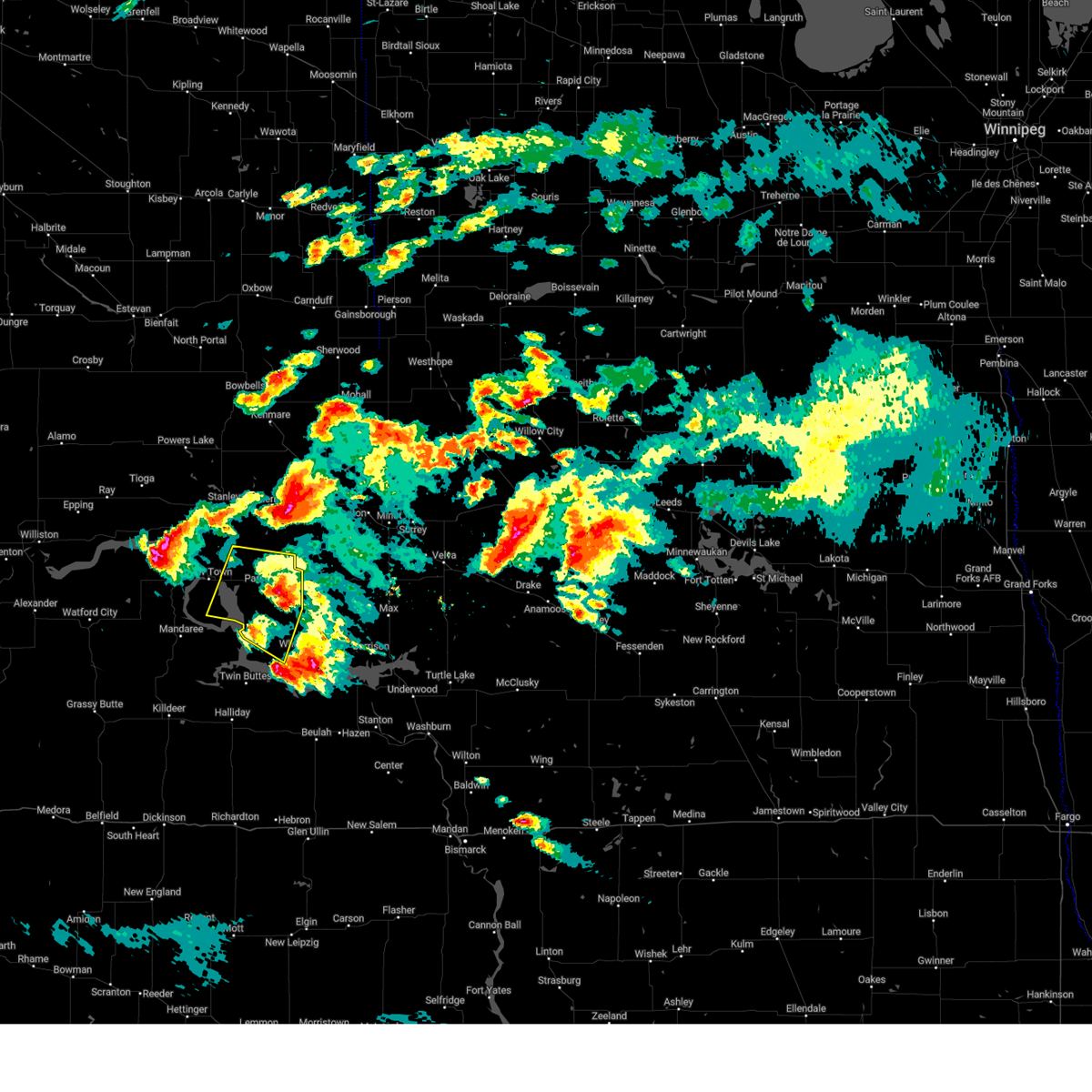
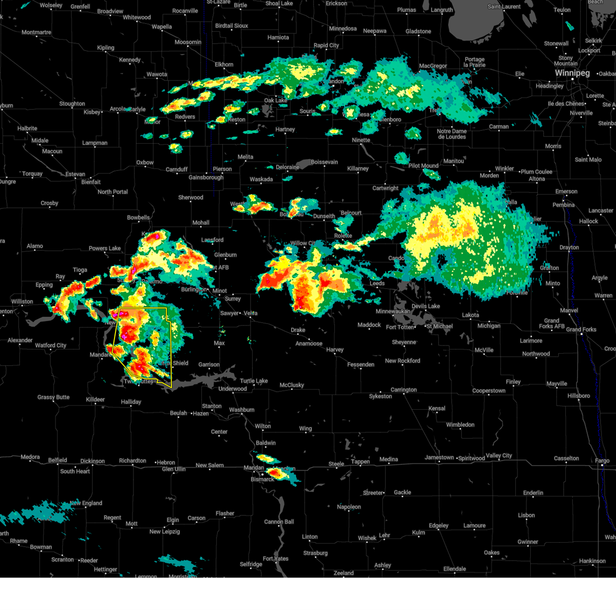
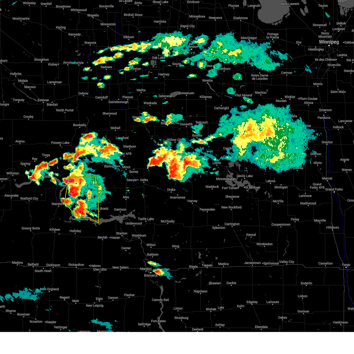
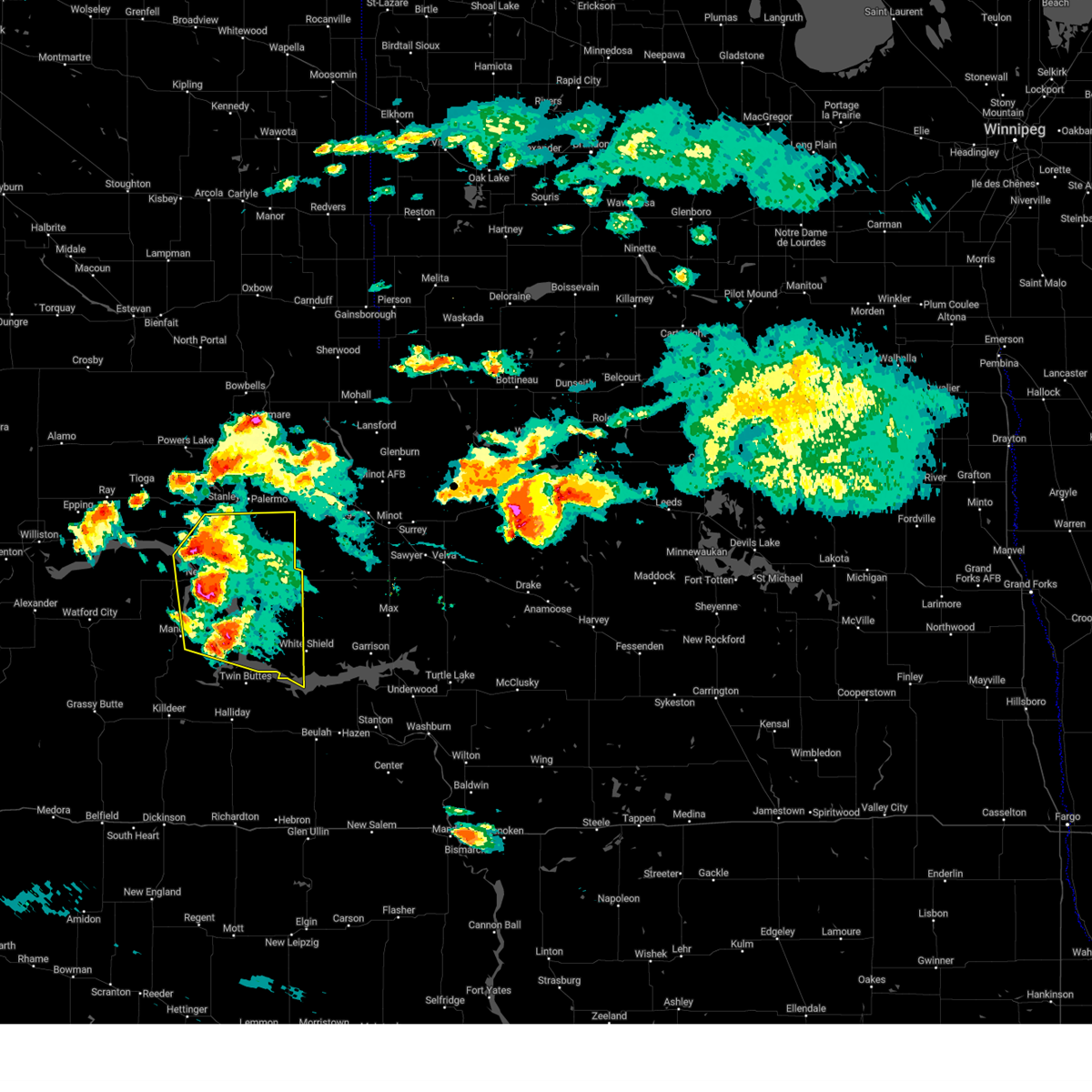
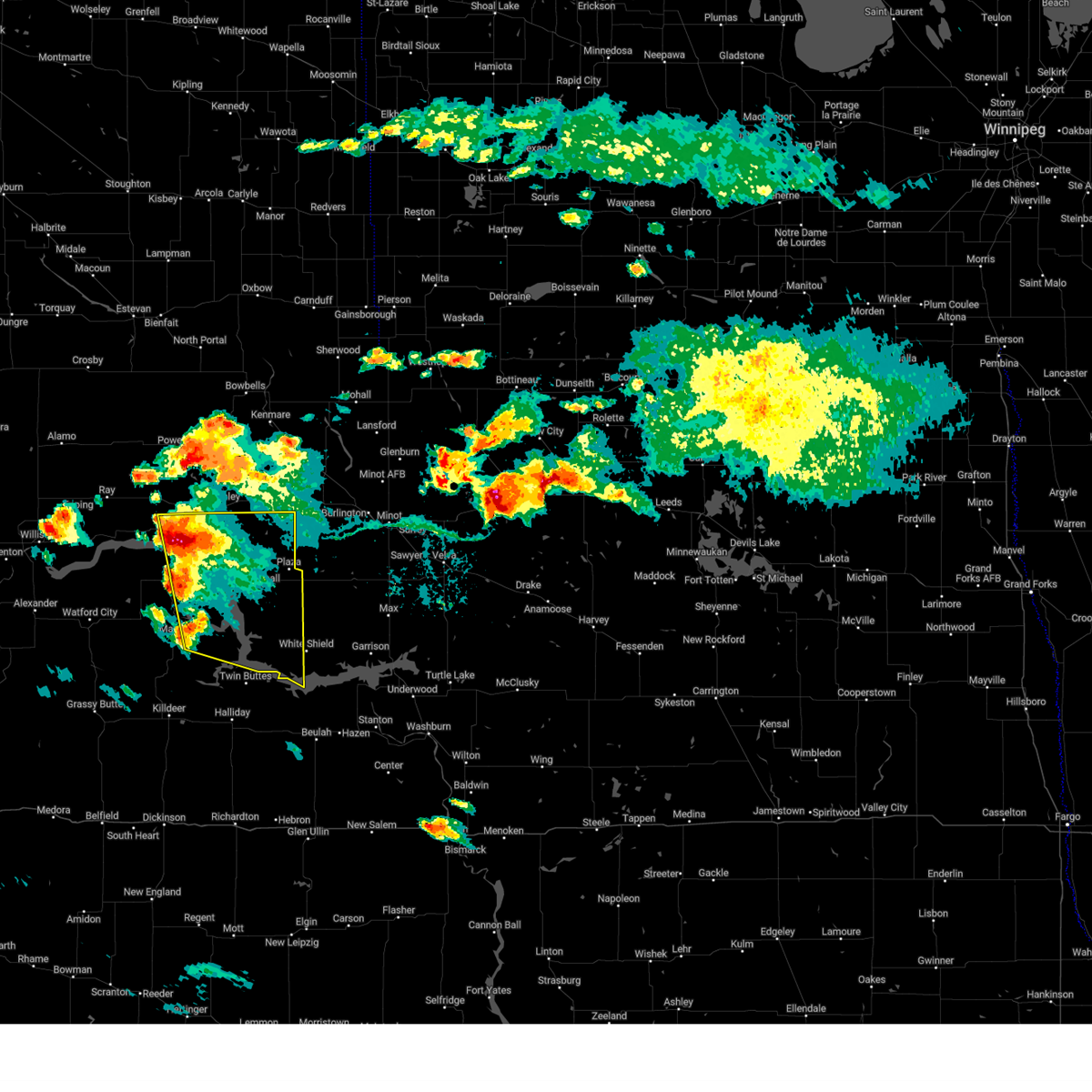
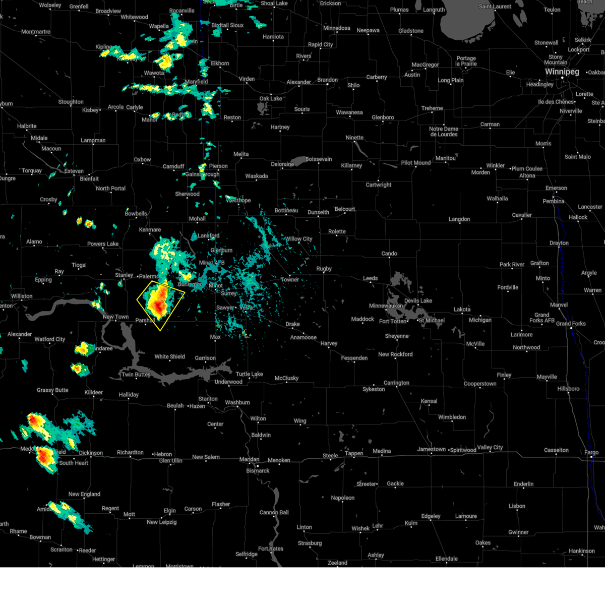
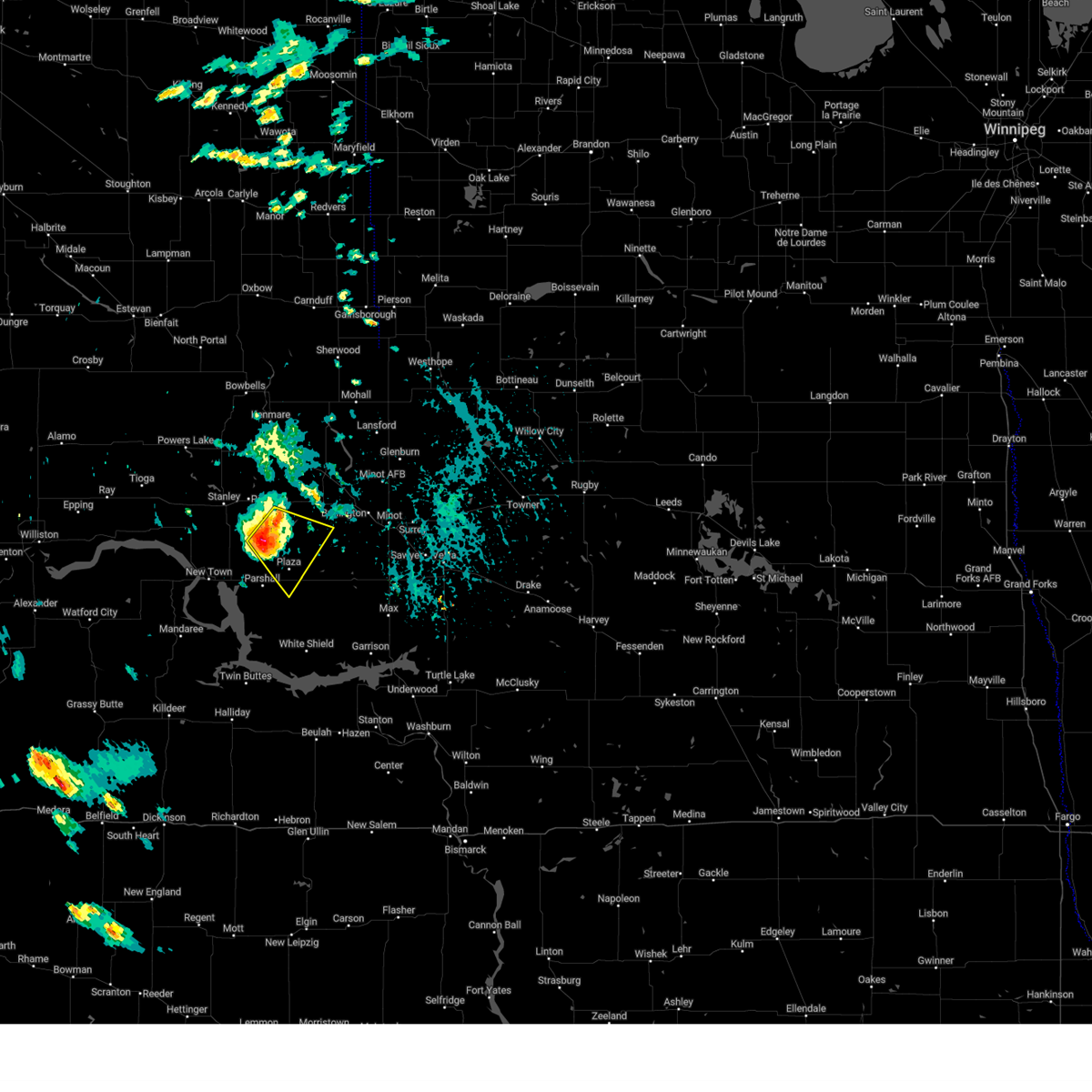
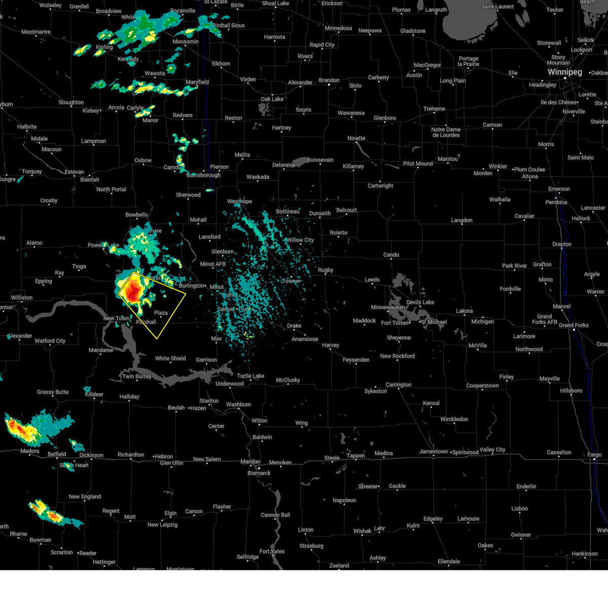
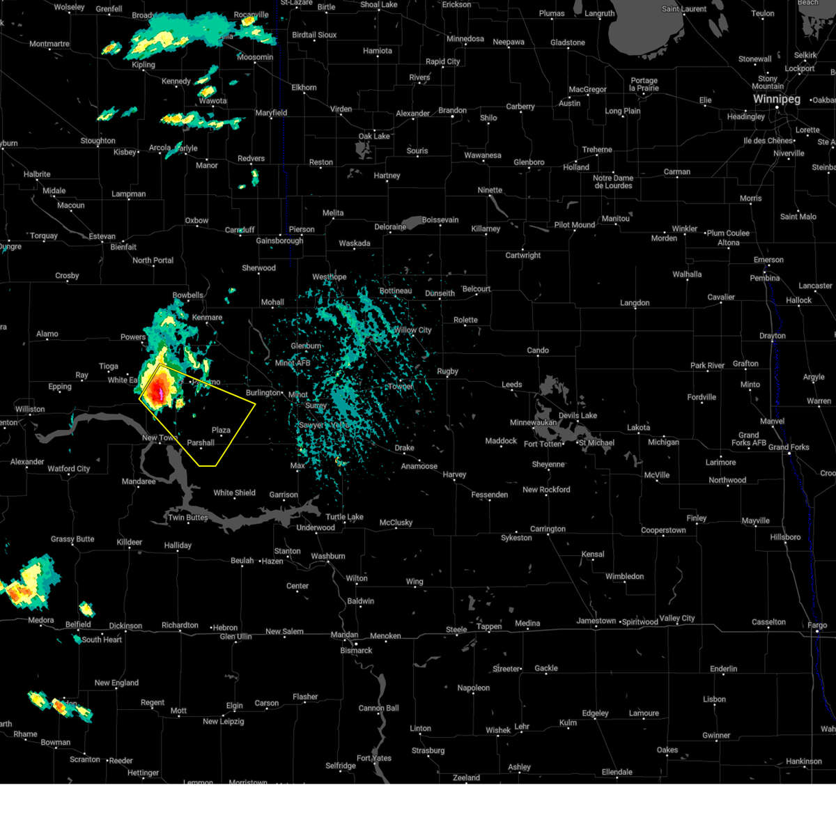
Hail Map for Plaza, ND
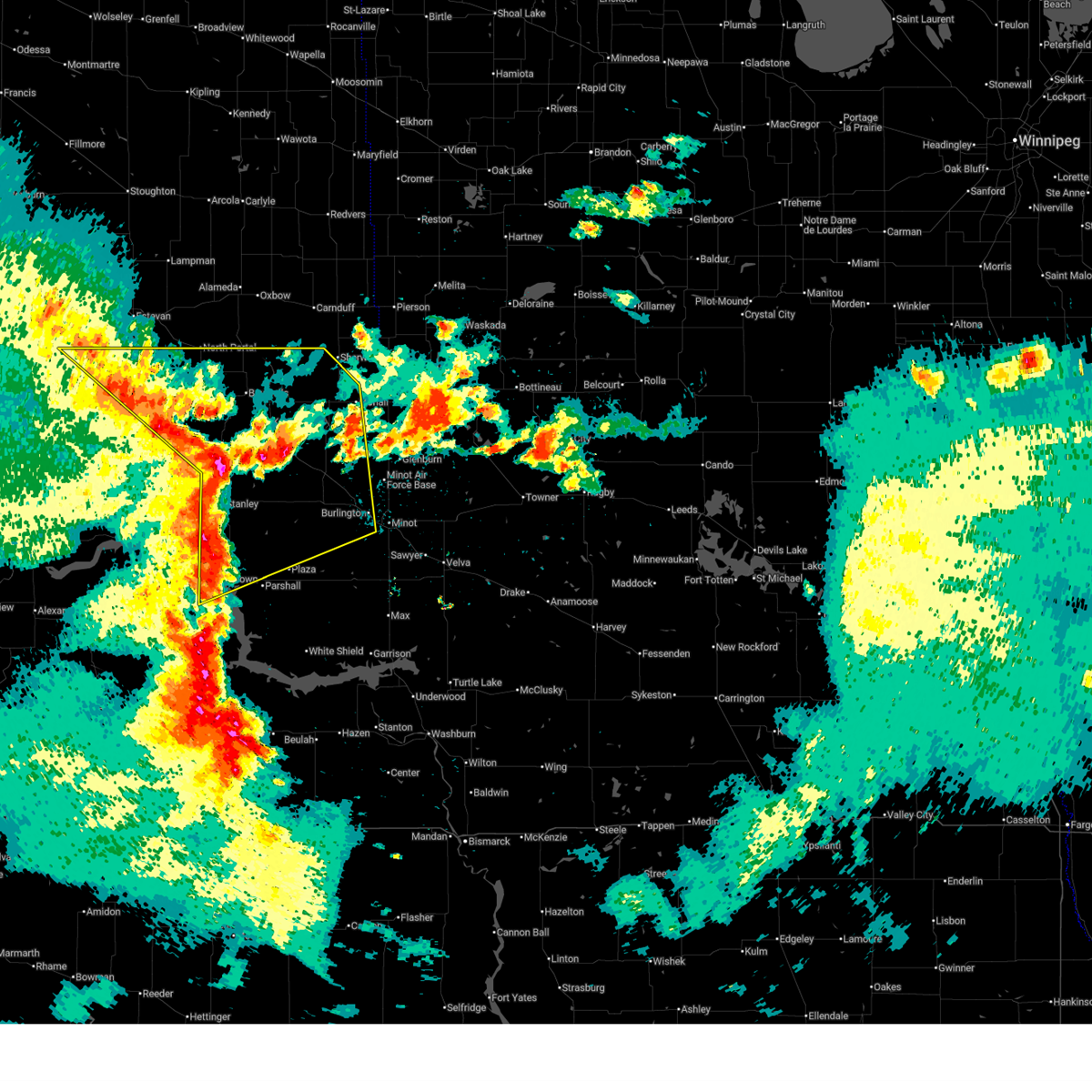
The Plaza, ND area has had 3 reports of on-the-ground hail by trained spotters, and has been under severe weather warnings 23 times during the past 12 months. Doppler radar has detected hail at or near Plaza, ND on 39 occasions, including 3 occasions during the past year.
| Name: | Plaza, ND |
| Where Located: | 33.8 miles WSW of Minot, ND |
| Map: | Google Map for Plaza, ND |
| Population: | 171 |
| Housing Units: | 114 |
| More Info: | Search Google for Plaza, ND |
2
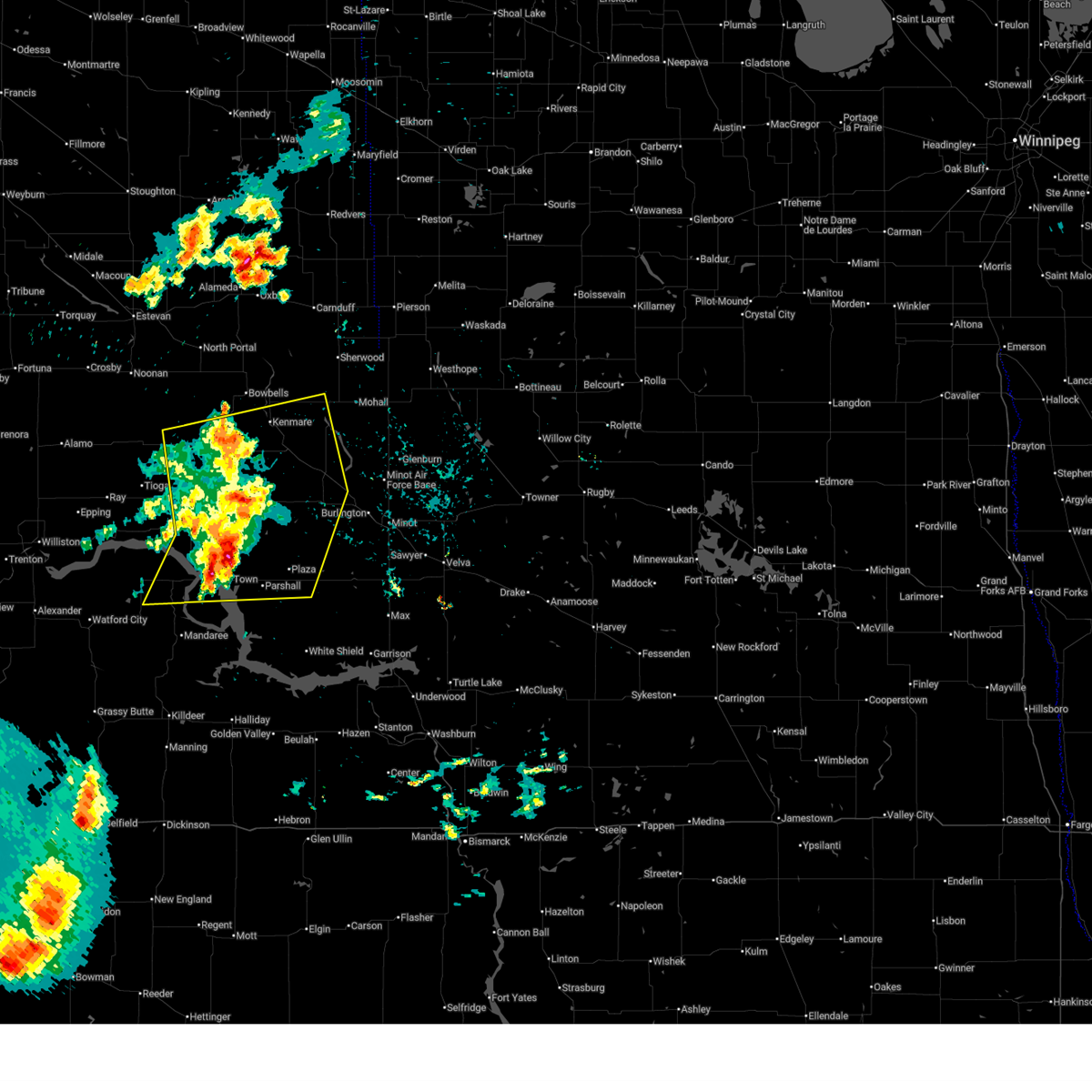
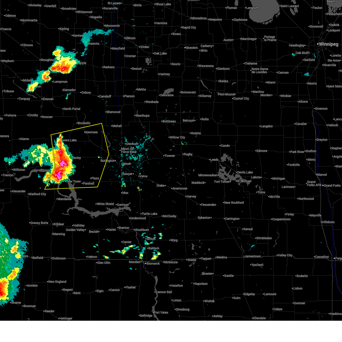
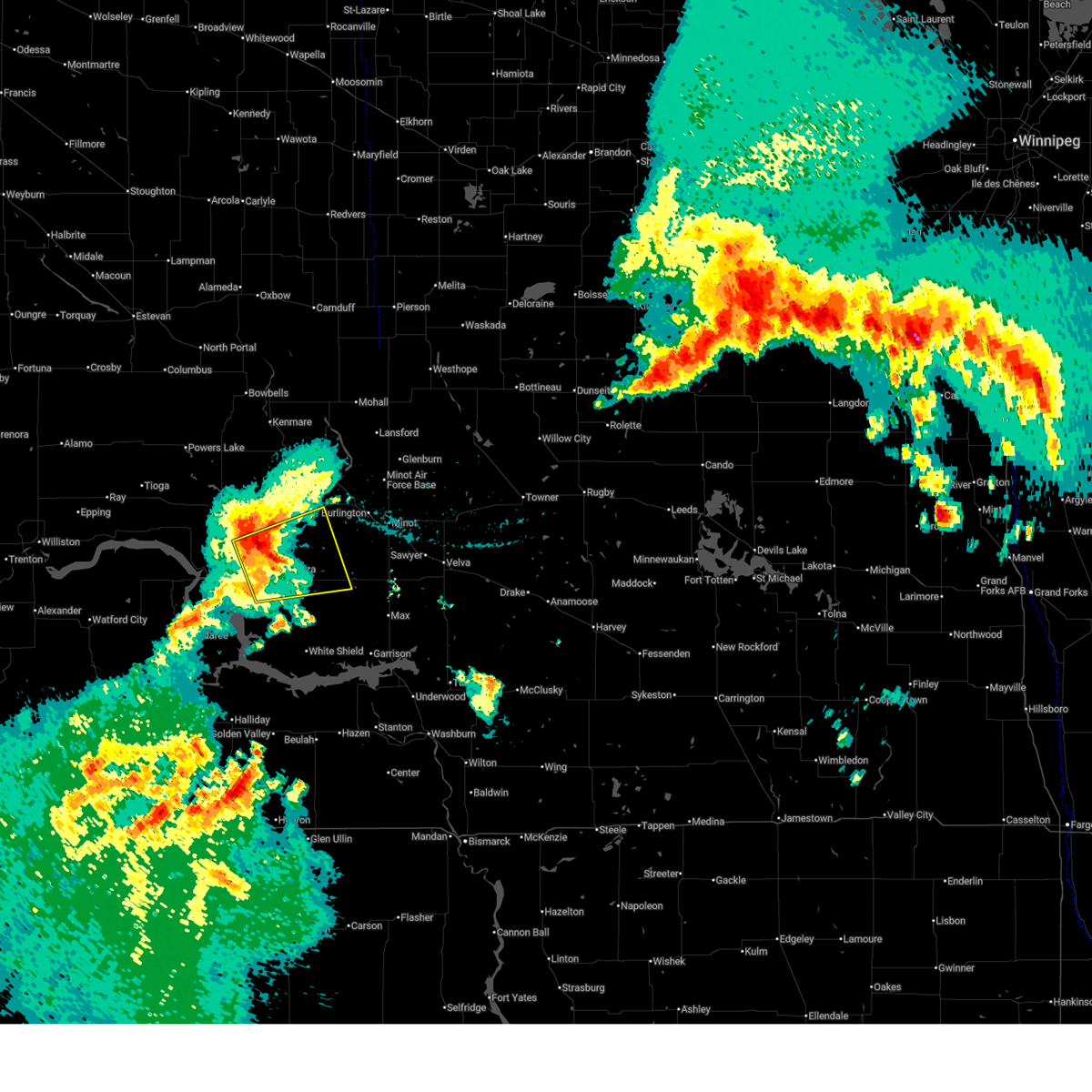
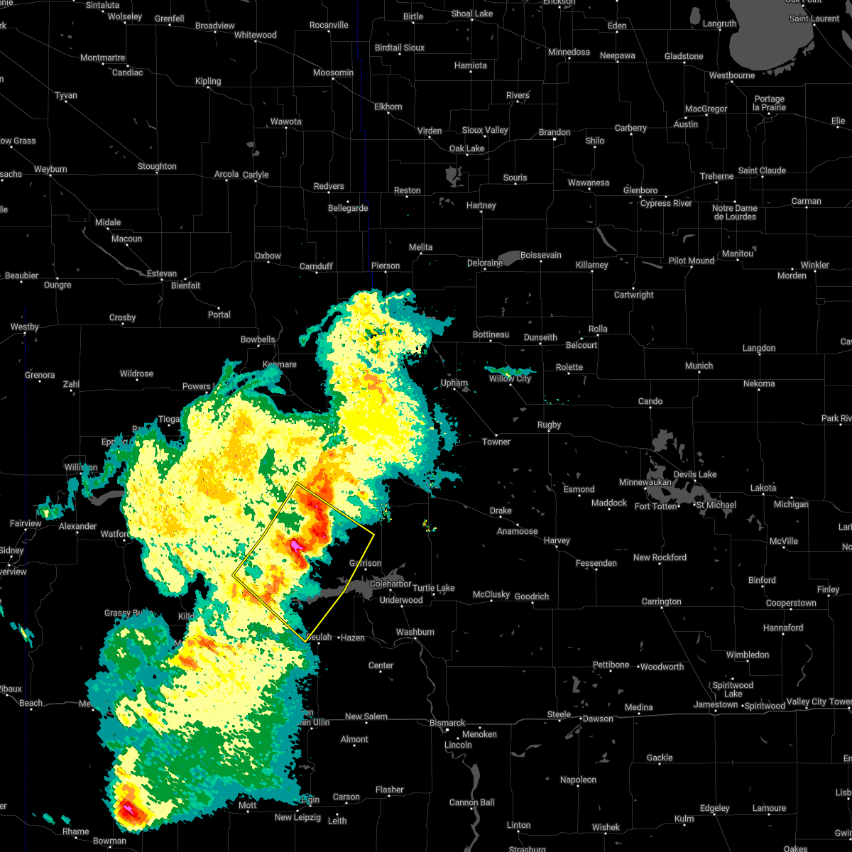
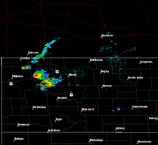
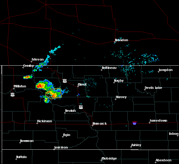
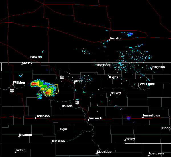
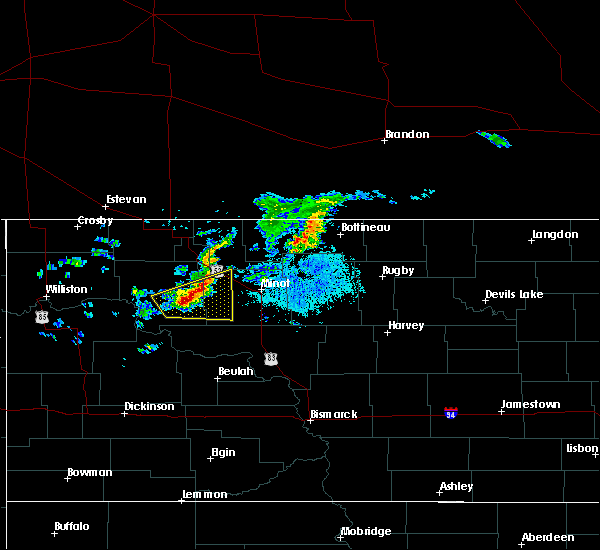
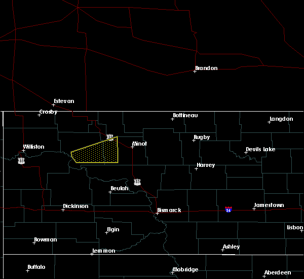
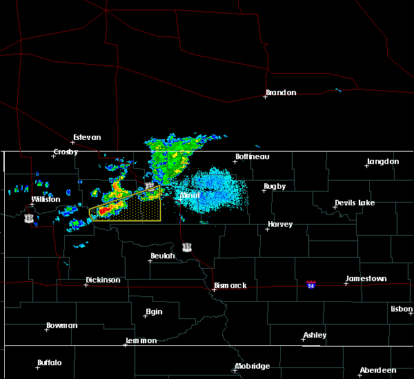
The Top Recent Hail Date for Plaza, ND is Tuesday, June 9, 2026 (7th out of 39)
Hail and Wind Damage Spotted near Plaza, ND
| Date / Time | Report Details |
|---|---|
| 6/27/2026 8:35 PM MDT |
 Svrbis the national weather service in bismarck has issued a * severe thunderstorm warning for, south central ward county in north central north dakota, northeastern mclean county in south central north dakota, northwestern morton county in south central north dakota, southeastern mountrail county in northwestern north dakota, oliver county in south central north dakota, mercer county in south central north dakota, * until 1030 pm cdt. * at 934 pm cdt, severe thunderstorms were located along a line extending from near van hook park to 11 miles southwest of roseglen to 7 miles west of new salem, moving northeast at 45 mph (radar indicated). Hazards include 70 mph wind gusts. Expect considerable tree damage. Damage is likely to mobile homes, roofs, and outbuildings. Svrbis the national weather service in bismarck has issued a * severe thunderstorm warning for, south central ward county in north central north dakota, northeastern mclean county in south central north dakota, northwestern morton county in south central north dakota, southeastern mountrail county in northwestern north dakota, oliver county in south central north dakota, mercer county in south central north dakota, * until 1030 pm cdt. * at 934 pm cdt, severe thunderstorms were located along a line extending from near van hook park to 11 miles southwest of roseglen to 7 miles west of new salem, moving northeast at 45 mph (radar indicated). Hazards include 70 mph wind gusts. Expect considerable tree damage. Damage is likely to mobile homes, roofs, and outbuildings.
|
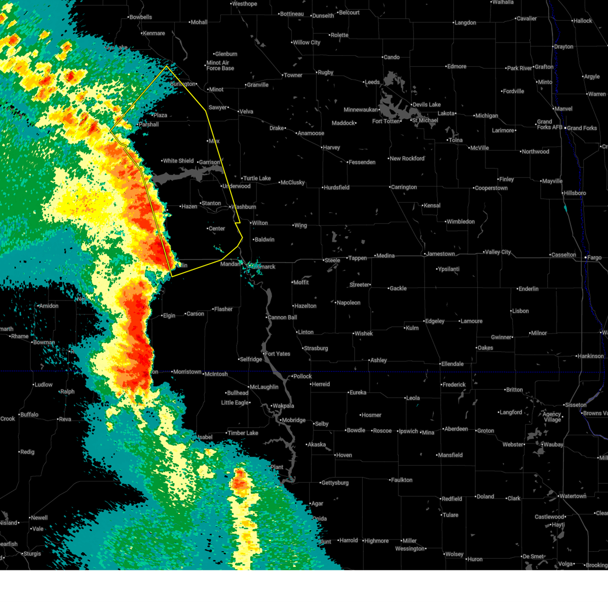
| 6/9/2026 6:40 PM CDT |
 At 640 pm cdt, severe thunderstorms were located along a line from 9 miles south of palermo to over ruso city, or along a line from 12 miles southeast of stanley to 23 miles northeast of garrison, moving northeast at 45 mph (trained spotters reported. at 616 pm cdt, 75 mph wind gusts were reported 3 miles south-southeast of garrison). Hazards include 70 mph wind gusts and ping pong ball size hail. People and animals outdoors will be injured. expect hail damage to roofs, siding, windows, and vehicles. expect considerable tree damage. wind damage is also likely to mobile homes, roofs, and outbuildings. Locations impacted include, minot, garrison, minot air force base, burlington, surrey, parshall, berthold, stanton, sawyer, max, riverdale, des lacs, plaza, carpio, makoti, pick city, foxholm, ryder and coleharbor. At 640 pm cdt, severe thunderstorms were located along a line from 9 miles south of palermo to over ruso city, or along a line from 12 miles southeast of stanley to 23 miles northeast of garrison, moving northeast at 45 mph (trained spotters reported. at 616 pm cdt, 75 mph wind gusts were reported 3 miles south-southeast of garrison). Hazards include 70 mph wind gusts and ping pong ball size hail. People and animals outdoors will be injured. expect hail damage to roofs, siding, windows, and vehicles. expect considerable tree damage. wind damage is also likely to mobile homes, roofs, and outbuildings. Locations impacted include, minot, garrison, minot air force base, burlington, surrey, parshall, berthold, stanton, sawyer, max, riverdale, des lacs, plaza, carpio, makoti, pick city, foxholm, ryder and coleharbor.
|
| 6/9/2026 6:23 PM CDT |
 At 623 pm cdt, severe thunderstorms were located along a line from 8 miles southeast of belden to 9 miles north of coleharbor, or along a line from 19 miles south of stanley to 11 miles east of garrison, moving northeast at 45 mph (trained spotters reported. at 616 pm cdt, 75 mph wind gusts were reported 3 miles south-southeast of garrison). Hazards include 70 mph wind gusts and ping pong ball size hail. People and animals outdoors will be injured. expect hail damage to roofs, siding, windows, and vehicles. expect considerable tree damage. wind damage is also likely to mobile homes, roofs, and outbuildings. Locations impacted include, minot, garrison, minot air force base, burlington, surrey, parshall, berthold, stanton, sawyer, max, riverdale, des lacs, plaza, carpio, makoti, pick city, foxholm, ryder and coleharbor. At 623 pm cdt, severe thunderstorms were located along a line from 8 miles southeast of belden to 9 miles north of coleharbor, or along a line from 19 miles south of stanley to 11 miles east of garrison, moving northeast at 45 mph (trained spotters reported. at 616 pm cdt, 75 mph wind gusts were reported 3 miles south-southeast of garrison). Hazards include 70 mph wind gusts and ping pong ball size hail. People and animals outdoors will be injured. expect hail damage to roofs, siding, windows, and vehicles. expect considerable tree damage. wind damage is also likely to mobile homes, roofs, and outbuildings. Locations impacted include, minot, garrison, minot air force base, burlington, surrey, parshall, berthold, stanton, sawyer, max, riverdale, des lacs, plaza, carpio, makoti, pick city, foxholm, ryder and coleharbor.
|
| 6/9/2026 6:12 PM CDT |
 Svrbis the national weather service in bismarck has issued a * severe thunderstorm warning for, ward county in north central north dakota, eastern mountrail county in northwestern north dakota, northwestern mclean county in south central north dakota, northeastern mercer county in south central north dakota, * until 715 pm cdt. * at 612 pm cdt, severe thunderstorms were located along a line from near van hook park to over riverdale, or along a line from 29 miles south of stanley to 10 miles south of garrison, moving northeast at 50 mph (radar indicated). Hazards include 70 mph wind gusts and ping pong ball size hail. People and animals outdoors will be injured. expect hail damage to roofs, siding, windows, and vehicles. expect considerable tree damage. Wind damage is also likely to mobile homes, roofs, and outbuildings. Svrbis the national weather service in bismarck has issued a * severe thunderstorm warning for, ward county in north central north dakota, eastern mountrail county in northwestern north dakota, northwestern mclean county in south central north dakota, northeastern mercer county in south central north dakota, * until 715 pm cdt. * at 612 pm cdt, severe thunderstorms were located along a line from near van hook park to over riverdale, or along a line from 29 miles south of stanley to 10 miles south of garrison, moving northeast at 50 mph (radar indicated). Hazards include 70 mph wind gusts and ping pong ball size hail. People and animals outdoors will be injured. expect hail damage to roofs, siding, windows, and vehicles. expect considerable tree damage. Wind damage is also likely to mobile homes, roofs, and outbuildings.
|
| 6/7/2026 9:30 PM CDT |
 At 930 pm cdt /830 pm mdt/, severe thunderstorms were located along a line from 8 miles northwest of sherwood to 7 miles south of hazen bay recreation area, or along a line from 60 miles northeast of stanley to 12 miles northeast of beulah, moving northeast at 35 mph (radar indicated). Hazards include 60 mph wind gusts and quarter size hail. Hail damage to vehicles is expected. expect wind damage to roofs, siding, and trees. Locations impacted include, minot, beulah, stanley, garrison, minot air force base, hazen, new town, kenmare, burlington, parshall, mohall, underwood, berthold, glenburn, stanton, bowbells, max, lansford, sherwood and zap. At 930 pm cdt /830 pm mdt/, severe thunderstorms were located along a line from 8 miles northwest of sherwood to 7 miles south of hazen bay recreation area, or along a line from 60 miles northeast of stanley to 12 miles northeast of beulah, moving northeast at 35 mph (radar indicated). Hazards include 60 mph wind gusts and quarter size hail. Hail damage to vehicles is expected. expect wind damage to roofs, siding, and trees. Locations impacted include, minot, beulah, stanley, garrison, minot air force base, hazen, new town, kenmare, burlington, parshall, mohall, underwood, berthold, glenburn, stanton, bowbells, max, lansford, sherwood and zap.
|
| 6/7/2026 9:00 PM CDT |
 Svrbis the national weather service in bismarck has issued a * severe thunderstorm warning for, western bottineau county in north central north dakota, renville county in north central north dakota, ward county in north central north dakota, eastern burke county in northwestern north dakota, mountrail county in northwestern north dakota, mclean county in south central north dakota, mercer county in south central north dakota, northeastern dunn county in southwestern north dakota, * until 1000 pm cdt /900 pm mdt/. * at 900 pm cdt /800 pm mdt/, severe thunderstorms were located along a line from 7 miles south of donnybrook to near beulah, or along a line from 22 miles east of stanley to near beulah, moving east at 35 mph (radar indicated). Hazards include 70 mph wind gusts and quarter size hail. Hail damage to vehicles is expected. expect considerable tree damage. Wind damage is also likely to mobile homes, roofs, and outbuildings. Svrbis the national weather service in bismarck has issued a * severe thunderstorm warning for, western bottineau county in north central north dakota, renville county in north central north dakota, ward county in north central north dakota, eastern burke county in northwestern north dakota, mountrail county in northwestern north dakota, mclean county in south central north dakota, mercer county in south central north dakota, northeastern dunn county in southwestern north dakota, * until 1000 pm cdt /900 pm mdt/. * at 900 pm cdt /800 pm mdt/, severe thunderstorms were located along a line from 7 miles south of donnybrook to near beulah, or along a line from 22 miles east of stanley to near beulah, moving east at 35 mph (radar indicated). Hazards include 70 mph wind gusts and quarter size hail. Hail damage to vehicles is expected. expect considerable tree damage. Wind damage is also likely to mobile homes, roofs, and outbuildings.
|
| 6/7/2026 8:08 PM CDT |
 At 808 pm cdt /708 pm mdt/, severe thunderstorms were located along a line from 9 miles south of van hook park to over marshall, or along a line from 34 miles south of stanley to 26 miles west of beulah, moving northeast at 25 mph (public reported). Hazards include 70 mph wind gusts and half dollar size hail. Hail damage to vehicles is expected. expect considerable tree damage. wind damage is also likely to mobile homes, roofs, and outbuildings. Locations impacted include, beulah, new town, parshall, zap, halliday, golden valley, plaza, dodge, marshall, roseglen, mckenzie bay recreation area, van hook park, beulah bay recreation area, indian hills state recreation area, deep water creek recreation area, twin buttes, raub, fort berthold, skunk creek bay recreation area and pouch point recreation area. At 808 pm cdt /708 pm mdt/, severe thunderstorms were located along a line from 9 miles south of van hook park to over marshall, or along a line from 34 miles south of stanley to 26 miles west of beulah, moving northeast at 25 mph (public reported). Hazards include 70 mph wind gusts and half dollar size hail. Hail damage to vehicles is expected. expect considerable tree damage. wind damage is also likely to mobile homes, roofs, and outbuildings. Locations impacted include, beulah, new town, parshall, zap, halliday, golden valley, plaza, dodge, marshall, roseglen, mckenzie bay recreation area, van hook park, beulah bay recreation area, indian hills state recreation area, deep water creek recreation area, twin buttes, raub, fort berthold, skunk creek bay recreation area and pouch point recreation area.
|
| 8/7/2025 9:15 PM CDT | Ndawn station shell lake 2se. report at 10 meters... 48 mph observed at the surfac in mountrail county ND, 10.2 miles SSE of Plaza, ND |
| 7/27/2025 3:29 AM MDT |
 the severe thunderstorm warning has been cancelled and is no longer in effect the severe thunderstorm warning has been cancelled and is no longer in effect
|
| 7/27/2025 3:29 AM MDT |
 At 428 am cdt, severe thunderstorms were located along a line extending from 7 miles southeast of parshall to 4 miles south of beulah bay recreation area, moving northeast at 45 mph (a 69 mph wind gust was observed at the garrison airport at 427 am cdt). Hazards include 70 mph wind gusts and penny size hail. Expect considerable tree damage. damage is likely to mobile homes, roofs, and outbuildings. Locations impacted include, garrison, parshall, underwood, stanton, max, riverdale, plaza, makoti, pick city, ryder, coleharbor, rice lake, douglas, roseglen, beulah bay recreation area, hazen bay recreation area, emmet, white shield, fort stevenson state park, and dakota waters recreation area. At 428 am cdt, severe thunderstorms were located along a line extending from 7 miles southeast of parshall to 4 miles south of beulah bay recreation area, moving northeast at 45 mph (a 69 mph wind gust was observed at the garrison airport at 427 am cdt). Hazards include 70 mph wind gusts and penny size hail. Expect considerable tree damage. damage is likely to mobile homes, roofs, and outbuildings. Locations impacted include, garrison, parshall, underwood, stanton, max, riverdale, plaza, makoti, pick city, ryder, coleharbor, rice lake, douglas, roseglen, beulah bay recreation area, hazen bay recreation area, emmet, white shield, fort stevenson state park, and dakota waters recreation area.
|
| 7/27/2025 4:24 AM CDT |
 At 424 am cdt, severe thunderstorms were located along a line extending from 5 miles north of flaxton to 7 miles west of greene to 10 miles north of plaza, moving northeast at 45 mph (radar indicated). Hazards include 60 mph wind gusts and penny size hail. Expect damage to roofs, siding, and trees. Locations impacted include, kenmare, burlington, mohall, berthold, bowbells, des lacs, plaza, carpio, portal, foxholm, greene, flaxton, donnybrook, blaisdell, coulee, tolley, norma, loraine, grano, and hartland. At 424 am cdt, severe thunderstorms were located along a line extending from 5 miles north of flaxton to 7 miles west of greene to 10 miles north of plaza, moving northeast at 45 mph (radar indicated). Hazards include 60 mph wind gusts and penny size hail. Expect damage to roofs, siding, and trees. Locations impacted include, kenmare, burlington, mohall, berthold, bowbells, des lacs, plaza, carpio, portal, foxholm, greene, flaxton, donnybrook, blaisdell, coulee, tolley, norma, loraine, grano, and hartland.
|
| 7/27/2025 4:24 AM CDT |
 the severe thunderstorm warning has been cancelled and is no longer in effect the severe thunderstorm warning has been cancelled and is no longer in effect
|
| 7/27/2025 3:14 AM MDT |
 At 413 am cdt, severe thunderstorms were located along a line extending from 11 miles south of parshall to 6 miles northwest of zap, moving northeast at 45 mph (nddot mesonet site 1 east northwest of golden valley reported a 79 mph wind gust at 353 am cdt). Hazards include 70 mph wind gusts and penny size hail. Expect considerable tree damage. damage is likely to mobile homes, roofs, and outbuildings. Locations impacted include, beulah, garrison, hazen, parshall, underwood, stanton, max, zap, riverdale, golden valley, plaza, makoti, pick city, ryder, coleharbor, rice lake, douglas, roseglen, beulah bay recreation area, and hazen bay recreation area. At 413 am cdt, severe thunderstorms were located along a line extending from 11 miles south of parshall to 6 miles northwest of zap, moving northeast at 45 mph (nddot mesonet site 1 east northwest of golden valley reported a 79 mph wind gust at 353 am cdt). Hazards include 70 mph wind gusts and penny size hail. Expect considerable tree damage. damage is likely to mobile homes, roofs, and outbuildings. Locations impacted include, beulah, garrison, hazen, parshall, underwood, stanton, max, zap, riverdale, golden valley, plaza, makoti, pick city, ryder, coleharbor, rice lake, douglas, roseglen, beulah bay recreation area, and hazen bay recreation area.
|
| 7/27/2025 4:07 AM CDT |
 At 407 am cdt, severe thunderstorms were located along a line extending from 4 miles northwest of lignite to 5 miles south of kenmare to 9 miles northwest of plaza, moving northeast at 45 mph (radar indicated). Hazards include 60 mph wind gusts and penny size hail. Expect damage to roofs, siding, and trees. Locations impacted include, stanley, kenmare, burlington, mohall, berthold, bowbells, des lacs, plaza, carpio, lignite, columbus, portal, noonan, foxholm, greene, palermo, flaxton, donnybrook, van hook park, and belden. At 407 am cdt, severe thunderstorms were located along a line extending from 4 miles northwest of lignite to 5 miles south of kenmare to 9 miles northwest of plaza, moving northeast at 45 mph (radar indicated). Hazards include 60 mph wind gusts and penny size hail. Expect damage to roofs, siding, and trees. Locations impacted include, stanley, kenmare, burlington, mohall, berthold, bowbells, des lacs, plaza, carpio, lignite, columbus, portal, noonan, foxholm, greene, palermo, flaxton, donnybrook, van hook park, and belden.
|
| 7/27/2025 2:55 AM MDT |
 Svrbis the national weather service in bismarck has issued a * severe thunderstorm warning for, south central ward county in north central north dakota, northeastern dunn county in southwestern north dakota, western mclean county in south central north dakota, southeastern mountrail county in northwestern north dakota, mercer county in south central north dakota, * until 445 am cdt. * at 354 am cdt, severe thunderstorms were located along a line extending from 8 miles northwest of mckenzie bay recreation area to near dodge, moving northeast at 45 mph (radar indicated). Hazards include 60 mph wind gusts and penny size hail. expect damage to roofs, siding, and trees Svrbis the national weather service in bismarck has issued a * severe thunderstorm warning for, south central ward county in north central north dakota, northeastern dunn county in southwestern north dakota, western mclean county in south central north dakota, southeastern mountrail county in northwestern north dakota, mercer county in south central north dakota, * until 445 am cdt. * at 354 am cdt, severe thunderstorms were located along a line extending from 8 miles northwest of mckenzie bay recreation area to near dodge, moving northeast at 45 mph (radar indicated). Hazards include 60 mph wind gusts and penny size hail. expect damage to roofs, siding, and trees
|
| 7/27/2025 3:46 AM CDT |
 Svrbis the national weather service in bismarck has issued a * severe thunderstorm warning for, western ward county in north central north dakota, renville county in north central north dakota, burke county in northwestern north dakota, mountrail county in northwestern north dakota, northeastern divide county in northwestern north dakota, * until 445 am cdt. * at 346 am cdt, severe thunderstorms were located along a line extending from 6 miles southeast of noonan to near lostwood to near new town, moving northeast at 45 mph (radar indicated). Hazards include 60 mph wind gusts and penny size hail. expect damage to roofs, siding, and trees Svrbis the national weather service in bismarck has issued a * severe thunderstorm warning for, western ward county in north central north dakota, renville county in north central north dakota, burke county in northwestern north dakota, mountrail county in northwestern north dakota, northeastern divide county in northwestern north dakota, * until 445 am cdt. * at 346 am cdt, severe thunderstorms were located along a line extending from 6 miles southeast of noonan to near lostwood to near new town, moving northeast at 45 mph (radar indicated). Hazards include 60 mph wind gusts and penny size hail. expect damage to roofs, siding, and trees
|
| 7/25/2025 9:11 PM CDT |
 The storms which prompted the warning have weakened below severe limits, and no longer pose an immediate threat to life or property. therefore, the warning will be allowed to expire. however, small hail and gusty winds are still possible with these thunderstorms. a severe thunderstorm watch remains in effect until 200 am cdt for north central and northwestern north dakota. The storms which prompted the warning have weakened below severe limits, and no longer pose an immediate threat to life or property. therefore, the warning will be allowed to expire. however, small hail and gusty winds are still possible with these thunderstorms. a severe thunderstorm watch remains in effect until 200 am cdt for north central and northwestern north dakota.
|
| 7/25/2025 8:55 PM CDT |
 At 854 pm cdt, severe thunderstorms were located along a line extending from 10 miles northeast of lostwood to 4 miles southwest of blaisdell to 4 miles northeast of van hook park, moving east at 35 mph (radar indicated). Hazards include 60 mph wind gusts and quarter size hail. Hail damage to vehicles is expected. expect wind damage to roofs, siding, and trees. Locations impacted include, stanley, new town, kenmare, parshall, berthold, powers lake, plaza, carpio, makoti, foxholm, greene, ross, palermo, donnybrook, lostwood, van hook park, four bears village, belden, 4 bears lodge, and blaisdell. At 854 pm cdt, severe thunderstorms were located along a line extending from 10 miles northeast of lostwood to 4 miles southwest of blaisdell to 4 miles northeast of van hook park, moving east at 35 mph (radar indicated). Hazards include 60 mph wind gusts and quarter size hail. Hail damage to vehicles is expected. expect wind damage to roofs, siding, and trees. Locations impacted include, stanley, new town, kenmare, parshall, berthold, powers lake, plaza, carpio, makoti, foxholm, greene, ross, palermo, donnybrook, lostwood, van hook park, four bears village, belden, 4 bears lodge, and blaisdell.
|
| 7/25/2025 8:22 PM CDT |
 Svrbis the national weather service in bismarck has issued a * severe thunderstorm warning for, western ward county in north central north dakota, southwestern renville county in north central north dakota, southern burke county in northwestern north dakota, northeastern mckenzie county in northwestern north dakota, mountrail county in northwestern north dakota, * until 915 pm cdt. * at 822 pm cdt, severe thunderstorms were located along a line extending from 4 miles west of lostwood to 6 miles northwest of belden to near four bears village, moving east at 35 mph (radar indicated). Hazards include 70 mph wind gusts and quarter size hail. Hail damage to vehicles is expected. expect considerable tree damage. Wind damage is also likely to mobile homes, roofs, and outbuildings. Svrbis the national weather service in bismarck has issued a * severe thunderstorm warning for, western ward county in north central north dakota, southwestern renville county in north central north dakota, southern burke county in northwestern north dakota, northeastern mckenzie county in northwestern north dakota, mountrail county in northwestern north dakota, * until 915 pm cdt. * at 822 pm cdt, severe thunderstorms were located along a line extending from 4 miles west of lostwood to 6 miles northwest of belden to near four bears village, moving east at 35 mph (radar indicated). Hazards include 70 mph wind gusts and quarter size hail. Hail damage to vehicles is expected. expect considerable tree damage. Wind damage is also likely to mobile homes, roofs, and outbuildings.
|
| 7/4/2025 12:59 AM CDT |
 the severe thunderstorm warning has been cancelled and is no longer in effect the severe thunderstorm warning has been cancelled and is no longer in effect
|
| 7/4/2025 12:59 AM CDT |
 At 1259 am cdt, a severe thunderstorm was located over plaza, or 27 miles southeast of stanley, moving northeast at 45 mph (radar indicated). Hazards include 70 mph wind gusts and quarter size hail. Hail damage to vehicles is expected. expect considerable tree damage. wind damage is also likely to mobile homes, roofs, and outbuildings. Locations impacted include, parshall, plaza, and makoti. At 1259 am cdt, a severe thunderstorm was located over plaza, or 27 miles southeast of stanley, moving northeast at 45 mph (radar indicated). Hazards include 70 mph wind gusts and quarter size hail. Hail damage to vehicles is expected. expect considerable tree damage. wind damage is also likely to mobile homes, roofs, and outbuildings. Locations impacted include, parshall, plaza, and makoti.
|
| 7/4/2025 12:44 AM CDT |
 At 1243 am cdt, a severe thunderstorm was located over parshall, or 27 miles southeast of stanley, moving east at 35 mph (radar indicated). Hazards include 70 mph wind gusts and quarter size hail. Hail damage to vehicles is expected. expect considerable tree damage. wind damage is also likely to mobile homes, roofs, and outbuildings. Locations impacted include, parshall, plaza, makoti, ryder, douglas, van hook park, parshall bay recreation area, and fort berthold. At 1243 am cdt, a severe thunderstorm was located over parshall, or 27 miles southeast of stanley, moving east at 35 mph (radar indicated). Hazards include 70 mph wind gusts and quarter size hail. Hail damage to vehicles is expected. expect considerable tree damage. wind damage is also likely to mobile homes, roofs, and outbuildings. Locations impacted include, parshall, plaza, makoti, ryder, douglas, van hook park, parshall bay recreation area, and fort berthold.
|
| 7/4/2025 12:24 AM CDT |
 At 1223 am cdt, a severe thunderstorm was located near van hook park, or 28 miles south of stanley, moving east at 45 mph (radar indicated). Hazards include 70 mph wind gusts and quarter size hail. Hail damage to vehicles is expected. expect considerable tree damage. wind damage is also likely to mobile homes, roofs, and outbuildings. Locations impacted include, new town, parshall, plaza, makoti, ryder, douglas, van hook park, pouch point recreation area, crow flies high state recreation area, parshall bay recreation area, and fort berthold. At 1223 am cdt, a severe thunderstorm was located near van hook park, or 28 miles south of stanley, moving east at 45 mph (radar indicated). Hazards include 70 mph wind gusts and quarter size hail. Hail damage to vehicles is expected. expect considerable tree damage. wind damage is also likely to mobile homes, roofs, and outbuildings. Locations impacted include, new town, parshall, plaza, makoti, ryder, douglas, van hook park, pouch point recreation area, crow flies high state recreation area, parshall bay recreation area, and fort berthold.
|
| 7/4/2025 12:15 AM CDT |
 Svrbis the national weather service in bismarck has issued a * severe thunderstorm warning for, south central ward county in north central north dakota, northwestern mclean county in south central north dakota, southern mountrail county in northwestern north dakota, * until 115 am cdt. * at 1215 am cdt, a severe thunderstorm was located 6 miles southwest of van hook park, or 30 miles south of stanley, moving east at 45 mph (radar indicated). Hazards include 60 mph wind gusts and quarter size hail. Hail damage to vehicles is expected. Expect wind damage to roofs, siding, and trees. Svrbis the national weather service in bismarck has issued a * severe thunderstorm warning for, south central ward county in north central north dakota, northwestern mclean county in south central north dakota, southern mountrail county in northwestern north dakota, * until 115 am cdt. * at 1215 am cdt, a severe thunderstorm was located 6 miles southwest of van hook park, or 30 miles south of stanley, moving east at 45 mph (radar indicated). Hazards include 60 mph wind gusts and quarter size hail. Hail damage to vehicles is expected. Expect wind damage to roofs, siding, and trees.
|
| 7/14/2024 11:28 PM CDT |
 At 1128 pm cdt, a severe thunderstorm was located 9 miles southwest of roseglen, or 27 miles west of garrison, moving southeast at 50 mph (radar indicated). Hazards include golf ball size hail and 60 mph wind gusts. People and animals outdoors will be injured. expect hail damage to roofs, siding, windows, and vehicles. expect wind damage to roofs, siding, and trees. Locations impacted include, parshall, plaza, deep water creek recreation area, raub, and fort berthold. At 1128 pm cdt, a severe thunderstorm was located 9 miles southwest of roseglen, or 27 miles west of garrison, moving southeast at 50 mph (radar indicated). Hazards include golf ball size hail and 60 mph wind gusts. People and animals outdoors will be injured. expect hail damage to roofs, siding, windows, and vehicles. expect wind damage to roofs, siding, and trees. Locations impacted include, parshall, plaza, deep water creek recreation area, raub, and fort berthold.
|
| 7/14/2024 11:05 PM CDT |
 Svrbis the national weather service in bismarck has issued a * severe thunderstorm warning for, northwestern mclean county in south central north dakota, southeastern mountrail county in northwestern north dakota, * until 1145 pm cdt. * at 1105 pm cdt, a severe thunderstorm was located near van hook park, or 27 miles south of stanley, moving southeast at 40 mph (radar indicated). Hazards include 70 mph wind gusts and half dollar size hail. Hail damage to vehicles is expected. expect considerable tree damage. Wind damage is also likely to mobile homes, roofs, and outbuildings. Svrbis the national weather service in bismarck has issued a * severe thunderstorm warning for, northwestern mclean county in south central north dakota, southeastern mountrail county in northwestern north dakota, * until 1145 pm cdt. * at 1105 pm cdt, a severe thunderstorm was located near van hook park, or 27 miles south of stanley, moving southeast at 40 mph (radar indicated). Hazards include 70 mph wind gusts and half dollar size hail. Hail damage to vehicles is expected. expect considerable tree damage. Wind damage is also likely to mobile homes, roofs, and outbuildings.
|
| 7/14/2024 10:20 PM CDT |
 Svrbis the national weather service in bismarck has issued a * severe thunderstorm warning for, south central ward county in north central north dakota, western mclean county in south central north dakota, southeastern mountrail county in northwestern north dakota, northern mercer county in south central north dakota, * until 1115 pm cdt. * at 1019 pm cdt, severe thunderstorms were located along a line extending from 5 miles north of parshall to 6 miles south of makoti to 5 miles northwest of beulah bay recreation area, moving east at 40 mph (radar indicated). Hazards include 70 mph wind gusts and ping pong ball size hail. People and animals outdoors will be injured. expect hail damage to roofs, siding, windows, and vehicles. expect considerable tree damage. Wind damage is also likely to mobile homes, roofs, and outbuildings. Svrbis the national weather service in bismarck has issued a * severe thunderstorm warning for, south central ward county in north central north dakota, western mclean county in south central north dakota, southeastern mountrail county in northwestern north dakota, northern mercer county in south central north dakota, * until 1115 pm cdt. * at 1019 pm cdt, severe thunderstorms were located along a line extending from 5 miles north of parshall to 6 miles south of makoti to 5 miles northwest of beulah bay recreation area, moving east at 40 mph (radar indicated). Hazards include 70 mph wind gusts and ping pong ball size hail. People and animals outdoors will be injured. expect hail damage to roofs, siding, windows, and vehicles. expect considerable tree damage. Wind damage is also likely to mobile homes, roofs, and outbuildings.
|
| 7/14/2024 10:07 PM CDT |
 At 1006 pm cdt, severe thunderstorms were located along a line extending from 4 miles southeast of belden to near parshall to 13 miles east of mckenzie bay recreation area, moving east at 35 mph (radar indicated). Hazards include two inch hail and 70 mph wind gusts. People and animals outdoors will be injured. expect hail damage to roofs, siding, windows, and vehicles. expect considerable tree damage. wind damage is also likely to mobile homes, roofs, and outbuildings. Locations impacted include, new town, parshall, plaza, van hook park, raub, fort berthold, and white shield. At 1006 pm cdt, severe thunderstorms were located along a line extending from 4 miles southeast of belden to near parshall to 13 miles east of mckenzie bay recreation area, moving east at 35 mph (radar indicated). Hazards include two inch hail and 70 mph wind gusts. People and animals outdoors will be injured. expect hail damage to roofs, siding, windows, and vehicles. expect considerable tree damage. wind damage is also likely to mobile homes, roofs, and outbuildings. Locations impacted include, new town, parshall, plaza, van hook park, raub, fort berthold, and white shield.
|
| 7/14/2024 10:07 PM CDT |
 the severe thunderstorm warning has been cancelled and is no longer in effect the severe thunderstorm warning has been cancelled and is no longer in effect
|
| 7/14/2024 9:48 PM CDT |
 At 946 pm cdt, severe thunderstorms were located along a line extending from 6 miles west of belden to near van hook park to 8 miles north of mckenzie bay recreation area, moving east at 40 mph (radar indicated). Hazards include 70 mph wind gusts and ping pong ball size hail. People and animals outdoors will be injured. expect hail damage to roofs, siding, windows, and vehicles. expect considerable tree damage. wind damage is also likely to mobile homes, roofs, and outbuildings. Locations impacted include, new town, parshall, plaza, belden, van hook park, 4 bears lodge, four bears village, mandaree, raub, fort berthold, and white shield. At 946 pm cdt, severe thunderstorms were located along a line extending from 6 miles west of belden to near van hook park to 8 miles north of mckenzie bay recreation area, moving east at 40 mph (radar indicated). Hazards include 70 mph wind gusts and ping pong ball size hail. People and animals outdoors will be injured. expect hail damage to roofs, siding, windows, and vehicles. expect considerable tree damage. wind damage is also likely to mobile homes, roofs, and outbuildings. Locations impacted include, new town, parshall, plaza, belden, van hook park, 4 bears lodge, four bears village, mandaree, raub, fort berthold, and white shield.
|
| 7/14/2024 9:32 PM CDT |
 Svrbis the national weather service in bismarck has issued a * severe thunderstorm warning for, northeastern dunn county in southwestern north dakota, northwestern mclean county in south central north dakota, northeastern mckenzie county in northwestern north dakota, southern mountrail county in northwestern north dakota, * until 1030 pm cdt. * at 931 pm cdt, severe thunderstorms were located along a line extending from 11 miles south of ross to near four bears village to mandaree, moving east at 35 mph (radar indicated). Hazards include 70 mph wind gusts and ping pong ball size hail. People and animals outdoors will be injured. expect hail damage to roofs, siding, windows, and vehicles. expect considerable tree damage. Wind damage is also likely to mobile homes, roofs, and outbuildings. Svrbis the national weather service in bismarck has issued a * severe thunderstorm warning for, northeastern dunn county in southwestern north dakota, northwestern mclean county in south central north dakota, northeastern mckenzie county in northwestern north dakota, southern mountrail county in northwestern north dakota, * until 1030 pm cdt. * at 931 pm cdt, severe thunderstorms were located along a line extending from 11 miles south of ross to near four bears village to mandaree, moving east at 35 mph (radar indicated). Hazards include 70 mph wind gusts and ping pong ball size hail. People and animals outdoors will be injured. expect hail damage to roofs, siding, windows, and vehicles. expect considerable tree damage. Wind damage is also likely to mobile homes, roofs, and outbuildings.
|
| 7/12/2024 6:27 PM CDT |
 The storm which prompted the warning has weakened below severe limits. therefore, the warning will be allowed to expire. however, small hail and gusty winds are still possible with this thunderstorm. The storm which prompted the warning has weakened below severe limits. therefore, the warning will be allowed to expire. however, small hail and gusty winds are still possible with this thunderstorm.
|
| 7/12/2024 6:10 PM CDT |
 At 610 pm cdt, a severe thunderstorm was located near plaza, or 25 miles southeast of stanley, moving southeast at 35 mph (radar indicated). Hazards include 60 mph wind gusts and quarter size hail. Hail damage to vehicles is expected. expect wind damage to roofs, siding, and trees. Locations impacted include, plaza. At 610 pm cdt, a severe thunderstorm was located near plaza, or 25 miles southeast of stanley, moving southeast at 35 mph (radar indicated). Hazards include 60 mph wind gusts and quarter size hail. Hail damage to vehicles is expected. expect wind damage to roofs, siding, and trees. Locations impacted include, plaza.
|
| 7/12/2024 6:09 PM CDT | Golf Ball sized hail reported 8.3 miles SE of Plaza, ND |
| 7/12/2024 5:50 PM CDT |
 At 550 pm cdt, a severe thunderstorm was located 7 miles east of belden, or 14 miles southeast of stanley, moving southeast at 30 mph (radar indicated). Hazards include ping pong ball size hail and 60 mph wind gusts. People and animals outdoors will be injured. expect hail damage to roofs, siding, windows, and vehicles. expect wind damage to roofs, siding, and trees. Locations impacted include, parshall, plaza, palermo, and belden. At 550 pm cdt, a severe thunderstorm was located 7 miles east of belden, or 14 miles southeast of stanley, moving southeast at 30 mph (radar indicated). Hazards include ping pong ball size hail and 60 mph wind gusts. People and animals outdoors will be injured. expect hail damage to roofs, siding, windows, and vehicles. expect wind damage to roofs, siding, and trees. Locations impacted include, parshall, plaza, palermo, and belden.
|
| 7/12/2024 5:33 PM CDT |
 Svrbis the national weather service in bismarck has issued a * severe thunderstorm warning for, south central ward county in north central north dakota, northeastern mountrail county in northwestern north dakota, * until 630 pm cdt. * at 533 pm cdt, a severe thunderstorm was located near belden, or 7 miles south of stanley, moving southeast at 30 mph (radar indicated). Hazards include golf ball size hail and 70 mph wind gusts. People and animals outdoors will be injured. expect hail damage to roofs, siding, windows, and vehicles. expect considerable tree damage. Wind damage is also likely to mobile homes, roofs, and outbuildings. Svrbis the national weather service in bismarck has issued a * severe thunderstorm warning for, south central ward county in north central north dakota, northeastern mountrail county in northwestern north dakota, * until 630 pm cdt. * at 533 pm cdt, a severe thunderstorm was located near belden, or 7 miles south of stanley, moving southeast at 30 mph (radar indicated). Hazards include golf ball size hail and 70 mph wind gusts. People and animals outdoors will be injured. expect hail damage to roofs, siding, windows, and vehicles. expect considerable tree damage. Wind damage is also likely to mobile homes, roofs, and outbuildings.
|
| 6/15/2024 11:56 PM CDT |
 the severe thunderstorm warning has been cancelled and is no longer in effect the severe thunderstorm warning has been cancelled and is no longer in effect
|
| 6/15/2024 11:56 PM CDT |
 At 1154 pm cdt, severe thunderstorms were located along a line extending from 23 miles northeast of portal to 4 miles northeast of greene to near plaza, moving northeast at 65 mph (radar indicated). Hazards include 70 mph wind gusts and quarter size hail. Hail damage to vehicles is expected. expect considerable tree damage. wind damage is also likely to mobile homes, roofs, and outbuildings. Locations impacted include, stanley, new town, kenmare, parshall, mohall, berthold, bowbells, sherwood, des lacs, plaza, carpio, portal, foxholm, greene, ross, palermo, flaxton, rice lake, donnybrook, and lostwood. At 1154 pm cdt, severe thunderstorms were located along a line extending from 23 miles northeast of portal to 4 miles northeast of greene to near plaza, moving northeast at 65 mph (radar indicated). Hazards include 70 mph wind gusts and quarter size hail. Hail damage to vehicles is expected. expect considerable tree damage. wind damage is also likely to mobile homes, roofs, and outbuildings. Locations impacted include, stanley, new town, kenmare, parshall, mohall, berthold, bowbells, sherwood, des lacs, plaza, carpio, portal, foxholm, greene, ross, palermo, flaxton, rice lake, donnybrook, and lostwood.
|
| 6/15/2024 11:51 PM CDT |
 Svrbis the national weather service in bismarck has issued a * severe thunderstorm warning for, ward county in north central north dakota, bottineau county in north central north dakota, renville county in north central north dakota, western mchenry county in north central north dakota, eastern mountrail county in northwestern north dakota, * until 1245 am cdt. * at 1150 pm cdt, severe thunderstorms were located along a line extending from 23 miles northeast of flaxton to 4 miles east of greene to 5 miles south of parshall, moving east at 55 mph (radar indicated). Hazards include 70 mph wind gusts and quarter size hail. Hail damage to vehicles is expected. expect considerable tree damage. Wind damage is also likely to mobile homes, roofs, and outbuildings. Svrbis the national weather service in bismarck has issued a * severe thunderstorm warning for, ward county in north central north dakota, bottineau county in north central north dakota, renville county in north central north dakota, western mchenry county in north central north dakota, eastern mountrail county in northwestern north dakota, * until 1245 am cdt. * at 1150 pm cdt, severe thunderstorms were located along a line extending from 23 miles northeast of flaxton to 4 miles east of greene to 5 miles south of parshall, moving east at 55 mph (radar indicated). Hazards include 70 mph wind gusts and quarter size hail. Hail damage to vehicles is expected. expect considerable tree damage. Wind damage is also likely to mobile homes, roofs, and outbuildings.
|
| 6/15/2024 11:43 PM CDT | 10 meter measured wind gust at ndawn station shell lake 2s in mountrail county ND, 10.2 miles SSE of Plaza, ND |
| 6/15/2024 11:30 PM CDT |
 At 1130 pm cdt, severe thunderstorms were located along a line extending from 9 miles northwest of portal to 9 miles south of kenmare to near new town, moving east at 65 mph (radar indicated). Hazards include 70 mph wind gusts and quarter size hail. Hail damage to vehicles is expected. expect considerable tree damage. wind damage is also likely to mobile homes, roofs, and outbuildings. locations impacted include, stanley, crosby, new town, tioga, kenmare, parshall, mohall, ray, berthold, bowbells, powers lake, sherwood, des lacs, plaza, carpio, lignite, columbus, portal, noonan, and foxholm. Damaging winds may persist for a considerable time after the leading edge of the severe thunderstorms have passed by. At 1130 pm cdt, severe thunderstorms were located along a line extending from 9 miles northwest of portal to 9 miles south of kenmare to near new town, moving east at 65 mph (radar indicated). Hazards include 70 mph wind gusts and quarter size hail. Hail damage to vehicles is expected. expect considerable tree damage. wind damage is also likely to mobile homes, roofs, and outbuildings. locations impacted include, stanley, crosby, new town, tioga, kenmare, parshall, mohall, ray, berthold, bowbells, powers lake, sherwood, des lacs, plaza, carpio, lignite, columbus, portal, noonan, and foxholm. Damaging winds may persist for a considerable time after the leading edge of the severe thunderstorms have passed by.
|
| 6/15/2024 11:10 PM CDT |
 Svrbis the national weather service in bismarck has issued a * severe thunderstorm warning for, western ward county in north central north dakota, renville county in north central north dakota, burke county in northwestern north dakota, northeastern mckenzie county in northwestern north dakota, williams county in northwestern north dakota, mountrail county in northwestern north dakota, divide county in northwestern north dakota, * until 1215 am cdt. * at 1109 pm cdt, severe thunderstorms were located along a line extending from 6 miles northwest of noonan to 5 miles northwest of lostwood to four bears village, moving northeast at 65 mph (radar indicated). Hazards include 70 mph wind gusts and quarter size hail. Hail damage to vehicles is expected. expect considerable tree damage. Wind damage is also likely to mobile homes, roofs, and outbuildings. Svrbis the national weather service in bismarck has issued a * severe thunderstorm warning for, western ward county in north central north dakota, renville county in north central north dakota, burke county in northwestern north dakota, northeastern mckenzie county in northwestern north dakota, williams county in northwestern north dakota, mountrail county in northwestern north dakota, divide county in northwestern north dakota, * until 1215 am cdt. * at 1109 pm cdt, severe thunderstorms were located along a line extending from 6 miles northwest of noonan to 5 miles northwest of lostwood to four bears village, moving northeast at 65 mph (radar indicated). Hazards include 70 mph wind gusts and quarter size hail. Hail damage to vehicles is expected. expect considerable tree damage. Wind damage is also likely to mobile homes, roofs, and outbuildings.
|
| 8/23/2022 4:16 PM CDT | Ndawn station 10 s plaz in mountrail county ND, 11.3 miles N of Plaza, ND |
| 8/23/2022 4:05 PM CDT | At 404 pm cdt, a severe thunderstorm was located 5 miles east of parshall, or 30 miles southeast of stanley, moving southeast at 15 mph (radar indicated). Hazards include golf ball size hail and 60 mph wind gusts. People and animals outdoors will be injured. expect hail damage to roofs, siding, windows, and vehicles. expect wind damage to roofs, siding, and trees. locations impacted include, makoti. thunderstorm damage threat, considerable hail threat, radar indicated max hail size, 1. 75 in wind threat, radar indicated max wind gust, 60 mph. |
| 8/23/2022 3:50 PM CDT | At 349 pm cdt, a severe thunderstorm was located near plaza, or 27 miles southeast of stanley, moving southeast at 30 mph (radar indicated). Hazards include quarter size hail. Damage to vehicles is expected. this severe thunderstorm will be near, plaza around 355 pm cdt. makoti around 410 pm cdt. ryder around 425 pm cdt. hail threat, radar indicated max hail size, 1. 00 in wind threat, radar indicated max wind gust, <50 mph. |
| 7/2/2022 8:54 PM CDT |
 At 854 pm cdt/754 pm mdt/, severe thunderstorms were located along a line extending from near ryder to near roseglen to 5 miles south of indian hills recreation area, moving southeast at 30 mph (radar indicated). Hazards include 60 mph wind gusts and nickel size hail. Expect damage to roofs, siding, and trees. these severe storms will be near, douglas around 920 pm cdt. beulah bay recreation area around 925 pm cdt. hazen bay recreation area around 930 pm cdt. other locations impacted by these severe thunderstorms include deep water creek recreation area, raub, dakota waters recreation area, emmet, white shield and twin buttes. hail threat, radar indicated max hail size, 0. 88 in wind threat, radar indicated max wind gust, 60 mph. At 854 pm cdt/754 pm mdt/, severe thunderstorms were located along a line extending from near ryder to near roseglen to 5 miles south of indian hills recreation area, moving southeast at 30 mph (radar indicated). Hazards include 60 mph wind gusts and nickel size hail. Expect damage to roofs, siding, and trees. these severe storms will be near, douglas around 920 pm cdt. beulah bay recreation area around 925 pm cdt. hazen bay recreation area around 930 pm cdt. other locations impacted by these severe thunderstorms include deep water creek recreation area, raub, dakota waters recreation area, emmet, white shield and twin buttes. hail threat, radar indicated max hail size, 0. 88 in wind threat, radar indicated max wind gust, 60 mph.
|
| 7/2/2022 8:40 PM CDT | Quarter sized hail reported 5.1 miles NW of Plaza, ND, penny to nickel size hail. reported by minot air force base personnel. |
| 7/2/2022 8:38 PM CDT | Storm damage reported in mountrail county ND, 0.5 miles SE of Plaza, ND |
| 7/2/2022 8:31 PM CDT |
 At 830 pm cdt/730 pm mdt/, severe thunderstorms were located along a line extending from near plaza to 12 miles north of indian hills recreation area to 4 miles northeast of mckenzie bay recreation area, moving southeast at 35 mph (radar indicated). Hazards include 60 mph wind gusts and nickel size hail. Expect damage to roofs, siding, and trees. these severe storms will be near, makoti around 840 pm cdt. indian hills recreation area around 845 pm cdt. ryder and roseglen around 850 pm cdt. douglas around 905 pm cdt. beulah bay recreation area around 915 pm cdt. hazen bay recreation area around 920 pm cdt. other locations impacted by these severe thunderstorms include skunk creek bay recreation area, white shield, twin buttes, deep water creek recreation area, raub, dakota waters recreation area and emmet. hail threat, radar indicated max hail size, 0. 88 in wind threat, radar indicated max wind gust, 60 mph. At 830 pm cdt/730 pm mdt/, severe thunderstorms were located along a line extending from near plaza to 12 miles north of indian hills recreation area to 4 miles northeast of mckenzie bay recreation area, moving southeast at 35 mph (radar indicated). Hazards include 60 mph wind gusts and nickel size hail. Expect damage to roofs, siding, and trees. these severe storms will be near, makoti around 840 pm cdt. indian hills recreation area around 845 pm cdt. ryder and roseglen around 850 pm cdt. douglas around 905 pm cdt. beulah bay recreation area around 915 pm cdt. hazen bay recreation area around 920 pm cdt. other locations impacted by these severe thunderstorms include skunk creek bay recreation area, white shield, twin buttes, deep water creek recreation area, raub, dakota waters recreation area and emmet. hail threat, radar indicated max hail size, 0. 88 in wind threat, radar indicated max wind gust, 60 mph.
|
| 7/2/2022 8:15 PM CDT |
 At 814 pm cdt/714 pm mdt/, severe thunderstorms were located along a line extending from near plaza to 8 miles southwest of parshall to 8 miles north of mckenzie bay recreation area, moving southeast at 35 mph (radar indicated). Hazards include 60 mph wind gusts and nickel size hail. Expect damage to roofs, siding, and trees. severe thunderstorms will be near, plaza around 820 pm cdt. mckenzie bay recreation area around 825 pm cdt. makoti around 830 pm cdt. other locations in the path of these severe thunderstorms include ryder, roseglen, indian hills recreation area, douglas, beulah bay recreation area and hazen bay recreation area. hail threat, radar indicated max hail size, 0. 88 in wind threat, radar indicated max wind gust, 60 mph. At 814 pm cdt/714 pm mdt/, severe thunderstorms were located along a line extending from near plaza to 8 miles southwest of parshall to 8 miles north of mckenzie bay recreation area, moving southeast at 35 mph (radar indicated). Hazards include 60 mph wind gusts and nickel size hail. Expect damage to roofs, siding, and trees. severe thunderstorms will be near, plaza around 820 pm cdt. mckenzie bay recreation area around 825 pm cdt. makoti around 830 pm cdt. other locations in the path of these severe thunderstorms include ryder, roseglen, indian hills recreation area, douglas, beulah bay recreation area and hazen bay recreation area. hail threat, radar indicated max hail size, 0. 88 in wind threat, radar indicated max wind gust, 60 mph.
|
| 6/11/2021 12:51 AM CDT |
 At 1250 am cdt, severe thunderstorms were located along a line extending from 15 miles northeast of bowbells to 11 miles south of parshall, moving east at 45 mph (radar indicated). Hazards include 70 mph wind gusts and half dollar size hail. Hail damage to vehicles is expected. expect considerable tree damage. wind damage is also likely to mobile homes, roofs, and outbuildings. these severe storms will be near, roseglen around 110 am cdt. sherwood around 115 am cdt. ryder around 120 am cdt. douglas around 130 am cdt. antler around 140 am cdt. max around 145 am cdt. Other locations impacted by these severe thunderstorms include white earth, coulee, white earth bay recreation area, pouch point recreation area, hartland, deep water creek recreation area, larson, tolley, grano and emmet. At 1250 am cdt, severe thunderstorms were located along a line extending from 15 miles northeast of bowbells to 11 miles south of parshall, moving east at 45 mph (radar indicated). Hazards include 70 mph wind gusts and half dollar size hail. Hail damage to vehicles is expected. expect considerable tree damage. wind damage is also likely to mobile homes, roofs, and outbuildings. these severe storms will be near, roseglen around 110 am cdt. sherwood around 115 am cdt. ryder around 120 am cdt. douglas around 130 am cdt. antler around 140 am cdt. max around 145 am cdt. Other locations impacted by these severe thunderstorms include white earth, coulee, white earth bay recreation area, pouch point recreation area, hartland, deep water creek recreation area, larson, tolley, grano and emmet.
|
| 6/11/2021 12:30 AM CDT |
 At 1229 am cdt, severe thunderstorms were located along a line extending from 16 miles west of sherwood to 11 miles north of mckenzie bay recreation area, moving east at 50 mph. these are very dangerous storms (radar indicated). Hazards include 80 mph wind gusts and ping pong ball size hail. Flying debris will be dangerous to those caught without shelter. mobile homes will be heavily damaged. expect considerable damage to roofs, windows, and vehicles. extensive tree damage and power outages are likely. severe thunderstorms will be near, sherwood around 1250 am cdt. roseglen around 100 am cdt. ryder and antler around 110 am cdt. douglas around 120 am cdt. max around 130 am cdt. Other locations impacted by these severe thunderstorms include white earth, white earth bay recreation area, deep water creek recreation area, larson, niobe, white shield, tagus, coteau, falkirk and mcgregor. At 1229 am cdt, severe thunderstorms were located along a line extending from 16 miles west of sherwood to 11 miles north of mckenzie bay recreation area, moving east at 50 mph. these are very dangerous storms (radar indicated). Hazards include 80 mph wind gusts and ping pong ball size hail. Flying debris will be dangerous to those caught without shelter. mobile homes will be heavily damaged. expect considerable damage to roofs, windows, and vehicles. extensive tree damage and power outages are likely. severe thunderstorms will be near, sherwood around 1250 am cdt. roseglen around 100 am cdt. ryder and antler around 110 am cdt. douglas around 120 am cdt. max around 130 am cdt. Other locations impacted by these severe thunderstorms include white earth, white earth bay recreation area, deep water creek recreation area, larson, niobe, white shield, tagus, coteau, falkirk and mcgregor.
|
| 8/9/2020 2:59 AM CDT |
 A severe thunderstorm warning remains in effect until 330 am cdt for southeastern mountrail county. at 259 am cdt, a severe thunderstorm was located over parshall, or 28 miles southeast of stanley, moving northeast at 30 mph. hazard. 60 mph wind gusts and penny size hail. source. Radar indicated. A severe thunderstorm warning remains in effect until 330 am cdt for southeastern mountrail county. at 259 am cdt, a severe thunderstorm was located over parshall, or 28 miles southeast of stanley, moving northeast at 30 mph. hazard. 60 mph wind gusts and penny size hail. source. Radar indicated.
|
| 8/9/2020 2:49 AM CDT |
 At 248 am cdt, a severe thunderstorm was located 6 miles southeast of van hook park, or 30 miles south of stanley, moving northeast at 25 mph (radar indicated). Hazards include 60 mph wind gusts and quarter size hail. Hail damage to vehicles is expected. expect wind damage to roofs, siding, and trees. this severe storm will be near, parshall around 310 am cdt. plaza around 330 am cdt. Other locations impacted by this severe thunderstorm include parshall bay recreation area. At 248 am cdt, a severe thunderstorm was located 6 miles southeast of van hook park, or 30 miles south of stanley, moving northeast at 25 mph (radar indicated). Hazards include 60 mph wind gusts and quarter size hail. Hail damage to vehicles is expected. expect wind damage to roofs, siding, and trees. this severe storm will be near, parshall around 310 am cdt. plaza around 330 am cdt. Other locations impacted by this severe thunderstorm include parshall bay recreation area.
|
| 8/9/2020 2:33 AM CDT |
 At 233 am cdt, a severe thunderstorm was located 7 miles south of van hook park, or 32 miles south of stanley, moving northeast at 25 mph (radar indicated). Hazards include ping pong ball size hail and 60 mph wind gusts. People and animals outdoors will be injured. expect hail damage to roofs, siding, windows, and vehicles. expect wind damage to roofs, siding, and trees. this severe thunderstorm will be near, van hook park around 245 am cdt. parshall around 310 am cdt. plaza around 330 am cdt. Other locations impacted by this severe thunderstorm include parshall bay recreation area and pouch point recreation area. At 233 am cdt, a severe thunderstorm was located 7 miles south of van hook park, or 32 miles south of stanley, moving northeast at 25 mph (radar indicated). Hazards include ping pong ball size hail and 60 mph wind gusts. People and animals outdoors will be injured. expect hail damage to roofs, siding, windows, and vehicles. expect wind damage to roofs, siding, and trees. this severe thunderstorm will be near, van hook park around 245 am cdt. parshall around 310 am cdt. plaza around 330 am cdt. Other locations impacted by this severe thunderstorm include parshall bay recreation area and pouch point recreation area.
|
| 7/17/2020 12:35 PM CDT |
 At 1234 pm cdt, a severe thunderstorm was located 10 miles southwest of berthold, or 22 miles east of stanley, moving northeast at 40 mph (radar indicated). Hazards include golf ball size hail and 60 mph wind gusts. People and animals outdoors will be injured. expect hail damage to roofs, siding, windows, and vehicles. expect wind damage to roofs, siding, and trees. this severe storm will be near, berthold around 1250 pm cdt. Other locations impacted by this severe thunderstorm include tagus. At 1234 pm cdt, a severe thunderstorm was located 10 miles southwest of berthold, or 22 miles east of stanley, moving northeast at 40 mph (radar indicated). Hazards include golf ball size hail and 60 mph wind gusts. People and animals outdoors will be injured. expect hail damage to roofs, siding, windows, and vehicles. expect wind damage to roofs, siding, and trees. this severe storm will be near, berthold around 1250 pm cdt. Other locations impacted by this severe thunderstorm include tagus.
|
| 7/17/2020 12:24 PM CDT |
 At 1224 pm cdt, a severe thunderstorm was located 10 miles northwest of plaza, or 17 miles southeast of stanley, moving northeast at 40 mph (radar indicated). Hazards include golf ball size hail and 60 mph wind gusts. People and animals outdoors will be injured. expect hail damage to roofs, siding, windows, and vehicles. expect wind damage to roofs, siding, and trees. this severe storm will be near, berthold around 1255 pm cdt. Other locations impacted by this severe thunderstorm include tagus. At 1224 pm cdt, a severe thunderstorm was located 10 miles northwest of plaza, or 17 miles southeast of stanley, moving northeast at 40 mph (radar indicated). Hazards include golf ball size hail and 60 mph wind gusts. People and animals outdoors will be injured. expect hail damage to roofs, siding, windows, and vehicles. expect wind damage to roofs, siding, and trees. this severe storm will be near, berthold around 1255 pm cdt. Other locations impacted by this severe thunderstorm include tagus.
|
| 7/17/2020 12:07 PM CDT |
 At 1206 pm cdt, a severe thunderstorm was located over belden, or 13 miles south of stanley, moving northeast at 40 mph (radar indicated). Hazards include golf ball size hail and 60 mph wind gusts. People and animals outdoors will be injured. expect hail damage to roofs, siding, windows, and vehicles. expect wind damage to roofs, siding, and trees. this severe storm will be near, berthold around 100 pm cdt. Other locations impacted by this severe thunderstorm include parshall bay recreation area and tagus. At 1206 pm cdt, a severe thunderstorm was located over belden, or 13 miles south of stanley, moving northeast at 40 mph (radar indicated). Hazards include golf ball size hail and 60 mph wind gusts. People and animals outdoors will be injured. expect hail damage to roofs, siding, windows, and vehicles. expect wind damage to roofs, siding, and trees. this severe storm will be near, berthold around 100 pm cdt. Other locations impacted by this severe thunderstorm include parshall bay recreation area and tagus.
|
| 7/17/2020 11:58 AM CDT |
 At 1157 am cdt, a severe thunderstorm was located 7 miles north of new town, or 17 miles south of stanley, moving northeast at 40 mph (radar indicated). Hazards include 60 mph wind gusts and quarter size hail. Hail damage to vehicles is expected. expect wind damage to roofs, siding, and trees. Locations impacted include, new town, parshall, berthold, plaza, makoti, ryder, van hook park, 4 bears lodge, belden, tagus and parshall bay recreation area. At 1157 am cdt, a severe thunderstorm was located 7 miles north of new town, or 17 miles south of stanley, moving northeast at 40 mph (radar indicated). Hazards include 60 mph wind gusts and quarter size hail. Hail damage to vehicles is expected. expect wind damage to roofs, siding, and trees. Locations impacted include, new town, parshall, berthold, plaza, makoti, ryder, van hook park, 4 bears lodge, belden, tagus and parshall bay recreation area.
|
| 7/17/2020 11:56 AM CDT |
 The national weather service in bismarck has issued a * severe thunderstorm warning for. east central ward county in north central north dakota. northeastern mckenzie county in northwestern north dakota. southern mountrail county in northwestern north dakota. Until 100 pm cdt. The national weather service in bismarck has issued a * severe thunderstorm warning for. east central ward county in north central north dakota. northeastern mckenzie county in northwestern north dakota. southern mountrail county in northwestern north dakota. Until 100 pm cdt.
|
| 7/7/2020 11:12 PM CDT |
 At 1111 pm cdt, severe thunderstorms were located along a line extending from sherwood to 5 miles north of foxholm to near indian hills recreation area, moving east at 50 mph (radar indicated). Hazards include 70 mph wind gusts. Expect considerable tree damage. Damage is likely to mobile homes, roofs, and outbuildings. At 1111 pm cdt, severe thunderstorms were located along a line extending from sherwood to 5 miles north of foxholm to near indian hills recreation area, moving east at 50 mph (radar indicated). Hazards include 70 mph wind gusts. Expect considerable tree damage. Damage is likely to mobile homes, roofs, and outbuildings.
|
| 7/7/2020 10:49 PM CDT |
 At 1049 pm cdt, severe thunderstorms were located along a line extending from 15 miles northwest of sherwood to 5 miles south of donnybrook to parshall, moving east at 50 mph (radar indicated). Hazards include 60 mph wind gusts. Expect damage to roofs, siding, and trees. Locations impacted include, minot, stanley, mohall, bowbells, minot air force base, new town, kenmare, burlington, surrey, parshall, berthold, glenburn, sawyer, sherwood, des lacs, plaza, carpio, makoti, foxholm and greene. At 1049 pm cdt, severe thunderstorms were located along a line extending from 15 miles northwest of sherwood to 5 miles south of donnybrook to parshall, moving east at 50 mph (radar indicated). Hazards include 60 mph wind gusts. Expect damage to roofs, siding, and trees. Locations impacted include, minot, stanley, mohall, bowbells, minot air force base, new town, kenmare, burlington, surrey, parshall, berthold, glenburn, sawyer, sherwood, des lacs, plaza, carpio, makoti, foxholm and greene.
|
| 7/7/2020 10:30 PM CDT |
 At 1030 pm cdt, severe thunderstorms were located along a line extending from 8 miles northeast of flaxton to near palermo to 4 miles southwest of van hook park, moving east at 50 mph (radar indicated). Hazards include 70 mph wind gusts and penny size hail. Expect considerable tree damage. Damage is likely to mobile homes, roofs, and outbuildings. At 1030 pm cdt, severe thunderstorms were located along a line extending from 8 miles northeast of flaxton to near palermo to 4 miles southwest of van hook park, moving east at 50 mph (radar indicated). Hazards include 70 mph wind gusts and penny size hail. Expect considerable tree damage. Damage is likely to mobile homes, roofs, and outbuildings.
|
| 7/2/2020 6:49 PM CDT |
 At 648 pm cdt, a severe thunderstorm was located 7 miles north of plaza, or 24 miles southeast of stanley, moving north at 40 mph (radar indicated). Hazards include 60 mph wind gusts and quarter size hail. Hail damage to vehicles is expected. expect wind damage to roofs, siding, and trees. this severe storm will be near, berthold around 715 pm cdt. carpio around 725 pm cdt. donnybrook around 730 pm cdt. Other locations impacted by this severe thunderstorm include coulee, hartland and tagus. At 648 pm cdt, a severe thunderstorm was located 7 miles north of plaza, or 24 miles southeast of stanley, moving north at 40 mph (radar indicated). Hazards include 60 mph wind gusts and quarter size hail. Hail damage to vehicles is expected. expect wind damage to roofs, siding, and trees. this severe storm will be near, berthold around 715 pm cdt. carpio around 725 pm cdt. donnybrook around 730 pm cdt. Other locations impacted by this severe thunderstorm include coulee, hartland and tagus.
|
| 7/2/2020 6:29 PM CDT |
 At 629 pm cdt, a severe thunderstorm was located near parshall, or 30 miles southeast of stanley, moving north at 40 mph (radar indicated). Hazards include 60 mph wind gusts and half dollar size hail. Hail damage to vehicles is expected. expect wind damage to roofs, siding, and trees. this severe thunderstorm will be near, plaza around 640 pm cdt. berthold around 715 pm cdt. Other locations impacted by this severe thunderstorm include hartland, coulee, parshall bay recreation area and tagus. At 629 pm cdt, a severe thunderstorm was located near parshall, or 30 miles southeast of stanley, moving north at 40 mph (radar indicated). Hazards include 60 mph wind gusts and half dollar size hail. Hail damage to vehicles is expected. expect wind damage to roofs, siding, and trees. this severe thunderstorm will be near, plaza around 640 pm cdt. berthold around 715 pm cdt. Other locations impacted by this severe thunderstorm include hartland, coulee, parshall bay recreation area and tagus.
|
| 7/2/2020 6:22 PM CDT |
 At 622 pm cdt, a severe thunderstorm was located 6 miles southeast of parshall, or 33 miles northwest of garrison, moving north at 40 mph (radar indicated). Hazards include 60 mph wind gusts and quarter size hail. Hail damage to vehicles is expected. expect wind damage to roofs, siding, and trees. this severe storm will be near, parshall around 630 pm cdt. plaza around 640 pm cdt. Other locations impacted by this severe thunderstorm include deep water creek recreation area and raub. At 622 pm cdt, a severe thunderstorm was located 6 miles southeast of parshall, or 33 miles northwest of garrison, moving north at 40 mph (radar indicated). Hazards include 60 mph wind gusts and quarter size hail. Hail damage to vehicles is expected. expect wind damage to roofs, siding, and trees. this severe storm will be near, parshall around 630 pm cdt. plaza around 640 pm cdt. Other locations impacted by this severe thunderstorm include deep water creek recreation area and raub.
|
| 7/2/2020 6:08 PM CDT |
 At 607 pm cdt, a severe thunderstorm was located 8 miles northwest of roseglen, or 29 miles northwest of garrison, moving northeast at 30 mph (radar indicated). Hazards include 60 mph wind gusts and quarter size hail. Hail damage to vehicles is expected. expect wind damage to roofs, siding, and trees. this severe storm will be near, plaza and makoti around 635 pm cdt. Other locations impacted by this severe thunderstorm include deep water creek recreation area and raub. At 607 pm cdt, a severe thunderstorm was located 8 miles northwest of roseglen, or 29 miles northwest of garrison, moving northeast at 30 mph (radar indicated). Hazards include 60 mph wind gusts and quarter size hail. Hail damage to vehicles is expected. expect wind damage to roofs, siding, and trees. this severe storm will be near, plaza and makoti around 635 pm cdt. Other locations impacted by this severe thunderstorm include deep water creek recreation area and raub.
|
| 7/2/2020 5:47 PM CDT |
 At 547 pm cdt, a severe thunderstorm was located 11 miles north of indian hills recreation area, or 33 miles west of garrison, moving north at 55 mph (radar indicated). Hazards include golf ball size hail and 60 mph wind gusts. People and animals outdoors will be injured. expect hail damage to roofs, siding, windows, and vehicles. expect wind damage to roofs, siding, and trees. this severe thunderstorm will be near, parshall around 600 pm cdt. plaza around 605 pm cdt. Other locations impacted by this severe thunderstorm include deep water creek recreation area and raub. At 547 pm cdt, a severe thunderstorm was located 11 miles north of indian hills recreation area, or 33 miles west of garrison, moving north at 55 mph (radar indicated). Hazards include golf ball size hail and 60 mph wind gusts. People and animals outdoors will be injured. expect hail damage to roofs, siding, windows, and vehicles. expect wind damage to roofs, siding, and trees. this severe thunderstorm will be near, parshall around 600 pm cdt. plaza around 605 pm cdt. Other locations impacted by this severe thunderstorm include deep water creek recreation area and raub.
|
| 6/29/2020 10:05 PM CDT |
 At 1005 pm cdt, severe thunderstorms were located along a line extending from 11 miles south of kenmare to near berthold to 4 miles southeast of ryder, moving northeast at 25 mph (radar indicated). Hazards include 60 mph wind gusts and nickel size hail. Expect damage to roofs, siding, and trees. These severe thunderstorms will remain over mainly rural areas of western ward and eastern mountrail counties, including the following locations, coulee, hartland and tagus. At 1005 pm cdt, severe thunderstorms were located along a line extending from 11 miles south of kenmare to near berthold to 4 miles southeast of ryder, moving northeast at 25 mph (radar indicated). Hazards include 60 mph wind gusts and nickel size hail. Expect damage to roofs, siding, and trees. These severe thunderstorms will remain over mainly rural areas of western ward and eastern mountrail counties, including the following locations, coulee, hartland and tagus.
|
| 6/29/2020 10:00 PM CDT |
 At 1000 pm cdt, severe thunderstorms were located along a line extending from 11 miles north of palermo to near berthold to 4 miles southeast of ryder, moving northeast at 25 mph (radar indicated). Hazards include 60 mph wind gusts and nickel size hail. Expect damage to roofs, siding, and trees. these severe storms will be near, donnybrook around 1030 pm cdt. Other locations impacted by these severe thunderstorms include coulee, hartland and tagus. At 1000 pm cdt, severe thunderstorms were located along a line extending from 11 miles north of palermo to near berthold to 4 miles southeast of ryder, moving northeast at 25 mph (radar indicated). Hazards include 60 mph wind gusts and nickel size hail. Expect damage to roofs, siding, and trees. these severe storms will be near, donnybrook around 1030 pm cdt. Other locations impacted by these severe thunderstorms include coulee, hartland and tagus.
|
| 6/29/2020 9:46 PM CDT |
 At 945 pm cdt, severe thunderstorms were located along a line extending from near lostwood to 7 miles east of blaisdell to near ryder, moving northeast at 25 mph (radar indicated). Hazards include 70 mph wind gusts and nickel size hail. Expect considerable tree damage. damage is likely to mobile homes, roofs, and outbuildings. these severe storms will be near, ryder around 950 pm cdt. Other locations impacted by these severe thunderstorms include coulee, hartland and tagus. At 945 pm cdt, severe thunderstorms were located along a line extending from near lostwood to 7 miles east of blaisdell to near ryder, moving northeast at 25 mph (radar indicated). Hazards include 70 mph wind gusts and nickel size hail. Expect considerable tree damage. damage is likely to mobile homes, roofs, and outbuildings. these severe storms will be near, ryder around 950 pm cdt. Other locations impacted by these severe thunderstorms include coulee, hartland and tagus.
|
| 6/29/2020 9:30 PM CDT |
 At 929 pm cdt, severe thunderstorms were located along a line extending from 5 miles southwest of lostwood to blaisdell to 4 miles northwest of makoti, moving northeast at 30 mph. these are very dangerous storms (radar indicated). Hazards include 80 mph wind gusts and nickel size hail. Flying debris will be dangerous to those caught without shelter. mobile homes will be heavily damaged. expect considerable damage to roofs, windows, and vehicles. extensive tree damage and power outages are likely. these severe storms will be near, blaisdell around 935 pm cdt. lostwood around 940 pm cdt. donnybrook around 1000 pm cdt. Other locations impacted by these severe thunderstorms include coulee, hartland and tagus. At 929 pm cdt, severe thunderstorms were located along a line extending from 5 miles southwest of lostwood to blaisdell to 4 miles northwest of makoti, moving northeast at 30 mph. these are very dangerous storms (radar indicated). Hazards include 80 mph wind gusts and nickel size hail. Flying debris will be dangerous to those caught without shelter. mobile homes will be heavily damaged. expect considerable damage to roofs, windows, and vehicles. extensive tree damage and power outages are likely. these severe storms will be near, blaisdell around 935 pm cdt. lostwood around 940 pm cdt. donnybrook around 1000 pm cdt. Other locations impacted by these severe thunderstorms include coulee, hartland and tagus.
|
| 6/29/2020 9:15 PM CDT |
 At 914 pm cdt, severe thunderstorms were located along a line extending from near ross to 9 miles south of blaisdell to 6 miles southeast of parshall, moving northeast at 25 mph. these are very dangerous storms (public). Hazards include 80 mph wind gusts and quarter size hail. Flying debris will be dangerous to those caught without shelter. mobile homes will be heavily damaged. expect considerable damage to roofs, windows, and vehicles. extensive tree damage and power outages are likely. severe thunderstorms will be near, plaza around 930 pm cdt. makoti and blaisdell around 935 pm cdt. lostwood around 940 pm cdt. donnybrook around 1010 pm cdt. kenmare around 1015 pm cdt. Other locations impacted by these severe thunderstorms include white earth, hartland, coulee and tagus. At 914 pm cdt, severe thunderstorms were located along a line extending from near ross to 9 miles south of blaisdell to 6 miles southeast of parshall, moving northeast at 25 mph. these are very dangerous storms (public). Hazards include 80 mph wind gusts and quarter size hail. Flying debris will be dangerous to those caught without shelter. mobile homes will be heavily damaged. expect considerable damage to roofs, windows, and vehicles. extensive tree damage and power outages are likely. severe thunderstorms will be near, plaza around 930 pm cdt. makoti and blaisdell around 935 pm cdt. lostwood around 940 pm cdt. donnybrook around 1010 pm cdt. kenmare around 1015 pm cdt. Other locations impacted by these severe thunderstorms include white earth, hartland, coulee and tagus.
|
| 6/17/2020 12:21 AM CDT |
 At 1220 am cdt, severe thunderstorms were located along a line extending from 10 miles east of belden to 11 miles southwest of des lacs to 10 miles east of rice lake, moving northeast at 55 mph (radar indicated). Hazards include 70 mph wind gusts and penny size hail. Expect considerable tree damage. damage is likely to mobile homes, roofs, and outbuildings. these severe storms will be near, des lacs around 1230 am cdt. berthold and blaisdell around 1235 am cdt. minot, burlington, surrey and foxholm around 1240 am cdt. minot air force base and donnybrook around 1250 am cdt. Other locations impacted by these severe thunderstorms include hartland, logan, coulee, wolseth and tagus. At 1220 am cdt, severe thunderstorms were located along a line extending from 10 miles east of belden to 11 miles southwest of des lacs to 10 miles east of rice lake, moving northeast at 55 mph (radar indicated). Hazards include 70 mph wind gusts and penny size hail. Expect considerable tree damage. damage is likely to mobile homes, roofs, and outbuildings. these severe storms will be near, des lacs around 1230 am cdt. berthold and blaisdell around 1235 am cdt. minot, burlington, surrey and foxholm around 1240 am cdt. minot air force base and donnybrook around 1250 am cdt. Other locations impacted by these severe thunderstorms include hartland, logan, coulee, wolseth and tagus.
|
| 6/17/2020 12:09 AM CDT |
 At 1208 am cdt, severe thunderstorms were located along a line extending from 7 miles north of parshall to 4 miles north of makoti to 6 miles northwest of max, moving northeast at 55 mph (radar indicated). Hazards include 60 mph wind gusts and penny size hail. Expect damage to roofs, siding, and trees. severe thunderstorms will be near, berthold, des lacs and blaisdell around 1230 am cdt. minot, burlington and foxholm around 1235 am cdt. surrey around 1240 am cdt. minot air force base and donnybrook around 1245 am cdt. Other locations impacted by these severe thunderstorms include hartland, logan, coulee, and tagus. At 1208 am cdt, severe thunderstorms were located along a line extending from 7 miles north of parshall to 4 miles north of makoti to 6 miles northwest of max, moving northeast at 55 mph (radar indicated). Hazards include 60 mph wind gusts and penny size hail. Expect damage to roofs, siding, and trees. severe thunderstorms will be near, berthold, des lacs and blaisdell around 1230 am cdt. minot, burlington and foxholm around 1235 am cdt. surrey around 1240 am cdt. minot air force base and donnybrook around 1245 am cdt. Other locations impacted by these severe thunderstorms include hartland, logan, coulee, and tagus.
|
| 6/16/2020 10:45 PM CDT |
 At 1045 pm cdt, a severe thunderstorm was located 7 miles northwest of parshall, or 20 miles south of stanley, moving northeast at 50 mph (radar indicated). Hazards include 60 mph wind gusts and half dollar size hail. Hail damage to vehicles is expected. expect wind damage to roofs, siding, and trees. This severe thunderstorm will remain over mainly rural areas of central mountrail county, including the following locations, parshall bay recreation area. At 1045 pm cdt, a severe thunderstorm was located 7 miles northwest of parshall, or 20 miles south of stanley, moving northeast at 50 mph (radar indicated). Hazards include 60 mph wind gusts and half dollar size hail. Hail damage to vehicles is expected. expect wind damage to roofs, siding, and trees. This severe thunderstorm will remain over mainly rural areas of central mountrail county, including the following locations, parshall bay recreation area.
|
| 6/16/2020 10:32 PM CDT |
 At 1032 pm cdt, a severe thunderstorm was located over van hook park, or 27 miles south of stanley, moving northeast at 50 mph (radar indicated). Hazards include 60 mph wind gusts and half dollar size hail. Hail damage to vehicles is expected. expect wind damage to roofs, siding, and trees. this severe thunderstorm will be near, van hook park around 1035 pm cdt. parshall around 1045 pm cdt. Other locations impacted by this severe thunderstorm include parshall bay recreation area and pouch point recreation area. At 1032 pm cdt, a severe thunderstorm was located over van hook park, or 27 miles south of stanley, moving northeast at 50 mph (radar indicated). Hazards include 60 mph wind gusts and half dollar size hail. Hail damage to vehicles is expected. expect wind damage to roofs, siding, and trees. this severe thunderstorm will be near, van hook park around 1035 pm cdt. parshall around 1045 pm cdt. Other locations impacted by this severe thunderstorm include parshall bay recreation area and pouch point recreation area.
|
| 8/12/2019 6:43 PM CDT |
 The national weather service in bismarck has issued a * severe thunderstorm warning for. south central ward county in north central north dakota. east central mountrail county in northwestern north dakota. until 745 pm cdt. At 643 pm cdt, a severe thunderstorm was located near makoti, or 29. The national weather service in bismarck has issued a * severe thunderstorm warning for. south central ward county in north central north dakota. east central mountrail county in northwestern north dakota. until 745 pm cdt. At 643 pm cdt, a severe thunderstorm was located near makoti, or 29.
|
| 8/4/2019 11:54 PM CDT |
 At 1154 pm cdt, a severe thunderstorm was located 7 miles north of plaza, or 21 miles southeast of stanley, moving southeast at 30 mph (radar indicated). Hazards include 60 mph wind gusts and quarter size hail. Hail damage to vehicles is expected. expect wind damage to roofs, siding, and trees. Locations impacted include, parshall, plaza and makoti. At 1154 pm cdt, a severe thunderstorm was located 7 miles north of plaza, or 21 miles southeast of stanley, moving southeast at 30 mph (radar indicated). Hazards include 60 mph wind gusts and quarter size hail. Hail damage to vehicles is expected. expect wind damage to roofs, siding, and trees. Locations impacted include, parshall, plaza and makoti.
|
| 8/4/2019 11:54 PM CDT |
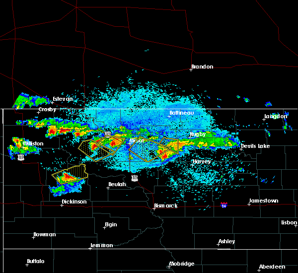 At 1154 pm cdt, a severe thunderstorm was located 7 miles north of plaza, or 21 miles southeast of stanley, moving southeast at 30 mph (radar indicated). Hazards include 60 mph wind gusts and quarter size hail. Hail damage to vehicles is expected. expect wind damage to roofs, siding, and trees. Locations impacted include, parshall, plaza and makoti. At 1154 pm cdt, a severe thunderstorm was located 7 miles north of plaza, or 21 miles southeast of stanley, moving southeast at 30 mph (radar indicated). Hazards include 60 mph wind gusts and quarter size hail. Hail damage to vehicles is expected. expect wind damage to roofs, siding, and trees. Locations impacted include, parshall, plaza and makoti.
|
| 8/4/2019 11:43 PM CDT |
 At 1143 pm cdt, a severe thunderstorm was located 10 miles east of belden, or 15 miles southeast of stanley, moving southeast at 35 mph (radar indicated). Hazards include 60 mph wind gusts and half dollar size hail. Hail damage to vehicles is expected. expect wind damage to roofs, siding, and trees. Locations impacted include, parshall, plaza, makoti and belden. At 1143 pm cdt, a severe thunderstorm was located 10 miles east of belden, or 15 miles southeast of stanley, moving southeast at 35 mph (radar indicated). Hazards include 60 mph wind gusts and half dollar size hail. Hail damage to vehicles is expected. expect wind damage to roofs, siding, and trees. Locations impacted include, parshall, plaza, makoti and belden.
|
| 8/4/2019 11:34 PM CDT |
 At 1133 pm cdt, a severe thunderstorm was located 5 miles southwest of palermo, or 6 miles southeast of stanley, moving southeast at 30 mph (trained weather spotters). Hazards include 60 mph wind gusts and half dollar size hail. Hail damage to vehicles is expected. expect wind damage to roofs, siding, and trees. This severe thunderstorm will remain over mainly rural areas of south central ward and eastern mountrail counties. At 1133 pm cdt, a severe thunderstorm was located 5 miles southwest of palermo, or 6 miles southeast of stanley, moving southeast at 30 mph (trained weather spotters). Hazards include 60 mph wind gusts and half dollar size hail. Hail damage to vehicles is expected. expect wind damage to roofs, siding, and trees. This severe thunderstorm will remain over mainly rural areas of south central ward and eastern mountrail counties.
|
| 7/31/2019 8:07 PM CDT |
 At 806 pm cdt, a cluster of severe thunderstorms was located 5 miles north of belden, or 6 miles south of stanley, moving northeast at 10 mph (radar indicated). Hazards include 60 mph wind gusts and quarter size hail. Hail damage to vehicles is expected. expect wind damage to roofs, siding, and trees. these severe storms will be near, stanley around 820 pm cdt. palermo around 830 pm cdt. Other locations impacted by these severe thunderstorms include coulee, hartland and tagus. At 806 pm cdt, a cluster of severe thunderstorms was located 5 miles north of belden, or 6 miles south of stanley, moving northeast at 10 mph (radar indicated). Hazards include 60 mph wind gusts and quarter size hail. Hail damage to vehicles is expected. expect wind damage to roofs, siding, and trees. these severe storms will be near, stanley around 820 pm cdt. palermo around 830 pm cdt. Other locations impacted by these severe thunderstorms include coulee, hartland and tagus.
|
| 7/31/2019 7:43 PM CDT |
 At 741 pm cdt, a cluster of severe thunderstorms was located 7 miles south of palermo, or 11 miles southeast of stanley, moving northeast at 40 mph (radar indicated). Hazards include 60 mph wind gusts and quarter size hail. Hail damage to vehicles is expected. expect wind damage to roofs, siding, and trees. these severe thunderstorms will be near, blaisdell around 750 pm cdt. berthold around 810 pm cdt. donnybrook around 815 pm cdt. carpio around 820 pm cdt. Other locations impacted by these severe thunderstorms include coulee, hartland and tagus. At 741 pm cdt, a cluster of severe thunderstorms was located 7 miles south of palermo, or 11 miles southeast of stanley, moving northeast at 40 mph (radar indicated). Hazards include 60 mph wind gusts and quarter size hail. Hail damage to vehicles is expected. expect wind damage to roofs, siding, and trees. these severe thunderstorms will be near, blaisdell around 750 pm cdt. berthold around 810 pm cdt. donnybrook around 815 pm cdt. carpio around 820 pm cdt. Other locations impacted by these severe thunderstorms include coulee, hartland and tagus.
|
| 7/12/2019 10:08 PM CDT |
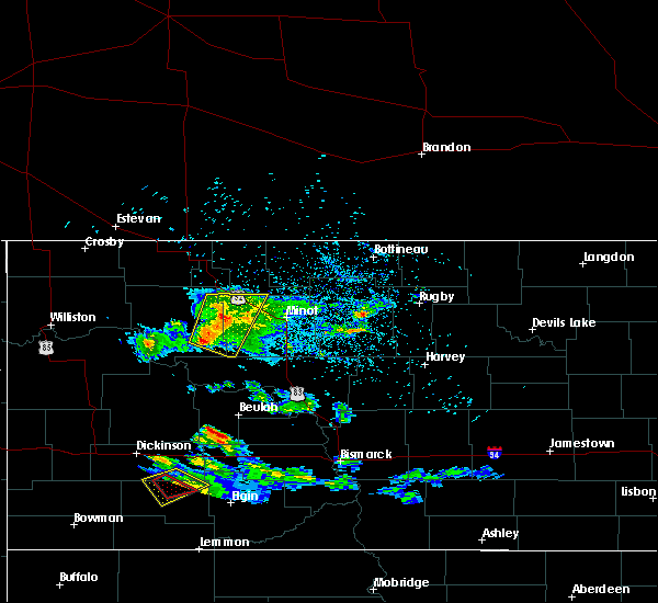 At 1008 pm cdt, severe thunderstorms were located along a line extending from 4 miles southwest of berthold to near plaza, moving southeast at 35 mph (radar indicated). Hazards include 60 mph wind gusts and penny size hail. Expect damage to roofs, siding, and trees. these severe storms will be near, makoti around 1020 pm cdt. Other locations impacted by these severe thunderstorms include hartland and tagus. At 1008 pm cdt, severe thunderstorms were located along a line extending from 4 miles southwest of berthold to near plaza, moving southeast at 35 mph (radar indicated). Hazards include 60 mph wind gusts and penny size hail. Expect damage to roofs, siding, and trees. these severe storms will be near, makoti around 1020 pm cdt. Other locations impacted by these severe thunderstorms include hartland and tagus.
|
| 7/12/2019 9:49 PM CDT |
 At 949 pm cdt, severe thunderstorms were located along a line extending from 5 miles north of blaisdell to 7 miles northwest of plaza, moving east at 35 mph (radar indicated). Hazards include 60 mph wind gusts and penny size hail. Expect damage to roofs, siding, and trees. these severe storms will be near, plaza around 1000 pm cdt. makoti around 1010 pm cdt. berthold and carpio around 1015 pm cdt. foxholm around 1025 pm cdt. Other locations impacted by these severe thunderstorms include hartland and tagus. At 949 pm cdt, severe thunderstorms were located along a line extending from 5 miles north of blaisdell to 7 miles northwest of plaza, moving east at 35 mph (radar indicated). Hazards include 60 mph wind gusts and penny size hail. Expect damage to roofs, siding, and trees. these severe storms will be near, plaza around 1000 pm cdt. makoti around 1010 pm cdt. berthold and carpio around 1015 pm cdt. foxholm around 1025 pm cdt. Other locations impacted by these severe thunderstorms include hartland and tagus.
|
| 7/12/2019 9:30 PM CDT |
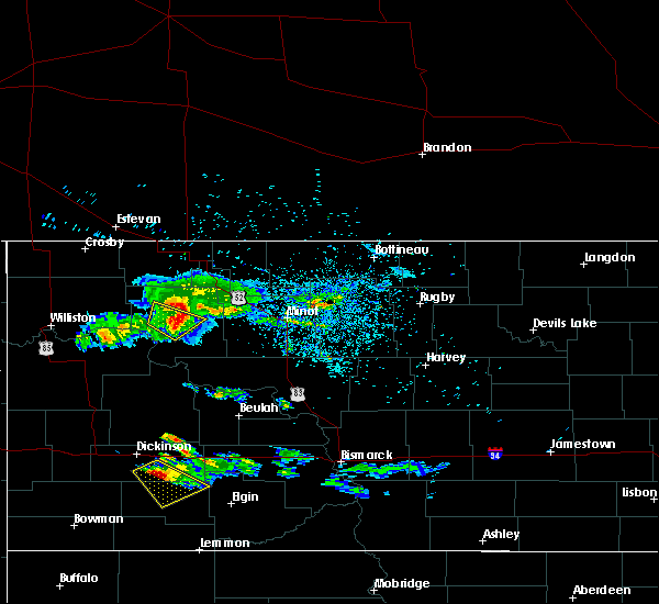 At 930 pm cdt, severe thunderstorms were located along a line extending from 4 miles north of palermo to 4 miles south of belden, moving southeast at 30 mph (radar indicated). Hazards include 60 mph wind gusts and penny size hail. Expect damage to roofs, siding, and trees. severe thunderstorms will be near, blaisdell around 950 pm cdt. parshall around 955 pm cdt. plaza around 1005 pm cdt. berthold around 1015 pm cdt. makoti around 1020 pm cdt. Other locations impacted by these severe thunderstorms include hartland and tagus. At 930 pm cdt, severe thunderstorms were located along a line extending from 4 miles north of palermo to 4 miles south of belden, moving southeast at 30 mph (radar indicated). Hazards include 60 mph wind gusts and penny size hail. Expect damage to roofs, siding, and trees. severe thunderstorms will be near, blaisdell around 950 pm cdt. parshall around 955 pm cdt. plaza around 1005 pm cdt. berthold around 1015 pm cdt. makoti around 1020 pm cdt. Other locations impacted by these severe thunderstorms include hartland and tagus.
|
| 9/3/2018 9:06 PM CDT |
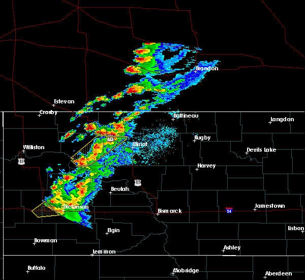 The severe thunderstorm warning for northwest ward and eastern mountrail counties will expire at 915 pm cdt, the storms which prompted the warning have weakened below severe limits, and no longer pose an immediate threat to life or property. therefore, the warning will be allowed to expire. however small hail, gusty winds and heavy rain are still possible with these thunderstorms. a severe thunderstorm watch remains in effect until midnight cdt for south central, north central and northwestern north dakota. The severe thunderstorm warning for northwest ward and eastern mountrail counties will expire at 915 pm cdt, the storms which prompted the warning have weakened below severe limits, and no longer pose an immediate threat to life or property. therefore, the warning will be allowed to expire. however small hail, gusty winds and heavy rain are still possible with these thunderstorms. a severe thunderstorm watch remains in effect until midnight cdt for south central, north central and northwestern north dakota.
|
| 9/3/2018 8:59 PM CDT |
 At 858 pm cdt, severe thunderstorms were located along a line extending from 4 miles north of carpio to 8 miles south of new town, moving east at 15 mph (radar indicated). Hazards include 60 mph wind gusts and quarter size hail. Hail damage to vehicles is expected. expect wind damage to roofs, siding, and trees. Locations impacted include, new town, parshall, berthold, plaza, carpio, foxholm, palermo, belden, van hook park, blaisdell, hartland, tagus and parshall bay recreation area. At 858 pm cdt, severe thunderstorms were located along a line extending from 4 miles north of carpio to 8 miles south of new town, moving east at 15 mph (radar indicated). Hazards include 60 mph wind gusts and quarter size hail. Hail damage to vehicles is expected. expect wind damage to roofs, siding, and trees. Locations impacted include, new town, parshall, berthold, plaza, carpio, foxholm, palermo, belden, van hook park, blaisdell, hartland, tagus and parshall bay recreation area.
|
| 9/3/2018 8:44 PM CDT |
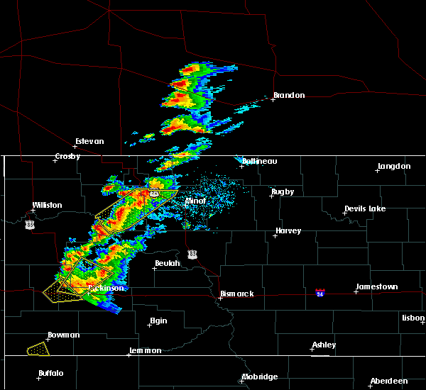 At 843 pm cdt, severe thunderstorms were located along a line extending from 4 miles northwest of carpio to 6 miles south of new town, moving northeast at 20 mph (radar indicated). Hazards include 60 mph wind gusts and quarter size hail. Hail damage to vehicles is expected. expect wind damage to roofs, siding, and trees. Locations impacted include, new town, parshall, berthold, plaza, carpio, foxholm, palermo, belden, van hook park, blaisdell, hartland, tagus and parshall bay recreation area. At 843 pm cdt, severe thunderstorms were located along a line extending from 4 miles northwest of carpio to 6 miles south of new town, moving northeast at 20 mph (radar indicated). Hazards include 60 mph wind gusts and quarter size hail. Hail damage to vehicles is expected. expect wind damage to roofs, siding, and trees. Locations impacted include, new town, parshall, berthold, plaza, carpio, foxholm, palermo, belden, van hook park, blaisdell, hartland, tagus and parshall bay recreation area.
|
| 9/3/2018 8:25 PM CDT |
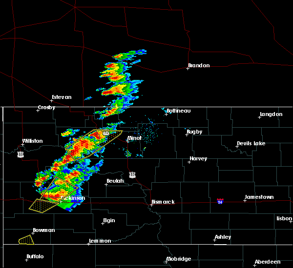 At 824 pm cdt, severe thunderstorms were located along a line extending from 6 miles northeast of blaisdell to near 4 bears lodge, moving east at 15 mph (radar indicated). Hazards include ping pong ball size hail and 60 mph wind gusts. People and animals outdoors will be injured. expect hail damage to roofs, siding, windows, and vehicles. expect wind damage to roofs, siding, and trees. Locations impacted include, new town, parshall, berthold, plaza, carpio, foxholm, palermo, belden, van hook park, blaisdell, hartland, tagus and parshall bay recreation area. At 824 pm cdt, severe thunderstorms were located along a line extending from 6 miles northeast of blaisdell to near 4 bears lodge, moving east at 15 mph (radar indicated). Hazards include ping pong ball size hail and 60 mph wind gusts. People and animals outdoors will be injured. expect hail damage to roofs, siding, windows, and vehicles. expect wind damage to roofs, siding, and trees. Locations impacted include, new town, parshall, berthold, plaza, carpio, foxholm, palermo, belden, van hook park, blaisdell, hartland, tagus and parshall bay recreation area.
|
| 9/3/2018 8:09 PM CDT |
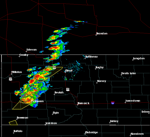 At 808 pm cdt, a cluster of severe thunderstorms were located along a line extending from 4 miles southwest of donnybrook to 5 miles southwest of 4 bears lodge, moving east at 20 mph (radar indicated). Hazards include ping pong ball size hail and 60 mph wind gusts. People and animals outdoors will be injured. expect hail damage to roofs, siding, windows, and vehicles. Expect wind damage to roofs, siding, and trees. At 808 pm cdt, a cluster of severe thunderstorms were located along a line extending from 4 miles southwest of donnybrook to 5 miles southwest of 4 bears lodge, moving east at 20 mph (radar indicated). Hazards include ping pong ball size hail and 60 mph wind gusts. People and animals outdoors will be injured. expect hail damage to roofs, siding, windows, and vehicles. Expect wind damage to roofs, siding, and trees.
|
| 8/26/2018 5:17 PM CDT |
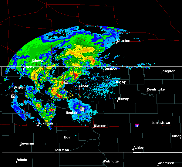 At 516 pm cdt, a severe thunderstorm was located near plaza, or 31 miles northwest of garrison, moving northeast at 50 mph (radar indicated). Hazards include quarter size hail. Damage to vehicles is expected. This severe storm will be near, makoti around 520 pm cdt. At 516 pm cdt, a severe thunderstorm was located near plaza, or 31 miles northwest of garrison, moving northeast at 50 mph (radar indicated). Hazards include quarter size hail. Damage to vehicles is expected. This severe storm will be near, makoti around 520 pm cdt.
|
| 8/26/2018 4:56 PM CDT |
 At 455 pm cdt, a severe thunderstorm was located 12 miles south of parshall, or 36 miles west of garrison, moving northeast at 50 mph (radar indicated). Hazards include quarter size hail. Damage to vehicles is expected. this severe thunderstorm will be near, parshall around 510 pm cdt. plaza and makoti around 520 pm cdt. Other locations impacted by this severe thunderstorm include deep water creek recreation area and raub. At 455 pm cdt, a severe thunderstorm was located 12 miles south of parshall, or 36 miles west of garrison, moving northeast at 50 mph (radar indicated). Hazards include quarter size hail. Damage to vehicles is expected. this severe thunderstorm will be near, parshall around 510 pm cdt. plaza and makoti around 520 pm cdt. Other locations impacted by this severe thunderstorm include deep water creek recreation area and raub.
|
| 6/28/2018 11:39 PM CDT |
 The severe thunderstorm warning for western ward, southern burke, northeastern mckenzie, northeastern williams and mountrail counties will expire at 1145 pm cdt, the storms which prompted the warning have moved out of the area. therefore, the warning will be allowed to expire. however gusty winds are still possible with these thunderstorms. a severe thunderstorm watch remains in effect until 800 am cdt for south central, north central and northwestern north dakota. The severe thunderstorm warning for western ward, southern burke, northeastern mckenzie, northeastern williams and mountrail counties will expire at 1145 pm cdt, the storms which prompted the warning have moved out of the area. therefore, the warning will be allowed to expire. however gusty winds are still possible with these thunderstorms. a severe thunderstorm watch remains in effect until 800 am cdt for south central, north central and northwestern north dakota.
|
| 6/28/2018 11:07 PM CDT |
 At 1106 pm cdt, severe thunderstorms were located along a line extending from 7 miles southwest of kenmare to 4 miles south of blaisdell to near parshall, moving east at 55 mph. these are very dangerous storms (trained weather spotters). Hazards include 80 mph wind gusts and quarter size hail. Flying debris will be dangerous to those caught without shelter. mobile homes will be heavily damaged. expect considerable damage to roofs, windows, and vehicles. extensive tree damage and power outages are likely. these severe storms will be near, blaisdell around 1110 pm cdt. kenmare and plaza around 1115 pm cdt. makoti around 1120 pm cdt. ryder around 1130 pm cdt. Other locations impacted by these severe thunderstorms include white earth, keene, coulee, white earth bay recreation area, tagus, coteau, hartland, mcgregor, charlson and niobe. At 1106 pm cdt, severe thunderstorms were located along a line extending from 7 miles southwest of kenmare to 4 miles south of blaisdell to near parshall, moving east at 55 mph. these are very dangerous storms (trained weather spotters). Hazards include 80 mph wind gusts and quarter size hail. Flying debris will be dangerous to those caught without shelter. mobile homes will be heavily damaged. expect considerable damage to roofs, windows, and vehicles. extensive tree damage and power outages are likely. these severe storms will be near, blaisdell around 1110 pm cdt. kenmare and plaza around 1115 pm cdt. makoti around 1120 pm cdt. ryder around 1130 pm cdt. Other locations impacted by these severe thunderstorms include white earth, keene, coulee, white earth bay recreation area, tagus, coteau, hartland, mcgregor, charlson and niobe.
|
| 6/28/2018 10:41 PM CDT |
 At 1040 pm cdt, severe thunderstorms were located along a line extending from near battleview to 6 miles southwest of ross to 7 miles south of 4 bears lodge, moving east at 45 mph. these are very dangerous storms (trained weather spotters). Hazards include 80 mph wind gusts and quarter size hail. Flying debris will be dangerous to those caught without shelter. mobile homes will be heavily damaged. expect considerable damage to roofs, windows, and vehicles. extensive tree damage and power outages are likely. severe thunderstorms will be near, ross around 1045 pm cdt. new town around 1050 pm cdt. stanley and belden around 1055 pm cdt. van hook park around 1100 pm cdt. palermo around 1110 pm cdt. parshall around 1115 pm cdt. blaisdell around 1120 pm cdt. kenmare and plaza around 1130 pm cdt. other locations impacted by these severe thunderstorms include white earth, keene, coulee, white earth bay recreation area, tagus, coteau, hartland, mcgregor, charlson and niobe. A tornado watch remains in effect until 1100 pm cdt for south central, north central and northwestern north dakota. At 1040 pm cdt, severe thunderstorms were located along a line extending from near battleview to 6 miles southwest of ross to 7 miles south of 4 bears lodge, moving east at 45 mph. these are very dangerous storms (trained weather spotters). Hazards include 80 mph wind gusts and quarter size hail. Flying debris will be dangerous to those caught without shelter. mobile homes will be heavily damaged. expect considerable damage to roofs, windows, and vehicles. extensive tree damage and power outages are likely. severe thunderstorms will be near, ross around 1045 pm cdt. new town around 1050 pm cdt. stanley and belden around 1055 pm cdt. van hook park around 1100 pm cdt. palermo around 1110 pm cdt. parshall around 1115 pm cdt. blaisdell around 1120 pm cdt. kenmare and plaza around 1130 pm cdt. other locations impacted by these severe thunderstorms include white earth, keene, coulee, white earth bay recreation area, tagus, coteau, hartland, mcgregor, charlson and niobe. A tornado watch remains in effect until 1100 pm cdt for south central, north central and northwestern north dakota.
|
| 6/14/2018 10:08 PM CDT |
 At 1007 pm cdt, a severe thunderstorm was located 10 miles west of roseglen, or 31 miles west of garrison, moving east at 45 mph (radar indicated). Hazards include 60 mph wind gusts and quarter size hail. Hail damage to vehicles is expected. expect wind damage to roofs, siding, and trees. locations impacted include, parshall, plaza, raub and parshall bay recreation area. A tornado watch remains in effect until 1100 pm cdt for south central, north central and northwestern north dakota. At 1007 pm cdt, a severe thunderstorm was located 10 miles west of roseglen, or 31 miles west of garrison, moving east at 45 mph (radar indicated). Hazards include 60 mph wind gusts and quarter size hail. Hail damage to vehicles is expected. expect wind damage to roofs, siding, and trees. locations impacted include, parshall, plaza, raub and parshall bay recreation area. A tornado watch remains in effect until 1100 pm cdt for south central, north central and northwestern north dakota.
|
| 6/14/2018 9:51 PM CDT |
 At 950 pm cdt, severe thunderstorms were located along a line extending from 10 miles north of plaza to 7 miles north of mckenzie bay recreation area, moving east at 45 mph (radar indicated). Hazards include 60 mph wind gusts and quarter size hail. Hail damage to vehicles is expected. expect wind damage to roofs, siding, and trees. locations impacted include, new town, parshall, plaza, van hook park, belden, skunk creek bay recreation area, pouch point recreation area, deep water creek recreation area, raub and parshall bay recreation area. A tornado watch remains in effect until 1100 pm cdt for south central, southwestern, north central and northwestern north dakota. At 950 pm cdt, severe thunderstorms were located along a line extending from 10 miles north of plaza to 7 miles north of mckenzie bay recreation area, moving east at 45 mph (radar indicated). Hazards include 60 mph wind gusts and quarter size hail. Hail damage to vehicles is expected. expect wind damage to roofs, siding, and trees. locations impacted include, new town, parshall, plaza, van hook park, belden, skunk creek bay recreation area, pouch point recreation area, deep water creek recreation area, raub and parshall bay recreation area. A tornado watch remains in effect until 1100 pm cdt for south central, southwestern, north central and northwestern north dakota.
|
| 6/14/2018 9:23 PM CDT |
 At 922 pm cdt, a severe thunderstorm was located over mandaree, or 26 miles north of killdeer, moving east at 35 mph (radar indicated). Hazards include 60 mph wind gusts and quarter size hail. Hail damage to vehicles is expected. expect wind damage to roofs, siding, and trees. this severe thunderstorm will remain over mainly rural areas of northeastern dunn, northwestern mclean, northeastern mckenzie and southern mountrail counties, including the following locations, deep water creek recreation area, raub, skunk creek bay recreation area, parshall bay recreation area and pouch point recreation area. A tornado watch remains in effect until 1100 pm cdt for south central, southwestern, north central and northwestern north dakota. At 922 pm cdt, a severe thunderstorm was located over mandaree, or 26 miles north of killdeer, moving east at 35 mph (radar indicated). Hazards include 60 mph wind gusts and quarter size hail. Hail damage to vehicles is expected. expect wind damage to roofs, siding, and trees. this severe thunderstorm will remain over mainly rural areas of northeastern dunn, northwestern mclean, northeastern mckenzie and southern mountrail counties, including the following locations, deep water creek recreation area, raub, skunk creek bay recreation area, parshall bay recreation area and pouch point recreation area. A tornado watch remains in effect until 1100 pm cdt for south central, southwestern, north central and northwestern north dakota.
|
| 6/14/2018 7:42 PM CDT | Golf Ball sized hail reported 15.4 miles SSE of Plaza, ND |
| 6/10/2018 8:27 PM CDT |
 At 826 pm cdt, severe thunderstorms were located along a line extending from near carpio to 10 miles south of berthold to 6 miles southwest of roseglen, moving northeast at 30 mph (radar indicated). Hazards include 60 mph wind gusts. Expect damage to roofs, siding, and trees. Locations impacted include, minot air force base, berthold, des lacs, plaza, rice lake, douglas, indian hills recreation area, deep water creek recreation area, emmet, white shield, tagus and raub. At 826 pm cdt, severe thunderstorms were located along a line extending from near carpio to 10 miles south of berthold to 6 miles southwest of roseglen, moving northeast at 30 mph (radar indicated). Hazards include 60 mph wind gusts. Expect damage to roofs, siding, and trees. Locations impacted include, minot air force base, berthold, des lacs, plaza, rice lake, douglas, indian hills recreation area, deep water creek recreation area, emmet, white shield, tagus and raub.
|
| 6/10/2018 8:08 PM CDT |
 At 807 pm cdt, severe thunderstorms were located along a line extending from near carpio to 10 miles northeast of plaza to 6 miles northeast of indian hills recreation area, moving northeast at 30 mph (radar indicated). Hazards include 60 mph wind gusts and penny size hail. Expect damage to roofs, siding, and trees. Locations impacted include, southern minot, minot air force base, berthold, plaza, foxholm, ryder, palermo, rice lake, douglas, indian hills recreation area, deep water creek recreation area and emmet. At 807 pm cdt, severe thunderstorms were located along a line extending from near carpio to 10 miles northeast of plaza to 6 miles northeast of indian hills recreation area, moving northeast at 30 mph (radar indicated). Hazards include 60 mph wind gusts and penny size hail. Expect damage to roofs, siding, and trees. Locations impacted include, southern minot, minot air force base, berthold, plaza, foxholm, ryder, palermo, rice lake, douglas, indian hills recreation area, deep water creek recreation area and emmet.
|
| 6/10/2018 7:46 PM CDT |
 At 746 pm cdt, severe thunderstorms were located along a line extending from 8 miles east of blaisdell to near plaza to indian hills recreation area, moving northeast at 20 mph (radar indicated). Hazards include 60 mph wind gusts and quarter size hail. Hail damage to vehicles is expected. expect wind damage to roofs, siding, and trees. severe thunderstorms will be near, plaza around 750 pm cdt. berthold around 800 pm cdt. carpio around 815 pm cdt. foxholm around 825 pm cdt. roseglen around 830 pm cdt. des lacs around 840 pm cdt. minot air force base and burlington around 845 pm cdt. Other locations impacted by these severe thunderstorms include hartland, deep water creek recreation area, raub, emmet, white shield and tagus. At 746 pm cdt, severe thunderstorms were located along a line extending from 8 miles east of blaisdell to near plaza to indian hills recreation area, moving northeast at 20 mph (radar indicated). Hazards include 60 mph wind gusts and quarter size hail. Hail damage to vehicles is expected. expect wind damage to roofs, siding, and trees. severe thunderstorms will be near, plaza around 750 pm cdt. berthold around 800 pm cdt. carpio around 815 pm cdt. foxholm around 825 pm cdt. roseglen around 830 pm cdt. des lacs around 840 pm cdt. minot air force base and burlington around 845 pm cdt. Other locations impacted by these severe thunderstorms include hartland, deep water creek recreation area, raub, emmet, white shield and tagus.
|
| 6/10/2018 7:30 PM CDT | Winds sustained at 40 mph... gusting to 58 mph at time of repor in mountrail county ND, 0.5 miles SE of Plaza, ND |
| 6/10/2018 7:17 PM CDT |
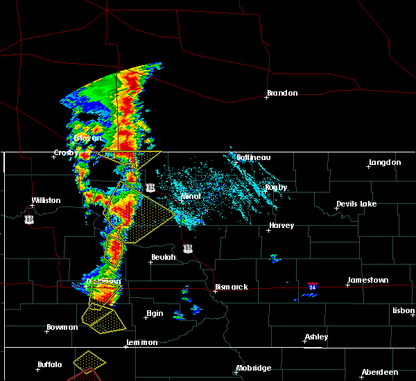 At 717 pm cdt, a severe thunderstorm was located near parshall, or 25 miles southeast of stanley, moving northeast at 15 mph (radar indicated). Hazards include 60 mph wind gusts and quarter size hail. Hail damage to vehicles is expected. expect wind damage to roofs, siding, and trees. this severe storm will be near, plaza around 735 pm cdt. Other locations impacted by this severe thunderstorm include deep water creek recreation area, raub, parshall bay recreation area and tagus. At 717 pm cdt, a severe thunderstorm was located near parshall, or 25 miles southeast of stanley, moving northeast at 15 mph (radar indicated). Hazards include 60 mph wind gusts and quarter size hail. Hail damage to vehicles is expected. expect wind damage to roofs, siding, and trees. this severe storm will be near, plaza around 735 pm cdt. Other locations impacted by this severe thunderstorm include deep water creek recreation area, raub, parshall bay recreation area and tagus.
|
| 6/10/2018 6:52 PM CDT |
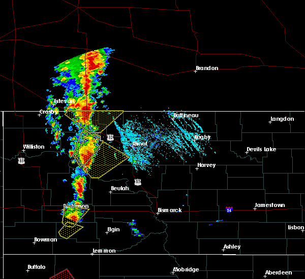 At 652 pm cdt, a severe thunderstorm was located over parshall, or 26 miles south of stanley, moving northeast at 15 mph (radar indicated). Hazards include 60 mph wind gusts and quarter size hail. Hail damage to vehicles is expected. expect wind damage to roofs, siding, and trees. this severe thunderstorm will be near, parshall around 700 pm cdt. plaza around 730 pm cdt. Other locations impacted by this severe thunderstorm include deep water creek recreation area, raub, parshall bay recreation area and tagus. At 652 pm cdt, a severe thunderstorm was located over parshall, or 26 miles south of stanley, moving northeast at 15 mph (radar indicated). Hazards include 60 mph wind gusts and quarter size hail. Hail damage to vehicles is expected. expect wind damage to roofs, siding, and trees. this severe thunderstorm will be near, parshall around 700 pm cdt. plaza around 730 pm cdt. Other locations impacted by this severe thunderstorm include deep water creek recreation area, raub, parshall bay recreation area and tagus.
|
| 6/1/2018 7:17 PM CDT |
 At 717 pm cdt, severe thunderstorms were located along a line extending from 7 miles southeast of blaisdell to near pick city, moving northeast at 30 mph (radar indicated). Hazards include 60 mph wind gusts and quarter size hail. Hail damage to vehicles is expected. expect wind damage to roofs, siding, and trees. locations impacted include, garrison, parshall, riverdale, plaza, makoti, pick city, ryder, palermo, douglas, donnybrook, roseglen, indian hills recreation area, van hook park, beulah bay recreation area, hazen bay recreation area, lake sakakawea state park, belden, blaisdell, fort stevenson state park and deep water creek recreation area. A tornado watch remains in effect until 1100 pm cdt for south central, southwestern, north central and northwestern north dakota. At 717 pm cdt, severe thunderstorms were located along a line extending from 7 miles southeast of blaisdell to near pick city, moving northeast at 30 mph (radar indicated). Hazards include 60 mph wind gusts and quarter size hail. Hail damage to vehicles is expected. expect wind damage to roofs, siding, and trees. locations impacted include, garrison, parshall, riverdale, plaza, makoti, pick city, ryder, palermo, douglas, donnybrook, roseglen, indian hills recreation area, van hook park, beulah bay recreation area, hazen bay recreation area, lake sakakawea state park, belden, blaisdell, fort stevenson state park and deep water creek recreation area. A tornado watch remains in effect until 1100 pm cdt for south central, southwestern, north central and northwestern north dakota.
|
| 6/1/2018 7:02 PM CDT |
 At 701 pm cdt, severe thunderstorms were located along a line extending from 8 miles south of blaisdell to 4 miles south of hazen bay recreation area, moving east at 20 mph (radar indicated). Hazards include 60 mph wind gusts and quarter size hail. Hail damage to vehicles is expected. expect wind damage to roofs, siding, and trees. locations impacted include, garrison, parshall, riverdale, plaza, makoti, pick city, ryder, palermo, douglas, donnybrook, roseglen, indian hills recreation area, van hook park, beulah bay recreation area, hazen bay recreation area, lake sakakawea state park, belden, blaisdell, fort stevenson state park and deep water creek recreation area. A tornado watch remains in effect until 1100 pm cdt for south central, southwestern, north central and northwestern north dakota. At 701 pm cdt, severe thunderstorms were located along a line extending from 8 miles south of blaisdell to 4 miles south of hazen bay recreation area, moving east at 20 mph (radar indicated). Hazards include 60 mph wind gusts and quarter size hail. Hail damage to vehicles is expected. expect wind damage to roofs, siding, and trees. locations impacted include, garrison, parshall, riverdale, plaza, makoti, pick city, ryder, palermo, douglas, donnybrook, roseglen, indian hills recreation area, van hook park, beulah bay recreation area, hazen bay recreation area, lake sakakawea state park, belden, blaisdell, fort stevenson state park and deep water creek recreation area. A tornado watch remains in effect until 1100 pm cdt for south central, southwestern, north central and northwestern north dakota.
|
| 6/1/2018 6:30 PM CDT |
 At 630 pm cdt, severe thunderstorms were located along a line extending from 5 miles southwest of belden to near zap, moving northeast at 30 mph. the strongest storm was near roseglen, moving northeast at 30 mph (radar indicated). Hazards include 60 mph wind gusts and quarter size hail. a tornado is possible with these storms. Hail damage to vehicles is expected. expect wind damage to roofs, siding, and trees. severe thunderstorms will be near, belden around 640 pm cdt. palermo and beulah bay recreation area around 705 pm cdt. blaisdell and hazen bay recreation area around 720 pm cdt. riverdale, pick city, lake sakakawea state park and fort stevenson state park around 730 pm cdt. other locations impacted by these severe thunderstorms include white shield, tagus, hartland, deep water creek recreation area, dakota waters recreation area, raub, emmet and parshall bay recreation area. A tornado watch remains in effect until 1100 pm cdt for south central, southwestern, north central and northwestern north dakota. At 630 pm cdt, severe thunderstorms were located along a line extending from 5 miles southwest of belden to near zap, moving northeast at 30 mph. the strongest storm was near roseglen, moving northeast at 30 mph (radar indicated). Hazards include 60 mph wind gusts and quarter size hail. a tornado is possible with these storms. Hail damage to vehicles is expected. expect wind damage to roofs, siding, and trees. severe thunderstorms will be near, belden around 640 pm cdt. palermo and beulah bay recreation area around 705 pm cdt. blaisdell and hazen bay recreation area around 720 pm cdt. riverdale, pick city, lake sakakawea state park and fort stevenson state park around 730 pm cdt. other locations impacted by these severe thunderstorms include white shield, tagus, hartland, deep water creek recreation area, dakota waters recreation area, raub, emmet and parshall bay recreation area. A tornado watch remains in effect until 1100 pm cdt for south central, southwestern, north central and northwestern north dakota.
|
| 5/27/2018 3:17 AM CDT |
 At 317 am cdt, severe thunderstorms were located along a line extending from berthold to 5 miles southeast of rice lake to garrison, moving northeast at 55 mph (radar indicated). Hazards include 70 mph wind gusts and nickel size hail. Expect considerable tree damage. damage is likely to mobile homes, roofs, and outbuildings. these severe storms will be near, des lacs around 320 am cdt. foxholm around 325 am cdt. burlington around 330 am cdt. Other locations impacted by these severe thunderstorms include white shield and emmet. At 317 am cdt, severe thunderstorms were located along a line extending from berthold to 5 miles southeast of rice lake to garrison, moving northeast at 55 mph (radar indicated). Hazards include 70 mph wind gusts and nickel size hail. Expect considerable tree damage. damage is likely to mobile homes, roofs, and outbuildings. these severe storms will be near, des lacs around 320 am cdt. foxholm around 325 am cdt. burlington around 330 am cdt. Other locations impacted by these severe thunderstorms include white shield and emmet.
|
| 5/27/2018 3:02 AM CDT |
 At 302 am cdt, severe thunderstorms were located along a line extending from 9 miles southeast of blaisdell to 4 miles south of ryder to 4 miles northwest of hazen bay recreation area, moving east at 40 mph (radar indicated). Hazards include 70 mph wind gusts and nickel size hail. Expect considerable tree damage. damage is likely to mobile homes, roofs, and outbuildings. these severe storms will be near, ryder around 305 am cdt. douglas around 315 am cdt. berthold and fort stevenson state park around 320 am cdt. garrison and riverdale around 325 am cdt. burlington, max, des lacs and foxholm around 330 am cdt. Other locations impacted by these severe thunderstorms include white shield, raub and emmet. At 302 am cdt, severe thunderstorms were located along a line extending from 9 miles southeast of blaisdell to 4 miles south of ryder to 4 miles northwest of hazen bay recreation area, moving east at 40 mph (radar indicated). Hazards include 70 mph wind gusts and nickel size hail. Expect considerable tree damage. damage is likely to mobile homes, roofs, and outbuildings. these severe storms will be near, ryder around 305 am cdt. douglas around 315 am cdt. berthold and fort stevenson state park around 320 am cdt. garrison and riverdale around 325 am cdt. burlington, max, des lacs and foxholm around 330 am cdt. Other locations impacted by these severe thunderstorms include white shield, raub and emmet.
|
| 5/27/2018 2:44 AM CDT |
 At 243 am cdt, severe thunderstorms were located along a line extending from 7 miles south of blaisdell to near roseglen to 9 miles north of golden valley, moving northeast at 55 mph (radar indicated). Hazards include 70 mph wind gusts and nickel size hail. Expect considerable tree damage. damage is likely to mobile homes, roofs, and outbuildings. severe thunderstorms will be near, berthold and ryder around 300 am cdt. douglas around 305 am cdt. foxholm and rice lake around 310 am cdt. fort stevenson state park around 320 am cdt. garrison around 325 am cdt. Other locations impacted by these severe thunderstorms include deep water creek recreation area, raub, emmet and white shield. At 243 am cdt, severe thunderstorms were located along a line extending from 7 miles south of blaisdell to near roseglen to 9 miles north of golden valley, moving northeast at 55 mph (radar indicated). Hazards include 70 mph wind gusts and nickel size hail. Expect considerable tree damage. damage is likely to mobile homes, roofs, and outbuildings. severe thunderstorms will be near, berthold and ryder around 300 am cdt. douglas around 305 am cdt. foxholm and rice lake around 310 am cdt. fort stevenson state park around 320 am cdt. garrison around 325 am cdt. Other locations impacted by these severe thunderstorms include deep water creek recreation area, raub, emmet and white shield.
|
| 7/31/2016 7:57 PM CDT |
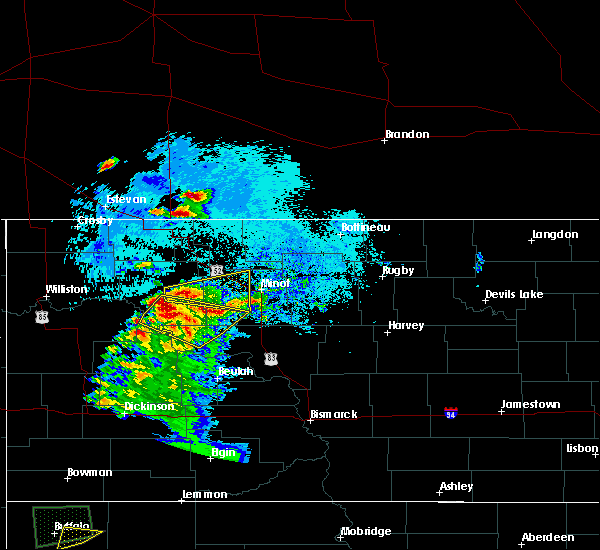 At 757 pm cdt, a severe thunderstorm was located 6 miles northwest of parshall, or 21 miles southeast of stanley, moving east at 30 mph (radar indicated). Hazards include 70 mph wind gusts and ping pong ball size hail. People and animals outdoors will be injured. expect hail damage to roofs, siding, windows, and vehicles. expect considerable tree damage. wind damage is also likely to mobile homes, roofs, and outbuildings. Locations impacted include, new town, parshall, plaza, makoti, ryder, rice lake, van hook park, belden and parshall bay recreation area. At 757 pm cdt, a severe thunderstorm was located 6 miles northwest of parshall, or 21 miles southeast of stanley, moving east at 30 mph (radar indicated). Hazards include 70 mph wind gusts and ping pong ball size hail. People and animals outdoors will be injured. expect hail damage to roofs, siding, windows, and vehicles. expect considerable tree damage. wind damage is also likely to mobile homes, roofs, and outbuildings. Locations impacted include, new town, parshall, plaza, makoti, ryder, rice lake, van hook park, belden and parshall bay recreation area.
|
| 7/31/2016 7:38 PM CDT |
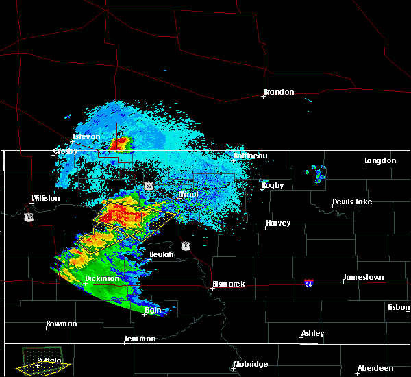 At 738 pm cdt, a severe thunderstorm was located near van hook park, or 29 miles south of stanley, moving east at 35 mph (radar indicated). Hazards include 70 mph wind gusts and ping pong ball size hail. People and animals outdoors will be injured. expect hail damage to roofs, siding, windows, and vehicles. expect considerable tree damage. wind damage is also likely to mobile homes, roofs, and outbuildings. Locations impacted include, new town, parshall, plaza, makoti, ryder, rice lake, roseglen, van hook park, belden, raub, parshall bay recreation area, deep water creek recreation area, pouch point recreation area and white shield. At 738 pm cdt, a severe thunderstorm was located near van hook park, or 29 miles south of stanley, moving east at 35 mph (radar indicated). Hazards include 70 mph wind gusts and ping pong ball size hail. People and animals outdoors will be injured. expect hail damage to roofs, siding, windows, and vehicles. expect considerable tree damage. wind damage is also likely to mobile homes, roofs, and outbuildings. Locations impacted include, new town, parshall, plaza, makoti, ryder, rice lake, roseglen, van hook park, belden, raub, parshall bay recreation area, deep water creek recreation area, pouch point recreation area and white shield.
|
| 7/31/2016 7:11 PM CDT |
 At 710 pm cdt, a severe thunderstorm was located over parshall, or 27 miles south of stanley, moving southeast at 30 mph (radar indicated). Hazards include tennis ball size hail and 70 mph wind gusts. People and animals outdoors will be injured. expect hail damage to roofs, siding, windows, and vehicles. expect considerable tree damage. wind damage is also likely to mobile homes, roofs, and outbuildings. this severe thunderstorm will be near, roseglen around 750 pm cdt. Other locations impacted by this severe thunderstorm include white shield, parshall bay recreation area, deep water creek recreation area, raub and pouch point recreation area. At 710 pm cdt, a severe thunderstorm was located over parshall, or 27 miles south of stanley, moving southeast at 30 mph (radar indicated). Hazards include tennis ball size hail and 70 mph wind gusts. People and animals outdoors will be injured. expect hail damage to roofs, siding, windows, and vehicles. expect considerable tree damage. wind damage is also likely to mobile homes, roofs, and outbuildings. this severe thunderstorm will be near, roseglen around 750 pm cdt. Other locations impacted by this severe thunderstorm include white shield, parshall bay recreation area, deep water creek recreation area, raub and pouch point recreation area.
|
| 7/31/2016 6:56 PM CDT |
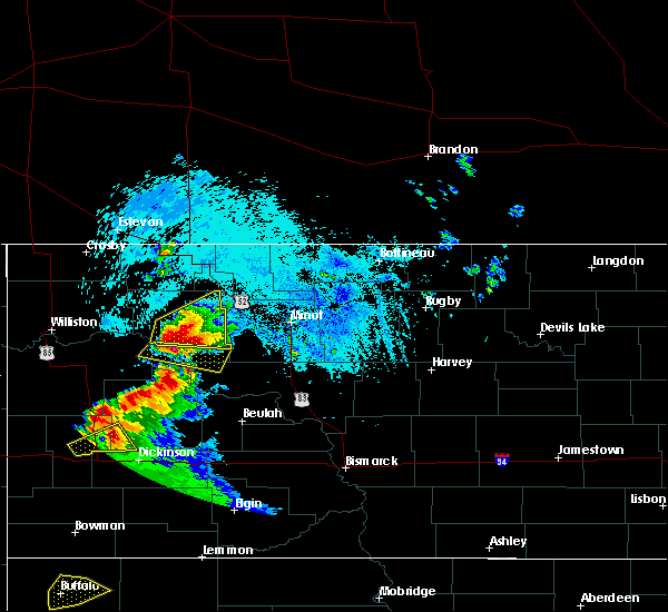 At 656 pm cdt, a severe thunderstorm was located 8 miles north of parshall, or 19 miles southeast of stanley, moving east at 20 mph (radar indicated). Hazards include golf ball size hail and 60 mph wind gusts. People and animals outdoors will be injured. expect hail damage to roofs, siding, windows, and vehicles. expect wind damage to roofs, siding, and trees. Locations impacted include, plaza, blaisdell, belden and tagus. At 656 pm cdt, a severe thunderstorm was located 8 miles north of parshall, or 19 miles southeast of stanley, moving east at 20 mph (radar indicated). Hazards include golf ball size hail and 60 mph wind gusts. People and animals outdoors will be injured. expect hail damage to roofs, siding, windows, and vehicles. expect wind damage to roofs, siding, and trees. Locations impacted include, plaza, blaisdell, belden and tagus.
|
| 7/31/2016 6:38 PM CDT |
 At 638 pm cdt, a severe thunderstorm was located 6 miles east of belden, or 13 miles southeast of stanley, moving east at 15 mph (radar indicated). Hazards include golf ball size hail and 60 mph wind gusts. People and animals outdoors will be injured. expect hail damage to roofs, siding, windows, and vehicles. expect wind damage to roofs, siding, and trees. Locations impacted include, stanley, plaza, palermo, blaisdell, belden, coulee and tagus. At 638 pm cdt, a severe thunderstorm was located 6 miles east of belden, or 13 miles southeast of stanley, moving east at 15 mph (radar indicated). Hazards include golf ball size hail and 60 mph wind gusts. People and animals outdoors will be injured. expect hail damage to roofs, siding, windows, and vehicles. expect wind damage to roofs, siding, and trees. Locations impacted include, stanley, plaza, palermo, blaisdell, belden, coulee and tagus.
|
| 7/31/2016 6:21 PM CDT |
 At 620 pm cdt, a severe thunderstorm was located over belden, or 12 miles south of stanley, moving east at 15 mph (radar indicated). Hazards include golf ball size hail and 60 mph wind gusts. People and animals outdoors will be injured. expect hail damage to roofs, siding, windows, and vehicles. expect wind damage to roofs, siding, and trees. This severe thunderstorm will remain over mainly rural areas of central mountrail county, including the following locations: coulee and tagus. At 620 pm cdt, a severe thunderstorm was located over belden, or 12 miles south of stanley, moving east at 15 mph (radar indicated). Hazards include golf ball size hail and 60 mph wind gusts. People and animals outdoors will be injured. expect hail damage to roofs, siding, windows, and vehicles. expect wind damage to roofs, siding, and trees. This severe thunderstorm will remain over mainly rural areas of central mountrail county, including the following locations: coulee and tagus.
|
| 7/3/2016 5:28 PM CDT |
 At 527 pm cdt, a severe thunderstorm was located 7 miles south of parshall, or 34 miles south of stanley, moving northeast at 20 mph. a second severe thunderstorm was located just west of deep creek recreation area, and moving east at 20 mph (radar indicated). Hazards include 60 mph wind gusts and quarter size hail. Hail damage to vehicles is expected. expect wind damage to roofs, siding, and trees. this severe storm will be near, parshall around 550 pm cdt. plaza around 615 pm cdt. Other locations impacted by this severe thunderstorm include parshall bay recreation area, deep water creek recreation area and raub. At 527 pm cdt, a severe thunderstorm was located 7 miles south of parshall, or 34 miles south of stanley, moving northeast at 20 mph. a second severe thunderstorm was located just west of deep creek recreation area, and moving east at 20 mph (radar indicated). Hazards include 60 mph wind gusts and quarter size hail. Hail damage to vehicles is expected. expect wind damage to roofs, siding, and trees. this severe storm will be near, parshall around 550 pm cdt. plaza around 615 pm cdt. Other locations impacted by this severe thunderstorm include parshall bay recreation area, deep water creek recreation area and raub.
|
| 7/3/2016 5:11 PM CDT |
 At 511 pm cdt, a severe thunderstorm was located 10 miles south of parshall, or 36 miles south of stanley, moving north at 20 mph (radar indicated). Hazards include 60 mph wind gusts and half dollar size hail. Hail damage to vehicles is expected. expect wind damage to roofs, siding, and trees. this severe thunderstorm will be near, parshall around 540 pm cdt. plaza around 555 pm cdt. Other locations impacted by this severe thunderstorm include parshall bay recreation area, deep water creek recreation area and raub. At 511 pm cdt, a severe thunderstorm was located 10 miles south of parshall, or 36 miles south of stanley, moving north at 20 mph (radar indicated). Hazards include 60 mph wind gusts and half dollar size hail. Hail damage to vehicles is expected. expect wind damage to roofs, siding, and trees. this severe thunderstorm will be near, parshall around 540 pm cdt. plaza around 555 pm cdt. Other locations impacted by this severe thunderstorm include parshall bay recreation area, deep water creek recreation area and raub.
|
| 6/25/2016 12:04 AM CDT |
 At 1204 am cdt, severe thunderstorms were located along a line extending from 11 miles north of sherwood to antler to near maxbass to 5 miles east of glenburn to near surrey to 10 miles southwest of sawyer, moving east at 60 mph (radar indicated). Hazards include 70 mph wind gusts and quarter size hail. Hail damage to vehicles is expected. expect considerable tree damage. wind damage is also likely to mobile homes, roofs, and outbuildings. these severe storms will be near, velva, westhope, granville, upham and newburg around 1215 am cdt. Other locations impacted by these severe thunderstorms include kramer, voltaire, northgate, norwich, eckman and tolley. At 1204 am cdt, severe thunderstorms were located along a line extending from 11 miles north of sherwood to antler to near maxbass to 5 miles east of glenburn to near surrey to 10 miles southwest of sawyer, moving east at 60 mph (radar indicated). Hazards include 70 mph wind gusts and quarter size hail. Hail damage to vehicles is expected. expect considerable tree damage. wind damage is also likely to mobile homes, roofs, and outbuildings. these severe storms will be near, velva, westhope, granville, upham and newburg around 1215 am cdt. Other locations impacted by these severe thunderstorms include kramer, voltaire, northgate, norwich, eckman and tolley.
|
| 6/24/2016 11:44 PM CDT |
 At 1143 pm cdt, severe thunderstorms were located along a line extending from 19 miles northeast of flaxton to near ryder, moving east at 60 mph (radar indicated). Hazards include 70 mph wind gusts and quarter size hail. Hail damage to vehicles is expected. expect considerable tree damage. wind damage is also likely to mobile homes, roofs, and outbuildings. these severe storms will be near, mohall, minot air force base and burlington around 1150 pm cdt. lansford around 1155 pm cdt. minot and glenburn around 1200 am cdt. surrey, deering and maxbass around 1205 am cdt. sawyer and antler around 1210 am cdt. velva, westhope, granville, upham and newburg around 1215 am cdt. Other locations impacted by these severe thunderstorms include kramer, voltaire, northgate, landa, logan, russell, norma, norwich, eckman and tolley. At 1143 pm cdt, severe thunderstorms were located along a line extending from 19 miles northeast of flaxton to near ryder, moving east at 60 mph (radar indicated). Hazards include 70 mph wind gusts and quarter size hail. Hail damage to vehicles is expected. expect considerable tree damage. wind damage is also likely to mobile homes, roofs, and outbuildings. these severe storms will be near, mohall, minot air force base and burlington around 1150 pm cdt. lansford around 1155 pm cdt. minot and glenburn around 1200 am cdt. surrey, deering and maxbass around 1205 am cdt. sawyer and antler around 1210 am cdt. velva, westhope, granville, upham and newburg around 1215 am cdt. Other locations impacted by these severe thunderstorms include kramer, voltaire, northgate, landa, logan, russell, norma, norwich, eckman and tolley.
|
| 6/24/2016 11:18 PM CDT |
 At 1117 pm cdt, severe thunderstorms were located along a line extending from portal to 6 miles south of parshall, moving east at 60 mph (radar indicated). Hazards include 70 mph wind gusts and quarter size hail. Hail damage to vehicles is expected. expect considerable tree damage. wind damage is also likely to mobile homes, roofs, and outbuildings. severe thunderstorms will be near, kenmare around 1125 pm cdt. berthold around 1130 pm cdt. carpio and makoti around 1135 pm cdt. foxholm, greene and ryder around 1140 pm cdt. des lacs around 1145 pm cdt. mohall, minot air force base, burlington, rice lake and douglas around 1150 pm cdt. lansford and sherwood around 1155 pm cdt. minot and glenburn around 1200 am cdt. Other locations impacted by these severe thunderstorms include kramer, voltaire, larson, northgate, landa, coteau, logan, russell, norma and parshall bay recreation area. At 1117 pm cdt, severe thunderstorms were located along a line extending from portal to 6 miles south of parshall, moving east at 60 mph (radar indicated). Hazards include 70 mph wind gusts and quarter size hail. Hail damage to vehicles is expected. expect considerable tree damage. wind damage is also likely to mobile homes, roofs, and outbuildings. severe thunderstorms will be near, kenmare around 1125 pm cdt. berthold around 1130 pm cdt. carpio and makoti around 1135 pm cdt. foxholm, greene and ryder around 1140 pm cdt. des lacs around 1145 pm cdt. mohall, minot air force base, burlington, rice lake and douglas around 1150 pm cdt. lansford and sherwood around 1155 pm cdt. minot and glenburn around 1200 am cdt. Other locations impacted by these severe thunderstorms include kramer, voltaire, larson, northgate, landa, coteau, logan, russell, norma and parshall bay recreation area.
|
| 6/24/2016 11:13 PM CDT |
 At 1112 pm cdt/1012 pm mdt/, severe thunderstorms were located along a line extending from 18 miles north of crosby to lignite to 5 miles north of palermo to 8 miles northwest of indian hills recreation area, moving northeast at 55 mph (radar indicated. at 1105 pm cdt...62 mph wind gusts were recorded at the stanley airport). Hazards include 70 mph wind gusts and half dollar size hail. Hail damage to vehicles is expected. expect considerable tree damage. wind damage is also likely to mobile homes, roofs, and outbuildings. these severe storms will be near, lignite and palermo around 1115 pm cdt. flaxton around 1120 pm cdt. roseglen around 1130 pm cdt. Other locations impacted by these severe thunderstorms include raub, larson, northgate, white earth, white shield, coteau, skunk creek bay recreation area, ambrose, parshall bay recreation area and tagus. At 1112 pm cdt/1012 pm mdt/, severe thunderstorms were located along a line extending from 18 miles north of crosby to lignite to 5 miles north of palermo to 8 miles northwest of indian hills recreation area, moving northeast at 55 mph (radar indicated. at 1105 pm cdt...62 mph wind gusts were recorded at the stanley airport). Hazards include 70 mph wind gusts and half dollar size hail. Hail damage to vehicles is expected. expect considerable tree damage. wind damage is also likely to mobile homes, roofs, and outbuildings. these severe storms will be near, lignite and palermo around 1115 pm cdt. flaxton around 1120 pm cdt. roseglen around 1130 pm cdt. Other locations impacted by these severe thunderstorms include raub, larson, northgate, white earth, white shield, coteau, skunk creek bay recreation area, ambrose, parshall bay recreation area and tagus.
|
| 6/24/2016 10:54 PM CDT |
 At 1052 pm cdt/952 pm mdt/, severe thunderstorms were located along a line extending from 13 miles northwest of crosby to 5 miles west of mckenzie bay recreation area, moving east at 55 mph (radar indicated). Hazards include 70 mph wind gusts and half dollar size hail. Hail damage to vehicles is expected. expect considerable tree damage. wind damage is also likely to mobile homes, roofs, and outbuildings. these severe storms will be near, ross around 1055 pm cdt. stanley and mckenzie bay recreation area around 1100 pm cdt. lignite and palermo around 1110 pm cdt. indian hills recreation area around 1115 pm cdt. flaxton and blaisdell around 1120 pm cdt. bowbells around 1125 pm cdt. roseglen around 1130 pm cdt. other locations impacted by these severe thunderstorms include raub, larson, keene, northgate, white tail bay recreation area, charlson, white earth, white shield, coteau and lewis and clark state park. Strong winds will continue for up to an hour after the line of storms reaches your area. At 1052 pm cdt/952 pm mdt/, severe thunderstorms were located along a line extending from 13 miles northwest of crosby to 5 miles west of mckenzie bay recreation area, moving east at 55 mph (radar indicated). Hazards include 70 mph wind gusts and half dollar size hail. Hail damage to vehicles is expected. expect considerable tree damage. wind damage is also likely to mobile homes, roofs, and outbuildings. these severe storms will be near, ross around 1055 pm cdt. stanley and mckenzie bay recreation area around 1100 pm cdt. lignite and palermo around 1110 pm cdt. indian hills recreation area around 1115 pm cdt. flaxton and blaisdell around 1120 pm cdt. bowbells around 1125 pm cdt. roseglen around 1130 pm cdt. other locations impacted by these severe thunderstorms include raub, larson, keene, northgate, white tail bay recreation area, charlson, white earth, white shield, coteau and lewis and clark state park. Strong winds will continue for up to an hour after the line of storms reaches your area.
|
| 6/24/2016 10:30 PM CDT |
 At 1028 pm cdt/928 pm mdt/, severe thunderstorms were located along a line extending from 10 miles northwest of fortuna to 10 miles west of little missouri state park, moving northeast at 55 mph (radar indicated). Hazards include 70 mph wind gusts and half dollar size hail. Hail damage to vehicles is expected. expect considerable tree damage. wind damage is also likely to mobile homes, roofs, and outbuildings. severe thunderstorms will be near, tioga and wildrose around 1035 pm cdt. little missouri state park around 1040 pm cdt. mandaree around 1045 pm cdt. powers lake and noonan around 1050 pm cdt. columbus and lostwood around 1100 pm cdt. lignite and portal around 1110 pm cdt. flaxton around 1115 pm cdt. roseglen around 1125 pm cdt. other locations impacted by these severe thunderstorms include raub, keene, northgate, white shield, coteau, wheelock, appam, tagus, white earth bay recreation area and coulee. the largest hail with this line of storms will impact the mandaree, white earth, and new town areas. Damaging winds are expected all along the line. At 1028 pm cdt/928 pm mdt/, severe thunderstorms were located along a line extending from 10 miles northwest of fortuna to 10 miles west of little missouri state park, moving northeast at 55 mph (radar indicated). Hazards include 70 mph wind gusts and half dollar size hail. Hail damage to vehicles is expected. expect considerable tree damage. wind damage is also likely to mobile homes, roofs, and outbuildings. severe thunderstorms will be near, tioga and wildrose around 1035 pm cdt. little missouri state park around 1040 pm cdt. mandaree around 1045 pm cdt. powers lake and noonan around 1050 pm cdt. columbus and lostwood around 1100 pm cdt. lignite and portal around 1110 pm cdt. flaxton around 1115 pm cdt. roseglen around 1125 pm cdt. other locations impacted by these severe thunderstorms include raub, keene, northgate, white shield, coteau, wheelock, appam, tagus, white earth bay recreation area and coulee. the largest hail with this line of storms will impact the mandaree, white earth, and new town areas. Damaging winds are expected all along the line.
|
| 6/9/2016 10:33 PM CDT | Storm damage reported in mountrail county ND, 0.5 miles SE of Plaza, ND |
| 6/9/2016 10:33 PM CDT |
 At 1032 pm cdt, severe thunderstorms were located along a line extending from berthold to 7 miles northwest of plaza, moving east at 35 mph (radar indicated). Hazards include golf ball size hail and 70 mph wind gusts. People and animals outdoors will be injured. expect hail damage to roofs, siding, windows, and vehicles. expect considerable tree damage. Wind damage is also likely to mobile homes, roofs, and outbuildings. At 1032 pm cdt, severe thunderstorms were located along a line extending from berthold to 7 miles northwest of plaza, moving east at 35 mph (radar indicated). Hazards include golf ball size hail and 70 mph wind gusts. People and animals outdoors will be injured. expect hail damage to roofs, siding, windows, and vehicles. expect considerable tree damage. Wind damage is also likely to mobile homes, roofs, and outbuildings.
|
| 9/6/2015 1:48 AM CDT |
 At 147 am cdt, severe thunderstorms were located along a line extending from 6 miles northwest of belden to near makoti to near hazen bay recreation area, moving northeast at 45 mph (public. at 144 am cdt a 66 mph wind gust was reported at parshall). Hazards include 70 mph wind gusts. Expect considerable tree damage. damage is likely to mobile homes, roofs and outbuildings. Locations impacted include, southern minot, stanley, garrison, burlington, berthold, max, des lacs, plaza, carpio, makoti, foxholm, ross, ryder, palermo, rice lake, douglas, donnybrook, lostwood, roseglen and blaisdell. At 147 am cdt, severe thunderstorms were located along a line extending from 6 miles northwest of belden to near makoti to near hazen bay recreation area, moving northeast at 45 mph (public. at 144 am cdt a 66 mph wind gust was reported at parshall). Hazards include 70 mph wind gusts. Expect considerable tree damage. damage is likely to mobile homes, roofs and outbuildings. Locations impacted include, southern minot, stanley, garrison, burlington, berthold, max, des lacs, plaza, carpio, makoti, foxholm, ross, ryder, palermo, rice lake, douglas, donnybrook, lostwood, roseglen and blaisdell.
|
| 9/6/2015 1:31 AM CDT |
 At 130 am cdt, severe thunderstorms were located along a line extending from 10 miles north of 4 bears lodge to 6 miles southeast of parshall to 4 miles southwest of beulah bay recreation area, moving northeast at 50 mph (radar indicated). Hazards include 60 mph wind gusts and quarter size hail. Hail damage to vehicles is expected. Expect wind damage to roofs, siding and trees. At 130 am cdt, severe thunderstorms were located along a line extending from 10 miles north of 4 bears lodge to 6 miles southeast of parshall to 4 miles southwest of beulah bay recreation area, moving northeast at 50 mph (radar indicated). Hazards include 60 mph wind gusts and quarter size hail. Hail damage to vehicles is expected. Expect wind damage to roofs, siding and trees.
|
| 7/15/2015 7:17 PM CDT |
 At 716 pm cdt, a severe thunderstorm was located 8 miles north of beulah bay recreation area just south of white shield, or 17 miles west of garrison, moving north at 40 mph (radar indicated). Hazards include 60 mph wind gusts and quarter size hail. Hail damage to vehicles is expected. expect wind damage to roofs, siding and trees. this severe thunderstorm will be near, white shield around 720 pm cdt. roseglen around 730 pm cdt. ryder around 745 pm cdt. makoti around 755 pm cdt. plaza around 800 pm cdt. Other locations impacted by this severe thunderstorm include white shield and emmet. At 716 pm cdt, a severe thunderstorm was located 8 miles north of beulah bay recreation area just south of white shield, or 17 miles west of garrison, moving north at 40 mph (radar indicated). Hazards include 60 mph wind gusts and quarter size hail. Hail damage to vehicles is expected. expect wind damage to roofs, siding and trees. this severe thunderstorm will be near, white shield around 720 pm cdt. roseglen around 730 pm cdt. ryder around 745 pm cdt. makoti around 755 pm cdt. plaza around 800 pm cdt. Other locations impacted by this severe thunderstorm include white shield and emmet.
|
| 7/4/2015 6:58 PM CDT |
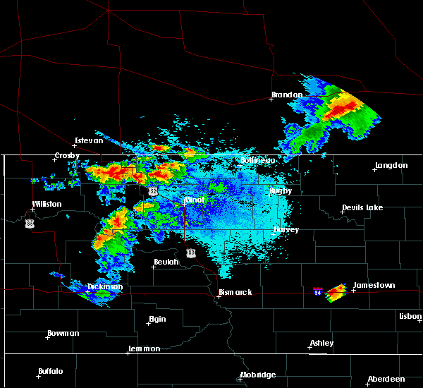 At 658 pm cdt, a severe thunderstorm was located near parshall, or 31 miles south of stanley, moving southeast at 30 mph (radar indicated). Hazards include 60 mph wind gusts. Expect damage to roofs. siding and trees. this severe storm will be near, roseglen around 735 pm cdt. Other locations impacted by this severe thunderstorm include white shield, deep water creek recreation area, parshall bay recreation area, raub, skunk creek bay recreation area and pouch point recreation area. At 658 pm cdt, a severe thunderstorm was located near parshall, or 31 miles south of stanley, moving southeast at 30 mph (radar indicated). Hazards include 60 mph wind gusts. Expect damage to roofs. siding and trees. this severe storm will be near, roseglen around 735 pm cdt. Other locations impacted by this severe thunderstorm include white shield, deep water creek recreation area, parshall bay recreation area, raub, skunk creek bay recreation area and pouch point recreation area.
|
| 7/4/2015 6:39 PM CDT |
 At 638 pm cdt, a severe thunderstorm was located near van hook park, or 22 miles south of stanley, moving east at 30 mph (radar indicated). Hazards include 60 mph wind gusts and quarter size hail. Hail damage to vehicles is expected. expect wind damage to roofs, siding and trees. this severe thunderstorm will be near, parshall around 700 pm cdt. plaza around 715 pm cdt. makoti around 730 pm cdt. Other locations impacted by this severe thunderstorm include white shield, deep water creek recreation area, parshall bay recreation area, raub, skunk creek bay recreation area and pouch point recreation area. At 638 pm cdt, a severe thunderstorm was located near van hook park, or 22 miles south of stanley, moving east at 30 mph (radar indicated). Hazards include 60 mph wind gusts and quarter size hail. Hail damage to vehicles is expected. expect wind damage to roofs, siding and trees. this severe thunderstorm will be near, parshall around 700 pm cdt. plaza around 715 pm cdt. makoti around 730 pm cdt. Other locations impacted by this severe thunderstorm include white shield, deep water creek recreation area, parshall bay recreation area, raub, skunk creek bay recreation area and pouch point recreation area.
|
| 6/1/2015 7:56 PM CDT | The severe thunderstorm warning for south central ward and southeastern mountrail counties will expire at 800 pm cdt, the storm which prompted the warning has weakened below severe limits, and no longer pose an immediate threat to life or property. therefore the warning will be allowed to expire. however small hail is still possible with this thunderstorm. |
| 6/1/2015 7:39 PM CDT | At 739 pm cdt, a severe thunderstorm was located near makoti, or 28 miles southwest of minot, moving southeast at 25 mph (radar indicated). Hazards include 60 mph wind gusts and quarter size hail. Hail damage to vehicles is expected. expect wind damage to roofs, siding and trees. This severe storm will be near, ryder and rice lake around 800 pm cdt. |
| 6/1/2015 7:33 PM CDT | At 733 pm cdt, a severe thunderstorm was located near plaza, or 29 miles southwest of minot, moving southeast at 25 mph (radar indicated). Hazards include 60 mph wind gusts and quarter size hail. Hail damage to vehicles is expected. expect wind damage to roofs, siding and trees. this severe storm will be near, makoti around 745 pm cdt. Ryder and rice lake around 800 pm cdt. |
| 6/1/2015 7:10 PM CDT | At 710 pm cdt, a severe thunderstorm was located 6 miles northwest of plaza, or 21 miles southeast of stanley, moving southeast at 25 mph (radar indicated). Hazards include 60 mph wind gusts and quarter size hail. Hail damage to vehicles is expected. expect wind damage to roofs, siding and trees. this severe storm will be near, plaza around 725 pm cdt. makoti around 745 pm cdt. Ryder and rice lake around 800 pm cdt. |
| 6/1/2015 7:02 PM CDT | At 702 pm cdt, a severe thunderstorm was located 5 miles southwest of berthold, or 25 miles west of minot, moving southeast at 20 mph (radar indicated). Hazards include 60 mph wind gusts and quarter size hail. Hail damage to vehicles is expected. expect wind damage to roofs, siding and trees. This severe thunderstorm will remain over mainly rural areas of central ward and east central mountrail counties, including the following locations, hartland. |
| 6/1/2015 6:56 PM CDT | At 656 pm cdt, a severe thunderstorm was located 9 miles east of belden, or 15 miles southeast of stanley, moving southeast at 25 mph (radar indicated). Hazards include 60 mph wind gusts and quarter size hail. Hail damage to vehicles is expected. expect wind damage to roofs, siding and trees. this severe thunderstorm will be near, plaza around 725 pm cdt. makoti around 745 pm cdt. Ryder and rice lake around 800 pm cdt. |
| 6/1/2015 6:56 PM CDT | The national weather service in bismarck has issued a * severe thunderstorm warning for. south central ward county in north central north dakota. southeastern mountrail county in northwestern north dakota. until 800 pm cdt * at 656 pm cdt. A severe thunderstorm was located 9 miles east of. |
| 6/1/2015 6:56 PM CDT | The national weather service in bismarck has issued a * severe thunderstorm warning for. south central ward county in north central north dakota. southeastern mountrail county in northwestern north dakota. until 800 pm cdt * at 656 pm cdt. A severe thunderstorm was located 9 miles east of. |
| 6/1/2015 6:44 PM CDT | At 644 pm cdt, a severe thunderstorm was located 6 miles east of blaisdell, or 21 miles east of stanley, moving southeast at 20 mph (radar indicated). Hazards include 60 mph wind gusts and quarter size hail. Hail damage to vehicles is expected. expect wind damage to roofs, siding and trees. this severe thunderstorm will be near, berthold around 705 pm cdt. Other locations impacted by this severe thunderstorm include hartland and tagus. |
| 6/9/2012 5:50 AM CDT | Received report of several telephone poles completedly down in mountrail county ND, 7.3 miles S of Plaza, ND |
Hail Maps for Plaza, ND
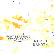


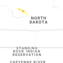


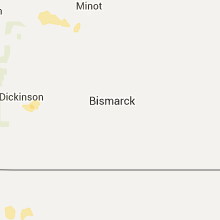


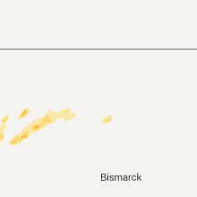


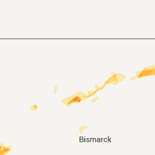


Connect with Interactive Hail Maps