

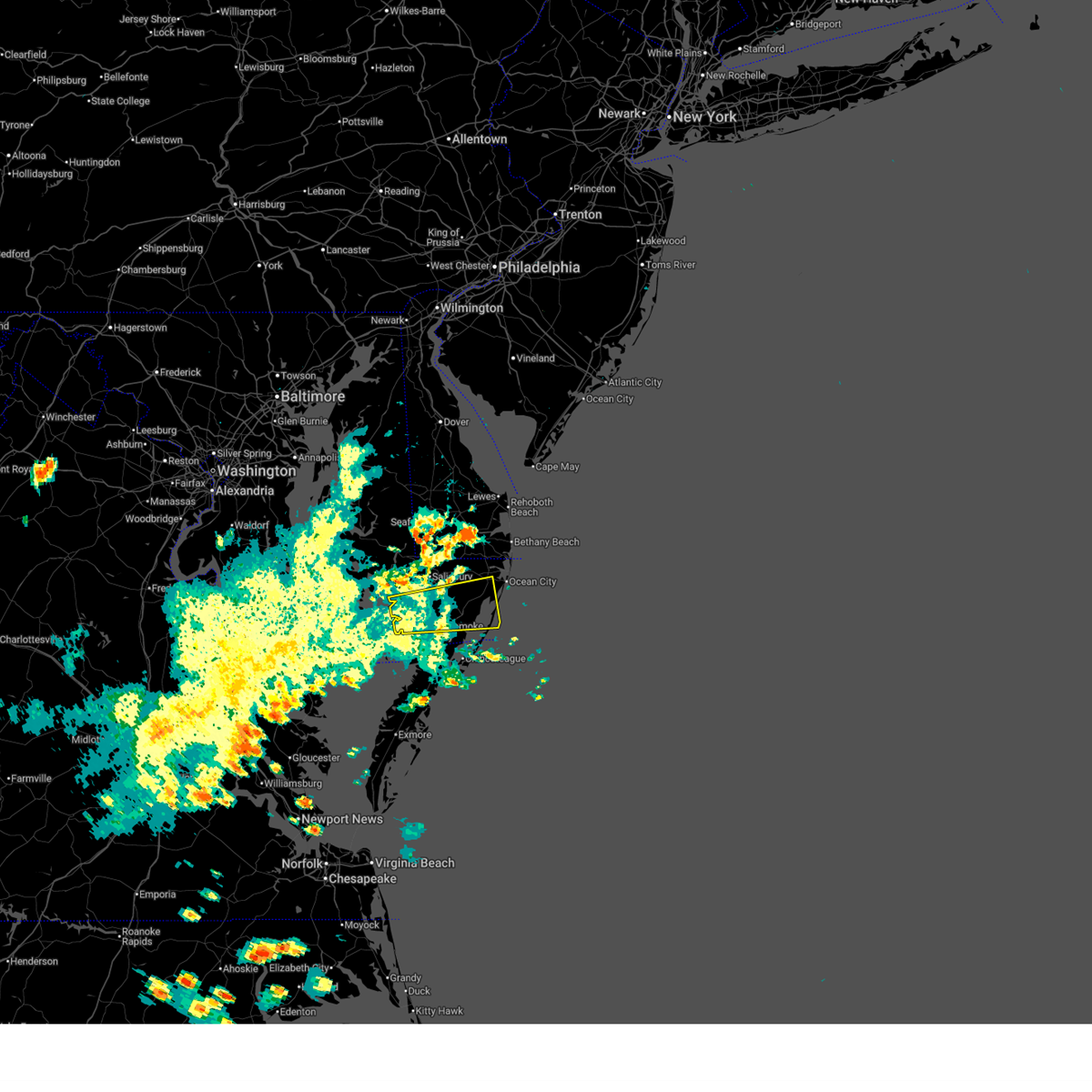
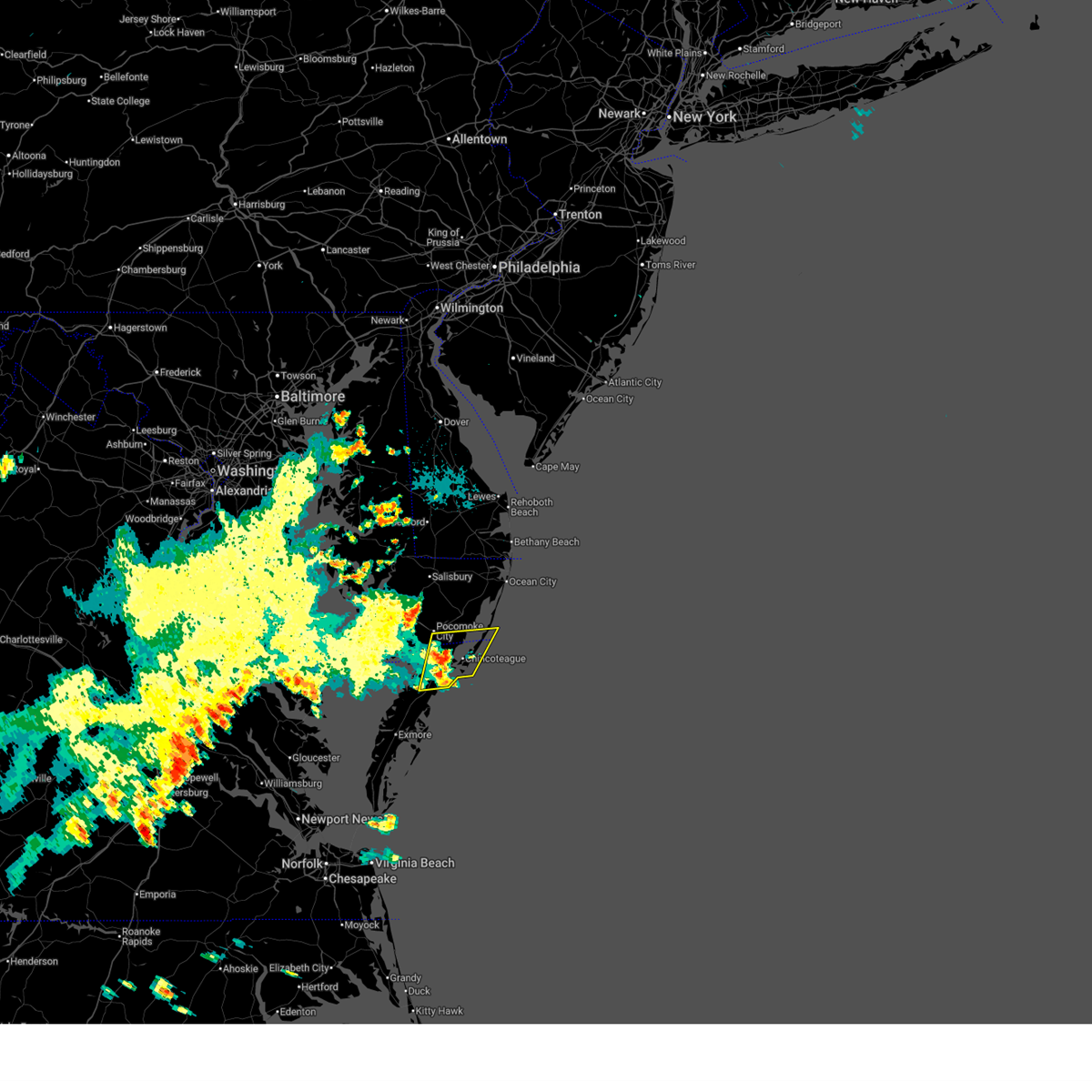
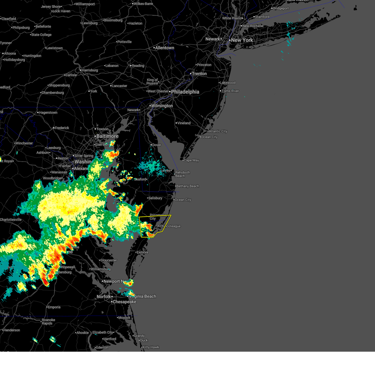
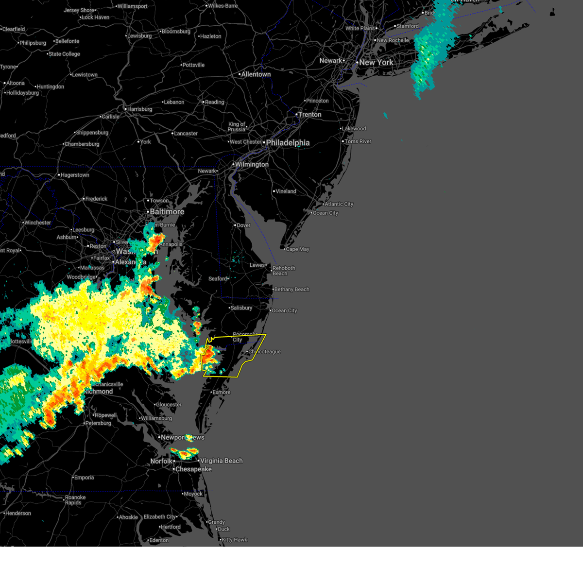
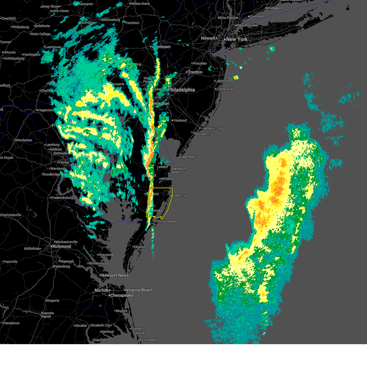
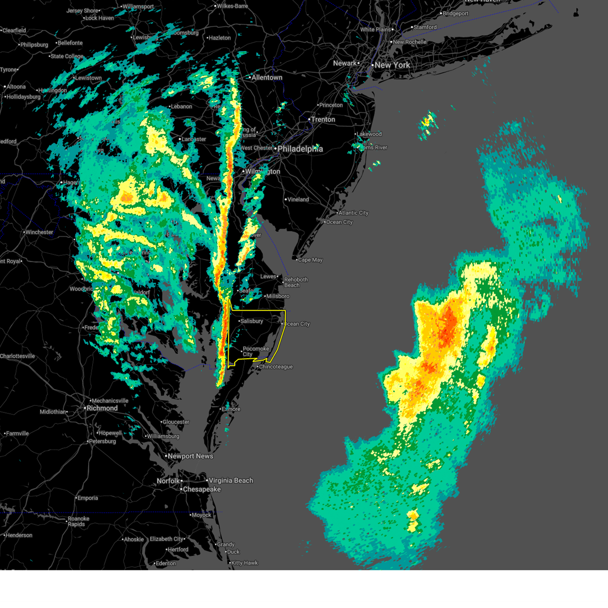
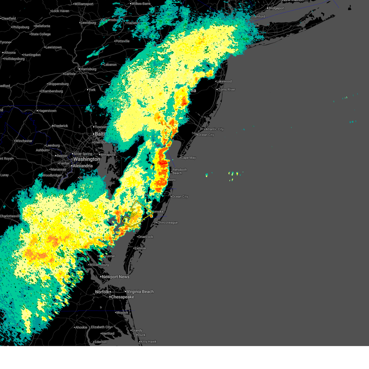
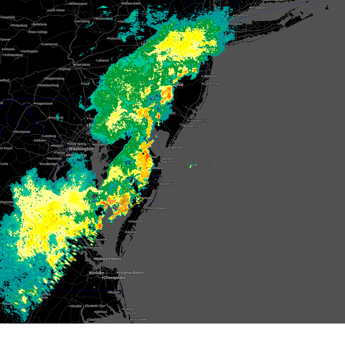
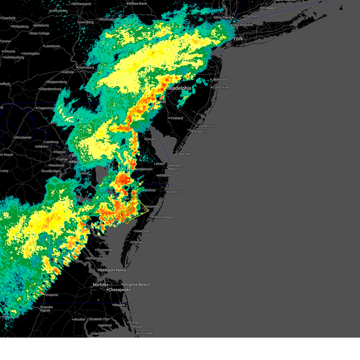
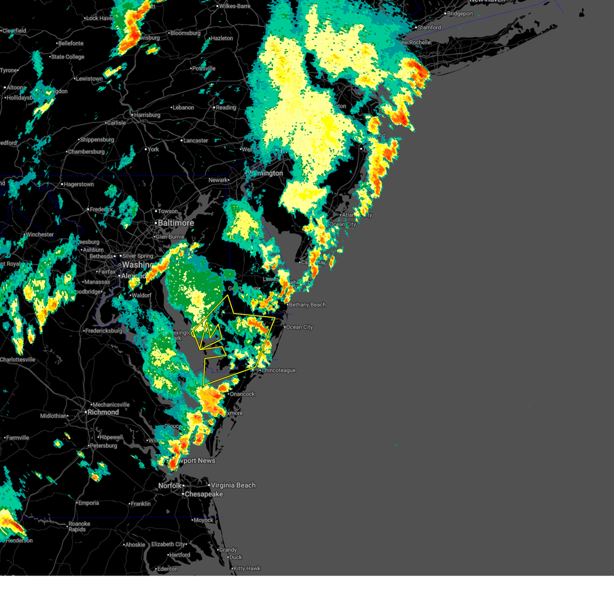
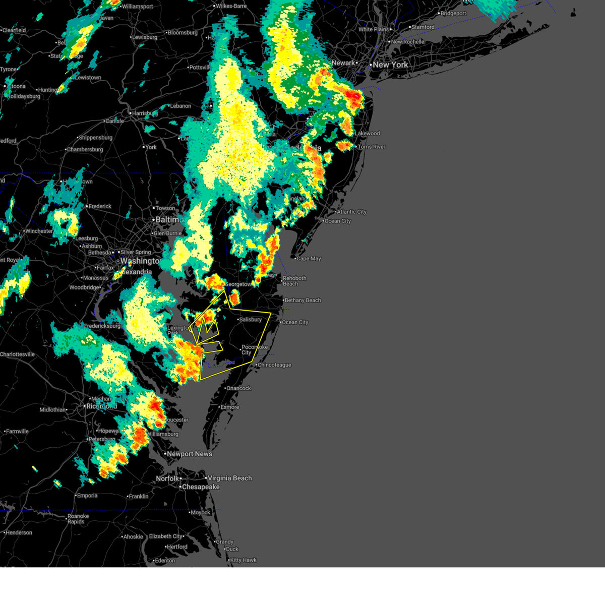
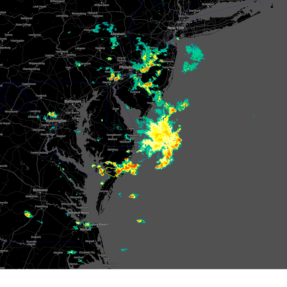
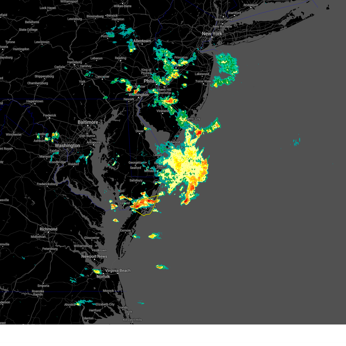
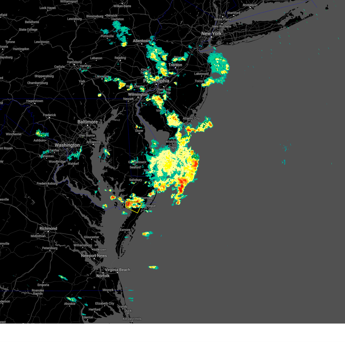
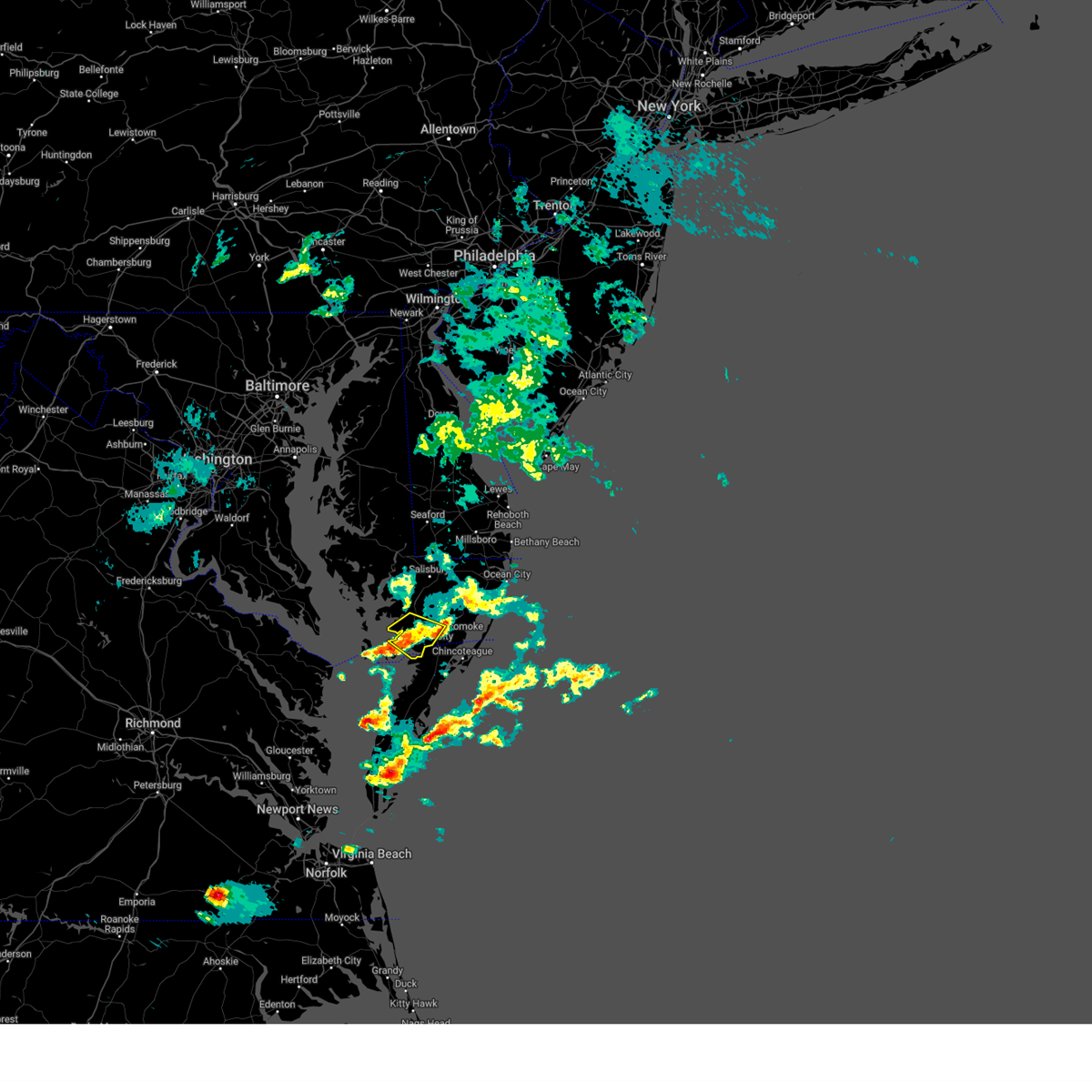
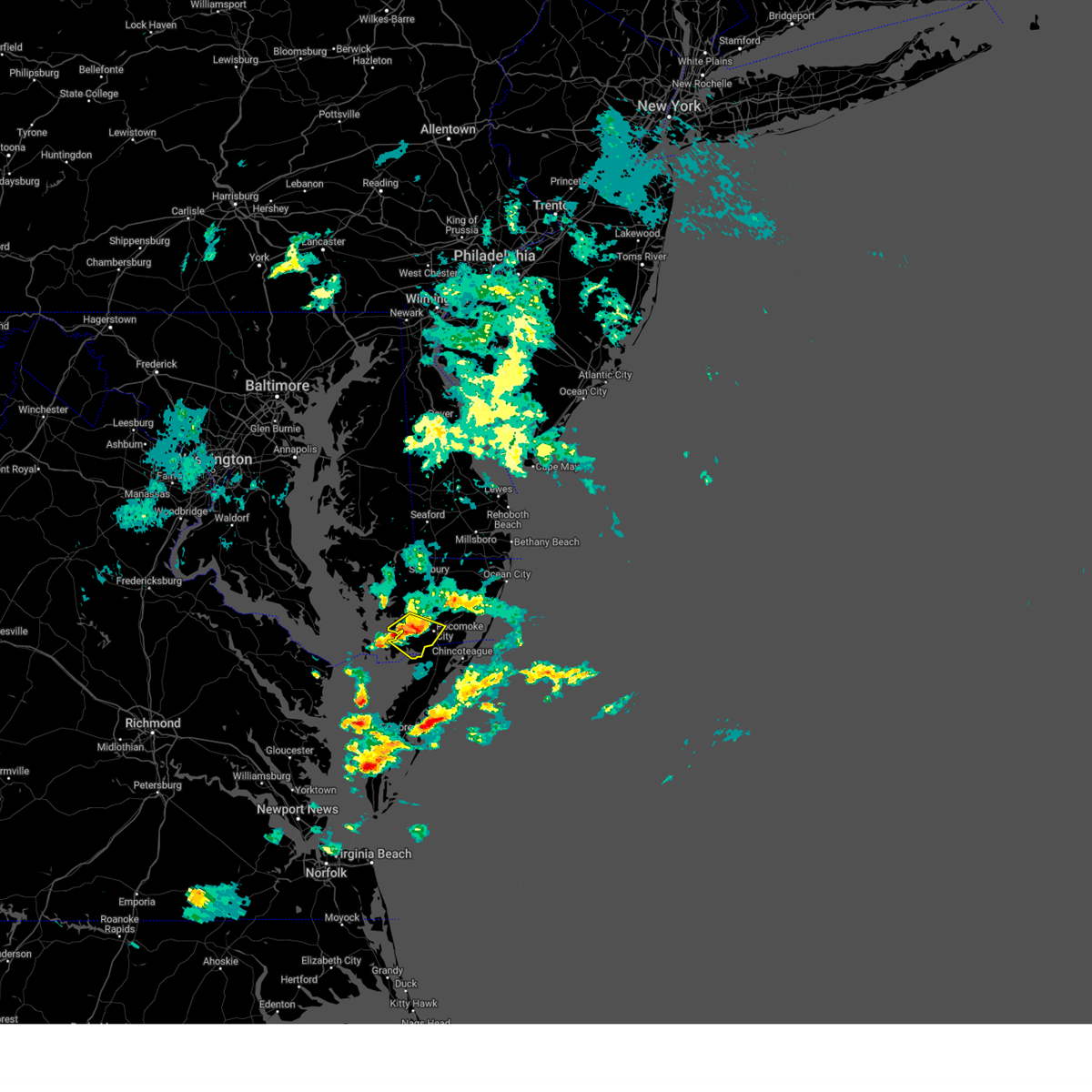
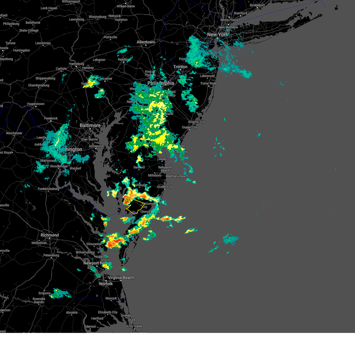
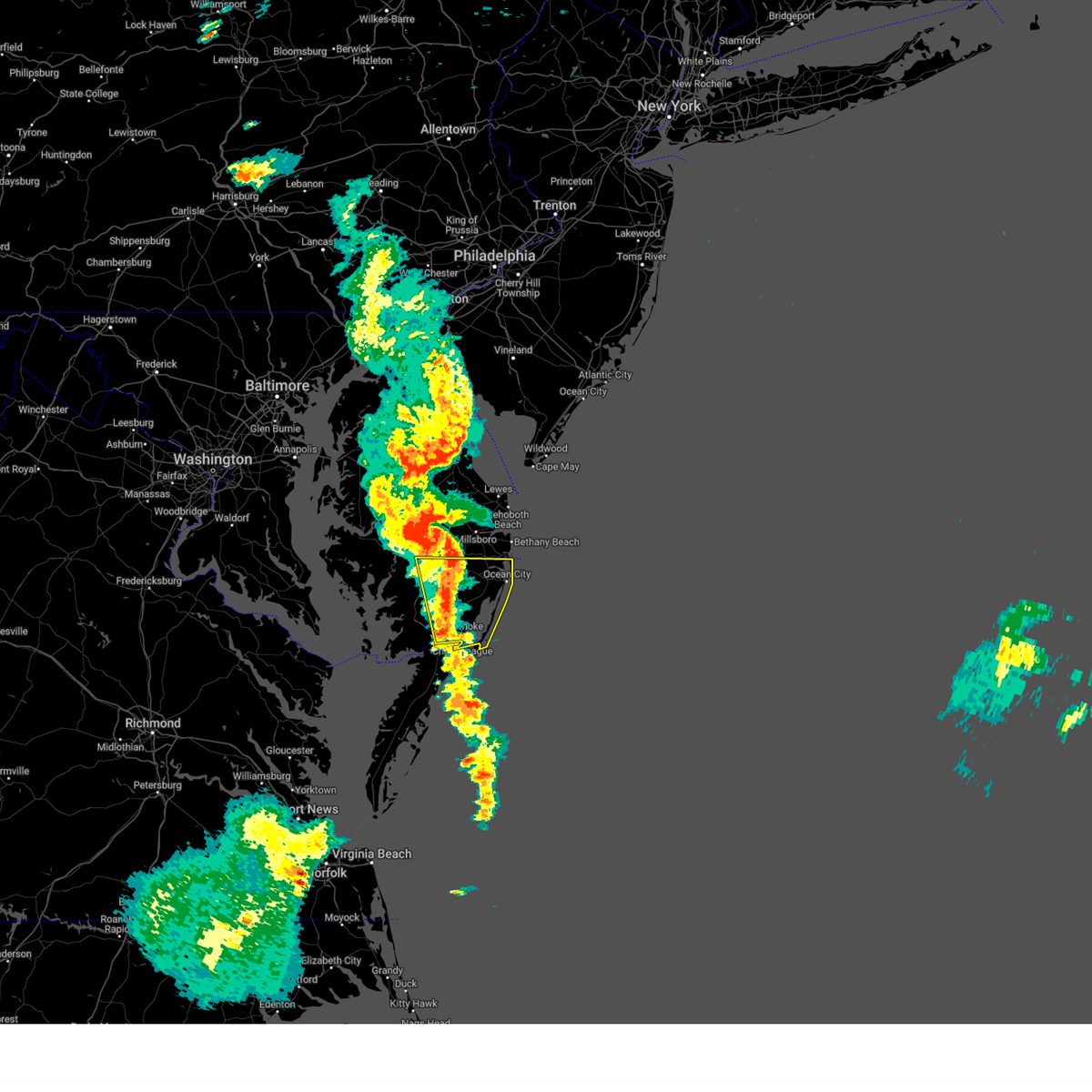
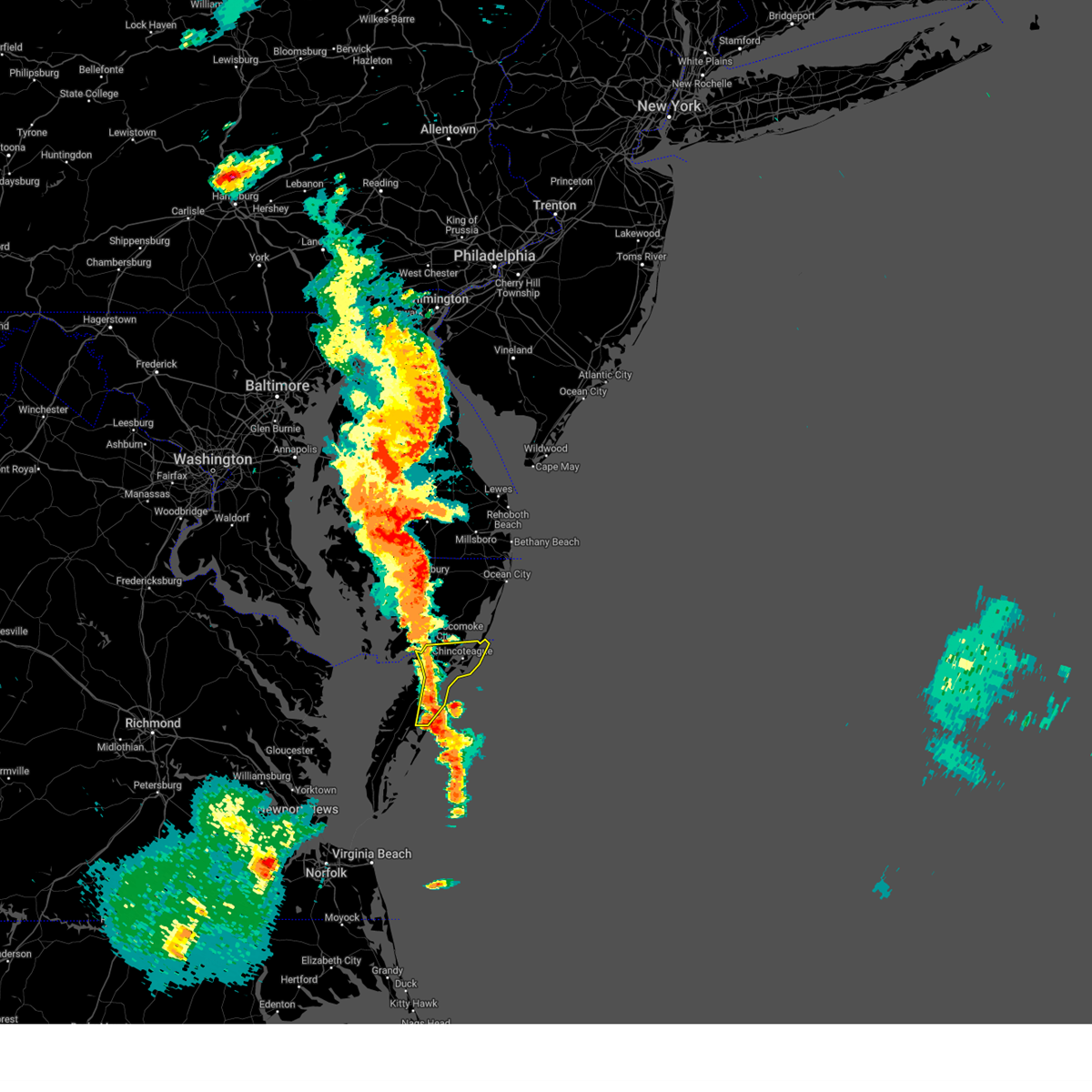
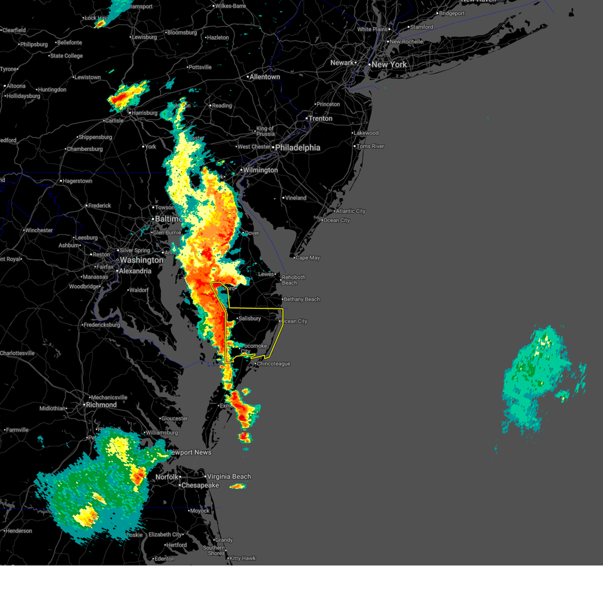
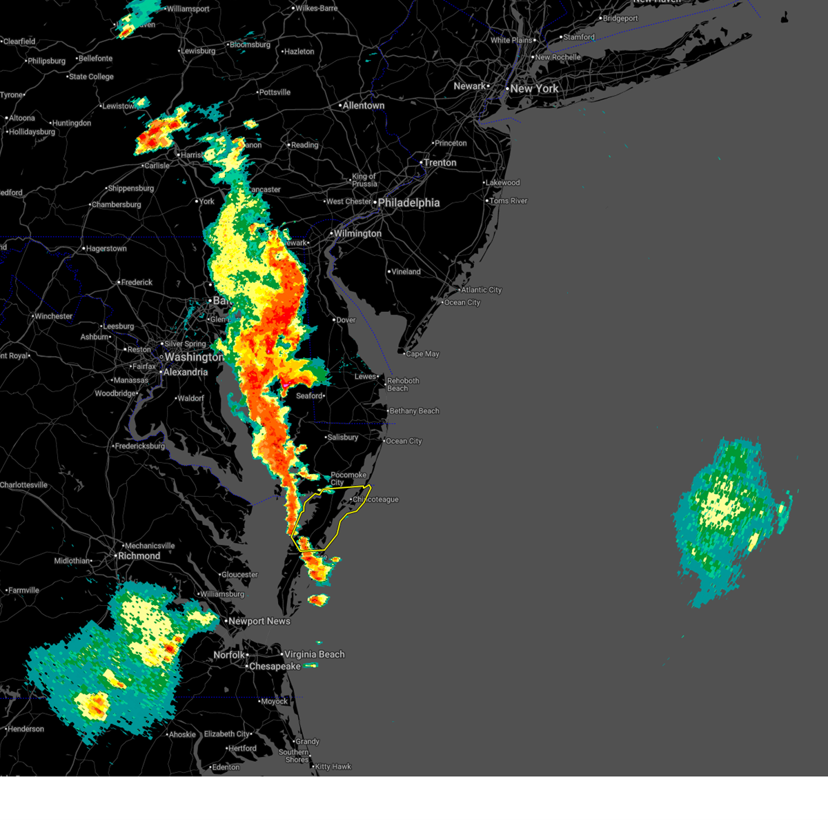
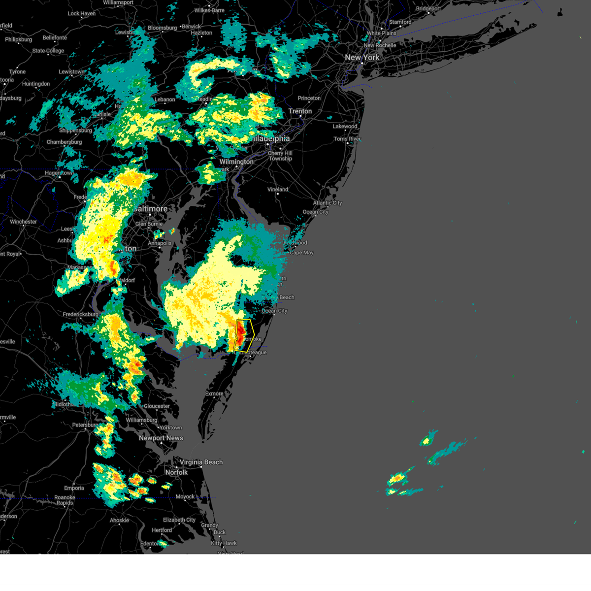
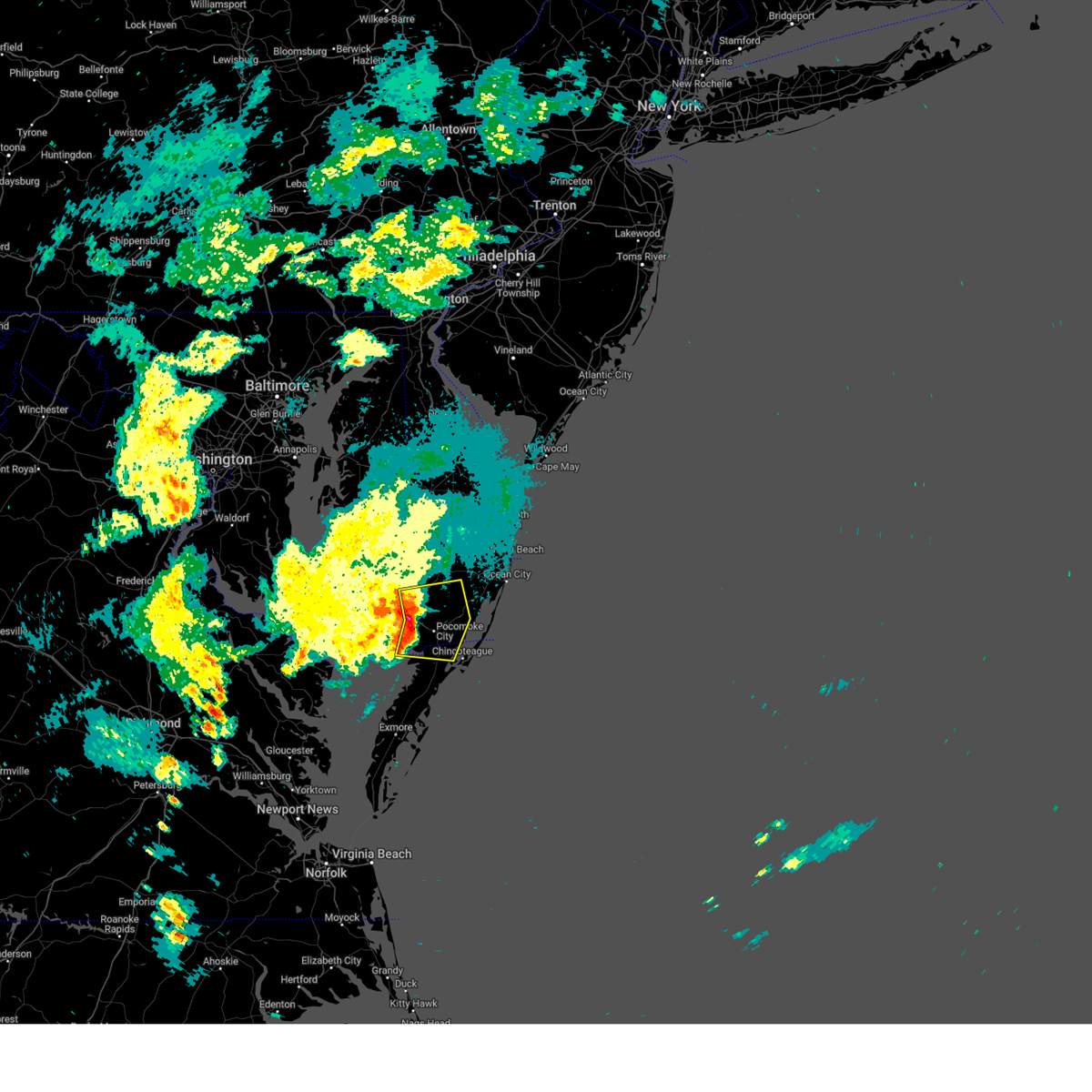
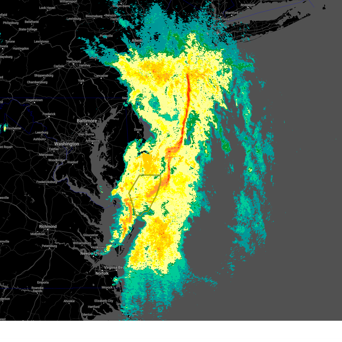
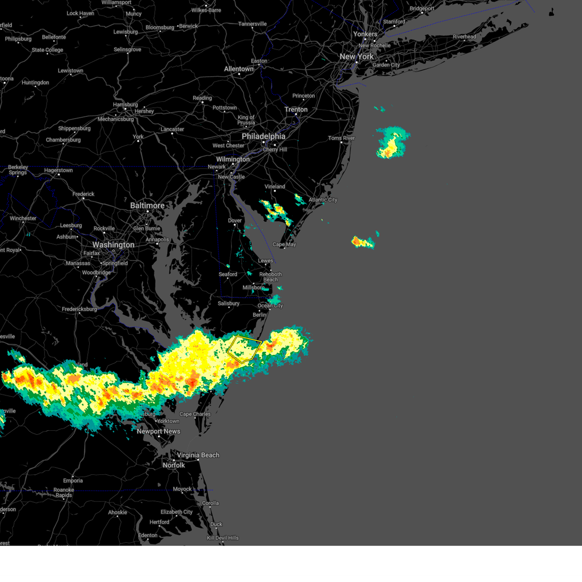
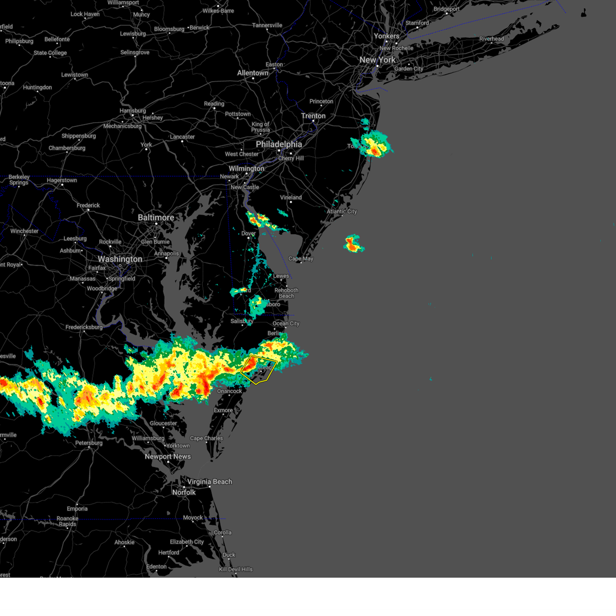
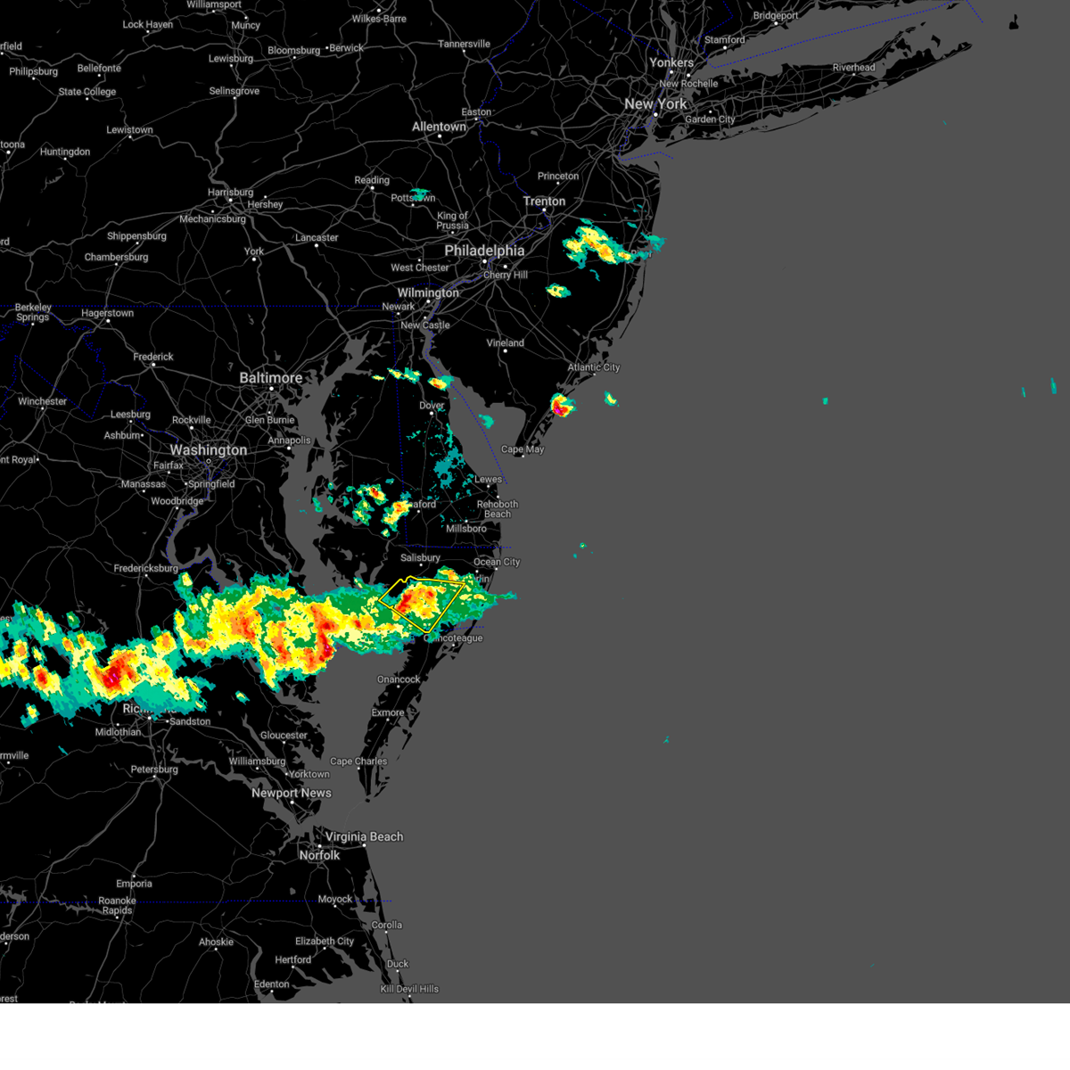
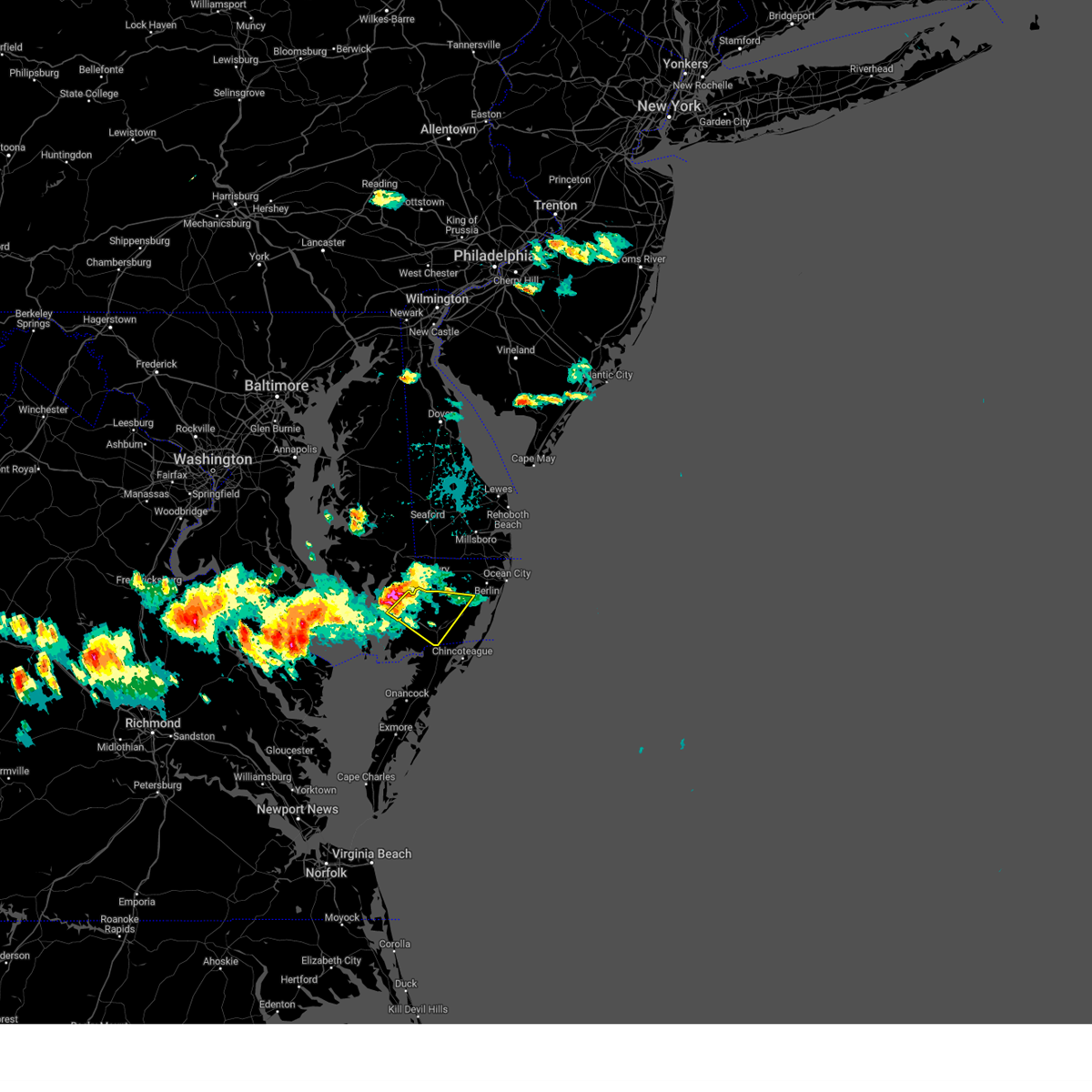
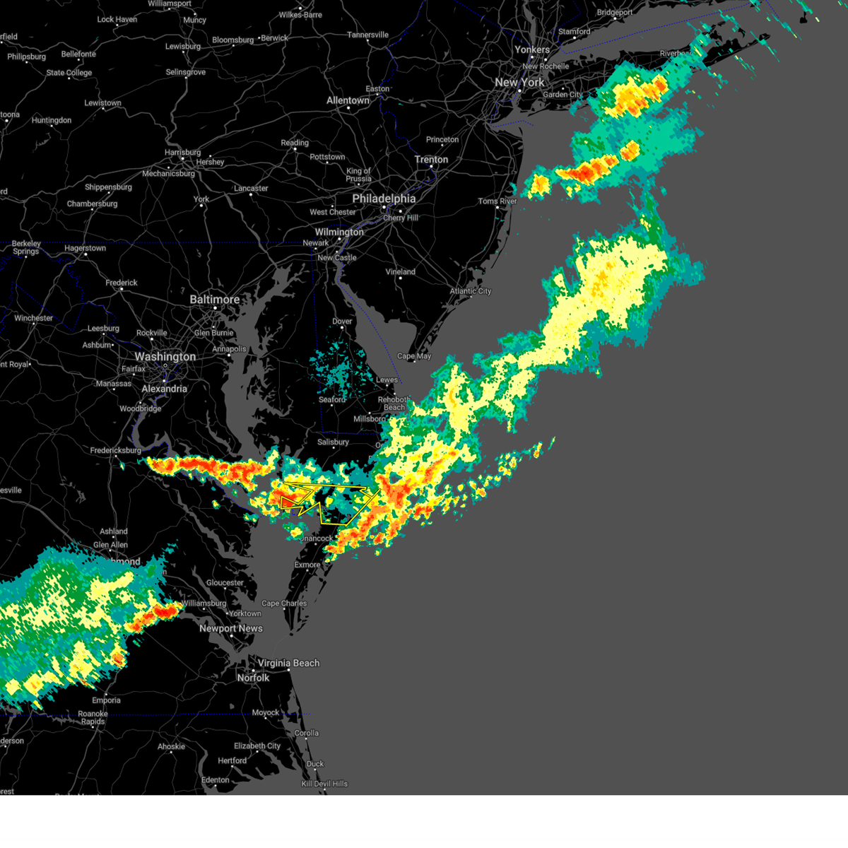
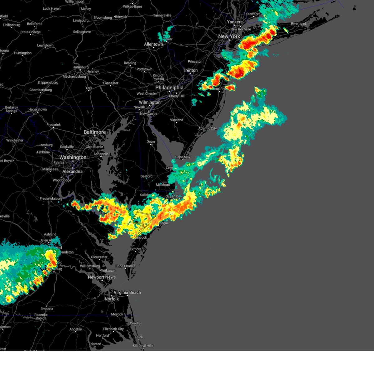
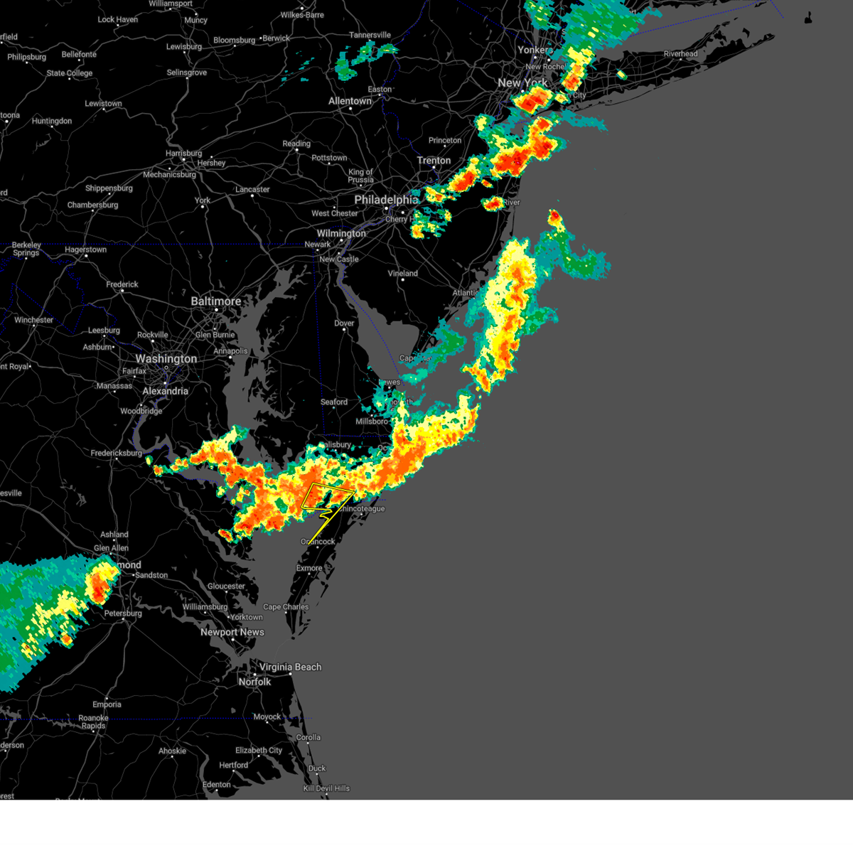
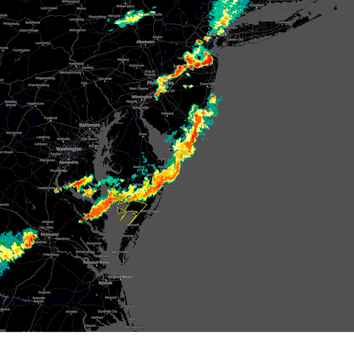
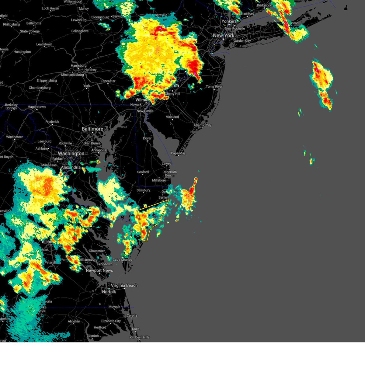
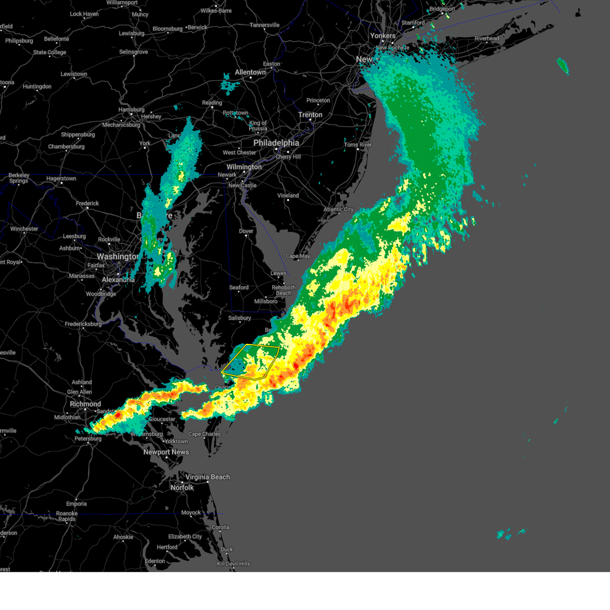
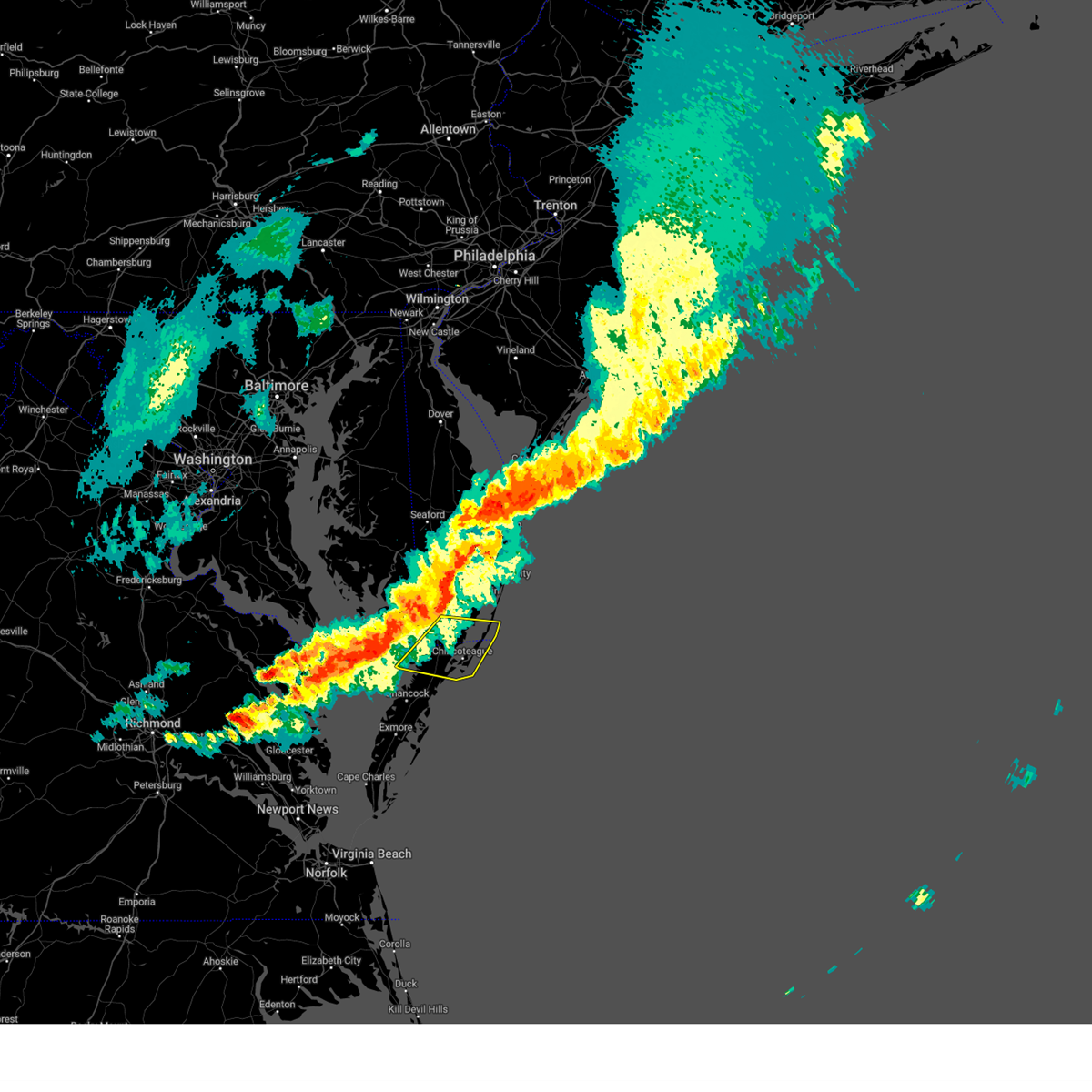
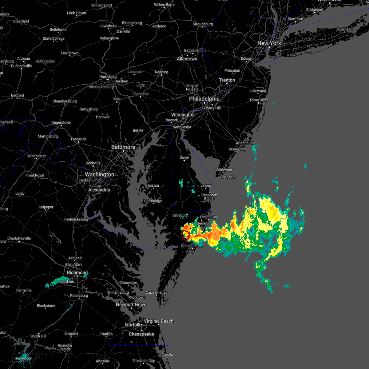
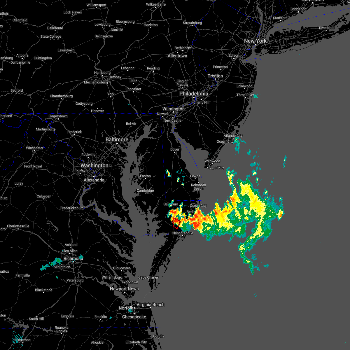
Hail Map for Pocomoke City, MD
The Pocomoke City, MD area has had 0 reports of on-the-ground hail by trained spotters, and has been under severe weather warnings 14 times during the past 12 months. Doppler radar has detected hail at or near Pocomoke City, MD on 20 occasions.
| Name: | Pocomoke City, MD |
| Where Located: | 31.8 miles SW of Ocean City, MD |
| Map: | Google Map for Pocomoke City, MD |
| Population: | 4184 |
| Housing Units: | 1894 |
| More Info: | Search Google for Pocomoke City, MD |
1
The Top Recent Hail Date for Pocomoke City, MD is Saturday, May 31, 2025 (6th out of 20)

Hail and Wind Damage Spotted near Pocomoke City, MD
| Date / Time | Report Details |
|---|---|
| 6/12/2026 10:07 PM EDT |
 The storm which prompted the warning has weakened below severe limits, and no longer poses an immediate threat to life or property. therefore, the warning will be allowed to expire. The storm which prompted the warning has weakened below severe limits, and no longer poses an immediate threat to life or property. therefore, the warning will be allowed to expire.
|
| 6/12/2026 9:30 PM EDT |
 The severe thunderstorm which prompted the warning has continues to remain severe and a new severe thunderstorm warning has been issued. therefore, this warning will be allowed to expire. The severe thunderstorm which prompted the warning has continues to remain severe and a new severe thunderstorm warning has been issued. therefore, this warning will be allowed to expire.
|
| 6/12/2026 9:28 PM EDT |
 Svrakq the national weather service in wakefield has issued a * severe thunderstorm warning for, southwestern worcester county in southeastern maryland, northern accomack county in southeastern virginia, * until 1015 pm edt. * at 928 pm edt, a severe thunderstorm was located 9 miles southeast of pocomoke city, moving east at 25 mph (radar indicated). Hazards include 60 mph wind gusts. Expect damage to trees and powerlines. This severe thunderstorm will remain over mainly rural areas of southwestern worcester and northern accomack counties, including the following locations, horntown, hallwood, mappsville, greenbackville, wallops island, temperanceville, nelsonia, modest town, oak hall, and bloxom. Svrakq the national weather service in wakefield has issued a * severe thunderstorm warning for, southwestern worcester county in southeastern maryland, northern accomack county in southeastern virginia, * until 1015 pm edt. * at 928 pm edt, a severe thunderstorm was located 9 miles southeast of pocomoke city, moving east at 25 mph (radar indicated). Hazards include 60 mph wind gusts. Expect damage to trees and powerlines. This severe thunderstorm will remain over mainly rural areas of southwestern worcester and northern accomack counties, including the following locations, horntown, hallwood, mappsville, greenbackville, wallops island, temperanceville, nelsonia, modest town, oak hall, and bloxom.
|
| 6/12/2026 9:16 PM EDT |
 At 915 pm edt, a severe thunderstorm was located 9 miles south of pocomoke city, moving east at 30 mph (radar indicated). Hazards include 60 mph wind gusts. Expect damage to trees and powerlines. Locations impacted include, pocomoke city, parksley, marion station, west pocomoke, bloxom, saxis, hallwood, horntown, mappsville, goodwill, greenbackville, wallops island, temperanceville, nelsonia, shelltown, sanford, modest town, oak hall, clam, and guilford. At 915 pm edt, a severe thunderstorm was located 9 miles south of pocomoke city, moving east at 30 mph (radar indicated). Hazards include 60 mph wind gusts. Expect damage to trees and powerlines. Locations impacted include, pocomoke city, parksley, marion station, west pocomoke, bloxom, saxis, hallwood, horntown, mappsville, goodwill, greenbackville, wallops island, temperanceville, nelsonia, shelltown, sanford, modest town, oak hall, clam, and guilford.
|
| 6/12/2026 9:13 PM EDT |
 Svrakq the national weather service in wakefield has issued a * severe thunderstorm warning for, northeastern somerset county in southeastern maryland, southeastern wicomico county in southeastern maryland, worcester county in southeastern maryland, * until 1015 pm edt. * at 913 pm edt, a severe thunderstorm was located near princess anne, moving east at 25 mph (radar indicated). Hazards include 60 mph wind gusts. Expect damage to trees and powerlines. this severe thunderstorm will be near, princess anne, university of maryland eastern shore, and westover around 920 pm edt. snow hill around 950 pm edt. newark around 1000 pm edt. Other locations impacted by this severe thunderstorm include boxiron, oriole, cokesbury, fairmount, upper hill, public landing, eden, ironshire, kingston, and manokin. Svrakq the national weather service in wakefield has issued a * severe thunderstorm warning for, northeastern somerset county in southeastern maryland, southeastern wicomico county in southeastern maryland, worcester county in southeastern maryland, * until 1015 pm edt. * at 913 pm edt, a severe thunderstorm was located near princess anne, moving east at 25 mph (radar indicated). Hazards include 60 mph wind gusts. Expect damage to trees and powerlines. this severe thunderstorm will be near, princess anne, university of maryland eastern shore, and westover around 920 pm edt. snow hill around 950 pm edt. newark around 1000 pm edt. Other locations impacted by this severe thunderstorm include boxiron, oriole, cokesbury, fairmount, upper hill, public landing, eden, ironshire, kingston, and manokin.
|
| 6/12/2026 8:40 PM EDT |
 Svrakq the national weather service in wakefield has issued a * severe thunderstorm warning for, southeastern somerset county in southeastern maryland, southwestern worcester county in southeastern maryland, accomack county in southeastern virginia, * until 930 pm edt. * at 840 pm edt, a severe thunderstorm was located near lawsonia, or 19 miles southwest of pocomoke city, moving east at 35 mph (radar indicated). Hazards include 60 mph wind gusts. Expect damage to trees and powerlines. This severe thunderstorm will remain over mainly rural areas of southeastern somerset, southwestern worcester and accomack counties, including the following locations, horntown, hallwood, mappsville, goodwill, greenbackville, saxis, wallops island, temperanceville, nelsonia, and shelltown. Svrakq the national weather service in wakefield has issued a * severe thunderstorm warning for, southeastern somerset county in southeastern maryland, southwestern worcester county in southeastern maryland, accomack county in southeastern virginia, * until 930 pm edt. * at 840 pm edt, a severe thunderstorm was located near lawsonia, or 19 miles southwest of pocomoke city, moving east at 35 mph (radar indicated). Hazards include 60 mph wind gusts. Expect damage to trees and powerlines. This severe thunderstorm will remain over mainly rural areas of southeastern somerset, southwestern worcester and accomack counties, including the following locations, horntown, hallwood, mappsville, goodwill, greenbackville, saxis, wallops island, temperanceville, nelsonia, and shelltown.
|
| 3/16/2026 10:57 PM EDT |
 the severe thunderstorm warning has been cancelled and is no longer in effect the severe thunderstorm warning has been cancelled and is no longer in effect
|
| 3/16/2026 10:57 PM EDT |
 At 1057 pm edt, severe thunderstorms were located along a line extending from near milford to near georgetown to 12 miles southeast of pocomoke city, moving northeast at 60 mph (radar indicated). Hazards include 70 mph wind gusts. Expect considerable tree damage. damage is likely to mobile homes, roofs, and outbuildings. these severe storms will be near, berlin, snow hill, and newark around 1100 pm edt. ocean pines around 1105 pm edt. cape isle of wight around 1110 pm edt. ocean city around 1115 pm edt. Other locations impacted by these severe thunderstorms include bishop, boxiron, ocean city municipality, salisbury-wicomico, bishopville, public landing, goodwill, ironshire, willards, and west ocean city. At 1057 pm edt, severe thunderstorms were located along a line extending from near milford to near georgetown to 12 miles southeast of pocomoke city, moving northeast at 60 mph (radar indicated). Hazards include 70 mph wind gusts. Expect considerable tree damage. damage is likely to mobile homes, roofs, and outbuildings. these severe storms will be near, berlin, snow hill, and newark around 1100 pm edt. ocean pines around 1105 pm edt. cape isle of wight around 1110 pm edt. ocean city around 1115 pm edt. Other locations impacted by these severe thunderstorms include bishop, boxiron, ocean city municipality, salisbury-wicomico, bishopville, public landing, goodwill, ironshire, willards, and west ocean city.
|
| 3/16/2026 10:36 PM EDT |
 Svrakq the national weather service in wakefield has issued a * severe thunderstorm warning for, eastern somerset county in southeastern maryland, wicomico county in southeastern maryland, worcester county in southeastern maryland, * until 1130 pm edt. * at 1036 pm edt, severe thunderstorms were located along a line extending from smithville to near laurel to near parksley, moving northeast at 55 mph (radar indicated). Hazards include 70 mph wind gusts. Expect considerable tree damage. damage is likely to mobile homes, roofs, and outbuildings. severe thunderstorms will be near, salisbury, fruitland, pocomoke city, salisbury university, delmar, delmar, and west pocomoke around 1040 pm edt. parsonsburg around 1045 pm edt. snow hill around 1050 pm edt. newark around 1055 pm edt. berlin and selbyville around 1100 pm edt. ocean pines around 1105 pm edt. ocean city and cape isle of wight around 1110 pm edt. Other locations impacted by these severe thunderstorms include bishop, ocean city municipality, cokesbury, goodwill, eden, shelltown, cedartown, longridge, pittsville, and chesapeake heights. Svrakq the national weather service in wakefield has issued a * severe thunderstorm warning for, eastern somerset county in southeastern maryland, wicomico county in southeastern maryland, worcester county in southeastern maryland, * until 1130 pm edt. * at 1036 pm edt, severe thunderstorms were located along a line extending from smithville to near laurel to near parksley, moving northeast at 55 mph (radar indicated). Hazards include 70 mph wind gusts. Expect considerable tree damage. damage is likely to mobile homes, roofs, and outbuildings. severe thunderstorms will be near, salisbury, fruitland, pocomoke city, salisbury university, delmar, delmar, and west pocomoke around 1040 pm edt. parsonsburg around 1045 pm edt. snow hill around 1050 pm edt. newark around 1055 pm edt. berlin and selbyville around 1100 pm edt. ocean pines around 1105 pm edt. ocean city and cape isle of wight around 1110 pm edt. Other locations impacted by these severe thunderstorms include bishop, ocean city municipality, cokesbury, goodwill, eden, shelltown, cedartown, longridge, pittsville, and chesapeake heights.
|
| 7/9/2025 9:42 PM EDT |
 the severe thunderstorm warning has been cancelled and is no longer in effect the severe thunderstorm warning has been cancelled and is no longer in effect
|
| 7/9/2025 9:28 PM EDT |
 Svrakq the national weather service in wakefield has issued a * severe thunderstorm warning for, somerset county in southeastern maryland, southwestern worcester county in southeastern maryland, * until 1000 pm edt. * at 928 pm edt, a severe thunderstorm was located near lawsonia, or 15 miles southwest of princess anne, moving northeast at 10 mph (radar indicated). Hazards include 60 mph wind gusts. Expect damage to trees and powerlines. This severe thunderstorm will remain over mainly rural areas of somerset and southwestern worcester counties, including the following locations, oriole, byrdtown, cokesbury, goodwill, fairmount, upper hill, smith island, hopewell, rehobeth, and kingston. Svrakq the national weather service in wakefield has issued a * severe thunderstorm warning for, somerset county in southeastern maryland, southwestern worcester county in southeastern maryland, * until 1000 pm edt. * at 928 pm edt, a severe thunderstorm was located near lawsonia, or 15 miles southwest of princess anne, moving northeast at 10 mph (radar indicated). Hazards include 60 mph wind gusts. Expect damage to trees and powerlines. This severe thunderstorm will remain over mainly rural areas of somerset and southwestern worcester counties, including the following locations, oriole, byrdtown, cokesbury, goodwill, fairmount, upper hill, smith island, hopewell, rehobeth, and kingston.
|
| 7/9/2025 8:39 PM EDT |
 At 839 pm edt, a severe thunderstorm was located near lawsonia, or 14 miles west of pocomoke city, moving northeast at 10 mph (radar indicated). Hazards include 60 mph wind gusts. Expect damage to trees and powerlines. this severe storm will be near, marion station around 845 pm edt. westover around 915 pm edt. Other locations impacted by this severe thunderstorm include oriole, byrdtown, cokesbury, fairmount, upper hill, smith island, hopewell, rehobeth, kingston, and shelltown. At 839 pm edt, a severe thunderstorm was located near lawsonia, or 14 miles west of pocomoke city, moving northeast at 10 mph (radar indicated). Hazards include 60 mph wind gusts. Expect damage to trees and powerlines. this severe storm will be near, marion station around 845 pm edt. westover around 915 pm edt. Other locations impacted by this severe thunderstorm include oriole, byrdtown, cokesbury, fairmount, upper hill, smith island, hopewell, rehobeth, kingston, and shelltown.
|
| 7/9/2025 8:09 PM EDT |
 Svrakq the national weather service in wakefield has issued a * severe thunderstorm warning for, somerset county in southeastern maryland, southwestern worcester county in southeastern maryland, northern accomack county in southeastern virginia, * until 915 pm edt. * at 809 pm edt, a severe thunderstorm was located near lawsonia, or 20 miles southwest of pocomoke city, moving northeast at 10 mph (radar indicated). Hazards include 60 mph wind gusts. Expect damage to trees and powerlines. this severe thunderstorm will be near, lawsonia around 815 pm edt. marion station around 845 pm edt. Other locations impacted by this severe thunderstorm include oriole, byrdtown, cokesbury, fairmount, upper hill, smith island, hopewell, rehobeth, kingston, and shelltown. Svrakq the national weather service in wakefield has issued a * severe thunderstorm warning for, somerset county in southeastern maryland, southwestern worcester county in southeastern maryland, northern accomack county in southeastern virginia, * until 915 pm edt. * at 809 pm edt, a severe thunderstorm was located near lawsonia, or 20 miles southwest of pocomoke city, moving northeast at 10 mph (radar indicated). Hazards include 60 mph wind gusts. Expect damage to trees and powerlines. this severe thunderstorm will be near, lawsonia around 815 pm edt. marion station around 845 pm edt. Other locations impacted by this severe thunderstorm include oriole, byrdtown, cokesbury, fairmount, upper hill, smith island, hopewell, rehobeth, kingston, and shelltown.
|
| 6/19/2025 7:30 PM EDT |
 The storms which prompted the warning have weakened below severe limits, and no longer pose an immediate threat to life or property. therefore, the warning has been allowed to expire. however, gusty winds and heavy rain are still possible with these thunderstorms. a severe thunderstorm watch remains in effect until 900 pm edt for southeastern maryland, and southeastern virginia. The storms which prompted the warning have weakened below severe limits, and no longer pose an immediate threat to life or property. therefore, the warning has been allowed to expire. however, gusty winds and heavy rain are still possible with these thunderstorms. a severe thunderstorm watch remains in effect until 900 pm edt for southeastern maryland, and southeastern virginia.
|
| 6/19/2025 7:17 PM EDT | Tree fell across wallace taylor r in somerset county MD, 4.9 miles SSE of Pocomoke City, MD |
| 6/19/2025 6:45 PM EDT |
 Svrakq the national weather service in wakefield has issued a * severe thunderstorm warning for, somerset county in southeastern maryland, wicomico county in southeastern maryland, worcester county in southeastern maryland, southeastern dorchester county in southeastern maryland, northern accomack county in southeastern virginia, * until 730 pm edt. * at 644 pm edt, severe thunderstorms were located along a line extending from 10 miles northeast of saint inigoes creek to near tylerton to near tangier, moving northeast at 55 mph (radar indicated). Hazards include 60 mph wind gusts. Expect damage to trees and powerlines. severe thunderstorms will be near, tangier, lawsonia, and deal island around 650 pm edt. princess anne, university of maryland eastern shore, westover, and marion station around 700 pm edt. pocomoke city and west pocomoke around 705 pm edt. fruitland, salisbury university, and hebron around 710 pm edt. salisbury and snow hill around 715 pm edt. newark and parsonsburg around 720 pm edt. Other locations impacted by these severe thunderstorms include brookview, trinity, cokesbury, eden, sanford, longridge, mount vernon, chesapeake heights, pittsville, and powellville. Svrakq the national weather service in wakefield has issued a * severe thunderstorm warning for, somerset county in southeastern maryland, wicomico county in southeastern maryland, worcester county in southeastern maryland, southeastern dorchester county in southeastern maryland, northern accomack county in southeastern virginia, * until 730 pm edt. * at 644 pm edt, severe thunderstorms were located along a line extending from 10 miles northeast of saint inigoes creek to near tylerton to near tangier, moving northeast at 55 mph (radar indicated). Hazards include 60 mph wind gusts. Expect damage to trees and powerlines. severe thunderstorms will be near, tangier, lawsonia, and deal island around 650 pm edt. princess anne, university of maryland eastern shore, westover, and marion station around 700 pm edt. pocomoke city and west pocomoke around 705 pm edt. fruitland, salisbury university, and hebron around 710 pm edt. salisbury and snow hill around 715 pm edt. newark and parsonsburg around 720 pm edt. Other locations impacted by these severe thunderstorms include brookview, trinity, cokesbury, eden, sanford, longridge, mount vernon, chesapeake heights, pittsville, and powellville.
|
| 5/31/2025 4:29 PM EDT |
 The severe thunderstorm which prompted the warning has moved out of the warned area. therefore, the warning will be allowed to expire. however, gusty winds and heavy rain are still possible with this thunderstorm. to report severe weather, contact your nearest law enforcement agency. they will relay your report to the national weather service wakefield. The severe thunderstorm which prompted the warning has moved out of the warned area. therefore, the warning will be allowed to expire. however, gusty winds and heavy rain are still possible with this thunderstorm. to report severe weather, contact your nearest law enforcement agency. they will relay your report to the national weather service wakefield.
|
| 5/31/2025 4:16 PM EDT |
 Svrakq the national weather service in wakefield has issued a * severe thunderstorm warning for, southeastern worcester county in southeastern maryland, northern accomack county in southeastern virginia, * until 445 pm edt. * at 415 pm edt, severe thunderstorms were located along a line extending from 8 miles southeast of snow hill to 8 miles south of pocomoke city, moving east at 35 mph (radar indicated). Hazards include 60 mph wind gusts and quarter size hail. Minor damage to vehicles is possible. expect wind damage to trees and powerlines. These severe thunderstorms will remain over mainly rural areas of southeastern worcester and northern accomack counties, including the following locations, horntown, temperanceville, oak hall, goodwill, greenbackville, assawoman, beaver dam, atlantic, stockton, and new church. Svrakq the national weather service in wakefield has issued a * severe thunderstorm warning for, southeastern worcester county in southeastern maryland, northern accomack county in southeastern virginia, * until 445 pm edt. * at 415 pm edt, severe thunderstorms were located along a line extending from 8 miles southeast of snow hill to 8 miles south of pocomoke city, moving east at 35 mph (radar indicated). Hazards include 60 mph wind gusts and quarter size hail. Minor damage to vehicles is possible. expect wind damage to trees and powerlines. These severe thunderstorms will remain over mainly rural areas of southeastern worcester and northern accomack counties, including the following locations, horntown, temperanceville, oak hall, goodwill, greenbackville, assawoman, beaver dam, atlantic, stockton, and new church.
|
| 5/31/2025 3:56 PM EDT |
 Svrakq the national weather service in wakefield has issued a * severe thunderstorm warning for, southeastern somerset county in southeastern maryland, southwestern worcester county in southeastern maryland, north central accomack county in southeastern virginia, * until 430 pm edt. * at 355 pm edt, a severe thunderstorm was located over marion station, or 11 miles southwest of pocomoke city, moving east at 30 mph (radar indicated). Hazards include 60 mph wind gusts and quarter size hail. Minor damage to vehicles is possible. expect wind damage to trees and powerlines. This severe thunderstorm will remain over mainly rural areas of southeastern somerset, southwestern worcester and north central accomack counties, including the following locations, temperanceville, hallwood, shelltown, sanford, oak hall, beaver dam, saxis, new church, and rehobeth. Svrakq the national weather service in wakefield has issued a * severe thunderstorm warning for, southeastern somerset county in southeastern maryland, southwestern worcester county in southeastern maryland, north central accomack county in southeastern virginia, * until 430 pm edt. * at 355 pm edt, a severe thunderstorm was located over marion station, or 11 miles southwest of pocomoke city, moving east at 30 mph (radar indicated). Hazards include 60 mph wind gusts and quarter size hail. Minor damage to vehicles is possible. expect wind damage to trees and powerlines. This severe thunderstorm will remain over mainly rural areas of southeastern somerset, southwestern worcester and north central accomack counties, including the following locations, temperanceville, hallwood, shelltown, sanford, oak hall, beaver dam, saxis, new church, and rehobeth.
|
| 5/22/2025 7:55 PM EDT |
 The storm which prompted the warning has weakened below severe limits, and no longer poses an immediate threat to life or property. therefore, the warning will be allowed to expire. however, heavy rain is still possible with this thunderstorm. The storm which prompted the warning has weakened below severe limits, and no longer poses an immediate threat to life or property. therefore, the warning will be allowed to expire. however, heavy rain is still possible with this thunderstorm.
|
| 5/22/2025 7:45 PM EDT |
 At 744 pm edt, a severe thunderstorm was located over marion station, or 12 miles west of pocomoke city, moving southeast at 25 mph (radar indicated). Hazards include 60 mph wind gusts and quarter size hail. Minor damage to vehicles is possible. expect wind damage to trees and powerlines. this severe storm will be near, marion station around 750 pm edt. Other locations impacted by this severe thunderstorm include shelltown, manokin, upper fairmount, fairmount, upper hill, hopewell, rehobeth, kingston, rumbley, and cokesbury. At 744 pm edt, a severe thunderstorm was located over marion station, or 12 miles west of pocomoke city, moving southeast at 25 mph (radar indicated). Hazards include 60 mph wind gusts and quarter size hail. Minor damage to vehicles is possible. expect wind damage to trees and powerlines. this severe storm will be near, marion station around 750 pm edt. Other locations impacted by this severe thunderstorm include shelltown, manokin, upper fairmount, fairmount, upper hill, hopewell, rehobeth, kingston, rumbley, and cokesbury.
|
| 5/22/2025 7:30 PM EDT |
 Svrakq the national weather service in wakefield has issued a * severe thunderstorm warning for, central somerset county in southeastern maryland, southwestern worcester county in southeastern maryland, * until 800 pm edt. * at 729 pm edt, a severe thunderstorm was located near westover, or 9 miles southwest of princess anne, moving southeast at 30 mph (radar indicated). Hazards include 60 mph wind gusts and quarter size hail. Minor damage to vehicles is possible. expect wind damage to trees and powerlines. this severe thunderstorm will be near, westover and marion station around 735 pm edt. west pocomoke around 745 pm edt. pocomoke city around 750 pm edt. Other locations impacted by this severe thunderstorm include oriole, fairmount, upper hill, hopewell, rehobeth, kingston, shelltown, manokin, upper fairmount, and monie. Svrakq the national weather service in wakefield has issued a * severe thunderstorm warning for, central somerset county in southeastern maryland, southwestern worcester county in southeastern maryland, * until 800 pm edt. * at 729 pm edt, a severe thunderstorm was located near westover, or 9 miles southwest of princess anne, moving southeast at 30 mph (radar indicated). Hazards include 60 mph wind gusts and quarter size hail. Minor damage to vehicles is possible. expect wind damage to trees and powerlines. this severe thunderstorm will be near, westover and marion station around 735 pm edt. west pocomoke around 745 pm edt. pocomoke city around 750 pm edt. Other locations impacted by this severe thunderstorm include oriole, fairmount, upper hill, hopewell, rehobeth, kingston, shelltown, manokin, upper fairmount, and monie.
|
| 5/16/2025 7:14 PM EDT |
 the severe thunderstorm warning has been cancelled and is no longer in effect the severe thunderstorm warning has been cancelled and is no longer in effect
|
| 5/16/2025 7:14 PM EDT |
 At 713 pm edt, severe thunderstorms were located along a line extending from seaford to near gumboro to 6 miles southwest of snow hill, moving east northeast at 60 mph (radar indicated). Hazards include 70 mph wind gusts and penny size hail. Expect considerable tree damage. damage is likely to mobile homes, roofs, and outbuildings. these severe storms will be near, berlin, snow hill, and newark around 720 pm edt. ocean pines around 725 pm edt. ocean city and cape isle of wight around 730 pm edt. Other locations impacted by these severe thunderstorms include bishop, ocean city municipality, cokesbury, goodwill, longridge, cedartown, chesapeake heights, pittsville, powellville, and mount wesley. At 713 pm edt, severe thunderstorms were located along a line extending from seaford to near gumboro to 6 miles southwest of snow hill, moving east northeast at 60 mph (radar indicated). Hazards include 70 mph wind gusts and penny size hail. Expect considerable tree damage. damage is likely to mobile homes, roofs, and outbuildings. these severe storms will be near, berlin, snow hill, and newark around 720 pm edt. ocean pines around 725 pm edt. ocean city and cape isle of wight around 730 pm edt. Other locations impacted by these severe thunderstorms include bishop, ocean city municipality, cokesbury, goodwill, longridge, cedartown, chesapeake heights, pittsville, powellville, and mount wesley.
|
| 5/16/2025 7:04 PM EDT |
 At 703 pm edt, severe thunderstorms were located along a line extending from 9 miles south of pocomoke city to 11 miles east of onley, moving east at 50 mph (radar indicated). Hazards include 60 mph wind gusts. Expect damage to trees and powerlines. These severe thunderstorms will remain over mainly rural areas of accomack county, including the following locations, horntown, hallwood, mappsville, greenbackville, wallops island, temperanceville, nelsonia, modest town, oak hall, and bloxom. At 703 pm edt, severe thunderstorms were located along a line extending from 9 miles south of pocomoke city to 11 miles east of onley, moving east at 50 mph (radar indicated). Hazards include 60 mph wind gusts. Expect damage to trees and powerlines. These severe thunderstorms will remain over mainly rural areas of accomack county, including the following locations, horntown, hallwood, mappsville, greenbackville, wallops island, temperanceville, nelsonia, modest town, oak hall, and bloxom.
|
| 5/16/2025 6:52 PM EDT |
 Svrakq the national weather service in wakefield has issued a * severe thunderstorm warning for, eastern somerset county in southeastern maryland, wicomico county in southeastern maryland, worcester county in southeastern maryland, northeastern dorchester county in southeastern maryland, * until 800 pm edt. * at 651 pm edt, severe thunderstorms were located along a line extending from preston to near hebron to marion station, moving east northeast at 55 mph (radar indicated). Hazards include 70 mph wind gusts and ping pong ball size hail. People and animals outdoors will be injured. expect hail damage to roofs, siding, windows, and vehicles. expect considerable tree damage. wind damage is also likely to mobile homes, roofs, and outbuildings. severe thunderstorms will be near, salisbury, fruitland, pocomoke city, princess anne, hurlock, university of maryland eastern shore, salisbury university, hebron, sharptown, and westover around 655 pm edt. delmar and delmar around 700 pm edt. parsonsburg around 705 pm edt. snow hill around 710 pm edt. newark around 715 pm edt. berlin and ocean pines around 720 pm edt. cape isle of wight around 725 pm edt. ocean city around 730 pm edt. Other locations impacted by these severe thunderstorms include bishop, brookview, ocean city municipality, eldorado, cokesbury, goodwill, eden, kingston, shelltown, and longridge. Svrakq the national weather service in wakefield has issued a * severe thunderstorm warning for, eastern somerset county in southeastern maryland, wicomico county in southeastern maryland, worcester county in southeastern maryland, northeastern dorchester county in southeastern maryland, * until 800 pm edt. * at 651 pm edt, severe thunderstorms were located along a line extending from preston to near hebron to marion station, moving east northeast at 55 mph (radar indicated). Hazards include 70 mph wind gusts and ping pong ball size hail. People and animals outdoors will be injured. expect hail damage to roofs, siding, windows, and vehicles. expect considerable tree damage. wind damage is also likely to mobile homes, roofs, and outbuildings. severe thunderstorms will be near, salisbury, fruitland, pocomoke city, princess anne, hurlock, university of maryland eastern shore, salisbury university, hebron, sharptown, and westover around 655 pm edt. delmar and delmar around 700 pm edt. parsonsburg around 705 pm edt. snow hill around 710 pm edt. newark around 715 pm edt. berlin and ocean pines around 720 pm edt. cape isle of wight around 725 pm edt. ocean city around 730 pm edt. Other locations impacted by these severe thunderstorms include bishop, brookview, ocean city municipality, eldorado, cokesbury, goodwill, eden, kingston, shelltown, and longridge.
|
| 5/16/2025 6:41 PM EDT |
 Svrakq the national weather service in wakefield has issued a * severe thunderstorm warning for, accomack county in southeastern virginia, * until 730 pm edt. * at 640 pm edt, severe thunderstorms were located along a line extending from lawsonia to near onancock, moving east at 50 mph (radar indicated). Hazards include 60 mph wind gusts. Expect damage to trees and powerlines. severe thunderstorms will be near, onancock and onley around 645 pm edt. parksley around 650 pm edt. Other locations impacted by these severe thunderstorms include horntown, hallwood, harborton, melfa, mappsville, greenbackville, saxis, wallops island, temperanceville, and nelsonia. Svrakq the national weather service in wakefield has issued a * severe thunderstorm warning for, accomack county in southeastern virginia, * until 730 pm edt. * at 640 pm edt, severe thunderstorms were located along a line extending from lawsonia to near onancock, moving east at 50 mph (radar indicated). Hazards include 60 mph wind gusts. Expect damage to trees and powerlines. severe thunderstorms will be near, onancock and onley around 645 pm edt. parksley around 650 pm edt. Other locations impacted by these severe thunderstorms include horntown, hallwood, harborton, melfa, mappsville, greenbackville, saxis, wallops island, temperanceville, and nelsonia.
|
| 5/9/2025 2:13 AM EDT |
 the severe thunderstorm warning has been cancelled and is no longer in effect the severe thunderstorm warning has been cancelled and is no longer in effect
|
| 5/9/2025 2:13 AM EDT |
 At 212 am edt, severe thunderstorms were located along a line extending from 8 miles southeast of fruitland to near snow hill to near pocomoke city, moving east at 25. mph (radar indicated). Hazards include 60 mph wind gusts and nickel size hail. Expect damage to trees and powerlines. these severe storms will be near, snow hill around 220 am edt. Other locations impacted by these severe thunderstorms include boxiron, longridge, goodwill, greenbackville, mount wesley, beaver dam, girdletree, stockton, and whitesburg. At 212 am edt, severe thunderstorms were located along a line extending from 8 miles southeast of fruitland to near snow hill to near pocomoke city, moving east at 25. mph (radar indicated). Hazards include 60 mph wind gusts and nickel size hail. Expect damage to trees and powerlines. these severe storms will be near, snow hill around 220 am edt. Other locations impacted by these severe thunderstorms include boxiron, longridge, goodwill, greenbackville, mount wesley, beaver dam, girdletree, stockton, and whitesburg.
|
| 5/9/2025 1:46 AM EDT |
 Svrakq the national weather service in wakefield has issued a * severe thunderstorm warning for, somerset county in southeastern maryland, southeastern wicomico county in southeastern maryland, southwestern worcester county in southeastern maryland, north central accomack county in southeastern virginia, * until 230 am edt. * at 146 am edt, severe thunderstorms were located along a line extending from university of maryland eastern shore to westover to near marion station, moving east at 20 mph (radar indicated). Hazards include 60 mph wind gusts and nickel size hail. Expect damage to trees and powerlines. severe thunderstorms will be near, pocomoke city, princess anne, university of maryland eastern shore, and west pocomoke around 150 am edt. Other locations impacted by these severe thunderstorms include horntown, boxiron, trinity, cokesbury, goodwill, greenbackville, eden, rehobeth, kingston, and allen. Svrakq the national weather service in wakefield has issued a * severe thunderstorm warning for, somerset county in southeastern maryland, southeastern wicomico county in southeastern maryland, southwestern worcester county in southeastern maryland, north central accomack county in southeastern virginia, * until 230 am edt. * at 146 am edt, severe thunderstorms were located along a line extending from university of maryland eastern shore to westover to near marion station, moving east at 20 mph (radar indicated). Hazards include 60 mph wind gusts and nickel size hail. Expect damage to trees and powerlines. severe thunderstorms will be near, pocomoke city, princess anne, university of maryland eastern shore, and west pocomoke around 150 am edt. Other locations impacted by these severe thunderstorms include horntown, boxiron, trinity, cokesbury, goodwill, greenbackville, eden, rehobeth, kingston, and allen.
|
| 3/5/2025 6:05 PM EST |
 Svrakq the national weather service in wakefield has issued a * severe thunderstorm warning for, eastern somerset county in southeastern maryland, southeastern wicomico county in southeastern maryland, worcester county in southeastern maryland, northern accomack county in southeastern virginia, * until 700 pm est. * at 604 pm est, severe thunderstorms were located along a line extending from near west pocomoke to 7 miles south of pocomoke city to 6 miles east of parksley, moving northeast at 60 mph (radar indicated). Hazards include 60 mph wind gusts. Expect damage to trees and powerlines. severe thunderstorms will be near, west pocomoke and pocomoke city around 610 pm est. snow hill around 615 pm est. newark and parsonsburg around 620 pm est. berlin around 630 pm est. ocean pines around 635 pm est. cape isle of wight around 640 pm est. ocean city around 645 pm est. Other locations impacted by these severe thunderstorms include bishop, horntown, hallwood, mappsville, ocean city municipality, cokesbury, goodwill, greenbackville, wallops island, and temperanceville. Svrakq the national weather service in wakefield has issued a * severe thunderstorm warning for, eastern somerset county in southeastern maryland, southeastern wicomico county in southeastern maryland, worcester county in southeastern maryland, northern accomack county in southeastern virginia, * until 700 pm est. * at 604 pm est, severe thunderstorms were located along a line extending from near west pocomoke to 7 miles south of pocomoke city to 6 miles east of parksley, moving northeast at 60 mph (radar indicated). Hazards include 60 mph wind gusts. Expect damage to trees and powerlines. severe thunderstorms will be near, west pocomoke and pocomoke city around 610 pm est. snow hill around 615 pm est. newark and parsonsburg around 620 pm est. berlin around 630 pm est. ocean pines around 635 pm est. cape isle of wight around 640 pm est. ocean city around 645 pm est. Other locations impacted by these severe thunderstorms include bishop, horntown, hallwood, mappsville, ocean city municipality, cokesbury, goodwill, greenbackville, wallops island, and temperanceville.
|
| 8/19/2024 5:58 PM EDT |
 Svrakq the national weather service in wakefield has issued a * severe thunderstorm warning for, southeastern somerset county in southeastern maryland, southwestern worcester county in southeastern maryland, accomack county in southeastern virginia, north central northampton county in eastern virginia, * until 700 pm edt. * at 557 pm edt, severe thunderstorms were located along a line extending from near tylerton to 6 miles south of tangier to 11 miles east of gwynn, moving east at 30 mph (radar indicated). Hazards include 60 mph wind gusts. Expect damage to trees and powerlines. severe thunderstorms will be near, lawsonia around 605 pm edt. onancock around 615 pm edt. onley around 620 pm edt. parksley around 625 pm edt. Other locations impacted by these severe thunderstorms include horntown, hallwood, harborton, melfa, mappsville, goodwill, greenbackville, kingston, saxis, and wallops island. Svrakq the national weather service in wakefield has issued a * severe thunderstorm warning for, southeastern somerset county in southeastern maryland, southwestern worcester county in southeastern maryland, accomack county in southeastern virginia, north central northampton county in eastern virginia, * until 700 pm edt. * at 557 pm edt, severe thunderstorms were located along a line extending from near tylerton to 6 miles south of tangier to 11 miles east of gwynn, moving east at 30 mph (radar indicated). Hazards include 60 mph wind gusts. Expect damage to trees and powerlines. severe thunderstorms will be near, lawsonia around 605 pm edt. onancock around 615 pm edt. onley around 620 pm edt. parksley around 625 pm edt. Other locations impacted by these severe thunderstorms include horntown, hallwood, harborton, melfa, mappsville, goodwill, greenbackville, kingston, saxis, and wallops island.
|
| 6/26/2024 8:27 PM EDT |
 The storms which prompted the warning have weakened below severe limits, and no longer pose an immediate threat to life or property. therefore, the warning will be allowed to expire. however, gusty winds and heavy rain are still possible with these thunderstorms. The storms which prompted the warning have weakened below severe limits, and no longer pose an immediate threat to life or property. therefore, the warning will be allowed to expire. however, gusty winds and heavy rain are still possible with these thunderstorms.
|
| 6/26/2024 7:49 PM EDT |
 Svrakq the national weather service in wakefield has issued a * severe thunderstorm warning for, southeastern wicomico county in southeastern maryland, worcester county in southeastern maryland, * until 830 pm edt. * at 748 pm edt, severe thunderstorms were located along a line extending from near gumboro to near parsonsburg to near snow hill, moving east at 30 mph (radar indicated). Hazards include 60 mph wind gusts. expect damage to trees and powerlines Svrakq the national weather service in wakefield has issued a * severe thunderstorm warning for, southeastern wicomico county in southeastern maryland, worcester county in southeastern maryland, * until 830 pm edt. * at 748 pm edt, severe thunderstorms were located along a line extending from near gumboro to near parsonsburg to near snow hill, moving east at 30 mph (radar indicated). Hazards include 60 mph wind gusts. expect damage to trees and powerlines
|
| 6/26/2024 7:42 PM EDT |
 The storms which prompted the warning have weakened below severe limits, and no longer pose an immediate threat to life or property. therefore, the warning will be allowed to expire. however, heavy rain is still possible with these thunderstorms. to report severe weather, contact your nearest law enforcement agency. they will relay your report to the national weather service wakefield. The storms which prompted the warning have weakened below severe limits, and no longer pose an immediate threat to life or property. therefore, the warning will be allowed to expire. however, heavy rain is still possible with these thunderstorms. to report severe weather, contact your nearest law enforcement agency. they will relay your report to the national weather service wakefield.
|
| 6/26/2024 7:03 PM EDT |
 Svrakq the national weather service in wakefield has issued a * severe thunderstorm warning for, somerset county in southeastern maryland, wicomico county in southeastern maryland, southwestern worcester county in southeastern maryland, central dorchester county in southeastern maryland, central accomack county in southeastern virginia, * until 745 pm edt. * at 703 pm edt, severe thunderstorms were located along a line extending from 11 miles southwest of vienna to 6 miles north of deal island to 7 miles northwest of lawsonia to near tangier, moving east at 20 mph (radar indicated). Hazards include 60 mph wind gusts. expect damage to trees and powerlines Svrakq the national weather service in wakefield has issued a * severe thunderstorm warning for, somerset county in southeastern maryland, wicomico county in southeastern maryland, southwestern worcester county in southeastern maryland, central dorchester county in southeastern maryland, central accomack county in southeastern virginia, * until 745 pm edt. * at 703 pm edt, severe thunderstorms were located along a line extending from 11 miles southwest of vienna to 6 miles north of deal island to 7 miles northwest of lawsonia to near tangier, moving east at 20 mph (radar indicated). Hazards include 60 mph wind gusts. expect damage to trees and powerlines
|
| 4/15/2024 7:22 PM EDT |
 The storm which prompted the warning has weakened below severe limits, and no longer poses an immediate threat to life or property. therefore, the warning will be allowed to expire. a severe thunderstorm watch remains in effect until 1000 pm edt for southeastern maryland, and southeastern virginia. to report severe weather, contact your nearest law enforcement agency. they will relay your report to the national weather service wakefield. The storm which prompted the warning has weakened below severe limits, and no longer poses an immediate threat to life or property. therefore, the warning will be allowed to expire. a severe thunderstorm watch remains in effect until 1000 pm edt for southeastern maryland, and southeastern virginia. to report severe weather, contact your nearest law enforcement agency. they will relay your report to the national weather service wakefield.
|
| 4/15/2024 6:51 PM EDT |
 Svrakq the national weather service in wakefield has issued a * severe thunderstorm warning for, south central worcester county in southeastern maryland, northern accomack county in southeastern virginia, * until 730 pm edt. * at 651 pm edt, a severe thunderstorm was located 10 miles southeast of pocomoke city, moving east at 25 mph (radar indicated). Hazards include 60 mph wind gusts. Expect damage to trees and powerlines. This severe thunderstorm will remain over mainly rural areas of south central worcester and northern accomack counties, including the following locations, temperanceville, horntown, oak hall, goodwill, greenbackville, assawoman, atlantic, new church, wallops island, and stockton. Svrakq the national weather service in wakefield has issued a * severe thunderstorm warning for, south central worcester county in southeastern maryland, northern accomack county in southeastern virginia, * until 730 pm edt. * at 651 pm edt, a severe thunderstorm was located 10 miles southeast of pocomoke city, moving east at 25 mph (radar indicated). Hazards include 60 mph wind gusts. Expect damage to trees and powerlines. This severe thunderstorm will remain over mainly rural areas of south central worcester and northern accomack counties, including the following locations, temperanceville, horntown, oak hall, goodwill, greenbackville, assawoman, atlantic, new church, wallops island, and stockton.
|
| 4/15/2024 6:23 PM EDT |
 The severe thunderstorm which prompted the warning has weakened. therefore, the warning will be allowed to expire. however, gusty winds are still possible with this thunderstorm. a severe thunderstorm watch remains in effect until 1000 pm edt for southeastern maryland, and southeastern virginia. to report severe weather, contact your nearest law enforcement agency. they will relay your report to the national weather service wakefield. The severe thunderstorm which prompted the warning has weakened. therefore, the warning will be allowed to expire. however, gusty winds are still possible with this thunderstorm. a severe thunderstorm watch remains in effect until 1000 pm edt for southeastern maryland, and southeastern virginia. to report severe weather, contact your nearest law enforcement agency. they will relay your report to the national weather service wakefield.
|
| 4/15/2024 6:05 PM EDT |
 Svrakq the national weather service in wakefield has issued a * severe thunderstorm warning for, northeastern somerset county in southeastern maryland, southwestern worcester county in southeastern maryland, * until 630 pm edt. * at 605 pm edt, a severe thunderstorm was located over princess anne, moving southeast at 30 mph (radar indicated). Hazards include 60 mph wind gusts and quarter size hail. Minor damage to vehicles is possible. Expect wind damage to trees and powerlines. Svrakq the national weather service in wakefield has issued a * severe thunderstorm warning for, northeastern somerset county in southeastern maryland, southwestern worcester county in southeastern maryland, * until 630 pm edt. * at 605 pm edt, a severe thunderstorm was located over princess anne, moving southeast at 30 mph (radar indicated). Hazards include 60 mph wind gusts and quarter size hail. Minor damage to vehicles is possible. Expect wind damage to trees and powerlines.
|
| 7/29/2023 8:44 PM EDT |
 At 844 pm edt, a severe thunderstorm was located near lawsonia, or 18 miles southwest of princess anne, moving east at 50 mph (radar indicated). Hazards include 60 mph wind gusts. expect damage to trees and powerlines At 844 pm edt, a severe thunderstorm was located near lawsonia, or 18 miles southwest of princess anne, moving east at 50 mph (radar indicated). Hazards include 60 mph wind gusts. expect damage to trees and powerlines
|
| 7/29/2023 8:11 PM EDT |
 The severe thunderstorm warning for southeastern somerset, southwestern worcester and north central accomack counties will expire at 815 pm edt, the storms which prompted the warning have weakened below severe limits, and have exited the warned area. therefore, the warning will be allowed to expire. however, gusty winds and heavy rain are still possible with these thunderstorms. a severe thunderstorm watch remains in effect until 1000 pm edt for southeastern maryland, and southeastern virginia. The severe thunderstorm warning for southeastern somerset, southwestern worcester and north central accomack counties will expire at 815 pm edt, the storms which prompted the warning have weakened below severe limits, and have exited the warned area. therefore, the warning will be allowed to expire. however, gusty winds and heavy rain are still possible with these thunderstorms. a severe thunderstorm watch remains in effect until 1000 pm edt for southeastern maryland, and southeastern virginia.
|
| 7/29/2023 7:58 PM EDT |
 At 758 pm edt, severe thunderstorms were located along a line extending from near west pocomoke to near lawsonia to near tylerton, moving east at 35 mph (radar indicated). Hazards include 60 mph wind gusts. Expect damage to trees and powerlines. locations impacted include, pocomoke city, west pocomoke, westover, marion station, saxis, goodwill, fairmount, upper hill, hopewell, rehobeth, kingston, shelltown, sanford, manokin, upper fairmount, and beaver dam. hail threat, radar indicated max hail size, <. 75 in wind threat, radar indicated max wind gust, 60 mph. At 758 pm edt, severe thunderstorms were located along a line extending from near west pocomoke to near lawsonia to near tylerton, moving east at 35 mph (radar indicated). Hazards include 60 mph wind gusts. Expect damage to trees and powerlines. locations impacted include, pocomoke city, west pocomoke, westover, marion station, saxis, goodwill, fairmount, upper hill, hopewell, rehobeth, kingston, shelltown, sanford, manokin, upper fairmount, and beaver dam. hail threat, radar indicated max hail size, <. 75 in wind threat, radar indicated max wind gust, 60 mph.
|
| 7/29/2023 7:23 PM EDT |
 At 722 pm edt, severe thunderstorms were located along a line extending from 6 miles west of deal island to 7 miles north of fair port, moving southeast at 30 mph (radar indicated). Hazards include 60 mph wind gusts. expect damage to trees and powerlines At 722 pm edt, severe thunderstorms were located along a line extending from 6 miles west of deal island to 7 miles north of fair port, moving southeast at 30 mph (radar indicated). Hazards include 60 mph wind gusts. expect damage to trees and powerlines
|
| 7/29/2023 7:16 PM EDT |
 At 716 pm edt, severe thunderstorms were located along a line extending from 14 miles southeast of cape may to 11 miles northeast of ocean city to near princess anne, moving east at 45 mph (radar indicated). Hazards include 60 mph wind gusts. Expect damage to trees and powerlines. these severe storms will be near, princess anne, berlin, snow hill, westover, west pocomoke, newark, ocean pines, and cape isle of wight around 720 pm edt. other locations impacted by these severe thunderstorms include bishop, ocean city municipality, cokesbury, eden, longridge, cedartown, chesapeake heights, pittsville, powellville, and mount wesley. hail threat, radar indicated max hail size, <. 75 in wind threat, radar indicated max wind gust, 60 mph. At 716 pm edt, severe thunderstorms were located along a line extending from 14 miles southeast of cape may to 11 miles northeast of ocean city to near princess anne, moving east at 45 mph (radar indicated). Hazards include 60 mph wind gusts. Expect damage to trees and powerlines. these severe storms will be near, princess anne, berlin, snow hill, westover, west pocomoke, newark, ocean pines, and cape isle of wight around 720 pm edt. other locations impacted by these severe thunderstorms include bishop, ocean city municipality, cokesbury, eden, longridge, cedartown, chesapeake heights, pittsville, powellville, and mount wesley. hail threat, radar indicated max hail size, <. 75 in wind threat, radar indicated max wind gust, 60 mph.
|
| 7/29/2023 7:01 PM EDT |
 At 701 pm edt, severe thunderstorms were located along a line extending from 7 miles east of cape henlopen state park to near millville to near university of maryland eastern shore, moving east at 45 mph (radar indicated). Hazards include 60 mph wind gusts. Expect damage to trees and powerlines. these severe storms will be near, ocean pines around 705 pm edt. berlin, newark, and cape isle of wight around 710 pm edt. snow hill around 720 pm edt. other locations impacted by these severe thunderstorms include bishop, wetipquin, ocean city municipality, trinity, cokesbury, eden, longridge, cedartown, mount vernon, and chesapeake heights. hail threat, radar indicated max hail size, <. 75 in wind threat, radar indicated max wind gust, 60 mph. At 701 pm edt, severe thunderstorms were located along a line extending from 7 miles east of cape henlopen state park to near millville to near university of maryland eastern shore, moving east at 45 mph (radar indicated). Hazards include 60 mph wind gusts. Expect damage to trees and powerlines. these severe storms will be near, ocean pines around 705 pm edt. berlin, newark, and cape isle of wight around 710 pm edt. snow hill around 720 pm edt. other locations impacted by these severe thunderstorms include bishop, wetipquin, ocean city municipality, trinity, cokesbury, eden, longridge, cedartown, mount vernon, and chesapeake heights. hail threat, radar indicated max hail size, <. 75 in wind threat, radar indicated max wind gust, 60 mph.
|
| 7/29/2023 6:32 PM EDT |
 At 632 pm edt, severe thunderstorms were located along a line extending from 6 miles east of milford to near sycamore to 13 miles south of cambridge, moving east at 45 mph (radar indicated). Hazards include 60 mph wind gusts. expect damage to trees and powerlines At 632 pm edt, severe thunderstorms were located along a line extending from 6 miles east of milford to near sycamore to 13 miles south of cambridge, moving east at 45 mph (radar indicated). Hazards include 60 mph wind gusts. expect damage to trees and powerlines
|
| 7/3/2023 6:22 PM EDT |
 At 621 pm edt, a severe thunderstorm was located near lawsonia, or 13 miles southwest of princess anne, moving northeast at 40 mph (radar indicated). Hazards include 60 mph wind gusts and quarter size hail. Minor damage to vehicles is possible. expect wind damage to trees and powerlines. this severe thunderstorm will be near, marion station around 625 pm edt. westover around 635 pm edt. princess anne around 640 pm edt. university of maryland eastern shore and west pocomoke around 645 pm edt. fruitland and salisbury university around 655 pm edt. other locations impacted by this severe thunderstorm include trinity, cokesbury, goodwill, eden, kingston, shelltown, longridge, cedartown, chesapeake heights and mount wesley. hail threat, radar indicated max hail size, 1. 00 in wind threat, radar indicated max wind gust, 60 mph. At 621 pm edt, a severe thunderstorm was located near lawsonia, or 13 miles southwest of princess anne, moving northeast at 40 mph (radar indicated). Hazards include 60 mph wind gusts and quarter size hail. Minor damage to vehicles is possible. expect wind damage to trees and powerlines. this severe thunderstorm will be near, marion station around 625 pm edt. westover around 635 pm edt. princess anne around 640 pm edt. university of maryland eastern shore and west pocomoke around 645 pm edt. fruitland and salisbury university around 655 pm edt. other locations impacted by this severe thunderstorm include trinity, cokesbury, goodwill, eden, kingston, shelltown, longridge, cedartown, chesapeake heights and mount wesley. hail threat, radar indicated max hail size, 1. 00 in wind threat, radar indicated max wind gust, 60 mph.
|
| 6/26/2023 11:53 PM EDT |
 At 1153 pm edt, severe thunderstorms were located along a line extending from west pocomoke to 13 miles southeast of marion station to 6 miles southeast of parksley, moving east at 40 mph (radar indicated). Hazards include 60 mph wind gusts. Expect damage to trees and powerlines. severe thunderstorms will be near, pocomoke city around 1200 am edt. snow hill around 1215 am edt. other locations impacted by these severe thunderstorms include horntown, hallwood, mappsville, goodwill, greenbackville, wallops island, temperanceville, nelsonia, shelltown and sanford. hail threat, radar indicated max hail size, <. 75 in wind threat, radar indicated max wind gust, 60 mph. At 1153 pm edt, severe thunderstorms were located along a line extending from west pocomoke to 13 miles southeast of marion station to 6 miles southeast of parksley, moving east at 40 mph (radar indicated). Hazards include 60 mph wind gusts. Expect damage to trees and powerlines. severe thunderstorms will be near, pocomoke city around 1200 am edt. snow hill around 1215 am edt. other locations impacted by these severe thunderstorms include horntown, hallwood, mappsville, goodwill, greenbackville, wallops island, temperanceville, nelsonia, shelltown and sanford. hail threat, radar indicated max hail size, <. 75 in wind threat, radar indicated max wind gust, 60 mph.
|
| 4/1/2023 9:37 PM EDT |
 The severe thunderstorm warning for southeastern somerset, southern worcester and northern accomack counties will expire at 945 pm edt, the storms which prompted the warning have moved out of the area. therefore, the warning will be allowed to expire. a tornado watch remains in effect until 1000 pm edt for southeastern maryland. The severe thunderstorm warning for southeastern somerset, southern worcester and northern accomack counties will expire at 945 pm edt, the storms which prompted the warning have moved out of the area. therefore, the warning will be allowed to expire. a tornado watch remains in effect until 1000 pm edt for southeastern maryland.
|
| 4/1/2023 8:45 PM EDT |
 At 844 pm edt, severe thunderstorms were located along a line extending from near west pocomoke to near lawsonia, moving east at 65 mph (radar indicated). Hazards include 60 mph wind gusts and quarter size hail. Minor damage to vehicles is possible. expect wind damage to trees and powerlines. severe thunderstorms will be near, pocomoke city and west pocomoke around 850 pm edt. Other locations impacted by these severe thunderstorms include horntown, hallwood, boxiron, mappsville, goodwill, greenbackville, saxis, wallops island, temperanceville and shelltown. At 844 pm edt, severe thunderstorms were located along a line extending from near west pocomoke to near lawsonia, moving east at 65 mph (radar indicated). Hazards include 60 mph wind gusts and quarter size hail. Minor damage to vehicles is possible. expect wind damage to trees and powerlines. severe thunderstorms will be near, pocomoke city and west pocomoke around 850 pm edt. Other locations impacted by these severe thunderstorms include horntown, hallwood, boxiron, mappsville, goodwill, greenbackville, saxis, wallops island, temperanceville and shelltown.
|
| 7/28/2022 6:38 PM EDT |
 At 637 pm edt, a severe thunderstorm was located near west pocomoke, or 7 miles north of pocomoke city, moving east at 20 mph (radar indicated). Hazards include 60 mph wind gusts and penny size hail. Expect damage to trees and powerlines. this severe storm will be near, snow hill around 700 pm edt. other locations impacted by this severe thunderstorm include boxiron, cedartown, cokesbury, goodwill, public landing, mount wesley, girdletree, stockton and whitesburg. hail threat, radar indicated max hail size, 0. 75 in wind threat, radar indicated max wind gust, 60 mph. At 637 pm edt, a severe thunderstorm was located near west pocomoke, or 7 miles north of pocomoke city, moving east at 20 mph (radar indicated). Hazards include 60 mph wind gusts and penny size hail. Expect damage to trees and powerlines. this severe storm will be near, snow hill around 700 pm edt. other locations impacted by this severe thunderstorm include boxiron, cedartown, cokesbury, goodwill, public landing, mount wesley, girdletree, stockton and whitesburg. hail threat, radar indicated max hail size, 0. 75 in wind threat, radar indicated max wind gust, 60 mph.
|
| 7/28/2022 6:23 PM EDT |
 At 623 pm edt, a severe thunderstorm was located near university of maryland eastern shore, moving east at 20 mph (radar indicated). Hazards include 60 mph wind gusts and quarter size hail. Minor damage to vehicles is possible. expect wind damage to trees and powerlines. this severe thunderstorm will be near, west pocomoke around 635 pm edt. snow hill around 700 pm edt. other locations impacted by this severe thunderstorm include boxiron, longridge, cedartown, cokesbury, goodwill, public landing, mount wesley, whiton, girdletree and stockton. hail threat, radar indicated max hail size, 1. 00 in wind threat, radar indicated max wind gust, 60 mph. At 623 pm edt, a severe thunderstorm was located near university of maryland eastern shore, moving east at 20 mph (radar indicated). Hazards include 60 mph wind gusts and quarter size hail. Minor damage to vehicles is possible. expect wind damage to trees and powerlines. this severe thunderstorm will be near, west pocomoke around 635 pm edt. snow hill around 700 pm edt. other locations impacted by this severe thunderstorm include boxiron, longridge, cedartown, cokesbury, goodwill, public landing, mount wesley, whiton, girdletree and stockton. hail threat, radar indicated max hail size, 1. 00 in wind threat, radar indicated max wind gust, 60 mph.
|
| 7/25/2022 7:30 PM EDT |
 At 729 pm edt, a severe thunderstorm was located over fruitland, moving east at 35 mph (radar indicated). Hazards include 60 mph wind gusts. Expect damage to trees and powerlines. this severe thunderstorm will be near, parsonsburg around 740 pm edt. snow hill around 750 pm edt. newark around 755 pm edt. berlin around 805 pm edt. ocean pines around 810 pm edt. ocean city and cape isle of wight around 815 pm edt. other locations impacted by this severe thunderstorm include bishop, boxiron, ocean city municipality, salisbury-wicomico, bishopville, goodwill, public landing, ironshire, willards and west ocean city. hail threat, radar indicated max hail size, <. 75 in wind threat, radar indicated max wind gust, 60 mph. At 729 pm edt, a severe thunderstorm was located over fruitland, moving east at 35 mph (radar indicated). Hazards include 60 mph wind gusts. Expect damage to trees and powerlines. this severe thunderstorm will be near, parsonsburg around 740 pm edt. snow hill around 750 pm edt. newark around 755 pm edt. berlin around 805 pm edt. ocean pines around 810 pm edt. ocean city and cape isle of wight around 815 pm edt. other locations impacted by this severe thunderstorm include bishop, boxiron, ocean city municipality, salisbury-wicomico, bishopville, goodwill, public landing, ironshire, willards and west ocean city. hail threat, radar indicated max hail size, <. 75 in wind threat, radar indicated max wind gust, 60 mph.
|
| 7/25/2022 7:24 PM EDT |
 At 724 pm edt, a severe thunderstorm was located near fruitland, moving east at 35 mph (radar indicated). Hazards include 60 mph wind gusts. Expect damage to trees and powerlines. this severe thunderstorm will remain over mainly rural areas of somerset, wicomico and western worcester counties, including the following locations, wetipquin, trinity, cokesbury, goodwill, eden, kingston, saxis, shelltown, longridge and mount vernon. hail threat, radar indicated max hail size, <. 75 in wind threat, radar indicated max wind gust, 60 mph. At 724 pm edt, a severe thunderstorm was located near fruitland, moving east at 35 mph (radar indicated). Hazards include 60 mph wind gusts. Expect damage to trees and powerlines. this severe thunderstorm will remain over mainly rural areas of somerset, wicomico and western worcester counties, including the following locations, wetipquin, trinity, cokesbury, goodwill, eden, kingston, saxis, shelltown, longridge and mount vernon. hail threat, radar indicated max hail size, <. 75 in wind threat, radar indicated max wind gust, 60 mph.
|
| 7/25/2022 6:56 PM EDT |
 At 655 pm edt, a severe thunderstorm was located near deal island, or 13 miles west of princess anne, moving east at 40 mph (radar indicated). Hazards include 60 mph wind gusts. Expect damage to trees and powerlines. this severe thunderstorm will be near, princess anne and university of maryland eastern shore around 715 pm edt. fruitland around 720 pm edt. salisbury and salisbury university around 725 pm edt. parsonsburg around 735 pm edt. other locations impacted by this severe thunderstorm include wetipquin, trinity, cokesbury, goodwill, eden, kingston, saxis, shelltown, longridge and mount vernon. hail threat, radar indicated max hail size, <. 75 in wind threat, radar indicated max wind gust, 60 mph. At 655 pm edt, a severe thunderstorm was located near deal island, or 13 miles west of princess anne, moving east at 40 mph (radar indicated). Hazards include 60 mph wind gusts. Expect damage to trees and powerlines. this severe thunderstorm will be near, princess anne and university of maryland eastern shore around 715 pm edt. fruitland around 720 pm edt. salisbury and salisbury university around 725 pm edt. parsonsburg around 735 pm edt. other locations impacted by this severe thunderstorm include wetipquin, trinity, cokesbury, goodwill, eden, kingston, saxis, shelltown, longridge and mount vernon. hail threat, radar indicated max hail size, <. 75 in wind threat, radar indicated max wind gust, 60 mph.
|
| 7/12/2022 10:41 PM EDT |
 The severe thunderstorm warning for northeastern somerset, wicomico and central worcester counties will expire at 1045 pm edt, the storms which prompted the warning have weakened below severe limits, and no longer pose an immediate threat to life or property. therefore, the warning will be allowed to expire. however, gusty winds and heavy rain are still possible with these thunderstorms. The severe thunderstorm warning for northeastern somerset, wicomico and central worcester counties will expire at 1045 pm edt, the storms which prompted the warning have weakened below severe limits, and no longer pose an immediate threat to life or property. therefore, the warning will be allowed to expire. however, gusty winds and heavy rain are still possible with these thunderstorms.
|
| 7/12/2022 10:17 PM EDT |
 At 1016 pm edt, severe thunderstorms were located along a line extending from delmar to near fruitland to west pocomoke, moving east at 35 mph (radar indicated). Hazards include 60 mph wind gusts. Expect damage to trees and powerlines. these severe storms will be near, parsonsburg around 1025 pm edt. snow hill and newark around 1035 pm edt. other locations impacted by these severe thunderstorms include catchpenny, boxiron, salisbury-wicomico, cokesbury, eden, allen, willards, lakewood, mardela springs and longridge. hail threat, radar indicated max hail size, <. 75 in wind threat, radar indicated max wind gust, 60 mph. At 1016 pm edt, severe thunderstorms were located along a line extending from delmar to near fruitland to west pocomoke, moving east at 35 mph (radar indicated). Hazards include 60 mph wind gusts. Expect damage to trees and powerlines. these severe storms will be near, parsonsburg around 1025 pm edt. snow hill and newark around 1035 pm edt. other locations impacted by these severe thunderstorms include catchpenny, boxiron, salisbury-wicomico, cokesbury, eden, allen, willards, lakewood, mardela springs and longridge. hail threat, radar indicated max hail size, <. 75 in wind threat, radar indicated max wind gust, 60 mph.
|
| 7/12/2022 9:57 PM EDT |
 At 956 pm edt, severe thunderstorms were located along a line extending from near vienna to 6 miles northwest of princess anne to 6 miles south of deal island, moving east at 45 mph (radar indicated). Hazards include 60 mph wind gusts. Expect damage to trees and powerlines. severe thunderstorms will be near, princess anne, university of maryland eastern shore and hebron around 1005 pm edt. salisbury, fruitland and salisbury university around 1010 pm edt. delmar and westover around 1015 pm edt. parsonsburg around 1020 pm edt. pocomoke city and west pocomoke around 1025 pm edt. newark around 1030 pm edt. snow hill around 1040 pm edt. other locations impacted by these severe thunderstorms include wetipquin, trinity, cokesbury, eden, longridge, cedartown, mount vernon, chesapeake heights, pittsville and powellville. hail threat, radar indicated max hail size, <. 75 in wind threat, radar indicated max wind gust, 60 mph. At 956 pm edt, severe thunderstorms were located along a line extending from near vienna to 6 miles northwest of princess anne to 6 miles south of deal island, moving east at 45 mph (radar indicated). Hazards include 60 mph wind gusts. Expect damage to trees and powerlines. severe thunderstorms will be near, princess anne, university of maryland eastern shore and hebron around 1005 pm edt. salisbury, fruitland and salisbury university around 1010 pm edt. delmar and westover around 1015 pm edt. parsonsburg around 1020 pm edt. pocomoke city and west pocomoke around 1025 pm edt. newark around 1030 pm edt. snow hill around 1040 pm edt. other locations impacted by these severe thunderstorms include wetipquin, trinity, cokesbury, eden, longridge, cedartown, mount vernon, chesapeake heights, pittsville and powellville. hail threat, radar indicated max hail size, <. 75 in wind threat, radar indicated max wind gust, 60 mph.
|
| 7/5/2022 9:53 PM EDT |
 The tornado warning for southwestern worcester county will expire at 1000 pm edt, the storm which prompted the warning has weakened below severe limits, and no longer appears capable of producing a tornado. therefore, the warning will be allowed to expire. however gusty winds to 45 mph and heavy rain are still possible with this thunderstorm. The tornado warning for southwestern worcester county will expire at 1000 pm edt, the storm which prompted the warning has weakened below severe limits, and no longer appears capable of producing a tornado. therefore, the warning will be allowed to expire. however gusty winds to 45 mph and heavy rain are still possible with this thunderstorm.
|
| 7/5/2022 9:41 PM EDT |
 At 941 pm edt, a severe thunderstorm capable of producing a tornado was located near west pocomoke, or near pocomoke city, moving southeast at 25 mph (radar indicated rotation). Hazards include tornado. Flying debris will be dangerous to those caught without shelter. mobile homes will be damaged or destroyed. damage to roofs, windows, and vehicles will occur. tree damage is likely. This tornadic thunderstorm will remain over mainly rural areas of southwestern worcester county, including the following locations, goodwill and whitesburg. At 941 pm edt, a severe thunderstorm capable of producing a tornado was located near west pocomoke, or near pocomoke city, moving southeast at 25 mph (radar indicated rotation). Hazards include tornado. Flying debris will be dangerous to those caught without shelter. mobile homes will be damaged or destroyed. damage to roofs, windows, and vehicles will occur. tree damage is likely. This tornadic thunderstorm will remain over mainly rural areas of southwestern worcester county, including the following locations, goodwill and whitesburg.
|
| 7/5/2022 9:33 PM EDT |
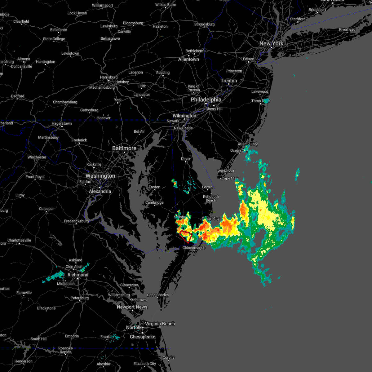 At 933 pm edt, a severe thunderstorm capable of producing a tornado was located near west pocomoke, moving southeast at 25 mph (radar indicated rotation). Hazards include tornado. Flying debris will be dangerous to those caught without shelter. mobile homes will be damaged or destroyed. damage to roofs, windows, and vehicles will occur. tree damage is likely. this dangerous storm will be near, pocomoke city around 945 pm edt. Other locations impacted by this tornadic thunderstorm include cokesbury, goodwill and whitesburg. At 933 pm edt, a severe thunderstorm capable of producing a tornado was located near west pocomoke, moving southeast at 25 mph (radar indicated rotation). Hazards include tornado. Flying debris will be dangerous to those caught without shelter. mobile homes will be damaged or destroyed. damage to roofs, windows, and vehicles will occur. tree damage is likely. this dangerous storm will be near, pocomoke city around 945 pm edt. Other locations impacted by this tornadic thunderstorm include cokesbury, goodwill and whitesburg.
|
| 7/5/2022 9:23 PM EDT |
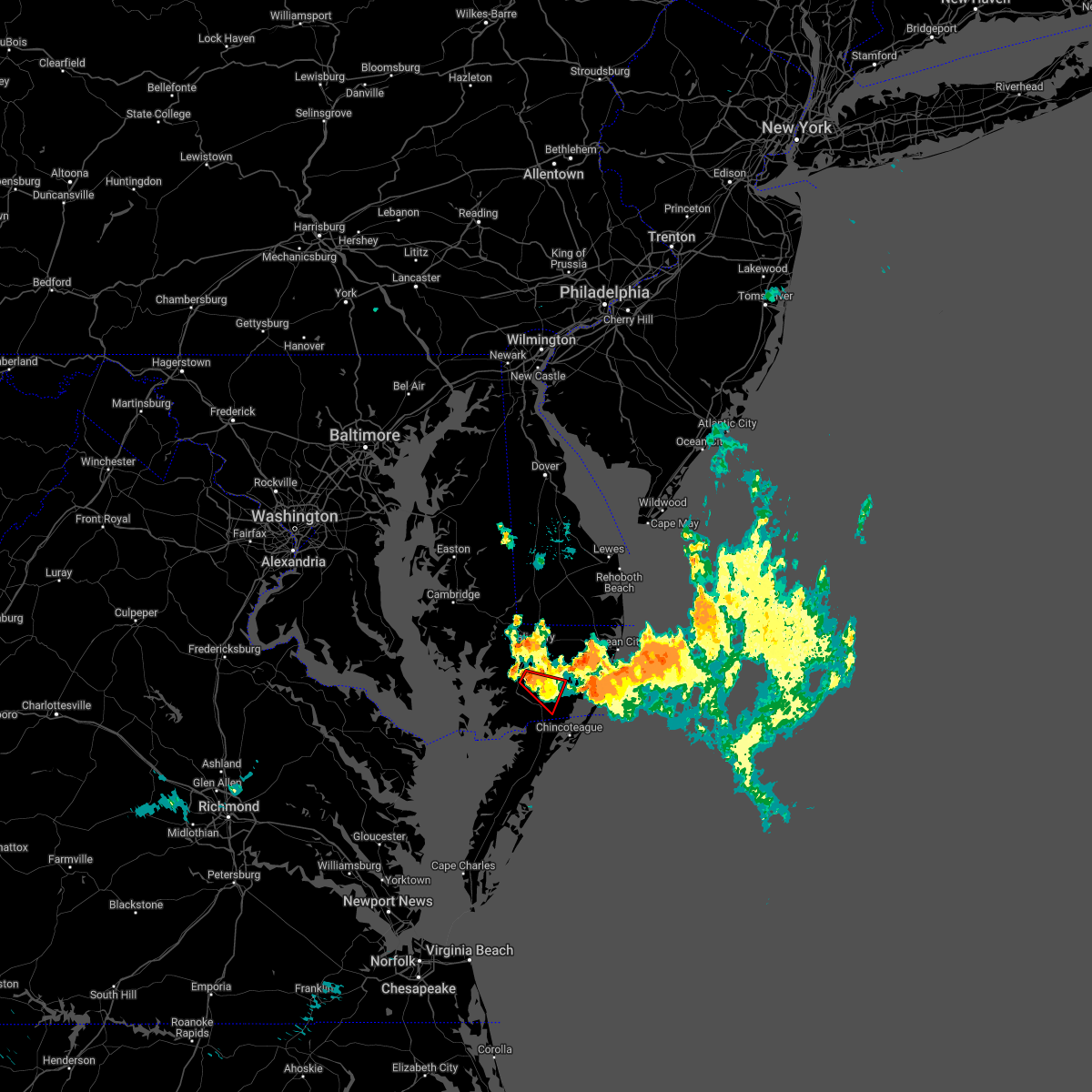 At 922 pm edt, a severe thunderstorm capable of producing a tornado was located near university of maryland eastern shore, moving southeast at 25 mph (radar indicated rotation). Hazards include tornado. Flying debris will be dangerous to those caught without shelter. mobile homes will be damaged or destroyed. damage to roofs, windows, and vehicles will occur. tree damage is likely. this dangerous storm will be near, west pocomoke around 940 pm edt. pocomoke city around 945 pm edt. Other locations impacted by this tornadic thunderstorm include cokesbury, goodwill and whitesburg. At 922 pm edt, a severe thunderstorm capable of producing a tornado was located near university of maryland eastern shore, moving southeast at 25 mph (radar indicated rotation). Hazards include tornado. Flying debris will be dangerous to those caught without shelter. mobile homes will be damaged or destroyed. damage to roofs, windows, and vehicles will occur. tree damage is likely. this dangerous storm will be near, west pocomoke around 940 pm edt. pocomoke city around 945 pm edt. Other locations impacted by this tornadic thunderstorm include cokesbury, goodwill and whitesburg.
|
| 6/17/2022 7:24 PM EDT |
 At 724 pm edt, a severe thunderstorm was located over lawsonia, or 16 miles southwest of pocomoke city, moving east at 45 mph (radar indicated). Hazards include 60 mph wind gusts and quarter size hail. Minor damage to vehicles is possible. expect wind damage to trees and powerlines. this severe thunderstorm will be near, marion station around 730 pm edt. other locations impacted by this severe thunderstorm include horntown, hallwood, mappsville, byrdtown, hopewell, greenbackville, rehobeth, saxis, wallops island and temperanceville. hail threat, radar indicated max hail size, 1. 00 in wind threat, radar indicated max wind gust, 60 mph. At 724 pm edt, a severe thunderstorm was located over lawsonia, or 16 miles southwest of pocomoke city, moving east at 45 mph (radar indicated). Hazards include 60 mph wind gusts and quarter size hail. Minor damage to vehicles is possible. expect wind damage to trees and powerlines. this severe thunderstorm will be near, marion station around 730 pm edt. other locations impacted by this severe thunderstorm include horntown, hallwood, mappsville, byrdtown, hopewell, greenbackville, rehobeth, saxis, wallops island and temperanceville. hail threat, radar indicated max hail size, 1. 00 in wind threat, radar indicated max wind gust, 60 mph.
|
| 6/14/2022 12:17 PM EDT |
 At 1216 pm edt, a severe thunderstorm was located near snow hill, or near pocomoke city, moving southeast at 25 mph (radar indicated). Hazards include 60 mph wind gusts and quarter size hail. Minor damage to vehicles is possible. expect wind damage to trees and powerlines. locations impacted include, pocomoke city, snow hill, boxiron, cedartown, goodwill, public landing, mount wesley, girdletree and stockton. hail threat, radar indicated max hail size, 1. 00 in wind threat, radar indicated max wind gust, 60 mph. At 1216 pm edt, a severe thunderstorm was located near snow hill, or near pocomoke city, moving southeast at 25 mph (radar indicated). Hazards include 60 mph wind gusts and quarter size hail. Minor damage to vehicles is possible. expect wind damage to trees and powerlines. locations impacted include, pocomoke city, snow hill, boxiron, cedartown, goodwill, public landing, mount wesley, girdletree and stockton. hail threat, radar indicated max hail size, 1. 00 in wind threat, radar indicated max wind gust, 60 mph.
|
| 6/14/2022 11:54 AM EDT |
 The national weather service in wakefield has issued a * severe thunderstorm warning for. northeastern somerset county in southeastern maryland. south central wicomico county in southeastern maryland. southern worcester county in southeastern maryland. Until 100 pm edt. The national weather service in wakefield has issued a * severe thunderstorm warning for. northeastern somerset county in southeastern maryland. south central wicomico county in southeastern maryland. southern worcester county in southeastern maryland. Until 100 pm edt.
|
| 6/12/2022 12:46 PM EDT |
 At 1246 pm edt, a severe thunderstorm was located 8 miles southeast of marion station, or 11 miles southwest of pocomoke city, moving east at 30 mph (radar indicated). Hazards include 60 mph wind gusts and penny size hail. Expect damage to trees and powerlines. this severe thunderstorm will remain over mainly rural areas of southeastern somerset, southern worcester and northern accomack counties, including the following locations, horntown, hallwood, mappsville, byrdtown, hopewell, greenbackville, rehobeth, saxis, wallops island and temperanceville. hail threat, radar indicated max hail size, 0. 75 in wind threat, radar indicated max wind gust, 60 mph. At 1246 pm edt, a severe thunderstorm was located 8 miles southeast of marion station, or 11 miles southwest of pocomoke city, moving east at 30 mph (radar indicated). Hazards include 60 mph wind gusts and penny size hail. Expect damage to trees and powerlines. this severe thunderstorm will remain over mainly rural areas of southeastern somerset, southern worcester and northern accomack counties, including the following locations, horntown, hallwood, mappsville, byrdtown, hopewell, greenbackville, rehobeth, saxis, wallops island and temperanceville. hail threat, radar indicated max hail size, 0. 75 in wind threat, radar indicated max wind gust, 60 mph.
|
| 6/12/2022 12:46 PM EDT |
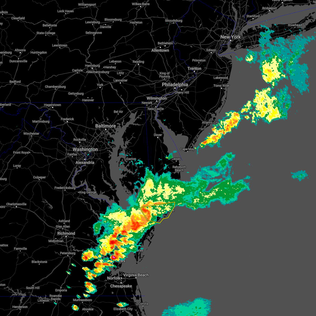 At 1246 pm edt, a severe thunderstorm was located 8 miles southeast of marion station, or 11 miles southwest of pocomoke city, moving east at 30 mph (radar indicated). Hazards include 60 mph wind gusts and penny size hail. Expect damage to trees and powerlines. this severe thunderstorm will remain over mainly rural areas of southeastern somerset, southern worcester and northern accomack counties, including the following locations, horntown, hallwood, mappsville, byrdtown, hopewell, greenbackville, rehobeth, saxis, wallops island and temperanceville. hail threat, radar indicated max hail size, 0. 75 in wind threat, radar indicated max wind gust, 60 mph. At 1246 pm edt, a severe thunderstorm was located 8 miles southeast of marion station, or 11 miles southwest of pocomoke city, moving east at 30 mph (radar indicated). Hazards include 60 mph wind gusts and penny size hail. Expect damage to trees and powerlines. this severe thunderstorm will remain over mainly rural areas of southeastern somerset, southern worcester and northern accomack counties, including the following locations, horntown, hallwood, mappsville, byrdtown, hopewell, greenbackville, rehobeth, saxis, wallops island and temperanceville. hail threat, radar indicated max hail size, 0. 75 in wind threat, radar indicated max wind gust, 60 mph.
|
| 6/2/2022 8:28 PM EDT |
 The severe thunderstorm warning for southern worcester and northern accomack counties will expire at 830 pm edt, the storms which prompted the warning have moved out of the area. therefore, the warning will be allowed to expire. however heavy rain is still possible with these thunderstorms. a severe thunderstorm watch remains in effect until 900 pm edt for southeastern maryland, and southeastern virginia. The severe thunderstorm warning for southern worcester and northern accomack counties will expire at 830 pm edt, the storms which prompted the warning have moved out of the area. therefore, the warning will be allowed to expire. however heavy rain is still possible with these thunderstorms. a severe thunderstorm watch remains in effect until 900 pm edt for southeastern maryland, and southeastern virginia.
|
| 6/2/2022 8:28 PM EDT |
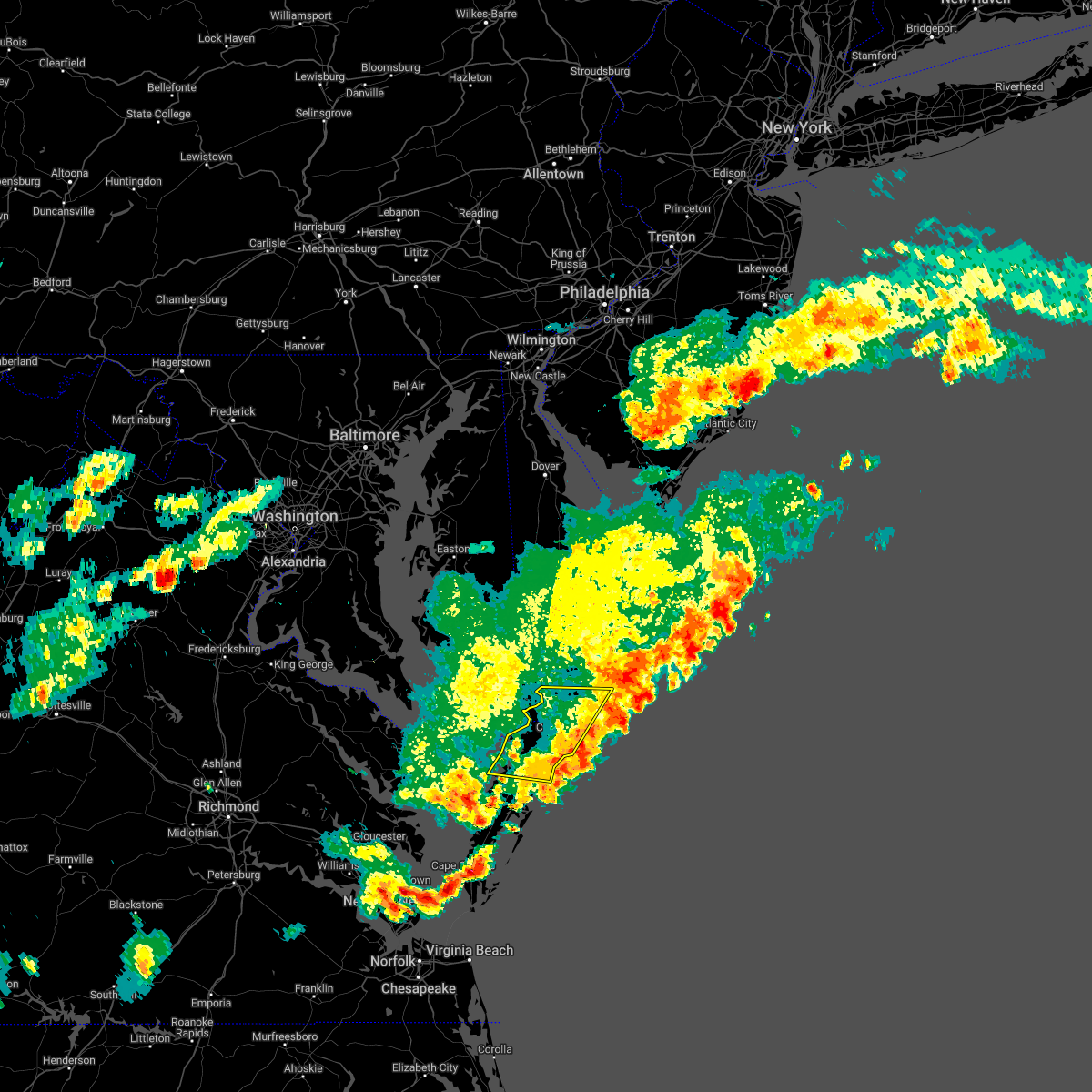 The severe thunderstorm warning for southern worcester and northern accomack counties will expire at 830 pm edt, the storms which prompted the warning have moved out of the area. therefore, the warning will be allowed to expire. however heavy rain is still possible with these thunderstorms. a severe thunderstorm watch remains in effect until 900 pm edt for southeastern maryland, and southeastern virginia. The severe thunderstorm warning for southern worcester and northern accomack counties will expire at 830 pm edt, the storms which prompted the warning have moved out of the area. therefore, the warning will be allowed to expire. however heavy rain is still possible with these thunderstorms. a severe thunderstorm watch remains in effect until 900 pm edt for southeastern maryland, and southeastern virginia.
|
| 6/2/2022 8:04 PM EDT |
 At 803 pm edt, severe thunderstorms were located along a line extending from 6 miles south of snow hill to 11 miles southeast of pocomoke city to near parksley, moving east at 45 mph (radar indicated). Hazards include 60 mph wind gusts and penny size hail. Expect damage to trees and powerlines. these severe thunderstorms will remain over mainly rural areas of southern worcester and northern accomack counties, including the following locations, horntown, hallwood, boxiron, mappsville, goodwill, public landing, greenbackville, saxis, wallops island and temperanceville. hail threat, radar indicated max hail size, 0. 75 in wind threat, radar indicated max wind gust, 60 mph. At 803 pm edt, severe thunderstorms were located along a line extending from 6 miles south of snow hill to 11 miles southeast of pocomoke city to near parksley, moving east at 45 mph (radar indicated). Hazards include 60 mph wind gusts and penny size hail. Expect damage to trees and powerlines. these severe thunderstorms will remain over mainly rural areas of southern worcester and northern accomack counties, including the following locations, horntown, hallwood, boxiron, mappsville, goodwill, public landing, greenbackville, saxis, wallops island and temperanceville. hail threat, radar indicated max hail size, 0. 75 in wind threat, radar indicated max wind gust, 60 mph.
|
| 6/2/2022 7:47 PM EDT |
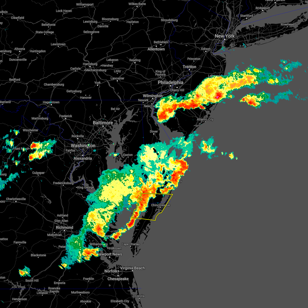 At 747 pm edt, severe thunderstorms were located along a line extending from west pocomoke to 6 miles southeast of marion station to near onancock, moving east at 45 mph (radar indicated). Hazards include 60 mph wind gusts and penny size hail. Expect damage to trees and powerlines. these severe storms will be near, pocomoke city around 755 pm edt. other locations impacted by these severe thunderstorms include horntown, hallwood, mappsville, cokesbury, goodwill, greenbackville, kingston, saxis, wallops island and temperanceville. hail threat, radar indicated max hail size, 0. 75 in wind threat, radar indicated max wind gust, 60 mph. At 747 pm edt, severe thunderstorms were located along a line extending from west pocomoke to 6 miles southeast of marion station to near onancock, moving east at 45 mph (radar indicated). Hazards include 60 mph wind gusts and penny size hail. Expect damage to trees and powerlines. these severe storms will be near, pocomoke city around 755 pm edt. other locations impacted by these severe thunderstorms include horntown, hallwood, mappsville, cokesbury, goodwill, greenbackville, kingston, saxis, wallops island and temperanceville. hail threat, radar indicated max hail size, 0. 75 in wind threat, radar indicated max wind gust, 60 mph.
|
| 6/2/2022 7:23 PM EDT |
 At 722 pm edt, severe thunderstorms were located along a line extending from near deal island to near tylerton to tangier, moving east at 45 mph (radar indicated). Hazards include 60 mph wind gusts and penny size hail. Expect damage to trees and powerlines. severe thunderstorms will be near, lawsonia around 730 pm edt. marion station around 740 pm edt. westover around 745 pm edt. parksley around 750 pm edt. west pocomoke around 755 pm edt. pocomoke city around 800 pm edt. other locations impacted by these severe thunderstorms include horntown, hallwood, mappsville, cokesbury, goodwill, greenbackville, kingston, saxis, wallops island and temperanceville. hail threat, radar indicated max hail size, 0. 75 in wind threat, radar indicated max wind gust, 60 mph. At 722 pm edt, severe thunderstorms were located along a line extending from near deal island to near tylerton to tangier, moving east at 45 mph (radar indicated). Hazards include 60 mph wind gusts and penny size hail. Expect damage to trees and powerlines. severe thunderstorms will be near, lawsonia around 730 pm edt. marion station around 740 pm edt. westover around 745 pm edt. parksley around 750 pm edt. west pocomoke around 755 pm edt. pocomoke city around 800 pm edt. other locations impacted by these severe thunderstorms include horntown, hallwood, mappsville, cokesbury, goodwill, greenbackville, kingston, saxis, wallops island and temperanceville. hail threat, radar indicated max hail size, 0. 75 in wind threat, radar indicated max wind gust, 60 mph.
|
| 5/16/2022 8:13 PM EDT |
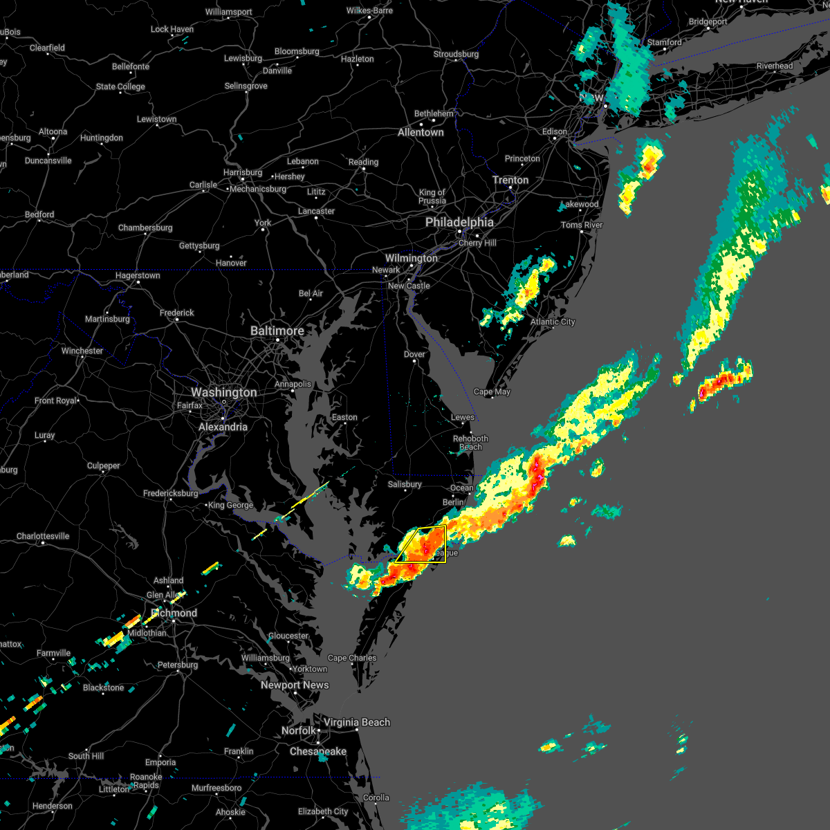 The severe thunderstorm warning for south central worcester and northern accomack counties will expire at 815 pm edt, the storm which prompted the warning has moved out of the area. therefore, the warning will be allowed to expire. a severe thunderstorm watch remains in effect until 900 pm edt for southeastern virginia. a severe thunderstorm watch also remains in effect until 900 pm edt for southeastern maryland. The severe thunderstorm warning for south central worcester and northern accomack counties will expire at 815 pm edt, the storm which prompted the warning has moved out of the area. therefore, the warning will be allowed to expire. a severe thunderstorm watch remains in effect until 900 pm edt for southeastern virginia. a severe thunderstorm watch also remains in effect until 900 pm edt for southeastern maryland.
|
| 5/16/2022 8:04 PM EDT |
 At 804 pm edt, a severe thunderstorm was located near pocomoke city, moving east at 30 mph (radar indicated). Hazards include 60 mph wind gusts and quarter size hail. Minor damage to vehicles is possible. expect wind damage to trees and powerlines. this severe thunderstorm will remain over mainly rural areas of south central worcester and northern accomack counties, including the following locations, horntown, boxiron, sanford, oak hall, goodwill, greenbackville, beaver dam, girdletree, stockton and new church. hail threat, radar indicated max hail size, 1. 00 in wind threat, radar indicated max wind gust, 60 mph. At 804 pm edt, a severe thunderstorm was located near pocomoke city, moving east at 30 mph (radar indicated). Hazards include 60 mph wind gusts and quarter size hail. Minor damage to vehicles is possible. expect wind damage to trees and powerlines. this severe thunderstorm will remain over mainly rural areas of south central worcester and northern accomack counties, including the following locations, horntown, boxiron, sanford, oak hall, goodwill, greenbackville, beaver dam, girdletree, stockton and new church. hail threat, radar indicated max hail size, 1. 00 in wind threat, radar indicated max wind gust, 60 mph.
|
| 5/16/2022 7:35 PM EDT |
 At 735 pm edt, a severe thunderstorm was located over lawsonia, or 15 miles west of pocomoke city, moving east at 40 mph (radar indicated). Hazards include 60 mph wind gusts and quarter size hail. Minor damage to vehicles is possible. expect wind damage to trees and powerlines. this severe thunderstorm will be near, marion station around 745 pm edt. pocomoke city and west pocomoke around 800 pm edt. other locations impacted by this severe thunderstorm include horntown, boxiron, byrdtown, goodwill, hopewell, greenbackville, rehobeth, kingston, saxis and shelltown. hail threat, radar indicated max hail size, 1. 00 in wind threat, radar indicated max wind gust, 60 mph. At 735 pm edt, a severe thunderstorm was located over lawsonia, or 15 miles west of pocomoke city, moving east at 40 mph (radar indicated). Hazards include 60 mph wind gusts and quarter size hail. Minor damage to vehicles is possible. expect wind damage to trees and powerlines. this severe thunderstorm will be near, marion station around 745 pm edt. pocomoke city and west pocomoke around 800 pm edt. other locations impacted by this severe thunderstorm include horntown, boxiron, byrdtown, goodwill, hopewell, greenbackville, rehobeth, kingston, saxis and shelltown. hail threat, radar indicated max hail size, 1. 00 in wind threat, radar indicated max wind gust, 60 mph.
|
| 5/16/2022 7:35 PM EDT |
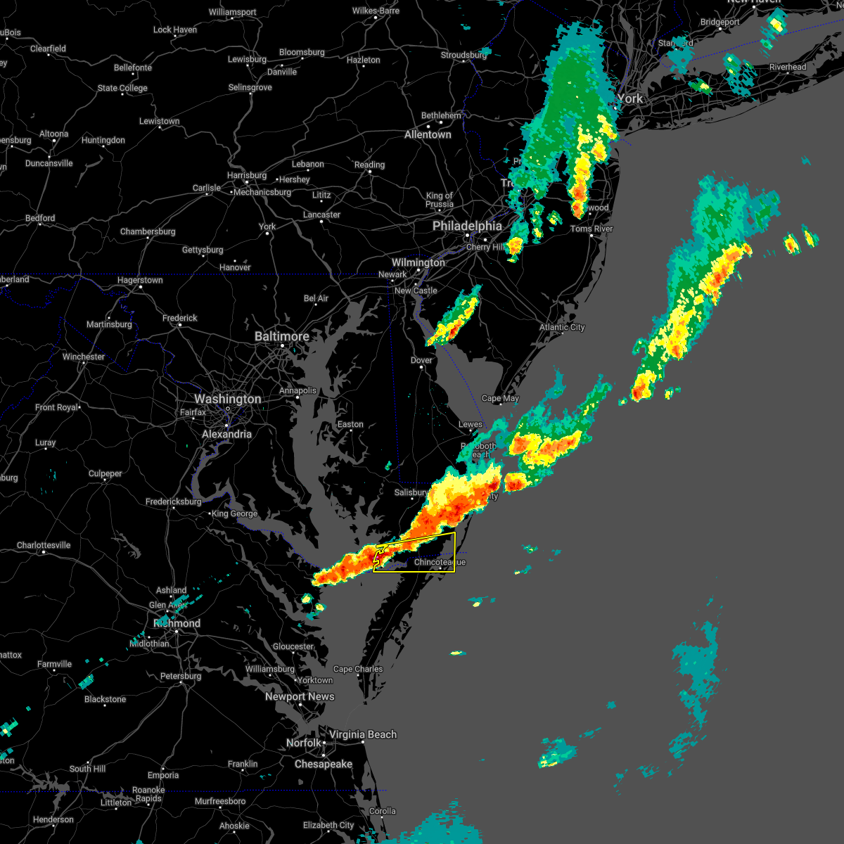 At 735 pm edt, a severe thunderstorm was located over lawsonia, or 15 miles west of pocomoke city, moving east at 40 mph (radar indicated). Hazards include 60 mph wind gusts and quarter size hail. Minor damage to vehicles is possible. expect wind damage to trees and powerlines. this severe thunderstorm will be near, marion station around 745 pm edt. pocomoke city and west pocomoke around 800 pm edt. other locations impacted by this severe thunderstorm include horntown, boxiron, byrdtown, goodwill, hopewell, greenbackville, rehobeth, kingston, saxis and shelltown. hail threat, radar indicated max hail size, 1. 00 in wind threat, radar indicated max wind gust, 60 mph. At 735 pm edt, a severe thunderstorm was located over lawsonia, or 15 miles west of pocomoke city, moving east at 40 mph (radar indicated). Hazards include 60 mph wind gusts and quarter size hail. Minor damage to vehicles is possible. expect wind damage to trees and powerlines. this severe thunderstorm will be near, marion station around 745 pm edt. pocomoke city and west pocomoke around 800 pm edt. other locations impacted by this severe thunderstorm include horntown, boxiron, byrdtown, goodwill, hopewell, greenbackville, rehobeth, kingston, saxis and shelltown. hail threat, radar indicated max hail size, 1. 00 in wind threat, radar indicated max wind gust, 60 mph.
|
| 10/5/2021 5:26 PM EDT |
 The severe thunderstorm warning for south central worcester and northern accomack counties will expire at 530 pm edt, the storms which prompted the warning have weakened below severe limits, and have exited the warned area. therefore, the warning will be allowed to expire. however, gusty winds and heavy rain are still possible with these thunderstorms. to report severe weather, contact your nearest law enforcement agency. they will relay your report to the national weather service wakefield. The severe thunderstorm warning for south central worcester and northern accomack counties will expire at 530 pm edt, the storms which prompted the warning have weakened below severe limits, and have exited the warned area. therefore, the warning will be allowed to expire. however, gusty winds and heavy rain are still possible with these thunderstorms. to report severe weather, contact your nearest law enforcement agency. they will relay your report to the national weather service wakefield.
|
| 10/5/2021 5:07 PM EDT |
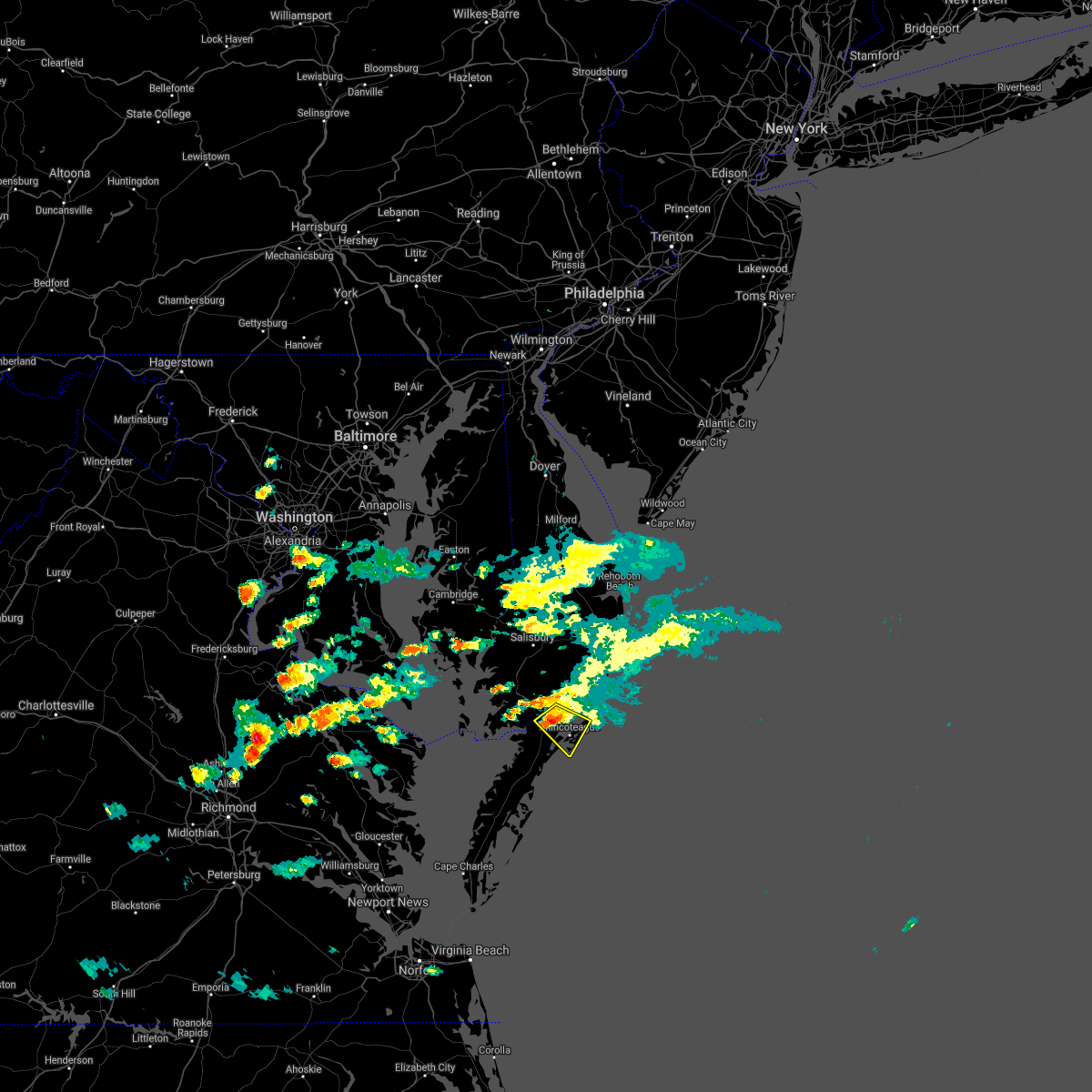 At 506 pm edt, severe thunderstorms were located along a line extending from 11 miles south of snow hill to 11 miles southeast of west pocomoke to 7 miles south of pocomoke city, moving southeast at 15 mph (radar indicated). Hazards include 60 mph wind gusts and penny size hail. Expect damage to trees and powerlines. locations impacted include, horntown, beaver dam, new church, greenbackville and stockton. hail threat, radar indicated max hail size, 0. 75 in wind threat, radar indicated max wind gust, 60 mph. At 506 pm edt, severe thunderstorms were located along a line extending from 11 miles south of snow hill to 11 miles southeast of west pocomoke to 7 miles south of pocomoke city, moving southeast at 15 mph (radar indicated). Hazards include 60 mph wind gusts and penny size hail. Expect damage to trees and powerlines. locations impacted include, horntown, beaver dam, new church, greenbackville and stockton. hail threat, radar indicated max hail size, 0. 75 in wind threat, radar indicated max wind gust, 60 mph.
|
| 10/5/2021 4:57 PM EDT | Trees downed along buck harbor r in worcester county MD, 2.1 miles W of Pocomoke City, MD |
| 10/5/2021 4:42 PM EDT |
 At 441 pm edt, a severe thunderstorm was located near pocomoke city, moving southeast at 15 mph (radar indicated). Hazards include 60 mph wind gusts and quarter size hail. Minor damage to vehicles is possible. expect wind damage to trees and powerlines. This severe thunderstorm will remain over mainly rural areas of southwestern worcester and northern accomack counties, including the following locations, horntown, goodwill, greenbackville, beaver dam, girdletree, stockton and new church. At 441 pm edt, a severe thunderstorm was located near pocomoke city, moving southeast at 15 mph (radar indicated). Hazards include 60 mph wind gusts and quarter size hail. Minor damage to vehicles is possible. expect wind damage to trees and powerlines. This severe thunderstorm will remain over mainly rural areas of southwestern worcester and northern accomack counties, including the following locations, horntown, goodwill, greenbackville, beaver dam, girdletree, stockton and new church.
|
| 10/5/2021 4:42 PM EDT |
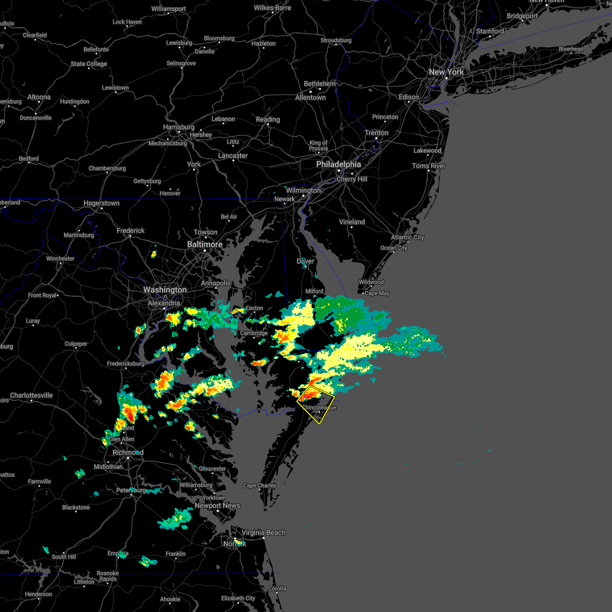 At 441 pm edt, a severe thunderstorm was located near pocomoke city, moving southeast at 15 mph (radar indicated). Hazards include 60 mph wind gusts and quarter size hail. Minor damage to vehicles is possible. expect wind damage to trees and powerlines. This severe thunderstorm will remain over mainly rural areas of southwestern worcester and northern accomack counties, including the following locations, horntown, goodwill, greenbackville, beaver dam, girdletree, stockton and new church. At 441 pm edt, a severe thunderstorm was located near pocomoke city, moving southeast at 15 mph (radar indicated). Hazards include 60 mph wind gusts and quarter size hail. Minor damage to vehicles is possible. expect wind damage to trees and powerlines. This severe thunderstorm will remain over mainly rural areas of southwestern worcester and northern accomack counties, including the following locations, horntown, goodwill, greenbackville, beaver dam, girdletree, stockton and new church.
|
| 9/8/2021 3:52 PM EDT |
 At 352 pm edt, a severe thunderstorm was located 7 miles southeast of lawsonia, or 18 miles southwest of pocomoke city, moving east at 40 mph (radar indicated). Hazards include 60 mph wind gusts and penny size hail. Expect damage to trees and powerlines. this severe thunderstorm will be near, parksley around 400 pm edt. other locations impacted by this severe thunderstorm include horntown, hallwood, mappsville, byrdtown, greenbackville, saxis, wallops island, temperanceville, nelsonia and shelltown. hail threat, radar indicated max hail size, 0. 75 in wind threat, radar indicated max wind gust, 60 mph. At 352 pm edt, a severe thunderstorm was located 7 miles southeast of lawsonia, or 18 miles southwest of pocomoke city, moving east at 40 mph (radar indicated). Hazards include 60 mph wind gusts and penny size hail. Expect damage to trees and powerlines. this severe thunderstorm will be near, parksley around 400 pm edt. other locations impacted by this severe thunderstorm include horntown, hallwood, mappsville, byrdtown, greenbackville, saxis, wallops island, temperanceville, nelsonia and shelltown. hail threat, radar indicated max hail size, 0. 75 in wind threat, radar indicated max wind gust, 60 mph.
|
| 7/1/2021 5:34 PM EDT |
 At 533 pm edt, a severe thunderstorm was located near snow hill, or 7 miles northeast of pocomoke city, moving east at 30 mph (radar indicated). Hazards include 60 mph wind gusts and quarter size hail. Minor damage to vehicles is possible. expect wind damage to trees and powerlines. this severe storm will be near, snow hill around 545 pm edt. newark around 555 pm edt. Other locations impacted by this severe thunderstorm include boxiron, cedartown, cokesbury, goodwill, public landing, mount wesley, whiton, girdletree, stockton and whitesburg. At 533 pm edt, a severe thunderstorm was located near snow hill, or 7 miles northeast of pocomoke city, moving east at 30 mph (radar indicated). Hazards include 60 mph wind gusts and quarter size hail. Minor damage to vehicles is possible. expect wind damage to trees and powerlines. this severe storm will be near, snow hill around 545 pm edt. newark around 555 pm edt. Other locations impacted by this severe thunderstorm include boxiron, cedartown, cokesbury, goodwill, public landing, mount wesley, whiton, girdletree, stockton and whitesburg.
|
| 7/1/2021 5:29 PM EDT |
 At 529 pm edt, severe thunderstorms were located along a line extending from 6 miles east of patuxent river naval air station to 7 miles north of tylerton to near tangier, moving northeast at 35 mph (radar indicated). Hazards include 60 mph wind gusts and quarter size hail. Minor damage to vehicles is possible. expect wind damage to trees and powerlines. severe thunderstorms will be near, lawsonia around 545 pm edt. marion station around 555 pm edt. westover around 600 pm edt. princess anne around 605 pm edt. university of maryland eastern shore around 610 pm edt. pocomoke city, vienna and west pocomoke around 615 pm edt. Other locations impacted by these severe thunderstorms include horntown, wetipquin, trinity, cokesbury, eden, kingston, saxis, shelltown, sanford and oak hall. At 529 pm edt, severe thunderstorms were located along a line extending from 6 miles east of patuxent river naval air station to 7 miles north of tylerton to near tangier, moving northeast at 35 mph (radar indicated). Hazards include 60 mph wind gusts and quarter size hail. Minor damage to vehicles is possible. expect wind damage to trees and powerlines. severe thunderstorms will be near, lawsonia around 545 pm edt. marion station around 555 pm edt. westover around 600 pm edt. princess anne around 605 pm edt. university of maryland eastern shore around 610 pm edt. pocomoke city, vienna and west pocomoke around 615 pm edt. Other locations impacted by these severe thunderstorms include horntown, wetipquin, trinity, cokesbury, eden, kingston, saxis, shelltown, sanford and oak hall.
|
| 7/1/2021 5:29 PM EDT |
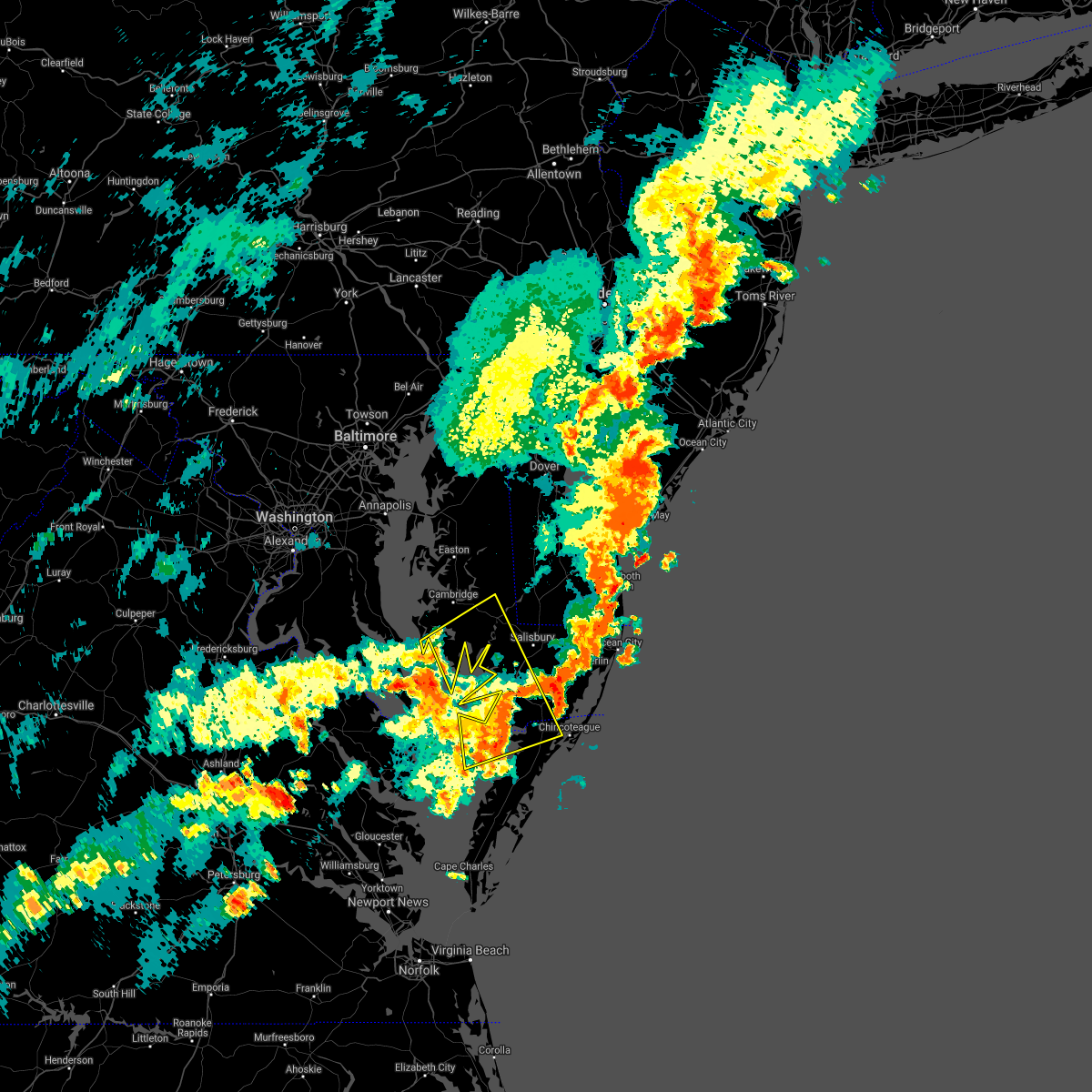 At 529 pm edt, severe thunderstorms were located along a line extending from 6 miles east of patuxent river naval air station to 7 miles north of tylerton to near tangier, moving northeast at 35 mph (radar indicated). Hazards include 60 mph wind gusts and quarter size hail. Minor damage to vehicles is possible. expect wind damage to trees and powerlines. severe thunderstorms will be near, lawsonia around 545 pm edt. marion station around 555 pm edt. westover around 600 pm edt. princess anne around 605 pm edt. university of maryland eastern shore around 610 pm edt. pocomoke city, vienna and west pocomoke around 615 pm edt. Other locations impacted by these severe thunderstorms include horntown, wetipquin, trinity, cokesbury, eden, kingston, saxis, shelltown, sanford and oak hall. At 529 pm edt, severe thunderstorms were located along a line extending from 6 miles east of patuxent river naval air station to 7 miles north of tylerton to near tangier, moving northeast at 35 mph (radar indicated). Hazards include 60 mph wind gusts and quarter size hail. Minor damage to vehicles is possible. expect wind damage to trees and powerlines. severe thunderstorms will be near, lawsonia around 545 pm edt. marion station around 555 pm edt. westover around 600 pm edt. princess anne around 605 pm edt. university of maryland eastern shore around 610 pm edt. pocomoke city, vienna and west pocomoke around 615 pm edt. Other locations impacted by these severe thunderstorms include horntown, wetipquin, trinity, cokesbury, eden, kingston, saxis, shelltown, sanford and oak hall.
|
| 7/1/2021 5:21 PM EDT |
 At 521 pm edt, a severe thunderstorm was located over west pocomoke, or over pocomoke city, moving east at 30 mph (radar indicated). Hazards include 60 mph wind gusts and quarter size hail. Minor damage to vehicles is possible. expect wind damage to trees and powerlines. this severe thunderstorm will be near, snow hill around 545 pm edt. newark around 555 pm edt. Other locations impacted by this severe thunderstorm include boxiron, cedartown, cokesbury, goodwill, public landing, mount wesley, whiton, girdletree, stockton and whitesburg. At 521 pm edt, a severe thunderstorm was located over west pocomoke, or over pocomoke city, moving east at 30 mph (radar indicated). Hazards include 60 mph wind gusts and quarter size hail. Minor damage to vehicles is possible. expect wind damage to trees and powerlines. this severe thunderstorm will be near, snow hill around 545 pm edt. newark around 555 pm edt. Other locations impacted by this severe thunderstorm include boxiron, cedartown, cokesbury, goodwill, public landing, mount wesley, whiton, girdletree, stockton and whitesburg.
|
| 5/5/2021 5:28 PM EDT |
 At 528 pm edt, severe thunderstorms were located along a line extending from delmar to 6 miles northwest of lawsonia, moving east at 40 mph (radar indicated). Hazards include 60 mph wind gusts. Expect damage to trees and powerlines. severe thunderstorms will be near, ocean city, pocomoke city, berlin, ocean pines and cape isle of wight around 600 pm edt. Other locations impacted by these severe thunderstorms include bishop, horntown, boxiron, ocean city municipality, goodwill, public landing, greenbackville, ironshire, temperanceville and west ocean city. At 528 pm edt, severe thunderstorms were located along a line extending from delmar to 6 miles northwest of lawsonia, moving east at 40 mph (radar indicated). Hazards include 60 mph wind gusts. Expect damage to trees and powerlines. severe thunderstorms will be near, ocean city, pocomoke city, berlin, ocean pines and cape isle of wight around 600 pm edt. Other locations impacted by these severe thunderstorms include bishop, horntown, boxiron, ocean city municipality, goodwill, public landing, greenbackville, ironshire, temperanceville and west ocean city.
|
| 5/4/2021 8:27 PM EDT |
 At 827 pm edt, severe thunderstorms were located along a line extending from near millville to near cape isle of wight to near snow hill, moving east at 40 mph (radar indicated). Hazards include 60 mph wind gusts. Expect damage to trees and powerlines. these severe storms will be near, ocean city, cape isle of wight and ocean pines around 830 pm edt. Other locations impacted by these severe thunderstorms include bishop, boxiron, ocean city municipality, cokesbury, bishopville, goodwill, public landing, ironshire, west ocean city and cedartown. At 827 pm edt, severe thunderstorms were located along a line extending from near millville to near cape isle of wight to near snow hill, moving east at 40 mph (radar indicated). Hazards include 60 mph wind gusts. Expect damage to trees and powerlines. these severe storms will be near, ocean city, cape isle of wight and ocean pines around 830 pm edt. Other locations impacted by these severe thunderstorms include bishop, boxiron, ocean city municipality, cokesbury, bishopville, goodwill, public landing, ironshire, west ocean city and cedartown.
|
| 5/4/2021 8:10 PM EDT |
 At 810 pm edt, severe thunderstorms were located along a line extending from near dagsboro to near newark to pocomoke city, moving east at 40 mph (radar indicated). Hazards include 60 mph wind gusts. Expect damage to trees and powerlines. these severe storms will be near, newark around 815 pm edt. berlin around 825 pm edt. snow hill, cape isle of wight and ocean pines around 830 pm edt. ocean city around 835 pm edt. Other locations impacted by these severe thunderstorms include bishop, ocean city municipality, cokesbury, goodwill, kingston, cedartown, pittsville, powellville, showell and mount wesley. At 810 pm edt, severe thunderstorms were located along a line extending from near dagsboro to near newark to pocomoke city, moving east at 40 mph (radar indicated). Hazards include 60 mph wind gusts. Expect damage to trees and powerlines. these severe storms will be near, newark around 815 pm edt. berlin around 825 pm edt. snow hill, cape isle of wight and ocean pines around 830 pm edt. ocean city around 835 pm edt. Other locations impacted by these severe thunderstorms include bishop, ocean city municipality, cokesbury, goodwill, kingston, cedartown, pittsville, powellville, showell and mount wesley.
|
| 5/4/2021 7:38 PM EDT |
 At 738 pm edt, severe thunderstorms were located along a line extending from delmar to university of maryland eastern shore to near lawsonia, moving east at 40 mph (radar indicated). Hazards include 60 mph wind gusts. Expect damage to trees and powerlines. severe thunderstorms will be near, parsonsburg around 745 pm edt. westover around 800 pm edt. snow hill around 805 pm edt. pocomoke city, west pocomoke and newark around 810 pm edt. berlin and ocean pines around 825 pm edt. cape isle of wight around 830 pm edt. ocean city around 835 pm edt. Other locations impacted by these severe thunderstorms include bishop, ocean city municipality, cokesbury, goodwill, kingston, longridge, cedartown, chesapeake heights, pittsville and powellville. At 738 pm edt, severe thunderstorms were located along a line extending from delmar to university of maryland eastern shore to near lawsonia, moving east at 40 mph (radar indicated). Hazards include 60 mph wind gusts. Expect damage to trees and powerlines. severe thunderstorms will be near, parsonsburg around 745 pm edt. westover around 800 pm edt. snow hill around 805 pm edt. pocomoke city, west pocomoke and newark around 810 pm edt. berlin and ocean pines around 825 pm edt. cape isle of wight around 830 pm edt. ocean city around 835 pm edt. Other locations impacted by these severe thunderstorms include bishop, ocean city municipality, cokesbury, goodwill, kingston, longridge, cedartown, chesapeake heights, pittsville and powellville.
|
| 4/21/2021 2:33 PM EDT |
 At 233 pm edt, severe thunderstorms were located along a line extending from near pocomoke city to parksley, moving east at 45 mph (radar indicated). Hazards include 60 mph wind gusts and quarter size hail. Minor damage to vehicles is possible. expect wind damage to trees and powerlines. These severe thunderstorms will remain over mainly rural areas of southeastern somerset, southern worcester and northern accomack counties, including the following locations, horntown, hallwood, mappsville, cokesbury, goodwill, greenbackville, saxis, wallops island, temperanceville and nelsonia. At 233 pm edt, severe thunderstorms were located along a line extending from near pocomoke city to parksley, moving east at 45 mph (radar indicated). Hazards include 60 mph wind gusts and quarter size hail. Minor damage to vehicles is possible. expect wind damage to trees and powerlines. These severe thunderstorms will remain over mainly rural areas of southeastern somerset, southern worcester and northern accomack counties, including the following locations, horntown, hallwood, mappsville, cokesbury, goodwill, greenbackville, saxis, wallops island, temperanceville and nelsonia.
|
| 4/21/2021 2:33 PM EDT |
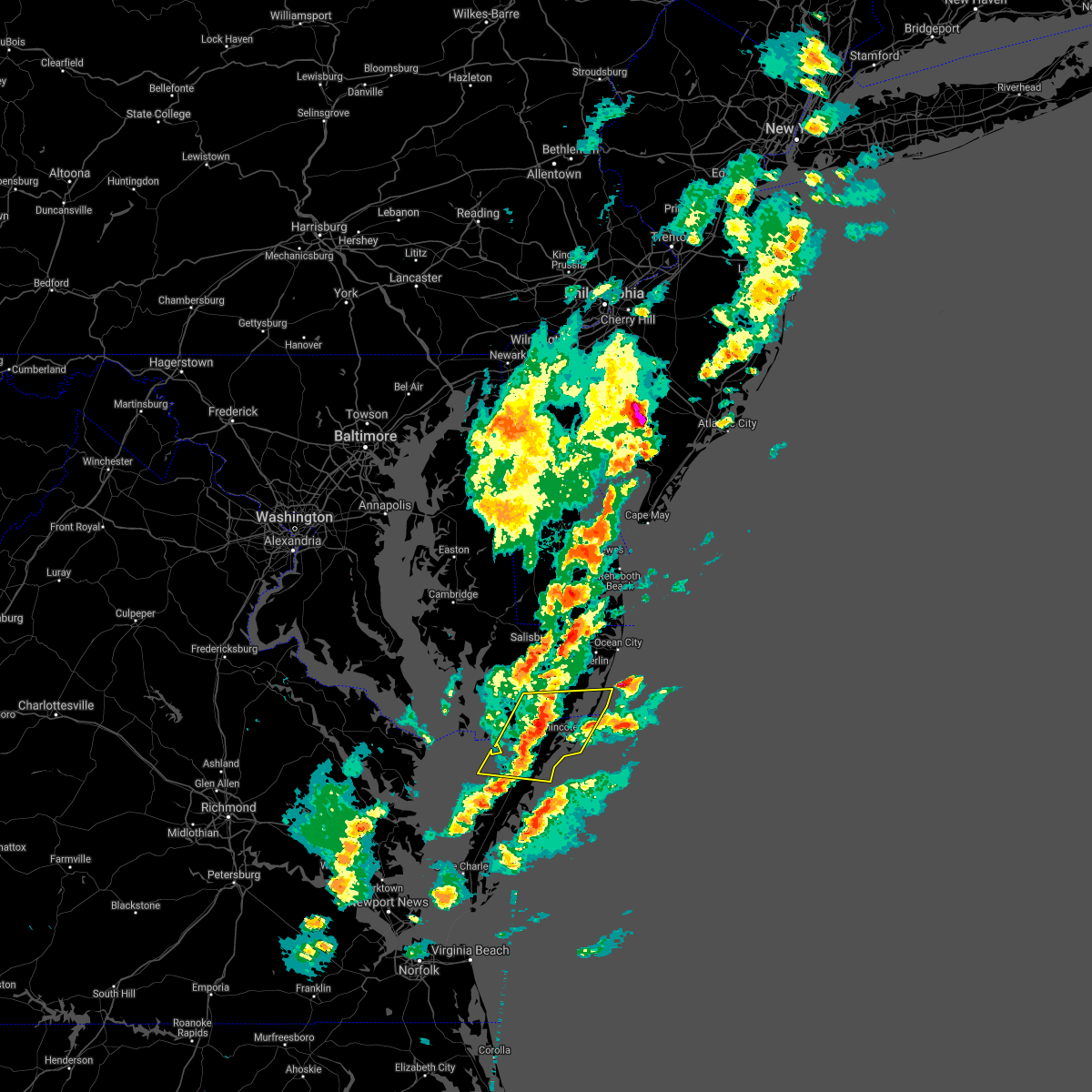 At 233 pm edt, severe thunderstorms were located along a line extending from near pocomoke city to parksley, moving east at 45 mph (radar indicated). Hazards include 60 mph wind gusts and quarter size hail. Minor damage to vehicles is possible. expect wind damage to trees and powerlines. These severe thunderstorms will remain over mainly rural areas of southeastern somerset, southern worcester and northern accomack counties, including the following locations, horntown, hallwood, mappsville, cokesbury, goodwill, greenbackville, saxis, wallops island, temperanceville and nelsonia. At 233 pm edt, severe thunderstorms were located along a line extending from near pocomoke city to parksley, moving east at 45 mph (radar indicated). Hazards include 60 mph wind gusts and quarter size hail. Minor damage to vehicles is possible. expect wind damage to trees and powerlines. These severe thunderstorms will remain over mainly rural areas of southeastern somerset, southern worcester and northern accomack counties, including the following locations, horntown, hallwood, mappsville, cokesbury, goodwill, greenbackville, saxis, wallops island, temperanceville and nelsonia.
|
| 4/21/2021 2:19 PM EDT |
 At 219 pm edt, severe thunderstorms were located along a line extending from near marion station to 7 miles northwest of onancock, moving east at 35 mph (radar indicated). Hazards include 60 mph wind gusts and quarter size hail. Minor damage to vehicles is possible. expect wind damage to trees and powerlines. severe thunderstorms will be near, pocomoke city and west pocomoke around 230 pm edt. Other locations impacted by these severe thunderstorms include horntown, hallwood, mappsville, cokesbury, goodwill, greenbackville, saxis, wallops island, temperanceville and nelsonia. At 219 pm edt, severe thunderstorms were located along a line extending from near marion station to 7 miles northwest of onancock, moving east at 35 mph (radar indicated). Hazards include 60 mph wind gusts and quarter size hail. Minor damage to vehicles is possible. expect wind damage to trees and powerlines. severe thunderstorms will be near, pocomoke city and west pocomoke around 230 pm edt. Other locations impacted by these severe thunderstorms include horntown, hallwood, mappsville, cokesbury, goodwill, greenbackville, saxis, wallops island, temperanceville and nelsonia.
|
| 4/21/2021 2:19 PM EDT |
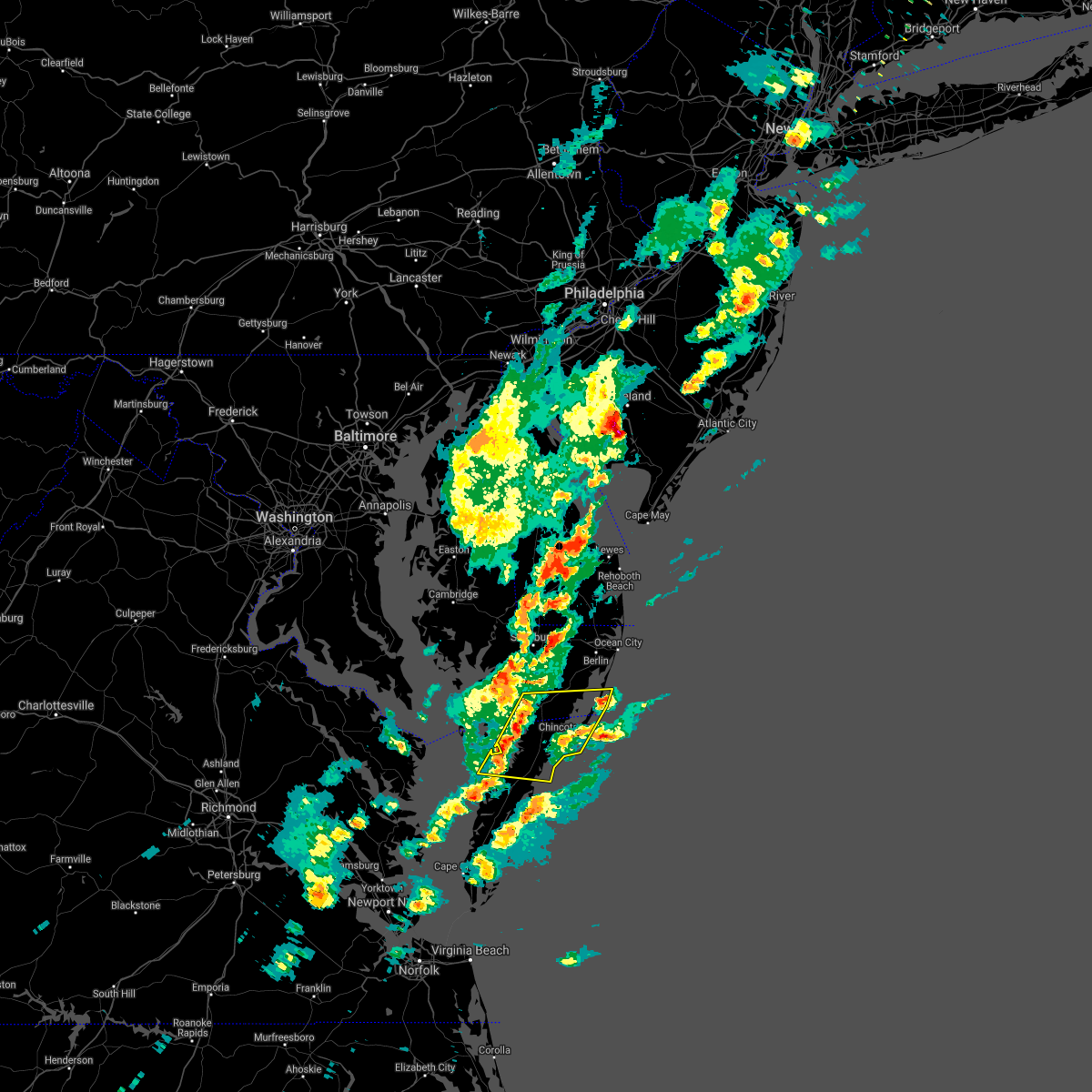 At 219 pm edt, severe thunderstorms were located along a line extending from near marion station to 7 miles northwest of onancock, moving east at 35 mph (radar indicated). Hazards include 60 mph wind gusts and quarter size hail. Minor damage to vehicles is possible. expect wind damage to trees and powerlines. severe thunderstorms will be near, pocomoke city and west pocomoke around 230 pm edt. Other locations impacted by these severe thunderstorms include horntown, hallwood, mappsville, cokesbury, goodwill, greenbackville, saxis, wallops island, temperanceville and nelsonia. At 219 pm edt, severe thunderstorms were located along a line extending from near marion station to 7 miles northwest of onancock, moving east at 35 mph (radar indicated). Hazards include 60 mph wind gusts and quarter size hail. Minor damage to vehicles is possible. expect wind damage to trees and powerlines. severe thunderstorms will be near, pocomoke city and west pocomoke around 230 pm edt. Other locations impacted by these severe thunderstorms include horntown, hallwood, mappsville, cokesbury, goodwill, greenbackville, saxis, wallops island, temperanceville and nelsonia.
|
| 8/29/2020 1:27 AM EDT |
 At 127 am edt, a severe thunderstorm was located near west pocomoke, or near pocomoke city, moving east at 25 mph (radar indicated). Hazards include 60 mph wind gusts and penny size hail. Expect damage to trees and powerlines. this severe thunderstorm will be near, snow hill around 150 am edt. newark around 200 am edt. berlin around 215 am edt. Other locations impacted by this severe thunderstorm include boxiron, cedartown, longridge, cokesbury, goodwill, public landing, ironshire, mount wesley, whiton and girdletree. At 127 am edt, a severe thunderstorm was located near west pocomoke, or near pocomoke city, moving east at 25 mph (radar indicated). Hazards include 60 mph wind gusts and penny size hail. Expect damage to trees and powerlines. this severe thunderstorm will be near, snow hill around 150 am edt. newark around 200 am edt. berlin around 215 am edt. Other locations impacted by this severe thunderstorm include boxiron, cedartown, longridge, cokesbury, goodwill, public landing, ironshire, mount wesley, whiton and girdletree.
|
| 8/25/2020 10:07 PM EDT |
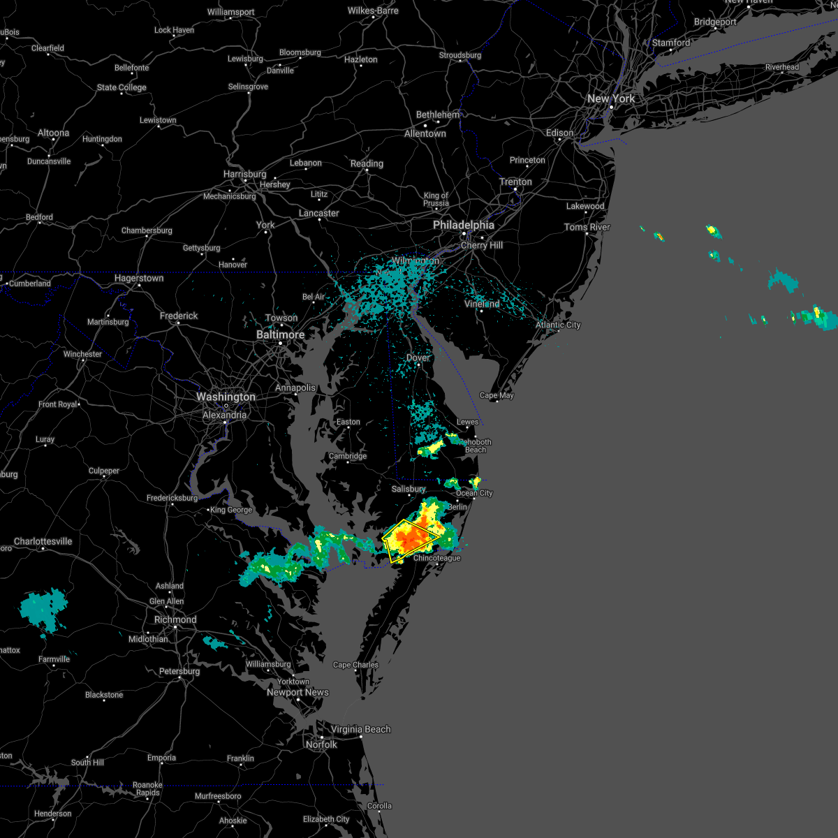 At 1007 pm edt, a severe thunderstorm was located over west pocomoke, or over pocomoke city, moving southeast at 40 mph (radar indicated). Hazards include 60 mph wind gusts. Expect damage to trees and powerlines. This severe thunderstorm will remain over mainly rural areas of southeastern somerset and southwestern worcester counties, including the following locations, shelltown, manokin, cokesbury, goodwill, rehobeth, kingston, girdletree, upper fairmount and beaver dam. At 1007 pm edt, a severe thunderstorm was located over west pocomoke, or over pocomoke city, moving southeast at 40 mph (radar indicated). Hazards include 60 mph wind gusts. Expect damage to trees and powerlines. This severe thunderstorm will remain over mainly rural areas of southeastern somerset and southwestern worcester counties, including the following locations, shelltown, manokin, cokesbury, goodwill, rehobeth, kingston, girdletree, upper fairmount and beaver dam.
|
| 8/25/2020 9:47 PM EDT |
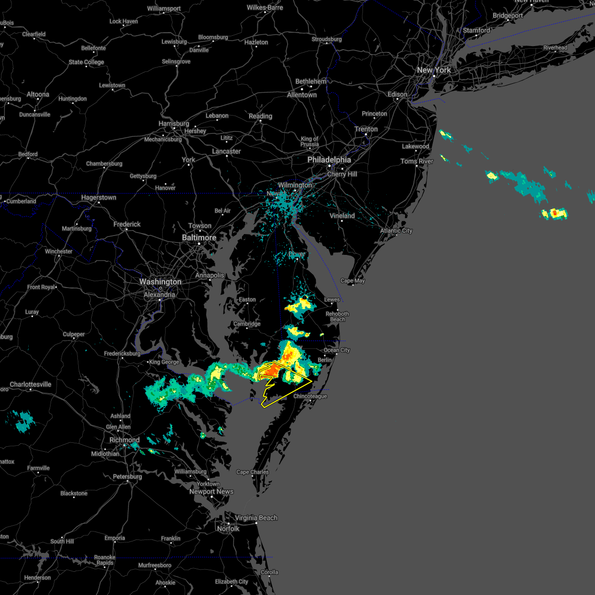 At 946 pm edt, a severe thunderstorm was located near westover, or 8 miles southwest of princess anne, moving southeast at 40 mph (radar indicated). Hazards include 60 mph wind gusts. Expect damage to trees and powerlines. this severe thunderstorm will be near, princess anne around 950 pm edt. westover around 955 pm edt. marion station around 1000 pm edt. pocomoke city and west pocomoke around 1005 pm edt. Other locations impacted by this severe thunderstorm include oriole, byrdtown, cokesbury, goodwill, fairmount, upper hill, hopewell, rehobeth, kingston and dames quarter. At 946 pm edt, a severe thunderstorm was located near westover, or 8 miles southwest of princess anne, moving southeast at 40 mph (radar indicated). Hazards include 60 mph wind gusts. Expect damage to trees and powerlines. this severe thunderstorm will be near, princess anne around 950 pm edt. westover around 955 pm edt. marion station around 1000 pm edt. pocomoke city and west pocomoke around 1005 pm edt. Other locations impacted by this severe thunderstorm include oriole, byrdtown, cokesbury, goodwill, fairmount, upper hill, hopewell, rehobeth, kingston and dames quarter.
|
| 8/4/2020 6:55 AM EDT |
 At 655 am edt, a severe thunderstorm capable of producing a tornado was located near marion station, or near pocomoke city, moving north at 60 mph (radar indicated rotation). Hazards include tornado. Flying debris will be dangerous to those caught without shelter. mobile homes will be damaged or destroyed. damage to roofs, windows, and vehicles will occur. tree damage is likely. this dangerous storm will be near, westover around 700 am edt. princess anne around 705 am edt. university of maryland eastern shore around 710 am edt. fruitland and salisbury university around 715 am edt. hebron around 720 am edt. sharptown and vienna around 730 am edt. Other locations impacted by this tornadic thunderstorm include wetipquin, trinity, cokesbury, eden, kingston, shelltown, mount vernon, beaver dam, green hill and catchpenny. At 655 am edt, a severe thunderstorm capable of producing a tornado was located near marion station, or near pocomoke city, moving north at 60 mph (radar indicated rotation). Hazards include tornado. Flying debris will be dangerous to those caught without shelter. mobile homes will be damaged or destroyed. damage to roofs, windows, and vehicles will occur. tree damage is likely. this dangerous storm will be near, westover around 700 am edt. princess anne around 705 am edt. university of maryland eastern shore around 710 am edt. fruitland and salisbury university around 715 am edt. hebron around 720 am edt. sharptown and vienna around 730 am edt. Other locations impacted by this tornadic thunderstorm include wetipquin, trinity, cokesbury, eden, kingston, shelltown, mount vernon, beaver dam, green hill and catchpenny.
|
| 8/4/2020 5:04 AM EDT |
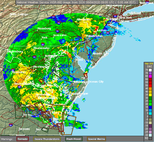 At 504 am edt, a severe thunderstorm capable of producing a tornado was located near pocomoke city, moving northwest at 45 mph (radar indicated rotation). Hazards include tornado. Flying debris will be dangerous to those caught without shelter. mobile homes will be damaged or destroyed. damage to roofs, windows, and vehicles will occur. tree damage is likely. this dangerous storm will be near, west pocomoke around 510 am edt. westover around 520 am edt. princess anne and university of maryland eastern shore around 525 am edt. Other locations impacted by this tornadic thunderstorm include green hill, catchpenny, wetipquin, waterview, oriole, trinity, royal oak, eden, rehobeth and kingston. At 504 am edt, a severe thunderstorm capable of producing a tornado was located near pocomoke city, moving northwest at 45 mph (radar indicated rotation). Hazards include tornado. Flying debris will be dangerous to those caught without shelter. mobile homes will be damaged or destroyed. damage to roofs, windows, and vehicles will occur. tree damage is likely. this dangerous storm will be near, west pocomoke around 510 am edt. westover around 520 am edt. princess anne and university of maryland eastern shore around 525 am edt. Other locations impacted by this tornadic thunderstorm include green hill, catchpenny, wetipquin, waterview, oriole, trinity, royal oak, eden, rehobeth and kingston.
|
| 7/28/2020 8:12 PM EDT |
 At 811 pm edt, severe thunderstorms were located along a line extending from hebron to near west pocomoke, moving northeast at 15 mph (radar indicated). Hazards include 60 mph wind gusts. Expect damage to trees and powerlines. severe thunderstorms will be near, hebron around 815 pm edt. fruitland and salisbury university around 820 pm edt. salisbury around 830 pm edt. delmar around 840 pm edt. parsonsburg around 850 pm edt. snow hill around 855 pm edt. Other locations impacted by these severe thunderstorms include wetipquin, trinity, cokesbury, eden, longridge, mount vernon, chesapeake heights, mount wesley, whitesburg and green hill. At 811 pm edt, severe thunderstorms were located along a line extending from hebron to near west pocomoke, moving northeast at 15 mph (radar indicated). Hazards include 60 mph wind gusts. Expect damage to trees and powerlines. severe thunderstorms will be near, hebron around 815 pm edt. fruitland and salisbury university around 820 pm edt. salisbury around 830 pm edt. delmar around 840 pm edt. parsonsburg around 850 pm edt. snow hill around 855 pm edt. Other locations impacted by these severe thunderstorms include wetipquin, trinity, cokesbury, eden, longridge, mount vernon, chesapeake heights, mount wesley, whitesburg and green hill.
|
| 2/7/2020 10:22 AM EST |
 At 1021 am est, showers with embedded severe thunderstorms were located along a line extending from near lewes to near selbyville to near pocomoke city, moving east at 40 mph (radar indicated). Hazards include 60 mph wind gusts. Expect damage to trees and powerlines. these severe storms will be near, ocean pines around 1025 am est. Other locations impacted by these severe thunderstorms include bishop, boxiron, ocean city municipality, cokesbury, bishopville, goodwill, public landing, ironshire, rehobeth and willards. At 1021 am est, showers with embedded severe thunderstorms were located along a line extending from near lewes to near selbyville to near pocomoke city, moving east at 40 mph (radar indicated). Hazards include 60 mph wind gusts. Expect damage to trees and powerlines. these severe storms will be near, ocean pines around 1025 am est. Other locations impacted by these severe thunderstorms include bishop, boxiron, ocean city municipality, cokesbury, bishopville, goodwill, public landing, ironshire, rehobeth and willards.
|
| 2/7/2020 9:38 AM EST |
 At 937 am est, showers with embedded severe thunderstorms were located along a line extending from agner to near vienna to 10 miles west of deal island, moving east to northeast at 50 mph (radar indicated). Hazards include 60 mph wind gusts. Expect damage to trees and powerlines. severe thunderstorms will be near, hurlock and vienna around 945 am est. sharptown around 950 am est. princess anne, university of maryland eastern shore and westover around 1005 am est. salisbury, fruitland and salisbury university around 1015 am est. parsonsburg around 1025 am est. newark around 1030 am est. berlin and ocean pines around 1040 am est. cape isle of wight around 1045 am est. Other locations impacted by these severe thunderstorms include brookview, ocean city municipality, trinity, cokesbury, eden, longridge, mount vernon, chesapeake heights, pittsville and powellville. At 937 am est, showers with embedded severe thunderstorms were located along a line extending from agner to near vienna to 10 miles west of deal island, moving east to northeast at 50 mph (radar indicated). Hazards include 60 mph wind gusts. Expect damage to trees and powerlines. severe thunderstorms will be near, hurlock and vienna around 945 am est. sharptown around 950 am est. princess anne, university of maryland eastern shore and westover around 1005 am est. salisbury, fruitland and salisbury university around 1015 am est. parsonsburg around 1025 am est. newark around 1030 am est. berlin and ocean pines around 1040 am est. cape isle of wight around 1045 am est. Other locations impacted by these severe thunderstorms include brookview, ocean city municipality, trinity, cokesbury, eden, longridge, mount vernon, chesapeake heights, pittsville and powellville.
|
| 11/1/2019 1:21 AM EDT |
 At 121 am edt, severe thunderstorms were located along a line extending from near millville to near newark, moving northeast at 50 mph (radar indicated). Hazards include 60 mph wind gusts and penny size hail. Expect damage to trees and powerlines. these severe storms will be near, cape isle of wight around 135 am edt. ocean city around 140 am edt. Other locations impacted by these severe thunderstorms include bishop, boxiron, ocean city municipality, bishopville, goodwill, public landing, ironshire, rehobeth, west ocean city and shelltown. At 121 am edt, severe thunderstorms were located along a line extending from near millville to near newark, moving northeast at 50 mph (radar indicated). Hazards include 60 mph wind gusts and penny size hail. Expect damage to trees and powerlines. these severe storms will be near, cape isle of wight around 135 am edt. ocean city around 140 am edt. Other locations impacted by these severe thunderstorms include bishop, boxiron, ocean city municipality, bishopville, goodwill, public landing, ironshire, rehobeth, west ocean city and shelltown.
|
| 11/1/2019 12:54 AM EDT |
 At 1254 am edt, severe thunderstorms were located along a line extending from near parsonsburg to near pocomoke city, moving northeast at 50 mph (radar indicated). Hazards include 60 mph wind gusts and penny size hail. Expect damage to trees and powerlines. severe thunderstorms will be near, snow hill around 115 am edt. newark around 120 am edt. Other locations impacted by these severe thunderstorms include bishop, ocean city municipality, cokesbury, goodwill, shelltown, longridge, cedartown, pittsville, powellville and mount wesley. At 1254 am edt, severe thunderstorms were located along a line extending from near parsonsburg to near pocomoke city, moving northeast at 50 mph (radar indicated). Hazards include 60 mph wind gusts and penny size hail. Expect damage to trees and powerlines. severe thunderstorms will be near, snow hill around 115 am edt. newark around 120 am edt. Other locations impacted by these severe thunderstorms include bishop, ocean city municipality, cokesbury, goodwill, shelltown, longridge, cedartown, pittsville, powellville and mount wesley.
|
| 11/1/2019 12:49 AM EDT |
 At 1249 am edt, severe thunderstorms were located along a line extending from near greensboro to 10 miles northwest of tylerton, moving northeast at 40 mph (radar indicated). Hazards include 60 mph wind gusts and penny size hail. Expect damage to trees and powerlines. These severe thunderstorms will remain over mainly rural areas of somerset, wicomico and southwestern worcester counties, including the following locations, trinity, cokesbury, eden, kingston, saxis, shelltown, longridge, chesapeake heights, pittsville and whitesburg. At 1249 am edt, severe thunderstorms were located along a line extending from near greensboro to 10 miles northwest of tylerton, moving northeast at 40 mph (radar indicated). Hazards include 60 mph wind gusts and penny size hail. Expect damage to trees and powerlines. These severe thunderstorms will remain over mainly rural areas of somerset, wicomico and southwestern worcester counties, including the following locations, trinity, cokesbury, eden, kingston, saxis, shelltown, longridge, chesapeake heights, pittsville and whitesburg.
|
| 11/1/2019 12:38 AM EDT |
 At 1237 am edt, severe thunderstorms were located along a line extending from near federalsburg to 6 miles west of tangier, moving east at 40 mph (radar indicated). Hazards include 60 mph wind gusts and penny size hail. Expect damage to trees and powerlines. these severe storms will be near, marion station around 110 am edt. Other locations impacted by these severe thunderstorms include wetipquin, trinity, cokesbury, eden, kingston, saxis, shelltown, sanford, longridge and mount vernon. At 1237 am edt, severe thunderstorms were located along a line extending from near federalsburg to 6 miles west of tangier, moving east at 40 mph (radar indicated). Hazards include 60 mph wind gusts and penny size hail. Expect damage to trees and powerlines. these severe storms will be near, marion station around 110 am edt. Other locations impacted by these severe thunderstorms include wetipquin, trinity, cokesbury, eden, kingston, saxis, shelltown, sanford, longridge and mount vernon.
|
| 11/1/2019 12:20 AM EDT |
 At 1220 am edt, severe thunderstorms were located along a line extending from near hurlock to fair port, moving east at 40 mph (radar indicated). Hazards include 60 mph wind gusts and penny size hail. Expect damage to trees and powerlines. these severe storms will be near, hurlock around 1225 am edt. federalsburg around 1230 am edt. Other locations impacted by these severe thunderstorms include wetipquin, brookview, trinity, eldorado, cokesbury, eden, kingston, saxis, shelltown and sanford. At 1220 am edt, severe thunderstorms were located along a line extending from near hurlock to fair port, moving east at 40 mph (radar indicated). Hazards include 60 mph wind gusts and penny size hail. Expect damage to trees and powerlines. these severe storms will be near, hurlock around 1225 am edt. federalsburg around 1230 am edt. Other locations impacted by these severe thunderstorms include wetipquin, brookview, trinity, eldorado, cokesbury, eden, kingston, saxis, shelltown and sanford.
|
| 11/1/2019 12:17 AM EDT |
 At 1217 am edt, severe thunderstorms were located along a line extending from near hurlock to fair port, moving east at 40 mph (radar indicated). Hazards include 60 mph wind gusts and penny size hail. Expect damage to trees and powerlines. severe thunderstorms will be near, hurlock around 1220 am edt. federalsburg around 1225 am edt. lawsonia around 100 am edt. Other locations impacted by these severe thunderstorms include brookview, trinity, cokesbury, eden, sanford, longridge, mount vernon, chesapeake heights, pittsville and bethel. At 1217 am edt, severe thunderstorms were located along a line extending from near hurlock to fair port, moving east at 40 mph (radar indicated). Hazards include 60 mph wind gusts and penny size hail. Expect damage to trees and powerlines. severe thunderstorms will be near, hurlock around 1220 am edt. federalsburg around 1225 am edt. lawsonia around 100 am edt. Other locations impacted by these severe thunderstorms include brookview, trinity, cokesbury, eden, sanford, longridge, mount vernon, chesapeake heights, pittsville and bethel.
|
| 8/23/2019 4:26 PM EDT |
 At 426 pm edt, a severe thunderstorm was located 9 miles southeast of pocomoke city, moving east at 25 mph (radar indicated). Hazards include 60 mph wind gusts and quarter size hail. Minor damage to vehicles is possible. Expect wind damage to trees and powerlines. At 426 pm edt, a severe thunderstorm was located 9 miles southeast of pocomoke city, moving east at 25 mph (radar indicated). Hazards include 60 mph wind gusts and quarter size hail. Minor damage to vehicles is possible. Expect wind damage to trees and powerlines.
|
| 8/9/2019 5:50 PM EDT |
 At 550 pm edt, a severe thunderstorm was located over west pocomoke, or over pocomoke city, moving southeast at 35 mph (radar indicated). Hazards include 60 mph wind gusts and quarter size hail. Minor damage to vehicles is possible. expect wind damage to trees and powerlines. This severe thunderstorm will remain over mainly rural areas of east central somerset and southwestern worcester counties, including the following locations, rehobeth, cokesbury and manokin. At 550 pm edt, a severe thunderstorm was located over west pocomoke, or over pocomoke city, moving southeast at 35 mph (radar indicated). Hazards include 60 mph wind gusts and quarter size hail. Minor damage to vehicles is possible. expect wind damage to trees and powerlines. This severe thunderstorm will remain over mainly rural areas of east central somerset and southwestern worcester counties, including the following locations, rehobeth, cokesbury and manokin.
|
| 8/9/2019 5:31 PM EDT |
 At 530 pm edt, a severe thunderstorm was located over princess anne, moving southeast at 30 mph (radar indicated). Hazards include 60 mph wind gusts and quarter size hail. Minor damage to vehicles is possible. expect wind damage to trees and powerlines. this severe storm will be near, pocomoke city and west pocomoke around 550 pm edt. Other locations impacted by this severe thunderstorm include widgeon, manokin, oriole, mount vernon, cokesbury, eden, rehobeth, monie, allen and whitesburg. At 530 pm edt, a severe thunderstorm was located over princess anne, moving southeast at 30 mph (radar indicated). Hazards include 60 mph wind gusts and quarter size hail. Minor damage to vehicles is possible. expect wind damage to trees and powerlines. this severe storm will be near, pocomoke city and west pocomoke around 550 pm edt. Other locations impacted by this severe thunderstorm include widgeon, manokin, oriole, mount vernon, cokesbury, eden, rehobeth, monie, allen and whitesburg.
|
| 8/9/2019 5:11 PM EDT |
 At 510 pm edt, a severe thunderstorm was located 7 miles northwest of princess anne, moving southeast at 30 mph (radar indicated). Hazards include 60 mph wind gusts and half dollar size hail. Minor damage to vehicles is possible. expect wind damage to trees and powerlines. this severe thunderstorm will be near, princess anne and university of maryland eastern shore around 525 pm edt. westover around 530 pm edt. west pocomoke around 545 pm edt. pocomoke city around 550 pm edt. Other locations impacted by this severe thunderstorm include green hill, wetipquin, waterview, oriole, trinity, cokesbury, royal oak, eden, rehobeth and allen. At 510 pm edt, a severe thunderstorm was located 7 miles northwest of princess anne, moving southeast at 30 mph (radar indicated). Hazards include 60 mph wind gusts and half dollar size hail. Minor damage to vehicles is possible. expect wind damage to trees and powerlines. this severe thunderstorm will be near, princess anne and university of maryland eastern shore around 525 pm edt. westover around 530 pm edt. west pocomoke around 545 pm edt. pocomoke city around 550 pm edt. Other locations impacted by this severe thunderstorm include green hill, wetipquin, waterview, oriole, trinity, cokesbury, royal oak, eden, rehobeth and allen.
|
| 7/31/2019 7:09 PM EDT |
 The severe thunderstorm warning for southeastern somerset, southwestern worcester and northern accomack counties will expire at 715 pm edt, the storms which prompted the warning have weakened below severe limits, and no longer pose an immediate threat to life or property. therefore, the warning will be allowed to expire. The severe thunderstorm warning for southeastern somerset, southwestern worcester and northern accomack counties will expire at 715 pm edt, the storms which prompted the warning have weakened below severe limits, and no longer pose an immediate threat to life or property. therefore, the warning will be allowed to expire.
|
| 7/31/2019 7:09 PM EDT |
 The severe thunderstorm warning for southeastern somerset. southwestern worcester and northern accomack counties will expire at 715 pm edt. the storms which prompted the warning have weakened below severe limits, and no longer pose an immediate threat to life or property. Therefore, the warning will be allowed to expire. The severe thunderstorm warning for southeastern somerset. southwestern worcester and northern accomack counties will expire at 715 pm edt. the storms which prompted the warning have weakened below severe limits, and no longer pose an immediate threat to life or property. Therefore, the warning will be allowed to expire.
|
| 7/31/2019 6:21 PM EDT |
 At 620 pm edt, severe thunderstorms were located along a line extending from near marion station to near tangier, moving east at 30 mph (radar indicated). Hazards include 60 mph wind gusts and quarter size hail. Minor damage to vehicles is possible. expect wind damage to trees and powerlines. these severe storms will be near, marion station around 625 pm edt. pocomoke city, parksley and west pocomoke around 645 pm edt. Other locations impacted by these severe thunderstorms include horntown, mappsville, goodwill, greenbackville, saxis, temperanceville, nelsonia, shelltown, sanford and modest town. At 620 pm edt, severe thunderstorms were located along a line extending from near marion station to near tangier, moving east at 30 mph (radar indicated). Hazards include 60 mph wind gusts and quarter size hail. Minor damage to vehicles is possible. expect wind damage to trees and powerlines. these severe storms will be near, marion station around 625 pm edt. pocomoke city, parksley and west pocomoke around 645 pm edt. Other locations impacted by these severe thunderstorms include horntown, mappsville, goodwill, greenbackville, saxis, temperanceville, nelsonia, shelltown, sanford and modest town.
|
| 7/31/2019 6:14 PM EDT |
 At 614 pm edt, severe thunderstorms were located along a line extending from near marion station to near tangier, moving east at 30 mph (radar indicated). Hazards include 60 mph wind gusts. Expect damage to trees and powerlines. severe thunderstorms will be near, marion station around 620 pm edt. parksley around 640 pm edt. pocomoke city and west pocomoke around 645 pm edt. snow hill around 705 pm edt. Other locations impacted by these severe thunderstorms include horntown, mappsville, goodwill, greenbackville, saxis, temperanceville, nelsonia, shelltown, sanford and modest town. At 614 pm edt, severe thunderstorms were located along a line extending from near marion station to near tangier, moving east at 30 mph (radar indicated). Hazards include 60 mph wind gusts. Expect damage to trees and powerlines. severe thunderstorms will be near, marion station around 620 pm edt. parksley around 640 pm edt. pocomoke city and west pocomoke around 645 pm edt. snow hill around 705 pm edt. Other locations impacted by these severe thunderstorms include horntown, mappsville, goodwill, greenbackville, saxis, temperanceville, nelsonia, shelltown, sanford and modest town.
|
| 7/22/2019 11:56 PM EDT |
 At 1155 pm edt, a severe thunderstorm was located over pocomoke city, moving northeast at 45 mph (radar indicated). Hazards include 60 mph wind gusts. Expect damage to trees and powerlines. this severe thunderstorm will be near, snow hill around 1215 am edt. newark around 1220 am edt. berlin around 1230 am edt. cape isle of wight around 1235 am edt. ocean city around 1240 am edt. Other locations impacted by this severe thunderstorm include horntown, bishop, ocean city municipality, cokesbury, goodwill, greenbackville, kingston, wallops island, temperanceville and shelltown. At 1155 pm edt, a severe thunderstorm was located over pocomoke city, moving northeast at 45 mph (radar indicated). Hazards include 60 mph wind gusts. Expect damage to trees and powerlines. this severe thunderstorm will be near, snow hill around 1215 am edt. newark around 1220 am edt. berlin around 1230 am edt. cape isle of wight around 1235 am edt. ocean city around 1240 am edt. Other locations impacted by this severe thunderstorm include horntown, bishop, ocean city municipality, cokesbury, goodwill, greenbackville, kingston, wallops island, temperanceville and shelltown.
|
| 7/22/2019 11:55 PM EDT |
 At 1153 pm edt, a severe thunderstorm was located over pocomoke city, moving northeast at 45 mph (radar indicated). Hazards include 60 mph wind gusts and quarter size hail. Minor damage to vehicles is possible. expect wind damage to trees and powerlines. this severe thunderstorm will be near, snow hill around 1210 am edt. newark around 1220 am edt. berlin around 1230 am edt. cape isle of wight around 1235 am edt. ocean city around 1240 am edt. Other locations impacted by this severe thunderstorm include horntown, bishop, ocean city municipality, cokesbury, goodwill, greenbackville, kingston, wallops island, temperanceville and shelltown. At 1153 pm edt, a severe thunderstorm was located over pocomoke city, moving northeast at 45 mph (radar indicated). Hazards include 60 mph wind gusts and quarter size hail. Minor damage to vehicles is possible. expect wind damage to trees and powerlines. this severe thunderstorm will be near, snow hill around 1210 am edt. newark around 1220 am edt. berlin around 1230 am edt. cape isle of wight around 1235 am edt. ocean city around 1240 am edt. Other locations impacted by this severe thunderstorm include horntown, bishop, ocean city municipality, cokesbury, goodwill, greenbackville, kingston, wallops island, temperanceville and shelltown.
|
| 7/22/2019 11:38 PM EDT |
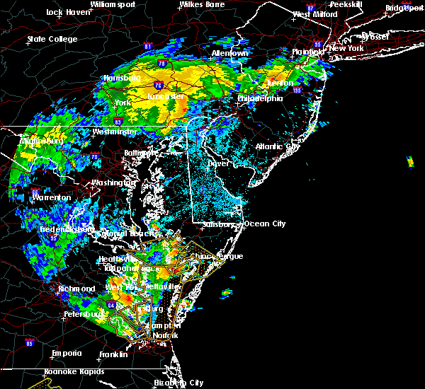 At 1136 pm edt, a severe thunderstorm was located near lawsonia, or 19 miles southwest of pocomoke city, moving northeast at 50 mph (radar indicated). Hazards include 70 mph wind gusts. Expect considerable tree damage. damage is likely to mobile homes, roofs, and outbuildings. this severe storm will be near, lawsonia around 1140 pm edt. marion station around 1150 pm edt. westover around 1155 pm edt. pocomoke city and west pocomoke around 1200 am edt. Other locations impacted by this severe thunderstorm include horntown, mappsville, cokesbury, goodwill, greenbackville, kingston, saxis, wallops island, temperanceville and nelsonia. At 1136 pm edt, a severe thunderstorm was located near lawsonia, or 19 miles southwest of pocomoke city, moving northeast at 50 mph (radar indicated). Hazards include 70 mph wind gusts. Expect considerable tree damage. damage is likely to mobile homes, roofs, and outbuildings. this severe storm will be near, lawsonia around 1140 pm edt. marion station around 1150 pm edt. westover around 1155 pm edt. pocomoke city and west pocomoke around 1200 am edt. Other locations impacted by this severe thunderstorm include horntown, mappsville, cokesbury, goodwill, greenbackville, kingston, saxis, wallops island, temperanceville and nelsonia.
|
| 7/22/2019 11:16 PM EDT |
 The national weather service in wakefield has issued a * severe thunderstorm warning for. eastern somerset county in southeastern maryland. southwestern worcester county in southeastern maryland. northern accomack county in southeastern virginia. Until midnight edt. The national weather service in wakefield has issued a * severe thunderstorm warning for. eastern somerset county in southeastern maryland. southwestern worcester county in southeastern maryland. northern accomack county in southeastern virginia. Until midnight edt.
|
| 7/22/2019 11:16 PM EDT |
 At 1115 pm edt, a severe thunderstorm was located 8 miles southwest of tangier, or 9 miles southeast of fair port, moving northeast at 50 mph (radar indicated). Hazards include 60 mph wind gusts. Expect damage to trees and powerlines. this severe thunderstorm will be near, tangier around 1125 pm edt. lawsonia around 1140 pm edt. marion station around 1150 pm edt. pocomoke city, west pocomoke and westover around 1200 am edt. Other locations impacted by this severe thunderstorm include horntown, mappsville, cokesbury, goodwill, greenbackville, kingston, saxis, wallops island, temperanceville and nelsonia. At 1115 pm edt, a severe thunderstorm was located 8 miles southwest of tangier, or 9 miles southeast of fair port, moving northeast at 50 mph (radar indicated). Hazards include 60 mph wind gusts. Expect damage to trees and powerlines. this severe thunderstorm will be near, tangier around 1125 pm edt. lawsonia around 1140 pm edt. marion station around 1150 pm edt. pocomoke city, west pocomoke and westover around 1200 am edt. Other locations impacted by this severe thunderstorm include horntown, mappsville, cokesbury, goodwill, greenbackville, kingston, saxis, wallops island, temperanceville and nelsonia.
|
| 6/17/2019 9:03 PM EDT |
 At 903 pm edt, a severe thunderstorm was located near deal island, or 15 miles west of princess anne, moving east at 40 mph (radar indicated). Hazards include 60 mph wind gusts and quarter size hail. Minor damage to vehicles is possible. expect wind damage to trees and powerlines. this severe thunderstorm will be near, princess anne and westover around 925 pm edt. university of maryland eastern shore around 930 pm edt. west pocomoke around 940 pm edt. snow hill around 945 pm edt. Other locations impacted by this severe thunderstorm include wetipquin, trinity, cokesbury, eden, longridge, mount vernon, chesapeake heights, pittsville, powellville and mount wesley. At 903 pm edt, a severe thunderstorm was located near deal island, or 15 miles west of princess anne, moving east at 40 mph (radar indicated). Hazards include 60 mph wind gusts and quarter size hail. Minor damage to vehicles is possible. expect wind damage to trees and powerlines. this severe thunderstorm will be near, princess anne and westover around 925 pm edt. university of maryland eastern shore around 930 pm edt. west pocomoke around 940 pm edt. snow hill around 945 pm edt. Other locations impacted by this severe thunderstorm include wetipquin, trinity, cokesbury, eden, longridge, mount vernon, chesapeake heights, pittsville, powellville and mount wesley.
|
| 6/5/2019 6:29 PM EDT |
 At 629 pm edt, severe thunderstorms were located along a line extending from near newark to near snow hill to 10 miles south of pocomoke city to near onancock, moving east at 40 mph (radar indicated). Hazards include 60 mph wind gusts. Expect damage to trees and powerlines. these severe storms will be near, snow hill and newark around 635 pm edt. berlin and ocean pines around 640 pm edt. cape isle of wight around 645 pm edt. Other locations impacted by these severe thunderstorms include horntown, harborton, melfa, mappsville, ocean city municipality, goodwill, greenbackville, wallops island, temperanceville and nelsonia. At 629 pm edt, severe thunderstorms were located along a line extending from near newark to near snow hill to 10 miles south of pocomoke city to near onancock, moving east at 40 mph (radar indicated). Hazards include 60 mph wind gusts. Expect damage to trees and powerlines. these severe storms will be near, snow hill and newark around 635 pm edt. berlin and ocean pines around 640 pm edt. cape isle of wight around 645 pm edt. Other locations impacted by these severe thunderstorms include horntown, harborton, melfa, mappsville, ocean city municipality, goodwill, greenbackville, wallops island, temperanceville and nelsonia.
|
| 6/5/2019 5:48 PM EDT |
 At 547 pm edt, severe thunderstorms were located along a line extending from near princess anne to near westover to near marion station to 7 miles southeast of tangier, moving east at 35 mph (radar indicated). Hazards include 60 mph wind gusts. Expect damage to trees and powerlines. severe thunderstorms will be near, princess anne, university of maryland eastern shore, westover and marion station around 555 pm edt. fruitland, pocomoke city, salisbury university, onley and west pocomoke around 605 pm edt. parksley around 615 pm edt. snow hill around 625 pm edt. newark around 635 pm edt. berlin, cape isle of wight and ocean pines around 645 pm edt. Other locations impacted by these severe thunderstorms include harborton, melfa, ocean city municipality, trinity, cokesbury, eden, wallops island, nelsonia, sanford and modest town. At 547 pm edt, severe thunderstorms were located along a line extending from near princess anne to near westover to near marion station to 7 miles southeast of tangier, moving east at 35 mph (radar indicated). Hazards include 60 mph wind gusts. Expect damage to trees and powerlines. severe thunderstorms will be near, princess anne, university of maryland eastern shore, westover and marion station around 555 pm edt. fruitland, pocomoke city, salisbury university, onley and west pocomoke around 605 pm edt. parksley around 615 pm edt. snow hill around 625 pm edt. newark around 635 pm edt. berlin, cape isle of wight and ocean pines around 645 pm edt. Other locations impacted by these severe thunderstorms include harborton, melfa, ocean city municipality, trinity, cokesbury, eden, wallops island, nelsonia, sanford and modest town.
|
| 6/3/2019 12:28 AM EDT |
 The severe thunderstorm warning for worcester and northern accomack counties will expire at 1230 am edt, the storms which prompted the warning have weakened below severe limits, and no longer pose an immediate threat to life or property. therefore, the warning will be allowed to expire. however small hail, gusty winds and heavy rain are still possible with a new line of thunderstorms moving over the area. The severe thunderstorm warning for worcester and northern accomack counties will expire at 1230 am edt, the storms which prompted the warning have weakened below severe limits, and no longer pose an immediate threat to life or property. therefore, the warning will be allowed to expire. however small hail, gusty winds and heavy rain are still possible with a new line of thunderstorms moving over the area.
|
| 6/3/2019 12:18 AM EDT |
 At 1217 am edt, severe thunderstorms were located along a line extending from near berlin to near snow hill to near pocomoke city, moving east at 25 mph (radar indicated). Hazards include 60 mph wind gusts and quarter size hail. Minor damage to vehicles is possible. expect wind damage to trees and powerlines. these severe storms will be near, berlin around 1220 am edt. cape isle of wight around 1225 am edt. ocean city around 1230 am edt. Other locations impacted by these severe thunderstorms include horntown, boxiron, ocean city municipality, goodwill, public landing, greenbackville, ironshire, west ocean city, cedartown and mount wesley. At 1217 am edt, severe thunderstorms were located along a line extending from near berlin to near snow hill to near pocomoke city, moving east at 25 mph (radar indicated). Hazards include 60 mph wind gusts and quarter size hail. Minor damage to vehicles is possible. expect wind damage to trees and powerlines. these severe storms will be near, berlin around 1220 am edt. cape isle of wight around 1225 am edt. ocean city around 1230 am edt. Other locations impacted by these severe thunderstorms include horntown, boxiron, ocean city municipality, goodwill, public landing, greenbackville, ironshire, west ocean city, cedartown and mount wesley.
|
| 6/3/2019 12:00 AM EDT | Courthouse hill rd between cokesbury and pocomoke cit in somerset county MD, 4.6 miles S of Pocomoke City, MD |
| 6/2/2019 11:44 PM EDT |
 At 1144 pm edt, severe thunderstorms were located along a line extending from near parsonsburg to 7 miles northwest of snow hill to near university of maryland eastern shore, moving southeast at 25 mph (radar indicated). Hazards include ping pong ball size hail and 60 mph wind gusts. People and animals outdoors will be injured. expect hail damage to roofs, siding, windows, and vehicles. expect wind damage to trees and powerlines. severe thunderstorms will be near, pocomoke city and snow hill around 1200 am edt. berlin and newark around 1210 am edt. Other locations impacted by these severe thunderstorms include horntown, boxiron, ocean city municipality, salisbury-wicomico, cokesbury, goodwill, public landing, greenbackville, ironshire and willards. At 1144 pm edt, severe thunderstorms were located along a line extending from near parsonsburg to 7 miles northwest of snow hill to near university of maryland eastern shore, moving southeast at 25 mph (radar indicated). Hazards include ping pong ball size hail and 60 mph wind gusts. People and animals outdoors will be injured. expect hail damage to roofs, siding, windows, and vehicles. expect wind damage to trees and powerlines. severe thunderstorms will be near, pocomoke city and snow hill around 1200 am edt. berlin and newark around 1210 am edt. Other locations impacted by these severe thunderstorms include horntown, boxiron, ocean city municipality, salisbury-wicomico, cokesbury, goodwill, public landing, greenbackville, ironshire and willards.
|
| 6/2/2019 10:11 PM EDT |
 The severe thunderstorm warning for worcester and northern accomack counties will expire at 1015 pm edt, the storms which prompted the warning have weakened, with the stronger storms now offshore. therefore, the warning will be allowed to expire. however gusty winds and heavy rain are still possible with these thunderstorms. The severe thunderstorm warning for worcester and northern accomack counties will expire at 1015 pm edt, the storms which prompted the warning have weakened, with the stronger storms now offshore. therefore, the warning will be allowed to expire. however gusty winds and heavy rain are still possible with these thunderstorms.
|
| 6/2/2019 9:48 PM EDT |
 At 946 pm edt, severe thunderstorms were located along a line extending from near ocean pines to 6 miles south of newark to near pocomoke city, moving east at 30 mph (radar indicated). Hazards include 60 mph wind gusts and quarter size hail. Minor damage to vehicles is possible. expect wind damage to trees and powerlines. these severe storms will be near, ocean city, cape isle of wight and ocean pines around 950 pm edt. Other locations impacted by these severe thunderstorms include horntown, bishop, boxiron, ocean city municipality, bishopville, goodwill, public landing, greenbackville, ironshire and west ocean city. At 946 pm edt, severe thunderstorms were located along a line extending from near ocean pines to 6 miles south of newark to near pocomoke city, moving east at 30 mph (radar indicated). Hazards include 60 mph wind gusts and quarter size hail. Minor damage to vehicles is possible. expect wind damage to trees and powerlines. these severe storms will be near, ocean city, cape isle of wight and ocean pines around 950 pm edt. Other locations impacted by these severe thunderstorms include horntown, bishop, boxiron, ocean city municipality, bishopville, goodwill, public landing, greenbackville, ironshire and west ocean city.
|
| 6/2/2019 9:17 PM EDT |
 At 916 pm edt, severe thunderstorms were located along a line extending from near gumboro to near newark to near west pocomoke, moving east at 35 mph (radar indicated). Hazards include 60 mph wind gusts and quarter size hail. Minor damage to vehicles is possible. expect wind damage to trees and powerlines. severe thunderstorms will be near, snow hill and newark around 920 pm edt. berlin and ocean pines around 930 pm edt. ocean city and cape isle of wight around 940 pm edt. Other locations impacted by these severe thunderstorms include horntown, bishop, ocean city municipality, cokesbury, goodwill, greenbackville, kingston, cedartown, pittsville and powellville. At 916 pm edt, severe thunderstorms were located along a line extending from near gumboro to near newark to near west pocomoke, moving east at 35 mph (radar indicated). Hazards include 60 mph wind gusts and quarter size hail. Minor damage to vehicles is possible. expect wind damage to trees and powerlines. severe thunderstorms will be near, snow hill and newark around 920 pm edt. berlin and ocean pines around 930 pm edt. ocean city and cape isle of wight around 940 pm edt. Other locations impacted by these severe thunderstorms include horntown, bishop, ocean city municipality, cokesbury, goodwill, greenbackville, kingston, cedartown, pittsville and powellville.
|
| 4/26/2019 5:18 PM EDT |
 At 518 pm edt, severe thunderstorms were located along a line extending from near harrington to near bridgeville to salisbury to near marion station, moving northeast at 50 mph (radar indicated). Hazards include 70 mph wind gusts and quarter size hail. Minor damage to vehicles is possible. expect considerable tree damage. wind damage is also likely to mobile homes, roofs, and outbuildings. these severe storms will be near, snow hill around 540 pm edt. other locations impacted by these severe thunderstorms include trinity, cokesbury, goodwill, eden, kingston, shelltown, longridge, chesapeake heights, pittsville and powellville. A tornado watch remains in effect until 900 pm edt for southeastern maryland, and southeastern virginia. At 518 pm edt, severe thunderstorms were located along a line extending from near harrington to near bridgeville to salisbury to near marion station, moving northeast at 50 mph (radar indicated). Hazards include 70 mph wind gusts and quarter size hail. Minor damage to vehicles is possible. expect considerable tree damage. wind damage is also likely to mobile homes, roofs, and outbuildings. these severe storms will be near, snow hill around 540 pm edt. other locations impacted by these severe thunderstorms include trinity, cokesbury, goodwill, eden, kingston, shelltown, longridge, chesapeake heights, pittsville and powellville. A tornado watch remains in effect until 900 pm edt for southeastern maryland, and southeastern virginia.
|
| 4/26/2019 4:56 PM EDT |
 At 456 pm edt, severe thunderstorms were located along a line extending from smithville to near lawsonia, moving northeast at 50 mph (radar indicated). Hazards include 60 mph wind gusts and quarter size hail. Minor damage to vehicles is possible. expect wind damage to trees and powerlines. severe thunderstorms will be near, westover around 515 pm edt. princess anne and university of maryland eastern shore around 520 pm edt. fruitland and salisbury university around 530 pm edt. salisbury around 535 pm edt. delmar and parsonsburg around 540 pm edt. other locations impacted by these severe thunderstorms include wetipquin, brookview, trinity, eldorado, cokesbury, goodwill, eden, kingston, shelltown and longridge. A tornado watch remains in effect until 900 pm edt for southeastern maryland, and southeastern virginia. At 456 pm edt, severe thunderstorms were located along a line extending from smithville to near lawsonia, moving northeast at 50 mph (radar indicated). Hazards include 60 mph wind gusts and quarter size hail. Minor damage to vehicles is possible. expect wind damage to trees and powerlines. severe thunderstorms will be near, westover around 515 pm edt. princess anne and university of maryland eastern shore around 520 pm edt. fruitland and salisbury university around 530 pm edt. salisbury around 535 pm edt. delmar and parsonsburg around 540 pm edt. other locations impacted by these severe thunderstorms include wetipquin, brookview, trinity, eldorado, cokesbury, goodwill, eden, kingston, shelltown and longridge. A tornado watch remains in effect until 900 pm edt for southeastern maryland, and southeastern virginia.
|
| 4/19/2019 9:50 PM EDT |
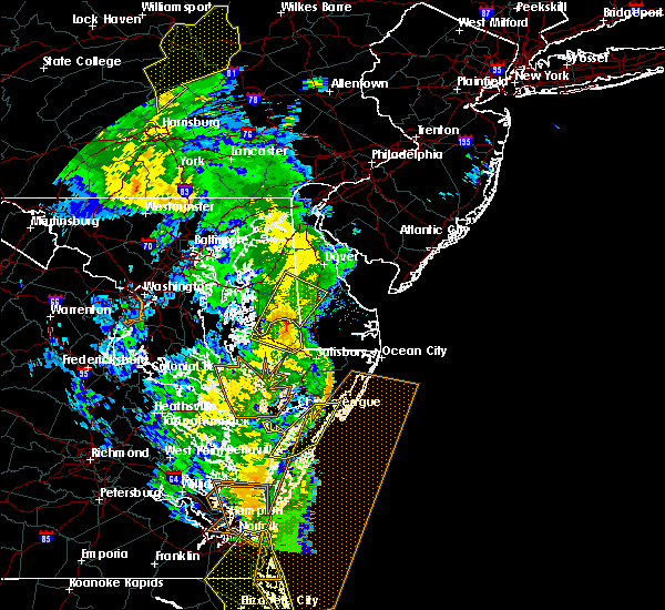 The severe thunderstorm warning for accomack county will expire at 1000 pm edt, the storms which prompted the warning have weakened below severe limits, and no longer pose an immediate threat to life or property. therefore, the warning will be allowed to expire. however gusty winds are still possible with these thunderstorms. a tornado watch remains in effect until midnight edt for southeastern maryland, and eastern and southeastern virginia. The severe thunderstorm warning for accomack county will expire at 1000 pm edt, the storms which prompted the warning have weakened below severe limits, and no longer pose an immediate threat to life or property. therefore, the warning will be allowed to expire. however gusty winds are still possible with these thunderstorms. a tornado watch remains in effect until midnight edt for southeastern maryland, and eastern and southeastern virginia.
|
| 4/19/2019 9:33 PM EDT |
 At 933 pm edt, severe thunderstorms were located along a line extending from 8 miles southeast of marion station to near onancock, moving northeast at 45 mph (radar indicated). Hazards include 60 mph wind gusts. Expect damage to trees and powerlines. these severe thunderstorms will remain over mainly rural areas of accomack county, including the following locations, horntown, harborton, melfa, mappsville, greenbackville, wachapreague, accomac, wallops island, temperanceville and nelsonia. A tornado watch remains in effect until midnight edt for southeastern maryland, and eastern and southeastern virginia. At 933 pm edt, severe thunderstorms were located along a line extending from 8 miles southeast of marion station to near onancock, moving northeast at 45 mph (radar indicated). Hazards include 60 mph wind gusts. Expect damage to trees and powerlines. these severe thunderstorms will remain over mainly rural areas of accomack county, including the following locations, horntown, harborton, melfa, mappsville, greenbackville, wachapreague, accomac, wallops island, temperanceville and nelsonia. A tornado watch remains in effect until midnight edt for southeastern maryland, and eastern and southeastern virginia.
|
| 4/19/2019 8:53 PM EDT |
 At 853 pm edt, severe thunderstorms were located along a line extending from 10 miles west of exmore to 7 miles northwest of cape charles, moving northeast at 45 mph (radar indicated). Hazards include 60 mph wind gusts. Expect damage to trees and powerlines. severe thunderstorms will be near, nassawadox around 915 pm edt. exmore and willis wharf around 920 pm edt. onancock and onley around 935 pm edt. parksley around 945 pm edt. other locations impacted by these severe thunderstorms include horntown, harborton, melfa, mappsville, greenbackville, franktown, wallops island, temperanceville, nelsonia and modest town. A tornado watch remains in effect until midnight edt for southeastern maryland, and eastern and southeastern virginia. At 853 pm edt, severe thunderstorms were located along a line extending from 10 miles west of exmore to 7 miles northwest of cape charles, moving northeast at 45 mph (radar indicated). Hazards include 60 mph wind gusts. Expect damage to trees and powerlines. severe thunderstorms will be near, nassawadox around 915 pm edt. exmore and willis wharf around 920 pm edt. onancock and onley around 935 pm edt. parksley around 945 pm edt. other locations impacted by these severe thunderstorms include horntown, harborton, melfa, mappsville, greenbackville, franktown, wallops island, temperanceville, nelsonia and modest town. A tornado watch remains in effect until midnight edt for southeastern maryland, and eastern and southeastern virginia.
|
| 4/15/2019 4:26 AM EDT |
 At 425 am edt, severe thunderstorms were located along a line extending from near millville to 8 miles southeast of snow hill, moving east at 50 mph (radar indicated). Hazards include 70 mph wind gusts and penny size hail. Expect considerable tree damage. damage is likely to mobile homes, roofs, and outbuildings. locations impacted include, ocean city, pocomoke city, berlin, snow hill, cape isle of wight, ocean pines, newark, pittsville, willards, bishop, ocean city municipality, goodwill, cedartown, powellville, mount wesley, showell, whiton, boxiron, bishopville and public landing. A tornado watch remains in effect until 700 am edt for southeastern maryland, and southeastern virginia. At 425 am edt, severe thunderstorms were located along a line extending from near millville to 8 miles southeast of snow hill, moving east at 50 mph (radar indicated). Hazards include 70 mph wind gusts and penny size hail. Expect considerable tree damage. damage is likely to mobile homes, roofs, and outbuildings. locations impacted include, ocean city, pocomoke city, berlin, snow hill, cape isle of wight, ocean pines, newark, pittsville, willards, bishop, ocean city municipality, goodwill, cedartown, powellville, mount wesley, showell, whiton, boxiron, bishopville and public landing. A tornado watch remains in effect until 700 am edt for southeastern maryland, and southeastern virginia.
|
| 4/15/2019 4:12 AM EDT |
 At 412 am edt, severe thunderstorms were located along a line extending from gumboro to near pocomoke city, moving east at 50 mph (radar indicated). Hazards include 70 mph wind gusts and penny size hail. Expect considerable tree damage. damage is likely to mobile homes, roofs, and outbuildings. locations impacted include, salisbury, ocean city, fruitland, pocomoke city, princess anne, university of maryland eastern shore, salisbury university, berlin, delmar, snow hill, cape isle of wight, westover, ocean pines, parsonsburg, west pocomoke, marion station, newark, pittsville, willards and bishop. A tornado watch remains in effect until 700 am edt for southeastern maryland, and southeastern virginia. At 412 am edt, severe thunderstorms were located along a line extending from gumboro to near pocomoke city, moving east at 50 mph (radar indicated). Hazards include 70 mph wind gusts and penny size hail. Expect considerable tree damage. damage is likely to mobile homes, roofs, and outbuildings. locations impacted include, salisbury, ocean city, fruitland, pocomoke city, princess anne, university of maryland eastern shore, salisbury university, berlin, delmar, snow hill, cape isle of wight, westover, ocean pines, parsonsburg, west pocomoke, marion station, newark, pittsville, willards and bishop. A tornado watch remains in effect until 700 am edt for southeastern maryland, and southeastern virginia.
|
| 4/15/2019 4:00 AM EDT |
 At 400 am edt, severe thunderstorms were located along a line extending from delmar to near marion station, moving east at 50 mph (radar indicated). Hazards include 60 mph wind gusts and quarter size hail. Minor damage to vehicles is possible. Expect wind damage to trees and powerlines. At 400 am edt, severe thunderstorms were located along a line extending from delmar to near marion station, moving east at 50 mph (radar indicated). Hazards include 60 mph wind gusts and quarter size hail. Minor damage to vehicles is possible. Expect wind damage to trees and powerlines.
|
| 6/24/2018 5:49 PM EDT |
 At 548 pm edt, severe thunderstorms were located along a line extending from lewisetta to lancaster to near church view, moving east at 40 mph (radar indicated). Hazards include 60 mph wind gusts. Expect damage to trees and powerlines. severe thunderstorms will be near, kilmarnock and wicomico church around 555 pm edt. fair port around 600 pm edt. white stone around 610 pm edt. tangier island around 630 pm edt. Other locations impacted by these severe thunderstorms include byrdton, melfa, harborton, avalon, brook vale, bertrand, reedville, millenbeck, wallops island and nelsonia. At 548 pm edt, severe thunderstorms were located along a line extending from lewisetta to lancaster to near church view, moving east at 40 mph (radar indicated). Hazards include 60 mph wind gusts. Expect damage to trees and powerlines. severe thunderstorms will be near, kilmarnock and wicomico church around 555 pm edt. fair port around 600 pm edt. white stone around 610 pm edt. tangier island around 630 pm edt. Other locations impacted by these severe thunderstorms include byrdton, melfa, harborton, avalon, brook vale, bertrand, reedville, millenbeck, wallops island and nelsonia.
|
| 5/13/2018 1:11 AM EDT |
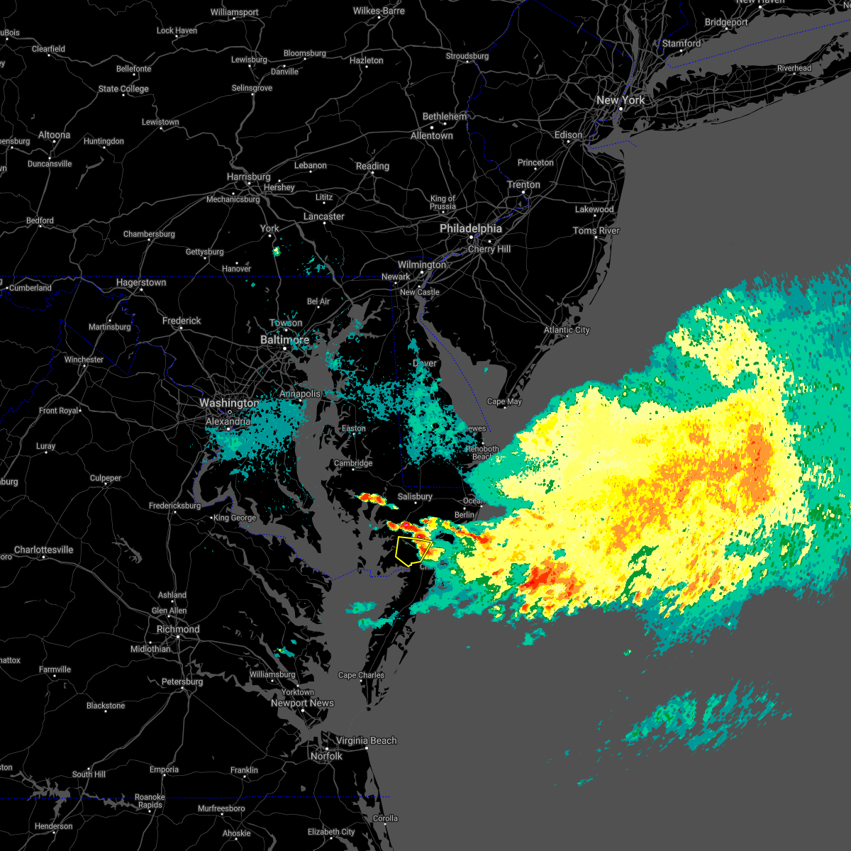 The severe thunderstorm warning for southeastern somerset and southwestern worcester counties will expire at 115 am edt, the storm which prompted the warning has weakened below severe limits, and no longer poses an immediate threat to life or property. therefore the warning will be allowed to expire. The severe thunderstorm warning for southeastern somerset and southwestern worcester counties will expire at 115 am edt, the storm which prompted the warning has weakened below severe limits, and no longer poses an immediate threat to life or property. therefore the warning will be allowed to expire.
|
| 5/13/2018 1:05 AM EDT |
 At 104 am edt, a severe thunderstorm was located near west pocomoke, or near pocomoke city, moving east at 35 mph (radar indicated). Hazards include 60 mph wind gusts and quarter size hail. Minor damage to vehicles is possible. expect wind damage to trees and powerlines. Locations impacted include, pocomoke city, west pocomoke, westover, shelltown, cokesbury, rehobeth, kingston and beaver dam. At 104 am edt, a severe thunderstorm was located near west pocomoke, or near pocomoke city, moving east at 35 mph (radar indicated). Hazards include 60 mph wind gusts and quarter size hail. Minor damage to vehicles is possible. expect wind damage to trees and powerlines. Locations impacted include, pocomoke city, west pocomoke, westover, shelltown, cokesbury, rehobeth, kingston and beaver dam.
|
| 5/13/2018 12:46 AM EDT |
 At 1246 am edt, a severe thunderstorm was located 7 miles southeast of deal island, or 11 miles southwest of princess anne, moving east at 35 mph (radar indicated). Hazards include 60 mph wind gusts and half dollar size hail. Minor damage to vehicles is possible. expect wind damage to trees and powerlines. this severe thunderstorm will be near, marion station and westover around 100 am edt. west pocomoke around 110 am edt. pocomoke city around 115 am edt. Other locations impacted by this severe thunderstorm include shelltown, manokin, upper fairmount, cokesbury, fairmount, upper hill, rehobeth, kingston, beaver dam and rumbley. At 1246 am edt, a severe thunderstorm was located 7 miles southeast of deal island, or 11 miles southwest of princess anne, moving east at 35 mph (radar indicated). Hazards include 60 mph wind gusts and half dollar size hail. Minor damage to vehicles is possible. expect wind damage to trees and powerlines. this severe thunderstorm will be near, marion station and westover around 100 am edt. west pocomoke around 110 am edt. pocomoke city around 115 am edt. Other locations impacted by this severe thunderstorm include shelltown, manokin, upper fairmount, cokesbury, fairmount, upper hill, rehobeth, kingston, beaver dam and rumbley.
|
| 5/13/2018 12:46 AM EDT |
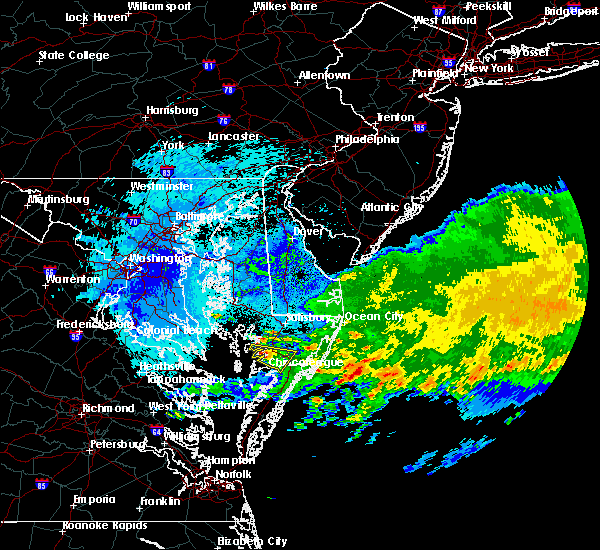 At 1246 am edt, a severe thunderstorm was located 7 miles southeast of deal island, or 11 miles southwest of princess anne, moving east at 35 mph (radar indicated). Hazards include 60 mph wind gusts and half dollar size hail. Minor damage to vehicles is possible. expect wind damage to trees and powerlines. this severe thunderstorm will be near, marion station and westover around 100 am edt. west pocomoke around 110 am edt. pocomoke city around 115 am edt. Other locations impacted by this severe thunderstorm include shelltown, manokin, upper fairmount, cokesbury, fairmount, upper hill, rehobeth, kingston, beaver dam and rumbley. At 1246 am edt, a severe thunderstorm was located 7 miles southeast of deal island, or 11 miles southwest of princess anne, moving east at 35 mph (radar indicated). Hazards include 60 mph wind gusts and half dollar size hail. Minor damage to vehicles is possible. expect wind damage to trees and powerlines. this severe thunderstorm will be near, marion station and westover around 100 am edt. west pocomoke around 110 am edt. pocomoke city around 115 am edt. Other locations impacted by this severe thunderstorm include shelltown, manokin, upper fairmount, cokesbury, fairmount, upper hill, rehobeth, kingston, beaver dam and rumbley.
|
| 8/18/2017 9:17 PM EDT |
 At 916 pm edt, severe thunderstorms were located along a line extending from near hebron to near lawsonia, moving east at 75 mph (radar indicated). Hazards include 60 mph wind gusts. Expect damage to trees and powerlines. severe thunderstorms will be near, salisbury, fruitland, salisbury university, delmar and delmar around 920 pm edt. parsonsburg around 925 pm edt. pocomoke city and west pocomoke around 930 pm edt. berlin, cape isle of wight and ocean pines around 940 pm edt. Other locations impacted by these severe thunderstorms include ocean city municipality, trinity, cokesbury, eden, sanford, longridge, mount vernon, chesapeake heights, pittsville and powellville. At 916 pm edt, severe thunderstorms were located along a line extending from near hebron to near lawsonia, moving east at 75 mph (radar indicated). Hazards include 60 mph wind gusts. Expect damage to trees and powerlines. severe thunderstorms will be near, salisbury, fruitland, salisbury university, delmar and delmar around 920 pm edt. parsonsburg around 925 pm edt. pocomoke city and west pocomoke around 930 pm edt. berlin, cape isle of wight and ocean pines around 940 pm edt. Other locations impacted by these severe thunderstorms include ocean city municipality, trinity, cokesbury, eden, sanford, longridge, mount vernon, chesapeake heights, pittsville and powellville.
|
| 8/17/2016 11:06 PM EDT |
 At 1105 pm edt, severe thunderstorms were located along a line extending from agner to near parsonsburg to near pocomoke city, moving northeast at 35 mph (radar indicated). Hazards include 60 mph wind gusts. Expect damage to roofs. siding. and trees. These severe thunderstorms will remain over mainly rural areas of central worcester, northeastern somerset, western wicomico and northwestern dorchester counties, including the following locations: beaver dam, whitesburg, stockton, catchpenny, east new market, lakewood, shad point, cokesbury, mardela springs and eldorado. At 1105 pm edt, severe thunderstorms were located along a line extending from agner to near parsonsburg to near pocomoke city, moving northeast at 35 mph (radar indicated). Hazards include 60 mph wind gusts. Expect damage to roofs. siding. and trees. These severe thunderstorms will remain over mainly rural areas of central worcester, northeastern somerset, western wicomico and northwestern dorchester counties, including the following locations: beaver dam, whitesburg, stockton, catchpenny, east new market, lakewood, shad point, cokesbury, mardela springs and eldorado.
|
| 8/17/2016 10:51 PM EDT |
 At 1050 pm edt, severe thunderstorms were located along a line extending from near vienna to 8 miles southeast of marion station, moving east at 30 mph (radar indicated). Hazards include 60 mph wind gusts. Expect damage to roofs. siding. and trees. these severe storms will be near, hebron and sharptown around 1055 pm edt. pocomoke city around 1100 pm edt. salisbury around 1105 pm edt. other locations impacted by these severe thunderstorms include saxis, mappsville, trinity, temperanceville, wetipquin, bloxom. Oriole, catchpenny, mount vernon and linkwood. At 1050 pm edt, severe thunderstorms were located along a line extending from near vienna to 8 miles southeast of marion station, moving east at 30 mph (radar indicated). Hazards include 60 mph wind gusts. Expect damage to roofs. siding. and trees. these severe storms will be near, hebron and sharptown around 1055 pm edt. pocomoke city around 1100 pm edt. salisbury around 1105 pm edt. other locations impacted by these severe thunderstorms include saxis, mappsville, trinity, temperanceville, wetipquin, bloxom. Oriole, catchpenny, mount vernon and linkwood.
|
| 8/17/2016 10:29 PM EDT |
 At 1028 pm edt, severe thunderstorms were located along a line extending from 11 miles south of cambridge to near lawsonia, moving east at 30 mph (radar indicated). Hazards include 60 mph wind gusts. Expect damage to roofs. siding. and trees. severe thunderstorms will be near, marion station around 1035 pm edt. vienna around 1050 pm edt. pocomoke city around 1055 pm edt. hebron and sharptown around 1100 pm edt. salisbury around 1105 pm edt. Other locations impacted by these severe thunderstorms include saxis, dames quarter, mappsville, trinity, temperanceville, wetipquin, bloxom, oriole, catchpenny and galestown. At 1028 pm edt, severe thunderstorms were located along a line extending from 11 miles south of cambridge to near lawsonia, moving east at 30 mph (radar indicated). Hazards include 60 mph wind gusts. Expect damage to roofs. siding. and trees. severe thunderstorms will be near, marion station around 1035 pm edt. vienna around 1050 pm edt. pocomoke city around 1055 pm edt. hebron and sharptown around 1100 pm edt. salisbury around 1105 pm edt. Other locations impacted by these severe thunderstorms include saxis, dames quarter, mappsville, trinity, temperanceville, wetipquin, bloxom, oriole, catchpenny and galestown.
|
| 7/29/2016 12:55 AM EDT |
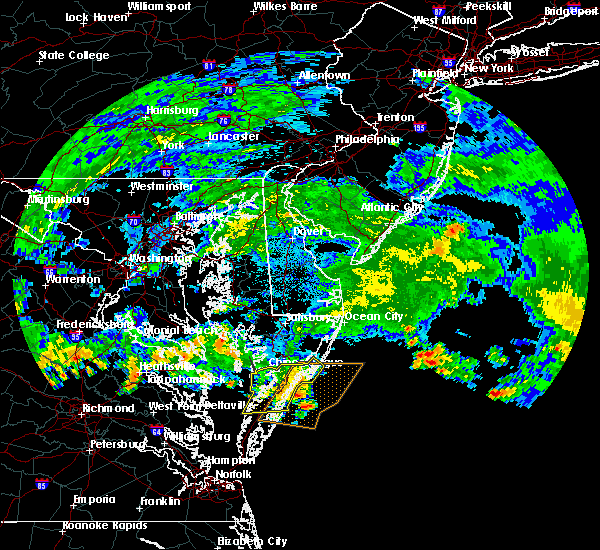 The severe thunderstorm warning for accomack county will expire at 100 am edt, the storms which prompted the warning have weakened below severe limits, and have exited the warned area. therefore the warning will be allowed to expire. The severe thunderstorm warning for accomack county will expire at 100 am edt, the storms which prompted the warning have weakened below severe limits, and have exited the warned area. therefore the warning will be allowed to expire.
|
| 7/29/2016 12:37 AM EDT |
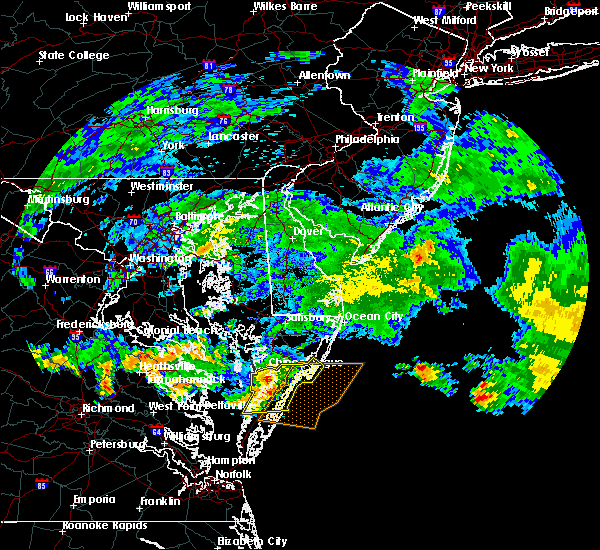 At 1237 am edt, severe thunderstorms were located along a line extending from 7 miles southeast of marion station to parksley to near onley, moving east at 35 mph (radar indicated). Hazards include 60 mph wind gusts. Expect damage to roofs. siding. and trees. these severe storms will be near, parksley around 1240 am edt. other locations impacted by these severe thunderstorms include saxis, sanford, harborton, mappsville, temperanceville, bloxom, locustv ille, tasley, clam and horntown. precautionary/preparedness actions, for your protection move to an interior room on the lowest floor of a building. please send your reports of hail and or wind damage, including trees or large limbs downed, by calling noaa`s national weather service in wakefield at , 7 5 7, 8 9 9, 2 4 1 5. At 1237 am edt, severe thunderstorms were located along a line extending from 7 miles southeast of marion station to parksley to near onley, moving east at 35 mph (radar indicated). Hazards include 60 mph wind gusts. Expect damage to roofs. siding. and trees. these severe storms will be near, parksley around 1240 am edt. other locations impacted by these severe thunderstorms include saxis, sanford, harborton, mappsville, temperanceville, bloxom, locustv ille, tasley, clam and horntown. precautionary/preparedness actions, for your protection move to an interior room on the lowest floor of a building. please send your reports of hail and or wind damage, including trees or large limbs downed, by calling noaa`s national weather service in wakefield at , 7 5 7, 8 9 9, 2 4 1 5.
|
| 7/29/2016 12:18 AM EDT |
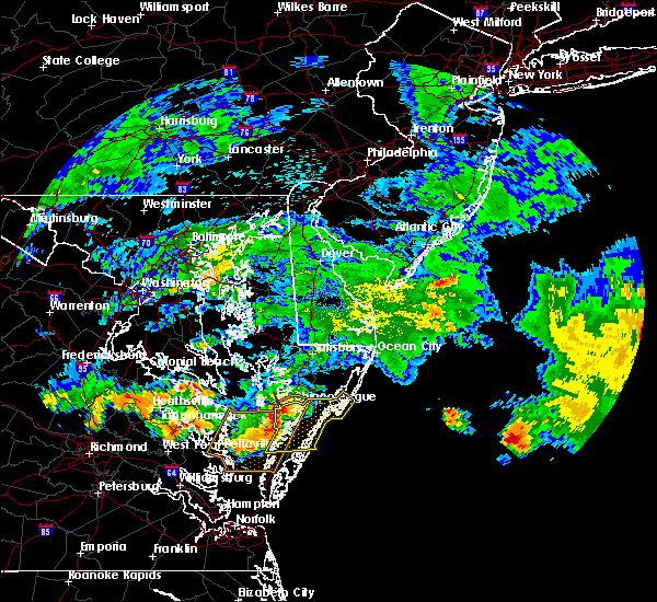 At 1218 am edt, severe thunderstorms were located along a line extending from near lawsonia to near onancock to 8 miles northwest of exmore, moving east at 35 mph (radar indicated). Hazards include 60 mph wind gusts. Expect damage to roofs. siding. and trees. severe thunderstorms will be near, onancock around 1225 am edt. parksley around 1235 am edt. onley around 1240 am edt. Other locations impacted by these severe thunderstorms include saxis, sanford, harborton, mappsville, temperanceville, bloxom, locustv ille, tasley, clam and horntown. At 1218 am edt, severe thunderstorms were located along a line extending from near lawsonia to near onancock to 8 miles northwest of exmore, moving east at 35 mph (radar indicated). Hazards include 60 mph wind gusts. Expect damage to roofs. siding. and trees. severe thunderstorms will be near, onancock around 1225 am edt. parksley around 1235 am edt. onley around 1240 am edt. Other locations impacted by these severe thunderstorms include saxis, sanford, harborton, mappsville, temperanceville, bloxom, locustv ille, tasley, clam and horntown.
|
| 7/18/2016 7:55 PM EDT |
 The severe thunderstorm warning for accomack county will expire at 800 pm edt, the storm which prompted the warning has weakened below severe limits, and no longer pose an immediate threat to life or property. therefore the warning will be allowed to expire. The severe thunderstorm warning for accomack county will expire at 800 pm edt, the storm which prompted the warning has weakened below severe limits, and no longer pose an immediate threat to life or property. therefore the warning will be allowed to expire.
|
| 7/18/2016 7:33 PM EDT |
 At 732 pm edt, a severe thunderstorm was located 7 miles southeast of parksley, or 18 miles northeast of exmore, moving east at 40 mph (radar indicated). Hazards include 60 mph wind gusts and quarter size hail. Hail damage to vehicles is expected. expect wind damage to roofs, siding, and trees. this severe thunderstorm will remain over mainly rural areas of accomack county, including the following locations: saxis, sanford, harborton, mappsville, temperanceville, bloxom, locustville, tas ley, clam and horntown. precautionary/preparedness actions, for your protection move to an interior room on the lowest floor of a building. please send your reports of hail and or wind damage, including trees or large limbs downed, by calling noaa`s national weather service in wakefield at , 7 5 7, 8 9 9, 2 4 1 5. At 732 pm edt, a severe thunderstorm was located 7 miles southeast of parksley, or 18 miles northeast of exmore, moving east at 40 mph (radar indicated). Hazards include 60 mph wind gusts and quarter size hail. Hail damage to vehicles is expected. expect wind damage to roofs, siding, and trees. this severe thunderstorm will remain over mainly rural areas of accomack county, including the following locations: saxis, sanford, harborton, mappsville, temperanceville, bloxom, locustville, tas ley, clam and horntown. precautionary/preparedness actions, for your protection move to an interior room on the lowest floor of a building. please send your reports of hail and or wind damage, including trees or large limbs downed, by calling noaa`s national weather service in wakefield at , 7 5 7, 8 9 9, 2 4 1 5.
|
| 7/18/2016 7:03 PM EDT |
 At 702 pm edt, a severe thunderstorm was located over tangier, or 18 miles east of fair port, moving east at 30 mph (radar indicated). Hazards include 60 mph wind gusts and quarter size hail. Hail damage to vehicles is expected. expect wind damage to roofs, siding, and trees. this severe thunderstorm will be near, onancock around 725 pm edt. onley around 730 pm edt. parksley around 735 pm edt. Other locations impacted by this severe thunderstorm include saxis, sanford, harborton, mappsville, temperanceville, bloxom, locustv ille, tasley, clam and horntown. At 702 pm edt, a severe thunderstorm was located over tangier, or 18 miles east of fair port, moving east at 30 mph (radar indicated). Hazards include 60 mph wind gusts and quarter size hail. Hail damage to vehicles is expected. expect wind damage to roofs, siding, and trees. this severe thunderstorm will be near, onancock around 725 pm edt. onley around 730 pm edt. parksley around 735 pm edt. Other locations impacted by this severe thunderstorm include saxis, sanford, harborton, mappsville, temperanceville, bloxom, locustv ille, tasley, clam and horntown.
|
| 6/21/2016 5:54 PM EDT |
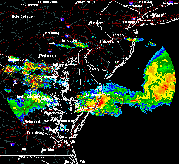 At 553 pm edt, severe thunderstorms were located along a line extending from near snow hill to near pocomoke city to near lawsonia, moving east at 35 mph (radar indicated). Hazards include 60 mph wind gusts and quarter size hail. Hail damage to vehicles is expected. expect wind damage to roofs, siding, and trees. severe thunderstorms will be near, snow hill around 600 pm edt. Other locations impacted by these severe thunderstorms include saxis, shelltown, sanford, mount wesley, mappsville, temperanceville, bloxom, byrdtown, boxiron and public landing. At 553 pm edt, severe thunderstorms were located along a line extending from near snow hill to near pocomoke city to near lawsonia, moving east at 35 mph (radar indicated). Hazards include 60 mph wind gusts and quarter size hail. Hail damage to vehicles is expected. expect wind damage to roofs, siding, and trees. severe thunderstorms will be near, snow hill around 600 pm edt. Other locations impacted by these severe thunderstorms include saxis, shelltown, sanford, mount wesley, mappsville, temperanceville, bloxom, byrdtown, boxiron and public landing.
|
| 6/21/2016 5:43 PM EDT |
 At 541 pm edt, a severe thunderstorm was located near newark, or 12 miles southwest of ocean city, moving east at 50 mph (radar indicated). Hazards include 60 mph wind gusts and quarter size hail. Hail damage to vehicles is expected. expect wind damage to roofs, siding, and trees. this severe thunderstorm will remain over mainly rural areas of worcester county, including the following locations: ocean city municipality, public landing, girdletree, mount wesley, whiton, whitesburg, stockton, ironshire, longridge and boxiron. precautionary/preparedness actions, for your protection move to an interior room on the lowest floor of a building. this thunderstorm is capable of producing all types of severe weather including extremely large hail, destructive straight line winds and tornadoes. move quickly to a safe shelter, such as an interior room, a bathroom or closet or basement. please send your reports of hail and or wind damage, including trees or large limbs downed, by calling noaa`s national weather service in wakefield at , 7 5 7, 8 9 9, 2 4 1 5. At 541 pm edt, a severe thunderstorm was located near newark, or 12 miles southwest of ocean city, moving east at 50 mph (radar indicated). Hazards include 60 mph wind gusts and quarter size hail. Hail damage to vehicles is expected. expect wind damage to roofs, siding, and trees. this severe thunderstorm will remain over mainly rural areas of worcester county, including the following locations: ocean city municipality, public landing, girdletree, mount wesley, whiton, whitesburg, stockton, ironshire, longridge and boxiron. precautionary/preparedness actions, for your protection move to an interior room on the lowest floor of a building. this thunderstorm is capable of producing all types of severe weather including extremely large hail, destructive straight line winds and tornadoes. move quickly to a safe shelter, such as an interior room, a bathroom or closet or basement. please send your reports of hail and or wind damage, including trees or large limbs downed, by calling noaa`s national weather service in wakefield at , 7 5 7, 8 9 9, 2 4 1 5.
|
| 6/21/2016 5:16 PM EDT |
 At 515 pm edt, a severe thunderstorm was located near fruitland, moving east at 40 mph (radar indicated). Hazards include 60 mph wind gusts and quarter size hail. Hail damage to vehicles is expected. expect wind damage to roofs, siding, and trees. this severe thunderstorm will be near, snow hill around 530 pm edt. newark around 535 pm edt. Other locations impacted by this severe thunderstorm include ocean city municipality, chesapeake heights, mount wesley, whitesburg, stockton, lakewood, shad point, boxiron, manokin and cedartown. At 515 pm edt, a severe thunderstorm was located near fruitland, moving east at 40 mph (radar indicated). Hazards include 60 mph wind gusts and quarter size hail. Hail damage to vehicles is expected. expect wind damage to roofs, siding, and trees. this severe thunderstorm will be near, snow hill around 530 pm edt. newark around 535 pm edt. Other locations impacted by this severe thunderstorm include ocean city municipality, chesapeake heights, mount wesley, whitesburg, stockton, lakewood, shad point, boxiron, manokin and cedartown.
|
| 8/4/2015 7:22 PM EDT |
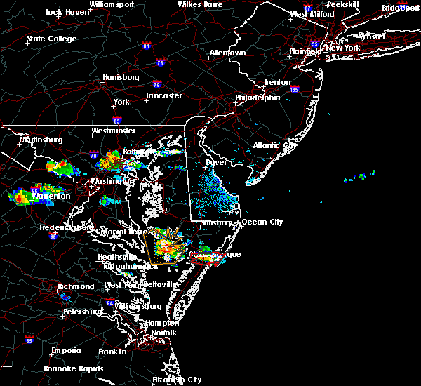 The tornado warning for southeastern somerset, southwestern worcester and northeastern accomack counties will expire at 730 pm edt, the storm which prompted the warning has weakened below severe limits, and no longer appears to be capable of producing a tornado. therefore the warning will be allowed to expire. The tornado warning for southeastern somerset, southwestern worcester and northeastern accomack counties will expire at 730 pm edt, the storm which prompted the warning has weakened below severe limits, and no longer appears to be capable of producing a tornado. therefore the warning will be allowed to expire.
|
| 8/4/2015 7:08 PM EDT |
 At 707 pm edt, doppler radar indicated a severe thunderstorm capable of producing a tornado. this dangerous storm was located near marion station, or 9 miles southwest of pocomoke city, moving east at 35 mph. this tornadic thunderstorm will remain over mainly rural areas of southeastern somerset, southwestern worcester and northeastern accomack counties, including the following locations, atlantic, shelltown, sanford, beaver dam, temperanceville, greenbackville, oak hall, horntown and new church. At 707 pm edt, doppler radar indicated a severe thunderstorm capable of producing a tornado. this dangerous storm was located near marion station, or 9 miles southwest of pocomoke city, moving east at 35 mph. this tornadic thunderstorm will remain over mainly rural areas of southeastern somerset, southwestern worcester and northeastern accomack counties, including the following locations, atlantic, shelltown, sanford, beaver dam, temperanceville, greenbackville, oak hall, horntown and new church.
|
| 8/4/2015 7:08 PM EDT |
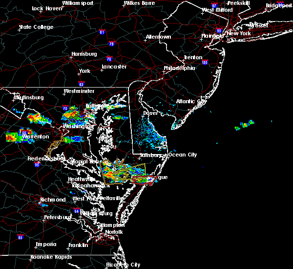 At 707 pm edt, doppler radar indicated a severe thunderstorm capable of producing a tornado. this dangerous storm was located near marion station, or 9 miles southwest of pocomoke city, moving east at 35 mph. this tornadic thunderstorm will remain over mainly rural areas of southeastern somerset, southwestern worcester and northeastern accomack counties, including the following locations, atlantic, shelltown, sanford, beaver dam, temperanceville, greenbackville, oak hall, horntown and new church. At 707 pm edt, doppler radar indicated a severe thunderstorm capable of producing a tornado. this dangerous storm was located near marion station, or 9 miles southwest of pocomoke city, moving east at 35 mph. this tornadic thunderstorm will remain over mainly rural areas of southeastern somerset, southwestern worcester and northeastern accomack counties, including the following locations, atlantic, shelltown, sanford, beaver dam, temperanceville, greenbackville, oak hall, horntown and new church.
|
| 8/4/2015 6:58 PM EDT |
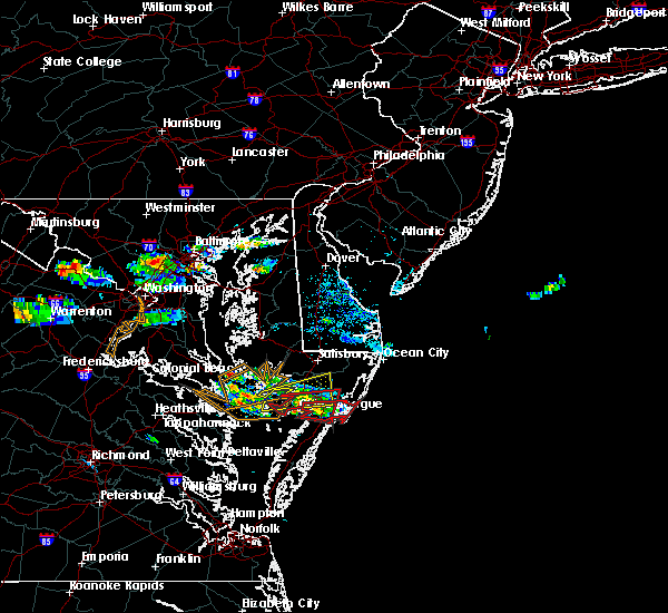 At 657 pm edt, doppler radar indicated a severe thunderstorm capable of producing a tornado. this dangerous storm was located near marion station, or 8 miles southwest of pocomoke city, and moving east at 50 mph. * this tornadic thunderstorm will remain over mainly rural areas of southeastern somerset, southwestern worcester and northeastern accomack counties, including the following locations, atlantic, shelltown, sanford, beaver dam, temperanceville, greenbackville, oak hall, horntown and new church. At 657 pm edt, doppler radar indicated a severe thunderstorm capable of producing a tornado. this dangerous storm was located near marion station, or 8 miles southwest of pocomoke city, and moving east at 50 mph. * this tornadic thunderstorm will remain over mainly rural areas of southeastern somerset, southwestern worcester and northeastern accomack counties, including the following locations, atlantic, shelltown, sanford, beaver dam, temperanceville, greenbackville, oak hall, horntown and new church.
|
| 8/4/2015 6:52 PM EDT |
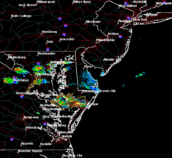 At 652 pm edt, doppler radar indicated a severe thunderstorm capable of producing a tornado. this dangerous storm was located near marion station, or 10 miles southwest of pocomoke city, moving east at 55 mph. this tornadic thunderstorm will remain over mainly rural areas of southern somerset, southwestern worcester and north central accomack counties, including the following locations, shelltown, assawoman, atlantic, sanford, beaver dam, rehobeth, temperanceville, byrdtown, new church and hopewell. At 652 pm edt, doppler radar indicated a severe thunderstorm capable of producing a tornado. this dangerous storm was located near marion station, or 10 miles southwest of pocomoke city, moving east at 55 mph. this tornadic thunderstorm will remain over mainly rural areas of southern somerset, southwestern worcester and north central accomack counties, including the following locations, shelltown, assawoman, atlantic, sanford, beaver dam, rehobeth, temperanceville, byrdtown, new church and hopewell.
|
| 8/4/2015 6:33 PM EDT |
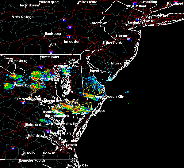 At 633 pm edt, doppler radar indicated a tornado. this dangerous storm was located near lawsonia, or 17 miles southwest of princess anne, and moving east at 50 mph. * this dangerous storm will be near, marion station around 645 pm edt. west pocomoke around 650 pm edt. pocomoke city around 655 pm edt. other locations impacted by this tornadic thunderstorm include shelltown, assawoman, atlantic, sanford, beaver dam, rehobeth, temperanceville, byrdtown, new church and hopewell. At 633 pm edt, doppler radar indicated a tornado. this dangerous storm was located near lawsonia, or 17 miles southwest of princess anne, and moving east at 50 mph. * this dangerous storm will be near, marion station around 645 pm edt. west pocomoke around 650 pm edt. pocomoke city around 655 pm edt. other locations impacted by this tornadic thunderstorm include shelltown, assawoman, atlantic, sanford, beaver dam, rehobeth, temperanceville, byrdtown, new church and hopewell.
|
| 8/4/2015 6:33 PM EDT |
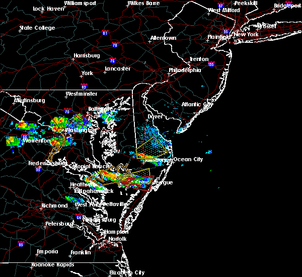 At 633 pm edt, doppler radar indicated a tornado. this dangerous storm was located near lawsonia, or 17 miles southwest of princess anne, and moving east at 50 mph. * this dangerous storm will be near, marion station around 645 pm edt. west pocomoke around 650 pm edt. pocomoke city around 655 pm edt. other locations impacted by this tornadic thunderstorm include shelltown, assawoman, atlantic, sanford, beaver dam, rehobeth, temperanceville, byrdtown, new church and hopewell. At 633 pm edt, doppler radar indicated a tornado. this dangerous storm was located near lawsonia, or 17 miles southwest of princess anne, and moving east at 50 mph. * this dangerous storm will be near, marion station around 645 pm edt. west pocomoke around 650 pm edt. pocomoke city around 655 pm edt. other locations impacted by this tornadic thunderstorm include shelltown, assawoman, atlantic, sanford, beaver dam, rehobeth, temperanceville, byrdtown, new church and hopewell.
|
| 8/4/2015 6:26 PM EDT |
 At 625 pm edt, doppler radar indicated a severe thunderstorm capable of producing damaging winds in excess of 60 mph. this storm was located 7 miles south of deal island, or 17 miles southwest of princess anne, and moving east at 35 mph. penny size hail may also accompany the damaging winds. * this severe thunderstorm will be near, marion station around 645 pm edt. westover around 650 pm edt. princess anne, university of maryland eastern shore and west pocomoke around 655 pm edt. pocomoke city around 705 pm edt. other locations impacted by this severe thunderstorm include upper fairmount, beaver dam, rehobeth, whitesburg, oriole, upper hill, manokin, champ, smith island and cokesbury. At 625 pm edt, doppler radar indicated a severe thunderstorm capable of producing damaging winds in excess of 60 mph. this storm was located 7 miles south of deal island, or 17 miles southwest of princess anne, and moving east at 35 mph. penny size hail may also accompany the damaging winds. * this severe thunderstorm will be near, marion station around 645 pm edt. westover around 650 pm edt. princess anne, university of maryland eastern shore and west pocomoke around 655 pm edt. pocomoke city around 705 pm edt. other locations impacted by this severe thunderstorm include upper fairmount, beaver dam, rehobeth, whitesburg, oriole, upper hill, manokin, champ, smith island and cokesbury.
|
| 6/23/2015 8:23 PM EDT |
 At 821 pm edt, doppler radar indicated a line of severe thunderstorms capable of producing damaging winds in excess of 60 mph. these storms were located along a line extending from near north wildwood to near millville to near gumboro to 9 miles southwest of vienna, and moving southeast at 35 mph. * severe thunderstorms will be near, ocean pines around 835 pm edt. berlin, newark and cape isle of wight around 845 pm edt. princess anne and university of maryland eastern shore around 850 pm edt. westover around 855 pm edt. pocomoke city and west pocomoke around 9 pm edt. other locations impacted by these severe thunderstorms include shelltown, upper fairmount, chesapeake heights, mount wesley, rehobeth, byrdtown, bishop, oriole, lakewood and whaleyville. At 821 pm edt, doppler radar indicated a line of severe thunderstorms capable of producing damaging winds in excess of 60 mph. these storms were located along a line extending from near north wildwood to near millville to near gumboro to 9 miles southwest of vienna, and moving southeast at 35 mph. * severe thunderstorms will be near, ocean pines around 835 pm edt. berlin, newark and cape isle of wight around 845 pm edt. princess anne and university of maryland eastern shore around 850 pm edt. westover around 855 pm edt. pocomoke city and west pocomoke around 9 pm edt. other locations impacted by these severe thunderstorms include shelltown, upper fairmount, chesapeake heights, mount wesley, rehobeth, byrdtown, bishop, oriole, lakewood and whaleyville.
|
| 4/10/2015 7:26 PM EDT | A severe thunderstorm warning remains in effect until 815 pm edt for southern somerset. southwestern worcester. northwestern northampton and accomack counties. at 725 pm edt. doppler radar indicated a line of severe thunderstorms capable of producing quarter size hail and damaging winds in excess of 60 mph. These storms were located along a line. |
| 4/10/2015 7:26 PM EDT | A severe thunderstorm warning remains in effect until 815 pm edt for southern somerset. southwestern worcester. northwestern northampton and accomack counties. at 725 pm edt. doppler radar indicated a line of severe thunderstorms capable of producing quarter size hail and damaging winds in excess of 60 mph. These storms were located along a line. |
| 4/10/2015 7:12 PM EDT | The national weather service in wakefield has issued a * severe thunderstorm warning for. southern somerset county in southeastern maryland. southwestern worcester county in southeastern maryland. northern northampton county in eastern virginia. Accomack county in southeastern virginia. |
| 4/10/2015 7:12 PM EDT | The national weather service in wakefield has issued a * severe thunderstorm warning for. southern somerset county in southeastern maryland. southwestern worcester county in southeastern maryland. northern northampton county in eastern virginia. Accomack county in southeastern virginia. |
Hail Maps for Pocomoke City, MD
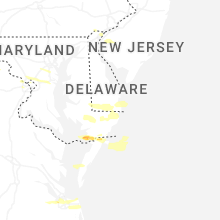


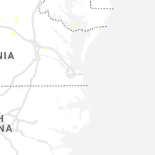


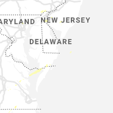


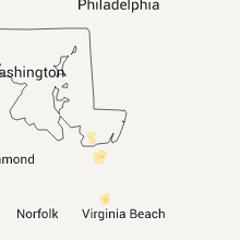
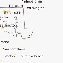

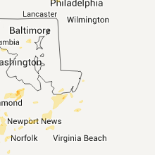
Connect with Interactive Hail Maps