

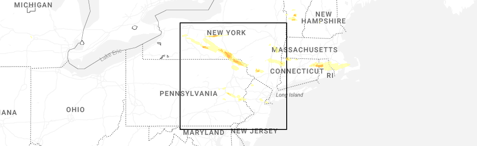
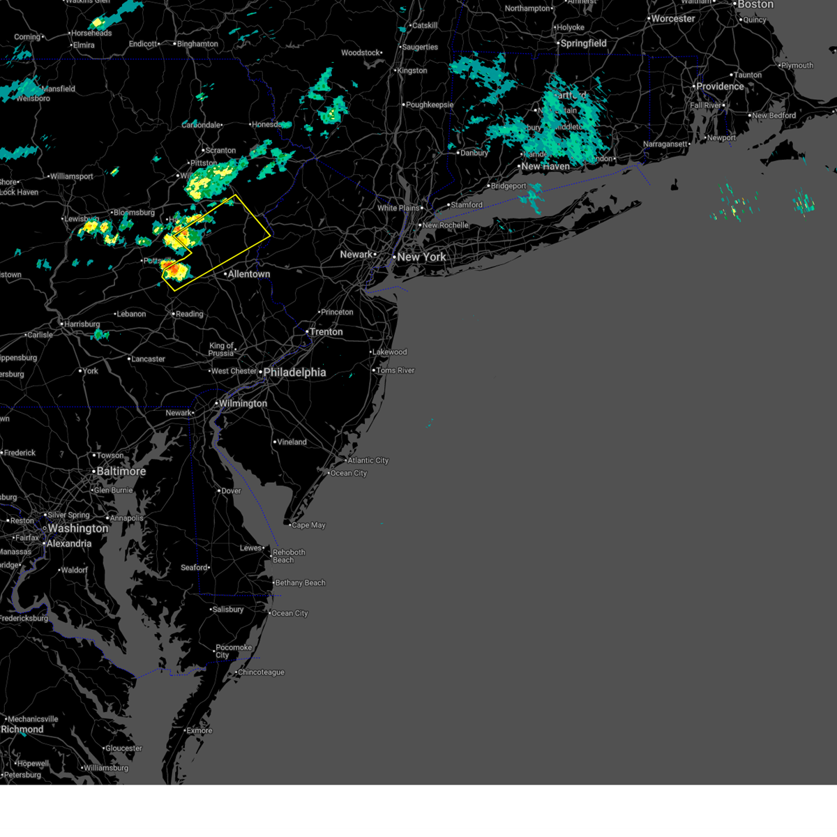
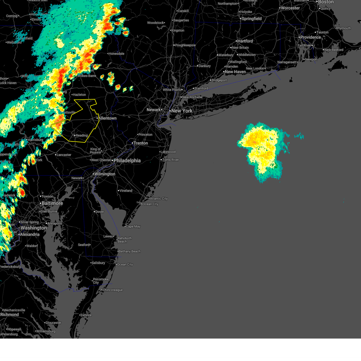
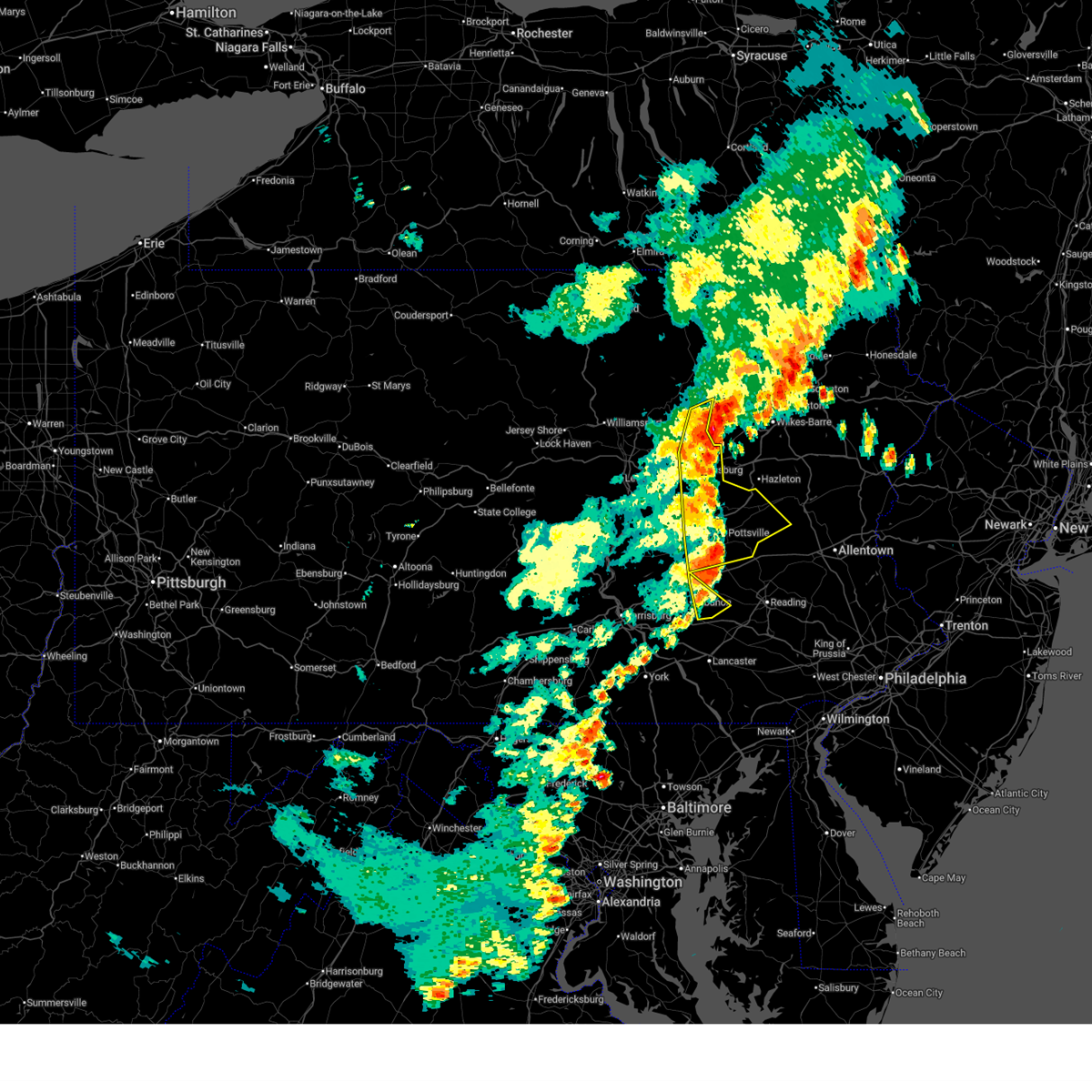
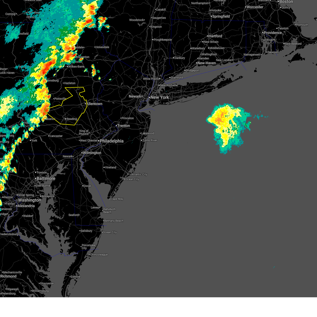
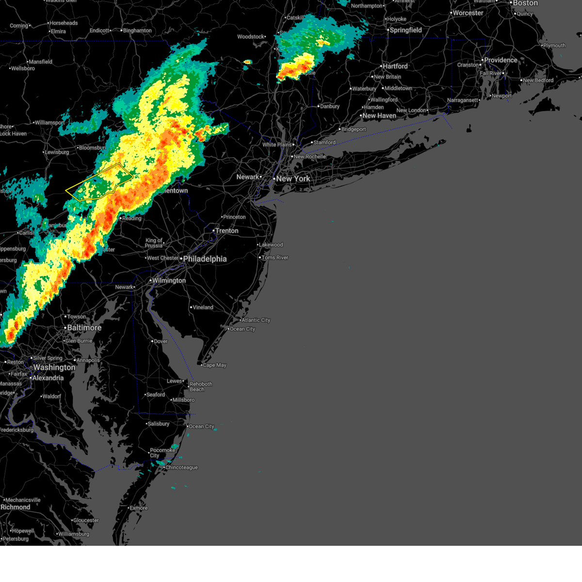
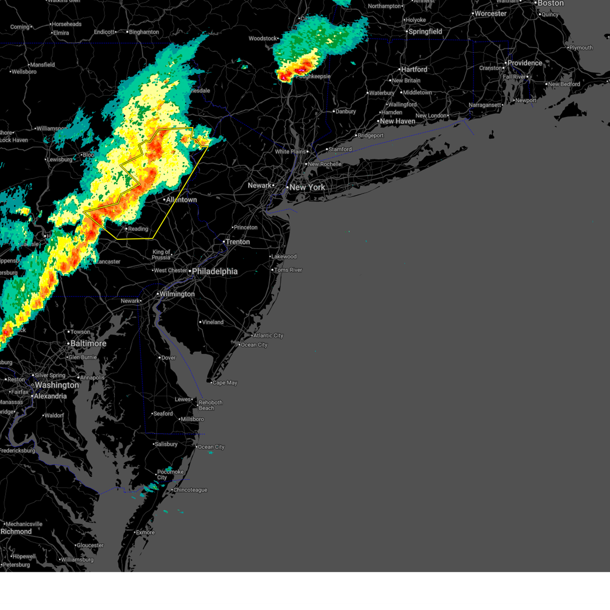
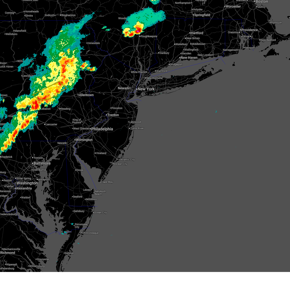
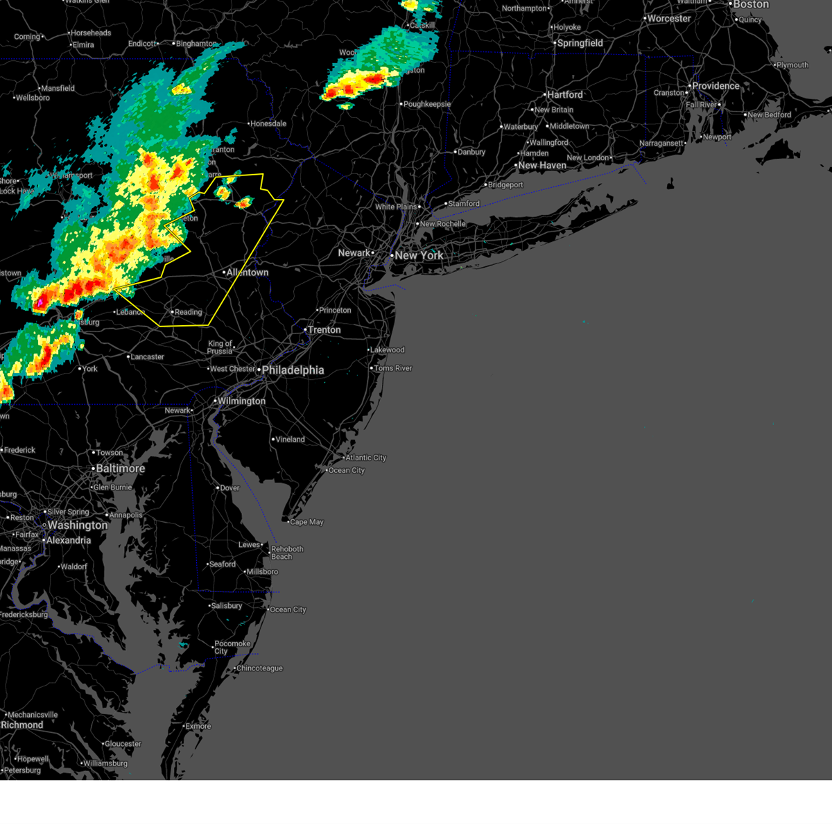
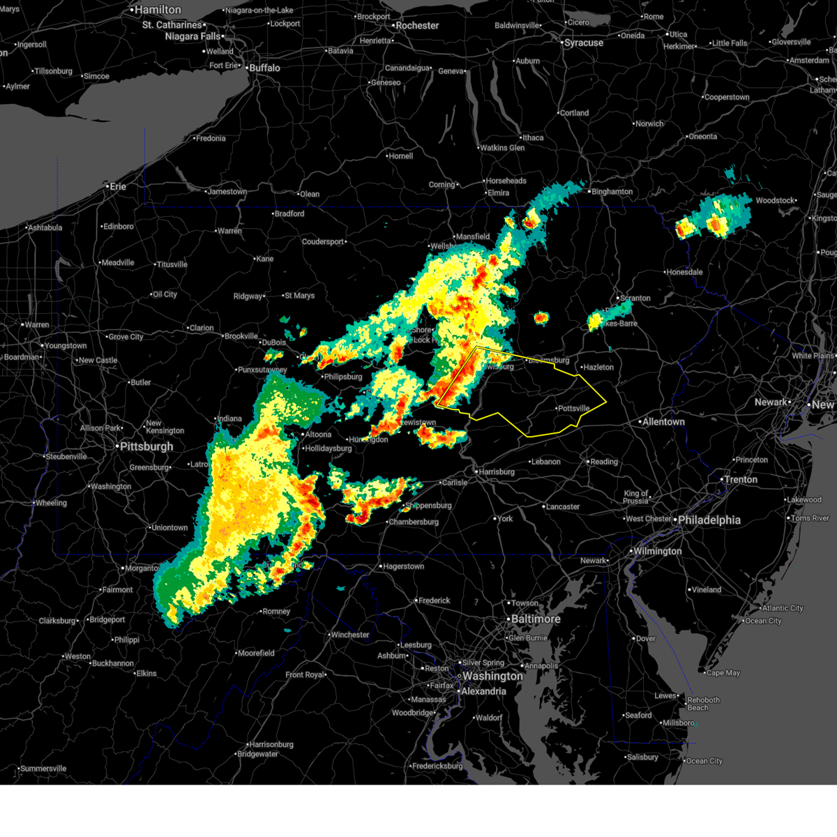
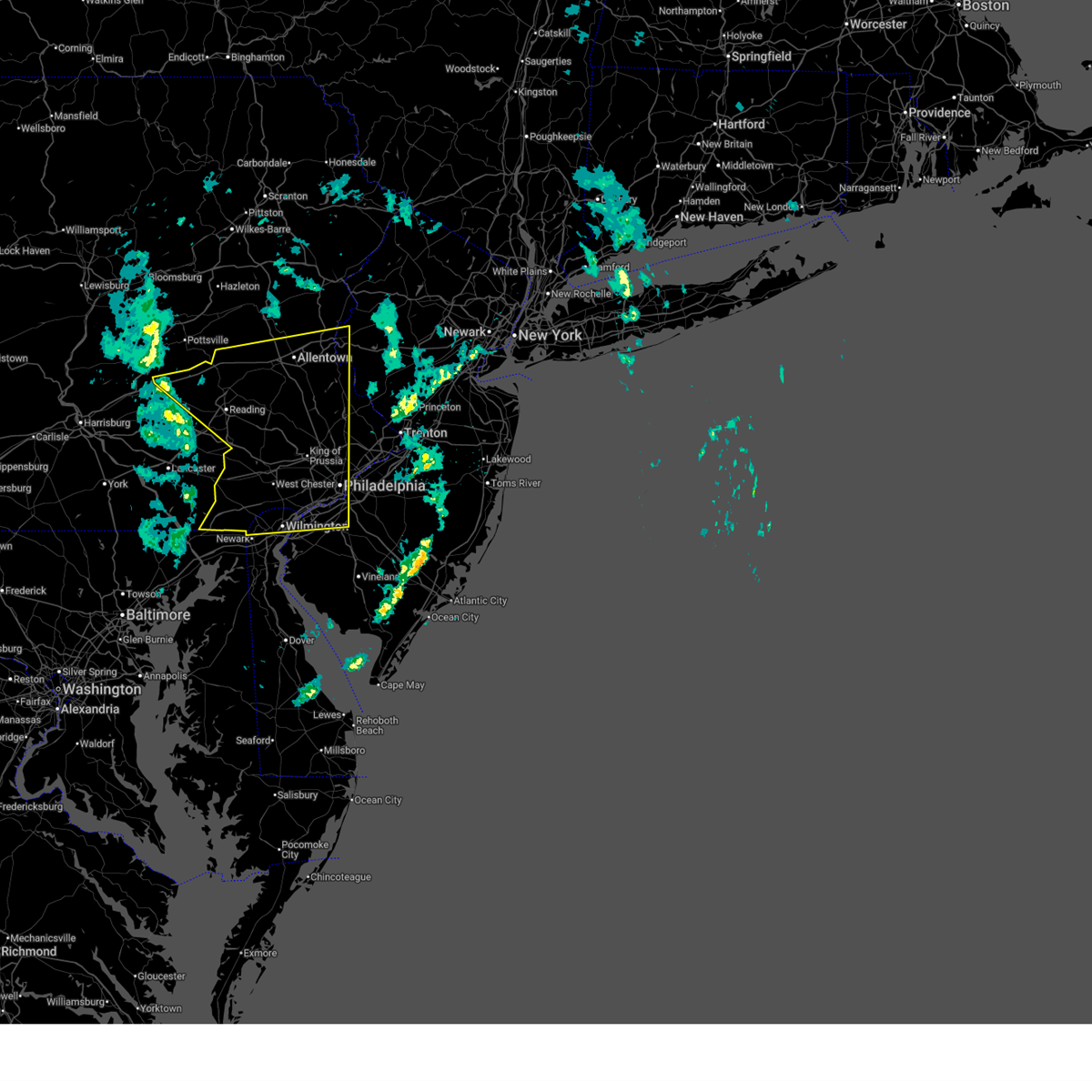
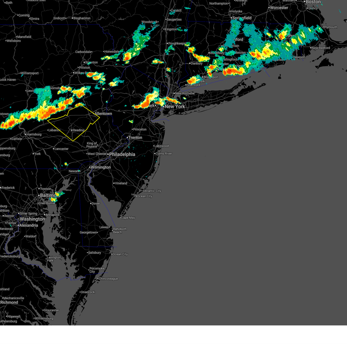
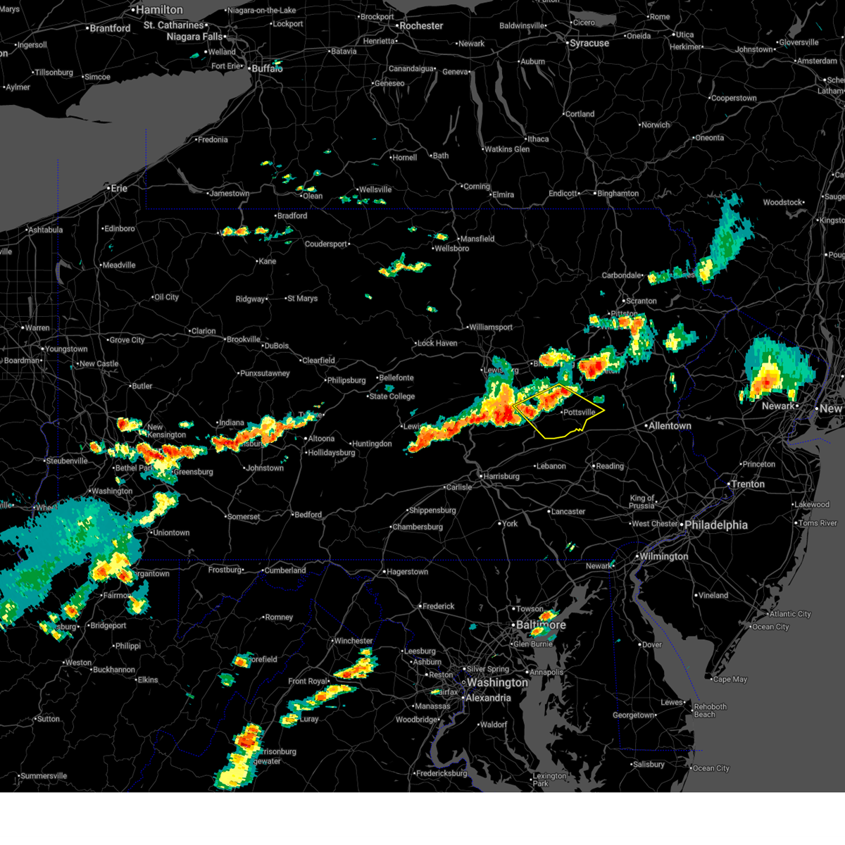
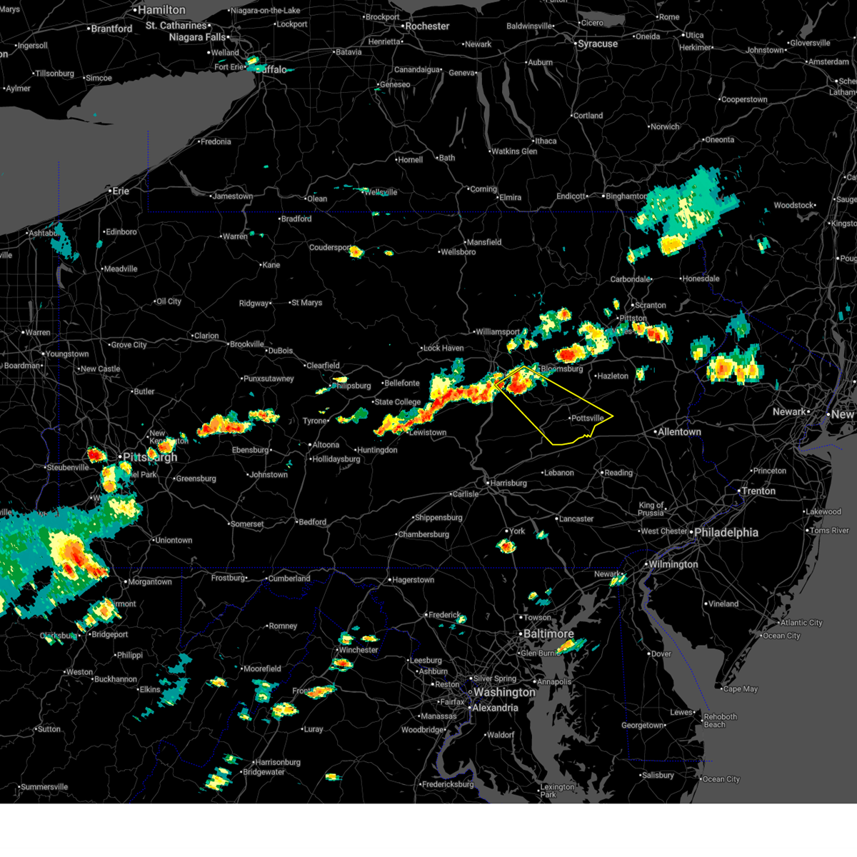
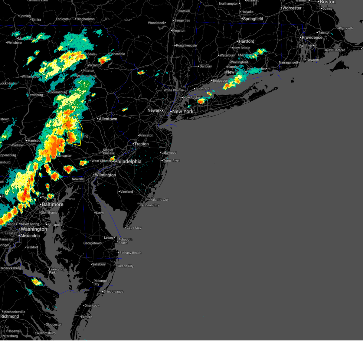
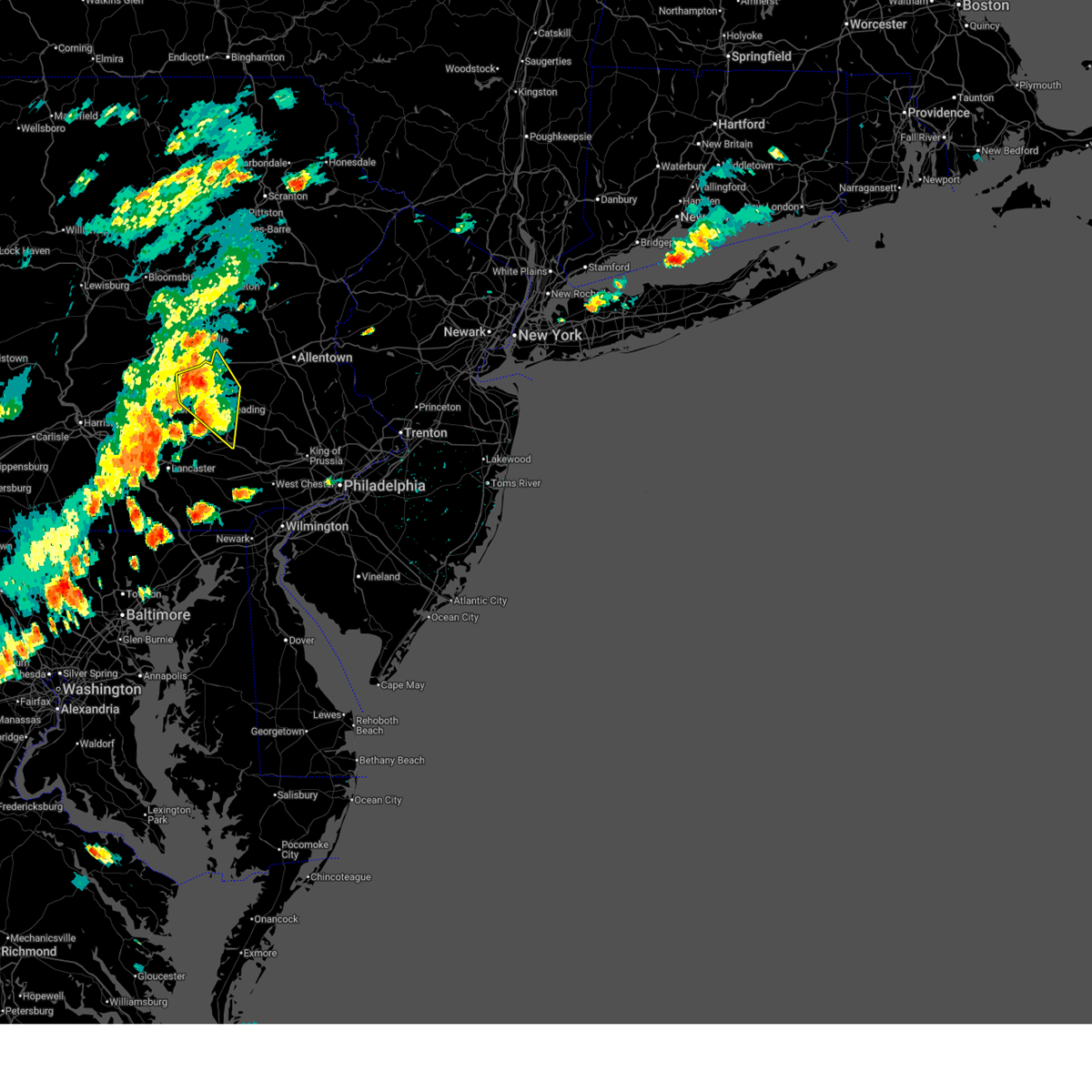
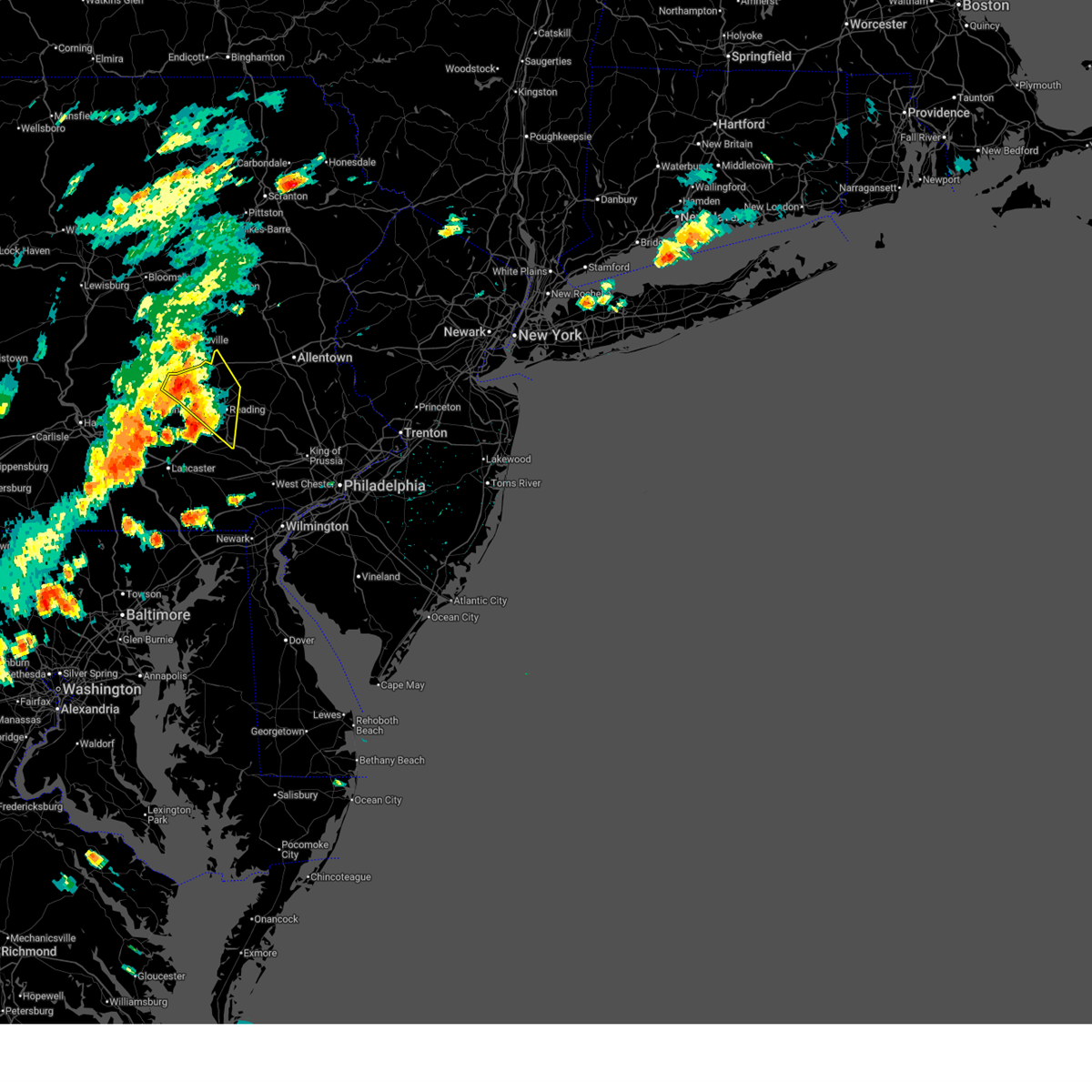
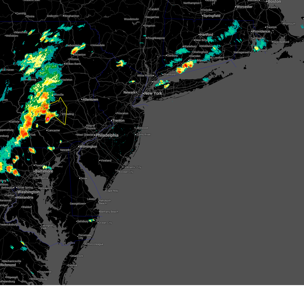
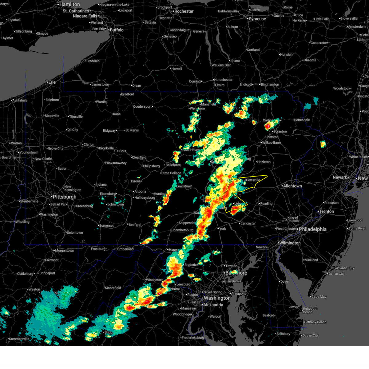
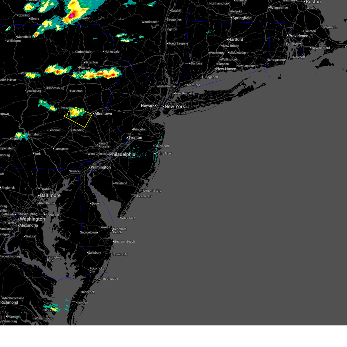
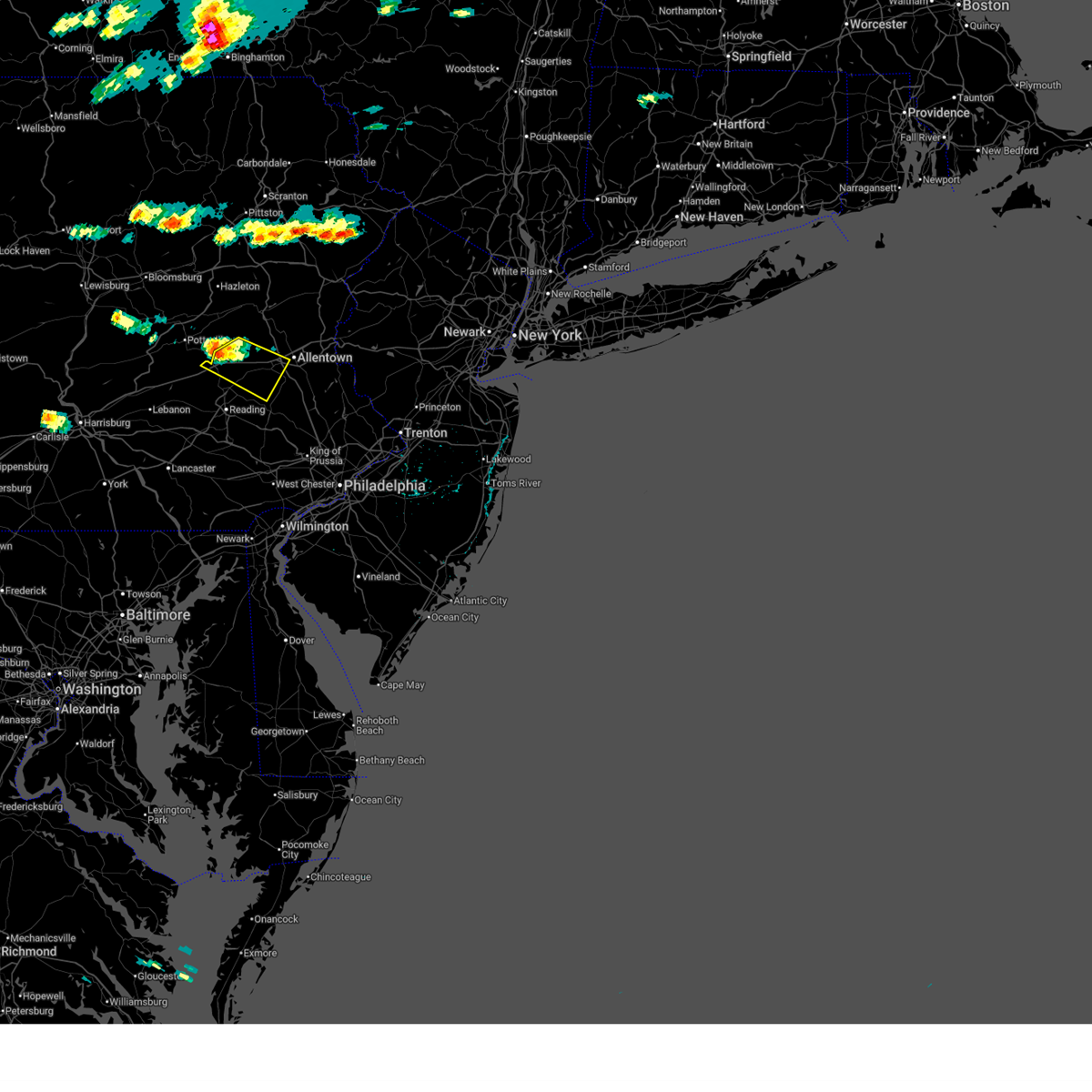
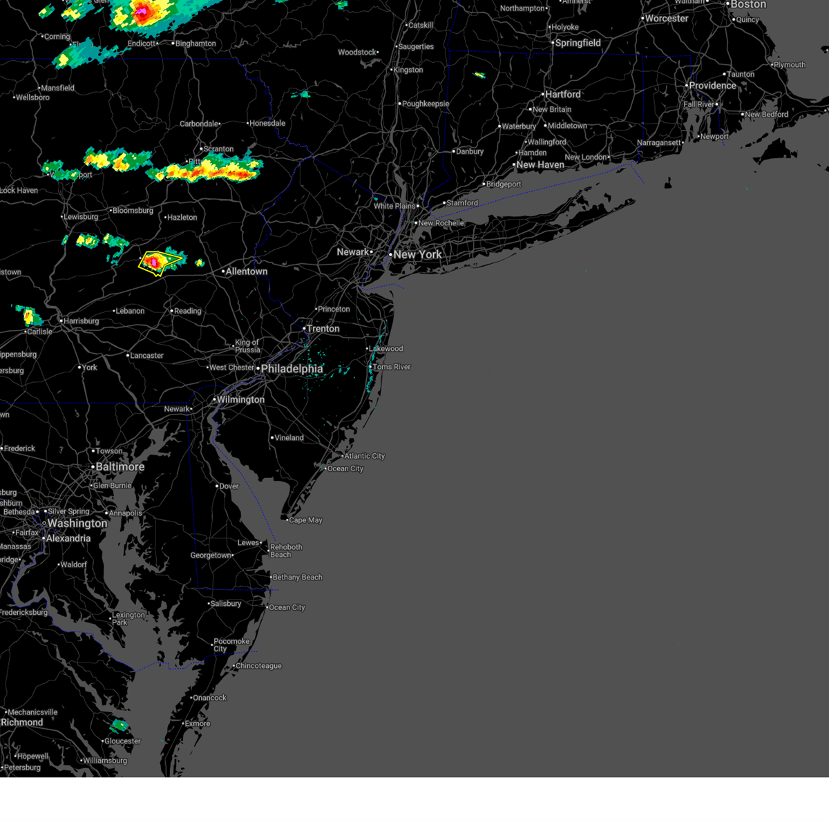
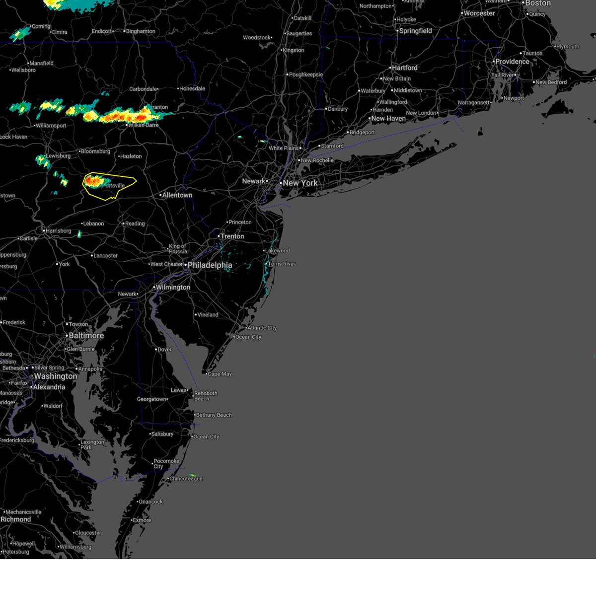
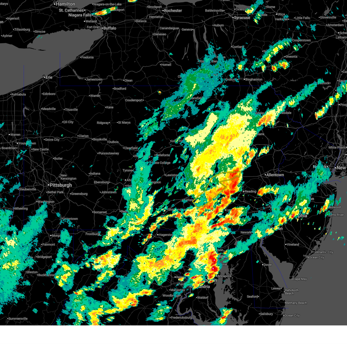
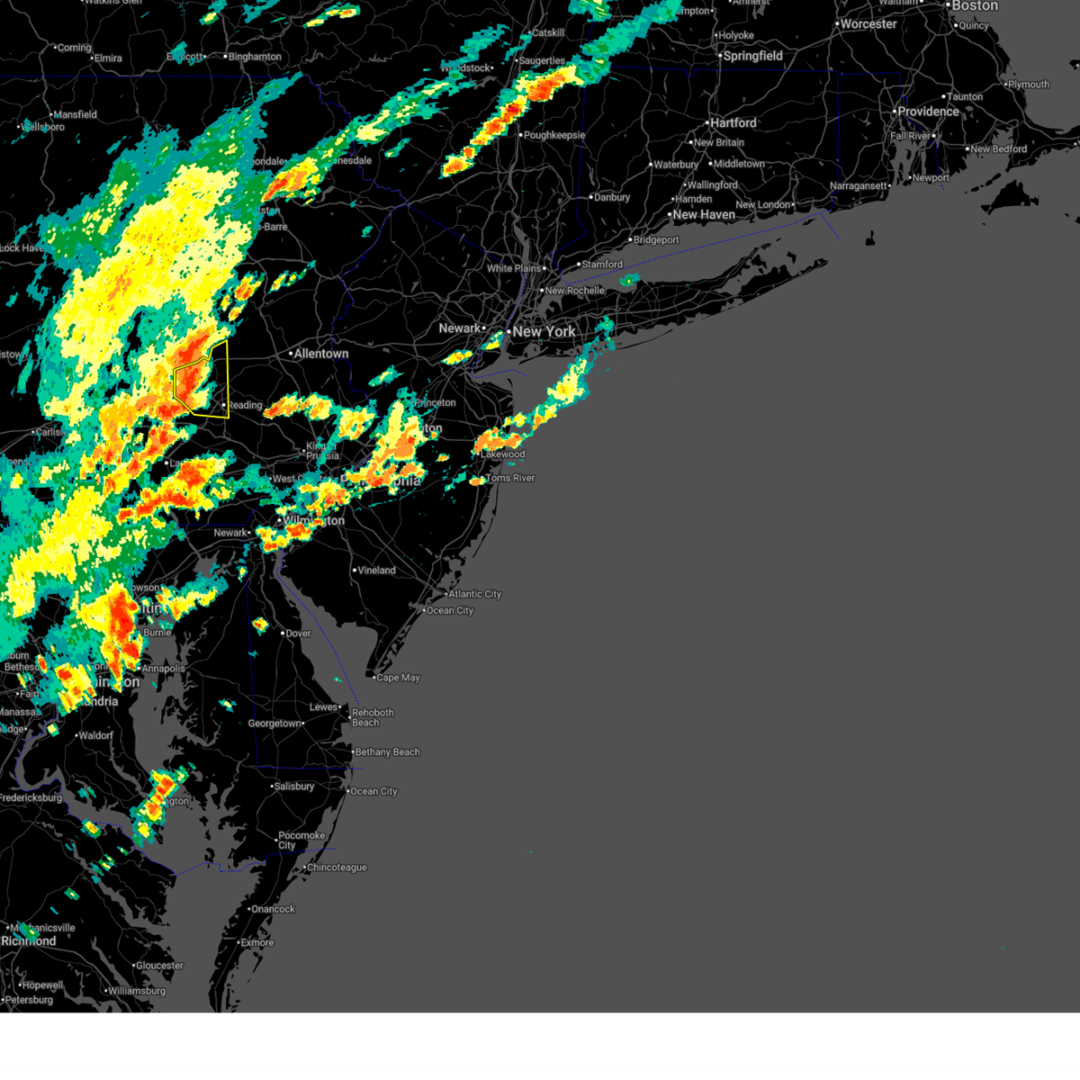
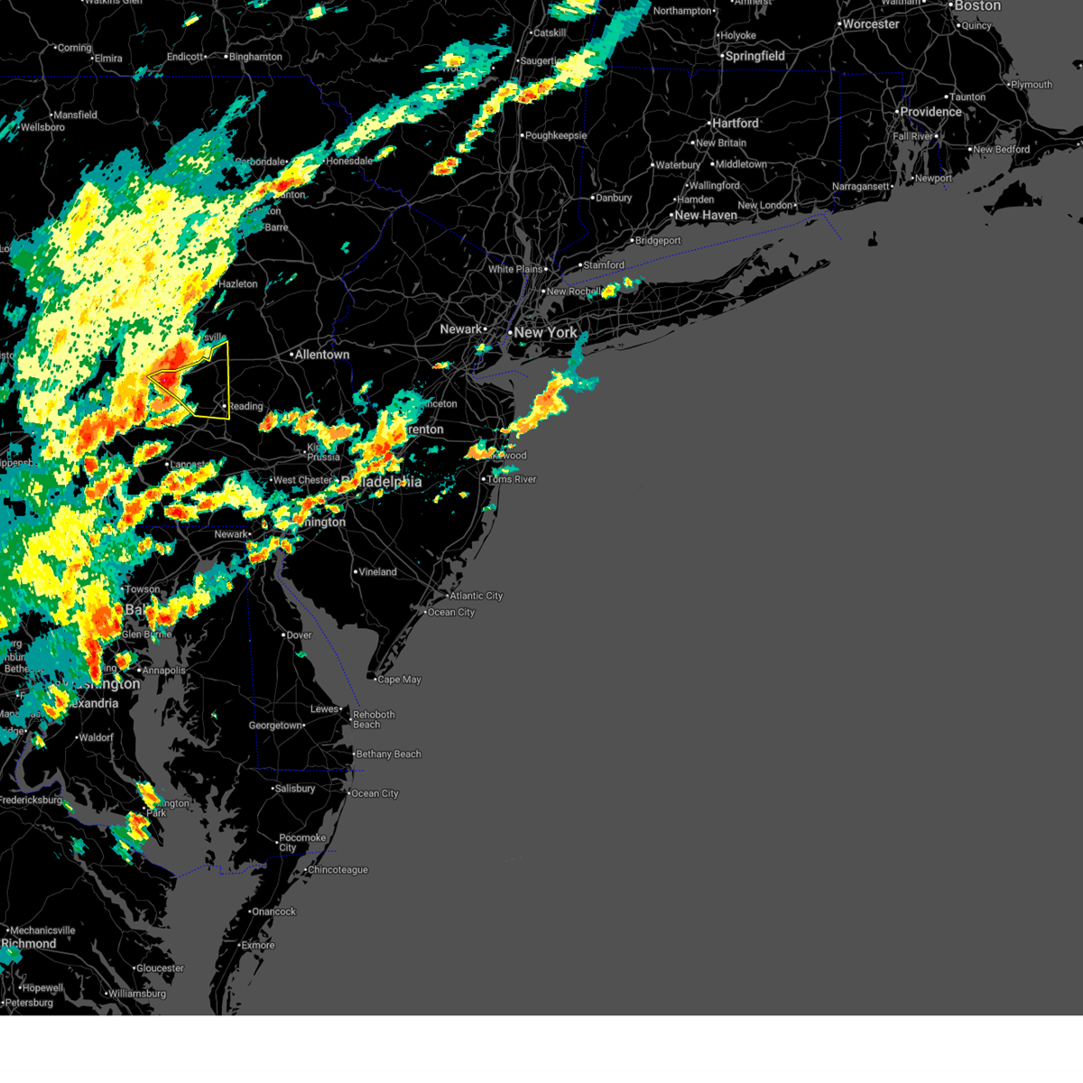
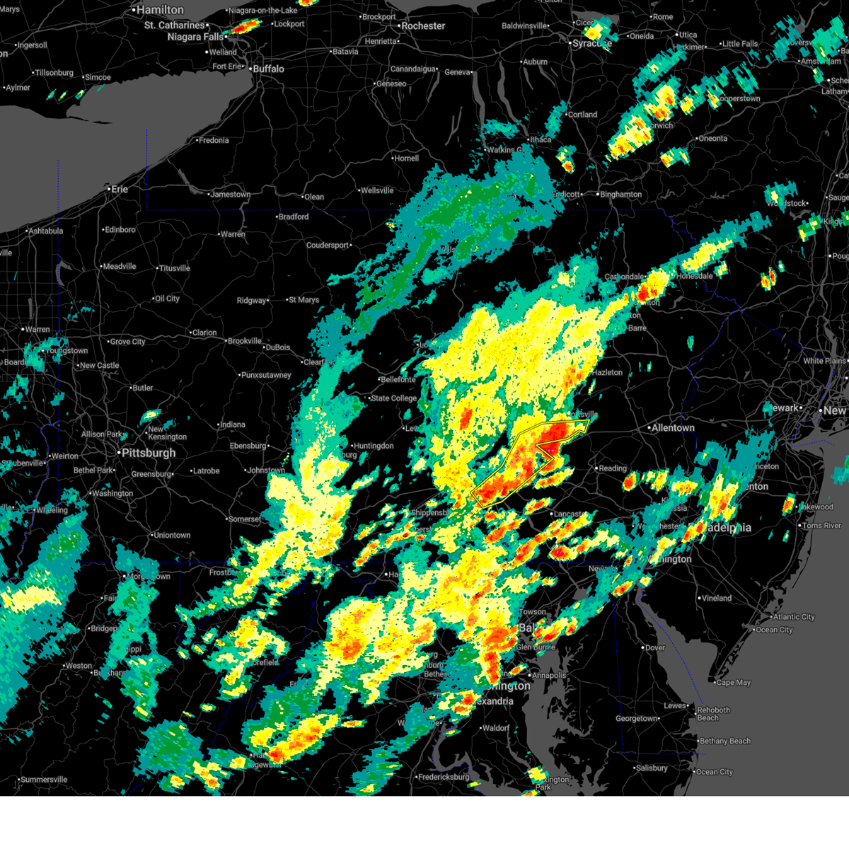
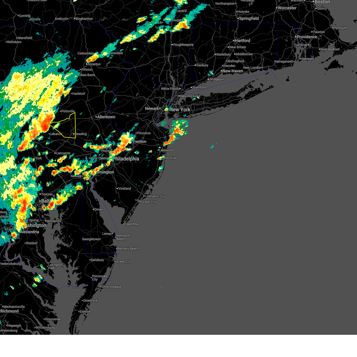
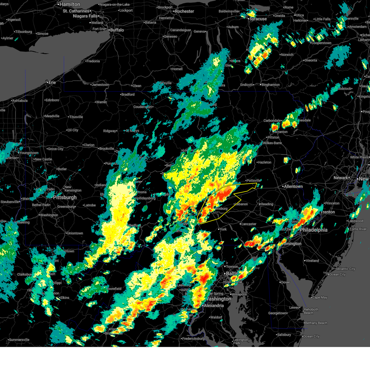
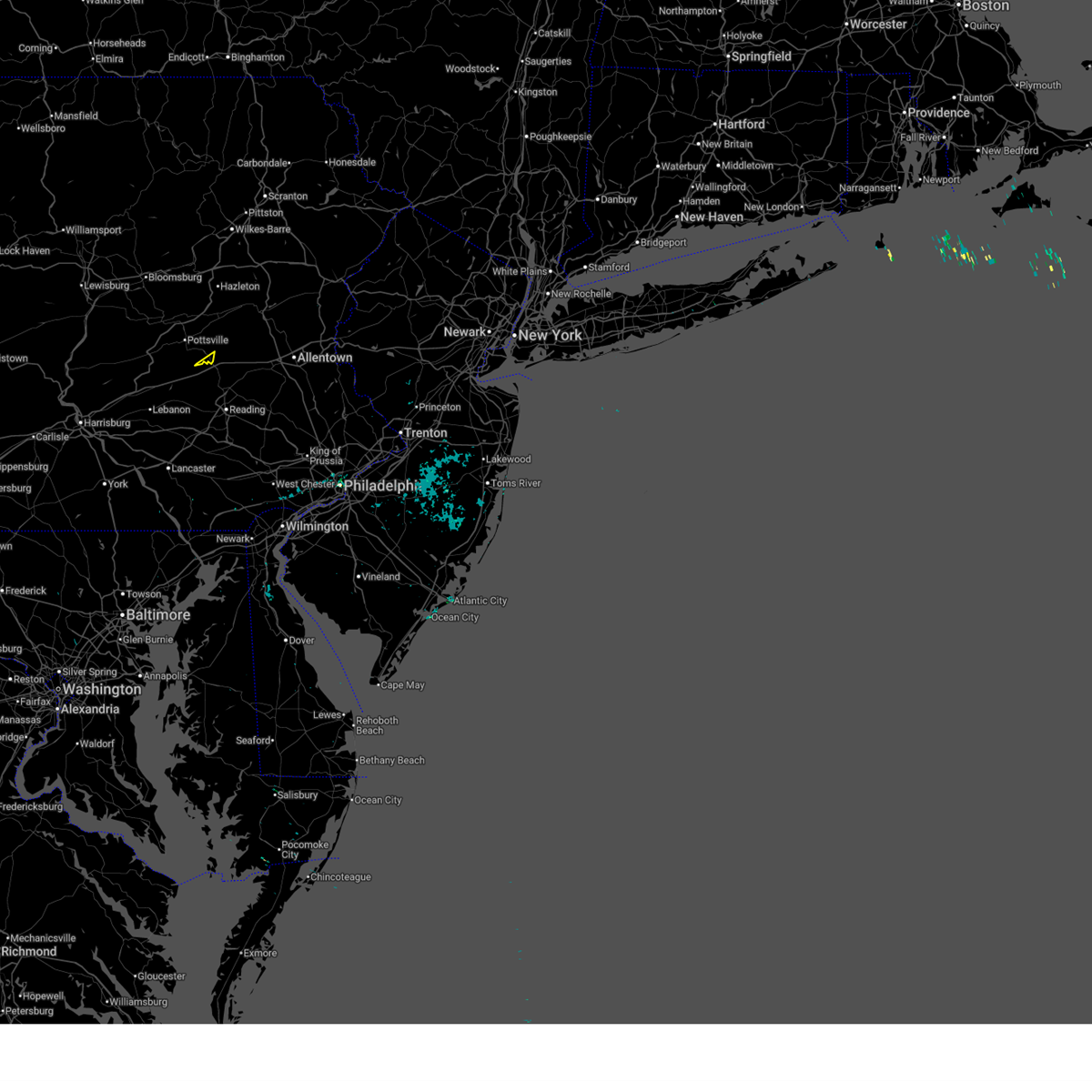
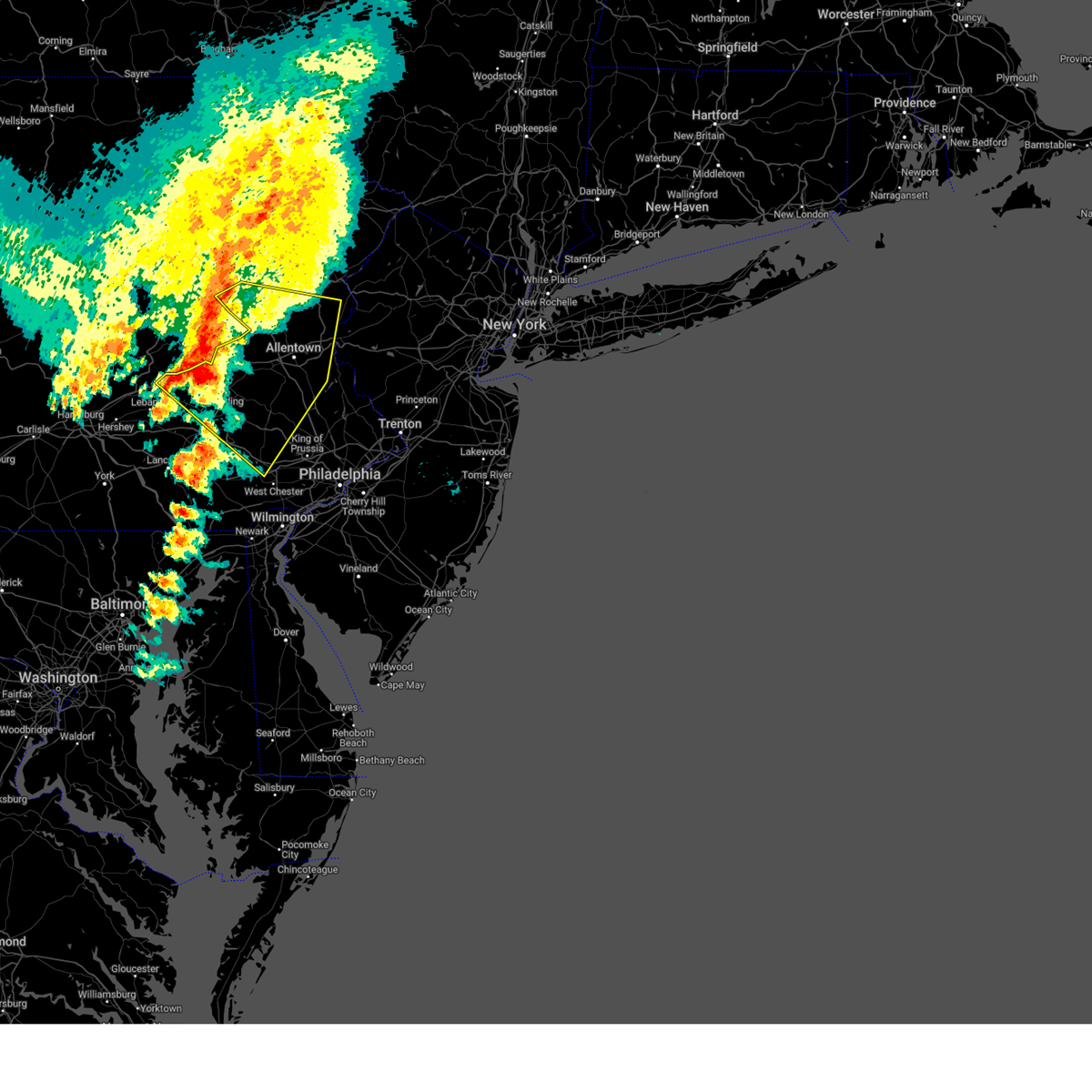
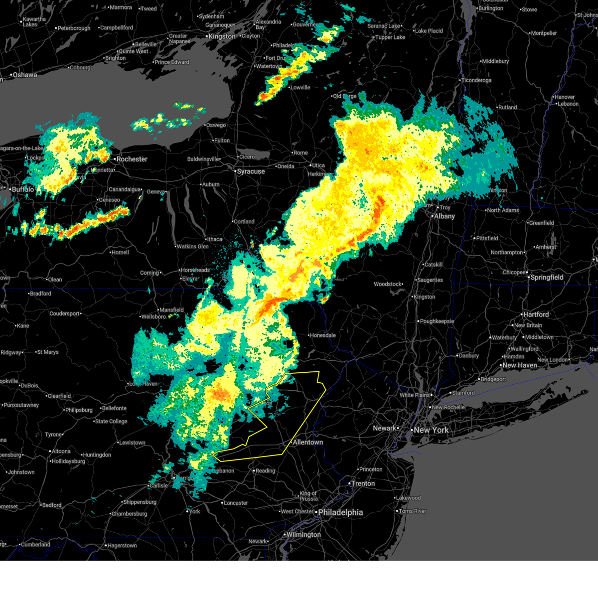
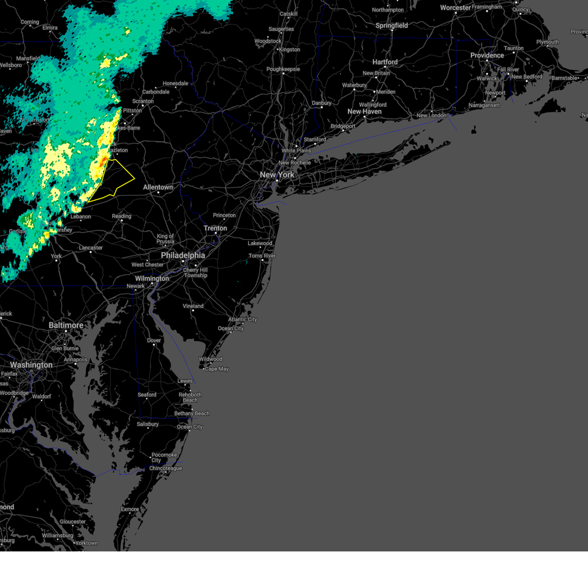
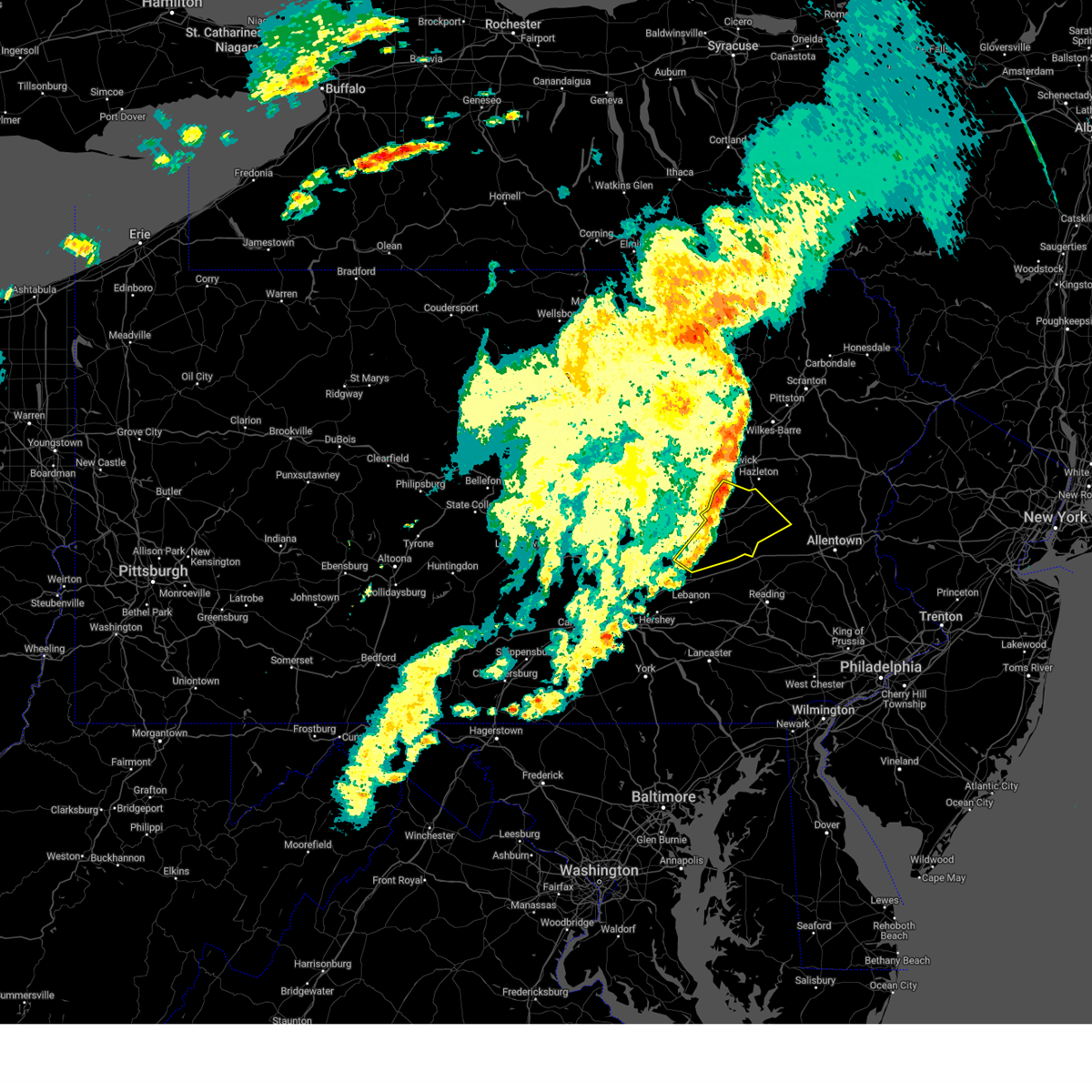
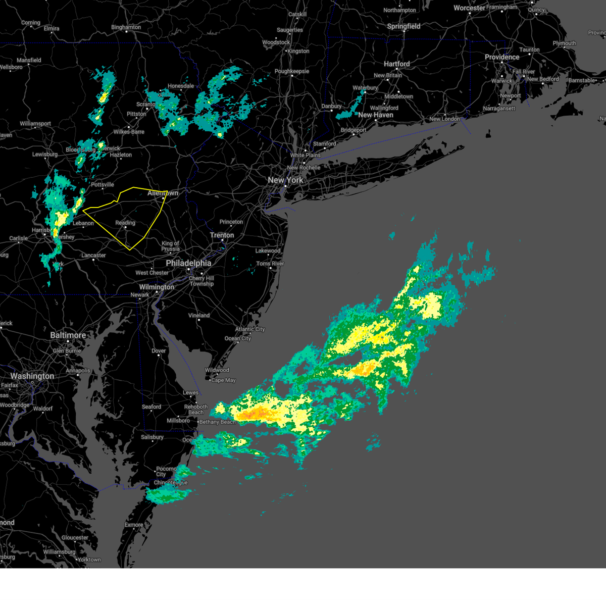
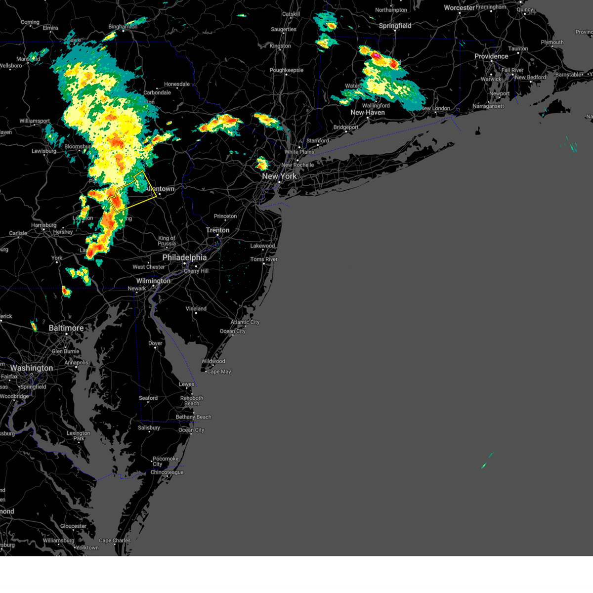
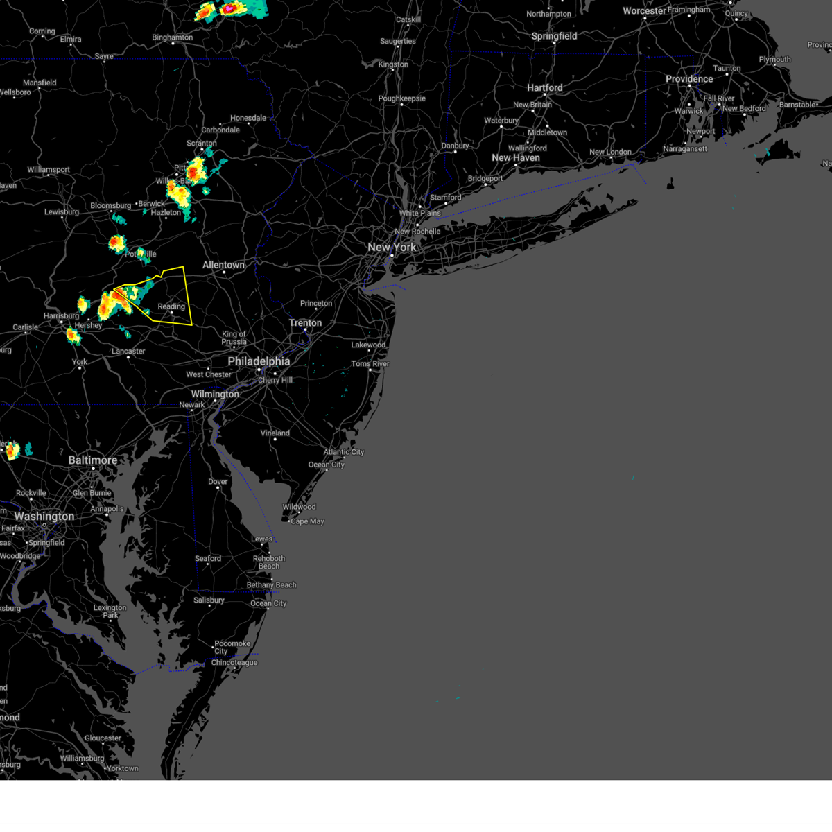
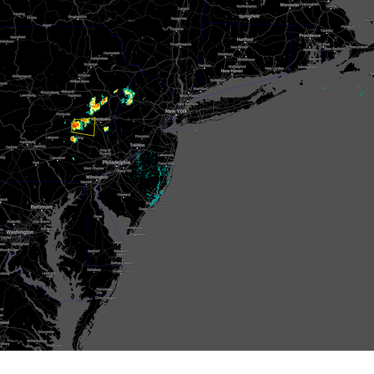
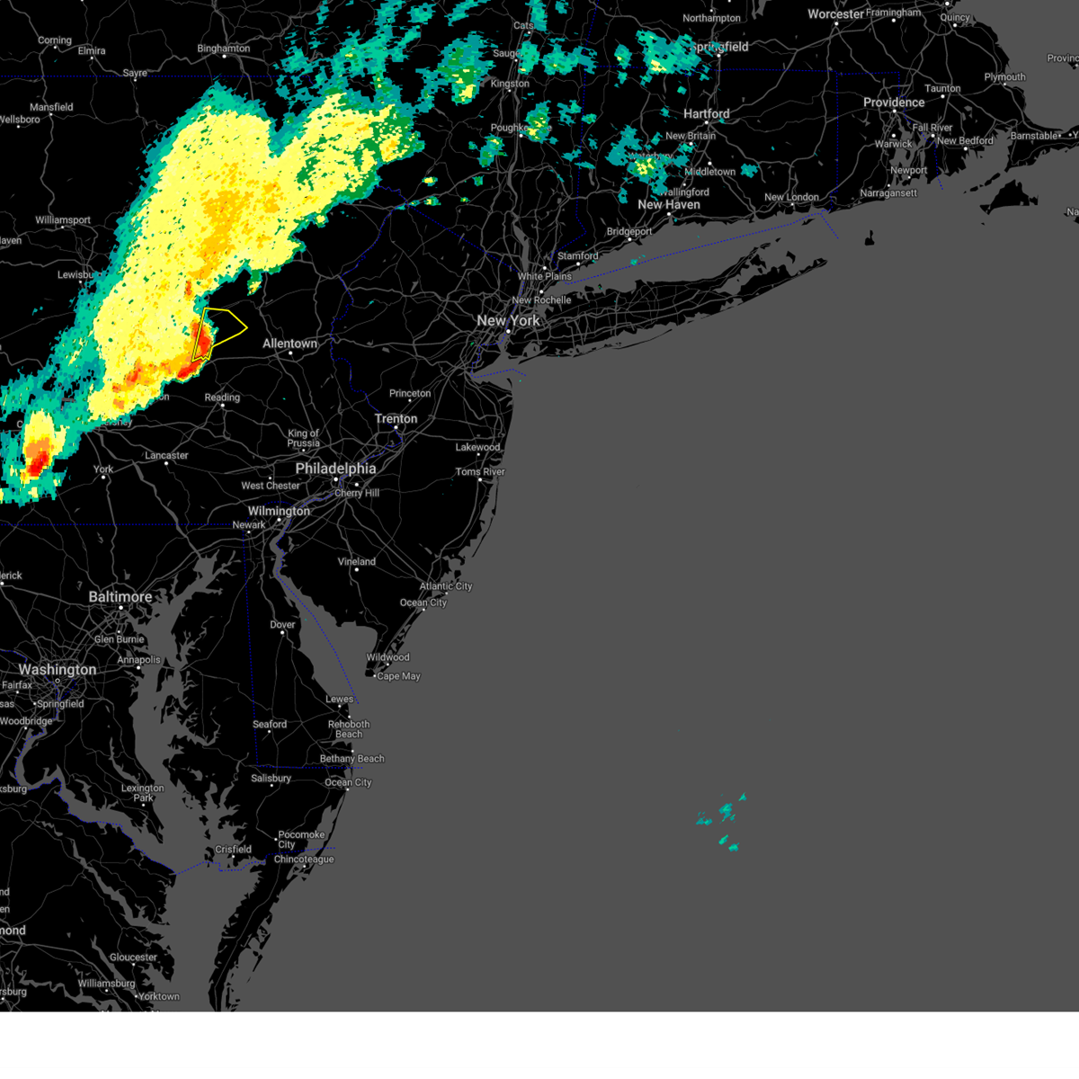
Hail Map for Port Clinton, PA
The Port Clinton, PA area has had 0 reports of on-the-ground hail by trained spotters, and has been under severe weather warnings 49 times during the past 12 months. Doppler radar has detected hail at or near Port Clinton, PA on 33 occasions, including 1 occasion during the past year.
| Name: | Port Clinton, PA |
| Where Located: | 60.5 miles SSW of Scranton, PA |
| Map: | Google Map for Port Clinton, PA |
| Population: | 326 |
| Housing Units: | 135 |
| More Info: | Search Google for Port Clinton, PA |
0
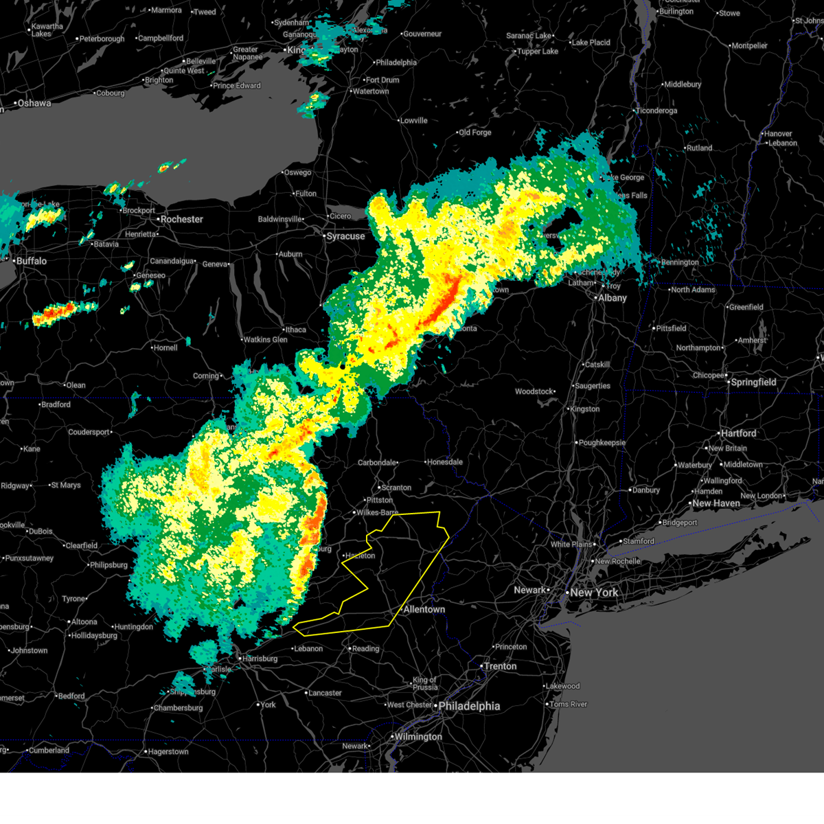
The Top Recent Hail Date for Port Clinton, PA is Thursday, July 3, 2025 (19th out of 33)
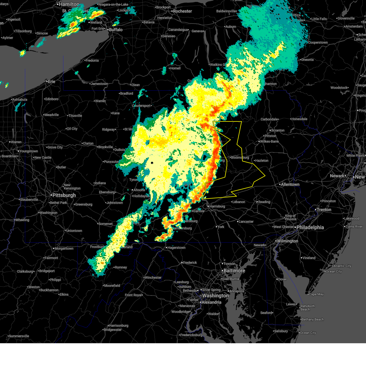
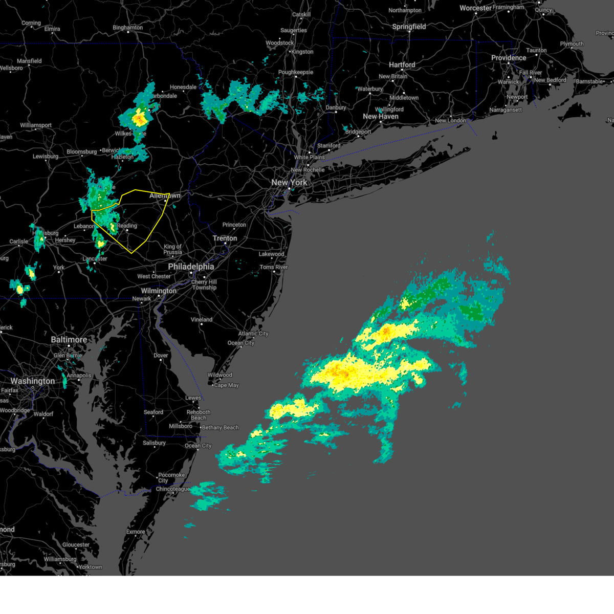
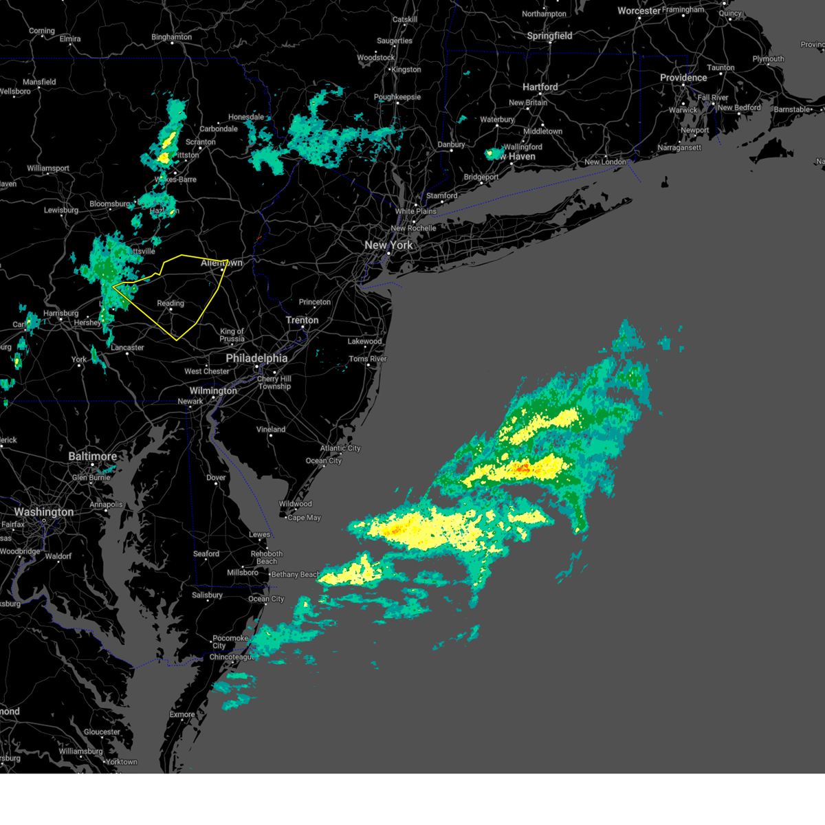
Hail and Wind Damage Spotted near Port Clinton, PA
| Date / Time | Report Details |
|---|---|
| 6/14/2026 5:52 PM EDT |
 Svrphi the national weather service in mount holly nj has issued a * severe thunderstorm warning for, north central berks county in eastern pennsylvania, northwestern lehigh county in eastern pennsylvania, carbon county in northeastern pennsylvania, southwestern monroe county in northeastern pennsylvania, central northampton county in eastern pennsylvania, * until 645 pm edt. * at 551 pm edt, a severe thunderstorm was located over wanamakers, or 12 miles southeast of tamaqua, moving northeast at 40 mph (radar indicated). Hazards include 60 mph wind gusts and quarter size hail. Minor damage to vehicles is possible. Wind damage to roofs, siding, trees, and power lines is possible. Svrphi the national weather service in mount holly nj has issued a * severe thunderstorm warning for, north central berks county in eastern pennsylvania, northwestern lehigh county in eastern pennsylvania, carbon county in northeastern pennsylvania, southwestern monroe county in northeastern pennsylvania, central northampton county in eastern pennsylvania, * until 645 pm edt. * at 551 pm edt, a severe thunderstorm was located over wanamakers, or 12 miles southeast of tamaqua, moving northeast at 40 mph (radar indicated). Hazards include 60 mph wind gusts and quarter size hail. Minor damage to vehicles is possible. Wind damage to roofs, siding, trees, and power lines is possible.
|
| 6/11/2026 8:12 PM EDT |
 At 812 pm edt, severe thunderstorms were located along a line extending from new boston-morea to near strausstown to richland, moving east at 40 mph (emergency management. at 8:06 pm edt, trees down blocking roadways were reported in bethel township). Hazards include 60 mph wind gusts. Damage to roofs, siding, trees, and power lines is possible. locations impacted include, allentown, reading, lehighton, emmaus, wyomissing, northampton, palmerton, birdsboro, kutztown, jim thorpe, hamburg, slatington, fleetwood, sinking spring, laureldale, nesquehoning, womelsdorf, wernersville, walnutport, and topton. this includes the following highways, northeast extension between mile markers 49 and 79. interstate 78 in pennsylvania near mile marker 8, and between mile markers 10 and 61. Interstate 176 in pennsylvania between mile markers 7 and 11. At 812 pm edt, severe thunderstorms were located along a line extending from new boston-morea to near strausstown to richland, moving east at 40 mph (emergency management. at 8:06 pm edt, trees down blocking roadways were reported in bethel township). Hazards include 60 mph wind gusts. Damage to roofs, siding, trees, and power lines is possible. locations impacted include, allentown, reading, lehighton, emmaus, wyomissing, northampton, palmerton, birdsboro, kutztown, jim thorpe, hamburg, slatington, fleetwood, sinking spring, laureldale, nesquehoning, womelsdorf, wernersville, walnutport, and topton. this includes the following highways, northeast extension between mile markers 49 and 79. interstate 78 in pennsylvania near mile marker 8, and between mile markers 10 and 61. Interstate 176 in pennsylvania between mile markers 7 and 11.
|
| 6/11/2026 8:05 PM EDT |
 the severe thunderstorm warning has been cancelled and is no longer in effect the severe thunderstorm warning has been cancelled and is no longer in effect
|
| 6/11/2026 8:05 PM EDT |
 At 804 pm edt, severe thunderstorms were located along a line extending from ricketts glen state park to mifflinville to englewood to tremont, moving east at 35 mph (radar indicated). Hazards include 60 mph wind gusts. Expect damage to roofs, siding, and trees. locations impacted include, lebanon, bloomsburg, pottsville, berwick, tamaqua, mount carmel, schuylkill haven, shenandoah, minersville, mahanoy city, cornwall, and frackville. for those driving on interstate 80, this includes areas between the buckhorn and nescopek exits, specifically from mile markers 232 to 247. this includes the following interstates, interstate 78 from mile markers 5 to 8. Interstate 81 from mile markers 99 to 139. At 804 pm edt, severe thunderstorms were located along a line extending from ricketts glen state park to mifflinville to englewood to tremont, moving east at 35 mph (radar indicated). Hazards include 60 mph wind gusts. Expect damage to roofs, siding, and trees. locations impacted include, lebanon, bloomsburg, pottsville, berwick, tamaqua, mount carmel, schuylkill haven, shenandoah, minersville, mahanoy city, cornwall, and frackville. for those driving on interstate 80, this includes areas between the buckhorn and nescopek exits, specifically from mile markers 232 to 247. this includes the following interstates, interstate 78 from mile markers 5 to 8. Interstate 81 from mile markers 99 to 139.
|
| 6/11/2026 7:58 PM EDT |
 At 758 pm edt, severe thunderstorms were located along a line extending from fountain springs to near pine grove to pleasant hill, moving east at 40 mph (emergency management. at 7:55 pm edt, there were multiple reports of trees and wires down in lebanon county, pa). Hazards include 60 mph wind gusts. Damage to roofs, siding, trees, and power lines is possible. locations impacted include, allentown, reading, lehighton, emmaus, wyomissing, northampton, palmerton, birdsboro, kutztown, jim thorpe, hamburg, slatington, fleetwood, sinking spring, laureldale, nesquehoning, womelsdorf, wernersville, walnutport, and topton. this includes the following highways, northeast extension between mile markers 49 and 79. interstate 78 in pennsylvania near mile marker 8, and between mile markers 10 and 61. Interstate 176 in pennsylvania between mile markers 7 and 11. At 758 pm edt, severe thunderstorms were located along a line extending from fountain springs to near pine grove to pleasant hill, moving east at 40 mph (emergency management. at 7:55 pm edt, there were multiple reports of trees and wires down in lebanon county, pa). Hazards include 60 mph wind gusts. Damage to roofs, siding, trees, and power lines is possible. locations impacted include, allentown, reading, lehighton, emmaus, wyomissing, northampton, palmerton, birdsboro, kutztown, jim thorpe, hamburg, slatington, fleetwood, sinking spring, laureldale, nesquehoning, womelsdorf, wernersville, walnutport, and topton. this includes the following highways, northeast extension between mile markers 49 and 79. interstate 78 in pennsylvania near mile marker 8, and between mile markers 10 and 61. Interstate 176 in pennsylvania between mile markers 7 and 11.
|
| 6/11/2026 7:32 PM EDT |
 Svrphi the national weather service in mount holly nj has issued a * severe thunderstorm warning for, berks county in eastern pennsylvania, lehigh county in eastern pennsylvania, southern carbon county in northeastern pennsylvania, * until 900 pm edt. * at 732 pm edt, severe thunderstorms were located along a line extending from trevorton to williamstown to linglestown, moving east at 40 mph (radar indicated). Hazards include 60 mph wind gusts. damage to roofs, siding, trees, and power lines is possible Svrphi the national weather service in mount holly nj has issued a * severe thunderstorm warning for, berks county in eastern pennsylvania, lehigh county in eastern pennsylvania, southern carbon county in northeastern pennsylvania, * until 900 pm edt. * at 732 pm edt, severe thunderstorms were located along a line extending from trevorton to williamstown to linglestown, moving east at 40 mph (radar indicated). Hazards include 60 mph wind gusts. damage to roofs, siding, trees, and power lines is possible
|
| 6/11/2026 7:31 PM EDT |
 Svrctp the national weather service in state college pa has issued a * severe thunderstorm warning for, columbia county in central pennsylvania, northeastern dauphin county in south central pennsylvania, lebanon county in south central pennsylvania, southeastern lycoming county in north central pennsylvania, montour county in central pennsylvania, northumberland county in central pennsylvania, schuylkill county in central pennsylvania, southeastern sullivan county in north central pennsylvania, * until 830 pm edt. * at 730 pm edt, severe thunderstorms were located along a line extending from lairdsville to stonington to leck kill to lykens, moving east at 35 mph (radar indicated). Hazards include 60 mph wind gusts. expect damage to roofs, siding, and trees Svrctp the national weather service in state college pa has issued a * severe thunderstorm warning for, columbia county in central pennsylvania, northeastern dauphin county in south central pennsylvania, lebanon county in south central pennsylvania, southeastern lycoming county in north central pennsylvania, montour county in central pennsylvania, northumberland county in central pennsylvania, schuylkill county in central pennsylvania, southeastern sullivan county in north central pennsylvania, * until 830 pm edt. * at 730 pm edt, severe thunderstorms were located along a line extending from lairdsville to stonington to leck kill to lykens, moving east at 35 mph (radar indicated). Hazards include 60 mph wind gusts. expect damage to roofs, siding, and trees
|
| 6/11/2026 6:16 PM EDT |
 Svrphi the national weather service in mount holly nj has issued a * severe thunderstorm warning for, northeastern berks county in eastern pennsylvania, central lehigh county in eastern pennsylvania, * until 700 pm edt. * at 616 pm edt, a severe thunderstorm was located over shoemakersville, or 12 miles southeast of schuylkill haven, moving east at 20 mph (radar indicated). Hazards include 60 mph wind gusts and quarter size hail. Minor damage to vehicles is possible. Wind damage to roofs, siding, trees, and power lines is possible. Svrphi the national weather service in mount holly nj has issued a * severe thunderstorm warning for, northeastern berks county in eastern pennsylvania, central lehigh county in eastern pennsylvania, * until 700 pm edt. * at 616 pm edt, a severe thunderstorm was located over shoemakersville, or 12 miles southeast of schuylkill haven, moving east at 20 mph (radar indicated). Hazards include 60 mph wind gusts and quarter size hail. Minor damage to vehicles is possible. Wind damage to roofs, siding, trees, and power lines is possible.
|
| 6/6/2026 6:19 PM EDT |
 At 619 pm edt, severe thunderstorms were located along a line extending from near alpine mountain to near old orchard to near bechtelsville, moving east at 60 mph (trained weather spotters). Hazards include 60 mph wind gusts. Damage to roofs, siding, trees, and power lines is possible. Locations impacted include, allentown, reading, mount pocono, bethlehem, pottstown, emmaus, wyomissing, northampton, east stroudsburg, hellertown, nazareth, palmerton, bangor, birdsboro, kutztown, hamburg, slatington, fleetwood, sinking spring, and laureldale. At 619 pm edt, severe thunderstorms were located along a line extending from near alpine mountain to near old orchard to near bechtelsville, moving east at 60 mph (trained weather spotters). Hazards include 60 mph wind gusts. Damage to roofs, siding, trees, and power lines is possible. Locations impacted include, allentown, reading, mount pocono, bethlehem, pottstown, emmaus, wyomissing, northampton, east stroudsburg, hellertown, nazareth, palmerton, bangor, birdsboro, kutztown, hamburg, slatington, fleetwood, sinking spring, and laureldale.
|
| 6/6/2026 6:14 PM EDT |
 the severe thunderstorm warning has been cancelled and is no longer in effect the severe thunderstorm warning has been cancelled and is no longer in effect
|
| 6/6/2026 5:58 PM EDT |
 At 556 pm edt, severe thunderstorms were located along a line extending from angels to lehighton to snyders to near lenhartsville, moving east at 45 mph (trained weather spotters. at 545 pm, multiple downed trees were reported in hickory run state park). Hazards include 60 mph wind gusts and penny size hail. Damage to roofs, siding, trees, and power lines is possible. Locations impacted include, allentown, reading, lehighton, mount pocono, bethlehem, pottstown, emmaus, wyomissing, northampton, east stroudsburg, tobyhanna, hellertown, nazareth, palmerton, bangor, birdsboro, kutztown, jim thorpe, hamburg, and slatington. At 556 pm edt, severe thunderstorms were located along a line extending from angels to lehighton to snyders to near lenhartsville, moving east at 45 mph (trained weather spotters. at 545 pm, multiple downed trees were reported in hickory run state park). Hazards include 60 mph wind gusts and penny size hail. Damage to roofs, siding, trees, and power lines is possible. Locations impacted include, allentown, reading, lehighton, mount pocono, bethlehem, pottstown, emmaus, wyomissing, northampton, east stroudsburg, tobyhanna, hellertown, nazareth, palmerton, bangor, birdsboro, kutztown, jim thorpe, hamburg, and slatington.
|
| 6/6/2026 5:42 PM EDT |
 Svrctp the national weather service in state college pa has issued a * severe thunderstorm warning for, schuylkill county in central pennsylvania, * until 630 pm edt. * at 541 pm edt, a severe thunderstorm was located over pine grove, moving east at 45 mph. other strong to severe storms were forming nearby (radar indicated). Hazards include 60 mph wind gusts and quarter size hail. Hail damage to vehicles is expected. Expect wind damage to roofs, siding, and trees. Svrctp the national weather service in state college pa has issued a * severe thunderstorm warning for, schuylkill county in central pennsylvania, * until 630 pm edt. * at 541 pm edt, a severe thunderstorm was located over pine grove, moving east at 45 mph. other strong to severe storms were forming nearby (radar indicated). Hazards include 60 mph wind gusts and quarter size hail. Hail damage to vehicles is expected. Expect wind damage to roofs, siding, and trees.
|
| 6/6/2026 5:23 PM EDT |
 Svrphi the national weather service in mount holly nj has issued a * severe thunderstorm warning for, northwestern warren county in northwestern new jersey, berks county in eastern pennsylvania, northwestern montgomery county in southeastern pennsylvania, lehigh county in eastern pennsylvania, carbon county in northeastern pennsylvania, monroe county in northeastern pennsylvania, northampton county in eastern pennsylvania, * until 630 pm edt. * at 523 pm edt, severe thunderstorms were located along a line extending from near wilkes-barre to mahanoy city to forrestville to tremont, moving east at 45 mph (radar indicated). Hazards include 60 mph wind gusts and penny size hail. damage to roofs, siding, trees, and power lines is possible Svrphi the national weather service in mount holly nj has issued a * severe thunderstorm warning for, northwestern warren county in northwestern new jersey, berks county in eastern pennsylvania, northwestern montgomery county in southeastern pennsylvania, lehigh county in eastern pennsylvania, carbon county in northeastern pennsylvania, monroe county in northeastern pennsylvania, northampton county in eastern pennsylvania, * until 630 pm edt. * at 523 pm edt, severe thunderstorms were located along a line extending from near wilkes-barre to mahanoy city to forrestville to tremont, moving east at 45 mph (radar indicated). Hazards include 60 mph wind gusts and penny size hail. damage to roofs, siding, trees, and power lines is possible
|
| 6/6/2026 4:28 PM EDT |
 Svrctp the national weather service in state college pa has issued a * severe thunderstorm warning for, southern columbia county in central pennsylvania, montour county in central pennsylvania, northumberland county in central pennsylvania, schuylkill county in central pennsylvania, snyder county in central pennsylvania, southeastern union county in central pennsylvania, * until 530 pm edt. * at 427 pm edt, severe thunderstorms were located along a line extending from new columbia to beaver springs, moving east at 45 mph (radar indicated). Hazards include 60 mph wind gusts and quarter size hail. Hail damage to vehicles is expected. Expect wind damage to roofs, siding, and trees. Svrctp the national weather service in state college pa has issued a * severe thunderstorm warning for, southern columbia county in central pennsylvania, montour county in central pennsylvania, northumberland county in central pennsylvania, schuylkill county in central pennsylvania, snyder county in central pennsylvania, southeastern union county in central pennsylvania, * until 530 pm edt. * at 427 pm edt, severe thunderstorms were located along a line extending from new columbia to beaver springs, moving east at 45 mph (radar indicated). Hazards include 60 mph wind gusts and quarter size hail. Hail damage to vehicles is expected. Expect wind damage to roofs, siding, and trees.
|
| 5/20/2026 4:02 PM EDT |
 the severe thunderstorm warning has been cancelled and is no longer in effect the severe thunderstorm warning has been cancelled and is no longer in effect
|
| 5/20/2026 4:02 PM EDT |
 At 400 pm edt, severe thunderstorms were located along a line extending from new mahoning to mckeansburg to friedensburg to pine grove, moving east at 35 mph (law enforcement. at 3:40 pm multiple trees down was reported on gold mine road in tremont township). Hazards include 60 mph wind gusts. Expect damage to roofs, siding, and trees. locations impacted include, pottsville, tamaqua, schuylkill haven, minersville, st. clair, orwigsburg, pine grove, port carbon, tremont, fredericksburg, hometown, and tuscarora. this includes the following interstates, interstate 78 from mile markers 0 to 8. Interstate 81 from mile markers 89 to 119. At 400 pm edt, severe thunderstorms were located along a line extending from new mahoning to mckeansburg to friedensburg to pine grove, moving east at 35 mph (law enforcement. at 3:40 pm multiple trees down was reported on gold mine road in tremont township). Hazards include 60 mph wind gusts. Expect damage to roofs, siding, and trees. locations impacted include, pottsville, tamaqua, schuylkill haven, minersville, st. clair, orwigsburg, pine grove, port carbon, tremont, fredericksburg, hometown, and tuscarora. this includes the following interstates, interstate 78 from mile markers 0 to 8. Interstate 81 from mile markers 89 to 119.
|
| 5/20/2026 3:57 PM EDT |
 Svrphi the national weather service in mount holly nj has issued a * severe thunderstorm warning for, northeastern berks county in eastern pennsylvania, western lehigh county in eastern pennsylvania, * until 445 pm edt. * at 357 pm edt, a severe thunderstorm was located over orwigsburg, or near schuylkill haven, moving east at 30 mph (radar indicated). Hazards include 60 mph wind gusts. damage to roofs, siding, trees, and power lines is possible Svrphi the national weather service in mount holly nj has issued a * severe thunderstorm warning for, northeastern berks county in eastern pennsylvania, western lehigh county in eastern pennsylvania, * until 445 pm edt. * at 357 pm edt, a severe thunderstorm was located over orwigsburg, or near schuylkill haven, moving east at 30 mph (radar indicated). Hazards include 60 mph wind gusts. damage to roofs, siding, trees, and power lines is possible
|
| 5/20/2026 3:27 PM EDT |
 Svrctp the national weather service in state college pa has issued a * severe thunderstorm warning for, northeastern dauphin county in south central pennsylvania, northwestern lebanon county in south central pennsylvania, schuylkill county in central pennsylvania, * until 415 pm edt. * at 327 pm edt, severe thunderstorms were located along a line extending from altamont to donaldson to williamstown to lykens, moving east at 35 mph (radar indicated). Hazards include 60 mph wind gusts. expect damage to roofs, siding, and trees Svrctp the national weather service in state college pa has issued a * severe thunderstorm warning for, northeastern dauphin county in south central pennsylvania, northwestern lebanon county in south central pennsylvania, schuylkill county in central pennsylvania, * until 415 pm edt. * at 327 pm edt, severe thunderstorms were located along a line extending from altamont to donaldson to williamstown to lykens, moving east at 35 mph (radar indicated). Hazards include 60 mph wind gusts. expect damage to roofs, siding, and trees
|
| 5/13/2026 8:20 PM EDT |
 Svrphi the national weather service in mount holly nj has issued a * severe thunderstorm warning for, western berks county in eastern pennsylvania, * until 845 pm edt. * at 819 pm edt, a severe thunderstorm was located near strausstown, or 7 miles north of myerstown, moving east at 45 mph (radar indicated). Hazards include 60 mph wind gusts. damage to roofs, siding, trees, and power lines is possible Svrphi the national weather service in mount holly nj has issued a * severe thunderstorm warning for, western berks county in eastern pennsylvania, * until 845 pm edt. * at 819 pm edt, a severe thunderstorm was located near strausstown, or 7 miles north of myerstown, moving east at 45 mph (radar indicated). Hazards include 60 mph wind gusts. damage to roofs, siding, trees, and power lines is possible
|
| 12/19/2025 1:40 PM EST |
 Svrphi the national weather service in mount holly nj has issued a * severe thunderstorm warning for, northern new castle county in northern delaware, western camden county in southern new jersey, southwestern warren county in northwestern new jersey, northwestern salem county in southern new jersey, western hunterdon county in northwestern new jersey, northwestern gloucester county in southern new jersey, montgomery county in southeastern pennsylvania, berks county in eastern pennsylvania, lehigh county in eastern pennsylvania, northwestern bucks county in southeastern pennsylvania, chester county in southeastern pennsylvania, philadelphia county in southeastern pennsylvania, southern northampton county in eastern pennsylvania, delaware county in southeastern pennsylvania, * until 245 pm est. * at 139 pm est, showers with damaging winds were located along a line extending from near strausstown to 6 miles northwest of aberdeen, moving east at 55 mph (radar indicated). Hazards include 60 mph wind gusts. damage to roofs, siding, trees, and power lines is possible Svrphi the national weather service in mount holly nj has issued a * severe thunderstorm warning for, northern new castle county in northern delaware, western camden county in southern new jersey, southwestern warren county in northwestern new jersey, northwestern salem county in southern new jersey, western hunterdon county in northwestern new jersey, northwestern gloucester county in southern new jersey, montgomery county in southeastern pennsylvania, berks county in eastern pennsylvania, lehigh county in eastern pennsylvania, northwestern bucks county in southeastern pennsylvania, chester county in southeastern pennsylvania, philadelphia county in southeastern pennsylvania, southern northampton county in eastern pennsylvania, delaware county in southeastern pennsylvania, * until 245 pm est. * at 139 pm est, showers with damaging winds were located along a line extending from near strausstown to 6 miles northwest of aberdeen, moving east at 55 mph (radar indicated). Hazards include 60 mph wind gusts. damage to roofs, siding, trees, and power lines is possible
|
| 7/25/2025 4:00 PM EDT |
 At 400 pm edt, severe thunderstorms were located along a line extending from jordan valley to hamburg to near strausstown to near bernville to near myerstown, moving southeast at 30 mph (radar indicated). Hazards include 60 mph wind gusts. Damage to roofs, siding, trees, and power lines is possible. Locations impacted include, allentown, reading, emmaus, wyomissing, birdsboro, kutztown, hamburg, fleetwood, sinking spring, laureldale, womelsdorf, wernersville, topton, robesonia, leesport, shoemakersville, bally, bernville, bechtelsville, and lyons. At 400 pm edt, severe thunderstorms were located along a line extending from jordan valley to hamburg to near strausstown to near bernville to near myerstown, moving southeast at 30 mph (radar indicated). Hazards include 60 mph wind gusts. Damage to roofs, siding, trees, and power lines is possible. Locations impacted include, allentown, reading, emmaus, wyomissing, birdsboro, kutztown, hamburg, fleetwood, sinking spring, laureldale, womelsdorf, wernersville, topton, robesonia, leesport, shoemakersville, bally, bernville, bechtelsville, and lyons.
|
| 7/25/2025 3:36 PM EDT |
 Svrphi the national weather service in mount holly nj has issued a * severe thunderstorm warning for, berks county in eastern pennsylvania, lehigh county in eastern pennsylvania, * until 430 pm edt. * at 336 pm edt, severe thunderstorms were located along a line extending from near tamaqua to renningers to near fort indiantown gap, moving southeast at 30 mph (radar indicated). Hazards include 60 mph wind gusts. damage to roofs, siding, trees, and power lines is possible Svrphi the national weather service in mount holly nj has issued a * severe thunderstorm warning for, berks county in eastern pennsylvania, lehigh county in eastern pennsylvania, * until 430 pm edt. * at 336 pm edt, severe thunderstorms were located along a line extending from near tamaqua to renningers to near fort indiantown gap, moving southeast at 30 mph (radar indicated). Hazards include 60 mph wind gusts. damage to roofs, siding, trees, and power lines is possible
|
| 7/25/2025 3:16 PM EDT |
 At 316 pm edt, a severe thunderstorm was located over heckscherville, moving east at 30 mph (radar indicated). Hazards include 60 mph wind gusts and nickel size hail. Expect damage to roofs, siding, and trees. locations impacted include, pottsville, mount carmel, schuylkill haven, shenandoah, minersville, mahanoy city, frackville, st. clair, ashland, orwigsburg, pine grove, and port carbon. This includes interstate 81 from mile markers 104 to 131. At 316 pm edt, a severe thunderstorm was located over heckscherville, moving east at 30 mph (radar indicated). Hazards include 60 mph wind gusts and nickel size hail. Expect damage to roofs, siding, and trees. locations impacted include, pottsville, mount carmel, schuylkill haven, shenandoah, minersville, mahanoy city, frackville, st. clair, ashland, orwigsburg, pine grove, and port carbon. This includes interstate 81 from mile markers 104 to 131.
|
| 7/25/2025 3:16 PM EDT |
 the severe thunderstorm warning has been cancelled and is no longer in effect the severe thunderstorm warning has been cancelled and is no longer in effect
|
| 7/25/2025 2:36 PM EDT |
 Svrctp the national weather service in state college pa has issued a * severe thunderstorm warning for, southern columbia county in central pennsylvania, southeastern montour county in central pennsylvania, central northumberland county in central pennsylvania, schuylkill county in central pennsylvania, * until 330 pm edt. * at 235 pm edt, a severe thunderstorm was located over stonington, moving southeast at 35 mph (radar indicated). Hazards include 60 mph wind gusts and nickel size hail. expect damage to roofs, siding, and trees Svrctp the national weather service in state college pa has issued a * severe thunderstorm warning for, southern columbia county in central pennsylvania, southeastern montour county in central pennsylvania, central northumberland county in central pennsylvania, schuylkill county in central pennsylvania, * until 330 pm edt. * at 235 pm edt, a severe thunderstorm was located over stonington, moving southeast at 35 mph (radar indicated). Hazards include 60 mph wind gusts and nickel size hail. expect damage to roofs, siding, and trees
|
| 7/8/2025 4:27 PM EDT |
 The storms which prompted the warning have moved out of the area. therefore, the warning will be allowed to expire. however heavy rain is still possible with these thunderstorms. a severe thunderstorm watch remains in effect until 900 pm edt for eastern pennsylvania. remember, a severe thunderstorm warning still remains in effect for central berks county in eastern pennsylvania until 500 pm edt. The storms which prompted the warning have moved out of the area. therefore, the warning will be allowed to expire. however heavy rain is still possible with these thunderstorms. a severe thunderstorm watch remains in effect until 900 pm edt for eastern pennsylvania. remember, a severe thunderstorm warning still remains in effect for central berks county in eastern pennsylvania until 500 pm edt.
|
| 7/8/2025 4:25 PM EDT |
 Svrphi the national weather service in mount holly nj has issued a * severe thunderstorm warning for, central berks county in eastern pennsylvania, * until 500 pm edt. * at 425 pm edt, severe thunderstorms were located along a line extending from near hamburg to near adamstown, moving east at 20 mph (radar indicated). Hazards include 60 mph wind gusts and penny size hail. damage to roofs, siding, trees, and power lines is possible Svrphi the national weather service in mount holly nj has issued a * severe thunderstorm warning for, central berks county in eastern pennsylvania, * until 500 pm edt. * at 425 pm edt, severe thunderstorms were located along a line extending from near hamburg to near adamstown, moving east at 20 mph (radar indicated). Hazards include 60 mph wind gusts and penny size hail. damage to roofs, siding, trees, and power lines is possible
|
| 7/8/2025 4:16 PM EDT |
 At 414 pm edt, severe thunderstorms were located along a line extending from near schuylkill haven to adamstown, moving east at 25 mph (law enforcement. at 351 pm edt, wind damage was reported in myerstown, pa in lebanon county. at 403 pm edt, wind damage was reported 2 n of denver, pa in lancaster county). Hazards include 60 mph wind gusts and penny size hail. Damage to roofs, siding, trees, and power lines is possible. Locations impacted include, reading, wyomissing, hamburg, fleetwood, sinking spring, laureldale, womelsdorf, wernersville, robesonia, leesport, shoemakersville, bernville, strausstown, new morgan, spring ridge, fairview hgts, shillington, west reading, mount penn, and mohnton. At 414 pm edt, severe thunderstorms were located along a line extending from near schuylkill haven to adamstown, moving east at 25 mph (law enforcement. at 351 pm edt, wind damage was reported in myerstown, pa in lebanon county. at 403 pm edt, wind damage was reported 2 n of denver, pa in lancaster county). Hazards include 60 mph wind gusts and penny size hail. Damage to roofs, siding, trees, and power lines is possible. Locations impacted include, reading, wyomissing, hamburg, fleetwood, sinking spring, laureldale, womelsdorf, wernersville, robesonia, leesport, shoemakersville, bernville, strausstown, new morgan, spring ridge, fairview hgts, shillington, west reading, mount penn, and mohnton.
|
| 7/8/2025 4:05 PM EDT |
 At 405 pm edt, severe thunderstorms were located along a line extending from near friedensburg to denver, moving east at 25 mph (radar indicated. at 354 pm edt, wind damage was reported east of brickerville, pa in lancaster county). Hazards include 60 mph wind gusts and penny size hail. Damage to roofs, siding, trees, and power lines is possible. Locations impacted include, reading, wyomissing, hamburg, fleetwood, sinking spring, laureldale, womelsdorf, wernersville, robesonia, leesport, shoemakersville, bernville, strausstown, new morgan, spring ridge, fairview hgts, shillington, west reading, mount penn, and mohnton. At 405 pm edt, severe thunderstorms were located along a line extending from near friedensburg to denver, moving east at 25 mph (radar indicated. at 354 pm edt, wind damage was reported east of brickerville, pa in lancaster county). Hazards include 60 mph wind gusts and penny size hail. Damage to roofs, siding, trees, and power lines is possible. Locations impacted include, reading, wyomissing, hamburg, fleetwood, sinking spring, laureldale, womelsdorf, wernersville, robesonia, leesport, shoemakersville, bernville, strausstown, new morgan, spring ridge, fairview hgts, shillington, west reading, mount penn, and mohnton.
|
| 7/8/2025 3:44 PM EDT |
 Svrphi the national weather service in mount holly nj has issued a * severe thunderstorm warning for, central berks county in eastern pennsylvania, * until 430 pm edt. * at 344 pm edt, severe thunderstorms were located along a line extending from near pine grove to brickerville, moving east at 25 mph (radar indicated). Hazards include 60 mph wind gusts and penny size hail. damage to roofs, siding, trees, and power lines is possible Svrphi the national weather service in mount holly nj has issued a * severe thunderstorm warning for, central berks county in eastern pennsylvania, * until 430 pm edt. * at 344 pm edt, severe thunderstorms were located along a line extending from near pine grove to brickerville, moving east at 25 mph (radar indicated). Hazards include 60 mph wind gusts and penny size hail. damage to roofs, siding, trees, and power lines is possible
|
| 7/8/2025 3:25 PM EDT |
 Svrctp the national weather service in state college pa has issued a * severe thunderstorm warning for, lebanon county in south central pennsylvania, southern schuylkill county in central pennsylvania, * until 415 pm edt. * at 325 pm edt, severe thunderstorms were located along a line extending from tremont to lickdale to penn national race course, moving east at 25 mph (radar indicated). Hazards include 60 mph wind gusts and penny size hail. expect damage to roofs, siding, and trees Svrctp the national weather service in state college pa has issued a * severe thunderstorm warning for, lebanon county in south central pennsylvania, southern schuylkill county in central pennsylvania, * until 415 pm edt. * at 325 pm edt, severe thunderstorms were located along a line extending from tremont to lickdale to penn national race course, moving east at 25 mph (radar indicated). Hazards include 60 mph wind gusts and penny size hail. expect damage to roofs, siding, and trees
|
| 7/3/2025 2:59 PM EDT |
 the severe thunderstorm warning has been cancelled and is no longer in effect the severe thunderstorm warning has been cancelled and is no longer in effect
|
| 7/3/2025 2:50 PM EDT |
 At 250 pm edt, a severe thunderstorm was located over lenhartsville, or 13 miles east of schuylkill haven, moving east at 25 mph (radar indicated). Hazards include 60 mph wind gusts and penny size hail. Damage to roofs, siding, trees, and power lines is possible. Locations impacted include, allentown, kutztown, hamburg, fleetwood, topton, lyons, lenhartsville, ancient oaks, wanamakers, claussville, macungie, and alburtis. At 250 pm edt, a severe thunderstorm was located over lenhartsville, or 13 miles east of schuylkill haven, moving east at 25 mph (radar indicated). Hazards include 60 mph wind gusts and penny size hail. Damage to roofs, siding, trees, and power lines is possible. Locations impacted include, allentown, kutztown, hamburg, fleetwood, topton, lyons, lenhartsville, ancient oaks, wanamakers, claussville, macungie, and alburtis.
|
| 7/3/2025 2:38 PM EDT |
 Svrphi the national weather service in mount holly nj has issued a * severe thunderstorm warning for, northeastern berks county in eastern pennsylvania, central lehigh county in eastern pennsylvania, * until 330 pm edt. * at 238 pm edt, a severe thunderstorm was located near mckeansburg, or 9 miles east of schuylkill haven, moving southeast at 30 mph (radar indicated). Hazards include 60 mph wind gusts and quarter size hail. Minor damage to vehicles is possible. Wind damage to roofs, siding, trees, and power lines is possible. Svrphi the national weather service in mount holly nj has issued a * severe thunderstorm warning for, northeastern berks county in eastern pennsylvania, central lehigh county in eastern pennsylvania, * until 330 pm edt. * at 238 pm edt, a severe thunderstorm was located near mckeansburg, or 9 miles east of schuylkill haven, moving southeast at 30 mph (radar indicated). Hazards include 60 mph wind gusts and quarter size hail. Minor damage to vehicles is possible. Wind damage to roofs, siding, trees, and power lines is possible.
|
| 7/3/2025 2:37 PM EDT |
 At 237 pm edt, a severe thunderstorm was located over mckeansburg, moving east at 30 mph (radar indicated). Hazards include 60 mph wind gusts and quarter size hail. Hail damage to vehicles is expected. expect wind damage to roofs, siding, and trees. Locations impacted include, schuylkill haven, orwigsburg, port carbon, new philadelphia, renningers, mckeansburg, cressona, palo alto, auburn, deer lake, cumbola, and middleport. At 237 pm edt, a severe thunderstorm was located over mckeansburg, moving east at 30 mph (radar indicated). Hazards include 60 mph wind gusts and quarter size hail. Hail damage to vehicles is expected. expect wind damage to roofs, siding, and trees. Locations impacted include, schuylkill haven, orwigsburg, port carbon, new philadelphia, renningers, mckeansburg, cressona, palo alto, auburn, deer lake, cumbola, and middleport.
|
| 7/3/2025 2:03 PM EDT |
 Svrctp the national weather service in state college pa has issued a * severe thunderstorm warning for, central schuylkill county in central pennsylvania, * until 245 pm edt. * at 203 pm edt, a severe thunderstorm was located over pottsville, moving east at 35 mph (radar indicated). Hazards include 60 mph wind gusts. expect damage to roofs, siding, and trees Svrctp the national weather service in state college pa has issued a * severe thunderstorm warning for, central schuylkill county in central pennsylvania, * until 245 pm edt. * at 203 pm edt, a severe thunderstorm was located over pottsville, moving east at 35 mph (radar indicated). Hazards include 60 mph wind gusts. expect damage to roofs, siding, and trees
|
| 7/1/2025 4:14 PM EDT |
 The storms which prompted the warning have weakened below severe limits, and have exited the warned area. therefore, the warning will be allowed to expire. however, gusty winds and heavy rain are still possible with these thunderstorms. a severe thunderstorm watch remains in effect until 900 pm edt for south central and central pennsylvania. The storms which prompted the warning have weakened below severe limits, and have exited the warned area. therefore, the warning will be allowed to expire. however, gusty winds and heavy rain are still possible with these thunderstorms. a severe thunderstorm watch remains in effect until 900 pm edt for south central and central pennsylvania.
|
| 7/1/2025 4:07 PM EDT |
 At 407 pm edt, severe thunderstorms were located along a line extending from near strausstown to newmanstown, moving east at 35 mph (radar indicated). Hazards include 60 mph wind gusts and quarter size hail. Minor damage to vehicles is possible. wind damage to roofs, siding, trees, and power lines is possible. Locations impacted include, reading, wyomissing, hamburg, sinking spring, laureldale, womelsdorf, wernersville, robesonia, leesport, shoemakersville, bernville, strausstown, spring ridge, fairview hgts, shillington, west reading, mount penn, mohnton, kenhorst, and centerport. At 407 pm edt, severe thunderstorms were located along a line extending from near strausstown to newmanstown, moving east at 35 mph (radar indicated). Hazards include 60 mph wind gusts and quarter size hail. Minor damage to vehicles is possible. wind damage to roofs, siding, trees, and power lines is possible. Locations impacted include, reading, wyomissing, hamburg, sinking spring, laureldale, womelsdorf, wernersville, robesonia, leesport, shoemakersville, bernville, strausstown, spring ridge, fairview hgts, shillington, west reading, mount penn, mohnton, kenhorst, and centerport.
|
| 7/1/2025 3:54 PM EDT |
 At 354 pm edt, a severe thunderstorm was located near myerstown, moving east at 30 mph (radar indicated). Hazards include 60 mph wind gusts and quarter size hail. Minor damage to vehicles is possible. wind damage to roofs, siding, trees, and power lines is possible. Locations impacted include, reading, wyomissing, hamburg, sinking spring, laureldale, womelsdorf, wernersville, robesonia, leesport, shoemakersville, bernville, strausstown, spring ridge, fairview hgts, shillington, west reading, mount penn, mohnton, kenhorst, and centerport. At 354 pm edt, a severe thunderstorm was located near myerstown, moving east at 30 mph (radar indicated). Hazards include 60 mph wind gusts and quarter size hail. Minor damage to vehicles is possible. wind damage to roofs, siding, trees, and power lines is possible. Locations impacted include, reading, wyomissing, hamburg, sinking spring, laureldale, womelsdorf, wernersville, robesonia, leesport, shoemakersville, bernville, strausstown, spring ridge, fairview hgts, shillington, west reading, mount penn, mohnton, kenhorst, and centerport.
|
| 7/1/2025 3:51 PM EDT |
 At 351 pm edt, severe thunderstorms were located along a line extending from friedensburg to hummelstown, moving east at 25 mph (radar indicated). Hazards include 60 mph wind gusts. Expect damage to roofs, siding, and trees. locations impacted include, harrisburg, lebanon, lower allen, hershey, colonial park, progress, middletown, palmyra, new cumberland, steelton, schuylkill haven, and annville. this includes the following interstates, the pennsylvania turnpike from mile markers 237 to 257. interstate 78 from mile markers 0 to 8. interstate 81 from mile markers 77 to 106. interstate 83 from mile markers 31 to 48. Interstate 283 from mile markers 0 to 2. At 351 pm edt, severe thunderstorms were located along a line extending from friedensburg to hummelstown, moving east at 25 mph (radar indicated). Hazards include 60 mph wind gusts. Expect damage to roofs, siding, and trees. locations impacted include, harrisburg, lebanon, lower allen, hershey, colonial park, progress, middletown, palmyra, new cumberland, steelton, schuylkill haven, and annville. this includes the following interstates, the pennsylvania turnpike from mile markers 237 to 257. interstate 78 from mile markers 0 to 8. interstate 81 from mile markers 77 to 106. interstate 83 from mile markers 31 to 48. Interstate 283 from mile markers 0 to 2.
|
| 7/1/2025 3:51 PM EDT |
 the severe thunderstorm warning has been cancelled and is no longer in effect the severe thunderstorm warning has been cancelled and is no longer in effect
|
| 7/1/2025 3:34 PM EDT |
 Svrphi the national weather service in mount holly nj has issued a * severe thunderstorm warning for, central berks county in eastern pennsylvania, * until 430 pm edt. * at 333 pm edt, a severe thunderstorm was located over lickdale, or 7 miles north of annville, moving east at 30 mph (radar indicated). Hazards include 60 mph wind gusts and quarter size hail. Minor damage to vehicles is possible. Wind damage to roofs, siding, trees, and power lines is possible. Svrphi the national weather service in mount holly nj has issued a * severe thunderstorm warning for, central berks county in eastern pennsylvania, * until 430 pm edt. * at 333 pm edt, a severe thunderstorm was located over lickdale, or 7 miles north of annville, moving east at 30 mph (radar indicated). Hazards include 60 mph wind gusts and quarter size hail. Minor damage to vehicles is possible. Wind damage to roofs, siding, trees, and power lines is possible.
|
| 7/1/2025 3:17 PM EDT |
 Svrctp the national weather service in state college pa has issued a * severe thunderstorm warning for, northeastern cumberland county in south central pennsylvania, dauphin county in south central pennsylvania, lebanon county in south central pennsylvania, east central perry county in south central pennsylvania, southwestern schuylkill county in central pennsylvania, northwestern york county in south central pennsylvania, * until 415 pm edt. * at 317 pm edt, severe thunderstorms were located along a line extending from pine grove to shiremanstown, moving east at 25 mph (radar indicated). Hazards include 60 mph wind gusts. expect damage to roofs, siding, and trees Svrctp the national weather service in state college pa has issued a * severe thunderstorm warning for, northeastern cumberland county in south central pennsylvania, dauphin county in south central pennsylvania, lebanon county in south central pennsylvania, east central perry county in south central pennsylvania, southwestern schuylkill county in central pennsylvania, northwestern york county in south central pennsylvania, * until 415 pm edt. * at 317 pm edt, severe thunderstorms were located along a line extending from pine grove to shiremanstown, moving east at 25 mph (radar indicated). Hazards include 60 mph wind gusts. expect damage to roofs, siding, and trees
|
| 6/25/2025 6:06 PM EDT |
 The storm which prompted the warning has weakened below severe limits, and has exited the warned area. therefore, the warning will be allowed to expire. The storm which prompted the warning has weakened below severe limits, and has exited the warned area. therefore, the warning will be allowed to expire.
|
| 6/25/2025 5:59 PM EDT |
 At 559 pm edt, severe thunderstorms were located along a line extending from wanamakers to near fairview hgts, moving southeast at 25 mph (radar indicated). Hazards include 60 mph wind gusts and quarter size hail. Minor damage to vehicles is possible. wind damage to roofs, siding, trees, and power lines is possible. Locations impacted include, allentown, reading, emmaus, wyomissing, birdsboro, kutztown, hamburg, fleetwood, sinking spring, laureldale, womelsdorf, wernersville, topton, robesonia, leesport, shoemakersville, elverson, bally, bernville, and bechtelsville. At 559 pm edt, severe thunderstorms were located along a line extending from wanamakers to near fairview hgts, moving southeast at 25 mph (radar indicated). Hazards include 60 mph wind gusts and quarter size hail. Minor damage to vehicles is possible. wind damage to roofs, siding, trees, and power lines is possible. Locations impacted include, allentown, reading, emmaus, wyomissing, birdsboro, kutztown, hamburg, fleetwood, sinking spring, laureldale, womelsdorf, wernersville, topton, robesonia, leesport, shoemakersville, elverson, bally, bernville, and bechtelsville.
|
| 6/25/2025 5:39 PM EDT |
 Svrphi the national weather service in mount holly nj has issued a * severe thunderstorm warning for, berks county in eastern pennsylvania, central lehigh county in eastern pennsylvania, * until 645 pm edt. * at 539 pm edt, severe thunderstorms were located along a line extending from near tuscarora to bernville, moving southeast at 25 mph (radar indicated). Hazards include 60 mph wind gusts and quarter size hail. Minor damage to vehicles is possible. Wind damage to roofs, siding, trees, and power lines is possible. Svrphi the national weather service in mount holly nj has issued a * severe thunderstorm warning for, berks county in eastern pennsylvania, central lehigh county in eastern pennsylvania, * until 645 pm edt. * at 539 pm edt, severe thunderstorms were located along a line extending from near tuscarora to bernville, moving southeast at 25 mph (radar indicated). Hazards include 60 mph wind gusts and quarter size hail. Minor damage to vehicles is possible. Wind damage to roofs, siding, trees, and power lines is possible.
|
| 6/25/2025 5:32 PM EDT |
 Svrctp the national weather service in state college pa has issued a * severe thunderstorm warning for, eastern schuylkill county in central pennsylvania, * until 615 pm edt. * at 532 pm edt, a severe thunderstorm was located over mckeansburg, moving southeast at 25 mph (radar indicated). Hazards include 60 mph wind gusts. expect damage to roofs, siding, and trees Svrctp the national weather service in state college pa has issued a * severe thunderstorm warning for, eastern schuylkill county in central pennsylvania, * until 615 pm edt. * at 532 pm edt, a severe thunderstorm was located over mckeansburg, moving southeast at 25 mph (radar indicated). Hazards include 60 mph wind gusts. expect damage to roofs, siding, and trees
|
| 6/25/2025 5:31 PM EDT |
 Svrctp the national weather service in state college pa has issued a * severe thunderstorm warning for, south central schuylkill county in central pennsylvania, * until 615 pm edt. * at 531 pm edt, a severe thunderstorm was located over mckeansburg, moving southeast at 25 mph (radar indicated). Hazards include 60 mph wind gusts. expect damage to roofs, siding, and trees Svrctp the national weather service in state college pa has issued a * severe thunderstorm warning for, south central schuylkill county in central pennsylvania, * until 615 pm edt. * at 531 pm edt, a severe thunderstorm was located over mckeansburg, moving southeast at 25 mph (radar indicated). Hazards include 60 mph wind gusts. expect damage to roofs, siding, and trees
|
| 5/16/2025 10:24 AM EDT |
 Svrphi the national weather service in mount holly nj has issued a * severe thunderstorm warning for, berks county in eastern pennsylvania, lehigh county in eastern pennsylvania, northwestern montgomery county in southeastern pennsylvania, carbon county in northeastern pennsylvania, northwestern bucks county in southeastern pennsylvania, north central chester county in southeastern pennsylvania, southwestern monroe county in northeastern pennsylvania, northampton county in eastern pennsylvania, * until 1130 am edt. * at 1024 am edt, severe thunderstorms were located along a line extending from near hazleton to near mckeansburg to near strausstown, moving east at 40 mph (radar indicated). Hazards include 60 mph wind gusts and quarter size hail. Minor damage to vehicles is possible. Wind damage to roofs, siding, trees, and power lines is possible. Svrphi the national weather service in mount holly nj has issued a * severe thunderstorm warning for, berks county in eastern pennsylvania, lehigh county in eastern pennsylvania, northwestern montgomery county in southeastern pennsylvania, carbon county in northeastern pennsylvania, northwestern bucks county in southeastern pennsylvania, north central chester county in southeastern pennsylvania, southwestern monroe county in northeastern pennsylvania, northampton county in eastern pennsylvania, * until 1130 am edt. * at 1024 am edt, severe thunderstorms were located along a line extending from near hazleton to near mckeansburg to near strausstown, moving east at 40 mph (radar indicated). Hazards include 60 mph wind gusts and quarter size hail. Minor damage to vehicles is possible. Wind damage to roofs, siding, trees, and power lines is possible.
|
| 4/29/2025 8:50 PM EDT |
 The storms which prompted the warning have weakened below severe limits, and no longer pose an immediate threat to life or property. therefore, the warning will be allowed to expire. The storms which prompted the warning have weakened below severe limits, and no longer pose an immediate threat to life or property. therefore, the warning will be allowed to expire.
|
| 4/29/2025 8:25 PM EDT |
 At 825 pm edt, severe thunderstorms were located along a line extending from west hazleton to orwigsburg to pine grove, moving east at 65 mph (radar indicated). Hazards include 60 mph wind gusts. Expect damage to roofs, siding, and trees. locations impacted include, schuylkill haven, penn state schuylkill, tamaqua, mary-d, park place, deer lake, orwigsburg, cumbola, locust lake state park, landingville, grier city-park crest, and new philadelphia. This includes interstate 81 from mile markers 129 to 139. At 825 pm edt, severe thunderstorms were located along a line extending from west hazleton to orwigsburg to pine grove, moving east at 65 mph (radar indicated). Hazards include 60 mph wind gusts. Expect damage to roofs, siding, and trees. locations impacted include, schuylkill haven, penn state schuylkill, tamaqua, mary-d, park place, deer lake, orwigsburg, cumbola, locust lake state park, landingville, grier city-park crest, and new philadelphia. This includes interstate 81 from mile markers 129 to 139.
|
| 4/29/2025 8:23 PM EDT |
 At 822 pm edt, severe thunderstorms were located along a line extending from conyngham to port carbon to pine grove, moving east at 60 mph (radar indicated). Hazards include 60 mph wind gusts. Expect damage to roofs, siding, and trees. locations impacted include, sheppton, brandonville, ravine, englewood, tamaqua, mary-d, coaldale, orwigsburg, cumbola, schuykill county airport, port carbon, and st. clair. This includes interstate 81 from mile markers 97 to 139. At 822 pm edt, severe thunderstorms were located along a line extending from conyngham to port carbon to pine grove, moving east at 60 mph (radar indicated). Hazards include 60 mph wind gusts. Expect damage to roofs, siding, and trees. locations impacted include, sheppton, brandonville, ravine, englewood, tamaqua, mary-d, coaldale, orwigsburg, cumbola, schuykill county airport, port carbon, and st. clair. This includes interstate 81 from mile markers 97 to 139.
|
| 4/29/2025 8:23 PM EDT |
 the severe thunderstorm warning has been cancelled and is no longer in effect the severe thunderstorm warning has been cancelled and is no longer in effect
|
| 4/29/2025 8:15 PM EDT |
 Svrphi the national weather service in mount holly nj has issued a * severe thunderstorm warning for, northern berks county in eastern pennsylvania, lehigh county in eastern pennsylvania, carbon county in northeastern pennsylvania, monroe county in northeastern pennsylvania, northwestern northampton county in eastern pennsylvania, * until 900 pm edt. * at 814 pm edt, severe thunderstorms were located along a line extending from sweet valley to near nuremburg to near pine grove, moving east at 70 mph (radar indicated). Hazards include 60 mph wind gusts. damage to roofs, siding, trees, and power lines is possible Svrphi the national weather service in mount holly nj has issued a * severe thunderstorm warning for, northern berks county in eastern pennsylvania, lehigh county in eastern pennsylvania, carbon county in northeastern pennsylvania, monroe county in northeastern pennsylvania, northwestern northampton county in eastern pennsylvania, * until 900 pm edt. * at 814 pm edt, severe thunderstorms were located along a line extending from sweet valley to near nuremburg to near pine grove, moving east at 70 mph (radar indicated). Hazards include 60 mph wind gusts. damage to roofs, siding, trees, and power lines is possible
|
| 4/29/2025 7:50 PM EDT |
 Svrctp the national weather service in state college pa has issued a * severe thunderstorm warning for, columbia county in central pennsylvania, northern dauphin county in south central pennsylvania, northwestern lebanon county in south central pennsylvania, southern northumberland county in central pennsylvania, schuylkill county in central pennsylvania, sullivan county in north central pennsylvania, * until 845 pm edt. * at 750 pm edt, severe thunderstorms were located along a line extending from ralston to near hughesville to mooresburg to selinsgrove to new buffalo, moving east at 65 mph (radar indicated). Hazards include 60 mph wind gusts. expect damage to roofs, siding, and trees Svrctp the national weather service in state college pa has issued a * severe thunderstorm warning for, columbia county in central pennsylvania, northern dauphin county in south central pennsylvania, northwestern lebanon county in south central pennsylvania, southern northumberland county in central pennsylvania, schuylkill county in central pennsylvania, sullivan county in north central pennsylvania, * until 845 pm edt. * at 750 pm edt, severe thunderstorms were located along a line extending from ralston to near hughesville to mooresburg to selinsgrove to new buffalo, moving east at 65 mph (radar indicated). Hazards include 60 mph wind gusts. expect damage to roofs, siding, and trees
|
| 4/15/2025 3:46 PM EDT |
 At 344 pm edt, severe thunderstorms were located along a line extending from lenhartsville to reading to near terre hill, moving east at 55 mph (trained spotter. at 343 pm edt, a 62 mph wind gust was measured at the reading regional airport. several areas of wind damage have been reported across western berks county). Hazards include 60 mph wind gusts and penny size hail. Damage to roofs, siding, trees, and power lines is possible. locations impacted include, west lawn, boyertown, coffeetown, hokendauqua, new tripoli, emmaus, strausstown, new morgan, ancient oaks, catasauqua, leesport, mohnton, bechtelsville, shoemakersville, lenhartsville, fleetwood, mount penn, birdsboro, reiffton, and macungie. this includes the following highways, pennsylvania turnpike between mile markers 295 and 300. northeast extension between mile markers 50 and 63. interstate 78 in pennsylvania between mile markers 12 and 59. Interstate 176 in pennsylvania between mile markers 1 and 11. At 344 pm edt, severe thunderstorms were located along a line extending from lenhartsville to reading to near terre hill, moving east at 55 mph (trained spotter. at 343 pm edt, a 62 mph wind gust was measured at the reading regional airport. several areas of wind damage have been reported across western berks county). Hazards include 60 mph wind gusts and penny size hail. Damage to roofs, siding, trees, and power lines is possible. locations impacted include, west lawn, boyertown, coffeetown, hokendauqua, new tripoli, emmaus, strausstown, new morgan, ancient oaks, catasauqua, leesport, mohnton, bechtelsville, shoemakersville, lenhartsville, fleetwood, mount penn, birdsboro, reiffton, and macungie. this includes the following highways, pennsylvania turnpike between mile markers 295 and 300. northeast extension between mile markers 50 and 63. interstate 78 in pennsylvania between mile markers 12 and 59. Interstate 176 in pennsylvania between mile markers 1 and 11.
|
| 4/15/2025 3:27 PM EDT |
 At 325 pm edt, severe thunderstorms were located along a line extending from near schuylkill haven to near richland to mount gretna heights, moving east at 45 mph. a gust of 54 mph was recently measured at the muir army field in lebanon county pa (radar indicated). Hazards include 60 mph wind gusts and penny size hail. Damage to roofs, siding, trees, and power lines is possible. locations impacted include, west lawn, boyertown, coffeetown, hokendauqua, new tripoli, emmaus, strausstown, new morgan, ancient oaks, catasauqua, leesport, mohnton, bechtelsville, shoemakersville, lenhartsville, fleetwood, mount penn, birdsboro, reiffton, and macungie. this includes the following highways, pennsylvania turnpike between mile markers 295 and 300. northeast extension between mile markers 50 and 63. interstate 78 in pennsylvania near mile marker 8, and between mile markers 10 and 59. Interstate 176 in pennsylvania between mile markers 1 and 11. At 325 pm edt, severe thunderstorms were located along a line extending from near schuylkill haven to near richland to mount gretna heights, moving east at 45 mph. a gust of 54 mph was recently measured at the muir army field in lebanon county pa (radar indicated). Hazards include 60 mph wind gusts and penny size hail. Damage to roofs, siding, trees, and power lines is possible. locations impacted include, west lawn, boyertown, coffeetown, hokendauqua, new tripoli, emmaus, strausstown, new morgan, ancient oaks, catasauqua, leesport, mohnton, bechtelsville, shoemakersville, lenhartsville, fleetwood, mount penn, birdsboro, reiffton, and macungie. this includes the following highways, pennsylvania turnpike between mile markers 295 and 300. northeast extension between mile markers 50 and 63. interstate 78 in pennsylvania near mile marker 8, and between mile markers 10 and 59. Interstate 176 in pennsylvania between mile markers 1 and 11.
|
| 4/15/2025 3:07 PM EDT |
 Svrphi the national weather service in mount holly nj has issued a * severe thunderstorm warning for, berks county in eastern pennsylvania, central lehigh county in eastern pennsylvania, * until 400 pm edt. * at 307 pm edt, severe thunderstorms were located along a line extending from donaldson to lickdale to hummelstown, moving east at 50 mph (radar indicated). Hazards include 60 mph wind gusts and penny size hail. damage to roofs, siding, trees, and power lines is possible Svrphi the national weather service in mount holly nj has issued a * severe thunderstorm warning for, berks county in eastern pennsylvania, central lehigh county in eastern pennsylvania, * until 400 pm edt. * at 307 pm edt, severe thunderstorms were located along a line extending from donaldson to lickdale to hummelstown, moving east at 50 mph (radar indicated). Hazards include 60 mph wind gusts and penny size hail. damage to roofs, siding, trees, and power lines is possible
|
| 8/2/2024 2:23 PM EDT |
 Svrphi the national weather service in mount holly nj has issued a * severe thunderstorm warning for, northeastern berks county in eastern pennsylvania, northwestern lehigh county in eastern pennsylvania, south central carbon county in northeastern pennsylvania, * until 315 pm edt. * at 222 pm edt, a severe thunderstorm was located over hamburg, or 11 miles southeast of schuylkill haven, moving northeast at 20 mph (radar indicated). Hazards include 60 mph wind gusts. damage to roofs, siding, trees, and power lines is possible Svrphi the national weather service in mount holly nj has issued a * severe thunderstorm warning for, northeastern berks county in eastern pennsylvania, northwestern lehigh county in eastern pennsylvania, south central carbon county in northeastern pennsylvania, * until 315 pm edt. * at 222 pm edt, a severe thunderstorm was located over hamburg, or 11 miles southeast of schuylkill haven, moving northeast at 20 mph (radar indicated). Hazards include 60 mph wind gusts. damage to roofs, siding, trees, and power lines is possible
|
| 7/16/2024 4:16 PM EDT |
 At 416 pm edt, a severe thunderstorm was located over myerstown, moving east at 30 mph (radar indicated). Hazards include 60 mph wind gusts and penny size hail. Damage to roofs, siding, trees, and power lines is possible. locations impacted include, reading, wyomissing, birdsboro, hamburg, fleetwood, sinking spring, laureldale, womelsdorf, wernersville, robesonia, leesport, shoemakersville, bernville, strausstown, lenhartsville, spring ridge, fairview hgts, shillington, west reading, and mount penn. this includes the following highways, interstate 78 in pennsylvania between mile markers 11 and 40. Interstate 176 in pennsylvania between mile markers 9 and 11. At 416 pm edt, a severe thunderstorm was located over myerstown, moving east at 30 mph (radar indicated). Hazards include 60 mph wind gusts and penny size hail. Damage to roofs, siding, trees, and power lines is possible. locations impacted include, reading, wyomissing, birdsboro, hamburg, fleetwood, sinking spring, laureldale, womelsdorf, wernersville, robesonia, leesport, shoemakersville, bernville, strausstown, lenhartsville, spring ridge, fairview hgts, shillington, west reading, and mount penn. this includes the following highways, interstate 78 in pennsylvania between mile markers 11 and 40. Interstate 176 in pennsylvania between mile markers 9 and 11.
|
| 7/16/2024 4:03 PM EDT |
 Svrphi the national weather service in mount holly nj has issued a * severe thunderstorm warning for, berks county in eastern pennsylvania, * until 445 pm edt. * at 403 pm edt, a severe thunderstorm was located near myerstown, moving east at 40 mph (radar indicated). Hazards include 60 mph wind gusts and penny size hail. damage to roofs, siding, trees, and power lines is possible Svrphi the national weather service in mount holly nj has issued a * severe thunderstorm warning for, berks county in eastern pennsylvania, * until 445 pm edt. * at 403 pm edt, a severe thunderstorm was located near myerstown, moving east at 40 mph (radar indicated). Hazards include 60 mph wind gusts and penny size hail. damage to roofs, siding, trees, and power lines is possible
|
| 7/14/2024 12:07 PM EDT |
 Svrphi the national weather service in mount holly nj has issued a * severe thunderstorm warning for, northeastern berks county in eastern pennsylvania, central lehigh county in eastern pennsylvania, * until 1245 pm edt. * at 1207 pm edt, a severe thunderstorm was located over hamburg, or 13 miles southeast of schuylkill haven, moving east at 15 mph (radar indicated). Hazards include 60 mph wind gusts. damage to roofs, siding, trees, and power lines is possible Svrphi the national weather service in mount holly nj has issued a * severe thunderstorm warning for, northeastern berks county in eastern pennsylvania, central lehigh county in eastern pennsylvania, * until 1245 pm edt. * at 1207 pm edt, a severe thunderstorm was located over hamburg, or 13 miles southeast of schuylkill haven, moving east at 15 mph (radar indicated). Hazards include 60 mph wind gusts. damage to roofs, siding, trees, and power lines is possible
|
| 6/29/2024 6:56 PM EDT |
 The storms which prompted the warning have moved out of the area. therefore, the warning will be allowed to expire. a severe thunderstorm watch remains in effect until 1100 pm edt for eastern and northeastern pennsylvania. to report severe weather, contact your nearest law enforcement agency. they will relay your report to the national weather service mount holly nj. remember, a new severe thunderstorm warning remains in effect for northeastern berks county, lehigh county, and south central carbon county. refer to that bulletin for the updated information. The storms which prompted the warning have moved out of the area. therefore, the warning will be allowed to expire. a severe thunderstorm watch remains in effect until 1100 pm edt for eastern and northeastern pennsylvania. to report severe weather, contact your nearest law enforcement agency. they will relay your report to the national weather service mount holly nj. remember, a new severe thunderstorm warning remains in effect for northeastern berks county, lehigh county, and south central carbon county. refer to that bulletin for the updated information.
|
| 6/29/2024 6:45 PM EDT |
 Svrctp the national weather service in state college pa has issued a * severe thunderstorm warning for, southeastern schuylkill county in central pennsylvania, * until 700 pm edt. * at 645 pm edt, a severe thunderstorm was located over mckeansburg, moving east at 40 mph (radar indicated). Hazards include 60 mph wind gusts. expect damage to roofs, siding, and trees Svrctp the national weather service in state college pa has issued a * severe thunderstorm warning for, southeastern schuylkill county in central pennsylvania, * until 700 pm edt. * at 645 pm edt, a severe thunderstorm was located over mckeansburg, moving east at 40 mph (radar indicated). Hazards include 60 mph wind gusts. expect damage to roofs, siding, and trees
|
| 6/29/2024 6:38 PM EDT |
 At 638 pm edt, severe thunderstorms were located along a line extending from locust lake state park to near orwigsburg to near myerstown, moving east at 45 mph (radar indicated). Hazards include 60 mph wind gusts. Damage to roofs, siding, trees, and power lines is possible. locations impacted include, lehighton, kutztown, hamburg, leesport, shoemakersville, bernville, strausstown, lenhartsville, fairview hgts, new mahoning, wanamakers, new tripoli, jordan valley, summit hill, and centerport. This includes interstate 78 in pennsylvania between mile markers 10 and 49. At 638 pm edt, severe thunderstorms were located along a line extending from locust lake state park to near orwigsburg to near myerstown, moving east at 45 mph (radar indicated). Hazards include 60 mph wind gusts. Damage to roofs, siding, trees, and power lines is possible. locations impacted include, lehighton, kutztown, hamburg, leesport, shoemakersville, bernville, strausstown, lenhartsville, fairview hgts, new mahoning, wanamakers, new tripoli, jordan valley, summit hill, and centerport. This includes interstate 78 in pennsylvania between mile markers 10 and 49.
|
| 6/29/2024 6:19 PM EDT |
 the severe thunderstorm warning has been cancelled and is no longer in effect the severe thunderstorm warning has been cancelled and is no longer in effect
|
| 6/29/2024 6:19 PM EDT |
 At 618 pm edt, severe thunderstorms were located along a line extending from shenandoah to tremont to penn national race course, moving east at 45 mph (trained weather spotters). Hazards include 70 mph wind gusts. Expect considerable tree damage. damage is likely to mobile homes, roofs, and outbuildings. locations impacted include, lebanon, pottsville, shamokin, palmyra, tamaqua, linglestown, mount carmel, schuylkill haven, shenandoah, annville, minersville, and mahanoy city. this includes the following interstates, interstate 78 from mile markers 0 to 8. Interstate 81 from mile markers 75 to 132. At 618 pm edt, severe thunderstorms were located along a line extending from shenandoah to tremont to penn national race course, moving east at 45 mph (trained weather spotters). Hazards include 70 mph wind gusts. Expect considerable tree damage. damage is likely to mobile homes, roofs, and outbuildings. locations impacted include, lebanon, pottsville, shamokin, palmyra, tamaqua, linglestown, mount carmel, schuylkill haven, shenandoah, annville, minersville, and mahanoy city. this includes the following interstates, interstate 78 from mile markers 0 to 8. Interstate 81 from mile markers 75 to 132.
|
| 6/29/2024 6:09 PM EDT |
 Svrphi the national weather service in mount holly nj has issued a * severe thunderstorm warning for, northern berks county in eastern pennsylvania, northwestern lehigh county in eastern pennsylvania, southwestern carbon county in northeastern pennsylvania, * until 700 pm edt. * at 608 pm edt, severe thunderstorms were located along a line extending from near marshallton to near donaldson to near dehart dam, moving east at 45 mph (radar indicated). Hazards include 60 mph wind gusts. damage to roofs, siding, trees, and power lines is possible Svrphi the national weather service in mount holly nj has issued a * severe thunderstorm warning for, northern berks county in eastern pennsylvania, northwestern lehigh county in eastern pennsylvania, southwestern carbon county in northeastern pennsylvania, * until 700 pm edt. * at 608 pm edt, severe thunderstorms were located along a line extending from near marshallton to near donaldson to near dehart dam, moving east at 45 mph (radar indicated). Hazards include 60 mph wind gusts. damage to roofs, siding, trees, and power lines is possible
|
| 6/29/2024 5:57 PM EDT |
 Svrctp the national weather service in state college pa has issued a * severe thunderstorm warning for, south central columbia county in central pennsylvania, northern dauphin county in south central pennsylvania, lebanon county in south central pennsylvania, southeastern northumberland county in central pennsylvania, east central perry county in south central pennsylvania, schuylkill county in central pennsylvania, * until 645 pm edt. * at 557 pm edt, severe thunderstorms were located along a line extending from knoebels grove to williamstown to new buffalo, moving east at 40 mph (trained weather spotters. at 555 pm a measured wind gust of 65 mph was reported in elizabethville). Hazards include 70 mph wind gusts. Expect considerable tree damage. Damage is likely to mobile homes, roofs, and outbuildings. Svrctp the national weather service in state college pa has issued a * severe thunderstorm warning for, south central columbia county in central pennsylvania, northern dauphin county in south central pennsylvania, lebanon county in south central pennsylvania, southeastern northumberland county in central pennsylvania, east central perry county in south central pennsylvania, schuylkill county in central pennsylvania, * until 645 pm edt. * at 557 pm edt, severe thunderstorms were located along a line extending from knoebels grove to williamstown to new buffalo, moving east at 40 mph (trained weather spotters. at 555 pm a measured wind gust of 65 mph was reported in elizabethville). Hazards include 70 mph wind gusts. Expect considerable tree damage. Damage is likely to mobile homes, roofs, and outbuildings.
|
| 6/26/2024 6:35 PM EDT |
 At 634 pm edt, severe thunderstorms were located along a line extending from near muhlenberg to new mahoning to spring ridge, moving northeast at 50 mph (emergency management). Hazards include 60 mph wind gusts. Damage to roofs, siding, trees, and power lines is possible. locations impacted include, allentown, reading, lehighton, bethlehem, emmaus, wyomissing, northampton, tobyhanna, palmerton, kutztown, jim thorpe, hamburg, slatington, fleetwood, sinking spring, laureldale, nesquehoning, bath, weatherly, and walnutport. this includes the following highways, northeast extension between mile markers 49 and 97. interstate 78 in pennsylvania between mile markers 28 and 60. interstate 80 in pennsylvania between mile markers 278 and 299. interstate 380 in pennsylvania between mile markers 0 and 13. Interstate 176 in pennsylvania near mile marker 11. At 634 pm edt, severe thunderstorms were located along a line extending from near muhlenberg to new mahoning to spring ridge, moving northeast at 50 mph (emergency management). Hazards include 60 mph wind gusts. Damage to roofs, siding, trees, and power lines is possible. locations impacted include, allentown, reading, lehighton, bethlehem, emmaus, wyomissing, northampton, tobyhanna, palmerton, kutztown, jim thorpe, hamburg, slatington, fleetwood, sinking spring, laureldale, nesquehoning, bath, weatherly, and walnutport. this includes the following highways, northeast extension between mile markers 49 and 97. interstate 78 in pennsylvania between mile markers 28 and 60. interstate 80 in pennsylvania between mile markers 278 and 299. interstate 380 in pennsylvania between mile markers 0 and 13. Interstate 176 in pennsylvania near mile marker 11.
|
| 6/26/2024 6:14 PM EDT |
 Svrctp the national weather service in state college pa has issued a * severe thunderstorm warning for, central columbia county in central pennsylvania, southeastern lycoming county in north central pennsylvania, eastern schuylkill county in central pennsylvania, * until 645 pm edt. * at 614 pm edt, severe thunderstorms were located along a line extending from biggertown to nescopeck to mckeansburg to bernville, moving northeast at 45 mph (radar indicated). Hazards include 60 mph wind gusts. expect damage to roofs, siding, and trees Svrctp the national weather service in state college pa has issued a * severe thunderstorm warning for, central columbia county in central pennsylvania, southeastern lycoming county in north central pennsylvania, eastern schuylkill county in central pennsylvania, * until 645 pm edt. * at 614 pm edt, severe thunderstorms were located along a line extending from biggertown to nescopeck to mckeansburg to bernville, moving northeast at 45 mph (radar indicated). Hazards include 60 mph wind gusts. expect damage to roofs, siding, and trees
|
| 6/26/2024 6:14 PM EDT |
 Svrphi the national weather service in mount holly nj has issued a * severe thunderstorm warning for, berks county in eastern pennsylvania, lehigh county in eastern pennsylvania, carbon county in northeastern pennsylvania, western monroe county in northeastern pennsylvania, west central northampton county in eastern pennsylvania, * until 700 pm edt. * at 613 pm edt, severe thunderstorms were located along a line extending from near rohrsburg to renningers to brickerville, moving northeast at 50 mph (radar indicated). Hazards include 60 mph wind gusts. damage to roofs, siding, trees, and power lines is possible Svrphi the national weather service in mount holly nj has issued a * severe thunderstorm warning for, berks county in eastern pennsylvania, lehigh county in eastern pennsylvania, carbon county in northeastern pennsylvania, western monroe county in northeastern pennsylvania, west central northampton county in eastern pennsylvania, * until 700 pm edt. * at 613 pm edt, severe thunderstorms were located along a line extending from near rohrsburg to renningers to brickerville, moving northeast at 50 mph (radar indicated). Hazards include 60 mph wind gusts. damage to roofs, siding, trees, and power lines is possible
|
| 6/26/2024 6:04 PM EDT |
 the severe thunderstorm warning has been cancelled and is no longer in effect the severe thunderstorm warning has been cancelled and is no longer in effect
|
| 6/26/2024 6:04 PM EDT |
 At 603 pm edt, severe thunderstorms were located along a line extending from beurys lake to pine grove to near myerstown to mount joy, moving northeast at 40 mph (radar indicated). Hazards include 60 mph wind gusts. Expect damage to roofs, siding, and trees. locations impacted include, lancaster, lebanon, pottsville, ephrata, columbia, lititz, mount joy, schuylkill haven, shenandoah, manheim, annville, and east petersburg. this includes the following interstates, the pennsylvania turnpike from mile markers 261 to 281. interstate 78 from mile markers 0 to 8. Interstate 81 from mile markers 88 to 131. At 603 pm edt, severe thunderstorms were located along a line extending from beurys lake to pine grove to near myerstown to mount joy, moving northeast at 40 mph (radar indicated). Hazards include 60 mph wind gusts. Expect damage to roofs, siding, and trees. locations impacted include, lancaster, lebanon, pottsville, ephrata, columbia, lititz, mount joy, schuylkill haven, shenandoah, manheim, annville, and east petersburg. this includes the following interstates, the pennsylvania turnpike from mile markers 261 to 281. interstate 78 from mile markers 0 to 8. Interstate 81 from mile markers 88 to 131.
|
| 6/26/2024 5:31 PM EDT |
 Svrctp the national weather service in state college pa has issued a * severe thunderstorm warning for, dauphin county in south central pennsylvania, northwestern lancaster county in south central pennsylvania, lebanon county in south central pennsylvania, schuylkill county in central pennsylvania, northwestern york county in south central pennsylvania, * until 615 pm edt. * at 531 pm edt, severe thunderstorms were located along a line extending from lykens to dehart dam to hershey to dover, moving northeast at 40 mph (radar indicated). Hazards include 60 mph wind gusts. expect damage to roofs, siding, and trees Svrctp the national weather service in state college pa has issued a * severe thunderstorm warning for, dauphin county in south central pennsylvania, northwestern lancaster county in south central pennsylvania, lebanon county in south central pennsylvania, schuylkill county in central pennsylvania, northwestern york county in south central pennsylvania, * until 615 pm edt. * at 531 pm edt, severe thunderstorms were located along a line extending from lykens to dehart dam to hershey to dover, moving northeast at 40 mph (radar indicated). Hazards include 60 mph wind gusts. expect damage to roofs, siding, and trees
|
| 5/23/2024 8:06 AM EDT |
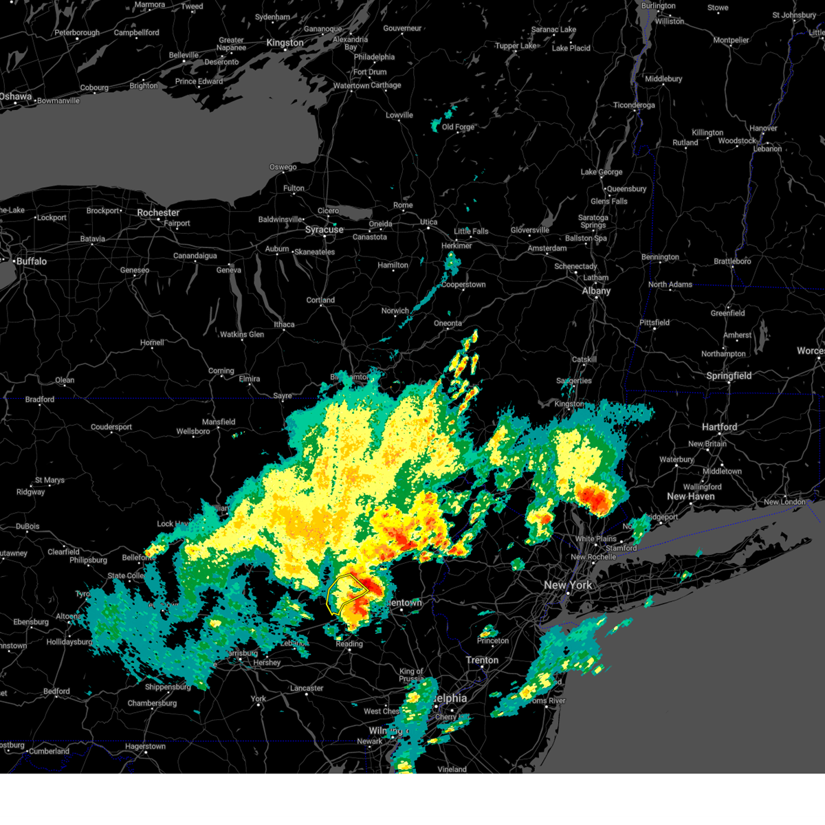 At 806 am edt, severe thunderstorms were located along a line extending from new mahoning to snyders to mckeansburg, moving northeast at 30 mph (radar indicated). Hazards include 60 mph wind gusts. Expect damage to roofs, siding, and trees. Locations impacted include, tamaqua, orwigsburg, hometown, tuscarora, new philadelphia, mckeansburg, coaldale, snyders, auburn, deer lake, middleport, and port clinton. At 806 am edt, severe thunderstorms were located along a line extending from new mahoning to snyders to mckeansburg, moving northeast at 30 mph (radar indicated). Hazards include 60 mph wind gusts. Expect damage to roofs, siding, and trees. Locations impacted include, tamaqua, orwigsburg, hometown, tuscarora, new philadelphia, mckeansburg, coaldale, snyders, auburn, deer lake, middleport, and port clinton.
|
| 5/23/2024 7:41 AM EDT |
 Svrctp the national weather service in state college pa has issued a * severe thunderstorm warning for, central schuylkill county in central pennsylvania, * until 815 am edt. * at 740 am edt, severe thunderstorms were located along a line extending from coaldale to orwigsburg to strausstown, moving east at 50 mph (radar indicated). Hazards include 60 mph wind gusts and penny size hail. expect damage to roofs, siding, and trees Svrctp the national weather service in state college pa has issued a * severe thunderstorm warning for, central schuylkill county in central pennsylvania, * until 815 am edt. * at 740 am edt, severe thunderstorms were located along a line extending from coaldale to orwigsburg to strausstown, moving east at 50 mph (radar indicated). Hazards include 60 mph wind gusts and penny size hail. expect damage to roofs, siding, and trees
|
| 9/7/2023 5:38 PM EDT |
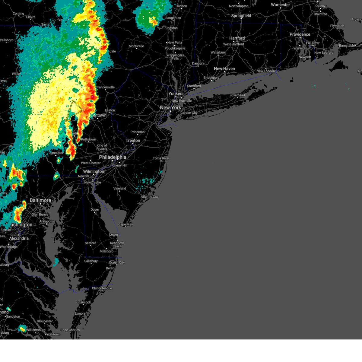 The severe thunderstorm warning for eastern schuylkill county will expire at 545 pm edt, the storm which prompted the warning has weakened below severe limits, and has exited the warned area. therefore, the warning will be allowed to expire. a severe thunderstorm watch remains in effect until 900 pm edt for central pennsylvania. The severe thunderstorm warning for eastern schuylkill county will expire at 545 pm edt, the storm which prompted the warning has weakened below severe limits, and has exited the warned area. therefore, the warning will be allowed to expire. a severe thunderstorm watch remains in effect until 900 pm edt for central pennsylvania.
|
| 9/7/2023 5:22 PM EDT |
 The severe thunderstorm warning for central berks, northwestern lehigh and southwestern carbon counties will expire at 530 pm edt, the storms which prompted the warning have moved out of the area. therefore, the warning will be allowed to expire. however small hail, gusty winds and heavy rain are still possible with these thunderstorms. a severe thunderstorm watch remains in effect until 900 pm edt for eastern and northeastern pennsylvania. to report severe weather, contact your nearest law enforcement agency. they will relay your report to the national weather service mount holly nj. remember, a new severe thunderstorm warning is in effect for portions of berks, lehigh, and carbon counties until 6:00 pm!. The severe thunderstorm warning for central berks, northwestern lehigh and southwestern carbon counties will expire at 530 pm edt, the storms which prompted the warning have moved out of the area. therefore, the warning will be allowed to expire. however small hail, gusty winds and heavy rain are still possible with these thunderstorms. a severe thunderstorm watch remains in effect until 900 pm edt for eastern and northeastern pennsylvania. to report severe weather, contact your nearest law enforcement agency. they will relay your report to the national weather service mount holly nj. remember, a new severe thunderstorm warning is in effect for portions of berks, lehigh, and carbon counties until 6:00 pm!.
|
| 9/7/2023 5:08 PM EDT |
 At 508 pm edt, severe thunderstorms were located along a line extending from near hometown to hamburg to adamstown, moving east at 20 mph (radar indicated). Hazards include 60 mph wind gusts and quarter size hail. Minor damage to vehicles is possible. wind damage to roofs, siding, trees, and power lines is possible. locations impacted include, reading, lehighton, wyomissing, palmerton, birdsboro, kutztown, jim thorpe, hamburg, fleetwood, sinking spring, laureldale, nesquehoning, wernersville, leesport, shoemakersville, lyons, lenhartsville, new morgan, new mahoning and spring ridge. this includes the following highways, pennsylvania turnpike between mile markers 295 and 296. northeast extension between mile markers 72 and 79. interstate 78 in pennsylvania between mile markers 29 and 46. interstate 176 in pennsylvania between mile markers 2 and 11. hail threat, radar indicated max hail size, 1. 00 in wind threat, radar indicated max wind gust, 60 mph. At 508 pm edt, severe thunderstorms were located along a line extending from near hometown to hamburg to adamstown, moving east at 20 mph (radar indicated). Hazards include 60 mph wind gusts and quarter size hail. Minor damage to vehicles is possible. wind damage to roofs, siding, trees, and power lines is possible. locations impacted include, reading, lehighton, wyomissing, palmerton, birdsboro, kutztown, jim thorpe, hamburg, fleetwood, sinking spring, laureldale, nesquehoning, wernersville, leesport, shoemakersville, lyons, lenhartsville, new morgan, new mahoning and spring ridge. this includes the following highways, pennsylvania turnpike between mile markers 295 and 296. northeast extension between mile markers 72 and 79. interstate 78 in pennsylvania between mile markers 29 and 46. interstate 176 in pennsylvania between mile markers 2 and 11. hail threat, radar indicated max hail size, 1. 00 in wind threat, radar indicated max wind gust, 60 mph.
|
| 9/7/2023 5:01 PM EDT |
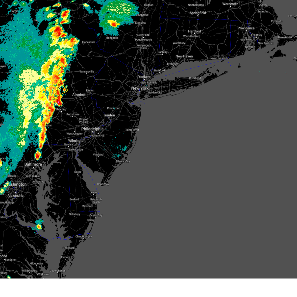 At 501 pm edt, a severe thunderstorm was located over hamburg, moving northeast at 25 mph (radar indicated). Hazards include 60 mph wind gusts and quarter size hail. Hail damage to vehicles is expected. Expect wind damage to roofs, siding, and trees. At 501 pm edt, a severe thunderstorm was located over hamburg, moving northeast at 25 mph (radar indicated). Hazards include 60 mph wind gusts and quarter size hail. Hail damage to vehicles is expected. Expect wind damage to roofs, siding, and trees.
|
| 9/7/2023 4:47 PM EDT |
 At 447 pm edt, severe thunderstorms were located along a line extending from locust lake state park to strausstown to brickerville, moving east at 35 mph (radar indicated). Hazards include 60 mph wind gusts and quarter size hail. Minor damage to vehicles is possible. Wind damage to roofs, siding, trees, and power lines is possible. At 447 pm edt, severe thunderstorms were located along a line extending from locust lake state park to strausstown to brickerville, moving east at 35 mph (radar indicated). Hazards include 60 mph wind gusts and quarter size hail. Minor damage to vehicles is possible. Wind damage to roofs, siding, trees, and power lines is possible.
|
| 9/7/2023 2:28 PM EDT |
 At 227 pm edt, a severe thunderstorm was located over lenhartsville, or 13 miles east of schuylkill haven, moving northeast at 20 mph (radar indicated). Hazards include 60 mph wind gusts and half dollar size hail. Minor damage to vehicles is possible. wind damage to roofs, siding, trees, and power lines is possible. locations impacted include, hamburg, shoemakersville, lenhartsville, new tripoli and wanamakers. this includes interstate 78 in pennsylvania between mile markers 29 and 41. hail threat, radar indicated max hail size, 1. 25 in wind threat, radar indicated max wind gust, 60 mph. At 227 pm edt, a severe thunderstorm was located over lenhartsville, or 13 miles east of schuylkill haven, moving northeast at 20 mph (radar indicated). Hazards include 60 mph wind gusts and half dollar size hail. Minor damage to vehicles is possible. wind damage to roofs, siding, trees, and power lines is possible. locations impacted include, hamburg, shoemakersville, lenhartsville, new tripoli and wanamakers. this includes interstate 78 in pennsylvania between mile markers 29 and 41. hail threat, radar indicated max hail size, 1. 25 in wind threat, radar indicated max wind gust, 60 mph.
|
| 9/7/2023 2:13 PM EDT |
 At 213 pm edt, a severe thunderstorm was located over shoemakersville, or 11 miles southeast of schuylkill haven, moving north at 20 mph (radar indicated). Hazards include 60 mph wind gusts and half dollar size hail. Minor damage to vehicles is possible. Wind damage to roofs, siding, trees, and power lines is possible. At 213 pm edt, a severe thunderstorm was located over shoemakersville, or 11 miles southeast of schuylkill haven, moving north at 20 mph (radar indicated). Hazards include 60 mph wind gusts and half dollar size hail. Minor damage to vehicles is possible. Wind damage to roofs, siding, trees, and power lines is possible.
|
| 8/13/2023 12:13 AM EDT |
 At 1213 am edt, severe thunderstorms were located along a line extending from near shoemakersville to near terre hill, moving east at 45 mph (radar indicated). Hazards include 60 mph wind gusts and penny size hail. Damage to roofs, siding, trees, and power lines is possible. locations impacted include, reading, wyomissing, birdsboro, kutztown, hamburg, fleetwood, sinking spring, laureldale, wernersville, topton, robesonia, leesport, shoemakersville, bally, bernville, bechtelsville, lyons, lenhartsville, new morgan and spring ridge. this includes the following highways, pennsylvania turnpike between mile markers 296 and 299. interstate 78 in pennsylvania between mile markers 25 and 44. interstate 176 in pennsylvania between mile markers 1 and 11. hail threat, radar indicated max hail size, 0. 75 in wind threat, radar indicated max wind gust, 60 mph. At 1213 am edt, severe thunderstorms were located along a line extending from near shoemakersville to near terre hill, moving east at 45 mph (radar indicated). Hazards include 60 mph wind gusts and penny size hail. Damage to roofs, siding, trees, and power lines is possible. locations impacted include, reading, wyomissing, birdsboro, kutztown, hamburg, fleetwood, sinking spring, laureldale, wernersville, topton, robesonia, leesport, shoemakersville, bally, bernville, bechtelsville, lyons, lenhartsville, new morgan and spring ridge. this includes the following highways, pennsylvania turnpike between mile markers 296 and 299. interstate 78 in pennsylvania between mile markers 25 and 44. interstate 176 in pennsylvania between mile markers 1 and 11. hail threat, radar indicated max hail size, 0. 75 in wind threat, radar indicated max wind gust, 60 mph.
|
| 8/12/2023 11:47 PM EDT |
 At 1147 pm edt, severe thunderstorms were located along a line extending from near strausstown to near manheim, moving east at 40 mph (radar indicated). Hazards include 60 mph wind gusts and penny size hail. damage to roofs, siding, trees, and power lines is possible At 1147 pm edt, severe thunderstorms were located along a line extending from near strausstown to near manheim, moving east at 40 mph (radar indicated). Hazards include 60 mph wind gusts and penny size hail. damage to roofs, siding, trees, and power lines is possible
|
| 7/29/2023 4:38 PM EDT |
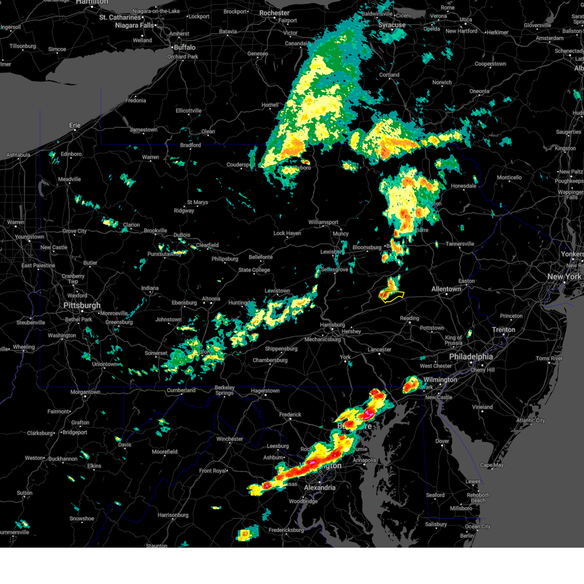 At 438 pm edt, a severe thunderstorm was located over friedensburg, moving east at 35 mph (radar indicated). Hazards include 60 mph wind gusts. Expect damage to roofs, siding, and trees. Locations impacted include, schuylkill haven, friedensburg, lake wynonah, cressona, auburn, deer lake, port clinton, summit station and landingville. At 438 pm edt, a severe thunderstorm was located over friedensburg, moving east at 35 mph (radar indicated). Hazards include 60 mph wind gusts. Expect damage to roofs, siding, and trees. Locations impacted include, schuylkill haven, friedensburg, lake wynonah, cressona, auburn, deer lake, port clinton, summit station and landingville.
|
| 7/29/2023 4:24 PM EDT |
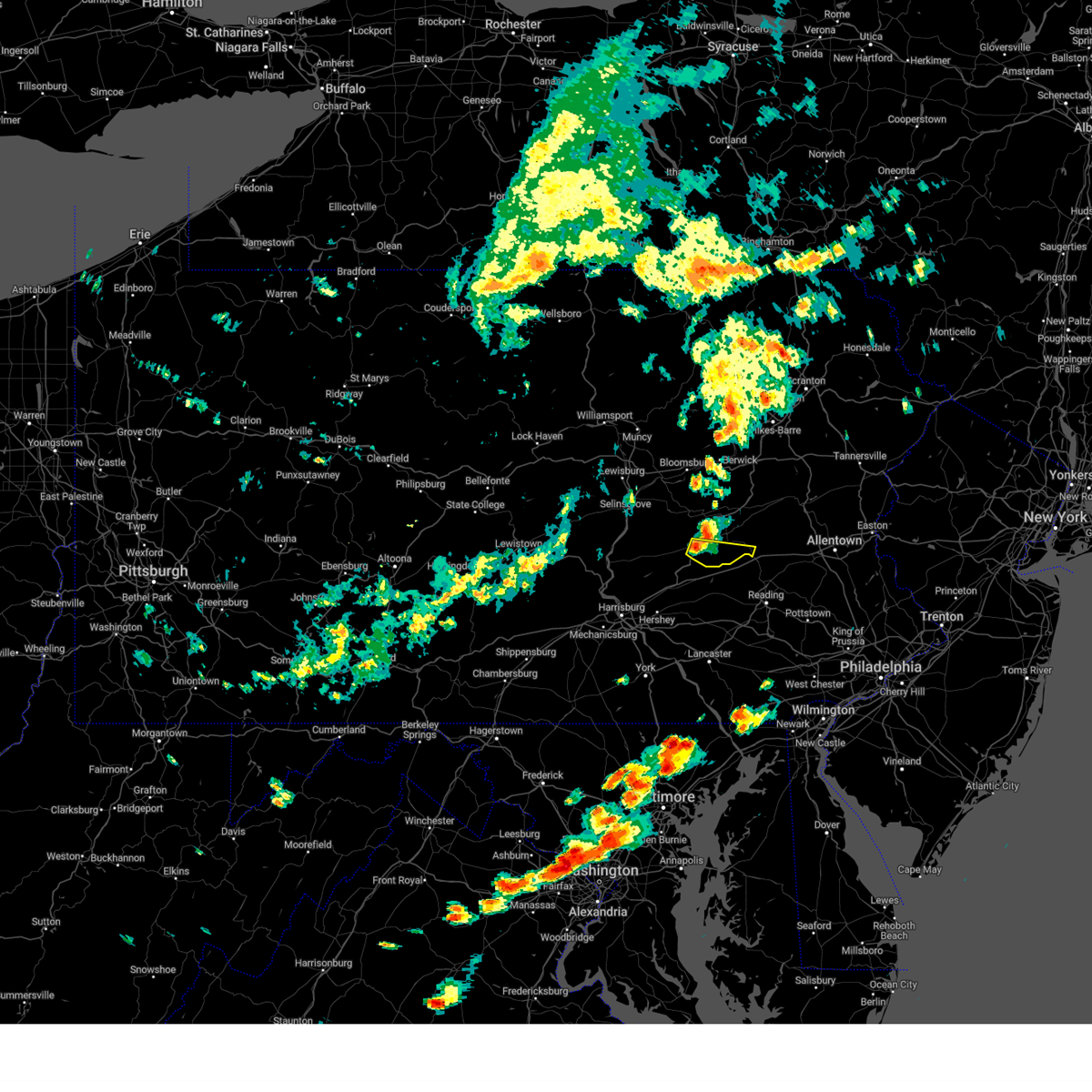 At 424 pm edt, a severe thunderstorm was located over pine grove, moving east at 35 mph (radar indicated). Hazards include 60 mph wind gusts. Expect damage to roofs, siding, and trees. locations impacted include, schuylkill haven, pine grove, tremont, friedensburg, donaldson, lake wynonah, cressona, auburn, deer lake, ravine, port clinton and newtown. This includes interstate 81 between mile markers 102 and 107, and from mile markers 110 to 111. At 424 pm edt, a severe thunderstorm was located over pine grove, moving east at 35 mph (radar indicated). Hazards include 60 mph wind gusts. Expect damage to roofs, siding, and trees. locations impacted include, schuylkill haven, pine grove, tremont, friedensburg, donaldson, lake wynonah, cressona, auburn, deer lake, ravine, port clinton and newtown. This includes interstate 81 between mile markers 102 and 107, and from mile markers 110 to 111.
|
| 7/29/2023 4:08 PM EDT |
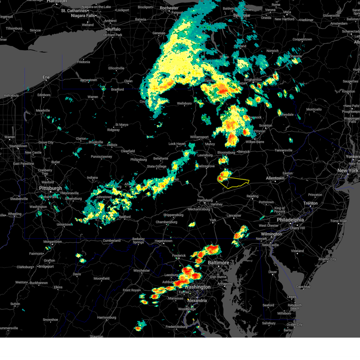 At 407 pm edt, a severe thunderstorm was located over tower city, moving east at 35 mph (radar indicated). Hazards include 60 mph wind gusts. Expect damage to roofs, siding, and trees. locations impacted include, schuylkill haven, pine grove, tremont, tower city, friedensburg, donaldson, lake wynonah, cressona, hegins, auburn, deer lake and ravine. This includes interstate 81 from mile markers 97 to 111. At 407 pm edt, a severe thunderstorm was located over tower city, moving east at 35 mph (radar indicated). Hazards include 60 mph wind gusts. Expect damage to roofs, siding, and trees. locations impacted include, schuylkill haven, pine grove, tremont, tower city, friedensburg, donaldson, lake wynonah, cressona, hegins, auburn, deer lake and ravine. This includes interstate 81 from mile markers 97 to 111.
|
| 7/29/2023 3:50 PM EDT |
 At 349 pm edt, a severe thunderstorm was located over klingerstown, moving east at 35 mph (radar indicated). Hazards include 60 mph wind gusts. expect damage to roofs, siding, and trees At 349 pm edt, a severe thunderstorm was located over klingerstown, moving east at 35 mph (radar indicated). Hazards include 60 mph wind gusts. expect damage to roofs, siding, and trees
|
| 7/2/2023 5:53 PM EDT |
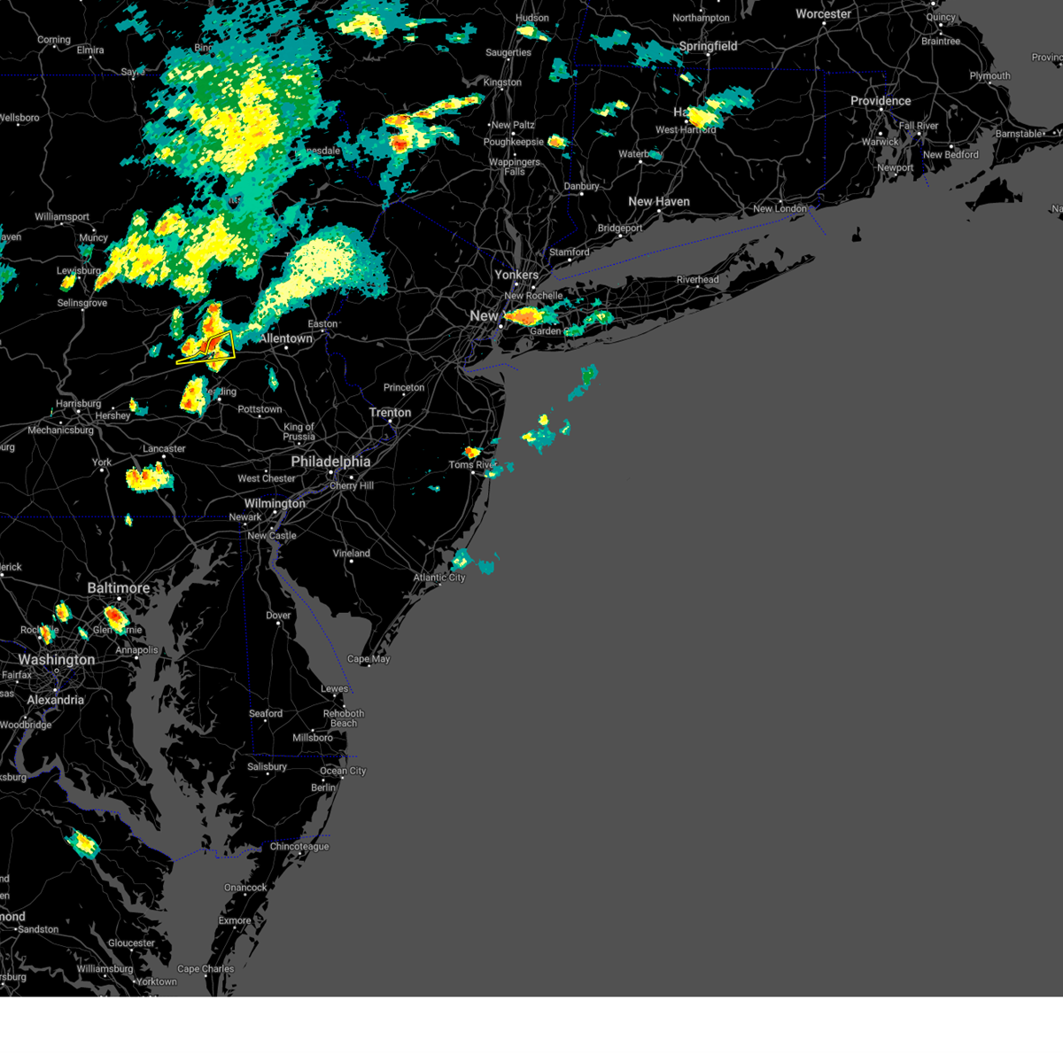 The severe thunderstorm warning for north central berks and west central lehigh counties will expire at 600 pm edt, the storm which prompted the warning has weakened below severe limits, and no longer poses an immediate threat to life or property. therefore, the warning will be allowed to expire. however gusty winds are still possible with this thunderstorm. a severe thunderstorm watch remains in effect until 1100 pm edt for eastern pennsylvania. The severe thunderstorm warning for north central berks and west central lehigh counties will expire at 600 pm edt, the storm which prompted the warning has weakened below severe limits, and no longer poses an immediate threat to life or property. therefore, the warning will be allowed to expire. however gusty winds are still possible with this thunderstorm. a severe thunderstorm watch remains in effect until 1100 pm edt for eastern pennsylvania.
|
| 7/2/2023 5:31 PM EDT |
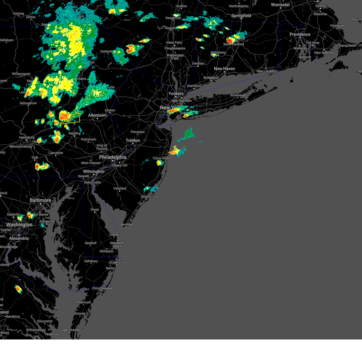 At 531 pm edt, a severe thunderstorm was located near schuylkill haven, moving east at 25 mph (radar indicated). Hazards include 60 mph wind gusts and penny size hail. Damage to roofs, siding, trees, and power lines is possible. locations impacted include, hamburg, lenhartsville and wanamakers. this includes interstate 78 in pennsylvania between mile markers 27 and 39. hail threat, radar indicated max hail size, 0. 75 in wind threat, radar indicated max wind gust, 60 mph. At 531 pm edt, a severe thunderstorm was located near schuylkill haven, moving east at 25 mph (radar indicated). Hazards include 60 mph wind gusts and penny size hail. Damage to roofs, siding, trees, and power lines is possible. locations impacted include, hamburg, lenhartsville and wanamakers. this includes interstate 78 in pennsylvania between mile markers 27 and 39. hail threat, radar indicated max hail size, 0. 75 in wind threat, radar indicated max wind gust, 60 mph.
|
| 7/2/2023 5:08 PM EDT |
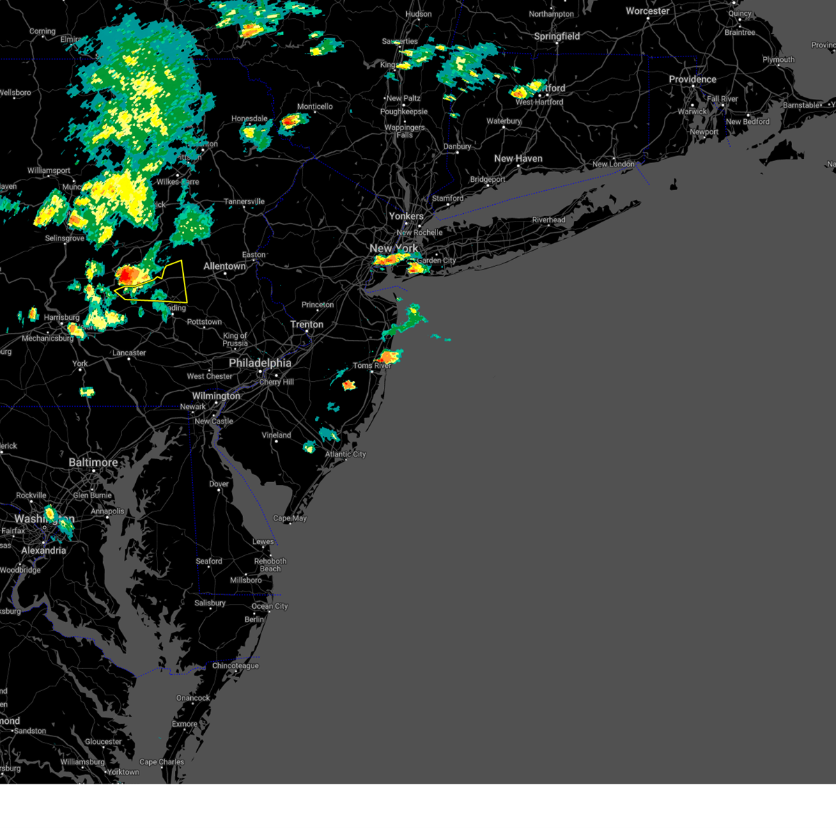 At 508 pm edt, a severe thunderstorm was located near friedensburg, or 7 miles southwest of schuylkill haven, moving east at 25 mph (radar indicated). Hazards include 60 mph wind gusts and penny size hail. damage to roofs, siding, trees, and power lines is possible At 508 pm edt, a severe thunderstorm was located near friedensburg, or 7 miles southwest of schuylkill haven, moving east at 25 mph (radar indicated). Hazards include 60 mph wind gusts and penny size hail. damage to roofs, siding, trees, and power lines is possible
|
| 7/2/2023 4:43 PM EDT |
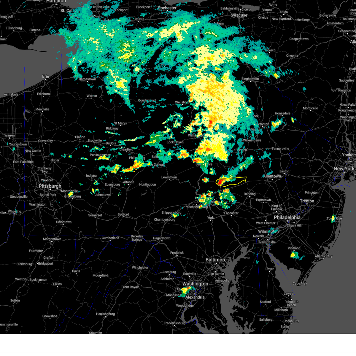 At 442 pm edt, a severe thunderstorm was located over tower city, moving east at 25 mph. this storm has a history of producing wind damage across northern dauphin county (radar indicated). Hazards include 60 mph wind gusts. expect damage to roofs, siding, and trees At 442 pm edt, a severe thunderstorm was located over tower city, moving east at 25 mph. this storm has a history of producing wind damage across northern dauphin county (radar indicated). Hazards include 60 mph wind gusts. expect damage to roofs, siding, and trees
|
| 6/27/2023 3:46 PM EDT |
 At 346 pm edt, severe thunderstorms were located along a line extending from grier city-park crest to schuylkill haven to brickerville, moving east at 25 mph (radar indicated). Hazards include 60 mph wind gusts and quarter size hail. Hail damage to vehicles is expected. expect wind damage to roofs, siding, and trees. locations impacted include, lebanon, pottsville, ephrata, tamaqua, schuylkill haven, shenandoah, minersville, mahanoy city, cornwall, frackville, myerstown and st. clair. this includes the following interstates, the pennsylvania turnpike from mile markers 263 to 286. interstate 78 from mile markers 5 to 8. interstate 81 between mile markers 99 and 100, near mile marker 103, and from mile markers 122 to 139. hail threat, radar indicated max hail size, 1. 00 in wind threat, radar indicated max wind gust, 60 mph. At 346 pm edt, severe thunderstorms were located along a line extending from grier city-park crest to schuylkill haven to brickerville, moving east at 25 mph (radar indicated). Hazards include 60 mph wind gusts and quarter size hail. Hail damage to vehicles is expected. expect wind damage to roofs, siding, and trees. locations impacted include, lebanon, pottsville, ephrata, tamaqua, schuylkill haven, shenandoah, minersville, mahanoy city, cornwall, frackville, myerstown and st. clair. this includes the following interstates, the pennsylvania turnpike from mile markers 263 to 286. interstate 78 from mile markers 5 to 8. interstate 81 between mile markers 99 and 100, near mile marker 103, and from mile markers 122 to 139. hail threat, radar indicated max hail size, 1. 00 in wind threat, radar indicated max wind gust, 60 mph.
|
| 6/27/2023 3:15 PM EDT |
 At 314 pm edt, severe thunderstorms were located along a line extending from shenandoah to schuylkill haven to timber hills, moving east at 15 to 20 mph (radar indicated). Hazards include 60 mph wind gusts and quarter size hail. Hail damage to vehicles is expected. Expect wind damage to roofs, siding, and trees. At 314 pm edt, severe thunderstorms were located along a line extending from shenandoah to schuylkill haven to timber hills, moving east at 15 to 20 mph (radar indicated). Hazards include 60 mph wind gusts and quarter size hail. Hail damage to vehicles is expected. Expect wind damage to roofs, siding, and trees.
|
| 6/27/2023 3:07 PM EDT |
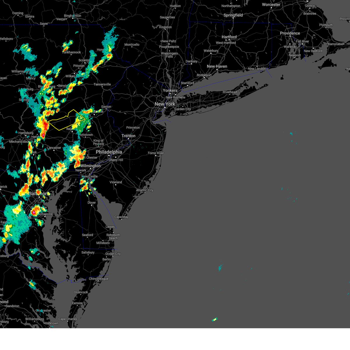 At 307 pm edt, a severe thunderstorm was located over fredericksburg, or 7 miles north of lebanon, moving northeast at 30 mph (radar indicated). Hazards include 60 mph wind gusts and penny size hail. damage to roofs, siding, trees, and power lines is possible At 307 pm edt, a severe thunderstorm was located over fredericksburg, or 7 miles north of lebanon, moving northeast at 30 mph (radar indicated). Hazards include 60 mph wind gusts and penny size hail. damage to roofs, siding, trees, and power lines is possible
|
| 6/26/2023 9:18 PM EDT |
 At 917 pm edt, a severe thunderstorm was located over bernville, or 8 miles northwest of reading, moving northeast at 30 mph (radar indicated). Hazards include 60 mph wind gusts and nickel size hail. damage to roofs, siding, trees, and power lines is possible At 917 pm edt, a severe thunderstorm was located over bernville, or 8 miles northwest of reading, moving northeast at 30 mph (radar indicated). Hazards include 60 mph wind gusts and nickel size hail. damage to roofs, siding, trees, and power lines is possible
|
| 6/26/2023 2:35 PM EDT |
 At 235 pm edt, a severe thunderstorm was located over hamburg, or 12 miles southeast of schuylkill haven, moving northeast at 15 mph (radar indicated). Hazards include 60 mph wind gusts and half dollar size hail. Minor damage to vehicles is possible. wind damage to roofs, siding, trees, and power lines is possible. locations impacted include, hamburg, shoemakersville, lenhartsville, claussville and wanamakers. this includes interstate 78 in pennsylvania between mile markers 29 and 45. hail threat, radar indicated max hail size, 1. 25 in wind threat, radar indicated max wind gust, 60 mph. At 235 pm edt, a severe thunderstorm was located over hamburg, or 12 miles southeast of schuylkill haven, moving northeast at 15 mph (radar indicated). Hazards include 60 mph wind gusts and half dollar size hail. Minor damage to vehicles is possible. wind damage to roofs, siding, trees, and power lines is possible. locations impacted include, hamburg, shoemakersville, lenhartsville, claussville and wanamakers. this includes interstate 78 in pennsylvania between mile markers 29 and 45. hail threat, radar indicated max hail size, 1. 25 in wind threat, radar indicated max wind gust, 60 mph.
|
| 6/26/2023 2:21 PM EDT |
 At 221 pm edt, a severe thunderstorm was located over shoemakersville, or 11 miles north of reading, moving northeast at 15 mph (radar indicated). Hazards include 60 mph wind gusts and half dollar size hail. Minor damage to vehicles is possible. Wind damage to roofs, siding, trees, and power lines is possible. At 221 pm edt, a severe thunderstorm was located over shoemakersville, or 11 miles north of reading, moving northeast at 15 mph (radar indicated). Hazards include 60 mph wind gusts and half dollar size hail. Minor damage to vehicles is possible. Wind damage to roofs, siding, trees, and power lines is possible.
|
| 6/26/2023 1:59 PM EDT |
 At 159 pm edt, a severe thunderstorm was located near hamburg, or 10 miles east of schuylkill haven, moving northeast at 15 mph (radar indicated). Hazards include 60 mph wind gusts and quarter size hail. Minor damage to vehicles is possible. wind damage to roofs, siding, trees, and power lines is possible. locations impacted include, hamburg, lenhartsville, new tripoli and wanamakers. this includes interstate 78 in pennsylvania between mile markers 31 and 45. hail threat, radar indicated max hail size, 1. 00 in wind threat, radar indicated max wind gust, 60 mph. At 159 pm edt, a severe thunderstorm was located near hamburg, or 10 miles east of schuylkill haven, moving northeast at 15 mph (radar indicated). Hazards include 60 mph wind gusts and quarter size hail. Minor damage to vehicles is possible. wind damage to roofs, siding, trees, and power lines is possible. locations impacted include, hamburg, lenhartsville, new tripoli and wanamakers. this includes interstate 78 in pennsylvania between mile markers 31 and 45. hail threat, radar indicated max hail size, 1. 00 in wind threat, radar indicated max wind gust, 60 mph.
|
| 6/26/2023 1:57 PM EDT |
 At 156 pm edt, a severe thunderstorm was located over schuylkill haven, moving northeast at 25 mph. other storms were just to the northeast and southwest of this storm (radar indicated). Hazards include 60 mph wind gusts and quarter size hail. Hail damage to vehicles is expected. expect wind damage to roofs, siding, and trees. locations impacted include, lebanon, pottsville, tamaqua, schuylkill haven, st. clair, orwigsburg, sand hill, lebanon south, pine grove, port carbon, avon and fredericksburg. this includes the following interstates, interstate 78 from mile markers 5 to 8. interstate 81 near mile marker 99. hail threat, radar indicated max hail size, 1. 00 in wind threat, radar indicated max wind gust, 60 mph. At 156 pm edt, a severe thunderstorm was located over schuylkill haven, moving northeast at 25 mph. other storms were just to the northeast and southwest of this storm (radar indicated). Hazards include 60 mph wind gusts and quarter size hail. Hail damage to vehicles is expected. expect wind damage to roofs, siding, and trees. locations impacted include, lebanon, pottsville, tamaqua, schuylkill haven, st. clair, orwigsburg, sand hill, lebanon south, pine grove, port carbon, avon and fredericksburg. this includes the following interstates, interstate 78 from mile markers 5 to 8. interstate 81 near mile marker 99. hail threat, radar indicated max hail size, 1. 00 in wind threat, radar indicated max wind gust, 60 mph.
|
| 6/26/2023 1:41 PM EDT |
 At 140 pm edt, a severe thunderstorm was located over pine grove, moving northeast at 25 mph (radar indicated). Hazards include 60 mph wind gusts and quarter size hail. Hail damage to vehicles is expected. Expect wind damage to roofs, siding, and trees. At 140 pm edt, a severe thunderstorm was located over pine grove, moving northeast at 25 mph (radar indicated). Hazards include 60 mph wind gusts and quarter size hail. Hail damage to vehicles is expected. Expect wind damage to roofs, siding, and trees.
|
| 6/26/2023 1:35 PM EDT |
 At 135 pm edt, a severe thunderstorm was located over hamburg, or 10 miles east of schuylkill haven, moving northeast at 30 mph (radar indicated). Hazards include 60 mph wind gusts and quarter size hail. Minor damage to vehicles is possible. Wind damage to roofs, siding, trees, and power lines is possible. At 135 pm edt, a severe thunderstorm was located over hamburg, or 10 miles east of schuylkill haven, moving northeast at 30 mph (radar indicated). Hazards include 60 mph wind gusts and quarter size hail. Minor damage to vehicles is possible. Wind damage to roofs, siding, trees, and power lines is possible.
|
| 6/26/2023 1:20 PM EDT |
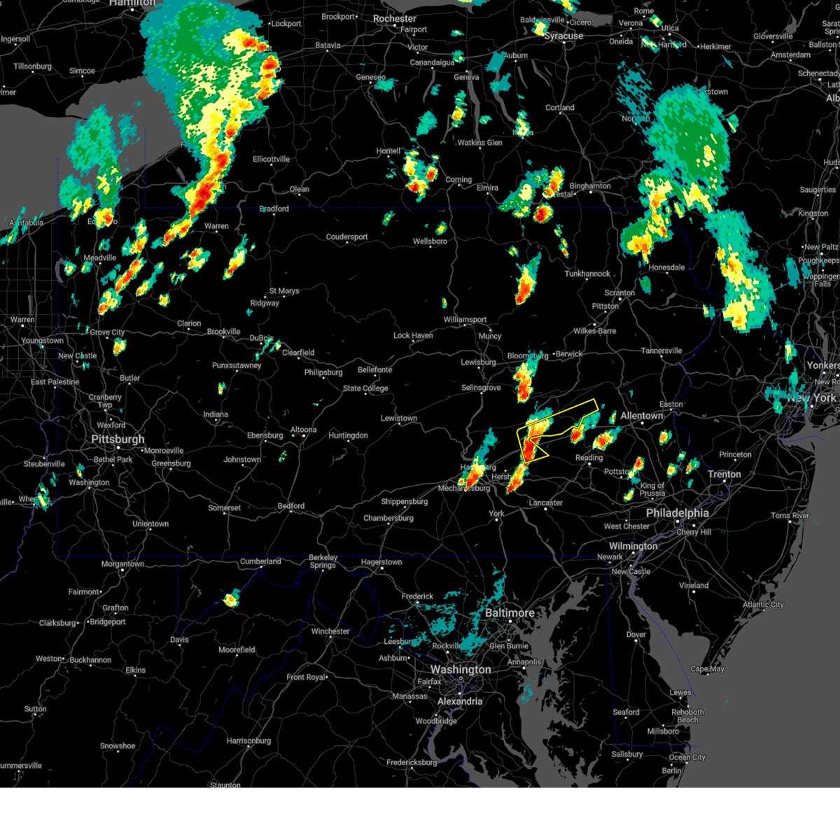 At 120 pm edt, a severe thunderstorm was located over fredericksburg, moving northeast at 20 mph (radar indicated). Hazards include 60 mph wind gusts and quarter size hail. Hail damage to vehicles is expected. expect wind damage to roofs, siding, and trees. locations impacted include, lebanon, schuylkill haven, myerstown, orwigsburg, sand hill, pine grove, cleona, fredericksburg, friedensburg, renningers, mckeansburg and lickdale. this includes the following interstates, interstate 78 from mile markers 1 to 8. interstate 81 between mile markers 90 and 92, and from mile markers 94 to 104. hail threat, radar indicated max hail size, 1. 00 in wind threat, radar indicated max wind gust, 60 mph. At 120 pm edt, a severe thunderstorm was located over fredericksburg, moving northeast at 20 mph (radar indicated). Hazards include 60 mph wind gusts and quarter size hail. Hail damage to vehicles is expected. expect wind damage to roofs, siding, and trees. locations impacted include, lebanon, schuylkill haven, myerstown, orwigsburg, sand hill, pine grove, cleona, fredericksburg, friedensburg, renningers, mckeansburg and lickdale. this includes the following interstates, interstate 78 from mile markers 1 to 8. interstate 81 between mile markers 90 and 92, and from mile markers 94 to 104. hail threat, radar indicated max hail size, 1. 00 in wind threat, radar indicated max wind gust, 60 mph.
|
| 6/26/2023 1:04 PM EDT |
 At 103 pm edt, a severe thunderstorm was located over fredericksburg, moving northeast at 20 mph (radar indicated). Hazards include 60 mph wind gusts and quarter size hail. Hail damage to vehicles is expected. Expect wind damage to roofs, siding, and trees. At 103 pm edt, a severe thunderstorm was located over fredericksburg, moving northeast at 20 mph (radar indicated). Hazards include 60 mph wind gusts and quarter size hail. Hail damage to vehicles is expected. Expect wind damage to roofs, siding, and trees.
|
| 4/22/2023 4:33 PM EDT |
 At 433 pm edt, severe thunderstorms were located along a line extending from pottsville to new morgan, moving north at 55 mph (radar indicated). Hazards include 60 mph wind gusts and nickel size hail. Damage to roofs, siding, trees, and power lines is possible. locations impacted include, reading, wyomissing, birdsboro, kutztown, hamburg, fleetwood, sinking spring, laureldale, leesport, shoemakersville, bernville, lyons, strausstown, lenhartsville, new morgan, spring ridge, fairview hgts, shillington, west reading and mount penn. this includes the following highways, pennsylvania turnpike between mile markers 299 and 300. interstate 78 in pennsylvania between mile markers 19 and 43. interstate 176 in pennsylvania between mile markers 4 and 11. hail threat, radar indicated max hail size, 0. 88 in wind threat, radar indicated max wind gust, 60 mph. At 433 pm edt, severe thunderstorms were located along a line extending from pottsville to new morgan, moving north at 55 mph (radar indicated). Hazards include 60 mph wind gusts and nickel size hail. Damage to roofs, siding, trees, and power lines is possible. locations impacted include, reading, wyomissing, birdsboro, kutztown, hamburg, fleetwood, sinking spring, laureldale, leesport, shoemakersville, bernville, lyons, strausstown, lenhartsville, new morgan, spring ridge, fairview hgts, shillington, west reading and mount penn. this includes the following highways, pennsylvania turnpike between mile markers 299 and 300. interstate 78 in pennsylvania between mile markers 19 and 43. interstate 176 in pennsylvania between mile markers 4 and 11. hail threat, radar indicated max hail size, 0. 88 in wind threat, radar indicated max wind gust, 60 mph.
|
| 4/22/2023 4:16 PM EDT |
 At 416 pm edt, severe thunderstorms were located along a line extending from near myerstown to near quarryville, moving north at 50 mph (radar indicated). Hazards include 60 mph wind gusts and nickel size hail. damage to roofs, siding, trees, and power lines is possible At 416 pm edt, severe thunderstorms were located along a line extending from near myerstown to near quarryville, moving north at 50 mph (radar indicated). Hazards include 60 mph wind gusts and nickel size hail. damage to roofs, siding, trees, and power lines is possible
|
| 4/1/2023 5:33 PM EDT |
 At 531 pm edt, severe thunderstorms were located along a line extending from myerstown to east petersburg to spring grove, moving east at 60 mph (radar indicated). Hazards include 60 mph wind gusts. Expect damage to roofs, siding, and trees. locations impacted include, lancaster, york, lebanon, hanover, ephrata, weigelstown, elizabethtown, columbia, lititz, millersville, willow street and mount joy. this includes the following interstates, the pennsylvania turnpike from mile markers 253 to 295. interstate 78 from mile markers 0 to 8. interstate 81 from mile markers 86 to 102. interstate 83 from mile markers 1 to 32. hail threat, radar indicated max hail size, <. 75 in wind threat, radar indicated max wind gust, 60 mph. At 531 pm edt, severe thunderstorms were located along a line extending from myerstown to east petersburg to spring grove, moving east at 60 mph (radar indicated). Hazards include 60 mph wind gusts. Expect damage to roofs, siding, and trees. locations impacted include, lancaster, york, lebanon, hanover, ephrata, weigelstown, elizabethtown, columbia, lititz, millersville, willow street and mount joy. this includes the following interstates, the pennsylvania turnpike from mile markers 253 to 295. interstate 78 from mile markers 0 to 8. interstate 81 from mile markers 86 to 102. interstate 83 from mile markers 1 to 32. hail threat, radar indicated max hail size, <. 75 in wind threat, radar indicated max wind gust, 60 mph.
|
| 4/1/2023 5:27 PM EDT |
 At 527 pm edt, severe thunderstorms were located along a line extending from near tuscarora to myerstown, moving east at 50 mph (radar indicated). Hazards include 60 mph wind gusts and penny size hail. damage to roofs, siding, trees, and power lines is possible At 527 pm edt, severe thunderstorms were located along a line extending from near tuscarora to myerstown, moving east at 50 mph (radar indicated). Hazards include 60 mph wind gusts and penny size hail. damage to roofs, siding, trees, and power lines is possible
|
| 4/1/2023 5:16 PM EDT |
 At 516 pm edt, severe thunderstorms were located along a line extending from pine grove to bonneauville, moving east at 40 mph (radar indicated). Hazards include 60 mph wind gusts. expect damage to roofs, siding, and trees At 516 pm edt, severe thunderstorms were located along a line extending from pine grove to bonneauville, moving east at 40 mph (radar indicated). Hazards include 60 mph wind gusts. expect damage to roofs, siding, and trees
|
| 7/1/2022 5:16 PM EDT |
 At 516 pm edt, a severe thunderstorm was located over hamburg, or 11 miles southeast of schuylkill haven, moving east at 20 mph (radar indicated). Hazards include 60 mph wind gusts and quarter size hail. Minor damage to vehicles is possible. wind damage to roofs, siding, trees, and power lines is possible. locations impacted include, kutztown, hamburg, fleetwood, leesport, shoemakersville, lenhartsville and centerport. this includes interstate 78 in pennsylvania between mile markers 29 and 41. hail threat, radar indicated max hail size, 1. 00 in wind threat, radar indicated max wind gust, 60 mph. At 516 pm edt, a severe thunderstorm was located over hamburg, or 11 miles southeast of schuylkill haven, moving east at 20 mph (radar indicated). Hazards include 60 mph wind gusts and quarter size hail. Minor damage to vehicles is possible. wind damage to roofs, siding, trees, and power lines is possible. locations impacted include, kutztown, hamburg, fleetwood, leesport, shoemakersville, lenhartsville and centerport. this includes interstate 78 in pennsylvania between mile markers 29 and 41. hail threat, radar indicated max hail size, 1. 00 in wind threat, radar indicated max wind gust, 60 mph.
|
| 7/1/2022 4:56 PM EDT |
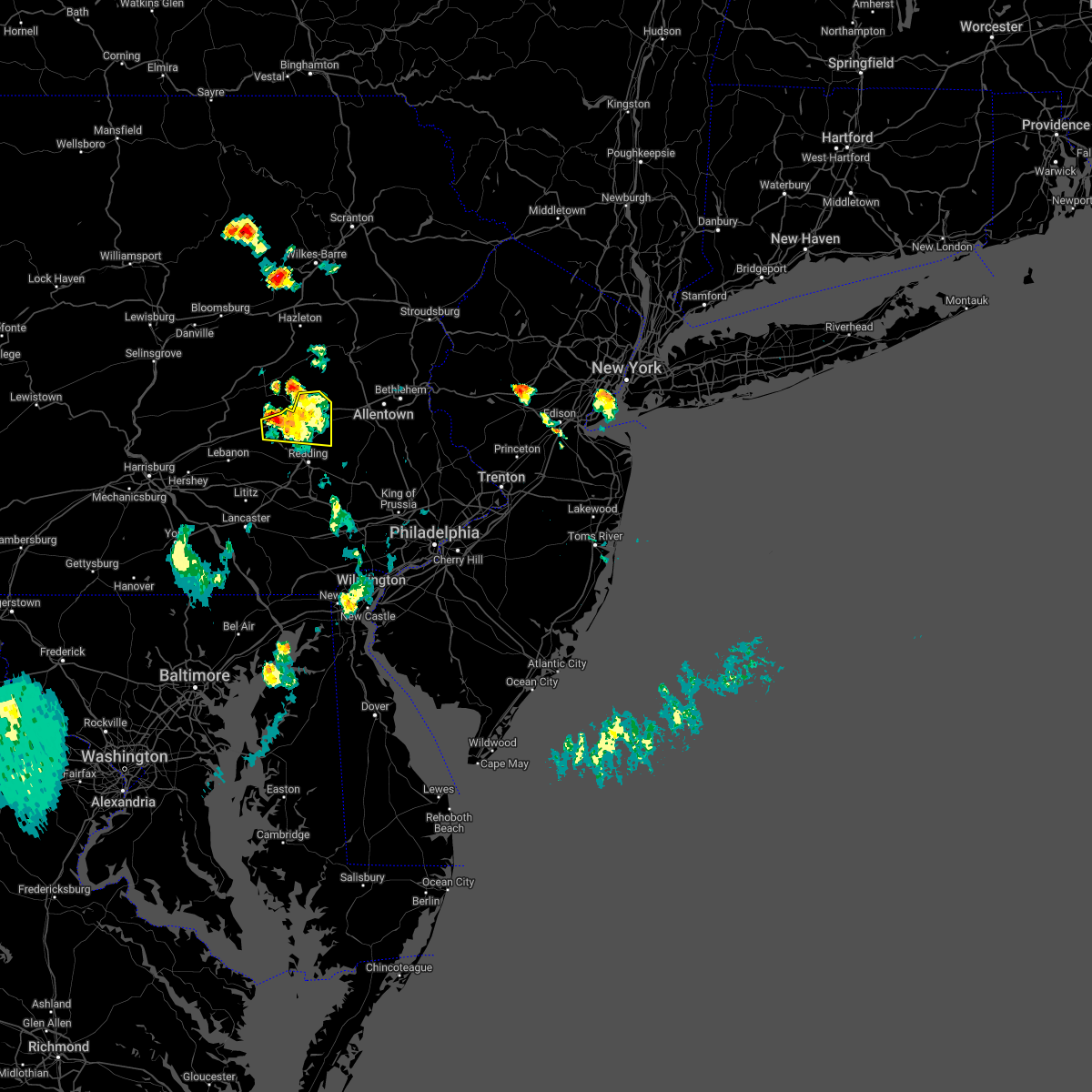 At 456 pm edt, a severe thunderstorm was located near strausstown, or near schuylkill haven, moving east at 20 mph (radar indicated). Hazards include 60 mph wind gusts and quarter size hail. Minor damage to vehicles is possible. Wind damage to roofs, siding, trees, and power lines is possible. At 456 pm edt, a severe thunderstorm was located near strausstown, or near schuylkill haven, moving east at 20 mph (radar indicated). Hazards include 60 mph wind gusts and quarter size hail. Minor damage to vehicles is possible. Wind damage to roofs, siding, trees, and power lines is possible.
|
| 7/1/2022 4:26 PM EDT |
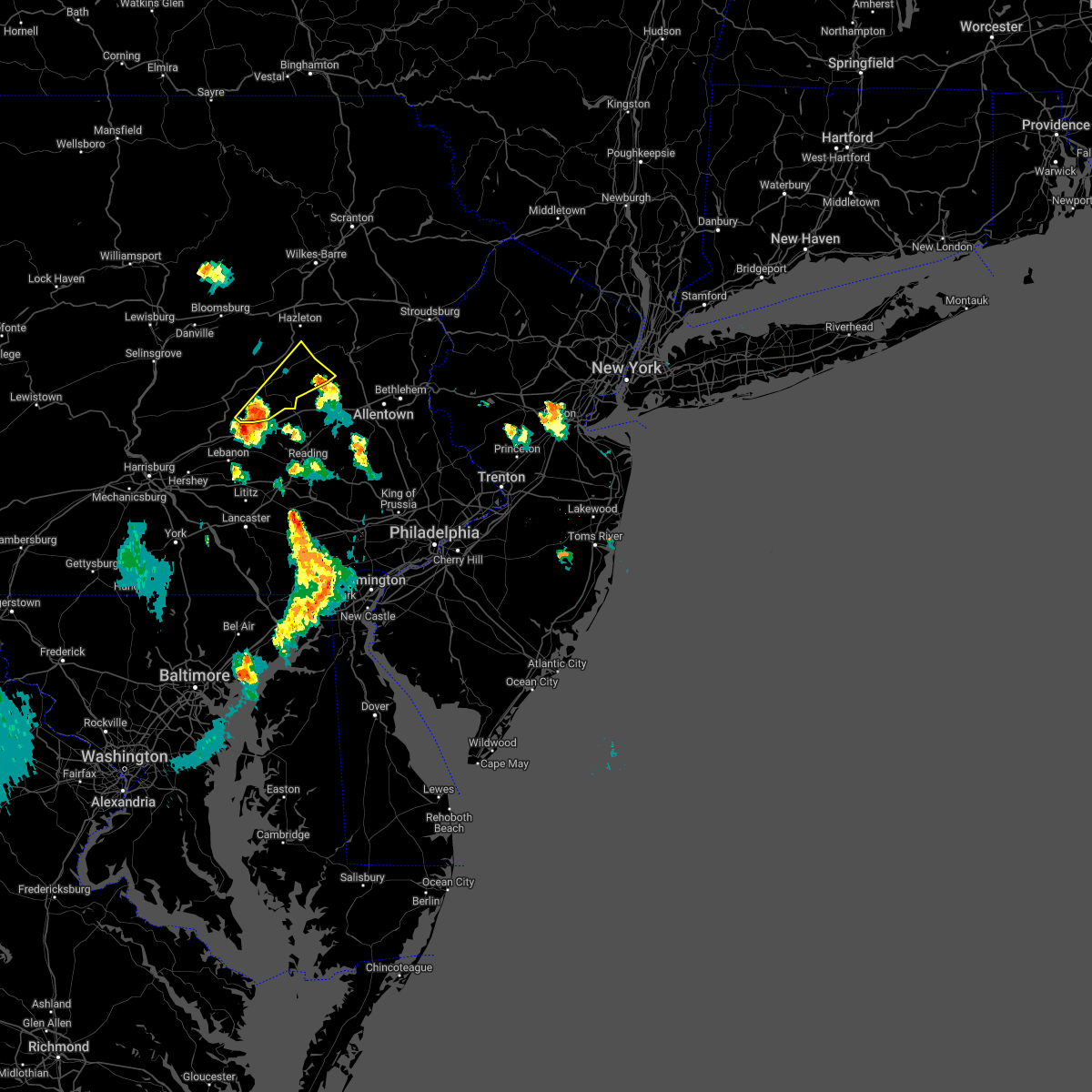 At 426 pm edt, a severe thunderstorm was located over friedensburg, moving northeast at 30 mph (radar indicated). Hazards include 60 mph wind gusts and quarter size hail. Hail damage to vehicles is expected. Expect wind damage to roofs, siding, and trees. At 426 pm edt, a severe thunderstorm was located over friedensburg, moving northeast at 30 mph (radar indicated). Hazards include 60 mph wind gusts and quarter size hail. Hail damage to vehicles is expected. Expect wind damage to roofs, siding, and trees.
|
| 7/1/2022 3:38 PM EDT |
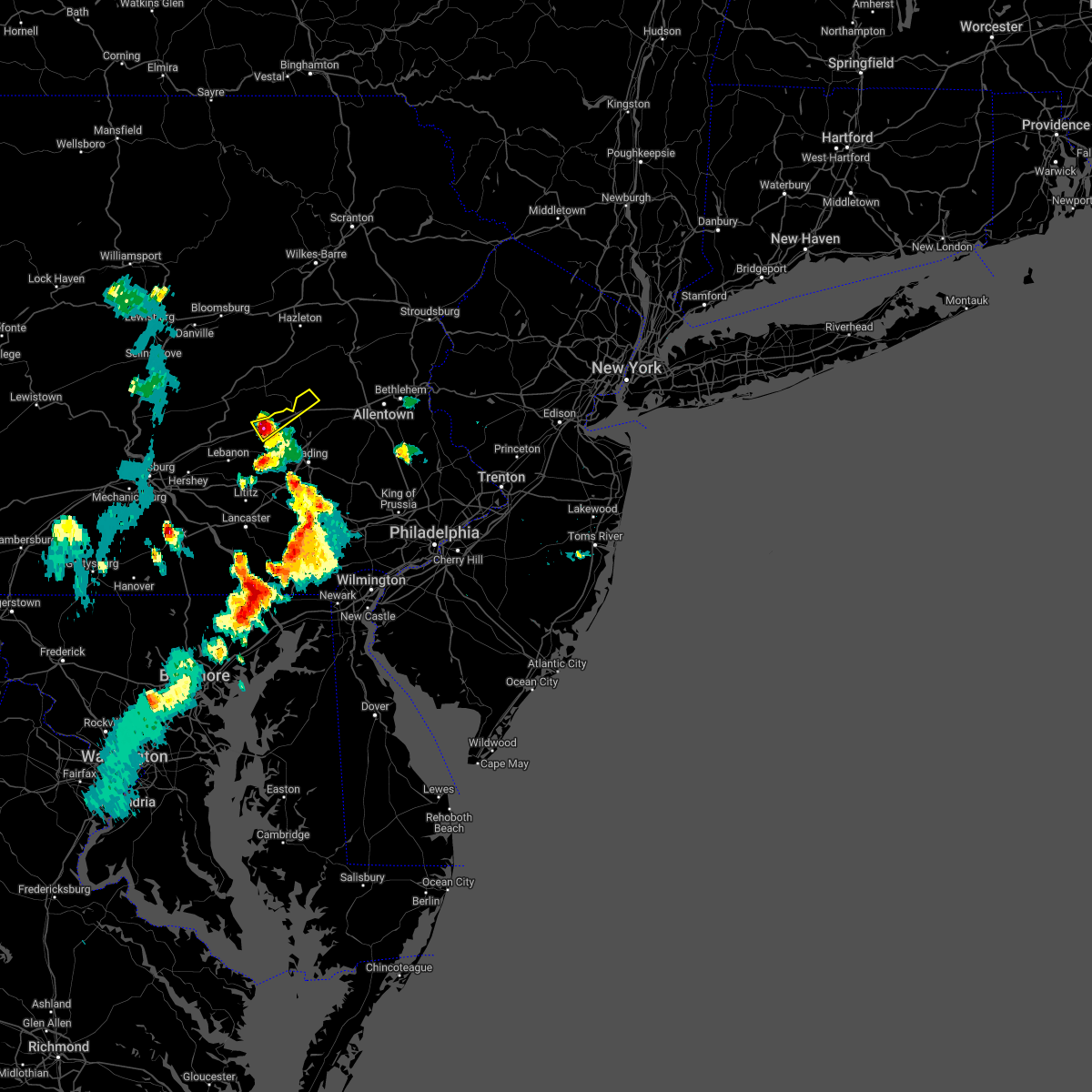 At 338 pm edt, a severe thunderstorm was located over strausstown, or 8 miles south of schuylkill haven, moving northeast at 25 mph (radar indicated). Hazards include 60 mph wind gusts and quarter size hail. Minor damage to vehicles is possible. Wind damage to roofs, siding, trees, and power lines is possible. At 338 pm edt, a severe thunderstorm was located over strausstown, or 8 miles south of schuylkill haven, moving northeast at 25 mph (radar indicated). Hazards include 60 mph wind gusts and quarter size hail. Minor damage to vehicles is possible. Wind damage to roofs, siding, trees, and power lines is possible.
|
| 5/20/2022 2:47 PM EDT |
 At 246 pm edt, severe thunderstorms were located along a line extending from near strausstown to bernville to kleinfeltersville, moving northeast at 50 mph. another severe thunderstorm in the warned area was located over reading moving northeast at 40 mph (radar indicated). Hazards include 60 mph wind gusts and quarter size hail. Minor damage to vehicles is possible. wind damage to roofs, siding, trees, and power lines is possible. locations impacted include, reading, wyomissing, kutztown, hamburg, fleetwood, sinking spring, laureldale, womelsdorf, wernersville, robesonia, leesport, shoemakersville, bernville, lyons, strausstown, lenhartsville, spring ridge, fairview hgts, shillington and west reading. this includes the following highways, interstate 78 in pennsylvania between mile markers 14 and 42. interstate 176 in pennsylvania near mile marker 11. hail threat, radar indicated max hail size, 1. 00 in wind threat, radar indicated max wind gust, 60 mph. At 246 pm edt, severe thunderstorms were located along a line extending from near strausstown to bernville to kleinfeltersville, moving northeast at 50 mph. another severe thunderstorm in the warned area was located over reading moving northeast at 40 mph (radar indicated). Hazards include 60 mph wind gusts and quarter size hail. Minor damage to vehicles is possible. wind damage to roofs, siding, trees, and power lines is possible. locations impacted include, reading, wyomissing, kutztown, hamburg, fleetwood, sinking spring, laureldale, womelsdorf, wernersville, robesonia, leesport, shoemakersville, bernville, lyons, strausstown, lenhartsville, spring ridge, fairview hgts, shillington and west reading. this includes the following highways, interstate 78 in pennsylvania between mile markers 14 and 42. interstate 176 in pennsylvania near mile marker 11. hail threat, radar indicated max hail size, 1. 00 in wind threat, radar indicated max wind gust, 60 mph.
|
| 5/20/2022 2:30 PM EDT |
 At 230 pm edt, severe thunderstorms were located along a line extending from near fredericksburg to myerstown to timber hills, moving northeast at 50 mph (radar indicated). Hazards include 60 mph wind gusts and quarter size hail. Minor damage to vehicles is possible. Wind damage to roofs, siding, trees, and power lines is possible. At 230 pm edt, severe thunderstorms were located along a line extending from near fredericksburg to myerstown to timber hills, moving northeast at 50 mph (radar indicated). Hazards include 60 mph wind gusts and quarter size hail. Minor damage to vehicles is possible. Wind damage to roofs, siding, trees, and power lines is possible.
|
| 5/16/2022 3:06 PM EDT |
 The severe thunderstorm warning for northeastern berks county will expire at 315 pm edt, the storm which prompted the warning has weakened below severe limits, and no longer poses an immediate threat to life or property. therefore, the warning will be allowed to expire. however gusty winds and heavy rain are still possible with this thunderstorm. a severe thunderstorm watch remains in effect until 800 pm edt for eastern pennsylvania. The severe thunderstorm warning for northeastern berks county will expire at 315 pm edt, the storm which prompted the warning has weakened below severe limits, and no longer poses an immediate threat to life or property. therefore, the warning will be allowed to expire. however gusty winds and heavy rain are still possible with this thunderstorm. a severe thunderstorm watch remains in effect until 800 pm edt for eastern pennsylvania.
|
| 5/16/2022 2:58 PM EDT |
 At 258 pm edt, a severe thunderstorm was located over shoemakersville, or 12 miles north of reading, moving northeast at 50 mph (radar indicated). Hazards include 60 mph wind gusts and penny size hail. Damage to roofs, siding, trees, and power lines is possible. locations impacted include, kutztown, hamburg, fleetwood, topton, leesport, shoemakersville, lyons, lenhartsville, fairview hgts and centerport. this includes interstate 78 in pennsylvania between mile markers 27 and 44. hail threat, radar indicated max hail size, 0. 75 in wind threat, radar indicated max wind gust, 60 mph. At 258 pm edt, a severe thunderstorm was located over shoemakersville, or 12 miles north of reading, moving northeast at 50 mph (radar indicated). Hazards include 60 mph wind gusts and penny size hail. Damage to roofs, siding, trees, and power lines is possible. locations impacted include, kutztown, hamburg, fleetwood, topton, leesport, shoemakersville, lyons, lenhartsville, fairview hgts and centerport. this includes interstate 78 in pennsylvania between mile markers 27 and 44. hail threat, radar indicated max hail size, 0. 75 in wind threat, radar indicated max wind gust, 60 mph.
|
| 5/16/2022 2:42 PM EDT |
 At 242 pm edt, a severe thunderstorm was located over bernville, or 11 miles south of schuylkill haven, moving east at 35 mph (radar indicated). Hazards include 60 mph wind gusts and quarter size hail. Minor damage to vehicles is possible. wind damage to roofs, siding, trees, and power lines is possible. locations impacted include, kutztown, hamburg, fleetwood, laureldale, womelsdorf, topton, robesonia, leesport, shoemakersville, bernville, lyons, strausstown, lenhartsville, fairview hgts and centerport. this includes interstate 78 in pennsylvania between mile markers 21 and 44. hail threat, radar indicated max hail size, 1. 00 in wind threat, radar indicated max wind gust, 60 mph. At 242 pm edt, a severe thunderstorm was located over bernville, or 11 miles south of schuylkill haven, moving east at 35 mph (radar indicated). Hazards include 60 mph wind gusts and quarter size hail. Minor damage to vehicles is possible. wind damage to roofs, siding, trees, and power lines is possible. locations impacted include, kutztown, hamburg, fleetwood, laureldale, womelsdorf, topton, robesonia, leesport, shoemakersville, bernville, lyons, strausstown, lenhartsville, fairview hgts and centerport. this includes interstate 78 in pennsylvania between mile markers 21 and 44. hail threat, radar indicated max hail size, 1. 00 in wind threat, radar indicated max wind gust, 60 mph.
|
| 5/16/2022 2:28 PM EDT |
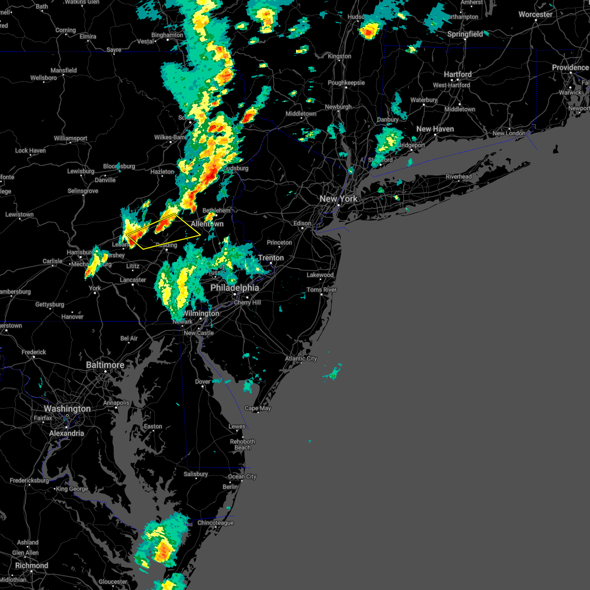 At 228 pm edt, a severe thunderstorm was located near myerstown, moving northeast at 35 mph (radar indicated). Hazards include 60 mph wind gusts and quarter size hail. Minor damage to vehicles is possible. Wind damage to roofs, siding, trees, and power lines is possible. At 228 pm edt, a severe thunderstorm was located near myerstown, moving northeast at 35 mph (radar indicated). Hazards include 60 mph wind gusts and quarter size hail. Minor damage to vehicles is possible. Wind damage to roofs, siding, trees, and power lines is possible.
|
| 5/16/2022 2:23 PM EDT |
 At 223 pm edt, a severe thunderstorm was located over hamburg, or 13 miles southeast of schuylkill haven, moving northeast at 25 mph (radar indicated). Hazards include 60 mph wind gusts. Damage to roofs, siding, trees, and power lines is possible. locations impacted include, kutztown, hamburg, shoemakersville, lenhartsville and centerport. this includes interstate 78 in pennsylvania between mile markers 28 and 44. hail threat, radar indicated max hail size, <. 75 in wind threat, radar indicated max wind gust, 60 mph. At 223 pm edt, a severe thunderstorm was located over hamburg, or 13 miles southeast of schuylkill haven, moving northeast at 25 mph (radar indicated). Hazards include 60 mph wind gusts. Damage to roofs, siding, trees, and power lines is possible. locations impacted include, kutztown, hamburg, shoemakersville, lenhartsville and centerport. this includes interstate 78 in pennsylvania between mile markers 28 and 44. hail threat, radar indicated max hail size, <. 75 in wind threat, radar indicated max wind gust, 60 mph.
|
| 5/16/2022 2:09 PM EDT |
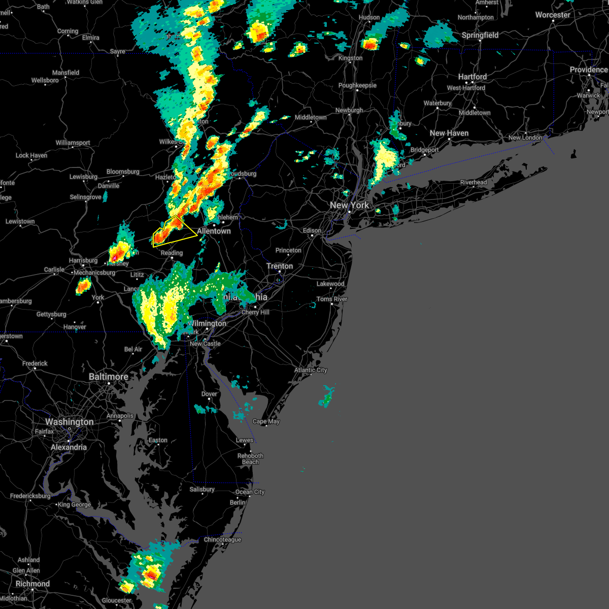 At 209 pm edt, a severe thunderstorm was located near shoemakersville, or 10 miles southeast of schuylkill haven, moving northeast at 35 mph (radar indicated). Hazards include 60 mph wind gusts and quarter size hail. Minor damage to vehicles is possible. wind damage to roofs, siding, trees, and power lines is possible. locations impacted include, kutztown, hamburg, topton, leesport, shoemakersville, bernville, lenhartsville and centerport. this includes interstate 78 in pennsylvania between mile markers 23 and 44. hail threat, radar indicated max hail size, 1. 00 in wind threat, radar indicated max wind gust, 60 mph. At 209 pm edt, a severe thunderstorm was located near shoemakersville, or 10 miles southeast of schuylkill haven, moving northeast at 35 mph (radar indicated). Hazards include 60 mph wind gusts and quarter size hail. Minor damage to vehicles is possible. wind damage to roofs, siding, trees, and power lines is possible. locations impacted include, kutztown, hamburg, topton, leesport, shoemakersville, bernville, lenhartsville and centerport. this includes interstate 78 in pennsylvania between mile markers 23 and 44. hail threat, radar indicated max hail size, 1. 00 in wind threat, radar indicated max wind gust, 60 mph.
|
| 5/16/2022 1:53 PM EDT |
 At 153 pm edt, a severe thunderstorm was located near bernville, or 11 miles southeast of schuylkill haven, moving northeast at 25 mph (radar indicated). Hazards include 60 mph wind gusts and quarter size hail. Minor damage to vehicles is possible. wind damage to roofs, siding, trees, and power lines is possible. locations impacted include, kutztown, hamburg, womelsdorf, topton, leesport, shoemakersville, bernville, lenhartsville, fairview hgts and centerport. this includes interstate 78 in pennsylvania between mile markers 22 and 44. hail threat, radar indicated max hail size, 1. 00 in wind threat, radar indicated max wind gust, 60 mph. At 153 pm edt, a severe thunderstorm was located near bernville, or 11 miles southeast of schuylkill haven, moving northeast at 25 mph (radar indicated). Hazards include 60 mph wind gusts and quarter size hail. Minor damage to vehicles is possible. wind damage to roofs, siding, trees, and power lines is possible. locations impacted include, kutztown, hamburg, womelsdorf, topton, leesport, shoemakersville, bernville, lenhartsville, fairview hgts and centerport. this includes interstate 78 in pennsylvania between mile markers 22 and 44. hail threat, radar indicated max hail size, 1. 00 in wind threat, radar indicated max wind gust, 60 mph.
|
| 5/16/2022 1:42 PM EDT |
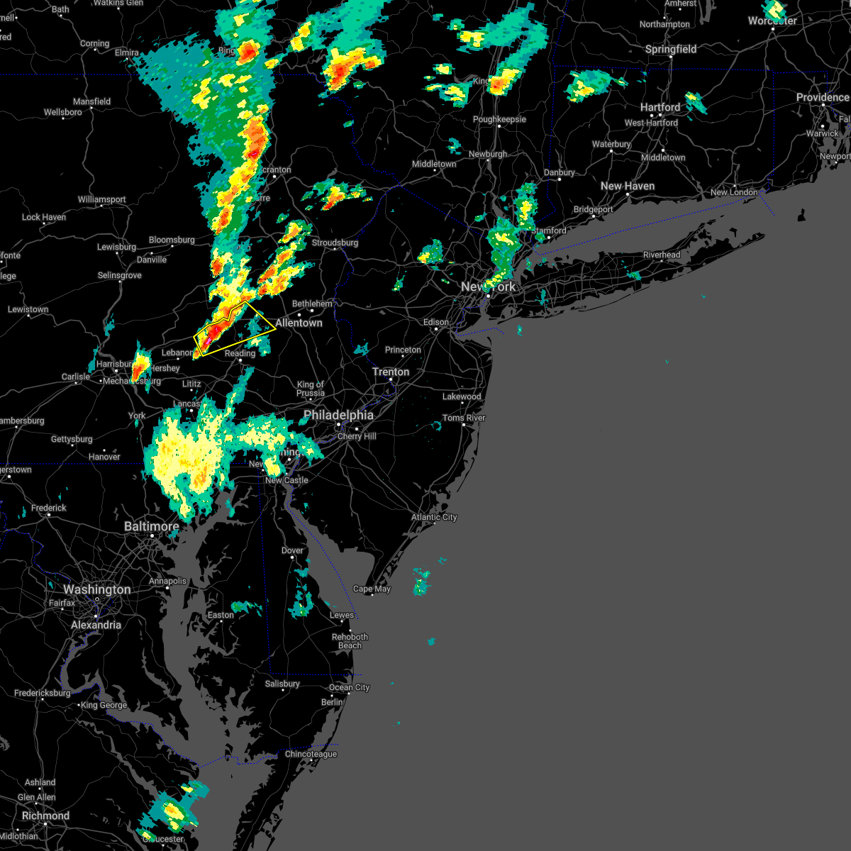 At 141 pm edt, a severe thunderstorm was located near bernville, or 8 miles northeast of myerstown, moving northeast at 25 mph (radar indicated). Hazards include 60 mph wind gusts and quarter size hail. Minor damage to vehicles is possible. Wind damage to roofs, siding, trees, and power lines is possible. At 141 pm edt, a severe thunderstorm was located near bernville, or 8 miles northeast of myerstown, moving northeast at 25 mph (radar indicated). Hazards include 60 mph wind gusts and quarter size hail. Minor damage to vehicles is possible. Wind damage to roofs, siding, trees, and power lines is possible.
|
| 3/31/2022 7:54 PM EDT |
 At 754 pm edt, a severe thunderstorm was located over ancient oaks, or 7 miles southwest of allentown, moving east at 65 mph (radar indicated). Hazards include 60 mph wind gusts. Damage to roofs, siding, trees, and power lines is possible. locations impacted include, allentown, reading, lehighton, bethlehem, emmaus, wyomissing, northampton, palmerton, birdsboro, kutztown, jim thorpe, hamburg, slatington, fleetwood, sinking spring, laureldale, nesquehoning, womelsdorf, wernersville and walnutport. this includes the following highways, pennsylvania turnpike between mile markers 296 and 299. northeast extension between mile markers 49 and 83. interstate 78 in pennsylvania between mile markers 17 and 66. interstate 176 in pennsylvania between mile markers 1 and 11. hail threat, radar indicated max hail size, <. 75 in wind threat, radar indicated max wind gust, 60 mph. At 754 pm edt, a severe thunderstorm was located over ancient oaks, or 7 miles southwest of allentown, moving east at 65 mph (radar indicated). Hazards include 60 mph wind gusts. Damage to roofs, siding, trees, and power lines is possible. locations impacted include, allentown, reading, lehighton, bethlehem, emmaus, wyomissing, northampton, palmerton, birdsboro, kutztown, jim thorpe, hamburg, slatington, fleetwood, sinking spring, laureldale, nesquehoning, womelsdorf, wernersville and walnutport. this includes the following highways, pennsylvania turnpike between mile markers 296 and 299. northeast extension between mile markers 49 and 83. interstate 78 in pennsylvania between mile markers 17 and 66. interstate 176 in pennsylvania between mile markers 1 and 11. hail threat, radar indicated max hail size, <. 75 in wind threat, radar indicated max wind gust, 60 mph.
|
| 3/31/2022 7:27 PM EDT |
 At 726 pm edt, a severe thunderstorm was located over strausstown, or 10 miles northeast of myerstown, moving east at 65 mph (radar indicated). Hazards include 60 mph wind gusts. damage to roofs, siding, trees, and power lines is possible At 726 pm edt, a severe thunderstorm was located over strausstown, or 10 miles northeast of myerstown, moving east at 65 mph (radar indicated). Hazards include 60 mph wind gusts. damage to roofs, siding, trees, and power lines is possible
|
| 3/31/2022 7:20 PM EDT |
 At 720 pm edt, severe thunderstorms were located along a line extending from fredericksburg to littlestown, moving northeast at 65 mph (radar indicated). Hazards include 60 mph wind gusts and nickel size hail. expect damage to roofs, siding, and trees At 720 pm edt, severe thunderstorms were located along a line extending from fredericksburg to littlestown, moving northeast at 65 mph (radar indicated). Hazards include 60 mph wind gusts and nickel size hail. expect damage to roofs, siding, and trees
|
| 3/19/2022 5:55 PM EDT |
 At 555 pm edt, severe thunderstorms were located along a line extending from mcadoo to tuscarora to port carbon, moving east at 35 mph (radar indicated). Hazards include 60 mph wind gusts and penny size hail. expect damage to roofs, siding, and trees At 555 pm edt, severe thunderstorms were located along a line extending from mcadoo to tuscarora to port carbon, moving east at 35 mph (radar indicated). Hazards include 60 mph wind gusts and penny size hail. expect damage to roofs, siding, and trees
|
| 3/7/2022 7:52 PM EST |
 At 750 pm est, severe showers and embedded thunderstorms were located along a line extending from near prompton to near lehighton to near mount joy, moving east at 60 mph. this line has had a history of producing areas of wind damage (radar indicated). Hazards include 60 mph wind gusts. Damage to roofs, siding, trees, and power lines is possible. locations impacted include, allentown, reading, easton, lehighton, mount pocono, bethlehem, forks, emmaus, wyomissing, northampton, east stroudsburg, tobyhanna, wilson, hellertown, nazareth, palmerton, bangor, kutztown, jim thorpe and hamburg. this includes the following highways, northeast extension between mile markers 46 and 97. interstate 78 in pennsylvania near mile marker 8, and between mile markers 10 and 75. interstate 80 in pennsylvania between mile markers 278 and 314. interstate 380 in pennsylvania between mile markers 0 and 13. hail threat, radar indicated max hail size, <. 75 in wind threat, radar indicated max wind gust, 60 mph. At 750 pm est, severe showers and embedded thunderstorms were located along a line extending from near prompton to near lehighton to near mount joy, moving east at 60 mph. this line has had a history of producing areas of wind damage (radar indicated). Hazards include 60 mph wind gusts. Damage to roofs, siding, trees, and power lines is possible. locations impacted include, allentown, reading, easton, lehighton, mount pocono, bethlehem, forks, emmaus, wyomissing, northampton, east stroudsburg, tobyhanna, wilson, hellertown, nazareth, palmerton, bangor, kutztown, jim thorpe and hamburg. this includes the following highways, northeast extension between mile markers 46 and 97. interstate 78 in pennsylvania near mile marker 8, and between mile markers 10 and 75. interstate 80 in pennsylvania between mile markers 278 and 314. interstate 380 in pennsylvania between mile markers 0 and 13. hail threat, radar indicated max hail size, <. 75 in wind threat, radar indicated max wind gust, 60 mph.
|
| 3/7/2022 7:48 PM EST |
 At 748 pm est, severe thunderstorms were located along a line extending from tamaqua to quentin, moving east at 60 mph (radar indicated). Hazards include 60 mph wind gusts. Expect damage to roofs, siding, and trees. locations impacted include, lebanon, pottsville, palmyra, tamaqua, schuylkill haven, myerstown, st. clair, annville, minersville, campbelltown, orwigsburg, pleasant hill, sand hill, newmanstown, lebanon south, pine grove, cleona, port carbon, avon and richland. this includes the following interstates, interstate 78 from mile markers 0 to 8. interstate 81 between mile markers 88 and 89, near mile marker 99, and from mile markers 127 to 132. hail threat, radar indicated max hail size, <. 75 in wind threat, radar indicated max wind gust, 60 mph. At 748 pm est, severe thunderstorms were located along a line extending from tamaqua to quentin, moving east at 60 mph (radar indicated). Hazards include 60 mph wind gusts. Expect damage to roofs, siding, and trees. locations impacted include, lebanon, pottsville, palmyra, tamaqua, schuylkill haven, myerstown, st. clair, annville, minersville, campbelltown, orwigsburg, pleasant hill, sand hill, newmanstown, lebanon south, pine grove, cleona, port carbon, avon and richland. this includes the following interstates, interstate 78 from mile markers 0 to 8. interstate 81 between mile markers 88 and 89, near mile marker 99, and from mile markers 127 to 132. hail threat, radar indicated max hail size, <. 75 in wind threat, radar indicated max wind gust, 60 mph.
|
| 3/7/2022 7:30 PM EST |
 At 730 pm est, severe thunderstorms were located along a line extending from branchdale to colonial park, moving east at 65 mph (radar indicated). Hazards include 60 mph wind gusts. Expect damage to roofs, siding, and trees. locations impacted include, harrisburg, lebanon, pottsville, hershey, palmyra, new cumberland, tamaqua, linglestown, schuylkill haven, shenandoah, lemoyne, myerstown, st. clair, colonial park, progress, steelton, paxtonia, annville, hummelstown and minersville. this includes the following interstates, interstate 78 from mile markers 0 to 8. interstate 81 from mile markers 66 to 139. interstate 83 from mile markers 42 to 50. interstate 283 near mile marker 2. hail threat, radar indicated max hail size, <. 75 in wind threat, radar indicated max wind gust, 60 mph. At 730 pm est, severe thunderstorms were located along a line extending from branchdale to colonial park, moving east at 65 mph (radar indicated). Hazards include 60 mph wind gusts. Expect damage to roofs, siding, and trees. locations impacted include, harrisburg, lebanon, pottsville, hershey, palmyra, new cumberland, tamaqua, linglestown, schuylkill haven, shenandoah, lemoyne, myerstown, st. clair, colonial park, progress, steelton, paxtonia, annville, hummelstown and minersville. this includes the following interstates, interstate 78 from mile markers 0 to 8. interstate 81 from mile markers 66 to 139. interstate 83 from mile markers 42 to 50. interstate 283 near mile marker 2. hail threat, radar indicated max hail size, <. 75 in wind threat, radar indicated max wind gust, 60 mph.
|
| 3/7/2022 7:29 PM EST |
 At 727 pm est, severe showers and embedded thunderstorms were located along a line extending from near hop bottom to shenandoah to shiremanstown, moving east at 60 mph. this line has had a history of producing wind damage to the west (radar indicated). Hazards include 60 mph wind gusts. damage to roofs, siding, trees, and power lines is possible At 727 pm est, severe showers and embedded thunderstorms were located along a line extending from near hop bottom to shenandoah to shiremanstown, moving east at 60 mph. this line has had a history of producing wind damage to the west (radar indicated). Hazards include 60 mph wind gusts. damage to roofs, siding, trees, and power lines is possible
|
| 3/7/2022 7:00 PM EST |
 At 700 pm est, severe thunderstorms were located along a line extending from meiserville to plainfield, moving east at 55 mph (radar indicated). Hazards include 60 mph wind gusts. expect damage to roofs, siding, and trees At 700 pm est, severe thunderstorms were located along a line extending from meiserville to plainfield, moving east at 55 mph (radar indicated). Hazards include 60 mph wind gusts. expect damage to roofs, siding, and trees
|
| 9/15/2021 6:17 PM EDT |
 At 617 pm edt, a severe thunderstorm was located near pine grove, moving east at 35 mph (radar indicated). Hazards include 60 mph wind gusts and quarter size hail. Hail damage to vehicles is expected. Expect wind damage to roofs, siding, and trees. At 617 pm edt, a severe thunderstorm was located near pine grove, moving east at 35 mph (radar indicated). Hazards include 60 mph wind gusts and quarter size hail. Hail damage to vehicles is expected. Expect wind damage to roofs, siding, and trees.
|
| 9/8/2021 10:48 PM EDT |
 At 1048 pm edt, severe thunderstorms were located along a line extending from near wanamakers to shoemakersville, moving northeast at 40 mph (radar indicated). Hazards include 60 mph wind gusts and penny size hail. Damage to roofs, siding, trees, and power lines is possible. locations impacted include, reading, wyomissing, kutztown, hamburg, fleetwood, sinking spring, laureldale, wernersville, leesport, shoemakersville, lyons, lenhartsville, fairview hgts, spring ridge, shillington, west reading, mohnton, centerport, wyomissing hills and west lawn. This includes interstate 78 in pennsylvania between mile markers 28 and 41. At 1048 pm edt, severe thunderstorms were located along a line extending from near wanamakers to shoemakersville, moving northeast at 40 mph (radar indicated). Hazards include 60 mph wind gusts and penny size hail. Damage to roofs, siding, trees, and power lines is possible. locations impacted include, reading, wyomissing, kutztown, hamburg, fleetwood, sinking spring, laureldale, wernersville, leesport, shoemakersville, lyons, lenhartsville, fairview hgts, spring ridge, shillington, west reading, mohnton, centerport, wyomissing hills and west lawn. This includes interstate 78 in pennsylvania between mile markers 28 and 41.
|
| 9/8/2021 10:26 PM EDT |
 At 1026 pm edt, severe thunderstorms were located along a line extending from near strausstown to womelsdorf, moving northeast at 40 mph (radar indicated). Hazards include 60 mph wind gusts and quarter size hail. Minor damage to vehicles is possible. wind damage to roofs, siding, trees, and power lines is possible. locations impacted include, reading, wyomissing, kutztown, hamburg, fleetwood, sinking spring, laureldale, womelsdorf, wernersville, robesonia, leesport, shoemakersville, bernville, lyons, strausstown, lenhartsville, spring ridge, fairview hgts, shillington and west reading. This includes interstate 78 in pennsylvania between mile markers 15 and 41. At 1026 pm edt, severe thunderstorms were located along a line extending from near strausstown to womelsdorf, moving northeast at 40 mph (radar indicated). Hazards include 60 mph wind gusts and quarter size hail. Minor damage to vehicles is possible. wind damage to roofs, siding, trees, and power lines is possible. locations impacted include, reading, wyomissing, kutztown, hamburg, fleetwood, sinking spring, laureldale, womelsdorf, wernersville, robesonia, leesport, shoemakersville, bernville, lyons, strausstown, lenhartsville, spring ridge, fairview hgts, shillington and west reading. This includes interstate 78 in pennsylvania between mile markers 15 and 41.
|
| 9/8/2021 10:11 PM EDT |
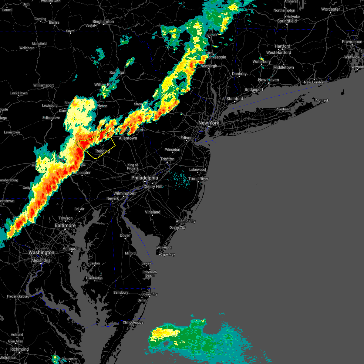 At 1010 pm edt, severe thunderstorms were located along a line extending from near strausstown to near schaefferstown, moving northeast at 40 mph (radar indicated). Hazards include 60 mph wind gusts and quarter size hail. Minor damage to vehicles is possible. Wind damage to roofs, siding, trees, and power lines is possible. At 1010 pm edt, severe thunderstorms were located along a line extending from near strausstown to near schaefferstown, moving northeast at 40 mph (radar indicated). Hazards include 60 mph wind gusts and quarter size hail. Minor damage to vehicles is possible. Wind damage to roofs, siding, trees, and power lines is possible.
|
| 8/12/2021 10:57 PM EDT |
 At 1057 pm edt, severe thunderstorms were located along a line extending from near tuscarora to near strausstown, moving east at 50 mph (radar indicated). Hazards include 60 mph wind gusts. Expect damage to roofs, siding, and trees. locations impacted include, pottsville, tamaqua, schuylkill haven, shenandoah, minersville, mahanoy city, frackville, st. clair, orwigsburg, pine grove, port carbon, hometown, tuscarora, new philadelphia, friedensburg, grier city-park crest, marlin, altamont, renningers and englewood. this includes interstate 81 from mile markers 123 to 135. hail threat, radar indicated max hail size, <. 75 in wind threat, radar indicated max wind gust, 60 mph. At 1057 pm edt, severe thunderstorms were located along a line extending from near tuscarora to near strausstown, moving east at 50 mph (radar indicated). Hazards include 60 mph wind gusts. Expect damage to roofs, siding, and trees. locations impacted include, pottsville, tamaqua, schuylkill haven, shenandoah, minersville, mahanoy city, frackville, st. clair, orwigsburg, pine grove, port carbon, hometown, tuscarora, new philadelphia, friedensburg, grier city-park crest, marlin, altamont, renningers and englewood. this includes interstate 81 from mile markers 123 to 135. hail threat, radar indicated max hail size, <. 75 in wind threat, radar indicated max wind gust, 60 mph.
|
| 8/12/2021 10:46 PM EDT |
 At 1046 pm edt, severe thunderstorms were located along a line extending from mahanoy city to lickdale, moving east at 45 mph (radar indicated). Hazards include 60 mph wind gusts. Expect damage to roofs, siding, and trees. locations impacted include, pottsville, tamaqua, schuylkill haven, shenandoah, minersville, mahanoy city, frackville, st. clair, ashland, orwigsburg, mcadoo, pine grove, port carbon, tremont, girardville, fredericksburg, hometown, tuscarora, new philadelphia and oneida. this includes the following interstates, interstate 78 from mile markers 0 to 8. interstate 81 from mile markers 82 to 139. hail threat, radar indicated max hail size, <. 75 in wind threat, radar indicated max wind gust, 60 mph. At 1046 pm edt, severe thunderstorms were located along a line extending from mahanoy city to lickdale, moving east at 45 mph (radar indicated). Hazards include 60 mph wind gusts. Expect damage to roofs, siding, and trees. locations impacted include, pottsville, tamaqua, schuylkill haven, shenandoah, minersville, mahanoy city, frackville, st. clair, ashland, orwigsburg, mcadoo, pine grove, port carbon, tremont, girardville, fredericksburg, hometown, tuscarora, new philadelphia and oneida. this includes the following interstates, interstate 78 from mile markers 0 to 8. interstate 81 from mile markers 82 to 139. hail threat, radar indicated max hail size, <. 75 in wind threat, radar indicated max wind gust, 60 mph.
|
| 7/11/2021 10:22 PM EDT |
 At 1021 pm edt, severe thunderstorms were located along a line extending from near weatherly to near snyders to near hamburg, moving east at 30 mph (radar indicated). Hazards include 60 mph wind gusts. damage to roofs, siding, trees, and power lines is possible At 1021 pm edt, severe thunderstorms were located along a line extending from near weatherly to near snyders to near hamburg, moving east at 30 mph (radar indicated). Hazards include 60 mph wind gusts. damage to roofs, siding, trees, and power lines is possible
|
| 7/11/2021 10:16 PM EDT |
 At 1016 pm edt, severe thunderstorms were located along a line extending from mcadoo to tamaqua to near mckeansburg to near strausstown, moving east at 35 mph (radar indicated). Hazards include 60 mph wind gusts. Expect damage to roofs, siding, and trees. locations impacted include, tamaqua, mcadoo, hometown, mckeansburg, coaldale, snyders, lake wynonah, auburn, deer lake, kelayres, port clinton and new ringgold. This includes interstate 81 from mile markers 137 to 139. At 1016 pm edt, severe thunderstorms were located along a line extending from mcadoo to tamaqua to near mckeansburg to near strausstown, moving east at 35 mph (radar indicated). Hazards include 60 mph wind gusts. Expect damage to roofs, siding, and trees. locations impacted include, tamaqua, mcadoo, hometown, mckeansburg, coaldale, snyders, lake wynonah, auburn, deer lake, kelayres, port clinton and new ringgold. This includes interstate 81 from mile markers 137 to 139.
|
| 7/11/2021 9:52 PM EDT |
 At 952 pm edt, severe thunderstorms were located along a line extending from nuremburg to near altamont to near pine grove, moving east at 30 mph (radar indicated). Hazards include 60 mph wind gusts. expect damage to roofs, siding, and trees At 952 pm edt, severe thunderstorms were located along a line extending from nuremburg to near altamont to near pine grove, moving east at 30 mph (radar indicated). Hazards include 60 mph wind gusts. expect damage to roofs, siding, and trees
|
| 7/8/2021 5:18 PM EDT |
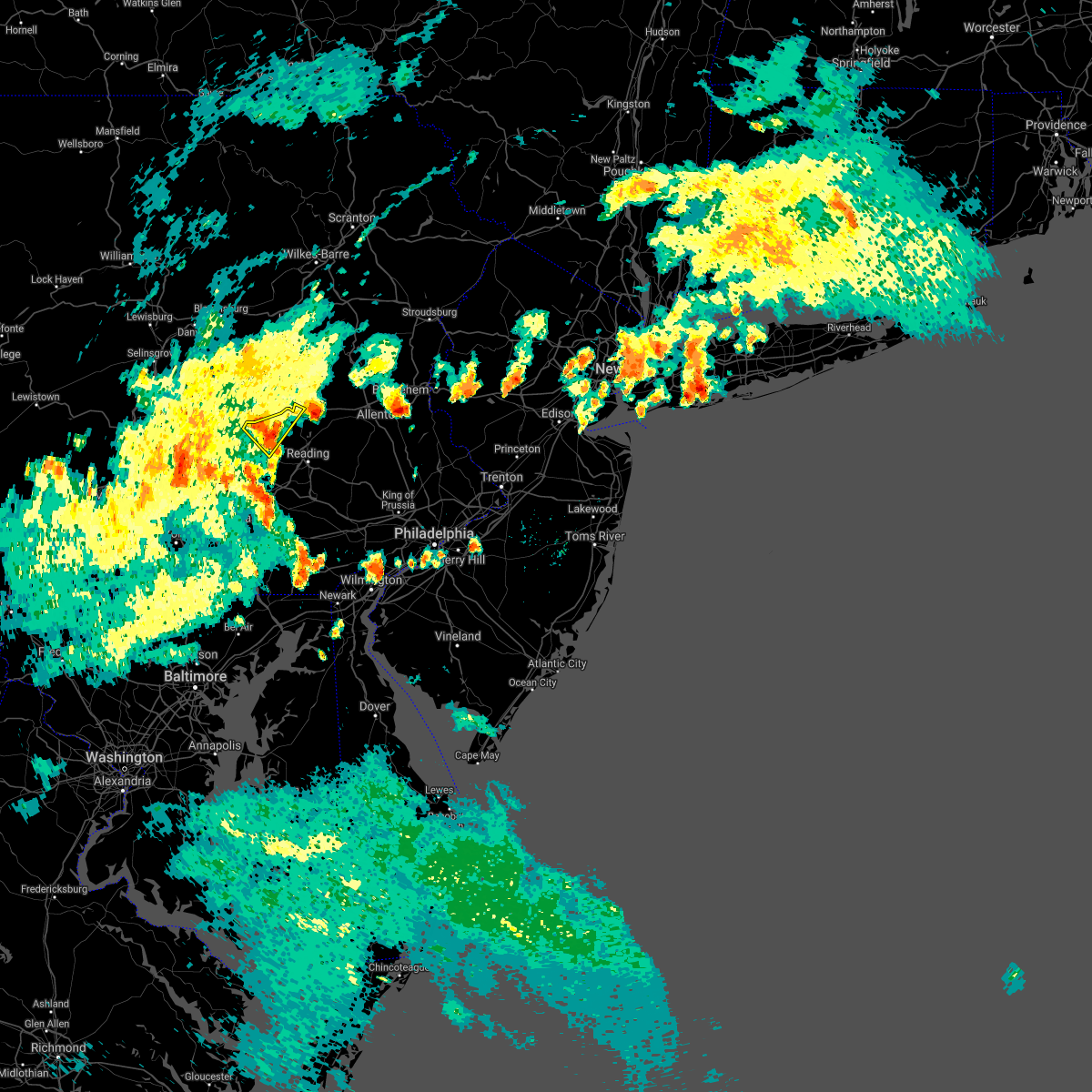 At 518 pm edt, a severe thunderstorm was located over strausstown, or 10 miles south of schuylkill haven, moving northeast at 25 mph (radar indicated). Hazards include 60 mph wind gusts and quarter size hail. Minor damage to vehicles is possible. wind damage to roofs, siding, trees, and power lines is possible. locations impacted include, hamburg, bernville and strausstown. This includes interstate 78 in pennsylvania between mile markers 14 and 32. At 518 pm edt, a severe thunderstorm was located over strausstown, or 10 miles south of schuylkill haven, moving northeast at 25 mph (radar indicated). Hazards include 60 mph wind gusts and quarter size hail. Minor damage to vehicles is possible. wind damage to roofs, siding, trees, and power lines is possible. locations impacted include, hamburg, bernville and strausstown. This includes interstate 78 in pennsylvania between mile markers 14 and 32.
|
| 7/8/2021 5:06 PM EDT |
 The severe thunderstorm warning for central berks county will expire at 515 pm edt, the storm which prompted the warning has weakened below severe limits, and no longer poses an immediate threat to life or property. therefore, the warning will be allowed to expire. however small hail, gusty winds, and heavy rain are still possible with this thunderstorm. a severe thunderstorm watch remains in effect until 900 pm edt for eastern pennsylvania. The severe thunderstorm warning for central berks county will expire at 515 pm edt, the storm which prompted the warning has weakened below severe limits, and no longer poses an immediate threat to life or property. therefore, the warning will be allowed to expire. however small hail, gusty winds, and heavy rain are still possible with this thunderstorm. a severe thunderstorm watch remains in effect until 900 pm edt for eastern pennsylvania.
|
| 7/8/2021 5:06 PM EDT |
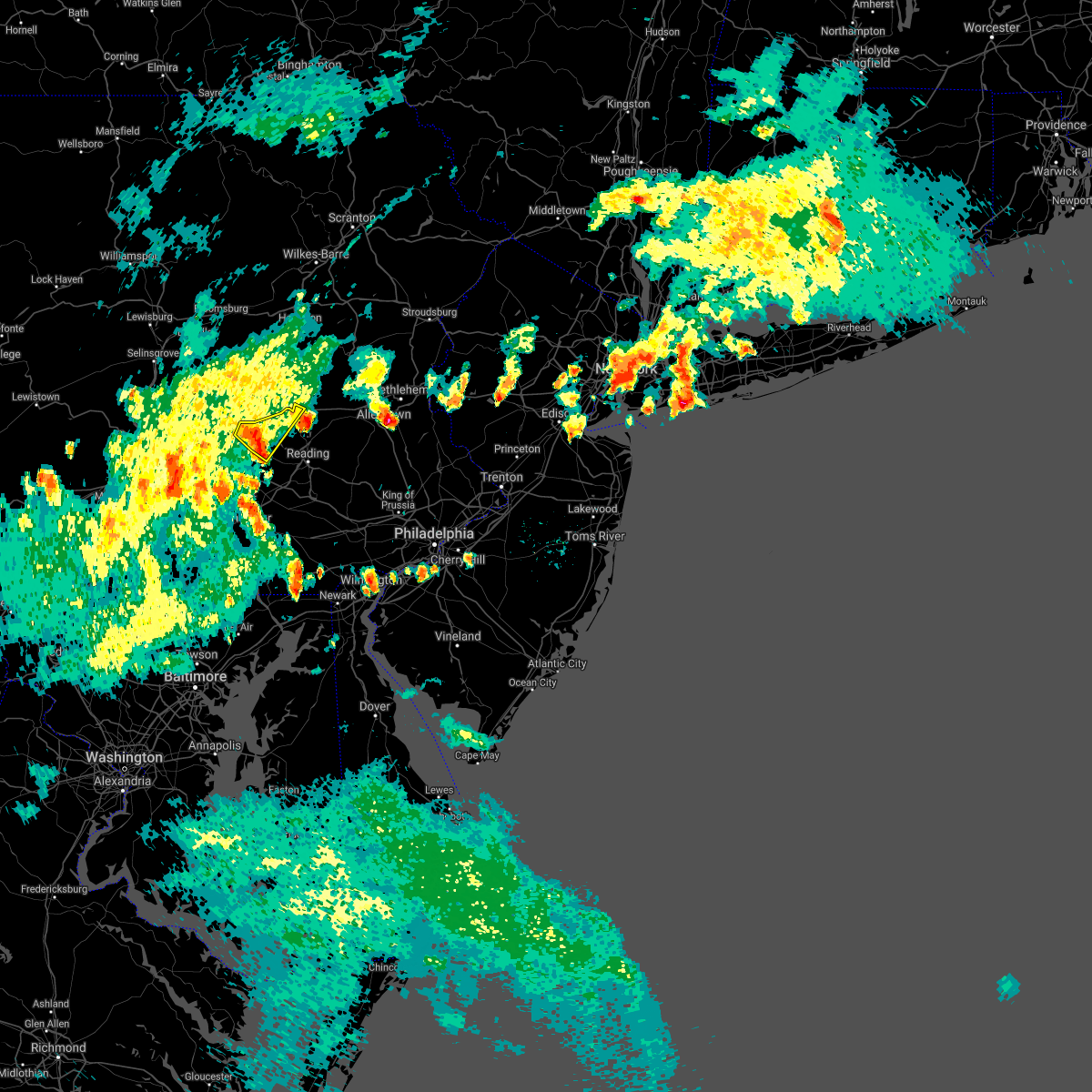 At 506 pm edt, a severe thunderstorm was located near womelsdorf, or near myerstown, moving northeast at 25 mph (radar indicated). Hazards include 60 mph wind gusts and quarter size hail. Minor damage to vehicles is possible. wind damage to roofs, siding, trees, and power lines is possible. locations impacted include, hamburg, womelsdorf, bernville and strausstown. This includes interstate 78 in pennsylvania between mile markers 10 and 32. At 506 pm edt, a severe thunderstorm was located near womelsdorf, or near myerstown, moving northeast at 25 mph (radar indicated). Hazards include 60 mph wind gusts and quarter size hail. Minor damage to vehicles is possible. wind damage to roofs, siding, trees, and power lines is possible. locations impacted include, hamburg, womelsdorf, bernville and strausstown. This includes interstate 78 in pennsylvania between mile markers 10 and 32.
|
| 7/8/2021 4:52 PM EDT |
 At 452 pm edt, a severe thunderstorm was located over fairview hgts, or 9 miles northwest of reading, moving northeast at 25 mph (radar indicated). Hazards include 60 mph wind gusts and quarter size hail. Minor damage to vehicles is possible. wind damage to roofs, siding, trees, and power lines is possible. locations impacted include, hamburg, fleetwood, leesport, shoemakersville, bernville, fairview hgts and centerport. This includes interstate 78 in pennsylvania between mile markers 27 and 32. At 452 pm edt, a severe thunderstorm was located over fairview hgts, or 9 miles northwest of reading, moving northeast at 25 mph (radar indicated). Hazards include 60 mph wind gusts and quarter size hail. Minor damage to vehicles is possible. wind damage to roofs, siding, trees, and power lines is possible. locations impacted include, hamburg, fleetwood, leesport, shoemakersville, bernville, fairview hgts and centerport. This includes interstate 78 in pennsylvania between mile markers 27 and 32.
|
| 7/8/2021 4:51 PM EDT |
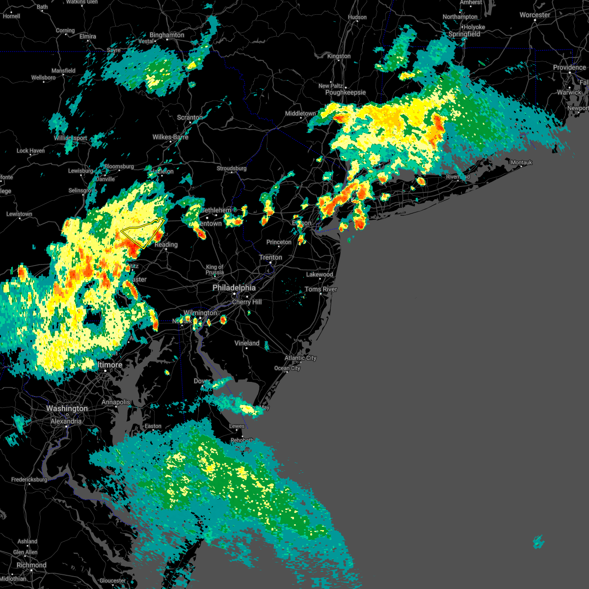 At 451 pm edt, a severe thunderstorm was located over myerstown, moving northeast at 20 mph (radar indicated). Hazards include 60 mph wind gusts and quarter size hail. Minor damage to vehicles is possible. Wind damage to roofs, siding, trees, and power lines is possible. At 451 pm edt, a severe thunderstorm was located over myerstown, moving northeast at 20 mph (radar indicated). Hazards include 60 mph wind gusts and quarter size hail. Minor damage to vehicles is possible. Wind damage to roofs, siding, trees, and power lines is possible.
|
| 7/8/2021 4:25 PM EDT |
 At 425 pm edt, a severe thunderstorm was located over robesonia, or 8 miles east of myerstown, moving northeast at 25 mph (radar indicated). Hazards include 60 mph wind gusts and quarter size hail. Minor damage to vehicles is possible. Wind damage to roofs, siding, trees, and power lines is possible. At 425 pm edt, a severe thunderstorm was located over robesonia, or 8 miles east of myerstown, moving northeast at 25 mph (radar indicated). Hazards include 60 mph wind gusts and quarter size hail. Minor damage to vehicles is possible. Wind damage to roofs, siding, trees, and power lines is possible.
|
| 6/21/2021 7:20 PM EDT |
 At 719 pm edt, severe thunderstorms were located along a line extending from near nesquehoning to near lenhartsville, moving northeast at 45 mph (law enforcement. several reports of trees and wires down have been received from western portions of berks county). Hazards include 60 mph wind gusts and penny size hail. Damage to roofs, siding, trees, and power lines is possible. locations impacted include, lehighton, northampton, palmerton, kutztown, jim thorpe, hamburg, slatington, fleetwood, nesquehoning, weatherly, walnutport, topton, leesport, shoemakersville, lyons, lenhartsville, new mahoning, neffs, coffeetown and new tripoli. this includes the following highways, northeast extension between mile markers 57 and 97. interstate 78 in pennsylvania between mile markers 30 and 54. Interstate 80 in pennsylvania between mile markers 277 and 283. At 719 pm edt, severe thunderstorms were located along a line extending from near nesquehoning to near lenhartsville, moving northeast at 45 mph (law enforcement. several reports of trees and wires down have been received from western portions of berks county). Hazards include 60 mph wind gusts and penny size hail. Damage to roofs, siding, trees, and power lines is possible. locations impacted include, lehighton, northampton, palmerton, kutztown, jim thorpe, hamburg, slatington, fleetwood, nesquehoning, weatherly, walnutport, topton, leesport, shoemakersville, lyons, lenhartsville, new mahoning, neffs, coffeetown and new tripoli. this includes the following highways, northeast extension between mile markers 57 and 97. interstate 78 in pennsylvania between mile markers 30 and 54. Interstate 80 in pennsylvania between mile markers 277 and 283.
|
| 6/21/2021 7:02 PM EDT |
 At 702 pm edt, severe thunderstorms were located along a line extending from nesquehoning to near kutztown, moving northeast at 30 mph (radar indicated). Hazards include 60 mph wind gusts and penny size hail. damage to roofs, siding, trees, and power lines is possible At 702 pm edt, severe thunderstorms were located along a line extending from nesquehoning to near kutztown, moving northeast at 30 mph (radar indicated). Hazards include 60 mph wind gusts and penny size hail. damage to roofs, siding, trees, and power lines is possible
|
| 6/21/2021 6:57 PM EDT |
 The severe thunderstorm warning for northern berks and northwestern lehigh counties will expire at 700 pm edt, the storm which prompted the warning has weakened below severe limits, and no longer poses an immediate threat to life or property. therefore, the warning will be allowed to expire. however, gusty winds are still possible with this thunderstorm. a severe thunderstorm watch remains in effect until midnight edt for eastern pennsylvania. The severe thunderstorm warning for northern berks and northwestern lehigh counties will expire at 700 pm edt, the storm which prompted the warning has weakened below severe limits, and no longer poses an immediate threat to life or property. therefore, the warning will be allowed to expire. however, gusty winds are still possible with this thunderstorm. a severe thunderstorm watch remains in effect until midnight edt for eastern pennsylvania.
|
| 6/21/2021 6:45 PM EDT |
 At 645 pm edt, a severe thunderstorm was located near lenhartsville, or 16 miles southeast of tamaqua, moving northeast at 20 mph (radar indicated). Hazards include 60 mph wind gusts and penny size hail. Damage to roofs, siding, trees, and power lines is possible. locations impacted include, kutztown, hamburg, sinking spring, womelsdorf, wernersville, robesonia, leesport, shoemakersville, bernville, strausstown, lenhartsville, fairview hgts, wanamakers, new tripoli, claussville, spring ridge, centerport and whitfield. This includes interstate 78 in pennsylvania between mile markers 18 and 46. At 645 pm edt, a severe thunderstorm was located near lenhartsville, or 16 miles southeast of tamaqua, moving northeast at 20 mph (radar indicated). Hazards include 60 mph wind gusts and penny size hail. Damage to roofs, siding, trees, and power lines is possible. locations impacted include, kutztown, hamburg, sinking spring, womelsdorf, wernersville, robesonia, leesport, shoemakersville, bernville, strausstown, lenhartsville, fairview hgts, wanamakers, new tripoli, claussville, spring ridge, centerport and whitfield. This includes interstate 78 in pennsylvania between mile markers 18 and 46.
|
| 6/21/2021 6:32 PM EDT |
 At 632 pm edt, a severe thunderstorm was located near wanamakers, or 11 miles south of tamaqua, moving northeast at 30 mph (radar indicated). Hazards include 60 mph wind gusts and quarter size hail. Minor damage to vehicles is possible. wind damage to roofs, siding, trees, and power lines is possible. locations impacted include, kutztown, hamburg, sinking spring, womelsdorf, wernersville, robesonia, leesport, shoemakersville, bernville, strausstown, lenhartsville, fairview hgts, wanamakers, new tripoli, claussville, spring ridge, centerport and whitfield. This includes interstate 78 in pennsylvania between mile markers 18 and 46. At 632 pm edt, a severe thunderstorm was located near wanamakers, or 11 miles south of tamaqua, moving northeast at 30 mph (radar indicated). Hazards include 60 mph wind gusts and quarter size hail. Minor damage to vehicles is possible. wind damage to roofs, siding, trees, and power lines is possible. locations impacted include, kutztown, hamburg, sinking spring, womelsdorf, wernersville, robesonia, leesport, shoemakersville, bernville, strausstown, lenhartsville, fairview hgts, wanamakers, new tripoli, claussville, spring ridge, centerport and whitfield. This includes interstate 78 in pennsylvania between mile markers 18 and 46.
|
| 6/21/2021 6:08 PM EDT |
 At 607 pm edt, a severe thunderstorm was located near shoemakersville, or 10 miles southeast of schuylkill haven, moving northeast at 30 mph (radar indicated). Hazards include 60 mph wind gusts and quarter size hail. Minor damage to vehicles is possible. Wind damage to roofs, siding, trees, and power lines is possible. At 607 pm edt, a severe thunderstorm was located near shoemakersville, or 10 miles southeast of schuylkill haven, moving northeast at 30 mph (radar indicated). Hazards include 60 mph wind gusts and quarter size hail. Minor damage to vehicles is possible. Wind damage to roofs, siding, trees, and power lines is possible.
|
| 6/14/2021 4:49 PM EDT |
 At 448 pm edt, severe thunderstorms were located along a line extending from near freeland to near weatherly to near tuscarora, moving east at 40 mph (radar indicated). Hazards include 60 mph wind gusts. Damage to roofs, siding, trees, and power lines is possible. locations impacted include, lehighton, palmerton, kutztown, jim thorpe, hamburg, slatington, fleetwood, nesquehoning, weatherly, walnutport, lenhartsville, new mahoning, neffs, lake harmony, new tripoli, berlinsville, albrightsville, emerald, kresgeville and sun valley. this includes the following highways, northeast extension between mile markers 63 and 97. interstate 78 in pennsylvania between mile markers 29 and 47. Interstate 80 in pennsylvania between mile markers 277 and 289. At 448 pm edt, severe thunderstorms were located along a line extending from near freeland to near weatherly to near tuscarora, moving east at 40 mph (radar indicated). Hazards include 60 mph wind gusts. Damage to roofs, siding, trees, and power lines is possible. locations impacted include, lehighton, palmerton, kutztown, jim thorpe, hamburg, slatington, fleetwood, nesquehoning, weatherly, walnutport, lenhartsville, new mahoning, neffs, lake harmony, new tripoli, berlinsville, albrightsville, emerald, kresgeville and sun valley. this includes the following highways, northeast extension between mile markers 63 and 97. interstate 78 in pennsylvania between mile markers 29 and 47. Interstate 80 in pennsylvania between mile markers 277 and 289.
|
| 6/14/2021 4:15 PM EDT |
 At 413 pm edt, severe thunderstorms were located along a line extending from near east berwick to rock glen to locustdale, moving east at 40 mph (radar indicated). Hazards include 60 mph wind gusts and penny size hail. damage to roofs, siding, trees, and power lines is possible At 413 pm edt, severe thunderstorms were located along a line extending from near east berwick to rock glen to locustdale, moving east at 40 mph (radar indicated). Hazards include 60 mph wind gusts and penny size hail. damage to roofs, siding, trees, and power lines is possible
|
| 6/9/2021 6:03 PM EDT |
 At 601 pm edt, a severe thunderstorm was just east of schuylkill haven, moving north at 20 mph (radar indicated). Hazards include 60 mph wind gusts and quarter size hail. Hail damage to vehicles is expected. expect wind damage to roofs, siding, and trees. locations impacted include, pottsville, tamaqua, schuylkill haven, shenandoah, mahanoy city, frackville, st. clair, orwigsburg, mcadoo, port carbon, girardville, hometown, tuscarora, new philadelphia, oneida, grier city-park crest, marlin, altamont, renningers and englewood. This includes interstate 81 from mile markers 121 to 139. At 601 pm edt, a severe thunderstorm was just east of schuylkill haven, moving north at 20 mph (radar indicated). Hazards include 60 mph wind gusts and quarter size hail. Hail damage to vehicles is expected. expect wind damage to roofs, siding, and trees. locations impacted include, pottsville, tamaqua, schuylkill haven, shenandoah, mahanoy city, frackville, st. clair, orwigsburg, mcadoo, port carbon, girardville, hometown, tuscarora, new philadelphia, oneida, grier city-park crest, marlin, altamont, renningers and englewood. This includes interstate 81 from mile markers 121 to 139.
|
| 6/9/2021 5:46 PM EDT |
 At 546 pm edt, a severe thunderstorm was located over orwigsburg, moving north at 20 mph (radar indicated). Hazards include 60 mph wind gusts and quarter size hail. Hail damage to vehicles is expected. Expect wind damage to roofs, siding, and trees. At 546 pm edt, a severe thunderstorm was located over orwigsburg, moving north at 20 mph (radar indicated). Hazards include 60 mph wind gusts and quarter size hail. Hail damage to vehicles is expected. Expect wind damage to roofs, siding, and trees.
|
| 6/9/2021 5:27 PM EDT |
 At 527 pm edt, a severe thunderstorm was located over hamburg, or 12 miles east of schuylkill haven, moving northwest at 15 mph (radar indicated). Hazards include 60 mph wind gusts and penny size hail. damage to roofs, siding, trees, and power lines is possible At 527 pm edt, a severe thunderstorm was located over hamburg, or 12 miles east of schuylkill haven, moving northwest at 15 mph (radar indicated). Hazards include 60 mph wind gusts and penny size hail. damage to roofs, siding, trees, and power lines is possible
|
| 5/26/2021 9:26 PM EDT |
 At 925 pm edt, severe thunderstorms were located along a line extending from grier city-park crest to near orwigsburg to strausstown, moving east at 50 mph (radar indicated). Hazards include 60 mph wind gusts. expect damage to trees, roofs, and siding At 925 pm edt, severe thunderstorms were located along a line extending from grier city-park crest to near orwigsburg to strausstown, moving east at 50 mph (radar indicated). Hazards include 60 mph wind gusts. expect damage to trees, roofs, and siding
|
| 5/26/2021 6:52 PM EDT |
 At 651 pm edt, a severe thunderstorm was located over bernville, or 8 miles east of myerstown, moving east at 40 mph (radar indicated). Hazards include 60 mph wind gusts and quarter size hail. Minor damage to vehicles is possible. Wind damage to roofs, siding, trees, and power lines is possible. At 651 pm edt, a severe thunderstorm was located over bernville, or 8 miles east of myerstown, moving east at 40 mph (radar indicated). Hazards include 60 mph wind gusts and quarter size hail. Minor damage to vehicles is possible. Wind damage to roofs, siding, trees, and power lines is possible.
|
| 5/26/2021 4:43 PM EDT |
 At 441 pm edt, severe thunderstorms were located along a line extending from near coffeetown to near new morgan, moving east at 45 mph (radar and trained weather spotters). Hazards include 70 mph wind gusts and penny size hail. Expect considerable tree damage. damage is likely to mobile homes, roofs, and outbuildings. locations impacted include, allentown, reading, bethlehem, emmaus, wyomissing, birdsboro, kutztown, hamburg, fleetwood, sinking spring, laureldale, womelsdorf, wernersville, topton, robesonia, leesport, shoemakersville, bernville, lyons and lenhartsville. this includes the following highways, pennsylvania turnpike between mile markers 296 and 299. northeast extension between mile markers 53 and 61. interstate 78 in pennsylvania between mile markers 24 and 58. Interstate 176 in pennsylvania between mile markers 1 and 11. At 441 pm edt, severe thunderstorms were located along a line extending from near coffeetown to near new morgan, moving east at 45 mph (radar and trained weather spotters). Hazards include 70 mph wind gusts and penny size hail. Expect considerable tree damage. damage is likely to mobile homes, roofs, and outbuildings. locations impacted include, allentown, reading, bethlehem, emmaus, wyomissing, birdsboro, kutztown, hamburg, fleetwood, sinking spring, laureldale, womelsdorf, wernersville, topton, robesonia, leesport, shoemakersville, bernville, lyons and lenhartsville. this includes the following highways, pennsylvania turnpike between mile markers 296 and 299. northeast extension between mile markers 53 and 61. interstate 78 in pennsylvania between mile markers 24 and 58. Interstate 176 in pennsylvania between mile markers 1 and 11.
|
| 5/26/2021 4:10 PM EDT |
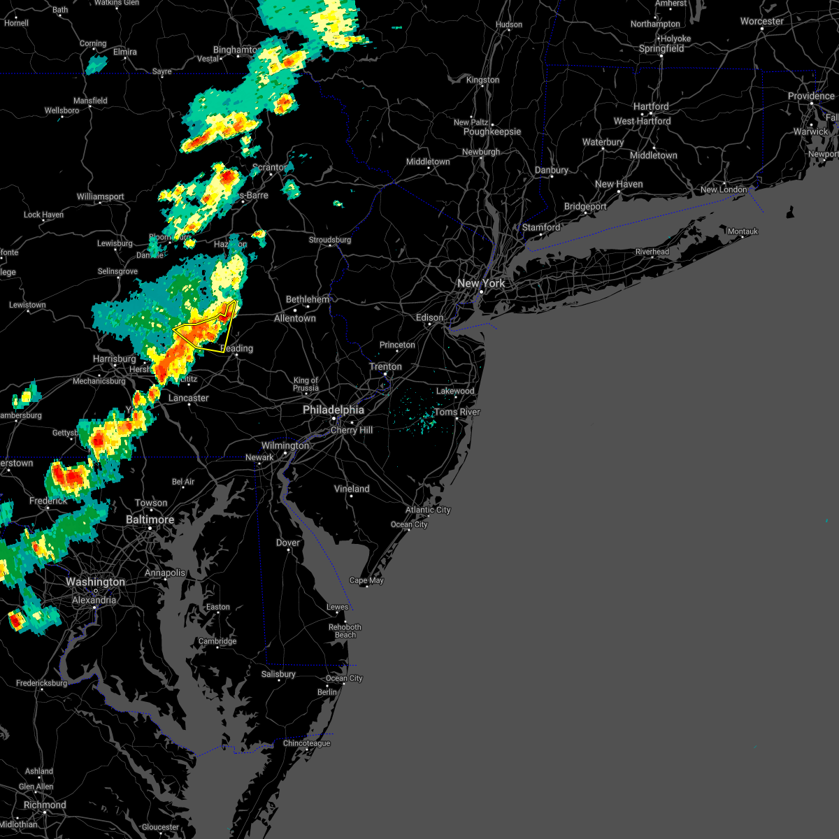 At 409 pm edt, severe thunderstorms were located along a line extending from near hamburg to near myerstown, moving east at 30 mph (radar indicated). Hazards include 60 mph wind gusts. Damage to roofs, siding, trees, and power lines is possible. locations impacted include, hamburg, bernville, strausstown, fairview hgts and centerport. This includes interstate 78 in pennsylvania between mile markers 10 and 32. At 409 pm edt, severe thunderstorms were located along a line extending from near hamburg to near myerstown, moving east at 30 mph (radar indicated). Hazards include 60 mph wind gusts. Damage to roofs, siding, trees, and power lines is possible. locations impacted include, hamburg, bernville, strausstown, fairview hgts and centerport. This includes interstate 78 in pennsylvania between mile markers 10 and 32.
|
| 5/26/2021 4:10 PM EDT |
 At 409 pm edt, severe thunderstorms were located along a line extending from hamburg to near lawn, moving east at 30 mph (radar indicated). Hazards include 60 mph wind gusts and penny size hail. damage to roofs, siding, trees, and power lines is possible At 409 pm edt, severe thunderstorms were located along a line extending from hamburg to near lawn, moving east at 30 mph (radar indicated). Hazards include 60 mph wind gusts and penny size hail. damage to roofs, siding, trees, and power lines is possible
|
| 5/26/2021 3:57 PM EDT |
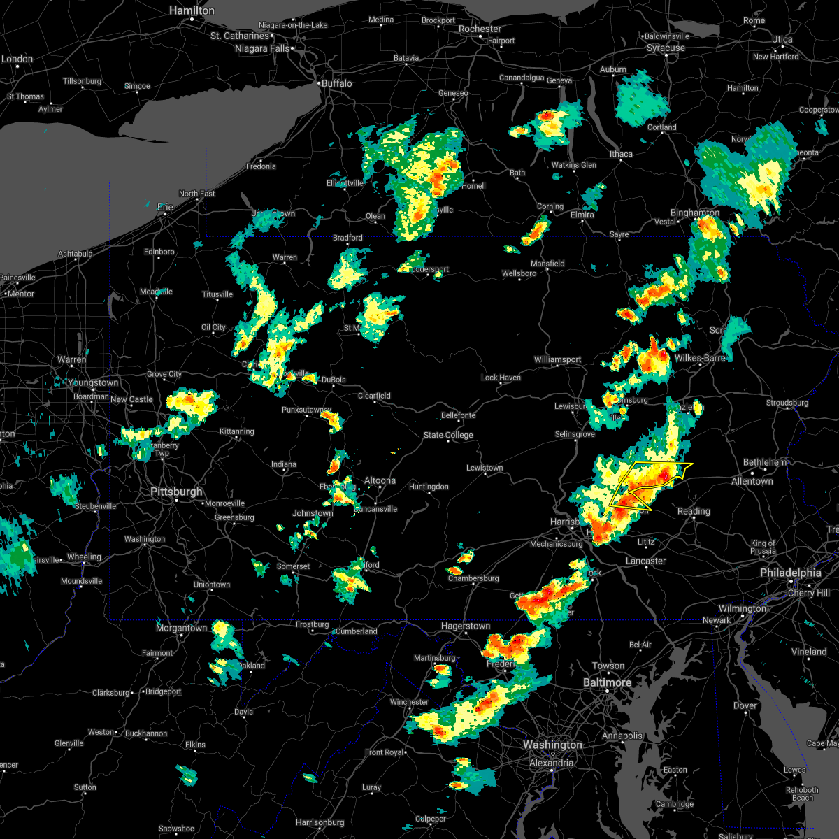 At 356 pm edt, severe thunderstorms were located along a line extending from schuylkill haven to near myerstown, moving east at 25 mph (radar indicated). Hazards include 60 mph wind gusts and nickel size hail. Expect damage to trees, roofs, and siding. locations impacted include, schuylkill haven, myerstown, orwigsburg, pine grove, tremont, fredericksburg, friedensburg, renningers, branchdale, donaldson, lickdale, fort indiantown gap, lake wynonah, jonestown, cressona, auburn, deer lake, ravine, port clinton and newtown. this includes the following interstates, interstate 78 from mile markers 0 to 8. Interstate 81 between mile markers 86 and 106, and from mile markers 111 to 112. At 356 pm edt, severe thunderstorms were located along a line extending from schuylkill haven to near myerstown, moving east at 25 mph (radar indicated). Hazards include 60 mph wind gusts and nickel size hail. Expect damage to trees, roofs, and siding. locations impacted include, schuylkill haven, myerstown, orwigsburg, pine grove, tremont, fredericksburg, friedensburg, renningers, branchdale, donaldson, lickdale, fort indiantown gap, lake wynonah, jonestown, cressona, auburn, deer lake, ravine, port clinton and newtown. this includes the following interstates, interstate 78 from mile markers 0 to 8. Interstate 81 between mile markers 86 and 106, and from mile markers 111 to 112.
|
| 5/26/2021 3:39 PM EDT |
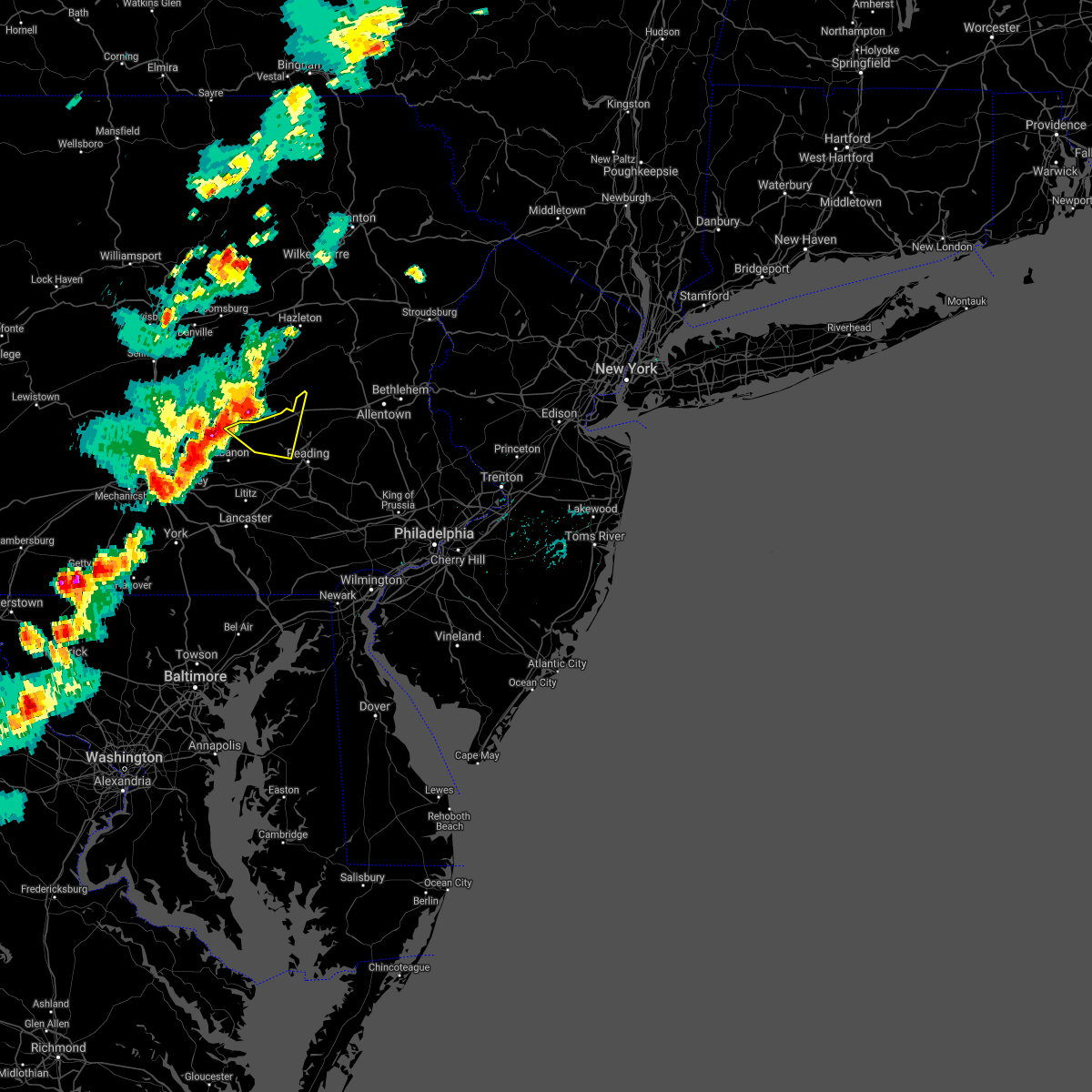 At 338 pm edt, a severe thunderstorm was located over lickdale, or 9 miles north of lebanon, moving east at 25 mph (radar indicated). Hazards include 60 mph wind gusts and penny size hail. damage to roofs, siding, trees, and power lines is possible At 338 pm edt, a severe thunderstorm was located over lickdale, or 9 miles north of lebanon, moving east at 25 mph (radar indicated). Hazards include 60 mph wind gusts and penny size hail. damage to roofs, siding, trees, and power lines is possible
|
| 5/26/2021 3:23 PM EDT |
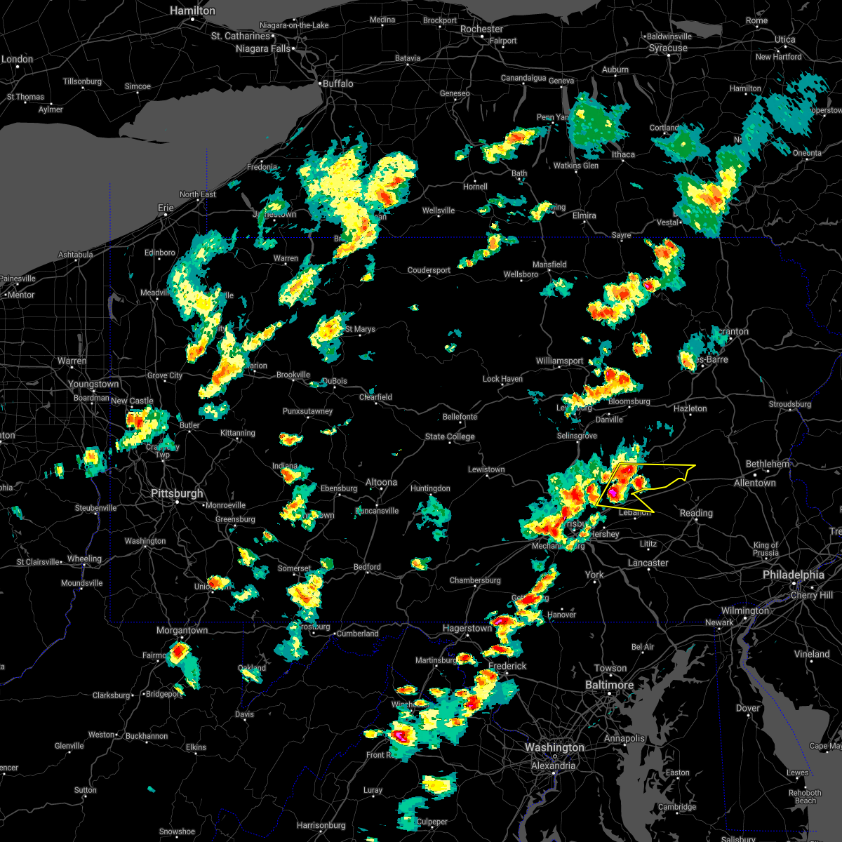 At 323 pm edt, severe thunderstorms were located along a line extending from donaldson to fort indiantown gap, moving east at 20 mph (radar indicated). Hazards include 60 mph wind gusts and nickel size hail. expect damage to trees, roofs, and siding At 323 pm edt, severe thunderstorms were located along a line extending from donaldson to fort indiantown gap, moving east at 20 mph (radar indicated). Hazards include 60 mph wind gusts and nickel size hail. expect damage to trees, roofs, and siding
|
| 11/15/2020 6:29 PM EST |
 At 627 pm est, intense showers and some embedded severe thunderstorms were located along a line extending from near stoddartsville to near weatherly to near shoemakersville to reamstown to near shrewsbury, moving east at 50 mph. this line may contain little or no lightning. do not wait until you hear thunder before taking cover (radar indicated). Hazards include 60 mph wind gusts. Damage to roofs, siding, trees, and power lines is possible. locations impacted include, allentown, reading, easton, lehighton, mount pocono, bethlehem, forks, emmaus, wyomissing, northampton, east stroudsburg, tobyhanna, wilson, hellertown, nazareth, palmerton, bangor, birdsboro, kutztown and jim thorpe. this includes the following highways, pennsylvania turnpike between mile markers 296 and 299. northeast extension between mile markers 46 and 97. interstate 78 in pennsylvania between mile markers 10 and 72. interstate 80 in pennsylvania between mile markers 278 and 314. interstate 380 in pennsylvania between mile markers 0 and 13. Interstate 176 in pennsylvania between mile markers 1 and 11. At 627 pm est, intense showers and some embedded severe thunderstorms were located along a line extending from near stoddartsville to near weatherly to near shoemakersville to reamstown to near shrewsbury, moving east at 50 mph. this line may contain little or no lightning. do not wait until you hear thunder before taking cover (radar indicated). Hazards include 60 mph wind gusts. Damage to roofs, siding, trees, and power lines is possible. locations impacted include, allentown, reading, easton, lehighton, mount pocono, bethlehem, forks, emmaus, wyomissing, northampton, east stroudsburg, tobyhanna, wilson, hellertown, nazareth, palmerton, bangor, birdsboro, kutztown and jim thorpe. this includes the following highways, pennsylvania turnpike between mile markers 296 and 299. northeast extension between mile markers 46 and 97. interstate 78 in pennsylvania between mile markers 10 and 72. interstate 80 in pennsylvania between mile markers 278 and 314. interstate 380 in pennsylvania between mile markers 0 and 13. Interstate 176 in pennsylvania between mile markers 1 and 11.
|
| 11/15/2020 5:57 PM EST |
 At 555 pm est, intense showers and embedded severe thunderstorms were located along a line extending from pond hill to near lickdale to near lawn to near parkville, moving east at 45 mph. this line may contain little or no lightning. do not wait until you hear thunder before taking cover (radar indicated). Hazards include 60 mph wind gusts. damage to roofs, siding, trees, and power lines is possible At 555 pm est, intense showers and embedded severe thunderstorms were located along a line extending from pond hill to near lickdale to near lawn to near parkville, moving east at 45 mph. this line may contain little or no lightning. do not wait until you hear thunder before taking cover (radar indicated). Hazards include 60 mph wind gusts. damage to roofs, siding, trees, and power lines is possible
|
| 8/27/2020 7:57 PM EDT |
 At 756 pm edt, a severe thunderstorm was located over tuscarora, moving southeast at 45 mph (radar indicated). Hazards include 60 mph wind gusts. Expect damage to trees, roofs, and siding. locations impacted include, pottsville, tamaqua, schuylkill haven, shenandoah, minersville, mahanoy city, frackville, st. clair, orwigsburg, mcadoo, pine grove, port carbon, hometown, tuscarora, new philadelphia, friedensburg, grier city-park crest, marlin, altamont and renningers. This includes interstate 81 between mile markers 103 and 104, and from mile markers 123 to 139. At 756 pm edt, a severe thunderstorm was located over tuscarora, moving southeast at 45 mph (radar indicated). Hazards include 60 mph wind gusts. Expect damage to trees, roofs, and siding. locations impacted include, pottsville, tamaqua, schuylkill haven, shenandoah, minersville, mahanoy city, frackville, st. clair, orwigsburg, mcadoo, pine grove, port carbon, hometown, tuscarora, new philadelphia, friedensburg, grier city-park crest, marlin, altamont and renningers. This includes interstate 81 between mile markers 103 and 104, and from mile markers 123 to 139.
|
| 8/27/2020 7:51 PM EDT |
 At 751 pm edt, severe thunderstorms were located along a line extending from hometown to near friedensburg, moving east at 50 mph (radar indicated). Hazards include 60 mph wind gusts and penny size hail. damage to roofs, siding, trees, and power lines is possible At 751 pm edt, severe thunderstorms were located along a line extending from hometown to near friedensburg, moving east at 50 mph (radar indicated). Hazards include 60 mph wind gusts and penny size hail. damage to roofs, siding, trees, and power lines is possible
|
| 8/27/2020 7:29 PM EDT |
 At 729 pm edt, a severe thunderstorm was located over fairview-ferndale, moving southeast at 45 mph (radar indicated). Hazards include 60 mph wind gusts. expect damage to trees, roofs, and siding At 729 pm edt, a severe thunderstorm was located over fairview-ferndale, moving southeast at 45 mph (radar indicated). Hazards include 60 mph wind gusts. expect damage to trees, roofs, and siding
|
| 7/22/2020 4:20 PM EDT |
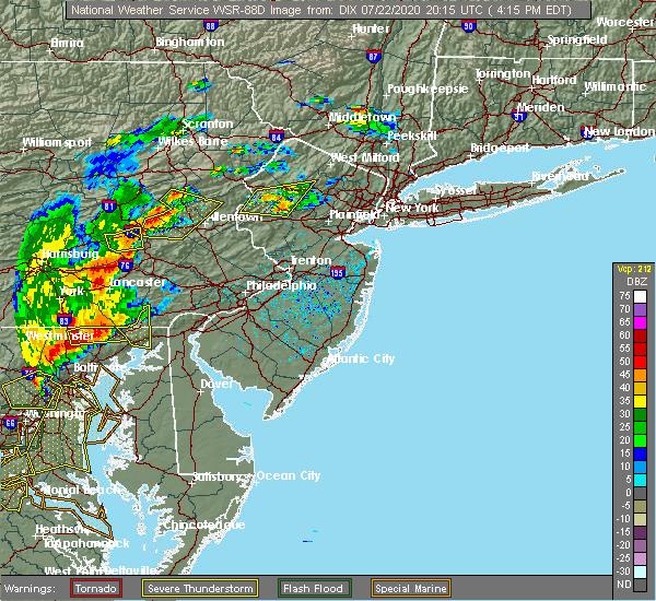 The severe thunderstorm warning for central berks county will expire at 430 pm edt, the storm which prompted the warning has moved out of the area. therefore, the warning will be allowed to expire. however gusty winds and heavy rain are still possible with this thunderstorm. a severe thunderstorm watch remains in effect until 1000 pm edt for eastern pennsylvania. to report severe weather, contact your nearest law enforcement agency. they will relay your report to the national weather service mount holly nj. The severe thunderstorm warning for central berks county will expire at 430 pm edt, the storm which prompted the warning has moved out of the area. therefore, the warning will be allowed to expire. however gusty winds and heavy rain are still possible with this thunderstorm. a severe thunderstorm watch remains in effect until 1000 pm edt for eastern pennsylvania. to report severe weather, contact your nearest law enforcement agency. they will relay your report to the national weather service mount holly nj.
|
| 7/22/2020 4:18 PM EDT |
 At 417 pm edt, a severe thunderstorm was located near bernville, or 11 miles southeast of schuylkill haven, moving east at 30 mph (radar indicated). Hazards include 60 mph wind gusts and nickel size hail. Damage to roofs, siding, trees, and power lines is possible. locations impacted include, bernville and fairview hgts. This includes interstate 78 in pennsylvania between mile markers 22 and 29. At 417 pm edt, a severe thunderstorm was located near bernville, or 11 miles southeast of schuylkill haven, moving east at 30 mph (radar indicated). Hazards include 60 mph wind gusts and nickel size hail. Damage to roofs, siding, trees, and power lines is possible. locations impacted include, bernville and fairview hgts. This includes interstate 78 in pennsylvania between mile markers 22 and 29.
|
| 7/22/2020 4:10 PM EDT |
 At 409 pm edt, severe thunderstorms were located along a line extending from lehighton to near hamburg, moving east at 15 mph (radar indicated). Hazards include 60 mph wind gusts and quarter size hail. Minor damage to vehicles is possible. Wind damage to roofs, siding, trees, and power lines is possible. At 409 pm edt, severe thunderstorms were located along a line extending from lehighton to near hamburg, moving east at 15 mph (radar indicated). Hazards include 60 mph wind gusts and quarter size hail. Minor damage to vehicles is possible. Wind damage to roofs, siding, trees, and power lines is possible.
|
| 7/22/2020 4:03 PM EDT |
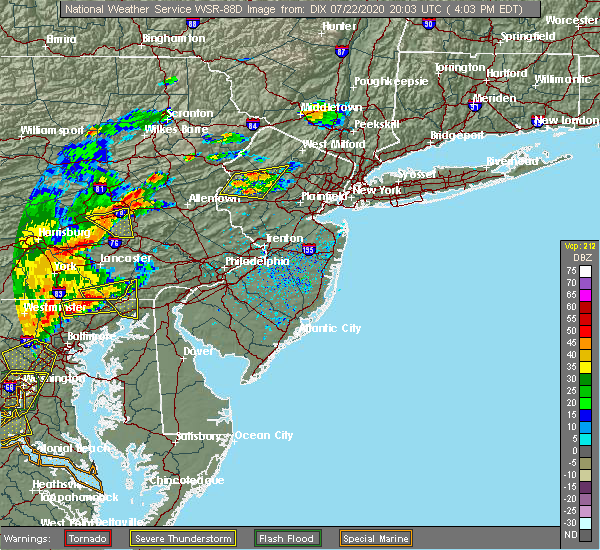 At 338 pm edt, a severe thunderstorm was located over fredericksburg, or near lebanon, moving east at 25 mph (radar indicated). Hazards include 60 mph wind gusts and nickel size hail. damage to roofs, siding, trees, and power lines is possible At 338 pm edt, a severe thunderstorm was located over fredericksburg, or near lebanon, moving east at 25 mph (radar indicated). Hazards include 60 mph wind gusts and nickel size hail. damage to roofs, siding, trees, and power lines is possible
|
| 7/22/2020 3:39 PM EDT |
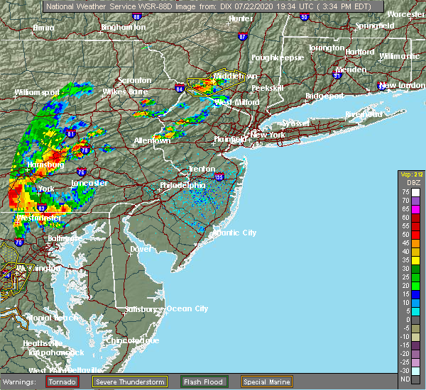 At 338 pm edt, a severe thunderstorm was located over fredericksburg, or near lebanon, moving east at 25 mph (radar indicated). Hazards include 60 mph wind gusts and nickel size hail. damage to roofs, siding, trees, and power lines is possible At 338 pm edt, a severe thunderstorm was located over fredericksburg, or near lebanon, moving east at 25 mph (radar indicated). Hazards include 60 mph wind gusts and nickel size hail. damage to roofs, siding, trees, and power lines is possible
|
| 6/4/2020 6:24 PM EDT |
 At 623 pm edt, a severe thunderstorm was located over bernville, or 11 miles northwest of reading, moving east at 30 mph (radar indicated. utility company reported downed wires near strausstown). Hazards include 60 mph wind gusts and quarter size hail. Minor damage to vehicles is possible. wind damage to roofs, siding, trees, and power lines is possible. locations impacted include, reading, wyomissing, hamburg, sinking spring, laureldale, womelsdorf, wernersville, robesonia, leesport, shoemakersville, bernville, strausstown, lenhartsville, spring ridge, fairview hgts, shillington, west reading, mount penn, mohnton and kenhorst. this includes the following highways, interstate 78 in pennsylvania between mile markers 13 and 37. Interstate 176 in pennsylvania between mile markers 7 and 11. At 623 pm edt, a severe thunderstorm was located over bernville, or 11 miles northwest of reading, moving east at 30 mph (radar indicated. utility company reported downed wires near strausstown). Hazards include 60 mph wind gusts and quarter size hail. Minor damage to vehicles is possible. wind damage to roofs, siding, trees, and power lines is possible. locations impacted include, reading, wyomissing, hamburg, sinking spring, laureldale, womelsdorf, wernersville, robesonia, leesport, shoemakersville, bernville, strausstown, lenhartsville, spring ridge, fairview hgts, shillington, west reading, mount penn, mohnton and kenhorst. this includes the following highways, interstate 78 in pennsylvania between mile markers 13 and 37. Interstate 176 in pennsylvania between mile markers 7 and 11.
|
| 6/4/2020 6:01 PM EDT |
 At 600 pm edt, a severe thunderstorm was located over myerstown, moving east at 30 mph. another potentially severe thunderstorm was located near strausstown (radar indicated). Hazards include 60 mph wind gusts and quarter size hail. Minor damage to vehicles is possible. wind damage to roofs, siding, trees, and power lines is possible. locations impacted include, reading, wyomissing, hamburg, sinking spring, laureldale, womelsdorf, wernersville, robesonia, leesport, shoemakersville, bernville, strausstown, lenhartsville, spring ridge, fairview hgts, shillington, west reading, mount penn, mohnton and kenhorst. this includes the following highways, interstate 78 in pennsylvania between mile markers 10 and 37. Interstate 176 in pennsylvania between mile markers 7 and 11. At 600 pm edt, a severe thunderstorm was located over myerstown, moving east at 30 mph. another potentially severe thunderstorm was located near strausstown (radar indicated). Hazards include 60 mph wind gusts and quarter size hail. Minor damage to vehicles is possible. wind damage to roofs, siding, trees, and power lines is possible. locations impacted include, reading, wyomissing, hamburg, sinking spring, laureldale, womelsdorf, wernersville, robesonia, leesport, shoemakersville, bernville, strausstown, lenhartsville, spring ridge, fairview hgts, shillington, west reading, mount penn, mohnton and kenhorst. this includes the following highways, interstate 78 in pennsylvania between mile markers 10 and 37. Interstate 176 in pennsylvania between mile markers 7 and 11.
|
| 6/4/2020 5:39 PM EDT |
 At 538 pm edt, a severe thunderstorm was located over harper tavern, or near annville, moving east at 30 mph (radar indicated). Hazards include 60 mph wind gusts and quarter size hail. Minor damage to vehicles is possible. Wind damage to roofs, siding, trees, and power lines is possible. At 538 pm edt, a severe thunderstorm was located over harper tavern, or near annville, moving east at 30 mph (radar indicated). Hazards include 60 mph wind gusts and quarter size hail. Minor damage to vehicles is possible. Wind damage to roofs, siding, trees, and power lines is possible.
|
| 6/4/2020 5:15 PM EDT |
 At 515 pm edt, a severe thunderstorm was located near lickdale, moving northeast at 25 mph (radar indicated). Hazards include 70 mph wind gusts and quarter size hail. Hail damage to vehicles is expected. expect considerable tree damage. Wind damage is also likely to mobile homes, roofs, and outbuildings. At 515 pm edt, a severe thunderstorm was located near lickdale, moving northeast at 25 mph (radar indicated). Hazards include 70 mph wind gusts and quarter size hail. Hail damage to vehicles is expected. expect considerable tree damage. Wind damage is also likely to mobile homes, roofs, and outbuildings.
|
| 6/3/2020 11:40 AM EDT |
 The severe thunderstorm warning for northwestern hunterdon, southwestern warren, berks, lehigh, northwestern montgomery, southern carbon, northwestern bucks and northampton counties will expire at 1145 am edt, the storms which prompted the warning have moved out of the area. therefore, the warning will be allowed to expire. a new warning has been issued for portions of the area. a severe thunderstorm watch remains in effect until 300 pm edt for northwestern new jersey, and eastern, southeastern and northeastern pennsylvania. The severe thunderstorm warning for northwestern hunterdon, southwestern warren, berks, lehigh, northwestern montgomery, southern carbon, northwestern bucks and northampton counties will expire at 1145 am edt, the storms which prompted the warning have moved out of the area. therefore, the warning will be allowed to expire. a new warning has been issued for portions of the area. a severe thunderstorm watch remains in effect until 300 pm edt for northwestern new jersey, and eastern, southeastern and northeastern pennsylvania.
|
| 6/3/2020 11:23 AM EDT |
 At 1122 am edt, severe thunderstorms were located along a line extending from jim thorpe to lenhartsville to near bernville, moving east at 75 mph (radar indicated). Hazards include 60 mph wind gusts and penny size hail. Damage to roofs, siding, trees, and power lines is possible. locations impacted include, allentown, reading, easton, lehighton, bethlehem, pottstown, forks, emmaus, wyomissing, northampton, quakertown, perkasie, wilson, souderton, bedminster, washington, hellertown, nazareth, palmerton and birdsboro. this includes the following highways, interstate 78 in new jersey between mile markers 0 and 12. interstate 78 in pennsylvania between mile markers 10 and 76. northeast extension between exits a44 and a56. Interstate 176 in pennsylvania between mile markers 10 and 11. At 1122 am edt, severe thunderstorms were located along a line extending from jim thorpe to lenhartsville to near bernville, moving east at 75 mph (radar indicated). Hazards include 60 mph wind gusts and penny size hail. Damage to roofs, siding, trees, and power lines is possible. locations impacted include, allentown, reading, easton, lehighton, bethlehem, pottstown, forks, emmaus, wyomissing, northampton, quakertown, perkasie, wilson, souderton, bedminster, washington, hellertown, nazareth, palmerton and birdsboro. this includes the following highways, interstate 78 in new jersey between mile markers 0 and 12. interstate 78 in pennsylvania between mile markers 10 and 76. northeast extension between exits a44 and a56. Interstate 176 in pennsylvania between mile markers 10 and 11.
|
| 6/3/2020 11:04 AM EDT |
 At 1103 am edt, severe thunderstorms were located along a line extending from nuremburg to near friedensburg to fort indiantown gap, moving east at 75 mph (radar indicated). Hazards include 60 mph wind gusts and penny size hail. damage to roofs, siding, trees, and power lines is possible At 1103 am edt, severe thunderstorms were located along a line extending from nuremburg to near friedensburg to fort indiantown gap, moving east at 75 mph (radar indicated). Hazards include 60 mph wind gusts and penny size hail. damage to roofs, siding, trees, and power lines is possible
|
| 6/3/2020 10:50 AM EDT |
 At 1050 am edt, severe thunderstorms were located along a line extending from near catawissa to near shamokin to rebuck to port trevorton, moving east at 100 mph (radar indicated). Hazards include 60 mph wind gusts and penny size hail. Expect damage to trees, roofs, and siding. severe thunderstorms will be near, frackville, ashland, shenandoah, mahanoy city, nuremburg, girardville, oneida, sheppton, brandonville and aristes around 1100 am edt. tamaqua, pottsville, st. clair, minersville, schuylkill haven, port carbon, hometown, new philadelphia, orwigsburg and branchdale around 1110 am edt. mckeansburg and snyders around 1120 am edt. other locations impacted by these severe thunderstorms include ravine, mary-d, park place, ringtown, deer lake, cumbola, marion heights, landingville, newtown and mount carbon. this includes interstate 81 from mile markers 98 to 139. this includes the following covid-19 test sites, geisinger, geisinger kulpmont, geisinger orwigsburg, geisinger st. Luke`s hospital, lehigh valley health network, and west penn medical center. At 1050 am edt, severe thunderstorms were located along a line extending from near catawissa to near shamokin to rebuck to port trevorton, moving east at 100 mph (radar indicated). Hazards include 60 mph wind gusts and penny size hail. Expect damage to trees, roofs, and siding. severe thunderstorms will be near, frackville, ashland, shenandoah, mahanoy city, nuremburg, girardville, oneida, sheppton, brandonville and aristes around 1100 am edt. tamaqua, pottsville, st. clair, minersville, schuylkill haven, port carbon, hometown, new philadelphia, orwigsburg and branchdale around 1110 am edt. mckeansburg and snyders around 1120 am edt. other locations impacted by these severe thunderstorms include ravine, mary-d, park place, ringtown, deer lake, cumbola, marion heights, landingville, newtown and mount carbon. this includes interstate 81 from mile markers 98 to 139. this includes the following covid-19 test sites, geisinger, geisinger kulpmont, geisinger orwigsburg, geisinger st. Luke`s hospital, lehigh valley health network, and west penn medical center.
|
| 5/29/2020 4:37 PM EDT |
 The severe thunderstorm warning for berks and western lehigh counties will expire at 445 pm edt, the storm which prompted the warning has weakened below severe limits, and no longer poses an immediate threat to life or property. therefore, the warning will be allowed to expire. however small hail, gusty winds and heavy rain are still possible with this thunderstorm. a severe thunderstorm watch remains in effect until 900 pm edt for eastern and southeastern pennsylvania. The severe thunderstorm warning for berks and western lehigh counties will expire at 445 pm edt, the storm which prompted the warning has weakened below severe limits, and no longer poses an immediate threat to life or property. therefore, the warning will be allowed to expire. however small hail, gusty winds and heavy rain are still possible with this thunderstorm. a severe thunderstorm watch remains in effect until 900 pm edt for eastern and southeastern pennsylvania.
|
| 5/29/2020 4:17 PM EDT |
 At 414 pm edt, a severe thunderstorm was located near shoemakersville, or 11 miles northwest of reading, moving east at 45 mph (trained weather spotter reports 60 mph wind gusts in bethel township, pennsylvania). Hazards include 60 mph wind gusts and quarter size hail. Minor damage to vehicles is possible. wind damage to roofs, siding, trees, and power lines is possible. locations impacted include, reading, wyomissing, kutztown, hamburg, fleetwood, sinking spring, laureldale, womelsdorf, wernersville, topton, robesonia, leesport, shoemakersville, bally, bernville, bechtelsville, lyons, strausstown, lenhartsville and spring ridge. this includes the following highways, interstate 78 in pennsylvania between mile markers 10 and 48. Interstate 176 in pennsylvania between mile markers 9 and 11. At 414 pm edt, a severe thunderstorm was located near shoemakersville, or 11 miles northwest of reading, moving east at 45 mph (trained weather spotter reports 60 mph wind gusts in bethel township, pennsylvania). Hazards include 60 mph wind gusts and quarter size hail. Minor damage to vehicles is possible. wind damage to roofs, siding, trees, and power lines is possible. locations impacted include, reading, wyomissing, kutztown, hamburg, fleetwood, sinking spring, laureldale, womelsdorf, wernersville, topton, robesonia, leesport, shoemakersville, bally, bernville, bechtelsville, lyons, strausstown, lenhartsville and spring ridge. this includes the following highways, interstate 78 in pennsylvania between mile markers 10 and 48. Interstate 176 in pennsylvania between mile markers 9 and 11.
|
| 5/29/2020 3:51 PM EDT |
 At 350 pm edt, a severe thunderstorm was located over myerstown, moving east at 45 mph (radar indicated). Hazards include 60 mph wind gusts and quarter size hail. Minor damage to vehicles is possible. Wind damage to roofs, siding, trees, and power lines is possible. At 350 pm edt, a severe thunderstorm was located over myerstown, moving east at 45 mph (radar indicated). Hazards include 60 mph wind gusts and quarter size hail. Minor damage to vehicles is possible. Wind damage to roofs, siding, trees, and power lines is possible.
|
| 5/29/2020 3:44 PM EDT |
 At 344 pm edt, a severe thunderstorm was located near fredericksburg, moving northeast at 40 mph (radar indicated). Hazards include 60 mph wind gusts and quarter size hail. Hail damage to vehicles is expected. Expect wind damage to trees, roofs, and siding. At 344 pm edt, a severe thunderstorm was located near fredericksburg, moving northeast at 40 mph (radar indicated). Hazards include 60 mph wind gusts and quarter size hail. Hail damage to vehicles is expected. Expect wind damage to trees, roofs, and siding.
|
| 10/31/2019 9:26 PM EDT |
 At 926 pm edt, severe thunderstorms were located along a line extending from near skytop to akron, moving northeast at 50 mph (radar indicated). Hazards include 60 mph wind gusts. Damage to roofs, siding, trees, and power lines is possible. locations impacted include, reading, lehighton, mount pocono, wyomissing, northampton, east stroudsburg, tobyhanna, palmerton, kutztown, jim thorpe, hamburg, slatington, fleetwood, sinking spring, laureldale, nesquehoning, womelsdorf, weatherly, wernersville and newmanstown. this includes the following highways, interstate 80 in pennsylvania between mile markers 277 and 310. Interstate 78 in pennsylvania between mile markers 10 and 53. At 926 pm edt, severe thunderstorms were located along a line extending from near skytop to akron, moving northeast at 50 mph (radar indicated). Hazards include 60 mph wind gusts. Damage to roofs, siding, trees, and power lines is possible. locations impacted include, reading, lehighton, mount pocono, wyomissing, northampton, east stroudsburg, tobyhanna, palmerton, kutztown, jim thorpe, hamburg, slatington, fleetwood, sinking spring, laureldale, nesquehoning, womelsdorf, weatherly, wernersville and newmanstown. this includes the following highways, interstate 80 in pennsylvania between mile markers 277 and 310. Interstate 78 in pennsylvania between mile markers 10 and 53.
|
| 10/31/2019 9:00 PM EDT |
 At 858 pm edt, severe thunderstorms were located along a line extending from port carbon to near strausstown to near columbia to near cross roads to 6 miles southeast of hampstead, moving northeast at 65 mph (radar indicated). Hazards include 60 mph wind gusts. Expect damage to trees, roofs, and siding. Locations impacted include, lancaster, york, lebanon, pottsville, elizabethtown, columbia, lititz, millersville, mount joy, tamaqua, red lion, schuylkill haven, spry, manheim, annville, east petersburg, minersville, cornwall, dallastown and myerstown. At 858 pm edt, severe thunderstorms were located along a line extending from port carbon to near strausstown to near columbia to near cross roads to 6 miles southeast of hampstead, moving northeast at 65 mph (radar indicated). Hazards include 60 mph wind gusts. Expect damage to trees, roofs, and siding. Locations impacted include, lancaster, york, lebanon, pottsville, elizabethtown, columbia, lititz, millersville, mount joy, tamaqua, red lion, schuylkill haven, spry, manheim, annville, east petersburg, minersville, cornwall, dallastown and myerstown.
|
| 10/31/2019 8:58 PM EDT |
 At 857 pm edt, severe thunderstorms were located along a line extending from albrightsville to windsor, moving northeast at 50 mph (radar indicated). Hazards include 60 mph wind gusts. damage to roofs, siding, trees, and power lines is possible At 857 pm edt, severe thunderstorms were located along a line extending from albrightsville to windsor, moving northeast at 50 mph (radar indicated). Hazards include 60 mph wind gusts. damage to roofs, siding, trees, and power lines is possible
|
| 10/31/2019 8:39 PM EDT |
 At 838 pm edt, severe thunderstorms were located along a line extending from near hometown to manchester, moving northeast at 50 mph (radar indicated). Hazards include 60 mph wind gusts. Damage to roofs, siding, trees, and power lines is possible. locations impacted include, lehighton, jim thorpe, hamburg, nesquehoning, womelsdorf, weatherly, newmanstown, bernville, strausstown, new mahoning, wanamakers, lake harmony, penn forest reservoir, albrightsville, christmans, meckesville, lansford, summit hill, beaver meadows and parryville. this includes the following highways, interstate 80 in pennsylvania between mile markers 277 and 285. Interstate 78 in pennsylvania between mile markers 10 and 35. At 838 pm edt, severe thunderstorms were located along a line extending from near hometown to manchester, moving northeast at 50 mph (radar indicated). Hazards include 60 mph wind gusts. Damage to roofs, siding, trees, and power lines is possible. locations impacted include, lehighton, jim thorpe, hamburg, nesquehoning, womelsdorf, weatherly, newmanstown, bernville, strausstown, new mahoning, wanamakers, lake harmony, penn forest reservoir, albrightsville, christmans, meckesville, lansford, summit hill, beaver meadows and parryville. this includes the following highways, interstate 80 in pennsylvania between mile markers 277 and 285. Interstate 78 in pennsylvania between mile markers 10 and 35.
|
| 10/31/2019 8:11 PM EDT |
 At 811 pm edt, severe thunderstorms were located along a line extending from branchdale to new oxford, moving northeast at 50 mph (radar indicated). Hazards include 60 mph wind gusts. damage to roofs, siding, trees, and power lines is possible At 811 pm edt, severe thunderstorms were located along a line extending from branchdale to new oxford, moving northeast at 50 mph (radar indicated). Hazards include 60 mph wind gusts. damage to roofs, siding, trees, and power lines is possible
|
| 10/31/2019 8:05 PM EDT |
 At 804 pm edt, severe thunderstorms were located along a line extending from fountain springs to near pine grove to harper tavern to royalton to near lake heritage, moving northeast at 50 mph (radar indicated). Hazards include 60 mph wind gusts. expect damage to trees, roofs, and siding At 804 pm edt, severe thunderstorms were located along a line extending from fountain springs to near pine grove to harper tavern to royalton to near lake heritage, moving northeast at 50 mph (radar indicated). Hazards include 60 mph wind gusts. expect damage to trees, roofs, and siding
|
| 9/11/2019 5:24 PM EDT |
 At 523 pm edt, a severe thunderstorm was located over pottsville, moving southeast at 25 mph (radar indicated). Hazards include 60 mph wind gusts. Expect damage to trees, roofs, and siding. locations impacted include, pottsville, schuylkill haven, shenandoah, minersville, frackville, st. clair, ashland, orwigsburg, port carbon, girardville, tuscarora, new philadelphia, friedensburg, lavelle, marlin, altamont, renningers, englewood, forrestville and branchdale. This includes interstate 81 from mile markers 112 to 129. At 523 pm edt, a severe thunderstorm was located over pottsville, moving southeast at 25 mph (radar indicated). Hazards include 60 mph wind gusts. Expect damage to trees, roofs, and siding. locations impacted include, pottsville, schuylkill haven, shenandoah, minersville, frackville, st. clair, ashland, orwigsburg, port carbon, girardville, tuscarora, new philadelphia, friedensburg, lavelle, marlin, altamont, renningers, englewood, forrestville and branchdale. This includes interstate 81 from mile markers 112 to 129.
|
| 9/11/2019 4:48 PM EDT |
 At 447 pm edt, a severe thunderstorm was located over mount carmel, moving southeast at 25 mph (radar indicated). Hazards include 60 mph wind gusts and penny size hail. expect damage to trees, roofs, and siding At 447 pm edt, a severe thunderstorm was located over mount carmel, moving southeast at 25 mph (radar indicated). Hazards include 60 mph wind gusts and penny size hail. expect damage to trees, roofs, and siding
|
| 8/7/2019 2:22 PM EDT |
 The severe thunderstorm warning for northwestern berks county will expire at 230 pm edt, the storm which prompted the warning has weakened below severe limits, and no longer poses an immediate threat to life or property. therefore, the warning will be allowed to expire. however gusty winds are still possible with this thunderstorm. a severe thunderstorm watch remains in effect until 900 pm edt for eastern pennsylvania. The severe thunderstorm warning for northwestern berks county will expire at 230 pm edt, the storm which prompted the warning has weakened below severe limits, and no longer poses an immediate threat to life or property. therefore, the warning will be allowed to expire. however gusty winds are still possible with this thunderstorm. a severe thunderstorm watch remains in effect until 900 pm edt for eastern pennsylvania.
|
| 8/7/2019 2:13 PM EDT |
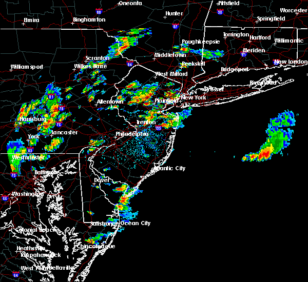 At 213 pm edt, a severe thunderstorm was located over strausstown, or 8 miles south of schuylkill haven, moving northeast at 20 mph (radar indicated). Hazards include 60 mph wind gusts and penny size hail. Damage to roofs, siding, trees, and power lines is possible. Locations impacted include, hamburg, shoemakersville, strausstown and centerport. At 213 pm edt, a severe thunderstorm was located over strausstown, or 8 miles south of schuylkill haven, moving northeast at 20 mph (radar indicated). Hazards include 60 mph wind gusts and penny size hail. Damage to roofs, siding, trees, and power lines is possible. Locations impacted include, hamburg, shoemakersville, strausstown and centerport.
|
| 8/7/2019 1:46 PM EDT |
 At 146 pm edt, a severe thunderstorm was located over fredericksburg, or 9 miles northwest of myerstown, moving northeast at 20 mph (radar indicated). Hazards include 60 mph wind gusts and penny size hail. damage to roofs, siding, trees, and power lines is possible At 146 pm edt, a severe thunderstorm was located over fredericksburg, or 9 miles northwest of myerstown, moving northeast at 20 mph (radar indicated). Hazards include 60 mph wind gusts and penny size hail. damage to roofs, siding, trees, and power lines is possible
|
| 7/22/2019 4:11 PM EDT |
 At 410 pm edt, severe thunderstorms were located along a line extending from near strausstown to near fredericksburg to cleona, moving northeast at 30 mph (radar indicated). Hazards include 60 mph wind gusts. expect damage to trees, roofs, and siding At 410 pm edt, severe thunderstorms were located along a line extending from near strausstown to near fredericksburg to cleona, moving northeast at 30 mph (radar indicated). Hazards include 60 mph wind gusts. expect damage to trees, roofs, and siding
|
| 7/21/2019 11:12 PM EDT |
 The severe thunderstorm warning for northeastern berks and west central lehigh counties will expire at 1115 pm edt, the storm which prompted the warning has moved out of the area. therefore, the warning will be allowed to expire. however gusty winds and heavy rain are still possible with this thunderstorm. The severe thunderstorm warning for northeastern berks and west central lehigh counties will expire at 1115 pm edt, the storm which prompted the warning has moved out of the area. therefore, the warning will be allowed to expire. however gusty winds and heavy rain are still possible with this thunderstorm.
|
| 7/21/2019 10:53 PM EDT |
 At 1053 pm edt, a severe thunderstorm was located over hamburg, or 13 miles east of schuylkill haven, moving east at 15 mph (radar indicated). Hazards include 60 mph wind gusts and quarter size hail. Minor damage to vehicles is possible. wind damage to roofs, siding, trees, and power lines is possible. Locations impacted include, kutztown, hamburg, topton, shoemakersville, lyons, lenhartsville and wanamakers. At 1053 pm edt, a severe thunderstorm was located over hamburg, or 13 miles east of schuylkill haven, moving east at 15 mph (radar indicated). Hazards include 60 mph wind gusts and quarter size hail. Minor damage to vehicles is possible. wind damage to roofs, siding, trees, and power lines is possible. Locations impacted include, kutztown, hamburg, topton, shoemakersville, lyons, lenhartsville and wanamakers.
|
| 7/21/2019 10:35 PM EDT |
 At 1035 pm edt, a severe thunderstorm was located over hamburg, or 9 miles southeast of schuylkill haven, moving east at 15 mph (radar indicated). Hazards include 60 mph wind gusts and quarter size hail. Minor damage to vehicles is possible. Wind damage to roofs, siding, trees, and power lines is possible. At 1035 pm edt, a severe thunderstorm was located over hamburg, or 9 miles southeast of schuylkill haven, moving east at 15 mph (radar indicated). Hazards include 60 mph wind gusts and quarter size hail. Minor damage to vehicles is possible. Wind damage to roofs, siding, trees, and power lines is possible.
|
| 7/17/2019 7:22 PM EDT |
 At 721 pm edt, severe thunderstorms were located along a line extending from strausstown to near elverson, moving northeast at 40 mph (radar indicated). Hazards include 60 mph wind gusts and penny size hail. Damage to roofs, siding, trees, and power lines is possible. Locations impacted include, reading, pottstown, wyomissing, birdsboro, kutztown, hamburg, fleetwood, sinking spring, laureldale, east greenville, womelsdorf, wernersville, newmanstown, topton, leesport, shoemakersville, elverson, bally, bernville and bechtelsville. At 721 pm edt, severe thunderstorms were located along a line extending from strausstown to near elverson, moving northeast at 40 mph (radar indicated). Hazards include 60 mph wind gusts and penny size hail. Damage to roofs, siding, trees, and power lines is possible. Locations impacted include, reading, pottstown, wyomissing, birdsboro, kutztown, hamburg, fleetwood, sinking spring, laureldale, east greenville, womelsdorf, wernersville, newmanstown, topton, leesport, shoemakersville, elverson, bally, bernville and bechtelsville.
|
| 7/17/2019 6:51 PM EDT |
 The national weather service in mount holly nj has issued a * severe thunderstorm warning for. berks county in eastern pennsylvania. northwestern montgomery county in southeastern pennsylvania. north central chester county in southeastern pennsylvania. Until 745 pm edt. The national weather service in mount holly nj has issued a * severe thunderstorm warning for. berks county in eastern pennsylvania. northwestern montgomery county in southeastern pennsylvania. north central chester county in southeastern pennsylvania. Until 745 pm edt.
|
| 7/6/2019 6:55 PM EDT |
 The severe thunderstorm warning for sussex, warren, berks, lehigh, southeastern carbon, monroe and northampton counties will expire at 700 pm edt, the storms which prompted the warning continue to move to the southeast. a new severe thunderstorm warning is in effect for these counties until 8:00 pm edt. to report severe weather, contact your nearest law enforcement agency. they will relay your report to the national weather service mount holly nj. The severe thunderstorm warning for sussex, warren, berks, lehigh, southeastern carbon, monroe and northampton counties will expire at 700 pm edt, the storms which prompted the warning continue to move to the southeast. a new severe thunderstorm warning is in effect for these counties until 8:00 pm edt. to report severe weather, contact your nearest law enforcement agency. they will relay your report to the national weather service mount holly nj.
|
| 7/6/2019 6:22 PM EDT |
 At 622 pm edt, severe thunderstorms were located along a line extending from near matamoras to beltzville state park to near palmyra, moving southeast at 30 mph (radar indicated). Hazards include 60 mph wind gusts. damage to roofs, siding, trees, and power lines is possible At 622 pm edt, severe thunderstorms were located along a line extending from near matamoras to beltzville state park to near palmyra, moving southeast at 30 mph (radar indicated). Hazards include 60 mph wind gusts. damage to roofs, siding, trees, and power lines is possible
|
| 7/2/2019 7:05 PM EDT |
 The severe thunderstorm warning for berks county will expire at 715 pm edt, the storm which prompted the warning has weakened below severe limits, and no longer poses an immediate threat to life or property. therefore, the warning will be allowed to expire. however, heavy rain is still possible with this thunderstorm. The severe thunderstorm warning for berks county will expire at 715 pm edt, the storm which prompted the warning has weakened below severe limits, and no longer poses an immediate threat to life or property. therefore, the warning will be allowed to expire. however, heavy rain is still possible with this thunderstorm.
|
| 7/2/2019 6:28 PM EDT |
 At 628 pm edt, a severe thunderstorm was located over bernville, or 10 miles east of myerstown, moving east at 20 mph (radar indicated). Hazards include 60 mph wind gusts. damage to roofs, siding, trees, and power lines is possible At 628 pm edt, a severe thunderstorm was located over bernville, or 10 miles east of myerstown, moving east at 20 mph (radar indicated). Hazards include 60 mph wind gusts. damage to roofs, siding, trees, and power lines is possible
|
| 6/29/2019 2:52 PM EDT |
 At 252 pm edt, severe thunderstorms were located along a line extending from grier city-park crest to orwigsburg to near bernville to schaefferstown, moving southeast at 25 mph (radar indicated). Hazards include 60 mph wind gusts and quarter size hail. Minor damage to vehicles is possible. wind damage to roofs, siding, trees, and power lines is possible. Locations impacted include, reading, wyomissing, hamburg, fleetwood, sinking spring, laureldale, womelsdorf, wernersville, newmanstown, leesport, shoemakersville, bernville, strausstown, lenhartsville, fairview hgts, spring ridge, centerport, wyomissing hills, west lawn and whitfield. At 252 pm edt, severe thunderstorms were located along a line extending from grier city-park crest to orwigsburg to near bernville to schaefferstown, moving southeast at 25 mph (radar indicated). Hazards include 60 mph wind gusts and quarter size hail. Minor damage to vehicles is possible. wind damage to roofs, siding, trees, and power lines is possible. Locations impacted include, reading, wyomissing, hamburg, fleetwood, sinking spring, laureldale, womelsdorf, wernersville, newmanstown, leesport, shoemakersville, bernville, strausstown, lenhartsville, fairview hgts, spring ridge, centerport, wyomissing hills, west lawn and whitfield.
|
| 6/29/2019 2:27 PM EDT |
 At 226 pm edt, severe thunderstorms were located along a line extending from mechanicsville to aristes to pine grove to fort indiantown gap, moving east at 30 mph (radar indicated). Hazards include 60 mph wind gusts and quarter size hail. Minor damage to vehicles is possible. Wind damage to roofs, siding, trees, and power lines is possible. At 226 pm edt, severe thunderstorms were located along a line extending from mechanicsville to aristes to pine grove to fort indiantown gap, moving east at 30 mph (radar indicated). Hazards include 60 mph wind gusts and quarter size hail. Minor damage to vehicles is possible. Wind damage to roofs, siding, trees, and power lines is possible.
|
| 6/26/2019 6:00 PM EDT |
 At 558 pm edt, a severe thunderstorm was located over friedensburg, moving southeast at 35 mph (radar indicated). Hazards include 60 mph wind gusts and penny size hail. Expect damage to trees, roofs, and siding. Locations impacted include, temont, summit station and lake wynonah. At 558 pm edt, a severe thunderstorm was located over friedensburg, moving southeast at 35 mph (radar indicated). Hazards include 60 mph wind gusts and penny size hail. Expect damage to trees, roofs, and siding. Locations impacted include, temont, summit station and lake wynonah.
|
| 6/26/2019 5:37 PM EDT |
 At 537 pm edt, a severe thunderstorm was located near beurys lake, moving east at 50 mph (radar indicated). Hazards include 60 mph wind gusts and quarter size hail. Hail damage to vehicles is expected. Expect wind damage to trees, roofs, and siding. At 537 pm edt, a severe thunderstorm was located near beurys lake, moving east at 50 mph (radar indicated). Hazards include 60 mph wind gusts and quarter size hail. Hail damage to vehicles is expected. Expect wind damage to trees, roofs, and siding.
|
| 5/29/2019 5:16 PM EDT |
 At 515 pm edt, severe thunderstorms were located along a line extending from allentown to near mountville, moving southeast at 55 mph (radar indicated). Hazards include 60 mph wind gusts and quarter size hail. Minor damage to vehicles is possible. wind damage to roofs, siding, trees, and power lines is possible. Locations impacted include, allentown, reading, bethlehem, pottstown, emmaus, wyomissing, northampton, birdsboro, kutztown, hamburg, slatington, fleetwood, sinking spring, laureldale, womelsdorf, wernersville, newmanstown, walnutport, topton and leesport. At 515 pm edt, severe thunderstorms were located along a line extending from allentown to near mountville, moving southeast at 55 mph (radar indicated). Hazards include 60 mph wind gusts and quarter size hail. Minor damage to vehicles is possible. wind damage to roofs, siding, trees, and power lines is possible. Locations impacted include, allentown, reading, bethlehem, pottstown, emmaus, wyomissing, northampton, birdsboro, kutztown, hamburg, slatington, fleetwood, sinking spring, laureldale, womelsdorf, wernersville, newmanstown, walnutport, topton and leesport.
|
| 5/29/2019 4:50 PM EDT |
 At 450 pm edt, severe thunderstorms were located along a line extending from near lehighton to near hummelstown, moving southeast at 50 mph (radar indicated). Hazards include 60 mph wind gusts and quarter size hail. Minor damage to vehicles is possible. Wind damage to roofs, siding, trees, and power lines is possible. At 450 pm edt, severe thunderstorms were located along a line extending from near lehighton to near hummelstown, moving southeast at 50 mph (radar indicated). Hazards include 60 mph wind gusts and quarter size hail. Minor damage to vehicles is possible. Wind damage to roofs, siding, trees, and power lines is possible.
|
| 5/29/2019 4:48 PM EDT |
 A severe thunderstorm warning remains in effect until 530 pm edt for schuylkill. northern dauphin and lebanon counties. at 447 pm edt, severe thunderstorms were located along a line extending from beurys lake to pine grove to lickdale to near harper tavern, moving east at 50 mph. hazard. 60 mph wind gusts and quarter size hail. A severe thunderstorm warning remains in effect until 530 pm edt for schuylkill. northern dauphin and lebanon counties. at 447 pm edt, severe thunderstorms were located along a line extending from beurys lake to pine grove to lickdale to near harper tavern, moving east at 50 mph. hazard. 60 mph wind gusts and quarter size hail.
|
| 5/29/2019 4:29 PM EDT |
 The national weather service in state college pa has issued a * severe thunderstorm warning for. schuylkill county in central pennsylvania. southeastern northumberland county in central pennsylvania. northern dauphin county in south central pennsylvania. South central columbia county in central pennsylvania. The national weather service in state college pa has issued a * severe thunderstorm warning for. schuylkill county in central pennsylvania. southeastern northumberland county in central pennsylvania. northern dauphin county in south central pennsylvania. South central columbia county in central pennsylvania.
|
| 5/28/2019 5:54 PM EDT |
 The severe thunderstorm warning for southern schuylkill county will expire at 600 pm edt, the storm which prompted the warning has moved out of the area. therefore, the warning will be allowed to expire. a tornado watch remains in effect until 1000 pm edt for south central and central pennsylvania. to report severe weather, contact your nearest law enforcement agency. they will relay your report to the national weather service state college pa. The severe thunderstorm warning for southern schuylkill county will expire at 600 pm edt, the storm which prompted the warning has moved out of the area. therefore, the warning will be allowed to expire. a tornado watch remains in effect until 1000 pm edt for south central and central pennsylvania. to report severe weather, contact your nearest law enforcement agency. they will relay your report to the national weather service state college pa.
|
| 5/28/2019 5:53 PM EDT |
 At 553 pm edt, a severe thunderstorm was located over strausstown, or 9 miles south of schuylkill haven, moving east at 35 mph (radar indicated). Hazards include 60 mph wind gusts and quarter size hail. Minor damage to vehicles is possible. wind damage to roofs, siding, trees, and power lines is possible. Locations impacted include, hamburg, womelsdorf, leesport, shoemakersville, bernville, strausstown, lenhartsville, fairview hgts and centerport. At 553 pm edt, a severe thunderstorm was located over strausstown, or 9 miles south of schuylkill haven, moving east at 35 mph (radar indicated). Hazards include 60 mph wind gusts and quarter size hail. Minor damage to vehicles is possible. wind damage to roofs, siding, trees, and power lines is possible. Locations impacted include, hamburg, womelsdorf, leesport, shoemakersville, bernville, strausstown, lenhartsville, fairview hgts and centerport.
|
| 5/28/2019 5:36 PM EDT |
 At 536 pm edt, a severe thunderstorm was located over pine grove, or 9 miles southwest of minersville, moving southeast at 30 mph (radar indicated). Hazards include 60 mph wind gusts and quarter size hail. Minor damage to vehicles is possible. Wind damage to roofs, siding, trees, and power lines is possible. At 536 pm edt, a severe thunderstorm was located over pine grove, or 9 miles southwest of minersville, moving southeast at 30 mph (radar indicated). Hazards include 60 mph wind gusts and quarter size hail. Minor damage to vehicles is possible. Wind damage to roofs, siding, trees, and power lines is possible.
|
| 5/28/2019 5:26 PM EDT |
 At 525 pm edt, a severe thunderstorm was located near donaldson, moving east southeast at 35 mph (radar indicated). Hazards include two inch hail and 60 mph wind gusts. People and animals outdoors will be injured. expect hail damage to roofs, siding, windows, and vehicles. expect wind damage to trees, roofs, and siding. this severe thunderstorm will be near, pine grove, branchdale and buck run around 530 pm edt. schuylkill haven, pottsville, st. clair, minersville, friedensburg, renningers, marlin, mechanicsville, seltzer and port carbon around 540 pm edt. mckeansburg and orwigsburg around 550 pm edt. other locations impacted by this severe thunderstorm include ravine, auburn, deer lake, landingville, newtown, palo alto, mount carbon, cressona, muir and lake wynonah. This includes interstate 81 from mile markers 97 to 115. At 525 pm edt, a severe thunderstorm was located near donaldson, moving east southeast at 35 mph (radar indicated). Hazards include two inch hail and 60 mph wind gusts. People and animals outdoors will be injured. expect hail damage to roofs, siding, windows, and vehicles. expect wind damage to trees, roofs, and siding. this severe thunderstorm will be near, pine grove, branchdale and buck run around 530 pm edt. schuylkill haven, pottsville, st. clair, minersville, friedensburg, renningers, marlin, mechanicsville, seltzer and port carbon around 540 pm edt. mckeansburg and orwigsburg around 550 pm edt. other locations impacted by this severe thunderstorm include ravine, auburn, deer lake, landingville, newtown, palo alto, mount carbon, cressona, muir and lake wynonah. This includes interstate 81 from mile markers 97 to 115.
|
| 5/19/2019 11:57 PM EDT |
 The severe thunderstorm warning for northern berks, northwestern lehigh, southern carbon, southwestern monroe and northwestern northampton counties will expire at midnight edt, the storm which prompted the warning has moved out of the area. therefore, the warning will be allowed to expire. however gusty winds and heavy rain are still possible with this thunderstorm. The severe thunderstorm warning for northern berks, northwestern lehigh, southern carbon, southwestern monroe and northwestern northampton counties will expire at midnight edt, the storm which prompted the warning has moved out of the area. therefore, the warning will be allowed to expire. however gusty winds and heavy rain are still possible with this thunderstorm.
|
| 5/19/2019 11:32 PM EDT |
 At 1131 pm edt, a line of severe thunderstorms was located over beersville, or 9 miles north of allentown, moving east at 55 mph (radar indicated). Hazards include 60 mph wind gusts and quarter size hail. Minor damage to vehicles is possible. wind damage to roofs, siding, trees, and power lines is possible. Locations impacted include, lehighton, northampton, palmerton, bangor, kutztown, jim thorpe, hamburg, slatington, pen argyl, nesquehoning, wind gap, walnutport, leesport, shoemakersville, east bangor, bernville, strausstown, lenhartsville, stormville and neffs. At 1131 pm edt, a line of severe thunderstorms was located over beersville, or 9 miles north of allentown, moving east at 55 mph (radar indicated). Hazards include 60 mph wind gusts and quarter size hail. Minor damage to vehicles is possible. wind damage to roofs, siding, trees, and power lines is possible. Locations impacted include, lehighton, northampton, palmerton, bangor, kutztown, jim thorpe, hamburg, slatington, pen argyl, nesquehoning, wind gap, walnutport, leesport, shoemakersville, east bangor, bernville, strausstown, lenhartsville, stormville and neffs.
|
| 5/19/2019 11:04 PM EDT |
 At 1103 pm edt, a severe thunderstorm was located over friedensburg, moving east at 50 mph (public). Hazards include 60 mph wind gusts and quarter size hail. Hail damage to vehicles is expected. expect wind damage to trees, roofs, and siding. locations impacted include, pottsville, tamaqua, schuylkill haven, shenandoah, minersville, mahanoy city, frackville, st. clair, ashland, orwigsburg, mcadoo, pine grove, port carbon, tremont, girardville, hometown, tower city, tuscarora, new philadelphia and oneida. This includes interstate 81 from mile markers 98 to 139. At 1103 pm edt, a severe thunderstorm was located over friedensburg, moving east at 50 mph (public). Hazards include 60 mph wind gusts and quarter size hail. Hail damage to vehicles is expected. expect wind damage to trees, roofs, and siding. locations impacted include, pottsville, tamaqua, schuylkill haven, shenandoah, minersville, mahanoy city, frackville, st. clair, ashland, orwigsburg, mcadoo, pine grove, port carbon, tremont, girardville, hometown, tower city, tuscarora, new philadelphia and oneida. This includes interstate 81 from mile markers 98 to 139.
|
| 5/19/2019 11:00 PM EDT |
 At 1100 pm edt, a severe thunderstorm was located over hamburg, or 10 miles east of schuylkill haven, moving east at 45 mph (radar indicated). Hazards include 60 mph wind gusts and quarter size hail. Minor damage to vehicles is possible. Wind damage to roofs, siding, trees, and power lines is possible. At 1100 pm edt, a severe thunderstorm was located over hamburg, or 10 miles east of schuylkill haven, moving east at 45 mph (radar indicated). Hazards include 60 mph wind gusts and quarter size hail. Minor damage to vehicles is possible. Wind damage to roofs, siding, trees, and power lines is possible.
|
| 5/19/2019 10:33 PM EDT |
 At 1032 pm edt, severe thunderstorms were located in a cluster extending from mahanoy city to lawn, moving east at 50 mph (public). Hazards include 60 mph wind gusts and quarter size hail. Hail damage to vehicles is expected. Expect wind damage to trees, roofs, and siding. At 1032 pm edt, severe thunderstorms were located in a cluster extending from mahanoy city to lawn, moving east at 50 mph (public). Hazards include 60 mph wind gusts and quarter size hail. Hail damage to vehicles is expected. Expect wind damage to trees, roofs, and siding.
|
| 10/2/2018 9:06 PM EDT |
 At 905 pm edt, severe thunderstorms were located along a line extending from near donaldson to near lickdale to 6 miles southwest of dehart dam, moving southeast at 45 mph (radar indicated). Hazards include 60 mph wind gusts and penny size hail. Expect damage to roofs, siding, and trees. locations impacted include, pottsville, schuylkill haven, minersville, st. clair, orwigsburg, valley view, millersburg, pine grove, port carbon, lykens, tremont, elizabethville, williamstown, fredericksburg, tower city, new philadelphia, friedensburg, port trevorton, marlin and renningers. this includes the following interstates, interstate 78 from mile markers 0 to 8. interstate 81 from mile markers 80 to 115. A tornado watch remains in effect until 1100 pm edt for south central and central pennsylvania. At 905 pm edt, severe thunderstorms were located along a line extending from near donaldson to near lickdale to 6 miles southwest of dehart dam, moving southeast at 45 mph (radar indicated). Hazards include 60 mph wind gusts and penny size hail. Expect damage to roofs, siding, and trees. locations impacted include, pottsville, schuylkill haven, minersville, st. clair, orwigsburg, valley view, millersburg, pine grove, port carbon, lykens, tremont, elizabethville, williamstown, fredericksburg, tower city, new philadelphia, friedensburg, port trevorton, marlin and renningers. this includes the following interstates, interstate 78 from mile markers 0 to 8. interstate 81 from mile markers 80 to 115. A tornado watch remains in effect until 1100 pm edt for south central and central pennsylvania.
|
| 10/2/2018 8:48 PM EDT |
 At 846 pm edt, severe thunderstorms were located along a line extending from fairview to near klingerstown to millersburg, moving east at 70 mph (radar indicated). Hazards include 60 mph wind gusts and penny size hail. Expect damage to roofs, siding, and trees. locations impacted include, pottsville, tamaqua, mount carmel, schuylkill haven, shenandoah, minersville, mahanoy city, frackville, st. clair, ashland, orwigsburg, valley view, millersburg, mcadoo, pine grove, fairview-ferndale, port carbon, trevorton, lykens and tremont. this includes the following interstates, interstate 78 from mile markers 0 to 8. interstate 81 from mile markers 80 to 139. A tornado watch remains in effect until 1100 pm edt for central and south central pennsylvania. At 846 pm edt, severe thunderstorms were located along a line extending from fairview to near klingerstown to millersburg, moving east at 70 mph (radar indicated). Hazards include 60 mph wind gusts and penny size hail. Expect damage to roofs, siding, and trees. locations impacted include, pottsville, tamaqua, mount carmel, schuylkill haven, shenandoah, minersville, mahanoy city, frackville, st. clair, ashland, orwigsburg, valley view, millersburg, mcadoo, pine grove, fairview-ferndale, port carbon, trevorton, lykens and tremont. this includes the following interstates, interstate 78 from mile markers 0 to 8. interstate 81 from mile markers 80 to 139. A tornado watch remains in effect until 1100 pm edt for central and south central pennsylvania.
|
| 10/2/2018 8:38 PM EDT |
 At 837 pm edt, severe thunderstorms were located along a line extending from mcadoo to heckscherville to near rebuck to meiserville to near mcalisterville, moving east at 95 mph (radar indicated). Hazards include 60 mph wind gusts and penny size hail. expect damage to roofs, siding, and trees At 837 pm edt, severe thunderstorms were located along a line extending from mcadoo to heckscherville to near rebuck to meiserville to near mcalisterville, moving east at 95 mph (radar indicated). Hazards include 60 mph wind gusts and penny size hail. expect damage to roofs, siding, and trees
|
| 8/17/2018 6:52 PM EDT |
 At 649 pm edt, a severe thunderstorm was located over reamstown, and another storm was moving through central schuylkill county. both are moving northeast at 30 mph (local law enforcement). Hazards include 60 mph wind gusts and nickel size hail. Expect damage to roofs, siding, and trees. reamstown, denver, adamstown and terre hill are in the path of the severe thunderstorm. other locations impacted by these severe thunderstorms include ravine, bowmansville, deer lake, cumbola, reinholds, goodville, landingville, newtown, schoeneck and mount carbon. this includes the following interstates, the pennsylvania turnpike from mile markers 272 to 295. interstate 78 from mile markers 4 to 8. Interstate 81 from mile markers 95 to 111. At 649 pm edt, a severe thunderstorm was located over reamstown, and another storm was moving through central schuylkill county. both are moving northeast at 30 mph (local law enforcement). Hazards include 60 mph wind gusts and nickel size hail. Expect damage to roofs, siding, and trees. reamstown, denver, adamstown and terre hill are in the path of the severe thunderstorm. other locations impacted by these severe thunderstorms include ravine, bowmansville, deer lake, cumbola, reinholds, goodville, landingville, newtown, schoeneck and mount carbon. this includes the following interstates, the pennsylvania turnpike from mile markers 272 to 295. interstate 78 from mile markers 4 to 8. Interstate 81 from mile markers 95 to 111.
|
| 8/17/2018 6:44 PM EDT |
 At 644 pm edt, severe thunderstorms were located along a line extending from near hamburg to near kleinfeltersville, moving northeast at 35 mph (radar indicated). Hazards include 60 mph wind gusts and quarter size hail. Minor damage to vehicles is possible. wind damage to roofs, siding, trees, and power lines is possible. these severe storms will be near, hamburg, robesonia and shoemakersville around 650 pm edt. bernville around 655 pm edt. lenhartsville around 700 pm edt. reading, wyomissing, kutztown, spring ridge and fairview hgts around 705 pm edt. laureldale, leesport and wanamakers around 710 pm edt. fleetwood, lyons, new tripoli, jordan valley, claussville and schnecksville around 715 pm edt. Other locations impacted by these severe thunderstorms include wyomissing hills, west lawn, alburtis, west reading, lorane, kenhorst, mount penn, reiffton, whitfield and centerport. At 644 pm edt, severe thunderstorms were located along a line extending from near hamburg to near kleinfeltersville, moving northeast at 35 mph (radar indicated). Hazards include 60 mph wind gusts and quarter size hail. Minor damage to vehicles is possible. wind damage to roofs, siding, trees, and power lines is possible. these severe storms will be near, hamburg, robesonia and shoemakersville around 650 pm edt. bernville around 655 pm edt. lenhartsville around 700 pm edt. reading, wyomissing, kutztown, spring ridge and fairview hgts around 705 pm edt. laureldale, leesport and wanamakers around 710 pm edt. fleetwood, lyons, new tripoli, jordan valley, claussville and schnecksville around 715 pm edt. Other locations impacted by these severe thunderstorms include wyomissing hills, west lawn, alburtis, west reading, lorane, kenhorst, mount penn, reiffton, whitfield and centerport.
|
| 8/17/2018 6:23 PM EDT |
 At 622 pm edt, severe thunderstorms were located along a line extending from strausstown to near wernersville, moving northeast at 35 mph (radar indicated). Hazards include 60 mph wind gusts. damage to roofs, siding, trees, and power lines is possible At 622 pm edt, severe thunderstorms were located along a line extending from strausstown to near wernersville, moving northeast at 35 mph (radar indicated). Hazards include 60 mph wind gusts. damage to roofs, siding, trees, and power lines is possible
|
| 8/17/2018 6:22 PM EDT |
 At 621 pm edt, severe thunderstorms were located along a line extending from near dehart dam to lebanon south to near east petersburg, moving northeast at 40 mph (radar indicated). Hazards include 60 mph wind gusts and nickel size hail. Expect damage to roofs, siding, and trees. severe thunderstorms will be near, myerstown, richland, leacock, schaefferstown, rothsville and kleinfeltersville around 630 pm edt. akron, ephrata, leola, newmanstown, bareville and fredericksburg around 640 pm edt. new holland, terre hill, pine grove, adamstown, tremont, donaldson, reamstown, denver and churchtown around 650 pm edt. minersville, friedensburg, marlin, seltzer, forrestville and branchdale around 700 pm edt. this includes the following interstates, the pennsylvania turnpike from mile markers 264 to 295. interstate 78 from mile markers 0 to 8. Interstate 81 from mile markers 79 to 111. At 621 pm edt, severe thunderstorms were located along a line extending from near dehart dam to lebanon south to near east petersburg, moving northeast at 40 mph (radar indicated). Hazards include 60 mph wind gusts and nickel size hail. Expect damage to roofs, siding, and trees. severe thunderstorms will be near, myerstown, richland, leacock, schaefferstown, rothsville and kleinfeltersville around 630 pm edt. akron, ephrata, leola, newmanstown, bareville and fredericksburg around 640 pm edt. new holland, terre hill, pine grove, adamstown, tremont, donaldson, reamstown, denver and churchtown around 650 pm edt. minersville, friedensburg, marlin, seltzer, forrestville and branchdale around 700 pm edt. this includes the following interstates, the pennsylvania turnpike from mile markers 264 to 295. interstate 78 from mile markers 0 to 8. Interstate 81 from mile markers 79 to 111.
|
| 6/18/2018 6:58 PM EDT |
 At 658 pm edt, severe thunderstorms were located along a line extending from near wanamakers to near myerstown, moving east at 35 mph (radar indicated). Hazards include 60 mph wind gusts. damage to roofs, siding, trees, and power lines is possible At 658 pm edt, severe thunderstorms were located along a line extending from near wanamakers to near myerstown, moving east at 35 mph (radar indicated). Hazards include 60 mph wind gusts. damage to roofs, siding, trees, and power lines is possible
|
| 5/15/2018 4:26 PM EDT |
 At 426 pm edt, a severe thunderstorm capable of producing a tornado was located over shoemakersville, or 11 miles north of reading, moving east at 60 mph (radar indicated rotation). Hazards include tornado and quarter size hail. Flying debris will be dangerous to those caught without shelter. mobile homes will be damaged or destroyed. damage to roofs, windows, and vehicles will occur. tree damage is likely. this dangerous storm will be near, reading, laureldale and lenhartsville around 430 pm edt. fleetwood around 435 pm edt. kutztown, topton and lyons around 440 pm edt. bechtelsville around 445 pm edt. bally, zionsville and ancient oaks around 450 pm edt. east greenville, green lane and geryville around 455 pm edt. quakertown around 500 pm edt. Other locations impacted by this tornadic thunderstorm include harleysville, coopersburg, alburtis, boyertown, coplay, fountain hill, fullerton, hokendauqua, red hill and macungie. At 426 pm edt, a severe thunderstorm capable of producing a tornado was located over shoemakersville, or 11 miles north of reading, moving east at 60 mph (radar indicated rotation). Hazards include tornado and quarter size hail. Flying debris will be dangerous to those caught without shelter. mobile homes will be damaged or destroyed. damage to roofs, windows, and vehicles will occur. tree damage is likely. this dangerous storm will be near, reading, laureldale and lenhartsville around 430 pm edt. fleetwood around 435 pm edt. kutztown, topton and lyons around 440 pm edt. bechtelsville around 445 pm edt. bally, zionsville and ancient oaks around 450 pm edt. east greenville, green lane and geryville around 455 pm edt. quakertown around 500 pm edt. Other locations impacted by this tornadic thunderstorm include harleysville, coopersburg, alburtis, boyertown, coplay, fountain hill, fullerton, hokendauqua, red hill and macungie.
|
| 5/15/2018 4:16 PM EDT |
 At 414 pm edt, a line of severe thunderstorms were located from near newton in sussex county new jersey southwest to near womelsdorf in berks county pennsylvania. the storms were moving east at 65 mph (radar indicated). Hazards include 70 mph wind gusts and quarter size hail. Minor damage to vehicles is possible. expect considerable tree damage. wind damage is also likely to mobile homes, roofs, and outbuildings. Locations impacted include, allentown, reading, easton, port jervis, newton, montague, bethlehem, dover, hopatcong, forks, emmaus, wyomissing, kinnelon, northampton, hackettstown, boonton, wilson, butler, wharton and washington. At 414 pm edt, a line of severe thunderstorms were located from near newton in sussex county new jersey southwest to near womelsdorf in berks county pennsylvania. the storms were moving east at 65 mph (radar indicated). Hazards include 70 mph wind gusts and quarter size hail. Minor damage to vehicles is possible. expect considerable tree damage. wind damage is also likely to mobile homes, roofs, and outbuildings. Locations impacted include, allentown, reading, easton, port jervis, newton, montague, bethlehem, dover, hopatcong, forks, emmaus, wyomissing, kinnelon, northampton, hackettstown, boonton, wilson, butler, wharton and washington.
|
| 5/15/2018 3:59 PM EDT |
 At 359 pm edt, severe thunderstorms were located along a line extending from near snyders to near rockville to roxbury, moving east at 40 mph (radar indicated). Hazards include ping pong ball size hail and 60 mph wind gusts. People and animals outdoors will be injured. expect hail damage to roofs, siding, windows, and vehicles. expect wind damage to trees and power lines. Locations impacted include, cornwall, myerstown, palmyra, colonial park, annville, harrisburg, progress, lebanon, hummelstown and carlisle. At 359 pm edt, severe thunderstorms were located along a line extending from near snyders to near rockville to roxbury, moving east at 40 mph (radar indicated). Hazards include ping pong ball size hail and 60 mph wind gusts. People and animals outdoors will be injured. expect hail damage to roofs, siding, windows, and vehicles. expect wind damage to trees and power lines. Locations impacted include, cornwall, myerstown, palmyra, colonial park, annville, harrisburg, progress, lebanon, hummelstown and carlisle.
|
| 5/15/2018 3:46 PM EDT |
 At 344 pm edt, an area of severe thunderstorms were moving east from the southern poconos and schuylkill county. th storms are moving east at around 65 mph (radar indicated). Hazards include 70 mph wind gusts and quarter size hail. Minor damage to vehicles is possible. expect considerable tree damage. Wind damage is also likely to mobile homes, roofs, and outbuildings. At 344 pm edt, an area of severe thunderstorms were moving east from the southern poconos and schuylkill county. th storms are moving east at around 65 mph (radar indicated). Hazards include 70 mph wind gusts and quarter size hail. Minor damage to vehicles is possible. expect considerable tree damage. Wind damage is also likely to mobile homes, roofs, and outbuildings.
|
| 5/15/2018 3:45 PM EDT |
 At 345 pm edt, severe thunderstorms were located along a line extending from new mahoning to near dehart dam to 6 miles west of newville, moving east at 45 mph (radar indicated). Hazards include ping pong ball size hail and 60 mph wind gusts. People and animals outdoors will be injured. expect hail damage to roofs, siding, windows, and vehicles. Expect wind damage to trees and power lines. At 345 pm edt, severe thunderstorms were located along a line extending from new mahoning to near dehart dam to 6 miles west of newville, moving east at 45 mph (radar indicated). Hazards include ping pong ball size hail and 60 mph wind gusts. People and animals outdoors will be injured. expect hail damage to roofs, siding, windows, and vehicles. Expect wind damage to trees and power lines.
|
| 9/5/2017 5:19 PM EDT |
 At 517 pm edt, severe thunderstorms were located along a line extending from claussville to near womelsdorf to near belvidere. storms are moving northeast along the line at around 30 mph (radar indicated). Hazards include 60 mph wind gusts and penny size hail. Expect damage to trees and power lines. Locations impacted include, allentown, reading, easton, lehighton, bethlehem, forks, wyomissing, northampton, wilson, nazareth, palmerton, bangor, kutztown, jim thorpe, hamburg, slatington, fleetwood, sinking spring, laureldale and pen argyl. At 517 pm edt, severe thunderstorms were located along a line extending from claussville to near womelsdorf to near belvidere. storms are moving northeast along the line at around 30 mph (radar indicated). Hazards include 60 mph wind gusts and penny size hail. Expect damage to trees and power lines. Locations impacted include, allentown, reading, easton, lehighton, bethlehem, forks, wyomissing, northampton, wilson, nazareth, palmerton, bangor, kutztown, jim thorpe, hamburg, slatington, fleetwood, sinking spring, laureldale and pen argyl.
|
| 9/5/2017 4:54 PM EDT |
 At 454 pm edt, severe thunderstorms were located along a line extending from near wernersville to near branchdale to near northampton, moving northeast at 30 mph (radar indicated). Hazards include 60 mph wind gusts and penny size hail. expect damage to trees and power lines At 454 pm edt, severe thunderstorms were located along a line extending from near wernersville to near branchdale to near northampton, moving northeast at 30 mph (radar indicated). Hazards include 60 mph wind gusts and penny size hail. expect damage to trees and power lines
|
| 9/5/2017 4:33 PM EDT |
 At 431 pm edt, severe thunderstorms were located along a line extending from near leesport to near claussville, moving northeast at 30 mph (radar and spotter indicated. at 405 pm, large hail to the size of quarters was reported in wernersville). Hazards include 60 mph wind gusts and penny size hail. Expect damage to trees and power lines. these severe storms will be near, claussville around 435 pm edt. ancient oaks around 440 pm edt. lenhartsville, coffeetown and schnecksville around 445 pm edt. allentown, emmaus, lyons and neffs around 450 pm edt. kutztown around 455 pm edt. bethlehem, northampton, bath, topton, steuben, beersville and lehigh university around 500 pm edt. Other locations impacted by these severe thunderstorms include wyomissing hills, chapman, west lawn, alburtis, coplay, fountain hill, fullerton, west reading, hokendauqua and bowmanstown. At 431 pm edt, severe thunderstorms were located along a line extending from near leesport to near claussville, moving northeast at 30 mph (radar and spotter indicated. at 405 pm, large hail to the size of quarters was reported in wernersville). Hazards include 60 mph wind gusts and penny size hail. Expect damage to trees and power lines. these severe storms will be near, claussville around 435 pm edt. ancient oaks around 440 pm edt. lenhartsville, coffeetown and schnecksville around 445 pm edt. allentown, emmaus, lyons and neffs around 450 pm edt. kutztown around 455 pm edt. bethlehem, northampton, bath, topton, steuben, beersville and lehigh university around 500 pm edt. Other locations impacted by these severe thunderstorms include wyomissing hills, chapman, west lawn, alburtis, coplay, fountain hill, fullerton, west reading, hokendauqua and bowmanstown.
|
| 9/5/2017 4:13 PM EDT |
 At 410 pm edt, a severe thunderstorm was located over wernersville, or 7 miles west of reading, moving northeast at 15 mph (radar indicated). Hazards include 60 mph wind gusts and nickel size hail. Expect damage to trees and power lines. this severe storm will be near, robesonia around 415 pm edt. spring ridge around 425 pm edt. wyomissing and fairview hgts around 430 pm edt. reading around 435 pm edt. laureldale and leesport around 440 pm edt. shoemakersville around 450 pm edt. kutztown, fleetwood and lyons around 500 pm edt. Other locations impacted by this severe thunderstorm include wyomissing hills, chapman, west lawn, alburtis, coplay, fountain hill, fullerton, west reading, hokendauqua and bowmanstown. At 410 pm edt, a severe thunderstorm was located over wernersville, or 7 miles west of reading, moving northeast at 15 mph (radar indicated). Hazards include 60 mph wind gusts and nickel size hail. Expect damage to trees and power lines. this severe storm will be near, robesonia around 415 pm edt. spring ridge around 425 pm edt. wyomissing and fairview hgts around 430 pm edt. reading around 435 pm edt. laureldale and leesport around 440 pm edt. shoemakersville around 450 pm edt. kutztown, fleetwood and lyons around 500 pm edt. Other locations impacted by this severe thunderstorm include wyomissing hills, chapman, west lawn, alburtis, coplay, fountain hill, fullerton, west reading, hokendauqua and bowmanstown.
|
| 9/5/2017 4:08 PM EDT |
 At 408 pm edt, a severe thunderstorm was located near wernersville, or 8 miles west of reading, moving northeast at 20 mph (radar indicated). Hazards include 60 mph wind gusts and penny size hail. expect damage to trees and power lines At 408 pm edt, a severe thunderstorm was located near wernersville, or 8 miles west of reading, moving northeast at 20 mph (radar indicated). Hazards include 60 mph wind gusts and penny size hail. expect damage to trees and power lines
|
| 8/22/2017 8:32 PM EDT |
 At 832 pm edt, severe thunderstorms were located along a line extending from near new mahoning to near bernville, moving east at 55 mph (radar indicated). Hazards include golf ball size hail and 70 mph wind gusts. People and animals outdoors will be injured. expect hail damage to roofs, siding, windows, and vehicles. expect considerable tree damage. wind damage is also likely to mobile homes, roofs, and outbuildings. Locations impacted include, allentown, reading, wyomissing, northampton, birdsboro, kutztown, hamburg, slatington, fleetwood, sinking spring, laureldale, womelsdorf, wernersville, newmanstown, walnutport, topton, leesport, shoemakersville, bernville and lyons. At 832 pm edt, severe thunderstorms were located along a line extending from near new mahoning to near bernville, moving east at 55 mph (radar indicated). Hazards include golf ball size hail and 70 mph wind gusts. People and animals outdoors will be injured. expect hail damage to roofs, siding, windows, and vehicles. expect considerable tree damage. wind damage is also likely to mobile homes, roofs, and outbuildings. Locations impacted include, allentown, reading, wyomissing, northampton, birdsboro, kutztown, hamburg, slatington, fleetwood, sinking spring, laureldale, womelsdorf, wernersville, newmanstown, walnutport, topton, leesport, shoemakersville, bernville and lyons.
|
| 8/22/2017 8:26 PM EDT |
 At 826 pm edt, severe thunderstorms were located along a line extending from near snyders to near womelsdorf, moving east at 55 mph (radar indicated. trees were also reported down in bethel). Hazards include 70 mph wind gusts and quarter size hail. Minor damage to vehicles is possible. expect considerable tree damage. wind damage is also likely to mobile homes, roofs, and outbuildings. Locations impacted include, allentown, reading, wyomissing, northampton, birdsboro, kutztown, hamburg, slatington, fleetwood, sinking spring, laureldale, womelsdorf, wernersville, newmanstown, walnutport, topton, leesport, shoemakersville, bernville and lyons. At 826 pm edt, severe thunderstorms were located along a line extending from near snyders to near womelsdorf, moving east at 55 mph (radar indicated. trees were also reported down in bethel). Hazards include 70 mph wind gusts and quarter size hail. Minor damage to vehicles is possible. expect considerable tree damage. wind damage is also likely to mobile homes, roofs, and outbuildings. Locations impacted include, allentown, reading, wyomissing, northampton, birdsboro, kutztown, hamburg, slatington, fleetwood, sinking spring, laureldale, womelsdorf, wernersville, newmanstown, walnutport, topton, leesport, shoemakersville, bernville and lyons.
|
| 8/22/2017 8:18 PM EDT |
 At 818 pm edt, severe thunderstorms were located along a line extending from near tamaqua to myerstown, moving east at 55 mph (radar indicated). Hazards include 60 mph wind gusts and quarter size hail. Minor damage to vehicles is possible. expect damage to trees and power lines. Locations impacted include, allentown, reading, wyomissing, northampton, birdsboro, kutztown, hamburg, slatington, fleetwood, sinking spring, laureldale, womelsdorf, wernersville, newmanstown, walnutport, topton, leesport, shoemakersville, bernville and lyons. At 818 pm edt, severe thunderstorms were located along a line extending from near tamaqua to myerstown, moving east at 55 mph (radar indicated). Hazards include 60 mph wind gusts and quarter size hail. Minor damage to vehicles is possible. expect damage to trees and power lines. Locations impacted include, allentown, reading, wyomissing, northampton, birdsboro, kutztown, hamburg, slatington, fleetwood, sinking spring, laureldale, womelsdorf, wernersville, newmanstown, walnutport, topton, leesport, shoemakersville, bernville and lyons.
|
| 8/22/2017 7:59 PM EDT |
 At 759 pm edt, severe thunderstorms were located along a line extending from girardville to near harper tavern, moving east at 55 mph (radar indicated). Hazards include 60 mph wind gusts and quarter size hail. Minor damage to vehicles is possible. Expect damage to trees and power lines. At 759 pm edt, severe thunderstorms were located along a line extending from girardville to near harper tavern, moving east at 55 mph (radar indicated). Hazards include 60 mph wind gusts and quarter size hail. Minor damage to vehicles is possible. Expect damage to trees and power lines.
|
| 8/21/2017 6:24 PM EDT |
 At 624 pm edt, a severe thunderstorm was located over lenhartsville, moving northeast at 15 mph (radar indicated). Hazards include 60 mph wind gusts and quarter size hail. Minor damage to vehicles is possible. Expect damage to trees and power lines. At 624 pm edt, a severe thunderstorm was located over lenhartsville, moving northeast at 15 mph (radar indicated). Hazards include 60 mph wind gusts and quarter size hail. Minor damage to vehicles is possible. Expect damage to trees and power lines.
|
| 8/19/2017 8:22 PM EDT |
 At 822 pm edt, severe thunderstorms were located along a line extending from schuylkill haven to near brickerville, moving east at 40 mph (radar indicated). Hazards include 60 mph wind gusts. Expect damage to trees and power lines. Locations impacted include, reading, wyomissing, birdsboro, kutztown, hamburg, fleetwood, sinking spring, laureldale, womelsdorf, wernersville, newmanstown, leesport, shoemakersville, elverson, bernville, lyons, strausstown, lenhartsville, new morgan and spring ridge. At 822 pm edt, severe thunderstorms were located along a line extending from schuylkill haven to near brickerville, moving east at 40 mph (radar indicated). Hazards include 60 mph wind gusts. Expect damage to trees and power lines. Locations impacted include, reading, wyomissing, birdsboro, kutztown, hamburg, fleetwood, sinking spring, laureldale, womelsdorf, wernersville, newmanstown, leesport, shoemakersville, elverson, bernville, lyons, strausstown, lenhartsville, new morgan and spring ridge.
|
| 8/19/2017 8:01 PM EDT |
 At 801 pm edt, a severe thunderstorm was located near lebanon, moving east at 40 mph (radar indicated). Hazards include 60 mph wind gusts. expect damage to trees and power lines At 801 pm edt, a severe thunderstorm was located near lebanon, moving east at 40 mph (radar indicated). Hazards include 60 mph wind gusts. expect damage to trees and power lines
|
| 8/19/2017 7:48 PM EDT |
 At 748 pm edt, severe thunderstorms were located along a line extending from near rebuck to near fort indiantown gap to hummelstown, moving east at 45 mph (radar indicated). Hazards include 60 mph wind gusts. Expect damage to trees and power lines. severe thunderstorms will be near, fort indiantown gap and harper tavern around 750 pm edt. palmyra, campbelltown, lickdale, fredericksburg, lawn, sand hill and tower city around 800 pm edt. cornwall, myerstown, lebanon, annville, ashland, quentin, beurys lake, timber hills, mount gretna heights and branchdale around 810 pm edt. minersville, pottsville, st. clair, frackville, seltzer, marlin, heckscherville, forrestville, schaefferstown and mechanicsville around 820 pm edt. this includes the following interstates, the pennsylvania turnpike from mile markers 259 to 264. interstate 78 from mile markers 0 to 8. Interstate 81 from mile markers 82 to 132. At 748 pm edt, severe thunderstorms were located along a line extending from near rebuck to near fort indiantown gap to hummelstown, moving east at 45 mph (radar indicated). Hazards include 60 mph wind gusts. Expect damage to trees and power lines. severe thunderstorms will be near, fort indiantown gap and harper tavern around 750 pm edt. palmyra, campbelltown, lickdale, fredericksburg, lawn, sand hill and tower city around 800 pm edt. cornwall, myerstown, lebanon, annville, ashland, quentin, beurys lake, timber hills, mount gretna heights and branchdale around 810 pm edt. minersville, pottsville, st. clair, frackville, seltzer, marlin, heckscherville, forrestville, schaefferstown and mechanicsville around 820 pm edt. this includes the following interstates, the pennsylvania turnpike from mile markers 259 to 264. interstate 78 from mile markers 0 to 8. Interstate 81 from mile markers 82 to 132.
|
| 8/18/2017 3:02 PM EDT |
 At 302 pm edt, a severe thunderstorm was located over shoemakersville, or 12 miles north of reading, moving east at 30 mph (radar indicated). Hazards include 60 mph wind gusts and nickel size hail. Expect damage to trees and power lines. Locations impacted include, kutztown, hamburg, fleetwood, laureldale, womelsdorf, newmanstown, topton, leesport, shoemakersville, bernville, lyons, strausstown, lenhartsville, fairview hgts, wanamakers, spring ridge and centerport. At 302 pm edt, a severe thunderstorm was located over shoemakersville, or 12 miles north of reading, moving east at 30 mph (radar indicated). Hazards include 60 mph wind gusts and nickel size hail. Expect damage to trees and power lines. Locations impacted include, kutztown, hamburg, fleetwood, laureldale, womelsdorf, newmanstown, topton, leesport, shoemakersville, bernville, lyons, strausstown, lenhartsville, fairview hgts, wanamakers, spring ridge and centerport.
|
| 8/18/2017 2:45 PM EDT |
 At 245 pm edt, a severe thunderstorm was located over bernville, or 12 miles south of schuylkill haven, moving east at 30 mph (radar indicated). Hazards include 60 mph wind gusts and quarter size hail. Minor damage to vehicles is possible. expect damage to trees and power lines. Locations impacted include, kutztown, hamburg, fleetwood, laureldale, womelsdorf, newmanstown, topton, leesport, shoemakersville, bernville, lyons, strausstown, lenhartsville, fairview hgts, wanamakers, spring ridge and centerport. At 245 pm edt, a severe thunderstorm was located over bernville, or 12 miles south of schuylkill haven, moving east at 30 mph (radar indicated). Hazards include 60 mph wind gusts and quarter size hail. Minor damage to vehicles is possible. expect damage to trees and power lines. Locations impacted include, kutztown, hamburg, fleetwood, laureldale, womelsdorf, newmanstown, topton, leesport, shoemakersville, bernville, lyons, strausstown, lenhartsville, fairview hgts, wanamakers, spring ridge and centerport.
|
| 8/18/2017 2:33 PM EDT |
 At 232 pm edt, a severe thunderstorm was located near womelsdorf, or near myerstown, moving east at 30 mph (radar indicated). Hazards include 60 mph wind gusts and penny size hail. expect damage to trees and power lines At 232 pm edt, a severe thunderstorm was located near womelsdorf, or near myerstown, moving east at 30 mph (radar indicated). Hazards include 60 mph wind gusts and penny size hail. expect damage to trees and power lines
|
| 8/5/2017 12:36 AM EDT |
 The severe thunderstorm warning for central berks county will expire at 1245 am edt, the storms which prompted the warning have weakened, and no longer pose an immediate threat to life or property. therefore the warning will be allowed to expire. however gusty winds and heavy rain are still possible with these thunderstorms. The severe thunderstorm warning for central berks county will expire at 1245 am edt, the storms which prompted the warning have weakened, and no longer pose an immediate threat to life or property. therefore the warning will be allowed to expire. however gusty winds and heavy rain are still possible with these thunderstorms.
|
| 8/5/2017 12:03 AM EDT |
 At 1202 am edt, severe thunderstorms were located along a line extending from near mckeansburg to shoemakersville to wernersville to near denver, moving northeast at 20 mph (radar indicated). Hazards include 60 mph wind gusts. Expect damage to trees and power lines. Locations impacted include, reading, wyomissing, kutztown, hamburg, fleetwood, sinking spring, laureldale, womelsdorf, wernersville, topton, leesport, shoemakersville, bernville, lyons, strausstown, lenhartsville, fairview hgts, spring ridge, west reading and centerport. At 1202 am edt, severe thunderstorms were located along a line extending from near mckeansburg to shoemakersville to wernersville to near denver, moving northeast at 20 mph (radar indicated). Hazards include 60 mph wind gusts. Expect damage to trees and power lines. Locations impacted include, reading, wyomissing, kutztown, hamburg, fleetwood, sinking spring, laureldale, womelsdorf, wernersville, topton, leesport, shoemakersville, bernville, lyons, strausstown, lenhartsville, fairview hgts, spring ridge, west reading and centerport.
|
| 8/4/2017 11:36 PM EDT |
 At 1135 pm edt, severe thunderstorms were located along a line extending from near fredericksburg to near avon to near cornwall to near manheim, moving northeast at 30 mph (radar indicated). Hazards include 60 mph wind gusts. expect damage to trees and power lines At 1135 pm edt, severe thunderstorms were located along a line extending from near fredericksburg to near avon to near cornwall to near manheim, moving northeast at 30 mph (radar indicated). Hazards include 60 mph wind gusts. expect damage to trees and power lines
|
| 8/4/2017 10:05 PM EDT |
 At 1005 pm edt, severe thunderstorms were located along a line extending from near slocum to near orwigsburg, moving east at 25 mph (radar indicated). Hazards include 60 mph wind gusts. Expect damage to trees and power lines. locations impacted include, tamaqua, st. Clair, pottsville, schuylkill haven, mahanoy city, shenandoah, frackville, sheppton, brandonville and englewood. At 1005 pm edt, severe thunderstorms were located along a line extending from near slocum to near orwigsburg, moving east at 25 mph (radar indicated). Hazards include 60 mph wind gusts. Expect damage to trees and power lines. locations impacted include, tamaqua, st. Clair, pottsville, schuylkill haven, mahanoy city, shenandoah, frackville, sheppton, brandonville and englewood.
|
| 8/4/2017 9:30 PM EDT |
 At 930 pm edt, severe thunderstorms were located along a line extending from near huntington mills to near tremont, moving east at 25 mph (radar indicated). Hazards include 60 mph wind gusts. expect damage to trees and power lines At 930 pm edt, severe thunderstorms were located along a line extending from near huntington mills to near tremont, moving east at 25 mph (radar indicated). Hazards include 60 mph wind gusts. expect damage to trees and power lines
|
| 8/4/2017 9:16 PM EDT |
 At 915 pm edt, severe thunderstorms were located along a line extending from mainville to locustdale to near pine grove to highspire, moving east at 25 mph (radar indicated). Hazards include 60 mph wind gusts and quarter size hail. Hail damage to vehicles is possible. expect wind damage to trees and power lines. locations impacted include, cornwall, tamaqua, st. Clair, myerstown, minersville, palmyra, mahanoy city, colonial park, annville and harrisburg. At 915 pm edt, severe thunderstorms were located along a line extending from mainville to locustdale to near pine grove to highspire, moving east at 25 mph (radar indicated). Hazards include 60 mph wind gusts and quarter size hail. Hail damage to vehicles is possible. expect wind damage to trees and power lines. locations impacted include, cornwall, tamaqua, st. Clair, myerstown, minersville, palmyra, mahanoy city, colonial park, annville and harrisburg.
|
| 8/4/2017 8:12 PM EDT |
 At 811 pm edt, severe thunderstorms were located along a line extending from paxtonville to near elizabethville to near new buffalo to near mount holly springs, moving northeast at 30 mph (radar indicated). Hazards include 60 mph wind gusts and quarter size hail. Hail damage to vehicles is possible. Expect wind damage to trees and power lines. At 811 pm edt, severe thunderstorms were located along a line extending from paxtonville to near elizabethville to near new buffalo to near mount holly springs, moving northeast at 30 mph (radar indicated). Hazards include 60 mph wind gusts and quarter size hail. Hail damage to vehicles is possible. Expect wind damage to trees and power lines.
|
| 8/4/2017 3:42 PM EDT |
 At 341 pm edt, severe thunderstorms were located along a line extending from near shenandoah to marlin to near pine grove, moving northeast at 20 mph (radar indicated). Hazards include 60 mph wind gusts and quarter size hail. Hail damage to vehicles is possible. Expect wind damage to trees and power lines. At 341 pm edt, severe thunderstorms were located along a line extending from near shenandoah to marlin to near pine grove, moving northeast at 20 mph (radar indicated). Hazards include 60 mph wind gusts and quarter size hail. Hail damage to vehicles is possible. Expect wind damage to trees and power lines.
|
| 7/1/2017 4:19 PM EDT |
 At 418 pm edt, a severe thunderstorm was located near claussville, or 10 miles west of allentown, moving east at 40 mph (radar indicated). Hazards include 60 mph wind gusts and quarter size hail. Minor damage to vehicles is possible. expect damage to trees and power lines. Locations impacted include, allentown, reading, bethlehem, emmaus, wyomissing, northampton, kutztown, hamburg, slatington, fleetwood, sinking spring, laureldale, womelsdorf, bath, wernersville, newmanstown, walnutport, topton, leesport and shoemakersville. At 418 pm edt, a severe thunderstorm was located near claussville, or 10 miles west of allentown, moving east at 40 mph (radar indicated). Hazards include 60 mph wind gusts and quarter size hail. Minor damage to vehicles is possible. expect damage to trees and power lines. Locations impacted include, allentown, reading, bethlehem, emmaus, wyomissing, northampton, kutztown, hamburg, slatington, fleetwood, sinking spring, laureldale, womelsdorf, bath, wernersville, newmanstown, walnutport, topton, leesport and shoemakersville.
|
| 7/1/2017 3:58 PM EDT |
 At 357 pm edt, a severe thunderstorm was located over shoemakersville, or 12 miles north of reading, moving northeast at 30 mph (radar indicated). Hazards include 60 mph wind gusts and quarter size hail. Minor damage to vehicles is possible. expect damage to trees and power lines. Locations impacted include, allentown, reading, bethlehem, emmaus, wyomissing, northampton, kutztown, hamburg, slatington, fleetwood, sinking spring, laureldale, womelsdorf, bath, wernersville, newmanstown, walnutport, topton, leesport and shoemakersville. At 357 pm edt, a severe thunderstorm was located over shoemakersville, or 12 miles north of reading, moving northeast at 30 mph (radar indicated). Hazards include 60 mph wind gusts and quarter size hail. Minor damage to vehicles is possible. expect damage to trees and power lines. Locations impacted include, allentown, reading, bethlehem, emmaus, wyomissing, northampton, kutztown, hamburg, slatington, fleetwood, sinking spring, laureldale, womelsdorf, bath, wernersville, newmanstown, walnutport, topton, leesport and shoemakersville.
|
| 7/1/2017 3:41 PM EDT |
 At 341 pm edt, a severe thunderstorm was located over fairview hgts, or 10 miles northwest of reading, moving east at 40 mph (radar indicated). Hazards include 60 mph wind gusts and nickel size hail. expect damage to trees and power lines At 341 pm edt, a severe thunderstorm was located over fairview hgts, or 10 miles northwest of reading, moving east at 40 mph (radar indicated). Hazards include 60 mph wind gusts and nickel size hail. expect damage to trees and power lines
|
| 6/19/2017 2:32 PM EDT |
 At 231 pm edt, severe thunderstorms were located along a line extending from near strausstown to near womelsdorf to near kleinfeltersville, moving east at 50 mph (radar indicated). Hazards include 60 mph wind gusts. Expect damage to trees and power lines. these severe storms will be near, robesonia around 235 pm edt. wernersville and bernville around 240 pm edt. hamburg and fairview hgts around 245 pm edt. leesport, shoemakersville and spring ridge around 250 pm edt. Other locations impacted by these severe thunderstorms include centerport. At 231 pm edt, severe thunderstorms were located along a line extending from near strausstown to near womelsdorf to near kleinfeltersville, moving east at 50 mph (radar indicated). Hazards include 60 mph wind gusts. Expect damage to trees and power lines. these severe storms will be near, robesonia around 235 pm edt. wernersville and bernville around 240 pm edt. hamburg and fairview hgts around 245 pm edt. leesport, shoemakersville and spring ridge around 250 pm edt. Other locations impacted by these severe thunderstorms include centerport.
|
| 6/19/2017 2:31 PM EDT |
 At 230 pm edt, severe thunderstorms were located along a line extending from near cross roads to near denver to myerstown to near friedensburg, moving east at 40 mph (emergency management). Hazards include 70 mph wind gusts and quarter size hail. Hail damage to vehicles is possible. expect considerable tree damage. wind damage is also likely to mobile homes, roofs, and outbuildings. Locations impacted include, cornwall, red lion, new holland, manheim, dallastown, myerstown, ephrata, lebanon, lititz and akron. At 230 pm edt, severe thunderstorms were located along a line extending from near cross roads to near denver to myerstown to near friedensburg, moving east at 40 mph (emergency management). Hazards include 70 mph wind gusts and quarter size hail. Hail damage to vehicles is possible. expect considerable tree damage. wind damage is also likely to mobile homes, roofs, and outbuildings. Locations impacted include, cornwall, red lion, new holland, manheim, dallastown, myerstown, ephrata, lebanon, lititz and akron.
|
| 6/19/2017 2:24 PM EDT |
 At 224 pm edt, severe thunderstorms were located along a line extending from near delano to new philadelphia to near friedensburg, moving east at 30 mph (radar indicated). Hazards include 60 mph wind gusts. expect damage to trees and power lines At 224 pm edt, severe thunderstorms were located along a line extending from near delano to new philadelphia to near friedensburg, moving east at 30 mph (radar indicated). Hazards include 60 mph wind gusts. expect damage to trees and power lines
|
| 6/19/2017 2:08 PM EDT |
 At 207 pm edt, severe thunderstorms were located along a line extending from near harper tavern to annville to lawn, moving northeast at 50 mph (radar indicated). Hazards include 60 mph wind gusts. Expect damage to trees and power lines. severe thunderstorms will be near, womelsdorf and newmanstown around 230 pm edt. wernersville, robesonia and strausstown around 235 pm edt. bernville around 240 pm edt. hamburg and fairview hgts around 245 pm edt. leesport and shoemakersville around 250 pm edt. Other locations impacted by these severe thunderstorms include centerport. At 207 pm edt, severe thunderstorms were located along a line extending from near harper tavern to annville to lawn, moving northeast at 50 mph (radar indicated). Hazards include 60 mph wind gusts. Expect damage to trees and power lines. severe thunderstorms will be near, womelsdorf and newmanstown around 230 pm edt. wernersville, robesonia and strausstown around 235 pm edt. bernville around 240 pm edt. hamburg and fairview hgts around 245 pm edt. leesport and shoemakersville around 250 pm edt. Other locations impacted by these severe thunderstorms include centerport.
|
| 6/19/2017 1:49 PM EDT |
 At 148 pm edt, severe thunderstorms were located along a line extending from near littlestown to royalton to penbrook to near dehart dam, moving east at 40 mph (radar indicated). Hazards include 70 mph wind gusts and quarter size hail. Hail damage to vehicles is possible. expect considerable tree damage. Wind damage is also likely to mobile homes, roofs, and outbuildings. At 148 pm edt, severe thunderstorms were located along a line extending from near littlestown to royalton to penbrook to near dehart dam, moving east at 40 mph (radar indicated). Hazards include 70 mph wind gusts and quarter size hail. Hail damage to vehicles is possible. expect considerable tree damage. Wind damage is also likely to mobile homes, roofs, and outbuildings.
|
| 6/19/2017 1:27 PM EDT |
 At 126 pm edt, a severe thunderstorm capable of producing a tornado was located over dillsburg, moving northeast at 35 mph (radar indicated rotation). Hazards include tornado and quarter size hail. Flying debris will be dangerous to those caught without shelter. mobile homes will be damaged or destroyed. damage to roofs, windows, and vehicles will occur. tree damage is likely. this dangerous storm will be near, mechanicsburg and siddonsburg around 130 pm edt. new cumberland, lower allen, lemoyne, camp hill, valley green, shiremanstown and wormleysburg around 140 pm edt. middletown, hummelstown, steelton, progress, colonial park, highspire, royalton, bressler-enhaut-oberlin, rutherford and lawnton around 150 pm edt. hershey, elizabethtown, campbelltown, lawn and skyline view around 200 pm edt. other locations impacted by this tornadic thunderstorm include york haven, three mile island, deer lake, mount gretna, reinholds, ono, schoeneck, lewisberry, goldsboro and avon heights. this includes the following interstates, the pennsylvania turnpike from mile markers 234 to 285. interstate 78 from mile markers 0 to 8. interstate 81 from mile markers 87 to 89. interstate 83 from mile markers 26 to 48. Interstate 283 from mile markers 0 to 2. At 126 pm edt, a severe thunderstorm capable of producing a tornado was located over dillsburg, moving northeast at 35 mph (radar indicated rotation). Hazards include tornado and quarter size hail. Flying debris will be dangerous to those caught without shelter. mobile homes will be damaged or destroyed. damage to roofs, windows, and vehicles will occur. tree damage is likely. this dangerous storm will be near, mechanicsburg and siddonsburg around 130 pm edt. new cumberland, lower allen, lemoyne, camp hill, valley green, shiremanstown and wormleysburg around 140 pm edt. middletown, hummelstown, steelton, progress, colonial park, highspire, royalton, bressler-enhaut-oberlin, rutherford and lawnton around 150 pm edt. hershey, elizabethtown, campbelltown, lawn and skyline view around 200 pm edt. other locations impacted by this tornadic thunderstorm include york haven, three mile island, deer lake, mount gretna, reinholds, ono, schoeneck, lewisberry, goldsboro and avon heights. this includes the following interstates, the pennsylvania turnpike from mile markers 234 to 285. interstate 78 from mile markers 0 to 8. interstate 81 from mile markers 87 to 89. interstate 83 from mile markers 26 to 48. Interstate 283 from mile markers 0 to 2.
|
| 3/1/2017 2:09 PM EST |
 At 209 pm est, severe thunderstorms were located along a line extending from strausstown to columbia, moving east at 60 mph (radar indicated). Hazards include 60 mph wind gusts. expect damage to roofs, siding, and trees At 209 pm est, severe thunderstorms were located along a line extending from strausstown to columbia, moving east at 60 mph (radar indicated). Hazards include 60 mph wind gusts. expect damage to roofs, siding, and trees
|
| 2/25/2017 3:19 PM EST |
 At 318 pm est, severe thunderstorms were located along a line extending from strausstown to near fairview hgts, moving northeast at 55 mph (radar indicated). Hazards include 60 mph wind gusts and quarter size hail. Hail damage to vehicles is expected. expect wind damage to roofs, siding, and trees. severe thunderstorms will be near, hamburg and shoemakersville around 325 pm est. lenhartsville around 330 pm est. wanamakers around 340 pm est. jordan valley and new tripoli around 345 pm est. nesquehoning, new mahoning and emerald around 350 pm est. lehighton, palmerton, jim thorpe, slatington, weatherly and walnutport around 355 pm est. beltzville state park around 400 pm est. Other locations impacted by these severe thunderstorms include weissport, parryville, weissport east, centerport, lansford, summit hill and bowmanstown. At 318 pm est, severe thunderstorms were located along a line extending from strausstown to near fairview hgts, moving northeast at 55 mph (radar indicated). Hazards include 60 mph wind gusts and quarter size hail. Hail damage to vehicles is expected. expect wind damage to roofs, siding, and trees. severe thunderstorms will be near, hamburg and shoemakersville around 325 pm est. lenhartsville around 330 pm est. wanamakers around 340 pm est. jordan valley and new tripoli around 345 pm est. nesquehoning, new mahoning and emerald around 350 pm est. lehighton, palmerton, jim thorpe, slatington, weatherly and walnutport around 355 pm est. beltzville state park around 400 pm est. Other locations impacted by these severe thunderstorms include weissport, parryville, weissport east, centerport, lansford, summit hill and bowmanstown.
|
| 2/25/2017 3:06 PM EST |
 At 306 pm est, severe thunderstorms were located along a line extending from newmanstown to myerstown, moving northeast at 35 mph (radar indicated). Hazards include 60 mph wind gusts and quarter size hail. Hail damage to vehicles is expected. expect wind damage to roofs, siding, and trees. these severe storms will be near, womelsdorf and robesonia around 310 pm est. bernville around 320 pm est. strausstown and fairview hgts around 325 pm est. hamburg, leesport and shoemakersville around 330 pm est. Other locations impacted by these severe thunderstorms include centerport. At 306 pm est, severe thunderstorms were located along a line extending from newmanstown to myerstown, moving northeast at 35 mph (radar indicated). Hazards include 60 mph wind gusts and quarter size hail. Hail damage to vehicles is expected. expect wind damage to roofs, siding, and trees. these severe storms will be near, womelsdorf and robesonia around 310 pm est. bernville around 320 pm est. strausstown and fairview hgts around 325 pm est. hamburg, leesport and shoemakersville around 330 pm est. Other locations impacted by these severe thunderstorms include centerport.
|
| 2/25/2017 2:47 PM EST |
 At 246 pm est, severe thunderstorms were located along a line extending from near manheim to near lawn, moving northeast at 45 mph (radar indicated). Hazards include 60 mph wind gusts and quarter size hail. Hail damage to vehicles is expected. expect wind damage to roofs, siding, and trees. severe thunderstorms will be near, womelsdorf and newmanstown around 310 pm est. robesonia around 315 pm est. bernville around 320 pm est. strausstown and fairview hgts around 325 pm est. hamburg and shoemakersville around 330 pm est. Other locations impacted by these severe thunderstorms include centerport. At 246 pm est, severe thunderstorms were located along a line extending from near manheim to near lawn, moving northeast at 45 mph (radar indicated). Hazards include 60 mph wind gusts and quarter size hail. Hail damage to vehicles is expected. expect wind damage to roofs, siding, and trees. severe thunderstorms will be near, womelsdorf and newmanstown around 310 pm est. robesonia around 315 pm est. bernville around 320 pm est. strausstown and fairview hgts around 325 pm est. hamburg and shoemakersville around 330 pm est. Other locations impacted by these severe thunderstorms include centerport.
|
| 2/25/2017 2:32 PM EST |
 At 232 pm est, a severe thunderstorm was located over fredericksburg, moving northeast at 35 mph (radar indicated). Hazards include 60 mph wind gusts and penny size hail. expect damage to roofs, siding, and trees At 232 pm est, a severe thunderstorm was located over fredericksburg, moving northeast at 35 mph (radar indicated). Hazards include 60 mph wind gusts and penny size hail. expect damage to roofs, siding, and trees
|
| 8/16/2016 5:05 PM EDT |
 At 505 pm edt, severe thunderstorms were located along a line extending from hamburg to near birdsboro to new morgan to near churchtown, moving east at 45 mph (radar indicated). Hazards include 60 mph wind gusts. Expect damage to roofs. siding. and trees. Locations impacted include, reading, wyomissing, birdsboro, kutztown, hamburg, fleetwood, sinking spring, laureldale, wernersville, topton, leesport, shoemakersville, bernville, bechtelsville, lyons, strausstown, lenhartsville, new morgan, fairview hgts and spring ridge. At 505 pm edt, severe thunderstorms were located along a line extending from hamburg to near birdsboro to new morgan to near churchtown, moving east at 45 mph (radar indicated). Hazards include 60 mph wind gusts. Expect damage to roofs. siding. and trees. Locations impacted include, reading, wyomissing, birdsboro, kutztown, hamburg, fleetwood, sinking spring, laureldale, wernersville, topton, leesport, shoemakersville, bernville, bechtelsville, lyons, strausstown, lenhartsville, new morgan, fairview hgts and spring ridge.
|
| 8/16/2016 4:52 PM EDT |
 At 451 pm edt, severe thunderstorms were located along a line extending from near rohrsburg to near schuylkill haven, moving northeast at 35 mph (radar indicated). Hazards include 60 mph wind gusts. Expect damage to roofs. siding. and trees. locations impacted include, shenandoah, tamaqua, minersville, berwick, pottsville, st. Clair, frackville, schuylkill haven, mahanoy city, ashland, mcadoo, seltzer, port carbon, rohrsburg, numidia, englewood, shumans, grier city-park crest, jamison city and lightstreet. At 451 pm edt, severe thunderstorms were located along a line extending from near rohrsburg to near schuylkill haven, moving northeast at 35 mph (radar indicated). Hazards include 60 mph wind gusts. Expect damage to roofs. siding. and trees. locations impacted include, shenandoah, tamaqua, minersville, berwick, pottsville, st. Clair, frackville, schuylkill haven, mahanoy city, ashland, mcadoo, seltzer, port carbon, rohrsburg, numidia, englewood, shumans, grier city-park crest, jamison city and lightstreet.
|
| 8/16/2016 4:50 PM EDT |
 At 449 pm edt, severe thunderstorms were located along a line extending from near strausstown to near sinking spring to terre hill to leola, moving east at 40 mph (radar indicated). Hazards include 60 mph wind gusts. Expect damage to roofs. siding. and trees. Locations impacted include, reading, west chester, pottstown, phoenixville, coatesville, wyomissing, downingtown, birdsboro, kutztown, royersford, hamburg, fleetwood, sinking spring, laureldale, parkesburg, wernersville, leesport, honey brook, shoemakersville and elverson. At 449 pm edt, severe thunderstorms were located along a line extending from near strausstown to near sinking spring to terre hill to leola, moving east at 40 mph (radar indicated). Hazards include 60 mph wind gusts. Expect damage to roofs. siding. and trees. Locations impacted include, reading, west chester, pottstown, phoenixville, coatesville, wyomissing, downingtown, birdsboro, kutztown, royersford, hamburg, fleetwood, sinking spring, laureldale, parkesburg, wernersville, leesport, honey brook, shoemakersville and elverson.
|
| 8/16/2016 4:28 PM EDT |
 At 427 pm edt, severe thunderstorms were located along a line extending from near buckhorn to pine grove, moving northeast at 40 mph (radar indicated). Hazards include 60 mph wind gusts. Expect damage to roofs. siding. And trees. At 427 pm edt, severe thunderstorms were located along a line extending from near buckhorn to pine grove, moving northeast at 40 mph (radar indicated). Hazards include 60 mph wind gusts. Expect damage to roofs. siding. And trees.
|
| 8/16/2016 4:23 PM EDT |
 At 422 pm edt, severe thunderstorms were located along a line extending from near lickdale to near lancaster, moving east at 45 mph (radar indicated). Hazards include 60 mph wind gusts. Expect damage to roofs. siding. And trees. At 422 pm edt, severe thunderstorms were located along a line extending from near lickdale to near lancaster, moving east at 45 mph (radar indicated). Hazards include 60 mph wind gusts. Expect damage to roofs. siding. And trees.
|
| 7/28/2016 3:28 PM EDT |
 At 328 pm edt, a severe thunderstorm was located over bernville, or 11 miles northwest of reading, moving southeast at 30 mph (radar indicated). Hazards include 60 mph wind gusts. Expect damage to roofs. siding. And trees. At 328 pm edt, a severe thunderstorm was located over bernville, or 11 miles northwest of reading, moving southeast at 30 mph (radar indicated). Hazards include 60 mph wind gusts. Expect damage to roofs. siding. And trees.
|
| 7/25/2016 6:03 PM EDT |
 At 602 pm edt, severe thunderstorms were located along a line extending from near branchdale to near millersburg, moving east at 50 mph (radar indicated). Hazards include 60 mph wind gusts. Expect damage to roofs. siding. and trees. Locations impacted include, schuylkill haven, pottsville, minersville, branchdale, tower city, renningers, klingerstown, tremont, orwigsburg, pine grove, williamstown, friedensburg, lykens, donaldson, marlin, mckeansburg, landingville, gratz, dalmatia and summit station. At 602 pm edt, severe thunderstorms were located along a line extending from near branchdale to near millersburg, moving east at 50 mph (radar indicated). Hazards include 60 mph wind gusts. Expect damage to roofs. siding. and trees. Locations impacted include, schuylkill haven, pottsville, minersville, branchdale, tower city, renningers, klingerstown, tremont, orwigsburg, pine grove, williamstown, friedensburg, lykens, donaldson, marlin, mckeansburg, landingville, gratz, dalmatia and summit station.
|
| 7/25/2016 5:43 PM EDT |
 At 542 pm edt, a severe thunderstorm was located over claussville, or 7 miles west of allentown, moving southeast at 50 mph (radar indicated). Hazards include 60 mph wind gusts and penny size hail. frequent cloud to ground lightning is occurring. Expect damage to roofs. siding. and trees. Locations impacted include, allentown, reading, easton, lehighton, bethlehem, emmaus, northampton, hellertown, palmerton, kutztown, jim thorpe, hamburg, slatington, fleetwood, laureldale, bath, walnutport, topton, leesport and shoemakersville. At 542 pm edt, a severe thunderstorm was located over claussville, or 7 miles west of allentown, moving southeast at 50 mph (radar indicated). Hazards include 60 mph wind gusts and penny size hail. frequent cloud to ground lightning is occurring. Expect damage to roofs. siding. and trees. Locations impacted include, allentown, reading, easton, lehighton, bethlehem, emmaus, northampton, hellertown, palmerton, kutztown, jim thorpe, hamburg, slatington, fleetwood, laureldale, bath, walnutport, topton, leesport and shoemakersville.
|
| 7/25/2016 5:19 PM EDT |
 At 518 pm edt, a severe thunderstorm was located over tuscarora, or near tamaqua, moving southeast at 45 mph (radar indicated). Hazards include 60 mph wind gusts and penny size hail. frequent cloud to ground lightning is occurring. Expect damage to roofs. siding. And trees. At 518 pm edt, a severe thunderstorm was located over tuscarora, or near tamaqua, moving southeast at 45 mph (radar indicated). Hazards include 60 mph wind gusts and penny size hail. frequent cloud to ground lightning is occurring. Expect damage to roofs. siding. And trees.
|
| 7/25/2016 5:15 PM EDT |
 At 514 pm edt, a severe thunderstorm was located near beurys lake, moving east at 25 mph (radar indicated). Hazards include 60 mph wind gusts and quarter size hail. Hail damage to vehicles is expected. Expect wind damage to roofs, siding, and trees. At 514 pm edt, a severe thunderstorm was located near beurys lake, moving east at 25 mph (radar indicated). Hazards include 60 mph wind gusts and quarter size hail. Hail damage to vehicles is expected. Expect wind damage to roofs, siding, and trees.
|
| 7/1/2016 1:54 PM EDT |
 At 154 pm edt, a severe thunderstorm was located over orwigsburg, moving east northeast at 20 mph (radar indicated). Hazards include 60 mph wind gusts and quarter size hail. Hail damage to vehicles is expected. Expect wind damage to roofs, siding, and trees. At 154 pm edt, a severe thunderstorm was located over orwigsburg, moving east northeast at 20 mph (radar indicated). Hazards include 60 mph wind gusts and quarter size hail. Hail damage to vehicles is expected. Expect wind damage to roofs, siding, and trees.
|
| 10/9/2015 3:10 PM EDT |
 At 309 pm edt, doppler radar indicated a line of severe thunderstorms capable of producing damaging winds in excess of 60 mph. these storms were located along a line extending from near wilburton number one to linglestown, moving east at 50 mph. locations impacted include, palmyra, pottsville, myerstown, lebanon, cornwall, st. clair, frackville, schuylkill haven, annville, linglestown, mahanoy city, mount carmel, middletown, hummelstown, shenandoah, tamaqua, minersville, hershey, colonial park and shamokin. At 309 pm edt, doppler radar indicated a line of severe thunderstorms capable of producing damaging winds in excess of 60 mph. these storms were located along a line extending from near wilburton number one to linglestown, moving east at 50 mph. locations impacted include, palmyra, pottsville, myerstown, lebanon, cornwall, st. clair, frackville, schuylkill haven, annville, linglestown, mahanoy city, mount carmel, middletown, hummelstown, shenandoah, tamaqua, minersville, hershey, colonial park and shamokin.
|
| 10/9/2015 2:50 PM EDT |
 At 249 pm edt, doppler radar indicated a line of severe thunderstorms capable of producing damaging winds around 60 mph. these storms were located along a line extending from near trevorton to near duncannon, and moving east at 50 mph. At 249 pm edt, doppler radar indicated a line of severe thunderstorms capable of producing damaging winds around 60 mph. these storms were located along a line extending from near trevorton to near duncannon, and moving east at 50 mph.
|
| 9/30/2015 1:51 AM EDT |
 At 149 am edt, doppler radar indicated a line of severe thunderstorms capable of producing destructive winds in excess of 60 mph. these storms were located along a line extending from near bernville to fairview hgts to near reading, moving northeast at 30 mph. locations impacted include, schuylkill haven, orwigsburg, renningers, tuscarora, snyders, new philadelphia, mckeansburg, brockton, landingville, port clinton, kaska, middleport, new ringgold, summit station, mary-d, lake wynonah, auburn, deer lake, cressona and penn state schuylkill. At 149 am edt, doppler radar indicated a line of severe thunderstorms capable of producing destructive winds in excess of 60 mph. these storms were located along a line extending from near bernville to fairview hgts to near reading, moving northeast at 30 mph. locations impacted include, schuylkill haven, orwigsburg, renningers, tuscarora, snyders, new philadelphia, mckeansburg, brockton, landingville, port clinton, kaska, middleport, new ringgold, summit station, mary-d, lake wynonah, auburn, deer lake, cressona and penn state schuylkill.
|
| 9/30/2015 1:49 AM EDT |
 At 148 am edt, doppler radar indicated a severe thunderstorm capable of producing damaging winds in excess of 60 mph. this storm was located over hamburg, or 9 miles southeast of schuylkill haven, moving north at 25 mph. locations impacted include, reading, wyomissing, birdsboro, kutztown, hamburg, fleetwood, sinking spring, laureldale, womelsdorf, wernersville, topton, leesport, shoemakersville, bally, bernville, bechtelsville, lyons, strausstown, lenhartsville and new morgan. At 148 am edt, doppler radar indicated a severe thunderstorm capable of producing damaging winds in excess of 60 mph. this storm was located over hamburg, or 9 miles southeast of schuylkill haven, moving north at 25 mph. locations impacted include, reading, wyomissing, birdsboro, kutztown, hamburg, fleetwood, sinking spring, laureldale, womelsdorf, wernersville, topton, leesport, shoemakersville, bally, bernville, bechtelsville, lyons, strausstown, lenhartsville and new morgan.
|
| 9/30/2015 1:22 AM EDT |
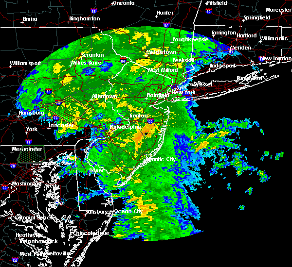 At 120 am edt, doppler radar indicated a line of severe thunderstorms capable of producing damaging winds of 60 to 70 mph. these storms were located along a line extending from near brickerville to near denver to near new holland, and moving northeast at 35 mph. At 120 am edt, doppler radar indicated a line of severe thunderstorms capable of producing damaging winds of 60 to 70 mph. these storms were located along a line extending from near brickerville to near denver to near new holland, and moving northeast at 35 mph.
|
| 9/30/2015 1:20 AM EDT |
 At 119 am edt, doppler radar indicated a severe thunderstorm capable of producing damaging winds in excess of 60 mph. this storm was located near bernville, or 9 miles northwest of reading, and moving north at 25 mph. At 119 am edt, doppler radar indicated a severe thunderstorm capable of producing damaging winds in excess of 60 mph. this storm was located near bernville, or 9 miles northwest of reading, and moving north at 25 mph.
|
| 8/4/2015 1:59 AM EDT |
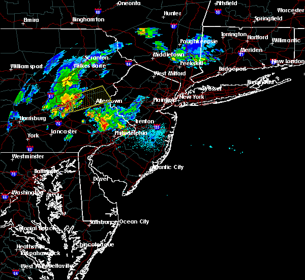 At 159 am edt, doppler radar indicated a severe thunderstorm capable of producing quarter size hail and damaging winds in excess of 60 mph. this storm was located near strausstown, or 9 miles southeast of schuylkill haven, moving east at 20 mph. locations impacted include, hamburg and shoemakersville. At 159 am edt, doppler radar indicated a severe thunderstorm capable of producing quarter size hail and damaging winds in excess of 60 mph. this storm was located near strausstown, or 9 miles southeast of schuylkill haven, moving east at 20 mph. locations impacted include, hamburg and shoemakersville.
|
| 8/4/2015 1:49 AM EDT |
 At 148 am edt, doppler radar indicated a severe thunderstorm capable of producing quarter size hail and damaging winds in excess of 60 mph. this storm was located over strausstown, or 9 miles south of schuylkill haven, moving east at 20 mph. locations impacted include, hamburg, shoemakersville and centerport. At 148 am edt, doppler radar indicated a severe thunderstorm capable of producing quarter size hail and damaging winds in excess of 60 mph. this storm was located over strausstown, or 9 miles south of schuylkill haven, moving east at 20 mph. locations impacted include, hamburg, shoemakersville and centerport.
|
| 8/4/2015 1:31 AM EDT |
 At 131 am edt, doppler radar indicated a severe thunderstorm capable of producing quarter size hail and damaging winds in excess of 60 mph. this storm was located near pine grove, or 7 miles north of myerstown, and moving east at 20 mph. At 131 am edt, doppler radar indicated a severe thunderstorm capable of producing quarter size hail and damaging winds in excess of 60 mph. this storm was located near pine grove, or 7 miles north of myerstown, and moving east at 20 mph.
|
| 7/18/2015 8:47 PM EDT |
 At 845 pm edt, doppler radar indicated a severe thunderstorm capable of producing damaging winds around 60 mph. this storm was located near new philadelphia, and moving southeast at 20 mph. At 845 pm edt, doppler radar indicated a severe thunderstorm capable of producing damaging winds around 60 mph. this storm was located near new philadelphia, and moving southeast at 20 mph.
|
| 7/9/2015 6:58 PM EDT |
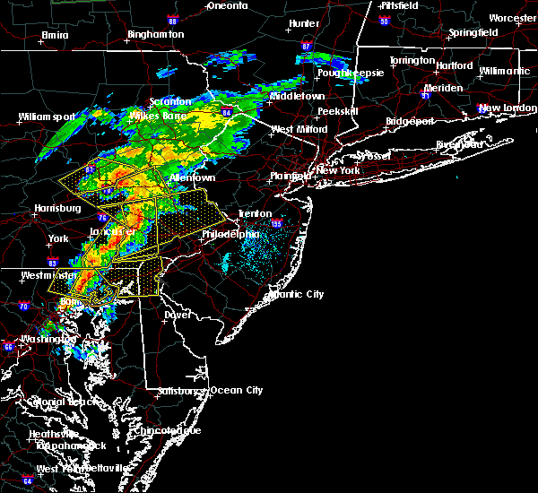 At 658 pm edt, doppler radar indicated a line of severe thunderstorms capable of producing damaging winds in excess of 60 mph. these storms were located along a line extending from near tuscarora to near mckeansburg to near hamburg, moving east at 30 mph. locations impacted include, tamaqua, hometown, mckeansburg, snyders, tuscarora, deer lake, new ringgold and port clinton. At 658 pm edt, doppler radar indicated a line of severe thunderstorms capable of producing damaging winds in excess of 60 mph. these storms were located along a line extending from near tuscarora to near mckeansburg to near hamburg, moving east at 30 mph. locations impacted include, tamaqua, hometown, mckeansburg, snyders, tuscarora, deer lake, new ringgold and port clinton.
|
| 7/9/2015 6:36 PM EDT |
 At 635 pm edt, doppler radar indicated a line of severe thunderstorms capable of producing damaging winds in excess of 60 mph. these storms were located along a line extending from st. clair to tremont to near tower city, moving east at 30 mph. locations impacted include, ashland, frackville, mahanoy city, minersville, pottsville, schuylkill haven, shenandoah, st. clair, tamaqua, altamont, beurys lake, branchdale, brandonville, buck run, delano, donaldson, englewood, forrestville, fountain springs and friedensburg. At 635 pm edt, doppler radar indicated a line of severe thunderstorms capable of producing damaging winds in excess of 60 mph. these storms were located along a line extending from st. clair to tremont to near tower city, moving east at 30 mph. locations impacted include, ashland, frackville, mahanoy city, minersville, pottsville, schuylkill haven, shenandoah, st. clair, tamaqua, altamont, beurys lake, branchdale, brandonville, buck run, delano, donaldson, englewood, forrestville, fountain springs and friedensburg.
|
| 7/9/2015 6:35 PM EDT |
 At 634 pm edt, doppler radar indicated a severe thunderstorm capable of producing damaging winds in excess of 60 mph. this storm was located over ancient oaks, or near allentown, and moving east at 50 mph. At 634 pm edt, doppler radar indicated a severe thunderstorm capable of producing damaging winds in excess of 60 mph. this storm was located over ancient oaks, or near allentown, and moving east at 50 mph.
|
| 7/9/2015 6:01 PM EDT |
 At 601 pm edt, doppler radar indicated a line of severe thunderstorms capable of producing damaging winds around 60 mph. these storms were located along a line extending from near locustdale to near tower city to near elizabethville, and moving east at 35 mph. At 601 pm edt, doppler radar indicated a line of severe thunderstorms capable of producing damaging winds around 60 mph. these storms were located along a line extending from near locustdale to near tower city to near elizabethville, and moving east at 35 mph.
|
| 6/30/2015 1:49 PM EDT |
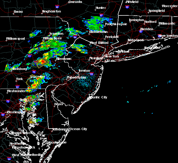 At 148 pm edt, doppler radar indicated a severe thunderstorm capable of producing damaging winds in excess of 60 mph. this storm was located over lenhartsville, or 13 miles east of schuylkill haven, moving northeast at 20 mph. locations impacted include, kutztown, hamburg, leesport, shoemakersville, lenhartsville, wanamakers, fairview hgts and centerport. At 148 pm edt, doppler radar indicated a severe thunderstorm capable of producing damaging winds in excess of 60 mph. this storm was located over lenhartsville, or 13 miles east of schuylkill haven, moving northeast at 20 mph. locations impacted include, kutztown, hamburg, leesport, shoemakersville, lenhartsville, wanamakers, fairview hgts and centerport.
|
| 6/30/2015 1:28 PM EDT |
 At 127 pm edt, doppler radar indicated a severe thunderstorm capable of producing damaging winds in excess of 60 mph. this storm was located near shoemakersville, or 11 miles southeast of schuylkill haven, moving northeast at 20 mph. locations impacted include, kutztown, hamburg, wernersville, leesport, shoemakersville, bernville, strausstown, lenhartsville, wanamakers, fairview hgts and centerport. At 127 pm edt, doppler radar indicated a severe thunderstorm capable of producing damaging winds in excess of 60 mph. this storm was located near shoemakersville, or 11 miles southeast of schuylkill haven, moving northeast at 20 mph. locations impacted include, kutztown, hamburg, wernersville, leesport, shoemakersville, bernville, strausstown, lenhartsville, wanamakers, fairview hgts and centerport.
|
| 6/30/2015 1:08 PM EDT |
 At 107 pm edt, doppler radar indicated a severe thunderstorm capable of producing damaging winds in excess of 60 mph. this storm was located over bernville, or 10 miles northeast of myerstown, and moving northeast at 20 mph. At 107 pm edt, doppler radar indicated a severe thunderstorm capable of producing damaging winds in excess of 60 mph. this storm was located over bernville, or 10 miles northeast of myerstown, and moving northeast at 20 mph.
|
| 6/23/2015 4:11 PM EDT |
 At 410 pm edt, doppler radar indicated a line of severe thunderstorms capable of producing damaging winds in excess of 60 mph. these storms were located along a line extending from near strausstown to bernville to womelsdorf, and moving east at 35 mph. * severe thunderstorms will be near, robesonia around 415 pm edt. fairview hgts around 420 pm edt. hamburg, sinking spring, leesport and shoemakersville around 425 pm edt. reading, wyomissing and spring ridge around 430 pm edt. laureldale and lenhartsville around 435 pm edt. kutztown, fleetwood and wanamakers around 440 pm edt. lyons around 445 pm edt. topton around 450 pm edt. other locations impacted by these severe thunderstorms include west lawn, shillington, amity gardens, st. lawrence, macungie, flying hills, mount penn, centerport, lorane and alburtis. At 410 pm edt, doppler radar indicated a line of severe thunderstorms capable of producing damaging winds in excess of 60 mph. these storms were located along a line extending from near strausstown to bernville to womelsdorf, and moving east at 35 mph. * severe thunderstorms will be near, robesonia around 415 pm edt. fairview hgts around 420 pm edt. hamburg, sinking spring, leesport and shoemakersville around 425 pm edt. reading, wyomissing and spring ridge around 430 pm edt. laureldale and lenhartsville around 435 pm edt. kutztown, fleetwood and wanamakers around 440 pm edt. lyons around 445 pm edt. topton around 450 pm edt. other locations impacted by these severe thunderstorms include west lawn, shillington, amity gardens, st. lawrence, macungie, flying hills, mount penn, centerport, lorane and alburtis.
|
| 6/14/2015 6:49 PM EDT |
 At 648 pm edt, doppler radar indicated a severe thunderstorm capable of producing damaging winds in excess of 60 mph. this storm was located over friedensburg, moving east at 45 mph. locations impacted include, minersville, pottsville, schuylkill haven, beurys lake, branchdale, buck run, donaldson, forrestville, friedensburg, marlin, orwigsburg, pine grove, renningers, tremont, auburn, cressona, deer lake, lake wynonah, landingville and mount carbon. At 648 pm edt, doppler radar indicated a severe thunderstorm capable of producing damaging winds in excess of 60 mph. this storm was located over friedensburg, moving east at 45 mph. locations impacted include, minersville, pottsville, schuylkill haven, beurys lake, branchdale, buck run, donaldson, forrestville, friedensburg, marlin, orwigsburg, pine grove, renningers, tremont, auburn, cressona, deer lake, lake wynonah, landingville and mount carbon.
|
| 6/14/2015 6:21 PM EDT |
 At 620 pm edt, doppler radar indicated a severe thunderstorm capable of producing damaging winds around 60 mph. this storm was located over lickdale, and moving northeast at 25 mph. At 620 pm edt, doppler radar indicated a severe thunderstorm capable of producing damaging winds around 60 mph. this storm was located over lickdale, and moving northeast at 25 mph.
|
| 6/8/2015 5:54 PM EDT | At 552 pm edt, doppler radar indicated a severe thunderstorm capable of producing half dollar size hail and destructive winds in excess of 70 mph. this storm was located over hamburg, or 10 miles southeast of schuylkill haven, moving east at 25 mph. locations impacted include, hamburg, leesport, shoemakersville, lenhartsville and centerport. a tornado watch remains in effect until 1000 pm edt for eastern pennsylvania. |
| 6/8/2015 5:17 PM EDT | At 516 pm edt, doppler radar indicated a severe thunderstorm capable of producing half dollar size hail and destructive winds in excess of 70 mph. this storm was located over friedensburg, or near schuylkill haven, and moving east at 15 mph. |
| 6/8/2015 5:08 PM EDT | At 508 pm edt, doppler radar indicated a line of severe thunderstorms capable of producing damaging winds of 60 to 70 mph. these storms were located along a line extending from near donaldson to near boiling springs, and moving southeast at 25 mph. |
| 6/8/2015 4:52 PM EDT | At 449 pm edt, doppler radar indicated a severe thunderstorm capable of producing large hail up to ping pong ball size and destructive winds in excess of 70 mph. this storm was located near tremont, moving east at 25 mph. locations impacted include, minersville, pottsville, schuylkill haven, branchdale, donaldson, forrestville, friedensburg, marlin, mckeansburg, orwigsburg, pine grove, port carbon, renningers, seltzer, tower city, tremont, auburn, cressona, deer lake and hegins. |
| 6/8/2015 4:29 PM EDT |
 At 428 pm edt, doppler radar indicated a severe thunderstorm capable of producing quarter size hail and damaging winds of 70 mph. this storm was located over highland park, and moving east at 45 mph. At 428 pm edt, doppler radar indicated a severe thunderstorm capable of producing quarter size hail and damaging winds of 70 mph. this storm was located over highland park, and moving east at 45 mph.
|
| 6/8/2015 3:29 PM EDT |
 At 328 pm edt, doppler radar indicated a severe thunderstorm capable of producing a tornado. this dangerous storm was located near leck kill, and moving east at 40 mph. At 328 pm edt, doppler radar indicated a severe thunderstorm capable of producing a tornado. this dangerous storm was located near leck kill, and moving east at 40 mph.
|
| 5/31/2015 7:48 PM EDT | At 748 pm edt, doppler radar indicated a severe thunderstorm capable of producing damaging winds in excess of 60 mph. this storm was located over womelsdorf, or near myerstown, and moving northeast at 30 mph. storms in the lower susquehanna valley have had a history of producing damaging winds. |
| 4/20/2015 9:00 PM EDT | At 859 pm edt, doppler radar indicated a severe thunderstorm capable of producing quarter size hail and damaging winds around 60 mph. this storm was located near williamstown, and moving northeast at 35 mph. * this severe thunderstorm will be near, williamstown around 900 pm edt. tower city around 910 pm edt. pine grove, tremont and donaldson around 920 pm edt. minersville, friedensburg, lavelle, forrestville, branchdale, buck run and beurys lake around 930 pm edt. other locations impacted by this severe thunderstorm include brockton, landingville, schuykill county airport, penn state schuylkill, middleport, summit station, mary-d, orwin, lake wynonah and muir. this includes interstate 81 from mile markers 93 to 132. |
Hail Maps for Port Clinton, PA
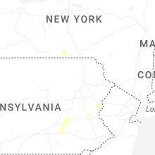


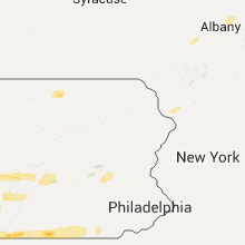


Connect with Interactive Hail Maps