

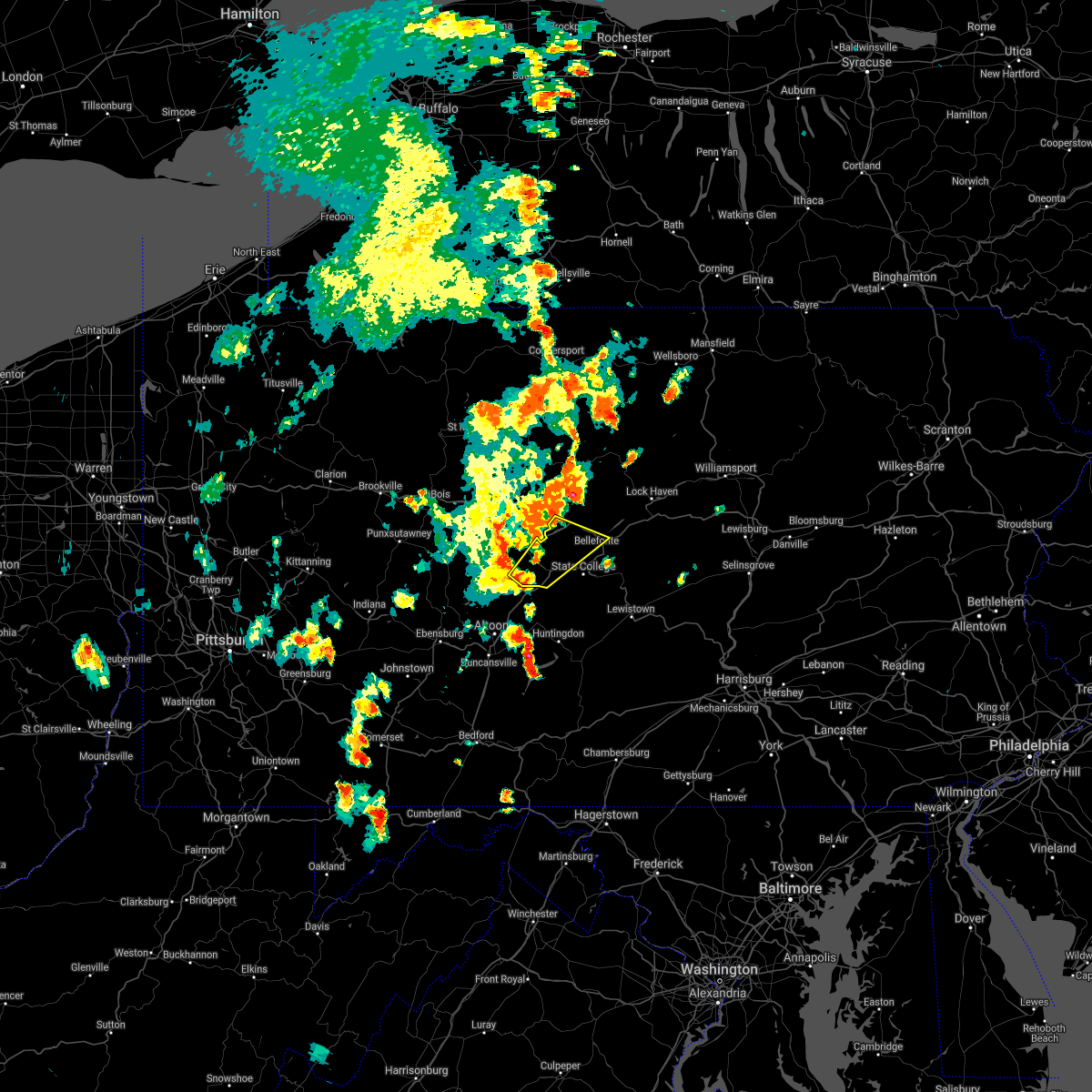
Hail Map for Port Matilda, PA
The Port Matilda, PA area has had 1 report of on-the-ground hail by trained spotters, and has been under severe weather warnings 12 times during the past 12 months. Doppler radar has detected hail at or near Port Matilda, PA on 29 occasions, including 3 occasions during the past year.
| Name: | Port Matilda, PA |
| Where Located: | 9.9 miles W of State College, PA |
| Map: | Google Map for Port Matilda, PA |
| Population: | 606 |
| Housing Units: | 289 |
| More Info: | Search Google for Port Matilda, PA |
0
The Top Recent Hail Date for Port Matilda, PA is Saturday, September 9, 2023 (29th out of 29)

Hail and Wind Damage Spotted near Port Matilda, PA
| Date / Time | Report Details |
|---|---|
| 4/14/2024 7:10 PM EDT |
 At 710 pm edt, severe thunderstorms were located along a line extending from poe valley state park to blandburg, moving east at 55 mph (radar indicated). Hazards include 60 mph wind gusts and quarter size hail. Hail damage to vehicles is expected. expect wind damage to roofs, siding, and trees. locations impacted include, altoona, state college, bellefonte, tyrone, park forest village, boalsburg, pleasant gap, philipsburg, stormstown, lemont, bald eagle, and zion. for those driving on interstate 80, this includes areas between the kylertown and lamar exits, specifically between mile markers 136 and 140, and from mile markers 153 to 167. This includes interstate 99 from mile markers 36 to 85. At 710 pm edt, severe thunderstorms were located along a line extending from poe valley state park to blandburg, moving east at 55 mph (radar indicated). Hazards include 60 mph wind gusts and quarter size hail. Hail damage to vehicles is expected. expect wind damage to roofs, siding, and trees. locations impacted include, altoona, state college, bellefonte, tyrone, park forest village, boalsburg, pleasant gap, philipsburg, stormstown, lemont, bald eagle, and zion. for those driving on interstate 80, this includes areas between the kylertown and lamar exits, specifically between mile markers 136 and 140, and from mile markers 153 to 167. This includes interstate 99 from mile markers 36 to 85.
|
| 4/14/2024 6:42 PM EDT |
 Svrctp the national weather service in state college pa has issued a * severe thunderstorm warning for, northeastern blair county in central pennsylvania, northeastern cambria county in central pennsylvania, centre county in central pennsylvania, clearfield county in central pennsylvania, northern huntingdon county in central pennsylvania, northeastern mifflin county in central pennsylvania, * until 730 pm edt. * at 641 pm edt, severe thunderstorms were located along a line extending from near milesburg to near punxsutawney, moving southeast at 55 mph (radar indicated). Hazards include 60 mph wind gusts and quarter size hail. Hail damage to vehicles is expected. Expect wind damage to roofs, siding, and trees. Svrctp the national weather service in state college pa has issued a * severe thunderstorm warning for, northeastern blair county in central pennsylvania, northeastern cambria county in central pennsylvania, centre county in central pennsylvania, clearfield county in central pennsylvania, northern huntingdon county in central pennsylvania, northeastern mifflin county in central pennsylvania, * until 730 pm edt. * at 641 pm edt, severe thunderstorms were located along a line extending from near milesburg to near punxsutawney, moving southeast at 55 mph (radar indicated). Hazards include 60 mph wind gusts and quarter size hail. Hail damage to vehicles is expected. Expect wind damage to roofs, siding, and trees.
|
| 12/3/2023 5:55 PM EST |
 At 554 pm est, severe thunderstorms were located along a line extending from keating to rock springs, moving east at 50 mph (radar indicated). Hazards include 60 mph wind gusts. Expect damage to roofs, siding, and trees. locations impacted include, state college, bellefonte, park forest village, boalsburg, pleasant gap, lamar, stormstown, lemont, zion, houserville, pine grove mills, and centre hall. for those driving on interstate 80, this includes areas between the kylertown and lamar exits, specifically from mile markers 139 to 171. this includes interstate 99 from mile markers 56 to 85. hail threat, radar indicated max hail size, <. 75 in wind threat, radar indicated max wind gust, 60 mph. At 554 pm est, severe thunderstorms were located along a line extending from keating to rock springs, moving east at 50 mph (radar indicated). Hazards include 60 mph wind gusts. Expect damage to roofs, siding, and trees. locations impacted include, state college, bellefonte, park forest village, boalsburg, pleasant gap, lamar, stormstown, lemont, zion, houserville, pine grove mills, and centre hall. for those driving on interstate 80, this includes areas between the kylertown and lamar exits, specifically from mile markers 139 to 171. this includes interstate 99 from mile markers 56 to 85. hail threat, radar indicated max hail size, <. 75 in wind threat, radar indicated max wind gust, 60 mph.
|
| 12/3/2023 5:41 PM EST |
 At 539 pm est, a line of gusty showers with possible thunder was extending from karthaus to bald eagle, moving east at 50 mph (radar indicated). Hazards include 60 mph wind gusts. expect damage to roofs, siding, and trees At 539 pm est, a line of gusty showers with possible thunder was extending from karthaus to bald eagle, moving east at 50 mph (radar indicated). Hazards include 60 mph wind gusts. expect damage to roofs, siding, and trees
|
| 9/9/2023 3:47 PM EDT |
 At 347 pm edt, a severe thunderstorm was located over bald eagle, moving northeast at 10 mph (radar indicated). Hazards include 60 mph wind gusts and penny size hail. Expect damage to roofs, siding, and trees. this severe thunderstorm will be near, bald eagle around 350 pm edt. warriors mark around 400 pm edt. port matilda and stormstown around 430 pm edt. this includes interstate 99 from mile markers 48 to 65. hail threat, radar indicated max hail size, 0. 75 in wind threat, radar indicated max wind gust, 60 mph. At 347 pm edt, a severe thunderstorm was located over bald eagle, moving northeast at 10 mph (radar indicated). Hazards include 60 mph wind gusts and penny size hail. Expect damage to roofs, siding, and trees. this severe thunderstorm will be near, bald eagle around 350 pm edt. warriors mark around 400 pm edt. port matilda and stormstown around 430 pm edt. this includes interstate 99 from mile markers 48 to 65. hail threat, radar indicated max hail size, 0. 75 in wind threat, radar indicated max wind gust, 60 mph.
|
| 8/7/2023 2:10 PM EDT | Tree down over the roa in centre county PA, 1.4 miles NNW of Port Matilda, PA |
| 8/7/2023 2:01 PM EDT |
 At 159 pm edt, a severe thunderstorm capable of producing a tornado was located over warriors mark, moving east at 20 mph (radar indicated rotation). Hazards include tornado and half dollar size hail. Flying debris will be dangerous to those caught without shelter. mobile homes will be damaged or destroyed. damage to roofs, windows, and vehicles will occur. tree damage is likely. this dangerous storm will be near, rock springs, stormstown and port matilda around 210 pm edt. ramblewood, whipple dam state park and park forest village around 220 pm edt. state college, pine grove mills and boalsburg around 230 pm edt. other locations impacted by this tornadic thunderstorm include tussey mountain ski area, pennsylvania state university, university park airport and pennsylvania military museum. This includes interstate 99 from mile markers 54 to 80. At 159 pm edt, a severe thunderstorm capable of producing a tornado was located over warriors mark, moving east at 20 mph (radar indicated rotation). Hazards include tornado and half dollar size hail. Flying debris will be dangerous to those caught without shelter. mobile homes will be damaged or destroyed. damage to roofs, windows, and vehicles will occur. tree damage is likely. this dangerous storm will be near, rock springs, stormstown and port matilda around 210 pm edt. ramblewood, whipple dam state park and park forest village around 220 pm edt. state college, pine grove mills and boalsburg around 230 pm edt. other locations impacted by this tornadic thunderstorm include tussey mountain ski area, pennsylvania state university, university park airport and pennsylvania military museum. This includes interstate 99 from mile markers 54 to 80.
|
| 8/7/2023 1:49 PM EDT |
 At 149 pm edt, a severe thunderstorm was located over warriors mark, moving east at 20 mph (radar indicated). Hazards include 60 mph wind gusts and half dollar size hail. Hail damage to vehicles is expected. expect wind damage to roofs, siding, and trees. this severe thunderstorm will be near, franklinville around 150 pm edt. port matilda around 200 pm edt. ramblewood, stormstown and rock springs around 210 pm edt. pine grove mills, park forest village and whipple dam state park around 220 pm edt. state college, boalsburg and lemont around 230 pm edt. other locations impacted by this severe thunderstorm include tussey mountain ski area, pennsylvania state university, university park airport and pennsylvania military museum. this includes interstate 99 from mile markers 50 to 84. hail threat, radar indicated max hail size, 1. 25 in wind threat, radar indicated max wind gust, 60 mph. At 149 pm edt, a severe thunderstorm was located over warriors mark, moving east at 20 mph (radar indicated). Hazards include 60 mph wind gusts and half dollar size hail. Hail damage to vehicles is expected. expect wind damage to roofs, siding, and trees. this severe thunderstorm will be near, franklinville around 150 pm edt. port matilda around 200 pm edt. ramblewood, stormstown and rock springs around 210 pm edt. pine grove mills, park forest village and whipple dam state park around 220 pm edt. state college, boalsburg and lemont around 230 pm edt. other locations impacted by this severe thunderstorm include tussey mountain ski area, pennsylvania state university, university park airport and pennsylvania military museum. this includes interstate 99 from mile markers 50 to 84. hail threat, radar indicated max hail size, 1. 25 in wind threat, radar indicated max wind gust, 60 mph.
|
| 7/28/2023 9:01 PM EDT |
 At 900 pm edt, severe thunderstorms were located along a line extending from woodland to black moshannon state park to bald eagle, moving east at 30 mph (radar indicated). Hazards include 60 mph wind gusts. expect damage to roofs, siding, and trees At 900 pm edt, severe thunderstorms were located along a line extending from woodland to black moshannon state park to bald eagle, moving east at 30 mph (radar indicated). Hazards include 60 mph wind gusts. expect damage to roofs, siding, and trees
|
| 7/20/2023 10:20 PM EDT | Tree down at atherton st and stevenson r in centre county PA, 5.9 miles WSW of Port Matilda, PA |
| 7/20/2023 10:05 PM EDT |
 At 1005 pm edt, severe thunderstorms were located along a line extending from milesburg to julian to near tyrone, moving southeast at 25 mph (radar indicated). Hazards include 60 mph wind gusts. expect damage to roofs, siding, and trees At 1005 pm edt, severe thunderstorms were located along a line extending from milesburg to julian to near tyrone, moving southeast at 25 mph (radar indicated). Hazards include 60 mph wind gusts. expect damage to roofs, siding, and trees
|
| 7/14/2023 3:56 PM EDT |
 The severe thunderstorm warning for south central centre, northeastern huntingdon and north central mifflin counties will expire at 400 pm edt, the storm which prompted the warning has moved out of the area. therefore, the warning will be allowed to expire. to report severe weather, contact your nearest law enforcement agency. they will relay your report to the national weather service state college pa. remember, a severe thunderstorm warning still remains in effect for eastern centre county until 430pm. The severe thunderstorm warning for south central centre, northeastern huntingdon and north central mifflin counties will expire at 400 pm edt, the storm which prompted the warning has moved out of the area. therefore, the warning will be allowed to expire. to report severe weather, contact your nearest law enforcement agency. they will relay your report to the national weather service state college pa. remember, a severe thunderstorm warning still remains in effect for eastern centre county until 430pm.
|
| 7/14/2023 3:37 PM EDT |
 At 334 pm edt, a severe thunderstorm was located over state college, moving northeast at 25 mph (trained weather spotters reported trees down in the state college area. also half inch sized hail 2 miles west of state college). Hazards include 60 mph wind gusts and nickel size hail. Expect damage to roofs, siding, and trees. locations impacted include, state college, bellefonte, park forest village, boalsburg, pleasant gap, stormstown, lemont, houserville, pine grove mills, milroy, centre hall and ramblewood. this includes interstate 99 from mile markers 60 to 82. hail threat, radar indicated max hail size, 0. 88 in wind threat, observed max wind gust, 60 mph. At 334 pm edt, a severe thunderstorm was located over state college, moving northeast at 25 mph (trained weather spotters reported trees down in the state college area. also half inch sized hail 2 miles west of state college). Hazards include 60 mph wind gusts and nickel size hail. Expect damage to roofs, siding, and trees. locations impacted include, state college, bellefonte, park forest village, boalsburg, pleasant gap, stormstown, lemont, houserville, pine grove mills, milroy, centre hall and ramblewood. this includes interstate 99 from mile markers 60 to 82. hail threat, radar indicated max hail size, 0. 88 in wind threat, observed max wind gust, 60 mph.
|
| 7/14/2023 3:11 PM EDT |
 At 311 pm edt, a severe thunderstorm was located near franklinville, moving northeast at 25 mph (radar indicated). Hazards include 60 mph wind gusts and nickel size hail. expect damage to roofs, siding, and trees At 311 pm edt, a severe thunderstorm was located near franklinville, moving northeast at 25 mph (radar indicated). Hazards include 60 mph wind gusts and nickel size hail. expect damage to roofs, siding, and trees
|
| 4/1/2023 3:43 PM EDT |
 At 342 pm edt, severe thunderstorms were located along a line extending from troupsburg to cammal to seven mountains, moving east at 45 mph (radar indicated). Hazards include 60 mph wind gusts. Expect damage to roofs, siding, and trees. locations impacted include, state college, lock haven, bellefonte, park forest village, carroll, woodward, boalsburg, pleasant gap, philipsburg, lamar, stormstown and lemont. for those driving on interstate 80, this includes areas between the kylertown and mile run exits, specifically from mile markers 140 to 193. this includes interstate 99 from mile markers 56 to 85. hail threat, radar indicated max hail size, <. 75 in wind threat, radar indicated max wind gust, 60 mph. At 342 pm edt, severe thunderstorms were located along a line extending from troupsburg to cammal to seven mountains, moving east at 45 mph (radar indicated). Hazards include 60 mph wind gusts. Expect damage to roofs, siding, and trees. locations impacted include, state college, lock haven, bellefonte, park forest village, carroll, woodward, boalsburg, pleasant gap, philipsburg, lamar, stormstown and lemont. for those driving on interstate 80, this includes areas between the kylertown and mile run exits, specifically from mile markers 140 to 193. this includes interstate 99 from mile markers 56 to 85. hail threat, radar indicated max hail size, <. 75 in wind threat, radar indicated max wind gust, 60 mph.
|
| 4/1/2023 3:07 PM EDT |
 At 307 pm edt, severe thunderstorms were located along a line extending from near shinglehouse to cameron to woodland, moving northeast at 40 mph (radar indicated). Hazards include 70 mph wind gusts. Expect considerable tree damage. Damage is likely to mobile homes, roofs, and outbuildings. At 307 pm edt, severe thunderstorms were located along a line extending from near shinglehouse to cameron to woodland, moving northeast at 40 mph (radar indicated). Hazards include 70 mph wind gusts. Expect considerable tree damage. Damage is likely to mobile homes, roofs, and outbuildings.
|
| 3/31/2022 1:56 PM EDT |
 At 156 pm edt, a severe thunderstorm was located over stormstown, moving northeast at 35 mph (radar indicated). Hazards include 60 mph wind gusts. expect damage to roofs, siding, and trees At 156 pm edt, a severe thunderstorm was located over stormstown, moving northeast at 35 mph (radar indicated). Hazards include 60 mph wind gusts. expect damage to roofs, siding, and trees
|
| 3/7/2022 5:39 PM EST |
 At 538 pm est, severe thunderstorms were located along a line extending from bath to near keating to ogletown, moving northeast at 75 mph (radar indicated). Hazards include 60 mph wind gusts. Expect damage to roofs, siding, and trees. locations impacted include, state college, lock haven, bellefonte, mansfield, wellsboro, philipsburg, renovo, park forest village, boalsburg, wharton, keating, morris, pleasant gap, lamar, stormstown, lemont, zion, elkland, houserville and mill hall. for those driving on interstate 80, this includes areas between the kylertown and lock haven exits, specifically from mile markers 139 to 176. this includes interstate 99 from mile markers 56 to 85. hail threat, radar indicated max hail size, <. 75 in wind threat, radar indicated max wind gust, 60 mph. At 538 pm est, severe thunderstorms were located along a line extending from bath to near keating to ogletown, moving northeast at 75 mph (radar indicated). Hazards include 60 mph wind gusts. Expect damage to roofs, siding, and trees. locations impacted include, state college, lock haven, bellefonte, mansfield, wellsboro, philipsburg, renovo, park forest village, boalsburg, wharton, keating, morris, pleasant gap, lamar, stormstown, lemont, zion, elkland, houserville and mill hall. for those driving on interstate 80, this includes areas between the kylertown and lock haven exits, specifically from mile markers 139 to 176. this includes interstate 99 from mile markers 56 to 85. hail threat, radar indicated max hail size, <. 75 in wind threat, radar indicated max wind gust, 60 mph.
|
| 3/7/2022 5:22 PM EST |
 At 522 pm est, severe thunderstorms were located along a line extending from canisteo to near karthaus to near boswell, moving northeast at 60 mph (radar indicated). Hazards include 60 mph wind gusts. expect damage to roofs, siding, and trees At 522 pm est, severe thunderstorms were located along a line extending from canisteo to near karthaus to near boswell, moving northeast at 60 mph (radar indicated). Hazards include 60 mph wind gusts. expect damage to roofs, siding, and trees
|
| 10/21/2021 9:39 PM EDT |
 At 939 pm edt, a severe thunderstorm was located near houtzdale, moving east at 50 mph (radar indicated). Hazards include 60 mph wind gusts. expect damage to roofs, siding, and trees At 939 pm edt, a severe thunderstorm was located near houtzdale, moving east at 50 mph (radar indicated). Hazards include 60 mph wind gusts. expect damage to roofs, siding, and trees
|
| 8/28/2021 2:32 PM EDT |
 At 231 pm edt, a severe thunderstorm was located just west of sandy ridge, moving east at 30 mph (radar indicated). Hazards include 60 mph wind gusts. Expect damage to roofs, siding, and trees. locations impacted include, tyrone, stormstown, bald eagle, warriors mark, osceola mills, port matilda, sandy ridge and franklinville. this includes interstate 99 from mile markers 49 to 66. hail threat, radar indicated max hail size, <. 75 in wind threat, radar indicated max wind gust, 60 mph. At 231 pm edt, a severe thunderstorm was located just west of sandy ridge, moving east at 30 mph (radar indicated). Hazards include 60 mph wind gusts. Expect damage to roofs, siding, and trees. locations impacted include, tyrone, stormstown, bald eagle, warriors mark, osceola mills, port matilda, sandy ridge and franklinville. this includes interstate 99 from mile markers 49 to 66. hail threat, radar indicated max hail size, <. 75 in wind threat, radar indicated max wind gust, 60 mph.
|
| 8/28/2021 2:15 PM EDT |
 At 214 pm edt, a severe thunderstorm was located over houtzdale, moving east at 30 mph (radar indicated). Hazards include 60 mph wind gusts and penny size hail. expect damage to roofs, siding, and trees At 214 pm edt, a severe thunderstorm was located over houtzdale, moving east at 30 mph (radar indicated). Hazards include 60 mph wind gusts and penny size hail. expect damage to roofs, siding, and trees
|
| 8/11/2021 3:28 PM EDT |
 At 328 pm edt, severe thunderstorms were located along a line extending from julian to near stormstown, moving east at 30 mph (radar indicated). Hazards include 60 mph wind gusts. expect damage to roofs, siding, and trees At 328 pm edt, severe thunderstorms were located along a line extending from julian to near stormstown, moving east at 30 mph (radar indicated). Hazards include 60 mph wind gusts. expect damage to roofs, siding, and trees
|
| 7/17/2021 3:52 PM EDT |
 At 352 pm edt, severe thunderstorms were located along a line extending from plymptonville to jeffries to near blandburg, moving northeast at 45 mph (radar indicated). Hazards include 60 mph wind gusts. expect damage to roofs, siding, and trees At 352 pm edt, severe thunderstorms were located along a line extending from plymptonville to jeffries to near blandburg, moving northeast at 45 mph (radar indicated). Hazards include 60 mph wind gusts. expect damage to roofs, siding, and trees
|
| 7/13/2021 7:16 PM EDT |
 At 716 pm edt, severe thunderstorms were located along a line extending from black moshannon state park to near port matilda to near franklinville to near spruce creek to huntingdon, moving northeast at 25 mph (radar indicated). Hazards include 70 mph wind gusts and penny size hail. Expect considerable tree damage. damage is likely to mobile homes, roofs, and outbuildings. severe thunderstorms will be near, black moshannon state park, stormstown and port matilda around 720 pm edt. rock springs, julian, ramblewood and park forest village around 730 pm edt. pine grove mills, whipple dam state park, mcalevys fort, allensville, houserville and snow shoe around 740 pm edt. bellefonte, state college, boalsburg, milesburg, pleasant gap and lemont around 750 pm edt. other locations impacted by these severe thunderstorms include barrville, orviston, longfellow, mcconnellstown, siglerville, mill creek, howard, petersburg, maitland and alexandria. for those driving on interstate 80, this includes areas between the kylertown and lamar exits, specifically from mile markers 143 to 170. This includes interstate 99 from mile markers 57 to 85. At 716 pm edt, severe thunderstorms were located along a line extending from black moshannon state park to near port matilda to near franklinville to near spruce creek to huntingdon, moving northeast at 25 mph (radar indicated). Hazards include 70 mph wind gusts and penny size hail. Expect considerable tree damage. damage is likely to mobile homes, roofs, and outbuildings. severe thunderstorms will be near, black moshannon state park, stormstown and port matilda around 720 pm edt. rock springs, julian, ramblewood and park forest village around 730 pm edt. pine grove mills, whipple dam state park, mcalevys fort, allensville, houserville and snow shoe around 740 pm edt. bellefonte, state college, boalsburg, milesburg, pleasant gap and lemont around 750 pm edt. other locations impacted by these severe thunderstorms include barrville, orviston, longfellow, mcconnellstown, siglerville, mill creek, howard, petersburg, maitland and alexandria. for those driving on interstate 80, this includes areas between the kylertown and lamar exits, specifically from mile markers 143 to 170. This includes interstate 99 from mile markers 57 to 85.
|
| 7/13/2021 7:02 PM EDT |
 At 702 pm edt, a severe thunderstorm was located near port matilda, moving northeast at 45 mph (radar indicated). Hazards include 70 mph wind gusts. Expect considerable tree damage. damage is likely to mobile homes, roofs, and outbuildings. locations impacted include, bellefonte, philipsburg, stormstown, milesburg, snow shoe, clarence, port matilda, south philipsburg, sandy ridge, moshannon, julian, black moshannon state park and unionville. for those driving on interstate 80, this includes areas between the kylertown and bellefonte exits, specifically between mile markers 139 and 148, and from mile markers 150 to 160. This includes interstate 99 from mile markers 56 to 69. At 702 pm edt, a severe thunderstorm was located near port matilda, moving northeast at 45 mph (radar indicated). Hazards include 70 mph wind gusts. Expect considerable tree damage. damage is likely to mobile homes, roofs, and outbuildings. locations impacted include, bellefonte, philipsburg, stormstown, milesburg, snow shoe, clarence, port matilda, south philipsburg, sandy ridge, moshannon, julian, black moshannon state park and unionville. for those driving on interstate 80, this includes areas between the kylertown and bellefonte exits, specifically between mile markers 139 and 148, and from mile markers 150 to 160. This includes interstate 99 from mile markers 56 to 69.
|
| 7/13/2021 6:46 PM EDT |
 At 645 pm edt, a severe thunderstorm was located over tyrone, moving northeast at 40 mph (radar indicated). Hazards include 70 mph wind gusts. Expect considerable tree damage. Damage is likely to mobile homes, roofs, and outbuildings. At 645 pm edt, a severe thunderstorm was located over tyrone, moving northeast at 40 mph (radar indicated). Hazards include 70 mph wind gusts. Expect considerable tree damage. Damage is likely to mobile homes, roofs, and outbuildings.
|
| 7/11/2021 6:57 PM EDT |
 At 655 pm edt, severe thunderstorms were located along a line extending from near julian to near huntingdon to near trough creek state park to near everett to near lake gordon, moving east at 40 mph (radar indicated). Hazards include 70 mph wind gusts. Expect considerable tree damage. Damage is likely to mobile homes, roofs, and outbuildings. At 655 pm edt, severe thunderstorms were located along a line extending from near julian to near huntingdon to near trough creek state park to near everett to near lake gordon, moving east at 40 mph (radar indicated). Hazards include 70 mph wind gusts. Expect considerable tree damage. Damage is likely to mobile homes, roofs, and outbuildings.
|
| 7/11/2021 6:03 PM EDT |
 At 602 pm edt, severe thunderstorms were located along a line extending from near blandburg to near ski gap to near central city to near meyersdale, moving east at 30 mph (radar indicated). Hazards include 60 mph wind gusts. expect damage to roofs, siding, and trees At 602 pm edt, severe thunderstorms were located along a line extending from near blandburg to near ski gap to near central city to near meyersdale, moving east at 30 mph (radar indicated). Hazards include 60 mph wind gusts. expect damage to roofs, siding, and trees
|
| 7/11/2021 5:54 PM EDT |
 At 553 pm edt, a severe thunderstorm was located near port matilda, moving northeast at 40 mph. other storms were just south of this storm (radar indicated). Hazards include 60 mph wind gusts and quarter size hail. Hail damage to vehicles is expected. expect wind damage to roofs, siding, and trees. locations impacted include, altoona, tyrone, philipsburg, stormstown, bald eagle, lakemont, bellwood, warriors mark, williamsburg, tipton, chester hill, snow shoe, north philipsburg, clarence, port matilda, south philipsburg, sandy ridge, moshannon, spruce creek and pine glen. for those driving on interstate 80, this includes areas between the kylertown and milesburg exits, specifically from mile markers 133 to 155. This includes interstate 99 from mile markers 32 to 70. At 553 pm edt, a severe thunderstorm was located near port matilda, moving northeast at 40 mph. other storms were just south of this storm (radar indicated). Hazards include 60 mph wind gusts and quarter size hail. Hail damage to vehicles is expected. expect wind damage to roofs, siding, and trees. locations impacted include, altoona, tyrone, philipsburg, stormstown, bald eagle, lakemont, bellwood, warriors mark, williamsburg, tipton, chester hill, snow shoe, north philipsburg, clarence, port matilda, south philipsburg, sandy ridge, moshannon, spruce creek and pine glen. for those driving on interstate 80, this includes areas between the kylertown and milesburg exits, specifically from mile markers 133 to 155. This includes interstate 99 from mile markers 32 to 70.
|
| 7/11/2021 5:30 PM EDT |
 At 530 pm edt, a severe thunderstorm was located over tipton, moving northeast at 40 mph (radar indicated). Hazards include 60 mph wind gusts and quarter size hail. Hail damage to vehicles is expected. Expect wind damage to roofs, siding, and trees. At 530 pm edt, a severe thunderstorm was located over tipton, moving northeast at 40 mph (radar indicated). Hazards include 60 mph wind gusts and quarter size hail. Hail damage to vehicles is expected. Expect wind damage to roofs, siding, and trees.
|
| 7/7/2021 6:30 PM EDT | Large tree down on wires on east oak stree in centre county PA, 0.1 miles S of Port Matilda, PA |
| 7/7/2021 6:14 PM EDT | 10 to 12 inch diameter... 30 to 40 ft tall tree came down near the intersection of smith rd and tow hill r in centre county PA, 2.1 miles NW of Port Matilda, PA |
| 7/7/2021 6:12 PM EDT |
 At 611 pm edt, severe thunderstorms were located along a line extending from houtzdale to sandy ridge to near stormstown to near franklinville, moving north at 40 mph (radar indicated). Hazards include 70 mph wind gusts and quarter size hail. Hail damage to vehicles is expected. expect considerable tree damage. wind damage is also likely to mobile homes, roofs, and outbuildings. severe thunderstorms will be near, north philipsburg, philipsburg, south philipsburg and chester hill around 620 pm edt. state college, park forest village, black moshannon state park, woodland, lemont and boalsburg around 630 pm edt. bellefonte, clarence, snow shoe, karthaus, moshannon, julian, pine glen, lecontes mills and houserville around 640 pm edt. milesburg around 650 pm edt. other locations impacted by these severe thunderstorms include west decatur, ramey, orviston, brisbin, kylertown, grassflat, howard, wallaceton, unionville and morrisdale. for those driving on interstate 80, this includes areas between the clearfield and lamar exits, specifically from mile markers 121 to 162. This includes interstate 99 from mile markers 55 to 85. At 611 pm edt, severe thunderstorms were located along a line extending from houtzdale to sandy ridge to near stormstown to near franklinville, moving north at 40 mph (radar indicated). Hazards include 70 mph wind gusts and quarter size hail. Hail damage to vehicles is expected. expect considerable tree damage. wind damage is also likely to mobile homes, roofs, and outbuildings. severe thunderstorms will be near, north philipsburg, philipsburg, south philipsburg and chester hill around 620 pm edt. state college, park forest village, black moshannon state park, woodland, lemont and boalsburg around 630 pm edt. bellefonte, clarence, snow shoe, karthaus, moshannon, julian, pine glen, lecontes mills and houserville around 640 pm edt. milesburg around 650 pm edt. other locations impacted by these severe thunderstorms include west decatur, ramey, orviston, brisbin, kylertown, grassflat, howard, wallaceton, unionville and morrisdale. for those driving on interstate 80, this includes areas between the clearfield and lamar exits, specifically from mile markers 121 to 162. This includes interstate 99 from mile markers 55 to 85.
|
| 6/21/2021 4:45 PM EDT | Line down across roadwa in centre county PA, 1.4 miles NNW of Port Matilda, PA |
| 6/13/2021 8:07 PM EDT |
 At 807 pm edt, a severe thunderstorm was located near warriors mark, moving southeast at 15 mph (radar indicated). Hazards include 60 mph wind gusts and quarter size hail. Hail damage to vehicles is expected. expect wind damage to roofs, siding, and trees. locations impacted include, tyrone, stormstown, bald eagle, warriors mark, ramblewood, port matilda, franklinville and rock springs. This includes interstate 99 from mile markers 48 to 63. At 807 pm edt, a severe thunderstorm was located near warriors mark, moving southeast at 15 mph (radar indicated). Hazards include 60 mph wind gusts and quarter size hail. Hail damage to vehicles is expected. expect wind damage to roofs, siding, and trees. locations impacted include, tyrone, stormstown, bald eagle, warriors mark, ramblewood, port matilda, franklinville and rock springs. This includes interstate 99 from mile markers 48 to 63.
|
| 6/13/2021 8:02 PM EDT | Trees down on wires on south mountain roa in centre county PA, 3.7 miles ESE of Port Matilda, PA |
| 6/13/2021 7:53 PM EDT |
 At 753 pm edt, a severe thunderstorm was located near port matilda, moving southeast at 15 mph (radar indicated). Hazards include 60 mph wind gusts and quarter size hail. Hail damage to vehicles is expected. Expect wind damage to roofs, siding, and trees. At 753 pm edt, a severe thunderstorm was located near port matilda, moving southeast at 15 mph (radar indicated). Hazards include 60 mph wind gusts and quarter size hail. Hail damage to vehicles is expected. Expect wind damage to roofs, siding, and trees.
|
| 8/27/2020 6:15 PM EDT |
 At 614 pm edt, severe thunderstorms were located along a line extending from near black moshannon state park to near houtzdale to near indiana, moving east at 45 mph (radar indicated). Hazards include 60 mph wind gusts and quarter size hail. Hail damage to vehicles is expected. Expect wind damage to trees, roofs, and siding. At 614 pm edt, severe thunderstorms were located along a line extending from near black moshannon state park to near houtzdale to near indiana, moving east at 45 mph (radar indicated). Hazards include 60 mph wind gusts and quarter size hail. Hail damage to vehicles is expected. Expect wind damage to trees, roofs, and siding.
|
| 6/22/2020 5:09 PM EDT | Very large tree branch on power pole with fire reported at halfmoon twp... centre county 100 block smith road at toms lan in centre county PA, 2.3 miles NNW of Port Matilda, PA |
| 6/4/2020 7:47 PM EDT |
 At 745 pm edt, severe thunderstorms were located along a line extending from near force to near woodland to near chester hill to near tyrone, moving northeast at 30 mph (radar indicated). Hazards include 60 mph wind gusts and penny size hail. Expect damage to trees, roofs, and siding. these severe storms will be near, chester hill, philipsburg, north philipsburg, lecontes mills and south philipsburg around 750 pm edt. bald eagle, warriors mark, sandy ridge and franklinville around 800 pm edt. karthaus and black moshannon state park around 810 pm edt. stormstown, moshannon, port matilda, pine glen, ramblewood and rock springs around 820 pm edt. other locations impacted by these severe thunderstorms include west decatur, grassflat, wallaceton, morrisdale, kylertown, delgrosso`s amusement park and clearfield-lawrence airport. for those driving on interstate 80, this includes areas between the penfield and milesburg exits, specifically from mile markers 117 to 148. This includes interstate 99 from mile markers 41 to 72. At 745 pm edt, severe thunderstorms were located along a line extending from near force to near woodland to near chester hill to near tyrone, moving northeast at 30 mph (radar indicated). Hazards include 60 mph wind gusts and penny size hail. Expect damage to trees, roofs, and siding. these severe storms will be near, chester hill, philipsburg, north philipsburg, lecontes mills and south philipsburg around 750 pm edt. bald eagle, warriors mark, sandy ridge and franklinville around 800 pm edt. karthaus and black moshannon state park around 810 pm edt. stormstown, moshannon, port matilda, pine glen, ramblewood and rock springs around 820 pm edt. other locations impacted by these severe thunderstorms include west decatur, grassflat, wallaceton, morrisdale, kylertown, delgrosso`s amusement park and clearfield-lawrence airport. for those driving on interstate 80, this includes areas between the penfield and milesburg exits, specifically from mile markers 117 to 148. This includes interstate 99 from mile markers 41 to 72.
|
| 6/4/2020 7:13 PM EDT |
 At 711 pm edt, severe thunderstorms were located along a line extending from near dubois to near curwensville to 10 miles north of prince gallitzin state park to near patton, moving northeast at 30 mph (radar indicated). Hazards include 60 mph wind gusts and penny size hail. Expect damage to trees, roofs, and siding. severe thunderstorms will be near, curwensville around 720 pm edt. clearfield, penfield, hyde, jeffries, plymptonville, blandburg, houtzdale, bellwood and s. b. elliot state park around 730 pm edt. tipton, woodland, parker dam state park and osceola mills around 740 pm edt. tyrone, north philipsburg, philipsburg, lecontes mills, chester hill, south philipsburg and birmingham around 750 pm edt. for those driving on interstate 80, this includes areas between the dubois and milesburg exits, specifically from mile markers 97 to 148. This includes interstate 99 from mile markers 41 to 72. At 711 pm edt, severe thunderstorms were located along a line extending from near dubois to near curwensville to 10 miles north of prince gallitzin state park to near patton, moving northeast at 30 mph (radar indicated). Hazards include 60 mph wind gusts and penny size hail. Expect damage to trees, roofs, and siding. severe thunderstorms will be near, curwensville around 720 pm edt. clearfield, penfield, hyde, jeffries, plymptonville, blandburg, houtzdale, bellwood and s. b. elliot state park around 730 pm edt. tipton, woodland, parker dam state park and osceola mills around 740 pm edt. tyrone, north philipsburg, philipsburg, lecontes mills, chester hill, south philipsburg and birmingham around 750 pm edt. for those driving on interstate 80, this includes areas between the dubois and milesburg exits, specifically from mile markers 97 to 148. This includes interstate 99 from mile markers 41 to 72.
|
| 6/3/2020 9:52 AM EDT |
 At 951 am edt, severe thunderstorms were located along a line extending from near rockton to 10 miles southwest of curwensville to 9 miles north of northern cambria, moving east at 65 mph (radar indicated). Hazards include 70 mph wind gusts and quarter size hail. Hail damage to vehicles is expected. expect considerable tree damage. Wind damage is also likely to mobile homes, roofs, and outbuildings. At 951 am edt, severe thunderstorms were located along a line extending from near rockton to 10 miles southwest of curwensville to 9 miles north of northern cambria, moving east at 65 mph (radar indicated). Hazards include 70 mph wind gusts and quarter size hail. Hail damage to vehicles is expected. expect considerable tree damage. Wind damage is also likely to mobile homes, roofs, and outbuildings.
|
| 4/13/2020 1:16 PM EDT | Trees down on wires in port matilda in centre county PA, 0.1 miles S of Port Matilda, PA |
| 4/13/2020 12:45 PM EDT |
 At 1244 pm edt, severe thunderstorms were located along a line extending from jeffries to near blandburg to 6 miles southeast of prince gallitzin state park to lilly, moving east at 50 mph (radar indicated). Hazards include 60 mph wind gusts and penny size hail. Expect damage to trees, roofs, and siding. severe thunderstorms will be near, bellwood, houtzdale, woodland, jeffries and south philipsburg around 1250 pm edt. tyrone, sandy ridge, birmingham, tipton, north philipsburg, philipsburg, osceola mills, bald eagle and chester hill around 100 pm edt. port matilda, franklinville, moshannon, warriors mark, stormstown, canoe creek state park, williamsburg, sinking valley, spruce creek and black moshannon state park around 110 pm edt. state college, huntingdon, rock springs, ramblewood, julian, park forest village, snow shoe, houserville, clarence and whipple dam state park around 120 pm edt. other locations impacted by these severe thunderstorms include west decatur, tunnelhill, ramey, cassandra, brisbin, mcconnellstown, howard, petersburg, alexandria and unionville. for those driving on interstate 80, this includes areas between the woodland and lamar exits, specifically from mile markers 126 to 170. this includes interstate 99 from mile markers 26 to 85. This includes the following covid-19 test sites, mount nittany health, and upmc. At 1244 pm edt, severe thunderstorms were located along a line extending from jeffries to near blandburg to 6 miles southeast of prince gallitzin state park to lilly, moving east at 50 mph (radar indicated). Hazards include 60 mph wind gusts and penny size hail. Expect damage to trees, roofs, and siding. severe thunderstorms will be near, bellwood, houtzdale, woodland, jeffries and south philipsburg around 1250 pm edt. tyrone, sandy ridge, birmingham, tipton, north philipsburg, philipsburg, osceola mills, bald eagle and chester hill around 100 pm edt. port matilda, franklinville, moshannon, warriors mark, stormstown, canoe creek state park, williamsburg, sinking valley, spruce creek and black moshannon state park around 110 pm edt. state college, huntingdon, rock springs, ramblewood, julian, park forest village, snow shoe, houserville, clarence and whipple dam state park around 120 pm edt. other locations impacted by these severe thunderstorms include west decatur, tunnelhill, ramey, cassandra, brisbin, mcconnellstown, howard, petersburg, alexandria and unionville. for those driving on interstate 80, this includes areas between the woodland and lamar exits, specifically from mile markers 126 to 170. this includes interstate 99 from mile markers 26 to 85. This includes the following covid-19 test sites, mount nittany health, and upmc.
|
| 8/18/2019 4:13 PM EDT | Tree and wires down in centre county PA, 2.2 miles WNW of Port Matilda, PA |
| 8/18/2019 4:00 PM EDT | Multiple trees down in centre county PA, 0.1 miles S of Port Matilda, PA |
| 8/18/2019 3:34 PM EDT |
 At 334 pm edt, a severe thunderstorm was located over sandy ridge, moving east at 20 mph (radar indicated). Hazards include 60 mph wind gusts and quarter size hail. Hail damage to vehicles is expected. Expect wind damage to trees, roofs, and siding. At 334 pm edt, a severe thunderstorm was located over sandy ridge, moving east at 20 mph (radar indicated). Hazards include 60 mph wind gusts and quarter size hail. Hail damage to vehicles is expected. Expect wind damage to trees, roofs, and siding.
|
| 8/8/2019 2:34 PM EDT |
 At 233 pm edt, a severe thunderstorm was located over black moshannon state park, moving east at 45 mph. this storm has a history of producing wind damage (radar indicated). Hazards include 60 mph wind gusts. expect damage to trees, roofs, and siding At 233 pm edt, a severe thunderstorm was located over black moshannon state park, moving east at 45 mph. this storm has a history of producing wind damage (radar indicated). Hazards include 60 mph wind gusts. expect damage to trees, roofs, and siding
|
| 7/21/2019 6:00 PM EDT |
 At 600 pm edt, a severe thunderstorm was located near jeffries, moving east at 25 mph (radar indicated). Hazards include 60 mph wind gusts. expect damage to trees, roofs, and siding At 600 pm edt, a severe thunderstorm was located near jeffries, moving east at 25 mph (radar indicated). Hazards include 60 mph wind gusts. expect damage to trees, roofs, and siding
|
| 7/6/2019 4:16 PM EDT |
 At 416 pm edt, severe thunderstorms were located along a line extending from near cammal to monument to near julian to warriors mark, moving east at 40 mph (radar indicated). Hazards include 60 mph wind gusts. Expect damage to trees, roofs, and siding. locations impacted include, state college, lock haven, bellefonte, park forest village, boalsburg, pleasant gap, lamar, stormstown, lemont, zion, houserville, mill hall, pine grove mills, avis, dunnstown, flemington, centre hall, castanea, milesburg and millheim. for those driving on interstate 80, this includes areas between the snow shoe and jersey shore exits, specifically from mile markers 149 to 188. This includes interstate 99 from mile markers 58 to 85. At 416 pm edt, severe thunderstorms were located along a line extending from near cammal to monument to near julian to warriors mark, moving east at 40 mph (radar indicated). Hazards include 60 mph wind gusts. Expect damage to trees, roofs, and siding. locations impacted include, state college, lock haven, bellefonte, park forest village, boalsburg, pleasant gap, lamar, stormstown, lemont, zion, houserville, mill hall, pine grove mills, avis, dunnstown, flemington, centre hall, castanea, milesburg and millheim. for those driving on interstate 80, this includes areas between the snow shoe and jersey shore exits, specifically from mile markers 149 to 188. This includes interstate 99 from mile markers 58 to 85.
|
| 7/6/2019 3:43 PM EDT |
 At 342 pm edt, severe thunderstorms were located along a line extending from cross fork to karthaus to near chester hill to 8 miles north of prince gallitzin state park, moving east at 35 mph (radar indicated). Hazards include 60 mph wind gusts. expect damage to trees, roofs, and siding At 342 pm edt, severe thunderstorms were located along a line extending from cross fork to karthaus to near chester hill to 8 miles north of prince gallitzin state park, moving east at 35 mph (radar indicated). Hazards include 60 mph wind gusts. expect damage to trees, roofs, and siding
|
| 5/29/2019 3:10 PM EDT |
 At 310 pm edt, severe thunderstorms were located along a line extending from near pine glen to gallitzin, moving southeast at 35 mph (radar indicated). Hazards include 60 mph wind gusts and quarter size hail. Hail damage to vehicles is expected. Expect wind damage to trees, roofs, and siding. At 310 pm edt, severe thunderstorms were located along a line extending from near pine glen to gallitzin, moving southeast at 35 mph (radar indicated). Hazards include 60 mph wind gusts and quarter size hail. Hail damage to vehicles is expected. Expect wind damage to trees, roofs, and siding.
|
| 5/23/2019 8:52 PM EDT |
 At 851 pm edt, a severe thunderstorm was located near rock springs, moving southeast at 45 mph (radar indicated). Hazards include 60 mph wind gusts and quarter size hail. Hail damage to vehicles is expected. Expect wind damage to trees, roofs, and siding. At 851 pm edt, a severe thunderstorm was located near rock springs, moving southeast at 45 mph (radar indicated). Hazards include 60 mph wind gusts and quarter size hail. Hail damage to vehicles is expected. Expect wind damage to trees, roofs, and siding.
|
| 4/14/2019 11:28 PM EDT |
 At 1128 pm edt, severe thunderstorms were located along a line extending from near julian to near rockhill furnace to near needmore, moving northeast at 55 mph (radar indicated). Hazards include 60 mph wind gusts and penny size hail. Expect damage to roofs, siding, and trees. locations impacted include, state college, huntingdon, bellefonte, park forest village, boalsburg, warfordsburg, mount union, stormstown, lemont, houserville, mercersburg, pine grove mills, mcconnellsburg, harrisonville, milesburg, fort loudon, ramblewood, big cove tannery, port matilda and allensville. for those driving on interstate 80, this includes areas between the snow shoe and milesburg exits, specifically from mile markers 149 to 157. this includes the following interstates, interstate 70 from mile markers 162 to 170. the pennsylvania turnpike from mile markers 167 to 190. interstate 99 from mile markers 58 to 79. A tornado watch remains in effect until 300 am edt for central and south central pennsylvania. At 1128 pm edt, severe thunderstorms were located along a line extending from near julian to near rockhill furnace to near needmore, moving northeast at 55 mph (radar indicated). Hazards include 60 mph wind gusts and penny size hail. Expect damage to roofs, siding, and trees. locations impacted include, state college, huntingdon, bellefonte, park forest village, boalsburg, warfordsburg, mount union, stormstown, lemont, houserville, mercersburg, pine grove mills, mcconnellsburg, harrisonville, milesburg, fort loudon, ramblewood, big cove tannery, port matilda and allensville. for those driving on interstate 80, this includes areas between the snow shoe and milesburg exits, specifically from mile markers 149 to 157. this includes the following interstates, interstate 70 from mile markers 162 to 170. the pennsylvania turnpike from mile markers 167 to 190. interstate 99 from mile markers 58 to 79. A tornado watch remains in effect until 300 am edt for central and south central pennsylvania.
|
| 4/14/2019 10:58 PM EDT |
 At 1058 pm edt, severe thunderstorms were located along a line extending from near blandburg to near everett to 6 miles west of inglesmith, moving northeast at 55 mph (radar indicated). Hazards include 60 mph wind gusts and penny size hail. expect damage to roofs, siding, and trees At 1058 pm edt, severe thunderstorms were located along a line extending from near blandburg to near everett to 6 miles west of inglesmith, moving northeast at 55 mph (radar indicated). Hazards include 60 mph wind gusts and penny size hail. expect damage to roofs, siding, and trees
|
| 10/2/2018 7:00 PM EDT |
 At 659 pm edt, severe thunderstorms were located along a line extending from near bald eagle state park to near snow shoe to near north philipsburg to s.b. elliot state park to near sandy, moving southeast at 25 mph (radar indicated). Hazards include 60 mph wind gusts and quarter size hail. Hail damage to vehicles is expected. Expect wind damage to roofs, siding, and trees. At 659 pm edt, severe thunderstorms were located along a line extending from near bald eagle state park to near snow shoe to near north philipsburg to s.b. elliot state park to near sandy, moving southeast at 25 mph (radar indicated). Hazards include 60 mph wind gusts and quarter size hail. Hail damage to vehicles is expected. Expect wind damage to roofs, siding, and trees.
|
| 5/15/2018 2:19 PM EDT |
 At 218 pm edt, severe thunderstorms were located along a line extending from near trout run to near mcelhattan to near zion to state college, moving east at 60 mph. these are very dangerous storms (radar indicated). Hazards include 70 to 80 mph wind gusts. Flying debris will be dangerous to those caught without shelter. mobile homes will be heavily damaged. expect considerable damage to roofs, windows, and vehicles. extensive tree damage and power outages are likely. locations impacted include, state college, lock haven, bellefonte, jersey shore, waterville, flemington, ramblewood, zion, pine grove mills and madisonburg. The fastest winds appear to be moving through lamar and spring mills. At 218 pm edt, severe thunderstorms were located along a line extending from near trout run to near mcelhattan to near zion to state college, moving east at 60 mph. these are very dangerous storms (radar indicated). Hazards include 70 to 80 mph wind gusts. Flying debris will be dangerous to those caught without shelter. mobile homes will be heavily damaged. expect considerable damage to roofs, windows, and vehicles. extensive tree damage and power outages are likely. locations impacted include, state college, lock haven, bellefonte, jersey shore, waterville, flemington, ramblewood, zion, pine grove mills and madisonburg. The fastest winds appear to be moving through lamar and spring mills.
|
| 5/15/2018 2:00 PM EDT | Trees down on sellers lane in centre county PA, 5.4 miles WSW of Port Matilda, PA |
| 5/15/2018 1:42 PM EDT |
 At 141 pm edt, severe thunderstorms were located along a line extending from hyner to moshannon to houtzdale to near blandburg, moving east at 60 mph (radar indicated). Hazards include 70 mph wind gusts. Expect considerable tree damage. Damage is likely to mobile homes, roofs, and outbuildings. At 141 pm edt, severe thunderstorms were located along a line extending from hyner to moshannon to houtzdale to near blandburg, moving east at 60 mph (radar indicated). Hazards include 70 mph wind gusts. Expect considerable tree damage. Damage is likely to mobile homes, roofs, and outbuildings.
|
| 5/4/2018 6:00 PM EDT |
 At 559 pm edt, severe thunderstorms were located along a line extending from near wharton to near hicks run to near rockton, moving east at 40 mph (radar indicated). Hazards include 70 mph wind gusts. Expect considerable tree damage. Damage is likely to mobile homes, roofs, and outbuildings. At 559 pm edt, severe thunderstorms were located along a line extending from near wharton to near hicks run to near rockton, moving east at 40 mph (radar indicated). Hazards include 70 mph wind gusts. Expect considerable tree damage. Damage is likely to mobile homes, roofs, and outbuildings.
|
| 1/12/2018 6:05 PM EST |
 At 605 pm est, severe thunderstorms were located along a line extending from near tyrone to altoona to roaring spring to near blue knob state park, moving northeast at 35 mph (radar indicated). Hazards include 60 mph wind gusts. expect damage to trees and power lines At 605 pm est, severe thunderstorms were located along a line extending from near tyrone to altoona to roaring spring to near blue knob state park, moving northeast at 35 mph (radar indicated). Hazards include 60 mph wind gusts. expect damage to trees and power lines
|
| 8/19/2017 6:10 PM EDT |
 At 529 pm edt, severe thunderstorms were located along a line extending from plymptonville to near blandburg to sankertown to westmont, moving east at 45 mph (radar indicated). Hazards include 60 mph wind gusts and penny size hail. Expect damage to trees and power lines. severe thunderstorms will be near, blandburg around 530 pm edt. tyrone, hollidaysburg, duncansville, lakemont, bald eagle, birmingham, horseshoe curve, tipton and sinking valley around 540 pm edt. franklinville, royer, warriors mark, canoe creek state park, spruce creek, black moshannon state park, roaring spring, pine glen and north philipsburg around 550 pm edt. rock springs, snow shoe, clarence, whipple dam state park, moshannon, ski gap, entriken, williamsburg, trough creek state park and ramblewood around 600 pm edt. other locations impacted by these severe thunderstorms include saltillo, shade gap, mapleton, mcconnellstown, shirleysburg, howard, petersburg, east freedom, alexandria and orbisonia. for those driving on interstate 80, this includes areas between the kylertown and lamar exits, specifically from mile markers 139 to 171. this includes the following interstates, the pennsylvania turnpike from mile markers 184 to 186. Interstate 99 from mile markers 15 to 85. At 529 pm edt, severe thunderstorms were located along a line extending from plymptonville to near blandburg to sankertown to westmont, moving east at 45 mph (radar indicated). Hazards include 60 mph wind gusts and penny size hail. Expect damage to trees and power lines. severe thunderstorms will be near, blandburg around 530 pm edt. tyrone, hollidaysburg, duncansville, lakemont, bald eagle, birmingham, horseshoe curve, tipton and sinking valley around 540 pm edt. franklinville, royer, warriors mark, canoe creek state park, spruce creek, black moshannon state park, roaring spring, pine glen and north philipsburg around 550 pm edt. rock springs, snow shoe, clarence, whipple dam state park, moshannon, ski gap, entriken, williamsburg, trough creek state park and ramblewood around 600 pm edt. other locations impacted by these severe thunderstorms include saltillo, shade gap, mapleton, mcconnellstown, shirleysburg, howard, petersburg, east freedom, alexandria and orbisonia. for those driving on interstate 80, this includes areas between the kylertown and lamar exits, specifically from mile markers 139 to 171. this includes the following interstates, the pennsylvania turnpike from mile markers 184 to 186. Interstate 99 from mile markers 15 to 85.
|
| 8/19/2017 5:29 PM EDT |
 At 529 pm edt, severe thunderstorms were located along a line extending from plymptonville to near blandburg to sankertown to westmont, moving east at 45 mph (radar indicated). Hazards include 60 mph wind gusts and penny size hail. Expect damage to trees and power lines. severe thunderstorms will be near, blandburg around 530 pm edt. tyrone, hollidaysburg, duncansville, lakemont, bald eagle, birmingham, horseshoe curve, tipton and sinking valley around 540 pm edt. franklinville, royer, warriors mark, canoe creek state park, spruce creek, black moshannon state park, roaring spring, pine glen and north philipsburg around 550 pm edt. rock springs, snow shoe, clarence, whipple dam state park, moshannon, ski gap, entriken, williamsburg, trough creek state park and ramblewood around 600 pm edt. other locations impacted by these severe thunderstorms include saltillo, shade gap, mapleton, mcconnellstown, shirleysburg, howard, petersburg, east freedom, alexandria and orbisonia. for those driving on interstate 80, this includes areas between the kylertown and lamar exits, specifically from mile markers 139 to 171. this includes the following interstates, the pennsylvania turnpike from mile markers 184 to 186. Interstate 99 from mile markers 15 to 85. At 529 pm edt, severe thunderstorms were located along a line extending from plymptonville to near blandburg to sankertown to westmont, moving east at 45 mph (radar indicated). Hazards include 60 mph wind gusts and penny size hail. Expect damage to trees and power lines. severe thunderstorms will be near, blandburg around 530 pm edt. tyrone, hollidaysburg, duncansville, lakemont, bald eagle, birmingham, horseshoe curve, tipton and sinking valley around 540 pm edt. franklinville, royer, warriors mark, canoe creek state park, spruce creek, black moshannon state park, roaring spring, pine glen and north philipsburg around 550 pm edt. rock springs, snow shoe, clarence, whipple dam state park, moshannon, ski gap, entriken, williamsburg, trough creek state park and ramblewood around 600 pm edt. other locations impacted by these severe thunderstorms include saltillo, shade gap, mapleton, mcconnellstown, shirleysburg, howard, petersburg, east freedom, alexandria and orbisonia. for those driving on interstate 80, this includes areas between the kylertown and lamar exits, specifically from mile markers 139 to 171. this includes the following interstates, the pennsylvania turnpike from mile markers 184 to 186. Interstate 99 from mile markers 15 to 85.
|
| 8/4/2017 5:24 PM EDT |
 At 524 pm edt, severe thunderstorms were located along a line extending from near north philipsburg to near port matilda, moving northeast at 45 mph (radar indicated). Hazards include 60 mph wind gusts. expect damage to trees and power lines At 524 pm edt, severe thunderstorms were located along a line extending from near north philipsburg to near port matilda, moving northeast at 45 mph (radar indicated). Hazards include 60 mph wind gusts. expect damage to trees and power lines
|
| 8/4/2017 4:47 PM EDT |
 At 447 pm edt, a severe thunderstorm was located over bellwood, moving northeast at 40 mph (radar indicated). Hazards include 60 mph wind gusts. expect damage to trees and power lines At 447 pm edt, a severe thunderstorm was located over bellwood, moving northeast at 40 mph (radar indicated). Hazards include 60 mph wind gusts. expect damage to trees and power lines
|
| 6/16/2017 6:21 PM EDT | Tree down blocking buffalo run road in centre county PA, 1.7 miles WNW of Port Matilda, PA |
| 6/15/2017 6:59 PM EDT |
 At 658 pm edt, severe thunderstorms were located along a line extending from near wharton to 6 miles north of lecontes mills to near houtzdale, moving east at 30 mph (radar indicated). Hazards include 60 mph wind gusts. expect damage to trees and power lines At 658 pm edt, severe thunderstorms were located along a line extending from near wharton to 6 miles north of lecontes mills to near houtzdale, moving east at 30 mph (radar indicated). Hazards include 60 mph wind gusts. expect damage to trees and power lines
|
| 5/30/2017 12:59 PM EDT |
 At 1259 pm edt, a severe thunderstorm was located over warriors mark, moving northeast at 35 mph (radar indicated). Hazards include 60 mph wind gusts and quarter size hail. Hail damage to vehicles is possible. expect wind damage to trees and power lines. Locations impacted include, franklinville, port matilda, spruce creek, sinking valley, bald eagle, birmingham, warriors mark, stormstown, petersburg and alexandria. At 1259 pm edt, a severe thunderstorm was located over warriors mark, moving northeast at 35 mph (radar indicated). Hazards include 60 mph wind gusts and quarter size hail. Hail damage to vehicles is possible. expect wind damage to trees and power lines. Locations impacted include, franklinville, port matilda, spruce creek, sinking valley, bald eagle, birmingham, warriors mark, stormstown, petersburg and alexandria.
|
| 5/30/2017 12:31 PM EDT |
 At 1231 pm edt, a severe thunderstorm was located near bellwood, moving northeast at 35 mph (radar indicated). Hazards include 60 mph wind gusts and quarter size hail. Hail damage to vehicles is possible. Expect wind damage to trees and power lines. At 1231 pm edt, a severe thunderstorm was located near bellwood, moving northeast at 35 mph (radar indicated). Hazards include 60 mph wind gusts and quarter size hail. Hail damage to vehicles is possible. Expect wind damage to trees and power lines.
|
| 5/1/2017 6:10 PM EDT | Power lines down on route 550 in centre county PA, 1.7 miles WNW of Port Matilda, PA |
| 5/1/2017 4:52 PM EDT |
 At 451 pm edt, severe thunderstorms were located along a line extending from near emporium to prince gallitzin state park, moving east at 35 mph (radar indicated). Hazards include 60 mph wind gusts. expect damage to roofs, siding, and trees At 451 pm edt, severe thunderstorms were located along a line extending from near emporium to prince gallitzin state park, moving east at 35 mph (radar indicated). Hazards include 60 mph wind gusts. expect damage to roofs, siding, and trees
|
| 8/16/2016 7:59 PM EDT |
 At 759 pm edt, severe thunderstorms were located along a line extending from near karthaus to near julian to stormstown to franklinville, moving northeast at 55 mph (radar indicated). Hazards include 60 mph wind gusts. Expect damage to roofs. siding. And trees. At 759 pm edt, severe thunderstorms were located along a line extending from near karthaus to near julian to stormstown to franklinville, moving northeast at 55 mph (radar indicated). Hazards include 60 mph wind gusts. Expect damage to roofs. siding. And trees.
|
| 8/16/2016 7:26 PM EDT |
 At 726 pm edt, severe thunderstorms were located along a line extending from near curwensville to near houtzdale to near blandburg to loretto, moving east at 45 mph (radar indicated). Hazards include 60 mph wind gusts. Expect damage to roofs. siding. And trees. At 726 pm edt, severe thunderstorms were located along a line extending from near curwensville to near houtzdale to near blandburg to loretto, moving east at 45 mph (radar indicated). Hazards include 60 mph wind gusts. Expect damage to roofs. siding. And trees.
|
| 7/25/2016 4:00 PM EDT |
 At 400 pm edt, severe thunderstorms were located along a line extending from near keating to near woodland, moving east at 45 mph (radar indicated). Hazards include 60 mph wind gusts and penny size hail. Expect damage to roofs. siding. And trees. At 400 pm edt, severe thunderstorms were located along a line extending from near keating to near woodland, moving east at 45 mph (radar indicated). Hazards include 60 mph wind gusts and penny size hail. Expect damage to roofs. siding. And trees.
|
| 6/23/2015 12:37 PM EDT |
 At 1236 pm edt, doppler radar indicated a severe thunderstorm capable of producing quarter size hail and damaging winds in excess of 60 mph. this storm was located over millheim, moving east at 55 mph. locations impacted include, bellefonte, state college, boalsburg, centre hall, houserville, julian, lemont, park forest village, pine grove mills, pleasant gap, port matilda, rock springs, sandy ridge, stormstown, zion, pennsylvania state university, tussey mountain ski area and university park airport. At 1236 pm edt, doppler radar indicated a severe thunderstorm capable of producing quarter size hail and damaging winds in excess of 60 mph. this storm was located over millheim, moving east at 55 mph. locations impacted include, bellefonte, state college, boalsburg, centre hall, houserville, julian, lemont, park forest village, pine grove mills, pleasant gap, port matilda, rock springs, sandy ridge, stormstown, zion, pennsylvania state university, tussey mountain ski area and university park airport.
|
| 6/23/2015 11:50 AM EDT |
 At 1149 am edt, doppler radar indicated a severe thunderstorm capable of producing quarter size hail and damaging winds around 60 mph. this storm was located near jeffries, and moving east at 50 mph. At 1149 am edt, doppler radar indicated a severe thunderstorm capable of producing quarter size hail and damaging winds around 60 mph. this storm was located near jeffries, and moving east at 50 mph.
|
| 6/23/2015 9:39 AM EDT |
 The severe thunderstorm warning for north central huntingdon and southwestern centre counties will expire at 945 am edt, the severe thunderstorm which prompted the warning has moved out of the warned area. therefore the warning will be allowed to expire. The severe thunderstorm warning for north central huntingdon and southwestern centre counties will expire at 945 am edt, the severe thunderstorm which prompted the warning has moved out of the warned area. therefore the warning will be allowed to expire.
|
| 6/23/2015 9:27 AM EDT |
 At 926 am edt, doppler radar indicated a severe thunderstorm capable of producing quarter size hail and destructive winds in excess of 70 mph. this storm was moving east at 50 mph. locations impacted include, bellefonte, state college, houserville, julian, lemont, milesburg, park forest village, pine grove mills, port matilda, ramblewood, rock springs, stormstown, unionville, pennsylvania state university and university park airport. At 926 am edt, doppler radar indicated a severe thunderstorm capable of producing quarter size hail and destructive winds in excess of 70 mph. this storm was moving east at 50 mph. locations impacted include, bellefonte, state college, houserville, julian, lemont, milesburg, park forest village, pine grove mills, port matilda, ramblewood, rock springs, stormstown, unionville, pennsylvania state university and university park airport.
|
| 6/23/2015 9:19 AM EDT |
 At 918 am edt, doppler radar indicated a severe thunderstorm capable of producing quarter size hail and destructive winds in excess of 70 mph. this storm was located near black moshannon state park, moving east at 50 mph. locations impacted include, bellefonte, state college, black moshannon state park, clarence, houserville, julian, lemont, milesburg, moshannon, park forest village, pine grove mills, port matilda, rock springs, sandy ridge, snow shoe, stormstown, warriors mark, unionville and pennsylvania state university. At 918 am edt, doppler radar indicated a severe thunderstorm capable of producing quarter size hail and destructive winds in excess of 70 mph. this storm was located near black moshannon state park, moving east at 50 mph. locations impacted include, bellefonte, state college, black moshannon state park, clarence, houserville, julian, lemont, milesburg, moshannon, park forest village, pine grove mills, port matilda, rock springs, sandy ridge, snow shoe, stormstown, warriors mark, unionville and pennsylvania state university.
|
| 6/23/2015 9:13 AM EDT |
 At 912 am edt, doppler radar indicated a severe thunderstorm capable of producing damaging winds of 60 to 70 mph. this storm was moving east at 40 mph. At 912 am edt, doppler radar indicated a severe thunderstorm capable of producing damaging winds of 60 to 70 mph. this storm was moving east at 40 mph.
|
| 6/23/2015 9:01 AM EDT |
 At 900 am edt, doppler radar indicated a severe thunderstorm capable of producing quarter size hail and destructive winds in excess of 70 mph. this storm was located near woodland, moving east at 50 mph. locations impacted include, bellefonte, state college, black moshannon state park, chester hill, clarence, houserville, houtzdale, jeffries, julian, lemont, milesburg, moshannon, north philipsburg, osceola mills, park forest village, philipsburg, pine grove mills, port matilda, ramblewood and rock springs. At 900 am edt, doppler radar indicated a severe thunderstorm capable of producing quarter size hail and destructive winds in excess of 70 mph. this storm was located near woodland, moving east at 50 mph. locations impacted include, bellefonte, state college, black moshannon state park, chester hill, clarence, houserville, houtzdale, jeffries, julian, lemont, milesburg, moshannon, north philipsburg, osceola mills, park forest village, philipsburg, pine grove mills, port matilda, ramblewood and rock springs.
|
| 6/23/2015 8:48 AM EDT |
 At 848 am edt, doppler radar indicated a severe thunderstorm capable of producing quarter size hail and damaging winds of 60 to 70 mph. this storm was located over curwensville, and moving east at 50 mph. At 848 am edt, doppler radar indicated a severe thunderstorm capable of producing quarter size hail and damaging winds of 60 to 70 mph. this storm was located over curwensville, and moving east at 50 mph.
|
| 6/23/2015 7:14 AM EDT |
 At 712 am edt, doppler radar indicated a line of severe thunderstorms capable of producing damaging winds of 60 to 70 mph. these storms were located along a line extending from near arnot to near south renovo to pine glen, and moving east at 70 mph. At 712 am edt, doppler radar indicated a line of severe thunderstorms capable of producing damaging winds of 60 to 70 mph. these storms were located along a line extending from near arnot to near south renovo to pine glen, and moving east at 70 mph.
|
| 6/12/2015 7:42 PM EDT |
 At 741 pm edt, doppler radar indicated a line of severe thunderstorms capable of producing damaging winds around 60 mph. these storms were located along a line extending from near karthaus to near black moshannon state park to near tipton, and moving east at 45 mph. At 741 pm edt, doppler radar indicated a line of severe thunderstorms capable of producing damaging winds around 60 mph. these storms were located along a line extending from near karthaus to near black moshannon state park to near tipton, and moving east at 45 mph.
|
| 6/12/2015 7:42 PM EDT |
 The national weather service in state college pa has issued a * severe thunderstorm warning for. northeastern blair county in central pennsylvania. northern mifflin county in central pennsylvania. northern huntingdon county in central pennsylvania. Southwestern lycoming county in north central pennsylvania. The national weather service in state college pa has issued a * severe thunderstorm warning for. northeastern blair county in central pennsylvania. northern mifflin county in central pennsylvania. northern huntingdon county in central pennsylvania. Southwestern lycoming county in north central pennsylvania.
|
| 6/12/2015 7:32 PM EDT |
 At 731 pm edt, local law enforcement reported a line of severe thunderstorms which has downed trees and wires in parts of clearfield county. these storms were located along a line extending from clear creek state park to near brookville to near rural valley. these storms were nearly stationary. locations impacted include, bellefonte, clearfield, state college, tyrone, bald eagle, bald eagle state park, black moshannon state park, blanchard, blandburg, boalsburg, centre hall, chester hill, clarence, curwensville, force, glen union, houserville, houtzdale, hyde and hyner. At 731 pm edt, local law enforcement reported a line of severe thunderstorms which has downed trees and wires in parts of clearfield county. these storms were located along a line extending from clear creek state park to near brookville to near rural valley. these storms were nearly stationary. locations impacted include, bellefonte, clearfield, state college, tyrone, bald eagle, bald eagle state park, black moshannon state park, blanchard, blandburg, boalsburg, centre hall, chester hill, clarence, curwensville, force, glen union, houserville, houtzdale, hyde and hyner.
|
| 6/12/2015 6:32 PM EDT |
 At 631 pm edt, doppler radar indicated a line of severe thunderstorms capable of producing damaging winds of 60 to 70 mph. these storms were located along a line extending from clear creek state park to near brookville to near rural valley, and moving east at 50 mph. At 631 pm edt, doppler radar indicated a line of severe thunderstorms capable of producing damaging winds of 60 to 70 mph. these storms were located along a line extending from clear creek state park to near brookville to near rural valley, and moving east at 50 mph.
|
| 6/11/2015 6:59 PM EDT |
 At 658 pm edt, doppler radar indicated a line of severe thunderstorms capable of producing destructive winds in excess of 70 mph. these storms were located along a line extending from near julian to near milesburg, moving east at 25 mph. locations impacted include, bellefonte, state college, tyrone, bald eagle, birmingham, black moshannon state park, centre hall, chester hill, clarence, houserville, julian, lemont, milesburg, moshannon, north philipsburg, osceola mills, park forest village, philipsburg, pine glen and pleasant gap. At 658 pm edt, doppler radar indicated a line of severe thunderstorms capable of producing destructive winds in excess of 70 mph. these storms were located along a line extending from near julian to near milesburg, moving east at 25 mph. locations impacted include, bellefonte, state college, tyrone, bald eagle, birmingham, black moshannon state park, centre hall, chester hill, clarence, houserville, julian, lemont, milesburg, moshannon, north philipsburg, osceola mills, park forest village, philipsburg, pine glen and pleasant gap.
|
| 6/11/2015 6:32 PM EDT |
 At 632 pm edt, doppler radar indicated a line of severe thunderstorms capable of producing destructive winds in excess of 70 mph. these storms were located along a line extending from near north philipsburg to near snow shoe, moving east at 25 mph. locations impacted include, bellefonte, clearfield, state college, tyrone, bald eagle, bellwood, birmingham, black moshannon state park, blandburg, centre hall, chester hill, clarence, houserville, houtzdale, jeffries, julian, lemont, milesburg, moshannon and north philipsburg. At 632 pm edt, doppler radar indicated a line of severe thunderstorms capable of producing destructive winds in excess of 70 mph. these storms were located along a line extending from near north philipsburg to near snow shoe, moving east at 25 mph. locations impacted include, bellefonte, clearfield, state college, tyrone, bald eagle, bellwood, birmingham, black moshannon state park, blandburg, centre hall, chester hill, clarence, houserville, houtzdale, jeffries, julian, lemont, milesburg, moshannon and north philipsburg.
|
| 6/11/2015 6:14 PM EDT |
 At 614 pm edt, doppler radar indicated a line of severe thunderstorms capable of producing damaging winds of 60 to 70 mph. these storms were located along a line extending from near woodland to near pine glen, and moving east at 25 mph. At 614 pm edt, doppler radar indicated a line of severe thunderstorms capable of producing damaging winds of 60 to 70 mph. these storms were located along a line extending from near woodland to near pine glen, and moving east at 25 mph.
|
| 5/31/2015 4:41 PM EDT | At 441 pm edt, doppler radar indicated a severe thunderstorm capable of producing quarter size hail and damaging winds in excess of 60 mph. this storm was located over tipton, moving north at 15 mph. locations impacted include, tyrone, bald eagle, bellwood, birmingham, osceola mills, port matilda, sandy ridge, sinking valley, stormstown, tipton, warriors mark and delgrosso`s amusement park. |
| 5/31/2015 4:14 PM EDT | At 414 pm edt, doppler radar indicated a severe thunderstorm capable of producing quarter size hail and damaging winds around 60 mph. this storm was located near altoona, and moving northeast at 20 mph. |
| 5/11/2015 11:36 PM EDT | At 1135 pm edt, doppler radar indicated a line of severe thunderstorms capable of producing damaging winds in excess of 60 mph. these storms were located along a line extending from near tamarack to near monument to near milesburg to near mcalevys fort to near trough creek state park, moving east at 45 mph. locations impacted include, state college, lock haven, lewistown, huntingdon, bellefonte, park forest village, carroll, woodward, boalsburg, keating, pleasant gap, lamar, mount union, stormstown, lemont, burnham, zion, martinsburg, belleville and houserville. |
| 5/11/2015 11:06 PM EDT | At 1106 pm edt, doppler radar indicated a line of severe thunderstorms capable of producing damaging winds around 60 mph. these storms were located along a line extending from near hicks run to near lecontes mills to near north philipsburg to birmingham to near roaring spring, and moving east at 45 mph. |
| 4/20/2015 7:55 PM EDT | At 754 pm edt, doppler radar indicated a severe thunderstorm capable of producing large hail up to ping pong ball size and destructive winds in excess of 70 mph. this storm was located over centre hall, moving northeast at 30 mph. locations impacted include, state college, bellefonte, park forest village, woodward, boalsburg, pleasant gap, lamar, stormstown, lemont, zion, houserville, mill hall, pine grove mills, flemington, centre hall, milesburg, millheim, ramblewood, blanchard and aaronsburg. |
| 4/20/2015 7:22 PM EDT | At 721 pm edt, doppler radar indicated a severe thunderstorm capable of producing large hail up to ping pong ball size and damaging winds of 60 to 70 mph. this storm was located near ramblewood, and moving northeast at 40 mph. |
| 4/20/2015 6:31 PM EDT | At 631 pm edt, doppler radar indicated a severe thunderstorm capable of producing quarter size hail and damaging winds around 60 mph. this storm was located over bellwood, and moving northeast at 25 mph. |
| 6/1/2012 8:00 PM EDT | Park ranger reported tree down across casanova roa in centre county PA, 6.3 miles S of Port Matilda, PA |
| 6/1/2012 7:05 PM EDT | Park ranger reported tree down across casanova roa in centre county PA, 6.3 miles S of Port Matilda, PA |
| 1/1/0001 12:00 AM | Quarter sized hail reported 0.1 miles S of Port Matilda, PA |
Hail Maps for Port Matilda, PA


Connect with Interactive Hail Maps