

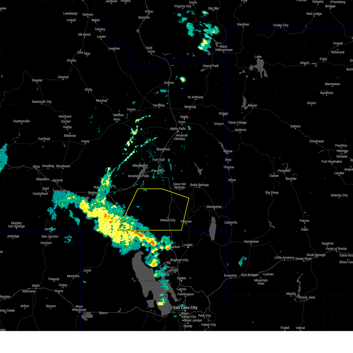
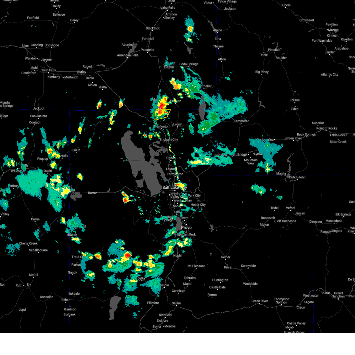
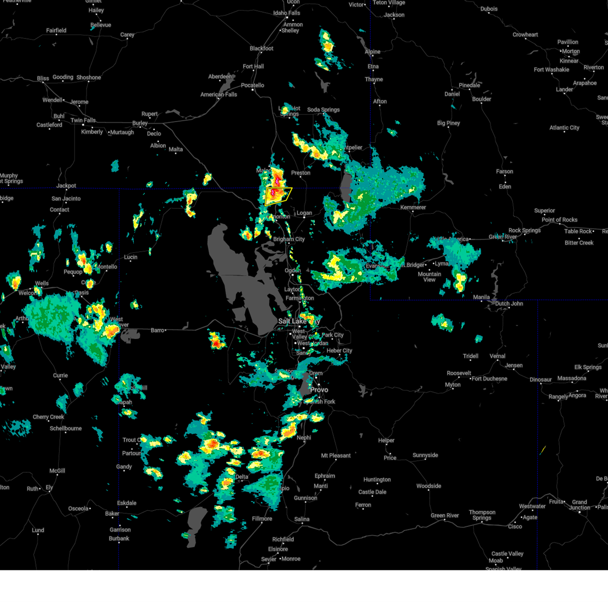
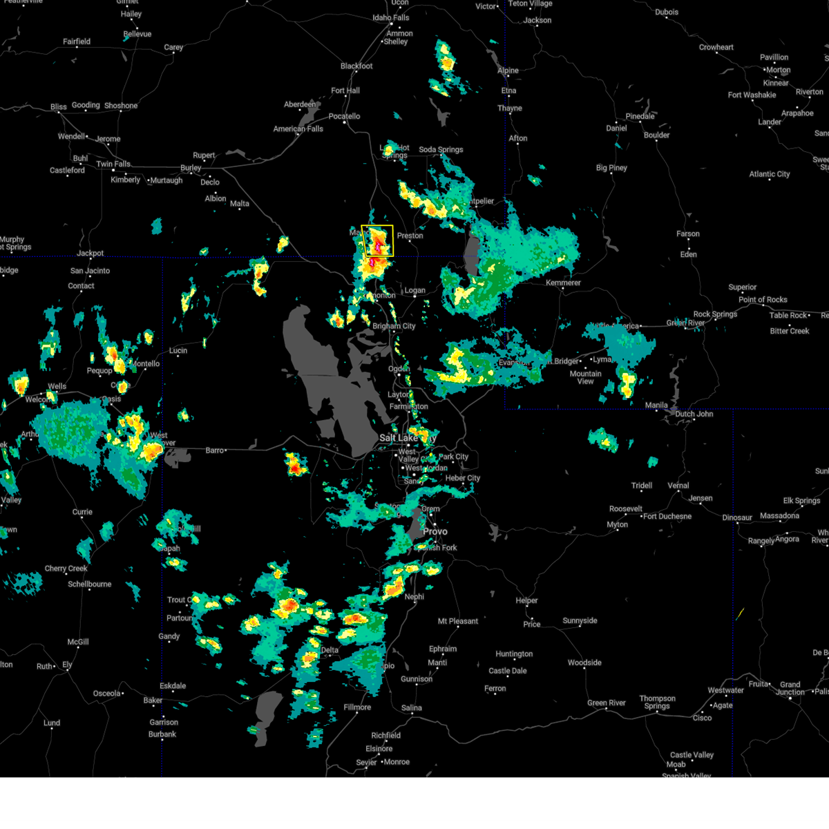
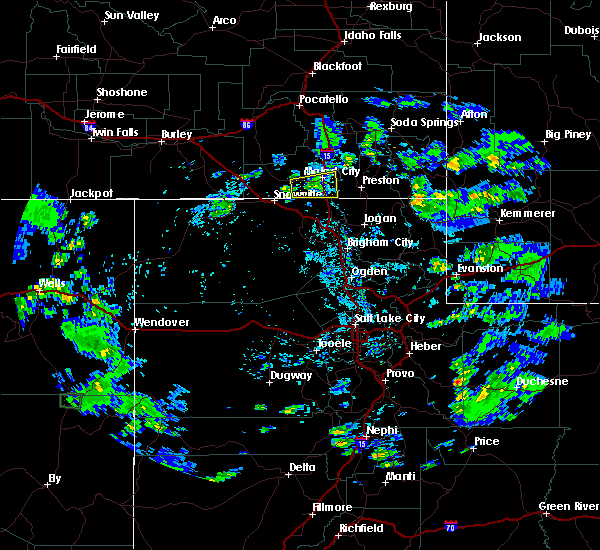
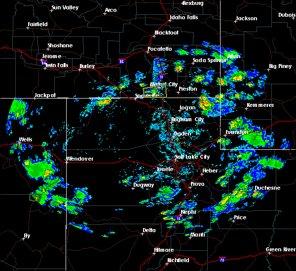
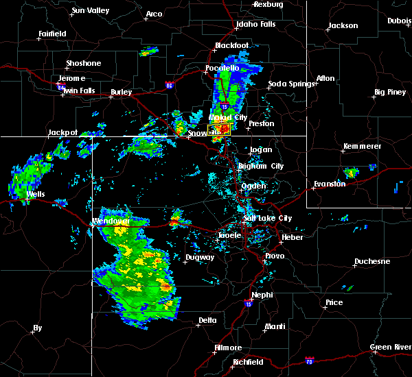
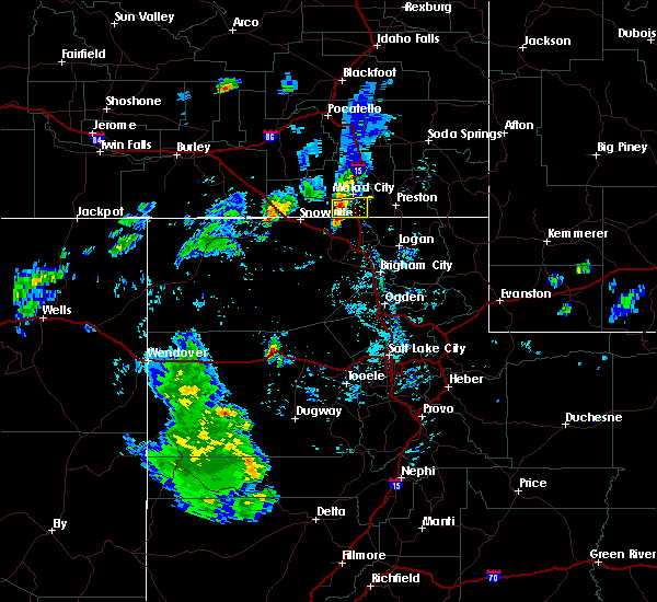
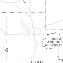
Hail Map for Portage, UT
The Portage, UT area has had 0 reports of on-the-ground hail by trained spotters, and has been under severe weather warnings 10 times during the past 12 months. Doppler radar has detected hail at or near Portage, UT on 11 occasions, including 2 occasions during the past year.
| Name: | Portage, UT |
| Where Located: | 85.7 miles NNW of Salt Lake City, UT |
| Map: | Google Map for Portage, UT |
| Population: | 245 |
| Housing Units: | 100 |
| More Info: | Search Google for Portage, UT |
1
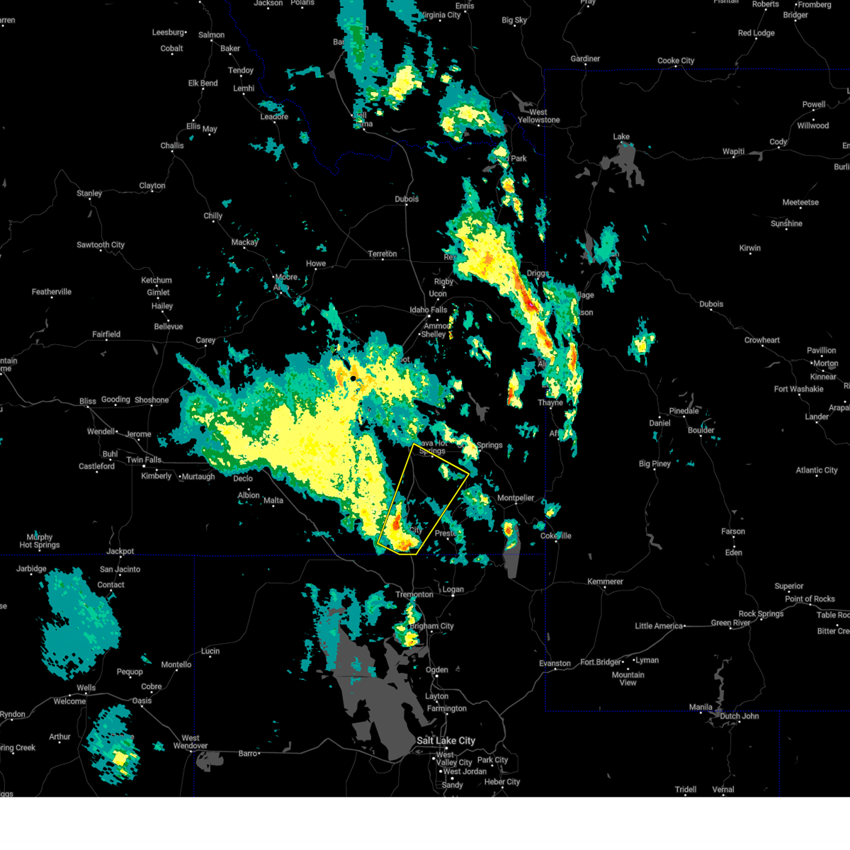
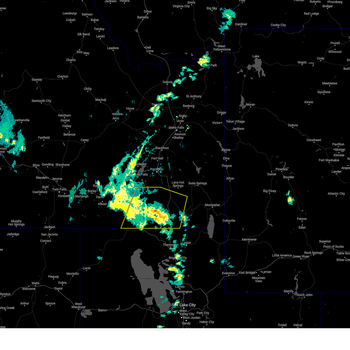
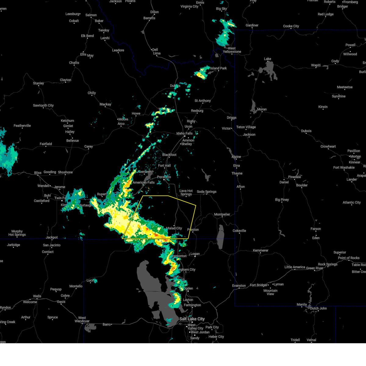
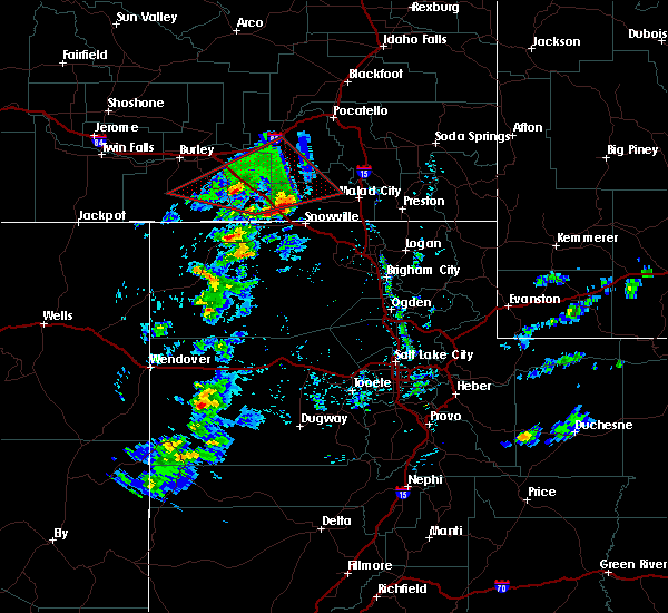
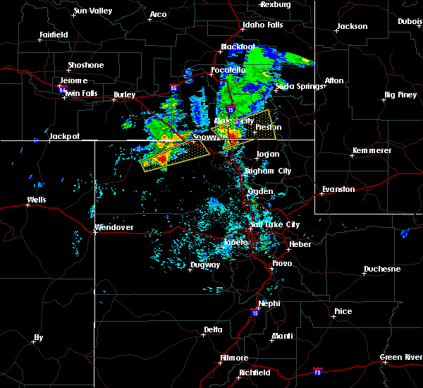
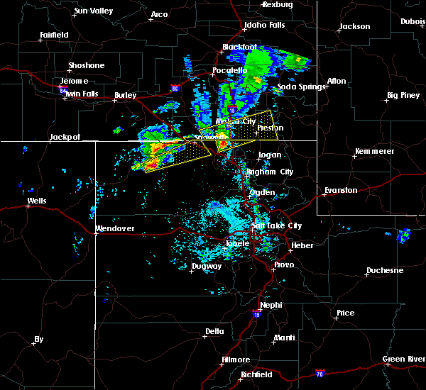
The Top Recent Hail Date for Portage, UT is Thursday, June 1, 2023 (7th out of 11)
Hail and Wind Damage Spotted near Portage, UT
| Date / Time | Report Details |
|---|---|
| 3/2/2024 11:51 AM MST |
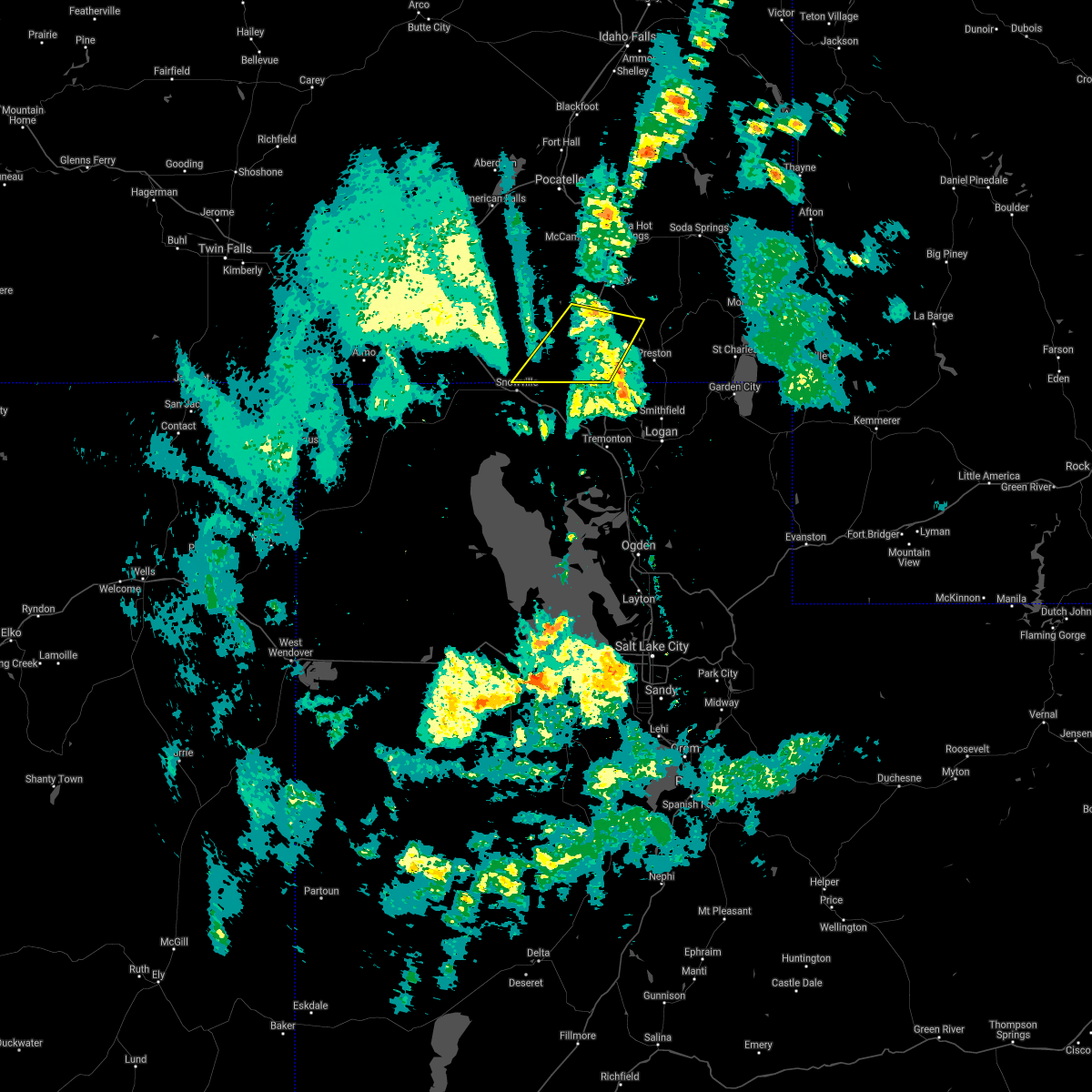
 Svrslc the national weather service in salt lake city has issued a * severe thunderstorm warning for, cache county in northern utah, northeastern box elder county in northern utah, northwestern rich county in northern utah, * until 1230 pm mst. * at 1150 am mst, a severe thunderstorm was located over trenton, or 12 miles northwest of logan, moving northeast at 60 mph (radar indicated). Hazards include 60 mph wind gusts. expect damage to roofs, siding, and trees Svrslc the national weather service in salt lake city has issued a * severe thunderstorm warning for, cache county in northern utah, northeastern box elder county in northern utah, northwestern rich county in northern utah, * until 1230 pm mst. * at 1150 am mst, a severe thunderstorm was located over trenton, or 12 miles northwest of logan, moving northeast at 60 mph (radar indicated). Hazards include 60 mph wind gusts. expect damage to roofs, siding, and trees
|
| 9/3/2023 6:20 PM MDT |
 At 619 pm mdt, a severe thunderstorm was located over malad, moving northeast at 35 mph (radar indicated and mesonet. at 615 pm mdt, 57 mph winds were reported near samaria). Hazards include 60 mph wind gusts. expect damage to roofs, siding, and trees At 619 pm mdt, a severe thunderstorm was located over malad, moving northeast at 35 mph (radar indicated and mesonet. at 615 pm mdt, 57 mph winds were reported near samaria). Hazards include 60 mph wind gusts. expect damage to roofs, siding, and trees
|
| 7/24/2023 7:39 PM MDT |
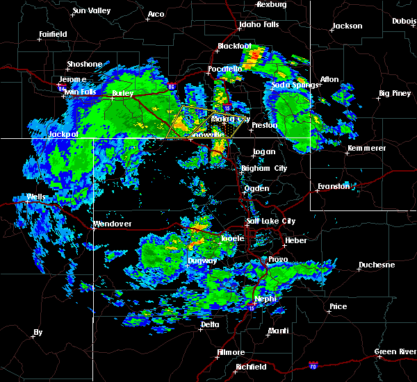
 At 739 pm mdt, severe thunderstorms were located along a line extending from 15 miles northeast of juniper to 11 miles northeast of holbrook summit to 8 miles east of malad, moving northeast at 40 mph (radar indicated). Hazards include 60 mph wind gusts. Expect damage to roofs, siding, and trees. locations impacted include, malad, swanlake, downey, arimo, rockland, juniper, holbrook summit, pleasantview, fort hall bannock peak, cherry creek rest area, virginia, dayton, weston, clifton, oxford, stone, sweetzer summit, hawkins reservoir, samaria, and arbon. hail threat, radar indicated max hail size, <. 75 in wind threat, radar indicated max wind gust, 60 mph. At 739 pm mdt, severe thunderstorms were located along a line extending from 15 miles northeast of juniper to 11 miles northeast of holbrook summit to 8 miles east of malad, moving northeast at 40 mph (radar indicated). Hazards include 60 mph wind gusts. Expect damage to roofs, siding, and trees. locations impacted include, malad, swanlake, downey, arimo, rockland, juniper, holbrook summit, pleasantview, fort hall bannock peak, cherry creek rest area, virginia, dayton, weston, clifton, oxford, stone, sweetzer summit, hawkins reservoir, samaria, and arbon. hail threat, radar indicated max hail size, <. 75 in wind threat, radar indicated max wind gust, 60 mph.
|
| 7/24/2023 7:17 PM MDT |
 At 716 pm mdt, severe thunderstorms were located along a line extending from 8 miles west of juniper to 7 miles west of holbrook summit to 8 miles southwest of cherry creek rest area, moving northeast at 40 mph (radar indicated). Hazards include 60 mph wind gusts. Expect damage to roofs, siding, and trees. locations impacted include, malad, swanlake, downey, arimo, rockland, juniper, holbrook summit, pleasantview, fort hall bannock peak, cherry creek rest area, virginia, dayton, weston, clifton, oxford, stone, sweetzer summit, hawkins reservoir, samaria, and arbon. hail threat, radar indicated max hail size, <. 75 in wind threat, radar indicated max wind gust, 60 mph. At 716 pm mdt, severe thunderstorms were located along a line extending from 8 miles west of juniper to 7 miles west of holbrook summit to 8 miles southwest of cherry creek rest area, moving northeast at 40 mph (radar indicated). Hazards include 60 mph wind gusts. Expect damage to roofs, siding, and trees. locations impacted include, malad, swanlake, downey, arimo, rockland, juniper, holbrook summit, pleasantview, fort hall bannock peak, cherry creek rest area, virginia, dayton, weston, clifton, oxford, stone, sweetzer summit, hawkins reservoir, samaria, and arbon. hail threat, radar indicated max hail size, <. 75 in wind threat, radar indicated max wind gust, 60 mph.
|
| 7/24/2023 7:00 PM MDT |
 At 659 pm mdt, severe thunderstorms were located along a line extending from 10 miles west of juniper to 6 miles northwest of snowville to 10 miles north of howell, moving northeast at 45 mph (radar indicated). Hazards include 60 mph wind gusts. expect damage to roofs, siding, and trees At 659 pm mdt, severe thunderstorms were located along a line extending from 10 miles west of juniper to 6 miles northwest of snowville to 10 miles north of howell, moving northeast at 45 mph (radar indicated). Hazards include 60 mph wind gusts. expect damage to roofs, siding, and trees
|
| 6/1/2023 4:40 PM MDT |
 The severe thunderstorm warning for southeastern oneida and southwestern franklin counties will expire at 445 pm mdt, the storm which prompted the warning has weakened below severe limits, and no longer poses an immediate threat to life or property. therefore, the warning will be allowed to expire. however heavy rain is still possible with this thunderstorm. The severe thunderstorm warning for southeastern oneida and southwestern franklin counties will expire at 445 pm mdt, the storm which prompted the warning has weakened below severe limits, and no longer poses an immediate threat to life or property. therefore, the warning will be allowed to expire. however heavy rain is still possible with this thunderstorm.
|
| 6/1/2023 4:28 PM MDT |
 The severe thunderstorm warning for northwestern cache and northeastern box elder counties will expire at 430 pm mdt, the storm which prompted the warning has weakened below severe limits, and no longer poses an immediate threat to life or property. therefore, the warning will be allowed to expire. however small hail, gusty winds and heavy rain are still possible with this thunderstorm. The severe thunderstorm warning for northwestern cache and northeastern box elder counties will expire at 430 pm mdt, the storm which prompted the warning has weakened below severe limits, and no longer poses an immediate threat to life or property. therefore, the warning will be allowed to expire. however small hail, gusty winds and heavy rain are still possible with this thunderstorm.
|
| 6/1/2023 4:18 PM MDT |
 At 415 pm mdt, a severe thunderstorm was located 7 miles southeast of cherry creek rest area, or 13 miles southeast of malad, moving north at 10 mph (radar indicated). Hazards include 60 mph wind gusts and quarter size hail. landspouts possible. Hail damage to vehicles is expected. expect wind damage to roofs, siding, and trees. locations impacted include, clarkston, plymouth, portage and washakie. this includes interstate 15 between mile markers 391 and 400. hail threat, radar indicated max hail size, 1. 00 in wind threat, radar indicated max wind gust, 60 mph. At 415 pm mdt, a severe thunderstorm was located 7 miles southeast of cherry creek rest area, or 13 miles southeast of malad, moving north at 10 mph (radar indicated). Hazards include 60 mph wind gusts and quarter size hail. landspouts possible. Hail damage to vehicles is expected. expect wind damage to roofs, siding, and trees. locations impacted include, clarkston, plymouth, portage and washakie. this includes interstate 15 between mile markers 391 and 400. hail threat, radar indicated max hail size, 1. 00 in wind threat, radar indicated max wind gust, 60 mph.
|
| 6/1/2023 4:16 PM MDT |
 At 416 pm mdt, a severe thunderstorm was located near cherry creek rest area, or 11 miles southeast of malad. the storm is nearly stationary (radar indicated). Hazards include quarter size hail. damage to vehicles is expected At 416 pm mdt, a severe thunderstorm was located near cherry creek rest area, or 11 miles southeast of malad. the storm is nearly stationary (radar indicated). Hazards include quarter size hail. damage to vehicles is expected
|
| 6/1/2023 4:08 PM MDT |
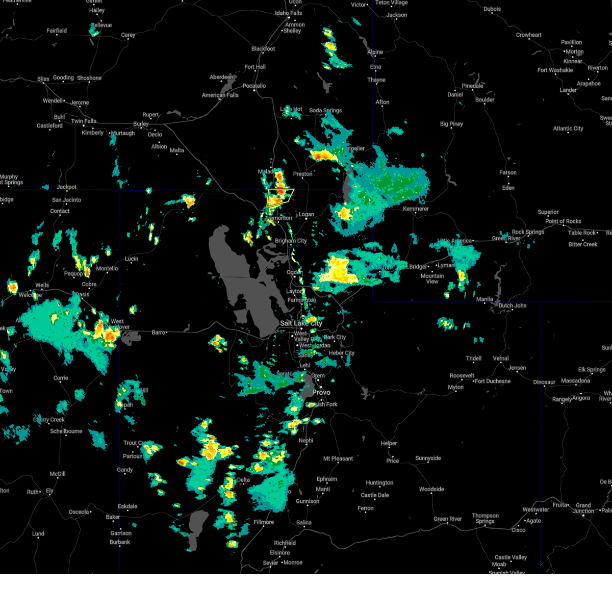 At 407 pm mdt, a severe thunderstorm was located near clarkston, or 14 miles south of malad, moving north at 10 mph (radar indicated). Hazards include 60 mph wind gusts and quarter size hail. landspouts possible. Hail damage to vehicles is expected. Expect wind damage to roofs, siding, and trees. At 407 pm mdt, a severe thunderstorm was located near clarkston, or 14 miles south of malad, moving north at 10 mph (radar indicated). Hazards include 60 mph wind gusts and quarter size hail. landspouts possible. Hail damage to vehicles is expected. Expect wind damage to roofs, siding, and trees.
|
| 6/27/2020 10:10 PM MDT |
 At 1010 pm mdt, a severe thunderstorm was located near cherry creek rest area, or 11 miles southeast of malad, moving northeast at 45 mph (radar indicated). Hazards include 70 mph wind gusts. Expect considerable tree damage. Damage is likely to mobile homes, roofs, and outbuildings. At 1010 pm mdt, a severe thunderstorm was located near cherry creek rest area, or 11 miles southeast of malad, moving northeast at 45 mph (radar indicated). Hazards include 70 mph wind gusts. Expect considerable tree damage. Damage is likely to mobile homes, roofs, and outbuildings.
|
| 6/6/2020 4:42 PM MDT |
 The severe thunderstorm warning for southeastern oneida, south central bannock and west central franklin counties will expire at 445 pm mdt, the storm which prompted the warning has weakened below severe limits, and no longer poses an immediate threat to life or property. therefore, the warning will be allowed to expire. The severe thunderstorm warning for southeastern oneida, south central bannock and west central franklin counties will expire at 445 pm mdt, the storm which prompted the warning has weakened below severe limits, and no longer poses an immediate threat to life or property. therefore, the warning will be allowed to expire.
|
| 6/6/2020 4:20 PM MDT |
 At 419 pm mdt, a severe thunderstorm was located near pleasantview, or 10 miles west of malad, moving northeast at 45 mph (radar indicated). Hazards include 60 mph wind gusts and quarter size hail. Hail damage to vehicles is expected. expect wind damage to roofs, siding, and trees. Locations impacted include, malad, cherry creek rest area, pleasantview, holbrook summit, clifton, oxford, samaria and stone. At 419 pm mdt, a severe thunderstorm was located near pleasantview, or 10 miles west of malad, moving northeast at 45 mph (radar indicated). Hazards include 60 mph wind gusts and quarter size hail. Hail damage to vehicles is expected. expect wind damage to roofs, siding, and trees. Locations impacted include, malad, cherry creek rest area, pleasantview, holbrook summit, clifton, oxford, samaria and stone.
|
| 6/6/2020 4:03 PM MDT |
 At 402 pm mdt, a severe thunderstorm was located near snowville, moving northeast at 45 mph (radar indicated). Hazards include 60 mph wind gusts and quarter size hail. Hail damage to vehicles is expected. Expect wind damage to roofs, siding, and trees. At 402 pm mdt, a severe thunderstorm was located near snowville, moving northeast at 45 mph (radar indicated). Hazards include 60 mph wind gusts and quarter size hail. Hail damage to vehicles is expected. Expect wind damage to roofs, siding, and trees.
|
| 5/30/2020 4:38 PM MDT |
 The severe thunderstorm warning for northeastern box elder county will expire at 445 pm mdt, the storm which prompted the warning has weakened below severe limits, and no longer poses an immediate threat to life or property. therefore, the warning will be allowed to expire. however gusty winds are still possible with this thunderstorm. The severe thunderstorm warning for northeastern box elder county will expire at 445 pm mdt, the storm which prompted the warning has weakened below severe limits, and no longer poses an immediate threat to life or property. therefore, the warning will be allowed to expire. however gusty winds are still possible with this thunderstorm.
|
| 5/30/2020 4:14 PM MDT |
 At 413 pm mdt, a severe thunderstorm was located near bear river city, or near tremonton, moving north at 30 mph (radar indicated). Hazards include 60 mph wind gusts. Expect damage to roofs, siding, and trees. locations impacted include, brigham city, tremonton, bear river city, corinne, plymouth, howell, riverside, garland, honeyville, elwood, fielding, deweyville, portage, washakie, penrose, bothwell, bear river and thatcher. this includes the following highways, interstate 15 between mile markers 366 and 400. Interstate 84 between mile markers 12 and 42. At 413 pm mdt, a severe thunderstorm was located near bear river city, or near tremonton, moving north at 30 mph (radar indicated). Hazards include 60 mph wind gusts. Expect damage to roofs, siding, and trees. locations impacted include, brigham city, tremonton, bear river city, corinne, plymouth, howell, riverside, garland, honeyville, elwood, fielding, deweyville, portage, washakie, penrose, bothwell, bear river and thatcher. this includes the following highways, interstate 15 between mile markers 366 and 400. Interstate 84 between mile markers 12 and 42.
|
| 5/30/2020 3:44 PM MDT |
 At 342 pm mdt, a severe thunderstorm was located near south willard, or 11 miles southwest of brigham city, moving north at 30 mph (radar indicated). Hazards include 70 mph wind gusts. Expect considerable tree damage. Damage is likely to mobile homes, roofs, and outbuildings. At 342 pm mdt, a severe thunderstorm was located near south willard, or 11 miles southwest of brigham city, moving north at 30 mph (radar indicated). Hazards include 70 mph wind gusts. Expect considerable tree damage. Damage is likely to mobile homes, roofs, and outbuildings.
|
| 4/30/2020 3:19 PM MDT |
 At 318 pm mdt, a severe thunderstorm capable of producing a tornado was located 10 miles southeast of holbrook summit, or 11 miles northeast of snowville, moving east at 45 mph (radar indicated rotation). Hazards include tornado and ping pong ball size hail. Flying debris will be dangerous to those caught without shelter. mobile homes will be damaged or destroyed. damage to roofs, windows, and vehicles will occur. tree damage is likely. this dangerous storm will be near, cherry creek rest area around 340 pm mdt. Other locations impacted by this tornadic thunderstorm include holbrook, stone and samaria. At 318 pm mdt, a severe thunderstorm capable of producing a tornado was located 10 miles southeast of holbrook summit, or 11 miles northeast of snowville, moving east at 45 mph (radar indicated rotation). Hazards include tornado and ping pong ball size hail. Flying debris will be dangerous to those caught without shelter. mobile homes will be damaged or destroyed. damage to roofs, windows, and vehicles will occur. tree damage is likely. this dangerous storm will be near, cherry creek rest area around 340 pm mdt. Other locations impacted by this tornadic thunderstorm include holbrook, stone and samaria.
|
| 4/30/2020 2:55 PM MDT |
 At 255 pm mdt, a severe thunderstorm capable of producing a tornado was located 7 miles northeast of juniper, or 10 miles northwest of snowville, moving east at 45 mph (radar indicated rotation). Hazards include tornado and hail up to two inches in diameter. Flying debris will be dangerous to those caught without shelter. mobile homes will be damaged or destroyed. damage to roofs, windows, and vehicles will occur. tree damage is likely. this dangerous storm will be near, holbrook summit around 315 pm mdt. cherry creek rest area around 340 pm mdt. Other locations impacted by this tornadic thunderstorm include holbrook, stone and samaria. At 255 pm mdt, a severe thunderstorm capable of producing a tornado was located 7 miles northeast of juniper, or 10 miles northwest of snowville, moving east at 45 mph (radar indicated rotation). Hazards include tornado and hail up to two inches in diameter. Flying debris will be dangerous to those caught without shelter. mobile homes will be damaged or destroyed. damage to roofs, windows, and vehicles will occur. tree damage is likely. this dangerous storm will be near, holbrook summit around 315 pm mdt. cherry creek rest area around 340 pm mdt. Other locations impacted by this tornadic thunderstorm include holbrook, stone and samaria.
|
| 6/6/2019 5:30 PM MDT |
 At 530 pm mdt, severe thunderstorms were located along a line extending from 9 miles northwest of plymouth to north salt lake, moving east at 45 mph (radar indicated). Hazards include 60 mph wind gusts. expect damage to roofs, siding, and trees At 530 pm mdt, severe thunderstorms were located along a line extending from 9 miles northwest of plymouth to north salt lake, moving east at 45 mph (radar indicated). Hazards include 60 mph wind gusts. expect damage to roofs, siding, and trees
|
| 6/6/2019 5:18 PM MDT |
 At 518 pm mdt, severe thunderstorms were located along a line extending from 11 miles northwest of plymouth to near south weber, moving northeast at 50 mph (radar indicated). Hazards include 60 mph wind gusts. Expect damage to roofs, siding, and trees. Locations impacted include, ogden, layton, farmington, brigham city, tremonton, roy, clearfield, kaysville, syracuse, clinton, north ogden, south ogden, centerville, washington terrace, riverdale, hooper, south weber, perry, wellsville and willard. At 518 pm mdt, severe thunderstorms were located along a line extending from 11 miles northwest of plymouth to near south weber, moving northeast at 50 mph (radar indicated). Hazards include 60 mph wind gusts. Expect damage to roofs, siding, and trees. Locations impacted include, ogden, layton, farmington, brigham city, tremonton, roy, clearfield, kaysville, syracuse, clinton, north ogden, south ogden, centerville, washington terrace, riverdale, hooper, south weber, perry, wellsville and willard.
|
| 6/6/2019 4:49 PM MDT |
 At 448 pm mdt, severe thunderstorms were located along a line extending from 12 miles west of howell to 11 miles northwest of magna, moving northeast at 50 mph (radar indicated). Hazards include 60 mph wind gusts and quarter size hail. Hail damage to vehicles is expected. Expect wind damage to roofs, siding, and trees. At 448 pm mdt, severe thunderstorms were located along a line extending from 12 miles west of howell to 11 miles northwest of magna, moving northeast at 50 mph (radar indicated). Hazards include 60 mph wind gusts and quarter size hail. Hail damage to vehicles is expected. Expect wind damage to roofs, siding, and trees.
|
| 8/22/2018 9:57 AM MDT |
 At 944 am mdt, a severe thunderstorm was located over clarkston, or 13 miles southwest of preston, moving northeast at 45 mph. this storm will likely cross i-15 near plymouth in the next few minutes (radar indicated). Hazards include 60 mph wind gusts and half dollar size hail. Hail damage to vehicles is expected. expect wind damage to roofs, siding, and trees. Locations impacted include, cache, clarkston, trenton, plymouth, riverside, peter, benson, newton, fielding, cornish, portage and washakie. At 944 am mdt, a severe thunderstorm was located over clarkston, or 13 miles southwest of preston, moving northeast at 45 mph. this storm will likely cross i-15 near plymouth in the next few minutes (radar indicated). Hazards include 60 mph wind gusts and half dollar size hail. Hail damage to vehicles is expected. expect wind damage to roofs, siding, and trees. Locations impacted include, cache, clarkston, trenton, plymouth, riverside, peter, benson, newton, fielding, cornish, portage and washakie.
|
| 8/22/2018 9:45 AM MDT |
 At 944 am mdt, a severe thunderstorm was located over clarkston, or 13 miles southwest of preston, moving northeast at 45 mph. this storm will likely cross i-15 near plymouth in the next few minutes (radar indicated). Hazards include 60 mph wind gusts and half dollar size hail. Hail damage to vehicles is expected. expect wind damage to roofs, siding, and trees. Locations impacted include, cache, clarkston, trenton, plymouth, riverside, peter, benson, newton, fielding, cornish, portage and washakie. At 944 am mdt, a severe thunderstorm was located over clarkston, or 13 miles southwest of preston, moving northeast at 45 mph. this storm will likely cross i-15 near plymouth in the next few minutes (radar indicated). Hazards include 60 mph wind gusts and half dollar size hail. Hail damage to vehicles is expected. expect wind damage to roofs, siding, and trees. Locations impacted include, cache, clarkston, trenton, plymouth, riverside, peter, benson, newton, fielding, cornish, portage and washakie.
|
| 8/22/2018 9:28 AM MDT |
 At 925 am mdt, a severe thunderstorm was located near howell, or 15 miles northwest of tremonton near i-84, moving northeast at 50 mph (radar indicated). Hazards include 60 mph wind gusts and half dollar size hail. Hail damage to vehicles is expected. Expect wind damage to roofs, siding, and trees. At 925 am mdt, a severe thunderstorm was located near howell, or 15 miles northwest of tremonton near i-84, moving northeast at 50 mph (radar indicated). Hazards include 60 mph wind gusts and half dollar size hail. Hail damage to vehicles is expected. Expect wind damage to roofs, siding, and trees.
|
| 8/22/2018 8:30 AM MDT |
 At 830 am mdt, a severe thunderstorm was located over cherry creek rest area or near malad, moving east at 30 mph (radar indicated). Hazards include 60 mph wind gusts and quarter size hail. Hail damage to vehicles is expected. expect wind damage to roofs, siding, and trees. Locations impacted include, preston, malad, franklin, oneida narrows reservoir, pleasantview, cherry creek rest area, dayton, weston, clifton, oxford, mapleton, mink creek, samaria, whitney and riverdale. At 830 am mdt, a severe thunderstorm was located over cherry creek rest area or near malad, moving east at 30 mph (radar indicated). Hazards include 60 mph wind gusts and quarter size hail. Hail damage to vehicles is expected. expect wind damage to roofs, siding, and trees. Locations impacted include, preston, malad, franklin, oneida narrows reservoir, pleasantview, cherry creek rest area, dayton, weston, clifton, oxford, mapleton, mink creek, samaria, whitney and riverdale.
|
| 8/22/2018 8:30 AM MDT |
 At 830 am mdt, a severe thunderstorm was located near clarkston, or 13 miles southwest of preston, moving northeast at 40 mph (radar indicated). Hazards include 60 mph wind gusts and quarter size hail. Hail damage to vehicles is expected. expect wind damage to roofs, siding, and trees. Locations impacted include, portage and washakie. At 830 am mdt, a severe thunderstorm was located near clarkston, or 13 miles southwest of preston, moving northeast at 40 mph (radar indicated). Hazards include 60 mph wind gusts and quarter size hail. Hail damage to vehicles is expected. expect wind damage to roofs, siding, and trees. Locations impacted include, portage and washakie.
|
| 8/22/2018 8:16 AM MDT |
 At 815 am mdt, a severe thunderstorm was located 8 miles south of cherry creek rest area, or 14 miles south of malad, moving northeast at 40 mph (radar indicated). Hazards include 60 mph wind gusts and quarter size hail. Hail damage to vehicles is expected. Expect wind damage to roofs, siding, and trees. At 815 am mdt, a severe thunderstorm was located 8 miles south of cherry creek rest area, or 14 miles south of malad, moving northeast at 40 mph (radar indicated). Hazards include 60 mph wind gusts and quarter size hail. Hail damage to vehicles is expected. Expect wind damage to roofs, siding, and trees.
|
| 8/22/2018 8:12 AM MDT |
 At 811 am mdt, a severe thunderstorm was located 10 miles southeast of holbrook summit or 11 miles northeast of snowville, moving east at 15 mph (radar indicated). Hazards include 60 mph wind gusts and quarter size hail. Hail damage to vehicles is expected. Expect wind damage to roofs, siding, and trees. At 811 am mdt, a severe thunderstorm was located 10 miles southeast of holbrook summit or 11 miles northeast of snowville, moving east at 15 mph (radar indicated). Hazards include 60 mph wind gusts and quarter size hail. Hail damage to vehicles is expected. Expect wind damage to roofs, siding, and trees.
|
| 8/7/2017 5:11 PM MDT |
 The severe thunderstorm warning for southeastern oneida and southwestern franklin counties will expire at 515 pm mdt, the storm which prompted the warning has weakened below severe limits, and no longer poses an immediate threat to life or property. therefore the warning will be allowed to expire. however small hail is still possible with thunderstorms moving through southern oneida county. The severe thunderstorm warning for southeastern oneida and southwestern franklin counties will expire at 515 pm mdt, the storm which prompted the warning has weakened below severe limits, and no longer poses an immediate threat to life or property. therefore the warning will be allowed to expire. however small hail is still possible with thunderstorms moving through southern oneida county.
|
| 8/7/2017 4:53 PM MDT |
 At 452 pm mdt, a severe thunderstorm was located near pleasantview or 10 miles southwest of malad, moving east at 10 mph (radar indicated). Hazards include quarter size hail. Damage to vehicles is expected. Locations impacted include, malad, pleasantview, cherry creek rest area and samaria. At 452 pm mdt, a severe thunderstorm was located near pleasantview or 10 miles southwest of malad, moving east at 10 mph (radar indicated). Hazards include quarter size hail. Damage to vehicles is expected. Locations impacted include, malad, pleasantview, cherry creek rest area and samaria.
|
| 8/7/2017 4:25 PM MDT |
 At 425 pm mdt, a severe thunderstorm was located near pleasantview or 11 miles southwest of malad, moving east at 15 mph (radar indicated). Hazards include quarter size hail. damage to vehicles is expected At 425 pm mdt, a severe thunderstorm was located near pleasantview or 11 miles southwest of malad, moving east at 15 mph (radar indicated). Hazards include quarter size hail. damage to vehicles is expected
|
| 7/26/2017 7:33 PM MDT |
 At 732 pm mdt, a severe thunderstorm was located near cherry creek rest area or 9 miles south of malad, moving east at 25 mph (radar indicated). Hazards include 60 mph wind gusts and quarter size hail. Hail damage to vehicles is expected. expect wind damage to roofs, siding, and trees. interstate 15 near mile marker 5. Locations impacted include, cherry creek rest area, pleasantview and samaria. At 732 pm mdt, a severe thunderstorm was located near cherry creek rest area or 9 miles south of malad, moving east at 25 mph (radar indicated). Hazards include 60 mph wind gusts and quarter size hail. Hail damage to vehicles is expected. expect wind damage to roofs, siding, and trees. interstate 15 near mile marker 5. Locations impacted include, cherry creek rest area, pleasantview and samaria.
|
| 7/26/2017 7:13 PM MDT |
 At 712 pm mdt, a severe thunderstorm was located near cherry creek rest area or 9 miles south of malad, moving east at 30 mph (radar indicated). Hazards include 60 mph wind gusts and quarter size hail. Hail damage to vehicles is expected. Expect wind damage to roofs, siding, and trees. At 712 pm mdt, a severe thunderstorm was located near cherry creek rest area or 9 miles south of malad, moving east at 30 mph (radar indicated). Hazards include 60 mph wind gusts and quarter size hail. Hail damage to vehicles is expected. Expect wind damage to roofs, siding, and trees.
|
| 5/6/2017 4:09 PM MDT |
 The severe thunderstorm warning for northwestern cache and northeastern box elder counties will expire at 415 pm mdt, the storm which prompted the warning has weakened below severe limits, and no longer poses an immediate threat to life or property. therefore the warning will be allowed to expire. however gusty winds in the 40 to 50 mph range are still possible with this thunderstorm. The severe thunderstorm warning for northwestern cache and northeastern box elder counties will expire at 415 pm mdt, the storm which prompted the warning has weakened below severe limits, and no longer poses an immediate threat to life or property. therefore the warning will be allowed to expire. however gusty winds in the 40 to 50 mph range are still possible with this thunderstorm.
|
| 5/6/2017 3:57 PM MDT |
 At 355 pm mdt, doppler radar indicated a severe thunderstorm capable of producing damaging winds in excess of 60 mph. this storm was located near plymouth, or 16 miles northwest of tremonton, moving north at 40 mph. locations impacted include, tremonton, cache, clarkston, plymouth, howell, riverside, peter, garland, fielding, portage, washakie, collinston and bothwell. At 355 pm mdt, doppler radar indicated a severe thunderstorm capable of producing damaging winds in excess of 60 mph. this storm was located near plymouth, or 16 miles northwest of tremonton, moving north at 40 mph. locations impacted include, tremonton, cache, clarkston, plymouth, howell, riverside, peter, garland, fielding, portage, washakie, collinston and bothwell.
|
| 5/6/2017 3:28 PM MDT |
 At 325 pm mdt, doppler radar indicated a severe thunderstorm capable of producing damaging winds in excess of 60 mph. this storm was located 7 miles west of bear river city, or 8 miles southwest of tremonton, and moving north at 40 mph. At 325 pm mdt, doppler radar indicated a severe thunderstorm capable of producing damaging winds in excess of 60 mph. this storm was located 7 miles west of bear river city, or 8 miles southwest of tremonton, and moving north at 40 mph.
|
| 5/6/2016 5:16 PM MDT |
 At 516 pm mdt, doppler radar indicated a line of severe thunderstorms capable of producing damaging winds in excess of 60 mph. these storms stretched from 5 miles south of snowville to near plymouth and were moving north at 35 mph. this line of storms has a history of producing winds in excess of 60 mph. locations impacted include, snowville, plymouth, howell, riverside, fielding, portage and washakie. At 516 pm mdt, doppler radar indicated a line of severe thunderstorms capable of producing damaging winds in excess of 60 mph. these storms stretched from 5 miles south of snowville to near plymouth and were moving north at 35 mph. this line of storms has a history of producing winds in excess of 60 mph. locations impacted include, snowville, plymouth, howell, riverside, fielding, portage and washakie.
|
| 5/6/2016 4:59 PM MDT |
 At 459 pm mdt, doppler radar indicated a line of severe thunderstorms capable of producing damaging winds in excess of 60 mph. these storms stretched from near howell to near garland and were moving north at 35 mph. this line of storms has a history of producing damaging winds!. At 459 pm mdt, doppler radar indicated a line of severe thunderstorms capable of producing damaging winds in excess of 60 mph. these storms stretched from near howell to near garland and were moving north at 35 mph. this line of storms has a history of producing damaging winds!.
|
| 8/5/2015 5:19 PM MDT |
 At 517 pm mdt, doppler radar indicated a severe thunderstorm capable of producing quarter size hail and damaging winds in excess of 60 mph. this storm was just east of howell, or 11 miles northwest of tremonton, moving east at 40 mph. this storm is expected to impact interstate 15 between honeyville and the utah/idaho border. this storm has also consistently exhibited rotation through its lifetime. locations impacted include, plymouth, riverside, peter, garland, elwood, fielding, deweyville, portage, bothwell, washakie, thatcher and collinston. At 517 pm mdt, doppler radar indicated a severe thunderstorm capable of producing quarter size hail and damaging winds in excess of 60 mph. this storm was just east of howell, or 11 miles northwest of tremonton, moving east at 40 mph. this storm is expected to impact interstate 15 between honeyville and the utah/idaho border. this storm has also consistently exhibited rotation through its lifetime. locations impacted include, plymouth, riverside, peter, garland, elwood, fielding, deweyville, portage, bothwell, washakie, thatcher and collinston.
|
| 8/5/2015 4:59 PM MDT |
 At 459 pm mdt, doppler radar indicated a severe thunderstorm capable of producing quarter size hail and damaging winds in excess of 60 mph. this storm was located near howell, or 18 miles southeast of snowville, and moving east at 45 mph. this storm is expected to impact interstate 84 near howell, as well as interstate 15 between honeyville and the utah/idaho border. this storm has also consistently exhibited rotation through its lifetime. At 459 pm mdt, doppler radar indicated a severe thunderstorm capable of producing quarter size hail and damaging winds in excess of 60 mph. this storm was located near howell, or 18 miles southeast of snowville, and moving east at 45 mph. this storm is expected to impact interstate 84 near howell, as well as interstate 15 between honeyville and the utah/idaho border. this storm has also consistently exhibited rotation through its lifetime.
|
| 6/3/2015 9:27 PM MDT | The severe thunderstorm warning for northeastern box elder and northern cache counties will expire at 930 pm mdt, the storm which prompted the warning has weakened below severe limits, and no longer poses an immediate threat to life or property. therefore the warning will be allowed to expire. |
| 6/3/2015 8:58 PM MDT | At 858 pm mdt, doppler radar indicated a severe thunderstorm capable of producing quarter size hail and destructive winds in excess of 70 mph. this storm was located near smithfield, or 11 miles north of logan, moving northeast at 35 mph. locations impacted include, logan, cache, smithfield, hyrum, wellsville, lewiston, clarkston, trenton, plymouth, benson, riverside, peter, garden, north logan, providence, nibley, hyde park, richmond, garland and millville. |
| 6/3/2015 8:47 PM MDT | At 847 pm mdt, doppler radar indicated a severe thunderstorm capable of producing destructive winds in excess of 70 mph. this storm was located over cache, or 13 miles northwest of logan, and moving northeast at 35 mph. |
| 6/3/2015 8:43 PM MDT | The severe thunderstorm warning for southern bannock, southeastern power and central oneida counties will expire at 845 pm mdt, the storms which prompted the warning have weakened below severe limits, and no longer poses an immediate threat to life or property. therefore the warning will be allowed to expire. however gusty winds and locally heavy rainfall are still possible with these thunderstorms. |
| 6/3/2015 8:23 PM MDT | At 822 pm mdt, doppler radar indicated a line of severe thunderstorms capable of producing damaging winds in excess of 60 mph. these storms were located along a line extending from 14 miles north of holbrook summit to near cherry creek rest area, moving east at 40 mph. locations impacted include, malad, pleasantview, cherry creek rest area, holbrook summit, holbrook, samaria and daniels reservoir. |
| 6/3/2015 8:21 PM MDT | At 820 pm mdt, doppler radar indicated a severe thunderstorm capable of producing damaging winds in excess of 60 mph. this storm was located 7 miles northwest of tremonton, moving northeast at 30 mph. penny size hail may also accompany the damaging winds. locations impacted include, tremonton, plymouth, howell, riverside, garland, honeyville, elwood, fielding, deweyville, bothwell, penrose, washakie, thatcher and collinston. |
| 6/3/2015 8:11 PM MDT | At 811 pm mdt, doppler radar indicated a line of severe thunderstorms capable of producing damaging winds in excess of 60 mph. these storms were located along a line extending from 8 miles southeast of juniper to 6 miles west of bear river city, and moving north at 25 mph. penny size hail may also accompany the damaging winds. |
| 6/3/2015 7:59 PM MDT | At 757 pm mdt, doppler radar indicated a line of severe thunderstorms capable of producing damaging winds in excess of 60 mph. these storms were located along a line extending from 13 miles northwest of holbrook summit to near snowville, and moving northeast at 40 mph. |
| 6/3/2015 7:27 PM MDT | At 726 pm mdt, doppler radar indicated a severe thunderstorm capable of producing quarter size hail and damaging winds in excess of 60 mph. this storm was located over clarkston, or 15 miles southwest of preston, moving northeast at 25 mph. another severe thunderstorm was located near portage, moving northeast at 25 mph. locations impacted include, clarkston, trenton, plymouth, cornish, portage and washakie. |
| 6/3/2015 7:16 PM MDT | At 716 pm mdt, doppler radar indicated a severe thunderstorm capable of producing quarter size hail and damaging winds in excess of 60 mph. this storm was located near plymouth, or 16 miles north of tremonton, and moving northeast at 30 mph. |
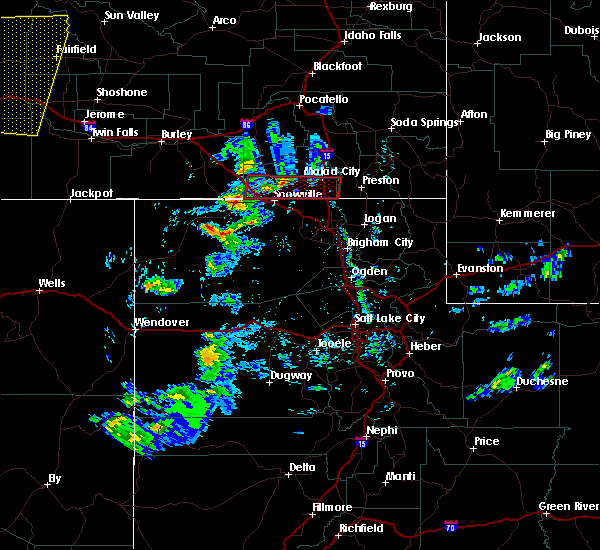
| 6/1/2015 4:53 PM MDT | At 453 pm mdt, doppler radar indicated a severe thunderstorm capable of producing quarter size hail and damaging winds in excess of 60 mph. this storm was located 7 miles northeast of cherry creek rest area, or 8 miles east of malad, moving east at 45 mph. locations impacted include, preston, malad, swanlake, franklin, oneida narrows reservoir, pleasantview, cherry creek rest area, dayton, weston, clifton, oxford, riverdale, whitney, samaria, mapleton and mink creek. |
| 6/1/2015 4:35 PM MDT | *** 1 inj *** ten homes with shingle damage and a report of a collapsed awning in box elder county UT, 0.4 miles S of Portage, UT |
| 6/1/2015 4:35 PM MDT | At 434 pm mdt, doppler radar indicated a severe thunderstorm capable of producing quarter size hail and damaging winds in excess of 60 mph. this storm was located near cherry creek rest area, or 9 miles southwest of malad, and moving east at 45 mph. |
Hail Maps for Portage, UT


Connect with Interactive Hail Maps