

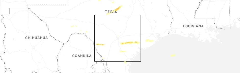
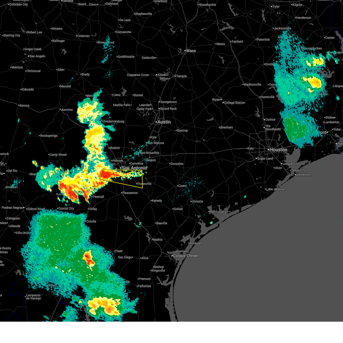
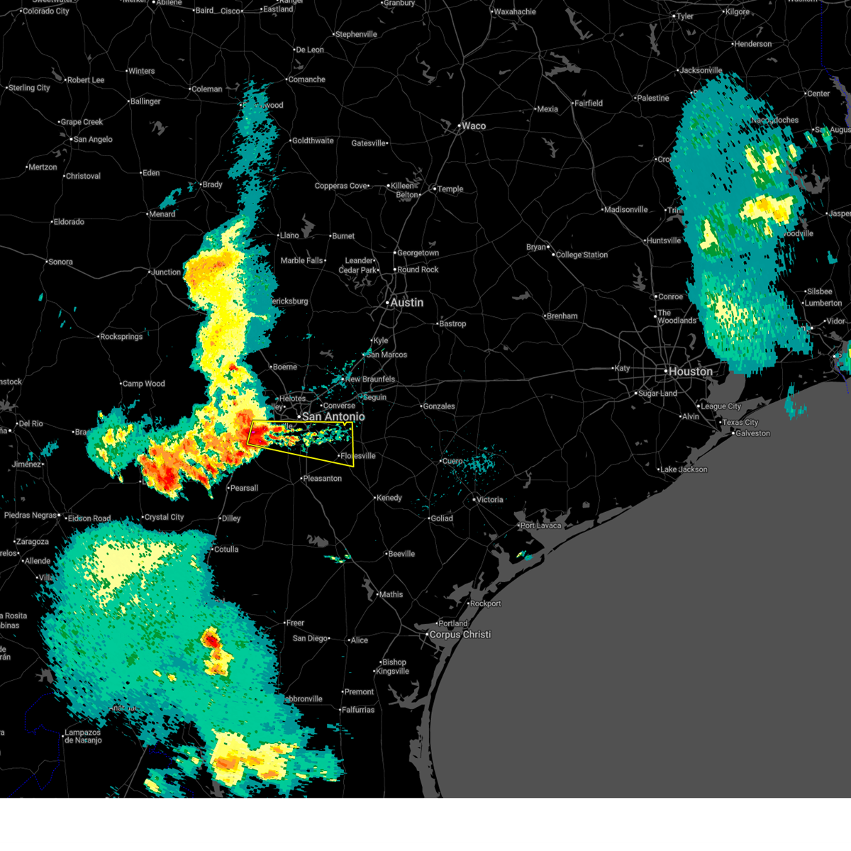
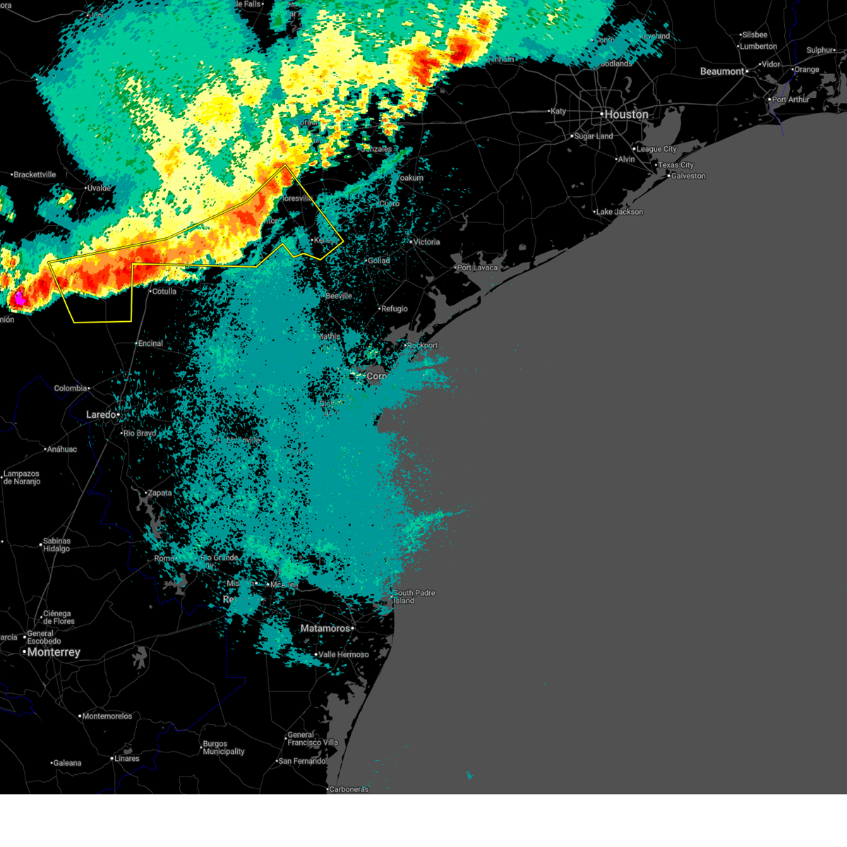
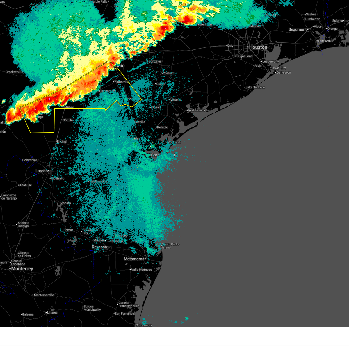
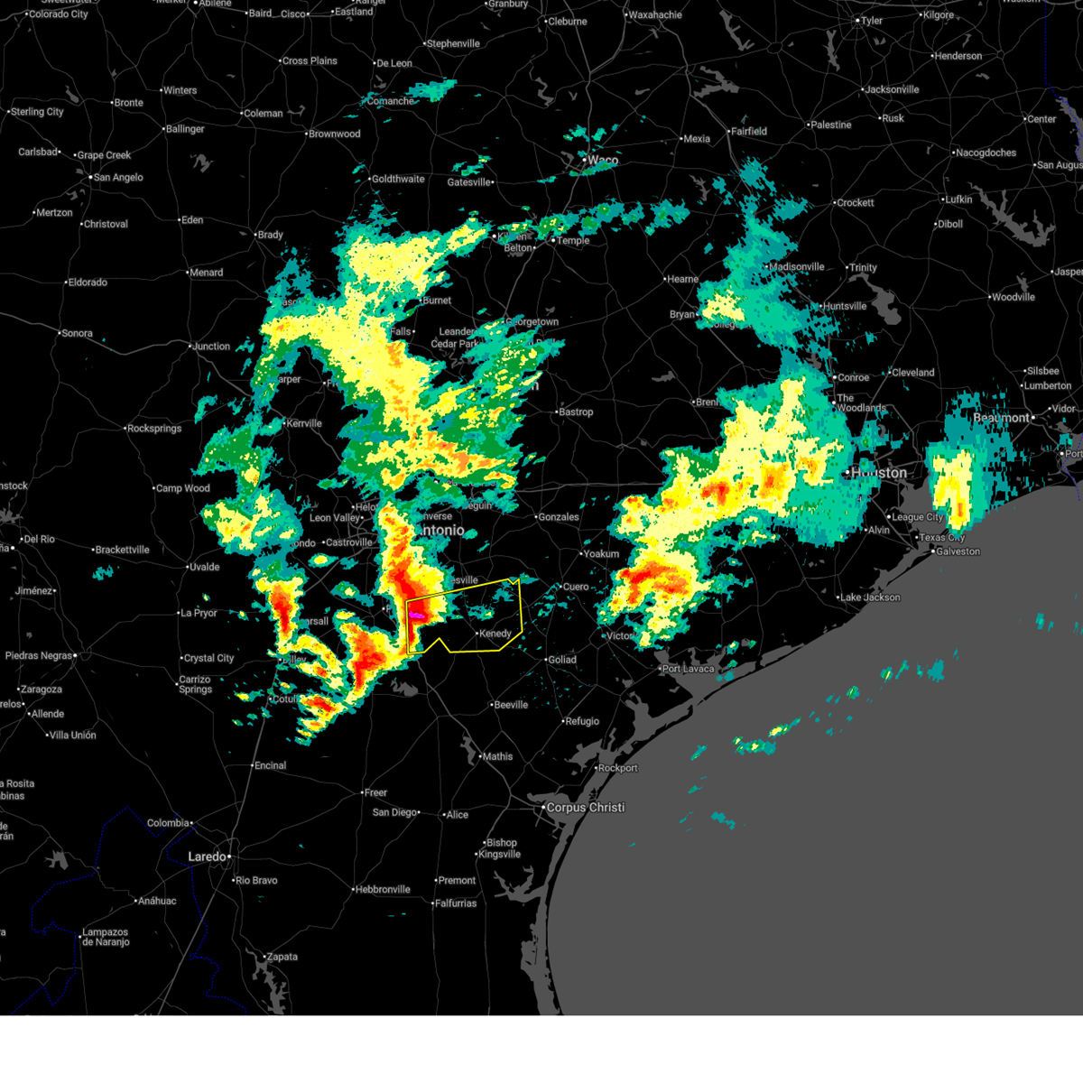
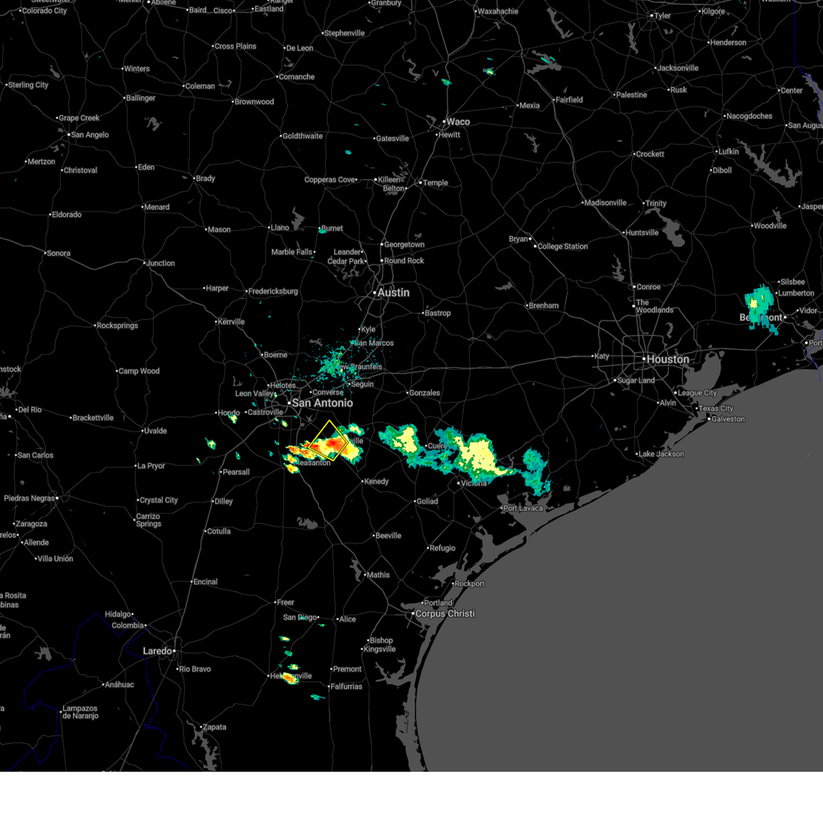
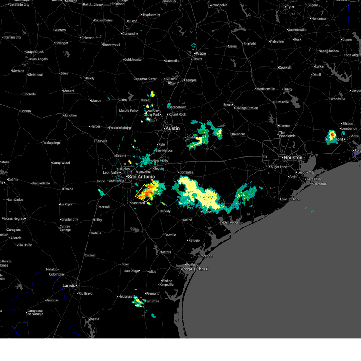
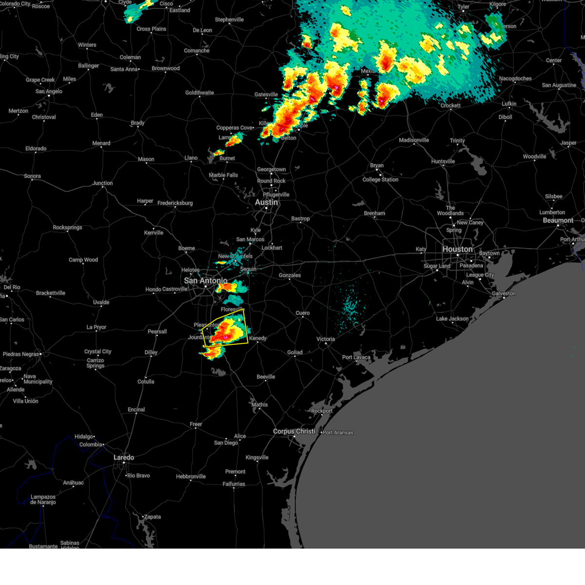
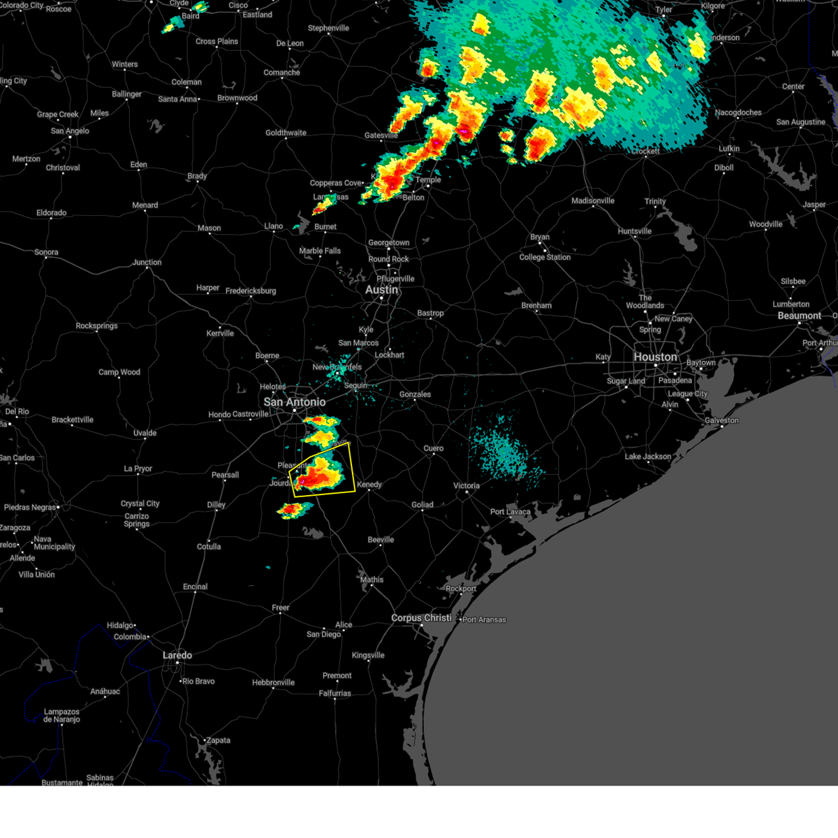
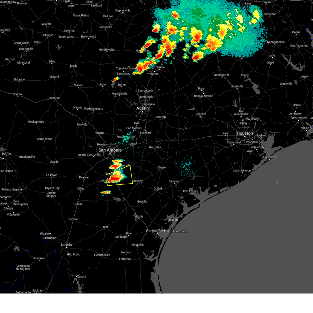
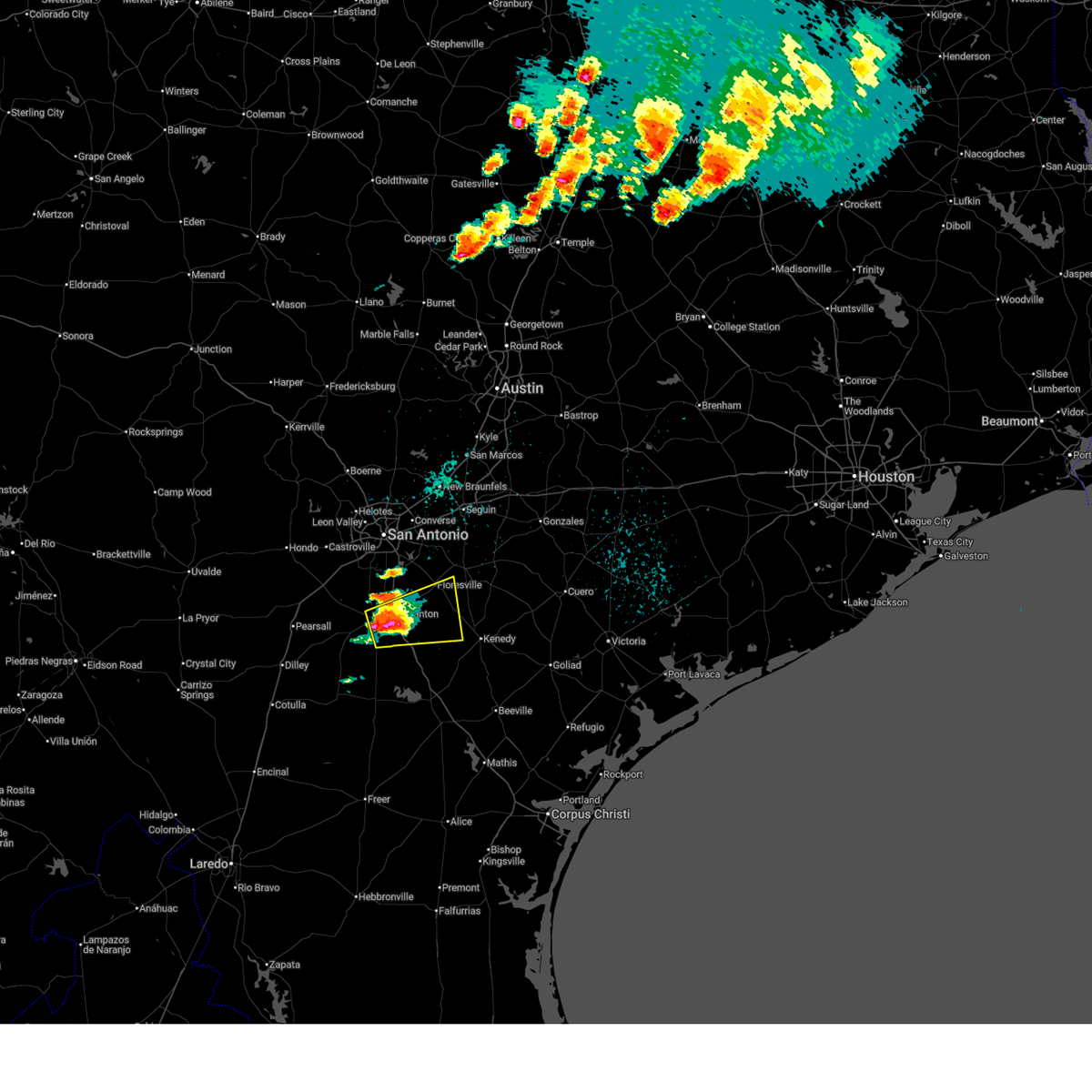
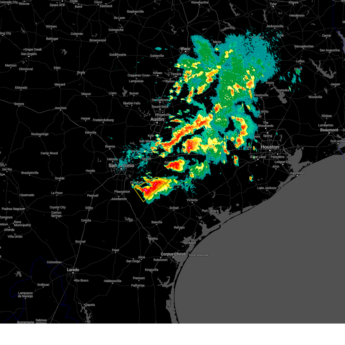
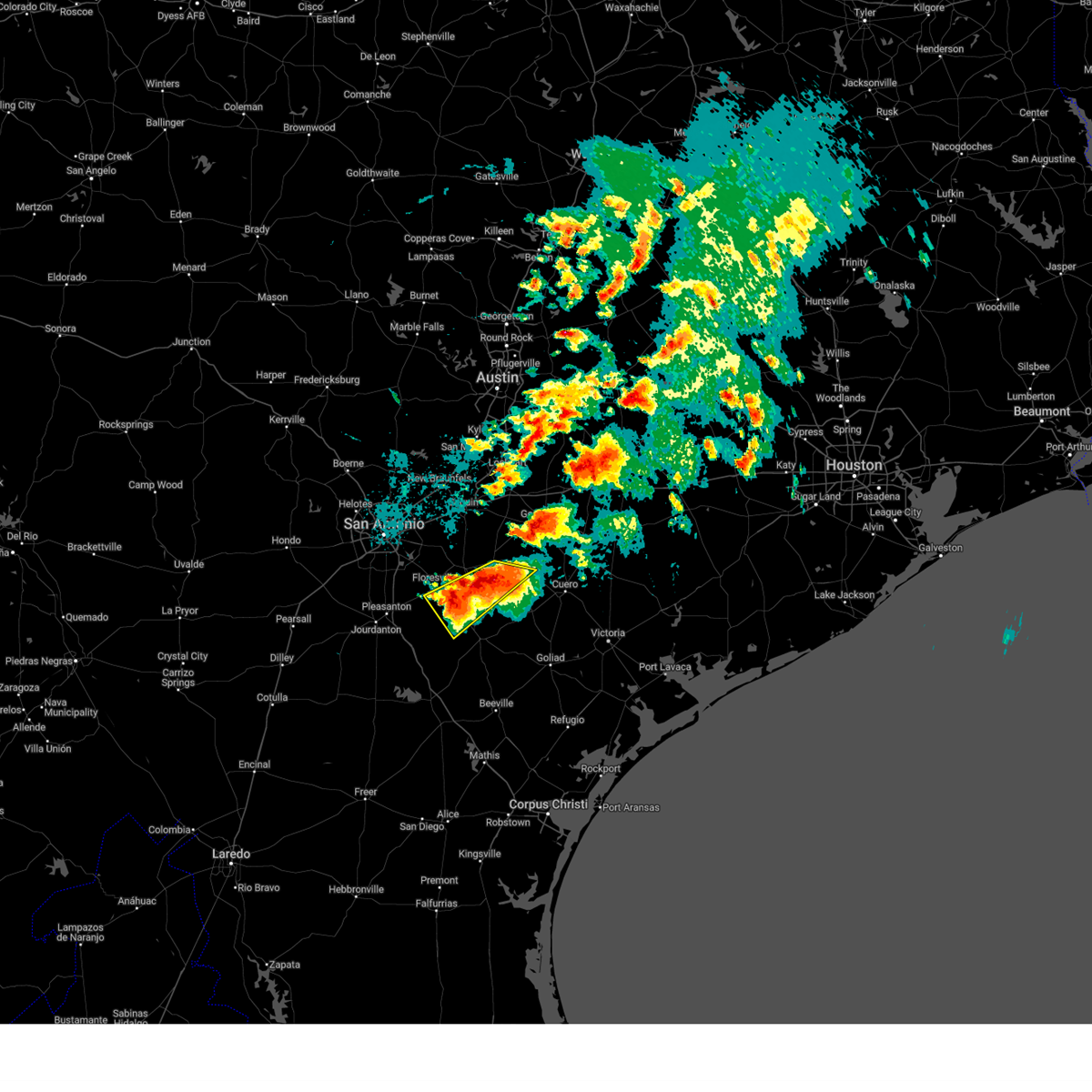
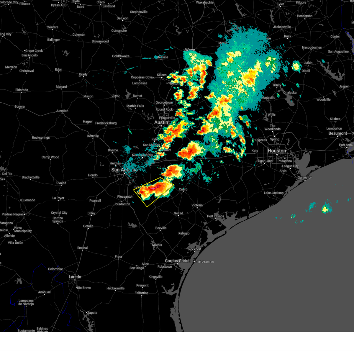
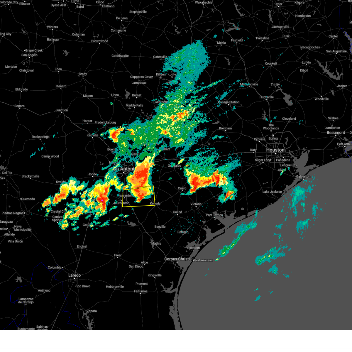
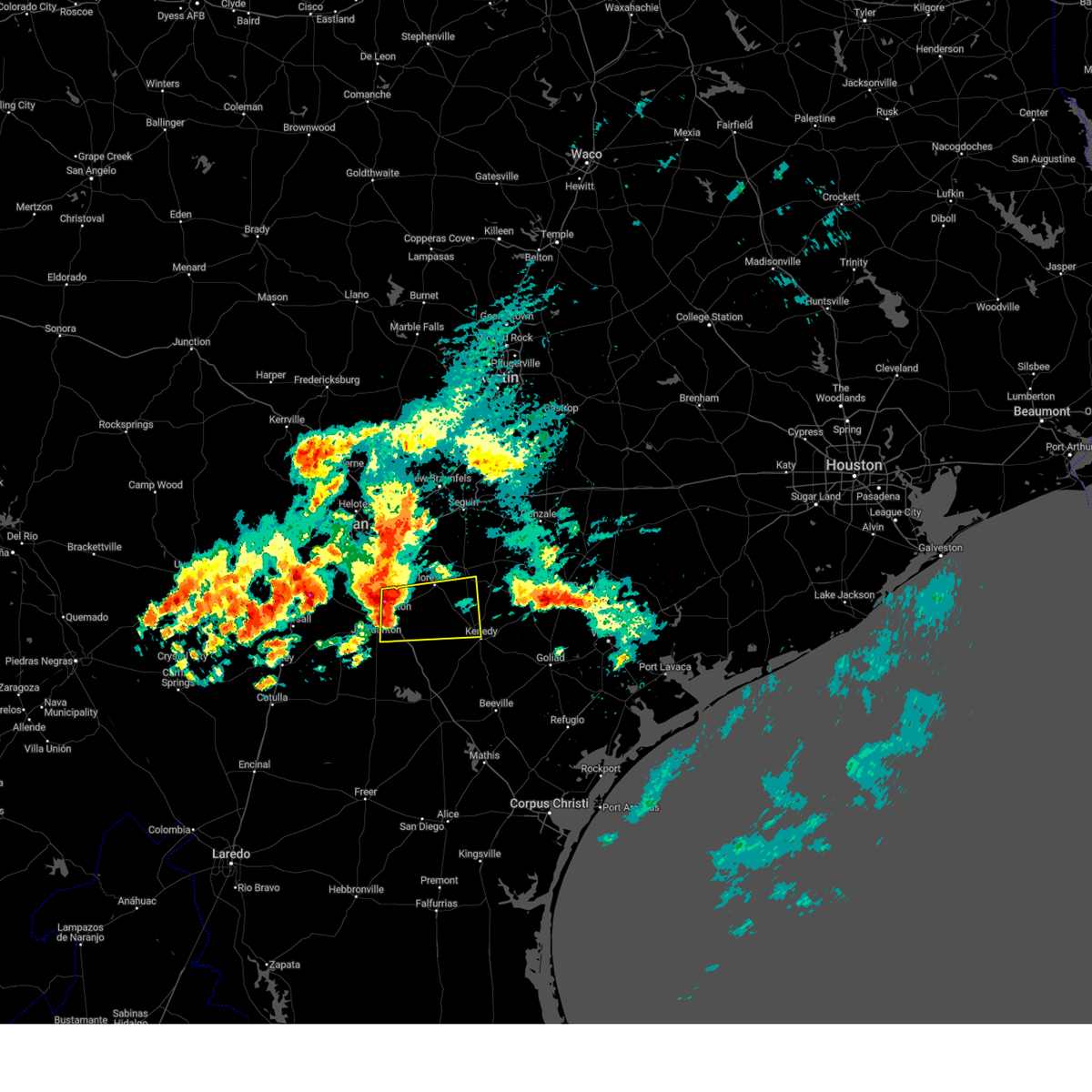
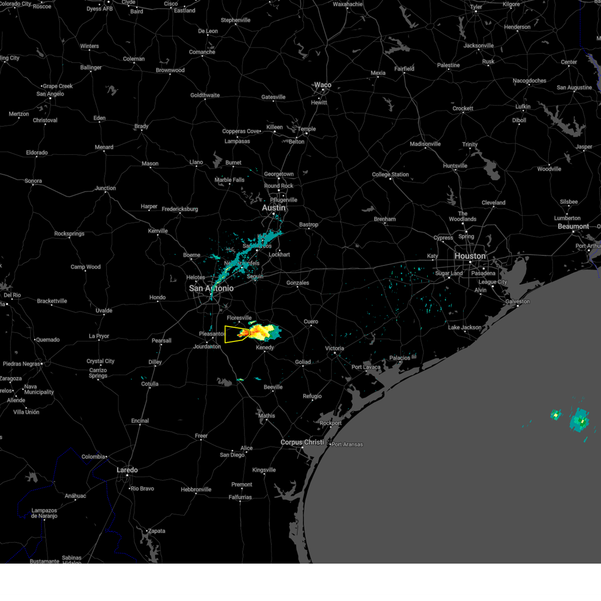
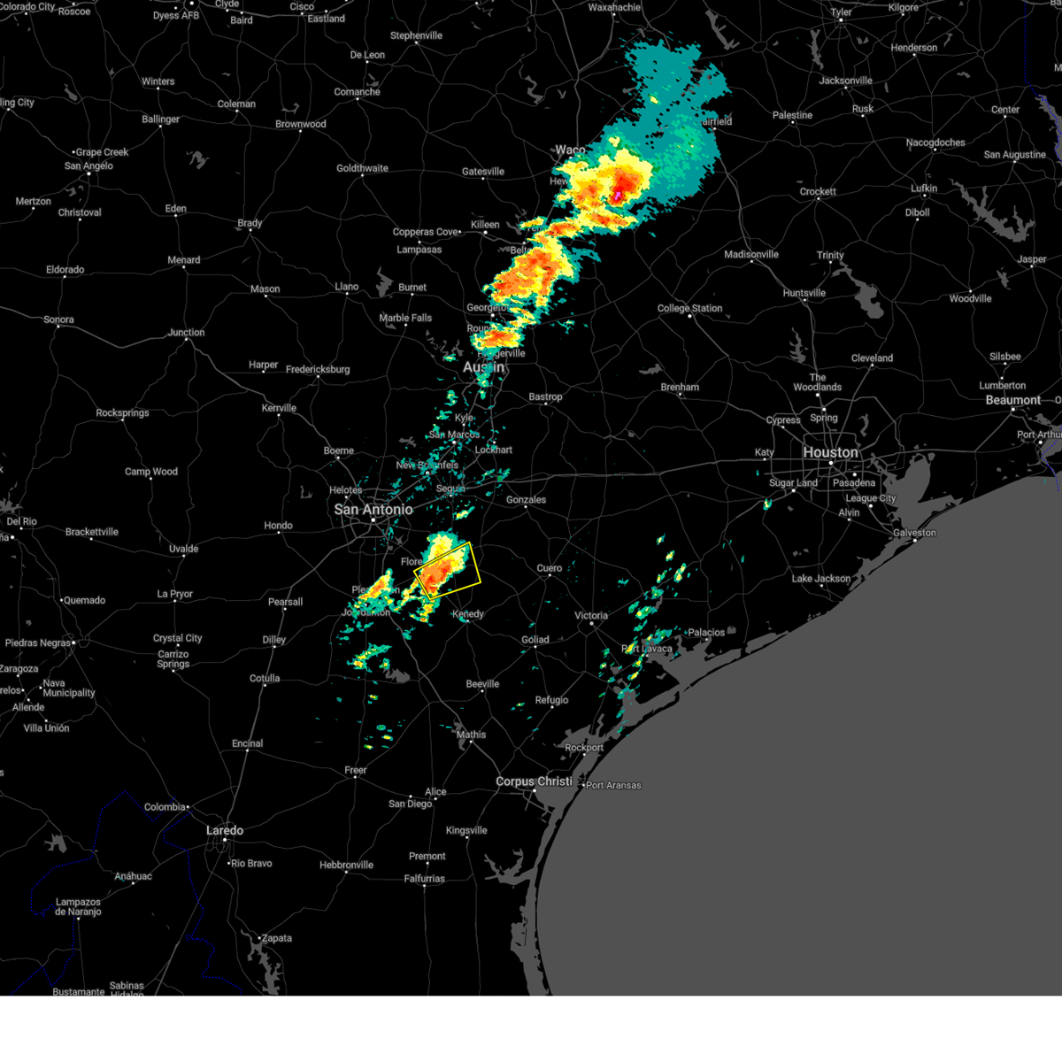
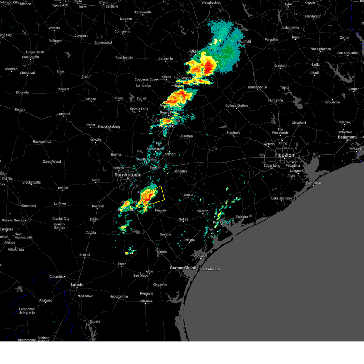
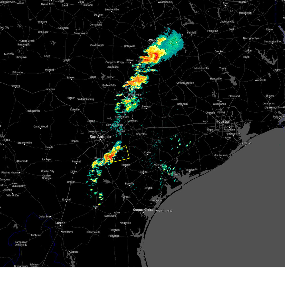
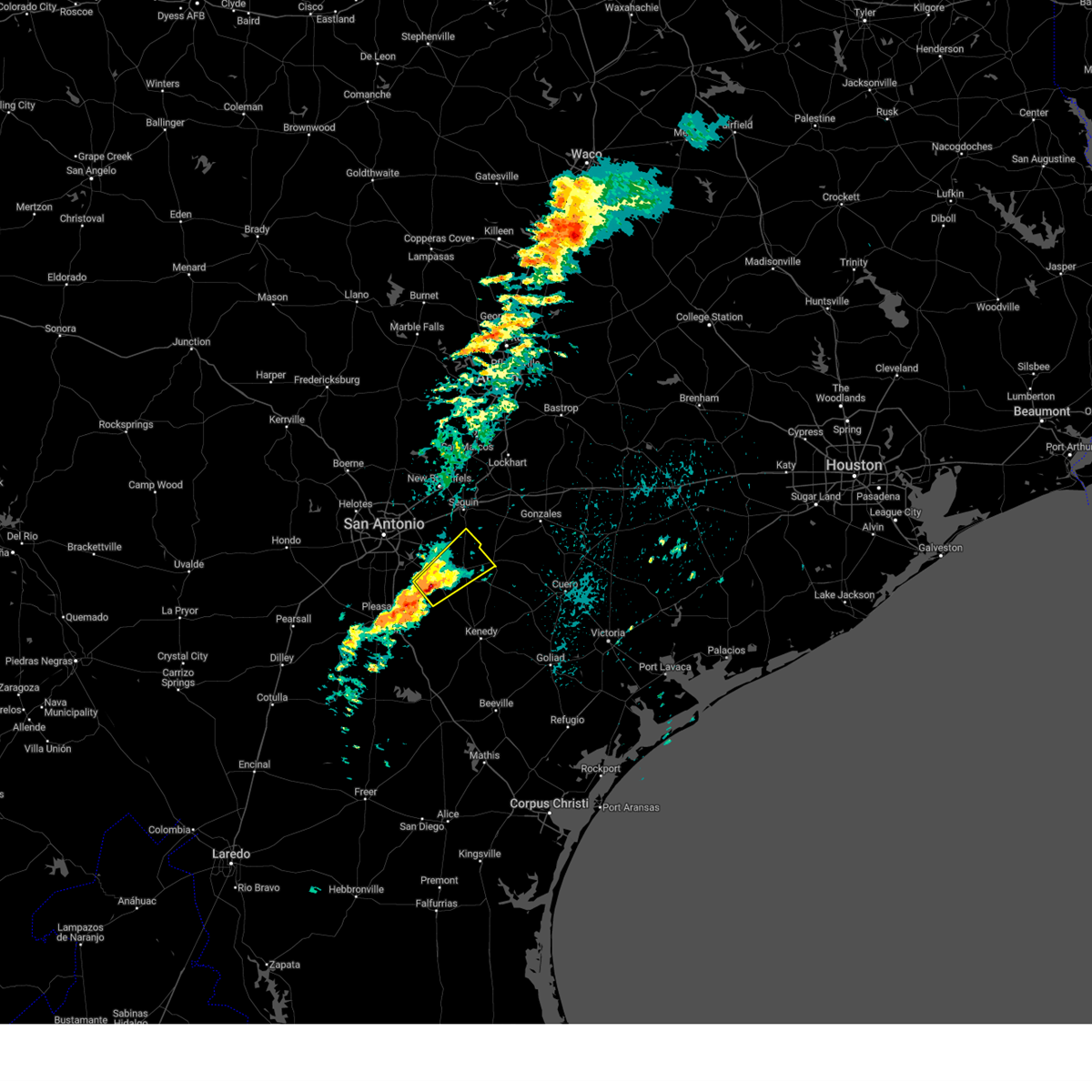
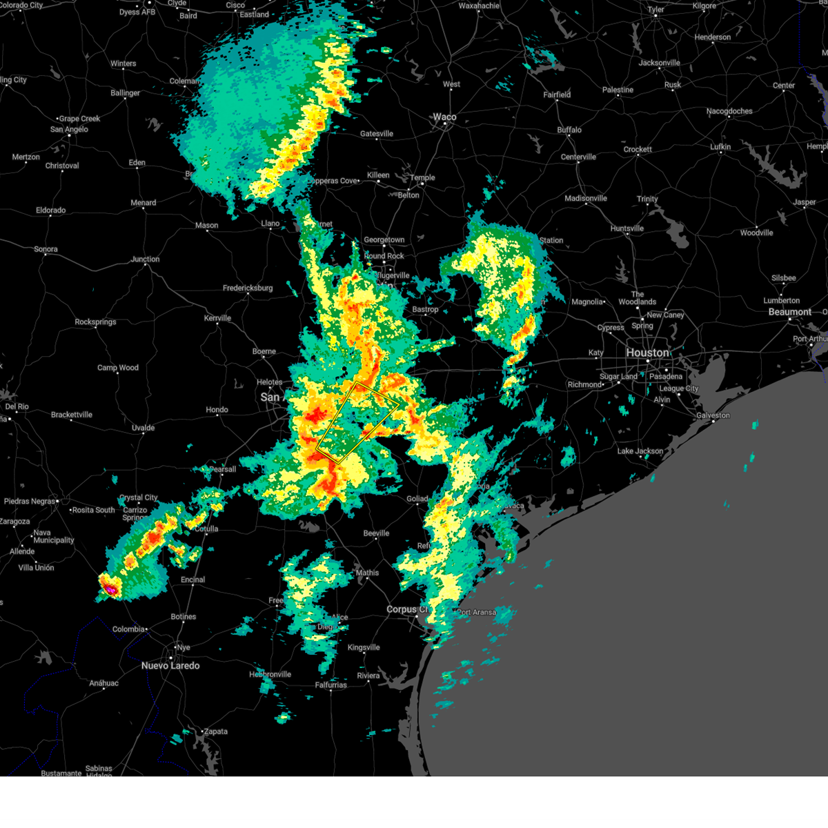
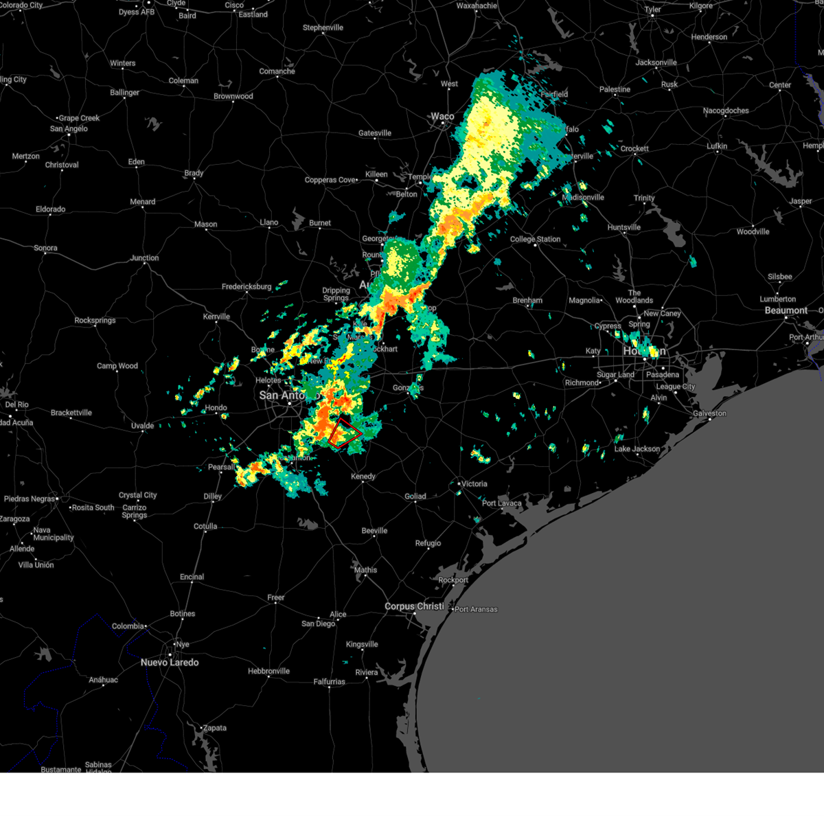
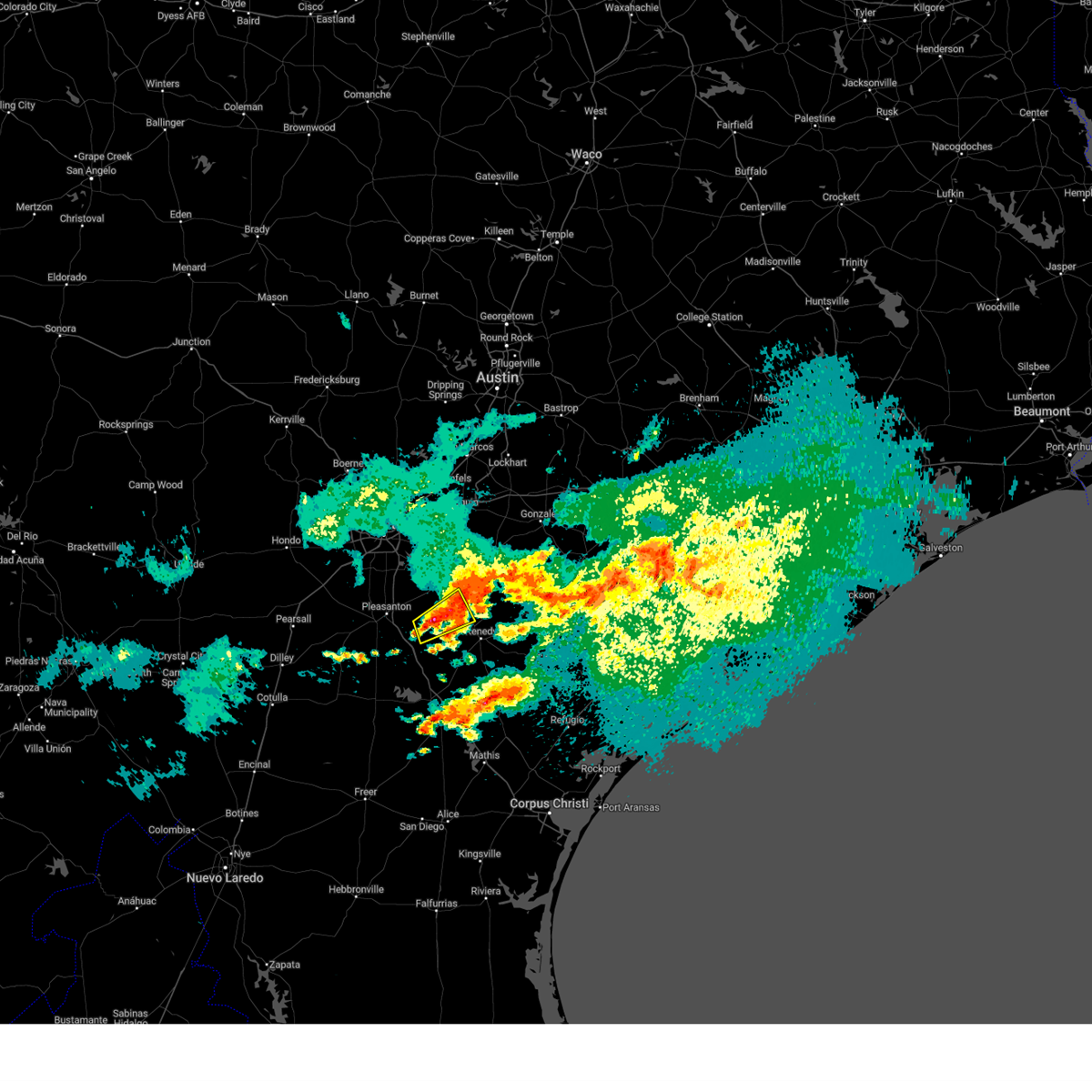
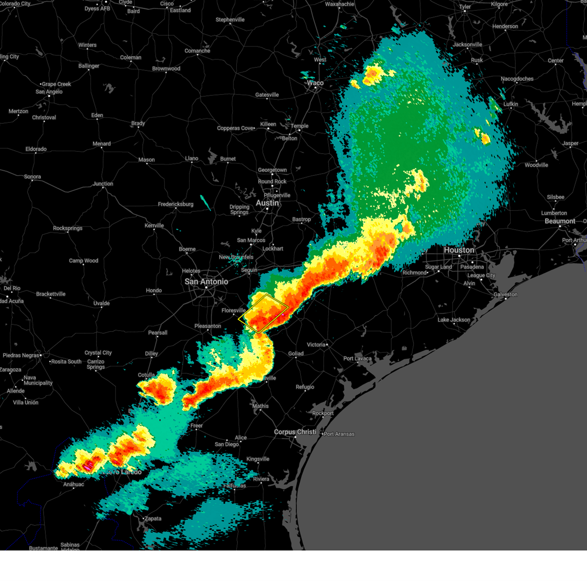
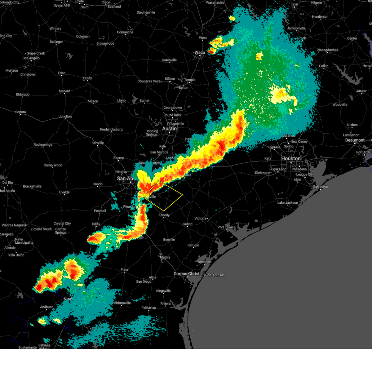
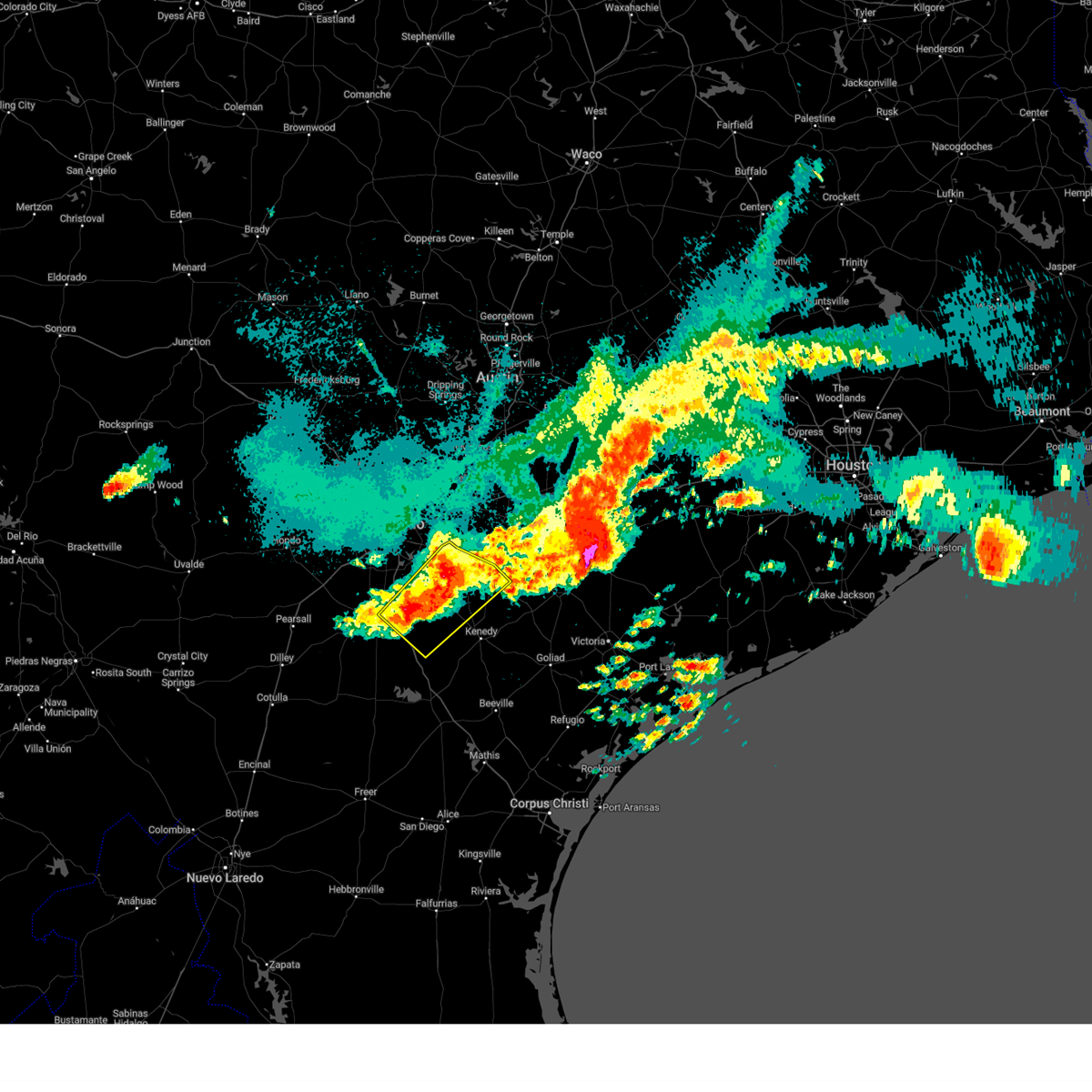
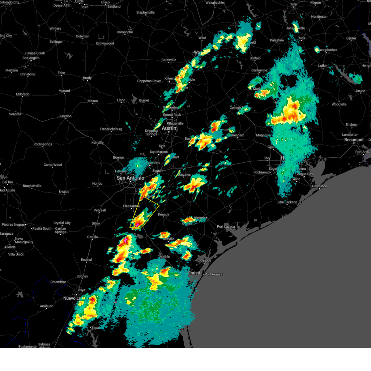
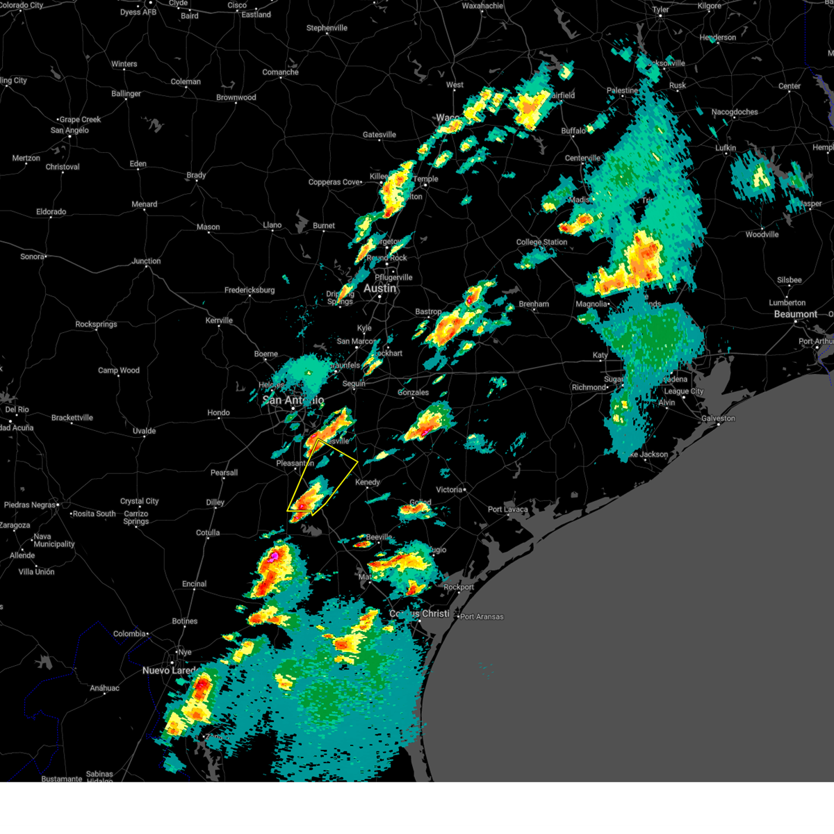
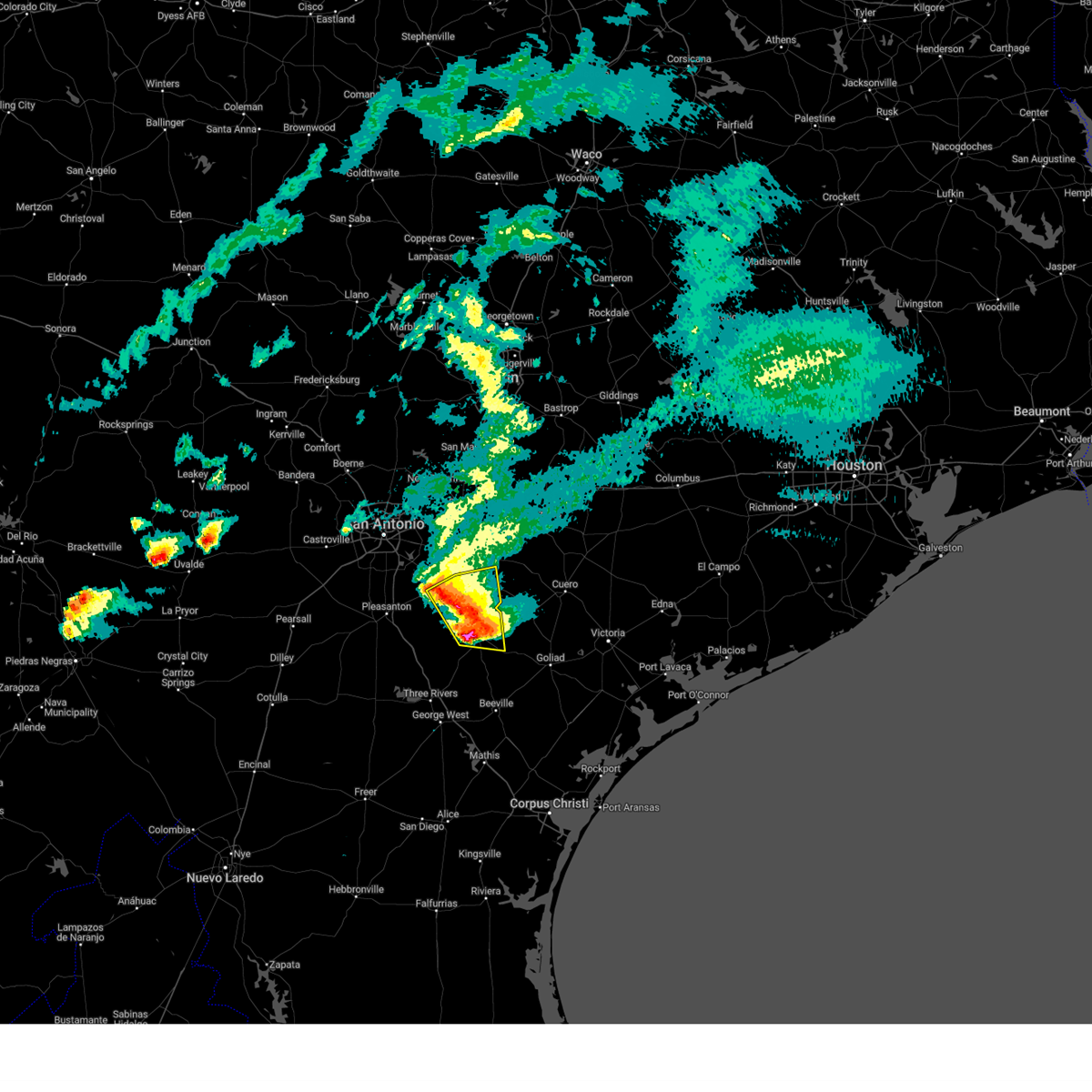
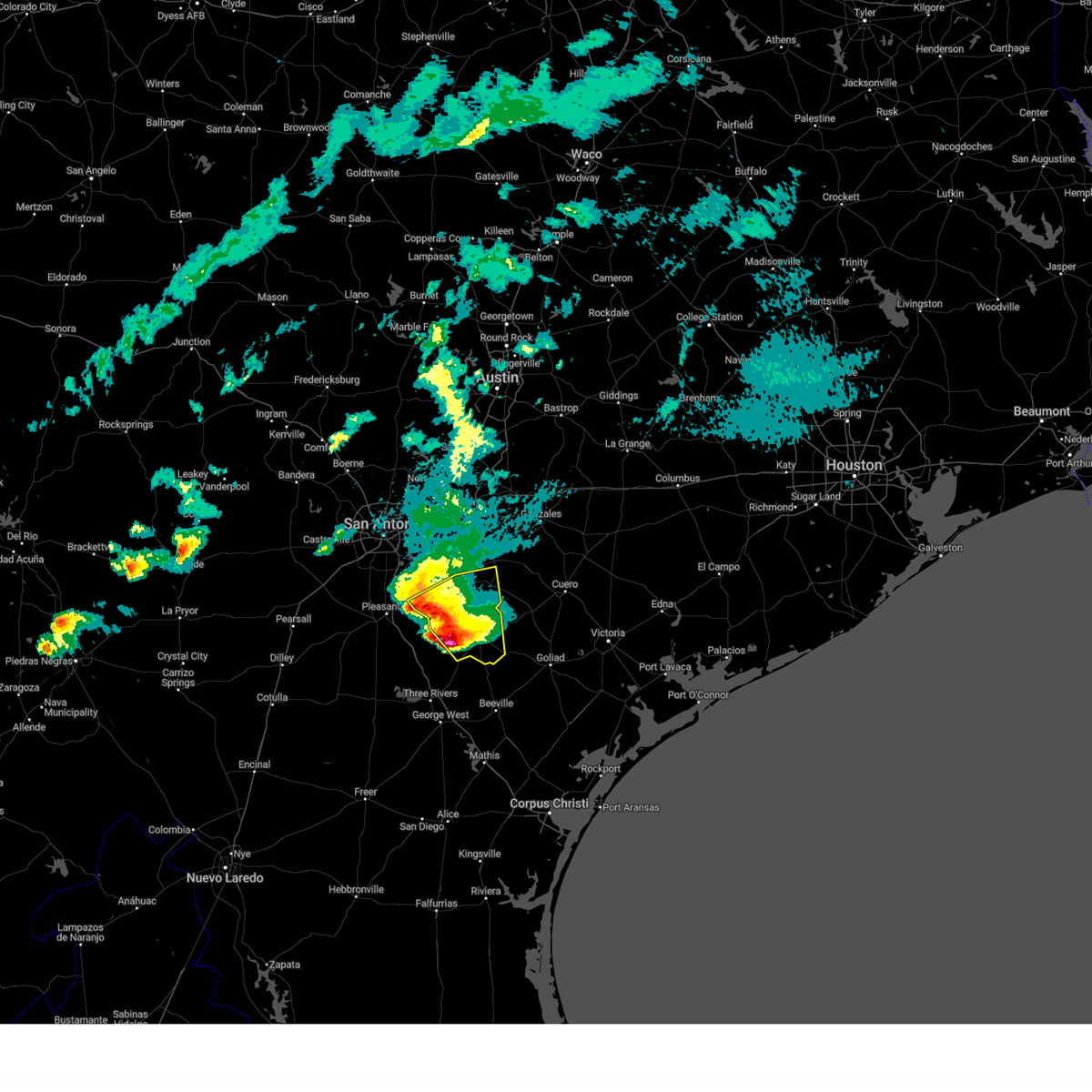
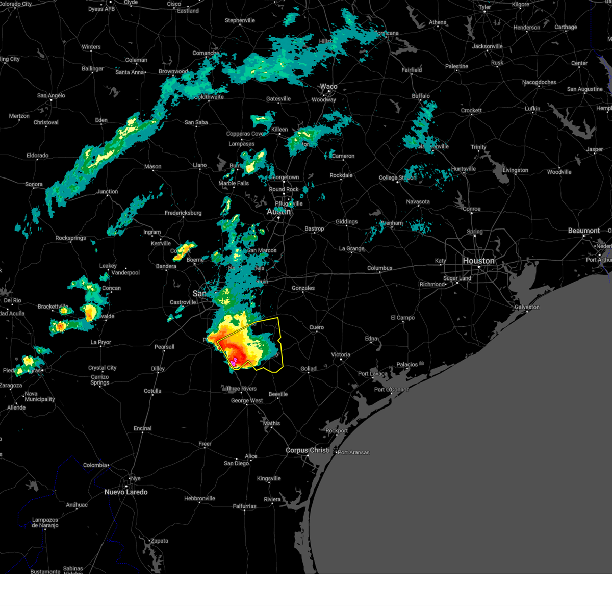
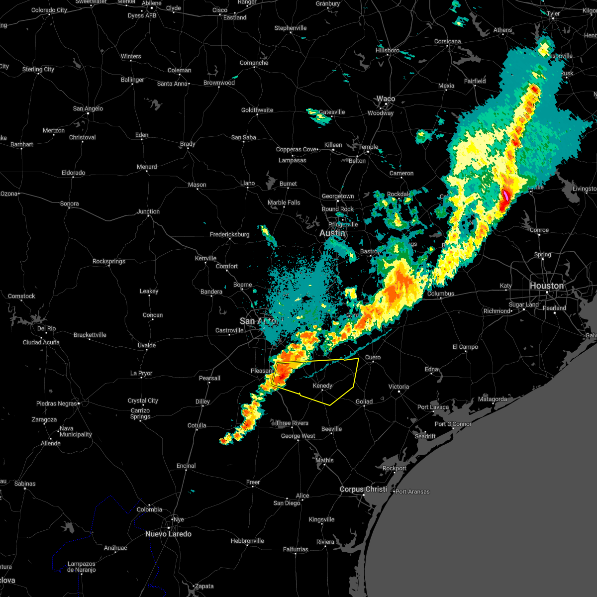
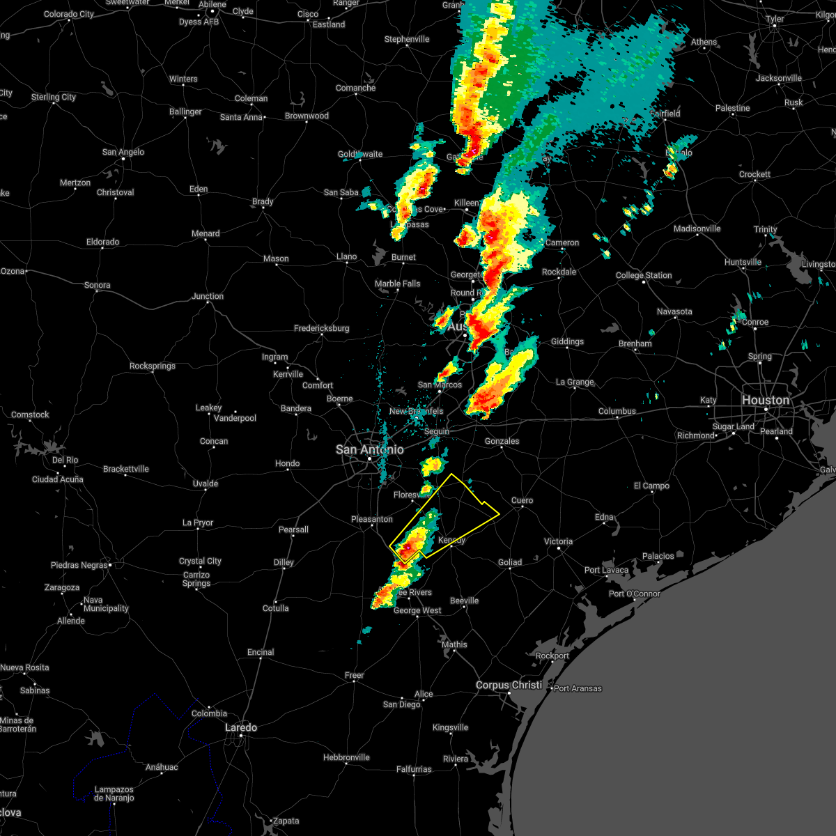
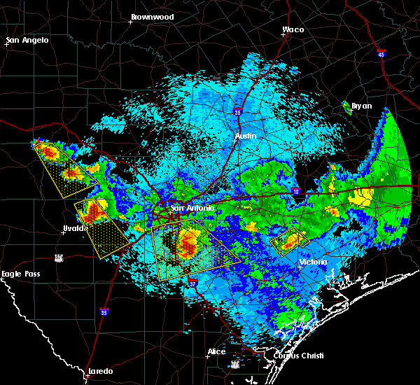
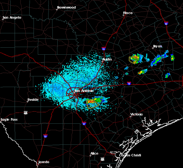
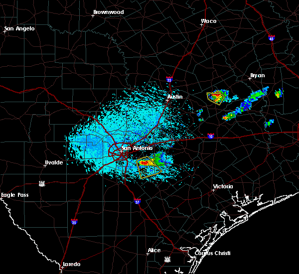
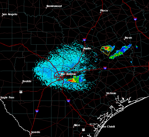
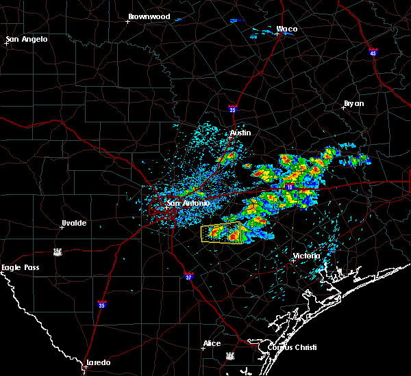
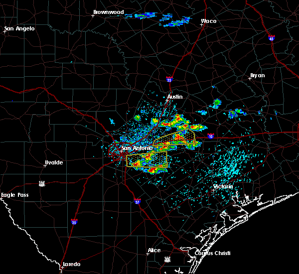
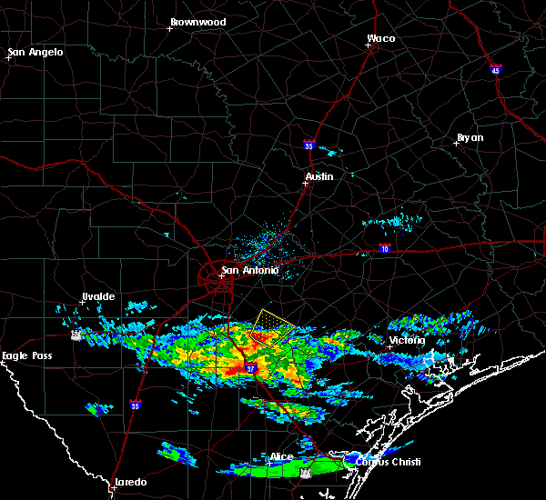
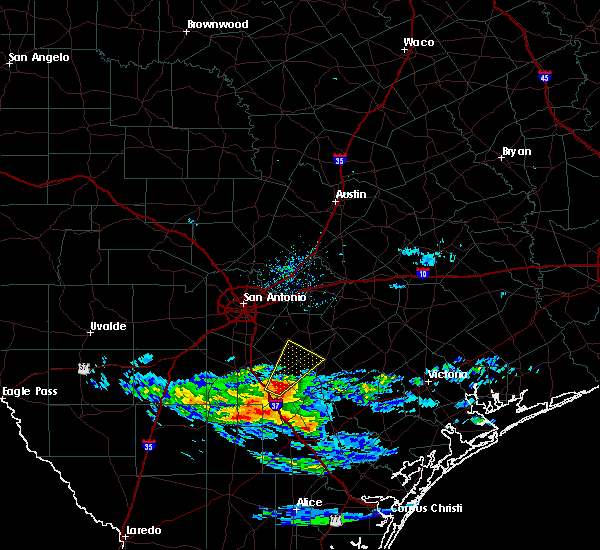
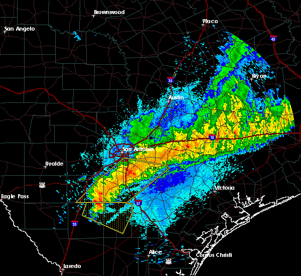
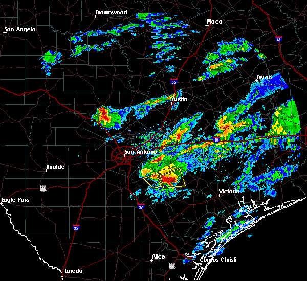
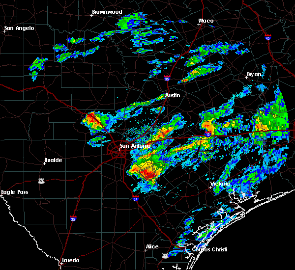
Hail Map for Poth, TX
The Poth, TX area has had 3 reports of on-the-ground hail by trained spotters, and has been under severe weather warnings 7 times during the past 12 months. Doppler radar has detected hail at or near Poth, TX on 45 occasions, including 2 occasions during the past year.
| Name: | Poth, TX |
| Where Located: | 35 miles SE of San Antonio, TX |
| Map: | Google Map for Poth, TX |
| Population: | 1908 |
| Housing Units: | 722 |
| More Info: | Search Google for Poth, TX |
4
The Top Recent Hail Date for Poth, TX is Saturday, February 14, 2026 (5th out of 45)
Hail and Wind Damage Spotted near Poth, TX
| Date / Time | Report Details |
|---|---|
| 5/23/2026 8:36 AM CDT |
 the severe thunderstorm warning has been cancelled and is no longer in effect the severe thunderstorm warning has been cancelled and is no longer in effect
|
| 5/23/2026 8:21 AM CDT |
 Svrewx the national weather service in austin san antonio has issued a * severe thunderstorm warning for, east central medina county in south central texas, northwestern atascosa county in south central texas, northwestern wilson county in south central texas, southern bexar county in south central texas, * until 915 am cdt. * at 821 am cdt, a severe thunderstorm was located over lacoste, or near castroville, moving east at 50 mph (radar indicated). Hazards include 60 mph wind gusts and quarter size hail. Hail damage to vehicles is expected. Expect wind damage to roofs, siding, and trees. Svrewx the national weather service in austin san antonio has issued a * severe thunderstorm warning for, east central medina county in south central texas, northwestern atascosa county in south central texas, northwestern wilson county in south central texas, southern bexar county in south central texas, * until 915 am cdt. * at 821 am cdt, a severe thunderstorm was located over lacoste, or near castroville, moving east at 50 mph (radar indicated). Hazards include 60 mph wind gusts and quarter size hail. Hail damage to vehicles is expected. Expect wind damage to roofs, siding, and trees.
|
| 5/10/2026 11:21 PM CDT |
 At 1121 pm cdt, severe thunderstorms were located along a line extending from near sutherland springs to 10 miles northwest of zella to near catarina, moving southeast at 30 mph (radar indicated). Hazards include 60 mph wind gusts and quarter size hail. Hail damage to vehicles is expected. expect wind damage to roofs, siding, and trees. Locations impacted include, pleasanton, floresville, crystal city, carrizo springs, jourdanton, dilley, poteet, kenedy, karnes city, poth, charlotte, stockdale, big wells, christine, kosciusko, campbellton, la vernia, asherton, runge, and falls city. At 1121 pm cdt, severe thunderstorms were located along a line extending from near sutherland springs to 10 miles northwest of zella to near catarina, moving southeast at 30 mph (radar indicated). Hazards include 60 mph wind gusts and quarter size hail. Hail damage to vehicles is expected. expect wind damage to roofs, siding, and trees. Locations impacted include, pleasanton, floresville, crystal city, carrizo springs, jourdanton, dilley, poteet, kenedy, karnes city, poth, charlotte, stockdale, big wells, christine, kosciusko, campbellton, la vernia, asherton, runge, and falls city.
|
| 5/10/2026 10:54 PM CDT |
 Svrewx the national weather service in austin san antonio has issued a * severe thunderstorm warning for, southeastern medina county in south central texas, dimmit county in south central texas, karnes county in south central texas, southern zavala county in south central texas, frio county in south central texas, atascosa county in south central texas, wilson county in south central texas, southern bexar county in south central texas, * until midnight cdt. * at 1054 pm cdt, severe thunderstorms were located along a line extending from near st. hedwig to near derby to near asherton, moving southeast at 30 mph (radar indicated). Hazards include 60 mph wind gusts and quarter size hail. Hail damage to vehicles is expected. Expect wind damage to roofs, siding, and trees. Svrewx the national weather service in austin san antonio has issued a * severe thunderstorm warning for, southeastern medina county in south central texas, dimmit county in south central texas, karnes county in south central texas, southern zavala county in south central texas, frio county in south central texas, atascosa county in south central texas, wilson county in south central texas, southern bexar county in south central texas, * until midnight cdt. * at 1054 pm cdt, severe thunderstorms were located along a line extending from near st. hedwig to near derby to near asherton, moving southeast at 30 mph (radar indicated). Hazards include 60 mph wind gusts and quarter size hail. Hail damage to vehicles is expected. Expect wind damage to roofs, siding, and trees.
|
| 5/1/2026 12:29 PM CDT |
 Svrewx the national weather service in austin san antonio has issued a * severe thunderstorm warning for, southwestern dewitt county in south central texas, karnes county in south central texas, southeastern atascosa county in south central texas, southwestern wilson county in south central texas, * until 115 pm cdt. * at 1229 pm cdt, a severe thunderstorm was located 10 miles southwest of falls city, or 12 miles southwest of poth, moving east at 60 mph (radar indicated). Hazards include quarter size hail. damage to vehicles is expected Svrewx the national weather service in austin san antonio has issued a * severe thunderstorm warning for, southwestern dewitt county in south central texas, karnes county in south central texas, southeastern atascosa county in south central texas, southwestern wilson county in south central texas, * until 115 pm cdt. * at 1229 pm cdt, a severe thunderstorm was located 10 miles southwest of falls city, or 12 miles southwest of poth, moving east at 60 mph (radar indicated). Hazards include quarter size hail. damage to vehicles is expected
|
| 10/25/2025 4:24 AM CDT | At 424 am cdt, a severe thunderstorm was located 8 miles east of leming, or 10 miles northeast of pleasanton, moving east at 45 mph (radar indicated). Hazards include 60 mph wind gusts and quarter size hail. Hail damage to vehicles is expected. expect wind damage to roofs, siding, and trees. Locations impacted include, pleasanton, floresville, poth, falls city, leming, coughran, coy city, deweesville, graytown, and mccoy. |
| 10/25/2025 4:05 AM CDT | Svrewx the national weather service in austin san antonio has issued a * severe thunderstorm warning for, west central karnes county in south central texas, central atascosa county in south central texas, southwestern wilson county in south central texas, * until 445 am cdt. * at 405 am cdt, a severe thunderstorm was located over poteet, moving east at 45 mph (radar indicated). Hazards include 60 mph wind gusts and quarter size hail. Hail damage to vehicles is expected. Expect wind damage to roofs, siding, and trees. |
| 6/14/2025 4:50 PM CDT |
 The storm which prompted the warning has weakened below severe limits, and no longer poses an immediate threat to life or property. therefore, the warning will be allowed to expire. however heavy rain is still possible with this thunderstorm. The storm which prompted the warning has weakened below severe limits, and no longer poses an immediate threat to life or property. therefore, the warning will be allowed to expire. however heavy rain is still possible with this thunderstorm.
|
| 6/14/2025 4:26 PM CDT |
 Svrewx the national weather service in austin san antonio has issued a * severe thunderstorm warning for, central wilson county in south central texas, * until 500 pm cdt. * at 425 pm cdt, a severe thunderstorm was located over poth, moving northwest at 5 mph (radar indicated). Hazards include quarter size hail. damage to vehicles is expected Svrewx the national weather service in austin san antonio has issued a * severe thunderstorm warning for, central wilson county in south central texas, * until 500 pm cdt. * at 425 pm cdt, a severe thunderstorm was located over poth, moving northwest at 5 mph (radar indicated). Hazards include quarter size hail. damage to vehicles is expected
|
| 4/30/2025 6:35 PM CDT |
 At 634 pm cdt, a severe thunderstorm was located 11 miles southwest of falls city, or 12 miles southwest of poth, moving east at 25 mph (radar indicated). Hazards include two inch hail and 60 mph wind gusts. People and animals outdoors will be injured. expect hail damage to roofs, siding, windows, and vehicles. expect wind damage to roofs, siding, and trees. this severe storm will be near, falls city around 650 pm cdt. Other locations impacted by this severe thunderstorm include coughran, hobson, coy city, mccoy, and deweesville. At 634 pm cdt, a severe thunderstorm was located 11 miles southwest of falls city, or 12 miles southwest of poth, moving east at 25 mph (radar indicated). Hazards include two inch hail and 60 mph wind gusts. People and animals outdoors will be injured. expect hail damage to roofs, siding, windows, and vehicles. expect wind damage to roofs, siding, and trees. this severe storm will be near, falls city around 650 pm cdt. Other locations impacted by this severe thunderstorm include coughran, hobson, coy city, mccoy, and deweesville.
|
| 4/30/2025 6:21 PM CDT |
 At 621 pm cdt, a severe thunderstorm was located 10 miles north of campbellton, moving east at 25 mph (broadcast media). Hazards include tennis ball size hail and 60 mph wind gusts. People and animals outdoors will be injured. expect hail damage to roofs, siding, windows, and vehicles. expect wind damage to roofs, siding, and trees. this severe storm will be near, falls city around 655 pm cdt. Other locations impacted by this severe thunderstorm include coughran, hobson, coy city, mccoy, and deweesville. At 621 pm cdt, a severe thunderstorm was located 10 miles north of campbellton, moving east at 25 mph (broadcast media). Hazards include tennis ball size hail and 60 mph wind gusts. People and animals outdoors will be injured. expect hail damage to roofs, siding, windows, and vehicles. expect wind damage to roofs, siding, and trees. this severe storm will be near, falls city around 655 pm cdt. Other locations impacted by this severe thunderstorm include coughran, hobson, coy city, mccoy, and deweesville.
|
| 4/30/2025 6:07 PM CDT |
 At 606 pm cdt, a severe thunderstorm was located 10 miles southeast of pleasanton, moving east at 25 mph (broadcast media). Hazards include tennis ball size hail and 60 mph wind gusts. People and animals outdoors will be injured. expect hail damage to roofs, siding, windows, and vehicles. expect wind damage to roofs, siding, and trees. this severe storm will be near, falls city around 645 pm cdt. Other locations impacted by this severe thunderstorm include coughran, hobson, coy city, graytown, mccoy, and deweesville. At 606 pm cdt, a severe thunderstorm was located 10 miles southeast of pleasanton, moving east at 25 mph (broadcast media). Hazards include tennis ball size hail and 60 mph wind gusts. People and animals outdoors will be injured. expect hail damage to roofs, siding, windows, and vehicles. expect wind damage to roofs, siding, and trees. this severe storm will be near, falls city around 645 pm cdt. Other locations impacted by this severe thunderstorm include coughran, hobson, coy city, graytown, mccoy, and deweesville.
|
| 4/30/2025 5:52 PM CDT |
 Svrewx the national weather service in austin san antonio has issued a * severe thunderstorm warning for, west central karnes county in south central texas, central atascosa county in south central texas, southwestern wilson county in south central texas, * until 700 pm cdt. * at 552 pm cdt, a severe thunderstorm was located near pleasanton, moving east at 25 mph (radar indicated). Hazards include golf ball size hail and 60 mph wind gusts. People and animals outdoors will be injured. expect hail damage to roofs, siding, windows, and vehicles. Expect wind damage to roofs, siding, and trees. Svrewx the national weather service in austin san antonio has issued a * severe thunderstorm warning for, west central karnes county in south central texas, central atascosa county in south central texas, southwestern wilson county in south central texas, * until 700 pm cdt. * at 552 pm cdt, a severe thunderstorm was located near pleasanton, moving east at 25 mph (radar indicated). Hazards include golf ball size hail and 60 mph wind gusts. People and animals outdoors will be injured. expect hail damage to roofs, siding, windows, and vehicles. Expect wind damage to roofs, siding, and trees.
|
| 12/24/2024 10:24 PM CST |
 At 1024 pm cst, severe thunderstorms were located along a line extending from near cestohowa to near gillett to 7 miles south of smiley, moving east at 15 mph (radar indicated). Hazards include 60 mph wind gusts and half dollar size hail. Hail damage to vehicles is expected. expect wind damage to roofs, siding, and trees. Locations impacted include, poth, kosciusko, nixon, falls city, cestohowa, gillett, hobson, ecleto, sample, paweleville, pana maria, and coy city. At 1024 pm cst, severe thunderstorms were located along a line extending from near cestohowa to near gillett to 7 miles south of smiley, moving east at 15 mph (radar indicated). Hazards include 60 mph wind gusts and half dollar size hail. Hail damage to vehicles is expected. expect wind damage to roofs, siding, and trees. Locations impacted include, poth, kosciusko, nixon, falls city, cestohowa, gillett, hobson, ecleto, sample, paweleville, pana maria, and coy city.
|
| 12/24/2024 10:06 PM CST |
 At 1006 pm cst, severe thunderstorms were located along a line extending from near poth to gillett to 6 miles south of smiley, moving east at 15 mph (radar indicated). Hazards include 60 mph wind gusts and half dollar size hail. Hail damage to vehicles is expected. expect wind damage to roofs, siding, and trees. Locations impacted include, poth, kosciusko, nixon, falls city, cestohowa, gillett, hobson, ecleto, sample, paweleville, pana maria, and coy city. At 1006 pm cst, severe thunderstorms were located along a line extending from near poth to gillett to 6 miles south of smiley, moving east at 15 mph (radar indicated). Hazards include 60 mph wind gusts and half dollar size hail. Hail damage to vehicles is expected. expect wind damage to roofs, siding, and trees. Locations impacted include, poth, kosciusko, nixon, falls city, cestohowa, gillett, hobson, ecleto, sample, paweleville, pana maria, and coy city.
|
| 12/24/2024 9:37 PM CST |
 Svrewx the national weather service in austin san antonio has issued a * severe thunderstorm warning for, central karnes county in south central texas, southwestern gonzales county in south central texas, central wilson county in south central texas, * until 1045 pm cst. * at 937 pm cst, severe thunderstorms were located along a line extending from near floresville to near kosciusko to near nixon, moving east at 15 mph (radar indicated). Hazards include 60 mph wind gusts and half dollar size hail. Hail damage to vehicles is expected. Expect wind damage to roofs, siding, and trees. Svrewx the national weather service in austin san antonio has issued a * severe thunderstorm warning for, central karnes county in south central texas, southwestern gonzales county in south central texas, central wilson county in south central texas, * until 1045 pm cst. * at 937 pm cst, severe thunderstorms were located along a line extending from near floresville to near kosciusko to near nixon, moving east at 15 mph (radar indicated). Hazards include 60 mph wind gusts and half dollar size hail. Hail damage to vehicles is expected. Expect wind damage to roofs, siding, and trees.
|
| 5/13/2024 12:34 PM CDT |
 the severe thunderstorm warning has been cancelled and is no longer in effect the severe thunderstorm warning has been cancelled and is no longer in effect
|
| 5/13/2024 11:58 AM CDT |
 Svrewx the national weather service in austin san antonio has issued a * severe thunderstorm warning for, northwestern karnes county in south central texas, central atascosa county in south central texas, southern wilson county in south central texas, * until 100 pm cdt. * at 1158 am cdt, a severe thunderstorm was located over leming, or near pleasanton, moving east at 35 mph (radar indicated). Hazards include 60 mph wind gusts and quarter size hail. Hail damage to vehicles is expected. Expect wind damage to roofs, siding, and trees. Svrewx the national weather service in austin san antonio has issued a * severe thunderstorm warning for, northwestern karnes county in south central texas, central atascosa county in south central texas, southern wilson county in south central texas, * until 100 pm cdt. * at 1158 am cdt, a severe thunderstorm was located over leming, or near pleasanton, moving east at 35 mph (radar indicated). Hazards include 60 mph wind gusts and quarter size hail. Hail damage to vehicles is expected. Expect wind damage to roofs, siding, and trees.
|
| 4/29/2024 7:38 PM CDT |
 Svrewx the national weather service in austin san antonio has issued a * severe thunderstorm warning for, east central atascosa county in south central texas, southwestern wilson county in south central texas, * until 830 pm cdt. * at 738 pm cdt, a severe thunderstorm was located 7 miles southwest of poth, moving west at 5 mph (radar indicated). Hazards include quarter size hail. Damage to vehicles is expected. This severe thunderstorm will remain over mainly rural areas of east central atascosa and southwestern wilson counties. Svrewx the national weather service in austin san antonio has issued a * severe thunderstorm warning for, east central atascosa county in south central texas, southwestern wilson county in south central texas, * until 830 pm cdt. * at 738 pm cdt, a severe thunderstorm was located 7 miles southwest of poth, moving west at 5 mph (radar indicated). Hazards include quarter size hail. Damage to vehicles is expected. This severe thunderstorm will remain over mainly rural areas of east central atascosa and southwestern wilson counties.
|
| 4/28/2024 1:58 PM CDT |
 the severe thunderstorm warning has been cancelled and is no longer in effect the severe thunderstorm warning has been cancelled and is no longer in effect
|
| 4/28/2024 1:50 PM CDT | Quarter sized hail reported 0.1 miles ENE of Poth, TX, quarter sized hail at the poth fire department. |
| 4/28/2024 1:46 PM CDT |
 At 145 pm cdt, a severe thunderstorm was located over poth, moving northeast at 25 mph (public. at 1:45 pm, quarter size hail was reported in poth). Hazards include 60 mph wind gusts and quarter size hail. Hail damage to vehicles is expected. expect wind damage to roofs, siding, and trees. Locations impacted include, floresville, poth, stockdale, kosciusko, falls city, pandora, cestohowa, gillett, and paweleville. At 145 pm cdt, a severe thunderstorm was located over poth, moving northeast at 25 mph (public. at 1:45 pm, quarter size hail was reported in poth). Hazards include 60 mph wind gusts and quarter size hail. Hail damage to vehicles is expected. expect wind damage to roofs, siding, and trees. Locations impacted include, floresville, poth, stockdale, kosciusko, falls city, pandora, cestohowa, gillett, and paweleville.
|
| 4/28/2024 1:45 PM CDT | Quarter sized hail reported 0.1 miles ENE of Poth, TX, public reports quarter sized hail near the intersection of highway 181 and westmeyer street. |
| 4/28/2024 1:27 PM CDT |
 Svrewx the national weather service in austin san antonio has issued a * severe thunderstorm warning for, northwestern karnes county in south central texas, central wilson county in south central texas, * until 230 pm cdt. * at 126 pm cdt, a severe thunderstorm was located 8 miles southwest of poth, moving east at 20 mph (radar indicated). Hazards include 60 mph wind gusts and quarter size hail. Hail damage to vehicles is expected. Expect wind damage to roofs, siding, and trees. Svrewx the national weather service in austin san antonio has issued a * severe thunderstorm warning for, northwestern karnes county in south central texas, central wilson county in south central texas, * until 230 pm cdt. * at 126 pm cdt, a severe thunderstorm was located 8 miles southwest of poth, moving east at 20 mph (radar indicated). Hazards include 60 mph wind gusts and quarter size hail. Hail damage to vehicles is expected. Expect wind damage to roofs, siding, and trees.
|
| 4/28/2024 1:02 PM CDT |
 Svrewx the national weather service in austin san antonio has issued a * severe thunderstorm warning for, south central guadalupe county in south central texas, central wilson county in south central texas, * until 200 pm cdt. * at 102 pm cdt, a severe thunderstorm was located over floresville, moving northeast at 30 mph (radar indicated). Hazards include 60 mph wind gusts and penny size hail. expect damage to roofs, siding, and trees Svrewx the national weather service in austin san antonio has issued a * severe thunderstorm warning for, south central guadalupe county in south central texas, central wilson county in south central texas, * until 200 pm cdt. * at 102 pm cdt, a severe thunderstorm was located over floresville, moving northeast at 30 mph (radar indicated). Hazards include 60 mph wind gusts and penny size hail. expect damage to roofs, siding, and trees
|
| 2/2/2024 9:48 PM CST |
 At 948 pm cst, a severe thunderstorm was located over floresville, moving northeast at 60 mph (radar indicated). Hazards include 60 mph wind gusts. expect damage to roofs, siding, and trees At 948 pm cst, a severe thunderstorm was located over floresville, moving northeast at 60 mph (radar indicated). Hazards include 60 mph wind gusts. expect damage to roofs, siding, and trees
|
| 10/26/2023 11:54 AM CDT |
 At 1153 am cdt, a severe thunderstorm capable of producing a tornado was located near poth, moving northeast at 15 mph (radar indicated rotation). Hazards include tornado. Flying debris will be dangerous to those caught without shelter. mobile homes will be damaged or destroyed. damage to roofs, windows, and vehicles will occur. tree damage is likely. Locations impacted include, floresville, poth, stockdale, and sutherland springs. At 1153 am cdt, a severe thunderstorm capable of producing a tornado was located near poth, moving northeast at 15 mph (radar indicated rotation). Hazards include tornado. Flying debris will be dangerous to those caught without shelter. mobile homes will be damaged or destroyed. damage to roofs, windows, and vehicles will occur. tree damage is likely. Locations impacted include, floresville, poth, stockdale, and sutherland springs.
|
| 10/26/2023 11:51 AM CDT |
 At 1151 am cdt, a severe thunderstorm capable of producing a tornado was located over poth, moving northeast at 15 mph (radar indicated rotation). Hazards include tornado. Flying debris will be dangerous to those caught without shelter. mobile homes will be damaged or destroyed. damage to roofs, windows, and vehicles will occur. Tree damage is likely. At 1151 am cdt, a severe thunderstorm capable of producing a tornado was located over poth, moving northeast at 15 mph (radar indicated rotation). Hazards include tornado. Flying debris will be dangerous to those caught without shelter. mobile homes will be damaged or destroyed. damage to roofs, windows, and vehicles will occur. Tree damage is likely.
|
| 5/7/2023 9:36 AM CDT |
 At 936 am cdt, a severe thunderstorm was located 8 miles southwest of falls city, or 10 miles southwest of poth, moving northeast at 10 mph (radar indicated). Hazards include 60 mph wind gusts and quarter size hail. Hail damage to vehicles is expected. Expect wind damage to roofs, siding, and trees. At 936 am cdt, a severe thunderstorm was located 8 miles southwest of falls city, or 10 miles southwest of poth, moving northeast at 10 mph (radar indicated). Hazards include 60 mph wind gusts and quarter size hail. Hail damage to vehicles is expected. Expect wind damage to roofs, siding, and trees.
|
| 4/28/2023 7:58 PM CDT |
 At 757 pm cdt, a severe thunderstorm was located near gillett, or near kosciusko, moving east at 35 mph (radar indicated). Hazards include 60 mph wind gusts and quarter size hail. Hail damage to vehicles is expected. expect wind damage to roofs, siding, and trees. locations impacted include, poth, kosciusko, nixon, smiley, pandora, cestohowa, gillett, ecleto, sample, paweleville, pana maria and helena. hail threat, radar indicated max hail size, 1. 00 in wind threat, radar indicated max wind gust, 60 mph. At 757 pm cdt, a severe thunderstorm was located near gillett, or near kosciusko, moving east at 35 mph (radar indicated). Hazards include 60 mph wind gusts and quarter size hail. Hail damage to vehicles is expected. expect wind damage to roofs, siding, and trees. locations impacted include, poth, kosciusko, nixon, smiley, pandora, cestohowa, gillett, ecleto, sample, paweleville, pana maria and helena. hail threat, radar indicated max hail size, 1. 00 in wind threat, radar indicated max wind gust, 60 mph.
|
| 4/28/2023 7:23 PM CDT |
 At 722 pm cdt, a severe thunderstorm was located over stockdale, moving southeast at 35 mph (radar indicated). Hazards include 60 mph wind gusts and quarter size hail. Hail damage to vehicles is expected. Expect wind damage to roofs, siding, and trees. At 722 pm cdt, a severe thunderstorm was located over stockdale, moving southeast at 35 mph (radar indicated). Hazards include 60 mph wind gusts and quarter size hail. Hail damage to vehicles is expected. Expect wind damage to roofs, siding, and trees.
|
| 4/21/2023 2:04 AM CDT |
 At 203 am cdt, severe thunderstorms were located along a line extending from near pandora to 6 miles northeast of christine, moving southeast at 30 mph (radar indicated). Hazards include 60 mph wind gusts and quarter size hail. Hail damage to vehicles is expected. expect wind damage to roofs, siding, and trees. locations impacted include, pleasanton, floresville, poth, stockdale, kosciusko, nixon, la vernia, falls city, pandora, gillett, cestohowa, sutherland springs, paweleville, canada verde, graytown, fashing, coughran, hobson, deweesville and mccoy. hail threat, radar indicated max hail size, 1. 00 in wind threat, radar indicated max wind gust, 60 mph. At 203 am cdt, severe thunderstorms were located along a line extending from near pandora to 6 miles northeast of christine, moving southeast at 30 mph (radar indicated). Hazards include 60 mph wind gusts and quarter size hail. Hail damage to vehicles is expected. expect wind damage to roofs, siding, and trees. locations impacted include, pleasanton, floresville, poth, stockdale, kosciusko, nixon, la vernia, falls city, pandora, gillett, cestohowa, sutherland springs, paweleville, canada verde, graytown, fashing, coughran, hobson, deweesville and mccoy. hail threat, radar indicated max hail size, 1. 00 in wind threat, radar indicated max wind gust, 60 mph.
|
| 4/21/2023 1:49 AM CDT |
 At 149 am cdt, severe thunderstorms were located along a line extending from 7 miles northeast of sutherland springs to jourdanton, moving southeast at 30 mph (radar indicated). Hazards include 60 mph wind gusts and quarter size hail. Hail damage to vehicles is expected. expect wind damage to roofs, siding, and trees. locations impacted include, pleasanton, floresville, jourdanton, poteet, poth, stockdale, campbellton, kosciusko, nixon, st. hedwig, elmendorf, la vernia, falls city, pandora, calaveras lake, gillett, cestohowa, sutherland springs, leming and sandy oaks. hail threat, radar indicated max hail size, 1. 00 in wind threat, radar indicated max wind gust, 60 mph. At 149 am cdt, severe thunderstorms were located along a line extending from 7 miles northeast of sutherland springs to jourdanton, moving southeast at 30 mph (radar indicated). Hazards include 60 mph wind gusts and quarter size hail. Hail damage to vehicles is expected. expect wind damage to roofs, siding, and trees. locations impacted include, pleasanton, floresville, jourdanton, poteet, poth, stockdale, campbellton, kosciusko, nixon, st. hedwig, elmendorf, la vernia, falls city, pandora, calaveras lake, gillett, cestohowa, sutherland springs, leming and sandy oaks. hail threat, radar indicated max hail size, 1. 00 in wind threat, radar indicated max wind gust, 60 mph.
|
| 4/21/2023 1:24 AM CDT |
 At 124 am cdt, severe thunderstorms were located along a line extending from near zuehl to 8 miles west of poteet, moving southeast at 30 mph (radar indicated). Hazards include 60 mph wind gusts and quarter size hail. Hail damage to vehicles is expected. Expect wind damage to roofs, siding, and trees. At 124 am cdt, severe thunderstorms were located along a line extending from near zuehl to 8 miles west of poteet, moving southeast at 30 mph (radar indicated). Hazards include 60 mph wind gusts and quarter size hail. Hail damage to vehicles is expected. Expect wind damage to roofs, siding, and trees.
|
| 4/21/2023 12:37 AM CDT |
 At 1237 am cdt, a severe thunderstorm was located over leon valley, or near san antonio, moving southeast at 40 mph (radar indicated). Hazards include 60 mph wind gusts and quarter size hail. Hail damage to vehicles is expected. Expect wind damage to roofs, siding, and trees. At 1237 am cdt, a severe thunderstorm was located over leon valley, or near san antonio, moving southeast at 40 mph (radar indicated). Hazards include 60 mph wind gusts and quarter size hail. Hail damage to vehicles is expected. Expect wind damage to roofs, siding, and trees.
|
| 4/5/2023 10:14 PM CDT |
 At 1014 pm cdt, a severe thunderstorm was located near campbellton, moving northeast at 45 mph (radar indicated). Hazards include ping pong ball size hail. People and animals outdoors will be injured. expect damage to roofs, siding, windows, and vehicles. locations impacted include, floresville, poth, campbellton, falls city, cestohowa, hobson, peggy, deweesville, canada verde, mccoy and fashing. hail threat, radar indicated max hail size, 1. 50 in wind threat, radar indicated max wind gust, <50 mph. At 1014 pm cdt, a severe thunderstorm was located near campbellton, moving northeast at 45 mph (radar indicated). Hazards include ping pong ball size hail. People and animals outdoors will be injured. expect damage to roofs, siding, windows, and vehicles. locations impacted include, floresville, poth, campbellton, falls city, cestohowa, hobson, peggy, deweesville, canada verde, mccoy and fashing. hail threat, radar indicated max hail size, 1. 50 in wind threat, radar indicated max wind gust, <50 mph.
|
| 4/5/2023 10:03 PM CDT |
 At 1002 pm cdt, a severe thunderstorm was located 7 miles north of crowther, or 7 miles southwest of campbellton, moving northeast at 45 mph (radar indicated). Hazards include quarter size hail. damage to vehicles is expected At 1002 pm cdt, a severe thunderstorm was located 7 miles north of crowther, or 7 miles southwest of campbellton, moving northeast at 45 mph (radar indicated). Hazards include quarter size hail. damage to vehicles is expected
|
| 3/2/2023 8:34 PM CST |
 At 834 pm cst, severe thunderstorms were located along a line extending from 7 miles northeast of lockhart to near new berlin to 7 miles north of leming, moving east at 70 mph (radar indicated). Hazards include 60 mph wind gusts and quarter size hail. Hail damage to vehicles is expected. expect wind damage to roofs, siding, and trees. locations impacted include, seguin, lockhart, gonzales, floresville, luling, poth, stockdale, kosciusko, nixon, la vernia, waelder, kingsbury, new berlin, staples, fentress, sutherland springs, palmeto state park, rosanky, pandora and cistern. hail threat, radar indicated max hail size, 1. 00 in wind threat, radar indicated max wind gust, 60 mph. At 834 pm cst, severe thunderstorms were located along a line extending from 7 miles northeast of lockhart to near new berlin to 7 miles north of leming, moving east at 70 mph (radar indicated). Hazards include 60 mph wind gusts and quarter size hail. Hail damage to vehicles is expected. expect wind damage to roofs, siding, and trees. locations impacted include, seguin, lockhart, gonzales, floresville, luling, poth, stockdale, kosciusko, nixon, la vernia, waelder, kingsbury, new berlin, staples, fentress, sutherland springs, palmeto state park, rosanky, pandora and cistern. hail threat, radar indicated max hail size, 1. 00 in wind threat, radar indicated max wind gust, 60 mph.
|
| 3/2/2023 8:00 PM CST |
 At 800 pm cst, severe thunderstorms were located along a line extending from near kyle to near new braunfels to near somerset, moving east at 40 mph (radar indicated). Hazards include 60 mph wind gusts and penny size hail. expect damage to roofs, siding, and trees At 800 pm cst, severe thunderstorms were located along a line extending from near kyle to near new braunfels to near somerset, moving east at 40 mph (radar indicated). Hazards include 60 mph wind gusts and penny size hail. expect damage to roofs, siding, and trees
|
| 3/2/2023 12:27 AM CST |
 At 1226 am cst, a severe thunderstorm was located near karnes city, moving east at 45 mph (radar indicated). Hazards include golf ball size hail and 60 mph wind gusts. People and animals outdoors will be injured. expect hail damage to roofs, siding, windows, and vehicles. expect wind damage to roofs, siding, and trees. locations impacted include, floresville, kenedy, karnes city, poth, kosciusko, runge, falls city, gillett, cestohowa, paweleville, choate, hobson, ecleto, helena and pana maria. thunderstorm damage threat, considerable hail threat, radar indicated max hail size, 1. 75 in wind threat, radar indicated max wind gust, 60 mph. At 1226 am cst, a severe thunderstorm was located near karnes city, moving east at 45 mph (radar indicated). Hazards include golf ball size hail and 60 mph wind gusts. People and animals outdoors will be injured. expect hail damage to roofs, siding, windows, and vehicles. expect wind damage to roofs, siding, and trees. locations impacted include, floresville, kenedy, karnes city, poth, kosciusko, runge, falls city, gillett, cestohowa, paweleville, choate, hobson, ecleto, helena and pana maria. thunderstorm damage threat, considerable hail threat, radar indicated max hail size, 1. 75 in wind threat, radar indicated max wind gust, 60 mph.
|
| 3/2/2023 12:17 AM CST |
 At 1216 am cst, a severe thunderstorm was located 7 miles northeast of nell, or 9 miles southwest of karnes city, moving east at 50 mph (radar indicated). Hazards include two inch hail and 60 mph wind gusts. People and animals outdoors will be injured. expect hail damage to roofs, siding, windows, and vehicles. expect wind damage to roofs, siding, and trees. locations impacted include, floresville, kenedy, karnes city, poth, kosciusko, runge, falls city, gillett, cestohowa, coy city, zunkerville, paweleville, choate, hobson, el oso, ecleto, helena, deweesville and pana maria. thunderstorm damage threat, considerable hail threat, radar indicated max hail size, 2. 00 in wind threat, radar indicated max wind gust, 60 mph. At 1216 am cst, a severe thunderstorm was located 7 miles northeast of nell, or 9 miles southwest of karnes city, moving east at 50 mph (radar indicated). Hazards include two inch hail and 60 mph wind gusts. People and animals outdoors will be injured. expect hail damage to roofs, siding, windows, and vehicles. expect wind damage to roofs, siding, and trees. locations impacted include, floresville, kenedy, karnes city, poth, kosciusko, runge, falls city, gillett, cestohowa, coy city, zunkerville, paweleville, choate, hobson, el oso, ecleto, helena, deweesville and pana maria. thunderstorm damage threat, considerable hail threat, radar indicated max hail size, 2. 00 in wind threat, radar indicated max wind gust, 60 mph.
|
| 3/2/2023 12:02 AM CST |
 At 1202 am cst, a severe thunderstorm was located near campbellton, moving east at 35 mph (radar indicated). Hazards include tennis ball size hail and 60 mph wind gusts. People and animals outdoors will be injured. expect hail damage to roofs, siding, windows, and vehicles. expect wind damage to roofs, siding, and trees. locations impacted include, floresville, kenedy, karnes city, poth, kosciusko, campbellton, runge, falls city, gillett, cestohowa, coy city, zunkerville, paweleville, choate, fashing, coughran, hobson, el oso, peggy and ecleto. thunderstorm damage threat, considerable hail threat, radar indicated max hail size, 2. 50 in wind threat, radar indicated max wind gust, 60 mph. At 1202 am cst, a severe thunderstorm was located near campbellton, moving east at 35 mph (radar indicated). Hazards include tennis ball size hail and 60 mph wind gusts. People and animals outdoors will be injured. expect hail damage to roofs, siding, windows, and vehicles. expect wind damage to roofs, siding, and trees. locations impacted include, floresville, kenedy, karnes city, poth, kosciusko, campbellton, runge, falls city, gillett, cestohowa, coy city, zunkerville, paweleville, choate, fashing, coughran, hobson, el oso, peggy and ecleto. thunderstorm damage threat, considerable hail threat, radar indicated max hail size, 2. 50 in wind threat, radar indicated max wind gust, 60 mph.
|
| 3/1/2023 11:39 PM CST |
 At 1139 pm cst, a severe thunderstorm was located near christine, moving east at 45 mph (radar indicated). Hazards include two inch hail and 60 mph wind gusts. People and animals outdoors will be injured. expect hail damage to roofs, siding, windows, and vehicles. Expect wind damage to roofs, siding, and trees. At 1139 pm cst, a severe thunderstorm was located near christine, moving east at 45 mph (radar indicated). Hazards include two inch hail and 60 mph wind gusts. People and animals outdoors will be injured. expect hail damage to roofs, siding, windows, and vehicles. Expect wind damage to roofs, siding, and trees.
|
| 10/24/2022 11:22 PM CDT |
 At 1122 pm cdt, a severe thunderstorm was located 13 miles southwest of poth, moving east at 40 mph (radar indicated). Hazards include 60 mph wind gusts and quarter size hail. Hail damage to vehicles is expected. Expect wind damage to roofs, siding, and trees. At 1122 pm cdt, a severe thunderstorm was located 13 miles southwest of poth, moving east at 40 mph (radar indicated). Hazards include 60 mph wind gusts and quarter size hail. Hail damage to vehicles is expected. Expect wind damage to roofs, siding, and trees.
|
| 5/25/2022 12:55 AM CDT |
 At 1254 am cdt, severe thunderstorms were located along a line extending from 7 miles northeast of gonzales to 8 miles southwest of poth to near pearsall, moving southeast at 45 mph (radar indicated). Hazards include 60 mph wind gusts. Expect damage to roofs, siding, and trees. locations impacted include, pleasanton, pearsall, cuero, gonzales, floresville, yoakum, jourdanton, dilley, poteet, kenedy, karnes city, hallettsville, poth, yorktown, shiner, charlotte, stockdale, moulton, christine and kosciusko. hail threat, radar indicated max hail size, <. 75 in wind threat, radar indicated max wind gust, 60 mph. At 1254 am cdt, severe thunderstorms were located along a line extending from 7 miles northeast of gonzales to 8 miles southwest of poth to near pearsall, moving southeast at 45 mph (radar indicated). Hazards include 60 mph wind gusts. Expect damage to roofs, siding, and trees. locations impacted include, pleasanton, pearsall, cuero, gonzales, floresville, yoakum, jourdanton, dilley, poteet, kenedy, karnes city, hallettsville, poth, yorktown, shiner, charlotte, stockdale, moulton, christine and kosciusko. hail threat, radar indicated max hail size, <. 75 in wind threat, radar indicated max wind gust, 60 mph.
|
| 5/25/2022 12:37 AM CDT |
 At 1237 am cdt, severe thunderstorms were located along a line extending from 6 miles southwest of waelder to 7 miles west of floresville to near bluff, moving southeast at 45 mph (radar indicated). Hazards include 60 mph wind gusts. expect damage to roofs, siding, and trees At 1237 am cdt, severe thunderstorms were located along a line extending from 6 miles southwest of waelder to 7 miles west of floresville to near bluff, moving southeast at 45 mph (radar indicated). Hazards include 60 mph wind gusts. expect damage to roofs, siding, and trees
|
| 5/25/2022 12:30 AM CDT |
 At 1230 am cdt, severe thunderstorms were located along a line extending from near yoakum to 8 miles northwest of nell to 8 miles east of dilley, moving southeast at 40 mph (radar indicated). Hazards include 60 mph wind gusts. Expect damage to roofs, siding, and trees. locations impacted include, san antonio, new braunfels, san marcos, schertz, kyle, seguin, cibolo, universal city, live oak, lockhart, pleasanton, selma, pearsall, hondo, gonzales, floresville, luling, devine, jourdanton and poteet. hail threat, radar indicated max hail size, <. 75 in wind threat, radar indicated max wind gust, 60 mph. At 1230 am cdt, severe thunderstorms were located along a line extending from near yoakum to 8 miles northwest of nell to 8 miles east of dilley, moving southeast at 40 mph (radar indicated). Hazards include 60 mph wind gusts. Expect damage to roofs, siding, and trees. locations impacted include, san antonio, new braunfels, san marcos, schertz, kyle, seguin, cibolo, universal city, live oak, lockhart, pleasanton, selma, pearsall, hondo, gonzales, floresville, luling, devine, jourdanton and poteet. hail threat, radar indicated max hail size, <. 75 in wind threat, radar indicated max wind gust, 60 mph.
|
| 5/25/2022 12:11 AM CDT |
 At 1211 am cdt, severe thunderstorms were located along a line extending from 10 miles east of lockhart to stinson municipal airport to 9 miles north of frio town, moving southeast at 50 mph (radar indicated). Hazards include 60 mph wind gusts and penny size hail. Expect damage to roofs, siding, and trees. locations impacted include, san antonio, new braunfels, san marcos, schertz, kyle, seguin, cibolo, universal city, live oak, lockhart, pleasanton, selma, pearsall, hondo, gonzales, floresville, luling, devine, jourdanton and poteet. hail threat, radar indicated max hail size, 0. 75 in wind threat, radar indicated max wind gust, 60 mph. At 1211 am cdt, severe thunderstorms were located along a line extending from 10 miles east of lockhart to stinson municipal airport to 9 miles north of frio town, moving southeast at 50 mph (radar indicated). Hazards include 60 mph wind gusts and penny size hail. Expect damage to roofs, siding, and trees. locations impacted include, san antonio, new braunfels, san marcos, schertz, kyle, seguin, cibolo, universal city, live oak, lockhart, pleasanton, selma, pearsall, hondo, gonzales, floresville, luling, devine, jourdanton and poteet. hail threat, radar indicated max hail size, 0. 75 in wind threat, radar indicated max wind gust, 60 mph.
|
| 5/24/2022 11:49 PM CDT |
 At 1148 pm cdt, severe thunderstorms were located along a line extending from near martindale to rio medina to sabinal, moving southeast at 40 mph (radar indicated). Hazards include 60 mph wind gusts and nickel size hail. expect damage to roofs, siding, and trees At 1148 pm cdt, severe thunderstorms were located along a line extending from near martindale to rio medina to sabinal, moving southeast at 40 mph (radar indicated). Hazards include 60 mph wind gusts and nickel size hail. expect damage to roofs, siding, and trees
|
| 3/21/2022 6:41 PM CDT | Half Dollar sized hail reported 0.1 miles ENE of Poth, TX, public report of approximately half dollar size hail in poth. |
| 3/21/2022 6:37 PM CDT |
 At 637 pm cdt, a severe thunderstorm was located over poth, moving northeast at 40 mph (radar indicated). Hazards include ping pong ball size hail and 60 mph wind gusts. People and animals outdoors will be injured. expect hail damage to roofs, siding, windows, and vehicles. Expect wind damage to roofs, siding, and trees. At 637 pm cdt, a severe thunderstorm was located over poth, moving northeast at 40 mph (radar indicated). Hazards include ping pong ball size hail and 60 mph wind gusts. People and animals outdoors will be injured. expect hail damage to roofs, siding, windows, and vehicles. Expect wind damage to roofs, siding, and trees.
|
| 3/21/2022 6:17 PM CDT |
 At 617 pm cdt, a severe thunderstorm was located 9 miles southwest of falls city, or 13 miles northeast of campbellton, moving northeast at 55 mph (radar indicated). Hazards include 60 mph wind gusts and quarter size hail. Hail damage to vehicles is expected. Expect wind damage to roofs, siding, and trees. At 617 pm cdt, a severe thunderstorm was located 9 miles southwest of falls city, or 13 miles northeast of campbellton, moving northeast at 55 mph (radar indicated). Hazards include 60 mph wind gusts and quarter size hail. Hail damage to vehicles is expected. Expect wind damage to roofs, siding, and trees.
|
| 5/28/2021 10:23 PM CDT |
 At 1022 pm cdt, severe thunderstorms were located along a line extending from near zorn to 8 miles southeast of seguin to near kosciusko to near pleasanton, moving east at 45 mph (radar indicated). Hazards include 60 mph wind gusts. expect damage to roofs, siding, and trees At 1022 pm cdt, severe thunderstorms were located along a line extending from near zorn to 8 miles southeast of seguin to near kosciusko to near pleasanton, moving east at 45 mph (radar indicated). Hazards include 60 mph wind gusts. expect damage to roofs, siding, and trees
|
| 4/23/2021 8:04 PM CDT |
 At 804 pm cdt, severe thunderstorms were located along a line extending from near stockdale to near floresville, moving southeast at 30 mph (radar indicated). Hazards include 60 mph wind gusts and quarter size hail. Hail damage to vehicles is expected. expect wind damage to roofs, siding, and trees. Locations impacted include, floresville, poth, stockdale, pandora and sutherland springs. At 804 pm cdt, severe thunderstorms were located along a line extending from near stockdale to near floresville, moving southeast at 30 mph (radar indicated). Hazards include 60 mph wind gusts and quarter size hail. Hail damage to vehicles is expected. expect wind damage to roofs, siding, and trees. Locations impacted include, floresville, poth, stockdale, pandora and sutherland springs.
|
| 4/23/2021 7:42 PM CDT |
 At 742 pm cdt, severe thunderstorms were located along a line extending from near la vernia to near elmendorf, moving southeast at 30 mph (radar indicated). Hazards include 60 mph wind gusts and quarter size hail. Hail damage to vehicles is expected. Expect wind damage to roofs, siding, and trees. At 742 pm cdt, severe thunderstorms were located along a line extending from near la vernia to near elmendorf, moving southeast at 30 mph (radar indicated). Hazards include 60 mph wind gusts and quarter size hail. Hail damage to vehicles is expected. Expect wind damage to roofs, siding, and trees.
|
| 3/23/2021 2:13 AM CDT |
 At 212 am cdt, a severe thunderstorm was located near la vernia, or 11 miles north of floresville, moving east at 35 mph (radar indicated). Hazards include 60 mph wind gusts and quarter size hail. Hail damage to vehicles is expected. Expect wind damage to roofs, siding, and trees. At 212 am cdt, a severe thunderstorm was located near la vernia, or 11 miles north of floresville, moving east at 35 mph (radar indicated). Hazards include 60 mph wind gusts and quarter size hail. Hail damage to vehicles is expected. Expect wind damage to roofs, siding, and trees.
|
| 5/27/2020 10:42 PM CDT |
 At 1041 pm cdt, a severe thunderstorm was located 10 miles southwest of falls city, or 13 miles northeast of campbellton, moving southeast at 30 mph (radar indicated). Hazards include golf ball size hail and 60 mph wind gusts. People and animals outdoors will be injured. expect hail damage to roofs, siding, windows, and vehicles. expect wind damage to roofs, siding, and trees. Locations impacted include, karnes city, poth, campbellton, falls city, coughran, hobson, coy city, deweesville, mccoy and fashing. At 1041 pm cdt, a severe thunderstorm was located 10 miles southwest of falls city, or 13 miles northeast of campbellton, moving southeast at 30 mph (radar indicated). Hazards include golf ball size hail and 60 mph wind gusts. People and animals outdoors will be injured. expect hail damage to roofs, siding, windows, and vehicles. expect wind damage to roofs, siding, and trees. Locations impacted include, karnes city, poth, campbellton, falls city, coughran, hobson, coy city, deweesville, mccoy and fashing.
|
| 5/27/2020 10:27 PM CDT |
 At 1026 pm cdt, a severe thunderstorm was located 11 miles southwest of floresville, moving southeast at 35 mph (radar indicated). Hazards include two inch hail and 60 mph wind gusts. People and animals outdoors will be injured. expect hail damage to roofs, siding, windows, and vehicles. expect wind damage to roofs, siding, and trees. Locations impacted include, floresville, karnes city, poth, campbellton, falls city, leming, coy city, graytown, fashing, coughran, hobson, deweesville and mccoy. At 1026 pm cdt, a severe thunderstorm was located 11 miles southwest of floresville, moving southeast at 35 mph (radar indicated). Hazards include two inch hail and 60 mph wind gusts. People and animals outdoors will be injured. expect hail damage to roofs, siding, windows, and vehicles. expect wind damage to roofs, siding, and trees. Locations impacted include, floresville, karnes city, poth, campbellton, falls city, leming, coy city, graytown, fashing, coughran, hobson, deweesville and mccoy.
|
| 5/27/2020 9:57 PM CDT |
 At 956 pm cdt, severe thunderstorms were located along a line extending from near elmendorf to 6 miles southeast of somerset, moving southeast at 30 mph (radar indicated). Hazards include 60 mph wind gusts and quarter size hail. Hail damage to vehicles is expected. Expect wind damage to roofs, siding, and trees. At 956 pm cdt, severe thunderstorms were located along a line extending from near elmendorf to 6 miles southeast of somerset, moving southeast at 30 mph (radar indicated). Hazards include 60 mph wind gusts and quarter size hail. Hail damage to vehicles is expected. Expect wind damage to roofs, siding, and trees.
|
| 5/26/2020 5:23 PM CDT |
 At 522 pm cdt, a severe thunderstorm was located near sutherland springs, or near stockdale, moving southeast at 20 mph (radar indicated). Hazards include 60 mph wind gusts and penny size hail. Expect damage to roofs, siding, and trees. Locations impacted include, floresville, poth, stockdale, kosciusko and sutherland springs. At 522 pm cdt, a severe thunderstorm was located near sutherland springs, or near stockdale, moving southeast at 20 mph (radar indicated). Hazards include 60 mph wind gusts and penny size hail. Expect damage to roofs, siding, and trees. Locations impacted include, floresville, poth, stockdale, kosciusko and sutherland springs.
|
| 5/26/2020 5:14 PM CDT |
 At 513 pm cdt, a severe thunderstorm was located near la vernia, or 9 miles north of floresville, moving southeast at 15 mph (radar indicated). Hazards include 60 mph wind gusts and quarter size hail. Hail damage to vehicles is expected. expect wind damage to roofs, siding, and trees. Locations impacted include, floresville, poth, stockdale, kosciusko and sutherland springs. At 513 pm cdt, a severe thunderstorm was located near la vernia, or 9 miles north of floresville, moving southeast at 15 mph (radar indicated). Hazards include 60 mph wind gusts and quarter size hail. Hail damage to vehicles is expected. expect wind damage to roofs, siding, and trees. Locations impacted include, floresville, poth, stockdale, kosciusko and sutherland springs.
|
| 5/26/2020 5:03 PM CDT |
 At 503 pm cdt, a severe thunderstorm was located near la vernia, or 10 miles north of floresville, moving southeast at 15 mph (radar indicated). Hazards include 60 mph wind gusts and quarter size hail. Hail damage to vehicles is expected. Expect wind damage to roofs, siding, and trees. At 503 pm cdt, a severe thunderstorm was located near la vernia, or 10 miles north of floresville, moving southeast at 15 mph (radar indicated). Hazards include 60 mph wind gusts and quarter size hail. Hail damage to vehicles is expected. Expect wind damage to roofs, siding, and trees.
|
| 5/24/2020 10:31 PM CDT |
 At 1030 pm cdt, severe thunderstorms were located along a line extending from 6 miles north of nixon to pawnee, moving east at 35 mph (radar indicated). Hazards include 60 mph wind gusts. Expect damage to roofs, siding, and trees. Locations impacted include, kenedy, karnes city, poth, stockdale, kosciusko, nixon, runge, falls city, smiley, nordheim, pandora, gillett, cestohowa, coy city, cotton patch, choate, el oso, ecleto, helena and pana maria. At 1030 pm cdt, severe thunderstorms were located along a line extending from 6 miles north of nixon to pawnee, moving east at 35 mph (radar indicated). Hazards include 60 mph wind gusts. Expect damage to roofs, siding, and trees. Locations impacted include, kenedy, karnes city, poth, stockdale, kosciusko, nixon, runge, falls city, smiley, nordheim, pandora, gillett, cestohowa, coy city, cotton patch, choate, el oso, ecleto, helena and pana maria.
|
| 5/24/2020 10:04 PM CDT |
 At 1004 pm cdt, severe thunderstorms were located along a line extending from near sutherland springs to near whitsett, moving east at 35 mph (radar indicated). Hazards include 60 mph wind gusts. expect damage to roofs, siding, and trees At 1004 pm cdt, severe thunderstorms were located along a line extending from near sutherland springs to near whitsett, moving east at 35 mph (radar indicated). Hazards include 60 mph wind gusts. expect damage to roofs, siding, and trees
|
| 5/24/2020 9:36 PM CDT |
 At 935 pm cdt, severe thunderstorms were located along a line extending from near la vernia to near cross, moving east at 30 mph (radar indicated). Hazards include 60 mph wind gusts and nickel size hail. Expect damage to roofs, siding, and trees. Locations impacted include, pleasanton, floresville, jourdanton, poteet, poth, charlotte, stockdale, christine, campbellton, elmendorf, la vernia, falls city, calaveras lake, sutherland springs, leming, sandy oaks, buena vista, losoya, canada verde and southton. At 935 pm cdt, severe thunderstorms were located along a line extending from near la vernia to near cross, moving east at 30 mph (radar indicated). Hazards include 60 mph wind gusts and nickel size hail. Expect damage to roofs, siding, and trees. Locations impacted include, pleasanton, floresville, jourdanton, poteet, poth, charlotte, stockdale, christine, campbellton, elmendorf, la vernia, falls city, calaveras lake, sutherland springs, leming, sandy oaks, buena vista, losoya, canada verde and southton.
|
| 5/24/2020 8:59 PM CDT |
 At 859 pm cdt, severe thunderstorms were located along a line extending from near stinson municipal airport to 7 miles northwest of zella, moving east at 40 mph (radar indicated). Hazards include 60 mph wind gusts and nickel size hail. expect damage to roofs, siding, and trees At 859 pm cdt, severe thunderstorms were located along a line extending from near stinson municipal airport to 7 miles northwest of zella, moving east at 40 mph (radar indicated). Hazards include 60 mph wind gusts and nickel size hail. expect damage to roofs, siding, and trees
|
| 5/16/2020 12:20 AM CDT |
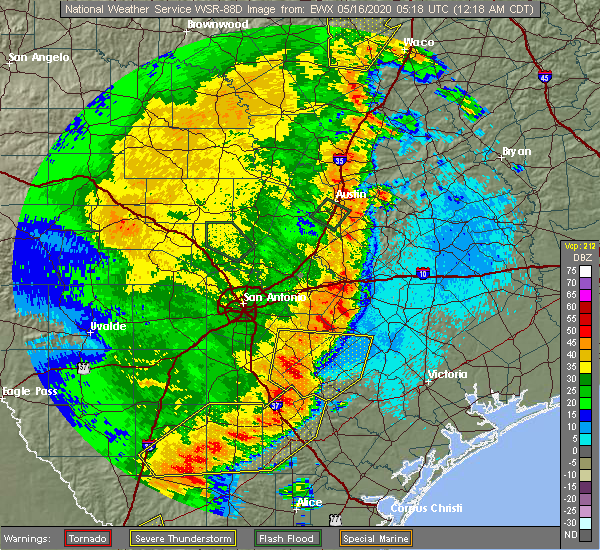 At 1220 am cdt, a severe thunderstorm was located over karnes city, moving east at 40 mph (radar indicated). Hazards include 60 mph wind gusts and quarter size hail. Hail damage to vehicles is expected. expect wind damage to roofs, siding, and trees. Locations impacted include, floresville, kenedy, karnes city, poth, yorktown, stockdale, kosciusko, runge, falls city, nordheim, gillett, cestohowa, westhoff, coy city, cotton patch, choate, el oso, ecleto, helena, and pana maria. At 1220 am cdt, a severe thunderstorm was located over karnes city, moving east at 40 mph (radar indicated). Hazards include 60 mph wind gusts and quarter size hail. Hail damage to vehicles is expected. expect wind damage to roofs, siding, and trees. Locations impacted include, floresville, kenedy, karnes city, poth, yorktown, stockdale, kosciusko, runge, falls city, nordheim, gillett, cestohowa, westhoff, coy city, cotton patch, choate, el oso, ecleto, helena, and pana maria.
|
| 5/15/2020 11:54 PM CDT |
 At 1153 pm cdt, a severe thunderstorm was located 10 miles west of falls city, or 12 miles southwest of poth, moving east at 40 mph (radar indicated). Hazards include 60 mph wind gusts and quarter size hail. Hail damage to vehicles is expected. Expect wind damage to roofs, siding, and trees. At 1153 pm cdt, a severe thunderstorm was located 10 miles west of falls city, or 12 miles southwest of poth, moving east at 40 mph (radar indicated). Hazards include 60 mph wind gusts and quarter size hail. Hail damage to vehicles is expected. Expect wind damage to roofs, siding, and trees.
|
| 5/15/2020 11:36 PM CDT |
 At 1135 pm cdt, a severe thunderstorm was located over campbellton, moving east at 40 mph (radar indicated). Hazards include 60 mph wind gusts and nickel size hail. Expect damage to roofs, siding, and trees. Locations impacted include, pleasanton, floresville, jourdanton, poteet, poth, charlotte, stockdale, christine, campbellton, lytle, somerset, elmendorf, natalia, falls city, calaveras lake, leming, sandy oaks, von ormy, buena vista, and iuka. At 1135 pm cdt, a severe thunderstorm was located over campbellton, moving east at 40 mph (radar indicated). Hazards include 60 mph wind gusts and nickel size hail. Expect damage to roofs, siding, and trees. Locations impacted include, pleasanton, floresville, jourdanton, poteet, poth, charlotte, stockdale, christine, campbellton, lytle, somerset, elmendorf, natalia, falls city, calaveras lake, leming, sandy oaks, von ormy, buena vista, and iuka.
|
| 5/15/2020 11:19 PM CDT |
 At 1118 pm cdt, a severe thunderstorm was located near christine, moving east at 40 mph (radar indicated). Hazards include 60 mph wind gusts and nickel size hail. Expect damage to roofs, siding, and trees. Locations impacted include, pleasanton, floresville, jourdanton, poteet, poth, charlotte, stockdale, christine, campbellton, lytle, somerset, elmendorf, natalia, falls city, goldfinch, calaveras lake, leming, schattel, bigfoot, and sandy oaks. At 1118 pm cdt, a severe thunderstorm was located near christine, moving east at 40 mph (radar indicated). Hazards include 60 mph wind gusts and nickel size hail. Expect damage to roofs, siding, and trees. Locations impacted include, pleasanton, floresville, jourdanton, poteet, poth, charlotte, stockdale, christine, campbellton, lytle, somerset, elmendorf, natalia, falls city, goldfinch, calaveras lake, leming, schattel, bigfoot, and sandy oaks.
|
| 5/15/2020 10:55 PM CDT |
 At 1053 pm cdt, a severe thunderstorm was located over charlotte, moving east at 40 mph (radar indicated). Hazards include 60 mph wind gusts and nickel size hail. expect damage to roofs, siding, and trees At 1053 pm cdt, a severe thunderstorm was located over charlotte, moving east at 40 mph (radar indicated). Hazards include 60 mph wind gusts and nickel size hail. expect damage to roofs, siding, and trees
|
| 4/25/2020 12:25 PM CDT |
 The severe thunderstorm warning for western dewitt, northeastern karnes, southwestern gonzales and east central wilson counties will expire at 1230 pm cdt, the storm which prompted the warning has weakened below severe limits, and no longer poses an immediate threat to life or property. therefore, the warning will be allowed to expire. The severe thunderstorm warning for western dewitt, northeastern karnes, southwestern gonzales and east central wilson counties will expire at 1230 pm cdt, the storm which prompted the warning has weakened below severe limits, and no longer poses an immediate threat to life or property. therefore, the warning will be allowed to expire.
|
| 4/25/2020 11:46 AM CDT |
 At 1145 am cdt, a severe thunderstorm was located near kosciusko, moving east at 25 mph (radar indicated). Hazards include quarter size hail. damage to vehicles is expected At 1145 am cdt, a severe thunderstorm was located near kosciusko, moving east at 25 mph (radar indicated). Hazards include quarter size hail. damage to vehicles is expected
|
| 3/21/2020 10:39 AM CDT |
 The severe thunderstorm warning for west central karnes and south central wilson counties will expire at 1045 am cdt, the storm which prompted the warning has weakened below severe limits, and no longer poses an immediate threat to life or property. therefore, the warning will be allowed to expire. however small hail is still possible with this thunderstorm. The severe thunderstorm warning for west central karnes and south central wilson counties will expire at 1045 am cdt, the storm which prompted the warning has weakened below severe limits, and no longer poses an immediate threat to life or property. therefore, the warning will be allowed to expire. however small hail is still possible with this thunderstorm.
|
| 3/21/2020 10:33 AM CDT |
 At 1032 am cdt, a severe thunderstorm was located near falls city, or 9 miles south of poth, moving northeast at 20 mph (radar indicated). Hazards include quarter size hail. Damage to vehicles is possible. Locations impacted include, floresville, poth, falls city, cestohowa, hobson, paweleville, deweesville, pana maria and coy city. At 1032 am cdt, a severe thunderstorm was located near falls city, or 9 miles south of poth, moving northeast at 20 mph (radar indicated). Hazards include quarter size hail. Damage to vehicles is possible. Locations impacted include, floresville, poth, falls city, cestohowa, hobson, paweleville, deweesville, pana maria and coy city.
|
| 3/21/2020 10:08 AM CDT |
 At 1008 am cdt, a severe thunderstorm was located 7 miles north of esseville, or 7 miles northeast of campbellton, moving northeast at 20 mph (radar indicated). Hazards include quarter size hail. damage to vehicles is expected At 1008 am cdt, a severe thunderstorm was located 7 miles north of esseville, or 7 miles northeast of campbellton, moving northeast at 20 mph (radar indicated). Hazards include quarter size hail. damage to vehicles is expected
|
| 6/17/2019 1:46 AM CDT |
 At 146 am cdt, severe thunderstorms were located along a line extending from 6 miles southeast of kingsbury to 11 miles northwest of smiley to near nixon to near kosciusko to near elmendorf, moving southeast at 40 mph (radar indicated). Hazards include 60 mph wind gusts. Expect damage to roofs, siding, and trees. Locations impacted include, seguin, gonzales, floresville, luling, karnes city, poth, yorktown, stockdale, kosciusko, mcqueeney, nixon, la vernia, kingsbury, falls city, smiley, new berlin, nordheim, staples, cestohowa and cheapside. At 146 am cdt, severe thunderstorms were located along a line extending from 6 miles southeast of kingsbury to 11 miles northwest of smiley to near nixon to near kosciusko to near elmendorf, moving southeast at 40 mph (radar indicated). Hazards include 60 mph wind gusts. Expect damage to roofs, siding, and trees. Locations impacted include, seguin, gonzales, floresville, luling, karnes city, poth, yorktown, stockdale, kosciusko, mcqueeney, nixon, la vernia, kingsbury, falls city, smiley, new berlin, nordheim, staples, cestohowa and cheapside.
|
| 6/17/2019 1:35 AM CDT |
 At 134 am cdt, severe thunderstorms were located along a line extending from near kingsbury to 10 miles southeast of seguin to near pandora to near floresville to 6 miles west of elmendorf, moving southeast at 40 mph (radar indicated). Hazards include 60 mph wind gusts and nickel size hail. Expect damage to roofs, siding, and trees. locations impacted include, san antonio, new braunfels, schertz, seguin, cibolo, gonzales, floresville, luling, poteet, karnes city, poth, yorktown, stockdale, kosciusko, stinson municipal airport, randolph afb, lytle, mcqueeney, nixon and st. Hedwig. At 134 am cdt, severe thunderstorms were located along a line extending from near kingsbury to 10 miles southeast of seguin to near pandora to near floresville to 6 miles west of elmendorf, moving southeast at 40 mph (radar indicated). Hazards include 60 mph wind gusts and nickel size hail. Expect damage to roofs, siding, and trees. locations impacted include, san antonio, new braunfels, schertz, seguin, cibolo, gonzales, floresville, luling, poteet, karnes city, poth, yorktown, stockdale, kosciusko, stinson municipal airport, randolph afb, lytle, mcqueeney, nixon and st. Hedwig.
|
| 6/17/2019 1:15 AM CDT |
 At 115 am cdt, severe thunderstorms were located along a line extending from near new braunfels to near seguin to near la vernia to near calaveras lake to near somerset, moving southeast at 40 mph (radar indicated). Hazards include 60 mph wind gusts and nickel size hail. expect damage to roofs, siding, and trees At 115 am cdt, severe thunderstorms were located along a line extending from near new braunfels to near seguin to near la vernia to near calaveras lake to near somerset, moving southeast at 40 mph (radar indicated). Hazards include 60 mph wind gusts and nickel size hail. expect damage to roofs, siding, and trees
|
| 5/3/2019 9:51 PM CDT |
 At 951 pm cdt, severe thunderstorms were located along a line extending from 7 miles north of runge to 11 miles southwest of falls city to charlotte to near dilley, moving southeast at 35 mph (radar indicated). Hazards include 60 mph wind gusts and penny size hail. Expect damage to roofs, siding, and trees. Locations impacted include, pleasanton, pearsall, floresville, jourdanton, dilley, poteet, kenedy, karnes city, poth, charlotte, christine, campbellton, kosciusko, runge, falls city, north pearsall, goldfinch, cestohowa, schattel and derby. At 951 pm cdt, severe thunderstorms were located along a line extending from 7 miles north of runge to 11 miles southwest of falls city to charlotte to near dilley, moving southeast at 35 mph (radar indicated). Hazards include 60 mph wind gusts and penny size hail. Expect damage to roofs, siding, and trees. Locations impacted include, pleasanton, pearsall, floresville, jourdanton, dilley, poteet, kenedy, karnes city, poth, charlotte, christine, campbellton, kosciusko, runge, falls city, north pearsall, goldfinch, cestohowa, schattel and derby.
|
| 5/3/2019 9:27 PM CDT |
 At 927 pm cdt, severe thunderstorms were located along a line extending from near kosciusko to near schattel to near woodward, moving southeast at 30 mph (radar indicated). Hazards include 60 mph wind gusts and nickel size hail. expect damage to roofs, siding, and trees At 927 pm cdt, severe thunderstorms were located along a line extending from near kosciusko to near schattel to near woodward, moving southeast at 30 mph (radar indicated). Hazards include 60 mph wind gusts and nickel size hail. expect damage to roofs, siding, and trees
|
| 4/14/2018 12:36 AM CDT |
 The severe thunderstorm warning for northwestern karnes, eastern frio, atascosa, wilson and southeastern bexar counties will expire at 1245 am cdt, the storms which prompted the warning have weakened below severe limits, and no longer pose an immediate threat to life or property. therefore the warning will be allowed to expire. however gusty winds to 45 mph are still possible with these thunderstorms. The severe thunderstorm warning for northwestern karnes, eastern frio, atascosa, wilson and southeastern bexar counties will expire at 1245 am cdt, the storms which prompted the warning have weakened below severe limits, and no longer pose an immediate threat to life or property. therefore the warning will be allowed to expire. however gusty winds to 45 mph are still possible with these thunderstorms.
|
| 4/14/2018 12:29 AM CDT |
 At 1229 am cdt, severe thunderstorms were located along a line extending from 12 miles north of nixon to 6 miles east of gardendale, moving east at 55 mph (radar indicated). Hazards include 60 mph wind gusts and penny size hail. Expect damage to roofs, siding, and trees. Locations impacted include, san antonio, pleasanton, floresville, jourdanton, dilley, poteet, poth, charlotte, stockdale, christine, campbellton, kosciusko, stinson municipal airport, somerset, elmendorf, falls city, goldfinch, pandora, calaveras lake and sutherland springs. At 1229 am cdt, severe thunderstorms were located along a line extending from 12 miles north of nixon to 6 miles east of gardendale, moving east at 55 mph (radar indicated). Hazards include 60 mph wind gusts and penny size hail. Expect damage to roofs, siding, and trees. Locations impacted include, san antonio, pleasanton, floresville, jourdanton, dilley, poteet, poth, charlotte, stockdale, christine, campbellton, kosciusko, stinson municipal airport, somerset, elmendorf, falls city, goldfinch, pandora, calaveras lake and sutherland springs.
|
| 4/14/2018 12:04 AM CDT |
 At 1203 am cdt, severe thunderstorms were located along a line extending from near st. hedwig to 7 miles north of light, moving east at 30 mph (radar indicated). Hazards include 60 mph wind gusts and quarter size hail. Hail damage to vehicles is expected. Expect wind damage to roofs, siding, and trees. At 1203 am cdt, severe thunderstorms were located along a line extending from near st. hedwig to 7 miles north of light, moving east at 30 mph (radar indicated). Hazards include 60 mph wind gusts and quarter size hail. Hail damage to vehicles is expected. Expect wind damage to roofs, siding, and trees.
|
| 2/25/2018 6:53 AM CST |
 The severe thunderstorm warning for central karnes and south central wilson counties will expire at 700 am cst, the storm which prompted the warning has moved out of the area. therefore the warning will be allowed to expire. the storm has moved east of the warning and has been replaced with another warning farther east. The severe thunderstorm warning for central karnes and south central wilson counties will expire at 700 am cst, the storm which prompted the warning has moved out of the area. therefore the warning will be allowed to expire. the storm has moved east of the warning and has been replaced with another warning farther east.
|
| 2/25/2018 6:40 AM CST |
 At 640 am cst, a severe thunderstorm was located over cestohowa, or near kosciusko, moving east at 35 mph (radar indicated). Hazards include 60 mph wind gusts and half dollar size hail. Hail damage to vehicles is expected. expect wind damage to roofs, siding, and trees. Locations impacted include, poth, kosciusko, falls city, cestohowa, hobson, paweleville and pana maria. At 640 am cst, a severe thunderstorm was located over cestohowa, or near kosciusko, moving east at 35 mph (radar indicated). Hazards include 60 mph wind gusts and half dollar size hail. Hail damage to vehicles is expected. expect wind damage to roofs, siding, and trees. Locations impacted include, poth, kosciusko, falls city, cestohowa, hobson, paweleville and pana maria.
|
| 2/25/2018 6:29 AM CST |
 At 628 am cst, a severe thunderstorm was located near falls city, or near poth, moving east at 35 mph (radar indicated). Hazards include 60 mph wind gusts and half dollar size hail. Hail damage to vehicles is expected. expect wind damage to roofs, siding, and trees. Locations impacted include, karnes city, poth, kosciusko, falls city, cestohowa, hobson, paweleville, deweesville and pana maria. At 628 am cst, a severe thunderstorm was located near falls city, or near poth, moving east at 35 mph (radar indicated). Hazards include 60 mph wind gusts and half dollar size hail. Hail damage to vehicles is expected. expect wind damage to roofs, siding, and trees. Locations impacted include, karnes city, poth, kosciusko, falls city, cestohowa, hobson, paweleville, deweesville and pana maria.
|
| 2/25/2018 6:10 AM CST |
 At 610 am cst, a severe thunderstorm was located 13 miles southwest of poth, moving east at 35 mph (radar indicated). Hazards include ping pong ball size hail and 60 mph wind gusts. People and animals outdoors will be injured. expect hail damage to roofs, siding, windows, and vehicles. Expect wind damage to roofs, siding, and trees. At 610 am cst, a severe thunderstorm was located 13 miles southwest of poth, moving east at 35 mph (radar indicated). Hazards include ping pong ball size hail and 60 mph wind gusts. People and animals outdoors will be injured. expect hail damage to roofs, siding, windows, and vehicles. Expect wind damage to roofs, siding, and trees.
|
| 5/30/2017 5:36 PM CDT |
 At 535 pm cdt, a severe thunderstorm was located near stockdale, moving east at 20 mph (radar indicated). Hazards include 60 mph wind gusts and quarter size hail. Hail damage to vehicles is expected. Expect wind damage to roofs, siding, and trees. At 535 pm cdt, a severe thunderstorm was located near stockdale, moving east at 20 mph (radar indicated). Hazards include 60 mph wind gusts and quarter size hail. Hail damage to vehicles is expected. Expect wind damage to roofs, siding, and trees.
|
| 5/30/2017 5:17 PM CDT |
 At 516 pm cdt, a severe thunderstorm was located over floresville, moving southeast at 30 mph (radar indicated). Hazards include 60 mph wind gusts and quarter size hail. Hail damage to vehicles is expected. expect wind damage to roofs, siding, and trees. Locations impacted include, floresville, poth, stockdale, la vernia, sutherland springs and canada verde. At 516 pm cdt, a severe thunderstorm was located over floresville, moving southeast at 30 mph (radar indicated). Hazards include 60 mph wind gusts and quarter size hail. Hail damage to vehicles is expected. expect wind damage to roofs, siding, and trees. Locations impacted include, floresville, poth, stockdale, la vernia, sutherland springs and canada verde.
|
| 5/30/2017 4:53 PM CDT |
 At 452 pm cdt, a severe thunderstorm was located over elmendorf, or 9 miles southeast of stinson municipal airport, moving east at 20 mph (radar indicated). Hazards include 60 mph wind gusts and quarter size hail. Hail damage to vehicles is expected. Expect wind damage to roofs, siding, and trees. At 452 pm cdt, a severe thunderstorm was located over elmendorf, or 9 miles southeast of stinson municipal airport, moving east at 20 mph (radar indicated). Hazards include 60 mph wind gusts and quarter size hail. Hail damage to vehicles is expected. Expect wind damage to roofs, siding, and trees.
|
| 5/23/2017 5:58 PM CDT |
 At 558 pm cdt, a severe thunderstorm was located near leming, or 8 miles northeast of poteet, moving southeast at 30 mph (radar indicated). Hazards include 60 mph wind gusts and quarter size hail. Hail damage to vehicles is expected. Expect wind damage to roofs, siding, and trees. At 558 pm cdt, a severe thunderstorm was located near leming, or 8 miles northeast of poteet, moving southeast at 30 mph (radar indicated). Hazards include 60 mph wind gusts and quarter size hail. Hail damage to vehicles is expected. Expect wind damage to roofs, siding, and trees.
|
| 5/23/2017 5:18 PM CDT |
 At 518 pm cdt, a severe thunderstorm was located near floresville, moving southeast at 30 mph (radar indicated). Hazards include 60 mph wind gusts and quarter size hail. Hail damage to vehicles is expected. expect wind damage to roofs, siding, and trees. Locations impacted include, floresville, poth and canada verde. At 518 pm cdt, a severe thunderstorm was located near floresville, moving southeast at 30 mph (radar indicated). Hazards include 60 mph wind gusts and quarter size hail. Hail damage to vehicles is expected. expect wind damage to roofs, siding, and trees. Locations impacted include, floresville, poth and canada verde.
|
| 5/23/2017 5:02 PM CDT |
 At 502 pm cdt, a severe thunderstorm was located over elmendorf, or 8 miles southeast of stinson municipal airport, moving southeast at 40 mph (radar indicated). Hazards include golf ball size hail and 60 mph wind gusts. People and animals outdoors will be injured. expect hail damage to roofs, siding, windows, and vehicles. expect wind damage to roofs, siding, and trees. Locations impacted include, floresville, poth, elmendorf, calaveras lake, sutherland springs, losoya, southton, canada verde, buena vista and braunig lake. At 502 pm cdt, a severe thunderstorm was located over elmendorf, or 8 miles southeast of stinson municipal airport, moving southeast at 40 mph (radar indicated). Hazards include golf ball size hail and 60 mph wind gusts. People and animals outdoors will be injured. expect hail damage to roofs, siding, windows, and vehicles. expect wind damage to roofs, siding, and trees. Locations impacted include, floresville, poth, elmendorf, calaveras lake, sutherland springs, losoya, southton, canada verde, buena vista and braunig lake.
|
| 5/23/2017 4:46 PM CDT |
 At 446 pm cdt, a severe thunderstorm was located over stinson municipal airport, moving east at 40 mph (radar indicated). Hazards include 60 mph wind gusts and quarter size hail. Hail damage to vehicles is expected. Expect wind damage to roofs, siding, and trees. At 446 pm cdt, a severe thunderstorm was located over stinson municipal airport, moving east at 40 mph (radar indicated). Hazards include 60 mph wind gusts and quarter size hail. Hail damage to vehicles is expected. Expect wind damage to roofs, siding, and trees.
|
| 3/18/2016 9:01 PM CDT |
 At 900 pm cdt, a severe thunderstorm was located near stockdale, moving east at 30 mph. this storm has produced quarter size hail seven miles east-southeast of calaveras lake in northwestern wilson county (trained weather spotters). Hazards include 60 mph wind gusts and quarter size hail. Hail damage to vehicles is expected. expect wind damage to roofs, siding, and trees. Locations impacted include, floresville, poth, stockdale, kosciusko, nixon, falls city, gillett, sutherland springs, pandora, cestohowa, pana maria, hobson, ecleto and paweleville. At 900 pm cdt, a severe thunderstorm was located near stockdale, moving east at 30 mph. this storm has produced quarter size hail seven miles east-southeast of calaveras lake in northwestern wilson county (trained weather spotters). Hazards include 60 mph wind gusts and quarter size hail. Hail damage to vehicles is expected. expect wind damage to roofs, siding, and trees. Locations impacted include, floresville, poth, stockdale, kosciusko, nixon, falls city, gillett, sutherland springs, pandora, cestohowa, pana maria, hobson, ecleto and paweleville.
|
| 3/18/2016 8:33 PM CDT |
 At 832 pm cdt, a severe thunderstorm was located near calaveras lake, or 10 miles northwest of floresville, moving southeast at 35 mph. this storm has a history of producing nickel size (radar indicated). Hazards include 60 mph wind gusts and quarter size hail. Hail damage to vehicles is expected. Expect wind damage to roofs, siding, and trees. At 832 pm cdt, a severe thunderstorm was located near calaveras lake, or 10 miles northwest of floresville, moving southeast at 35 mph. this storm has a history of producing nickel size (radar indicated). Hazards include 60 mph wind gusts and quarter size hail. Hail damage to vehicles is expected. Expect wind damage to roofs, siding, and trees.
|
| 5/29/2015 2:07 AM CDT | The severe thunderstorm warning for atascosa, frio and wilson counties will expire at 215 am cdt, the storms which prompted the warning have weakened below severe limits, and exited the warned area. therefore the warning will be allowed to expire. however gusty winds and heavy rain are still possible with these thunderstorms through the next 30 minutes. a severe thunderstorm watch remains in effect until 400 am cdt for south central texas. |
| 5/29/2015 1:34 AM CDT | At 134 am cdt, severe thunderstorms were located along a line extending from 8 miles east of la vernia to near charlotte to 6 miles west of divot, moving southeast at 35 mph (radar indicated). Hazards include 60 mph wind gusts. Expect damage to roofs. siding and trees. locations impacted include, pearsall, pleasanton, floresville, dilley, jourdanton, poteet, poth, charlotte, stockdale, christine, campbellton, kosciusko, moore, lytle, st. Hedwig, la vernia, frio town, goldfinch, north pearsall and west pearsall. |
| 5/29/2015 12:51 AM CDT | At 1248 am cdt, severe thunderstorms were located along a line extending from near new braunfels to near lytle to 9 miles west of frio town, moving south at 35 mph. * an official 61 mph wind gust was reported at lackland air force base at 1240am along with an unofficial hand held anemometer reading of 71 mph in the same vicinity from a local observer (radar indicated). Hazards include 60 mph wind gusts. Expect damage to roofs. Siding and trees. |
| 5/25/2015 6:00 PM CDT | At 600 pm cdt, severe thunderstorms were located along a line extending from 6 miles north of dime box to smithville to 6 miles southeast of kingsbury to near la vernia, moving southeast at 15 mph (radar indicated). Hazards include 60 mph wind gusts. Expect damage to roofs. Siding and trees. |
| 5/14/2015 5:55 PM CDT | The severe thunderstorm warning for southwestern wilson county will expire at 600 pm cdt, the current severe thunderstorm warning will be allowed to expire. however, gusty winds, heavy rain, and frequent cloud to ground lightning are still possible with this thunderstorm. |
| 5/14/2015 5:38 PM CDT | At 536 pm cdt, a severe thunderstorm was located near floresville, moving north at 10 mph (radar indicated). Hazards include 60 mph wind gusts and quarter size hail. Hail damage to vehicles is expected. expect wind damage to roofs, siding and trees. locations impacted include, areas southwest of poth and south of floresville. 1. 00in. |
| 5/14/2015 5:15 PM CDT | At 515 pm cdt, a severe thunderstorm was located near poth, moving north at 10 mph (radar indicated). Hazards include 60 mph wind gusts and quarter size hail. Hail damage to vehicles is expected. Expect wind damage to roofs, siding and trees. |
| 4/27/2015 3:00 AM CDT | At 300 am cdt, a severe thunderstorm was located over cestohowa, or 7 miles south of kosciusko, moving east at 35 mph (radar indicated). Hazards include 60 mph wind gusts. Expect damage to roofs. Siding and trees. |
| 4/27/2015 2:54 AM CDT | The tornado warning for southwestern wilson county will expire at 300 am cdt, the storm which prompted the warning has weakened below severe limits and exited the warned area. therefore the warning will be allowed to expire. however gusty winds and heavy rain are still possible with this thunderstorm. a tornado watch remains in effect until 900 am cdt for south central texas. |
| 4/27/2015 2:46 AM CDT | At 245 am cdt, a severe thunderstorm capable of producing a tornado was located near poth, moving east at 85 mph (radar indicated rotation). Hazards include tornado. Flying debris will be dangerous to those caught without shelter. mobile homes will be damaged or destroyed. damage to roofs, windows and vehicles will occur. tree damage is likely. this tornadic thunderstorm will remain over mainly rural areas of southwestern wilson county. Radar indicated. |
| 4/27/2015 2:24 AM CDT | At 223 am cdt, a severe thunderstorm capable of producing a tornado was located near leming, or 7 miles northeast of pleasanton, moving east at 45 mph (radar indicated rotation). Hazards include tornado. Flying debris will be dangerous to those caught without shelter. mobile homes will be damaged or destroyed. damage to roofs, windows and vehicles will occur. tree damage is likely. this dangerous storm will be near, poth around 250 am cdt. other locations impacted by this tornadic thunderstorm include graytown. Radar indicated. |
| 4/27/2015 2:16 AM CDT | At 215 am cdt, severe thunderstorms were located along a line extending from 7 miles southeast of rogers to near palmeto to near stockdale to near floresville to near poteet to 6 miles west of schattel to 8 miles east of dilley, and are nearly stationary (radar indicated). Hazards include 60 mph wind gusts and penny size hail. Expect damage to roofs. siding and trees. locations impacted include, san antonio, austin, new braunfels, pflugerville, san marcos, seguin, taylor, lockhart, pearsall, pleasanton, elgin, gonzales, bastrop, crystal city, floresville, luling, giddings, dilley, jourdanton and smithville. a tornado watch remains in effect until 900 am cdt for south central texas. 0. 75in. |
| 4/27/2015 1:58 AM CDT | At 157 am cdt, severe thunderstorms were located along a line extending from near cameron to 9 miles south of cedar creek to near sutherland springs to near elmendorf to near bigfoot to pearsall to dilley, moving east at 55 mph (radar indicated). Hazards include 60 mph wind gusts and penny size hail. Expect damage to roofs. siding and trees. locations impacted include, san antonio, austin, round rock, new braunfels, cedar park, georgetown, pflugerville, san marcos, seguin, universal city, taylor, lockhart, pearsall, pleasanton, elgin, gonzales, bastrop, crystal city, floresville and luling. a tornado watch remains in effect until 900 am cdt for south central texas. 0. 75in. |
| 4/27/2015 1:38 AM CDT | At 137 am cdt, severe thunderstorms were located along a line extending from near bartlett to zorn to near somerset to moore to 9 miles east of batesville to near brundage, moving east at 50 mph (radar indicated). Hazards include 60 mph wind gusts and penny size hail. Expect damage to roofs. Siding and trees. |
| 4/25/2015 5:55 AM CDT | The severe thunderstorm warning for north central atascosa, south central bexar, west central karnes and southwestern wilson counties will expire at 600 am cdt, the storm which prompted the warning has moved out of the area. therefore the warning will be allowed to expire. a severe thunderstorm watch remains in effect until 1000 am cdt for south central texas. |
| 4/25/2015 5:38 AM CDT | At 537 am cdt, a severe thunderstorm was located near sutherland springs, or near stockdale, moving east at 45 mph (radar indicated). Hazards include ping pong ball size hail and 60 mph wind gusts. People and animals outdoors will be injured. expect hail damage to roofs, siding, windows and vehicles. Expect wind damage to roofs, siding and trees. |
| 4/25/2015 5:19 AM CDT | At 519 am cdt, a severe thunderstorm was located near floresville, moving east at 45 mph (radar indicated). Hazards include 60 mph wind gusts and quarter size hail. Hail damage to vehicles is expected. expect wind damage to roofs, siding and trees. locations impacted include, floresville, poth, falls city, sutherland springs, fairview, braunig lake, canada verde, graytown and losoya. 1. 00in. |
| 4/25/2015 5:02 AM CDT | At 502 am cdt, a severe thunderstorm was located near leming, or 8 miles northeast of poteet, moving east at 50 mph (radar indicated). Hazards include 60 mph wind gusts and quarter size hail. Hail damage to vehicles is expected. expect wind damage to roofs, siding and trees. locations impacted include, floresville, poteet, poth, somerset, elmendorf, falls city, sutherland springs, leming, fairview, canada verde, espey, braunig lake, thelma, losoya and graytown. 1. 00in. |
| 4/25/2015 4:53 AM CDT | At 453 am cdt, a severe thunderstorm was located near poteet, moving east at 45 mph (radar indicated). Hazards include 60 mph wind gusts and quarter size hail. Hail damage to vehicles is expected. Expect wind damage to roofs, siding and trees. |
| 4/24/2015 10:20 PM CDT | At 1019 pm cdt, a severe thunderstorm was located 9 miles southwest of poth, moving east at 50 mph (radar indicated). Hazards include 60 mph wind gusts and quarter size hail. Hail damage to vehicles is expected. expect wind damage to roofs, siding and trees. locations impacted include, pleasanton, floresville, karnes city, poth, stockdale, kosciusko, falls city, cestohowa, pana maria, hobson, coughran, deweesville, paweleville and graytown. 1. 00in. |
| 4/24/2015 10:05 PM CDT | At 1005 pm cdt, a severe thunderstorm was located near pleasanton, moving east at 40 mph (radar indicated). Hazards include 60 mph wind gusts and half dollar size hail. Hail damage to vehicles is expected. expect wind damage to roofs, siding and trees. locations impacted include, pleasanton, floresville, jourdanton, kenedy, karnes city, poth, stockdale, christine, kosciusko, falls city, cestohowa, fairview, pana maria, mccoy, coy city, hobson, coughran, deweesville, paweleville and graytown. 1. 25in. |
| 4/24/2015 9:55 PM CDT | At 954 pm cdt, a severe thunderstorm was located near jourdanton, moving east at 40 mph (radar indicated). Hazards include 60 mph wind gusts and quarter size hail. Hail damage to vehicles is expected. Expect wind damage to roofs, siding and trees. |
| 4/17/2015 4:12 PM CDT | At 411 pm cdt, severe thunderstorms were located along a line extending from near stockdale to near kosciusko to near kenedy to 7 miles northeast of pawnee, moving northeast at 25 mph (radar indicated). Hazards include 60 mph wind gusts and penny size hail. Expect damage to roofs. siding and trees. locations impacted include, floresville, kenedy, karnes city, poth, stockdale, campbellton, kosciusko, runge, falls city, gillett, pandora, cestohowa, fairview, el oso, pana maria, choate, hobson, paweleville, fashing and mccoy. 0. 75in. |
| 4/17/2015 3:52 PM CDT | At 351 pm cdt, severe thunderstorms were located along a line extending from near gillett to near nordheim to near charco to 7 miles northwest of berclair, moving east at 40 mph (radar indicated). Hazards include 60 mph wind gusts and penny size hail. Expect damage to roofs. siding and trees. locations impacted include, floresville, kenedy, karnes city, poth, stockdale, campbellton, kosciusko, runge, falls city, gillett, pandora, cestohowa, fairview, el oso, pana maria, choate, hobson, paweleville, fashing and mccoy. 0. 75in. |
| 4/17/2015 3:45 PM CDT | At 344 pm cdt, severe thunderstorms were located along a line extending from near elmendorf to fashing to whitsett, moving east at 40 mph (radar indicated). Hazards include 60 mph wind gusts and penny size hail. Expect damage to roofs. Siding and trees. |
Hail Maps for Poth, TX
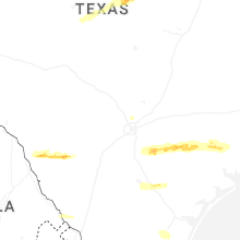
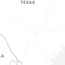

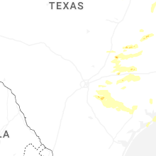

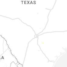


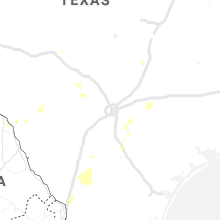


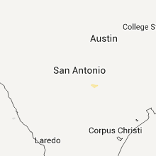


Connect with Interactive Hail Maps