

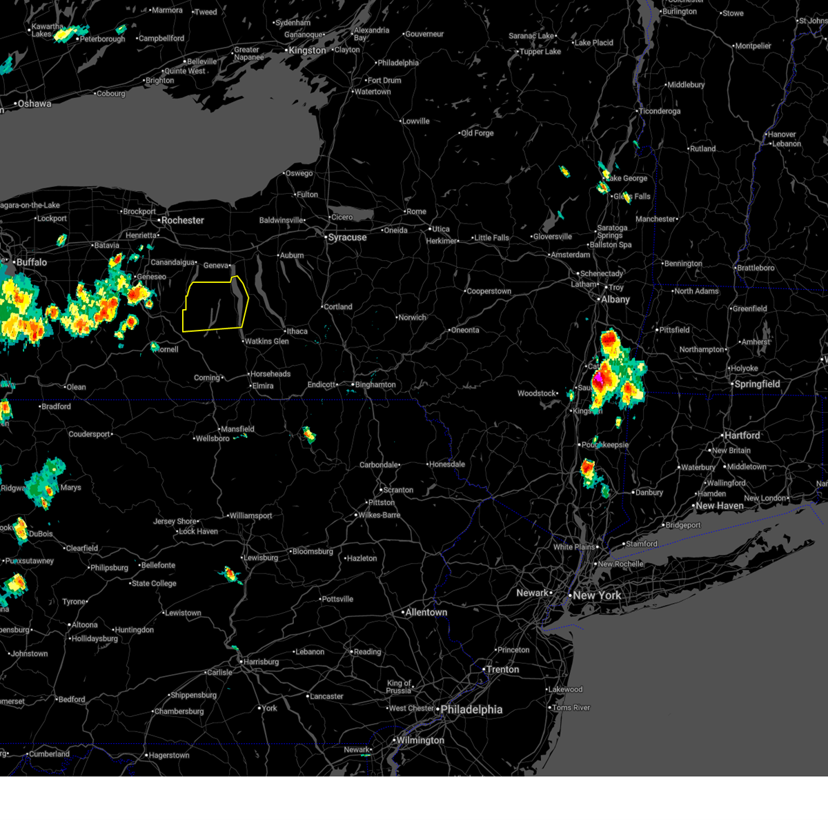
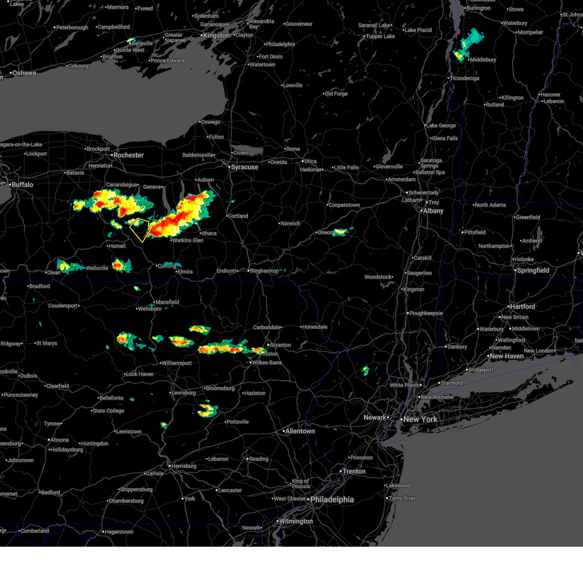
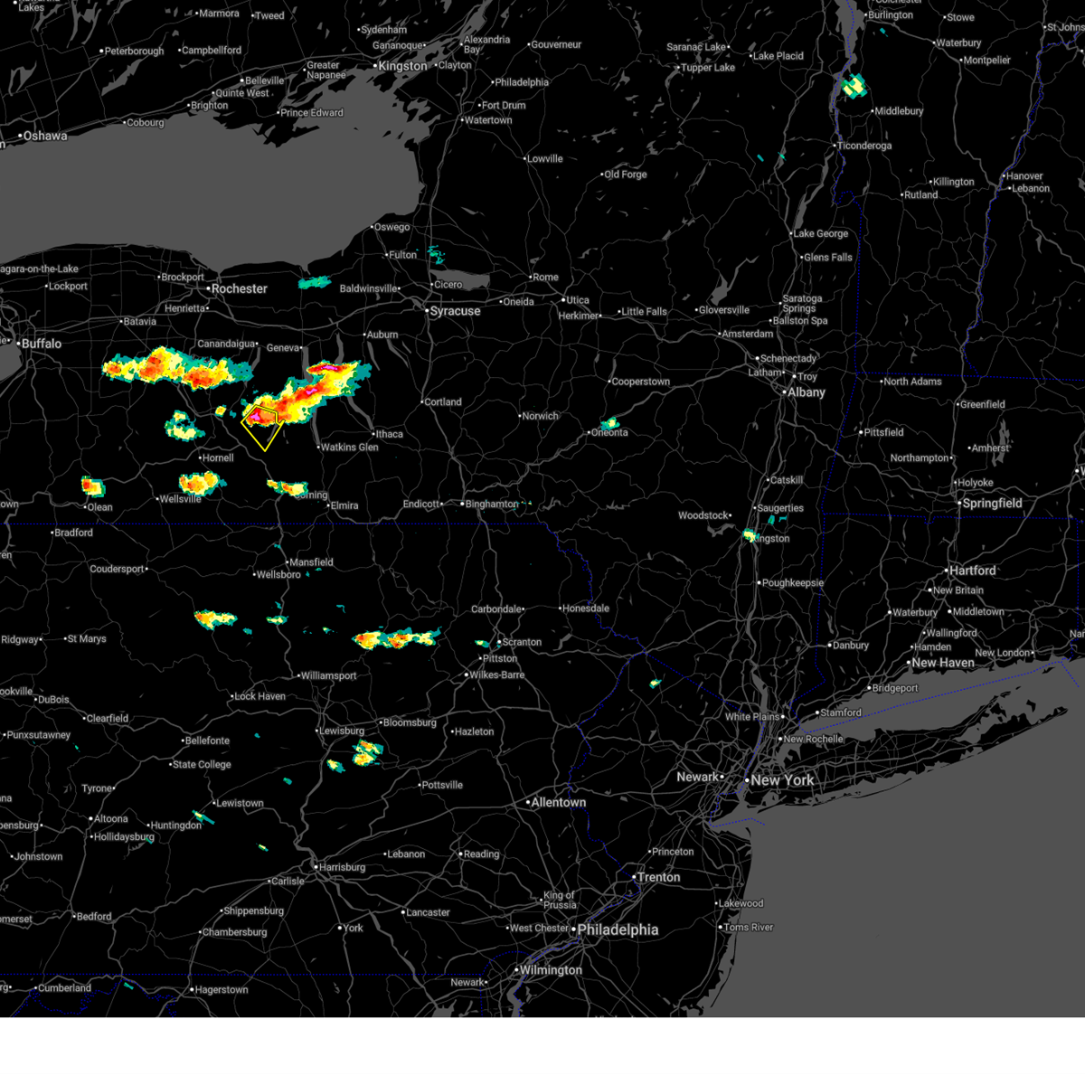
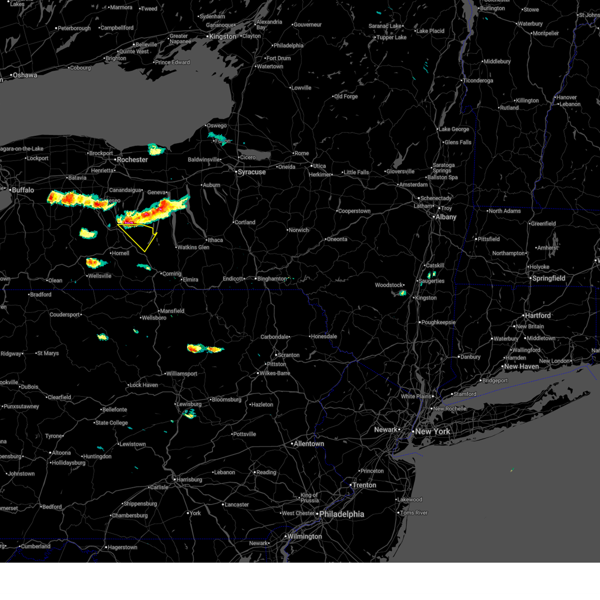
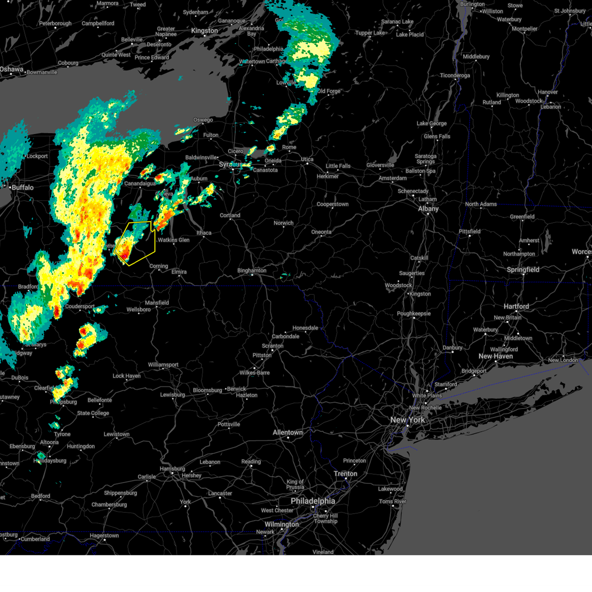
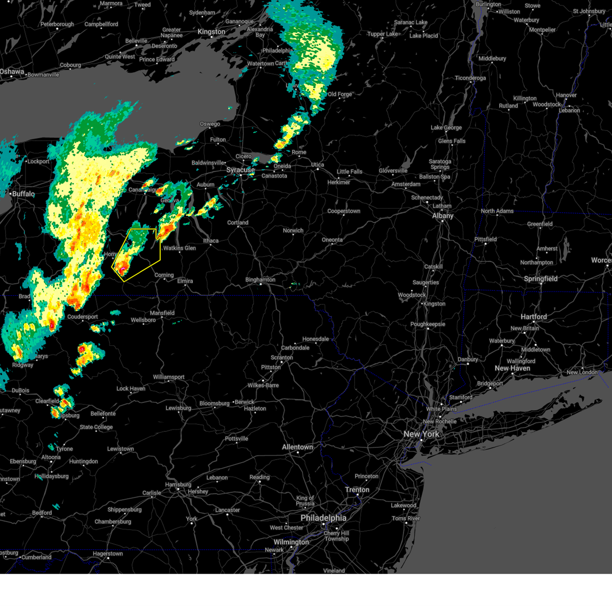
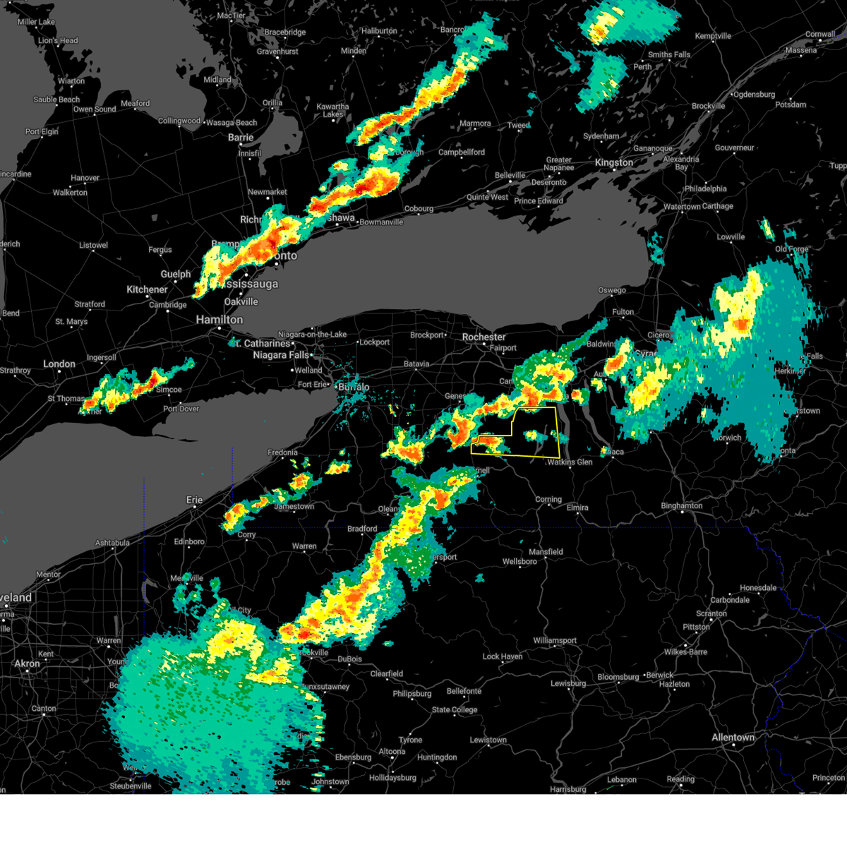
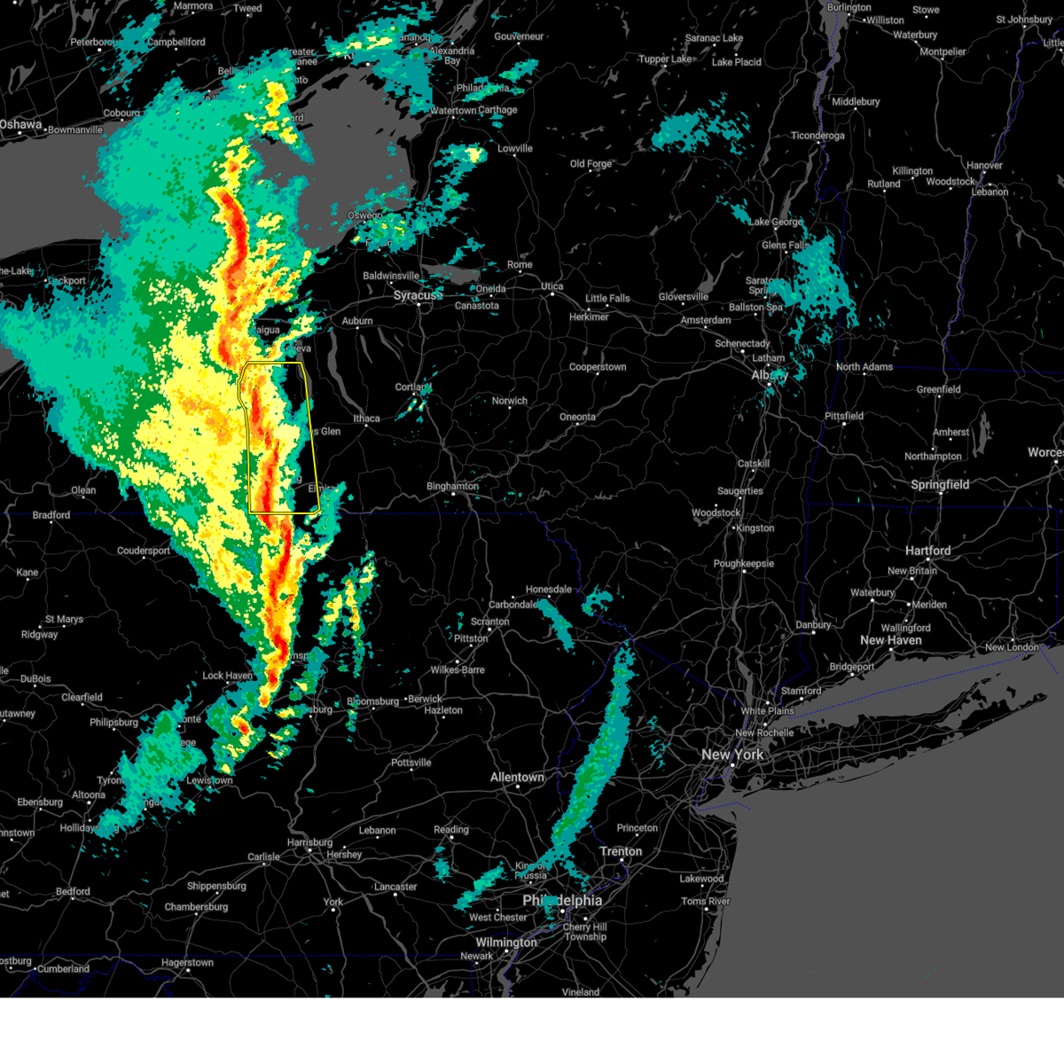
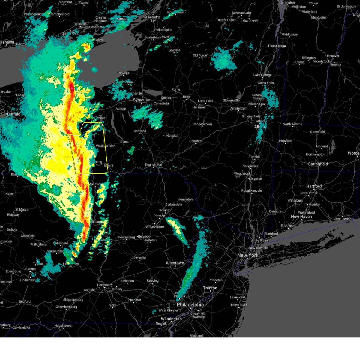
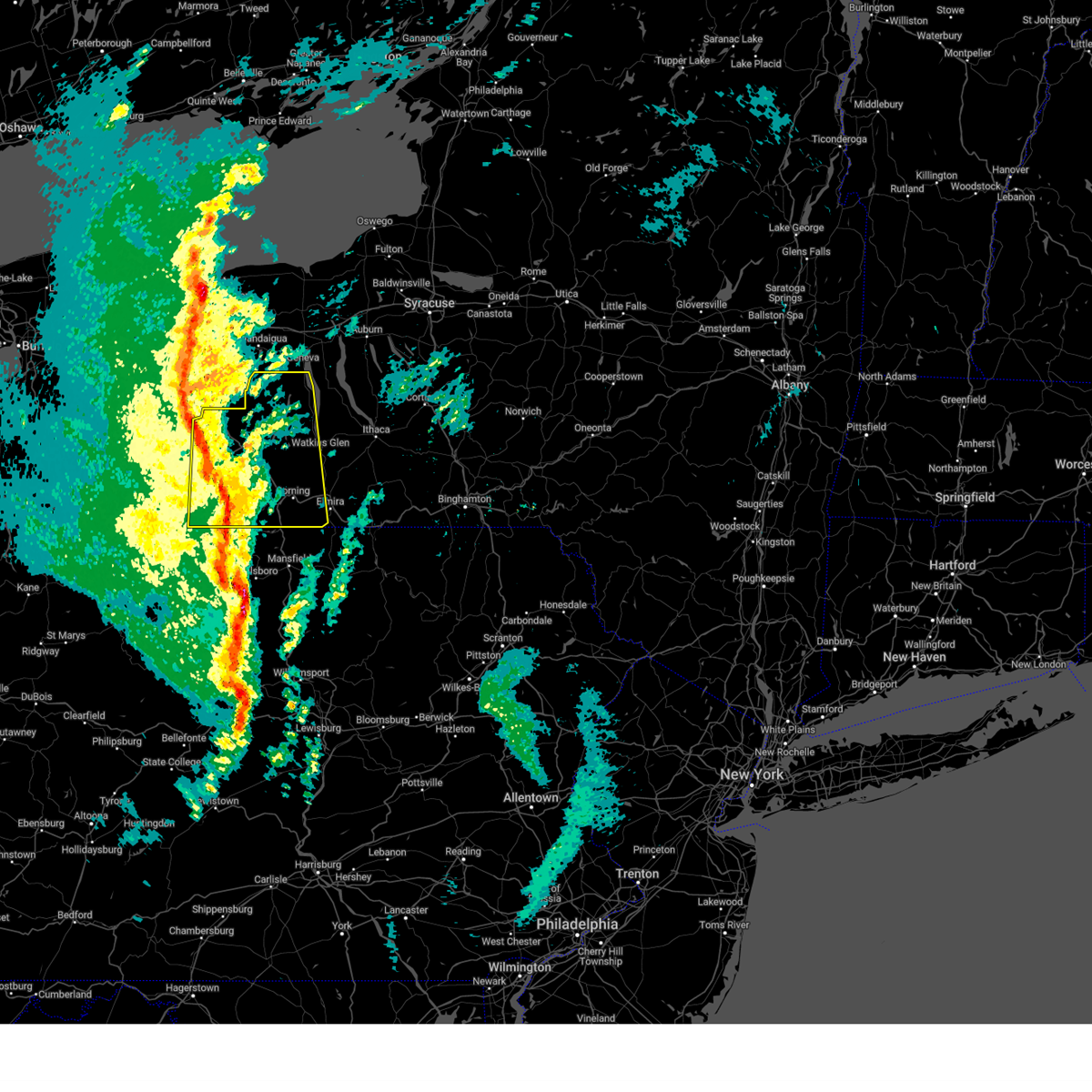
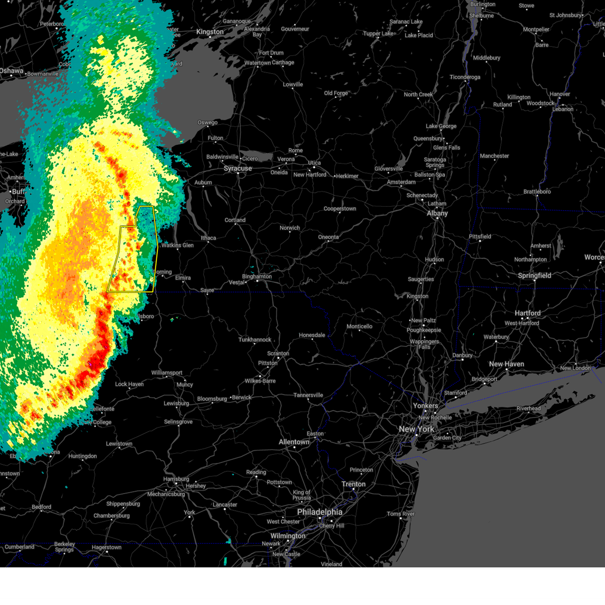
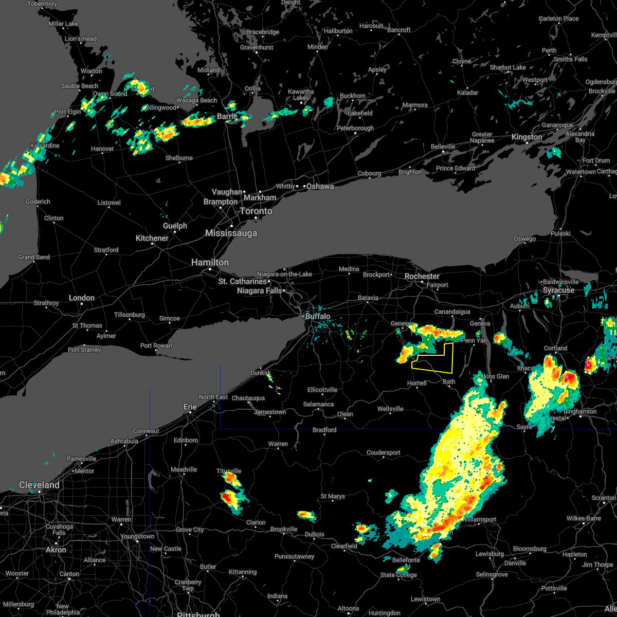
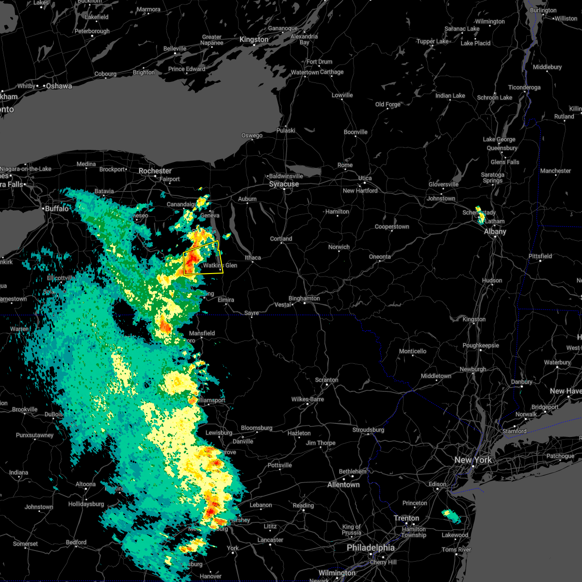
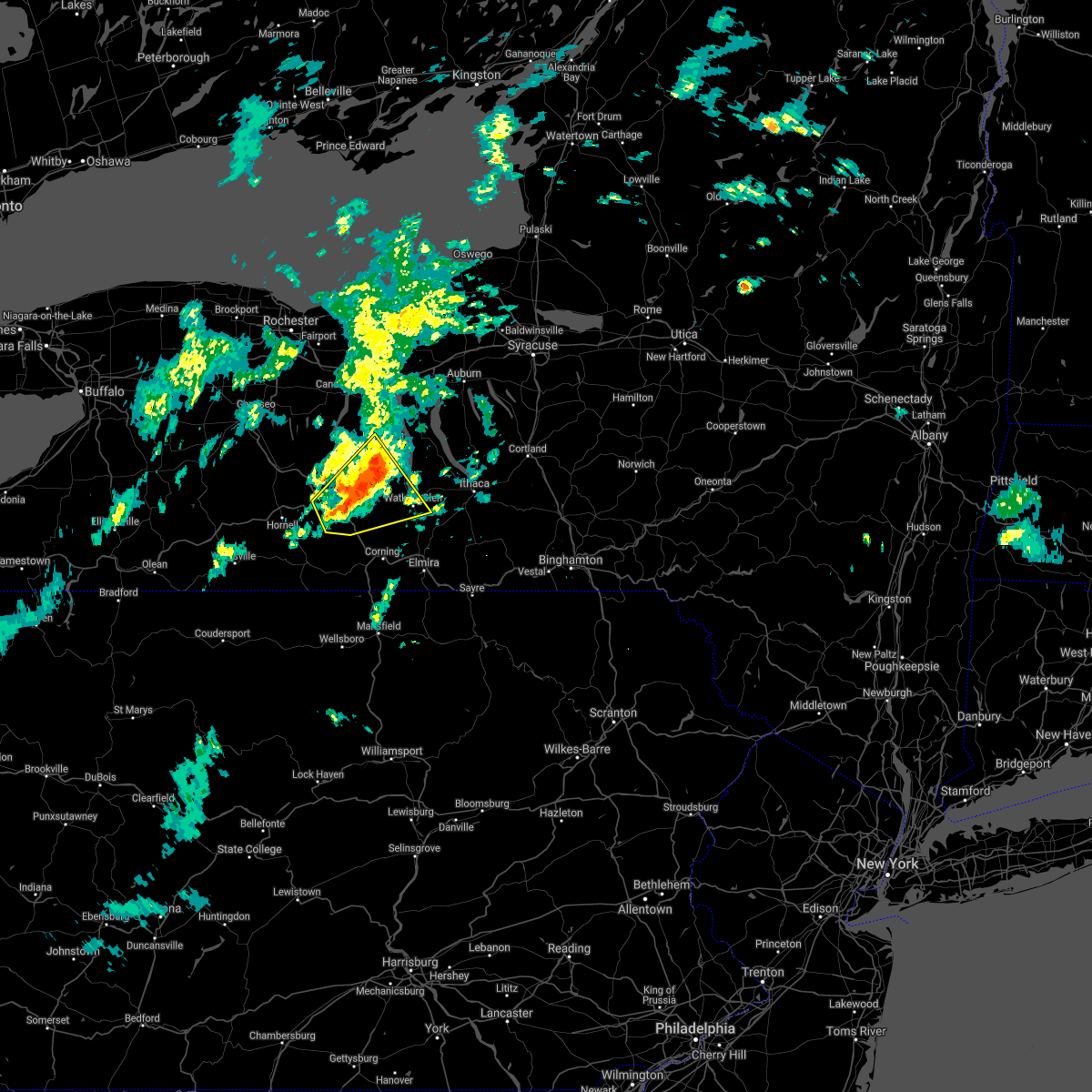
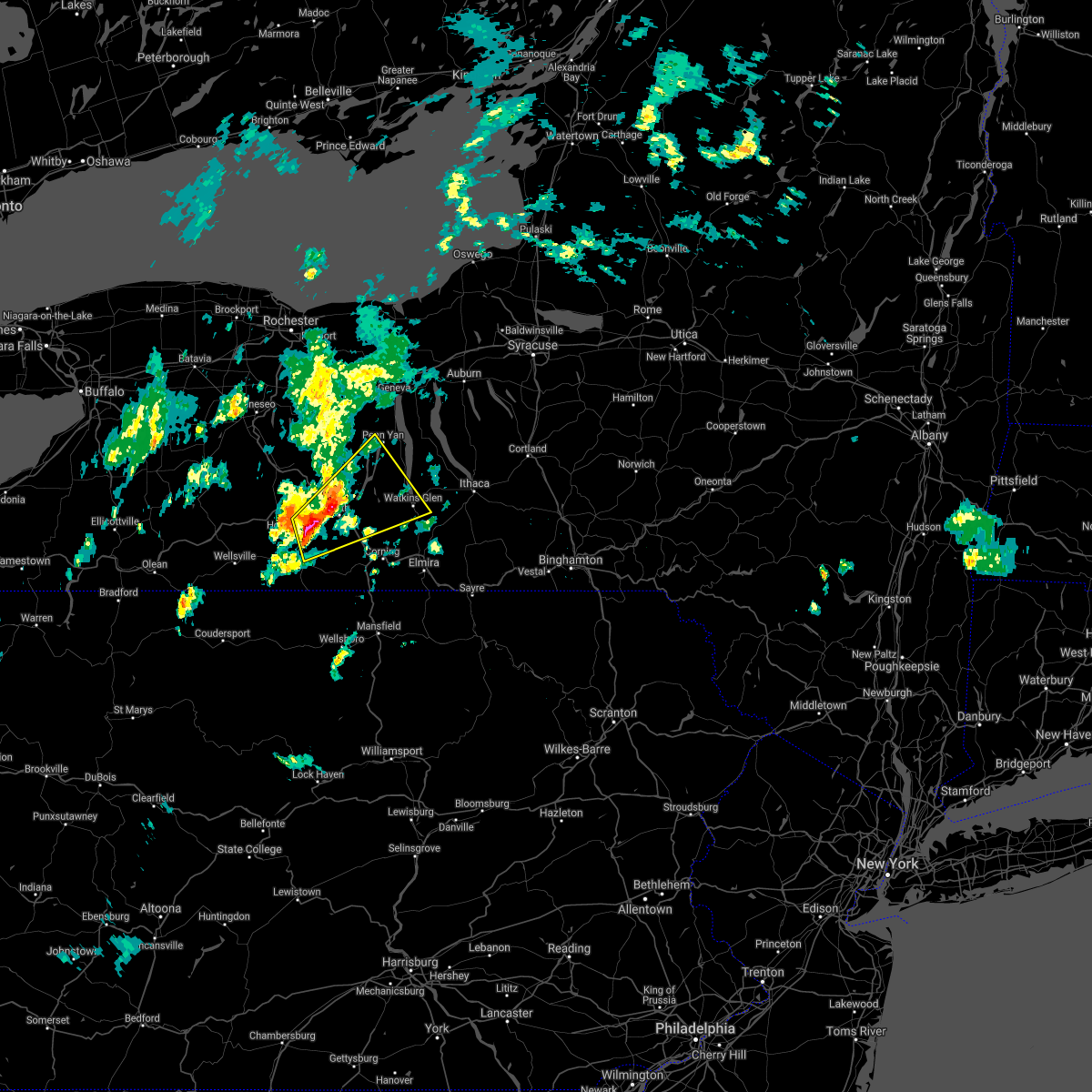
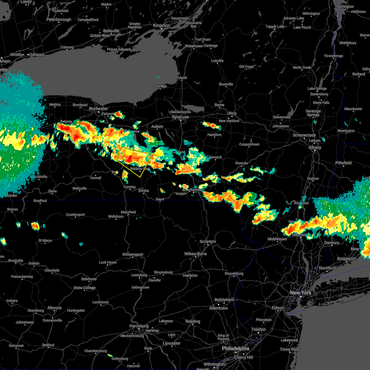
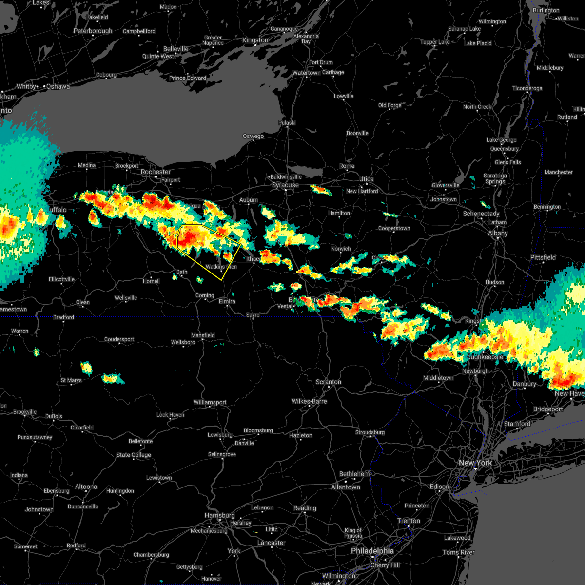
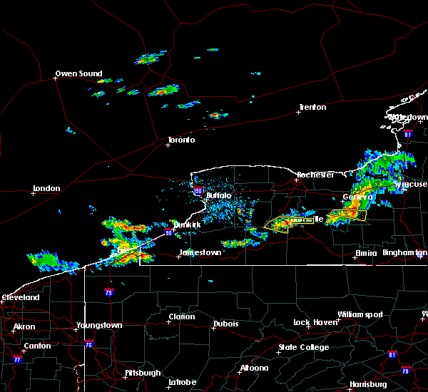
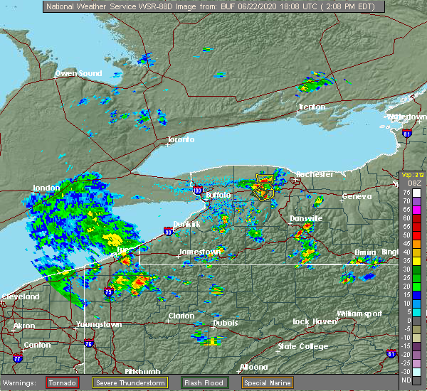
Hail Map for Prattsburgh, NY
The Prattsburgh, NY area has had 5 reports of on-the-ground hail by trained spotters, and has been under severe weather warnings 13 times during the past 12 months. Doppler radar has detected hail at or near Prattsburgh, NY on 20 occasions, including 2 occasions during the past year.
| Name: | Prattsburgh, NY |
| Where Located: | 68.4 miles WSW of Syracuse, NY |
| Map: | Google Map for Prattsburgh, NY |
| Population: | 656 |
| Housing Units: | 308 |
| More Info: | Search Google for Prattsburgh, NY |
5
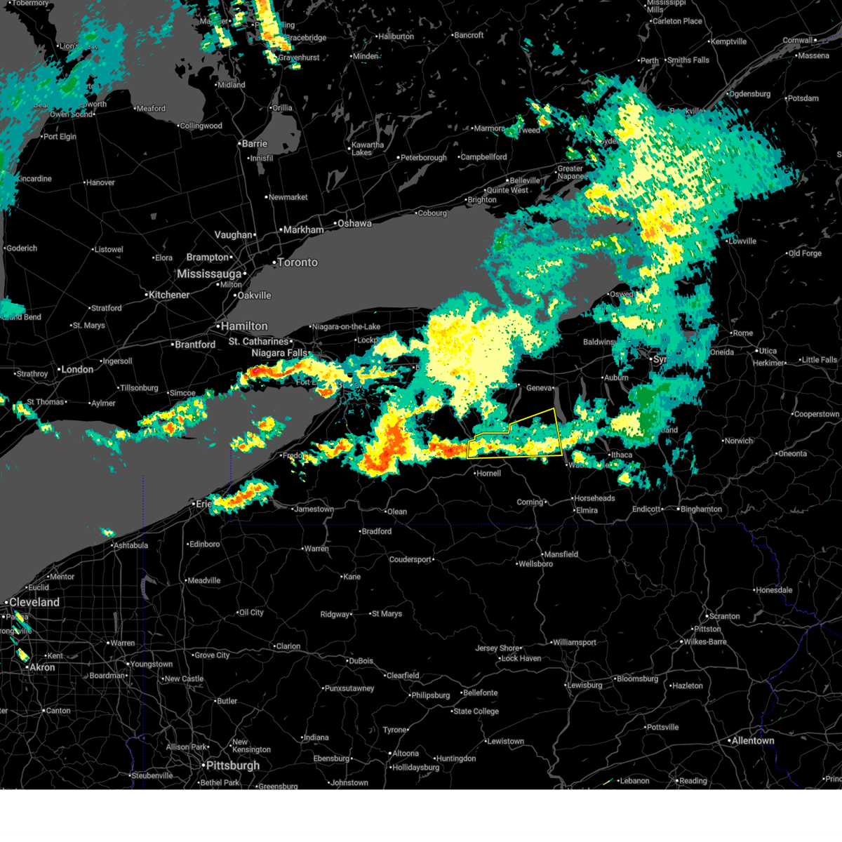
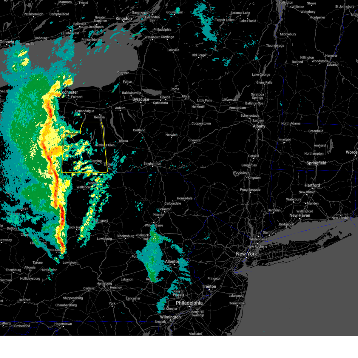
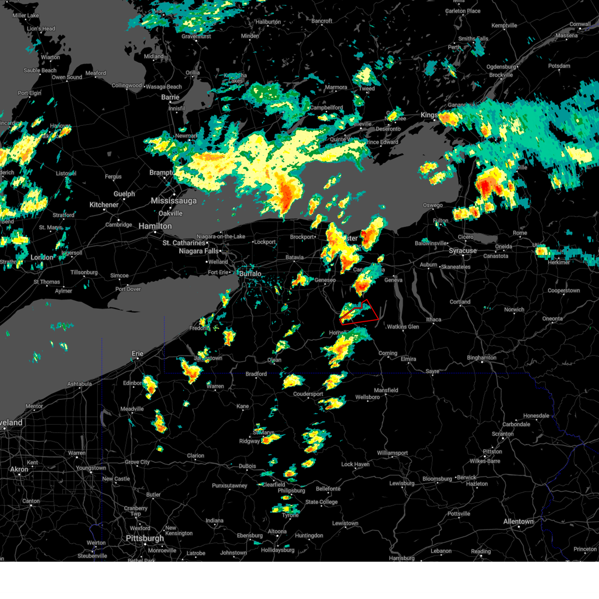
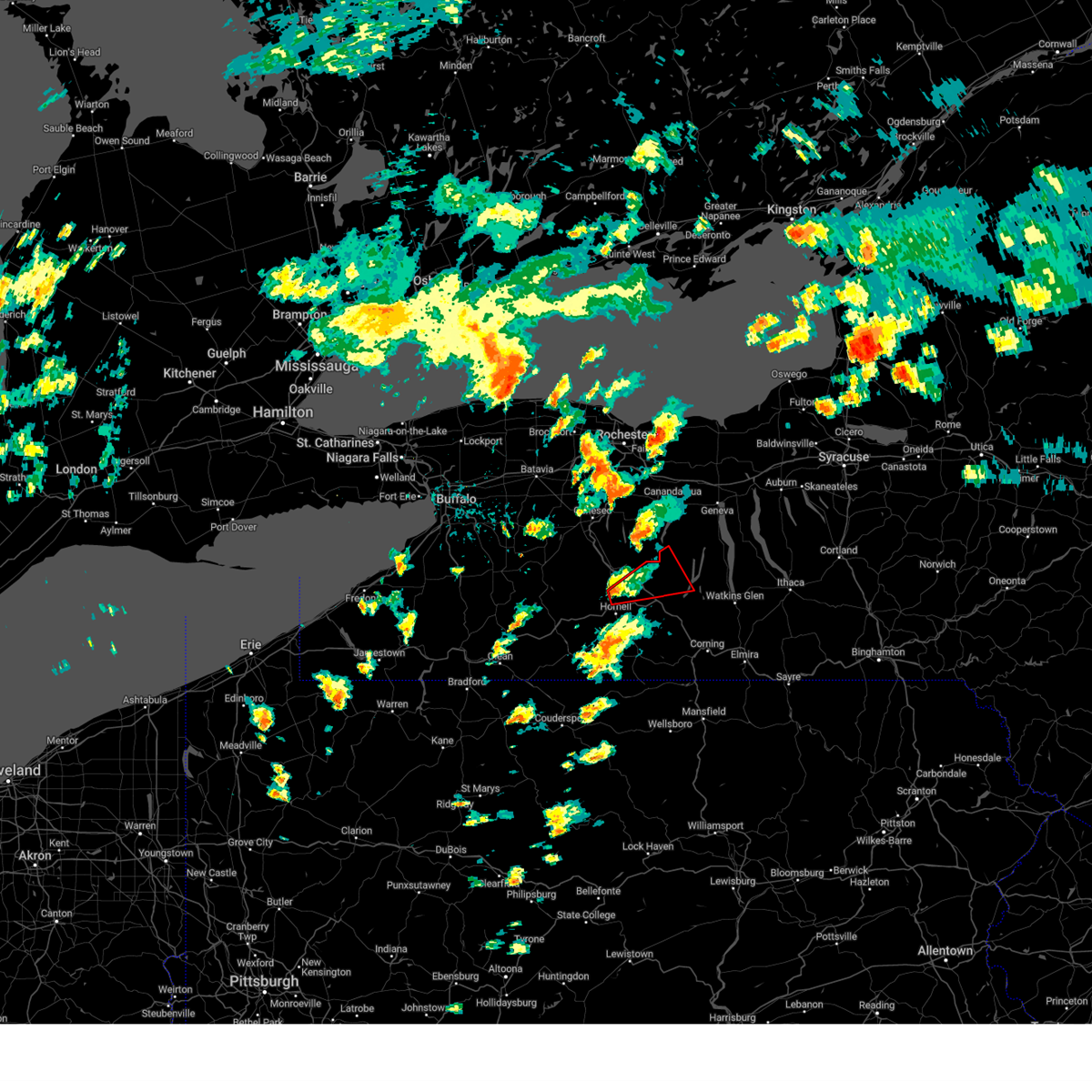
The Top Recent Hail Date for Prattsburgh, NY is Tuesday, March 31, 2026 (1st out of 20)

Hail and Wind Damage Spotted near Prattsburgh, NY
| Date / Time | Report Details |
|---|---|
| 6/11/2026 3:53 PM EDT |
 At 352 pm edt, a severe thunderstorm was located over italy, or 11 miles southwest of penn yan, moving east at 25 mph (radar indicated). Hazards include 60 mph wind gusts and quarter size hail. Hail damage to vehicles is expected. expect wind damage to roofs, siding, and trees. Locations impacted include, penn yan, starkey, benton, urbana, potter, dundee, middlesex, pulteney, italy, and wayne. At 352 pm edt, a severe thunderstorm was located over italy, or 11 miles southwest of penn yan, moving east at 25 mph (radar indicated). Hazards include 60 mph wind gusts and quarter size hail. Hail damage to vehicles is expected. expect wind damage to roofs, siding, and trees. Locations impacted include, penn yan, starkey, benton, urbana, potter, dundee, middlesex, pulteney, italy, and wayne.
|
| 6/11/2026 3:50 PM EDT |
 Svrbgm the national weather service in binghamton has issued a * severe thunderstorm warning for, southwestern seneca county in central new york, northwestern schuyler county in central new york, yates county in central new york, northeastern steuben county in central new york, * until 445 pm edt. * at 349 pm edt, a severe thunderstorm was located over italy, or 13 miles southwest of penn yan, moving east at 25 mph (radar indicated). Hazards include 60 mph wind gusts and quarter size hail. Hail damage to vehicles is expected. Expect wind damage to roofs, siding, and trees. Svrbgm the national weather service in binghamton has issued a * severe thunderstorm warning for, southwestern seneca county in central new york, northwestern schuyler county in central new york, yates county in central new york, northeastern steuben county in central new york, * until 445 pm edt. * at 349 pm edt, a severe thunderstorm was located over italy, or 13 miles southwest of penn yan, moving east at 25 mph (radar indicated). Hazards include 60 mph wind gusts and quarter size hail. Hail damage to vehicles is expected. Expect wind damage to roofs, siding, and trees.
|
| 4/15/2026 8:52 PM EDT |
 Svrbgm the national weather service in binghamton has issued a * severe thunderstorm warning for, southwestern seneca county in central new york, western schuyler county in central new york, yates county in central new york, southwestern cayuga county in central new york, northwestern chemung county in central new york, steuben county in central new york, * until 945 pm edt. * at 851 pm edt, severe thunderstorms were located along a line extending from near honeoye to genesee, moving east at 55 mph (radar indicated). Hazards include 60 mph wind gusts. expect damage to roofs, siding, and trees Svrbgm the national weather service in binghamton has issued a * severe thunderstorm warning for, southwestern seneca county in central new york, western schuyler county in central new york, yates county in central new york, southwestern cayuga county in central new york, northwestern chemung county in central new york, steuben county in central new york, * until 945 pm edt. * at 851 pm edt, severe thunderstorms were located along a line extending from near honeoye to genesee, moving east at 55 mph (radar indicated). Hazards include 60 mph wind gusts. expect damage to roofs, siding, and trees
|
| 3/31/2026 4:29 PM EDT |
 At 429 pm edt, a severe thunderstorm was located over prattsburg, or 14 miles west of dundee, moving east at 45 mph (radar indicated). Hazards include two inch hail and 60 mph wind gusts. People and animals outdoors will be injured. expect hail damage to roofs, siding, windows, and vehicles. expect wind damage to roofs, siding, and trees. Locations impacted include, urbana, dundee, pulteney, wheeler, wayne, guyanoga, branchport, himrod, porter corner, and keuka park. At 429 pm edt, a severe thunderstorm was located over prattsburg, or 14 miles west of dundee, moving east at 45 mph (radar indicated). Hazards include two inch hail and 60 mph wind gusts. People and animals outdoors will be injured. expect hail damage to roofs, siding, windows, and vehicles. expect wind damage to roofs, siding, and trees. Locations impacted include, urbana, dundee, pulteney, wheeler, wayne, guyanoga, branchport, himrod, porter corner, and keuka park.
|
| 3/31/2026 4:12 PM EDT |
 At 412 pm edt, a severe thunderstorm was located over cohocton, or 9 miles southeast of dansville, moving east at 45 mph (radar indicated). Hazards include two inch hail and 60 mph wind gusts. People and animals outdoors will be injured. expect hail damage to roofs, siding, windows, and vehicles. expect wind damage to roofs, siding, and trees. Locations impacted include, penn yan, urbana, dundee, pulteney, wheeler, italy, wayne, cohocton, guyanoga, and branchport. At 412 pm edt, a severe thunderstorm was located over cohocton, or 9 miles southeast of dansville, moving east at 45 mph (radar indicated). Hazards include two inch hail and 60 mph wind gusts. People and animals outdoors will be injured. expect hail damage to roofs, siding, windows, and vehicles. expect wind damage to roofs, siding, and trees. Locations impacted include, penn yan, urbana, dundee, pulteney, wheeler, italy, wayne, cohocton, guyanoga, and branchport.
|
| 3/31/2026 4:01 PM EDT |
 Svrbgm the national weather service in binghamton has issued a * severe thunderstorm warning for, northwestern schuyler county in central new york, yates county in central new york, northern steuben county in central new york, * until 500 pm edt. * at 401 pm edt, a severe thunderstorm was located over south dansville, or near dansville, moving east at 50 mph (radar indicated). Hazards include 60 mph wind gusts and quarter size hail. Hail damage to vehicles is expected. Expect wind damage to roofs, siding, and trees. Svrbgm the national weather service in binghamton has issued a * severe thunderstorm warning for, northwestern schuyler county in central new york, yates county in central new york, northern steuben county in central new york, * until 500 pm edt. * at 401 pm edt, a severe thunderstorm was located over south dansville, or near dansville, moving east at 50 mph (radar indicated). Hazards include 60 mph wind gusts and quarter size hail. Hail damage to vehicles is expected. Expect wind damage to roofs, siding, and trees.
|
| 1/9/2026 5:29 PM EST |
 The storms which prompted the warning have weakened below severe limits, and no longer pose an immediate threat to life or property. therefore, the warning will be allowed to expire. however, gusty winds are still possible with these thunderstorms. The storms which prompted the warning have weakened below severe limits, and no longer pose an immediate threat to life or property. therefore, the warning will be allowed to expire. however, gusty winds are still possible with these thunderstorms.
|
| 1/9/2026 4:37 PM EST |
 Svrbgm the national weather service in binghamton has issued a * severe thunderstorm warning for, yates county in central new york, steuben county in central new york, * until 530 pm est. * at 436 pm est, severe thunderstorms were located along a line extending from honeoye to near st. bonaventure, moving east at 40 mph (radar indicated). Hazards include 60 mph wind gusts. expect damage to roofs, siding, and trees Svrbgm the national weather service in binghamton has issued a * severe thunderstorm warning for, yates county in central new york, steuben county in central new york, * until 530 pm est. * at 436 pm est, severe thunderstorms were located along a line extending from honeoye to near st. bonaventure, moving east at 40 mph (radar indicated). Hazards include 60 mph wind gusts. expect damage to roofs, siding, and trees
|
| 7/10/2025 5:30 PM EDT |
 the severe thunderstorm warning has been cancelled and is no longer in effect the severe thunderstorm warning has been cancelled and is no longer in effect
|
| 7/10/2025 5:05 PM EDT |
 Svrbgm the national weather service in binghamton has issued a * severe thunderstorm warning for, northern steuben county in central new york, * until 600 pm edt. * at 504 pm edt, a severe thunderstorm was located near haskinville, or 10 miles northeast of hornell, moving east at 25 mph (radar indicated). Hazards include 60 mph wind gusts and quarter size hail. Hail damage to vehicles is expected. Expect wind damage to roofs, siding, and trees. Svrbgm the national weather service in binghamton has issued a * severe thunderstorm warning for, northern steuben county in central new york, * until 600 pm edt. * at 504 pm edt, a severe thunderstorm was located near haskinville, or 10 miles northeast of hornell, moving east at 25 mph (radar indicated). Hazards include 60 mph wind gusts and quarter size hail. Hail damage to vehicles is expected. Expect wind damage to roofs, siding, and trees.
|
| 7/3/2025 1:36 PM EDT |
 The storm which prompted the warning has moved out of the area. therefore, the warning will be allowed to expire. a severe thunderstorm watch remains in effect until 1000 pm edt for central new york. The storm which prompted the warning has moved out of the area. therefore, the warning will be allowed to expire. a severe thunderstorm watch remains in effect until 1000 pm edt for central new york.
|
| 7/3/2025 1:15 PM EDT |
 At 115 pm edt, a severe thunderstorm was located over prattsburg, or 15 miles southwest of penn yan, moving southeast at 30 mph (radar indicated). Hazards include 60 mph wind gusts and quarter size hail. Hail damage to vehicles is expected. expect wind damage to roofs, siding, and trees. Locations impacted include, urbana, pulteney, hammondsport, prattsburg, rheims, and keuka. At 115 pm edt, a severe thunderstorm was located over prattsburg, or 15 miles southwest of penn yan, moving southeast at 30 mph (radar indicated). Hazards include 60 mph wind gusts and quarter size hail. Hail damage to vehicles is expected. expect wind damage to roofs, siding, and trees. Locations impacted include, urbana, pulteney, hammondsport, prattsburg, rheims, and keuka.
|
| 7/3/2025 12:56 PM EDT |
 Svrbgm the national weather service in binghamton has issued a * severe thunderstorm warning for, northeastern steuben county in central new york, * until 145 pm edt. * at 1256 pm edt, a severe thunderstorm was located near naples, or 11 miles east of dansville, moving southeast at 30 mph (radar indicated). Hazards include 60 mph wind gusts and quarter size hail. Hail damage to vehicles is expected. Expect wind damage to roofs, siding, and trees. Svrbgm the national weather service in binghamton has issued a * severe thunderstorm warning for, northeastern steuben county in central new york, * until 145 pm edt. * at 1256 pm edt, a severe thunderstorm was located near naples, or 11 miles east of dansville, moving southeast at 30 mph (radar indicated). Hazards include 60 mph wind gusts and quarter size hail. Hail damage to vehicles is expected. Expect wind damage to roofs, siding, and trees.
|
| 6/9/2025 6:30 PM EDT |
 At 630 pm edt, a severe thunderstorm was located near west cameron, or 10 miles east of hornell, moving northeast at 30 mph (radar indicated). Hazards include 60 mph wind gusts and half dollar size hail. Hail damage to vehicles is expected. expect wind damage to roofs, siding, and trees. Locations impacted include, bath, urbana, howard, pulteney, wheeler, wayne, avoca, cameron, bradford, and savona. At 630 pm edt, a severe thunderstorm was located near west cameron, or 10 miles east of hornell, moving northeast at 30 mph (radar indicated). Hazards include 60 mph wind gusts and half dollar size hail. Hail damage to vehicles is expected. expect wind damage to roofs, siding, and trees. Locations impacted include, bath, urbana, howard, pulteney, wheeler, wayne, avoca, cameron, bradford, and savona.
|
| 6/9/2025 6:21 PM EDT |
 Svrbgm the national weather service in binghamton has issued a * severe thunderstorm warning for, central steuben county in central new york, * until 715 pm edt. * at 621 pm edt, a severe thunderstorm was located near canisteo, or 9 miles southeast of hornell, moving northeast at 30 mph (radar indicated). Hazards include 60 mph wind gusts and quarter size hail. Hail damage to vehicles is expected. Expect wind damage to roofs, siding, and trees. Svrbgm the national weather service in binghamton has issued a * severe thunderstorm warning for, central steuben county in central new york, * until 715 pm edt. * at 621 pm edt, a severe thunderstorm was located near canisteo, or 9 miles southeast of hornell, moving northeast at 30 mph (radar indicated). Hazards include 60 mph wind gusts and quarter size hail. Hail damage to vehicles is expected. Expect wind damage to roofs, siding, and trees.
|
| 6/5/2025 6:36 PM EDT | Trees and wires down (time estimated using radar in steuben county NY, 0.5 miles WNW of Prattsburgh, NY |
| 6/5/2025 4:40 PM EDT |
 Svrbgm the national weather service in binghamton has issued a * severe thunderstorm warning for, northwestern schuyler county in central new york, southern seneca county in central new york, northeastern steuben county in central new york, southern yates county in central new york, * until 545 pm edt. * at 440 pm edt, a severe thunderstorm was located over prattsburg, or 14 miles west of dundee, moving east at 25 mph (radar indicated). Hazards include 70 mph wind gusts and ping pong ball size hail. People and animals outdoors will be injured. expect hail damage to roofs, siding, windows, and vehicles. expect considerable tree damage. Wind damage is also likely to mobile homes, roofs, and outbuildings. Svrbgm the national weather service in binghamton has issued a * severe thunderstorm warning for, northwestern schuyler county in central new york, southern seneca county in central new york, northeastern steuben county in central new york, southern yates county in central new york, * until 545 pm edt. * at 440 pm edt, a severe thunderstorm was located over prattsburg, or 14 miles west of dundee, moving east at 25 mph (radar indicated). Hazards include 70 mph wind gusts and ping pong ball size hail. People and animals outdoors will be injured. expect hail damage to roofs, siding, windows, and vehicles. expect considerable tree damage. Wind damage is also likely to mobile homes, roofs, and outbuildings.
|
| 6/5/2025 4:36 PM EDT | Corrects the time of the previous tstm wnd dmg report from prattsburg. trees and wires down (time estimated using radar in steuben county NY, 0.5 miles WNW of Prattsburgh, NY |
| 6/5/2025 4:36 PM EDT | Hen Egg sized hail reported 0.5 miles WNW of Prattsburgh, NY, picture shared with us of 1.5 to 2 inch hail. |
| 6/5/2025 4:24 PM EDT |
 At 424 pm edt, a severe thunderstorm was located over prattsburg, or 12 miles southwest of penn yan, moving east at 25 mph (radar indicated). Hazards include 70 mph wind gusts and half dollar size hail. Hail damage to vehicles is expected. expect considerable tree damage. wind damage is also likely to mobile homes, roofs, and outbuildings. Locations impacted include, penn yan, dundee, urbana, pulteney, italy, dresden, guyanoga, branchport, porter corner, mays mills, keuka park, and bluff point. At 424 pm edt, a severe thunderstorm was located over prattsburg, or 12 miles southwest of penn yan, moving east at 25 mph (radar indicated). Hazards include 70 mph wind gusts and half dollar size hail. Hail damage to vehicles is expected. expect considerable tree damage. wind damage is also likely to mobile homes, roofs, and outbuildings. Locations impacted include, penn yan, dundee, urbana, pulteney, italy, dresden, guyanoga, branchport, porter corner, mays mills, keuka park, and bluff point.
|
| 6/5/2025 4:02 PM EDT |
 Svrbgm the national weather service in binghamton has issued a * severe thunderstorm warning for, northwestern schuyler county in central new york, northern steuben county in central new york, central yates county in central new york, * until 445 pm edt. * at 401 pm edt, a severe thunderstorm was located near cohocton, or 13 miles east of dansville, moving east at 25 mph (radar indicated). Hazards include 60 mph wind gusts and quarter size hail. Hail damage to vehicles is expected. Expect wind damage to roofs, siding, and trees. Svrbgm the national weather service in binghamton has issued a * severe thunderstorm warning for, northwestern schuyler county in central new york, northern steuben county in central new york, central yates county in central new york, * until 445 pm edt. * at 401 pm edt, a severe thunderstorm was located near cohocton, or 13 miles east of dansville, moving east at 25 mph (radar indicated). Hazards include 60 mph wind gusts and quarter size hail. Hail damage to vehicles is expected. Expect wind damage to roofs, siding, and trees.
|
| 4/29/2025 5:58 PM EDT |
 Svrbgm the national weather service in binghamton has issued a * severe thunderstorm warning for, northwestern schuyler county in central new york, yates county in central new york, northern steuben county in central new york, * until 645 pm edt. * at 558 pm edt, a severe thunderstorm was located near dansville, moving east at 55 mph (radar indicated). Hazards include 60 mph wind gusts and quarter size hail. Hail damage to vehicles is expected. Expect wind damage to roofs, siding, and trees. Svrbgm the national weather service in binghamton has issued a * severe thunderstorm warning for, northwestern schuyler county in central new york, yates county in central new york, northern steuben county in central new york, * until 645 pm edt. * at 558 pm edt, a severe thunderstorm was located near dansville, moving east at 55 mph (radar indicated). Hazards include 60 mph wind gusts and quarter size hail. Hail damage to vehicles is expected. Expect wind damage to roofs, siding, and trees.
|
| 3/16/2025 3:51 PM EDT |
 At 350 pm edt, severe thunderstorms were located along a line extending from near bristol to near mansfield, moving northeast at 60 mph (law enforcement). Hazards include trees downed from winds. Expect damage to roofs, siding, and trees. Locations impacted include, keuka, bradford, crosby, himrod, porter corner, mays mills, starkey, big flats airport, webb mills, and milo mills. At 350 pm edt, severe thunderstorms were located along a line extending from near bristol to near mansfield, moving northeast at 60 mph (law enforcement). Hazards include trees downed from winds. Expect damage to roofs, siding, and trees. Locations impacted include, keuka, bradford, crosby, himrod, porter corner, mays mills, starkey, big flats airport, webb mills, and milo mills.
|
| 3/16/2025 3:40 PM EDT |
 At 340 pm edt, severe thunderstorms were located along a line extending from near honeoye to near wellsboro, moving northeast at 60 mph (law enforcement). Hazards include 60 mph wind gusts. tree damage has been reported in the path of these storms. Expect damage to roofs, siding, and trees. Locations impacted include, bradford, bath, himrod, porter corner, mays mills, big flats airport, howard, hornby, italy hill, and potter. At 340 pm edt, severe thunderstorms were located along a line extending from near honeoye to near wellsboro, moving northeast at 60 mph (law enforcement). Hazards include 60 mph wind gusts. tree damage has been reported in the path of these storms. Expect damage to roofs, siding, and trees. Locations impacted include, bradford, bath, himrod, porter corner, mays mills, big flats airport, howard, hornby, italy hill, and potter.
|
| 3/16/2025 3:28 PM EDT |
 At 327 pm edt, severe thunderstorms were located along a line extending from near conesus to near leonard harrison state park, moving northeast at 60 mph (new york state mesonet in grove reported a 58 mph wind gust). Hazards include 60 mph wind gusts. Expect damage to roofs, siding, and trees. Locations impacted include, bradford, bath, young hickory, himrod, porter corner, mays mills, big flats airport, howard, hornby, and italy hill. At 327 pm edt, severe thunderstorms were located along a line extending from near conesus to near leonard harrison state park, moving northeast at 60 mph (new york state mesonet in grove reported a 58 mph wind gust). Hazards include 60 mph wind gusts. Expect damage to roofs, siding, and trees. Locations impacted include, bradford, bath, young hickory, himrod, porter corner, mays mills, big flats airport, howard, hornby, and italy hill.
|
| 3/16/2025 3:05 PM EDT |
 Svrbgm the national weather service in binghamton has issued a * severe thunderstorm warning for, western schuyler county in central new york, yates county in central new york, western chemung county in central new york, steuben county in central new york, * until 400 pm edt. * at 304 pm edt, severe thunderstorms were located along a line extending from near portageville to near cross fork, moving northeast at 60 mph (radar indicated). Hazards include 60 mph wind gusts. expect damage to roofs, siding, and trees Svrbgm the national weather service in binghamton has issued a * severe thunderstorm warning for, western schuyler county in central new york, yates county in central new york, western chemung county in central new york, steuben county in central new york, * until 400 pm edt. * at 304 pm edt, severe thunderstorms were located along a line extending from near portageville to near cross fork, moving northeast at 60 mph (radar indicated). Hazards include 60 mph wind gusts. expect damage to roofs, siding, and trees
|
| 7/15/2024 5:33 PM EDT |
 At 532 pm edt, severe thunderstorms were located along a line extending from near waterloo to near branchport to sonora to lawrenceville, moving east at 45 mph (radar indicated). Hazards include 70 mph wind gusts and quarter size hail. Hail damage to vehicles is expected. expect considerable tree damage. wind damage is also likely to mobile homes, roofs, and outbuildings. Locations impacted include, elmira, corning, southport, big flats, horseheads, bath, penn yan, hector, elmira heights, and starkey. At 532 pm edt, severe thunderstorms were located along a line extending from near waterloo to near branchport to sonora to lawrenceville, moving east at 45 mph (radar indicated). Hazards include 70 mph wind gusts and quarter size hail. Hail damage to vehicles is expected. expect considerable tree damage. wind damage is also likely to mobile homes, roofs, and outbuildings. Locations impacted include, elmira, corning, southport, big flats, horseheads, bath, penn yan, hector, elmira heights, and starkey.
|
| 7/15/2024 5:09 PM EDT |
 Svrbgm the national weather service in binghamton has issued a * severe thunderstorm warning for, schuyler county in central new york, yates county in central new york, chemung county in central new york, steuben county in central new york, northwestern bradford county in northeastern pennsylvania, * until 615 pm edt. * at 509 pm edt, severe thunderstorms were located along a line extending from near rushville to near cohocton to near west cameron to near westfield, moving east at 45 mph (radar indicated). Hazards include 60 mph wind gusts and quarter size hail. Hail damage to vehicles is expected. Expect wind damage to roofs, siding, and trees. Svrbgm the national weather service in binghamton has issued a * severe thunderstorm warning for, schuyler county in central new york, yates county in central new york, chemung county in central new york, steuben county in central new york, northwestern bradford county in northeastern pennsylvania, * until 615 pm edt. * at 509 pm edt, severe thunderstorms were located along a line extending from near rushville to near cohocton to near west cameron to near westfield, moving east at 45 mph (radar indicated). Hazards include 60 mph wind gusts and quarter size hail. Hail damage to vehicles is expected. Expect wind damage to roofs, siding, and trees.
|
| 7/10/2024 2:42 PM EDT |
 Svrbgm the national weather service in binghamton has issued a * severe thunderstorm warning for, southwestern seneca county in central new york, yates county in central new york, north central steuben county in central new york, * until 330 pm edt. * at 242 pm edt, a severe thunderstorm was located near naples, or 16 miles east of dansville, moving northeast at 30 mph (radar indicated). Hazards include 60 mph wind gusts and penny size hail. expect damage to roofs, siding, and trees Svrbgm the national weather service in binghamton has issued a * severe thunderstorm warning for, southwestern seneca county in central new york, yates county in central new york, north central steuben county in central new york, * until 330 pm edt. * at 242 pm edt, a severe thunderstorm was located near naples, or 16 miles east of dansville, moving northeast at 30 mph (radar indicated). Hazards include 60 mph wind gusts and penny size hail. expect damage to roofs, siding, and trees
|
| 7/10/2024 2:24 PM EDT |
 At 224 pm edt, a severe thunderstorm capable of producing a tornado was located near cohocton, or 11 miles southeast of dansville, moving northeast at 30 mph (radar indicated rotation). Hazards include tornado. Flying debris will be dangerous to those caught without shelter. mobile homes will be damaged or destroyed. damage to roofs, windows, and vehicles will occur. tree damage is likely. this dangerous storm will be near, cohocton around 230 pm edt. Prattsburg around 240 pm edt. At 224 pm edt, a severe thunderstorm capable of producing a tornado was located near cohocton, or 11 miles southeast of dansville, moving northeast at 30 mph (radar indicated rotation). Hazards include tornado. Flying debris will be dangerous to those caught without shelter. mobile homes will be damaged or destroyed. damage to roofs, windows, and vehicles will occur. tree damage is likely. this dangerous storm will be near, cohocton around 230 pm edt. Prattsburg around 240 pm edt.
|
| 7/10/2024 2:14 PM EDT |
 Torbgm the national weather service in binghamton has issued a * tornado warning for, west central yates county in central new york, northern steuben county in central new york, * until 300 pm edt. * at 214 pm edt, a severe thunderstorm capable of producing a tornado was located over haskinville, or near hornell, moving northeast at 30 mph (radar indicated rotation). Hazards include tornado. Flying debris will be dangerous to those caught without shelter. mobile homes will be damaged or destroyed. damage to roofs, windows, and vehicles will occur. tree damage is likely. this dangerous storm will be near, cohocton and haskinville around 220 pm edt. Prattsburg around 240 pm edt. Torbgm the national weather service in binghamton has issued a * tornado warning for, west central yates county in central new york, northern steuben county in central new york, * until 300 pm edt. * at 214 pm edt, a severe thunderstorm capable of producing a tornado was located over haskinville, or near hornell, moving northeast at 30 mph (radar indicated rotation). Hazards include tornado. Flying debris will be dangerous to those caught without shelter. mobile homes will be damaged or destroyed. damage to roofs, windows, and vehicles will occur. tree damage is likely. this dangerous storm will be near, cohocton and haskinville around 220 pm edt. Prattsburg around 240 pm edt.
|
| 7/10/2024 2:07 PM EDT |
 Svrbgm the national weather service in binghamton has issued a * severe thunderstorm warning for, southwestern yates county in central new york, northwestern steuben county in central new york, * until 245 pm edt. * at 206 pm edt, a severe thunderstorm was located over arkport, or near hornell, moving northeast at 35 mph (radar indicated). Hazards include 60 mph wind gusts and nickel size hail. expect damage to roofs, siding, and trees Svrbgm the national weather service in binghamton has issued a * severe thunderstorm warning for, southwestern yates county in central new york, northwestern steuben county in central new york, * until 245 pm edt. * at 206 pm edt, a severe thunderstorm was located over arkport, or near hornell, moving northeast at 35 mph (radar indicated). Hazards include 60 mph wind gusts and nickel size hail. expect damage to roofs, siding, and trees
|
| 6/17/2024 4:33 PM EDT |
 Svrbgm the national weather service in binghamton has issued a * severe thunderstorm warning for, yates county in central new york, north central steuben county in central new york, * until 530 pm edt. * at 432 pm edt, a severe thunderstorm was located over naples, or 16 miles west of penn yan, moving east at 15 mph (radar indicated). Hazards include 60 mph wind gusts. expect damage to roofs, siding, and trees Svrbgm the national weather service in binghamton has issued a * severe thunderstorm warning for, yates county in central new york, north central steuben county in central new york, * until 530 pm edt. * at 432 pm edt, a severe thunderstorm was located over naples, or 16 miles west of penn yan, moving east at 15 mph (radar indicated). Hazards include 60 mph wind gusts. expect damage to roofs, siding, and trees
|
| 8/12/2023 2:27 PM EDT |
 At 227 pm edt, a severe thunderstorm was located over pulteney, or 12 miles west of dundee, moving east at 20 mph (radar indicated). Hazards include 60 mph wind gusts and quarter size hail. Hail damage to vehicles is expected. Expect wind damage to roofs, siding, and trees. At 227 pm edt, a severe thunderstorm was located over pulteney, or 12 miles west of dundee, moving east at 20 mph (radar indicated). Hazards include 60 mph wind gusts and quarter size hail. Hail damage to vehicles is expected. Expect wind damage to roofs, siding, and trees.
|
| 7/20/2023 9:38 PM EDT |
 At 937 pm edt, severe thunderstorms were located along a line extending from near vine valley to kanona to westfield, moving east at 35 mph (radar indicated). Hazards include 60 mph wind gusts. Expect damage to roofs, siding, and trees. locations impacted include, bath, campbell, urbana, canisteo, potter, addison, woodhull, middlesex, howard and jasper. hail threat, radar indicated max hail size, <. 75 in wind threat, radar indicated max wind gust, 60 mph. At 937 pm edt, severe thunderstorms were located along a line extending from near vine valley to kanona to westfield, moving east at 35 mph (radar indicated). Hazards include 60 mph wind gusts. Expect damage to roofs, siding, and trees. locations impacted include, bath, campbell, urbana, canisteo, potter, addison, woodhull, middlesex, howard and jasper. hail threat, radar indicated max hail size, <. 75 in wind threat, radar indicated max wind gust, 60 mph.
|
| 7/20/2023 8:51 PM EDT |
 At 851 pm edt, severe thunderstorms were located along a line extending from near perry to 10 miles west of arkport to near shinglehouse, moving east at 50 mph (radar indicated). Hazards include 60 mph wind gusts. expect damage to roofs, siding, and trees At 851 pm edt, severe thunderstorms were located along a line extending from near perry to 10 miles west of arkport to near shinglehouse, moving east at 50 mph (radar indicated). Hazards include 60 mph wind gusts. expect damage to roofs, siding, and trees
|
| 6/26/2023 5:10 PM EDT |
 At 510 pm edt, a severe thunderstorm was located over italy, or 10 miles southwest of penn yan, moving north at 30 mph (radar indicated). Hazards include 60 mph wind gusts and quarter size hail. Hail damage to vehicles is expected. Expect wind damage to roofs, siding, and trees. At 510 pm edt, a severe thunderstorm was located over italy, or 10 miles southwest of penn yan, moving north at 30 mph (radar indicated). Hazards include 60 mph wind gusts and quarter size hail. Hail damage to vehicles is expected. Expect wind damage to roofs, siding, and trees.
|
| 4/1/2023 4:27 PM EDT |
 At 427 pm edt, severe thunderstorms were located along a line extending from 7 miles north of sodus to millport, moving east at 50 mph (radar indicated). Hazards include 60 mph wind gusts and penny size hail. Expect damage to roofs, siding, and trees. locations impacted include, ithaca, auburn, seneca falls, bath, newfield, waterloo, penn yan, hector, romulus and fayette. hail threat, radar indicated max hail size, 0. 75 in wind threat, observed max wind gust, 60 mph. At 427 pm edt, severe thunderstorms were located along a line extending from 7 miles north of sodus to millport, moving east at 50 mph (radar indicated). Hazards include 60 mph wind gusts and penny size hail. Expect damage to roofs, siding, and trees. locations impacted include, ithaca, auburn, seneca falls, bath, newfield, waterloo, penn yan, hector, romulus and fayette. hail threat, radar indicated max hail size, 0. 75 in wind threat, observed max wind gust, 60 mph.
|
| 4/1/2023 3:54 PM EDT |
 The severe thunderstorm warning for western seneca, western schuyler, yates and northern steuben counties will expire at 400 pm edt, the storms which prompted the warning are moving out of western steuben county. therefore, the warning will be allowed to expire but a new warning was issued in its place. gusty winds are still possible with these thunderstorms a severe thunderstorm watch remains in effect until 800 pm edt for central new york. remember, a severe thunderstorm warning still remains in effect for seneca, schuyler, yates, and steuben counties until 4:45 pm edt. The severe thunderstorm warning for western seneca, western schuyler, yates and northern steuben counties will expire at 400 pm edt, the storms which prompted the warning are moving out of western steuben county. therefore, the warning will be allowed to expire but a new warning was issued in its place. gusty winds are still possible with these thunderstorms a severe thunderstorm watch remains in effect until 800 pm edt for central new york. remember, a severe thunderstorm warning still remains in effect for seneca, schuyler, yates, and steuben counties until 4:45 pm edt.
|
| 4/1/2023 3:49 PM EDT |
 At 349 pm edt, severe thunderstorms were located along a line extending from near greece to cameron, moving east at 50 mph (radar indicated). Hazards include 60 mph wind gusts and penny size hail. expect damage to roofs, siding, and trees At 349 pm edt, severe thunderstorms were located along a line extending from near greece to cameron, moving east at 50 mph (radar indicated). Hazards include 60 mph wind gusts and penny size hail. expect damage to roofs, siding, and trees
|
| 4/1/2023 3:37 PM EDT |
 At 336 pm edt, severe thunderstorms were located along a line extending from webster to near vine valley to near kanona, moving east at 65 mph (law enforcement has reported trees and wires down in multiple locations in steuben county). Hazards include 60 mph wind gusts and penny size hail. Expect damage to roofs, siding, and trees. locations impacted include, hornell, bath, penn yan, starkey, benton, urbana, canisteo, potter, wayland and watkins glen. hail threat, radar indicated max hail size, 0. 75 in wind threat, radar indicated max wind gust, 60 mph. At 336 pm edt, severe thunderstorms were located along a line extending from webster to near vine valley to near kanona, moving east at 65 mph (law enforcement has reported trees and wires down in multiple locations in steuben county). Hazards include 60 mph wind gusts and penny size hail. Expect damage to roofs, siding, and trees. locations impacted include, hornell, bath, penn yan, starkey, benton, urbana, canisteo, potter, wayland and watkins glen. hail threat, radar indicated max hail size, 0. 75 in wind threat, radar indicated max wind gust, 60 mph.
|
| 4/1/2023 2:58 PM EDT |
 At 258 pm edt, severe thunderstorms were located along a line extending from near oakfield to near portageville to 8 miles east of cuba, moving east at 65 mph (radar indicated). Hazards include 60 mph wind gusts and penny size hail. expect damage to roofs, siding, and trees At 258 pm edt, severe thunderstorms were located along a line extending from near oakfield to near portageville to 8 miles east of cuba, moving east at 65 mph (radar indicated). Hazards include 60 mph wind gusts and penny size hail. expect damage to roofs, siding, and trees
|
| 9/22/2022 1:56 AM EDT |
 The severe thunderstorm warning for west central yates and northwestern steuben counties will expire at 200 am edt, the storm which prompted the warning has weakened below severe limits, and no longer poses an immediate threat to life or property. therefore, the warning will be allowed to expire. The severe thunderstorm warning for west central yates and northwestern steuben counties will expire at 200 am edt, the storm which prompted the warning has weakened below severe limits, and no longer poses an immediate threat to life or property. therefore, the warning will be allowed to expire.
|
| 9/22/2022 1:22 AM EDT |
 At 122 am edt, a severe thunderstorm was located 10 miles west of arkport, or 13 miles southwest of dansville, moving east at 55 mph (radar indicated). Hazards include 60 mph wind gusts and quarter size hail. Hail damage to vehicles is expected. Expect wind damage to roofs, siding, and trees. At 122 am edt, a severe thunderstorm was located 10 miles west of arkport, or 13 miles southwest of dansville, moving east at 55 mph (radar indicated). Hazards include 60 mph wind gusts and quarter size hail. Hail damage to vehicles is expected. Expect wind damage to roofs, siding, and trees.
|
| 8/29/2022 5:44 PM EDT |
 At 544 pm edt, a severe thunderstorm was located near pulteney, or 12 miles west of dundee, moving northeast at 40 mph (radar indicated). Hazards include 60 mph wind gusts. expect damage to roofs, siding, and trees At 544 pm edt, a severe thunderstorm was located near pulteney, or 12 miles west of dundee, moving northeast at 40 mph (radar indicated). Hazards include 60 mph wind gusts. expect damage to roofs, siding, and trees
|
| 7/28/2022 12:39 PM EDT |
 The severe thunderstorm warning for western yates and north central steuben counties will expire at 1245 pm edt, the storms which prompted the warning have moved out of the area. therefore, the warning will be allowed to expire. to report severe weather, contact your nearest law enforcement agency. they will relay your report to the national weather service binghamton. The severe thunderstorm warning for western yates and north central steuben counties will expire at 1245 pm edt, the storms which prompted the warning have moved out of the area. therefore, the warning will be allowed to expire. to report severe weather, contact your nearest law enforcement agency. they will relay your report to the national weather service binghamton.
|
| 7/28/2022 12:26 PM EDT |
 At 1226 pm edt, a severe thunderstorm was located over keuka park, or near penn yan, moving east at 40 mph (radar indicated). Hazards include 60 mph wind gusts. expect damage to roofs, siding, and trees At 1226 pm edt, a severe thunderstorm was located over keuka park, or near penn yan, moving east at 40 mph (radar indicated). Hazards include 60 mph wind gusts. expect damage to roofs, siding, and trees
|
| 7/28/2022 12:23 PM EDT |
 At 1223 pm edt, severe thunderstorms were located along a line extending from near geneva to near rheims, moving east at 25 mph (radar indicated). Hazards include 60 mph wind gusts. Expect damage to roofs, siding, and trees. Locations impacted include, benton, urbana, potter, middlesex, pulteney, wheeler, italy, rushville, hammondsport and guyanoga. At 1223 pm edt, severe thunderstorms were located along a line extending from near geneva to near rheims, moving east at 25 mph (radar indicated). Hazards include 60 mph wind gusts. Expect damage to roofs, siding, and trees. Locations impacted include, benton, urbana, potter, middlesex, pulteney, wheeler, italy, rushville, hammondsport and guyanoga.
|
| 7/28/2022 11:59 AM EDT |
 At 1158 am edt, severe thunderstorms were located along a line extending from near canandaigua to haskinville, moving east at 25 mph (radar indicated). Hazards include 60 mph wind gusts. expect damage to roofs, siding, and trees At 1158 am edt, severe thunderstorms were located along a line extending from near canandaigua to haskinville, moving east at 25 mph (radar indicated). Hazards include 60 mph wind gusts. expect damage to roofs, siding, and trees
|
| 7/28/2022 11:22 AM EDT |
 At 1121 am edt, severe thunderstorms were located along a line extending from near hemlock to 10 miles southeast of portageville, moving east at 40 mph (radar indicated). Hazards include 60 mph wind gusts. expect damage to roofs, siding, and trees At 1121 am edt, severe thunderstorms were located along a line extending from near hemlock to 10 miles southeast of portageville, moving east at 40 mph (radar indicated). Hazards include 60 mph wind gusts. expect damage to roofs, siding, and trees
|
| 7/24/2022 4:37 PM EDT |
 At 437 pm edt, a severe thunderstorm was located near dansville, moving east at 40 mph (radar indicated). Hazards include 60 mph wind gusts and penny size hail. expect damage to roofs, siding, and trees At 437 pm edt, a severe thunderstorm was located near dansville, moving east at 40 mph (radar indicated). Hazards include 60 mph wind gusts and penny size hail. expect damage to roofs, siding, and trees
|
| 7/17/2022 8:37 PM EDT |
 At 836 pm edt, a severe thunderstorm was located over urbana, or 11 miles southwest of dundee, moving east at 15 mph (radar indicated). Hazards include 60 mph wind gusts. expect damage to roofs, siding, and trees At 836 pm edt, a severe thunderstorm was located over urbana, or 11 miles southwest of dundee, moving east at 15 mph (radar indicated). Hazards include 60 mph wind gusts. expect damage to roofs, siding, and trees
|
| 7/17/2022 8:20 PM EDT | Tree down on powerline in steuben county NY, 2.7 miles NNW of Prattsburgh, NY |
| 5/16/2022 12:09 PM EDT |
 At 1206 pm edt, severe thunderstorms were located along a line extending from near porter corner to alpine, moving northeast at 35 mph (law enforcement). Hazards include 60 mph wind gusts and quarter size hail. Hail damage to vehicles is expected. expect wind damage to roofs, siding, and trees. locations impacted include, ithaca, horseheads, newfield, penn yan, hector, romulus, cayuga heights, starkey, lansing and enfield. hail threat, radar indicated max hail size, 1. 00 in wind threat, radar indicated max wind gust, 60 mph. At 1206 pm edt, severe thunderstorms were located along a line extending from near porter corner to alpine, moving northeast at 35 mph (law enforcement). Hazards include 60 mph wind gusts and quarter size hail. Hail damage to vehicles is expected. expect wind damage to roofs, siding, and trees. locations impacted include, ithaca, horseheads, newfield, penn yan, hector, romulus, cayuga heights, starkey, lansing and enfield. hail threat, radar indicated max hail size, 1. 00 in wind threat, radar indicated max wind gust, 60 mph.
|
| 5/16/2022 11:41 AM EDT | At 1140 am edt, severe thunderstorms were located along a line extending from bath to near east corning, moving northeast at 35 mph (radar indicated). Hazards include 60 mph wind gusts and quarter size hail. Hail damage to vehicles is expected. Expect wind damage to roofs, siding, and trees. |
| 10/16/2021 5:10 AM EDT |
 At 510 am edt, a severe thunderstorm was located over rheims, or 16 miles southwest of dundee, moving northeast at 40 mph (radar indicated). Hazards include 60 mph wind gusts and penny size hail. Expect damage to roofs, siding, and trees. locations impacted include, bath, penn yan, urbana, watkins glen, dundee, montour falls, tyrone, pulteney, wheeler and wayne. hail threat, radar indicated max hail size, 0. 75 in wind threat, radar indicated max wind gust, 60 mph. At 510 am edt, a severe thunderstorm was located over rheims, or 16 miles southwest of dundee, moving northeast at 40 mph (radar indicated). Hazards include 60 mph wind gusts and penny size hail. Expect damage to roofs, siding, and trees. locations impacted include, bath, penn yan, urbana, watkins glen, dundee, montour falls, tyrone, pulteney, wheeler and wayne. hail threat, radar indicated max hail size, 0. 75 in wind threat, radar indicated max wind gust, 60 mph.
|
| 10/16/2021 4:58 AM EDT |
 At 457 am edt, a line of severe thunderstorms was located from near urbana to near buena vista, moving northeast at 50 mph (radar indicated). Hazards include 60 mph wind gusts and quarter size hail. Hail damage to vehicles is expected. expect wind damage to roofs, siding, and trees. locations impacted include, bath, penn yan, campbell, urbana, watkins glen, dundee, montour falls, tyrone, howard and thurston. hail threat, radar indicated max hail size, 1. 00 in wind threat, radar indicated max wind gust, 60 mph. At 457 am edt, a line of severe thunderstorms was located from near urbana to near buena vista, moving northeast at 50 mph (radar indicated). Hazards include 60 mph wind gusts and quarter size hail. Hail damage to vehicles is expected. expect wind damage to roofs, siding, and trees. locations impacted include, bath, penn yan, campbell, urbana, watkins glen, dundee, montour falls, tyrone, howard and thurston. hail threat, radar indicated max hail size, 1. 00 in wind threat, radar indicated max wind gust, 60 mph.
|
| 10/16/2021 4:49 AM EDT |
 At 449 am edt, a severe thunderstorm was located near west cameron, or 12 miles east of hornell, moving northeast at 40 mph (radar indicated). Hazards include 60 mph wind gusts. expect damage to roofs, siding, and trees At 449 am edt, a severe thunderstorm was located near west cameron, or 12 miles east of hornell, moving northeast at 40 mph (radar indicated). Hazards include 60 mph wind gusts. expect damage to roofs, siding, and trees
|
| 9/13/2021 1:16 AM EDT |
 At 116 am edt, severe thunderstorms were located along a line extending from 6 miles west of geneva to troupsburg, moving east at 65 mph (law enforcement). Hazards include 60 mph wind gusts. Expect damage to roofs, siding, and trees. Locations impacted include, elmira, corning, southport, big flats, horseheads, bath, penn yan, hector, elmira heights and starkey. At 116 am edt, severe thunderstorms were located along a line extending from 6 miles west of geneva to troupsburg, moving east at 65 mph (law enforcement). Hazards include 60 mph wind gusts. Expect damage to roofs, siding, and trees. Locations impacted include, elmira, corning, southport, big flats, horseheads, bath, penn yan, hector, elmira heights and starkey.
|
| 9/13/2021 12:45 AM EDT |
 At 1244 am edt, severe thunderstorms were located along a line extending from near geneseo to near shinglehouse, moving east at 65 mph (law enforcement has reported several locations with power outages and trees down). Hazards include 70 mph wind gusts. Expect considerable tree damage. Damage is likely to mobile homes, roofs, and outbuildings. At 1244 am edt, severe thunderstorms were located along a line extending from near geneseo to near shinglehouse, moving east at 65 mph (law enforcement has reported several locations with power outages and trees down). Hazards include 70 mph wind gusts. Expect considerable tree damage. Damage is likely to mobile homes, roofs, and outbuildings.
|
| 6/29/2021 5:28 PM EDT |
 At 527 pm edt, a line of severe thunderstorms were located along a line extending from near owasco to near prattsburg, moving east at 25 mph (trained weather spotters reported downed trees and wires in penn yan). Hazards include 60 mph wind gusts and quarter size hail. Hail damage to vehicles is expected. Expect wind damage to roofs, siding, and trees. At 527 pm edt, a line of severe thunderstorms were located along a line extending from near owasco to near prattsburg, moving east at 25 mph (trained weather spotters reported downed trees and wires in penn yan). Hazards include 60 mph wind gusts and quarter size hail. Hail damage to vehicles is expected. Expect wind damage to roofs, siding, and trees.
|
| 6/21/2021 4:44 PM EDT |
 At 444 pm edt, severe thunderstorms were located along a line extending from near waterloo to near addison, moving east at 40 mph (radar indicated). Hazards include 60 mph wind gusts and quarter size hail. Hail damage to vehicles is expected. expect wind damage to roofs, siding, and trees. Locations impacted include, corning, seneca falls, bath, waterloo, penn yan, romulus, fayette, starkey, campbell and benton. At 444 pm edt, severe thunderstorms were located along a line extending from near waterloo to near addison, moving east at 40 mph (radar indicated). Hazards include 60 mph wind gusts and quarter size hail. Hail damage to vehicles is expected. expect wind damage to roofs, siding, and trees. Locations impacted include, corning, seneca falls, bath, waterloo, penn yan, romulus, fayette, starkey, campbell and benton.
|
| 6/21/2021 4:16 PM EDT |
 At 415 pm edt, severe thunderstorms were located along a line extending from near rushville to near troupsburg, moving east at 40 mph (radar indicated). Hazards include 60 mph wind gusts and quarter size hail. Hail damage to vehicles is expected. Expect wind damage to roofs, siding, and trees. At 415 pm edt, severe thunderstorms were located along a line extending from near rushville to near troupsburg, moving east at 40 mph (radar indicated). Hazards include 60 mph wind gusts and quarter size hail. Hail damage to vehicles is expected. Expect wind damage to roofs, siding, and trees.
|
| 11/15/2020 5:11 PM EST |
 The severe thunderstorm warning for yates and steuben counties will expire at 515 pm est, the storms which prompted the warning have weakened below severe limits, and no longer pose an immediate threat to life or property. therefore, the warning will be allowed to expire. while no longer severe, wind gusts of 40 to 50 mph can still be expected, and a wind advisory remains in effect until 1000 pm est. a severe thunderstorm watch remains in effect until 600 pm est for central new york. The severe thunderstorm warning for yates and steuben counties will expire at 515 pm est, the storms which prompted the warning have weakened below severe limits, and no longer pose an immediate threat to life or property. therefore, the warning will be allowed to expire. while no longer severe, wind gusts of 40 to 50 mph can still be expected, and a wind advisory remains in effect until 1000 pm est. a severe thunderstorm watch remains in effect until 600 pm est for central new york.
|
| 11/15/2020 4:56 PM EST |
 At 455 pm est, severe thunderstorms were located along a line extending from near canandaigua to 6 miles west of greenwood, moving east at 45 mph (radar indicated). Hazards include 60 mph wind gusts. Expect damage to roofs, siding, and trees. Locations impacted include, hornell, bath, penn yan, campbell, benton, urbana, canisteo, potter, wayland and woodhull. At 455 pm est, severe thunderstorms were located along a line extending from near canandaigua to 6 miles west of greenwood, moving east at 45 mph (radar indicated). Hazards include 60 mph wind gusts. Expect damage to roofs, siding, and trees. Locations impacted include, hornell, bath, penn yan, campbell, benton, urbana, canisteo, potter, wayland and woodhull.
|
| 11/15/2020 4:31 PM EST |
 At 430 pm est, severe thunderstorms were located along a line extending from near victor to near shinglehouse, moving northeast at 55 mph (radar indicated). Hazards include 60 mph wind gusts. expect damage to roofs, siding, and trees At 430 pm est, severe thunderstorms were located along a line extending from near victor to near shinglehouse, moving northeast at 55 mph (radar indicated). Hazards include 60 mph wind gusts. expect damage to roofs, siding, and trees
|
| 8/27/2020 4:14 PM EDT |
 At 414 pm edt, a severe thunderstorm was located over porter corner, or over dundee, moving southeast at 45 mph (radar indicated). Hazards include 70 mph wind gusts and half dollar size hail. Hail damage to vehicles is expected. expect considerable tree damage. wind damage is also likely to mobile homes, roofs, and outbuildings. Locations impacted include, penn yan, hector, starkey, covert, watkins glen, dundee, montour falls, tyrone, pulteney and wayne. At 414 pm edt, a severe thunderstorm was located over porter corner, or over dundee, moving southeast at 45 mph (radar indicated). Hazards include 70 mph wind gusts and half dollar size hail. Hail damage to vehicles is expected. expect considerable tree damage. wind damage is also likely to mobile homes, roofs, and outbuildings. Locations impacted include, penn yan, hector, starkey, covert, watkins glen, dundee, montour falls, tyrone, pulteney and wayne.
|
| 8/27/2020 3:58 PM EDT |
 At 357 pm edt, a severe thunderstorm was located over guyanoga, or 8 miles west of penn yan, moving southeast at 40 mph (radar indicated). Hazards include two inch hail and 70 mph wind gusts. People and animals outdoors will be injured. expect hail damage to roofs, siding, windows, and vehicles. expect considerable tree damage. wind damage is also likely to mobile homes, roofs, and outbuildings. Locations impacted include, penn yan, hector, starkey, benton, covert, potter, watkins glen, dundee, montour falls and tyrone. At 357 pm edt, a severe thunderstorm was located over guyanoga, or 8 miles west of penn yan, moving southeast at 40 mph (radar indicated). Hazards include two inch hail and 70 mph wind gusts. People and animals outdoors will be injured. expect hail damage to roofs, siding, windows, and vehicles. expect considerable tree damage. wind damage is also likely to mobile homes, roofs, and outbuildings. Locations impacted include, penn yan, hector, starkey, benton, covert, potter, watkins glen, dundee, montour falls and tyrone.
|
| 8/27/2020 3:43 PM EDT |
 At 342 pm edt, a severe thunderstorm was located near vine valley, or 14 miles southwest of canandaigua, moving southeast at 40 mph (radar indicated). Hazards include two inch hail and 70 mph wind gusts. People and animals outdoors will be injured. expect hail damage to roofs, siding, windows, and vehicles. expect considerable tree damage. Wind damage is also likely to mobile homes, roofs, and outbuildings. At 342 pm edt, a severe thunderstorm was located near vine valley, or 14 miles southwest of canandaigua, moving southeast at 40 mph (radar indicated). Hazards include two inch hail and 70 mph wind gusts. People and animals outdoors will be injured. expect hail damage to roofs, siding, windows, and vehicles. expect considerable tree damage. Wind damage is also likely to mobile homes, roofs, and outbuildings.
|
| 7/29/2020 1:26 PM EDT |
 At 125 pm edt, a severe thunderstorm was located near dansville, moving east at 25 mph (radar indicated). Hazards include 60 mph wind gusts. expect damage to trees, powerlines and possibly homes At 125 pm edt, a severe thunderstorm was located near dansville, moving east at 25 mph (radar indicated). Hazards include 60 mph wind gusts. expect damage to trees, powerlines and possibly homes
|
| 7/19/2020 3:56 PM EDT |
 At 354 pm edt, severe thunderstorms were located along a line extending from near phelps to rushville to near branchport to west cameron, moving east at 35 mph. trees have been blown down in steuben county, in howard, with this line of thunderstorms (law enforcement). Hazards include 60 mph wind gusts and penny size hail. expect damage to roofs, siding, and trees At 354 pm edt, severe thunderstorms were located along a line extending from near phelps to rushville to near branchport to west cameron, moving east at 35 mph. trees have been blown down in steuben county, in howard, with this line of thunderstorms (law enforcement). Hazards include 60 mph wind gusts and penny size hail. expect damage to roofs, siding, and trees
|
| 7/19/2020 3:48 PM EDT |
 At 347 pm edt, severe thunderstorms were located along a line extending from rushville to prattsburg to near west cameron to near wellsville, moving east at 55 mph. trees have been reported blown down with this line of thunderstorms (law enforcement). Hazards include 60 mph wind gusts and penny size hail. Expect damage to roofs, siding, and trees. Locations impacted include, hornell, bath, penn yan, hector, starkey, campbell, benton, urbana, canisteo and potter. At 347 pm edt, severe thunderstorms were located along a line extending from rushville to prattsburg to near west cameron to near wellsville, moving east at 55 mph. trees have been reported blown down with this line of thunderstorms (law enforcement). Hazards include 60 mph wind gusts and penny size hail. Expect damage to roofs, siding, and trees. Locations impacted include, hornell, bath, penn yan, hector, starkey, campbell, benton, urbana, canisteo and potter.
|
| 7/19/2020 3:37 PM EDT |
 At 336 pm edt, severe thunderstorms were located along a line extending from near vine valley to near cohocton to near wellsville, moving east at 45 mph (radar indicated). Hazards include 60 mph wind gusts and penny size hail. Expect damage to roofs, siding, and trees. Locations impacted include, hornell, bath, penn yan, hector, starkey, campbell, benton, urbana, canisteo and potter. At 336 pm edt, severe thunderstorms were located along a line extending from near vine valley to near cohocton to near wellsville, moving east at 45 mph (radar indicated). Hazards include 60 mph wind gusts and penny size hail. Expect damage to roofs, siding, and trees. Locations impacted include, hornell, bath, penn yan, hector, starkey, campbell, benton, urbana, canisteo and potter.
|
| 7/19/2020 3:14 PM EDT |
 At 314 pm edt, severe thunderstorms were located along a line extending from near conesus to near dansville to near weston mills, moving east at 50 mph (radar indicated). Hazards include 60 mph wind gusts and penny size hail. expect damage to roofs, siding, and trees At 314 pm edt, severe thunderstorms were located along a line extending from near conesus to near dansville to near weston mills, moving east at 50 mph (radar indicated). Hazards include 60 mph wind gusts and penny size hail. expect damage to roofs, siding, and trees
|
| 6/22/2020 2:13 PM EDT |
 At 213 pm edt, a severe thunderstorm was located near cohocton, or 13 miles east of dansville, moving northeast at 15 mph (radar indicated). Hazards include 60 mph wind gusts and quarter size hail. Hail damage to vehicles is expected. Expect wind damage to roofs, siding, and trees. At 213 pm edt, a severe thunderstorm was located near cohocton, or 13 miles east of dansville, moving northeast at 15 mph (radar indicated). Hazards include 60 mph wind gusts and quarter size hail. Hail damage to vehicles is expected. Expect wind damage to roofs, siding, and trees.
|
| 5/15/2020 3:45 PM EDT |
 At 345 pm edt, severe thunderstorms were located along a line extending from near geneva to near naples, moving east at 45 mph (radar indicated). Hazards include 60 mph wind gusts and half dollar size hail. Hail damage to vehicles is expected. expect wind damage to roofs, siding, and trees. Locations impacted include, seneca falls, waterloo, penn yan, romulus, fayette, benton, potter, wayland, dundee and middlesex. At 345 pm edt, severe thunderstorms were located along a line extending from near geneva to near naples, moving east at 45 mph (radar indicated). Hazards include 60 mph wind gusts and half dollar size hail. Hail damage to vehicles is expected. expect wind damage to roofs, siding, and trees. Locations impacted include, seneca falls, waterloo, penn yan, romulus, fayette, benton, potter, wayland, dundee and middlesex.
|
| 5/15/2020 3:26 PM EDT |
 At 325 pm edt, severe thunderstorms were located along a line extending from near rushville to dansville, moving east at 40 mph (radar indicated). Hazards include 60 mph wind gusts and nickel size hail. expect damage to roofs, siding, and trees At 325 pm edt, severe thunderstorms were located along a line extending from near rushville to dansville, moving east at 40 mph (radar indicated). Hazards include 60 mph wind gusts and nickel size hail. expect damage to roofs, siding, and trees
|
| 8/18/2019 7:55 PM EDT |
 At 755 pm edt, a severe thunderstorm was located over italy, or 12 miles west of penn yan, moving east at 35 mph (radar indicated). Hazards include 60 mph wind gusts. Expect damage to roofs, siding, and trees. Locations impacted include, middlesex, pulteney, italy, guyanoga, branchport, yatesville, bluff point, prattsburg, keuka and friend. At 755 pm edt, a severe thunderstorm was located over italy, or 12 miles west of penn yan, moving east at 35 mph (radar indicated). Hazards include 60 mph wind gusts. Expect damage to roofs, siding, and trees. Locations impacted include, middlesex, pulteney, italy, guyanoga, branchport, yatesville, bluff point, prattsburg, keuka and friend.
|
| 8/18/2019 7:31 PM EDT |
 At 730 pm edt, a severe thunderstorm was located over wayland, or 7 miles northeast of dansville, moving east at 35 mph (radar indicated). Hazards include 60 mph wind gusts. expect damage to roofs, siding, and trees At 730 pm edt, a severe thunderstorm was located over wayland, or 7 miles northeast of dansville, moving east at 35 mph (radar indicated). Hazards include 60 mph wind gusts. expect damage to roofs, siding, and trees
|
| 8/8/2019 1:21 PM EDT | Trees down blocking roa in steuben county NY, 0.5 miles WNW of Prattsburgh, NY |
| 8/8/2019 1:12 PM EDT |
 At 112 pm edt, severe thunderstorms were located along a line extending from canandaigua to near prattsburg to near canisteo, moving southeast at 35 mph (radar indicated). Hazards include 60 mph wind gusts and penny size hail. Expect damage to roofs, siding, and trees. Locations impacted include, hornell, bath, penn yan, benton, urbana, canisteo, potter, middlesex, howard and pulteney. At 112 pm edt, severe thunderstorms were located along a line extending from canandaigua to near prattsburg to near canisteo, moving southeast at 35 mph (radar indicated). Hazards include 60 mph wind gusts and penny size hail. Expect damage to roofs, siding, and trees. Locations impacted include, hornell, bath, penn yan, benton, urbana, canisteo, potter, middlesex, howard and pulteney.
|
| 8/8/2019 12:39 PM EDT |
 At 1239 pm edt, severe thunderstorms were located along a line extending from near webster to near conesus to 7 miles east of belfast, moving southeast at 50 mph (radar indicated). Hazards include 60 mph wind gusts and penny size hail. expect damage to roofs, siding, and trees At 1239 pm edt, severe thunderstorms were located along a line extending from near webster to near conesus to 7 miles east of belfast, moving southeast at 50 mph (radar indicated). Hazards include 60 mph wind gusts and penny size hail. expect damage to roofs, siding, and trees
|
| 5/25/2019 8:16 PM EDT |
 The national weather service in binghamton has issued a * severe thunderstorm warning for. seneca county in central new york. yates county in central new york. northern steuben county in central new york. Until 900 pm edt. The national weather service in binghamton has issued a * severe thunderstorm warning for. seneca county in central new york. yates county in central new york. northern steuben county in central new york. Until 900 pm edt.
|
| 4/14/2019 11:04 PM EDT |
 At 1104 pm edt, severe thunderstorms were located along a line extending from yatesville to near prattsburg to west cameron, moving northeast at 50 mph (radar indicated). Hazards include 60 mph wind gusts. Expect damage to roofs, siding, and trees. Locations impacted include, bath, penn yan, hector, romulus, starkey, campbell, benton, urbana, potter and watkins glen. At 1104 pm edt, severe thunderstorms were located along a line extending from yatesville to near prattsburg to west cameron, moving northeast at 50 mph (radar indicated). Hazards include 60 mph wind gusts. Expect damage to roofs, siding, and trees. Locations impacted include, bath, penn yan, hector, romulus, starkey, campbell, benton, urbana, potter and watkins glen.
|
| 4/14/2019 10:48 PM EDT |
 At 1047 pm edt, severe thunderstorms were located along a line extending from near cohocton to near howard to near greenwood, moving northeast at 50 mph (law enforcement. at 1045 pm, a downed tree was reported from these storms in hornell on county route 68). Hazards include 60 mph wind gusts. Expect damage to roofs, siding, and trees. Locations impacted include, corning, bath, campbell, urbana, canisteo, painted post, addison, woodhull, howard and jasper. At 1047 pm edt, severe thunderstorms were located along a line extending from near cohocton to near howard to near greenwood, moving northeast at 50 mph (law enforcement. at 1045 pm, a downed tree was reported from these storms in hornell on county route 68). Hazards include 60 mph wind gusts. Expect damage to roofs, siding, and trees. Locations impacted include, corning, bath, campbell, urbana, canisteo, painted post, addison, woodhull, howard and jasper.
|
| 4/14/2019 10:45 PM EDT |
 At 1045 pm edt, severe thunderstorms were located along a line extending from near naples to near howard to greenwood, moving northeast at 50 mph (radar indicated). Hazards include 60 mph wind gusts. expect damage to roofs, siding, and trees At 1045 pm edt, severe thunderstorms were located along a line extending from near naples to near howard to greenwood, moving northeast at 50 mph (radar indicated). Hazards include 60 mph wind gusts. expect damage to roofs, siding, and trees
|
| 4/14/2019 10:17 PM EDT |
 At 1016 pm edt, severe thunderstorms were located along a line extending from 9 miles northwest of alfred to near wellsville to 7 miles southwest of genesee, moving northeast at 50 mph (radar indicated). Hazards include 60 mph wind gusts. Expect damage to roofs, siding, and trees. Locations impacted include, corning, hornell, bath, campbell, urbana, canisteo, wayland, painted post, addison and woodhull. At 1016 pm edt, severe thunderstorms were located along a line extending from 9 miles northwest of alfred to near wellsville to 7 miles southwest of genesee, moving northeast at 50 mph (radar indicated). Hazards include 60 mph wind gusts. Expect damage to roofs, siding, and trees. Locations impacted include, corning, hornell, bath, campbell, urbana, canisteo, wayland, painted post, addison and woodhull.
|
| 4/14/2019 10:00 PM EDT |
 At 1000 pm edt, severe thunderstorms were located along a line extending from near belfast to 8 miles southwest of wellsville to near port allegany, moving northeast at 50 mph (radar indicated). Hazards include 60 mph wind gusts. expect damage to roofs, siding, and trees At 1000 pm edt, severe thunderstorms were located along a line extending from near belfast to 8 miles southwest of wellsville to near port allegany, moving northeast at 50 mph (radar indicated). Hazards include 60 mph wind gusts. expect damage to roofs, siding, and trees
|
| 9/21/2018 7:40 PM EDT |
 At 739 pm edt, severe thunderstorms were located along a line extending from near lehigh vallley junction to near canoga to near dresden to bluff point to near pulteney to near avoca to howard, moving east at 55 mph (radar indicated). Hazards include 60 mph wind gusts. Expect damage to roofs, siding, and trees. severe thunderstorms will be near, seneca falls, romulus and montezuma around 745 pm edt. auburn, sennett and ovid around 750 pm edt. dundee, starkey and fleming around 755 pm edt. hector, owasco and campbell around 800 pm edt. covert, genoa and marcellus around 805 pm edt. watkins glen, locke and moravia around 810 pm edt. Ithaca, montour falls and odessa around 815 pm edt. At 739 pm edt, severe thunderstorms were located along a line extending from near lehigh vallley junction to near canoga to near dresden to bluff point to near pulteney to near avoca to howard, moving east at 55 mph (radar indicated). Hazards include 60 mph wind gusts. Expect damage to roofs, siding, and trees. severe thunderstorms will be near, seneca falls, romulus and montezuma around 745 pm edt. auburn, sennett and ovid around 750 pm edt. dundee, starkey and fleming around 755 pm edt. hector, owasco and campbell around 800 pm edt. covert, genoa and marcellus around 805 pm edt. watkins glen, locke and moravia around 810 pm edt. Ithaca, montour falls and odessa around 815 pm edt.
|
| 9/21/2018 7:04 PM EDT |
 At 704 pm edt, severe thunderstorms were located along a line extending from near victor to bloomfield to honeoye to near conesus to dansville to 8 miles southeast of portageville to near belfast, moving east at 50 mph (radar indicated). Hazards include 60 mph wind gusts. Expect damage to roofs, siding, and trees. severe thunderstorms will be near, rushville and vine valley around 720 pm edt. middlesex and arkport around 725 pm edt. hornell, benton and potter around 730 pm edt. waterloo, penn yan and howard around 735 pm edt. seneca falls, montezuma and milo center around 740 pm edt. Auburn, dundee and bath around 745 pm edt. At 704 pm edt, severe thunderstorms were located along a line extending from near victor to bloomfield to honeoye to near conesus to dansville to 8 miles southeast of portageville to near belfast, moving east at 50 mph (radar indicated). Hazards include 60 mph wind gusts. Expect damage to roofs, siding, and trees. severe thunderstorms will be near, rushville and vine valley around 720 pm edt. middlesex and arkport around 725 pm edt. hornell, benton and potter around 730 pm edt. waterloo, penn yan and howard around 735 pm edt. seneca falls, montezuma and milo center around 740 pm edt. Auburn, dundee and bath around 745 pm edt.
|
| 8/29/2018 4:47 PM EDT |
 At 446 pm edt, a severe thunderstorm was located over naples, or 16 miles east of dansville, moving east at 35 mph (radar indicated). Hazards include 60 mph wind gusts. Expect damage to roofs, siding, and trees. this severe thunderstorm will be near, italy and prattsburg around 455 pm edt. potter, pulteney and guyanoga around 505 pm edt. bluff point, keuka park and yatesville around 510 pm edt. penn yan, benton and porter corner around 515 pm edt. dundee, mays mills and milo center around 520 pm edt. Starkey and dresden around 525 pm edt. At 446 pm edt, a severe thunderstorm was located over naples, or 16 miles east of dansville, moving east at 35 mph (radar indicated). Hazards include 60 mph wind gusts. Expect damage to roofs, siding, and trees. this severe thunderstorm will be near, italy and prattsburg around 455 pm edt. potter, pulteney and guyanoga around 505 pm edt. bluff point, keuka park and yatesville around 510 pm edt. penn yan, benton and porter corner around 515 pm edt. dundee, mays mills and milo center around 520 pm edt. Starkey and dresden around 525 pm edt.
|
| 8/22/2017 2:19 PM EDT |
 At 218 pm edt, a severe thunderstorm capable of producing a tornado was located near i-390 exit 4, moving east at 40 mph (radar indicated rotation). Hazards include tornado and quarter size hail. Flying debris will be dangerous to those caught without shelter. mobile homes will be damaged or destroyed. damage to roofs, windows, and vehicles will occur. tree damage is likely. this dangerous storm will be near, south dansville around 225 pm edt. wayland around 235 pm edt. cohocton around 240 pm edt. Italy and prattsburg around 255 pm edt. At 218 pm edt, a severe thunderstorm capable of producing a tornado was located near i-390 exit 4, moving east at 40 mph (radar indicated rotation). Hazards include tornado and quarter size hail. Flying debris will be dangerous to those caught without shelter. mobile homes will be damaged or destroyed. damage to roofs, windows, and vehicles will occur. tree damage is likely. this dangerous storm will be near, south dansville around 225 pm edt. wayland around 235 pm edt. cohocton around 240 pm edt. Italy and prattsburg around 255 pm edt.
|
| 6/18/2017 5:51 PM EDT |
 At 551 pm edt, severe thunderstorms were located along a line extending from near i-390 exit 4 to near wellsville, moving northeast at 50 mph (radar indicated). Hazards include 60 mph wind gusts. Expect damage to trees, and power lines. severe thunderstorms will be near, south dansville around 555 pm edt. wayland around 600 pm edt. cohocton around 605 pm edt. hornell and canisteo around 610 pm edt. howard, italy and vine valley around 620 pm edt. potter, middlesex and avoca around 625 pm edt. Bath, benton and rushville around 630 pm edt. At 551 pm edt, severe thunderstorms were located along a line extending from near i-390 exit 4 to near wellsville, moving northeast at 50 mph (radar indicated). Hazards include 60 mph wind gusts. Expect damage to trees, and power lines. severe thunderstorms will be near, south dansville around 555 pm edt. wayland around 600 pm edt. cohocton around 605 pm edt. hornell and canisteo around 610 pm edt. howard, italy and vine valley around 620 pm edt. potter, middlesex and avoca around 625 pm edt. Bath, benton and rushville around 630 pm edt.
|
| 5/30/2017 2:35 PM EDT |
 At 234 pm edt, a severe thunderstorm was located over haskinville, or near hornell, moving east at 30 mph (radar indicated. this storm has already produced hail in the arkport area). Hazards include quarter size hail. Damage to vehicles is expected. this severe storm will be near, howard around 240 pm edt. Avoca, cohocton and kanona around 245 pm edt. At 234 pm edt, a severe thunderstorm was located over haskinville, or near hornell, moving east at 30 mph (radar indicated. this storm has already produced hail in the arkport area). Hazards include quarter size hail. Damage to vehicles is expected. this severe storm will be near, howard around 240 pm edt. Avoca, cohocton and kanona around 245 pm edt.
|
| 5/30/2017 2:12 PM EDT |
 At 212 pm edt, severe thunderstorms were located along a line extending from near arkport to near alfred, moving east at 25 mph (radar indicated). Hazards include quarter size hail. Damage to vehicles is expected. severe thunderstorms will be near, arkport around 215 pm edt. south dansville around 225 pm edt. hartsville and haskinville around 230 pm edt. hornell around 235 pm edt. canisteo and cohocton around 240 pm edt. Howard, avoca and west cameron around 245 pm edt. At 212 pm edt, severe thunderstorms were located along a line extending from near arkport to near alfred, moving east at 25 mph (radar indicated). Hazards include quarter size hail. Damage to vehicles is expected. severe thunderstorms will be near, arkport around 215 pm edt. south dansville around 225 pm edt. hartsville and haskinville around 230 pm edt. hornell around 235 pm edt. canisteo and cohocton around 240 pm edt. Howard, avoca and west cameron around 245 pm edt.
|
| 5/18/2017 6:09 PM EDT |
 At 608 pm edt, a severe thunderstorm was located over canisteo, or near hornell, moving northeast at 40 mph (radar indicated). Hazards include quarter size hail. Damage to vehicles is expected. this severe thunderstorm will be near, howard and west cameron around 615 pm edt. avoca around 625 pm edt. bath and kanona around 630 pm edt. rheims around 635 pm edt. hammondsport, prattsburg and sonora around 640 pm edt. Urbana, tyrone and pulteney around 645 pm edt. At 608 pm edt, a severe thunderstorm was located over canisteo, or near hornell, moving northeast at 40 mph (radar indicated). Hazards include quarter size hail. Damage to vehicles is expected. this severe thunderstorm will be near, howard and west cameron around 615 pm edt. avoca around 625 pm edt. bath and kanona around 630 pm edt. rheims around 635 pm edt. hammondsport, prattsburg and sonora around 640 pm edt. Urbana, tyrone and pulteney around 645 pm edt.
|
| 5/1/2017 5:42 PM EDT |
 At 542 pm edt, severe thunderstorms were located along a line extending from near ferguson corners to branchport, moving northeast at 55 mph (radar indicated). Hazards include 60 mph wind gusts. Expect damage to roofs, siding, and trees. severe thunderstorms will be near, benton and ferguson corners around 545 pm edt. penn yan and milo center around 550 pm edt. dresden and mays mills around 555 pm edt. waterloo, willard and kendaia around 600 pm edt. seneca falls, romulus and cayuga around 605 pm edt. aurora, levanna and canoga around 610 pm edt. auburn, sennett and union springs around 615 pm edt. fleming around 620 pm edt. A tornado watch remains in effect until 1000 pm edt for central new york. At 542 pm edt, severe thunderstorms were located along a line extending from near ferguson corners to branchport, moving northeast at 55 mph (radar indicated). Hazards include 60 mph wind gusts. Expect damage to roofs, siding, and trees. severe thunderstorms will be near, benton and ferguson corners around 545 pm edt. penn yan and milo center around 550 pm edt. dresden and mays mills around 555 pm edt. waterloo, willard and kendaia around 600 pm edt. seneca falls, romulus and cayuga around 605 pm edt. aurora, levanna and canoga around 610 pm edt. auburn, sennett and union springs around 615 pm edt. fleming around 620 pm edt. A tornado watch remains in effect until 1000 pm edt for central new york.
|
| 5/1/2017 5:40 PM EDT |
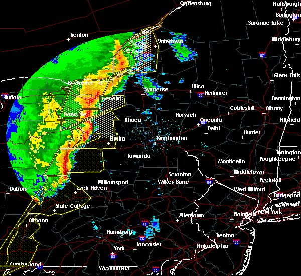 At 539 pm edt, severe thunderstorms were located along a line extending from prattsburg to near hammondsport to thurston to near woodhull to near westfield to 6 miles south of harrison valley, moving northeast at 60 mph (radar indicated). Hazards include 70 mph wind gusts and penny size hail. Expect considerable tree damage. damage is likely to mobile homes, roofs, and outbuildings. severe thunderstorms will be near, urbana, tyrone and pulteney around 545 pm edt. thurston, gang mills and keuka park around 550 pm edt. dundee, starkey and lakemont around 555 pm edt. hornby, caywood and reading center around 600 pm edt. campbell, lodi and rock stream around 605 pm edt. hector, lindley and interlaken around 610 pm edt. corning, watkins glen and montour falls around 615 pm edt. big flats, covert and reynoldsville around 620 pm edt. A tornado watch remains in effect until 1000 pm edt for central new york, and northeastern pennsylvania. At 539 pm edt, severe thunderstorms were located along a line extending from prattsburg to near hammondsport to thurston to near woodhull to near westfield to 6 miles south of harrison valley, moving northeast at 60 mph (radar indicated). Hazards include 70 mph wind gusts and penny size hail. Expect considerable tree damage. damage is likely to mobile homes, roofs, and outbuildings. severe thunderstorms will be near, urbana, tyrone and pulteney around 545 pm edt. thurston, gang mills and keuka park around 550 pm edt. dundee, starkey and lakemont around 555 pm edt. hornby, caywood and reading center around 600 pm edt. campbell, lodi and rock stream around 605 pm edt. hector, lindley and interlaken around 610 pm edt. corning, watkins glen and montour falls around 615 pm edt. big flats, covert and reynoldsville around 620 pm edt. A tornado watch remains in effect until 1000 pm edt for central new york, and northeastern pennsylvania.
|
| 5/1/2017 5:29 PM EDT |
 At 527 pm edt, severe thunderstorms were located along a line extending from near naples to near avoca, moving northeast at 50 mph (radar indicated. this line of storms also brought trees down farther west across livingston county). Hazards include 60 mph wind gusts. Expect damage to roofs, siding, and trees. A tornado watch remains in effect until 1000 pm edt for central new york. At 527 pm edt, severe thunderstorms were located along a line extending from near naples to near avoca, moving northeast at 50 mph (radar indicated. this line of storms also brought trees down farther west across livingston county). Hazards include 60 mph wind gusts. Expect damage to roofs, siding, and trees. A tornado watch remains in effect until 1000 pm edt for central new york.
|
| 5/1/2017 5:27 PM EDT |
 At 525 pm edt, severe thunderstorms were located along a line extending from near howard to near kanona to west cameron to near cameron to near jasper, moving northeast at 70 mph (radar indicated). Hazards include 70 mph wind gusts and quarter size hail. Hail damage to vehicles is expected. expect considerable tree damage. wind damage is also likely to mobile homes, roofs, and outbuildings. trees and power lines have also been reported to be down in the western portion of the county. these severe storms will be near, bath, avoca and kanona around 530 pm edt. addison, hammondsport and rheims around 535 pm edt. campbell, urbana and thurston around 540 pm edt. painted post, hornby and sonora around 545 pm edt. A tornado watch remains in effect until 1000 pm edt for central new york. At 525 pm edt, severe thunderstorms were located along a line extending from near howard to near kanona to west cameron to near cameron to near jasper, moving northeast at 70 mph (radar indicated). Hazards include 70 mph wind gusts and quarter size hail. Hail damage to vehicles is expected. expect considerable tree damage. wind damage is also likely to mobile homes, roofs, and outbuildings. trees and power lines have also been reported to be down in the western portion of the county. these severe storms will be near, bath, avoca and kanona around 530 pm edt. addison, hammondsport and rheims around 535 pm edt. campbell, urbana and thurston around 540 pm edt. painted post, hornby and sonora around 545 pm edt. A tornado watch remains in effect until 1000 pm edt for central new york.
|
| 5/1/2017 5:04 PM EDT |
 At 503 pm edt, severe thunderstorms were located along a line extending from near alfred to near wellsville to near whitesville to genesee, moving northeast at 50 to 60 mph (radar indicated). Hazards include 70 mph wind gusts and quarter size hail. Hail damage to vehicles is expected. expect considerable tree damage. wind damage is also likely to mobile homes, roofs, and outbuildings. severe thunderstorms will be near, hornell, greenwood and hartsville around 515 pm edt. canisteo, howard and troupsburg around 520 pm edt. jasper around 525 pm edt. woodhull, avoca and cameron around 530 pm edt. bath and prattsburg around 535 pm edt. addison, thurston and savona around 540 pm edt. campbell, urbana and painted post around 545 pm edt. A tornado watch remains in effect until 1000 pm edt for central new york. At 503 pm edt, severe thunderstorms were located along a line extending from near alfred to near wellsville to near whitesville to genesee, moving northeast at 50 to 60 mph (radar indicated). Hazards include 70 mph wind gusts and quarter size hail. Hail damage to vehicles is expected. expect considerable tree damage. wind damage is also likely to mobile homes, roofs, and outbuildings. severe thunderstorms will be near, hornell, greenwood and hartsville around 515 pm edt. canisteo, howard and troupsburg around 520 pm edt. jasper around 525 pm edt. woodhull, avoca and cameron around 530 pm edt. bath and prattsburg around 535 pm edt. addison, thurston and savona around 540 pm edt. campbell, urbana and painted post around 545 pm edt. A tornado watch remains in effect until 1000 pm edt for central new york.
|
| 5/1/2017 5:02 PM EDT |
 At 502 pm edt, severe thunderstorms were located along a line extending from near i-390 exit 6 to near i-86 exit 33, moving northeast at 65 mph (radar indicated). Hazards include 60 mph wind gusts. Expect damage to roofs, siding, and trees. severe thunderstorms will be near, haskinville around 510 pm edt. wayland around 515 pm edt. cohocton around 520 pm edt. prattsburg around 525 pm edt. italy around 530 pm edt. potter, middlesex and guyanoga around 535 pm edt. penn yan, rushville and yatesville around 540 pm edt. benton, ferguson corners and milo center around 545 pm edt. A tornado watch remains in effect until 1000 pm edt for central new york. At 502 pm edt, severe thunderstorms were located along a line extending from near i-390 exit 6 to near i-86 exit 33, moving northeast at 65 mph (radar indicated). Hazards include 60 mph wind gusts. Expect damage to roofs, siding, and trees. severe thunderstorms will be near, haskinville around 510 pm edt. wayland around 515 pm edt. cohocton around 520 pm edt. prattsburg around 525 pm edt. italy around 530 pm edt. potter, middlesex and guyanoga around 535 pm edt. penn yan, rushville and yatesville around 540 pm edt. benton, ferguson corners and milo center around 545 pm edt. A tornado watch remains in effect until 1000 pm edt for central new york.
|
| 5/1/2017 4:55 PM EDT |
 At 453 pm edt, severe thunderstorms were located along a line extending from 8 miles southwest of alfred to near wellsville to near genesee to 10 miles southwest of whitesville to 7 miles northeast of coudersport, moving northeast at 50 to 60 mph (radar indicated). Hazards include 60 mph wind gusts and quarter size hail. Hail damage to vehicles is expected. expect wind damage to roofs, siding, and trees. severe thunderstorms will be near, hartsville around 505 pm edt. hornell, canisteo and greenwood around 510 pm edt. howard, jasper and troupsburg around 515 pm edt. avoca, cameron and west cameron around 520 pm edt. woodhull and kanona around 525 pm edt. bath, addison and thurston around 530 pm edt. campbell, urbana and pulteney around 535 pm edt. corning, painted post and hornby around 540 pm edt. A tornado watch remains in effect until 1000 pm edt for central new york. At 453 pm edt, severe thunderstorms were located along a line extending from 8 miles southwest of alfred to near wellsville to near genesee to 10 miles southwest of whitesville to 7 miles northeast of coudersport, moving northeast at 50 to 60 mph (radar indicated). Hazards include 60 mph wind gusts and quarter size hail. Hail damage to vehicles is expected. expect wind damage to roofs, siding, and trees. severe thunderstorms will be near, hartsville around 505 pm edt. hornell, canisteo and greenwood around 510 pm edt. howard, jasper and troupsburg around 515 pm edt. avoca, cameron and west cameron around 520 pm edt. woodhull and kanona around 525 pm edt. bath, addison and thurston around 530 pm edt. campbell, urbana and pulteney around 535 pm edt. corning, painted post and hornby around 540 pm edt. A tornado watch remains in effect until 1000 pm edt for central new york.
|
| 7/25/2016 1:29 PM EDT |
 At 128 pm edt, a severe thunderstorm was located near greenwood, or 10 miles south of i-86 exit 33, moving east at 60 mph (radar indicated). Hazards include 60 mph wind gusts and quarter size hail. Hail damage to vehicles is expected. expect wind damage to roofs, siding, and trees. this severe thunderstorm will be near, jasper around 140 pm edt. cameron and west cameron around 145 pm edt. addison and thurston around 150 pm edt. Campbell, savona and coopers plains around 155 pm edt. At 128 pm edt, a severe thunderstorm was located near greenwood, or 10 miles south of i-86 exit 33, moving east at 60 mph (radar indicated). Hazards include 60 mph wind gusts and quarter size hail. Hail damage to vehicles is expected. expect wind damage to roofs, siding, and trees. this severe thunderstorm will be near, jasper around 140 pm edt. cameron and west cameron around 145 pm edt. addison and thurston around 150 pm edt. Campbell, savona and coopers plains around 155 pm edt.
|
| 6/20/2016 11:51 PM EDT |
 At 1151 pm edt, a severe thunderstorm was located over howard, or 9 miles northeast of hornell, moving east at 40 mph (radar indicated). Hazards include 60 mph wind gusts and penny size hail. Expect damage to roofs. siding. and trees. this severe storm will be near, avoca and kanona around 1200 am edt. bath around 1205 am edt. Rheims around 1210 am edt. At 1151 pm edt, a severe thunderstorm was located over howard, or 9 miles northeast of hornell, moving east at 40 mph (radar indicated). Hazards include 60 mph wind gusts and penny size hail. Expect damage to roofs. siding. and trees. this severe storm will be near, avoca and kanona around 1200 am edt. bath around 1205 am edt. Rheims around 1210 am edt.
|
| 6/20/2016 11:27 PM EDT |
 At 1127 pm edt, a severe thunderstorm was located near i-390 exit 4, moving east at 40 mph (radar indicated). Hazards include 60 mph wind gusts and quarter size hail. Hail damage to vehicles is expected. expect wind damage to roofs, siding, and trees. this severe thunderstorm will be near, arkport around 1135 pm edt. hornell and south dansville around 1140 pm edt. cohocton and haskinville around 1145 pm edt. howard around 1150 pm edt. avoca around 1155 pm edt. kanona around 1200 am edt. bath around 1205 am edt. Rheims around 1210 am edt. At 1127 pm edt, a severe thunderstorm was located near i-390 exit 4, moving east at 40 mph (radar indicated). Hazards include 60 mph wind gusts and quarter size hail. Hail damage to vehicles is expected. expect wind damage to roofs, siding, and trees. this severe thunderstorm will be near, arkport around 1135 pm edt. hornell and south dansville around 1140 pm edt. cohocton and haskinville around 1145 pm edt. howard around 1150 pm edt. avoca around 1155 pm edt. kanona around 1200 am edt. bath around 1205 am edt. Rheims around 1210 am edt.
|
| 7/14/2015 5:19 PM EDT |
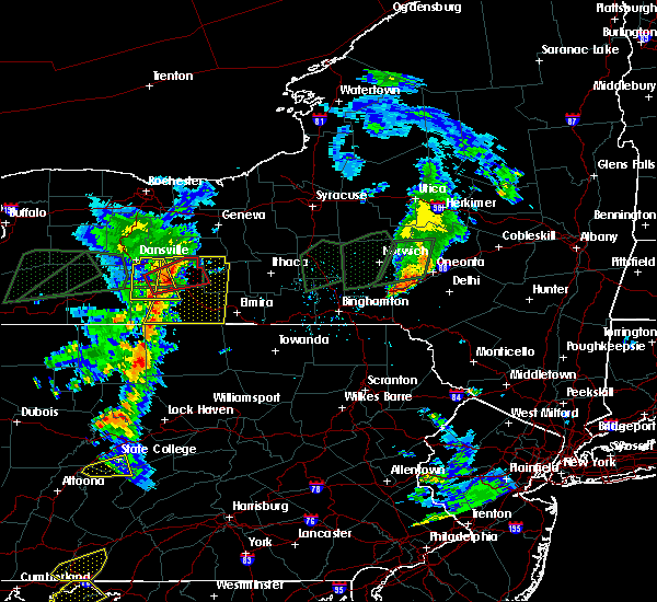 At 517 pm edt, a line of severe thunderstorms was located over central steuben county, or 15 miles east of hornell, moving east at 25 mph (radar indicated). Hazards include 70 mph wind gusts and quarter size hail. Hail damage to vehicles is expected. expect considerable tree damage. wind damage is also likely to mobile homes, roofs and outbuildings. this severe thunderstorm will be near, rheims around 530 pm edt. savona and hammondsport around 535 pm edt. urbana and sonora around 540 pm edt. tyrone and monterey around 555 pm edt. reading center, rock stream and glenora around 610 pm edt. Watkins glen, hector and wedgewood around 615 pm edt. At 517 pm edt, a line of severe thunderstorms was located over central steuben county, or 15 miles east of hornell, moving east at 25 mph (radar indicated). Hazards include 70 mph wind gusts and quarter size hail. Hail damage to vehicles is expected. expect considerable tree damage. wind damage is also likely to mobile homes, roofs and outbuildings. this severe thunderstorm will be near, rheims around 530 pm edt. savona and hammondsport around 535 pm edt. urbana and sonora around 540 pm edt. tyrone and monterey around 555 pm edt. reading center, rock stream and glenora around 610 pm edt. Watkins glen, hector and wedgewood around 615 pm edt.
|
| 7/14/2015 5:07 PM EDT |
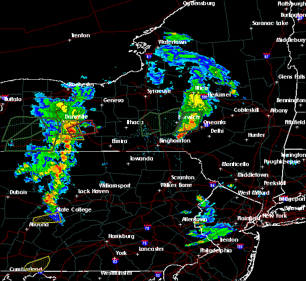 At 506 pm edt, a tornado producing storm was located over howard, or 9 miles east of hornell, moving east at 30 mph (confirmed tornado). Hazards include damaging tornado and quarter size hail. Flying debris will be dangerous to those caught without shelter. mobile homes will be damaged or destroyed. damage to roofs, windows and vehicles will occur. tree damage is likely. this tornadic storm will be near, avoca around 515 pm edt. kanona around 520 pm edt. bath around 525 pm edt. Urbana, hammondsport and rheims around 530 pm edt. At 506 pm edt, a tornado producing storm was located over howard, or 9 miles east of hornell, moving east at 30 mph (confirmed tornado). Hazards include damaging tornado and quarter size hail. Flying debris will be dangerous to those caught without shelter. mobile homes will be damaged or destroyed. damage to roofs, windows and vehicles will occur. tree damage is likely. this tornadic storm will be near, avoca around 515 pm edt. kanona around 520 pm edt. bath around 525 pm edt. Urbana, hammondsport and rheims around 530 pm edt.
|
| 6/23/2015 6:10 AM EDT |
 At 610 am edt, a severe thunderstorm was located over hinsdale, or near i-86 exit 27, moving east at 50 mph (radar indicated). Hazards include 60 mph wind gusts. Expect damage to roofs. siding and trees. this severe thunderstorm will be near, greenwood and hartsville around 645 am edt. jasper around 655 am edt. woodhull, cameron and west cameron around 700 am edt. campbell, addison and thurston around 710 am edt. Corning, painted post and hornby around 715 am edt. At 610 am edt, a severe thunderstorm was located over hinsdale, or near i-86 exit 27, moving east at 50 mph (radar indicated). Hazards include 60 mph wind gusts. Expect damage to roofs. siding and trees. this severe thunderstorm will be near, greenwood and hartsville around 645 am edt. jasper around 655 am edt. woodhull, cameron and west cameron around 700 am edt. campbell, addison and thurston around 710 am edt. Corning, painted post and hornby around 715 am edt.
|
| 6/12/2015 5:42 PM EDT |
 At 542 pm edt, a severe thunderstorm was located over i-86 exit 33, moving east at 60 mph (radar indicated). Hazards include 60 mph wind gusts. Expect damage to roofs. siding and trees. this severe thunderstorm will be near, hornell and arkport around 545 pm edt. canisteo and haskinville around 550 pm edt. howard around 555 pm edt. avoca and west cameron around 600 pm edt. bath and kanona around 605 pm edt. savona, hammondsport and rheims around 610 pm edt. A tornado watch remains in effect until 1100 pm edt for central new york. At 542 pm edt, a severe thunderstorm was located over i-86 exit 33, moving east at 60 mph (radar indicated). Hazards include 60 mph wind gusts. Expect damage to roofs. siding and trees. this severe thunderstorm will be near, hornell and arkport around 545 pm edt. canisteo and haskinville around 550 pm edt. howard around 555 pm edt. avoca and west cameron around 600 pm edt. bath and kanona around 605 pm edt. savona, hammondsport and rheims around 610 pm edt. A tornado watch remains in effect until 1100 pm edt for central new york.
|
| 6/12/2015 5:36 PM EDT |
 At 534 pm edt, severe thunderstorms were located along a line extending from 6 miles north of clyde to near clifton springs to near rushville to near springwater to near i-390 exit 5 to near arkport, moving east at 40 mph (radar indicated). Hazards include 60 mph wind gusts. Expect damage to roofs. siding and trees. severe thunderstorms will be near, dansville at 540 pm. seneca falls and penn yan at 6 pm. prattsburg at 615 pm. A tornado watch remains in effect until 1100 pm edt for central new york. At 534 pm edt, severe thunderstorms were located along a line extending from 6 miles north of clyde to near clifton springs to near rushville to near springwater to near i-390 exit 5 to near arkport, moving east at 40 mph (radar indicated). Hazards include 60 mph wind gusts. Expect damage to roofs. siding and trees. severe thunderstorms will be near, dansville at 540 pm. seneca falls and penn yan at 6 pm. prattsburg at 615 pm. A tornado watch remains in effect until 1100 pm edt for central new york.
|
| 6/8/2015 1:15 PM EDT |
 At 113 pm edt, a severe thunderstorm was located over marcellus, or 10 miles east of auburn, moving northeast at 55 mph (radar indicated). Hazards include 60 mph wind gusts and heavy downpours. Expect damage to roofs. siding and trees. this severe storm will be near, galeville around 125 pm edt. syracuse, manlius and lyndon around 130 pm edt. cicero and kirkville around 135 pm edt. bridgeport around 140 pm edt. damaging wind gusts and heavy downpours will accompany these storms. Urbanized areas of syracuse may be particularly prone to minor flooding as these storms move across the area. At 113 pm edt, a severe thunderstorm was located over marcellus, or 10 miles east of auburn, moving northeast at 55 mph (radar indicated). Hazards include 60 mph wind gusts and heavy downpours. Expect damage to roofs. siding and trees. this severe storm will be near, galeville around 125 pm edt. syracuse, manlius and lyndon around 130 pm edt. cicero and kirkville around 135 pm edt. bridgeport around 140 pm edt. damaging wind gusts and heavy downpours will accompany these storms. Urbanized areas of syracuse may be particularly prone to minor flooding as these storms move across the area.
|
| 6/8/2015 12:59 PM EDT |
 At 1259 pm edt, a severe thunderstorm was located near fleming, or near auburn, moving northeast at 55 mph (radar indicated). Hazards include 60 mph wind gusts. Expect damage to roofs. siding and trees. this severe thunderstorm will be near, owasco around 105 pm edt. skaneateles around 110 pm edt. marcellus around 115 pm edt. galeville around 125 pm edt. syracuse and lyndon around 130 pm edt. cicero, manlius and kirkville around 135 pm edt. Bridgeport around 140 pm edt. At 1259 pm edt, a severe thunderstorm was located near fleming, or near auburn, moving northeast at 55 mph (radar indicated). Hazards include 60 mph wind gusts. Expect damage to roofs. siding and trees. this severe thunderstorm will be near, owasco around 105 pm edt. skaneateles around 110 pm edt. marcellus around 115 pm edt. galeville around 125 pm edt. syracuse and lyndon around 130 pm edt. cicero, manlius and kirkville around 135 pm edt. Bridgeport around 140 pm edt.
|
| 6/8/2015 12:44 PM EDT |
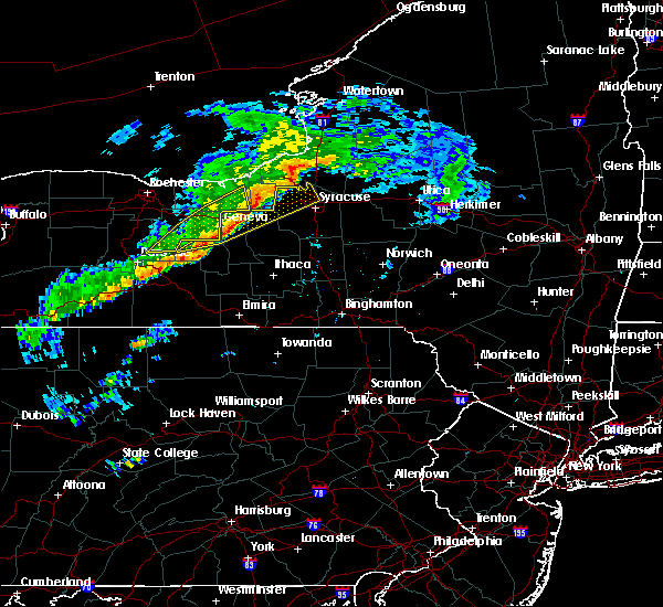 At 1243 pm edt, a severe thunderstorm was located over penn yan, moving east at 65 mph (radar indicated). Hazards include 60 mph wind gusts. Expect damage to roofs. siding and trees. this severe thunderstorm will be near, kendaia and willard around 1250 pm edt. Romulus and ovid around 1255 pm edt. At 1243 pm edt, a severe thunderstorm was located over penn yan, moving east at 65 mph (radar indicated). Hazards include 60 mph wind gusts. Expect damage to roofs. siding and trees. this severe thunderstorm will be near, kendaia and willard around 1250 pm edt. Romulus and ovid around 1255 pm edt.
|
| 4/20/2015 8:26 PM EDT | At 825 pm edt, doppler radar indicated a severe thunderstorm capable of producing quarter size hail and damaging winds in excess of 60 mph. this storm was located near prattsburg, or 17 miles southwest of penn yan, and moving northeast at 35 mph. * this severe thunderstorm will be near, pulteney and italy around 835 pm edt. potter, guyanoga and branchport around 845 pm edt. yatesville and keuka park around 850 pm edt. penn yan and ferguson corners around 855 pm edt. benton, milo center and mays mills around 900 pm edt. dresden around 905 pm edt. when you can do so safely, please report hail, or damaging winds to the national weather service by calling toll free at 1-888-603-1402, or by email at [email protected]. |
| 8/5/2014 3:18 PM EDT | Half Dollar sized hail reported 0.5 miles WNW of Prattsburgh, NY |
| 6/17/2014 3:40 PM EDT | Half Dollar sized hail reported 3 miles SW of Prattsburgh, NY |
| 6/17/2014 3:30 PM EDT | Quarter sized hail reported 2.8 miles SSE of Prattsburgh, NY |
| 6/17/2014 3:30 PM EDT | Quarter sized hail reported 4.5 miles SE of Prattsburgh, NY |
| 7/19/2013 11:45 PM EDT | Tree down blocking the roadway. doppler radar estimated tim in steuben county NY, 0.5 miles WNW of Prattsburgh, NY |
| 7/19/2013 11:45 PM EDT | Tree down blocking the roadway. dollper radar estimated tim in steuben county NY, 0.5 miles WNW of Prattsburgh, NY |
| 8/9/2012 9:20 PM EDT | Tree down on wires in steuben county NY, 0.5 miles WNW of Prattsburgh, NY |
| 1/1/0001 12:00 AM | Trees down in steuben county NY, 6 miles W of Prattsburgh, NY |
Hail Maps for Prattsburgh, NY
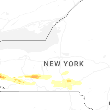

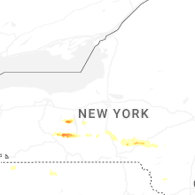


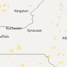


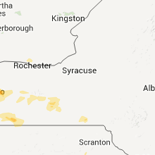

Connect with Interactive Hail Maps