

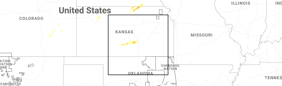
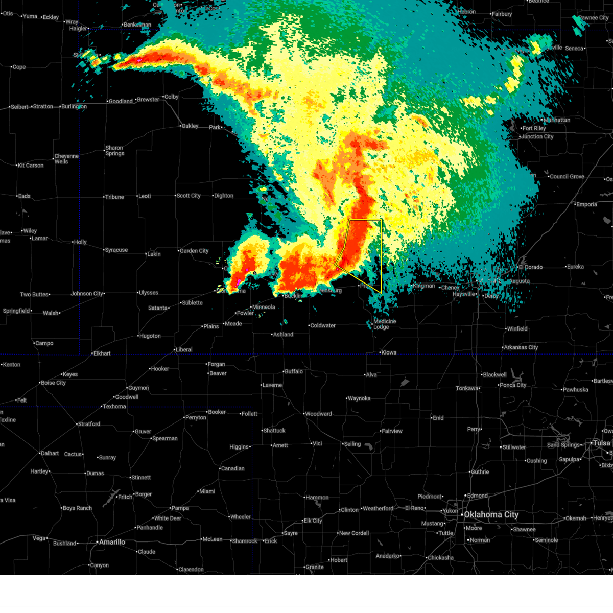
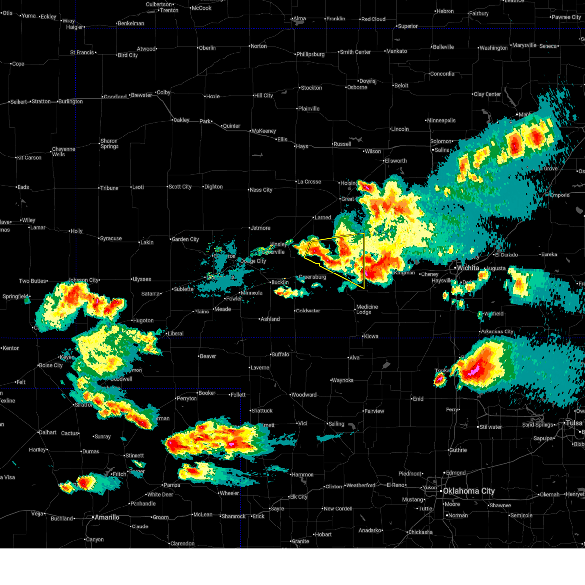
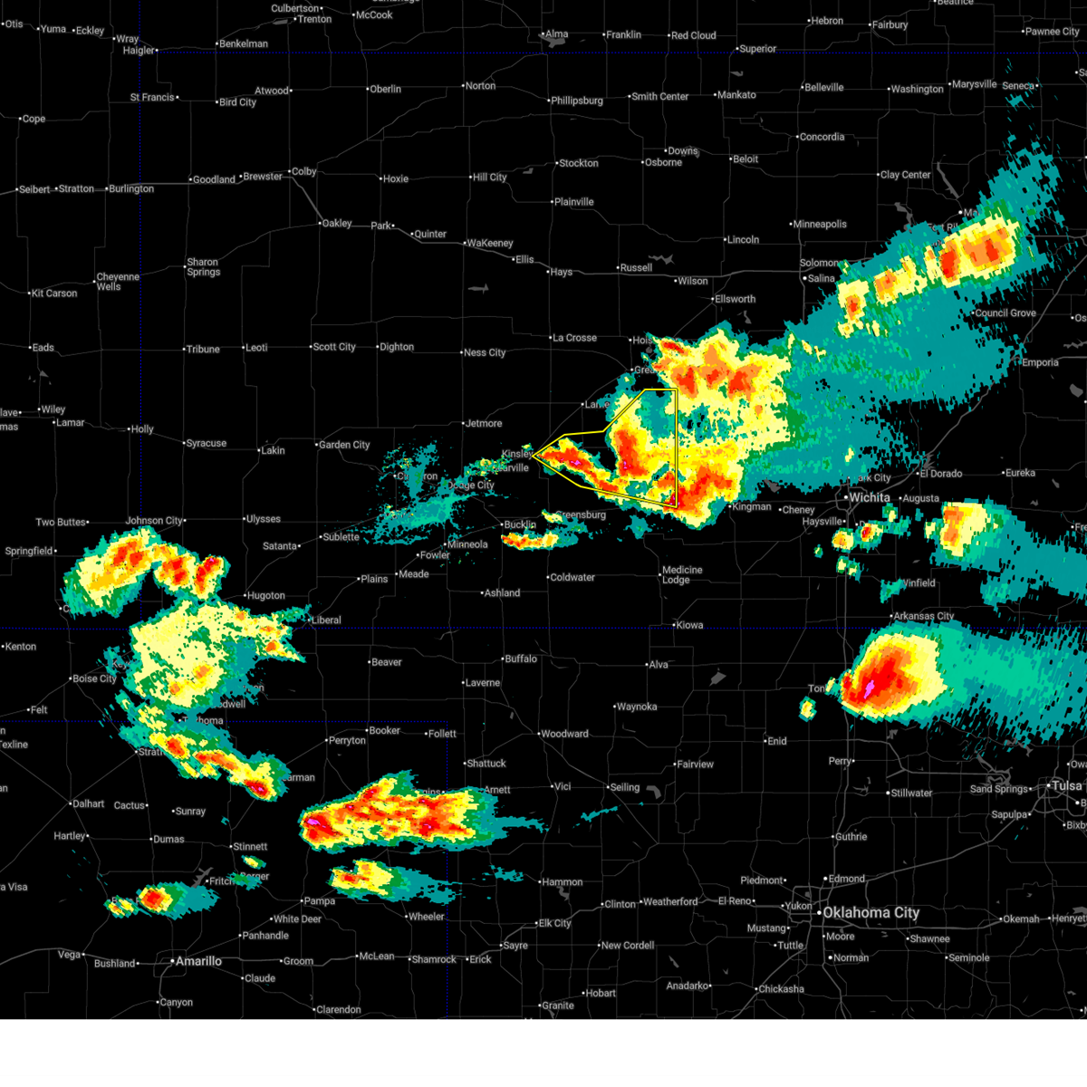
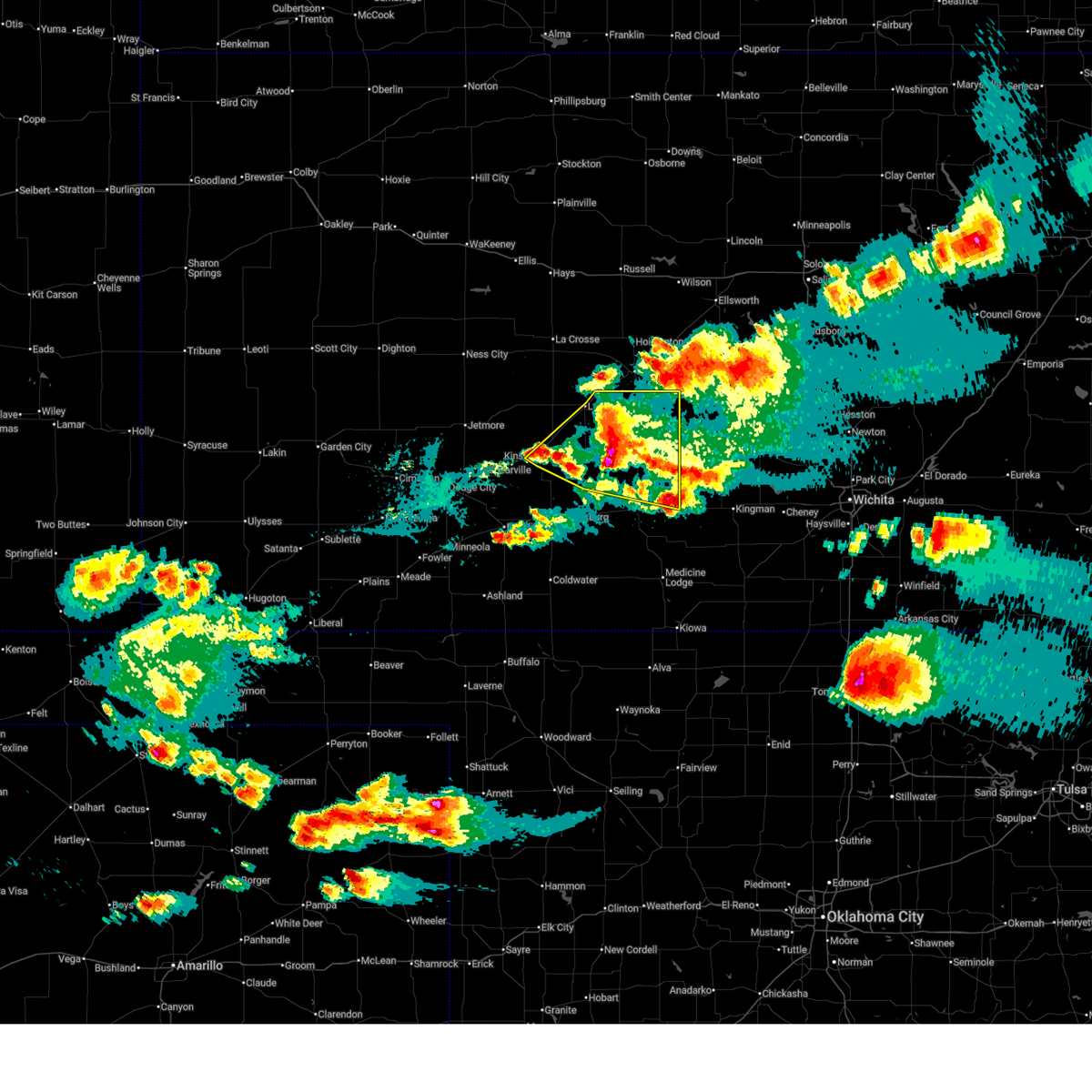
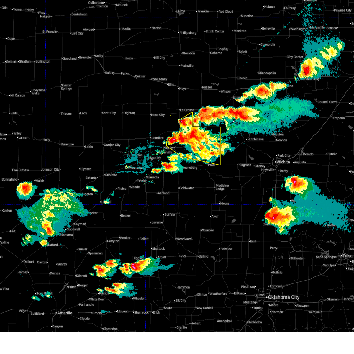
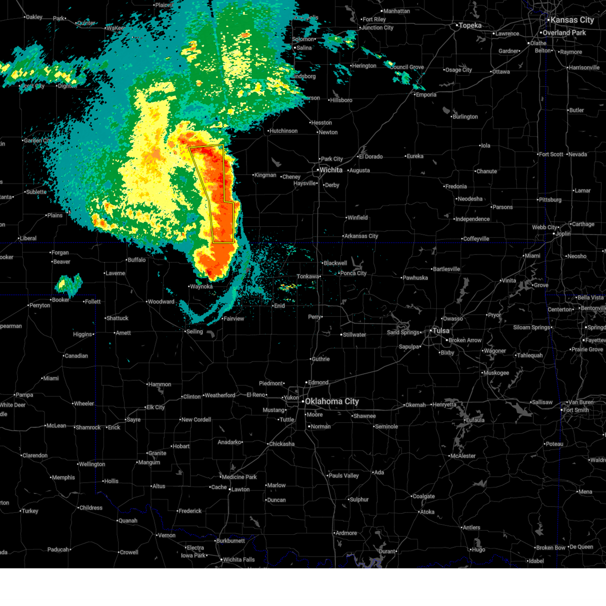
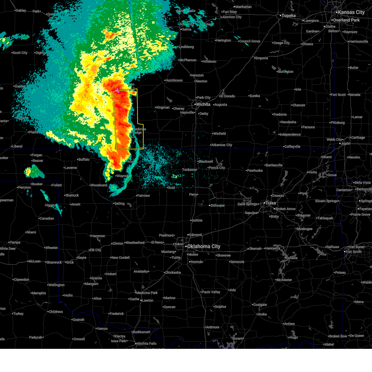
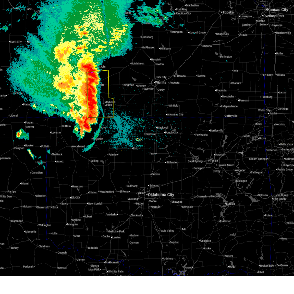
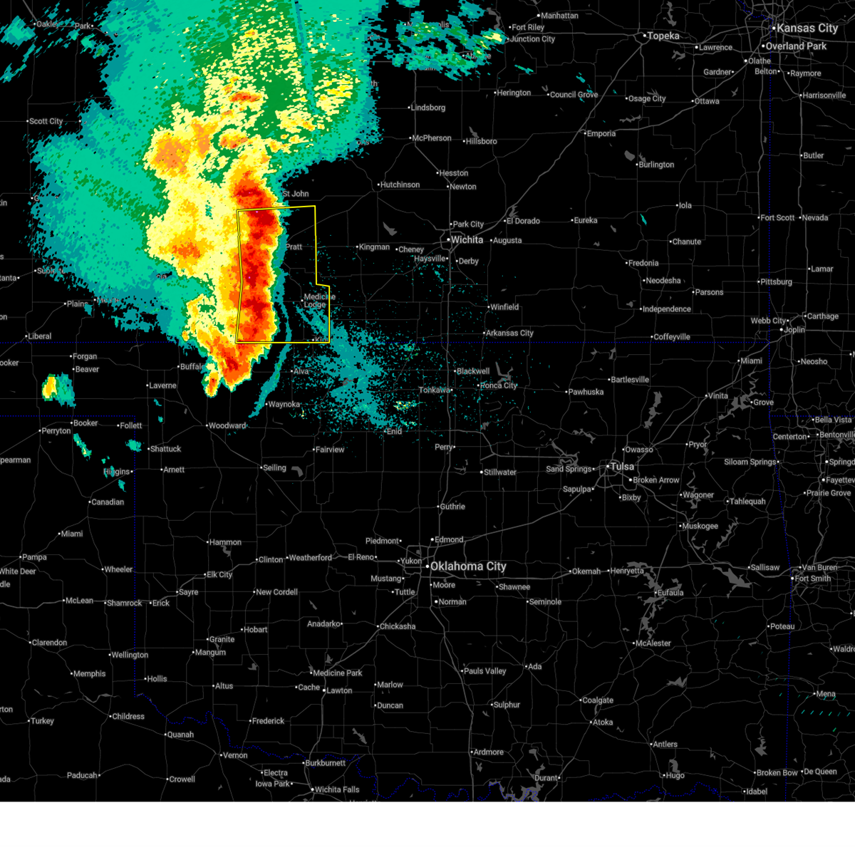
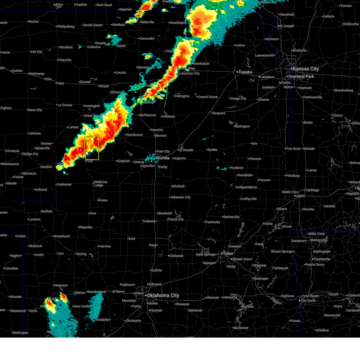
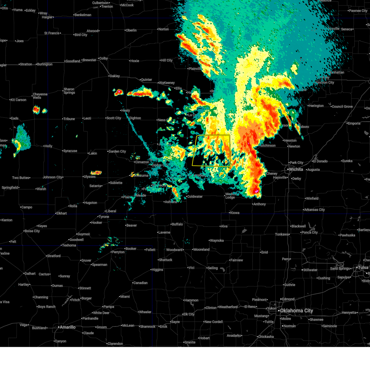
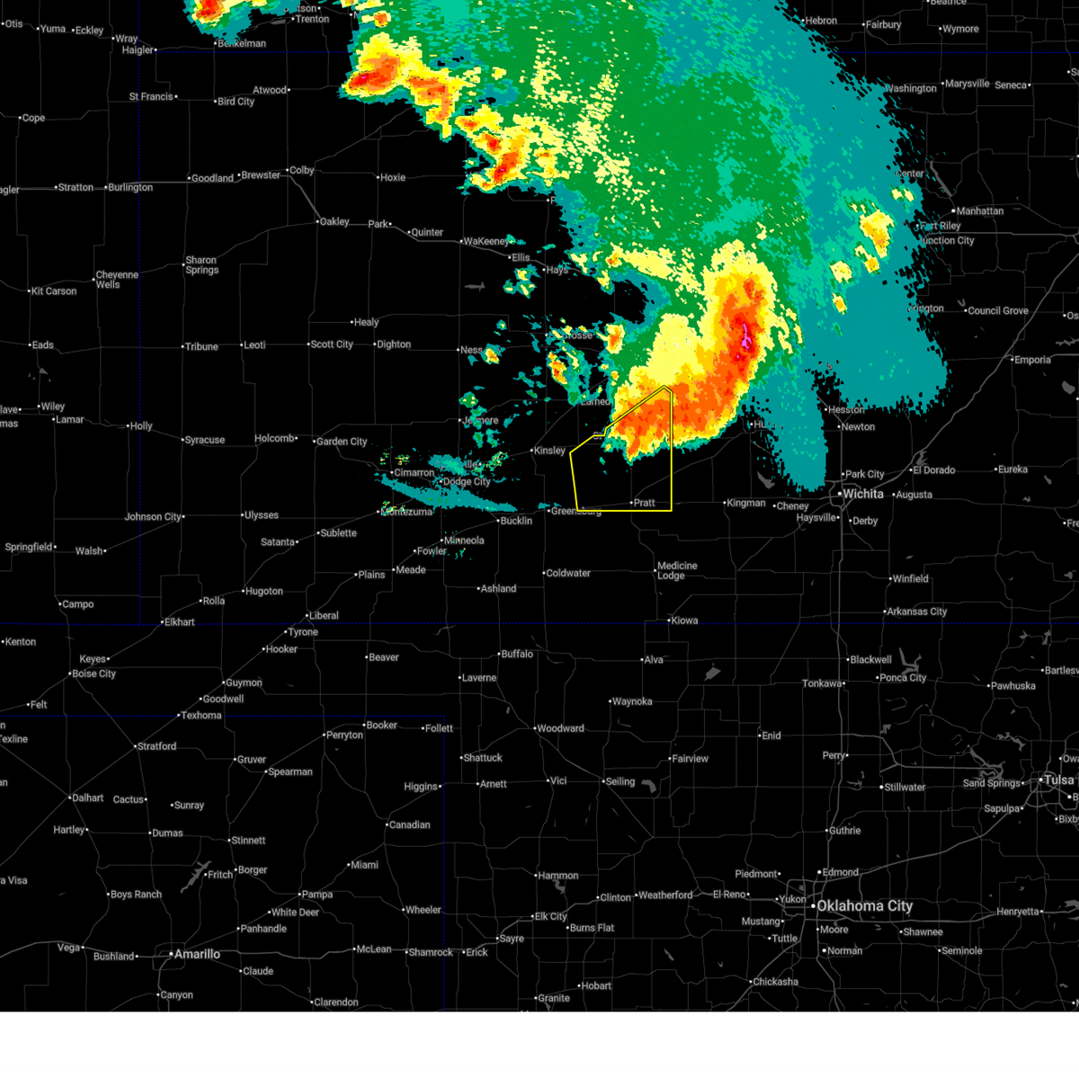
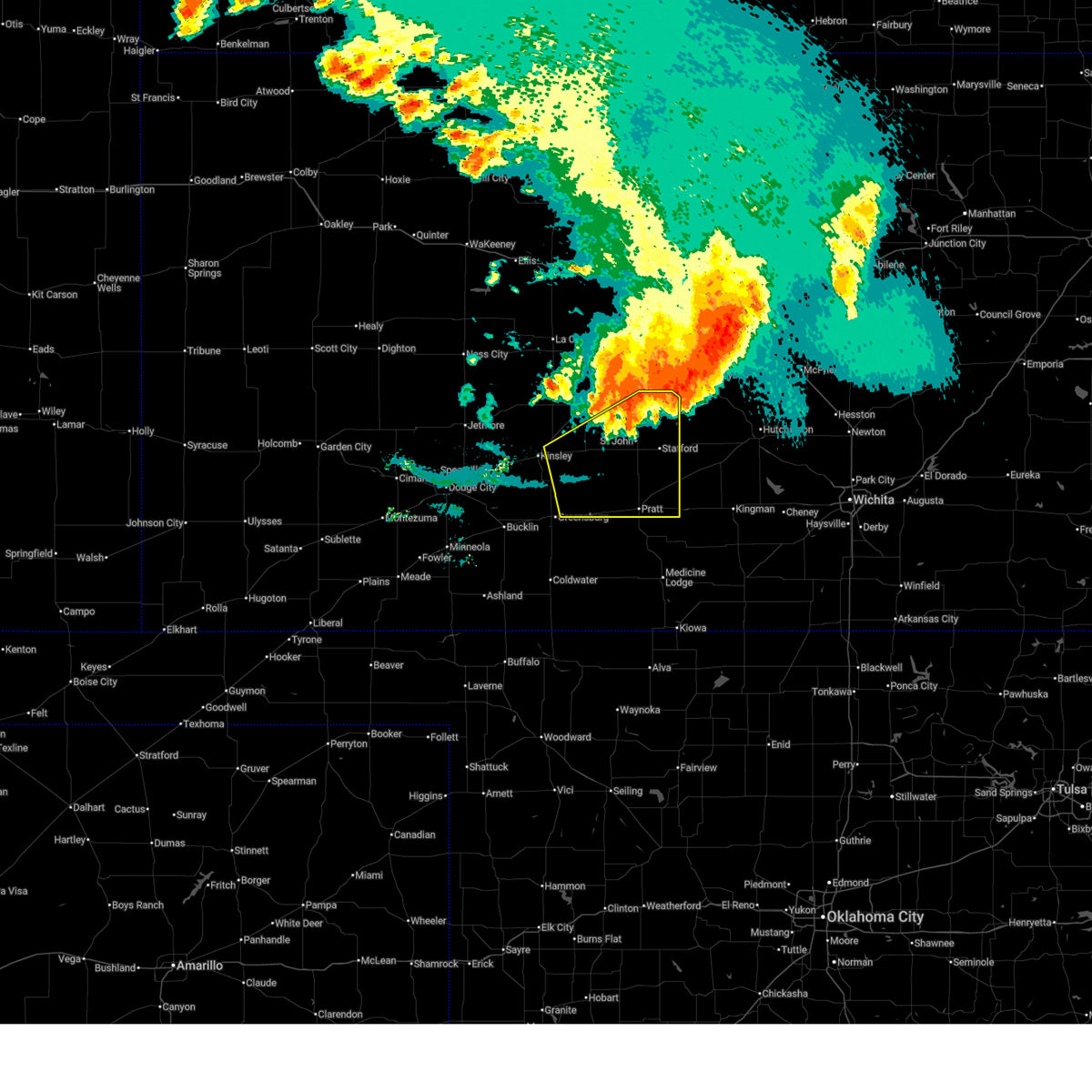
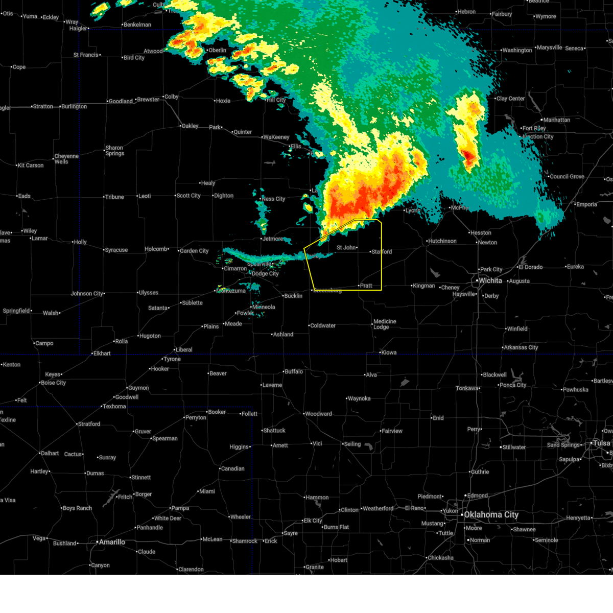
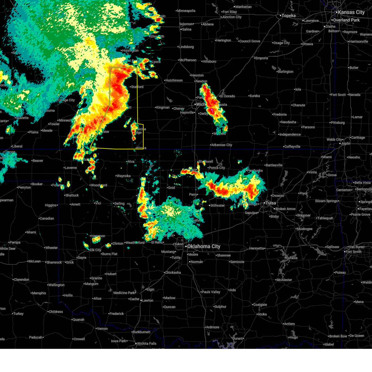
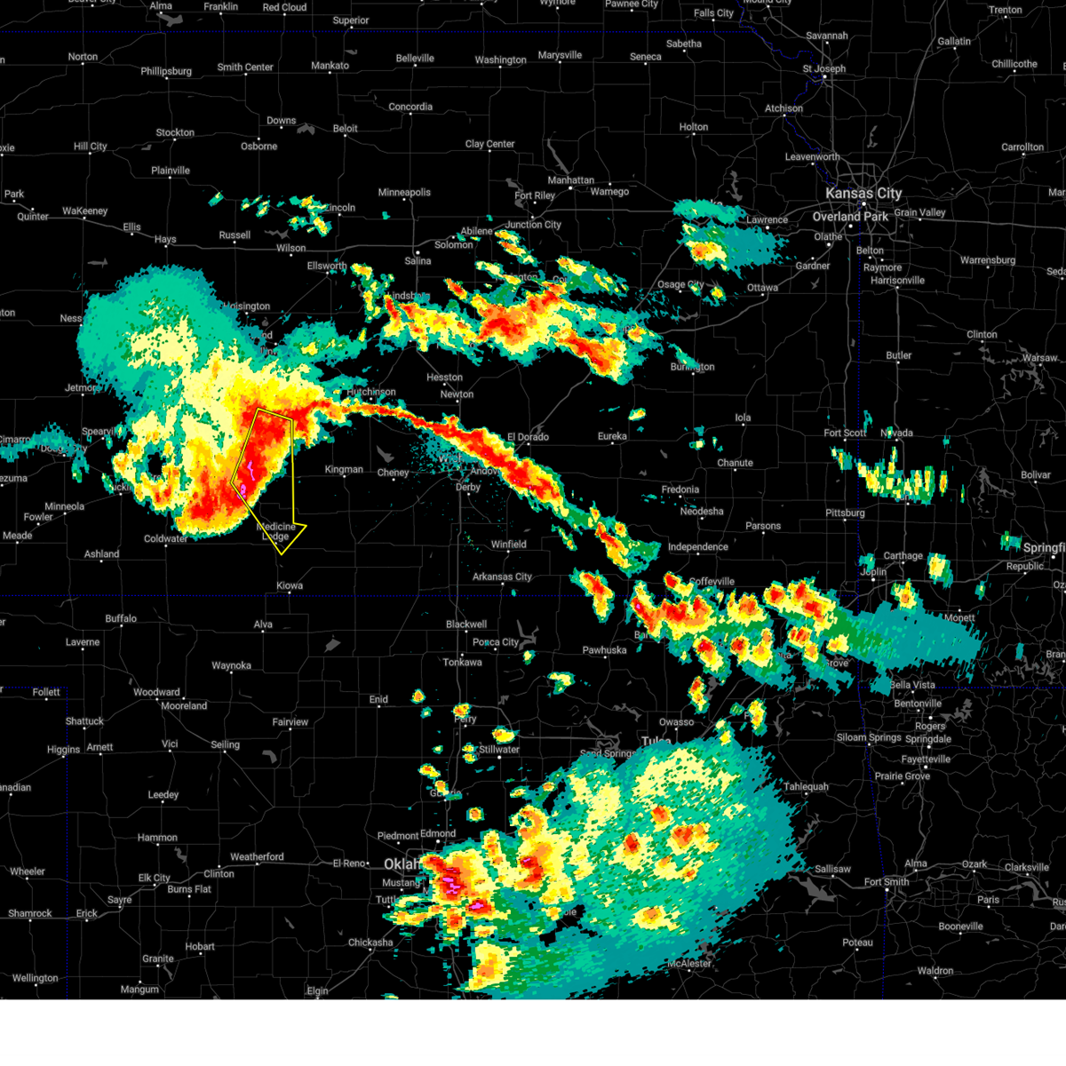
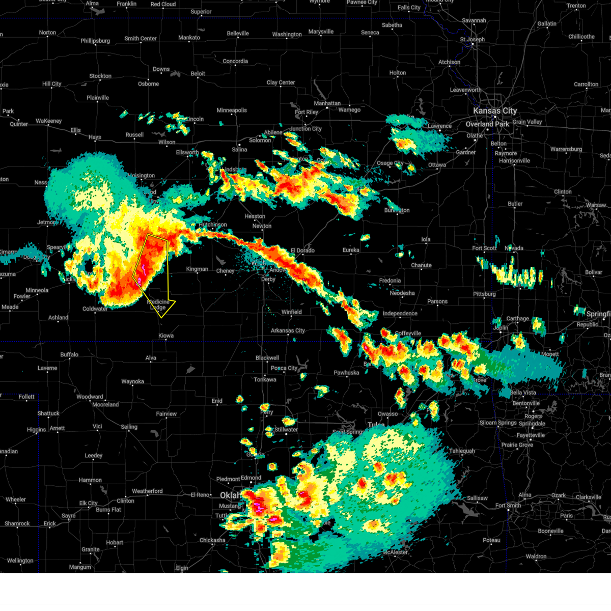
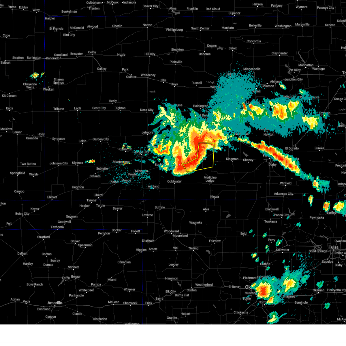
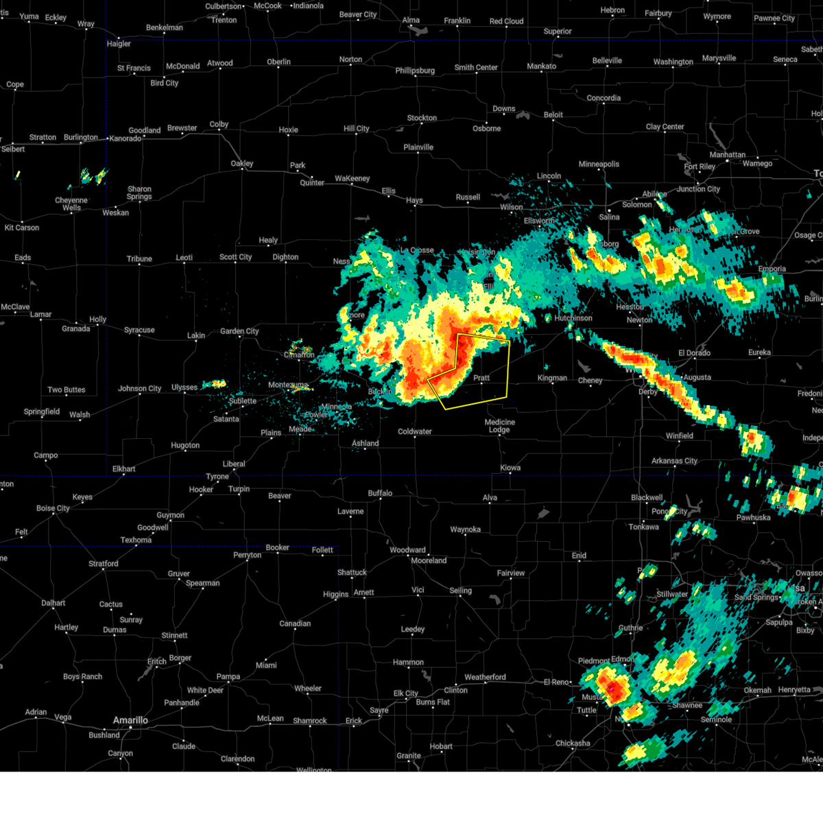
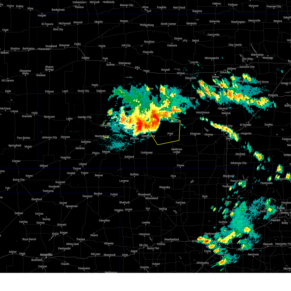
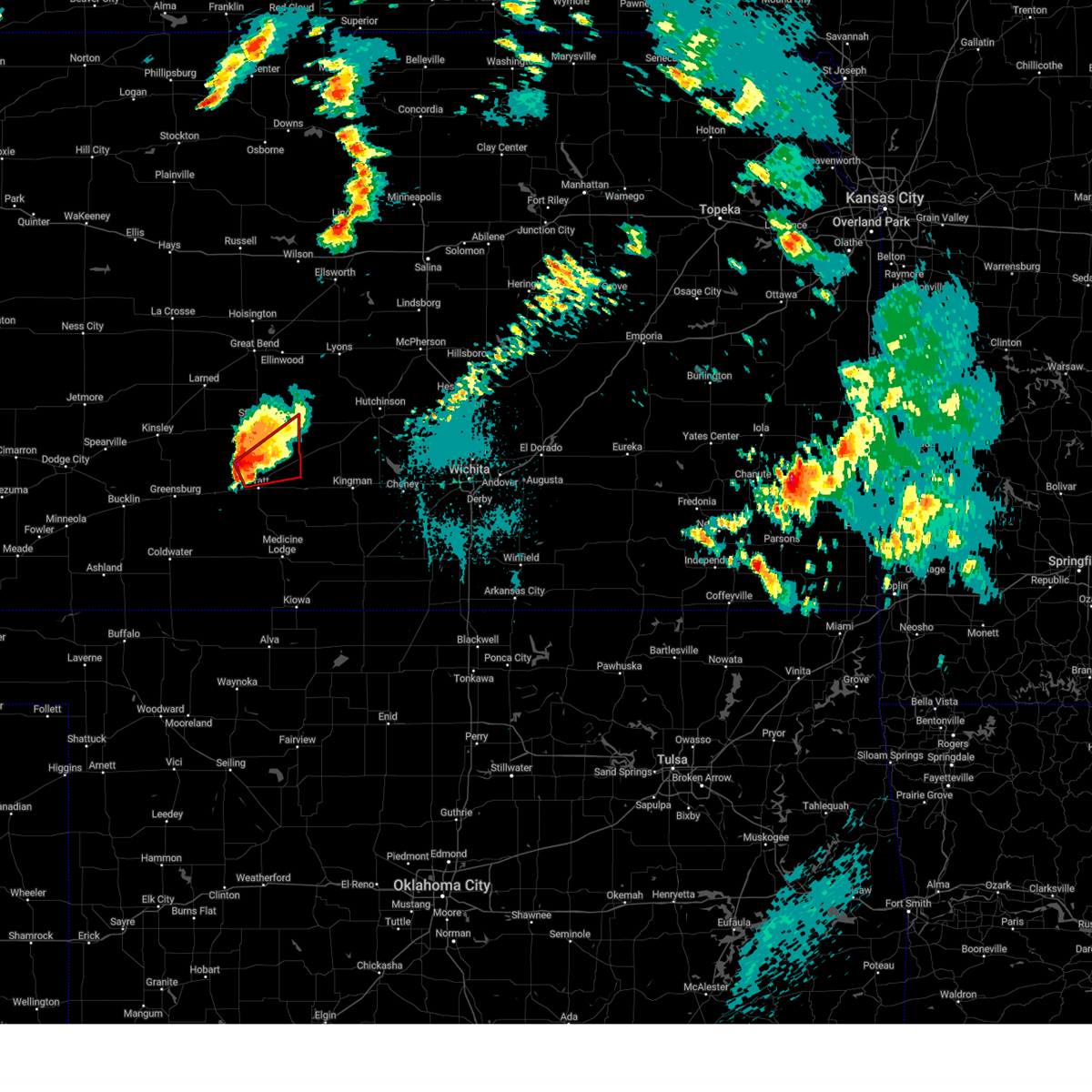
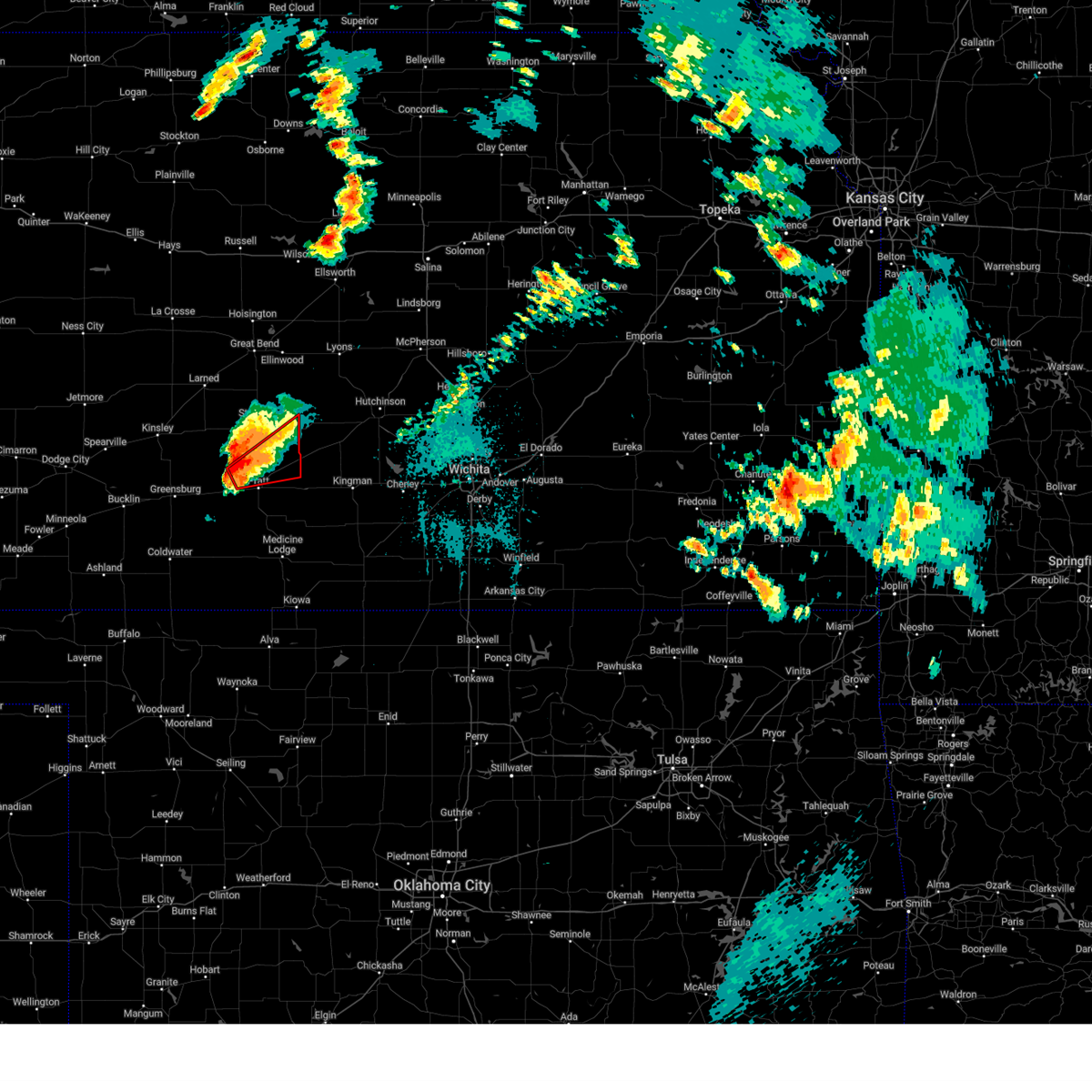
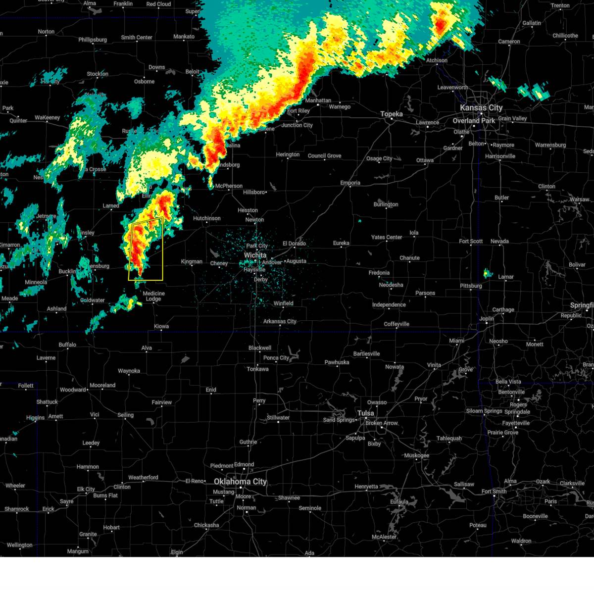
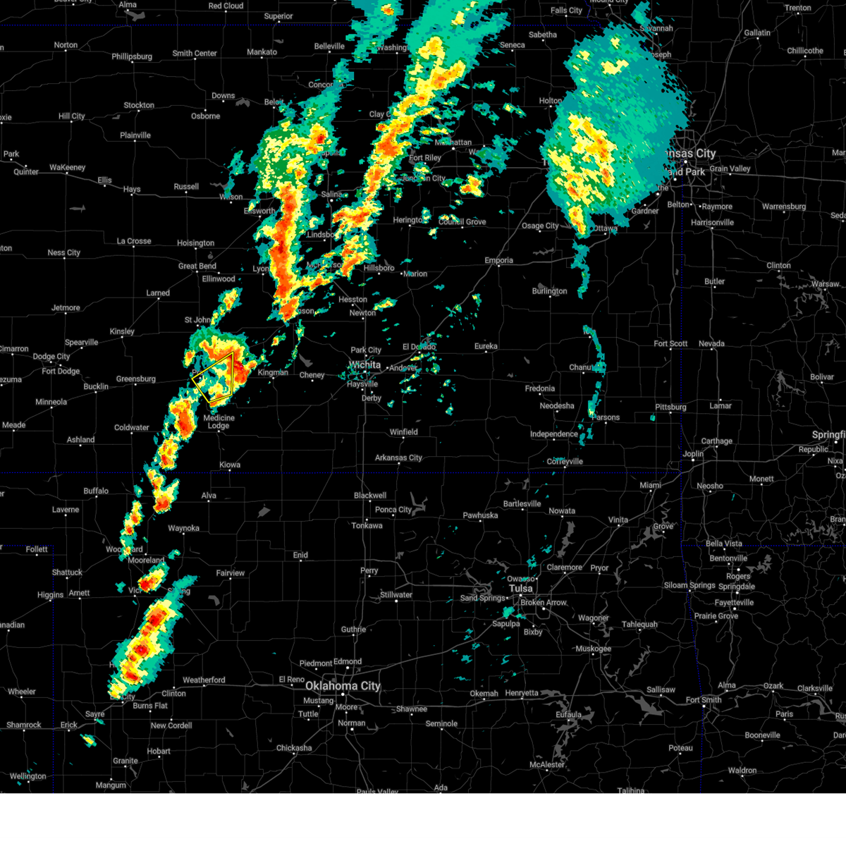
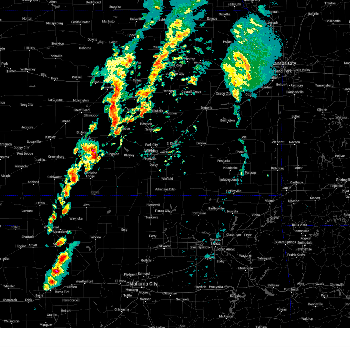
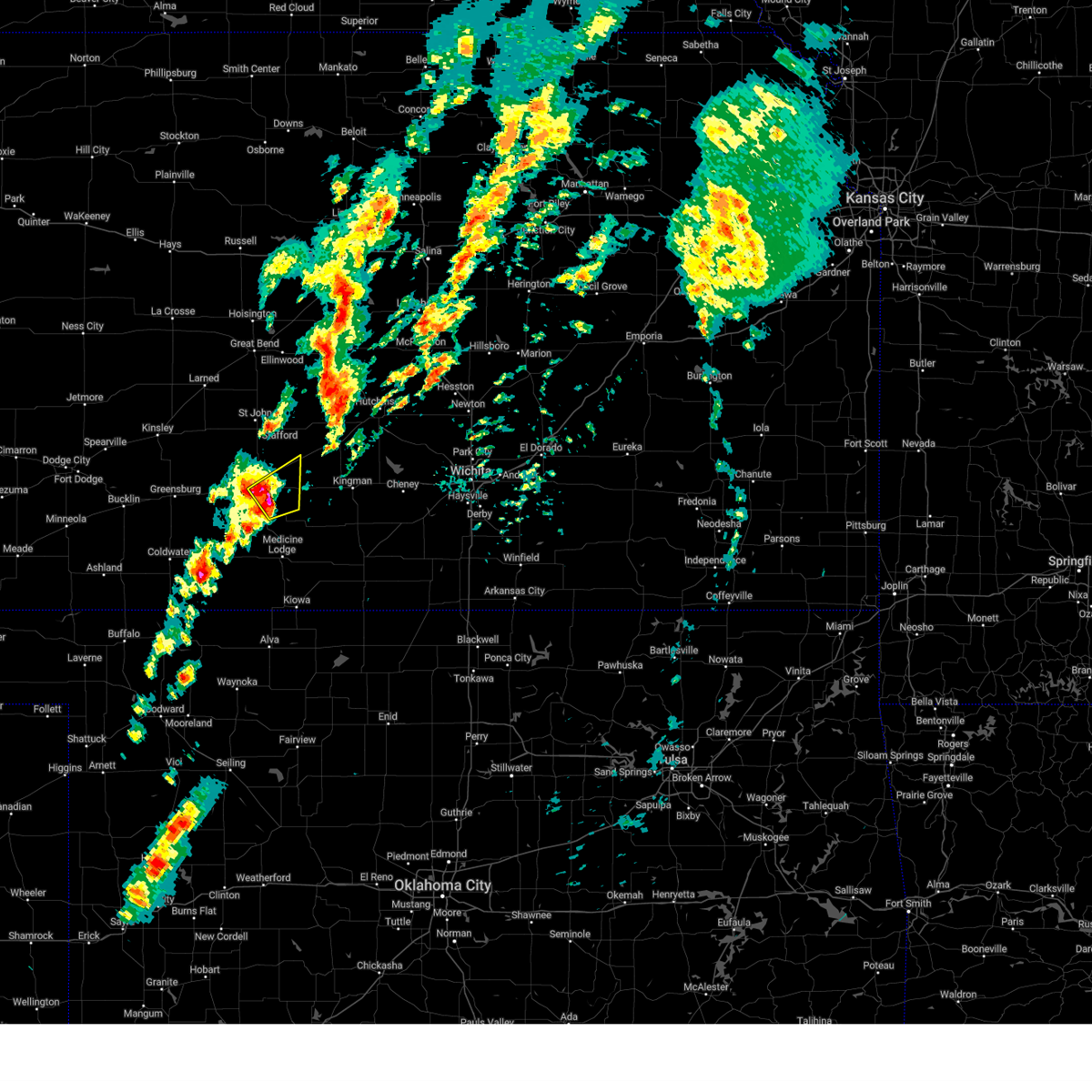
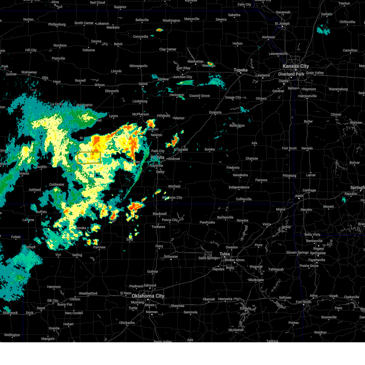
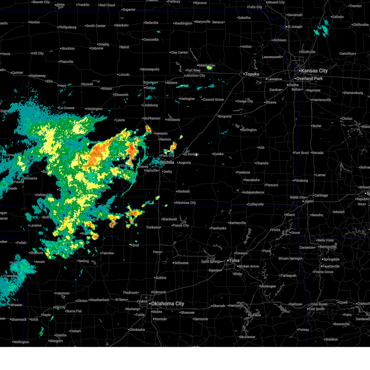
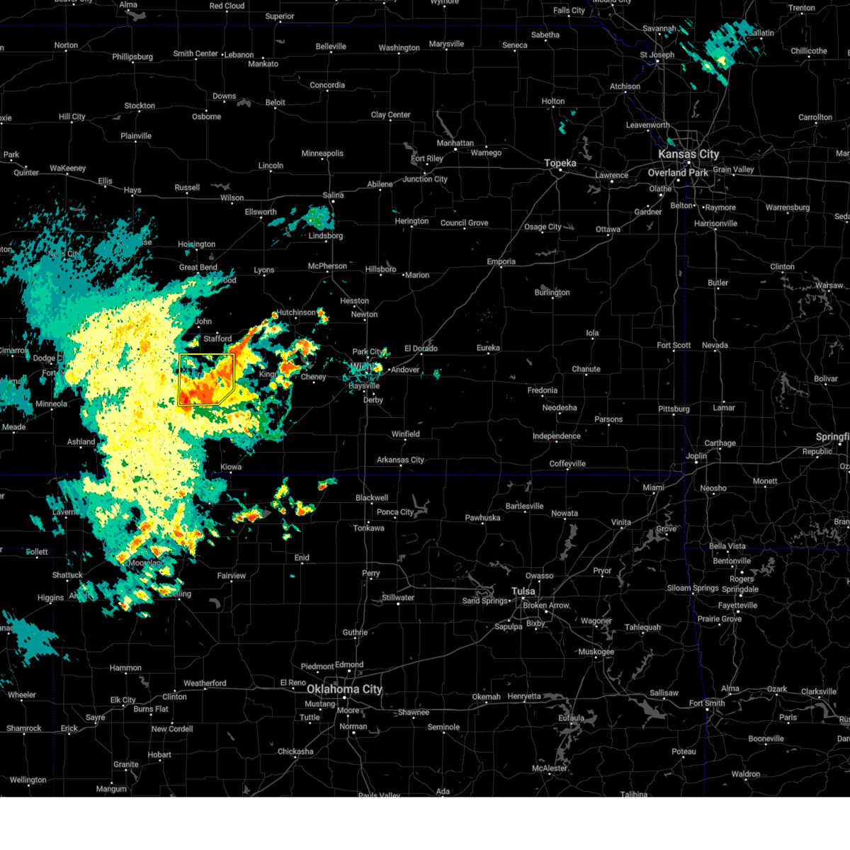
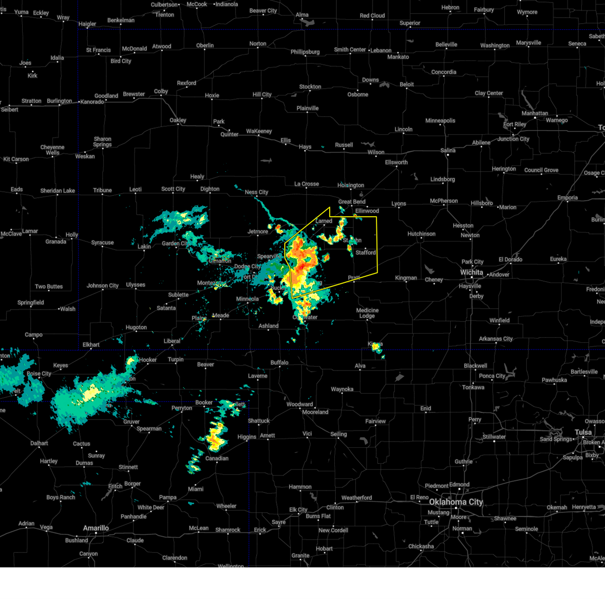
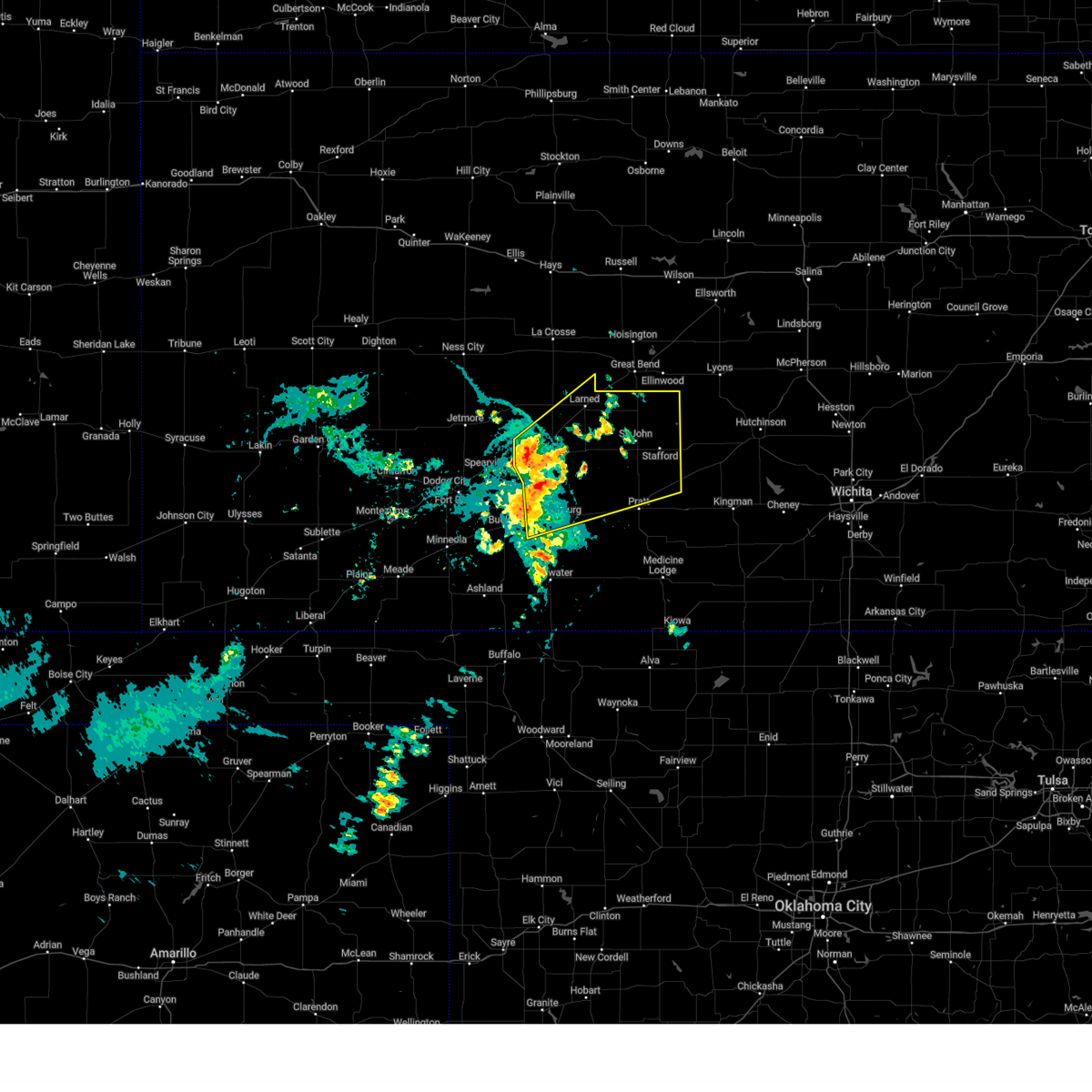
Hail Map for Preston, KS
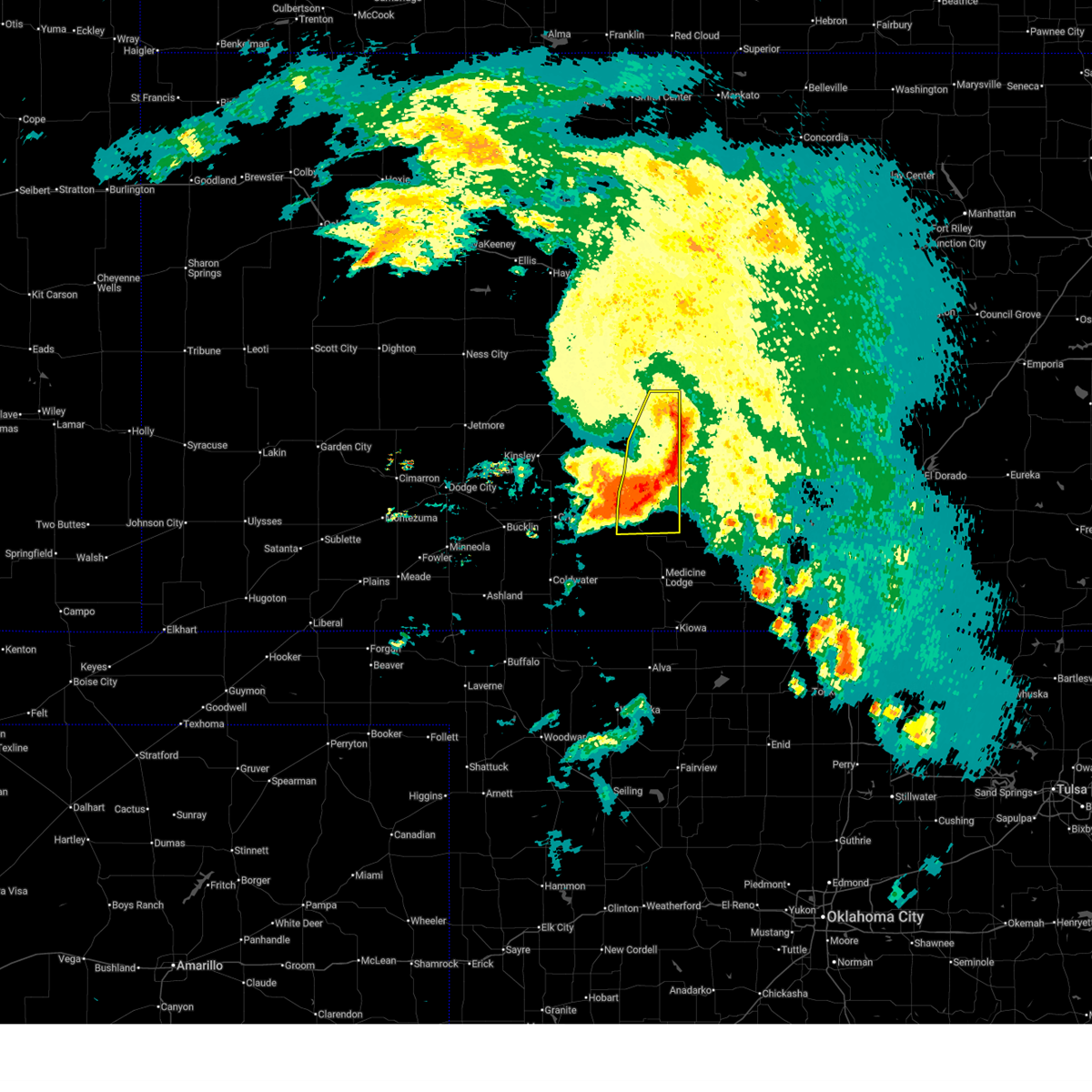
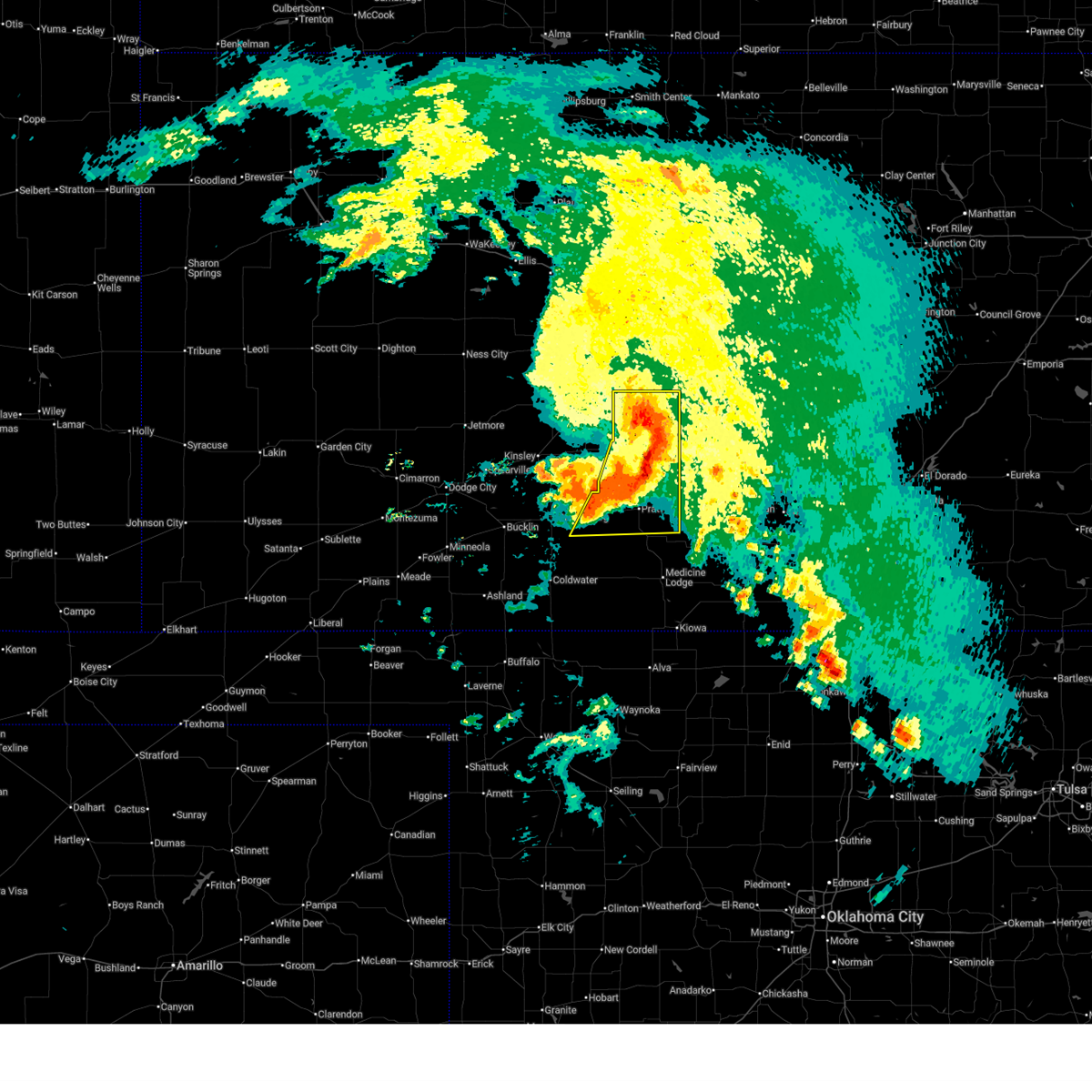
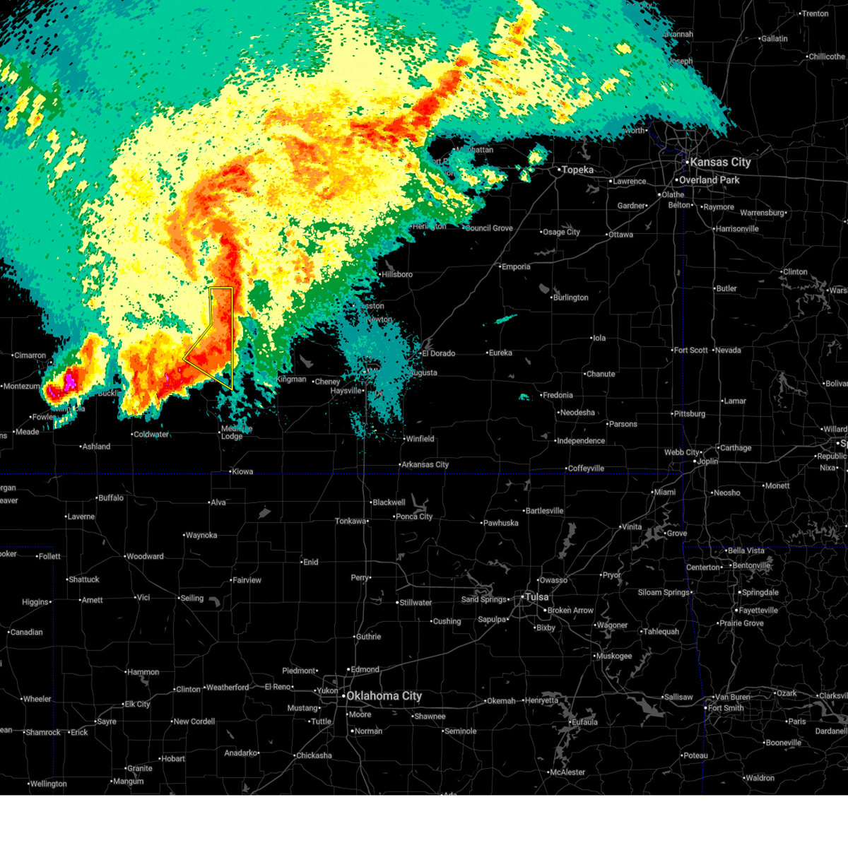
The Preston, KS area has had 1 report of on-the-ground hail by trained spotters, and has been under severe weather warnings 31 times during the past 12 months. Doppler radar has detected hail at or near Preston, KS on 92 occasions, including 12 occasions during the past year.
| Name: | Preston, KS |
| Where Located: | 67.1 miles W of Wichita, KS |
| Map: | Google Map for Preston, KS |
| Population: | 158 |
| Housing Units: | 82 |
| More Info: | Search Google for Preston, KS |
2
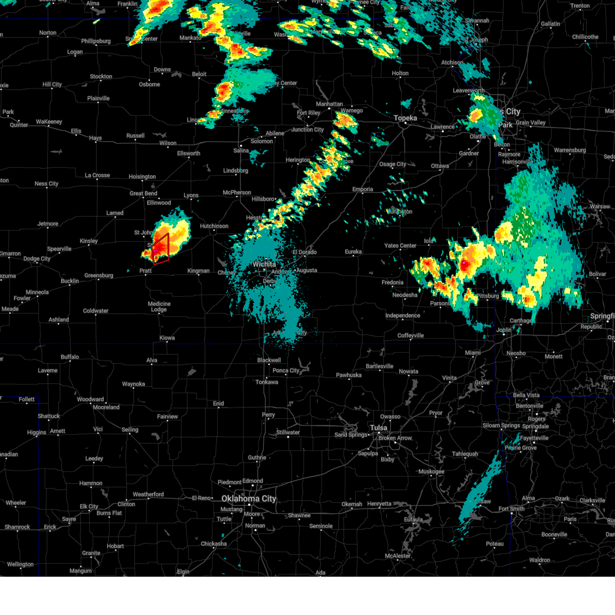
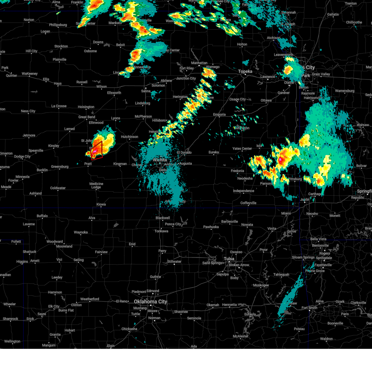
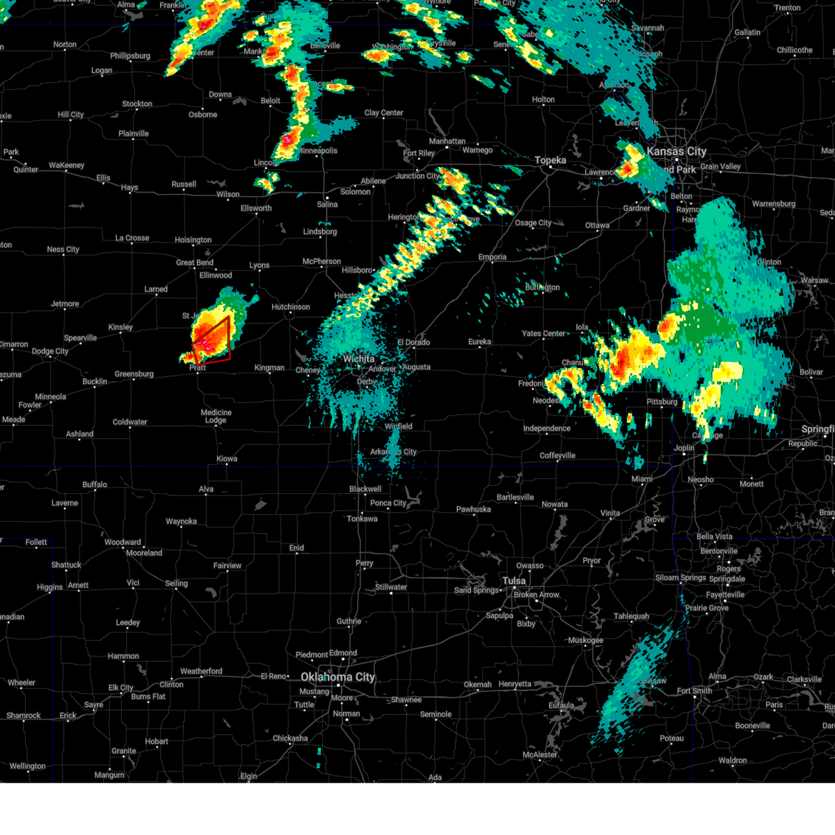
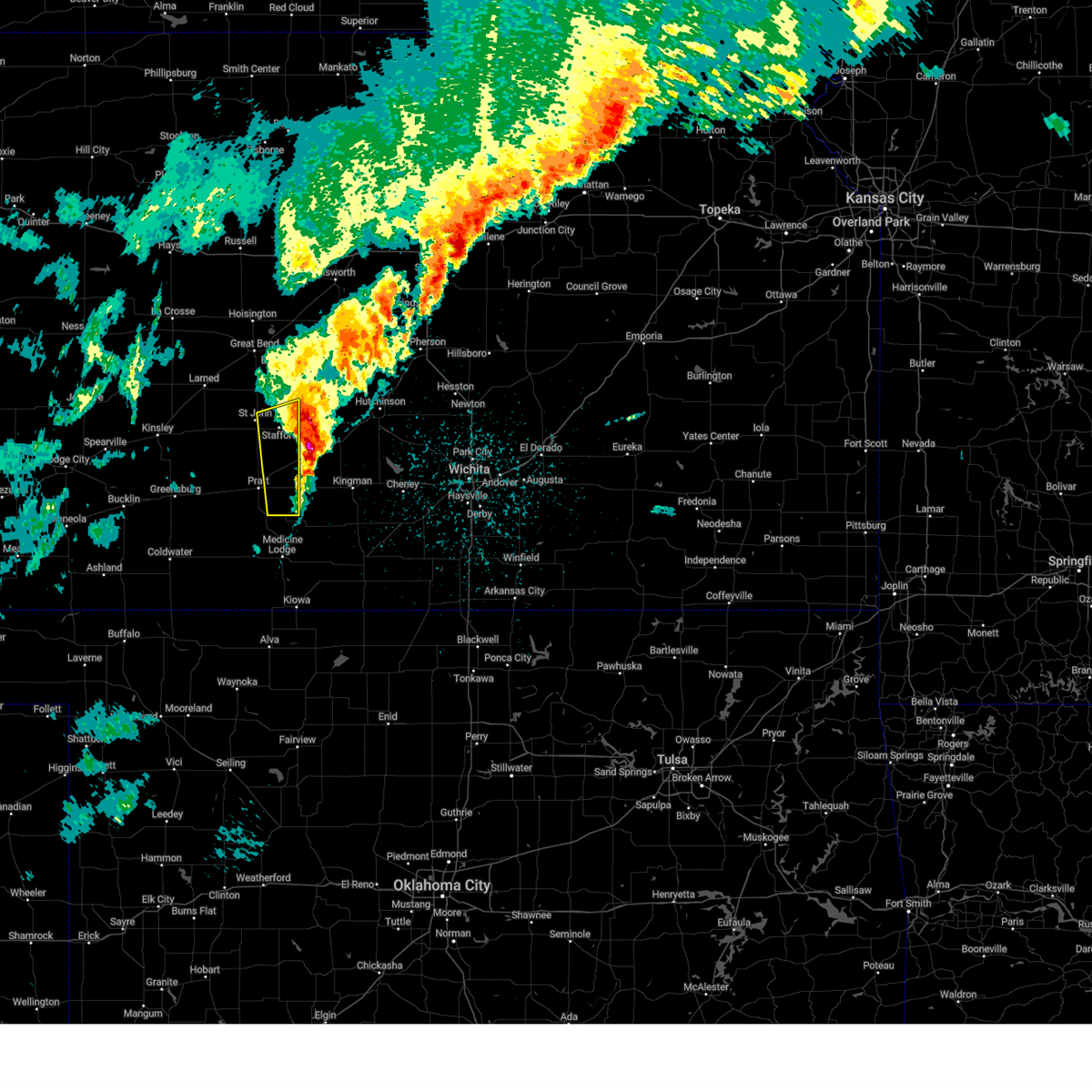
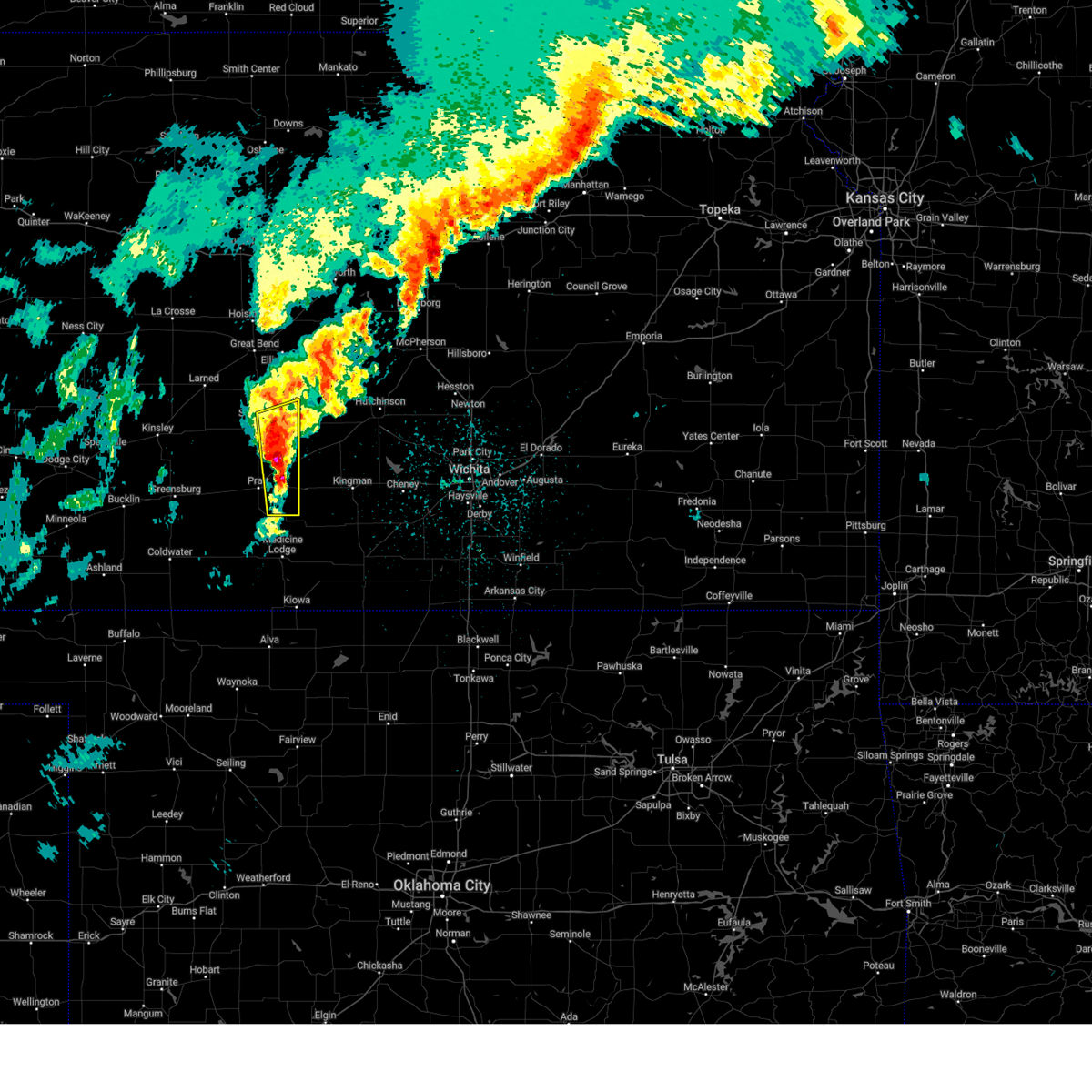
The Top Recent Hail Date for Preston, KS is Saturday, April 11, 2026 (8th out of 92)
Hail and Wind Damage Spotted near Preston, KS
| Date / Time | Report Details |
|---|---|
| 6/25/2026 10:43 AM CDT |
 At 1042 am cdt, severe thunderstorms were located along a line extending from near raymond to near sylvia to near neola to near turon to near preston to near cullison, moving east at 25 mph (radar indicated). Hazards include 60 mph wind gusts. Expect damage to roofs, siding, and trees. Locations impacted include, pratt and cairo. At 1042 am cdt, severe thunderstorms were located along a line extending from near raymond to near sylvia to near neola to near turon to near preston to near cullison, moving east at 25 mph (radar indicated). Hazards include 60 mph wind gusts. Expect damage to roofs, siding, and trees. Locations impacted include, pratt and cairo.
|
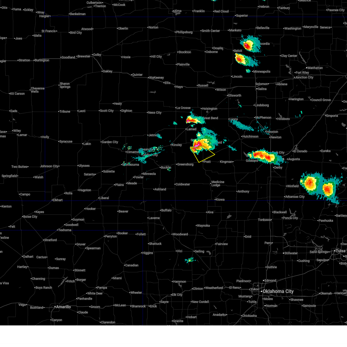
| 6/25/2026 10:22 AM CDT |
 Svrddc the national weather service in dodge city has issued a * severe thunderstorm warning for, northeastern kiowa county in south central kansas, stafford county in south central kansas, pratt county in south central kansas, * until 1115 am cdt. * at 1022 am cdt, severe thunderstorms were located along a line extending from near seward to near stafford to 8 miles northwest of preston to 7 miles north of pratt to near iuka to near haviland, moving east at 30 mph (radar indicated). Hazards include 70 mph wind gusts. Expect considerable tree damage. damage is likely to mobile homes, roofs, and outbuildings. severe thunderstorms will be near, pratt, stafford, haviland, iuka, cullison, zenith, wellsford, and neola around 1030 am cdt. preston around 1035 am cdt. Other locations in the path of these severe thunderstorms include cairo. Svrddc the national weather service in dodge city has issued a * severe thunderstorm warning for, northeastern kiowa county in south central kansas, stafford county in south central kansas, pratt county in south central kansas, * until 1115 am cdt. * at 1022 am cdt, severe thunderstorms were located along a line extending from near seward to near stafford to 8 miles northwest of preston to 7 miles north of pratt to near iuka to near haviland, moving east at 30 mph (radar indicated). Hazards include 70 mph wind gusts. Expect considerable tree damage. damage is likely to mobile homes, roofs, and outbuildings. severe thunderstorms will be near, pratt, stafford, haviland, iuka, cullison, zenith, wellsford, and neola around 1030 am cdt. preston around 1035 am cdt. Other locations in the path of these severe thunderstorms include cairo.
|
| 6/20/2026 11:45 PM CDT |
 At 1145 pm cdt, severe thunderstorms were located along a line extending from 6 miles south of alden to near cairo, moving east at 45 mph (radar indicated). Hazards include 60 mph wind gusts. Expect damage to roofs, siding, and trees. These severe thunderstorms will remain over mainly rural areas of eastern stafford and northeastern pratt counties. At 1145 pm cdt, severe thunderstorms were located along a line extending from 6 miles south of alden to near cairo, moving east at 45 mph (radar indicated). Hazards include 60 mph wind gusts. Expect damage to roofs, siding, and trees. These severe thunderstorms will remain over mainly rural areas of eastern stafford and northeastern pratt counties.
|
| 6/20/2026 11:22 PM CDT |
 Svrddc the national weather service in dodge city has issued a * severe thunderstorm warning for, stafford county in south central kansas, northeastern pratt county in south central kansas, * until midnight cdt. * at 1122 pm cdt, severe thunderstorms were located along a line extending from 8 miles south of ellinwood to near byers, moving east at 45 mph (radar indicated). Hazards include 60 mph wind gusts. Expect damage to roofs, siding, and trees. severe thunderstorms will be near, pratt, stafford, iuka, and hudson around 1125 pm cdt. preston, zenith, and neola around 1135 pm cdt. Cairo around 1140 pm cdt. Svrddc the national weather service in dodge city has issued a * severe thunderstorm warning for, stafford county in south central kansas, northeastern pratt county in south central kansas, * until midnight cdt. * at 1122 pm cdt, severe thunderstorms were located along a line extending from 8 miles south of ellinwood to near byers, moving east at 45 mph (radar indicated). Hazards include 60 mph wind gusts. Expect damage to roofs, siding, and trees. severe thunderstorms will be near, pratt, stafford, iuka, and hudson around 1125 pm cdt. preston, zenith, and neola around 1135 pm cdt. Cairo around 1140 pm cdt.
|
| 6/13/2026 8:33 PM CDT |
 the severe thunderstorm warning has been cancelled and is no longer in effect the severe thunderstorm warning has been cancelled and is no longer in effect
|
| 6/13/2026 8:26 PM CDT |
 At 826 pm cdt, a severe thunderstorm was located very near byers, moving southeast at 25 mph (radar indicated). Hazards include 60 mph wind gusts and quarter size hail. Hail damage to vehicles is expected. expect wind damage to roofs, siding, and trees. Locations impacted include, pratt and iuka. At 826 pm cdt, a severe thunderstorm was located very near byers, moving southeast at 25 mph (radar indicated). Hazards include 60 mph wind gusts and quarter size hail. Hail damage to vehicles is expected. expect wind damage to roofs, siding, and trees. Locations impacted include, pratt and iuka.
|
| 6/13/2026 8:10 PM CDT |
 At 810 pm cdt, a severe thunderstorm was located very near hopewell, moving southeast at 25 mph (radar indicated). Hazards include 60 mph wind gusts and quarter size hail. Hail damage to vehicles is expected. expect wind damage to roofs, siding, and trees. this severe storm will be near, byers around 815 pm cdt. Other locations in the path of this severe thunderstorm include pratt and iuka. At 810 pm cdt, a severe thunderstorm was located very near hopewell, moving southeast at 25 mph (radar indicated). Hazards include 60 mph wind gusts and quarter size hail. Hail damage to vehicles is expected. expect wind damage to roofs, siding, and trees. this severe storm will be near, byers around 815 pm cdt. Other locations in the path of this severe thunderstorm include pratt and iuka.
|
| 6/13/2026 7:56 PM CDT |
 Svrddc the national weather service in dodge city has issued a * severe thunderstorm warning for, southern stafford county in south central kansas, southeastern edwards county in south central kansas, pratt county in south central kansas, * until 845 pm cdt. * at 755 pm cdt, a severe thunderstorm was located near trousdale, moving southeast at 25 mph (radar indicated). Hazards include 60 mph wind gusts and quarter size hail. Hail damage to vehicles is expected. expect wind damage to roofs, siding, and trees. this severe thunderstorm will be near, hopewell around 800 pm cdt. byers around 815 pm cdt. Other locations in the path of this severe thunderstorm include pratt and iuka. Svrddc the national weather service in dodge city has issued a * severe thunderstorm warning for, southern stafford county in south central kansas, southeastern edwards county in south central kansas, pratt county in south central kansas, * until 845 pm cdt. * at 755 pm cdt, a severe thunderstorm was located near trousdale, moving southeast at 25 mph (radar indicated). Hazards include 60 mph wind gusts and quarter size hail. Hail damage to vehicles is expected. expect wind damage to roofs, siding, and trees. this severe thunderstorm will be near, hopewell around 800 pm cdt. byers around 815 pm cdt. Other locations in the path of this severe thunderstorm include pratt and iuka.
|
| 6/13/2026 7:44 PM CDT |
 At 744 pm cdt, a severe thunderstorm was located very near st. john, moving southeast at 25 mph (public). Hazards include 70 mph wind gusts and half dollar size hail. Hail damage to vehicles is expected. expect considerable tree damage. wind damage is also likely to mobile homes, roofs, and outbuildings. locations impacted include, pratt, kinsley, st. John, stafford, macksville, lewis, iuka, preston, hudson, belpre, byers, fellsburg, hopewell, zenith, neola, trousdale, and dillwyn. At 744 pm cdt, a severe thunderstorm was located very near st. john, moving southeast at 25 mph (public). Hazards include 70 mph wind gusts and half dollar size hail. Hail damage to vehicles is expected. expect considerable tree damage. wind damage is also likely to mobile homes, roofs, and outbuildings. locations impacted include, pratt, kinsley, st. John, stafford, macksville, lewis, iuka, preston, hudson, belpre, byers, fellsburg, hopewell, zenith, neola, trousdale, and dillwyn.
|
| 6/13/2026 7:32 PM CDT |
 At 732 pm cdt, a severe thunderstorm was located near st. john, moving southeast at 25 mph (public). Hazards include 70 mph wind gusts and half dollar size hail. Hail damage to vehicles is expected. expect considerable tree damage. wind damage is also likely to mobile homes, roofs, and outbuildings. locations impacted include, st. John and stafford. At 732 pm cdt, a severe thunderstorm was located near st. john, moving southeast at 25 mph (public). Hazards include 70 mph wind gusts and half dollar size hail. Hail damage to vehicles is expected. expect considerable tree damage. wind damage is also likely to mobile homes, roofs, and outbuildings. locations impacted include, st. John and stafford.
|
| 6/13/2026 7:12 PM CDT |
 Svrddc the national weather service in dodge city has issued a * severe thunderstorm warning for, pawnee county in south central kansas, stafford county in south central kansas, southeastern rush county in central kansas, edwards county in south central kansas, northern pratt county in south central kansas, * until 800 pm cdt. * at 712 pm cdt, a severe thunderstorm was located 7 miles east of zook, moving southeast at 25 mph (radar indicated). Hazards include 60 mph wind gusts and quarter size hail. Hail damage to vehicles is expected. expect wind damage to roofs, siding, and trees. this severe thunderstorm will be near, st. John around 730 pm cdt. Svrddc the national weather service in dodge city has issued a * severe thunderstorm warning for, pawnee county in south central kansas, stafford county in south central kansas, southeastern rush county in central kansas, edwards county in south central kansas, northern pratt county in south central kansas, * until 800 pm cdt. * at 712 pm cdt, a severe thunderstorm was located 7 miles east of zook, moving southeast at 25 mph (radar indicated). Hazards include 60 mph wind gusts and quarter size hail. Hail damage to vehicles is expected. expect wind damage to roofs, siding, and trees. this severe thunderstorm will be near, st. John around 730 pm cdt.
|
| 6/2/2026 12:17 AM CDT |
 At 1217 am cdt, severe thunderstorms were located along a line extending from near sylvia to near kiowa, moving east at 25 mph (radar indicated). Hazards include 60 mph wind gusts. Expect damage to roofs, siding, and trees. These severe thunderstorms will remain over mainly rural areas of eastern barber, southeastern stafford and eastern pratt counties. At 1217 am cdt, severe thunderstorms were located along a line extending from near sylvia to near kiowa, moving east at 25 mph (radar indicated). Hazards include 60 mph wind gusts. Expect damage to roofs, siding, and trees. These severe thunderstorms will remain over mainly rural areas of eastern barber, southeastern stafford and eastern pratt counties.
|
| 6/1/2026 11:52 PM CDT |
 At 1152 pm cdt, severe thunderstorms were located along a line extending from near neola to near hardtner, moving east at 25 mph (radar indicated). Hazards include 70 mph wind gusts. Expect considerable tree damage. damage is likely to mobile homes, roofs, and outbuildings. these severe storms will be near, medicine lodge, kiowa, preston, isabel, cairo, and neola around 1155 pm cdt. Other locations in the path of these severe thunderstorms include sharon and hazelton. At 1152 pm cdt, severe thunderstorms were located along a line extending from near neola to near hardtner, moving east at 25 mph (radar indicated). Hazards include 70 mph wind gusts. Expect considerable tree damage. damage is likely to mobile homes, roofs, and outbuildings. these severe storms will be near, medicine lodge, kiowa, preston, isabel, cairo, and neola around 1155 pm cdt. Other locations in the path of these severe thunderstorms include sharon and hazelton.
|
| 6/1/2026 11:40 PM CDT |
 Svrddc the national weather service in dodge city has issued a * severe thunderstorm warning for, barber county in south central kansas, southern stafford county in south central kansas, pratt county in south central kansas, * until 1230 am cdt. * at 1140 pm cdt, severe thunderstorms were located along a line extending from 6 miles southwest of stafford to near hardtner, moving east at 25 mph (radar indicated). Hazards include 70 mph wind gusts. Expect considerable tree damage. damage is likely to mobile homes, roofs, and outbuildings. severe thunderstorms will be near, medicine lodge, hardtner, preston, isabel, and cairo around 1145 pm cdt. kiowa and neola around 1150 pm cdt. sharon around 1200 am cdt. Other locations in the path of these severe thunderstorms include hazelton. Svrddc the national weather service in dodge city has issued a * severe thunderstorm warning for, barber county in south central kansas, southern stafford county in south central kansas, pratt county in south central kansas, * until 1230 am cdt. * at 1140 pm cdt, severe thunderstorms were located along a line extending from 6 miles southwest of stafford to near hardtner, moving east at 25 mph (radar indicated). Hazards include 70 mph wind gusts. Expect considerable tree damage. damage is likely to mobile homes, roofs, and outbuildings. severe thunderstorms will be near, medicine lodge, hardtner, preston, isabel, and cairo around 1145 pm cdt. kiowa and neola around 1150 pm cdt. sharon around 1200 am cdt. Other locations in the path of these severe thunderstorms include hazelton.
|
| 6/1/2026 11:28 PM CDT |
 At 1128 pm cdt, severe thunderstorms were located along a line extending from near iuka to near sawyer to 8 miles southeast of aetna, moving east at 30 mph (radar indicated). Hazards include 70 mph wind gusts. Expect considerable tree damage. damage is likely to mobile homes, roofs, and outbuildings. Locations impacted include, pratt, medicine lodge, kiowa, haviland, hardtner, iuka, preston, sharon, sawyer, cullison, hazelton, isabel, coats, lake city, sun city, byers, aetna, hopewell, wellsford, and croft. At 1128 pm cdt, severe thunderstorms were located along a line extending from near iuka to near sawyer to 8 miles southeast of aetna, moving east at 30 mph (radar indicated). Hazards include 70 mph wind gusts. Expect considerable tree damage. damage is likely to mobile homes, roofs, and outbuildings. Locations impacted include, pratt, medicine lodge, kiowa, haviland, hardtner, iuka, preston, sharon, sawyer, cullison, hazelton, isabel, coats, lake city, sun city, byers, aetna, hopewell, wellsford, and croft.
|
| 6/1/2026 11:08 PM CDT |
 At 1108 pm cdt, severe thunderstorms were located along a line extending from near byers to near sun city to 11 miles north of freedom, moving east at 30 mph (radar indicated). Hazards include 70 mph wind gusts. Expect considerable tree damage. damage is likely to mobile homes, roofs, and outbuildings. Locations impacted include, pratt, medicine lodge, kiowa, coldwater, greensburg, haviland, hardtner, iuka, preston, sharon, sawyer, cullison, hazelton, isabel, coats, lake city, wilmore, sun city, byers, and aetna. At 1108 pm cdt, severe thunderstorms were located along a line extending from near byers to near sun city to 11 miles north of freedom, moving east at 30 mph (radar indicated). Hazards include 70 mph wind gusts. Expect considerable tree damage. damage is likely to mobile homes, roofs, and outbuildings. Locations impacted include, pratt, medicine lodge, kiowa, coldwater, greensburg, haviland, hardtner, iuka, preston, sharon, sawyer, cullison, hazelton, isabel, coats, lake city, wilmore, sun city, byers, and aetna.
|
| 6/1/2026 10:41 PM CDT |
 Svrddc the national weather service in dodge city has issued a * severe thunderstorm warning for, kiowa county in south central kansas, barber county in south central kansas, comanche county in south central kansas, southern stafford county in south central kansas, southeastern edwards county in south central kansas, pratt county in south central kansas, * until 1145 pm cdt. * at 1040 pm cdt, severe thunderstorms were located along a line extending from near trousdale to near wilmore to 9 miles south of buttermilk, moving east at 30 mph (radar indicated). Hazards include 60 mph wind gusts. Expect damage to roofs, siding, and trees. severe thunderstorms will be near, belvidere, croft, and wellsford around 1045 pm cdt. cullison and sun city around 1055 pm cdt. Other locations in the path of these severe thunderstorms include coats, lake city, aetna, pratt, iuka, sawyer, medicine lodge, isabel and cairo. Svrddc the national weather service in dodge city has issued a * severe thunderstorm warning for, kiowa county in south central kansas, barber county in south central kansas, comanche county in south central kansas, southern stafford county in south central kansas, southeastern edwards county in south central kansas, pratt county in south central kansas, * until 1145 pm cdt. * at 1040 pm cdt, severe thunderstorms were located along a line extending from near trousdale to near wilmore to 9 miles south of buttermilk, moving east at 30 mph (radar indicated). Hazards include 60 mph wind gusts. Expect damage to roofs, siding, and trees. severe thunderstorms will be near, belvidere, croft, and wellsford around 1045 pm cdt. cullison and sun city around 1055 pm cdt. Other locations in the path of these severe thunderstorms include coats, lake city, aetna, pratt, iuka, sawyer, medicine lodge, isabel and cairo.
|
| 5/18/2026 7:20 PM CDT |
 The storm which prompted the warning has weakened below severe limits, and no longer poses an immediate threat to life or property. therefore, the warning will be allowed to expire. however, small hail is still possible with this thunderstorm. a tornado watch remains in effect until 1000 pm cdt for south central kansas. The storm which prompted the warning has weakened below severe limits, and no longer poses an immediate threat to life or property. therefore, the warning will be allowed to expire. however, small hail is still possible with this thunderstorm. a tornado watch remains in effect until 1000 pm cdt for south central kansas.
|
| 5/18/2026 6:39 PM CDT |
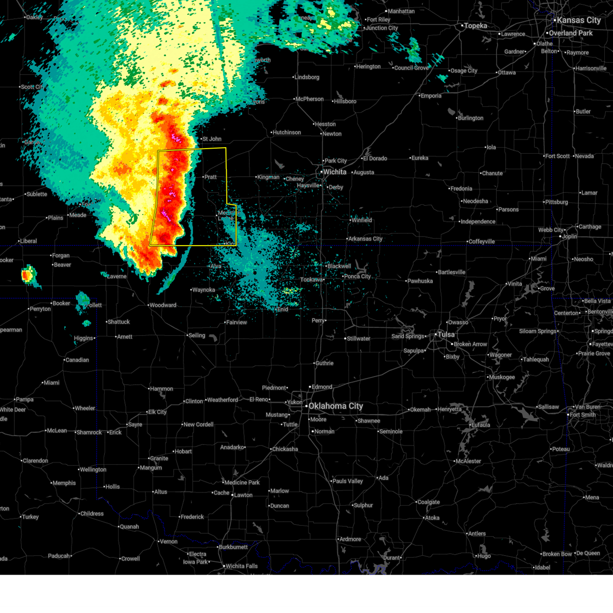
 Svrddc the national weather service in dodge city has issued a * severe thunderstorm warning for, southeastern stafford county in south central kansas, northeastern pratt county in south central kansas, * until 730 pm cdt. * at 639 pm cdt, a severe thunderstorm was located near preston, moving east at 45 mph (radar indicated). Hazards include 60 mph wind gusts and quarter size hail. Hail damage to vehicles is expected. expect wind damage to roofs, siding, and trees. This severe thunderstorm will be near, preston around 645 pm cdt. Svrddc the national weather service in dodge city has issued a * severe thunderstorm warning for, southeastern stafford county in south central kansas, northeastern pratt county in south central kansas, * until 730 pm cdt. * at 639 pm cdt, a severe thunderstorm was located near preston, moving east at 45 mph (radar indicated). Hazards include 60 mph wind gusts and quarter size hail. Hail damage to vehicles is expected. expect wind damage to roofs, siding, and trees. This severe thunderstorm will be near, preston around 645 pm cdt.
|
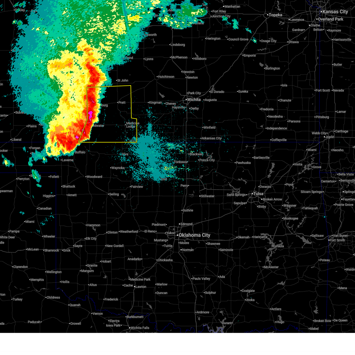
| 5/18/2026 5:57 PM CDT |
 Svrddc the national weather service in dodge city has issued a * severe thunderstorm warning for, southeastern stafford county in south central kansas, northeastern pratt county in south central kansas, * until 645 pm cdt. * at 557 pm cdt, a severe thunderstorm was located near stafford, moving east at 50 mph. another storm was located near iuka moving east at 50 mph (radar indicated). Hazards include 60 mph wind gusts and quarter size hail. Hail damage to vehicles is expected. expect wind damage to roofs, siding, and trees. this severe thunderstorm will be near, stafford around 600 pm cdt. Zenith around 605 pm cdt. Svrddc the national weather service in dodge city has issued a * severe thunderstorm warning for, southeastern stafford county in south central kansas, northeastern pratt county in south central kansas, * until 645 pm cdt. * at 557 pm cdt, a severe thunderstorm was located near stafford, moving east at 50 mph. another storm was located near iuka moving east at 50 mph (radar indicated). Hazards include 60 mph wind gusts and quarter size hail. Hail damage to vehicles is expected. expect wind damage to roofs, siding, and trees. this severe thunderstorm will be near, stafford around 600 pm cdt. Zenith around 605 pm cdt.
|
| 4/25/2026 6:49 PM CDT |
 At 649 pm cdt, a severe thunderstorm was located near pratt, moving south at 20 mph (emergency management). Hazards include tennis ball size hail and 70 mph wind gusts. People and animals outdoors will be injured. expect hail damage to roofs, siding, windows, and vehicles. expect considerable tree damage. wind damage is also likely to mobile homes, roofs, and outbuildings. This severe thunderstorm will remain over mainly rural areas of eastern pratt county. At 649 pm cdt, a severe thunderstorm was located near pratt, moving south at 20 mph (emergency management). Hazards include tennis ball size hail and 70 mph wind gusts. People and animals outdoors will be injured. expect hail damage to roofs, siding, windows, and vehicles. expect considerable tree damage. wind damage is also likely to mobile homes, roofs, and outbuildings. This severe thunderstorm will remain over mainly rural areas of eastern pratt county.
|
| 4/25/2026 6:34 PM CDT |
 Svrddc the national weather service in dodge city has issued a * severe thunderstorm warning for, eastern pratt county in south central kansas, * until 730 pm cdt. * at 634 pm cdt, a severe thunderstorm was located very near iuka, moving southeast at 15 mph (radar indicated). Hazards include two inch hail and 70 mph wind gusts. People and animals outdoors will be injured. expect hail damage to roofs, siding, windows, and vehicles. expect considerable tree damage. wind damage is also likely to mobile homes, roofs, and outbuildings. This severe thunderstorm will be near, pratt and iuka around 640 pm cdt. Svrddc the national weather service in dodge city has issued a * severe thunderstorm warning for, eastern pratt county in south central kansas, * until 730 pm cdt. * at 634 pm cdt, a severe thunderstorm was located very near iuka, moving southeast at 15 mph (radar indicated). Hazards include two inch hail and 70 mph wind gusts. People and animals outdoors will be injured. expect hail damage to roofs, siding, windows, and vehicles. expect considerable tree damage. wind damage is also likely to mobile homes, roofs, and outbuildings. This severe thunderstorm will be near, pratt and iuka around 640 pm cdt.
|
| 4/25/2026 6:33 PM CDT |
 At 632 pm cdt, a severe thunderstorm was located near byers, moving southeast at 15 mph (radar indicated). Hazards include two inch hail and 70 mph wind gusts. People and animals outdoors will be injured. expect hail damage to roofs, siding, windows, and vehicles. expect considerable tree damage. wind damage is also likely to mobile homes, roofs, and outbuildings. This severe storm will be near, pratt and iuka around 640 pm cdt. At 632 pm cdt, a severe thunderstorm was located near byers, moving southeast at 15 mph (radar indicated). Hazards include two inch hail and 70 mph wind gusts. People and animals outdoors will be injured. expect hail damage to roofs, siding, windows, and vehicles. expect considerable tree damage. wind damage is also likely to mobile homes, roofs, and outbuildings. This severe storm will be near, pratt and iuka around 640 pm cdt.
|
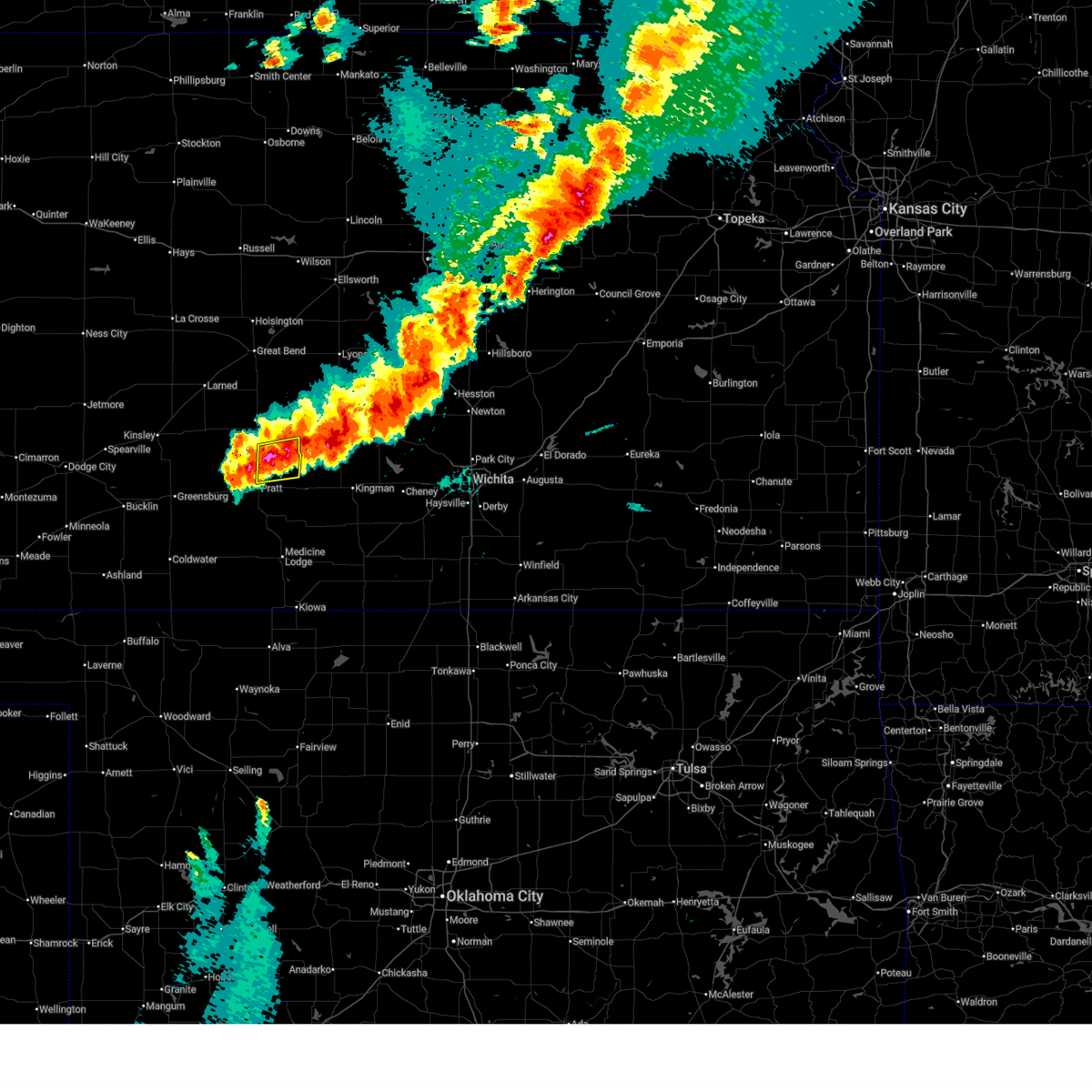
| 4/25/2026 6:17 PM CDT |
 Svrddc the national weather service in dodge city has issued a * severe thunderstorm warning for, southwestern stafford county in south central kansas, northern pratt county in south central kansas, * until 715 pm cdt. * at 617 pm cdt, a severe thunderstorm was located near byers, moving southeast at 15 mph (radar indicated). Hazards include two inch hail and 60 mph wind gusts. People and animals outdoors will be injured. expect hail damage to roofs, siding, windows, and vehicles. expect wind damage to roofs, siding, and trees. this severe thunderstorm will be near, byers around 620 pm cdt. Other locations in the path of this severe thunderstorm include iuka and pratt. Svrddc the national weather service in dodge city has issued a * severe thunderstorm warning for, southwestern stafford county in south central kansas, northern pratt county in south central kansas, * until 715 pm cdt. * at 617 pm cdt, a severe thunderstorm was located near byers, moving southeast at 15 mph (radar indicated). Hazards include two inch hail and 60 mph wind gusts. People and animals outdoors will be injured. expect hail damage to roofs, siding, windows, and vehicles. expect wind damage to roofs, siding, and trees. this severe thunderstorm will be near, byers around 620 pm cdt. Other locations in the path of this severe thunderstorm include iuka and pratt.
|
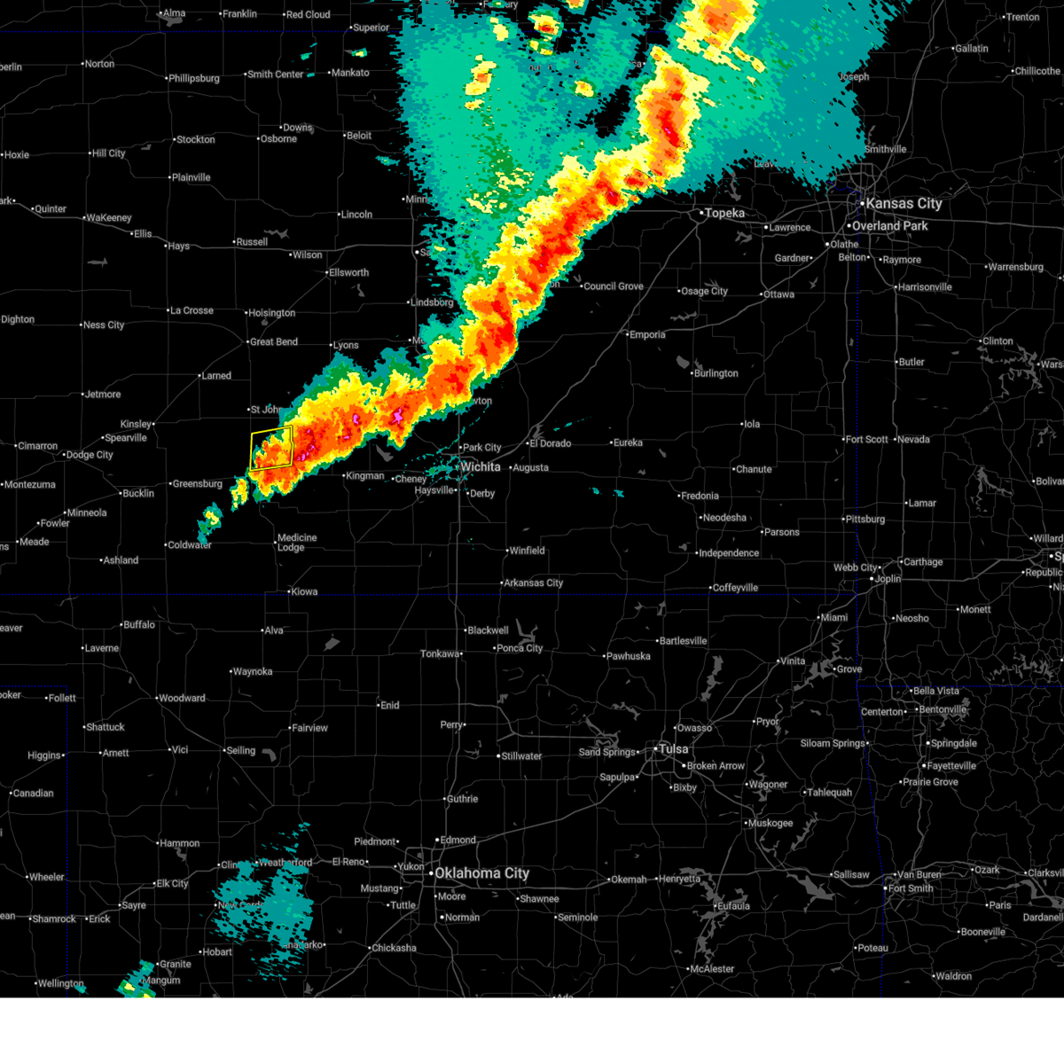
| 4/14/2026 9:04 PM CDT |
 Svrddc the national weather service in dodge city has issued a * severe thunderstorm warning for, southeastern stafford county in south central kansas, northeastern pratt county in south central kansas, * until 930 pm cdt. * at 904 pm cdt, a severe thunderstorm was located near preston, moving northeast at 30 mph (radar indicated). Hazards include quarter size hail. Damage to vehicles is expected. This severe thunderstorm will be near, neola around 910 pm cdt. Svrddc the national weather service in dodge city has issued a * severe thunderstorm warning for, southeastern stafford county in south central kansas, northeastern pratt county in south central kansas, * until 930 pm cdt. * at 904 pm cdt, a severe thunderstorm was located near preston, moving northeast at 30 mph (radar indicated). Hazards include quarter size hail. Damage to vehicles is expected. This severe thunderstorm will be near, neola around 910 pm cdt.
|
| 9/23/2025 1:57 AM CDT | The storm which prompted the warning has moved out of the area. therefore, the warning will be allowed to expire. however, heavy rain is still possible with this thunderstorm. a severe thunderstorm watch remains in effect until 300 am cdt for south central kansas. |
| 9/23/2025 1:37 AM CDT | At 137 am cdt, a severe thunderstorm was located very near cairo, moving north at 25 mph (radar indicated). Hazards include 60 mph wind gusts. Expect damage to roofs, siding, and trees. Locations impacted include, preston. |
| 9/23/2025 1:09 AM CDT | Svrddc the national weather service in dodge city has issued a * severe thunderstorm warning for, eastern barber county in south central kansas, pratt county in south central kansas, * until 200 am cdt. * at 109 am cdt, severe thunderstorms were located along a line extending from near cullison to isabel to near hazelton, moving northeast at 30 mph (radar indicated). Hazards include 60 mph wind gusts. Expect damage to roofs, siding, and trees. severe thunderstorms will be near, pratt around 115 am cdt. cairo around 120 am cdt. iuka around 125 am cdt. Other locations in the path of these severe thunderstorms include preston. |
| 9/8/2025 1:33 PM CDT | Svrddc the national weather service in dodge city has issued a * severe thunderstorm warning for, southeastern stafford county in south central kansas, northeastern pratt county in south central kansas, * until 215 pm cdt. * at 133 pm cdt, a severe thunderstorm was located near stafford, moving east at 30 mph (radar indicated). Hazards include quarter size hail. Damage to vehicles is expected. This severe thunderstorm will be near, neola around 145 pm cdt. |
| 8/11/2025 2:42 AM CDT |
 Svrddc the national weather service in dodge city has issued a * severe thunderstorm warning for, eastern stafford county in south central kansas, eastern pratt county in south central kansas, * until 300 am cdt. * at 242 am cdt, severe thunderstorms were located along a line extending from near neola to near cunningham, moving northeast at 35 mph (radar indicated). Hazards include 60 mph wind gusts and penny size hail. Expect damage to roofs, siding, and trees. severe thunderstorms will be near, stafford and neola around 245 am cdt. Zenith around 250 am cdt. Svrddc the national weather service in dodge city has issued a * severe thunderstorm warning for, eastern stafford county in south central kansas, eastern pratt county in south central kansas, * until 300 am cdt. * at 242 am cdt, severe thunderstorms were located along a line extending from near neola to near cunningham, moving northeast at 35 mph (radar indicated). Hazards include 60 mph wind gusts and penny size hail. Expect damage to roofs, siding, and trees. severe thunderstorms will be near, stafford and neola around 245 am cdt. Zenith around 250 am cdt.
|
| 8/11/2025 1:40 AM CDT |
 Svrddc the national weather service in dodge city has issued a * severe thunderstorm warning for, northeastern kiowa county in south central kansas, barber county in south central kansas, pratt county in south central kansas, * until 245 am cdt. * at 140 am cdt, severe thunderstorms were located along a line extending from near centerview to near belvidere to 7 miles west of aetna, moving east at 45 mph (radar indicated). Hazards include 60 mph wind gusts. Expect damage to roofs, siding, and trees. severe thunderstorms will be near, haviland, aetna, and croft around 145 am cdt. sun city and wellsford around 150 am cdt. cullison and coats around 155 am cdt. lake city around 200 am cdt. Other locations in the path of these severe thunderstorms include pratt, sawyer, byers, iuka, medicine lodge, isabel and cairo. Svrddc the national weather service in dodge city has issued a * severe thunderstorm warning for, northeastern kiowa county in south central kansas, barber county in south central kansas, pratt county in south central kansas, * until 245 am cdt. * at 140 am cdt, severe thunderstorms were located along a line extending from near centerview to near belvidere to 7 miles west of aetna, moving east at 45 mph (radar indicated). Hazards include 60 mph wind gusts. Expect damage to roofs, siding, and trees. severe thunderstorms will be near, haviland, aetna, and croft around 145 am cdt. sun city and wellsford around 150 am cdt. cullison and coats around 155 am cdt. lake city around 200 am cdt. Other locations in the path of these severe thunderstorms include pratt, sawyer, byers, iuka, medicine lodge, isabel and cairo.
|
| 7/21/2025 9:47 PM CDT |
 the severe thunderstorm warning has been cancelled and is no longer in effect the severe thunderstorm warning has been cancelled and is no longer in effect
|
| 7/21/2025 9:27 PM CDT |
 At 927 pm cdt, severe thunderstorms were located along a line extending from near sylvia to near zook, moving southeast at 20 mph (radar indicated). Hazards include 60 mph wind gusts. Expect damage to roofs, siding, and trees. Locations impacted include, stafford, macksville, belpre, zenith, dillwyn and neola. At 927 pm cdt, severe thunderstorms were located along a line extending from near sylvia to near zook, moving southeast at 20 mph (radar indicated). Hazards include 60 mph wind gusts. Expect damage to roofs, siding, and trees. Locations impacted include, stafford, macksville, belpre, zenith, dillwyn and neola.
|
| 7/21/2025 9:06 PM CDT |
 Svrddc the national weather service in dodge city has issued a * severe thunderstorm warning for, southeastern pawnee county in south central kansas, stafford county in south central kansas, southeastern edwards county in south central kansas, northern pratt county in south central kansas, * until 1000 pm cdt. * at 905 pm cdt, severe thunderstorms were located along a line extending from 10 miles north of sylvia to near frizell, moving south at 25 mph (radar indicated). Hazards include 70 mph wind gusts and penny size hail. Expect considerable tree damage. damage is likely to mobile homes, roofs, and outbuildings. severe thunderstorms will be near, hudson and zook around 910 pm cdt. st. john around 915 pm cdt. stafford and dillwyn around 920 pm cdt. macksville, belpre, and zenith around 925 pm cdt. Other locations in the path of these severe thunderstorms include neola. Svrddc the national weather service in dodge city has issued a * severe thunderstorm warning for, southeastern pawnee county in south central kansas, stafford county in south central kansas, southeastern edwards county in south central kansas, northern pratt county in south central kansas, * until 1000 pm cdt. * at 905 pm cdt, severe thunderstorms were located along a line extending from 10 miles north of sylvia to near frizell, moving south at 25 mph (radar indicated). Hazards include 70 mph wind gusts and penny size hail. Expect considerable tree damage. damage is likely to mobile homes, roofs, and outbuildings. severe thunderstorms will be near, hudson and zook around 910 pm cdt. st. john around 915 pm cdt. stafford and dillwyn around 920 pm cdt. macksville, belpre, and zenith around 925 pm cdt. Other locations in the path of these severe thunderstorms include neola.
|
| 6/17/2025 3:25 AM CDT |
 The storms which prompted the warning have weakened below severe limits, and no longer pose an immediate threat to life or property. therefore, the warning will be allowed to expire. however, gusty winds are still possible with these thunderstorms. a severe thunderstorm watch remains in effect until 700 am cdt for south central kansas. The storms which prompted the warning have weakened below severe limits, and no longer pose an immediate threat to life or property. therefore, the warning will be allowed to expire. however, gusty winds are still possible with these thunderstorms. a severe thunderstorm watch remains in effect until 700 am cdt for south central kansas.
|
| 6/17/2025 3:10 AM CDT |
 the severe thunderstorm warning has been cancelled and is no longer in effect the severe thunderstorm warning has been cancelled and is no longer in effect
|
| 6/17/2025 3:10 AM CDT |
 At 309 am cdt, severe thunderstorms were located along a line extending from 7 miles north of plevna to near zenith to near byers, moving southeast at 45 mph (radar indicated). Hazards include 60 mph wind gusts. Expect damage to roofs, siding, and trees. locations impacted include, pratt, st. John, stafford, haviland, macksville, iuka, preston, hudson, cullison, byers, hopewell, wellsford, zenith, cairo, neola, trousdale, and dillwyn. At 309 am cdt, severe thunderstorms were located along a line extending from 7 miles north of plevna to near zenith to near byers, moving southeast at 45 mph (radar indicated). Hazards include 60 mph wind gusts. Expect damage to roofs, siding, and trees. locations impacted include, pratt, st. John, stafford, haviland, macksville, iuka, preston, hudson, cullison, byers, hopewell, wellsford, zenith, cairo, neola, trousdale, and dillwyn.
|
| 6/17/2025 2:54 AM CDT |
 At 253 am cdt, severe thunderstorms were located along a line extending from 8 miles southwest of raymond to near hudson to near belpre, moving southeast at 45 mph (radar indicated). Hazards include 70 mph wind gusts and penny size hail. Expect considerable tree damage. damage is likely to mobile homes, roofs, and outbuildings. locations impacted include, st. John, macksville, dillwyn, stafford, byers, zenith, neola, pratt, iuka and preston. At 253 am cdt, severe thunderstorms were located along a line extending from 8 miles southwest of raymond to near hudson to near belpre, moving southeast at 45 mph (radar indicated). Hazards include 70 mph wind gusts and penny size hail. Expect considerable tree damage. damage is likely to mobile homes, roofs, and outbuildings. locations impacted include, st. John, macksville, dillwyn, stafford, byers, zenith, neola, pratt, iuka and preston.
|
| 6/17/2025 2:39 AM CDT |
 Svrddc the national weather service in dodge city has issued a * severe thunderstorm warning for, northeastern kiowa county in south central kansas, southeastern pawnee county in south central kansas, stafford county in south central kansas, southeastern edwards county in south central kansas, pratt county in south central kansas, * until 330 am cdt. * at 238 am cdt, severe thunderstorms were located along a line extending from 7 miles southwest of ellinwood to near seward to near garfield, moving southeast at 45 mph (radar indicated). Hazards include 70 mph wind gusts and penny size hail. Expect considerable tree damage. damage is likely to mobile homes, roofs, and outbuildings. severe thunderstorms will be near, hudson, belpre, and zook around 245 am cdt. st. john, macksville, and dillwyn around 250 am cdt. Other locations in the path of these severe thunderstorms include stafford, zenith, byers, neola, pratt and iuka. Svrddc the national weather service in dodge city has issued a * severe thunderstorm warning for, northeastern kiowa county in south central kansas, southeastern pawnee county in south central kansas, stafford county in south central kansas, southeastern edwards county in south central kansas, pratt county in south central kansas, * until 330 am cdt. * at 238 am cdt, severe thunderstorms were located along a line extending from 7 miles southwest of ellinwood to near seward to near garfield, moving southeast at 45 mph (radar indicated). Hazards include 70 mph wind gusts and penny size hail. Expect considerable tree damage. damage is likely to mobile homes, roofs, and outbuildings. severe thunderstorms will be near, hudson, belpre, and zook around 245 am cdt. st. john, macksville, and dillwyn around 250 am cdt. Other locations in the path of these severe thunderstorms include stafford, zenith, byers, neola, pratt and iuka.
|
| 6/14/2025 6:35 AM CDT |
 At 635 am cdt, severe thunderstorms were located along a line extending from near hudson to near cairo to 10 miles southeast of wilmore, moving east at 45 mph (radar indicated). Hazards include 70 mph wind gusts and penny size hail. Expect considerable tree damage. damage is likely to mobile homes, roofs, and outbuildings. these severe storms will be near, sawyer, isabel, lake city, zenith, cairo, and neola around 640 am cdt. Other locations in the path of these severe thunderstorms include medicine lodge and sharon. At 635 am cdt, severe thunderstorms were located along a line extending from near hudson to near cairo to 10 miles southeast of wilmore, moving east at 45 mph (radar indicated). Hazards include 70 mph wind gusts and penny size hail. Expect considerable tree damage. damage is likely to mobile homes, roofs, and outbuildings. these severe storms will be near, sawyer, isabel, lake city, zenith, cairo, and neola around 640 am cdt. Other locations in the path of these severe thunderstorms include medicine lodge and sharon.
|
| 6/14/2025 6:22 AM CDT |
 Svrddc the national weather service in dodge city has issued a * severe thunderstorm warning for, southeastern kiowa county in south central kansas, barber county in south central kansas, eastern comanche county in south central kansas, southeastern pawnee county in south central kansas, stafford county in south central kansas, pratt county in south central kansas, * until 700 am cdt. * at 621 am cdt, severe thunderstorms were located along a line extending from near seward to near pratt to near lake coldwater, moving east at 45 mph (radar indicated). Hazards include 60 mph wind gusts and penny size hail. Expect damage to roofs, siding, and trees. severe thunderstorms will be near, pratt, st. john, iuka, hudson, coats, and croft around 625 am cdt. stafford, preston, sawyer, sun city, and cairo around 630 am cdt. lake city, zenith, and neola around 635 am cdt. isabel around 640 am cdt. Other locations in the path of these severe thunderstorms include medicine lodge. Svrddc the national weather service in dodge city has issued a * severe thunderstorm warning for, southeastern kiowa county in south central kansas, barber county in south central kansas, eastern comanche county in south central kansas, southeastern pawnee county in south central kansas, stafford county in south central kansas, pratt county in south central kansas, * until 700 am cdt. * at 621 am cdt, severe thunderstorms were located along a line extending from near seward to near pratt to near lake coldwater, moving east at 45 mph (radar indicated). Hazards include 60 mph wind gusts and penny size hail. Expect damage to roofs, siding, and trees. severe thunderstorms will be near, pratt, st. john, iuka, hudson, coats, and croft around 625 am cdt. stafford, preston, sawyer, sun city, and cairo around 630 am cdt. lake city, zenith, and neola around 635 am cdt. isabel around 640 am cdt. Other locations in the path of these severe thunderstorms include medicine lodge.
|
| 6/7/2025 1:02 AM CDT |
 Svrddc the national weather service in dodge city has issued a * severe thunderstorm warning for, northern barber county in south central kansas, pratt county in south central kansas, * until 130 am cdt. * at 102 am cdt, a severe thunderstorm was located near medicine lodge, moving east at 50 mph (radar indicated). Hazards include 60 mph wind gusts. expect damage to roofs, siding, and trees Svrddc the national weather service in dodge city has issued a * severe thunderstorm warning for, northern barber county in south central kansas, pratt county in south central kansas, * until 130 am cdt. * at 102 am cdt, a severe thunderstorm was located near medicine lodge, moving east at 50 mph (radar indicated). Hazards include 60 mph wind gusts. expect damage to roofs, siding, and trees
|
| 5/25/2025 6:27 AM CDT |
 the severe thunderstorm warning has been cancelled and is no longer in effect the severe thunderstorm warning has been cancelled and is no longer in effect
|
| 5/25/2025 6:27 AM CDT |
 At 627 am cdt, severe thunderstorms were located along a line extending from 7 miles west of raymond to near cunningham to near lake city, moving east at 55 mph (radar indicated). Hazards include 70 mph wind gusts and penny size hail. Expect considerable tree damage. damage is likely to mobile homes, roofs, and outbuildings. Locations impacted include, sawyer, isabel, lake city, zenith, medicine lodge and sharon. At 627 am cdt, severe thunderstorms were located along a line extending from 7 miles west of raymond to near cunningham to near lake city, moving east at 55 mph (radar indicated). Hazards include 70 mph wind gusts and penny size hail. Expect considerable tree damage. damage is likely to mobile homes, roofs, and outbuildings. Locations impacted include, sawyer, isabel, lake city, zenith, medicine lodge and sharon.
|
| 5/25/2025 5:59 AM CDT |
 Svrddc the national weather service in dodge city has issued a * severe thunderstorm warning for, kiowa county in south central kansas, barber county in south central kansas, northern comanche county in south central kansas, eastern pawnee county in south central kansas, stafford county in south central kansas, southeastern edwards county in south central kansas, pratt county in south central kansas, * until 700 am cdt. * at 558 am cdt, severe thunderstorms were located along a line extending from near pawnee rock to near hopewell to 9 miles northwest of wilmore, moving east at 55 mph (radar indicated). Hazards include 70 mph wind gusts and penny size hail. Expect considerable tree damage. damage is likely to mobile homes, roofs, and outbuildings. severe thunderstorms will be near, pratt, st. john, iuka, cullison, seward, byers, radium, dillwyn, belvidere, and croft around 605 am cdt. stafford, hudson, coats, and sun city around 615 am cdt. Other locations in the path of these severe thunderstorms include preston, sawyer, cairo, neola, lake city, zenith, isabel, medicine lodge and sharon. Svrddc the national weather service in dodge city has issued a * severe thunderstorm warning for, kiowa county in south central kansas, barber county in south central kansas, northern comanche county in south central kansas, eastern pawnee county in south central kansas, stafford county in south central kansas, southeastern edwards county in south central kansas, pratt county in south central kansas, * until 700 am cdt. * at 558 am cdt, severe thunderstorms were located along a line extending from near pawnee rock to near hopewell to 9 miles northwest of wilmore, moving east at 55 mph (radar indicated). Hazards include 70 mph wind gusts and penny size hail. Expect considerable tree damage. damage is likely to mobile homes, roofs, and outbuildings. severe thunderstorms will be near, pratt, st. john, iuka, cullison, seward, byers, radium, dillwyn, belvidere, and croft around 605 am cdt. stafford, hudson, coats, and sun city around 615 am cdt. Other locations in the path of these severe thunderstorms include preston, sawyer, cairo, neola, lake city, zenith, isabel, medicine lodge and sharon.
|
| 5/24/2025 2:09 AM CDT |
 Svrddc the national weather service in dodge city has issued a * severe thunderstorm warning for, northeastern barber county in south central kansas, southeastern stafford county in south central kansas, pratt county in south central kansas, * until 245 am cdt. * at 209 am cdt, severe thunderstorms were located along a line extending from near neola to near sun city, moving east at 35 mph (radar indicated). Hazards include 60 mph wind gusts and penny size hail. Expect damage to roofs, siding, and trees. severe thunderstorms will be near, preston, sawyer, and cairo around 215 am cdt. Isabel around 225 am cdt. Svrddc the national weather service in dodge city has issued a * severe thunderstorm warning for, northeastern barber county in south central kansas, southeastern stafford county in south central kansas, pratt county in south central kansas, * until 245 am cdt. * at 209 am cdt, severe thunderstorms were located along a line extending from near neola to near sun city, moving east at 35 mph (radar indicated). Hazards include 60 mph wind gusts and penny size hail. Expect damage to roofs, siding, and trees. severe thunderstorms will be near, preston, sawyer, and cairo around 215 am cdt. Isabel around 225 am cdt.
|
| 5/24/2025 2:07 AM CDT |
 Svrddc the national weather service in dodge city has issued a * severe thunderstorm warning for, northeastern barber county in south central kansas, southeastern stafford county in south central kansas, pratt county in south central kansas, * until 245 am cdt. * at 207 am cdt, severe thunderstorms were located along a line extending from near neola to near sun city, moving southeast at 35 mph (radar indicated). Hazards include two inch hail and 60 mph wind gusts. People and animals outdoors will be injured. expect hail damage to roofs, siding, windows, and vehicles. expect wind damage to roofs, siding, and trees. severe thunderstorms will be near, preston, sawyer, and neola around 210 am cdt. cairo around 215 am cdt. isabel around 225 am cdt. Other locations in the path of these severe thunderstorms include medicine lodge. Svrddc the national weather service in dodge city has issued a * severe thunderstorm warning for, northeastern barber county in south central kansas, southeastern stafford county in south central kansas, pratt county in south central kansas, * until 245 am cdt. * at 207 am cdt, severe thunderstorms were located along a line extending from near neola to near sun city, moving southeast at 35 mph (radar indicated). Hazards include two inch hail and 60 mph wind gusts. People and animals outdoors will be injured. expect hail damage to roofs, siding, windows, and vehicles. expect wind damage to roofs, siding, and trees. severe thunderstorms will be near, preston, sawyer, and neola around 210 am cdt. cairo around 215 am cdt. isabel around 225 am cdt. Other locations in the path of these severe thunderstorms include medicine lodge.
|
| 5/24/2025 1:59 AM CDT |
 At 158 am cdt, severe thunderstorms were located along a line extending from near stafford to near iuka to near coats, moving east at 35 mph (radar indicated). Hazards include 60 mph wind gusts and penny size hail. Expect damage to roofs, siding, and trees. Locations impacted include, pratt, iuka, preston, cullison, coats, cairo, neola, wellsford, and croft. At 158 am cdt, severe thunderstorms were located along a line extending from near stafford to near iuka to near coats, moving east at 35 mph (radar indicated). Hazards include 60 mph wind gusts and penny size hail. Expect damage to roofs, siding, and trees. Locations impacted include, pratt, iuka, preston, cullison, coats, cairo, neola, wellsford, and croft.
|
| 5/24/2025 1:46 AM CDT |
 At 146 am cdt, severe thunderstorms were located along a line extending from 6 miles south of dillwyn to near byers to wellsford, moving southeast at 35 mph (radar indicated). Hazards include 60 mph wind gusts and penny size hail. Expect damage to roofs, siding, and trees. Locations impacted include, pratt, iuka, cullison, coats, preston and cairo. At 146 am cdt, severe thunderstorms were located along a line extending from 6 miles south of dillwyn to near byers to wellsford, moving southeast at 35 mph (radar indicated). Hazards include 60 mph wind gusts and penny size hail. Expect damage to roofs, siding, and trees. Locations impacted include, pratt, iuka, cullison, coats, preston and cairo.
|
| 5/24/2025 1:46 AM CDT |
 the severe thunderstorm warning has been cancelled and is no longer in effect the severe thunderstorm warning has been cancelled and is no longer in effect
|
| 5/24/2025 1:24 AM CDT |
 Svrddc the national weather service in dodge city has issued a * severe thunderstorm warning for, northeastern kiowa county in south central kansas, southeastern pawnee county in south central kansas, southern stafford county in south central kansas, southeastern edwards county in south central kansas, pratt county in south central kansas, * until 215 am cdt. * at 124 am cdt, severe thunderstorms were located along a line extending from near macksville to near trousdale to near fellsburg, moving southeast at 35 mph (radar indicated). Hazards include 60 mph wind gusts and penny size hail. Expect damage to roofs, siding, and trees. severe thunderstorms will be near, macksville and hopewell around 130 am cdt. haviland and byers around 135 am cdt. wellsford around 140 am cdt. Other locations in the path of these severe thunderstorms include pratt, cullison, iuka and coats. Svrddc the national weather service in dodge city has issued a * severe thunderstorm warning for, northeastern kiowa county in south central kansas, southeastern pawnee county in south central kansas, southern stafford county in south central kansas, southeastern edwards county in south central kansas, pratt county in south central kansas, * until 215 am cdt. * at 124 am cdt, severe thunderstorms were located along a line extending from near macksville to near trousdale to near fellsburg, moving southeast at 35 mph (radar indicated). Hazards include 60 mph wind gusts and penny size hail. Expect damage to roofs, siding, and trees. severe thunderstorms will be near, macksville and hopewell around 130 am cdt. haviland and byers around 135 am cdt. wellsford around 140 am cdt. Other locations in the path of these severe thunderstorms include pratt, cullison, iuka and coats.
|
| 5/18/2025 11:23 PM CDT |
 Torddc the national weather service in dodge city has issued a * tornado warning for, southeastern stafford county in south central kansas, northeastern pratt county in south central kansas, * until 1215 am cdt. * at 1123 pm cdt, a confirmed large and extremely dangerous tornado was located near preston, moving northeast at 30 mph. this is a particularly dangerous situation. take cover now! (radar confirmed tornado). Hazards include damaging tornado. You are in a life-threatening situation. flying debris may be deadly to those caught without shelter. mobile homes will be destroyed. considerable damage to homes, businesses, and vehicles is likely and complete destruction is possible. The tornado will be near, neola around 1130 pm cdt. Torddc the national weather service in dodge city has issued a * tornado warning for, southeastern stafford county in south central kansas, northeastern pratt county in south central kansas, * until 1215 am cdt. * at 1123 pm cdt, a confirmed large and extremely dangerous tornado was located near preston, moving northeast at 30 mph. this is a particularly dangerous situation. take cover now! (radar confirmed tornado). Hazards include damaging tornado. You are in a life-threatening situation. flying debris may be deadly to those caught without shelter. mobile homes will be destroyed. considerable damage to homes, businesses, and vehicles is likely and complete destruction is possible. The tornado will be near, neola around 1130 pm cdt.
|
| 5/18/2025 11:21 PM CDT |
 At 1120 pm cdt, a confirmed large and extremely dangerous tornado was located very near neola, moving northeast at 40 mph. this is a particularly dangerous situation. take cover now! (weather spotters confirmed tornado). Hazards include damaging tornado. You are in a life-threatening situation. flying debris may be deadly to those caught without shelter. mobile homes will be destroyed. considerable damage to homes, businesses, and vehicles is likely and complete destruction is possible. The tornado will be near, neola around 1125 pm cdt. At 1120 pm cdt, a confirmed large and extremely dangerous tornado was located very near neola, moving northeast at 40 mph. this is a particularly dangerous situation. take cover now! (weather spotters confirmed tornado). Hazards include damaging tornado. You are in a life-threatening situation. flying debris may be deadly to those caught without shelter. mobile homes will be destroyed. considerable damage to homes, businesses, and vehicles is likely and complete destruction is possible. The tornado will be near, neola around 1125 pm cdt.
|
| 5/18/2025 11:11 PM CDT |
 At 1110 pm cdt, a confirmed large and extremely dangerous tornado was located near preston, moving northeast at 40 mph. this is a particularly dangerous situation. take cover now! (weather spotters confirmed tornado). Hazards include damaging tornado. You are in a life-threatening situation. flying debris may be deadly to those caught without shelter. mobile homes will be destroyed. considerable damage to homes, businesses, and vehicles is likely and complete destruction is possible. The tornado will be near, neola around 1115 pm cdt. At 1110 pm cdt, a confirmed large and extremely dangerous tornado was located near preston, moving northeast at 40 mph. this is a particularly dangerous situation. take cover now! (weather spotters confirmed tornado). Hazards include damaging tornado. You are in a life-threatening situation. flying debris may be deadly to those caught without shelter. mobile homes will be destroyed. considerable damage to homes, businesses, and vehicles is likely and complete destruction is possible. The tornado will be near, neola around 1115 pm cdt.
|
| 5/18/2025 10:56 PM CDT |
 At 1055 pm cdt, a confirmed large and extremely dangerous tornado was located near iuka, moving northeast at 40 mph. this is a particularly dangerous situation. take cover now! (weather spotters confirmed tornado). Hazards include damaging tornado. You are in a life-threatening situation. flying debris may be deadly to those caught without shelter. mobile homes will be destroyed. considerable damage to homes, businesses, and vehicles is likely and complete destruction is possible. the tornado will be near, pratt and iuka around 1100 pm cdt. Other locations in the path of this tornadic thunderstorm include neola. At 1055 pm cdt, a confirmed large and extremely dangerous tornado was located near iuka, moving northeast at 40 mph. this is a particularly dangerous situation. take cover now! (weather spotters confirmed tornado). Hazards include damaging tornado. You are in a life-threatening situation. flying debris may be deadly to those caught without shelter. mobile homes will be destroyed. considerable damage to homes, businesses, and vehicles is likely and complete destruction is possible. the tornado will be near, pratt and iuka around 1100 pm cdt. Other locations in the path of this tornadic thunderstorm include neola.
|
| 5/18/2025 10:52 PM CDT |
 Torddc the national weather service in dodge city has issued a * tornado warning for, southeastern stafford county in south central kansas, northern pratt county in south central kansas, * until 1130 pm cdt. * at 1052 pm cdt, a severe thunderstorm capable of producing a tornado was located near cullison, moving northeast at 40 mph (radar indicated rotation). Hazards include tornado and hail up to two inches in diameter. Flying debris will be dangerous to those caught without shelter. mobile homes will be damaged or destroyed. damage to roofs, windows, and vehicles will occur. tree damage is likely. this dangerous storm will be near, pratt and iuka around 1055 pm cdt. Other locations in the path of this tornadic thunderstorm include neola. Torddc the national weather service in dodge city has issued a * tornado warning for, southeastern stafford county in south central kansas, northern pratt county in south central kansas, * until 1130 pm cdt. * at 1052 pm cdt, a severe thunderstorm capable of producing a tornado was located near cullison, moving northeast at 40 mph (radar indicated rotation). Hazards include tornado and hail up to two inches in diameter. Flying debris will be dangerous to those caught without shelter. mobile homes will be damaged or destroyed. damage to roofs, windows, and vehicles will occur. tree damage is likely. this dangerous storm will be near, pratt and iuka around 1055 pm cdt. Other locations in the path of this tornadic thunderstorm include neola.
|
| 4/2/2025 12:48 AM CDT |
 the severe thunderstorm warning has been cancelled and is no longer in effect the severe thunderstorm warning has been cancelled and is no longer in effect
|
| 4/2/2025 12:32 AM CDT |
 At 1232 am cdt, severe thunderstorms were located along a line extending from near stafford to near sawyer, moving east at 35 mph (radar indicated). Hazards include 60 mph wind gusts and quarter size hail. Hail damage to vehicles is expected. expect wind damage to roofs, siding, and trees. These severe storms will be near, zenith, cairo, neola, and preston around 1240 am cdt. At 1232 am cdt, severe thunderstorms were located along a line extending from near stafford to near sawyer, moving east at 35 mph (radar indicated). Hazards include 60 mph wind gusts and quarter size hail. Hail damage to vehicles is expected. expect wind damage to roofs, siding, and trees. These severe storms will be near, zenith, cairo, neola, and preston around 1240 am cdt.
|
| 4/2/2025 12:21 AM CDT |
 Svrddc the national weather service in dodge city has issued a * severe thunderstorm warning for, southeastern stafford county in south central kansas, pratt county in south central kansas, * until 100 am cdt. * at 1221 am cdt, severe thunderstorms were located along a line extending from near st. john to near sawyer, moving east at 25 mph (radar indicated). Hazards include 60 mph wind gusts and quarter size hail. Hail damage to vehicles is expected. expect wind damage to roofs, siding, and trees. severe thunderstorms will be near, pratt and iuka around 1225 am cdt. stafford around 1230 am cdt. preston around 1235 am cdt. cairo and neola around 1240 am cdt. Other locations in the path of these severe thunderstorms include zenith. Svrddc the national weather service in dodge city has issued a * severe thunderstorm warning for, southeastern stafford county in south central kansas, pratt county in south central kansas, * until 100 am cdt. * at 1221 am cdt, severe thunderstorms were located along a line extending from near st. john to near sawyer, moving east at 25 mph (radar indicated). Hazards include 60 mph wind gusts and quarter size hail. Hail damage to vehicles is expected. expect wind damage to roofs, siding, and trees. severe thunderstorms will be near, pratt and iuka around 1225 am cdt. stafford around 1230 am cdt. preston around 1235 am cdt. cairo and neola around 1240 am cdt. Other locations in the path of these severe thunderstorms include zenith.
|
| 10/30/2024 2:40 PM CDT |
 The storm which prompted the warning has moved out of the area. therefore, the warning will be allowed to expire. a tornado watch remains in effect until 900 pm cdt for south central kansas. to report severe weather, contact your nearest law enforcement agency. they will relay your report to the national weather service dodge city. The storm which prompted the warning has moved out of the area. therefore, the warning will be allowed to expire. a tornado watch remains in effect until 900 pm cdt for south central kansas. to report severe weather, contact your nearest law enforcement agency. they will relay your report to the national weather service dodge city.
|
| 10/30/2024 2:38 PM CDT |
 At 238 pm cdt, a severe thunderstorm was located near preston, moving northeast at 35 mph (radar indicated). Hazards include 60 mph wind gusts and quarter size hail. Hail damage to vehicles is expected. expect wind damage to roofs, siding, and trees. This severe thunderstorm will remain over mainly rural areas of eastern pratt county. At 238 pm cdt, a severe thunderstorm was located near preston, moving northeast at 35 mph (radar indicated). Hazards include 60 mph wind gusts and quarter size hail. Hail damage to vehicles is expected. expect wind damage to roofs, siding, and trees. This severe thunderstorm will remain over mainly rural areas of eastern pratt county.
|
| 10/30/2024 2:20 PM CDT |
 Svrddc the national weather service in dodge city has issued a * severe thunderstorm warning for, eastern pratt county in south central kansas, * until 245 pm cdt. * at 219 pm cdt, a severe thunderstorm was located near cairo, moving northeast at 55 mph (radar indicated). Hazards include 60 mph wind gusts and quarter size hail. Hail damage to vehicles is expected. expect wind damage to roofs, siding, and trees. This severe thunderstorm will be near, cairo around 225 pm cdt. Svrddc the national weather service in dodge city has issued a * severe thunderstorm warning for, eastern pratt county in south central kansas, * until 245 pm cdt. * at 219 pm cdt, a severe thunderstorm was located near cairo, moving northeast at 55 mph (radar indicated). Hazards include 60 mph wind gusts and quarter size hail. Hail damage to vehicles is expected. expect wind damage to roofs, siding, and trees. This severe thunderstorm will be near, cairo around 225 pm cdt.
|
| 9/21/2024 4:34 PM CDT |
 the severe thunderstorm warning has been cancelled and is no longer in effect the severe thunderstorm warning has been cancelled and is no longer in effect
|
| 9/21/2024 4:20 PM CDT |
 At 420 pm cdt, a severe thunderstorm was located near iuka, moving northeast at 35 mph (radar indicated). Hazards include 60 mph wind gusts. Expect damage to roofs, siding, and trees. This severe thunderstorm will remain over mainly rural areas of northern pratt county. At 420 pm cdt, a severe thunderstorm was located near iuka, moving northeast at 35 mph (radar indicated). Hazards include 60 mph wind gusts. Expect damage to roofs, siding, and trees. This severe thunderstorm will remain over mainly rural areas of northern pratt county.
|
| 9/21/2024 4:01 PM CDT |
 Svrddc the national weather service in dodge city has issued a * severe thunderstorm warning for, pratt county in south central kansas, * until 445 pm cdt. * at 401 pm cdt, a severe thunderstorm was located near pratt, moving northeast at 35 mph (radar indicated). Hazards include 60 mph wind gusts. Expect damage to roofs, siding, and trees. This severe thunderstorm will be near, pratt and iuka around 405 pm cdt. Svrddc the national weather service in dodge city has issued a * severe thunderstorm warning for, pratt county in south central kansas, * until 445 pm cdt. * at 401 pm cdt, a severe thunderstorm was located near pratt, moving northeast at 35 mph (radar indicated). Hazards include 60 mph wind gusts. Expect damage to roofs, siding, and trees. This severe thunderstorm will be near, pratt and iuka around 405 pm cdt.
|
| 9/20/2024 4:57 PM CDT |
 At 455 pm cdt, a severe thunderstorm was located near centerview, moving northeast at 45 mph (radar indicated. at 449 pm cdt a 61 mph wind gust was reported 1 mile south of kinsley). Hazards include 60 mph wind gusts. Expect damage to roofs, siding, and trees. this severe storm will be near, belpre around 500 pm cdt. macksville around 510 pm cdt. Other locations in the path of this severe thunderstorm include seward. At 455 pm cdt, a severe thunderstorm was located near centerview, moving northeast at 45 mph (radar indicated. at 449 pm cdt a 61 mph wind gust was reported 1 mile south of kinsley). Hazards include 60 mph wind gusts. Expect damage to roofs, siding, and trees. this severe storm will be near, belpre around 500 pm cdt. macksville around 510 pm cdt. Other locations in the path of this severe thunderstorm include seward.
|
| 9/20/2024 4:54 PM CDT |
 Svrddc the national weather service in dodge city has issued a * severe thunderstorm warning for, northern kiowa county in south central kansas, southeastern pawnee county in south central kansas, stafford county in south central kansas, northern pratt county in south central kansas, edwards county in south central kansas, * until 545 pm cdt. * at 453 pm cdt, a severe thunderstorm was located near centerview, moving northeast at 40 mph (radar indicated). Hazards include 60 mph wind gusts. Expect damage to roofs, siding, and trees. this severe thunderstorm will be near, belpre around 505 pm cdt. macksville around 510 pm cdt. Other locations in the path of this severe thunderstorm include seward. Svrddc the national weather service in dodge city has issued a * severe thunderstorm warning for, northern kiowa county in south central kansas, southeastern pawnee county in south central kansas, stafford county in south central kansas, northern pratt county in south central kansas, edwards county in south central kansas, * until 545 pm cdt. * at 453 pm cdt, a severe thunderstorm was located near centerview, moving northeast at 40 mph (radar indicated). Hazards include 60 mph wind gusts. Expect damage to roofs, siding, and trees. this severe thunderstorm will be near, belpre around 505 pm cdt. macksville around 510 pm cdt. Other locations in the path of this severe thunderstorm include seward.
|
| 7/6/2024 8:38 PM CDT |
 Svrddc the national weather service in dodge city has issued a * severe thunderstorm warning for, kiowa county in south central kansas, meade county in southwestern kansas, northwestern barber county in south central kansas, northern comanche county in south central kansas, southern stafford county in south central kansas, pratt county in south central kansas, clark county in southwestern kansas, * until 945 pm cdt. * at 838 pm cdt, severe thunderstorms were located along a line extending from near macksville to 8 miles northwest of bloom, moving southeast at 45 mph (radar indicated). Hazards include 60 mph wind gusts. Expect damage to roofs, siding, and trees. severe thunderstorms will be near, mullinville, byers, and hopewell around 845 pm cdt. greensburg around 850 pm cdt. haviland, cullison, clark state lake, and wellsford around 855 pm cdt. Other locations in the path of these severe thunderstorms include pratt, coats, belvidere, croft, ashland, sawyer, wilmore, coldwater, protection, sitka, sun city and lake coldwater. Svrddc the national weather service in dodge city has issued a * severe thunderstorm warning for, kiowa county in south central kansas, meade county in southwestern kansas, northwestern barber county in south central kansas, northern comanche county in south central kansas, southern stafford county in south central kansas, pratt county in south central kansas, clark county in southwestern kansas, * until 945 pm cdt. * at 838 pm cdt, severe thunderstorms were located along a line extending from near macksville to 8 miles northwest of bloom, moving southeast at 45 mph (radar indicated). Hazards include 60 mph wind gusts. Expect damage to roofs, siding, and trees. severe thunderstorms will be near, mullinville, byers, and hopewell around 845 pm cdt. greensburg around 850 pm cdt. haviland, cullison, clark state lake, and wellsford around 855 pm cdt. Other locations in the path of these severe thunderstorms include pratt, coats, belvidere, croft, ashland, sawyer, wilmore, coldwater, protection, sitka, sun city and lake coldwater.
|
| 6/18/2024 9:11 PM CDT |
 The storm which prompted the warning has weakened below severe limits, and no longer poses an immediate threat to life or property. therefore, the warning will be allowed to expire. a severe thunderstorm watch remains in effect until 1000 pm cdt for south central kansas. The storm which prompted the warning has weakened below severe limits, and no longer poses an immediate threat to life or property. therefore, the warning will be allowed to expire. a severe thunderstorm watch remains in effect until 1000 pm cdt for south central kansas.
|
| 6/18/2024 8:48 PM CDT |
 At 848 pm cdt, a severe thunderstorm was located near belpre, moving east at 40 mph (radar indicated). Hazards include 60 mph wind gusts and penny size hail. Expect damage to roofs, siding, and trees. locations impacted include, macksville, dillwyn, st. John and stafford. At 848 pm cdt, a severe thunderstorm was located near belpre, moving east at 40 mph (radar indicated). Hazards include 60 mph wind gusts and penny size hail. Expect damage to roofs, siding, and trees. locations impacted include, macksville, dillwyn, st. John and stafford.
|
| 6/18/2024 8:23 PM CDT |
 Svrddc the national weather service in dodge city has issued a * severe thunderstorm warning for, northeastern kiowa county in south central kansas, southeastern pawnee county in south central kansas, stafford county in south central kansas, northern pratt county in south central kansas, edwards county in south central kansas, * until 915 pm cdt. * at 823 pm cdt, a severe thunderstorm was located near kinsley, moving east at 40 mph (radar indicated). Hazards include 60 mph wind gusts and penny size hail. Expect damage to roofs, siding, and trees. this severe thunderstorm will be near, lewis around 830 pm cdt. belpre around 835 pm cdt. other locations in the path of this severe thunderstorm include macksville, dillwyn and st. John. Svrddc the national weather service in dodge city has issued a * severe thunderstorm warning for, northeastern kiowa county in south central kansas, southeastern pawnee county in south central kansas, stafford county in south central kansas, northern pratt county in south central kansas, edwards county in south central kansas, * until 915 pm cdt. * at 823 pm cdt, a severe thunderstorm was located near kinsley, moving east at 40 mph (radar indicated). Hazards include 60 mph wind gusts and penny size hail. Expect damage to roofs, siding, and trees. this severe thunderstorm will be near, lewis around 830 pm cdt. belpre around 835 pm cdt. other locations in the path of this severe thunderstorm include macksville, dillwyn and st. John.
|
| 6/9/2024 1:25 AM CDT |
 The storms which prompted the warning have moved out of the area. therefore, the warning will be allowed to expire. however, gusty winds are still possible with these thunderstorms. a severe thunderstorm watch remains in effect until 300 am cdt for south central kansas. The storms which prompted the warning have moved out of the area. therefore, the warning will be allowed to expire. however, gusty winds are still possible with these thunderstorms. a severe thunderstorm watch remains in effect until 300 am cdt for south central kansas.
|
| 6/9/2024 12:56 AM CDT |
 At 1256 am cdt, severe thunderstorms were located along a line extending from near dillwyn to near pratt to near lake city to aetna, moving east at 30 mph (radar indicated). Hazards include 60 mph wind gusts and penny size hail. Expect damage to roofs, siding, and trees. Locations impacted include, pratt, iuka, sawyer, medicine lodge, stafford, preston, isabel, cairo, neola and zenith. At 1256 am cdt, severe thunderstorms were located along a line extending from near dillwyn to near pratt to near lake city to aetna, moving east at 30 mph (radar indicated). Hazards include 60 mph wind gusts and penny size hail. Expect damage to roofs, siding, and trees. Locations impacted include, pratt, iuka, sawyer, medicine lodge, stafford, preston, isabel, cairo, neola and zenith.
|
| 6/9/2024 12:56 AM CDT |
 the severe thunderstorm warning has been cancelled and is no longer in effect the severe thunderstorm warning has been cancelled and is no longer in effect
|
| 6/9/2024 12:35 AM CDT |
 At 1235 am cdt, severe thunderstorms were located along a line extending from near belpre to near wellsford to 7 miles east of wilmore to 6 miles east of buttermilk, moving east at 40 mph (radar indicated). Hazards include 60 mph wind gusts and penny size hail. Expect damage to roofs, siding, and trees. Locations impacted include, macksville, cullison, sun city, hopewell, croft, wellsford, byers, pratt, coats, lake city, aetna, iuka, sawyer, medicine lodge, preston, isabel, cairo and neola. At 1235 am cdt, severe thunderstorms were located along a line extending from near belpre to near wellsford to 7 miles east of wilmore to 6 miles east of buttermilk, moving east at 40 mph (radar indicated). Hazards include 60 mph wind gusts and penny size hail. Expect damage to roofs, siding, and trees. Locations impacted include, macksville, cullison, sun city, hopewell, croft, wellsford, byers, pratt, coats, lake city, aetna, iuka, sawyer, medicine lodge, preston, isabel, cairo and neola.
|
| 6/9/2024 12:11 AM CDT |
 Svrddc the national weather service in dodge city has issued a * severe thunderstorm warning for, kiowa county in south central kansas, northwestern barber county in south central kansas, comanche county in south central kansas, southern stafford county in south central kansas, pratt county in south central kansas, edwards county in south central kansas, * until 130 am cdt. * at 1211 am cdt, severe thunderstorms were located along a line extending from near lewis to near greensburg to near coldwater to 7 miles south of protection, moving east at 45 mph (radar indicated). Hazards include 70 mph wind gusts and penny size hail. Expect considerable tree damage. damage is likely to mobile homes, roofs, and outbuildings. severe thunderstorms will be near, coldwater, greensburg, lewis, wilmore, fellsburg, lake coldwater, and centerview around 1215 am cdt. belpre and buttermilk around 1220 am cdt. haviland, trousdale, and belvidere around 1225 am cdt. macksville, hopewell, and wellsford around 1230 am cdt. other locations in the path of these severe thunderstorms include croft, cullison, sun city, byers, dillwyn, st. John, coats, pratt, iuka and lake city. Svrddc the national weather service in dodge city has issued a * severe thunderstorm warning for, kiowa county in south central kansas, northwestern barber county in south central kansas, comanche county in south central kansas, southern stafford county in south central kansas, pratt county in south central kansas, edwards county in south central kansas, * until 130 am cdt. * at 1211 am cdt, severe thunderstorms were located along a line extending from near lewis to near greensburg to near coldwater to 7 miles south of protection, moving east at 45 mph (radar indicated). Hazards include 70 mph wind gusts and penny size hail. Expect considerable tree damage. damage is likely to mobile homes, roofs, and outbuildings. severe thunderstorms will be near, coldwater, greensburg, lewis, wilmore, fellsburg, lake coldwater, and centerview around 1215 am cdt. belpre and buttermilk around 1220 am cdt. haviland, trousdale, and belvidere around 1225 am cdt. macksville, hopewell, and wellsford around 1230 am cdt. other locations in the path of these severe thunderstorms include croft, cullison, sun city, byers, dillwyn, st. John, coats, pratt, iuka and lake city.
|
| 6/3/2024 6:13 AM CDT |
 The storms which prompted the warning are moving out of the warned area. therefore, the warning will be allowed to expire. a severe thunderstorm watch remains in effect until 700 am cdt for south central kansas. The storms which prompted the warning are moving out of the warned area. therefore, the warning will be allowed to expire. a severe thunderstorm watch remains in effect until 700 am cdt for south central kansas.
|
| 6/3/2024 5:26 AM CDT |
 Svrddc the national weather service in dodge city has issued a * severe thunderstorm warning for, eastern kiowa county in south central kansas, barber county in south central kansas, eastern comanche county in south central kansas, pratt county in south central kansas, southeastern edwards county in south central kansas, * until 615 am cdt. * at 525 am cdt, severe thunderstorms were located along a line extending from near hopewell to 12 miles northwest of freedom, moving east at 65 mph (radar indicated). Hazards include 70 mph wind gusts and penny size hail. these storms have a history of producing wind damage. Expect considerable tree damage. damage is likely to mobile homes, roofs, and outbuildings. severe thunderstorms will be near, pratt, cullison, coats, sun city, aetna, and croft around 530 am cdt. iuka and lake city around 535 am cdt. preston and sawyer around 540 am cdt. medicine lodge, isabel, and cairo around 545 am cdt. Other locations in the path of these severe thunderstorms include hardtner, kiowa, sharon and hazelton. Svrddc the national weather service in dodge city has issued a * severe thunderstorm warning for, eastern kiowa county in south central kansas, barber county in south central kansas, eastern comanche county in south central kansas, pratt county in south central kansas, southeastern edwards county in south central kansas, * until 615 am cdt. * at 525 am cdt, severe thunderstorms were located along a line extending from near hopewell to 12 miles northwest of freedom, moving east at 65 mph (radar indicated). Hazards include 70 mph wind gusts and penny size hail. these storms have a history of producing wind damage. Expect considerable tree damage. damage is likely to mobile homes, roofs, and outbuildings. severe thunderstorms will be near, pratt, cullison, coats, sun city, aetna, and croft around 530 am cdt. iuka and lake city around 535 am cdt. preston and sawyer around 540 am cdt. medicine lodge, isabel, and cairo around 545 am cdt. Other locations in the path of these severe thunderstorms include hardtner, kiowa, sharon and hazelton.
|
| 5/19/2024 7:26 PM CDT |
 the severe thunderstorm warning has been cancelled and is no longer in effect the severe thunderstorm warning has been cancelled and is no longer in effect
|
| 5/19/2024 7:26 PM CDT |
 At 726 pm cdt, severe thunderstorms were located along a line extending from near lorraine to near nickerson to near turon, moving northeast at 55 mph (radar indicated). Hazards include 60 mph wind gusts and penny size hail. Expect damage to roofs, siding, and trees. locations impacted include, pratt, medicine lodge, st. John, stafford, kiowa, iuka, preston, sharon, hudson, sawyer, cullison, hazelton, isabel, coats, seward, lake city, sun city, byers, croft, and zenith. At 726 pm cdt, severe thunderstorms were located along a line extending from near lorraine to near nickerson to near turon, moving northeast at 55 mph (radar indicated). Hazards include 60 mph wind gusts and penny size hail. Expect damage to roofs, siding, and trees. locations impacted include, pratt, medicine lodge, st. John, stafford, kiowa, iuka, preston, sharon, hudson, sawyer, cullison, hazelton, isabel, coats, seward, lake city, sun city, byers, croft, and zenith.
|
| 5/19/2024 7:08 PM CDT |
 At 708 pm cdt, severe thunderstorms were located along a line extending from near claflin to near plevna to near pratt, moving northeast at 55 mph (radar indicated). Hazards include 60 mph wind gusts and penny size hail. Expect damage to roofs, siding, and trees. locations impacted include, pratt, medicine lodge, st. John, stafford, kiowa, coldwater, haviland, hardtner, iuka, preston, sharon, hudson, sawyer, cullison, hazelton, isabel, coats, seward, lake city, and wilmore. At 708 pm cdt, severe thunderstorms were located along a line extending from near claflin to near plevna to near pratt, moving northeast at 55 mph (radar indicated). Hazards include 60 mph wind gusts and penny size hail. Expect damage to roofs, siding, and trees. locations impacted include, pratt, medicine lodge, st. John, stafford, kiowa, coldwater, haviland, hardtner, iuka, preston, sharon, hudson, sawyer, cullison, hazelton, isabel, coats, seward, lake city, and wilmore.
|
| 5/19/2024 7:08 PM CDT |
 the severe thunderstorm warning has been cancelled and is no longer in effect the severe thunderstorm warning has been cancelled and is no longer in effect
|
| 5/19/2024 6:59 PM CDT |
 At 658 pm cdt, severe thunderstorms were located along a line extending from near hoisington to zenith to near cullison, moving northeast at 55 mph (radar indicated). Hazards include 60 mph wind gusts and penny size hail. Expect damage to roofs, siding, and trees. Locations impacted include, pratt, iuka, preston, zenith and neola. At 658 pm cdt, severe thunderstorms were located along a line extending from near hoisington to zenith to near cullison, moving northeast at 55 mph (radar indicated). Hazards include 60 mph wind gusts and penny size hail. Expect damage to roofs, siding, and trees. Locations impacted include, pratt, iuka, preston, zenith and neola.
|
| 5/19/2024 6:44 PM CDT |
 Svrddc the national weather service in dodge city has issued a * severe thunderstorm warning for, kiowa county in south central kansas, barber county in south central kansas, comanche county in south central kansas, southeastern pawnee county in south central kansas, stafford county in south central kansas, pratt county in south central kansas, southeastern edwards county in south central kansas, * until 745 pm cdt. * at 644 pm cdt, severe thunderstorms were located along a line extending from 6 miles west of great bend to 8 miles southwest of stafford to near croft, moving northeast at 55 mph. these are destructive storms for stafford and pratt counties (radar indicated). Hazards include 80 mph wind gusts and quarter size hail. Flying debris will be dangerous to those caught without shelter. mobile homes will be heavily damaged. expect considerable damage to roofs, windows, and vehicles. extensive tree damage and power outages are likely. severe thunderstorms will be near, pratt, stafford, iuka, hudson, and cullison around 650 pm cdt. zenith and neola around 655 pm cdt. Preston around 700 pm cdt. Svrddc the national weather service in dodge city has issued a * severe thunderstorm warning for, kiowa county in south central kansas, barber county in south central kansas, comanche county in south central kansas, southeastern pawnee county in south central kansas, stafford county in south central kansas, pratt county in south central kansas, southeastern edwards county in south central kansas, * until 745 pm cdt. * at 644 pm cdt, severe thunderstorms were located along a line extending from 6 miles west of great bend to 8 miles southwest of stafford to near croft, moving northeast at 55 mph. these are destructive storms for stafford and pratt counties (radar indicated). Hazards include 80 mph wind gusts and quarter size hail. Flying debris will be dangerous to those caught without shelter. mobile homes will be heavily damaged. expect considerable damage to roofs, windows, and vehicles. extensive tree damage and power outages are likely. severe thunderstorms will be near, pratt, stafford, iuka, hudson, and cullison around 650 pm cdt. zenith and neola around 655 pm cdt. Preston around 700 pm cdt.
|
| 5/19/2024 6:26 PM CDT |
 At 625 pm cdt, severe thunderstorms were located along a line extending from 7 miles northwest of dillwyn to 8 miles north of iuka to near cullison, moving east at 65 mph. these are destructive storms for all towns along us-50 and us-400 east of lewis and greensburg (radar indicated). Hazards include 90 mph wind gusts and quarter size hail. You are in a life-threatening situation. flying debris may be deadly to those caught without shelter. mobile homes will be heavily damaged or destroyed. homes and businesses will have substantial roof and window damage. expect extensive tree damage and power outages. locations impacted include, pratt, kinsley, st. John, stafford, bucklin, greensburg, haviland, macksville, lewis, mullinville, garfield, iuka, preston, hudson, sawyer, cullison, belpre, coats, byers, and fellsburg. At 625 pm cdt, severe thunderstorms were located along a line extending from 7 miles northwest of dillwyn to 8 miles north of iuka to near cullison, moving east at 65 mph. these are destructive storms for all towns along us-50 and us-400 east of lewis and greensburg (radar indicated). Hazards include 90 mph wind gusts and quarter size hail. You are in a life-threatening situation. flying debris may be deadly to those caught without shelter. mobile homes will be heavily damaged or destroyed. homes and businesses will have substantial roof and window damage. expect extensive tree damage and power outages. locations impacted include, pratt, kinsley, st. John, stafford, bucklin, greensburg, haviland, macksville, lewis, mullinville, garfield, iuka, preston, hudson, sawyer, cullison, belpre, coats, byers, and fellsburg.
|
| 5/19/2024 6:26 PM CDT |
 the severe thunderstorm warning has been cancelled and is no longer in effect the severe thunderstorm warning has been cancelled and is no longer in effect
|
| 5/19/2024 6:10 PM CDT |
 At 609 pm cdt, severe thunderstorms were located along a line extending from near garfield to near hopewell to near greensburg, moving east at 65 mph. these are destructive storms for all towns along us-50 and us-400 east of mullinville and offerle (radar indicated). Hazards include 90 mph wind gusts and half dollar size hail. You are in a life-threatening situation. flying debris may be deadly to those caught without shelter. mobile homes will be heavily damaged or destroyed. homes and businesses will have substantial roof and window damage. expect extensive tree damage and power outages. locations impacted include, haviland, macksville, belpre, byers, hopewell, zook, wellsford, cullison, dillwyn, pratt, st. John, iuka, stafford, neola, preston and hudson. At 609 pm cdt, severe thunderstorms were located along a line extending from near garfield to near hopewell to near greensburg, moving east at 65 mph. these are destructive storms for all towns along us-50 and us-400 east of mullinville and offerle (radar indicated). Hazards include 90 mph wind gusts and half dollar size hail. You are in a life-threatening situation. flying debris may be deadly to those caught without shelter. mobile homes will be heavily damaged or destroyed. homes and businesses will have substantial roof and window damage. expect extensive tree damage and power outages. locations impacted include, haviland, macksville, belpre, byers, hopewell, zook, wellsford, cullison, dillwyn, pratt, st. John, iuka, stafford, neola, preston and hudson.
|
| 5/19/2024 5:49 PM CDT |
 Svrddc the national weather service in dodge city has issued a * severe thunderstorm warning for, eastern ford county in southwestern kansas, kiowa county in south central kansas, southeastern hodgeman county in southwestern kansas, southeastern pawnee county in south central kansas, stafford county in south central kansas, pratt county in south central kansas, edwards county in south central kansas, * until 645 pm cdt. * at 548 pm cdt, severe thunderstorms were located along a line extending from near offerle to 8 miles southwest of centerview to near bucklin, moving east at 65 mph. these are destructive storms for all towns along us-50 and us-400 east of bucklin and spearville (radar indicated). Hazards include 80 mph wind gusts and quarter size hail. Flying debris will be dangerous to those caught without shelter. mobile homes will be heavily damaged. expect considerable damage to roofs, windows, and vehicles. extensive tree damage and power outages are likely. severe thunderstorms will be near, kinsley, greensburg, mullinville, fellsburg, and centerview around 555 pm cdt. lewis and trousdale around 600 pm cdt. garfield, belpre, and hopewell around 605 pm cdt. other locations in the path of these severe thunderstorms include haviland, macksville, zook, byers, dillwyn, wellsford, pratt, cullison, st. John, iuka, stafford, preston, hudson and neola. Svrddc the national weather service in dodge city has issued a * severe thunderstorm warning for, eastern ford county in southwestern kansas, kiowa county in south central kansas, southeastern hodgeman county in southwestern kansas, southeastern pawnee county in south central kansas, stafford county in south central kansas, pratt county in south central kansas, edwards county in south central kansas, * until 645 pm cdt. * at 548 pm cdt, severe thunderstorms were located along a line extending from near offerle to 8 miles southwest of centerview to near bucklin, moving east at 65 mph. these are destructive storms for all towns along us-50 and us-400 east of bucklin and spearville (radar indicated). Hazards include 80 mph wind gusts and quarter size hail. Flying debris will be dangerous to those caught without shelter. mobile homes will be heavily damaged. expect considerable damage to roofs, windows, and vehicles. extensive tree damage and power outages are likely. severe thunderstorms will be near, kinsley, greensburg, mullinville, fellsburg, and centerview around 555 pm cdt. lewis and trousdale around 600 pm cdt. garfield, belpre, and hopewell around 605 pm cdt. other locations in the path of these severe thunderstorms include haviland, macksville, zook, byers, dillwyn, wellsford, pratt, cullison, st. John, iuka, stafford, preston, hudson and neola.
|
| 5/6/2024 5:30 PM CDT |
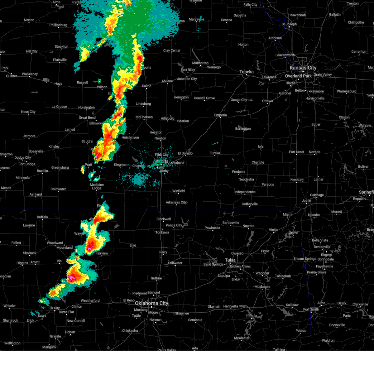 At 529 pm cdt, a severe thunderstorm was located near neola, moving northeast at 45 mph (radar indicated). Hazards include two inch hail. People and animals outdoors will be injured. expect damage to roofs, siding, windows, and vehicles. This severe storm will be near, zenith and neola around 535 pm cdt. At 529 pm cdt, a severe thunderstorm was located near neola, moving northeast at 45 mph (radar indicated). Hazards include two inch hail. People and animals outdoors will be injured. expect damage to roofs, siding, windows, and vehicles. This severe storm will be near, zenith and neola around 535 pm cdt.
|
| 5/6/2024 5:24 PM CDT |
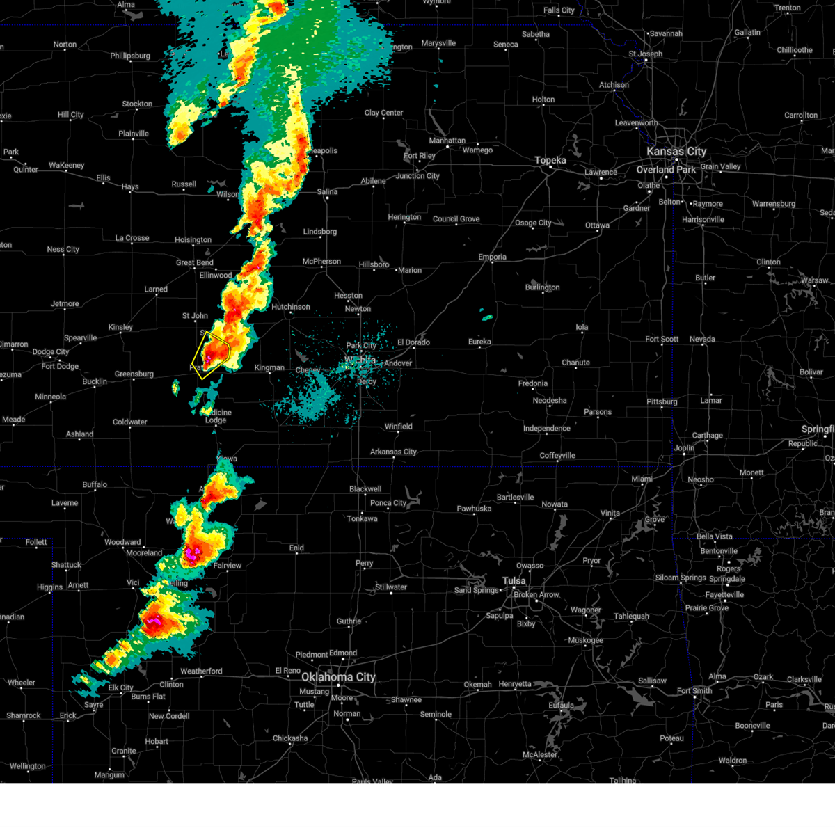 The storm which prompted the warning has moved out of the area. therefore, the warning will be allowed to expire. a tornado watch remains in effect until 1100 pm cdt for south central kansas. remember, a severe thunderstorm warning still remains in effect for northeastern pratt and southeastern stafford county. The storm which prompted the warning has moved out of the area. therefore, the warning will be allowed to expire. a tornado watch remains in effect until 1100 pm cdt for south central kansas. remember, a severe thunderstorm warning still remains in effect for northeastern pratt and southeastern stafford county.
|
| 5/6/2024 5:23 PM CDT |
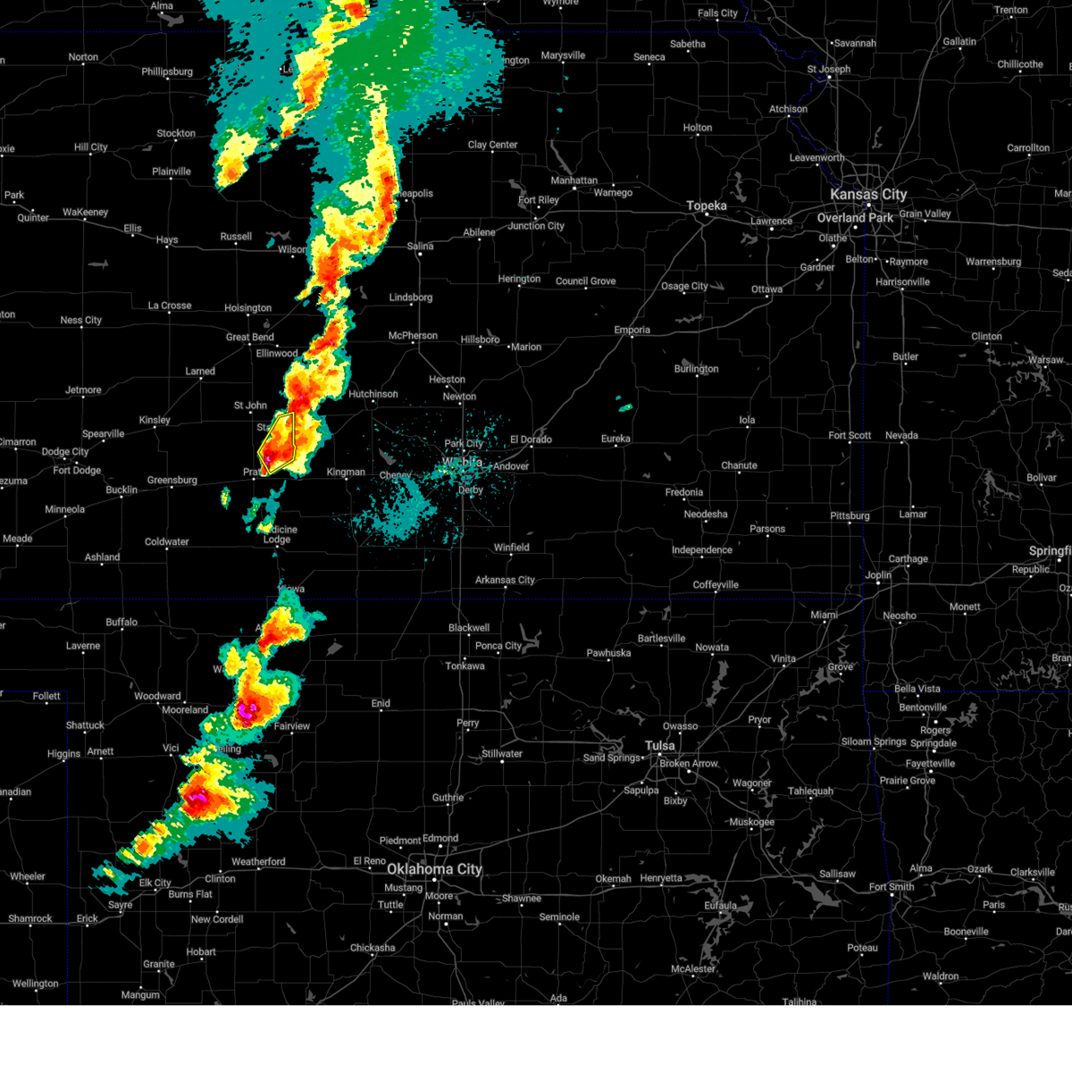 Svrddc the national weather service in dodge city has issued a * severe thunderstorm warning for, southeastern stafford county in south central kansas, northeastern pratt county in south central kansas, * until 615 pm cdt. * at 522 pm cdt, a severe thunderstorm was located near preston, moving northeast at 45 mph (radar indicated). Hazards include two inch hail. People and animals outdoors will be injured. expect damage to roofs, siding, windows, and vehicles. this severe thunderstorm will be near, neola around 530 pm cdt. Zenith around 535 pm cdt. Svrddc the national weather service in dodge city has issued a * severe thunderstorm warning for, southeastern stafford county in south central kansas, northeastern pratt county in south central kansas, * until 615 pm cdt. * at 522 pm cdt, a severe thunderstorm was located near preston, moving northeast at 45 mph (radar indicated). Hazards include two inch hail. People and animals outdoors will be injured. expect damage to roofs, siding, windows, and vehicles. this severe thunderstorm will be near, neola around 530 pm cdt. Zenith around 535 pm cdt.
|
| 5/6/2024 5:15 PM CDT |
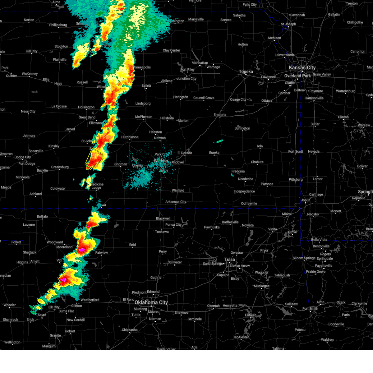 At 514 pm cdt, a severe thunderstorm was located near stafford, moving northeast at 60 mph (public). Hazards include ping pong ball size hail. People and animals outdoors will be injured. expect damage to roofs, siding, windows, and vehicles. This severe thunderstorm will remain over mainly rural areas of southeastern stafford and northeastern pratt counties. At 514 pm cdt, a severe thunderstorm was located near stafford, moving northeast at 60 mph (public). Hazards include ping pong ball size hail. People and animals outdoors will be injured. expect damage to roofs, siding, windows, and vehicles. This severe thunderstorm will remain over mainly rural areas of southeastern stafford and northeastern pratt counties.
|
| 5/6/2024 5:09 PM CDT |
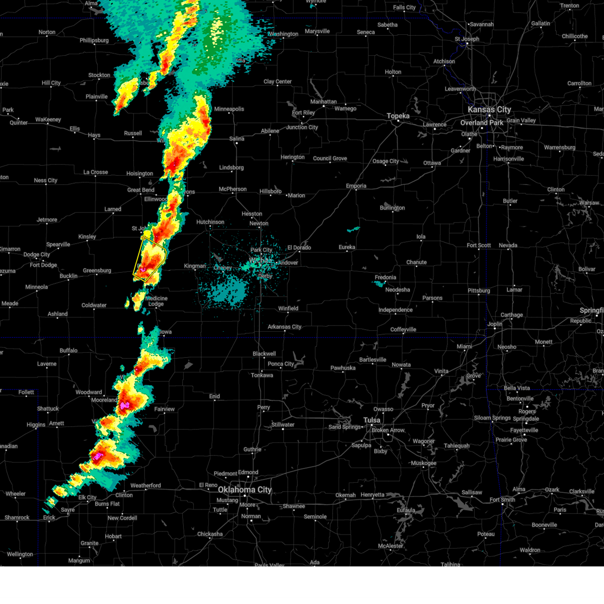 At 509 pm cdt, a severe thunderstorm was located near iuka, moving northeast at 60 mph (public). Hazards include ping pong ball size hail. People and animals outdoors will be injured. expect damage to roofs, siding, windows, and vehicles. This severe thunderstorm will remain over mainly rural areas of southeastern stafford and eastern pratt counties. At 509 pm cdt, a severe thunderstorm was located near iuka, moving northeast at 60 mph (public). Hazards include ping pong ball size hail. People and animals outdoors will be injured. expect damage to roofs, siding, windows, and vehicles. This severe thunderstorm will remain over mainly rural areas of southeastern stafford and eastern pratt counties.
|
| 5/6/2024 5:00 PM CDT |
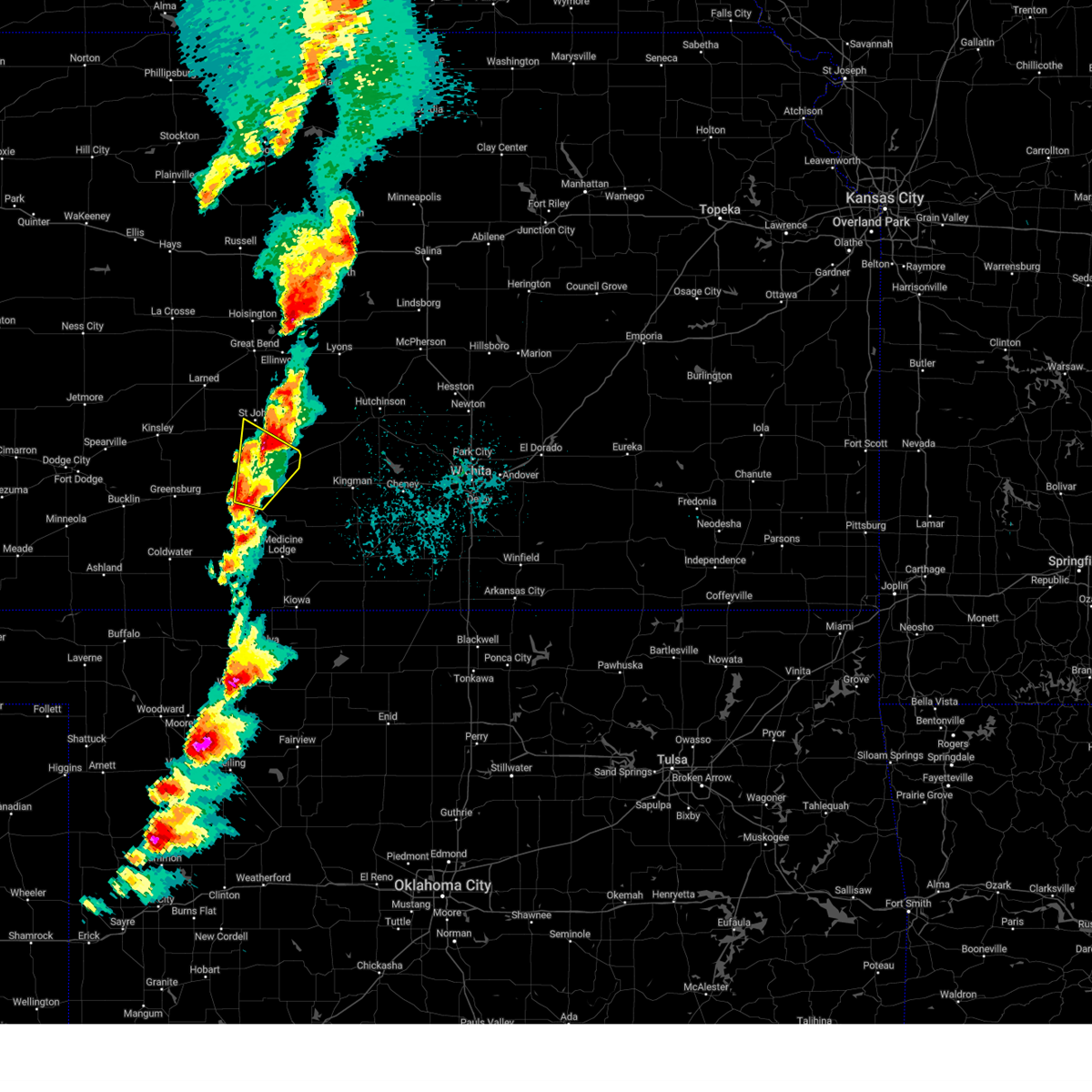 the severe thunderstorm warning has been cancelled and is no longer in effect the severe thunderstorm warning has been cancelled and is no longer in effect
|
| 5/6/2024 5:00 PM CDT |
 At 459 pm cdt, a severe thunderstorm was located near pratt, moving northeast at 60 mph (spotter indicated. at 452 pm ping pong sized hail was reported 5 miles ne of iuka). Hazards include ping pong ball size hail. People and animals outdoors will be injured. expect damage to roofs, siding, windows, and vehicles. This severe storm will be near, iuka around 505 pm cdt. At 459 pm cdt, a severe thunderstorm was located near pratt, moving northeast at 60 mph (spotter indicated. at 452 pm ping pong sized hail was reported 5 miles ne of iuka). Hazards include ping pong ball size hail. People and animals outdoors will be injured. expect damage to roofs, siding, windows, and vehicles. This severe storm will be near, iuka around 505 pm cdt.
|
| 5/6/2024 4:46 PM CDT |
 Svrddc the national weather service in dodge city has issued a * severe thunderstorm warning for, northwestern barber county in south central kansas, southeastern stafford county in south central kansas, pratt county in south central kansas, * until 530 pm cdt. * at 446 pm cdt, a severe thunderstorm was located near coats, moving northeast at 55 mph (radar indicated). Hazards include ping pong ball size hail. People and animals outdoors will be injured. expect damage to roofs, siding, windows, and vehicles. this severe thunderstorm will be near, cullison around 450 pm cdt. pratt around 455 pm cdt. Iuka around 500 pm cdt. Svrddc the national weather service in dodge city has issued a * severe thunderstorm warning for, northwestern barber county in south central kansas, southeastern stafford county in south central kansas, pratt county in south central kansas, * until 530 pm cdt. * at 446 pm cdt, a severe thunderstorm was located near coats, moving northeast at 55 mph (radar indicated). Hazards include ping pong ball size hail. People and animals outdoors will be injured. expect damage to roofs, siding, windows, and vehicles. this severe thunderstorm will be near, cullison around 450 pm cdt. pratt around 455 pm cdt. Iuka around 500 pm cdt.
|
| 10/3/2023 10:33 PM CDT |
 At 1033 pm cdt, severe thunderstorms were located along a line extending from near preston to 7 miles southeast of wilmore, moving east at 35 mph (radar indicated). Hazards include 60 mph wind gusts and penny size hail. Expect damage to roofs, siding, and trees. locations impacted include, sawyer, lake city, sun city, cairo and isabel. hail threat, radar indicated max hail size, 0. 75 in wind threat, radar indicated max wind gust, 60 mph. At 1033 pm cdt, severe thunderstorms were located along a line extending from near preston to 7 miles southeast of wilmore, moving east at 35 mph (radar indicated). Hazards include 60 mph wind gusts and penny size hail. Expect damage to roofs, siding, and trees. locations impacted include, sawyer, lake city, sun city, cairo and isabel. hail threat, radar indicated max hail size, 0. 75 in wind threat, radar indicated max wind gust, 60 mph.
|
| 10/3/2023 10:08 PM CDT |
 At 1006 pm cdt, severe thunderstorms were located along a line extending from near iuka to near coldwater, moving east at 40 mph (radar indicated). Hazards include 60 mph wind gusts and penny size hail. Expect damage to roofs, siding, and trees. severe thunderstorms will be near, pratt, preston, coats, and croft around 1010 pm cdt. sun city around 1015 pm cdt. sawyer and cairo around 1020 pm cdt. lake city around 1025 pm cdt. other locations in the path of these severe thunderstorms include isabel. this warning replaces the previous warning which was in effect for portions of kiowa, comanche, pratt, and barber county. hail threat, radar indicated max hail size, 0. 75 in wind threat, radar indicated max wind gust, 60 mph. At 1006 pm cdt, severe thunderstorms were located along a line extending from near iuka to near coldwater, moving east at 40 mph (radar indicated). Hazards include 60 mph wind gusts and penny size hail. Expect damage to roofs, siding, and trees. severe thunderstorms will be near, pratt, preston, coats, and croft around 1010 pm cdt. sun city around 1015 pm cdt. sawyer and cairo around 1020 pm cdt. lake city around 1025 pm cdt. other locations in the path of these severe thunderstorms include isabel. this warning replaces the previous warning which was in effect for portions of kiowa, comanche, pratt, and barber county. hail threat, radar indicated max hail size, 0. 75 in wind threat, radar indicated max wind gust, 60 mph.
|
| 8/5/2023 4:57 AM CDT |
 The severe thunderstorm warning for north central barber and eastern pratt counties will expire at 500 am cdt, the storms which prompted the warning have moved out of the area. therefore, the warning will be allowed to expire. however gusty winds are still possible with these thunderstorms. The severe thunderstorm warning for north central barber and eastern pratt counties will expire at 500 am cdt, the storms which prompted the warning have moved out of the area. therefore, the warning will be allowed to expire. however gusty winds are still possible with these thunderstorms.
|
| 8/5/2023 4:37 AM CDT |
 At 437 am cdt, severe thunderstorms were located along a line extending from near turon to near cairo to near isabel, moving east at 25 mph (radar indicated). Hazards include 60 mph wind gusts. Expect damage to roofs, siding, and trees. these severe thunderstorms will remain over mainly rural areas of north central barber and eastern pratt counties. hail threat, radar indicated max hail size, <. 75 in wind threat, radar indicated max wind gust, 60 mph. At 437 am cdt, severe thunderstorms were located along a line extending from near turon to near cairo to near isabel, moving east at 25 mph (radar indicated). Hazards include 60 mph wind gusts. Expect damage to roofs, siding, and trees. these severe thunderstorms will remain over mainly rural areas of north central barber and eastern pratt counties. hail threat, radar indicated max hail size, <. 75 in wind threat, radar indicated max wind gust, 60 mph.
|
| 8/5/2023 4:25 AM CDT |
 At 425 am cdt, severe thunderstorms were located along a line extending from near turon to near pratt to near sawyer, moving east at 25 mph (radar indicated). Hazards include 60 mph wind gusts. Expect damage to roofs, siding, and trees. severe thunderstorms will be near, preston around 435 am cdt. cairo around 440 am cdt. isabel around 445 am cdt. hail threat, radar indicated max hail size, <. 75 in wind threat, radar indicated max wind gust, 60 mph. At 425 am cdt, severe thunderstorms were located along a line extending from near turon to near pratt to near sawyer, moving east at 25 mph (radar indicated). Hazards include 60 mph wind gusts. Expect damage to roofs, siding, and trees. severe thunderstorms will be near, preston around 435 am cdt. cairo around 440 am cdt. isabel around 445 am cdt. hail threat, radar indicated max hail size, <. 75 in wind threat, radar indicated max wind gust, 60 mph.
|
| 7/16/2023 7:41 PM CDT |
 At 741 pm cdt, a severe thunderstorm was located near pratt, moving southeast at 40 mph (radar indicated). Hazards include ping pong ball size hail and 60 mph wind gusts. People and animals outdoors will be injured. expect hail damage to roofs, siding, windows, and vehicles. expect wind damage to roofs, siding, and trees. this severe thunderstorm will be near, coats around 755 pm cdt. sawyer around 800 pm cdt. other locations in the path of this severe thunderstorm include isabel, medicine lodge and sharon. hail threat, radar indicated max hail size, 1. 50 in wind threat, radar indicated max wind gust, 60 mph. At 741 pm cdt, a severe thunderstorm was located near pratt, moving southeast at 40 mph (radar indicated). Hazards include ping pong ball size hail and 60 mph wind gusts. People and animals outdoors will be injured. expect hail damage to roofs, siding, windows, and vehicles. expect wind damage to roofs, siding, and trees. this severe thunderstorm will be near, coats around 755 pm cdt. sawyer around 800 pm cdt. other locations in the path of this severe thunderstorm include isabel, medicine lodge and sharon. hail threat, radar indicated max hail size, 1. 50 in wind threat, radar indicated max wind gust, 60 mph.
|
| 7/16/2023 6:46 PM CDT |
 At 645 pm cdt, a severe thunderstorm was located near st. john, moving south at 50 mph. this is a destructive storm for eastern pawnee county, stafford county, eastern edwards, northeast kiowa, and northern to central pratt counties (radar indicated). Hazards include 80 mph wind gusts and two inch hail. Flying debris will be dangerous to those caught without shelter. mobile homes will be heavily damaged. expect considerable damage to roofs, windows, and vehicles. extensive tree damage and power outages are likely. this severe storm will be near, st. john and dillwyn around 650 pm cdt. Other locations in the path of this severe thunderstorm include byers, iuka, pratt and cullison. At 645 pm cdt, a severe thunderstorm was located near st. john, moving south at 50 mph. this is a destructive storm for eastern pawnee county, stafford county, eastern edwards, northeast kiowa, and northern to central pratt counties (radar indicated). Hazards include 80 mph wind gusts and two inch hail. Flying debris will be dangerous to those caught without shelter. mobile homes will be heavily damaged. expect considerable damage to roofs, windows, and vehicles. extensive tree damage and power outages are likely. this severe storm will be near, st. john and dillwyn around 650 pm cdt. Other locations in the path of this severe thunderstorm include byers, iuka, pratt and cullison.
|
| 7/16/2023 6:43 PM CDT |
 At 641 pm cdt, a severe thunderstorm was located near seward, moving south at 50 mph. this is a destructive storm for western pawnee county, stafford county, and northern to central pratt county (radar indicated. at 640 pm cdt, widespread tree damage and ping pong ball size hail was reported acroos barton county, ks). Hazards include 80 mph wind gusts and two inch hail. Flying debris will be dangerous to those caught without shelter. mobile homes will be heavily damaged. expect considerable damage to roofs, windows, and vehicles. extensive tree damage and power outages are likely. this severe thunderstorm will be near, st. john around 650 pm cdt. dillwyn around 655 pm cdt. Other locations in the path of this severe thunderstorm include byers, iuka, pratt and cullison. At 641 pm cdt, a severe thunderstorm was located near seward, moving south at 50 mph. this is a destructive storm for western pawnee county, stafford county, and northern to central pratt county (radar indicated. at 640 pm cdt, widespread tree damage and ping pong ball size hail was reported acroos barton county, ks). Hazards include 80 mph wind gusts and two inch hail. Flying debris will be dangerous to those caught without shelter. mobile homes will be heavily damaged. expect considerable damage to roofs, windows, and vehicles. extensive tree damage and power outages are likely. this severe thunderstorm will be near, st. john around 650 pm cdt. dillwyn around 655 pm cdt. Other locations in the path of this severe thunderstorm include byers, iuka, pratt and cullison.
|
| 7/7/2023 5:49 AM CDT |
 At 548 am cdt, a severe thunderstorm was located near pratt, moving southeast at 40 mph (automated equipment. pratt airport measured a wind gust of 60 mph at 535 pm). Hazards include 60 mph wind gusts. Expect damage to roofs, siding, and trees. this severe thunderstorm will be near, isabel around 600 am cdt. other locations in the path of this severe thunderstorm include sharon. hail threat, radar indicated max hail size, <. 75 in wind threat, radar indicated max wind gust, 60 mph. At 548 am cdt, a severe thunderstorm was located near pratt, moving southeast at 40 mph (automated equipment. pratt airport measured a wind gust of 60 mph at 535 pm). Hazards include 60 mph wind gusts. Expect damage to roofs, siding, and trees. this severe thunderstorm will be near, isabel around 600 am cdt. other locations in the path of this severe thunderstorm include sharon. hail threat, radar indicated max hail size, <. 75 in wind threat, radar indicated max wind gust, 60 mph.
|
| 6/27/2023 10:11 PM CDT |
 The severe thunderstorm warning for barber and pratt counties will expire at 1015 pm cdt, the storm which prompted the warning has moved out of the area. therefore, the warning will be allowed to expire. however gusty winds are still possible with this thunderstorm. a severe thunderstorm watch remains in effect until 200 am cdt for south central kansas. The severe thunderstorm warning for barber and pratt counties will expire at 1015 pm cdt, the storm which prompted the warning has moved out of the area. therefore, the warning will be allowed to expire. however gusty winds are still possible with this thunderstorm. a severe thunderstorm watch remains in effect until 200 am cdt for south central kansas.
|
| 6/27/2023 10:02 PM CDT |
 At 1001 pm cdt, a severe thunderstorm was located 8 miles north of hardtner, moving east at 50 mph (radar indicated). Hazards include 60 mph wind gusts. Expect damage to roofs, siding, and trees. hail threat, radar indicated max hail size, <. 75 in wind threat, radar indicated max wind gust, 60 mph. At 1001 pm cdt, a severe thunderstorm was located 8 miles north of hardtner, moving east at 50 mph (radar indicated). Hazards include 60 mph wind gusts. Expect damage to roofs, siding, and trees. hail threat, radar indicated max hail size, <. 75 in wind threat, radar indicated max wind gust, 60 mph.
|
| 6/27/2023 9:34 PM CDT |
 At 934 pm cdt, a severe thunderstorm was located 10 miles east of buttermilk, moving east at 45 mph (radar indicated). Hazards include 60 mph wind gusts. Expect damage to roofs, siding, and trees. hail threat, radar indicated max hail size, <. 75 in wind threat, radar indicated max wind gust, 60 mph. At 934 pm cdt, a severe thunderstorm was located 10 miles east of buttermilk, moving east at 45 mph (radar indicated). Hazards include 60 mph wind gusts. Expect damage to roofs, siding, and trees. hail threat, radar indicated max hail size, <. 75 in wind threat, radar indicated max wind gust, 60 mph.
|
| 6/27/2023 9:17 PM CDT |
 At 917 pm cdt, a severe thunderstorm was located near protection, moving east at 50 mph (radar indicated). Hazards include 60 mph wind gusts and penny size hail. Expect damage to roofs, siding, and trees. hail threat, radar indicated max hail size, 0. 75 in wind threat, radar indicated max wind gust, 60 mph. At 917 pm cdt, a severe thunderstorm was located near protection, moving east at 50 mph (radar indicated). Hazards include 60 mph wind gusts and penny size hail. Expect damage to roofs, siding, and trees. hail threat, radar indicated max hail size, 0. 75 in wind threat, radar indicated max wind gust, 60 mph.
|
| 6/21/2023 6:32 AM CDT |
 At 632 am cdt, a severe thunderstorm was located near belvidere, moving southeast at 35 mph (radar indicated). Hazards include 60 mph wind gusts and quarter size hail. Hail damage to vehicles is expected. expect wind damage to roofs, siding, and trees. other locations in the path of this severe thunderstorm include aetna and hardtner. hail threat, radar indicated max hail size, 1. 00 in wind threat, radar indicated max wind gust, 60 mph. At 632 am cdt, a severe thunderstorm was located near belvidere, moving southeast at 35 mph (radar indicated). Hazards include 60 mph wind gusts and quarter size hail. Hail damage to vehicles is expected. expect wind damage to roofs, siding, and trees. other locations in the path of this severe thunderstorm include aetna and hardtner. hail threat, radar indicated max hail size, 1. 00 in wind threat, radar indicated max wind gust, 60 mph.
|
| 5/9/2023 7:45 PM CDT |
 At 744 pm cdt, a severe thunderstorm was located near cairo, moving east at 20 mph (radar indicated). Hazards include two inch hail. People and animals outdoors will be injured. expect damage to roofs, siding, windows, and vehicles. locations impacted include, cairo and isabel. ping pong ball size hail was reported in pratt at 743 pm cdt. thunderstorm damage threat, considerable hail threat, observed max hail size, 2. 00 in wind threat, radar indicated max wind gust, <50 mph. At 744 pm cdt, a severe thunderstorm was located near cairo, moving east at 20 mph (radar indicated). Hazards include two inch hail. People and animals outdoors will be injured. expect damage to roofs, siding, windows, and vehicles. locations impacted include, cairo and isabel. ping pong ball size hail was reported in pratt at 743 pm cdt. thunderstorm damage threat, considerable hail threat, observed max hail size, 2. 00 in wind threat, radar indicated max wind gust, <50 mph.
|
| 5/9/2023 7:25 PM CDT |
 At 725 pm cdt, a severe thunderstorm was located near pratt, moving east at 20 mph (radar indicated). Hazards include two inch hail. People and animals outdoors will be injured. expect damage to roofs, siding, windows, and vehicles. this severe thunderstorm will be near, sawyer around 745 pm cdt. other locations in the path of this severe thunderstorm include cairo and isabel. thunderstorm damage threat, considerable hail threat, radar indicated max hail size, 2. 00 in wind threat, radar indicated max wind gust, <50 mph. At 725 pm cdt, a severe thunderstorm was located near pratt, moving east at 20 mph (radar indicated). Hazards include two inch hail. People and animals outdoors will be injured. expect damage to roofs, siding, windows, and vehicles. this severe thunderstorm will be near, sawyer around 745 pm cdt. other locations in the path of this severe thunderstorm include cairo and isabel. thunderstorm damage threat, considerable hail threat, radar indicated max hail size, 2. 00 in wind threat, radar indicated max wind gust, <50 mph.
|
| 5/9/2023 7:12 PM CDT |
 The severe thunderstorm warning for southeastern stafford and northeastern pratt counties will expire at 715 pm cdt, the storm which prompted the warning has moved out of the area. therefore, the warning will be allowed to expire. The severe thunderstorm warning for southeastern stafford and northeastern pratt counties will expire at 715 pm cdt, the storm which prompted the warning has moved out of the area. therefore, the warning will be allowed to expire.
|
| 5/9/2023 6:55 PM CDT |
 At 654 pm cdt, a severe thunderstorm was located near neola, moving southeast at 20 mph (radar indicated). Hazards include 60 mph wind gusts and quarter size hail. Hail damage to vehicles is expected. expect wind damage to roofs, siding, and trees. locations impacted include, stafford, preston, zenith and neola. hail threat, radar indicated max hail size, 1. 00 in wind threat, radar indicated max wind gust, 60 mph. At 654 pm cdt, a severe thunderstorm was located near neola, moving southeast at 20 mph (radar indicated). Hazards include 60 mph wind gusts and quarter size hail. Hail damage to vehicles is expected. expect wind damage to roofs, siding, and trees. locations impacted include, stafford, preston, zenith and neola. hail threat, radar indicated max hail size, 1. 00 in wind threat, radar indicated max wind gust, 60 mph.
|
| 5/9/2023 6:43 PM CDT |
 At 643 pm cdt, a severe thunderstorm was located very near neola, moving southeast at 20 mph (radar indicated). Hazards include 60 mph wind gusts and half dollar size hail. Hail damage to vehicles is expected. expect wind damage to roofs, siding, and trees. this severe thunderstorm will remain over mainly rural areas of southeastern stafford and northeastern pratt counties. hail threat, radar indicated max hail size, 1. 25 in wind threat, radar indicated max wind gust, 60 mph. At 643 pm cdt, a severe thunderstorm was located very near neola, moving southeast at 20 mph (radar indicated). Hazards include 60 mph wind gusts and half dollar size hail. Hail damage to vehicles is expected. expect wind damage to roofs, siding, and trees. this severe thunderstorm will remain over mainly rural areas of southeastern stafford and northeastern pratt counties. hail threat, radar indicated max hail size, 1. 25 in wind threat, radar indicated max wind gust, 60 mph.
|
| 4/14/2023 8:44 PM CDT |
 At 844 pm cdt, severe thunderstorms were located along a line extending from near turon to 6 miles northwest of medicine lodge, moving northeast at 30 mph (radar indicated). Hazards include 60 mph wind gusts and nickel size hail. expect damage to roofs, siding, and trees At 844 pm cdt, severe thunderstorms were located along a line extending from near turon to 6 miles northwest of medicine lodge, moving northeast at 30 mph (radar indicated). Hazards include 60 mph wind gusts and nickel size hail. expect damage to roofs, siding, and trees
|
| 4/14/2023 8:33 PM CDT |
 At 832 pm cdt, severe thunderstorms were located along a line extending from near turon to near nashville to near coats, moving northeast at 30 mph (radar indicated). Hazards include 60 mph wind gusts and nickel size hail. Expect damage to roofs, siding, and trees. locations impacted include, preston, sawyer, isabel and cairo. hail threat, radar indicated max hail size, 0. 88 in wind threat, radar indicated max wind gust, 60 mph. At 832 pm cdt, severe thunderstorms were located along a line extending from near turon to near nashville to near coats, moving northeast at 30 mph (radar indicated). Hazards include 60 mph wind gusts and nickel size hail. Expect damage to roofs, siding, and trees. locations impacted include, preston, sawyer, isabel and cairo. hail threat, radar indicated max hail size, 0. 88 in wind threat, radar indicated max wind gust, 60 mph.
|
| 4/14/2023 8:22 PM CDT |
 At 822 pm cdt, severe thunderstorms were located along a line extending from near turon to near isabel to near sun city, moving northeast at 30 mph (radar indicated). Hazards include 60 mph wind gusts and nickel size hail. expect damage to roofs, siding, and trees At 822 pm cdt, severe thunderstorms were located along a line extending from near turon to near isabel to near sun city, moving northeast at 30 mph (radar indicated). Hazards include 60 mph wind gusts and nickel size hail. expect damage to roofs, siding, and trees
|
| 10/13/2021 1:42 AM CDT |
 At 142 am cdt, severe thunderstorms were located along a line extending from near nickerson to near lake city, moving northeast at 55 mph (radar indicated). Hazards include 70 mph wind gusts and penny size hail. Expect considerable tree damage. damage is likely to mobile homes, roofs, and outbuildings. Locations impacted include, medicine lodge, kiowa, hardtner, preston, sharon, sawyer, hazelton, isabel, lake city, aetna and cairo. At 142 am cdt, severe thunderstorms were located along a line extending from near nickerson to near lake city, moving northeast at 55 mph (radar indicated). Hazards include 70 mph wind gusts and penny size hail. Expect considerable tree damage. damage is likely to mobile homes, roofs, and outbuildings. Locations impacted include, medicine lodge, kiowa, hardtner, preston, sharon, sawyer, hazelton, isabel, lake city, aetna and cairo.
|
| 10/13/2021 1:10 AM CDT |
 The severe thunderstorm warning for eastern kiowa, barber, comanche, southeastern pawnee, stafford, southeastern edwards and pratt counties will expire at 115 am cdt, the storms which prompted the warning have moved out of the area. therefore, the warning will be allowed to expire. however gusty winds are still possible with these thunderstorms. a tornado watch remains in effect until 500 am cdt for south central kansas. The severe thunderstorm warning for eastern kiowa, barber, comanche, southeastern pawnee, stafford, southeastern edwards and pratt counties will expire at 115 am cdt, the storms which prompted the warning have moved out of the area. therefore, the warning will be allowed to expire. however gusty winds are still possible with these thunderstorms. a tornado watch remains in effect until 500 am cdt for south central kansas.
|
| 10/13/2021 1:09 AM CDT |
 At 109 am cdt, severe thunderstorms were located along a line extending from near turon to 8 miles southwest of aetna, moving northeast at 55 mph (radar indicated). Hazards include 70 mph wind gusts and penny size hail. Expect considerable tree damage. Damage is likely to mobile homes, roofs, and outbuildings. At 109 am cdt, severe thunderstorms were located along a line extending from near turon to 8 miles southwest of aetna, moving northeast at 55 mph (radar indicated). Hazards include 70 mph wind gusts and penny size hail. Expect considerable tree damage. Damage is likely to mobile homes, roofs, and outbuildings.
|
| 10/13/2021 12:43 AM CDT |
 At 1242 am cdt, severe thunderstorms were located along a line extending from near ellinwood to near preston to 10 miles southwest of sun city, moving northeast at 55 mph. these are destructive storms for pratt, medicine lodge, st. john, and stafford (public). Hazards include 80 mph wind gusts and penny size hail. Flying debris will be dangerous to those caught without shelter. mobile homes will be heavily damaged. expect considerable damage to roofs, windows, and vehicles. extensive tree damage and power outages are likely. Locations impacted include, neola, zenith, sawyer, isabel and cairo. At 1242 am cdt, severe thunderstorms were located along a line extending from near ellinwood to near preston to 10 miles southwest of sun city, moving northeast at 55 mph. these are destructive storms for pratt, medicine lodge, st. john, and stafford (public). Hazards include 80 mph wind gusts and penny size hail. Flying debris will be dangerous to those caught without shelter. mobile homes will be heavily damaged. expect considerable damage to roofs, windows, and vehicles. extensive tree damage and power outages are likely. Locations impacted include, neola, zenith, sawyer, isabel and cairo.
|
| 10/13/2021 12:17 AM CDT |
 At 1216 am cdt, severe thunderstorms were located along a line extending from near radium to near wellsford to near buttermilk, moving northeast at 55 mph. these are destructive storms for pratt, medicine lodge, st. john, and stafford (radar indicated). Hazards include 80 mph wind gusts and penny size hail. Flying debris will be dangerous to those caught without shelter. mobile homes will be heavily damaged. expect considerable damage to roofs, windows, and vehicles. extensive tree damage and power outages are likely. severe thunderstorms will be near, seward and radium around 1220 am cdt. cullison around 1225 am cdt. pratt and iuka around 1235 am cdt. Other locations in the path of these severe thunderstorms include preston, sun city, neola, lake city, zenith, sawyer and isabel. At 1216 am cdt, severe thunderstorms were located along a line extending from near radium to near wellsford to near buttermilk, moving northeast at 55 mph. these are destructive storms for pratt, medicine lodge, st. john, and stafford (radar indicated). Hazards include 80 mph wind gusts and penny size hail. Flying debris will be dangerous to those caught without shelter. mobile homes will be heavily damaged. expect considerable damage to roofs, windows, and vehicles. extensive tree damage and power outages are likely. severe thunderstorms will be near, seward and radium around 1220 am cdt. cullison around 1225 am cdt. pratt and iuka around 1235 am cdt. Other locations in the path of these severe thunderstorms include preston, sun city, neola, lake city, zenith, sawyer and isabel.
|
| 5/2/2021 11:50 PM CDT |
 The severe thunderstorm warning for southeastern stafford and pratt counties will expire at midnight cdt, the storms which prompted the warning have weakened below severe limits, and have exited the warned area. therefore, the warning will be allowed to expire. however small hail and gusty winds are still possible with these thunderstorms. a severe thunderstorm watch remains in effect until midnight cdt for south central kansas. The severe thunderstorm warning for southeastern stafford and pratt counties will expire at midnight cdt, the storms which prompted the warning have weakened below severe limits, and have exited the warned area. therefore, the warning will be allowed to expire. however small hail and gusty winds are still possible with these thunderstorms. a severe thunderstorm watch remains in effect until midnight cdt for south central kansas.
|
| 5/2/2021 11:43 PM CDT |
 At 1142 pm cdt, severe thunderstorms were located along a line extending from near stafford to 6 miles southwest of isabel, moving east at 30 mph (radar indicated). Hazards include 60 mph wind gusts and nickel size hail. Expect damage to roofs, siding, and trees. Locations impacted include, pratt, iuka, preston, sawyer, isabel, coats, byers, cairo and neola. At 1142 pm cdt, severe thunderstorms were located along a line extending from near stafford to 6 miles southwest of isabel, moving east at 30 mph (radar indicated). Hazards include 60 mph wind gusts and nickel size hail. Expect damage to roofs, siding, and trees. Locations impacted include, pratt, iuka, preston, sawyer, isabel, coats, byers, cairo and neola.
|
| 5/2/2021 11:15 PM CDT |
 At 1114 pm cdt, severe thunderstorms were located along a line extending from near dillwyn to near sun city, moving east at 30 mph (radar indicated). Hazards include 60 mph wind gusts and nickel size hail. expect damage to roofs, siding, and trees At 1114 pm cdt, severe thunderstorms were located along a line extending from near dillwyn to near sun city, moving east at 30 mph (radar indicated). Hazards include 60 mph wind gusts and nickel size hail. expect damage to roofs, siding, and trees
|
| 4/6/2021 10:52 PM CDT |
 At 1051 pm cdt, a severe thunderstorm was located near coats, moving east at 25 mph (radar indicated). Hazards include 60 mph wind gusts and half dollar size hail. Hail damage to vehicles is expected. expect wind damage to roofs, siding, and trees. Locations impacted include, pratt, iuka, preston, cullison, coats and cairo. At 1051 pm cdt, a severe thunderstorm was located near coats, moving east at 25 mph (radar indicated). Hazards include 60 mph wind gusts and half dollar size hail. Hail damage to vehicles is expected. expect wind damage to roofs, siding, and trees. Locations impacted include, pratt, iuka, preston, cullison, coats and cairo.
|
| 4/6/2021 10:29 PM CDT |
 At 1029 pm cdt, a severe thunderstorm was located very near cullison, moving northeast at 60 mph (radar indicated). Hazards include 60 mph wind gusts and half dollar size hail. Hail damage to vehicles is expected. Expect wind damage to roofs, siding, and trees. At 1029 pm cdt, a severe thunderstorm was located very near cullison, moving northeast at 60 mph (radar indicated). Hazards include 60 mph wind gusts and half dollar size hail. Hail damage to vehicles is expected. Expect wind damage to roofs, siding, and trees.
|
| 3/12/2021 5:08 AM CST |
 The severe thunderstorm warning for northeastern pratt county will expire at 515 am cst, the storm which prompted the warning has moved out of the area. therefore, the warning will be allowed to expire. The severe thunderstorm warning for northeastern pratt county will expire at 515 am cst, the storm which prompted the warning has moved out of the area. therefore, the warning will be allowed to expire.
|
| 3/12/2021 4:51 AM CST |
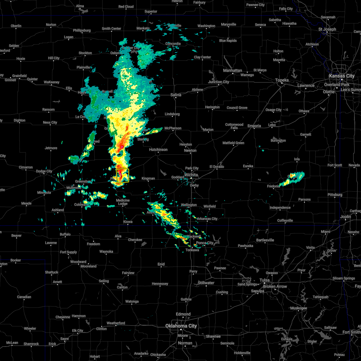 At 450 am cst, a severe thunderstorm was located near preston, moving east at 45 mph (radar indicated). Hazards include 70 mph wind gusts and penny size hail. Expect considerable tree damage. Damage is likely to mobile homes, roofs, and outbuildings. At 450 am cst, a severe thunderstorm was located near preston, moving east at 45 mph (radar indicated). Hazards include 70 mph wind gusts and penny size hail. Expect considerable tree damage. Damage is likely to mobile homes, roofs, and outbuildings.
|
| 6/21/2020 6:56 PM CDT |
 At 656 pm cdt, severe thunderstorms were located along a line extending from near turon to near coats to near lake coldwater, moving southeast at 35 mph. these are very dangerous storms (radar indicated). Hazards include 80 mph wind gusts and quarter size hail. Flying debris will be dangerous to those caught without shelter. mobile homes will be heavily damaged. expect considerable damage to roofs, windows, and vehicles. Extensive tree damage and power outages are likely. At 656 pm cdt, severe thunderstorms were located along a line extending from near turon to near coats to near lake coldwater, moving southeast at 35 mph. these are very dangerous storms (radar indicated). Hazards include 80 mph wind gusts and quarter size hail. Flying debris will be dangerous to those caught without shelter. mobile homes will be heavily damaged. expect considerable damage to roofs, windows, and vehicles. Extensive tree damage and power outages are likely.
|
| 6/21/2020 6:19 PM CDT |
 At 617 pm cdt, severe thunderstorms were located along a line extending from near hudson to near hopewell to near greensburg, moving southeast at 35 mph. these are very dangerous storms (radar indicated). Hazards include 80 mph wind gusts and quarter size hail. Flying debris will be dangerous to those caught without shelter. mobile homes will be heavily damaged. expect considerable damage to roofs, windows, and vehicles. Extensive tree damage and power outages are likely. At 617 pm cdt, severe thunderstorms were located along a line extending from near hudson to near hopewell to near greensburg, moving southeast at 35 mph. these are very dangerous storms (radar indicated). Hazards include 80 mph wind gusts and quarter size hail. Flying debris will be dangerous to those caught without shelter. mobile homes will be heavily damaged. expect considerable damage to roofs, windows, and vehicles. Extensive tree damage and power outages are likely.
|
| 6/21/2020 6:17 PM CDT |
 At 617 pm cdt, severe thunderstorms were located along a line extending from near hudson to near hopewell to near greensburg, moving southeast at 35 mph. these are very dangerous storms (radar indicated). Hazards include 80 mph wind gusts and quarter size hail. Flying debris will be dangerous to those caught without shelter. mobile homes will be heavily damaged. expect considerable damage to roofs, windows, and vehicles. Extensive tree damage and power outages are likely. At 617 pm cdt, severe thunderstorms were located along a line extending from near hudson to near hopewell to near greensburg, moving southeast at 35 mph. these are very dangerous storms (radar indicated). Hazards include 80 mph wind gusts and quarter size hail. Flying debris will be dangerous to those caught without shelter. mobile homes will be heavily damaged. expect considerable damage to roofs, windows, and vehicles. Extensive tree damage and power outages are likely.
|
| 9/24/2019 9:00 PM CDT |
 At 900 pm cdt, a severe thunderstorm was located near cairo, moving east at 15 mph (radar indicated). Hazards include 60 mph wind gusts and quarter size hail. Hail damage to vehicles is expected. expect wind damage to roofs, siding, and trees. Locations impacted include, pratt, preston, sawyer, isabel and cairo. At 900 pm cdt, a severe thunderstorm was located near cairo, moving east at 15 mph (radar indicated). Hazards include 60 mph wind gusts and quarter size hail. Hail damage to vehicles is expected. expect wind damage to roofs, siding, and trees. Locations impacted include, pratt, preston, sawyer, isabel and cairo.
|
| 9/24/2019 8:45 PM CDT |
 At 845 pm cdt, a severe thunderstorm was located near pratt, moving east at 15 mph (radar indicated). Hazards include 60 mph wind gusts and half dollar size hail. Hail damage to vehicles is expected. Expect wind damage to roofs, siding, and trees. At 845 pm cdt, a severe thunderstorm was located near pratt, moving east at 15 mph (radar indicated). Hazards include 60 mph wind gusts and half dollar size hail. Hail damage to vehicles is expected. Expect wind damage to roofs, siding, and trees.
|
| 9/24/2019 6:49 PM CDT |
 At 648 pm cdt, a severe thunderstorm was located near coats, moving southeast at 25 mph (radar indicated). Hazards include two inch hail and 70 mph wind gusts. People and animals outdoors will be injured. expect hail damage to roofs, siding, windows, and vehicles. expect considerable tree damage. Wind damage is also likely to mobile homes, roofs, and outbuildings. At 648 pm cdt, a severe thunderstorm was located near coats, moving southeast at 25 mph (radar indicated). Hazards include two inch hail and 70 mph wind gusts. People and animals outdoors will be injured. expect hail damage to roofs, siding, windows, and vehicles. expect considerable tree damage. Wind damage is also likely to mobile homes, roofs, and outbuildings.
|
| 8/13/2019 10:11 PM CDT |
 The severe thunderstorm warning for northeastern barber, eastern stafford and pratt counties will expire at 1015 pm cdt, the storms which prompted the warning have moved out of the area. therefore, the warning will be allowed to expire. however gusty winds are still possible with these thunderstorms. a severe thunderstorm watch remains in effect until 200 am cdt for south central kansas. The severe thunderstorm warning for northeastern barber, eastern stafford and pratt counties will expire at 1015 pm cdt, the storms which prompted the warning have moved out of the area. therefore, the warning will be allowed to expire. however gusty winds are still possible with these thunderstorms. a severe thunderstorm watch remains in effect until 200 am cdt for south central kansas.
|
| 8/13/2019 9:40 PM CDT |
 At 939 pm cdt, severe thunderstorms were located along a line extending from 7 miles northeast of seward to 8 miles southwest of stafford to near coats, moving east at 35 mph (radar indicated). Hazards include 60 mph wind gusts and penny size hail. expect damage to roofs, siding, and trees At 939 pm cdt, severe thunderstorms were located along a line extending from 7 miles northeast of seward to 8 miles southwest of stafford to near coats, moving east at 35 mph (radar indicated). Hazards include 60 mph wind gusts and penny size hail. expect damage to roofs, siding, and trees
|
| 8/13/2019 8:51 PM CDT |
 At 851 pm cdt, severe thunderstorms were located along a line extending from near pawnee rock to near dillwyn to near wellsford, moving east at 45 mph (radar indicated). Hazards include 70 mph wind gusts and nickel size hail. Expect considerable tree damage. Damage is likely to mobile homes, roofs, and outbuildings. At 851 pm cdt, severe thunderstorms were located along a line extending from near pawnee rock to near dillwyn to near wellsford, moving east at 45 mph (radar indicated). Hazards include 70 mph wind gusts and nickel size hail. Expect considerable tree damage. Damage is likely to mobile homes, roofs, and outbuildings.
|
| 6/21/2019 11:45 PM CDT |
 At 1145 pm cdt, severe thunderstorms were located along a line extending from near turon to near haviland, and are nearly stationary (radar indicated). Hazards include 60 mph wind gusts and quarter size hail. Hail damage to vehicles is expected. expect wind damage to roofs, siding, and trees. Locations impacted include, pratt, iuka and preston. At 1145 pm cdt, severe thunderstorms were located along a line extending from near turon to near haviland, and are nearly stationary (radar indicated). Hazards include 60 mph wind gusts and quarter size hail. Hail damage to vehicles is expected. expect wind damage to roofs, siding, and trees. Locations impacted include, pratt, iuka and preston.
|
| 6/21/2019 11:23 PM CDT |
 At 1123 pm cdt, severe thunderstorms were located along a line extending from near turon to near haviland, and are nearly stationary (radar indicated). Hazards include 60 mph wind gusts and quarter size hail. Hail damage to vehicles is expected. expect wind damage to roofs, siding, and trees. Locations impacted include, pratt, iuka, preston, cullison and wellsford. At 1123 pm cdt, severe thunderstorms were located along a line extending from near turon to near haviland, and are nearly stationary (radar indicated). Hazards include 60 mph wind gusts and quarter size hail. Hail damage to vehicles is expected. expect wind damage to roofs, siding, and trees. Locations impacted include, pratt, iuka, preston, cullison and wellsford.
|
| 6/21/2019 11:04 PM CDT |
 The national weather service in dodge city has issued a * severe thunderstorm warning for. northeastern kiowa county in south central kansas. central pratt county in south central kansas. until midnight cdt. At 1104 pm cdt, severe thunderstorms were located along a line. The national weather service in dodge city has issued a * severe thunderstorm warning for. northeastern kiowa county in south central kansas. central pratt county in south central kansas. until midnight cdt. At 1104 pm cdt, severe thunderstorms were located along a line.
|
| 6/18/2019 3:37 PM CDT |
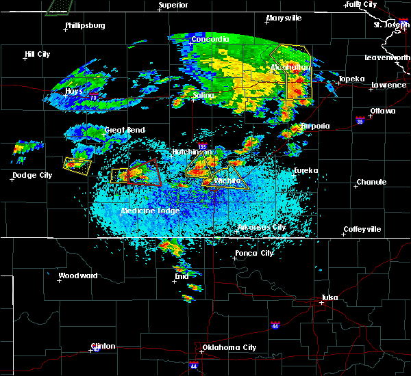 The severe thunderstorm warning for southeastern stafford and northeastern pratt counties will expire at 345 pm cdt, the storm which prompted the warning has moved out of the area. therefore, the warning will be allowed to expire. a tornado watch remains in effect until 1000 pm cdt for south central kansas. The severe thunderstorm warning for southeastern stafford and northeastern pratt counties will expire at 345 pm cdt, the storm which prompted the warning has moved out of the area. therefore, the warning will be allowed to expire. a tornado watch remains in effect until 1000 pm cdt for south central kansas.
|
| 6/18/2019 3:23 PM CDT |
 At 322 pm cdt, a severe thunderstorm was located near turon, or near neola, moving east at 20 mph. spotters have also reported a rotating wall cloud with a funnel cloud with this storm north of preston (radar indicated). Hazards include 60 mph wind gusts and quarter size hail. Hail damage to vehicles is expected. expect wind damage to roofs, siding, and trees. Locations impacted include, preston and neola. At 322 pm cdt, a severe thunderstorm was located near turon, or near neola, moving east at 20 mph. spotters have also reported a rotating wall cloud with a funnel cloud with this storm north of preston (radar indicated). Hazards include 60 mph wind gusts and quarter size hail. Hail damage to vehicles is expected. expect wind damage to roofs, siding, and trees. Locations impacted include, preston and neola.
|
| 6/18/2019 2:51 PM CDT |
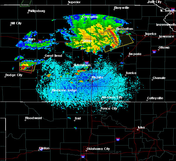 At 251 pm cdt, a severe thunderstorm was located near preston, moving east at 20 mph (radar indicated). Hazards include 60 mph wind gusts and quarter size hail. Hail damage to vehicles is expected. Expect wind damage to roofs, siding, and trees. At 251 pm cdt, a severe thunderstorm was located near preston, moving east at 20 mph (radar indicated). Hazards include 60 mph wind gusts and quarter size hail. Hail damage to vehicles is expected. Expect wind damage to roofs, siding, and trees.
|
| 6/14/2019 11:38 PM CDT |
 At 1137 pm cdt, a line of severe thunderstorms extended from north of pratt to southeast of coldwater, moving east at 55 mph (radar indicated). Hazards include 70 mph wind gusts and penny size hail. Expect considerable tree damage. Damage is likely to mobile homes, roofs, and outbuildings. At 1137 pm cdt, a line of severe thunderstorms extended from north of pratt to southeast of coldwater, moving east at 55 mph (radar indicated). Hazards include 70 mph wind gusts and penny size hail. Expect considerable tree damage. Damage is likely to mobile homes, roofs, and outbuildings.
|
| 5/27/2019 12:40 AM CDT |
 The severe thunderstorm warning for barber, stafford and pratt counties will expire at 1245 am cdt, the storms which prompted the warning have moved out of the area. therefore, the warning will be allowed to expire. however gusty winds are still possible with these thunderstorms in eastern barber county through 1 am. a severe thunderstorm watch remains in effect until 200 am cdt for south central kansas. The severe thunderstorm warning for barber, stafford and pratt counties will expire at 1245 am cdt, the storms which prompted the warning have moved out of the area. therefore, the warning will be allowed to expire. however gusty winds are still possible with these thunderstorms in eastern barber county through 1 am. a severe thunderstorm watch remains in effect until 200 am cdt for south central kansas.
|
| 5/27/2019 12:24 AM CDT |
 At 1223 am cdt, severe thunderstorms were located along a line extending from near ellinwood to near cairo to near hardtner, moving northeast at 50 mph (radar indicated. at 1215 am the pratt airport reported a wind gust of 71 mph). Hazards include 70 mph wind gusts and penny size hail. Expect considerable tree damage. damage is likely to mobile homes, roofs, and outbuildings. locations impacted include, pratt, medicine lodge, st. john, stafford, kiowa, hardtner, iuka, preston, sharon, hudson, sawyer, hazelton, isabel, lake city, zenith, cairo and neola. Time, mot, loc 0523z 205deg 139kt 3831 9864 3761 9853 3700 9867. At 1223 am cdt, severe thunderstorms were located along a line extending from near ellinwood to near cairo to near hardtner, moving northeast at 50 mph (radar indicated. at 1215 am the pratt airport reported a wind gust of 71 mph). Hazards include 70 mph wind gusts and penny size hail. Expect considerable tree damage. damage is likely to mobile homes, roofs, and outbuildings. locations impacted include, pratt, medicine lodge, st. john, stafford, kiowa, hardtner, iuka, preston, sharon, hudson, sawyer, hazelton, isabel, lake city, zenith, cairo and neola. Time, mot, loc 0523z 205deg 139kt 3831 9864 3761 9853 3700 9867.
|
| 5/26/2019 11:51 PM CDT |
 At 1151 pm cdt, severe thunderstorms were located along a line extending from near ash valley to wellsford to near aetna, moving east at 45 mph (radar indicated). Hazards include 70 mph wind gusts and penny size hail. Expect considerable tree damage. Damage is likely to mobile homes, roofs, and outbuildings. At 1151 pm cdt, severe thunderstorms were located along a line extending from near ash valley to wellsford to near aetna, moving east at 45 mph (radar indicated). Hazards include 70 mph wind gusts and penny size hail. Expect considerable tree damage. Damage is likely to mobile homes, roofs, and outbuildings.
|
| 5/18/2019 6:56 PM CDT |
 At 655 pm cdt, a severe thunderstorm was located near pratt, moving northeast at 30 mph (trained weather spotters). Hazards include 60 mph wind gusts and quarter size hail. Hail damage to vehicles is expected. expect wind damage to roofs, siding, and trees. Locations impacted include, pratt, iuka, preston, sawyer, coats and cairo. At 655 pm cdt, a severe thunderstorm was located near pratt, moving northeast at 30 mph (trained weather spotters). Hazards include 60 mph wind gusts and quarter size hail. Hail damage to vehicles is expected. expect wind damage to roofs, siding, and trees. Locations impacted include, pratt, iuka, preston, sawyer, coats and cairo.
|
| 5/18/2019 6:40 PM CDT |
 At 640 pm cdt, a severe thunderstorm was located near coats, moving northeast at 30 mph (radar indicated). Hazards include 60 mph wind gusts and quarter size hail. Hail damage to vehicles is expected. Expect wind damage to roofs, siding, and trees. At 640 pm cdt, a severe thunderstorm was located near coats, moving northeast at 30 mph (radar indicated). Hazards include 60 mph wind gusts and quarter size hail. Hail damage to vehicles is expected. Expect wind damage to roofs, siding, and trees.
|
| 5/6/2019 11:55 PM CDT |
 At 1154 pm cdt, severe thunderstorms were located along a line extending from 8 miles northeast of seward to cairo, moving northeast at 55 mph (trained weather spotters. at 1143 pm cdt, a trained weather spotter reported a 60 mph wind gust in pratt). Hazards include 60 mph wind gusts. expect damage to roofs, siding, and trees At 1154 pm cdt, severe thunderstorms were located along a line extending from 8 miles northeast of seward to cairo, moving northeast at 55 mph (trained weather spotters. at 1143 pm cdt, a trained weather spotter reported a 60 mph wind gust in pratt). Hazards include 60 mph wind gusts. expect damage to roofs, siding, and trees
|
| 5/6/2019 11:40 PM CDT |
 At 1140 pm cdt, severe thunderstorms were located along a line extending from near hudson to 8 miles north of iuka to near coats, moving east at 30 mph (radar indicated). Hazards include 60 mph wind gusts and penny size hail. Expect damage to roofs, siding, and trees. locations impacted include, pratt, st. John, stafford, macksville, iuka, preston, hudson, cullison, coats, byers, hopewell, zenith, cairo, neola and dillwyn. At 1140 pm cdt, severe thunderstorms were located along a line extending from near hudson to 8 miles north of iuka to near coats, moving east at 30 mph (radar indicated). Hazards include 60 mph wind gusts and penny size hail. Expect damage to roofs, siding, and trees. locations impacted include, pratt, st. John, stafford, macksville, iuka, preston, hudson, cullison, coats, byers, hopewell, zenith, cairo, neola and dillwyn.
|
| 5/6/2019 11:13 PM CDT |
 The national weather service in dodge city has issued a * severe thunderstorm warning for. stafford county in south central kansas. east central edwards county in south central kansas. pratt county in south central kansas. Until midnight cdt. The national weather service in dodge city has issued a * severe thunderstorm warning for. stafford county in south central kansas. east central edwards county in south central kansas. pratt county in south central kansas. Until midnight cdt.
|
| 9/2/2018 5:17 PM CDT |
 At 516 pm cdt, a severe thunderstorm was located 3 miles north of sawyer, moving northeast at 25 mph (radar indicated). Hazards include 60 mph wind gusts and quarter size hail. Hail damage to vehicles is expected. expect wind damage to roofs, siding, and trees. Locations impacted include, pratt, stafford, preston, cairo and neola. At 516 pm cdt, a severe thunderstorm was located 3 miles north of sawyer, moving northeast at 25 mph (radar indicated). Hazards include 60 mph wind gusts and quarter size hail. Hail damage to vehicles is expected. expect wind damage to roofs, siding, and trees. Locations impacted include, pratt, stafford, preston, cairo and neola.
|
| 9/2/2018 5:03 PM CDT |
 At 503 pm cdt, a severe thunderstorm was located very near pratt, moving northeast at 25 mph (radar indicated). Hazards include 60 mph wind gusts and quarter size hail. Hail damage to vehicles is expected. Expect wind damage to roofs, siding, and trees. At 503 pm cdt, a severe thunderstorm was located very near pratt, moving northeast at 25 mph (radar indicated). Hazards include 60 mph wind gusts and quarter size hail. Hail damage to vehicles is expected. Expect wind damage to roofs, siding, and trees.
|
| 7/30/2018 6:46 PM CDT |
 A severe thunderstorm warning remains in effect until 715 pm cdt for southern stafford and northern pratt counties. at 646 pm cdt, a severe thunderstorm was located very near st. john, moving south at 30 mph. hazard. quarter size hail. source. Radar indicated. A severe thunderstorm warning remains in effect until 715 pm cdt for southern stafford and northern pratt counties. at 646 pm cdt, a severe thunderstorm was located very near st. john, moving south at 30 mph. hazard. quarter size hail. source. Radar indicated.
|
| 7/30/2018 6:26 PM CDT |
 At 625 pm cdt, a severe thunderstorm was located near seward. addtional storms capable of becoming severe were located 6 miles northeast of larned and also near hudson. these storms were moving south at 30 mph (radar indicated). Hazards include quarter size hail. damage to vehicles is expected At 625 pm cdt, a severe thunderstorm was located near seward. addtional storms capable of becoming severe were located 6 miles northeast of larned and also near hudson. these storms were moving south at 30 mph (radar indicated). Hazards include quarter size hail. damage to vehicles is expected
|
| 6/24/2018 1:21 AM CDT |
 At 120 am cdt, severe thunderstorms were located along a line extending from near cairo to 9 miles north of hardtner to 12 miles northeast of freedom, moving southeast at 30 mph (radar indicated). Hazards include 60 mph wind gusts and penny size hail. Expect damage to roofs, siding, and trees. Locations impacted include, pratt, medicine lodge, kiowa, hardtner, iuka, preston, sharon, sawyer, hazelton, isabel, lake city, aetna and cairo. At 120 am cdt, severe thunderstorms were located along a line extending from near cairo to 9 miles north of hardtner to 12 miles northeast of freedom, moving southeast at 30 mph (radar indicated). Hazards include 60 mph wind gusts and penny size hail. Expect damage to roofs, siding, and trees. Locations impacted include, pratt, medicine lodge, kiowa, hardtner, iuka, preston, sharon, sawyer, hazelton, isabel, lake city, aetna and cairo.
|
| 6/24/2018 12:54 AM CDT |
 At 1253 am cdt, severe thunderstorms were located along a line extending from iuka to 9 miles south of lake city to 11 miles north of freedom, moving southeast at 40 mph (radar indicated). Hazards include 60 mph wind gusts and penny size hail. Expect damage to roofs, siding, and trees. Locations impacted include, pratt, medicine lodge, kiowa, hardtner, iuka, preston, sharon, sawyer, cullison, hazelton, isabel, coats, lake city, sun city, byers, aetna, croft, cairo and buttermilk. At 1253 am cdt, severe thunderstorms were located along a line extending from iuka to 9 miles south of lake city to 11 miles north of freedom, moving southeast at 40 mph (radar indicated). Hazards include 60 mph wind gusts and penny size hail. Expect damage to roofs, siding, and trees. Locations impacted include, pratt, medicine lodge, kiowa, hardtner, iuka, preston, sharon, sawyer, cullison, hazelton, isabel, coats, lake city, sun city, byers, aetna, croft, cairo and buttermilk.
|
| 6/24/2018 12:35 AM CDT |
 At 1234 am cdt, severe thunderstorms were located along a line extending from near hopewell to 8 miles southwest of sun city to 6 miles south of buttermilk, moving southeast at 40 mph (radar indicated). Hazards include 60 mph wind gusts and penny size hail. Expect damage to roofs, siding, and trees. Locations impacted include, pratt, medicine lodge, kiowa, coldwater, haviland, hardtner, iuka, preston, sharon, sawyer, cullison, hazelton, isabel, belpre, coats, lake city, wilmore, sun city, byers and aetna. At 1234 am cdt, severe thunderstorms were located along a line extending from near hopewell to 8 miles southwest of sun city to 6 miles south of buttermilk, moving southeast at 40 mph (radar indicated). Hazards include 60 mph wind gusts and penny size hail. Expect damage to roofs, siding, and trees. Locations impacted include, pratt, medicine lodge, kiowa, coldwater, haviland, hardtner, iuka, preston, sharon, sawyer, cullison, hazelton, isabel, belpre, coats, lake city, wilmore, sun city, byers and aetna.
|
| 6/24/2018 12:14 AM CDT |
 At 1214 am cdt, severe thunderstorms were located along a line extending from 3 miles northwest of trousdale to 2 miles northeast of wilmore to 10 miles southeast of acres, moving southeast at 40 mph (radar indicated). Hazards include 60 mph wind gusts and penny size hail. expect damage to roofs, siding, and trees At 1214 am cdt, severe thunderstorms were located along a line extending from 3 miles northwest of trousdale to 2 miles northeast of wilmore to 10 miles southeast of acres, moving southeast at 40 mph (radar indicated). Hazards include 60 mph wind gusts and penny size hail. expect damage to roofs, siding, and trees
|
| 6/22/2018 8:18 PM CDT |
 At 818 pm cdt, severe thunderstorms were located along a line extending from 5 miles east of preston to 6 miles west of medicine lodge to 9 miles southeast of buttermilk, moving east at 65 mph (radar indicated). Hazards include 70 mph wind gusts and penny size hail. Expect considerable tree damage. damage is likely to mobile homes, roofs, and outbuildings. locations impacted include, pratt, medicine lodge, kiowa, hardtner, preston, sharon, sawyer, hazelton, isabel, coats, lake city, sun city, aetna and cairo. Numerous reports of 60 to 70 mph wind gusts have been reported with this line of storms since 745 pm cdt. At 818 pm cdt, severe thunderstorms were located along a line extending from 5 miles east of preston to 6 miles west of medicine lodge to 9 miles southeast of buttermilk, moving east at 65 mph (radar indicated). Hazards include 70 mph wind gusts and penny size hail. Expect considerable tree damage. damage is likely to mobile homes, roofs, and outbuildings. locations impacted include, pratt, medicine lodge, kiowa, hardtner, preston, sharon, sawyer, hazelton, isabel, coats, lake city, sun city, aetna and cairo. Numerous reports of 60 to 70 mph wind gusts have been reported with this line of storms since 745 pm cdt.
|
| 6/22/2018 7:55 PM CDT |
 At 755 pm cdt, severe thunderstorms were located along a line extending from 2 miles east of byers to 6 miles southeast of wilmore to 7 miles southeast of acres, moving southeast at 55 mph (radar indicated). Hazards include 70 mph wind gusts and penny size hail. Expect considerable tree damage. Damage is likely to mobile homes, roofs, and outbuildings. At 755 pm cdt, severe thunderstorms were located along a line extending from 2 miles east of byers to 6 miles southeast of wilmore to 7 miles southeast of acres, moving southeast at 55 mph (radar indicated). Hazards include 70 mph wind gusts and penny size hail. Expect considerable tree damage. Damage is likely to mobile homes, roofs, and outbuildings.
|
| 6/20/2018 12:18 AM CDT |
 At 1218 am cdt, the leading edge of severe thunderstorm high winds were located along a line extending from 5 miles north of zenith to 4 miles southwest of sun city to 8 miles southeast of sitka to 5 miles east of rosston, moving south at 40 mph (radar indicated). Hazards include 60 mph wind gusts. Expect damage to roofs, siding, and trees. locations impacted include, pratt, medicine lodge, st. John, stafford, ashland, coldwater, greensburg, haviland, protection, iuka, preston, hudson, sawyer, cullison, isabel, coats, sitka, lake city, wilmore and sun city. At 1218 am cdt, the leading edge of severe thunderstorm high winds were located along a line extending from 5 miles north of zenith to 4 miles southwest of sun city to 8 miles southeast of sitka to 5 miles east of rosston, moving south at 40 mph (radar indicated). Hazards include 60 mph wind gusts. Expect damage to roofs, siding, and trees. locations impacted include, pratt, medicine lodge, st. John, stafford, ashland, coldwater, greensburg, haviland, protection, iuka, preston, hudson, sawyer, cullison, isabel, coats, sitka, lake city, wilmore and sun city.
|
| 6/19/2018 11:58 PM CDT |
 At 1158 pm cdt, severe thunderstorms were located along a line extending from 7 miles southwest of raymond to 3 miles west of croft to 4 miles north of sitka to 7 miles southeast of englewood, moving south at 40 mph (radar indicated). Hazards include two inch hail and 60 mph wind gusts. People and animals outdoors will be injured. expect hail damage to roofs, siding, windows, and vehicles. Expect wind damage to roofs, siding, and trees. At 1158 pm cdt, severe thunderstorms were located along a line extending from 7 miles southwest of raymond to 3 miles west of croft to 4 miles north of sitka to 7 miles southeast of englewood, moving south at 40 mph (radar indicated). Hazards include two inch hail and 60 mph wind gusts. People and animals outdoors will be injured. expect hail damage to roofs, siding, windows, and vehicles. Expect wind damage to roofs, siding, and trees.
|
| 6/12/2018 8:17 PM CDT |
 At 815 pm cdt, a severe thunderstorm was located very near hopewell, moving east at 15 mph (radar indicated). Hazards include ping pong ball size hail and 60 mph wind gusts. People and animals outdoors will be injured. expect hail damage to roofs, siding, windows, and vehicles. Expect wind damage to roofs, siding, and trees. At 815 pm cdt, a severe thunderstorm was located very near hopewell, moving east at 15 mph (radar indicated). Hazards include ping pong ball size hail and 60 mph wind gusts. People and animals outdoors will be injured. expect hail damage to roofs, siding, windows, and vehicles. Expect wind damage to roofs, siding, and trees.
|
| 6/7/2018 3:26 AM CDT |
 At 326 am cdt, severe thunderstorms were located along a line extending from 2 miles southeast of preston to 5 miles west of hardtner, moving east at 30 mph (radar indicated). Hazards include 70 mph wind gusts and nickel size hail. Expect considerable tree damage. Damage is likely to mobile homes, roofs, and outbuildings. At 326 am cdt, severe thunderstorms were located along a line extending from 2 miles southeast of preston to 5 miles west of hardtner, moving east at 30 mph (radar indicated). Hazards include 70 mph wind gusts and nickel size hail. Expect considerable tree damage. Damage is likely to mobile homes, roofs, and outbuildings.
|
| 6/7/2018 3:22 AM CDT |
 At 322 am cdt, severe thunderstorms were located along a line extending from 3 miles south of hudson to 9 miles north of hardtner, moving east at 35 mph (radar indicated). Hazards include 70 mph wind gusts and quarter size hail. Hail damage to vehicles is expected. expect considerable tree damage. wind damage is also likely to mobile homes, roofs, and outbuildings. locations impacted include, pratt, larned, medicine lodge, st. John, stafford, kiowa, coldwater, greensburg, haviland, macksville, lewis, garfield, hardtner, iuka, preston, sharon, hudson, sawyer, cullison and hazelton. At 322 am cdt, severe thunderstorms were located along a line extending from 3 miles south of hudson to 9 miles north of hardtner, moving east at 35 mph (radar indicated). Hazards include 70 mph wind gusts and quarter size hail. Hail damage to vehicles is expected. expect considerable tree damage. wind damage is also likely to mobile homes, roofs, and outbuildings. locations impacted include, pratt, larned, medicine lodge, st. John, stafford, kiowa, coldwater, greensburg, haviland, macksville, lewis, garfield, hardtner, iuka, preston, sharon, hudson, sawyer, cullison and hazelton.
|
| 6/7/2018 2:45 AM CDT |
 At 244 am cdt, severe thunderstorms were located along a line extending from zook to 7 miles northwest of aetna, moving east at 35 mph (radar indicated). Hazards include 70 mph wind gusts and quarter size hail. Hail damage to vehicles is expected. expect considerable tree damage. Wind damage is also likely to mobile homes, roofs, and outbuildings. At 244 am cdt, severe thunderstorms were located along a line extending from zook to 7 miles northwest of aetna, moving east at 35 mph (radar indicated). Hazards include 70 mph wind gusts and quarter size hail. Hail damage to vehicles is expected. expect considerable tree damage. Wind damage is also likely to mobile homes, roofs, and outbuildings.
|
| 5/29/2018 7:21 PM CDT |
 At 720 pm cdt, severe thunderstorms were located along a line extending from 3 miles southwest of byers to 8 miles southwest of aetna, moving northeast at 30 mph (radar indicated). Hazards include ping pong ball size hail and 60 mph wind gusts. People and animals outdoors will be injured. expect hail damage to roofs, siding, windows, and vehicles. expect wind damage to roofs, siding, and trees. locations impacted include, pratt, coldwater, haviland, protection, iuka, preston, cullison, coats, sun city, wilmore, wellsford, croft, lake coldwater, belvidere and buttermilk. A tornado watch remains in effect until 1000 pm cdt for south central and southwestern kansas. At 720 pm cdt, severe thunderstorms were located along a line extending from 3 miles southwest of byers to 8 miles southwest of aetna, moving northeast at 30 mph (radar indicated). Hazards include ping pong ball size hail and 60 mph wind gusts. People and animals outdoors will be injured. expect hail damage to roofs, siding, windows, and vehicles. expect wind damage to roofs, siding, and trees. locations impacted include, pratt, coldwater, haviland, protection, iuka, preston, cullison, coats, sun city, wilmore, wellsford, croft, lake coldwater, belvidere and buttermilk. A tornado watch remains in effect until 1000 pm cdt for south central and southwestern kansas.
|
| 5/29/2018 6:42 PM CDT |
 At 641 pm cdt, a severe thunderstorm was located 7 miles south of greensburg, moving east at 30 mph (radar indicated). Hazards include two inch hail and 60 mph wind gusts. People and animals outdoors will be injured. expect hail damage to roofs, siding, windows, and vehicles. Expect wind damage to roofs, siding, and trees. At 641 pm cdt, a severe thunderstorm was located 7 miles south of greensburg, moving east at 30 mph (radar indicated). Hazards include two inch hail and 60 mph wind gusts. People and animals outdoors will be injured. expect hail damage to roofs, siding, windows, and vehicles. Expect wind damage to roofs, siding, and trees.
|
| 5/18/2018 9:43 PM CDT |
 The severe thunderstorm warning for barber, southern stafford and pratt counties will expire at 945 pm cdt, the the leading edge of the storms which prompted the warning have moved out of the area. therefore the warning will be allowed to expire. however small hail, gusty winds and heavy rain are still possible with these thunderstorms. a severe thunderstorm watch remains in effect until 1100 pm cdt for south central kansas. The severe thunderstorm warning for barber, southern stafford and pratt counties will expire at 945 pm cdt, the the leading edge of the storms which prompted the warning have moved out of the area. therefore the warning will be allowed to expire. however small hail, gusty winds and heavy rain are still possible with these thunderstorms. a severe thunderstorm watch remains in effect until 1100 pm cdt for south central kansas.
|
| 5/18/2018 8:57 PM CDT |
 At 856 pm cdt, the leading edge of severe thunderstorms were located along a line extending from 2 miles northwest of dillwyn to 3 miles northeast of coats to 6 miles west of hardtner, moving east at 30 mph (radar indicated). Hazards include 60 mph wind gusts and quarter size hail. Hail damage to vehicles is expected. expect wind damage to roofs, siding, and trees. This warning replaces the previous warning for barber, southern stafford and pratt county. At 856 pm cdt, the leading edge of severe thunderstorms were located along a line extending from 2 miles northwest of dillwyn to 3 miles northeast of coats to 6 miles west of hardtner, moving east at 30 mph (radar indicated). Hazards include 60 mph wind gusts and quarter size hail. Hail damage to vehicles is expected. expect wind damage to roofs, siding, and trees. This warning replaces the previous warning for barber, southern stafford and pratt county.
|
| 5/18/2018 8:46 PM CDT |
 At 846 pm cdt, the leading edge of severe thunderstorms were located along a line extending from 3 miles northwest of macksville to 2 miles west of coats to 8 miles southeast of aetna, moving east at 60 mph (radar indicated). Hazards include 70 mph wind gusts and quarter size hail. Hail damage to vehicles is expected. expect considerable tree damage. wind damage is also likely to mobile homes, roofs, and outbuildings. locations impacted include, pratt, medicine lodge, st. John, stafford, kiowa, haviland, macksville, lewis, hardtner, iuka, preston, sharon, sawyer, cullison, hazelton, isabel, belpre, coats, lake city and sun city. At 846 pm cdt, the leading edge of severe thunderstorms were located along a line extending from 3 miles northwest of macksville to 2 miles west of coats to 8 miles southeast of aetna, moving east at 60 mph (radar indicated). Hazards include 70 mph wind gusts and quarter size hail. Hail damage to vehicles is expected. expect considerable tree damage. wind damage is also likely to mobile homes, roofs, and outbuildings. locations impacted include, pratt, medicine lodge, st. John, stafford, kiowa, haviland, macksville, lewis, hardtner, iuka, preston, sharon, sawyer, cullison, hazelton, isabel, belpre, coats, lake city and sun city.
|
| 5/18/2018 8:28 PM CDT |
 At 828 pm cdt, the leading edge of severe thunderstorms were located along a line extending from 3 miles east of lewis to near belvidere to 8 miles southwest of aetna, moving east at 25 mph (radar indicated). Hazards include 70 mph wind gusts and quarter size hail. Hail damage to vehicles is expected. expect considerable tree damage. wind damage is also likely to mobile homes, roofs, and outbuildings. locations impacted include, pratt, medicine lodge, kinsley, st. John, stafford, kiowa, coldwater, greensburg, haviland, macksville, lewis, offerle, hardtner, iuka, preston, sharon, sawyer, cullison, hazelton and isabel. At 828 pm cdt, the leading edge of severe thunderstorms were located along a line extending from 3 miles east of lewis to near belvidere to 8 miles southwest of aetna, moving east at 25 mph (radar indicated). Hazards include 70 mph wind gusts and quarter size hail. Hail damage to vehicles is expected. expect considerable tree damage. wind damage is also likely to mobile homes, roofs, and outbuildings. locations impacted include, pratt, medicine lodge, kinsley, st. John, stafford, kiowa, coldwater, greensburg, haviland, macksville, lewis, offerle, hardtner, iuka, preston, sharon, sawyer, cullison, hazelton and isabel.
|
| 5/18/2018 8:00 PM CDT |
 The national weather service in dodge city has issued a * severe thunderstorm warning for. kiowa county in south central kansas. barber county in south central kansas. comanche county in south central kansas. Southern stafford county in south central kansas. The national weather service in dodge city has issued a * severe thunderstorm warning for. kiowa county in south central kansas. barber county in south central kansas. comanche county in south central kansas. Southern stafford county in south central kansas.
|
| 5/2/2018 4:20 PM CDT |
 The severe thunderstorm warning for southeastern stafford and northeastern pratt counties will expire at 430 pm cdt, the storm which prompted the warning has moved out of the area. therefore the warning will be allowed to expire. a tornado watch remains in effect until 1000 pm cdt for south central kansas. The severe thunderstorm warning for southeastern stafford and northeastern pratt counties will expire at 430 pm cdt, the storm which prompted the warning has moved out of the area. therefore the warning will be allowed to expire. a tornado watch remains in effect until 1000 pm cdt for south central kansas.
|
| 5/2/2018 4:07 PM CDT |
 At 406 pm cdt, a severe thunderstorm was located near turon, or 3 miles southeast of neola, moving northeast at 45 mph (radar indicated). Hazards include 60 mph wind gusts and nickel size hail. Expect damage to roofs, siding, and trees. locations impacted include, stafford, preston, zenith and neola. A tornado watch remains in effect until 1000 pm cdt for south central kansas. At 406 pm cdt, a severe thunderstorm was located near turon, or 3 miles southeast of neola, moving northeast at 45 mph (radar indicated). Hazards include 60 mph wind gusts and nickel size hail. Expect damage to roofs, siding, and trees. locations impacted include, stafford, preston, zenith and neola. A tornado watch remains in effect until 1000 pm cdt for south central kansas.
|
| 5/2/2018 3:45 PM CDT |
 At 344 pm cdt, a severe thunderstorm was located 4 miles west of neola, moving northeast at 55 mph. this is a very dangerous storm (public). Hazards include 80 mph wind gusts and nickel size hail. Flying debris will be dangerous to those caught without shelter. mobile homes will be heavily damaged. expect considerable damage to roofs, windows, and vehicles. extensive tree damage and power outages are likely. locations impacted include, stafford, iuka, preston, zenith and neola. the pratt airport reported 80 mph winds at 3:35 pm. A tornado watch remains in effect until 1000 pm cdt for south central kansas. At 344 pm cdt, a severe thunderstorm was located 4 miles west of neola, moving northeast at 55 mph. this is a very dangerous storm (public). Hazards include 80 mph wind gusts and nickel size hail. Flying debris will be dangerous to those caught without shelter. mobile homes will be heavily damaged. expect considerable damage to roofs, windows, and vehicles. extensive tree damage and power outages are likely. locations impacted include, stafford, iuka, preston, zenith and neola. the pratt airport reported 80 mph winds at 3:35 pm. A tornado watch remains in effect until 1000 pm cdt for south central kansas.
|
| 5/2/2018 3:41 PM CDT |
 The severe thunderstorm warning for eastern stafford and northeastern pratt counties will expire at 345 pm cdt. the storms which prompted the warning have moved out of the area. therefore the warning will be allowed to expire. However another severe thunderstorm warning is in effect for a thunderstorm capable of producing winds over 70 mph winds located at iuka. The severe thunderstorm warning for eastern stafford and northeastern pratt counties will expire at 345 pm cdt. the storms which prompted the warning have moved out of the area. therefore the warning will be allowed to expire. However another severe thunderstorm warning is in effect for a thunderstorm capable of producing winds over 70 mph winds located at iuka.
|
| 5/2/2018 3:38 PM CDT |
 At 337 pm cdt, a severe thunderstorm was located 5 miles northeast of iuka, moving northeast at 45 mph (radar indicated). Hazards include 60 mph wind gusts and quarter size hail. Hail damage to vehicles is expected. Expect wind damage to roofs, siding, and trees. At 337 pm cdt, a severe thunderstorm was located 5 miles northeast of iuka, moving northeast at 45 mph (radar indicated). Hazards include 60 mph wind gusts and quarter size hail. Hail damage to vehicles is expected. Expect wind damage to roofs, siding, and trees.
|
| 5/2/2018 3:33 PM CDT |
 At 333 pm cdt, severe thunderstorms were located along a line extending from 5 miles east of hudson to 5 miles north of zenith to 3 miles northeast of neola to 5 miles southwest of cairo, moving northeast at 35 mph (radar indicated). Hazards include 70 mph wind gusts and quarter size hail. Hail damage to vehicles is expected. expect considerable tree damage. wind damage is also likely to mobile homes, roofs, and outbuildings. locations impacted include, stafford, preston, zenith, cairo and neola. A tornado watch remains in effect until 1000 pm cdt for south central kansas. At 333 pm cdt, severe thunderstorms were located along a line extending from 5 miles east of hudson to 5 miles north of zenith to 3 miles northeast of neola to 5 miles southwest of cairo, moving northeast at 35 mph (radar indicated). Hazards include 70 mph wind gusts and quarter size hail. Hail damage to vehicles is expected. expect considerable tree damage. wind damage is also likely to mobile homes, roofs, and outbuildings. locations impacted include, stafford, preston, zenith, cairo and neola. A tornado watch remains in effect until 1000 pm cdt for south central kansas.
|
| 5/2/2018 3:07 PM CDT |
 At 307 pm cdt, severe thunderstorms were located along a line extending from 3 miles northeast of dillwyn to 3 miles south of st. john to 5 miles north of iuka to 4 miles west of coats, moving east at 45 mph (radar indicated). Hazards include 70 mph wind gusts and quarter size hail. Hail damage to vehicles is expected. expect considerable tree damage. Wind damage is also likely to mobile homes, roofs, and outbuildings. At 307 pm cdt, severe thunderstorms were located along a line extending from 3 miles northeast of dillwyn to 3 miles south of st. john to 5 miles north of iuka to 4 miles west of coats, moving east at 45 mph (radar indicated). Hazards include 70 mph wind gusts and quarter size hail. Hail damage to vehicles is expected. expect considerable tree damage. Wind damage is also likely to mobile homes, roofs, and outbuildings.
|
| 10/6/2017 8:52 PM CDT |
 The severe thunderstorm warning for southeastern pawnee, stafford, southeastern edwards and northern pratt counties will expire at 900 pm cdt, the storms which prompted the warning have weakened below severe limits, and no longer pose an immediate threat to life or property. therefore the warning will be allowed to expire. however gusty winds and heavy rain are still possible with these thunderstorms. a severe thunderstorm watch remains in effect until 1100 pm cdt for south central kansas. The severe thunderstorm warning for southeastern pawnee, stafford, southeastern edwards and northern pratt counties will expire at 900 pm cdt, the storms which prompted the warning have weakened below severe limits, and no longer pose an immediate threat to life or property. therefore the warning will be allowed to expire. however gusty winds and heavy rain are still possible with these thunderstorms. a severe thunderstorm watch remains in effect until 1100 pm cdt for south central kansas.
|
| 10/6/2017 8:39 PM CDT |
 At 825 pm cdt, the gust front from severe thunderstorms was located along a line extending from 3 miles southwest of raymond to 3 miles southwest of saint john to 4 miles southeast of fellsburg, moving east at 25 mph (radar indicated). Hazards include 60 mph wind gusts and half dollar size hail. Hail damage to vehicles is expected. expect wind damage to roofs, siding, and trees. Locations impacted include, saint john, stafford, macksville, lewis, preston, hudson, belpre, seward, byers, radium, trousdale, hopewell, neola, dillwyn, centerview, zook, zenith, fellsburg, little salt marsh at quivira refuge and big salt marsh at quivira refuge. At 825 pm cdt, the gust front from severe thunderstorms was located along a line extending from 3 miles southwest of raymond to 3 miles southwest of saint john to 4 miles southeast of fellsburg, moving east at 25 mph (radar indicated). Hazards include 60 mph wind gusts and half dollar size hail. Hail damage to vehicles is expected. expect wind damage to roofs, siding, and trees. Locations impacted include, saint john, stafford, macksville, lewis, preston, hudson, belpre, seward, byers, radium, trousdale, hopewell, neola, dillwyn, centerview, zook, zenith, fellsburg, little salt marsh at quivira refuge and big salt marsh at quivira refuge.
|
| 10/6/2017 8:26 PM CDT |
 At 825 pm cdt, the gust front from severe thunderstorms was located along a line extending from 3 miles southwest of raymond to 3 miles southwest of saint john to 4 miles southeast of fellsburg, moving east at 25 mph (radar indicated). Hazards include 60 mph wind gusts and half dollar size hail. Hail damage to vehicles is expected. expect wind damage to roofs, siding, and trees. Locations impacted include, saint john, stafford, macksville, lewis, preston, hudson, belpre, seward, byers, radium, trousdale, hopewell, neola, dillwyn, centerview, zook, zenith, fellsburg, little salt marsh at quivira refuge and big salt marsh at quivira refuge. At 825 pm cdt, the gust front from severe thunderstorms was located along a line extending from 3 miles southwest of raymond to 3 miles southwest of saint john to 4 miles southeast of fellsburg, moving east at 25 mph (radar indicated). Hazards include 60 mph wind gusts and half dollar size hail. Hail damage to vehicles is expected. expect wind damage to roofs, siding, and trees. Locations impacted include, saint john, stafford, macksville, lewis, preston, hudson, belpre, seward, byers, radium, trousdale, hopewell, neola, dillwyn, centerview, zook, zenith, fellsburg, little salt marsh at quivira refuge and big salt marsh at quivira refuge.
|
| 10/6/2017 8:00 PM CDT |
 At 759 pm cdt, severe thunderstorms were located along a line extending from 6 miles southwest of great bend to 3 miles northeast of belpre to 7 miles southwest of centerview, moving east at 55 mph (radar indicated). Hazards include 60 mph wind gusts and half dollar size hail. Hail damage to vehicles is expected. Expect wind damage to roofs, siding, and trees. At 759 pm cdt, severe thunderstorms were located along a line extending from 6 miles southwest of great bend to 3 miles northeast of belpre to 7 miles southwest of centerview, moving east at 55 mph (radar indicated). Hazards include 60 mph wind gusts and half dollar size hail. Hail damage to vehicles is expected. Expect wind damage to roofs, siding, and trees.
|
| 8/10/2017 6:37 PM CDT |
 The severe thunderstorm warning for northeastern pratt county will expire at 645 pm cdt, the storm which prompted the warning has weakened below severe limits, and has exited the warned area. therefore, the warning will be allowed to expire. however gusty winds and heavy rain are still possible with this thunderstorm. a severe thunderstorm watch remains in effect until 900 pm cdt for south central kansas. to report severe weather, contact your nearest law enforcement agency. they will relay your report to the national weather service dodge city. The severe thunderstorm warning for northeastern pratt county will expire at 645 pm cdt, the storm which prompted the warning has weakened below severe limits, and has exited the warned area. therefore, the warning will be allowed to expire. however gusty winds and heavy rain are still possible with this thunderstorm. a severe thunderstorm watch remains in effect until 900 pm cdt for south central kansas. to report severe weather, contact your nearest law enforcement agency. they will relay your report to the national weather service dodge city.
|
| 8/10/2017 6:25 PM CDT |
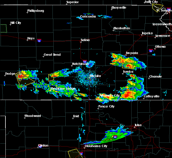 At 625 pm cdt, a severe thunderstorm was located 3 miles southeast of preston, or 14 miles northeast of pratt, moving southeast at 30 mph (radar indicated). Hazards include 60 mph wind gusts and half dollar size hail. Hail damage to vehicles is expected. expect wind damage to roofs, siding, and trees. Locations impacted include, preston and cairo. At 625 pm cdt, a severe thunderstorm was located 3 miles southeast of preston, or 14 miles northeast of pratt, moving southeast at 30 mph (radar indicated). Hazards include 60 mph wind gusts and half dollar size hail. Hail damage to vehicles is expected. expect wind damage to roofs, siding, and trees. Locations impacted include, preston and cairo.
|
| 8/10/2017 6:12 PM CDT |
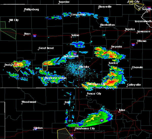 At 612 pm cdt, a severe thunderstorm was located 3 miles southwest of neola, or 10 miles south of stafford, moving southeast at 30 mph (radar indicated). Hazards include ping pong ball size hail and 60 mph wind gusts. People and animals outdoors will be injured. expect hail damage to roofs, siding, windows, and vehicles. expect wind damage to roofs, siding, and trees. Locations impacted include, preston, neola and cairo. At 612 pm cdt, a severe thunderstorm was located 3 miles southwest of neola, or 10 miles south of stafford, moving southeast at 30 mph (radar indicated). Hazards include ping pong ball size hail and 60 mph wind gusts. People and animals outdoors will be injured. expect hail damage to roofs, siding, windows, and vehicles. expect wind damage to roofs, siding, and trees. Locations impacted include, preston, neola and cairo.
|
| 8/10/2017 5:59 PM CDT |
 At 559 pm cdt, a severe thunderstorm was located 4 miles south of stafford, moving southeast at 30 mph (radar indicated). Hazards include 60 mph wind gusts and half dollar size hail. Hail damage to vehicles is expected. expect wind damage to roofs, siding, and trees. Locations impacted include, stafford, preston, natrona, neola, cairo and zenith. At 559 pm cdt, a severe thunderstorm was located 4 miles south of stafford, moving southeast at 30 mph (radar indicated). Hazards include 60 mph wind gusts and half dollar size hail. Hail damage to vehicles is expected. expect wind damage to roofs, siding, and trees. Locations impacted include, stafford, preston, natrona, neola, cairo and zenith.
|
| 8/10/2017 5:42 PM CDT |
 At 542 pm cdt, a severe thunderstorm was located near saint john, moving southeast at 30 mph (radar indicated). Hazards include two inch hail and 60 mph wind gusts. People and animals outdoors will be injured. expect hail damage to roofs, siding, windows, and vehicles. Expect wind damage to roofs, siding, and trees. At 542 pm cdt, a severe thunderstorm was located near saint john, moving southeast at 30 mph (radar indicated). Hazards include two inch hail and 60 mph wind gusts. People and animals outdoors will be injured. expect hail damage to roofs, siding, windows, and vehicles. Expect wind damage to roofs, siding, and trees.
|
| 7/13/2017 6:07 PM CDT |
 The severe thunderstorm warning for southeastern stafford and northeastern pratt counties will expire at 615 pm cdt, the storms which prompted the warning have weakened below severe limits, and no longer pose an immediate threat to life or property. therefore the warning will be allowed to expire. The severe thunderstorm warning for southeastern stafford and northeastern pratt counties will expire at 615 pm cdt, the storms which prompted the warning have weakened below severe limits, and no longer pose an immediate threat to life or property. therefore the warning will be allowed to expire.
|
| 7/13/2017 5:52 PM CDT |
 At 551 pm cdt, severe thunderstorms were located along a line extending from 9 miles southwest of stafford to 4 miles south of turon, moving east at 15 mph (radar indicated). Hazards include 60 mph wind gusts and quarter size hail. Hail damage to vehicles is expected. expect wind damage to roofs, siding, and trees. Locations impacted include, stafford, iuka, preston, natrona, neola and zenith. At 551 pm cdt, severe thunderstorms were located along a line extending from 9 miles southwest of stafford to 4 miles south of turon, moving east at 15 mph (radar indicated). Hazards include 60 mph wind gusts and quarter size hail. Hail damage to vehicles is expected. expect wind damage to roofs, siding, and trees. Locations impacted include, stafford, iuka, preston, natrona, neola and zenith.
|
| 7/13/2017 5:31 PM CDT |
 At 530 pm cdt, severe thunderstorms were located along a line extending from 6 miles northeast of byers to near preston, moving east at 15 mph (radar indicated). Hazards include up to ping pong ball size hail and 60 mph wind gusts. People and animals outdoors will be injured. expect hail damage to roofs, siding, windows, and vehicles. Expect wind damage to roofs, siding, and trees. At 530 pm cdt, severe thunderstorms were located along a line extending from 6 miles northeast of byers to near preston, moving east at 15 mph (radar indicated). Hazards include up to ping pong ball size hail and 60 mph wind gusts. People and animals outdoors will be injured. expect hail damage to roofs, siding, windows, and vehicles. Expect wind damage to roofs, siding, and trees.
|
| 6/29/2017 8:51 PM CDT |
 At 151 am cdt, severe thunderstorms were located along a line extending from 2 miles east of radium to 4 miles southwest of lake arrowhead, moving east at 15 mph (radar indicated). Hazards include 60 mph wind gusts and up to half dollar size hail. Hail damage to vehicles is expected. expect wind damage to roofs, siding, and trees. Locations impacted include, stafford, lake arrowhead, preston, hudson, isabel, natrona, neola, cairo and pratt county lake. At 151 am cdt, severe thunderstorms were located along a line extending from 2 miles east of radium to 4 miles southwest of lake arrowhead, moving east at 15 mph (radar indicated). Hazards include 60 mph wind gusts and up to half dollar size hail. Hail damage to vehicles is expected. expect wind damage to roofs, siding, and trees. Locations impacted include, stafford, lake arrowhead, preston, hudson, isabel, natrona, neola, cairo and pratt county lake.
|
| 6/29/2017 8:32 PM CDT |
 At 131 am cdt, severe thunderstorms were located along a line extending from near radium to 4 miles northeast of lake city, moving east at 15 mph (radar indicated). Hazards include 60 mph wind gusts and up to half dollar size hail. Hail damage to vehicles is expected. expect wind damage to roofs, siding, and trees. Locations impacted include, pratt, saint john, stafford, lake arrowhead, iuka, preston, hudson, sawyer, cullison, isabel, coats, seward, lake city, byers, radium, natrona, neola, cairo, dillwyn and elm mills. At 131 am cdt, severe thunderstorms were located along a line extending from near radium to 4 miles northeast of lake city, moving east at 15 mph (radar indicated). Hazards include 60 mph wind gusts and up to half dollar size hail. Hail damage to vehicles is expected. expect wind damage to roofs, siding, and trees. Locations impacted include, pratt, saint john, stafford, lake arrowhead, iuka, preston, hudson, sawyer, cullison, isabel, coats, seward, lake city, byers, radium, natrona, neola, cairo, dillwyn and elm mills.
|
| 6/29/2017 8:12 PM CDT |
 At 110 am cdt, several severe thunderstorms were located along a line extending from 4 miles south of pawnee rock to 4 miles north of lake city, moving east at 15 mph (radar indicated). Hazards include half dollar size hail. damage to vehicles is expected At 110 am cdt, several severe thunderstorms were located along a line extending from 4 miles south of pawnee rock to 4 miles north of lake city, moving east at 15 mph (radar indicated). Hazards include half dollar size hail. damage to vehicles is expected
|
| 6/15/2017 8:01 PM CDT |
 At 801 pm cdt, a severe thunderstorm was located very near pratt, moving southeast at 25 mph (radar indicated). Hazards include 60 mph wind gusts and quarter size hail. Hail damage to vehicles is expected. Expect wind damage to roofs, siding, and trees. At 801 pm cdt, a severe thunderstorm was located very near pratt, moving southeast at 25 mph (radar indicated). Hazards include 60 mph wind gusts and quarter size hail. Hail damage to vehicles is expected. Expect wind damage to roofs, siding, and trees.
|
| 6/15/2017 7:56 PM CDT |
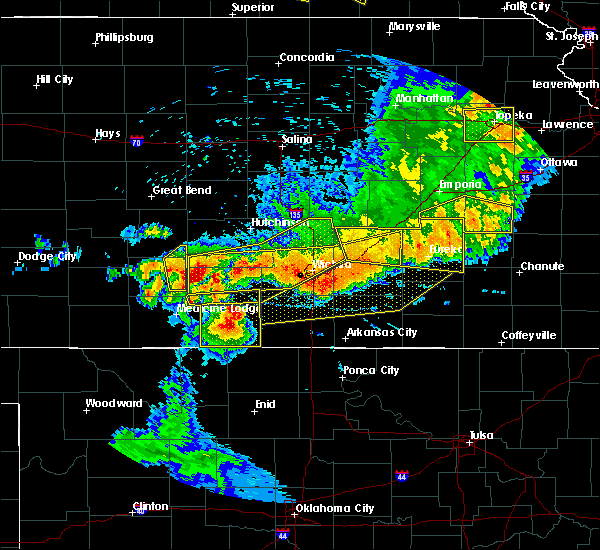 The severe thunderstorm warning for southeastern stafford and eastern pratt counties will expire at 800 pm cdt, the storm which prompted the warning has weakened below severe limits, and no longer poses an immediate threat to life or property. therefore the warning will be allowed to expire. however small hail, gusty winds and heavy rain are still possible with this thunderstorm. a severe thunderstorm watch remains in effect until 200 am cdt for south central kansas. The severe thunderstorm warning for southeastern stafford and eastern pratt counties will expire at 800 pm cdt, the storm which prompted the warning has weakened below severe limits, and no longer poses an immediate threat to life or property. therefore the warning will be allowed to expire. however small hail, gusty winds and heavy rain are still possible with this thunderstorm. a severe thunderstorm watch remains in effect until 200 am cdt for south central kansas.
|
| 6/15/2017 7:28 PM CDT |
 At 727 pm cdt, a severe thunderstorm was located near neola, or 9 miles south of stafford, moving southeast at 25 mph (radar indicated). Hazards include two inch hail and 70 mph wind gusts. People and animals outdoors will be injured. expect hail damage to roofs, siding, windows, and vehicles. expect considerable tree damage. wind damage is also likely to mobile homes, roofs, and outbuildings. Locations impacted include, preston, natrona, neola and cairo. At 727 pm cdt, a severe thunderstorm was located near neola, or 9 miles south of stafford, moving southeast at 25 mph (radar indicated). Hazards include two inch hail and 70 mph wind gusts. People and animals outdoors will be injured. expect hail damage to roofs, siding, windows, and vehicles. expect considerable tree damage. wind damage is also likely to mobile homes, roofs, and outbuildings. Locations impacted include, preston, natrona, neola and cairo.
|
| 6/15/2017 7:23 PM CDT |
 At 723 pm cdt, a severe thunderstorm was located 3 miles west of neola, or 7 miles south of stafford, moving southeast at 25 mph (radar indicated). Hazards include ping pong ball size hail and 60 mph wind gusts. People and animals outdoors will be injured. expect hail damage to roofs, siding, windows, and vehicles. expect wind damage to roofs, siding, and trees. Locations impacted include, stafford, iuka, preston, natrona, neola, cairo and pratt county lake. At 723 pm cdt, a severe thunderstorm was located 3 miles west of neola, or 7 miles south of stafford, moving southeast at 25 mph (radar indicated). Hazards include ping pong ball size hail and 60 mph wind gusts. People and animals outdoors will be injured. expect hail damage to roofs, siding, windows, and vehicles. expect wind damage to roofs, siding, and trees. Locations impacted include, stafford, iuka, preston, natrona, neola, cairo and pratt county lake.
|
| 6/15/2017 7:05 PM CDT |
 At 705 pm cdt, a severe thunderstorm was located 5 miles southwest of stafford, moving southeast at 25 mph (radar indicated). Hazards include 60 mph wind gusts and half dollar size hail. Hail damage to vehicles is expected. Expect wind damage to roofs, siding, and trees. At 705 pm cdt, a severe thunderstorm was located 5 miles southwest of stafford, moving southeast at 25 mph (radar indicated). Hazards include 60 mph wind gusts and half dollar size hail. Hail damage to vehicles is expected. Expect wind damage to roofs, siding, and trees.
|
| 5/18/2017 5:07 PM CDT |
 At 507 pm cdt, severe thunderstorms were located along a line extending from 4 miles northeast of isabel to 3 miles west of coats, moving north at 40 mph (radar indicated). Hazards include 70 mph wind gusts and ping pong ball size hail. People and animals outdoors will be injured. expect hail damage to roofs, siding, windows, and vehicles. expect considerable tree damage. Wind damage is also likely to mobile homes, roofs, and outbuildings. At 507 pm cdt, severe thunderstorms were located along a line extending from 4 miles northeast of isabel to 3 miles west of coats, moving north at 40 mph (radar indicated). Hazards include 70 mph wind gusts and ping pong ball size hail. People and animals outdoors will be injured. expect hail damage to roofs, siding, windows, and vehicles. expect considerable tree damage. Wind damage is also likely to mobile homes, roofs, and outbuildings.
|
| 5/17/2017 12:38 AM CDT |
 The severe thunderstorm warning for eastern pratt county will expire at 1245 am cdt, the storm which prompted the warning has moved out of the area. therefore the warning will be allowed to expire. a severe thunderstorm watch remains in effect until 500 am cdt for south central kansas. The severe thunderstorm warning for eastern pratt county will expire at 1245 am cdt, the storm which prompted the warning has moved out of the area. therefore the warning will be allowed to expire. a severe thunderstorm watch remains in effect until 500 am cdt for south central kansas.
|
| 5/17/2017 12:17 AM CDT |
 At 1215 am cdt, a severe thunderstorm was located very near iuka, or 6 miles north of pratt, moving northeast at 45 mph. this replaces the previous warning for pratt county (radar indicated). Hazards include 60 mph wind gusts and quarter size hail. Hail damage to vehicles is expected. Expect wind damage to roofs, siding, and trees. At 1215 am cdt, a severe thunderstorm was located very near iuka, or 6 miles north of pratt, moving northeast at 45 mph. this replaces the previous warning for pratt county (radar indicated). Hazards include 60 mph wind gusts and quarter size hail. Hail damage to vehicles is expected. Expect wind damage to roofs, siding, and trees.
|
| 5/17/2017 12:07 AM CDT |
 At 1206 am cdt, a severe thunderstorm was located 5 miles southeast of pratt, moving northeast at 45 mph (radar indicated). Hazards include 60 mph wind gusts and quarter size hail. Hail damage to vehicles is expected. expect wind damage to roofs, siding, and trees. Locations impacted include, pratt, preston, natrona, cairo and pratt county lake. At 1206 am cdt, a severe thunderstorm was located 5 miles southeast of pratt, moving northeast at 45 mph (radar indicated). Hazards include 60 mph wind gusts and quarter size hail. Hail damage to vehicles is expected. expect wind damage to roofs, siding, and trees. Locations impacted include, pratt, preston, natrona, cairo and pratt county lake.
|
| 5/16/2017 11:53 PM CDT |
 At 1153 pm cdt, a severe thunderstorm was located 3 miles southeast of coats, or 12 miles south of pratt, moving northeast at 45 mph (radar indicated). Hazards include 60 mph wind gusts and quarter size hail. Hail damage to vehicles is expected. Expect wind damage to roofs, siding, and trees. At 1153 pm cdt, a severe thunderstorm was located 3 miles southeast of coats, or 12 miles south of pratt, moving northeast at 45 mph (radar indicated). Hazards include 60 mph wind gusts and quarter size hail. Hail damage to vehicles is expected. Expect wind damage to roofs, siding, and trees.
|
| 12/25/2016 11:43 AM CST |
 At 1143 am cst, a severe thunderstorm was located 3 miles north of saint john, moving east at 55 mph (radar indicated). Hazards include 60 mph wind gusts. expect damage to roofs, siding, and trees At 1143 am cst, a severe thunderstorm was located 3 miles north of saint john, moving east at 55 mph (radar indicated). Hazards include 60 mph wind gusts. expect damage to roofs, siding, and trees
|
| 9/9/2016 7:05 PM CDT |
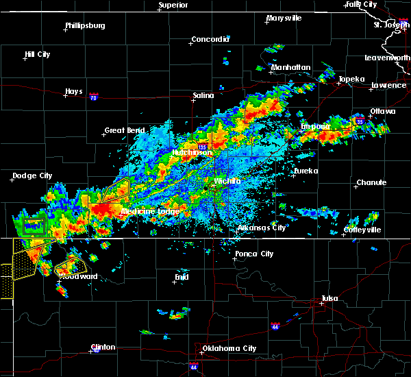 The severe thunderstorm warning for eastern pratt county will expire at 715 pm cdt, the storm which prompted the warning has weakened below severe limits, and no longer pose an immediate threat to life or property. therefore, the warning will be allowed to expire. however heavy rain is still possible with this thunderstorm. The severe thunderstorm warning for eastern pratt county will expire at 715 pm cdt, the storm which prompted the warning has weakened below severe limits, and no longer pose an immediate threat to life or property. therefore, the warning will be allowed to expire. however heavy rain is still possible with this thunderstorm.
|
| 9/9/2016 6:47 PM CDT |
 At 647 pm cdt, a severe thunderstorm was located 4 miles north of sawyer, or 5 miles south of pratt, moving south at 20 mph (radar indicated). Hazards include 60 mph wind gusts and quarter size hail. Hail damage to vehicles is expected. expect wind damage to roofs, siding, and trees. Locations impacted include, pratt, preston, natrona, cairo and pratt county lake. At 647 pm cdt, a severe thunderstorm was located 4 miles north of sawyer, or 5 miles south of pratt, moving south at 20 mph (radar indicated). Hazards include 60 mph wind gusts and quarter size hail. Hail damage to vehicles is expected. expect wind damage to roofs, siding, and trees. Locations impacted include, pratt, preston, natrona, cairo and pratt county lake.
|
| 9/9/2016 6:29 PM CDT |
 At 628 pm cdt, a severe thunderstorm was located near natrona, or 8 miles northeast of pratt, moving southeast at 15 mph (radar indicated). Hazards include 60 mph wind gusts and half dollar size hail. Hail damage to vehicles is expected. Expect wind damage to roofs, siding, and trees. At 628 pm cdt, a severe thunderstorm was located near natrona, or 8 miles northeast of pratt, moving southeast at 15 mph (radar indicated). Hazards include 60 mph wind gusts and half dollar size hail. Hail damage to vehicles is expected. Expect wind damage to roofs, siding, and trees.
|
| 9/8/2016 5:25 PM CDT |
 At 525 pm cdt, a severe thunderstorm was located 4 miles southwest of cairo, or 6 miles east of pratt, moving east at 30 mph (radar indicated). Hazards include 60 mph wind gusts and nickel size hail. Expect damage to roofs. siding. and trees. Locations impacted include, pratt, iuka, preston, sawyer, natrona, cairo and pratt county lake. At 525 pm cdt, a severe thunderstorm was located 4 miles southwest of cairo, or 6 miles east of pratt, moving east at 30 mph (radar indicated). Hazards include 60 mph wind gusts and nickel size hail. Expect damage to roofs. siding. and trees. Locations impacted include, pratt, iuka, preston, sawyer, natrona, cairo and pratt county lake.
|
| 9/8/2016 4:59 PM CDT |
 At 458 pm cdt, a severe thunderstorm was located 4 miles northwest of coats, or 10 miles southwest of pratt, moving east at 25 mph (radar indicated). Hazards include 60 mph wind gusts and half dollar size hail. Hail damage to vehicles is expected. Expect wind damage to roofs, siding, and trees. At 458 pm cdt, a severe thunderstorm was located 4 miles northwest of coats, or 10 miles southwest of pratt, moving east at 25 mph (radar indicated). Hazards include 60 mph wind gusts and half dollar size hail. Hail damage to vehicles is expected. Expect wind damage to roofs, siding, and trees.
|
| 8/23/2016 7:09 PM CDT |
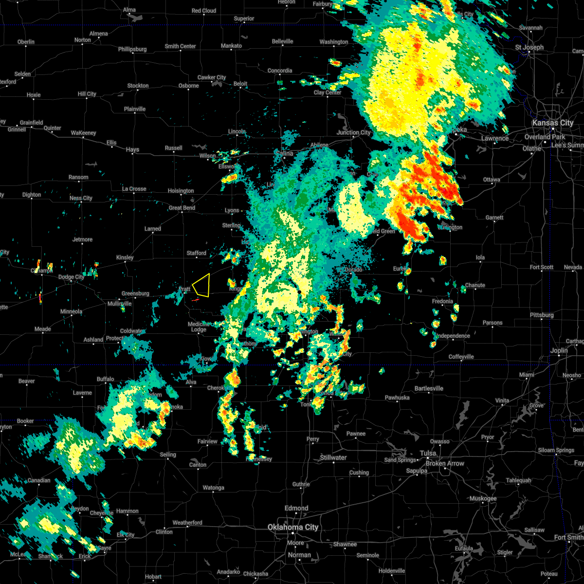 The severe thunderstorm warning for northeastern pratt county will expire at 715 pm cdt, the storm which prompted the warning has moved out of the area. therefore, the warning will be allowed to expire. The severe thunderstorm warning for northeastern pratt county will expire at 715 pm cdt, the storm which prompted the warning has moved out of the area. therefore, the warning will be allowed to expire.
|
| 8/23/2016 6:44 PM CDT |
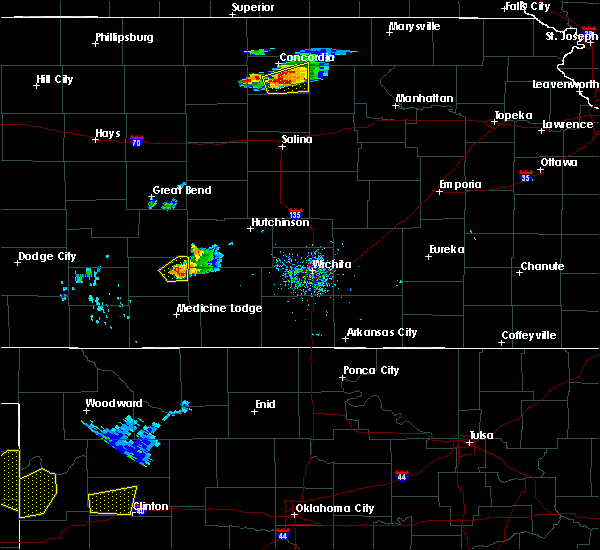 At 644 pm cdt, a severe thunderstorm was located 3 miles north of cairo, or 9 miles east of pratt, moving northeast at 20 mph (radar indicated). Hazards include 60 mph wind gusts and quarter size hail. Hail damage to vehicles is expected. expect wind damage to roofs, siding, and trees. Locations impacted include, preston and cairo. At 644 pm cdt, a severe thunderstorm was located 3 miles north of cairo, or 9 miles east of pratt, moving northeast at 20 mph (radar indicated). Hazards include 60 mph wind gusts and quarter size hail. Hail damage to vehicles is expected. expect wind damage to roofs, siding, and trees. Locations impacted include, preston and cairo.
|
| 8/23/2016 6:29 PM CDT |
 At 629 pm cdt, a severe thunderstorm was located 4 miles south of natrona, or 5 miles east of pratt, moving northeast at 20 mph (radar indicated). Hazards include up to ping pong ball size hail and 60 mph wind gusts. People and animals outdoors will be injured. expect hail damage to roofs, siding, windows, and vehicles. expect wind damage to roofs, siding, and trees. Locations impacted include, preston, natrona and cairo. At 629 pm cdt, a severe thunderstorm was located 4 miles south of natrona, or 5 miles east of pratt, moving northeast at 20 mph (radar indicated). Hazards include up to ping pong ball size hail and 60 mph wind gusts. People and animals outdoors will be injured. expect hail damage to roofs, siding, windows, and vehicles. expect wind damage to roofs, siding, and trees. Locations impacted include, preston, natrona and cairo.
|
| 8/23/2016 6:25 PM CDT |
 At 625 pm cdt, a severe thunderstorm was located 3 miles east of pratt, moving northeast at 20 mph (radar indicated). Hazards include 60 mph wind gusts and quarter size hail. Hail damage to vehicles is expected. Expect wind damage to roofs, siding, and trees. At 625 pm cdt, a severe thunderstorm was located 3 miles east of pratt, moving northeast at 20 mph (radar indicated). Hazards include 60 mph wind gusts and quarter size hail. Hail damage to vehicles is expected. Expect wind damage to roofs, siding, and trees.
|
| 7/6/2016 12:58 AM CDT | The severe thunderstorm warning for stafford, northeastern pratt, southeastern pawnee and east central edwards counties will expire at 100 am cdt, the line of storms which prompted the warning have weakened below severe limits, and no longer pose an immediate threat to life or property. therefore the warning will be allowed to expire. however gusty winds and heavy rain are still possible with these thunderstorms. |
| 7/6/2016 12:49 AM CDT |
 At 1248 am cdt, severe thunderstorms were located along a line extending from 2 miles north of sylvia to 3 miles north of preston to 4 miles east of cullison, moving southeast at 50 mph (radar indicated). Hazards include 70 mph wind gusts and nickel size hail. Expect considerable tree damage. damage is likely to mobile homes, roofs and outbuildings. locations impacted include, larned, st. John, stafford, macksville, garfield, preston, hudson, belpre, seward, radium, zenith, dillwyn, neola, frizell and zook. At 1248 am cdt, severe thunderstorms were located along a line extending from 2 miles north of sylvia to 3 miles north of preston to 4 miles east of cullison, moving southeast at 50 mph (radar indicated). Hazards include 70 mph wind gusts and nickel size hail. Expect considerable tree damage. damage is likely to mobile homes, roofs and outbuildings. locations impacted include, larned, st. John, stafford, macksville, garfield, preston, hudson, belpre, seward, radium, zenith, dillwyn, neola, frizell and zook.
|
| 7/6/2016 12:22 AM CDT |
 At 1221 am cdt, severe thunderstorms were located along a line extending from 3 miles north of seward to dillwyn to near fellsburg, moving southeast at 50 mph. these are very dangerous storms (radar indicated). Hazards include 80 mph wind gusts and nickel size hail. Flying debris will be dangerous to those caught without shelter. mobile homes will be heavily damaged. expect considerable damage to roofs, windows and vehicles. extensive tree damage and power outages are likely. locations impacted include, pratt, larned, st. John, stafford, macksville, burdett, garfield, rush center, iuka, preston, rozel, hudson, belpre, seward, ash valley, byers, radium, cairo, sanford and zenith. At 1221 am cdt, severe thunderstorms were located along a line extending from 3 miles north of seward to dillwyn to near fellsburg, moving southeast at 50 mph. these are very dangerous storms (radar indicated). Hazards include 80 mph wind gusts and nickel size hail. Flying debris will be dangerous to those caught without shelter. mobile homes will be heavily damaged. expect considerable damage to roofs, windows and vehicles. extensive tree damage and power outages are likely. locations impacted include, pratt, larned, st. John, stafford, macksville, burdett, garfield, rush center, iuka, preston, rozel, hudson, belpre, seward, ash valley, byers, radium, cairo, sanford and zenith.
|
| 7/5/2016 11:56 PM CDT |
 At 1156 pm cdt, severe thunderstorms were located along a line extending from 2 miles southeast of timken to 2 miles southeast of frizell to 6 miles north of offerle, moving southeast at 65 mph. these are very dangerous storms (radar indicated). Hazards include 80 mph wind gusts and half dollar size hail. Flying debris will be dangerous to those caught without shelter. mobile homes will be heavily damaged. expect considerable damage to roofs, windows and vehicles. Extensive tree damage and power outages are likely. At 1156 pm cdt, severe thunderstorms were located along a line extending from 2 miles southeast of timken to 2 miles southeast of frizell to 6 miles north of offerle, moving southeast at 65 mph. these are very dangerous storms (radar indicated). Hazards include 80 mph wind gusts and half dollar size hail. Flying debris will be dangerous to those caught without shelter. mobile homes will be heavily damaged. expect considerable damage to roofs, windows and vehicles. Extensive tree damage and power outages are likely.
|
| 6/17/2016 11:11 PM CDT |
 At 1110 pm cdt, severe thunderstorms were located along a line extending from 2 miles southwest of raymond to hopewell, moving southeast at 20 mph (automated weather station). Hazards include 60 mph wind gusts and penny size hail. Expect damage to roofs. Siding and trees. At 1110 pm cdt, severe thunderstorms were located along a line extending from 2 miles southwest of raymond to hopewell, moving southeast at 20 mph (automated weather station). Hazards include 60 mph wind gusts and penny size hail. Expect damage to roofs. Siding and trees.
|
| 5/26/2016 9:52 PM CDT |
 At 951 pm cdt, a severe thunderstorm was located near pratt, moving northeast at 15 mph (radar indicated). Hazards include 60 mph wind gusts and quarter size hail. Hail damage to vehicles is expected. expect wind damage to roofs, siding and trees. locations impacted include, pratt, iuka, preston, byers and cairo. A tornado watch remains in effect until 1000 pm cdt for south central kansas. At 951 pm cdt, a severe thunderstorm was located near pratt, moving northeast at 15 mph (radar indicated). Hazards include 60 mph wind gusts and quarter size hail. Hail damage to vehicles is expected. expect wind damage to roofs, siding and trees. locations impacted include, pratt, iuka, preston, byers and cairo. A tornado watch remains in effect until 1000 pm cdt for south central kansas.
|
| 5/26/2016 9:44 PM CDT |
 At 944 pm cdt, a severe thunderstorm was located near pratt, moving northeast at 40 mph (radar indicated). Hazards include 60 mph wind gusts and quarter size hail. Hail damage to vehicles is expected. Expect wind damage to roofs, siding and trees. At 944 pm cdt, a severe thunderstorm was located near pratt, moving northeast at 40 mph (radar indicated). Hazards include 60 mph wind gusts and quarter size hail. Hail damage to vehicles is expected. Expect wind damage to roofs, siding and trees.
|
| 5/26/2016 7:55 PM CDT |
 At 755 pm cdt, severe thunderstorms were located along a line extending from 4 miles south of albert to 5 miles southwest of macksville, moving northeast at 65 mph (radar indicated). Hazards include 70 mph wind gusts and ping pong ball size hail. People and animals outdoors will be injured. expect hail damage to roofs, siding, windows and vehicles. expect considerable tree damage. Wind damage is also likely to mobile homes, roofs and outbuildings. At 755 pm cdt, severe thunderstorms were located along a line extending from 4 miles south of albert to 5 miles southwest of macksville, moving northeast at 65 mph (radar indicated). Hazards include 70 mph wind gusts and ping pong ball size hail. People and animals outdoors will be injured. expect hail damage to roofs, siding, windows and vehicles. expect considerable tree damage. Wind damage is also likely to mobile homes, roofs and outbuildings.
|
| 5/24/2016 10:28 PM CDT | A severe thunderstorm warning remains in effect until 1100 pm cdt for southern stafford and northeastern pratt counties. at 1027 pm cdt. a severe thunderstorm was located 6 miles northeast of byers. moving northeast at 15 mph. hazard. 60 mph wind gusts and quarter size hail. source. Radar indicated. |
| 5/8/2016 9:06 PM CDT |
 The severe thunderstorm warning for eastern pratt county will expire at 915 pm cdt, the storm which prompted the warning has moved out of the area. therefore the warning will be allowed to expire. a tornado watch remains in effect until 1000 pm cdt for south central kansas. The severe thunderstorm warning for eastern pratt county will expire at 915 pm cdt, the storm which prompted the warning has moved out of the area. therefore the warning will be allowed to expire. a tornado watch remains in effect until 1000 pm cdt for south central kansas.
|
| 5/8/2016 8:40 PM CDT |
 At 840 pm cdt, a severe thunderstorm was located 4 miles southeast of cairo, moving northeast at 50 mph (radar indicated). Hazards include half dollar size hail. Damage to vehicles is expected. locations impacted include, preston and cairo. A tornado watch remains in effect until 1000 pm cdt for south central kansas. At 840 pm cdt, a severe thunderstorm was located 4 miles southeast of cairo, moving northeast at 50 mph (radar indicated). Hazards include half dollar size hail. Damage to vehicles is expected. locations impacted include, preston and cairo. A tornado watch remains in effect until 1000 pm cdt for south central kansas.
|
| 5/8/2016 8:20 PM CDT |
 At 820 pm cdt, a severe thunderstorm was located 6 miles south of sawyer, moving northeast at 45 mph (radar indicated). Hazards include ping pong ball size hail. People and animals outdoors will be injured. Expect damage to roofs, siding, windows and vehicles. At 820 pm cdt, a severe thunderstorm was located 6 miles south of sawyer, moving northeast at 45 mph (radar indicated). Hazards include ping pong ball size hail. People and animals outdoors will be injured. Expect damage to roofs, siding, windows and vehicles.
|
| 3/7/2016 8:07 PM CST |
 At 807 pm cst, a severe thunderstorm was located 4 miles northwest of preston, moving northeast at 25 mph (radar indicated). Hazards include 60 mph wind gusts and quarter size hail. Hail damage to vehicles is expected. Expect wind damage to roofs, siding and trees. At 807 pm cst, a severe thunderstorm was located 4 miles northwest of preston, moving northeast at 25 mph (radar indicated). Hazards include 60 mph wind gusts and quarter size hail. Hail damage to vehicles is expected. Expect wind damage to roofs, siding and trees.
|
| 3/7/2016 7:48 PM CST |
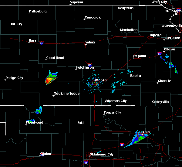 At 746 pm cst, a severe thunderstorm was located near pratt, moving northeast at 25 mph (radar and storm spotter indicated. at 735 pm, quarter size hail was reported 7 miles west of pratt). Hazards include 60 mph wind gusts and quarter size hail. Hail damage to vehicles is expected. expect wind damage to roofs, siding and trees. Locations impacted include, pratt, iuka and preston. At 746 pm cst, a severe thunderstorm was located near pratt, moving northeast at 25 mph (radar and storm spotter indicated. at 735 pm, quarter size hail was reported 7 miles west of pratt). Hazards include 60 mph wind gusts and quarter size hail. Hail damage to vehicles is expected. expect wind damage to roofs, siding and trees. Locations impacted include, pratt, iuka and preston.
|
| 3/7/2016 7:28 PM CST |
 At 727 pm cst, a severe thunderstorm was located 4 miles southeast of cullison, moving northeast at 25 mph (radar indicated). Hazards include 60 mph wind gusts and quarter size hail. Hail damage to vehicles is expected. Expect wind damage to roofs, siding and trees. At 727 pm cst, a severe thunderstorm was located 4 miles southeast of cullison, moving northeast at 25 mph (radar indicated). Hazards include 60 mph wind gusts and quarter size hail. Hail damage to vehicles is expected. Expect wind damage to roofs, siding and trees.
|
| 6/11/2015 9:26 PM CDT |
 At 926 pm cdt, a severe thunderstorm was located 3 miles northwest of neola, moving northeast at 30 mph (radar indicated). Hazards include golf ball size hail and 60 mph wind gusts. People and animals outdoors will be injured. expect hail damage to roofs, siding, windows and vehicles. expect wind damage to roofs, siding and trees. Locations impacted include, stafford, preston and neola. At 926 pm cdt, a severe thunderstorm was located 3 miles northwest of neola, moving northeast at 30 mph (radar indicated). Hazards include golf ball size hail and 60 mph wind gusts. People and animals outdoors will be injured. expect hail damage to roofs, siding, windows and vehicles. expect wind damage to roofs, siding and trees. Locations impacted include, stafford, preston and neola.
|
| 6/11/2015 9:00 PM CDT |
 At 859 pm cdt, a severe thunderstorm was located 3 miles north of iuka, moving east at 35 mph (radar indicated). Hazards include golf ball size hail and 60 mph wind gusts. People and animals outdoors will be injured. expect hail damage to roofs, siding, windows and vehicles. Expect wind damage to roofs, siding and trees. At 859 pm cdt, a severe thunderstorm was located 3 miles north of iuka, moving east at 35 mph (radar indicated). Hazards include golf ball size hail and 60 mph wind gusts. People and animals outdoors will be injured. expect hail damage to roofs, siding, windows and vehicles. Expect wind damage to roofs, siding and trees.
|
| 6/11/2015 6:36 PM CDT |
 The severe thunderstorm warning for northeastern pratt county will expire at 645 pm cdt, the storm which prompted the warning has weakened below severe limits, and no longer pose an immediate threat to life or property. therefore the warning will be allowed to expire. however small hail is still possible with this thunderstorm. The severe thunderstorm warning for northeastern pratt county will expire at 645 pm cdt, the storm which prompted the warning has weakened below severe limits, and no longer pose an immediate threat to life or property. therefore the warning will be allowed to expire. however small hail is still possible with this thunderstorm.
|
| 6/11/2015 6:30 PM CDT |
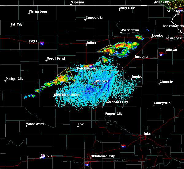 At 629 pm cdt, a severe thunderstorm was located 6 miles northeast of turon, or 9 miles east of neola, moving northeast at 15 mph (radar indicated). Hazards include 60 mph wind gusts and quarter size hail. Hail damage to vehicles is expected. expect wind damage to roofs, siding and trees. Locations impacted include, preston. At 629 pm cdt, a severe thunderstorm was located 6 miles northeast of turon, or 9 miles east of neola, moving northeast at 15 mph (radar indicated). Hazards include 60 mph wind gusts and quarter size hail. Hail damage to vehicles is expected. expect wind damage to roofs, siding and trees. Locations impacted include, preston.
|
| 6/11/2015 6:08 PM CDT |
 At 607 pm cdt, a severe thunderstorm was located very near turon, or 5 miles southeast of neola, moving northeast at 15 mph. another severe thunderstorm was located 5 miles east of pratt (trained weather spotters). Hazards include golf ball size hail and 60 mph wind gusts. People and animals outdoors will be injured. expect hail damage to roofs, siding, windows and vehicles. expect wind damage to roofs, siding and trees. Locations impacted include, pratt, iuka and preston. At 607 pm cdt, a severe thunderstorm was located very near turon, or 5 miles southeast of neola, moving northeast at 15 mph. another severe thunderstorm was located 5 miles east of pratt (trained weather spotters). Hazards include golf ball size hail and 60 mph wind gusts. People and animals outdoors will be injured. expect hail damage to roofs, siding, windows and vehicles. expect wind damage to roofs, siding and trees. Locations impacted include, pratt, iuka and preston.
|
| 6/11/2015 5:48 PM CDT |
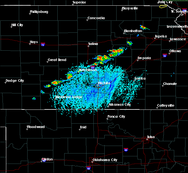 At 548 pm cdt, a severe thunderstorm was located very near preston, moving northeast at 15 mph (radar indicated). Hazards include 60 mph wind gusts and half dollar size hail. Hail damage to vehicles is expected. Expect wind damage to roofs, siding and trees. At 548 pm cdt, a severe thunderstorm was located very near preston, moving northeast at 15 mph (radar indicated). Hazards include 60 mph wind gusts and half dollar size hail. Hail damage to vehicles is expected. Expect wind damage to roofs, siding and trees.
|
| 5/9/2015 11:45 AM CDT | At 1144 am cdt, a severe thunderstorm was located very near preston, and is nearly stationary (radar indicated). Hazards include 60 mph wind gusts and quarter size hail. Hail damage to vehicles is expected. expect wind damage to roofs, siding and trees. locations impacted include, pratt, larned, st. john, stafford, macksville, iuka, preston, hudson, cullison, belpre, seward, byers, radium, cairo, fellsburg, zenith, dillwyn, neola, zook and hopewell. 1. 00in. |
| 5/9/2015 11:36 AM CDT | At 1135 am cdt, a severe thunderstorm was located 3 miles northwest of cairo, moving north at 40 mph. another area of strong thunderstorms were located in southern barber, moving north at 40 mph (radar indicated). Hazards include 60 mph wind gusts and quarter size hail. Hail damage to vehicles is expected. Expect wind damage to roofs, siding and trees. |
| 5/6/2015 5:12 PM CDT | At 511 pm cdt, a severe thunderstorm was located 5 miles south of byers, moving northeast at 30 mph (radar indicated). Hazards include 60 mph wind gusts and half dollar size hail. Hail damage to vehicles is expected. Expect wind damage to roofs, siding and trees. |
| 4/16/2015 4:38 PM CDT | The severe thunderstorm warning for southeastern stafford and northeastern pratt counties will expire at 445 pm cdt, the storm which prompted the warning has weakened below severe limits and exited the warned area. therefore the warning will be allowed to expire. |
| 4/16/2015 4:26 PM CDT | At 425 pm cdt, a severe thunderstorm was located near zenith, moving northeast at 30 mph (radar indicated. quarter size hail reported 1 mile west southwest of neola at 418 pm by the public). Hazards include 60 mph wind gusts and quarter size hail. Hail damage to vehicles is expected. expect wind damage to roofs, siding and trees. locations impacted include, stafford, preston, neola and zenith. 1. 00in. |
| 4/16/2015 4:01 PM CDT | At 401 pm cdt, severe thunderstorms were located along a line extending from 6 miles north of dillwyn to 5 miles northwest of preston, moving northeast at 30 mph (radar indicated). Hazards include 60 mph wind gusts and quarter size hail. Hail damage to vehicles is expected. Expect wind damage to roofs, siding and trees. |
| 4/12/2015 8:12 PM CDT | A severe thunderstorm warning remains in effect until 845 pm cdt for southeastern stafford and northeastern pratt counties. at 811 pm cdt. a severe thunderstorm was located 3 miles south of stafford. moving east at 30 mph. hazard. golf ball size hail and 60 mph wind gusts. source. Radar indicated. |
| 4/12/2015 8:02 PM CDT | The national weather service in dodge city has issued a * severe thunderstorm warning for. southeastern stafford county in south central kansas. northeastern pratt county in south central kansas. until 845 pm cdt * at 801 pm cdt. A severe thunderstorm was located 4 miles southwest. |
| 1/1/0001 12:00 AM | At ne 90th street and 120th ave a power pole was reported being snapped along with damage to an outbuildin in pratt county KS, 4.2 miles S of Preston, KS |
| 1/1/0001 12:00 AM | Golf Ball sized hail reported 0.1 miles ESE of Preston, KS |
| 1/1/0001 12:00 AM | Storm damage reported in pratt county KS, 0.1 miles ESE of Preston, KS |
| 1/1/0001 12:00 AM | Storm damage reported in pratt county KS, 0.9 miles NE of Preston, KS |
| 1/1/0001 12:00 AM | Storm damage reported in pratt county KS, 1.7 miles SW of Preston, KS |
Hail Maps for Preston, KS
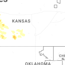
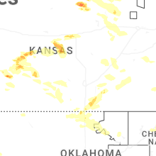
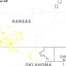

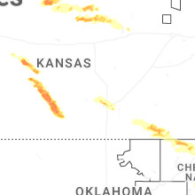
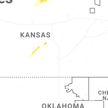
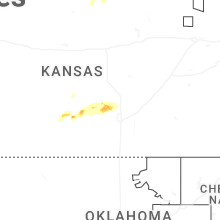
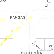
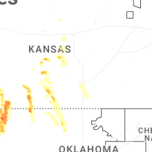
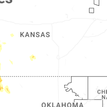
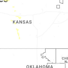

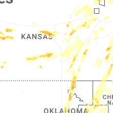

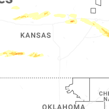
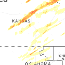


Connect with Interactive Hail Maps