

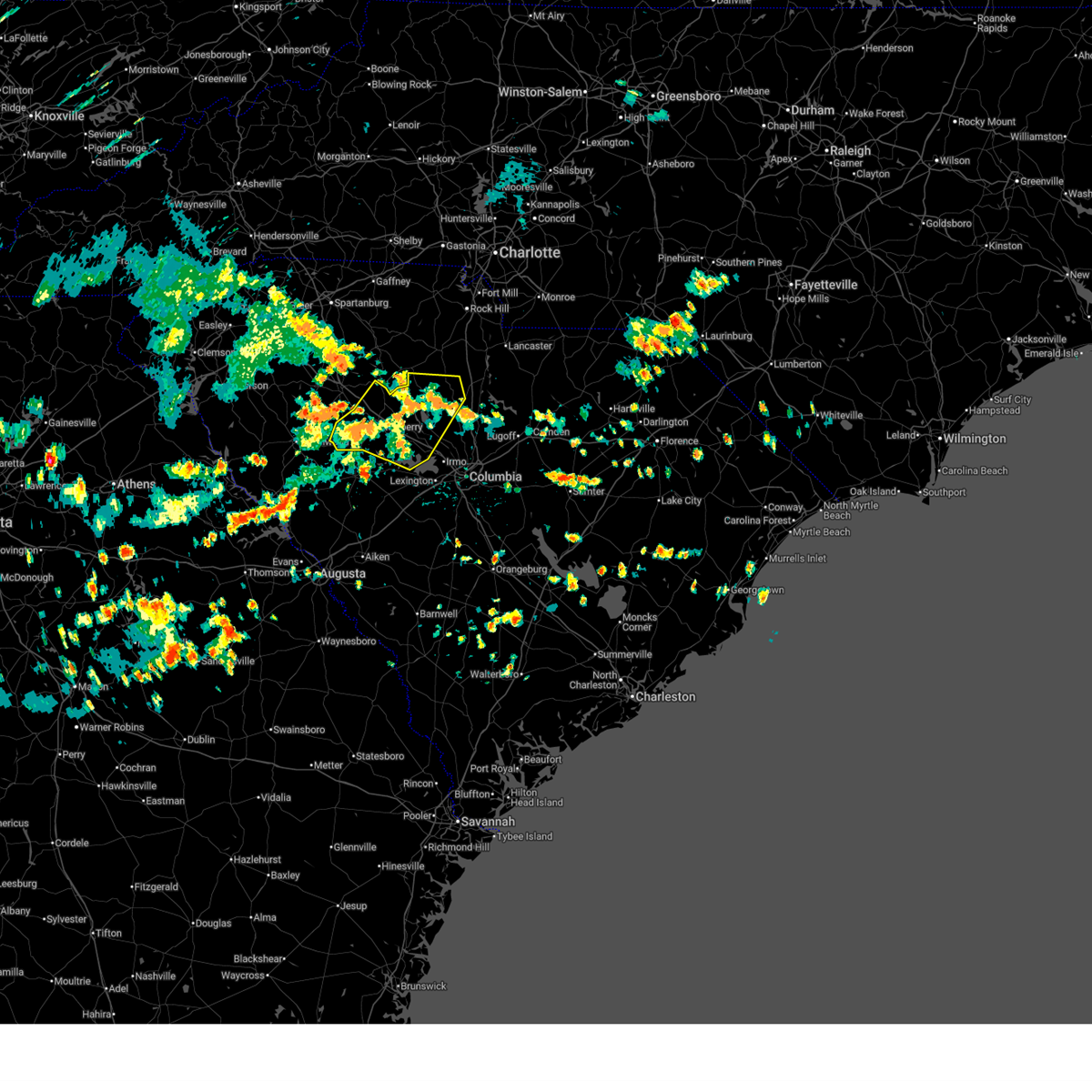
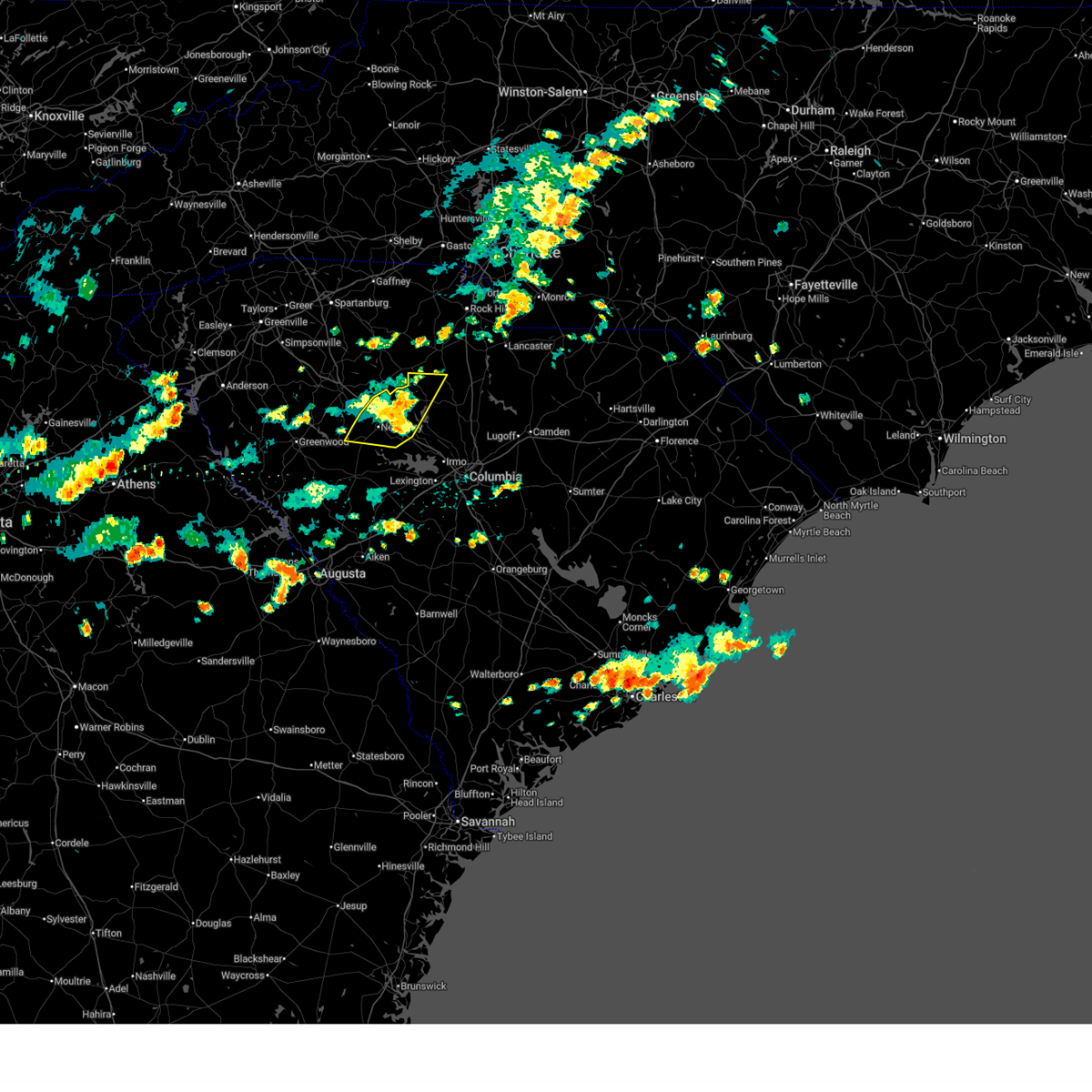
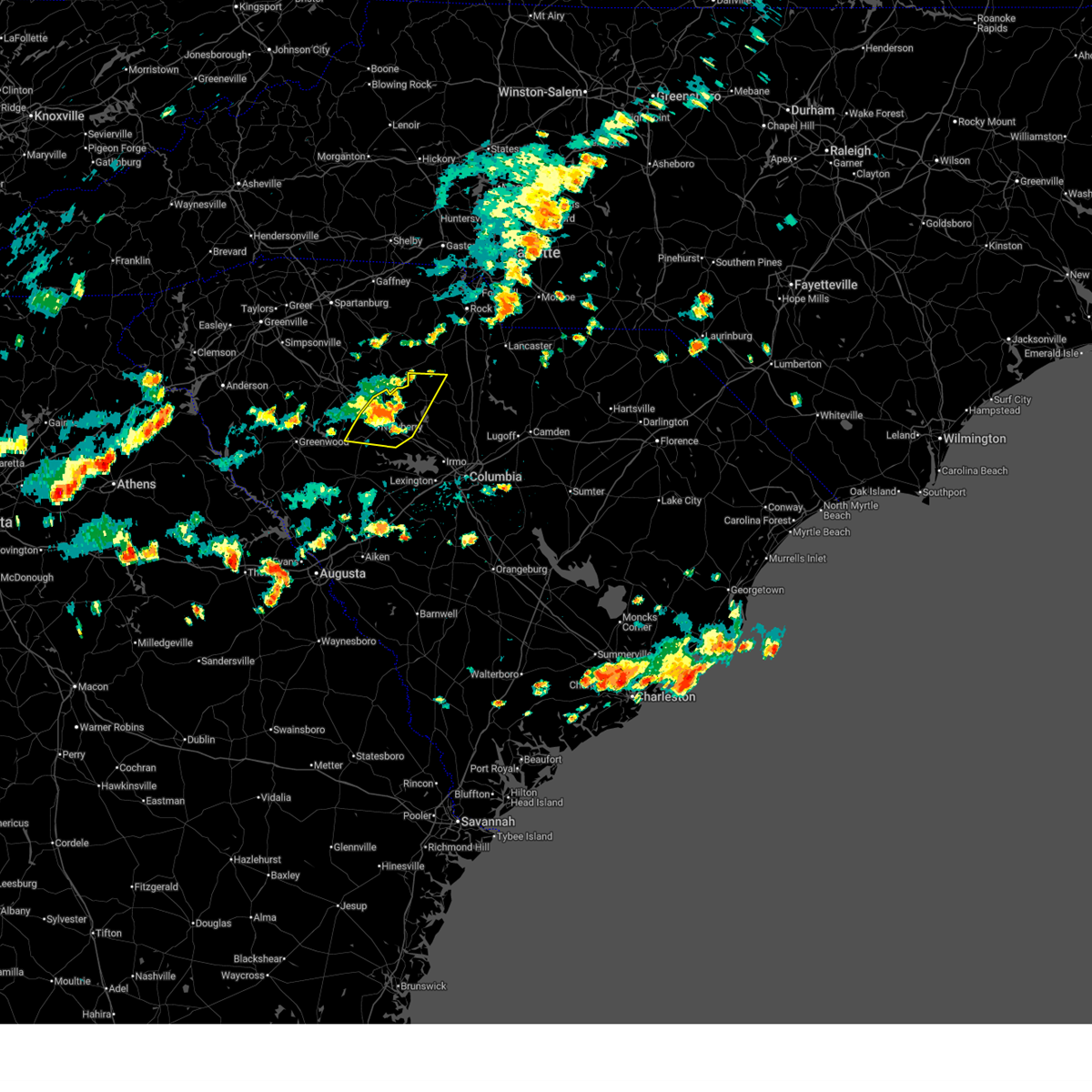
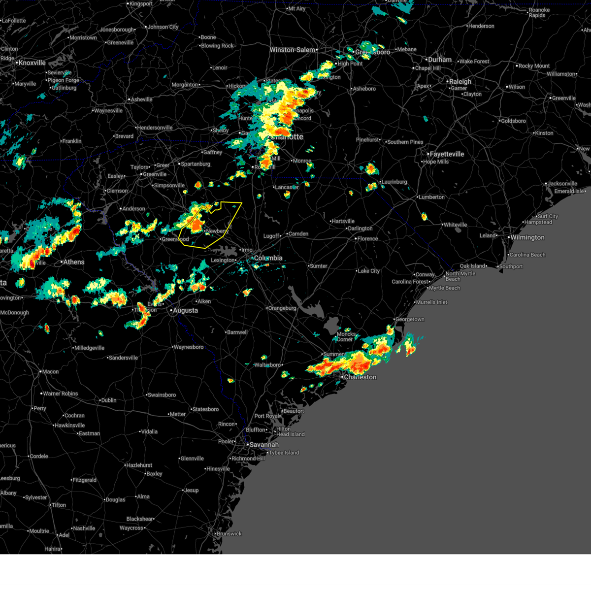
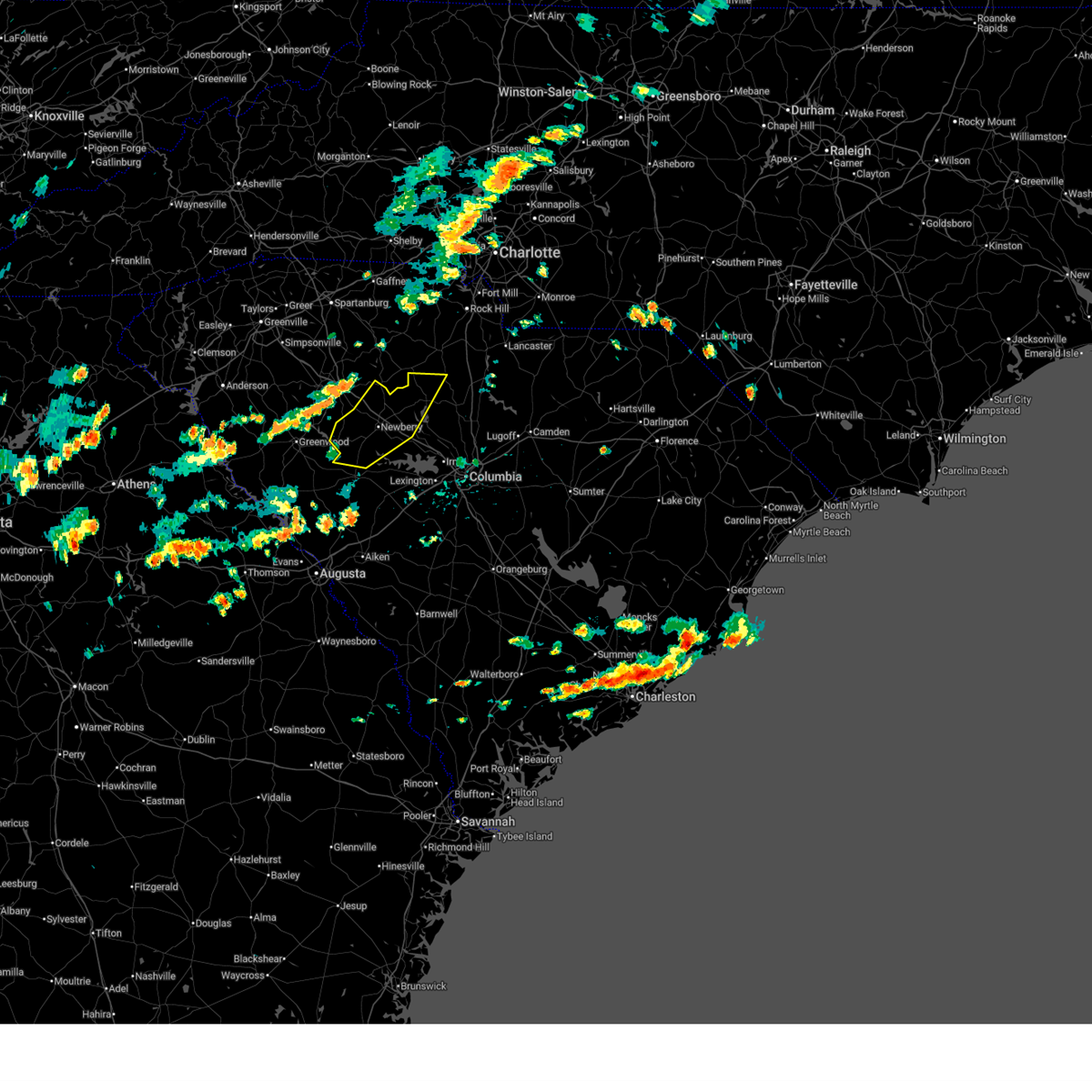
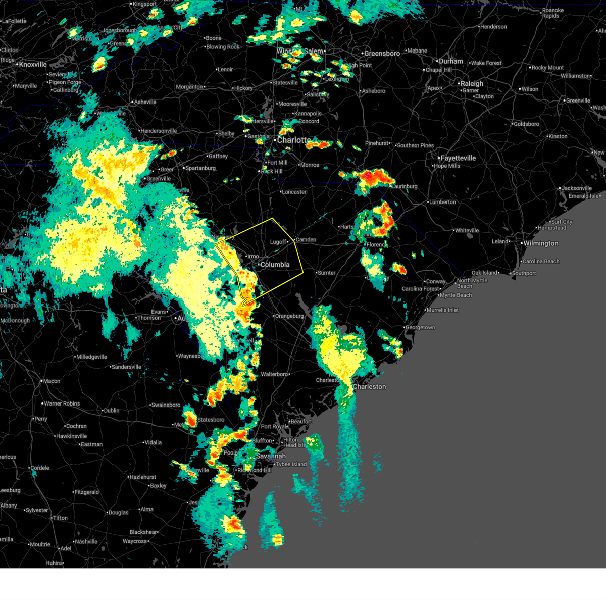
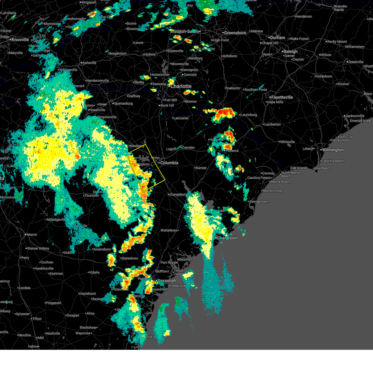
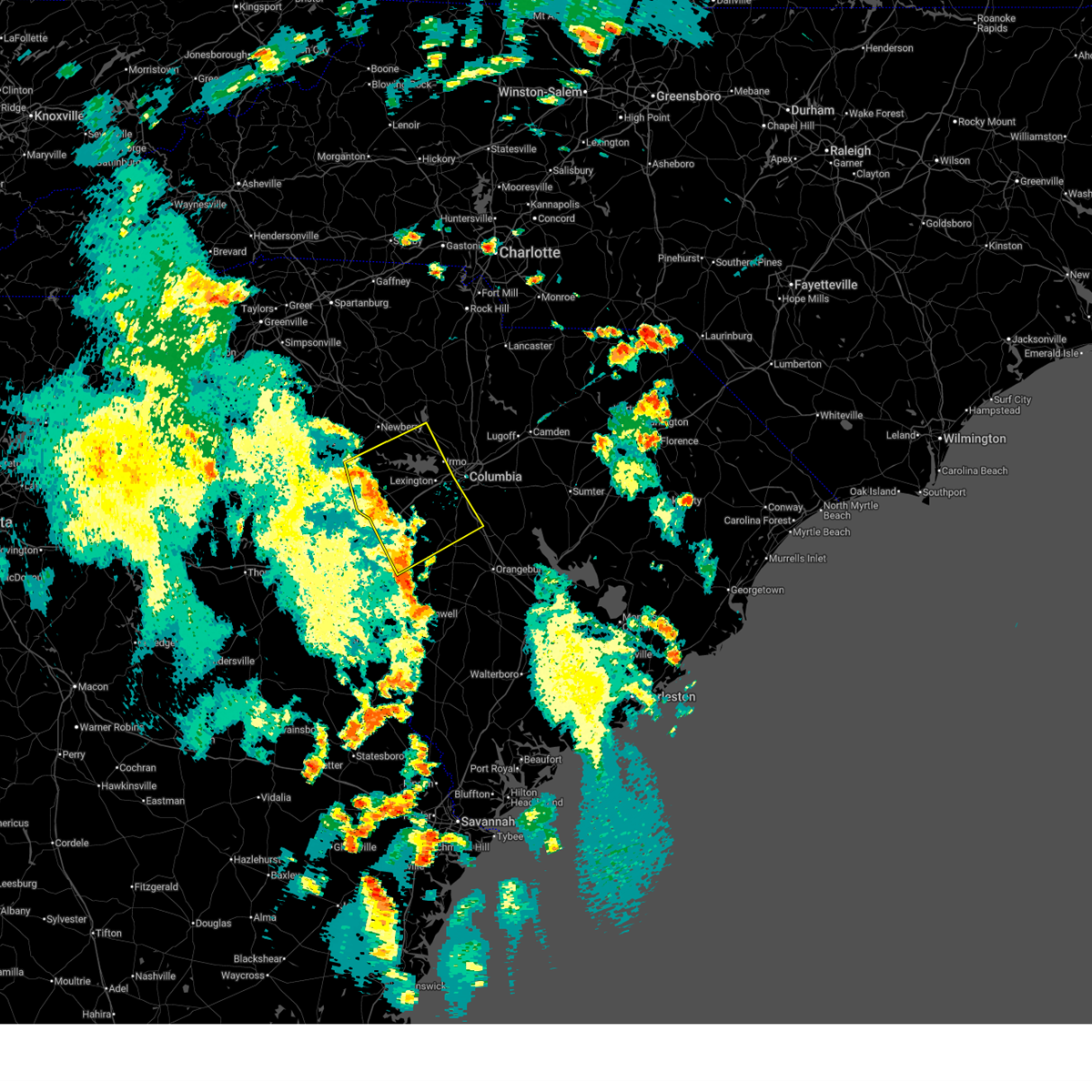
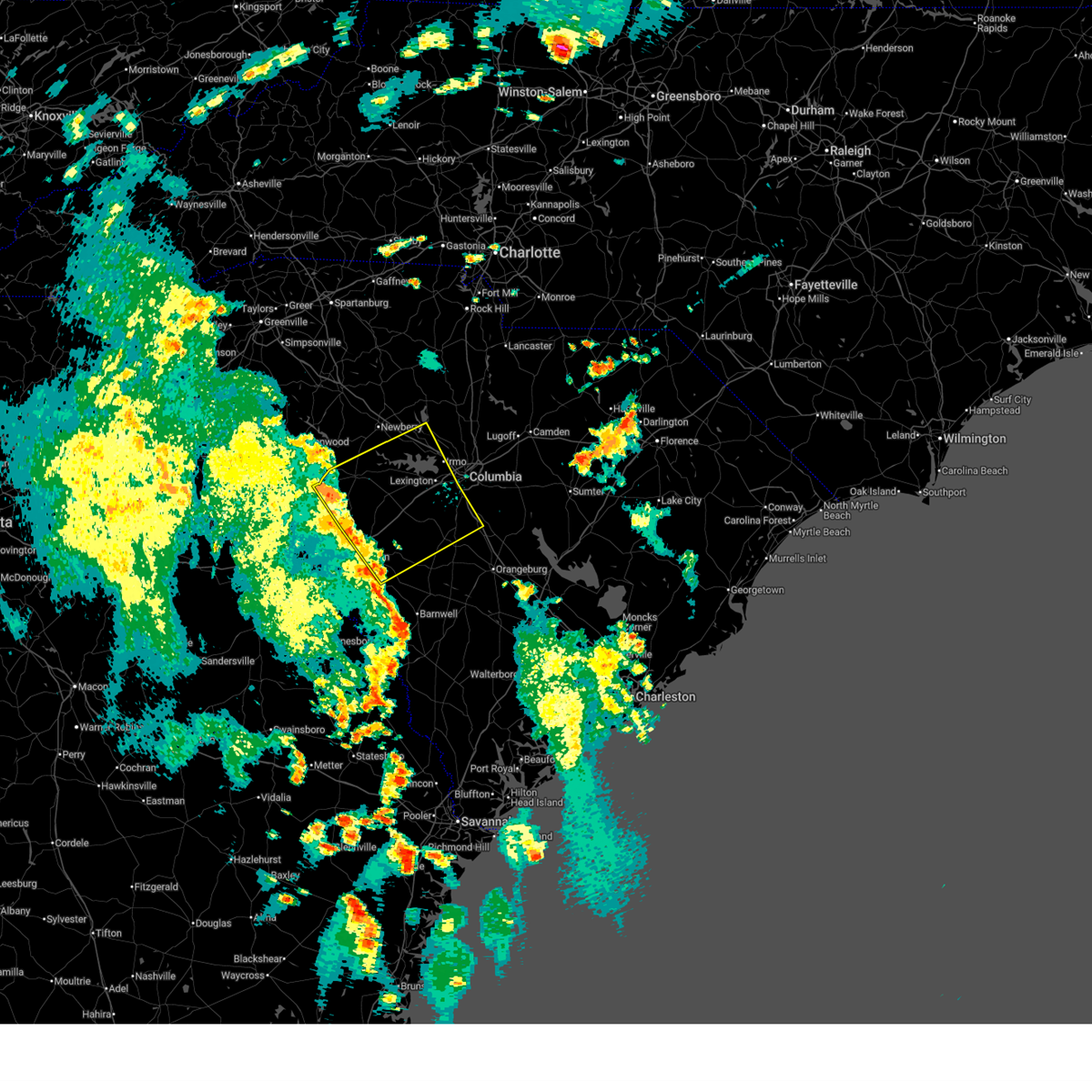
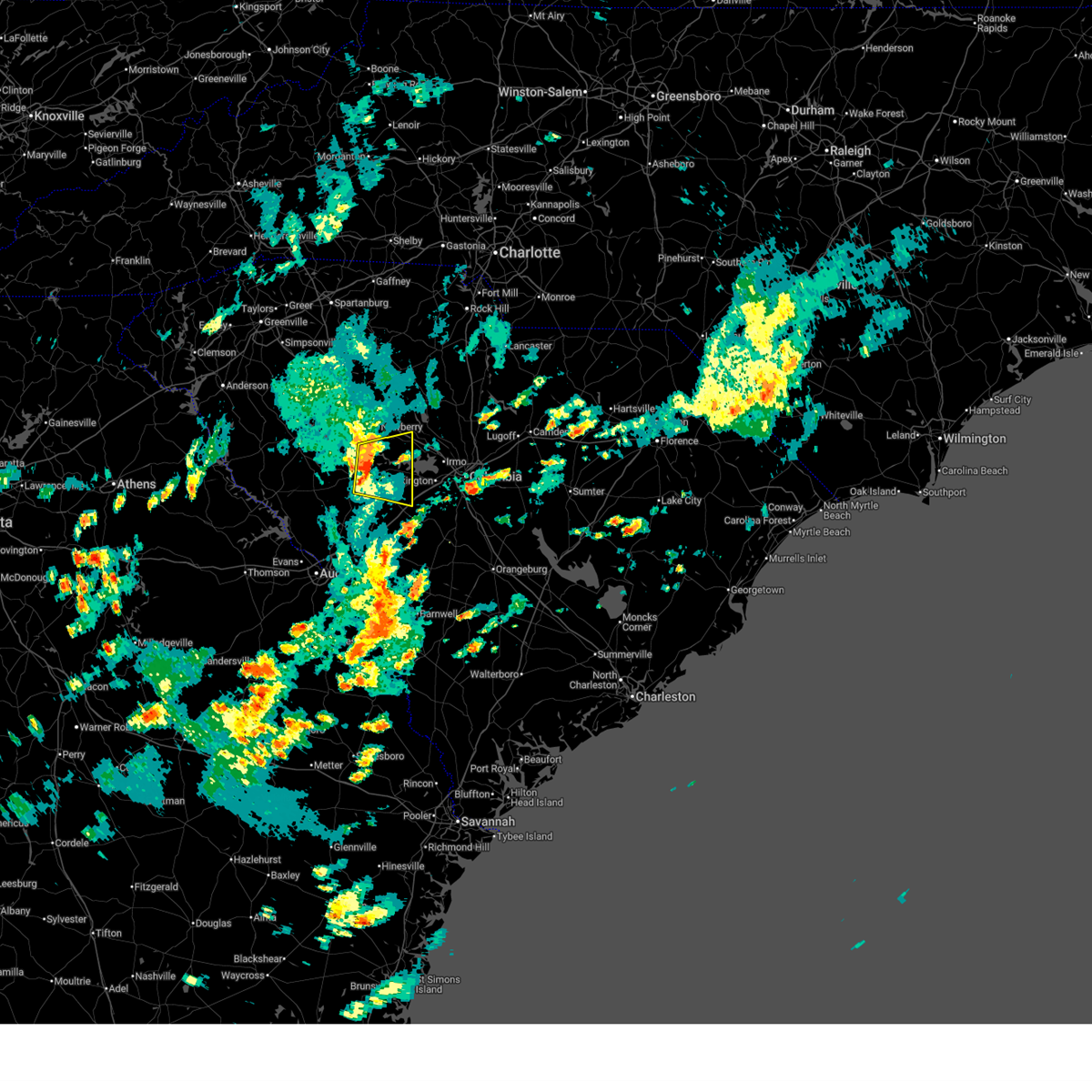
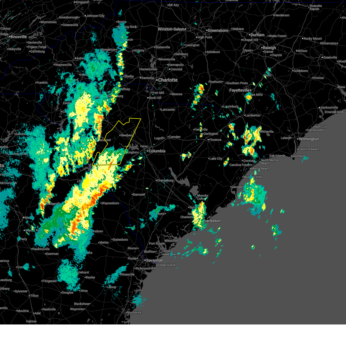
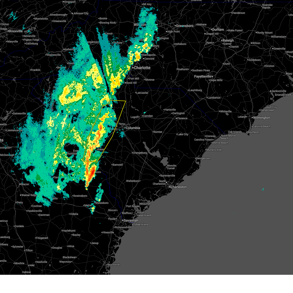
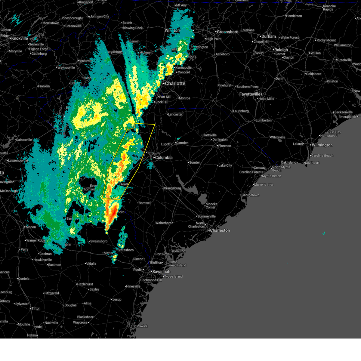
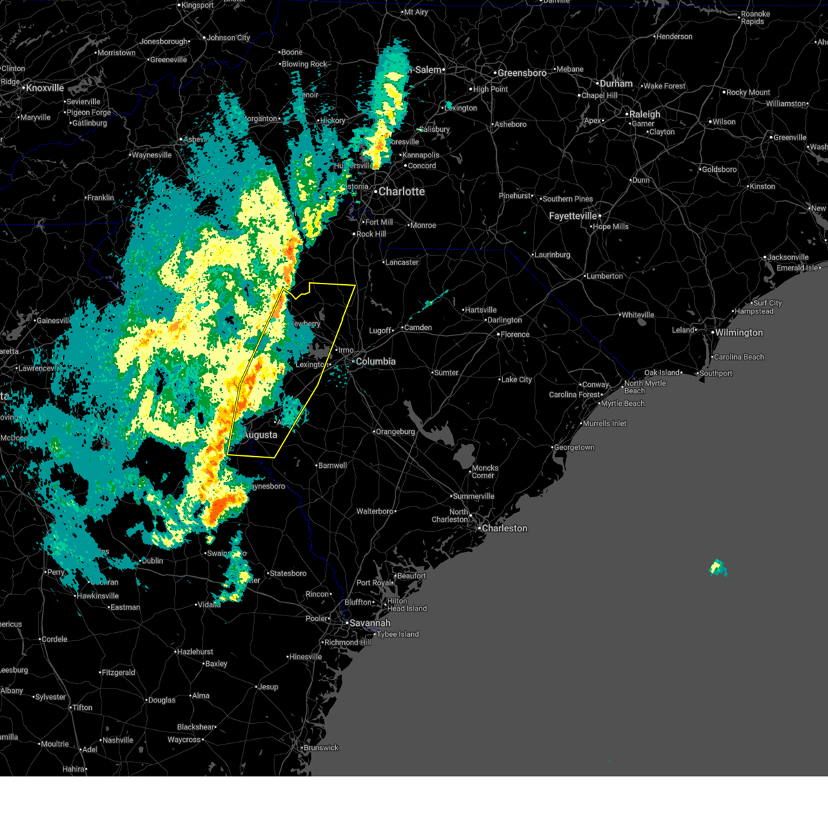
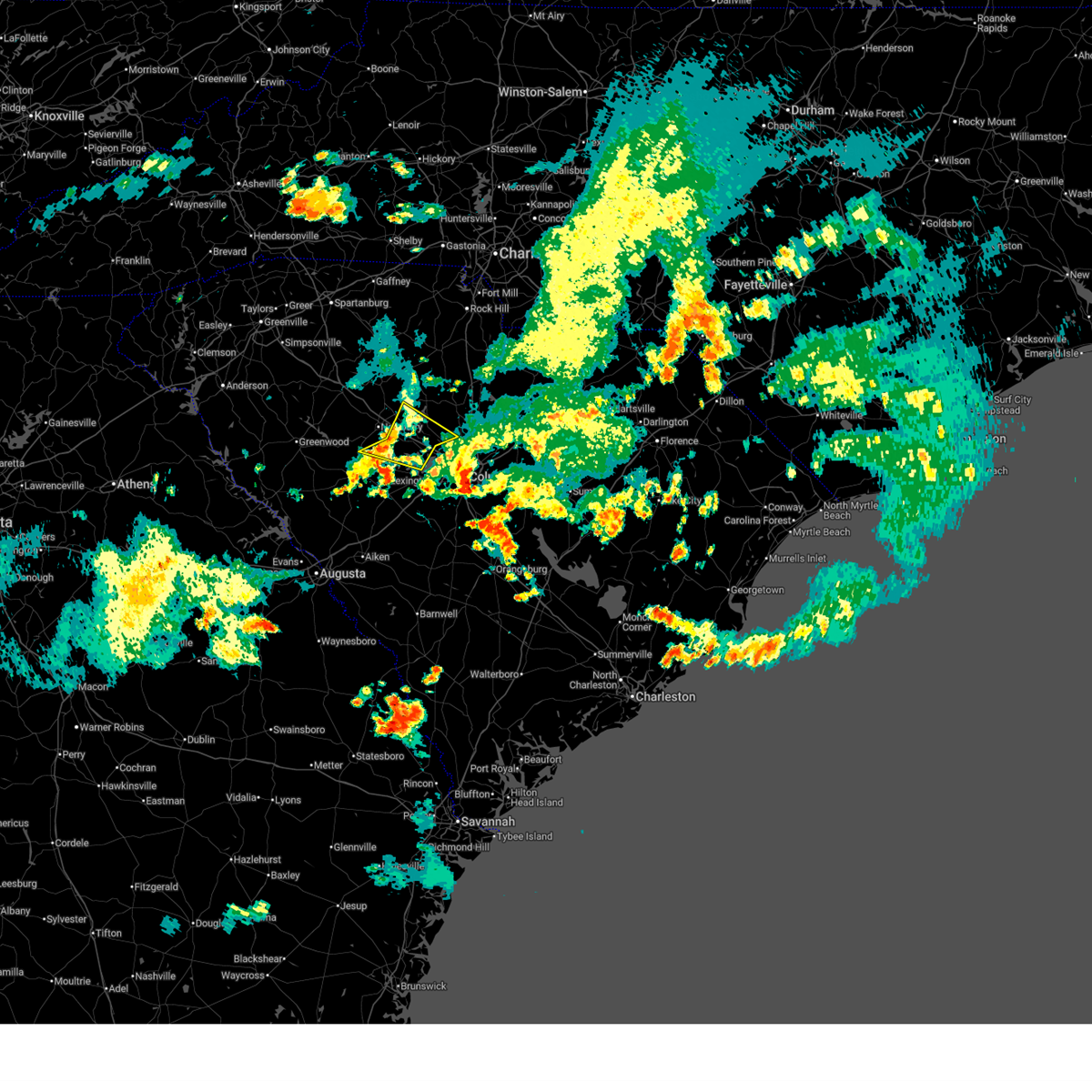
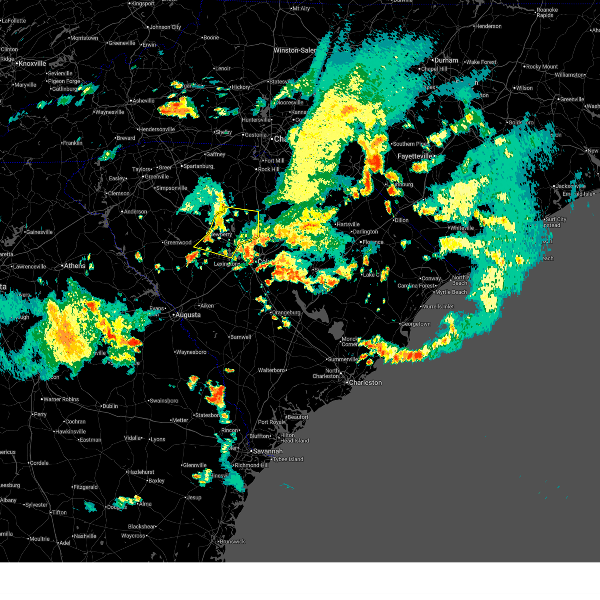
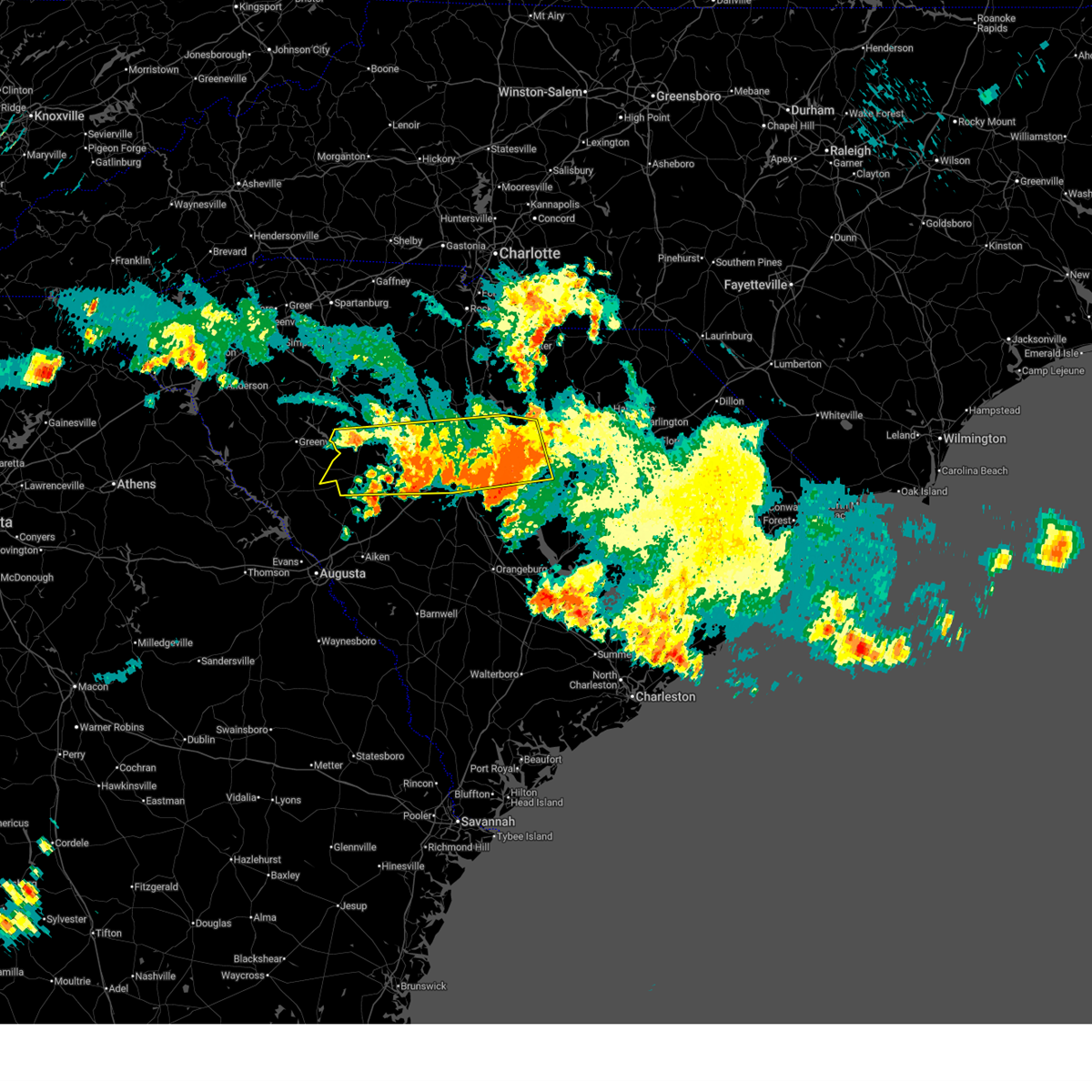
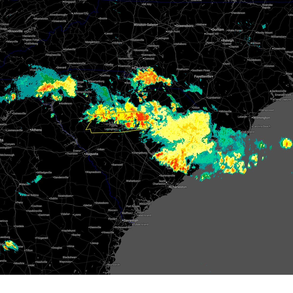
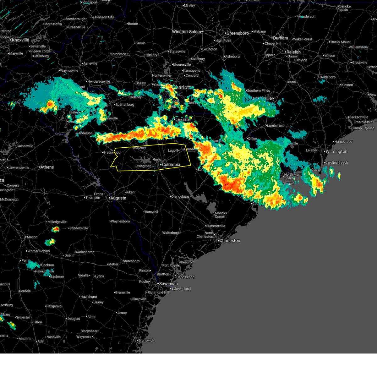
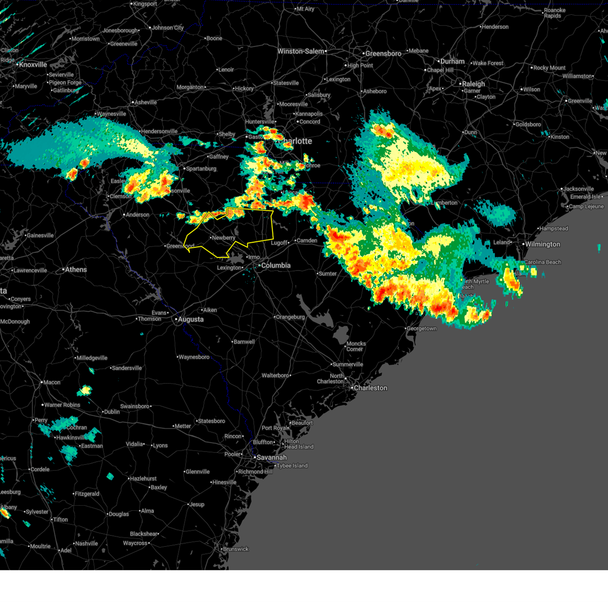
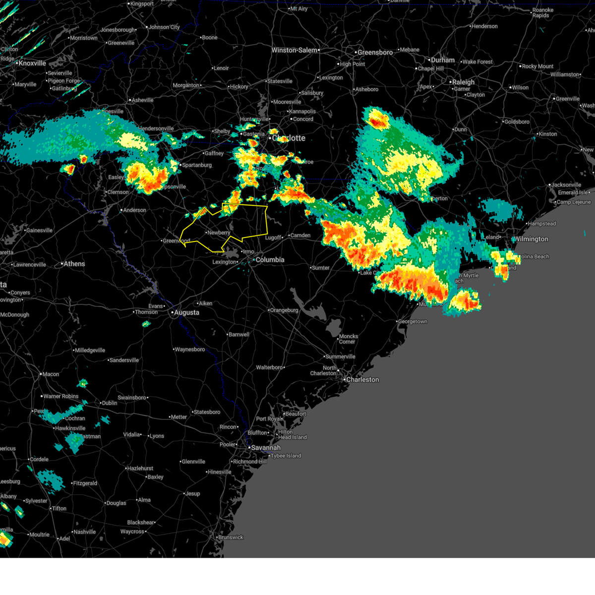
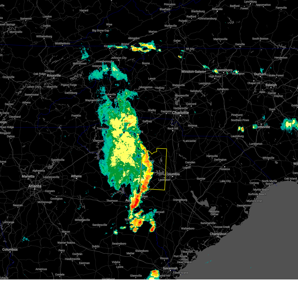
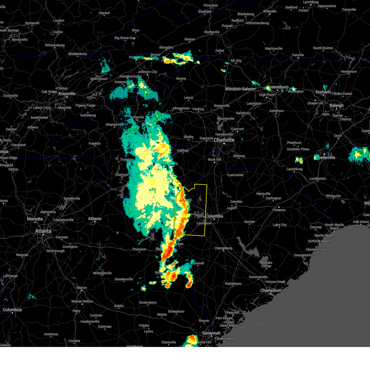
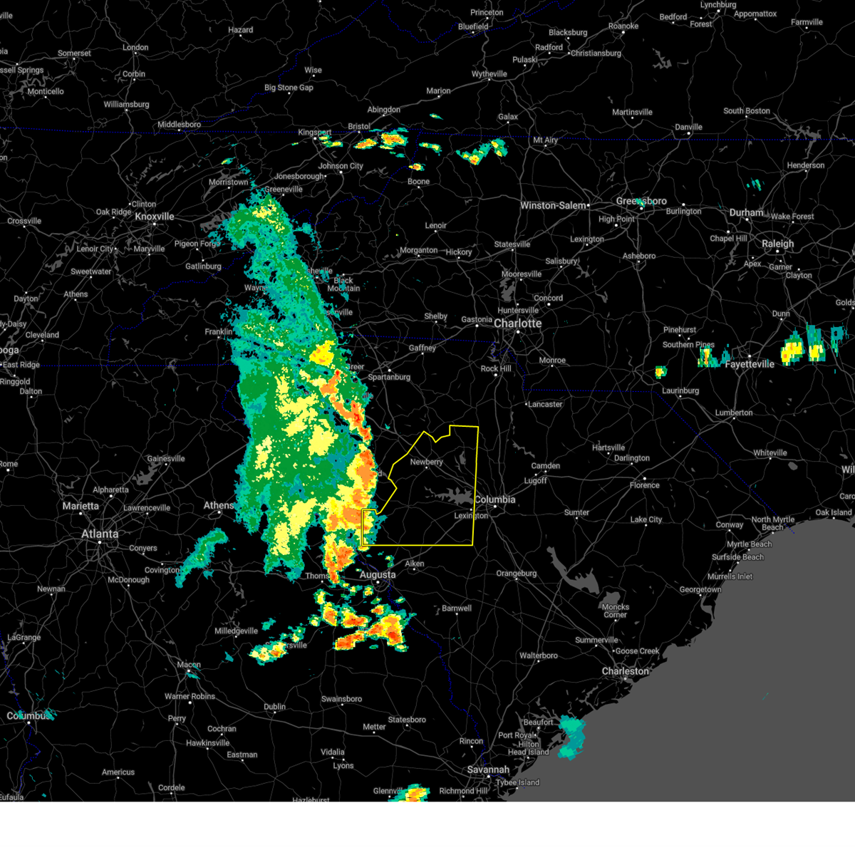
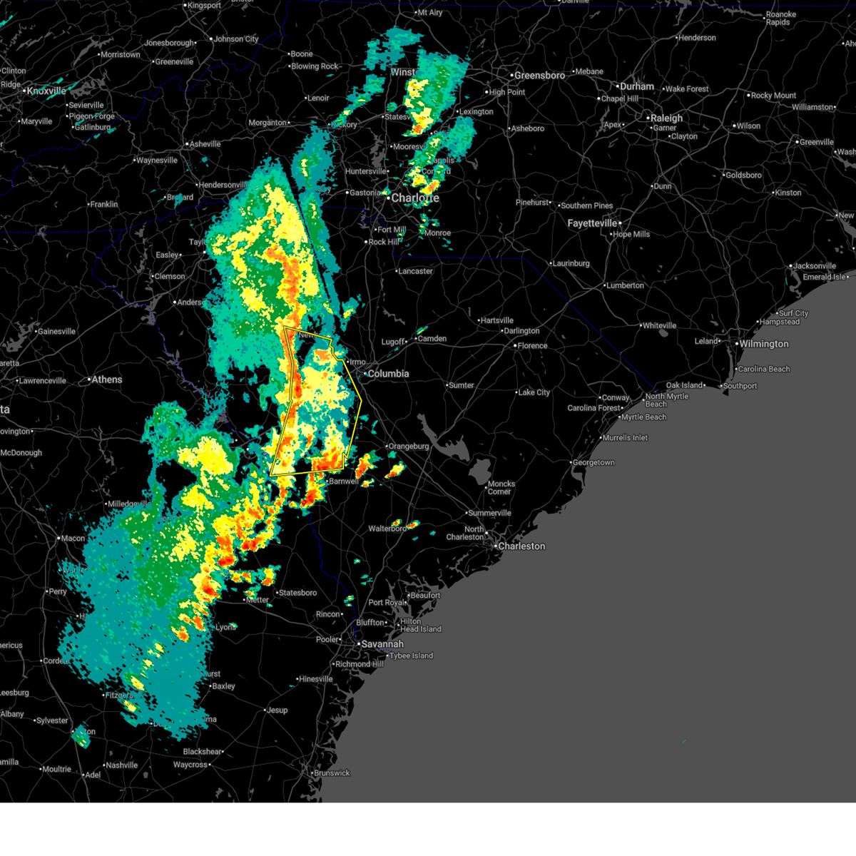
Hail Map for Prosperity, SC
The Prosperity, SC area has had 2 reports of on-the-ground hail by trained spotters, and has been under severe weather warnings 22 times during the past 12 months. Doppler radar has detected hail at or near Prosperity, SC on 38 occasions, including 1 occasion during the past year.
| Name: | Prosperity, SC |
| Where Located: | 56.6 miles NNE of Augusta, GA |
| Map: | Google Map for Prosperity, SC |
| Population: | 1180 |
| Housing Units: | 519 |
| More Info: | Search Google for Prosperity, SC |
0
The Top Recent Hail Date for Prosperity, SC is Saturday, November 8, 2025 (30th out of 38)

Hail and Wind Damage Spotted near Prosperity, SC
| Date / Time | Report Details |
|---|---|
| 7/11/2026 1:32 PM EDT |
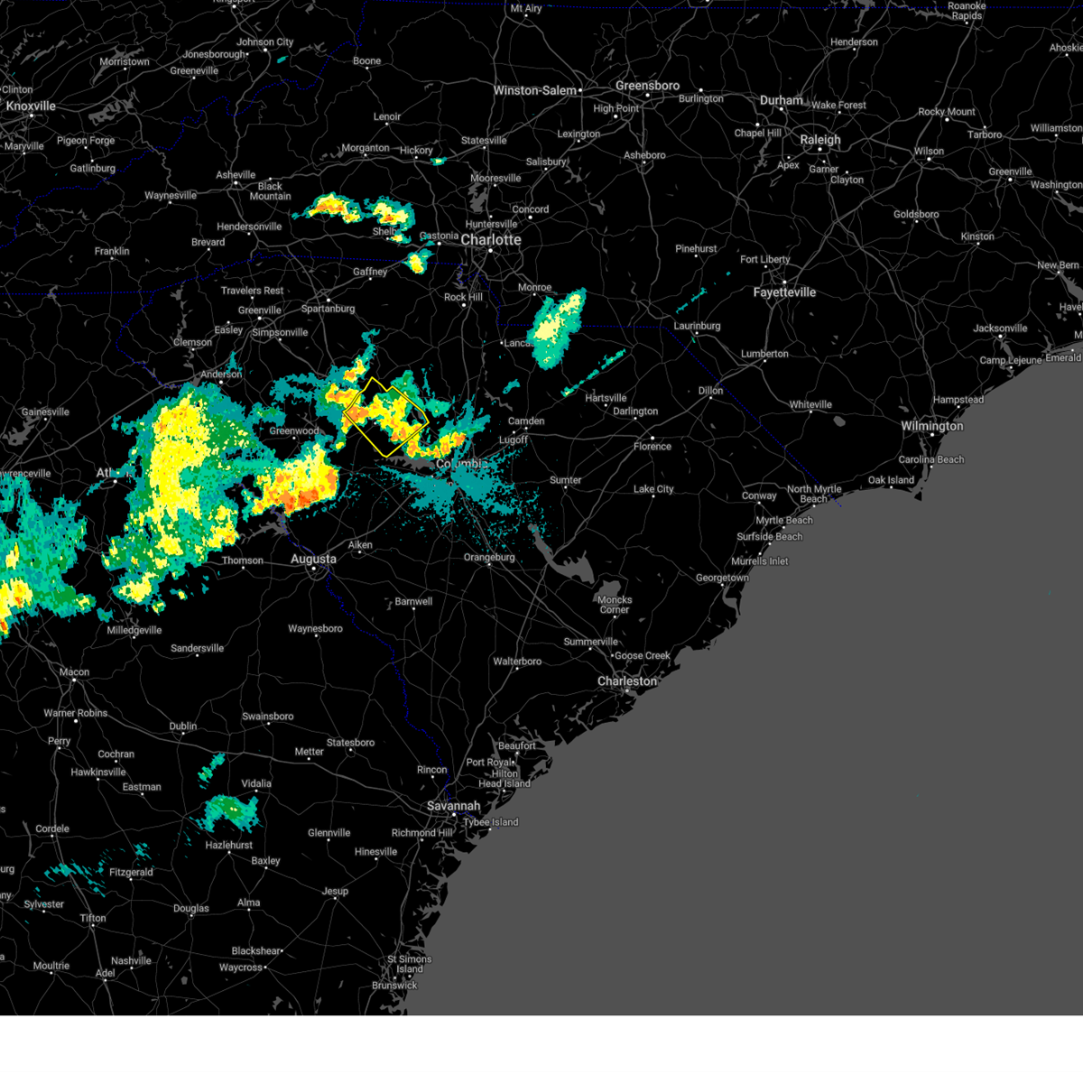
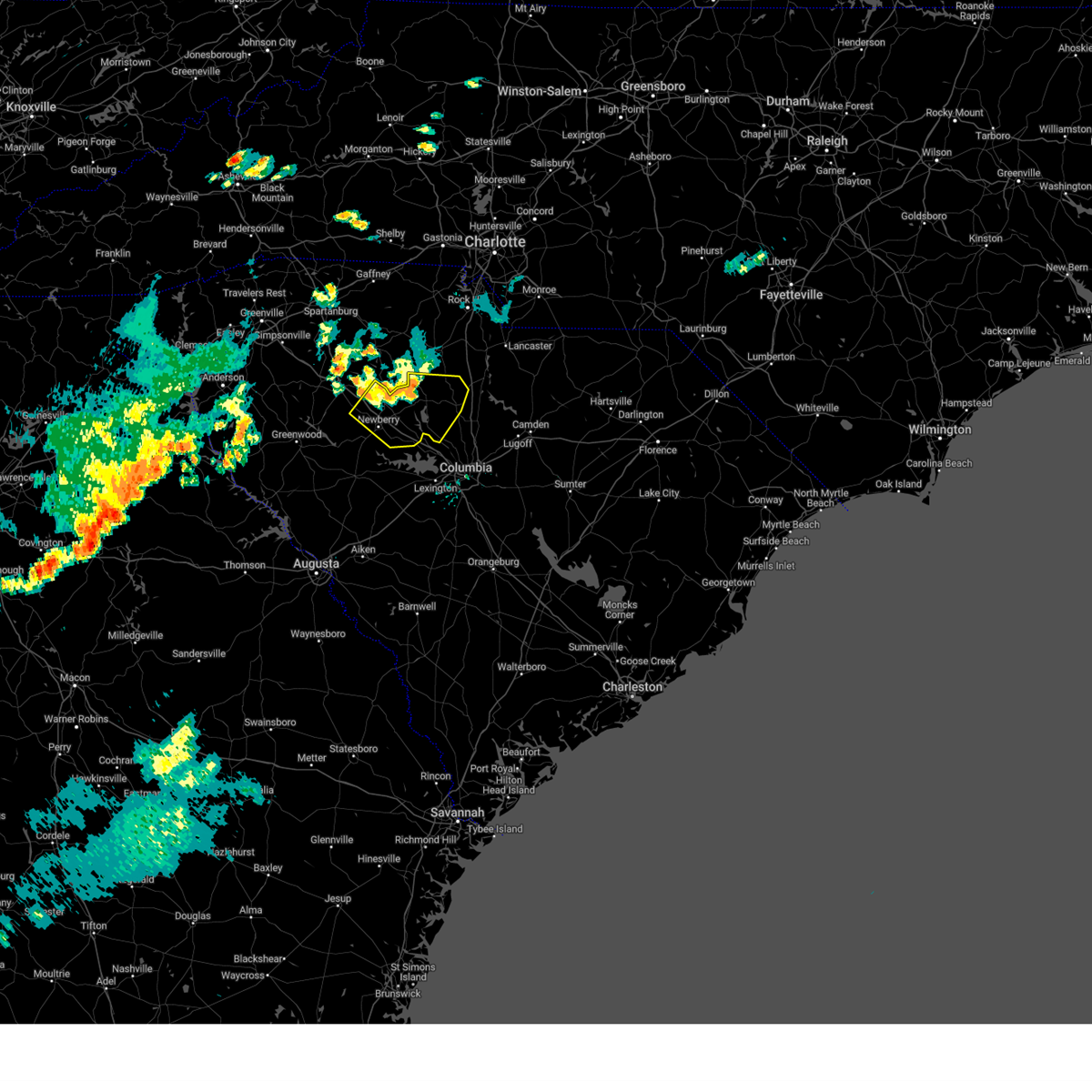
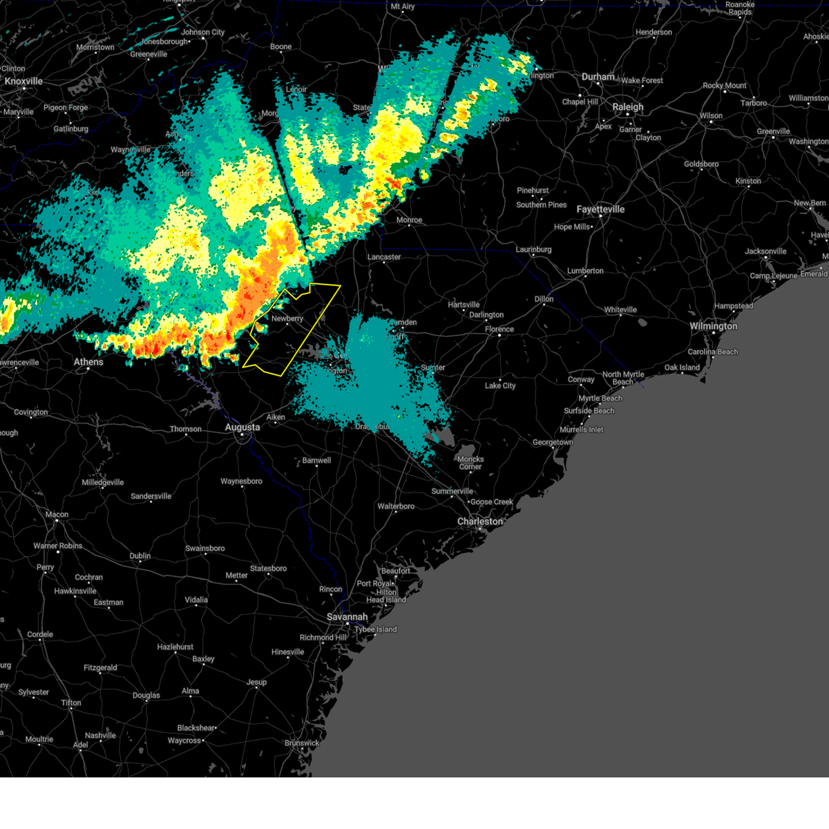
 Svrcae the national weather service in columbia has issued a * severe thunderstorm warning for, western fairfield county in central south carolina, newberry county in central south carolina, northwestern lexington county in central south carolina, northeastern saluda county in central south carolina, northwestern richland county in central south carolina, * until 230 pm edt. * at 132 pm edt, multiple strong to severe thunderstorms were located in or near newberry county, moving southeast at 35 mph (radar indicated). Hazards include 60 mph wind gusts and quarter size hail. Hail damage to vehicles is expected. Expect wind damage to trees and powerlines. Svrcae the national weather service in columbia has issued a * severe thunderstorm warning for, western fairfield county in central south carolina, newberry county in central south carolina, northwestern lexington county in central south carolina, northeastern saluda county in central south carolina, northwestern richland county in central south carolina, * until 230 pm edt. * at 132 pm edt, multiple strong to severe thunderstorms were located in or near newberry county, moving southeast at 35 mph (radar indicated). Hazards include 60 mph wind gusts and quarter size hail. Hail damage to vehicles is expected. Expect wind damage to trees and powerlines.
|
| 7/10/2026 4:08 PM EDT |
 The storms which prompted the warning have moved out of the area. therefore, the warning will be allowed to expire. to report severe weather, contact your nearest law enforcement agency. they will relay your report to the national weather service columbia. remember, a severe thunderstorm warning still remains in effect for eastern newberry county until 445p!. The storms which prompted the warning have moved out of the area. therefore, the warning will be allowed to expire. to report severe weather, contact your nearest law enforcement agency. they will relay your report to the national weather service columbia. remember, a severe thunderstorm warning still remains in effect for eastern newberry county until 445p!.
|
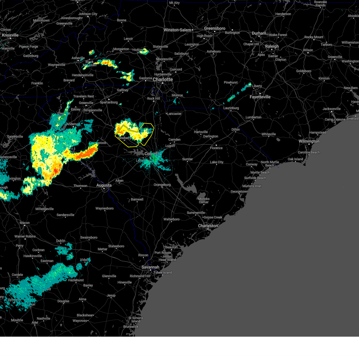
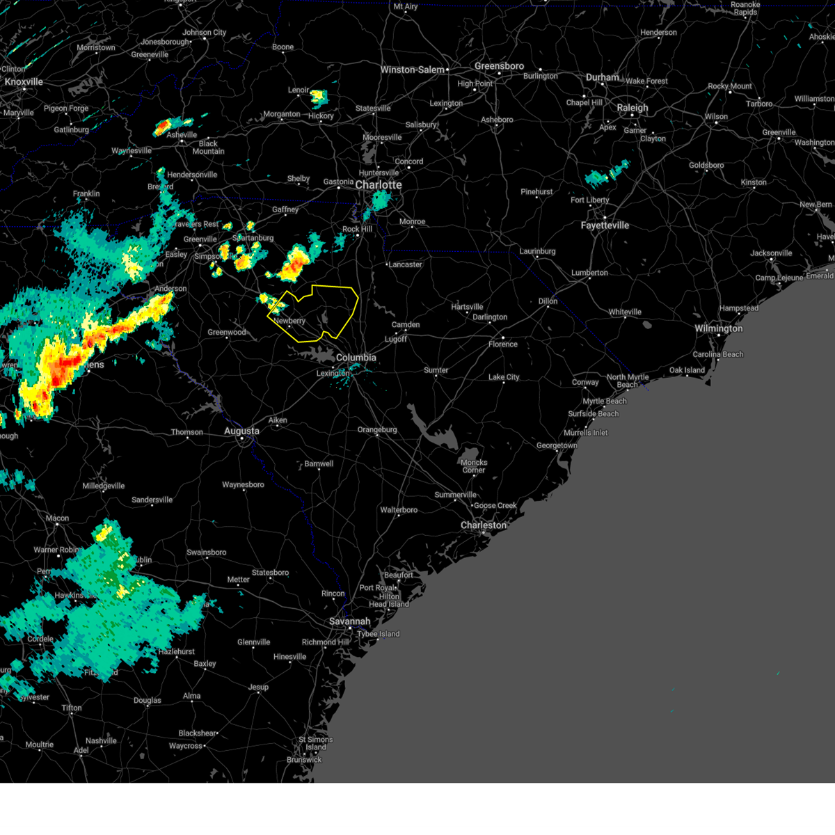
| 7/10/2026 3:58 PM EDT | Trees down at jollystreet rd and bachman chapel rd per newberry fir in newberry county SC, 4.4 miles SSW of Prosperity, SC |
| 7/10/2026 3:58 PM EDT |
 Svrcae the national weather service in columbia has issued a * severe thunderstorm warning for, fairfield county in central south carolina, eastern newberry county in central south carolina, north central lexington county in central south carolina, northwestern richland county in central south carolina, * until 445 pm edt. * at 356 pm edt, a severe thunderstorm was located near vc summer nuclear station, moving east at 35 mph (radar indicated). Hazards include 70 mph wind gusts. Expect considerable tree damage. Damage is likely to mobile homes, roofs, and outbuildings. Svrcae the national weather service in columbia has issued a * severe thunderstorm warning for, fairfield county in central south carolina, eastern newberry county in central south carolina, north central lexington county in central south carolina, northwestern richland county in central south carolina, * until 445 pm edt. * at 356 pm edt, a severe thunderstorm was located near vc summer nuclear station, moving east at 35 mph (radar indicated). Hazards include 70 mph wind gusts. Expect considerable tree damage. Damage is likely to mobile homes, roofs, and outbuildings.
|
| 7/10/2026 3:54 PM EDT |
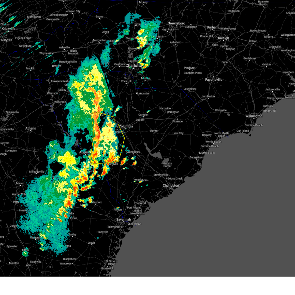
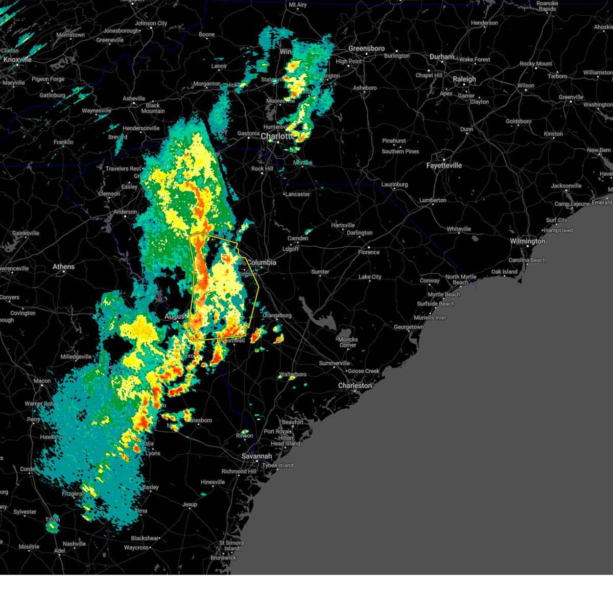
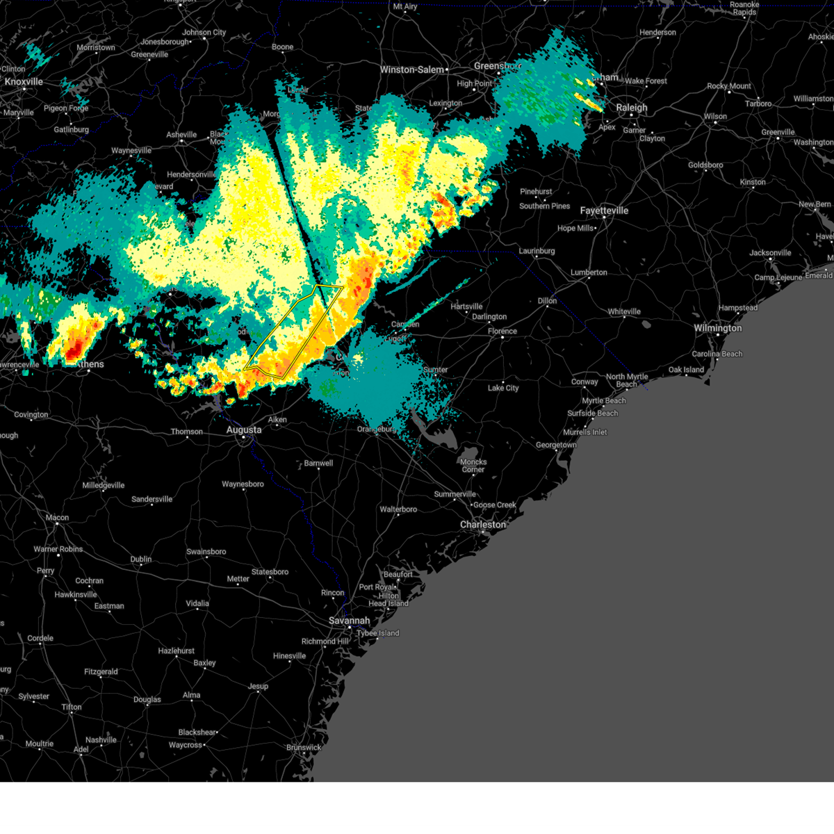
 At 354 pm edt, severe thunderstorms were located along a line extending from near carlisle to near newberry county airport to 7 miles northeast of lake greenwood state park, moving east at 25 mph (radar indicated). Hazards include 70 mph wind gusts. Expect considerable tree damage. damage is likely to mobile homes, roofs, and outbuildings. locations impacted include, newberry, prosperity, newberry county airport, blair, newberry college, pomaria, silverstreet, newberry county detention center, us- 176 and sc-34 crossroads, henderson island, mid- carolina high school, maybington fire station, feasterville fire station, bush river fire station, and enoree ranger district office. This includes interstate 26 between mile markers 65 and 86. At 354 pm edt, severe thunderstorms were located along a line extending from near carlisle to near newberry county airport to 7 miles northeast of lake greenwood state park, moving east at 25 mph (radar indicated). Hazards include 70 mph wind gusts. Expect considerable tree damage. damage is likely to mobile homes, roofs, and outbuildings. locations impacted include, newberry, prosperity, newberry county airport, blair, newberry college, pomaria, silverstreet, newberry county detention center, us- 176 and sc-34 crossroads, henderson island, mid- carolina high school, maybington fire station, feasterville fire station, bush river fire station, and enoree ranger district office. This includes interstate 26 between mile markers 65 and 86.
|
| 7/10/2026 3:47 PM EDT |
 At 346 pm edt, severe thunderstorms were located along a line extending from near carlisle to near newberry county airport to near cross hill, moving east at 25 mph (radar indicated). Hazards include 60 mph wind gusts and quarter size hail. Hail damage to vehicles is expected. expect wind damage to trees and powerlines. locations impacted include, newberry, whitmire, prosperity, newberry county airport, blair, newberry college, pomaria, silverstreet, stoney hill, newberry county detention center, us-176 and sc-34 crossroads, henderson island, mid- carolina high school, belfast wildlife management area, wyses ferry, chappells, chappells fire station, maybington fire station, feasterville fire station, and bush river fire station. This includes interstate 26 between mile markers 62 and 86. At 346 pm edt, severe thunderstorms were located along a line extending from near carlisle to near newberry county airport to near cross hill, moving east at 25 mph (radar indicated). Hazards include 60 mph wind gusts and quarter size hail. Hail damage to vehicles is expected. expect wind damage to trees and powerlines. locations impacted include, newberry, whitmire, prosperity, newberry county airport, blair, newberry college, pomaria, silverstreet, stoney hill, newberry county detention center, us-176 and sc-34 crossroads, henderson island, mid- carolina high school, belfast wildlife management area, wyses ferry, chappells, chappells fire station, maybington fire station, feasterville fire station, and bush river fire station. This includes interstate 26 between mile markers 62 and 86.
|
| 7/10/2026 3:39 PM EDT |
 At 339 pm edt, severe thunderstorms were located along a line extending from near whitmire to near joanna to near cross hill, moving east at 25 mph (radar indicated). Hazards include 60 mph wind gusts. Expect damage to trees and powerlines. locations impacted include, newberry, whitmire, prosperity, newberry county airport, blair, newberry college, pomaria, silverstreet, stoney hill, newberry county detention center, us-176 and sc-34 crossroads, henderson island, mid- carolina high school, belfast wildlife management area, wyses ferry, chappells, chappells fire station, maybington fire station, feasterville fire station, and bush river fire station. This includes interstate 26 between mile markers 62 and 86. At 339 pm edt, severe thunderstorms were located along a line extending from near whitmire to near joanna to near cross hill, moving east at 25 mph (radar indicated). Hazards include 60 mph wind gusts. Expect damage to trees and powerlines. locations impacted include, newberry, whitmire, prosperity, newberry county airport, blair, newberry college, pomaria, silverstreet, stoney hill, newberry county detention center, us-176 and sc-34 crossroads, henderson island, mid- carolina high school, belfast wildlife management area, wyses ferry, chappells, chappells fire station, maybington fire station, feasterville fire station, and bush river fire station. This includes interstate 26 between mile markers 62 and 86.
|
| 7/10/2026 3:17 PM EDT |
 Svrcae the national weather service in columbia has issued a * severe thunderstorm warning for, northwestern fairfield county in central south carolina, newberry county in central south carolina, northern saluda county in central south carolina, * until 415 pm edt. * at 316 pm edt, severe thunderstorms were located along a line extending from near rose hill state park to near cross hill to near abbeville, moving east at 25 mph (radar indicated). Hazards include 60 mph wind gusts. expect damage to trees and powerlines Svrcae the national weather service in columbia has issued a * severe thunderstorm warning for, northwestern fairfield county in central south carolina, newberry county in central south carolina, northern saluda county in central south carolina, * until 415 pm edt. * at 316 pm edt, severe thunderstorms were located along a line extending from near rose hill state park to near cross hill to near abbeville, moving east at 25 mph (radar indicated). Hazards include 60 mph wind gusts. expect damage to trees and powerlines
|
| 6/18/2026 7:09 PM EDT |
 Svrcae the national weather service in columbia has issued a * severe thunderstorm warning for, southern fairfield county in central south carolina, southeastern newberry county in central south carolina, northwestern calhoun county in central south carolina, lexington county in central south carolina, west central sumter county in central south carolina, northwestern orangeburg county in central south carolina, richland county in central south carolina, southwestern kershaw county in central south carolina, * until 800 pm edt. * at 709 pm edt, severe thunderstorms were located along a line extending from 6 miles north of dreher island state park to oak grove to 9 miles south of gaston, moving northeast at 50 mph (radar indicated). Hazards include 60 mph wind gusts. expect damage to trees and powerlines Svrcae the national weather service in columbia has issued a * severe thunderstorm warning for, southern fairfield county in central south carolina, southeastern newberry county in central south carolina, northwestern calhoun county in central south carolina, lexington county in central south carolina, west central sumter county in central south carolina, northwestern orangeburg county in central south carolina, richland county in central south carolina, southwestern kershaw county in central south carolina, * until 800 pm edt. * at 709 pm edt, severe thunderstorms were located along a line extending from 6 miles north of dreher island state park to oak grove to 9 miles south of gaston, moving northeast at 50 mph (radar indicated). Hazards include 60 mph wind gusts. expect damage to trees and powerlines
|
| 6/18/2026 6:56 PM EDT |
 At 656 pm edt, severe thunderstorms were located along a line extending from near prosperity to 7 miles southwest of red bank to 14 miles south of gaston, moving northeast at 45 mph (radar indicated). Hazards include 60 mph wind gusts. Expect damage to trees and powerlines. locations impacted include, lexington, cayce, irmo, batesburg-leesville, oak grove, highway 6 at lake murray dam, red bank, south congaree, pine ridge, gaston, prosperity, jenkinsville, dreher island state park, sc state farmer's market, columbia metro airport, ballentine, chapin, swansea, wagener, and pelion. this includes the following highways, interstate 20 in south carolina between mile markers 36 and 62. interstate 26 between mile markers 83 and 100, and between mile markers 112 and 132. Interstate 77 near mile marker 0. At 656 pm edt, severe thunderstorms were located along a line extending from near prosperity to 7 miles southwest of red bank to 14 miles south of gaston, moving northeast at 45 mph (radar indicated). Hazards include 60 mph wind gusts. Expect damage to trees and powerlines. locations impacted include, lexington, cayce, irmo, batesburg-leesville, oak grove, highway 6 at lake murray dam, red bank, south congaree, pine ridge, gaston, prosperity, jenkinsville, dreher island state park, sc state farmer's market, columbia metro airport, ballentine, chapin, swansea, wagener, and pelion. this includes the following highways, interstate 20 in south carolina between mile markers 36 and 62. interstate 26 between mile markers 83 and 100, and between mile markers 112 and 132. Interstate 77 near mile marker 0.
|
| 6/18/2026 6:42 PM EDT |
 At 642 pm edt, severe thunderstorms were located along a line extending from 10 miles north of saluda to near batesburg-leesville to 8 miles northeast of williston, moving east at 55 mph (radar indicated). Hazards include 60 mph wind gusts. Expect damage to trees and powerlines. locations impacted include, lexington, cayce, irmo, batesburg-leesville, oak grove, highway 6 at lake murray dam, red bank, saluda, south congaree, pine ridge, gaston, prosperity, ridge spring, jenkinsville, dreher island state park, sc state farmer's market, columbia metro airport, ballentine, aiken state park, and chapin. this includes the following highways, interstate 20 in south carolina between mile markers 25 and 62. interstate 26 between mile markers 83 and 100, and between mile markers 112 and 132. Interstate 77 near mile marker 0. At 642 pm edt, severe thunderstorms were located along a line extending from 10 miles north of saluda to near batesburg-leesville to 8 miles northeast of williston, moving east at 55 mph (radar indicated). Hazards include 60 mph wind gusts. Expect damage to trees and powerlines. locations impacted include, lexington, cayce, irmo, batesburg-leesville, oak grove, highway 6 at lake murray dam, red bank, saluda, south congaree, pine ridge, gaston, prosperity, ridge spring, jenkinsville, dreher island state park, sc state farmer's market, columbia metro airport, ballentine, aiken state park, and chapin. this includes the following highways, interstate 20 in south carolina between mile markers 25 and 62. interstate 26 between mile markers 83 and 100, and between mile markers 112 and 132. Interstate 77 near mile marker 0.
|
| 6/18/2026 6:26 PM EDT |
 Svrcae the national weather service in columbia has issued a * severe thunderstorm warning for, southwestern fairfield county in central south carolina, southeastern newberry county in central south carolina, northwestern calhoun county in central south carolina, northeastern edgefield county in central south carolina, lexington county in central south carolina, saluda county in central south carolina, central aiken county in central south carolina, northwestern orangeburg county in central south carolina, northwestern richland county in central south carolina, * until 715 pm edt. * at 625 pm edt, severe thunderstorms were located along a line extending from near ninety six historic site to near ridge spring to 6 miles northwest of williston, moving east at 45 mph (radar indicated). Hazards include 60 mph wind gusts. expect damage to trees and powerlines Svrcae the national weather service in columbia has issued a * severe thunderstorm warning for, southwestern fairfield county in central south carolina, southeastern newberry county in central south carolina, northwestern calhoun county in central south carolina, northeastern edgefield county in central south carolina, lexington county in central south carolina, saluda county in central south carolina, central aiken county in central south carolina, northwestern orangeburg county in central south carolina, northwestern richland county in central south carolina, * until 715 pm edt. * at 625 pm edt, severe thunderstorms were located along a line extending from near ninety six historic site to near ridge spring to 6 miles northwest of williston, moving east at 45 mph (radar indicated). Hazards include 60 mph wind gusts. expect damage to trees and powerlines
|
| 5/23/2026 4:29 PM EDT |
 Svrcae the national weather service in columbia has issued a * severe thunderstorm warning for, southeastern newberry county in central south carolina, northwestern lexington county in central south carolina, eastern saluda county in central south carolina, * until 515 pm edt. * at 429 pm edt, a severe thunderstorm was located near saluda, or 11 miles northwest of batesburg-leesville, moving east at 20 mph (radar indicated). Hazards include 60 mph wind gusts and half dollar size hail. Hail damage to vehicles is expected. Expect wind damage to trees and powerlines. Svrcae the national weather service in columbia has issued a * severe thunderstorm warning for, southeastern newberry county in central south carolina, northwestern lexington county in central south carolina, eastern saluda county in central south carolina, * until 515 pm edt. * at 429 pm edt, a severe thunderstorm was located near saluda, or 11 miles northwest of batesburg-leesville, moving east at 20 mph (radar indicated). Hazards include 60 mph wind gusts and half dollar size hail. Hail damage to vehicles is expected. Expect wind damage to trees and powerlines.
|
| 3/16/2026 8:43 AM EDT |
 Svrcae the national weather service in columbia has issued a * severe thunderstorm warning for, northwestern fairfield county in central south carolina, newberry county in central south carolina, northern edgefield county in central south carolina, saluda county in central south carolina, north central aiken county in central south carolina, east central mccormick county in central south carolina, * until 945 am edt. * at 843 am edt, severe thunderstorms were located along a line extending from 6 miles northeast of laurens to near hamilton branch state park, moving east at 40 mph (radar indicated). Hazards include 60 mph wind gusts. expect damage to trees and powerlines Svrcae the national weather service in columbia has issued a * severe thunderstorm warning for, northwestern fairfield county in central south carolina, newberry county in central south carolina, northern edgefield county in central south carolina, saluda county in central south carolina, north central aiken county in central south carolina, east central mccormick county in central south carolina, * until 945 am edt. * at 843 am edt, severe thunderstorms were located along a line extending from 6 miles northeast of laurens to near hamilton branch state park, moving east at 40 mph (radar indicated). Hazards include 60 mph wind gusts. expect damage to trees and powerlines
|
| 3/12/2026 9:19 AM EDT |
 the severe thunderstorm warning has been cancelled and is no longer in effect the severe thunderstorm warning has been cancelled and is no longer in effect
|
| 3/12/2026 9:19 AM EDT |
 At 918 am edt, severe thunderstorms were located along a line extending from 7 miles southeast of carlisle to near ridge spring to near augusta regional airport, moving east at 40 mph (radar indicated). Hazards include 60 mph wind gusts. Expect damage to trees and powerlines. locations impacted include, aiken, north augusta, newberry, batesburg-leesville, winnsboro, augusta, clearwater, aiken mall, vc summer nuclear station, belvedere, edgefield, hephzibah, saluda, johnston, new ellenton, jackson, prosperity, ridge spring, glendale, and edgefield county airport. this includes the following highways, interstate 20 in georgia near mile marker 201. interstate 20 in south carolina between mile markers 0 and 49. interstate 26 between mile markers 70 and 98. interstate 520 in georgia between mile markers 6 and 15. Interstate 520 in south carolina between mile markers 16 and 23. At 918 am edt, severe thunderstorms were located along a line extending from 7 miles southeast of carlisle to near ridge spring to near augusta regional airport, moving east at 40 mph (radar indicated). Hazards include 60 mph wind gusts. Expect damage to trees and powerlines. locations impacted include, aiken, north augusta, newberry, batesburg-leesville, winnsboro, augusta, clearwater, aiken mall, vc summer nuclear station, belvedere, edgefield, hephzibah, saluda, johnston, new ellenton, jackson, prosperity, ridge spring, glendale, and edgefield county airport. this includes the following highways, interstate 20 in georgia near mile marker 201. interstate 20 in south carolina between mile markers 0 and 49. interstate 26 between mile markers 70 and 98. interstate 520 in georgia between mile markers 6 and 15. Interstate 520 in south carolina between mile markers 16 and 23.
|
| 3/12/2026 8:58 AM EDT |
 Svrcae the national weather service in columbia has issued a * severe thunderstorm warning for, east central columbia county in east central georgia, central richmond county in east central georgia, western fairfield county in central south carolina, newberry county in central south carolina, edgefield county in central south carolina, western lexington county in central south carolina, saluda county in central south carolina, aiken county in central south carolina, northwestern richland county in central south carolina, * until 945 am edt. * at 857 am edt, severe thunderstorms were located along a line extending from near whitmire to near edgefield to near south augusta, moving east at 30 mph (radar indicated). Hazards include 60 mph wind gusts. expect damage to trees and powerlines Svrcae the national weather service in columbia has issued a * severe thunderstorm warning for, east central columbia county in east central georgia, central richmond county in east central georgia, western fairfield county in central south carolina, newberry county in central south carolina, edgefield county in central south carolina, western lexington county in central south carolina, saluda county in central south carolina, aiken county in central south carolina, northwestern richland county in central south carolina, * until 945 am edt. * at 857 am edt, severe thunderstorms were located along a line extending from near whitmire to near edgefield to near south augusta, moving east at 30 mph (radar indicated). Hazards include 60 mph wind gusts. expect damage to trees and powerlines
|
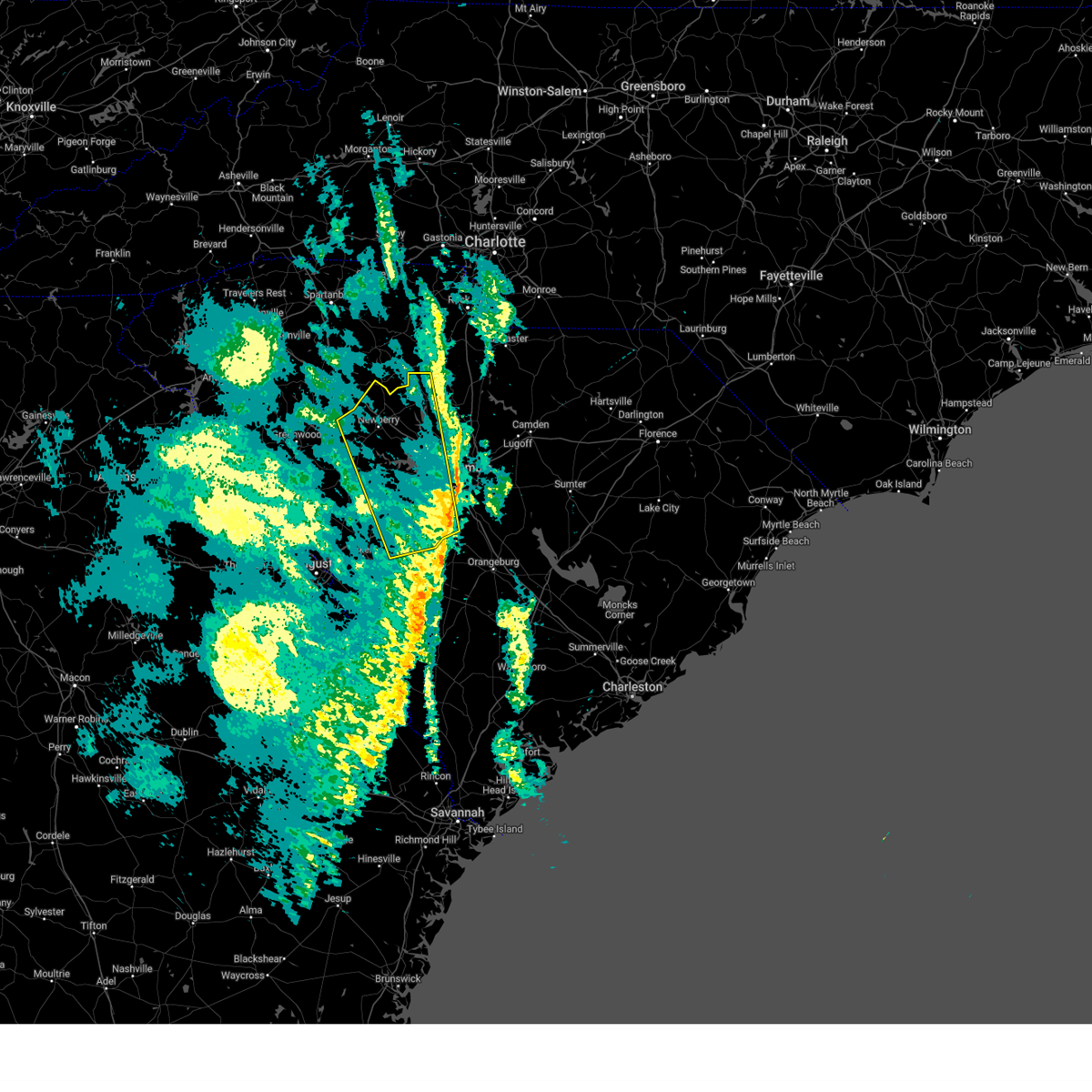
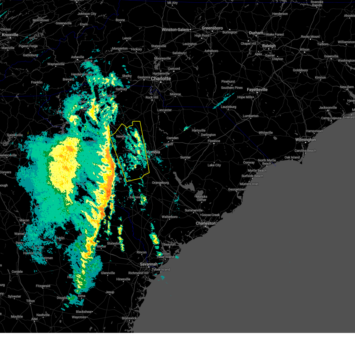
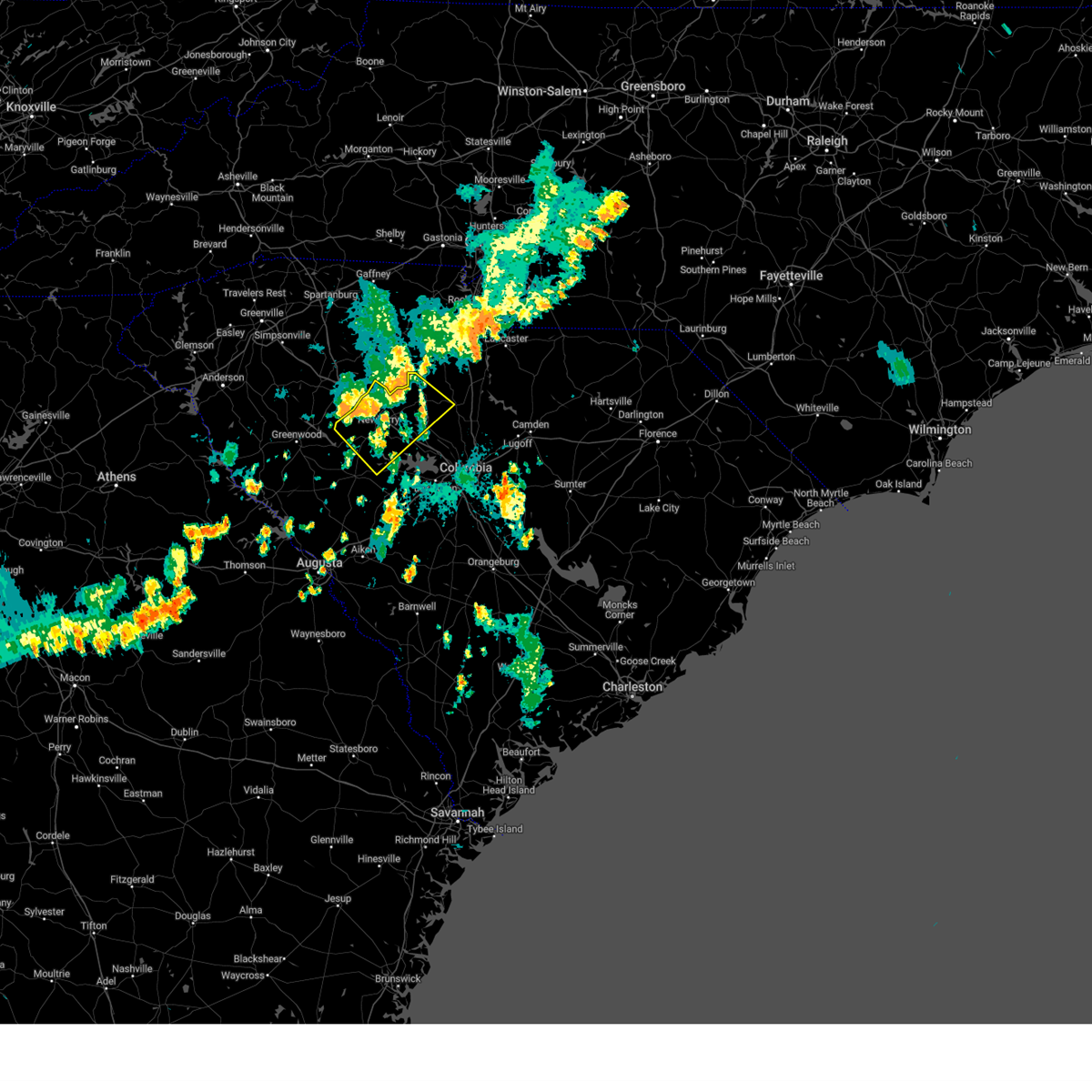
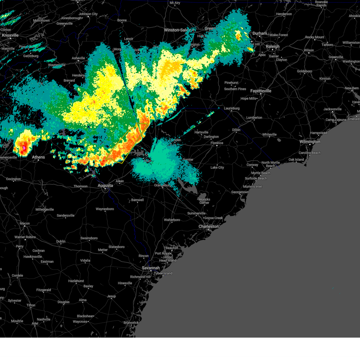
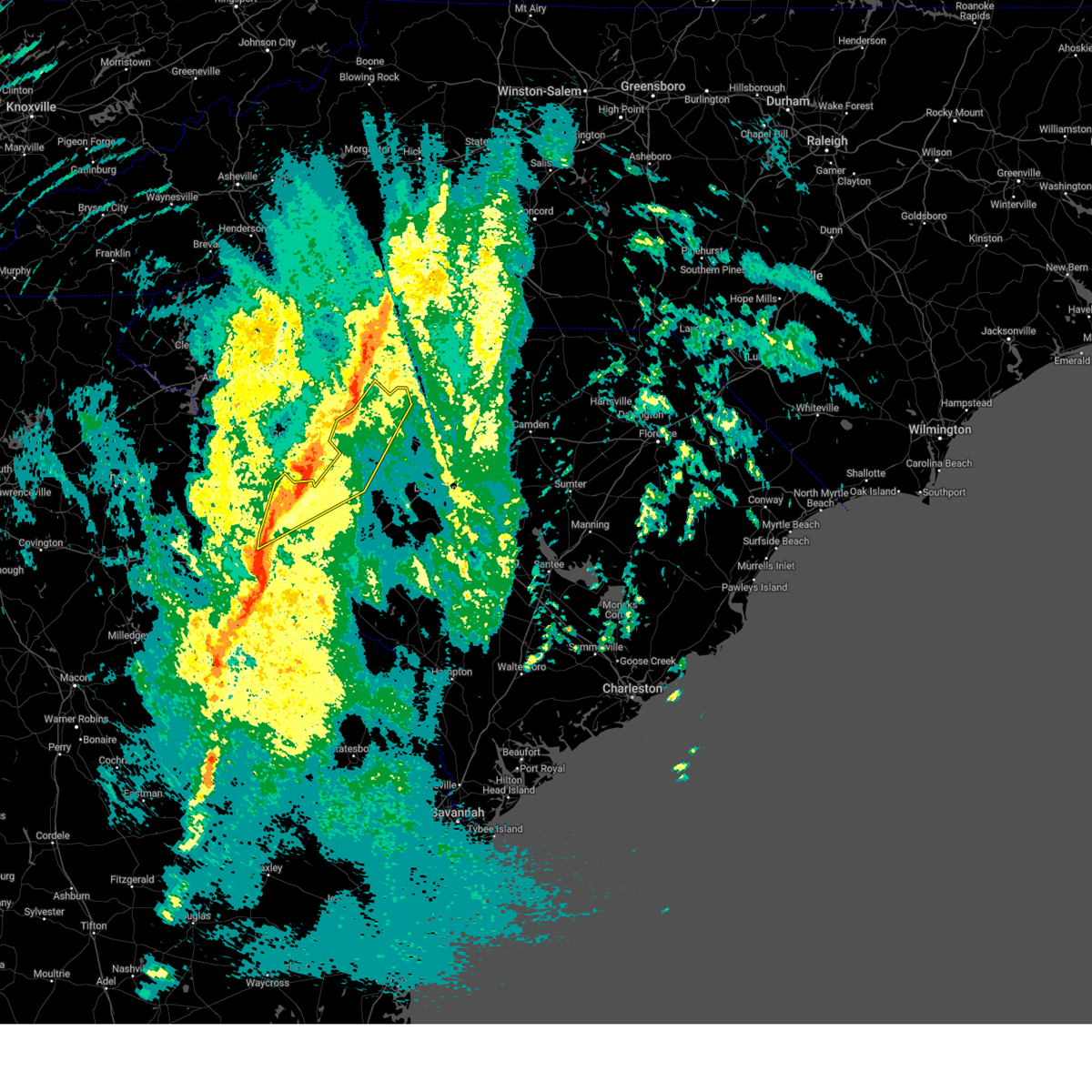
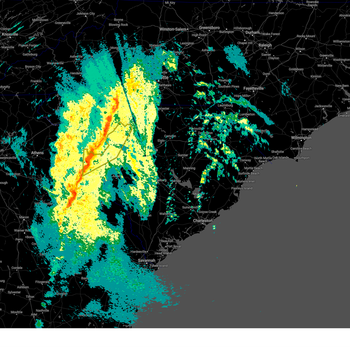
| 11/8/2025 6:13 PM EST | At 613 pm est, a severe thunderstorm was located near prosperity, or 8 miles east of newberry, moving east at 35 mph (radar indicated). Hazards include golf ball size hail and 60 mph wind gusts. People and animals outdoors will be injured. expect hail damage to roofs, siding, windows, and vehicles. expect wind damage to trees and powerlines. locations impacted include, newberry, vc summer nuclear station, prosperity, jenkinsville, chapin, little mountain, pomaria, peak, lighthouse marina, us- 176 and sc-34 crossroads, white rock, mid- carolina high school, and melvin park. This includes interstate 26 between mile markers 74 and 96. |
| 11/8/2025 5:54 PM EST | Svrcae the national weather service in columbia has issued a * severe thunderstorm warning for, southwestern fairfield county in central south carolina, eastern newberry county in central south carolina, north central lexington county in central south carolina, northwestern richland county in central south carolina, * until 645 pm est. * at 553 pm est, a severe thunderstorm was located over newberry college, or over newberry, moving east at 30 mph (radar indicated). Hazards include golf ball size hail and 60 mph wind gusts. People and animals outdoors will be injured. expect hail damage to roofs, siding, windows, and vehicles. Expect wind damage to trees and powerlines. |
| 11/8/2025 5:37 PM EST | At 537 pm est, a severe thunderstorm was located near joanna, or 9 miles northwest of newberry, moving east at 35 mph (radar indicated). Hazards include golf ball size hail and 60 mph wind gusts. People and animals outdoors will be injured. expect hail damage to roofs, siding, windows, and vehicles. expect wind damage to trees and powerlines. locations impacted include, newberry, whitmire, prosperity, newberry college, newberry county airport, silverstreet, newberry county detention center, maybington fire station, us-176 and sc- 34 crossroads, bush river fire station, belfast wildlife management area, and enoree ranger district office. This includes interstate 26 between mile markers 62 and 79. |
| 11/8/2025 5:12 PM EST | Svrcae the national weather service in columbia has issued a * severe thunderstorm warning for, newberry county in central south carolina, * until 600 pm est. * at 511 pm est, a severe thunderstorm was located near waterloo, or 8 miles south of laurens, moving east at 30 mph (radar indicated). Hazards include golf ball size hail and 60 mph wind gusts. People and animals outdoors will be injured. expect hail damage to roofs, siding, windows, and vehicles. Expect wind damage to trees and powerlines. |
| 8/1/2025 8:25 PM EDT | Newberry county dispatch reported multiple trees down on state park rd at state park loop rd. time estimated by rada in newberry county SC, 10.9 miles NW of Prosperity, SC |
| 8/1/2025 8:07 PM EDT |
 At 807 pm edt, severe thunderstorms were located along a line extending from near blair to near prosperity to 11 miles northeast of saluda, moving southeast at 15 mph (radar indicated). Hazards include 60 mph wind gusts. Expect damage to trees and powerlines. locations impacted include, vc summer nuclear station, prosperity, dreher island state park, jenkinsville, chapin, little mountain, pomaria, peak, lighthouse marina, stoney hill, shull island, fairview fire station, putnam's landing, white rock, mid-carolina high school, rocky point recreation area, wyses ferry, and melvin park. This includes interstate 26 between mile markers 78 and 95. At 807 pm edt, severe thunderstorms were located along a line extending from near blair to near prosperity to 11 miles northeast of saluda, moving southeast at 15 mph (radar indicated). Hazards include 60 mph wind gusts. Expect damage to trees and powerlines. locations impacted include, vc summer nuclear station, prosperity, dreher island state park, jenkinsville, chapin, little mountain, pomaria, peak, lighthouse marina, stoney hill, shull island, fairview fire station, putnam's landing, white rock, mid-carolina high school, rocky point recreation area, wyses ferry, and melvin park. This includes interstate 26 between mile markers 78 and 95.
|
| 8/1/2025 7:49 PM EDT |
 Svrcae the national weather service in columbia has issued a * severe thunderstorm warning for, fairfield county in central south carolina, eastern newberry county in central south carolina, northwestern lexington county in central south carolina, northeastern saluda county in central south carolina, northwestern richland county in central south carolina, * until 830 pm edt. * at 749 pm edt, severe thunderstorms were located along a line extending from near blair to near prosperity to 9 miles northeast of saluda, moving southeast at 20 mph (radar indicated). Hazards include 60 mph wind gusts. expect damage to trees and powerlines Svrcae the national weather service in columbia has issued a * severe thunderstorm warning for, fairfield county in central south carolina, eastern newberry county in central south carolina, northwestern lexington county in central south carolina, northeastern saluda county in central south carolina, northwestern richland county in central south carolina, * until 830 pm edt. * at 749 pm edt, severe thunderstorms were located along a line extending from near blair to near prosperity to 9 miles northeast of saluda, moving southeast at 20 mph (radar indicated). Hazards include 60 mph wind gusts. expect damage to trees and powerlines
|
| 6/25/2025 9:00 PM EDT |
 The storms which prompted the warning have moved out of the area. therefore, the warning has been allowed to expire. however, heavy rain is still possible with these thunderstorms. a severe thunderstorm watch remains in effect until midnight edt for central south carolina. The storms which prompted the warning have moved out of the area. therefore, the warning has been allowed to expire. however, heavy rain is still possible with these thunderstorms. a severe thunderstorm watch remains in effect until midnight edt for central south carolina.
|
| 6/25/2025 8:33 PM EDT |
 At 833 pm edt, severe thunderstorms were located along a line extending from near elgin to 9 miles southwest of prosperity, moving southeast at 20 mph (radar indicated). Hazards include 60 mph wind gusts and half dollar size hail. Hail damage to vehicles is expected. expect wind damage to trees and powerlines. locations impacted include, columbia, sumter, lexington, west columbia, cayce, irmo, forest acres, newberry, camden, batesburg-leesville, springdale, dentsville, oak grove, st. andrews, vc summer nuclear station, highway 6 at lake murray dam, red bank, saluda, south congaree, and pine ridge. this includes the following highways, interstate 126 between mile markers 0 and 3. interstate 20 in south carolina between mile markers 49 and 100. interstate 26 between mile markers 77 and 116. Interstate 77 between mile markers 0 and 35. At 833 pm edt, severe thunderstorms were located along a line extending from near elgin to 9 miles southwest of prosperity, moving southeast at 20 mph (radar indicated). Hazards include 60 mph wind gusts and half dollar size hail. Hail damage to vehicles is expected. expect wind damage to trees and powerlines. locations impacted include, columbia, sumter, lexington, west columbia, cayce, irmo, forest acres, newberry, camden, batesburg-leesville, springdale, dentsville, oak grove, st. andrews, vc summer nuclear station, highway 6 at lake murray dam, red bank, saluda, south congaree, and pine ridge. this includes the following highways, interstate 126 between mile markers 0 and 3. interstate 20 in south carolina between mile markers 49 and 100. interstate 26 between mile markers 77 and 116. Interstate 77 between mile markers 0 and 35.
|
| 6/25/2025 7:56 PM EDT |
 Svrcae the national weather service in columbia has issued a * severe thunderstorm warning for, southern fairfield county in central south carolina, southern newberry county in central south carolina, northern lexington county in central south carolina, northwestern sumter county in central south carolina, saluda county in central south carolina, richland county in central south carolina, southwestern kershaw county in central south carolina, * until 900 pm edt. * at 756 pm edt, severe thunderstorms were located along a line extending from 6 miles south of longtown to 7 miles southwest of newberry college, moving southeast at 20 mph (radar indicated). Hazards include 60 mph wind gusts and quarter size hail. Hail damage to vehicles is expected. Expect wind damage to trees and powerlines. Svrcae the national weather service in columbia has issued a * severe thunderstorm warning for, southern fairfield county in central south carolina, southern newberry county in central south carolina, northern lexington county in central south carolina, northwestern sumter county in central south carolina, saluda county in central south carolina, richland county in central south carolina, southwestern kershaw county in central south carolina, * until 900 pm edt. * at 756 pm edt, severe thunderstorms were located along a line extending from 6 miles south of longtown to 7 miles southwest of newberry college, moving southeast at 20 mph (radar indicated). Hazards include 60 mph wind gusts and quarter size hail. Hail damage to vehicles is expected. Expect wind damage to trees and powerlines.
|
| 6/25/2025 7:39 PM EDT |
 At 738 pm edt, severe thunderstorms were located along a line extending from near lake wateree state park to monticello to near newberry county airport, moving south at 20 mph (law enforcement reports trees down). Hazards include 70 mph wind gusts and half dollar size hail. Hail damage to vehicles is expected. expect considerable tree damage. wind damage is also likely to mobile homes, roofs, and outbuildings. locations impacted include, newberry, winnsboro, vc summer nuclear station, whitmire, prosperity, fairfield county airport, jenkinsville, newberry college, monticello, newberry county airport, dreher island state park, blair, ridgeway, little mountain, pomaria, silverstreet, peak, lebanon fire station, us-176 and sc-34 crossroads, and henderson island. this includes the following highways, interstate 26 between mile markers 62 and 88. Interstate 77 between mile markers 30 and 50. At 738 pm edt, severe thunderstorms were located along a line extending from near lake wateree state park to monticello to near newberry county airport, moving south at 20 mph (law enforcement reports trees down). Hazards include 70 mph wind gusts and half dollar size hail. Hail damage to vehicles is expected. expect considerable tree damage. wind damage is also likely to mobile homes, roofs, and outbuildings. locations impacted include, newberry, winnsboro, vc summer nuclear station, whitmire, prosperity, fairfield county airport, jenkinsville, newberry college, monticello, newberry county airport, dreher island state park, blair, ridgeway, little mountain, pomaria, silverstreet, peak, lebanon fire station, us-176 and sc-34 crossroads, and henderson island. this includes the following highways, interstate 26 between mile markers 62 and 88. Interstate 77 between mile markers 30 and 50.
|
| 6/25/2025 7:25 PM EDT |
 At 725 pm edt, severe thunderstorms were located along a line extending from near great falls to near monticello to near newberry county airport, moving south at 10 mph (radar indicated). Hazards include 60 mph wind gusts and half dollar size hail. Hail damage to vehicles is expected. expect wind damage to trees and powerlines. locations impacted include, newberry, winnsboro, vc summer nuclear station, whitmire, prosperity, fairfield county airport, jenkinsville, newberry college, monticello, newberry county airport, dreher island state park, blair, ridgeway, little mountain, pomaria, silverstreet, peak, lebanon fire station, us-176 and sc-34 crossroads, and henderson island. this includes the following highways, interstate 26 between mile markers 62 and 88. Interstate 77 between mile markers 30 and 50. At 725 pm edt, severe thunderstorms were located along a line extending from near great falls to near monticello to near newberry county airport, moving south at 10 mph (radar indicated). Hazards include 60 mph wind gusts and half dollar size hail. Hail damage to vehicles is expected. expect wind damage to trees and powerlines. locations impacted include, newberry, winnsboro, vc summer nuclear station, whitmire, prosperity, fairfield county airport, jenkinsville, newberry college, monticello, newberry county airport, dreher island state park, blair, ridgeway, little mountain, pomaria, silverstreet, peak, lebanon fire station, us-176 and sc-34 crossroads, and henderson island. this includes the following highways, interstate 26 between mile markers 62 and 88. Interstate 77 between mile markers 30 and 50.
|
| 6/25/2025 7:17 PM EDT |
 Svrcae the national weather service in columbia has issued a * severe thunderstorm warning for, fairfield county in central south carolina, newberry county in central south carolina, * until 815 pm edt. * at 717 pm edt, severe thunderstorms were located along a line extending from near great falls to near blair to near joanna, moving south at 10 mph (radar indicated). Hazards include 60 mph wind gusts and nickel size hail. expect damage to trees and powerlines Svrcae the national weather service in columbia has issued a * severe thunderstorm warning for, fairfield county in central south carolina, newberry county in central south carolina, * until 815 pm edt. * at 717 pm edt, severe thunderstorms were located along a line extending from near great falls to near blair to near joanna, moving south at 10 mph (radar indicated). Hazards include 60 mph wind gusts and nickel size hail. expect damage to trees and powerlines
|
| 6/17/2025 9:13 PM EDT | Sc highway patrol reported trees down along highway 391 south of prosperit in newberry county SC, 5 miles N of Prosperity, SC |
| 6/9/2025 8:33 PM EDT |
 At 833 pm edt, severe thunderstorms were located along a line extending from near newberry to near saluda county airport, moving east at 35 mph (radar indicated). Hazards include 60 mph wind gusts. Expect damage to trees and powerlines. locations impacted include, batesburg-leesville, saluda, prosperity, ridge spring, jenkinsville, saluda county airport, dreher island state park, chapin, gilbert, summit, little mountain, monetta, pomaria, silverstreet, ward, peak, cedar grove fire station, south shore marina, oswald park, and saluda co sheriff's office. this includes the following highways, interstate 20 in south carolina between mile markers 42 and 45. Interstate 26 between mile markers 79 and 94. At 833 pm edt, severe thunderstorms were located along a line extending from near newberry to near saluda county airport, moving east at 35 mph (radar indicated). Hazards include 60 mph wind gusts. Expect damage to trees and powerlines. locations impacted include, batesburg-leesville, saluda, prosperity, ridge spring, jenkinsville, saluda county airport, dreher island state park, chapin, gilbert, summit, little mountain, monetta, pomaria, silverstreet, ward, peak, cedar grove fire station, south shore marina, oswald park, and saluda co sheriff's office. this includes the following highways, interstate 20 in south carolina between mile markers 42 and 45. Interstate 26 between mile markers 79 and 94.
|
| 6/9/2025 8:33 PM EDT |
 the severe thunderstorm warning has been cancelled and is no longer in effect the severe thunderstorm warning has been cancelled and is no longer in effect
|
| 6/9/2025 8:14 PM EDT |
 Svrcae the national weather service in columbia has issued a * severe thunderstorm warning for, southwestern fairfield county in central south carolina, southern newberry county in central south carolina, north central edgefield county in central south carolina, northwestern lexington county in central south carolina, saluda county in central south carolina, northwestern richland county in central south carolina, * until 900 pm edt. * at 814 pm edt, severe thunderstorms were located along a line extending from 9 miles east of lake greenwood state park to 6 miles northwest of johnston, moving east at 35 mph (radar indicated). Hazards include 60 mph wind gusts. expect damage to trees and powerlines Svrcae the national weather service in columbia has issued a * severe thunderstorm warning for, southwestern fairfield county in central south carolina, southern newberry county in central south carolina, north central edgefield county in central south carolina, northwestern lexington county in central south carolina, saluda county in central south carolina, northwestern richland county in central south carolina, * until 900 pm edt. * at 814 pm edt, severe thunderstorms were located along a line extending from 9 miles east of lake greenwood state park to 6 miles northwest of johnston, moving east at 35 mph (radar indicated). Hazards include 60 mph wind gusts. expect damage to trees and powerlines
|
| 6/7/2025 8:43 PM EDT |
 the severe thunderstorm warning has been cancelled and is no longer in effect the severe thunderstorm warning has been cancelled and is no longer in effect
|
| 6/7/2025 8:43 PM EDT |
 At 842 pm edt, severe thunderstorms were located along a line extending from near carlisle to near batesburg-leesville, moving east at 60 mph (trained weather spotters reported power flashes in newberry). Hazards include 70 mph wind gusts. Expect considerable tree damage. damage is likely to mobile homes, roofs, and outbuildings. locations impacted include, lexington, irmo, newberry, batesburg-leesville, vc summer nuclear station, highway 6 at lake murray dam, red bank, saluda, johnston, whitmire, prosperity, ridge spring, jenkinsville, monticello, dreher island state park, saluda county airport, newberry college, newberry county airport, ballentine, and blair. this includes the following highways, interstate 20 in south carolina between mile markers 32 and 55. Interstate 26 between mile markers 62 and 98. At 842 pm edt, severe thunderstorms were located along a line extending from near carlisle to near batesburg-leesville, moving east at 60 mph (trained weather spotters reported power flashes in newberry). Hazards include 70 mph wind gusts. Expect considerable tree damage. damage is likely to mobile homes, roofs, and outbuildings. locations impacted include, lexington, irmo, newberry, batesburg-leesville, vc summer nuclear station, highway 6 at lake murray dam, red bank, saluda, johnston, whitmire, prosperity, ridge spring, jenkinsville, monticello, dreher island state park, saluda county airport, newberry college, newberry county airport, ballentine, and blair. this includes the following highways, interstate 20 in south carolina between mile markers 32 and 55. Interstate 26 between mile markers 62 and 98.
|
| 6/7/2025 8:09 PM EDT |
 Svrcae the national weather service in columbia has issued a * severe thunderstorm warning for, western fairfield county in central south carolina, newberry county in central south carolina, edgefield county in central south carolina, western lexington county in central south carolina, saluda county in central south carolina, north central aiken county in central south carolina, east central mccormick county in central south carolina, northwestern richland county in central south carolina, * until 900 pm edt. * at 808 pm edt, severe thunderstorms were located along a line extending from near laurens to 8 miles northeast of hamilton branch state park, moving east at 60 mph (radar indicated). Hazards include 60 mph wind gusts. expect damage to trees and powerlines Svrcae the national weather service in columbia has issued a * severe thunderstorm warning for, western fairfield county in central south carolina, newberry county in central south carolina, edgefield county in central south carolina, western lexington county in central south carolina, saluda county in central south carolina, north central aiken county in central south carolina, east central mccormick county in central south carolina, northwestern richland county in central south carolina, * until 900 pm edt. * at 808 pm edt, severe thunderstorms were located along a line extending from near laurens to 8 miles northeast of hamilton branch state park, moving east at 60 mph (radar indicated). Hazards include 60 mph wind gusts. expect damage to trees and powerlines
|
| 3/31/2025 4:21 PM EDT |
 the severe thunderstorm warning has been cancelled and is no longer in effect the severe thunderstorm warning has been cancelled and is no longer in effect
|
| 3/31/2025 4:21 PM EDT |
 At 421 pm edt, severe thunderstorms were located along a line extending from near newberry county airport to 7 miles northeast of batesburg-leesville to near citizens park, moving east at 50 mph (radar indicated). Hazards include 60 mph wind gusts. Expect damage to trees and powerlines. locations impacted include, newberry, little mountain, cedar grove fire station, bundrick island, putnam's landing, salley, savannah river site badge office, summit, jackson, batesburg-leesville, lexington, aiken mall, camp kinard, perry, new holland, samaria fire station, cedar pond campground, perry airport, stoney hill, and chapin. this includes the following highways, interstate 20 in south carolina between mile markers 20 and 59. Interstate 26 between mile markers 77 and 91. At 421 pm edt, severe thunderstorms were located along a line extending from near newberry county airport to 7 miles northeast of batesburg-leesville to near citizens park, moving east at 50 mph (radar indicated). Hazards include 60 mph wind gusts. Expect damage to trees and powerlines. locations impacted include, newberry, little mountain, cedar grove fire station, bundrick island, putnam's landing, salley, savannah river site badge office, summit, jackson, batesburg-leesville, lexington, aiken mall, camp kinard, perry, new holland, samaria fire station, cedar pond campground, perry airport, stoney hill, and chapin. this includes the following highways, interstate 20 in south carolina between mile markers 20 and 59. Interstate 26 between mile markers 77 and 91.
|
| 3/31/2025 4:07 PM EDT |
 the severe thunderstorm warning has been cancelled and is no longer in effect the severe thunderstorm warning has been cancelled and is no longer in effect
|
| 3/31/2025 4:07 PM EDT |
 At 406 pm edt, severe thunderstorms were located along a line extending from near saluda to near aiken municipal airport to near jackson, moving east at 45 mph (radar indicated). Hazards include 60 mph wind gusts. Expect damage to trees and powerlines. locations impacted include, little mountain, cedar grove fire station, savannah river site badge office, summit, batesburg-leesville, johnston, camp kinard, edgefield county airport, new holland, samaria fire station, saluda, stoney hill, harmony, hopeland gardens, prosperity, burnettown, dreher island state park, williston, lake murray shores, and circle fire station. this includes the following highways, interstate 20 in south carolina between mile markers 10 and 59. Interstate 26 between mile markers 77 and 91. At 406 pm edt, severe thunderstorms were located along a line extending from near saluda to near aiken municipal airport to near jackson, moving east at 45 mph (radar indicated). Hazards include 60 mph wind gusts. Expect damage to trees and powerlines. locations impacted include, little mountain, cedar grove fire station, savannah river site badge office, summit, batesburg-leesville, johnston, camp kinard, edgefield county airport, new holland, samaria fire station, saluda, stoney hill, harmony, hopeland gardens, prosperity, burnettown, dreher island state park, williston, lake murray shores, and circle fire station. this includes the following highways, interstate 20 in south carolina between mile markers 10 and 59. Interstate 26 between mile markers 77 and 91.
|
| 3/31/2025 3:45 PM EDT |
 Svrcae the national weather service in columbia has issued a * severe thunderstorm warning for, central richmond county in east central georgia, southern newberry county in central south carolina, edgefield county in central south carolina, northeastern barnwell county in central south carolina, lexington county in central south carolina, saluda county in central south carolina, aiken county in central south carolina, northwestern orangeburg county in central south carolina, * until 445 pm edt. * at 345 pm edt, severe thunderstorms were located along a line extending from 8 miles south of ninety six historic site to near edgefield to near south augusta, moving east at 45 mph (radar indicated). Hazards include 60 mph wind gusts. expect damage to trees and powerlines Svrcae the national weather service in columbia has issued a * severe thunderstorm warning for, central richmond county in east central georgia, southern newberry county in central south carolina, edgefield county in central south carolina, northeastern barnwell county in central south carolina, lexington county in central south carolina, saluda county in central south carolina, aiken county in central south carolina, northwestern orangeburg county in central south carolina, * until 445 pm edt. * at 345 pm edt, severe thunderstorms were located along a line extending from 8 miles south of ninety six historic site to near edgefield to near south augusta, moving east at 45 mph (radar indicated). Hazards include 60 mph wind gusts. expect damage to trees and powerlines
|
| 2/16/2025 6:36 AM EST |
 Svrcae the national weather service in columbia has issued a * severe thunderstorm warning for, columbia county in east central georgia, burke county in east central georgia, southeastern mcduffie county in east central georgia, southeastern lincoln county in east central georgia, richmond county in east central georgia, fairfield county in central south carolina, newberry county in central south carolina, western lexington county in central south carolina, saluda county in central south carolina, aiken county in central south carolina, southeastern mccormick county in central south carolina, edgefield county in central south carolina, northwestern richland county in central south carolina, * until 730 am est. * at 635 am est, severe thunderstorms were located along a line extending from near clinton to near thomson-mcduffie county airport, moving east at 65 mph (radar indicated). Hazards include 60 mph wind gusts. expect damage to trees and powerlines Svrcae the national weather service in columbia has issued a * severe thunderstorm warning for, columbia county in east central georgia, burke county in east central georgia, southeastern mcduffie county in east central georgia, southeastern lincoln county in east central georgia, richmond county in east central georgia, fairfield county in central south carolina, newberry county in central south carolina, western lexington county in central south carolina, saluda county in central south carolina, aiken county in central south carolina, southeastern mccormick county in central south carolina, edgefield county in central south carolina, northwestern richland county in central south carolina, * until 730 am est. * at 635 am est, severe thunderstorms were located along a line extending from near clinton to near thomson-mcduffie county airport, moving east at 65 mph (radar indicated). Hazards include 60 mph wind gusts. expect damage to trees and powerlines
|
| 12/29/2024 8:59 AM EST |
 The storms which prompted the warning have moved out of the area. therefore, the warning will be allowed to expire. to report severe weather, contact your nearest law enforcement agency. they will relay your report to the national weather service columbia. The storms which prompted the warning have moved out of the area. therefore, the warning will be allowed to expire. to report severe weather, contact your nearest law enforcement agency. they will relay your report to the national weather service columbia.
|
| 12/29/2024 8:03 AM EST |
 Svrcae the national weather service in columbia has issued a * severe thunderstorm warning for, western fairfield county in central south carolina, newberry county in central south carolina, lexington county in central south carolina, eastern saluda county in central south carolina, northeastern aiken county in central south carolina, northwestern richland county in central south carolina, * until 900 am est. * at 802 am est, severe thunderstorms were located along a line extending from 7 miles northeast of lake greenwood state park to graniteville, moving northeast at 50 mph (radar indicated). Hazards include 60 mph wind gusts. expect damage to trees and powerlines Svrcae the national weather service in columbia has issued a * severe thunderstorm warning for, western fairfield county in central south carolina, newberry county in central south carolina, lexington county in central south carolina, eastern saluda county in central south carolina, northeastern aiken county in central south carolina, northwestern richland county in central south carolina, * until 900 am est. * at 802 am est, severe thunderstorms were located along a line extending from 7 miles northeast of lake greenwood state park to graniteville, moving northeast at 50 mph (radar indicated). Hazards include 60 mph wind gusts. expect damage to trees and powerlines
|
| 8/17/2024 9:28 PM EDT |
 The storm which prompted the warning has weakened below severe limits, and no longer poses an immediate threat to life or property. therefore, the warning will be allowed to expire. however, gusty winds are still possible with this thunderstorm. to report severe weather, contact your nearest law enforcement agency. they will relay your report to the national weather service columbia. remember, a severe thunderstorm warning still remains in effect for portions of southwestern newberry county until 10 pm!. The storm which prompted the warning has weakened below severe limits, and no longer poses an immediate threat to life or property. therefore, the warning will be allowed to expire. however, gusty winds are still possible with this thunderstorm. to report severe weather, contact your nearest law enforcement agency. they will relay your report to the national weather service columbia. remember, a severe thunderstorm warning still remains in effect for portions of southwestern newberry county until 10 pm!.
|
| 8/17/2024 8:42 PM EDT |
 The storms which prompted the warning have moved out of the area. therefore, the warning will be allowed to expire. however, gusty winds are still possible with these thunderstorms. remember, a severe thunderstorm warning still remains in effect for newberry county until 930 pm!. The storms which prompted the warning have moved out of the area. therefore, the warning will be allowed to expire. however, gusty winds are still possible with these thunderstorms. remember, a severe thunderstorm warning still remains in effect for newberry county until 930 pm!.
|
| 8/17/2024 8:41 PM EDT |
 Svrcae the national weather service in columbia has issued a * severe thunderstorm warning for, west central fairfield county in central south carolina, newberry county in central south carolina, * until 930 pm edt. * at 840 pm edt, a severe thunderstorm was located near whitmire, or 10 miles north of newberry, moving southeast at 20 mph (radar indicated). Hazards include 60 mph wind gusts and quarter size hail. Hail damage to vehicles is expected. Expect wind damage to trees and powerlines. Svrcae the national weather service in columbia has issued a * severe thunderstorm warning for, west central fairfield county in central south carolina, newberry county in central south carolina, * until 930 pm edt. * at 840 pm edt, a severe thunderstorm was located near whitmire, or 10 miles north of newberry, moving southeast at 20 mph (radar indicated). Hazards include 60 mph wind gusts and quarter size hail. Hail damage to vehicles is expected. Expect wind damage to trees and powerlines.
|
| 8/17/2024 8:30 PM EDT |
 At 829 pm edt, severe thunderstorms were located along a line extending from 6 miles northwest of winnsboro to jenkinsville to near prosperity, moving southeast at 30 mph. another severe thunderstorm was located in western newberry county, moving east southeast at 30 mph (radar indicated). Hazards include 70 mph wind gusts and quarter size hail. Hail damage to vehicles is expected. expect considerable tree damage. wind damage is also likely to mobile homes, roofs, and outbuildings. locations impacted include, newberry, winnsboro, vc summer nuclear station, whitmire, prosperity, fairfield county airport, jenkinsville, newberry college, monticello, newberry county airport, blair, little mountain, pomaria, peak, lebanon fire station, us-176 and sc- 34 crossroads, rion, white oak, enoree ranger district office, and newberry county detention center. This includes interstate 26 between mile markers 62 and 89. At 829 pm edt, severe thunderstorms were located along a line extending from 6 miles northwest of winnsboro to jenkinsville to near prosperity, moving southeast at 30 mph. another severe thunderstorm was located in western newberry county, moving east southeast at 30 mph (radar indicated). Hazards include 70 mph wind gusts and quarter size hail. Hail damage to vehicles is expected. expect considerable tree damage. wind damage is also likely to mobile homes, roofs, and outbuildings. locations impacted include, newberry, winnsboro, vc summer nuclear station, whitmire, prosperity, fairfield county airport, jenkinsville, newberry college, monticello, newberry county airport, blair, little mountain, pomaria, peak, lebanon fire station, us-176 and sc- 34 crossroads, rion, white oak, enoree ranger district office, and newberry county detention center. This includes interstate 26 between mile markers 62 and 89.
|
| 8/17/2024 8:10 PM EDT |
 At 810 pm edt, severe thunderstorms were located along a line extending from 6 miles west of blackstock to near monticello to 6 miles northeast of newberry county airport, moving southeast at 35 mph (radar indicated). Hazards include 70 mph wind gusts and quarter size hail. Hail damage to vehicles is expected. expect considerable tree damage. wind damage is also likely to mobile homes, roofs, and outbuildings. locations impacted include, newberry, winnsboro, vc summer nuclear station, whitmire, prosperity, fairfield county airport, jenkinsville, newberry college, monticello, newberry county airport, blair, little mountain, pomaria, peak, lebanon fire station, us-176 and sc- 34 crossroads, henderson island, rion, white oak, and enoree ranger district office. This includes interstate 26 between mile markers 62 and 89. At 810 pm edt, severe thunderstorms were located along a line extending from 6 miles west of blackstock to near monticello to 6 miles northeast of newberry county airport, moving southeast at 35 mph (radar indicated). Hazards include 70 mph wind gusts and quarter size hail. Hail damage to vehicles is expected. expect considerable tree damage. wind damage is also likely to mobile homes, roofs, and outbuildings. locations impacted include, newberry, winnsboro, vc summer nuclear station, whitmire, prosperity, fairfield county airport, jenkinsville, newberry college, monticello, newberry county airport, blair, little mountain, pomaria, peak, lebanon fire station, us-176 and sc- 34 crossroads, henderson island, rion, white oak, and enoree ranger district office. This includes interstate 26 between mile markers 62 and 89.
|
| 8/17/2024 7:41 PM EDT |
 Svrcae the national weather service in columbia has issued a * severe thunderstorm warning for, western fairfield county in central south carolina, newberry county in central south carolina, * until 845 pm edt. * at 739 pm edt, severe thunderstorms were located along a line extending from near lockhart to near carlisle to near rose hill state park, moving southeast at 30 mph (radar indicated). Hazards include 70 mph wind gusts and quarter size hail. Hail damage to vehicles is expected. expect considerable tree damage. Wind damage is also likely to mobile homes, roofs, and outbuildings. Svrcae the national weather service in columbia has issued a * severe thunderstorm warning for, western fairfield county in central south carolina, newberry county in central south carolina, * until 845 pm edt. * at 739 pm edt, severe thunderstorms were located along a line extending from near lockhart to near carlisle to near rose hill state park, moving southeast at 30 mph (radar indicated). Hazards include 70 mph wind gusts and quarter size hail. Hail damage to vehicles is expected. expect considerable tree damage. Wind damage is also likely to mobile homes, roofs, and outbuildings.
|
| 7/30/2024 10:19 PM EDT |
 Svrcae the national weather service in columbia has issued a * severe thunderstorm warning for, northwestern fairfield county in central south carolina, newberry county in central south carolina, northeastern saluda county in central south carolina, * until 1100 pm edt. * at 1019 pm edt, severe thunderstorms were located along a line extending from near blair to 7 miles east of lake greenwood state park, moving southeast at 40 mph (radar indicated). Hazards include 60 mph wind gusts. expect damage to trees and powerlines Svrcae the national weather service in columbia has issued a * severe thunderstorm warning for, northwestern fairfield county in central south carolina, newberry county in central south carolina, northeastern saluda county in central south carolina, * until 1100 pm edt. * at 1019 pm edt, severe thunderstorms were located along a line extending from near blair to 7 miles east of lake greenwood state park, moving southeast at 40 mph (radar indicated). Hazards include 60 mph wind gusts. expect damage to trees and powerlines
|
| 7/7/2024 9:16 PM EDT | Large tree down blocking the roadway at the intersection of st. lukes road at morris roa in newberry county SC, 5.2 miles NNE of Prosperity, SC |
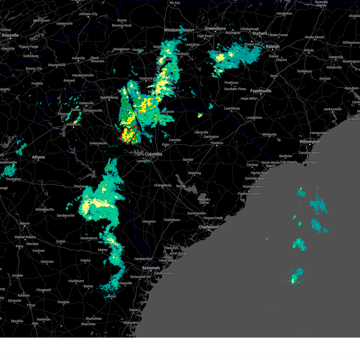
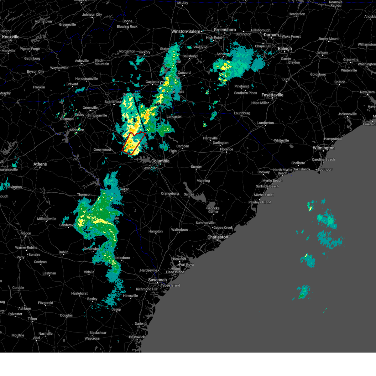
| 5/10/2024 5:05 PM EDT | Ping Pong Ball sized hail reported 6.4 miles N of Prosperity, SC, public report of greater than quarter sized hail along prosperity highway. time estimated by radar. |
| 5/9/2024 3:33 AM EDT |
 the severe thunderstorm warning has been cancelled and is no longer in effect the severe thunderstorm warning has been cancelled and is no longer in effect
|
| 5/9/2024 3:20 AM EDT |
 At 320 am edt, severe thunderstorms were located along a line extending from 6 miles north of carlisle to near newberry county airport to 7 miles south of ninety six historic site, moving east at 25 mph (radar indicated). Hazards include 70 mph wind gusts. Expect considerable tree damage. damage is likely to mobile homes, roofs, and outbuildings. locations impacted include, newberry, saluda, prosperity, newberry county airport, blair, saluda county airport, newberry college, pomaria, silverstreet, stoney hill, newberry county detention center, saluda co sheriff's office, us- 176 and sc-34 crossroads, good hope, henderson island, mid- carolina high school, wyses ferry, hollywood elementary school, emory, and maybington fire station. This includes interstate 26 between mile markers 70 and 85. At 320 am edt, severe thunderstorms were located along a line extending from 6 miles north of carlisle to near newberry county airport to 7 miles south of ninety six historic site, moving east at 25 mph (radar indicated). Hazards include 70 mph wind gusts. Expect considerable tree damage. damage is likely to mobile homes, roofs, and outbuildings. locations impacted include, newberry, saluda, prosperity, newberry county airport, blair, saluda county airport, newberry college, pomaria, silverstreet, stoney hill, newberry county detention center, saluda co sheriff's office, us- 176 and sc-34 crossroads, good hope, henderson island, mid- carolina high school, wyses ferry, hollywood elementary school, emory, and maybington fire station. This includes interstate 26 between mile markers 70 and 85.
|
| 5/9/2024 3:12 AM EDT |
 Svrcae the national weather service in columbia has issued a * severe thunderstorm warning for, fairfield county in central south carolina, southeastern newberry county in central south carolina, lexington county in central south carolina, eastern saluda county in central south carolina, northeastern aiken county in central south carolina, northwestern richland county in central south carolina, southwestern kershaw county in central south carolina, * until 400 am edt. * at 311 am edt, severe thunderstorms were located along a line extending from near blackstock to 6 miles east of saluda, moving southeast at 50 mph (radar indicated). Hazards include 70 mph wind gusts and penny size hail. Expect considerable tree damage. Damage is likely to mobile homes, roofs, and outbuildings. Svrcae the national weather service in columbia has issued a * severe thunderstorm warning for, fairfield county in central south carolina, southeastern newberry county in central south carolina, lexington county in central south carolina, eastern saluda county in central south carolina, northeastern aiken county in central south carolina, northwestern richland county in central south carolina, southwestern kershaw county in central south carolina, * until 400 am edt. * at 311 am edt, severe thunderstorms were located along a line extending from near blackstock to 6 miles east of saluda, moving southeast at 50 mph (radar indicated). Hazards include 70 mph wind gusts and penny size hail. Expect considerable tree damage. Damage is likely to mobile homes, roofs, and outbuildings.
|
| 5/9/2024 2:40 AM EDT |
 Svrcae the national weather service in columbia has issued a * severe thunderstorm warning for, northwestern fairfield county in central south carolina, newberry county in central south carolina, saluda county in central south carolina, * until 345 am edt. * at 239 am edt, severe thunderstorms were located along a line extending from near buffalo to near cross hill to near troy, moving east at 25 mph (radar indicated). Hazards include 70 mph wind gusts and penny size hail. Expect considerable tree damage. Damage is likely to mobile homes, roofs, and outbuildings. Svrcae the national weather service in columbia has issued a * severe thunderstorm warning for, northwestern fairfield county in central south carolina, newberry county in central south carolina, saluda county in central south carolina, * until 345 am edt. * at 239 am edt, severe thunderstorms were located along a line extending from near buffalo to near cross hill to near troy, moving east at 25 mph (radar indicated). Hazards include 70 mph wind gusts and penny size hail. Expect considerable tree damage. Damage is likely to mobile homes, roofs, and outbuildings.
|
| 2/28/2024 5:30 PM EST | At 530 pm est, severe thunderstorms were located along a line extending from 8 miles south of monroe to 7 miles southwest of great falls to near newberry, moving east at 35 mph (radar indicated). Hazards include 60 mph wind gusts. Expect damage to trees and powerlines. locations impacted include, newberry, lancaster, winnsboro, springdale, vc summer nuclear station, kershaw, elgin, prosperity, heath springs, jenkinsville, liberty hill, monticello, dreher island state park, lake wateree state park, fairfield county airport, westville, usc lancaster, irwin, newberry college, and blackstock. this includes the following highways, interstate 26 between mile markers 68 and 88. Interstate 77 between mile markers 29 and 51. |
| 2/28/2024 4:36 PM EST | Svrcae the national weather service in columbia has issued a * severe thunderstorm warning for, fairfield county in central south carolina, lancaster county in central south carolina, newberry county in central south carolina, northwestern kershaw county in central south carolina, * until 545 pm est. * at 436 pm est, severe thunderstorms were located along a line extending from newport to near carlisle to near waterloo, moving east at 35 mph (radar indicated). Hazards include 60 mph wind gusts. expect damage to trees and powerlines |
| 1/27/2024 8:43 PM EST |
 At 842 pm est, a severe thunderstorm capable of producing a tornado was located near newberry county airport, or near newberry, moving northeast at 45 mph (radar indicated rotation). Hazards include tornado. Flying debris will be dangerous to those caught without shelter. mobile homes will be damaged or destroyed. damage to roofs, windows, and vehicles will occur. tree damage is likely. this dangerous storm will be near, blair around 850 pm est. other locations impacted by this tornadic thunderstorm include henderson island, newberry county detention center, enoree ranger district office, maybington fire station, us-176 and sc- 34 crossroads, and bush river fire station. This includes interstate 26 between mile markers 66 and 78. At 842 pm est, a severe thunderstorm capable of producing a tornado was located near newberry county airport, or near newberry, moving northeast at 45 mph (radar indicated rotation). Hazards include tornado. Flying debris will be dangerous to those caught without shelter. mobile homes will be damaged or destroyed. damage to roofs, windows, and vehicles will occur. tree damage is likely. this dangerous storm will be near, blair around 850 pm est. other locations impacted by this tornadic thunderstorm include henderson island, newberry county detention center, enoree ranger district office, maybington fire station, us-176 and sc- 34 crossroads, and bush river fire station. This includes interstate 26 between mile markers 66 and 78.
|
| 1/27/2024 8:32 PM EST |
 At 832 pm est, a severe thunderstorm capable of producing a tornado was located over newberry college, or over newberry, moving northeast at 45 mph (radar indicated rotation). Hazards include tornado. Flying debris will be dangerous to those caught without shelter. mobile homes will be damaged or destroyed. damage to roofs, windows, and vehicles will occur. tree damage is likely. this dangerous storm will be near, newberry, prosperity, newberry college, and newberry county airport around 835 pm est. blair around 850 pm est. other locations impacted by this tornadic thunderstorm include newberry county detention center, maybington fire station, us- 176 and sc- 34 crossroads, bush river fire station, henderson island, enoree ranger district office, and silverstreet. This includes interstate 26 between mile markers 66 and 78. At 832 pm est, a severe thunderstorm capable of producing a tornado was located over newberry college, or over newberry, moving northeast at 45 mph (radar indicated rotation). Hazards include tornado. Flying debris will be dangerous to those caught without shelter. mobile homes will be damaged or destroyed. damage to roofs, windows, and vehicles will occur. tree damage is likely. this dangerous storm will be near, newberry, prosperity, newberry college, and newberry county airport around 835 pm est. blair around 850 pm est. other locations impacted by this tornadic thunderstorm include newberry county detention center, maybington fire station, us- 176 and sc- 34 crossroads, bush river fire station, henderson island, enoree ranger district office, and silverstreet. This includes interstate 26 between mile markers 66 and 78.
|
| 1/9/2024 1:47 PM EST |
 At 147 pm est, severe thunderstorms were located along a line extending from near andrew jackson state park to near dreher island state park, moving northeast at 50 mph (emergency management). Hazards include 70 mph wind gusts. Expect considerable tree damage. damage is likely to mobile homes, roofs, and outbuildings. locations impacted include, lexington, irmo, newberry, batesburg-leesville, winnsboro, vc summer nuclear station, highway 6 at lake murray dam, red bank, oak grove, st. andrews, prosperity, ridge spring, jenkinsville, harbison state forest, monticello, dreher island state park, fairfield county airport, ballentine, aiken municipal airport, and blair. this includes the following highways, interstate 20 in south carolina between mile markers 18 and 62. interstate 26 between mile markers 75 and 106. Interstate 77 between mile markers 33 and 50. At 147 pm est, severe thunderstorms were located along a line extending from near andrew jackson state park to near dreher island state park, moving northeast at 50 mph (emergency management). Hazards include 70 mph wind gusts. Expect considerable tree damage. damage is likely to mobile homes, roofs, and outbuildings. locations impacted include, lexington, irmo, newberry, batesburg-leesville, winnsboro, vc summer nuclear station, highway 6 at lake murray dam, red bank, oak grove, st. andrews, prosperity, ridge spring, jenkinsville, harbison state forest, monticello, dreher island state park, fairfield county airport, ballentine, aiken municipal airport, and blair. this includes the following highways, interstate 20 in south carolina between mile markers 18 and 62. interstate 26 between mile markers 75 and 106. Interstate 77 between mile markers 33 and 50.
|
| 1/9/2024 1:08 PM EST |
 At 107 pm est, severe thunderstorms were located along a line extending from near chester state park to johnston, moving northeast at 50 mph (emergency management). Hazards include 70 mph wind gusts. Expect considerable tree damage. Damage is likely to mobile homes, roofs, and outbuildings. At 107 pm est, severe thunderstorms were located along a line extending from near chester state park to johnston, moving northeast at 50 mph (emergency management). Hazards include 70 mph wind gusts. Expect considerable tree damage. Damage is likely to mobile homes, roofs, and outbuildings.
|
| 1/9/2024 12:26 PM EST |
 At 1226 pm est, severe thunderstorms were located along a line extending from near rose hill state park to near hamilton branch state park, moving east at 50 mph (emergency management). Hazards include 70 mph wind gusts. Expect considerable tree damage. damage is likely to mobile homes, roofs, and outbuildings. locations impacted include, newberry, saluda, mccormick, whitmire, prosperity, saluda county airport, newberry college, mistletoe state park, mccormick county airport, newberry county airport, hamilton branch state park, silverstreet, parksville, plum branch, saluda co sheriff`s office, us-176 and sc- 34 crossroads, good hope, modoc, northside fire station main, and belfast wildlife management area. This includes interstate 26 between mile markers 62 and 79. At 1226 pm est, severe thunderstorms were located along a line extending from near rose hill state park to near hamilton branch state park, moving east at 50 mph (emergency management). Hazards include 70 mph wind gusts. Expect considerable tree damage. damage is likely to mobile homes, roofs, and outbuildings. locations impacted include, newberry, saluda, mccormick, whitmire, prosperity, saluda county airport, newberry college, mistletoe state park, mccormick county airport, newberry county airport, hamilton branch state park, silverstreet, parksville, plum branch, saluda co sheriff`s office, us-176 and sc- 34 crossroads, good hope, modoc, northside fire station main, and belfast wildlife management area. This includes interstate 26 between mile markers 62 and 79.
|
| 1/9/2024 12:14 PM EST |
 At 1214 pm est, severe thunderstorms were located along a line extending from 7 miles north of clinton to near mistletoe state park, moving northeast at 50 mph (radar indicated). Hazards include 70 mph wind gusts. Expect considerable tree damage. Damage is likely to mobile homes, roofs, and outbuildings. At 1214 pm est, severe thunderstorms were located along a line extending from 7 miles north of clinton to near mistletoe state park, moving northeast at 50 mph (radar indicated). Hazards include 70 mph wind gusts. Expect considerable tree damage. Damage is likely to mobile homes, roofs, and outbuildings.
|
| 9/7/2023 5:47 PM EDT |
 At 546 pm edt, a severe thunderstorm was located near dreher island state park, or near lexington, moving northeast at 15 mph (radar indicated). Hazards include 70 mph wind gusts and quarter size hail. Hail damage to vehicles is expected. expect considerable tree damage. wind damage is also likely to mobile homes, roofs, and outbuildings. locations impacted include, lexington, irmo, newberry, batesburg-leesville, vc summer nuclear station, highway 6 at lake murray dam, red bank, oak grove, prosperity, jenkinsville, monticello, dreher island state park, ballentine, chapin, gilbert, summit, little mountain, pomaria, peak, and cedar grove fire station. this includes the following highways, interstate 20 in south carolina between mile markers 38 and 61. interstate 26 between mile markers 76 and 102. thunderstorm damage threat, considerable hail threat, radar indicated max hail size, 1. 00 in wind threat, radar indicated max wind gust, 70 mph. At 546 pm edt, a severe thunderstorm was located near dreher island state park, or near lexington, moving northeast at 15 mph (radar indicated). Hazards include 70 mph wind gusts and quarter size hail. Hail damage to vehicles is expected. expect considerable tree damage. wind damage is also likely to mobile homes, roofs, and outbuildings. locations impacted include, lexington, irmo, newberry, batesburg-leesville, vc summer nuclear station, highway 6 at lake murray dam, red bank, oak grove, prosperity, jenkinsville, monticello, dreher island state park, ballentine, chapin, gilbert, summit, little mountain, pomaria, peak, and cedar grove fire station. this includes the following highways, interstate 20 in south carolina between mile markers 38 and 61. interstate 26 between mile markers 76 and 102. thunderstorm damage threat, considerable hail threat, radar indicated max hail size, 1. 00 in wind threat, radar indicated max wind gust, 70 mph.
|
| 9/7/2023 5:28 PM EDT |
 At 528 pm edt, a severe thunderstorm was located near dreher island state park, or 8 miles northeast of batesburg-leesville, moving northeast at 15 mph (radar indicated). Hazards include 70 mph wind gusts and quarter size hail. Hail damage to vehicles is expected. expect considerable tree damage. wind damage is also likely to mobile homes, roofs, and outbuildings. locations impacted include, lexington, irmo, newberry, batesburg-leesville, vc summer nuclear station, highway 6 at lake murray dam, red bank, oak grove, prosperity, jenkinsville, monticello, dreher island state park, newberry college, newberry county airport, ballentine, chapin, gilbert, summit, little mountain, and pomaria. this includes the following highways, interstate 20 in south carolina between mile markers 38 and 61. interstate 26 between mile markers 71 and 102. thunderstorm damage threat, considerable hail threat, radar indicated max hail size, 1. 00 in wind threat, radar indicated max wind gust, 70 mph. At 528 pm edt, a severe thunderstorm was located near dreher island state park, or 8 miles northeast of batesburg-leesville, moving northeast at 15 mph (radar indicated). Hazards include 70 mph wind gusts and quarter size hail. Hail damage to vehicles is expected. expect considerable tree damage. wind damage is also likely to mobile homes, roofs, and outbuildings. locations impacted include, lexington, irmo, newberry, batesburg-leesville, vc summer nuclear station, highway 6 at lake murray dam, red bank, oak grove, prosperity, jenkinsville, monticello, dreher island state park, newberry college, newberry county airport, ballentine, chapin, gilbert, summit, little mountain, and pomaria. this includes the following highways, interstate 20 in south carolina between mile markers 38 and 61. interstate 26 between mile markers 71 and 102. thunderstorm damage threat, considerable hail threat, radar indicated max hail size, 1. 00 in wind threat, radar indicated max wind gust, 70 mph.
|
| 9/7/2023 5:10 PM EDT |
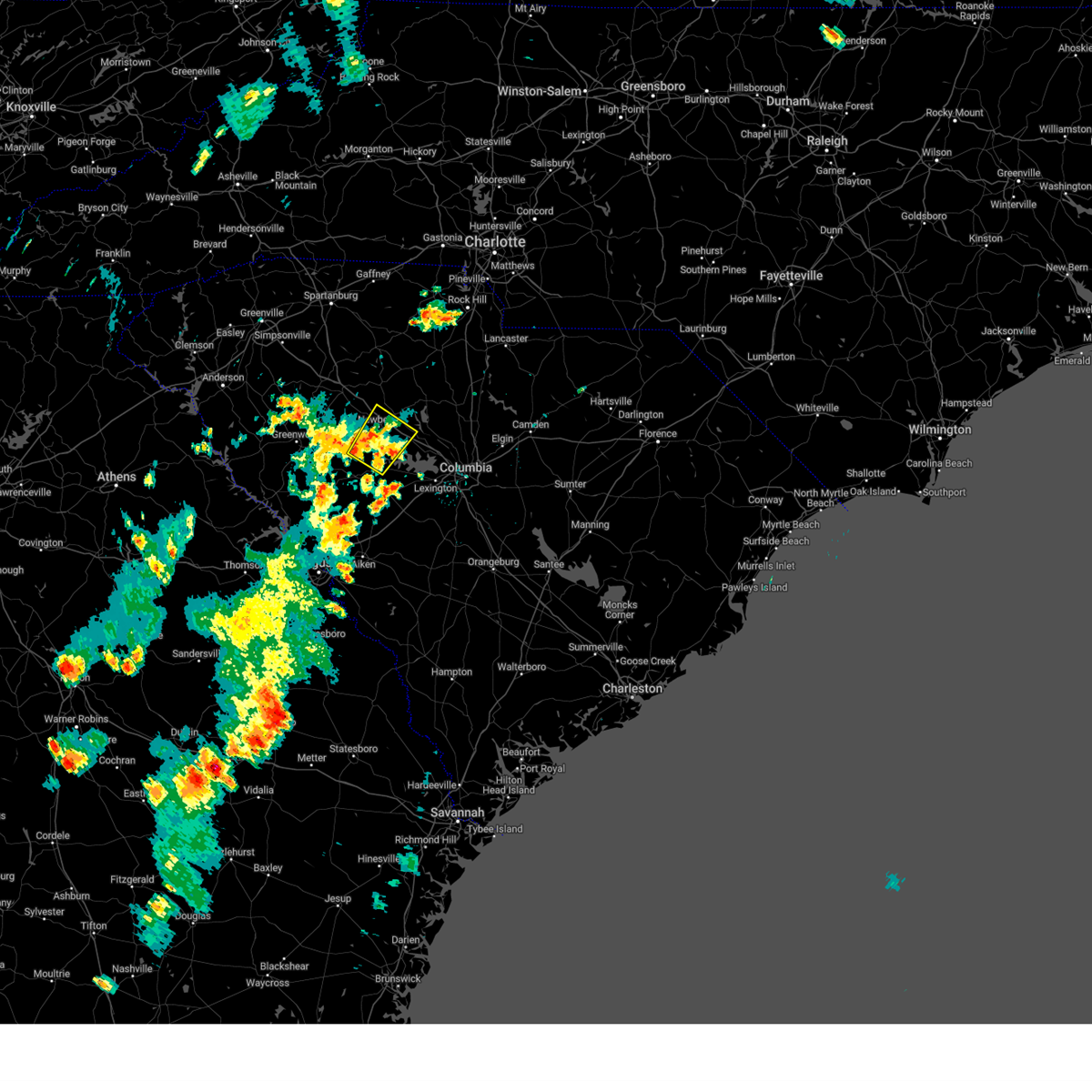 The severe thunderstorm warning for southeastern newberry and northeastern saluda counties will expire at 515 pm edt, the storm which prompted the warning has moved out of the area. therefore, the warning will be allowed to expire. a severe thunderstorm warning has been reissued to cover multiple severe thunderstorms near the previous warning!. The severe thunderstorm warning for southeastern newberry and northeastern saluda counties will expire at 515 pm edt, the storm which prompted the warning has moved out of the area. therefore, the warning will be allowed to expire. a severe thunderstorm warning has been reissued to cover multiple severe thunderstorms near the previous warning!.
|
| 9/7/2023 5:10 PM EDT |
 At 509 pm edt, a severe thunderstorm was located over batesburg-leesville, moving northeast at 15 mph (radar indicated). Hazards include 60 mph wind gusts and quarter size hail. Hail damage to vehicles is expected. Expect wind damage to trees and powerlines. At 509 pm edt, a severe thunderstorm was located over batesburg-leesville, moving northeast at 15 mph (radar indicated). Hazards include 60 mph wind gusts and quarter size hail. Hail damage to vehicles is expected. Expect wind damage to trees and powerlines.
|
| 9/7/2023 4:50 PM EDT | Tree down on ira kinard rd. exact location not given. time estimate in newberry county SC, 7.1 miles N of Prosperity, SC |
| 9/7/2023 4:33 PM EDT |
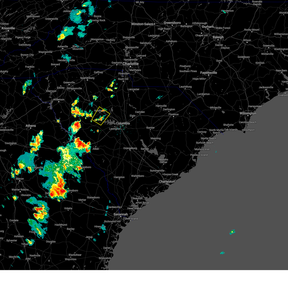 At 433 pm edt, a severe thunderstorm was located 8 miles southwest of prosperity, or 9 miles south of newberry, moving northeast at 10 mph (radar indicated). Hazards include 60 mph wind gusts and nickel size hail. expect damage to trees and powerlines At 433 pm edt, a severe thunderstorm was located 8 miles southwest of prosperity, or 9 miles south of newberry, moving northeast at 10 mph (radar indicated). Hazards include 60 mph wind gusts and nickel size hail. expect damage to trees and powerlines
|
| 8/15/2023 4:03 PM EDT |
 At 403 pm edt, a severe thunderstorm was located near prosperity, or 8 miles south of newberry, moving east at 35 mph (radar indicated). Hazards include 60 mph wind gusts. Expect damage to trees and powerlines. locations impacted include, newberry, prosperity, silverstreet, stoney hill, scurry airport, hickory grove, wyses ferry, and hollywood elementary school. hail threat, radar indicated max hail size, <. 75 in wind threat, radar indicated max wind gust, 60 mph. At 403 pm edt, a severe thunderstorm was located near prosperity, or 8 miles south of newberry, moving east at 35 mph (radar indicated). Hazards include 60 mph wind gusts. Expect damage to trees and powerlines. locations impacted include, newberry, prosperity, silverstreet, stoney hill, scurry airport, hickory grove, wyses ferry, and hollywood elementary school. hail threat, radar indicated max hail size, <. 75 in wind threat, radar indicated max wind gust, 60 mph.
|
| 8/15/2023 4:00 PM EDT |
 At 400 pm edt, severe thunderstorms were located along a line extending from near prosperity to 7 miles west of dreher island state park to near batesburg-leesville, moving northeast at 40 mph (radar indicated). Hazards include 60 mph wind gusts. expect damage to trees and powerlines At 400 pm edt, severe thunderstorms were located along a line extending from near prosperity to 7 miles west of dreher island state park to near batesburg-leesville, moving northeast at 40 mph (radar indicated). Hazards include 60 mph wind gusts. expect damage to trees and powerlines
|
| 8/15/2023 3:54 PM EDT |
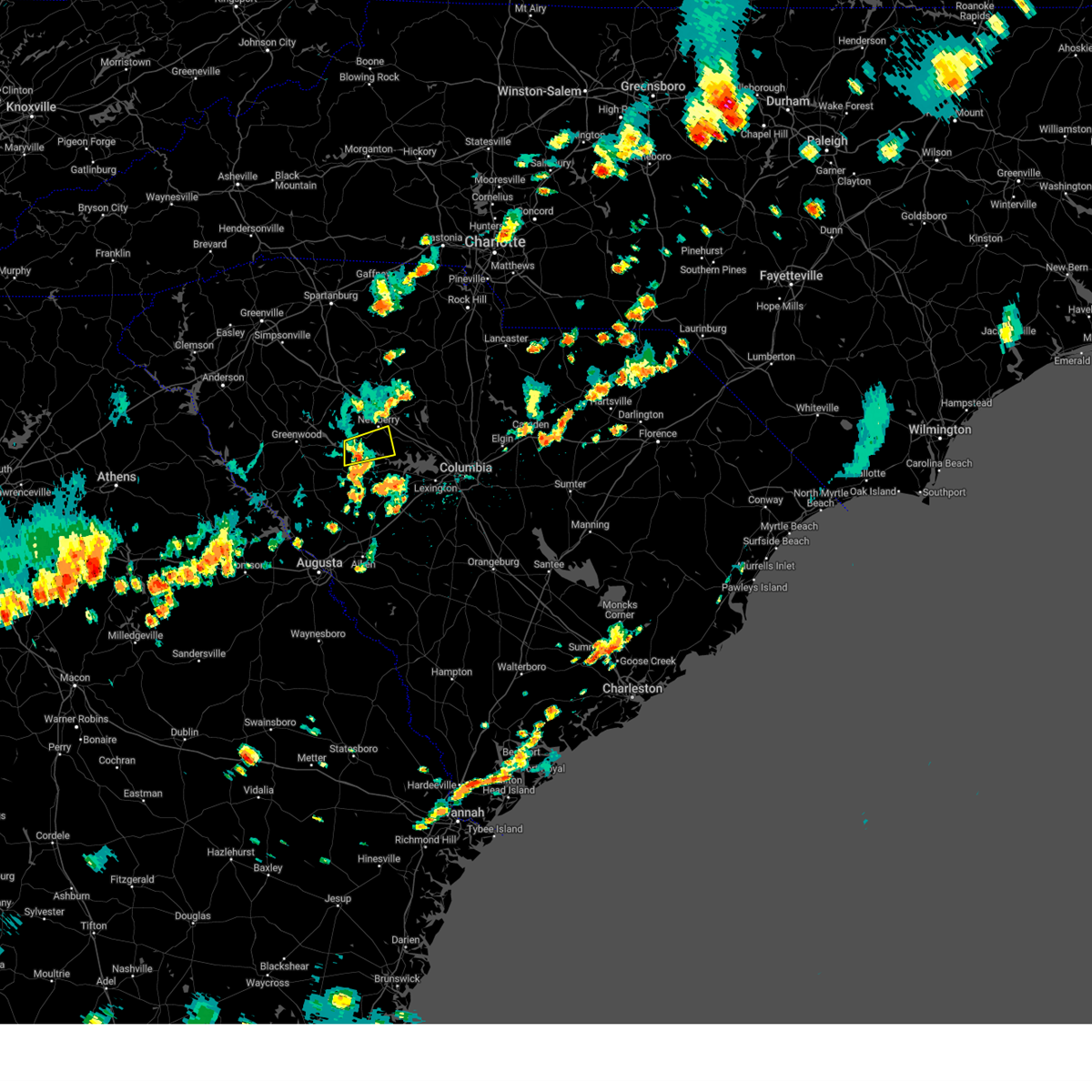 At 354 pm edt, a severe thunderstorm was located 9 miles north of saluda, or 12 miles southwest of newberry, moving east at 35 mph (radar indicated). Hazards include 60 mph wind gusts. Expect damage to trees and powerlines. locations impacted include, newberry, prosperity, silverstreet, stoney hill, scurry airport, hickory grove, and wyses ferry. hail threat, radar indicated max hail size, <. 75 in wind threat, radar indicated max wind gust, 60 mph. At 354 pm edt, a severe thunderstorm was located 9 miles north of saluda, or 12 miles southwest of newberry, moving east at 35 mph (radar indicated). Hazards include 60 mph wind gusts. Expect damage to trees and powerlines. locations impacted include, newberry, prosperity, silverstreet, stoney hill, scurry airport, hickory grove, and wyses ferry. hail threat, radar indicated max hail size, <. 75 in wind threat, radar indicated max wind gust, 60 mph.
|
| 8/15/2023 3:39 PM EDT |
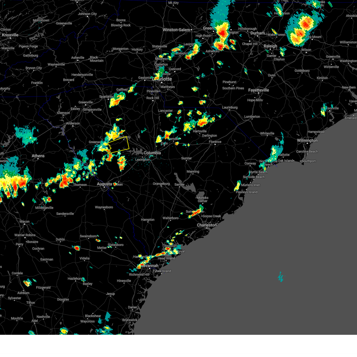 At 338 pm edt, a severe thunderstorm was located 7 miles southeast of lake greenwood state park, or 16 miles east of greenwood, moving east at 35 mph (radar indicated). Hazards include 60 mph wind gusts. expect damage to trees and powerlines At 338 pm edt, a severe thunderstorm was located 7 miles southeast of lake greenwood state park, or 16 miles east of greenwood, moving east at 35 mph (radar indicated). Hazards include 60 mph wind gusts. expect damage to trees and powerlines
|
| 8/7/2023 6:29 PM EDT |
 At 628 pm edt, severe thunderstorms were located along a line extending from monticello to near saluda, moving southeast at 45 mph (law enforcement. multiple trees down across newberry county including trees down on i-26). Hazards include 70 mph wind gusts and nickel size hail. Expect considerable tree damage. damage is likely to mobile homes, roofs, and outbuildings. locations impacted include, newberry, batesburg- leesville, vc summer nuclear station, saluda, prosperity, ridge spring, jenkinsville, saluda county airport, monticello, dreher island state park, blair, little mountain, monetta, pomaria, silverstreet, ward, peak, lebanon fire station, saluda co sheriff`s office, and us-176 and sc-34 crossroads. this includes the following highways, interstate 26 between mile markers 75 and 89. interstate 77 near mile marker 51. thunderstorm damage threat, considerable hail threat, radar indicated max hail size, 0. 88 in wind threat, observed max wind gust, 70 mph. At 628 pm edt, severe thunderstorms were located along a line extending from monticello to near saluda, moving southeast at 45 mph (law enforcement. multiple trees down across newberry county including trees down on i-26). Hazards include 70 mph wind gusts and nickel size hail. Expect considerable tree damage. damage is likely to mobile homes, roofs, and outbuildings. locations impacted include, newberry, batesburg- leesville, vc summer nuclear station, saluda, prosperity, ridge spring, jenkinsville, saluda county airport, monticello, dreher island state park, blair, little mountain, monetta, pomaria, silverstreet, ward, peak, lebanon fire station, saluda co sheriff`s office, and us-176 and sc-34 crossroads. this includes the following highways, interstate 26 between mile markers 75 and 89. interstate 77 near mile marker 51. thunderstorm damage threat, considerable hail threat, radar indicated max hail size, 0. 88 in wind threat, observed max wind gust, 70 mph.
|
| 8/7/2023 6:26 PM EDT | Tree on power line on clear lake roa in saluda county SC, 8.7 miles NNE of Prosperity, SC |
| 8/7/2023 6:05 PM EDT | Newberry county dispatch reports trees down on macedonia church rd near prosperity. time estimated from rada in newberry county SC, 1 miles NW of Prosperity, SC |
| 8/7/2023 5:59 PM EDT |
 At 559 pm edt, severe thunderstorms were located along a line extending from near whitmire to near ninety six historic site, moving southeast at 45 mph (radar indicated). Hazards include 70 mph wind gusts and nickel size hail. Expect considerable tree damage. Damage is likely to mobile homes, roofs, and outbuildings. At 559 pm edt, severe thunderstorms were located along a line extending from near whitmire to near ninety six historic site, moving southeast at 45 mph (radar indicated). Hazards include 70 mph wind gusts and nickel size hail. Expect considerable tree damage. Damage is likely to mobile homes, roofs, and outbuildings.
|
| 8/7/2023 5:39 PM EDT |
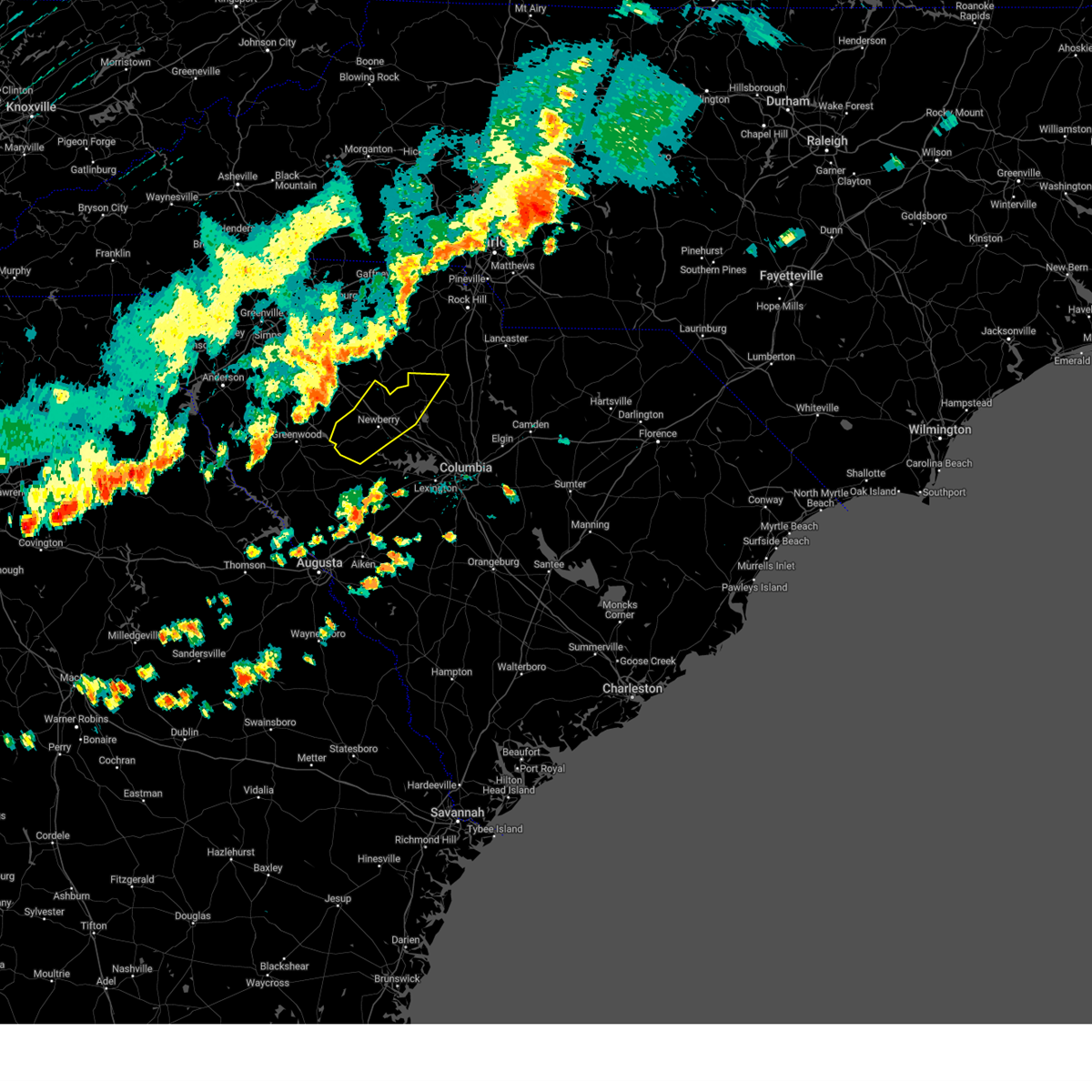 At 539 pm edt, severe thunderstorms were located along a line extending from near gray court to 6 miles northwest of waterloo to near shoals junction, moving east at 50 mph (radar indicated). Hazards include 70 mph wind gusts and quarter size hail. Hail damage to vehicles is expected. expect considerable tree damage. Wind damage is also likely to mobile homes, roofs, and outbuildings. At 539 pm edt, severe thunderstorms were located along a line extending from near gray court to 6 miles northwest of waterloo to near shoals junction, moving east at 50 mph (radar indicated). Hazards include 70 mph wind gusts and quarter size hail. Hail damage to vehicles is expected. expect considerable tree damage. Wind damage is also likely to mobile homes, roofs, and outbuildings.
|
| 7/8/2023 7:36 PM EDT | Newberry county sheriffs office reported a tree falling on a residence at this location causing significant damage. time estimated by rada in newberry county SC, 9.7 miles NW of Prosperity, SC |
| 7/8/2023 7:35 PM EDT | Newberry county sheriffs office reported a tree in the roadway near 717 state park rd. which was quickly cleaned up. time estimated by rada in newberry county SC, 8.8 miles NW of Prosperity, SC |
| 1/12/2023 7:14 PM EST |
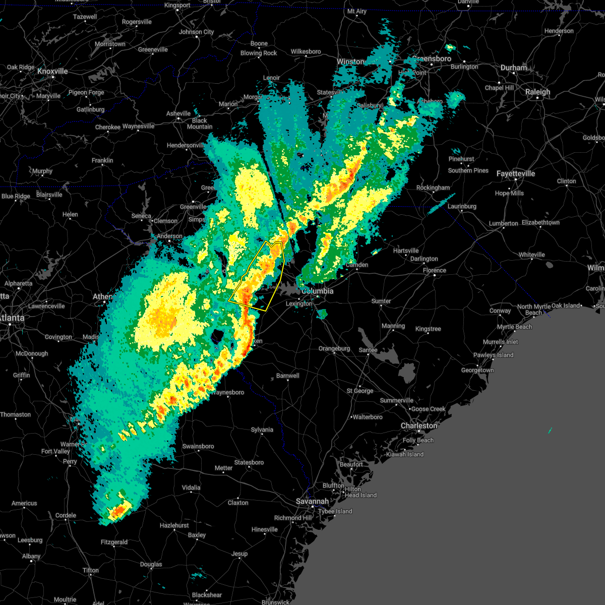 At 714 pm est, severe thunderstorms were located along a line extending from near newberry to saluda county airport, moving east at 35 mph (radar indicated). Hazards include 60 mph wind gusts. Expect damage to trees and powerlines. locations impacted include, newberry, saluda, prosperity, saluda county airport, newberry college, newberry county airport, pomaria, silverstreet, saluda co sheriff`s office, us-176 and sc- 34 crossroads, good hope, hollywood elementary school, emory, delmar, enoree ranger district office, stoney hill, newberry county detention center, fairview fire station, mid- carolina high school and wyses ferry. this includes interstate 26 between mile markers 66 and 84. hail threat, radar indicated max hail size, <. 75 in wind threat, radar indicated max wind gust, 60 mph. At 714 pm est, severe thunderstorms were located along a line extending from near newberry to saluda county airport, moving east at 35 mph (radar indicated). Hazards include 60 mph wind gusts. Expect damage to trees and powerlines. locations impacted include, newberry, saluda, prosperity, saluda county airport, newberry college, newberry county airport, pomaria, silverstreet, saluda co sheriff`s office, us-176 and sc- 34 crossroads, good hope, hollywood elementary school, emory, delmar, enoree ranger district office, stoney hill, newberry county detention center, fairview fire station, mid- carolina high school and wyses ferry. this includes interstate 26 between mile markers 66 and 84. hail threat, radar indicated max hail size, <. 75 in wind threat, radar indicated max wind gust, 60 mph.
|
| 1/12/2023 6:45 PM EST |
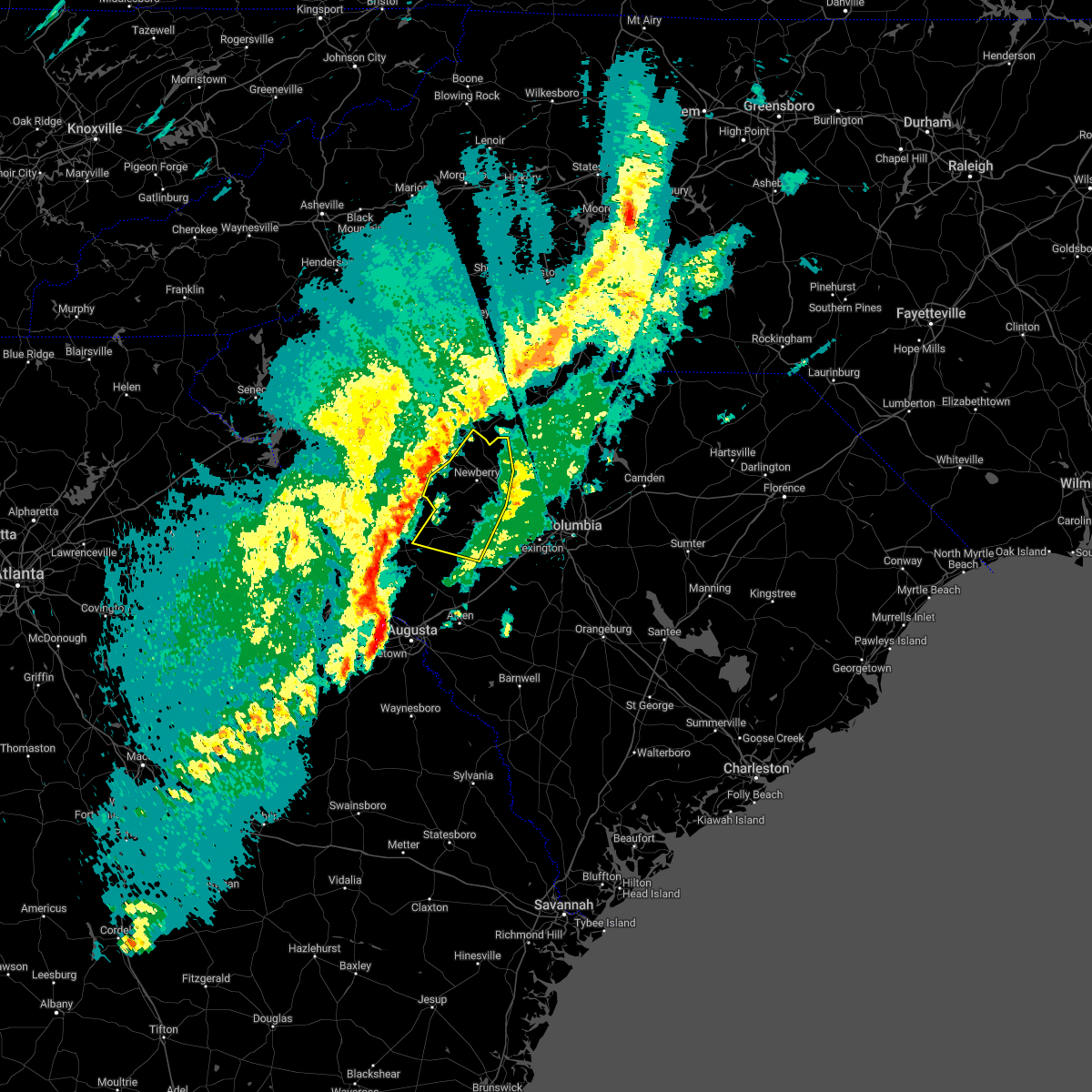 At 644 pm est, severe thunderstorms were located along a line extending from near joanna to 10 miles south of ninety six historic site, moving east at 35 mph (radar indicated). Hazards include 70 mph wind gusts. Expect considerable tree damage. Damage is likely to mobile homes, roofs, and outbuildings. At 644 pm est, severe thunderstorms were located along a line extending from near joanna to 10 miles south of ninety six historic site, moving east at 35 mph (radar indicated). Hazards include 70 mph wind gusts. Expect considerable tree damage. Damage is likely to mobile homes, roofs, and outbuildings.
|
| 8/3/2022 2:13 PM EDT |
 At 213 pm edt, a severe thunderstorm was located near newberry, moving northwest at 10 mph (radar indicated). Hazards include 60 mph wind gusts and penny size hail. expect damage to trees and powerlines At 213 pm edt, a severe thunderstorm was located near newberry, moving northwest at 10 mph (radar indicated). Hazards include 60 mph wind gusts and penny size hail. expect damage to trees and powerlines
|
| 6/17/2022 6:44 PM EDT |
 At 644 pm edt, a severe thunderstorm was located near dreher island state park, or 11 miles southwest of vc summer nuclear station, moving southeast at 15 mph (radar indicated). Hazards include 60 mph wind gusts and penny size hail. expect damage to trees and powerlines At 644 pm edt, a severe thunderstorm was located near dreher island state park, or 11 miles southwest of vc summer nuclear station, moving southeast at 15 mph (radar indicated). Hazards include 60 mph wind gusts and penny size hail. expect damage to trees and powerlines
|
| 6/17/2022 6:12 PM EDT |
 At 612 pm edt, a severe thunderstorm was located near vc summer nuclear station, moving southeast at 30 mph (radar indicated). Hazards include 70 mph wind gusts and quarter size hail. Hail damage to vehicles is expected. expect considerable tree damage. wind damage is also likely to mobile homes, roofs, and outbuildings. locations impacted include, columbia, lexington, west columbia, irmo, newberry, highway 6 at lake murray dam, st. andrews, red bank, oak grove, prosperity, dreher island state park, chapin, little mountain, pomaria, peak, oswald park, us-176 and sc- 34 crossroads, bundrick island, putnam`s landing and white rock. this includes the following highways, interstate 126 near mile marker 0. interstate 20 in south carolina between mile markers 53 and 64. interstate 26 between mile markers 72 and 96, and between mile markers 102 and 108. thunderstorm damage threat, considerable hail threat, radar indicated max hail size, 1. 00 in wind threat, radar indicated max wind gust, 70 mph. At 612 pm edt, a severe thunderstorm was located near vc summer nuclear station, moving southeast at 30 mph (radar indicated). Hazards include 70 mph wind gusts and quarter size hail. Hail damage to vehicles is expected. expect considerable tree damage. wind damage is also likely to mobile homes, roofs, and outbuildings. locations impacted include, columbia, lexington, west columbia, irmo, newberry, highway 6 at lake murray dam, st. andrews, red bank, oak grove, prosperity, dreher island state park, chapin, little mountain, pomaria, peak, oswald park, us-176 and sc- 34 crossroads, bundrick island, putnam`s landing and white rock. this includes the following highways, interstate 126 near mile marker 0. interstate 20 in south carolina between mile markers 53 and 64. interstate 26 between mile markers 72 and 96, and between mile markers 102 and 108. thunderstorm damage threat, considerable hail threat, radar indicated max hail size, 1. 00 in wind threat, radar indicated max wind gust, 70 mph.
|
| 6/17/2022 6:07 PM EDT |
 At 607 pm edt, a severe thunderstorm was located near vc summer nuclear station, moving southeast at 30 mph (radar indicated). Hazards include 60 mph wind gusts and penny size hail. expect damage to trees and powerlines At 607 pm edt, a severe thunderstorm was located near vc summer nuclear station, moving southeast at 30 mph (radar indicated). Hazards include 60 mph wind gusts and penny size hail. expect damage to trees and powerlines
|
| 6/16/2022 5:03 PM EDT |
 At 502 pm edt, a severe thunderstorm was located over newberry, moving southeast at 15 mph (radar indicated). Hazards include 60 mph wind gusts and quarter size hail. Hail damage to vehicles is expected. Expect wind damage to trees and powerlines. At 502 pm edt, a severe thunderstorm was located over newberry, moving southeast at 15 mph (radar indicated). Hazards include 60 mph wind gusts and quarter size hail. Hail damage to vehicles is expected. Expect wind damage to trees and powerlines.
|
| 5/23/2022 5:47 PM EDT | Highway patrol reported a tree down in the roadway and blocked at hwy. 176 and new hope road near pomari in newberry county SC, 7 miles SW of Prosperity, SC |
| 5/23/2022 11:48 AM EDT | Highway patrol reported a tree down near the intersection of macedonia church road and stockman roa in newberry county SC, 6.1 miles NW of Prosperity, SC |
| 5/6/2022 5:59 PM EDT |
 At 559 pm edt, severe thunderstorms were located along a line extending from 6 miles northeast of prosperity to near longtown, moving northeast at 45 mph (radar indicated). Hazards include 70 mph wind gusts and half dollar size hail. Hail damage to vehicles is expected. expect considerable tree damage. Wind damage is also likely to mobile homes, roofs, and outbuildings. At 559 pm edt, severe thunderstorms were located along a line extending from 6 miles northeast of prosperity to near longtown, moving northeast at 45 mph (radar indicated). Hazards include 70 mph wind gusts and half dollar size hail. Hail damage to vehicles is expected. expect considerable tree damage. Wind damage is also likely to mobile homes, roofs, and outbuildings.
|
| 5/6/2022 5:51 PM EDT |
 At 549 pm edt, severe thunderstorms were located along a line extending from near prosperity to near oak grove, moving northeast at 50 mph (radar indicated). Hazards include 70 mph wind gusts and half dollar size hail. Hail damage to vehicles is expected. expect considerable tree damage. wind damage is also likely to mobile homes, roofs, and outbuildings. locations impacted include, columbia, lexington, west columbia, cayce, irmo, newberry, springdale, st. andrews, vc summer nuclear station, oak grove, highway 6 at lake murray dam, red bank, dentsville, south congaree, pine ridge, prosperity, columbia international university, jenkinsville, harbison state forest and west columbia riverwalk. this includes the following highways, interstate 126 between mile markers 0 and 3. interstate 20 in south carolina between mile markers 48 and 72. interstate 26 between mile markers 71 and 114. interstate 77 between mile markers 20 and 22. thunderstorm damage threat, considerable hail threat, radar indicated max hail size, 1. 25 in wind threat, radar indicated max wind gust, 70 mph. At 549 pm edt, severe thunderstorms were located along a line extending from near prosperity to near oak grove, moving northeast at 50 mph (radar indicated). Hazards include 70 mph wind gusts and half dollar size hail. Hail damage to vehicles is expected. expect considerable tree damage. wind damage is also likely to mobile homes, roofs, and outbuildings. locations impacted include, columbia, lexington, west columbia, cayce, irmo, newberry, springdale, st. andrews, vc summer nuclear station, oak grove, highway 6 at lake murray dam, red bank, dentsville, south congaree, pine ridge, prosperity, columbia international university, jenkinsville, harbison state forest and west columbia riverwalk. this includes the following highways, interstate 126 between mile markers 0 and 3. interstate 20 in south carolina between mile markers 48 and 72. interstate 26 between mile markers 71 and 114. interstate 77 between mile markers 20 and 22. thunderstorm damage threat, considerable hail threat, radar indicated max hail size, 1. 25 in wind threat, radar indicated max wind gust, 70 mph.
|
| 5/6/2022 5:49 PM EDT | Hen Egg sized hail reported 2.5 miles NNE of Prosperity, SC, public reported 2 inch diameter hail and small limbs down near prosperity... sc. |
| 5/6/2022 5:45 PM EDT | Highway patrol reported a tree blocking the roadway. time estimated from rada in newberry county SC, 1.8 miles WSW of Prosperity, SC |
| 5/6/2022 5:37 PM EDT |
 At 536 pm edt, severe thunderstorms were located along a line extending from 8 miles southwest of prosperity to red bank, moving northeast at 50 mph (radar indicated). Hazards include 70 mph wind gusts and half dollar size hail. Hail damage to vehicles is expected. expect considerable tree damage. Wind damage is also likely to mobile homes, roofs, and outbuildings. At 536 pm edt, severe thunderstorms were located along a line extending from 8 miles southwest of prosperity to red bank, moving northeast at 50 mph (radar indicated). Hazards include 70 mph wind gusts and half dollar size hail. Hail damage to vehicles is expected. expect considerable tree damage. Wind damage is also likely to mobile homes, roofs, and outbuildings.
|
| 5/6/2022 5:35 PM EDT | Highway patrol reported a tree in the roadway. time estimated from rada in newberry county SC, 7.8 miles N of Prosperity, SC |
| 5/3/2022 4:03 PM EDT | Newberry dispatch reported a tree down on a powerline on eureka s in newberry county SC, 1 miles NNE of Prosperity, SC |
| 5/3/2022 3:58 PM EDT |
 At 358 pm edt, severe thunderstorms were located along a line extending from near newberry to 6 miles east of saluda county airport, moving east at 20 mph (radar indicated). Hazards include 60 mph wind gusts and quarter size hail. Hail damage to vehicles is expected. expect wind damage to trees and powerlines. locations impacted include, newberry, batesburg-leesville, prosperity, pomaria, stoney hill, saluda co sheriff`s office, mid-carolina high school, wyses ferry, hollywood elementary school, emory, circle fire station, delmar, riverbend boat ramp and saluda high school. this includes interstate 26 between mile markers 77 and 83. hail threat, radar indicated max hail size, 1. 00 in wind threat, radar indicated max wind gust, 60 mph. At 358 pm edt, severe thunderstorms were located along a line extending from near newberry to 6 miles east of saluda county airport, moving east at 20 mph (radar indicated). Hazards include 60 mph wind gusts and quarter size hail. Hail damage to vehicles is expected. expect wind damage to trees and powerlines. locations impacted include, newberry, batesburg-leesville, prosperity, pomaria, stoney hill, saluda co sheriff`s office, mid-carolina high school, wyses ferry, hollywood elementary school, emory, circle fire station, delmar, riverbend boat ramp and saluda high school. this includes interstate 26 between mile markers 77 and 83. hail threat, radar indicated max hail size, 1. 00 in wind threat, radar indicated max wind gust, 60 mph.
|
| 5/3/2022 3:57 PM EDT | Public reported a chicken coop was blown over on minick l in newberry county SC, 4.5 miles NE of Prosperity, SC |
| 5/3/2022 3:41 PM EDT |
 At 340 pm edt, severe thunderstorms were located along a line extending from newberry college to near saluda county airport, moving east at 20 mph (radar indicated). Hazards include 60 mph wind gusts and quarter size hail. Hail damage to vehicles is expected. Expect wind damage to trees and powerlines. At 340 pm edt, severe thunderstorms were located along a line extending from newberry college to near saluda county airport, moving east at 20 mph (radar indicated). Hazards include 60 mph wind gusts and quarter size hail. Hail damage to vehicles is expected. Expect wind damage to trees and powerlines.
|
| 5/4/2021 4:27 PM EDT |
 At 427 pm edt, severe thunderstorms were located along a line extending from 7 miles southeast of blackstock to 8 miles southwest of newberry college, moving east at 35 mph (radar indicated). Hazards include 60 mph wind gusts and penny size hail. Expect damage to roofs, siding, and trees. locations impacted include, newberry, vc summer nuclear station, saluda, prosperity, newberry college, blackstock, monticello, newberry county airport, blair, pomaria, silverstreet, lebanon fire station, us-176 and sc- 34 crossroads, good hope, henderson island, belfast wildlife management area, mitford, hollywood elementary school, chappells fire station and white oak. this includes the following highways, interstate 26 between mile markers 65 and 84. Interstate 77 between mile markers 47 and 50. At 427 pm edt, severe thunderstorms were located along a line extending from 7 miles southeast of blackstock to 8 miles southwest of newberry college, moving east at 35 mph (radar indicated). Hazards include 60 mph wind gusts and penny size hail. Expect damage to roofs, siding, and trees. locations impacted include, newberry, vc summer nuclear station, saluda, prosperity, newberry college, blackstock, monticello, newberry county airport, blair, pomaria, silverstreet, lebanon fire station, us-176 and sc- 34 crossroads, good hope, henderson island, belfast wildlife management area, mitford, hollywood elementary school, chappells fire station and white oak. this includes the following highways, interstate 26 between mile markers 65 and 84. Interstate 77 between mile markers 47 and 50.
|
| 5/4/2021 4:03 PM EDT |
 At 403 pm edt, a severe thunderstorm was located near dreher island state park, or 11 miles southwest of vc summer nuclear station, moving northeast at 45 mph (radar indicated). Hazards include 60 mph wind gusts and quarter size hail. Hail damage to vehicles is expected. expect wind damage to roofs, siding, and trees. locations impacted include, irmo, batesburg-leesville, prosperity, dreher island state park, ballentine, chapin, little mountain, pomaria, peak, cedar grove fire station, south shore marina, oswald park, bundrick island, putnam`s landing, white rock, rocky point recreation area, hollywood elementary school, delmar, hollow creek public park and melvin park. This includes interstate 26 between mile markers 80 and 101. At 403 pm edt, a severe thunderstorm was located near dreher island state park, or 11 miles southwest of vc summer nuclear station, moving northeast at 45 mph (radar indicated). Hazards include 60 mph wind gusts and quarter size hail. Hail damage to vehicles is expected. expect wind damage to roofs, siding, and trees. locations impacted include, irmo, batesburg-leesville, prosperity, dreher island state park, ballentine, chapin, little mountain, pomaria, peak, cedar grove fire station, south shore marina, oswald park, bundrick island, putnam`s landing, white rock, rocky point recreation area, hollywood elementary school, delmar, hollow creek public park and melvin park. This includes interstate 26 between mile markers 80 and 101.
|
| 5/4/2021 4:00 PM EDT |
 At 359 pm edt, severe thunderstorms were located along a line extending from 6 miles north of blair to near lake greenwood state park, moving northeast at 30 mph (radar indicated). Hazards include 60 mph wind gusts and quarter size hail. Hail damage to vehicles is expected. Expect wind damage to roofs, siding, and trees. At 359 pm edt, severe thunderstorms were located along a line extending from 6 miles north of blair to near lake greenwood state park, moving northeast at 30 mph (radar indicated). Hazards include 60 mph wind gusts and quarter size hail. Hail damage to vehicles is expected. Expect wind damage to roofs, siding, and trees.
|
| 5/4/2021 3:45 PM EDT |
 At 345 pm edt, a severe thunderstorm was located near saluda, or 9 miles northwest of batesburg-leesville, moving northeast at 35 mph (radar indicated). Hazards include 60 mph wind gusts and quarter size hail. Hail damage to vehicles is expected. Expect wind damage to roofs, siding, and trees. At 345 pm edt, a severe thunderstorm was located near saluda, or 9 miles northwest of batesburg-leesville, moving northeast at 35 mph (radar indicated). Hazards include 60 mph wind gusts and quarter size hail. Hail damage to vehicles is expected. Expect wind damage to roofs, siding, and trees.
|
| 5/3/2021 4:11 PM EDT |
 The severe thunderstorm warning for central newberry county will expire at 415 pm edt, the storm which prompted the warning has weakened below severe limits, and has exited the warned area. therefore, the warning will be allowed to expire. a tornado watch remains in effect until 700 pm edt for central south carolina. The severe thunderstorm warning for central newberry county will expire at 415 pm edt, the storm which prompted the warning has weakened below severe limits, and has exited the warned area. therefore, the warning will be allowed to expire. a tornado watch remains in effect until 700 pm edt for central south carolina.
|
| 5/3/2021 4:05 PM EDT |
 At 404 pm edt, a severe thunderstorm was located 8 miles north of batesburg-leesville, moving east at 45 mph (radar indicated). Hazards include ping pong ball size hail and 60 mph wind gusts. People and animals outdoors will be injured. expect hail damage to roofs, siding, windows, and vehicles. Expect wind damage to roofs, siding, and trees. At 404 pm edt, a severe thunderstorm was located 8 miles north of batesburg-leesville, moving east at 45 mph (radar indicated). Hazards include ping pong ball size hail and 60 mph wind gusts. People and animals outdoors will be injured. expect hail damage to roofs, siding, windows, and vehicles. Expect wind damage to roofs, siding, and trees.
|
| 5/3/2021 3:32 PM EDT |
 At 332 pm edt, a severe thunderstorm was located near newberry college, or near newberry, moving east at 50 mph (radar indicated). Hazards include 70 mph wind gusts and ping pong ball size hail. People and animals outdoors will be injured. expect hail damage to roofs, siding, windows, and vehicles. expect considerable tree damage. Wind damage is also likely to mobile homes, roofs, and outbuildings. At 332 pm edt, a severe thunderstorm was located near newberry college, or near newberry, moving east at 50 mph (radar indicated). Hazards include 70 mph wind gusts and ping pong ball size hail. People and animals outdoors will be injured. expect hail damage to roofs, siding, windows, and vehicles. expect considerable tree damage. Wind damage is also likely to mobile homes, roofs, and outbuildings.
|
| 5/3/2021 3:24 PM EDT |
 At 323 pm edt, a severe thunderstorm was located 7 miles southeast of abbeville, moving east at 35 mph (radar indicated). Hazards include 60 mph wind gusts and half dollar size hail. Hail damage to vehicles is expected. Expect wind damage to roofs, siding, and trees. At 323 pm edt, a severe thunderstorm was located 7 miles southeast of abbeville, moving east at 35 mph (radar indicated). Hazards include 60 mph wind gusts and half dollar size hail. Hail damage to vehicles is expected. Expect wind damage to roofs, siding, and trees.
|
| 7/25/2020 5:43 PM EDT |
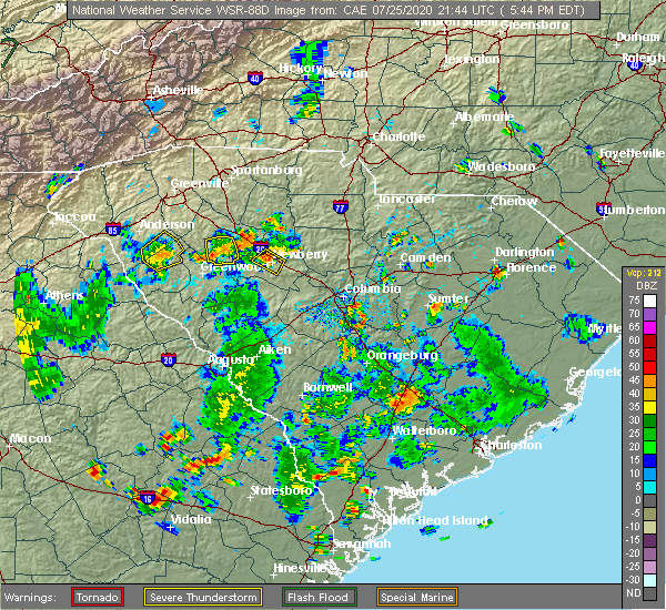 At 543 pm edt, a severe thunderstorm was located over newberry county airport, or over newberry, moving southwest at 10 mph (radar indicated). Hazards include 60 mph wind gusts and quarter size hail. Hail damage to vehicles is expected. expect wind damage to roofs, siding, and trees. locations impacted include, newberry, prosperity, newberry college, newberry county airport, newberry county detention center and bush river fire station. This includes interstate 26 between mile markers 67 and 78. At 543 pm edt, a severe thunderstorm was located over newberry county airport, or over newberry, moving southwest at 10 mph (radar indicated). Hazards include 60 mph wind gusts and quarter size hail. Hail damage to vehicles is expected. expect wind damage to roofs, siding, and trees. locations impacted include, newberry, prosperity, newberry college, newberry county airport, newberry county detention center and bush river fire station. This includes interstate 26 between mile markers 67 and 78.
|
| 7/25/2020 5:11 PM EDT |
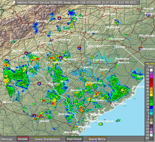 At 510 pm edt, a severe thunderstorm was located near newberry county airport, or near newberry, moving southwest at 5 mph (radar indicated). Hazards include 60 mph wind gusts and quarter size hail. Hail damage to vehicles is expected. Expect wind damage to roofs, siding, and trees. At 510 pm edt, a severe thunderstorm was located near newberry county airport, or near newberry, moving southwest at 5 mph (radar indicated). Hazards include 60 mph wind gusts and quarter size hail. Hail damage to vehicles is expected. Expect wind damage to roofs, siding, and trees.
|
| 6/29/2020 9:08 PM EDT |
 At 908 pm edt, severe thunderstorms were located along a line extending from newberry to 7 miles west of saluda, moving southeast at 25 mph (radar indicated). Hazards include 60 mph wind gusts. Expect damage to roofs, siding, and trees. locations impacted include, newberry, saluda, prosperity, newberry county airport, saluda county airport, newberry college, little mountain, pomaria, silverstreet, stoney hill, newberry county detention center, saluda co sheriff`s office, good hope, fairview fire station, mid-carolina high school, wyses ferry, hollywood elementary school, emory, scurry airport and circle fire station. This includes interstate 26 between mile markers 69 and 89. At 908 pm edt, severe thunderstorms were located along a line extending from newberry to 7 miles west of saluda, moving southeast at 25 mph (radar indicated). Hazards include 60 mph wind gusts. Expect damage to roofs, siding, and trees. locations impacted include, newberry, saluda, prosperity, newberry county airport, saluda county airport, newberry college, little mountain, pomaria, silverstreet, stoney hill, newberry county detention center, saluda co sheriff`s office, good hope, fairview fire station, mid-carolina high school, wyses ferry, hollywood elementary school, emory, scurry airport and circle fire station. This includes interstate 26 between mile markers 69 and 89.
|
| 6/29/2020 8:41 PM EDT |
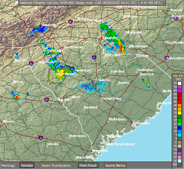 At 840 pm edt, severe thunderstorms were located along a line extending from near joanna to near greenwood, moving southeast at 20 mph (radar indicated). Hazards include 60 mph wind gusts. expect damage to roofs, siding, and trees At 840 pm edt, severe thunderstorms were located along a line extending from near joanna to near greenwood, moving southeast at 20 mph (radar indicated). Hazards include 60 mph wind gusts. expect damage to roofs, siding, and trees
|
| 6/28/2020 7:22 PM EDT |
 At 720 pm edt, a severe thunderstorm was located near prosperity, or 8 miles southeast of newberry, moving southeast at 40 mph (radar indicated). Hazards include 60 mph wind gusts and penny size hail. expect damage to roofs, siding, and trees At 720 pm edt, a severe thunderstorm was located near prosperity, or 8 miles southeast of newberry, moving southeast at 40 mph (radar indicated). Hazards include 60 mph wind gusts and penny size hail. expect damage to roofs, siding, and trees
|
| 6/27/2020 7:21 PM EDT |
 At 721 pm edt, severe thunderstorms were located along a line extending from prosperity to near batesburg-leesville, moving east at 30 mph (radar indicated). Hazards include 60 mph wind gusts. expect damage to roofs, siding, and trees At 721 pm edt, severe thunderstorms were located along a line extending from prosperity to near batesburg-leesville, moving east at 30 mph (radar indicated). Hazards include 60 mph wind gusts. expect damage to roofs, siding, and trees
|
| 6/5/2020 3:48 PM EDT | Highway patrol reported roadway blocked by a tree along berley boland road near highway 7 in newberry county SC, 4.1 miles W of Prosperity, SC |
| 6/5/2020 3:36 PM EDT |
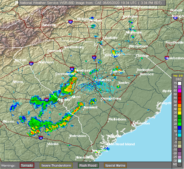 At 335 pm edt, a severe thunderstorm was located near prosperity, or 9 miles southeast of newberry, moving east at 30 mph (radar indicated). Hazards include 60 mph wind gusts and penny size hail. expect damage to roofs, siding, and trees At 335 pm edt, a severe thunderstorm was located near prosperity, or 9 miles southeast of newberry, moving east at 30 mph (radar indicated). Hazards include 60 mph wind gusts and penny size hail. expect damage to roofs, siding, and trees
|
| 5/22/2020 5:11 PM EDT |
 At 511 pm edt, severe thunderstorms were located along a line extending from near monticello to near dreher island state park to saluda county airport, moving east at 35 mph (radar indicated). Hazards include 60 mph wind gusts and quarter size hail. Hail damage to vehicles is expected. expect wind damage to roofs, siding, and trees. locations impacted include, columbia, lexington, irmo, winnsboro, vc summer nuclear station, highway 6 at lake murray dam, st. andrews, saluda, prosperity, jenkinsville, harbison state forest, dreher island state park, fairfield county airport, longtown, ballentine, blythewood, chapin, ridgeway, little mountain and pomaria. this includes the following highways, interstate 26 between mile markers 81 and 104. Interstate 77 between mile markers 25 and 37. At 511 pm edt, severe thunderstorms were located along a line extending from near monticello to near dreher island state park to saluda county airport, moving east at 35 mph (radar indicated). Hazards include 60 mph wind gusts and quarter size hail. Hail damage to vehicles is expected. expect wind damage to roofs, siding, and trees. locations impacted include, columbia, lexington, irmo, winnsboro, vc summer nuclear station, highway 6 at lake murray dam, st. andrews, saluda, prosperity, jenkinsville, harbison state forest, dreher island state park, fairfield county airport, longtown, ballentine, blythewood, chapin, ridgeway, little mountain and pomaria. this includes the following highways, interstate 26 between mile markers 81 and 104. Interstate 77 between mile markers 25 and 37.
|
| 5/22/2020 5:05 PM EDT | Trees down at big creek rd and morris rd. time estimate in newberry county SC, 4.4 miles NNE of Prosperity, SC |
| 5/22/2020 5:00 PM EDT |
 At 459 pm edt, severe thunderstorms were located along a line extending from 6 miles west of vc summer nuclear station to 8 miles west of saluda county airport, moving east at 40 mph (radar indicated). Hazards include 60 mph wind gusts and quarter size hail. Hail damage to vehicles is expected. expect wind damage to roofs, siding, and trees. locations impacted include, columbia, lexington, irmo, newberry, winnsboro, vc summer nuclear station, highway 6 at lake murray dam, st. andrews, saluda, prosperity, jenkinsville, harbison state forest, dreher island state park, fairfield county airport, longtown, ballentine, blythewood, chapin, ridgeway and little mountain. this includes the following highways, interstate 26 between mile markers 76 and 104. Interstate 77 between mile markers 25 and 38. At 459 pm edt, severe thunderstorms were located along a line extending from 6 miles west of vc summer nuclear station to 8 miles west of saluda county airport, moving east at 40 mph (radar indicated). Hazards include 60 mph wind gusts and quarter size hail. Hail damage to vehicles is expected. expect wind damage to roofs, siding, and trees. locations impacted include, columbia, lexington, irmo, newberry, winnsboro, vc summer nuclear station, highway 6 at lake murray dam, st. andrews, saluda, prosperity, jenkinsville, harbison state forest, dreher island state park, fairfield county airport, longtown, ballentine, blythewood, chapin, ridgeway and little mountain. this includes the following highways, interstate 26 between mile markers 76 and 104. Interstate 77 between mile markers 25 and 38.
|
| 5/22/2020 4:57 PM EDT |
 At 457 pm edt, severe thunderstorms were located along a line extending from 6 miles west of vc summer nuclear station to 8 miles west of saluda county airport, moving east at 40 mph (radar indicated). Hazards include 60 mph wind gusts and quarter size hail. Hail damage to vehicles is expected. expect wind damage to roofs, siding, and trees. locations impacted include, columbia, lexington, irmo, newberry, winnsboro, vc summer nuclear station, highway 6 at lake murray dam, st. andrews, saluda, mccormick, prosperity, jenkinsville, harbison state forest, dreher island state park, fairfield county airport, longtown, ballentine, blythewood, chapin and ridgeway. this includes the following highways, interstate 26 between mile markers 76 and 104. Interstate 77 between mile markers 25 and 38. At 457 pm edt, severe thunderstorms were located along a line extending from 6 miles west of vc summer nuclear station to 8 miles west of saluda county airport, moving east at 40 mph (radar indicated). Hazards include 60 mph wind gusts and quarter size hail. Hail damage to vehicles is expected. expect wind damage to roofs, siding, and trees. locations impacted include, columbia, lexington, irmo, newberry, winnsboro, vc summer nuclear station, highway 6 at lake murray dam, st. andrews, saluda, mccormick, prosperity, jenkinsville, harbison state forest, dreher island state park, fairfield county airport, longtown, ballentine, blythewood, chapin and ridgeway. this includes the following highways, interstate 26 between mile markers 76 and 104. Interstate 77 between mile markers 25 and 38.
|
| 5/22/2020 4:36 PM EDT |
 At 435 pm edt, severe thunderstorms were located along a line extending from newberry county airport to near mccormick county airport, moving east at 40 mph (radar indicated). Hazards include 60 mph wind gusts and quarter size hail. Hail damage to vehicles is expected. Expect wind damage to roofs, siding, and trees. At 435 pm edt, severe thunderstorms were located along a line extending from newberry county airport to near mccormick county airport, moving east at 40 mph (radar indicated). Hazards include 60 mph wind gusts and quarter size hail. Hail damage to vehicles is expected. Expect wind damage to roofs, siding, and trees.
|
| 5/22/2020 3:49 PM EDT |
 At 349 pm edt, severe thunderstorms were located along a line extending from near carlisle to near joanna, moving east at 45 mph (radar indicated). Hazards include 60 mph wind gusts and quarter size hail. Hail damage to vehicles is expected. Expect wind damage to roofs, siding, and trees. At 349 pm edt, severe thunderstorms were located along a line extending from near carlisle to near joanna, moving east at 45 mph (radar indicated). Hazards include 60 mph wind gusts and quarter size hail. Hail damage to vehicles is expected. Expect wind damage to roofs, siding, and trees.
|
| 4/13/2020 4:41 AM EDT |
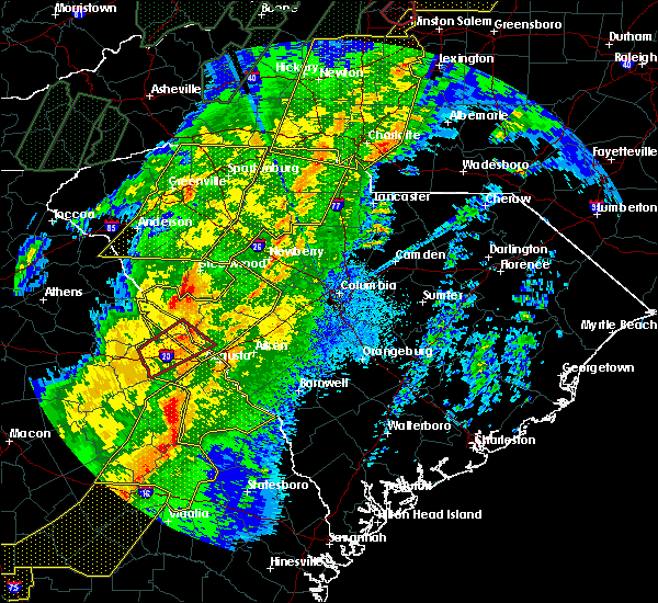 At 440 am edt, severe thunderstorms were located along a line extending from near carlisle to near prosperity, moving northeast at 75 mph (radar indicated). Hazards include 70 mph wind gusts and penny size hail. Expect considerable tree damage. Damage is likely to mobile homes, roofs, and outbuildings. At 440 am edt, severe thunderstorms were located along a line extending from near carlisle to near prosperity, moving northeast at 75 mph (radar indicated). Hazards include 70 mph wind gusts and penny size hail. Expect considerable tree damage. Damage is likely to mobile homes, roofs, and outbuildings.
|
| 3/24/2020 10:56 AM EDT |
 At 1055 am edt, a severe thunderstorm was located near saluda, moving east at 40 mph (radar indicated). Hazards include 60 mph wind gusts and quarter size hail. Hail damage to vehicles is expected. expect wind damage to roofs, siding, and trees. locations impacted include, saluda, prosperity, saluda county airport, dreher island state park, little mountain, pomaria, silverstreet, peak, good hope, emory, delmar, stoney hill, fairview fire station, wyses ferry and chappells. This includes interstate 26 between mile markers 79 and 89. At 1055 am edt, a severe thunderstorm was located near saluda, moving east at 40 mph (radar indicated). Hazards include 60 mph wind gusts and quarter size hail. Hail damage to vehicles is expected. expect wind damage to roofs, siding, and trees. locations impacted include, saluda, prosperity, saluda county airport, dreher island state park, little mountain, pomaria, silverstreet, peak, good hope, emory, delmar, stoney hill, fairview fire station, wyses ferry and chappells. This includes interstate 26 between mile markers 79 and 89.
|
| 3/24/2020 10:50 AM EDT |
 At 1049 am edt, a severe thunderstorm was located 8 miles southeast of ninety six historic site, or 16 miles southeast of greenwood, moving east at 40 mph (radar indicated). Hazards include 60 mph wind gusts and quarter size hail. Hail damage to vehicles is expected. Expect wind damage to roofs, siding, and trees. At 1049 am edt, a severe thunderstorm was located 8 miles southeast of ninety six historic site, or 16 miles southeast of greenwood, moving east at 40 mph (radar indicated). Hazards include 60 mph wind gusts and quarter size hail. Hail damage to vehicles is expected. Expect wind damage to roofs, siding, and trees.
|
| 3/3/2020 2:19 PM EST |
 At 219 pm est, a severe thunderstorm was located near newberry county airport, or 8 miles northwest of newberry, moving east at 35 mph (radar indicated). Hazards include 60 mph wind gusts. expect damage to roofs, siding, and trees At 219 pm est, a severe thunderstorm was located near newberry county airport, or 8 miles northwest of newberry, moving east at 35 mph (radar indicated). Hazards include 60 mph wind gusts. expect damage to roofs, siding, and trees
|
| 2/6/2020 2:11 PM EST |
 At 211 pm est, severe thunderstorms were located along a line extending from near whitmire to 7 miles east of lake greenwood state park, moving east at 30 mph (radar indicated). Hazards include 60 mph wind gusts. expect damage to roofs, siding, and trees At 211 pm est, severe thunderstorms were located along a line extending from near whitmire to 7 miles east of lake greenwood state park, moving east at 30 mph (radar indicated). Hazards include 60 mph wind gusts. expect damage to roofs, siding, and trees
|
| 1/11/2020 9:12 PM EST |
 At 911 pm est, likely severe thunderstorms were located along a line extending from 6 miles northeast of joanna to near saluda, moving northeast at 50 mph (radar indicated). Hazards include 60 mph wind gusts. expect damage to roofs, siding, and trees At 911 pm est, likely severe thunderstorms were located along a line extending from 6 miles northeast of joanna to near saluda, moving northeast at 50 mph (radar indicated). Hazards include 60 mph wind gusts. expect damage to roofs, siding, and trees
|
| 10/31/2019 5:21 PM EDT |
 The national weather service in columbia has issued a * severe thunderstorm warning for. fairfield county in central south carolina. eastern newberry county in central south carolina. central lexington county in central south carolina. Northeastern saluda county in central south carolina. The national weather service in columbia has issued a * severe thunderstorm warning for. fairfield county in central south carolina. eastern newberry county in central south carolina. central lexington county in central south carolina. Northeastern saluda county in central south carolina.
|
| 9/13/2019 5:48 PM EDT | Newberry county dispatch reported trees down on leisure point r in newberry county SC, 6.1 miles NNW of Prosperity, SC |
| 9/13/2019 5:31 PM EDT |
 The national weather service in columbia has issued a * severe thunderstorm warning for. southwestern newberry county in central south carolina. northwestern lexington county in central south carolina. north central aiken county in central south carolina. Saluda county in central south carolina. The national weather service in columbia has issued a * severe thunderstorm warning for. southwestern newberry county in central south carolina. northwestern lexington county in central south carolina. north central aiken county in central south carolina. Saluda county in central south carolina.
|
| 9/13/2019 5:01 PM EDT |
 The national weather service in columbia has issued a * severe thunderstorm warning for. southwestern fairfield county in central south carolina. southeastern newberry county in central south carolina. north central lexington county in central south carolina. Northwestern richland county in central south carolina. The national weather service in columbia has issued a * severe thunderstorm warning for. southwestern fairfield county in central south carolina. southeastern newberry county in central south carolina. north central lexington county in central south carolina. Northwestern richland county in central south carolina.
|
| 8/23/2019 6:44 PM EDT |
 At 643 pm edt, a severe thunderstorm was located over vc summer nuclear station, moving southeast at 20 mph (radar indicated). Hazards include 60 mph wind gusts and quarter size hail. Hail damage to vehicles is expected. expect wind damage to roofs, siding, and trees. locations impacted include, columbia, irmo, newberry, winnsboro, vc summer nuclear station, st. andrews, prosperity, fairfield county airport, jenkinsville, harbison state forest, monticello, ballentine, blair, chapin, little mountain, pomaria, peak, lebanon fire station, us-176 and sc- 34 crossroads and henderson island. this includes the following highways, interstate 26 between mile markers 75 and 103. Interstate 77 between mile markers 35 and 46. At 643 pm edt, a severe thunderstorm was located over vc summer nuclear station, moving southeast at 20 mph (radar indicated). Hazards include 60 mph wind gusts and quarter size hail. Hail damage to vehicles is expected. expect wind damage to roofs, siding, and trees. locations impacted include, columbia, irmo, newberry, winnsboro, vc summer nuclear station, st. andrews, prosperity, fairfield county airport, jenkinsville, harbison state forest, monticello, ballentine, blair, chapin, little mountain, pomaria, peak, lebanon fire station, us-176 and sc- 34 crossroads and henderson island. this includes the following highways, interstate 26 between mile markers 75 and 103. Interstate 77 between mile markers 35 and 46.
|
| 8/23/2019 6:33 PM EDT |
 At 632 pm edt, a severe thunderstorm was located over blair, or 9 miles northwest of vc summer nuclear station, moving east at 15 mph (radar indicated). Hazards include 60 mph wind gusts and quarter size hail. Hail damage to vehicles is expected. expect wind damage to roofs, siding, and trees. locations impacted include, columbia, irmo, newberry, winnsboro, vc summer nuclear station, st. andrews, prosperity, fairfield county airport, jenkinsville, newberry college, harbison state forest, monticello, ballentine, blair, chapin, little mountain, pomaria, peak, lebanon fire station and us- 176 and sc-34 crossroads. this includes the following highways, interstate 26 between mile markers 72 and 103. Interstate 77 between mile markers 35 and 46. At 632 pm edt, a severe thunderstorm was located over blair, or 9 miles northwest of vc summer nuclear station, moving east at 15 mph (radar indicated). Hazards include 60 mph wind gusts and quarter size hail. Hail damage to vehicles is expected. expect wind damage to roofs, siding, and trees. locations impacted include, columbia, irmo, newberry, winnsboro, vc summer nuclear station, st. andrews, prosperity, fairfield county airport, jenkinsville, newberry college, harbison state forest, monticello, ballentine, blair, chapin, little mountain, pomaria, peak, lebanon fire station and us- 176 and sc-34 crossroads. this includes the following highways, interstate 26 between mile markers 72 and 103. Interstate 77 between mile markers 35 and 46.
|
| 8/23/2019 6:29 PM EDT |
 At 628 pm edt, a severe thunderstorm was located over blair, or 10 miles northwest of vc summer nuclear station, moving east at 15 mph (radar indicated). Hazards include 60 mph wind gusts and nickel size hail. expect damage to roofs, siding, and trees At 628 pm edt, a severe thunderstorm was located over blair, or 10 miles northwest of vc summer nuclear station, moving east at 15 mph (radar indicated). Hazards include 60 mph wind gusts and nickel size hail. expect damage to roofs, siding, and trees
|
| 8/17/2019 9:23 PM EDT |
 At 920 pm edt, a severe thunderstorm was located over prosperity, or 7 miles southeast of newberry, moving southeast at 20 mph (radar indicated. there are reports of trees down and hail across northern newberry county and in the city of newberry. the storm is also producing locally heavy rainfall with amounts from 1 to 2 inches in less than one hour). Hazards include 60 mph wind gusts and penny size hail. Expect damage to roofs, siding, and trees. locations impacted include, newberry, saluda, prosperity, saluda county airport, newberry college, newberry county airport, dreher island state park, chapin, little mountain, pomaria, silverstreet, ward, cedar grove fire station, south shore marina, oswald park, saluda co sheriff`s office, putnam`s landing, rocky point recreation area, belfast wildlife management area and hollywood elementary school. This includes interstate 26 between mile markers 69 and 88. At 920 pm edt, a severe thunderstorm was located over prosperity, or 7 miles southeast of newberry, moving southeast at 20 mph (radar indicated. there are reports of trees down and hail across northern newberry county and in the city of newberry. the storm is also producing locally heavy rainfall with amounts from 1 to 2 inches in less than one hour). Hazards include 60 mph wind gusts and penny size hail. Expect damage to roofs, siding, and trees. locations impacted include, newberry, saluda, prosperity, saluda county airport, newberry college, newberry county airport, dreher island state park, chapin, little mountain, pomaria, silverstreet, ward, cedar grove fire station, south shore marina, oswald park, saluda co sheriff`s office, putnam`s landing, rocky point recreation area, belfast wildlife management area and hollywood elementary school. This includes interstate 26 between mile markers 69 and 88.
|
| 8/17/2019 8:59 PM EDT |
 The national weather service in columbia has issued a * severe thunderstorm warning for. newberry county in central south carolina. northeastern edgefield county in central south carolina. northwestern lexington county in central south carolina. Saluda county in central south carolina. The national weather service in columbia has issued a * severe thunderstorm warning for. newberry county in central south carolina. northeastern edgefield county in central south carolina. northwestern lexington county in central south carolina. Saluda county in central south carolina.
|
| 8/17/2019 8:59 PM EDT |
 At 858 pm edt, a severe thunderstorm was located over newberry, moving southeast at 20 mph (radar indicated. this storm has a history of producing strong damaging winds across northern newberry county). Hazards include 60 mph wind gusts and penny size hail. expect damage to roofs, siding, and trees At 858 pm edt, a severe thunderstorm was located over newberry, moving southeast at 20 mph (radar indicated. this storm has a history of producing strong damaging winds across northern newberry county). Hazards include 60 mph wind gusts and penny size hail. expect damage to roofs, siding, and trees
|
| 8/17/2019 8:49 PM EDT |
 At 848 pm edt, a severe thunderstorm was located over jenkinsville, or over vc summer nuclear station, moving southeast at 45 mph (radar indicated. trees have been reported down across northern newberry county near whitmire and along i-26 just north of the city of newberry). Hazards include 60 mph wind gusts and penny size hail. Expect damage to roofs, siding, and trees. locations impacted include, newberry, prosperity, newberry county airport, newberry college, little mountain, pomaria, silverstreet, stoney hill, newberry county detention center, us-176 and sc- 34 crossroads, fairview fire station, mid- carolina high school, belfast wildlife management area, bush river fire station and enoree ranger district office. This includes interstate 26 between mile markers 64 and 86. At 848 pm edt, a severe thunderstorm was located over jenkinsville, or over vc summer nuclear station, moving southeast at 45 mph (radar indicated. trees have been reported down across northern newberry county near whitmire and along i-26 just north of the city of newberry). Hazards include 60 mph wind gusts and penny size hail. Expect damage to roofs, siding, and trees. locations impacted include, newberry, prosperity, newberry county airport, newberry college, little mountain, pomaria, silverstreet, stoney hill, newberry county detention center, us-176 and sc- 34 crossroads, fairview fire station, mid- carolina high school, belfast wildlife management area, bush river fire station and enoree ranger district office. This includes interstate 26 between mile markers 64 and 86.
|
| 8/17/2019 8:18 PM EDT |
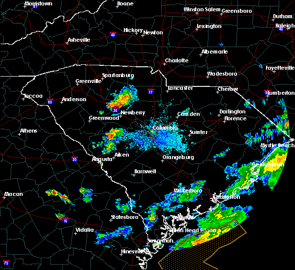 At 818 pm edt, a severe thunderstorm was located 7 miles southwest of whitmire, or 10 miles north of newberry, moving southeast at 45 mph (radar indicated). Hazards include 60 mph wind gusts and penny size hail. expect damage to roofs, siding, and trees At 818 pm edt, a severe thunderstorm was located 7 miles southwest of whitmire, or 10 miles north of newberry, moving southeast at 45 mph (radar indicated). Hazards include 60 mph wind gusts and penny size hail. expect damage to roofs, siding, and trees
|
| 7/18/2019 3:59 PM EDT |
 At 358 pm edt, a severe thunderstorm was located over dreher island state park, or 11 miles northwest of lake murray dam, moving southeast at 25 mph (emergency management multiple trees down across newberry county near the prosperity area). Hazards include 70 mph wind gusts and quarter size hail. Hail damage to vehicles is expected. expect considerable tree damage. Wind damage is also likely to mobile homes, roofs, and outbuildings. At 358 pm edt, a severe thunderstorm was located over dreher island state park, or 11 miles northwest of lake murray dam, moving southeast at 25 mph (emergency management multiple trees down across newberry county near the prosperity area). Hazards include 70 mph wind gusts and quarter size hail. Hail damage to vehicles is expected. expect considerable tree damage. Wind damage is also likely to mobile homes, roofs, and outbuildings.
|
| 7/18/2019 3:44 PM EDT |
 At 344 pm edt, a severe thunderstorm was located near dreher island state park, or 9 miles south of vc summer nuclear station, moving east at 35 mph (radar indicated). Hazards include 60 mph wind gusts and quarter size hail. Hail damage to vehicles is expected. expect wind damage to roofs, siding, and trees. locations impacted include, newberry, prosperity, dreher island state park, chapin, little mountain, pomaria, peak, lighthouse marina, cedar grove fire station, stoney hill, south shore marina, oswald park, shull island, fairview fire station, putnam`s landing, siesta cove marina, white rock, mid-carolina high school, rocky point recreation area and wyses ferry. This includes interstate 26 between mile markers 76 and 96. At 344 pm edt, a severe thunderstorm was located near dreher island state park, or 9 miles south of vc summer nuclear station, moving east at 35 mph (radar indicated). Hazards include 60 mph wind gusts and quarter size hail. Hail damage to vehicles is expected. expect wind damage to roofs, siding, and trees. locations impacted include, newberry, prosperity, dreher island state park, chapin, little mountain, pomaria, peak, lighthouse marina, cedar grove fire station, stoney hill, south shore marina, oswald park, shull island, fairview fire station, putnam`s landing, siesta cove marina, white rock, mid-carolina high school, rocky point recreation area and wyses ferry. This includes interstate 26 between mile markers 76 and 96.
|
| 7/18/2019 3:35 PM EDT | Damage to baseball field on s. wheeler ave at highway 76 in the town of prosperity in newberry county. time estimated by rada in newberry county SC, 0.2 miles NNW of Prosperity, SC |
| 7/18/2019 3:35 PM EDT | Tree down on circle dr near citgo in the town of prosperity in newberry county. time estimated by rada in newberry county SC, 0.8 miles SE of Prosperity, SC |
| 7/18/2019 3:35 PM EDT | Tree down along with multiple power lines down on brown st in the town of prosperity in newberry county. time estimated by rada in newberry county SC, 0.5 miles ENE of Prosperity, SC |
| 7/18/2019 3:35 PM EDT | Powerlines down on highway 76 near wightman church in the town of prosperity in newberry county. time estimated by rada in newberry county SC, 0.5 miles ENE of Prosperity, SC |
| 7/18/2019 3:35 PM EDT | Powerline down on mcneary st in the town of prosperity in newberry county. time estimated by rada in newberry county SC, 0.8 miles N of Prosperity, SC |
| 7/18/2019 3:27 PM EDT |
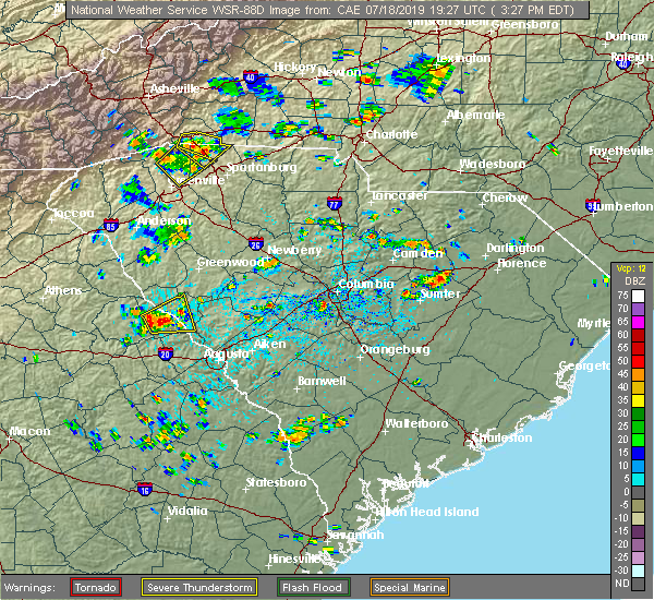 At 327 pm edt, a severe thunderstorm was located over prosperity, or near newberry, moving east at 35 mph (radar indicated). Hazards include 60 mph wind gusts and nickel size hail. expect damage to roofs, siding, and trees At 327 pm edt, a severe thunderstorm was located over prosperity, or near newberry, moving east at 35 mph (radar indicated). Hazards include 60 mph wind gusts and nickel size hail. expect damage to roofs, siding, and trees
|
| 7/8/2019 2:01 PM EDT |
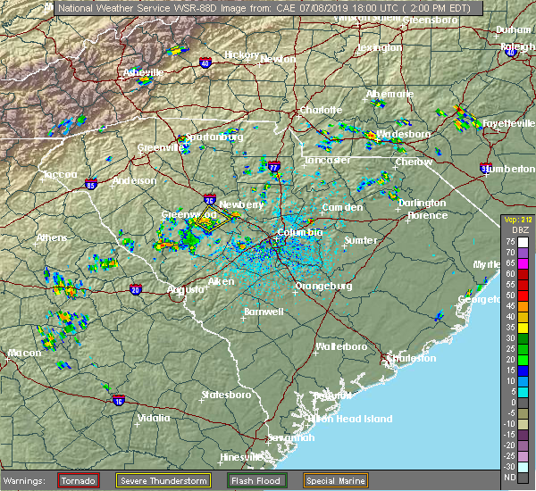 At 200 pm edt, a severe thunderstorm was located 7 miles southwest of newberry, near the community of silverstreet. the storm is nearly stationary (radar indicated). Hazards include 60 mph wind gusts. Expect damage to roofs, siding, and trees. Locations impacted include, newberry, prosperity, newberry college, silverstreet, stoney hill, newberry county detention center and bush river fire station. At 200 pm edt, a severe thunderstorm was located 7 miles southwest of newberry, near the community of silverstreet. the storm is nearly stationary (radar indicated). Hazards include 60 mph wind gusts. Expect damage to roofs, siding, and trees. Locations impacted include, newberry, prosperity, newberry college, silverstreet, stoney hill, newberry county detention center and bush river fire station.
|
| 7/8/2019 1:40 PM EDT |
 At 139 pm edt, a severe thunderstorm was located 8 miles southwest of newberry, and is nearly stationary (radar indicated). Hazards include 60 mph wind gusts and quarter size hail. Hail damage to vehicles is expected. Expect wind damage to roofs, siding, and trees. At 139 pm edt, a severe thunderstorm was located 8 miles southwest of newberry, and is nearly stationary (radar indicated). Hazards include 60 mph wind gusts and quarter size hail. Hail damage to vehicles is expected. Expect wind damage to roofs, siding, and trees.
|
| 6/24/2019 9:36 PM EDT |
 At 935 pm edt, severe thunderstorms were located along a line extending from 7 miles east of carlisle to near newberry county airport, moving northeast at 45 mph (radar indicated). Hazards include 60 mph wind gusts and penny size hail. Expect damage to roofs, siding, and trees. Locations impacted include, newberry, prosperity, blair, newberry college, newberry county airport, pomaria, silverstreet, newberry county detention center, maybington fire station, us-176 and sc- 34 crossroads, feasterville fire station and henderson island. At 935 pm edt, severe thunderstorms were located along a line extending from 7 miles east of carlisle to near newberry county airport, moving northeast at 45 mph (radar indicated). Hazards include 60 mph wind gusts and penny size hail. Expect damage to roofs, siding, and trees. Locations impacted include, newberry, prosperity, blair, newberry college, newberry county airport, pomaria, silverstreet, newberry county detention center, maybington fire station, us-176 and sc- 34 crossroads, feasterville fire station and henderson island.
|
| 6/24/2019 9:30 PM EDT | Schp reported a tree blown over on toad hawkins rd near holland boozer r in newberry county SC, 4.8 miles NNE of Prosperity, SC |
| 6/24/2019 9:11 PM EDT |
 At 909 pm edt, severe thunderstorms were located along a line extending from near whitmire to 7 miles east of cross hill, moving northeast at 40 mph (radar indicated). Hazards include 60 mph wind gusts and penny size hail. expect damage to roofs, siding, and trees At 909 pm edt, severe thunderstorms were located along a line extending from near whitmire to 7 miles east of cross hill, moving northeast at 40 mph (radar indicated). Hazards include 60 mph wind gusts and penny size hail. expect damage to roofs, siding, and trees
|
| 6/22/2019 4:53 PM EDT |
 At 453 pm edt, severe thunderstorms were located along a line extending from marshville to near great falls to near blair, moving southeast at 45 mph (radar indicated). Hazards include 60 mph wind gusts and quarter size hail. Hail damage to vehicles is expected. expect wind damage to roofs, siding, and trees. locations impacted include, newberry, lancaster, winnsboro, vc summer nuclear station, lake wateree dam, pageland, kershaw, whitmire, elgin, prosperity, heath springs, jenkinsville, liberty hill, monticello, lake wateree state park, fairfield county airport, westville, usc lancaster, irwin and newberry college. This includes interstate 77 between mile markers 30 and 50. At 453 pm edt, severe thunderstorms were located along a line extending from marshville to near great falls to near blair, moving southeast at 45 mph (radar indicated). Hazards include 60 mph wind gusts and quarter size hail. Hail damage to vehicles is expected. expect wind damage to roofs, siding, and trees. locations impacted include, newberry, lancaster, winnsboro, vc summer nuclear station, lake wateree dam, pageland, kershaw, whitmire, elgin, prosperity, heath springs, jenkinsville, liberty hill, monticello, lake wateree state park, fairfield county airport, westville, usc lancaster, irwin and newberry college. This includes interstate 77 between mile markers 30 and 50.
|
| 6/22/2019 4:32 PM EDT |
 At 431 pm edt, severe thunderstorms were located along a line extending from fairview in union county to near richburg to whitmire, moving southeast at 45 mph (radar indicated). Hazards include 70 mph wind gusts and quarter size hail. Hail damage to vehicles is expected. expect considerable tree damage. Wind damage is also likely to mobile homes, roofs, and outbuildings. At 431 pm edt, severe thunderstorms were located along a line extending from fairview in union county to near richburg to whitmire, moving southeast at 45 mph (radar indicated). Hazards include 70 mph wind gusts and quarter size hail. Hail damage to vehicles is expected. expect considerable tree damage. Wind damage is also likely to mobile homes, roofs, and outbuildings.
|
| 6/22/2019 4:08 AM EDT |
 The severe thunderstorm warning for newberry, northern edgefield and saluda counties will expire at 415 am edt, the storms which prompted the warning have moved out of the area. therefore, the warning will be allowed to expire. to report severe weather, contact your nearest law enforcement agency. they will relay your report to the national weather service columbia. The severe thunderstorm warning for newberry, northern edgefield and saluda counties will expire at 415 am edt, the storms which prompted the warning have moved out of the area. therefore, the warning will be allowed to expire. to report severe weather, contact your nearest law enforcement agency. they will relay your report to the national weather service columbia.
|
| 6/22/2019 3:35 AM EDT |
 At 334 am edt, severe thunderstorms were located along a line extending from near newberry county airport to near edgefield county airport, moving southeast at 60 mph (radar indicated). Hazards include 60 mph wind gusts and penny size hail. Expect damage to roofs, siding, and trees. Locations impacted include, newberry, batesburg-leesville, edgefield, saluda, johnston, whitmire, prosperity, ridge spring, edgefield county airport, dreher island state park, saluda county airport, newberry college, newberry county airport, blair, little mountain, monetta, trenton, pomaria, silverstreet and ward. At 334 am edt, severe thunderstorms were located along a line extending from near newberry county airport to near edgefield county airport, moving southeast at 60 mph (radar indicated). Hazards include 60 mph wind gusts and penny size hail. Expect damage to roofs, siding, and trees. Locations impacted include, newberry, batesburg-leesville, edgefield, saluda, johnston, whitmire, prosperity, ridge spring, edgefield county airport, dreher island state park, saluda county airport, newberry college, newberry county airport, blair, little mountain, monetta, trenton, pomaria, silverstreet and ward.
|
| 6/22/2019 3:14 AM EDT |
 At 313 am edt, severe thunderstorms were located along a line extending from near laurens to 8 miles east of mccormick county airport, moving east at 40 mph (radar indicated). Hazards include 60 mph wind gusts and penny size hail. expect damage to roofs, siding, and trees At 313 am edt, severe thunderstorms were located along a line extending from near laurens to 8 miles east of mccormick county airport, moving east at 40 mph (radar indicated). Hazards include 60 mph wind gusts and penny size hail. expect damage to roofs, siding, and trees
|
| 6/20/2019 3:33 PM EDT |
 At 333 pm edt, a severe thunderstorm was located 9 miles south of ninety six historic site, or 15 miles southeast of greenwood, moving east at 55 mph (radar indicated). Hazards include 70 mph wind gusts and quarter size hail. Hail damage to vehicles is expected. expect considerable tree damage. Wind damage is also likely to mobile homes, roofs, and outbuildings. At 333 pm edt, a severe thunderstorm was located 9 miles south of ninety six historic site, or 15 miles southeast of greenwood, moving east at 55 mph (radar indicated). Hazards include 70 mph wind gusts and quarter size hail. Hail damage to vehicles is expected. expect considerable tree damage. Wind damage is also likely to mobile homes, roofs, and outbuildings.
|
| 6/8/2019 3:55 PM EDT |
 At 353 pm edt, severe thunderstorms were located along a line extending from 11 miles southeast of batesburg-leesville to near gaston, moving north at 30 mph (radar indicated). Hazards include 60 mph wind gusts and penny size hail. expect damage to roofs, siding, and trees At 353 pm edt, severe thunderstorms were located along a line extending from 11 miles southeast of batesburg-leesville to near gaston, moving north at 30 mph (radar indicated). Hazards include 60 mph wind gusts and penny size hail. expect damage to roofs, siding, and trees
|
| 4/19/2019 1:55 PM EDT |
 At 155 pm edt, a severe thunderstorm capable of producing a tornado was located over newberry county airport, or near newberry, moving northeast at 35 mph (radar indicated rotation). Hazards include tornado. Flying debris will be dangerous to those caught without shelter. mobile homes will be damaged or destroyed. damage to roofs, windows, and vehicles will occur. tree damage is likely. this dangerous storm will be near, whitmire around 215 pm edt. Other locations impacted by this tornadic thunderstorm include newberry county detention center, maybington fire station, us- 176 and sc- 34 crossroads, feasterville fire station, bush river fire station, henderson island, mid- carolina high school and enoree ranger district office. At 155 pm edt, a severe thunderstorm capable of producing a tornado was located over newberry county airport, or near newberry, moving northeast at 35 mph (radar indicated rotation). Hazards include tornado. Flying debris will be dangerous to those caught without shelter. mobile homes will be damaged or destroyed. damage to roofs, windows, and vehicles will occur. tree damage is likely. this dangerous storm will be near, whitmire around 215 pm edt. Other locations impacted by this tornadic thunderstorm include newberry county detention center, maybington fire station, us- 176 and sc- 34 crossroads, feasterville fire station, bush river fire station, henderson island, mid- carolina high school and enoree ranger district office.
|
| 4/19/2019 1:52 PM EDT | Trees and power lines reported down along clara brown road. damage could be associated with tornad in newberry county SC, 2.8 miles E of Prosperity, SC |
| 4/19/2019 1:29 PM EDT |
 At 129 pm edt, severe thunderstorms were located along a line extending from 9 miles southwest of newberry college to near edgefield, moving northeast at 55 mph (radar indicated). Hazards include 60 mph wind gusts. expect damage to roofs, siding, and trees At 129 pm edt, severe thunderstorms were located along a line extending from 9 miles southwest of newberry college to near edgefield, moving northeast at 55 mph (radar indicated). Hazards include 60 mph wind gusts. expect damage to roofs, siding, and trees
|
| 3/1/2019 7:32 PM EST |
 At 732 pm est, a severe thunderstorm was located 9 miles southwest of prosperity, or 9 miles southwest of newberry, moving east at 30 mph (radar indicated). Hazards include 60 mph wind gusts. Expect damage to roofs, siding, and trees. Locations impacted include, newberry, prosperity, newberry college, dreher island state park, chapin, gilbert, little mountain, silverstreet, cedar grove fire station, south shore marina, oswald park, putnam`s landing, murray, rocky point recreation area, hollywood elementary school, delmar, hollow creek public park, melvin park, stoney hill and shull island. At 732 pm est, a severe thunderstorm was located 9 miles southwest of prosperity, or 9 miles southwest of newberry, moving east at 30 mph (radar indicated). Hazards include 60 mph wind gusts. Expect damage to roofs, siding, and trees. Locations impacted include, newberry, prosperity, newberry college, dreher island state park, chapin, gilbert, little mountain, silverstreet, cedar grove fire station, south shore marina, oswald park, putnam`s landing, murray, rocky point recreation area, hollywood elementary school, delmar, hollow creek public park, melvin park, stoney hill and shull island.
|
| 3/1/2019 7:18 PM EST |
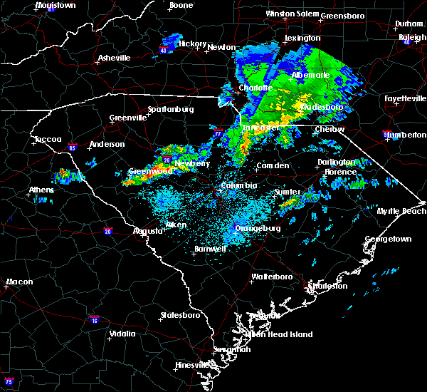 At 718 pm est, a severe thunderstorm was located 7 miles east of lake greenwood state park, or 13 miles southwest of newberry, moving east at 30 mph (radar indicated). Hazards include 60 mph wind gusts and quarter size hail. Hail damage to vehicles is expected. Expect wind damage to roofs, siding, and trees. At 718 pm est, a severe thunderstorm was located 7 miles east of lake greenwood state park, or 13 miles southwest of newberry, moving east at 30 mph (radar indicated). Hazards include 60 mph wind gusts and quarter size hail. Hail damage to vehicles is expected. Expect wind damage to roofs, siding, and trees.
|
| 2/12/2019 5:00 PM EST |
 At 500 pm est, severe thunderstorms were located along a line extending from near newberry to near ridge spring, moving east at 30 mph (radar indicated). Hazards include 60 mph wind gusts. expect damage to roofs, siding, and trees At 500 pm est, severe thunderstorms were located along a line extending from near newberry to near ridge spring, moving east at 30 mph (radar indicated). Hazards include 60 mph wind gusts. expect damage to roofs, siding, and trees
|
| 12/28/2018 1:27 PM EST |
 The severe thunderstorm warning for southeastern newberry. northwestern lexington and northeastern saluda counties will expire at 130 pm est. the storm which prompted the warning has weakened below severe limits, and no longer poses an immediate threat to life or property. Therefore, the warning will be allowed to expire. The severe thunderstorm warning for southeastern newberry. northwestern lexington and northeastern saluda counties will expire at 130 pm est. the storm which prompted the warning has weakened below severe limits, and no longer poses an immediate threat to life or property. Therefore, the warning will be allowed to expire.
|
| 12/28/2018 1:13 PM EST |
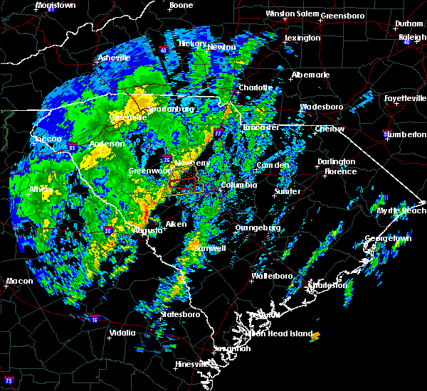 At 113 pm est, a severe thunderstorm was located 7 miles south of prosperity, or 14 miles southeast of newberry, moving east at 50 mph (radar indicated). Hazards include 60 mph wind gusts. Expect damage to roofs, siding, and trees. Locations impacted include, newberry, prosperity, chapin, little mountain, pomaria and peak. At 113 pm est, a severe thunderstorm was located 7 miles south of prosperity, or 14 miles southeast of newberry, moving east at 50 mph (radar indicated). Hazards include 60 mph wind gusts. Expect damage to roofs, siding, and trees. Locations impacted include, newberry, prosperity, chapin, little mountain, pomaria and peak.
|
| 12/28/2018 1:03 PM EST |
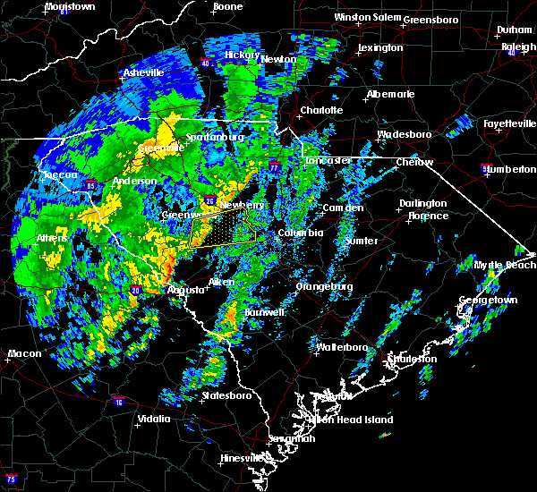 At 103 pm est, a severe thunderstorm capable of producing a tornado was located 9 miles northeast of saluda, or 11 miles south of newberry, moving east at 45 mph (radar indicated rotation). Hazards include tornado. Flying debris will be dangerous to those caught without shelter. mobile homes will be damaged or destroyed. damage to roofs, windows, and vehicles will occur. Tree damage is likely. At 103 pm est, a severe thunderstorm capable of producing a tornado was located 9 miles northeast of saluda, or 11 miles south of newberry, moving east at 45 mph (radar indicated rotation). Hazards include tornado. Flying debris will be dangerous to those caught without shelter. mobile homes will be damaged or destroyed. damage to roofs, windows, and vehicles will occur. Tree damage is likely.
|
| 12/28/2018 12:57 PM EST |
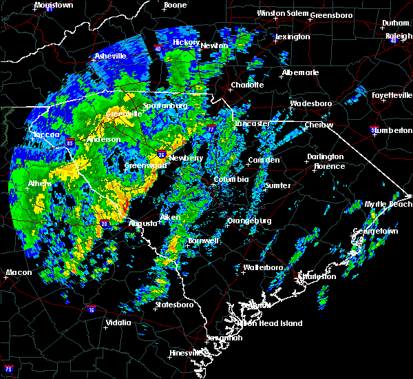 At 1256 pm est, a severe thunderstorm was located near saluda, or 14 miles southwest of newberry, moving east at 50 mph (radar indicated). Hazards include 60 mph wind gusts. expect damage to roofs, siding, and trees At 1256 pm est, a severe thunderstorm was located near saluda, or 14 miles southwest of newberry, moving east at 50 mph (radar indicated). Hazards include 60 mph wind gusts. expect damage to roofs, siding, and trees
|
| 8/8/2018 8:37 AM EDT | Reported a tree in the roadway at the intersection of halfacre road and st. philips church roa in newberry county SC, 5.6 miles SSW of Prosperity, SC |
| 8/1/2018 4:36 PM EDT |
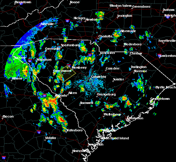 At 436 pm edt, a severe thunderstorm was located 8 miles west of saluda, or 22 miles west of batesburg, moving northeast at 20 mph (radar indicated). Hazards include 60 mph wind gusts and penny size hail. expect damage to roofs, siding, and trees At 436 pm edt, a severe thunderstorm was located 8 miles west of saluda, or 22 miles west of batesburg, moving northeast at 20 mph (radar indicated). Hazards include 60 mph wind gusts and penny size hail. expect damage to roofs, siding, and trees
|
| 7/6/2018 6:09 PM EDT |
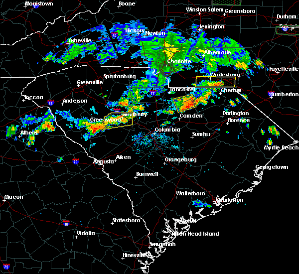 At 606 pm edt, thunderstorms extended from around pomaria westward through newberry, silverstreet and chappells. movement was westward near 10 mph. some of the storms likely contained wind gusts of 40 to 60 mph. minor flooding is likely in areas. do not drive on flooded roads. it takes little water to move a vehicle off the road and into deeper water (radar indicated). Hazards include 60 mph wind gusts and minor flooding. Expect wind damage to roofs, siding, and trees. locations impacted include, newberry, prosperity, little mountain, pomaria, silverstreet and chappells. This includes interstate 26 between mile markers 67 and 84. At 606 pm edt, thunderstorms extended from around pomaria westward through newberry, silverstreet and chappells. movement was westward near 10 mph. some of the storms likely contained wind gusts of 40 to 60 mph. minor flooding is likely in areas. do not drive on flooded roads. it takes little water to move a vehicle off the road and into deeper water (radar indicated). Hazards include 60 mph wind gusts and minor flooding. Expect wind damage to roofs, siding, and trees. locations impacted include, newberry, prosperity, little mountain, pomaria, silverstreet and chappells. This includes interstate 26 between mile markers 67 and 84.
|
| 7/6/2018 5:44 PM EDT |
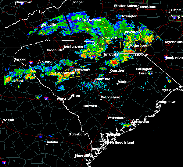 At 542 pm edt, thunderstorms extending from just west of pomaria westward through newberry, silverstreet and chappells. some of these thunderstorms likely contained wind gusts near 60 mph and 1-inch hail. movement was westward near 10 mph (radar indicated). Hazards include 60 mph wind gusts and quarter size hail. Hail damage to vehicles is expected. Expect wind damage to roofs, siding, and trees. At 542 pm edt, thunderstorms extending from just west of pomaria westward through newberry, silverstreet and chappells. some of these thunderstorms likely contained wind gusts near 60 mph and 1-inch hail. movement was westward near 10 mph (radar indicated). Hazards include 60 mph wind gusts and quarter size hail. Hail damage to vehicles is expected. Expect wind damage to roofs, siding, and trees.
|
| 6/26/2018 7:11 PM EDT | Tree down on living inn r in newberry county SC, 9.9 miles NNW of Prosperity, SC |
| 6/26/2018 6:24 PM EDT |
 At 624 pm edt, severe thunderstorms were located along a line extending from 7 miles southeast of blackstock to newberry, moving southeast at 20 mph (radar indicated). Hazards include 60 mph wind gusts. expect damage to roofs, siding, and trees At 624 pm edt, severe thunderstorms were located along a line extending from 7 miles southeast of blackstock to newberry, moving southeast at 20 mph (radar indicated). Hazards include 60 mph wind gusts. expect damage to roofs, siding, and trees
|
| 6/25/2018 8:37 PM EDT |
 The severe thunderstorm warning for fairfield, newberry, northwestern lexington, saluda and northwestern richland counties will expire at 845 pm edt, the storm which prompted the warning has moved out of the area. therefore, the warning will be allowed to expire. a severe thunderstorm watch remains in effect until 1000 pm edt for central south carolina. to report severe weather, contact your nearest law enforcement agency. they will relay your report to the national weather service columbia. remember, a severe thunderstorm warning still remains in effect for lexington and richland counties. The severe thunderstorm warning for fairfield, newberry, northwestern lexington, saluda and northwestern richland counties will expire at 845 pm edt, the storm which prompted the warning has moved out of the area. therefore, the warning will be allowed to expire. a severe thunderstorm watch remains in effect until 1000 pm edt for central south carolina. to report severe weather, contact your nearest law enforcement agency. they will relay your report to the national weather service columbia. remember, a severe thunderstorm warning still remains in effect for lexington and richland counties.
|
| 6/25/2018 7:39 PM EDT |
 At 739 pm edt, a severe thunderstorm was located near prosperity, or 10 miles southeast of newberry, moving east at 10 mph (radar indicated). Hazards include 60 mph wind gusts and quarter size hail. Hail damage to vehicles is expected. Expect wind damage to roofs, siding, and trees. At 739 pm edt, a severe thunderstorm was located near prosperity, or 10 miles southeast of newberry, moving east at 10 mph (radar indicated). Hazards include 60 mph wind gusts and quarter size hail. Hail damage to vehicles is expected. Expect wind damage to roofs, siding, and trees.
|
| 6/9/2018 9:16 PM EDT |
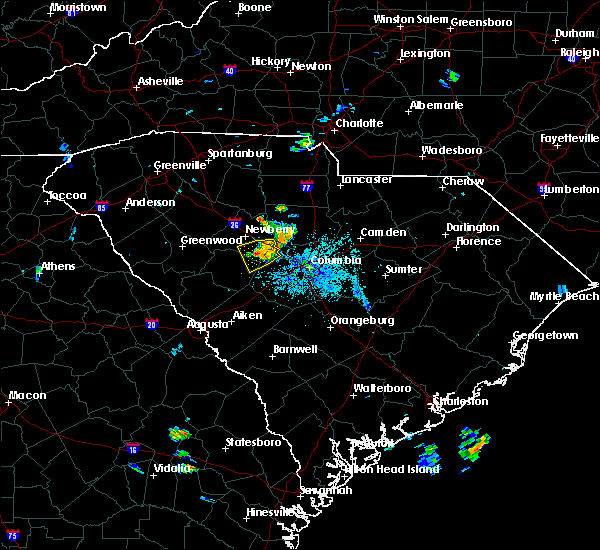 At 916 pm edt, a severe thunderstorm was located near prosperity, or 11 miles southeast of newberry, moving southwest at 5 mph (law enforcement reported trees and powerlines down on macedonia church road near ballfield road). Hazards include 60 mph wind gusts and nickel size hail. expect damage to roofs, siding, and trees At 916 pm edt, a severe thunderstorm was located near prosperity, or 11 miles southeast of newberry, moving southwest at 5 mph (law enforcement reported trees and powerlines down on macedonia church road near ballfield road). Hazards include 60 mph wind gusts and nickel size hail. expect damage to roofs, siding, and trees
|
| 6/9/2018 9:06 PM EDT | Newberry county dispatch reported trees and power lines down on macedonia church rd at ballfield r in newberry county SC, 4.6 miles NW of Prosperity, SC |
| 6/9/2018 8:33 PM EDT |
 At 833 pm edt, a severe thunderstorm was located near prosperity, or 12 miles east of newberry, moving south at 10 mph (radar indicated). Hazards include 60 mph wind gusts and penny size hail. expect damage to roofs, siding, and trees At 833 pm edt, a severe thunderstorm was located near prosperity, or 12 miles east of newberry, moving south at 10 mph (radar indicated). Hazards include 60 mph wind gusts and penny size hail. expect damage to roofs, siding, and trees
|
| 6/1/2018 6:46 PM EDT |
 At 645 pm edt, a severe thunderstorm was located near greenwood state park, or 17 miles west of newberry, moving east at 35 mph (radar indicated). Hazards include 60 mph wind gusts. expect damage to roofs, siding, and trees At 645 pm edt, a severe thunderstorm was located near greenwood state park, or 17 miles west of newberry, moving east at 35 mph (radar indicated). Hazards include 60 mph wind gusts. expect damage to roofs, siding, and trees
|
| 4/15/2018 2:26 PM EDT |
 At 224 pm edt severe thunderstorms were located along a line extending from 10 miles southeast of whitmire to near irmo to near south congaree, moving northeast at 55 mph (nws columbia measured 74 mph wind gust at the columbia metropolitan airport). Hazards include 70 mph wind gusts. Expect considerable tree damage. damage is likely to mobile homes, roofs, and outbuildings. locations impacted include, lexington, west columbia, cayce, irmo, springdale, oak grove, red bank, st. andrews, south congaree, pine ridge, gaston, prosperity, chapin, swansea, pelion, gilbert, summit, salley, little mountain and perry. this includes the following highways, interstate 126 between mile markers 0 and 1. interstate 20 in south carolina between mile markers 43 and 64. interstate 26 between mile markers 76 and 92, and between mile markers 104 and 120. interstate 77 between mile markers 0 and 1. A tornado watch remains in effect until 700 pm edt for central south carolina. At 224 pm edt severe thunderstorms were located along a line extending from 10 miles southeast of whitmire to near irmo to near south congaree, moving northeast at 55 mph (nws columbia measured 74 mph wind gust at the columbia metropolitan airport). Hazards include 70 mph wind gusts. Expect considerable tree damage. damage is likely to mobile homes, roofs, and outbuildings. locations impacted include, lexington, west columbia, cayce, irmo, springdale, oak grove, red bank, st. andrews, south congaree, pine ridge, gaston, prosperity, chapin, swansea, pelion, gilbert, summit, salley, little mountain and perry. this includes the following highways, interstate 126 between mile markers 0 and 1. interstate 20 in south carolina between mile markers 43 and 64. interstate 26 between mile markers 76 and 92, and between mile markers 104 and 120. interstate 77 between mile markers 0 and 1. A tornado watch remains in effect until 700 pm edt for central south carolina.
|
| 4/15/2018 1:42 PM EDT |
 At 141 pm edt, severe thunderstorms were located along a line extending from 6 miles northwest of ridge spring to 14 miles east of aiken to near williston, moving northeast at 55 mph (law enforcement reported damaging wind gusts and downed trees with this line of storms). Hazards include 70 mph wind gusts. Expect considerable tree damage. Damage is likely to mobile homes, roofs, and outbuildings. At 141 pm edt, severe thunderstorms were located along a line extending from 6 miles northwest of ridge spring to 14 miles east of aiken to near williston, moving northeast at 55 mph (law enforcement reported damaging wind gusts and downed trees with this line of storms). Hazards include 70 mph wind gusts. Expect considerable tree damage. Damage is likely to mobile homes, roofs, and outbuildings.
|
| 7/28/2017 3:41 PM EDT |
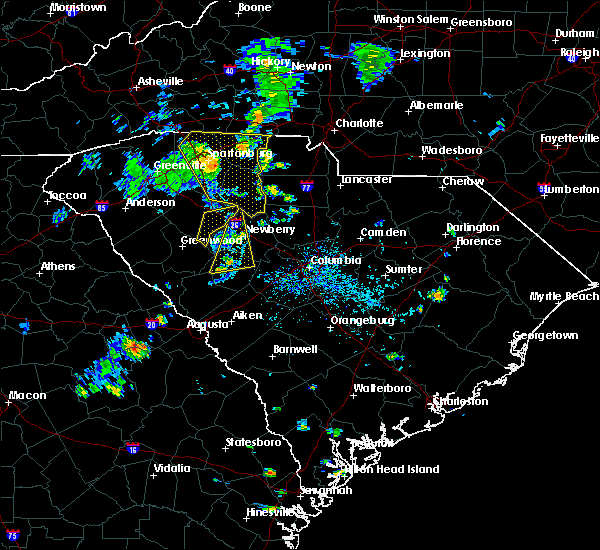 At 341 pm edt, a severe thunderstorm was located near prosperity, or near newberry, moving east at 35 mph (radar indicated). Hazards include 60 mph wind gusts. Expect damage to roofs, siding, and trees. Locations impacted include, newberry, saluda and silverstreet. At 341 pm edt, a severe thunderstorm was located near prosperity, or near newberry, moving east at 35 mph (radar indicated). Hazards include 60 mph wind gusts. Expect damage to roofs, siding, and trees. Locations impacted include, newberry, saluda and silverstreet.
|
| 7/28/2017 3:11 PM EDT |
 At 311 pm edt, a severe thunderstorm was located near greenwood state park, or 17 miles west of newberry, moving east at 25 mph (radar indicated). Hazards include 60 mph wind gusts. expect damage to roofs, siding, and trees At 311 pm edt, a severe thunderstorm was located near greenwood state park, or 17 miles west of newberry, moving east at 25 mph (radar indicated). Hazards include 60 mph wind gusts. expect damage to roofs, siding, and trees
|
| 7/23/2017 6:10 PM EDT |
 A severe thunderstorm warning remains in effect until 630 pm edt for newberry and northeastern saluda counties. at 609 pm edt, a severe thunderstorm was located over newberry, moving southeast at 15 mph. hazard. 60 mph wind gusts and quarter size hail. source. Radar indicated. A severe thunderstorm warning remains in effect until 630 pm edt for newberry and northeastern saluda counties. at 609 pm edt, a severe thunderstorm was located over newberry, moving southeast at 15 mph. hazard. 60 mph wind gusts and quarter size hail. source. Radar indicated.
|
| 7/23/2017 6:10 PM EDT |
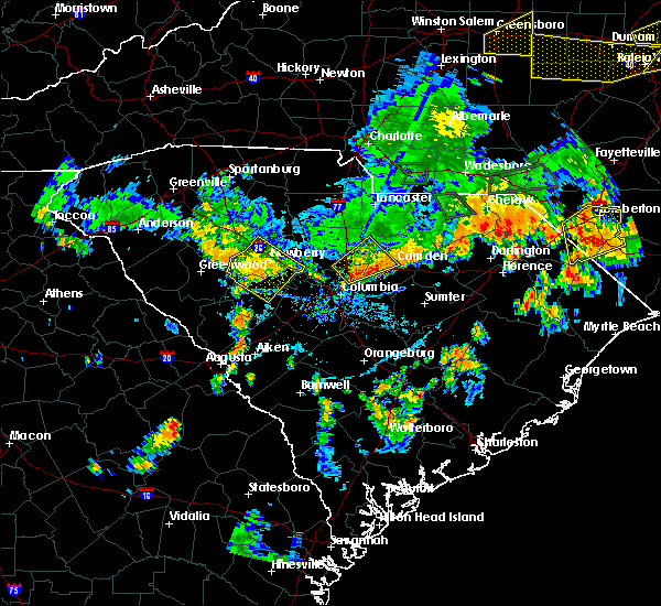 At 609 pm edt, a severe thunderstorm was located over newberry, moving southeast at 15 mph (radar indicated). Hazards include 60 mph wind gusts and quarter size hail. Minor hail damage to vehicles is expected. expect wind damage to roofs, siding, and trees. Locations impacted include, newberry, prosperity, little mountain, pomaria, silverstreet, peak and chappells. At 609 pm edt, a severe thunderstorm was located over newberry, moving southeast at 15 mph (radar indicated). Hazards include 60 mph wind gusts and quarter size hail. Minor hail damage to vehicles is expected. expect wind damage to roofs, siding, and trees. Locations impacted include, newberry, prosperity, little mountain, pomaria, silverstreet, peak and chappells.
|
| 7/23/2017 5:28 PM EDT |
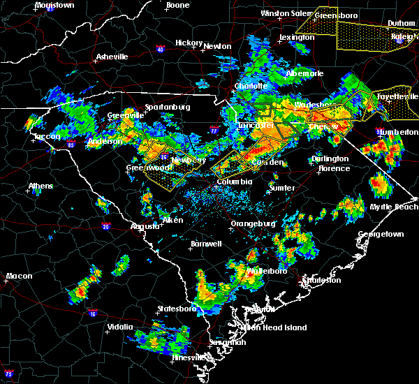 At 527 pm edt, a severe thunderstorm was located near joanna, or 12 miles northwest of newberry, moving southeast at 15 mph (radar indicated). Hazards include 60 mph wind gusts and quarter size hail. Hail damage to vehicles is expected. Expect wind damage to roofs, siding, and trees. At 527 pm edt, a severe thunderstorm was located near joanna, or 12 miles northwest of newberry, moving southeast at 15 mph (radar indicated). Hazards include 60 mph wind gusts and quarter size hail. Hail damage to vehicles is expected. Expect wind damage to roofs, siding, and trees.
|
| 7/6/2017 5:45 PM EDT |
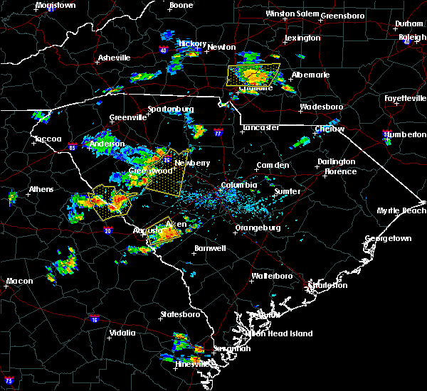 At 545 pm edt, a severe thunderstorm was located near joanna, or 11 miles west of newberry, moving east at 25 mph (radar indicated). Hazards include 70 mph wind gusts. Expect considerable tree damage. Damage is likely to mobile homes, roofs, and outbuildings. At 545 pm edt, a severe thunderstorm was located near joanna, or 11 miles west of newberry, moving east at 25 mph (radar indicated). Hazards include 70 mph wind gusts. Expect considerable tree damage. Damage is likely to mobile homes, roofs, and outbuildings.
|
| 7/1/2017 10:08 PM EDT |
 At 1008 pm edt, severe thunderstorms were located along a line extending from 8 miles northeast of newberry to 7 miles southwest of prosperity, moving southeast at 25 mph (radar indicated). Hazards include 60 mph wind gusts. expect damage to roofs, siding, and trees At 1008 pm edt, severe thunderstorms were located along a line extending from 8 miles northeast of newberry to 7 miles southwest of prosperity, moving southeast at 25 mph (radar indicated). Hazards include 60 mph wind gusts. expect damage to roofs, siding, and trees
|
| 5/24/2017 3:18 PM EDT |
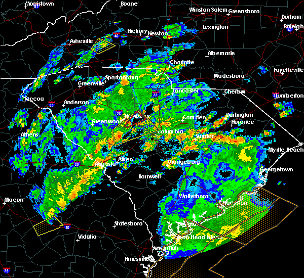 At 318 pm edt, a confirmed tornado was located over prosperity, or 7 miles southeast of newberry, moving northeast at 35 mph (radar confirmed tornado). Hazards include damaging tornado. Flying debris will be dangerous to those caught without shelter. mobile homes will be damaged or destroyed. damage to roofs, windows, and vehicles will occur. tree damage is likely. This tornadic thunderstorm will remain over mainly rural areas of west central fairfield and southeastern newberry counties, including the following locations: pomaria, peak and little mountain. At 318 pm edt, a confirmed tornado was located over prosperity, or 7 miles southeast of newberry, moving northeast at 35 mph (radar confirmed tornado). Hazards include damaging tornado. Flying debris will be dangerous to those caught without shelter. mobile homes will be damaged or destroyed. damage to roofs, windows, and vehicles will occur. tree damage is likely. This tornadic thunderstorm will remain over mainly rural areas of west central fairfield and southeastern newberry counties, including the following locations: pomaria, peak and little mountain.
|
| 5/24/2017 3:14 PM EDT |
 The national weather service in columbia has issued a * severe thunderstorm warning for. southwestern fairfield county in central south carolina. southeastern newberry county in central south carolina. northwestern lexington county in central south carolina. Eastern saluda county in central south carolina. The national weather service in columbia has issued a * severe thunderstorm warning for. southwestern fairfield county in central south carolina. southeastern newberry county in central south carolina. northwestern lexington county in central south carolina. Eastern saluda county in central south carolina.
|
| 5/24/2017 3:14 PM EDT |
 At 314 pm edt, a severe thunderstorm was located 9 miles east of saluda, or 9 miles northwest of batesburg, moving northeast at 35 mph (radar indicated). Hazards include 60 mph wind gusts. expect damage to roofs, siding, and trees At 314 pm edt, a severe thunderstorm was located 9 miles east of saluda, or 9 miles northwest of batesburg, moving northeast at 35 mph (radar indicated). Hazards include 60 mph wind gusts. expect damage to roofs, siding, and trees
|
| 5/24/2017 3:08 PM EDT |
 At 308 pm edt, a confirmed tornado was located near prosperity, or 9 miles south of newberry, moving northeast at 40 mph (radar confirmed tornado). Hazards include damaging tornado. Flying debris will be dangerous to those caught without shelter. mobile homes will be damaged or destroyed. damage to roofs, windows, and vehicles will occur. tree damage is likely. this tornado will be near, prosperity around 320 pm edt. Other locations impacted by this tornadic thunderstorm include peak, little mountain, chapin, pomaria and lake murray of richland. At 308 pm edt, a confirmed tornado was located near prosperity, or 9 miles south of newberry, moving northeast at 40 mph (radar confirmed tornado). Hazards include damaging tornado. Flying debris will be dangerous to those caught without shelter. mobile homes will be damaged or destroyed. damage to roofs, windows, and vehicles will occur. tree damage is likely. this tornado will be near, prosperity around 320 pm edt. Other locations impacted by this tornadic thunderstorm include peak, little mountain, chapin, pomaria and lake murray of richland.
|
| 5/24/2017 3:00 PM EDT |
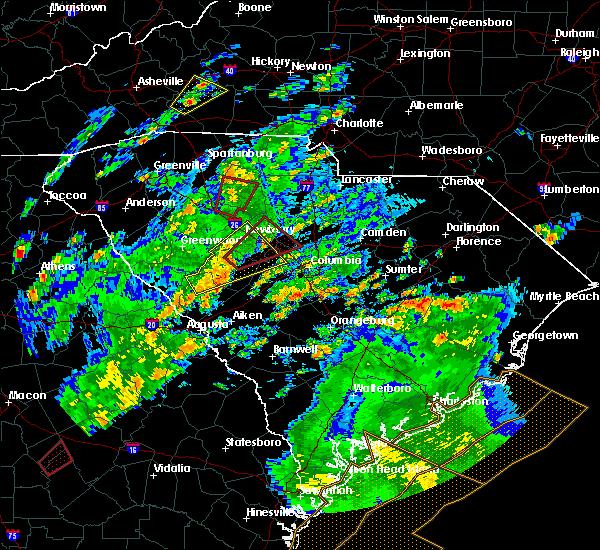 At 300 pm edt, a severe thunderstorm capable of producing a tornado was located 8 miles northeast of saluda, or 13 miles south of newberry, moving northeast at 40 mph (radar indicated rotation). Hazards include tornado. Flying debris will be dangerous to those caught without shelter. mobile homes will be damaged or destroyed. damage to roofs, windows, and vehicles will occur. tree damage is likely. this dangerous storm will be near, prosperity around 320 pm edt. Other locations impacted by this tornadic thunderstorm include peak, little mountain, chapin, pomaria and lake murray of richland. At 300 pm edt, a severe thunderstorm capable of producing a tornado was located 8 miles northeast of saluda, or 13 miles south of newberry, moving northeast at 40 mph (radar indicated rotation). Hazards include tornado. Flying debris will be dangerous to those caught without shelter. mobile homes will be damaged or destroyed. damage to roofs, windows, and vehicles will occur. tree damage is likely. this dangerous storm will be near, prosperity around 320 pm edt. Other locations impacted by this tornadic thunderstorm include peak, little mountain, chapin, pomaria and lake murray of richland.
|
| 5/24/2017 2:30 PM EDT |
 At 229 pm edt, a severe thunderstorm was located 9 miles northwest of johnston, or 21 miles west of batesburg, moving northeast at 50 mph (radar indicated). Hazards include 70 mph wind gusts. Expect considerable tree damage. Damage is likely to mobile homes, roofs, and outbuildings. At 229 pm edt, a severe thunderstorm was located 9 miles northwest of johnston, or 21 miles west of batesburg, moving northeast at 50 mph (radar indicated). Hazards include 70 mph wind gusts. Expect considerable tree damage. Damage is likely to mobile homes, roofs, and outbuildings.
|
| 4/5/2017 2:23 PM EDT |
 The severe thunderstorm warning for southeastern newberry, northwestern lexington and eastern saluda counties will expire at 230 pm edt, the storms which prompted the warning have moved out of the area. therefore the warning will be allowed to expire. however heavy rain is still possible with these thunderstorms. a tornado watch remains in effect until 800 pm edt for central south carolina. The severe thunderstorm warning for southeastern newberry, northwestern lexington and eastern saluda counties will expire at 230 pm edt, the storms which prompted the warning have moved out of the area. therefore the warning will be allowed to expire. however heavy rain is still possible with these thunderstorms. a tornado watch remains in effect until 800 pm edt for central south carolina.
|
| 4/5/2017 1:41 PM EDT |
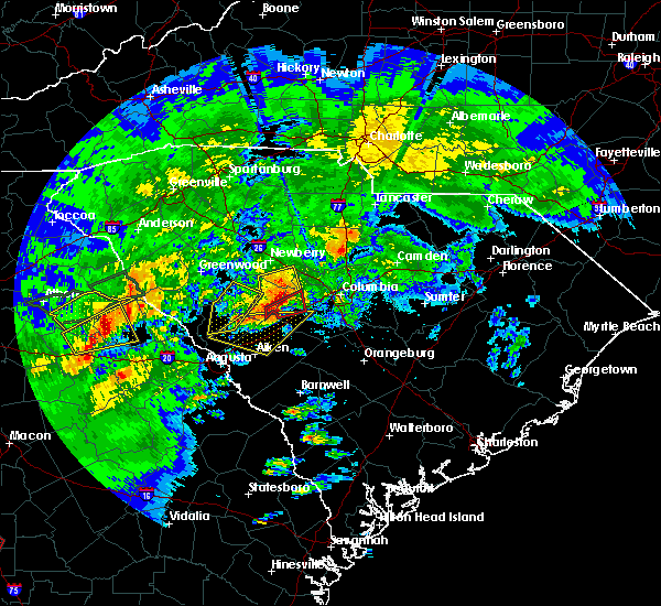 At 141 pm edt, severe thunderstorms were located along a line extending from 6 miles southwest of prosperity to near batesburg, moving northeast at 45 mph (radar indicated). Hazards include golf ball size hail and 70 mph wind gusts. People and animals outdoors will be injured. expect hail damage to roofs, siding, windows, and vehicles. expect considerable tree damage. Wind damage is also likely to mobile homes, roofs, and outbuildings. At 141 pm edt, severe thunderstorms were located along a line extending from 6 miles southwest of prosperity to near batesburg, moving northeast at 45 mph (radar indicated). Hazards include golf ball size hail and 70 mph wind gusts. People and animals outdoors will be injured. expect hail damage to roofs, siding, windows, and vehicles. expect considerable tree damage. Wind damage is also likely to mobile homes, roofs, and outbuildings.
|
| 4/5/2017 12:48 PM EDT |
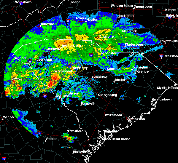 At 1247 pm edt, a severe thunderstorm was located over newberry, moving northeast at 30 mph (radar indicated). Hazards include golf ball size hail and 70 mph wind gusts. People and animals outdoors will be injured. expect hail damage to roofs, siding, windows, and vehicles. expect considerable tree damage. Wind damage is also likely to mobile homes, roofs, and outbuildings. At 1247 pm edt, a severe thunderstorm was located over newberry, moving northeast at 30 mph (radar indicated). Hazards include golf ball size hail and 70 mph wind gusts. People and animals outdoors will be injured. expect hail damage to roofs, siding, windows, and vehicles. expect considerable tree damage. Wind damage is also likely to mobile homes, roofs, and outbuildings.
|
| 4/3/2017 3:56 PM EDT |
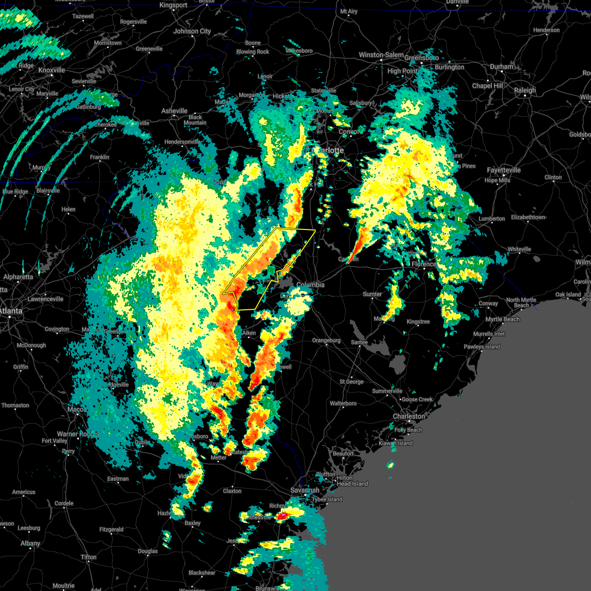 At 355 pm edt, severe thunderstorms were located along a line extending from chester to near saluda, moving east at 50 mph (radar indicated). Hazards include 70 mph wind gusts and quarter size hail. Hail damage to vehicles is expected. expect considerable tree damage. wind damage is also likely to mobile homes, roofs, and outbuildings. locations impacted include, newberry, saluda, johnston, prosperity, ridge spring, blackstock, little mountain, pomaria, silverstreet, ward and peak. A tornado watch remains in effect until 900 pm edt for central south carolina. At 355 pm edt, severe thunderstorms were located along a line extending from chester to near saluda, moving east at 50 mph (radar indicated). Hazards include 70 mph wind gusts and quarter size hail. Hail damage to vehicles is expected. expect considerable tree damage. wind damage is also likely to mobile homes, roofs, and outbuildings. locations impacted include, newberry, saluda, johnston, prosperity, ridge spring, blackstock, little mountain, pomaria, silverstreet, ward and peak. A tornado watch remains in effect until 900 pm edt for central south carolina.
|
| 4/3/2017 3:22 PM EDT |
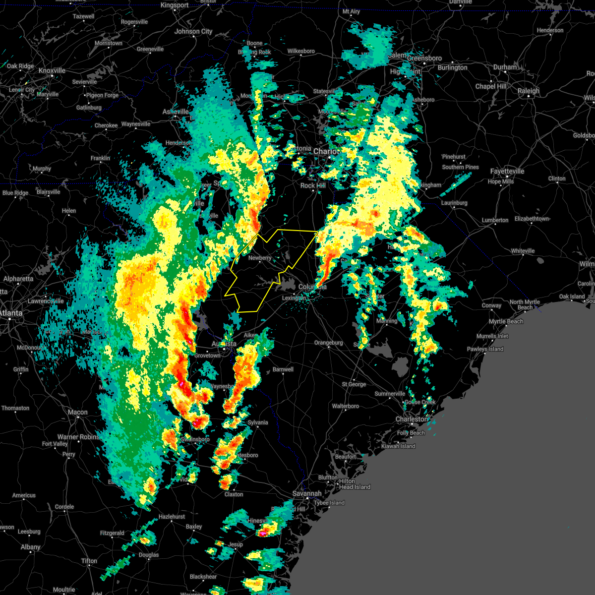 At 321 pm edt, severe thunderstorms were located along a line extending from near rose hill state park to near mccormick, moving east at 50 mph (radar indicated). Hazards include 60 mph wind gusts and quarter size hail. Hail damage to vehicles is expected. expect wind damage to roofs, siding, and trees. locations impacted include, newberry, saluda, johnston, whitmire, prosperity, ridge spring, blackstock, little mountain, pomaria, silverstreet, ward, peak and chappells. A tornado watch remains in effect until 900 pm edt for central south carolina. At 321 pm edt, severe thunderstorms were located along a line extending from near rose hill state park to near mccormick, moving east at 50 mph (radar indicated). Hazards include 60 mph wind gusts and quarter size hail. Hail damage to vehicles is expected. expect wind damage to roofs, siding, and trees. locations impacted include, newberry, saluda, johnston, whitmire, prosperity, ridge spring, blackstock, little mountain, pomaria, silverstreet, ward, peak and chappells. A tornado watch remains in effect until 900 pm edt for central south carolina.
|
| 4/3/2017 3:17 PM EDT |
 At 317 pm edt, severe thunderstorms were located along a line extending from near rose hill state park to near mccormick, moving east at 50 mph (radar indicated). Hazards include 60 mph wind gusts and quarter size hail. Hail damage to vehicles is expected. Expect wind damage to roofs, siding, and trees. At 317 pm edt, severe thunderstorms were located along a line extending from near rose hill state park to near mccormick, moving east at 50 mph (radar indicated). Hazards include 60 mph wind gusts and quarter size hail. Hail damage to vehicles is expected. Expect wind damage to roofs, siding, and trees.
|
| 3/21/2017 9:44 PM EDT | Sc highway patrol reported trees down on big creek road in prosperity... s in newberry county SC, 5 miles N of Prosperity, SC |
| 3/21/2017 9:44 PM EDT | Sc highway patrol reported tree down on dreher island road at state park roa in newberry county SC, 10.9 miles NW of Prosperity, SC |
| 3/21/2017 9:32 PM EDT |
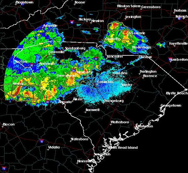 At 931 pm edt, severe thunderstorms were located along a line extending from near carlisle to 6 miles northeast of prosperity to 6 miles north of saluda, moving east at 50 mph (radar indicated). Hazards include 70 mph wind gusts and penny size hail. Expect considerable tree damage. damage is likely to mobile homes, roofs, and outbuildings. Locations impacted include, newberry, saluda, prosperity, little mountain, pomaria, silverstreet and peak. At 931 pm edt, severe thunderstorms were located along a line extending from near carlisle to 6 miles northeast of prosperity to 6 miles north of saluda, moving east at 50 mph (radar indicated). Hazards include 70 mph wind gusts and penny size hail. Expect considerable tree damage. damage is likely to mobile homes, roofs, and outbuildings. Locations impacted include, newberry, saluda, prosperity, little mountain, pomaria, silverstreet and peak.
|
| 3/21/2017 9:16 PM EDT |
 At 915 pm edt, severe thunderstorms were located along a line extending from near rose hill state park to near newberry to 7 miles southeast of ninety six historic site, moving east at 50 mph (radar indicated). Hazards include 60 mph wind gusts and nickel size hail. Expect damage to roofs, siding, and trees. Locations impacted include, newberry, saluda, whitmire, prosperity, little mountain, pomaria, silverstreet, peak and chappells. At 915 pm edt, severe thunderstorms were located along a line extending from near rose hill state park to near newberry to 7 miles southeast of ninety six historic site, moving east at 50 mph (radar indicated). Hazards include 60 mph wind gusts and nickel size hail. Expect damage to roofs, siding, and trees. Locations impacted include, newberry, saluda, whitmire, prosperity, little mountain, pomaria, silverstreet, peak and chappells.
|
| 3/21/2017 9:01 PM EDT |
 At 900 pm edt, severe thunderstorms were located along a line extending from near clinton to near greenwood state park to 8 miles east of troy, moving east at 50 mph (radar indicated). Hazards include 60 mph wind gusts and penny size hail. expect damage to roofs, siding, and trees At 900 pm edt, severe thunderstorms were located along a line extending from near clinton to near greenwood state park to 8 miles east of troy, moving east at 50 mph (radar indicated). Hazards include 60 mph wind gusts and penny size hail. expect damage to roofs, siding, and trees
|
| 11/30/2016 5:48 PM EST |
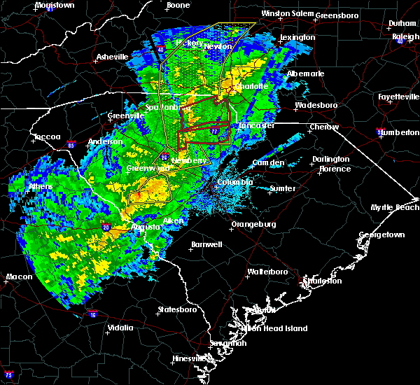 At 548 pm est, a severe thunderstorm was located over newberry, moving east at 40 mph (radar indicated). Hazards include 60 mph wind gusts. Expect damage to roofs. siding. and trees. Locations impacted include, newberry, whitmire, pomaria and silverstreet. At 548 pm est, a severe thunderstorm was located over newberry, moving east at 40 mph (radar indicated). Hazards include 60 mph wind gusts. Expect damage to roofs. siding. and trees. Locations impacted include, newberry, whitmire, pomaria and silverstreet.
|
| 11/30/2016 5:47 PM EST | Dispatch reported trees down in the vicinity of st. phillips church road and bachman chapel road near jolly street roa in newberry county SC, 4.4 miles SSW of Prosperity, SC |
| 11/30/2016 5:25 PM EST |
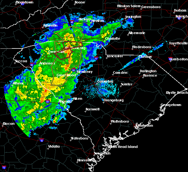 At 524 pm est, a severe thunderstorm was located 8 miles east of cross hill, or 13 miles west of newberry, moving northeast at 40 mph (radar indicated). Hazards include 60 mph wind gusts. Expect damage to roofs. siding. And trees. At 524 pm est, a severe thunderstorm was located 8 miles east of cross hill, or 13 miles west of newberry, moving northeast at 40 mph (radar indicated). Hazards include 60 mph wind gusts. Expect damage to roofs. siding. And trees.
|
| 9/19/2016 7:36 PM EDT |
 At 735 pm edt, a severe thunderstorm was located near newberry, moving south at 15 mph (radar indicated). Hazards include 60 mph wind gusts and quarter size hail. Hail damage to vehicles is expected. expect wind damage to roofs, siding, and trees. Locations impacted include, newberry, prosperity, little mountain, pomaria, silverstreet and peak. At 735 pm edt, a severe thunderstorm was located near newberry, moving south at 15 mph (radar indicated). Hazards include 60 mph wind gusts and quarter size hail. Hail damage to vehicles is expected. expect wind damage to roofs, siding, and trees. Locations impacted include, newberry, prosperity, little mountain, pomaria, silverstreet and peak.
|
| 9/19/2016 7:20 PM EDT |
 At 720 pm edt, a severe thunderstorm was located 7 miles north of newberry, moving south at 20 mph (radar indicated). Hazards include 60 mph wind gusts and nickel size hail. Expect damage to roofs. siding. And trees. At 720 pm edt, a severe thunderstorm was located 7 miles north of newberry, moving south at 20 mph (radar indicated). Hazards include 60 mph wind gusts and nickel size hail. Expect damage to roofs. siding. And trees.
|
| 7/18/2016 6:21 PM EDT |
 At 621 pm edt, a severe thunderstorm was located over newberry, moving south at 10 mph (radar indicated). Hazards include 60 mph wind gusts. Expect damage to roofs. siding. And trees. At 621 pm edt, a severe thunderstorm was located over newberry, moving south at 10 mph (radar indicated). Hazards include 60 mph wind gusts. Expect damage to roofs. siding. And trees.
|
| 7/8/2016 10:30 PM EDT |
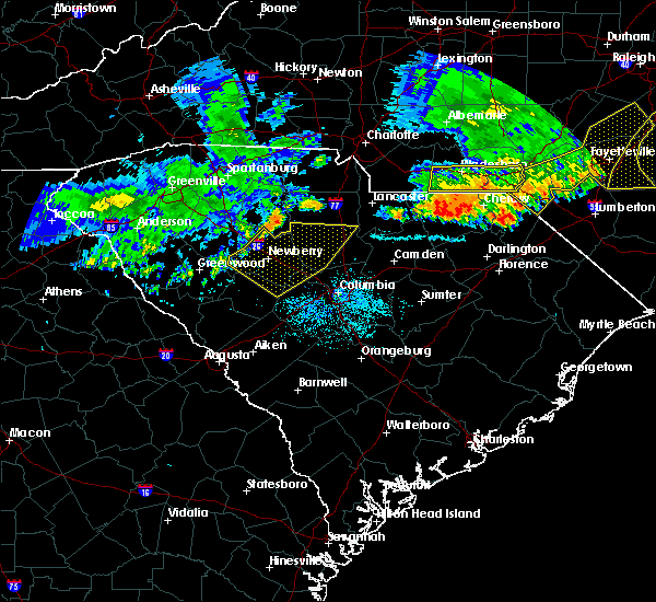 At 1030 pm edt, severe thunderstorms were located along a line extending from 6 miles southeast of carlisle to near newberry to 8 miles east of greenwood state park, moving east at 35 mph (radar indicated). Hazards include 60 mph wind gusts. Expect damage to roofs. siding. And trees. At 1030 pm edt, severe thunderstorms were located along a line extending from 6 miles southeast of carlisle to near newberry to 8 miles east of greenwood state park, moving east at 35 mph (radar indicated). Hazards include 60 mph wind gusts. Expect damage to roofs. siding. And trees.
|
| 7/7/2016 10:10 PM EDT |
 At 1008 pm edt, severe thunderstorms were located along a line extending from whitmire to near lake greenwood, moving southeast at 35 mph (radar indicated). Hazards include 60 mph wind gusts. Expect damage to roofs. siding. and trees. severe thunderstorms will be near, whitmire around 1015 pm edt. saluda around 1050 pm edt. Other locations impacted by these severe thunderstorms include chappells, pomaria, silverstreet, kinards and little mountain. At 1008 pm edt, severe thunderstorms were located along a line extending from whitmire to near lake greenwood, moving southeast at 35 mph (radar indicated). Hazards include 60 mph wind gusts. Expect damage to roofs. siding. and trees. severe thunderstorms will be near, whitmire around 1015 pm edt. saluda around 1050 pm edt. Other locations impacted by these severe thunderstorms include chappells, pomaria, silverstreet, kinards and little mountain.
|
| 7/6/2016 3:30 PM EDT |
 At 328 pm edt, a thunderstorm was near little mountain moving eastward near 30 mph and toward the chapin area. the storm like contain wind gusts of 40 to 60 mph (radar indicated). Hazards include 60 mph wind gusts. Expect damage to roofs. siding. And trees. At 328 pm edt, a thunderstorm was near little mountain moving eastward near 30 mph and toward the chapin area. the storm like contain wind gusts of 40 to 60 mph (radar indicated). Hazards include 60 mph wind gusts. Expect damage to roofs. siding. And trees.
|
| 7/6/2016 3:25 PM EDT | Sc dept. of highways reported trees down at morris rd. and stoney hill r in newberry county SC, 2.5 miles NNE of Prosperity, SC |
| 7/6/2016 3:17 PM EDT |
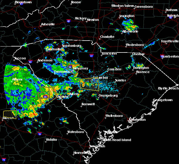 At 315 pm edt, a severe thunderstorm was in northwest newberry county near brick house moving eastward near 30 mph and toward the area between newberry and whitmire (radar indicated). Hazards include 70 mph wind gusts. Expect considerable tree damage. damage is likely to mobile homes, roofs, and outbuildings. Locations impacted include, area between newberry and whitmire. At 315 pm edt, a severe thunderstorm was in northwest newberry county near brick house moving eastward near 30 mph and toward the area between newberry and whitmire (radar indicated). Hazards include 70 mph wind gusts. Expect considerable tree damage. damage is likely to mobile homes, roofs, and outbuildings. Locations impacted include, area between newberry and whitmire.
|
| 7/6/2016 3:05 PM EDT |
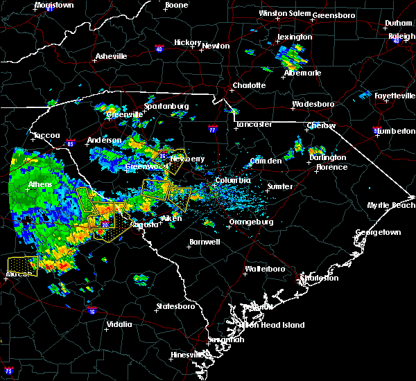 At 303 pm edt, a severe thunderstorm just northwest of jalapa in newberry county, moving east at 25 mph (radar indicated). Hazards include 60 mph wind gusts. Expect damage to roofs. siding. And trees. At 303 pm edt, a severe thunderstorm just northwest of jalapa in newberry county, moving east at 25 mph (radar indicated). Hazards include 60 mph wind gusts. Expect damage to roofs. siding. And trees.
|
| 2/3/2016 1:25 PM EST |
 At 124 pm est, doppler radar indicated a severe thunderstorm capable of producing damaging winds in excess of 60 mph. this storm was located over ridge spring, or 9 miles southwest of batesburg, and moving east-northeast at 45 mph. At 124 pm est, doppler radar indicated a severe thunderstorm capable of producing damaging winds in excess of 60 mph. this storm was located over ridge spring, or 9 miles southwest of batesburg, and moving east-northeast at 45 mph.
|
| 9/4/2015 3:54 PM EDT |
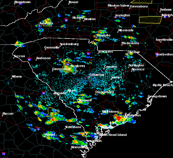 At 352 pm edt, local law enforcement reported downed powerlines associated with a severe thunderstorm. radar indicated damaging winds in excess of 60 mph. this storm was located near newberry, moving south at 15 mph. locations impacted include, newberry, prosperity, silverstreet and kinards. At 352 pm edt, local law enforcement reported downed powerlines associated with a severe thunderstorm. radar indicated damaging winds in excess of 60 mph. this storm was located near newberry, moving south at 15 mph. locations impacted include, newberry, prosperity, silverstreet and kinards.
|
| 9/4/2015 3:32 PM EDT |
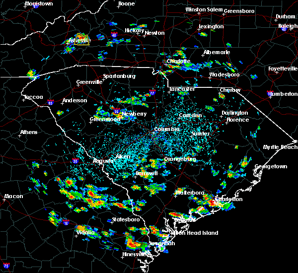 At 331 pm edt, doppler radar indicated a severe thunderstorm capable of producing damaging winds in excess of 60 mph. this storm was located near newberry, and moving south at 10 mph. At 331 pm edt, doppler radar indicated a severe thunderstorm capable of producing damaging winds in excess of 60 mph. this storm was located near newberry, and moving south at 10 mph.
|
| 8/6/2015 5:12 PM EDT |
 At 511 pm edt, doppler radar indicated a line of severe thunderstorms capable of producing damaging winds in excess of 60 mph. these storms were located along a line extending from near whitmire to 10 miles south of ninety six historic site, and moving east at 25 mph. At 511 pm edt, doppler radar indicated a line of severe thunderstorms capable of producing damaging winds in excess of 60 mph. these storms were located along a line extending from near whitmire to 10 miles south of ninety six historic site, and moving east at 25 mph.
|
| 8/6/2015 2:56 PM EDT |
 At 256 pm edt, doppler radar indicated a severe thunderstorm capable of producing damaging winds in excess of 60 mph. this storm was located 9 miles south of joanna, or 9 miles west of newberry, and moving east at 30 mph. At 256 pm edt, doppler radar indicated a severe thunderstorm capable of producing damaging winds in excess of 60 mph. this storm was located 9 miles south of joanna, or 9 miles west of newberry, and moving east at 30 mph.
|
| 7/19/2015 5:16 PM EDT |
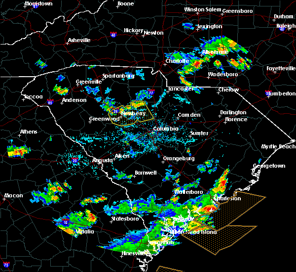 At 515 pm edt, doppler radar indicated a line of severe thunderstorms capable of producing damaging winds in excess of 60 mph. these storms were located along a line extending from 8 miles southwest of blackstock to 6 miles southeast of joanna, and moving south at 15 mph. At 515 pm edt, doppler radar indicated a line of severe thunderstorms capable of producing damaging winds in excess of 60 mph. these storms were located along a line extending from 8 miles southwest of blackstock to 6 miles southeast of joanna, and moving south at 15 mph.
|
| 7/18/2015 6:07 PM EDT |
 At 606 pm edt, doppler radar indicated a line of severe thunderstorms capable of producing damaging winds in excess of 60 mph. these storms were located along a line extending from 11 miles northwest of irmo to 9 miles northeast of greenwood state park, and moving south at 15 mph. penny size hail may also accompany the damaging winds. At 606 pm edt, doppler radar indicated a line of severe thunderstorms capable of producing damaging winds in excess of 60 mph. these storms were located along a line extending from 11 miles northwest of irmo to 9 miles northeast of greenwood state park, and moving south at 15 mph. penny size hail may also accompany the damaging winds.
|
| 7/13/2015 9:49 PM EDT |
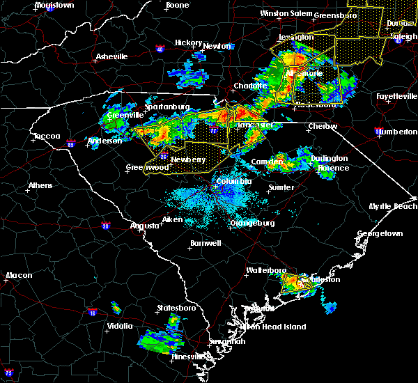 At 949 pm edt, doppler radar indicated a severe thunderstorm capable of producing damaging winds in excess of 60 mph. this storm was located near rose hill state park, or 11 miles south of union, and moving southeast at 30 mph. At 949 pm edt, doppler radar indicated a severe thunderstorm capable of producing damaging winds in excess of 60 mph. this storm was located near rose hill state park, or 11 miles south of union, and moving southeast at 30 mph.
|
| 7/2/2015 3:25 PM EDT |
 At 324 pm edt, doppler radar indicated a line of severe thunderstorms capable of producing damaging winds in excess of 60 mph. these storms were located along a line extending from near clinton to cross hill, and moving east to southeast at 40 mph. At 324 pm edt, doppler radar indicated a line of severe thunderstorms capable of producing damaging winds in excess of 60 mph. these storms were located along a line extending from near clinton to cross hill, and moving east to southeast at 40 mph.
|
| 5/18/2015 7:00 PM EDT | At 656 pm edt, doppler radar indicated an area of thunderstorms extending from southeast newberry county southward along the lexington and saluda county line. movement was eastward near 20 mph. wind gusts of 40 to 60 mph will occur with a few of these thunderstorms. |
| 5/18/2015 6:43 PM EDT | At 640 pm edt, doppler radar indicated thunderstorms extending from neweberry county southward into southeast saluda county. some of the storms likely contained wind gusts of 50 to 60 mph. storm movement was east near 10 mph. |
| 4/19/2015 4:46 PM EDT | At 444 pm edt, national weather service doppler radar indicated a line of severe thunderstorms capable of producing damaging winds in excess of 60 mph. these storms were located along a line extending from 9 miles north of saluda to 14 miles south of red bank, or along a line extending from 14 miles southwest of newberry to 14 miles south of red bank, and moving northeast at 45 mph. * some communities in the warning area include five points, fort jackson, woodfields, west columbia, st. andrews, springdale, south congaree, saluda, red bank, prosperity, pine ridge, oak grove, newberry, lexington, leesville, irmo, forest acres, dentsville, columbia, cayce, batesburg and arcadia lakes report large hail, damaging winds or flooding to your county sheriff, or use www.facebook.com/nwscolumbia and email [email protected] to relay severe weather reports. |
| 6/19/2014 8:25 PM EDT | Schp reported trees down on morris rd in newberry county SC, 3.8 miles NNE of Prosperity, SC |
| 5/21/2013 3:27 PM EDT | Numerous trees and powerlines down in prosperit in newberry county SC, 0.2 miles NNW of Prosperity, SC |
| 7/30/2012 7:45 PM EDT | Trees downed on mcneary st at arbor knoll in newberry county SC, 1.5 miles N of Prosperity, SC |
| 7/3/2012 7:30 PM EDT | Sheriff reported tree on house. also small hai in newberry county SC, 5.5 miles NNW of Prosperity, SC |
| 5/15/2012 4:43 PM EDT | Highway patrol reported trees down near bachman chapel road and interstate 2 in newberry county SC, 3.7 miles SSW of Prosperity, SC |
| 1/1/0001 12:00 AM | Tree down on highway 395 near george lan in newberry county SC, 6.7 miles NE of Prosperity, SC |
| 1/1/0001 12:00 AM | *** 2 inj *** tree fell on car near us 76 at georgia pacific plan in newberry county SC, 2.4 miles WSW of Prosperity, SC |
| 1/1/0001 12:00 AM | Schp reports trees down on highway 391 at the bridg in saluda county SC, 9.3 miles N of Prosperity, SC |
| 1/1/0001 12:00 AM | Sc hwy patrol reports tree in road near intersection of seagull lane and osprey point at lake murray in newberry county SC, 8.4 miles N of Prosperity, SC |
Hail Maps for Prosperity, SC


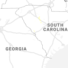


Connect with Interactive Hail Maps