

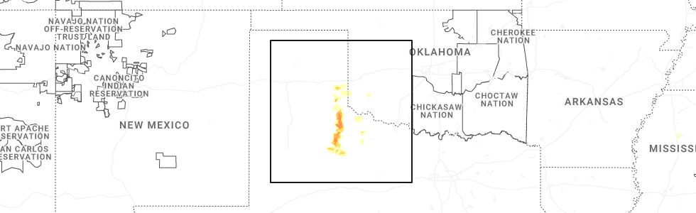
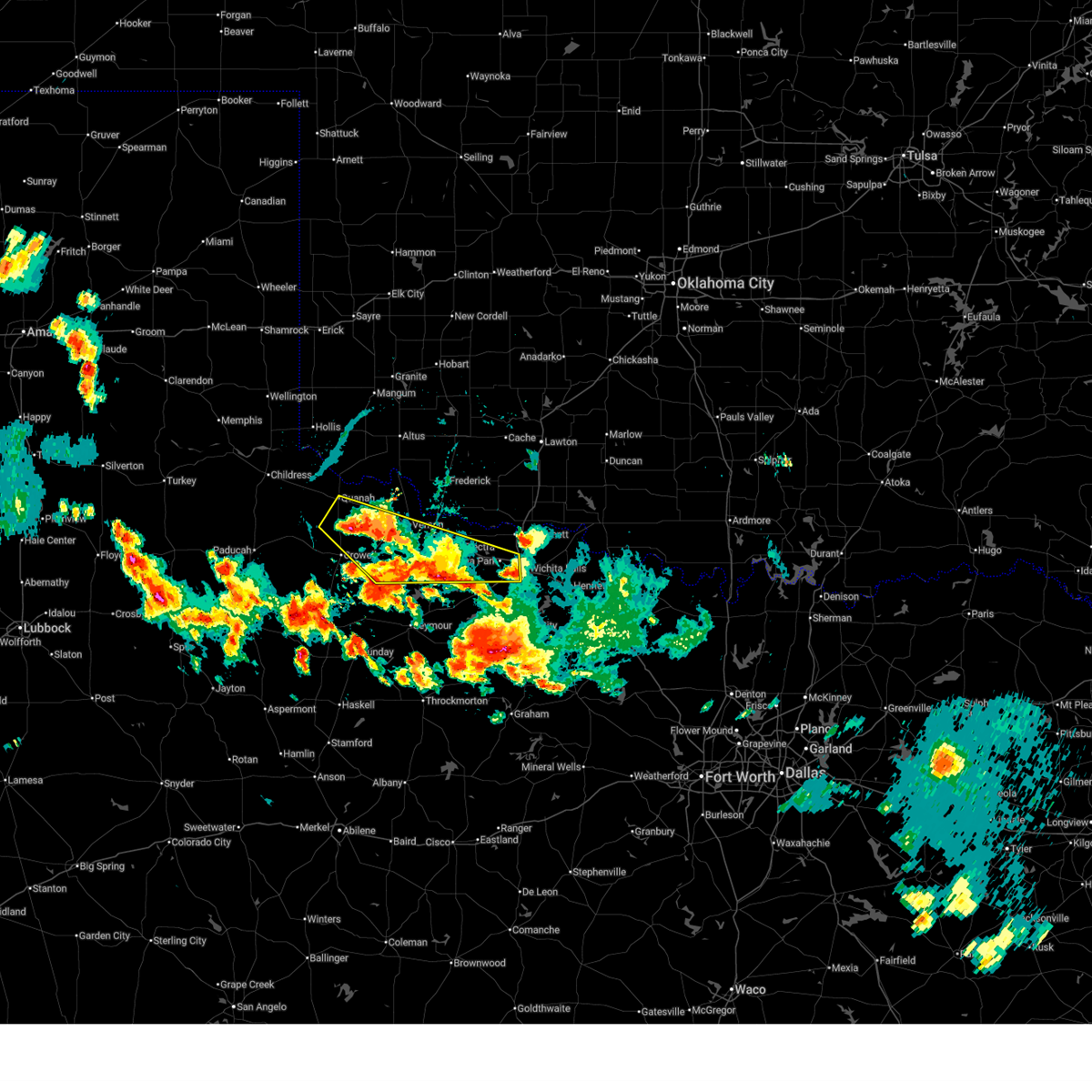
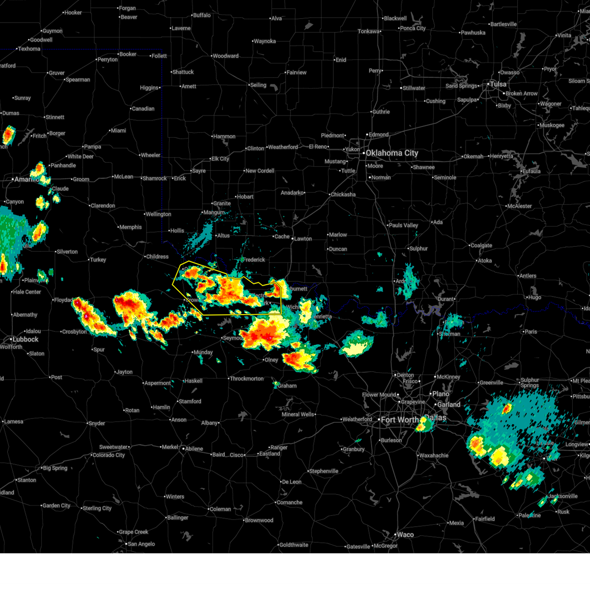
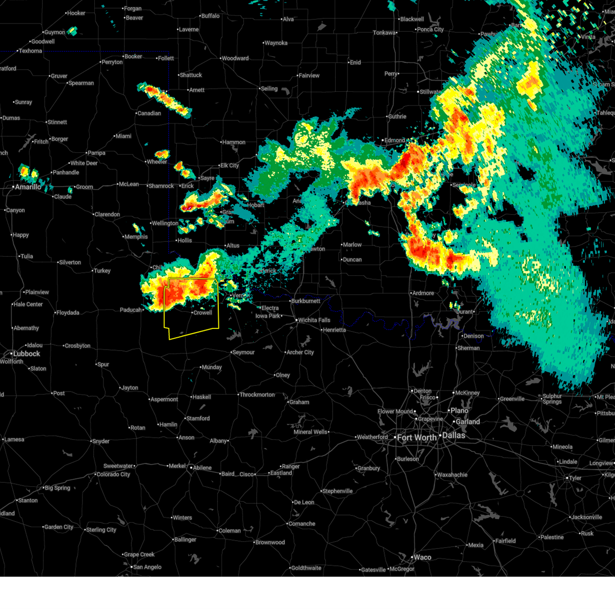
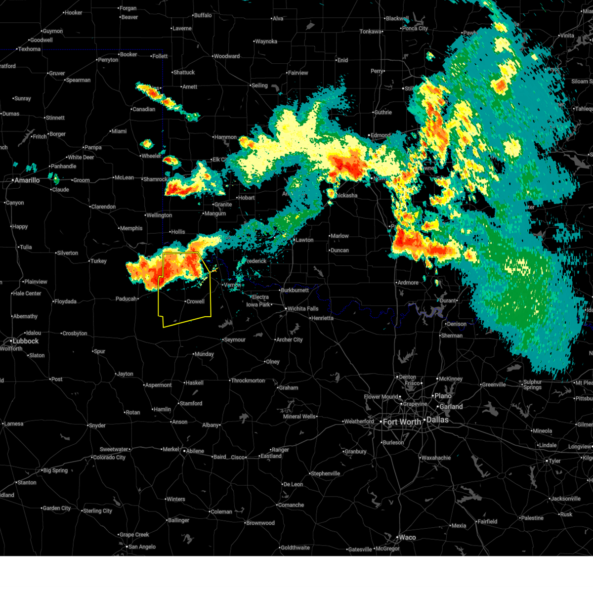
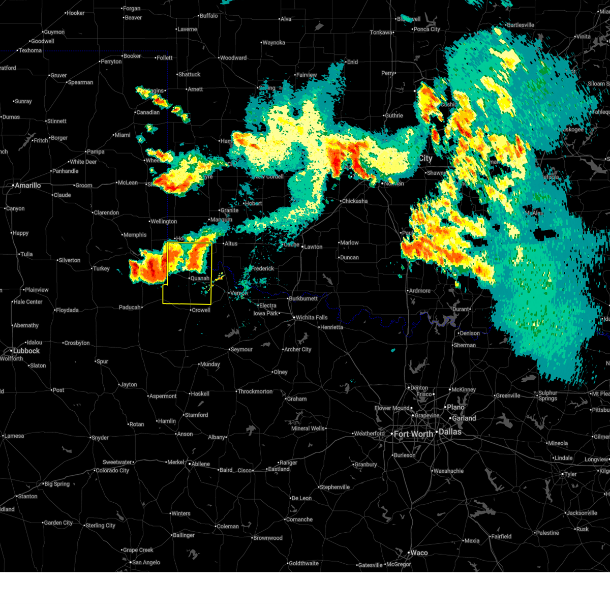
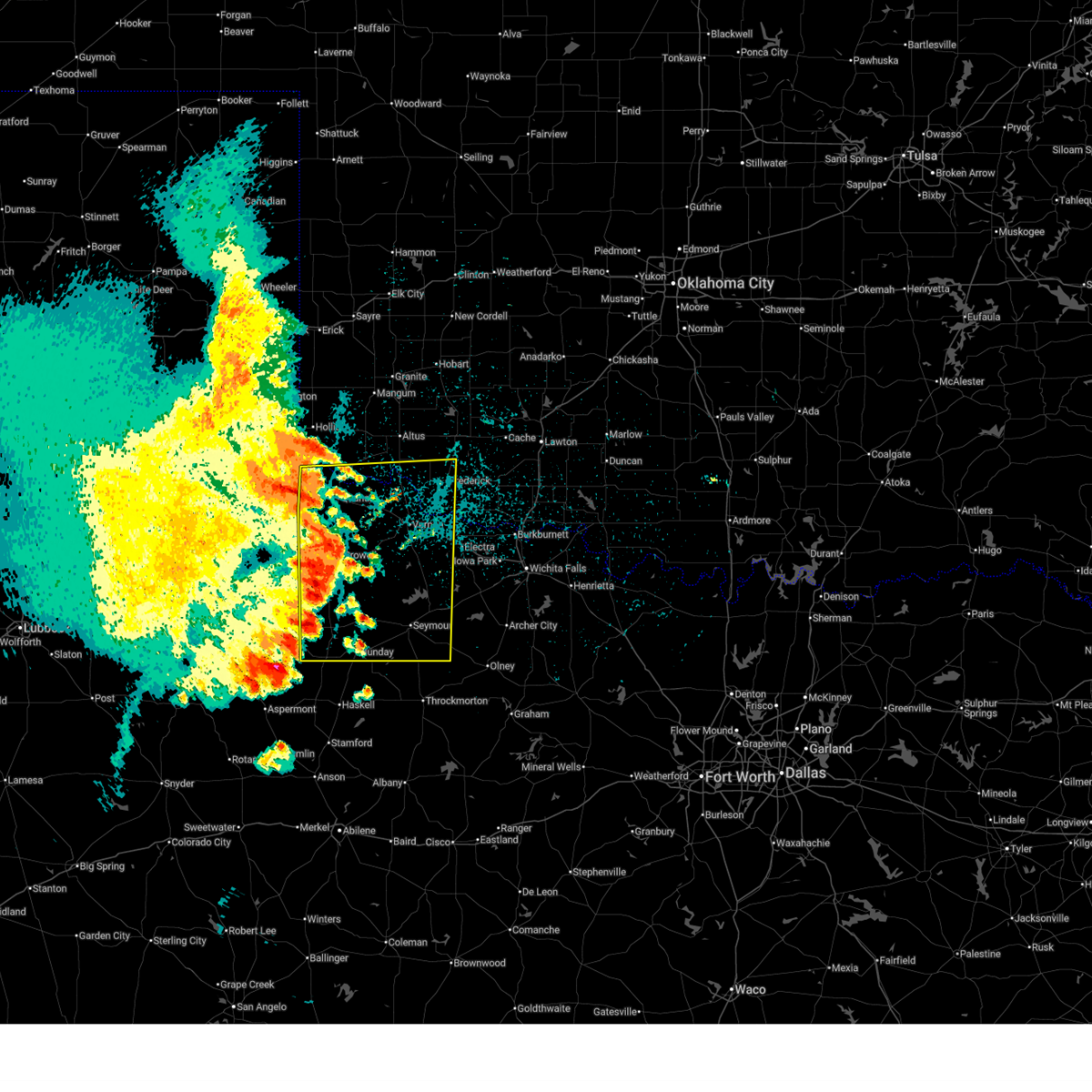
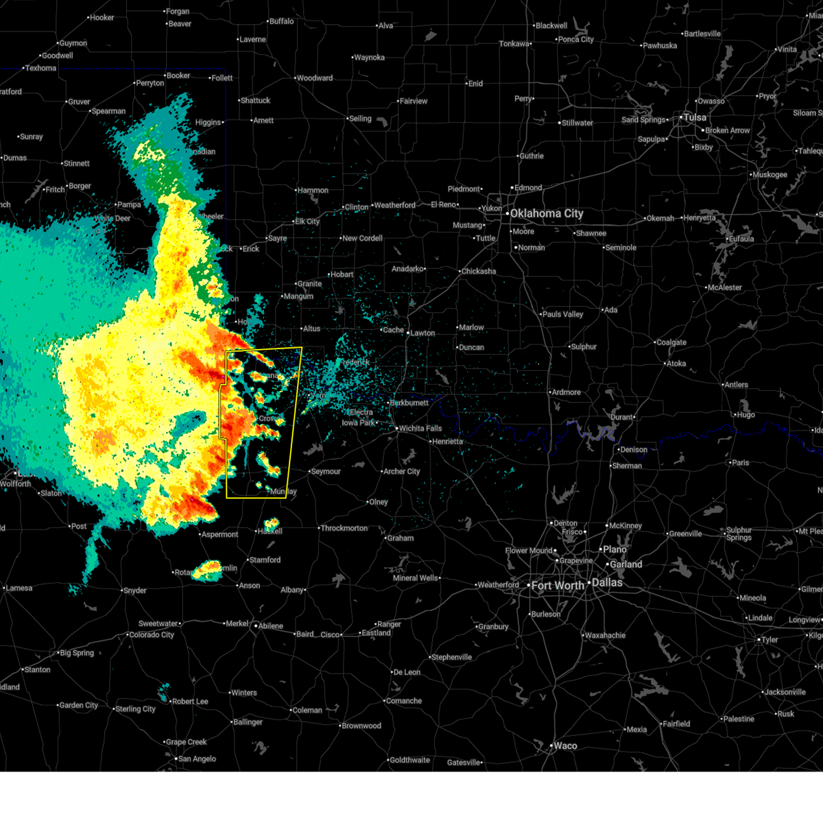
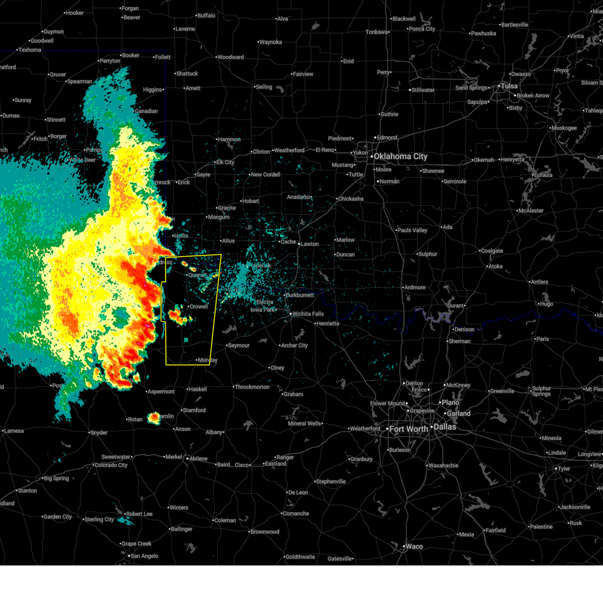
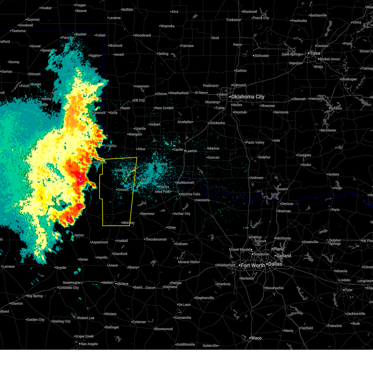
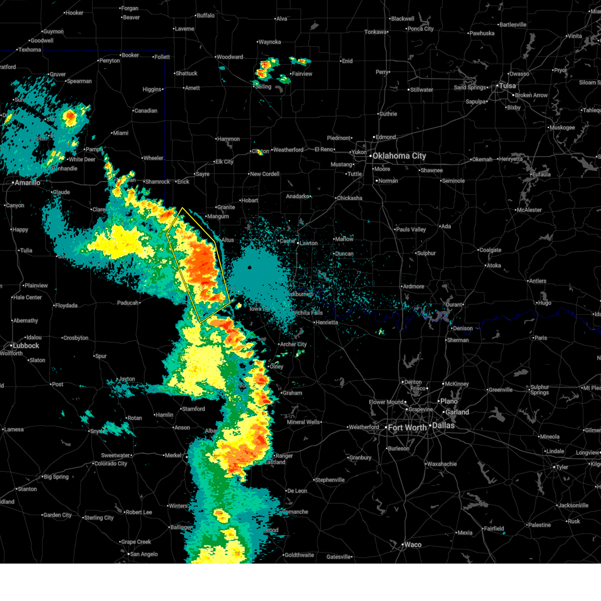
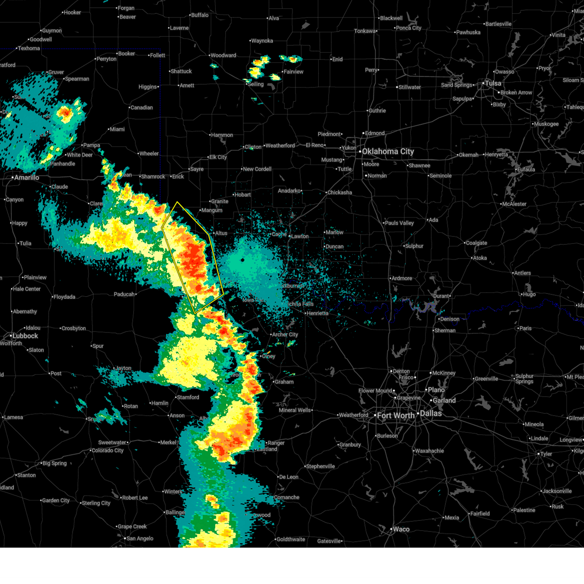
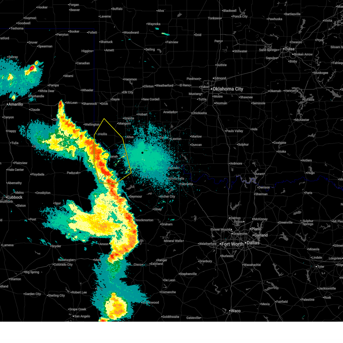
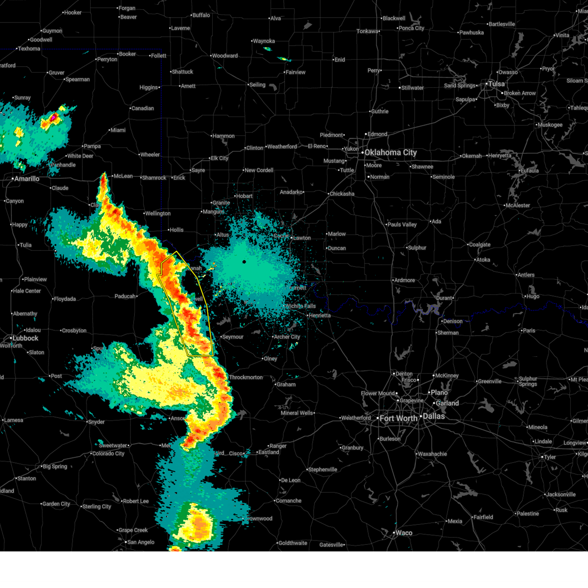
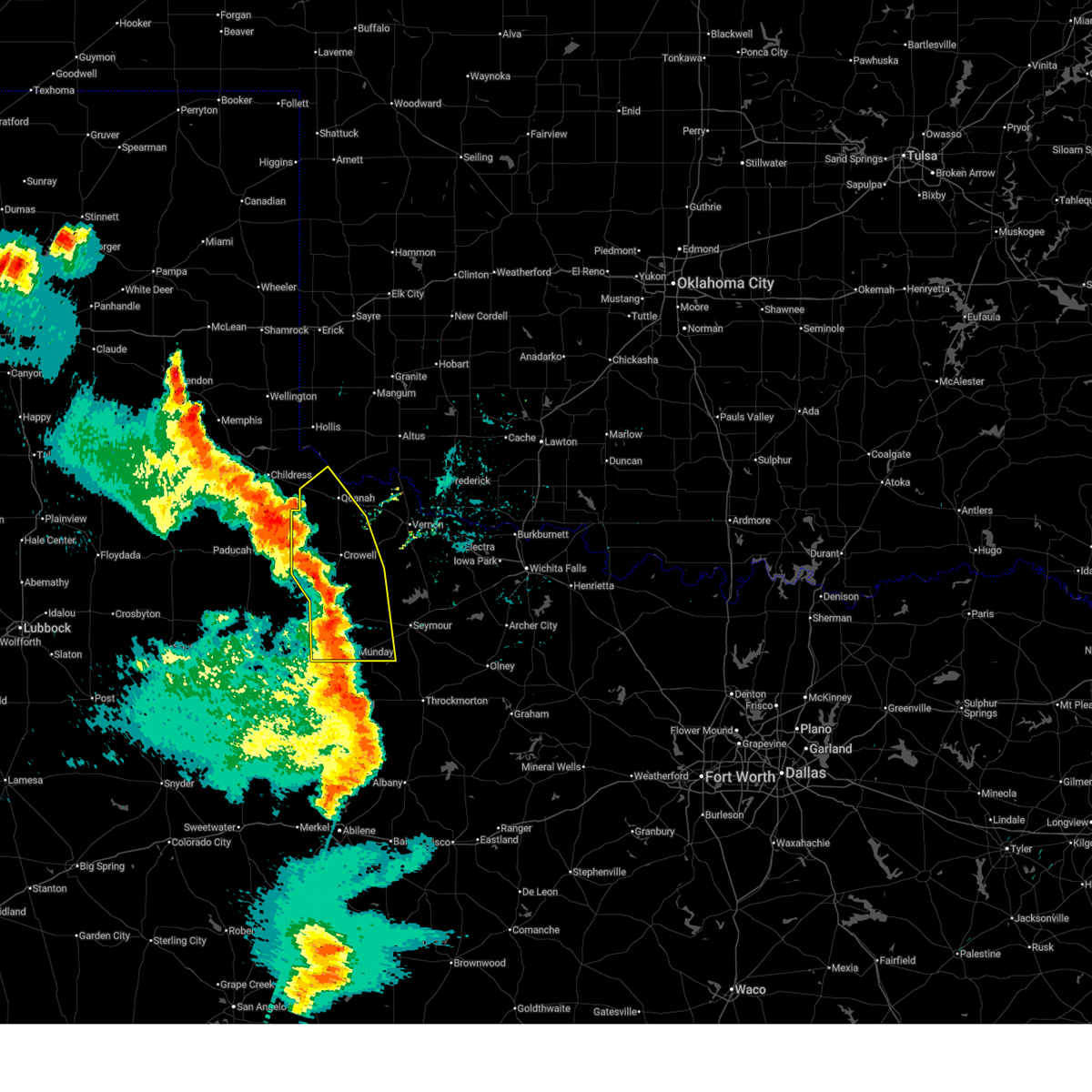
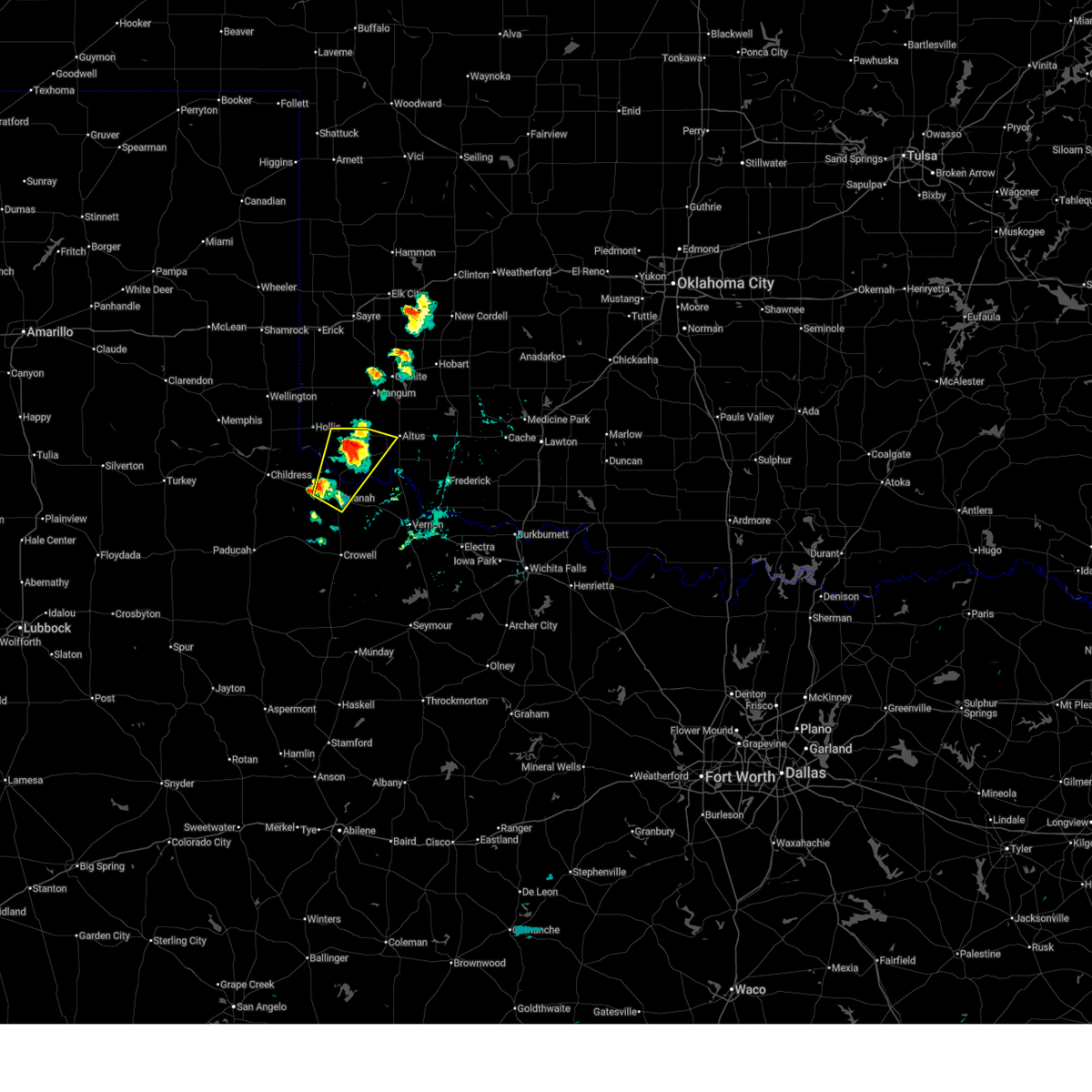
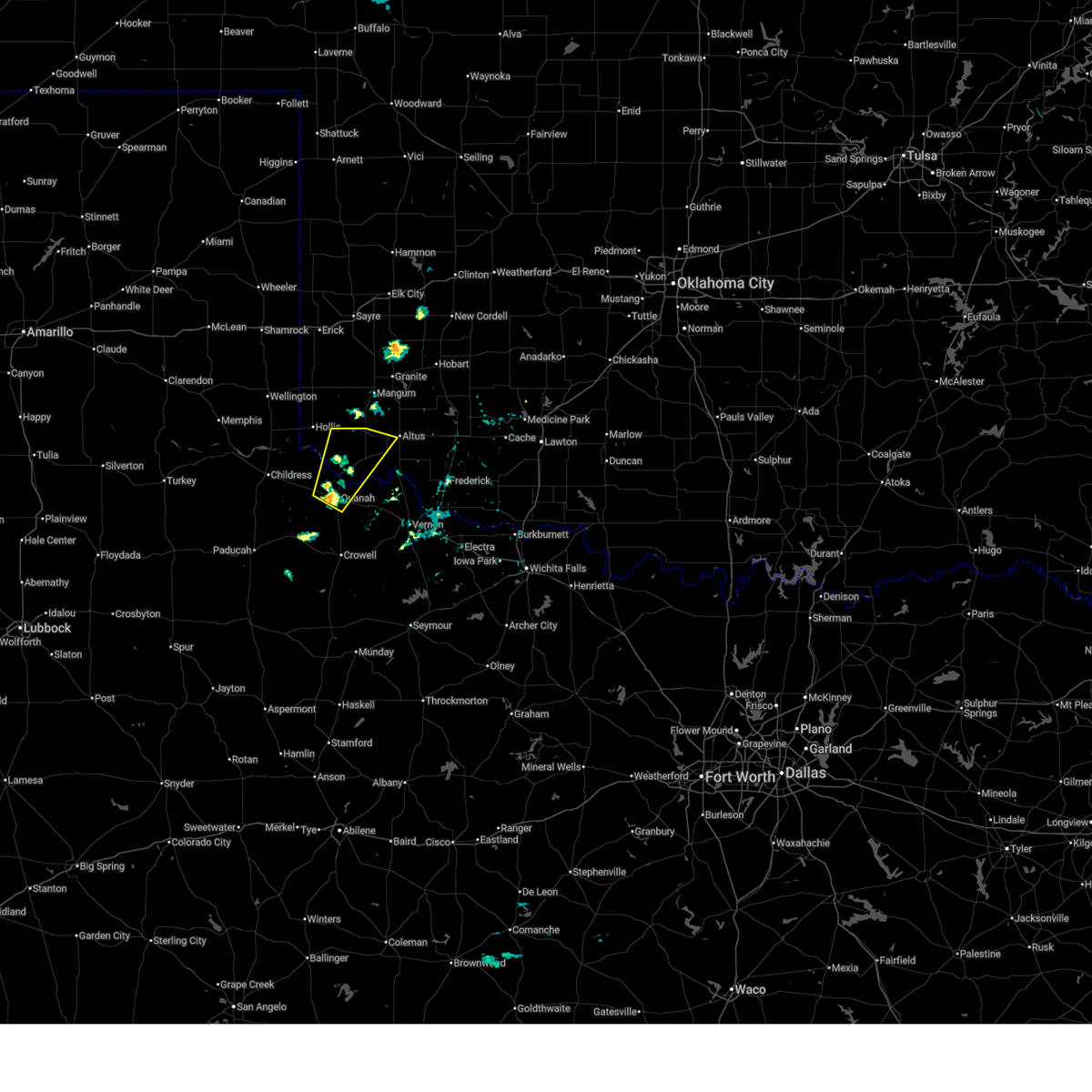
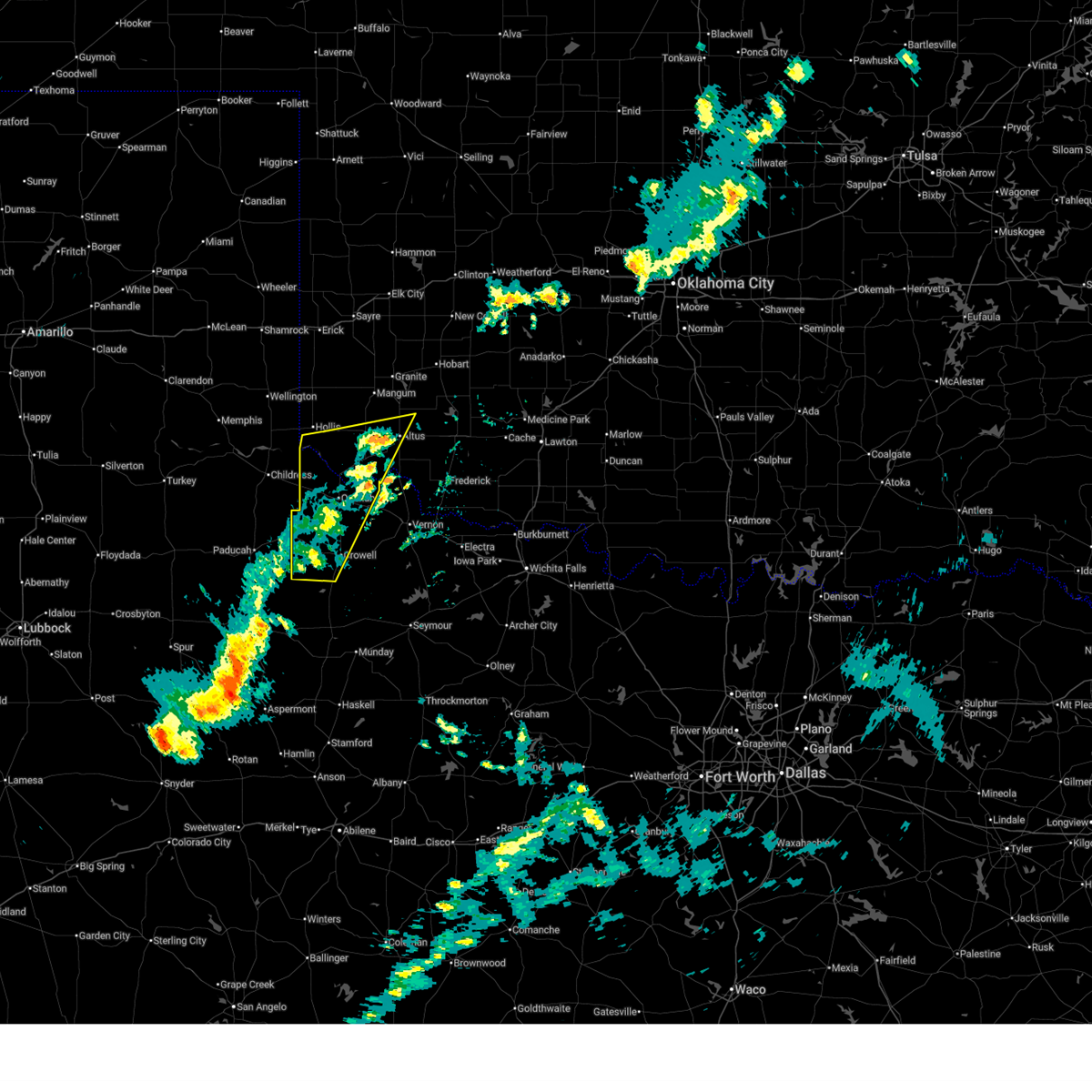
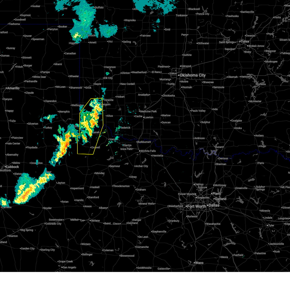
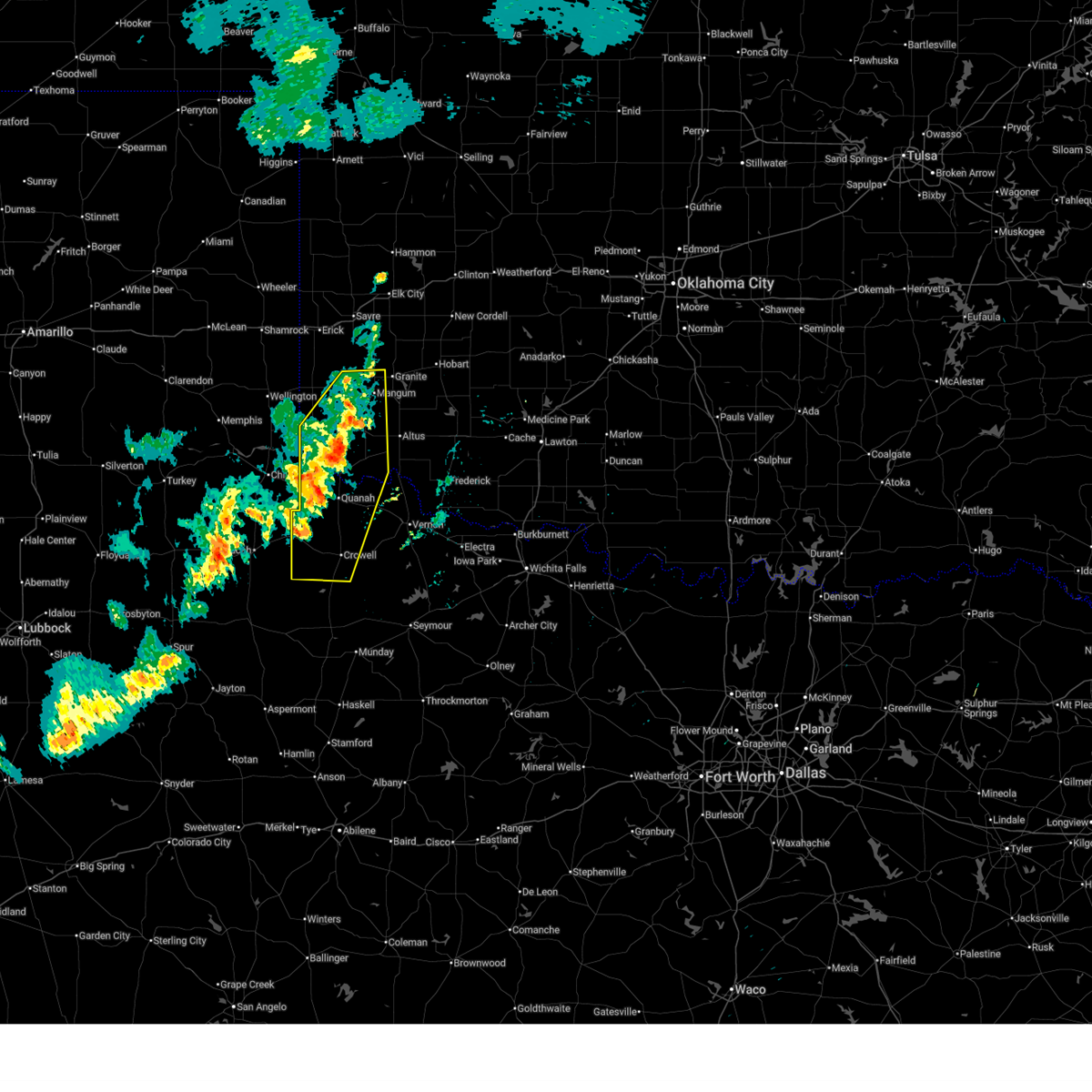
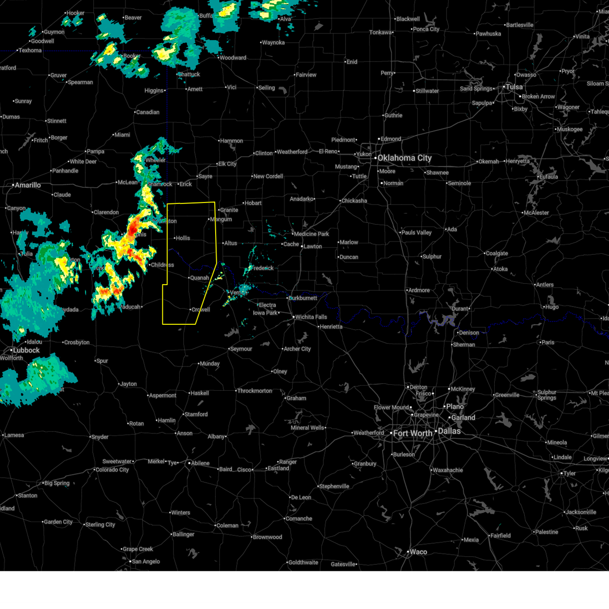
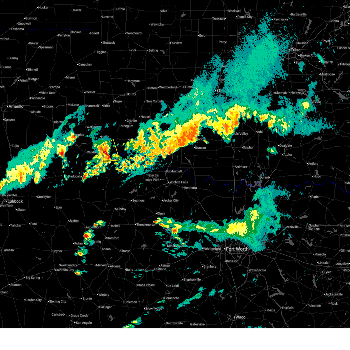
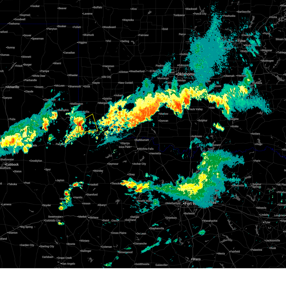
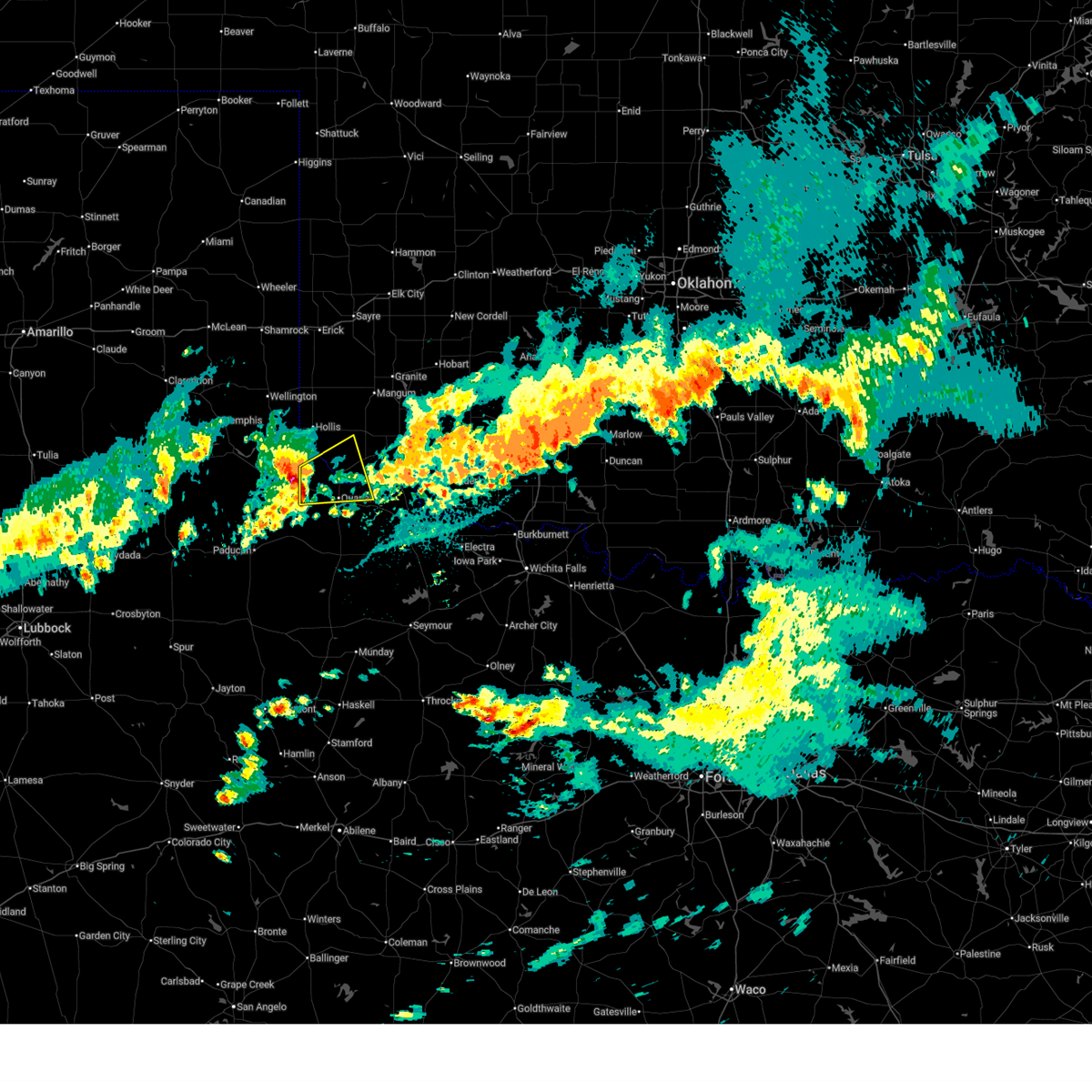
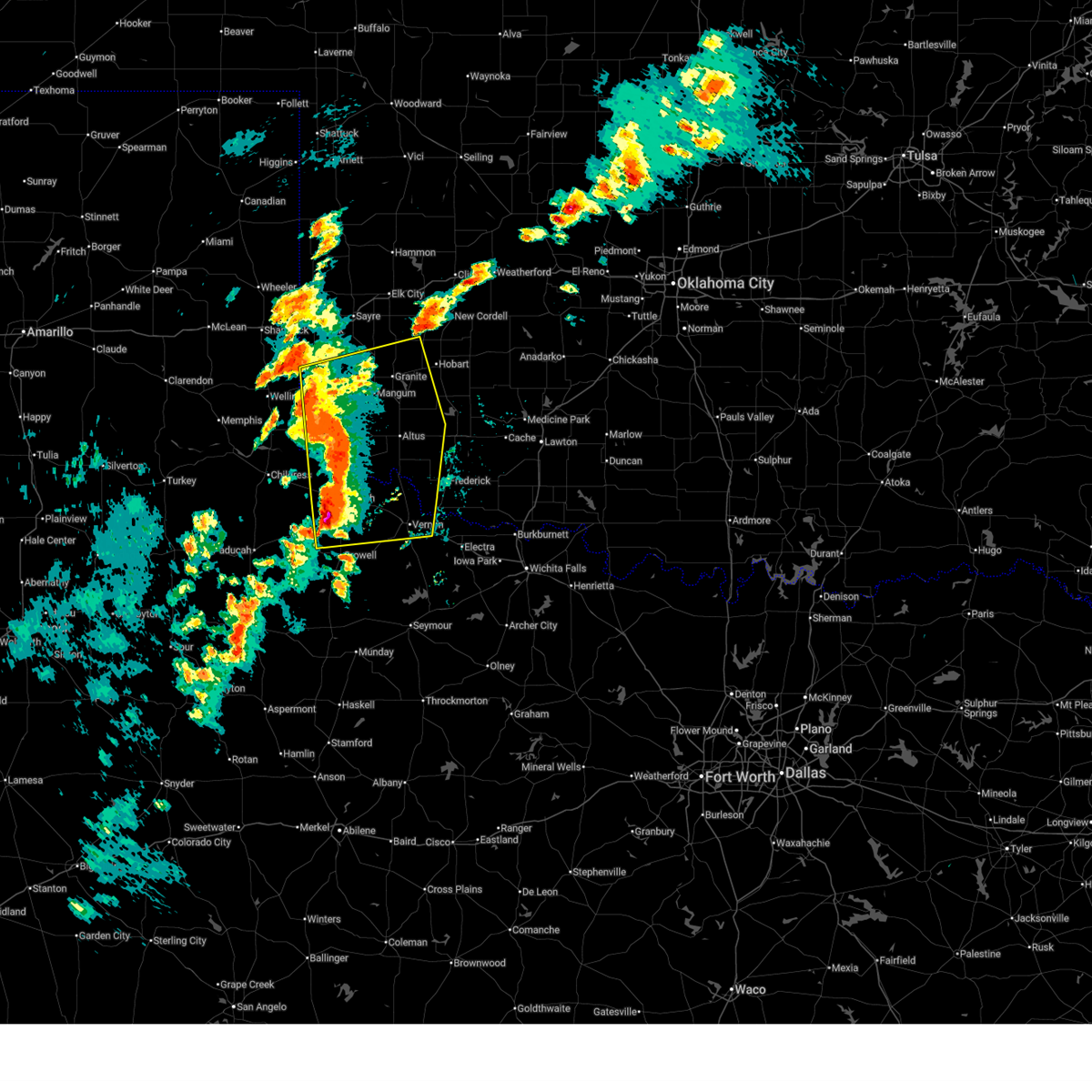
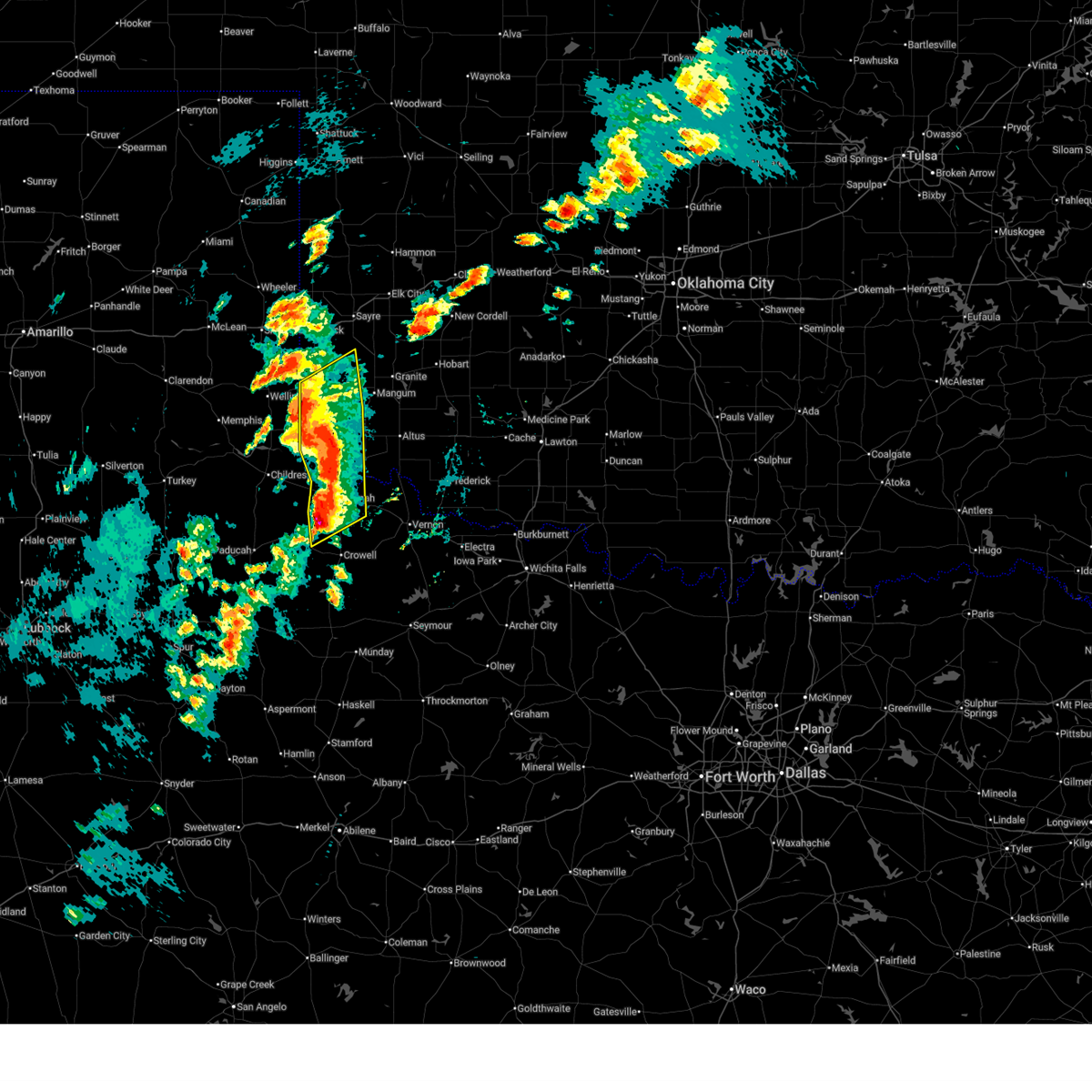
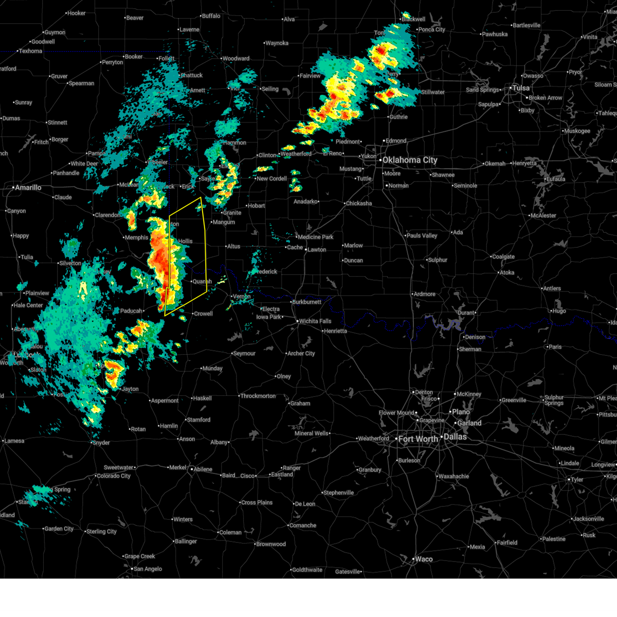
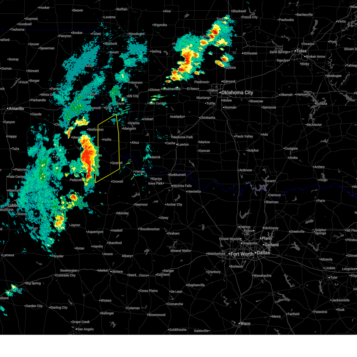
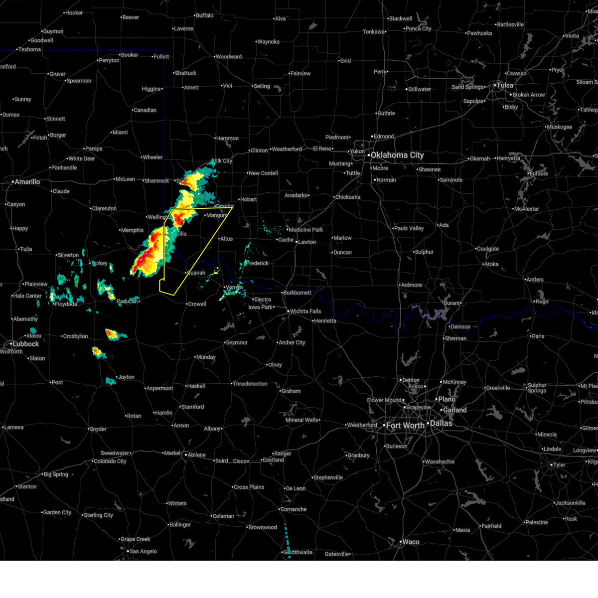
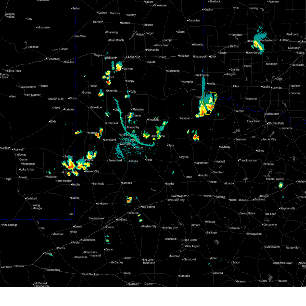
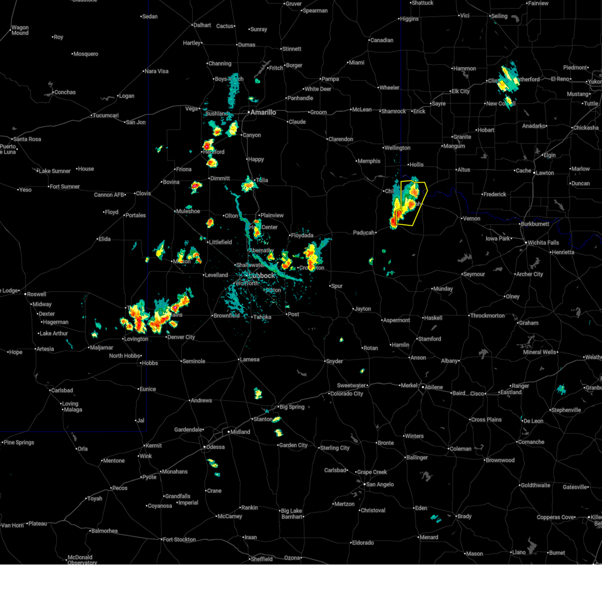
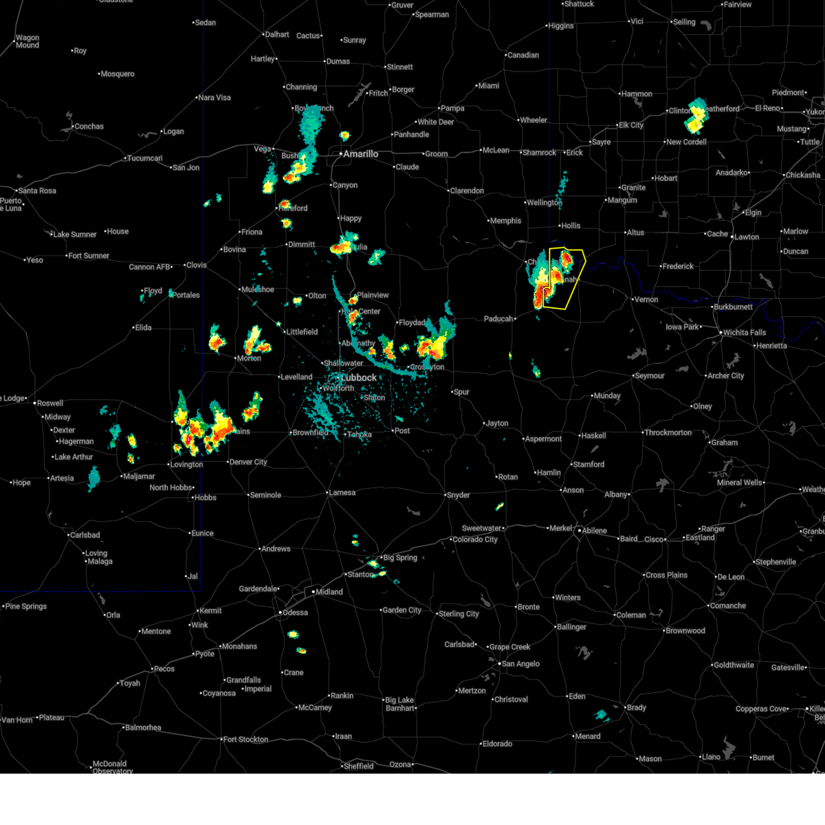
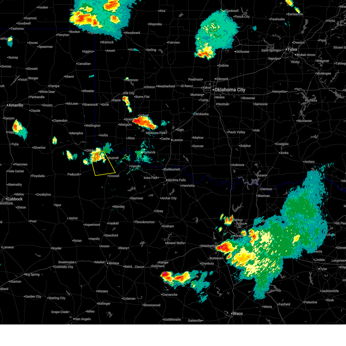
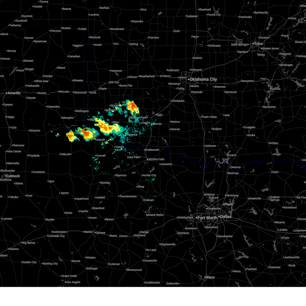
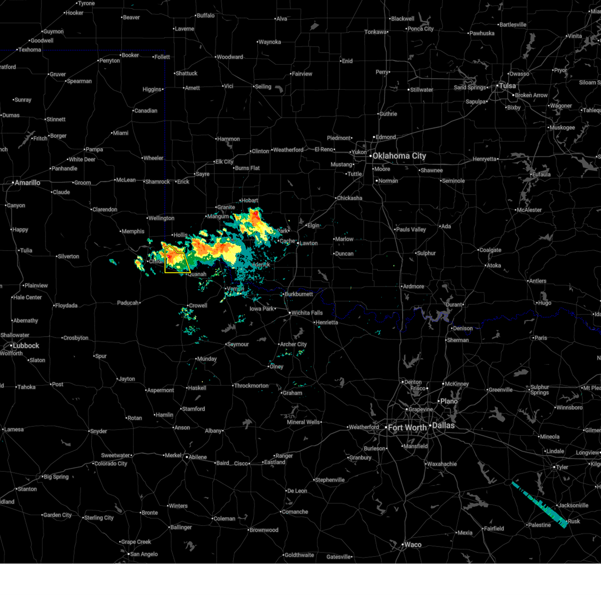
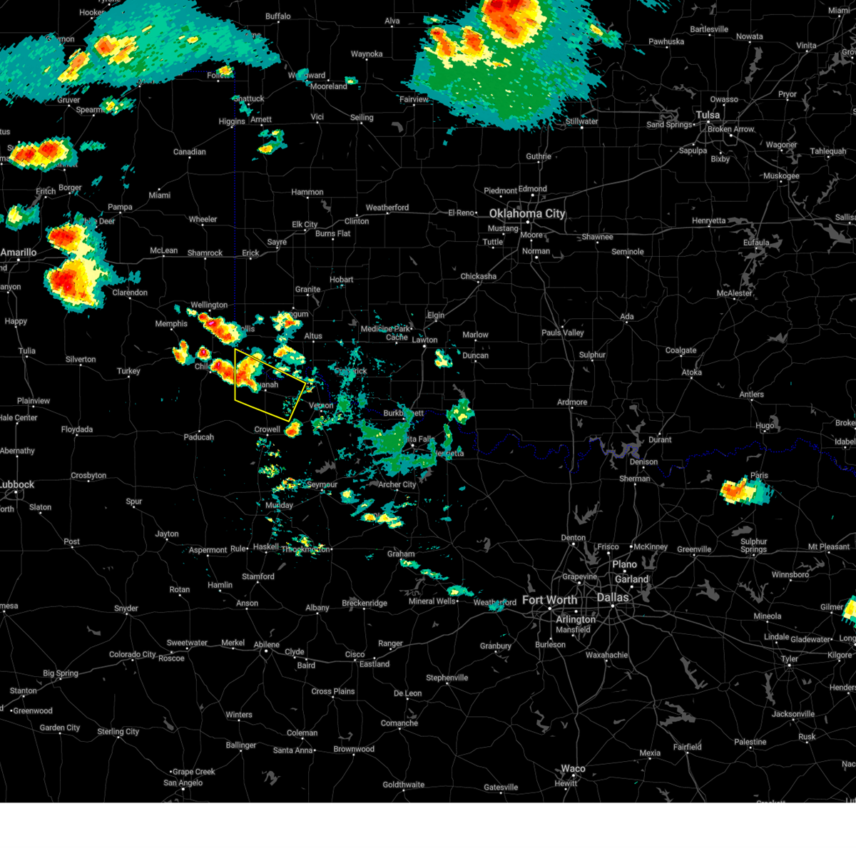
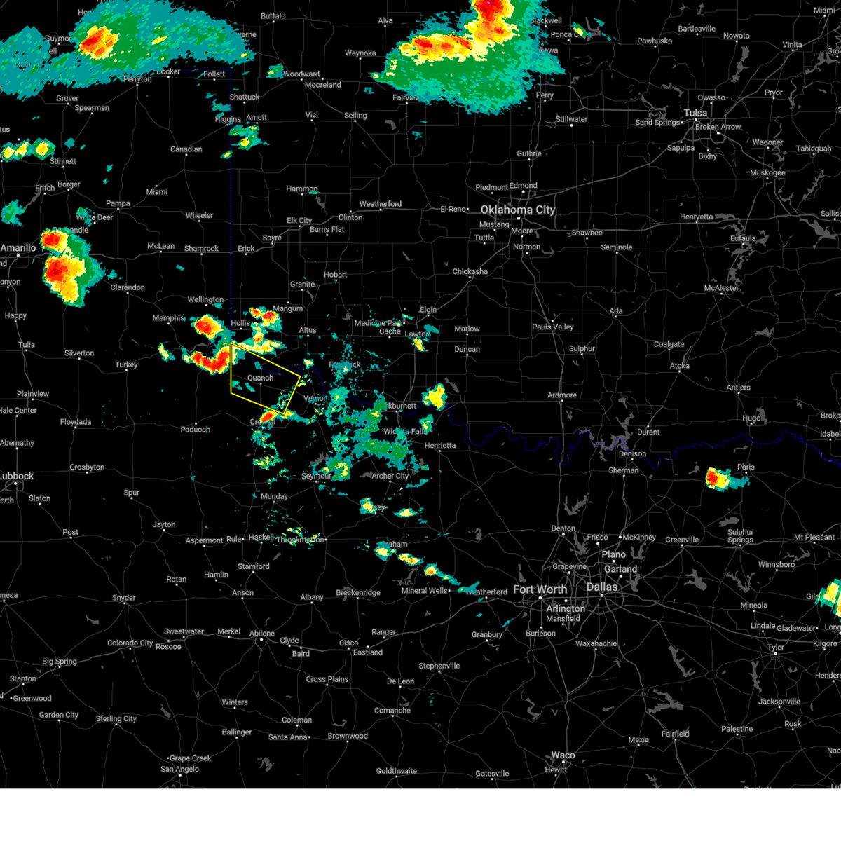
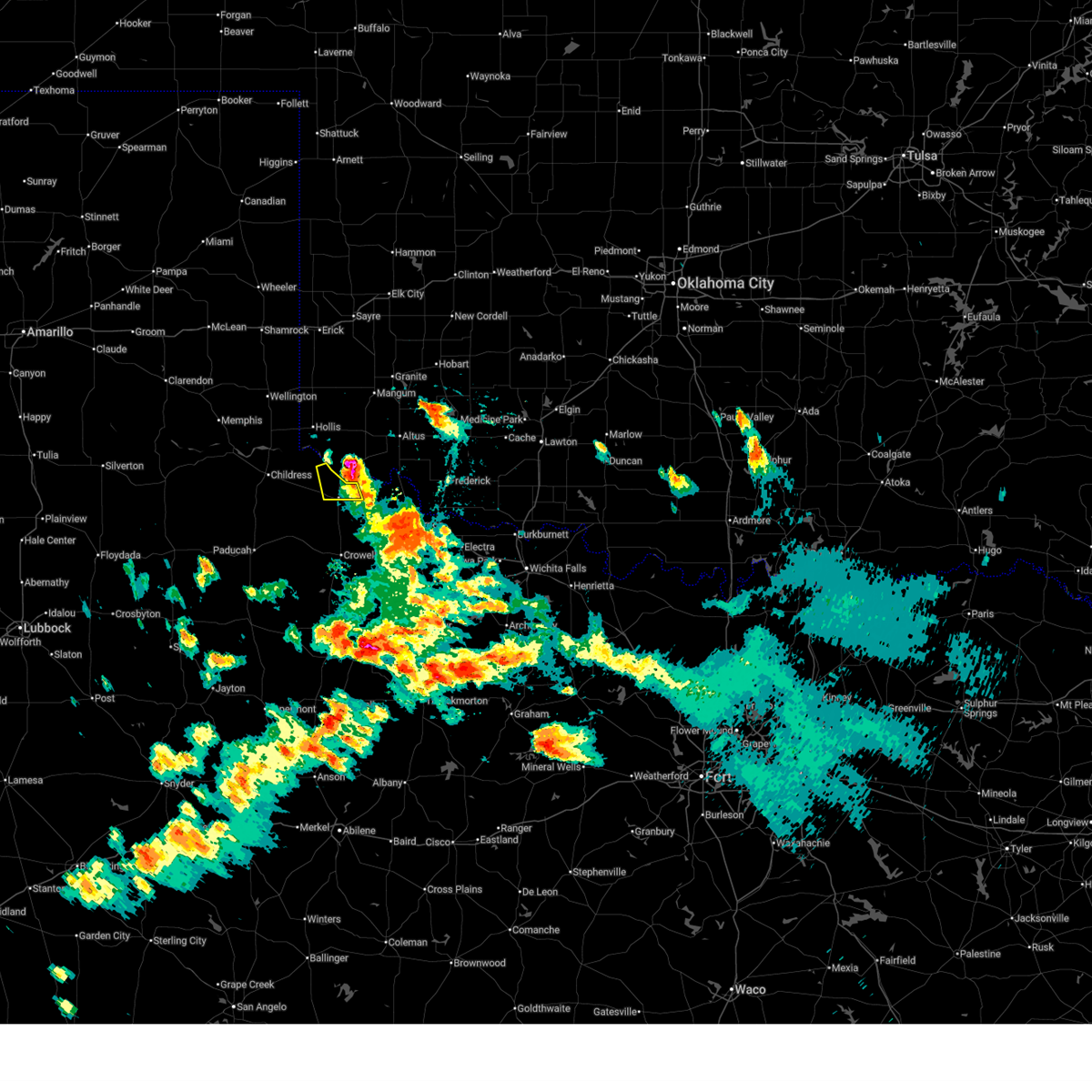
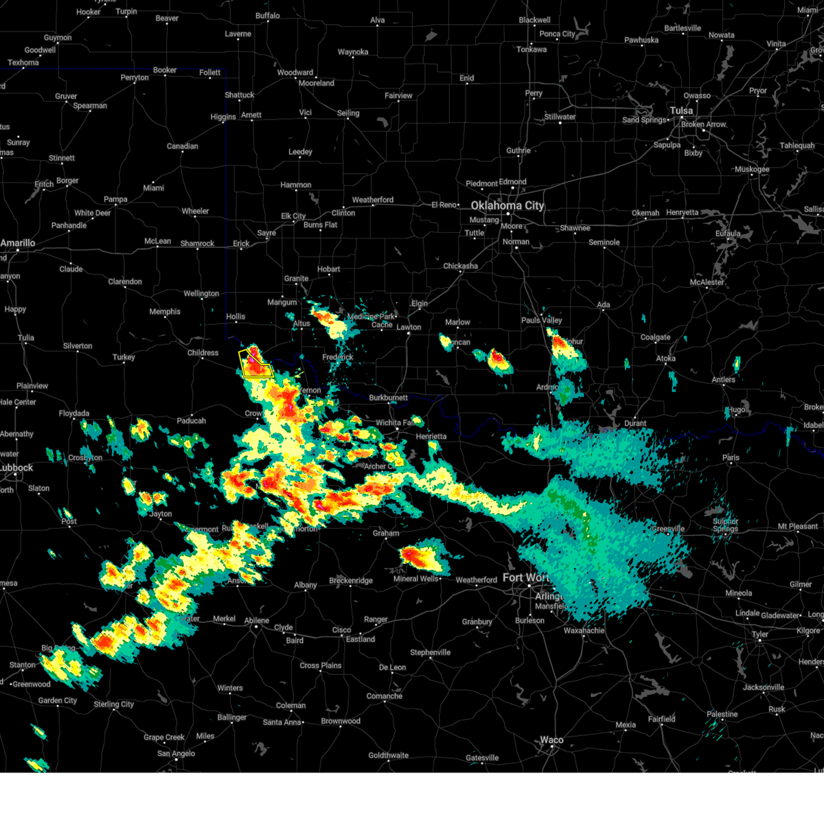
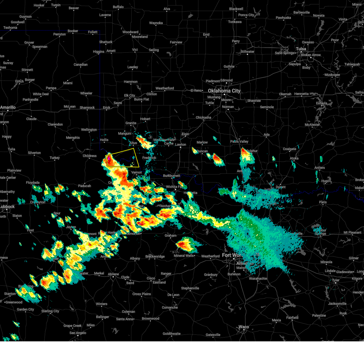
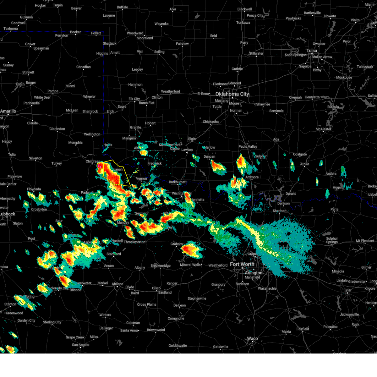
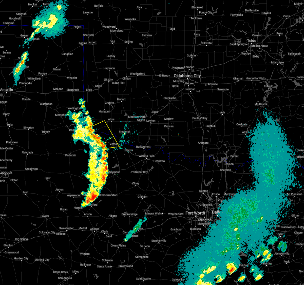
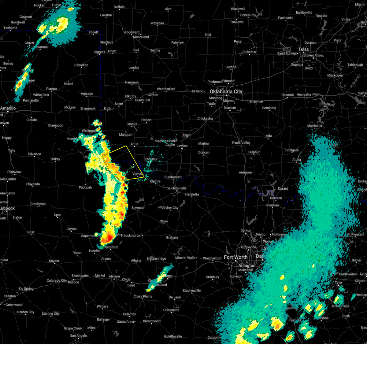
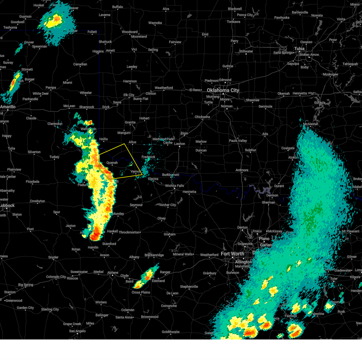
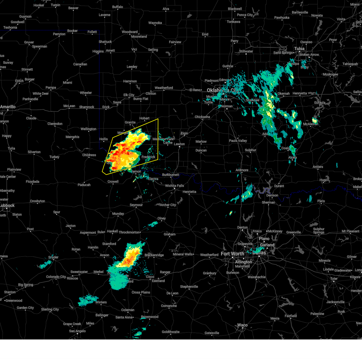
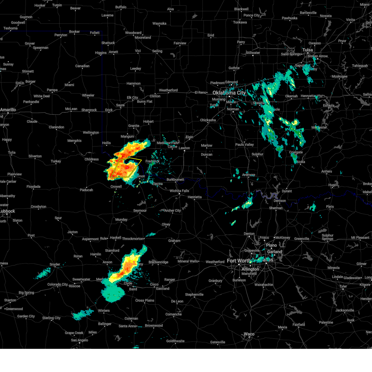
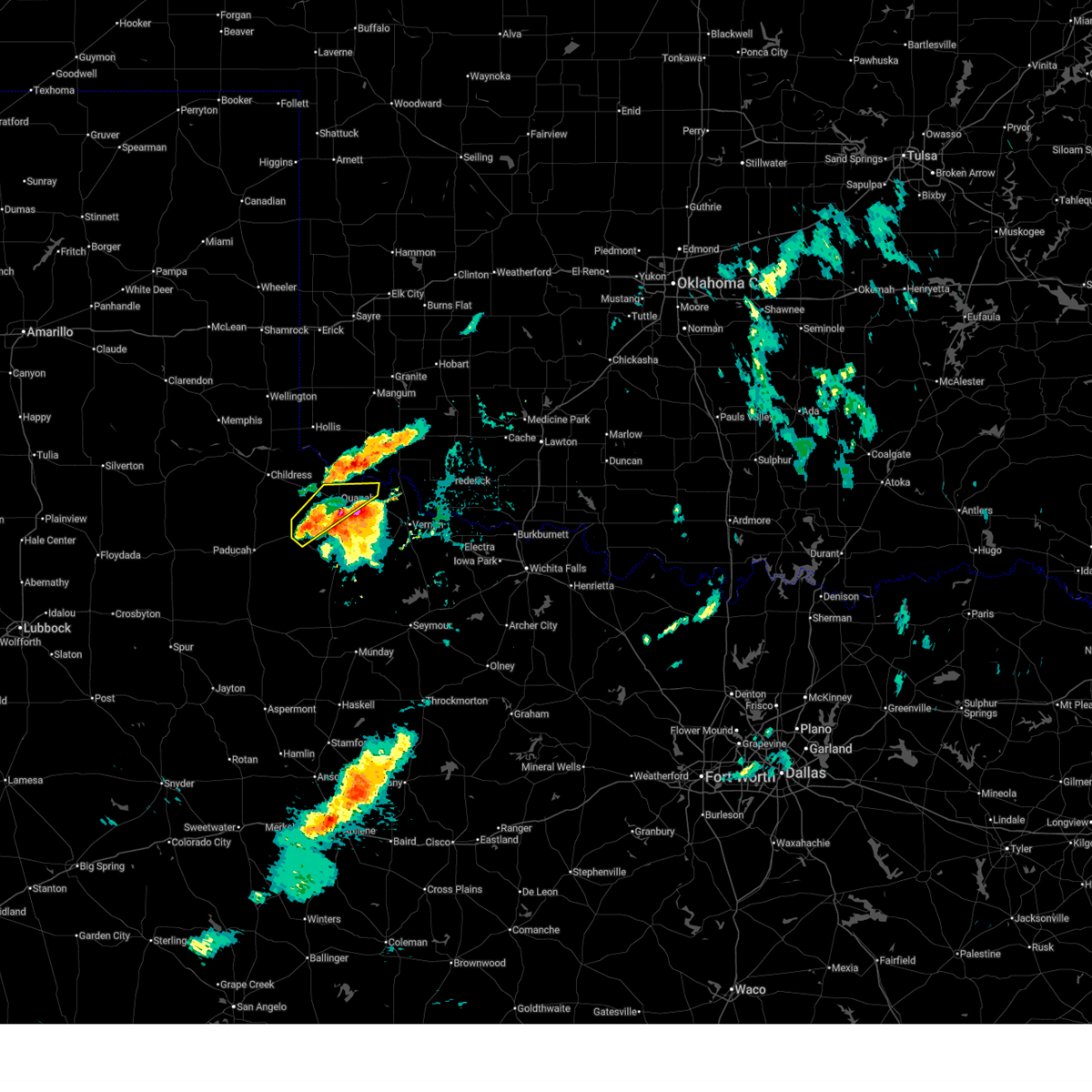
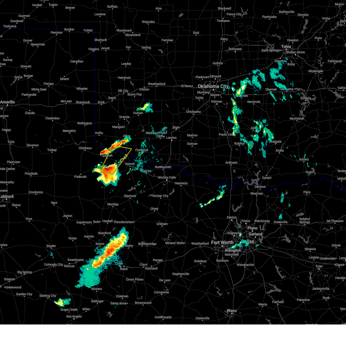
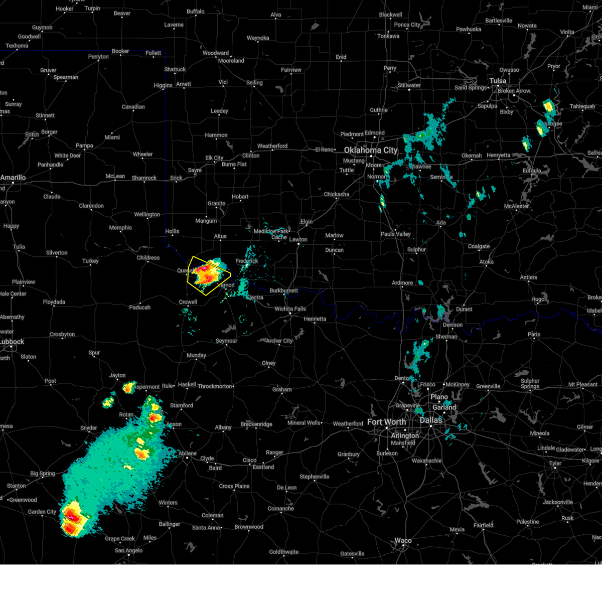
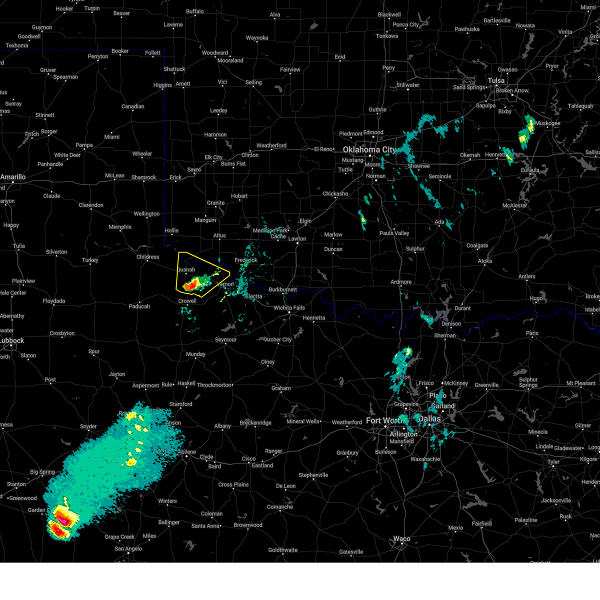
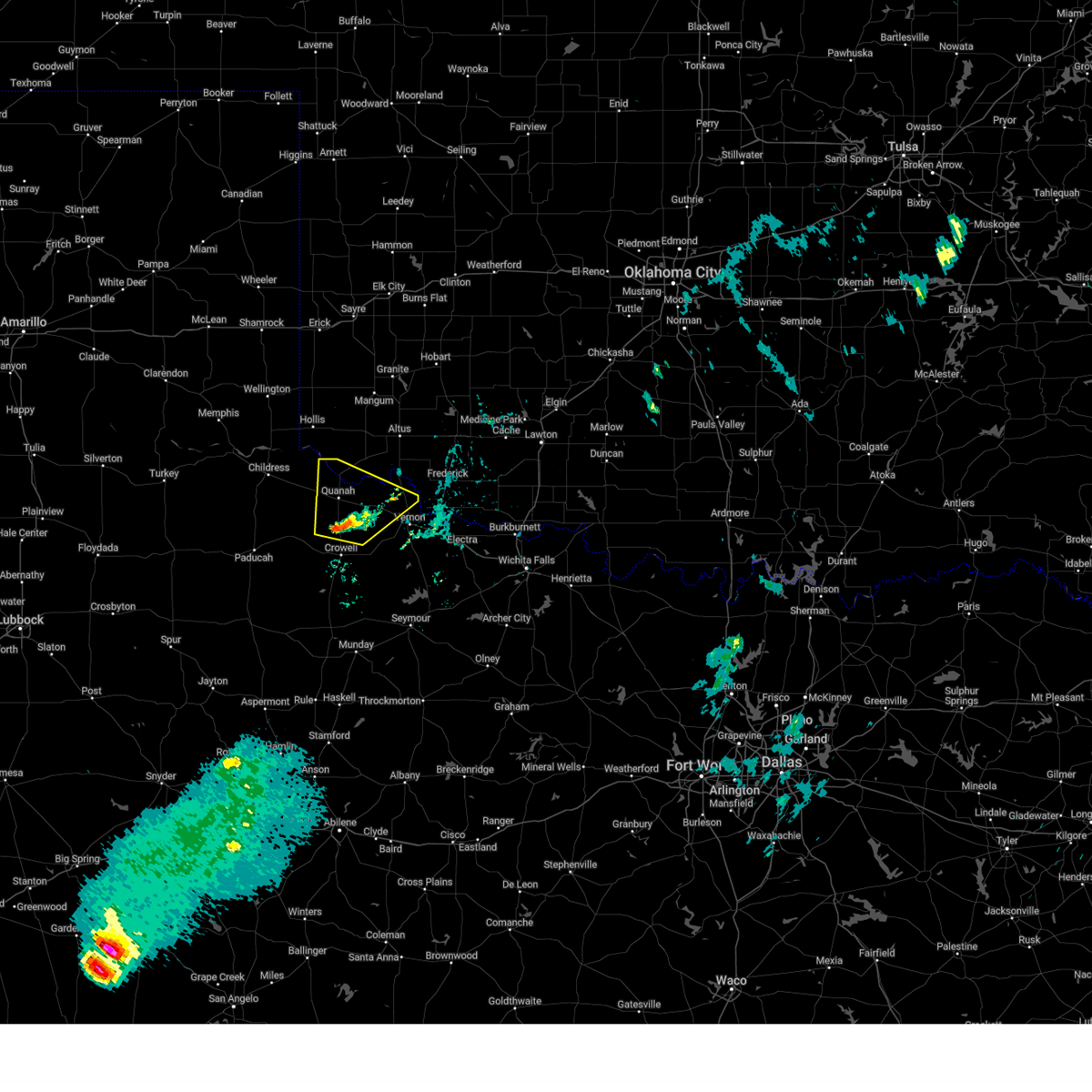
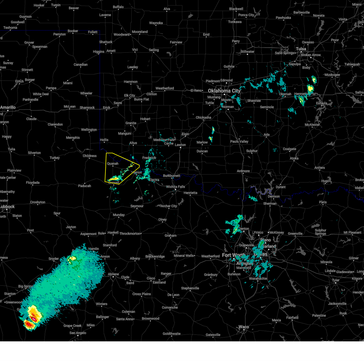
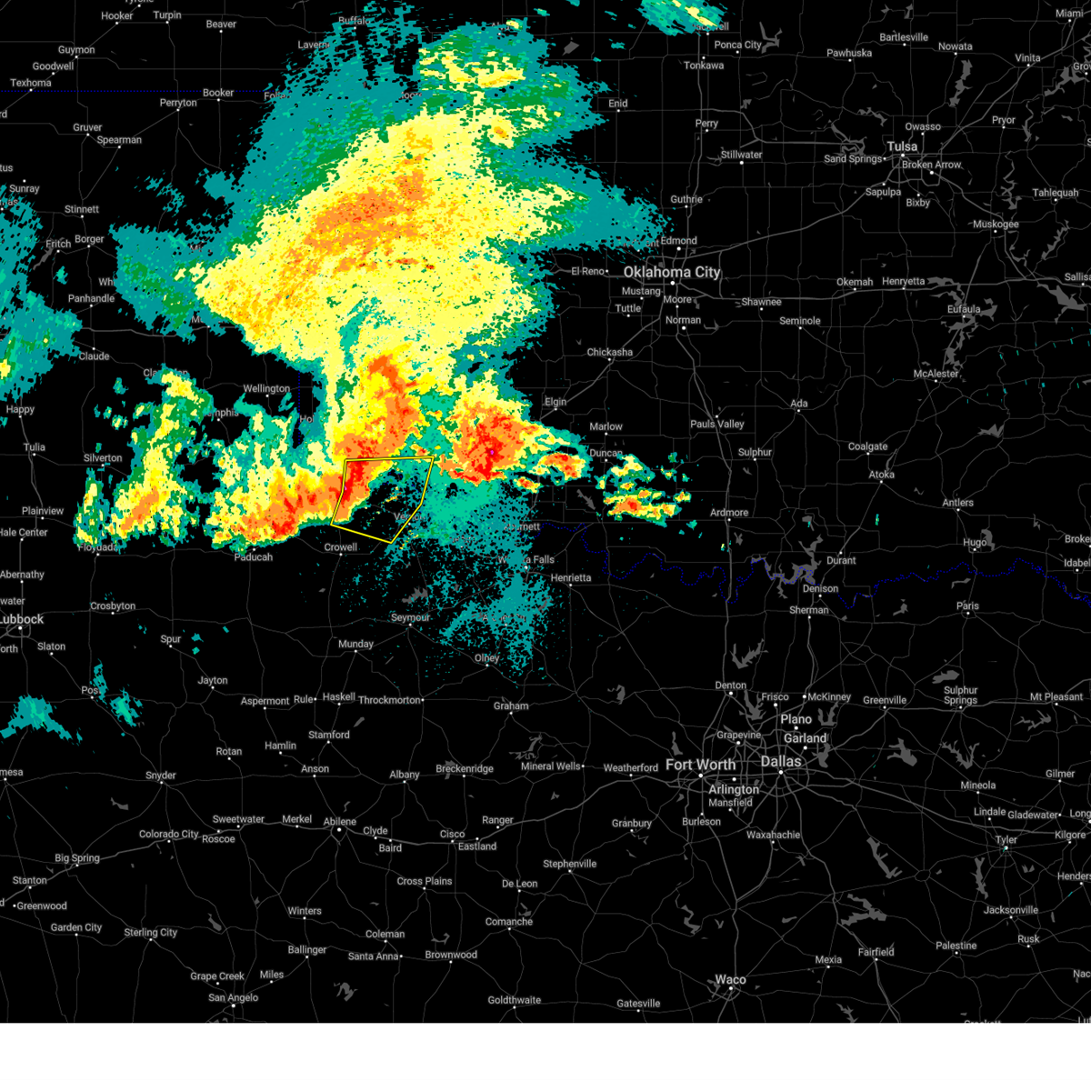
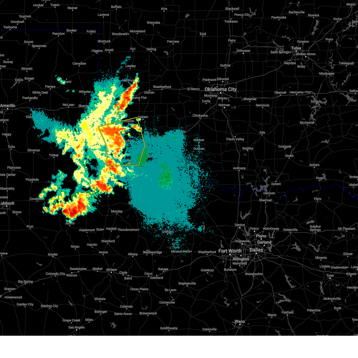
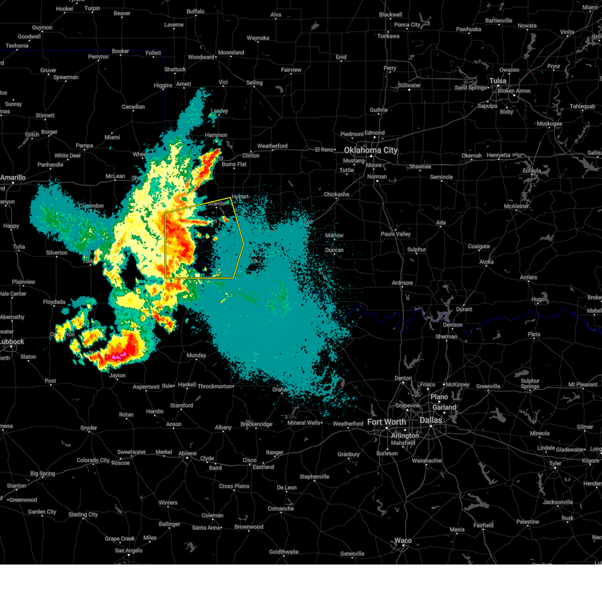
Hail Map for Quanah, TX
The Quanah, TX area has had 60 reports of on-the-ground hail by trained spotters, and has been under severe weather warnings 38 times during the past 12 months. Doppler radar has detected hail at or near Quanah, TX on 93 occasions, including 5 occasions during the past year.
| Name: | Quanah, TX |
| Where Located: | 28.2 miles ESE of Childress, TX |
| Map: | Google Map for Quanah, TX |
| Population: | 2641 |
| Housing Units: | 1485 |
| More Info: | Search Google for Quanah, TX |
1
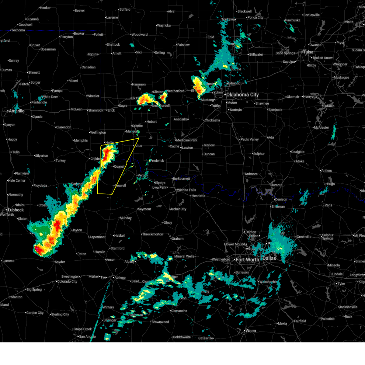
The Top Recent Hail Date for Quanah, TX is Tuesday, March 31, 2026 (24th out of 93)
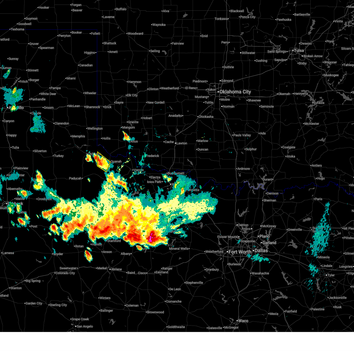
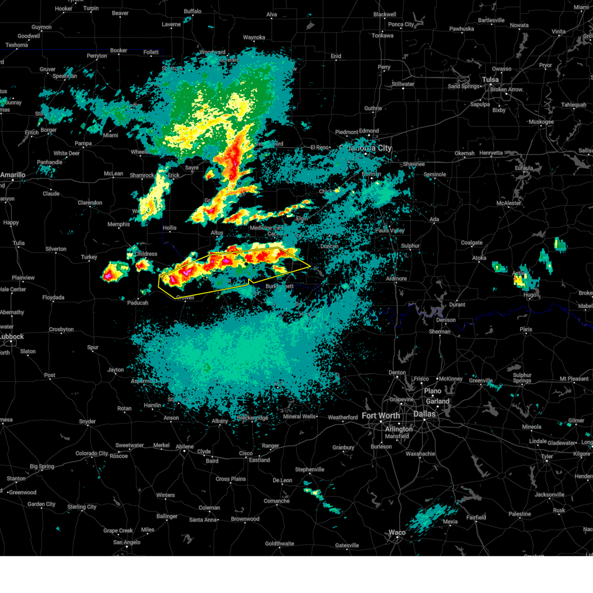
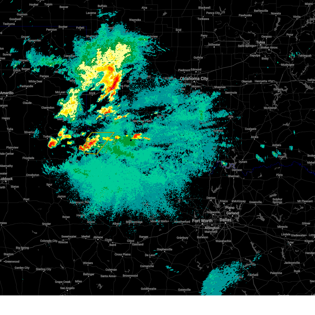
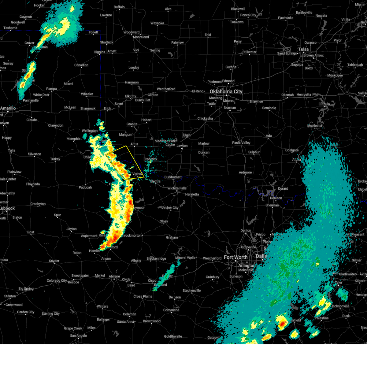
Hail and Wind Damage Spotted near Quanah, TX
| Date / Time | Report Details |
|---|---|
| 7/5/2026 6:10 PM CDT |
 The storms which prompted the warning have weakened below severe limits, therefore the warning will be allowed to expire. however, small hail and gusty winds are still possible with these thunderstorms. The storms which prompted the warning have weakened below severe limits, therefore the warning will be allowed to expire. however, small hail and gusty winds are still possible with these thunderstorms.
|
| 7/5/2026 5:59 PM CDT |
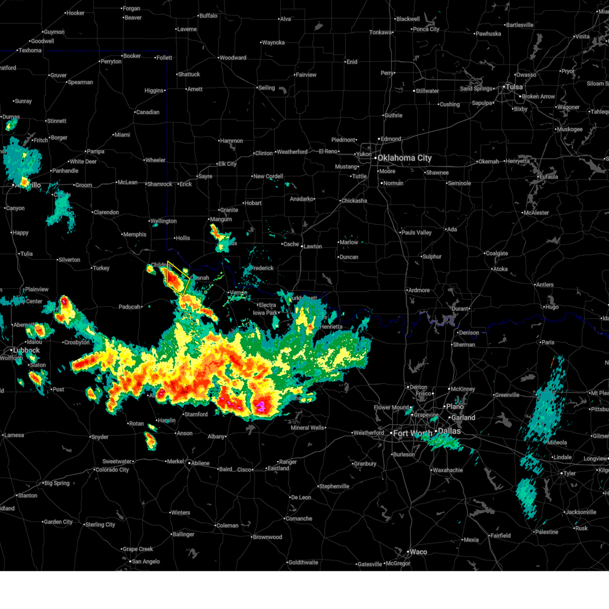 At 558 pm cdt, severe thunderstorms were located along a line extending from near kirkland to 8 miles south of goodlett, moving east at 5 mph (radar indicated). Hazards include 60 mph wind gusts and penny size hail. Expect damage to roofs, siding, and trees. Locations impacted include, quanah, goodlett, and lazare. At 558 pm cdt, severe thunderstorms were located along a line extending from near kirkland to 8 miles south of goodlett, moving east at 5 mph (radar indicated). Hazards include 60 mph wind gusts and penny size hail. Expect damage to roofs, siding, and trees. Locations impacted include, quanah, goodlett, and lazare.
|
| 7/5/2026 5:36 PM CDT |
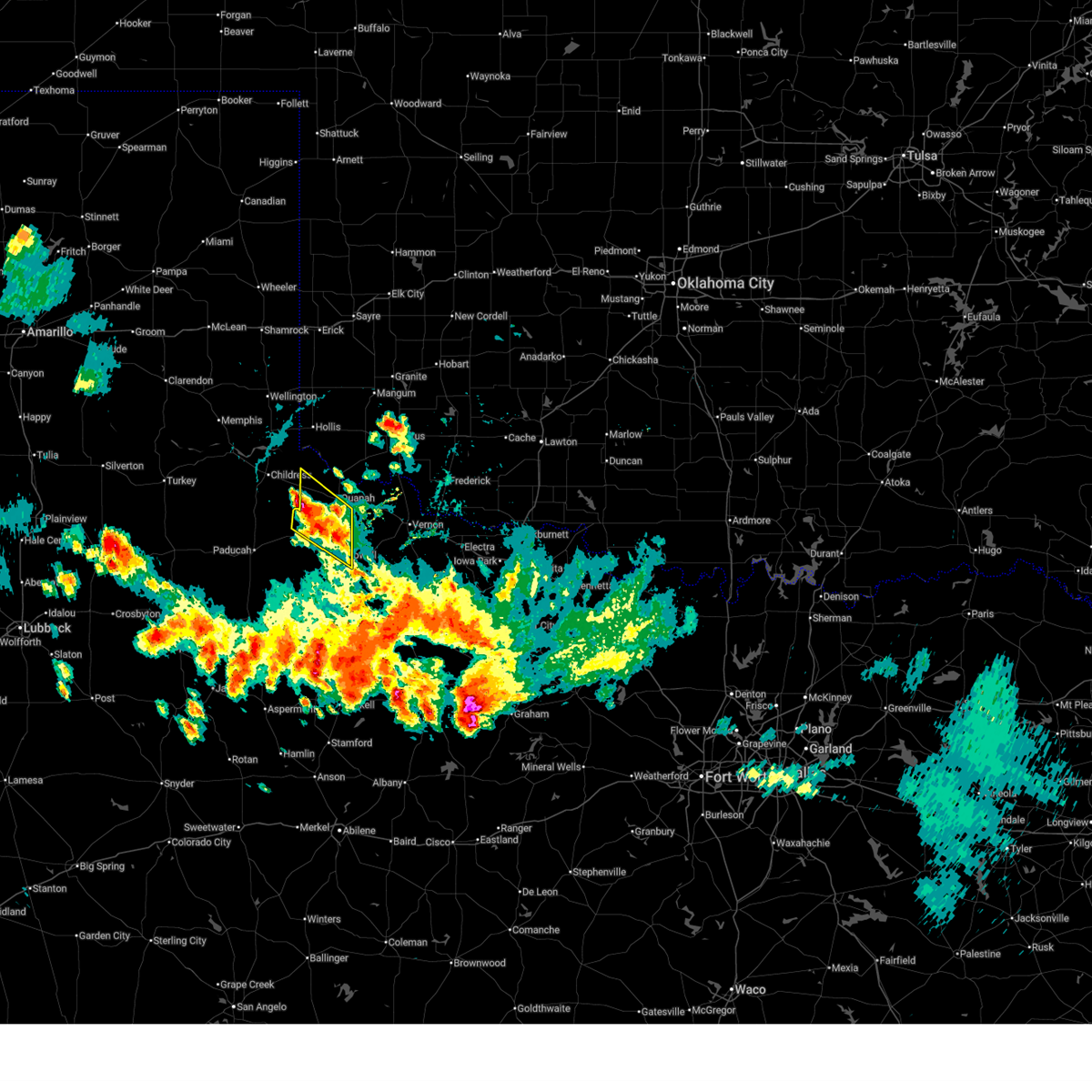 Svroun the national weather service in norman has issued a * severe thunderstorm warning for, northwestern foard county in northern texas, southwestern hardeman county in northern texas, * until 615 pm cdt. * at 536 pm cdt, severe thunderstorms were located along a line extending from 5 miles southeast of kirkland to 4 miles west of margaret, moving northwest at 10 mph (radar indicated). Hazards include 70 mph wind gusts and quarter size hail. Hail damage to vehicles is expected. expect considerable tree damage. Wind damage is also likely to mobile homes, roofs, and outbuildings. Svroun the national weather service in norman has issued a * severe thunderstorm warning for, northwestern foard county in northern texas, southwestern hardeman county in northern texas, * until 615 pm cdt. * at 536 pm cdt, severe thunderstorms were located along a line extending from 5 miles southeast of kirkland to 4 miles west of margaret, moving northwest at 10 mph (radar indicated). Hazards include 70 mph wind gusts and quarter size hail. Hail damage to vehicles is expected. expect considerable tree damage. Wind damage is also likely to mobile homes, roofs, and outbuildings.
|
| 7/5/2026 4:45 PM CDT |
 At 445 pm cdt, severe thunderstorms were located along a line extending from 9 miles northwest of margaret to 9 miles northwest of lake kemp to 4 miles west of wichita falls, moving southeast at 10 mph (radar indicated). Hazards include 60 mph wind gusts and penny size hail. Expect damage to roofs, siding, and trees. Locations impacted include, western wichita falls, vernon, quanah, iowa park, electra, chillicothe, thalia, harrold, margaret, lockett, medicine mound, oklaunion, grayback, pleasant valley, rayland, and copper breaks state park. At 445 pm cdt, severe thunderstorms were located along a line extending from 9 miles northwest of margaret to 9 miles northwest of lake kemp to 4 miles west of wichita falls, moving southeast at 10 mph (radar indicated). Hazards include 60 mph wind gusts and penny size hail. Expect damage to roofs, siding, and trees. Locations impacted include, western wichita falls, vernon, quanah, iowa park, electra, chillicothe, thalia, harrold, margaret, lockett, medicine mound, oklaunion, grayback, pleasant valley, rayland, and copper breaks state park.
|
| 7/5/2026 4:11 PM CDT |
 Svroun the national weather service in norman has issued a * severe thunderstorm warning for, wichita county in northern texas, northeastern foard county in northern texas, wilbarger county in northern texas, southeastern hardeman county in northern texas, * until 500 pm cdt. * at 411 pm cdt, severe thunderstorms were located along a line extending from 3 miles south of quanah to 4 miles west of grayback to 3 miles west of burkburnett, moving south at 10 mph (radar indicated). Hazards include 60 mph wind gusts and quarter size hail. Hail damage to vehicles is expected. Expect wind damage to roofs, siding, and trees. Svroun the national weather service in norman has issued a * severe thunderstorm warning for, wichita county in northern texas, northeastern foard county in northern texas, wilbarger county in northern texas, southeastern hardeman county in northern texas, * until 500 pm cdt. * at 411 pm cdt, severe thunderstorms were located along a line extending from 3 miles south of quanah to 4 miles west of grayback to 3 miles west of burkburnett, moving south at 10 mph (radar indicated). Hazards include 60 mph wind gusts and quarter size hail. Hail damage to vehicles is expected. Expect wind damage to roofs, siding, and trees.
|
| 6/23/2026 2:12 PM CDT |
 the severe thunderstorm warning has been cancelled and is no longer in effect the severe thunderstorm warning has been cancelled and is no longer in effect
|
| 6/23/2026 2:12 PM CDT |
 At 210 pm cdt, severe thunderstorms were located along a line extending from 10 miles northeast of chalk to 6 miles southeast of medicine mound, moving southeast at 30 mph (broadcast media. at 202 pm cdt, a 60 mph wind gust was measured at lake pauline). Hazards include 70 mph wind gusts and quarter size hail. Hail damage to vehicles is expected. expect considerable tree damage. wind damage is also likely to mobile homes, roofs, and outbuildings. Locations impacted include, quanah, crowell, chillicothe, margaret, medicine mound, thalia, truscott, rayland, copper breaks state park, and lazare. At 210 pm cdt, severe thunderstorms were located along a line extending from 10 miles northeast of chalk to 6 miles southeast of medicine mound, moving southeast at 30 mph (broadcast media. at 202 pm cdt, a 60 mph wind gust was measured at lake pauline). Hazards include 70 mph wind gusts and quarter size hail. Hail damage to vehicles is expected. expect considerable tree damage. wind damage is also likely to mobile homes, roofs, and outbuildings. Locations impacted include, quanah, crowell, chillicothe, margaret, medicine mound, thalia, truscott, rayland, copper breaks state park, and lazare.
|
| 6/23/2026 2:07 PM CDT | Storm damage reported in hardeman county TX, 4.9 miles NW of Quanah, TX |
| 6/23/2026 1:43 PM CDT |
 Svroun the national weather service in norman has issued a * severe thunderstorm warning for, southwestern jackson county in southwestern oklahoma, foard county in northern texas, northwestern knox county in northern texas, southwestern wilbarger county in northern texas, hardeman county in northern texas, * until 230 pm cdt. * at 143 pm cdt, severe thunderstorms were located along a line extending from near swearingen to 7 miles northwest of chillicothe, moving south at 35 mph (radar indicated). Hazards include 70 mph wind gusts and quarter size hail. Hail damage to vehicles is expected. expect considerable tree damage. Wind damage is also likely to mobile homes, roofs, and outbuildings. Svroun the national weather service in norman has issued a * severe thunderstorm warning for, southwestern jackson county in southwestern oklahoma, foard county in northern texas, northwestern knox county in northern texas, southwestern wilbarger county in northern texas, hardeman county in northern texas, * until 230 pm cdt. * at 143 pm cdt, severe thunderstorms were located along a line extending from near swearingen to 7 miles northwest of chillicothe, moving south at 35 mph (radar indicated). Hazards include 70 mph wind gusts and quarter size hail. Hail damage to vehicles is expected. expect considerable tree damage. Wind damage is also likely to mobile homes, roofs, and outbuildings.
|
| 6/23/2026 1:22 PM CDT |
 At 121 pm cdt, severe thunderstorms were located along a line extending from near eldorado to near tell, moving south at 20 mph (radar indicated). Hazards include 70 mph wind gusts and quarter size hail. Hail damage to vehicles is expected. expect considerable tree damage. wind damage is also likely to mobile homes, roofs, and outbuildings. Locations impacted include, quanah, chillicothe, eldorado, margaret, goodlett, medicine mound, rayland, copper breaks state park, and lazare. At 121 pm cdt, severe thunderstorms were located along a line extending from near eldorado to near tell, moving south at 20 mph (radar indicated). Hazards include 70 mph wind gusts and quarter size hail. Hail damage to vehicles is expected. expect considerable tree damage. wind damage is also likely to mobile homes, roofs, and outbuildings. Locations impacted include, quanah, chillicothe, eldorado, margaret, goodlett, medicine mound, rayland, copper breaks state park, and lazare.
|
| 5/24/2026 12:58 AM CDT |
 Svroun the national weather service in norman has issued a * severe thunderstorm warning for, southwestern jackson county in southwestern oklahoma, southwestern tillman county in southwestern oklahoma, foard county in northern texas, knox county in northern texas, wilbarger county in northern texas, baylor county in northern texas, hardeman county in northern texas, * until 145 am cdt. * at 1258 am cdt, severe thunderstorms were located along a line extending from 5 miles south of eldorado to near rhineland, moving east at 35 mph (radar indicated). Hazards include 60 mph wind gusts and penny size hail. expect damage to roofs, siding, and trees Svroun the national weather service in norman has issued a * severe thunderstorm warning for, southwestern jackson county in southwestern oklahoma, southwestern tillman county in southwestern oklahoma, foard county in northern texas, knox county in northern texas, wilbarger county in northern texas, baylor county in northern texas, hardeman county in northern texas, * until 145 am cdt. * at 1258 am cdt, severe thunderstorms were located along a line extending from 5 miles south of eldorado to near rhineland, moving east at 35 mph (radar indicated). Hazards include 60 mph wind gusts and penny size hail. expect damage to roofs, siding, and trees
|
| 5/24/2026 12:48 AM CDT |
 At 1248 am cdt, severe thunderstorms were located along a line extending from 5 miles north of quanah to 6 miles southwest of benjamin, moving east at 35 mph (radar indicated). Hazards include 60 mph wind gusts and penny size hail. Expect damage to roofs, siding, and trees. Locations impacted include, quanah, munday, knox city, crowell, benjamin, chillicothe, eldorado, goree, elmer, thalia, gilliland, margaret, goodlett, vera, medicine mound, odell, truscott, rhineland, lazare, and rayland. At 1248 am cdt, severe thunderstorms were located along a line extending from 5 miles north of quanah to 6 miles southwest of benjamin, moving east at 35 mph (radar indicated). Hazards include 60 mph wind gusts and penny size hail. Expect damage to roofs, siding, and trees. Locations impacted include, quanah, munday, knox city, crowell, benjamin, chillicothe, eldorado, goree, elmer, thalia, gilliland, margaret, goodlett, vera, medicine mound, odell, truscott, rhineland, lazare, and rayland.
|
| 5/24/2026 12:30 AM CDT |
 At 1230 am cdt, severe thunderstorms were located along a line extending from 6 miles west of eldorado to 14 miles east of guthrie, moving east at 35 mph (radar indicated). Hazards include 70 mph wind gusts and quarter size hail. Hail damage to vehicles is expected. expect considerable tree damage. wind damage is also likely to mobile homes, roofs, and outbuildings. Locations impacted include, quanah, munday, knox city, crowell, benjamin, chillicothe, eldorado, goree, elmer, thalia, gilliland, margaret, goodlett, vera, medicine mound, odell, truscott, rhineland, lazare, and rayland. At 1230 am cdt, severe thunderstorms were located along a line extending from 6 miles west of eldorado to 14 miles east of guthrie, moving east at 35 mph (radar indicated). Hazards include 70 mph wind gusts and quarter size hail. Hail damage to vehicles is expected. expect considerable tree damage. wind damage is also likely to mobile homes, roofs, and outbuildings. Locations impacted include, quanah, munday, knox city, crowell, benjamin, chillicothe, eldorado, goree, elmer, thalia, gilliland, margaret, goodlett, vera, medicine mound, odell, truscott, rhineland, lazare, and rayland.
|
| 5/24/2026 12:09 AM CDT |
 Svroun the national weather service in norman has issued a * severe thunderstorm warning for, southwestern jackson county in southwestern oklahoma, foard county in northern texas, knox county in northern texas, western wilbarger county in northern texas, northwestern baylor county in northern texas, hardeman county in northern texas, * until 100 am cdt. * at 1208 am cdt, severe thunderstorms were located along a line extending from 7 miles northeast of kirkland to near guthrie, moving east at 35 mph (radar indicated). Hazards include 60 mph wind gusts and quarter size hail. Hail damage to vehicles is expected. Expect wind damage to roofs, siding, and trees. Svroun the national weather service in norman has issued a * severe thunderstorm warning for, southwestern jackson county in southwestern oklahoma, foard county in northern texas, knox county in northern texas, western wilbarger county in northern texas, northwestern baylor county in northern texas, hardeman county in northern texas, * until 100 am cdt. * at 1208 am cdt, severe thunderstorms were located along a line extending from 7 miles northeast of kirkland to near guthrie, moving east at 35 mph (radar indicated). Hazards include 60 mph wind gusts and quarter size hail. Hail damage to vehicles is expected. Expect wind damage to roofs, siding, and trees.
|
| 5/22/2026 10:42 PM CDT |
 The storms which prompted the warning have weakened below severe limits, therefore the warning will be allowed to expire. however, small hail, gusty winds and heavy rain are still possible with these thunderstorms. The storms which prompted the warning have weakened below severe limits, therefore the warning will be allowed to expire. however, small hail, gusty winds and heavy rain are still possible with these thunderstorms.
|
| 5/22/2026 10:33 PM CDT |
 At 1033 pm cdt, severe thunderstorms were located along a line extending from 7 miles north of gould to 3 miles northwest of olustee to near lockett, moving east at 30 mph (radar indicated). Hazards include 60 mph wind gusts and nickel size hail. Expect damage to roofs, siding, and trees. Locations impacted include, vernon, quanah, hollis, chillicothe, olustee, eldorado, gould, elmer, thalia, duke, margaret, lockett, medicine mound, odell, mcqueen, rayland, and mcknight. At 1033 pm cdt, severe thunderstorms were located along a line extending from 7 miles north of gould to 3 miles northwest of olustee to near lockett, moving east at 30 mph (radar indicated). Hazards include 60 mph wind gusts and nickel size hail. Expect damage to roofs, siding, and trees. Locations impacted include, vernon, quanah, hollis, chillicothe, olustee, eldorado, gould, elmer, thalia, duke, margaret, lockett, medicine mound, odell, mcqueen, rayland, and mcknight.
|
| 5/22/2026 9:54 PM CDT |
 Svroun the national weather service in norman has issued a * severe thunderstorm warning for, southwestern jackson county in southwestern oklahoma, harmon county in southwestern oklahoma, southwestern greer county in southwestern oklahoma, foard county in northern texas, western wilbarger county in northern texas, hardeman county in northern texas, * until 1045 pm cdt. * at 954 pm cdt, severe thunderstorms were located along a line extending from 8 miles southwest of hollis to 5 miles northeast of quanah to 7 miles south of thalia, moving northeast at 30 mph (radar indicated). Hazards include 60 mph wind gusts. expect damage to roofs, siding, and trees Svroun the national weather service in norman has issued a * severe thunderstorm warning for, southwestern jackson county in southwestern oklahoma, harmon county in southwestern oklahoma, southwestern greer county in southwestern oklahoma, foard county in northern texas, western wilbarger county in northern texas, hardeman county in northern texas, * until 1045 pm cdt. * at 954 pm cdt, severe thunderstorms were located along a line extending from 8 miles southwest of hollis to 5 miles northeast of quanah to 7 miles south of thalia, moving northeast at 30 mph (radar indicated). Hazards include 60 mph wind gusts. expect damage to roofs, siding, and trees
|
| 5/22/2026 9:47 PM CDT |
 At 947 pm cdt, severe thunderstorms were located along a line extending from 4 miles northeast of goodlett to 4 miles northwest of margaret to 9 miles northeast of gilliland to 3 miles northwest of bomarton, moving east at 25 mph (radar indicated). Hazards include 60 mph wind gusts and quarter size hail. Hail damage to vehicles is expected. expect wind damage to roofs, siding, and trees. Locations impacted include, quanah, munday, crowell, goree, red springs, thalia, gilliland, bomarton, margaret, goodlett, vera, medicine mound, truscott, rhineland, lazare, and copper breaks state park. At 947 pm cdt, severe thunderstorms were located along a line extending from 4 miles northeast of goodlett to 4 miles northwest of margaret to 9 miles northeast of gilliland to 3 miles northwest of bomarton, moving east at 25 mph (radar indicated). Hazards include 60 mph wind gusts and quarter size hail. Hail damage to vehicles is expected. expect wind damage to roofs, siding, and trees. Locations impacted include, quanah, munday, crowell, goree, red springs, thalia, gilliland, bomarton, margaret, goodlett, vera, medicine mound, truscott, rhineland, lazare, and copper breaks state park.
|
| 5/22/2026 9:13 PM CDT |
 Svroun the national weather service in norman has issued a * severe thunderstorm warning for, foard county in northern texas, knox county in northern texas, southwestern wilbarger county in northern texas, western baylor county in northern texas, hardeman county in northern texas, * until 1000 pm cdt. * at 913 pm cdt, severe thunderstorms were located along a line extending from 8 miles southwest of goodlett to 7 miles west of crowell to 3 miles southwest of gilliland to near munday, moving northeast at 25 mph (radar indicated). Hazards include 60 mph wind gusts and quarter size hail. Hail damage to vehicles is expected. Expect wind damage to roofs, siding, and trees. Svroun the national weather service in norman has issued a * severe thunderstorm warning for, foard county in northern texas, knox county in northern texas, southwestern wilbarger county in northern texas, western baylor county in northern texas, hardeman county in northern texas, * until 1000 pm cdt. * at 913 pm cdt, severe thunderstorms were located along a line extending from 8 miles southwest of goodlett to 7 miles west of crowell to 3 miles southwest of gilliland to near munday, moving northeast at 25 mph (radar indicated). Hazards include 60 mph wind gusts and quarter size hail. Hail damage to vehicles is expected. Expect wind damage to roofs, siding, and trees.
|
| 5/18/2026 4:44 PM CDT |
 At 443 pm cdt, a severe thunderstorm was located 6 miles southwest of duke, moving northeast at 40 mph (radar indicated). Hazards include 60 mph wind gusts and quarter size hail. Hail damage to vehicles is expected. expect wind damage to roofs, siding, and trees. Locations impacted include, quanah, olustee, eldorado, gould, goodlett, duke, and mcqueen. At 443 pm cdt, a severe thunderstorm was located 6 miles southwest of duke, moving northeast at 40 mph (radar indicated). Hazards include 60 mph wind gusts and quarter size hail. Hail damage to vehicles is expected. expect wind damage to roofs, siding, and trees. Locations impacted include, quanah, olustee, eldorado, gould, goodlett, duke, and mcqueen.
|
| 5/18/2026 4:26 PM CDT |
 At 426 pm cdt, a severe thunderstorm was located near eldorado, moving northeast at 40 mph (radar indicated). Hazards include 60 mph wind gusts and quarter size hail. Hail damage to vehicles is expected. expect wind damage to roofs, siding, and trees. Locations impacted include, quanah, olustee, eldorado, gould, goodlett, duke, and mcqueen. At 426 pm cdt, a severe thunderstorm was located near eldorado, moving northeast at 40 mph (radar indicated). Hazards include 60 mph wind gusts and quarter size hail. Hail damage to vehicles is expected. expect wind damage to roofs, siding, and trees. Locations impacted include, quanah, olustee, eldorado, gould, goodlett, duke, and mcqueen.
|
| 5/18/2026 4:19 PM CDT |
 Svroun the national weather service in norman has issued a * severe thunderstorm warning for, southwestern jackson county in southwestern oklahoma, southeastern harmon county in southwestern oklahoma, central hardeman county in northern texas, * until 500 pm cdt. * at 418 pm cdt, a severe thunderstorm was located near quanah, moving northeast at 35 mph (radar indicated). Hazards include 60 mph wind gusts and penny size hail. expect damage to roofs, siding, and trees Svroun the national weather service in norman has issued a * severe thunderstorm warning for, southwestern jackson county in southwestern oklahoma, southeastern harmon county in southwestern oklahoma, central hardeman county in northern texas, * until 500 pm cdt. * at 418 pm cdt, a severe thunderstorm was located near quanah, moving northeast at 35 mph (radar indicated). Hazards include 60 mph wind gusts and penny size hail. expect damage to roofs, siding, and trees
|
| 5/15/2026 8:55 PM CDT |
 The storms which prompted the warning have weakened below severe limits, therefore the warning will be allowed to expire. however, gusty winds of 50 mph are still possible with these thunderstorms. The storms which prompted the warning have weakened below severe limits, therefore the warning will be allowed to expire. however, gusty winds of 50 mph are still possible with these thunderstorms.
|
| 5/15/2026 8:11 PM CDT |
 Svroun the national weather service in norman has issued a * severe thunderstorm warning for, central jackson county in southwestern oklahoma, southern harmon county in southwestern oklahoma, foard county in northern texas, hardeman county in northern texas, * until 900 pm cdt. * at 810 pm cdt, severe thunderstorms were located along a line extending from 8 miles south of gould to 3 miles northeast of chalk, moving east at 25 mph. the strongest storm will move across hardeman and southern harmon counties into jackson county, however strong winds will be possible anywhere along this line of storms (radar indicated). Hazards include 60 mph wind gusts and quarter size hail. Hail damage to vehicles is expected. Expect wind damage to roofs, siding, and trees. Svroun the national weather service in norman has issued a * severe thunderstorm warning for, central jackson county in southwestern oklahoma, southern harmon county in southwestern oklahoma, foard county in northern texas, hardeman county in northern texas, * until 900 pm cdt. * at 810 pm cdt, severe thunderstorms were located along a line extending from 8 miles south of gould to 3 miles northeast of chalk, moving east at 25 mph. the strongest storm will move across hardeman and southern harmon counties into jackson county, however strong winds will be possible anywhere along this line of storms (radar indicated). Hazards include 60 mph wind gusts and quarter size hail. Hail damage to vehicles is expected. Expect wind damage to roofs, siding, and trees.
|
| 5/15/2026 7:58 PM CDT |
 At 758 pm cdt, severe thunderstorms were located along a line extending from 8 miles south of hollis to 5 miles southeast of paducah, moving east-northeast at 35 mph (radar indicated). Hazards include 60 mph wind gusts and quarter size hail. Hail damage to vehicles is expected. expect wind damage to roofs, siding, and trees. Locations impacted include, quanah, hollis, eldorado, gould, goodlett, duke, hester, lazare, and mcqueen. At 758 pm cdt, severe thunderstorms were located along a line extending from 8 miles south of hollis to 5 miles southeast of paducah, moving east-northeast at 35 mph (radar indicated). Hazards include 60 mph wind gusts and quarter size hail. Hail damage to vehicles is expected. expect wind damage to roofs, siding, and trees. Locations impacted include, quanah, hollis, eldorado, gould, goodlett, duke, hester, lazare, and mcqueen.
|
| 5/15/2026 7:32 PM CDT |
 Svroun the national weather service in norman has issued a * severe thunderstorm warning for, western jackson county in southwestern oklahoma, southern harmon county in southwestern oklahoma, southeastern greer county in southwestern oklahoma, northwestern foard county in northern texas, western hardeman county in northern texas, * until 815 pm cdt. * at 732 pm cdt, severe thunderstorms were located along a line extending from 9 miles southwest of hollis to 6 miles northwest of delwin texas, moving east-northeast at 40 mph (radar indicated). Hazards include 60 mph wind gusts and quarter size hail. Hail damage to vehicles is expected. Expect wind damage to roofs, siding, and trees. Svroun the national weather service in norman has issued a * severe thunderstorm warning for, western jackson county in southwestern oklahoma, southern harmon county in southwestern oklahoma, southeastern greer county in southwestern oklahoma, northwestern foard county in northern texas, western hardeman county in northern texas, * until 815 pm cdt. * at 732 pm cdt, severe thunderstorms were located along a line extending from 9 miles southwest of hollis to 6 miles northwest of delwin texas, moving east-northeast at 40 mph (radar indicated). Hazards include 60 mph wind gusts and quarter size hail. Hail damage to vehicles is expected. Expect wind damage to roofs, siding, and trees.
|
| 5/14/2026 8:14 PM CDT |
 The storms which prompted the warning have weakened below severe limits, therefore the warning will be allowed to expire. however, gusty winds of 50 mph are still possible with these thunderstorms. The storms which prompted the warning have weakened below severe limits, therefore the warning will be allowed to expire. however, gusty winds of 50 mph are still possible with these thunderstorms.
|
| 5/14/2026 8:00 PM CDT |
 At 759 pm cdt, severe thunderstorms were located 6 miles northwest of duke, 5 miles northwest of eldorado, 3 miles northwest of quanah and 11 miles east of swearingen. these storms are moving east at 40 mph (radar indicated). Hazards include 60 mph wind gusts. Expect damage to roofs, siding, and trees. Locations impacted include, mangum, quanah, hollis, crowell, chillicothe, olustee, eldorado, gould, duke, margaret, goodlett, medicine mound, hester, lazare, mcqueen, copper breaks state park, and mcknight. At 759 pm cdt, severe thunderstorms were located 6 miles northwest of duke, 5 miles northwest of eldorado, 3 miles northwest of quanah and 11 miles east of swearingen. these storms are moving east at 40 mph (radar indicated). Hazards include 60 mph wind gusts. Expect damage to roofs, siding, and trees. Locations impacted include, mangum, quanah, hollis, crowell, chillicothe, olustee, eldorado, gould, duke, margaret, goodlett, medicine mound, hester, lazare, mcqueen, copper breaks state park, and mcknight.
|
| 5/14/2026 7:30 PM CDT |
 Svroun the national weather service in norman has issued a * severe thunderstorm warning for, western jackson county in southwestern oklahoma, harmon county in southwestern oklahoma, southwestern greer county in southwestern oklahoma, foard county in northern texas, western wilbarger county in northern texas, hardeman county in northern texas, * until 815 pm cdt. * at 729 pm cdt, severe thunderstorms were located along a line extending from 6 miles north of hollis to 4 miles northeast of paducah, moving east at 40 mph. a wind gust of 62 mph was measured near childress texas with this line of storms (radar indicated). Hazards include 60 mph wind gusts. expect damage to roofs, siding, and trees Svroun the national weather service in norman has issued a * severe thunderstorm warning for, western jackson county in southwestern oklahoma, harmon county in southwestern oklahoma, southwestern greer county in southwestern oklahoma, foard county in northern texas, western wilbarger county in northern texas, hardeman county in northern texas, * until 815 pm cdt. * at 729 pm cdt, severe thunderstorms were located along a line extending from 6 miles north of hollis to 4 miles northeast of paducah, moving east at 40 mph. a wind gust of 62 mph was measured near childress texas with this line of storms (radar indicated). Hazards include 60 mph wind gusts. expect damage to roofs, siding, and trees
|
| 5/14/2026 6:52 PM CDT |
 Svroun the national weather service in norman has issued a * severe thunderstorm warning for, western jackson county in southwestern oklahoma, harmon county in southwestern oklahoma, greer county in southwestern oklahoma, foard county in northern texas, western wilbarger county in northern texas, hardeman county in northern texas, * until 730 pm cdt. * at 652 pm cdt, severe thunderstorms were located along a line extending from 3 miles northwest of wellington to 3 miles northwest of childress to 11 miles east of matador, moving east at 20 mph (radar indicated). Hazards include 60 mph wind gusts. expect damage to roofs, siding, and trees Svroun the national weather service in norman has issued a * severe thunderstorm warning for, western jackson county in southwestern oklahoma, harmon county in southwestern oklahoma, greer county in southwestern oklahoma, foard county in northern texas, western wilbarger county in northern texas, hardeman county in northern texas, * until 730 pm cdt. * at 652 pm cdt, severe thunderstorms were located along a line extending from 3 miles northwest of wellington to 3 miles northwest of childress to 11 miles east of matador, moving east at 20 mph (radar indicated). Hazards include 60 mph wind gusts. expect damage to roofs, siding, and trees
|
| 4/17/2026 11:35 PM CDT | Storm damage reported in hardeman county TX, 11.6 miles ESE of Quanah, TX |
| 4/17/2026 11:00 PM CDT | Storm damage reported in hardeman county TX, 11.6 miles ESE of Quanah, TX |
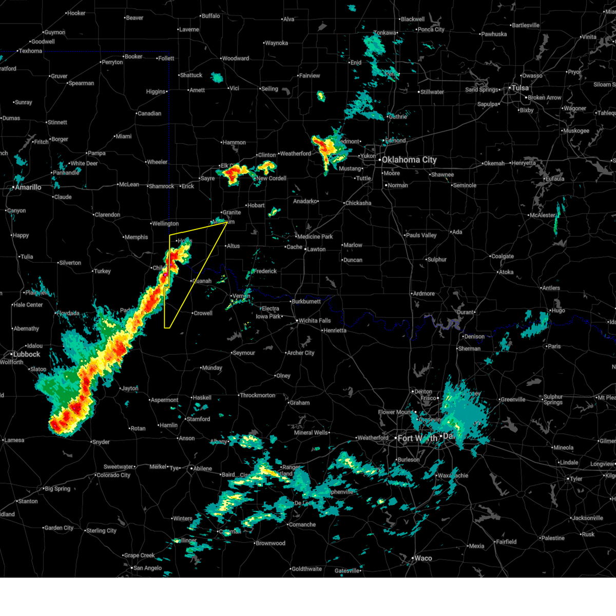
| 4/3/2026 11:59 PM CDT |
 At 1159 pm cdt, a severe thunderstorm was located 5 miles southwest of eldorado, moving east at 35 mph (radar indicated). Hazards include 70 mph wind gusts and quarter size hail. Hail damage to vehicles is expected. expect considerable tree damage. wind damage is also likely to mobile homes, roofs, and outbuildings. Locations impacted include, quanah and eldorado. At 1159 pm cdt, a severe thunderstorm was located 5 miles southwest of eldorado, moving east at 35 mph (radar indicated). Hazards include 70 mph wind gusts and quarter size hail. Hail damage to vehicles is expected. expect considerable tree damage. wind damage is also likely to mobile homes, roofs, and outbuildings. Locations impacted include, quanah and eldorado.
|
| 4/3/2026 11:56 PM CDT |
 Svroun the national weather service in norman has issued a * severe thunderstorm warning for, southwestern jackson county in southwestern oklahoma, west central tillman county in southwestern oklahoma, northwestern wilbarger county in northern texas, east central hardeman county in northern texas, * until 1230 am cdt. * at 1155 pm cdt, a severe thunderstorm was located 4 miles east of quanah, moving east at 40 mph (radar indicated). Hazards include 70 mph wind gusts and quarter size hail. Hail damage to vehicles is expected. expect considerable tree damage. Wind damage is also likely to mobile homes, roofs, and outbuildings. Svroun the national weather service in norman has issued a * severe thunderstorm warning for, southwestern jackson county in southwestern oklahoma, west central tillman county in southwestern oklahoma, northwestern wilbarger county in northern texas, east central hardeman county in northern texas, * until 1230 am cdt. * at 1155 pm cdt, a severe thunderstorm was located 4 miles east of quanah, moving east at 40 mph (radar indicated). Hazards include 70 mph wind gusts and quarter size hail. Hail damage to vehicles is expected. expect considerable tree damage. Wind damage is also likely to mobile homes, roofs, and outbuildings.
|
| 4/3/2026 11:50 PM CDT | 30x30 metal carport blown into the street by the county hospita in hardeman county TX, 0.4 miles SW of Quanah, TX |
| 4/3/2026 11:46 PM CDT |
 At 1146 pm cdt, a severe thunderstorm was located 4 miles north of goodlett, moving east at 35 mph. this is a destructive storm for hardeman county (goodlett west texas mesonet measured 86 mph wind gust). Hazards include 80 mph wind gusts and quarter size hail. Flying debris will be dangerous to those caught without shelter. mobile homes will be heavily damaged. expect considerable damage to roofs, windows, and vehicles. extensive tree damage and power outages are likely. Locations impacted include, quanah, eldorado, goodlett, and lazare. At 1146 pm cdt, a severe thunderstorm was located 4 miles north of goodlett, moving east at 35 mph. this is a destructive storm for hardeman county (goodlett west texas mesonet measured 86 mph wind gust). Hazards include 80 mph wind gusts and quarter size hail. Flying debris will be dangerous to those caught without shelter. mobile homes will be heavily damaged. expect considerable damage to roofs, windows, and vehicles. extensive tree damage and power outages are likely. Locations impacted include, quanah, eldorado, goodlett, and lazare.
|
| 4/3/2026 11:40 PM CDT | Storm damage reported in hardeman county TX, 11.8 miles ESE of Quanah, TX |
| 4/3/2026 11:39 PM CDT |
 Svroun the national weather service in norman has issued a * severe thunderstorm warning for, southwestern jackson county in southwestern oklahoma, southeastern harmon county in southwestern oklahoma, northern hardeman county in northern texas, * until 1215 am cdt. * at 1139 pm cdt, a severe thunderstorm was located 4 miles northwest of goodlett, moving east at 35 mph (radar indicated). Hazards include quarter size hail. damage to vehicles is expected Svroun the national weather service in norman has issued a * severe thunderstorm warning for, southwestern jackson county in southwestern oklahoma, southeastern harmon county in southwestern oklahoma, northern hardeman county in northern texas, * until 1215 am cdt. * at 1139 pm cdt, a severe thunderstorm was located 4 miles northwest of goodlett, moving east at 35 mph (radar indicated). Hazards include quarter size hail. damage to vehicles is expected
|
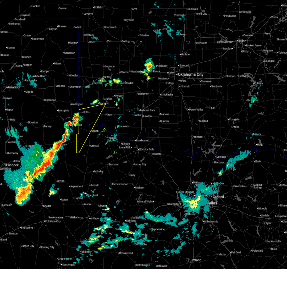
| 4/1/2026 6:31 PM CDT | Power poles/lines dow in hardeman county TX, 1.4 miles WSW of Quanah, TX |
| 4/1/2026 6:18 PM CDT |
 Svroun the national weather service in norman has issued a * severe thunderstorm warning for, southwestern washita county in western oklahoma, jackson county in southwestern oklahoma, western kiowa county in southwestern oklahoma, western tillman county in southwestern oklahoma, harmon county in southwestern oklahoma, greer county in southwestern oklahoma, southeastern beckham county in western oklahoma, northeastern foard county in northern texas, northwestern wilbarger county in northern texas, hardeman county in northern texas, * until 700 pm cdt. * at 618 pm cdt, severe thunderstorms were located along a line extending from 3 miles east of vinson to 5 miles east of gould to near eldorado to 6 miles northwest of margaret, moving northeast at 45 mph (radar indicated). Hazards include 70 mph wind gusts and half dollar size hail. Hail damage to vehicles is expected. expect considerable tree damage. Wind damage is also likely to mobile homes, roofs, and outbuildings. Svroun the national weather service in norman has issued a * severe thunderstorm warning for, southwestern washita county in western oklahoma, jackson county in southwestern oklahoma, western kiowa county in southwestern oklahoma, western tillman county in southwestern oklahoma, harmon county in southwestern oklahoma, greer county in southwestern oklahoma, southeastern beckham county in western oklahoma, northeastern foard county in northern texas, northwestern wilbarger county in northern texas, hardeman county in northern texas, * until 700 pm cdt. * at 618 pm cdt, severe thunderstorms were located along a line extending from 3 miles east of vinson to 5 miles east of gould to near eldorado to 6 miles northwest of margaret, moving northeast at 45 mph (radar indicated). Hazards include 70 mph wind gusts and half dollar size hail. Hail damage to vehicles is expected. expect considerable tree damage. Wind damage is also likely to mobile homes, roofs, and outbuildings.
|
| 4/1/2026 6:13 PM CDT |
 At 613 pm cdt, severe thunderstorms were located along a line extending from 7 miles southeast of vinson to 6 miles southeast of gould to 7 miles south of quanah, moving northeast at 45 mph. the largest hail will be near copper breaks state park (radar indicated). Hazards include 70 mph wind gusts and half dollar size hail. Hail damage to vehicles is expected. expect considerable tree damage. wind damage is also likely to mobile homes, roofs, and outbuildings. Locations impacted include, quanah, hollis, eldorado, gould, goodlett, medicine mound, vinson, madge, copper breaks state park, mcknight, and mcqueen. At 613 pm cdt, severe thunderstorms were located along a line extending from 7 miles southeast of vinson to 6 miles southeast of gould to 7 miles south of quanah, moving northeast at 45 mph. the largest hail will be near copper breaks state park (radar indicated). Hazards include 70 mph wind gusts and half dollar size hail. Hail damage to vehicles is expected. expect considerable tree damage. wind damage is also likely to mobile homes, roofs, and outbuildings. Locations impacted include, quanah, hollis, eldorado, gould, goodlett, medicine mound, vinson, madge, copper breaks state park, mcknight, and mcqueen.
|
| 4/1/2026 5:51 PM CDT |
 At 551 pm cdt, severe thunderstorms were located along a line extending from near dodson to 10 miles south of hollis to 9 miles east of swearingen, moving northeast at 35 mph (radar indicated). Hazards include 70 mph wind gusts and quarter size hail. Hail damage to vehicles is expected. expect considerable tree damage. wind damage is also likely to mobile homes, roofs, and outbuildings. Locations impacted include, quanah, hollis, eldorado, gould, goodlett, medicine mound, vinson, madge, copper breaks state park, mcknight, mcqueen, and lazare. At 551 pm cdt, severe thunderstorms were located along a line extending from near dodson to 10 miles south of hollis to 9 miles east of swearingen, moving northeast at 35 mph (radar indicated). Hazards include 70 mph wind gusts and quarter size hail. Hail damage to vehicles is expected. expect considerable tree damage. wind damage is also likely to mobile homes, roofs, and outbuildings. Locations impacted include, quanah, hollis, eldorado, gould, goodlett, medicine mound, vinson, madge, copper breaks state park, mcknight, mcqueen, and lazare.
|
| 4/1/2026 5:38 PM CDT |
 Svroun the national weather service in norman has issued a * severe thunderstorm warning for, southwestern jackson county in southwestern oklahoma, harmon county in southwestern oklahoma, western greer county in southwestern oklahoma, northwestern foard county in northern texas, hardeman county in northern texas, * until 630 pm cdt. * at 538 pm cdt, severe thunderstorms were located along a line extending from 8 miles southwest of dodson to 3 miles northeast of kirkland to 8 miles south of swearingen, moving northeast at 45 mph (radar indicated). Hazards include 60 mph wind gusts and quarter size hail. Hail damage to vehicles is expected. Expect wind damage to roofs, siding, and trees. Svroun the national weather service in norman has issued a * severe thunderstorm warning for, southwestern jackson county in southwestern oklahoma, harmon county in southwestern oklahoma, western greer county in southwestern oklahoma, northwestern foard county in northern texas, hardeman county in northern texas, * until 630 pm cdt. * at 538 pm cdt, severe thunderstorms were located along a line extending from 8 miles southwest of dodson to 3 miles northeast of kirkland to 8 miles south of swearingen, moving northeast at 45 mph (radar indicated). Hazards include 60 mph wind gusts and quarter size hail. Hail damage to vehicles is expected. Expect wind damage to roofs, siding, and trees.
|
| 3/31/2026 6:40 PM CDT |
 Svroun the national weather service in norman has issued a * severe thunderstorm warning for, western jackson county in southwestern oklahoma, west central kiowa county in southwestern oklahoma, harmon county in southwestern oklahoma, southeastern greer county in southwestern oklahoma, northwestern foard county in northern texas, western hardeman county in northern texas, * until 730 pm cdt. * at 639 pm cdt, severe thunderstorms were located along a line extending from 7 miles east of vinson to 4 miles southeast of childress, moving east at 25 mph (radar indicated). Hazards include 60 mph wind gusts and quarter size hail. Hail damage to vehicles is expected. Expect wind damage to roofs, siding, and trees. Svroun the national weather service in norman has issued a * severe thunderstorm warning for, western jackson county in southwestern oklahoma, west central kiowa county in southwestern oklahoma, harmon county in southwestern oklahoma, southeastern greer county in southwestern oklahoma, northwestern foard county in northern texas, western hardeman county in northern texas, * until 730 pm cdt. * at 639 pm cdt, severe thunderstorms were located along a line extending from 7 miles east of vinson to 4 miles southeast of childress, moving east at 25 mph (radar indicated). Hazards include 60 mph wind gusts and quarter size hail. Hail damage to vehicles is expected. Expect wind damage to roofs, siding, and trees.
|
| 7/26/2025 6:09 PM CDT |
 The storm which prompted the warning has weakened below severe limits, therefore the warning will be allowed to expire. however, gusty winds are still possible with this thunderstorm. The storm which prompted the warning has weakened below severe limits, therefore the warning will be allowed to expire. however, gusty winds are still possible with this thunderstorm.
|
| 7/26/2025 5:44 PM CDT |
 At 543 pm cdt, a severe thunderstorm was located near goodlett, moving southeast at 15 mph (at 535pm, a 63 mph wind gust was reported at the goodlett mesonet station). Hazards include 60 mph wind gusts and penny size hail. Expect damage to roofs, siding, and trees. Locations impacted include, quanah, goodlett, and lazare. At 543 pm cdt, a severe thunderstorm was located near goodlett, moving southeast at 15 mph (at 535pm, a 63 mph wind gust was reported at the goodlett mesonet station). Hazards include 60 mph wind gusts and penny size hail. Expect damage to roofs, siding, and trees. Locations impacted include, quanah, goodlett, and lazare.
|
| 7/26/2025 5:35 PM CDT | Storm damage reported in hardeman county TX, 11.6 miles ESE of Quanah, TX |
| 7/26/2025 5:27 PM CDT |
 Svroun the national weather service in norman has issued a * severe thunderstorm warning for, southwestern jackson county in southwestern oklahoma, northwestern foard county in northern texas, western hardeman county in northern texas, * until 615 pm cdt. * at 527 pm cdt, a severe thunderstorm was located near goodlett, moving east at 5 mph (radar indicated). Hazards include 60 mph wind gusts and penny size hail. expect damage to roofs, siding, and trees Svroun the national weather service in norman has issued a * severe thunderstorm warning for, southwestern jackson county in southwestern oklahoma, northwestern foard county in northern texas, western hardeman county in northern texas, * until 615 pm cdt. * at 527 pm cdt, a severe thunderstorm was located near goodlett, moving east at 5 mph (radar indicated). Hazards include 60 mph wind gusts and penny size hail. expect damage to roofs, siding, and trees
|
| 7/8/2025 10:34 PM CDT |
 Svroun the national weather service in norman has issued a * severe thunderstorm warning for, central foard county in northern texas, west central wilbarger county in northern texas, southern hardeman county in northern texas, * until 1115 pm cdt. * at 1034 pm cdt, a severe thunderstorm was located over chillicothe, moving southwest at 25 mph (radar indicated). Hazards include 70 mph wind gusts and quarter size hail. Hail damage to vehicles is expected. expect considerable tree damage. Wind damage is also likely to mobile homes, roofs, and outbuildings. Svroun the national weather service in norman has issued a * severe thunderstorm warning for, central foard county in northern texas, west central wilbarger county in northern texas, southern hardeman county in northern texas, * until 1115 pm cdt. * at 1034 pm cdt, a severe thunderstorm was located over chillicothe, moving southwest at 25 mph (radar indicated). Hazards include 70 mph wind gusts and quarter size hail. Hail damage to vehicles is expected. expect considerable tree damage. Wind damage is also likely to mobile homes, roofs, and outbuildings.
|
| 7/8/2025 9:21 PM CDT |
 At 920 pm cdt, a severe thunderstorm was located 10 miles southwest of quanah, moving southeast at 25 mph (radar indicated). Hazards include 60 mph wind gusts. Expect damage to roofs, siding, and trees. Locations impacted include, quanah, margaret, and copper breaks state park. At 920 pm cdt, a severe thunderstorm was located 10 miles southwest of quanah, moving southeast at 25 mph (radar indicated). Hazards include 60 mph wind gusts. Expect damage to roofs, siding, and trees. Locations impacted include, quanah, margaret, and copper breaks state park.
|
| 7/8/2025 8:57 PM CDT |
 Svroun the national weather service in norman has issued a * severe thunderstorm warning for, northern foard county in northern texas, southwestern hardeman county in northern texas, * until 945 pm cdt. * at 856 pm cdt, a severe thunderstorm was located near goodlett, moving southeast at 25 mph. wind gusts near 75 mph were recently measured with this storm (public). Hazards include 70 mph wind gusts. Expect considerable tree damage. Damage is likely to mobile homes, roofs, and outbuildings. Svroun the national weather service in norman has issued a * severe thunderstorm warning for, northern foard county in northern texas, southwestern hardeman county in northern texas, * until 945 pm cdt. * at 856 pm cdt, a severe thunderstorm was located near goodlett, moving southeast at 25 mph. wind gusts near 75 mph were recently measured with this storm (public). Hazards include 70 mph wind gusts. Expect considerable tree damage. Damage is likely to mobile homes, roofs, and outbuildings.
|
| 7/8/2025 8:55 PM CDT | Goodlett awo in hardeman county TX, 11.6 miles ESE of Quanah, TX |
| 7/8/2025 8:50 PM CDT | Goodlett awo in hardeman county TX, 11.6 miles ESE of Quanah, TX |
| 7/8/2025 8:44 PM CDT | Corrects previous tstm wnd gst report from 3 w goodlet in hardeman county TX, 11.6 miles ESE of Quanah, TX |
| 6/18/2025 8:40 PM CDT |
 the severe thunderstorm warning has been cancelled and is no longer in effect the severe thunderstorm warning has been cancelled and is no longer in effect
|
| 6/18/2025 8:40 PM CDT |
 At 840 pm cdt, a severe thunderstorm was located near kirkland, moving southwest at 15 mph (radar indicated). Hazards include 70 mph wind gusts and ping pong ball size hail. People and animals outdoors will be injured. expect hail damage to roofs, siding, windows, and vehicles. expect considerable tree damage. wind damage is also likely to mobile homes, roofs, and outbuildings. Locations impacted include, goodlett. At 840 pm cdt, a severe thunderstorm was located near kirkland, moving southwest at 15 mph (radar indicated). Hazards include 70 mph wind gusts and ping pong ball size hail. People and animals outdoors will be injured. expect hail damage to roofs, siding, windows, and vehicles. expect considerable tree damage. wind damage is also likely to mobile homes, roofs, and outbuildings. Locations impacted include, goodlett.
|
| 6/18/2025 8:17 PM CDT |
 Svroun the national weather service in norman has issued a * severe thunderstorm warning for, southwestern jackson county in southwestern oklahoma, northwestern hardeman county in northern texas, * until 900 pm cdt. * at 816 pm cdt, a severe thunderstorm was located 7 miles northeast of kirkland, and is nearly stationary (radar indicated). Hazards include 70 mph wind gusts and ping pong ball size hail. People and animals outdoors will be injured. expect hail damage to roofs, siding, windows, and vehicles. expect considerable tree damage. Wind damage is also likely to mobile homes, roofs, and outbuildings. Svroun the national weather service in norman has issued a * severe thunderstorm warning for, southwestern jackson county in southwestern oklahoma, northwestern hardeman county in northern texas, * until 900 pm cdt. * at 816 pm cdt, a severe thunderstorm was located 7 miles northeast of kirkland, and is nearly stationary (radar indicated). Hazards include 70 mph wind gusts and ping pong ball size hail. People and animals outdoors will be injured. expect hail damage to roofs, siding, windows, and vehicles. expect considerable tree damage. Wind damage is also likely to mobile homes, roofs, and outbuildings.
|
| 6/8/2025 3:34 PM CDT |
 the severe thunderstorm warning has been cancelled and is no longer in effect the severe thunderstorm warning has been cancelled and is no longer in effect
|
| 6/8/2025 3:21 PM CDT |
 Svroun the national weather service in norman has issued a * severe thunderstorm warning for, southwestern jackson county in southwestern oklahoma, southwestern harmon county in southwestern oklahoma, west central wilbarger county in northern texas, hardeman county in northern texas, * until 400 pm cdt. * at 321 pm cdt, a severe thunderstorm was located near kirkland, moving southeast at 40 mph (radar indicated). Hazards include 60 mph wind gusts and quarter size hail. Hail damage to vehicles is expected. Expect wind damage to roofs, siding, and trees. Svroun the national weather service in norman has issued a * severe thunderstorm warning for, southwestern jackson county in southwestern oklahoma, southwestern harmon county in southwestern oklahoma, west central wilbarger county in northern texas, hardeman county in northern texas, * until 400 pm cdt. * at 321 pm cdt, a severe thunderstorm was located near kirkland, moving southeast at 40 mph (radar indicated). Hazards include 60 mph wind gusts and quarter size hail. Hail damage to vehicles is expected. Expect wind damage to roofs, siding, and trees.
|
| 5/22/2025 6:41 PM CDT |
 The storm which prompted the warning has moved into jackson county. therefore, the warning will be allowed to expire for hardeman county. The storm which prompted the warning has moved into jackson county. therefore, the warning will be allowed to expire for hardeman county.
|
| 5/22/2025 6:25 PM CDT |
 At 625 pm cdt, a severe thunderstorm was located 7 miles north of quanah, moving east at 30 mph (radar indicated). Hazards include ping pong ball size hail and 60 mph wind gusts. People and animals outdoors will be injured. expect hail damage to roofs, siding, windows, and vehicles. expect wind damage to roofs, siding, and trees. Locations impacted include, quanah. At 625 pm cdt, a severe thunderstorm was located 7 miles north of quanah, moving east at 30 mph (radar indicated). Hazards include ping pong ball size hail and 60 mph wind gusts. People and animals outdoors will be injured. expect hail damage to roofs, siding, windows, and vehicles. expect wind damage to roofs, siding, and trees. Locations impacted include, quanah.
|
| 5/22/2025 6:18 PM CDT |
 Svroun the national weather service in norman has issued a * severe thunderstorm warning for, southwestern jackson county in southwestern oklahoma, northwestern wilbarger county in northern texas, central hardeman county in northern texas, * until 700 pm cdt. * at 618 pm cdt, a severe thunderstorm was located 7 miles southwest of eldorado, moving east at 35 mph (radar indicated). Hazards include ping pong ball size hail and 60 mph wind gusts. People and animals outdoors will be injured. expect hail damage to roofs, siding, windows, and vehicles. Expect wind damage to roofs, siding, and trees. Svroun the national weather service in norman has issued a * severe thunderstorm warning for, southwestern jackson county in southwestern oklahoma, northwestern wilbarger county in northern texas, central hardeman county in northern texas, * until 700 pm cdt. * at 618 pm cdt, a severe thunderstorm was located 7 miles southwest of eldorado, moving east at 35 mph (radar indicated). Hazards include ping pong ball size hail and 60 mph wind gusts. People and animals outdoors will be injured. expect hail damage to roofs, siding, windows, and vehicles. Expect wind damage to roofs, siding, and trees.
|
| 5/22/2025 5:59 PM CDT |
 Svroun the national weather service in norman has issued a * severe thunderstorm warning for, hardeman county in northern texas, * until 645 pm cdt. * at 558 pm cdt, a severe thunderstorm was located 5 miles northwest of goodlett, moving east at 25 mph. strong to severe storms also extend southeast to west of quanah to near copper breaks state park (radar indicated). Hazards include 60 mph wind gusts and quarter size hail. Hail damage to vehicles is expected. Expect wind damage to roofs, siding, and trees. Svroun the national weather service in norman has issued a * severe thunderstorm warning for, hardeman county in northern texas, * until 645 pm cdt. * at 558 pm cdt, a severe thunderstorm was located 5 miles northwest of goodlett, moving east at 25 mph. strong to severe storms also extend southeast to west of quanah to near copper breaks state park (radar indicated). Hazards include 60 mph wind gusts and quarter size hail. Hail damage to vehicles is expected. Expect wind damage to roofs, siding, and trees.
|
| 5/2/2025 12:47 AM CDT |
 Svroun the national weather service in norman has issued a * severe thunderstorm warning for, southwestern comanche county in southwestern oklahoma, northern cotton county in southwestern oklahoma, south central jackson county in southwestern oklahoma, tillman county in southwestern oklahoma, northern foard county in northern texas, northern wilbarger county in northern texas, hardeman county in northern texas, * until 130 am cdt. * at 1246 am cdt, severe thunderstorms were located along a line extending from near chattanooga to near fargo to 8 miles east of swearingen, moving southeast at 15 mph (radar indicated). Hazards include two inch hail and 60 mph wind gusts. People and animals outdoors will be injured. expect hail damage to roofs, siding, windows, and vehicles. Expect wind damage to roofs, siding, and trees. Svroun the national weather service in norman has issued a * severe thunderstorm warning for, southwestern comanche county in southwestern oklahoma, northern cotton county in southwestern oklahoma, south central jackson county in southwestern oklahoma, tillman county in southwestern oklahoma, northern foard county in northern texas, northern wilbarger county in northern texas, hardeman county in northern texas, * until 130 am cdt. * at 1246 am cdt, severe thunderstorms were located along a line extending from near chattanooga to near fargo to 8 miles east of swearingen, moving southeast at 15 mph (radar indicated). Hazards include two inch hail and 60 mph wind gusts. People and animals outdoors will be injured. expect hail damage to roofs, siding, windows, and vehicles. Expect wind damage to roofs, siding, and trees.
|
| 5/2/2025 12:25 AM CDT |
 Svroun the national weather service in norman has issued a * severe thunderstorm warning for, southwestern jackson county in southwestern oklahoma, northwestern foard county in northern texas, hardeman county in northern texas, * until 130 am cdt. * at 1224 am cdt, severe thunderstorms were located along a line extending from 5 miles southwest of eldorado to near swearingen, moving east at 20 mph (radar indicated). Hazards include 60 mph wind gusts and half dollar size hail. Hail damage to vehicles is expected. Expect wind damage to roofs, siding, and trees. Svroun the national weather service in norman has issued a * severe thunderstorm warning for, southwestern jackson county in southwestern oklahoma, northwestern foard county in northern texas, hardeman county in northern texas, * until 130 am cdt. * at 1224 am cdt, severe thunderstorms were located along a line extending from 5 miles southwest of eldorado to near swearingen, moving east at 20 mph (radar indicated). Hazards include 60 mph wind gusts and half dollar size hail. Hail damage to vehicles is expected. Expect wind damage to roofs, siding, and trees.
|
| 4/30/2025 7:24 PM CDT |
 The storms which prompted the warning have weakened below severe limits, therefore the warning will be allowed to expire. however, gusty winds are still possible with these thunderstorms. The storms which prompted the warning have weakened below severe limits, therefore the warning will be allowed to expire. however, gusty winds are still possible with these thunderstorms.
|
| 4/30/2025 7:20 PM CDT |
 At 719 pm cdt, severe thunderstorms were located along a line extending from 7 miles northwest of eldorado to 3 miles northwest of lockett, moving east at 45 mph (radar indicated). Hazards include 60 mph wind gusts. Expect damage to roofs, siding, and trees. Locations impacted include, vernon, quanah, chillicothe, olustee, eldorado, fargo, medicine mound, and odell. At 719 pm cdt, severe thunderstorms were located along a line extending from 7 miles northwest of eldorado to 3 miles northwest of lockett, moving east at 45 mph (radar indicated). Hazards include 60 mph wind gusts. Expect damage to roofs, siding, and trees. Locations impacted include, vernon, quanah, chillicothe, olustee, eldorado, fargo, medicine mound, and odell.
|
| 4/30/2025 7:10 PM CDT |
 the severe thunderstorm warning has been cancelled and is no longer in effect the severe thunderstorm warning has been cancelled and is no longer in effect
|
| 4/30/2025 7:10 PM CDT |
 At 710 pm cdt, severe thunderstorms were located along a line extending from 12 miles southwest of gould to 7 miles west of lockett, moving east at 40 mph (radar indicated). Hazards include 60 mph wind gusts. Expect damage to roofs, siding, and trees. Locations impacted include, vernon, quanah, chillicothe, olustee, eldorado, goodlett, fargo, medicine mound, and odell. At 710 pm cdt, severe thunderstorms were located along a line extending from 12 miles southwest of gould to 7 miles west of lockett, moving east at 40 mph (radar indicated). Hazards include 60 mph wind gusts. Expect damage to roofs, siding, and trees. Locations impacted include, vernon, quanah, chillicothe, olustee, eldorado, goodlett, fargo, medicine mound, and odell.
|
| 4/30/2025 6:57 PM CDT |
 Svroun the national weather service in norman has issued a * severe thunderstorm warning for, southwestern jackson county in southwestern oklahoma, southeastern harmon county in southwestern oklahoma, north central foard county in northern texas, northwestern wilbarger county in northern texas, hardeman county in northern texas, * until 730 pm cdt. * at 656 pm cdt, severe thunderstorms were located along a line extending from 4 miles northwest of goodlett to 5 miles southwest of medicine mound, moving east at 45 mph (radar indicated). Hazards include 60 mph wind gusts. expect damage to roofs, siding, and trees Svroun the national weather service in norman has issued a * severe thunderstorm warning for, southwestern jackson county in southwestern oklahoma, southeastern harmon county in southwestern oklahoma, north central foard county in northern texas, northwestern wilbarger county in northern texas, hardeman county in northern texas, * until 730 pm cdt. * at 656 pm cdt, severe thunderstorms were located along a line extending from 4 miles northwest of goodlett to 5 miles southwest of medicine mound, moving east at 45 mph (radar indicated). Hazards include 60 mph wind gusts. expect damage to roofs, siding, and trees
|
| 4/28/2025 8:11 PM CDT |
 At 810 pm cdt, severe thunderstorms were located along a line extending from near duke to 5 miles west of chillicothe, moving northeast at 50 mph (radar indicated). Hazards include golf ball size hail and 70 mph wind gusts. People and animals outdoors will be injured. expect hail damage to roofs, siding, windows, and vehicles. expect considerable tree damage. wind damage is also likely to mobile homes, roofs, and outbuildings. Locations impacted include, altus, frederick, quanah, snyder, tipton, blair, chillicothe, olustee, eldorado, mountain park, roosevelt, manitou, martha, elmer, headrick, friendship, cooperton, altus air force base, tom steed reservoir, and warren. At 810 pm cdt, severe thunderstorms were located along a line extending from near duke to 5 miles west of chillicothe, moving northeast at 50 mph (radar indicated). Hazards include golf ball size hail and 70 mph wind gusts. People and animals outdoors will be injured. expect hail damage to roofs, siding, windows, and vehicles. expect considerable tree damage. wind damage is also likely to mobile homes, roofs, and outbuildings. Locations impacted include, altus, frederick, quanah, snyder, tipton, blair, chillicothe, olustee, eldorado, mountain park, roosevelt, manitou, martha, elmer, headrick, friendship, cooperton, altus air force base, tom steed reservoir, and warren.
|
| 4/28/2025 8:07 PM CDT |
 Svroun the national weather service in norman has issued a * severe thunderstorm warning for, jackson county in southwestern oklahoma, central kiowa county in southwestern oklahoma, northwestern tillman county in southwestern oklahoma, southeastern harmon county in southwestern oklahoma, southeastern greer county in southwestern oklahoma, northwestern wilbarger county in northern texas, central hardeman county in northern texas, * until 845 pm cdt. * at 806 pm cdt, severe thunderstorms were located along a line extending from 3 miles northeast of friendship to 5 miles southeast of quanah, moving northeast at 40 mph (radar indicated). Hazards include ping pong ball size hail and 60 mph wind gusts. People and animals outdoors will be injured. expect hail damage to roofs, siding, windows, and vehicles. Expect wind damage to roofs, siding, and trees. Svroun the national weather service in norman has issued a * severe thunderstorm warning for, jackson county in southwestern oklahoma, central kiowa county in southwestern oklahoma, northwestern tillman county in southwestern oklahoma, southeastern harmon county in southwestern oklahoma, southeastern greer county in southwestern oklahoma, northwestern wilbarger county in northern texas, central hardeman county in northern texas, * until 845 pm cdt. * at 806 pm cdt, severe thunderstorms were located along a line extending from 3 miles northeast of friendship to 5 miles southeast of quanah, moving northeast at 40 mph (radar indicated). Hazards include ping pong ball size hail and 60 mph wind gusts. People and animals outdoors will be injured. expect hail damage to roofs, siding, windows, and vehicles. Expect wind damage to roofs, siding, and trees.
|
| 4/28/2025 8:01 PM CDT |
 the severe thunderstorm warning has been cancelled and is no longer in effect the severe thunderstorm warning has been cancelled and is no longer in effect
|
| 4/28/2025 8:01 PM CDT |
 At 800 pm cdt, a severe thunderstorm was located 7 miles south of quanah, moving northeast at 30 mph (radar indicated). Hazards include ping pong ball size hail and 60 mph wind gusts. People and animals outdoors will be injured. expect hail damage to roofs, siding, windows, and vehicles. expect wind damage to roofs, siding, and trees. Locations impacted include, quanah and goodlett. At 800 pm cdt, a severe thunderstorm was located 7 miles south of quanah, moving northeast at 30 mph (radar indicated). Hazards include ping pong ball size hail and 60 mph wind gusts. People and animals outdoors will be injured. expect hail damage to roofs, siding, windows, and vehicles. expect wind damage to roofs, siding, and trees. Locations impacted include, quanah and goodlett.
|
| 4/28/2025 8:01 PM CDT |
 At 801 pm cdt, a severe thunderstorm was located 6 miles northwest of chillicothe, moving northeast at 40 mph (radar indicated). Hazards include 60 mph wind gusts and quarter size hail. Hail damage to vehicles is expected. expect wind damage to roofs, siding, and trees. Locations impacted include, quanah, chillicothe, odell, and medicine mound. At 801 pm cdt, a severe thunderstorm was located 6 miles northwest of chillicothe, moving northeast at 40 mph (radar indicated). Hazards include 60 mph wind gusts and quarter size hail. Hail damage to vehicles is expected. expect wind damage to roofs, siding, and trees. Locations impacted include, quanah, chillicothe, odell, and medicine mound.
|
| 4/28/2025 8:01 PM CDT |
 the severe thunderstorm warning has been cancelled and is no longer in effect the severe thunderstorm warning has been cancelled and is no longer in effect
|
| 4/28/2025 7:43 PM CDT |
 Svroun the national weather service in norman has issued a * severe thunderstorm warning for, northwestern foard county in northern texas, central hardeman county in northern texas, * until 830 pm cdt. * at 742 pm cdt, a severe thunderstorm was located 10 miles east of swearingen, moving northeast at 30 mph (radar indicated). Hazards include ping pong ball size hail and 60 mph wind gusts. People and animals outdoors will be injured. expect hail damage to roofs, siding, windows, and vehicles. Expect wind damage to roofs, siding, and trees. Svroun the national weather service in norman has issued a * severe thunderstorm warning for, northwestern foard county in northern texas, central hardeman county in northern texas, * until 830 pm cdt. * at 742 pm cdt, a severe thunderstorm was located 10 miles east of swearingen, moving northeast at 30 mph (radar indicated). Hazards include ping pong ball size hail and 60 mph wind gusts. People and animals outdoors will be injured. expect hail damage to roofs, siding, windows, and vehicles. Expect wind damage to roofs, siding, and trees.
|
| 4/28/2025 7:34 PM CDT |
 Svroun the national weather service in norman has issued a * severe thunderstorm warning for, southwestern jackson county in southwestern oklahoma, northeastern foard county in northern texas, northwestern wilbarger county in northern texas, southeastern hardeman county in northern texas, * until 815 pm cdt. * at 733 pm cdt, a severe thunderstorm was located 5 miles northwest of margaret, moving northeast at 40 mph (radar indicated). Hazards include golf ball size hail and 60 mph wind gusts. People and animals outdoors will be injured. expect hail damage to roofs, siding, windows, and vehicles. Expect wind damage to roofs, siding, and trees. Svroun the national weather service in norman has issued a * severe thunderstorm warning for, southwestern jackson county in southwestern oklahoma, northeastern foard county in northern texas, northwestern wilbarger county in northern texas, southeastern hardeman county in northern texas, * until 815 pm cdt. * at 733 pm cdt, a severe thunderstorm was located 5 miles northwest of margaret, moving northeast at 40 mph (radar indicated). Hazards include golf ball size hail and 60 mph wind gusts. People and animals outdoors will be injured. expect hail damage to roofs, siding, windows, and vehicles. Expect wind damage to roofs, siding, and trees.
|
| 4/28/2025 6:09 PM CDT |
 At 608 pm cdt, a severe thunderstorm was located near chillicothe, moving northeast at 45 mph (trained weather spotters). Hazards include golf ball size hail and 70 mph wind gusts. People and animals outdoors will be injured. expect hail damage to roofs, siding, windows, and vehicles. expect considerable tree damage. wind damage is also likely to mobile homes, roofs, and outbuildings. Locations impacted include, chillicothe, eldorado, odell, fargo, and medicine mound. At 608 pm cdt, a severe thunderstorm was located near chillicothe, moving northeast at 45 mph (trained weather spotters). Hazards include golf ball size hail and 70 mph wind gusts. People and animals outdoors will be injured. expect hail damage to roofs, siding, windows, and vehicles. expect considerable tree damage. wind damage is also likely to mobile homes, roofs, and outbuildings. Locations impacted include, chillicothe, eldorado, odell, fargo, and medicine mound.
|
| 4/28/2025 6:02 PM CDT |
 At 601 pm cdt, a severe thunderstorm was located near medicine mound, moving northeast at 30 mph. another severe thunderstorm was located about 5 miles east of quanah, moving north at 30 mph (radar indicated). Hazards include golf ball size hail and 70 mph wind gusts. People and animals outdoors will be injured. expect hail damage to roofs, siding, windows, and vehicles. expect considerable tree damage. wind damage is also likely to mobile homes, roofs, and outbuildings. Locations impacted include, quanah, chillicothe, eldorado, odell, fargo, and medicine mound. At 601 pm cdt, a severe thunderstorm was located near medicine mound, moving northeast at 30 mph. another severe thunderstorm was located about 5 miles east of quanah, moving north at 30 mph (radar indicated). Hazards include golf ball size hail and 70 mph wind gusts. People and animals outdoors will be injured. expect hail damage to roofs, siding, windows, and vehicles. expect considerable tree damage. wind damage is also likely to mobile homes, roofs, and outbuildings. Locations impacted include, quanah, chillicothe, eldorado, odell, fargo, and medicine mound.
|
| 4/28/2025 5:52 PM CDT |
 the severe thunderstorm warning has been cancelled and is no longer in effect the severe thunderstorm warning has been cancelled and is no longer in effect
|
| 4/28/2025 5:52 PM CDT |
 At 551 pm cdt, a severe thunderstorm was located near medicine mound, moving northeast at 35 mph (radar indicated). Hazards include golf ball size hail and 70 mph wind gusts. People and animals outdoors will be injured. expect hail damage to roofs, siding, windows, and vehicles. expect considerable tree damage. wind damage is also likely to mobile homes, roofs, and outbuildings. Locations impacted include, quanah, chillicothe, eldorado, fargo, medicine mound, odell, and copper breaks state park. At 551 pm cdt, a severe thunderstorm was located near medicine mound, moving northeast at 35 mph (radar indicated). Hazards include golf ball size hail and 70 mph wind gusts. People and animals outdoors will be injured. expect hail damage to roofs, siding, windows, and vehicles. expect considerable tree damage. wind damage is also likely to mobile homes, roofs, and outbuildings. Locations impacted include, quanah, chillicothe, eldorado, fargo, medicine mound, odell, and copper breaks state park.
|
| 4/28/2025 5:45 PM CDT |
 At 545 pm cdt, a severe thunderstorm was located 7 miles northwest of margaret, moving northeast at 35 mph (radar indicated). Hazards include ping pong ball size hail and 60 mph wind gusts. People and animals outdoors will be injured. expect hail damage to roofs, siding, windows, and vehicles. expect wind damage to roofs, siding, and trees. Locations impacted include, quanah, chillicothe, eldorado, fargo, medicine mound, odell, goodlett, and copper breaks state park. At 545 pm cdt, a severe thunderstorm was located 7 miles northwest of margaret, moving northeast at 35 mph (radar indicated). Hazards include ping pong ball size hail and 60 mph wind gusts. People and animals outdoors will be injured. expect hail damage to roofs, siding, windows, and vehicles. expect wind damage to roofs, siding, and trees. Locations impacted include, quanah, chillicothe, eldorado, fargo, medicine mound, odell, goodlett, and copper breaks state park.
|
| 4/28/2025 5:38 PM CDT |
 Svroun the national weather service in norman has issued a * severe thunderstorm warning for, southwestern jackson county in southwestern oklahoma, central foard county in northern texas, northwestern wilbarger county in northern texas, hardeman county in northern texas, * until 630 pm cdt. * at 538 pm cdt, a severe thunderstorm was located 5 miles northwest of margaret, moving northeast at 40 mph (radar indicated). Hazards include 60 mph wind gusts and quarter size hail. Hail damage to vehicles is expected. Expect wind damage to roofs, siding, and trees. Svroun the national weather service in norman has issued a * severe thunderstorm warning for, southwestern jackson county in southwestern oklahoma, central foard county in northern texas, northwestern wilbarger county in northern texas, hardeman county in northern texas, * until 630 pm cdt. * at 538 pm cdt, a severe thunderstorm was located 5 miles northwest of margaret, moving northeast at 40 mph (radar indicated). Hazards include 60 mph wind gusts and quarter size hail. Hail damage to vehicles is expected. Expect wind damage to roofs, siding, and trees.
|
| 4/26/2025 6:25 AM CDT |
 Svroun the national weather service in norman has issued a * severe thunderstorm warning for, southern jackson county in southwestern oklahoma, west central tillman county in southwestern oklahoma, northwestern wilbarger county in northern texas, southeastern hardeman county in northern texas, * until 715 am cdt. * at 625 am cdt, severe thunderstorms were located along a line extending from near olustee to 5 miles north of chillicothe to 6 miles west of medicine mound, moving east at 25 mph (radar indicated). Hazards include 70 mph wind gusts and penny size hail. Expect considerable tree damage. Damage is likely to mobile homes, roofs, and outbuildings. Svroun the national weather service in norman has issued a * severe thunderstorm warning for, southern jackson county in southwestern oklahoma, west central tillman county in southwestern oklahoma, northwestern wilbarger county in northern texas, southeastern hardeman county in northern texas, * until 715 am cdt. * at 625 am cdt, severe thunderstorms were located along a line extending from near olustee to 5 miles north of chillicothe to 6 miles west of medicine mound, moving east at 25 mph (radar indicated). Hazards include 70 mph wind gusts and penny size hail. Expect considerable tree damage. Damage is likely to mobile homes, roofs, and outbuildings.
|
| 4/24/2025 1:15 AM CDT |
 At 114 am cdt, severe thunderstorms were located along a line extending from 8 miles east of vinson to 5 miles north of olustee to near chillicothe, moving east at 35 mph (radar indicated). Hazards include 60 mph wind gusts and nickel size hail. Expect damage to roofs, siding, and trees. Locations impacted include, altus, mangum, quanah, granite, tipton, blair, chillicothe, olustee, eldorado, lone wolf, martha, gould, elmer, headrick, friendship, altus air force base, vinson, warren, fargo, and humphreys. At 114 am cdt, severe thunderstorms were located along a line extending from 8 miles east of vinson to 5 miles north of olustee to near chillicothe, moving east at 35 mph (radar indicated). Hazards include 60 mph wind gusts and nickel size hail. Expect damage to roofs, siding, and trees. Locations impacted include, altus, mangum, quanah, granite, tipton, blair, chillicothe, olustee, eldorado, lone wolf, martha, gould, elmer, headrick, friendship, altus air force base, vinson, warren, fargo, and humphreys.
|
| 4/24/2025 12:56 AM CDT |
 Svroun the national weather service in norman has issued a * severe thunderstorm warning for, jackson county in southwestern oklahoma, western kiowa county in southwestern oklahoma, northwestern tillman county in southwestern oklahoma, harmon county in southwestern oklahoma, greer county in southwestern oklahoma, northwestern wilbarger county in northern texas, central hardeman county in northern texas, * until 145 am cdt. * at 1255 am cdt, severe thunderstorms were located along a line extending from 4 miles east of vinson to 6 miles north of eldorado to 5 miles south of quanah, moving east at 30 mph (radar indicated). Hazards include 60 mph wind gusts and quarter size hail. Hail damage to vehicles is expected. Expect wind damage to roofs, siding, and trees. Svroun the national weather service in norman has issued a * severe thunderstorm warning for, jackson county in southwestern oklahoma, western kiowa county in southwestern oklahoma, northwestern tillman county in southwestern oklahoma, harmon county in southwestern oklahoma, greer county in southwestern oklahoma, northwestern wilbarger county in northern texas, central hardeman county in northern texas, * until 145 am cdt. * at 1255 am cdt, severe thunderstorms were located along a line extending from 4 miles east of vinson to 6 miles north of eldorado to 5 miles south of quanah, moving east at 30 mph (radar indicated). Hazards include 60 mph wind gusts and quarter size hail. Hail damage to vehicles is expected. Expect wind damage to roofs, siding, and trees.
|
| 4/24/2025 12:48 AM CDT |
 the severe thunderstorm warning has been cancelled and is no longer in effect the severe thunderstorm warning has been cancelled and is no longer in effect
|
| 4/24/2025 12:48 AM CDT |
 At 1248 am cdt, severe thunderstorms were located along a line extending from 5 miles northwest of vinson to 4 miles northwest of eldorado to 7 miles southwest of goodlett, moving east at 30 mph (radar indicated). Hazards include 60 mph wind gusts and quarter size hail. Hail damage to vehicles is expected. expect wind damage to roofs, siding, and trees. Locations impacted include, quanah, hollis, eldorado, gould, goodlett, vinson, madge, mcknight, and mcqueen. At 1248 am cdt, severe thunderstorms were located along a line extending from 5 miles northwest of vinson to 4 miles northwest of eldorado to 7 miles southwest of goodlett, moving east at 30 mph (radar indicated). Hazards include 60 mph wind gusts and quarter size hail. Hail damage to vehicles is expected. expect wind damage to roofs, siding, and trees. Locations impacted include, quanah, hollis, eldorado, gould, goodlett, vinson, madge, mcknight, and mcqueen.
|
| 4/24/2025 12:33 AM CDT |
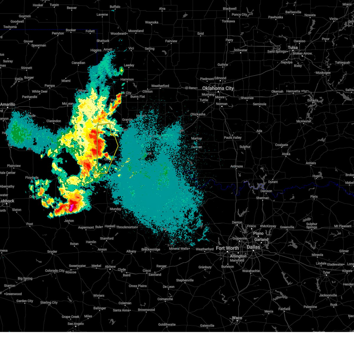 At 1232 am cdt, severe thunderstorms were located along a line extending from near dodson to 8 miles southwest of gould to 4 miles east of swearingen, moving east at 35 mph (radar indicated). Hazards include 70 mph wind gusts and half dollar size hail. Hail damage to vehicles is expected. expect considerable tree damage. wind damage is also likely to mobile homes, roofs, and outbuildings. Locations impacted include, quanah, hollis, eldorado, gould, goodlett, vinson, madge, mcknight, mcqueen, and lazare. At 1232 am cdt, severe thunderstorms were located along a line extending from near dodson to 8 miles southwest of gould to 4 miles east of swearingen, moving east at 35 mph (radar indicated). Hazards include 70 mph wind gusts and half dollar size hail. Hail damage to vehicles is expected. expect considerable tree damage. wind damage is also likely to mobile homes, roofs, and outbuildings. Locations impacted include, quanah, hollis, eldorado, gould, goodlett, vinson, madge, mcknight, mcqueen, and lazare.
|
| 4/24/2025 12:11 AM CDT |
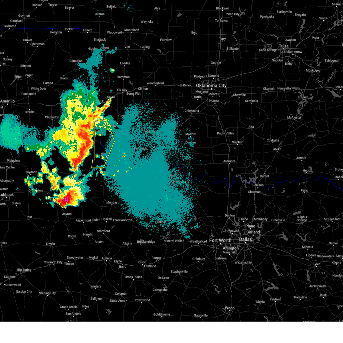 Svroun the national weather service in norman has issued a * severe thunderstorm warning for, southwestern jackson county in southwestern oklahoma, harmon county in southwestern oklahoma, northwestern foard county in northern texas, western hardeman county in northern texas, * until 100 am cdt. * at 1209 am cdt, severe thunderstorms were located along a line extending from 5 miles south of wellington to 11 miles north of kirkland to 8 miles southeast of cee vee, moving east at 35 mph. winds of 64 mph were measured at childress texas (radar indicated). Hazards include 70 mph wind gusts and quarter size hail. Hail damage to vehicles is expected. expect considerable tree damage. Wind damage is also likely to mobile homes, roofs, and outbuildings. Svroun the national weather service in norman has issued a * severe thunderstorm warning for, southwestern jackson county in southwestern oklahoma, harmon county in southwestern oklahoma, northwestern foard county in northern texas, western hardeman county in northern texas, * until 100 am cdt. * at 1209 am cdt, severe thunderstorms were located along a line extending from 5 miles south of wellington to 11 miles north of kirkland to 8 miles southeast of cee vee, moving east at 35 mph. winds of 64 mph were measured at childress texas (radar indicated). Hazards include 70 mph wind gusts and quarter size hail. Hail damage to vehicles is expected. expect considerable tree damage. Wind damage is also likely to mobile homes, roofs, and outbuildings.
|
| 3/2/2025 3:01 PM CST |
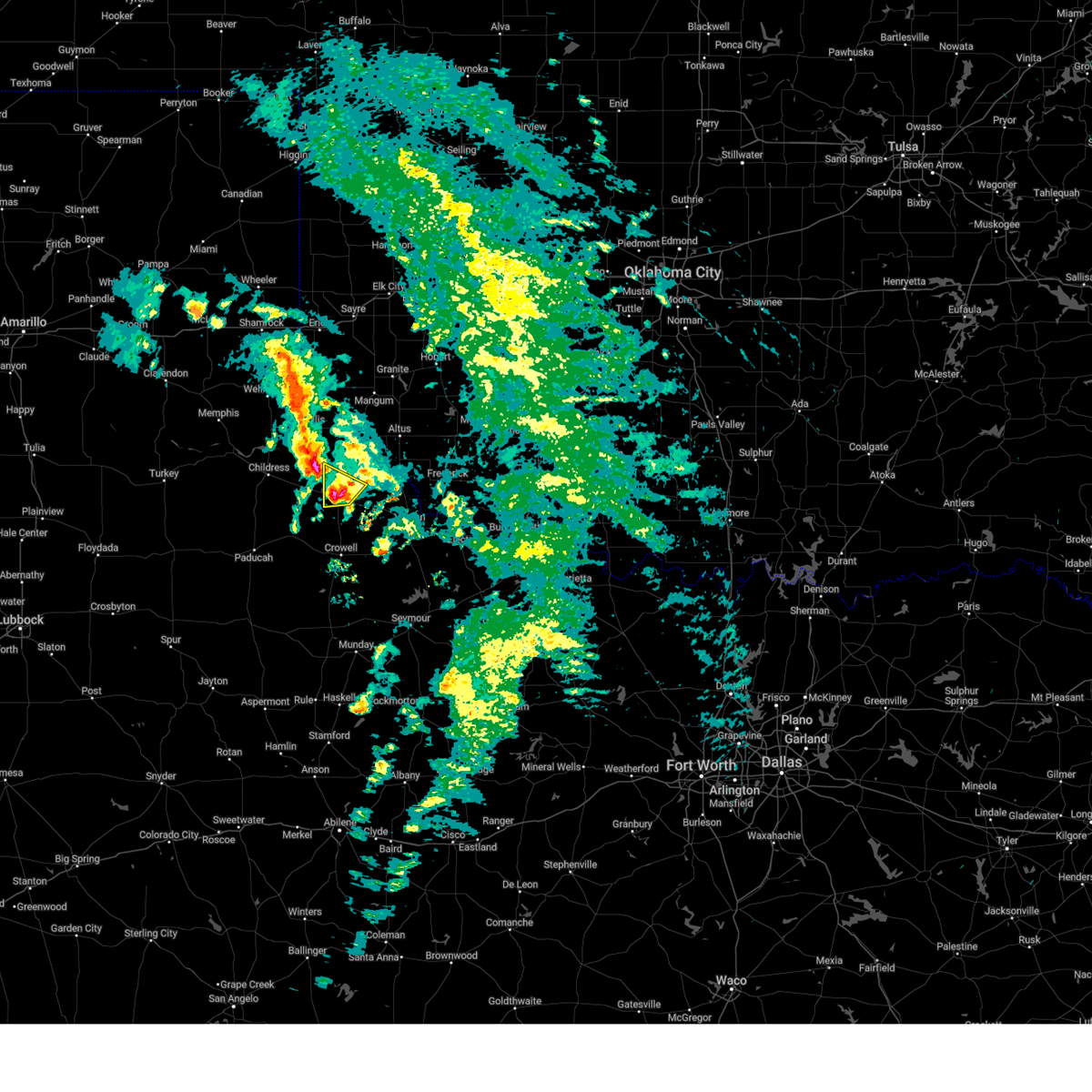 the severe thunderstorm warning has been cancelled and is no longer in effect the severe thunderstorm warning has been cancelled and is no longer in effect
|
| 3/2/2025 2:53 PM CST |
 At 253 pm cst, a severe thunderstorm was located near quanah, moving north at 30 mph (radar indicated). Hazards include 60 mph wind gusts and quarter size hail. Hail damage to vehicles is expected. expect wind damage to roofs, siding, and trees. Locations impacted include, quanah. At 253 pm cst, a severe thunderstorm was located near quanah, moving north at 30 mph (radar indicated). Hazards include 60 mph wind gusts and quarter size hail. Hail damage to vehicles is expected. expect wind damage to roofs, siding, and trees. Locations impacted include, quanah.
|
| 3/2/2025 2:46 PM CST |
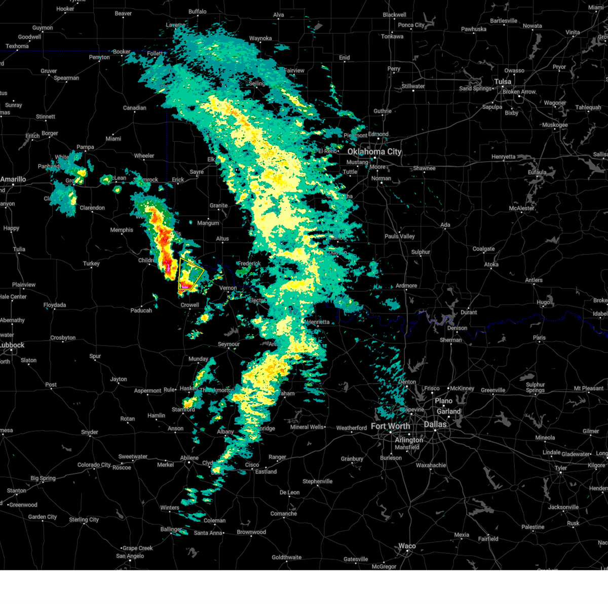 Svroun the national weather service in norman has issued a * severe thunderstorm warning for, southwestern jackson county in southwestern oklahoma, central hardeman county in northern texas, * until 330 pm cst. * at 246 pm cst, a severe thunderstorm was located 4 miles southwest of quanah, moving north at 25 mph (radar indicated). Hazards include 60 mph wind gusts and quarter size hail. Hail damage to vehicles is expected. Expect wind damage to roofs, siding, and trees. Svroun the national weather service in norman has issued a * severe thunderstorm warning for, southwestern jackson county in southwestern oklahoma, central hardeman county in northern texas, * until 330 pm cst. * at 246 pm cst, a severe thunderstorm was located 4 miles southwest of quanah, moving north at 25 mph (radar indicated). Hazards include 60 mph wind gusts and quarter size hail. Hail damage to vehicles is expected. Expect wind damage to roofs, siding, and trees.
|
| 11/18/2024 2:54 AM CST |
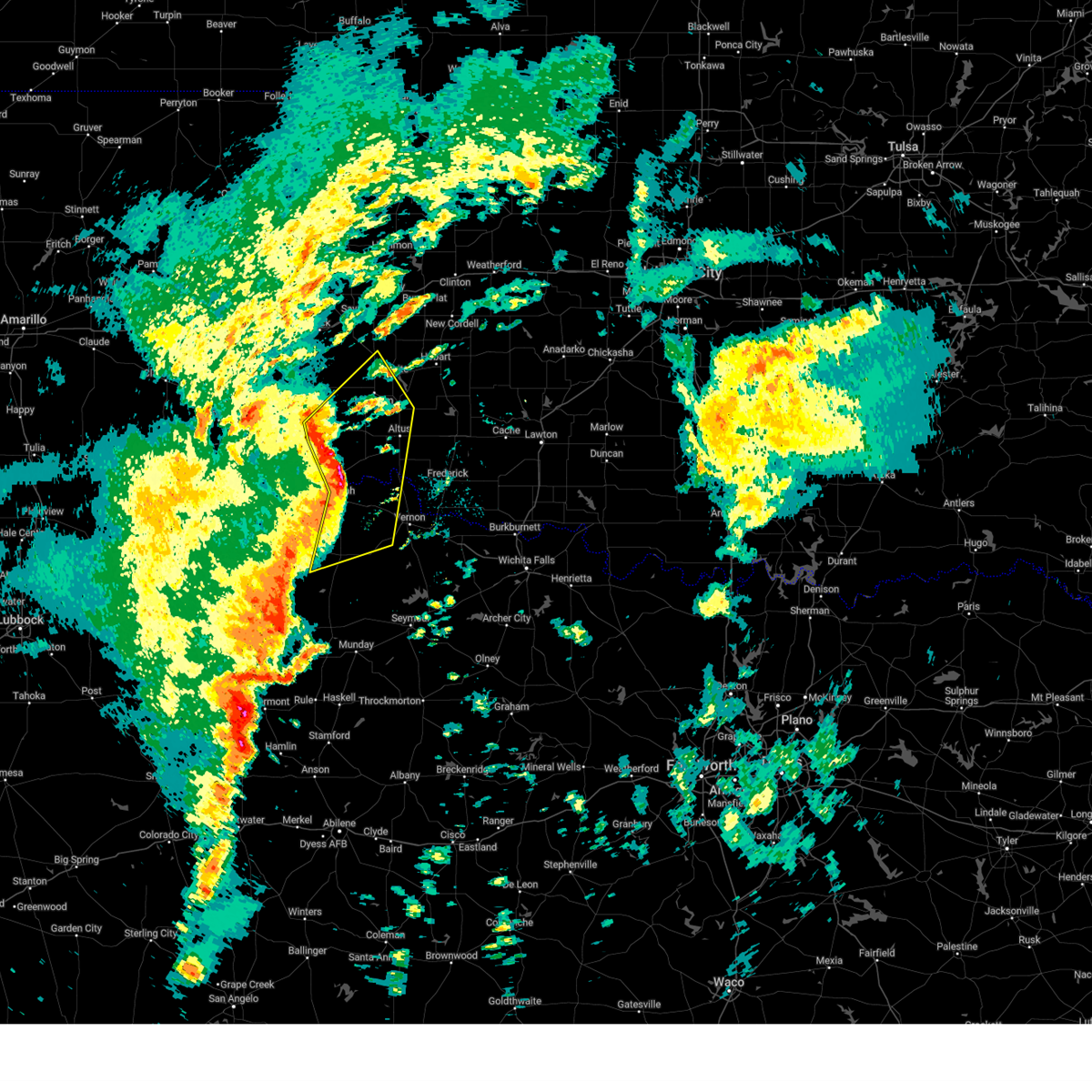 At 254 am cst, severe thunderstorms were located along a line extending from 3 miles southwest of gould to near eldorado to 4 miles northwest of crowell, moving northeast at 50 mph (radar indicated). Hazards include ping pong ball size hail and 60 mph wind gusts. People and animals outdoors will be injured. expect hail damage to roofs, siding, windows, and vehicles. expect wind damage to roofs, siding, and trees. Locations impacted include, altus, mangum, quanah, hollis, crowell, granite, blair, chillicothe, olustee, eldorado, martha, willow, gould, elmer, altus air force base, margaret, medicine mound, odell, duke, and lockett. At 254 am cst, severe thunderstorms were located along a line extending from 3 miles southwest of gould to near eldorado to 4 miles northwest of crowell, moving northeast at 50 mph (radar indicated). Hazards include ping pong ball size hail and 60 mph wind gusts. People and animals outdoors will be injured. expect hail damage to roofs, siding, windows, and vehicles. expect wind damage to roofs, siding, and trees. Locations impacted include, altus, mangum, quanah, hollis, crowell, granite, blair, chillicothe, olustee, eldorado, martha, willow, gould, elmer, altus air force base, margaret, medicine mound, odell, duke, and lockett.
|
| 11/18/2024 2:41 AM CST |
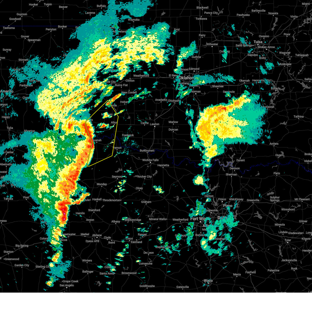 Svroun the national weather service in norman has issued a * severe thunderstorm warning for, jackson county in southwestern oklahoma, harmon county in southwestern oklahoma, greer county in southwestern oklahoma, central foard county in northern texas, northwestern wilbarger county in northern texas, hardeman county in northern texas, * until 330 am cst. * at 241 am cst, severe thunderstorms were located along a line extending from 10 miles northeast of kirkland to 4 miles east of goodlett to 12 miles west of crowell, moving northeast at 45 mph (goodlett mesonet site reported 62 mph wind gust). Hazards include 60 mph wind gusts and quarter size hail. Hail damage to vehicles is expected. Expect wind damage to roofs, siding, and trees. Svroun the national weather service in norman has issued a * severe thunderstorm warning for, jackson county in southwestern oklahoma, harmon county in southwestern oklahoma, greer county in southwestern oklahoma, central foard county in northern texas, northwestern wilbarger county in northern texas, hardeman county in northern texas, * until 330 am cst. * at 241 am cst, severe thunderstorms were located along a line extending from 10 miles northeast of kirkland to 4 miles east of goodlett to 12 miles west of crowell, moving northeast at 45 mph (goodlett mesonet site reported 62 mph wind gust). Hazards include 60 mph wind gusts and quarter size hail. Hail damage to vehicles is expected. Expect wind damage to roofs, siding, and trees.
|
| 11/18/2024 2:32 AM CST |
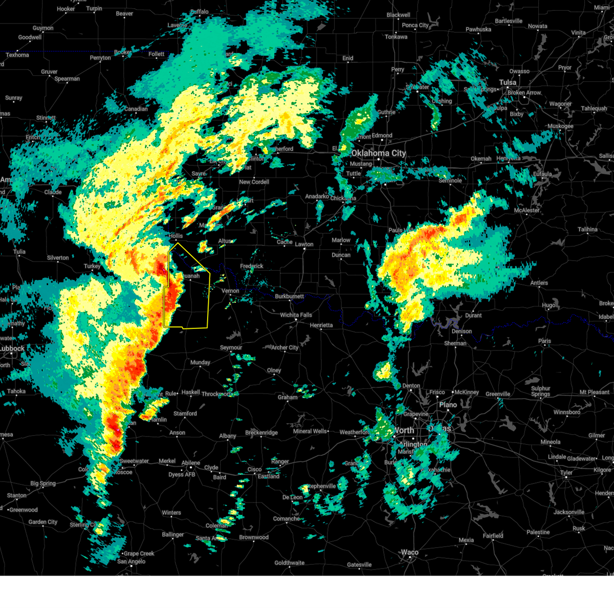 At 231 am cst, severe thunderstorms were located along a line extending from 7 miles northeast of kirkland to 3 miles southeast of goodlett to 8 miles west of truscott, moving northeast at 70 mph (radar indicated). Hazards include 70 mph wind gusts and quarter size hail. Hail damage to vehicles is expected. expect considerable tree damage. wind damage is also likely to mobile homes, roofs, and outbuildings. Locations impacted include, quanah, crowell, chillicothe, eldorado, margaret, goodlett, medicine mound, thalia, copper breaks state park, and lazare. At 231 am cst, severe thunderstorms were located along a line extending from 7 miles northeast of kirkland to 3 miles southeast of goodlett to 8 miles west of truscott, moving northeast at 70 mph (radar indicated). Hazards include 70 mph wind gusts and quarter size hail. Hail damage to vehicles is expected. expect considerable tree damage. wind damage is also likely to mobile homes, roofs, and outbuildings. Locations impacted include, quanah, crowell, chillicothe, eldorado, margaret, goodlett, medicine mound, thalia, copper breaks state park, and lazare.
|
| 11/18/2024 2:32 AM CST |
 the severe thunderstorm warning has been cancelled and is no longer in effect the severe thunderstorm warning has been cancelled and is no longer in effect
|
| 11/18/2024 2:15 AM CST |
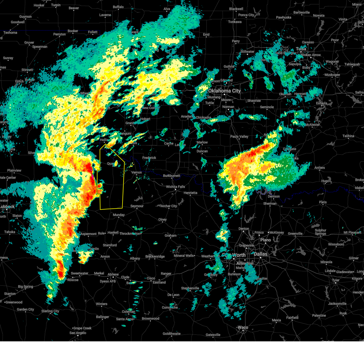 At 213 am cst, severe thunderstorms were located along a line extending from 8 miles south of childress to near swearingen to 5 miles southeast of guthrie, moving northeast at 45 mph (west texas mesonet site near paducuh reported 65 mph wind gust). Hazards include 70 mph wind gusts and ping pong ball size hail. People and animals outdoors will be injured. expect hail damage to roofs, siding, windows, and vehicles. expect considerable tree damage. wind damage is also likely to mobile homes, roofs, and outbuildings. Locations impacted include, quanah, crowell, benjamin, chillicothe, eldorado, thalia, gilliland, margaret, goodlett, vera, medicine mound, truscott, lazare, and copper breaks state park. At 213 am cst, severe thunderstorms were located along a line extending from 8 miles south of childress to near swearingen to 5 miles southeast of guthrie, moving northeast at 45 mph (west texas mesonet site near paducuh reported 65 mph wind gust). Hazards include 70 mph wind gusts and ping pong ball size hail. People and animals outdoors will be injured. expect hail damage to roofs, siding, windows, and vehicles. expect considerable tree damage. wind damage is also likely to mobile homes, roofs, and outbuildings. Locations impacted include, quanah, crowell, benjamin, chillicothe, eldorado, thalia, gilliland, margaret, goodlett, vera, medicine mound, truscott, lazare, and copper breaks state park.
|
| 11/18/2024 1:59 AM CST |
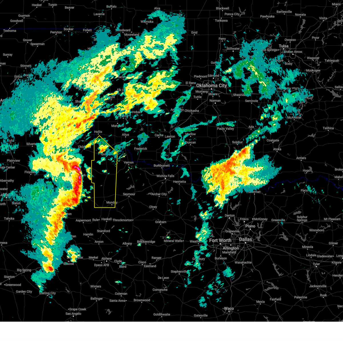 Svroun the national weather service in norman has issued a * severe thunderstorm warning for, southwestern jackson county in southwestern oklahoma, southwestern harmon county in southwestern oklahoma, foard county in northern texas, knox county in northern texas, hardeman county in northern texas, * until 245 am cst. * at 158 am cst, severe thunderstorms were located along a line extending from 7 miles southeast of cee vee to 4 miles north of chalk to 14 miles south of guthrie, moving northeast at 45 mph (west texas mesonet site in paducah measured 65 mph wind gust). Hazards include 70 mph wind gusts and quarter size hail. Hail damage to vehicles is expected. expect considerable tree damage. Wind damage is also likely to mobile homes, roofs, and outbuildings. Svroun the national weather service in norman has issued a * severe thunderstorm warning for, southwestern jackson county in southwestern oklahoma, southwestern harmon county in southwestern oklahoma, foard county in northern texas, knox county in northern texas, hardeman county in northern texas, * until 245 am cst. * at 158 am cst, severe thunderstorms were located along a line extending from 7 miles southeast of cee vee to 4 miles north of chalk to 14 miles south of guthrie, moving northeast at 45 mph (west texas mesonet site in paducah measured 65 mph wind gust). Hazards include 70 mph wind gusts and quarter size hail. Hail damage to vehicles is expected. expect considerable tree damage. Wind damage is also likely to mobile homes, roofs, and outbuildings.
|
| 8/15/2024 8:38 PM CDT |
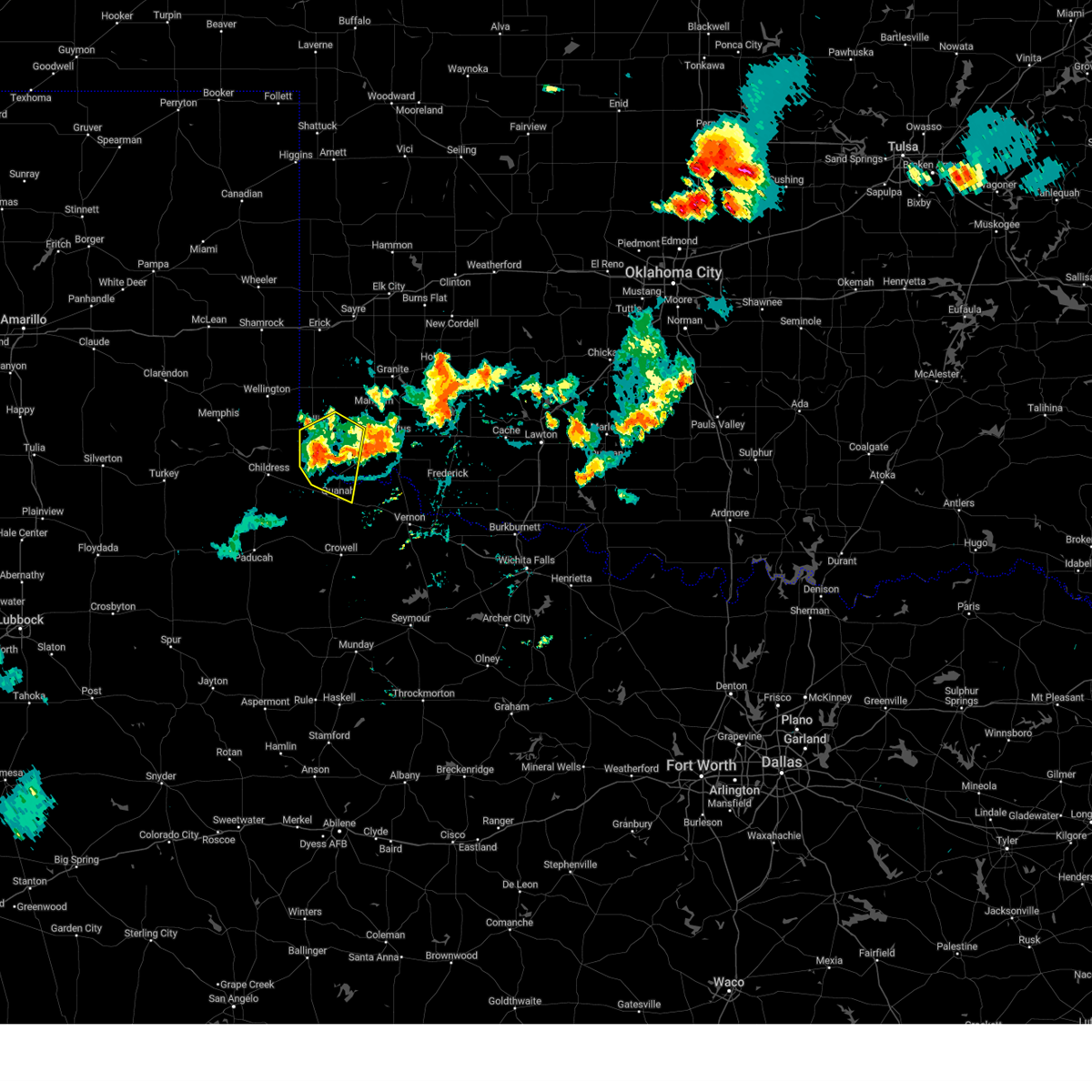 The storm which prompted the warning has weakened below severe limits, therefore the warning will be allowed to expire. The storm which prompted the warning has weakened below severe limits, therefore the warning will be allowed to expire.
|
| 8/15/2024 7:56 PM CDT |
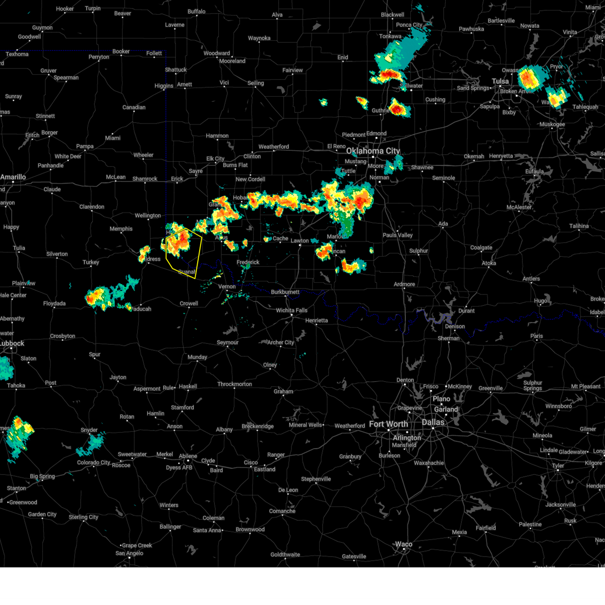 Svroun the national weather service in norman has issued a * severe thunderstorm warning for, southwestern jackson county in southwestern oklahoma, southern harmon county in southwestern oklahoma, northwestern hardeman county in northern texas, * until 845 pm cdt. * at 756 pm cdt, a severe thunderstorm was located near gould, moving east at 10 mph (radar indicated). Hazards include 60 mph wind gusts and quarter size hail. Hail damage to vehicles is expected. Expect wind damage to roofs, siding, and trees. Svroun the national weather service in norman has issued a * severe thunderstorm warning for, southwestern jackson county in southwestern oklahoma, southern harmon county in southwestern oklahoma, northwestern hardeman county in northern texas, * until 845 pm cdt. * at 756 pm cdt, a severe thunderstorm was located near gould, moving east at 10 mph (radar indicated). Hazards include 60 mph wind gusts and quarter size hail. Hail damage to vehicles is expected. Expect wind damage to roofs, siding, and trees.
|
| 5/30/2024 10:22 PM CDT |
 At 1022 pm cdt, severe thunderstorms were located along a line extending from 4 miles southwest of mangum to 4 miles southwest of olustee to near quanah, moving east at 35 mph (radar indicated). Hazards include 60 mph wind gusts and nickel size hail. Expect damage to roofs, siding, and trees. Locations impacted include, altus, mangum, quanah, blair, chillicothe, olustee, eldorado, martha, gould, elmer, altus air force base, duke, goodlett, odell, hester, mcqueen, and hess. At 1022 pm cdt, severe thunderstorms were located along a line extending from 4 miles southwest of mangum to 4 miles southwest of olustee to near quanah, moving east at 35 mph (radar indicated). Hazards include 60 mph wind gusts and nickel size hail. Expect damage to roofs, siding, and trees. Locations impacted include, altus, mangum, quanah, blair, chillicothe, olustee, eldorado, martha, gould, elmer, altus air force base, duke, goodlett, odell, hester, mcqueen, and hess.
|
| 5/30/2024 9:56 PM CDT |
 Svroun the national weather service in norman has issued a * severe thunderstorm warning for, jackson county in southwestern oklahoma, harmon county in southwestern oklahoma, southeastern greer county in southwestern oklahoma, northwestern wilbarger county in northern texas, central hardeman county in northern texas, * until 1045 pm cdt. * at 956 pm cdt, severe thunderstorms were located along a line extending from 4 miles east of vinson to 7 miles northwest of eldorado to 3 miles west of goodlett, moving east at 35 mph (radar indicated). Hazards include 60 mph wind gusts and nickel size hail. expect damage to roofs, siding, and trees Svroun the national weather service in norman has issued a * severe thunderstorm warning for, jackson county in southwestern oklahoma, harmon county in southwestern oklahoma, southeastern greer county in southwestern oklahoma, northwestern wilbarger county in northern texas, central hardeman county in northern texas, * until 1045 pm cdt. * at 956 pm cdt, severe thunderstorms were located along a line extending from 4 miles east of vinson to 7 miles northwest of eldorado to 3 miles west of goodlett, moving east at 35 mph (radar indicated). Hazards include 60 mph wind gusts and nickel size hail. expect damage to roofs, siding, and trees
|
| 5/30/2024 4:58 AM CDT |
 Svroun the national weather service in norman has issued a * severe thunderstorm warning for, southwestern jackson county in southwestern oklahoma, northwestern wilbarger county in northern texas, southeastern hardeman county in northern texas, * until 545 am cdt. * at 458 am cdt, severe thunderstorms were located along a line extending from near eldorado to 3 miles north of medicine mound to 5 miles northwest of margaret, moving northeast at 20 mph (radar indicated). Hazards include 60 mph wind gusts. expect damage to roofs, siding, and trees Svroun the national weather service in norman has issued a * severe thunderstorm warning for, southwestern jackson county in southwestern oklahoma, northwestern wilbarger county in northern texas, southeastern hardeman county in northern texas, * until 545 am cdt. * at 458 am cdt, severe thunderstorms were located along a line extending from near eldorado to 3 miles north of medicine mound to 5 miles northwest of margaret, moving northeast at 20 mph (radar indicated). Hazards include 60 mph wind gusts. expect damage to roofs, siding, and trees
|
| 5/30/2024 4:26 AM CDT | Storm damage reported in hardeman county TX, 11.6 miles ESE of Quanah, TX |
| 5/2/2024 10:43 PM CDT |
 The storm which prompted the warning has weakened below severe limits, therefore the warning will be allowed to expire. however, gusty winds are still possible with this thunderstorm. The storm which prompted the warning has weakened below severe limits, therefore the warning will be allowed to expire. however, gusty winds are still possible with this thunderstorm.
|
| 5/2/2024 10:19 PM CDT |
 At 1019 pm cdt, a severe thunderstorm was located 6 miles south of quanah, moving north at 20 mph (radar indicated). Hazards include 60 mph wind gusts and quarter size hail. Hail damage to vehicles is expected. expect wind damage to roofs, siding, and trees. Locations impacted include, quanah. At 1019 pm cdt, a severe thunderstorm was located 6 miles south of quanah, moving north at 20 mph (radar indicated). Hazards include 60 mph wind gusts and quarter size hail. Hail damage to vehicles is expected. expect wind damage to roofs, siding, and trees. Locations impacted include, quanah.
|
| 5/2/2024 10:19 PM CDT |
 the severe thunderstorm warning has been cancelled and is no longer in effect the severe thunderstorm warning has been cancelled and is no longer in effect
|
| 5/2/2024 10:04 PM CDT |
 Svroun the national weather service in norman has issued a * severe thunderstorm warning for, central foard county in northern texas, central hardeman county in northern texas, * until 1045 pm cdt. * at 1004 pm cdt, a severe thunderstorm was located 8 miles northwest of margaret, moving north at 20 mph (radar indicated). Hazards include 60 mph wind gusts and quarter size hail. Hail damage to vehicles is expected. Expect wind damage to roofs, siding, and trees. Svroun the national weather service in norman has issued a * severe thunderstorm warning for, central foard county in northern texas, central hardeman county in northern texas, * until 1045 pm cdt. * at 1004 pm cdt, a severe thunderstorm was located 8 miles northwest of margaret, moving north at 20 mph (radar indicated). Hazards include 60 mph wind gusts and quarter size hail. Hail damage to vehicles is expected. Expect wind damage to roofs, siding, and trees.
|
| 5/1/2024 9:56 PM CDT |
 Svroun the national weather service in norman has issued a * severe thunderstorm warning for, southwestern jackson county in southwestern oklahoma, southern harmon county in southwestern oklahoma, northwestern foard county in northern texas, hardeman county in northern texas, * until 1045 pm cdt. * at 955 pm cdt, severe thunderstorms were located along a line extending from 8 miles northeast of kirkland to near goodlett to 10 miles southwest of quanah, moving northeast at 25 mph (radar indicated). Hazards include 60 mph wind gusts and penny size hail. expect damage to roofs, siding, and trees Svroun the national weather service in norman has issued a * severe thunderstorm warning for, southwestern jackson county in southwestern oklahoma, southern harmon county in southwestern oklahoma, northwestern foard county in northern texas, hardeman county in northern texas, * until 1045 pm cdt. * at 955 pm cdt, severe thunderstorms were located along a line extending from 8 miles northeast of kirkland to near goodlett to 10 miles southwest of quanah, moving northeast at 25 mph (radar indicated). Hazards include 60 mph wind gusts and penny size hail. expect damage to roofs, siding, and trees
|
| 5/1/2024 9:41 PM CDT |
 At 940 pm cdt, severe thunderstorms were located along a line extending from 6 miles northwest of kirkland to 3 miles northwest of goodlett to 11 miles southwest of quanah, moving northeast at 35 mph (radar indicated). Hazards include 60 mph wind gusts and nickel size hail. Expect damage to roofs, siding, and trees. Locations impacted include, quanah, goodlett, and lazare. At 940 pm cdt, severe thunderstorms were located along a line extending from 6 miles northwest of kirkland to 3 miles northwest of goodlett to 11 miles southwest of quanah, moving northeast at 35 mph (radar indicated). Hazards include 60 mph wind gusts and nickel size hail. Expect damage to roofs, siding, and trees. Locations impacted include, quanah, goodlett, and lazare.
|
| 5/1/2024 9:18 PM CDT |
 Svroun the national weather service in norman has issued a * severe thunderstorm warning for, southwestern jackson county in southwestern oklahoma, southwestern harmon county in southwestern oklahoma, northwestern foard county in northern texas, northwestern hardeman county in northern texas, * until 1000 pm cdt. * at 916 pm cdt, severe thunderstorms were located along a line extending from near tell to 8 miles southwest of kirkland to 4 miles east of swearingen, moving northeast at 30 mph (radar indicated). Hazards include 60 mph wind gusts and nickel size hail. expect damage to roofs, siding, and trees Svroun the national weather service in norman has issued a * severe thunderstorm warning for, southwestern jackson county in southwestern oklahoma, southwestern harmon county in southwestern oklahoma, northwestern foard county in northern texas, northwestern hardeman county in northern texas, * until 1000 pm cdt. * at 916 pm cdt, severe thunderstorms were located along a line extending from near tell to 8 miles southwest of kirkland to 4 miles east of swearingen, moving northeast at 30 mph (radar indicated). Hazards include 60 mph wind gusts and nickel size hail. expect damage to roofs, siding, and trees
|
| 4/27/2024 12:52 PM CDT |
 At 1252 pm cdt, a severe thunderstorm was located 4 miles east of goodlett, moving northeast at 35 mph (trained weather spotters). Hazards include golf ball size hail and 60 mph wind gusts. People and animals outdoors will be injured. expect hail damage to roofs, siding, windows, and vehicles. expect wind damage to roofs, siding, and trees. Locations impacted include, quanah, eldorado, and goodlett. At 1252 pm cdt, a severe thunderstorm was located 4 miles east of goodlett, moving northeast at 35 mph (trained weather spotters). Hazards include golf ball size hail and 60 mph wind gusts. People and animals outdoors will be injured. expect hail damage to roofs, siding, windows, and vehicles. expect wind damage to roofs, siding, and trees. Locations impacted include, quanah, eldorado, and goodlett.
|
| 4/27/2024 12:49 PM CDT | Half Dollar sized hail reported 7 miles ESE of Quanah, TX |
| 4/27/2024 12:43 PM CDT |
 Svroun the national weather service in norman has issued a * severe thunderstorm warning for, southwestern jackson county in southwestern oklahoma, southeastern harmon county in southwestern oklahoma, northern hardeman county in northern texas, * until 130 pm cdt. * at 1243 pm cdt, a severe thunderstorm was located near goodlett, moving northeast at 35 mph (radar indicated). Hazards include golf ball size hail and 60 mph wind gusts. People and animals outdoors will be injured. expect hail damage to roofs, siding, windows, and vehicles. Expect wind damage to roofs, siding, and trees. Svroun the national weather service in norman has issued a * severe thunderstorm warning for, southwestern jackson county in southwestern oklahoma, southeastern harmon county in southwestern oklahoma, northern hardeman county in northern texas, * until 130 pm cdt. * at 1243 pm cdt, a severe thunderstorm was located near goodlett, moving northeast at 35 mph (radar indicated). Hazards include golf ball size hail and 60 mph wind gusts. People and animals outdoors will be injured. expect hail damage to roofs, siding, windows, and vehicles. Expect wind damage to roofs, siding, and trees.
|
| 4/27/2024 12:31 PM CDT |
 At 1231 pm cdt, a severe thunderstorm was located 7 miles southwest of goodlett, moving northeast at 30 mph (radar indicated). Hazards include golf ball size hail and 60 mph wind gusts. People and animals outdoors will be injured. expect hail damage to roofs, siding, windows, and vehicles. expect wind damage to roofs, siding, and trees. Locations impacted include, quanah, goodlett, and lazare. At 1231 pm cdt, a severe thunderstorm was located 7 miles southwest of goodlett, moving northeast at 30 mph (radar indicated). Hazards include golf ball size hail and 60 mph wind gusts. People and animals outdoors will be injured. expect hail damage to roofs, siding, windows, and vehicles. expect wind damage to roofs, siding, and trees. Locations impacted include, quanah, goodlett, and lazare.
|
| 4/27/2024 12:15 PM CDT | Svroun the national weather service in norman has issued a * severe thunderstorm warning for, northwestern foard county in northern texas, southwestern hardeman county in northern texas, * until 1245 pm cdt. * at 1214 pm cdt, a severe thunderstorm was located 6 miles east of swearingen, moving northeast at 45 mph (radar indicated). Hazards include 60 mph wind gusts and quarter size hail. Hail damage to vehicles is expected. Expect wind damage to roofs, siding, and trees. |
| 4/15/2024 7:11 PM CDT |
 At 711 pm cdt, severe thunderstorms were located along a line extending from 5 miles southeast of quanah to 4 miles north of medicine mound, moving northeast at 75 mph (public). Hazards include golf ball size hail and 60 mph wind gusts. People and animals outdoors will be injured. expect hail damage to roofs, siding, windows, and vehicles. expect wind damage to roofs, siding, and trees. Locations impacted include, quanah, chillicothe, eldorado, odell, medicine mound, and hess. At 711 pm cdt, severe thunderstorms were located along a line extending from 5 miles southeast of quanah to 4 miles north of medicine mound, moving northeast at 75 mph (public). Hazards include golf ball size hail and 60 mph wind gusts. People and animals outdoors will be injured. expect hail damage to roofs, siding, windows, and vehicles. expect wind damage to roofs, siding, and trees. Locations impacted include, quanah, chillicothe, eldorado, odell, medicine mound, and hess.
|
| 4/15/2024 7:10 PM CDT | Golf Ball sized hail reported 4 miles NW of Quanah, TX, near lake pauline. |
| 4/15/2024 7:07 PM CDT |
 the severe thunderstorm warning has been cancelled and is no longer in effect the severe thunderstorm warning has been cancelled and is no longer in effect
|
| 4/15/2024 7:07 PM CDT |
 At 707 pm cdt, severe thunderstorms were located along a line extending from 8 miles south of quanah to 4 miles west of medicine mound, moving northeast at 70 mph (radar indicated). Hazards include ping pong ball size hail and 60 mph wind gusts. People and animals outdoors will be injured. expect hail damage to roofs, siding, windows, and vehicles. expect wind damage to roofs, siding, and trees. Locations impacted include, quanah, chillicothe, eldorado, medicine mound, odell, hess, and copper breaks state park. At 707 pm cdt, severe thunderstorms were located along a line extending from 8 miles south of quanah to 4 miles west of medicine mound, moving northeast at 70 mph (radar indicated). Hazards include ping pong ball size hail and 60 mph wind gusts. People and animals outdoors will be injured. expect hail damage to roofs, siding, windows, and vehicles. expect wind damage to roofs, siding, and trees. Locations impacted include, quanah, chillicothe, eldorado, medicine mound, odell, hess, and copper breaks state park.
|
| 4/15/2024 7:05 PM CDT | Golf Ball sized hail reported 8 miles N of Quanah, TX, report from mping. |
| 4/15/2024 6:55 PM CDT |
 Svroun the national weather service in norman has issued a * severe thunderstorm warning for, southwestern jackson county in southwestern oklahoma, central foard county in northern texas, northwestern wilbarger county in northern texas, hardeman county in northern texas, * until 730 pm cdt. * at 655 pm cdt, severe thunderstorms were located along a line extending from 11 miles west of margaret to 5 miles northwest of crowell, moving northeast at 65 mph (radar indicated). Hazards include 60 mph wind gusts and half dollar size hail. Hail damage to vehicles is expected. Expect wind damage to roofs, siding, and trees. Svroun the national weather service in norman has issued a * severe thunderstorm warning for, southwestern jackson county in southwestern oklahoma, central foard county in northern texas, northwestern wilbarger county in northern texas, hardeman county in northern texas, * until 730 pm cdt. * at 655 pm cdt, severe thunderstorms were located along a line extending from 11 miles west of margaret to 5 miles northwest of crowell, moving northeast at 65 mph (radar indicated). Hazards include 60 mph wind gusts and half dollar size hail. Hail damage to vehicles is expected. Expect wind damage to roofs, siding, and trees.
|
| 3/7/2024 5:20 PM CST |
 Svroun the national weather service in norman has issued a * severe thunderstorm warning for, central jackson county in southwestern oklahoma, northwestern wilbarger county in northern texas, east central hardeman county in northern texas, * until 600 pm cst. * at 520 pm cst, a severe thunderstorm was located 7 miles southeast of eldorado, moving north at 35 mph (radar indicated). Hazards include golf ball size hail and 60 mph wind gusts. People and animals outdoors will be injured. expect hail damage to roofs, siding, windows, and vehicles. Expect wind damage to roofs, siding, and trees. Svroun the national weather service in norman has issued a * severe thunderstorm warning for, central jackson county in southwestern oklahoma, northwestern wilbarger county in northern texas, east central hardeman county in northern texas, * until 600 pm cst. * at 520 pm cst, a severe thunderstorm was located 7 miles southeast of eldorado, moving north at 35 mph (radar indicated). Hazards include golf ball size hail and 60 mph wind gusts. People and animals outdoors will be injured. expect hail damage to roofs, siding, windows, and vehicles. Expect wind damage to roofs, siding, and trees.
|
| 3/7/2024 5:12 PM CST |
 At 512 pm cst, a severe thunderstorm was located 4 miles northwest of chillicothe, moving northeast at 45 mph (radar indicated). Hazards include golf ball size hail and 60 mph wind gusts. People and animals outdoors will be injured. expect hail damage to roofs, siding, windows, and vehicles. expect wind damage to roofs, siding, and trees. Locations impacted include, quanah, chillicothe, odell, and medicine mound. At 512 pm cst, a severe thunderstorm was located 4 miles northwest of chillicothe, moving northeast at 45 mph (radar indicated). Hazards include golf ball size hail and 60 mph wind gusts. People and animals outdoors will be injured. expect hail damage to roofs, siding, windows, and vehicles. expect wind damage to roofs, siding, and trees. Locations impacted include, quanah, chillicothe, odell, and medicine mound.
|
| 3/7/2024 5:06 PM CST | Ping Pong Ball sized hail reported 5.3 miles NW of Quanah, TX, time estimated by radar. |
| 3/7/2024 5:03 PM CST |
 the severe thunderstorm warning has been cancelled and is no longer in effect the severe thunderstorm warning has been cancelled and is no longer in effect
|
| 3/7/2024 5:03 PM CST |
 At 503 pm cst, a severe thunderstorm was located near medicine mound, moving north at 35 mph (radar indicated). Hazards include 60 mph wind gusts and half dollar size hail. Hail damage to vehicles is expected. expect wind damage to roofs, siding, and trees. Locations impacted include, quanah, chillicothe, odell, medicine mound, and copper breaks state park. At 503 pm cst, a severe thunderstorm was located near medicine mound, moving north at 35 mph (radar indicated). Hazards include 60 mph wind gusts and half dollar size hail. Hail damage to vehicles is expected. expect wind damage to roofs, siding, and trees. Locations impacted include, quanah, chillicothe, odell, medicine mound, and copper breaks state park.
|
| 3/7/2024 4:40 PM CST |
 Svroun the national weather service in norman has issued a * severe thunderstorm warning for, east central foard county in northern texas, northwestern wilbarger county in northern texas, southeastern hardeman county in northern texas, * until 530 pm cst. * at 439 pm cst, a severe thunderstorm was located near crowell, moving northeast at 45 mph (radar indicated). Hazards include 60 mph wind gusts and half dollar size hail. Hail damage to vehicles is expected. Expect wind damage to roofs, siding, and trees. Svroun the national weather service in norman has issued a * severe thunderstorm warning for, east central foard county in northern texas, northwestern wilbarger county in northern texas, southeastern hardeman county in northern texas, * until 530 pm cst. * at 439 pm cst, a severe thunderstorm was located near crowell, moving northeast at 45 mph (radar indicated). Hazards include 60 mph wind gusts and half dollar size hail. Hail damage to vehicles is expected. Expect wind damage to roofs, siding, and trees.
|
| 2/2/2024 6:48 PM CST |
 At 647 pm cst, severe thunderstorms were located along a line extending from 11 miles south of hollis to near margaret, moving northeast at 35 mph (radar indicated). Hazards include 60 mph wind gusts and nickel size hail. Expect damage to roofs, siding, and trees. locations impacted include, quanah. hail threat, radar indicated max hail size, 0. 88 in wind threat, radar indicated max wind gust, 60 mph. At 647 pm cst, severe thunderstorms were located along a line extending from 11 miles south of hollis to near margaret, moving northeast at 35 mph (radar indicated). Hazards include 60 mph wind gusts and nickel size hail. Expect damage to roofs, siding, and trees. locations impacted include, quanah. hail threat, radar indicated max hail size, 0. 88 in wind threat, radar indicated max wind gust, 60 mph.
|
| 2/2/2024 6:33 PM CST |
 At 632 pm cst, severe thunderstorms were located along a line extending from 4 miles north of kirkland to 4 miles southwest of crowell, moving northeast at 35 mph (public). Hazards include 60 mph wind gusts and nickel size hail. Expect damage to roofs, siding, and trees. locations impacted include, quanah, crowell, margaret, goodlett, copper breaks state park, and lazare. hail threat, radar indicated max hail size, 0. 88 in wind threat, radar indicated max wind gust, 60 mph. At 632 pm cst, severe thunderstorms were located along a line extending from 4 miles north of kirkland to 4 miles southwest of crowell, moving northeast at 35 mph (public). Hazards include 60 mph wind gusts and nickel size hail. Expect damage to roofs, siding, and trees. locations impacted include, quanah, crowell, margaret, goodlett, copper breaks state park, and lazare. hail threat, radar indicated max hail size, 0. 88 in wind threat, radar indicated max wind gust, 60 mph.
|
| 2/2/2024 6:09 PM CST |
 At 608 pm cst, severe thunderstorms were located along a line extending from 4 miles south of childress to 12 miles east of chalk, moving northeast at 35 mph. a 64 mph gust was recently reported near hackberry, tx (public). Hazards include 70 mph wind gusts and quarter size hail. Hail damage to vehicles is expected. expect considerable tree damage. Wind damage is also likely to mobile homes, roofs, and outbuildings. At 608 pm cst, severe thunderstorms were located along a line extending from 4 miles south of childress to 12 miles east of chalk, moving northeast at 35 mph. a 64 mph gust was recently reported near hackberry, tx (public). Hazards include 70 mph wind gusts and quarter size hail. Hail damage to vehicles is expected. expect considerable tree damage. Wind damage is also likely to mobile homes, roofs, and outbuildings.
|
| 10/4/2023 2:33 PM CDT | Quarter sized hail reported 4.4 miles NW of Quanah, TX |
| 10/4/2023 2:23 PM CDT |
 At 222 pm cdt, a severe thunderstorm was located near quanah, moving east at 35 mph (radar indicated). Hazards include two inch hail and 70 mph wind gusts. People and animals outdoors will be injured. expect hail damage to roofs, siding, windows, and vehicles. expect considerable tree damage. Wind damage is also likely to mobile homes, roofs, and outbuildings. At 222 pm cdt, a severe thunderstorm was located near quanah, moving east at 35 mph (radar indicated). Hazards include two inch hail and 70 mph wind gusts. People and animals outdoors will be injured. expect hail damage to roofs, siding, windows, and vehicles. expect considerable tree damage. Wind damage is also likely to mobile homes, roofs, and outbuildings.
|
| 10/4/2023 2:17 PM CDT |
 At 217 pm cdt, a severe thunderstorm was located 4 miles southwest of quanah, moving east at 30 mph (radar indicated). Hazards include two inch hail and 70 mph wind gusts. People and animals outdoors will be injured. expect hail damage to roofs, siding, windows, and vehicles. expect considerable tree damage. wind damage is also likely to mobile homes, roofs, and outbuildings. locations impacted include, quanah and goodlett. thunderstorm damage threat, considerable hail threat, radar indicated max hail size, 2. 00 in wind threat, radar indicated max wind gust, 70 mph. At 217 pm cdt, a severe thunderstorm was located 4 miles southwest of quanah, moving east at 30 mph (radar indicated). Hazards include two inch hail and 70 mph wind gusts. People and animals outdoors will be injured. expect hail damage to roofs, siding, windows, and vehicles. expect considerable tree damage. wind damage is also likely to mobile homes, roofs, and outbuildings. locations impacted include, quanah and goodlett. thunderstorm damage threat, considerable hail threat, radar indicated max hail size, 2. 00 in wind threat, radar indicated max wind gust, 70 mph.
|
| 10/4/2023 1:58 PM CDT |
 At 157 pm cdt, a severe thunderstorm was located 10 miles southwest of goodlett, moving east at 30 mph (radar indicated). Hazards include 70 mph wind gusts and ping pong ball size hail. People and animals outdoors will be injured. expect hail damage to roofs, siding, windows, and vehicles. expect considerable tree damage. Wind damage is also likely to mobile homes, roofs, and outbuildings. At 157 pm cdt, a severe thunderstorm was located 10 miles southwest of goodlett, moving east at 30 mph (radar indicated). Hazards include 70 mph wind gusts and ping pong ball size hail. People and animals outdoors will be injured. expect hail damage to roofs, siding, windows, and vehicles. expect considerable tree damage. Wind damage is also likely to mobile homes, roofs, and outbuildings.
|
| 10/4/2023 1:55 PM CDT |
 At 155 pm cdt, a severe thunderstorm was located 6 miles southwest of eldorado, moving east at 35 mph (radar indicated). Hazards include two inch hail and 70 mph wind gusts. People and animals outdoors will be injured. expect hail damage to roofs, siding, windows, and vehicles. expect considerable tree damage. wind damage is also likely to mobile homes, roofs, and outbuildings. locations impacted include, eldorado and odell. thunderstorm damage threat, considerable hail threat, radar indicated max hail size, 2. 00 in wind threat, radar indicated max wind gust, 70 mph. At 155 pm cdt, a severe thunderstorm was located 6 miles southwest of eldorado, moving east at 35 mph (radar indicated). Hazards include two inch hail and 70 mph wind gusts. People and animals outdoors will be injured. expect hail damage to roofs, siding, windows, and vehicles. expect considerable tree damage. wind damage is also likely to mobile homes, roofs, and outbuildings. locations impacted include, eldorado and odell. thunderstorm damage threat, considerable hail threat, radar indicated max hail size, 2. 00 in wind threat, radar indicated max wind gust, 70 mph.
|
| 10/4/2023 1:44 PM CDT |
 At 144 pm cdt, a severe thunderstorm was located 5 miles north of quanah, moving east at 35 mph (radar indicated). Hazards include two inch hail and 70 mph wind gusts. People and animals outdoors will be injured. expect hail damage to roofs, siding, windows, and vehicles. expect considerable tree damage. wind damage is also likely to mobile homes, roofs, and outbuildings. locations impacted include, quanah, eldorado, odell, and goodlett. thunderstorm damage threat, considerable hail threat, radar indicated max hail size, 2. 00 in wind threat, radar indicated max wind gust, 70 mph. At 144 pm cdt, a severe thunderstorm was located 5 miles north of quanah, moving east at 35 mph (radar indicated). Hazards include two inch hail and 70 mph wind gusts. People and animals outdoors will be injured. expect hail damage to roofs, siding, windows, and vehicles. expect considerable tree damage. wind damage is also likely to mobile homes, roofs, and outbuildings. locations impacted include, quanah, eldorado, odell, and goodlett. thunderstorm damage threat, considerable hail threat, radar indicated max hail size, 2. 00 in wind threat, radar indicated max wind gust, 70 mph.
|
| 10/4/2023 1:37 PM CDT |
 At 137 pm cdt, a severe thunderstorm was located near goodlett, moving east at 25 mph (radar indicated). Hazards include golf ball size hail and 60 mph wind gusts. People and animals outdoors will be injured. expect hail damage to roofs, siding, windows, and vehicles. expect wind damage to roofs, siding, and trees. locations impacted include, quanah, eldorado, odell, and goodlett. thunderstorm damage threat, considerable hail threat, radar indicated max hail size, 1. 75 in wind threat, radar indicated max wind gust, 60 mph. At 137 pm cdt, a severe thunderstorm was located near goodlett, moving east at 25 mph (radar indicated). Hazards include golf ball size hail and 60 mph wind gusts. People and animals outdoors will be injured. expect hail damage to roofs, siding, windows, and vehicles. expect wind damage to roofs, siding, and trees. locations impacted include, quanah, eldorado, odell, and goodlett. thunderstorm damage threat, considerable hail threat, radar indicated max hail size, 1. 75 in wind threat, radar indicated max wind gust, 60 mph.
|
| 10/4/2023 1:29 PM CDT |
 At 129 pm cdt, a severe thunderstorm was located near goodlett, moving east at 25 mph (radar indicated). Hazards include 60 mph wind gusts and quarter size hail. Hail damage to vehicles is expected. Expect wind damage to roofs, siding, and trees. At 129 pm cdt, a severe thunderstorm was located near goodlett, moving east at 25 mph (radar indicated). Hazards include 60 mph wind gusts and quarter size hail. Hail damage to vehicles is expected. Expect wind damage to roofs, siding, and trees.
|
| 9/19/2023 6:42 PM CDT |
 At 641 pm cdt, a severe thunderstorm was located 5 miles east of quanah, moving east at 30 mph (radar indicated). Hazards include golf ball size hail and 70 mph wind gusts. People and animals outdoors will be injured. expect hail damage to roofs, siding, windows, and vehicles. expect considerable tree damage. wind damage is also likely to mobile homes, roofs, and outbuildings. locations impacted include, quanah, chillicothe, and medicine mound. thunderstorm damage threat, considerable hail threat, radar indicated max hail size, 1. 75 in wind threat, radar indicated max wind gust, 70 mph. At 641 pm cdt, a severe thunderstorm was located 5 miles east of quanah, moving east at 30 mph (radar indicated). Hazards include golf ball size hail and 70 mph wind gusts. People and animals outdoors will be injured. expect hail damage to roofs, siding, windows, and vehicles. expect considerable tree damage. wind damage is also likely to mobile homes, roofs, and outbuildings. locations impacted include, quanah, chillicothe, and medicine mound. thunderstorm damage threat, considerable hail threat, radar indicated max hail size, 1. 75 in wind threat, radar indicated max wind gust, 70 mph.
|
| 9/19/2023 6:23 PM CDT |
 At 622 pm cdt, a severe thunderstorm was located near goodlett, moving southeast at 20 mph. this is a destructive storm for quanah (spotters reported baseball size hail in quanah). Hazards include baseball size hail and 70 mph wind gusts. People and animals outdoors will be severely injured. Expect shattered windows, extensive damage to roofs, siding, and vehicles. At 622 pm cdt, a severe thunderstorm was located near goodlett, moving southeast at 20 mph. this is a destructive storm for quanah (spotters reported baseball size hail in quanah). Hazards include baseball size hail and 70 mph wind gusts. People and animals outdoors will be severely injured. Expect shattered windows, extensive damage to roofs, siding, and vehicles.
|
| 9/19/2023 6:21 PM CDT | Baseball sized hail reported 0.4 miles SW of Quanah, TX |
| 9/19/2023 6:15 PM CDT | Storm damage reported in hardeman county TX, 11.6 miles ESE of Quanah, TX |
| 9/19/2023 6:14 PM CDT |
 At 614 pm cdt, a severe thunderstorm was located near quanah, moving southeast at 35 mph (radar indicated). Hazards include 60 mph wind gusts and quarter size hail. Hail damage to vehicles is expected. expect wind damage to roofs, siding, and trees. locations impacted include, quanah, eldorado, goodlett, and mcqueen. hail threat, radar indicated max hail size, 1. 00 in wind threat, radar indicated max wind gust, 60 mph. At 614 pm cdt, a severe thunderstorm was located near quanah, moving southeast at 35 mph (radar indicated). Hazards include 60 mph wind gusts and quarter size hail. Hail damage to vehicles is expected. expect wind damage to roofs, siding, and trees. locations impacted include, quanah, eldorado, goodlett, and mcqueen. hail threat, radar indicated max hail size, 1. 00 in wind threat, radar indicated max wind gust, 60 mph.
|
| 9/19/2023 6:02 PM CDT |
 At 601 pm cdt, a severe thunderstorm was located near goodlett, moving southeast at 35 mph (radar indicated). Hazards include ping pong ball size hail and 60 mph wind gusts. People and animals outdoors will be injured. expect hail damage to roofs, siding, windows, and vehicles. expect wind damage to roofs, siding, and trees. locations impacted include, quanah, eldorado, gould, goodlett, copper breaks state park, mcqueen, and lazare. hail threat, radar indicated max hail size, 1. 50 in wind threat, radar indicated max wind gust, 60 mph. At 601 pm cdt, a severe thunderstorm was located near goodlett, moving southeast at 35 mph (radar indicated). Hazards include ping pong ball size hail and 60 mph wind gusts. People and animals outdoors will be injured. expect hail damage to roofs, siding, windows, and vehicles. expect wind damage to roofs, siding, and trees. locations impacted include, quanah, eldorado, gould, goodlett, copper breaks state park, mcqueen, and lazare. hail threat, radar indicated max hail size, 1. 50 in wind threat, radar indicated max wind gust, 60 mph.
|
| 9/19/2023 5:46 PM CDT |
 At 545 pm cdt, a severe thunderstorm was located near kirkland, moving southeast at 35 mph (radar indicated). Hazards include 60 mph wind gusts and half dollar size hail. Hail damage to vehicles is expected. Expect wind damage to roofs, siding, and trees. At 545 pm cdt, a severe thunderstorm was located near kirkland, moving southeast at 35 mph (radar indicated). Hazards include 60 mph wind gusts and half dollar size hail. Hail damage to vehicles is expected. Expect wind damage to roofs, siding, and trees.
|
| 8/12/2023 5:57 PM CDT |
 The severe thunderstorm warning for western comanche, jackson, southeastern kiowa, northern tillman, southern harmon, northwestern foard, northwestern wilbarger and hardeman counties will expire at 600 pm cdt, the storms which prompted the warning have weakened below severe limits, therefore the warning will be allowed to expire. however, gusty winds are still possible with these thunderstorms. The severe thunderstorm warning for western comanche, jackson, southeastern kiowa, northern tillman, southern harmon, northwestern foard, northwestern wilbarger and hardeman counties will expire at 600 pm cdt, the storms which prompted the warning have weakened below severe limits, therefore the warning will be allowed to expire. however, gusty winds are still possible with these thunderstorms.
|
| 8/12/2023 5:13 PM CDT |
 At 512 pm cdt, severe thunderstorms were located along a line extending from 6 miles east of mountain park to 7 miles southeast of eldorado, moving east at 35 mph (radar indicated). Hazards include 60 mph wind gusts. expect damage to roofs, siding, and trees At 512 pm cdt, severe thunderstorms were located along a line extending from 6 miles east of mountain park to 7 miles southeast of eldorado, moving east at 35 mph (radar indicated). Hazards include 60 mph wind gusts. expect damage to roofs, siding, and trees
|
| 7/14/2023 12:41 AM CDT |
 At 1240 am cdt, severe thunderstorms were located along a line extending from 8 miles southwest of dodson to near kirkland to 9 miles north of swearingen, moving east at 25 mph (radar indicated). Hazards include 60 mph wind gusts and penny size hail. expect damage to roofs, siding, and trees At 1240 am cdt, severe thunderstorms were located along a line extending from 8 miles southwest of dodson to near kirkland to 9 miles north of swearingen, moving east at 25 mph (radar indicated). Hazards include 60 mph wind gusts and penny size hail. expect damage to roofs, siding, and trees
|
| 7/5/2023 9:27 PM CDT |
 At 927 pm cdt, a severe thunderstorm was located near goodlett, moving south at 15 mph (radar indicated). Hazards include 70 mph wind gusts and nickel size hail. Expect considerable tree damage. Damage is likely to mobile homes, roofs, and outbuildings. At 927 pm cdt, a severe thunderstorm was located near goodlett, moving south at 15 mph (radar indicated). Hazards include 70 mph wind gusts and nickel size hail. Expect considerable tree damage. Damage is likely to mobile homes, roofs, and outbuildings.
|
| 7/5/2023 9:18 PM CDT |
 At 917 pm cdt, a severe thunderstorm was located near goodlett, moving south at 15 mph (radar indicated). Hazards include 70 mph wind gusts and quarter size hail. Hail damage to vehicles is expected. expect considerable tree damage. wind damage is also likely to mobile homes, roofs, and outbuildings. locations impacted include, quanah, goodlett, and lazare. thunderstorm damage threat, considerable hail threat, radar indicated max hail size, 1. 00 in wind threat, radar indicated max wind gust, 70 mph. At 917 pm cdt, a severe thunderstorm was located near goodlett, moving south at 15 mph (radar indicated). Hazards include 70 mph wind gusts and quarter size hail. Hail damage to vehicles is expected. expect considerable tree damage. wind damage is also likely to mobile homes, roofs, and outbuildings. locations impacted include, quanah, goodlett, and lazare. thunderstorm damage threat, considerable hail threat, radar indicated max hail size, 1. 00 in wind threat, radar indicated max wind gust, 70 mph.
|
| 7/5/2023 9:09 PM CDT | Storm damage reported in hardeman county TX, 11.6 miles ESE of Quanah, TX |
| 7/5/2023 8:59 PM CDT | Storm damage reported in hardeman county TX, 11.6 miles ESE of Quanah, TX |
| 7/5/2023 8:51 PM CDT |
 At 851 pm cdt, a severe thunderstorm was located 6 miles north of goodlett, moving south at 10 mph (radar indicated). Hazards include two inch hail and 60 mph wind gusts. People and animals outdoors will be injured. expect hail damage to roofs, siding, windows, and vehicles. expect wind damage to roofs, siding, and trees. Locations impacted include, quanah, goodlett, and lazare. At 851 pm cdt, a severe thunderstorm was located 6 miles north of goodlett, moving south at 10 mph (radar indicated). Hazards include two inch hail and 60 mph wind gusts. People and animals outdoors will be injured. expect hail damage to roofs, siding, windows, and vehicles. expect wind damage to roofs, siding, and trees. Locations impacted include, quanah, goodlett, and lazare.
|
| 7/5/2023 8:42 PM CDT |
 At 842 pm cdt, a severe thunderstorm was located 9 miles north of goodlett, moving southeast at 10 mph (radar indicated). Hazards include golf ball size hail and 60 mph wind gusts. People and animals outdoors will be injured. expect hail damage to roofs, siding, windows, and vehicles. Expect wind damage to roofs, siding, and trees. At 842 pm cdt, a severe thunderstorm was located 9 miles north of goodlett, moving southeast at 10 mph (radar indicated). Hazards include golf ball size hail and 60 mph wind gusts. People and animals outdoors will be injured. expect hail damage to roofs, siding, windows, and vehicles. Expect wind damage to roofs, siding, and trees.
|
| 6/23/2023 10:48 PM CDT |
 At 1047 pm cdt, the leading edge of winds from a line of severe thunderstorms was located along a line extending from 5 miles south of tell to near swearingen to 11 miles west of crowell, moving northeast at 45 mph (radar indicated). Hazards include 60 mph wind gusts. expect damage to roofs, siding, and trees At 1047 pm cdt, the leading edge of winds from a line of severe thunderstorms was located along a line extending from 5 miles south of tell to near swearingen to 11 miles west of crowell, moving northeast at 45 mph (radar indicated). Hazards include 60 mph wind gusts. expect damage to roofs, siding, and trees
|
| 6/23/2023 8:54 PM CDT |
 At 853 pm cdt, a severe thunderstorm was located 4 miles east of goodlett, moving east at 35 mph (radar indicated. at 845 pm cdt, the goodlett mesonet measured a 58 mph wind gust). Hazards include 70 mph wind gusts and nickel size hail. Expect considerable tree damage. damage is likely to mobile homes, roofs, and outbuildings. locations impacted include, quanah and goodlett. thunderstorm damage threat, considerable hail threat, radar indicated max hail size, 0. 88 in wind threat, observed max wind gust, 70 mph. At 853 pm cdt, a severe thunderstorm was located 4 miles east of goodlett, moving east at 35 mph (radar indicated. at 845 pm cdt, the goodlett mesonet measured a 58 mph wind gust). Hazards include 70 mph wind gusts and nickel size hail. Expect considerable tree damage. damage is likely to mobile homes, roofs, and outbuildings. locations impacted include, quanah and goodlett. thunderstorm damage threat, considerable hail threat, radar indicated max hail size, 0. 88 in wind threat, observed max wind gust, 70 mph.
|
| 6/23/2023 8:45 PM CDT | Storm damage reported in hardeman county TX, 11.6 miles ESE of Quanah, TX |
| 6/23/2023 8:40 PM CDT |
 At 840 pm cdt, a severe thunderstorm was located near goodlett, moving east at 35 mph (radar indicated). Hazards include 70 mph wind gusts and quarter size hail. Hail damage to vehicles is expected. expect considerable tree damage. Wind damage is also likely to mobile homes, roofs, and outbuildings. At 840 pm cdt, a severe thunderstorm was located near goodlett, moving east at 35 mph (radar indicated). Hazards include 70 mph wind gusts and quarter size hail. Hail damage to vehicles is expected. expect considerable tree damage. Wind damage is also likely to mobile homes, roofs, and outbuildings.
|
| 6/23/2023 8:33 PM CDT | Storm damage reported in hardeman county TX, 11.6 miles ESE of Quanah, TX |
| 6/22/2023 7:03 PM CDT |
 At 702 pm cdt, a severe thunderstorm was located 10 miles northwest of crowell, moving southeast at 30 mph (radar indicated). Hazards include tennis ball size hail and 60 mph wind gusts. People and animals outdoors will be injured. expect hail damage to roofs, siding, windows, and vehicles. expect wind damage to roofs, siding, and trees. locations impacted include, quanah, crowell, margaret, medicine mound, copper breaks state park, and rayland. thunderstorm damage threat, considerable hail threat, radar indicated max hail size, 2. 50 in wind threat, radar indicated max wind gust, 60 mph. At 702 pm cdt, a severe thunderstorm was located 10 miles northwest of crowell, moving southeast at 30 mph (radar indicated). Hazards include tennis ball size hail and 60 mph wind gusts. People and animals outdoors will be injured. expect hail damage to roofs, siding, windows, and vehicles. expect wind damage to roofs, siding, and trees. locations impacted include, quanah, crowell, margaret, medicine mound, copper breaks state park, and rayland. thunderstorm damage threat, considerable hail threat, radar indicated max hail size, 2. 50 in wind threat, radar indicated max wind gust, 60 mph.
|
| 6/22/2023 7:00 PM CDT | Hen Egg sized hail reported 12.1 miles N of Quanah, TX, time estimated via radar. |
| 6/22/2023 6:47 PM CDT |
 At 645 pm cdt, a severe thunderstorm was located 8 miles southwest of quanah, moving southeast at 30 mph (broadcast media. at 643 pm cdt, golf ball size hail was reported on fm 104 south of goodlett). Hazards include two inch hail and 60 mph wind gusts. People and animals outdoors will be injured. expect hail damage to roofs, siding, windows, and vehicles. expect wind damage to roofs, siding, and trees. locations impacted include, quanah, crowell, margaret, goodlett, medicine mound, copper breaks state park, and rayland. thunderstorm damage threat, considerable hail threat, observed max hail size, 2. 00 in wind threat, radar indicated max wind gust, 60 mph. At 645 pm cdt, a severe thunderstorm was located 8 miles southwest of quanah, moving southeast at 30 mph (broadcast media. at 643 pm cdt, golf ball size hail was reported on fm 104 south of goodlett). Hazards include two inch hail and 60 mph wind gusts. People and animals outdoors will be injured. expect hail damage to roofs, siding, windows, and vehicles. expect wind damage to roofs, siding, and trees. locations impacted include, quanah, crowell, margaret, goodlett, medicine mound, copper breaks state park, and rayland. thunderstorm damage threat, considerable hail threat, observed max hail size, 2. 00 in wind threat, radar indicated max wind gust, 60 mph.
|
| 6/22/2023 6:43 PM CDT | Golf Ball sized hail reported 8.5 miles ESE of Quanah, TX, from kolj. |
| 6/22/2023 6:38 PM CDT |
 At 637 pm cdt, a severe thunderstorm was located 5 miles south of goodlett, moving southeast at 30 mph (radar indicated). Hazards include two inch hail and 60 mph wind gusts. People and animals outdoors will be injured. expect hail damage to roofs, siding, windows, and vehicles. Expect wind damage to roofs, siding, and trees. At 637 pm cdt, a severe thunderstorm was located 5 miles south of goodlett, moving southeast at 30 mph (radar indicated). Hazards include two inch hail and 60 mph wind gusts. People and animals outdoors will be injured. expect hail damage to roofs, siding, windows, and vehicles. Expect wind damage to roofs, siding, and trees.
|
| 6/22/2023 6:36 PM CDT |
 At 636 pm cdt, a severe thunderstorm was located 4 miles southeast of goodlett, moving southeast at 25 mph (radar indicated). Hazards include two inch hail and 60 mph wind gusts. People and animals outdoors will be injured. expect hail damage to roofs, siding, windows, and vehicles. expect wind damage to roofs, siding, and trees. locations impacted include, quanah and goodlett. thunderstorm damage threat, considerable hail threat, radar indicated max hail size, 2. 00 in wind threat, radar indicated max wind gust, 60 mph. At 636 pm cdt, a severe thunderstorm was located 4 miles southeast of goodlett, moving southeast at 25 mph (radar indicated). Hazards include two inch hail and 60 mph wind gusts. People and animals outdoors will be injured. expect hail damage to roofs, siding, windows, and vehicles. expect wind damage to roofs, siding, and trees. locations impacted include, quanah and goodlett. thunderstorm damage threat, considerable hail threat, radar indicated max hail size, 2. 00 in wind threat, radar indicated max wind gust, 60 mph.
|
| 6/22/2023 6:23 PM CDT |
 At 623 pm cdt, a severe thunderstorm was located over goodlett, moving southeast at 15 mph (radar indicated). Hazards include 60 mph wind gusts and quarter size hail. Hail damage to vehicles is expected. expect wind damage to roofs, siding, and trees. locations impacted include, quanah and goodlett. hail threat, radar indicated max hail size, 1. 00 in wind threat, radar indicated max wind gust, 60 mph. At 623 pm cdt, a severe thunderstorm was located over goodlett, moving southeast at 15 mph (radar indicated). Hazards include 60 mph wind gusts and quarter size hail. Hail damage to vehicles is expected. expect wind damage to roofs, siding, and trees. locations impacted include, quanah and goodlett. hail threat, radar indicated max hail size, 1. 00 in wind threat, radar indicated max wind gust, 60 mph.
|
| 6/22/2023 6:08 PM CDT |
 At 608 pm cdt, a severe thunderstorm was located 9 miles northeast of kirkland, moving southeast at 25 mph (radar indicated). Hazards include 60 mph wind gusts and quarter size hail. Hail damage to vehicles is expected. Expect wind damage to roofs, siding, and trees. At 608 pm cdt, a severe thunderstorm was located 9 miles northeast of kirkland, moving southeast at 25 mph (radar indicated). Hazards include 60 mph wind gusts and quarter size hail. Hail damage to vehicles is expected. Expect wind damage to roofs, siding, and trees.
|
| 6/2/2023 8:25 PM CDT |
 The severe thunderstorm warning for foard, knox and southern hardeman counties will expire at 830 pm cdt, the storms which prompted the warning have weakened below severe limits, therefore the warning will be allowed to expire. however, gusty winds and heavy rain are still possible with these thunderstorms. The severe thunderstorm warning for foard, knox and southern hardeman counties will expire at 830 pm cdt, the storms which prompted the warning have weakened below severe limits, therefore the warning will be allowed to expire. however, gusty winds and heavy rain are still possible with these thunderstorms.
|
| 6/2/2023 8:01 PM CDT |
 At 801 pm cdt, severe thunderstorms were located along a line extending from 5 miles southwest of quanah to 4 miles northeast of truscott to 4 miles northwest of knox city, moving east at 35 mph (radar indicated). Hazards include 60 mph wind gusts and penny size hail. expect damage to roofs, siding, and trees At 801 pm cdt, severe thunderstorms were located along a line extending from 5 miles southwest of quanah to 4 miles northeast of truscott to 4 miles northwest of knox city, moving east at 35 mph (radar indicated). Hazards include 60 mph wind gusts and penny size hail. expect damage to roofs, siding, and trees
|
| 5/25/2023 5:07 PM CDT |
 At 507 pm cdt, a severe thunderstorm was located near eldorado, moving southwest at 10 mph (radar indicated). Hazards include 60 mph wind gusts and quarter size hail. Hail damage to vehicles is expected. Expect wind damage to roofs, siding, and trees. At 507 pm cdt, a severe thunderstorm was located near eldorado, moving southwest at 10 mph (radar indicated). Hazards include 60 mph wind gusts and quarter size hail. Hail damage to vehicles is expected. Expect wind damage to roofs, siding, and trees.
|
| 5/23/2023 11:04 PM CDT |
 At 1103 pm cdt, severe thunderstorms were located along a line extending from 5 miles northwest of chillicothe to 4 miles south of lockett to near vera, moving east at 45 mph (radar indicated). Hazards include 60 mph wind gusts and penny size hail. Expect damage to roofs, siding, and trees. locations impacted include, vernon, quanah, chillicothe, red springs, thalia, gilliland, margaret, lockett, lake kemp, vera, medicine mound, oklaunion, grayback, and rayland. hail threat, radar indicated max hail size, 0. 75 in wind threat, radar indicated max wind gust, 60 mph. At 1103 pm cdt, severe thunderstorms were located along a line extending from 5 miles northwest of chillicothe to 4 miles south of lockett to near vera, moving east at 45 mph (radar indicated). Hazards include 60 mph wind gusts and penny size hail. Expect damage to roofs, siding, and trees. locations impacted include, vernon, quanah, chillicothe, red springs, thalia, gilliland, margaret, lockett, lake kemp, vera, medicine mound, oklaunion, grayback, and rayland. hail threat, radar indicated max hail size, 0. 75 in wind threat, radar indicated max wind gust, 60 mph.
|
| 5/23/2023 10:47 PM CDT |
 At 1047 pm cdt, severe thunderstorms were located along a line extending from near quanah to near thalia to 5 miles north of benjamin, moving east at 30 mph (radar indicated). Hazards include 60 mph wind gusts and penny size hail. Expect damage to roofs, siding, and trees. locations impacted include, vernon, quanah, crowell, chillicothe, red springs, thalia, gilliland, margaret, lockett, lake kemp, vera, fargo, medicine mound, oklaunion, truscott, grayback, rayland, and copper breaks state park. hail threat, radar indicated max hail size, 0. 75 in wind threat, radar indicated max wind gust, 60 mph. At 1047 pm cdt, severe thunderstorms were located along a line extending from near quanah to near thalia to 5 miles north of benjamin, moving east at 30 mph (radar indicated). Hazards include 60 mph wind gusts and penny size hail. Expect damage to roofs, siding, and trees. locations impacted include, vernon, quanah, crowell, chillicothe, red springs, thalia, gilliland, margaret, lockett, lake kemp, vera, fargo, medicine mound, oklaunion, truscott, grayback, rayland, and copper breaks state park. hail threat, radar indicated max hail size, 0. 75 in wind threat, radar indicated max wind gust, 60 mph.
|
| 5/23/2023 10:35 PM CDT |
 At 1034 pm cdt, severe thunderstorms were located along a line extending from near goodlett to near margaret to near truscott, moving east at 45 mph (radar indicated). Hazards include 70 mph wind gusts and quarter size hail. Hail damage to vehicles is expected. expect considerable tree damage. wind damage is also likely to mobile homes, roofs, and outbuildings. locations impacted include, quanah, crowell, margaret, goodlett, truscott, copper breaks state park, and lazare. thunderstorm damage threat, considerable hail threat, radar indicated max hail size, 1. 00 in wind threat, radar indicated max wind gust, 70 mph. At 1034 pm cdt, severe thunderstorms were located along a line extending from near goodlett to near margaret to near truscott, moving east at 45 mph (radar indicated). Hazards include 70 mph wind gusts and quarter size hail. Hail damage to vehicles is expected. expect considerable tree damage. wind damage is also likely to mobile homes, roofs, and outbuildings. locations impacted include, quanah, crowell, margaret, goodlett, truscott, copper breaks state park, and lazare. thunderstorm damage threat, considerable hail threat, radar indicated max hail size, 1. 00 in wind threat, radar indicated max wind gust, 70 mph.
|
| 5/23/2023 10:32 PM CDT |
 At 1031 pm cdt, severe thunderstorms were located along a line extending from near goodlett to near margaret to 7 miles west of truscott, moving east at 45 mph (radar indicated). Hazards include 70 mph wind gusts and quarter size hail. Hail damage to vehicles is expected. expect considerable tree damage. Wind damage is also likely to mobile homes, roofs, and outbuildings. At 1031 pm cdt, severe thunderstorms were located along a line extending from near goodlett to near margaret to 7 miles west of truscott, moving east at 45 mph (radar indicated). Hazards include 70 mph wind gusts and quarter size hail. Hail damage to vehicles is expected. expect considerable tree damage. Wind damage is also likely to mobile homes, roofs, and outbuildings.
|
| 5/23/2023 10:25 PM CDT |
 At 1023 pm cdt, severe thunderstorms were located along a line extending from 4 miles west of goodlett to 5 miles northwest of crowell to 9 miles west of truscott, moving east at 40 mph (west texas mesonet. at 1012 pm cdt, the hackberry mesonet gusted to 70 mph). Hazards include 70 mph wind gusts and quarter size hail. Hail damage to vehicles is expected. expect considerable tree damage. wind damage is also likely to mobile homes, roofs, and outbuildings. locations impacted include, quanah, crowell, margaret, goodlett, truscott, copper breaks state park, and lazare. thunderstorm damage threat, considerable hail threat, radar indicated max hail size, 1. 00 in wind threat, observed max wind gust, 70 mph. At 1023 pm cdt, severe thunderstorms were located along a line extending from 4 miles west of goodlett to 5 miles northwest of crowell to 9 miles west of truscott, moving east at 40 mph (west texas mesonet. at 1012 pm cdt, the hackberry mesonet gusted to 70 mph). Hazards include 70 mph wind gusts and quarter size hail. Hail damage to vehicles is expected. expect considerable tree damage. wind damage is also likely to mobile homes, roofs, and outbuildings. locations impacted include, quanah, crowell, margaret, goodlett, truscott, copper breaks state park, and lazare. thunderstorm damage threat, considerable hail threat, radar indicated max hail size, 1. 00 in wind threat, observed max wind gust, 70 mph.
|
| 5/23/2023 9:55 PM CDT |
 At 955 pm cdt, severe thunderstorms were located along a line extending from 4 miles northeast of childress to 4 miles southwest of swearingen to 4 miles northeast of delwin, moving southeast at 45 mph (radar indicated). Hazards include 70 mph wind gusts and quarter size hail. Hail damage to vehicles is expected. expect considerable tree damage. Wind damage is also likely to mobile homes, roofs, and outbuildings. At 955 pm cdt, severe thunderstorms were located along a line extending from 4 miles northeast of childress to 4 miles southwest of swearingen to 4 miles northeast of delwin, moving southeast at 45 mph (radar indicated). Hazards include 70 mph wind gusts and quarter size hail. Hail damage to vehicles is expected. expect considerable tree damage. Wind damage is also likely to mobile homes, roofs, and outbuildings.
|
| 5/22/2023 6:23 PM CDT |
 At 623 pm cdt, severe thunderstorms were located along a line extending from 4 miles northwest of goodlett to 11 miles southeast of swearingen to 3 miles east of chalk, moving southeast at 25 mph (radar indicated). Hazards include 60 mph wind gusts and quarter size hail. Hail damage to vehicles is expected. expect wind damage to roofs, siding, and trees. locations impacted include, quanah, goodlett, copper breaks state park, and lazare. hail threat, radar indicated max hail size, 1. 00 in wind threat, radar indicated max wind gust, 60 mph. At 623 pm cdt, severe thunderstorms were located along a line extending from 4 miles northwest of goodlett to 11 miles southeast of swearingen to 3 miles east of chalk, moving southeast at 25 mph (radar indicated). Hazards include 60 mph wind gusts and quarter size hail. Hail damage to vehicles is expected. expect wind damage to roofs, siding, and trees. locations impacted include, quanah, goodlett, copper breaks state park, and lazare. hail threat, radar indicated max hail size, 1. 00 in wind threat, radar indicated max wind gust, 60 mph.
|
| 5/22/2023 6:04 PM CDT |
 At 604 pm cdt, severe thunderstorms were located along a line extending from near kirkland to near swearingen to 4 miles southwest of paducah, moving east at 25 mph (radar indicated). Hazards include 60 mph wind gusts and quarter size hail. Hail damage to vehicles is expected. Expect wind damage to roofs, siding, and trees. At 604 pm cdt, severe thunderstorms were located along a line extending from near kirkland to near swearingen to 4 miles southwest of paducah, moving east at 25 mph (radar indicated). Hazards include 60 mph wind gusts and quarter size hail. Hail damage to vehicles is expected. Expect wind damage to roofs, siding, and trees.
|
| 4/9/2023 4:20 PM CDT |
 At 420 pm cdt, a severe thunderstorm was located 6 miles northeast of quanah, moving southeast at 20 mph (radar indicated). Hazards include quarter size hail. Damage to vehicles is expected. locations impacted include, quanah, chillicothe, and medicine mound. hail threat, radar indicated max hail size, 1. 00 in wind threat, radar indicated max wind gust, <50 mph. At 420 pm cdt, a severe thunderstorm was located 6 miles northeast of quanah, moving southeast at 20 mph (radar indicated). Hazards include quarter size hail. Damage to vehicles is expected. locations impacted include, quanah, chillicothe, and medicine mound. hail threat, radar indicated max hail size, 1. 00 in wind threat, radar indicated max wind gust, <50 mph.
|
| 4/9/2023 3:58 PM CDT |
 At 358 pm cdt, a severe thunderstorm was located 6 miles north of quanah, moving southeast at 20 mph (radar indicated). Hazards include half dollar size hail. damage to vehicles is expected At 358 pm cdt, a severe thunderstorm was located 6 miles north of quanah, moving southeast at 20 mph (radar indicated). Hazards include half dollar size hail. damage to vehicles is expected
|
| 2/26/2023 8:45 PM CST | Storm damage reported in hardeman county TX, 11.6 miles ESE of Quanah, TX |
| 2/26/2023 7:45 PM CST |
 At 744 pm cst, severe thunderstorms were located along a line extending from 4 miles northeast of eldorado to 5 miles south of quanah to 14 miles east of chalk, moving east at 80 mph (several weather observation sites have recorded winds over 60 mph with these storms). Hazards include 70 mph wind gusts and quarter size hail. Hail damage to vehicles is expected. expect considerable tree damage. wind damage is also likely to mobile homes, roofs, and outbuildings. Locations impacted include, vernon, quanah, crowell, tipton, chillicothe, olustee, eldorado, elmer, thalia, margaret, goodlett, lockett, fargo, medicine mound, humphreys, odell, lazare, rayland, copper breaks state park and hess. At 744 pm cst, severe thunderstorms were located along a line extending from 4 miles northeast of eldorado to 5 miles south of quanah to 14 miles east of chalk, moving east at 80 mph (several weather observation sites have recorded winds over 60 mph with these storms). Hazards include 70 mph wind gusts and quarter size hail. Hail damage to vehicles is expected. expect considerable tree damage. wind damage is also likely to mobile homes, roofs, and outbuildings. Locations impacted include, vernon, quanah, crowell, tipton, chillicothe, olustee, eldorado, elmer, thalia, margaret, goodlett, lockett, fargo, medicine mound, humphreys, odell, lazare, rayland, copper breaks state park and hess.
|
| 2/26/2023 7:39 PM CST | Storm damage reported in hardeman county TX, 0.4 miles SW of Quanah, TX |
| 2/26/2023 7:30 PM CST | Storm damage reported in hardeman county TX, 8.3 miles ESE of Quanah, TX |
| 2/26/2023 7:29 PM CST |
 At 729 pm cst, severe thunderstorms were located along a line extending from 11 miles north of goodlett to 5 miles east of swearingen to 5 miles northeast of chalk, moving east at 75 mph (radar indicated). Hazards include 70 mph wind gusts and quarter size hail. Hail damage to vehicles is expected. expect considerable tree damage. Wind damage is also likely to mobile homes, roofs, and outbuildings. At 729 pm cst, severe thunderstorms were located along a line extending from 11 miles north of goodlett to 5 miles east of swearingen to 5 miles northeast of chalk, moving east at 75 mph (radar indicated). Hazards include 70 mph wind gusts and quarter size hail. Hail damage to vehicles is expected. expect considerable tree damage. Wind damage is also likely to mobile homes, roofs, and outbuildings.
|
| 2/26/2023 6:55 PM CST | Storm damage reported in hardeman county TX, 8.3 miles ESE of Quanah, TX |
| 10/27/2022 10:40 PM CDT |
 The severe thunderstorm warning for foard, knox and hardeman counties will expire at 1045 pm cdt, the storms which prompted the warning have weakened below severe limits, therefore the warning will be allowed to expire. however gusty winds and heavy rain are still possible with these thunderstorms. The severe thunderstorm warning for foard, knox and hardeman counties will expire at 1045 pm cdt, the storms which prompted the warning have weakened below severe limits, therefore the warning will be allowed to expire. however gusty winds and heavy rain are still possible with these thunderstorms.
|
| 10/27/2022 9:57 PM CDT |
 At 957 pm cdt, severe thunderstorms were located along a line extending from 8 miles southwest of goodlett to 10 miles northwest of truscott to 10 miles northwest of benjamin, moving northeast at 35 mph (radar indicated). Hazards include 60 mph wind gusts and quarter size hail. Hail damage to vehicles is expected. Expect wind damage to roofs, siding, and trees. At 957 pm cdt, severe thunderstorms were located along a line extending from 8 miles southwest of goodlett to 10 miles northwest of truscott to 10 miles northwest of benjamin, moving northeast at 35 mph (radar indicated). Hazards include 60 mph wind gusts and quarter size hail. Hail damage to vehicles is expected. Expect wind damage to roofs, siding, and trees.
|
| 10/27/2022 8:16 PM CDT |
 At 815 pm cdt, a severe thunderstorm was located 6 miles southwest of quanah, moving east at 25 mph (radar indicated). Hazards include 60 mph wind gusts and quarter size hail. Hail damage to vehicles is expected. Expect wind damage to roofs, siding, and trees. At 815 pm cdt, a severe thunderstorm was located 6 miles southwest of quanah, moving east at 25 mph (radar indicated). Hazards include 60 mph wind gusts and quarter size hail. Hail damage to vehicles is expected. Expect wind damage to roofs, siding, and trees.
|
| 10/27/2022 7:24 PM CDT |
 At 723 pm cdt, a severe thunderstorm was located 6 miles northeast of swearingen, moving east at 25 mph (radar indicated). Hazards include golf ball size hail and 60 mph wind gusts. People and animals outdoors will be injured. expect hail damage to roofs, siding, windows, and vehicles. Expect wind damage to roofs, siding, and trees. At 723 pm cdt, a severe thunderstorm was located 6 miles northeast of swearingen, moving east at 25 mph (radar indicated). Hazards include golf ball size hail and 60 mph wind gusts. People and animals outdoors will be injured. expect hail damage to roofs, siding, windows, and vehicles. Expect wind damage to roofs, siding, and trees.
|
| 6/10/2022 12:22 AM CDT |
 At 1221 am cdt, severe thunderstorms were located along a line extending from near hobart to near tom steed reservoir to 6 miles northeast of headrick to 4 miles south of humphreys to near odell to 3 miles west of quanah, moving east at 60 mph (the altus mesonet measured a 71 mph wind gust). Hazards include 70 mph wind gusts and penny size hail. Expect considerable tree damage. damage is likely to mobile homes, roofs, and outbuildings. locations impacted include, altus, vernon, frederick, hobart, quanah, cache, snyder, tipton, blair, chillicothe, olustee, eldorado, mountain park, medicine park, indiahoma, davidson, roosevelt, gotebo, manitou and martha. thunderstorm damage threat, considerable hail threat, radar indicated max hail size, 0. 75 in wind threat, observed max wind gust, 70 mph. At 1221 am cdt, severe thunderstorms were located along a line extending from near hobart to near tom steed reservoir to 6 miles northeast of headrick to 4 miles south of humphreys to near odell to 3 miles west of quanah, moving east at 60 mph (the altus mesonet measured a 71 mph wind gust). Hazards include 70 mph wind gusts and penny size hail. Expect considerable tree damage. damage is likely to mobile homes, roofs, and outbuildings. locations impacted include, altus, vernon, frederick, hobart, quanah, cache, snyder, tipton, blair, chillicothe, olustee, eldorado, mountain park, medicine park, indiahoma, davidson, roosevelt, gotebo, manitou and martha. thunderstorm damage threat, considerable hail threat, radar indicated max hail size, 0. 75 in wind threat, observed max wind gust, 70 mph.
|
| 6/10/2022 12:08 AM CDT |
 At 1208 am cdt, severe thunderstorms were located along a line extending from 5 miles northeast of hobart to near tom steed reservoir to near friendship to 3 miles west of olustee to 5 miles southwest of eldorado to near goodlett, moving east at 60 mph (radar indicated). Hazards include 70 mph wind gusts and penny size hail. Expect considerable tree damage. Damage is likely to mobile homes, roofs, and outbuildings. At 1208 am cdt, severe thunderstorms were located along a line extending from 5 miles northeast of hobart to near tom steed reservoir to near friendship to 3 miles west of olustee to 5 miles southwest of eldorado to near goodlett, moving east at 60 mph (radar indicated). Hazards include 70 mph wind gusts and penny size hail. Expect considerable tree damage. Damage is likely to mobile homes, roofs, and outbuildings.
|
| 6/9/2022 11:59 PM CDT |
 At 1159 pm cdt, severe thunderstorms were located along a line extending from near martha to 3 miles northwest of quanah, moving east at 60 mph (the gould mesonet measured a 62 mph wind gust). Hazards include 70 mph wind gusts and penny size hail. Expect considerable tree damage. damage is likely to mobile homes, roofs, and outbuildings. locations impacted include, altus, mangum, quanah, hollis, granite, blair, chillicothe, olustee, eldorado, martha, gould, elmer, friendship, altus air force base, vinson, warren, medicine mound, humphreys, odell and duke. thunderstorm damage threat, considerable hail threat, radar indicated max hail size, 0. 75 in wind threat, observed max wind gust, 70 mph. At 1159 pm cdt, severe thunderstorms were located along a line extending from near martha to 3 miles northwest of quanah, moving east at 60 mph (the gould mesonet measured a 62 mph wind gust). Hazards include 70 mph wind gusts and penny size hail. Expect considerable tree damage. damage is likely to mobile homes, roofs, and outbuildings. locations impacted include, altus, mangum, quanah, hollis, granite, blair, chillicothe, olustee, eldorado, martha, gould, elmer, friendship, altus air force base, vinson, warren, medicine mound, humphreys, odell and duke. thunderstorm damage threat, considerable hail threat, radar indicated max hail size, 0. 75 in wind threat, observed max wind gust, 70 mph.
|
| 6/9/2022 11:30 PM CDT |
 At 1130 pm cdt, severe thunderstorms were located along a line extending from 4 miles west of vinson to 5 miles northwest of childress, moving southeast at 50 mph (radar indicated). Hazards include 70 mph wind gusts and penny size hail. Expect considerable tree damage. Damage is likely to mobile homes, roofs, and outbuildings. At 1130 pm cdt, severe thunderstorms were located along a line extending from 4 miles west of vinson to 5 miles northwest of childress, moving southeast at 50 mph (radar indicated). Hazards include 70 mph wind gusts and penny size hail. Expect considerable tree damage. Damage is likely to mobile homes, roofs, and outbuildings.
|
| 6/8/2022 8:39 AM CDT |
 At 838 am cdt, severe thunderstorms were located along a line extending from near lake ellsworth to 4 miles southeast of goodlett, moving southeast at 50 mph (there have been several wind gusts of 60 mph or higher). Hazards include 60 mph wind gusts. expect damage to roofs, siding, and trees At 838 am cdt, severe thunderstorms were located along a line extending from near lake ellsworth to 4 miles southeast of goodlett, moving southeast at 50 mph (there have been several wind gusts of 60 mph or higher). Hazards include 60 mph wind gusts. expect damage to roofs, siding, and trees
|
| 6/1/2022 1:53 AM CDT |
 At 153 am cdt, severe thunderstorms were located along a line extending from 6 miles northeast of goodlett to 6 miles southwest of quanah to 11 miles northwest of crowell, moving east at 35 mph (radar indicated). Hazards include 60 mph wind gusts and quarter size hail. Hail damage to vehicles is expected. Expect wind damage to roofs, siding, and trees. At 153 am cdt, severe thunderstorms were located along a line extending from 6 miles northeast of goodlett to 6 miles southwest of quanah to 11 miles northwest of crowell, moving east at 35 mph (radar indicated). Hazards include 60 mph wind gusts and quarter size hail. Hail damage to vehicles is expected. Expect wind damage to roofs, siding, and trees.
|
| 5/31/2022 9:55 PM CDT |
 At 954 pm cdt, severe thunderstorms were located along a line extending from 5 miles south of hollis to 9 miles southeast of kirkland, moving east at 20 mph (radar indicated). Hazards include 60 mph wind gusts and quarter size hail. Hail damage to vehicles is expected. Expect wind damage to roofs, siding, and trees. At 954 pm cdt, severe thunderstorms were located along a line extending from 5 miles south of hollis to 9 miles southeast of kirkland, moving east at 20 mph (radar indicated). Hazards include 60 mph wind gusts and quarter size hail. Hail damage to vehicles is expected. Expect wind damage to roofs, siding, and trees.
|
| 5/31/2022 8:45 PM CDT |
 At 844 pm cdt, severe thunderstorms were located along a line extending from near warren to 3 miles north of odell to 11 miles southeast of swearingen, moving east at 20 mph. isolated wind gusts over 70 mph were recently reported in altus (radar indicated). Hazards include 70 mph wind gusts and half dollar size hail. Hail damage to vehicles is expected. expect considerable tree damage. Wind damage is also likely to mobile homes, roofs, and outbuildings. At 844 pm cdt, severe thunderstorms were located along a line extending from near warren to 3 miles north of odell to 11 miles southeast of swearingen, moving east at 20 mph. isolated wind gusts over 70 mph were recently reported in altus (radar indicated). Hazards include 70 mph wind gusts and half dollar size hail. Hail damage to vehicles is expected. expect considerable tree damage. Wind damage is also likely to mobile homes, roofs, and outbuildings.
|
| 5/31/2022 8:34 PM CDT |
 At 833 pm cdt, severe thunderstorms were located along a line extending from 3 miles east of blair to 6 miles northwest of odell to 10 miles southwest of quanah, moving southeast at 20 mph. a wind gust of 65 mph was reported recently in altus (radar indicated). Hazards include 70 mph wind gusts and ping pong ball size hail. People and animals outdoors will be injured. expect hail damage to roofs, siding, windows, and vehicles. expect considerable tree damage. wind damage is also likely to mobile homes, roofs, and outbuildings. locations impacted include, altus, quanah, crowell, tipton, blair, chillicothe, olustee, eldorado, martha, elmer, headrick, friendship, altus air force base, margaret, warren, goodlett, fargo, medicine mound, humphreys and odell. thunderstorm damage threat, considerable hail threat, radar indicated max hail size, 1. 50 in wind threat, radar indicated max wind gust, 70 mph. At 833 pm cdt, severe thunderstorms were located along a line extending from 3 miles east of blair to 6 miles northwest of odell to 10 miles southwest of quanah, moving southeast at 20 mph. a wind gust of 65 mph was reported recently in altus (radar indicated). Hazards include 70 mph wind gusts and ping pong ball size hail. People and animals outdoors will be injured. expect hail damage to roofs, siding, windows, and vehicles. expect considerable tree damage. wind damage is also likely to mobile homes, roofs, and outbuildings. locations impacted include, altus, quanah, crowell, tipton, blair, chillicothe, olustee, eldorado, martha, elmer, headrick, friendship, altus air force base, margaret, warren, goodlett, fargo, medicine mound, humphreys and odell. thunderstorm damage threat, considerable hail threat, radar indicated max hail size, 1. 50 in wind threat, radar indicated max wind gust, 70 mph.
|
| 5/31/2022 8:13 PM CDT |
 At 812 pm cdt, severe thunderstorms were located along a line extending from 4 miles northwest of blair to 3 miles east of eldorado to 9 miles southwest of goodlett, moving southeast at 20 mph (radar indicated). Hazards include 70 mph wind gusts and ping pong ball size hail. People and animals outdoors will be injured. expect hail damage to roofs, siding, windows, and vehicles. expect considerable tree damage. Wind damage is also likely to mobile homes, roofs, and outbuildings. At 812 pm cdt, severe thunderstorms were located along a line extending from 4 miles northwest of blair to 3 miles east of eldorado to 9 miles southwest of goodlett, moving southeast at 20 mph (radar indicated). Hazards include 70 mph wind gusts and ping pong ball size hail. People and animals outdoors will be injured. expect hail damage to roofs, siding, windows, and vehicles. expect considerable tree damage. Wind damage is also likely to mobile homes, roofs, and outbuildings.
|
| 5/28/2022 6:12 PM CDT |
 At 611 pm cdt, a severe thunderstorm was located 4 miles southeast of quanah, moving northeast at 35 mph (radar indicated). Hazards include 60 mph wind gusts and nickel size hail. expect damage to roofs, siding, and trees At 611 pm cdt, a severe thunderstorm was located 4 miles southeast of quanah, moving northeast at 35 mph (radar indicated). Hazards include 60 mph wind gusts and nickel size hail. expect damage to roofs, siding, and trees
|
| 5/16/2022 11:40 PM CDT |
 At 1140 pm cdt, severe thunderstorms were located along a line extending from 4 miles northwest of olustee to near fargo to 7 miles southwest of grayback to 4 miles southwest of red springs, moving east at 50 mph (radar indicated). Hazards include 60 mph wind gusts and penny size hail. expect damage to roofs, siding, and trees At 1140 pm cdt, severe thunderstorms were located along a line extending from 4 miles northwest of olustee to near fargo to 7 miles southwest of grayback to 4 miles southwest of red springs, moving east at 50 mph (radar indicated). Hazards include 60 mph wind gusts and penny size hail. expect damage to roofs, siding, and trees
|
| 5/16/2022 11:37 PM CDT |
 At 1137 pm cdt, severe thunderstorms were located along a line extending from 5 miles northwest of olustee to 4 miles south of elmer to 4 miles northeast of vernon to 6 miles west of grayback to 7 miles north of red springs, moving east at 50 mph (radar indicated). Hazards include 60 mph wind gusts and penny size hail. Expect damage to roofs, siding, and trees. locations impacted include, altus, vernon, quanah, crowell, benjamin, tipton, chillicothe, olustee, eldorado, davidson, elmer, altus air force base, margaret, lockett, vera, fargo, medicine mound, humphreys, odell and red springs. hail threat, radar indicated max hail size, 0. 75 in wind threat, radar indicated max wind gust, 60 mph. At 1137 pm cdt, severe thunderstorms were located along a line extending from 5 miles northwest of olustee to 4 miles south of elmer to 4 miles northeast of vernon to 6 miles west of grayback to 7 miles north of red springs, moving east at 50 mph (radar indicated). Hazards include 60 mph wind gusts and penny size hail. Expect damage to roofs, siding, and trees. locations impacted include, altus, vernon, quanah, crowell, benjamin, tipton, chillicothe, olustee, eldorado, davidson, elmer, altus air force base, margaret, lockett, vera, fargo, medicine mound, humphreys, odell and red springs. hail threat, radar indicated max hail size, 0. 75 in wind threat, radar indicated max wind gust, 60 mph.
|
| 5/16/2022 11:07 PM CDT |
 At 1107 pm cdt, severe thunderstorms were located along a line extending from 11 miles south of hollis to near quanah to 5 miles northwest of margaret to 6 miles south of crowell to 3 miles northwest of benjamin, moving east at 50 mph (radar indicated). Hazards include 70 mph wind gusts and penny size hail. Expect considerable tree damage. Damage is likely to mobile homes, roofs, and outbuildings. At 1107 pm cdt, severe thunderstorms were located along a line extending from 11 miles south of hollis to near quanah to 5 miles northwest of margaret to 6 miles south of crowell to 3 miles northwest of benjamin, moving east at 50 mph (radar indicated). Hazards include 70 mph wind gusts and penny size hail. Expect considerable tree damage. Damage is likely to mobile homes, roofs, and outbuildings.
|
| 5/16/2022 10:54 PM CDT |
 At 1054 pm cdt, severe thunderstorms were located along a line extending from 3 miles east of kirkland to 13 miles east of swearingen to 11 miles northwest of truscott, moving east at 50 mph (radar indicated). Hazards include 70 mph wind gusts and penny size hail. Expect considerable tree damage. damage is likely to mobile homes, roofs, and outbuildings. locations impacted include, quanah, crowell, goodlett, truscott, margaret, copper breaks state park and lazare. thunderstorm damage threat, considerable hail threat, radar indicated max hail size, 0. 75 in wind threat, radar indicated max wind gust, 70 mph. At 1054 pm cdt, severe thunderstorms were located along a line extending from 3 miles east of kirkland to 13 miles east of swearingen to 11 miles northwest of truscott, moving east at 50 mph (radar indicated). Hazards include 70 mph wind gusts and penny size hail. Expect considerable tree damage. damage is likely to mobile homes, roofs, and outbuildings. locations impacted include, quanah, crowell, goodlett, truscott, margaret, copper breaks state park and lazare. thunderstorm damage threat, considerable hail threat, radar indicated max hail size, 0. 75 in wind threat, radar indicated max wind gust, 70 mph.
|
| 5/16/2022 10:30 PM CDT |
 At 1029 pm cdt, severe thunderstorms were located along a line extending from 7 miles southeast of tell to 5 miles northeast of paducah to 5 miles south of grow, moving east at 45 mph (radar indicated). Hazards include 70 mph wind gusts and penny size hail. Expect considerable tree damage. Damage is likely to mobile homes, roofs, and outbuildings. At 1029 pm cdt, severe thunderstorms were located along a line extending from 7 miles southeast of tell to 5 miles northeast of paducah to 5 miles south of grow, moving east at 45 mph (radar indicated). Hazards include 70 mph wind gusts and penny size hail. Expect considerable tree damage. Damage is likely to mobile homes, roofs, and outbuildings.
|
| 5/10/2022 11:56 PM CDT |
 At 1155 pm cdt, severe thunderstorms were located along a line extending from near rocky to near blair to 4 miles southeast of eldorado to 10 miles west of crowell, moving east at 40 mph (radar indicated). Hazards include 60 mph wind gusts and nickel size hail. expect damage to roofs, siding, and trees At 1155 pm cdt, severe thunderstorms were located along a line extending from near rocky to near blair to 4 miles southeast of eldorado to 10 miles west of crowell, moving east at 40 mph (radar indicated). Hazards include 60 mph wind gusts and nickel size hail. expect damage to roofs, siding, and trees
|
| 5/10/2022 11:44 PM CDT |
 At 1144 pm cdt, severe thunderstorms were located along a line extending from 6 miles west of mangum to 7 miles northwest of eldorado to 11 miles northwest of margaret, moving northeast at 50 mph (radar indicated). Hazards include 60 mph wind gusts. Expect damage to roofs, siding, and trees. locations impacted include, mangum, quanah, hollis, crowell, chillicothe, eldorado, willow, gould, thalia, vinson, duke, margaret, goodlett, medicine mound, madge, brinkman, mcqueen, lazare, copper breaks state park and mcknight. hail threat, radar indicated max hail size, <. 75 in wind threat, radar indicated max wind gust, 60 mph. At 1144 pm cdt, severe thunderstorms were located along a line extending from 6 miles west of mangum to 7 miles northwest of eldorado to 11 miles northwest of margaret, moving northeast at 50 mph (radar indicated). Hazards include 60 mph wind gusts. Expect damage to roofs, siding, and trees. locations impacted include, mangum, quanah, hollis, crowell, chillicothe, eldorado, willow, gould, thalia, vinson, duke, margaret, goodlett, medicine mound, madge, brinkman, mcqueen, lazare, copper breaks state park and mcknight. hail threat, radar indicated max hail size, <. 75 in wind threat, radar indicated max wind gust, 60 mph.
|
| 5/10/2022 11:09 PM CDT |
 At 1109 pm cdt, severe thunderstorms were located along a line extending from 6 miles southwest of dodson to 4 miles west of kirkland to 6 miles east of paducah, moving northeast at 55 mph (radar indicated). Hazards include 70 mph wind gusts and quarter size hail. Hail damage to vehicles is expected. expect considerable tree damage. Wind damage is also likely to mobile homes, roofs, and outbuildings. At 1109 pm cdt, severe thunderstorms were located along a line extending from 6 miles southwest of dodson to 4 miles west of kirkland to 6 miles east of paducah, moving northeast at 55 mph (radar indicated). Hazards include 70 mph wind gusts and quarter size hail. Hail damage to vehicles is expected. expect considerable tree damage. Wind damage is also likely to mobile homes, roofs, and outbuildings.
|
| 10/26/2021 9:34 PM CDT |
 At 933 pm cdt, a severe thunderstorm was located 4 miles northwest of vernon, moving northeast at 60 mph. this is a destructive storm for odell, fargo, and vernon (trained weather spotters reported 72 mph at medicine mound). Hazards include 80 mph wind gusts and quarter size hail. Flying debris will be dangerous to those caught without shelter. mobile homes will be heavily damaged. expect considerable damage to roofs, windows, and vehicles. extensive tree damage and power outages are likely. locations impacted include, vernon, frederick, quanah, crowell, electra, chillicothe, davidson, manitou, hollister, thalia, harrold, margaret, lockett, fargo, medicine mound, odell, oklaunion, grayback, haynesville and rayland. thunderstorm damage threat, destructive hail threat, radar indicated max hail size, 1. 00 in wind threat, radar indicated max wind gust, 80 mph. At 933 pm cdt, a severe thunderstorm was located 4 miles northwest of vernon, moving northeast at 60 mph. this is a destructive storm for odell, fargo, and vernon (trained weather spotters reported 72 mph at medicine mound). Hazards include 80 mph wind gusts and quarter size hail. Flying debris will be dangerous to those caught without shelter. mobile homes will be heavily damaged. expect considerable damage to roofs, windows, and vehicles. extensive tree damage and power outages are likely. locations impacted include, vernon, frederick, quanah, crowell, electra, chillicothe, davidson, manitou, hollister, thalia, harrold, margaret, lockett, fargo, medicine mound, odell, oklaunion, grayback, haynesville and rayland. thunderstorm damage threat, destructive hail threat, radar indicated max hail size, 1. 00 in wind threat, radar indicated max wind gust, 80 mph.
|
| 10/26/2021 9:27 PM CDT | Storm damage reported in hardeman county TX, 11.5 miles NW of Quanah, TX |
| 10/26/2021 9:22 PM CDT |
 At 922 pm cdt, a severe thunderstorm was located 5 miles northeast of quanah, moving northeast at 55 mph (radar indicated). Hazards include 70 mph wind gusts and quarter size hail. Hail damage to vehicles is expected. expect considerable tree damage. Wind damage is also likely to mobile homes, roofs, and outbuildings. At 922 pm cdt, a severe thunderstorm was located 5 miles northeast of quanah, moving northeast at 55 mph (radar indicated). Hazards include 70 mph wind gusts and quarter size hail. Hail damage to vehicles is expected. expect considerable tree damage. Wind damage is also likely to mobile homes, roofs, and outbuildings.
|
| 10/26/2021 9:10 PM CDT |
 At 908 pm cdt, a severe thunderstorm was located near crowell, moving northeast at 55 mph. this is a destructive storm for crowell, margaret, and rayland (radar indicated). Hazards include 80 mph wind gusts and quarter size hail. Flying debris will be dangerous to those caught without shelter. mobile homes will be heavily damaged. expect considerable damage to roofs, windows, and vehicles. Extensive tree damage and power outages are likely. At 908 pm cdt, a severe thunderstorm was located near crowell, moving northeast at 55 mph. this is a destructive storm for crowell, margaret, and rayland (radar indicated). Hazards include 80 mph wind gusts and quarter size hail. Flying debris will be dangerous to those caught without shelter. mobile homes will be heavily damaged. expect considerable damage to roofs, windows, and vehicles. Extensive tree damage and power outages are likely.
|
| 10/26/2021 8:55 PM CDT |
 At 854 pm cdt, severe thunderstorms were located along a line extending from 11 miles southwest of quanah to 7 miles north of truscott to 8 miles west of benjamin, moving northeast at 60 mph. these are destructive storms for foard, crowell, and truscott cities (radar indicated. a wind gust of 96 mph was measured at hackberry mesonet). Hazards include 90 mph wind gusts and quarter size hail. You are in a life-threatening situation. flying debris may be deadly to those caught without shelter. mobile homes will be heavily damaged or destroyed. homes and businesses will have substantial roof and window damage. expect extensive tree damage and power outages. locations impacted include, quanah, munday, knox city, crowell, benjamin, chillicothe, goree, thalia, gilliland, margaret, vera, medicine mound, truscott, rhineland, rayland and copper breaks state park. thunderstorm damage threat, destructive hail threat, radar indicated max hail size, 1. 00 in wind threat, radar indicated max wind gust, 90 mph. At 854 pm cdt, severe thunderstorms were located along a line extending from 11 miles southwest of quanah to 7 miles north of truscott to 8 miles west of benjamin, moving northeast at 60 mph. these are destructive storms for foard, crowell, and truscott cities (radar indicated. a wind gust of 96 mph was measured at hackberry mesonet). Hazards include 90 mph wind gusts and quarter size hail. You are in a life-threatening situation. flying debris may be deadly to those caught without shelter. mobile homes will be heavily damaged or destroyed. homes and businesses will have substantial roof and window damage. expect extensive tree damage and power outages. locations impacted include, quanah, munday, knox city, crowell, benjamin, chillicothe, goree, thalia, gilliland, margaret, vera, medicine mound, truscott, rhineland, rayland and copper breaks state park. thunderstorm damage threat, destructive hail threat, radar indicated max hail size, 1. 00 in wind threat, radar indicated max wind gust, 90 mph.
|
| 10/26/2021 8:42 PM CDT |
 At 842 pm cdt, severe thunderstorms were located along a line extending from 8 miles southeast of swearingen to 10 miles west of truscott to 14 miles southeast of guthrie, moving northeast at 60 mph (radar indicated). Hazards include 70 mph wind gusts and quarter size hail. Hail damage to vehicles is expected. expect considerable tree damage. Wind damage is also likely to mobile homes, roofs, and outbuildings. At 842 pm cdt, severe thunderstorms were located along a line extending from 8 miles southeast of swearingen to 10 miles west of truscott to 14 miles southeast of guthrie, moving northeast at 60 mph (radar indicated). Hazards include 70 mph wind gusts and quarter size hail. Hail damage to vehicles is expected. expect considerable tree damage. Wind damage is also likely to mobile homes, roofs, and outbuildings.
|
| 6/27/2021 1:20 AM CDT |
 At 120 am cdt, severe thunderstorms were located along a line extending from 7 miles southeast of eldorado to 3 miles northwest of vernon, moving northeast at 35 mph (radar indicated). Hazards include 60 mph wind gusts. Expect damage to roofs, siding, and trees. Locations impacted include, vernon, quanah, chillicothe, odell, lockett and fargo. At 120 am cdt, severe thunderstorms were located along a line extending from 7 miles southeast of eldorado to 3 miles northwest of vernon, moving northeast at 35 mph (radar indicated). Hazards include 60 mph wind gusts. Expect damage to roofs, siding, and trees. Locations impacted include, vernon, quanah, chillicothe, odell, lockett and fargo.
|
| 6/27/2021 1:06 AM CDT |
 At 106 am cdt, severe thunderstorms were located along a line extending from 4 miles east of quanah to 3 miles west of lockett, moving northeast at 35 mph (radar indicated). Hazards include 70 mph wind gusts. Expect considerable tree damage. damage is likely to mobile homes, roofs, and outbuildings. Locations impacted include, vernon, quanah, chillicothe, lockett, fargo, medicine mound and odell. At 106 am cdt, severe thunderstorms were located along a line extending from 4 miles east of quanah to 3 miles west of lockett, moving northeast at 35 mph (radar indicated). Hazards include 70 mph wind gusts. Expect considerable tree damage. damage is likely to mobile homes, roofs, and outbuildings. Locations impacted include, vernon, quanah, chillicothe, lockett, fargo, medicine mound and odell.
|
| 6/27/2021 12:49 AM CDT |
 At 1249 am cdt, severe thunderstorms were located along a line extending from 5 miles south of quanah to 6 miles southeast of thalia, moving northeast at 35 mph (radar indicated). Hazards include 60 mph wind gusts. expect damage to roofs, siding, and trees At 1249 am cdt, severe thunderstorms were located along a line extending from 5 miles south of quanah to 6 miles southeast of thalia, moving northeast at 35 mph (radar indicated). Hazards include 60 mph wind gusts. expect damage to roofs, siding, and trees
|
| 6/7/2021 3:47 AM CDT |
 At 346 am cdt, severe thunderstorms were located along a line extending from near lockett to 8 miles southwest of grayback to near red springs, moving east at 60 mph (radar indicated). Hazards include ping pong ball size hail and 60 mph wind gusts. People and animals outdoors will be injured. expect hail damage to roofs, siding, windows, and vehicles. Expect wind damage to roofs, siding, and trees. At 346 am cdt, severe thunderstorms were located along a line extending from near lockett to 8 miles southwest of grayback to near red springs, moving east at 60 mph (radar indicated). Hazards include ping pong ball size hail and 60 mph wind gusts. People and animals outdoors will be injured. expect hail damage to roofs, siding, windows, and vehicles. Expect wind damage to roofs, siding, and trees.
|
| 6/7/2021 3:19 AM CDT |
 At 319 am cdt, severe thunderstorms were located along a line extending from 10 miles west of odell to 5 miles southwest of eldorado, moving southeast at 15 mph (radar indicated). Hazards include 60 mph wind gusts and quarter size hail. Hail damage to vehicles is expected. Expect wind damage to roofs, siding, and trees. At 319 am cdt, severe thunderstorms were located along a line extending from 10 miles west of odell to 5 miles southwest of eldorado, moving southeast at 15 mph (radar indicated). Hazards include 60 mph wind gusts and quarter size hail. Hail damage to vehicles is expected. Expect wind damage to roofs, siding, and trees.
|
| 5/27/2021 8:28 PM CDT | Quarter sized hail reported 4.1 miles WNW of Quanah, TX, spotternetwork report. |
| 5/27/2021 8:21 PM CDT |
 At 819 pm cdt, a severe thunderstorm was located near quanah, moving east-southeast at 25 mph. hail larger than golf balls has been reported in quanah. this storm will move east-southeast along u.s. highway 287 toward chillicothe (radar indicated). Hazards include two inch hail and 60 mph wind gusts. People and animals outdoors will be injured. expect hail damage to roofs, siding, windows, and vehicles. expect wind damage to roofs, siding, and trees. Locations impacted include, quanah. At 819 pm cdt, a severe thunderstorm was located near quanah, moving east-southeast at 25 mph. hail larger than golf balls has been reported in quanah. this storm will move east-southeast along u.s. highway 287 toward chillicothe (radar indicated). Hazards include two inch hail and 60 mph wind gusts. People and animals outdoors will be injured. expect hail damage to roofs, siding, windows, and vehicles. expect wind damage to roofs, siding, and trees. Locations impacted include, quanah.
|
| 5/27/2021 8:15 PM CDT | Tennis Ball sized hail reported 0.4 miles SW of Quanah, TX, twitter photo. |
| 5/27/2021 8:13 PM CDT | Ping Pong Ball sized hail reported 0.4 miles SW of Quanah, TX, nwschat report. |
| 5/27/2021 8:06 PM CDT |
 At 805 pm cdt, a severe thunderstorm was located 3 miles north of quanah, moving east-southeast at 25 mph (radar indicated). Hazards include golf ball size hail and 60 mph wind gusts. People and animals outdoors will be injured. expect hail damage to roofs, siding, windows, and vehicles. expect wind damage to roofs, siding, and trees. Locations impacted include, quanah. At 805 pm cdt, a severe thunderstorm was located 3 miles north of quanah, moving east-southeast at 25 mph (radar indicated). Hazards include golf ball size hail and 60 mph wind gusts. People and animals outdoors will be injured. expect hail damage to roofs, siding, windows, and vehicles. expect wind damage to roofs, siding, and trees. Locations impacted include, quanah.
|
| 5/27/2021 7:51 PM CDT |
 At 751 pm cdt, a severe thunderstorm was located 4 miles northeast of goodlett, moving east at 20 mph (radar indicated). Hazards include 60 mph wind gusts and quarter size hail. Hail damage to vehicles is expected. Expect wind damage to roofs, siding, and trees. At 751 pm cdt, a severe thunderstorm was located 4 miles northeast of goodlett, moving east at 20 mph (radar indicated). Hazards include 60 mph wind gusts and quarter size hail. Hail damage to vehicles is expected. Expect wind damage to roofs, siding, and trees.
|
| 5/17/2021 11:12 PM CDT |
 The severe thunderstorm warning for southwestern jackson, southwestern harmon and northwestern hardeman counties will expire at 1115 pm cdt, the storm which prompted the warning has weakened below severe limits, therefore the warning will be allowed to expire. however gusty winds are still possible with this thunderstorm. The severe thunderstorm warning for southwestern jackson, southwestern harmon and northwestern hardeman counties will expire at 1115 pm cdt, the storm which prompted the warning has weakened below severe limits, therefore the warning will be allowed to expire. however gusty winds are still possible with this thunderstorm.
|
| 5/17/2021 10:42 PM CDT |
 At 1042 pm cdt, the leading edge of winds from a line of severe thunderstorms was located 6 miles northeast of kirkland, moving east at 40 mph (radar indicated). Hazards include 60 mph wind gusts. expect damage to roofs, siding, and trees At 1042 pm cdt, the leading edge of winds from a line of severe thunderstorms was located 6 miles northeast of kirkland, moving east at 40 mph (radar indicated). Hazards include 60 mph wind gusts. expect damage to roofs, siding, and trees
|
| 5/16/2021 10:56 PM CDT |
 At 1055 pm cdt, severe thunderstorms were located along a line extending from 3 miles north of eldorado to near medicine mound to 12 miles northwest of truscott, moving east at 30 mph (radar indicated). Hazards include 60 mph wind gusts and penny size hail. Expect damage to roofs, siding, and trees. Locations impacted include, quanah, crowell, chillicothe, eldorado, margaret, goodlett, medicine mound, thalia, truscott, copper breaks state park, lazare and rayland. At 1055 pm cdt, severe thunderstorms were located along a line extending from 3 miles north of eldorado to near medicine mound to 12 miles northwest of truscott, moving east at 30 mph (radar indicated). Hazards include 60 mph wind gusts and penny size hail. Expect damage to roofs, siding, and trees. Locations impacted include, quanah, crowell, chillicothe, eldorado, margaret, goodlett, medicine mound, thalia, truscott, copper breaks state park, lazare and rayland.
|
| 5/16/2021 10:35 PM CDT |
 At 1033 pm cdt, the leading edge of winds from severe thunderstorms was located along a line extending from 6 miles southwest of gould to 3 miles west of quanah to 4 miles northeast of chalk, moving east at 45 mph. rain and any hail, along with the potential for stronger winds, will lag at least 10 minutes behind the initial wind shift (radar indicated). Hazards include 60 mph wind gusts and penny size hail. Expect damage to roofs, siding, and trees. Locations impacted include, quanah, hollis, crowell, chillicothe, eldorado, gould, thalia, margaret, goodlett, medicine mound, truscott, lazare, copper breaks state park and rayland. At 1033 pm cdt, the leading edge of winds from severe thunderstorms was located along a line extending from 6 miles southwest of gould to 3 miles west of quanah to 4 miles northeast of chalk, moving east at 45 mph. rain and any hail, along with the potential for stronger winds, will lag at least 10 minutes behind the initial wind shift (radar indicated). Hazards include 60 mph wind gusts and penny size hail. Expect damage to roofs, siding, and trees. Locations impacted include, quanah, hollis, crowell, chillicothe, eldorado, gould, thalia, margaret, goodlett, medicine mound, truscott, lazare, copper breaks state park and rayland.
|
| 5/16/2021 9:59 PM CDT |
 At 959 pm cdt, severe thunderstorms were located along a line extending from 11 miles east of memphis to 4 miles west of childress to 10 miles south of northfield, moving southeast at 30 mph (radar indicated). Hazards include 60 to 70 mph wind gusts and quarter size hail. Hail damage to vehicles is expected. expect considerable tree damage. Wind damage is also likely to mobile homes, roofs, and outbuildings. At 959 pm cdt, severe thunderstorms were located along a line extending from 11 miles east of memphis to 4 miles west of childress to 10 miles south of northfield, moving southeast at 30 mph (radar indicated). Hazards include 60 to 70 mph wind gusts and quarter size hail. Hail damage to vehicles is expected. expect considerable tree damage. Wind damage is also likely to mobile homes, roofs, and outbuildings.
|
| 5/3/2021 10:36 PM CDT |
 At 1036 pm cdt, a severe thunderstorm was located near quanah, moving east at 25 mph (radar indicated). Hazards include 60 mph wind gusts and nickel size hail. expect damage to roofs, siding, and trees At 1036 pm cdt, a severe thunderstorm was located near quanah, moving east at 25 mph (radar indicated). Hazards include 60 mph wind gusts and nickel size hail. expect damage to roofs, siding, and trees
|
| 4/23/2021 7:34 PM CDT |
 At 734 pm cdt, a severe thunderstorm was located 8 miles west of eldorado, moving east at 25 mph (radar indicated). Hazards include 60 mph wind gusts and quarter size hail. Hail damage to vehicles is expected. expect wind damage to roofs, siding, and trees. Locations impacted include, quanah and eldorado. At 734 pm cdt, a severe thunderstorm was located 8 miles west of eldorado, moving east at 25 mph (radar indicated). Hazards include 60 mph wind gusts and quarter size hail. Hail damage to vehicles is expected. expect wind damage to roofs, siding, and trees. Locations impacted include, quanah and eldorado.
|
| 4/23/2021 7:06 PM CDT |
 At 705 pm cdt, a severe thunderstorm was located 8 miles northeast of kirkland, moving east at 25 mph (radar indicated). Hazards include 60 mph wind gusts and quarter size hail. Hail damage to vehicles is expected. Expect wind damage to roofs, siding, and trees. At 705 pm cdt, a severe thunderstorm was located 8 miles northeast of kirkland, moving east at 25 mph (radar indicated). Hazards include 60 mph wind gusts and quarter size hail. Hail damage to vehicles is expected. Expect wind damage to roofs, siding, and trees.
|
| 4/23/2021 6:05 PM CDT | Tea Cup sized hail reported 10.1 miles N of Quanah, TX, 1/4 mi n hurst williams rd hwy 6 |
| 4/23/2021 5:35 PM CDT | Ping Pong Ball sized hail reported 5.2 miles N of Quanah, TX |
| 4/23/2021 5:32 PM CDT | Quarter sized hail reported 5.9 miles N of Quanah, TX |
| 4/23/2021 5:29 PM CDT | Golf Ball sized hail reported 4.1 miles NNE of Quanah, TX |
| 4/23/2021 4:55 PM CDT |
 At 454 pm cdt, a severe thunderstorm was located 9 miles northeast of swearingen, moving east at 30 mph. spotters have reported ping- pong ball sized hail 6 miles north-northeast of swearingen (trained weather spotters). Hazards include 70 mph wind gusts and ping pong ball size hail. People and animals outdoors will be injured. expect hail damage to roofs, siding, windows, and vehicles. expect considerable tree damage. wind damage is also likely to mobile homes, roofs, and outbuildings. Locations impacted include, quanah, crowell, goodlett, copper breaks state park and lazare. At 454 pm cdt, a severe thunderstorm was located 9 miles northeast of swearingen, moving east at 30 mph. spotters have reported ping- pong ball sized hail 6 miles north-northeast of swearingen (trained weather spotters). Hazards include 70 mph wind gusts and ping pong ball size hail. People and animals outdoors will be injured. expect hail damage to roofs, siding, windows, and vehicles. expect considerable tree damage. wind damage is also likely to mobile homes, roofs, and outbuildings. Locations impacted include, quanah, crowell, goodlett, copper breaks state park and lazare.
|
| 4/23/2021 4:53 PM CDT | Ping Pong Ball sized hail reported 21.4 miles ENE of Quanah, TX |
| 4/23/2021 4:44 PM CDT |
 At 444 pm cdt, a severe thunderstorm was located 6 miles north of swearingen, moving east at 30 mph (radar indicated). Hazards include 70 mph wind gusts and ping pong ball size hail. People and animals outdoors will be injured. expect hail damage to roofs, siding, windows, and vehicles. expect considerable tree damage. Wind damage is also likely to mobile homes, roofs, and outbuildings. At 444 pm cdt, a severe thunderstorm was located 6 miles north of swearingen, moving east at 30 mph (radar indicated). Hazards include 70 mph wind gusts and ping pong ball size hail. People and animals outdoors will be injured. expect hail damage to roofs, siding, windows, and vehicles. expect considerable tree damage. Wind damage is also likely to mobile homes, roofs, and outbuildings.
|
| 3/22/2021 3:57 PM CDT |
 The severe thunderstorm warning for southwestern jackson, harmon, western greer, southwestern beckham and northwestern hardeman counties will expire at 400 pm cdt, the storms which prompted the warning have weakened below severe limits, therefore the warning will be allowed to expire. however gusty winds are still possible with these thunderstorms. The severe thunderstorm warning for southwestern jackson, harmon, western greer, southwestern beckham and northwestern hardeman counties will expire at 400 pm cdt, the storms which prompted the warning have weakened below severe limits, therefore the warning will be allowed to expire. however gusty winds are still possible with these thunderstorms.
|
| 3/22/2021 3:43 PM CDT |
 At 341 pm cdt, severe thunderstorms were located along a line extending from the texas state line near dodson texas to 4 miles southeast of hollis to 8 miles northeast of swearingen texas, moving northeast at 45 mph. hail to the size of quarters will be possible in the hollis and gould areas, while the potential for 60 to 70 mph winds extend across harmon and hardeman counties moving towards jackson, greer and potentially southern beckham counties (radar indicated). Hazards include 70 mph wind gusts and quarter size hail. Hail damage to vehicles is expected. expect considerable tree damage. wind damage is also likely to mobile homes, roofs, and outbuildings. Locations impacted include, quanah, hollis, erick, eldorado, gould, texola, vinson, duke, goodlett, madge, mcqueen, lazare and mcknight. At 341 pm cdt, severe thunderstorms were located along a line extending from the texas state line near dodson texas to 4 miles southeast of hollis to 8 miles northeast of swearingen texas, moving northeast at 45 mph. hail to the size of quarters will be possible in the hollis and gould areas, while the potential for 60 to 70 mph winds extend across harmon and hardeman counties moving towards jackson, greer and potentially southern beckham counties (radar indicated). Hazards include 70 mph wind gusts and quarter size hail. Hail damage to vehicles is expected. expect considerable tree damage. wind damage is also likely to mobile homes, roofs, and outbuildings. Locations impacted include, quanah, hollis, erick, eldorado, gould, texola, vinson, duke, goodlett, madge, mcqueen, lazare and mcknight.
|
| 3/22/2021 3:20 PM CDT |
 At 320 pm cdt, severe thunderstorms were located along a line extending from 11 miles southwest of dodson to 6 miles northeast of kirkland to 9 miles north of swearingen, moving northeast at 45 mph (radar indicated). Hazards include 70 mph wind gusts and quarter size hail. Hail damage to vehicles is expected. expect considerable tree damage. Wind damage is also likely to mobile homes, roofs, and outbuildings. At 320 pm cdt, severe thunderstorms were located along a line extending from 11 miles southwest of dodson to 6 miles northeast of kirkland to 9 miles north of swearingen, moving northeast at 45 mph (radar indicated). Hazards include 70 mph wind gusts and quarter size hail. Hail damage to vehicles is expected. expect considerable tree damage. Wind damage is also likely to mobile homes, roofs, and outbuildings.
|
| 3/13/2021 8:57 PM CDT |
 At 757 pm cst, a severe thunderstorm capable of producing a tornado was located over goodlett, moving northeast at 35 mph (radar indicated rotation). Hazards include tornado and ping pong ball size hail. Flying debris will be dangerous to those caught without shelter. mobile homes will be damaged or destroyed. damage to roofs, windows, and vehicles will occur. Tree damage is likely. At 757 pm cst, a severe thunderstorm capable of producing a tornado was located over goodlett, moving northeast at 35 mph (radar indicated rotation). Hazards include tornado and ping pong ball size hail. Flying debris will be dangerous to those caught without shelter. mobile homes will be damaged or destroyed. damage to roofs, windows, and vehicles will occur. Tree damage is likely.
|
| 3/13/2021 8:50 PM CDT |
 At 749 pm cst, a severe thunderstorm capable of producing a tornado was located near goodlett, moving northeast at 40 mph (radar indicated rotation). Hazards include tornado and golf ball size hail. Flying debris will be dangerous to those caught without shelter. mobile homes will be damaged or destroyed. damage to roofs, windows, and vehicles will occur. tree damage is likely. Locations impacted include, quanah, goodlett and lazare. At 749 pm cst, a severe thunderstorm capable of producing a tornado was located near goodlett, moving northeast at 40 mph (radar indicated rotation). Hazards include tornado and golf ball size hail. Flying debris will be dangerous to those caught without shelter. mobile homes will be damaged or destroyed. damage to roofs, windows, and vehicles will occur. tree damage is likely. Locations impacted include, quanah, goodlett and lazare.
|
| 3/13/2021 8:32 PM CDT |
 At 731 pm cst, a severe thunderstorm capable of producing a tornado was located 4 miles east of swearingen, moving northeast at 40 mph (radar indicated rotation). Hazards include tornado and hail up to two inches in diameter. Flying debris will be dangerous to those caught without shelter. mobile homes will be damaged or destroyed. damage to roofs, windows, and vehicles will occur. Tree damage is likely. At 731 pm cst, a severe thunderstorm capable of producing a tornado was located 4 miles east of swearingen, moving northeast at 40 mph (radar indicated rotation). Hazards include tornado and hail up to two inches in diameter. Flying debris will be dangerous to those caught without shelter. mobile homes will be damaged or destroyed. damage to roofs, windows, and vehicles will occur. Tree damage is likely.
|
| 3/13/2021 8:26 PM CDT |
 At 726 pm cst, a severe thunderstorm was located near swearingen, moving northeast at 40 mph (radar indicated). Hazards include two inch hail and 70 mph wind gusts. People and animals outdoors will be injured. expect hail damage to roofs, siding, windows, and vehicles. expect considerable tree damage. wind damage is also likely to mobile homes, roofs, and outbuildings. Locations impacted include, quanah, goodlett, copper breaks state park and lazare. At 726 pm cst, a severe thunderstorm was located near swearingen, moving northeast at 40 mph (radar indicated). Hazards include two inch hail and 70 mph wind gusts. People and animals outdoors will be injured. expect hail damage to roofs, siding, windows, and vehicles. expect considerable tree damage. wind damage is also likely to mobile homes, roofs, and outbuildings. Locations impacted include, quanah, goodlett, copper breaks state park and lazare.
|
| 3/13/2021 8:17 PM CDT |
 At 717 pm cst, a severe thunderstorm was located near swearingen, moving northeast at 40 mph (radar indicated). Hazards include two inch hail and 70 mph wind gusts. People and animals outdoors will be injured. expect hail damage to roofs, siding, windows, and vehicles. expect considerable tree damage. Wind damage is also likely to mobile homes, roofs, and outbuildings. At 717 pm cst, a severe thunderstorm was located near swearingen, moving northeast at 40 mph (radar indicated). Hazards include two inch hail and 70 mph wind gusts. People and animals outdoors will be injured. expect hail damage to roofs, siding, windows, and vehicles. expect considerable tree damage. Wind damage is also likely to mobile homes, roofs, and outbuildings.
|
| 8/30/2020 12:52 AM CDT |
 The severe thunderstorm warning for southwestern jackson, east central foard and hardeman counties will expire at 100 am cdt, the storms which prompted the warning have weakened below severe limits, therefore the warning will be allowed to expire. however gusty winds over 50 mph are still possible with these thunderstorms. The severe thunderstorm warning for southwestern jackson, east central foard and hardeman counties will expire at 100 am cdt, the storms which prompted the warning have weakened below severe limits, therefore the warning will be allowed to expire. however gusty winds over 50 mph are still possible with these thunderstorms.
|
| 8/30/2020 12:41 AM CDT |
 At 1240 am cdt, severe thunderstorms were located along a line extending from 7 miles northeast of goodlett to near medicine mound, moving east at 40 mph (radar indicated). Hazards include up to 60 mph wind gusts and penny size hail. Expect damage to roofs, siding, and trees. Locations impacted include, quanah, chillicothe, eldorado, goodlett, medicine mound, copper breaks state park and rayland. At 1240 am cdt, severe thunderstorms were located along a line extending from 7 miles northeast of goodlett to near medicine mound, moving east at 40 mph (radar indicated). Hazards include up to 60 mph wind gusts and penny size hail. Expect damage to roofs, siding, and trees. Locations impacted include, quanah, chillicothe, eldorado, goodlett, medicine mound, copper breaks state park and rayland.
|
| 8/30/2020 12:26 AM CDT |
 At 1225 am cdt, a severe thunderstorm was located 4 miles south of goodlett, moving east at 35 mph (radar indicated). Hazards include 60 mph wind gusts and up to quarter size hail. Expect wind damage to roofs, siding, and trees. Locations impacted include, quanah, chillicothe, eldorado, goodlett, medicine mound, margaret, copper breaks state park, lazare and rayland. At 1225 am cdt, a severe thunderstorm was located 4 miles south of goodlett, moving east at 35 mph (radar indicated). Hazards include 60 mph wind gusts and up to quarter size hail. Expect wind damage to roofs, siding, and trees. Locations impacted include, quanah, chillicothe, eldorado, goodlett, medicine mound, margaret, copper breaks state park, lazare and rayland.
|
| 8/30/2020 12:08 AM CDT |
 At 1207 am cdt, a severe thunderstorm was located 4 miles south of kirkland, moving east at 35 mph (radar indicated). Hazards include 60 mph wind gusts and quarter size hail. Hail damage to vehicles is expected. Expect wind damage to roofs, siding, and trees. At 1207 am cdt, a severe thunderstorm was located 4 miles south of kirkland, moving east at 35 mph (radar indicated). Hazards include 60 mph wind gusts and quarter size hail. Hail damage to vehicles is expected. Expect wind damage to roofs, siding, and trees.
|
| 8/16/2020 6:33 PM CDT |
 At 632 pm cdt, severe thunderstorms were located along a line extending from 5 miles northeast of eldorado to 6 miles northwest of chillicothe to 4 miles northwest of margaret, moving east at 45 mph (radar indicated). Hazards include 70 mph wind gusts and quarter size hail. Hail damage to vehicles is expected. expect considerable tree damage. Wind damage is also likely to mobile homes, roofs, and outbuildings. At 632 pm cdt, severe thunderstorms were located along a line extending from 5 miles northeast of eldorado to 6 miles northwest of chillicothe to 4 miles northwest of margaret, moving east at 45 mph (radar indicated). Hazards include 70 mph wind gusts and quarter size hail. Hail damage to vehicles is expected. expect considerable tree damage. Wind damage is also likely to mobile homes, roofs, and outbuildings.
|
| 8/16/2020 6:28 PM CDT | Storm damage reported in hardeman county TX, 1.7 miles S of Quanah, TX |
| 8/16/2020 6:10 PM CDT | Storm damage reported in hardeman county TX, 11.6 miles ESE of Quanah, TX |
| 8/16/2020 6:09 PM CDT |
 At 609 pm cdt, severe thunderstorms were located along a line extending from 6 miles south of hollis to 6 miles southwest of goodlett to 12 miles southeast of swearingen, moving east at 25 mph (radar indicated). Hazards include 70 mph wind gusts and quarter size hail. Hail damage to vehicles is expected. expect considerable tree damage. Wind damage is also likely to mobile homes, roofs, and outbuildings. At 609 pm cdt, severe thunderstorms were located along a line extending from 6 miles south of hollis to 6 miles southwest of goodlett to 12 miles southeast of swearingen, moving east at 25 mph (radar indicated). Hazards include 70 mph wind gusts and quarter size hail. Hail damage to vehicles is expected. expect considerable tree damage. Wind damage is also likely to mobile homes, roofs, and outbuildings.
|
| 8/16/2020 5:51 PM CDT |
 At 551 pm cdt, the leading edge of winds from a line of severe thunderstorms was located along a line extending from 3 miles north of hobart to 3 miles west of martha to 5 miles northwest of goodlett, moving southeast at 40 mph (a 67 mph wind gust was measured at the gould mesonet along the gust front). Hazards include 60 mph wind gusts. expect damage to roofs, siding, and trees At 551 pm cdt, the leading edge of winds from a line of severe thunderstorms was located along a line extending from 3 miles north of hobart to 3 miles west of martha to 5 miles northwest of goodlett, moving southeast at 40 mph (a 67 mph wind gust was measured at the gould mesonet along the gust front). Hazards include 60 mph wind gusts. expect damage to roofs, siding, and trees
|
| 8/2/2020 4:56 PM CDT |
 The severe thunderstorm warning for central foard and southwestern hardeman counties will expire at 500 pm cdt, the storm which prompted the warning has weakened below severe limits, therefore the warning will be allowed to expire. however gusty winds are still possible with this thunderstorm. The severe thunderstorm warning for central foard and southwestern hardeman counties will expire at 500 pm cdt, the storm which prompted the warning has weakened below severe limits, therefore the warning will be allowed to expire. however gusty winds are still possible with this thunderstorm.
|
| 8/2/2020 4:36 PM CDT |
 At 436 pm cdt, a severe thunderstorm was located 5 miles southwest of quanah, moving south at 30 mph (radar indicated). Hazards include 60 mph wind gusts and quarter size hail. Hail damage to vehicles is expected. expect wind damage to roofs, siding, and trees. Locations impacted include, quanah, crowell, margaret, goodlett and copper breaks state park. At 436 pm cdt, a severe thunderstorm was located 5 miles southwest of quanah, moving south at 30 mph (radar indicated). Hazards include 60 mph wind gusts and quarter size hail. Hail damage to vehicles is expected. expect wind damage to roofs, siding, and trees. Locations impacted include, quanah, crowell, margaret, goodlett and copper breaks state park.
|
| 8/2/2020 4:17 PM CDT |
 At 417 pm cdt, a severe thunderstorm was located 4 miles northeast of goodlett, moving south at 25 mph (radar indicated). Hazards include 60 mph wind gusts and quarter size hail. Hail damage to vehicles is expected. expect wind damage to roofs, siding, and trees. Locations impacted include, quanah, crowell, margaret, goodlett and copper breaks state park. At 417 pm cdt, a severe thunderstorm was located 4 miles northeast of goodlett, moving south at 25 mph (radar indicated). Hazards include 60 mph wind gusts and quarter size hail. Hail damage to vehicles is expected. expect wind damage to roofs, siding, and trees. Locations impacted include, quanah, crowell, margaret, goodlett and copper breaks state park.
|
| 8/2/2020 4:09 PM CDT |
 At 409 pm cdt, a severe thunderstorm was located 8 miles southwest of eldorado, moving south at 30 mph (radar indicated). Hazards include 60 mph wind gusts and nickel size hail. expect damage to roofs, siding, and trees At 409 pm cdt, a severe thunderstorm was located 8 miles southwest of eldorado, moving south at 30 mph (radar indicated). Hazards include 60 mph wind gusts and nickel size hail. expect damage to roofs, siding, and trees
|
| 7/1/2020 5:08 PM CDT | Quarter sized hail reported 12.1 miles N of Quanah, TX, at copper breaks state park. relayed by kolj radio |
| 7/1/2020 4:34 PM CDT |
 At 434 pm cdt, severe thunderstorms were located 6 miles southwest of quanah and 11 miles northwest of crowell, both moving northeast at 15 mph. damaging wind gusts are the main concern (radar indicated). Hazards include 70 mph wind gusts and nickel size hail. Expect considerable tree damage. damage is likely to mobile homes, roofs, and outbuildings. Locations impacted include, quanah, medicine mound and copper breaks state park. At 434 pm cdt, severe thunderstorms were located 6 miles southwest of quanah and 11 miles northwest of crowell, both moving northeast at 15 mph. damaging wind gusts are the main concern (radar indicated). Hazards include 70 mph wind gusts and nickel size hail. Expect considerable tree damage. damage is likely to mobile homes, roofs, and outbuildings. Locations impacted include, quanah, medicine mound and copper breaks state park.
|
| 7/1/2020 4:23 PM CDT |
 At 422 pm cdt, a severe thunderstorm was located 9 miles south of goodlett, moving northeast at 15 mph (radar indicated). Hazards include 70 mph wind gusts and nickel size hail. Expect considerable tree damage. damage is likely to mobile homes, roofs, and outbuildings. Locations impacted include, quanah, medicine mound and copper breaks state park. At 422 pm cdt, a severe thunderstorm was located 9 miles south of goodlett, moving northeast at 15 mph (radar indicated). Hazards include 70 mph wind gusts and nickel size hail. Expect considerable tree damage. damage is likely to mobile homes, roofs, and outbuildings. Locations impacted include, quanah, medicine mound and copper breaks state park.
|
| 7/1/2020 4:06 PM CDT |
 At 406 pm cdt, a severe thunderstorm was located 12 miles south of goodlett, moving northeast at 15 mph (radar indicated). Hazards include 70 mph wind gusts and quarter size hail. Hail damage to vehicles is expected. expect considerable tree damage. Wind damage is also likely to mobile homes, roofs, and outbuildings. At 406 pm cdt, a severe thunderstorm was located 12 miles south of goodlett, moving northeast at 15 mph (radar indicated). Hazards include 70 mph wind gusts and quarter size hail. Hail damage to vehicles is expected. expect considerable tree damage. Wind damage is also likely to mobile homes, roofs, and outbuildings.
|
| 6/22/2020 11:18 PM CDT |
 At 1118 pm cdt, severe thunderstorms were located along a line extending from 5 miles west of dodson to near kirkland to 7 miles northwest of swearingen, moving southeast at 35 mph (radar indicated). Hazards include 60 mph wind gusts and penny size hail. expect damage to roofs, siding, and trees At 1118 pm cdt, severe thunderstorms were located along a line extending from 5 miles west of dodson to near kirkland to 7 miles northwest of swearingen, moving southeast at 35 mph (radar indicated). Hazards include 60 mph wind gusts and penny size hail. expect damage to roofs, siding, and trees
|
| 6/19/2020 9:20 PM CDT |
 The severe thunderstorm warning for jackson, southeastern harmon, southeastern greer and northern hardeman counties will expire at 930 pm cdt, the storms which prompted the warning have weakened below severe limits, therefore the warning will be allowed to expire. however gusty winds and heavy rain are still possible with these thunderstorms. The severe thunderstorm warning for jackson, southeastern harmon, southeastern greer and northern hardeman counties will expire at 930 pm cdt, the storms which prompted the warning have weakened below severe limits, therefore the warning will be allowed to expire. however gusty winds and heavy rain are still possible with these thunderstorms.
|
| 6/19/2020 9:05 PM CDT |
 At 904 pm cdt, severe thunderstorms were located along a line extending from 4 miles southeast of mangum to 7 miles west of olustee to 4 miles north of quanah, moving southeast at 40 mph (radar indicated). Hazards include 60 mph wind gusts and dime size hail. Expect damage to roofs, siding, and trees. Locations impacted include, altus, mangum, quanah, blair, olustee, eldorado, martha, gould, altus air force base, duke, goodlett, hester and mcqueen. At 904 pm cdt, severe thunderstorms were located along a line extending from 4 miles southeast of mangum to 7 miles west of olustee to 4 miles north of quanah, moving southeast at 40 mph (radar indicated). Hazards include 60 mph wind gusts and dime size hail. Expect damage to roofs, siding, and trees. Locations impacted include, altus, mangum, quanah, blair, olustee, eldorado, martha, gould, altus air force base, duke, goodlett, hester and mcqueen.
|
| 6/19/2020 8:28 PM CDT |
 At 828 pm cdt, severe thunderstorms were located along a line extending from 4 miles northeast of vinson to 3 miles northeast of hollis to 9 miles north of kirkland, moving east at 35 mph (radar indicated). Hazards include 60 mph wind gusts and nickel size hail. expect damage to roofs, siding, and trees At 828 pm cdt, severe thunderstorms were located along a line extending from 4 miles northeast of vinson to 3 miles northeast of hollis to 9 miles north of kirkland, moving east at 35 mph (radar indicated). Hazards include 60 mph wind gusts and nickel size hail. expect damage to roofs, siding, and trees
|
| 5/23/2020 9:40 PM CDT |
 At 940 pm cdt, a severe thunderstorm was located near elmer, moving northeast at 45 mph (radar indicated). Hazards include 60 mph wind gusts and nickel size hail. Expect damage to roofs, siding, and trees. Locations impacted include, altus, quanah, tipton, chillicothe, olustee, eldorado, elmer, goodlett, medicine mound, fargo, humphreys, odell, duke, rayland and hess. At 940 pm cdt, a severe thunderstorm was located near elmer, moving northeast at 45 mph (radar indicated). Hazards include 60 mph wind gusts and nickel size hail. Expect damage to roofs, siding, and trees. Locations impacted include, altus, quanah, tipton, chillicothe, olustee, eldorado, elmer, goodlett, medicine mound, fargo, humphreys, odell, duke, rayland and hess.
|
| 5/23/2020 9:13 PM CDT |
 At 913 pm cdt, severe thunderstorms were located along a line extending from 9 miles west of crowell to 6 miles west of o`brien, moving east at 20 mph (radar indicated). Hazards include 60 mph wind gusts and nickel size hail. Expect damage to roofs, siding, and trees. Locations impacted include, quanah, munday, knox city, crowell, benjamin, chillicothe, thalia, gilliland, margaret, medicine mound, truscott, rhineland, lazare and copper breaks state park. At 913 pm cdt, severe thunderstorms were located along a line extending from 9 miles west of crowell to 6 miles west of o`brien, moving east at 20 mph (radar indicated). Hazards include 60 mph wind gusts and nickel size hail. Expect damage to roofs, siding, and trees. Locations impacted include, quanah, munday, knox city, crowell, benjamin, chillicothe, thalia, gilliland, margaret, medicine mound, truscott, rhineland, lazare and copper breaks state park.
|
| 5/23/2020 9:08 PM CDT |
 At 908 pm cdt, a severe thunderstorm was located near medicine mound, moving northeast at 45 mph (radar indicated). Hazards include 60 mph wind gusts and nickel size hail. expect damage to roofs, siding, and trees At 908 pm cdt, a severe thunderstorm was located near medicine mound, moving northeast at 45 mph (radar indicated). Hazards include 60 mph wind gusts and nickel size hail. expect damage to roofs, siding, and trees
|
| 5/23/2020 8:46 PM CDT |
 At 845 pm cdt, severe thunderstorms were located along a line extending from 13 miles southeast of swearingen to 14 miles west of o`brien, moving east at 20 mph (radar indicated). Hazards include 60 mph wind gusts and nickel size hail. expect damage to roofs, siding, and trees At 845 pm cdt, severe thunderstorms were located along a line extending from 13 miles southeast of swearingen to 14 miles west of o`brien, moving east at 20 mph (radar indicated). Hazards include 60 mph wind gusts and nickel size hail. expect damage to roofs, siding, and trees
|
| 5/15/2020 6:58 PM CDT |
 At 657 pm cdt, severe thunderstorms were located along a line extending from near humphreys to 7 miles southeast of eldorado to 7 miles northwest of margaret to 3 miles east of gilliland, generally moving east at 10 mph (radar indicated). Hazards include 60 mph wind gusts and quarter size hail. Hail damage to vehicles is expected. Expect wind damage to roofs, siding, and trees. At 657 pm cdt, severe thunderstorms were located along a line extending from near humphreys to 7 miles southeast of eldorado to 7 miles northwest of margaret to 3 miles east of gilliland, generally moving east at 10 mph (radar indicated). Hazards include 60 mph wind gusts and quarter size hail. Hail damage to vehicles is expected. Expect wind damage to roofs, siding, and trees.
|
| 5/15/2020 6:34 PM CDT | Quarter sized hail reported 0.5 miles NE of Quanah, TX, via mping. |
| 5/15/2020 6:00 PM CDT | Half Dollar sized hail reported 10 miles E of Quanah, TX |
| 5/15/2020 5:56 PM CDT |
 At 556 pm cdt, a severe thunderstorm was located 4 miles east of kirkland, moving west at 5 mph (radar indicated). Hazards include two inch hail and 70 mph wind gusts. People and animals outdoors will be injured. expect hail damage to roofs, siding, windows, and vehicles. expect considerable tree damage. Wind damage is also likely to mobile homes, roofs, and outbuildings. At 556 pm cdt, a severe thunderstorm was located 4 miles east of kirkland, moving west at 5 mph (radar indicated). Hazards include two inch hail and 70 mph wind gusts. People and animals outdoors will be injured. expect hail damage to roofs, siding, windows, and vehicles. expect considerable tree damage. Wind damage is also likely to mobile homes, roofs, and outbuildings.
|
| 5/15/2020 5:35 PM CDT |
 At 534 pm cdt, a severe thunderstorm was located 4 miles northwest of goodlett, moving southeast at 5 mph. another severe thunderstorm was located 6 miles southeast of lazare moving northeast at 10 mph. this is a very dangerous storm (radar indicated). Hazards include baseball size hail and 70 mph wind gusts. People and animals outdoors will be severely injured. expect shattered windows, extensive damage to roofs, siding, and vehicles. Locations impacted include, quanah, eldorado and goodlett. At 534 pm cdt, a severe thunderstorm was located 4 miles northwest of goodlett, moving southeast at 5 mph. another severe thunderstorm was located 6 miles southeast of lazare moving northeast at 10 mph. this is a very dangerous storm (radar indicated). Hazards include baseball size hail and 70 mph wind gusts. People and animals outdoors will be severely injured. expect shattered windows, extensive damage to roofs, siding, and vehicles. Locations impacted include, quanah, eldorado and goodlett.
|
| 5/15/2020 5:21 PM CDT |
 At 520 pm cdt, a severe thunderstorm was located 4 miles north of goodlett, moving east at 15 mph. another severe thunderstorm was located 8 miles south of goodlett moving north at 15 mph (radar indicated). Hazards include ping pong ball size hail and 60 mph wind gusts. People and animals outdoors will be injured. expect hail damage to roofs, siding, windows, and vehicles. expect wind damage to roofs, siding, and trees. Locations impacted include, quanah, eldorado and goodlett. At 520 pm cdt, a severe thunderstorm was located 4 miles north of goodlett, moving east at 15 mph. another severe thunderstorm was located 8 miles south of goodlett moving north at 15 mph (radar indicated). Hazards include ping pong ball size hail and 60 mph wind gusts. People and animals outdoors will be injured. expect hail damage to roofs, siding, windows, and vehicles. expect wind damage to roofs, siding, and trees. Locations impacted include, quanah, eldorado and goodlett.
|
| 5/15/2020 4:59 PM CDT |
 The national weather service in norman has issued a * severe thunderstorm warning for. southwestern jackson county in southwestern oklahoma. south central harmon county in southwestern oklahoma. north central foard county in northern texas. Northwestern hardeman county in northern texas. The national weather service in norman has issued a * severe thunderstorm warning for. southwestern jackson county in southwestern oklahoma. south central harmon county in southwestern oklahoma. north central foard county in northern texas. Northwestern hardeman county in northern texas.
|
| 5/13/2020 8:22 PM CDT |
 The severe thunderstorm warning for northwestern foard and central hardeman counties will expire at 830 pm cdt, the storm which prompted the warning has weakened below severe limits, therefore the warning will be allowed to expire. however small hail and gusty winds are still possible with this thunderstorm. The severe thunderstorm warning for northwestern foard and central hardeman counties will expire at 830 pm cdt, the storm which prompted the warning has weakened below severe limits, therefore the warning will be allowed to expire. however small hail and gusty winds are still possible with this thunderstorm.
|
| 5/13/2020 7:54 PM CDT |
 At 754 pm cdt, a severe thunderstorm was located 10 miles south of goodlett, moving northeast at 40 mph (radar indicated). Hazards include 60 mph wind gusts and quarter size hail. Hail damage to vehicles is expected. Expect wind damage to roofs, siding, and trees. At 754 pm cdt, a severe thunderstorm was located 10 miles south of goodlett, moving northeast at 40 mph (radar indicated). Hazards include 60 mph wind gusts and quarter size hail. Hail damage to vehicles is expected. Expect wind damage to roofs, siding, and trees.
|
| 5/7/2020 6:48 PM CDT |
 At 648 pm cdt, a severe thunderstorm was located 5 miles east of quanah, moving southeast at 25 mph. this is a very dangerous storm (radar indicated). Hazards include three inch hail and 70 mph wind gusts. People and animals outdoors will be severely injured. Expect shattered windows, extensive damage to roofs, siding, and vehicles. At 648 pm cdt, a severe thunderstorm was located 5 miles east of quanah, moving southeast at 25 mph. this is a very dangerous storm (radar indicated). Hazards include three inch hail and 70 mph wind gusts. People and animals outdoors will be severely injured. Expect shattered windows, extensive damage to roofs, siding, and vehicles.
|
| 5/7/2020 6:40 PM CDT | Tennis Ball sized hail reported 6.8 miles WNW of Quanah, TX, report from mping... spotternetwork report as well 2 miles s of medicine mound. |
| 5/7/2020 6:32 PM CDT | Golf Ball sized hail reported 0.4 miles SW of Quanah, TX, nwschat report. |
| 5/7/2020 6:28 PM CDT |
 At 627 pm cdt, a severe thunderstorm was located 8 miles north of goodlett, moving southeast at 20 mph. this is a very dangerous storm (radar indicated). Hazards include softball size hail and 70 mph wind gusts. People and animals outdoors will be severely injured. expect shattered windows, extensive damage to roofs, siding, and vehicles. Locations impacted include, quanah, chillicothe, eldorado, goodlett and copper breaks state park. At 627 pm cdt, a severe thunderstorm was located 8 miles north of goodlett, moving southeast at 20 mph. this is a very dangerous storm (radar indicated). Hazards include softball size hail and 70 mph wind gusts. People and animals outdoors will be severely injured. expect shattered windows, extensive damage to roofs, siding, and vehicles. Locations impacted include, quanah, chillicothe, eldorado, goodlett and copper breaks state park.
|
| 5/7/2020 6:23 PM CDT | Golf Ball sized hail reported 9.6 miles SSE of Quanah, TX, nwschat report. |
| 5/7/2020 6:20 PM CDT |
 At 620 pm cdt, a severe thunderstorm was located 10 miles north of goodlett, moving southeast at 20 mph. this is a very dangerous storm (radar indicated). Hazards include three inch hail and 70 mph wind gusts. People and animals outdoors will be severely injured. Expect shattered windows, extensive damage to roofs, siding, and vehicles. At 620 pm cdt, a severe thunderstorm was located 10 miles north of goodlett, moving southeast at 20 mph. this is a very dangerous storm (radar indicated). Hazards include three inch hail and 70 mph wind gusts. People and animals outdoors will be severely injured. Expect shattered windows, extensive damage to roofs, siding, and vehicles.
|
| 5/7/2020 6:07 PM CDT | Baseball sized hail reported 15.5 miles SSE of Quanah, TX |
| 4/11/2020 8:12 PM CDT |
 At 812 pm cdt, severe thunderstorms were located along a line extending from 3 miles northwest of cooperton to near manitou to near fargo to near chillicothe, moving east at 40 mph (trained weather spotters reported golf ball sized hail 3 miles west of manitou at 807 pm). Hazards include golf ball size hail and 70 mph wind gusts. People and animals outdoors will be injured. expect hail damage to roofs, siding, windows, and vehicles. expect considerable tree damage. wind damage is also likely to mobile homes, roofs, and outbuildings. Locations impacted include, frederick, quanah, snyder, tipton, chillicothe, mountain park, roosevelt, manitou, elmer, headrick, cooperton, tom steed reservoir, medicine mound, fargo, humphreys, odell and hess. At 812 pm cdt, severe thunderstorms were located along a line extending from 3 miles northwest of cooperton to near manitou to near fargo to near chillicothe, moving east at 40 mph (trained weather spotters reported golf ball sized hail 3 miles west of manitou at 807 pm). Hazards include golf ball size hail and 70 mph wind gusts. People and animals outdoors will be injured. expect hail damage to roofs, siding, windows, and vehicles. expect considerable tree damage. wind damage is also likely to mobile homes, roofs, and outbuildings. Locations impacted include, frederick, quanah, snyder, tipton, chillicothe, mountain park, roosevelt, manitou, elmer, headrick, cooperton, tom steed reservoir, medicine mound, fargo, humphreys, odell and hess.
|
| 4/11/2020 7:54 PM CDT |
 At 753 pm cdt, severe thunderstorms were located along a line extending from 5 miles northwest of roosevelt to near humphreys to 4 miles southeast of quanah, moving east at 45 mph (trained weather spotters reported golf ball sized hail 5 miles west of tipton at 748 pm). Hazards include golf ball size hail and 70 mph wind gusts. People and animals outdoors will be injured. expect hail damage to roofs, siding, windows, and vehicles. expect considerable tree damage. wind damage is also likely to mobile homes, roofs, and outbuildings. Locations impacted include, altus, frederick, hobart, quanah, snyder, tipton, chillicothe, olustee, lone wolf, mountain park, roosevelt, manitou, elmer, headrick, friendship, cooperton, altus air force base, tom steed reservoir, warren and medicine mound. At 753 pm cdt, severe thunderstorms were located along a line extending from 5 miles northwest of roosevelt to near humphreys to 4 miles southeast of quanah, moving east at 45 mph (trained weather spotters reported golf ball sized hail 5 miles west of tipton at 748 pm). Hazards include golf ball size hail and 70 mph wind gusts. People and animals outdoors will be injured. expect hail damage to roofs, siding, windows, and vehicles. expect considerable tree damage. wind damage is also likely to mobile homes, roofs, and outbuildings. Locations impacted include, altus, frederick, hobart, quanah, snyder, tipton, chillicothe, olustee, lone wolf, mountain park, roosevelt, manitou, elmer, headrick, friendship, cooperton, altus air force base, tom steed reservoir, warren and medicine mound.
|
| 4/11/2020 7:43 PM CDT |
 At 743 pm cdt, severe thunderstorms were located along a line extending from 7 miles southeast of lone wolf to 4 miles southwest of humphreys to 3 miles south of goodlett, moving east at 40 mph (radar indicated). Hazards include golf ball size hail and 70 mph wind gusts. People and animals outdoors will be injured. expect hail damage to roofs, siding, windows, and vehicles. expect considerable tree damage. wind damage is also likely to mobile homes, roofs, and outbuildings. Locations impacted include, altus, frederick, hobart, quanah, snyder, tipton, blair, chillicothe, olustee, eldorado, lone wolf, mountain park, roosevelt, manitou, martha, elmer, headrick, friendship, cooperton and altus air force base. At 743 pm cdt, severe thunderstorms were located along a line extending from 7 miles southeast of lone wolf to 4 miles southwest of humphreys to 3 miles south of goodlett, moving east at 40 mph (radar indicated). Hazards include golf ball size hail and 70 mph wind gusts. People and animals outdoors will be injured. expect hail damage to roofs, siding, windows, and vehicles. expect considerable tree damage. wind damage is also likely to mobile homes, roofs, and outbuildings. Locations impacted include, altus, frederick, hobart, quanah, snyder, tipton, blair, chillicothe, olustee, eldorado, lone wolf, mountain park, roosevelt, manitou, martha, elmer, headrick, friendship, cooperton and altus air force base.
|
| 4/11/2020 7:28 PM CDT |
 At 727 pm cdt, severe thunderstorms were located along a line extending from 3 miles south of lone wolf to near friendship to 3 miles south of olustee to 4 miles south of eldorado to 4 miles southwest of goodlett, moving east at 45 mph (radar indicated). Hazards include 70 mph wind gusts and ping pong ball size hail. People and animals outdoors will be injured. expect hail damage to roofs, siding, windows, and vehicles. expect considerable tree damage. Wind damage is also likely to mobile homes, roofs, and outbuildings. At 727 pm cdt, severe thunderstorms were located along a line extending from 3 miles south of lone wolf to near friendship to 3 miles south of olustee to 4 miles south of eldorado to 4 miles southwest of goodlett, moving east at 45 mph (radar indicated). Hazards include 70 mph wind gusts and ping pong ball size hail. People and animals outdoors will be injured. expect hail damage to roofs, siding, windows, and vehicles. expect considerable tree damage. Wind damage is also likely to mobile homes, roofs, and outbuildings.
|
| 4/11/2020 7:22 PM CDT |
 At 722 pm cdt, two severe thunderstorms were located near eldorado and lazare, moving east at 40 mph (radar indicated). Hazards include 60 mph wind gusts and quarter size hail. Hail damage to vehicles is expected. expect wind damage to roofs, siding, and trees. Locations impacted include, quanah, eldorado, goodlett, medicine mound and lazare. At 722 pm cdt, two severe thunderstorms were located near eldorado and lazare, moving east at 40 mph (radar indicated). Hazards include 60 mph wind gusts and quarter size hail. Hail damage to vehicles is expected. expect wind damage to roofs, siding, and trees. Locations impacted include, quanah, eldorado, goodlett, medicine mound and lazare.
|
| 4/11/2020 6:46 PM CDT |
 At 646 pm cdt, a severe thunderstorm was located over kirkland, moving east at 30 mph (radar indicated). Hazards include ping pong ball size hail and 60 mph wind gusts. People and animals outdoors will be injured. expect hail damage to roofs, siding, windows, and vehicles. Expect wind damage to roofs, siding, and trees. At 646 pm cdt, a severe thunderstorm was located over kirkland, moving east at 30 mph (radar indicated). Hazards include ping pong ball size hail and 60 mph wind gusts. People and animals outdoors will be injured. expect hail damage to roofs, siding, windows, and vehicles. Expect wind damage to roofs, siding, and trees.
|
| 3/18/2020 7:43 PM CDT |
 The severe thunderstorm warning for northwestern foard and southwestern hardeman counties will expire at 745 pm cdt, the storm which prompted the warning near the hardeman-foard county line has weakened below severe limits, therefore the warning will be allowed to expire. however, a storm in increasing northwest of quanah which could become severe. The severe thunderstorm warning for northwestern foard and southwestern hardeman counties will expire at 745 pm cdt, the storm which prompted the warning near the hardeman-foard county line has weakened below severe limits, therefore the warning will be allowed to expire. however, a storm in increasing northwest of quanah which could become severe.
|
| 3/18/2020 7:32 PM CDT |
 At 731 pm cdt, a severe thunderstorm was located 11 miles south of goodlett, moving northeast at 30 mph (radar indicated). Hazards include 60 mph wind gusts and quarter size hail. Hail damage to vehicles is expected. expect wind damage to roofs, siding, and trees. Locations impacted include, quanah and copper breaks state park. At 731 pm cdt, a severe thunderstorm was located 11 miles south of goodlett, moving northeast at 30 mph (radar indicated). Hazards include 60 mph wind gusts and quarter size hail. Hail damage to vehicles is expected. expect wind damage to roofs, siding, and trees. Locations impacted include, quanah and copper breaks state park.
|
| 3/18/2020 7:08 PM CDT |
 At 708 pm cdt, a severe thunderstorm was located 10 miles east of swearingen, moving northeast at 20 mph (radar indicated). Hazards include 60 mph wind gusts and quarter size hail. Hail damage to vehicles is expected. expect wind damage to roofs, siding, and trees. Locations impacted include, quanah and copper breaks state park. At 708 pm cdt, a severe thunderstorm was located 10 miles east of swearingen, moving northeast at 20 mph (radar indicated). Hazards include 60 mph wind gusts and quarter size hail. Hail damage to vehicles is expected. expect wind damage to roofs, siding, and trees. Locations impacted include, quanah and copper breaks state park.
|
| 3/18/2020 6:53 PM CDT |
 At 653 pm cdt, a severe thunderstorm was located 7 miles southeast of swearingen, moving northeast at 30 mph (radar indicated). Hazards include 60 mph wind gusts and quarter size hail. Hail damage to vehicles is expected. Expect wind damage to roofs, siding, and trees. At 653 pm cdt, a severe thunderstorm was located 7 miles southeast of swearingen, moving northeast at 30 mph (radar indicated). Hazards include 60 mph wind gusts and quarter size hail. Hail damage to vehicles is expected. Expect wind damage to roofs, siding, and trees.
|
| 3/18/2020 6:44 PM CDT |
 At 644 pm cdt, a severe thunderstorm was located near goodlett, moving northeast at 20 mph (radar indicated). Hazards include 70 mph wind gusts and ping pong ball size hail. People and animals outdoors will be injured. expect hail damage to roofs, siding, windows, and vehicles. expect considerable tree damage. Wind damage is also likely to mobile homes, roofs, and outbuildings. At 644 pm cdt, a severe thunderstorm was located near goodlett, moving northeast at 20 mph (radar indicated). Hazards include 70 mph wind gusts and ping pong ball size hail. People and animals outdoors will be injured. expect hail damage to roofs, siding, windows, and vehicles. expect considerable tree damage. Wind damage is also likely to mobile homes, roofs, and outbuildings.
|
| 3/18/2020 6:44 PM CDT |
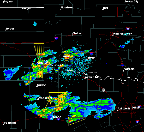 At 644 pm cdt, a severe thunderstorm was located near goodlett, moving northeast at 20 mph (radar indicated). Hazards include 70 mph wind gusts and ping pong ball size hail. People and animals outdoors will be injured. expect hail damage to roofs, siding, windows, and vehicles. expect considerable tree damage. Wind damage is also likely to mobile homes, roofs, and outbuildings. At 644 pm cdt, a severe thunderstorm was located near goodlett, moving northeast at 20 mph (radar indicated). Hazards include 70 mph wind gusts and ping pong ball size hail. People and animals outdoors will be injured. expect hail damage to roofs, siding, windows, and vehicles. expect considerable tree damage. Wind damage is also likely to mobile homes, roofs, and outbuildings.
|
| 3/18/2020 6:26 PM CDT |
 At 623 pm cdt, a severe thunderstorm was located 7 miles west of goodlett, moving northeast at 20 mph. although this initial storm will now remain north of foard county, northwest foard county will remain under a severe thunderstorm warning for a severe storm near paducah moving northeast (radar indicated). Hazards include 70 mph wind gusts and ping pong ball size hail. People and animals outdoors will be injured. expect hail damage to roofs, siding, windows, and vehicles. expect considerable tree damage. wind damage is also likely to mobile homes, roofs, and outbuildings. Locations impacted include, quanah, goodlett and lazare. At 623 pm cdt, a severe thunderstorm was located 7 miles west of goodlett, moving northeast at 20 mph. although this initial storm will now remain north of foard county, northwest foard county will remain under a severe thunderstorm warning for a severe storm near paducah moving northeast (radar indicated). Hazards include 70 mph wind gusts and ping pong ball size hail. People and animals outdoors will be injured. expect hail damage to roofs, siding, windows, and vehicles. expect considerable tree damage. wind damage is also likely to mobile homes, roofs, and outbuildings. Locations impacted include, quanah, goodlett and lazare.
|
| 3/18/2020 5:59 PM CDT |
 The national weather service in norman has issued a * severe thunderstorm warning for. northwestern foard county in northern texas. western hardeman county in northern texas. until 645 pm cdt. At 559 pm cdt, a severe thunderstorm was located 8 miles northeast. The national weather service in norman has issued a * severe thunderstorm warning for. northwestern foard county in northern texas. western hardeman county in northern texas. until 645 pm cdt. At 559 pm cdt, a severe thunderstorm was located 8 miles northeast.
|
| 8/29/2019 5:11 PM CDT |
 At 510 pm cdt, a severe thunderstorm was located 11 miles southwest of quanah, moving east at 5 mph (radar indicated). Hazards include 60 mph wind gusts and quarter size hail. Hail damage to vehicles is expected. Expect wind damage to roofs, siding, and trees. At 510 pm cdt, a severe thunderstorm was located 11 miles southwest of quanah, moving east at 5 mph (radar indicated). Hazards include 60 mph wind gusts and quarter size hail. Hail damage to vehicles is expected. Expect wind damage to roofs, siding, and trees.
|
| 8/18/2019 9:21 PM CDT |
 The severe thunderstorm warning for western wilbarger and central hardeman counties will expire at 930 pm cdt. the storm which prompted the warning has weakened below severe limits, and no longer poses an immediate threat to life or property. therefore, the warning will be allowed to expire. However gusty winds are still possible with this thunderstorm. The severe thunderstorm warning for western wilbarger and central hardeman counties will expire at 930 pm cdt. the storm which prompted the warning has weakened below severe limits, and no longer poses an immediate threat to life or property. therefore, the warning will be allowed to expire. However gusty winds are still possible with this thunderstorm.
|
| 8/18/2019 8:47 PM CDT |
 At 847 pm cdt, a severe thunderstorm was located over quanah, moving east at 25 mph (radar indicated). Hazards include 70 mph wind gusts and nickel size hail. Expect considerable tree damage. Damage is likely to mobile homes, roofs, and outbuildings. At 847 pm cdt, a severe thunderstorm was located over quanah, moving east at 25 mph (radar indicated). Hazards include 70 mph wind gusts and nickel size hail. Expect considerable tree damage. Damage is likely to mobile homes, roofs, and outbuildings.
|
| 6/15/2019 9:18 PM CDT |
 At 917 pm cdt, severe thunderstorms were located along a line extending from 4 miles southeast of lone wolf to 4 miles southeast of headrick to 6 miles west of davidson, moving east at 45 mph (radar indicated). Hazards include 70 mph wind gusts and quarter size hail. Hail damage to vehicles is expected. expect considerable tree damage. wind damage is also likely to mobile homes, roofs, and outbuildings. Locations impacted include, altus, vernon, frederick, hobart, mangum, quanah, granite, snyder, tipton, blair, chillicothe, olustee, eldorado, lone wolf, mountain park, indiahoma, davidson, roosevelt, gotebo and manitou. At 917 pm cdt, severe thunderstorms were located along a line extending from 4 miles southeast of lone wolf to 4 miles southeast of headrick to 6 miles west of davidson, moving east at 45 mph (radar indicated). Hazards include 70 mph wind gusts and quarter size hail. Hail damage to vehicles is expected. expect considerable tree damage. wind damage is also likely to mobile homes, roofs, and outbuildings. Locations impacted include, altus, vernon, frederick, hobart, mangum, quanah, granite, snyder, tipton, blair, chillicothe, olustee, eldorado, lone wolf, mountain park, indiahoma, davidson, roosevelt, gotebo and manitou.
|
| 6/15/2019 8:56 PM CDT |
 At 854 pm cdt, severe thunderstorms were located along a line extending from near mangum to near elmer to 5 miles southeast of chillicothe, moving east at 45 mph (radar indicated). Hazards include 70 mph wind gusts and quarter size hail. Hail damage to vehicles is expected. expect considerable tree damage. Wind damage is also likely to mobile homes, roofs, and outbuildings. At 854 pm cdt, severe thunderstorms were located along a line extending from near mangum to near elmer to 5 miles southeast of chillicothe, moving east at 45 mph (radar indicated). Hazards include 70 mph wind gusts and quarter size hail. Hail damage to vehicles is expected. expect considerable tree damage. Wind damage is also likely to mobile homes, roofs, and outbuildings.
|
| 6/15/2019 8:30 PM CDT | Storm damage reported in hardeman county TX, 11.6 miles ESE of Quanah, TX |
| 6/15/2019 8:10 PM CDT |
 At 809 pm cdt, severe thunderstorms were located along a line extending from near lutie to near kirkland to 9 miles southeast of grow, moving east at 35 mph. the most dangerous part of the line will affect harmon and hardeman counties, including areas near hollis. these are very dangerous storms (the chldress asos measured an 81 mph wind gust). Hazards include 80 mph wind gusts and quarter size hail. Flying debris will be dangerous to those caught without shelter. mobile homes will be heavily damaged. expect considerable damage to roofs, windows, and vehicles. Extensive tree damage and power outages are likely. At 809 pm cdt, severe thunderstorms were located along a line extending from near lutie to near kirkland to 9 miles southeast of grow, moving east at 35 mph. the most dangerous part of the line will affect harmon and hardeman counties, including areas near hollis. these are very dangerous storms (the chldress asos measured an 81 mph wind gust). Hazards include 80 mph wind gusts and quarter size hail. Flying debris will be dangerous to those caught without shelter. mobile homes will be heavily damaged. expect considerable damage to roofs, windows, and vehicles. Extensive tree damage and power outages are likely.
|
| 6/5/2019 9:50 PM CDT |
 At 950 pm cdt, severe thunderstorms were located along a line extending from 5 miles west of blair to 6 miles southeast of elmer to near thalia, moving east at 40 mph (radar indicated). Hazards include 70 mph wind gusts and quarter size hail. Hail damage to vehicles is expected. expect considerable tree damage. wind damage is also likely to mobile homes, roofs, and outbuildings. Locations impacted include, altus, vernon, frederick, quanah, crowell, tipton, blair, chillicothe, olustee, eldorado, martha, elmer, headrick, friendship, altus air force base, warren, margaret, lockett, medicine mound and fargo. At 950 pm cdt, severe thunderstorms were located along a line extending from 5 miles west of blair to 6 miles southeast of elmer to near thalia, moving east at 40 mph (radar indicated). Hazards include 70 mph wind gusts and quarter size hail. Hail damage to vehicles is expected. expect considerable tree damage. wind damage is also likely to mobile homes, roofs, and outbuildings. Locations impacted include, altus, vernon, frederick, quanah, crowell, tipton, blair, chillicothe, olustee, eldorado, martha, elmer, headrick, friendship, altus air force base, warren, margaret, lockett, medicine mound and fargo.
|
| 6/5/2019 9:23 PM CDT |
 At 923 pm cdt, severe thunderstorms were located along a line extending from 6 miles northeast of gould to 7 miles west of odell to 5 miles southwest of crowell, moving east at 40 mph (radar indicated). Hazards include 70 mph wind gusts and quarter size hail. Hail damage to vehicles is expected. expect considerable tree damage. Wind damage is also likely to mobile homes, roofs, and outbuildings. At 923 pm cdt, severe thunderstorms were located along a line extending from 6 miles northeast of gould to 7 miles west of odell to 5 miles southwest of crowell, moving east at 40 mph (radar indicated). Hazards include 70 mph wind gusts and quarter size hail. Hail damage to vehicles is expected. expect considerable tree damage. Wind damage is also likely to mobile homes, roofs, and outbuildings.
|
| 6/5/2019 8:43 PM CDT |
 At 843 pm cdt, severe thunderstorms were located along a line extending from 7 miles southwest of dodson to 7 miles south of kirkland to 9 miles east of chalk, moving east at 50 mph (radar indicated). Hazards include 70 mph wind gusts and quarter size hail. Hail damage to vehicles is expected. expect considerable tree damage. Wind damage is also likely to mobile homes, roofs, and outbuildings. At 843 pm cdt, severe thunderstorms were located along a line extending from 7 miles southwest of dodson to 7 miles south of kirkland to 9 miles east of chalk, moving east at 50 mph (radar indicated). Hazards include 70 mph wind gusts and quarter size hail. Hail damage to vehicles is expected. expect considerable tree damage. Wind damage is also likely to mobile homes, roofs, and outbuildings.
|
| 5/24/2019 6:34 PM CDT |
 At 633 pm cdt, severe thunderstorms were located along a line extending from 5 miles northwest of martha to near altus to near humphreys, moving northeast at 35 mph (radar indicated). Hazards include 70 mph wind gusts and nickel size hail. Expect considerable tree damage. damage is likely to mobile homes, roofs, and outbuildings. Locations impacted include, altus, mangum, quanah, granite, tipton, blair, olustee, eldorado, lone wolf, martha, elmer, headrick, friendship, altus air force base, duke, warren, humphreys, hester, altus-lugert lake and hess. At 633 pm cdt, severe thunderstorms were located along a line extending from 5 miles northwest of martha to near altus to near humphreys, moving northeast at 35 mph (radar indicated). Hazards include 70 mph wind gusts and nickel size hail. Expect considerable tree damage. damage is likely to mobile homes, roofs, and outbuildings. Locations impacted include, altus, mangum, quanah, granite, tipton, blair, olustee, eldorado, lone wolf, martha, elmer, headrick, friendship, altus air force base, duke, warren, humphreys, hester, altus-lugert lake and hess.
|
| 5/24/2019 6:25 PM CDT | Baseball sized hail reported 4.1 miles WNW of Quanah, TX |
| 5/24/2019 6:19 PM CDT | Quarter sized hail reported 4.3 miles W of Quanah, TX |
| 5/24/2019 6:18 PM CDT |
 At 617 pm cdt, severe thunderstorms were located along a line extending from 6 miles north of duke to near olustee to 7 miles west of odell to 3 miles south of quanah, moving northeast at 35 mph (radar indicated). Hazards include 70 mph wind gusts and ping pong ball size hail. the greatest threat of large hail is with the section of the line that is near and south of the red river. People and animals outdoors will be injured. expect hail damage to roofs, siding, windows, and vehicles. expect considerable tree damage. wind damage is also likely to mobile homes, roofs, and outbuildings. Locations impacted include, altus, vernon, mangum, quanah, granite, tipton, blair, chillicothe, olustee, eldorado, lone wolf, martha, gould, elmer, headrick, friendship, altus air force base, warren, lockett and medicine mound. At 617 pm cdt, severe thunderstorms were located along a line extending from 6 miles north of duke to near olustee to 7 miles west of odell to 3 miles south of quanah, moving northeast at 35 mph (radar indicated). Hazards include 70 mph wind gusts and ping pong ball size hail. the greatest threat of large hail is with the section of the line that is near and south of the red river. People and animals outdoors will be injured. expect hail damage to roofs, siding, windows, and vehicles. expect considerable tree damage. wind damage is also likely to mobile homes, roofs, and outbuildings. Locations impacted include, altus, vernon, mangum, quanah, granite, tipton, blair, chillicothe, olustee, eldorado, lone wolf, martha, gould, elmer, headrick, friendship, altus air force base, warren, lockett and medicine mound.
|
| 5/24/2019 5:59 PM CDT |
 At 558 pm cdt, severe thunderstorms were located along a line extending from near gould to near eldorado to near quanah to 11 miles south of goodlett, moving northeast at 35 mph (radar indicated). Hazards include 70 mph wind gusts and quarter size hail. Hail damage to vehicles is expected. expect considerable tree damage. Wind damage is also likely to mobile homes, roofs, and outbuildings. At 558 pm cdt, severe thunderstorms were located along a line extending from near gould to near eldorado to near quanah to 11 miles south of goodlett, moving northeast at 35 mph (radar indicated). Hazards include 70 mph wind gusts and quarter size hail. Hail damage to vehicles is expected. expect considerable tree damage. Wind damage is also likely to mobile homes, roofs, and outbuildings.
|
| 5/24/2019 5:38 PM CDT |
 At 537 pm cdt, severe thunderstorms were located along a line extending from near hollis to 9 miles west of eldorado to near goodlett to 11 miles southeast of swearingen, moving northeast at 40 mph (radar indicated). Hazards include 70 mph wind gusts and quarter size hail. Expect considerable tree damage. wind damage is also likely to mobile homes, roofs, and outbuildings. Locations impacted include, altus, mangum, quanah, hollis, chillicothe, olustee, eldorado, martha, gould, elmer, duke, goodlett, medicine mound, odell, hester, mcqueen, lazare and copper breaks state park. At 537 pm cdt, severe thunderstorms were located along a line extending from near hollis to 9 miles west of eldorado to near goodlett to 11 miles southeast of swearingen, moving northeast at 40 mph (radar indicated). Hazards include 70 mph wind gusts and quarter size hail. Expect considerable tree damage. wind damage is also likely to mobile homes, roofs, and outbuildings. Locations impacted include, altus, mangum, quanah, hollis, chillicothe, olustee, eldorado, martha, gould, elmer, duke, goodlett, medicine mound, odell, hester, mcqueen, lazare and copper breaks state park.
|
| 5/24/2019 5:23 PM CDT |
 At 523 pm cdt, severe thunderstorms were located along a line extending from 7 miles north of childress to 6 miles east of kirkland to 7 miles southwest of goodlett to 4 miles east of swearingen, moving northeast at 40 mph (radar indicated). Hazards include 70 mph wind gusts and ping pong ball size hail. People and animals outdoors will be injured. expect hail damage to roofs, siding, windows, and vehicles. expect considerable tree damage. wind damage is also likely to mobile homes, roofs, and outbuildings. Locations impacted include, altus, mangum, quanah, hollis, chillicothe, olustee, eldorado, martha, gould, elmer, duke, goodlett, medicine mound, odell, hester, mcqueen, lazare, copper breaks state park and mcknight. At 523 pm cdt, severe thunderstorms were located along a line extending from 7 miles north of childress to 6 miles east of kirkland to 7 miles southwest of goodlett to 4 miles east of swearingen, moving northeast at 40 mph (radar indicated). Hazards include 70 mph wind gusts and ping pong ball size hail. People and animals outdoors will be injured. expect hail damage to roofs, siding, windows, and vehicles. expect considerable tree damage. wind damage is also likely to mobile homes, roofs, and outbuildings. Locations impacted include, altus, mangum, quanah, hollis, chillicothe, olustee, eldorado, martha, gould, elmer, duke, goodlett, medicine mound, odell, hester, mcqueen, lazare, copper breaks state park and mcknight.
|
| 5/24/2019 5:06 PM CDT |
 At 506 pm cdt, severe thunderstorms were located along a line extending from 5 miles north of childress to 3 miles south of kirkland to 7 miles northeast of chalk, moving northeast at 40 mph (radar indicated). Hazards include 70 mph wind gusts and ping pong ball size hail. People and animals outdoors will be injured. expect hail damage to roofs, siding, windows, and vehicles. expect considerable tree damage. Wind damage is also likely to mobile homes, roofs, and outbuildings. At 506 pm cdt, severe thunderstorms were located along a line extending from 5 miles north of childress to 3 miles south of kirkland to 7 miles northeast of chalk, moving northeast at 40 mph (radar indicated). Hazards include 70 mph wind gusts and ping pong ball size hail. People and animals outdoors will be injured. expect hail damage to roofs, siding, windows, and vehicles. expect considerable tree damage. Wind damage is also likely to mobile homes, roofs, and outbuildings.
|
| 5/8/2019 2:16 AM CDT |
 The national weather service in norman has issued a * severe thunderstorm warning for. western jackson county in southwestern oklahoma. harmon county in southwestern oklahoma. greer county in southwestern oklahoma. Northern hardeman county in northern texas. The national weather service in norman has issued a * severe thunderstorm warning for. western jackson county in southwestern oklahoma. harmon county in southwestern oklahoma. greer county in southwestern oklahoma. Northern hardeman county in northern texas.
|
| 12/26/2018 5:25 PM CST |
 At 525 pm cst, severe thunderstorms were located along a line extending from 7 miles south of vinson to 5 miles south of eldorado to 5 miles southwest of lockett, moving east at 45 mph (radar indicated). Hazards include 60 mph wind gusts and nickel size hail. Expect damage to roofs, siding, and trees. Locations impacted include, vernon, quanah, hollis, crowell, chillicothe, eldorado, gould, thalia, vinson, duke, margaret, goodlett, lockett, medicine mound, odell, mcqueen, lazare, rayland, copper breaks state park and mcknight. At 525 pm cst, severe thunderstorms were located along a line extending from 7 miles south of vinson to 5 miles south of eldorado to 5 miles southwest of lockett, moving east at 45 mph (radar indicated). Hazards include 60 mph wind gusts and nickel size hail. Expect damage to roofs, siding, and trees. Locations impacted include, vernon, quanah, hollis, crowell, chillicothe, eldorado, gould, thalia, vinson, duke, margaret, goodlett, lockett, medicine mound, odell, mcqueen, lazare, rayland, copper breaks state park and mcknight.
|
| 12/26/2018 5:00 PM CST |
 At 500 pm cst, severe thunderstorms were located along a line extending from 7 miles southwest of dodson to 3 miles southwest of goodlett to 6 miles southeast of crowell, moving northeast at 40 mph (radar indicated). Hazards include 60 mph wind gusts and quarter size hail. Hail damage to vehicles is expected. Expect wind damage to roofs, siding, and trees. At 500 pm cst, severe thunderstorms were located along a line extending from 7 miles southwest of dodson to 3 miles southwest of goodlett to 6 miles southeast of crowell, moving northeast at 40 mph (radar indicated). Hazards include 60 mph wind gusts and quarter size hail. Hail damage to vehicles is expected. Expect wind damage to roofs, siding, and trees.
|
| 8/17/2018 4:41 PM CDT |
 At 424 pm cdt, a cluster of strong to severe thunderstorm was located over southwestern jackson county east of eldorado extending into northeastern hardeman county north of chillicothe (radar indicated). Hazards include 60 mph wind gusts and quarter size hail. Hail damage to vehicles is expected. expect wind damage to roofs, siding, and trees. Locations impacted include, quanah, chillicothe and eldorado. At 424 pm cdt, a cluster of strong to severe thunderstorm was located over southwestern jackson county east of eldorado extending into northeastern hardeman county north of chillicothe (radar indicated). Hazards include 60 mph wind gusts and quarter size hail. Hail damage to vehicles is expected. expect wind damage to roofs, siding, and trees. Locations impacted include, quanah, chillicothe and eldorado.
|
| 8/17/2018 4:26 PM CDT |
 At 424 pm cdt, a cluster of strong to severe thunderstorm was located over southwestern jackson county east of eldorado extending into northeastern hardeman county north of chillicothe (radar indicated). Hazards include 60 mph wind gusts and quarter size hail. Hail damage to vehicles is expected. expect wind damage to roofs, siding, and trees. Locations impacted include, quanah, chillicothe and eldorado. At 424 pm cdt, a cluster of strong to severe thunderstorm was located over southwestern jackson county east of eldorado extending into northeastern hardeman county north of chillicothe (radar indicated). Hazards include 60 mph wind gusts and quarter size hail. Hail damage to vehicles is expected. expect wind damage to roofs, siding, and trees. Locations impacted include, quanah, chillicothe and eldorado.
|
| 8/17/2018 3:54 PM CDT |
 At 354 pm cdt, a severe thunderstorm was located 5 miles south of eldorado, and is nearly stationary (radar indicated). Hazards include 60 mph wind gusts and quarter size hail. Hail damage to vehicles is expected. Expect wind damage to roofs, siding, and trees. At 354 pm cdt, a severe thunderstorm was located 5 miles south of eldorado, and is nearly stationary (radar indicated). Hazards include 60 mph wind gusts and quarter size hail. Hail damage to vehicles is expected. Expect wind damage to roofs, siding, and trees.
|
| 7/7/2018 7:11 PM CDT |
 The severe thunderstorm warning for southwestern jackson and central hardeman counties will expire at 715 pm cdt, the storm which prompted the warning has weakened below severe limits, and no longer poses an immediate threat to life or property. therefore, the warning will be allowed to expire. however gusty winds and heavy rain are still possible with this thunderstorm as it moves towards goodlett. The severe thunderstorm warning for southwestern jackson and central hardeman counties will expire at 715 pm cdt, the storm which prompted the warning has weakened below severe limits, and no longer poses an immediate threat to life or property. therefore, the warning will be allowed to expire. however gusty winds and heavy rain are still possible with this thunderstorm as it moves towards goodlett.
|
| 7/7/2018 7:09 PM CDT |
 At 709 pm cdt, a severe thunderstorm was located 5 miles north of quanah, moving west at 35 mph (radar indicated). Hazards include 60 mph wind gusts. Expect damage to roofs, siding, and trees. Locations impacted include, quanah. At 709 pm cdt, a severe thunderstorm was located 5 miles north of quanah, moving west at 35 mph (radar indicated). Hazards include 60 mph wind gusts. Expect damage to roofs, siding, and trees. Locations impacted include, quanah.
|
| 7/7/2018 7:02 PM CDT |
 At 701 pm cdt, a severe thunderstorm was located 8 miles southeast of eldorado, moving southwest at 20 mph (radar indicated). Hazards include 60 mph wind gusts and penny size hail. Expect damage to roofs, siding, and trees. Locations impacted include, quanah. At 701 pm cdt, a severe thunderstorm was located 8 miles southeast of eldorado, moving southwest at 20 mph (radar indicated). Hazards include 60 mph wind gusts and penny size hail. Expect damage to roofs, siding, and trees. Locations impacted include, quanah.
|
| 7/7/2018 6:42 PM CDT |
 At 642 pm cdt, a severe thunderstorm was located 6 miles northwest of odell, moving southwest at 20 mph (radar indicated). Hazards include 60 mph wind gusts and quarter size hail. Hail damage to vehicles is expected. Expect wind damage to roofs, siding, and trees. At 642 pm cdt, a severe thunderstorm was located 6 miles northwest of odell, moving southwest at 20 mph (radar indicated). Hazards include 60 mph wind gusts and quarter size hail. Hail damage to vehicles is expected. Expect wind damage to roofs, siding, and trees.
|
| 6/25/2018 2:47 AM CDT |
 At 246 am cdt, severe thunderstorms were located along a line extending from 4 miles northeast of cement to 6 miles north of faxon to 3 miles southeast of quanah, moving southeast at 65 mph (radar indicated). Hazards include 70 mph wind gusts and quarter size hail. Hail damage to vehicles is expected. expect considerable tree damage. Wind damage is also likely to mobile homes, roofs, and outbuildings. At 246 am cdt, severe thunderstorms were located along a line extending from 4 miles northeast of cement to 6 miles north of faxon to 3 miles southeast of quanah, moving southeast at 65 mph (radar indicated). Hazards include 70 mph wind gusts and quarter size hail. Hail damage to vehicles is expected. expect considerable tree damage. Wind damage is also likely to mobile homes, roofs, and outbuildings.
|
| 6/25/2018 2:16 AM CDT |
 At 216 am cdt, severe thunderstorms were located along a line extending from 5 miles southwest of gracemont to 3 miles northwest of quanah, moving southeast at 60 mph. these are very dangerous storms (radar indicated). Hazards include 80 mph wind gusts and quarter size hail. Flying debris will be dangerous to those caught without shelter. mobile homes will be heavily damaged. expect considerable damage to roofs, windows, and vehicles. extensive tree damage and power outages are likely. locations impacted include, lawton, altus, vernon, anadarko, frederick, hobart, mangum, cordell, quanah, hollis, crowell, cache, elgin, granite, burns flat, carnegie, apache, snyder, geronimo and fletcher. this includes the following highways, interstate 40 between mile markers 8 and 15, and between mile markers 19 and 22, and near mile marker 91. Interstate 44 between mile markers 23 and 72. At 216 am cdt, severe thunderstorms were located along a line extending from 5 miles southwest of gracemont to 3 miles northwest of quanah, moving southeast at 60 mph. these are very dangerous storms (radar indicated). Hazards include 80 mph wind gusts and quarter size hail. Flying debris will be dangerous to those caught without shelter. mobile homes will be heavily damaged. expect considerable damage to roofs, windows, and vehicles. extensive tree damage and power outages are likely. locations impacted include, lawton, altus, vernon, anadarko, frederick, hobart, mangum, cordell, quanah, hollis, crowell, cache, elgin, granite, burns flat, carnegie, apache, snyder, geronimo and fletcher. this includes the following highways, interstate 40 between mile markers 8 and 15, and between mile markers 19 and 22, and near mile marker 91. Interstate 44 between mile markers 23 and 72.
|
| 6/25/2018 1:56 AM CDT |
 At 156 am cdt, severe thunderstorms were located along a line extending from 6 miles west of lookeba to 9 miles south of hollis, moving southeast at 60 mph. these are very dangerous storms (radar indicated). Hazards include 80 mph wind gusts and quarter size hail. Flying debris will be dangerous to those caught without shelter. mobile homes will be heavily damaged. expect considerable damage to roofs, windows, and vehicles. Extensive tree damage and power outages are likely. At 156 am cdt, severe thunderstorms were located along a line extending from 6 miles west of lookeba to 9 miles south of hollis, moving southeast at 60 mph. these are very dangerous storms (radar indicated). Hazards include 80 mph wind gusts and quarter size hail. Flying debris will be dangerous to those caught without shelter. mobile homes will be heavily damaged. expect considerable damage to roofs, windows, and vehicles. Extensive tree damage and power outages are likely.
|
| 5/25/2018 6:17 PM CDT |
 At 616 pm cdt, a severe thunderstorm was located 7 miles south of goodlett, moving southeast at 15 mph (radar indicated). Hazards include 60 mph wind gusts and quarter size hail. Hail damage to vehicles is expected. expect wind damage to roofs, siding, and trees. Locations impacted include, medicine mound and lazare. At 616 pm cdt, a severe thunderstorm was located 7 miles south of goodlett, moving southeast at 15 mph (radar indicated). Hazards include 60 mph wind gusts and quarter size hail. Hail damage to vehicles is expected. expect wind damage to roofs, siding, and trees. Locations impacted include, medicine mound and lazare.
|
| 5/25/2018 6:02 PM CDT |
 At 601 pm cdt, a severe thunderstorm was located near goodlett, moving southeast at 15 mph (radar indicated). Hazards include 70 mph wind gusts and quarter size hail. Hail damage to vehicles is expected. expect considerable tree damage. Wind damage is also likely to mobile homes, roofs, and outbuildings. At 601 pm cdt, a severe thunderstorm was located near goodlett, moving southeast at 15 mph (radar indicated). Hazards include 70 mph wind gusts and quarter size hail. Hail damage to vehicles is expected. expect considerable tree damage. Wind damage is also likely to mobile homes, roofs, and outbuildings.
|
| 5/25/2018 5:50 PM CDT | Storm damage reported in hardeman county TX, 11.6 miles ESE of Quanah, TX |
| 5/19/2018 6:17 PM CDT |
 At 617 pm cdt, severe thunderstorms were located along a line extending from 5 miles north of quanah to near medicine mound to 4 miles south of crowell, moving northeast at 25 mph (radar indicated). Hazards include golf ball size hail and 70 mph wind gusts. People and animals outdoors will be injured. expect hail damage to roofs, siding, windows, and vehicles. expect considerable tree damage. wind damage is also likely to mobile homes, roofs, and outbuildings. Locations impacted include, quanah, crowell, chillicothe, eldorado, margaret, goodlett, medicine mound, thalia, rayland and copper breaks state park. At 617 pm cdt, severe thunderstorms were located along a line extending from 5 miles north of quanah to near medicine mound to 4 miles south of crowell, moving northeast at 25 mph (radar indicated). Hazards include golf ball size hail and 70 mph wind gusts. People and animals outdoors will be injured. expect hail damage to roofs, siding, windows, and vehicles. expect considerable tree damage. wind damage is also likely to mobile homes, roofs, and outbuildings. Locations impacted include, quanah, crowell, chillicothe, eldorado, margaret, goodlett, medicine mound, thalia, rayland and copper breaks state park.
|
| 5/19/2018 6:14 PM CDT |
 At 614 pm cdt, severe thunderstorms were located along a line extending from near goodlett to 5 miles north of margaret to 8 miles southwest of crowell, moving northeast at 20 mph (radar indicated). Hazards include golf ball size hail and 70 mph wind gusts. People and animals outdoors will be injured. expect hail damage to roofs, siding, windows, and vehicles. expect considerable tree damage. wind damage is also likely to mobile homes, roofs, and outbuildings. Locations impacted include, quanah, crowell, chillicothe, eldorado, margaret, goodlett, medicine mound, thalia, rayland, copper breaks state park and lazare. At 614 pm cdt, severe thunderstorms were located along a line extending from near goodlett to 5 miles north of margaret to 8 miles southwest of crowell, moving northeast at 20 mph (radar indicated). Hazards include golf ball size hail and 70 mph wind gusts. People and animals outdoors will be injured. expect hail damage to roofs, siding, windows, and vehicles. expect considerable tree damage. wind damage is also likely to mobile homes, roofs, and outbuildings. Locations impacted include, quanah, crowell, chillicothe, eldorado, margaret, goodlett, medicine mound, thalia, rayland, copper breaks state park and lazare.
|
| 5/19/2018 6:09 PM CDT |
 At 609 pm cdt, severe thunderstorms were located along a line extending from near goodlett to 5 miles northwest of margaret to 8 miles north of truscott, moving northeast at 20 mph (radar indicated). Hazards include ping pong ball size hail and 60 mph wind gusts. People and animals outdoors will be injured. expect hail damage to roofs, siding, windows, and vehicles. Expect wind damage to roofs, siding, and trees. At 609 pm cdt, severe thunderstorms were located along a line extending from near goodlett to 5 miles northwest of margaret to 8 miles north of truscott, moving northeast at 20 mph (radar indicated). Hazards include ping pong ball size hail and 60 mph wind gusts. People and animals outdoors will be injured. expect hail damage to roofs, siding, windows, and vehicles. Expect wind damage to roofs, siding, and trees.
|
| 5/19/2018 6:09 PM CDT |
 The national weather service in norman has issued a * severe thunderstorm warning for. southwestern jackson county in southwestern oklahoma. central foard county in northern texas. hardeman county in northern texas. Until 700 pm cdt. The national weather service in norman has issued a * severe thunderstorm warning for. southwestern jackson county in southwestern oklahoma. central foard county in northern texas. hardeman county in northern texas. Until 700 pm cdt.
|
| 5/19/2018 3:52 PM CDT |
 The severe thunderstorm warning for northwestern foard and southwestern hardeman counties will expire at 400 pm cdt, the storm which prompted the warning has moved out of the area. therefore the warning will be allowed to expire. remember, a severe thunderstorm warning still remains in effect for northern hardeman county. The severe thunderstorm warning for northwestern foard and southwestern hardeman counties will expire at 400 pm cdt, the storm which prompted the warning has moved out of the area. therefore the warning will be allowed to expire. remember, a severe thunderstorm warning still remains in effect for northern hardeman county.
|
| 5/19/2018 3:15 PM CDT |
 At 315 pm cdt, a severe thunderstorm was located 9 miles east of swearingen, moving northeast at 25 mph (radar indicated). Hazards include ping pong ball size hail and 60 mph wind gusts. People and animals outdoors will be injured. expect hail damage to roofs, siding, windows, and vehicles. Expect wind damage to roofs, siding, and trees. At 315 pm cdt, a severe thunderstorm was located 9 miles east of swearingen, moving northeast at 25 mph (radar indicated). Hazards include ping pong ball size hail and 60 mph wind gusts. People and animals outdoors will be injured. expect hail damage to roofs, siding, windows, and vehicles. Expect wind damage to roofs, siding, and trees.
|
| 5/19/2018 3:05 PM CDT | Ping Pong Ball sized hail reported 8.9 miles ESE of Quanah, TX |
| 5/18/2018 6:26 PM CDT |
 At 625 pm cdt, a severe thunderstorm was located 9 miles northwest of margaret, moving northeast at 40 mph (radar indicated). Hazards include 60 mph wind gusts and quarter size hail. Hail damage to vehicles is expected. Expect wind damage to roofs, siding, and trees. At 625 pm cdt, a severe thunderstorm was located 9 miles northwest of margaret, moving northeast at 40 mph (radar indicated). Hazards include 60 mph wind gusts and quarter size hail. Hail damage to vehicles is expected. Expect wind damage to roofs, siding, and trees.
|
| 5/2/2018 4:55 PM CDT |
 At 455 pm cdt, a severe thunderstorm was located near medicine mound, moving northeast at 30 mph (trained weather spotters). Hazards include golf ball size hail. People and animals outdoors will be injured. expect damage to roofs, siding, windows, and vehicles. Locations impacted include, quanah, chillicothe, eldorado, odell, medicine mound and fargo. At 455 pm cdt, a severe thunderstorm was located near medicine mound, moving northeast at 30 mph (trained weather spotters). Hazards include golf ball size hail. People and animals outdoors will be injured. expect damage to roofs, siding, windows, and vehicles. Locations impacted include, quanah, chillicothe, eldorado, odell, medicine mound and fargo.
|
| 5/2/2018 4:52 PM CDT | Hen Egg sized hail reported 4.4 miles NW of Quanah, TX |
| 5/2/2018 4:43 PM CDT |
 At 442 pm cdt, a severe thunderstorm was located 6 miles southwest of medicine mound, moving northeast at 30 mph (radar indicated). Hazards include golf ball size hail and 60 mph wind gusts. People and animals outdoors will be injured. expect hail damage to roofs, siding, windows, and vehicles. Expect wind damage to roofs, siding, and trees. At 442 pm cdt, a severe thunderstorm was located 6 miles southwest of medicine mound, moving northeast at 30 mph (radar indicated). Hazards include golf ball size hail and 60 mph wind gusts. People and animals outdoors will be injured. expect hail damage to roofs, siding, windows, and vehicles. Expect wind damage to roofs, siding, and trees.
|
| 5/2/2018 4:09 PM CDT |
 At 408 pm cdt, a severe thunderstorm was located near medicine mound, moving northeast at 35 mph (radar indicated). Hazards include 60 mph wind gusts and half dollar size hail. Hail damage to vehicles is expected. expect wind damage to roofs, siding, and trees. Locations impacted include, quanah, chillicothe, medicine mound, margaret and copper breaks state park. At 408 pm cdt, a severe thunderstorm was located near medicine mound, moving northeast at 35 mph (radar indicated). Hazards include 60 mph wind gusts and half dollar size hail. Hail damage to vehicles is expected. expect wind damage to roofs, siding, and trees. Locations impacted include, quanah, chillicothe, medicine mound, margaret and copper breaks state park.
|
| 5/2/2018 3:57 PM CDT |
 At 356 pm cdt, severe thunderstorms were located along a line extending from 13 miles northwest of crowell to 4 miles northeast of margaret, moving northeast at 50 mph (radar indicated). Hazards include 60 mph wind gusts. Expect damage to roofs, siding, and trees. Locations impacted include, quanah, chillicothe, margaret, goodlett, medicine mound and copper breaks state park. At 356 pm cdt, severe thunderstorms were located along a line extending from 13 miles northwest of crowell to 4 miles northeast of margaret, moving northeast at 50 mph (radar indicated). Hazards include 60 mph wind gusts. Expect damage to roofs, siding, and trees. Locations impacted include, quanah, chillicothe, margaret, goodlett, medicine mound and copper breaks state park.
|
| 5/2/2018 3:41 PM CDT |
 At 340 pm cdt, a severe thunderstorm was located 14 miles southeast of swearingen, moving northeast at 35 mph (radar indicated). Hazards include 60 mph wind gusts and half dollar size hail. Hail damage to vehicles is expected. Expect wind damage to roofs, siding, and trees. At 340 pm cdt, a severe thunderstorm was located 14 miles southeast of swearingen, moving northeast at 35 mph (radar indicated). Hazards include 60 mph wind gusts and half dollar size hail. Hail damage to vehicles is expected. Expect wind damage to roofs, siding, and trees.
|
| 10/21/2017 6:46 PM CDT | Quarter sized hail reported 0.4 miles SW of Quanah, TX |
| 10/21/2017 6:41 PM CDT | Quarter sized hail reported 3.8 miles E of Quanah, TX |
| 10/21/2017 6:23 PM CDT |
 At 623 pm cdt, severe thunderstorms were located 6 miles northeast of swearingen and 6 miles east of paducah, moving northeast at 45 mph (radar indicated). Hazards include golf ball size hail and 70 mph wind gusts. People and animals outdoors will be injured. expect hail damage to roofs, siding, windows, and vehicles. expect considerable tree damage. Wind damage is also likely to mobile homes, roofs, and outbuildings. At 623 pm cdt, severe thunderstorms were located 6 miles northeast of swearingen and 6 miles east of paducah, moving northeast at 45 mph (radar indicated). Hazards include golf ball size hail and 70 mph wind gusts. People and animals outdoors will be injured. expect hail damage to roofs, siding, windows, and vehicles. expect considerable tree damage. Wind damage is also likely to mobile homes, roofs, and outbuildings.
|
| 8/16/2017 8:39 PM CDT |
 The severe thunderstorm warning for southern hardeman county will expire at 845 pm cdt, the storm which prompted the warning has moved out of the area. therefore the warning will be allowed to expire. The severe thunderstorm warning for southern hardeman county will expire at 845 pm cdt, the storm which prompted the warning has moved out of the area. therefore the warning will be allowed to expire.
|
| 8/16/2017 8:15 PM CDT | Storm damage reported in hardeman county TX, 4.9 miles NW of Quanah, TX |
| 8/16/2017 8:14 PM CDT |
 At 813 pm cdt, a severe thunderstorm was located 4 miles southeast of quanah, moving northeast at 20 mph (radar indicated). Hazards include 60 mph wind gusts and half dollar size hail. Hail damage to vehicles is expected. expect wind damage to roofs, siding, and trees. Locations impacted include, quanah and medicine mound. At 813 pm cdt, a severe thunderstorm was located 4 miles southeast of quanah, moving northeast at 20 mph (radar indicated). Hazards include 60 mph wind gusts and half dollar size hail. Hail damage to vehicles is expected. expect wind damage to roofs, siding, and trees. Locations impacted include, quanah and medicine mound.
|
| 8/16/2017 8:02 PM CDT | Tennis Ball sized hail reported 3.2 miles N of Quanah, TX |
| 8/16/2017 7:54 PM CDT |
 At 754 pm cdt, a severe thunderstorm was located 8 miles southwest of quanah, moving northeast at 20 mph (radar indicated). Hazards include 60 mph wind gusts and half dollar size hail. Hail damage to vehicles is expected. Expect wind damage to roofs, siding, and trees. At 754 pm cdt, a severe thunderstorm was located 8 miles southwest of quanah, moving northeast at 20 mph (radar indicated). Hazards include 60 mph wind gusts and half dollar size hail. Hail damage to vehicles is expected. Expect wind damage to roofs, siding, and trees.
|
| 7/3/2017 10:33 PM CDT |
 At 1032 pm cdt, severe thunderstorms were located along a line extending from 7 miles northeast of manitou to near davidson to near margaret, moving south at 25 mph (radar indicated). Hazards include 60 mph wind gusts and nickel size hail. Expect damage to roofs, siding, and trees. Locations impacted include, altus, vernon, frederick, quanah, snyder, grandfield, tipton, chillicothe, olustee, eldorado, mountain park, davidson, manitou, elmer, headrick, hollister, loveland, altus air force base, margaret and lockett. At 1032 pm cdt, severe thunderstorms were located along a line extending from 7 miles northeast of manitou to near davidson to near margaret, moving south at 25 mph (radar indicated). Hazards include 60 mph wind gusts and nickel size hail. Expect damage to roofs, siding, and trees. Locations impacted include, altus, vernon, frederick, quanah, snyder, grandfield, tipton, chillicothe, olustee, eldorado, mountain park, davidson, manitou, elmer, headrick, hollister, loveland, altus air force base, margaret and lockett.
|
| 7/3/2017 10:02 PM CDT |
 At 1002 pm cdt, the leading edge of winds from a line of severe thunderstorms was located along a line extending from 6 miles south of indiahoma to 8 miles northeast of fargo to near goodlett, moving south at 25 mph (radar indicated). Hazards include 60 mph wind gusts. expect damage to roofs, siding, and trees At 1002 pm cdt, the leading edge of winds from a line of severe thunderstorms was located along a line extending from 6 miles south of indiahoma to 8 miles northeast of fargo to near goodlett, moving south at 25 mph (radar indicated). Hazards include 60 mph wind gusts. expect damage to roofs, siding, and trees
|
| 6/30/2017 7:06 PM CDT |
 At 705 pm cdt, severe thunderstorms were located 6 miles northwest of eldorado and 4 miles southeast of goodlett, moving northeast at 40 mph (radar indicated). Hazards include 70 mph wind gusts and half dollar size hail. Hail damage to vehicles is expected. expect considerable tree damage. wind damage is also likely to mobile homes, roofs, and outbuildings. Locations impacted include, quanah, eldorado, gould, goodlett, duke and mcqueen. At 705 pm cdt, severe thunderstorms were located 6 miles northwest of eldorado and 4 miles southeast of goodlett, moving northeast at 40 mph (radar indicated). Hazards include 70 mph wind gusts and half dollar size hail. Hail damage to vehicles is expected. expect considerable tree damage. wind damage is also likely to mobile homes, roofs, and outbuildings. Locations impacted include, quanah, eldorado, gould, goodlett, duke and mcqueen.
|
| 6/30/2017 6:43 PM CDT |
 At 642 pm cdt, severe thunderstorms were located 7 miles northeast of goodlett, 9 miles southwest of quanah, and 14 miles southeast of swearingen. these storms were moving northeast at 20 mph (radar indicated). Hazards include golf ball size hail and 70 mph wind gusts. People and animals outdoors will be injured. expect hail damage to roofs, siding, windows, and vehicles. expect considerable tree damage. Wind damage is also likely to mobile homes, roofs, and outbuildings. At 642 pm cdt, severe thunderstorms were located 7 miles northeast of goodlett, 9 miles southwest of quanah, and 14 miles southeast of swearingen. these storms were moving northeast at 20 mph (radar indicated). Hazards include golf ball size hail and 70 mph wind gusts. People and animals outdoors will be injured. expect hail damage to roofs, siding, windows, and vehicles. expect considerable tree damage. Wind damage is also likely to mobile homes, roofs, and outbuildings.
|
| 6/30/2017 6:33 PM CDT |
 At 631 pm cdt, a severe thunderstorm was located 4 miles northeast of goodlett. another strong to severe storm was located 11 miles west of crowell. the storms were moving east-northeast at 15 mph (radar indicated). Hazards include 70 mph wind gusts and half dollar size hail. Hail damage to vehicles is expected. expect considerable tree damage. wind damage is also likely to mobile homes, roofs, and outbuildings. Locations impacted include, quanah, goodlett, copper breaks state park and lazare. At 631 pm cdt, a severe thunderstorm was located 4 miles northeast of goodlett. another strong to severe storm was located 11 miles west of crowell. the storms were moving east-northeast at 15 mph (radar indicated). Hazards include 70 mph wind gusts and half dollar size hail. Hail damage to vehicles is expected. expect considerable tree damage. wind damage is also likely to mobile homes, roofs, and outbuildings. Locations impacted include, quanah, goodlett, copper breaks state park and lazare.
|
| 6/30/2017 5:56 PM CDT |
 At 556 pm cdt, severe thunderstorms were located along a line extending from 4 miles southwest of goodlett to 10 miles southeast of swearingen, moving northeast at 25 mph (radar indicated). Hazards include 70 mph wind gusts and half dollar size hail. Hail damage to vehicles is expected. expect considerable tree damage. Wind damage is also likely to mobile homes, roofs, and outbuildings. At 556 pm cdt, severe thunderstorms were located along a line extending from 4 miles southwest of goodlett to 10 miles southeast of swearingen, moving northeast at 25 mph (radar indicated). Hazards include 70 mph wind gusts and half dollar size hail. Hail damage to vehicles is expected. expect considerable tree damage. Wind damage is also likely to mobile homes, roofs, and outbuildings.
|
| 5/16/2017 8:51 PM CDT |
 The severe thunderstorm warning for southwestern jackson and central hardeman counties will expire at 900 pm cdt, the storm which prompted the warning has weakened below severe limits, and no longer poses an immediate threat to life or property. therefore the warning will be allowed to expire. The severe thunderstorm warning for southwestern jackson and central hardeman counties will expire at 900 pm cdt, the storm which prompted the warning has weakened below severe limits, and no longer poses an immediate threat to life or property. therefore the warning will be allowed to expire.
|
| 5/16/2017 8:44 PM CDT |
 At 844 pm cdt, a severe thunderstorm was located 5 miles north of quanah, moving northeast at 45 mph (radar indicated). Hazards include 60 mph wind gusts and quarter size hail. Hail damage to vehicles is expected. expect wind damage to roofs, siding, and trees. Locations impacted include, quanah and eldorado. At 844 pm cdt, a severe thunderstorm was located 5 miles north of quanah, moving northeast at 45 mph (radar indicated). Hazards include 60 mph wind gusts and quarter size hail. Hail damage to vehicles is expected. expect wind damage to roofs, siding, and trees. Locations impacted include, quanah and eldorado.
|
| 5/16/2017 8:37 PM CDT |
 At 837 pm cdt, a severe thunderstorm was located 4 miles west of quanah, moving northeast at 45 mph (radar indicated). Hazards include 60 mph wind gusts and quarter size hail. Hail damage to vehicles is expected. expect wind damage to roofs, siding, and trees. Locations impacted include, quanah, eldorado and goodlett. At 837 pm cdt, a severe thunderstorm was located 4 miles west of quanah, moving northeast at 45 mph (radar indicated). Hazards include 60 mph wind gusts and quarter size hail. Hail damage to vehicles is expected. expect wind damage to roofs, siding, and trees. Locations impacted include, quanah, eldorado and goodlett.
|
| 5/16/2017 8:18 PM CDT |
 At 818 pm cdt, a severe thunderstorm was located 12 miles east of swearingen, moving northeast at 45 mph (radar indicated). Hazards include ping pong ball size hail and 60 mph wind gusts. People and animals outdoors will be injured. expect hail damage to roofs, siding, windows, and vehicles. Expect wind damage to roofs, siding, and trees. At 818 pm cdt, a severe thunderstorm was located 12 miles east of swearingen, moving northeast at 45 mph (radar indicated). Hazards include ping pong ball size hail and 60 mph wind gusts. People and animals outdoors will be injured. expect hail damage to roofs, siding, windows, and vehicles. Expect wind damage to roofs, siding, and trees.
|
| 5/10/2017 7:06 PM CDT |
 At 636 pm cdt, a severe thunderstorm was located 6 miles south of quanah, moving northeast at 25 mph (radar indicated). Hazards include golf ball size hail and 60 mph wind gusts. People and animals outdoors will be injured. expect hail damage to roofs, siding, windows, and vehicles. expect wind damage to roofs, siding, and trees. Locations impacted include, quanah, chillicothe, medicine mound and copper breaks state park. At 636 pm cdt, a severe thunderstorm was located 6 miles south of quanah, moving northeast at 25 mph (radar indicated). Hazards include golf ball size hail and 60 mph wind gusts. People and animals outdoors will be injured. expect hail damage to roofs, siding, windows, and vehicles. expect wind damage to roofs, siding, and trees. Locations impacted include, quanah, chillicothe, medicine mound and copper breaks state park.
|
| 5/10/2017 6:37 PM CDT |
 At 636 pm cdt, a severe thunderstorm was located 6 miles south of quanah, moving northeast at 25 mph (radar indicated). Hazards include golf ball size hail and 60 mph wind gusts. People and animals outdoors will be injured. expect hail damage to roofs, siding, windows, and vehicles. expect wind damage to roofs, siding, and trees. Locations impacted include, quanah, chillicothe, medicine mound and copper breaks state park. At 636 pm cdt, a severe thunderstorm was located 6 miles south of quanah, moving northeast at 25 mph (radar indicated). Hazards include golf ball size hail and 60 mph wind gusts. People and animals outdoors will be injured. expect hail damage to roofs, siding, windows, and vehicles. expect wind damage to roofs, siding, and trees. Locations impacted include, quanah, chillicothe, medicine mound and copper breaks state park.
|
| 5/10/2017 6:26 PM CDT |
 At 626 pm cdt, a severe thunderstorm was located 8 miles south of quanah, moving northeast at 25 mph (radar indicated). Hazards include golf ball size hail and 60 mph wind gusts. People and animals outdoors will be injured. expect hail damage to roofs, siding, windows, and vehicles. expect wind damage to roofs, siding, and trees. Locations impacted include, quanah, chillicothe, eldorado, medicine mound and copper breaks state park. At 626 pm cdt, a severe thunderstorm was located 8 miles south of quanah, moving northeast at 25 mph (radar indicated). Hazards include golf ball size hail and 60 mph wind gusts. People and animals outdoors will be injured. expect hail damage to roofs, siding, windows, and vehicles. expect wind damage to roofs, siding, and trees. Locations impacted include, quanah, chillicothe, eldorado, medicine mound and copper breaks state park.
|
| 5/10/2017 6:20 PM CDT |
 At 619 pm cdt, a severe thunderstorm was located 8 miles southwest of quanah, moving northeast at 30 mph (radar indicated). Hazards include 60 mph wind gusts and half dollar size hail. Hail damage to vehicles is expected. Expect wind damage to roofs, siding, and trees. At 619 pm cdt, a severe thunderstorm was located 8 miles southwest of quanah, moving northeast at 30 mph (radar indicated). Hazards include 60 mph wind gusts and half dollar size hail. Hail damage to vehicles is expected. Expect wind damage to roofs, siding, and trees.
|
| 5/10/2017 4:40 PM CDT | Quarter sized hail reported 7.2 miles S of Quanah, TX |
| 5/10/2017 4:15 PM CDT | Storm damage reported in hardeman county TX, 11.6 miles ESE of Quanah, TX |
| 5/10/2017 4:01 PM CDT |
 At 401 pm cdt, a severe thunderstorm capable of producing a tornado was located 4 miles south of kirkland, moving east at 40 mph (radar indicated rotation). Hazards include tornado and hail up to two inches in diameter. Flying debris will be dangerous to those caught without shelter. mobile homes will be damaged or destroyed. damage to roofs, windows, and vehicles will occur. Tree damage is likely. At 401 pm cdt, a severe thunderstorm capable of producing a tornado was located 4 miles south of kirkland, moving east at 40 mph (radar indicated rotation). Hazards include tornado and hail up to two inches in diameter. Flying debris will be dangerous to those caught without shelter. mobile homes will be damaged or destroyed. damage to roofs, windows, and vehicles will occur. Tree damage is likely.
|
| 5/10/2017 4:00 PM CDT | Storm damage reported in cottle county TX, 15.8 miles E of Quanah, TX |
| 3/28/2017 6:30 PM CDT |
 At 630 pm cdt, a severe thunderstorm was located 5 miles east of quanah. this storm is capable of producing 70 mph winds and quarter size hail. another severe thunderstorm is located 5 miles north of knox city. this storm is capable of producing golf ball size hail and 70 mph winds. in between these storms, a line of severe storms extends across eastern hardeman, eastern foard, and knox counties. these storms were moving northeast at 60 mph (radar indicated). Hazards include golf ball size hail and 70 mph wind gusts. People and animals outdoors will be injured. expect hail damage to roofs, siding, windows, and vehicles. expect considerable tree damage. wind damage is also likely to mobile homes, roofs, and outbuildings. Locations impacted include, quanah, munday, knox city, crowell, benjamin, chillicothe, goree, thalia, gilliland, margaret, goodlett, vera, medicine mound, truscott, rhineland, rayland and copper breaks state park. At 630 pm cdt, a severe thunderstorm was located 5 miles east of quanah. this storm is capable of producing 70 mph winds and quarter size hail. another severe thunderstorm is located 5 miles north of knox city. this storm is capable of producing golf ball size hail and 70 mph winds. in between these storms, a line of severe storms extends across eastern hardeman, eastern foard, and knox counties. these storms were moving northeast at 60 mph (radar indicated). Hazards include golf ball size hail and 70 mph wind gusts. People and animals outdoors will be injured. expect hail damage to roofs, siding, windows, and vehicles. expect considerable tree damage. wind damage is also likely to mobile homes, roofs, and outbuildings. Locations impacted include, quanah, munday, knox city, crowell, benjamin, chillicothe, goree, thalia, gilliland, margaret, goodlett, vera, medicine mound, truscott, rhineland, rayland and copper breaks state park.
|
| 3/28/2017 6:09 PM CDT |
 At 609 pm cdt, severe thunderstorms were located along a line extending from 6 miles south of quanah to near margaret to near knox city, moving northeast at 35 mph (radar indicated). Hazards include 70 mph wind gusts and half dollar size hail. Hail damage to vehicles is expected. expect considerable tree damage. wind damage is also likely to mobile homes, roofs, and outbuildings. Locations impacted include, quanah, munday, knox city, crowell, benjamin, chillicothe, goree, thalia, gilliland, margaret, goodlett, vera, medicine mound, truscott, rhineland, rayland and copper breaks state park. At 609 pm cdt, severe thunderstorms were located along a line extending from 6 miles south of quanah to near margaret to near knox city, moving northeast at 35 mph (radar indicated). Hazards include 70 mph wind gusts and half dollar size hail. Hail damage to vehicles is expected. expect considerable tree damage. wind damage is also likely to mobile homes, roofs, and outbuildings. Locations impacted include, quanah, munday, knox city, crowell, benjamin, chillicothe, goree, thalia, gilliland, margaret, goodlett, vera, medicine mound, truscott, rhineland, rayland and copper breaks state park.
|
| 3/28/2017 5:59 PM CDT |
 At 559 pm cdt, a severe thunderstorm capable of producing a tornado was located 9 miles west of crowell, moving northeast at 45 mph (radar indicated rotation). Hazards include tornado and golf ball size hail. Flying debris will be dangerous to those caught without shelter. mobile homes will be damaged or destroyed. damage to roofs, windows, and vehicles will occur. Tree damage is likely. At 559 pm cdt, a severe thunderstorm capable of producing a tornado was located 9 miles west of crowell, moving northeast at 45 mph (radar indicated rotation). Hazards include tornado and golf ball size hail. Flying debris will be dangerous to those caught without shelter. mobile homes will be damaged or destroyed. damage to roofs, windows, and vehicles will occur. Tree damage is likely.
|
| 3/28/2017 5:54 PM CDT |
 At 554 pm cdt, severe thunderstorms were located along a line extending from 6 miles west of crowell to near knox city, moving north-northeast at 50 mph (radar indicated). Hazards include 60 mph wind gusts and half dollar size hail. Hail damage to vehicles is expected. Expect wind damage to roofs, siding, and trees. At 554 pm cdt, severe thunderstorms were located along a line extending from 6 miles west of crowell to near knox city, moving north-northeast at 50 mph (radar indicated). Hazards include 60 mph wind gusts and half dollar size hail. Hail damage to vehicles is expected. Expect wind damage to roofs, siding, and trees.
|
| 10/6/2016 8:53 PM CDT |
 At 853 pm cdt, severe thunderstorms were located along a line extending from 11 miles west of eldorado to 6 miles southwest of goodlett, moving northeast at 35 mph (radar indicated). Hazards include 60 mph wind gusts and half dollar size hail. Hail damage to vehicles is expected. Expect wind damage to roofs, siding, and trees. At 853 pm cdt, severe thunderstorms were located along a line extending from 11 miles west of eldorado to 6 miles southwest of goodlett, moving northeast at 35 mph (radar indicated). Hazards include 60 mph wind gusts and half dollar size hail. Hail damage to vehicles is expected. Expect wind damage to roofs, siding, and trees.
|
| 10/6/2016 7:13 PM CDT |
 At 713 pm cdt, a severe thunderstorm was located near chillicothe, moving east at 30 mph. other strong to severe thunderstorms were located in western hardeman county near goodlett (radar indicated). Hazards include 60 mph wind gusts and quarter size hail. Hail damage to vehicles is expected. Expect wind damage to roofs, siding, and trees. At 713 pm cdt, a severe thunderstorm was located near chillicothe, moving east at 30 mph. other strong to severe thunderstorms were located in western hardeman county near goodlett (radar indicated). Hazards include 60 mph wind gusts and quarter size hail. Hail damage to vehicles is expected. Expect wind damage to roofs, siding, and trees.
|
| 10/6/2016 6:29 PM CDT |
 At 629 pm cdt, severe thunderstorms were located along a line extending from near chillicothe to 7 miles north of swearingen, moving east at 10 mph (radar indicated). Hazards include 60 mph wind gusts and half dollar size hail. Hail damage to vehicles is expected. Expect wind damage to roofs, siding, and trees. At 629 pm cdt, severe thunderstorms were located along a line extending from near chillicothe to 7 miles north of swearingen, moving east at 10 mph (radar indicated). Hazards include 60 mph wind gusts and half dollar size hail. Hail damage to vehicles is expected. Expect wind damage to roofs, siding, and trees.
|
| 10/6/2016 6:05 PM CDT |
 At 604 pm cdt, a severe thunderstorm was located near fargo, moving east at 30 mph. very strong winds will affect areas near fargo and north of vernon. other severe storms are located near quanah and near goodlett (radar indicated). Hazards include golf ball size hail and 70 mph wind gusts. People and animals outdoors will be injured. expect hail damage to roofs, siding, windows, and vehicles. expect considerable tree damage. wind damage is also likely to mobile homes, roofs, and outbuildings. Locations impacted include, vernon, quanah, tipton, chillicothe, eldorado, elmer, goodlett, lockett, fargo, medicine mound, odell, oklaunion, rayland, hess, copper breaks state park and lazare. At 604 pm cdt, a severe thunderstorm was located near fargo, moving east at 30 mph. very strong winds will affect areas near fargo and north of vernon. other severe storms are located near quanah and near goodlett (radar indicated). Hazards include golf ball size hail and 70 mph wind gusts. People and animals outdoors will be injured. expect hail damage to roofs, siding, windows, and vehicles. expect considerable tree damage. wind damage is also likely to mobile homes, roofs, and outbuildings. Locations impacted include, vernon, quanah, tipton, chillicothe, eldorado, elmer, goodlett, lockett, fargo, medicine mound, odell, oklaunion, rayland, hess, copper breaks state park and lazare.
|
| 10/6/2016 5:44 PM CDT |
 At 543 pm cdt, a severe thunderstorm was located near odell, moving east at 20 mph. other severe thunderstorms were located near goodlett, and along the hardeman-childress county line. strong and potentially damaging winds may occur well ahead of the storms (radar indicated). Hazards include two inch hail and 70 mph wind gusts. People and animals outdoors will be injured. expect hail damage to roofs, siding, windows, and vehicles. expect considerable tree damage. Wind damage is also likely to mobile homes, roofs, and outbuildings. At 543 pm cdt, a severe thunderstorm was located near odell, moving east at 20 mph. other severe thunderstorms were located near goodlett, and along the hardeman-childress county line. strong and potentially damaging winds may occur well ahead of the storms (radar indicated). Hazards include two inch hail and 70 mph wind gusts. People and animals outdoors will be injured. expect hail damage to roofs, siding, windows, and vehicles. expect considerable tree damage. Wind damage is also likely to mobile homes, roofs, and outbuildings.
|
| 10/6/2016 5:26 PM CDT |
 At 525 pm cdt, severe thunderstorms were located 5 miles south of eldorado and 5 miles west of goodlett, moving east at 25 mph (radar indicated). Hazards include two inch hail and 70 mph wind gusts. People and animals outdoors will be injured. expect hail damage to roofs, siding, windows, and vehicles. expect considerable tree damage. wind damage is also likely to mobile homes, roofs, and outbuildings. Locations impacted include, quanah, olustee, eldorado, elmer, odell, goodlett and lazare. At 525 pm cdt, severe thunderstorms were located 5 miles south of eldorado and 5 miles west of goodlett, moving east at 25 mph (radar indicated). Hazards include two inch hail and 70 mph wind gusts. People and animals outdoors will be injured. expect hail damage to roofs, siding, windows, and vehicles. expect considerable tree damage. wind damage is also likely to mobile homes, roofs, and outbuildings. Locations impacted include, quanah, olustee, eldorado, elmer, odell, goodlett and lazare.
|
| 10/6/2016 5:09 PM CDT | Quarter sized hail reported 2.8 miles ESE of Quanah, TX, relayed by kolj radio |
| 10/6/2016 4:57 PM CDT |
 At 456 pm cdt, a severe thunderstorm was located 5 miles southwest of eldorado, moving east at 25 mph. another severe storm was located in northeast cottle county that will move into hardeman county (radar indicated). Hazards include golf ball size hail and 60 mph wind gusts. People and animals outdoors will be injured. expect hail damage to roofs, siding, windows, and vehicles. Expect wind damage to roofs, siding, and trees. At 456 pm cdt, a severe thunderstorm was located 5 miles southwest of eldorado, moving east at 25 mph. another severe storm was located in northeast cottle county that will move into hardeman county (radar indicated). Hazards include golf ball size hail and 60 mph wind gusts. People and animals outdoors will be injured. expect hail damage to roofs, siding, windows, and vehicles. Expect wind damage to roofs, siding, and trees.
|
| 10/6/2016 4:10 PM CDT | Storm damage reported in hardeman county TX, 11.6 miles ESE of Quanah, TX |
| 10/6/2016 3:24 PM CDT |
 At 322 pm cdt, a severe thunderstorm was located 5 miles south of kirkland, moving northeast at 20 mph. another strong storm was located about 12 miles northwest of goodlett (radar indicated). Hazards include golf ball size hail and 60 mph wind gusts. People and animals outdoors will be injured. expect hail damage to roofs, siding, windows, and vehicles. Expect wind damage to roofs, siding, and trees. At 322 pm cdt, a severe thunderstorm was located 5 miles south of kirkland, moving northeast at 20 mph. another strong storm was located about 12 miles northwest of goodlett (radar indicated). Hazards include golf ball size hail and 60 mph wind gusts. People and animals outdoors will be injured. expect hail damage to roofs, siding, windows, and vehicles. Expect wind damage to roofs, siding, and trees.
|
| 8/23/2016 9:18 PM CDT | Relayed by kolj radio statio in hardeman county TX, 0.4 miles SW of Quanah, TX |
| 7/15/2016 11:59 PM CDT |
 At 1159 pm cdt, the leading edge of winds from a line of severe thunderstorms was located along a line extending from 5 miles east of manitou to 5 miles northwest of oklaunion to 11 miles northwest of truscott, moving southeast at 45 mph (radar indicated). Hazards include 60 mph wind gusts and nickel size hail. Expect damage to roofs. siding. And trees. At 1159 pm cdt, the leading edge of winds from a line of severe thunderstorms was located along a line extending from 5 miles east of manitou to 5 miles northwest of oklaunion to 11 miles northwest of truscott, moving southeast at 45 mph (radar indicated). Hazards include 60 mph wind gusts and nickel size hail. Expect damage to roofs. siding. And trees.
|
| 7/15/2016 11:13 PM CDT |
 At 1113 pm cdt, severe thunderstorms were located along a line extending from 3 miles northwest of warren to 5 miles southwest of eldorado, moving southeast at 50 mph (radar indicated). Hazards include 70 mph wind gusts and quarter size hail. Hail damage to vehicles is expected. expect considerable tree damage. Wind damage is also likely to mobile homes, roofs, and outbuildings. At 1113 pm cdt, severe thunderstorms were located along a line extending from 3 miles northwest of warren to 5 miles southwest of eldorado, moving southeast at 50 mph (radar indicated). Hazards include 70 mph wind gusts and quarter size hail. Hail damage to vehicles is expected. expect considerable tree damage. Wind damage is also likely to mobile homes, roofs, and outbuildings.
|
| 7/15/2016 10:51 PM CDT |
 At 1050 pm cdt, a severe thunderstorm was located 7 miles south of vinson, moving southeast at 30 mph. this is part of a line of severe storms extending from near willow to near hollis and into the texas panhandle. this is a very dangerous storm (radar indicated). Hazards include 80 mph wind gusts and golf ball size hail. Flying debris will be dangerous to those caught without shelter. mobile homes will be heavily damaged. expect considerable damage to roofs, windows, and vehicles. extensive tree damage and power outages are likely. Locations impacted include, altus, mangum, quanah, hollis, granite, blair, olustee, eldorado, martha, willow, gould, friendship, goodlett, duke, altus air force base, vinson, warren, hester, lazare and altus-lugert lake. At 1050 pm cdt, a severe thunderstorm was located 7 miles south of vinson, moving southeast at 30 mph. this is part of a line of severe storms extending from near willow to near hollis and into the texas panhandle. this is a very dangerous storm (radar indicated). Hazards include 80 mph wind gusts and golf ball size hail. Flying debris will be dangerous to those caught without shelter. mobile homes will be heavily damaged. expect considerable damage to roofs, windows, and vehicles. extensive tree damage and power outages are likely. Locations impacted include, altus, mangum, quanah, hollis, granite, blair, olustee, eldorado, martha, willow, gould, friendship, goodlett, duke, altus air force base, vinson, warren, hester, lazare and altus-lugert lake.
|
| 7/15/2016 10:34 PM CDT |
 At 1034 pm cdt, a severe thunderstorm was located 5 miles northeast of dodson texas, moving southeast at 55 mph (radar indicated). Hazards include 70 mph wind gusts and quarter size hail. Hail damage to vehicles is expected. expect considerable tree damage. Wind damage is also likely to mobile homes, roofs, and outbuildings. At 1034 pm cdt, a severe thunderstorm was located 5 miles northeast of dodson texas, moving southeast at 55 mph (radar indicated). Hazards include 70 mph wind gusts and quarter size hail. Hail damage to vehicles is expected. expect considerable tree damage. Wind damage is also likely to mobile homes, roofs, and outbuildings.
|
| 7/14/2016 9:48 PM CDT |
 At 948 pm cdt, a severe thunderstorm was located 6 miles west of eldorado, moving east at 30 mph (radar indicated). Hazards include golf ball size hail and 70 mph wind gusts. People and animals outdoors will be injured. expect hail damage to roofs, siding, windows, and vehicles. expect considerable tree damage. wind damage is also likely to mobile homes, roofs, and outbuildings. Locations impacted include, quanah, hollis, chillicothe, eldorado, gould, duke, goodlett, mcqueen and mcknight. At 948 pm cdt, a severe thunderstorm was located 6 miles west of eldorado, moving east at 30 mph (radar indicated). Hazards include golf ball size hail and 70 mph wind gusts. People and animals outdoors will be injured. expect hail damage to roofs, siding, windows, and vehicles. expect considerable tree damage. wind damage is also likely to mobile homes, roofs, and outbuildings. Locations impacted include, quanah, hollis, chillicothe, eldorado, gould, duke, goodlett, mcqueen and mcknight.
|
| 7/14/2016 9:31 PM CDT |
 At 931 pm cdt, a severe thunderstorm was located 11 miles south of hollis, moving east at 30 mph (radar indicated). Hazards include golf ball size hail and 70 mph wind gusts. People and animals outdoors will be injured. expect hail damage to roofs, siding, windows, and vehicles. expect considerable tree damage. Wind damage is also likely to mobile homes, roofs, and outbuildings. At 931 pm cdt, a severe thunderstorm was located 11 miles south of hollis, moving east at 30 mph (radar indicated). Hazards include golf ball size hail and 70 mph wind gusts. People and animals outdoors will be injured. expect hail damage to roofs, siding, windows, and vehicles. expect considerable tree damage. Wind damage is also likely to mobile homes, roofs, and outbuildings.
|
| 7/6/2016 9:59 PM CDT |
 At 957 pm cdt, the leading edge of winds from severe thunderstorms was located along a line extending from electra to lake kemp to truscott, moving southeast at 40 mph. winds of 60 mph will be possible. the severe storms are located near copper breaks state park and crowell where quarter size hail is also possible (radar indicated). Hazards include 60 mph wind gusts and quarter size hail. Hail damage to vehicles is expected. expect wind damage to roofs, siding, and trees. Locations impacted include, wichita falls, vernon, burkburnett, seymour, quanah, crowell, benjamin, iowa park, electra, holliday, chillicothe, kamay, harrold, truscott, mankins, red springs, vera, margaret, fargo and odell. At 957 pm cdt, the leading edge of winds from severe thunderstorms was located along a line extending from electra to lake kemp to truscott, moving southeast at 40 mph. winds of 60 mph will be possible. the severe storms are located near copper breaks state park and crowell where quarter size hail is also possible (radar indicated). Hazards include 60 mph wind gusts and quarter size hail. Hail damage to vehicles is expected. expect wind damage to roofs, siding, and trees. Locations impacted include, wichita falls, vernon, burkburnett, seymour, quanah, crowell, benjamin, iowa park, electra, holliday, chillicothe, kamay, harrold, truscott, mankins, red springs, vera, margaret, fargo and odell.
|
| 7/6/2016 9:39 PM CDT |
 At 938 pm cdt, the leading edge of winds from a line of severe thunderstorms was located along a line extending from 4 miles southeast of davidson to 9 miles south of lockett to 12 miles northwest of truscott, moving southeast at 50 mph. winds of 70 mph have been measured with these storms. the winds will occur well before the arrival of the thunderstorms (radar indicated). Hazards include 70 mph wind gusts and quarter size hail. Hail damage to vehicles is expected. expect considerable tree damage. Wind damage is also likely to mobile homes, roofs, and outbuildings. At 938 pm cdt, the leading edge of winds from a line of severe thunderstorms was located along a line extending from 4 miles southeast of davidson to 9 miles south of lockett to 12 miles northwest of truscott, moving southeast at 50 mph. winds of 70 mph have been measured with these storms. the winds will occur well before the arrival of the thunderstorms (radar indicated). Hazards include 70 mph wind gusts and quarter size hail. Hail damage to vehicles is expected. expect considerable tree damage. Wind damage is also likely to mobile homes, roofs, and outbuildings.
|
| 7/6/2016 9:00 PM CDT | Storm damage reported in hardeman county TX, 11.6 miles ESE of Quanah, TX |
| 7/6/2016 8:58 PM CDT |
 At 857 pm cdt, the leading edge of winds from a line of severe thunderstorms was located along a line extending from 7 miles south of eldorado to 8 miles southeast of swearingen, moving east at 45 mph. winds of 75 mph were recorded by the west texas mesonet station near goodlett. these are very dangerous storms (radar indicated). Hazards include 80 mph wind gusts and quarter size hail. Flying debris will be dangerous to those caught without shelter. mobile homes will be heavily damaged. expect considerable damage to roofs, windows, and vehicles. Extensive tree damage and power outages are likely. At 857 pm cdt, the leading edge of winds from a line of severe thunderstorms was located along a line extending from 7 miles south of eldorado to 8 miles southeast of swearingen, moving east at 45 mph. winds of 75 mph were recorded by the west texas mesonet station near goodlett. these are very dangerous storms (radar indicated). Hazards include 80 mph wind gusts and quarter size hail. Flying debris will be dangerous to those caught without shelter. mobile homes will be heavily damaged. expect considerable damage to roofs, windows, and vehicles. Extensive tree damage and power outages are likely.
|
| 7/6/2016 8:53 PM CDT |
 At 851 pm cdt, the leading edge of winds from severe thunderstorms was located along a line extending from 7 miles west of mangum to near duke to 4 miles northwest of quanah, moving east at 55 mph. wind gusts of 82 mph were recorded 6 miles west-northwest of eldorado oklahoma and 67 mph winds were recorded 3 miles west of goodlett texas. these are very dangerous storms (radar indicated). Hazards include 80 mph wind gusts and quarter size hail. Flying debris will be dangerous to those caught without shelter. mobile homes will be heavily damaged. expect considerable damage to roofs, windows, and vehicles. extensive tree damage and power outages are likely. Locations impacted include, mangum, quanah, hollis, granite, eldorado, martha, gould, duke, goodlett, vinson, hester, lazare, brinkman, mcqueen, madge and mcknight. At 851 pm cdt, the leading edge of winds from severe thunderstorms was located along a line extending from 7 miles west of mangum to near duke to 4 miles northwest of quanah, moving east at 55 mph. wind gusts of 82 mph were recorded 6 miles west-northwest of eldorado oklahoma and 67 mph winds were recorded 3 miles west of goodlett texas. these are very dangerous storms (radar indicated). Hazards include 80 mph wind gusts and quarter size hail. Flying debris will be dangerous to those caught without shelter. mobile homes will be heavily damaged. expect considerable damage to roofs, windows, and vehicles. extensive tree damage and power outages are likely. Locations impacted include, mangum, quanah, hollis, granite, eldorado, martha, gould, duke, goodlett, vinson, hester, lazare, brinkman, mcqueen, madge and mcknight.
|
| 7/6/2016 8:50 PM CDT | Storm damage reported in hardeman county TX, 11.6 miles ESE of Quanah, TX |
| 7/6/2016 8:32 PM CDT |
 At 831 pm cdt, the leading edge of winds from severe thunderstorms was located along a line extending from near vinson to 3 miles east of hollis to near kirkland texas, moving east at 50 mph. winds of 84 mph have been measured near childress texas. these are very dangerous storms (radar indicated). Hazards include 80 mph wind gusts and quarter size hail. Flying debris will be dangerous to those caught without shelter. mobile homes will be heavily damaged. expect considerable damage to roofs, windows, and vehicles. extensive tree damage and power outages are likely. Locations impacted include, mangum, quanah, hollis, granite, eldorado, martha, gould, duke, goodlett, vinson, hester, lazare, brinkman, mcqueen, madge and mcknight. At 831 pm cdt, the leading edge of winds from severe thunderstorms was located along a line extending from near vinson to 3 miles east of hollis to near kirkland texas, moving east at 50 mph. winds of 84 mph have been measured near childress texas. these are very dangerous storms (radar indicated). Hazards include 80 mph wind gusts and quarter size hail. Flying debris will be dangerous to those caught without shelter. mobile homes will be heavily damaged. expect considerable damage to roofs, windows, and vehicles. extensive tree damage and power outages are likely. Locations impacted include, mangum, quanah, hollis, granite, eldorado, martha, gould, duke, goodlett, vinson, hester, lazare, brinkman, mcqueen, madge and mcknight.
|
| 7/6/2016 8:26 PM CDT |
 At 825 pm cdt, the leading edge of winds from severe thunderstorms was located along a line extending from 3 miles northwest of vinson to near hollis to 4 miles northwest of kirkland, moving east at 45 mph. winds of 70 mph were measured 2 miles north-northeast of childress texas (radar indicated). Hazards include 70 mph wind gusts and quarter size hail. Hail damage to vehicles is expected. expect considerable tree damage. wind damage is also likely to mobile homes, roofs, and outbuildings. Locations impacted include, mangum, quanah, hollis, granite, eldorado, martha, gould, duke, goodlett, vinson, hester, lazare, brinkman, mcqueen, madge and mcknight. At 825 pm cdt, the leading edge of winds from severe thunderstorms was located along a line extending from 3 miles northwest of vinson to near hollis to 4 miles northwest of kirkland, moving east at 45 mph. winds of 70 mph were measured 2 miles north-northeast of childress texas (radar indicated). Hazards include 70 mph wind gusts and quarter size hail. Hail damage to vehicles is expected. expect considerable tree damage. wind damage is also likely to mobile homes, roofs, and outbuildings. Locations impacted include, mangum, quanah, hollis, granite, eldorado, martha, gould, duke, goodlett, vinson, hester, lazare, brinkman, mcqueen, madge and mcknight.
|
| 7/6/2016 8:20 PM CDT |
 At 819 pm cdt, the leading edge of winds from a line of severe thunderstorms was located along a line extending from 6 miles west of vinson to near hollis to 3 miles east of childress, moving east at 45 mph (radar indicated). Hazards include 60 mph wind gusts and quarter size hail. Hail damage to vehicles is expected. Expect wind damage to roofs, siding, and trees. At 819 pm cdt, the leading edge of winds from a line of severe thunderstorms was located along a line extending from 6 miles west of vinson to near hollis to 3 miles east of childress, moving east at 45 mph (radar indicated). Hazards include 60 mph wind gusts and quarter size hail. Hail damage to vehicles is expected. Expect wind damage to roofs, siding, and trees.
|
| 7/5/2016 5:15 AM CDT |
 At 513 am cdt, severe thunderstorms were located along a line extending from 3 miles north of quanah to near gilliland, moving southeast at 25 mph (radar indicated). Hazards include 70 mph wind gusts and quarter size hail. Hail damage to vehicles is expected. expect considerable tree damage. wind damage is also likely to mobile homes, roofs, and outbuildings. Locations impacted include, quanah, crowell, truscott, goodlett, margaret, gilliland and copper breaks state park. At 513 am cdt, severe thunderstorms were located along a line extending from 3 miles north of quanah to near gilliland, moving southeast at 25 mph (radar indicated). Hazards include 70 mph wind gusts and quarter size hail. Hail damage to vehicles is expected. expect considerable tree damage. wind damage is also likely to mobile homes, roofs, and outbuildings. Locations impacted include, quanah, crowell, truscott, goodlett, margaret, gilliland and copper breaks state park.
|
| 7/5/2016 4:59 AM CDT |
 At 458 am cdt, severe thunderstorms were located along a line extending from 8 miles northeast of goodlett to near truscott, moving east at 30 mph (radar indicated). Hazards include 70 mph wind gusts and quarter size hail. Hail damage to vehicles is expected. expect considerable tree damage. wind damage is also likely to mobile homes, roofs, and outbuildings. Locations impacted include, quanah, crowell, truscott, goodlett, margaret, gilliland, lazare and copper breaks state park. At 458 am cdt, severe thunderstorms were located along a line extending from 8 miles northeast of goodlett to near truscott, moving east at 30 mph (radar indicated). Hazards include 70 mph wind gusts and quarter size hail. Hail damage to vehicles is expected. expect considerable tree damage. wind damage is also likely to mobile homes, roofs, and outbuildings. Locations impacted include, quanah, crowell, truscott, goodlett, margaret, gilliland, lazare and copper breaks state park.
|
| 7/5/2016 4:40 AM CDT |
 At 440 am cdt, severe thunderstorms were located along a line extending from 6 miles northeast of kirkland to 11 miles west of truscott, moving southeast at 20 mph (radar indicated). Hazards include 60 mph wind gusts and quarter size hail. Hail damage to vehicles is expected. Expect wind damage to roofs, siding, and trees. At 440 am cdt, severe thunderstorms were located along a line extending from 6 miles northeast of kirkland to 11 miles west of truscott, moving southeast at 20 mph (radar indicated). Hazards include 60 mph wind gusts and quarter size hail. Hail damage to vehicles is expected. Expect wind damage to roofs, siding, and trees.
|
| 6/28/2016 10:15 PM CDT |
 At 1013 pm cdt, severe thunderstorms were located along a line extending from near oklaunion to 10 miles southwest of goodlett, moving south at 30 mph (radar indicated). Hazards include 70 mph wind gusts and quarter size hail. Hail damage to vehicles is expected. expect considerable tree damage. wind damage is also likely to mobile homes, roofs, and outbuildings. Locations impacted include, vernon, quanah, crowell, chillicothe, davidson, grayback, harrold, truscott, goodlett, lockett, margaret, fargo, medicine mound, lake kemp, thalia, gilliland, oklaunion, southwestern lake diversion, lazare and rayland. At 1013 pm cdt, severe thunderstorms were located along a line extending from near oklaunion to 10 miles southwest of goodlett, moving south at 30 mph (radar indicated). Hazards include 70 mph wind gusts and quarter size hail. Hail damage to vehicles is expected. expect considerable tree damage. wind damage is also likely to mobile homes, roofs, and outbuildings. Locations impacted include, vernon, quanah, crowell, chillicothe, davidson, grayback, harrold, truscott, goodlett, lockett, margaret, fargo, medicine mound, lake kemp, thalia, gilliland, oklaunion, southwestern lake diversion, lazare and rayland.
|
| 6/28/2016 9:45 PM CDT |
 At 943 pm cdt, severe thunderstorms were located along a line extending from 6 miles southeast of manitou to near goodlett, moving south at 35 mph (radar indicated). Hazards include 70 mph wind gusts and half dollar size hail. Hail damage to vehicles is expected. expect considerable tree damage. wind damage is also likely to mobile homes, roofs, and outbuildings. Locations impacted include, vernon, frederick, quanah, crowell, tipton, chillicothe, eldorado, davidson, manitou, elmer, hollister, humphreys, goodlett, lockett, margaret, fargo, medicine mound, odell, oklaunion and lazare. At 943 pm cdt, severe thunderstorms were located along a line extending from 6 miles southeast of manitou to near goodlett, moving south at 35 mph (radar indicated). Hazards include 70 mph wind gusts and half dollar size hail. Hail damage to vehicles is expected. expect considerable tree damage. wind damage is also likely to mobile homes, roofs, and outbuildings. Locations impacted include, vernon, frederick, quanah, crowell, tipton, chillicothe, eldorado, davidson, manitou, elmer, hollister, humphreys, goodlett, lockett, margaret, fargo, medicine mound, odell, oklaunion and lazare.
|
| 6/28/2016 9:36 PM CDT |
 At 935 pm cdt, severe thunderstorms were located along a line extending from 8 miles west of chattanooga to 4 miles southwest of quanah, moving south at 40 mph (radar indicated). Hazards include 70 mph wind gusts and half dollar size hail. Hail damage to vehicles is expected. expect considerable tree damage. wind damage is also likely to mobile homes, roofs, and outbuildings. Locations impacted include, altus, vernon, frederick, quanah, hollis, crowell, snyder, tipton, chillicothe, olustee, eldorado, mountain park, davidson, manitou, martha, gould, elmer, headrick, hollister and friendship. At 935 pm cdt, severe thunderstorms were located along a line extending from 8 miles west of chattanooga to 4 miles southwest of quanah, moving south at 40 mph (radar indicated). Hazards include 70 mph wind gusts and half dollar size hail. Hail damage to vehicles is expected. expect considerable tree damage. wind damage is also likely to mobile homes, roofs, and outbuildings. Locations impacted include, altus, vernon, frederick, quanah, hollis, crowell, snyder, tipton, chillicothe, olustee, eldorado, mountain park, davidson, manitou, martha, gould, elmer, headrick, hollister and friendship.
|
| 6/28/2016 9:31 PM CDT |
 At 929 pm cdt, severe thunderstorms were located along a line extending from 5 miles northeast of manitou to 6 miles northeast of goodlett, moving south at 30 mph (radar indicated). Hazards include 70 mph wind gusts and half dollar size hail. Hail damage to vehicles is expected. expect considerable tree damage. Wind damage is also likely to mobile homes, roofs, and outbuildings. At 929 pm cdt, severe thunderstorms were located along a line extending from 5 miles northeast of manitou to 6 miles northeast of goodlett, moving south at 30 mph (radar indicated). Hazards include 70 mph wind gusts and half dollar size hail. Hail damage to vehicles is expected. expect considerable tree damage. Wind damage is also likely to mobile homes, roofs, and outbuildings.
|
| 6/28/2016 9:19 PM CDT |
 At 917 pm cdt, severe thunderstorms were located along a line extending from near indiahoma to 7 miles southwest of eldorado, moving south at 40 mph (radar indicated. at 910 pm...a wind gust of 59 mph was observed by oklahoma mesonet in tipton). Hazards include 70 mph wind gusts and half dollar size hail. Hail damage to vehicles is expected. expect considerable tree damage. wind damage is also likely to mobile homes, roofs, and outbuildings. Locations impacted include, altus, vernon, frederick, quanah, hollis, crowell, cache, snyder, grandfield, tipton, chillicothe, olustee, chattanooga, eldorado, mountain park, indiahoma, davidson, manitou, martha and devol. At 917 pm cdt, severe thunderstorms were located along a line extending from near indiahoma to 7 miles southwest of eldorado, moving south at 40 mph (radar indicated. at 910 pm...a wind gust of 59 mph was observed by oklahoma mesonet in tipton). Hazards include 70 mph wind gusts and half dollar size hail. Hail damage to vehicles is expected. expect considerable tree damage. wind damage is also likely to mobile homes, roofs, and outbuildings. Locations impacted include, altus, vernon, frederick, quanah, hollis, crowell, cache, snyder, grandfield, tipton, chillicothe, olustee, chattanooga, eldorado, mountain park, indiahoma, davidson, manitou, martha and devol.
|
| 6/28/2016 9:03 PM CDT |
 At 902 pm cdt, severe thunderstorms were located along a line extending from 8 miles north of indiahoma to 6 miles northwest of eldorado, moving south at 45 mph (trained spotters and radar indicated). Hazards include 70 mph wind gusts and half dollar size hail. Hail damage to vehicles is expected. expect considerable tree damage. wind damage is also likely to mobile homes, roofs, and outbuildings. locations impacted include, altus, vernon, frederick, quanah, hollis, crowell, cache, snyder, grandfield, tipton, chillicothe, olustee, chattanooga, eldorado, mountain park, indiahoma, davidson, manitou, martha and devol. This includes interstate 44 between mile markers 5 and 7. At 902 pm cdt, severe thunderstorms were located along a line extending from 8 miles north of indiahoma to 6 miles northwest of eldorado, moving south at 45 mph (trained spotters and radar indicated). Hazards include 70 mph wind gusts and half dollar size hail. Hail damage to vehicles is expected. expect considerable tree damage. wind damage is also likely to mobile homes, roofs, and outbuildings. locations impacted include, altus, vernon, frederick, quanah, hollis, crowell, cache, snyder, grandfield, tipton, chillicothe, olustee, chattanooga, eldorado, mountain park, indiahoma, davidson, manitou, martha and devol. This includes interstate 44 between mile markers 5 and 7.
|
| 6/28/2016 8:45 PM CDT |
 At 844 pm cdt, severe thunderstorms were located along a line extending from 6 miles northwest of boone to 7 miles northwest of martha, moving south at 40 mph. these are very dangerous storms (radar indicated). Hazards include 80 mph wind gusts and ping pong ball size hail. Flying debris will be dangerous to those caught without shelter. mobile homes will be heavily damaged. expect considerable damage to roofs, windows, and vehicles. Extensive tree damage and power outages are likely. At 844 pm cdt, severe thunderstorms were located along a line extending from 6 miles northwest of boone to 7 miles northwest of martha, moving south at 40 mph. these are very dangerous storms (radar indicated). Hazards include 80 mph wind gusts and ping pong ball size hail. Flying debris will be dangerous to those caught without shelter. mobile homes will be heavily damaged. expect considerable damage to roofs, windows, and vehicles. Extensive tree damage and power outages are likely.
|
| 5/29/2016 5:03 PM CDT |
 At 503 pm cdt, a severe thunderstorm was located 8 miles northwest of crowell, moving northeast at 20 mph (radar indicated). Hazards include 60 mph wind gusts and half dollar size hail. Hail damage to vehicles is expected. expect wind damage to roofs, siding, and trees. Locations impacted include, quanah, margaret and copper breaks state park. At 503 pm cdt, a severe thunderstorm was located 8 miles northwest of crowell, moving northeast at 20 mph (radar indicated). Hazards include 60 mph wind gusts and half dollar size hail. Hail damage to vehicles is expected. expect wind damage to roofs, siding, and trees. Locations impacted include, quanah, margaret and copper breaks state park.
|
| 5/29/2016 4:47 PM CDT |
 At 447 pm cdt, a severe thunderstorm was located 10 miles northwest of crowell, moving east at 30 mph (radar indicated). Hazards include 60 mph wind gusts and half dollar size hail. Hail damage to vehicles is expected. Expect wind damage to roofs, siding, and trees. At 447 pm cdt, a severe thunderstorm was located 10 miles northwest of crowell, moving east at 30 mph (radar indicated). Hazards include 60 mph wind gusts and half dollar size hail. Hail damage to vehicles is expected. Expect wind damage to roofs, siding, and trees.
|
| 5/26/2016 8:47 PM CDT | Storm damage reported in hardeman county TX, 14.5 miles NW of Quanah, TX |
| 5/26/2016 8:19 PM CDT |
 At 818 pm cdt, a severe thunderstorm was located 4 miles east of quanah to 13 miles west of crowell, moving northeast at 55 mph. tennis ball size hail is possible with this storm. another severe storm was located about 13 miles west of crowell, moving east-northeast at 40 mph. golf ball size hail is possible with this storm (radar indicated). Hazards include tennis ball size hail and 60 mph wind gusts. People and animals outdoors will be injured. expect hail damage to roofs, siding, windows, and vehicles. expect wind damage to roofs, siding, and trees. Locations impacted include, quanah, crowell, chillicothe, goodlett, margaret, medicine mound, truscott and copper breaks state park. At 818 pm cdt, a severe thunderstorm was located 4 miles east of quanah to 13 miles west of crowell, moving northeast at 55 mph. tennis ball size hail is possible with this storm. another severe storm was located about 13 miles west of crowell, moving east-northeast at 40 mph. golf ball size hail is possible with this storm (radar indicated). Hazards include tennis ball size hail and 60 mph wind gusts. People and animals outdoors will be injured. expect hail damage to roofs, siding, windows, and vehicles. expect wind damage to roofs, siding, and trees. Locations impacted include, quanah, crowell, chillicothe, goodlett, margaret, medicine mound, truscott and copper breaks state park.
|
| 5/26/2016 8:17 PM CDT | Ping Pong Ball sized hail reported 4.3 miles W of Quanah, TX, from kolj radio on hwy 287 |
| 5/26/2016 8:13 PM CDT | Golf Ball sized hail reported 0.4 miles SW of Quanah, TX, from kolj radio |
| 5/26/2016 7:58 PM CDT |
 At 755 pm cdt, a severe thunderstorm was located 10 miles northwest of crowell, moving northeast at 55 mph. tennis ball size hail is possible with this storm. another severe storm was located in extreme southwestern foard county that is moving east-northeast. ping pong ball size hail is possible with this storm (radar indicated). Hazards include tennis ball size hail and 60 mph wind gusts. People and animals outdoors will be injured. expect hail damage to roofs, siding, windows, and vehicles. expect wind damage to roofs, siding, and trees. Locations impacted include, quanah, crowell, chillicothe, goodlett, margaret, medicine mound, truscott and copper breaks state park. At 755 pm cdt, a severe thunderstorm was located 10 miles northwest of crowell, moving northeast at 55 mph. tennis ball size hail is possible with this storm. another severe storm was located in extreme southwestern foard county that is moving east-northeast. ping pong ball size hail is possible with this storm (radar indicated). Hazards include tennis ball size hail and 60 mph wind gusts. People and animals outdoors will be injured. expect hail damage to roofs, siding, windows, and vehicles. expect wind damage to roofs, siding, and trees. Locations impacted include, quanah, crowell, chillicothe, goodlett, margaret, medicine mound, truscott and copper breaks state park.
|
| 5/26/2016 7:45 PM CDT |
 At 744 pm cdt, a severe thunderstorm was located 13 miles west of crowell, moving northeast at 55 mph. another severe storm was located 15 miles west of truscott moving east-northeast at 40 mph (radar indicated). Hazards include ping pong ball size hail and 60 mph wind gusts. People and animals outdoors will be injured. expect hail damage to roofs, siding, windows, and vehicles. Expect wind damage to roofs, siding, and trees. At 744 pm cdt, a severe thunderstorm was located 13 miles west of crowell, moving northeast at 55 mph. another severe storm was located 15 miles west of truscott moving east-northeast at 40 mph (radar indicated). Hazards include ping pong ball size hail and 60 mph wind gusts. People and animals outdoors will be injured. expect hail damage to roofs, siding, windows, and vehicles. Expect wind damage to roofs, siding, and trees.
|
| 5/26/2016 6:25 PM CDT | Quarter sized hail reported 17.2 miles NW of Quanah, TX |
| 5/23/2016 12:32 AM CDT | A severe thunderstorm warning remains in effect until 100 am cdt for south central jackson. southeastern hardeman and northwestern wilbarger counties. at 1232 am cdt. severe thunderstorms were located along a line extending from 4 miles southeast of eldorado to 3 miles northwest of chillicothe to 4 miles southwest of medicine mound. Moving east at 35. |
| 5/23/2016 12:32 AM CDT | A severe thunderstorm warning remains in effect until 100 am cdt for south central jackson. southeastern hardeman and northwestern wilbarger counties. at 1232 am cdt. severe thunderstorms were located along a line extending from 4 miles southeast of eldorado to 3 miles northwest of chillicothe to 4 miles southwest of medicine mound. Moving east at 35. |
| 5/23/2016 12:21 AM CDT | Quarter sized hail reported 0.4 miles SW of Quanah, TX |
| 5/17/2016 1:48 AM CDT |
 At 147 am cdt, severe thunderstorms were located along a line extending from 11 miles northwest of goodlett to 7 miles south of kirkland, moving east at 40 mph (radar indicated). Hazards include golf ball size hail and 60 mph wind gusts. People and animals outdoors will be injured. expect hail damage to roofs, siding, windows, and vehicles. expect wind damage to roofs, siding, and trees. Locations impacted include, quanah, eldorado, goodlett and lazare. At 147 am cdt, severe thunderstorms were located along a line extending from 11 miles northwest of goodlett to 7 miles south of kirkland, moving east at 40 mph (radar indicated). Hazards include golf ball size hail and 60 mph wind gusts. People and animals outdoors will be injured. expect hail damage to roofs, siding, windows, and vehicles. expect wind damage to roofs, siding, and trees. Locations impacted include, quanah, eldorado, goodlett and lazare.
|
| 5/17/2016 1:24 AM CDT |
 At 123 am cdt, severe thunderstorms were located along a line extending from 9 miles southwest of dodson texas to 3 miles south of childress texas, moving east at 35 mph (radar indicated). Hazards include two inch hail and 60 mph wind gusts. People and animals outdoors will be injured. expect hail damage to roofs, siding, windows, and vehicles. Expect wind damage to roofs, siding, and trees. At 123 am cdt, severe thunderstorms were located along a line extending from 9 miles southwest of dodson texas to 3 miles south of childress texas, moving east at 35 mph (radar indicated). Hazards include two inch hail and 60 mph wind gusts. People and animals outdoors will be injured. expect hail damage to roofs, siding, windows, and vehicles. Expect wind damage to roofs, siding, and trees.
|
| 5/13/2016 8:23 PM CDT |
 At 823 pm cdt, severe thunderstorms were located along a line extending from 6 miles south of goodlett to 10 miles northwest of crowell to 7 miles southeast of chalk, moving southeast at 30 mph (radar indicated). Hazards include golf ball size hail and 70 mph wind gusts. People and animals outdoors will be injured. expect hail damage to roofs, siding, windows, and vehicles. expect considerable tree damage. wind damage is also likely to mobile homes, roofs, and outbuildings. Locations impacted include, quanah, crowell, benjamin, truscott, thalia, margaret, gilliland, medicine mound, goodlett, rayland, copper breaks state park and lazare. At 823 pm cdt, severe thunderstorms were located along a line extending from 6 miles south of goodlett to 10 miles northwest of crowell to 7 miles southeast of chalk, moving southeast at 30 mph (radar indicated). Hazards include golf ball size hail and 70 mph wind gusts. People and animals outdoors will be injured. expect hail damage to roofs, siding, windows, and vehicles. expect considerable tree damage. wind damage is also likely to mobile homes, roofs, and outbuildings. Locations impacted include, quanah, crowell, benjamin, truscott, thalia, margaret, gilliland, medicine mound, goodlett, rayland, copper breaks state park and lazare.
|
| 5/13/2016 8:09 PM CDT |
 At 808 pm cdt, severe thunderstorms were located along a line extending from 6 miles south of goodlett to 12 miles east of swearingen to 3 miles southeast of grow, moving southeast at 40 mph (radar indicated). Hazards include golf ball size hail and 70 mph wind gusts. People and animals outdoors will be injured. expect hail damage to roofs, siding, windows, and vehicles. expect considerable tree damage. Wind damage is also likely to mobile homes, roofs, and outbuildings. At 808 pm cdt, severe thunderstorms were located along a line extending from 6 miles south of goodlett to 12 miles east of swearingen to 3 miles southeast of grow, moving southeast at 40 mph (radar indicated). Hazards include golf ball size hail and 70 mph wind gusts. People and animals outdoors will be injured. expect hail damage to roofs, siding, windows, and vehicles. expect considerable tree damage. Wind damage is also likely to mobile homes, roofs, and outbuildings.
|
| 5/13/2016 7:15 PM CDT | Half Dollar sized hail reported 10.1 miles SE of Quanah, TX, relayed from kolj radio |
| 5/13/2016 7:11 PM CDT |
 At 711 pm cdt, a severe thunderstorm was located 4 miles northwest of goodlett, moving south at 20 mph (radar indicated). Hazards include 60 mph wind gusts and half dollar size hail. Hail damage to vehicles is expected. expect wind damage to roofs, siding, and trees. Locations impacted include, quanah and goodlett. At 711 pm cdt, a severe thunderstorm was located 4 miles northwest of goodlett, moving south at 20 mph (radar indicated). Hazards include 60 mph wind gusts and half dollar size hail. Hail damage to vehicles is expected. expect wind damage to roofs, siding, and trees. Locations impacted include, quanah and goodlett.
|
| 5/13/2016 7:10 PM CDT | Hen Egg sized hail reported 12.3 miles SE of Quanah, TX, at intersection of fm-680 and mcspadden/stovall road |
| 5/13/2016 6:37 PM CDT |
 At 637 pm cdt, a severe thunderstorm was located 7 miles south of hollis, moving southeast at 35 mph. this is a very dangerous storm (radar indicated). Hazards include baseball size hail and 70 mph wind gusts. People and animals outdoors will be severely injured. Expect shattered windows, extensive damage to roofs, siding, and vehicles. At 637 pm cdt, a severe thunderstorm was located 7 miles south of hollis, moving southeast at 35 mph. this is a very dangerous storm (radar indicated). Hazards include baseball size hail and 70 mph wind gusts. People and animals outdoors will be severely injured. Expect shattered windows, extensive damage to roofs, siding, and vehicles.
|
| 5/12/2016 1:13 AM CDT |
 At 113 am cdt, severe thunderstorms were located along a line extending from 3 miles south of gould to near eldorado to 4 miles north of quanah, moving southeast at 45 mph (radar indicated). Hazards include tennis ball size hail and 60 mph wind gusts. People and animals outdoors will be injured. expect hail damage to roofs, siding, windows, and vehicles. Expect wind damage to roofs, siding, and trees. At 113 am cdt, severe thunderstorms were located along a line extending from 3 miles south of gould to near eldorado to 4 miles north of quanah, moving southeast at 45 mph (radar indicated). Hazards include tennis ball size hail and 60 mph wind gusts. People and animals outdoors will be injured. expect hail damage to roofs, siding, windows, and vehicles. Expect wind damage to roofs, siding, and trees.
|
| 4/26/2016 5:10 PM CDT | Quarter sized hail reported 11.5 miles NW of Quanah, TX |
| 4/16/2016 9:04 PM CDT |
 At 903 pm cdt, severe thunderstorms were located along a line extending from 11 miles south of hollis to near goodlett to 8 miles east of swearingen, moving northeast at 40 mph (radar indicated). Hazards include 70 mph wind gusts and quarter size hail. Hail damage to vehicles is expected. expect considerable tree damage. wind damage is also likely to mobile homes, roofs, and outbuildings. Locations impacted include, quanah, hollis, gould, goodlett and lazare. At 903 pm cdt, severe thunderstorms were located along a line extending from 11 miles south of hollis to near goodlett to 8 miles east of swearingen, moving northeast at 40 mph (radar indicated). Hazards include 70 mph wind gusts and quarter size hail. Hail damage to vehicles is expected. expect considerable tree damage. wind damage is also likely to mobile homes, roofs, and outbuildings. Locations impacted include, quanah, hollis, gould, goodlett and lazare.
|
| 4/16/2016 8:43 PM CDT |
 At 843 pm cdt, severe thunderstorms were located along a line extending from 6 miles northwest of goodlett to 10 miles east of swearingen to 8 miles northeast of chalk, moving northeast at 25 mph (radar indicated). Hazards include 70 mph wind gusts and half dollar size hail. Hail damage to vehicles is expected. expect considerable tree damage. Wind damage is also likely to mobile homes, roofs, and outbuildings. At 843 pm cdt, severe thunderstorms were located along a line extending from 6 miles northwest of goodlett to 10 miles east of swearingen to 8 miles northeast of chalk, moving northeast at 25 mph (radar indicated). Hazards include 70 mph wind gusts and half dollar size hail. Hail damage to vehicles is expected. expect considerable tree damage. Wind damage is also likely to mobile homes, roofs, and outbuildings.
|
| 4/16/2016 8:32 PM CDT |
 At 831 pm cdt, a severe thunderstorm was located 6 miles southwest of goodlett, moving northeast at 25 mph (radar indicated). Hazards include 70 mph wind gusts and half dollar size hail. Hail damage to vehicles is expected. expect considerable tree damage. wind damage is also likely to mobile homes, roofs, and outbuildings. Locations impacted include, quanah, goodlett and lazare. At 831 pm cdt, a severe thunderstorm was located 6 miles southwest of goodlett, moving northeast at 25 mph (radar indicated). Hazards include 70 mph wind gusts and half dollar size hail. Hail damage to vehicles is expected. expect considerable tree damage. wind damage is also likely to mobile homes, roofs, and outbuildings. Locations impacted include, quanah, goodlett and lazare.
|
| 4/16/2016 8:06 PM CDT |
 At 806 pm cdt, a severe thunderstorm was located 6 miles southeast of swearingen, moving northeast at 30 mph (radar indicated). Hazards include 70 mph wind gusts and half dollar size hail. Hail damage to vehicles is expected. expect considerable tree damage. Wind damage is also likely to mobile homes, roofs, and outbuildings. At 806 pm cdt, a severe thunderstorm was located 6 miles southeast of swearingen, moving northeast at 30 mph (radar indicated). Hazards include 70 mph wind gusts and half dollar size hail. Hail damage to vehicles is expected. expect considerable tree damage. Wind damage is also likely to mobile homes, roofs, and outbuildings.
|
| 4/10/2016 9:52 PM CDT |
 At 952 pm cdt, a severe thunderstorm was located near goodlett, moving east at 55 mph (radar indicated). Hazards include 60 mph wind gusts and half dollar size hail. Hail damage to vehicles is expected. Expect wind damage to roofs, siding, and trees. At 952 pm cdt, a severe thunderstorm was located near goodlett, moving east at 55 mph (radar indicated). Hazards include 60 mph wind gusts and half dollar size hail. Hail damage to vehicles is expected. Expect wind damage to roofs, siding, and trees.
|
| 4/10/2016 5:33 PM CDT |
 At 531 pm cdt, a severe thunderstorm was located 6 miles southwest of olustee, moving north at 50 mph. another severe thunderstorm was located 9 miles northwest of chillicothe moving north northeast at 45 mph (radar indicated). Hazards include 60 mph wind gusts and quarter size hail. Hail damage to vehicles is expected. expect wind damage to roofs, siding, and trees. Locations impacted include, quanah, chillicothe, olustee, eldorado, elmer and odell. At 531 pm cdt, a severe thunderstorm was located 6 miles southwest of olustee, moving north at 50 mph. another severe thunderstorm was located 9 miles northwest of chillicothe moving north northeast at 45 mph (radar indicated). Hazards include 60 mph wind gusts and quarter size hail. Hail damage to vehicles is expected. expect wind damage to roofs, siding, and trees. Locations impacted include, quanah, chillicothe, olustee, eldorado, elmer and odell.
|
| 4/10/2016 5:08 PM CDT |
 At 508 pm cdt, a severe thunderstorm was located 4 miles northwest of medicine mound, moving north at 25 mph (radar indicated). Hazards include ping pong ball size hail and 60 mph wind gusts. People and animals outdoors will be injured. expect hail damage to roofs, siding, windows, and vehicles. Expect wind damage to roofs, siding, and trees. At 508 pm cdt, a severe thunderstorm was located 4 miles northwest of medicine mound, moving north at 25 mph (radar indicated). Hazards include ping pong ball size hail and 60 mph wind gusts. People and animals outdoors will be injured. expect hail damage to roofs, siding, windows, and vehicles. Expect wind damage to roofs, siding, and trees.
|
| 4/10/2016 4:49 PM CDT |
 At 446 pm cdt, a severe thunderstorm was located 7 miles south of crowell, moving northeast at 35 mph. another severe storm was located 3 miles northwest of margaret moving northeast at 35 mph (storm spotters have confirmed ping pong size hail with the storm located south of crowell). Hazards include ping pong ball size hail and 60 mph wind gusts. People and animals outdoors will be injured. expect hail damage to roofs, siding, windows, and vehicles. expect wind damage to roofs, siding, and trees. Locations impacted include, quanah, crowell, thalia, margaret, medicine mound and copper breaks state park. At 446 pm cdt, a severe thunderstorm was located 7 miles south of crowell, moving northeast at 35 mph. another severe storm was located 3 miles northwest of margaret moving northeast at 35 mph (storm spotters have confirmed ping pong size hail with the storm located south of crowell). Hazards include ping pong ball size hail and 60 mph wind gusts. People and animals outdoors will be injured. expect hail damage to roofs, siding, windows, and vehicles. expect wind damage to roofs, siding, and trees. Locations impacted include, quanah, crowell, thalia, margaret, medicine mound and copper breaks state park.
|
| 4/10/2016 4:15 PM CDT |
 At 414 pm cdt, a severe thunderstorm was located 10 miles west of crowell, moving northeast at 20 mph. another severe storm was located just south of crowell also moving northeast around 20 mph (radar indicated). Hazards include golf ball size hail and 60 mph wind gusts. People and animals outdoors will be injured. expect hail damage to roofs, siding, windows, and vehicles. Expect wind damage to roofs, siding, and trees. At 414 pm cdt, a severe thunderstorm was located 10 miles west of crowell, moving northeast at 20 mph. another severe storm was located just south of crowell also moving northeast around 20 mph (radar indicated). Hazards include golf ball size hail and 60 mph wind gusts. People and animals outdoors will be injured. expect hail damage to roofs, siding, windows, and vehicles. Expect wind damage to roofs, siding, and trees.
|
| 6/12/2015 9:10 PM CDT |
 At 907 pm cdt, a severe thunderstorm was located 4 miles northwest of quanah, moving east at 40 mph. the west texas mesonet measured winds near 55 mph near goodlett at 9 pm (radar indicated). Hazards include 70 mph wind gusts and quarter size hail. Hail damage to vehicles is expected. expect considerable tree damage. wind damage is also likely to mobile homes, roofs and outbuildings. Locations impacted include, quanah, chillicothe, eldorado, goodlett and medicine mound. At 907 pm cdt, a severe thunderstorm was located 4 miles northwest of quanah, moving east at 40 mph. the west texas mesonet measured winds near 55 mph near goodlett at 9 pm (radar indicated). Hazards include 70 mph wind gusts and quarter size hail. Hail damage to vehicles is expected. expect considerable tree damage. wind damage is also likely to mobile homes, roofs and outbuildings. Locations impacted include, quanah, chillicothe, eldorado, goodlett and medicine mound.
|
| 6/12/2015 8:59 PM CDT |
 At 859 pm cdt, a severe thunderstorm was located near goodlett, moving east at 45 mph (radar indicated). Hazards include 60 to 65 mph wind gusts and quarter size hail. Hail damage to vehicles is expected. Expect wind damage to roofs, siding and trees. At 859 pm cdt, a severe thunderstorm was located near goodlett, moving east at 45 mph (radar indicated). Hazards include 60 to 65 mph wind gusts and quarter size hail. Hail damage to vehicles is expected. Expect wind damage to roofs, siding and trees.
|
| 5/28/2015 2:14 AM CDT | At 213 am cdt, severe thunderstorms were located along a line extending from 3 miles northeast of mangum to near martha to 6 miles east of eldorado to near quanah, moving east at 45 mph (radar indicated). Hazards include 60 mph wind gusts and nickel size hail. Expect damage to roofs. siding and trees. Locations impacted include, altus, mangum, quanah, hollis, granite, blair, chillicothe, olustee, eldorado, martha, gould, elmer, duke, goodlett, altus air force base, odell, hester, lazare, mcqueen and mcknight. |
| 5/28/2015 2:14 AM CDT | At 213 am cdt, severe thunderstorms were located along a line extending from 3 miles northeast of mangum to near martha to 6 miles east of eldorado to near quanah, moving east at 45 mph (radar indicated). Hazards include 60 mph wind gusts and nickel size hail. Expect damage to roofs. siding and trees. Locations impacted include, altus, mangum, quanah, hollis, granite, blair, chillicothe, olustee, eldorado, martha, gould, elmer, duke, goodlett, altus air force base, odell, hester, lazare, mcqueen and mcknight. |
| 5/28/2015 2:05 AM CDT | At 204 am cdt, severe thunderstorms were located along a line extending from near mangum to 4 miles east of duke to near eldorado to 3 miles southeast of goodlett, moving east at 50 mph (mesonet observation). Hazards include 70 mph wind gusts and quarter size hail. Hail damage to vehicles is expected. expect considerable tree damage. wind damage is also likely to mobile homes, roofs and outbuildings. Locations impacted include, altus, mangum, quanah, hollis, granite, blair, chillicothe, olustee, eldorado, martha, gould, elmer, duke, goodlett, altus air force base, odell, hester, lazare, mcqueen and mcknight. |
| 5/28/2015 2:05 AM CDT | At 204 am cdt, severe thunderstorms were located along a line extending from near mangum to 4 miles east of duke to near eldorado to 3 miles southeast of goodlett, moving east at 50 mph (mesonet observation). Hazards include 70 mph wind gusts and quarter size hail. Hail damage to vehicles is expected. expect considerable tree damage. wind damage is also likely to mobile homes, roofs and outbuildings. Locations impacted include, altus, mangum, quanah, hollis, granite, blair, chillicothe, olustee, eldorado, martha, gould, elmer, duke, goodlett, altus air force base, odell, hester, lazare, mcqueen and mcknight. |
| 5/28/2015 2:00 AM CDT | At 159 am cdt, severe thunderstorms were located along a line extending from 5 miles southwest of dodson to 8 miles south of hollis to 5 miles northeast of kirkland to 7 miles north of swearingen, moving northeast at 50 mph (mesonet observation). Hazards include 70 mph wind gusts and quarter size hail. Hail damage to vehicles is expected. expect considerable tree damage. wind damage is also likely to mobile homes, roofs and outbuildings. Locations impacted include, altus, mangum, quanah, hollis, granite, blair, chillicothe, olustee, eldorado, martha, gould, elmer, duke, goodlett, altus air force base, odell, hester, lazare, mcqueen and mcknight. |
| 5/28/2015 2:00 AM CDT | At 159 am cdt, severe thunderstorms were located along a line extending from 5 miles southwest of dodson to 8 miles south of hollis to 5 miles northeast of kirkland to 7 miles north of swearingen, moving northeast at 50 mph (mesonet observation). Hazards include 70 mph wind gusts and quarter size hail. Hail damage to vehicles is expected. expect considerable tree damage. wind damage is also likely to mobile homes, roofs and outbuildings. Locations impacted include, altus, mangum, quanah, hollis, granite, blair, chillicothe, olustee, eldorado, martha, gould, elmer, duke, goodlett, altus air force base, odell, hester, lazare, mcqueen and mcknight. |
| 5/28/2015 1:53 AM CDT | At 153 am cdt, severe thunderstorms were located along a line extending from 7 miles southwest of dodson to 10 miles southwest of hollis to 3 miles northeast of kirkland to 5 miles north of swearingen, moving northeast at 50 mph (radar indicated). Hazards include 70 mph wind gusts and half dollar size hail. Hail damage to vehicles is expected. expect considerable tree damage. Wind damage is also likely to mobile homes, roofs and outbuildings. |
| 5/28/2015 1:53 AM CDT | At 153 am cdt, severe thunderstorms were located along a line extending from 7 miles southwest of dodson to 10 miles southwest of hollis to 3 miles northeast of kirkland to 5 miles north of swearingen, moving northeast at 50 mph (radar indicated). Hazards include 70 mph wind gusts and half dollar size hail. Hail damage to vehicles is expected. expect considerable tree damage. Wind damage is also likely to mobile homes, roofs and outbuildings. |
| 5/19/2015 10:10 PM CDT | At 1010 pm cdt, severe thunderstorms were located along a line extending from near humphreys to near elmer to 4 miles west of odell to 4 miles west of chillicothe to 6 miles south of quanah to 13 miles east of swearingen, moving east at 40 mph (radar indicated). Hazards include ping pong ball size hail and 60 mph wind gusts. People and animals outdoors will be injured. expect hail damage to roofs, siding, windows and vehicles. Expect wind damage to roofs, siding and trees. |
| 5/19/2015 10:10 PM CDT | At 1010 pm cdt, severe thunderstorms were located along a line extending from near humphreys to near elmer to 4 miles west of odell to 4 miles west of chillicothe to 6 miles south of quanah to 13 miles east of swearingen, moving east at 40 mph (radar indicated). Hazards include ping pong ball size hail and 60 mph wind gusts. People and animals outdoors will be injured. expect hail damage to roofs, siding, windows and vehicles. Expect wind damage to roofs, siding and trees. |
| 5/16/2015 5:44 PM CDT | At 544 pm cdt, severe thunderstorms were located along a line extending from 4 miles west of medicine mound to 9 miles northeast of gilliland, moving northeast at 50 mph (radar indicated). Hazards include 60 mph wind gusts and half dollar size hail. Hail damage to vehicles is expected. Expect wind damage to roofs, siding and trees. |
| 5/16/2015 5:09 PM CDT | Baseball sized hail reported 8 miles N of Quanah, TX |
| 5/16/2015 5:05 PM CDT | Golf Ball sized hail reported 1.4 miles WSW of Quanah, TX |
| 5/16/2015 5:00 PM CDT | Storm damage reported in hardeman county TX, 1.4 miles WSW of Quanah, TX |
| 5/16/2015 5:00 PM CDT | Tennis Ball sized hail reported 1.4 miles WSW of Quanah, TX |
| 5/16/2015 4:58 PM CDT | Golf Ball sized hail reported 0.4 miles SW of Quanah, TX, from kolj radio |
| 5/16/2015 4:57 PM CDT | Baseball sized hail reported 0.4 miles SW of Quanah, TX |
| 5/16/2015 4:54 PM CDT | Hen Egg sized hail reported 1.7 miles S of Quanah, TX |
| 5/16/2015 4:50 PM CDT | At 450 pm cdt, a severe thunderstorm was located near quanah, moving northeast at 40 mph. this is a very dangerous storm (radar indicated). Hazards include baseball size hail and 70 mph wind gusts. People and animals outdoors will be severely injured. expect shattered windows, extensive damage to roofs, siding and vehicles. locations impacted include, quanah, chillicothe, eldorado, duke, goodlett, medicine mound and lazare. 2. 75in. |
| 5/16/2015 4:50 PM CDT | At 450 pm cdt, a severe thunderstorm was located near quanah, moving northeast at 40 mph. this is a very dangerous storm (radar indicated). Hazards include baseball size hail and 70 mph wind gusts. People and animals outdoors will be severely injured. expect shattered windows, extensive damage to roofs, siding and vehicles. locations impacted include, quanah, chillicothe, eldorado, duke, goodlett, medicine mound and lazare. 2. 75in. |
| 5/16/2015 4:45 PM CDT | Golf Ball sized hail reported 7.8 miles E of Quanah, TX, reported by kolj radio |
| 5/16/2015 4:45 PM CDT | Baseball sized hail reported 7.8 miles E of Quanah, TX |
| 5/16/2015 4:43 PM CDT | At 442 pm cdt, a severe thunderstorm was located 4 miles east of goodlett, moving northeast at 40 mph (radar indicated). Hazards include two inch hail and 70 mph wind gusts. People and animals outdoors will be injured. expect hail damage to roofs, siding, windows and vehicles. expect considerable tree damage. wind damage is also likely to mobile homes, roofs and outbuildings. locations impacted include, quanah, chillicothe, eldorado, duke, goodlett, medicine mound and lazare. 2. 00in. |
| 5/16/2015 4:43 PM CDT | At 442 pm cdt, a severe thunderstorm was located 4 miles east of goodlett, moving northeast at 40 mph (radar indicated). Hazards include two inch hail and 70 mph wind gusts. People and animals outdoors will be injured. expect hail damage to roofs, siding, windows and vehicles. expect considerable tree damage. wind damage is also likely to mobile homes, roofs and outbuildings. locations impacted include, quanah, chillicothe, eldorado, duke, goodlett, medicine mound and lazare. 2. 00in. |
| 5/16/2015 4:31 PM CDT | Storm damage reported in foard county TX, 14.8 miles ENE of Quanah, TX |
| 5/16/2015 4:31 PM CDT | Less than 2-inch small tree limbs downed in foard county TX, 14.8 miles ENE of Quanah, TX |
| 5/16/2015 4:28 PM CDT | At 428 pm cdt, a severe thunderstorm was located 5 miles southwest of goodlett, moving northeast at 50 mph (radar indicated). Hazards include ping pong ball size hail and 60 mph wind gusts. People and animals outdoors will be injured. expect hail damage to roofs, siding, windows and vehicles. Expect wind damage to roofs, siding and trees. |
| 5/16/2015 4:28 PM CDT | At 428 pm cdt, a severe thunderstorm was located 5 miles southwest of goodlett, moving northeast at 50 mph (radar indicated). Hazards include ping pong ball size hail and 60 mph wind gusts. People and animals outdoors will be injured. expect hail damage to roofs, siding, windows and vehicles. Expect wind damage to roofs, siding and trees. |
| 5/15/2015 1:59 AM CDT | At 158 am cdt, severe thunderstorms were located along a line extending from 4 miles west of odell to 5 miles northwest of vernon to 9 miles southeast of thalia, moving east at 30 mph (radar indicated). Hazards include 60 to 65 mph wind gusts and nickel size hail. Expect damage to roofs. siding and trees. locations impacted include, vernon, quanah, chillicothe, odell, thalia, margaret, lockett, medicine mound and rayland. 0. 88in. |
| 5/15/2015 1:40 AM CDT | At 139 am cdt, a severe thunderstorm was located near medicine mound, moving northeast at 55 mph (radar indicated). Hazards include 60 to 70 mph wind gusts and penny size hail. Expect damage to roofs. Siding and trees. |
| 5/13/2015 7:24 PM CDT | The severe thunderstorm warning for southeastern hardeman and east central foard counties will expire at 730 pm cdt, the storms which prompted the warning have weakened below severe limits, and no longer pose an immediate threat to life or property. therefore the warning will be allowed to expire. however winds gusts to near 50 mph and heavy rain are still possible with these thunderstorms. |
| 5/13/2015 7:02 PM CDT | At 702 pm cdt, severe thunderstorms were located along a line extending from 4 miles southeast of quanah to near margaret, moving northeast at 35 mph (radar indicated). Hazards include 60 mph wind gusts and quarter size hail. Hail damage to vehicles is expected. expect wind damage to roofs, siding and trees. locations impacted include, chillicothe, margaret, medicine mound, copper breaks state park and rayland. 1. 00in. |
| 5/13/2015 6:45 PM CDT | At 645 pm cdt, a severe thunderstorm was located 7 miles northwest of crowell, moving northeast at 35 mph (radar indicated). Hazards include 60 mph wind gusts and quarter size hail. Hail damage to vehicles is expected. Expect wind damage to roofs, siding and trees. |
| 5/8/2015 3:55 PM CDT | At 355 pm cdt, a severe thunderstorm capable of producing a tornado was located near medicine mound, moving east at 40 mph (radar indicated rotation). Hazards include tornado and golf ball size hail. Flying debris will be dangerous to those caught without shelter. mobile homes will be damaged or destroyed. damage to roofs, windows and vehicles will occur. Tree damage is likely. |
| 5/8/2015 3:55 PM CDT | At 353 pm cdt, severe thunderstorms were located 13 miles west of crowell and 6 miles northwest of truscott, moving northeast at 30 mph. these storms are in addition to the potentially tornadic storm in southern hardeman county (radar indicated). Hazards include ping pong ball size hail and 60 mph wind gusts. People and animals outdoors will be injured. expect hail damage to roofs, siding, windows and vehicles. Expect wind damage to roofs, siding and trees. |
| 5/8/2015 3:55 PM CDT | At 355 pm cdt, a severe thunderstorm capable of producing a tornado was located near medicine mound, moving east at 40 mph (radar indicated rotation). Hazards include tornado and golf ball size hail. Flying debris will be dangerous to those caught without shelter. mobile homes will be damaged or destroyed. damage to roofs, windows and vehicles will occur. Tree damage is likely. |
| 5/8/2015 3:39 PM CDT | At 338 pm cdt, a severe thunderstorm capable of producing a tornado was located 7 miles southwest of quanah, moving east at 30 mph (radar indicated rotation). Hazards include tornado and two inch hail. Flying debris will be dangerous to those caught without shelter. mobile homes will be damaged or destroyed. damage to roofs, windows and vehicles will occur. tree damage is likely. locations impacted include, quanah and copper breaks state park. Radar indicated. |
| 5/8/2015 3:33 PM CDT | At 333 pm cdt, a severe thunderstorm was located 5 miles southwest of quanah, moving east at 40 mph (radar indicated). Hazards include two inch hail and 60 mph wind gusts. People and animals outdoors will be injured. expect hail damage to roofs, siding, windows and vehicles. expect wind damage to roofs, siding and trees. locations impacted include, quanah, goodlett, medicine mound and copper breaks state park. 2. 00in. |
| 5/8/2015 3:30 PM CDT | At 330 pm cdt, a severe thunderstorm capable of producing a tornado was located 9 miles south of goodlett, moving east at 20 mph (radar indicated rotation). Hazards include tornado and two inch hail. Flying debris will be dangerous to those caught without shelter. mobile homes will be damaged or destroyed. damage to roofs, windows and vehicles will occur. tree damage is likely. locations impacted include, quanah and copper breaks state park. Radar indicated. |
| 5/8/2015 3:17 PM CDT | At 316 pm cdt, a severe thunderstorm capable of producing a tornado was located 10 miles east of swearingen, moving east at 25 mph (radar indicated rotation). Hazards include tornado and hail up to two inches in diameter. Flying debris will be dangerous to those caught without shelter. mobile homes will be damaged or destroyed. damage to roofs, windows and vehicles will occur. Tree damage is likely. |
| 5/8/2015 2:56 PM CDT | At 255 pm cdt, a severe thunderstorm was located 5 miles northeast of swearingen, moving northeast at 30 mph. this is a very dangerous storm (radar indicated). Hazards include baseball size hail and 60 mph wind gusts. People and animals outdoors will be severely injured. Expect shattered windows, extensive damage to roofs, siding and vehicles. |
| 5/6/2015 11:31 PM CDT | At 1130 pm cdt, severe thunderstorms were located along a line extending from 4 miles east of gould to 11 miles south of hollis to 9 miles northwest of crowell to 13 miles northwest of truscott, moving northeast at 25 mph (radar indicated). Hazards include golf ball size hail and 60 mph wind gusts. People and animals outdoors will be injured. expect hail damage to roofs, siding, windows and vehicles. expect wind damage to roofs, siding and trees. locations impacted include, quanah, hollis, crowell, chillicothe, olustee, eldorado, gould, elmer, duke, goodlett, margaret, medicine mound, odell, thalia, rayland, mcqueen and copper breaks state park. 1. 75in. |
| 5/6/2015 11:31 PM CDT | At 1130 pm cdt, severe thunderstorms were located along a line extending from 4 miles east of gould to 11 miles south of hollis to 9 miles northwest of crowell to 13 miles northwest of truscott, moving northeast at 25 mph (radar indicated). Hazards include golf ball size hail and 60 mph wind gusts. People and animals outdoors will be injured. expect hail damage to roofs, siding, windows and vehicles. expect wind damage to roofs, siding and trees. locations impacted include, quanah, hollis, crowell, chillicothe, olustee, eldorado, gould, elmer, duke, goodlett, margaret, medicine mound, odell, thalia, rayland, mcqueen and copper breaks state park. 1. 75in. |
| 5/6/2015 11:00 PM CDT | At 1100 pm cdt, severe thunderstorms were located along a line extending from 6 miles south of gould to 5 miles northeast of kirkland to 10 miles southeast of swearingen to 13 miles northwest of truscott, moving northeast at 35 mph (radar indicated). Hazards include golf ball size hail and 60 mph wind gusts. People and animals outdoors will be injured. expect hail damage to roofs, siding, windows and vehicles. Expect wind damage to roofs, siding and trees. |
| 5/6/2015 11:00 PM CDT | At 1100 pm cdt, severe thunderstorms were located along a line extending from 6 miles south of gould to 5 miles northeast of kirkland to 10 miles southeast of swearingen to 13 miles northwest of truscott, moving northeast at 35 mph (radar indicated). Hazards include golf ball size hail and 60 mph wind gusts. People and animals outdoors will be injured. expect hail damage to roofs, siding, windows and vehicles. Expect wind damage to roofs, siding and trees. |
| 4/17/2015 10:06 AM CDT | At 1006 am cdt, a severe thunderstorm was located near quanah, moving northeast at 35 mph (trained weather spotters). Hazards include ping pong ball size hail and 60 mph wind gusts. People and animals outdoors will be injured. expect hail damage to roofs, siding, windows and vehicles. expect wind damage to roofs, siding and trees. locations impacted include, quanah and eldorado. 1. 50in. |
| 4/17/2015 10:06 AM CDT | At 1006 am cdt, a severe thunderstorm was located near quanah, moving northeast at 35 mph (trained weather spotters). Hazards include ping pong ball size hail and 60 mph wind gusts. People and animals outdoors will be injured. expect hail damage to roofs, siding, windows and vehicles. expect wind damage to roofs, siding and trees. locations impacted include, quanah and eldorado. 1. 50in. |
| 4/17/2015 10:00 AM CDT | Quarter sized hail reported 0.4 miles SW of Quanah, TX |
| 4/17/2015 9:56 AM CDT | At 956 am cdt, a severe thunderstorm was located near quanah, moving northeast at 35 mph (radar indicated). Hazards include ping pong ball size hail and 60 mph wind gusts. People and animals outdoors will be injured. expect hail damage to roofs, siding, windows and vehicles. Expect wind damage to roofs, siding and trees. |
| 4/17/2015 9:56 AM CDT | At 956 am cdt, a severe thunderstorm was located near quanah, moving northeast at 35 mph (radar indicated). Hazards include ping pong ball size hail and 60 mph wind gusts. People and animals outdoors will be injured. expect hail damage to roofs, siding, windows and vehicles. Expect wind damage to roofs, siding and trees. |
| 4/17/2015 9:46 AM CDT | At 946 am cdt, a severe thunderstorm was located 6 miles southwest of quanah, moving northeast at 40 mph (radar indicated). Hazards include 60 mph wind gusts and half dollar size hail. Hail damage to vehicles is expected. expect wind damage to roofs, siding and trees. locations impacted include, quanah. 1. 25in. |
| 4/17/2015 9:39 AM CDT | At 939 am cdt, severe thunderstorms were located along a line extending from 3 miles southwest of goodlett to 11 miles southwest of quanah, moving northeast at 35 mph (radar indicated). Hazards include 60 mph wind gusts and half dollar size hail. Hail damage to vehicles is expected. expect wind damage to roofs, siding and trees. locations impacted include, quanah and goodlett. 1. 25in. |
| 4/17/2015 9:27 AM CDT | At 926 am cdt, a severe thunderstorm was located 10 miles east of swearingen, moving northeast at 35 mph (radar indicated). Hazards include 60 mph wind gusts and quarter size hail. Hail damage to vehicles is expected. expect wind damage to roofs, siding and trees. locations impacted include, quanah, goodlett and lazare. 1. 00in. |
| 4/17/2015 9:18 AM CDT | At 918 am cdt, a severe thunderstorm was located 8 miles southeast of swearingen, moving northeast at 35 mph (radar indicated). Hazards include 60 mph wind gusts and quarter size hail. Hail damage to vehicles is expected. Expect wind damage to roofs, siding and trees. |
| 4/17/2015 3:02 AM CDT | At 301 am cdt, severe thunderstorms were located along a line extending from 4 miles south of texola to near kirkland, moving east at 30 mph (radar indicated). Hazards include 60 mph wind gusts and quarter size hail. Hail damage to vehicles is expected. Expect wind damage to roofs, siding and trees. |
| 4/17/2015 3:02 AM CDT | At 301 am cdt, severe thunderstorms were located along a line extending from 4 miles south of texola to near kirkland, moving east at 30 mph (radar indicated). Hazards include 60 mph wind gusts and quarter size hail. Hail damage to vehicles is expected. Expect wind damage to roofs, siding and trees. |
| 3/31/2015 8:30 PM CDT | A severe thunderstorm warning remains in effect until 900 pm cdt for southwestern jackson. southeastern hardeman and north central foard counties. at 830 pm cdt. severe thunderstorms were located along a line extending from 3 miles west of quanah to 9 miles southeast of goodlett to 11 miles northwest of margaret. Moving east at 25 mph. |
| 3/31/2015 8:30 PM CDT | A severe thunderstorm warning remains in effect until 900 pm cdt for southwestern jackson. southeastern hardeman and north central foard counties. at 830 pm cdt. severe thunderstorms were located along a line extending from 3 miles west of quanah to 9 miles southeast of goodlett to 11 miles northwest of margaret. Moving east at 25 mph. |
| 3/31/2015 8:18 PM CDT | The national weather service in norman has issued a * severe thunderstorm warning for. southwestern jackson county in southwestern oklahoma. southern hardeman county in northern texas. northwestern foard county in northern texas. Until 900 pm cdt. |
| 3/31/2015 8:18 PM CDT | The national weather service in norman has issued a * severe thunderstorm warning for. southwestern jackson county in southwestern oklahoma. southern hardeman county in northern texas. northwestern foard county in northern texas. Until 900 pm cdt. |
| 4/26/2014 9:08 PM CDT | Half Dollar sized hail reported 12.8 miles SE of Quanah, TX |
| 4/20/2014 9:08 PM CDT | Quarter sized hail reported 7.8 miles E of Quanah, TX |
| 8/7/2013 9:30 PM CDT | Empty semi-trailer truck was blown over 2 miles west of goodlett as the gust occurre in hardeman county TX, 10.9 miles ESE of Quanah, TX |
| 6/17/2013 3:00 AM CDT | Storm damage reported in hardeman county TX, 11.6 miles ESE of Quanah, TX |
| 6/8/2013 11:55 PM CDT | Storm damage reported in hardeman county TX, 10.9 miles ESE of Quanah, TX |
| 5/18/2013 4:33 PM CDT | Golf Ball sized hail reported 12.6 miles SSE of Quanah, TX |
| 5/9/2013 7:00 PM CDT | Ping Pong Ball sized hail reported 0.4 miles SW of Quanah, TX |
| 4/1/2013 5:35 PM CDT | 60 mph wind gust measured at the mesonet sit in hardeman county TX, 10.9 miles ESE of Quanah, TX |
| 4/9/2012 8:00 PM CDT | Storm damage reported in hardeman county TX, 10.9 miles ESE of Quanah, TX |
| 4/2/2012 9:03 PM CDT | Quarter sized hail reported 9.3 miles S of Quanah, TX, reported by eldorado fd spotters |
| 4/2/2012 8:35 PM CDT | Quarter sized hail reported 8.1 miles ESE of Quanah, TX |
| 1/1/0001 12:00 AM | Storm damage reported in hardeman county TX, 8.1 miles ESE of Quanah, TX |
| 1/1/0001 12:00 AM | Half Dollar sized hail reported 8.1 miles ESE of Quanah, TX, a few half dollar sized pieces...with mainly quarter sized hail stones. |
| 1/1/0001 12:00 AM | Half Dollar sized hail reported 8.1 miles ESE of Quanah, TX, a few half dollar sized pieces...with mainly quarter sized hail stones. |
| 1/1/0001 12:00 AM | Golf Ball sized hail reported 11.5 miles NW of Quanah, TX |
| 1/1/0001 12:00 AM | Golf Ball sized hail reported 0.9 miles WNW of Quanah, TX |
| 1/1/0001 12:00 AM | Golf Ball sized hail reported 4.4 miles NW of Quanah, TX, reported at lake pauline |
| 1/1/0001 12:00 AM | Golf Ball sized hail reported 16.8 miles SE of Quanah, TX |
Hail Maps for Quanah, TX
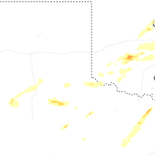
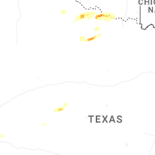
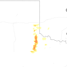

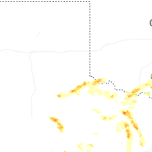


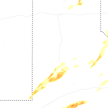
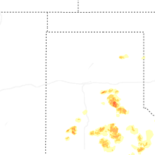
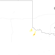


Connect with Interactive Hail Maps