

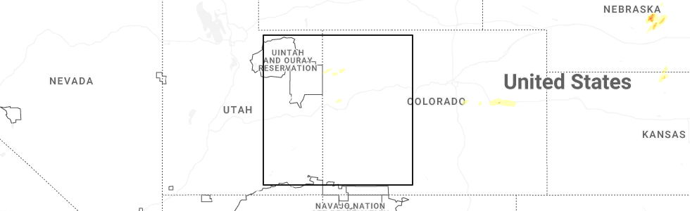
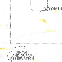
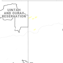
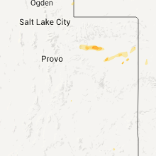
Hail Map for Rangely, CO
The Rangely, CO area has had 1 report of on-the-ground hail by trained spotters, and has been under severe weather warnings 2 times during the past 12 months. Doppler radar has detected hail at or near Rangely, CO on 5 occasions, including 2 occasions during the past year.
| Name: | Rangely, CO |
| Where Located: | 71.6 miles WSW of Craig, CO |
| Map: | Google Map for Rangely, CO |
| Population: | 2365 |
| Housing Units: | 1013 |
| More Info: | Search Google for Rangely, CO |
5
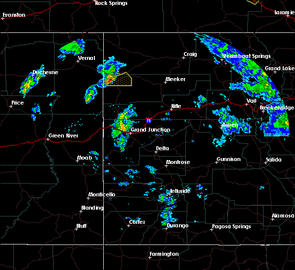
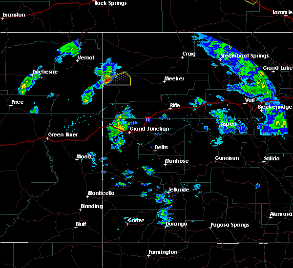
The Top Recent Hail Date for Rangely, CO is Sunday, May 17, 2026 (1st out of 5)
Hail and Wind Damage Spotted near Rangely, CO
| Date / Time | Report Details |
|---|---|
| 5/17/2026 2:17 PM MDT |
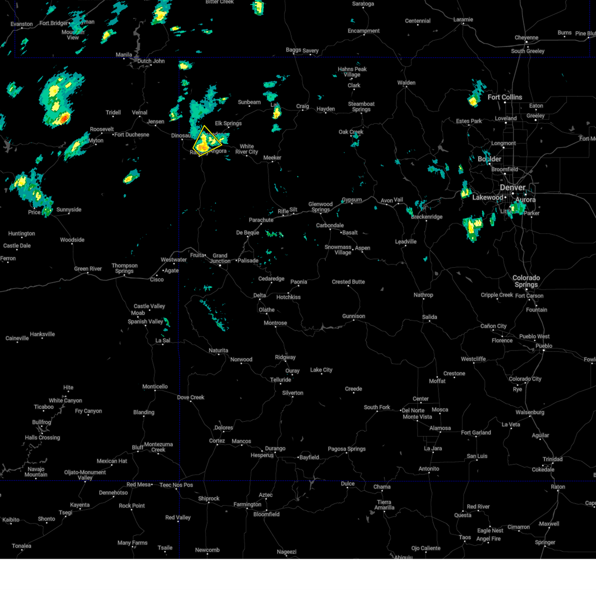
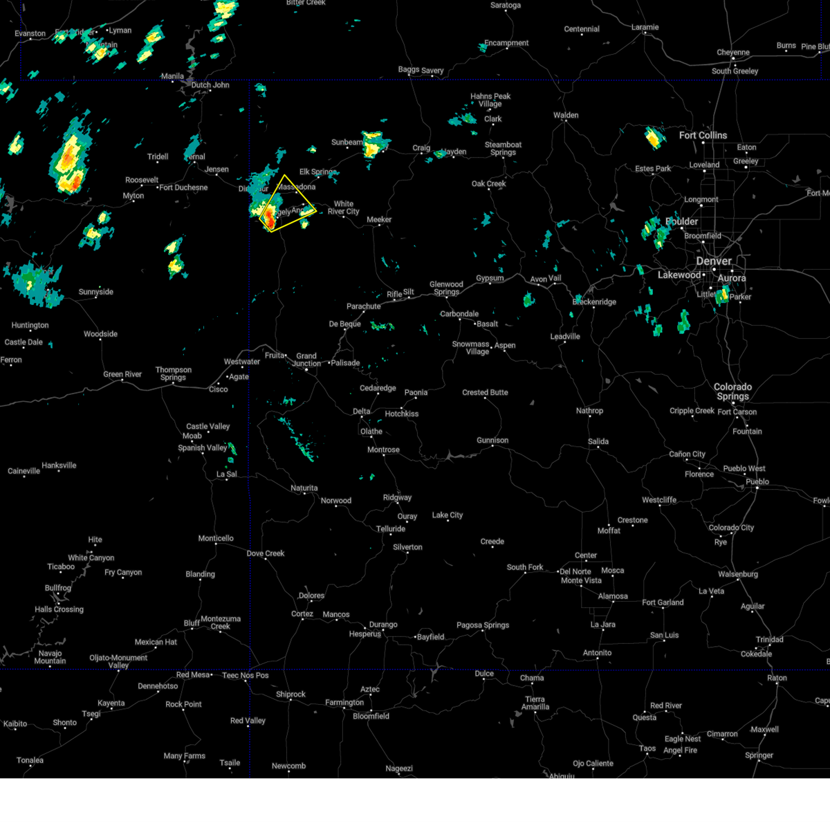
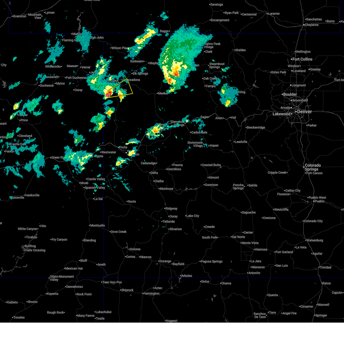 At 217 pm mdt, a severe thunderstorm was located near rangely, or 46 miles southeast of vernal, moving east at 45 mph (radar indicated). Hazards include 60 mph wind gusts and half dollar size hail. Hail damage to vehicles is expected. expect wind damage to roofs, siding, and trees. Locations impacted include, rangely and massadona. At 217 pm mdt, a severe thunderstorm was located near rangely, or 46 miles southeast of vernal, moving east at 45 mph (radar indicated). Hazards include 60 mph wind gusts and half dollar size hail. Hail damage to vehicles is expected. expect wind damage to roofs, siding, and trees. Locations impacted include, rangely and massadona.
|
| 5/17/2026 2:07 PM MDT |
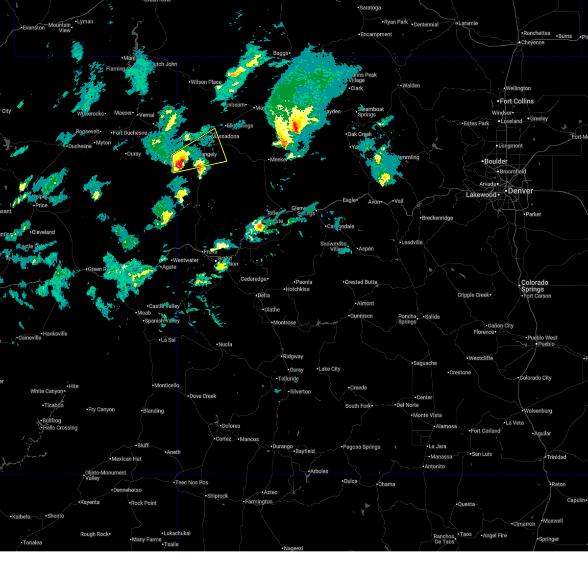 Svrgjt the national weather service in grand junction has issued a * severe thunderstorm warning for, southwestern moffat county in northwestern colorado, northwestern rio blanco county in northwestern colorado, southeastern uintah county in northeastern utah, * until 230 pm mdt. * at 206 pm mdt, a severe thunderstorm was located 11 miles southwest of rangely, or 42 miles southeast of vernal, moving east at 45 mph (radar indicated). Hazards include 60 mph wind gusts and quarter size hail. Hail damage to vehicles is expected. Expect wind damage to roofs, siding, and trees. Svrgjt the national weather service in grand junction has issued a * severe thunderstorm warning for, southwestern moffat county in northwestern colorado, northwestern rio blanco county in northwestern colorado, southeastern uintah county in northeastern utah, * until 230 pm mdt. * at 206 pm mdt, a severe thunderstorm was located 11 miles southwest of rangely, or 42 miles southeast of vernal, moving east at 45 mph (radar indicated). Hazards include 60 mph wind gusts and quarter size hail. Hail damage to vehicles is expected. Expect wind damage to roofs, siding, and trees.
|
| 7/27/2024 5:23 PM MDT | Mesonet station pirc2 pinto... massadona 18s in rio blanco county CO, 20.8 miles WNW of Rangely, CO |
| 6/7/2024 4:23 PM MDT | Mesonet station pirc2 pinto... massadona 18s in rio blanco county CO, 20.8 miles WNW of Rangely, CO |
| 8/2/2023 8:23 PM MDT | Mesonet station pirc2 pinto... massadona 18s in rio blanco county CO, 20.8 miles WNW of Rangely, CO |
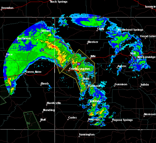
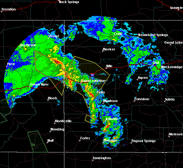
| 5/25/2023 3:26 PM MDT |
 The severe thunderstorm warning for southwestern moffat and northwestern rio blanco counties will expire at 330 pm mdt, the storm which prompted the warning has weakened below severe limits, and has exited the warned area. therefore, the warning will be allowed to expire. however small hail and gusty winds are still possible with this thunderstorm. The severe thunderstorm warning for southwestern moffat and northwestern rio blanco counties will expire at 330 pm mdt, the storm which prompted the warning has weakened below severe limits, and has exited the warned area. therefore, the warning will be allowed to expire. however small hail and gusty winds are still possible with this thunderstorm.
|
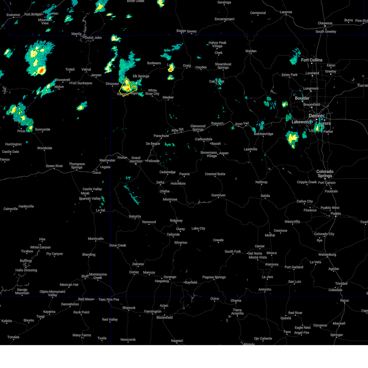
| 5/25/2023 3:17 PM MDT |
 At 316 pm mdt, a severe thunderstorm was located near rangely, or 47 miles southeast of vernal, moving northeast at 25 mph (radar indicated). Hazards include 60 mph wind gusts and quarter size hail. Hail damage to vehicles is expected. expect wind damage to roofs, siding, and trees. this severe thunderstorm will remain over mainly rural areas of southwestern moffat and northwestern rio blanco counties, including the following locations, massadona. this includes the following highways, u. s. highway 40 in colorado between mile markers 14 and 25. colorado 64 between mile markers 25 and 34. hail threat, radar indicated max hail size, 1. 00 in wind threat, radar indicated max wind gust, 60 mph. At 316 pm mdt, a severe thunderstorm was located near rangely, or 47 miles southeast of vernal, moving northeast at 25 mph (radar indicated). Hazards include 60 mph wind gusts and quarter size hail. Hail damage to vehicles is expected. expect wind damage to roofs, siding, and trees. this severe thunderstorm will remain over mainly rural areas of southwestern moffat and northwestern rio blanco counties, including the following locations, massadona. this includes the following highways, u. s. highway 40 in colorado between mile markers 14 and 25. colorado 64 between mile markers 25 and 34. hail threat, radar indicated max hail size, 1. 00 in wind threat, radar indicated max wind gust, 60 mph.
|
| 5/25/2023 3:05 PM MDT | Quarter sized hail reported 1.5 miles E of Rangely, CO, quarter size hail. |
| 5/25/2023 2:57 PM MDT |
 At 256 pm mdt, a severe thunderstorm was located over rangely, or 46 miles southeast of vernal, moving northeast at 20 mph (radar indicated). Hazards include 60 mph wind gusts and quarter size hail. Hail damage to vehicles is expected. expect wind damage to roofs, siding, and trees. this severe thunderstorm will be near, rangely around 310 pm mdt. this includes the following highways, u. s. highway 40 in colorado between mile markers 13 and 25. colorado 64 between mile markers 12 and 37. colorado 139 between mile markers 68 and 72. hail threat, radar indicated max hail size, 1. 00 in wind threat, radar indicated max wind gust, 60 mph. At 256 pm mdt, a severe thunderstorm was located over rangely, or 46 miles southeast of vernal, moving northeast at 20 mph (radar indicated). Hazards include 60 mph wind gusts and quarter size hail. Hail damage to vehicles is expected. expect wind damage to roofs, siding, and trees. this severe thunderstorm will be near, rangely around 310 pm mdt. this includes the following highways, u. s. highway 40 in colorado between mile markers 13 and 25. colorado 64 between mile markers 12 and 37. colorado 139 between mile markers 68 and 72. hail threat, radar indicated max hail size, 1. 00 in wind threat, radar indicated max wind gust, 60 mph.
|
| 9/11/2021 5:23 PM MDT | Mesonet station pirc2 pinto... massadona 18s in rio blanco county CO, 20.8 miles WNW of Rangely, CO |
| 6/25/2020 4:23 PM MDT | Mesonet station pirc2 pinto... massadona 18s in rio blanco county CO, 20.8 miles WNW of Rangely, CO |
| 6/6/2020 12:18 PM MDT | Mesonet station drac2 dragon roa in rio blanco county CO, 12.8 miles NNE of Rangely, CO |
| 6/6/2020 12:16 PM MDT |
 At 1215 pm mdt, severe thunderstorms were located along a line extending from 6 miles southwest of dinosaur to 10 miles southeast of rangely to 16 miles northwest of de beque, moving northeast at 70 mph (radar indicated). Hazards include 60 mph wind gusts and penny size hail. Expect damage to roofs, siding, and trees. locations impacted include, rangely. this includes the following highways, colorado 64 between mile markers 5 and 21. Colorado 139 between mile markers 12 and 72. At 1215 pm mdt, severe thunderstorms were located along a line extending from 6 miles southwest of dinosaur to 10 miles southeast of rangely to 16 miles northwest of de beque, moving northeast at 70 mph (radar indicated). Hazards include 60 mph wind gusts and penny size hail. Expect damage to roofs, siding, and trees. locations impacted include, rangely. this includes the following highways, colorado 64 between mile markers 5 and 21. Colorado 139 between mile markers 12 and 72.
|
| 6/6/2020 11:55 AM MDT |
 At 1154 am mdt, severe thunderstorms were located along a line extending from 28 miles southwest of dinosaur to 27 miles south of rangely to near fruita, moving northeast at 105 mph (radar indicated). Hazards include 60 mph wind gusts and penny size hail. expect damage to roofs, siding, and trees At 1154 am mdt, severe thunderstorms were located along a line extending from 28 miles southwest of dinosaur to 27 miles south of rangely to near fruita, moving northeast at 105 mph (radar indicated). Hazards include 60 mph wind gusts and penny size hail. expect damage to roofs, siding, and trees
|
| 9/8/2019 4:11 PM MDT |
 At 411 pm mdt, a severe thunderstorm was just west of rangely, or 45 miles southeast of vernal, moving east at 35 mph (radar indicated). Hazards include 60 mph wind gusts and quarter size hail. Hail damage to vehicles is expected. expect wind damage to roofs, siding, and trees. locations impacted include, rangely and massadona. this includes the following highways, colorado 64 between mile markers 11 and 35. Colorado 139 between mile markers 70 and 72. At 411 pm mdt, a severe thunderstorm was just west of rangely, or 45 miles southeast of vernal, moving east at 35 mph (radar indicated). Hazards include 60 mph wind gusts and quarter size hail. Hail damage to vehicles is expected. expect wind damage to roofs, siding, and trees. locations impacted include, rangely and massadona. this includes the following highways, colorado 64 between mile markers 11 and 35. Colorado 139 between mile markers 70 and 72.
|
| 9/8/2019 4:03 PM MDT |
 At 403 pm mdt, a severe thunderstorm was located near rangely, or 43 miles southeast of vernal, moving east at 35 mph (radar indicated). Hazards include 60 mph wind gusts and quarter size hail. Hail damage to vehicles is expected. Expect wind damage to roofs, siding, and trees. At 403 pm mdt, a severe thunderstorm was located near rangely, or 43 miles southeast of vernal, moving east at 35 mph (radar indicated). Hazards include 60 mph wind gusts and quarter size hail. Hail damage to vehicles is expected. Expect wind damage to roofs, siding, and trees.
|
| 9/8/2019 1:23 PM MDT | Mesonet station pirc2 pinto... massadona 18s in rio blanco county CO, 20.8 miles WNW of Rangely, CO |
| 9/8/2019 12:15 PM MDT | Awos station k4v0 rangely 2 in rio blanco county CO, 1.2 miles SW of Rangely, CO |
| 9/14/2017 4:23 PM MDT | Mesonet station pirc2... pinto - 18 se massadon in rio blanco county CO, 20.8 miles WNW of Rangely, CO |
| 9/1/2012 6:23 PM MDT | Measured at the pinto raws site in rio blanco county CO, 20.4 miles W of Rangely, CO |
| 1/1/0001 12:00 AM | 80 percent of roof removed on a 2-story dorm building on colorado northwestern community college campus. several tree branches down around area as well. time of report in rio blanco county CO, 1.3 miles WNW of Rangely, CO |
| 1/1/0001 12:00 AM | Wind gusts from dry thunderstorm knocked several tree limbs and a carport down on main street in rangely. little to no rain. power out in parts of town. few fires start in rio blanco county CO, 1 miles ENE of Rangely, CO |
Hail Maps for Rangely, CO


Connect with Interactive Hail Maps