

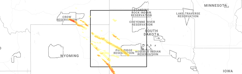
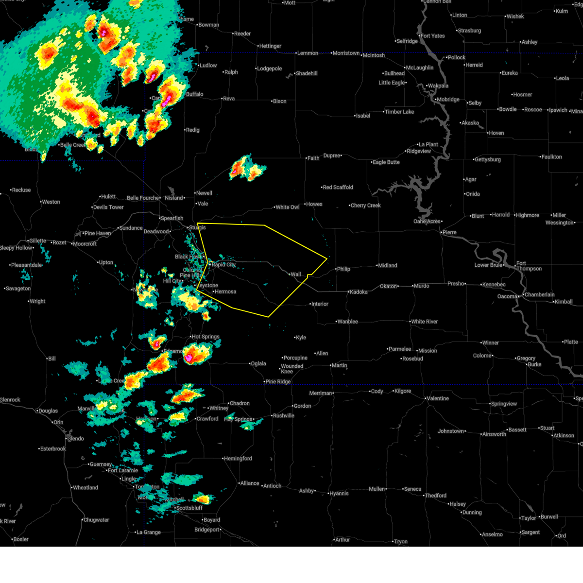
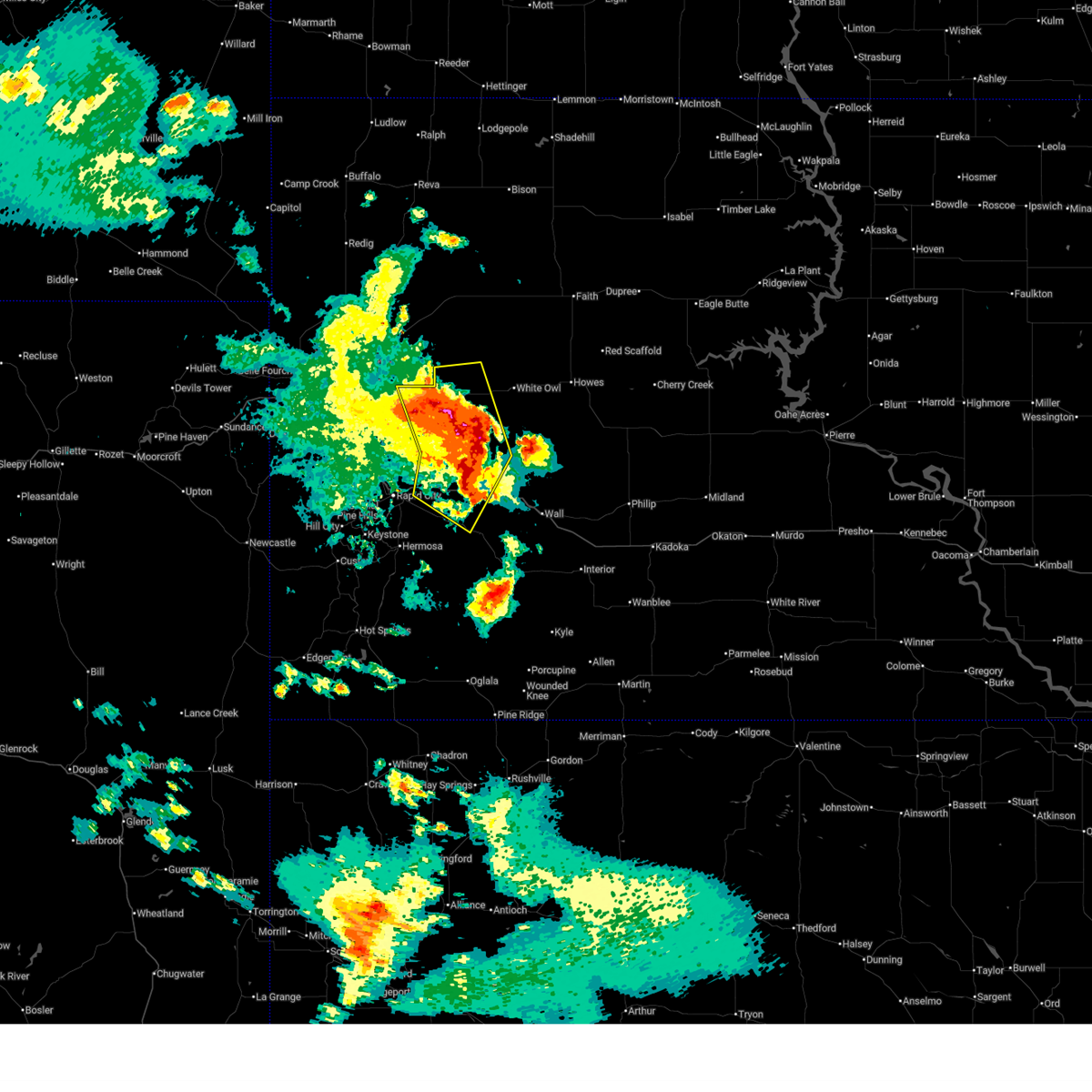
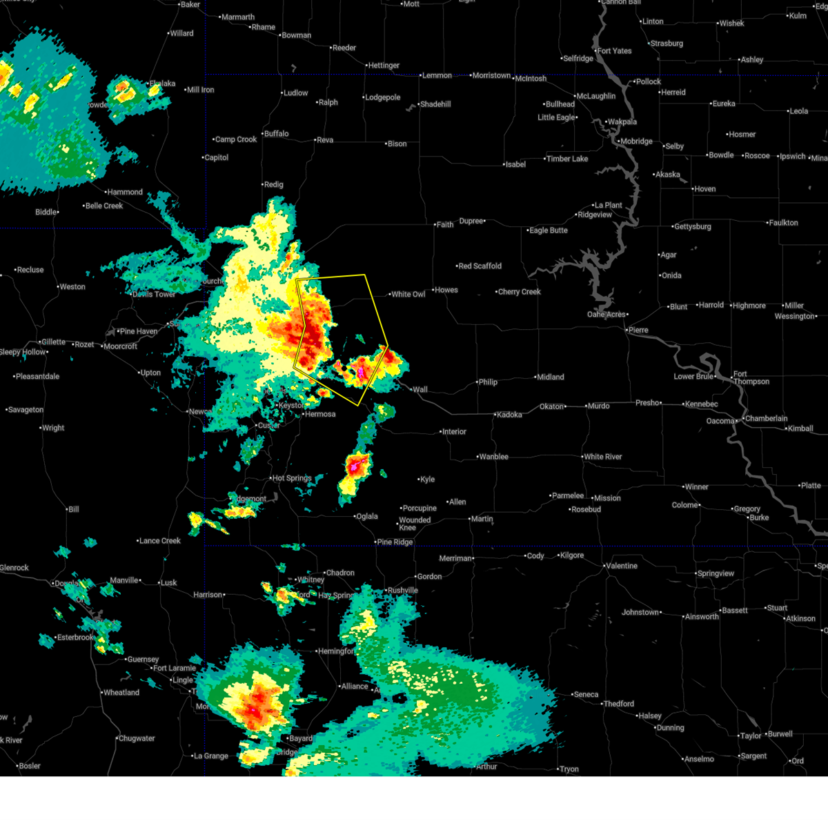
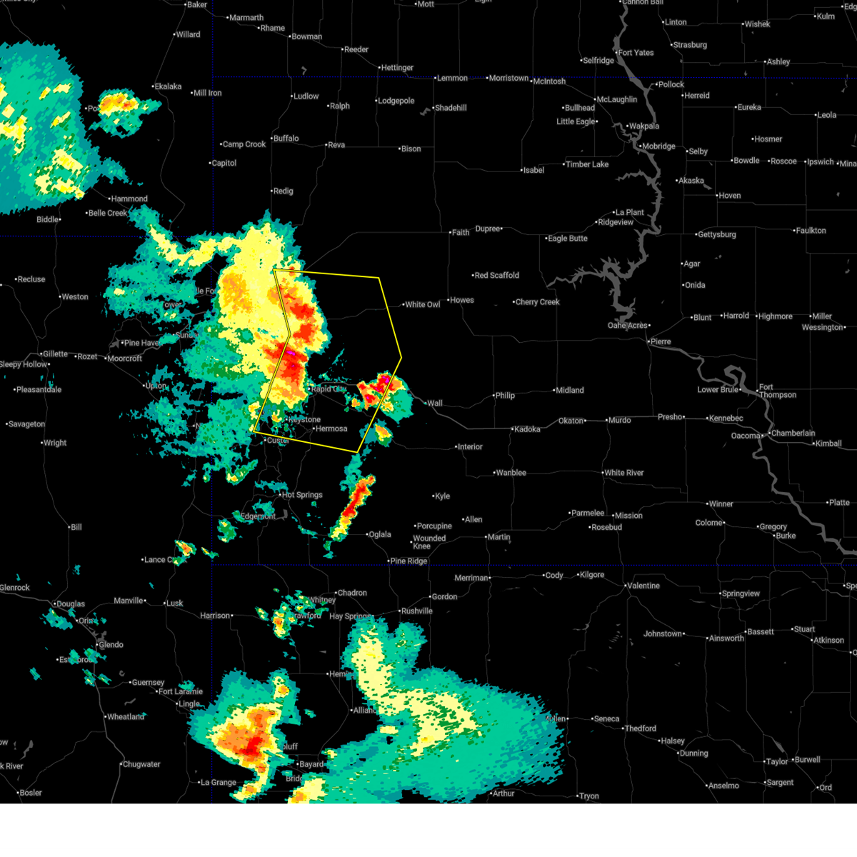
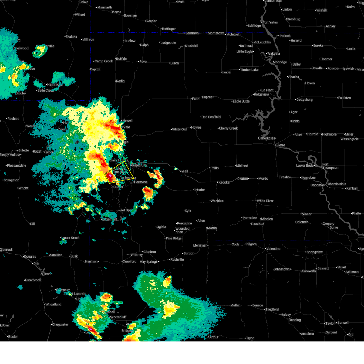
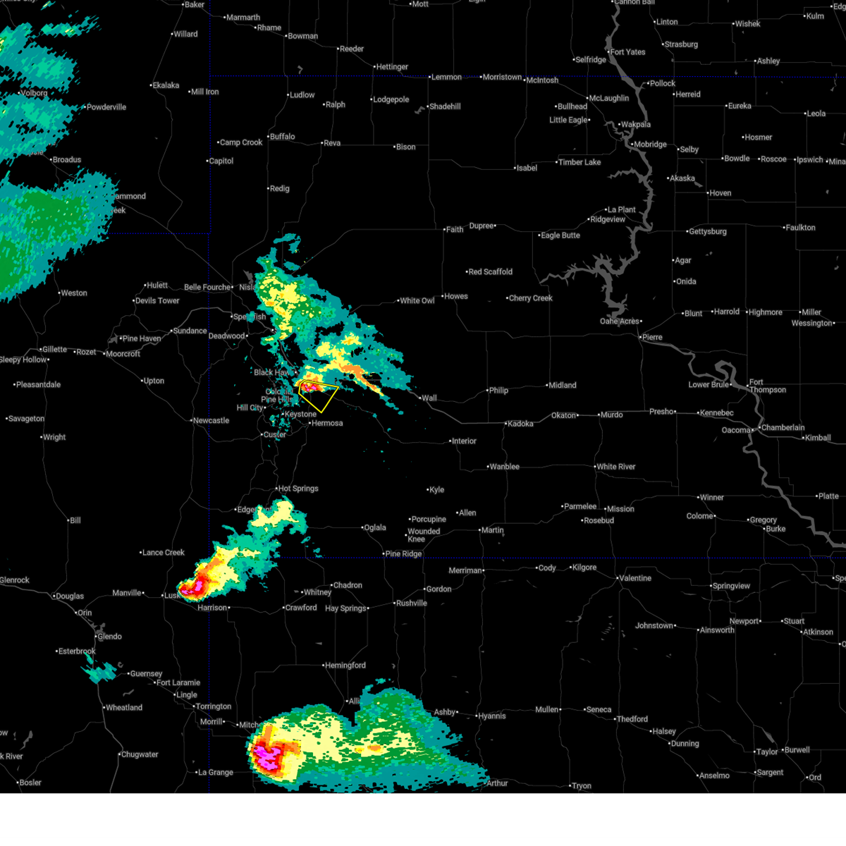
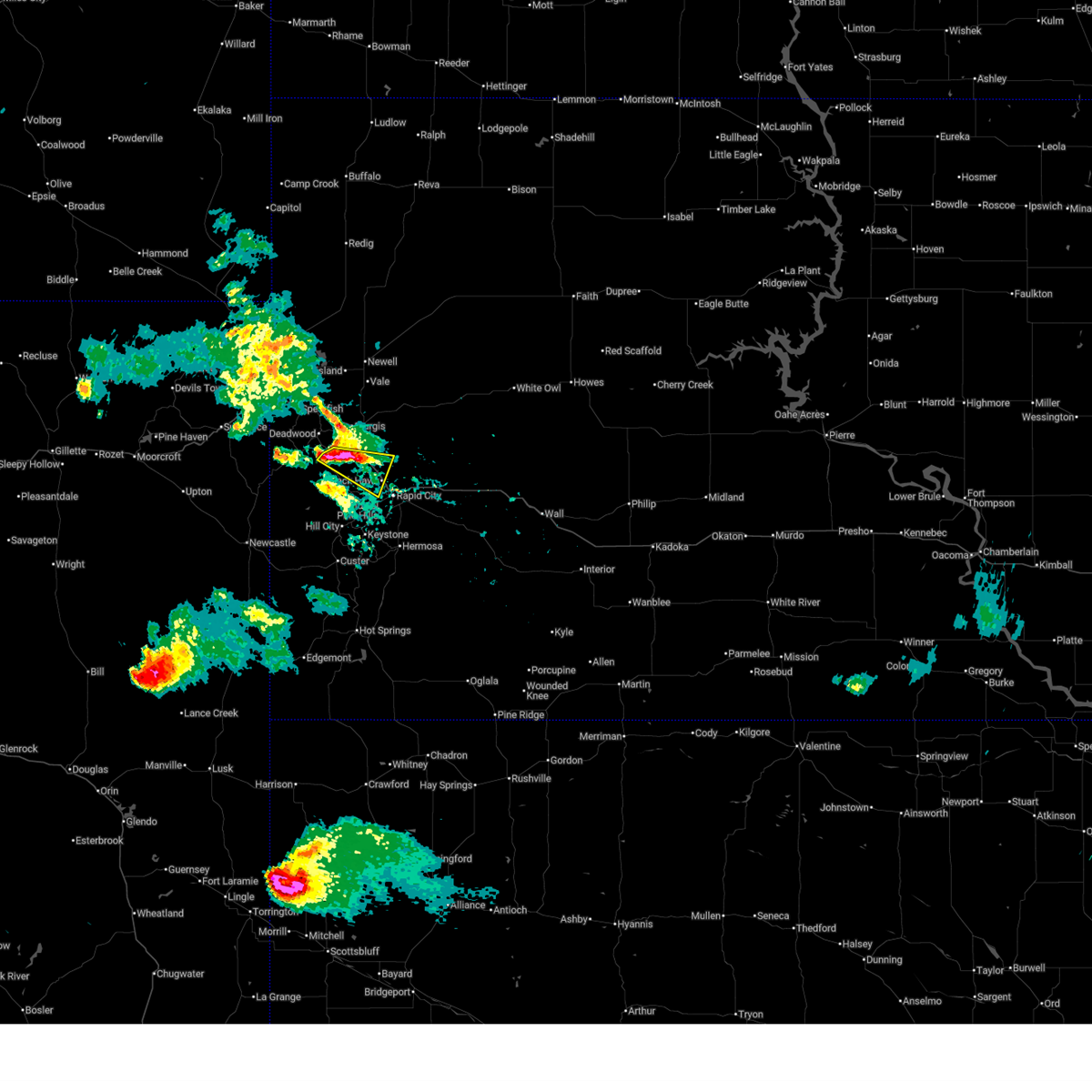
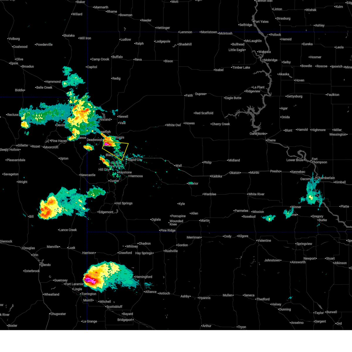
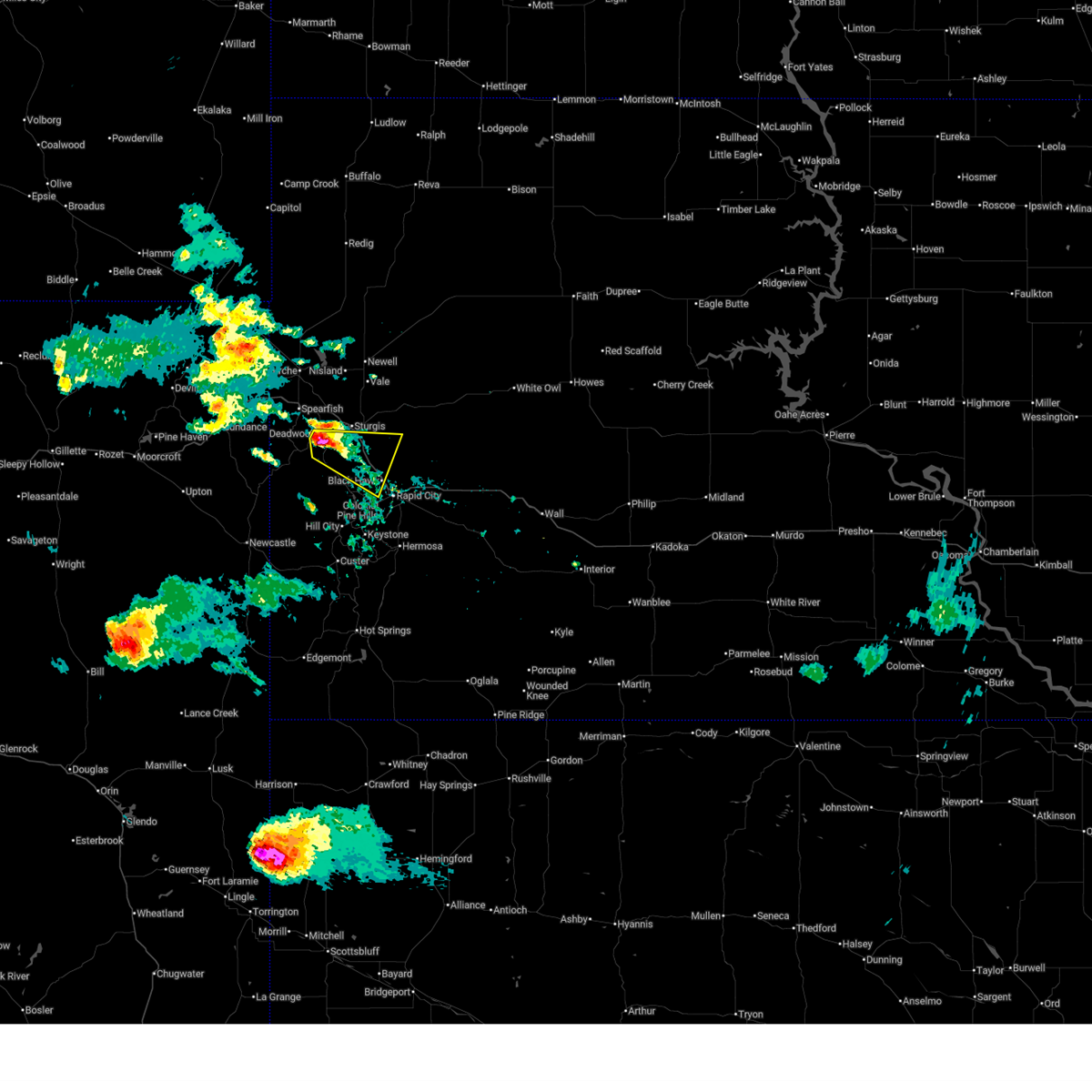
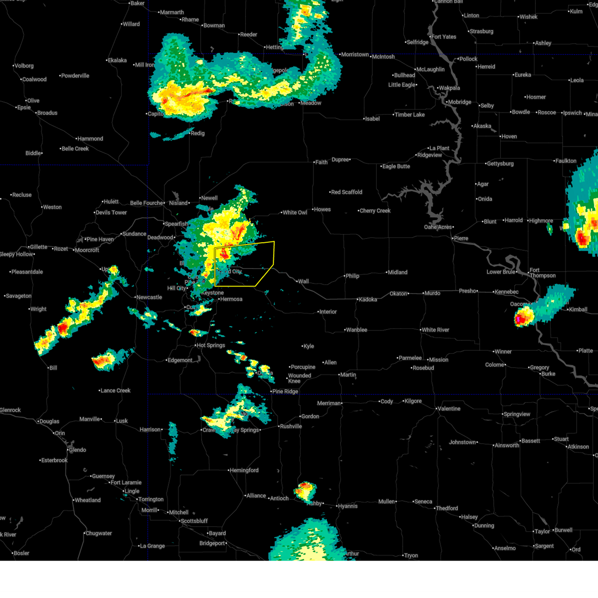
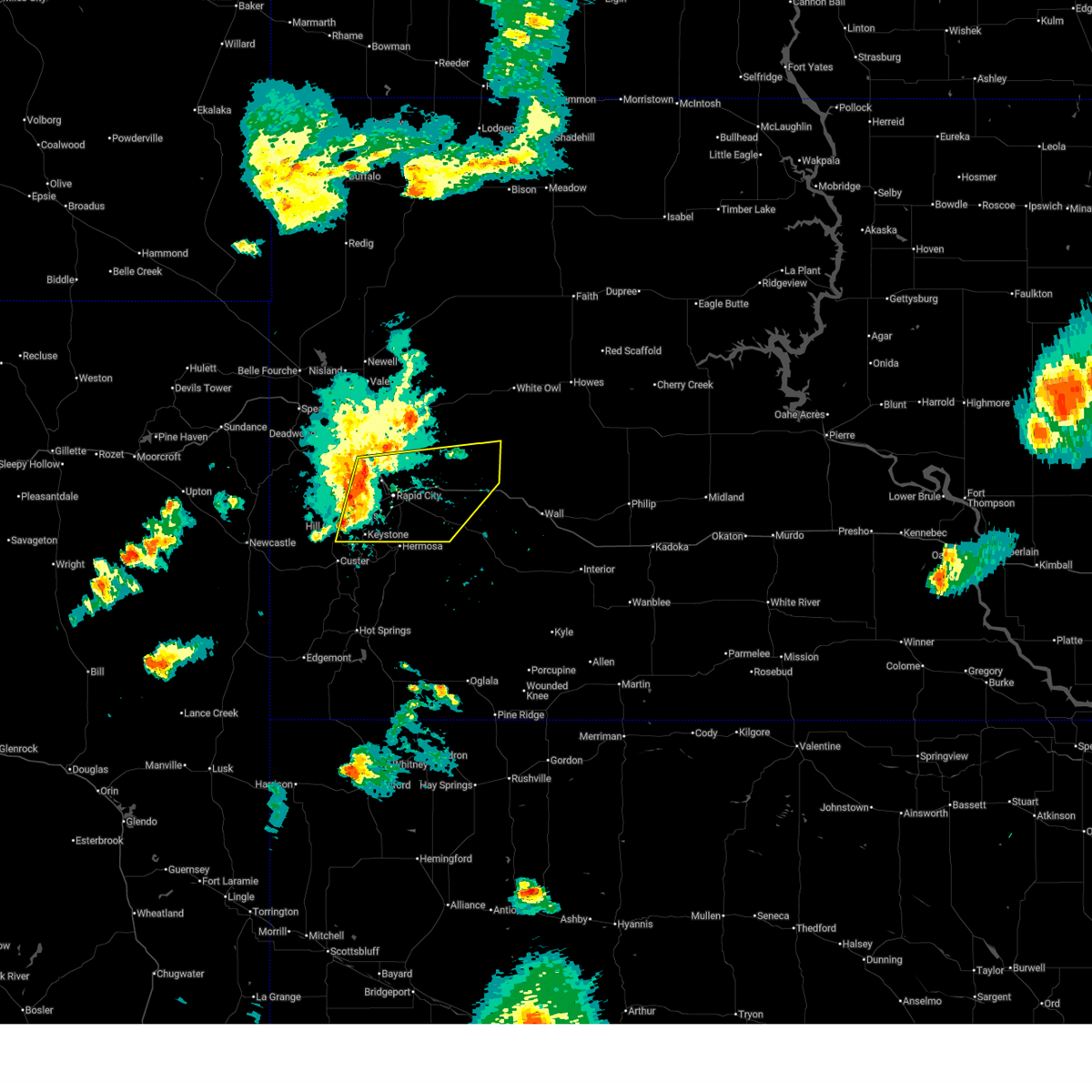
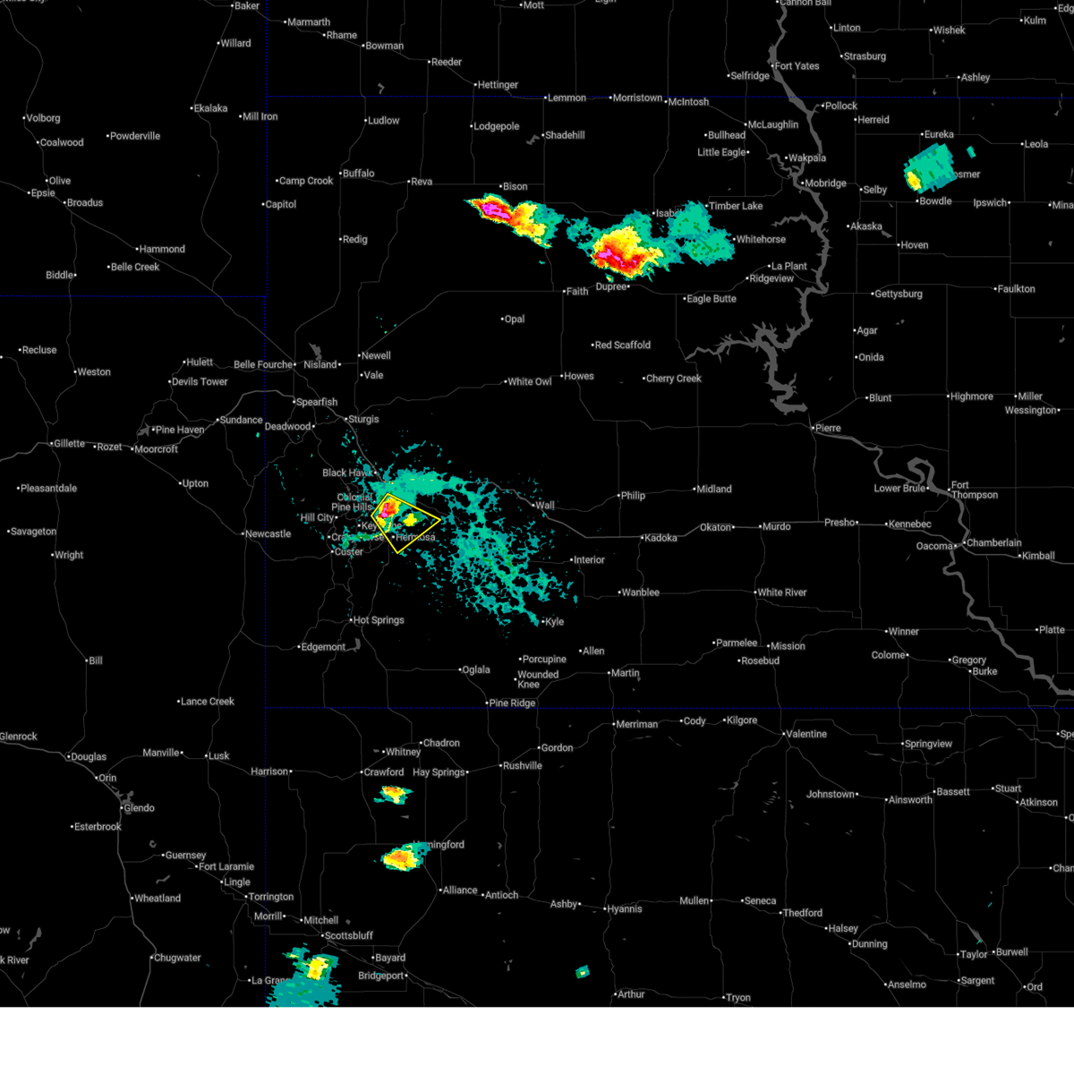
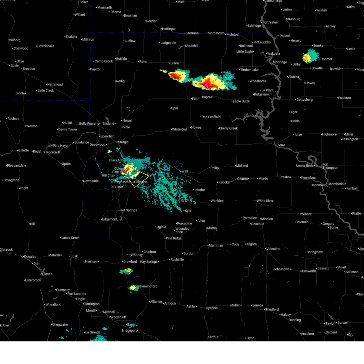
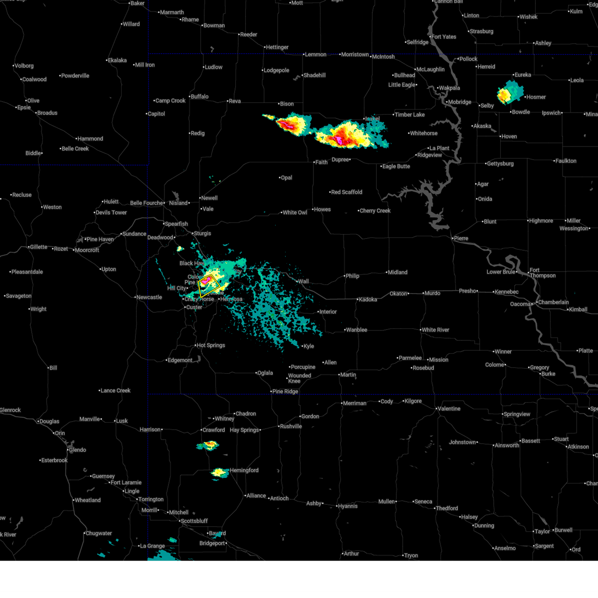
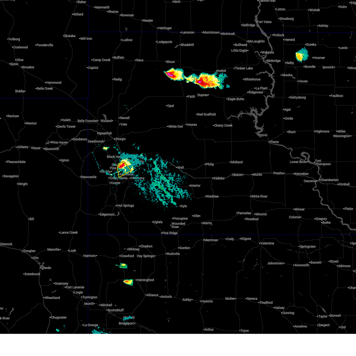
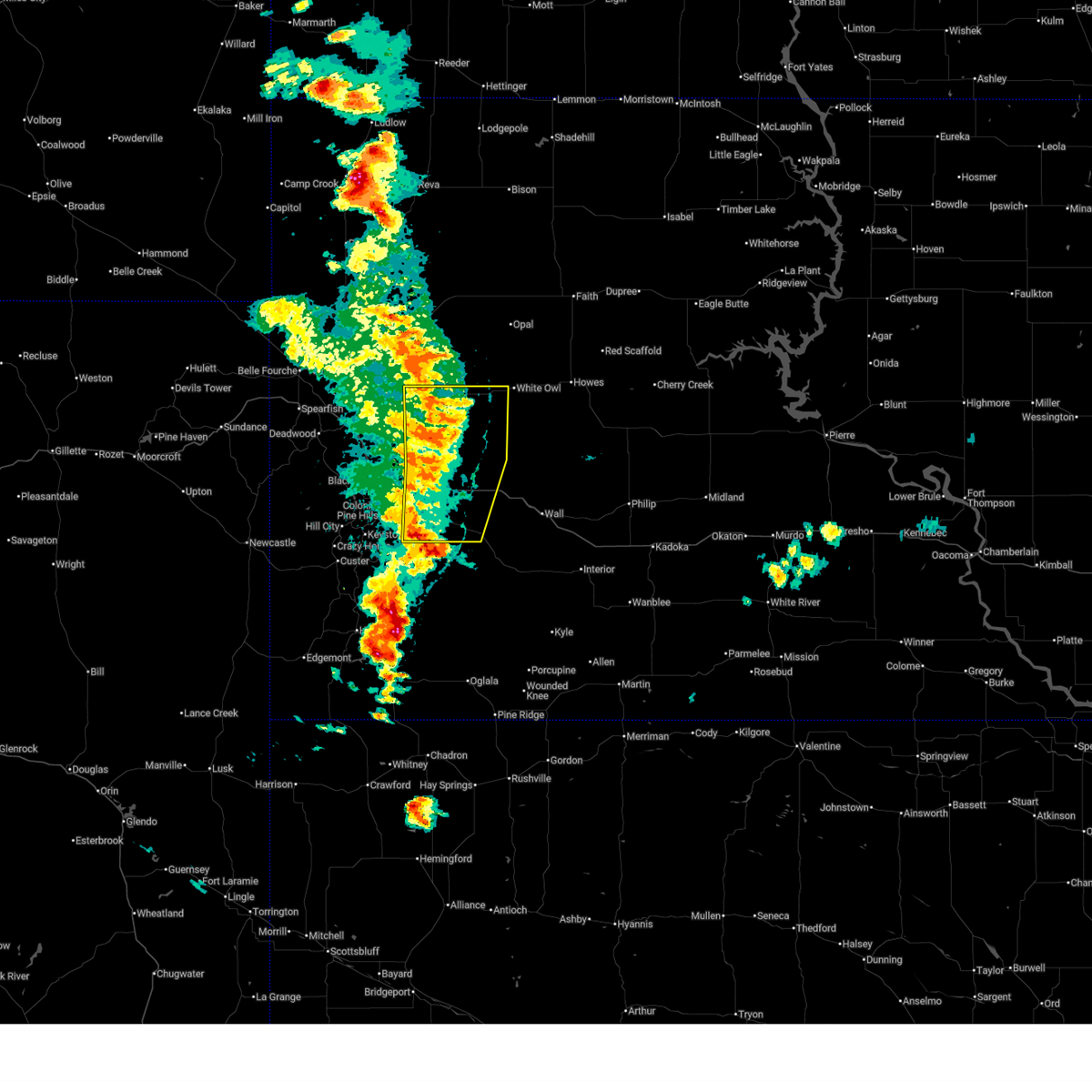
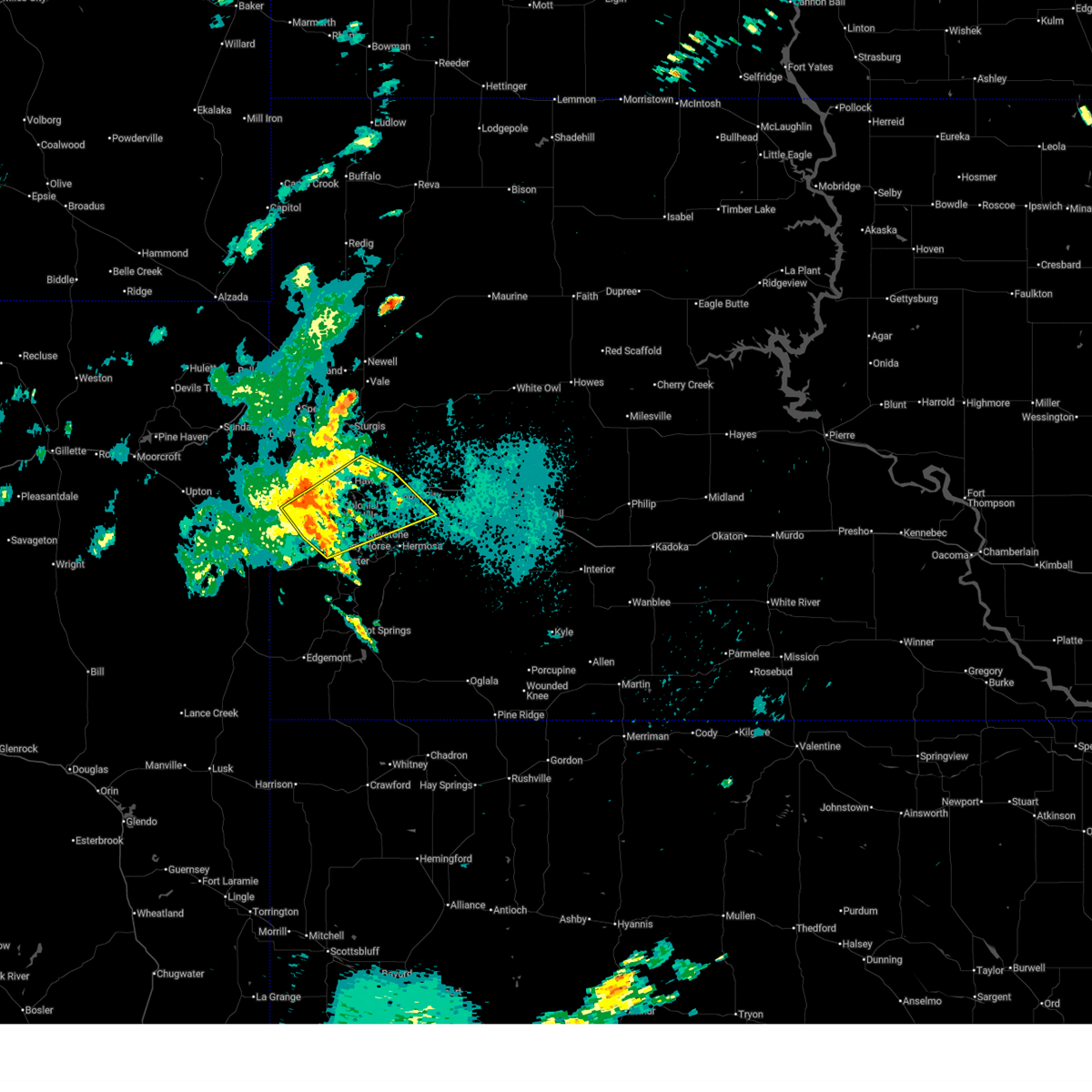
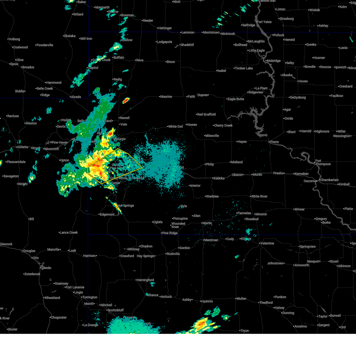
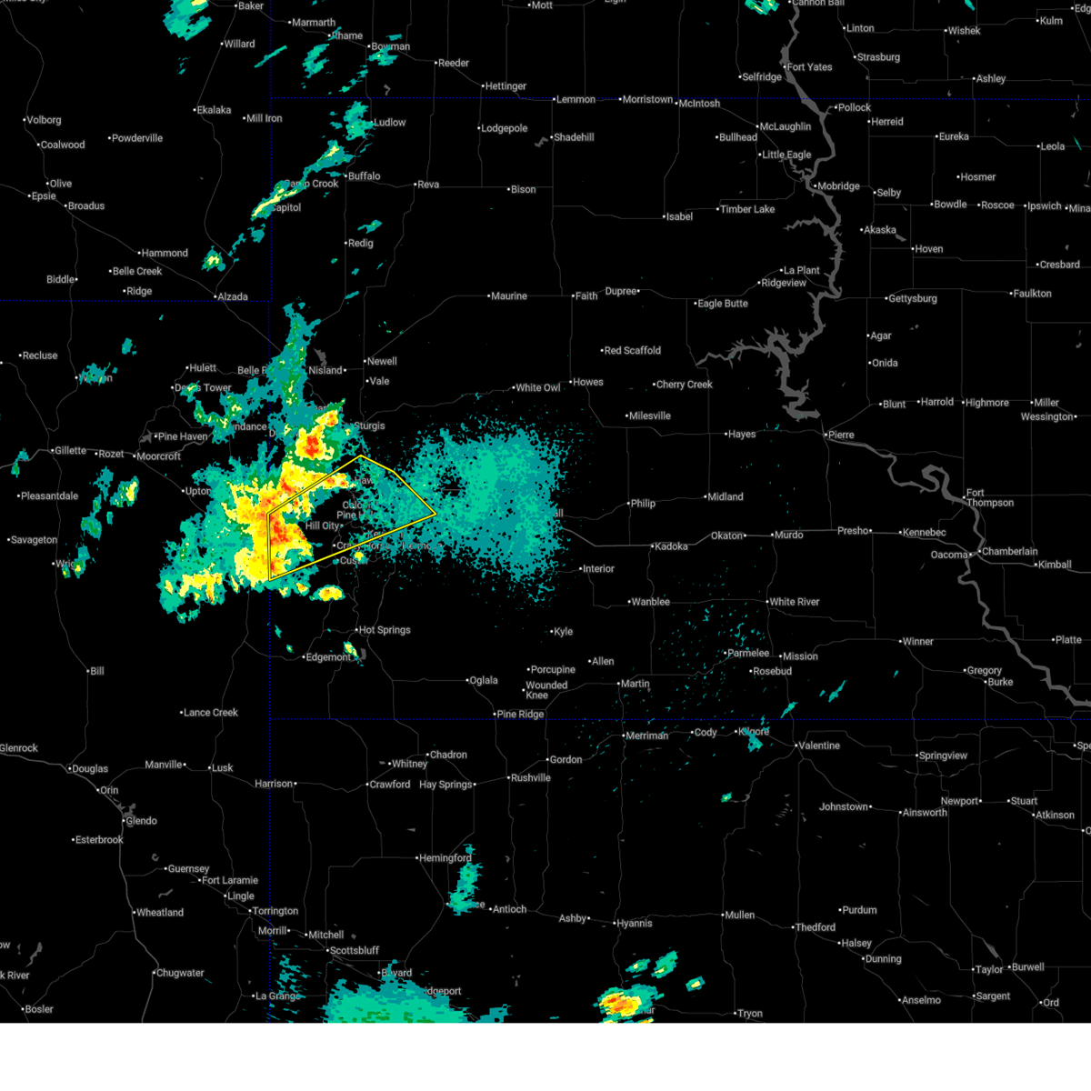
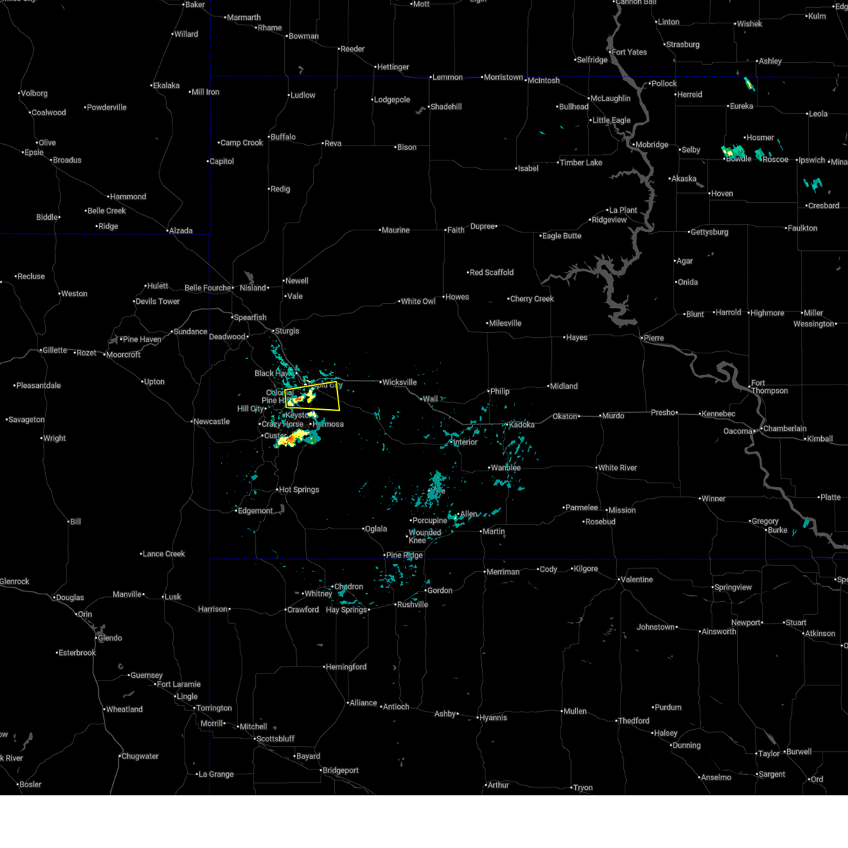
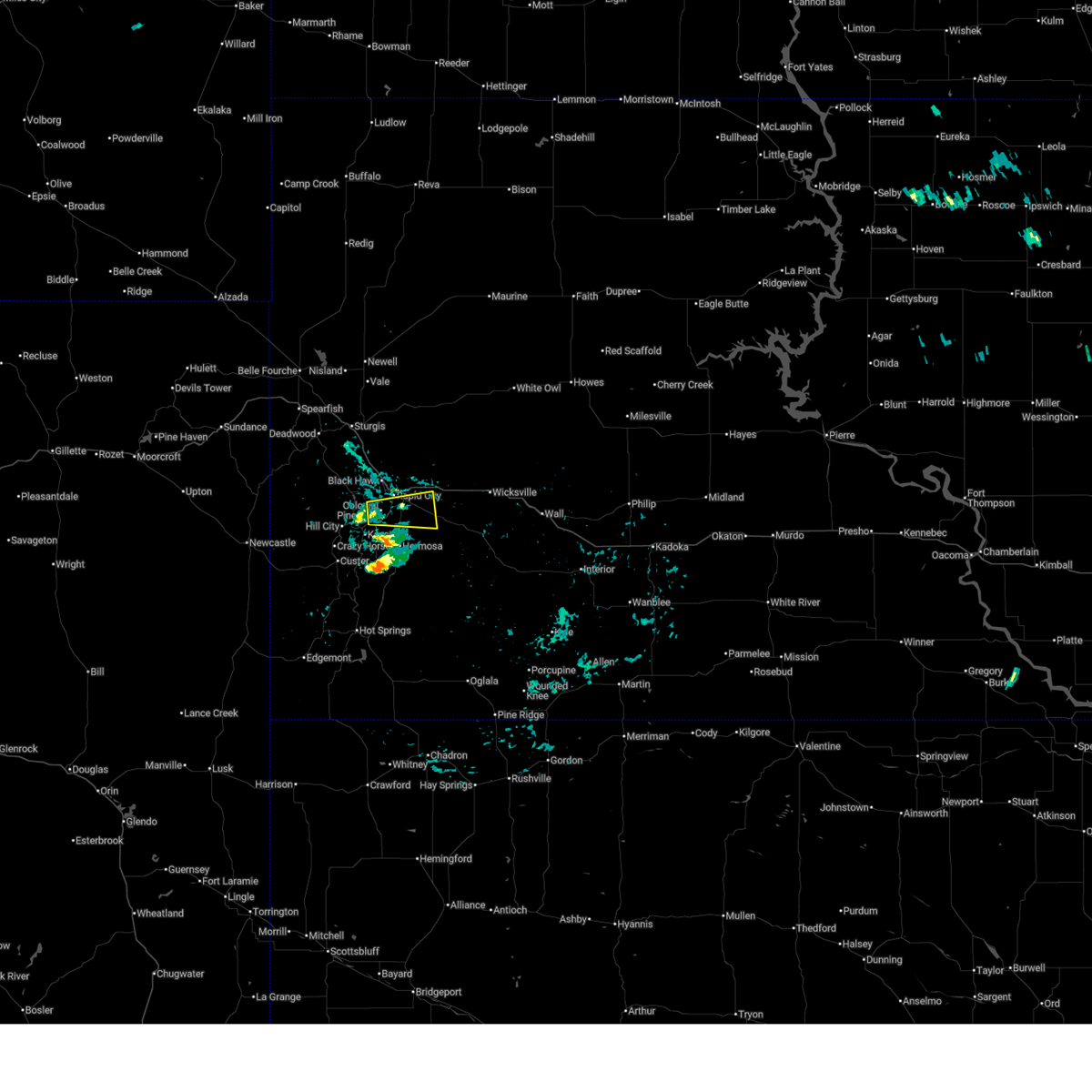
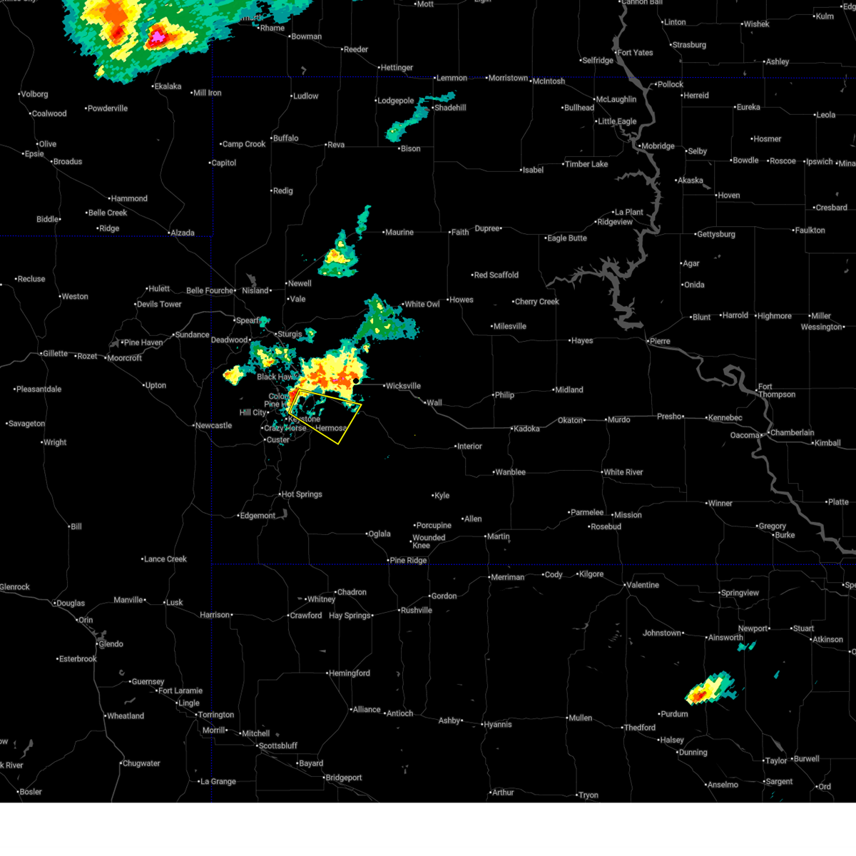
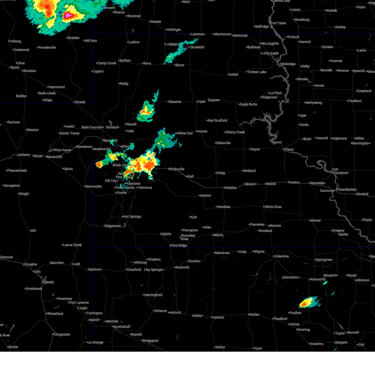
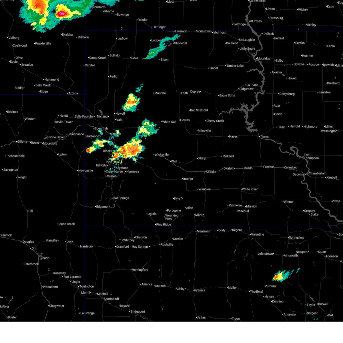
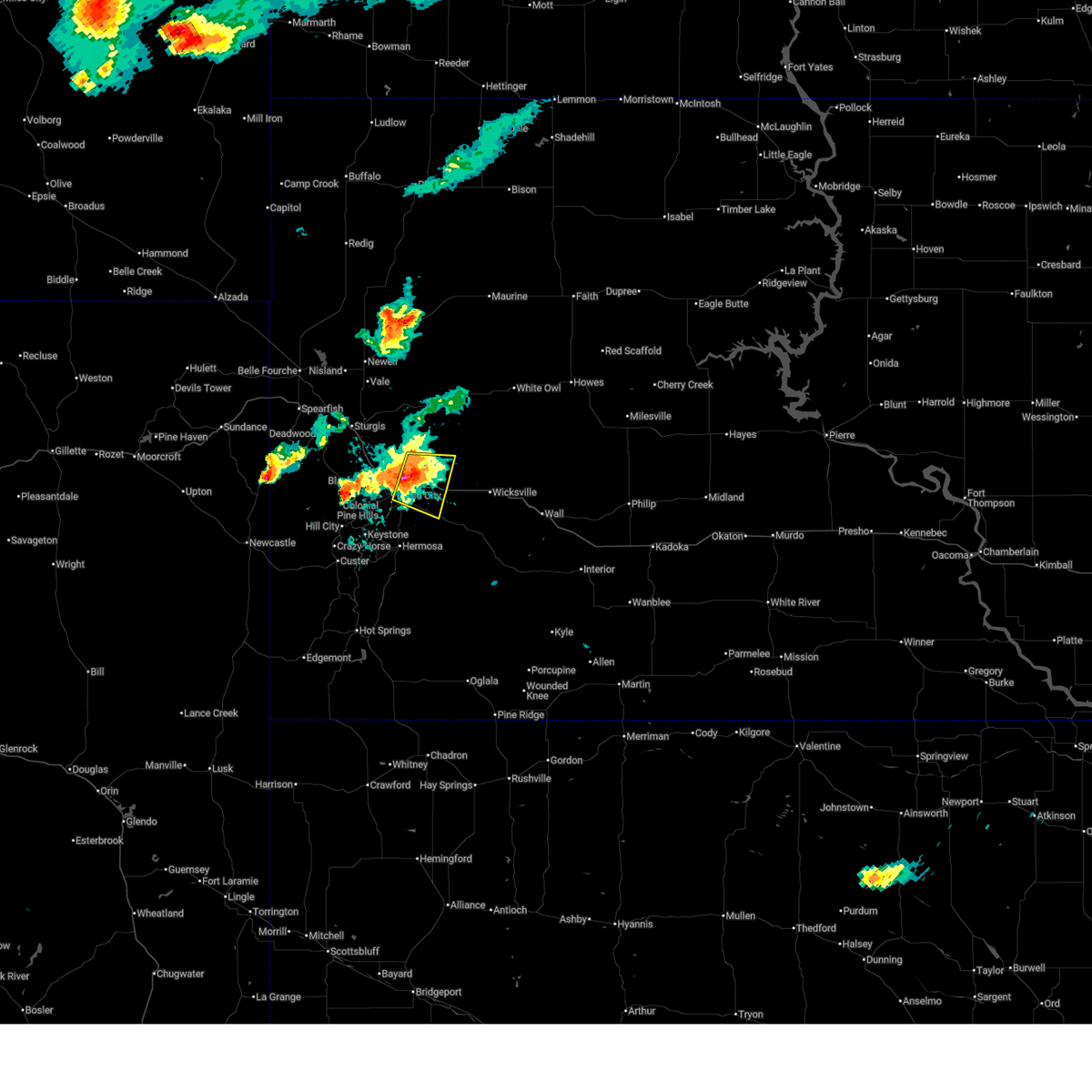
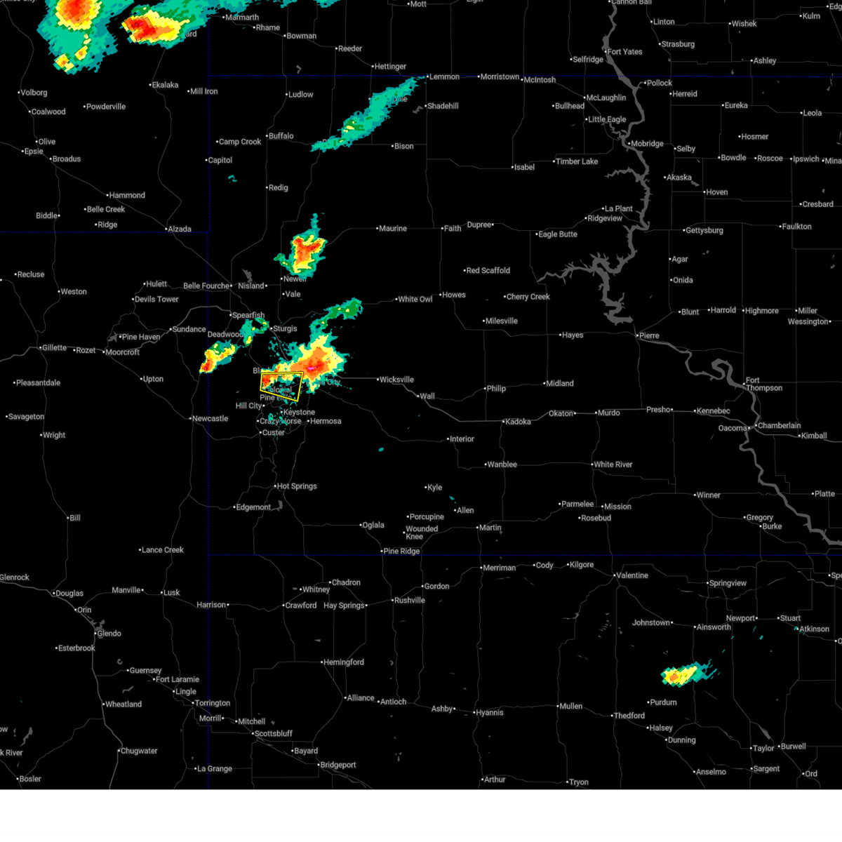
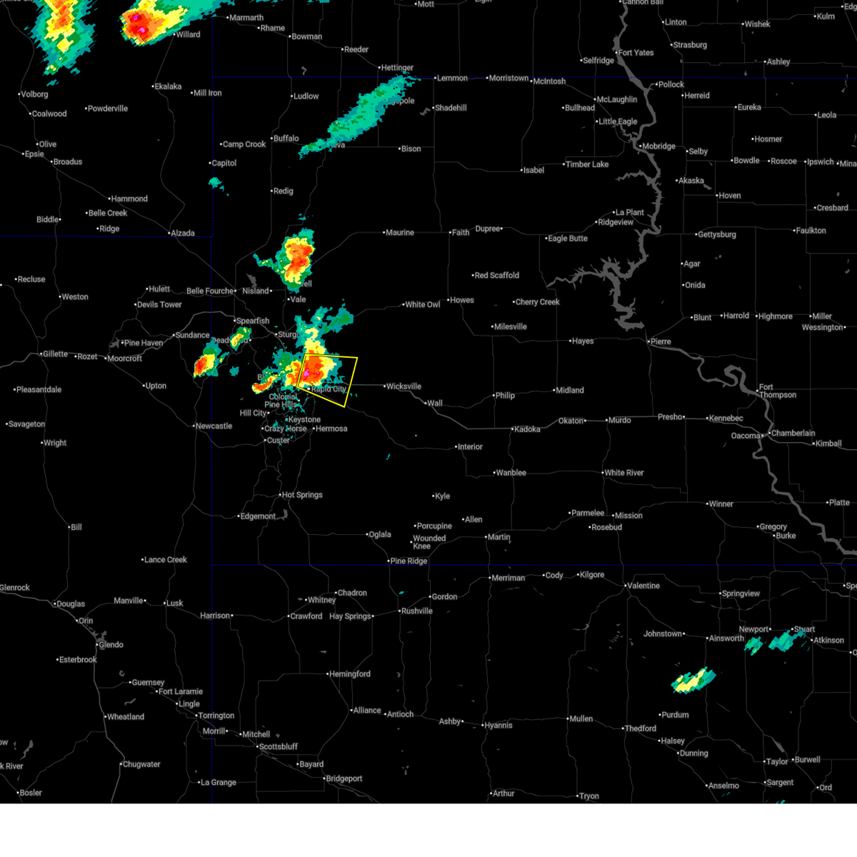
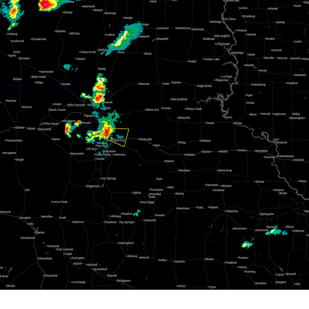
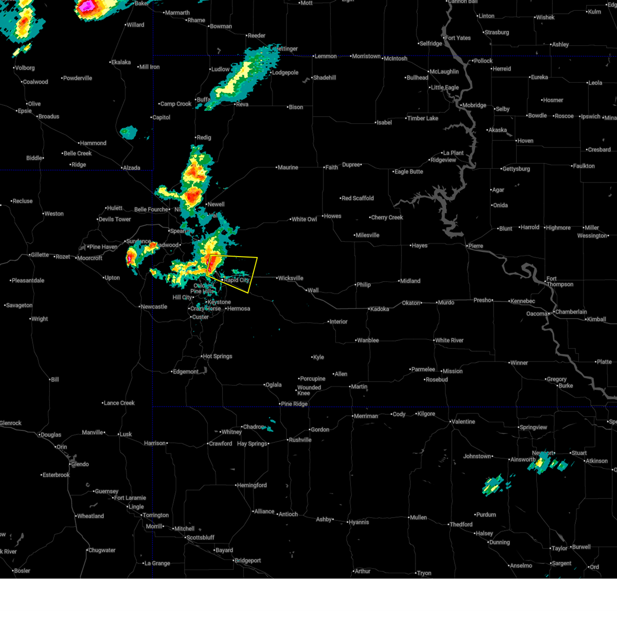
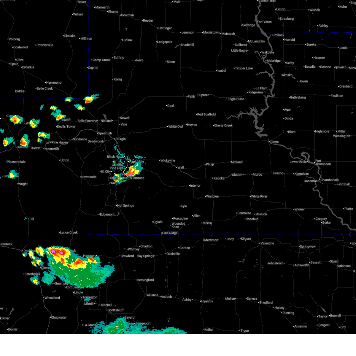
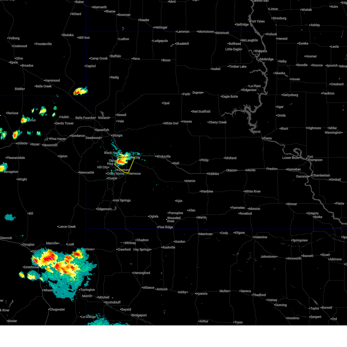
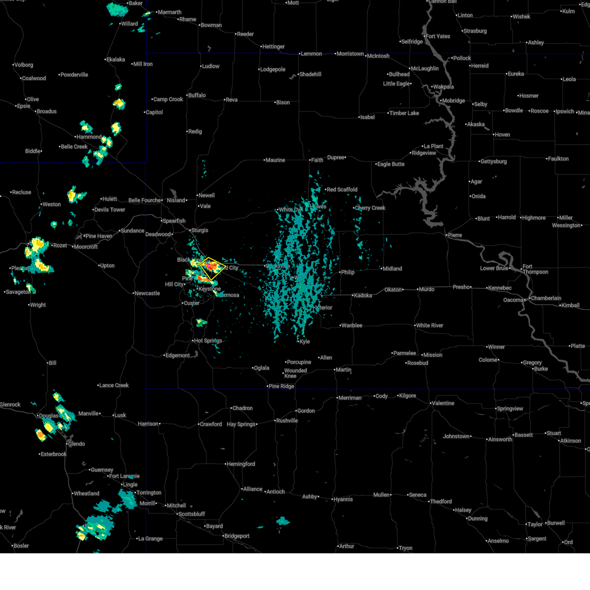
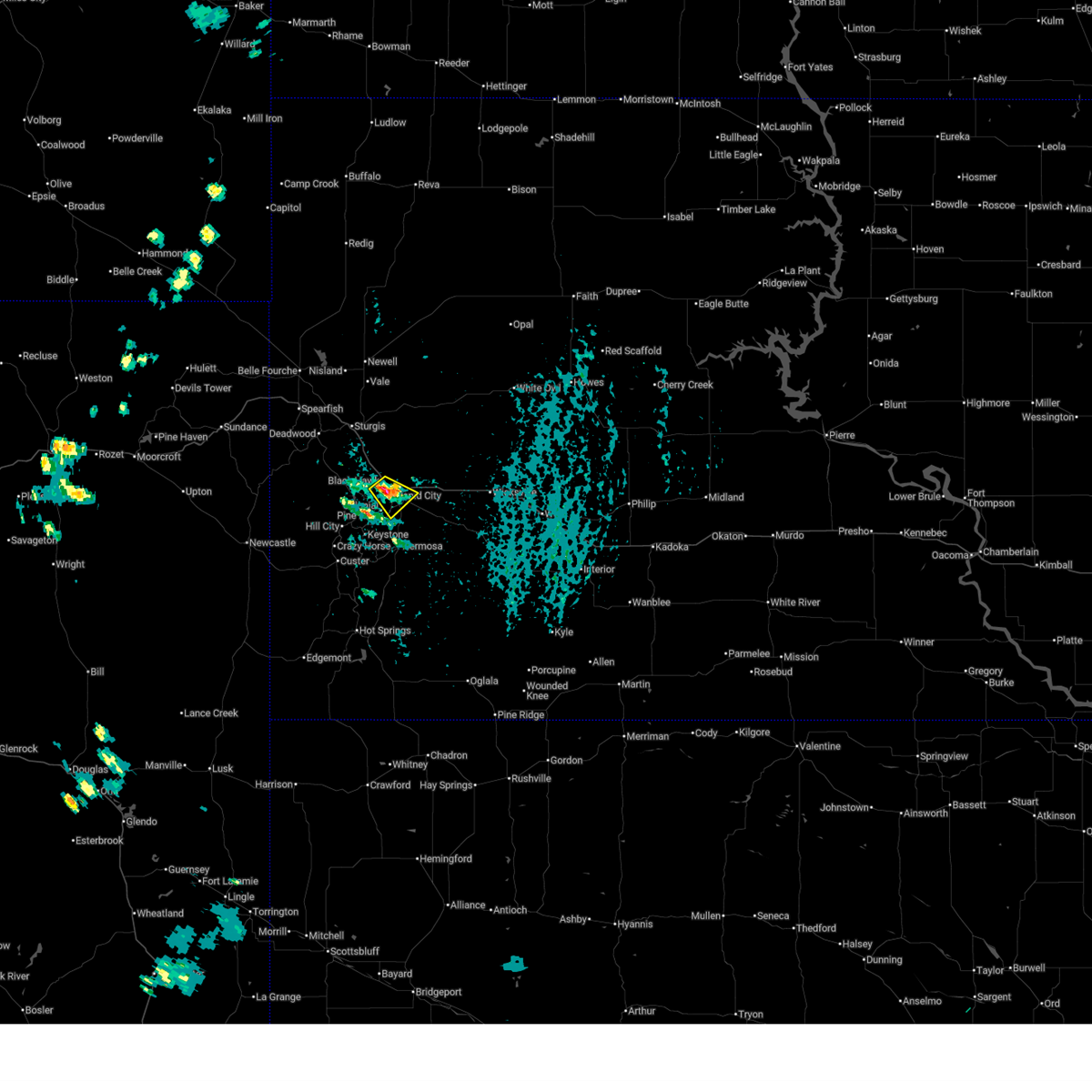
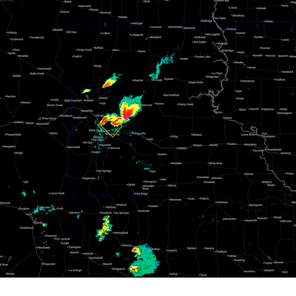
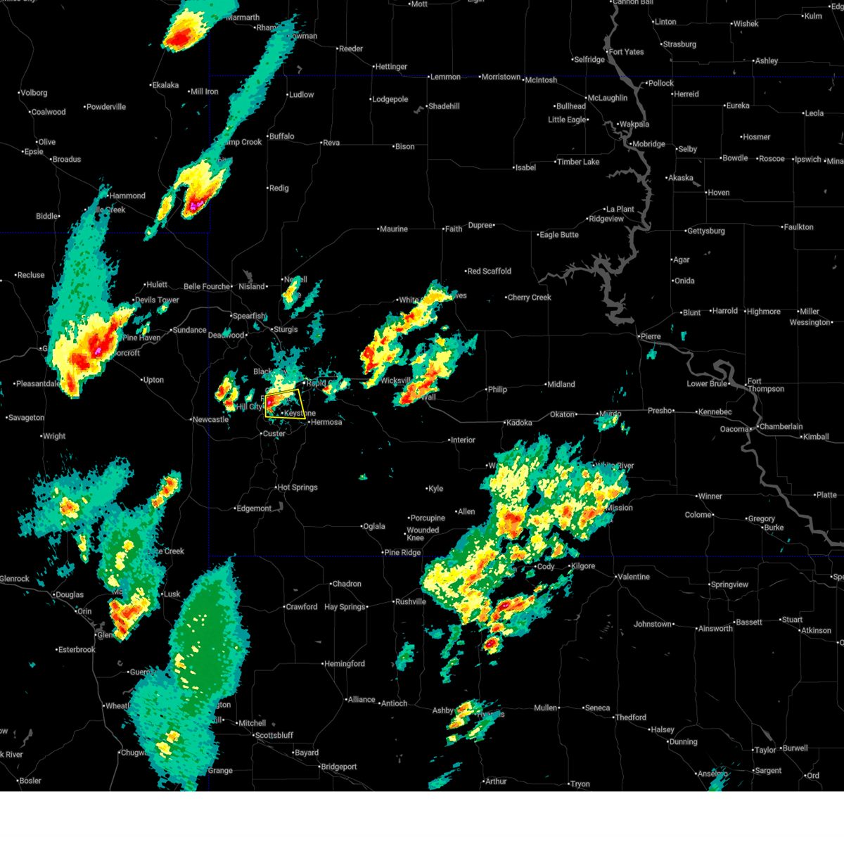
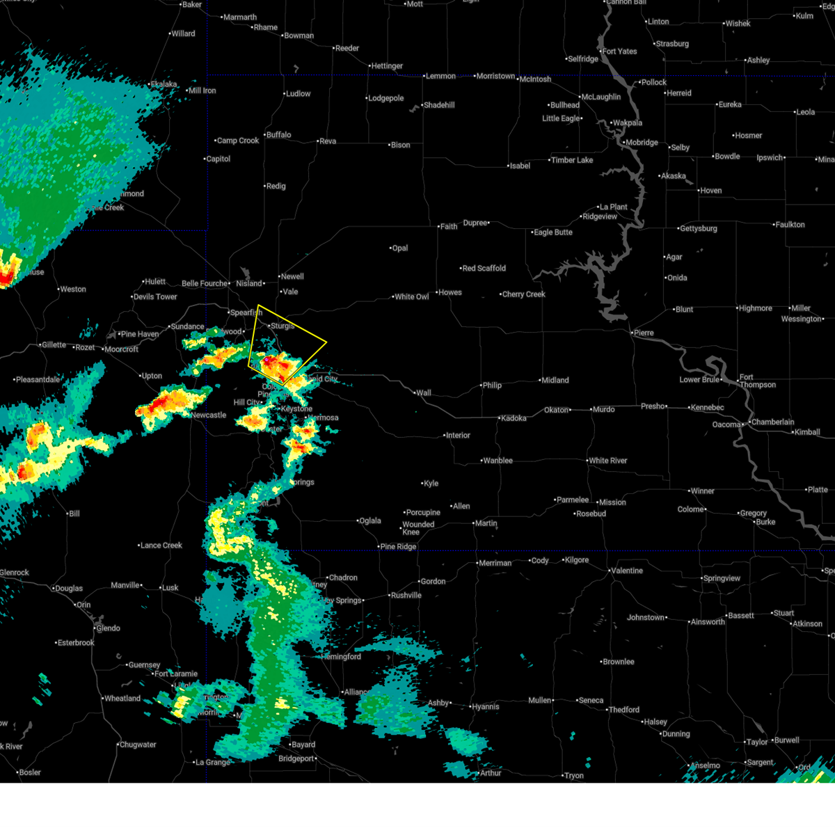
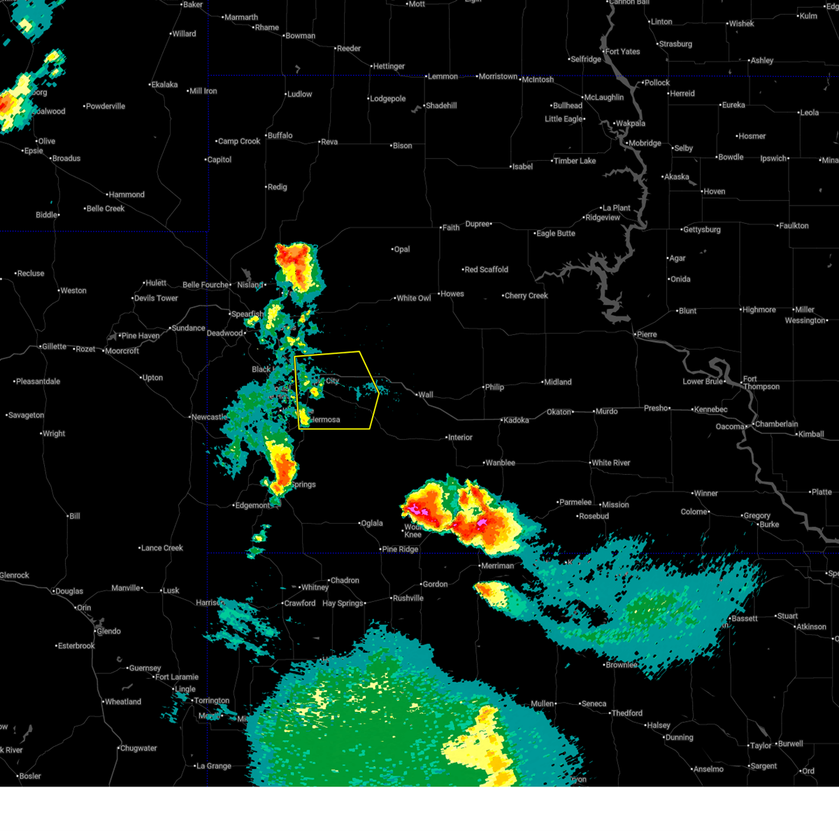
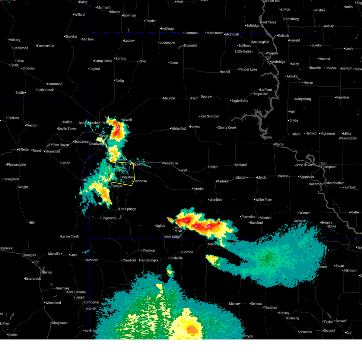
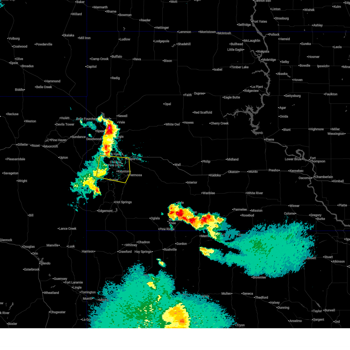
Hail Map for Rapid City, SD
The Rapid City, SD area has had 528 reports of on-the-ground hail by trained spotters, and has been under severe weather warnings 55 times during the past 12 months. Doppler radar has detected hail at or near Rapid City, SD on 227 occasions, including 12 occasions during the past year.
| Name: | Rapid City, SD |
| Where Located: | 1.6 miles SE of Rapid City, SD |
| Map: | Google Map for Rapid City, SD |
| Population: | 67956 |
| Housing Units: | 30254 |
| More Info: | Search Google for Rapid City, SD |
2
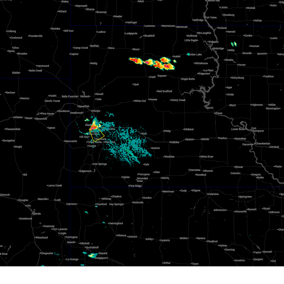
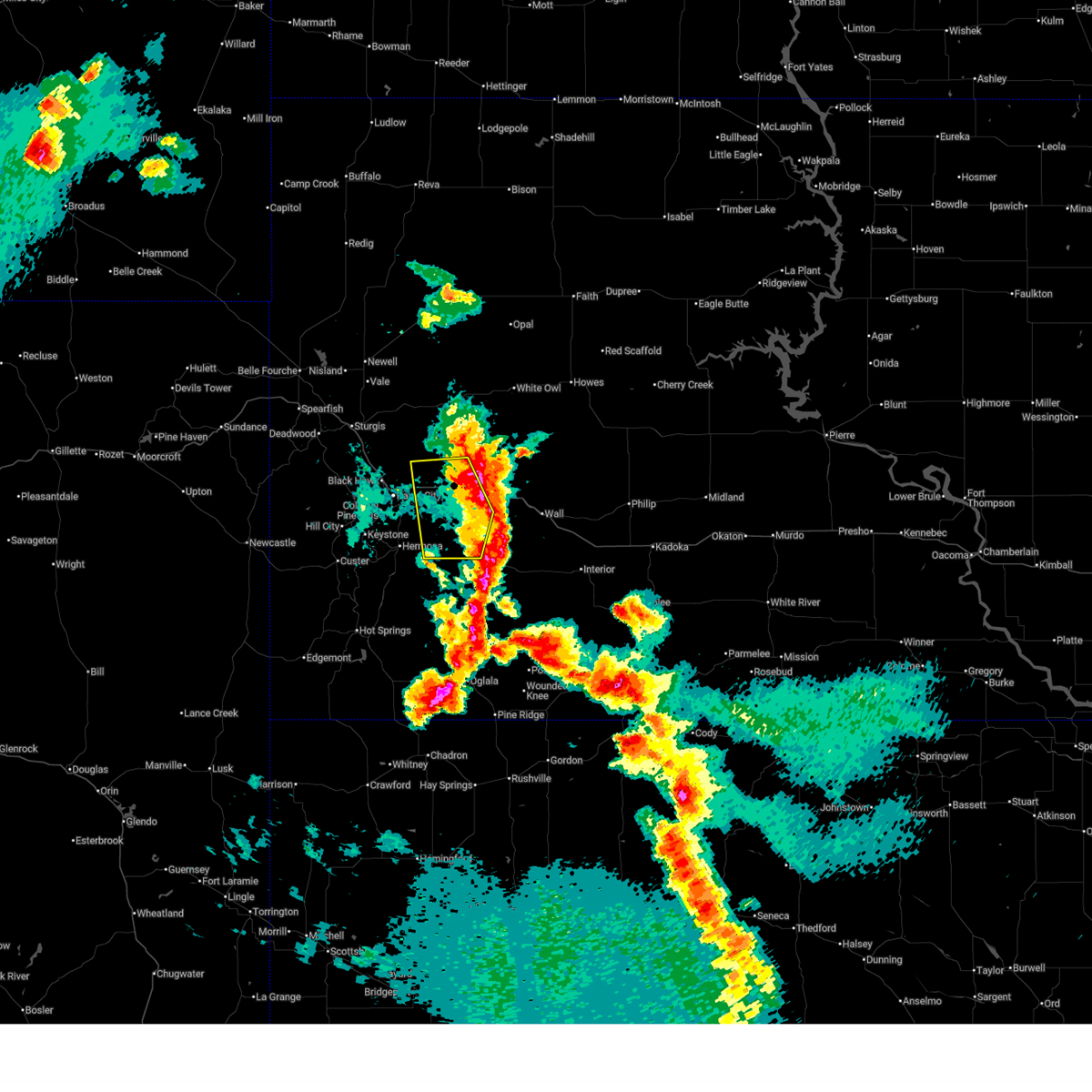
The Top Recent Hail Date for Rapid City, SD is Monday, June 22, 2026 (21st out of 227)
Hail and Wind Damage Spotted near Rapid City, SD
| Date / Time | Report Details |
|---|---|
| 6/27/2026 6:16 PM MDT |
 At 616 pm mdt, severe thunderstorms were located along a line from over summerset to over pinnacles ranger station, or along a line from 12 miles north of rapid city to 30 miles west of philip, moving northeast at 15 mph (public reported). Hazards include 60 mph wind gusts and small hail. Expect damage to roofs, siding, and trees. locations impacted include, wall, new underwood, wasta, scenic, quinn, owanka, elm springs, wicksville, farmingdale, folsom, creighton, caputa, hereford, grindstone, curlew lake, railroad buttes, sheep mountain table, viewfield, northwestern badlands national park and pinnacles ranger station. This includes interstate 90 in south dakota between mile markers 70 and 120. At 616 pm mdt, severe thunderstorms were located along a line from over summerset to over pinnacles ranger station, or along a line from 12 miles north of rapid city to 30 miles west of philip, moving northeast at 15 mph (public reported). Hazards include 60 mph wind gusts and small hail. Expect damage to roofs, siding, and trees. locations impacted include, wall, new underwood, wasta, scenic, quinn, owanka, elm springs, wicksville, farmingdale, folsom, creighton, caputa, hereford, grindstone, curlew lake, railroad buttes, sheep mountain table, viewfield, northwestern badlands national park and pinnacles ranger station. This includes interstate 90 in south dakota between mile markers 70 and 120.
|
| 6/27/2026 5:54 PM MDT |
 At 554 pm mdt, severe thunderstorms were located along a line from 5 miles south of piedmont to 6 miles southwest of pinnacles ranger station, or along a line from 11 miles northwest of rapid city to 36 miles southwest of philip, moving northeast at 15 mph (public reported). Hazards include 60 mph wind gusts and quarter size hail. Hail damage to vehicles is expected. expect wind damage to roofs, siding, and trees. locations impacted include, rapid city, rapid valley, ellsworth air force base, box elder, wall, new underwood, hermosa, wasta, scenic, quinn, owanka, elm springs, wicksville, farmingdale, folsom, caputa, hereford, creighton, hayward and grindstone. This includes interstate 90 in south dakota between mile markers 57 and 120. At 554 pm mdt, severe thunderstorms were located along a line from 5 miles south of piedmont to 6 miles southwest of pinnacles ranger station, or along a line from 11 miles northwest of rapid city to 36 miles southwest of philip, moving northeast at 15 mph (public reported). Hazards include 60 mph wind gusts and quarter size hail. Hail damage to vehicles is expected. expect wind damage to roofs, siding, and trees. locations impacted include, rapid city, rapid valley, ellsworth air force base, box elder, wall, new underwood, hermosa, wasta, scenic, quinn, owanka, elm springs, wicksville, farmingdale, folsom, caputa, hereford, creighton, hayward and grindstone. This includes interstate 90 in south dakota between mile markers 57 and 120.
|
| 6/27/2026 5:31 PM MDT |
 Svrunr the national weather service in rapid city has issued a * severe thunderstorm warning for, northeastern custer county in southwestern south dakota, north central oglala lakota county in southwestern south dakota, southwestern haakon county in west central south dakota, southern meade county in west central south dakota, pennington county in west central south dakota, * until 630 pm mdt. * at 531 pm mdt, severe thunderstorms were located along a line from over pactola reservoir to 6 miles northeast of badlands national park, or along a line from 11 miles northeast of hill city to 42 miles southwest of philip, moving northeast at 35 mph (public reported). Hazards include 60 mph wind gusts. expect damage to roofs, siding, and trees Svrunr the national weather service in rapid city has issued a * severe thunderstorm warning for, northeastern custer county in southwestern south dakota, north central oglala lakota county in southwestern south dakota, southwestern haakon county in west central south dakota, southern meade county in west central south dakota, pennington county in west central south dakota, * until 630 pm mdt. * at 531 pm mdt, severe thunderstorms were located along a line from over pactola reservoir to 6 miles northeast of badlands national park, or along a line from 11 miles northeast of hill city to 42 miles southwest of philip, moving northeast at 35 mph (public reported). Hazards include 60 mph wind gusts. expect damage to roofs, siding, and trees
|
| 6/27/2026 5:21 PM MDT | Storm damage reported in pennington county SD, 7.5 miles W of Rapid City, SD |
| 6/27/2026 5:20 PM MDT | Large tree limbs down. time estimate in pennington county SD, 3.2 miles S of Rapid City, SD |
| 6/27/2026 5:20 PM MDT | Storm damage reported in pennington county SD, 7.5 miles W of Rapid City, SD |
| 6/27/2026 5:10 PM MDT | Large tree down in the spring brook acres area. time estimate in pennington county SD, 3.5 miles ENE of Rapid City, SD |
| 6/26/2026 8:47 PM MDT |
 At 847 pm mdt, severe thunderstorms were located along a line from over stoneville to 8 miles southeast of new underwood, or along a line from 38 miles southwest of faith to 26 miles east of rapid city, moving east at 30 mph (radar indicated). Hazards include 60 mph wind gusts and quarter size hail. Hail damage to vehicles is expected. expect wind damage to roofs, siding, and trees. locations impacted include, eastern ellsworth air force base, box elder, new underwood, union center, elm springs, hereford, curlew lake and viewfield. This includes interstate 90 in south dakota between mile markers 66 and 91. At 847 pm mdt, severe thunderstorms were located along a line from over stoneville to 8 miles southeast of new underwood, or along a line from 38 miles southwest of faith to 26 miles east of rapid city, moving east at 30 mph (radar indicated). Hazards include 60 mph wind gusts and quarter size hail. Hail damage to vehicles is expected. expect wind damage to roofs, siding, and trees. locations impacted include, eastern ellsworth air force base, box elder, new underwood, union center, elm springs, hereford, curlew lake and viewfield. This includes interstate 90 in south dakota between mile markers 66 and 91.
|
| 6/26/2026 8:28 PM MDT |
 At 828 pm mdt, severe thunderstorms were located along a line from 5 miles west of fairpoint to near caputa, or along a line from 38 miles northeast of sturgis to 16 miles east of rapid city, moving east at 30 mph (radar indicated). Hazards include 60 mph wind gusts and small hail. Expect damage to roofs, siding, and trees. locations impacted include, rapid valley, ellsworth air force base, box elder, new underwood, union center, elm springs, hereford, wicksville, viewfield, curlew lake and rapid city airport. This includes interstate 90 in south dakota between mile markers 59 and 91. At 828 pm mdt, severe thunderstorms were located along a line from 5 miles west of fairpoint to near caputa, or along a line from 38 miles northeast of sturgis to 16 miles east of rapid city, moving east at 30 mph (radar indicated). Hazards include 60 mph wind gusts and small hail. Expect damage to roofs, siding, and trees. locations impacted include, rapid valley, ellsworth air force base, box elder, new underwood, union center, elm springs, hereford, wicksville, viewfield, curlew lake and rapid city airport. This includes interstate 90 in south dakota between mile markers 59 and 91.
|
| 6/26/2026 8:15 PM MDT | Damage to metal panels and detached snowplow slid on ground several fee in pennington county SD, 3.6 miles SSW of Rapid City, SD |
| 6/26/2026 8:13 PM MDT |
 Svrunr the national weather service in rapid city has issued a * severe thunderstorm warning for, southeastern butte county in northwestern south dakota, northeastern custer county in southwestern south dakota, southeastern lawrence county in west central south dakota, southwestern meade county in west central south dakota, southwestern pennington county in west central south dakota, * until 900 pm mdt. * at 813 pm mdt, severe thunderstorms were located along a line from 10 miles east of owl butte to near hermosa, or along a line from 30 miles northeast of sturgis to 21 miles south of rapid city, moving east at 30 mph (radar indicated). Hazards include 60 mph wind gusts and small hail. expect damage to roofs, siding, and trees Svrunr the national weather service in rapid city has issued a * severe thunderstorm warning for, southeastern butte county in northwestern south dakota, northeastern custer county in southwestern south dakota, southeastern lawrence county in west central south dakota, southwestern meade county in west central south dakota, southwestern pennington county in west central south dakota, * until 900 pm mdt. * at 813 pm mdt, severe thunderstorms were located along a line from 10 miles east of owl butte to near hermosa, or along a line from 30 miles northeast of sturgis to 21 miles south of rapid city, moving east at 30 mph (radar indicated). Hazards include 60 mph wind gusts and small hail. expect damage to roofs, siding, and trees
|
| 6/26/2026 8:08 PM MDT | Large fallen tree limb in pennington county SD, 1.5 miles SE of Rapid City, SD |
| 6/26/2026 8:00 PM MDT | Storm damage reported in pennington county SD, 8.9 miles NE of Rapid City, SD |
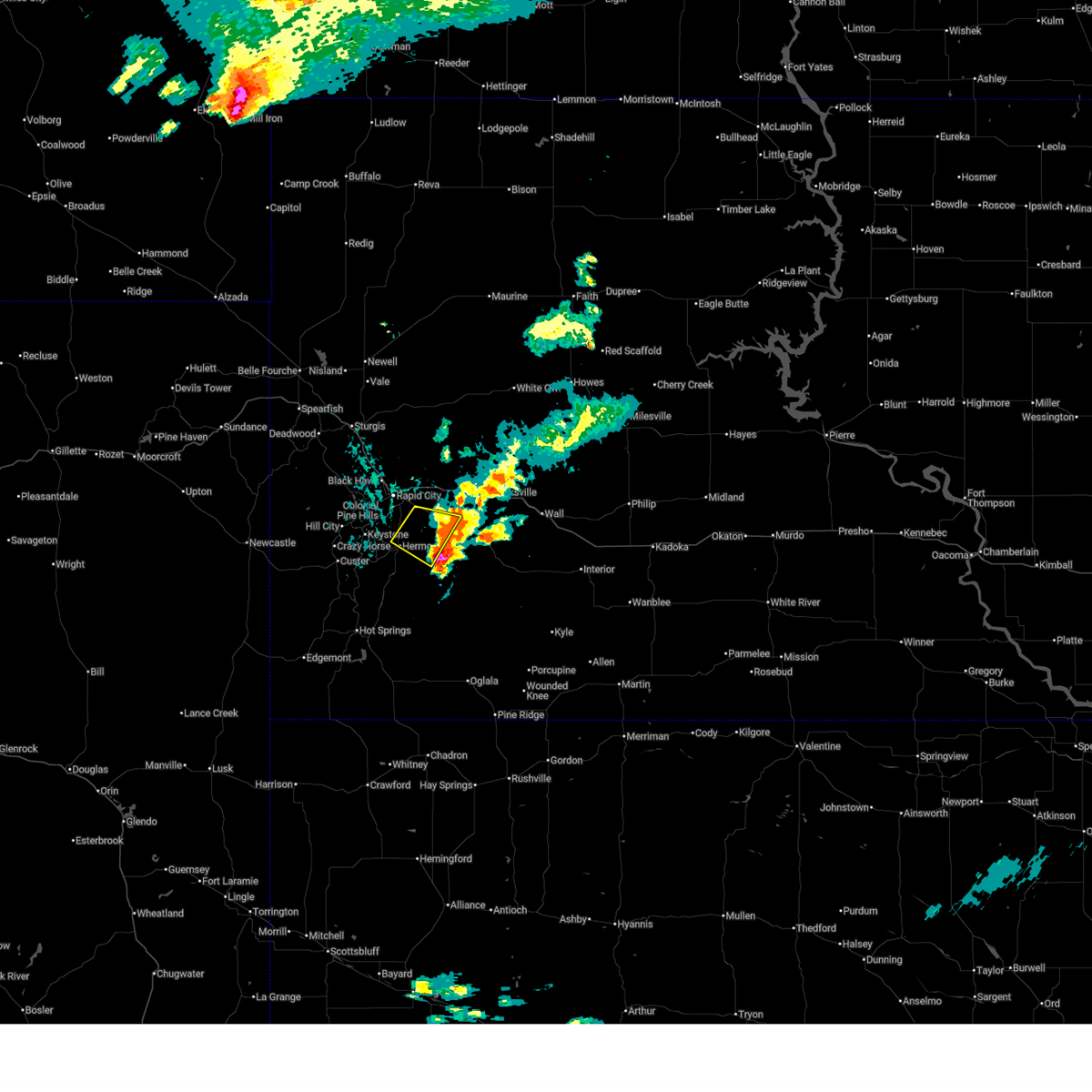
| 6/26/2026 7:43 PM MDT |
 Svrunr the national weather service in rapid city has issued a * severe thunderstorm warning for, north central custer county in southwestern south dakota, southwestern pennington county in west central south dakota, * until 815 pm mdt. * at 743 pm mdt, a severe thunderstorm was located near hill city, moving east at 30 mph (radar indicated). Hazards include 60 mph wind gusts and quarter size hail. Hail damage to vehicles is expected. expect wind damage to roofs, siding, and trees. this severe thunderstorm will be near, medicine mountain, custer state park, sylvan lake and crazy horse memorial around 745 pm mdt. hill city, palmer gulch resort and black elk peak around 750 pm mdt. horse thief lake and mount rushmore national memorial around 755 pm mdt. Sheridan lake, keystone wye and keystone around 800 pm mdt. Svrunr the national weather service in rapid city has issued a * severe thunderstorm warning for, north central custer county in southwestern south dakota, southwestern pennington county in west central south dakota, * until 815 pm mdt. * at 743 pm mdt, a severe thunderstorm was located near hill city, moving east at 30 mph (radar indicated). Hazards include 60 mph wind gusts and quarter size hail. Hail damage to vehicles is expected. expect wind damage to roofs, siding, and trees. this severe thunderstorm will be near, medicine mountain, custer state park, sylvan lake and crazy horse memorial around 745 pm mdt. hill city, palmer gulch resort and black elk peak around 750 pm mdt. horse thief lake and mount rushmore national memorial around 755 pm mdt. Sheridan lake, keystone wye and keystone around 800 pm mdt.
|
| 6/22/2026 6:15 PM MDT | Quarter sized hail reported 1 miles N of Rapid City, SD, mping report. |
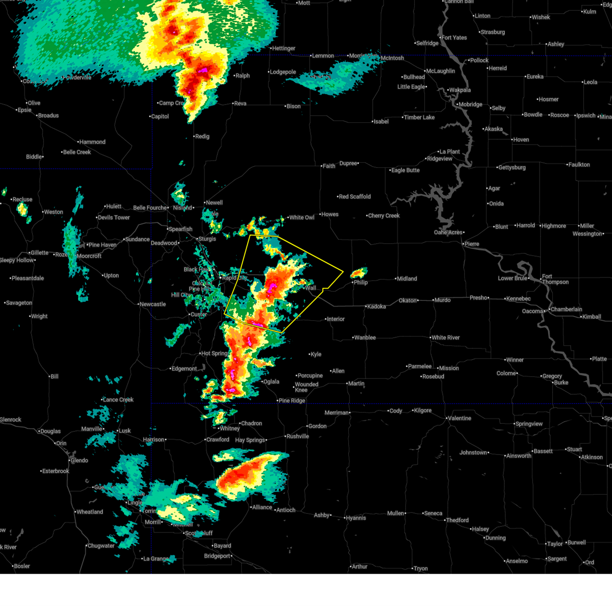
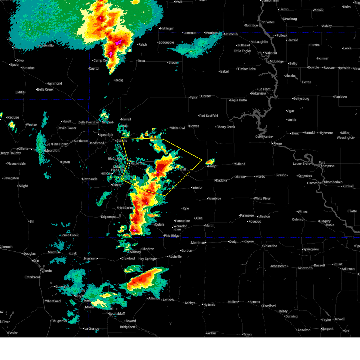
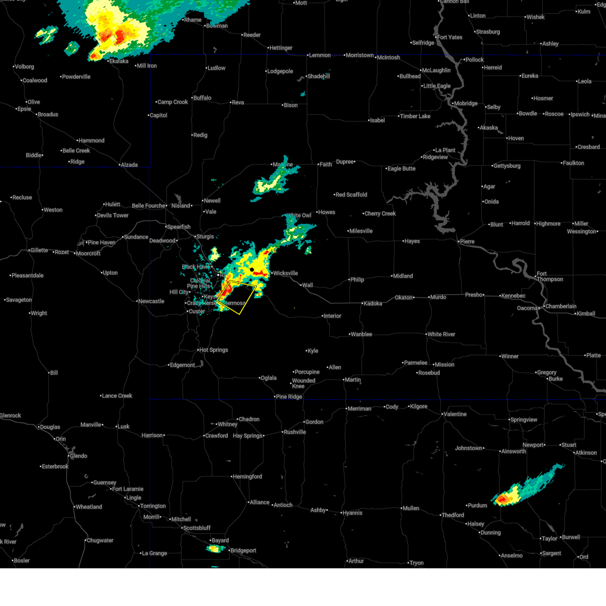
| 6/22/2026 6:08 PM MDT |
 At 608 pm mdt, a severe thunderstorm was located near rapid valley, or near rapid city, moving southeast at 25 mph (radar indicated). Hazards include quarter size hail. Damage to vehicles is expected. Locations impacted include, rapid city, rapid valley, black gap and rapid city airport. At 608 pm mdt, a severe thunderstorm was located near rapid valley, or near rapid city, moving southeast at 25 mph (radar indicated). Hazards include quarter size hail. Damage to vehicles is expected. Locations impacted include, rapid city, rapid valley, black gap and rapid city airport.
|
| 6/22/2026 5:59 PM MDT | Quarter sized hail reported 0.3 miles SSE of Rapid City, SD, at nws rapid city office. |
| 6/22/2026 5:59 PM MDT | Golf Ball sized hail reported 4.1 miles E of Rapid City, SD |
| 6/22/2026 5:58 PM MDT | Quarter sized hail reported 1.5 miles SE of Rapid City, SD, several social media reports and photos of hail as large as nickels and quarters across rapid city. time estimated. |
| 6/22/2026 5:58 PM MDT | Quarter sized hail reported 2.1 miles E of Rapid City, SD, between skyline dr and the mountain view cemetary area. some stones still quarter size an hour after the storm. time estimated. |
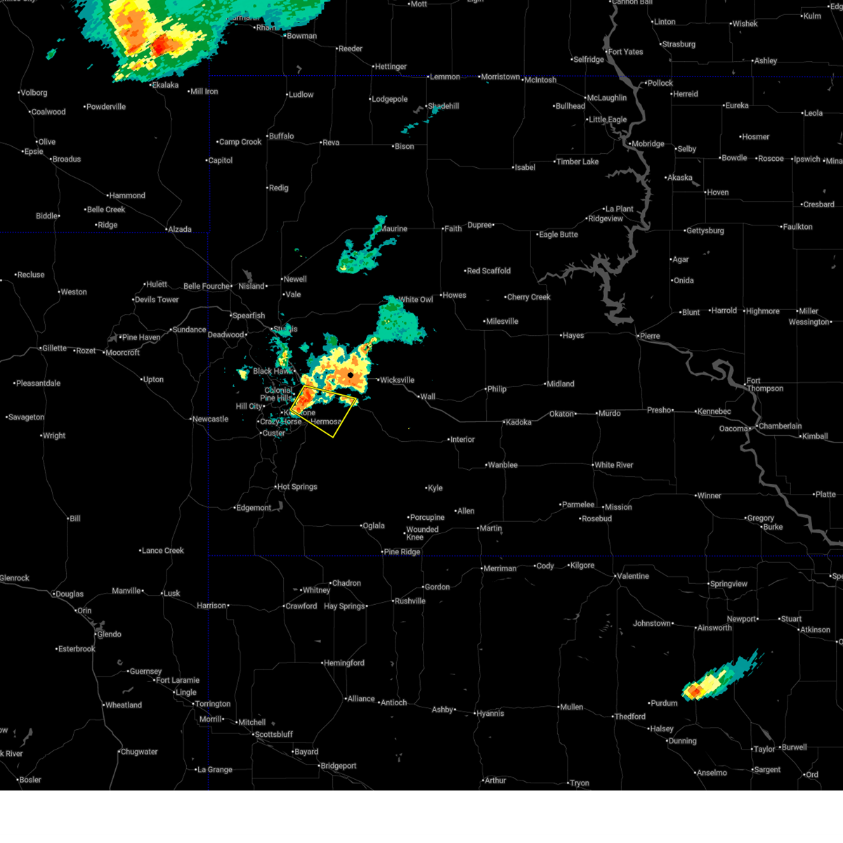
| 6/22/2026 5:58 PM MDT |
 At 558 pm mdt, a severe thunderstorm was located over rapid city, moving southeast at 25 mph (radar indicated). Hazards include golf ball size hail. People and animals outdoors will be injured. expect damage to roofs, siding, windows, and vehicles. locations impacted include, rapid city, rapid valley, southwestern box elder, black gap, hart ranch, rapid city airport, reptile gardens and bear country. This includes interstate 90 in south dakota between mile markers 55 and 64. At 558 pm mdt, a severe thunderstorm was located over rapid city, moving southeast at 25 mph (radar indicated). Hazards include golf ball size hail. People and animals outdoors will be injured. expect damage to roofs, siding, windows, and vehicles. locations impacted include, rapid city, rapid valley, southwestern box elder, black gap, hart ranch, rapid city airport, reptile gardens and bear country. This includes interstate 90 in south dakota between mile markers 55 and 64.
|
| 6/22/2026 5:56 PM MDT | Quarter sized hail reported 3.6 miles E of Rapid City, SD, hail of at least quarter size covered the ground near dew drop laundromat. photos and videos recieved via social media. time estimated based on radar. |
| 6/22/2026 5:52 PM MDT | Golf Ball sized hail reported 3.1 miles E of Rapid City, SD |
| 6/22/2026 5:49 PM MDT |
 Svrunr the national weather service in rapid city has issued a * severe thunderstorm warning for, central pennington county in west central south dakota, * until 645 pm mdt. * at 549 pm mdt, a severe thunderstorm was located over black hawk, or 5 miles northwest of rapid city, moving southeast at 20 mph (radar indicated). Hazards include ping pong ball size hail. People and animals outdoors will be injured. Expect damage to roofs, siding, windows, and vehicles. Svrunr the national weather service in rapid city has issued a * severe thunderstorm warning for, central pennington county in west central south dakota, * until 645 pm mdt. * at 549 pm mdt, a severe thunderstorm was located over black hawk, or 5 miles northwest of rapid city, moving southeast at 20 mph (radar indicated). Hazards include ping pong ball size hail. People and animals outdoors will be injured. Expect damage to roofs, siding, windows, and vehicles.
|
| 6/22/2026 5:15 PM MDT |
 At 515 pm mdt, a severe thunderstorm was located near nemo, or 12 miles south of sturgis, moving southeast at 25 mph. this storm has a history of producing large quantities of hail, resulting in hazard driving conditions (radar indicated). Hazards include ping pong ball size hail. People and animals outdoors will be injured. expect damage to roofs, siding, windows, and vehicles. locations impacted include, summerset, black hawk, nemo, piedmont and dalton lake. This includes interstate 90 in south dakota between mile markers 44 and 53. At 515 pm mdt, a severe thunderstorm was located near nemo, or 12 miles south of sturgis, moving southeast at 25 mph. this storm has a history of producing large quantities of hail, resulting in hazard driving conditions (radar indicated). Hazards include ping pong ball size hail. People and animals outdoors will be injured. expect damage to roofs, siding, windows, and vehicles. locations impacted include, summerset, black hawk, nemo, piedmont and dalton lake. This includes interstate 90 in south dakota between mile markers 44 and 53.
|
| 6/22/2026 5:01 PM MDT |
 At 501 pm mdt, a severe thunderstorm was located near nemo, or 12 miles south of sturgis, moving southeast at 25 mph. accumulating hail is possible with this storm as well (radar indicated). Hazards include half dollar size hail. Damage to vehicles is expected. locations impacted include, summerset, black hawk, nemo, piedmont, brownsville and dalton lake. This includes interstate 90 in south dakota between mile markers 42 and 53. At 501 pm mdt, a severe thunderstorm was located near nemo, or 12 miles south of sturgis, moving southeast at 25 mph. accumulating hail is possible with this storm as well (radar indicated). Hazards include half dollar size hail. Damage to vehicles is expected. locations impacted include, summerset, black hawk, nemo, piedmont, brownsville and dalton lake. This includes interstate 90 in south dakota between mile markers 42 and 53.
|
| 6/22/2026 4:50 PM MDT |
 At 450 pm mdt, a severe thunderstorm was located near galena, or 8 miles southeast of lead, moving southeast at 20 mph (radar indicated). Hazards include golf ball size hail. People and animals outdoors will be injured. expect damage to roofs, siding, windows, and vehicles. locations impacted include, summerset, black hawk, nemo, piedmont, tilford, galena, brownsville and dalton lake. This includes interstate 90 in south dakota between mile markers 38 and 53. At 450 pm mdt, a severe thunderstorm was located near galena, or 8 miles southeast of lead, moving southeast at 20 mph (radar indicated). Hazards include golf ball size hail. People and animals outdoors will be injured. expect damage to roofs, siding, windows, and vehicles. locations impacted include, summerset, black hawk, nemo, piedmont, tilford, galena, brownsville and dalton lake. This includes interstate 90 in south dakota between mile markers 38 and 53.
|
| 6/22/2026 4:39 PM MDT |
 Svrunr the national weather service in rapid city has issued a * severe thunderstorm warning for, southeastern lawrence county in west central south dakota, southwestern meade county in west central south dakota, central pennington county in west central south dakota, * until 545 pm mdt. * at 439 pm mdt, a severe thunderstorm was located over galena, or near lead, moving east at 20 mph (radar indicated). Hazards include half dollar size hail. damage to vehicles is expected Svrunr the national weather service in rapid city has issued a * severe thunderstorm warning for, southeastern lawrence county in west central south dakota, southwestern meade county in west central south dakota, central pennington county in west central south dakota, * until 545 pm mdt. * at 439 pm mdt, a severe thunderstorm was located over galena, or near lead, moving east at 20 mph (radar indicated). Hazards include half dollar size hail. damage to vehicles is expected
|
| 6/4/2026 6:17 PM MDT |
 At 617 pm mdt, severe thunderstorms were located along a line extending from 4 miles north of ellsworth air force base to box elder to near reptile gardens, moving east at 40 mph (radar indicated). Hazards include 60 mph wind gusts and quarter size hail. Hail damage to vehicles is expected. expect wind damage to roofs, siding, and trees. locations impacted include, eastern rapid city, rapid valley, ellsworth air force base, box elder, new underwood, elm springs, caputa, farmingdale, curlew lake, rapid city airport, hart ranch, black gap, and viewfield. This includes interstate 90 in south dakota between mile markers 58 and 91. At 617 pm mdt, severe thunderstorms were located along a line extending from 4 miles north of ellsworth air force base to box elder to near reptile gardens, moving east at 40 mph (radar indicated). Hazards include 60 mph wind gusts and quarter size hail. Hail damage to vehicles is expected. expect wind damage to roofs, siding, and trees. locations impacted include, eastern rapid city, rapid valley, ellsworth air force base, box elder, new underwood, elm springs, caputa, farmingdale, curlew lake, rapid city airport, hart ranch, black gap, and viewfield. This includes interstate 90 in south dakota between mile markers 58 and 91.
|
| 6/4/2026 5:59 PM MDT |
 Svrunr the national weather service in rapid city has issued a * severe thunderstorm warning for, southwestern meade county in west central south dakota, southeastern lawrence county in west central south dakota, central pennington county in west central south dakota, * until 700 pm mdt. * at 559 pm mdt, severe thunderstorms were located along a line extending from near summerset to 2 miles east of hisega to 2 miles northeast of palmer gulch resort, moving east at 40 mph (radar indicated). Hazards include 60 mph wind gusts and quarter size hail. Hail damage to vehicles is expected. Expect wind damage to roofs, siding, and trees. Svrunr the national weather service in rapid city has issued a * severe thunderstorm warning for, southwestern meade county in west central south dakota, southeastern lawrence county in west central south dakota, central pennington county in west central south dakota, * until 700 pm mdt. * at 559 pm mdt, severe thunderstorms were located along a line extending from near summerset to 2 miles east of hisega to 2 miles northeast of palmer gulch resort, moving east at 40 mph (radar indicated). Hazards include 60 mph wind gusts and quarter size hail. Hail damage to vehicles is expected. Expect wind damage to roofs, siding, and trees.
|
| 9/10/2025 11:40 PM MDT | Wind gust from decaying thunderstorm. red rocks mesonet station 028b in pennington county SD, 5.2 miles ENE of Rapid City, SD |
| 9/10/2025 11:40 PM MDT | Wind gust from decaying thunderstor in pennington county SD, 3.5 miles NNE of Rapid City, SD |
| 8/18/2025 3:46 PM MDT |
 At 345 pm mdt, a severe thunderstorm was located over hart ranch, or 8 miles south of rapid city, moving southeast at 15 mph (public). Hazards include golf ball size hail and 60 mph wind gusts. People and animals outdoors will be injured. expect hail damage to roofs, siding, windows, and vehicles. expect wind damage to roofs, siding, and trees. Locations impacted include, southeastern rapid city, hermosa, black gap, and thompson butte. At 345 pm mdt, a severe thunderstorm was located over hart ranch, or 8 miles south of rapid city, moving southeast at 15 mph (public). Hazards include golf ball size hail and 60 mph wind gusts. People and animals outdoors will be injured. expect hail damage to roofs, siding, windows, and vehicles. expect wind damage to roofs, siding, and trees. Locations impacted include, southeastern rapid city, hermosa, black gap, and thompson butte.
|
| 8/18/2025 3:44 PM MDT |
 At 343 pm mdt, a severe thunderstorm was located near hart ranch, or 7 miles south of rapid city, moving southeast at 15 mph. hail up to golf ball size was recently reported northeast of rockerville (public). Hazards include golf ball size hail and 60 mph wind gusts. People and animals outdoors will be injured. expect hail damage to roofs, siding, windows, and vehicles. expect wind damage to roofs, siding, and trees. Locations impacted include, hart ranch. At 343 pm mdt, a severe thunderstorm was located near hart ranch, or 7 miles south of rapid city, moving southeast at 15 mph. hail up to golf ball size was recently reported northeast of rockerville (public). Hazards include golf ball size hail and 60 mph wind gusts. People and animals outdoors will be injured. expect hail damage to roofs, siding, windows, and vehicles. expect wind damage to roofs, siding, and trees. Locations impacted include, hart ranch.
|
| 8/18/2025 3:37 PM MDT | Quarter sized hail reported 3.5 miles NNE of Rapid City, SD, mping report |
| 8/18/2025 3:35 PM MDT |
 Svrunr the national weather service in rapid city has issued a * severe thunderstorm warning for, north central custer county in southwestern south dakota, south central pennington county in west central south dakota, * until 430 pm mdt. * at 334 pm mdt, a severe thunderstorm was located over bear country, or 6 miles south of rapid city, moving southeast at 15 mph. this is a destructive storm for hart ranch and black gap (radar indicated). Hazards include baseball size hail. People and animals outdoors will be severely injured. Expect shattered windows, extensive damage to roofs, siding, and vehicles. Svrunr the national weather service in rapid city has issued a * severe thunderstorm warning for, north central custer county in southwestern south dakota, south central pennington county in west central south dakota, * until 430 pm mdt. * at 334 pm mdt, a severe thunderstorm was located over bear country, or 6 miles south of rapid city, moving southeast at 15 mph. this is a destructive storm for hart ranch and black gap (radar indicated). Hazards include baseball size hail. People and animals outdoors will be severely injured. Expect shattered windows, extensive damage to roofs, siding, and vehicles.
|
| 8/18/2025 3:30 PM MDT |
 At 328 pm mdt, a severe thunderstorm was located over bear country, or 6 miles southwest of rapid city, moving southeast at 15 mph. we have received several reports of hail of at least tennis ball size with this storm, with some hail larger than three inches in diameter. this is a destructive storm for bear country, rockerville, colonial pine hills, and far southwestern rapid city (public). Hazards include three inch hail. People and animals outdoors will be severely injured. expect shattered windows, extensive damage to roofs, siding, and vehicles. Locations impacted include, southwestern rapid city, rockerville, bear country, hart ranch, and reptile gardens. At 328 pm mdt, a severe thunderstorm was located over bear country, or 6 miles southwest of rapid city, moving southeast at 15 mph. we have received several reports of hail of at least tennis ball size with this storm, with some hail larger than three inches in diameter. this is a destructive storm for bear country, rockerville, colonial pine hills, and far southwestern rapid city (public). Hazards include three inch hail. People and animals outdoors will be severely injured. expect shattered windows, extensive damage to roofs, siding, and vehicles. Locations impacted include, southwestern rapid city, rockerville, bear country, hart ranch, and reptile gardens.
|
| 8/18/2025 3:27 PM MDT | Quarter sized hail reported 5.1 miles NE of Rapid City, SD, mping report |
| 8/18/2025 3:20 PM MDT |
 At 318 pm mdt, a severe thunderstorm was located near hisega, or 7 miles southwest of rapid city, moving southeast at 15 mph. hail of tennis ball to at least baseball size was observed from pactola reservoir to hisega. this is a destructive storm for rockerville, colonial pine hills, bear country, and far southwestern rapid city (public). Hazards include baseball size hail. People and animals outdoors will be severely injured. expect shattered windows, extensive damage to roofs, siding, and vehicles. Locations impacted include, southwestern rapid city, keystone, hisega, rockerville, bear country, hart ranch, reptile gardens, and sheridan lake. At 318 pm mdt, a severe thunderstorm was located near hisega, or 7 miles southwest of rapid city, moving southeast at 15 mph. hail of tennis ball to at least baseball size was observed from pactola reservoir to hisega. this is a destructive storm for rockerville, colonial pine hills, bear country, and far southwestern rapid city (public). Hazards include baseball size hail. People and animals outdoors will be severely injured. expect shattered windows, extensive damage to roofs, siding, and vehicles. Locations impacted include, southwestern rapid city, keystone, hisega, rockerville, bear country, hart ranch, reptile gardens, and sheridan lake.
|
| 8/18/2025 3:10 PM MDT | Tennis Ball sized hail reported 9.5 miles E of Rapid City, SD, rear window of vehicle has several holes in it. |
| 8/18/2025 3:10 PM MDT |
 At 308 pm mdt, a severe thunderstorm was located over hisega, or 9 miles west of rapid city, moving southeast at 15 mph. golf ball to baseball sized hail was recently reported in hisega, johnson siding, and near pactola reservoir. this is a destructive storm for rockerville and southwestern rapid city (public). Hazards include baseball size hail. People and animals outdoors will be severely injured. expect shattered windows, extensive damage to roofs, siding, and vehicles. Locations impacted include, southwestern rapid city, johnson siding, keystone, hisega, rockerville, mount rushmore national memorial, sheridan lake, bear country, keystone wye, hart ranch, and reptile gardens. At 308 pm mdt, a severe thunderstorm was located over hisega, or 9 miles west of rapid city, moving southeast at 15 mph. golf ball to baseball sized hail was recently reported in hisega, johnson siding, and near pactola reservoir. this is a destructive storm for rockerville and southwestern rapid city (public). Hazards include baseball size hail. People and animals outdoors will be severely injured. expect shattered windows, extensive damage to roofs, siding, and vehicles. Locations impacted include, southwestern rapid city, johnson siding, keystone, hisega, rockerville, mount rushmore national memorial, sheridan lake, bear country, keystone wye, hart ranch, and reptile gardens.
|
| 8/18/2025 3:00 PM MDT | Ping Pong Ball sized hail reported 11.6 miles E of Rapid City, SD, mping report |
| 8/18/2025 2:55 PM MDT | Tea Cup sized hail reported 13.5 miles E of Rapid City, SD |
| 8/18/2025 2:55 PM MDT |
 Svrunr the national weather service in rapid city has issued a * severe thunderstorm warning for, south central pennington county in west central south dakota, * until 400 pm mdt. * at 254 pm mdt, a severe thunderstorm was located over pactola reservoir, or 10 miles northeast of hill city, moving southeast at 15 mph. hail of two to three inches in diameter was recently reported at whispering pines campground near silver city. this is a destructive storm for johnson siding and hisega (trained weather spotters). Hazards include baseball size hail and 60 mph wind gusts. People and animals outdoors will be severely injured. Expect shattered windows, extensive damage to roofs, siding, and vehicles. Svrunr the national weather service in rapid city has issued a * severe thunderstorm warning for, south central pennington county in west central south dakota, * until 400 pm mdt. * at 254 pm mdt, a severe thunderstorm was located over pactola reservoir, or 10 miles northeast of hill city, moving southeast at 15 mph. hail of two to three inches in diameter was recently reported at whispering pines campground near silver city. this is a destructive storm for johnson siding and hisega (trained weather spotters). Hazards include baseball size hail and 60 mph wind gusts. People and animals outdoors will be severely injured. Expect shattered windows, extensive damage to roofs, siding, and vehicles.
|
| 8/18/2025 2:40 PM MDT | Tea Cup sized hail reported 16.3 miles E of Rapid City, SD, measured 2 to 3 inch hail stones. |
| 8/18/2025 2:40 PM MDT |
 At 240 pm mdt, a severe thunderstorm was located near pactola reservoir, or 12 miles north of hill city, moving south at 15 mph (radar indicated). Hazards include ping pong ball size hail and 60 mph wind gusts. People and animals outdoors will be injured. expect hail damage to roofs, siding, windows, and vehicles. expect wind damage to roofs, siding, and trees. Locations impacted include, johnson siding, silver city, hisega, pactola reservoir, and sheridan lake. At 240 pm mdt, a severe thunderstorm was located near pactola reservoir, or 12 miles north of hill city, moving south at 15 mph (radar indicated). Hazards include ping pong ball size hail and 60 mph wind gusts. People and animals outdoors will be injured. expect hail damage to roofs, siding, windows, and vehicles. expect wind damage to roofs, siding, and trees. Locations impacted include, johnson siding, silver city, hisega, pactola reservoir, and sheridan lake.
|
| 8/18/2025 2:27 PM MDT |
 At 227 pm mdt, a severe thunderstorm was located 3 miles southwest of nemo, or 15 miles north of hill city, moving southeast at 20 mph. a trained spotter recently reported quarter sized hail 1 mile north- northwest of nemo (trained weather spotters). Hazards include 60 mph wind gusts and quarter size hail. Hail damage to vehicles is expected. expect wind damage to roofs, siding, and trees. Locations impacted include, black hawk, johnson siding, nemo, silver city, hisega, pactola reservoir, and sheridan lake. At 227 pm mdt, a severe thunderstorm was located 3 miles southwest of nemo, or 15 miles north of hill city, moving southeast at 20 mph. a trained spotter recently reported quarter sized hail 1 mile north- northwest of nemo (trained weather spotters). Hazards include 60 mph wind gusts and quarter size hail. Hail damage to vehicles is expected. expect wind damage to roofs, siding, and trees. Locations impacted include, black hawk, johnson siding, nemo, silver city, hisega, pactola reservoir, and sheridan lake.
|
| 8/18/2025 2:18 PM MDT |
 At 217 pm mdt, a severe thunderstorm was located near nemo, or 15 miles southeast of lead, moving south at 15 mph (radar indicated). Hazards include ping pong ball size hail and 60 mph wind gusts. People and animals outdoors will be injured. expect hail damage to roofs, siding, windows, and vehicles. expect wind damage to roofs, siding, and trees. Locations impacted include, black hawk, johnson siding, nemo, silver city, hisega, pactola reservoir, dalton lake, and sheridan lake. At 217 pm mdt, a severe thunderstorm was located near nemo, or 15 miles southeast of lead, moving south at 15 mph (radar indicated). Hazards include ping pong ball size hail and 60 mph wind gusts. People and animals outdoors will be injured. expect hail damage to roofs, siding, windows, and vehicles. expect wind damage to roofs, siding, and trees. Locations impacted include, black hawk, johnson siding, nemo, silver city, hisega, pactola reservoir, dalton lake, and sheridan lake.
|
| 8/18/2025 2:04 PM MDT |
 Svrunr the national weather service in rapid city has issued a * severe thunderstorm warning for, southwestern meade county in west central south dakota, southeastern lawrence county in west central south dakota, west central pennington county in west central south dakota, * until 300 pm mdt. * at 203 pm mdt, a severe thunderstorm was located 3 miles northwest of nemo, or 13 miles south of sturgis, moving southeast at 15 mph (radar indicated). Hazards include ping pong ball size hail and 60 mph wind gusts. People and animals outdoors will be injured. expect hail damage to roofs, siding, windows, and vehicles. Expect wind damage to roofs, siding, and trees. Svrunr the national weather service in rapid city has issued a * severe thunderstorm warning for, southwestern meade county in west central south dakota, southeastern lawrence county in west central south dakota, west central pennington county in west central south dakota, * until 300 pm mdt. * at 203 pm mdt, a severe thunderstorm was located 3 miles northwest of nemo, or 13 miles south of sturgis, moving southeast at 15 mph (radar indicated). Hazards include ping pong ball size hail and 60 mph wind gusts. People and animals outdoors will be injured. expect hail damage to roofs, siding, windows, and vehicles. Expect wind damage to roofs, siding, and trees.
|
| 8/13/2025 5:18 PM MDT |
 At 517 pm mdt, severe thunderstorms were located along a line extending from 2 miles northeast of union center to 5 miles east of curlew lake to railroad buttes, moving east at 40 mph (radar indicated). Hazards include 60 to 70 mph wind gusts. Expect damage to roofs, siding, and trees. locations impacted include, rapid valley, ellsworth air force base, box elder, new underwood, union center, enning, owanka, elm springs, caputa, farmingdale, wicksville, hereford, curlew lake, rapid city airport, thompson butte, railroad buttes, and viewfield. This includes interstate 90 in south dakota between mile markers 62 and 92. At 517 pm mdt, severe thunderstorms were located along a line extending from 2 miles northeast of union center to 5 miles east of curlew lake to railroad buttes, moving east at 40 mph (radar indicated). Hazards include 60 to 70 mph wind gusts. Expect damage to roofs, siding, and trees. locations impacted include, rapid valley, ellsworth air force base, box elder, new underwood, union center, enning, owanka, elm springs, caputa, farmingdale, wicksville, hereford, curlew lake, rapid city airport, thompson butte, railroad buttes, and viewfield. This includes interstate 90 in south dakota between mile markers 62 and 92.
|
| 8/13/2025 4:26 PM MDT |
 Svrunr the national weather service in rapid city has issued a * severe thunderstorm warning for, southwestern meade county in west central south dakota, south central pennington county in west central south dakota, * until 530 pm mdt. * at 426 pm mdt, severe thunderstorms were located along a line extending from 3 miles west of vale to 2 miles northeast of dalton lake to near sylvan lake, moving east at 50 mph (radar indicated). Hazards include 60 mph wind gusts. expect damage to roofs, siding, and trees Svrunr the national weather service in rapid city has issued a * severe thunderstorm warning for, southwestern meade county in west central south dakota, south central pennington county in west central south dakota, * until 530 pm mdt. * at 426 pm mdt, severe thunderstorms were located along a line extending from 3 miles west of vale to 2 miles northeast of dalton lake to near sylvan lake, moving east at 50 mph (radar indicated). Hazards include 60 mph wind gusts. expect damage to roofs, siding, and trees
|
| 7/23/2025 1:26 AM MDT |
 The storms which prompted the warning have weakened below severe limits and no longer pose an immediate threat to life or property. therefore, the warning will be allowed to expire. however, small hail, gusty winds, and torrential rain are still possible with these thunderstorms. The storms which prompted the warning have weakened below severe limits and no longer pose an immediate threat to life or property. therefore, the warning will be allowed to expire. however, small hail, gusty winds, and torrential rain are still possible with these thunderstorms.
|
| 7/23/2025 1:13 AM MDT |
 At 112 am mdt, severe thunderstorms were located along a line extending from near nemo to 3 miles southwest of black hawk to bear country, moving northeast at 25 mph (radar indicated). Hazards include 60 mph wind gusts. Expect damage to roofs, siding, and trees. locations impacted include, rapid city, rapid valley, black hawk, summerset, johnson siding, nemo, piedmont, silver city, hisega, caputa, rockerville, pactola reservoir, dalton lake, rapid city airport, bear country, hart ranch, sheridan lake, black gap, and reptile gardens. this includes interstate 90 in south dakota between mile markers 44 and 63. Higher elevations of the black hills and foothills are most likely to experience severe winds. At 112 am mdt, severe thunderstorms were located along a line extending from near nemo to 3 miles southwest of black hawk to bear country, moving northeast at 25 mph (radar indicated). Hazards include 60 mph wind gusts. Expect damage to roofs, siding, and trees. locations impacted include, rapid city, rapid valley, black hawk, summerset, johnson siding, nemo, piedmont, silver city, hisega, caputa, rockerville, pactola reservoir, dalton lake, rapid city airport, bear country, hart ranch, sheridan lake, black gap, and reptile gardens. this includes interstate 90 in south dakota between mile markers 44 and 63. Higher elevations of the black hills and foothills are most likely to experience severe winds.
|
| 7/23/2025 1:13 AM MDT |
 the severe thunderstorm warning has been cancelled and is no longer in effect the severe thunderstorm warning has been cancelled and is no longer in effect
|
| 7/23/2025 12:48 AM MDT |
 At 1248 am mdt, severe thunderstorms were located along a line extending from 2 miles northeast of deerfield reservoir to 4 miles northwest of hill city to near sylvan lake, moving northeast at 35 mph (radar indicated). Hazards include 60 mph wind gusts. Expect damage to roofs, siding, and trees. locations impacted include, rapid city, hill city, rapid valley, summerset, black hawk, johnson siding, nemo, keystone, piedmont, hisega, silver city, rochford, flag mountain, mystic, caputa, rockerville, deerfield, deerfield reservoir, pactola reservoir, and mount rushmore national memorial. this includes interstate 90 in south dakota between mile markers 44 and 63. Higher elevations of the black hills are most likely to experience wind gusts around 60 mph. At 1248 am mdt, severe thunderstorms were located along a line extending from 2 miles northeast of deerfield reservoir to 4 miles northwest of hill city to near sylvan lake, moving northeast at 35 mph (radar indicated). Hazards include 60 mph wind gusts. Expect damage to roofs, siding, and trees. locations impacted include, rapid city, hill city, rapid valley, summerset, black hawk, johnson siding, nemo, keystone, piedmont, hisega, silver city, rochford, flag mountain, mystic, caputa, rockerville, deerfield, deerfield reservoir, pactola reservoir, and mount rushmore national memorial. this includes interstate 90 in south dakota between mile markers 44 and 63. Higher elevations of the black hills are most likely to experience wind gusts around 60 mph.
|
| 7/23/2025 12:39 AM MDT |
 At 1239 am mdt, severe thunderstorms were located along a line extending from near deerfield to near medicine mountain to near crazy horse memorial, moving east at 35 mph (radar indicated). Hazards include 60 mph wind gusts. Expect damage to roofs, siding, and trees. locations impacted include, rapid city, hill city, rapid valley, summerset, black hawk, johnson siding, nemo, keystone, piedmont, hisega, silver city, rochford, flag mountain, mystic, moon, caputa, rockerville, deerfield, deerfield reservoir, and pactola reservoir. This includes interstate 90 in south dakota between mile markers 44 and 63. At 1239 am mdt, severe thunderstorms were located along a line extending from near deerfield to near medicine mountain to near crazy horse memorial, moving east at 35 mph (radar indicated). Hazards include 60 mph wind gusts. Expect damage to roofs, siding, and trees. locations impacted include, rapid city, hill city, rapid valley, summerset, black hawk, johnson siding, nemo, keystone, piedmont, hisega, silver city, rochford, flag mountain, mystic, moon, caputa, rockerville, deerfield, deerfield reservoir, and pactola reservoir. This includes interstate 90 in south dakota between mile markers 44 and 63.
|
| 7/23/2025 12:25 AM MDT |
 Svrunr the national weather service in rapid city has issued a * severe thunderstorm warning for, southwestern meade county in west central south dakota, northwestern custer county in southwestern south dakota, southeastern lawrence county in west central south dakota, southwestern pennington county in west central south dakota, * until 130 am mdt. * at 1225 am mdt, severe thunderstorms were located along a line extending from near moon to 6 miles south of deerfield to 3 miles southwest of bear mountain lookout, moving northeast at 35 mph (radar indicated). Hazards include 60 mph wind gusts. expect damage to roofs, siding, and trees Svrunr the national weather service in rapid city has issued a * severe thunderstorm warning for, southwestern meade county in west central south dakota, northwestern custer county in southwestern south dakota, southeastern lawrence county in west central south dakota, southwestern pennington county in west central south dakota, * until 130 am mdt. * at 1225 am mdt, severe thunderstorms were located along a line extending from near moon to 6 miles south of deerfield to 3 miles southwest of bear mountain lookout, moving northeast at 35 mph (radar indicated). Hazards include 60 mph wind gusts. expect damage to roofs, siding, and trees
|
| 7/20/2025 2:09 PM MDT |
 the severe thunderstorm warning has been cancelled and is no longer in effect the severe thunderstorm warning has been cancelled and is no longer in effect
|
| 7/20/2025 1:51 PM MDT |
 Svrunr the national weather service in rapid city has issued a * severe thunderstorm warning for, central pennington county in west central south dakota, * until 245 pm mdt. * at 151 pm mdt, a severe thunderstorm was located near rockerville, or 7 miles southwest of rapid city, moving east at 20 mph (radar indicated). Hazards include quarter size hail. damage to vehicles is expected Svrunr the national weather service in rapid city has issued a * severe thunderstorm warning for, central pennington county in west central south dakota, * until 245 pm mdt. * at 151 pm mdt, a severe thunderstorm was located near rockerville, or 7 miles southwest of rapid city, moving east at 20 mph (radar indicated). Hazards include quarter size hail. damage to vehicles is expected
|
| 7/19/2025 9:21 PM MDT |
 The storm which prompted the warning has moved out of the area. therefore, the warning will be allowed to expire. a severe thunderstorm watch remains in effect until midnight mdt for southwestern and west central south dakota. remember, a severe thunderstorm warning still remains in effect for eastern custer and southern pennington counties. The storm which prompted the warning has moved out of the area. therefore, the warning will be allowed to expire. a severe thunderstorm watch remains in effect until midnight mdt for southwestern and west central south dakota. remember, a severe thunderstorm warning still remains in effect for eastern custer and southern pennington counties.
|
| 7/19/2025 8:49 PM MDT |
 At 849 pm mdt, a severe thunderstorm was located 3 miles west of thompson butte, or 13 miles southeast of rapid city, moving east at 25 mph (trained weather spotters). Hazards include 60 mph wind gusts and quarter size hail. Hail damage to vehicles is expected. expect wind damage to roofs, siding, and trees. Locations impacted include, hermosa, caputa, farmingdale, thompson butte, and rapid city airport. At 849 pm mdt, a severe thunderstorm was located 3 miles west of thompson butte, or 13 miles southeast of rapid city, moving east at 25 mph (trained weather spotters). Hazards include 60 mph wind gusts and quarter size hail. Hail damage to vehicles is expected. expect wind damage to roofs, siding, and trees. Locations impacted include, hermosa, caputa, farmingdale, thompson butte, and rapid city airport.
|
| 7/19/2025 8:36 PM MDT |
 At 836 pm mdt, a severe thunderstorm was located over black gap, or 7 miles southeast of rapid city, moving east at 25 mph (trained weather spotters). Hazards include quarter size hail. Damage to vehicles is expected. Locations impacted include, eastern rapid city, hermosa, caputa, farmingdale, hart ranch, black gap, reptile gardens, thompson butte, and rapid city airport. At 836 pm mdt, a severe thunderstorm was located over black gap, or 7 miles southeast of rapid city, moving east at 25 mph (trained weather spotters). Hazards include quarter size hail. Damage to vehicles is expected. Locations impacted include, eastern rapid city, hermosa, caputa, farmingdale, hart ranch, black gap, reptile gardens, thompson butte, and rapid city airport.
|
| 7/19/2025 8:30 PM MDT | Quarter sized hail reported 3.5 miles NNE of Rapid City, SD |
| 7/19/2025 8:26 PM MDT | Quarter sized hail reported 5.1 miles NE of Rapid City, SD |
| 7/19/2025 8:25 PM MDT | Quarter sized hail reported 7.1 miles ENE of Rapid City, SD, nickel to quarter |
| 7/19/2025 8:23 PM MDT |
 Svrunr the national weather service in rapid city has issued a * severe thunderstorm warning for, northeastern custer county in southwestern south dakota, south central pennington county in west central south dakota, * until 930 pm mdt. * at 823 pm mdt, a severe thunderstorm was located over bear country, or 6 miles southwest of rapid city, moving southeast at 25 mph (radar indicated). Hazards include half dollar size hail. damage to vehicles is expected Svrunr the national weather service in rapid city has issued a * severe thunderstorm warning for, northeastern custer county in southwestern south dakota, south central pennington county in west central south dakota, * until 930 pm mdt. * at 823 pm mdt, a severe thunderstorm was located over bear country, or 6 miles southwest of rapid city, moving southeast at 25 mph (radar indicated). Hazards include half dollar size hail. damage to vehicles is expected
|
| 7/19/2025 8:16 PM MDT |
 At 815 pm mdt, a severe thunderstorm was located near hisega, or 5 miles west of rapid city, moving east at 20 mph (radar indicated). Hazards include quarter size hail. Damage to vehicles is expected. Locations impacted include, southwestern rapid city, hisega, and bear country. At 815 pm mdt, a severe thunderstorm was located near hisega, or 5 miles west of rapid city, moving east at 20 mph (radar indicated). Hazards include quarter size hail. Damage to vehicles is expected. Locations impacted include, southwestern rapid city, hisega, and bear country.
|
| 7/19/2025 8:07 PM MDT |
 At 807 pm mdt, a severe thunderstorm was located over hisega, or 7 miles west of rapid city, moving east at 25 mph (radar indicated). Hazards include quarter size hail. Damage to vehicles is expected. locations impacted include, southwestern rapid city, black hawk, johnson siding, hisega, bear country, and reptile gardens. This includes interstate 90 in south dakota between mile markers 54 and 57. At 807 pm mdt, a severe thunderstorm was located over hisega, or 7 miles west of rapid city, moving east at 25 mph (radar indicated). Hazards include quarter size hail. Damage to vehicles is expected. locations impacted include, southwestern rapid city, black hawk, johnson siding, hisega, bear country, and reptile gardens. This includes interstate 90 in south dakota between mile markers 54 and 57.
|
| 7/19/2025 8:02 PM MDT | 69.6 mph in pennington county SD, 4.6 miles SSW of Rapid City, SD |
| 7/19/2025 8:02 PM MDT |
 Svrunr the national weather service in rapid city has issued a * severe thunderstorm warning for, south central meade county in west central south dakota, southeastern pennington county in west central south dakota, * until 900 pm mdt. * at 802 pm mdt, a severe thunderstorm was located 3 miles west of new underwood, or 17 miles east of rapid city, moving east at 25 mph (radar indicated). Hazards include 60 mph wind gusts and quarter size hail. Hail damage to vehicles is expected. Expect wind damage to roofs, siding, and trees. Svrunr the national weather service in rapid city has issued a * severe thunderstorm warning for, south central meade county in west central south dakota, southeastern pennington county in west central south dakota, * until 900 pm mdt. * at 802 pm mdt, a severe thunderstorm was located 3 miles west of new underwood, or 17 miles east of rapid city, moving east at 25 mph (radar indicated). Hazards include 60 mph wind gusts and quarter size hail. Hail damage to vehicles is expected. Expect wind damage to roofs, siding, and trees.
|
| 7/19/2025 7:55 PM MDT | Quarter sized hail reported 17 miles E of Rapid City, SD |
| 7/19/2025 7:55 PM MDT |
 At 755 pm mdt, a severe thunderstorm was located 6 miles east of box elder, or 14 miles east of rapid city, moving east at 25 mph (radar indicated). Hazards include 60 mph wind gusts and quarter size hail. Hail damage to vehicles is expected. expect wind damage to roofs, siding, and trees. locations impacted include, eastern rapid city, rapid valley, ellsworth air force base, box elder, caputa, and rapid city airport. This includes interstate 90 in south dakota between mile markers 59 and 75. At 755 pm mdt, a severe thunderstorm was located 6 miles east of box elder, or 14 miles east of rapid city, moving east at 25 mph (radar indicated). Hazards include 60 mph wind gusts and quarter size hail. Hail damage to vehicles is expected. expect wind damage to roofs, siding, and trees. locations impacted include, eastern rapid city, rapid valley, ellsworth air force base, box elder, caputa, and rapid city airport. This includes interstate 90 in south dakota between mile markers 59 and 75.
|
| 7/19/2025 7:53 PM MDT | Storm damage reported in pennington county SD, 8 miles W of Rapid City, SD |
| 7/19/2025 7:52 PM MDT |
 Svrunr the national weather service in rapid city has issued a * severe thunderstorm warning for, west central pennington county in west central south dakota, * until 830 pm mdt. * at 751 pm mdt, a severe thunderstorm was located over pactola reservoir, or 10 miles north of hill city, moving east at 25 mph (radar indicated). Hazards include ping pong ball size hail. People and animals outdoors will be injured. Expect damage to roofs, siding, windows, and vehicles. Svrunr the national weather service in rapid city has issued a * severe thunderstorm warning for, west central pennington county in west central south dakota, * until 830 pm mdt. * at 751 pm mdt, a severe thunderstorm was located over pactola reservoir, or 10 miles north of hill city, moving east at 25 mph (radar indicated). Hazards include ping pong ball size hail. People and animals outdoors will be injured. Expect damage to roofs, siding, windows, and vehicles.
|
| 7/19/2025 7:45 PM MDT | Quarter sized hail reported 4.6 miles SSE of Rapid City, SD |
| 7/19/2025 7:40 PM MDT | 3/4 inch hail in meade county SD, 6.6 miles S of Rapid City, SD |
| 7/19/2025 7:40 PM MDT |
 At 740 pm mdt, a severe thunderstorm was located over southern box elder, or 9 miles northeast of rapid city, moving east at 25 mph (radar indicated). Hazards include 60 mph wind gusts and quarter size hail. Hail damage to vehicles is expected. expect wind damage to roofs, siding, and trees. locations impacted include, rapid city, rapid valley, ellsworth air force base, box elder, black hawk, caputa, and rapid city airport. This includes interstate 90 in south dakota between mile markers 53 and 75. At 740 pm mdt, a severe thunderstorm was located over southern box elder, or 9 miles northeast of rapid city, moving east at 25 mph (radar indicated). Hazards include 60 mph wind gusts and quarter size hail. Hail damage to vehicles is expected. expect wind damage to roofs, siding, and trees. locations impacted include, rapid city, rapid valley, ellsworth air force base, box elder, black hawk, caputa, and rapid city airport. This includes interstate 90 in south dakota between mile markers 53 and 75.
|
| 7/19/2025 7:25 PM MDT |
 At 725 pm mdt, a severe thunderstorm was located 4 miles east of black hawk, or 6 miles north of rapid city, moving east at 25 mph (radar indicated). Hazards include 60 mph wind gusts and half dollar size hail. Hail damage to vehicles is expected. expect wind damage to roofs, siding, and trees. locations impacted include, rapid city, rapid valley, ellsworth air force base, box elder, summerset, black hawk, piedmont, caputa, and rapid city airport. This includes interstate 90 in south dakota between mile markers 46 and 75. At 725 pm mdt, a severe thunderstorm was located 4 miles east of black hawk, or 6 miles north of rapid city, moving east at 25 mph (radar indicated). Hazards include 60 mph wind gusts and half dollar size hail. Hail damage to vehicles is expected. expect wind damage to roofs, siding, and trees. locations impacted include, rapid city, rapid valley, ellsworth air force base, box elder, summerset, black hawk, piedmont, caputa, and rapid city airport. This includes interstate 90 in south dakota between mile markers 46 and 75.
|
| 7/19/2025 7:17 PM MDT |
 Svrunr the national weather service in rapid city has issued a * severe thunderstorm warning for, southwestern meade county in west central south dakota, central pennington county in west central south dakota, * until 815 pm mdt. * at 717 pm mdt, a severe thunderstorm was located over summerset, or 9 miles north of rapid city, moving east at 25 mph (radar indicated). Hazards include 60 mph wind gusts and quarter size hail. Hail damage to vehicles is expected. Expect wind damage to roofs, siding, and trees. Svrunr the national weather service in rapid city has issued a * severe thunderstorm warning for, southwestern meade county in west central south dakota, central pennington county in west central south dakota, * until 815 pm mdt. * at 717 pm mdt, a severe thunderstorm was located over summerset, or 9 miles north of rapid city, moving east at 25 mph (radar indicated). Hazards include 60 mph wind gusts and quarter size hail. Hail damage to vehicles is expected. Expect wind damage to roofs, siding, and trees.
|
| 7/6/2025 6:09 PM MDT |
 the severe thunderstorm warning has been cancelled and is no longer in effect the severe thunderstorm warning has been cancelled and is no longer in effect
|
| 7/6/2025 5:52 PM MDT |
 At 552 pm mdt, a severe thunderstorm was located 3 miles south of hart ranch, or 10 miles south of rapid city, moving southeast at 20 mph (radar indicated). Hazards include ping pong ball size hail and 60 mph wind gusts. People and animals outdoors will be injured. expect hail damage to roofs, siding, windows, and vehicles. expect wind damage to roofs, siding, and trees. This severe thunderstorm will remain over mainly rural areas of western pennington county, east of rockerville and north of hermosa. At 552 pm mdt, a severe thunderstorm was located 3 miles south of hart ranch, or 10 miles south of rapid city, moving southeast at 20 mph (radar indicated). Hazards include ping pong ball size hail and 60 mph wind gusts. People and animals outdoors will be injured. expect hail damage to roofs, siding, windows, and vehicles. expect wind damage to roofs, siding, and trees. This severe thunderstorm will remain over mainly rural areas of western pennington county, east of rockerville and north of hermosa.
|
| 7/6/2025 5:45 PM MDT | Quarter sized hail reported 3.5 miles NNE of Rapid City, SD |
| 7/6/2025 5:42 PM MDT | Quarter sized hail reported 5.1 miles NE of Rapid City, SD, mping report |
| 7/6/2025 5:40 PM MDT | Storm damage reported in pennington county SD, 8.9 miles NE of Rapid City, SD |
| 7/6/2025 5:40 PM MDT |
 At 540 pm mdt, a severe thunderstorm was located over bear country, or 7 miles south of rapid city, moving southeast at 15 mph (radar indicated). Hazards include ping pong ball size hail. People and animals outdoors will be injured. expect damage to roofs, siding, windows, and vehicles. This severe storm will be near, hart ranch and black gap around 545 pm mdt. At 540 pm mdt, a severe thunderstorm was located over bear country, or 7 miles south of rapid city, moving southeast at 15 mph (radar indicated). Hazards include ping pong ball size hail. People and animals outdoors will be injured. expect damage to roofs, siding, windows, and vehicles. This severe storm will be near, hart ranch and black gap around 545 pm mdt.
|
| 7/6/2025 5:36 PM MDT |
 At 536 pm mdt, a severe thunderstorm was located over bear country, or 7 miles southwest of rapid city, moving southeast at 15 mph (radar indicated). Hazards include ping pong ball size hail. People and animals outdoors will be injured. expect damage to roofs, siding, windows, and vehicles. Locations impacted include, rockerville, bear country, hart ranch, black gap, and reptile gardens. At 536 pm mdt, a severe thunderstorm was located over bear country, or 7 miles southwest of rapid city, moving southeast at 15 mph (radar indicated). Hazards include ping pong ball size hail. People and animals outdoors will be injured. expect damage to roofs, siding, windows, and vehicles. Locations impacted include, rockerville, bear country, hart ranch, black gap, and reptile gardens.
|
| 7/6/2025 5:31 PM MDT | Quarter sized hail reported 4.2 miles ENE of Rapid City, SD |
| 7/6/2025 5:30 PM MDT | Golf Ball sized hail reported 7.1 miles ENE of Rapid City, SD |
| 7/6/2025 5:30 PM MDT |
 Svrunr the national weather service in rapid city has issued a * severe thunderstorm warning for, south central pennington county in west central south dakota, * until 630 pm mdt. * at 530 pm mdt, a severe thunderstorm was located near bear country, or 5 miles southwest of rapid city, moving southeast at 15 mph (radar indicated). Hazards include quarter size hail. damage to vehicles is expected Svrunr the national weather service in rapid city has issued a * severe thunderstorm warning for, south central pennington county in west central south dakota, * until 630 pm mdt. * at 530 pm mdt, a severe thunderstorm was located near bear country, or 5 miles southwest of rapid city, moving southeast at 15 mph (radar indicated). Hazards include quarter size hail. damage to vehicles is expected
|
| 7/5/2025 9:07 PM MDT | Storm damage reported in pennington county SD, 8 miles W of Rapid City, SD |
| 7/5/2025 9:05 PM MDT |
 Svrunr the national weather service in rapid city has issued a * severe thunderstorm warning for, south central meade county in west central south dakota, northeastern custer county in southwestern south dakota, southeastern pennington county in west central south dakota, * until 1000 pm mdt. * at 905 pm mdt, severe thunderstorms were located along a line extending from 2 miles southeast of curlew lake to 2 miles east of rapid city airport, moving east at 35 mph (radar indicated). Hazards include 60 mph wind gusts. expect damage to roofs, siding, and trees Svrunr the national weather service in rapid city has issued a * severe thunderstorm warning for, south central meade county in west central south dakota, northeastern custer county in southwestern south dakota, southeastern pennington county in west central south dakota, * until 1000 pm mdt. * at 905 pm mdt, severe thunderstorms were located along a line extending from 2 miles southeast of curlew lake to 2 miles east of rapid city airport, moving east at 35 mph (radar indicated). Hazards include 60 mph wind gusts. expect damage to roofs, siding, and trees
|
| 7/1/2025 4:09 PM MDT |
 The storm which prompted the warning has weakened below severe limits, and no longer poses an immediate threat to life or property. therefore, the warning will be allowed to expire. however, small hail, gusty winds and heavy rain are still possible with this thunderstorm. a severe thunderstorm watch remains in effect until 1100 pm mdt for west central south dakota. remember, a severe thunderstorm warning still remains in effect for areas between rockerville, hart ranch, and hermosa. The storm which prompted the warning has weakened below severe limits, and no longer poses an immediate threat to life or property. therefore, the warning will be allowed to expire. however, small hail, gusty winds and heavy rain are still possible with this thunderstorm. a severe thunderstorm watch remains in effect until 1100 pm mdt for west central south dakota. remember, a severe thunderstorm warning still remains in effect for areas between rockerville, hart ranch, and hermosa.
|
| 7/1/2025 3:58 PM MDT |
 the severe thunderstorm warning has been cancelled and is no longer in effect the severe thunderstorm warning has been cancelled and is no longer in effect
|
| 7/1/2025 3:58 PM MDT |
 At 358 pm mdt, a severe thunderstorm was located over northwestern rapid city, and is nearly stationary (radar indicated). Hazards include 60 mph wind gusts and quarter size hail. Hail damage to vehicles is expected. expect wind damage to roofs, siding, and trees. locations impacted include, rapid city and rapid valley. This includes interstate 90 in south dakota between mile markers 56 and 62. At 358 pm mdt, a severe thunderstorm was located over northwestern rapid city, and is nearly stationary (radar indicated). Hazards include 60 mph wind gusts and quarter size hail. Hail damage to vehicles is expected. expect wind damage to roofs, siding, and trees. locations impacted include, rapid city and rapid valley. This includes interstate 90 in south dakota between mile markers 56 and 62.
|
| 7/1/2025 3:57 PM MDT | Quarter sized hail reported 10 miles NE of Rapid City, SD |
| 7/1/2025 3:35 PM MDT |
 At 335 pm mdt, a severe thunderstorm was located near rapid city, moving southeast at 5 mph (radar indicated). Hazards include golf ball size hail and 60 mph wind gusts. People and animals outdoors will be injured. expect hail damage to roofs, siding, windows, and vehicles. expect wind damage to roofs, siding, and trees. locations impacted include, rapid city, rapid valley, and black hawk. This includes interstate 90 in south dakota between mile markers 53 and 63. At 335 pm mdt, a severe thunderstorm was located near rapid city, moving southeast at 5 mph (radar indicated). Hazards include golf ball size hail and 60 mph wind gusts. People and animals outdoors will be injured. expect hail damage to roofs, siding, windows, and vehicles. expect wind damage to roofs, siding, and trees. locations impacted include, rapid city, rapid valley, and black hawk. This includes interstate 90 in south dakota between mile markers 53 and 63.
|
| 7/1/2025 3:32 PM MDT |
 Svrunr the national weather service in rapid city has issued a * severe thunderstorm warning for, southwestern meade county in west central south dakota, central pennington county in west central south dakota, * until 415 pm mdt. * at 332 pm mdt, a severe thunderstorm was located near rapid city, and is nearly stationary (radar indicated). Hazards include 60 mph wind gusts and half dollar size hail. Hail damage to vehicles is expected. Expect wind damage to roofs, siding, and trees. Svrunr the national weather service in rapid city has issued a * severe thunderstorm warning for, southwestern meade county in west central south dakota, central pennington county in west central south dakota, * until 415 pm mdt. * at 332 pm mdt, a severe thunderstorm was located near rapid city, and is nearly stationary (radar indicated). Hazards include 60 mph wind gusts and half dollar size hail. Hail damage to vehicles is expected. Expect wind damage to roofs, siding, and trees.
|
| 6/28/2025 5:05 PM MDT |
 Svrunr the national weather service in rapid city has issued a * severe thunderstorm warning for, southwestern meade county in west central south dakota, central pennington county in west central south dakota, * until 545 pm mdt. * at 504 pm mdt, a severe thunderstorm was located 6 miles northeast of summerset, or 11 miles north of rapid city, moving southeast at 25 mph (radar indicated). Hazards include ping pong ball size hail and 60 mph wind gusts. People and animals outdoors will be injured. expect hail damage to roofs, siding, windows, and vehicles. Expect wind damage to roofs, siding, and trees. Svrunr the national weather service in rapid city has issued a * severe thunderstorm warning for, southwestern meade county in west central south dakota, central pennington county in west central south dakota, * until 545 pm mdt. * at 504 pm mdt, a severe thunderstorm was located 6 miles northeast of summerset, or 11 miles north of rapid city, moving southeast at 25 mph (radar indicated). Hazards include ping pong ball size hail and 60 mph wind gusts. People and animals outdoors will be injured. expect hail damage to roofs, siding, windows, and vehicles. Expect wind damage to roofs, siding, and trees.
|
| 6/28/2025 4:55 PM MDT | Ping Pong Ball sized hail reported 4.6 miles SSE of Rapid City, SD |
| 6/25/2025 4:40 PM MDT | Half Dollar sized hail reported 17 miles ENE of Rapid City, SD |
| 6/25/2025 4:40 PM MDT |
 Svrunr the national weather service in rapid city has issued a * severe thunderstorm warning for, south central pennington county in west central south dakota, * until 545 pm mdt. * at 439 pm mdt, a severe thunderstorm was located near sheridan lake, or 3 miles east of hill city, moving east at 15 mph (radar indicated). Hazards include half dollar size hail. damage to vehicles is expected Svrunr the national weather service in rapid city has issued a * severe thunderstorm warning for, south central pennington county in west central south dakota, * until 545 pm mdt. * at 439 pm mdt, a severe thunderstorm was located near sheridan lake, or 3 miles east of hill city, moving east at 15 mph (radar indicated). Hazards include half dollar size hail. damage to vehicles is expected
|
| 6/16/2025 7:54 PM MDT |
 Svrunr the national weather service in rapid city has issued a * severe thunderstorm warning for, southwestern meade county in west central south dakota, eastern lawrence county in west central south dakota, west central pennington county in west central south dakota, * until 845 pm mdt. * at 754 pm mdt, a severe thunderstorm was located over nemo, or 15 miles south of sturgis, moving northeast at 25 mph (radar indicated). Hazards include 60 mph wind gusts and quarter size hail. Hail damage to vehicles is expected. expect wind damage to roofs, siding, and trees. this severe thunderstorm will be near, sturgis, black hawk, summerset, piedmont, galena, tilford, dalton lake, and fort meade around 800 pm mdt. apple springs around 805 pm mdt. bear butte state park around 810 pm mdt. This includes interstate 90 in south dakota between mile markers 25 and 55. Svrunr the national weather service in rapid city has issued a * severe thunderstorm warning for, southwestern meade county in west central south dakota, eastern lawrence county in west central south dakota, west central pennington county in west central south dakota, * until 845 pm mdt. * at 754 pm mdt, a severe thunderstorm was located over nemo, or 15 miles south of sturgis, moving northeast at 25 mph (radar indicated). Hazards include 60 mph wind gusts and quarter size hail. Hail damage to vehicles is expected. expect wind damage to roofs, siding, and trees. this severe thunderstorm will be near, sturgis, black hawk, summerset, piedmont, galena, tilford, dalton lake, and fort meade around 800 pm mdt. apple springs around 805 pm mdt. bear butte state park around 810 pm mdt. This includes interstate 90 in south dakota between mile markers 25 and 55.
|
| 6/15/2025 9:23 PM MDT |
 the severe thunderstorm warning has been cancelled and is no longer in effect the severe thunderstorm warning has been cancelled and is no longer in effect
|
| 6/15/2025 9:03 PM MDT |
 At 903 pm mdt, severe thunderstorms were located along a line extending from 2 miles southeast of viewfield to 7 miles west of owanka to 5 miles east of folsom, moving east at 30 mph (radar indicated). Hazards include 70 mph wind gusts and quarter size hail. Hail damage to vehicles is expected. expect considerable tree damage. wind damage is also likely to mobile homes, roofs, and outbuildings. locations impacted include, ellsworth air force base, box elder, new underwood, owanka, caputa, farmingdale, folsom, curlew lake, rapid city airport, viewfield, thompson butte, and railroad buttes. This includes interstate 90 in south dakota between mile markers 65 and 87. At 903 pm mdt, severe thunderstorms were located along a line extending from 2 miles southeast of viewfield to 7 miles west of owanka to 5 miles east of folsom, moving east at 30 mph (radar indicated). Hazards include 70 mph wind gusts and quarter size hail. Hail damage to vehicles is expected. expect considerable tree damage. wind damage is also likely to mobile homes, roofs, and outbuildings. locations impacted include, ellsworth air force base, box elder, new underwood, owanka, caputa, farmingdale, folsom, curlew lake, rapid city airport, viewfield, thompson butte, and railroad buttes. This includes interstate 90 in south dakota between mile markers 65 and 87.
|
| 6/15/2025 8:57 PM MDT |
 At 857 pm mdt, severe thunderstorms were located along a line extending from 3 miles southwest of viewfield to 4 miles east of farmingdale to near folsom, moving east at 35 mph (radar indicated). Hazards include 70 mph wind gusts and half dollar size hail. Hail damage to vehicles is expected. expect considerable tree damage. wind damage is also likely to mobile homes, roofs, and outbuildings. locations impacted include, new underwood, owanka, curlew lake and viewfield. This includes interstate 90 in south dakota between mile markers 54 and 87. At 857 pm mdt, severe thunderstorms were located along a line extending from 3 miles southwest of viewfield to 4 miles east of farmingdale to near folsom, moving east at 35 mph (radar indicated). Hazards include 70 mph wind gusts and half dollar size hail. Hail damage to vehicles is expected. expect considerable tree damage. wind damage is also likely to mobile homes, roofs, and outbuildings. locations impacted include, new underwood, owanka, curlew lake and viewfield. This includes interstate 90 in south dakota between mile markers 54 and 87.
|
| 6/15/2025 8:56 PM MDT | Storm damage reported in pennington county SD, 2.6 miles SW of Rapid City, SD |
| 6/15/2025 8:54 PM MDT | Storm damage reported in pennington county SD, 0.3 miles SSE of Rapid City, SD |
| 6/15/2025 8:50 PM MDT | Storm damage reported in pennington county SD, 11.3 miles WNW of Rapid City, SD |
| 6/15/2025 8:50 PM MDT | Storm damage reported in pennington county SD, 3.5 miles NNE of Rapid City, SD |
| 6/15/2025 8:43 PM MDT | Storm damage reported in pennington county SD, 8.9 miles NE of Rapid City, SD |
| 6/15/2025 8:43 PM MDT | Storm damage reported in pennington county SD, 6.2 miles NNW of Rapid City, SD |
| 6/15/2025 8:40 PM MDT | Storm damage reported in pennington county SD, 3.5 miles NNE of Rapid City, SD |
| 6/15/2025 8:39 PM MDT | Storm damage reported in pennington county SD, 3.5 miles NNE of Rapid City, SD |
| 6/15/2025 8:38 PM MDT |
 Svrunr the national weather service in rapid city has issued a * severe thunderstorm warning for, south central meade county in west central south dakota, northeastern custer county in southwestern south dakota, south central pennington county in west central south dakota, * until 945 pm mdt. * at 837 pm mdt, severe thunderstorms were located along a line extending from 4 miles west of ellsworth air force base to 4 miles south of rapid city airport to 3 miles southeast of hermosa, moving east at 25 mph (radar indicated). Hazards include 60 mph wind gusts. Expect damage to roofs, siding, and trees. severe thunderstorms will be near, eastern rapid valley, ellsworth air force base, box elder, new underwood, folsom, farmingdale, caputa, rapid city airport, thompson butte, and railroad buttes around 845 pm mdt. viewfield around 850 pm mdt. curlew lake around 900 pm mdt. owanka around 910 pm mdt. This includes interstate 90 in south dakota between mile markers 54 and 87. Svrunr the national weather service in rapid city has issued a * severe thunderstorm warning for, south central meade county in west central south dakota, northeastern custer county in southwestern south dakota, south central pennington county in west central south dakota, * until 945 pm mdt. * at 837 pm mdt, severe thunderstorms were located along a line extending from 4 miles west of ellsworth air force base to 4 miles south of rapid city airport to 3 miles southeast of hermosa, moving east at 25 mph (radar indicated). Hazards include 60 mph wind gusts. Expect damage to roofs, siding, and trees. severe thunderstorms will be near, eastern rapid valley, ellsworth air force base, box elder, new underwood, folsom, farmingdale, caputa, rapid city airport, thompson butte, and railroad buttes around 845 pm mdt. viewfield around 850 pm mdt. curlew lake around 900 pm mdt. owanka around 910 pm mdt. This includes interstate 90 in south dakota between mile markers 54 and 87.
|
| 6/15/2025 8:23 PM MDT | Storm damage reported in pennington county SD, 8.9 miles NE of Rapid City, SD |
| 6/15/2025 8:08 PM MDT |
 At 808 pm mdt, severe thunderstorms were located along a line extending from pactola reservoir to horse thief lake to near custer, moving east at 25 mph (radar indicated). Hazards include 60 mph wind gusts. Expect damage to roofs, siding, and trees. These severe storms will be near, rapid city, southwestern rapid valley, johnson siding, hermosa, keystone, hisega, hayward, rockerville, center lake, and hart ranch around 815 pm mdt. At 808 pm mdt, severe thunderstorms were located along a line extending from pactola reservoir to horse thief lake to near custer, moving east at 25 mph (radar indicated). Hazards include 60 mph wind gusts. Expect damage to roofs, siding, and trees. These severe storms will be near, rapid city, southwestern rapid valley, johnson siding, hermosa, keystone, hisega, hayward, rockerville, center lake, and hart ranch around 815 pm mdt.
|
| 6/15/2025 7:57 PM MDT |
 At 756 pm mdt, severe thunderstorms were located along a line extending from near silver city to near palmer gulch resort to 3 miles southwest of crazy horse memorial, moving east at 30 mph (radar indicated). Hazards include 60 mph wind gusts. Expect damage to roofs, siding, and trees. these severe storms will be near, rapid city, custer, hill city, johnson siding, keystone, silver city, hisega, hayward, rockerville, and center lake around 800 pm mdt. reptile gardens around 805 pm mdt. Other locations in the path of these severe thunderstorms include hart ranch, southwestern rapid valley, hermosa and black gap. At 756 pm mdt, severe thunderstorms were located along a line extending from near silver city to near palmer gulch resort to 3 miles southwest of crazy horse memorial, moving east at 30 mph (radar indicated). Hazards include 60 mph wind gusts. Expect damage to roofs, siding, and trees. these severe storms will be near, rapid city, custer, hill city, johnson siding, keystone, silver city, hisega, hayward, rockerville, and center lake around 800 pm mdt. reptile gardens around 805 pm mdt. Other locations in the path of these severe thunderstorms include hart ranch, southwestern rapid valley, hermosa and black gap.
|
| 6/15/2025 7:45 PM MDT |
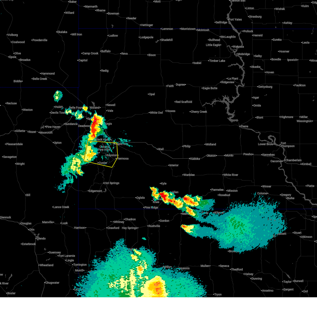 Svrunr the national weather service in rapid city has issued a * severe thunderstorm warning for, northwestern custer county in southwestern south dakota, southwestern pennington county in west central south dakota, * until 845 pm mdt. * at 745 pm mdt, severe thunderstorms were located along a line extending from near rochford to near medicine mountain to 2 miles northeast of jewel cave national monument, moving east at 25 mph (radar indicated). Hazards include 60 mph wind gusts. Expect damage to roofs, siding, and trees. severe thunderstorms will be near, custer, hill city, johnson siding, keystone, silver city, hisega, mystic, center lake, horse thief lake, and stockade lake around 750 pm mdt. hayward and rockerville around 755 pm mdt. rapid city, state game lodge, and bear country around 800 pm mdt. reptile gardens around 805 pm mdt. Other locations in the path of these severe thunderstorms include hart ranch, western rapid valley, hermosa and black gap. Svrunr the national weather service in rapid city has issued a * severe thunderstorm warning for, northwestern custer county in southwestern south dakota, southwestern pennington county in west central south dakota, * until 845 pm mdt. * at 745 pm mdt, severe thunderstorms were located along a line extending from near rochford to near medicine mountain to 2 miles northeast of jewel cave national monument, moving east at 25 mph (radar indicated). Hazards include 60 mph wind gusts. Expect damage to roofs, siding, and trees. severe thunderstorms will be near, custer, hill city, johnson siding, keystone, silver city, hisega, mystic, center lake, horse thief lake, and stockade lake around 750 pm mdt. hayward and rockerville around 755 pm mdt. rapid city, state game lodge, and bear country around 800 pm mdt. reptile gardens around 805 pm mdt. Other locations in the path of these severe thunderstorms include hart ranch, western rapid valley, hermosa and black gap.
|
| 4/27/2025 9:28 PM MDT |
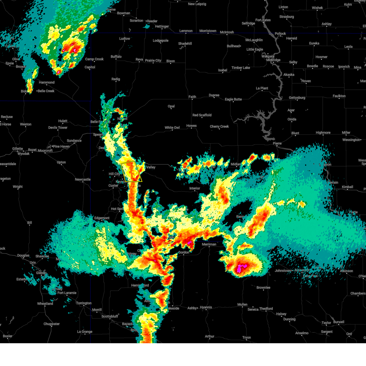 the severe thunderstorm warning has been cancelled and is no longer in effect the severe thunderstorm warning has been cancelled and is no longer in effect
|
| 4/27/2025 9:01 PM MDT |
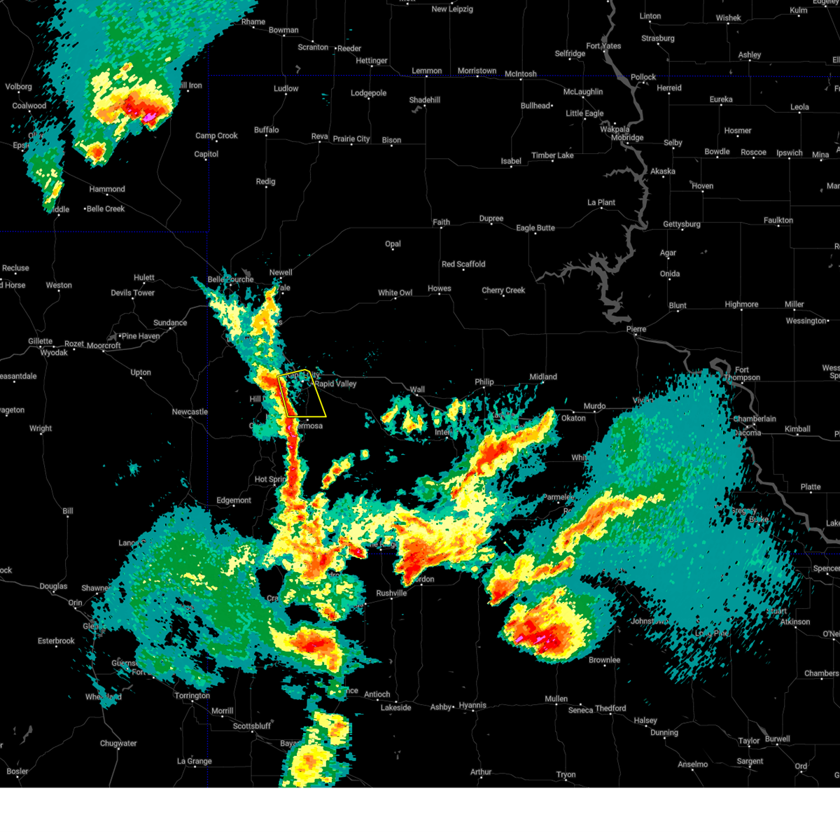 At 901 pm mdt, severe thunderstorms were located along a line extending from 2 miles northeast of johnson siding to 2 miles east of hayward, moving east at 20 mph (radar indicated). Hazards include 60 mph wind gusts and quarter size hail. Hail damage to vehicles is expected. expect wind damage to roofs, siding, and trees. locations impacted include, rapid city, bear country, hart ranch, black gap, hisega, reptile gardens, johnson siding, hayward, rockerville, rapid valley, and black hawk. This includes interstate 90 in south dakota between mile markers 54 and 61. At 901 pm mdt, severe thunderstorms were located along a line extending from 2 miles northeast of johnson siding to 2 miles east of hayward, moving east at 20 mph (radar indicated). Hazards include 60 mph wind gusts and quarter size hail. Hail damage to vehicles is expected. expect wind damage to roofs, siding, and trees. locations impacted include, rapid city, bear country, hart ranch, black gap, hisega, reptile gardens, johnson siding, hayward, rockerville, rapid valley, and black hawk. This includes interstate 90 in south dakota between mile markers 54 and 61.
|
| 4/27/2025 8:44 PM MDT |
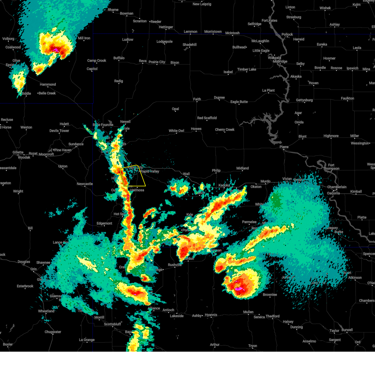 Svrunr the national weather service in rapid city has issued a * severe thunderstorm warning for, south central pennington county in west central south dakota, * until 945 pm mdt. * at 844 pm mdt, severe thunderstorms were located along a line extending from 2 miles north of pactola reservoir to 2 miles northeast of keystone, moving east at 15 mph (radar indicated). Hazards include 60 mph wind gusts and half dollar size hail. Hail damage to vehicles is expected. expect wind damage to roofs, siding, and trees. severe thunderstorms will be near, keystone, rockerville, black gap, hayward, bear country, hisega, johnson siding, rapid city, sheridan lake, and reptile gardens around 850 pm mdt. This includes interstate 90 in south dakota between mile markers 54 and 61. Svrunr the national weather service in rapid city has issued a * severe thunderstorm warning for, south central pennington county in west central south dakota, * until 945 pm mdt. * at 844 pm mdt, severe thunderstorms were located along a line extending from 2 miles north of pactola reservoir to 2 miles northeast of keystone, moving east at 15 mph (radar indicated). Hazards include 60 mph wind gusts and half dollar size hail. Hail damage to vehicles is expected. expect wind damage to roofs, siding, and trees. severe thunderstorms will be near, keystone, rockerville, black gap, hayward, bear country, hisega, johnson siding, rapid city, sheridan lake, and reptile gardens around 850 pm mdt. This includes interstate 90 in south dakota between mile markers 54 and 61.
|
| 9/17/2024 8:13 PM MDT |
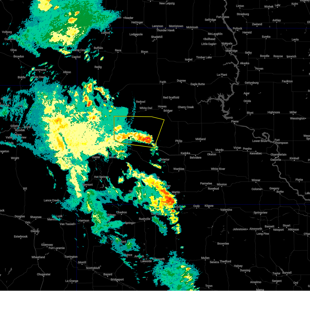 At 812 pm mdt, severe thunderstorms were located along a line extending from 7 miles west of viewfield to 7 miles north of wicksville to 5 miles north of wall, moving northeast at 50 mph. automated observations along interstate 90 recently recorded wind gusts of 58 mph (automated observations indicated). Hazards include 60 mph wind gusts. Expect damage to roofs, siding, and trees. locations impacted include, northeastern rapid valley, ellsworth air force base, box elder, wall, new underwood, wasta, owanka, elm springs, creighton, hereford, wicksville, curlew lake, viewfield, and rapid city airport. This includes interstate 90 in south dakota between mile markers 61 and 111. At 812 pm mdt, severe thunderstorms were located along a line extending from 7 miles west of viewfield to 7 miles north of wicksville to 5 miles north of wall, moving northeast at 50 mph. automated observations along interstate 90 recently recorded wind gusts of 58 mph (automated observations indicated). Hazards include 60 mph wind gusts. Expect damage to roofs, siding, and trees. locations impacted include, northeastern rapid valley, ellsworth air force base, box elder, wall, new underwood, wasta, owanka, elm springs, creighton, hereford, wicksville, curlew lake, viewfield, and rapid city airport. This includes interstate 90 in south dakota between mile markers 61 and 111.
|
| 9/17/2024 8:13 PM MDT |
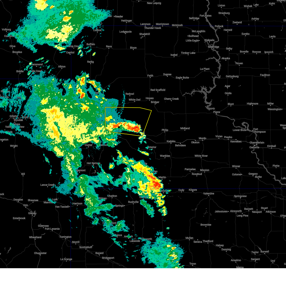 the severe thunderstorm warning has been cancelled and is no longer in effect the severe thunderstorm warning has been cancelled and is no longer in effect
|
| 9/17/2024 7:57 PM MDT |
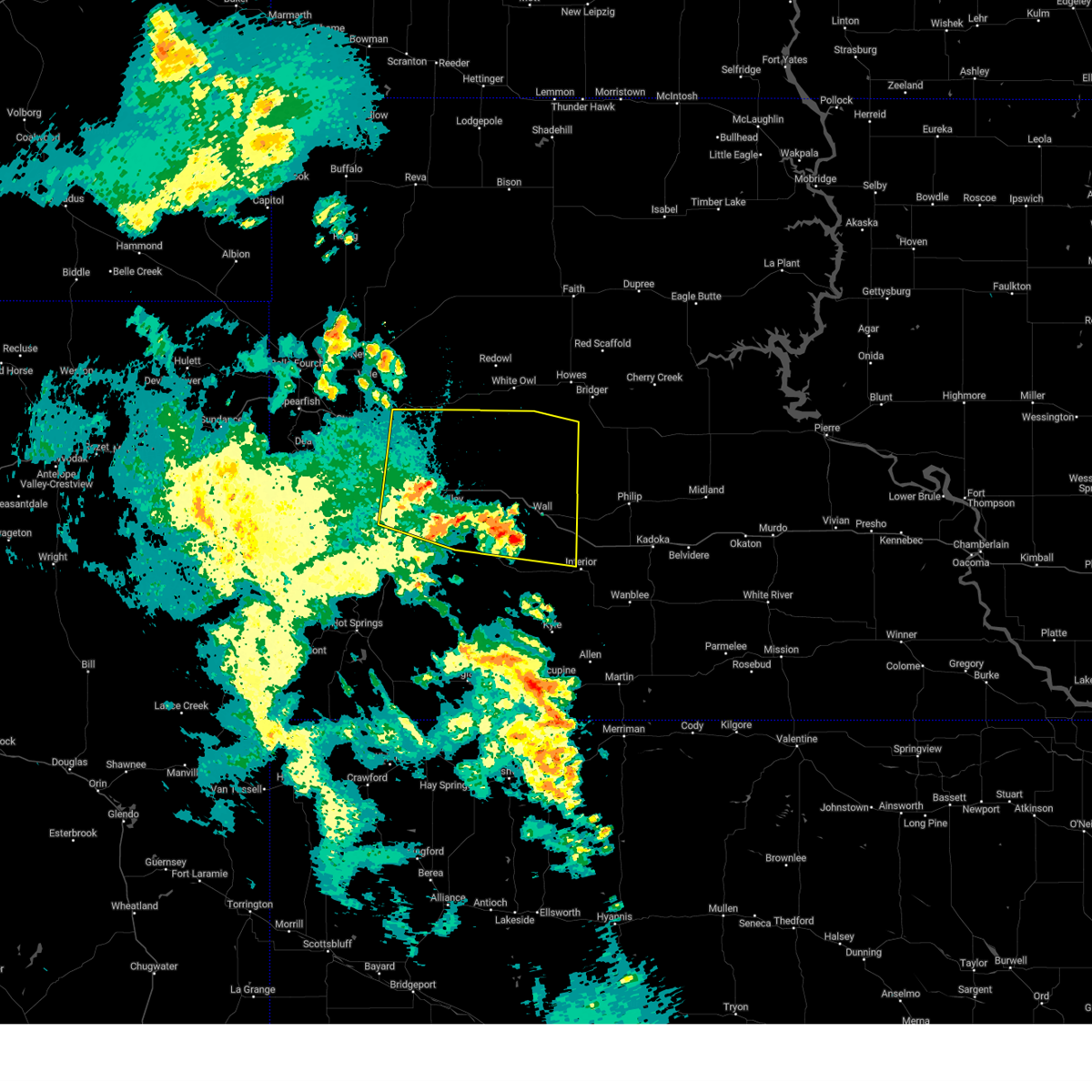 At 756 pm mdt, severe thunderstorms were located along a line extending from rapid valley to 5 miles southeast of new underwood to 5 miles southwest of wall, moving northeast at 40 mph. wind gusts around 60 mph were recently reported at the rapid city regional airport and 2 miles ene of downtown rapid city (trained weather spotters). Hazards include 60 mph wind gusts. Expect damage to roofs, siding, and trees. locations impacted include, northeastern rapid valley, ellsworth air force base, box elder, wall, new underwood, wasta, quinn, owanka, wicksville, curlew lake, elm springs, hereford and creighton. This includes interstate 90 in south dakota between mile markers 54 and 124. At 756 pm mdt, severe thunderstorms were located along a line extending from rapid valley to 5 miles southeast of new underwood to 5 miles southwest of wall, moving northeast at 40 mph. wind gusts around 60 mph were recently reported at the rapid city regional airport and 2 miles ene of downtown rapid city (trained weather spotters). Hazards include 60 mph wind gusts. Expect damage to roofs, siding, and trees. locations impacted include, northeastern rapid valley, ellsworth air force base, box elder, wall, new underwood, wasta, quinn, owanka, wicksville, curlew lake, elm springs, hereford and creighton. This includes interstate 90 in south dakota between mile markers 54 and 124.
|
| 9/17/2024 7:57 PM MDT |
 the severe thunderstorm warning has been cancelled and is no longer in effect the severe thunderstorm warning has been cancelled and is no longer in effect
|
| 9/17/2024 7:50 PM MDT | Storm damage reported in pennington county SD, 8 miles W of Rapid City, SD |
| 9/17/2024 7:46 PM MDT | Storm damage reported in pennington county SD, 2 miles SSW of Rapid City, SD |
| 9/17/2024 7:36 PM MDT |
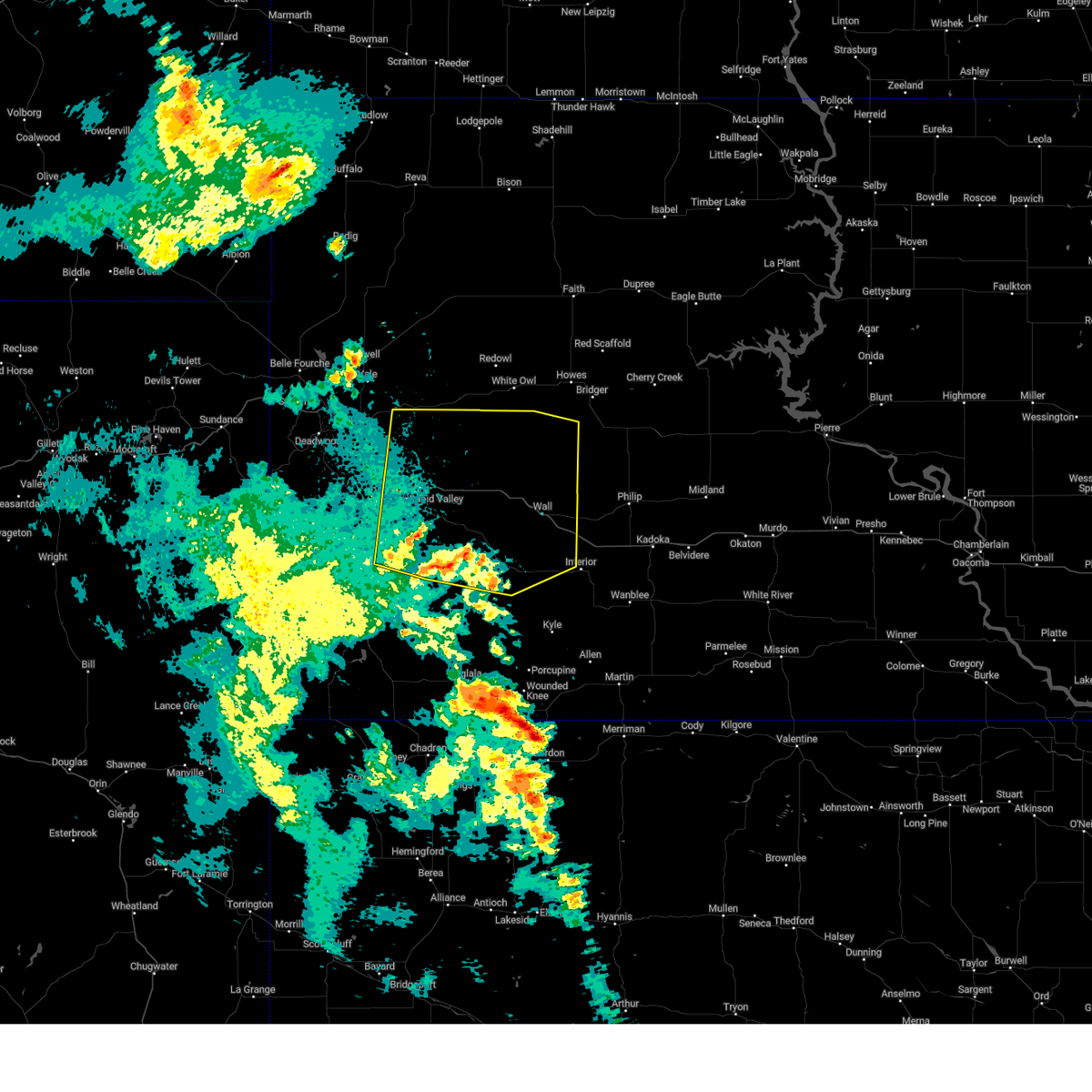 Svrunr the national weather service in rapid city has issued a * severe thunderstorm warning for, southern meade county in west central south dakota, northeastern custer county in southwestern south dakota, north central oglala lakota county in southwestern south dakota, pennington county in west central south dakota, * until 830 pm mdt. * at 736 pm mdt, severe thunderstorms were located along a line extending from near hayward to 4 miles west of folsom to 3 miles northwest of badlands national park, moving northeast at 50 mph. wind gusts of around 60 mph were recently observed near and east of fairburn (automated observations indicated). Hazards include 60 mph wind gusts. Expect damage to roofs, siding, and trees. severe thunderstorms will be near, rapid city, rapid valley, hermosa, scenic, hayward, caputa, folsom, farmingdale, railroad buttes, and bear country around 740 pm mdt. ellsworth air force base, box elder, new underwood, owanka, and pinnacles ranger station around 745 pm mdt. black hawk, wall, wasta, wicksville, and delta 9 missile silo around 750 pm mdt. quinn around 755 pm mdt. other locations in the path of these severe thunderstorms include curlew lake, viewfield, elm springs and creighton. This includes interstate 90 in south dakota between mile markers 54 and 124. Svrunr the national weather service in rapid city has issued a * severe thunderstorm warning for, southern meade county in west central south dakota, northeastern custer county in southwestern south dakota, north central oglala lakota county in southwestern south dakota, pennington county in west central south dakota, * until 830 pm mdt. * at 736 pm mdt, severe thunderstorms were located along a line extending from near hayward to 4 miles west of folsom to 3 miles northwest of badlands national park, moving northeast at 50 mph. wind gusts of around 60 mph were recently observed near and east of fairburn (automated observations indicated). Hazards include 60 mph wind gusts. Expect damage to roofs, siding, and trees. severe thunderstorms will be near, rapid city, rapid valley, hermosa, scenic, hayward, caputa, folsom, farmingdale, railroad buttes, and bear country around 740 pm mdt. ellsworth air force base, box elder, new underwood, owanka, and pinnacles ranger station around 745 pm mdt. black hawk, wall, wasta, wicksville, and delta 9 missile silo around 750 pm mdt. quinn around 755 pm mdt. other locations in the path of these severe thunderstorms include curlew lake, viewfield, elm springs and creighton. This includes interstate 90 in south dakota between mile markers 54 and 124.
|
| 9/15/2024 10:30 PM MDT | Quarter sized hail reported 2.2 miles WSW of Rapid City, SD, mping report |
| 9/15/2024 10:25 PM MDT | Quarter sized hail reported 3.1 miles WSW of Rapid City, SD, copious amounts of hail. |
| 9/15/2024 10:25 PM MDT | Storm damage reported in pennington county SD, 3.1 miles WSW of Rapid City, SD |
| 9/15/2024 10:25 PM MDT | Quarter sized hail reported 3.8 miles SW of Rapid City, SD |
| 9/15/2024 10:24 PM MDT | Quarter sized hail reported 2.2 miles SW of Rapid City, SD |
| 9/15/2024 10:24 PM MDT | Storm damage reported in pennington county SD, 2.2 miles SW of Rapid City, SD |
| 9/15/2024 10:23 PM MDT | Storm damage reported in pennington county SD, 0.3 miles SSE of Rapid City, SD |
| 9/15/2024 9:58 PM MDT |
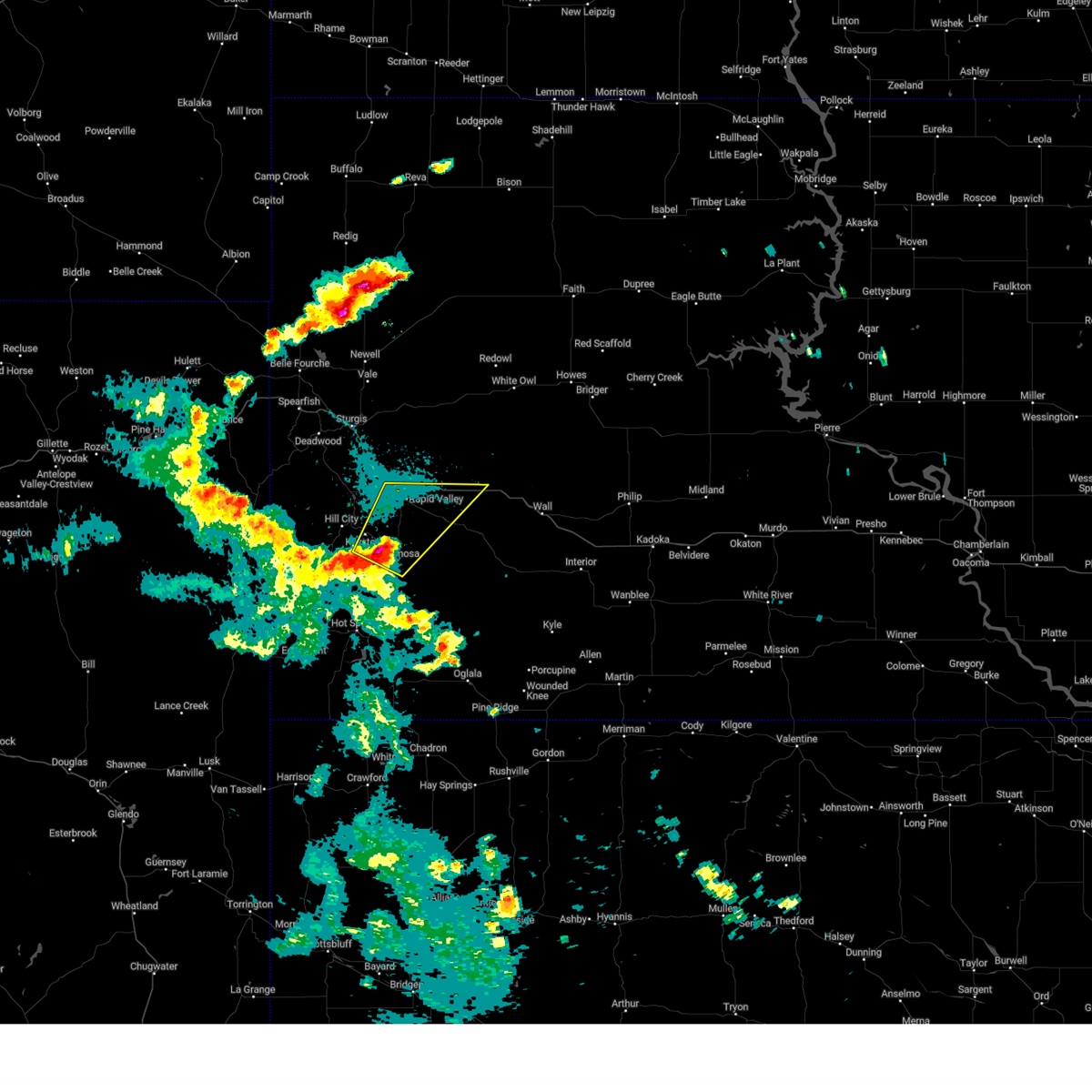 At 958 pm mdt, a severe thunderstorm was located 3 miles east of hayward, or 13 miles south of rapid city, moving northeast at 40 mph (radar indicated). Hazards include 60 mph wind gusts and quarter size hail. Hail damage to vehicles is expected. expect wind damage to roofs, siding, and trees. this severe storm will be near, rapid city, rapid valley, box elder, rockerville, caputa, bear country, black gap, thompson butte, reptile gardens, and rapid city airport around 1005 pm mdt. southern ellsworth air force base and black hawk around 1010 pm mdt. This includes interstate 90 in south dakota between mile markers 54 and 88. At 958 pm mdt, a severe thunderstorm was located 3 miles east of hayward, or 13 miles south of rapid city, moving northeast at 40 mph (radar indicated). Hazards include 60 mph wind gusts and quarter size hail. Hail damage to vehicles is expected. expect wind damage to roofs, siding, and trees. this severe storm will be near, rapid city, rapid valley, box elder, rockerville, caputa, bear country, black gap, thompson butte, reptile gardens, and rapid city airport around 1005 pm mdt. southern ellsworth air force base and black hawk around 1010 pm mdt. This includes interstate 90 in south dakota between mile markers 54 and 88.
|
| 9/15/2024 9:51 PM MDT |
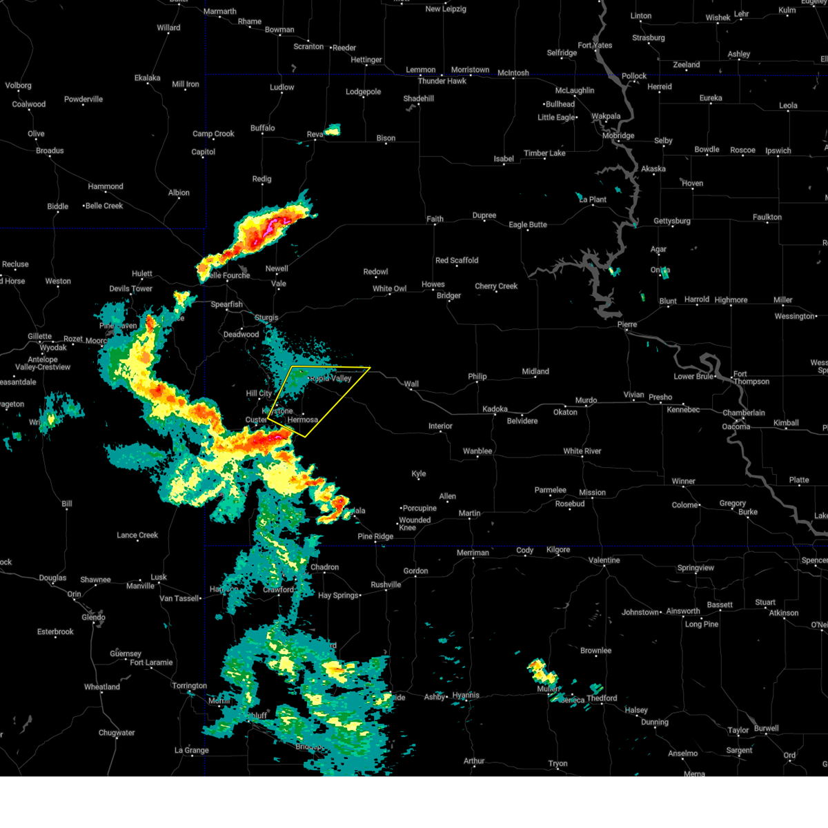 Svrunr the national weather service in rapid city has issued a * severe thunderstorm warning for, north central custer county in southwestern south dakota, south central pennington county in west central south dakota, * until 1030 pm mdt. * at 951 pm mdt, a severe thunderstorm was located 3 miles southwest of hermosa, or 17 miles east of custer, moving northeast at 40 mph (radar indicated). Hazards include 60 mph wind gusts. Expect damage to roofs, siding, and trees. this severe thunderstorm will be near, rapid city, hermosa, keystone, rockerville, hayward, bear country, black gap, reptile gardens, and hart ranch around 955 pm mdt. rapid valley, caputa, thompson butte, and rapid city airport around 1000 pm mdt. southern ellsworth air force base and box elder around 1005 pm mdt. farmingdale around 1010 pm mdt. other locations in the path of this severe thunderstorm include black hawk and new underwood. This includes interstate 90 in south dakota between mile markers 54 and 88. Svrunr the national weather service in rapid city has issued a * severe thunderstorm warning for, north central custer county in southwestern south dakota, south central pennington county in west central south dakota, * until 1030 pm mdt. * at 951 pm mdt, a severe thunderstorm was located 3 miles southwest of hermosa, or 17 miles east of custer, moving northeast at 40 mph (radar indicated). Hazards include 60 mph wind gusts. Expect damage to roofs, siding, and trees. this severe thunderstorm will be near, rapid city, hermosa, keystone, rockerville, hayward, bear country, black gap, reptile gardens, and hart ranch around 955 pm mdt. rapid valley, caputa, thompson butte, and rapid city airport around 1000 pm mdt. southern ellsworth air force base and box elder around 1005 pm mdt. farmingdale around 1010 pm mdt. other locations in the path of this severe thunderstorm include black hawk and new underwood. This includes interstate 90 in south dakota between mile markers 54 and 88.
|
| 9/12/2024 7:18 PM MDT |
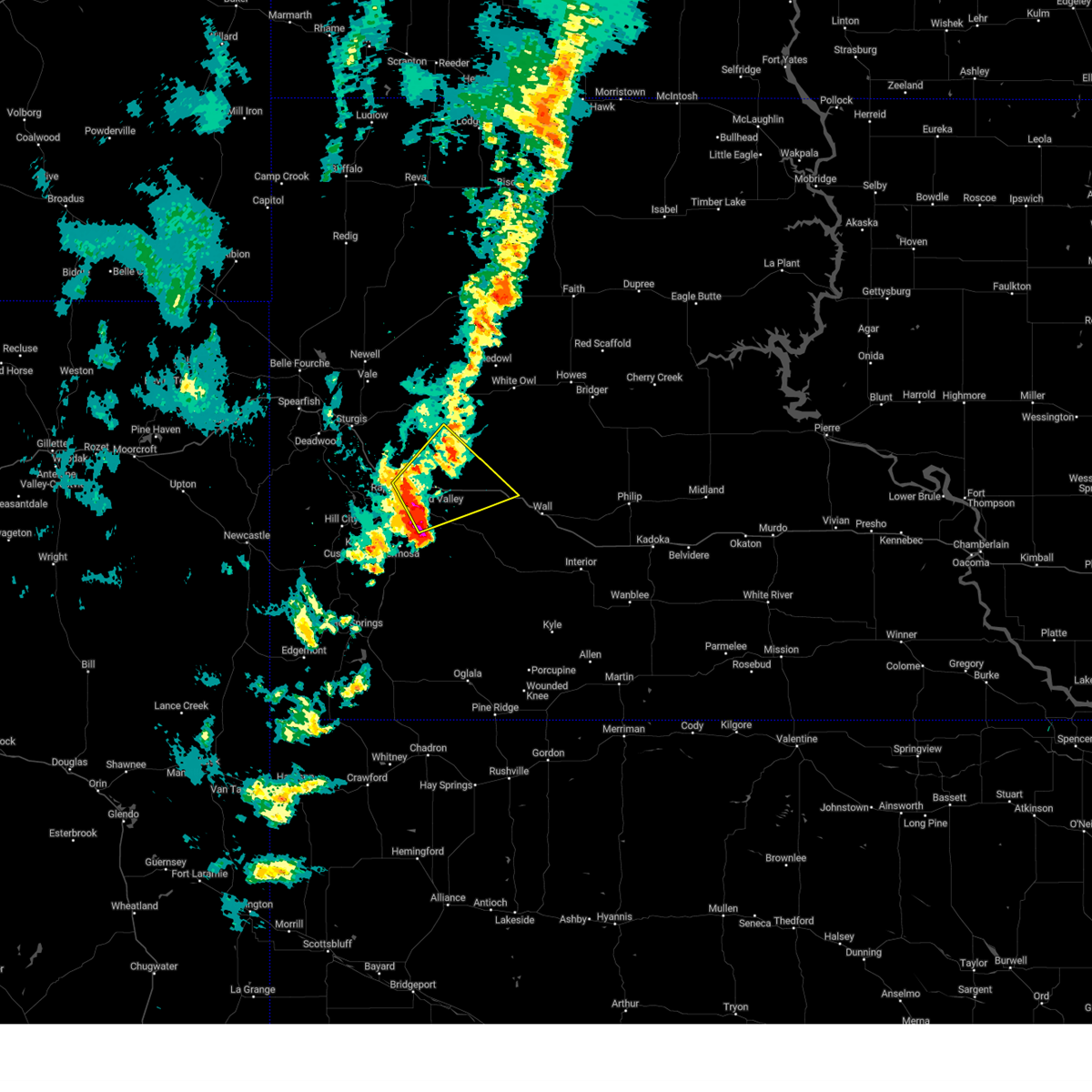 At 717 pm mdt, a severe thunderstorm was located 3 miles northeast of rapid city airport, or 12 miles east of rapid city, moving northeast at 35 mph (radar indicated). Hazards include 60 mph wind gusts. Expect damage to roofs, siding, and trees. locations impacted include, new underwood, curlew lake, viewfield and wicksville. This includes interstate 90 in south dakota between mile markers 59 and 97. At 717 pm mdt, a severe thunderstorm was located 3 miles northeast of rapid city airport, or 12 miles east of rapid city, moving northeast at 35 mph (radar indicated). Hazards include 60 mph wind gusts. Expect damage to roofs, siding, and trees. locations impacted include, new underwood, curlew lake, viewfield and wicksville. This includes interstate 90 in south dakota between mile markers 59 and 97.
|
| 9/12/2024 7:02 PM MDT | Storm damage reported in pennington county SD, 6.2 miles NNW of Rapid City, SD |
| 9/12/2024 6:55 PM MDT |
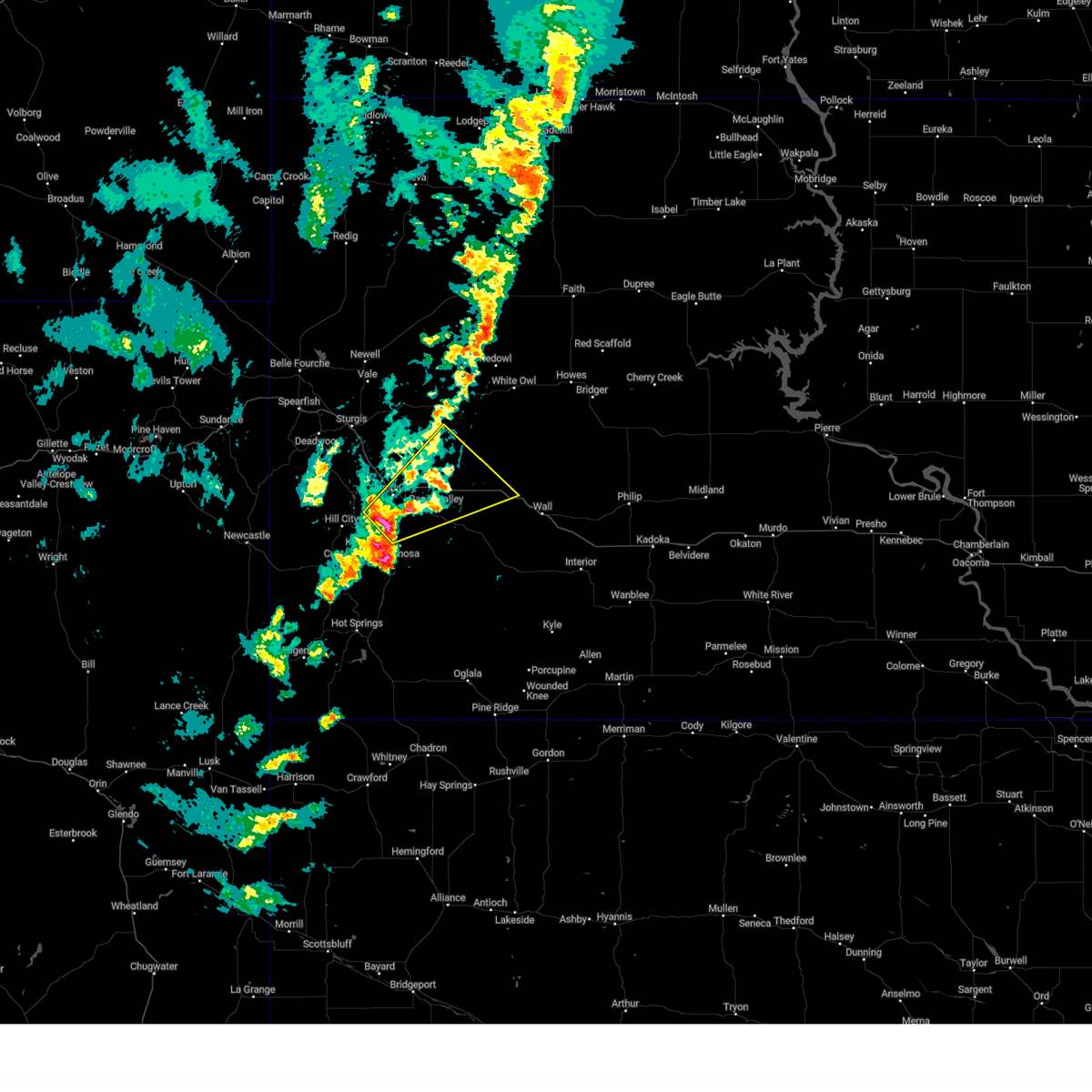 Svrunr the national weather service in rapid city has issued a * severe thunderstorm warning for, south central meade county in west central south dakota, central pennington county in west central south dakota, * until 800 pm mdt. * at 655 pm mdt, a severe thunderstorm was located over hart ranch, or 7 miles south of rapid city, moving northeast at 35 mph (radar indicated). Hazards include 60 mph wind gusts and quarter size hail. Hail damage to vehicles is expected. expect wind damage to roofs, siding, and trees. this severe thunderstorm will be near, rapid city, rapid valley, ellsworth air force base, box elder, caputa, black gap, thompson butte, and rapid city airport around 700 pm mdt. farmingdale around 705 pm mdt. new underwood around 710 pm mdt. viewfield around 720 pm mdt. curlew lake around 725 pm mdt. wicksville around 745 pm mdt. This includes interstate 90 in south dakota between mile markers 56 and 97. Svrunr the national weather service in rapid city has issued a * severe thunderstorm warning for, south central meade county in west central south dakota, central pennington county in west central south dakota, * until 800 pm mdt. * at 655 pm mdt, a severe thunderstorm was located over hart ranch, or 7 miles south of rapid city, moving northeast at 35 mph (radar indicated). Hazards include 60 mph wind gusts and quarter size hail. Hail damage to vehicles is expected. expect wind damage to roofs, siding, and trees. this severe thunderstorm will be near, rapid city, rapid valley, ellsworth air force base, box elder, caputa, black gap, thompson butte, and rapid city airport around 700 pm mdt. farmingdale around 705 pm mdt. new underwood around 710 pm mdt. viewfield around 720 pm mdt. curlew lake around 725 pm mdt. wicksville around 745 pm mdt. This includes interstate 90 in south dakota between mile markers 56 and 97.
|
| 8/26/2024 4:07 PM MDT |
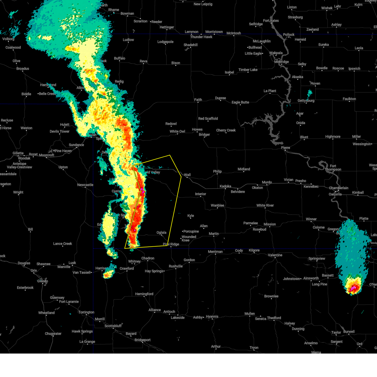 Svrunr the national weather service in rapid city has issued a * severe thunderstorm warning for, south central meade county in west central south dakota, eastern custer county in southwestern south dakota, western oglala lakota county in southwestern south dakota, eastern fall river county in southwestern south dakota, southeastern pennington county in west central south dakota, * until 500 pm mdt. * at 407 pm mdt, severe thunderstorms were located along a line extending from 4 miles northeast of rapid city to 5 miles west of folsom to 5 miles south of oelrichs, moving east at 30 mph (radar indicated). Hazards include 60 mph wind gusts and quarter size hail. Hail damage to vehicles is expected. expect wind damage to roofs, siding, and trees. severe thunderstorms will be near, rapid valley, ellsworth air force base, box elder, prairie winds casino, red shirt, caputa, folsom, farmingdale, hay canyon butte, and slim butte around 410 pm mdt. new underwood around 415 pm mdt. dry wood housing and viewfield around 420 pm mdt. loneman, south lakeside, and curlew lake around 425 pm mdt. other locations in the path of these severe thunderstorms include oglala, scenic, owanka, sheep mountain table, slim buttes housing and wicksville. This includes interstate 90 in south dakota between mile markers 53 and 100. Svrunr the national weather service in rapid city has issued a * severe thunderstorm warning for, south central meade county in west central south dakota, eastern custer county in southwestern south dakota, western oglala lakota county in southwestern south dakota, eastern fall river county in southwestern south dakota, southeastern pennington county in west central south dakota, * until 500 pm mdt. * at 407 pm mdt, severe thunderstorms were located along a line extending from 4 miles northeast of rapid city to 5 miles west of folsom to 5 miles south of oelrichs, moving east at 30 mph (radar indicated). Hazards include 60 mph wind gusts and quarter size hail. Hail damage to vehicles is expected. expect wind damage to roofs, siding, and trees. severe thunderstorms will be near, rapid valley, ellsworth air force base, box elder, prairie winds casino, red shirt, caputa, folsom, farmingdale, hay canyon butte, and slim butte around 410 pm mdt. new underwood around 415 pm mdt. dry wood housing and viewfield around 420 pm mdt. loneman, south lakeside, and curlew lake around 425 pm mdt. other locations in the path of these severe thunderstorms include oglala, scenic, owanka, sheep mountain table, slim buttes housing and wicksville. This includes interstate 90 in south dakota between mile markers 53 and 100.
|
| 8/26/2024 4:02 PM MDT |
 the severe thunderstorm warning has been cancelled and is no longer in effect the severe thunderstorm warning has been cancelled and is no longer in effect
|
| 8/26/2024 4:02 PM MDT |
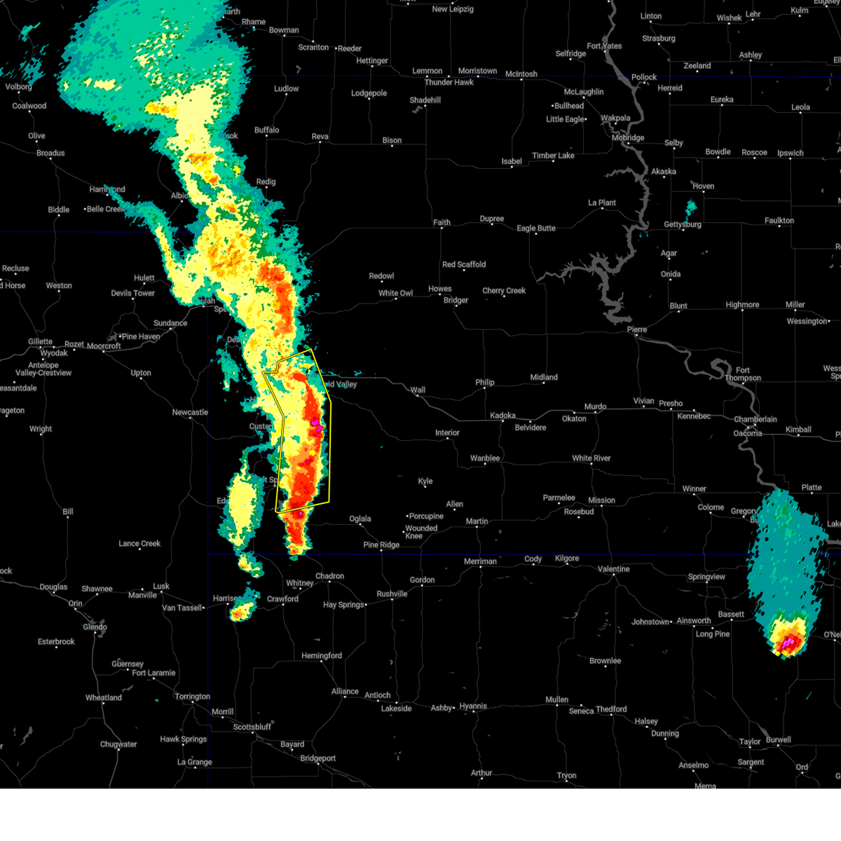 At 402 pm mdt, severe thunderstorms were located along a line extending from 4 miles northwest of ellsworth air force base to 3 miles southwest of caputa to 9 miles northeast of oral, moving east at 45 mph (radar indicated). Hazards include 60 mph wind gusts and quarter size hail. Hail damage to vehicles is expected. expect wind damage to roofs, siding, and trees. locations impacted include, rapid valley, ellsworth air force base, southwestern box elder and rapid city airport. This includes interstate 90 in south dakota between mile markers 47 and 65. At 402 pm mdt, severe thunderstorms were located along a line extending from 4 miles northwest of ellsworth air force base to 3 miles southwest of caputa to 9 miles northeast of oral, moving east at 45 mph (radar indicated). Hazards include 60 mph wind gusts and quarter size hail. Hail damage to vehicles is expected. expect wind damage to roofs, siding, and trees. locations impacted include, rapid valley, ellsworth air force base, southwestern box elder and rapid city airport. This includes interstate 90 in south dakota between mile markers 47 and 65.
|
| 8/26/2024 3:35 PM MDT |
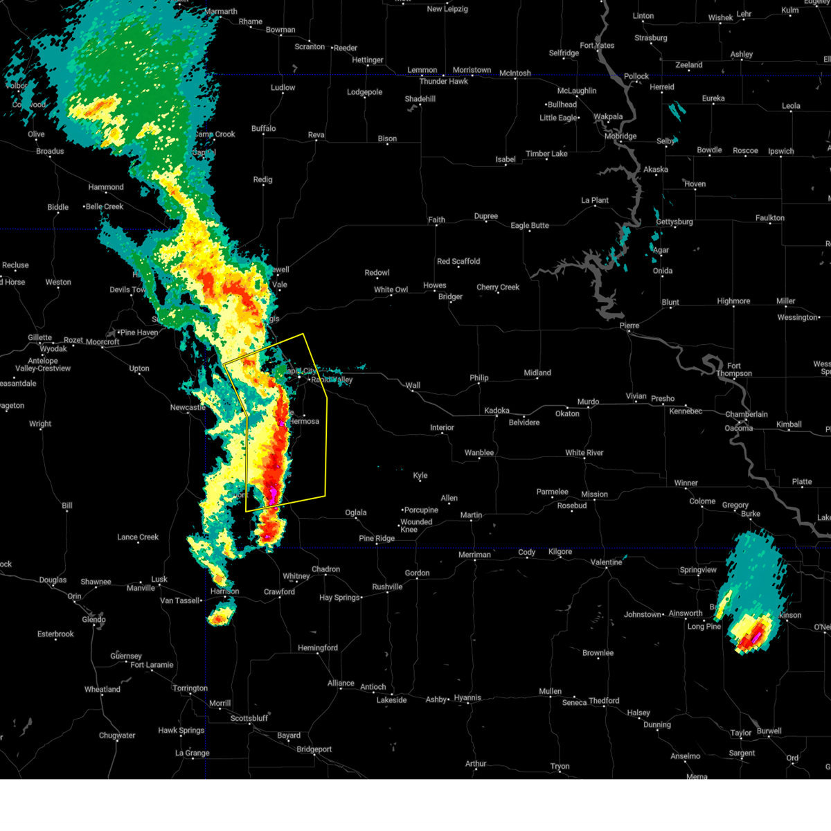 At 335 pm mdt, severe thunderstorms were located along a line extending from near nemo to near hayward to 2 miles south of maverick junction, moving northeast at 45 mph (radar indicated). Hazards include 70 mph wind gusts and quarter size hail. Hail damage to vehicles is expected. expect considerable tree damage. wind damage is also likely to mobile homes, roofs, and outbuildings. locations impacted include, rapid city, rapid valley, southwestern box elder, black hawk, summerset, hermosa, piedmont, oral, buffalo gap, hisega and ellsworth air force base. This includes interstate 90 in south dakota between mile markers 42 and 65. At 335 pm mdt, severe thunderstorms were located along a line extending from near nemo to near hayward to 2 miles south of maverick junction, moving northeast at 45 mph (radar indicated). Hazards include 70 mph wind gusts and quarter size hail. Hail damage to vehicles is expected. expect considerable tree damage. wind damage is also likely to mobile homes, roofs, and outbuildings. locations impacted include, rapid city, rapid valley, southwestern box elder, black hawk, summerset, hermosa, piedmont, oral, buffalo gap, hisega and ellsworth air force base. This includes interstate 90 in south dakota between mile markers 42 and 65.
|
| 8/26/2024 3:10 PM MDT |
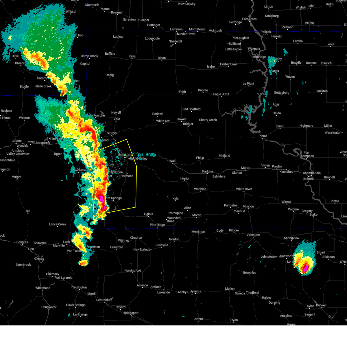 Svrunr the national weather service in rapid city has issued a * severe thunderstorm warning for, southwestern meade county in west central south dakota, custer county in southwestern south dakota, southeastern lawrence county in west central south dakota, northern fall river county in southwestern south dakota, southwestern pennington county in west central south dakota, * until 415 pm mdt. * at 310 pm mdt, severe thunderstorms were located along a line extending from 2 miles north of flag mountain to 2 miles west of custer to 7 miles southwest of cascade falls, moving northeast at 40 mph (radar indicated). Hazards include 70 mph wind gusts and quarter size hail. Hail damage to vehicles is expected. expect considerable tree damage. wind damage is also likely to mobile homes, roofs, and outbuildings. severe thunderstorms will be near, hot springs, custer, hill city, nemo, keystone, pringle, silver city, rochford, argyle, and mystic around 315 pm mdt. johnson siding, buffalo gap, hisega, hayward, rockerville, and dalton lake around 320 pm mdt. rapid city, black hawk, summerset, hermosa, piedmont, oral, fairburn, bear country, and reptile gardens around 325 pm mdt. smithwick, hart ranch, and black gap around 330 pm mdt. other locations in the path of these severe thunderstorms include rapid valley, ellsworth air force base, southwestern box elder and rapid city airport. This includes interstate 90 in south dakota between mile markers 42 and 65. Svrunr the national weather service in rapid city has issued a * severe thunderstorm warning for, southwestern meade county in west central south dakota, custer county in southwestern south dakota, southeastern lawrence county in west central south dakota, northern fall river county in southwestern south dakota, southwestern pennington county in west central south dakota, * until 415 pm mdt. * at 310 pm mdt, severe thunderstorms were located along a line extending from 2 miles north of flag mountain to 2 miles west of custer to 7 miles southwest of cascade falls, moving northeast at 40 mph (radar indicated). Hazards include 70 mph wind gusts and quarter size hail. Hail damage to vehicles is expected. expect considerable tree damage. wind damage is also likely to mobile homes, roofs, and outbuildings. severe thunderstorms will be near, hot springs, custer, hill city, nemo, keystone, pringle, silver city, rochford, argyle, and mystic around 315 pm mdt. johnson siding, buffalo gap, hisega, hayward, rockerville, and dalton lake around 320 pm mdt. rapid city, black hawk, summerset, hermosa, piedmont, oral, fairburn, bear country, and reptile gardens around 325 pm mdt. smithwick, hart ranch, and black gap around 330 pm mdt. other locations in the path of these severe thunderstorms include rapid valley, ellsworth air force base, southwestern box elder and rapid city airport. This includes interstate 90 in south dakota between mile markers 42 and 65.
|
| 8/21/2024 5:54 PM MDT |
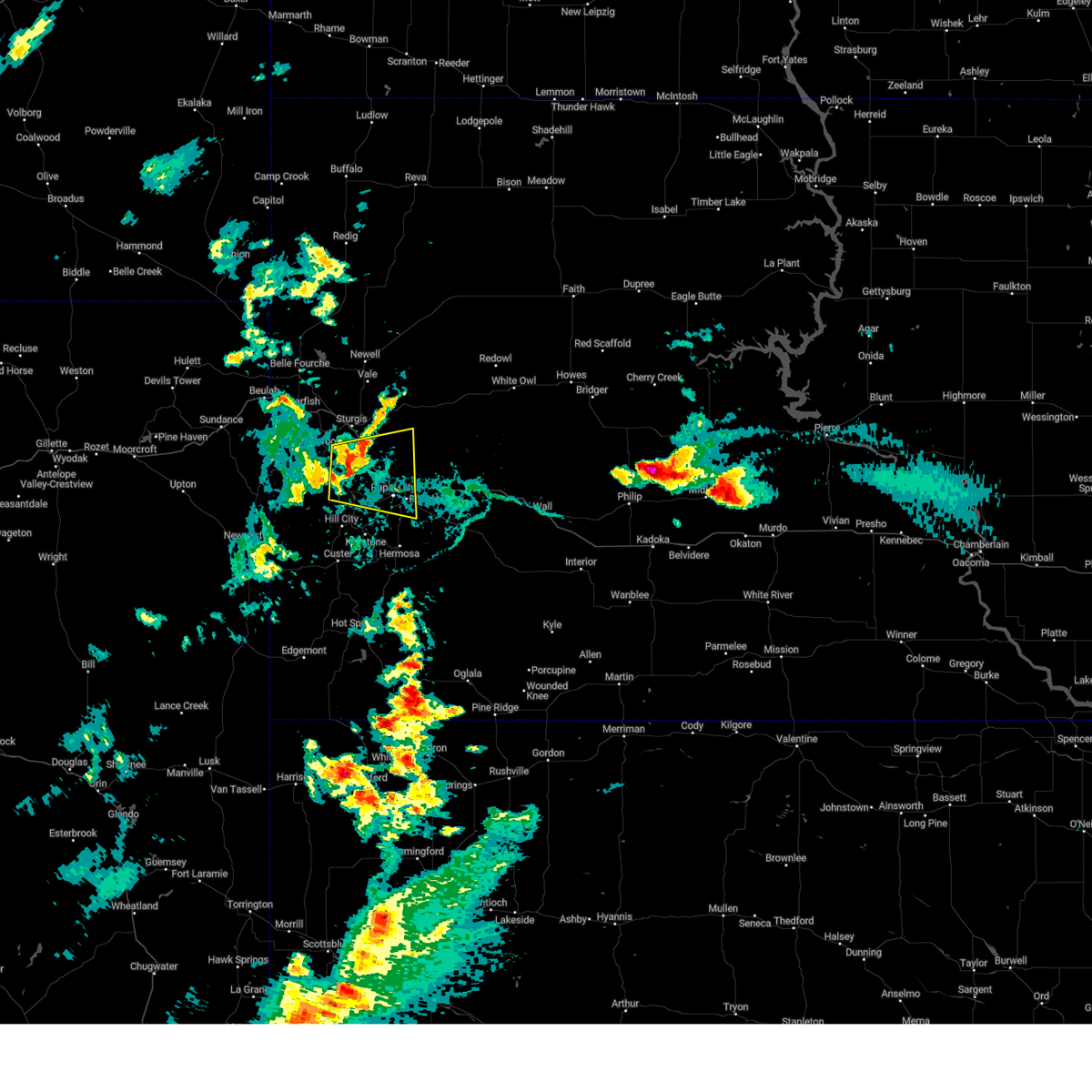 Svrunr the national weather service in rapid city has issued a * severe thunderstorm warning for, southwestern meade county in west central south dakota, southeastern lawrence county in west central south dakota, west central pennington county in west central south dakota, * until 700 pm mdt. * at 554 pm mdt, a severe thunderstorm was located 3 miles northeast of silver city, or 14 miles north of hill city, moving east at 25 mph (radar indicated). Hazards include 60 mph wind gusts and quarter size hail. Hail damage to vehicles is expected. expect wind damage to roofs, siding, and trees. this severe thunderstorm will be near, rapid city, black hawk, summerset, johnson siding, nemo, piedmont, hisega, tilford, dalton lake, and pactola reservoir around 600 pm mdt. rapid valley around 610 pm mdt. ellsworth air force base and southwestern box elder around 615 pm mdt. This includes interstate 90 in south dakota between mile markers 37 and 65. Svrunr the national weather service in rapid city has issued a * severe thunderstorm warning for, southwestern meade county in west central south dakota, southeastern lawrence county in west central south dakota, west central pennington county in west central south dakota, * until 700 pm mdt. * at 554 pm mdt, a severe thunderstorm was located 3 miles northeast of silver city, or 14 miles north of hill city, moving east at 25 mph (radar indicated). Hazards include 60 mph wind gusts and quarter size hail. Hail damage to vehicles is expected. expect wind damage to roofs, siding, and trees. this severe thunderstorm will be near, rapid city, black hawk, summerset, johnson siding, nemo, piedmont, hisega, tilford, dalton lake, and pactola reservoir around 600 pm mdt. rapid valley around 610 pm mdt. ellsworth air force base and southwestern box elder around 615 pm mdt. This includes interstate 90 in south dakota between mile markers 37 and 65.
|
| 8/11/2024 2:27 PM MDT |
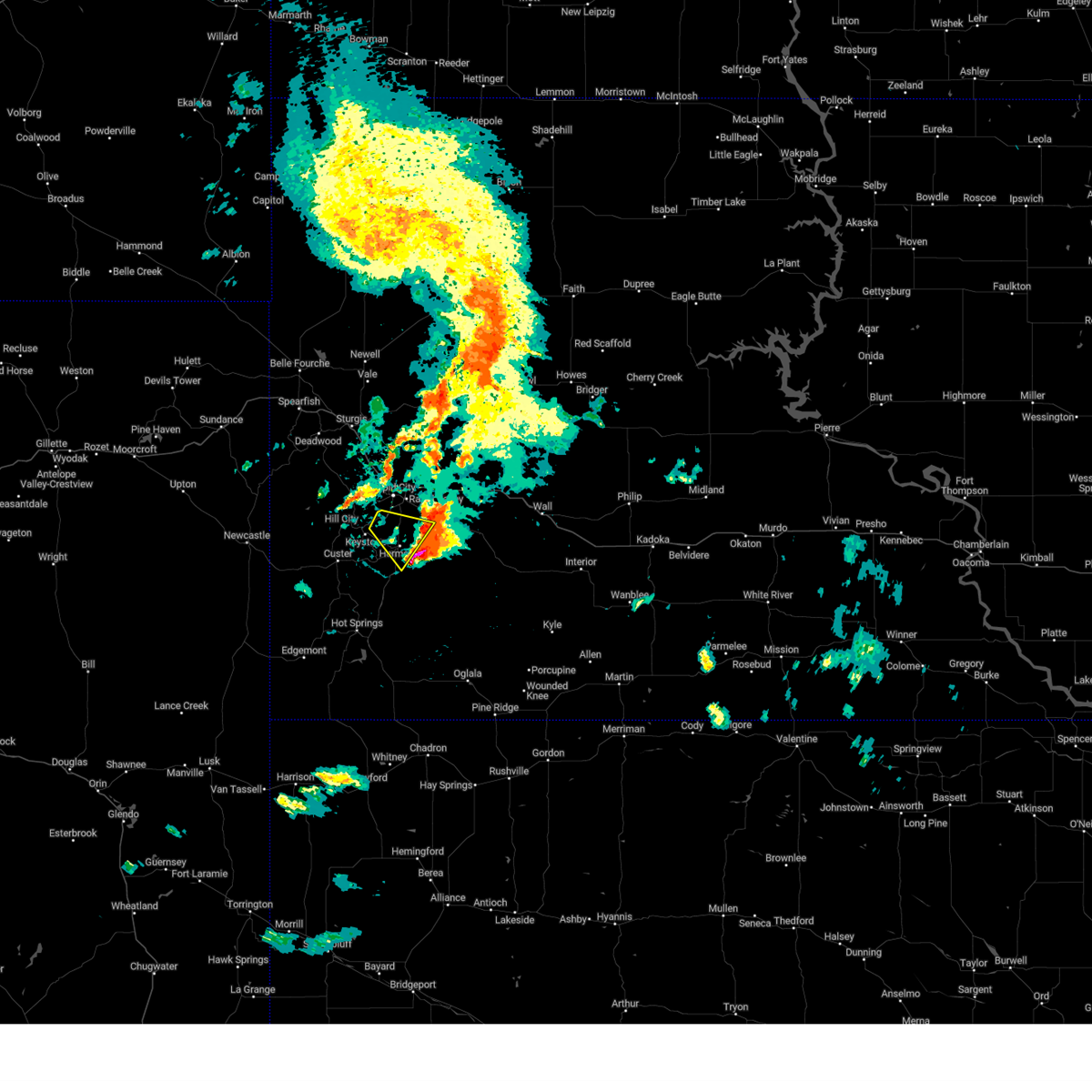 The storm which prompted the warning is moving out of the area. therefore, the warning will be allowed to expire. a severe thunderstorm watch remains in effect until 700 pm mdt for southwestern and west central south dakota. remember, a severe thunderstorm warning still remains in effect for eastern custer county and south central pennington county, roughly east of a caputa to hermosa line, until 315 pm mdt. The storm which prompted the warning is moving out of the area. therefore, the warning will be allowed to expire. a severe thunderstorm watch remains in effect until 700 pm mdt for southwestern and west central south dakota. remember, a severe thunderstorm warning still remains in effect for eastern custer county and south central pennington county, roughly east of a caputa to hermosa line, until 315 pm mdt.
|
| 8/11/2024 2:21 PM MDT |
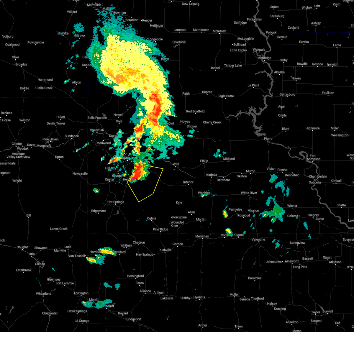 At 220 pm mdt, severe thunderstorms were located along a line extending from 2 miles northwest of thompson butte to 7 miles west of folsom to 4 miles southeast of hermosa, moving southeast at 30 mph. quarter sized hail was recently observed near hermosa (trained weather spotters). Hazards include ping pong ball size hail and 60 mph wind gusts. People and animals outdoors will be injured. expect hail damage to roofs, siding, windows, and vehicles. expect wind damage to roofs, siding, and trees. these severe storms will be near, red shirt, folsom, farmingdale, thompson butte, railroad buttes, and southwestern badlands national park around 225 pm mdt. Other locations in the path of these severe thunderstorms include red shirt table overlook. At 220 pm mdt, severe thunderstorms were located along a line extending from 2 miles northwest of thompson butte to 7 miles west of folsom to 4 miles southeast of hermosa, moving southeast at 30 mph. quarter sized hail was recently observed near hermosa (trained weather spotters). Hazards include ping pong ball size hail and 60 mph wind gusts. People and animals outdoors will be injured. expect hail damage to roofs, siding, windows, and vehicles. expect wind damage to roofs, siding, and trees. these severe storms will be near, red shirt, folsom, farmingdale, thompson butte, railroad buttes, and southwestern badlands national park around 225 pm mdt. Other locations in the path of these severe thunderstorms include red shirt table overlook.
|
| 8/11/2024 2:09 PM MDT |
 Svrunr the national weather service in rapid city has issued a * severe thunderstorm warning for, eastern custer county in southwestern south dakota, northwestern oglala lakota county in southwestern south dakota, south central pennington county in west central south dakota, * until 315 pm mdt. * at 209 pm mdt, severe thunderstorms were located along a line extending from 3 miles south of rapid city airport to hermosa, moving southeast at 25 mph (radar indicated). Hazards include two inch hail and 60 mph wind gusts. People and animals outdoors will be injured. expect hail damage to roofs, siding, windows, and vehicles. expect wind damage to roofs, siding, and trees. severe thunderstorms will be near, caputa, folsom, farmingdale, thompson butte, and railroad buttes around 215 pm mdt. red shirt around 225 pm mdt. Other locations in the path of these severe thunderstorms include western badlands national park. Svrunr the national weather service in rapid city has issued a * severe thunderstorm warning for, eastern custer county in southwestern south dakota, northwestern oglala lakota county in southwestern south dakota, south central pennington county in west central south dakota, * until 315 pm mdt. * at 209 pm mdt, severe thunderstorms were located along a line extending from 3 miles south of rapid city airport to hermosa, moving southeast at 25 mph (radar indicated). Hazards include two inch hail and 60 mph wind gusts. People and animals outdoors will be injured. expect hail damage to roofs, siding, windows, and vehicles. expect wind damage to roofs, siding, and trees. severe thunderstorms will be near, caputa, folsom, farmingdale, thompson butte, and railroad buttes around 215 pm mdt. red shirt around 225 pm mdt. Other locations in the path of these severe thunderstorms include western badlands national park.
|
| 8/11/2024 2:03 PM MDT | Social media post relayed by knbn. portable restroom blown 700 yards and camper was flipped ove in pennington county SD, 5.4 miles NNW of Rapid City, SD |
| 8/11/2024 1:52 PM MDT |
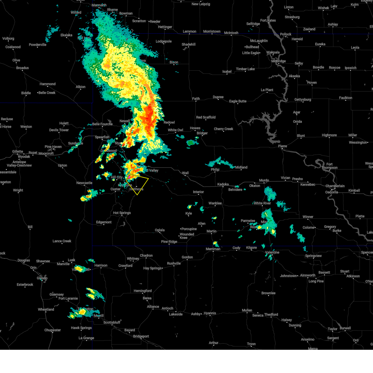 At 151 pm mdt, a severe thunderstorm was located near bear country, or 9 miles south of rapid city, moving southeast at 35 mph. the rockerville fire department recently reported hail of at least golf ball size (trained weather spotters). Hazards include two inch hail and 60 mph wind gusts. People and animals outdoors will be injured. expect hail damage to roofs, siding, windows, and vehicles. expect wind damage to roofs, siding, and trees. this severe storm will be near, hermosa, hayward, hart ranch, and black gap around 155 pm mdt. Thompson butte around 200 pm mdt. At 151 pm mdt, a severe thunderstorm was located near bear country, or 9 miles south of rapid city, moving southeast at 35 mph. the rockerville fire department recently reported hail of at least golf ball size (trained weather spotters). Hazards include two inch hail and 60 mph wind gusts. People and animals outdoors will be injured. expect hail damage to roofs, siding, windows, and vehicles. expect wind damage to roofs, siding, and trees. this severe storm will be near, hermosa, hayward, hart ranch, and black gap around 155 pm mdt. Thompson butte around 200 pm mdt.
|
| 8/11/2024 1:48 PM MDT | Golf Ball sized hail reported 10.5 miles NE of Rapid City, SD |
| 8/11/2024 1:42 PM MDT |
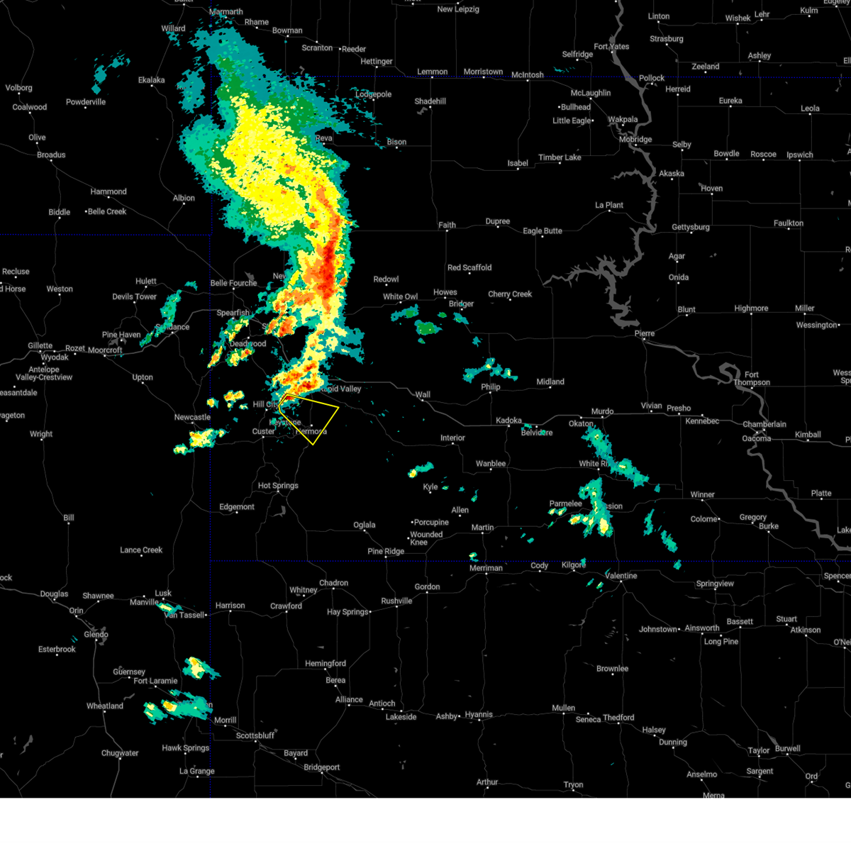 At 142 pm mdt, a severe thunderstorm was located over rockerville, or 9 miles southwest of rapid city, moving southeast at 25 mph (radar indicated). Hazards include two inch hail and 60 mph wind gusts. People and animals outdoors will be injured. expect hail damage to roofs, siding, windows, and vehicles. expect wind damage to roofs, siding, and trees. this severe storm will be near, hermosa, hayward, rockerville, hart ranch, bear country, black gap, and reptile gardens around 145 pm mdt. Other locations in the path of this severe thunderstorm include thompson butte. At 142 pm mdt, a severe thunderstorm was located over rockerville, or 9 miles southwest of rapid city, moving southeast at 25 mph (radar indicated). Hazards include two inch hail and 60 mph wind gusts. People and animals outdoors will be injured. expect hail damage to roofs, siding, windows, and vehicles. expect wind damage to roofs, siding, and trees. this severe storm will be near, hermosa, hayward, rockerville, hart ranch, bear country, black gap, and reptile gardens around 145 pm mdt. Other locations in the path of this severe thunderstorm include thompson butte.
|
| 8/11/2024 1:37 PM MDT |
 At 136 pm mdt, a severe thunderstorm was located 3 miles northeast of sheridan lake, or 8 miles northeast of hill city, moving southeast at 25 mph (radar indicated). Hazards include golf ball size hail. People and animals outdoors will be injured. expect damage to roofs, siding, windows, and vehicles. this severe storm will be near, southwestern rapid city, hayward, rockerville, hart ranch, bear country, black gap, reptile gardens, and keystone wye around 140 pm mdt. hermosa around 145 pm mdt. Other locations in the path of this severe thunderstorm include thompson butte. At 136 pm mdt, a severe thunderstorm was located 3 miles northeast of sheridan lake, or 8 miles northeast of hill city, moving southeast at 25 mph (radar indicated). Hazards include golf ball size hail. People and animals outdoors will be injured. expect damage to roofs, siding, windows, and vehicles. this severe storm will be near, southwestern rapid city, hayward, rockerville, hart ranch, bear country, black gap, reptile gardens, and keystone wye around 140 pm mdt. hermosa around 145 pm mdt. Other locations in the path of this severe thunderstorm include thompson butte.
|
| 8/11/2024 1:32 PM MDT |
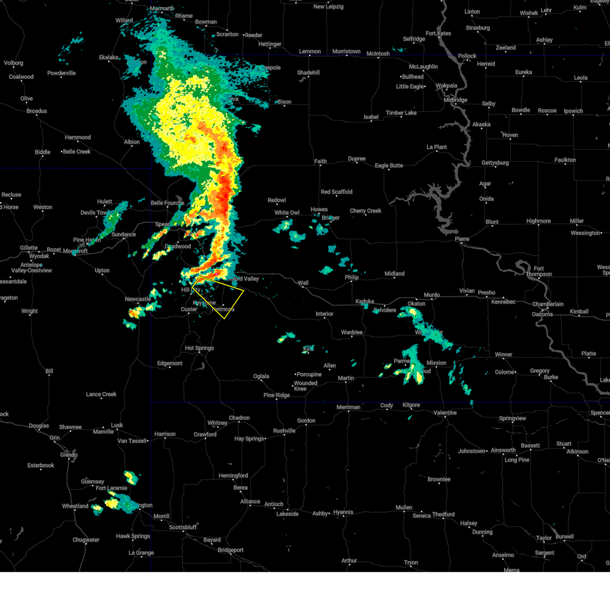 Svrunr the national weather service in rapid city has issued a * severe thunderstorm warning for, north central custer county in southwestern south dakota, south central pennington county in west central south dakota, * until 230 pm mdt. * at 131 pm mdt, a severe thunderstorm was located near sheridan lake, or 8 miles northeast of hill city, moving southeast at 20 mph (radar indicated). Hazards include half dollar size hail. Damage to vehicles is expected. this severe thunderstorm will be near, southwestern rapid city, hayward, rockerville, hart ranch, bear country, black gap, reptile gardens, keystone wye, and sheridan lake around 135 pm mdt. Hermosa around 145 pm mdt. Svrunr the national weather service in rapid city has issued a * severe thunderstorm warning for, north central custer county in southwestern south dakota, south central pennington county in west central south dakota, * until 230 pm mdt. * at 131 pm mdt, a severe thunderstorm was located near sheridan lake, or 8 miles northeast of hill city, moving southeast at 20 mph (radar indicated). Hazards include half dollar size hail. Damage to vehicles is expected. this severe thunderstorm will be near, southwestern rapid city, hayward, rockerville, hart ranch, bear country, black gap, reptile gardens, keystone wye, and sheridan lake around 135 pm mdt. Hermosa around 145 pm mdt.
|
| 7/28/2024 3:39 PM MDT |
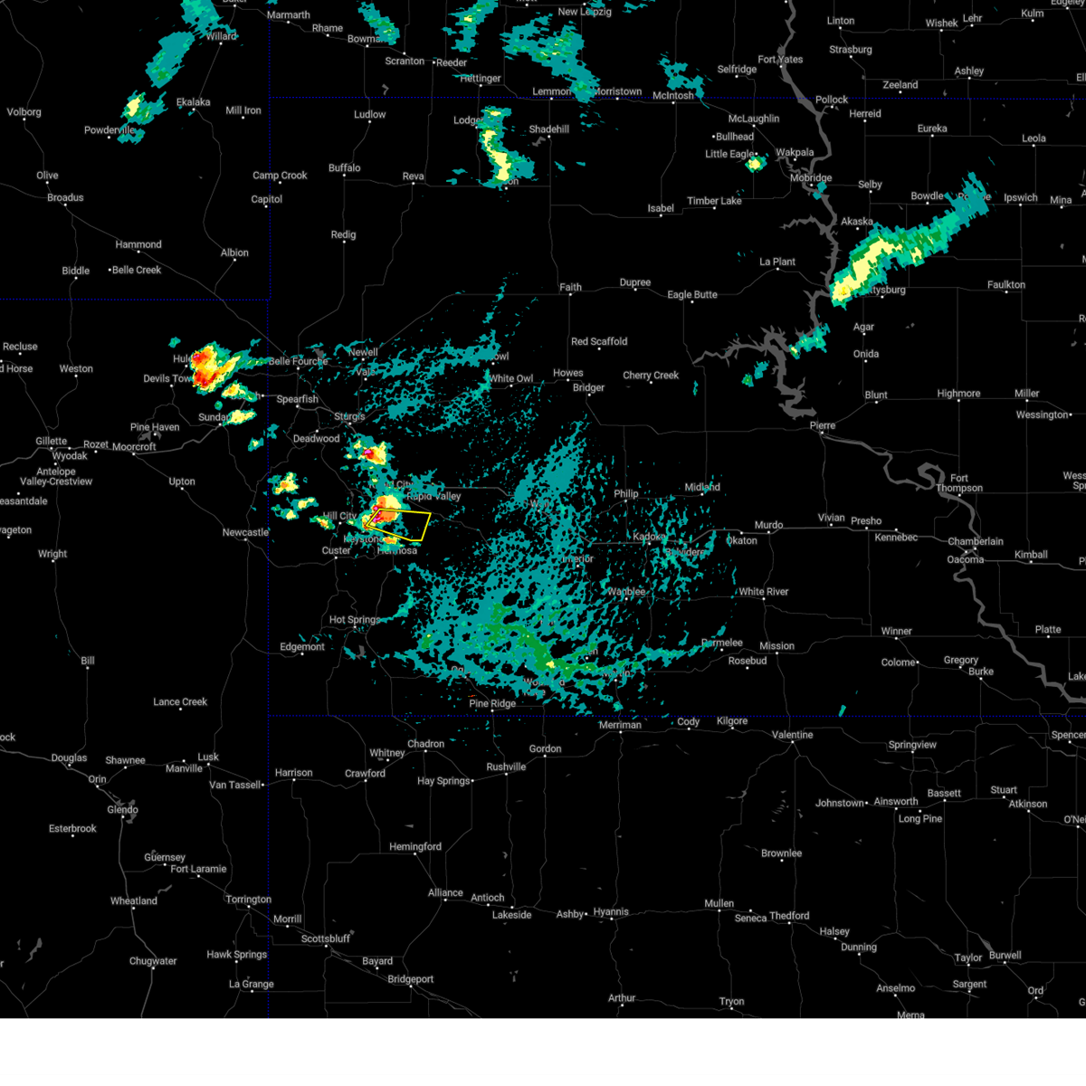 At 338 pm mdt, a severe thunderstorm was located near bear country, or 9 miles south of rapid city, moving southeast at 15 mph (radar indicated and confirmed by spotters). Hazards include golf ball size hail. People and animals outdoors will be injured. expect damage to roofs, siding, windows, and vehicles. Locations impacted include, black gap and hart ranch. At 338 pm mdt, a severe thunderstorm was located near bear country, or 9 miles south of rapid city, moving southeast at 15 mph (radar indicated and confirmed by spotters). Hazards include golf ball size hail. People and animals outdoors will be injured. expect damage to roofs, siding, windows, and vehicles. Locations impacted include, black gap and hart ranch.
|
| 7/28/2024 3:35 PM MDT | Golf Ball sized hail reported 10.5 miles NE of Rapid City, SD |
| 7/28/2024 3:28 PM MDT | Half Dollar sized hail reported 10.5 miles NE of Rapid City, SD |
| 7/28/2024 3:24 PM MDT |
 At 324 pm mdt, a severe thunderstorm was located over rockerville, or 8 miles southwest of rapid city, moving east at 20 mph (radar indicated). Hazards include tennis ball size hail. People and animals outdoors will be injured. expect damage to roofs, siding, windows, and vehicles. this severe storm will be near, southwestern rapid city, bear country, black gap, reptile gardens, and hart ranch around 330 pm mdt. Other locations in the path of this severe thunderstorm include caputa and thompson butte. At 324 pm mdt, a severe thunderstorm was located over rockerville, or 8 miles southwest of rapid city, moving east at 20 mph (radar indicated). Hazards include tennis ball size hail. People and animals outdoors will be injured. expect damage to roofs, siding, windows, and vehicles. this severe storm will be near, southwestern rapid city, bear country, black gap, reptile gardens, and hart ranch around 330 pm mdt. Other locations in the path of this severe thunderstorm include caputa and thompson butte.
|
| 7/28/2024 3:18 PM MDT |
 At 318 pm mdt, a severe thunderstorm was located over rockerville, or 8 miles southwest of rapid city, moving east at 20 mph (radar indicated). Hazards include two inch hail. People and animals outdoors will be injured. expect damage to roofs, siding, windows, and vehicles. this severe storm will be near, southern rapid city, bear country, black gap, reptile gardens, and hart ranch around 325 pm mdt. rapid city airport around 330 pm mdt. Other locations in the path of this severe thunderstorm include caputa. At 318 pm mdt, a severe thunderstorm was located over rockerville, or 8 miles southwest of rapid city, moving east at 20 mph (radar indicated). Hazards include two inch hail. People and animals outdoors will be injured. expect damage to roofs, siding, windows, and vehicles. this severe storm will be near, southern rapid city, bear country, black gap, reptile gardens, and hart ranch around 325 pm mdt. rapid city airport around 330 pm mdt. Other locations in the path of this severe thunderstorm include caputa.
|
| 7/28/2024 3:12 PM MDT |
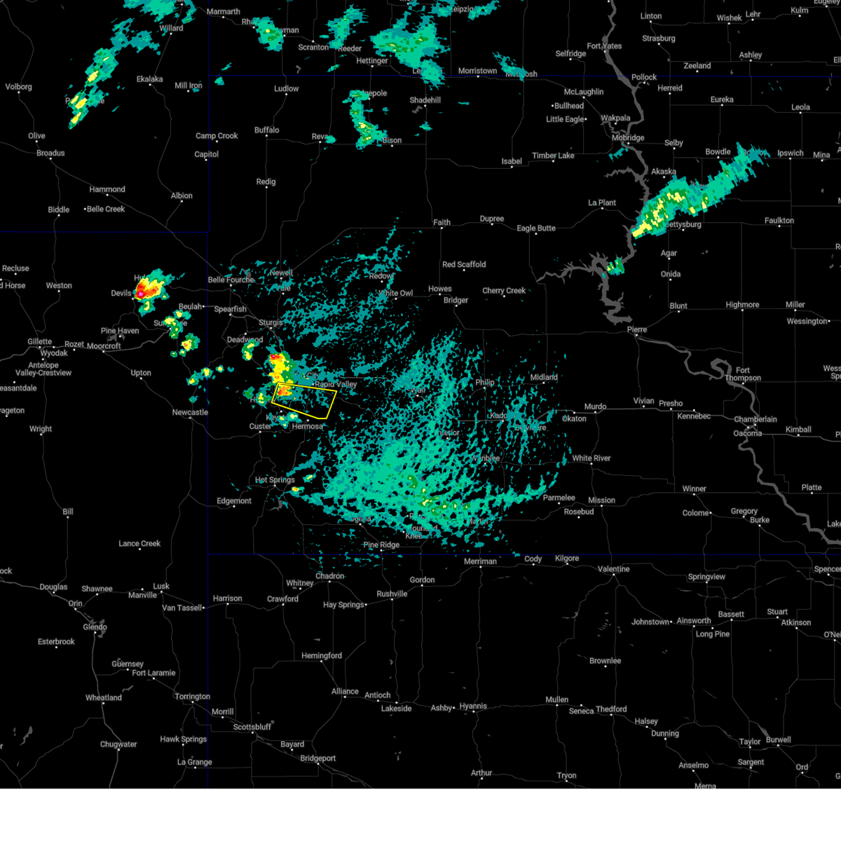 Svrunr the national weather service in rapid city has issued a * severe thunderstorm warning for, south central pennington county in west central south dakota, * until 415 pm mdt. * at 311 pm mdt, a severe thunderstorm was located near rockerville, or 8 miles southwest of rapid city, moving east at 20 mph (radar indicated). Hazards include half dollar size hail. Damage to vehicles is expected. this severe thunderstorm will be near, southern rapid city, rockerville, bear country, black gap, reptile gardens, and hart ranch around 315 pm mdt. rapid city airport around 320 pm mdt. thompson butte around 330 pm mdt. Caputa around 335 pm mdt. Svrunr the national weather service in rapid city has issued a * severe thunderstorm warning for, south central pennington county in west central south dakota, * until 415 pm mdt. * at 311 pm mdt, a severe thunderstorm was located near rockerville, or 8 miles southwest of rapid city, moving east at 20 mph (radar indicated). Hazards include half dollar size hail. Damage to vehicles is expected. this severe thunderstorm will be near, southern rapid city, rockerville, bear country, black gap, reptile gardens, and hart ranch around 315 pm mdt. rapid city airport around 320 pm mdt. thompson butte around 330 pm mdt. Caputa around 335 pm mdt.
|
| 7/19/2024 6:13 PM MDT |
 The storm which prompted the warning has weakened below severe limits, and no longer poses an immediate threat to life or property. therefore, the warning will be allowed to expire. however, gusty winds and heavy rain are still possible with this thunderstorm. a severe thunderstorm watch remains in effect until 1100 pm mdt for southwestern and west central south dakota. The storm which prompted the warning has weakened below severe limits, and no longer poses an immediate threat to life or property. therefore, the warning will be allowed to expire. however, gusty winds and heavy rain are still possible with this thunderstorm. a severe thunderstorm watch remains in effect until 1100 pm mdt for southwestern and west central south dakota.
|
| 7/19/2024 5:27 PM MDT |
 Svrunr the national weather service in rapid city has issued a * severe thunderstorm warning for, northeastern custer county in southwestern south dakota, southeastern pennington county in west central south dakota, * until 615 pm mdt. * at 527 pm mdt, a severe thunderstorm was located near viewfield, or 22 miles east of rapid city, moving south at 50 mph (radar indicated). Hazards include two inch hail and 70 mph wind gusts. People and animals outdoors will be injured. expect hail damage to roofs, siding, windows, and vehicles. expect considerable tree damage. wind damage is also likely to mobile homes, roofs, and outbuildings. this severe thunderstorm will be near, new underwood and wicksville around 530 pm mdt. owanka and farmingdale around 535 pm mdt. caputa and railroad buttes around 540 pm mdt. folsom around 545 pm mdt. scenic around 550 pm mdt. sheep mountain table and northern badlands national park around 555 pm mdt. This includes interstate 90 in south dakota between mile markers 64 and 94. Svrunr the national weather service in rapid city has issued a * severe thunderstorm warning for, northeastern custer county in southwestern south dakota, southeastern pennington county in west central south dakota, * until 615 pm mdt. * at 527 pm mdt, a severe thunderstorm was located near viewfield, or 22 miles east of rapid city, moving south at 50 mph (radar indicated). Hazards include two inch hail and 70 mph wind gusts. People and animals outdoors will be injured. expect hail damage to roofs, siding, windows, and vehicles. expect considerable tree damage. wind damage is also likely to mobile homes, roofs, and outbuildings. this severe thunderstorm will be near, new underwood and wicksville around 530 pm mdt. owanka and farmingdale around 535 pm mdt. caputa and railroad buttes around 540 pm mdt. folsom around 545 pm mdt. scenic around 550 pm mdt. sheep mountain table and northern badlands national park around 555 pm mdt. This includes interstate 90 in south dakota between mile markers 64 and 94.
|
| 7/15/2024 8:24 PM MDT |
 At 824 pm mdt, a severe thunderstorm was located over northwestern custer state park, or 5 miles east of custer, moving east at 35 mph (radar indicated). Hazards include 60 mph wind gusts and quarter size hail. Hail damage to vehicles is expected. expect wind damage to roofs, siding, and trees. this severe storm will be near, hermosa, hayward, black hills playhouse, state game lodge, mount rushmore national memorial, center lake, and eastern custer state park around 830 pm mdt. Other locations in the path of this severe thunderstorm include hart ranch. At 824 pm mdt, a severe thunderstorm was located over northwestern custer state park, or 5 miles east of custer, moving east at 35 mph (radar indicated). Hazards include 60 mph wind gusts and quarter size hail. Hail damage to vehicles is expected. expect wind damage to roofs, siding, and trees. this severe storm will be near, hermosa, hayward, black hills playhouse, state game lodge, mount rushmore national memorial, center lake, and eastern custer state park around 830 pm mdt. Other locations in the path of this severe thunderstorm include hart ranch.
|
| 7/15/2024 8:10 PM MDT |
 Svrunr the national weather service in rapid city has issued a * severe thunderstorm warning for, north central custer county in southwestern south dakota, south central pennington county in west central south dakota, * until 900 pm mdt. * at 810 pm mdt, a severe thunderstorm was located over custer, moving northeast at 35 mph (radar indicated). Hazards include 60 mph wind gusts and half dollar size hail. Hail damage to vehicles is expected. expect wind damage to roofs, siding, and trees. this severe thunderstorm will be near, custer, keystone, black hills playhouse, mount coolidge, state game lodge, blue bell, legion lake, stockade lake, mount rushmore national memorial, and center lake around 815 pm mdt. hayward around 820 pm mdt. hermosa around 830 pm mdt. Hart ranch around 835 pm mdt. Svrunr the national weather service in rapid city has issued a * severe thunderstorm warning for, north central custer county in southwestern south dakota, south central pennington county in west central south dakota, * until 900 pm mdt. * at 810 pm mdt, a severe thunderstorm was located over custer, moving northeast at 35 mph (radar indicated). Hazards include 60 mph wind gusts and half dollar size hail. Hail damage to vehicles is expected. expect wind damage to roofs, siding, and trees. this severe thunderstorm will be near, custer, keystone, black hills playhouse, mount coolidge, state game lodge, blue bell, legion lake, stockade lake, mount rushmore national memorial, and center lake around 815 pm mdt. hayward around 820 pm mdt. hermosa around 830 pm mdt. Hart ranch around 835 pm mdt.
|
| 7/3/2024 3:37 PM MDT |
 Svrunr the national weather service in rapid city has issued a * severe thunderstorm warning for, north central custer county in southwestern south dakota, southwestern pennington county in west central south dakota, * until 430 pm mdt. * at 337 pm mdt, a severe thunderstorm was located 4 miles south of deerfield, or 14 miles west of hill city, moving east at 35 mph (radar indicated). Hazards include ping pong ball size hail and 60 mph wind gusts. People and animals outdoors will be injured. expect hail damage to roofs, siding, windows, and vehicles. Expect wind damage to roofs, siding, and trees. Svrunr the national weather service in rapid city has issued a * severe thunderstorm warning for, north central custer county in southwestern south dakota, southwestern pennington county in west central south dakota, * until 430 pm mdt. * at 337 pm mdt, a severe thunderstorm was located 4 miles south of deerfield, or 14 miles west of hill city, moving east at 35 mph (radar indicated). Hazards include ping pong ball size hail and 60 mph wind gusts. People and animals outdoors will be injured. expect hail damage to roofs, siding, windows, and vehicles. Expect wind damage to roofs, siding, and trees.
|
| 6/25/2024 5:16 PM MDT | Quarter sized hail reported 6.2 miles NNW of Rapid City, SD |
| 6/25/2024 5:07 PM MDT |
 At 506 pm mdt, a severe thunderstorm was located over reptile gardens, or 5 miles south of rapid city, moving southeast at 15 mph (radar indicated. at 505 pm, ping pong ball sized hail was reported 4 miles south of downtown rapid city). Hazards include ping pong ball size hail and 60 mph wind gusts. People and animals outdoors will be injured. expect hail damage to roofs, siding, windows, and vehicles. expect wind damage to roofs, siding, and trees. This severe storm will be near, black gap and hart ranch around 510 pm mdt. At 506 pm mdt, a severe thunderstorm was located over reptile gardens, or 5 miles south of rapid city, moving southeast at 15 mph (radar indicated. at 505 pm, ping pong ball sized hail was reported 4 miles south of downtown rapid city). Hazards include ping pong ball size hail and 60 mph wind gusts. People and animals outdoors will be injured. expect hail damage to roofs, siding, windows, and vehicles. expect wind damage to roofs, siding, and trees. This severe storm will be near, black gap and hart ranch around 510 pm mdt.
|
| 6/25/2024 5:06 PM MDT | Half Dollar sized hail reported 5.1 miles NE of Rapid City, SD, mping report |
| 6/25/2024 5:05 PM MDT | Quarter sized hail reported 3.2 miles NE of Rapid City, SD |
| 6/25/2024 5:04 PM MDT | Quarter sized hail reported 3.5 miles NNE of Rapid City, SD, mping report |
| 6/25/2024 5:03 PM MDT | Quarter sized hail reported 4.9 miles NNE of Rapid City, SD, mping report |
| 6/25/2024 5:02 PM MDT | Ping Pong Ball sized hail reported 3.5 miles NNE of Rapid City, SD |
| 6/25/2024 4:59 PM MDT |
 Svrunr the national weather service in rapid city has issued a * severe thunderstorm warning for, south central pennington county in west central south dakota, * until 545 pm mdt. * at 459 pm mdt, a severe thunderstorm was located over reptile gardens, or 4 miles southwest of rapid city, moving southeast at 15 mph (radar indicated). Hazards include 60 mph wind gusts and quarter size hail. Hail damage to vehicles is expected. expect wind damage to roofs, siding, and trees. This severe thunderstorm will be near, eastern rapid city, bear country, black gap, reptile gardens, and hart ranch around 505 pm mdt. Svrunr the national weather service in rapid city has issued a * severe thunderstorm warning for, south central pennington county in west central south dakota, * until 545 pm mdt. * at 459 pm mdt, a severe thunderstorm was located over reptile gardens, or 4 miles southwest of rapid city, moving southeast at 15 mph (radar indicated). Hazards include 60 mph wind gusts and quarter size hail. Hail damage to vehicles is expected. expect wind damage to roofs, siding, and trees. This severe thunderstorm will be near, eastern rapid city, bear country, black gap, reptile gardens, and hart ranch around 505 pm mdt.
|
| 6/25/2024 4:47 PM MDT | Half Dollar sized hail reported 10 miles E of Rapid City, SD |
| 6/24/2024 7:28 PM MDT | Golf Ball sized hail reported 11.9 miles ESE of Rapid City, SD, a lot of quarter size hail with golf balls |
| 6/24/2024 7:20 PM MDT | Quarter sized hail reported 6.7 miles NE of Rapid City, SD |
| 6/24/2024 7:15 PM MDT | Quarter sized hail reported 6.8 miles NE of Rapid City, SD |
| 6/17/2024 11:15 PM MDT |
 The storms which prompted the warning have weakened below severe limits, and no longer pose an immediate threat to life or property. therefore, the warning will be allowed to expire. however, small hail, gusty winds and heavy rain are still possible with these thunderstorms. a severe thunderstorm watch remains in effect until 500 am mdt for southwestern and west central south dakota. remember, a severe thunderstorm warning still remains in effect for pennington and custer counties until midnight mdt. The storms which prompted the warning have weakened below severe limits, and no longer pose an immediate threat to life or property. therefore, the warning will be allowed to expire. however, small hail, gusty winds and heavy rain are still possible with these thunderstorms. a severe thunderstorm watch remains in effect until 500 am mdt for southwestern and west central south dakota. remember, a severe thunderstorm warning still remains in effect for pennington and custer counties until midnight mdt.
|
| 6/17/2024 10:25 PM MDT |
 At 1024 pm mdt, severe thunderstorms were located along a line extending from 4 miles southeast of bridger to 7 miles west of grindstone to 5 miles south of hermosa, moving northeast at 40 mph (radar indicated). Hazards include ping pong ball size hail and 60 mph wind gusts. People and animals outdoors will be injured. expect hail damage to roofs, siding, windows, and vehicles. expect wind damage to roofs, siding, and trees. locations impacted include, southeastern rapid valley, wall, new underwood, hermosa, cherry creek, milesville, fairburn, wasta, scenic, quinn, owanka, elm springs, folsom, caputa, kirley, red scaffold, wicksville, hayward, billsburg, and grindstone. This includes interstate 90 in south dakota between mile markers 70 and 120. At 1024 pm mdt, severe thunderstorms were located along a line extending from 4 miles southeast of bridger to 7 miles west of grindstone to 5 miles south of hermosa, moving northeast at 40 mph (radar indicated). Hazards include ping pong ball size hail and 60 mph wind gusts. People and animals outdoors will be injured. expect hail damage to roofs, siding, windows, and vehicles. expect wind damage to roofs, siding, and trees. locations impacted include, southeastern rapid valley, wall, new underwood, hermosa, cherry creek, milesville, fairburn, wasta, scenic, quinn, owanka, elm springs, folsom, caputa, kirley, red scaffold, wicksville, hayward, billsburg, and grindstone. This includes interstate 90 in south dakota between mile markers 70 and 120.
|
| 6/17/2024 10:09 PM MDT |
 Svrunr the national weather service in rapid city has issued a * severe thunderstorm warning for, haakon county in west central south dakota, southern ziebach county in west central south dakota, southeastern meade county in west central south dakota, eastern custer county in southwestern south dakota, northwestern oglala lakota county in southwestern south dakota, eastern pennington county in west central south dakota, * until 1115 pm mdt. * at 1009 pm mdt, severe thunderstorms were located along a line extending from 11 miles south of bridger to 4 miles north of wall to 4 miles east of buffalo corrals, moving northeast at 40 mph (radar indicated). Hazards include ping pong ball size hail. People and animals outdoors will be injured. Expect damage to roofs, siding, windows, and vehicles. Svrunr the national weather service in rapid city has issued a * severe thunderstorm warning for, haakon county in west central south dakota, southern ziebach county in west central south dakota, southeastern meade county in west central south dakota, eastern custer county in southwestern south dakota, northwestern oglala lakota county in southwestern south dakota, eastern pennington county in west central south dakota, * until 1115 pm mdt. * at 1009 pm mdt, severe thunderstorms were located along a line extending from 11 miles south of bridger to 4 miles north of wall to 4 miles east of buffalo corrals, moving northeast at 40 mph (radar indicated). Hazards include ping pong ball size hail. People and animals outdoors will be injured. Expect damage to roofs, siding, windows, and vehicles.
|
| 6/10/2024 3:35 PM MDT |
 At 333 pm mdt, severe thunderstorms were located along a line extending from 4 miles east of elm springs to 2 miles northeast of owanka to 4 miles northeast of railroad buttes, moving southeast at 45 mph (radar indicated). Hazards include 60 mph wind gusts and nickel size hail. Expect damage to roofs, siding, and trees. these storms will affect elm springs and owanka. This includes interstate 90 in south dakota between mile markers 62 and 97. At 333 pm mdt, severe thunderstorms were located along a line extending from 4 miles east of elm springs to 2 miles northeast of owanka to 4 miles northeast of railroad buttes, moving southeast at 45 mph (radar indicated). Hazards include 60 mph wind gusts and nickel size hail. Expect damage to roofs, siding, and trees. these storms will affect elm springs and owanka. This includes interstate 90 in south dakota between mile markers 62 and 97.
|
| 6/10/2024 3:14 PM MDT | Storm damage reported in pennington county SD, 8 miles W of Rapid City, SD |
| 6/10/2024 3:01 PM MDT |
 Svrunr the national weather service in rapid city has issued a * severe thunderstorm warning for, southeastern meade county in west central south dakota, central pennington county in west central south dakota, * until 345 pm mdt. * at 301 pm mdt, severe thunderstorms were located along a line extending from 8 miles north of hereford to 7 miles west of viewfield to 4 miles west of ellsworth air force base, moving southeast at 40 mph (radar indicated). Hazards include 60 mph wind gusts. Expect damage to roofs, siding, and trees. severe thunderstorms will be near, northeastern rapid valley, ellsworth air force base, box elder, new underwood, hereford, caputa, viewfield, curlew lake, and rapid city airport around 305 pm mdt. farmingdale around 310 pm mdt. elm springs around 315 pm mdt. owanka and wicksville around 320 pm mdt. This includes interstate 90 in south dakota between mile markers 62 and 97. Svrunr the national weather service in rapid city has issued a * severe thunderstorm warning for, southeastern meade county in west central south dakota, central pennington county in west central south dakota, * until 345 pm mdt. * at 301 pm mdt, severe thunderstorms were located along a line extending from 8 miles north of hereford to 7 miles west of viewfield to 4 miles west of ellsworth air force base, moving southeast at 40 mph (radar indicated). Hazards include 60 mph wind gusts. Expect damage to roofs, siding, and trees. severe thunderstorms will be near, northeastern rapid valley, ellsworth air force base, box elder, new underwood, hereford, caputa, viewfield, curlew lake, and rapid city airport around 305 pm mdt. farmingdale around 310 pm mdt. elm springs around 315 pm mdt. owanka and wicksville around 320 pm mdt. This includes interstate 90 in south dakota between mile markers 62 and 97.
|
| 6/2/2024 2:30 PM MDT | Quarter sized hail reported 6.4 miles WNW of Rapid City, SD |
| 6/2/2024 2:28 PM MDT |
 Svrunr the national weather service in rapid city has issued a * severe thunderstorm warning for, southwestern meade county in west central south dakota, central pennington county in west central south dakota, * until 315 pm mdt. * at 227 pm mdt, a severe thunderstorm was located over rapid city airport, or 8 miles east of rapid city, moving east at 20 mph (radar indicated). Hazards include 60 mph wind gusts and quarter size hail. Hail damage to vehicles is expected. expect wind damage to roofs, siding, and trees. this severe thunderstorm will be near, new underwood around 235 pm mdt. This includes interstate 90 in south dakota between mile markers 69 and 79. Svrunr the national weather service in rapid city has issued a * severe thunderstorm warning for, southwestern meade county in west central south dakota, central pennington county in west central south dakota, * until 315 pm mdt. * at 227 pm mdt, a severe thunderstorm was located over rapid city airport, or 8 miles east of rapid city, moving east at 20 mph (radar indicated). Hazards include 60 mph wind gusts and quarter size hail. Hail damage to vehicles is expected. expect wind damage to roofs, siding, and trees. this severe thunderstorm will be near, new underwood around 235 pm mdt. This includes interstate 90 in south dakota between mile markers 69 and 79.
|
| 6/1/2024 2:48 PM MDT |
 At 247 pm mdt, a severe thunderstorm was located over eastern rapid city, moving east at 10 mph (trained weather spotters). Hazards include 60 mph wind gusts and quarter size hail. Hail damage to vehicles is expected. possible wind damage to roofs, siding, and trees. this severe storm will be near, rapid valley, southern ellsworth air force base, box elder, and rapid city airport around 250 pm mdt. This includes interstate 90 in south dakota between mile markers 56 and 69. At 247 pm mdt, a severe thunderstorm was located over eastern rapid city, moving east at 10 mph (trained weather spotters). Hazards include 60 mph wind gusts and quarter size hail. Hail damage to vehicles is expected. possible wind damage to roofs, siding, and trees. this severe storm will be near, rapid valley, southern ellsworth air force base, box elder, and rapid city airport around 250 pm mdt. This includes interstate 90 in south dakota between mile markers 56 and 69.
|
| 6/1/2024 2:45 PM MDT | Quarter sized hail reported 0.3 miles SSE of Rapid City, SD |
| 6/1/2024 2:43 PM MDT | Half Dollar sized hail reported 2.1 miles E of Rapid City, SD, mping report |
| 6/1/2024 2:42 PM MDT | Quarter sized hail reported 2.6 miles E of Rapid City, SD, mping report |
| 6/1/2024 2:40 PM MDT | Half Dollar sized hail reported 1 miles WSW of Rapid City, SD, mping report |
| 6/1/2024 2:33 PM MDT |
 At 233 pm mdt, a severe thunderstorm was located over eastern rapid city, moving east at 15 mph (trained weather spotter reported quarter size hail). Hazards include 60 mph wind gusts and quarter size hail. Hail damage to vehicles is expected. expect wind damage to roofs, siding, and trees. this severe storm will be near, rapid valley, southern ellsworth air force base, box elder, caputa, and rapid city airport around 240 pm mdt. This includes interstate 90 in south dakota between mile markers 54 and 72. At 233 pm mdt, a severe thunderstorm was located over eastern rapid city, moving east at 15 mph (trained weather spotter reported quarter size hail). Hazards include 60 mph wind gusts and quarter size hail. Hail damage to vehicles is expected. expect wind damage to roofs, siding, and trees. this severe storm will be near, rapid valley, southern ellsworth air force base, box elder, caputa, and rapid city airport around 240 pm mdt. This includes interstate 90 in south dakota between mile markers 54 and 72.
|
| 6/1/2024 2:28 PM MDT | Quarter sized hail reported 2.8 miles ESE of Rapid City, SD |
| 6/1/2024 2:22 PM MDT |
 Svrunr the national weather service in rapid city has issued a * severe thunderstorm warning for, central pennington county in west central south dakota, * until 300 pm mdt. * at 221 pm mdt, a severe thunderstorm was located over northeastern rapid city, moving east at 15 mph (radar indicated). Hazards include 60 mph wind gusts and quarter size hail. Hail damage to vehicles is expected. expect wind damage to roofs, siding, and trees. this severe thunderstorm will be near, eastern rapid city, rapid valley, southern ellsworth air force base, box elder, and rapid city airport around 225 pm mdt. This includes interstate 90 in south dakota between mile markers 54 and 72. Svrunr the national weather service in rapid city has issued a * severe thunderstorm warning for, central pennington county in west central south dakota, * until 300 pm mdt. * at 221 pm mdt, a severe thunderstorm was located over northeastern rapid city, moving east at 15 mph (radar indicated). Hazards include 60 mph wind gusts and quarter size hail. Hail damage to vehicles is expected. expect wind damage to roofs, siding, and trees. this severe thunderstorm will be near, eastern rapid city, rapid valley, southern ellsworth air force base, box elder, and rapid city airport around 225 pm mdt. This includes interstate 90 in south dakota between mile markers 54 and 72.
|
| 5/26/2024 1:13 PM MDT |
 the severe thunderstorm warning has been cancelled and is no longer in effect the severe thunderstorm warning has been cancelled and is no longer in effect
|
| 5/26/2024 1:01 PM MDT |
 At 101 pm mdt, a severe thunderstorm was located near black hawk, or 8 miles north of rapid city, moving east at 10 mph (radar indicated). Hazards include quarter size hail. Damage to vehicles is expected. this severe storm will be near, northern rapid city around 105 pm mdt. This includes interstate 90 in south dakota between mile markers 46 and 55. At 101 pm mdt, a severe thunderstorm was located near black hawk, or 8 miles north of rapid city, moving east at 10 mph (radar indicated). Hazards include quarter size hail. Damage to vehicles is expected. this severe storm will be near, northern rapid city around 105 pm mdt. This includes interstate 90 in south dakota between mile markers 46 and 55.
|
| 5/26/2024 12:45 PM MDT |
 Svrunr the national weather service in rapid city has issued a * severe thunderstorm warning for, southwestern meade county in west central south dakota, central pennington county in west central south dakota, * until 145 pm mdt. * at 1245 pm mdt, a severe thunderstorm was located near black hawk, or 8 miles northwest of rapid city, moving east at 10 mph (radar indicated). Hazards include quarter size hail. Damage to vehicles is expected. this severe thunderstorm will be near, northern rapid city, summerset, and black hawk around 1250 pm mdt. This includes interstate 90 in south dakota between mile markers 45 and 61. Svrunr the national weather service in rapid city has issued a * severe thunderstorm warning for, southwestern meade county in west central south dakota, central pennington county in west central south dakota, * until 145 pm mdt. * at 1245 pm mdt, a severe thunderstorm was located near black hawk, or 8 miles northwest of rapid city, moving east at 10 mph (radar indicated). Hazards include quarter size hail. Damage to vehicles is expected. this severe thunderstorm will be near, northern rapid city, summerset, and black hawk around 1250 pm mdt. This includes interstate 90 in south dakota between mile markers 45 and 61.
|
| 4/15/2024 6:50 PM MDT |
 The storm which prompted the warning has weakened below severe limits, and no longer poses an immediate threat to life or property. therefore, the warning will be allowed to expire. however, small hail, gusty winds and heavy rain are still possible with this thunderstorm. a severe thunderstorm watch remains in effect until 1000 pm mdt for west central south dakota. The storm which prompted the warning has weakened below severe limits, and no longer poses an immediate threat to life or property. therefore, the warning will be allowed to expire. however, small hail, gusty winds and heavy rain are still possible with this thunderstorm. a severe thunderstorm watch remains in effect until 1000 pm mdt for west central south dakota.
|
| 4/15/2024 6:32 PM MDT | Quarter sized hail reported 6.8 miles NE of Rapid City, SD |
| 4/15/2024 6:31 PM MDT |
 Svrunr the national weather service in rapid city has issued a * severe thunderstorm warning for, southwestern meade county in west central south dakota, central pennington county in west central south dakota, * until 700 pm mdt. * at 631 pm mdt, a severe thunderstorm was located 3 miles northwest of bear country, or 5 miles southwest of rapid city, moving north at 25 mph (radar indicated). Hazards include quarter size hail. Damage to vehicles is expected. this severe thunderstorm will be near, rapid city, black hawk, summerset, johnson siding, and hisega around 635 pm mdt. This includes interstate 90 in south dakota between mile markers 51 and 58. Svrunr the national weather service in rapid city has issued a * severe thunderstorm warning for, southwestern meade county in west central south dakota, central pennington county in west central south dakota, * until 700 pm mdt. * at 631 pm mdt, a severe thunderstorm was located 3 miles northwest of bear country, or 5 miles southwest of rapid city, moving north at 25 mph (radar indicated). Hazards include quarter size hail. Damage to vehicles is expected. this severe thunderstorm will be near, rapid city, black hawk, summerset, johnson siding, and hisega around 635 pm mdt. This includes interstate 90 in south dakota between mile markers 51 and 58.
|
| 4/15/2024 6:10 PM MDT | Quarter sized hail reported 3.9 miles SSE of Rapid City, SD |
| 4/15/2024 6:08 PM MDT | Quarter sized hail reported 4.6 miles SSW of Rapid City, SD |
| 10/2/2023 8:21 PM MDT | Quarter sized hail reported 7.6 miles WNW of Rapid City, SD, mping report |
| 10/2/2023 8:09 PM MDT |
 At 809 pm mdt, a severe thunderstorm was located near caputa, or 11 miles east of rapid city, moving northeast at 40 mph (radar indicated). Hazards include 70 mph wind gusts and quarter size hail. Hail damage to vehicles is expected. expect considerable tree damage. wind damage is also likely to mobile homes, roofs, and outbuildings. locations impacted include, ellsworth air force base, box elder, new underwood and farmingdale. this includes interstate 90 in south dakota between mile markers 62 and 88. thunderstorm damage threat, considerable hail threat, radar indicated max hail size, 1. 00 in wind threat, radar indicated max wind gust, 70 mph. At 809 pm mdt, a severe thunderstorm was located near caputa, or 11 miles east of rapid city, moving northeast at 40 mph (radar indicated). Hazards include 70 mph wind gusts and quarter size hail. Hail damage to vehicles is expected. expect considerable tree damage. wind damage is also likely to mobile homes, roofs, and outbuildings. locations impacted include, ellsworth air force base, box elder, new underwood and farmingdale. this includes interstate 90 in south dakota between mile markers 62 and 88. thunderstorm damage threat, considerable hail threat, radar indicated max hail size, 1. 00 in wind threat, radar indicated max wind gust, 70 mph.
|
| 10/2/2023 7:52 PM MDT |
 At 752 pm mdt, a severe thunderstorm was located 4 miles southeast of black gap, or 12 miles southeast of rapid city, moving northeast at 40 mph (radar indicated). Hazards include 70 mph wind gusts and quarter size hail. Hail damage to vehicles is expected. expect considerable tree damage. wind damage is also likely to mobile homes, roofs, and outbuildings. locations impacted include, eastern rapid city, rapid valley, ellsworth air force base, box elder, caputa, farmingdale, black gap, thompson butte, rapid city airport and new underwood. this includes interstate 90 in south dakota between mile markers 63 and 88. thunderstorm damage threat, considerable hail threat, radar indicated max hail size, 1. 00 in wind threat, radar indicated max wind gust, 70 mph. At 752 pm mdt, a severe thunderstorm was located 4 miles southeast of black gap, or 12 miles southeast of rapid city, moving northeast at 40 mph (radar indicated). Hazards include 70 mph wind gusts and quarter size hail. Hail damage to vehicles is expected. expect considerable tree damage. wind damage is also likely to mobile homes, roofs, and outbuildings. locations impacted include, eastern rapid city, rapid valley, ellsworth air force base, box elder, caputa, farmingdale, black gap, thompson butte, rapid city airport and new underwood. this includes interstate 90 in south dakota between mile markers 63 and 88. thunderstorm damage threat, considerable hail threat, radar indicated max hail size, 1. 00 in wind threat, radar indicated max wind gust, 70 mph.
|
| 10/2/2023 7:32 PM MDT | Quarter sized hail reported 1.4 miles SW of Rapid City, SD |
| 10/2/2023 7:32 PM MDT | Quarter sized hail reported 3.4 miles SSW of Rapid City, SD |
| 10/2/2023 7:25 PM MDT |
 At 725 pm mdt, a severe thunderstorm was located over eastern custer state park, or 11 miles east of custer, moving northeast at 40 mph (radar indicated). Hazards include 70 mph wind gusts and penny size hail. Expect considerable tree damage. damage is likely to mobile homes, roofs, and outbuildings. this severe thunderstorm will be near, hermosa, hayward, and northeastern custer state park around 730 pm mdt. black gap and hart ranch around 735 pm mdt. thompson butte around 740 pm mdt. eastern rapid city, rapid valley, caputa, and rapid city airport around 745 pm mdt. farmingdale around 750 pm mdt. ellsworth air force base and box elder around 755 pm mdt. new underwood around 800 pm mdt. this includes interstate 90 in south dakota between mile markers 63 and 88. thunderstorm damage threat, considerable hail threat, radar indicated max hail size, 0. 75 in wind threat, radar indicated max wind gust, 70 mph. At 725 pm mdt, a severe thunderstorm was located over eastern custer state park, or 11 miles east of custer, moving northeast at 40 mph (radar indicated). Hazards include 70 mph wind gusts and penny size hail. Expect considerable tree damage. damage is likely to mobile homes, roofs, and outbuildings. this severe thunderstorm will be near, hermosa, hayward, and northeastern custer state park around 730 pm mdt. black gap and hart ranch around 735 pm mdt. thompson butte around 740 pm mdt. eastern rapid city, rapid valley, caputa, and rapid city airport around 745 pm mdt. farmingdale around 750 pm mdt. ellsworth air force base and box elder around 755 pm mdt. new underwood around 800 pm mdt. this includes interstate 90 in south dakota between mile markers 63 and 88. thunderstorm damage threat, considerable hail threat, radar indicated max hail size, 0. 75 in wind threat, radar indicated max wind gust, 70 mph.
|
| 9/13/2023 4:30 PM MDT | Quarter sized hail reported 9.8 miles NNE of Rapid City, SD, mostly smaller... a few to quarter size |
| 9/4/2023 3:11 PM MDT |
 At 311 pm mdt, a severe thunderstorm was located 4 miles east of box elder, or 13 miles northeast of rapid city, moving northeast at 40 mph (radar indicated). Hazards include 70 mph wind gusts and half dollar size hail. Hail damage to vehicles is expected. expect considerable tree damage. wind damage is also likely to mobile homes, roofs, and outbuildings. this severe thunderstorm will be near, viewfield around 320 pm mdt. curlew lake around 325 pm mdt. this includes interstate 90 in south dakota between mile markers 64 and 73. thunderstorm damage threat, considerable hail threat, radar indicated max hail size, 1. 25 in wind threat, radar indicated max wind gust, 70 mph. At 311 pm mdt, a severe thunderstorm was located 4 miles east of box elder, or 13 miles northeast of rapid city, moving northeast at 40 mph (radar indicated). Hazards include 70 mph wind gusts and half dollar size hail. Hail damage to vehicles is expected. expect considerable tree damage. wind damage is also likely to mobile homes, roofs, and outbuildings. this severe thunderstorm will be near, viewfield around 320 pm mdt. curlew lake around 325 pm mdt. this includes interstate 90 in south dakota between mile markers 64 and 73. thunderstorm damage threat, considerable hail threat, radar indicated max hail size, 1. 25 in wind threat, radar indicated max wind gust, 70 mph.
|
| 9/4/2023 3:06 PM MDT |
 At 305 pm mdt, a severe thunderstorm was located near ellsworth air force base and rapid city, moving northeast at 35 mph (trained weather spotters). Hazards include 60 mph wind gusts and half dollar size hail. Hail damage to vehicles is expected. expect wind damage to roofs, siding, and trees. locations impacted include, northeastern rapid city, northern rapid valley, ellsworth air force base, box elder, summerset, black hawk, and piedmont. this includes interstate 90 in south dakota between mile markers 46 and 52, and between mile markers 61 and 65. hail threat, radar indicated max hail size, 1. 25 in wind threat, radar indicated max wind gust, 60 mph. At 305 pm mdt, a severe thunderstorm was located near ellsworth air force base and rapid city, moving northeast at 35 mph (trained weather spotters). Hazards include 60 mph wind gusts and half dollar size hail. Hail damage to vehicles is expected. expect wind damage to roofs, siding, and trees. locations impacted include, northeastern rapid city, northern rapid valley, ellsworth air force base, box elder, summerset, black hawk, and piedmont. this includes interstate 90 in south dakota between mile markers 46 and 52, and between mile markers 61 and 65. hail threat, radar indicated max hail size, 1. 25 in wind threat, radar indicated max wind gust, 60 mph.
|
| 9/4/2023 2:59 PM MDT | Quarter sized hail reported 2.4 miles S of Rapid City, SD, mping report |
| 9/4/2023 2:54 PM MDT | Quarter sized hail reported 0.3 miles SSE of Rapid City, SD, mping report |
| 9/4/2023 2:53 PM MDT |
 At 253 pm mdt, a severe thunderstorm was located over black hawk, or 5 miles north of rapid city, moving northeast at 35 mph (radar indicated). Hazards include 60 mph wind gusts and penny size hail. Expect damage to roofs, siding, and trees. this severe thunderstorm will remain over mainly rural areas of southwestern meade and central pennington counties. this includes interstate 90 in south dakota between mile markers 46 and 65. hail threat, radar indicated max hail size, 0. 75 in wind threat, radar indicated max wind gust, 60 mph. At 253 pm mdt, a severe thunderstorm was located over black hawk, or 5 miles north of rapid city, moving northeast at 35 mph (radar indicated). Hazards include 60 mph wind gusts and penny size hail. Expect damage to roofs, siding, and trees. this severe thunderstorm will remain over mainly rural areas of southwestern meade and central pennington counties. this includes interstate 90 in south dakota between mile markers 46 and 65. hail threat, radar indicated max hail size, 0. 75 in wind threat, radar indicated max wind gust, 60 mph.
|
| 8/12/2023 3:17 PM MDT | Quarter sized hail reported 13.9 miles ENE of Rapid City, SD, mping report |
| 8/12/2023 3:10 PM MDT | Golf Ball sized hail reported 10.5 miles NE of Rapid City, SD |
| 8/12/2023 3:00 PM MDT | Hen Egg sized hail reported 14.6 miles ENE of Rapid City, SD |
| 8/12/2023 2:43 PM MDT |
 At 243 pm mdt, a severe thunderstorm was located over johnson siding, or 8 miles west of rapid city, moving southeast at 15 mph (radar indicated). Hazards include 60 mph wind gusts and quarter size hail. Hail damage to vehicles is expected. expect wind damage to roofs, siding, and trees. locations impacted include, western rapid city and hisega. hail threat, radar indicated max hail size, 1. 00 in wind threat, radar indicated max wind gust, 60 mph. At 243 pm mdt, a severe thunderstorm was located over johnson siding, or 8 miles west of rapid city, moving southeast at 15 mph (radar indicated). Hazards include 60 mph wind gusts and quarter size hail. Hail damage to vehicles is expected. expect wind damage to roofs, siding, and trees. locations impacted include, western rapid city and hisega. hail threat, radar indicated max hail size, 1. 00 in wind threat, radar indicated max wind gust, 60 mph.
|
| 8/12/2023 2:25 PM MDT |
 At 225 pm mdt, a severe thunderstorm was located near johnson siding, or 11 miles west of rapid city, moving southeast at 20 mph (radar indicated). Hazards include golf ball size hail and 60 mph wind gusts. People and animals outdoors will be injured. expect hail damage to roofs, siding, windows, and vehicles. expect wind damage to roofs, siding, and trees. this severe storm will be near, johnson siding, hisega, and pactola reservoir around 230 pm mdt. other locations in the path of this severe thunderstorm include western rapid city. thunderstorm damage threat, considerable hail threat, radar indicated max hail size, 1. 75 in wind threat, radar indicated max wind gust, 60 mph. At 225 pm mdt, a severe thunderstorm was located near johnson siding, or 11 miles west of rapid city, moving southeast at 20 mph (radar indicated). Hazards include golf ball size hail and 60 mph wind gusts. People and animals outdoors will be injured. expect hail damage to roofs, siding, windows, and vehicles. expect wind damage to roofs, siding, and trees. this severe storm will be near, johnson siding, hisega, and pactola reservoir around 230 pm mdt. other locations in the path of this severe thunderstorm include western rapid city. thunderstorm damage threat, considerable hail threat, radar indicated max hail size, 1. 75 in wind threat, radar indicated max wind gust, 60 mph.
|
| 8/12/2023 2:20 PM MDT | Ping Pong Ball sized hail reported 16.9 miles ESE of Rapid City, SD |
| 8/12/2023 2:20 PM MDT | Quarter sized hail reported 16.3 miles E of Rapid City, SD, mostly pea size hail with a few quarters. |
| 8/12/2023 2:10 PM MDT |
 At 210 pm mdt, a severe thunderstorm was located near silver city, or 13 miles north of hill city, moving southeast at 20 mph (radar indicated). Hazards include tennis ball size hail. People and animals outdoors will be injured. expect damage to roofs, siding, windows, and vehicles. this severe thunderstorm will be near, silver city and pactola reservoir around 215 pm mdt. johnson siding around 220 pm mdt. hisega around 230 pm mdt. thunderstorm damage threat, considerable hail threat, radar indicated max hail size, 2. 50 in wind threat, radar indicated max wind gust, <50 mph. At 210 pm mdt, a severe thunderstorm was located near silver city, or 13 miles north of hill city, moving southeast at 20 mph (radar indicated). Hazards include tennis ball size hail. People and animals outdoors will be injured. expect damage to roofs, siding, windows, and vehicles. this severe thunderstorm will be near, silver city and pactola reservoir around 215 pm mdt. johnson siding around 220 pm mdt. hisega around 230 pm mdt. thunderstorm damage threat, considerable hail threat, radar indicated max hail size, 2. 50 in wind threat, radar indicated max wind gust, <50 mph.
|
| 7/30/2023 2:24 PM MDT | Quarter sized hail reported 11.3 miles NE of Rapid City, SD, mping report |
| 7/30/2023 2:18 PM MDT |
 At 218 pm mdt, a severe thunderstorm was located over rockerville, or 9 miles east of hill city, moving southeast at 25 mph (radar indicated). Hazards include hail up to tennis ball size. People and animals outdoors will be injured. expect damage to roofs, siding, windows, and vehicles. locations impacted include, hayward, hart ranch and hermosa. thunderstorm damage threat, considerable hail threat, radar indicated max hail size, 2. 50 in wind threat, radar indicated max wind gust, <50 mph. At 218 pm mdt, a severe thunderstorm was located over rockerville, or 9 miles east of hill city, moving southeast at 25 mph (radar indicated). Hazards include hail up to tennis ball size. People and animals outdoors will be injured. expect damage to roofs, siding, windows, and vehicles. locations impacted include, hayward, hart ranch and hermosa. thunderstorm damage threat, considerable hail threat, radar indicated max hail size, 2. 50 in wind threat, radar indicated max wind gust, <50 mph.
|
| 7/30/2023 2:10 PM MDT | Tennis Ball sized hail reported 14.3 miles ENE of Rapid City, SD |
| 7/30/2023 2:02 PM MDT | Tennis Ball sized hail reported 14.6 miles E of Rapid City, SD |
| 7/30/2023 2:01 PM MDT | Hen Egg sized hail reported 13.9 miles ENE of Rapid City, SD, mping report |
| 7/30/2023 2:00 PM MDT | Tea Cup sized hail reported 14 miles E of Rapid City, SD |
| 7/30/2023 1:55 PM MDT | Ping Pong Ball sized hail reported 11.6 miles E of Rapid City, SD |
| 7/30/2023 1:54 PM MDT | Hen Egg sized hail reported 14 miles E of Rapid City, SD |
| 7/30/2023 1:53 PM MDT |
 At 153 pm mdt, a severe thunderstorm was located over johnson siding, or 10 miles northeast of hill city, moving southeast at 30 mph (radar indicated). Hazards include tennis ball size hail. People and animals outdoors will be injured. expect damage to roofs, siding, windows, and vehicles. this severe thunderstorm will be near, hisega around 200 pm mdt. sheridan lake around 205 pm mdt. southwestern rapid city and keystone wye around 210 pm mdt. other locations in the path of this severe thunderstorm include keystone, rockerville, bear country, reptile gardens, hayward, hart ranch, black gap and hermosa. thunderstorm damage threat, considerable hail threat, radar indicated max hail size, 2. 50 in wind threat, radar indicated max wind gust, <50 mph. At 153 pm mdt, a severe thunderstorm was located over johnson siding, or 10 miles northeast of hill city, moving southeast at 30 mph (radar indicated). Hazards include tennis ball size hail. People and animals outdoors will be injured. expect damage to roofs, siding, windows, and vehicles. this severe thunderstorm will be near, hisega around 200 pm mdt. sheridan lake around 205 pm mdt. southwestern rapid city and keystone wye around 210 pm mdt. other locations in the path of this severe thunderstorm include keystone, rockerville, bear country, reptile gardens, hayward, hart ranch, black gap and hermosa. thunderstorm damage threat, considerable hail threat, radar indicated max hail size, 2. 50 in wind threat, radar indicated max wind gust, <50 mph.
|
| 7/30/2023 1:48 PM MDT | Golf Ball sized hail reported 16.3 miles E of Rapid City, SD |
| 7/30/2023 1:39 PM MDT | Quarter sized hail reported 18.7 miles ESE of Rapid City, SD |
| 7/28/2023 1:45 PM MDT |
 At 145 pm mdt, a severe thunderstorm was located over rockerville, or 8 miles southwest of rapid city, moving southeast at 20 mph (radar indicated). Hazards include 60 mph wind gusts and quarter size hail. Hail damage to vehicles is expected. expect wind damage to roofs, siding, and trees. locations impacted include, southwestern rapid city, hisega, hayward, rockerville, bear country, hart ranch and reptile gardens. hail threat, radar indicated max hail size, 1. 00 in wind threat, radar indicated max wind gust, 60 mph. At 145 pm mdt, a severe thunderstorm was located over rockerville, or 8 miles southwest of rapid city, moving southeast at 20 mph (radar indicated). Hazards include 60 mph wind gusts and quarter size hail. Hail damage to vehicles is expected. expect wind damage to roofs, siding, and trees. locations impacted include, southwestern rapid city, hisega, hayward, rockerville, bear country, hart ranch and reptile gardens. hail threat, radar indicated max hail size, 1. 00 in wind threat, radar indicated max wind gust, 60 mph.
|
| 7/28/2023 1:34 PM MDT | Ping Pong Ball sized hail reported 12.5 miles ENE of Rapid City, SD, large hail dented cars and destroyed a garden. hail lasted about 10 minutes. |
| 7/28/2023 1:27 PM MDT |
 At 126 pm mdt, a severe thunderstorm was located near sheridan lake, or 6 miles northeast of hill city, moving southeast at 20 mph (radar indicated). Hazards include 60 mph wind gusts and quarter size hail. Hail damage to vehicles is expected. Expect wind damage to roofs, siding, and trees. At 126 pm mdt, a severe thunderstorm was located near sheridan lake, or 6 miles northeast of hill city, moving southeast at 20 mph (radar indicated). Hazards include 60 mph wind gusts and quarter size hail. Hail damage to vehicles is expected. Expect wind damage to roofs, siding, and trees.
|
| 7/24/2023 10:43 PM MDT |
 At 1043 pm mdt, a severe thunderstorm was located over sheridan lake, or 7 miles northeast of hill city, moving east at 20 mph (radar indicated). Hazards include 60 mph wind gusts and quarter size hail. Hail damage to vehicles is expected. expect wind damage to roofs, siding, and trees. this severe thunderstorm will be near, hisega and rockerville around 1055 pm mdt. other locations in the path of this severe thunderstorm include bear country, southwestern rapid city and reptile gardens. hail threat, radar indicated max hail size, 1. 00 in wind threat, radar indicated max wind gust, 60 mph. At 1043 pm mdt, a severe thunderstorm was located over sheridan lake, or 7 miles northeast of hill city, moving east at 20 mph (radar indicated). Hazards include 60 mph wind gusts and quarter size hail. Hail damage to vehicles is expected. expect wind damage to roofs, siding, and trees. this severe thunderstorm will be near, hisega and rockerville around 1055 pm mdt. other locations in the path of this severe thunderstorm include bear country, southwestern rapid city and reptile gardens. hail threat, radar indicated max hail size, 1. 00 in wind threat, radar indicated max wind gust, 60 mph.
|
| 7/21/2023 7:20 PM MDT |
 The severe thunderstorm warning for south central pennington county will expire at 730 pm mdt, the storm which prompted the warning has weakened below severe limits, and no longer poses an immediate threat to life or property. therefore, the warning will be allowed to expire. however small hail is still possible with this thunderstorm. The severe thunderstorm warning for south central pennington county will expire at 730 pm mdt, the storm which prompted the warning has weakened below severe limits, and no longer poses an immediate threat to life or property. therefore, the warning will be allowed to expire. however small hail is still possible with this thunderstorm.
|
| 7/21/2023 7:05 PM MDT | Quarter sized hail reported 8.9 miles NE of Rapid City, SD, lasted about a minute. |
| 7/21/2023 7:02 PM MDT |
 At 702 pm mdt, a severe thunderstorm was located over bear country, or 6 miles southwest of rapid city, moving southeast at 35 mph (radar indicated). Hazards include quarter size hail. Damage to vehicles is expected. locations impacted include, keystone, hart ranch and hayward. hail threat, radar indicated max hail size, 1. 00 in wind threat, radar indicated max wind gust, <50 mph. At 702 pm mdt, a severe thunderstorm was located over bear country, or 6 miles southwest of rapid city, moving southeast at 35 mph (radar indicated). Hazards include quarter size hail. Damage to vehicles is expected. locations impacted include, keystone, hart ranch and hayward. hail threat, radar indicated max hail size, 1. 00 in wind threat, radar indicated max wind gust, <50 mph.
|
| 7/21/2023 6:45 PM MDT |
 At 645 pm mdt, a severe thunderstorm was located 4 miles west of black hawk, or 8 miles northwest of rapid city, moving southeast at 30 mph (radar indicated). Hazards include half dollar size hail. Damage to vehicles is expected. this severe thunderstorm will be near, hisega around 655 pm mdt. rapid city around 705 pm mdt. other locations in the path of this severe thunderstorm include rockerville, reptile gardens, bear country, hart ranch, black gap and hayward. this includes interstate 90 in south dakota between mile markers 54 and 58. hail threat, radar indicated max hail size, 1. 25 in wind threat, radar indicated max wind gust, <50 mph. At 645 pm mdt, a severe thunderstorm was located 4 miles west of black hawk, or 8 miles northwest of rapid city, moving southeast at 30 mph (radar indicated). Hazards include half dollar size hail. Damage to vehicles is expected. this severe thunderstorm will be near, hisega around 655 pm mdt. rapid city around 705 pm mdt. other locations in the path of this severe thunderstorm include rockerville, reptile gardens, bear country, hart ranch, black gap and hayward. this includes interstate 90 in south dakota between mile markers 54 and 58. hail threat, radar indicated max hail size, 1. 25 in wind threat, radar indicated max wind gust, <50 mph.
|
| 7/17/2023 9:36 PM MDT | Storm damage reported in pennington county SD, 8 miles W of Rapid City, SD |
| 7/11/2023 10:33 PM MDT |
 At 1033 pm mdt, a severe thunderstorm was located 3 miles southeast of black gap, or 10 miles southeast of rapid city, moving east at 40 mph (radar indicated). Hazards include two inch hail and 60 mph wind gusts. People and animals outdoors will be injured. expect hail damage to roofs, siding, windows, and vehicles. expect wind damage to roofs, siding, and trees. this severe thunderstorm will be near, caputa around 1040 pm mdt. thompson butte around 1045 pm mdt. farmingdale around 1050 pm mdt. other locations in the path of this severe thunderstorm include folsom, railroad buttes and scenic. thunderstorm damage threat, considerable hail threat, radar indicated max hail size, 2. 00 in wind threat, radar indicated max wind gust, 60 mph. At 1033 pm mdt, a severe thunderstorm was located 3 miles southeast of black gap, or 10 miles southeast of rapid city, moving east at 40 mph (radar indicated). Hazards include two inch hail and 60 mph wind gusts. People and animals outdoors will be injured. expect hail damage to roofs, siding, windows, and vehicles. expect wind damage to roofs, siding, and trees. this severe thunderstorm will be near, caputa around 1040 pm mdt. thompson butte around 1045 pm mdt. farmingdale around 1050 pm mdt. other locations in the path of this severe thunderstorm include folsom, railroad buttes and scenic. thunderstorm damage threat, considerable hail threat, radar indicated max hail size, 2. 00 in wind threat, radar indicated max wind gust, 60 mph.
|
| 7/11/2023 10:25 PM MDT | Golf Ball sized hail reported 3.5 miles NE of Rapid City, SD |
| 7/11/2023 10:25 PM MDT | Ping Pong Ball sized hail reported 4.2 miles ENE of Rapid City, SD |
| 7/11/2023 10:24 PM MDT | Ping Pong Ball sized hail reported 3.9 miles NE of Rapid City, SD, mping report |
| 7/11/2023 10:23 PM MDT | Hen Egg sized hail reported 3.5 miles NNE of Rapid City, SD |
| 7/11/2023 10:23 PM MDT |
 At 1023 pm mdt, a severe thunderstorm was located over reptile gardens, or 4 miles south of rapid city, moving east at 30 mph (radar indicated). Hazards include two inch hail. People and animals outdoors will be injured. expect damage to roofs, siding, windows, and vehicles. locations impacted include, rapid city, rapid valley, hisega, rockerville, bear country, hart ranch, black gap and reptile gardens. this includes interstate 90 in south dakota between mile markers 60 and 62. thunderstorm damage threat, considerable hail threat, radar indicated max hail size, 2. 00 in wind threat, radar indicated max wind gust, <50 mph. At 1023 pm mdt, a severe thunderstorm was located over reptile gardens, or 4 miles south of rapid city, moving east at 30 mph (radar indicated). Hazards include two inch hail. People and animals outdoors will be injured. expect damage to roofs, siding, windows, and vehicles. locations impacted include, rapid city, rapid valley, hisega, rockerville, bear country, hart ranch, black gap and reptile gardens. this includes interstate 90 in south dakota between mile markers 60 and 62. thunderstorm damage threat, considerable hail threat, radar indicated max hail size, 2. 00 in wind threat, radar indicated max wind gust, <50 mph.
|
| 7/11/2023 10:22 PM MDT | Quarter sized hail reported 1.1 miles ENE of Rapid City, SD |
| 7/11/2023 10:20 PM MDT | Quarter sized hail reported 3.7 miles ENE of Rapid City, SD, mping report |
| 7/11/2023 10:20 PM MDT | Ping Pong Ball sized hail reported 5.1 miles NE of Rapid City, SD |
| 7/11/2023 10:19 PM MDT | Golf Ball sized hail reported 5.1 miles NE of Rapid City, SD, mping report |
| 7/11/2023 10:11 PM MDT |
 At 1011 pm mdt, a severe thunderstorm was located over hisega, or 6 miles west of rapid city, moving east at 30 mph (radar indicated). Hazards include golf ball size hail. People and animals outdoors will be injured. expect damage to roofs, siding, windows, and vehicles. locations impacted include, rockerville, rapid city, bear country, reptile gardens, rapid valley, hart ranch and black gap. this includes interstate 90 in south dakota between mile markers 53 and 65. thunderstorm damage threat, considerable hail threat, radar indicated max hail size, 1. 75 in wind threat, radar indicated max wind gust, <50 mph. At 1011 pm mdt, a severe thunderstorm was located over hisega, or 6 miles west of rapid city, moving east at 30 mph (radar indicated). Hazards include golf ball size hail. People and animals outdoors will be injured. expect damage to roofs, siding, windows, and vehicles. locations impacted include, rockerville, rapid city, bear country, reptile gardens, rapid valley, hart ranch and black gap. this includes interstate 90 in south dakota between mile markers 53 and 65. thunderstorm damage threat, considerable hail threat, radar indicated max hail size, 1. 75 in wind threat, radar indicated max wind gust, <50 mph.
|
| 7/11/2023 10:10 PM MDT | Quarter sized hail reported 9.6 miles E of Rapid City, SD |
| 7/11/2023 10:00 PM MDT | Golf Ball sized hail reported 14.5 miles E of Rapid City, SD |
| 7/11/2023 9:51 PM MDT |
 At 951 pm mdt, a severe thunderstorm was located over silver city, or 11 miles north of hill city, moving east at 25 mph (radar indicated). Hazards include ping pong ball size hail. People and animals outdoors will be injured. expect damage to roofs, siding, windows, and vehicles. this severe thunderstorm will be near, pactola reservoir around 955 pm mdt. johnson siding around 1005 pm mdt. hisega around 1010 pm mdt. other locations in the path of this severe thunderstorm include black hawk, rockerville, rapid city, reptile gardens, bear country, rapid valley, black gap, hart ranch and box elder. this includes interstate 90 in south dakota between mile markers 51 and 66. hail threat, radar indicated max hail size, 1. 50 in wind threat, radar indicated max wind gust, <50 mph. At 951 pm mdt, a severe thunderstorm was located over silver city, or 11 miles north of hill city, moving east at 25 mph (radar indicated). Hazards include ping pong ball size hail. People and animals outdoors will be injured. expect damage to roofs, siding, windows, and vehicles. this severe thunderstorm will be near, pactola reservoir around 955 pm mdt. johnson siding around 1005 pm mdt. hisega around 1010 pm mdt. other locations in the path of this severe thunderstorm include black hawk, rockerville, rapid city, reptile gardens, bear country, rapid valley, black gap, hart ranch and box elder. this includes interstate 90 in south dakota between mile markers 51 and 66. hail threat, radar indicated max hail size, 1. 50 in wind threat, radar indicated max wind gust, <50 mph.
|
| 7/11/2023 6:19 PM MDT | Quarter sized hail reported 3.5 miles NNE of Rapid City, SD |
| 7/11/2023 6:15 PM MDT |
 At 615 pm mdt, a severe thunderstorm was located near hart ranch, or 5 miles south of rapid city, moving southeast at 20 mph (radar indicated). Hazards include 60 mph wind gusts and quarter size hail. Hail damage to vehicles is expected. expect wind damage to roofs, siding, and trees. this severe thunderstorm will be near, black gap around 625 pm mdt. other locations in the path of this severe thunderstorm include hermosa. hail threat, radar indicated max hail size, 1. 00 in wind threat, radar indicated max wind gust, 60 mph. At 615 pm mdt, a severe thunderstorm was located near hart ranch, or 5 miles south of rapid city, moving southeast at 20 mph (radar indicated). Hazards include 60 mph wind gusts and quarter size hail. Hail damage to vehicles is expected. expect wind damage to roofs, siding, and trees. this severe thunderstorm will be near, black gap around 625 pm mdt. other locations in the path of this severe thunderstorm include hermosa. hail threat, radar indicated max hail size, 1. 00 in wind threat, radar indicated max wind gust, 60 mph.
|
| 7/11/2023 6:11 PM MDT | Half Dollar sized hail reported 3.5 miles NNE of Rapid City, SD |
| 7/11/2023 6:08 PM MDT |
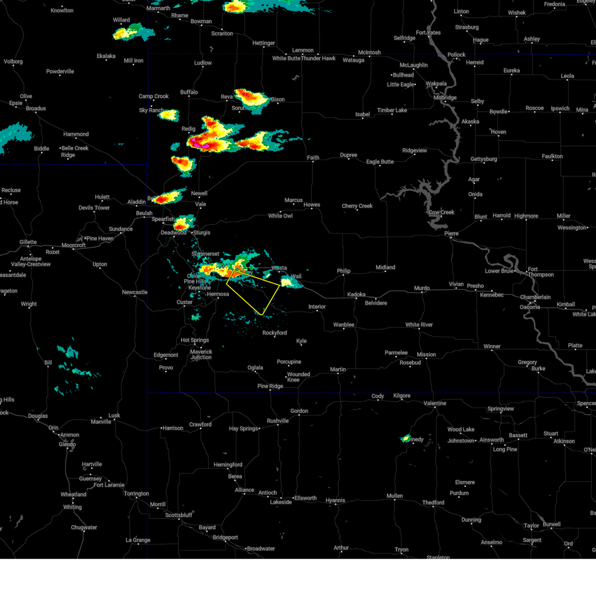 At 608 pm mdt, a severe thunderstorm was located over caputa, or 15 miles southeast of rapid city, moving southeast at 25 mph (radar indicated). Hazards include ping pong ball size hail and 60 mph wind gusts. People and animals outdoors will be injured. expect hail damage to roofs, siding, windows, and vehicles. expect wind damage to roofs, siding, and trees. this severe thunderstorm will be near, farmingdale around 615 pm mdt. other locations in the path of this severe thunderstorm include railroad buttes and folsom. hail threat, radar indicated max hail size, 1. 50 in wind threat, radar indicated max wind gust, 60 mph. At 608 pm mdt, a severe thunderstorm was located over caputa, or 15 miles southeast of rapid city, moving southeast at 25 mph (radar indicated). Hazards include ping pong ball size hail and 60 mph wind gusts. People and animals outdoors will be injured. expect hail damage to roofs, siding, windows, and vehicles. expect wind damage to roofs, siding, and trees. this severe thunderstorm will be near, farmingdale around 615 pm mdt. other locations in the path of this severe thunderstorm include railroad buttes and folsom. hail threat, radar indicated max hail size, 1. 50 in wind threat, radar indicated max wind gust, 60 mph.
|
| 7/11/2023 6:00 PM MDT |
 At 600 pm mdt, a severe thunderstorm was located over rapid city airport, or 9 miles east of rapid city, moving southeast at 20 mph (radar indicated). Hazards include ping pong ball size hail and 60 mph wind gusts. People and animals outdoors will be injured. expect hail damage to roofs, siding, windows, and vehicles. expect wind damage to roofs, siding, and trees. locations impacted include, rapid valley, black gap and rapid city airport. hail threat, radar indicated max hail size, 1. 50 in wind threat, radar indicated max wind gust, 60 mph. At 600 pm mdt, a severe thunderstorm was located over rapid city airport, or 9 miles east of rapid city, moving southeast at 20 mph (radar indicated). Hazards include ping pong ball size hail and 60 mph wind gusts. People and animals outdoors will be injured. expect hail damage to roofs, siding, windows, and vehicles. expect wind damage to roofs, siding, and trees. locations impacted include, rapid valley, black gap and rapid city airport. hail threat, radar indicated max hail size, 1. 50 in wind threat, radar indicated max wind gust, 60 mph.
|
| 7/11/2023 5:56 PM MDT |
 At 556 pm mdt, a severe thunderstorm was located over rapid city airport, or 8 miles east of rapid city, moving east at 30 mph (radar indicated). Hazards include 60 mph wind gusts and quarter size hail. Hail damage to vehicles is expected. expect wind damage to roofs, siding, and trees. this severe thunderstorm will remain over mainly rural areas of central pennington county. this includes interstate 90 in south dakota between mile markers 56 and 62. hail threat, radar indicated max hail size, 1. 00 in wind threat, radar indicated max wind gust, 60 mph. At 556 pm mdt, a severe thunderstorm was located over rapid city airport, or 8 miles east of rapid city, moving east at 30 mph (radar indicated). Hazards include 60 mph wind gusts and quarter size hail. Hail damage to vehicles is expected. expect wind damage to roofs, siding, and trees. this severe thunderstorm will remain over mainly rural areas of central pennington county. this includes interstate 90 in south dakota between mile markers 56 and 62. hail threat, radar indicated max hail size, 1. 00 in wind threat, radar indicated max wind gust, 60 mph.
|
| 7/11/2023 5:48 PM MDT | Quarter sized hail reported 11 miles ESE of Rapid City, SD |
| 7/11/2023 5:39 PM MDT |
 At 539 pm mdt, a severe thunderstorm was located 3 miles north of johnson siding, or 9 miles northwest of rapid city, moving southeast at 25 mph (radar indicated). Hazards include half dollar size hail. Damage to vehicles is expected. this severe thunderstorm will be near, summerset and hisega around 545 pm mdt. black hawk around 550 pm mdt. other locations in the path of this severe thunderstorm include rapid city, reptile gardens, bear country, rapid valley, ellsworth air force base, box elder, hart ranch, black gap and rapid city airport. this includes interstate 90 in south dakota between mile markers 50 and 73. hail threat, radar indicated max hail size, 1. 25 in wind threat, radar indicated max wind gust, <50 mph. At 539 pm mdt, a severe thunderstorm was located 3 miles north of johnson siding, or 9 miles northwest of rapid city, moving southeast at 25 mph (radar indicated). Hazards include half dollar size hail. Damage to vehicles is expected. this severe thunderstorm will be near, summerset and hisega around 545 pm mdt. black hawk around 550 pm mdt. other locations in the path of this severe thunderstorm include rapid city, reptile gardens, bear country, rapid valley, ellsworth air force base, box elder, hart ranch, black gap and rapid city airport. this includes interstate 90 in south dakota between mile markers 50 and 73. hail threat, radar indicated max hail size, 1. 25 in wind threat, radar indicated max wind gust, <50 mph.
|
| 7/8/2023 12:30 PM MDT | Quarter sized hail reported 13.9 miles ENE of Rapid City, SD, mping report |
| 7/3/2023 5:49 PM MDT | Baseball sized hail reported 7.3 miles N of Rapid City, SD |
| 7/3/2023 5:45 PM MDT | Hen Egg sized hail reported 6 miles NNE of Rapid City, SD, reptile gardens |
| 7/3/2023 5:45 PM MDT | Ping Pong Ball sized hail reported 6.9 miles NNE of Rapid City, SD |
| 7/3/2023 5:37 PM MDT |
 At 537 pm mdt, a severe thunderstorm was located near hart ranch, or 8 miles south of rapid city, moving southeast at 10 mph (radar indicated). Hazards include two inch hail. People and animals outdoors will be injured. expect damage to roofs, siding, windows, and vehicles. this severe storm will be near, hart ranch and black gap around 540 pm mdt. other locations in the path of this severe thunderstorm include hermosa. thunderstorm damage threat, considerable hail threat, radar indicated max hail size, 2. 00 in wind threat, radar indicated max wind gust, <50 mph. At 537 pm mdt, a severe thunderstorm was located near hart ranch, or 8 miles south of rapid city, moving southeast at 10 mph (radar indicated). Hazards include two inch hail. People and animals outdoors will be injured. expect damage to roofs, siding, windows, and vehicles. this severe storm will be near, hart ranch and black gap around 540 pm mdt. other locations in the path of this severe thunderstorm include hermosa. thunderstorm damage threat, considerable hail threat, radar indicated max hail size, 2. 00 in wind threat, radar indicated max wind gust, <50 mph.
|
| 7/3/2023 5:35 PM MDT | Ping Pong Ball sized hail reported 3.5 miles NNE of Rapid City, SD |
| 7/3/2023 5:31 PM MDT |
 At 531 pm mdt, a severe thunderstorm was located over bear country, or 6 miles south of rapid city, moving southeast at 10 mph (radar indicated). Hazards include ping pong ball size hail and 60 mph wind gusts. People and animals outdoors will be injured. expect hail damage to roofs, siding, windows, and vehicles. expect wind damage to roofs, siding, and trees. this severe thunderstorm will be near, hart ranch around 545 pm mdt. black gap around 550 pm mdt. other locations in the path of this severe thunderstorm include hermosa. hail threat, radar indicated max hail size, 1. 50 in wind threat, radar indicated max wind gust, 60 mph. At 531 pm mdt, a severe thunderstorm was located over bear country, or 6 miles south of rapid city, moving southeast at 10 mph (radar indicated). Hazards include ping pong ball size hail and 60 mph wind gusts. People and animals outdoors will be injured. expect hail damage to roofs, siding, windows, and vehicles. expect wind damage to roofs, siding, and trees. this severe thunderstorm will be near, hart ranch around 545 pm mdt. black gap around 550 pm mdt. other locations in the path of this severe thunderstorm include hermosa. hail threat, radar indicated max hail size, 1. 50 in wind threat, radar indicated max wind gust, 60 mph.
|
| 7/3/2023 4:41 PM MDT |
 At 441 pm mdt, a severe thunderstorm was located 3 miles west of rapid city, moving southeast at 10 mph (radar indicated). Hazards include quarter size hail. Damage to vehicles is expected. locations impacted include, rapid city, southwestern rapid valley, bear country and reptile gardens. this includes interstate 90 in south dakota near mile marker 56. hail threat, radar indicated max hail size, 1. 00 in wind threat, radar indicated max wind gust, <50 mph. At 441 pm mdt, a severe thunderstorm was located 3 miles west of rapid city, moving southeast at 10 mph (radar indicated). Hazards include quarter size hail. Damage to vehicles is expected. locations impacted include, rapid city, southwestern rapid valley, bear country and reptile gardens. this includes interstate 90 in south dakota near mile marker 56. hail threat, radar indicated max hail size, 1. 00 in wind threat, radar indicated max wind gust, <50 mph.
|
| 7/3/2023 4:30 PM MDT |
 At 429 pm mdt, a severe thunderstorm was located 4 miles south of black hawk, or 5 miles west of rapid city, moving southeast at 10 mph (radar indicated). Hazards include golf ball size hail. People and animals outdoors will be injured. expect damage to roofs, siding, windows, and vehicles. locations impacted include, rapid city, rapid valley, black hawk, hisega, rockerville, bear country and reptile gardens. this includes interstate 90 in south dakota between mile markers 53 and 60. thunderstorm damage threat, considerable hail threat, observed max hail size, 1. 75 in wind threat, radar indicated max wind gust, <50 mph. At 429 pm mdt, a severe thunderstorm was located 4 miles south of black hawk, or 5 miles west of rapid city, moving southeast at 10 mph (radar indicated). Hazards include golf ball size hail. People and animals outdoors will be injured. expect damage to roofs, siding, windows, and vehicles. locations impacted include, rapid city, rapid valley, black hawk, hisega, rockerville, bear country and reptile gardens. this includes interstate 90 in south dakota between mile markers 53 and 60. thunderstorm damage threat, considerable hail threat, observed max hail size, 1. 75 in wind threat, radar indicated max wind gust, <50 mph.
|
| 7/3/2023 4:20 PM MDT | Quarter sized hail reported 3.9 miles ESE of Rapid City, SD |
| 7/3/2023 4:20 PM MDT | Hen Egg sized hail reported 3.5 miles SE of Rapid City, SD, elongated hail stone |
| 7/3/2023 4:17 PM MDT | Ping Pong Ball sized hail reported 5.1 miles ESE of Rapid City, SD, mping report |
| 7/3/2023 4:17 PM MDT |
 At 417 pm mdt, a severe thunderstorm was located 3 miles southwest of black hawk, or 6 miles northwest of rapid city, moving southeast at 10 mph (public). Hazards include golf ball size hail. People and animals outdoors will be injured. expect damage to roofs, siding, windows, and vehicles. locations impacted include, rapid city, rapid valley, black hawk, summerset, johnson siding, hisega, rockerville, bear country, reptile gardens and rapid city airport. this includes interstate 90 in south dakota between mile markers 50 and 63. thunderstorm damage threat, considerable hail threat, observed max hail size, 1. 75 in wind threat, radar indicated max wind gust, <50 mph. At 417 pm mdt, a severe thunderstorm was located 3 miles southwest of black hawk, or 6 miles northwest of rapid city, moving southeast at 10 mph (public). Hazards include golf ball size hail. People and animals outdoors will be injured. expect damage to roofs, siding, windows, and vehicles. locations impacted include, rapid city, rapid valley, black hawk, summerset, johnson siding, hisega, rockerville, bear country, reptile gardens and rapid city airport. this includes interstate 90 in south dakota between mile markers 50 and 63. thunderstorm damage threat, considerable hail threat, observed max hail size, 1. 75 in wind threat, radar indicated max wind gust, <50 mph.
|
| 7/3/2023 4:16 PM MDT | Golf Ball sized hail reported 9.6 miles ESE of Rapid City, SD |
| 7/3/2023 4:15 PM MDT | Quarter sized hail reported 4 miles SE of Rapid City, SD, knbn |
| 7/3/2023 4:13 PM MDT |
 At 413 pm mdt, a severe thunderstorm was located 3 miles southwest of black hawk, or 7 miles northwest of rapid city, moving southeast at 10 mph (radar indicated). Hazards include ping pong ball size hail. People and animals outdoors will be injured. Expect damage to roofs, siding, windows, and vehicles. At 413 pm mdt, a severe thunderstorm was located 3 miles southwest of black hawk, or 7 miles northwest of rapid city, moving southeast at 10 mph (radar indicated). Hazards include ping pong ball size hail. People and animals outdoors will be injured. Expect damage to roofs, siding, windows, and vehicles.
|
| 7/3/2023 3:54 PM MDT |
 At 354 pm mdt, a severe thunderstorm was located near summerset, or 9 miles northwest of rapid city, moving south at 10 mph (radar indicated). Hazards include golf ball size hail and 60 mph wind gusts. People and animals outdoors will be injured. expect hail damage to roofs, siding, windows, and vehicles. expect wind damage to roofs, siding, and trees. locations impacted include, northern rapid city, black hawk and summerset. this includes interstate 90 in south dakota between mile markers 47 and 58. thunderstorm damage threat, considerable hail threat, radar indicated max hail size, 1. 75 in wind threat, radar indicated max wind gust, 60 mph. At 354 pm mdt, a severe thunderstorm was located near summerset, or 9 miles northwest of rapid city, moving south at 10 mph (radar indicated). Hazards include golf ball size hail and 60 mph wind gusts. People and animals outdoors will be injured. expect hail damage to roofs, siding, windows, and vehicles. expect wind damage to roofs, siding, and trees. locations impacted include, northern rapid city, black hawk and summerset. this includes interstate 90 in south dakota between mile markers 47 and 58. thunderstorm damage threat, considerable hail threat, radar indicated max hail size, 1. 75 in wind threat, radar indicated max wind gust, 60 mph.
|
| 7/3/2023 3:44 PM MDT |
 At 343 pm mdt, a severe thunderstorm was located over summerset, or 9 miles northwest of rapid city, moving southeast at 15 mph (radar indicated). Hazards include ping pong ball size hail and 60 mph wind gusts. People and animals outdoors will be injured. expect hail damage to roofs, siding, windows, and vehicles. expect wind damage to roofs, siding, and trees. locations impacted include, black hawk, western ellsworth air force base and northwestern rapid city. this includes interstate 90 in south dakota between mile markers 45 and 58. hail threat, radar indicated max hail size, 1. 50 in wind threat, radar indicated max wind gust, 60 mph. At 343 pm mdt, a severe thunderstorm was located over summerset, or 9 miles northwest of rapid city, moving southeast at 15 mph (radar indicated). Hazards include ping pong ball size hail and 60 mph wind gusts. People and animals outdoors will be injured. expect hail damage to roofs, siding, windows, and vehicles. expect wind damage to roofs, siding, and trees. locations impacted include, black hawk, western ellsworth air force base and northwestern rapid city. this includes interstate 90 in south dakota between mile markers 45 and 58. hail threat, radar indicated max hail size, 1. 50 in wind threat, radar indicated max wind gust, 60 mph.
|
| 7/3/2023 3:23 PM MDT |
 At 322 pm mdt, a severe thunderstorm was located over piedmont, or 12 miles northwest of rapid city, moving southeast at 15 mph (trained weather spotters). Hazards include golf ball size hail and 60 mph wind gusts. People and animals outdoors will be injured. expect hail damage to roofs, siding, windows, and vehicles. expect wind damage to roofs, siding, and trees. this severe storm will be near, summerset around 330 pm mdt. other locations in the path of this severe thunderstorm include black hawk and northwestern rapid city. this includes interstate 90 in south dakota between mile markers 41 and 58. thunderstorm damage threat, considerable hail threat, observed max hail size, 1. 75 in wind threat, radar indicated max wind gust, 60 mph. At 322 pm mdt, a severe thunderstorm was located over piedmont, or 12 miles northwest of rapid city, moving southeast at 15 mph (trained weather spotters). Hazards include golf ball size hail and 60 mph wind gusts. People and animals outdoors will be injured. expect hail damage to roofs, siding, windows, and vehicles. expect wind damage to roofs, siding, and trees. this severe storm will be near, summerset around 330 pm mdt. other locations in the path of this severe thunderstorm include black hawk and northwestern rapid city. this includes interstate 90 in south dakota between mile markers 41 and 58. thunderstorm damage threat, considerable hail threat, observed max hail size, 1. 75 in wind threat, radar indicated max wind gust, 60 mph.
|
| 7/3/2023 3:18 PM MDT |
 At 318 pm mdt, a severe thunderstorm was located over piedmont, or 13 miles northwest of rapid city, moving southeast at 15 mph (radar indicated). Hazards include ping pong ball size hail and 60 mph wind gusts. People and animals outdoors will be injured. expect hail damage to roofs, siding, windows, and vehicles. expect wind damage to roofs, siding, and trees. this severe thunderstorm will be near, summerset around 325 pm mdt. other locations in the path of this severe thunderstorm include black hawk and northwestern rapid city. this includes interstate 90 in south dakota between mile markers 40 and 58. hail threat, radar indicated max hail size, 1. 50 in wind threat, radar indicated max wind gust, 60 mph. At 318 pm mdt, a severe thunderstorm was located over piedmont, or 13 miles northwest of rapid city, moving southeast at 15 mph (radar indicated). Hazards include ping pong ball size hail and 60 mph wind gusts. People and animals outdoors will be injured. expect hail damage to roofs, siding, windows, and vehicles. expect wind damage to roofs, siding, and trees. this severe thunderstorm will be near, summerset around 325 pm mdt. other locations in the path of this severe thunderstorm include black hawk and northwestern rapid city. this includes interstate 90 in south dakota between mile markers 40 and 58. hail threat, radar indicated max hail size, 1. 50 in wind threat, radar indicated max wind gust, 60 mph.
|
| 6/29/2023 1:30 PM MDT |
 At 129 pm mdt, a severe thunderstorm was located 3 miles northeast of hayward, or 11 miles south of rapid city, moving east at 20 mph (radar indicated). Hazards include half dollar size hail. Damage to vehicles is expected. this severe thunderstorm will be near, southern rapid city and reptile gardens around 135 pm mdt. hermosa and hart ranch around 145 pm mdt. other locations in the path of this severe thunderstorm include black gap, rapid city airport, thompson butte and caputa. hail threat, radar indicated max hail size, 1. 25 in wind threat, radar indicated max wind gust, <50 mph. At 129 pm mdt, a severe thunderstorm was located 3 miles northeast of hayward, or 11 miles south of rapid city, moving east at 20 mph (radar indicated). Hazards include half dollar size hail. Damage to vehicles is expected. this severe thunderstorm will be near, southern rapid city and reptile gardens around 135 pm mdt. hermosa and hart ranch around 145 pm mdt. other locations in the path of this severe thunderstorm include black gap, rapid city airport, thompson butte and caputa. hail threat, radar indicated max hail size, 1. 25 in wind threat, radar indicated max wind gust, <50 mph.
|
| 6/28/2023 3:36 PM MDT |
 At 336 pm mdt, a severe thunderstorm was located over rapid city airport, or 10 miles east of rapid city, moving east at 20 mph (trained weather spotters). Hazards include ping pong ball size hail. People and animals outdoors will be injured. expect damage to roofs, siding, windows, and vehicles. locations impacted include, eastern rapid valley, southeastern box elder, caputa, farmingdale and rapid city airport. this includes interstate 90 in south dakota between mile markers 70 and 76. hail threat, observed max hail size, 1. 50 in wind threat, radar indicated max wind gust, <50 mph. At 336 pm mdt, a severe thunderstorm was located over rapid city airport, or 10 miles east of rapid city, moving east at 20 mph (trained weather spotters). Hazards include ping pong ball size hail. People and animals outdoors will be injured. expect damage to roofs, siding, windows, and vehicles. locations impacted include, eastern rapid valley, southeastern box elder, caputa, farmingdale and rapid city airport. this includes interstate 90 in south dakota between mile markers 70 and 76. hail threat, observed max hail size, 1. 50 in wind threat, radar indicated max wind gust, <50 mph.
|
| 6/28/2023 3:34 PM MDT | Half Dollar sized hail reported 7.6 miles WNW of Rapid City, SD, mping report |
| 6/28/2023 3:24 PM MDT |
 At 324 pm mdt, a severe thunderstorm was located over southern rapid valley, or 5 miles east of rapid city, moving east at 25 mph (trained weather spotters). Hazards include ping pong ball size hail. People and animals outdoors will be injured. expect damage to roofs, siding, windows, and vehicles. locations impacted include, rapid city airport, caputa and farmingdale. this includes interstate 90 in south dakota between mile markers 59 and 76. hail threat, observed max hail size, 1. 50 in wind threat, radar indicated max wind gust, <50 mph. At 324 pm mdt, a severe thunderstorm was located over southern rapid valley, or 5 miles east of rapid city, moving east at 25 mph (trained weather spotters). Hazards include ping pong ball size hail. People and animals outdoors will be injured. expect damage to roofs, siding, windows, and vehicles. locations impacted include, rapid city airport, caputa and farmingdale. this includes interstate 90 in south dakota between mile markers 59 and 76. hail threat, observed max hail size, 1. 50 in wind threat, radar indicated max wind gust, <50 mph.
|
| 6/28/2023 3:20 PM MDT | Ping Pong Ball sized hail reported 0.3 miles SSE of Rapid City, SD |
| 6/28/2023 3:20 PM MDT | Ping Pong Ball sized hail reported 1.5 miles NE of Rapid City, SD |
| 6/28/2023 3:17 PM MDT | Golf Ball sized hail reported 1.1 miles ENE of Rapid City, SD |
| 6/28/2023 3:06 PM MDT |
 At 306 pm mdt, a severe thunderstorm was located over western rapid city, moving east at 20 mph (radar indicated). Hazards include half dollar size hail. Damage to vehicles is expected. this severe thunderstorm will be near, rapid valley and black gap around 320 pm mdt. southern ellsworth air force base and box elder around 325 pm mdt. other locations in the path of this severe thunderstorm include rapid city airport, caputa and farmingdale. this includes interstate 90 in south dakota between mile markers 54 and 76. hail threat, radar indicated max hail size, 1. 25 in wind threat, radar indicated max wind gust, <50 mph. At 306 pm mdt, a severe thunderstorm was located over western rapid city, moving east at 20 mph (radar indicated). Hazards include half dollar size hail. Damage to vehicles is expected. this severe thunderstorm will be near, rapid valley and black gap around 320 pm mdt. southern ellsworth air force base and box elder around 325 pm mdt. other locations in the path of this severe thunderstorm include rapid city airport, caputa and farmingdale. this includes interstate 90 in south dakota between mile markers 54 and 76. hail threat, radar indicated max hail size, 1. 25 in wind threat, radar indicated max wind gust, <50 mph.
|
| 6/28/2023 2:29 PM MDT |
 At 228 pm mdt, a severe thunderstorm was located 3 miles east of box elder, or 11 miles east of rapid city, moving east at 20 mph (radar indicated). Hazards include half dollar size hail. Damage to vehicles is expected. this severe thunderstorm will affect rapid valley and areas east of box elder. this includes interstate 90 in south dakota between mile markers 61 and 72. hail threat, radar indicated max hail size, 1. 25 in wind threat, radar indicated max wind gust, <50 mph. At 228 pm mdt, a severe thunderstorm was located 3 miles east of box elder, or 11 miles east of rapid city, moving east at 20 mph (radar indicated). Hazards include half dollar size hail. Damage to vehicles is expected. this severe thunderstorm will affect rapid valley and areas east of box elder. this includes interstate 90 in south dakota between mile markers 61 and 72. hail threat, radar indicated max hail size, 1. 25 in wind threat, radar indicated max wind gust, <50 mph.
|
| 6/28/2023 2:19 PM MDT |
 At 219 pm mdt, a severe thunderstorm was located over southeastern ellsworth air force base, or 9 miles northeast of rapid city, moving east at 15 mph (radar indicated). Hazards include half dollar size hail. Damage to vehicles is expected. this severe storm will be near, rapid city airport around 230 pm mdt. this includes interstate 90 in south dakota between mile markers 58 and 72. hail threat, radar indicated max hail size, 1. 25 in wind threat, radar indicated max wind gust, <50 mph. At 219 pm mdt, a severe thunderstorm was located over southeastern ellsworth air force base, or 9 miles northeast of rapid city, moving east at 15 mph (radar indicated). Hazards include half dollar size hail. Damage to vehicles is expected. this severe storm will be near, rapid city airport around 230 pm mdt. this includes interstate 90 in south dakota between mile markers 58 and 72. hail threat, radar indicated max hail size, 1. 25 in wind threat, radar indicated max wind gust, <50 mph.
|
| 6/28/2023 2:17 PM MDT | Ping Pong Ball sized hail reported 4.6 miles SSE of Rapid City, SD |
| 6/28/2023 2:10 PM MDT | Half Dollar sized hail reported 4.6 miles SSE of Rapid City, SD |
| 6/28/2023 2:10 PM MDT |
 At 210 pm mdt, a severe thunderstorm was located 4 miles west of ellsworth air force base, or 5 miles northeast of rapid city, moving east at 10 mph (radar indicated). Hazards include half dollar size hail. Damage to vehicles is expected. this severe thunderstorm will be near, rapid valley and ellsworth air force base around 220 pm mdt. box elder around 225 pm mdt. other locations in the path of this severe thunderstorm include rapid city airport. this includes interstate 90 in south dakota between mile markers 51 and 72. hail threat, radar indicated max hail size, 1. 25 in wind threat, radar indicated max wind gust, <50 mph. At 210 pm mdt, a severe thunderstorm was located 4 miles west of ellsworth air force base, or 5 miles northeast of rapid city, moving east at 10 mph (radar indicated). Hazards include half dollar size hail. Damage to vehicles is expected. this severe thunderstorm will be near, rapid valley and ellsworth air force base around 220 pm mdt. box elder around 225 pm mdt. other locations in the path of this severe thunderstorm include rapid city airport. this includes interstate 90 in south dakota between mile markers 51 and 72. hail threat, radar indicated max hail size, 1. 25 in wind threat, radar indicated max wind gust, <50 mph.
|
| 6/28/2023 1:56 PM MDT |
 At 156 pm mdt, a severe thunderstorm was located 3 miles north of caputa, or 13 miles east of rapid city, moving southeast at 20 mph (public. at 143 pm mdt quarter sized hail was reported 5 miles east of downtown rapid city). Hazards include quarter size hail. Damage to vehicles is expected. locations impacted include, new underwood and farmingdale. this includes interstate 90 in south dakota between mile markers 68 and 80. hail threat, observed max hail size, 1. 00 in wind threat, radar indicated max wind gust, <50 mph. At 156 pm mdt, a severe thunderstorm was located 3 miles north of caputa, or 13 miles east of rapid city, moving southeast at 20 mph (public. at 143 pm mdt quarter sized hail was reported 5 miles east of downtown rapid city). Hazards include quarter size hail. Damage to vehicles is expected. locations impacted include, new underwood and farmingdale. this includes interstate 90 in south dakota between mile markers 68 and 80. hail threat, observed max hail size, 1. 00 in wind threat, radar indicated max wind gust, <50 mph.
|
| 6/28/2023 1:43 PM MDT | Quarter sized hail reported 4 miles WSW of Rapid City, SD |
| 6/28/2023 1:42 PM MDT |
 At 142 pm mdt, a severe thunderstorm was located near rapid city airport, or 8 miles east of rapid city, moving southeast at 20 mph (radar indicated). Hazards include quarter size hail. Damage to vehicles is expected. this severe thunderstorm will be near, caputa around 200 pm mdt. other locations in the path of this severe thunderstorm include new underwood, thompson butte and farmingdale. this includes interstate 90 in south dakota between mile markers 66 and 80. hail threat, radar indicated max hail size, 1. 00 in wind threat, radar indicated max wind gust, <50 mph. At 142 pm mdt, a severe thunderstorm was located near rapid city airport, or 8 miles east of rapid city, moving southeast at 20 mph (radar indicated). Hazards include quarter size hail. Damage to vehicles is expected. this severe thunderstorm will be near, caputa around 200 pm mdt. other locations in the path of this severe thunderstorm include new underwood, thompson butte and farmingdale. this includes interstate 90 in south dakota between mile markers 66 and 80. hail threat, radar indicated max hail size, 1. 00 in wind threat, radar indicated max wind gust, <50 mph.
|
| 6/28/2023 1:31 PM MDT |
 At 131 pm mdt, a severe thunderstorm was located 3 miles northwest of ellsworth air force base, or 10 miles northeast of rapid city, moving northeast at 25 mph (radar indicated). Hazards include quarter size hail. damage to vehicles is expected At 131 pm mdt, a severe thunderstorm was located 3 miles northwest of ellsworth air force base, or 10 miles northeast of rapid city, moving northeast at 25 mph (radar indicated). Hazards include quarter size hail. damage to vehicles is expected
|
| 6/27/2023 5:44 PM MDT |
 At 544 pm mdt, a severe thunderstorm was located over rapid city airport, or 8 miles east of rapid city, moving east at 40 mph (radar indicated). Hazards include 60 mph wind gusts and quarter size hail. Hail damage to vehicles is expected. expect wind damage to roofs, siding, and trees. this severe storm will be near, caputa around 550 pm mdt. other locations in the path of this severe thunderstorm include new underwood, farmingdale, owanka and wicksville. this includes interstate 90 in south dakota between mile markers 62 and 94. hail threat, radar indicated max hail size, 1. 00 in wind threat, radar indicated max wind gust, 60 mph. At 544 pm mdt, a severe thunderstorm was located over rapid city airport, or 8 miles east of rapid city, moving east at 40 mph (radar indicated). Hazards include 60 mph wind gusts and quarter size hail. Hail damage to vehicles is expected. expect wind damage to roofs, siding, and trees. this severe storm will be near, caputa around 550 pm mdt. other locations in the path of this severe thunderstorm include new underwood, farmingdale, owanka and wicksville. this includes interstate 90 in south dakota between mile markers 62 and 94. hail threat, radar indicated max hail size, 1. 00 in wind threat, radar indicated max wind gust, 60 mph.
|
| 6/27/2023 5:33 PM MDT |
 At 533 pm mdt, a severe thunderstorm was located over southeastern rapid city, moving east at 40 mph (radar indicated). Hazards include quarter size hail. Damage to vehicles is expected. this severe thunderstorm will be near, rapid valley, southern ellsworth air force base and box elder around 540 pm mdt. rapid city airport around 545 pm mdt. caputa around 550 pm mdt. other locations in the path of this severe thunderstorm include farmingdale, new underwood, owanka and wicksville. this includes interstate 90 in south dakota between mile markers 54 and 94. hail threat, radar indicated max hail size, 1. 00 in wind threat, radar indicated max wind gust, <50 mph. At 533 pm mdt, a severe thunderstorm was located over southeastern rapid city, moving east at 40 mph (radar indicated). Hazards include quarter size hail. Damage to vehicles is expected. this severe thunderstorm will be near, rapid valley, southern ellsworth air force base and box elder around 540 pm mdt. rapid city airport around 545 pm mdt. caputa around 550 pm mdt. other locations in the path of this severe thunderstorm include farmingdale, new underwood, owanka and wicksville. this includes interstate 90 in south dakota between mile markers 54 and 94. hail threat, radar indicated max hail size, 1. 00 in wind threat, radar indicated max wind gust, <50 mph.
|
| 6/27/2023 5:15 PM MDT | Golf Ball sized hail reported 10.3 miles SSW of Rapid City, SD |
| 6/27/2023 5:15 PM MDT | Storm damage reported in meade county SD, 10.3 miles SSW of Rapid City, SD |
| 6/27/2023 5:07 PM MDT | *** 1 inj *** meade county sheriff reports numerous homes and vehicles damaged just southeast of the elk creek road/haines ave intersectio in meade county SD, 10.7 miles S of Rapid City, SD |
| 6/27/2023 4:14 PM MDT |
 At 414 pm mdt, a severe thunderstorm was located near box elder, or 10 miles east of rapid city, moving east at 25 mph (radar indicated). Hazards include quarter size hail. Damage to vehicles is expected. locations impacted include, new underwood. this includes interstate 90 in south dakota between mile markers 65 and 80. hail threat, radar indicated max hail size, 1. 00 in wind threat, radar indicated max wind gust, <50 mph. At 414 pm mdt, a severe thunderstorm was located near box elder, or 10 miles east of rapid city, moving east at 25 mph (radar indicated). Hazards include quarter size hail. Damage to vehicles is expected. locations impacted include, new underwood. this includes interstate 90 in south dakota between mile markers 65 and 80. hail threat, radar indicated max hail size, 1. 00 in wind threat, radar indicated max wind gust, <50 mph.
|
| 6/27/2023 4:04 PM MDT |
 At 404 pm mdt, a severe thunderstorm was located near rapid valley, or 5 miles northeast of rapid city, moving east at 25 mph (radar indicated). Hazards include quarter size hail. Damage to vehicles is expected. this severe storm will be near, ellsworth air force base, box elder and rapid city airport around 410 pm mdt. other locations in the path of this severe thunderstorm include new underwood. this includes interstate 90 in south dakota between mile markers 60 and 80. hail threat, radar indicated max hail size, 1. 00 in wind threat, radar indicated max wind gust, <50 mph. At 404 pm mdt, a severe thunderstorm was located near rapid valley, or 5 miles northeast of rapid city, moving east at 25 mph (radar indicated). Hazards include quarter size hail. Damage to vehicles is expected. this severe storm will be near, ellsworth air force base, box elder and rapid city airport around 410 pm mdt. other locations in the path of this severe thunderstorm include new underwood. this includes interstate 90 in south dakota between mile markers 60 and 80. hail threat, radar indicated max hail size, 1. 00 in wind threat, radar indicated max wind gust, <50 mph.
|
| 6/27/2023 3:59 PM MDT | Quarter sized hail reported 3.9 miles ESE of Rapid City, SD |
| 6/27/2023 3:56 PM MDT |
 At 356 pm mdt, a severe thunderstorm was located over northeastern rapid city, moving east at 25 mph (radar indicated). Hazards include quarter size hail. Damage to vehicles is expected. this severe thunderstorm will be near, rapid valley around 400 pm mdt. ellsworth air force base and box elder around 410 pm mdt. rapid city airport around 415 pm mdt. other locations in the path of this severe thunderstorm include new underwood. this includes interstate 90 in south dakota between mile markers 54 and 80. hail threat, radar indicated max hail size, 1. 00 in wind threat, radar indicated max wind gust, <50 mph. At 356 pm mdt, a severe thunderstorm was located over northeastern rapid city, moving east at 25 mph (radar indicated). Hazards include quarter size hail. Damage to vehicles is expected. this severe thunderstorm will be near, rapid valley around 400 pm mdt. ellsworth air force base and box elder around 410 pm mdt. rapid city airport around 415 pm mdt. other locations in the path of this severe thunderstorm include new underwood. this includes interstate 90 in south dakota between mile markers 54 and 80. hail threat, radar indicated max hail size, 1. 00 in wind threat, radar indicated max wind gust, <50 mph.
|
| 6/23/2023 8:13 PM MDT |
 At 812 pm mdt, severe thunderstorms were located along a line extending from box elder to near caputa to 3 miles southwest of owanka, moving northeast at 20 mph (radar indicated). Hazards include 60 mph wind gusts and quarter size hail. Hail damage to vehicles is expected. expect wind damage to roofs, siding, and trees. severe thunderstorms will be near, owanka around 825 pm mdt. other locations in the path of these severe thunderstorms include wicksville, new underwood, viewfield and curlew lake. this includes interstate 90 in south dakota between mile markers 59 and 95. hail threat, radar indicated max hail size, 1. 00 in wind threat, radar indicated max wind gust, 60 mph. At 812 pm mdt, severe thunderstorms were located along a line extending from box elder to near caputa to 3 miles southwest of owanka, moving northeast at 20 mph (radar indicated). Hazards include 60 mph wind gusts and quarter size hail. Hail damage to vehicles is expected. expect wind damage to roofs, siding, and trees. severe thunderstorms will be near, owanka around 825 pm mdt. other locations in the path of these severe thunderstorms include wicksville, new underwood, viewfield and curlew lake. this includes interstate 90 in south dakota between mile markers 59 and 95. hail threat, radar indicated max hail size, 1. 00 in wind threat, radar indicated max wind gust, 60 mph.
|
| 6/23/2023 8:07 PM MDT | Quarter sized hail reported 5.8 miles SW of Rapid City, SD |
| 6/23/2023 7:58 PM MDT |
 At 757 pm mdt, severe thunderstorms were located along a line extending from near rapid city airport to near scenic, moving north at 35 mph (radar indicated). Hazards include 60 mph wind gusts and quarter size hail. Hail damage to vehicles is expected. expect wind damage to roofs, siding, and trees. these severe thunderstorms will remain over mainly rural areas of south central pennington county. hail threat, radar indicated max hail size, 1. 00 in wind threat, radar indicated max wind gust, 60 mph. At 757 pm mdt, severe thunderstorms were located along a line extending from near rapid city airport to near scenic, moving north at 35 mph (radar indicated). Hazards include 60 mph wind gusts and quarter size hail. Hail damage to vehicles is expected. expect wind damage to roofs, siding, and trees. these severe thunderstorms will remain over mainly rural areas of south central pennington county. hail threat, radar indicated max hail size, 1. 00 in wind threat, radar indicated max wind gust, 60 mph.
|
| 6/23/2023 7:52 PM MDT |
 At 751 pm mdt, severe thunderstorms were located along a line extending from rapid city to 3 miles west of hermosa, moving northeast at 10 mph. hail up to quarter sized was recently observed near downtown rapid city (public). Hazards include 60 mph wind gusts and half dollar size hail. Hail damage to vehicles is expected. expect wind damage to roofs, siding, and trees. locations impacted include, rapid city, rapid valley, rapid city airport, box elder, ellsworth air force base, hart ranch and black gap. this includes interstate 90 in south dakota between mile markers 57 and 68. hail threat, observed max hail size, 1. 25 in wind threat, radar indicated max wind gust, 60 mph. At 751 pm mdt, severe thunderstorms were located along a line extending from rapid city to 3 miles west of hermosa, moving northeast at 10 mph. hail up to quarter sized was recently observed near downtown rapid city (public). Hazards include 60 mph wind gusts and half dollar size hail. Hail damage to vehicles is expected. expect wind damage to roofs, siding, and trees. locations impacted include, rapid city, rapid valley, rapid city airport, box elder, ellsworth air force base, hart ranch and black gap. this includes interstate 90 in south dakota between mile markers 57 and 68. hail threat, observed max hail size, 1. 25 in wind threat, radar indicated max wind gust, 60 mph.
|
| 6/23/2023 7:41 PM MDT | Quarter sized hail reported 1.1 miles ENE of Rapid City, SD, mostly 3/4 inch some 1 inch |
| 6/23/2023 7:39 PM MDT |
 At 739 pm mdt, severe thunderstorms were located along a line extending from 2 miles southwest of thompson butte to 3 miles south of badlands national park, moving north at 40 mph (radar indicated). Hazards include ping pong ball size hail and 60 mph wind gusts. People and animals outdoors will be injured. expect hail damage to roofs, siding, windows, and vehicles. expect wind damage to roofs, siding, and trees. these severe storms will be near, farmingdale and thompson butte around 745 pm mdt. other locations in the path of these severe thunderstorms include caputa, rapid city airport and western badlands national park. hail threat, radar indicated max hail size, 1. 50 in wind threat, radar indicated max wind gust, 60 mph. At 739 pm mdt, severe thunderstorms were located along a line extending from 2 miles southwest of thompson butte to 3 miles south of badlands national park, moving north at 40 mph (radar indicated). Hazards include ping pong ball size hail and 60 mph wind gusts. People and animals outdoors will be injured. expect hail damage to roofs, siding, windows, and vehicles. expect wind damage to roofs, siding, and trees. these severe storms will be near, farmingdale and thompson butte around 745 pm mdt. other locations in the path of these severe thunderstorms include caputa, rapid city airport and western badlands national park. hail threat, radar indicated max hail size, 1. 50 in wind threat, radar indicated max wind gust, 60 mph.
|
| 6/23/2023 7:33 PM MDT |
 At 733 pm mdt, a severe thunderstorm was located 3 miles southeast of hayward, or 15 miles southeast of hill city, moving northeast at 20 mph (radar indicated). Hazards include ping pong ball size hail and 60 mph wind gusts. People and animals outdoors will be injured. expect hail damage to roofs, siding, windows, and vehicles. expect wind damage to roofs, siding, and trees. this severe thunderstorm will be near, hermosa around 745 pm mdt. other locations in the path of this severe thunderstorm include hart ranch, black gap and rapid city airport. this includes interstate 90 in south dakota between mile markers 53 and 68. hail threat, radar indicated max hail size, 1. 50 in wind threat, radar indicated max wind gust, 60 mph. At 733 pm mdt, a severe thunderstorm was located 3 miles southeast of hayward, or 15 miles southeast of hill city, moving northeast at 20 mph (radar indicated). Hazards include ping pong ball size hail and 60 mph wind gusts. People and animals outdoors will be injured. expect hail damage to roofs, siding, windows, and vehicles. expect wind damage to roofs, siding, and trees. this severe thunderstorm will be near, hermosa around 745 pm mdt. other locations in the path of this severe thunderstorm include hart ranch, black gap and rapid city airport. this includes interstate 90 in south dakota between mile markers 53 and 68. hail threat, radar indicated max hail size, 1. 50 in wind threat, radar indicated max wind gust, 60 mph.
|
| 6/23/2023 7:26 PM MDT |
 At 725 pm mdt, severe thunderstorms were located along a line extending from 7 miles southeast of hermosa to near rockyford, moving north at 35 mph (radar indicated). Hazards include ping pong ball size hail and 60 mph wind gusts. People and animals outdoors will be injured. expect hail damage to roofs, siding, windows, and vehicles. expect wind damage to roofs, siding, and trees. severe thunderstorms will be near, thompson butte around 745 pm mdt. caputa and sheep mountain table around 750 pm mdt. rapid city airport around 755 pm mdt. scenic around 800 pm mdt. hail threat, radar indicated max hail size, 1. 50 in wind threat, radar indicated max wind gust, 60 mph. At 725 pm mdt, severe thunderstorms were located along a line extending from 7 miles southeast of hermosa to near rockyford, moving north at 35 mph (radar indicated). Hazards include ping pong ball size hail and 60 mph wind gusts. People and animals outdoors will be injured. expect hail damage to roofs, siding, windows, and vehicles. expect wind damage to roofs, siding, and trees. severe thunderstorms will be near, thompson butte around 745 pm mdt. caputa and sheep mountain table around 750 pm mdt. rapid city airport around 755 pm mdt. scenic around 800 pm mdt. hail threat, radar indicated max hail size, 1. 50 in wind threat, radar indicated max wind gust, 60 mph.
|
| 5/30/2023 4:05 PM MDT |
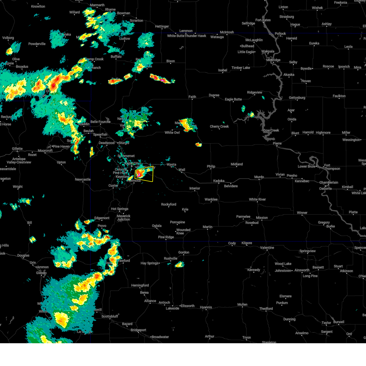 At 404 pm mdt, a severe thunderstorm was located 4 miles east of black gap, or 11 miles southeast of rapid city, moving east at 15 mph (radar indicated). Hazards include ping pong ball size hail. People and animals outdoors will be injured. expect damage to roofs, siding, windows, and vehicles. this severe thunderstorm will be near, rapid city airport around 410 pm mdt. other locations in the path of this severe thunderstorm include thompson butte, caputa, farmingdale and railroad buttes. hail threat, radar indicated max hail size, 1. 50 in wind threat, radar indicated max wind gust, <50 mph. At 404 pm mdt, a severe thunderstorm was located 4 miles east of black gap, or 11 miles southeast of rapid city, moving east at 15 mph (radar indicated). Hazards include ping pong ball size hail. People and animals outdoors will be injured. expect damage to roofs, siding, windows, and vehicles. this severe thunderstorm will be near, rapid city airport around 410 pm mdt. other locations in the path of this severe thunderstorm include thompson butte, caputa, farmingdale and railroad buttes. hail threat, radar indicated max hail size, 1. 50 in wind threat, radar indicated max wind gust, <50 mph.
|
| 5/30/2023 4:00 PM MDT |
 At 400 pm mdt, a severe thunderstorm was located near black gap, or 9 miles southeast of rapid city, moving east at 10 mph (radar indicated). Hazards include ping pong ball size hail. People and animals outdoors will be injured. expect damage to roofs, siding, windows, and vehicles. locations impacted include, southeastern rapid valley, black gap and rapid city airport. hail threat, radar indicated max hail size, 1. 50 in wind threat, radar indicated max wind gust, <50 mph. At 400 pm mdt, a severe thunderstorm was located near black gap, or 9 miles southeast of rapid city, moving east at 10 mph (radar indicated). Hazards include ping pong ball size hail. People and animals outdoors will be injured. expect damage to roofs, siding, windows, and vehicles. locations impacted include, southeastern rapid valley, black gap and rapid city airport. hail threat, radar indicated max hail size, 1. 50 in wind threat, radar indicated max wind gust, <50 mph.
|
| 5/30/2023 3:50 PM MDT |
 At 350 pm mdt, a severe thunderstorm was located over black gap, or 8 miles southeast of rapid city, moving east at 10 mph (radar indicated). Hazards include ping pong ball size hail. People and animals outdoors will be injured. expect damage to roofs, siding, windows, and vehicles. locations impacted include, southern rapid city, southern rapid valley, rapid city airport, hart ranch, black gap and reptile gardens. hail threat, radar indicated max hail size, 1. 50 in wind threat, radar indicated max wind gust, <50 mph. At 350 pm mdt, a severe thunderstorm was located over black gap, or 8 miles southeast of rapid city, moving east at 10 mph (radar indicated). Hazards include ping pong ball size hail. People and animals outdoors will be injured. expect damage to roofs, siding, windows, and vehicles. locations impacted include, southern rapid city, southern rapid valley, rapid city airport, hart ranch, black gap and reptile gardens. hail threat, radar indicated max hail size, 1. 50 in wind threat, radar indicated max wind gust, <50 mph.
|
| 5/30/2023 3:48 PM MDT | Quarter sized hail reported 6.2 miles NNW of Rapid City, SD, mostly smaller. few one and one eight inch pieces. |
| 5/30/2023 3:47 PM MDT | Quarter sized hail reported 6.8 miles NNW of Rapid City, SD, mostly dimes and nickels but a few quarters. |
| 5/30/2023 3:33 PM MDT |
 At 333 pm mdt, a severe thunderstorm was located over hart ranch, or 5 miles south of rapid city, moving east at 15 mph (radar indicated). Hazards include quarter size hail. Damage to vehicles is expected. locations impacted include, southern rapid city, southern rapid valley, rapid city airport, hart ranch, black gap and reptile gardens. hail threat, radar indicated max hail size, 1. 00 in wind threat, radar indicated max wind gust, <50 mph. At 333 pm mdt, a severe thunderstorm was located over hart ranch, or 5 miles south of rapid city, moving east at 15 mph (radar indicated). Hazards include quarter size hail. Damage to vehicles is expected. locations impacted include, southern rapid city, southern rapid valley, rapid city airport, hart ranch, black gap and reptile gardens. hail threat, radar indicated max hail size, 1. 00 in wind threat, radar indicated max wind gust, <50 mph.
|
| 5/30/2023 3:20 PM MDT |
 At 319 pm mdt, a severe thunderstorm was located over bear country, or 7 miles southwest of rapid city, moving east at 10 mph (radar indicated). Hazards include quarter size hail. damage to vehicles is expected At 319 pm mdt, a severe thunderstorm was located over bear country, or 7 miles southwest of rapid city, moving east at 10 mph (radar indicated). Hazards include quarter size hail. damage to vehicles is expected
|
| 5/30/2023 2:58 PM MDT | Quarter sized hail reported 6.2 miles NNW of Rapid City, SD, mostly nickels. couple quarters. |
| 5/29/2023 3:00 PM MDT |
 At 259 pm mdt, a severe thunderstorm was located 3 miles northeast of caputa, or 16 miles east of rapid city, moving east at 20 mph (radar indicated). Hazards include 60 mph wind gusts and quarter size hail. Hail damage to vehicles is expected. expect wind damage to roofs, siding, and trees. this severe thunderstorm will be near, farmingdale around 305 pm mdt. new underwood around 310 pm mdt. other locations in the path of this severe thunderstorm include owanka and wasta. this includes interstate 90 in south dakota between mile markers 67 and 99. hail threat, radar indicated max hail size, 1. 00 in wind threat, radar indicated max wind gust, 60 mph. At 259 pm mdt, a severe thunderstorm was located 3 miles northeast of caputa, or 16 miles east of rapid city, moving east at 20 mph (radar indicated). Hazards include 60 mph wind gusts and quarter size hail. Hail damage to vehicles is expected. expect wind damage to roofs, siding, and trees. this severe thunderstorm will be near, farmingdale around 305 pm mdt. new underwood around 310 pm mdt. other locations in the path of this severe thunderstorm include owanka and wasta. this includes interstate 90 in south dakota between mile markers 67 and 99. hail threat, radar indicated max hail size, 1. 00 in wind threat, radar indicated max wind gust, 60 mph.
|
| 5/29/2023 2:50 PM MDT | Storm damage reported in pennington county SD, 8 miles W of Rapid City, SD |
| 5/29/2023 2:50 PM MDT |
 At 250 pm mdt, a severe thunderstorm was located 3 miles east of rapid city airport, or 12 miles east of rapid city, moving east at 25 mph (trained weather spotters). Hazards include 60 mph wind gusts and quarter size hail. Hail damage to vehicles is expected. expect wind damage to roofs, siding, and trees. locations impacted include, eastern rapid city, rapid valley, southern ellsworth air force base, box elder, caputa and rapid city airport. this includes interstate 90 in south dakota between mile markers 62 and 74. hail threat, radar indicated max hail size, 1. 00 in wind threat, radar indicated max wind gust, 60 mph. At 250 pm mdt, a severe thunderstorm was located 3 miles east of rapid city airport, or 12 miles east of rapid city, moving east at 25 mph (trained weather spotters). Hazards include 60 mph wind gusts and quarter size hail. Hail damage to vehicles is expected. expect wind damage to roofs, siding, and trees. locations impacted include, eastern rapid city, rapid valley, southern ellsworth air force base, box elder, caputa and rapid city airport. this includes interstate 90 in south dakota between mile markers 62 and 74. hail threat, radar indicated max hail size, 1. 00 in wind threat, radar indicated max wind gust, 60 mph.
|
| 5/29/2023 2:35 PM MDT | Half Dollar sized hail reported 2.6 miles SSW of Rapid City, SD |
| 5/29/2023 2:31 PM MDT |
 At 231 pm mdt, a severe thunderstorm was located over rapid valley, or 4 miles east of rapid city, moving east at 20 mph. quarter sized hail is currently being observed in downtown rapid city (trained weather spotters). Hazards include 70 mph wind gusts and half dollar size hail. Hail damage to vehicles is expected. expect considerable tree damage. wind damage is also likely to mobile homes, roofs, and outbuildings. locations impacted include, rapid city, rapid valley, ellsworth air force base, box elder, caputa and rapid city airport. this includes interstate 90 in south dakota between mile markers 58 and 74. thunderstorm damage threat, considerable hail threat, observed max hail size, 1. 25 in wind threat, radar indicated max wind gust, 70 mph. At 231 pm mdt, a severe thunderstorm was located over rapid valley, or 4 miles east of rapid city, moving east at 20 mph. quarter sized hail is currently being observed in downtown rapid city (trained weather spotters). Hazards include 70 mph wind gusts and half dollar size hail. Hail damage to vehicles is expected. expect considerable tree damage. wind damage is also likely to mobile homes, roofs, and outbuildings. locations impacted include, rapid city, rapid valley, ellsworth air force base, box elder, caputa and rapid city airport. this includes interstate 90 in south dakota between mile markers 58 and 74. thunderstorm damage threat, considerable hail threat, observed max hail size, 1. 25 in wind threat, radar indicated max wind gust, 70 mph.
|
| 5/29/2023 2:28 PM MDT | Quarter sized hail reported 0.3 miles SSE of Rapid City, SD |
| 5/29/2023 2:25 PM MDT | Quarter sized hail reported 3.9 miles W of Rapid City, SD |
| 5/29/2023 2:25 PM MDT |
 At 224 pm mdt, a severe thunderstorm was located over southeastern rapid city, moving east at 20 mph. quarter to half dollar sized hail was recently observed 1 mile north of downtown rapid city (trained weather spotters). Hazards include half dollar size hail. Damage to vehicles is expected. locations impacted include, rapid valley, ellsworth air force base, box elder, rapid city airport and caputa. this includes interstate 90 in south dakota between mile markers 56 and 74. hail threat, radar indicated max hail size, 1. 25 in wind threat, radar indicated max wind gust, <50 mph. At 224 pm mdt, a severe thunderstorm was located over southeastern rapid city, moving east at 20 mph. quarter to half dollar sized hail was recently observed 1 mile north of downtown rapid city (trained weather spotters). Hazards include half dollar size hail. Damage to vehicles is expected. locations impacted include, rapid valley, ellsworth air force base, box elder, rapid city airport and caputa. this includes interstate 90 in south dakota between mile markers 56 and 74. hail threat, radar indicated max hail size, 1. 25 in wind threat, radar indicated max wind gust, <50 mph.
|
| 5/29/2023 2:24 PM MDT | Quarter sized hail reported 3.2 miles NE of Rapid City, SD, mostly dimes. a few quarters. |
| 5/29/2023 2:23 PM MDT | Half Dollar sized hail reported 1.8 miles SSE of Rapid City, SD |
| 5/29/2023 2:03 PM MDT |
 At 203 pm mdt, a severe thunderstorm was located 3 miles southwest of black hawk, or 6 miles northwest of rapid city, moving east at 20 mph (radar indicated). Hazards include quarter size hail. Damage to vehicles is expected. this severe thunderstorm will be near, black hawk around 210 pm mdt. rapid city around 220 pm mdt. other locations in the path of this severe thunderstorm include rapid valley, ellsworth air force base, box elder, rapid city airport and caputa. this includes interstate 90 in south dakota between mile markers 52 and 74. hail threat, radar indicated max hail size, 1. 00 in wind threat, radar indicated max wind gust, <50 mph. At 203 pm mdt, a severe thunderstorm was located 3 miles southwest of black hawk, or 6 miles northwest of rapid city, moving east at 20 mph (radar indicated). Hazards include quarter size hail. Damage to vehicles is expected. this severe thunderstorm will be near, black hawk around 210 pm mdt. rapid city around 220 pm mdt. other locations in the path of this severe thunderstorm include rapid valley, ellsworth air force base, box elder, rapid city airport and caputa. this includes interstate 90 in south dakota between mile markers 52 and 74. hail threat, radar indicated max hail size, 1. 00 in wind threat, radar indicated max wind gust, <50 mph.
|
| 5/29/2023 1:52 PM MDT | Quarter sized hail reported 11.6 miles E of Rapid City, SD |
| 5/17/2023 1:46 PM MDT |
 At 146 pm mdt, a severe thunderstorm was located near black hawk, or 7 miles north of rapid city, moving northeast at 10 mph (radar indicated). Hazards include quarter size hail. Damage to vehicles is expected. locations impacted include, ellsworth air force base, northern box elder, black hawk and summerset. this includes interstate 90 in south dakota between mile markers 47 and 54. hail threat, radar indicated max hail size, 1. 00 in wind threat, radar indicated max wind gust, <50 mph. At 146 pm mdt, a severe thunderstorm was located near black hawk, or 7 miles north of rapid city, moving northeast at 10 mph (radar indicated). Hazards include quarter size hail. Damage to vehicles is expected. locations impacted include, ellsworth air force base, northern box elder, black hawk and summerset. this includes interstate 90 in south dakota between mile markers 47 and 54. hail threat, radar indicated max hail size, 1. 00 in wind threat, radar indicated max wind gust, <50 mph.
|
| 5/17/2023 1:38 PM MDT |
 The severe thunderstorm warning for central pennington county will expire at 145 pm mdt, the storm which prompted the warning has moved out of the area. therefore, the warning will be allowed to expire. however heavy rain is still possible with this thunderstorm. The severe thunderstorm warning for central pennington county will expire at 145 pm mdt, the storm which prompted the warning has moved out of the area. therefore, the warning will be allowed to expire. however heavy rain is still possible with this thunderstorm.
|
| 5/17/2023 1:28 PM MDT |
 At 128 pm mdt, a severe thunderstorm was located over summerset, or 8 miles northwest of rapid city, moving east at 10 mph (radar indicated). Hazards include quarter size hail. damage to vehicles is expected At 128 pm mdt, a severe thunderstorm was located over summerset, or 8 miles northwest of rapid city, moving east at 10 mph (radar indicated). Hazards include quarter size hail. damage to vehicles is expected
|
| 5/17/2023 1:11 PM MDT |
 At 110 pm mdt, a severe thunderstorm was located 4 miles south of black hawk, or 4 miles west of rapid city, moving east at 10 mph (radar indicated). Hazards include quarter size hail. Damage to vehicles is expected. locations impacted include, rapid city, western rapid valley and hisega. this includes interstate 90 in south dakota between mile markers 55 and 62. hail threat, radar indicated max hail size, 1. 00 in wind threat, radar indicated max wind gust, <50 mph. At 110 pm mdt, a severe thunderstorm was located 4 miles south of black hawk, or 4 miles west of rapid city, moving east at 10 mph (radar indicated). Hazards include quarter size hail. Damage to vehicles is expected. locations impacted include, rapid city, western rapid valley and hisega. this includes interstate 90 in south dakota between mile markers 55 and 62. hail threat, radar indicated max hail size, 1. 00 in wind threat, radar indicated max wind gust, <50 mph.
|
| 5/17/2023 12:50 PM MDT | Quarter sized hail reported 6.4 miles SE of Rapid City, SD |
| 5/17/2023 12:47 PM MDT |
 At 1246 pm mdt, a severe thunderstorm was located 3 miles northeast of hisega, or 5 miles west of rapid city, moving east at 10 mph (radar indicated). Hazards include quarter size hail. damage to vehicles is expected At 1246 pm mdt, a severe thunderstorm was located 3 miles northeast of hisega, or 5 miles west of rapid city, moving east at 10 mph (radar indicated). Hazards include quarter size hail. damage to vehicles is expected
|
| 5/10/2023 11:09 PM MDT |
 The severe thunderstorm warning for northwestern custer and southwestern pennington counties will expire at 1115 pm mdt, the storms which prompted the warning have weakened below severe limits and no longer pose an immediate threat to life or property. therefore, the warning will be allowed to expire. however, small hail and heavy rain are still possible with these thunderstorms. The severe thunderstorm warning for northwestern custer and southwestern pennington counties will expire at 1115 pm mdt, the storms which prompted the warning have weakened below severe limits and no longer pose an immediate threat to life or property. therefore, the warning will be allowed to expire. however, small hail and heavy rain are still possible with these thunderstorms.
|
| 5/10/2023 10:53 PM MDT |
 At 1052 pm mdt, severe thunderstorms were located along a line extending from 7 miles southwest of folsom to 4 miles southwest of hermosa to 4 miles southwest of custer, moving north at 20 mph (radar indicated). Hazards include 60 mph wind gusts and quarter size hail. Hail damage to vehicles is expected. expect wind damage to roofs, siding, and trees. locations impacted include, custer, hermosa, hayward, crazy horse memorial, custer state park, sylvan lake, keystone, keystone wye, hill city, rockerville, bear country, medicine mountain, bear mountain lookout, reptile gardens, hart ranch and black gap. hail threat, radar indicated max hail size, 1. 00 in wind threat, radar indicated max wind gust, 60 mph. At 1052 pm mdt, severe thunderstorms were located along a line extending from 7 miles southwest of folsom to 4 miles southwest of hermosa to 4 miles southwest of custer, moving north at 20 mph (radar indicated). Hazards include 60 mph wind gusts and quarter size hail. Hail damage to vehicles is expected. expect wind damage to roofs, siding, and trees. locations impacted include, custer, hermosa, hayward, crazy horse memorial, custer state park, sylvan lake, keystone, keystone wye, hill city, rockerville, bear country, medicine mountain, bear mountain lookout, reptile gardens, hart ranch and black gap. hail threat, radar indicated max hail size, 1. 00 in wind threat, radar indicated max wind gust, 60 mph.
|
| 5/10/2023 10:37 PM MDT |
 At 1037 pm mdt, severe thunderstorms were located along a line extending from 8 miles southeast of hermosa to 2 miles southwest of blue bell to 2 miles northeast of dewey, moving northwest at 25 mph (radar indicated). Hazards include 60 mph wind gusts and quarter size hail. Hail damage to vehicles is expected. expect wind damage to roofs, siding, and trees. severe thunderstorms will be near, dewey around 1040 pm mdt. mount coolidge around 1045 pm mdt. stockade lake around 1050 pm mdt. custer around 1055 pm mdt. other locations in the path of these severe thunderstorms include elk mountain lookout, custer state park, sylvan lake, crazy horse memorial, keystone, hayward, rockerville, bear mountain lookout, hart ranch, bear country, medicine mountain, reptile gardens and black gap. hail threat, radar indicated max hail size, 1. 00 in wind threat, radar indicated max wind gust, 60 mph. At 1037 pm mdt, severe thunderstorms were located along a line extending from 8 miles southeast of hermosa to 2 miles southwest of blue bell to 2 miles northeast of dewey, moving northwest at 25 mph (radar indicated). Hazards include 60 mph wind gusts and quarter size hail. Hail damage to vehicles is expected. expect wind damage to roofs, siding, and trees. severe thunderstorms will be near, dewey around 1040 pm mdt. mount coolidge around 1045 pm mdt. stockade lake around 1050 pm mdt. custer around 1055 pm mdt. other locations in the path of these severe thunderstorms include elk mountain lookout, custer state park, sylvan lake, crazy horse memorial, keystone, hayward, rockerville, bear mountain lookout, hart ranch, bear country, medicine mountain, reptile gardens and black gap. hail threat, radar indicated max hail size, 1. 00 in wind threat, radar indicated max wind gust, 60 mph.
|
| 5/7/2023 4:52 PM MDT | Golf Ball sized hail reported 5.9 miles SW of Rapid City, SD, delayed report. time estimated from radar. |
| 5/7/2023 4:50 PM MDT |
 At 449 pm mdt, a severe thunderstorm was located over northeastern ellsworth air force base, or 10 miles northeast of rapid city, moving east at 20 mph (radar indicated). Hazards include ping pong ball size hail. People and animals outdoors will be injured. expect damage to roofs, siding, windows, and vehicles. locations impacted include, northeastern rapid valley, ellsworth air force base, box elder, new underwood, viewfield and curlew lake. this includes interstate 90 in south dakota between mile markers 62 and 85. hail threat, radar indicated max hail size, 1. 50 in wind threat, radar indicated max wind gust, <50 mph. At 449 pm mdt, a severe thunderstorm was located over northeastern ellsworth air force base, or 10 miles northeast of rapid city, moving east at 20 mph (radar indicated). Hazards include ping pong ball size hail. People and animals outdoors will be injured. expect damage to roofs, siding, windows, and vehicles. locations impacted include, northeastern rapid valley, ellsworth air force base, box elder, new underwood, viewfield and curlew lake. this includes interstate 90 in south dakota between mile markers 62 and 85. hail threat, radar indicated max hail size, 1. 50 in wind threat, radar indicated max wind gust, <50 mph.
|
| 5/7/2023 4:48 PM MDT | Ping Pong Ball sized hail reported 6.8 miles SSW of Rapid City, SD, pictures show at least ping pong ball sized hail. time estimated from radar. |
| 5/7/2023 4:46 PM MDT | Ping Pong Ball sized hail reported 5.3 miles SSW of Rapid City, SD |
| 5/7/2023 4:44 PM MDT |
 At 443 pm mdt, a severe thunderstorm was located over northwestern ellsworth air force base, or 8 miles northeast of rapid city, moving east at 20 mph (radar indicated). Hazards include quarter size hail. damage to vehicles is expected At 443 pm mdt, a severe thunderstorm was located over northwestern ellsworth air force base, or 8 miles northeast of rapid city, moving east at 20 mph (radar indicated). Hazards include quarter size hail. damage to vehicles is expected
|
| 7/29/2022 5:01 PM MDT | Quarter sized hail reported 4.2 miles ENE of Rapid City, SD |
| 7/10/2022 10:57 PM MDT | Storm damage reported in pennington county SD, 8 miles W of Rapid City, SD |
| 7/10/2022 10:50 PM MDT |
 At 1048 pm mdt, severe thunderstorms were located along a line extending from near viewfield to caputa, moving southeast at 55 mph (trained weather spotters). Hazards include 60 mph wind gusts and quarter size hail. Hail damage to vehicles is expected. expect wind damage to roofs, siding, and trees. locations impacted include, new underwood, farmingdale, wicksville and wasta. this includes interstate 90 in south dakota between mile markers 68 and 98. hail threat, radar indicated max hail size, 1. 00 in wind threat, radar indicated max wind gust, 60 mph. At 1048 pm mdt, severe thunderstorms were located along a line extending from near viewfield to caputa, moving southeast at 55 mph (trained weather spotters). Hazards include 60 mph wind gusts and quarter size hail. Hail damage to vehicles is expected. expect wind damage to roofs, siding, and trees. locations impacted include, new underwood, farmingdale, wicksville and wasta. this includes interstate 90 in south dakota between mile markers 68 and 98. hail threat, radar indicated max hail size, 1. 00 in wind threat, radar indicated max wind gust, 60 mph.
|
| 7/10/2022 10:45 PM MDT | Storm damage reported in pennington county SD, 8 miles W of Rapid City, SD |
| 7/10/2022 10:44 PM MDT | Quarter sized hail reported 3.9 miles W of Rapid City, SD |
| 7/10/2022 10:40 PM MDT | Storm damage reported in pennington county SD, 8 miles W of Rapid City, SD |
| 7/10/2022 10:36 PM MDT | Storm damage reported in pennington county SD, 0.3 miles SSE of Rapid City, SD |
| 7/10/2022 10:27 PM MDT |
 At 1024 pm mdt, severe thunderstorms were located along a line extending from 8 miles northeast of tilford to 3 miles northeast of johnson siding, moving east at 55 mph (trained weather spotters. at 1020 pm mdt, ping-pong ball sized hail and 58 mph wind gusts were reported 1 mile north- northwest of piedmont). Hazards include ping pong ball size hail and 60 mph wind gusts. People and animals outdoors will be injured. expect hail damage to roofs, siding, windows, and vehicles. expect wind damage to roofs, siding, and trees. these severe storms will be near, rapid city around 1030 pm mdt. rapid valley, ellsworth air force base and box elder around 1035 pm mdt. other locations in the path of these severe thunderstorms include rapid city airport, caputa, farmingdale, viewfield, curlew lake, owanka, wicksville and wasta. this includes interstate 90 in south dakota between mile markers 30 and 98. hail threat, radar indicated max hail size, 1. 50 in wind threat, radar indicated max wind gust, 60 mph. At 1024 pm mdt, severe thunderstorms were located along a line extending from 8 miles northeast of tilford to 3 miles northeast of johnson siding, moving east at 55 mph (trained weather spotters. at 1020 pm mdt, ping-pong ball sized hail and 58 mph wind gusts were reported 1 mile north- northwest of piedmont). Hazards include ping pong ball size hail and 60 mph wind gusts. People and animals outdoors will be injured. expect hail damage to roofs, siding, windows, and vehicles. expect wind damage to roofs, siding, and trees. these severe storms will be near, rapid city around 1030 pm mdt. rapid valley, ellsworth air force base and box elder around 1035 pm mdt. other locations in the path of these severe thunderstorms include rapid city airport, caputa, farmingdale, viewfield, curlew lake, owanka, wicksville and wasta. this includes interstate 90 in south dakota between mile markers 30 and 98. hail threat, radar indicated max hail size, 1. 50 in wind threat, radar indicated max wind gust, 60 mph.
|
| 7/10/2022 10:15 PM MDT |
 At 1014 pm mdt, severe thunderstorms were located along a line extending from near fort meade to 3 miles southwest of nemo, moving east at 55 mph (radar indicated). Hazards include 60 mph wind gusts and half dollar size hail. Hail damage to vehicles is expected. expect wind damage to roofs, siding, and trees. severe thunderstorms will be near, summerset, johnson siding and piedmont around 1020 pm mdt. black hawk around 1025 pm mdt. rapid city around 1030 pm mdt. other locations in the path of these severe thunderstorms include rapid valley, ellsworth air force base, box elder, rapid city airport, caputa, farmingdale, viewfield and curlew lake. this includes interstate 90 in south dakota between mile markers 30 and 98. hail threat, radar indicated max hail size, 1. 25 in wind threat, radar indicated max wind gust, 60 mph. At 1014 pm mdt, severe thunderstorms were located along a line extending from near fort meade to 3 miles southwest of nemo, moving east at 55 mph (radar indicated). Hazards include 60 mph wind gusts and half dollar size hail. Hail damage to vehicles is expected. expect wind damage to roofs, siding, and trees. severe thunderstorms will be near, summerset, johnson siding and piedmont around 1020 pm mdt. black hawk around 1025 pm mdt. rapid city around 1030 pm mdt. other locations in the path of these severe thunderstorms include rapid valley, ellsworth air force base, box elder, rapid city airport, caputa, farmingdale, viewfield and curlew lake. this includes interstate 90 in south dakota between mile markers 30 and 98. hail threat, radar indicated max hail size, 1. 25 in wind threat, radar indicated max wind gust, 60 mph.
|
| 7/2/2022 3:40 PM MDT | Quarter sized hail reported 4.4 miles ESE of Rapid City, SD |
| 7/2/2022 3:39 PM MDT |
 At 339 pm mdt, a severe thunderstorm was located over rapid city, moving east at 15 mph (radar indicated). Hazards include 60 mph wind gusts and quarter size hail. Hail damage to vehicles is expected. expect wind damage to roofs, siding, and trees. this severe thunderstorm will be near, rapid city around 345 pm mdt. rapid valley around 355 pm mdt. other locations in the path of this severe thunderstorm include southeastern ellsworth air force base, hart ranch, southern box elder, black gap, rapid city airport and caputa. this includes interstate 90 in south dakota between mile markers 54 and 74. hail threat, radar indicated max hail size, 1. 00 in wind threat, radar indicated max wind gust, 60 mph. At 339 pm mdt, a severe thunderstorm was located over rapid city, moving east at 15 mph (radar indicated). Hazards include 60 mph wind gusts and quarter size hail. Hail damage to vehicles is expected. expect wind damage to roofs, siding, and trees. this severe thunderstorm will be near, rapid city around 345 pm mdt. rapid valley around 355 pm mdt. other locations in the path of this severe thunderstorm include southeastern ellsworth air force base, hart ranch, southern box elder, black gap, rapid city airport and caputa. this includes interstate 90 in south dakota between mile markers 54 and 74. hail threat, radar indicated max hail size, 1. 00 in wind threat, radar indicated max wind gust, 60 mph.
|
| 7/2/2022 3:35 PM MDT | Quarter sized hail reported 3.9 miles SE of Rapid City, SD |
| 7/1/2022 5:08 PM MDT |
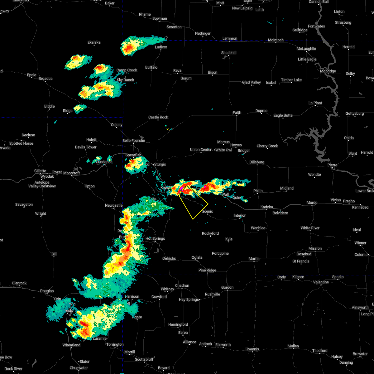 At 508 pm mdt, a severe thunderstorm was located over farmingdale, or 16 miles east of rapid city, moving southeast at 15 mph (radar indicated). Hazards include 60 mph wind gusts and quarter size hail. Hail damage to vehicles is expected. expect wind damage to roofs, siding, and trees. this severe thunderstorm will be near, railroad buttes around 535 pm mdt. folsom around 540 pm mdt. this includes interstate 90 in south dakota between mile markers 73 and 77. hail threat, radar indicated max hail size, 1. 00 in wind threat, radar indicated max wind gust, 60 mph. At 508 pm mdt, a severe thunderstorm was located over farmingdale, or 16 miles east of rapid city, moving southeast at 15 mph (radar indicated). Hazards include 60 mph wind gusts and quarter size hail. Hail damage to vehicles is expected. expect wind damage to roofs, siding, and trees. this severe thunderstorm will be near, railroad buttes around 535 pm mdt. folsom around 540 pm mdt. this includes interstate 90 in south dakota between mile markers 73 and 77. hail threat, radar indicated max hail size, 1. 00 in wind threat, radar indicated max wind gust, 60 mph.
|
| 7/1/2022 4:56 PM MDT |
 At 456 pm mdt, a severe thunderstorm was located near rapid city airport, or 10 miles east of rapid city, moving southeast at 10 mph (radar indicated). Hazards include 60 mph wind gusts and quarter size hail. Hail damage to vehicles is expected. expect wind damage to roofs, siding, and trees. locations impacted include, eastern rapid valley, southeastern box elder, caputa and rapid city airport. this includes interstate 90 in south dakota between mile markers 68 and 75. hail threat, radar indicated max hail size, 1. 00 in wind threat, radar indicated max wind gust, 60 mph. At 456 pm mdt, a severe thunderstorm was located near rapid city airport, or 10 miles east of rapid city, moving southeast at 10 mph (radar indicated). Hazards include 60 mph wind gusts and quarter size hail. Hail damage to vehicles is expected. expect wind damage to roofs, siding, and trees. locations impacted include, eastern rapid valley, southeastern box elder, caputa and rapid city airport. this includes interstate 90 in south dakota between mile markers 68 and 75. hail threat, radar indicated max hail size, 1. 00 in wind threat, radar indicated max wind gust, 60 mph.
|
| 7/1/2022 4:55 PM MDT | Storm damage reported in pennington county SD, 8 miles W of Rapid City, SD |
| 7/1/2022 4:32 PM MDT |
 At 432 pm mdt, a severe thunderstorm was located over southern box elder, or 8 miles northeast of rapid city, moving southeast at 10 mph (radar indicated). Hazards include 60 mph wind gusts and quarter size hail. Hail damage to vehicles is expected. Expect wind damage to roofs, siding, and trees. At 432 pm mdt, a severe thunderstorm was located over southern box elder, or 8 miles northeast of rapid city, moving southeast at 10 mph (radar indicated). Hazards include 60 mph wind gusts and quarter size hail. Hail damage to vehicles is expected. Expect wind damage to roofs, siding, and trees.
|
| 6/20/2022 3:49 PM MDT |
 At 349 pm mdt, severe thunderstorms were located along a line extending from 2 miles southeast of apple springs to near johnson siding to 2 miles northeast of keystone wye, moving northeast at 40 mph (radar indicated). Hazards include 60 mph wind gusts. Expect damage to roofs, siding, and trees. locations impacted include, southeastern sturgis, tilford, fort meade, rapid city, black hawk, summerset, piedmont, reptile gardens, hart ranch, black gap, rapid valley, ellsworth air force base, rapid city airport and box elder. this includes interstate 90 in south dakota between mile markers 33 and 70. hail threat, radar indicated max hail size, <. 75 in wind threat, radar indicated max wind gust, 60 mph. At 349 pm mdt, severe thunderstorms were located along a line extending from 2 miles southeast of apple springs to near johnson siding to 2 miles northeast of keystone wye, moving northeast at 40 mph (radar indicated). Hazards include 60 mph wind gusts. Expect damage to roofs, siding, and trees. locations impacted include, southeastern sturgis, tilford, fort meade, rapid city, black hawk, summerset, piedmont, reptile gardens, hart ranch, black gap, rapid valley, ellsworth air force base, rapid city airport and box elder. this includes interstate 90 in south dakota between mile markers 33 and 70. hail threat, radar indicated max hail size, <. 75 in wind threat, radar indicated max wind gust, 60 mph.
|
| 6/20/2022 3:33 PM MDT |
 At 332 pm mdt, severe thunderstorms were located along a line extending from near brownsville to 4 miles north of hill city to custer state park, moving northeast at 40 mph (radar indicated). Hazards include 60 mph wind gusts. Expect damage to roofs, siding, and trees. these severe storms will be near, galena and pactola reservoir around 340 pm mdt. johnson siding, keystone, hisega, keystone wye and sheridan lake around 345 pm mdt. southeastern sturgis, rockerville, hayward and dalton lake around 350 pm mdt. black gap around 405 pm mdt. rapid valley, ellsworth air force base and box elder around 410 pm mdt. rapid city airport around 415 pm mdt. this includes interstate 90 in south dakota between mile markers 33 and 70. hail threat, radar indicated max hail size, <. 75 in wind threat, radar indicated max wind gust, 60 mph. At 332 pm mdt, severe thunderstorms were located along a line extending from near brownsville to 4 miles north of hill city to custer state park, moving northeast at 40 mph (radar indicated). Hazards include 60 mph wind gusts. Expect damage to roofs, siding, and trees. these severe storms will be near, galena and pactola reservoir around 340 pm mdt. johnson siding, keystone, hisega, keystone wye and sheridan lake around 345 pm mdt. southeastern sturgis, rockerville, hayward and dalton lake around 350 pm mdt. black gap around 405 pm mdt. rapid valley, ellsworth air force base and box elder around 410 pm mdt. rapid city airport around 415 pm mdt. this includes interstate 90 in south dakota between mile markers 33 and 70. hail threat, radar indicated max hail size, <. 75 in wind threat, radar indicated max wind gust, 60 mph.
|
| 6/20/2022 3:10 PM MDT |
 At 310 pm mdt, severe thunderstorms were located along a line extending from 2 miles northwest of crooks tower to 5 miles west of bear mountain lookout to 3 miles south of jewel cave national monument, moving northeast at 50 mph (radar indicated). Hazards include 60 mph wind gusts and nickel size hail. Expect damage to roofs, siding, and trees. severe thunderstorms will be near, bear mountain lookout, black fox campground and deerfield reservoir around 315 pm mdt. medicine mountain around 320 pm mdt. custer, hill city, mystic, roubaix lake and crazy horse memorial around 325 pm mdt. silver city, brownsville, stockade lake, sylvan lake, northern custer state park, black elk peak and palmer gulch resort around 330 pm mdt. this includes interstate 90 in south dakota between mile markers 33 and 70. hail threat, radar indicated max hail size, 0. 88 in wind threat, radar indicated max wind gust, 60 mph. At 310 pm mdt, severe thunderstorms were located along a line extending from 2 miles northwest of crooks tower to 5 miles west of bear mountain lookout to 3 miles south of jewel cave national monument, moving northeast at 50 mph (radar indicated). Hazards include 60 mph wind gusts and nickel size hail. Expect damage to roofs, siding, and trees. severe thunderstorms will be near, bear mountain lookout, black fox campground and deerfield reservoir around 315 pm mdt. medicine mountain around 320 pm mdt. custer, hill city, mystic, roubaix lake and crazy horse memorial around 325 pm mdt. silver city, brownsville, stockade lake, sylvan lake, northern custer state park, black elk peak and palmer gulch resort around 330 pm mdt. this includes interstate 90 in south dakota between mile markers 33 and 70. hail threat, radar indicated max hail size, 0. 88 in wind threat, radar indicated max wind gust, 60 mph.
|
| 6/18/2022 4:37 PM MDT |
 At 437 pm mdt, a severe thunderstorm was located over thompson butte, or 15 miles southeast of rapid city, moving northeast at 40 mph (radar indicated). Hazards include 60 mph wind gusts. Expect damage to roofs, siding, and trees. locations impacted include, caputa, farmingdale and rapid city airport. hail threat, radar indicated max hail size, <. 75 in wind threat, radar indicated max wind gust, 60 mph. At 437 pm mdt, a severe thunderstorm was located over thompson butte, or 15 miles southeast of rapid city, moving northeast at 40 mph (radar indicated). Hazards include 60 mph wind gusts. Expect damage to roofs, siding, and trees. locations impacted include, caputa, farmingdale and rapid city airport. hail threat, radar indicated max hail size, <. 75 in wind threat, radar indicated max wind gust, 60 mph.
|
| 6/18/2022 4:16 PM MDT |
 At 416 pm mdt, a severe thunderstorm was located 4 miles northeast of fairburn, or 23 miles east of custer, moving northeast at 30 mph (radar indicated). Hazards include 60 mph wind gusts. Expect damage to roofs, siding, and trees. this severe thunderstorm will be near, hermosa around 425 pm mdt. other locations in the path of this severe thunderstorm include thompson butte, caputa, farmingdale and rapid city airport. hail threat, radar indicated max hail size, <. 75 in wind threat, radar indicated max wind gust, 60 mph. At 416 pm mdt, a severe thunderstorm was located 4 miles northeast of fairburn, or 23 miles east of custer, moving northeast at 30 mph (radar indicated). Hazards include 60 mph wind gusts. Expect damage to roofs, siding, and trees. this severe thunderstorm will be near, hermosa around 425 pm mdt. other locations in the path of this severe thunderstorm include thompson butte, caputa, farmingdale and rapid city airport. hail threat, radar indicated max hail size, <. 75 in wind threat, radar indicated max wind gust, 60 mph.
|
| 6/13/2022 9:42 PM MDT |
 At 942 pm mdt, severe thunderstorms were located along a line extending from 3 miles north of hermosa to 2 miles southwest of red shirt to 4 miles south of intersection of red shirt and cuny table roads, moving east at 30 mph (radar indicated). Hazards include tennis ball size hail and 60 mph wind gusts. People and animals outdoors will be injured. expect hail damage to roofs, siding, windows, and vehicles. expect wind damage to roofs, siding, and trees. these severe storms will be near, red shirt, intersection of red shirt and cuny table roads and red shirt table overlook around 945 pm mdt. other locations in the path of these severe thunderstorms include caputa, thompson butte, farmingdale, folsom, railroad buttes, scenic, sheep mountain table, owanka and badlands national park. this includes interstate 90 in south dakota between mile markers 74 and 85. thunderstorm damage threat, considerable hail threat, radar indicated max hail size, 2. 50 in wind threat, radar indicated max wind gust, 60 mph. At 942 pm mdt, severe thunderstorms were located along a line extending from 3 miles north of hermosa to 2 miles southwest of red shirt to 4 miles south of intersection of red shirt and cuny table roads, moving east at 30 mph (radar indicated). Hazards include tennis ball size hail and 60 mph wind gusts. People and animals outdoors will be injured. expect hail damage to roofs, siding, windows, and vehicles. expect wind damage to roofs, siding, and trees. these severe storms will be near, red shirt, intersection of red shirt and cuny table roads and red shirt table overlook around 945 pm mdt. other locations in the path of these severe thunderstorms include caputa, thompson butte, farmingdale, folsom, railroad buttes, scenic, sheep mountain table, owanka and badlands national park. this includes interstate 90 in south dakota between mile markers 74 and 85. thunderstorm damage threat, considerable hail threat, radar indicated max hail size, 2. 50 in wind threat, radar indicated max wind gust, 60 mph.
|
| 6/13/2022 9:25 PM MDT |
 At 925 pm mdt, a severe thunderstorm was located 8 miles southeast of fairburn, or 23 miles northeast of hot springs, moving northeast at 40 mph. this is a destructive storm for fairburn and redshirt (radar indicated). Hazards include baseball size hail and 60 mph wind gusts. People and animals outdoors will be severely injured. expect shattered windows, extensive damage to roofs, siding, and vehicles. this severe thunderstorm will be near, red shirt around 940 pm mdt. other locations in the path of this severe thunderstorm include folsom, railroad buttes and owanka. this includes interstate 90 in south dakota between mile markers 74 and 85. thunderstorm damage threat, destructive hail threat, radar indicated max hail size, 2. 75 in wind threat, radar indicated max wind gust, 60 mph. At 925 pm mdt, a severe thunderstorm was located 8 miles southeast of fairburn, or 23 miles northeast of hot springs, moving northeast at 40 mph. this is a destructive storm for fairburn and redshirt (radar indicated). Hazards include baseball size hail and 60 mph wind gusts. People and animals outdoors will be severely injured. expect shattered windows, extensive damage to roofs, siding, and vehicles. this severe thunderstorm will be near, red shirt around 940 pm mdt. other locations in the path of this severe thunderstorm include folsom, railroad buttes and owanka. this includes interstate 90 in south dakota between mile markers 74 and 85. thunderstorm damage threat, destructive hail threat, radar indicated max hail size, 2. 75 in wind threat, radar indicated max wind gust, 60 mph.
|
| 6/13/2022 9:14 PM MDT |
 At 913 pm mdt, a severe thunderstorm was located over thompson butte, or 16 miles southeast of rapid city, moving northeast at 35 mph (radar indicated). Hazards include 60 mph wind gusts and half dollar size hail. Hail damage to vehicles is expected. expect wind damage to roofs, siding, and trees. locations impacted include, new underwood, caputa, farmingdale, rapid city airport, thompson butte and viewfield. this includes interstate 90 in south dakota between mile markers 69 and 82. hail threat, radar indicated max hail size, 1. 25 in wind threat, radar indicated max wind gust, 60 mph. At 913 pm mdt, a severe thunderstorm was located over thompson butte, or 16 miles southeast of rapid city, moving northeast at 35 mph (radar indicated). Hazards include 60 mph wind gusts and half dollar size hail. Hail damage to vehicles is expected. expect wind damage to roofs, siding, and trees. locations impacted include, new underwood, caputa, farmingdale, rapid city airport, thompson butte and viewfield. this includes interstate 90 in south dakota between mile markers 69 and 82. hail threat, radar indicated max hail size, 1. 25 in wind threat, radar indicated max wind gust, 60 mph.
|
| 6/13/2022 8:58 PM MDT |
 At 858 pm mdt, a severe thunderstorm was located 6 miles southwest of thompson butte, or 16 miles southeast of rapid city, moving northeast at 35 mph (radar indicated). Hazards include 60 mph wind gusts and half dollar size hail. Hail damage to vehicles is expected. expect wind damage to roofs, siding, and trees. locations impacted include, eastern rapid valley, eastern ellsworth air force base, box elder, new underwood, hermosa, caputa, farmingdale, hereford, curlew lake, rapid city airport, viewfield and thompson butte. this includes interstate 90 in south dakota between mile markers 65 and 82. hail threat, radar indicated max hail size, 1. 25 in wind threat, radar indicated max wind gust, 60 mph. At 858 pm mdt, a severe thunderstorm was located 6 miles southwest of thompson butte, or 16 miles southeast of rapid city, moving northeast at 35 mph (radar indicated). Hazards include 60 mph wind gusts and half dollar size hail. Hail damage to vehicles is expected. expect wind damage to roofs, siding, and trees. locations impacted include, eastern rapid valley, eastern ellsworth air force base, box elder, new underwood, hermosa, caputa, farmingdale, hereford, curlew lake, rapid city airport, viewfield and thompson butte. this includes interstate 90 in south dakota between mile markers 65 and 82. hail threat, radar indicated max hail size, 1. 25 in wind threat, radar indicated max wind gust, 60 mph.
|
| 6/13/2022 8:48 PM MDT |
 At 848 pm mdt, a severe thunderstorm was located near hermosa, or 14 miles south of rapid city, moving northeast at 50 mph (radar indicated). Hazards include 60 mph wind gusts and quarter size hail. Hail damage to vehicles is expected. expect wind damage to roofs, siding, and trees. locations impacted include, black gap, caputa, thompson butte, rapid valley, rapid city airport, ellsworth air force base, box elder, viewfield, curlew lake and hereford. this includes interstate 90 in south dakota between mile markers 56 and 82. hail threat, radar indicated max hail size, 1. 00 in wind threat, radar indicated max wind gust, 60 mph. At 848 pm mdt, a severe thunderstorm was located near hermosa, or 14 miles south of rapid city, moving northeast at 50 mph (radar indicated). Hazards include 60 mph wind gusts and quarter size hail. Hail damage to vehicles is expected. expect wind damage to roofs, siding, and trees. locations impacted include, black gap, caputa, thompson butte, rapid valley, rapid city airport, ellsworth air force base, box elder, viewfield, curlew lake and hereford. this includes interstate 90 in south dakota between mile markers 56 and 82. hail threat, radar indicated max hail size, 1. 00 in wind threat, radar indicated max wind gust, 60 mph.
|
| 6/13/2022 8:33 PM MDT |
 At 832 pm mdt, a severe thunderstorm was located 4 miles south of hayward, or 14 miles east of custer, moving northeast at 50 mph (radar indicated). Hazards include 60 mph wind gusts and quarter size hail. Hail damage to vehicles is expected. expect wind damage to roofs, siding, and trees. this severe thunderstorm will be near, rockerville, hart ranch and bear country around 845 pm mdt. rapid city, black gap and reptile gardens around 850 pm mdt. other locations in the path of this severe thunderstorm include rapid valley, rapid city airport, ellsworth air force base, box elder and hereford. this includes interstate 90 in south dakota between mile markers 47 and 81. hail threat, radar indicated max hail size, 1. 00 in wind threat, radar indicated max wind gust, 60 mph. At 832 pm mdt, a severe thunderstorm was located 4 miles south of hayward, or 14 miles east of custer, moving northeast at 50 mph (radar indicated). Hazards include 60 mph wind gusts and quarter size hail. Hail damage to vehicles is expected. expect wind damage to roofs, siding, and trees. this severe thunderstorm will be near, rockerville, hart ranch and bear country around 845 pm mdt. rapid city, black gap and reptile gardens around 850 pm mdt. other locations in the path of this severe thunderstorm include rapid valley, rapid city airport, ellsworth air force base, box elder and hereford. this includes interstate 90 in south dakota between mile markers 47 and 81. hail threat, radar indicated max hail size, 1. 00 in wind threat, radar indicated max wind gust, 60 mph.
|
| 6/11/2022 10:54 PM MDT |
 At 1053 pm mdt, severe thunderstorms were located along a line extending from 4 miles northwest of ellsworth air force base to near black gap, moving east at 50 mph (radar indicated). Hazards include 60 mph wind gusts and quarter size hail. Hail damage to vehicles is expected. expect wind damage to roofs, siding, and trees. locations impacted include, rapid city airport, caputa, thompson butte, farmingdale, viewfield, new underwood, curlew lake, owanka and wicksville. this includes interstate 90 in south dakota between mile markers 57 and 93. hail threat, radar indicated max hail size, 1. 00 in wind threat, radar indicated max wind gust, 60 mph. At 1053 pm mdt, severe thunderstorms were located along a line extending from 4 miles northwest of ellsworth air force base to near black gap, moving east at 50 mph (radar indicated). Hazards include 60 mph wind gusts and quarter size hail. Hail damage to vehicles is expected. expect wind damage to roofs, siding, and trees. locations impacted include, rapid city airport, caputa, thompson butte, farmingdale, viewfield, new underwood, curlew lake, owanka and wicksville. this includes interstate 90 in south dakota between mile markers 57 and 93. hail threat, radar indicated max hail size, 1. 00 in wind threat, radar indicated max wind gust, 60 mph.
|
| 6/11/2022 10:36 PM MDT |
 At 1036 pm mdt, severe thunderstorms were located along a line extending from near tilford to 3 miles southwest of hisega, moving east at 45 mph (radar indicated). Hazards include 60 mph wind gusts and quarter size hail. Hail damage to vehicles is expected. expect wind damage to roofs, siding, and trees. severe thunderstorms will be near, summerset around 1040 pm mdt. black hawk and bear country around 1045 pm mdt. rapid city and reptile gardens around 1050 pm mdt. rapid valley, ellsworth air force base and black gap around 1055 pm mdt. other locations in the path of these severe thunderstorms include rapid city airport, caputa, thompson butte, new underwood, farmingdale and viewfield. this includes interstate 90 in south dakota between mile markers 38 and 93. hail threat, radar indicated max hail size, 1. 00 in wind threat, radar indicated max wind gust, 60 mph. At 1036 pm mdt, severe thunderstorms were located along a line extending from near tilford to 3 miles southwest of hisega, moving east at 45 mph (radar indicated). Hazards include 60 mph wind gusts and quarter size hail. Hail damage to vehicles is expected. expect wind damage to roofs, siding, and trees. severe thunderstorms will be near, summerset around 1040 pm mdt. black hawk and bear country around 1045 pm mdt. rapid city and reptile gardens around 1050 pm mdt. rapid valley, ellsworth air force base and black gap around 1055 pm mdt. other locations in the path of these severe thunderstorms include rapid city airport, caputa, thompson butte, new underwood, farmingdale and viewfield. this includes interstate 90 in south dakota between mile markers 38 and 93. hail threat, radar indicated max hail size, 1. 00 in wind threat, radar indicated max wind gust, 60 mph.
|
| 6/11/2022 9:35 PM MDT |
 At 935 pm mdt, a severe thunderstorm was located 3 miles northeast of new underwood, or 23 miles east of rapid city, moving southeast at 55 mph (radar indicated). Hazards include 70 mph wind gusts. Expect considerable tree damage. damage is likely to mobile homes, roofs, and outbuildings. this severe thunderstorm will be near, owanka around 950 pm mdt. other locations in the path of this severe thunderstorm include northern badlands national park. this includes interstate 90 in south dakota between mile markers 65 and 86. thunderstorm damage threat, considerable hail threat, radar indicated max hail size, <. 75 in wind threat, radar indicated max wind gust, 70 mph. At 935 pm mdt, a severe thunderstorm was located 3 miles northeast of new underwood, or 23 miles east of rapid city, moving southeast at 55 mph (radar indicated). Hazards include 70 mph wind gusts. Expect considerable tree damage. damage is likely to mobile homes, roofs, and outbuildings. this severe thunderstorm will be near, owanka around 950 pm mdt. other locations in the path of this severe thunderstorm include northern badlands national park. this includes interstate 90 in south dakota between mile markers 65 and 86. thunderstorm damage threat, considerable hail threat, radar indicated max hail size, <. 75 in wind threat, radar indicated max wind gust, 70 mph.
|
| 6/7/2022 2:21 PM MDT |
 At 221 pm mdt, a severe thunderstorm was located over rockerville, or 9 miles southwest of rapid city, moving southeast at 15 mph (radar indicated). Hazards include quarter size hail. Damage to vehicles is expected. locations impacted include, southwestern rapid city, keystone, hayward, rockerville, bear country, keystone wye, hart ranch, reptile gardens and mount rushmore national memorial. hail threat, radar indicated max hail size, 1. 00 in wind threat, radar indicated max wind gust, <50 mph. At 221 pm mdt, a severe thunderstorm was located over rockerville, or 9 miles southwest of rapid city, moving southeast at 15 mph (radar indicated). Hazards include quarter size hail. Damage to vehicles is expected. locations impacted include, southwestern rapid city, keystone, hayward, rockerville, bear country, keystone wye, hart ranch, reptile gardens and mount rushmore national memorial. hail threat, radar indicated max hail size, 1. 00 in wind threat, radar indicated max wind gust, <50 mph.
|
| 6/7/2022 2:12 PM MDT |
 At 212 pm mdt, a severe thunderstorm was located over northeastern rapid city, moving southeast at 15 mph (radar indicated). Hazards include 60 mph wind gusts and quarter size hail. Hail damage to vehicles is expected. expect wind damage to roofs, siding, and trees. this severe storm will be near, ellsworth air force base around 215 pm mdt. other locations in the path of this severe thunderstorm include rapid valley and box elder. this includes interstate 90 in south dakota between mile markers 55 and 68. hail threat, radar indicated max hail size, 1. 00 in wind threat, radar indicated max wind gust, 60 mph. At 212 pm mdt, a severe thunderstorm was located over northeastern rapid city, moving southeast at 15 mph (radar indicated). Hazards include 60 mph wind gusts and quarter size hail. Hail damage to vehicles is expected. expect wind damage to roofs, siding, and trees. this severe storm will be near, ellsworth air force base around 215 pm mdt. other locations in the path of this severe thunderstorm include rapid valley and box elder. this includes interstate 90 in south dakota between mile markers 55 and 68. hail threat, radar indicated max hail size, 1. 00 in wind threat, radar indicated max wind gust, 60 mph.
|
| 6/7/2022 2:11 PM MDT |
 At 210 pm mdt, a severe thunderstorm was located near rockerville, or 9 miles east of hill city, moving east at 15 mph (trained weather spotters). Hazards include hail up to golf ball hail. People and animals outdoors will be injured. expect damage to roofs, siding, windows, and vehicles. locations impacted include, rockerville, southern rapid city, hayward, bear country, reptile gardens and hart ranch. thunderstorm damage threat, considerable hail threat, radar indicated max hail size, 1. 75 in wind threat, radar indicated max wind gust, <50 mph. At 210 pm mdt, a severe thunderstorm was located near rockerville, or 9 miles east of hill city, moving east at 15 mph (trained weather spotters). Hazards include hail up to golf ball hail. People and animals outdoors will be injured. expect damage to roofs, siding, windows, and vehicles. locations impacted include, rockerville, southern rapid city, hayward, bear country, reptile gardens and hart ranch. thunderstorm damage threat, considerable hail threat, radar indicated max hail size, 1. 75 in wind threat, radar indicated max wind gust, <50 mph.
|
| 6/7/2022 2:05 PM MDT | Quarter sized hail reported 2.3 miles ESE of Rapid City, SD |
| 6/7/2022 2:01 PM MDT | Quarter sized hail reported 2.3 miles ESE of Rapid City, SD |
| 6/7/2022 2:00 PM MDT | Golf Ball sized hail reported 14.3 miles ENE of Rapid City, SD, large hail lasted for several minutes... still some small hail about ten minutes after hail started |
| 6/7/2022 1:58 PM MDT |
 At 157 pm mdt, a severe thunderstorm was located over sheridan lake, or 6 miles northeast of hill city, moving southeast at 15 mph (radar indicated). Hazards include ping pong ball size hail. People and animals outdoors will be injured. expect damage to roofs, siding, windows, and vehicles. locations impacted include, keystone wye, mount rushmore national memorial, rockerville, keystone, bear country, reptile gardens, hayward and hart ranch. hail threat, radar indicated max hail size, 1. 50 in wind threat, radar indicated max wind gust, <50 mph. At 157 pm mdt, a severe thunderstorm was located over sheridan lake, or 6 miles northeast of hill city, moving southeast at 15 mph (radar indicated). Hazards include ping pong ball size hail. People and animals outdoors will be injured. expect damage to roofs, siding, windows, and vehicles. locations impacted include, keystone wye, mount rushmore national memorial, rockerville, keystone, bear country, reptile gardens, hayward and hart ranch. hail threat, radar indicated max hail size, 1. 50 in wind threat, radar indicated max wind gust, <50 mph.
|
| 6/7/2022 1:56 PM MDT |
 At 156 pm mdt, a severe thunderstorm was located near black hawk, or 4 miles northwest of rapid city, moving east at 10 mph (radar indicated). Hazards include quarter size hail. Damage to vehicles is expected. this severe thunderstorm will be near, rapid city around 210 pm mdt. other locations in the path of this severe thunderstorm include rapid valley, ellsworth air force base and box elder. this includes interstate 90 in south dakota between mile markers 51 and 68. hail threat, radar indicated max hail size, 1. 00 in wind threat, radar indicated max wind gust, <50 mph. At 156 pm mdt, a severe thunderstorm was located near black hawk, or 4 miles northwest of rapid city, moving east at 10 mph (radar indicated). Hazards include quarter size hail. Damage to vehicles is expected. this severe thunderstorm will be near, rapid city around 210 pm mdt. other locations in the path of this severe thunderstorm include rapid valley, ellsworth air force base and box elder. this includes interstate 90 in south dakota between mile markers 51 and 68. hail threat, radar indicated max hail size, 1. 00 in wind threat, radar indicated max wind gust, <50 mph.
|
| 6/7/2022 1:45 PM MDT |
 At 145 pm mdt, severe thunderstorms were located along a line extending from near johnson siding to 4 miles northwest of sheridan lake, moving southeast at 15 mph (radar indicated). Hazards include 60 mph wind gusts and half dollar size hail. Hail damage to vehicles is expected. expect wind damage to roofs, siding, and trees. severe thunderstorms will be near, hisega and sheridan lake around 200 pm mdt. other locations in the path of these severe thunderstorms include keystone wye, mount rushmore national memorial, keystone, rockerville, rapid city, reptile gardens, bear country, hayward and hart ranch. hail threat, radar indicated max hail size, 1. 25 in wind threat, radar indicated max wind gust, 60 mph. At 145 pm mdt, severe thunderstorms were located along a line extending from near johnson siding to 4 miles northwest of sheridan lake, moving southeast at 15 mph (radar indicated). Hazards include 60 mph wind gusts and half dollar size hail. Hail damage to vehicles is expected. expect wind damage to roofs, siding, and trees. severe thunderstorms will be near, hisega and sheridan lake around 200 pm mdt. other locations in the path of these severe thunderstorms include keystone wye, mount rushmore national memorial, keystone, rockerville, rapid city, reptile gardens, bear country, hayward and hart ranch. hail threat, radar indicated max hail size, 1. 25 in wind threat, radar indicated max wind gust, 60 mph.
|
| 6/6/2022 4:27 PM MDT |
 The severe thunderstorm warning for south central pennington county will expire at 430 pm mdt, the storm which prompted the warning has moved out of the area. therefore, the warning will be allowed to expire. however, heavy rain is still possible as another thunderstorm moves into the area. a severe thunderstorm watch remains in effect until 900 pm mdt for southwestern and west central south dakota. remember, a severe thunderstorm warning still remains in effect for southeastern pennington county until 500 pm mdt. The severe thunderstorm warning for south central pennington county will expire at 430 pm mdt, the storm which prompted the warning has moved out of the area. therefore, the warning will be allowed to expire. however, heavy rain is still possible as another thunderstorm moves into the area. a severe thunderstorm watch remains in effect until 900 pm mdt for southwestern and west central south dakota. remember, a severe thunderstorm warning still remains in effect for southeastern pennington county until 500 pm mdt.
|
| 6/6/2022 4:05 PM MDT |
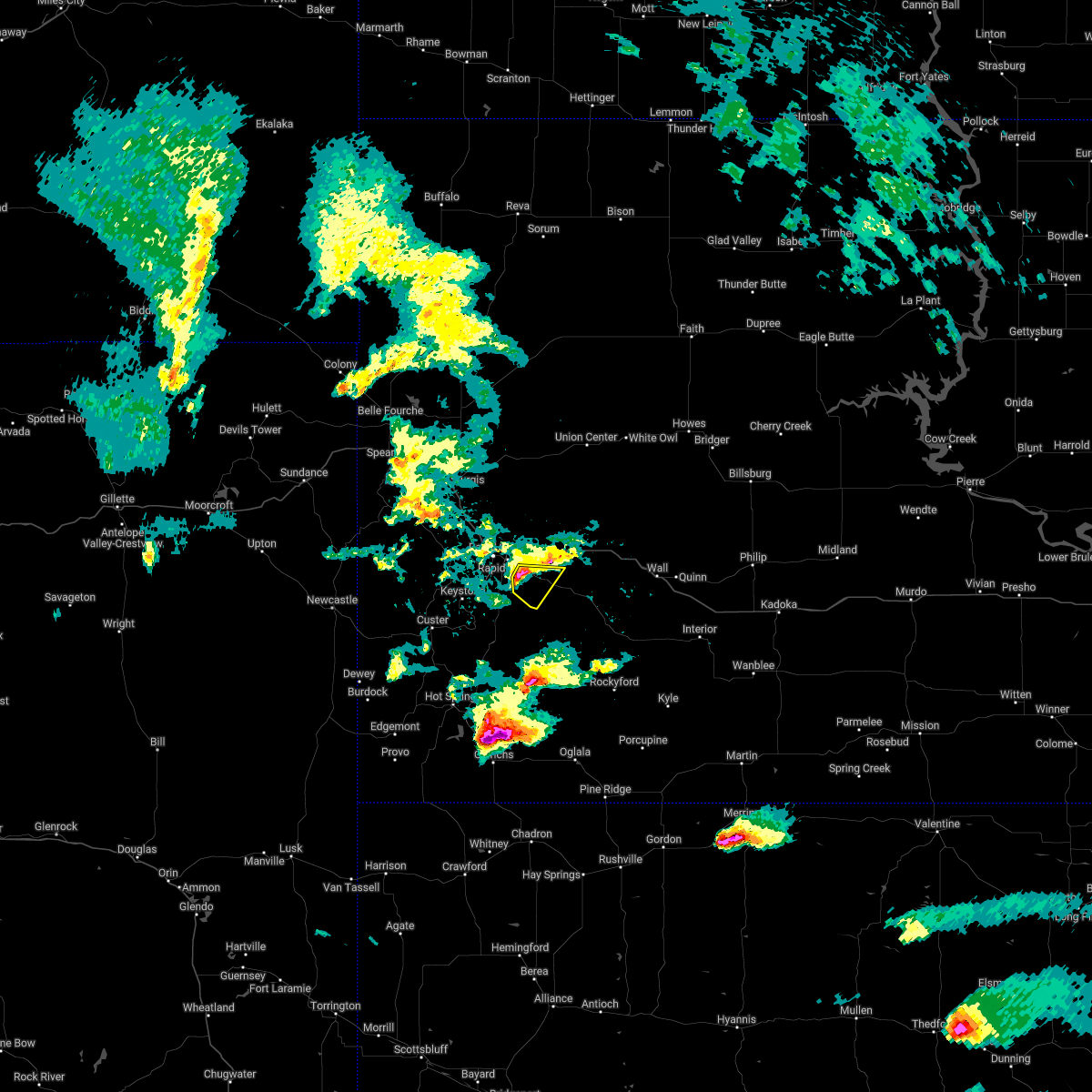 At 405 pm mdt, a severe thunderstorm was located 3 miles west of caputa, or 11 miles southeast of rapid city, moving southeast at 25 mph. quarter sized hail was recently reported 2 miles south- southeast of rapid city (trained weather spotters). Hazards include 60 mph wind gusts and quarter size hail. Hail damage to vehicles is expected. expect wind damage to roofs, siding, and trees. locations impacted include, caputa, farmingdale, thompson butte and rapid city airport. hail threat, observed max hail size, 1. 00 in wind threat, radar indicated max wind gust, 60 mph. At 405 pm mdt, a severe thunderstorm was located 3 miles west of caputa, or 11 miles southeast of rapid city, moving southeast at 25 mph. quarter sized hail was recently reported 2 miles south- southeast of rapid city (trained weather spotters). Hazards include 60 mph wind gusts and quarter size hail. Hail damage to vehicles is expected. expect wind damage to roofs, siding, and trees. locations impacted include, caputa, farmingdale, thompson butte and rapid city airport. hail threat, observed max hail size, 1. 00 in wind threat, radar indicated max wind gust, 60 mph.
|
| 6/6/2022 3:53 PM MDT |
 At 353 pm mdt, a severe thunderstorm was located 3 miles north of black gap, or 5 miles southeast of rapid city, moving southeast at 25 mph (radar indicated). Hazards include 60 mph wind gusts and quarter size hail. Hail damage to vehicles is expected. expect wind damage to roofs, siding, and trees. locations impacted include, rapid city airport, caputa, thompson butte and farmingdale. hail threat, radar indicated max hail size, 1. 00 in wind threat, radar indicated max wind gust, 60 mph. At 353 pm mdt, a severe thunderstorm was located 3 miles north of black gap, or 5 miles southeast of rapid city, moving southeast at 25 mph (radar indicated). Hazards include 60 mph wind gusts and quarter size hail. Hail damage to vehicles is expected. expect wind damage to roofs, siding, and trees. locations impacted include, rapid city airport, caputa, thompson butte and farmingdale. hail threat, radar indicated max hail size, 1. 00 in wind threat, radar indicated max wind gust, 60 mph.
|
| 6/6/2022 3:50 PM MDT | Quarter sized hail reported 1.2 miles NNE of Rapid City, SD |
| 6/6/2022 3:43 PM MDT |
 At 342 pm mdt, a severe thunderstorm was located over southern rapid city, moving southeast at 25 mph. quarter sized hail was recently reported on the west side of rapid city (public). Hazards include quarter size hail. Damage to vehicles is expected. this severe thunderstorm will be near, rapid valley around 350 pm mdt. black gap around 355 pm mdt. other locations in the path of this severe thunderstorm include rapid city airport, caputa, thompson butte and farmingdale. hail threat, observed max hail size, 1. 00 in wind threat, radar indicated max wind gust, <50 mph. At 342 pm mdt, a severe thunderstorm was located over southern rapid city, moving southeast at 25 mph. quarter sized hail was recently reported on the west side of rapid city (public). Hazards include quarter size hail. Damage to vehicles is expected. this severe thunderstorm will be near, rapid valley around 350 pm mdt. black gap around 355 pm mdt. other locations in the path of this severe thunderstorm include rapid city airport, caputa, thompson butte and farmingdale. hail threat, observed max hail size, 1. 00 in wind threat, radar indicated max wind gust, <50 mph.
|
| 6/6/2022 3:35 PM MDT | Quarter sized hail reported 2.6 miles E of Rapid City, SD, dime to quarter hail. |
| 5/27/2022 5:47 PM MDT | Storm damage reported in pennington county SD, 8 miles W of Rapid City, SD |
| 5/27/2022 5:47 PM MDT |
 At 547 pm mdt, a severe thunderstorm was located 5 miles east of box elder, or 13 miles east of rapid city, moving east at 35 mph (radar indicated). Hazards include quarter size hail. Damage to vehicles is expected. locations impacted include, eastern rapid valley, ellsworth air force base, box elder, new underwood, wicksville, curlew lake, viewfield and rapid city airport. this includes interstate 90 in south dakota between mile markers 64 and 96. hail threat, radar indicated max hail size, 1. 00 in wind threat, radar indicated max wind gust, <50 mph. At 547 pm mdt, a severe thunderstorm was located 5 miles east of box elder, or 13 miles east of rapid city, moving east at 35 mph (radar indicated). Hazards include quarter size hail. Damage to vehicles is expected. locations impacted include, eastern rapid valley, ellsworth air force base, box elder, new underwood, wicksville, curlew lake, viewfield and rapid city airport. this includes interstate 90 in south dakota between mile markers 64 and 96. hail threat, radar indicated max hail size, 1. 00 in wind threat, radar indicated max wind gust, <50 mph.
|
| 5/27/2022 5:33 PM MDT |
 At 533 pm mdt, a severe thunderstorm was located near box elder, or 6 miles northeast of rapid city, moving east at 35 mph (radar indicated). Hazards include 60 mph wind gusts and quarter size hail. Hail damage to vehicles is expected. Expect wind damage to roofs, siding, and trees. At 533 pm mdt, a severe thunderstorm was located near box elder, or 6 miles northeast of rapid city, moving east at 35 mph (radar indicated). Hazards include 60 mph wind gusts and quarter size hail. Hail damage to vehicles is expected. Expect wind damage to roofs, siding, and trees.
|
| 5/12/2022 1:04 AM MDT | Storm damage reported in pennington county SD, 8 miles W of Rapid City, SD |
| 5/12/2022 1:00 AM MDT | Storm damage reported in pennington county SD, 3.5 miles NNE of Rapid City, SD |
| 5/12/2022 12:56 AM MDT |
 At 1255 am mdt, severe thunderstorms were located along a line extending from 2 miles southeast of galena to 2 miles south of black hawk, moving northeast at 40 mph (radar indicated). Hazards include 60 mph wind gusts and quarter size hail. Hail damage to vehicles is expected. expect wind damage to roofs, siding, and trees. locations impacted include, western rapid city, sturgis, black hawk, summerset, johnson siding, nemo, piedmont, silver city, hisega, tilford, brownsville, galena, pactola reservoir, dalton lake, bear butte state park, apple springs, roubaix lake and fort meade. this includes interstate 90 in south dakota between mile markers 25 and 56. hail threat, radar indicated max hail size, 1. 00 in wind threat, radar indicated max wind gust, 60 mph. At 1255 am mdt, severe thunderstorms were located along a line extending from 2 miles southeast of galena to 2 miles south of black hawk, moving northeast at 40 mph (radar indicated). Hazards include 60 mph wind gusts and quarter size hail. Hail damage to vehicles is expected. expect wind damage to roofs, siding, and trees. locations impacted include, western rapid city, sturgis, black hawk, summerset, johnson siding, nemo, piedmont, silver city, hisega, tilford, brownsville, galena, pactola reservoir, dalton lake, bear butte state park, apple springs, roubaix lake and fort meade. this includes interstate 90 in south dakota between mile markers 25 and 56. hail threat, radar indicated max hail size, 1. 00 in wind threat, radar indicated max wind gust, 60 mph.
|
| 5/12/2022 12:42 AM MDT | Quarter sized hail reported 13.9 miles ENE of Rapid City, SD |
| 5/12/2022 12:40 AM MDT |
 At 1240 am mdt, severe thunderstorms were located along a line extending from 2 miles north of rochford to near pactola reservoir, moving northeast at 40 mph (radar indicated). Hazards include 60 mph wind gusts and quarter size hail. Hail damage to vehicles is expected. expect wind damage to roofs, siding, and trees. severe thunderstorms will be near, nemo and brownsville around 1250 am mdt. black hawk and dalton lake around 1255 am mdt. summerset, piedmont and galena around 100 am mdt. other locations in the path of these severe thunderstorms include tilford, apple springs, sturgis, whitewood, fort meade and bear butte state park. this includes interstate 90 in south dakota between mile markers 25 and 55. hail threat, radar indicated max hail size, 1. 00 in wind threat, radar indicated max wind gust, 60 mph. At 1240 am mdt, severe thunderstorms were located along a line extending from 2 miles north of rochford to near pactola reservoir, moving northeast at 40 mph (radar indicated). Hazards include 60 mph wind gusts and quarter size hail. Hail damage to vehicles is expected. expect wind damage to roofs, siding, and trees. severe thunderstorms will be near, nemo and brownsville around 1250 am mdt. black hawk and dalton lake around 1255 am mdt. summerset, piedmont and galena around 100 am mdt. other locations in the path of these severe thunderstorms include tilford, apple springs, sturgis, whitewood, fort meade and bear butte state park. this includes interstate 90 in south dakota between mile markers 25 and 55. hail threat, radar indicated max hail size, 1. 00 in wind threat, radar indicated max wind gust, 60 mph.
|
| 4/22/2022 10:13 PM MDT | Storm damage reported in pennington county SD, 8 miles W of Rapid City, SD |
| 4/22/2022 8:42 PM MDT |
 At 841 pm mdt, severe thunderstorms were located along a line extending from 4 miles north of medicine mountain to custer state park, moving northeast at 35 mph (trained weather spotters). Hazards include 60 mph wind gusts and quarter size hail. Hail damage to vehicles is expected. expect wind damage to roofs, siding, and trees. locations impacted include, keystone, mount rushmore national memorial, horse thief lake, hayward, keystone wye, mystic, silver city, rockerville, pactola reservoir, bear country, johnson siding, hart ranch, reptile gardens and southwestern rapid city. hail threat, observed max hail size, 1. 00 in wind threat, radar indicated max wind gust, 60 mph. At 841 pm mdt, severe thunderstorms were located along a line extending from 4 miles north of medicine mountain to custer state park, moving northeast at 35 mph (trained weather spotters). Hazards include 60 mph wind gusts and quarter size hail. Hail damage to vehicles is expected. expect wind damage to roofs, siding, and trees. locations impacted include, keystone, mount rushmore national memorial, horse thief lake, hayward, keystone wye, mystic, silver city, rockerville, pactola reservoir, bear country, johnson siding, hart ranch, reptile gardens and southwestern rapid city. hail threat, observed max hail size, 1. 00 in wind threat, radar indicated max wind gust, 60 mph.
|
| 4/22/2022 8:18 PM MDT |
 At 816 pm mdt, severe thunderstorms were located along a line extending from 7 miles southeast of moon to 4 miles northeast of pringle, moving northeast at 35 mph (trained weather spotters. at 814 pm mdt, golf ball sized hail was reported 7 miles southwest of custer). Hazards include golf ball size hail and 60 mph wind gusts. People and animals outdoors will be injured. expect hail damage to roofs, siding, windows, and vehicles. expect wind damage to roofs, siding, and trees. severe thunderstorms will be near, custer, blue bell and bear mountain lookout around 825 pm mdt. legion lake, mount coolidge, stockade lake and medicine mountain around 830 pm mdt. center lake, black hills playhouse and state game lodge around 835 pm mdt. other locations in the path of these severe thunderstorms include mount rushmore national memorial, horse thief lake, keystone, hayward, keystone wye, mystic, silver city, rockerville, pactola reservoir, southwestern rapid city, hart ranch, reptile gardens and bear country. thunderstorm damage threat, considerable hail threat, observed max hail size, 1. 75 in wind threat, radar indicated max wind gust, 60 mph. At 816 pm mdt, severe thunderstorms were located along a line extending from 7 miles southeast of moon to 4 miles northeast of pringle, moving northeast at 35 mph (trained weather spotters. at 814 pm mdt, golf ball sized hail was reported 7 miles southwest of custer). Hazards include golf ball size hail and 60 mph wind gusts. People and animals outdoors will be injured. expect hail damage to roofs, siding, windows, and vehicles. expect wind damage to roofs, siding, and trees. severe thunderstorms will be near, custer, blue bell and bear mountain lookout around 825 pm mdt. legion lake, mount coolidge, stockade lake and medicine mountain around 830 pm mdt. center lake, black hills playhouse and state game lodge around 835 pm mdt. other locations in the path of these severe thunderstorms include mount rushmore national memorial, horse thief lake, keystone, hayward, keystone wye, mystic, silver city, rockerville, pactola reservoir, southwestern rapid city, hart ranch, reptile gardens and bear country. thunderstorm damage threat, considerable hail threat, observed max hail size, 1. 75 in wind threat, radar indicated max wind gust, 60 mph.
|
| 8/30/2021 3:50 PM MDT |
 The severe thunderstorm warning for southwestern pennington county will expire at 400 pm mdt, the storm which prompted the warning has weakened below severe limits, and no longer poses an immediate threat to life or property. therefore, the warning will be allowed to expire. however small hail and heavy rain are still possible with this thunderstorm. a severe thunderstorm watch remains in effect until 900 pm mdt for southwestern and west central south dakota. The severe thunderstorm warning for southwestern pennington county will expire at 400 pm mdt, the storm which prompted the warning has weakened below severe limits, and no longer poses an immediate threat to life or property. therefore, the warning will be allowed to expire. however small hail and heavy rain are still possible with this thunderstorm. a severe thunderstorm watch remains in effect until 900 pm mdt for southwestern and west central south dakota.
|
| 8/30/2021 3:32 PM MDT |
 At 331 pm mdt, a severe thunderstorm was located over pactola reservoir, or 8 miles north of hill city, moving southeast at 15 mph (radar indicated). Hazards include quarter size hail. Damage to vehicles is expected. locations impacted include, northwestern rapid city, hill city, black hawk, johnson siding, silver city, hisega, mystic, pactola reservoir, sheridan lake and palmer gulch resort. this includes interstate 90 in south dakota between mile markers 54 and 56. hail threat, radar indicated max hail size, 1. 00 in wind threat, radar indicated max wind gust, <50 mph. At 331 pm mdt, a severe thunderstorm was located over pactola reservoir, or 8 miles north of hill city, moving southeast at 15 mph (radar indicated). Hazards include quarter size hail. Damage to vehicles is expected. locations impacted include, northwestern rapid city, hill city, black hawk, johnson siding, silver city, hisega, mystic, pactola reservoir, sheridan lake and palmer gulch resort. this includes interstate 90 in south dakota between mile markers 54 and 56. hail threat, radar indicated max hail size, 1. 00 in wind threat, radar indicated max wind gust, <50 mph.
|
| 8/30/2021 3:30 PM MDT | Quarter sized hail reported 15.7 miles E of Rapid City, SD |
| 8/30/2021 3:17 PM MDT |
 At 316 pm mdt, a severe thunderstorm was located over silver city, or 10 miles north of hill city, moving southeast at 15 mph (radar indicated). Hazards include ping pong ball size hail. People and animals outdoors will be injured. expect damage to roofs, siding, windows, and vehicles. locations impacted include, pactola reservoir, johnson siding, hisega and sheridan lake. this includes interstate 90 in south dakota between mile markers 49 and 56. hail threat, radar indicated max hail size, 1. 50 in wind threat, radar indicated max wind gust, <50 mph. At 316 pm mdt, a severe thunderstorm was located over silver city, or 10 miles north of hill city, moving southeast at 15 mph (radar indicated). Hazards include ping pong ball size hail. People and animals outdoors will be injured. expect damage to roofs, siding, windows, and vehicles. locations impacted include, pactola reservoir, johnson siding, hisega and sheridan lake. this includes interstate 90 in south dakota between mile markers 49 and 56. hail threat, radar indicated max hail size, 1. 50 in wind threat, radar indicated max wind gust, <50 mph.
|
| 8/30/2021 3:10 PM MDT | Quarter sized hail reported 19.2 miles ESE of Rapid City, SD |
| 8/30/2021 2:59 PM MDT |
 At 259 pm mdt, a severe thunderstorm was located near silver city, or 11 miles north of hill city, moving southeast at 15 mph (satellite and lightning indicated). Hazards include quarter size hail. Damage to vehicles is expected. this severe thunderstorm will be near, silver city and pactola reservoir around 310 pm mdt. other locations in the path of this severe thunderstorm include johnson siding, hisega and sheridan lake. this includes interstate 90 in south dakota between mile markers 47 and 56. hail threat, radar indicated max hail size, 1. 00 in wind threat, radar indicated max wind gust, <50 mph. At 259 pm mdt, a severe thunderstorm was located near silver city, or 11 miles north of hill city, moving southeast at 15 mph (satellite and lightning indicated). Hazards include quarter size hail. Damage to vehicles is expected. this severe thunderstorm will be near, silver city and pactola reservoir around 310 pm mdt. other locations in the path of this severe thunderstorm include johnson siding, hisega and sheridan lake. this includes interstate 90 in south dakota between mile markers 47 and 56. hail threat, radar indicated max hail size, 1. 00 in wind threat, radar indicated max wind gust, <50 mph.
|
| 8/26/2021 8:05 PM MDT | Quarter sized hail reported 12.5 miles WNW of Rapid City, SD |
| 8/26/2021 7:56 PM MDT | Quarter sized hail reported 7.5 miles W of Rapid City, SD |
| 8/26/2021 7:48 PM MDT |
 At 748 pm mdt, a severe thunderstorm was located over thompson butte, or 14 miles southeast of rapid city, moving east at 30 mph (radar indicated). Hazards include tennis ball size hail and 60 mph wind gusts. People and animals outdoors will be injured. expect hail damage to roofs, siding, windows, and vehicles. expect wind damage to roofs, siding, and trees. this severe thunderstorm will be near, farmingdale around 800 pm mdt. other locations in the path of this severe thunderstorm include folsom, railroad buttes and scenic. thunderstorm damage threat, considerable hail threat, radar indicated max hail size, 2. 50 in wind threat, radar indicated max wind gust, 60 mph. At 748 pm mdt, a severe thunderstorm was located over thompson butte, or 14 miles southeast of rapid city, moving east at 30 mph (radar indicated). Hazards include tennis ball size hail and 60 mph wind gusts. People and animals outdoors will be injured. expect hail damage to roofs, siding, windows, and vehicles. expect wind damage to roofs, siding, and trees. this severe thunderstorm will be near, farmingdale around 800 pm mdt. other locations in the path of this severe thunderstorm include folsom, railroad buttes and scenic. thunderstorm damage threat, considerable hail threat, radar indicated max hail size, 2. 50 in wind threat, radar indicated max wind gust, 60 mph.
|
| 8/26/2021 7:40 PM MDT | Tea Cup sized hail reported 6.2 miles NNW of Rapid City, SD |
| 8/26/2021 7:39 PM MDT |
 At 739 pm mdt, a severe thunderstorm was located 3 miles southeast of black gap, or 10 miles southeast of rapid city, moving east at 25 mph (trained weather spotters). Hazards include two inch hail and 60 mph wind gusts. People and animals outdoors will be injured. expect hail damage to roofs, siding, windows, and vehicles. expect wind damage to roofs, siding, and trees. locations impacted include, southern rapid city, hermosa, bear country, hart ranch, black gap, reptile gardens and rapid city airport. thunderstorm damage threat, considerable hail threat, radar indicated max hail size, 2. 00 in wind threat, radar indicated max wind gust, 60 mph. At 739 pm mdt, a severe thunderstorm was located 3 miles southeast of black gap, or 10 miles southeast of rapid city, moving east at 25 mph (trained weather spotters). Hazards include two inch hail and 60 mph wind gusts. People and animals outdoors will be injured. expect hail damage to roofs, siding, windows, and vehicles. expect wind damage to roofs, siding, and trees. locations impacted include, southern rapid city, hermosa, bear country, hart ranch, black gap, reptile gardens and rapid city airport. thunderstorm damage threat, considerable hail threat, radar indicated max hail size, 2. 00 in wind threat, radar indicated max wind gust, 60 mph.
|
| 8/26/2021 7:38 PM MDT | Quarter sized hail reported 3.5 miles NNE of Rapid City, SD |
| 8/26/2021 7:32 PM MDT |
 At 731 pm mdt, a severe thunderstorm was located over hart ranch, or 8 miles south of rapid city, moving east at 25 mph (radar indicated). Hazards include golf ball size hail. People and animals outdoors will be injured. expect damage to roofs, siding, windows, and vehicles. locations impacted include, southern rapid city, hermosa, keystone, hayward, rockerville, bear country, hart ranch, black gap, and reptile gardens. thunderstorm damage threat, considerable hail threat, radar indicated max hail size, 1. 75 in wind threat, radar indicated max wind gust, <50 mph. At 731 pm mdt, a severe thunderstorm was located over hart ranch, or 8 miles south of rapid city, moving east at 25 mph (radar indicated). Hazards include golf ball size hail. People and animals outdoors will be injured. expect damage to roofs, siding, windows, and vehicles. locations impacted include, southern rapid city, hermosa, keystone, hayward, rockerville, bear country, hart ranch, black gap, and reptile gardens. thunderstorm damage threat, considerable hail threat, radar indicated max hail size, 1. 75 in wind threat, radar indicated max wind gust, <50 mph.
|
| 8/26/2021 7:30 PM MDT | Hen Egg sized hail reported 7.3 miles N of Rapid City, SD, hundreds of cars and rv's damaged from hail...hail lasted 10 minutes |
| 8/26/2021 7:30 PM MDT | Hen Egg sized hail reported 7.3 miles N of Rapid City, SD |
| 8/26/2021 7:12 PM MDT |
 At 712 pm mdt, a severe thunderstorm was located near sheridan lake, or 7 miles east of hill city, moving east at 25 mph (public). Hazards include golf ball size hail. People and animals outdoors will be injured. expect damage to roofs, siding, windows, and vehicles. locations impacted include, rockerville, hayward, southern rapid city, bear country, reptile gardens, hart ranch, hermosa, black gap and rapid city airport. thunderstorm damage threat, considerable hail threat, radar indicated max hail size, 1. 75 in wind threat, radar indicated max wind gust, <50 mph. At 712 pm mdt, a severe thunderstorm was located near sheridan lake, or 7 miles east of hill city, moving east at 25 mph (public). Hazards include golf ball size hail. People and animals outdoors will be injured. expect damage to roofs, siding, windows, and vehicles. locations impacted include, rockerville, hayward, southern rapid city, bear country, reptile gardens, hart ranch, hermosa, black gap and rapid city airport. thunderstorm damage threat, considerable hail threat, radar indicated max hail size, 1. 75 in wind threat, radar indicated max wind gust, <50 mph.
|
| 8/26/2021 6:54 PM MDT |
 At 654 pm mdt, a severe thunderstorm was located over palmer gulch resort, or near hill city, moving east at 25 mph (radar indicated). Hazards include golf ball size hail. People and animals outdoors will be injured. expect damage to roofs, siding, windows, and vehicles. this severe thunderstorm will be near, mount rushmore national memorial and northern custer state park around 700 pm mdt. keystone and keystone wye around 705 pm mdt. rockerville, black hills playhouse and center lake around 710 pm mdt. other locations in the path of this severe thunderstorm include hayward, bear country, reptile gardens, hart ranch, black gap and hermosa. thunderstorm damage threat, considerable hail threat, radar indicated max hail size, 1. 75 in wind threat, radar indicated max wind gust, <50 mph. At 654 pm mdt, a severe thunderstorm was located over palmer gulch resort, or near hill city, moving east at 25 mph (radar indicated). Hazards include golf ball size hail. People and animals outdoors will be injured. expect damage to roofs, siding, windows, and vehicles. this severe thunderstorm will be near, mount rushmore national memorial and northern custer state park around 700 pm mdt. keystone and keystone wye around 705 pm mdt. rockerville, black hills playhouse and center lake around 710 pm mdt. other locations in the path of this severe thunderstorm include hayward, bear country, reptile gardens, hart ranch, black gap and hermosa. thunderstorm damage threat, considerable hail threat, radar indicated max hail size, 1. 75 in wind threat, radar indicated max wind gust, <50 mph.
|
| 8/14/2021 2:49 PM MDT | Tennis Ball sized hail reported 9.1 miles NE of Rapid City, SD, no rain |
| 8/14/2021 2:46 PM MDT |
 At 246 pm mdt, a severe thunderstorm was located near hayward, or 12 miles south of rapid city, moving south at 15 mph (radar indicated. at 240 pm, 2 inch hail was reported 2 miles east of rockerville). Hazards include two inch hail. People and animals outdoors will be injured. expect damage to roofs, siding, windows, and vehicles. this severe storm will be near, hayward around 255 pm mdt. other locations in the path of this severe thunderstorm include hermosa and state game lodge. thunderstorm damage threat, considerable hail threat, observed max hail size, 2. 00 in wind threat, radar indicated max wind gust, <50 mph. At 246 pm mdt, a severe thunderstorm was located near hayward, or 12 miles south of rapid city, moving south at 15 mph (radar indicated. at 240 pm, 2 inch hail was reported 2 miles east of rockerville). Hazards include two inch hail. People and animals outdoors will be injured. expect damage to roofs, siding, windows, and vehicles. this severe storm will be near, hayward around 255 pm mdt. other locations in the path of this severe thunderstorm include hermosa and state game lodge. thunderstorm damage threat, considerable hail threat, observed max hail size, 2. 00 in wind threat, radar indicated max wind gust, <50 mph.
|
| 8/14/2021 2:40 PM MDT | Quarter sized hail reported 8.9 miles NE of Rapid City, SD |
| 8/14/2021 2:40 PM MDT | Hen Egg sized hail reported 9.1 miles NE of Rapid City, SD |
| 8/14/2021 2:38 PM MDT | Golf Ball sized hail reported 6.8 miles NE of Rapid City, SD |
| 8/14/2021 2:37 PM MDT |
 At 236 pm mdt, a severe thunderstorm was located near rockerville, or 9 miles southwest of rapid city, moving south at 15 mph (radar indicated). Hazards include 60 mph wind gusts and half dollar size hail. Hail damage to vehicles is expected. expect wind damage to roofs, siding, and trees. this severe thunderstorm will be near, hayward around 255 pm mdt. other locations in the path of this severe thunderstorm include hermosa and state game lodge. hail threat, radar indicated max hail size, 1. 25 in wind threat, radar indicated max wind gust, 60 mph. At 236 pm mdt, a severe thunderstorm was located near rockerville, or 9 miles southwest of rapid city, moving south at 15 mph (radar indicated). Hazards include 60 mph wind gusts and half dollar size hail. Hail damage to vehicles is expected. expect wind damage to roofs, siding, and trees. this severe thunderstorm will be near, hayward around 255 pm mdt. other locations in the path of this severe thunderstorm include hermosa and state game lodge. hail threat, radar indicated max hail size, 1. 25 in wind threat, radar indicated max wind gust, 60 mph.
|
| 8/14/2021 2:33 PM MDT | Quarter sized hail reported 6.8 miles NE of Rapid City, SD |
| 8/14/2021 2:32 PM MDT |
 At 231 pm mdt, a severe thunderstorm was located over bear country, or 6 miles southwest of rapid city, moving southeast at 15 mph (radar indicated). Hazards include 60 mph wind gusts and half dollar size hail. Hail damage to vehicles is expected. expect wind damage to roofs, siding, and trees. locations impacted include, southwestern rapid city, hisega, rockerville, bear country and reptile gardens. hail threat, radar indicated max hail size, 1. 25 in wind threat, radar indicated max wind gust, 60 mph. At 231 pm mdt, a severe thunderstorm was located over bear country, or 6 miles southwest of rapid city, moving southeast at 15 mph (radar indicated). Hazards include 60 mph wind gusts and half dollar size hail. Hail damage to vehicles is expected. expect wind damage to roofs, siding, and trees. locations impacted include, southwestern rapid city, hisega, rockerville, bear country and reptile gardens. hail threat, radar indicated max hail size, 1. 25 in wind threat, radar indicated max wind gust, 60 mph.
|
| 8/14/2021 2:25 PM MDT | Quarter sized hail reported 9.5 miles E of Rapid City, SD, nickel to quarter hail |
| 8/14/2021 2:12 PM MDT |
 At 211 pm mdt, a severe thunderstorm was located 3 miles west of rapid city, moving southeast at 10 mph (radar indicated). Hazards include ping pong ball size hail and 60 mph wind gusts. People and animals outdoors will be injured. expect hail damage to roofs, siding, windows, and vehicles. expect wind damage to roofs, siding, and trees. locations impacted include, rapid city, southwestern rapid valley, black hawk, johnson siding, hisega, rockerville, bear country and reptile gardens. this includes interstate 90 in south dakota between mile markers 54 and 60. hail threat, radar indicated max hail size, 1. 50 in wind threat, radar indicated max wind gust, 60 mph. At 211 pm mdt, a severe thunderstorm was located 3 miles west of rapid city, moving southeast at 10 mph (radar indicated). Hazards include ping pong ball size hail and 60 mph wind gusts. People and animals outdoors will be injured. expect hail damage to roofs, siding, windows, and vehicles. expect wind damage to roofs, siding, and trees. locations impacted include, rapid city, southwestern rapid valley, black hawk, johnson siding, hisega, rockerville, bear country and reptile gardens. this includes interstate 90 in south dakota between mile markers 54 and 60. hail threat, radar indicated max hail size, 1. 50 in wind threat, radar indicated max wind gust, 60 mph.
|
| 8/14/2021 1:57 PM MDT |
 At 157 pm mdt, a severe thunderstorm was located 4 miles south of black hawk, or 4 miles northwest of rapid city, and is nearly stationary (radar indicated). Hazards include 60 mph wind gusts and quarter size hail. Hail damage to vehicles is expected. Expect wind damage to roofs, siding, and trees. At 157 pm mdt, a severe thunderstorm was located 4 miles south of black hawk, or 4 miles northwest of rapid city, and is nearly stationary (radar indicated). Hazards include 60 mph wind gusts and quarter size hail. Hail damage to vehicles is expected. Expect wind damage to roofs, siding, and trees.
|
| 8/6/2021 2:51 PM MDT |
 The severe thunderstorm warning for southern meade, southeastern lawrence and central pennington counties will expire at 300 pm mdt, the storm which prompted the warning has weakened below severe limits, and no longer poses an immediate threat to life or property. therefore, the warning will be allowed to expire. however gusty winds are still possible with this thunderstorm. a severe thunderstorm watch remains in effect until 800 pm mdt for west central south dakota. The severe thunderstorm warning for southern meade, southeastern lawrence and central pennington counties will expire at 300 pm mdt, the storm which prompted the warning has weakened below severe limits, and no longer poses an immediate threat to life or property. therefore, the warning will be allowed to expire. however gusty winds are still possible with this thunderstorm. a severe thunderstorm watch remains in effect until 800 pm mdt for west central south dakota.
|
| 8/6/2021 2:39 PM MDT |
 At 239 pm mdt, a severe thunderstorm was located near black hawk, or 4 miles northwest of rapid city, moving northeast at 40 mph (radar indicated). Hazards include 60 mph wind gusts. Expect damage to roofs, siding, and trees. locations impacted include, rapid valley, southwestern ellsworth air force base and southwestern box elder. this includes interstate 90 in south dakota between mile markers 46 and 66. hail threat, radar indicated max hail size, <. 75 in wind threat, radar indicated max wind gust, 60 mph. At 239 pm mdt, a severe thunderstorm was located near black hawk, or 4 miles northwest of rapid city, moving northeast at 40 mph (radar indicated). Hazards include 60 mph wind gusts. Expect damage to roofs, siding, and trees. locations impacted include, rapid valley, southwestern ellsworth air force base and southwestern box elder. this includes interstate 90 in south dakota between mile markers 46 and 66. hail threat, radar indicated max hail size, <. 75 in wind threat, radar indicated max wind gust, 60 mph.
|
| 8/6/2021 2:25 PM MDT | Storm damage reported in pennington county SD, 13.5 miles E of Rapid City, SD |
| 8/6/2021 2:24 PM MDT |
 At 224 pm mdt, a severe thunderstorm was located 3 miles southeast of pactola reservoir, or 9 miles northeast of hill city, moving northeast at 40 mph (radar indicated). Hazards include 60 mph wind gusts. Expect damage to roofs, siding, and trees. this severe thunderstorm will be near, rapid city around 235 pm mdt. black hawk around 240 pm mdt. other locations in the path of this severe thunderstorm include rapid valley, southwestern ellsworth air force base and southwestern box elder. this includes interstate 90 in south dakota between mile markers 46 and 66. hail threat, radar indicated max hail size, <. 75 in wind threat, radar indicated max wind gust, 60 mph. At 224 pm mdt, a severe thunderstorm was located 3 miles southeast of pactola reservoir, or 9 miles northeast of hill city, moving northeast at 40 mph (radar indicated). Hazards include 60 mph wind gusts. Expect damage to roofs, siding, and trees. this severe thunderstorm will be near, rapid city around 235 pm mdt. black hawk around 240 pm mdt. other locations in the path of this severe thunderstorm include rapid valley, southwestern ellsworth air force base and southwestern box elder. this includes interstate 90 in south dakota between mile markers 46 and 66. hail threat, radar indicated max hail size, <. 75 in wind threat, radar indicated max wind gust, 60 mph.
|
| 7/16/2021 5:31 PM MDT |
 At 530 pm mdt, severe thunderstorms were located along a line extending from 5 miles east of hermosa to 5 miles northeast of thunder valley, moving east at 20 mph (radar indicated). Hazards include golf ball size hail and 60 mph wind gusts. People and animals outdoors will be injured. expect hail damage to roofs, siding, windows, and vehicles. expect wind damage to roofs, siding, and trees. severe thunderstorms will be near, thunder valley around 535 pm mdt. kyle north route housing around 550 pm mdt. other locations in the path of these severe thunderstorms include kyle, folsom, farmingdale and railroad buttes. This includes interstate 90 in south dakota between mile markers 104 and 120. At 530 pm mdt, severe thunderstorms were located along a line extending from 5 miles east of hermosa to 5 miles northeast of thunder valley, moving east at 20 mph (radar indicated). Hazards include golf ball size hail and 60 mph wind gusts. People and animals outdoors will be injured. expect hail damage to roofs, siding, windows, and vehicles. expect wind damage to roofs, siding, and trees. severe thunderstorms will be near, thunder valley around 535 pm mdt. kyle north route housing around 550 pm mdt. other locations in the path of these severe thunderstorms include kyle, folsom, farmingdale and railroad buttes. This includes interstate 90 in south dakota between mile markers 104 and 120.
|
| 7/16/2021 4:30 PM MDT | Ping Pong Ball sized hail reported 14.4 miles ENE of Rapid City, SD |
| 7/16/2021 3:55 PM MDT |
 At 355 pm mdt, a severe thunderstorm was located near rochford, or 12 miles northwest of hill city, moving southeast at 10 mph (radar indicated). Hazards include ping pong ball size hail and 60 mph wind gusts. People and animals outdoors will be injured. expect hail damage to roofs, siding, windows, and vehicles. expect wind damage to roofs, siding, and trees. this severe thunderstorm will be near, mystic around 410 pm mdt. Other locations in the path of this severe thunderstorm include silver city, pactola reservoir, johnson siding, hill city, keystone, hisega, rockerville, sheridan lake, keystone wye, palmer gulch resort, horse thief lake and mount rushmore national memorial. At 355 pm mdt, a severe thunderstorm was located near rochford, or 12 miles northwest of hill city, moving southeast at 10 mph (radar indicated). Hazards include ping pong ball size hail and 60 mph wind gusts. People and animals outdoors will be injured. expect hail damage to roofs, siding, windows, and vehicles. expect wind damage to roofs, siding, and trees. this severe thunderstorm will be near, mystic around 410 pm mdt. Other locations in the path of this severe thunderstorm include silver city, pactola reservoir, johnson siding, hill city, keystone, hisega, rockerville, sheridan lake, keystone wye, palmer gulch resort, horse thief lake and mount rushmore national memorial.
|
| 7/13/2021 10:47 PM MDT |
 At 1046 pm mdt, severe thunderstorms were located along a line extending from near new underwood to near caputa to near keystone, moving east at 20 mph (radar indicated). Hazards include 60 mph wind gusts. Expect damage to roofs, siding, and trees. locations impacted include, rapid city, rapid valley, ellsworth air force base, box elder, new underwood, hermosa, keystone, caputa, hayward, rockerville, mount rushmore national memorial, rapid city airport, keystone wye, bear country, hart ranch, thompson butte, sheridan lake, black gap, reptile gardens and viewfield. This includes interstate 90 in south dakota between mile markers 58 and 80. At 1046 pm mdt, severe thunderstorms were located along a line extending from near new underwood to near caputa to near keystone, moving east at 20 mph (radar indicated). Hazards include 60 mph wind gusts. Expect damage to roofs, siding, and trees. locations impacted include, rapid city, rapid valley, ellsworth air force base, box elder, new underwood, hermosa, keystone, caputa, hayward, rockerville, mount rushmore national memorial, rapid city airport, keystone wye, bear country, hart ranch, thompson butte, sheridan lake, black gap, reptile gardens and viewfield. This includes interstate 90 in south dakota between mile markers 58 and 80.
|
| 7/13/2021 10:34 PM MDT |
 At 1033 pm mdt, severe thunderstorms were located along a line extending from 4 miles east of box elder to 3 miles southwest of rapid valley to 6 miles south of moon, moving southeast at 30 mph (radar indicated). Hazards include 60 mph wind gusts. Expect damage to roofs, siding, and trees. locations impacted include, rapid city, rapid valley, box elder, black gap, hart ranch, reptile gardens, rapid city airport, new underwood, bear mountain lookout, caputa, jewel cave national monument, thompson butte, crazy horse memorial, custer and stockade lake. This includes interstate 90 in south dakota between mile markers 53 and 80. At 1033 pm mdt, severe thunderstorms were located along a line extending from 4 miles east of box elder to 3 miles southwest of rapid valley to 6 miles south of moon, moving southeast at 30 mph (radar indicated). Hazards include 60 mph wind gusts. Expect damage to roofs, siding, and trees. locations impacted include, rapid city, rapid valley, box elder, black gap, hart ranch, reptile gardens, rapid city airport, new underwood, bear mountain lookout, caputa, jewel cave national monument, thompson butte, crazy horse memorial, custer and stockade lake. This includes interstate 90 in south dakota between mile markers 53 and 80.
|
| 7/13/2021 9:58 PM MDT |
 At 957 pm mdt, severe thunderstorms were located along a line extending from 2 miles north of tilford to roubaix lake to 7 miles northeast of osage, moving southeast at 35 mph (radar indicated). Hazards include 60 mph wind gusts. Expect damage to roofs, siding, and trees. severe thunderstorms will be near, rochford, tilford, roubaix lake and dalton lake around 1005 pm mdt. summerset, nemo, piedmont and mystic around 1010 pm mdt. newcastle, silver city and pactola reservoir around 1015 pm mdt. other locations in the path of these severe thunderstorms include black hawk, johnson siding, moon, hisega, ellsworth air force base, sheridan lake, rapid city, rapid valley, box elder, rockerville, keystone wye, keystone, bear country, reptile gardens and elk mountain lookout. This includes interstate 90 in south dakota between mile markers 35 and 80. At 957 pm mdt, severe thunderstorms were located along a line extending from 2 miles north of tilford to roubaix lake to 7 miles northeast of osage, moving southeast at 35 mph (radar indicated). Hazards include 60 mph wind gusts. Expect damage to roofs, siding, and trees. severe thunderstorms will be near, rochford, tilford, roubaix lake and dalton lake around 1005 pm mdt. summerset, nemo, piedmont and mystic around 1010 pm mdt. newcastle, silver city and pactola reservoir around 1015 pm mdt. other locations in the path of these severe thunderstorms include black hawk, johnson siding, moon, hisega, ellsworth air force base, sheridan lake, rapid city, rapid valley, box elder, rockerville, keystone wye, keystone, bear country, reptile gardens and elk mountain lookout. This includes interstate 90 in south dakota between mile markers 35 and 80.
|
| 7/9/2021 3:57 PM MDT |
 At 357 pm mdt, a severe thunderstorm was located near silver city, or 12 miles north of hill city, moving east at 25 mph (radar indicated). Hazards include half dollar size hail. Damage to vehicles is expected. this severe thunderstorm will be near, johnson siding around 410 pm mdt. other locations in the path of this severe thunderstorm include summerset, piedmont and black hawk. This includes interstate 90 in south dakota between mile markers 46 and 61. At 357 pm mdt, a severe thunderstorm was located near silver city, or 12 miles north of hill city, moving east at 25 mph (radar indicated). Hazards include half dollar size hail. Damage to vehicles is expected. this severe thunderstorm will be near, johnson siding around 410 pm mdt. other locations in the path of this severe thunderstorm include summerset, piedmont and black hawk. This includes interstate 90 in south dakota between mile markers 46 and 61.
|
| 7/5/2021 5:36 PM MDT |
 At 536 pm mdt, severe thunderstorms were located along a line extending from 8 miles south of owl butte to 8 miles northeast of tilford to 4 miles south of nemo, moving east at 30 mph (radar indicated). Hazards include 60 mph wind gusts and penny size hail. Expect damage to roofs, siding, and trees. locations impacted include, rapid city, rapid valley, ellsworth air force base, box elder, hereford and rapid city airport. This includes interstate 90 in south dakota between mile markers 28 and 70. At 536 pm mdt, severe thunderstorms were located along a line extending from 8 miles south of owl butte to 8 miles northeast of tilford to 4 miles south of nemo, moving east at 30 mph (radar indicated). Hazards include 60 mph wind gusts and penny size hail. Expect damage to roofs, siding, and trees. locations impacted include, rapid city, rapid valley, ellsworth air force base, box elder, hereford and rapid city airport. This includes interstate 90 in south dakota between mile markers 28 and 70.
|
| 7/5/2021 5:19 PM MDT |
 At 519 pm mdt, severe thunderstorms were located along a line extending from 5 miles east of vale to 2 miles southeast of fort meade to 4 miles north of silver city, moving east at 30 mph (radar indicated). Hazards include 60 mph wind gusts and penny size hail. Expect damage to roofs, siding, and trees. severe thunderstorms will be near, piedmont around 535 pm mdt. other locations in the path of these severe thunderstorms include summerset, black hawk, rapid city, rapid valley, ellsworth air force base, box elder, hereford and rapid city airport. This includes interstate 90 in south dakota between mile markers 26 and 70. At 519 pm mdt, severe thunderstorms were located along a line extending from 5 miles east of vale to 2 miles southeast of fort meade to 4 miles north of silver city, moving east at 30 mph (radar indicated). Hazards include 60 mph wind gusts and penny size hail. Expect damage to roofs, siding, and trees. severe thunderstorms will be near, piedmont around 535 pm mdt. other locations in the path of these severe thunderstorms include summerset, black hawk, rapid city, rapid valley, ellsworth air force base, box elder, hereford and rapid city airport. This includes interstate 90 in south dakota between mile markers 26 and 70.
|
| 7/3/2021 1:02 PM MDT |
 At 101 pm mdt, a severe thunderstorm was located over pactola reservoir, or 9 miles north of hill city, moving southeast at 15 mph (radar indicated). Hazards include half dollar size hail. Damage to vehicles is expected. locations impacted include, western rapid city, black hawk, johnson siding, hisega and pactola reservoir. This includes interstate 90 in south dakota between mile markers 55 and 56. At 101 pm mdt, a severe thunderstorm was located over pactola reservoir, or 9 miles north of hill city, moving southeast at 15 mph (radar indicated). Hazards include half dollar size hail. Damage to vehicles is expected. locations impacted include, western rapid city, black hawk, johnson siding, hisega and pactola reservoir. This includes interstate 90 in south dakota between mile markers 55 and 56.
|
| 7/3/2021 12:44 PM MDT |
 At 1244 pm mdt, a severe thunderstorm was located 3 miles south of nemo, or 12 miles northwest of rapid city, moving southeast at 10 mph (radar indicated). Hazards include half dollar size hail. damage to vehicles is expected At 1244 pm mdt, a severe thunderstorm was located 3 miles south of nemo, or 12 miles northwest of rapid city, moving southeast at 10 mph (radar indicated). Hazards include half dollar size hail. damage to vehicles is expected
|
| 6/19/2021 7:15 PM MDT |
 At 715 pm mdt, a severe thunderstorm was located 3 miles southeast of box elder, or 11 miles east of rapid city, moving east at 25 mph (radar indicated). Hazards include 60 mph wind gusts and quarter size hail. Hail damage to vehicles is expected. expect wind damage to roofs, siding, and trees. locations impacted include, new underwood. This includes interstate 90 in south dakota between mile markers 62 and 85. At 715 pm mdt, a severe thunderstorm was located 3 miles southeast of box elder, or 11 miles east of rapid city, moving east at 25 mph (radar indicated). Hazards include 60 mph wind gusts and quarter size hail. Hail damage to vehicles is expected. expect wind damage to roofs, siding, and trees. locations impacted include, new underwood. This includes interstate 90 in south dakota between mile markers 62 and 85.
|
| 6/19/2021 7:08 PM MDT | Storm damage reported in pennington county SD, 7.5 miles W of Rapid City, SD |
| 6/19/2021 6:57 PM MDT |
 At 657 pm mdt, a severe thunderstorm was located near rapid valley, or 4 miles northeast of rapid city, moving east at 25 mph (radar indicated). Hazards include 60 mph wind gusts and quarter size hail. Hail damage to vehicles is expected. expect wind damage to roofs, siding, and trees. this severe thunderstorm will be near, rapid valley and southern ellsworth air force base around 700 pm mdt. box elder around 705 pm mdt. rapid city airport around 710 pm mdt. other locations in the path of this severe thunderstorm include new underwood. This includes interstate 90 in south dakota between mile markers 59 and 85. At 657 pm mdt, a severe thunderstorm was located near rapid valley, or 4 miles northeast of rapid city, moving east at 25 mph (radar indicated). Hazards include 60 mph wind gusts and quarter size hail. Hail damage to vehicles is expected. expect wind damage to roofs, siding, and trees. this severe thunderstorm will be near, rapid valley and southern ellsworth air force base around 700 pm mdt. box elder around 705 pm mdt. rapid city airport around 710 pm mdt. other locations in the path of this severe thunderstorm include new underwood. This includes interstate 90 in south dakota between mile markers 59 and 85.
|
| 6/10/2021 10:41 PM MDT |
 At 1041 pm mdt, a severe thunderstorm was located near new underwood, or 20 miles east of rapid city, moving northeast at 40 mph (radar indicated). Hazards include 70 mph wind gusts. Expect considerable tree damage. damage is likely to mobile homes, roofs, and outbuildings. locations impacted include, viewfield, curlew lake and elm springs. This includes interstate 90 in south dakota between mile markers 66 and 76. At 1041 pm mdt, a severe thunderstorm was located near new underwood, or 20 miles east of rapid city, moving northeast at 40 mph (radar indicated). Hazards include 70 mph wind gusts. Expect considerable tree damage. damage is likely to mobile homes, roofs, and outbuildings. locations impacted include, viewfield, curlew lake and elm springs. This includes interstate 90 in south dakota between mile markers 66 and 76.
|
| 6/10/2021 10:31 PM MDT | Storm damage reported in pennington county SD, 7.5 miles W of Rapid City, SD |
| 6/10/2021 10:27 PM MDT | Storm damage reported in pennington county SD, 0.3 miles SSE of Rapid City, SD |
| 6/10/2021 10:24 PM MDT | Storm damage reported in pennington county SD, 0.3 miles SSE of Rapid City, SD |
| 6/10/2021 10:24 PM MDT |
 At 1024 pm mdt, a severe thunderstorm was located near rapid city airport, or 10 miles east of rapid city, moving northeast at 55 mph (radar indicated). Hazards include 70 mph wind gusts. Expect considerable tree damage. damage is likely to mobile homes, roofs, and outbuildings. this severe thunderstorm will be near, viewfield around 1040 pm mdt. other locations in the path of this severe thunderstorm include curlew lake and elm springs. This includes interstate 90 in south dakota between mile markers 58 and 78. At 1024 pm mdt, a severe thunderstorm was located near rapid city airport, or 10 miles east of rapid city, moving northeast at 55 mph (radar indicated). Hazards include 70 mph wind gusts. Expect considerable tree damage. damage is likely to mobile homes, roofs, and outbuildings. this severe thunderstorm will be near, viewfield around 1040 pm mdt. other locations in the path of this severe thunderstorm include curlew lake and elm springs. This includes interstate 90 in south dakota between mile markers 58 and 78.
|
| 6/10/2021 10:18 PM MDT |
 At 1018 pm mdt, a severe thunderstorm was located 7 miles west of folsom, or 21 miles southeast of rapid city, moving northeast at 55 mph (radar indicated). Hazards include 70 mph wind gusts and quarter size hail. Hail damage to vehicles is expected. expect considerable tree damage. wind damage is also likely to mobile homes, roofs, and outbuildings. this severe thunderstorm will be near, folsom around 1025 pm mdt. farmingdale and railroad buttes around 1030 pm mdt. other locations in the path of this severe thunderstorm include owanka, wicksville, wasta and creighton. This includes interstate 90 in south dakota between mile markers 76 and 116. At 1018 pm mdt, a severe thunderstorm was located 7 miles west of folsom, or 21 miles southeast of rapid city, moving northeast at 55 mph (radar indicated). Hazards include 70 mph wind gusts and quarter size hail. Hail damage to vehicles is expected. expect considerable tree damage. wind damage is also likely to mobile homes, roofs, and outbuildings. this severe thunderstorm will be near, folsom around 1025 pm mdt. farmingdale and railroad buttes around 1030 pm mdt. other locations in the path of this severe thunderstorm include owanka, wicksville, wasta and creighton. This includes interstate 90 in south dakota between mile markers 76 and 116.
|
| 6/8/2021 9:37 PM MDT |
 The severe thunderstorm warning for northeastern custer and south central pennington counties will expire at 945 pm mdt, the storms which prompted the warning have weakened below severe limits. therefore, the warning will be allowed to expire. a severe thunderstorm watch remains in effect until midnight mdt for southwestern and west central south dakota. The severe thunderstorm warning for northeastern custer and south central pennington counties will expire at 945 pm mdt, the storms which prompted the warning have weakened below severe limits. therefore, the warning will be allowed to expire. a severe thunderstorm watch remains in effect until midnight mdt for southwestern and west central south dakota.
|
| 6/8/2021 9:24 PM MDT |
 At 924 pm mdt, severe thunderstorms were located along a line extending from 2 miles north of new underwood to 5 miles south of thompson butte to near fairburn, moving east at 15 mph (radar indicated). Hazards include 60 mph wind gusts and penny size hail. Expect damage to roofs, siding, and trees. locations impacted include, eastern rapid city, rapid valley, southern ellsworth air force base, box elder, new underwood, hermosa, folsom, caputa, farmingdale, hayward, rapid city airport, hart ranch, thompson butte, railroad buttes, black gap, reptile gardens and northeastern custer state park. This includes interstate 90 in south dakota between mile markers 62 and 84. At 924 pm mdt, severe thunderstorms were located along a line extending from 2 miles north of new underwood to 5 miles south of thompson butte to near fairburn, moving east at 15 mph (radar indicated). Hazards include 60 mph wind gusts and penny size hail. Expect damage to roofs, siding, and trees. locations impacted include, eastern rapid city, rapid valley, southern ellsworth air force base, box elder, new underwood, hermosa, folsom, caputa, farmingdale, hayward, rapid city airport, hart ranch, thompson butte, railroad buttes, black gap, reptile gardens and northeastern custer state park. This includes interstate 90 in south dakota between mile markers 62 and 84.
|
| 6/8/2021 9:14 PM MDT |
 At 913 pm mdt, severe thunderstorms were located along a line extending from 3 miles northwest of new underwood to 6 miles southwest of thompson butte to 3 miles west of fairburn, moving east at 25 mph (radar indicated). Hazards include 60 mph wind gusts and penny size hail. Expect damage to roofs, siding, and trees. locations impacted include, southeastern rapid city, rapid valley, southern ellsworth air force base, box elder, new underwood, hermosa, fairburn, folsom, caputa, farmingdale, hayward, rapid city airport, bear country, hart ranch, state game lodge, thompson butte, railroad buttes, center lake, black gap and reptile gardens. This includes interstate 90 in south dakota between mile markers 61 and 84. At 913 pm mdt, severe thunderstorms were located along a line extending from 3 miles northwest of new underwood to 6 miles southwest of thompson butte to 3 miles west of fairburn, moving east at 25 mph (radar indicated). Hazards include 60 mph wind gusts and penny size hail. Expect damage to roofs, siding, and trees. locations impacted include, southeastern rapid city, rapid valley, southern ellsworth air force base, box elder, new underwood, hermosa, fairburn, folsom, caputa, farmingdale, hayward, rapid city airport, bear country, hart ranch, state game lodge, thompson butte, railroad buttes, center lake, black gap and reptile gardens. This includes interstate 90 in south dakota between mile markers 61 and 84.
|
| 6/8/2021 8:58 PM MDT |
 At 857 pm mdt, severe thunderstorms were located along a line extending from 3 miles east of box elder to near hermosa to custer state park, moving east at 25 mph (radar indicated. at 845 pm mdt a 58 mph wind gust was measusred 1 mile east of downtown rapid city at the nws office). Hazards include 60 mph wind gusts and penny size hail. Expect damage to roofs, siding, and trees. locations impacted include, new underwood, thompson butte, folsom, farmingdale and railroad buttes. This includes interstate 90 in south dakota between mile markers 54 and 84. At 857 pm mdt, severe thunderstorms were located along a line extending from 3 miles east of box elder to near hermosa to custer state park, moving east at 25 mph (radar indicated. at 845 pm mdt a 58 mph wind gust was measusred 1 mile east of downtown rapid city at the nws office). Hazards include 60 mph wind gusts and penny size hail. Expect damage to roofs, siding, and trees. locations impacted include, new underwood, thompson butte, folsom, farmingdale and railroad buttes. This includes interstate 90 in south dakota between mile markers 54 and 84.
|
| 6/8/2021 8:45 PM MDT | Also pea to nickel size hai in pennington county SD, 0.3 miles SSE of Rapid City, SD |
| 6/8/2021 8:41 PM MDT |
 At 840 pm mdt, severe thunderstorms were located along a line extending from rapid city to 3 miles south of hayward to 2 miles south of pringle, moving east at 25 mph (radar indicated). Hazards include 60 mph wind gusts and penny size hail. Expect damage to roofs, siding, and trees. severe thunderstorms will be near, rapid city, rapid valley, black hawk and hayward around 845 pm mdt. southern ellsworth air force base, box elder and hermosa around 855 pm mdt. rapid city airport around 900 pm mdt. other locations in the path of these severe thunderstorms include buffalo corrals, thompson butte, new underwood, fairburn, folsom and railroad buttes. This includes interstate 90 in south dakota between mile markers 54 and 84. At 840 pm mdt, severe thunderstorms were located along a line extending from rapid city to 3 miles south of hayward to 2 miles south of pringle, moving east at 25 mph (radar indicated). Hazards include 60 mph wind gusts and penny size hail. Expect damage to roofs, siding, and trees. severe thunderstorms will be near, rapid city, rapid valley, black hawk and hayward around 845 pm mdt. southern ellsworth air force base, box elder and hermosa around 855 pm mdt. rapid city airport around 900 pm mdt. other locations in the path of these severe thunderstorms include buffalo corrals, thompson butte, new underwood, fairburn, folsom and railroad buttes. This includes interstate 90 in south dakota between mile markers 54 and 84.
|
| 6/8/2021 8:22 PM MDT |
 At 821 pm mdt, severe thunderstorms were located along a line extending from 3 miles north of silver city to custer state park to 2 miles southwest of argyle, moving east at 30 mph (radar indicated). Hazards include 60 mph wind gusts and quarter size hail. Hail damage to vehicles is expected. expect wind damage to roofs, siding, and trees. locations impacted include, silver city, stockade lake, pactola reservoir, mount coolidge, custer state park, black elk peak, blue bell, palmer gulch resort, legion lake, mount rushmore national memorial, horse thief lake, johnson siding, keystone, hisega, black hills playhouse, center lake, state game lodge, wind cave national park, hayward, black hawk and buffalo gap. This includes interstate 90 in south dakota between mile markers 54 and 57. At 821 pm mdt, severe thunderstorms were located along a line extending from 3 miles north of silver city to custer state park to 2 miles southwest of argyle, moving east at 30 mph (radar indicated). Hazards include 60 mph wind gusts and quarter size hail. Hail damage to vehicles is expected. expect wind damage to roofs, siding, and trees. locations impacted include, silver city, stockade lake, pactola reservoir, mount coolidge, custer state park, black elk peak, blue bell, palmer gulch resort, legion lake, mount rushmore national memorial, horse thief lake, johnson siding, keystone, hisega, black hills playhouse, center lake, state game lodge, wind cave national park, hayward, black hawk and buffalo gap. This includes interstate 90 in south dakota between mile markers 54 and 57.
|
| 6/8/2021 8:03 PM MDT |
 At 802 pm mdt, severe thunderstorms were located along a line extending from near rochford to 5 miles northeast of jewel cave national monument to 5 miles southeast of burdock, moving east at 30 mph (radar indicated). Hazards include 60 mph wind gusts and quarter size hail. Hail damage to vehicles is expected. expect wind damage to roofs, siding, and trees. these severe storms will be near, rochford and bear mountain lookout around 805 pm mdt. other locations in the path of these severe thunderstorms include mystic, custer, crazy horse memorial, silver city, custer state park, sylvan lake, pactola reservoir, black elk peak, stockade lake, mount coolidge, blue bell, johnson siding, argyle, center lake, black hills playhouse, legion lake, mount rushmore national memorial, horse thief lake, keystone, cottonwood springs dam, state game lodge, hayward, cold brook reservoir and wind cave national park. This includes interstate 90 in south dakota between mile markers 54 and 57. At 802 pm mdt, severe thunderstorms were located along a line extending from near rochford to 5 miles northeast of jewel cave national monument to 5 miles southeast of burdock, moving east at 30 mph (radar indicated). Hazards include 60 mph wind gusts and quarter size hail. Hail damage to vehicles is expected. expect wind damage to roofs, siding, and trees. these severe storms will be near, rochford and bear mountain lookout around 805 pm mdt. other locations in the path of these severe thunderstorms include mystic, custer, crazy horse memorial, silver city, custer state park, sylvan lake, pactola reservoir, black elk peak, stockade lake, mount coolidge, blue bell, johnson siding, argyle, center lake, black hills playhouse, legion lake, mount rushmore national memorial, horse thief lake, keystone, cottonwood springs dam, state game lodge, hayward, cold brook reservoir and wind cave national park. This includes interstate 90 in south dakota between mile markers 54 and 57.
|
| 6/8/2021 7:46 PM MDT |
 At 745 pm mdt, severe thunderstorms were located along a line extending from near crooks tower to 8 miles south of moon to near dewey, moving east at 30 mph (radar indicated). Hazards include 60 mph wind gusts and penny size hail. Expect damage to roofs, siding, and trees. severe thunderstorms will be near, flag mountain and deerfield around 750 pm mdt. jewel cave national monument around 755 pm mdt. rochford and bear mountain lookout around 805 pm mdt. other locations in the path of these severe thunderstorms include mystic, medicine mountain, crazy horse memorial, custer, silver city, custer state park, pactola reservoir, hill city, argyle, black elk peak, sylvan lake, palmer gulch resort, stockade lake, johnson siding, pringle, horse thief lake, sheridan lake, cottonwood springs dam and legion lake. This includes interstate 90 in south dakota between mile markers 54 and 57. At 745 pm mdt, severe thunderstorms were located along a line extending from near crooks tower to 8 miles south of moon to near dewey, moving east at 30 mph (radar indicated). Hazards include 60 mph wind gusts and penny size hail. Expect damage to roofs, siding, and trees. severe thunderstorms will be near, flag mountain and deerfield around 750 pm mdt. jewel cave national monument around 755 pm mdt. rochford and bear mountain lookout around 805 pm mdt. other locations in the path of these severe thunderstorms include mystic, medicine mountain, crazy horse memorial, custer, silver city, custer state park, pactola reservoir, hill city, argyle, black elk peak, sylvan lake, palmer gulch resort, stockade lake, johnson siding, pringle, horse thief lake, sheridan lake, cottonwood springs dam and legion lake. This includes interstate 90 in south dakota between mile markers 54 and 57.
|
| 5/23/2021 5:02 PM MDT |
 At 501 pm mdt, severe thunderstorms were located along a line extending from 8 miles northeast of tilford to near ellsworth air force base to 3 miles southeast of thompson butte, moving northeast at 45 mph (radar indicated. at 455 pm mdt...58 mph winds were reported at the rapid city regional airport). Hazards include 60 mph wind gusts and quarter size hail. Hail damage to vehicles is expected. expect wind damage to roofs, siding, and trees. these severe thunderstorms will remain over mainly rural areas of southwestern meade and central pennington counties. This includes interstate 90 in south dakota between mile markers 41 and 55, and between mile markers 57 and 74. At 501 pm mdt, severe thunderstorms were located along a line extending from 8 miles northeast of tilford to near ellsworth air force base to 3 miles southeast of thompson butte, moving northeast at 45 mph (radar indicated. at 455 pm mdt...58 mph winds were reported at the rapid city regional airport). Hazards include 60 mph wind gusts and quarter size hail. Hail damage to vehicles is expected. expect wind damage to roofs, siding, and trees. these severe thunderstorms will remain over mainly rural areas of southwestern meade and central pennington counties. This includes interstate 90 in south dakota between mile markers 41 and 55, and between mile markers 57 and 74.
|
| 5/23/2021 4:58 PM MDT | Quarter sized hail reported 1 miles S of Rapid City, SD |
| 5/23/2021 4:55 PM MDT | Storm damage reported in pennington county SD, 7.5 miles W of Rapid City, SD |
| 5/23/2021 4:53 PM MDT |
 At 452 pm mdt, severe thunderstorms were located along a line extending from 2 miles east of tilford to 3 miles northwest of rapid valley to 4 miles south of thompson butte, moving northeast at 35 mph (radar indicated). Hazards include 60 mph wind gusts and quarter size hail. Hail damage to vehicles is expected. expect wind damage to roofs, siding, and trees. these severe storms will be near, rapid city, rapid valley and box elder around 455 pm mdt. other locations in the path of these severe thunderstorms include ellsworth air force base, thompson butte, farmingdale, caputa and railroad buttes. This includes interstate 90 in south dakota between mile markers 41 and 74. At 452 pm mdt, severe thunderstorms were located along a line extending from 2 miles east of tilford to 3 miles northwest of rapid valley to 4 miles south of thompson butte, moving northeast at 35 mph (radar indicated). Hazards include 60 mph wind gusts and quarter size hail. Hail damage to vehicles is expected. expect wind damage to roofs, siding, and trees. these severe storms will be near, rapid city, rapid valley and box elder around 455 pm mdt. other locations in the path of these severe thunderstorms include ellsworth air force base, thompson butte, farmingdale, caputa and railroad buttes. This includes interstate 90 in south dakota between mile markers 41 and 74.
|
| 5/23/2021 4:47 PM MDT | Quarter sized hail reported 3.5 miles NNE of Rapid City, SD |
| 5/23/2021 4:39 PM MDT |
 At 439 pm mdt, severe thunderstorms were located along a line extending from 2 miles northeast of dalton lake to rapid city to 4 miles southeast of hermosa, moving northeast at 35 mph (radar indicated). Hazards include 60 mph wind gusts and quarter size hail. Hail damage to vehicles is expected. expect wind damage to roofs, siding, and trees. these severe storms will be near, rapid city, summerset, piedmont and tilford around 445 pm mdt. other locations in the path of these severe thunderstorms include rapid valley, black hawk, ellsworth air force base, box elder, thompson butte, caputa, railroad buttes and farmingdale. This includes interstate 90 in south dakota between mile markers 41 and 74. At 439 pm mdt, severe thunderstorms were located along a line extending from 2 miles northeast of dalton lake to rapid city to 4 miles southeast of hermosa, moving northeast at 35 mph (radar indicated). Hazards include 60 mph wind gusts and quarter size hail. Hail damage to vehicles is expected. expect wind damage to roofs, siding, and trees. these severe storms will be near, rapid city, summerset, piedmont and tilford around 445 pm mdt. other locations in the path of these severe thunderstorms include rapid valley, black hawk, ellsworth air force base, box elder, thompson butte, caputa, railroad buttes and farmingdale. This includes interstate 90 in south dakota between mile markers 41 and 74.
|
| 5/23/2021 4:26 PM MDT |
 At 425 pm mdt, severe thunderstorms were located along a line extending from 2 miles southwest of nemo to 3 miles northwest of rockerville to 4 miles southwest of hermosa, moving northeast at 35 mph (radar indicated). Hazards include 60 mph wind gusts and quarter size hail. Hail damage to vehicles is expected. expect wind damage to roofs, siding, and trees. severe thunderstorms will be near, bear country around 430 pm mdt. rapid city, hermosa, dalton lake, reptile gardens and hart ranch around 435 pm mdt. summerset, black hawk, piedmont, tilford and black gap around 440 pm mdt. rapid valley around 445 pm mdt. other locations in the path of these severe thunderstorms include ellsworth air force base, box elder, caputa, thompson butte, rapid city airport, farmingdale and railroad buttes. This includes interstate 90 in south dakota between mile markers 40 and 74. At 425 pm mdt, severe thunderstorms were located along a line extending from 2 miles southwest of nemo to 3 miles northwest of rockerville to 4 miles southwest of hermosa, moving northeast at 35 mph (radar indicated). Hazards include 60 mph wind gusts and quarter size hail. Hail damage to vehicles is expected. expect wind damage to roofs, siding, and trees. severe thunderstorms will be near, bear country around 430 pm mdt. rapid city, hermosa, dalton lake, reptile gardens and hart ranch around 435 pm mdt. summerset, black hawk, piedmont, tilford and black gap around 440 pm mdt. rapid valley around 445 pm mdt. other locations in the path of these severe thunderstorms include ellsworth air force base, box elder, caputa, thompson butte, rapid city airport, farmingdale and railroad buttes. This includes interstate 90 in south dakota between mile markers 40 and 74.
|
| 8/29/2020 8:44 PM MDT | Storm damage reported in pennington county SD, 12.5 miles WNW of Rapid City, SD |
| 8/29/2020 8:33 PM MDT |
 At 833 pm mdt, a severe thunderstorm was located over thompson butte, or 14 miles southeast of rapid city, moving east at 25 mph (radar indicated). Hazards include 60 mph wind gusts and quarter size hail. Hail damage to vehicles is expected. expect wind damage to roofs, siding, and trees. this severe storm will be near, farmingdale around 845 pm mdt. Railroad buttes around 855 pm mdt. At 833 pm mdt, a severe thunderstorm was located over thompson butte, or 14 miles southeast of rapid city, moving east at 25 mph (radar indicated). Hazards include 60 mph wind gusts and quarter size hail. Hail damage to vehicles is expected. expect wind damage to roofs, siding, and trees. this severe storm will be near, farmingdale around 845 pm mdt. Railroad buttes around 855 pm mdt.
|
| 8/29/2020 8:14 PM MDT |
 At 814 pm mdt, a severe thunderstorm was located near bear country, or 8 miles south of rapid city, moving southeast at 15 mph (radar indicated). Hazards include ping pong ball size hail and 60 mph wind gusts. People and animals outdoors will be injured. expect hail damage to roofs, siding, windows, and vehicles. expect wind damage to roofs, siding, and trees. this severe thunderstorm will be near, hart ranch around 820 pm mdt. black gap around 825 pm mdt. hermosa around 850 pm mdt. Thompson butte around 910 pm mdt. At 814 pm mdt, a severe thunderstorm was located near bear country, or 8 miles south of rapid city, moving southeast at 15 mph (radar indicated). Hazards include ping pong ball size hail and 60 mph wind gusts. People and animals outdoors will be injured. expect hail damage to roofs, siding, windows, and vehicles. expect wind damage to roofs, siding, and trees. this severe thunderstorm will be near, hart ranch around 820 pm mdt. black gap around 825 pm mdt. hermosa around 850 pm mdt. Thompson butte around 910 pm mdt.
|
| 8/29/2020 7:40 PM MDT |
 The severe thunderstorm warning for west central pennington county will expire at 745 pm mdt, the storm which prompted the warning has weakened below severe limits, and no longer poses an immediate threat to life or property. therefore, the warning will be allowed to expire. however small hail, gusty winds and heavy rain are still possible with this thunderstorm. The severe thunderstorm warning for west central pennington county will expire at 745 pm mdt, the storm which prompted the warning has weakened below severe limits, and no longer poses an immediate threat to life or property. therefore, the warning will be allowed to expire. however small hail, gusty winds and heavy rain are still possible with this thunderstorm.
|
| 8/29/2020 7:19 PM MDT |
 At 718 pm mdt, a severe thunderstorm was located near pactola reservoir, or 12 miles north of hill city, moving southeast at 15 mph (radar indicated). Hazards include golf ball size hail and 60 mph wind gusts. People and animals outdoors will be injured. expect hail damage to roofs, siding, windows, and vehicles. expect wind damage to roofs, siding, and trees. this severe storm will be near, johnson siding around 735 pm mdt. hisega around 745 pm mdt. Rapid city around 815 pm mdt. At 718 pm mdt, a severe thunderstorm was located near pactola reservoir, or 12 miles north of hill city, moving southeast at 15 mph (radar indicated). Hazards include golf ball size hail and 60 mph wind gusts. People and animals outdoors will be injured. expect hail damage to roofs, siding, windows, and vehicles. expect wind damage to roofs, siding, and trees. this severe storm will be near, johnson siding around 735 pm mdt. hisega around 745 pm mdt. Rapid city around 815 pm mdt.
|
| 8/29/2020 7:10 PM MDT | Storm damage reported in pennington county SD, 16.3 miles E of Rapid City, SD |
| 8/29/2020 7:10 PM MDT | Half Dollar sized hail reported 16.3 miles E of Rapid City, SD |
| 8/29/2020 7:02 PM MDT |
 At 702 pm mdt, a severe thunderstorm was located near silver city, or 13 miles north of hill city, moving southeast at 10 mph. this is a very dangerous storm (radar indicated). Hazards include baseball size hail and 60 mph wind gusts. People and animals outdoors will be severely injured. expect shattered windows, extensive damage to roofs, siding, and vehicles. this severe storm will be near, pactola reservoir around 710 pm mdt. johnson siding around 750 pm mdt. Southwestern rapid city and hisega around 800 pm mdt. At 702 pm mdt, a severe thunderstorm was located near silver city, or 13 miles north of hill city, moving southeast at 10 mph. this is a very dangerous storm (radar indicated). Hazards include baseball size hail and 60 mph wind gusts. People and animals outdoors will be severely injured. expect shattered windows, extensive damage to roofs, siding, and vehicles. this severe storm will be near, pactola reservoir around 710 pm mdt. johnson siding around 750 pm mdt. Southwestern rapid city and hisega around 800 pm mdt.
|
| 8/29/2020 6:46 PM MDT |
 At 646 pm mdt, severe thunderstorms were located along a line extending from 3 miles south of nemo to 2 miles east of rochford, moving southeast at 10 mph (radar indicated). Hazards include ping pong ball size hail and 60 mph wind gusts. People and animals outdoors will be injured. expect hail damage to roofs, siding, windows, and vehicles. expect wind damage to roofs, siding, and trees. severe thunderstorms will be near, johnson siding and silver city around 710 pm mdt. pactola reservoir around 715 pm mdt. Rapid city and hisega around 745 pm mdt. At 646 pm mdt, severe thunderstorms were located along a line extending from 3 miles south of nemo to 2 miles east of rochford, moving southeast at 10 mph (radar indicated). Hazards include ping pong ball size hail and 60 mph wind gusts. People and animals outdoors will be injured. expect hail damage to roofs, siding, windows, and vehicles. expect wind damage to roofs, siding, and trees. severe thunderstorms will be near, johnson siding and silver city around 710 pm mdt. pactola reservoir around 715 pm mdt. Rapid city and hisega around 745 pm mdt.
|
| 8/27/2020 9:03 PM MDT | Storm damage reported in pennington county SD, 8 miles W of Rapid City, SD |
| 8/27/2020 9:01 PM MDT |
 At 901 pm mdt, severe thunderstorms were located along a line extending from 3 miles north of elm springs to 3 miles south of curlew lake to 2 miles east of rapid city airport, moving east at 50 mph (radar indicated). Hazards include 70 mph wind gusts. Expect considerable tree damage. damage is likely to mobile homes, roofs, and outbuildings. severe thunderstorms will be near, elm springs around 905 pm mdt. wicksville around 915 pm mdt. wasta and owanka around 925 pm mdt. wall around 935 pm mdt. northern badlands national park around 940 pm mdt. quinn around 945 pm mdt. pinnacles ranger station around 950 pm mdt. This includes interstate 90 in south dakota between mile markers 70 and 126. At 901 pm mdt, severe thunderstorms were located along a line extending from 3 miles north of elm springs to 3 miles south of curlew lake to 2 miles east of rapid city airport, moving east at 50 mph (radar indicated). Hazards include 70 mph wind gusts. Expect considerable tree damage. damage is likely to mobile homes, roofs, and outbuildings. severe thunderstorms will be near, elm springs around 905 pm mdt. wicksville around 915 pm mdt. wasta and owanka around 925 pm mdt. wall around 935 pm mdt. northern badlands national park around 940 pm mdt. quinn around 945 pm mdt. pinnacles ranger station around 950 pm mdt. This includes interstate 90 in south dakota between mile markers 70 and 126.
|
| 8/27/2020 8:51 PM MDT | Storm damage reported in pennington county SD, 0.3 miles SSE of Rapid City, SD |
| 8/23/2020 3:40 PM MDT | Storm damage reported in pennington county SD, 8 miles W of Rapid City, SD |
| 8/8/2020 7:03 PM MDT | Storm damage reported in pennington county SD, 16.7 miles WNW of Rapid City, SD |
| 8/8/2020 6:20 PM MDT |
 At 620 pm mdt, severe thunderstorms were located along a line extending from 8 miles west of hereford to 5 miles west of new underwood to 2 miles southwest of thompson butte, moving east at 20 mph (radar indicated). Hazards include 60 mph wind gusts and quarter size hail. Hail damage to vehicles is expected. expect wind damage to roofs, siding, and trees. these severe storms will be near, new underwood around 635 pm mdt. farmingdale and viewfield around 640 pm mdt. hereford and railroad buttes around 645 pm mdt. curlew lake around 650 pm mdt. This includes interstate 90 in south dakota between mile markers 59 and 86. At 620 pm mdt, severe thunderstorms were located along a line extending from 8 miles west of hereford to 5 miles west of new underwood to 2 miles southwest of thompson butte, moving east at 20 mph (radar indicated). Hazards include 60 mph wind gusts and quarter size hail. Hail damage to vehicles is expected. expect wind damage to roofs, siding, and trees. these severe storms will be near, new underwood around 635 pm mdt. farmingdale and viewfield around 640 pm mdt. hereford and railroad buttes around 645 pm mdt. curlew lake around 650 pm mdt. This includes interstate 90 in south dakota between mile markers 59 and 86.
|
| 8/8/2020 6:07 PM MDT |
 At 606 pm mdt, severe thunderstorms were located along a line extending from 13 miles west of hereford to 2 miles east of ellsworth air force base to 3 miles southeast of black gap, moving east at 30 mph (radar indicated). Hazards include 70 mph wind gusts and half dollar size hail. Hail damage to vehicles is expected. expect considerable tree damage. wind damage is also likely to mobile homes, roofs, and outbuildings. these severe storms will be near, thompson butte around 620 pm mdt. new underwood and caputa around 625 pm mdt. farmingdale and viewfield around 630 pm mdt. hereford and railroad buttes around 635 pm mdt. curlew lake around 640 pm mdt. This includes interstate 90 in south dakota between mile markers 56 and 86. At 606 pm mdt, severe thunderstorms were located along a line extending from 13 miles west of hereford to 2 miles east of ellsworth air force base to 3 miles southeast of black gap, moving east at 30 mph (radar indicated). Hazards include 70 mph wind gusts and half dollar size hail. Hail damage to vehicles is expected. expect considerable tree damage. wind damage is also likely to mobile homes, roofs, and outbuildings. these severe storms will be near, thompson butte around 620 pm mdt. new underwood and caputa around 625 pm mdt. farmingdale and viewfield around 630 pm mdt. hereford and railroad buttes around 635 pm mdt. curlew lake around 640 pm mdt. This includes interstate 90 in south dakota between mile markers 56 and 86.
|
| 8/8/2020 6:05 PM MDT | Quarter sized hail reported 0.3 miles SSE of Rapid City, SD |
| 8/8/2020 6:04 PM MDT |
 At 604 pm mdt, a severe thunderstorm was located near bear country, or 7 miles south of rapid city, moving southeast at 10 mph (radar indicated). Hazards include 70 mph wind gusts and quarter size hail. Hail damage to vehicles is expected. expect considerable tree damage. wind damage is also likely to mobile homes, roofs, and outbuildings. this severe storm will be near, hart ranch around 615 pm mdt. Black gap around 620 pm mdt. At 604 pm mdt, a severe thunderstorm was located near bear country, or 7 miles south of rapid city, moving southeast at 10 mph (radar indicated). Hazards include 70 mph wind gusts and quarter size hail. Hail damage to vehicles is expected. expect considerable tree damage. wind damage is also likely to mobile homes, roofs, and outbuildings. this severe storm will be near, hart ranch around 615 pm mdt. Black gap around 620 pm mdt.
|
| 8/8/2020 6:00 PM MDT | Golf Ball sized hail reported 10.3 miles NNE of Rapid City, SD |
| 8/8/2020 5:49 PM MDT |
 At 549 pm mdt, severe thunderstorms were located along a line extending from 8 miles northeast of tilford to 4 miles west of ellsworth air force base to 4 miles southwest of hart ranch, moving east at 30 mph (radar indicated). Hazards include 70 mph wind gusts and ping pong ball size hail. People and animals outdoors will be injured. expect hail damage to roofs, siding, windows, and vehicles. expect considerable tree damage. wind damage is also likely to mobile homes, roofs, and outbuildings. severe thunderstorms will be near, rapid valley, ellsworth air force base and box elder around 555 pm mdt. rapid city airport around 610 pm mdt. caputa and thompson butte around 620 pm mdt. new underwood and viewfield around 625 pm mdt. farmingdale, hereford and railroad buttes around 630 pm mdt. curlew lake around 635 pm mdt. This includes interstate 90 in south dakota between mile markers 56 and 86. At 549 pm mdt, severe thunderstorms were located along a line extending from 8 miles northeast of tilford to 4 miles west of ellsworth air force base to 4 miles southwest of hart ranch, moving east at 30 mph (radar indicated). Hazards include 70 mph wind gusts and ping pong ball size hail. People and animals outdoors will be injured. expect hail damage to roofs, siding, windows, and vehicles. expect considerable tree damage. wind damage is also likely to mobile homes, roofs, and outbuildings. severe thunderstorms will be near, rapid valley, ellsworth air force base and box elder around 555 pm mdt. rapid city airport around 610 pm mdt. caputa and thompson butte around 620 pm mdt. new underwood and viewfield around 625 pm mdt. farmingdale, hereford and railroad buttes around 630 pm mdt. curlew lake around 635 pm mdt. This includes interstate 90 in south dakota between mile markers 56 and 86.
|
| 8/8/2020 5:43 PM MDT |
 At 542 pm mdt, a severe thunderstorm was located near bear country, or 6 miles southwest of rapid city, moving southeast at 15 mph (radar indicated). Hazards include golf ball size hail and 70 mph wind gusts. People and animals outdoors will be injured. expect hail damage to roofs, siding, windows, and vehicles. expect considerable tree damage. wind damage is also likely to mobile homes, roofs, and outbuildings. this severe storm will be near, southern rapid city around 550 pm mdt. reptile gardens around 555 pm mdt. hart ranch around 605 pm mdt. Black gap around 610 pm mdt. At 542 pm mdt, a severe thunderstorm was located near bear country, or 6 miles southwest of rapid city, moving southeast at 15 mph (radar indicated). Hazards include golf ball size hail and 70 mph wind gusts. People and animals outdoors will be injured. expect hail damage to roofs, siding, windows, and vehicles. expect considerable tree damage. wind damage is also likely to mobile homes, roofs, and outbuildings. this severe storm will be near, southern rapid city around 550 pm mdt. reptile gardens around 555 pm mdt. hart ranch around 605 pm mdt. Black gap around 610 pm mdt.
|
| 8/8/2020 5:37 PM MDT |
 At 537 pm mdt, a severe thunderstorm was located over tilford, or 10 miles southeast of sturgis, moving east at 30 mph (radar indicated). Hazards include 70 mph wind gusts and quarter size hail. Hail damage to vehicles is expected. expect considerable tree damage. wind damage is also likely to mobile homes, roofs, and outbuildings. this severe thunderstorm will remain over mainly rural areas of southwestern meade, southeastern lawrence and central pennington counties. This includes interstate 90 in south dakota between mile markers 35 and 54. At 537 pm mdt, a severe thunderstorm was located over tilford, or 10 miles southeast of sturgis, moving east at 30 mph (radar indicated). Hazards include 70 mph wind gusts and quarter size hail. Hail damage to vehicles is expected. expect considerable tree damage. wind damage is also likely to mobile homes, roofs, and outbuildings. this severe thunderstorm will remain over mainly rural areas of southwestern meade, southeastern lawrence and central pennington counties. This includes interstate 90 in south dakota between mile markers 35 and 54.
|
| 8/8/2020 5:30 PM MDT | Golf Ball sized hail reported 14.5 miles E of Rapid City, SD |
| 8/8/2020 5:28 PM MDT |
 At 528 pm mdt, a severe thunderstorm was located 3 miles southwest of hisega, or 8 miles northeast of hill city, moving southeast at 10 mph. this is a very dangerous storm (radar indicated). Hazards include baseball size hail and 60 mph wind gusts. People and animals outdoors will be severely injured. expect shattered windows, extensive damage to roofs, siding, and vehicles. this severe thunderstorm will be near, sheridan lake around 535 pm mdt. keystone wye and horse thief lake around 555 pm mdt. southwestern rapid city, rockerville and mount rushmore national memorial around 600 pm mdt. keystone around 605 pm mdt. bear country and reptile gardens around 610 pm mdt. Hart ranch and black gap around 615 pm mdt. At 528 pm mdt, a severe thunderstorm was located 3 miles southwest of hisega, or 8 miles northeast of hill city, moving southeast at 10 mph. this is a very dangerous storm (radar indicated). Hazards include baseball size hail and 60 mph wind gusts. People and animals outdoors will be severely injured. expect shattered windows, extensive damage to roofs, siding, and vehicles. this severe thunderstorm will be near, sheridan lake around 535 pm mdt. keystone wye and horse thief lake around 555 pm mdt. southwestern rapid city, rockerville and mount rushmore national memorial around 600 pm mdt. keystone around 605 pm mdt. bear country and reptile gardens around 610 pm mdt. Hart ranch and black gap around 615 pm mdt.
|
| 8/8/2020 5:19 PM MDT |
 At 519 pm mdt, a severe thunderstorm was located 4 miles west of dalton lake, or 10 miles south of sturgis, moving east at 25 mph (radar indicated). Hazards include 60 mph wind gusts and quarter size hail. Hail damage to vehicles is expected. expect wind damage to roofs, siding, and trees. this severe thunderstorm will be near, dalton lake around 530 pm mdt. piedmont and tilford around 535 pm mdt. summerset around 540 pm mdt. This includes interstate 90 in south dakota between mile markers 35 and 54. At 519 pm mdt, a severe thunderstorm was located 4 miles west of dalton lake, or 10 miles south of sturgis, moving east at 25 mph (radar indicated). Hazards include 60 mph wind gusts and quarter size hail. Hail damage to vehicles is expected. expect wind damage to roofs, siding, and trees. this severe thunderstorm will be near, dalton lake around 530 pm mdt. piedmont and tilford around 535 pm mdt. summerset around 540 pm mdt. This includes interstate 90 in south dakota between mile markers 35 and 54.
|
| 8/8/2020 5:10 PM MDT | Softball sized hail reported 14.5 miles E of Rapid City, SD |
| 8/8/2020 5:05 PM MDT | Grapefruit sized hail reported 14.5 miles E of Rapid City, SD |
| 8/8/2020 5:03 PM MDT |
 At 502 pm mdt, a severe thunderstorm was located over pactola reservoir, or 11 miles northeast of hill city, moving southeast at 10 mph. this is a very dangerous storm (radar indicated. at 5 pm, baseball sized hail was reported at the north dock of pactola). Hazards include baseball size hail and 60 mph wind gusts. People and animals outdoors will be severely injured. expect shattered windows, extensive damage to roofs, siding, and vehicles. this severe storm will be near, johnson siding around 510 pm mdt. hisega and sheridan lake around 525 pm mdt. Southwestern rapid city, bear country and reptile gardens around 530 pm mdt. At 502 pm mdt, a severe thunderstorm was located over pactola reservoir, or 11 miles northeast of hill city, moving southeast at 10 mph. this is a very dangerous storm (radar indicated. at 5 pm, baseball sized hail was reported at the north dock of pactola). Hazards include baseball size hail and 60 mph wind gusts. People and animals outdoors will be severely injured. expect shattered windows, extensive damage to roofs, siding, and vehicles. this severe storm will be near, johnson siding around 510 pm mdt. hisega and sheridan lake around 525 pm mdt. Southwestern rapid city, bear country and reptile gardens around 530 pm mdt.
|
| 8/8/2020 5:00 PM MDT | Baseball sized hail reported 15.6 miles E of Rapid City, SD |
| 8/8/2020 4:59 PM MDT | Tennis Ball sized hail reported 16.3 miles E of Rapid City, SD, ground is white |
| 8/8/2020 4:58 PM MDT |
 At 457 pm mdt, a severe thunderstorm was located over pactola reservoir, or 11 miles north of hill city, moving southeast at 10 mph (radar indicated). Hazards include 60 mph wind gusts and half dollar size hail. Hail damage to vehicles is expected. expect wind damage to roofs, siding, and trees. this severe thunderstorm will be near, johnson siding around 510 pm mdt. hisega and sheridan lake around 525 pm mdt. Southwestern rapid city, bear country and reptile gardens around 530 pm mdt. At 457 pm mdt, a severe thunderstorm was located over pactola reservoir, or 11 miles north of hill city, moving southeast at 10 mph (radar indicated). Hazards include 60 mph wind gusts and half dollar size hail. Hail damage to vehicles is expected. expect wind damage to roofs, siding, and trees. this severe thunderstorm will be near, johnson siding around 510 pm mdt. hisega and sheridan lake around 525 pm mdt. Southwestern rapid city, bear country and reptile gardens around 530 pm mdt.
|
| 7/20/2020 2:48 PM MDT |
 At 248 pm mdt, a severe thunderstorm was located over black gap, or 8 miles southeast of rapid city, moving southeast at 15 mph (radar indicated). Hazards include golf ball size hail and 60 mph wind gusts. People and animals outdoors will be injured. expect hail damage to roofs, siding, windows, and vehicles. expect wind damage to roofs, siding, and trees. this severe storm will be near, thompson butte around 315 pm mdt. Farmingdale around 325 pm mdt. At 248 pm mdt, a severe thunderstorm was located over black gap, or 8 miles southeast of rapid city, moving southeast at 15 mph (radar indicated). Hazards include golf ball size hail and 60 mph wind gusts. People and animals outdoors will be injured. expect hail damage to roofs, siding, windows, and vehicles. expect wind damage to roofs, siding, and trees. this severe storm will be near, thompson butte around 315 pm mdt. Farmingdale around 325 pm mdt.
|
| 7/20/2020 2:46 PM MDT | Quarter sized hail reported 6.2 miles NNW of Rapid City, SD |
| 7/20/2020 2:42 PM MDT |
 The national weather service in rapid city has issued a * severe thunderstorm warning for. northeastern custer county in southwestern south dakota. south central pennington county in west central south dakota. until 330 pm mdt. At 241 pm mdt, a severe thunderstorm was located over black gap, or. The national weather service in rapid city has issued a * severe thunderstorm warning for. northeastern custer county in southwestern south dakota. south central pennington county in west central south dakota. until 330 pm mdt. At 241 pm mdt, a severe thunderstorm was located over black gap, or.
|
| 7/20/2020 2:27 PM MDT |
 At 227 pm mdt, a severe thunderstorm was located 4 miles east of hisega, or 4 miles southwest of rapid city, moving southeast at 15 mph (radar indicated). Hazards include quarter size hail. Damage to vehicles is expected. this severe storm will be near, southwestern rapid city around 235 pm mdt. bear country around 240 pm mdt. reptile gardens around 245 pm mdt. hart ranch around 300 pm mdt. Black gap around 305 pm mdt. At 227 pm mdt, a severe thunderstorm was located 4 miles east of hisega, or 4 miles southwest of rapid city, moving southeast at 15 mph (radar indicated). Hazards include quarter size hail. Damage to vehicles is expected. this severe storm will be near, southwestern rapid city around 235 pm mdt. bear country around 240 pm mdt. reptile gardens around 245 pm mdt. hart ranch around 300 pm mdt. Black gap around 305 pm mdt.
|
| 7/20/2020 2:14 PM MDT |
 At 214 pm mdt, a severe thunderstorm was located over hisega, or 8 miles west of rapid city, moving southeast at 10 mph (radar indicated). Hazards include quarter size hail. Damage to vehicles is expected. this severe thunderstorm will be near, hisega around 220 pm mdt. southwestern rapid city around 255 pm mdt. Rockerville, bear country, reptile gardens, hart ranch and black gap around 300 pm mdt. At 214 pm mdt, a severe thunderstorm was located over hisega, or 8 miles west of rapid city, moving southeast at 10 mph (radar indicated). Hazards include quarter size hail. Damage to vehicles is expected. this severe thunderstorm will be near, hisega around 220 pm mdt. southwestern rapid city around 255 pm mdt. Rockerville, bear country, reptile gardens, hart ranch and black gap around 300 pm mdt.
|
| 7/13/2020 11:24 PM MDT |
 At 1122 pm mdt, a severe thunderstorm was located near piedmont, or 12 miles north of rapid city, moving east at 60 mph (radar indicated). Hazards include 60 mph wind gusts and quarter size hail. Hail damage to vehicles is expected. expect wind damage to roofs, siding, and trees. this severe storm will be near, north rapid city around 1130 pm mdt. ellsworth air force base around 1135 pm mdt. This includes interstate 90 in south dakota between mile markers 36 and 56, near mile marker 59, and between mile markers 62 and 76. At 1122 pm mdt, a severe thunderstorm was located near piedmont, or 12 miles north of rapid city, moving east at 60 mph (radar indicated). Hazards include 60 mph wind gusts and quarter size hail. Hail damage to vehicles is expected. expect wind damage to roofs, siding, and trees. this severe storm will be near, north rapid city around 1130 pm mdt. ellsworth air force base around 1135 pm mdt. This includes interstate 90 in south dakota between mile markers 36 and 56, near mile marker 59, and between mile markers 62 and 76.
|
| 7/13/2020 11:03 PM MDT |
 At 1102 pm mdt, a severe thunderstorm was located near brownsville, or 7 miles south of lead, moving east at 55 mph (radar indicated). Hazards include 60 mph wind gusts and quarter size hail. Hail damage to vehicles is expected. expect wind damage to roofs, siding, and trees. this severe storm will be near, nemo and dalton lake around 1115 pm mdt. summerset, piedmont and tilford around 1120 pm mdt. black hawk around 1125 pm mdt. ellsworth air force base around 1135 pm mdt. This includes interstate 90 in south dakota between mile markers 36 and 56, and between mile markers 62 and 76. At 1102 pm mdt, a severe thunderstorm was located near brownsville, or 7 miles south of lead, moving east at 55 mph (radar indicated). Hazards include 60 mph wind gusts and quarter size hail. Hail damage to vehicles is expected. expect wind damage to roofs, siding, and trees. this severe storm will be near, nemo and dalton lake around 1115 pm mdt. summerset, piedmont and tilford around 1120 pm mdt. black hawk around 1125 pm mdt. ellsworth air force base around 1135 pm mdt. This includes interstate 90 in south dakota between mile markers 36 and 56, and between mile markers 62 and 76.
|
| 7/13/2020 10:49 PM MDT |
 At 1049 pm mdt, a severe thunderstorm was located 4 miles north of o`neil pass, or 12 miles southwest of lead, moving east at 60 mph (radar indicated). Hazards include 60 mph wind gusts and quarter size hail. Hail damage to vehicles is expected. expect wind damage to roofs, siding, and trees. this severe thunderstorm will be near, cheyenne crossing and terry peak around 1055 pm mdt. lead, deadwood and central city around 1100 pm mdt. brownsville, galena and roubaix lake around 1105 pm mdt. nemo, tilford and dalton lake around 1115 pm mdt. summerset and piedmont around 1120 pm mdt. black hawk around 1125 pm mdt. ellsworth air force base around 1135 pm mdt. This includes interstate 90 in south dakota between mile markers 36 and 59, and between mile markers 62 and 76. At 1049 pm mdt, a severe thunderstorm was located 4 miles north of o`neil pass, or 12 miles southwest of lead, moving east at 60 mph (radar indicated). Hazards include 60 mph wind gusts and quarter size hail. Hail damage to vehicles is expected. expect wind damage to roofs, siding, and trees. this severe thunderstorm will be near, cheyenne crossing and terry peak around 1055 pm mdt. lead, deadwood and central city around 1100 pm mdt. brownsville, galena and roubaix lake around 1105 pm mdt. nemo, tilford and dalton lake around 1115 pm mdt. summerset and piedmont around 1120 pm mdt. black hawk around 1125 pm mdt. ellsworth air force base around 1135 pm mdt. This includes interstate 90 in south dakota between mile markers 36 and 59, and between mile markers 62 and 76.
|
| 7/10/2020 5:11 PM MDT |
 At 511 pm mdt, severe thunderstorms were located along a line extending from 2 miles east of ellsworth air force base to near thompson butte to near hermosa, moving southeast at 35 mph (radar indicated). Hazards include 70 mph wind gusts and half dollar size hail. Hail damage to vehicles is expected. expect considerable tree damage. wind damage is also likely to mobile homes, roofs, and outbuildings. these severe storms will be near, farmingdale, caputa and thompson butte around 515 pm mdt. fairburn and railroad buttes around 525 pm mdt. new underwood and folsom around 530 pm mdt. This includes interstate 90 in south dakota between mile markers 63 and 106. At 511 pm mdt, severe thunderstorms were located along a line extending from 2 miles east of ellsworth air force base to near thompson butte to near hermosa, moving southeast at 35 mph (radar indicated). Hazards include 70 mph wind gusts and half dollar size hail. Hail damage to vehicles is expected. expect considerable tree damage. wind damage is also likely to mobile homes, roofs, and outbuildings. these severe storms will be near, farmingdale, caputa and thompson butte around 515 pm mdt. fairburn and railroad buttes around 525 pm mdt. new underwood and folsom around 530 pm mdt. This includes interstate 90 in south dakota between mile markers 63 and 106.
|
| 7/10/2020 5:02 PM MDT |
 At 500 pm mdt, severe thunderstorms were located along a line extending from 4 miles north of ellsworth air force base to near rapid city airport to 2 miles southeast of rockerville, moving southeast at 45 mph. over three inch hail was recently reported south of rapid city. these are very dangerous storms (radar indicated). Hazards include softball size hail and 70 mph wind gusts. People and animals outdoors will be severely injured. expect shattered windows, extensive damage to roofs, siding, and vehicles. the largest hail will impact, areas to the southeast of rapid city, particularly along highway 79 between rapid city and hermosa. This includes interstate 90 in south dakota between mile markers 58 and 106. At 500 pm mdt, severe thunderstorms were located along a line extending from 4 miles north of ellsworth air force base to near rapid city airport to 2 miles southeast of rockerville, moving southeast at 45 mph. over three inch hail was recently reported south of rapid city. these are very dangerous storms (radar indicated). Hazards include softball size hail and 70 mph wind gusts. People and animals outdoors will be severely injured. expect shattered windows, extensive damage to roofs, siding, and vehicles. the largest hail will impact, areas to the southeast of rapid city, particularly along highway 79 between rapid city and hermosa. This includes interstate 90 in south dakota between mile markers 58 and 106.
|
| 7/10/2020 5:00 PM MDT | Quarter sized hail reported 6.2 miles NNW of Rapid City, SD |
| 7/10/2020 4:56 PM MDT |
 At 455 pm mdt, a severe thunderstorm was located near reptile gardens, or 3 miles south of rapid city, moving southeast at 25 mph. this is a very dangerous storm (trained weather spotters). Hazards include three inch hail and 60 mph wind gusts. People and animals outdoors will be severely injured. Expect shattered windows, extensive damage to roofs, siding, and vehicles. At 455 pm mdt, a severe thunderstorm was located near reptile gardens, or 3 miles south of rapid city, moving southeast at 25 mph. this is a very dangerous storm (trained weather spotters). Hazards include three inch hail and 60 mph wind gusts. People and animals outdoors will be severely injured. Expect shattered windows, extensive damage to roofs, siding, and vehicles.
|
| 7/10/2020 4:54 PM MDT | Tea Cup sized hail reported 0.7 miles ENE of Rapid City, SD |
| 7/10/2020 4:53 PM MDT | Half Dollar sized hail reported 3.6 miles WNW of Rapid City, SD |
| 7/10/2020 4:51 PM MDT | Quarter sized hail reported 6.8 miles NE of Rapid City, SD, hail lasted about 8 minutes |
| 7/10/2020 4:50 PM MDT | Half Dollar sized hail reported 5.9 miles NE of Rapid City, SD |
| 7/10/2020 4:50 PM MDT | Tea Cup sized hail reported 4.9 miles ESE of Rapid City, SD, several windshields broken in the neighborhood |
| 7/10/2020 4:48 PM MDT | Hen Egg sized hail reported 3.5 miles NNE of Rapid City, SD |
| 7/10/2020 4:48 PM MDT |
 At 447 pm mdt, a severe thunderstorm was located over southwestern rapid city, moving southeast at 30 mph. we recently received multiple reports of at least three inch hail on the west side of rapid city. this is a very dangerous storm (trained weather spotters). Hazards include three inch hail and 60 mph wind gusts. People and animals outdoors will be severely injured. expect shattered windows, extensive damage to roofs, siding, and vehicles. this severe storm will be near, black gap and hart ranch around 500 pm mdt. Thompson butte around 515 pm mdt. At 447 pm mdt, a severe thunderstorm was located over southwestern rapid city, moving southeast at 30 mph. we recently received multiple reports of at least three inch hail on the west side of rapid city. this is a very dangerous storm (trained weather spotters). Hazards include three inch hail and 60 mph wind gusts. People and animals outdoors will be severely injured. expect shattered windows, extensive damage to roofs, siding, and vehicles. this severe storm will be near, black gap and hart ranch around 500 pm mdt. Thompson butte around 515 pm mdt.
|
| 7/10/2020 4:46 PM MDT | Hen Egg sized hail reported 4.4 miles ESE of Rapid City, SD |
| 7/10/2020 4:44 PM MDT | Hen Egg sized hail reported 1.8 miles NNE of Rapid City, SD |
| 7/10/2020 4:44 PM MDT | Baseball sized hail reported 2.1 miles E of Rapid City, SD |
| 7/10/2020 4:43 PM MDT | Hen Egg sized hail reported 0.3 miles SSE of Rapid City, SD |
| 7/10/2020 4:43 PM MDT | Tea Cup sized hail reported 2.6 miles E of Rapid City, SD, lots of quarters to golf ball size hail too |
| 7/10/2020 4:43 PM MDT |
 At 442 pm mdt, a severe thunderstorm was located over eastern rapid city, moving southeast at 20 mph. at least two inch hail was recently observed at the national weather service office 1 mile east of downtown rapid city (trained weather spotters). Hazards include tennis ball size hail and 60 mph wind gusts. People and animals outdoors will be injured. expect hail damage to roofs, siding, windows, and vehicles. expect wind damage to roofs, siding, and trees. this severe storm will be near, rapid valley, ellsworth air force base and box elder around 450 pm mdt. rapid city airport around 510 pm mdt. caputa around 525 pm mdt. This includes interstate 90 in south dakota between mile markers 49 and 78. At 442 pm mdt, a severe thunderstorm was located over eastern rapid city, moving southeast at 20 mph. at least two inch hail was recently observed at the national weather service office 1 mile east of downtown rapid city (trained weather spotters). Hazards include tennis ball size hail and 60 mph wind gusts. People and animals outdoors will be injured. expect hail damage to roofs, siding, windows, and vehicles. expect wind damage to roofs, siding, and trees. this severe storm will be near, rapid valley, ellsworth air force base and box elder around 450 pm mdt. rapid city airport around 510 pm mdt. caputa around 525 pm mdt. This includes interstate 90 in south dakota between mile markers 49 and 78.
|
| 7/10/2020 4:40 PM MDT | Tennis Ball sized hail reported 3.7 miles ESE of Rapid City, SD |
| 7/10/2020 4:40 PM MDT | Tea Cup sized hail reported 4.2 miles ENE of Rapid City, SD, 440 pm to 453 |
| 7/10/2020 4:40 PM MDT | Tea Cup sized hail reported 4.2 miles ENE of Rapid City, SD |
| 7/10/2020 4:39 PM MDT |
 At 439 pm mdt, a severe thunderstorm was located 3 miles east of hisega, or 4 miles west of rapid city, moving southeast at 20 mph. hail of at least baseball size was reported on the west side of rapid city. this is a very dangerous storm (trained weather spotters). Hazards include baseball size hail and 60 mph wind gusts. People and animals outdoors will be severely injured. expect shattered windows, extensive damage to roofs, siding, and vehicles. this severe storm will be near, southern rapid city and rockerville around 450 pm mdt. reptile gardens and bear country around 455 pm mdt. hart ranch around 505 pm mdt. black gap around 510 pm mdt. Thompson butte around 515 pm mdt. At 439 pm mdt, a severe thunderstorm was located 3 miles east of hisega, or 4 miles west of rapid city, moving southeast at 20 mph. hail of at least baseball size was reported on the west side of rapid city. this is a very dangerous storm (trained weather spotters). Hazards include baseball size hail and 60 mph wind gusts. People and animals outdoors will be severely injured. expect shattered windows, extensive damage to roofs, siding, and vehicles. this severe storm will be near, southern rapid city and rockerville around 450 pm mdt. reptile gardens and bear country around 455 pm mdt. hart ranch around 505 pm mdt. black gap around 510 pm mdt. Thompson butte around 515 pm mdt.
|
| 7/10/2020 4:36 PM MDT | Golf Ball sized hail reported 3.1 miles E of Rapid City, SD, reported at jackson blvd and 32nd st |
| 7/10/2020 4:35 PM MDT | Tea Cup sized hail reported 4.9 miles ESE of Rapid City, SD |
| 7/10/2020 4:35 PM MDT | Half Dollar sized hail reported 0.3 miles SSE of Rapid City, SD |
| 7/10/2020 4:34 PM MDT |
 At 434 pm mdt, a severe thunderstorm was located 3 miles east of summerset, or 8 miles north of rapid city, moving east at 35 mph (radar indicated). Hazards include golf ball size hail and 60 mph wind gusts. People and animals outdoors will be injured. expect hail damage to roofs, siding, windows, and vehicles. expect wind damage to roofs, siding, and trees. this severe storm will be near, rapid valley around 445 pm mdt. ellsworth air force base and box elder around 450 pm mdt. new underwood and viewfield around 515 pm mdt. This includes interstate 90 in south dakota between mile markers 45 and 78. At 434 pm mdt, a severe thunderstorm was located 3 miles east of summerset, or 8 miles north of rapid city, moving east at 35 mph (radar indicated). Hazards include golf ball size hail and 60 mph wind gusts. People and animals outdoors will be injured. expect hail damage to roofs, siding, windows, and vehicles. expect wind damage to roofs, siding, and trees. this severe storm will be near, rapid valley around 445 pm mdt. ellsworth air force base and box elder around 450 pm mdt. new underwood and viewfield around 515 pm mdt. This includes interstate 90 in south dakota between mile markers 45 and 78.
|
| 7/10/2020 4:33 PM MDT |
 At 432 pm mdt, a severe thunderstorm was located over hisega, or 7 miles west of rapid city, moving southeast at 35 mph (radar indicated). Hazards include two inch hail and 60 mph wind gusts. People and animals outdoors will be injured. expect hail damage to roofs, siding, windows, and vehicles. expect wind damage to roofs, siding, and trees. this severe storm will be near, southern rapid city, rockerville, reptile gardens and bear country around 445 pm mdt. Hart ranch and black gap around 455 pm mdt. At 432 pm mdt, a severe thunderstorm was located over hisega, or 7 miles west of rapid city, moving southeast at 35 mph (radar indicated). Hazards include two inch hail and 60 mph wind gusts. People and animals outdoors will be injured. expect hail damage to roofs, siding, windows, and vehicles. expect wind damage to roofs, siding, and trees. this severe storm will be near, southern rapid city, rockerville, reptile gardens and bear country around 445 pm mdt. Hart ranch and black gap around 455 pm mdt.
|
| 7/10/2020 4:30 PM MDT | Golf Ball sized hail reported 5.1 miles ESE of Rapid City, SD |
| 7/10/2020 4:26 PM MDT |
 At 426 pm mdt, a severe thunderstorm was located 3 miles east of hisega, or 4 miles southwest of rapid city, moving southeast at 30 mph (radar indicated). Hazards include two inch hail and 60 mph wind gusts. People and animals outdoors will be injured. expect hail damage to roofs, siding, windows, and vehicles. expect wind damage to roofs, siding, and trees. this severe thunderstorm will be near, southern rapid city around 430 pm mdt. reptile gardens and bear country around 435 pm mdt. hart ranch around 440 pm mdt. black gap around 445 pm mdt. Thompson butte around 500 pm mdt. At 426 pm mdt, a severe thunderstorm was located 3 miles east of hisega, or 4 miles southwest of rapid city, moving southeast at 30 mph (radar indicated). Hazards include two inch hail and 60 mph wind gusts. People and animals outdoors will be injured. expect hail damage to roofs, siding, windows, and vehicles. expect wind damage to roofs, siding, and trees. this severe thunderstorm will be near, southern rapid city around 430 pm mdt. reptile gardens and bear country around 435 pm mdt. hart ranch around 440 pm mdt. black gap around 445 pm mdt. Thompson butte around 500 pm mdt.
|
| 7/10/2020 4:22 PM MDT |
 At 422 pm mdt, a severe thunderstorm was located over piedmont, or 13 miles southeast of sturgis, moving east at 50 mph (radar indicated). Hazards include tennis ball size hail and 60 mph wind gusts. People and animals outdoors will be injured. expect hail damage to roofs, siding, windows, and vehicles. expect wind damage to roofs, siding, and trees. this severe storm will be near, rapid valley, ellsworth air force base and box elder around 440 pm mdt. viewfield around 455 pm mdt. new underwood around 500 pm mdt. This includes interstate 90 in south dakota between mile markers 40 and 78. At 422 pm mdt, a severe thunderstorm was located over piedmont, or 13 miles southeast of sturgis, moving east at 50 mph (radar indicated). Hazards include tennis ball size hail and 60 mph wind gusts. People and animals outdoors will be injured. expect hail damage to roofs, siding, windows, and vehicles. expect wind damage to roofs, siding, and trees. this severe storm will be near, rapid valley, ellsworth air force base and box elder around 440 pm mdt. viewfield around 455 pm mdt. new underwood around 500 pm mdt. This includes interstate 90 in south dakota between mile markers 40 and 78.
|
| 7/10/2020 4:20 PM MDT | Golf Ball sized hail reported 11.6 miles ESE of Rapid City, SD |
| 7/10/2020 4:20 PM MDT | Storm damage reported in pennington county SD, 11.6 miles ESE of Rapid City, SD |
| 7/10/2020 4:17 PM MDT |
 At 417 pm mdt, a severe thunderstorm was located near dalton lake, or 10 miles south of sturgis, moving east at 45 mph (radar indicated). Hazards include golf ball size hail and 60 mph wind gusts. People and animals outdoors will be injured. expect hail damage to roofs, siding, windows, and vehicles. expect wind damage to roofs, siding, and trees. this severe storm will be near, summerset and piedmont around 425 pm mdt. black hawk around 430 pm mdt. rapid valley, ellsworth air force base and box elder around 445 pm mdt. viewfield around 500 pm mdt. new underwood around 505 pm mdt. This includes interstate 90 in south dakota between mile markers 32 and 78. At 417 pm mdt, a severe thunderstorm was located near dalton lake, or 10 miles south of sturgis, moving east at 45 mph (radar indicated). Hazards include golf ball size hail and 60 mph wind gusts. People and animals outdoors will be injured. expect hail damage to roofs, siding, windows, and vehicles. expect wind damage to roofs, siding, and trees. this severe storm will be near, summerset and piedmont around 425 pm mdt. black hawk around 430 pm mdt. rapid valley, ellsworth air force base and box elder around 445 pm mdt. viewfield around 500 pm mdt. new underwood around 505 pm mdt. This includes interstate 90 in south dakota between mile markers 32 and 78.
|
| 7/10/2020 3:59 PM MDT |
 The national weather service in rapid city has issued a * severe thunderstorm warning for. southwestern meade county in west central south dakota. eastern lawrence county in west central south dakota. central pennington county in west central south dakota. Until 500 pm mdt. The national weather service in rapid city has issued a * severe thunderstorm warning for. southwestern meade county in west central south dakota. eastern lawrence county in west central south dakota. central pennington county in west central south dakota. Until 500 pm mdt.
|
| 7/6/2020 8:09 PM MDT |
 At 809 pm mdt, a severe thunderstorm was located 3 miles south of thompson butte, or 17 miles southeast of rapid city, moving southeast at 40 mph. this is a very dangerous storm (radar indicated). Hazards include baseball size hail and 60 mph wind gusts. People and animals outdoors will be severely injured. expect shattered windows, extensive damage to roofs, siding, and vehicles. this severe storm will be near, folsom and railroad buttes around 820 pm mdt. Scenic and sheep mountain table around 845 pm mdt. At 809 pm mdt, a severe thunderstorm was located 3 miles south of thompson butte, or 17 miles southeast of rapid city, moving southeast at 40 mph. this is a very dangerous storm (radar indicated). Hazards include baseball size hail and 60 mph wind gusts. People and animals outdoors will be severely injured. expect shattered windows, extensive damage to roofs, siding, and vehicles. this severe storm will be near, folsom and railroad buttes around 820 pm mdt. Scenic and sheep mountain table around 845 pm mdt.
|
| 7/6/2020 8:02 PM MDT | Hen Egg sized hail reported 6.2 miles NNW of Rapid City, SD |
| 7/6/2020 7:58 PM MDT |
 At 757 pm mdt, a severe thunderstorm was located near black gap, or 9 miles southeast of rapid city, moving southeast at 40 mph (trained weather spotters). Hazards include tennis ball size hail and 60 mph wind gusts. People and animals outdoors will be injured. expect hail damage to roofs, siding, windows, and vehicles. expect wind damage to roofs, siding, and trees. this severe thunderstorm will be near, caputa around 805 pm mdt. farmingdale around 815 pm mdt. scenic around 845 pm mdt. Sheep mountain table around 850 pm mdt. At 757 pm mdt, a severe thunderstorm was located near black gap, or 9 miles southeast of rapid city, moving southeast at 40 mph (trained weather spotters). Hazards include tennis ball size hail and 60 mph wind gusts. People and animals outdoors will be injured. expect hail damage to roofs, siding, windows, and vehicles. expect wind damage to roofs, siding, and trees. this severe thunderstorm will be near, caputa around 805 pm mdt. farmingdale around 815 pm mdt. scenic around 845 pm mdt. Sheep mountain table around 850 pm mdt.
|
| 7/6/2020 7:55 PM MDT | Half Dollar sized hail reported 6.7 miles N of Rapid City, SD |
| 7/6/2020 7:55 PM MDT | Golf Ball sized hail reported 6.2 miles NNW of Rapid City, SD, 45-50 mph winds |
| 7/6/2020 7:51 PM MDT | Hen Egg sized hail reported 1.8 miles NNE of Rapid City, SD |
| 7/6/2020 7:51 PM MDT | Hen Egg sized hail reported 3.5 miles NNE of Rapid City, SD |
| 7/6/2020 7:50 PM MDT | Half Dollar sized hail reported 0.3 miles SSE of Rapid City, SD |
| 7/6/2020 7:50 PM MDT |
 At 749 pm mdt, a severe thunderstorm was located near reptile gardens, or 4 miles south of rapid city, moving southeast at 30 mph. this is a very dangerous storm (trained weather spotters. hail up to baseball size has been reported on the sw side of rapid city within the past five minutes). Hazards include baseball size hail and 60 mph wind gusts. People and animals outdoors will be severely injured. expect shattered windows, extensive damage to roofs, siding, and vehicles. this severe storm will be near, rapid valley around 755 pm mdt. rapid city airport around 800 pm mdt. This includes interstate 90 in south dakota between mile markers 56 and 63. At 749 pm mdt, a severe thunderstorm was located near reptile gardens, or 4 miles south of rapid city, moving southeast at 30 mph. this is a very dangerous storm (trained weather spotters. hail up to baseball size has been reported on the sw side of rapid city within the past five minutes). Hazards include baseball size hail and 60 mph wind gusts. People and animals outdoors will be severely injured. expect shattered windows, extensive damage to roofs, siding, and vehicles. this severe storm will be near, rapid valley around 755 pm mdt. rapid city airport around 800 pm mdt. This includes interstate 90 in south dakota between mile markers 56 and 63.
|
| 7/6/2020 7:49 PM MDT | Tennis Ball sized hail reported 3.1 miles NE of Rapid City, SD |
| 7/6/2020 7:48 PM MDT | Tennis Ball sized hail reported 4.1 miles E of Rapid City, SD |
| 7/6/2020 7:46 PM MDT |
 At 746 pm mdt, a severe thunderstorm was located near reptile gardens, or 3 miles south of rapid city, moving east at 35 mph (trained weather spotters). Hazards include two inch hail and 60 mph wind gusts. People and animals outdoors will be injured. expect hail damage to roofs, siding, windows, and vehicles. expect wind damage to roofs, siding, and trees. this severe storm will be near, rapid valley around 750 pm mdt. black gap around 755 pm mdt. rapid city airport around 800 pm mdt. This includes interstate 90 in south dakota between mile markers 54 and 65. At 746 pm mdt, a severe thunderstorm was located near reptile gardens, or 3 miles south of rapid city, moving east at 35 mph (trained weather spotters). Hazards include two inch hail and 60 mph wind gusts. People and animals outdoors will be injured. expect hail damage to roofs, siding, windows, and vehicles. expect wind damage to roofs, siding, and trees. this severe storm will be near, rapid valley around 750 pm mdt. black gap around 755 pm mdt. rapid city airport around 800 pm mdt. This includes interstate 90 in south dakota between mile markers 54 and 65.
|
| 7/6/2020 7:45 PM MDT | Hen Egg sized hail reported 4.2 miles ENE of Rapid City, SD, started 740 pm still hailing |
| 7/6/2020 7:45 PM MDT | Golf Ball sized hail reported 2.1 miles E of Rapid City, SD, lasted 5 minutes |
| 7/6/2020 7:44 PM MDT | Hen Egg sized hail reported 6.8 miles NE of Rapid City, SD |
| 7/6/2020 7:40 PM MDT |
 At 740 pm mdt, a severe thunderstorm was located 3 miles east of hisega, or 5 miles west of rapid city, moving southeast at 40 mph (radar indicated). Hazards include golf ball size hail and 60 mph wind gusts. People and animals outdoors will be injured. expect hail damage to roofs, siding, windows, and vehicles. expect wind damage to roofs, siding, and trees. this severe storm will be near, rapid city, reptile gardens and bear country around 745 pm mdt. rapid valley around 750 pm mdt. black gap and hart ranch around 755 pm mdt. rapid city airport around 800 pm mdt. This includes interstate 90 in south dakota between mile markers 53 and 71. At 740 pm mdt, a severe thunderstorm was located 3 miles east of hisega, or 5 miles west of rapid city, moving southeast at 40 mph (radar indicated). Hazards include golf ball size hail and 60 mph wind gusts. People and animals outdoors will be injured. expect hail damage to roofs, siding, windows, and vehicles. expect wind damage to roofs, siding, and trees. this severe storm will be near, rapid city, reptile gardens and bear country around 745 pm mdt. rapid valley around 750 pm mdt. black gap and hart ranch around 755 pm mdt. rapid city airport around 800 pm mdt. This includes interstate 90 in south dakota between mile markers 53 and 71.
|
| 7/6/2020 7:38 PM MDT | Baseball sized hail reported 10.6 miles E of Rapid City, SD, relayed by friend of nws employee |
| 7/6/2020 7:36 PM MDT | Ping Pong Ball sized hail reported 9.5 miles E of Rapid City, SD, just started |
| 7/6/2020 7:35 PM MDT | Quarter sized hail reported 9.5 miles E of Rapid City, SD |
| 7/6/2020 7:32 PM MDT |
 At 731 pm mdt, a severe thunderstorm was located over johnson siding, or 8 miles west of rapid city, moving southeast at 40 mph (radar indicated). Hazards include ping pong ball size hail and 60 mph wind gusts. People and animals outdoors will be injured. expect hail damage to roofs, siding, windows, and vehicles. expect wind damage to roofs, siding, and trees. this severe storm will be near, rapid city around 745 pm mdt. rapid valley around 750 pm mdt. rapid city airport around 800 pm mdt. This includes interstate 90 in south dakota between mile markers 51 and 71. At 731 pm mdt, a severe thunderstorm was located over johnson siding, or 8 miles west of rapid city, moving southeast at 40 mph (radar indicated). Hazards include ping pong ball size hail and 60 mph wind gusts. People and animals outdoors will be injured. expect hail damage to roofs, siding, windows, and vehicles. expect wind damage to roofs, siding, and trees. this severe storm will be near, rapid city around 745 pm mdt. rapid valley around 750 pm mdt. rapid city airport around 800 pm mdt. This includes interstate 90 in south dakota between mile markers 51 and 71.
|
| 7/6/2020 7:30 PM MDT | Quarter sized hail reported 15.4 miles ESE of Rapid City, SD |
| 7/6/2020 7:30 PM MDT | Quarter sized hail reported 11.9 miles ESE of Rapid City, SD |
| 7/6/2020 7:20 PM MDT |
 At 720 pm mdt, a severe thunderstorm was located 3 miles south of nemo, or 13 miles northwest of rapid city, moving southeast at 30 mph (radar indicated). Hazards include 60 mph wind gusts and half dollar size hail. Hail damage to vehicles is expected. expect wind damage to roofs, siding, and trees. this severe storm will be near, johnson siding around 730 pm mdt. black hawk and hisega around 735 pm mdt. rapid city around 745 pm mdt. rapid valley around 755 pm mdt. rapid city airport around 805 pm mdt. This includes interstate 90 in south dakota between mile markers 44 and 71. At 720 pm mdt, a severe thunderstorm was located 3 miles south of nemo, or 13 miles northwest of rapid city, moving southeast at 30 mph (radar indicated). Hazards include 60 mph wind gusts and half dollar size hail. Hail damage to vehicles is expected. expect wind damage to roofs, siding, and trees. this severe storm will be near, johnson siding around 730 pm mdt. black hawk and hisega around 735 pm mdt. rapid city around 745 pm mdt. rapid valley around 755 pm mdt. rapid city airport around 805 pm mdt. This includes interstate 90 in south dakota between mile markers 44 and 71.
|
| 7/6/2020 7:11 PM MDT |
 At 709 pm mdt, a severe thunderstorm was located 3 miles southeast of roubaix lake, or 14 miles southeast of lead, moving southeast at 30 mph (radar indicated). Hazards include 60 mph wind gusts and quarter size hail. Hail damage to vehicles is expected. expect wind damage to roofs, siding, and trees. this severe thunderstorm will be near, nemo, silver city, pactola reservoir and dalton lake around 720 pm mdt. piedmont around 725 pm mdt. johnson siding around 730 pm mdt. black hawk and hisega around 735 pm mdt. rapid city around 745 pm mdt. rapid valley around 755 pm mdt. This includes interstate 90 in south dakota between mile markers 42 and 71. At 709 pm mdt, a severe thunderstorm was located 3 miles southeast of roubaix lake, or 14 miles southeast of lead, moving southeast at 30 mph (radar indicated). Hazards include 60 mph wind gusts and quarter size hail. Hail damage to vehicles is expected. expect wind damage to roofs, siding, and trees. this severe thunderstorm will be near, nemo, silver city, pactola reservoir and dalton lake around 720 pm mdt. piedmont around 725 pm mdt. johnson siding around 730 pm mdt. black hawk and hisega around 735 pm mdt. rapid city around 745 pm mdt. rapid valley around 755 pm mdt. This includes interstate 90 in south dakota between mile markers 42 and 71.
|
| 7/5/2020 8:48 PM MDT | Storm damage reported in pennington county SD, 8 miles W of Rapid City, SD |
| 7/5/2020 8:45 PM MDT |
 At 845 pm mdt, severe thunderstorms were located along a line extending from rapid city to 3 miles south of new underwood to 6 miles northwest of scenic, moving northeast at 45 mph (radar indicated). Hazards include 60 mph wind gusts and penny size hail. Expect damage to roofs, siding, and trees. these severe storms will be near, new underwood around 850 pm mdt. This includes interstate 90 in south dakota between mile markers 49 and 80. At 845 pm mdt, severe thunderstorms were located along a line extending from rapid city to 3 miles south of new underwood to 6 miles northwest of scenic, moving northeast at 45 mph (radar indicated). Hazards include 60 mph wind gusts and penny size hail. Expect damage to roofs, siding, and trees. these severe storms will be near, new underwood around 850 pm mdt. This includes interstate 90 in south dakota between mile markers 49 and 80.
|
| 7/5/2020 8:28 PM MDT |
 At 827 pm mdt, severe thunderstorms were located along a line extending from 3 miles northwest of sheridan lake to 4 miles southeast of black gap to 5 miles north of red shirt, moving northeast at 45 mph (radar indicated). Hazards include 60 mph wind gusts and quarter size hail. Hail damage to vehicles is expected. expect wind damage to roofs, siding, and trees. locations impacted include, rapid city, rapid valley, ellsworth air force base, box elder, summerset, black hawk, new underwood, johnson siding, hermosa, keystone, hisega, folsom, caputa, rockerville, farmingdale, and rapid city airport. This includes interstate 90 in south dakota between mile markers 49 and 80. At 827 pm mdt, severe thunderstorms were located along a line extending from 3 miles northwest of sheridan lake to 4 miles southeast of black gap to 5 miles north of red shirt, moving northeast at 45 mph (radar indicated). Hazards include 60 mph wind gusts and quarter size hail. Hail damage to vehicles is expected. expect wind damage to roofs, siding, and trees. locations impacted include, rapid city, rapid valley, ellsworth air force base, box elder, summerset, black hawk, new underwood, johnson siding, hermosa, keystone, hisega, folsom, caputa, rockerville, farmingdale, and rapid city airport. This includes interstate 90 in south dakota between mile markers 49 and 80.
|
| 7/5/2020 8:00 PM MDT |
 At 758 pm mdt, severe thunderstorms were located along a line extending from near flag mountain to custer state park to 6 miles northeast of buffalo gap, moving northeast at 40 mph (radar indicated. this line of storms has a history of producing winds in excess of 70 mph). Hazards include 70 mph wind gusts and quarter size hail. Hail damage to vehicles is expected. expect considerable tree damage. wind damage is also likely to mobile homes, roofs, and outbuildings. severe thunderstorms will be near, mount rushmore national memorial around 805 pm mdt. keystone, silver city, and fairburn around 810 pm mdt. rockerville, roubaix lake and pactola reservoir around 815 pm mdt. nemo and hermosa around 820 pm mdt. rapid city, dalton lake, hart ranch and reptile gardens around 825 pm mdt. rapid city airport around 835 pm mdt. box elder and caputa around 840 pm mdt. This includes interstate 90 in south dakota between mile markers 34 and 80. At 758 pm mdt, severe thunderstorms were located along a line extending from near flag mountain to custer state park to 6 miles northeast of buffalo gap, moving northeast at 40 mph (radar indicated. this line of storms has a history of producing winds in excess of 70 mph). Hazards include 70 mph wind gusts and quarter size hail. Hail damage to vehicles is expected. expect considerable tree damage. wind damage is also likely to mobile homes, roofs, and outbuildings. severe thunderstorms will be near, mount rushmore national memorial around 805 pm mdt. keystone, silver city, and fairburn around 810 pm mdt. rockerville, roubaix lake and pactola reservoir around 815 pm mdt. nemo and hermosa around 820 pm mdt. rapid city, dalton lake, hart ranch and reptile gardens around 825 pm mdt. rapid city airport around 835 pm mdt. box elder and caputa around 840 pm mdt. This includes interstate 90 in south dakota between mile markers 34 and 80.
|
| 7/5/2020 3:51 PM MDT | Quarter sized hail reported 6.2 miles NNW of Rapid City, SD, mostly dimes |
| 7/5/2020 3:44 PM MDT |
 At 344 pm mdt, a severe thunderstorm was located over hart ranch, or 7 miles south of rapid city, moving southeast at 15 mph (trained weather spotters). Hazards include quarter size hail. Damage to vehicles is expected. This severe storm will be near, black gap around 355 pm mdt. At 344 pm mdt, a severe thunderstorm was located over hart ranch, or 7 miles south of rapid city, moving southeast at 15 mph (trained weather spotters). Hazards include quarter size hail. Damage to vehicles is expected. This severe storm will be near, black gap around 355 pm mdt.
|
| 7/5/2020 3:40 PM MDT | Quarter sized hail reported 6.7 miles N of Rapid City, SD |
| 7/5/2020 3:28 PM MDT |
 At 328 pm mdt, a severe thunderstorm was located over rockerville, or 8 miles southwest of rapid city, moving southeast at 15 mph (trained weather spotters). Hazards include hail up to ping pong ball size. People and animals outdoors will be injured. expect damage to roofs, siding, windows, and vehicles. this severe storm will be near, reptile gardens around 335 pm mdt. hart ranch around 350 pm mdt. Black gap around 355 pm mdt. At 328 pm mdt, a severe thunderstorm was located over rockerville, or 8 miles southwest of rapid city, moving southeast at 15 mph (trained weather spotters). Hazards include hail up to ping pong ball size. People and animals outdoors will be injured. expect damage to roofs, siding, windows, and vehicles. this severe storm will be near, reptile gardens around 335 pm mdt. hart ranch around 350 pm mdt. Black gap around 355 pm mdt.
|
| 7/5/2020 3:23 PM MDT | Half Dollar sized hail reported 4 miles ENE of Rapid City, SD |
| 7/5/2020 3:17 PM MDT | Ping Pong Ball sized hail reported 5.1 miles NE of Rapid City, SD |
| 7/5/2020 3:13 PM MDT | Quarter sized hail reported 5.2 miles ENE of Rapid City, SD |
| 7/5/2020 3:13 PM MDT | Quarter sized hail reported 5.1 miles NE of Rapid City, SD |
| 7/5/2020 3:10 PM MDT |
 At 309 pm mdt, a severe thunderstorm was located 3 miles northeast of sheridan lake, or 8 miles northeast of hill city, moving southeast at 15 mph (radar indicated). Hazards include hail up to golf ball size hail. the largest hail should stay southwest of rapid city. People and animals outdoors will be injured. expect damage to roofs, siding, windows, and vehicles. this severe thunderstorm will be near, rockerville around 330 pm mdt. southern rapid city around 335 pm mdt. bear country and reptile gardens around 340 pm mdt. hayward around 350 pm mdt. hart ranch around 355 pm mdt. Black gap around 400 pm mdt. At 309 pm mdt, a severe thunderstorm was located 3 miles northeast of sheridan lake, or 8 miles northeast of hill city, moving southeast at 15 mph (radar indicated). Hazards include hail up to golf ball size hail. the largest hail should stay southwest of rapid city. People and animals outdoors will be injured. expect damage to roofs, siding, windows, and vehicles. this severe thunderstorm will be near, rockerville around 330 pm mdt. southern rapid city around 335 pm mdt. bear country and reptile gardens around 340 pm mdt. hayward around 350 pm mdt. hart ranch around 355 pm mdt. Black gap around 400 pm mdt.
|
| 7/5/2020 3:03 PM MDT | Quarter sized hail reported 13.9 miles ENE of Rapid City, SD |
| 7/5/2020 3:02 PM MDT |
 At 301 pm mdt, a severe thunderstorm was located near hisega, or 9 miles northeast of hill city, moving southeast at 15 mph (radar indicated). Hazards include hail up to golf ball size. People and animals outdoors will be injured. expect damage to roofs, siding, windows, and vehicles. this severe storm will be near, sheridan lake around 305 pm mdt. Hisega around 310 pm mdt. At 301 pm mdt, a severe thunderstorm was located near hisega, or 9 miles northeast of hill city, moving southeast at 15 mph (radar indicated). Hazards include hail up to golf ball size. People and animals outdoors will be injured. expect damage to roofs, siding, windows, and vehicles. this severe storm will be near, sheridan lake around 305 pm mdt. Hisega around 310 pm mdt.
|
| 7/5/2020 3:00 PM MDT | Hen Egg sized hail reported 14.6 miles E of Rapid City, SD |
| 7/5/2020 2:57 PM MDT | Quarter sized hail reported 14.5 miles E of Rapid City, SD |
| 7/5/2020 2:49 PM MDT |
 At 249 pm mdt, a severe thunderstorm was located over pactola reservoir, or 10 miles northeast of hill city, moving southeast at 10 mph (radar indicated). Hazards include golf ball size hail. People and animals outdoors will be injured. expect damage to roofs, siding, windows, and vehicles. this severe thunderstorm will be near, johnson siding around 300 pm mdt. sheridan lake around 310 pm mdt. hisega around 315 pm mdt. This includes interstate 90 in south dakota near mile marker 54. At 249 pm mdt, a severe thunderstorm was located over pactola reservoir, or 10 miles northeast of hill city, moving southeast at 10 mph (radar indicated). Hazards include golf ball size hail. People and animals outdoors will be injured. expect damage to roofs, siding, windows, and vehicles. this severe thunderstorm will be near, johnson siding around 300 pm mdt. sheridan lake around 310 pm mdt. hisega around 315 pm mdt. This includes interstate 90 in south dakota near mile marker 54.
|
| 7/2/2020 5:34 PM MDT |
 At 531 pm mdt, a cluster of severe thunderstorms was located from hayward to caputa (radar indicated). Hazards include 60 mph wind gusts and nickel size hail. Expect damage to roofs, siding, and trees. locations impacted include, new underwood, hermosa, caputa, farmingdale, hayward, rapid city airport, hart ranch, black gap, thompson butte, railroad buttes and northeastern custer state park. This includes interstate 90 in south dakota between mile markers 75 and 82. At 531 pm mdt, a cluster of severe thunderstorms was located from hayward to caputa (radar indicated). Hazards include 60 mph wind gusts and nickel size hail. Expect damage to roofs, siding, and trees. locations impacted include, new underwood, hermosa, caputa, farmingdale, hayward, rapid city airport, hart ranch, black gap, thompson butte, railroad buttes and northeastern custer state park. This includes interstate 90 in south dakota between mile markers 75 and 82.
|
| 7/2/2020 5:16 PM MDT |
 At 515 pm mdt, a severe thunderstorm was located 5 miles southeast of black gap, or 12 miles southeast of rapid city, moving northeast at 25 mph. another thunderstorm was near hayward and was also moving east at 20 mph (radar indicated). Hazards include quarter size hail. damage to vehicles is expected At 515 pm mdt, a severe thunderstorm was located 5 miles southeast of black gap, or 12 miles southeast of rapid city, moving northeast at 25 mph. another thunderstorm was near hayward and was also moving east at 20 mph (radar indicated). Hazards include quarter size hail. damage to vehicles is expected
|
| 7/2/2020 4:41 PM MDT |
 At 441 pm mdt, a severe thunderstorm was located over caputa, or 13 miles east of rapid city, moving east at 25 mph (radar indicated). Hazards include quarter size hail. Damage to vehicles is expected. this severe storm will be near, farmingdale around 450 pm mdt. This includes interstate 90 in south dakota between mile markers 71 and 75. At 441 pm mdt, a severe thunderstorm was located over caputa, or 13 miles east of rapid city, moving east at 25 mph (radar indicated). Hazards include quarter size hail. Damage to vehicles is expected. this severe storm will be near, farmingdale around 450 pm mdt. This includes interstate 90 in south dakota between mile markers 71 and 75.
|
| 7/2/2020 4:30 PM MDT | Golf Ball sized hail reported 7.3 miles N of Rapid City, SD, photo shows several large hail stones up to golf ball sized |
| 7/2/2020 4:29 PM MDT |
 At 429 pm mdt, a severe thunderstorm was located 3 miles southwest of rapid city airport, or 9 miles southeast of rapid city, moving northeast at 25 mph (radar indicated). Hazards include ping pong ball size hail. People and animals outdoors will be injured. expect damage to roofs, siding, windows, and vehicles. this severe storm will be near, rapid city airport around 435 pm mdt. caputa around 440 pm mdt. farmingdale around 450 pm mdt. This includes interstate 90 in south dakota between mile markers 71 and 75. At 429 pm mdt, a severe thunderstorm was located 3 miles southwest of rapid city airport, or 9 miles southeast of rapid city, moving northeast at 25 mph (radar indicated). Hazards include ping pong ball size hail. People and animals outdoors will be injured. expect damage to roofs, siding, windows, and vehicles. this severe storm will be near, rapid city airport around 435 pm mdt. caputa around 440 pm mdt. farmingdale around 450 pm mdt. This includes interstate 90 in south dakota between mile markers 71 and 75.
|
| 7/2/2020 4:20 PM MDT | Ping Pong Ball sized hail reported 6.2 miles NNW of Rapid City, SD, time estimated from radar. had been melting for at least half an hour. |
| 7/2/2020 4:16 PM MDT |
 At 416 pm mdt, a severe thunderstorm was located near hart ranch, or 9 miles south of rapid city, moving east at 30 mph (radar indicated). Hazards include golf ball size hail and 60 mph wind gusts. People and animals outdoors will be injured. expect hail damage to roofs, siding, windows, and vehicles. expect wind damage to roofs, siding, and trees. this severe storm will be near, rapid city airport around 430 pm mdt. thompson butte around 435 pm mdt. caputa around 440 pm mdt. farmingdale around 445 pm mdt. This includes interstate 90 in south dakota between mile markers 72 and 76. At 416 pm mdt, a severe thunderstorm was located near hart ranch, or 9 miles south of rapid city, moving east at 30 mph (radar indicated). Hazards include golf ball size hail and 60 mph wind gusts. People and animals outdoors will be injured. expect hail damage to roofs, siding, windows, and vehicles. expect wind damage to roofs, siding, and trees. this severe storm will be near, rapid city airport around 430 pm mdt. thompson butte around 435 pm mdt. caputa around 440 pm mdt. farmingdale around 445 pm mdt. This includes interstate 90 in south dakota between mile markers 72 and 76.
|
| 7/2/2020 4:10 PM MDT | Quarter sized hail reported 6.1 miles NNE of Rapid City, SD, pea to quarter sized hail covered the ground. time of onset of large hail estimated from radar. |
| 7/2/2020 4:10 PM MDT | Hen Egg sized hail reported 10.4 miles NNE of Rapid City, SD, photo shows hail measured at least 2 inches in diameter. |
| 7/2/2020 4:03 PM MDT |
 At 402 pm mdt, a severe thunderstorm was located 4 miles northeast of hayward, or 10 miles south of rapid city, moving east at 25 mph (radar indicated). Hazards include ping pong ball size hail and 60 mph wind gusts. People and animals outdoors will be injured. expect hail damage to roofs, siding, windows, and vehicles. expect wind damage to roofs, siding, and trees. this severe thunderstorm will be near, southern rapid city around 410 pm mdt. hart ranch around 415 pm mdt. black gap around 420 pm mdt. rapid city airport and thompson butte around 435 pm mdt. caputa around 440 pm mdt. farmingdale around 450 pm mdt. This includes interstate 90 in south dakota between mile markers 72 and 76. At 402 pm mdt, a severe thunderstorm was located 4 miles northeast of hayward, or 10 miles south of rapid city, moving east at 25 mph (radar indicated). Hazards include ping pong ball size hail and 60 mph wind gusts. People and animals outdoors will be injured. expect hail damage to roofs, siding, windows, and vehicles. expect wind damage to roofs, siding, and trees. this severe thunderstorm will be near, southern rapid city around 410 pm mdt. hart ranch around 415 pm mdt. black gap around 420 pm mdt. rapid city airport and thompson butte around 435 pm mdt. caputa around 440 pm mdt. farmingdale around 450 pm mdt. This includes interstate 90 in south dakota between mile markers 72 and 76.
|
| 7/2/2020 3:52 PM MDT |
 The severe thunderstorm warning for south central pennington county will expire at 400 pm mdt, the storms which prompted the warning have weakened below severe limits, and no longer poses an immediate threat to life or property. therefore, the warning will be allowed to expire. however small hail and gusty winds are still possible with thunderstorms in the area. a severe thunderstorm watch remains in effect until 800 pm mdt for southwestern and west central south dakota. The severe thunderstorm warning for south central pennington county will expire at 400 pm mdt, the storms which prompted the warning have weakened below severe limits, and no longer poses an immediate threat to life or property. therefore, the warning will be allowed to expire. however small hail and gusty winds are still possible with thunderstorms in the area. a severe thunderstorm watch remains in effect until 800 pm mdt for southwestern and west central south dakota.
|
| 7/2/2020 3:34 PM MDT | Quarter sized hail reported 4.2 miles ENE of Rapid City, SD, started at this time and fell for about five minutes. |
| 7/2/2020 3:34 PM MDT |
 At 332 pm mdt, a severe thunderstorm was located 3 miles west of rapid city, moving east at 25 mph (radar indicated). Hazards include golf ball size hail. People and animals outdoors will be injured. expect damage to roofs, siding, windows, and vehicles. this severe storm will be near, rapid city around 340 pm mdt. rapid valley around 350 pm mdt. another severe thunderstorm was just east of hill city and will affect mt rushmore around 345 pm mdt. This includes interstate 90 in south dakota between mile markers 54 and 63. At 332 pm mdt, a severe thunderstorm was located 3 miles west of rapid city, moving east at 25 mph (radar indicated). Hazards include golf ball size hail. People and animals outdoors will be injured. expect damage to roofs, siding, windows, and vehicles. this severe storm will be near, rapid city around 340 pm mdt. rapid valley around 350 pm mdt. another severe thunderstorm was just east of hill city and will affect mt rushmore around 345 pm mdt. This includes interstate 90 in south dakota between mile markers 54 and 63.
|
| 7/2/2020 3:30 PM MDT | Half Dollar sized hail reported 4.4 miles ESE of Rapid City, SD, image compared to a quarter shows hail about half dollar sized. start time estimated from radar. |
| 7/2/2020 3:20 PM MDT | Half Dollar sized hail reported 14.7 miles E of Rapid City, SD, picture of hail showed some stones of at least half dollar size |
| 7/2/2020 3:11 PM MDT |
 At 311 pm mdt, severe thunderstorms were located along a line extending from 3 miles southeast of pactola reservoir to near palmer gulch resort, moving east at 25 mph (radar indicated). Hazards include golf ball size hail. People and animals outdoors will be injured. expect damage to roofs, siding, windows, and vehicles. locations impacted include, rapid city, hill city, rapid valley, black hawk, keystone, hisega, hayward, rockerville, mount rushmore national memorial, bear country, hart ranch, sylvan lake, sheridan lake, reptile gardens, black elk peak, horse thief lake and palmer gulch resort. This includes interstate 90 in south dakota between mile markers 54 and 63. At 311 pm mdt, severe thunderstorms were located along a line extending from 3 miles southeast of pactola reservoir to near palmer gulch resort, moving east at 25 mph (radar indicated). Hazards include golf ball size hail. People and animals outdoors will be injured. expect damage to roofs, siding, windows, and vehicles. locations impacted include, rapid city, hill city, rapid valley, black hawk, keystone, hisega, hayward, rockerville, mount rushmore national memorial, bear country, hart ranch, sylvan lake, sheridan lake, reptile gardens, black elk peak, horse thief lake and palmer gulch resort. This includes interstate 90 in south dakota between mile markers 54 and 63.
|
| 7/2/2020 3:10 PM MDT | Quarter sized hail reported 14.6 miles E of Rapid City, SD |
| 7/2/2020 2:57 PM MDT |
 At 256 pm mdt, a severe thunderstorm was located 3 miles west of sheridan lake, or 3 miles northeast of hill city, moving east at 25 mph (radar indicated). Hazards include 60 mph wind gusts and half dollar size hail. Hail damage to vehicles is expected. Expect wind damage to roofs, siding, and trees. At 256 pm mdt, a severe thunderstorm was located 3 miles west of sheridan lake, or 3 miles northeast of hill city, moving east at 25 mph (radar indicated). Hazards include 60 mph wind gusts and half dollar size hail. Hail damage to vehicles is expected. Expect wind damage to roofs, siding, and trees.
|
| 6/29/2020 9:13 PM MDT |
 At 913 pm mdt, a severe thunderstorm was located over northwestern rapid city, moving north at 20 mph (radar indicated). Hazards include quarter size hail. Damage to vehicles is expected. locations impacted include, rapid city, summerset and black hawk. This includes interstate 90 in south dakota between mile markers 48 and 59. At 913 pm mdt, a severe thunderstorm was located over northwestern rapid city, moving north at 20 mph (radar indicated). Hazards include quarter size hail. Damage to vehicles is expected. locations impacted include, rapid city, summerset and black hawk. This includes interstate 90 in south dakota between mile markers 48 and 59.
|
| 6/29/2020 9:03 PM MDT | Quarter sized hail reported 1.9 miles NE of Rapid City, SD |
| 6/29/2020 9:02 PM MDT | Quarter sized hail reported 3.5 miles NNE of Rapid City, SD |
| 6/29/2020 8:59 PM MDT |
 At 859 pm mdt, a severe thunderstorm was located over southeastern rapid city, moving north at 20 mph (radar indicated). Hazards include quarter size hail. damage to vehicles is expected At 859 pm mdt, a severe thunderstorm was located over southeastern rapid city, moving north at 20 mph (radar indicated). Hazards include quarter size hail. damage to vehicles is expected
|
| 6/28/2020 8:17 PM MDT | Quarter sized hail reported 3.5 miles NNE of Rapid City, SD |
| 6/28/2020 8:17 PM MDT | Half Dollar sized hail reported 3.5 miles NNE of Rapid City, SD |
| 6/28/2020 8:11 PM MDT |
 At 811 pm mdt, a severe thunderstorm was located over reptile gardens, or 7 miles south of rapid city, moving northeast at 30 mph (radar indicated). Hazards include 60 mph wind gusts and half dollar size hail. Hail damage to vehicles is expected. expect wind damage to roofs, siding, and trees. this severe thunderstorm will be near, rapid city and hart ranch around 815 pm mdt. black gap around 820 pm mdt. rapid valley around 825 pm mdt. new underwood around 900 pm mdt. This includes interstate 90 in south dakota between mile markers 56 and 82. At 811 pm mdt, a severe thunderstorm was located over reptile gardens, or 7 miles south of rapid city, moving northeast at 30 mph (radar indicated). Hazards include 60 mph wind gusts and half dollar size hail. Hail damage to vehicles is expected. expect wind damage to roofs, siding, and trees. this severe thunderstorm will be near, rapid city and hart ranch around 815 pm mdt. black gap around 820 pm mdt. rapid valley around 825 pm mdt. new underwood around 900 pm mdt. This includes interstate 90 in south dakota between mile markers 56 and 82.
|
| 6/28/2020 8:08 PM MDT |
 At 807 pm mdt, a severe thunderstorm was located 3 miles south of bear country, or 9 miles south of rapid city, moving northeast at 30 mph (radar indicated). Hazards include half dollar size hail. Damage to vehicles is expected. This severe storm will be near, hart ranch around 815 pm mdt. At 807 pm mdt, a severe thunderstorm was located 3 miles south of bear country, or 9 miles south of rapid city, moving northeast at 30 mph (radar indicated). Hazards include half dollar size hail. Damage to vehicles is expected. This severe storm will be near, hart ranch around 815 pm mdt.
|
| 6/28/2020 8:02 PM MDT | Quarter sized hail reported 10.6 miles NE of Rapid City, SD |
| 6/28/2020 7:58 PM MDT |
 A severe thunderstorm warning remains in effect until 845 pm mdt for south central pennington county. at 758 pm mdt, a severe thunderstorm was located near hayward, or 10 miles east of hill city, moving northeast at 30 mph. hazard. golf ball size hail. source. Radar indicated. A severe thunderstorm warning remains in effect until 845 pm mdt for south central pennington county. at 758 pm mdt, a severe thunderstorm was located near hayward, or 10 miles east of hill city, moving northeast at 30 mph. hazard. golf ball size hail. source. Radar indicated.
|
| 6/28/2020 7:38 PM MDT |
 At 737 pm mdt, a severe thunderstorm was located over northwestern custer state park, or 4 miles northeast of custer, moving northeast at 20 mph (trained weather spotters). Hazards include golf ball size hail. People and animals outdoors will be injured. expect damage to roofs, siding, windows, and vehicles. this severe thunderstorm will be near, black hills playhouse, center lake, mount rushmore national memorial and horse thief lake around 750 pm mdt. keystone around 755 pm mdt. hermosa and bear country around 820 pm mdt. Hart ranch around 830 pm mdt. At 737 pm mdt, a severe thunderstorm was located over northwestern custer state park, or 4 miles northeast of custer, moving northeast at 20 mph (trained weather spotters). Hazards include golf ball size hail. People and animals outdoors will be injured. expect damage to roofs, siding, windows, and vehicles. this severe thunderstorm will be near, black hills playhouse, center lake, mount rushmore national memorial and horse thief lake around 750 pm mdt. keystone around 755 pm mdt. hermosa and bear country around 820 pm mdt. Hart ranch around 830 pm mdt.
|
| 6/6/2020 7:03 PM MDT |
 At 703 pm mdt, severe thunderstorms were located along a line extending from 12 miles southeast of owl butte to 4 miles north of curlew lake to 8 miles southwest of owanka, moving northeast at 55 mph (radar indicated). Hazards include 70 mph wind gusts. Expect considerable tree damage. damage is likely to mobile homes, roofs, and outbuildings. these severe storms will be near, elm springs around 715 pm mdt. wasta around 720 pm mdt. white owl around 730 pm mdt. plainview, marcus and creighton around 740 pm mdt. This includes interstate 90 in south dakota between mile markers 60 and 130. At 703 pm mdt, severe thunderstorms were located along a line extending from 12 miles southeast of owl butte to 4 miles north of curlew lake to 8 miles southwest of owanka, moving northeast at 55 mph (radar indicated). Hazards include 70 mph wind gusts. Expect considerable tree damage. damage is likely to mobile homes, roofs, and outbuildings. these severe storms will be near, elm springs around 715 pm mdt. wasta around 720 pm mdt. white owl around 730 pm mdt. plainview, marcus and creighton around 740 pm mdt. This includes interstate 90 in south dakota between mile markers 60 and 130.
|
| 6/6/2020 6:57 PM MDT | Storm damage reported in pennington county SD, 7.5 miles W of Rapid City, SD |
| 6/6/2020 6:43 PM MDT | Storm damage reported in pennington county SD, 2.4 miles S of Rapid City, SD |
| 6/6/2020 6:43 PM MDT | Storm damage reported in pennington county SD, 7.5 miles W of Rapid City, SD |
| 6/6/2020 6:42 PM MDT |
 At 642 pm mdt, severe thunderstorms were located along a line extending from 6 miles east of bear butte state park to 2 miles northeast of box elder to 5 miles southwest of folsom, moving northeast at 55 mph (radar indicated). Hazards include 70 mph wind gusts. Expect considerable tree damage. damage is likely to mobile homes, roofs, and outbuildings. severe thunderstorms will be near, hereford around 700 pm mdt. owanka and elm springs around 710 pm mdt. wasta around 720 pm mdt. white owl around 730 pm mdt. creighton around 735 pm mdt. plainview and marcus around 740 pm mdt. This includes interstate 90 in south dakota between mile markers 36 and 130. At 642 pm mdt, severe thunderstorms were located along a line extending from 6 miles east of bear butte state park to 2 miles northeast of box elder to 5 miles southwest of folsom, moving northeast at 55 mph (radar indicated). Hazards include 70 mph wind gusts. Expect considerable tree damage. damage is likely to mobile homes, roofs, and outbuildings. severe thunderstorms will be near, hereford around 700 pm mdt. owanka and elm springs around 710 pm mdt. wasta around 720 pm mdt. white owl around 730 pm mdt. creighton around 735 pm mdt. plainview and marcus around 740 pm mdt. This includes interstate 90 in south dakota between mile markers 36 and 130.
|
| 6/6/2020 6:36 PM MDT | Storm damage reported in pennington county SD, 3.2 miles NE of Rapid City, SD |
| 6/6/2020 6:35 PM MDT |
 At 635 pm mdt, severe thunderstorms were located along a line extending from 4 miles east of fort meade to 2 miles northwest of rapid valley to 7 miles southwest of red shirt, moving northeast at 55 mph (radar indicated). Hazards include 70 mph wind gusts. Expect considerable tree damage. damage is likely to mobile homes, roofs, and outbuildings. these severe storms will be near, ellsworth air force base, box elder and rapid city airport around 640 pm mdt. new underwood around 650 pm mdt. scenic around 705 pm mdt. southwestern badlands national park around 720 pm mdt. This includes interstate 90 in south dakota between mile markers 35 and 92. At 635 pm mdt, severe thunderstorms were located along a line extending from 4 miles east of fort meade to 2 miles northwest of rapid valley to 7 miles southwest of red shirt, moving northeast at 55 mph (radar indicated). Hazards include 70 mph wind gusts. Expect considerable tree damage. damage is likely to mobile homes, roofs, and outbuildings. these severe storms will be near, ellsworth air force base, box elder and rapid city airport around 640 pm mdt. new underwood around 650 pm mdt. scenic around 705 pm mdt. southwestern badlands national park around 720 pm mdt. This includes interstate 90 in south dakota between mile markers 35 and 92.
|
| 6/6/2020 6:30 PM MDT | Storm damage reported in pennington county SD, 3.5 miles NNE of Rapid City, SD |
| 6/6/2020 6:20 PM MDT | Storm damage reported in pennington county SD, 18.7 miles ESE of Rapid City, SD |
| 6/6/2020 6:19 PM MDT | Storm damage reported in lawrence county SD, 18.7 miles ESE of Rapid City, SD |
| 6/6/2020 6:14 PM MDT | Storm damage reported in lawrence county SD, 18.7 miles ESE of Rapid City, SD |
| 6/6/2020 6:05 PM MDT |
 At 604 pm mdt, severe thunderstorms were located along a line extending from 3 miles south of cheyenne crossing to 2 miles west of hill city to 3 miles south of maverick junction, moving northeast at 65 mph. these are very dangerous storms (radar indicated). Hazards include 80 mph wind gusts. Flying debris will be dangerous to those caught without shelter. mobile homes will be heavily damaged. expect considerable damage to roofs, windows, and vehicles. extensive tree damage and power outages are likely. these severe storms will be near, keystone and sheridan lake around 610 pm mdt. johnson siding, hisega and rockerville around 615 pm mdt. rapid city around 620 pm mdt. rapid valley, black hawk and tilford around 625 pm mdt. ellsworth air force base, box elder, and rapid city airport around 630 pm mdt. red shirt around 635 pm mdt. sheep mountain table around 650 pm mdt. This includes interstate 90 in south dakota between mile markers 34 and 92. At 604 pm mdt, severe thunderstorms were located along a line extending from 3 miles south of cheyenne crossing to 2 miles west of hill city to 3 miles south of maverick junction, moving northeast at 65 mph. these are very dangerous storms (radar indicated). Hazards include 80 mph wind gusts. Flying debris will be dangerous to those caught without shelter. mobile homes will be heavily damaged. expect considerable damage to roofs, windows, and vehicles. extensive tree damage and power outages are likely. these severe storms will be near, keystone and sheridan lake around 610 pm mdt. johnson siding, hisega and rockerville around 615 pm mdt. rapid city around 620 pm mdt. rapid valley, black hawk and tilford around 625 pm mdt. ellsworth air force base, box elder, and rapid city airport around 630 pm mdt. red shirt around 635 pm mdt. sheep mountain table around 650 pm mdt. This includes interstate 90 in south dakota between mile markers 34 and 92.
|
| 6/6/2020 5:56 PM MDT |
 At 552 pm mdt, severe thunderstorms were located along a line extending from redbank spring campground to 5 miles southeast of jewel cave national monument to 7 miles east of rumford, moving northeast at 70 mph (radar indicated). Hazards include 70 mph wind gusts. Expect considerable tree damage. damage is likely to mobile homes, roofs, and outbuildings. severe thunderstorms will be near, custer, deerfield, crazy horse memorial around 600 pm mdt. oelrichs, rochford, and custer state park around 605 pm mdt. keystone, silver city and smithwick around 610 pm mdt. nemo and rockerville around 615 pm mdt. rapid city, summerset, piedmont and tilford around 620 pm mdt. rapid valley and black gap around 625 pm mdt. box elder and rapid city airport around 630 pm mdt. new underwood around 640 pm mdt. This includes interstate 90 in south dakota between mile markers 34 and 92. At 552 pm mdt, severe thunderstorms were located along a line extending from redbank spring campground to 5 miles southeast of jewel cave national monument to 7 miles east of rumford, moving northeast at 70 mph (radar indicated). Hazards include 70 mph wind gusts. Expect considerable tree damage. damage is likely to mobile homes, roofs, and outbuildings. severe thunderstorms will be near, custer, deerfield, crazy horse memorial around 600 pm mdt. oelrichs, rochford, and custer state park around 605 pm mdt. keystone, silver city and smithwick around 610 pm mdt. nemo and rockerville around 615 pm mdt. rapid city, summerset, piedmont and tilford around 620 pm mdt. rapid valley and black gap around 625 pm mdt. box elder and rapid city airport around 630 pm mdt. new underwood around 640 pm mdt. This includes interstate 90 in south dakota between mile markers 34 and 92.
|
| 6/4/2020 8:30 PM MDT | Quarter sized hail reported 6.2 miles NNW of Rapid City, SD |
| 6/4/2020 8:29 PM MDT |
 At 829 pm mdt, a severe thunderstorm was located over black gap, or 8 miles southeast of rapid city, moving east at 55 mph (radar indicated). Hazards include 60 mph wind gusts and quarter size hail. Hail damage to vehicles is expected. expect wind damage to roofs, siding, and trees. this severe thunderstorm will be near, caputa around 835 pm mdt. farmingdale and thompson butte around 840 pm mdt. folsom and railroad buttes around 845 pm mdt. Scenic and sheep mountain table around 905 pm mdt. At 829 pm mdt, a severe thunderstorm was located over black gap, or 8 miles southeast of rapid city, moving east at 55 mph (radar indicated). Hazards include 60 mph wind gusts and quarter size hail. Hail damage to vehicles is expected. expect wind damage to roofs, siding, and trees. this severe thunderstorm will be near, caputa around 835 pm mdt. farmingdale and thompson butte around 840 pm mdt. folsom and railroad buttes around 845 pm mdt. Scenic and sheep mountain table around 905 pm mdt.
|
| 6/4/2020 8:25 PM MDT |
 At 825 pm mdt, a severe thunderstorm was located near reptile gardens, or 3 miles south of rapid city, moving east at 55 mph (radar indicated). Hazards include 60 mph wind gusts and quarter size hail. Hail damage to vehicles is expected. expect wind damage to roofs, siding, and trees. this severe storm will be near, rapid city airport around 830 pm mdt. This includes interstate 90 in south dakota between mile markers 54 and 68. At 825 pm mdt, a severe thunderstorm was located near reptile gardens, or 3 miles south of rapid city, moving east at 55 mph (radar indicated). Hazards include 60 mph wind gusts and quarter size hail. Hail damage to vehicles is expected. expect wind damage to roofs, siding, and trees. this severe storm will be near, rapid city airport around 830 pm mdt. This includes interstate 90 in south dakota between mile markers 54 and 68.
|
| 6/4/2020 8:18 PM MDT | Quarter sized hail reported 9.6 miles E of Rapid City, SD |
| 6/4/2020 8:12 PM MDT |
 At 812 pm mdt, a severe thunderstorm was located over johnson siding, or 11 miles west of rapid city, moving east at 50 mph (radar indicated). Hazards include golf ball size hail and 60 mph wind gusts. People and animals outdoors will be injured. expect hail damage to roofs, siding, windows, and vehicles. expect wind damage to roofs, siding, and trees. this severe storm will be near, hisega around 815 pm mdt. black hawk and rockerville around 820 pm mdt. rapid city, reptile gardens and bear country around 825 pm mdt. rapid valley, black gap and hart ranch around 830 pm mdt. This includes interstate 90 in south dakota between mile markers 50 and 68. At 812 pm mdt, a severe thunderstorm was located over johnson siding, or 11 miles west of rapid city, moving east at 50 mph (radar indicated). Hazards include golf ball size hail and 60 mph wind gusts. People and animals outdoors will be injured. expect hail damage to roofs, siding, windows, and vehicles. expect wind damage to roofs, siding, and trees. this severe storm will be near, hisega around 815 pm mdt. black hawk and rockerville around 820 pm mdt. rapid city, reptile gardens and bear country around 825 pm mdt. rapid valley, black gap and hart ranch around 830 pm mdt. This includes interstate 90 in south dakota between mile markers 50 and 68.
|
| 6/4/2020 7:58 PM MDT |
 At 757 pm mdt, a severe thunderstorm was located near roubaix lake, or 12 miles south of lead, moving east at 50 mph (radar indicated). Hazards include ping pong ball size hail and 60 mph wind gusts. People and animals outdoors will be injured. expect hail damage to roofs, siding, windows, and vehicles. expect wind damage to roofs, siding, and trees. this severe storm will be near, nemo, silver city, pactola reservoir and dalton lake around 810 pm mdt. johnson siding around 815 pm mdt. rapid city, rockerville and bear country around 825 pm mdt. rapid valley around 830 pm mdt. black gap around 835 pm mdt. rapid city airport around 840 pm mdt. This includes interstate 90 in south dakota between mile markers 46 and 68. At 757 pm mdt, a severe thunderstorm was located near roubaix lake, or 12 miles south of lead, moving east at 50 mph (radar indicated). Hazards include ping pong ball size hail and 60 mph wind gusts. People and animals outdoors will be injured. expect hail damage to roofs, siding, windows, and vehicles. expect wind damage to roofs, siding, and trees. this severe storm will be near, nemo, silver city, pactola reservoir and dalton lake around 810 pm mdt. johnson siding around 815 pm mdt. rapid city, rockerville and bear country around 825 pm mdt. rapid valley around 830 pm mdt. black gap around 835 pm mdt. rapid city airport around 840 pm mdt. This includes interstate 90 in south dakota between mile markers 46 and 68.
|
| 6/4/2020 7:41 PM MDT |
 At 740 pm mdt, a severe thunderstorm was located 4 miles north of o`neil pass, or 12 miles southwest of lead, moving east at 50 mph (radar indicated). Hazards include golf ball size hail and 60 mph wind gusts. People and animals outdoors will be injured. expect hail damage to roofs, siding, windows, and vehicles. expect wind damage to roofs, siding, and trees. this severe thunderstorm will be near, black fox campground around 750 pm mdt. brownsville around 755 pm mdt. mystic around 805 pm mdt. nemo, silver city, pactola reservoir and dalton lake around 810 pm mdt. johnson siding around 815 pm mdt. This includes interstate 90 in south dakota between mile markers 47 and 68. At 740 pm mdt, a severe thunderstorm was located 4 miles north of o`neil pass, or 12 miles southwest of lead, moving east at 50 mph (radar indicated). Hazards include golf ball size hail and 60 mph wind gusts. People and animals outdoors will be injured. expect hail damage to roofs, siding, windows, and vehicles. expect wind damage to roofs, siding, and trees. this severe thunderstorm will be near, black fox campground around 750 pm mdt. brownsville around 755 pm mdt. mystic around 805 pm mdt. nemo, silver city, pactola reservoir and dalton lake around 810 pm mdt. johnson siding around 815 pm mdt. This includes interstate 90 in south dakota between mile markers 47 and 68.
|
| 6/4/2020 6:57 PM MDT |
 At 656 pm mdt, radar and spotter confirmed located near caputa, or 11 miles east of rapid city, moving southeast at 40 mph. this is a very dangerous storm (radar and spotter confirmed). Hazards include baseball size hail and 60 mph wind gusts. People and animals outdoors will be severely injured. expect shattered windows, extensive damage to roofs, siding, and vehicles. this severe storm will be near, farmingdale and thompson butte around 705 pm mdt. This includes interstate 90 in south dakota between mile markers 63 and 71. At 656 pm mdt, radar and spotter confirmed located near caputa, or 11 miles east of rapid city, moving southeast at 40 mph. this is a very dangerous storm (radar and spotter confirmed). Hazards include baseball size hail and 60 mph wind gusts. People and animals outdoors will be severely injured. expect shattered windows, extensive damage to roofs, siding, and vehicles. this severe storm will be near, farmingdale and thompson butte around 705 pm mdt. This includes interstate 90 in south dakota between mile markers 63 and 71.
|
| 6/4/2020 6:52 PM MDT | Ping Pong Ball sized hail reported 1.8 miles NNW of Rapid City, SD |
| 6/4/2020 6:51 PM MDT | Storm damage reported in pennington county SD, 8 miles W of Rapid City, SD |
| 6/4/2020 6:48 PM MDT | Quarter sized hail reported 2 miles W of Rapid City, SD |
| 6/4/2020 6:47 PM MDT | Half Dollar sized hail reported 4.5 miles S of Rapid City, SD, multiple broken windows on house |
| 6/4/2020 6:42 PM MDT | Ping Pong Ball sized hail reported 4.6 miles SSE of Rapid City, SD |
| 6/4/2020 6:41 PM MDT | Tennis Ball sized hail reported 3.8 miles S of Rapid City, SD |
| 6/4/2020 6:38 PM MDT | Hen Egg sized hail reported 3.2 miles S of Rapid City, SD, several broken windshields in lowes parking lot. |
| 6/4/2020 6:38 PM MDT |
 At 637 pm mdt, a severe thunderstorm was located over northeastern rapid city, moving southeast at 40 mph. this is a very dangerous storm (radar and spotter confirmed. this storm is producing large hail). Hazards include baseball size hail and 70 mph wind gusts. People and animals outdoors will be severely injured. expect shattered windows, extensive damage to roofs, siding, and vehicles. this severe storm will be near, rapid valley and box elder around 645 pm mdt. rapid city airport and black gap around 650 pm mdt. caputa and thompson butte around 700 pm mdt. farmingdale around 705 pm mdt. This includes interstate 90 in south dakota between mile markers 50 and 85. At 637 pm mdt, a severe thunderstorm was located over northeastern rapid city, moving southeast at 40 mph. this is a very dangerous storm (radar and spotter confirmed. this storm is producing large hail). Hazards include baseball size hail and 70 mph wind gusts. People and animals outdoors will be severely injured. expect shattered windows, extensive damage to roofs, siding, and vehicles. this severe storm will be near, rapid valley and box elder around 645 pm mdt. rapid city airport and black gap around 650 pm mdt. caputa and thompson butte around 700 pm mdt. farmingdale around 705 pm mdt. This includes interstate 90 in south dakota between mile markers 50 and 85.
|
| 6/4/2020 6:37 PM MDT | Tennis Ball sized hail reported 1.8 miles SSE of Rapid City, SD |
| 6/4/2020 6:27 PM MDT | Quarter sized hail reported 11.9 miles ESE of Rapid City, SD |
| 6/4/2020 6:18 PM MDT |
 At 617 pm mdt, a severe thunderstorm was located over piedmont, or 13 miles south of sturgis, moving southeast at 45 mph. this is a very dangerous storm (radar indicated and spotter confirmed. this storm has a history of producing very large hail and strong winds). Hazards include baseball size hail and 70 mph wind gusts. People and animals outdoors will be severely injured. expect shattered windows, extensive damage to roofs, siding, and vehicles. this severe storm will be near, black hawk around 625 pm mdt. rapid city and ellsworth air force base around 635 pm mdt. rapid valley and box elder around 640 pm mdt. caputa around 650 pm mdt. farmingdale around 700 pm mdt. This includes interstate 90 in south dakota between mile markers 39 and 86. At 617 pm mdt, a severe thunderstorm was located over piedmont, or 13 miles south of sturgis, moving southeast at 45 mph. this is a very dangerous storm (radar indicated and spotter confirmed. this storm has a history of producing very large hail and strong winds). Hazards include baseball size hail and 70 mph wind gusts. People and animals outdoors will be severely injured. expect shattered windows, extensive damage to roofs, siding, and vehicles. this severe storm will be near, black hawk around 625 pm mdt. rapid city and ellsworth air force base around 635 pm mdt. rapid valley and box elder around 640 pm mdt. caputa around 650 pm mdt. farmingdale around 700 pm mdt. This includes interstate 90 in south dakota between mile markers 39 and 86.
|
| 6/4/2020 5:56 PM MDT |
 At 556 pm mdt, a severe thunderstorm was located near apple springs, or 6 miles northeast of lead, moving southeast at 45 mph. this is a very dangerous storm (radar indicated). Hazards include baseball size hail and 70 mph wind gusts. People and animals outdoors will be severely injured. expect shattered windows, extensive damage to roofs, siding, and vehicles. this severe thunderstorm will be near, sturgis around 600 pm mdt. summerset and piedmont around 620 pm mdt. rapid valley and ellsworth air force base around 640 pm mdt. box elder around 645 pm mdt. rapid city airport around 650 pm mdt. This includes interstate 90 in south dakota between mile markers 22 and 86. At 556 pm mdt, a severe thunderstorm was located near apple springs, or 6 miles northeast of lead, moving southeast at 45 mph. this is a very dangerous storm (radar indicated). Hazards include baseball size hail and 70 mph wind gusts. People and animals outdoors will be severely injured. expect shattered windows, extensive damage to roofs, siding, and vehicles. this severe thunderstorm will be near, sturgis around 600 pm mdt. summerset and piedmont around 620 pm mdt. rapid valley and ellsworth air force base around 640 pm mdt. box elder around 645 pm mdt. rapid city airport around 650 pm mdt. This includes interstate 90 in south dakota between mile markers 22 and 86.
|
| 6/3/2020 3:33 PM MDT | Quarter sized hail reported 0.3 miles SSE of Rapid City, SD |
| 6/3/2020 3:32 PM MDT |
 At 332 pm mdt, a severe thunderstorm was located near rapid valley, or 3 miles east of rapid city, moving east at 20 mph (radar indicated). Hazards include quarter size hail. Damage to vehicles is expected. this severe thunderstorm will be near, rapid valley around 335 pm mdt. southern ellsworth air force base around 340 pm mdt. box elder and rapid city airport around 345 pm mdt. new underwood around 420 pm mdt. This includes interstate 90 in south dakota between mile markers 60 and 80. At 332 pm mdt, a severe thunderstorm was located near rapid valley, or 3 miles east of rapid city, moving east at 20 mph (radar indicated). Hazards include quarter size hail. Damage to vehicles is expected. this severe thunderstorm will be near, rapid valley around 335 pm mdt. southern ellsworth air force base around 340 pm mdt. box elder and rapid city airport around 345 pm mdt. new underwood around 420 pm mdt. This includes interstate 90 in south dakota between mile markers 60 and 80.
|
| 6/3/2020 1:36 PM MDT |
 At 135 pm mdt, a severe thunderstorm was located near black gap, or 9 miles southeast of rapid city, moving southeast at 20 mph (trained weather spotters. several reports of quarter size hail have been reported on the southwest and south side of rapid city). Hazards include quarter size hail. Damage to vehicles is expected. this severe storm will be near, caputa around 150 pm mdt. thompson butte around 200 pm mdt. Farmingdale around 210 pm mdt. At 135 pm mdt, a severe thunderstorm was located near black gap, or 9 miles southeast of rapid city, moving southeast at 20 mph (trained weather spotters. several reports of quarter size hail have been reported on the southwest and south side of rapid city). Hazards include quarter size hail. Damage to vehicles is expected. this severe storm will be near, caputa around 150 pm mdt. thompson butte around 200 pm mdt. Farmingdale around 210 pm mdt.
|
| 6/3/2020 1:20 PM MDT |
 At 118 pm mdt, a severe thunderstorm was located near reptile gardens, or 4 miles south of rapid city, moving east at 15 mph (trained weather spotters. at 112 pm, quarter size hail was reported on the southwest side of rapid city). Hazards include half dollar size hail. Damage to vehicles is expected. this severe storm will be near, southern rapid valley around 125 pm mdt. black gap around 130 pm mdt. rapid city airport around 145 pm mdt. caputa around 200 pm mdt. thompson butte around 205 pm mdt. Farmingdale around 220 pm mdt. At 118 pm mdt, a severe thunderstorm was located near reptile gardens, or 4 miles south of rapid city, moving east at 15 mph (trained weather spotters. at 112 pm, quarter size hail was reported on the southwest side of rapid city). Hazards include half dollar size hail. Damage to vehicles is expected. this severe storm will be near, southern rapid valley around 125 pm mdt. black gap around 130 pm mdt. rapid city airport around 145 pm mdt. caputa around 200 pm mdt. thompson butte around 205 pm mdt. Farmingdale around 220 pm mdt.
|
| 6/3/2020 1:12 PM MDT | Quarter sized hail reported 6.8 miles NE of Rapid City, SD |
| 6/3/2020 1:11 PM MDT | Quarter sized hail reported 5.9 miles NE of Rapid City, SD |
| 6/3/2020 1:09 PM MDT |
 At 109 pm mdt, a severe thunderstorm was located over reptile gardens, or 3 miles south of rapid city, moving southeast at 20 mph (radar indicated). Hazards include half dollar size hail. Damage to vehicles is expected. this severe thunderstorm will be near, rapid valley around 115 pm mdt. hart ranch around 120 pm mdt. black gap around 125 pm mdt. rapid city airport around 135 pm mdt. caputa around 150 pm mdt. thompson butte around 155 pm mdt. farmingdale around 205 pm mdt. This includes interstate 90 in south dakota between mile markers 56 and 60. At 109 pm mdt, a severe thunderstorm was located over reptile gardens, or 3 miles south of rapid city, moving southeast at 20 mph (radar indicated). Hazards include half dollar size hail. Damage to vehicles is expected. this severe thunderstorm will be near, rapid valley around 115 pm mdt. hart ranch around 120 pm mdt. black gap around 125 pm mdt. rapid city airport around 135 pm mdt. caputa around 150 pm mdt. thompson butte around 155 pm mdt. farmingdale around 205 pm mdt. This includes interstate 90 in south dakota between mile markers 56 and 60.
|
| 5/20/2020 6:30 PM MDT |
 At 630 pm mdt, severe thunderstorms were located along a line extending from near aladdin to near lead to pactola reservoir, moving northeast at 45 mph (radar indicated). Hazards include 60 mph wind gusts. Expect damage to roofs, siding, and trees. these severe storms will be near, deadwood and galena around 635 pm mdt. spearfish and apple springs around 640 pm mdt. sturgis, black hawk, whitewood and dalton lake around 645 pm mdt. summerset, piedmont, saint onge and tilford around 650 pm mdt. this includes, interstate 90 in south dakota between mile markers 1 and 55. Interstate 90 in wyoming between mile markers 198 and 207. At 630 pm mdt, severe thunderstorms were located along a line extending from near aladdin to near lead to pactola reservoir, moving northeast at 45 mph (radar indicated). Hazards include 60 mph wind gusts. Expect damage to roofs, siding, and trees. these severe storms will be near, deadwood and galena around 635 pm mdt. spearfish and apple springs around 640 pm mdt. sturgis, black hawk, whitewood and dalton lake around 645 pm mdt. summerset, piedmont, saint onge and tilford around 650 pm mdt. this includes, interstate 90 in south dakota between mile markers 1 and 55. Interstate 90 in wyoming between mile markers 198 and 207.
|
| 5/20/2020 6:17 PM MDT |
 At 616 pm mdt, severe thunderstorms were located along a line extending from 7 miles east of warren peak to 4 miles south of cheyenne crossing to 4 miles south of mystic, moving northeast at 45 mph (radar indicated). Hazards include 60 mph wind gusts. expect damage to roofs, siding, and trees At 616 pm mdt, severe thunderstorms were located along a line extending from 7 miles east of warren peak to 4 miles south of cheyenne crossing to 4 miles south of mystic, moving northeast at 45 mph (radar indicated). Hazards include 60 mph wind gusts. expect damage to roofs, siding, and trees
|
| 5/9/2020 12:01 PM MDT | Storm damage reported in pennington county SD, 7.5 miles W of Rapid City, SD |
| 5/3/2020 5:17 PM MDT |
 At 517 pm mdt, a severe thunderstorm was located over rapid city airport, or 9 miles southeast of rapid city, moving southeast at 25 mph (radar indicated). Hazards include quarter size hail. Damage to vehicles is expected. this severe storm will be near, caputa around 525 pm mdt. Thompson butte around 530 pm mdt. At 517 pm mdt, a severe thunderstorm was located over rapid city airport, or 9 miles southeast of rapid city, moving southeast at 25 mph (radar indicated). Hazards include quarter size hail. Damage to vehicles is expected. this severe storm will be near, caputa around 525 pm mdt. Thompson butte around 530 pm mdt.
|
| 5/3/2020 5:07 PM MDT |
 At 506 pm mdt, a severe thunderstorm was located near rapid valley, or 5 miles southeast of rapid city, moving east at 30 mph (trained weather spotters reported golf ball sized hail in rapid city). Hazards include golf ball size hail. People and animals outdoors will be injured. expect damage to roofs, siding, windows, and vehicles. this severe storm will be near, rapid city airport around 515 pm mdt. Caputa and thompson butte around 525 pm mdt. At 506 pm mdt, a severe thunderstorm was located near rapid valley, or 5 miles southeast of rapid city, moving east at 30 mph (trained weather spotters reported golf ball sized hail in rapid city). Hazards include golf ball size hail. People and animals outdoors will be injured. expect damage to roofs, siding, windows, and vehicles. this severe storm will be near, rapid city airport around 515 pm mdt. Caputa and thompson butte around 525 pm mdt.
|
| 5/3/2020 5:04 PM MDT |
 At 504 pm mdt, a severe thunderstorm was located near rapid valley, or 4 miles southeast of rapid city, moving east at 20 mph (radar indicated). Hazards include quarter size hail. Damage to vehicles is expected. this severe thunderstorm will be near, rapid city airport around 520 pm mdt. caputa around 535 pm mdt. Thompson butte around 540 pm mdt. At 504 pm mdt, a severe thunderstorm was located near rapid valley, or 4 miles southeast of rapid city, moving east at 20 mph (radar indicated). Hazards include quarter size hail. Damage to vehicles is expected. this severe thunderstorm will be near, rapid city airport around 520 pm mdt. caputa around 535 pm mdt. Thompson butte around 540 pm mdt.
|
| 5/3/2020 5:00 PM MDT | Quarter sized hail reported 1 miles N of Rapid City, SD |
| 5/3/2020 4:30 PM MDT |
 At 429 pm mdt, a severe thunderstorm was located near rapid city airport, or 9 miles east of rapid city, moving east at 15 mph (trained weather spotters recently reported ping pong ball sized hail in rapid valley). Hazards include ping pong ball size hail and 60 mph wind gusts. People and animals outdoors will be injured. expect hail damage to roofs, siding, windows, and vehicles. expect wind damage to roofs, siding, and trees. this severe storm will be near, caputa around 445 pm mdt. new underwood and farmingdale around 505 pm mdt. This includes interstate 90 in south dakota between mile markers 64 and 88. At 429 pm mdt, a severe thunderstorm was located near rapid city airport, or 9 miles east of rapid city, moving east at 15 mph (trained weather spotters recently reported ping pong ball sized hail in rapid valley). Hazards include ping pong ball size hail and 60 mph wind gusts. People and animals outdoors will be injured. expect hail damage to roofs, siding, windows, and vehicles. expect wind damage to roofs, siding, and trees. this severe storm will be near, caputa around 445 pm mdt. new underwood and farmingdale around 505 pm mdt. This includes interstate 90 in south dakota between mile markers 64 and 88.
|
| 5/3/2020 4:25 PM MDT | Ping Pong Ball sized hail reported 3.9 miles W of Rapid City, SD |
| 5/3/2020 4:14 PM MDT |
 At 414 pm mdt, a severe thunderstorm was located over northern rapid valley, or 5 miles east of rapid city, moving east at 15 mph (radar indicated). Hazards include ping pong ball size hail and 60 mph wind gusts. People and animals outdoors will be injured. expect hail damage to roofs, siding, windows, and vehicles. expect wind damage to roofs, siding, and trees. this severe thunderstorm will be near, box elder around 420 pm mdt. rapid city airport around 430 pm mdt. caputa around 450 pm mdt. new underwood and farmingdale around 505 pm mdt. This includes interstate 90 in south dakota between mile markers 61 and 88. At 414 pm mdt, a severe thunderstorm was located over northern rapid valley, or 5 miles east of rapid city, moving east at 15 mph (radar indicated). Hazards include ping pong ball size hail and 60 mph wind gusts. People and animals outdoors will be injured. expect hail damage to roofs, siding, windows, and vehicles. expect wind damage to roofs, siding, and trees. this severe thunderstorm will be near, box elder around 420 pm mdt. rapid city airport around 430 pm mdt. caputa around 450 pm mdt. new underwood and farmingdale around 505 pm mdt. This includes interstate 90 in south dakota between mile markers 61 and 88.
|
| 5/3/2020 4:10 PM MDT |
 At 409 pm mdt, a severe thunderstorm was located 3 miles northwest of rapid valley, or 3 miles northeast of rapid city, moving east at 15 mph (trained weather spotters recently reported ping pong ball sized hail on the north side of rapid city). Hazards include ping pong ball size hail and 60 mph wind gusts. People and animals outdoors will be injured. expect hail damage to roofs, siding, windows, and vehicles. expect wind damage to roofs, siding, and trees. hail may accumulate on roadways causing hazardous travel. this severe storm will be near, rapid valley and ellsworth air force base around 415 pm mdt. box elder around 420 pm mdt. This includes interstate 90 in south dakota between mile markers 58 and 67. At 409 pm mdt, a severe thunderstorm was located 3 miles northwest of rapid valley, or 3 miles northeast of rapid city, moving east at 15 mph (trained weather spotters recently reported ping pong ball sized hail on the north side of rapid city). Hazards include ping pong ball size hail and 60 mph wind gusts. People and animals outdoors will be injured. expect hail damage to roofs, siding, windows, and vehicles. expect wind damage to roofs, siding, and trees. hail may accumulate on roadways causing hazardous travel. this severe storm will be near, rapid valley and ellsworth air force base around 415 pm mdt. box elder around 420 pm mdt. This includes interstate 90 in south dakota between mile markers 58 and 67.
|
| 5/3/2020 4:07 PM MDT | Ping Pong Ball sized hail reported 3.9 miles SSE of Rapid City, SD, north haines fire department |
| 5/3/2020 4:06 PM MDT | Ping Pong Ball sized hail reported 4.5 miles S of Rapid City, SD, up to ping pong ball size hail |
| 5/3/2020 4:04 PM MDT |
 At 403 pm mdt, a severe thunderstorm was located 3 miles northeast of rapid city, moving east at 15 mph (trained weather spotters reported quarter sized hail and accumulating hail 4 miles north of rapid city). Hazards include ping pong ball size hail and 60 mph wind gusts. People and animals outdoors will be injured. expect hail damage to roofs, siding, windows, and vehicles. expect wind damage to roofs, siding, and trees. hail may accumulate on roadways causing hazardous travel. this severe storm will be near, rapid valley and ellsworth air force base around 415 pm mdt. box elder around 425 pm mdt. This includes interstate 90 in south dakota between mile markers 55 and 67. At 403 pm mdt, a severe thunderstorm was located 3 miles northeast of rapid city, moving east at 15 mph (trained weather spotters reported quarter sized hail and accumulating hail 4 miles north of rapid city). Hazards include ping pong ball size hail and 60 mph wind gusts. People and animals outdoors will be injured. expect hail damage to roofs, siding, windows, and vehicles. expect wind damage to roofs, siding, and trees. hail may accumulate on roadways causing hazardous travel. this severe storm will be near, rapid valley and ellsworth air force base around 415 pm mdt. box elder around 425 pm mdt. This includes interstate 90 in south dakota between mile markers 55 and 67.
|
| 5/3/2020 4:02 PM MDT | Ping Pong Ball sized hail reported 6.2 miles SSE of Rapid City, SD |
| 5/3/2020 4:00 PM MDT | Quarter sized hail reported 4.6 miles SSE of Rapid City, SD |
| 5/3/2020 4:00 PM MDT | Half Dollar sized hail reported 6 miles S of Rapid City, SD |
| 5/3/2020 3:54 PM MDT | Quarter sized hail reported 6 miles S of Rapid City, SD |
| 5/3/2020 3:53 PM MDT |
 At 352 pm mdt, a severe thunderstorm was located near black hawk, or 3 miles north of rapid city, moving east at 15 mph (radar indicated). Hazards include 60 mph wind gusts and half dollar size hail. Hail damage to vehicles is expected. expect wind damage to roofs, siding, and trees. hail may accumulate on roadways causing hazardous travel. this severe storm will be near, rapid valley and ellsworth air force base around 415 pm mdt. box elder around 420 pm mdt. This includes interstate 90 in south dakota between mile markers 53 and 67. At 352 pm mdt, a severe thunderstorm was located near black hawk, or 3 miles north of rapid city, moving east at 15 mph (radar indicated). Hazards include 60 mph wind gusts and half dollar size hail. Hail damage to vehicles is expected. expect wind damage to roofs, siding, and trees. hail may accumulate on roadways causing hazardous travel. this severe storm will be near, rapid valley and ellsworth air force base around 415 pm mdt. box elder around 420 pm mdt. This includes interstate 90 in south dakota between mile markers 53 and 67.
|
| 5/3/2020 3:48 PM MDT |
 At 348 pm mdt, a severe thunderstorm was located over black hawk, or 4 miles northwest of rapid city, moving east at 10 mph (radar indicated). Hazards include golf ball size hail and 60 mph wind gusts. People and animals outdoors will be injured. expect hail damage to roofs, siding, windows, and vehicles. expect wind damage to roofs, siding, and trees. this severe storm will be near, rapid city around 400 pm mdt. rapid valley and ellsworth air force base around 425 pm mdt. box elder around 435 pm mdt. This includes interstate 90 in south dakota between mile markers 51 and 67. At 348 pm mdt, a severe thunderstorm was located over black hawk, or 4 miles northwest of rapid city, moving east at 10 mph (radar indicated). Hazards include golf ball size hail and 60 mph wind gusts. People and animals outdoors will be injured. expect hail damage to roofs, siding, windows, and vehicles. expect wind damage to roofs, siding, and trees. this severe storm will be near, rapid city around 400 pm mdt. rapid valley and ellsworth air force base around 425 pm mdt. box elder around 435 pm mdt. This includes interstate 90 in south dakota between mile markers 51 and 67.
|
| 5/3/2020 3:37 PM MDT |
 At 336 pm mdt, a severe thunderstorm was located over black hawk, or 5 miles northwest of rapid city, moving east at 15 mph (radar indicated). Hazards include ping pong ball size hail and 60 mph wind gusts. People and animals outdoors will be injured. expect hail damage to roofs, siding, windows, and vehicles. expect wind damage to roofs, siding, and trees. this severe thunderstorm will be near, rapid city around 350 pm mdt. rapid valley and ellsworth air force base around 410 pm mdt. box elder around 420 pm mdt. This includes interstate 90 in south dakota between mile markers 51 and 67. At 336 pm mdt, a severe thunderstorm was located over black hawk, or 5 miles northwest of rapid city, moving east at 15 mph (radar indicated). Hazards include ping pong ball size hail and 60 mph wind gusts. People and animals outdoors will be injured. expect hail damage to roofs, siding, windows, and vehicles. expect wind damage to roofs, siding, and trees. this severe thunderstorm will be near, rapid city around 350 pm mdt. rapid valley and ellsworth air force base around 410 pm mdt. box elder around 420 pm mdt. This includes interstate 90 in south dakota between mile markers 51 and 67.
|
| 4/30/2020 8:38 PM MDT | Storm damage reported in pennington county SD, 8 miles W of Rapid City, SD |
| 9/20/2019 8:50 PM MDT |
 The severe thunderstorm warning for southwestern meade and central pennington counties will expire at 900 pm mdt, the storm which prompted the warning has moved out of the area. therefore, the warning will be allowed to expire. however small hail, gusty winds and heavy rain are still possible with other thunderstorms in the area. a severe thunderstorm watch remains in effect until 100 am mdt for west central south dakota. The severe thunderstorm warning for southwestern meade and central pennington counties will expire at 900 pm mdt, the storm which prompted the warning has moved out of the area. therefore, the warning will be allowed to expire. however small hail, gusty winds and heavy rain are still possible with other thunderstorms in the area. a severe thunderstorm watch remains in effect until 100 am mdt for west central south dakota.
|
| 9/20/2019 8:44 PM MDT | Quarter sized hail reported 5.9 miles NE of Rapid City, SD, report from mping: quarter (1.00 in.). |
| 9/20/2019 8:40 PM MDT | Ping Pong Ball sized hail reported 4.1 miles E of Rapid City, SD |
| 9/20/2019 8:40 PM MDT | Quarter sized hail reported 5.9 miles NE of Rapid City, SD |
| 9/20/2019 8:38 PM MDT |
 At 838 pm mdt, severe thunderstorms were located along a line extending from 4 miles southeast of newell to 13 miles east of bear butte state park to 2 miles southwest of ellsworth air force base, moving northeast at 45 mph (radar indicated). Hazards include 60 mph wind gusts and quarter size hail. Hail damage to vehicles is expected. Expect wind damage to roofs, siding, and trees. At 838 pm mdt, severe thunderstorms were located along a line extending from 4 miles southeast of newell to 13 miles east of bear butte state park to 2 miles southwest of ellsworth air force base, moving northeast at 45 mph (radar indicated). Hazards include 60 mph wind gusts and quarter size hail. Hail damage to vehicles is expected. Expect wind damage to roofs, siding, and trees.
|
| 9/20/2019 8:37 PM MDT | Half Dollar sized hail reported 3.2 miles NE of Rapid City, SD |
| 9/20/2019 8:35 PM MDT | Half Dollar sized hail reported 5.1 miles NE of Rapid City, SD, report from mping: half dollar (1.25 in.). |
| 9/20/2019 8:34 PM MDT | Quarter sized hail reported 5.1 miles NE of Rapid City, SD, report from mping: quarter (1.00 in.). |
| 9/20/2019 8:32 PM MDT |
 At 831 pm mdt, a severe thunderstorm was located near reptile gardens, or 4 miles southwest of rapid city, moving northeast at 20 mph (radar indicated). Hazards include 60 mph wind gusts and half dollar size hail. Hail damage to vehicles is expected. expect wind damage to roofs, siding, and trees. locations impacted include, rapid city, rapid valley, black hawk, summerset, johnson siding, hisega, caputa, hayward, rockerville, rapid city airport, bear country, hart ranch, sheridan lake, black gap, reptile gardens and pactola reservoir. This includes interstate 90 in south dakota between mile markers 50 and 62. At 831 pm mdt, a severe thunderstorm was located near reptile gardens, or 4 miles southwest of rapid city, moving northeast at 20 mph (radar indicated). Hazards include 60 mph wind gusts and half dollar size hail. Hail damage to vehicles is expected. expect wind damage to roofs, siding, and trees. locations impacted include, rapid city, rapid valley, black hawk, summerset, johnson siding, hisega, caputa, hayward, rockerville, rapid city airport, bear country, hart ranch, sheridan lake, black gap, reptile gardens and pactola reservoir. This includes interstate 90 in south dakota between mile markers 50 and 62.
|
| 9/20/2019 8:31 PM MDT | Quarter sized hail reported 4.2 miles ENE of Rapid City, SD |
| 9/20/2019 8:16 PM MDT |
 At 816 pm mdt, a severe thunderstorm was located over rockerville, or 9 miles southwest of rapid city, moving northeast at 35 mph (radar indicated). Hazards include ping pong ball size hail and 60 mph wind gusts. People and animals outdoors will be injured. expect hail damage to roofs, siding, windows, and vehicles. expect wind damage to roofs, siding, and trees. locations impacted include, rapid city, hill city, rapid valley, black hawk, summerset, johnson siding, keystone, hisega, caputa, hayward, rockerville, pactola reservoir, mount rushmore national memorial, rapid city airport, bear country, keystone wye, hart ranch, sheridan lake, black gap and reptile gardens. This includes interstate 90 in south dakota between mile markers 50 and 62. At 816 pm mdt, a severe thunderstorm was located over rockerville, or 9 miles southwest of rapid city, moving northeast at 35 mph (radar indicated). Hazards include ping pong ball size hail and 60 mph wind gusts. People and animals outdoors will be injured. expect hail damage to roofs, siding, windows, and vehicles. expect wind damage to roofs, siding, and trees. locations impacted include, rapid city, hill city, rapid valley, black hawk, summerset, johnson siding, keystone, hisega, caputa, hayward, rockerville, pactola reservoir, mount rushmore national memorial, rapid city airport, bear country, keystone wye, hart ranch, sheridan lake, black gap and reptile gardens. This includes interstate 90 in south dakota between mile markers 50 and 62.
|
| 9/20/2019 8:08 PM MDT |
 At 807 pm mdt, a severe thunderstorm was located over black elk peak, or 4 miles southeast of hill city, moving northeast at 30 mph (radar indicated). Hazards include 60 mph wind gusts and half dollar size hail. Hail damage to vehicles is expected. expect wind damage to roofs, siding, and trees. locations impacted include, rapid city, hill city, rapid valley, summerset, black hawk, johnson siding, hermosa, keystone, hisega, caputa, hayward, rockerville, pactola reservoir, mount rushmore national memorial, rapid city airport, stockade lake, legion lake, state game lodge, thompson butte and sheridan lake. This includes interstate 90 in south dakota between mile markers 49 and 62. At 807 pm mdt, a severe thunderstorm was located over black elk peak, or 4 miles southeast of hill city, moving northeast at 30 mph (radar indicated). Hazards include 60 mph wind gusts and half dollar size hail. Hail damage to vehicles is expected. expect wind damage to roofs, siding, and trees. locations impacted include, rapid city, hill city, rapid valley, summerset, black hawk, johnson siding, hermosa, keystone, hisega, caputa, hayward, rockerville, pactola reservoir, mount rushmore national memorial, rapid city airport, stockade lake, legion lake, state game lodge, thompson butte and sheridan lake. This includes interstate 90 in south dakota between mile markers 49 and 62.
|
| 9/20/2019 7:58 PM MDT |
 At 758 pm mdt, a severe thunderstorm was located near custer, moving northeast at 30 mph (radar indicated). Hazards include 60 mph wind gusts and quarter size hail. Hail damage to vehicles is expected. Expect wind damage to roofs, siding, and trees. At 758 pm mdt, a severe thunderstorm was located near custer, moving northeast at 30 mph (radar indicated). Hazards include 60 mph wind gusts and quarter size hail. Hail damage to vehicles is expected. Expect wind damage to roofs, siding, and trees.
|
| 9/17/2019 4:38 PM MDT | Storm damage reported in pennington county SD, 7.5 miles W of Rapid City, SD |
| 8/25/2019 9:15 PM MDT | Storm damage reported in pennington county SD, 7.5 miles W of Rapid City, SD |
| 8/25/2019 9:14 PM MDT |
 At 913 pm mdt, severe thunderstorms were located along a line extending from 8 miles east of hereford to near rapid city airport, moving east at 50 mph (radar indicated). Hazards include 60 mph wind gusts. expect damage to roofs, siding, and trees At 913 pm mdt, severe thunderstorms were located along a line extending from 8 miles east of hereford to near rapid city airport, moving east at 50 mph (radar indicated). Hazards include 60 mph wind gusts. expect damage to roofs, siding, and trees
|
| 8/25/2019 5:31 PM MDT | Storm damage reported in pennington county SD, 3.2 miles NE of Rapid City, SD |
| 8/17/2019 1:11 PM MDT |
 The national weather service in rapid city has issued a * severe thunderstorm warning for. west central pennington county in west central south dakota. until 215 pm mdt. At 110 pm mdt, a severe thunderstorm was located near sheridan lake, or 7 miles northeast of hill city, moving east at 15 mph. The national weather service in rapid city has issued a * severe thunderstorm warning for. west central pennington county in west central south dakota. until 215 pm mdt. At 110 pm mdt, a severe thunderstorm was located near sheridan lake, or 7 miles northeast of hill city, moving east at 15 mph.
|
| 8/14/2019 10:43 PM MDT |
 At 1043 pm mdt, a severe thunderstorm was located over cheyenne crossing, or 5 miles southwest of lead, moving southeast at 30 mph (radar indicated). Hazards include quarter size hail. damage to vehicles is expected At 1043 pm mdt, a severe thunderstorm was located over cheyenne crossing, or 5 miles southwest of lead, moving southeast at 30 mph (radar indicated). Hazards include quarter size hail. damage to vehicles is expected
|
| 8/11/2019 6:40 PM MDT |
 At 640 pm mdt, severe thunderstorms were located along a line extending from 2 miles east of rapid valley to thompson butte, moving northeast at 40 mph (radar indicated). Hazards include 60 mph wind gusts. expect damage to roofs, siding, and trees At 640 pm mdt, severe thunderstorms were located along a line extending from 2 miles east of rapid valley to thompson butte, moving northeast at 40 mph (radar indicated). Hazards include 60 mph wind gusts. expect damage to roofs, siding, and trees
|
| 8/10/2019 5:14 PM MDT |
 At 514 pm mdt, a severe thunderstorm was located near rapid city airport, or 8 miles east of rapid city, moving southeast at 30 mph (radar indicated). Hazards include 60 mph wind gusts. expect damage to roofs, siding, and trees At 514 pm mdt, a severe thunderstorm was located near rapid city airport, or 8 miles east of rapid city, moving southeast at 30 mph (radar indicated). Hazards include 60 mph wind gusts. expect damage to roofs, siding, and trees
|
| 8/10/2019 5:11 PM MDT |
 At 510 pm mdt, a severe thunderstorm was located over eastern rapid valley, or 4 miles east of rapid city, moving southeast at 30 mph (radar indicated). Hazards include 60 mph wind gusts and quarter size hail. Hail damage to vehicles is expected. expect wind damage to roofs, siding, and trees. locations impacted include, rapid city, rapid valley, ellsworth air force base, box elder, hart ranch and reptile gardens. This includes interstate 90 in south dakota between mile markers 56 and 69. At 510 pm mdt, a severe thunderstorm was located over eastern rapid valley, or 4 miles east of rapid city, moving southeast at 30 mph (radar indicated). Hazards include 60 mph wind gusts and quarter size hail. Hail damage to vehicles is expected. expect wind damage to roofs, siding, and trees. locations impacted include, rapid city, rapid valley, ellsworth air force base, box elder, hart ranch and reptile gardens. This includes interstate 90 in south dakota between mile markers 56 and 69.
|
| 8/10/2019 5:03 PM MDT |
 At 503 pm mdt, a severe thunderstorm was located over northern rapid city, moving southeast at 25 mph (radar indicated). Hazards include ping pong ball size hail and 60 mph wind gusts. People and animals outdoors will be injured. expect hail damage to roofs, siding, windows, and vehicles. expect wind damage to roofs, siding, and trees. locations impacted include, rapid city, rapid valley, ellsworth air force base, box elder, black hawk, summerset, hart ranch and reptile gardens. This includes interstate 90 in south dakota between mile markers 50 and 69. At 503 pm mdt, a severe thunderstorm was located over northern rapid city, moving southeast at 25 mph (radar indicated). Hazards include ping pong ball size hail and 60 mph wind gusts. People and animals outdoors will be injured. expect hail damage to roofs, siding, windows, and vehicles. expect wind damage to roofs, siding, and trees. locations impacted include, rapid city, rapid valley, ellsworth air force base, box elder, black hawk, summerset, hart ranch and reptile gardens. This includes interstate 90 in south dakota between mile markers 50 and 69.
|
| 8/10/2019 4:57 PM MDT |
 At 457 pm mdt, a severe thunderstorm was located near black hawk, or 3 miles northwest of rapid city, moving southeast at 20 mph (radar indicated). Hazards include two inch hail and 60 mph wind gusts. People and animals outdoors will be injured. expect hail damage to roofs, siding, windows, and vehicles. expect wind damage to roofs, siding, and trees. locations impacted include, rapid city, rapid valley, ellsworth air force base, box elder, summerset, black hawk, hart ranch and reptile gardens. This includes interstate 90 in south dakota between mile markers 48 and 69. At 457 pm mdt, a severe thunderstorm was located near black hawk, or 3 miles northwest of rapid city, moving southeast at 20 mph (radar indicated). Hazards include two inch hail and 60 mph wind gusts. People and animals outdoors will be injured. expect hail damage to roofs, siding, windows, and vehicles. expect wind damage to roofs, siding, and trees. locations impacted include, rapid city, rapid valley, ellsworth air force base, box elder, summerset, black hawk, hart ranch and reptile gardens. This includes interstate 90 in south dakota between mile markers 48 and 69.
|
| 8/10/2019 4:38 PM MDT |
 At 437 pm mdt, a severe thunderstorm was located near summerset, or 10 miles northwest of rapid city, moving southeast at 25 mph (radar indicated). Hazards include two inch hail and 60 mph wind gusts. People and animals outdoors will be injured. expect hail damage to roofs, siding, windows, and vehicles. Expect wind damage to roofs, siding, and trees. At 437 pm mdt, a severe thunderstorm was located near summerset, or 10 miles northwest of rapid city, moving southeast at 25 mph (radar indicated). Hazards include two inch hail and 60 mph wind gusts. People and animals outdoors will be injured. expect hail damage to roofs, siding, windows, and vehicles. Expect wind damage to roofs, siding, and trees.
|
| 7/31/2019 2:24 AM MDT |
 At 224 am mdt, a severe thunderstorm was located 3 miles northwest of new underwood, or 17 miles east of rapid city, moving east at 30 mph (radar indicated). Hazards include 60 mph wind gusts and penny size hail. Expect damage to roofs, siding, and trees. locations impacted include, eastern rapid valley, southeastern ellsworth air force base, box elder, wall, new underwood, wasta, scenic, owanka, caputa, farmingdale, wicksville, rapid city airport, thompson butte, railroad buttes, northern badlands national park and black gap. This includes interstate 90 in south dakota between mile markers 66 and 113. At 224 am mdt, a severe thunderstorm was located 3 miles northwest of new underwood, or 17 miles east of rapid city, moving east at 30 mph (radar indicated). Hazards include 60 mph wind gusts and penny size hail. Expect damage to roofs, siding, and trees. locations impacted include, eastern rapid valley, southeastern ellsworth air force base, box elder, wall, new underwood, wasta, scenic, owanka, caputa, farmingdale, wicksville, rapid city airport, thompson butte, railroad buttes, northern badlands national park and black gap. This includes interstate 90 in south dakota between mile markers 66 and 113.
|
| 7/31/2019 2:03 AM MDT | Storm damage reported in pennington county SD, 0.3 miles SSE of Rapid City, SD |
| 7/31/2019 2:03 AM MDT |
 At 203 am mdt, a severe thunderstorm was located near box elder, or 10 miles east of rapid city, moving east at 40 mph (radar indicated). Hazards include 70 mph wind gusts and penny size hail. Expect considerable tree damage. Damage is likely to mobile homes, roofs, and outbuildings. At 203 am mdt, a severe thunderstorm was located near box elder, or 10 miles east of rapid city, moving east at 40 mph (radar indicated). Hazards include 70 mph wind gusts and penny size hail. Expect considerable tree damage. Damage is likely to mobile homes, roofs, and outbuildings.
|
| 7/31/2019 1:59 AM MDT |
 At 159 am mdt, a severe thunderstorm was located over northwestern rapid valley, or 4 miles east of rapid city, moving southeast at 45 mph (radar indicated). Hazards include 70 mph wind gusts and penny size hail. Expect considerable tree damage. damage is likely to mobile homes, roofs, and outbuildings. locations impacted include, rapid city, rapid valley, ellsworth air force base, box elder, summerset, black hawk and rapid city airport. This includes interstate 90 in south dakota between mile markers 48 and 72. At 159 am mdt, a severe thunderstorm was located over northwestern rapid valley, or 4 miles east of rapid city, moving southeast at 45 mph (radar indicated). Hazards include 70 mph wind gusts and penny size hail. Expect considerable tree damage. damage is likely to mobile homes, roofs, and outbuildings. locations impacted include, rapid city, rapid valley, ellsworth air force base, box elder, summerset, black hawk and rapid city airport. This includes interstate 90 in south dakota between mile markers 48 and 72.
|
| 7/31/2019 1:51 AM MDT | Storm damage reported in pennington county SD, 0.3 miles SSE of Rapid City, SD |
| 7/31/2019 1:47 AM MDT |
 At 124 am mdt, a severe thunderstorm was located near roubaix lake, or 9 miles southeast of lead, moving southeast at 35 mph (radar indicated). Hazards include ping pong ball size hail and 60 mph wind gusts. People and animals outdoors will be injured. expect hail damage to roofs, siding, windows, and vehicles. Expect wind damage to roofs, siding, and trees. At 124 am mdt, a severe thunderstorm was located near roubaix lake, or 9 miles southeast of lead, moving southeast at 35 mph (radar indicated). Hazards include ping pong ball size hail and 60 mph wind gusts. People and animals outdoors will be injured. expect hail damage to roofs, siding, windows, and vehicles. Expect wind damage to roofs, siding, and trees.
|
| 7/31/2019 1:45 AM MDT | Storm damage reported in pennington county SD, 9.5 miles E of Rapid City, SD |
| 7/31/2019 1:24 AM MDT |
 At 124 am mdt, a severe thunderstorm was located near roubaix lake, or 9 miles southeast of lead, moving southeast at 35 mph (radar indicated). Hazards include ping pong ball size hail and 60 mph wind gusts. People and animals outdoors will be injured. expect hail damage to roofs, siding, windows, and vehicles. Expect wind damage to roofs, siding, and trees. At 124 am mdt, a severe thunderstorm was located near roubaix lake, or 9 miles southeast of lead, moving southeast at 35 mph (radar indicated). Hazards include ping pong ball size hail and 60 mph wind gusts. People and animals outdoors will be injured. expect hail damage to roofs, siding, windows, and vehicles. Expect wind damage to roofs, siding, and trees.
|
| 7/24/2019 7:01 PM MDT |
 At 652 pm mdt, a severe thunderstorm was located 3 miles southeast of deerfield reservoir, or 9 miles northwest of hill city, moving east at 30 mph (radar indicated). Hazards include ping pong ball size hail and 60 mph wind gusts. People and animals outdoors will be injured. expect hail damage to roofs, siding, windows, and vehicles. Expect wind damage to roofs, siding, and trees. At 652 pm mdt, a severe thunderstorm was located 3 miles southeast of deerfield reservoir, or 9 miles northwest of hill city, moving east at 30 mph (radar indicated). Hazards include ping pong ball size hail and 60 mph wind gusts. People and animals outdoors will be injured. expect hail damage to roofs, siding, windows, and vehicles. Expect wind damage to roofs, siding, and trees.
|
| 7/24/2019 6:53 PM MDT |
 At 652 pm mdt, a severe thunderstorm was located 3 miles southeast of deerfield reservoir, or 9 miles northwest of hill city, moving east at 30 mph (radar indicated). Hazards include ping pong ball size hail and 60 mph wind gusts. People and animals outdoors will be injured. expect hail damage to roofs, siding, windows, and vehicles. Expect wind damage to roofs, siding, and trees. At 652 pm mdt, a severe thunderstorm was located 3 miles southeast of deerfield reservoir, or 9 miles northwest of hill city, moving east at 30 mph (radar indicated). Hazards include ping pong ball size hail and 60 mph wind gusts. People and animals outdoors will be injured. expect hail damage to roofs, siding, windows, and vehicles. Expect wind damage to roofs, siding, and trees.
|
| 7/24/2019 5:15 PM MDT | Quarter sized hail reported 10 miles E of Rapid City, SD |
| 7/24/2019 5:11 PM MDT |
 At 445 pm mdt, a severe thunderstorm was located over silver city, or 10 miles north of hill city, moving east at 15 mph (radar indicated). Hazards include ping pong ball size hail and 60 mph wind gusts. People and animals outdoors will be injured. expect hail damage to roofs, siding, windows, and vehicles. Expect wind damage to roofs, siding, and trees. At 445 pm mdt, a severe thunderstorm was located over silver city, or 10 miles north of hill city, moving east at 15 mph (radar indicated). Hazards include ping pong ball size hail and 60 mph wind gusts. People and animals outdoors will be injured. expect hail damage to roofs, siding, windows, and vehicles. Expect wind damage to roofs, siding, and trees.
|
| 7/24/2019 4:45 PM MDT |
 At 445 pm mdt, a severe thunderstorm was located over silver city, or 10 miles north of hill city, moving east at 15 mph (radar indicated). Hazards include ping pong ball size hail and 60 mph wind gusts. People and animals outdoors will be injured. expect hail damage to roofs, siding, windows, and vehicles. Expect wind damage to roofs, siding, and trees. At 445 pm mdt, a severe thunderstorm was located over silver city, or 10 miles north of hill city, moving east at 15 mph (radar indicated). Hazards include ping pong ball size hail and 60 mph wind gusts. People and animals outdoors will be injured. expect hail damage to roofs, siding, windows, and vehicles. Expect wind damage to roofs, siding, and trees.
|
| 7/16/2019 10:45 PM MDT | Quarter sized hail reported 1.2 miles NNE of Rapid City, SD |
| 7/16/2019 4:00 PM MDT |
 At 400 pm mdt, a severe thunderstorm was located 5 miles west of ellsworth air force base, or 6 miles north of rapid city, moving east at 15 mph (radar indicated). Hazards include 60 mph wind gusts and quarter size hail. Hail damage to vehicles is expected. expect wind damage to roofs, siding, and trees. locations impacted include, northeastern rapid city, northern rapid valley, ellsworth air force base, box elder and black hawk. This includes interstate 90 in south dakota between mile markers 54 and 55, and between mile markers 59 and 67. At 400 pm mdt, a severe thunderstorm was located 5 miles west of ellsworth air force base, or 6 miles north of rapid city, moving east at 15 mph (radar indicated). Hazards include 60 mph wind gusts and quarter size hail. Hail damage to vehicles is expected. expect wind damage to roofs, siding, and trees. locations impacted include, northeastern rapid city, northern rapid valley, ellsworth air force base, box elder and black hawk. This includes interstate 90 in south dakota between mile markers 54 and 55, and between mile markers 59 and 67.
|
| 7/16/2019 3:49 PM MDT |
 At 338 pm mdt, a severe thunderstorm was located over summerset, or 9 miles northwest of rapid city, moving east at 15 mph (radar indicated). Hazards include 60 mph wind gusts and half dollar size hail. Hail damage to vehicles is expected. Expect wind damage to roofs, siding, and trees. At 338 pm mdt, a severe thunderstorm was located over summerset, or 9 miles northwest of rapid city, moving east at 15 mph (radar indicated). Hazards include 60 mph wind gusts and half dollar size hail. Hail damage to vehicles is expected. Expect wind damage to roofs, siding, and trees.
|
| 7/16/2019 3:38 PM MDT |
 At 338 pm mdt, a severe thunderstorm was located over summerset, or 9 miles northwest of rapid city, moving east at 15 mph (radar indicated). Hazards include 60 mph wind gusts and half dollar size hail. Hail damage to vehicles is expected. Expect wind damage to roofs, siding, and trees. At 338 pm mdt, a severe thunderstorm was located over summerset, or 9 miles northwest of rapid city, moving east at 15 mph (radar indicated). Hazards include 60 mph wind gusts and half dollar size hail. Hail damage to vehicles is expected. Expect wind damage to roofs, siding, and trees.
|
| 7/15/2019 7:39 PM MDT |
 At 739 pm mdt, a severe thunderstorm was located over roubaix lake, or 11 miles southeast of lead, moving east at 50 mph (radar indicated). Hazards include 60 mph wind gusts. Expect damage to roofs, siding, and trees. locations impacted include, sturgis, black hawk, summerset, nemo, piedmont, silver city, rochford, mystic, brownsville, tilford, galena, dalton lake, roubaix lake, fort meade and pactola reservoir. This includes interstate 90 in south dakota between mile markers 31 and 54. At 739 pm mdt, a severe thunderstorm was located over roubaix lake, or 11 miles southeast of lead, moving east at 50 mph (radar indicated). Hazards include 60 mph wind gusts. Expect damage to roofs, siding, and trees. locations impacted include, sturgis, black hawk, summerset, nemo, piedmont, silver city, rochford, mystic, brownsville, tilford, galena, dalton lake, roubaix lake, fort meade and pactola reservoir. This includes interstate 90 in south dakota between mile markers 31 and 54.
|
| 7/15/2019 7:26 PM MDT |
 At 726 pm mdt, a severe thunderstorm was located over black fox campground, or 14 miles south of lead, moving east at 50 mph (radar indicated). Hazards include 60 mph wind gusts and quarter size hail. Hail damage to vehicles is expected. expect wind damage to roofs, siding, and trees. locations impacted include, northern rapid city, sturgis, black hawk, summerset, johnson siding, nemo, piedmont, silver city, rochford, flag mountain, mystic, brownsville, tilford, galena, deerfield, deerfield reservoir, pactola reservoir, dalton lake, o`neil pass, and roubaix lake. This includes interstate 90 in south dakota between mile markers 31 and 58. At 726 pm mdt, a severe thunderstorm was located over black fox campground, or 14 miles south of lead, moving east at 50 mph (radar indicated). Hazards include 60 mph wind gusts and quarter size hail. Hail damage to vehicles is expected. expect wind damage to roofs, siding, and trees. locations impacted include, northern rapid city, sturgis, black hawk, summerset, johnson siding, nemo, piedmont, silver city, rochford, flag mountain, mystic, brownsville, tilford, galena, deerfield, deerfield reservoir, pactola reservoir, dalton lake, o`neil pass, and roubaix lake. This includes interstate 90 in south dakota between mile markers 31 and 58.
|
| 7/15/2019 7:12 PM MDT |
 At 712 pm mdt, a severe thunderstorm was located over mallo camp, or 18 miles northeast of newcastle, moving east at 55 mph (radar indicated). Hazards include 60 mph wind gusts and half dollar size hail. Hail damage to vehicles is expected. Expect wind damage to roofs, siding, and trees. At 712 pm mdt, a severe thunderstorm was located over mallo camp, or 18 miles northeast of newcastle, moving east at 55 mph (radar indicated). Hazards include 60 mph wind gusts and half dollar size hail. Hail damage to vehicles is expected. Expect wind damage to roofs, siding, and trees.
|
| 7/14/2019 5:09 PM MDT |
 The severe thunderstorm warning for western pennington county will expire at 515 pm mdt, the storm which prompted the warning has weakened below severe limits, and no longer poses an immediate threat to life or property. therefore, the warning will be allowed to expire. however small hail, gusty winds and heavy rain are still possible with this thunderstorm. The severe thunderstorm warning for western pennington county will expire at 515 pm mdt, the storm which prompted the warning has weakened below severe limits, and no longer poses an immediate threat to life or property. therefore, the warning will be allowed to expire. however small hail, gusty winds and heavy rain are still possible with this thunderstorm.
|
| 7/14/2019 5:00 PM MDT | Quarter sized hail reported 2 miles W of Rapid City, SD |
| 7/14/2019 4:58 PM MDT | Quarter sized hail reported 3.9 miles W of Rapid City, SD |
| 7/14/2019 4:57 PM MDT |
 At 456 pm mdt, a severe thunderstorm was located near rapid valley, or 4 miles southeast of rapid city, moving southeast at 20 mph (radar indicated). Hazards include 60 mph wind gusts and quarter size hail. Hail damage to vehicles is expected. expect wind damage to roofs, siding, and trees. hail may accumulate on roadways causing hazardous travel. locations impacted include, rapid city, rapid valley and rapid city airport. This includes interstate 90 in south dakota between mile markers 59 and 61. At 456 pm mdt, a severe thunderstorm was located near rapid valley, or 4 miles southeast of rapid city, moving southeast at 20 mph (radar indicated). Hazards include 60 mph wind gusts and quarter size hail. Hail damage to vehicles is expected. expect wind damage to roofs, siding, and trees. hail may accumulate on roadways causing hazardous travel. locations impacted include, rapid city, rapid valley and rapid city airport. This includes interstate 90 in south dakota between mile markers 59 and 61.
|
| 7/14/2019 4:48 PM MDT |
 At 447 pm mdt, a severe thunderstorm was located over southeastern rapid city, moving southeast at 20 mph (radar indicated). Hazards include 60 mph wind gusts and quarter size hail. Hail damage to vehicles is expected. expect wind damage to roofs, siding, and trees. hail may accumulate on roadways causing hazardous travel. locations impacted include, rapid city, rapid valley, rapid city airport and black gap. This includes interstate 90 in south dakota between mile markers 55 and 62. At 447 pm mdt, a severe thunderstorm was located over southeastern rapid city, moving southeast at 20 mph (radar indicated). Hazards include 60 mph wind gusts and quarter size hail. Hail damage to vehicles is expected. expect wind damage to roofs, siding, and trees. hail may accumulate on roadways causing hazardous travel. locations impacted include, rapid city, rapid valley, rapid city airport and black gap. This includes interstate 90 in south dakota between mile markers 55 and 62.
|
| 7/14/2019 4:35 PM MDT |
 At 435 pm mdt, a severe thunderstorm was located over western rapid city, moving southeast at 20 mph (radar indicated). Hazards include 60 mph wind gusts and quarter size hail. Hail damage to vehicles is expected. expect wind damage to roofs, siding, and trees. hail may accumulate on roadways causing hazardous travel. locations impacted include, rapid city, rapid valley, black hawk, rapid city airport, hart ranch, black gap, and reptile gardens. This includes interstate 90 in south dakota between mile markers 53 and 62. At 435 pm mdt, a severe thunderstorm was located over western rapid city, moving southeast at 20 mph (radar indicated). Hazards include 60 mph wind gusts and quarter size hail. Hail damage to vehicles is expected. expect wind damage to roofs, siding, and trees. hail may accumulate on roadways causing hazardous travel. locations impacted include, rapid city, rapid valley, black hawk, rapid city airport, hart ranch, black gap, and reptile gardens. This includes interstate 90 in south dakota between mile markers 53 and 62.
|
| 7/14/2019 4:21 PM MDT |
 At 421 pm mdt, a severe thunderstorm was located 3 miles southwest of black hawk, or 6 miles west of rapid city, moving southeast at 20 mph (radar indicated). Hazards include half dollar size hail. Damage to vehicles is expected. hail may accumulate on roadways causing hazardous travel. locations impacted include, rapid city, rapid valley, black hawk, rapid city airport, hart ranch, black gap and reptile gardens. This includes interstate 90 in south dakota between mile markers 52 and 62. At 421 pm mdt, a severe thunderstorm was located 3 miles southwest of black hawk, or 6 miles west of rapid city, moving southeast at 20 mph (radar indicated). Hazards include half dollar size hail. Damage to vehicles is expected. hail may accumulate on roadways causing hazardous travel. locations impacted include, rapid city, rapid valley, black hawk, rapid city airport, hart ranch, black gap and reptile gardens. This includes interstate 90 in south dakota between mile markers 52 and 62.
|
| 7/14/2019 4:09 PM MDT |
 At 409 pm mdt, a severe thunderstorm was located 4 miles north of johnson siding, or 11 miles west of rapid city, moving southeast at 20 mph (radar indicated). Hazards include ping pong ball size hail. People and animals outdoors will be injured. expect damage to roofs, siding, windows, and vehicles. Hail may accumulate on roadways causing hazardous travel. At 409 pm mdt, a severe thunderstorm was located 4 miles north of johnson siding, or 11 miles west of rapid city, moving southeast at 20 mph (radar indicated). Hazards include ping pong ball size hail. People and animals outdoors will be injured. expect damage to roofs, siding, windows, and vehicles. Hail may accumulate on roadways causing hazardous travel.
|
| 7/14/2019 4:05 PM MDT |
 At 405 pm mdt, a severe thunderstorm was located 5 miles east of black hawk, or 6 miles north of rapid city, moving east at 20 mph (radar indicated). Hazards include quarter size hail. Damage to vehicles is expected. hail may accumulate on roadways causing hazardous travel. locations impacted include, ellsworth air force base, box elder and black hawk. This includes interstate 90 in south dakota near mile marker 52, and between mile markers 64 and 65. At 405 pm mdt, a severe thunderstorm was located 5 miles east of black hawk, or 6 miles north of rapid city, moving east at 20 mph (radar indicated). Hazards include quarter size hail. Damage to vehicles is expected. hail may accumulate on roadways causing hazardous travel. locations impacted include, ellsworth air force base, box elder and black hawk. This includes interstate 90 in south dakota near mile marker 52, and between mile markers 64 and 65.
|
| 7/14/2019 3:54 PM MDT |
 At 354 pm mdt, a severe thunderstorm was located over summerset, or 7 miles northwest of rapid city, moving east at 15 mph (radar indicated). Hazards include half dollar size hail. damage to vehicles is expected At 354 pm mdt, a severe thunderstorm was located over summerset, or 7 miles northwest of rapid city, moving east at 15 mph (radar indicated). Hazards include half dollar size hail. damage to vehicles is expected
|
| 7/14/2019 2:09 PM MDT |
 The severe thunderstorm warning for western pennington county will expire at 215 pm mdt, the storm which prompted the warning has weakened below severe limits, and no longer poses an immediate threat to life or property. therefore, the warning will be allowed to expire. however small hail, gusty winds and heavy rain are still possible with this thunderstorm. The severe thunderstorm warning for western pennington county will expire at 215 pm mdt, the storm which prompted the warning has weakened below severe limits, and no longer poses an immediate threat to life or property. therefore, the warning will be allowed to expire. however small hail, gusty winds and heavy rain are still possible with this thunderstorm.
|
| 7/14/2019 1:57 PM MDT |
 At 156 pm mdt, a severe thunderstorm was located over reptile gardens, or 6 miles south of rapid city, moving southeast at 10 mph (radar indicated). Hazards include quarter size hail. Damage to vehicles is expected. locations impacted include, rapid city, southern rapid valley, rapid city airport, bear country, hart ranch, black gap and reptile gardens. This includes interstate 90 in south dakota between mile markers 58 and 59. At 156 pm mdt, a severe thunderstorm was located over reptile gardens, or 6 miles south of rapid city, moving southeast at 10 mph (radar indicated). Hazards include quarter size hail. Damage to vehicles is expected. locations impacted include, rapid city, southern rapid valley, rapid city airport, bear country, hart ranch, black gap and reptile gardens. This includes interstate 90 in south dakota between mile markers 58 and 59.
|
| 7/14/2019 1:46 PM MDT |
 At 146 pm mdt, a severe thunderstorm was located over reptile gardens, or 4 miles south of rapid city, moving southeast at 10 mph (trained weather spotters). Hazards include ping pong ball size hail. People and animals outdoors will be injured. expect damage to roofs, siding, windows, and vehicles. locations impacted include, rapid city, southern rapid valley, rapid city airport, bear country, hart ranch, black gap and reptile gardens. This includes interstate 90 in south dakota between mile markers 58 and 59. At 146 pm mdt, a severe thunderstorm was located over reptile gardens, or 4 miles south of rapid city, moving southeast at 10 mph (trained weather spotters). Hazards include ping pong ball size hail. People and animals outdoors will be injured. expect damage to roofs, siding, windows, and vehicles. locations impacted include, rapid city, southern rapid valley, rapid city airport, bear country, hart ranch, black gap and reptile gardens. This includes interstate 90 in south dakota between mile markers 58 and 59.
|
| 7/14/2019 1:45 PM MDT | Ping Pong Ball sized hail reported 3.6 miles E of Rapid City, SD |
| 7/14/2019 1:41 PM MDT |
 At 140 pm mdt, a severe thunderstorm was located near reptile gardens, or 4 miles southwest of rapid city, moving southeast at 10 mph (law enforcement). Hazards include golf ball size hail. People and animals outdoors will be injured. expect damage to roofs, siding, windows, and vehicles. locations impacted include, rapid city, southern rapid valley, rapid city airport, bear country, hart ranch, black gap and reptile gardens. This includes interstate 90 in south dakota between mile markers 56 and 59. At 140 pm mdt, a severe thunderstorm was located near reptile gardens, or 4 miles southwest of rapid city, moving southeast at 10 mph (law enforcement). Hazards include golf ball size hail. People and animals outdoors will be injured. expect damage to roofs, siding, windows, and vehicles. locations impacted include, rapid city, southern rapid valley, rapid city airport, bear country, hart ranch, black gap and reptile gardens. This includes interstate 90 in south dakota between mile markers 56 and 59.
|
| 7/14/2019 1:40 PM MDT | Half Dollar sized hail reported 1.5 miles NE of Rapid City, SD |
| 7/14/2019 1:39 PM MDT | Golf Ball sized hail reported 5.6 miles E of Rapid City, SD |
| 7/14/2019 1:37 PM MDT | Quarter sized hail reported 1.2 miles SSE of Rapid City, SD |
| 7/14/2019 1:35 PM MDT | Ping Pong Ball sized hail reported 0.3 miles SSE of Rapid City, SD |
| 7/14/2019 1:33 PM MDT | Golf Ball sized hail reported 3.6 miles E of Rapid City, SD |
| 7/14/2019 1:29 PM MDT | Hen Egg sized hail reported 3.6 miles E of Rapid City, SD |
| 7/14/2019 1:28 PM MDT | Golf Ball sized hail reported 3.1 miles E of Rapid City, SD |
| 7/14/2019 1:26 PM MDT | Quarter sized hail reported 2.3 miles SE of Rapid City, SD |
| 7/14/2019 1:24 PM MDT |
 At 124 pm mdt, a severe thunderstorm was located 3 miles west of rapid city, moving southeast at 10 mph (radar indicated). Hazards include golf ball size hail. People and animals outdoors will be injured. expect damage to roofs, siding, windows, and vehicles. locations impacted include, rapid city, southern rapid valley, rockerville, rapid city airport, bear country, hart ranch, black gap and reptile gardens. This includes interstate 90 in south dakota between mile markers 55 and 58. At 124 pm mdt, a severe thunderstorm was located 3 miles west of rapid city, moving southeast at 10 mph (radar indicated). Hazards include golf ball size hail. People and animals outdoors will be injured. expect damage to roofs, siding, windows, and vehicles. locations impacted include, rapid city, southern rapid valley, rockerville, rapid city airport, bear country, hart ranch, black gap and reptile gardens. This includes interstate 90 in south dakota between mile markers 55 and 58.
|
| 7/14/2019 1:16 PM MDT |
 At 116 pm mdt, a severe thunderstorm was located 3 miles northeast of hisega, or 4 miles west of rapid city, moving southeast at 10 mph (radar indicated). Hazards include ping pong ball size hail. People and animals outdoors will be injured. Expect damage to roofs, siding, windows, and vehicles. At 116 pm mdt, a severe thunderstorm was located 3 miles northeast of hisega, or 4 miles west of rapid city, moving southeast at 10 mph (radar indicated). Hazards include ping pong ball size hail. People and animals outdoors will be injured. Expect damage to roofs, siding, windows, and vehicles.
|
| 7/12/2019 3:51 AM MDT |
 At 351 am mdt, a severe thunderstorm was located over caputa, or 13 miles east of rapid city, moving east at 30 mph (radar indicated). Hazards include 60 mph wind gusts. Expect damage to roofs, siding, and trees. locations impacted include, new underwood, wasta, owanka, caputa, farmingdale, wicksville, rapid city airport, thompson butte, railroad buttes and northern badlands national park. This includes interstate 90 in south dakota between mile markers 68 and 98. At 351 am mdt, a severe thunderstorm was located over caputa, or 13 miles east of rapid city, moving east at 30 mph (radar indicated). Hazards include 60 mph wind gusts. Expect damage to roofs, siding, and trees. locations impacted include, new underwood, wasta, owanka, caputa, farmingdale, wicksville, rapid city airport, thompson butte, railroad buttes and northern badlands national park. This includes interstate 90 in south dakota between mile markers 68 and 98.
|
| 7/12/2019 3:43 AM MDT | Storm damage reported in pennington county SD, 7.5 miles W of Rapid City, SD |
| 7/12/2019 3:42 AM MDT |
 At 340 am mdt, a severe thunderstorm was located over rapid city airport, or 9 miles east of rapid city, moving east at 35 mph (radar indicated. at 339 am mdt a 58 mph wind gust was reported at the rapid city regional aiport). Hazards include 60 mph wind gusts. Expect damage to roofs, siding, and trees. locations impacted include, rapid valley, southern ellsworth air force base, box elder, new underwood, wasta, owanka, caputa, farmingdale, wicksville, rapid city airport, hart ranch, thompson butte, railroad buttes, black gap, reptile gardens and northern badlands national park. This includes interstate 90 in south dakota between mile markers 58 and 98. At 340 am mdt, a severe thunderstorm was located over rapid city airport, or 9 miles east of rapid city, moving east at 35 mph (radar indicated. at 339 am mdt a 58 mph wind gust was reported at the rapid city regional aiport). Hazards include 60 mph wind gusts. Expect damage to roofs, siding, and trees. locations impacted include, rapid valley, southern ellsworth air force base, box elder, new underwood, wasta, owanka, caputa, farmingdale, wicksville, rapid city airport, hart ranch, thompson butte, railroad buttes, black gap, reptile gardens and northern badlands national park. This includes interstate 90 in south dakota between mile markers 58 and 98.
|
| 7/12/2019 3:39 AM MDT | Storm damage reported in pennington county SD, 7.5 miles W of Rapid City, SD |
| 7/12/2019 3:28 AM MDT |
 At 328 am mdt, a severe thunderstorm was located over eastern rapid city, moving east at 35 mph (radar indicated). Hazards include 60 mph wind gusts. expect damage to roofs, siding, and trees At 328 am mdt, a severe thunderstorm was located over eastern rapid city, moving east at 35 mph (radar indicated). Hazards include 60 mph wind gusts. expect damage to roofs, siding, and trees
|
| 7/12/2019 3:22 AM MDT | Storm damage reported in pennington county SD, 0.3 miles SSE of Rapid City, SD |
| 7/8/2019 5:50 PM MDT |
 At 549 pm mdt, a severe thunderstorm was located near thompson butte, or 17 miles southeast of rapid city, moving east at 20 mph (radar indicated). Hazards include 60 mph wind gusts and quarter size hail. Hail damage to vehicles is expected. expect wind damage to roofs, siding, and trees. Locations impacted include, caputa, folsom, farmingdale, thompson butte, railroad buttes and rapid city airport. At 549 pm mdt, a severe thunderstorm was located near thompson butte, or 17 miles southeast of rapid city, moving east at 20 mph (radar indicated). Hazards include 60 mph wind gusts and quarter size hail. Hail damage to vehicles is expected. expect wind damage to roofs, siding, and trees. Locations impacted include, caputa, folsom, farmingdale, thompson butte, railroad buttes and rapid city airport.
|
| 7/8/2019 5:41 PM MDT |
 At 540 pm mdt, a severe thunderstorm was located near thompson butte, or 16 miles southeast of rapid city, moving east at 20 mph (radar indicated). Hazards include ping pong ball size hail and 60 mph wind gusts. People and animals outdoors will be injured. expect hail damage to roofs, siding, windows, and vehicles. Expect wind damage to roofs, siding, and trees. At 540 pm mdt, a severe thunderstorm was located near thompson butte, or 16 miles southeast of rapid city, moving east at 20 mph (radar indicated). Hazards include ping pong ball size hail and 60 mph wind gusts. People and animals outdoors will be injured. expect hail damage to roofs, siding, windows, and vehicles. Expect wind damage to roofs, siding, and trees.
|
| 7/8/2019 5:33 PM MDT |
 At 533 pm mdt, a severe thunderstorm was located 5 miles southwest of thompson butte, or 15 miles southeast of rapid city, moving east at 20 mph (radar indicated). Hazards include golf ball size hail and 60 mph wind gusts. People and animals outdoors will be injured. expect hail damage to roofs, siding, windows, and vehicles. expect wind damage to roofs, siding, and trees. Locations impacted include, caputa, farmingdale, thompson butte, and rapid city airport. At 533 pm mdt, a severe thunderstorm was located 5 miles southwest of thompson butte, or 15 miles southeast of rapid city, moving east at 20 mph (radar indicated). Hazards include golf ball size hail and 60 mph wind gusts. People and animals outdoors will be injured. expect hail damage to roofs, siding, windows, and vehicles. expect wind damage to roofs, siding, and trees. Locations impacted include, caputa, farmingdale, thompson butte, and rapid city airport.
|
| 7/8/2019 5:21 PM MDT |
 The severe thunderstorm warning for central pennington county will expire at 530 pm mdt, the storm which prompted the warning has moved out of the area. therefore, the warning will be allowed to expire. however small hail, gusty winds and heavy rain are still possible with this thunderstorm. The severe thunderstorm warning for central pennington county will expire at 530 pm mdt, the storm which prompted the warning has moved out of the area. therefore, the warning will be allowed to expire. however small hail, gusty winds and heavy rain are still possible with this thunderstorm.
|
| 7/8/2019 5:20 PM MDT | Quarter sized hail reported 6.2 miles NNW of Rapid City, SD |
| 7/8/2019 5:15 PM MDT | Quarter sized hail reported 7.3 miles N of Rapid City, SD |
| 7/8/2019 5:15 PM MDT | Ping Pong Ball sized hail reported 10.3 miles NNE of Rapid City, SD |
| 7/8/2019 5:15 PM MDT |
 At 515 pm mdt, a severe thunderstorm was located over hermosa, or 16 miles south of rapid city, moving southeast at 20 mph (radar indicated). Hazards include two inch hail and 60 mph wind gusts. People and animals outdoors will be injured. expect hail damage to roofs, siding, windows, and vehicles. expect wind damage to roofs, siding, and trees. Locations impacted include, eastern rapid city, southwestern rapid valley, hermosa, fairburn, caputa, farmingdale, hayward, hart ranch, black gap, thompson butte, rapid city airport and northeastern custer state park. At 515 pm mdt, a severe thunderstorm was located over hermosa, or 16 miles south of rapid city, moving southeast at 20 mph (radar indicated). Hazards include two inch hail and 60 mph wind gusts. People and animals outdoors will be injured. expect hail damage to roofs, siding, windows, and vehicles. expect wind damage to roofs, siding, and trees. Locations impacted include, eastern rapid city, southwestern rapid valley, hermosa, fairburn, caputa, farmingdale, hayward, hart ranch, black gap, thompson butte, rapid city airport and northeastern custer state park.
|
| 7/8/2019 5:06 PM MDT |
 At 505 pm mdt, a severe thunderstorm was located 3 miles northwest of hermosa, or 14 miles south of rapid city, moving southeast at 20 mph (radar indicated). Hazards include ping pong ball size hail and 60 mph wind gusts. People and animals outdoors will be injured. expect hail damage to roofs, siding, windows, and vehicles. Expect wind damage to roofs, siding, and trees. At 505 pm mdt, a severe thunderstorm was located 3 miles northwest of hermosa, or 14 miles south of rapid city, moving southeast at 20 mph (radar indicated). Hazards include ping pong ball size hail and 60 mph wind gusts. People and animals outdoors will be injured. expect hail damage to roofs, siding, windows, and vehicles. Expect wind damage to roofs, siding, and trees.
|
| 7/8/2019 4:57 PM MDT | Quarter sized hail reported 10.5 miles NE of Rapid City, SD |
| 7/8/2019 4:55 PM MDT | Quarter sized hail reported 3.5 miles NNE of Rapid City, SD |
| 7/8/2019 4:50 PM MDT | Golf Ball sized hail reported 4.7 miles NE of Rapid City, SD |
| 7/8/2019 4:49 PM MDT |
 At 449 pm mdt, a severe thunderstorm was located near rapid valley, or 3 miles southeast of rapid city, moving east at 10 mph (radar indicated). Hazards include quarter size hail. damage to vehicles is expected At 449 pm mdt, a severe thunderstorm was located near rapid valley, or 3 miles southeast of rapid city, moving east at 10 mph (radar indicated). Hazards include quarter size hail. damage to vehicles is expected
|
| 7/8/2019 4:41 PM MDT | Ping Pong Ball sized hail reported 3.7 miles ENE of Rapid City, SD |
| 7/8/2019 4:41 PM MDT |
 At 441 pm mdt, a severe thunderstorm was located over bear country, or 8 miles southwest of rapid city, moving southeast at 10 mph (radar indicated). Hazards include 60 mph wind gusts and half dollar size hail. Hail damage to vehicles is expected. expect wind damage to roofs, siding, and trees. Locations impacted include, southern rapid city, rockerville, bear country, hart ranch and reptile gardens. At 441 pm mdt, a severe thunderstorm was located over bear country, or 8 miles southwest of rapid city, moving southeast at 10 mph (radar indicated). Hazards include 60 mph wind gusts and half dollar size hail. Hail damage to vehicles is expected. expect wind damage to roofs, siding, and trees. Locations impacted include, southern rapid city, rockerville, bear country, hart ranch and reptile gardens.
|
| 7/8/2019 4:40 PM MDT | Quarter sized hail reported 2.6 miles E of Rapid City, SD |
| 7/8/2019 4:38 PM MDT | Quarter sized hail reported 2.1 miles E of Rapid City, SD |
| 7/8/2019 4:36 PM MDT | Quarter sized hail reported 4.1 miles E of Rapid City, SD |
| 7/8/2019 4:36 PM MDT | Golf Ball sized hail reported 5.6 miles E of Rapid City, SD |
| 7/8/2019 4:31 PM MDT | Quarter sized hail reported 3.7 miles ENE of Rapid City, SD |
| 7/8/2019 4:29 PM MDT |
 At 428 pm mdt, a severe thunderstorm was located near rockerville, or 8 miles southwest of rapid city, moving southeast at 10 mph (radar indicated). Hazards include golf ball size hail and 60 mph wind gusts. People and animals outdoors will be injured. expect hail damage to roofs, siding, windows, and vehicles. Expect wind damage to roofs, siding, and trees. At 428 pm mdt, a severe thunderstorm was located near rockerville, or 8 miles southwest of rapid city, moving southeast at 10 mph (radar indicated). Hazards include golf ball size hail and 60 mph wind gusts. People and animals outdoors will be injured. expect hail damage to roofs, siding, windows, and vehicles. Expect wind damage to roofs, siding, and trees.
|
| 7/8/2019 4:08 PM MDT |
 At 408 pm mdt, a severe thunderstorm was located over hisega, or 7 miles southwest of rapid city, moving east at 10 mph (radar indicated). Hazards include golf ball size hail and 60 mph wind gusts. People and animals outdoors will be injured. expect hail damage to roofs, siding, windows, and vehicles. expect wind damage to roofs, siding, and trees. Locations impacted include, southwestern rapid city, hisega, rockerville and sheridan lake. At 408 pm mdt, a severe thunderstorm was located over hisega, or 7 miles southwest of rapid city, moving east at 10 mph (radar indicated). Hazards include golf ball size hail and 60 mph wind gusts. People and animals outdoors will be injured. expect hail damage to roofs, siding, windows, and vehicles. expect wind damage to roofs, siding, and trees. Locations impacted include, southwestern rapid city, hisega, rockerville and sheridan lake.
|
| 7/8/2019 4:00 PM MDT |
 At 400 pm mdt, a severe thunderstorm was located over hisega, or 8 miles west of rapid city, moving east at 10 mph. at 352 pm hail larger than 2 inches was reported 1 mile nw of hisega (public). Hazards include tennis ball size hail and 60 mph wind gusts. People and animals outdoors will be injured. expect hail damage to roofs, siding, windows, and vehicles. expect wind damage to roofs, siding, and trees. Locations impacted include, southwestern rapid city, johnson siding, hisega, rockerville and sheridan lake. At 400 pm mdt, a severe thunderstorm was located over hisega, or 8 miles west of rapid city, moving east at 10 mph. at 352 pm hail larger than 2 inches was reported 1 mile nw of hisega (public). Hazards include tennis ball size hail and 60 mph wind gusts. People and animals outdoors will be injured. expect hail damage to roofs, siding, windows, and vehicles. expect wind damage to roofs, siding, and trees. Locations impacted include, southwestern rapid city, johnson siding, hisega, rockerville and sheridan lake.
|
| 7/8/2019 3:58 PM MDT | Quarter sized hail reported 9.5 miles E of Rapid City, SD |
| 7/8/2019 3:52 PM MDT | Hen Egg sized hail reported 10 miles E of Rapid City, SD |
| 7/8/2019 3:45 PM MDT | Golf Ball sized hail reported 13.9 miles ENE of Rapid City, SD, a lot of large stones... some smaller. |
| 7/8/2019 3:44 PM MDT | Quarter sized hail reported 9.5 miles E of Rapid City, SD |
| 7/8/2019 3:42 PM MDT |
 At 342 pm mdt, a severe thunderstorm was located near pactola reservoir, or 9 miles northeast of hill city, moving east at 10 mph (radar indicated). Hazards include ping pong ball size hail and 60 mph wind gusts. People and animals outdoors will be injured. expect hail damage to roofs, siding, windows, and vehicles. Expect wind damage to roofs, siding, and trees. At 342 pm mdt, a severe thunderstorm was located near pactola reservoir, or 9 miles northeast of hill city, moving east at 10 mph (radar indicated). Hazards include ping pong ball size hail and 60 mph wind gusts. People and animals outdoors will be injured. expect hail damage to roofs, siding, windows, and vehicles. Expect wind damage to roofs, siding, and trees.
|
| 7/5/2019 6:00 PM MDT | Quarter sized hail reported 10.5 miles NE of Rapid City, SD |
| 7/4/2019 9:11 PM MDT |
 At 911 pm mdt, severe thunderstorms were located along a line extending from 2 miles southeast of tilford to 3 miles east of ellsworth air force base to 4 miles northeast of hermosa, moving northeast at 40 mph (trained weather spotters). Hazards include two inch hail and 70 mph wind gusts. People and animals outdoors will be injured. expect hail damage to roofs, siding, windows, and vehicles. expect considerable tree damage. wind damage is also likely to mobile homes, roofs, and outbuildings. locations impacted include, northeastern rapid city, rapid valley, ellsworth air force base, box elder, black hawk, summerset, new underwood, piedmont, tilford, caputa, farmingdale, rapid city airport, thompson butte, black gap and viewfield. This includes interstate 90 in south dakota between mile markers 36 and 54, and between mile markers 57 and 80. At 911 pm mdt, severe thunderstorms were located along a line extending from 2 miles southeast of tilford to 3 miles east of ellsworth air force base to 4 miles northeast of hermosa, moving northeast at 40 mph (trained weather spotters). Hazards include two inch hail and 70 mph wind gusts. People and animals outdoors will be injured. expect hail damage to roofs, siding, windows, and vehicles. expect considerable tree damage. wind damage is also likely to mobile homes, roofs, and outbuildings. locations impacted include, northeastern rapid city, rapid valley, ellsworth air force base, box elder, black hawk, summerset, new underwood, piedmont, tilford, caputa, farmingdale, rapid city airport, thompson butte, black gap and viewfield. This includes interstate 90 in south dakota between mile markers 36 and 54, and between mile markers 57 and 80.
|
| 7/4/2019 9:06 PM MDT | Storm damage reported in pennington county SD, 7.5 miles W of Rapid City, SD |
| 7/4/2019 9:05 PM MDT | Quarter sized hail reported 2 miles W of Rapid City, SD |
| 7/4/2019 9:02 PM MDT |
 At 902 pm mdt, severe thunderstorms were located along a line extending from 2 miles southeast of apple springs to 2 miles southwest of ellsworth air force base to 2 miles northwest of hermosa, moving northeast at 40 mph. two inch hail was recently observed in south rapid city (trained weather spotters). Hazards include two inch hail and 70 mph wind gusts. People and animals outdoors will be injured. expect hail damage to roofs, siding, windows, and vehicles. expect considerable tree damage. wind damage is also likely to mobile homes, roofs, and outbuildings. locations impacted include, rapid city, rapid valley, ellsworth air force base, box elder, summerset, black hawk, new underwood, nemo, hermosa, keystone, piedmont, caputa, hayward, rockerville, tilford, farmingdale, mount rushmore national memorial, rapid city airport, thompson butte and sheridan lake. This includes interstate 90 in south dakota between mile markers 35 and 80. At 902 pm mdt, severe thunderstorms were located along a line extending from 2 miles southeast of apple springs to 2 miles southwest of ellsworth air force base to 2 miles northwest of hermosa, moving northeast at 40 mph. two inch hail was recently observed in south rapid city (trained weather spotters). Hazards include two inch hail and 70 mph wind gusts. People and animals outdoors will be injured. expect hail damage to roofs, siding, windows, and vehicles. expect considerable tree damage. wind damage is also likely to mobile homes, roofs, and outbuildings. locations impacted include, rapid city, rapid valley, ellsworth air force base, box elder, summerset, black hawk, new underwood, nemo, hermosa, keystone, piedmont, caputa, hayward, rockerville, tilford, farmingdale, mount rushmore national memorial, rapid city airport, thompson butte and sheridan lake. This includes interstate 90 in south dakota between mile markers 35 and 80.
|
| 7/4/2019 9:00 PM MDT | Hen Egg sized hail reported 3.5 miles NNE of Rapid City, SD |
| 7/4/2019 8:58 PM MDT |
 At 858 pm mdt, severe thunderstorms were located along a line extending from 2 miles southeast of apple springs to near ellsworth air force base to horse thief lake, moving east at 50 mph (radar indicated). Hazards include 70 mph wind gusts and quarter size hail. Hail damage to vehicles is expected. expect considerable tree damage. wind damage is also likely to mobile homes, roofs, and outbuildings. locations impacted include, rapid city, sturgis, lead, hill city, rapid valley, ellsworth air force base, box elder, summerset, black hawk, deadwood, new underwood, johnson siding, nemo, hermosa, keystone, piedmont, hisega, silver city, rochford and brownsville. This includes interstate 90 in south dakota between mile markers 32 and 80. At 858 pm mdt, severe thunderstorms were located along a line extending from 2 miles southeast of apple springs to near ellsworth air force base to horse thief lake, moving east at 50 mph (radar indicated). Hazards include 70 mph wind gusts and quarter size hail. Hail damage to vehicles is expected. expect considerable tree damage. wind damage is also likely to mobile homes, roofs, and outbuildings. locations impacted include, rapid city, sturgis, lead, hill city, rapid valley, ellsworth air force base, box elder, summerset, black hawk, deadwood, new underwood, johnson siding, nemo, hermosa, keystone, piedmont, hisega, silver city, rochford and brownsville. This includes interstate 90 in south dakota between mile markers 32 and 80.
|
| 7/4/2019 8:55 PM MDT | Quarter sized hail reported 3.5 miles NNE of Rapid City, SD |
| 7/4/2019 8:38 PM MDT |
 At 837 pm mdt, severe thunderstorms were located along a line extending from 4 miles east of cheyenne crossing to 2 miles north of mystic to 4 miles west of crazy horse memorial, moving northeast at 40 mph (radar indicated). Hazards include 70 mph wind gusts. Expect considerable tree damage. Damage is likely to mobile homes, roofs, and outbuildings. At 837 pm mdt, severe thunderstorms were located along a line extending from 4 miles east of cheyenne crossing to 2 miles north of mystic to 4 miles west of crazy horse memorial, moving northeast at 40 mph (radar indicated). Hazards include 70 mph wind gusts. Expect considerable tree damage. Damage is likely to mobile homes, roofs, and outbuildings.
|
| 7/3/2019 5:34 PM MDT | Quarter sized hail reported 9.5 miles SSE of Rapid City, SD |
| 7/3/2019 5:30 PM MDT | Half Dollar sized hail reported 9.5 miles SSE of Rapid City, SD, hail fell 10 minutes from 530-540 pm. largest size was half dollars... but most were marble sized. |
| 7/3/2019 5:29 PM MDT |
 At 526 pm mdt, a severe thunderstorm was located over summerset, or 7 miles northwest of rapid city, moving east at 25 mph (radar indicated). Hazards include quarter size hail. damage to vehicles is expected At 526 pm mdt, a severe thunderstorm was located over summerset, or 7 miles northwest of rapid city, moving east at 25 mph (radar indicated). Hazards include quarter size hail. damage to vehicles is expected
|
| 7/3/2019 5:26 PM MDT |
 At 526 pm mdt, a severe thunderstorm was located over summerset, or 7 miles northwest of rapid city, moving east at 25 mph (radar indicated). Hazards include quarter size hail. damage to vehicles is expected At 526 pm mdt, a severe thunderstorm was located over summerset, or 7 miles northwest of rapid city, moving east at 25 mph (radar indicated). Hazards include quarter size hail. damage to vehicles is expected
|
| 7/3/2019 5:23 PM MDT |
 At 523 pm mdt, a severe thunderstorm was located over northeastern ellsworth air force base, or 9 miles northeast of rapid city, moving east at 35 mph (radar indicated). Hazards include 60 mph wind gusts and quarter size hail. Hail damage to vehicles is expected. expect wind damage to roofs, siding, and trees. locations impacted include, northeastern rapid valley, ellsworth air force base, box elder, new underwood and viewfield. This includes interstate 90 in south dakota between mile markers 62 and 80. At 523 pm mdt, a severe thunderstorm was located over northeastern ellsworth air force base, or 9 miles northeast of rapid city, moving east at 35 mph (radar indicated). Hazards include 60 mph wind gusts and quarter size hail. Hail damage to vehicles is expected. expect wind damage to roofs, siding, and trees. locations impacted include, northeastern rapid valley, ellsworth air force base, box elder, new underwood and viewfield. This includes interstate 90 in south dakota between mile markers 62 and 80.
|
| 7/3/2019 5:07 PM MDT |
 At 507 pm mdt, a severe thunderstorm was located 4 miles northeast of rapid city, moving east at 15 mph (radar indicated). Hazards include 60 mph wind gusts and quarter size hail. Hail damage to vehicles is expected. Expect wind damage to roofs, siding, and trees. At 507 pm mdt, a severe thunderstorm was located 4 miles northeast of rapid city, moving east at 15 mph (radar indicated). Hazards include 60 mph wind gusts and quarter size hail. Hail damage to vehicles is expected. Expect wind damage to roofs, siding, and trees.
|
| 7/3/2019 5:01 PM MDT |
 At 501 pm mdt, a severe thunderstorm was located 3 miles east of black hawk, or 3 miles north of rapid city, moving east at 25 mph (radar indicated). Hazards include 60 mph wind gusts and half dollar size hail. Hail damage to vehicles is expected. expect wind damage to roofs, siding, and trees. locations impacted include, rapid city, summerset and black hawk. This includes interstate 90 in south dakota between mile markers 49 and 61. At 501 pm mdt, a severe thunderstorm was located 3 miles east of black hawk, or 3 miles north of rapid city, moving east at 25 mph (radar indicated). Hazards include 60 mph wind gusts and half dollar size hail. Hail damage to vehicles is expected. expect wind damage to roofs, siding, and trees. locations impacted include, rapid city, summerset and black hawk. This includes interstate 90 in south dakota between mile markers 49 and 61.
|
| 7/3/2019 4:55 PM MDT | Quarter sized hail reported 4.4 miles SE of Rapid City, SD |
| 7/3/2019 4:45 PM MDT |
 At 445 pm mdt, a severe thunderstorm was located over johnson siding, or 9 miles west of rapid city, moving east at 25 mph (radar indicated). Hazards include golf ball size hail and 60 mph wind gusts. People and animals outdoors will be injured. expect hail damage to roofs, siding, windows, and vehicles. expect wind damage to roofs, siding, and trees. locations impacted include, rapid city, black hawk, summerset, johnson siding and hisega. This includes interstate 90 in south dakota between mile markers 49 and 61. At 445 pm mdt, a severe thunderstorm was located over johnson siding, or 9 miles west of rapid city, moving east at 25 mph (radar indicated). Hazards include golf ball size hail and 60 mph wind gusts. People and animals outdoors will be injured. expect hail damage to roofs, siding, windows, and vehicles. expect wind damage to roofs, siding, and trees. locations impacted include, rapid city, black hawk, summerset, johnson siding and hisega. This includes interstate 90 in south dakota between mile markers 49 and 61.
|
| 7/3/2019 4:31 PM MDT |
 At 431 pm mdt, a severe thunderstorm was located over pactola reservoir, or 10 miles north of hill city, moving northeast at 15 mph (radar indicated). Hazards include golf ball size hail and 60 mph wind gusts. People and animals outdoors will be injured. expect hail damage to roofs, siding, windows, and vehicles. Expect wind damage to roofs, siding, and trees. At 431 pm mdt, a severe thunderstorm was located over pactola reservoir, or 10 miles north of hill city, moving northeast at 15 mph (radar indicated). Hazards include golf ball size hail and 60 mph wind gusts. People and animals outdoors will be injured. expect hail damage to roofs, siding, windows, and vehicles. Expect wind damage to roofs, siding, and trees.
|
| 6/30/2019 2:36 PM MDT |
 The national weather service in rapid city has issued a * severe thunderstorm warning for. southwestern meade county in west central south dakota. central pennington county in west central south dakota. until 315 pm mdt. At 236 pm mdt, a severe thunderstorm was located near black hawk,. The national weather service in rapid city has issued a * severe thunderstorm warning for. southwestern meade county in west central south dakota. central pennington county in west central south dakota. until 315 pm mdt. At 236 pm mdt, a severe thunderstorm was located near black hawk,.
|
| 6/26/2019 11:55 PM MDT | Convective wind gust along outflow boundary 30 miles from thunderstorm in pennington county SD, 7.5 miles W of Rapid City, SD |
| 6/26/2019 11:47 PM MDT | Convective wind gusts along outflow boundary 30 miles from thunderstorm in pennington county SD, 0.3 miles SSE of Rapid City, SD |
| 6/26/2019 11:46 PM MDT | Convective wind gusts along outflow boundary 30 miles from thunderstorm in pennington county SD, 7.5 miles W of Rapid City, SD |
| 6/24/2019 4:09 PM MDT |
 The severe thunderstorm warning for southwestern meade and central pennington counties will expire at 415 pm mdt, the storm which prompted the warning has moved out of the area. therefore, the warning will be allowed to expire. remember, a severe thunderstorm warning still remains in effect for central pennington and south central meade counties. The severe thunderstorm warning for southwestern meade and central pennington counties will expire at 415 pm mdt, the storm which prompted the warning has moved out of the area. therefore, the warning will be allowed to expire. remember, a severe thunderstorm warning still remains in effect for central pennington and south central meade counties.
|
| 6/24/2019 4:01 PM MDT |
 The national weather service in rapid city has issued a * severe thunderstorm warning for. south central meade county in west central south dakota. central pennington county in west central south dakota. until 500 pm mdt. At 400 pm mdt, a severe thunderstorm was located near rapid city,. The national weather service in rapid city has issued a * severe thunderstorm warning for. south central meade county in west central south dakota. central pennington county in west central south dakota. until 500 pm mdt. At 400 pm mdt, a severe thunderstorm was located near rapid city,.
|
| 6/24/2019 3:55 PM MDT |
 At 355 pm mdt, a severe thunderstorm was located over black hawk, or 5 miles northwest of rapid city, moving east at 25 mph (radar indicated). Hazards include half dollar size hail. Damage to vehicles is expected. hail may accumulate on roadways causing hazardous travel. locations impacted include, western rapid city, black hawk and summerset. This includes interstate 90 in south dakota between mile markers 51 and 56. At 355 pm mdt, a severe thunderstorm was located over black hawk, or 5 miles northwest of rapid city, moving east at 25 mph (radar indicated). Hazards include half dollar size hail. Damage to vehicles is expected. hail may accumulate on roadways causing hazardous travel. locations impacted include, western rapid city, black hawk and summerset. This includes interstate 90 in south dakota between mile markers 51 and 56.
|
| 6/24/2019 3:48 PM MDT |
 At 348 pm mdt, a severe thunderstorm was located 3 miles west of black hawk, or 7 miles northwest of rapid city, moving east at 25 mph (radar indicated). Hazards include half dollar size hail. Damage to vehicles is expected. locations impacted include, western rapid city, summerset and black hawk. This includes interstate 90 in south dakota between mile markers 48 and 57. At 348 pm mdt, a severe thunderstorm was located 3 miles west of black hawk, or 7 miles northwest of rapid city, moving east at 25 mph (radar indicated). Hazards include half dollar size hail. Damage to vehicles is expected. locations impacted include, western rapid city, summerset and black hawk. This includes interstate 90 in south dakota between mile markers 48 and 57.
|
| 6/24/2019 3:34 PM MDT |
 At 334 pm mdt, a severe thunderstorm was located over nemo, or 14 miles northwest of rapid city, moving east at 20 mph (radar indicated). Hazards include half dollar size hail. Damage to vehicles is expected. locations impacted include, western rapid city, black hawk, summerset, and nemo. This includes interstate 90 in south dakota between mile markers 48 and 56. At 334 pm mdt, a severe thunderstorm was located over nemo, or 14 miles northwest of rapid city, moving east at 20 mph (radar indicated). Hazards include half dollar size hail. Damage to vehicles is expected. locations impacted include, western rapid city, black hawk, summerset, and nemo. This includes interstate 90 in south dakota between mile markers 48 and 56.
|
| 6/24/2019 3:27 PM MDT |
 At 326 pm mdt, a severe thunderstorm was located near nemo, or 15 miles southeast of lead, moving east at 25 mph (radar indicated). Hazards include quarter size hail. damage to vehicles is expected At 326 pm mdt, a severe thunderstorm was located near nemo, or 15 miles southeast of lead, moving east at 25 mph (radar indicated). Hazards include quarter size hail. damage to vehicles is expected
|
| 6/3/2019 4:13 PM MDT |
 At 357 pm mdt, a severe thunderstorm was located near black hawk, or 6 miles northwest of rapid city, moving east at 10 mph (radar indicated). Hazards include ping pong ball size hail. People and animals outdoors will be injured. Expect damage to roofs, siding, windows, and vehicles. At 357 pm mdt, a severe thunderstorm was located near black hawk, or 6 miles northwest of rapid city, moving east at 10 mph (radar indicated). Hazards include ping pong ball size hail. People and animals outdoors will be injured. Expect damage to roofs, siding, windows, and vehicles.
|
| 6/3/2019 3:58 PM MDT |
 At 357 pm mdt, a severe thunderstorm was located near black hawk, or 6 miles northwest of rapid city, moving east at 10 mph (radar indicated). Hazards include ping pong ball size hail. People and animals outdoors will be injured. Expect damage to roofs, siding, windows, and vehicles. At 357 pm mdt, a severe thunderstorm was located near black hawk, or 6 miles northwest of rapid city, moving east at 10 mph (radar indicated). Hazards include ping pong ball size hail. People and animals outdoors will be injured. Expect damage to roofs, siding, windows, and vehicles.
|
| 6/3/2019 3:49 PM MDT |
 At 348 pm mdt, a severe thunderstorm was located 3 miles southwest of black hawk, or 7 miles northwest of rapid city, moving southeast at 10 mph (radar indicated). Hazards include two inch hail. People and animals outdoors will be injured. expect damage to roofs, siding, windows, and vehicles. locations impacted include, black hawk, summerset and johnson siding. This includes interstate 90 in south dakota between mile markers 51 and 54. At 348 pm mdt, a severe thunderstorm was located 3 miles southwest of black hawk, or 7 miles northwest of rapid city, moving southeast at 10 mph (radar indicated). Hazards include two inch hail. People and animals outdoors will be injured. expect damage to roofs, siding, windows, and vehicles. locations impacted include, black hawk, summerset and johnson siding. This includes interstate 90 in south dakota between mile markers 51 and 54.
|
| 6/3/2019 3:38 PM MDT | Quarter sized hail reported 11.9 miles ESE of Rapid City, SD |
| 6/3/2019 3:31 PM MDT |
 At 331 pm mdt, a severe thunderstorm was located 3 miles north of johnson siding, or 10 miles west of rapid city, moving southeast at 10 mph (radar indicated). Hazards include two inch hail. People and animals outdoors will be injured. expect damage to roofs, siding, windows, and vehicles. locations impacted include, black hawk, summerset, johnson siding, silver city and pactola reservoir. This includes interstate 90 in south dakota between mile markers 51 and 54. At 331 pm mdt, a severe thunderstorm was located 3 miles north of johnson siding, or 10 miles west of rapid city, moving southeast at 10 mph (radar indicated). Hazards include two inch hail. People and animals outdoors will be injured. expect damage to roofs, siding, windows, and vehicles. locations impacted include, black hawk, summerset, johnson siding, silver city and pactola reservoir. This includes interstate 90 in south dakota between mile markers 51 and 54.
|
| 6/3/2019 3:15 PM MDT |
 At 314 pm mdt, a severe thunderstorm was located 3 miles southeast of nemo, or 11 miles northwest of rapid city, moving southeast at 10 mph (radar indicated). Hazards include ping pong ball size hail. People and animals outdoors will be injured. expect damage to roofs, siding, windows, and vehicles. locations impacted include, black hawk, summerset, johnson siding, nemo, silver city, pactola reservoir and dalton lake. This includes interstate 90 in south dakota between mile markers 52 and 54. At 314 pm mdt, a severe thunderstorm was located 3 miles southeast of nemo, or 11 miles northwest of rapid city, moving southeast at 10 mph (radar indicated). Hazards include ping pong ball size hail. People and animals outdoors will be injured. expect damage to roofs, siding, windows, and vehicles. locations impacted include, black hawk, summerset, johnson siding, nemo, silver city, pactola reservoir and dalton lake. This includes interstate 90 in south dakota between mile markers 52 and 54.
|
| 6/3/2019 2:59 PM MDT |
 At 258 pm mdt, a severe thunderstorm was located near nemo, or 13 miles west of rapid city, moving southeast at 10 mph (radar indicated). Hazards include quarter size hail. damage to vehicles is expected At 258 pm mdt, a severe thunderstorm was located near nemo, or 13 miles west of rapid city, moving southeast at 10 mph (radar indicated). Hazards include quarter size hail. damage to vehicles is expected
|
| 6/2/2019 1:17 PM MDT |
 At 117 pm mdt, a severe thunderstorm was located 3 miles southeast of black gap, or 12 miles southeast of rapid city, moving southeast at 10 mph (radar indicated). Hazards include ping pong ball size hail and 60 mph wind gusts. People and animals outdoors will be injured. expect hail damage to roofs, siding, windows, and vehicles. expect wind damage to roofs, siding, and trees. Locations impacted include, hermosa, caputa, rapid city airport, hart ranch, thompson butte and black gap. At 117 pm mdt, a severe thunderstorm was located 3 miles southeast of black gap, or 12 miles southeast of rapid city, moving southeast at 10 mph (radar indicated). Hazards include ping pong ball size hail and 60 mph wind gusts. People and animals outdoors will be injured. expect hail damage to roofs, siding, windows, and vehicles. expect wind damage to roofs, siding, and trees. Locations impacted include, hermosa, caputa, rapid city airport, hart ranch, thompson butte and black gap.
|
| 6/2/2019 1:00 PM MDT | Half Dollar sized hail reported 6.2 miles NNW of Rapid City, SD |
| 6/2/2019 12:58 PM MDT |
 At 1258 pm mdt, a severe thunderstorm was located over black gap, or 9 miles south of rapid city, moving southeast at 10 mph (radar indicated). Hazards include ping pong ball size hail and 60 mph wind gusts. People and animals outdoors will be injured. expect hail damage to roofs, siding, windows, and vehicles. Expect wind damage to roofs, siding, and trees. At 1258 pm mdt, a severe thunderstorm was located over black gap, or 9 miles south of rapid city, moving southeast at 10 mph (radar indicated). Hazards include ping pong ball size hail and 60 mph wind gusts. People and animals outdoors will be injured. expect hail damage to roofs, siding, windows, and vehicles. Expect wind damage to roofs, siding, and trees.
|
| 6/2/2019 12:40 PM MDT | Hen Egg sized hail reported 3.2 miles NE of Rapid City, SD |
| 6/2/2019 12:40 PM MDT | Quarter sized hail reported 3.7 miles NNE of Rapid City, SD |
| 6/2/2019 12:40 PM MDT |
 The severe thunderstorm warning for southern meade and central pennington counties will expire at 1245 pm mdt, the storm which prompted the warning has moved out of the warned area. therefore, the warning will be allowed to expire. remember, a severe thunderstorm warning still remains in effect for south central pennington county along the south side of rapid city. The severe thunderstorm warning for southern meade and central pennington counties will expire at 1245 pm mdt, the storm which prompted the warning has moved out of the warned area. therefore, the warning will be allowed to expire. remember, a severe thunderstorm warning still remains in effect for south central pennington county along the south side of rapid city.
|
| 6/2/2019 12:31 PM MDT | Quarter sized hail reported 1.2 miles NNE of Rapid City, SD |
| 6/2/2019 12:30 PM MDT | Golf Ball sized hail reported 3.1 miles E of Rapid City, SD, quarter to golf ball sized hail |
| 6/2/2019 12:27 PM MDT |
 At 1227 pm mdt, a severe thunderstorm was located over reptile gardens, or 5 miles south of rapid city, moving southeast at 15 mph (trained weather spotters). Hazards include golf ball size hail. People and animals outdoors will be injured. expect damage to roofs, siding, windows, and vehicles. Locations impacted include, rapid city, southwestern rapid valley, bear country, hart ranch, black gap and reptile gardens. At 1227 pm mdt, a severe thunderstorm was located over reptile gardens, or 5 miles south of rapid city, moving southeast at 15 mph (trained weather spotters). Hazards include golf ball size hail. People and animals outdoors will be injured. expect damage to roofs, siding, windows, and vehicles. Locations impacted include, rapid city, southwestern rapid valley, bear country, hart ranch, black gap and reptile gardens.
|
| 6/2/2019 12:25 PM MDT | Quarter sized hail reported 2.1 miles E of Rapid City, SD |
| 6/2/2019 12:25 PM MDT | Quarter sized hail reported 2.6 miles E of Rapid City, SD |
| 6/2/2019 12:24 PM MDT | Hen Egg sized hail reported 5.1 miles NE of Rapid City, SD |
| 6/2/2019 12:24 PM MDT | Golf Ball sized hail reported 6.3 miles NE of Rapid City, SD |
| 6/2/2019 12:22 PM MDT | Golf Ball sized hail reported 5.1 miles NE of Rapid City, SD |
| 6/2/2019 12:22 PM MDT | Ping Pong Ball sized hail reported 5.1 miles NE of Rapid City, SD |
| 6/2/2019 12:21 PM MDT |
 At 1221 pm mdt, a severe thunderstorm was located near reptile gardens, or 4 miles southwest of rapid city, moving southeast at 15 mph (trained weather spotters). Hazards include ping pong ball size hail. People and animals outdoors will be injured. expect damage to roofs, siding, windows, and vehicles. Locations impacted include, rapid city, southwestern rapid valley, bear country, hart ranch, black gap and reptile gardens. At 1221 pm mdt, a severe thunderstorm was located near reptile gardens, or 4 miles southwest of rapid city, moving southeast at 15 mph (trained weather spotters). Hazards include ping pong ball size hail. People and animals outdoors will be injured. expect damage to roofs, siding, windows, and vehicles. Locations impacted include, rapid city, southwestern rapid valley, bear country, hart ranch, black gap and reptile gardens.
|
| 6/2/2019 12:20 PM MDT | Golf Ball sized hail reported 3.5 miles NE of Rapid City, SD |
| 6/2/2019 12:20 PM MDT | Hen Egg sized hail reported 5.2 miles ENE of Rapid City, SD, golf ball to egg sized hail lasted for 15 minutes |
| 6/2/2019 12:19 PM MDT |
 At 1219 pm mdt, a severe thunderstorm was located over eastern rapid city, moving east at 10 mph (radar indicated). Hazards include 60 mph wind gusts and quarter size hail. Hail damage to vehicles is expected. expect wind damage to roofs, siding, and trees. locations impacted include, rapid city and northwestern rapid valley. This includes interstate 90 in south dakota between mile markers 56 and 62. At 1219 pm mdt, a severe thunderstorm was located over eastern rapid city, moving east at 10 mph (radar indicated). Hazards include 60 mph wind gusts and quarter size hail. Hail damage to vehicles is expected. expect wind damage to roofs, siding, and trees. locations impacted include, rapid city and northwestern rapid valley. This includes interstate 90 in south dakota between mile markers 56 and 62.
|
| 6/2/2019 12:18 PM MDT | Quarter sized hail reported 5.2 miles ENE of Rapid City, SD |
| 6/2/2019 12:17 PM MDT |
 At 1217 pm mdt, a severe thunderstorm was located 3 miles northwest of reptile gardens, or 4 miles southwest of rapid city, moving southeast at 15 mph (radar indicated). Hazards include half dollar size hail. damage to vehicles is expected At 1217 pm mdt, a severe thunderstorm was located 3 miles northwest of reptile gardens, or 4 miles southwest of rapid city, moving southeast at 15 mph (radar indicated). Hazards include half dollar size hail. damage to vehicles is expected
|
| 6/2/2019 12:15 PM MDT | Ping Pong Ball sized hail reported 4.2 miles ENE of Rapid City, SD |
| 6/2/2019 12:00 PM MDT |
 At 1200 pm mdt, a severe thunderstorm was located 3 miles east of black hawk, or 4 miles north of rapid city, moving east at 10 mph (radar indicated). Hazards include quarter size hail. damage to vehicles is expected At 1200 pm mdt, a severe thunderstorm was located 3 miles east of black hawk, or 4 miles north of rapid city, moving east at 10 mph (radar indicated). Hazards include quarter size hail. damage to vehicles is expected
|
| 5/31/2019 4:05 PM MDT |
 The severe thunderstorm warning for south central meade and central pennington counties will expire at 415 pm mdt, the storms which prompted the warning have weakened below severe limits, and no longer pose an immediate threat to life or property. therefore, the warning will be allowed to expire. however small hail and heavy rain are still possible with these thunderstorms. The severe thunderstorm warning for south central meade and central pennington counties will expire at 415 pm mdt, the storms which prompted the warning have weakened below severe limits, and no longer pose an immediate threat to life or property. therefore, the warning will be allowed to expire. however small hail and heavy rain are still possible with these thunderstorms.
|
| 5/31/2019 3:41 PM MDT |
 At 340 pm mdt, severe thunderstorms were located along a line extending from 6 miles west of viewfield to ellsworth air force base to 3 miles southwest of black hawk, moving southeast at 20 mph (trained weather spotters). Hazards include quarter size hail. Damage to vehicles is expected. locations impacted include, rapid city, rapid valley, ellsworth air force base, box elder, black hawk, summerset, curlew lake, bear country, reptile gardens, viewfield and rapid city airport. This includes interstate 90 in south dakota between mile markers 51 and 74. At 340 pm mdt, severe thunderstorms were located along a line extending from 6 miles west of viewfield to ellsworth air force base to 3 miles southwest of black hawk, moving southeast at 20 mph (trained weather spotters). Hazards include quarter size hail. Damage to vehicles is expected. locations impacted include, rapid city, rapid valley, ellsworth air force base, box elder, black hawk, summerset, curlew lake, bear country, reptile gardens, viewfield and rapid city airport. This includes interstate 90 in south dakota between mile markers 51 and 74.
|
| 5/31/2019 3:19 PM MDT |
 The national weather service in rapid city has issued a * severe thunderstorm warning for. south central meade county in west central south dakota. central pennington county in west central south dakota. until 415 pm mdt. At 319 pm mdt, severe thunderstorms were located along a line. The national weather service in rapid city has issued a * severe thunderstorm warning for. south central meade county in west central south dakota. central pennington county in west central south dakota. until 415 pm mdt. At 319 pm mdt, severe thunderstorms were located along a line.
|
| 11/1/2018 4:08 PM MDT | Peak wind. no lightning... but winds were a result of convective shower in pennington county SD, 7.5 miles W of Rapid City, SD |
| 11/1/2018 3:57 PM MDT | No lightning observed... but winds were a result of convective showers in pennington county SD, 0.3 miles SSE of Rapid City, SD |
| 9/9/2018 2:36 PM MDT |
 At 235 pm mdt, a severe thunderstorm was located near rockerville, or 8 miles southwest of rapid city, moving southeast at 15 mph (radar indicated). Hazards include 60 mph wind gusts and half dollar size hail. Hail damage to vehicles is expected. expect wind damage to roofs, siding, and trees. Locations impacted include, sheridan lake. At 235 pm mdt, a severe thunderstorm was located near rockerville, or 8 miles southwest of rapid city, moving southeast at 15 mph (radar indicated). Hazards include 60 mph wind gusts and half dollar size hail. Hail damage to vehicles is expected. expect wind damage to roofs, siding, and trees. Locations impacted include, sheridan lake.
|
| 9/9/2018 2:33 PM MDT |
 At 233 pm mdt, a severe thunderstorm was located over rockerville, or 8 miles east of hill city, moving southeast at 20 mph (radar indicated). Hazards include 60 mph wind gusts and half dollar size hail. Hail damage to vehicles is expected. Expect wind damage to roofs, siding, and trees. At 233 pm mdt, a severe thunderstorm was located over rockerville, or 8 miles east of hill city, moving southeast at 20 mph (radar indicated). Hazards include 60 mph wind gusts and half dollar size hail. Hail damage to vehicles is expected. Expect wind damage to roofs, siding, and trees.
|
| 9/9/2018 2:24 PM MDT |
 At 224 pm mdt, a severe thunderstorm was located over hisega, or 9 miles west of rapid city, moving southeast at 15 mph (radar indicated). Hazards include 60 mph wind gusts and half dollar size hail. Hail damage to vehicles is expected. expect wind damage to roofs, siding, and trees. Locations impacted include, southwestern rapid city, johnson siding, hisega, pactola reservoir and sheridan lake. At 224 pm mdt, a severe thunderstorm was located over hisega, or 9 miles west of rapid city, moving southeast at 15 mph (radar indicated). Hazards include 60 mph wind gusts and half dollar size hail. Hail damage to vehicles is expected. expect wind damage to roofs, siding, and trees. Locations impacted include, southwestern rapid city, johnson siding, hisega, pactola reservoir and sheridan lake.
|
| 9/9/2018 2:10 PM MDT |
 At 208 pm mdt, a severe thunderstorm was located over pactola reservoir, or 10 miles north of hill city, moving southeast at 15 mph (radar indicated. at 202 pm, half dollar sized hail was reported 3 miles south southeast of silver city). Hazards include ping pong ball size hail and 60 mph wind gusts. People and animals outdoors will be injured. expect hail damage to roofs, siding, windows, and vehicles. expect wind damage to roofs, siding, and trees. locations impacted include, rapid city, black hawk, johnson siding, silver city, hisega, mystic, pactola reservoir and sheridan lake. This includes interstate 90 in south dakota between mile markers 55 and 60. At 208 pm mdt, a severe thunderstorm was located over pactola reservoir, or 10 miles north of hill city, moving southeast at 15 mph (radar indicated. at 202 pm, half dollar sized hail was reported 3 miles south southeast of silver city). Hazards include ping pong ball size hail and 60 mph wind gusts. People and animals outdoors will be injured. expect hail damage to roofs, siding, windows, and vehicles. expect wind damage to roofs, siding, and trees. locations impacted include, rapid city, black hawk, johnson siding, silver city, hisega, mystic, pactola reservoir and sheridan lake. This includes interstate 90 in south dakota between mile markers 55 and 60.
|
| 9/9/2018 2:02 PM MDT | Half Dollar sized hail reported 17 miles E of Rapid City, SD, mostly quarters...some half dollar size hail...virtually all hail and no rain |
| 9/9/2018 1:56 PM MDT |
 At 155 pm mdt, a severe thunderstorm was located over silver city, or 12 miles north of hill city, moving southeast at 20 mph (radar indicated). Hazards include ping pong ball size hail and 60 mph wind gusts. People and animals outdoors will be injured. expect hail damage to roofs, siding, windows, and vehicles. Expect wind damage to roofs, siding, and trees. At 155 pm mdt, a severe thunderstorm was located over silver city, or 12 miles north of hill city, moving southeast at 20 mph (radar indicated). Hazards include ping pong ball size hail and 60 mph wind gusts. People and animals outdoors will be injured. expect hail damage to roofs, siding, windows, and vehicles. Expect wind damage to roofs, siding, and trees.
|
| 8/23/2018 3:50 PM MDT | Ping Pong Ball sized hail reported 1.1 miles SSW of Rapid City, SD |
| 8/23/2018 3:37 PM MDT | Ping Pong Ball sized hail reported 2.9 miles W of Rapid City, SD |
| 8/23/2018 3:34 PM MDT |
 At 334 pm mdt, a severe thunderstorm was located near rapid city airport, or 8 miles east of rapid city, moving east at 30 mph. trained spotters have reported ping pong to golf ball sized hail (trained weather spotters). Hazards include golf ball size hail and 60 mph wind gusts. People and animals outdoors will be injured. expect hail damage to roofs, siding, windows, and vehicles. expect wind damage to roofs, siding, and trees. locations impacted include, rapid valley, ellsworth air force base, box elder, new underwood, caputa, farmingdale, rapid city airport and viewfield. This includes interstate 90 in south dakota between mile markers 61 and 86. At 334 pm mdt, a severe thunderstorm was located near rapid city airport, or 8 miles east of rapid city, moving east at 30 mph. trained spotters have reported ping pong to golf ball sized hail (trained weather spotters). Hazards include golf ball size hail and 60 mph wind gusts. People and animals outdoors will be injured. expect hail damage to roofs, siding, windows, and vehicles. expect wind damage to roofs, siding, and trees. locations impacted include, rapid valley, ellsworth air force base, box elder, new underwood, caputa, farmingdale, rapid city airport and viewfield. This includes interstate 90 in south dakota between mile markers 61 and 86.
|
| 8/23/2018 3:29 PM MDT | Half Dollar sized hail reported 3.9 miles W of Rapid City, SD |
| 8/23/2018 3:28 PM MDT | Golf Ball sized hail reported 3.6 miles WNW of Rapid City, SD |
| 8/23/2018 3:26 PM MDT | Quarter sized hail reported 1.4 miles SW of Rapid City, SD |
| 8/23/2018 3:25 PM MDT | Ping Pong Ball sized hail reported 1.1 miles ESE of Rapid City, SD |
| 8/23/2018 3:25 PM MDT | Ping Pong Ball sized hail reported 1.1 miles SSW of Rapid City, SD |
| 8/23/2018 3:24 PM MDT | Golf Ball sized hail reported 0.3 miles SSE of Rapid City, SD, 55 mph gust. |
| 8/23/2018 3:23 PM MDT |
 At 323 pm mdt, a severe thunderstorm was located near rapid valley, or 3 miles east of rapid city, moving east at 30 mph (radar indicated). Hazards include ping pong ball size hail and 60 mph wind gusts. People and animals outdoors will be injured. expect hail damage to roofs, siding, windows, and vehicles. expect wind damage to roofs, siding, and trees. locations impacted include, rapid city, rapid valley, ellsworth air force base, box elder, new underwood, caputa, farmingdale, rapid city airport and viewfield. This includes interstate 90 in south dakota between mile markers 55 and 86. At 323 pm mdt, a severe thunderstorm was located near rapid valley, or 3 miles east of rapid city, moving east at 30 mph (radar indicated). Hazards include ping pong ball size hail and 60 mph wind gusts. People and animals outdoors will be injured. expect hail damage to roofs, siding, windows, and vehicles. expect wind damage to roofs, siding, and trees. locations impacted include, rapid city, rapid valley, ellsworth air force base, box elder, new underwood, caputa, farmingdale, rapid city airport and viewfield. This includes interstate 90 in south dakota between mile markers 55 and 86.
|
| 8/23/2018 3:21 PM MDT |
 The national weather service in rapid city has issued a * severe thunderstorm warning for. south central meade county in west central south dakota. central pennington county in west central south dakota. until 415 pm mdt. At 321 pm mdt, a severe thunderstorm was located over northeastern. The national weather service in rapid city has issued a * severe thunderstorm warning for. south central meade county in west central south dakota. central pennington county in west central south dakota. until 415 pm mdt. At 321 pm mdt, a severe thunderstorm was located over northeastern.
|
| 8/23/2018 3:20 PM MDT | Quarter sized hail reported 2.4 miles W of Rapid City, SD |
| 8/23/2018 3:20 PM MDT | Golf Ball sized hail reported 0.7 miles ENE of Rapid City, SD |
| 8/23/2018 3:19 PM MDT | Storm damage reported in pennington county SD, 0.3 miles SSE of Rapid City, SD |
| 8/23/2018 3:15 PM MDT | Half Dollar sized hail reported 3.9 miles ESE of Rapid City, SD, hail fell from 315 to 318 pm mdt. |
| 8/4/2018 3:05 PM MDT |
 At 305 pm mdt, a severe thunderstorm was located over southwestern rapid valley, or 4 miles east of rapid city, moving east at 25 mph (radar indicated). Hazards include quarter size hail. Damage to vehicles is expected. Locations impacted include, eastern rapid city, rapid valley, caputa, farmingdale, rapid city airport, thompson butte and railroad buttes. At 305 pm mdt, a severe thunderstorm was located over southwestern rapid valley, or 4 miles east of rapid city, moving east at 25 mph (radar indicated). Hazards include quarter size hail. Damage to vehicles is expected. Locations impacted include, eastern rapid city, rapid valley, caputa, farmingdale, rapid city airport, thompson butte and railroad buttes.
|
| 8/4/2018 2:55 PM MDT | Quarter sized hail reported 1 miles S of Rapid City, SD |
| 8/4/2018 2:54 PM MDT | Ping Pong Ball sized hail reported 4.9 miles ESE of Rapid City, SD |
| 8/4/2018 2:52 PM MDT |
 At 252 pm mdt, a severe thunderstorm was located over southwestern rapid city, moving east at 30 mph (radar indicated). Hazards include quarter size hail. damage to vehicles is expected At 252 pm mdt, a severe thunderstorm was located over southwestern rapid city, moving east at 30 mph (radar indicated). Hazards include quarter size hail. damage to vehicles is expected
|
| 8/3/2018 8:58 PM MDT |
 At 857 pm mdt, severe thunderstorms were located along a line extending from 5 miles northeast of newell lake to 10 miles northeast of piedmont to near hermosa, moving east at 40 mph (radar indicated). Hazards include 70 mph wind gusts. Expect considerable tree damage. damage is likely to mobile homes, roofs, and outbuildings. locations impacted include, rapid city, sturgis, lead, hill city, rapid valley, ellsworth air force base, box elder, summerset, black hawk, deadwood, whitewood, johnson siding, newell, nemo, keystone, nisland, piedmont, saint onge, vale and hisega. This includes interstate 90 in south dakota between mile markers 17 and 72. At 857 pm mdt, severe thunderstorms were located along a line extending from 5 miles northeast of newell lake to 10 miles northeast of piedmont to near hermosa, moving east at 40 mph (radar indicated). Hazards include 70 mph wind gusts. Expect considerable tree damage. damage is likely to mobile homes, roofs, and outbuildings. locations impacted include, rapid city, sturgis, lead, hill city, rapid valley, ellsworth air force base, box elder, summerset, black hawk, deadwood, whitewood, johnson siding, newell, nemo, keystone, nisland, piedmont, saint onge, vale and hisega. This includes interstate 90 in south dakota between mile markers 17 and 72.
|
| 8/3/2018 8:43 PM MDT |
 At 823 pm mdt, severe thunderstorms were located along a line extending from 12 miles north of belle fourche to 3 miles west of brownsville to 6 miles northwest of jewel cave national monument, moving east at 40 mph (radar indicated). Hazards include 70 mph wind gusts. Expect considerable tree damage. Damage is likely to mobile homes, roofs, and outbuildings. At 823 pm mdt, severe thunderstorms were located along a line extending from 12 miles north of belle fourche to 3 miles west of brownsville to 6 miles northwest of jewel cave national monument, moving east at 40 mph (radar indicated). Hazards include 70 mph wind gusts. Expect considerable tree damage. Damage is likely to mobile homes, roofs, and outbuildings.
|
| 8/3/2018 8:24 PM MDT |
 At 823 pm mdt, severe thunderstorms were located along a line extending from 12 miles north of belle fourche to 3 miles west of brownsville to 6 miles northwest of jewel cave national monument, moving east at 40 mph (radar indicated). Hazards include 70 mph wind gusts. Expect considerable tree damage. Damage is likely to mobile homes, roofs, and outbuildings. At 823 pm mdt, severe thunderstorms were located along a line extending from 12 miles north of belle fourche to 3 miles west of brownsville to 6 miles northwest of jewel cave national monument, moving east at 40 mph (radar indicated). Hazards include 70 mph wind gusts. Expect considerable tree damage. Damage is likely to mobile homes, roofs, and outbuildings.
|
| 7/27/2018 5:27 PM MDT | Quarter sized hail reported 18.7 miles ESE of Rapid City, SD, at least an inch of hail on ground. |
| 7/27/2018 5:23 PM MDT | Storm damage reported in pennington county SD, 18.7 miles ESE of Rapid City, SD |
| 7/21/2018 7:51 PM MDT |
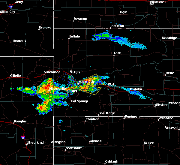 The severe thunderstorm warning for northeastern custer and southeastern pennington counties will expire at 800 pm mdt, the storm which prompted the warning has weakened below severe limits, and no longer poses an immediate threat to life or property. therefore, the warning will be allowed to expire. however small hail, gusty winds and heavy rain are still possible with this thunderstorm. a severe thunderstorm watch remains in effect until 1100 pm mdt for southwestern and west central south dakota. The severe thunderstorm warning for northeastern custer and southeastern pennington counties will expire at 800 pm mdt, the storm which prompted the warning has weakened below severe limits, and no longer poses an immediate threat to life or property. therefore, the warning will be allowed to expire. however small hail, gusty winds and heavy rain are still possible with this thunderstorm. a severe thunderstorm watch remains in effect until 1100 pm mdt for southwestern and west central south dakota.
|
| 7/21/2018 7:31 PM MDT |
 At 731 pm mdt, a severe thunderstorm was located near railroad buttes, or 26 miles southeast of rapid city, moving southeast at 30 mph (radar indicated). Hazards include 60 mph wind gusts and quarter size hail. Hail damage to vehicles is expected. expect wind damage to roofs, siding, and trees. Locations impacted include, caputa, folsom, farmingdale, thompson butte, railroad buttes and rapid city airport. At 731 pm mdt, a severe thunderstorm was located near railroad buttes, or 26 miles southeast of rapid city, moving southeast at 30 mph (radar indicated). Hazards include 60 mph wind gusts and quarter size hail. Hail damage to vehicles is expected. expect wind damage to roofs, siding, and trees. Locations impacted include, caputa, folsom, farmingdale, thompson butte, railroad buttes and rapid city airport.
|
| 7/21/2018 7:25 PM MDT | Storm damage reported in pennington county SD, 7.5 miles W of Rapid City, SD |
| 7/21/2018 7:22 PM MDT | Quarter sized hail reported 6.2 miles NNW of Rapid City, SD |
| 7/21/2018 7:22 PM MDT | Storm damage reported in pennington county SD, 6.2 miles NNW of Rapid City, SD |
| 7/21/2018 7:16 PM MDT |
 At 715 pm mdt, a severe thunderstorm was located 5 miles northeast of rapid city airport, or 14 miles east of rapid city, moving northeast at 25 mph (radar indicated). Hazards include 60 mph wind gusts. expect damage to roofs, siding, and trees At 715 pm mdt, a severe thunderstorm was located 5 miles northeast of rapid city airport, or 14 miles east of rapid city, moving northeast at 25 mph (radar indicated). Hazards include 60 mph wind gusts. expect damage to roofs, siding, and trees
|
| 7/21/2018 7:10 PM MDT | Storm damage reported in pennington county SD, 7.5 miles W of Rapid City, SD |
| 7/21/2018 7:01 PM MDT |
 The national weather service in rapid city has issued a * severe thunderstorm warning for. northeastern custer county in southwestern south dakota. southeastern pennington county in west central south dakota. Until 800 pm mdt * at 700 pm mdt, a severe thunderstorm was located 3 miles east of. The national weather service in rapid city has issued a * severe thunderstorm warning for. northeastern custer county in southwestern south dakota. southeastern pennington county in west central south dakota. Until 800 pm mdt * at 700 pm mdt, a severe thunderstorm was located 3 miles east of.
|
| 7/21/2018 6:57 PM MDT | Gusting over 50 mph for last 15 minutes in pennington county SD, 3.5 miles NNE of Rapid City, SD |
| 7/21/2018 6:47 PM MDT | Winds downed poplar tree and damaged garage door in pennington county SD, 2.1 miles E of Rapid City, SD |
| 7/21/2018 6:46 PM MDT |
 At 646 pm mdt, a severe thunderstorm was located near rockerville, or 8 miles east of hill city, moving southeast at 20 mph (radar indicated). Hazards include ping pong ball size hail and 60 mph wind gusts. People and animals outdoors will be injured. expect hail damage to roofs, siding, windows, and vehicles. expect wind damage to roofs, siding, and trees. Locations impacted include, southwestern rapid city, johnson siding, hisega, rockerville, sheridan lake, bear country and reptile gardens. At 646 pm mdt, a severe thunderstorm was located near rockerville, or 8 miles east of hill city, moving southeast at 20 mph (radar indicated). Hazards include ping pong ball size hail and 60 mph wind gusts. People and animals outdoors will be injured. expect hail damage to roofs, siding, windows, and vehicles. expect wind damage to roofs, siding, and trees. Locations impacted include, southwestern rapid city, johnson siding, hisega, rockerville, sheridan lake, bear country and reptile gardens.
|
| 7/21/2018 6:45 PM MDT | Live video shows large tree downed by winds in pennington county SD, 4.6 miles E of Rapid City, SD |
| 7/21/2018 6:45 PM MDT |
 At 644 pm mdt, a severe thunderstorm was located over southern rapid city, moving east at 25 mph (radar indicated). Hazards include 60 mph wind gusts and penny size hail. expect damage to roofs, siding, and trees At 644 pm mdt, a severe thunderstorm was located over southern rapid city, moving east at 25 mph (radar indicated). Hazards include 60 mph wind gusts and penny size hail. expect damage to roofs, siding, and trees
|
| 7/21/2018 6:40 PM MDT | Quarter sized hail reported 13.9 miles ENE of Rapid City, SD |
| 7/21/2018 6:32 PM MDT |
 A severe thunderstorm warning remains in effect until 715 pm mdt for southwestern pennington county. at 632 pm mdt, a severe thunderstorm was located near sheridan lake, or 6 miles northeast of hill city, moving southeast at 15 mph. hazard. ping pong ball size hail and 60 mph wind gusts. source. Radar indicated. A severe thunderstorm warning remains in effect until 715 pm mdt for southwestern pennington county. at 632 pm mdt, a severe thunderstorm was located near sheridan lake, or 6 miles northeast of hill city, moving southeast at 15 mph. hazard. ping pong ball size hail and 60 mph wind gusts. source. Radar indicated.
|
| 7/21/2018 6:13 PM MDT |
 At 613 pm mdt, a severe thunderstorm was located over pactola reservoir, or 8 miles north of hill city, moving southeast at 15 mph (radar indicated). Hazards include ping pong ball size hail and 60 mph wind gusts. People and animals outdoors will be injured. expect hail damage to roofs, siding, windows, and vehicles. Expect wind damage to roofs, siding, and trees. At 613 pm mdt, a severe thunderstorm was located over pactola reservoir, or 8 miles north of hill city, moving southeast at 15 mph (radar indicated). Hazards include ping pong ball size hail and 60 mph wind gusts. People and animals outdoors will be injured. expect hail damage to roofs, siding, windows, and vehicles. Expect wind damage to roofs, siding, and trees.
|
| 7/18/2018 2:58 PM MDT |
 At 257 pm mdt, a severe thunderstorm was located over rapid city airport, or 11 miles east of rapid city, moving southeast at 25 mph. a 70 mph wind gust was recently recorded at the rapid city airport (automated observations). Hazards include golf ball size hail and 70 mph wind gusts. People and animals outdoors will be injured. expect hail damage to roofs, siding, windows, and vehicles. expect considerable tree damage. wind damage is also likely to mobile homes, roofs, and outbuildings. locations impacted include, rapid valley, southern ellsworth air force base, box elder, caputa, farmingdale, rapid city airport, thompson butte and railroad buttes. this includes interstate 90 in south dakota between mile markers 62 and 71. A tornado watch remains in effect until 1000 pm mdt for west central south dakota. At 257 pm mdt, a severe thunderstorm was located over rapid city airport, or 11 miles east of rapid city, moving southeast at 25 mph. a 70 mph wind gust was recently recorded at the rapid city airport (automated observations). Hazards include golf ball size hail and 70 mph wind gusts. People and animals outdoors will be injured. expect hail damage to roofs, siding, windows, and vehicles. expect considerable tree damage. wind damage is also likely to mobile homes, roofs, and outbuildings. locations impacted include, rapid valley, southern ellsworth air force base, box elder, caputa, farmingdale, rapid city airport, thompson butte and railroad buttes. this includes interstate 90 in south dakota between mile markers 62 and 71. A tornado watch remains in effect until 1000 pm mdt for west central south dakota.
|
| 7/18/2018 2:53 PM MDT | Storm damage reported in pennington county SD, 7.5 miles W of Rapid City, SD |
| 7/18/2018 2:52 PM MDT | Quarter sized hail reported 4 miles WSW of Rapid City, SD |
| 7/18/2018 2:52 PM MDT | Storm damage reported in pennington county SD, 4 miles WSW of Rapid City, SD |
| 7/18/2018 2:48 PM MDT | Storm damage reported in pennington county SD, 0.3 miles SSE of Rapid City, SD |
| 7/18/2018 2:46 PM MDT |
 At 245 pm mdt, a severe thunderstorm was located near box elder, or 6 miles east of rapid city, moving southeast at 25 mph (radar indicated). Hazards include golf ball size hail and 70 mph wind gusts. People and animals outdoors will be injured. expect hail damage to roofs, siding, windows, and vehicles. expect considerable tree damage. wind damage is also likely to mobile homes, roofs, and outbuildings. locations impacted include, rapid city, rapid valley, ellsworth air force base, box elder, new underwood, caputa, farmingdale, rapid city airport, thompson butte and railroad buttes. this includes interstate 90 in south dakota between mile markers 57 and 81. A tornado watch remains in effect until 1000 pm mdt for west central south dakota. At 245 pm mdt, a severe thunderstorm was located near box elder, or 6 miles east of rapid city, moving southeast at 25 mph (radar indicated). Hazards include golf ball size hail and 70 mph wind gusts. People and animals outdoors will be injured. expect hail damage to roofs, siding, windows, and vehicles. expect considerable tree damage. wind damage is also likely to mobile homes, roofs, and outbuildings. locations impacted include, rapid city, rapid valley, ellsworth air force base, box elder, new underwood, caputa, farmingdale, rapid city airport, thompson butte and railroad buttes. this includes interstate 90 in south dakota between mile markers 57 and 81. A tornado watch remains in effect until 1000 pm mdt for west central south dakota.
|
| 7/18/2018 2:35 PM MDT |
 At 235 pm mdt, a severe thunderstorm was located near ellsworth air force base, or 6 miles northeast of rapid city, moving southeast at 35 mph (radar indicated). Hazards include 60 mph wind gusts and quarter size hail. Hail damage to vehicles is expected. Expect wind damage to roofs, siding, and trees. At 235 pm mdt, a severe thunderstorm was located near ellsworth air force base, or 6 miles northeast of rapid city, moving southeast at 35 mph (radar indicated). Hazards include 60 mph wind gusts and quarter size hail. Hail damage to vehicles is expected. Expect wind damage to roofs, siding, and trees.
|
| 7/17/2018 3:10 PM MDT | Quarter sized hail reported 17 miles ENE of Rapid City, SD |
| 7/14/2018 4:50 PM MDT |
 The severe thunderstorm warning for central pennington county will expire at 500 pm mdt, the storm which prompted the warning has weakened below severe limits, and no longer poses an immediate threat to life or property. therefore, the warning will be allowed to expire. however small hail and gusty winds are still possible with this thunderstorm. The severe thunderstorm warning for central pennington county will expire at 500 pm mdt, the storm which prompted the warning has weakened below severe limits, and no longer poses an immediate threat to life or property. therefore, the warning will be allowed to expire. however small hail and gusty winds are still possible with this thunderstorm.
|
| 7/14/2018 4:27 PM MDT |
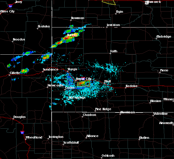 At 427 pm mdt, a severe thunderstorm was located near caputa, or 13 miles southeast of rapid city, moving east at 10 mph (radar indicated). Hazards include 60 mph wind gusts and quarter size hail. Hail damage to vehicles is expected. expect wind damage to roofs, siding, and trees. Locations impacted include, caputa, farmingdale, thompson butte and rapid city airport. At 427 pm mdt, a severe thunderstorm was located near caputa, or 13 miles southeast of rapid city, moving east at 10 mph (radar indicated). Hazards include 60 mph wind gusts and quarter size hail. Hail damage to vehicles is expected. expect wind damage to roofs, siding, and trees. Locations impacted include, caputa, farmingdale, thompson butte and rapid city airport.
|
| 7/14/2018 4:05 PM MDT |
 At 404 pm mdt, a severe thunderstorm was located near black gap, or 8 miles southeast of rapid city, moving east at 20 mph (radar indicated). Hazards include 60 mph wind gusts and quarter size hail. Hail damage to vehicles is expected. Expect wind damage to roofs, siding, and trees. At 404 pm mdt, a severe thunderstorm was located near black gap, or 8 miles southeast of rapid city, moving east at 20 mph (radar indicated). Hazards include 60 mph wind gusts and quarter size hail. Hail damage to vehicles is expected. Expect wind damage to roofs, siding, and trees.
|
| 7/9/2018 4:56 AM MDT |
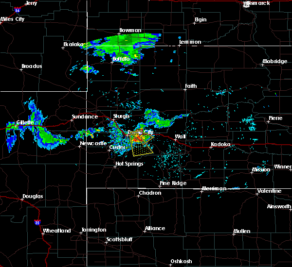 At 456 am mdt, a severe thunderstorm was located over caputa, or 14 miles southeast of rapid city, moving southeast at 30 mph (radar indicated). Hazards include 60 mph wind gusts and quarter size hail. Hail damage to vehicles is expected. expect wind damage to roofs, siding, and trees. Locations impacted include, caputa, folsom, farmingdale, rapid city airport, thompson butte and railroad buttes. At 456 am mdt, a severe thunderstorm was located over caputa, or 14 miles southeast of rapid city, moving southeast at 30 mph (radar indicated). Hazards include 60 mph wind gusts and quarter size hail. Hail damage to vehicles is expected. expect wind damage to roofs, siding, and trees. Locations impacted include, caputa, folsom, farmingdale, rapid city airport, thompson butte and railroad buttes.
|
| 7/9/2018 4:38 AM MDT |
 At 437 am mdt, a severe thunderstorm was located over rapid city airport, or 9 miles east of rapid city, moving south at 30 mph (radar indicated). Hazards include ping pong ball size hail and 60 mph wind gusts. People and animals outdoors will be injured. expect hail damage to roofs, siding, windows, and vehicles. Expect wind damage to roofs, siding, and trees. At 437 am mdt, a severe thunderstorm was located over rapid city airport, or 9 miles east of rapid city, moving south at 30 mph (radar indicated). Hazards include ping pong ball size hail and 60 mph wind gusts. People and animals outdoors will be injured. expect hail damage to roofs, siding, windows, and vehicles. Expect wind damage to roofs, siding, and trees.
|
| 7/9/2018 4:32 AM MDT |
 At 431 am mdt, a severe thunderstorm was located over southeastern box elder, or 9 miles east of rapid city, moving southeast at 30 mph (radar indicated). Hazards include 60 mph wind gusts and half dollar size hail. Hail damage to vehicles is expected. expect wind damage to roofs, siding, and trees. locations impacted include, ellsworth air force base, box elder, new underwood, farmingdale and caputa. This includes interstate 90 in south dakota between mile markers 64 and 80. At 431 am mdt, a severe thunderstorm was located over southeastern box elder, or 9 miles east of rapid city, moving southeast at 30 mph (radar indicated). Hazards include 60 mph wind gusts and half dollar size hail. Hail damage to vehicles is expected. expect wind damage to roofs, siding, and trees. locations impacted include, ellsworth air force base, box elder, new underwood, farmingdale and caputa. This includes interstate 90 in south dakota between mile markers 64 and 80.
|
| 7/9/2018 4:12 AM MDT |
 At 411 am mdt, a severe thunderstorm was located 4 miles northwest of ellsworth air force base, or 10 miles northeast of rapid city, moving southeast at 30 mph (radar indicated). Hazards include ping pong ball size hail. People and animals outdoors will be injured. Expect damage to roofs, siding, windows, and vehicles. At 411 am mdt, a severe thunderstorm was located 4 miles northwest of ellsworth air force base, or 10 miles northeast of rapid city, moving southeast at 30 mph (radar indicated). Hazards include ping pong ball size hail. People and animals outdoors will be injured. Expect damage to roofs, siding, windows, and vehicles.
|
| 7/3/2018 9:54 PM MDT |
 At 954 pm mdt, severe thunderstorms were located along a line extending from 6 miles northeast of ellsworth air force base to 2 miles northwest of farmingdale to 4 miles south of fairburn, moving east at 45 mph (radar indicated). Hazards include 60 mph wind gusts and nickel size hail. Expect damage to roofs, siding, and trees. locations impacted include, rapid city, rapid valley, ellsworth air force base, box elder, new underwood, hermosa, fairburn, owanka, red shirt, folsom, caputa, farmingdale, curlew lake, rapid city airport, hart ranch, buffalo corrals, thompson butte, railroad buttes, black gap and viewfield. This includes interstate 90 in south dakota between mile markers 58 and 89. At 954 pm mdt, severe thunderstorms were located along a line extending from 6 miles northeast of ellsworth air force base to 2 miles northwest of farmingdale to 4 miles south of fairburn, moving east at 45 mph (radar indicated). Hazards include 60 mph wind gusts and nickel size hail. Expect damage to roofs, siding, and trees. locations impacted include, rapid city, rapid valley, ellsworth air force base, box elder, new underwood, hermosa, fairburn, owanka, red shirt, folsom, caputa, farmingdale, curlew lake, rapid city airport, hart ranch, buffalo corrals, thompson butte, railroad buttes, black gap and viewfield. This includes interstate 90 in south dakota between mile markers 58 and 89.
|
| 7/3/2018 9:40 PM MDT |
 At 940 pm mdt, severe thunderstorms were located along a line extending from 4 miles west of ellsworth air force base to 3 miles southeast of black gap to 3 miles east of wind cave national park, moving northeast at 45 mph (radar indicated). Hazards include 60 mph wind gusts and nickel size hail. Expect damage to roofs, siding, and trees. locations impacted include, rapid city, rapid valley, ellsworth air force base, box elder, black hawk, new underwood, hermosa, hisega, fairburn, owanka, folsom, caputa, hayward, rockerville, red shirt, farmingdale, wind cave national park, rapid city airport, buffalo corrals and state game lodge. This includes interstate 90 in south dakota between mile markers 53 and 89. At 940 pm mdt, severe thunderstorms were located along a line extending from 4 miles west of ellsworth air force base to 3 miles southeast of black gap to 3 miles east of wind cave national park, moving northeast at 45 mph (radar indicated). Hazards include 60 mph wind gusts and nickel size hail. Expect damage to roofs, siding, and trees. locations impacted include, rapid city, rapid valley, ellsworth air force base, box elder, black hawk, new underwood, hermosa, hisega, fairburn, owanka, folsom, caputa, hayward, rockerville, red shirt, farmingdale, wind cave national park, rapid city airport, buffalo corrals and state game lodge. This includes interstate 90 in south dakota between mile markers 53 and 89.
|
| 7/3/2018 9:18 PM MDT |
 At 917 pm mdt, severe thunderstorms were located along a line extending from near silver city to custer state park to 4 miles east of argyle, moving east at 45 mph (radar indicated). Hazards include 60 mph wind gusts and nickel size hail. expect damage to roofs, siding, and trees At 917 pm mdt, severe thunderstorms were located along a line extending from near silver city to custer state park to 4 miles east of argyle, moving east at 45 mph (radar indicated). Hazards include 60 mph wind gusts and nickel size hail. expect damage to roofs, siding, and trees
|
| 6/29/2018 6:04 PM MDT |
 At 603 pm mdt, severe thunderstorms were located along a line extending from 7 miles east of hereford to 4 miles north of caputa, moving southeast at 35 mph (radar indicated). Hazards include 60 mph wind gusts and quarter size hail. Hail damage to vehicles is expected. expect wind damage to roofs, siding, and trees. locations impacted include, northern rapid city, rapid valley, ellsworth air force base, box elder, new underwood, caputa, curlew lake, rapid city airport and viewfield. This includes interstate 90 in south dakota between mile markers 55 and 78. At 603 pm mdt, severe thunderstorms were located along a line extending from 7 miles east of hereford to 4 miles north of caputa, moving southeast at 35 mph (radar indicated). Hazards include 60 mph wind gusts and quarter size hail. Hail damage to vehicles is expected. expect wind damage to roofs, siding, and trees. locations impacted include, northern rapid city, rapid valley, ellsworth air force base, box elder, new underwood, caputa, curlew lake, rapid city airport and viewfield. This includes interstate 90 in south dakota between mile markers 55 and 78.
|
| 6/29/2018 6:02 PM MDT |
 At 602 pm mdt, a severe thunderstorm was located over northeastern custer state park, or 9 miles east of custer, moving northeast at 40 mph (radar indicated). Hazards include 60 mph wind gusts and quarter size hail. Hail damage to vehicles is expected. Expect wind damage to roofs, siding, and trees. At 602 pm mdt, a severe thunderstorm was located over northeastern custer state park, or 9 miles east of custer, moving northeast at 40 mph (radar indicated). Hazards include 60 mph wind gusts and quarter size hail. Hail damage to vehicles is expected. Expect wind damage to roofs, siding, and trees.
|
| 6/29/2018 5:46 PM MDT |
 At 545 pm mdt, severe thunderstorms were located along a line extending from 5 miles northwest of hereford to rapid city, moving east at 30 mph (radar indicated). Hazards include 70 mph wind gusts and quarter size hail. Hail damage to vehicles is expected. expect considerable tree damage. wind damage is also likely to mobile homes, roofs, and outbuildings. locations impacted include, northern rapid city, rapid valley, ellsworth air force base, box elder, new underwood, caputa, hereford, curlew lake, rapid city airport and viewfield. This includes interstate 90 in south dakota between mile markers 55 and 78. At 545 pm mdt, severe thunderstorms were located along a line extending from 5 miles northwest of hereford to rapid city, moving east at 30 mph (radar indicated). Hazards include 70 mph wind gusts and quarter size hail. Hail damage to vehicles is expected. expect considerable tree damage. wind damage is also likely to mobile homes, roofs, and outbuildings. locations impacted include, northern rapid city, rapid valley, ellsworth air force base, box elder, new underwood, caputa, hereford, curlew lake, rapid city airport and viewfield. This includes interstate 90 in south dakota between mile markers 55 and 78.
|
| 6/29/2018 5:15 PM MDT |
 At 514 pm mdt, a severe thunderstorm was located near piedmont, or 11 miles southeast of sturgis, moving southeast at 35 mph. golf ball sized hail was recently reported in tilford (trained weather spotters). Hazards include tennis ball size hail and 70 mph wind gusts. People and animals outdoors will be injured. expect hail damage to roofs, siding, windows, and vehicles. expect considerable tree damage. Wind damage is also likely to mobile homes, roofs, and outbuildings. At 514 pm mdt, a severe thunderstorm was located near piedmont, or 11 miles southeast of sturgis, moving southeast at 35 mph. golf ball sized hail was recently reported in tilford (trained weather spotters). Hazards include tennis ball size hail and 70 mph wind gusts. People and animals outdoors will be injured. expect hail damage to roofs, siding, windows, and vehicles. expect considerable tree damage. Wind damage is also likely to mobile homes, roofs, and outbuildings.
|
| 6/22/2018 4:00 PM MDT |
 At 400 pm mdt, severe thunderstorms were located along a line extending from 3 miles southwest of rapid valley to near hayward, moving southeast at 20 mph (radar indicated). Hazards include ping pong ball size hail and 60 mph wind gusts. People and animals outdoors will be injured. expect hail damage to roofs, siding, windows, and vehicles. expect wind damage to roofs, siding, and trees. Locations impacted include, southeastern rapid city, southern rapid valley, hermosa, hayward, rapid city airport, hart ranch, black gap and reptile gardens. At 400 pm mdt, severe thunderstorms were located along a line extending from 3 miles southwest of rapid valley to near hayward, moving southeast at 20 mph (radar indicated). Hazards include ping pong ball size hail and 60 mph wind gusts. People and animals outdoors will be injured. expect hail damage to roofs, siding, windows, and vehicles. expect wind damage to roofs, siding, and trees. Locations impacted include, southeastern rapid city, southern rapid valley, hermosa, hayward, rapid city airport, hart ranch, black gap and reptile gardens.
|
| 6/22/2018 3:44 PM MDT |
 At 344 pm mdt, severe thunderstorms were located along a line extending from near black hawk to near keystone, moving east at 20 mph (radar indicated). Hazards include golf ball size hail and 60 mph wind gusts. People and animals outdoors will be injured. expect hail damage to roofs, siding, windows, and vehicles. Expect wind damage to roofs, siding, and trees. At 344 pm mdt, severe thunderstorms were located along a line extending from near black hawk to near keystone, moving east at 20 mph (radar indicated). Hazards include golf ball size hail and 60 mph wind gusts. People and animals outdoors will be injured. expect hail damage to roofs, siding, windows, and vehicles. Expect wind damage to roofs, siding, and trees.
|
| 6/22/2018 2:28 PM MDT | Ping Pong Ball sized hail reported 10.7 miles N of Rapid City, SD |
| 6/22/2018 1:51 PM MDT | Half Dollar sized hail reported 3.5 miles SE of Rapid City, SD |
| 6/22/2018 1:49 PM MDT | Half Dollar sized hail reported 3.5 miles NNE of Rapid City, SD |
| 6/22/2018 1:49 PM MDT |
 At 149 pm mdt, a severe thunderstorm was located near reptile gardens, or 6 miles south of rapid city, moving southeast at 15 mph (radar indicated). Hazards include ping pong ball size hail. People and animals outdoors will be injured. Expect damage to roofs, siding, windows, and vehicles. At 149 pm mdt, a severe thunderstorm was located near reptile gardens, or 6 miles south of rapid city, moving southeast at 15 mph (radar indicated). Hazards include ping pong ball size hail. People and animals outdoors will be injured. Expect damage to roofs, siding, windows, and vehicles.
|
| 6/22/2018 1:42 PM MDT |
 At 141 pm mdt, a severe thunderstorm was located over southeastern rapid city, moving southeast at 20 mph (radar indicated). Hazards include half dollar size hail. Damage to vehicles is expected. locations impacted include, rapid city, rapid valley, southern box elder, black hawk, bear country, hart ranch and reptile gardens. This includes interstate 90 in south dakota between mile markers 55 and 63. At 141 pm mdt, a severe thunderstorm was located over southeastern rapid city, moving southeast at 20 mph (radar indicated). Hazards include half dollar size hail. Damage to vehicles is expected. locations impacted include, rapid city, rapid valley, southern box elder, black hawk, bear country, hart ranch and reptile gardens. This includes interstate 90 in south dakota between mile markers 55 and 63.
|
| 6/22/2018 1:40 PM MDT | Ping Pong Ball sized hail reported 5.6 miles NE of Rapid City, SD, image shows hail between half dollar and ping pong ball sized |
| 6/22/2018 1:37 PM MDT | Half Dollar sized hail reported 5.1 miles NE of Rapid City, SD, mping report |
| 6/22/2018 1:34 PM MDT | Half Dollar sized hail reported 5.9 miles NE of Rapid City, SD |
| 6/22/2018 1:34 PM MDT | Quarter sized hail reported 2.1 miles E of Rapid City, SD, at least quarter sized hail |
| 6/22/2018 1:32 PM MDT | Quarter sized hail reported 2.6 miles E of Rapid City, SD |
| 6/22/2018 1:18 PM MDT |
 At 117 pm mdt, a severe thunderstorm was located 3 miles northeast of johnson siding, or 7 miles west of rapid city, moving east at 20 mph (radar indicated). Hazards include ping pong ball size hail and 60 mph wind gusts. People and animals outdoors will be injured. expect hail damage to roofs, siding, windows, and vehicles. expect wind damage to roofs, siding, and trees. locations impacted include, rapid city, rapid valley, southern box elder, black hawk, johnson siding, hisega, bear country, hart ranch and reptile gardens. This includes interstate 90 in south dakota between mile markers 52 and 63. At 117 pm mdt, a severe thunderstorm was located 3 miles northeast of johnson siding, or 7 miles west of rapid city, moving east at 20 mph (radar indicated). Hazards include ping pong ball size hail and 60 mph wind gusts. People and animals outdoors will be injured. expect hail damage to roofs, siding, windows, and vehicles. expect wind damage to roofs, siding, and trees. locations impacted include, rapid city, rapid valley, southern box elder, black hawk, johnson siding, hisega, bear country, hart ranch and reptile gardens. This includes interstate 90 in south dakota between mile markers 52 and 63.
|
| 6/22/2018 1:16 PM MDT | Golf Ball sized hail reported 9.5 miles E of Rapid City, SD |
| 6/22/2018 1:15 PM MDT | Golf Ball sized hail reported 9.5 miles E of Rapid City, SD |
| 6/22/2018 1:15 PM MDT | Half Dollar sized hail reported 10 miles E of Rapid City, SD, mping report |
| 6/22/2018 1:13 PM MDT | Quarter sized hail reported 10 miles E of Rapid City, SD, mping report |
| 6/22/2018 1:03 PM MDT |
 At 103 pm mdt, a severe thunderstorm was located 3 miles northwest of johnson siding, or 12 miles west of rapid city, moving southeast at 15 mph (radar indicated). Hazards include ping pong ball size hail and 60 mph wind gusts. People and animals outdoors will be injured. expect hail damage to roofs, siding, windows, and vehicles. Expect wind damage to roofs, siding, and trees. At 103 pm mdt, a severe thunderstorm was located 3 miles northwest of johnson siding, or 12 miles west of rapid city, moving southeast at 15 mph (radar indicated). Hazards include ping pong ball size hail and 60 mph wind gusts. People and animals outdoors will be injured. expect hail damage to roofs, siding, windows, and vehicles. Expect wind damage to roofs, siding, and trees.
|
| 6/22/2018 12:48 PM MDT | Ping Pong Ball sized hail reported 18.7 miles ESE of Rapid City, SD, hail near the size of ping pong balls |
| 6/10/2018 8:53 PM MDT |
 At 853 pm mdt, a severe thunderstorm was located over rapid city airport, or 11 miles east of rapid city, moving north at 25 mph (radar indicated). Hazards include quarter size hail. damage to vehicles is expected At 853 pm mdt, a severe thunderstorm was located over rapid city airport, or 11 miles east of rapid city, moving north at 25 mph (radar indicated). Hazards include quarter size hail. damage to vehicles is expected
|
| 6/10/2018 7:02 PM MDT |
 At 702 pm mdt, a severe thunderstorm was located near black gap, or near rapid city, moving northeast at 25 mph (radar indicated). Hazards include quarter size hail. Damage to vehicles is expected. locations impacted include, rapid city, rapid valley, southern ellsworth air force base, box elder and black gap. this includes interstate 90 in south dakota between mile markers 57 and 67. A tornado watch remains in effect until 1000 pm mdt for west central south dakota. At 702 pm mdt, a severe thunderstorm was located near black gap, or near rapid city, moving northeast at 25 mph (radar indicated). Hazards include quarter size hail. Damage to vehicles is expected. locations impacted include, rapid city, rapid valley, southern ellsworth air force base, box elder and black gap. this includes interstate 90 in south dakota between mile markers 57 and 67. A tornado watch remains in effect until 1000 pm mdt for west central south dakota.
|
| 6/10/2018 6:55 PM MDT | Quarter sized hail reported 5.3 miles NNE of Rapid City, SD |
| 6/10/2018 6:54 PM MDT |
 The severe thunderstorm warning for south central meade and central pennington counties will expire at 700 pm mdt, the storms which prompted the warning have weakened below severe limits, and no longer pose an immediate threat to life or property. therefore, the warning will be allowed to expire. however small hail and gusty winds are still possible with these thunderstorms. a tornado watch remains in effect until 1000 pm mdt for west central south dakota. The severe thunderstorm warning for south central meade and central pennington counties will expire at 700 pm mdt, the storms which prompted the warning have weakened below severe limits, and no longer pose an immediate threat to life or property. therefore, the warning will be allowed to expire. however small hail and gusty winds are still possible with these thunderstorms. a tornado watch remains in effect until 1000 pm mdt for west central south dakota.
|
| 6/10/2018 6:52 PM MDT |
 At 651 pm mdt, a severe thunderstorm was located over bear country, or 8 miles south of rapid city, moving northeast at 25 mph (radar indicated). Hazards include ping pong ball size hail. People and animals outdoors will be injured. Expect damage to roofs, siding, windows, and vehicles. At 651 pm mdt, a severe thunderstorm was located over bear country, or 8 miles south of rapid city, moving northeast at 25 mph (radar indicated). Hazards include ping pong ball size hail. People and animals outdoors will be injured. Expect damage to roofs, siding, windows, and vehicles.
|
| 6/10/2018 6:38 PM MDT |
 At 638 pm mdt, severe thunderstorms were located along a line extending from near hereford to near box elder, moving northeast at 35 mph (radar indicated). Hazards include 60 mph wind gusts and quarter size hail. Hail damage to vehicles is expected. expect wind damage to roofs, siding, and trees. locations impacted include, eastern rapid valley, ellsworth air force base, box elder, new underwood, hereford, curlew lake, rapid city airport and viewfield. this includes interstate 90 in south dakota between mile markers 63 and 80. A tornado watch remains in effect until 1000 pm mdt for west central south dakota. At 638 pm mdt, severe thunderstorms were located along a line extending from near hereford to near box elder, moving northeast at 35 mph (radar indicated). Hazards include 60 mph wind gusts and quarter size hail. Hail damage to vehicles is expected. expect wind damage to roofs, siding, and trees. locations impacted include, eastern rapid valley, ellsworth air force base, box elder, new underwood, hereford, curlew lake, rapid city airport and viewfield. this includes interstate 90 in south dakota between mile markers 63 and 80. A tornado watch remains in effect until 1000 pm mdt for west central south dakota.
|
| 6/10/2018 6:21 PM MDT |
 At 621 pm mdt, a severe thunderstorm was located over ellsworth air force base, or 7 miles northeast of rapid city, moving northeast at 35 mph (radar indicated). Hazards include 60 mph wind gusts and half dollar size hail. Hail damage to vehicles is expected. expect wind damage to roofs, siding, and trees. locations impacted include, northeastern rapid city, rapid valley, ellsworth air force base, box elder, summerset, new underwood, hereford, curlew lake, rapid city airport and viewfield. this includes interstate 90 in south dakota between mile markers 57 and 80. A tornado watch remains in effect until 1000 pm mdt for west central south dakota. At 621 pm mdt, a severe thunderstorm was located over ellsworth air force base, or 7 miles northeast of rapid city, moving northeast at 35 mph (radar indicated). Hazards include 60 mph wind gusts and half dollar size hail. Hail damage to vehicles is expected. expect wind damage to roofs, siding, and trees. locations impacted include, northeastern rapid city, rapid valley, ellsworth air force base, box elder, summerset, new underwood, hereford, curlew lake, rapid city airport and viewfield. this includes interstate 90 in south dakota between mile markers 57 and 80. A tornado watch remains in effect until 1000 pm mdt for west central south dakota.
|
| 6/10/2018 6:19 PM MDT |
 At 619 pm mdt, a severe thunderstorm was located over hayward, or 15 miles east of hill city, moving northeast at 30 mph (radar indicated). Hazards include half dollar size hail. damage to vehicles is expected At 619 pm mdt, a severe thunderstorm was located over hayward, or 15 miles east of hill city, moving northeast at 30 mph (radar indicated). Hazards include half dollar size hail. damage to vehicles is expected
|
| 6/10/2018 6:15 PM MDT | Hen Egg sized hail reported 4.5 miles S of Rapid City, SD |
| 6/10/2018 6:14 PM MDT | Quarter sized hail reported 1.6 miles ENE of Rapid City, SD |
| 6/10/2018 6:10 PM MDT |
 At 610 pm mdt, a severe thunderstorm was located over northern rapid city, moving northeast at 35 mph (radar indicated). Hazards include golf ball size hail and 60 mph wind gusts. People and animals outdoors will be injured. expect hail damage to roofs, siding, windows, and vehicles. expect wind damage to roofs, siding, and trees. locations impacted include, rapid city, rapid valley, ellsworth air force base, box elder, black hawk, summerset, new underwood, hereford, curlew lake, rapid city airport, reptile gardens and viewfield. this includes interstate 90 in south dakota between mile markers 50 and 80. A tornado watch remains in effect until 1000 pm mdt for west central south dakota. At 610 pm mdt, a severe thunderstorm was located over northern rapid city, moving northeast at 35 mph (radar indicated). Hazards include golf ball size hail and 60 mph wind gusts. People and animals outdoors will be injured. expect hail damage to roofs, siding, windows, and vehicles. expect wind damage to roofs, siding, and trees. locations impacted include, rapid city, rapid valley, ellsworth air force base, box elder, black hawk, summerset, new underwood, hereford, curlew lake, rapid city airport, reptile gardens and viewfield. this includes interstate 90 in south dakota between mile markers 50 and 80. A tornado watch remains in effect until 1000 pm mdt for west central south dakota.
|
| 6/10/2018 6:06 PM MDT |
 At 606 pm mdt, a severe thunderstorm was located over western rapid city, moving northeast at 35 mph (radar indicated). Hazards include 60 mph wind gusts and half dollar size hail. Hail damage to vehicles is expected. Expect wind damage to roofs, siding, and trees. At 606 pm mdt, a severe thunderstorm was located over western rapid city, moving northeast at 35 mph (radar indicated). Hazards include 60 mph wind gusts and half dollar size hail. Hail damage to vehicles is expected. Expect wind damage to roofs, siding, and trees.
|
| 6/10/2018 5:46 PM MDT |
 At 545 pm mdt, a severe thunderstorm was located over silver city, or 10 miles north of hill city, moving northeast at 30 mph (radar indicated). Hazards include quarter size hail. Damage to vehicles is expected. locations impacted include, summerset, black hawk, johnson siding, nemo, piedmont, silver city and pactola reservoir. this includes interstate 90 in south dakota between mile markers 43 and 54. A tornado watch remains in effect until 1000 pm mdt for west central south dakota. At 545 pm mdt, a severe thunderstorm was located over silver city, or 10 miles north of hill city, moving northeast at 30 mph (radar indicated). Hazards include quarter size hail. Damage to vehicles is expected. locations impacted include, summerset, black hawk, johnson siding, nemo, piedmont, silver city and pactola reservoir. this includes interstate 90 in south dakota between mile markers 43 and 54. A tornado watch remains in effect until 1000 pm mdt for west central south dakota.
|
| 6/10/2018 5:35 PM MDT |
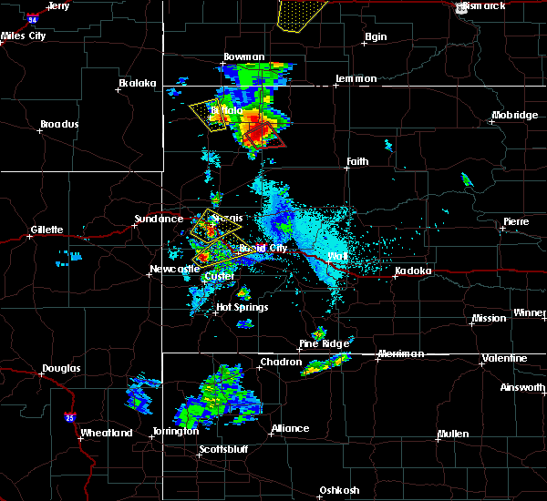 At 535 pm mdt, a severe thunderstorm was located near mystic, or near hill city, moving northeast at 30 mph (radar indicated). Hazards include half dollar size hail. damage to vehicles is expected At 535 pm mdt, a severe thunderstorm was located near mystic, or near hill city, moving northeast at 30 mph (radar indicated). Hazards include half dollar size hail. damage to vehicles is expected
|
| 6/8/2018 9:13 PM MDT |
 At 913 pm mdt, a severe thunderstorm was located near box elder, or 12 miles east of rapid city, moving southeast at 25 mph (radar indicated). Hazards include quarter size hail. Damage to vehicles is expected. locations impacted include, northeastern rapid city, rapid valley, ellsworth air force base, box elder, new underwood, caputa and rapid city airport. This includes interstate 90 in south dakota between mile markers 59 and 80. At 913 pm mdt, a severe thunderstorm was located near box elder, or 12 miles east of rapid city, moving southeast at 25 mph (radar indicated). Hazards include quarter size hail. Damage to vehicles is expected. locations impacted include, northeastern rapid city, rapid valley, ellsworth air force base, box elder, new underwood, caputa and rapid city airport. This includes interstate 90 in south dakota between mile markers 59 and 80.
|
| 6/8/2018 9:00 PM MDT |
 At 847 pm mdt, a severe thunderstorm was located near ellsworth air force base, or 9 miles northeast of rapid city, moving southeast at 25 mph (radar indicated. at 845 pm mdt quarter size hail was reported 6 miles southeast of piedmont). Hazards include ping pong ball size hail and 60 mph wind gusts. People and animals outdoors will be injured. expect hail damage to roofs, siding, windows, and vehicles. expect wind damage to roofs, siding, and trees. locations impacted include, northeastern rapid city, rapid valley, ellsworth air force base, box elder, summerset, black hawk, new underwood, piedmont, caputa, rapid city airport and viewfield. This includes interstate 90 in south dakota between mile markers 45 and 52, and between mile markers 59 and 80. At 847 pm mdt, a severe thunderstorm was located near ellsworth air force base, or 9 miles northeast of rapid city, moving southeast at 25 mph (radar indicated. at 845 pm mdt quarter size hail was reported 6 miles southeast of piedmont). Hazards include ping pong ball size hail and 60 mph wind gusts. People and animals outdoors will be injured. expect hail damage to roofs, siding, windows, and vehicles. expect wind damage to roofs, siding, and trees. locations impacted include, northeastern rapid city, rapid valley, ellsworth air force base, box elder, summerset, black hawk, new underwood, piedmont, caputa, rapid city airport and viewfield. This includes interstate 90 in south dakota between mile markers 45 and 52, and between mile markers 59 and 80.
|
| 6/8/2018 8:47 PM MDT |
 At 847 pm mdt, a severe thunderstorm was located near ellsworth air force base, or 9 miles northeast of rapid city, moving southeast at 25 mph (radar indicated. at 845 pm mdt quarter size hail was reported 6 miles southeast of piedmont). Hazards include ping pong ball size hail and 60 mph wind gusts. People and animals outdoors will be injured. expect hail damage to roofs, siding, windows, and vehicles. expect wind damage to roofs, siding, and trees. locations impacted include, northeastern rapid city, rapid valley, ellsworth air force base, box elder, summerset, black hawk, new underwood, piedmont, caputa, rapid city airport and viewfield. This includes interstate 90 in south dakota between mile markers 45 and 52, and between mile markers 59 and 80. At 847 pm mdt, a severe thunderstorm was located near ellsworth air force base, or 9 miles northeast of rapid city, moving southeast at 25 mph (radar indicated. at 845 pm mdt quarter size hail was reported 6 miles southeast of piedmont). Hazards include ping pong ball size hail and 60 mph wind gusts. People and animals outdoors will be injured. expect hail damage to roofs, siding, windows, and vehicles. expect wind damage to roofs, siding, and trees. locations impacted include, northeastern rapid city, rapid valley, ellsworth air force base, box elder, summerset, black hawk, new underwood, piedmont, caputa, rapid city airport and viewfield. This includes interstate 90 in south dakota between mile markers 45 and 52, and between mile markers 59 and 80.
|
| 6/8/2018 8:45 PM MDT | Quarter sized hail reported 9.5 miles SSE of Rapid City, SD |
| 6/8/2018 8:38 PM MDT |
 At 838 pm mdt, a severe thunderstorm was located near summerset, or 10 miles north of rapid city, moving southeast at 25 mph (radar indicated). Hazards include ping pong ball size hail. People and animals outdoors will be injured. Expect damage to roofs, siding, windows, and vehicles. At 838 pm mdt, a severe thunderstorm was located near summerset, or 10 miles north of rapid city, moving southeast at 25 mph (radar indicated). Hazards include ping pong ball size hail. People and animals outdoors will be injured. Expect damage to roofs, siding, windows, and vehicles.
|
| 6/8/2018 3:55 PM MDT | Ping Pong Ball sized hail reported 10.8 miles NNE of Rapid City, SD |
| 6/8/2018 3:47 PM MDT |
 At 346 pm mdt, a severe thunderstorm was located over bear country, or 10 miles south of rapid city, moving southeast at 15 mph (radar indicated). Hazards include golf ball size hail. People and animals outdoors will be injured. expect damage to roofs, siding, windows, and vehicles. Locations impacted include, rockerville, bear country, hart ranch, and hayward. At 346 pm mdt, a severe thunderstorm was located over bear country, or 10 miles south of rapid city, moving southeast at 15 mph (radar indicated). Hazards include golf ball size hail. People and animals outdoors will be injured. expect damage to roofs, siding, windows, and vehicles. Locations impacted include, rockerville, bear country, hart ranch, and hayward.
|
| 6/8/2018 3:45 PM MDT | Hen Egg sized hail reported 6.4 miles NNE of Rapid City, SD |
| 6/8/2018 3:45 PM MDT | Half Dollar sized hail reported 6.6 miles NNE of Rapid City, SD |
| 6/8/2018 3:33 PM MDT |
 At 332 pm mdt, a severe thunderstorm was located over bear country, or 8 miles southwest of rapid city, moving southeast at 15 mph (radar indicated. at 328 pm mdt ping pong ball size hail was reported 7 miles southwest of downtown rapid city). Hazards include ping pong ball size hail. People and animals outdoors will be injured. expect damage to roofs, siding, windows, and vehicles. Locations impacted include, southwestern rapid city, hayward, rockerville, bear country, hart ranch, black gap and reptile gardens. At 332 pm mdt, a severe thunderstorm was located over bear country, or 8 miles southwest of rapid city, moving southeast at 15 mph (radar indicated. at 328 pm mdt ping pong ball size hail was reported 7 miles southwest of downtown rapid city). Hazards include ping pong ball size hail. People and animals outdoors will be injured. expect damage to roofs, siding, windows, and vehicles. Locations impacted include, southwestern rapid city, hayward, rockerville, bear country, hart ranch, black gap and reptile gardens.
|
| 6/8/2018 3:32 PM MDT | Hen Egg sized hail reported 7.4 miles NE of Rapid City, SD, hail fell at bear country. |
| 6/8/2018 3:28 PM MDT | Ping Pong Ball sized hail reported 6.8 miles NE of Rapid City, SD |
| 6/8/2018 3:27 PM MDT | Quarter sized hail reported 6.8 miles NE of Rapid City, SD |
| 6/8/2018 3:24 PM MDT |
 At 324 pm mdt, a severe thunderstorm was located near hisega, or near rapid city, moving southeast at 10 mph (radar indicated). Hazards include half dollar size hail. damage to vehicles is expected At 324 pm mdt, a severe thunderstorm was located near hisega, or near rapid city, moving southeast at 10 mph (radar indicated). Hazards include half dollar size hail. damage to vehicles is expected
|
| 6/8/2018 3:22 PM MDT |
 At 321 pm mdt, a severe thunderstorm was located over southwestern rapid city, moving southeast at 10 mph (radar indicated). Hazards include quarter size hail. Damage to vehicles is expected. locations impacted include, rapid city and hisega. This includes interstate 90 in south dakota between mile markers 56 and 58. At 321 pm mdt, a severe thunderstorm was located over southwestern rapid city, moving southeast at 10 mph (radar indicated). Hazards include quarter size hail. Damage to vehicles is expected. locations impacted include, rapid city and hisega. This includes interstate 90 in south dakota between mile markers 56 and 58.
|
| 6/8/2018 3:12 PM MDT |
 At 311 pm mdt, a severe thunderstorm was located over southwestern rapid city, moving southeast at 15 mph (radar indicated). Hazards include golf ball size hail. People and animals outdoors will be injured. expect damage to roofs, siding, windows, and vehicles. locations impacted include, rapid city, black hawk and hisega. This includes interstate 90 in south dakota between mile markers 52 and 61. At 311 pm mdt, a severe thunderstorm was located over southwestern rapid city, moving southeast at 15 mph (radar indicated). Hazards include golf ball size hail. People and animals outdoors will be injured. expect damage to roofs, siding, windows, and vehicles. locations impacted include, rapid city, black hawk and hisega. This includes interstate 90 in south dakota between mile markers 52 and 61.
|
| 6/8/2018 3:10 PM MDT | Quarter sized hail reported 5.7 miles SE of Rapid City, SD |
| 6/8/2018 3:07 PM MDT | Hen Egg sized hail reported 9.5 miles E of Rapid City, SD |
| 6/8/2018 3:07 PM MDT |
 At 307 pm mdt, a severe thunderstorm was located near rapid city, moving southeast at 15 mph. this is a very dangerous storm (radar indicated. at 305 pm mdt golf ball to baseball size hail was reported from hisega to 1 mile north of hisega). Hazards include baseball size hail. People and animals outdoors will be severely injured. expect shattered windows, extensive damage to roofs, siding, and vehicles. locations impacted include, rapid city, black hawk, summerset, johnson siding and hisega. This includes interstate 90 in south dakota between mile markers 51 and 61. At 307 pm mdt, a severe thunderstorm was located near rapid city, moving southeast at 15 mph. this is a very dangerous storm (radar indicated. at 305 pm mdt golf ball to baseball size hail was reported from hisega to 1 mile north of hisega). Hazards include baseball size hail. People and animals outdoors will be severely injured. expect shattered windows, extensive damage to roofs, siding, and vehicles. locations impacted include, rapid city, black hawk, summerset, johnson siding and hisega. This includes interstate 90 in south dakota between mile markers 51 and 61.
|
| 6/8/2018 3:01 PM MDT | Hen Egg sized hail reported 10.5 miles E of Rapid City, SD |
| 6/8/2018 3:01 PM MDT |
 At 300 pm mdt, a severe thunderstorm was located between johnson siding and black hawk, moving southeast at 10 mph. this is a very dangerous storm (radar indicated). Hazards include baseball size hail. People and animals outdoors will be severely injured. expect shattered windows, extensive damage to roofs, siding, and vehicles. locations impacted include, rapid city, black hawk, summerset, johnson siding and hisega. This includes interstate 90 in south dakota between mile markers 50 and 61. At 300 pm mdt, a severe thunderstorm was located between johnson siding and black hawk, moving southeast at 10 mph. this is a very dangerous storm (radar indicated). Hazards include baseball size hail. People and animals outdoors will be severely injured. expect shattered windows, extensive damage to roofs, siding, and vehicles. locations impacted include, rapid city, black hawk, summerset, johnson siding and hisega. This includes interstate 90 in south dakota between mile markers 50 and 61.
|
| 6/8/2018 2:50 PM MDT |
 At 250 pm mdt, a severe thunderstorm was located over black hawk, or near rapid city, moving southeast at 20 mph. this is a very dangerous storm (radar indicated. at 248 pm mdt baseball size hail was reported 3 miles north of johnson siding). Hazards include baseball size hail. People and animals outdoors will be severely injured. expect shattered windows, extensive damage to roofs, siding, and vehicles. locations impacted include, rapid city, northwestern ellsworth air force base, summerset, black hawk, johnson siding, hisega and reptile gardens. This includes interstate 90 in south dakota between mile markers 48 and 62. At 250 pm mdt, a severe thunderstorm was located over black hawk, or near rapid city, moving southeast at 20 mph. this is a very dangerous storm (radar indicated. at 248 pm mdt baseball size hail was reported 3 miles north of johnson siding). Hazards include baseball size hail. People and animals outdoors will be severely injured. expect shattered windows, extensive damage to roofs, siding, and vehicles. locations impacted include, rapid city, northwestern ellsworth air force base, summerset, black hawk, johnson siding, hisega and reptile gardens. This includes interstate 90 in south dakota between mile markers 48 and 62.
|
| 6/8/2018 2:48 PM MDT | Baseball sized hail reported 12.4 miles ESE of Rapid City, SD |
| 6/8/2018 2:46 PM MDT |
 At 245 pm mdt, a severe thunderstorm was located just southwest of black hawk, or about 5 miles northwest of downtown rapid city, moving southeast at 20 mph. this is a very dangerous storm (radar indicated). Hazards include baseball size hail. People and animals outdoors will be severely injured. expect shattered windows, extensive damage to roofs, siding, and vehicles. locations impacted include, rapid city, northwestern ellsworth air force base, summerset, black hawk, johnson siding, nemo, hisega and reptile gardens. This includes interstate 90 in south dakota between mile markers 47 and 62. At 245 pm mdt, a severe thunderstorm was located just southwest of black hawk, or about 5 miles northwest of downtown rapid city, moving southeast at 20 mph. this is a very dangerous storm (radar indicated). Hazards include baseball size hail. People and animals outdoors will be severely injured. expect shattered windows, extensive damage to roofs, siding, and vehicles. locations impacted include, rapid city, northwestern ellsworth air force base, summerset, black hawk, johnson siding, nemo, hisega and reptile gardens. This includes interstate 90 in south dakota between mile markers 47 and 62.
|
| 6/8/2018 2:38 PM MDT |
 At 237 pm mdt, a severe thunderstorm was located over black hawk, or near rapid city, moving southeast at 20 mph. this is a very dangerous storm (radar indicated. at 235 pm mdt tennis ball size hail was reported 3 miles north of johnson siding). Hazards include baseball size hail. People and animals outdoors will be severely injured. expect shattered windows, extensive damage to roofs, siding, and vehicles. locations impacted include, rapid city, northwestern ellsworth air force base, summerset, black hawk, johnson siding, nemo, piedmont, hisega, dalton lake and reptile gardens. This includes interstate 90 in south dakota between mile markers 42 and 62. At 237 pm mdt, a severe thunderstorm was located over black hawk, or near rapid city, moving southeast at 20 mph. this is a very dangerous storm (radar indicated. at 235 pm mdt tennis ball size hail was reported 3 miles north of johnson siding). Hazards include baseball size hail. People and animals outdoors will be severely injured. expect shattered windows, extensive damage to roofs, siding, and vehicles. locations impacted include, rapid city, northwestern ellsworth air force base, summerset, black hawk, johnson siding, nemo, piedmont, hisega, dalton lake and reptile gardens. This includes interstate 90 in south dakota between mile markers 42 and 62.
|
| 6/8/2018 2:35 PM MDT | Tennis Ball sized hail reported 11.9 miles ESE of Rapid City, SD |
| 6/8/2018 2:24 PM MDT |
 At 224 pm mdt, a severe thunderstorm was located near piedmont, or 11 miles northwest of rapid city, moving southeast at 15 mph (radar indicated). Hazards include tennis ball size hail. People and animals outdoors will be injured. Expect damage to roofs, siding, windows, and vehicles. At 224 pm mdt, a severe thunderstorm was located near piedmont, or 11 miles northwest of rapid city, moving southeast at 15 mph (radar indicated). Hazards include tennis ball size hail. People and animals outdoors will be injured. Expect damage to roofs, siding, windows, and vehicles.
|
| 5/27/2018 10:27 PM MDT |
 At 1027 pm mdt, a severe thunderstorm was located over curlew lake, or 25 miles east of rapid city, moving north at 30 mph (radar indicated). Hazards include 70 mph wind gusts and penny size hail. Expect considerable tree damage. damage is likely to mobile homes, roofs, and outbuildings. locations impacted include, rapid city, rapid valley, ellsworth air force base, box elder, new underwood, wasta, owanka, elm springs, caputa, creighton, farmingdale, hereford, wicksville, curlew lake, rapid city airport and viewfield. This includes interstate 90 in south dakota between mile markers 57 and 98. At 1027 pm mdt, a severe thunderstorm was located over curlew lake, or 25 miles east of rapid city, moving north at 30 mph (radar indicated). Hazards include 70 mph wind gusts and penny size hail. Expect considerable tree damage. damage is likely to mobile homes, roofs, and outbuildings. locations impacted include, rapid city, rapid valley, ellsworth air force base, box elder, new underwood, wasta, owanka, elm springs, caputa, creighton, farmingdale, hereford, wicksville, curlew lake, rapid city airport and viewfield. This includes interstate 90 in south dakota between mile markers 57 and 98.
|
| 5/27/2018 10:26 PM MDT |
 At 1025 pm mdt, a severe thunderstorm was located over curlew lake, or 27 miles northeast of rapid city, moving northeast at 180 mph (radar indicated). Hazards include 70 mph wind gusts and penny size hail. Expect considerable tree damage. damage is likely to mobile homes, roofs, and outbuildings. locations impacted include, rapid city, rapid valley, ellsworth air force base, box elder, new underwood, wasta, owanka, elm springs, caputa, creighton, farmingdale, hereford, wicksville, curlew lake, rapid city airport and viewfield. this includes interstate 90 in south dakota between mile markers 57 and 98. Time, mot, loc 0425z 207deg 155kt 4426 10274. At 1025 pm mdt, a severe thunderstorm was located over curlew lake, or 27 miles northeast of rapid city, moving northeast at 180 mph (radar indicated). Hazards include 70 mph wind gusts and penny size hail. Expect considerable tree damage. damage is likely to mobile homes, roofs, and outbuildings. locations impacted include, rapid city, rapid valley, ellsworth air force base, box elder, new underwood, wasta, owanka, elm springs, caputa, creighton, farmingdale, hereford, wicksville, curlew lake, rapid city airport and viewfield. this includes interstate 90 in south dakota between mile markers 57 and 98. Time, mot, loc 0425z 207deg 155kt 4426 10274.
|
| 5/27/2018 10:14 PM MDT | Small to medium branches blown off pine tree in pennington county SD, 6.8 miles NE of Rapid City, SD |
| 5/27/2018 10:06 PM MDT |
 At 1005 pm mdt, a severe thunderstorm was located over farmingdale, or 18 miles east of rapid city, moving north at 25 mph (radar indicated). Hazards include 70 mph wind gusts and penny size hail. Expect considerable tree damage. Damage is likely to mobile homes, roofs, and outbuildings. At 1005 pm mdt, a severe thunderstorm was located over farmingdale, or 18 miles east of rapid city, moving north at 25 mph (radar indicated). Hazards include 70 mph wind gusts and penny size hail. Expect considerable tree damage. Damage is likely to mobile homes, roofs, and outbuildings.
|
| 5/27/2018 10:02 PM MDT |
 At 939 pm mdt, severe thunderstorms were located along a line extending from near hayward to near black gap to near folsom, moving north at 75 mph. these are very dangerous storms (radar indicated). Hazards include 80 mph wind gusts and quarter size hail. Flying debris will be dangerous to those caught without shelter. mobile homes will be heavily damaged. expect considerable damage to roofs, windows, and vehicles. extensive tree damage and power outages are likely. locations impacted include, rapid city, rapid valley, southern ellsworth air force base, box elder, black hawk, hermosa, fairburn, owanka, folsom, caputa, hayward, rockerville, farmingdale, rapid city airport, buffalo corrals, state game lodge, thompson butte, railroad buttes, eastern custer state park and reptile gardens. This includes interstate 90 in south dakota between mile markers 54 and 70. At 939 pm mdt, severe thunderstorms were located along a line extending from near hayward to near black gap to near folsom, moving north at 75 mph. these are very dangerous storms (radar indicated). Hazards include 80 mph wind gusts and quarter size hail. Flying debris will be dangerous to those caught without shelter. mobile homes will be heavily damaged. expect considerable damage to roofs, windows, and vehicles. extensive tree damage and power outages are likely. locations impacted include, rapid city, rapid valley, southern ellsworth air force base, box elder, black hawk, hermosa, fairburn, owanka, folsom, caputa, hayward, rockerville, farmingdale, rapid city airport, buffalo corrals, state game lodge, thompson butte, railroad buttes, eastern custer state park and reptile gardens. This includes interstate 90 in south dakota between mile markers 54 and 70.
|
| 5/27/2018 9:39 PM MDT |
 At 939 pm mdt, severe thunderstorms were located along a line extending from near hayward to near black gap to near folsom, moving north at 75 mph. these are very dangerous storms (radar indicated). Hazards include 80 mph wind gusts and quarter size hail. Flying debris will be dangerous to those caught without shelter. mobile homes will be heavily damaged. expect considerable damage to roofs, windows, and vehicles. extensive tree damage and power outages are likely. locations impacted include, rapid city, rapid valley, southern ellsworth air force base, box elder, black hawk, hermosa, fairburn, owanka, folsom, caputa, hayward, rockerville, farmingdale, rapid city airport, buffalo corrals, state game lodge, thompson butte, railroad buttes, eastern custer state park and reptile gardens. This includes interstate 90 in south dakota between mile markers 54 and 70. At 939 pm mdt, severe thunderstorms were located along a line extending from near hayward to near black gap to near folsom, moving north at 75 mph. these are very dangerous storms (radar indicated). Hazards include 80 mph wind gusts and quarter size hail. Flying debris will be dangerous to those caught without shelter. mobile homes will be heavily damaged. expect considerable damage to roofs, windows, and vehicles. extensive tree damage and power outages are likely. locations impacted include, rapid city, rapid valley, southern ellsworth air force base, box elder, black hawk, hermosa, fairburn, owanka, folsom, caputa, hayward, rockerville, farmingdale, rapid city airport, buffalo corrals, state game lodge, thompson butte, railroad buttes, eastern custer state park and reptile gardens. This includes interstate 90 in south dakota between mile markers 54 and 70.
|
| 5/27/2018 9:28 PM MDT |
 At 928 pm mdt, severe thunderstorms were located along a line extending from near wind cave national park to near fairburn to badlands national park, moving north at 35 mph (radar indicated). Hazards include 70 mph wind gusts and quarter size hail. Hail damage to vehicles is expected. expect considerable tree damage. wind damage is also likely to mobile homes, roofs, and outbuildings. locations impacted include, rapid city, rapid valley, southern ellsworth air force base, box elder, black hawk, hermosa, fairburn, owanka, folsom, caputa, hayward, rockerville, red shirt, farmingdale, northeastern wind cave national park, rapid city airport, buffalo corrals, state game lodge, thompson butte and railroad buttes. This includes interstate 90 in south dakota between mile markers 54 and 70. At 928 pm mdt, severe thunderstorms were located along a line extending from near wind cave national park to near fairburn to badlands national park, moving north at 35 mph (radar indicated). Hazards include 70 mph wind gusts and quarter size hail. Hail damage to vehicles is expected. expect considerable tree damage. wind damage is also likely to mobile homes, roofs, and outbuildings. locations impacted include, rapid city, rapid valley, southern ellsworth air force base, box elder, black hawk, hermosa, fairburn, owanka, folsom, caputa, hayward, rockerville, red shirt, farmingdale, northeastern wind cave national park, rapid city airport, buffalo corrals, state game lodge, thompson butte and railroad buttes. This includes interstate 90 in south dakota between mile markers 54 and 70.
|
| 5/27/2018 9:11 PM MDT |
 At 911 pm mdt, a severe thunderstorm was located near fairburn, or 20 miles northeast of hot springs, moving north at 35 mph (radar indicated). Hazards include 70 mph wind gusts and quarter size hail. Hail damage to vehicles is expected. expect considerable tree damage. Wind damage is also likely to mobile homes, roofs, and outbuildings. At 911 pm mdt, a severe thunderstorm was located near fairburn, or 20 miles northeast of hot springs, moving north at 35 mph (radar indicated). Hazards include 70 mph wind gusts and quarter size hail. Hail damage to vehicles is expected. expect considerable tree damage. Wind damage is also likely to mobile homes, roofs, and outbuildings.
|
| 5/17/2018 5:18 PM MDT |
 At 518 pm mdt, a severe thunderstorm was located over farmingdale, or 21 miles east of rapid city, moving northeast at 45 mph (radar indicated). Hazards include 60 mph wind gusts and quarter size hail. Hail damage to vehicles is expected. expect wind damage to roofs, siding, and trees. locations impacted include, new underwood, wasta, owanka, caputa, farmingdale, wicksville, curlew lake, viewfield. This includes interstate 90 in south dakota between mile markers 66 and 99. At 518 pm mdt, a severe thunderstorm was located over farmingdale, or 21 miles east of rapid city, moving northeast at 45 mph (radar indicated). Hazards include 60 mph wind gusts and quarter size hail. Hail damage to vehicles is expected. expect wind damage to roofs, siding, and trees. locations impacted include, new underwood, wasta, owanka, caputa, farmingdale, wicksville, curlew lake, viewfield. This includes interstate 90 in south dakota between mile markers 66 and 99.
|
| 5/17/2018 5:05 PM MDT |
 At 504 pm mdt, a severe thunderstorm was located over rapid city airport, or 10 miles east of rapid city, moving northeast at 30 mph (radar indicated). Hazards include 60 mph wind gusts and penny size hail. Expect damage to roofs, siding, and trees. locations impacted include, eastern rapid city, rapid valley, ellsworth air force base, box elder, new underwood, wasta, owanka, caputa, farmingdale, wicksville, curlew lake, rapid city airport, thompson butte, railroad buttes and viewfield. This includes interstate 90 in south dakota between mile markers 60 and 99. At 504 pm mdt, a severe thunderstorm was located over rapid city airport, or 10 miles east of rapid city, moving northeast at 30 mph (radar indicated). Hazards include 60 mph wind gusts and penny size hail. Expect damage to roofs, siding, and trees. locations impacted include, eastern rapid city, rapid valley, ellsworth air force base, box elder, new underwood, wasta, owanka, caputa, farmingdale, wicksville, curlew lake, rapid city airport, thompson butte, railroad buttes and viewfield. This includes interstate 90 in south dakota between mile markers 60 and 99.
|
| 5/17/2018 4:50 PM MDT |
 At 449 pm mdt, a severe thunderstorm was located over rapid city airport, or 9 miles southeast of rapid city, moving northeast at 40 mph (radar indicated). Hazards include 60 mph wind gusts. Expect damage to roofs, siding, and trees. locations impacted include, rapid city, rapid valley, ellsworth air force base, box elder, new underwood, hermosa, wasta, owanka, caputa, farmingdale, wicksville, curlew lake, rapid city airport, bear country, hart ranch, black gap, reptile gardens and viewfield. This includes interstate 90 in south dakota between mile markers 59 and 99. At 449 pm mdt, a severe thunderstorm was located over rapid city airport, or 9 miles southeast of rapid city, moving northeast at 40 mph (radar indicated). Hazards include 60 mph wind gusts. Expect damage to roofs, siding, and trees. locations impacted include, rapid city, rapid valley, ellsworth air force base, box elder, new underwood, hermosa, wasta, owanka, caputa, farmingdale, wicksville, curlew lake, rapid city airport, bear country, hart ranch, black gap, reptile gardens and viewfield. This includes interstate 90 in south dakota between mile markers 59 and 99.
|
| 5/17/2018 4:32 PM MDT |
 At 431 pm mdt, a severe thunderstorm was located over hayward, or 14 miles south of rapid city, moving northeast at 40 mph (radar indicated). Hazards include 60 mph wind gusts and penny size hail. expect damage to roofs, siding, and trees At 431 pm mdt, a severe thunderstorm was located over hayward, or 14 miles south of rapid city, moving northeast at 40 mph (radar indicated). Hazards include 60 mph wind gusts and penny size hail. expect damage to roofs, siding, and trees
|
| 5/16/2018 7:16 PM MDT |
 At 716 pm mdt, a severe thunderstorm was located near summerset, or 10 miles north of rapid city, moving east at 15 mph (radar indicated). Hazards include 60 mph wind gusts and quarter size hail. Hail damage to vehicles is expected. Expect wind damage to roofs, siding, and trees. At 716 pm mdt, a severe thunderstorm was located near summerset, or 10 miles north of rapid city, moving east at 15 mph (radar indicated). Hazards include 60 mph wind gusts and quarter size hail. Hail damage to vehicles is expected. Expect wind damage to roofs, siding, and trees.
|
| 5/16/2018 6:26 PM MDT |
 At 626 pm mdt, a severe thunderstorm was located over dalton lake, or 12 miles south of sturgis, moving southeast at 15 mph (radar indicated). Hazards include quarter size hail. damage to vehicles is expected At 626 pm mdt, a severe thunderstorm was located over dalton lake, or 12 miles south of sturgis, moving southeast at 15 mph (radar indicated). Hazards include quarter size hail. damage to vehicles is expected
|
| 9/8/2017 7:15 PM MDT |
 At 715 pm mdt, a severe thunderstorm was located near ellsworth air force base, or 10 miles northeast of rapid city, moving southeast at 15 mph (radar indicated). Hazards include quarter size hail. Damage to vehicles is expected. Locations impacted include, rapid valley, ellsworth air force base and box elder. At 715 pm mdt, a severe thunderstorm was located near ellsworth air force base, or 10 miles northeast of rapid city, moving southeast at 15 mph (radar indicated). Hazards include quarter size hail. Damage to vehicles is expected. Locations impacted include, rapid valley, ellsworth air force base and box elder.
|
| 9/8/2017 6:44 PM MDT |
 At 643 pm mdt, a severe thunderstorm was located 7 miles northeast of summerset, or 12 miles north of rapid city, moving southeast at 15 mph (radar indicated). Hazards include half dollar size hail. damage to vehicles is expected At 643 pm mdt, a severe thunderstorm was located 7 miles northeast of summerset, or 12 miles north of rapid city, moving southeast at 15 mph (radar indicated). Hazards include half dollar size hail. damage to vehicles is expected
|
| 8/26/2017 4:27 PM MDT |
 At 427 pm mdt, a severe thunderstorm was located over summerset, or 9 miles northwest of rapid city, moving southeast at 20 mph (radar indicated). Hazards include quarter size hail. damage to vehicles is expected At 427 pm mdt, a severe thunderstorm was located over summerset, or 9 miles northwest of rapid city, moving southeast at 20 mph (radar indicated). Hazards include quarter size hail. damage to vehicles is expected
|
| 8/26/2017 1:14 PM MDT | Ping Pong Ball sized hail reported 6.8 miles NE of Rapid City, SD, quarter size to ping pong size hail |
| 8/26/2017 1:00 PM MDT | Ping Pong Ball sized hail reported 3.8 miles N of Rapid City, SD |
| 8/26/2017 12:52 PM MDT | Quarter sized hail reported 6.8 miles NE of Rapid City, SD, a few quarter size hail with mostly nickel size hail |
| 8/25/2017 2:37 PM MDT |
 At 237 pm mdt, a severe thunderstorm was located over rockerville, or 9 miles southwest of rapid city, moving east at 15 mph (radar indicated). Hazards include half dollar size hail. Damage to vehicles is expected. Locations impacted include, southwestern rapid city, keystone, rockerville, sheridan lake, keystone wye, bear country, hart ranch, reptile gardens, horse thief lake and mount rushmore national memorial. At 237 pm mdt, a severe thunderstorm was located over rockerville, or 9 miles southwest of rapid city, moving east at 15 mph (radar indicated). Hazards include half dollar size hail. Damage to vehicles is expected. Locations impacted include, southwestern rapid city, keystone, rockerville, sheridan lake, keystone wye, bear country, hart ranch, reptile gardens, horse thief lake and mount rushmore national memorial.
|
| 8/25/2017 2:22 PM MDT |
 At 221 pm mdt, a severe thunderstorm was located over sheridan lake, or near hill city, moving east at 15 mph (radar indicated). Hazards include quarter size hail. damage to vehicles is expected At 221 pm mdt, a severe thunderstorm was located over sheridan lake, or near hill city, moving east at 15 mph (radar indicated). Hazards include quarter size hail. damage to vehicles is expected
|
| 8/14/2017 6:34 PM MDT |
 At 631 pm mdt, a severe thunderstorm was located near black gap, or 11 miles southeast of rapid city, moving southeast at 15 mph (radar indicated). Hazards include golf ball size hail and 60 mph wind gusts. People and animals outdoors will be injured. expect damage to roofs, siding, windows, vehicles, and trees. Locations impacted include, caputa, thompson butte and areas south of highway 44 and east of highway 79. At 631 pm mdt, a severe thunderstorm was located near black gap, or 11 miles southeast of rapid city, moving southeast at 15 mph (radar indicated). Hazards include golf ball size hail and 60 mph wind gusts. People and animals outdoors will be injured. expect damage to roofs, siding, windows, vehicles, and trees. Locations impacted include, caputa, thompson butte and areas south of highway 44 and east of highway 79.
|
| 8/14/2017 6:16 PM MDT | Golf Ball sized hail reported 4 miles NE of Rapid City, SD |
| 8/14/2017 6:15 PM MDT | Ping Pong Ball sized hail reported 4 miles NE of Rapid City, SD |
| 8/14/2017 6:13 PM MDT | Quarter sized hail reported 1.2 miles NNE of Rapid City, SD |
| 8/14/2017 6:12 PM MDT |
 At 610 pm mdt, a severe thunderstorm was located over rapid city, moving southeast at 20 mph (radar indicated). Hazards include two inch hail and 60 mph wind gusts. People and animals outdoors will be injured. expect damage to roofs, siding, windows, vehicles, and trees. Locations impacted include, rapid city, rapid valley, southwestern ellsworth air force base, southwestern box elder, caputa, rapid city airport, black gap and thompson butte. At 610 pm mdt, a severe thunderstorm was located over rapid city, moving southeast at 20 mph (radar indicated). Hazards include two inch hail and 60 mph wind gusts. People and animals outdoors will be injured. expect damage to roofs, siding, windows, vehicles, and trees. Locations impacted include, rapid city, rapid valley, southwestern ellsworth air force base, southwestern box elder, caputa, rapid city airport, black gap and thompson butte.
|
| 8/14/2017 6:11 PM MDT | Storm damage reported in pennington county SD, 1.5 miles SE of Rapid City, SD |
| 8/14/2017 6:09 PM MDT | Quarter sized hail reported 1.5 miles SE of Rapid City, SD, skyline dr |
| 8/14/2017 6:09 PM MDT | Golf Ball sized hail reported 3.1 miles NE of Rapid City, SD |
| 8/14/2017 6:05 PM MDT | Quarter sized hail reported 2 miles SSE of Rapid City, SD |
| 8/14/2017 6:05 PM MDT | Golf Ball sized hail reported 2.6 miles E of Rapid City, SD |
| 8/14/2017 6:00 PM MDT | Quarter sized hail reported 9.5 miles E of Rapid City, SD |
| 8/14/2017 6:00 PM MDT | Ping Pong Ball sized hail reported 4.6 miles SSE of Rapid City, SD |
| 8/14/2017 6:00 PM MDT |
 At 559 pm mdt, a severe thunderstorm was located over southwestern rapid city, moving southeast at 15 mph (radar indicated). Hazards include two inch hail and 60 mph wind gusts. People and animals outdoors will be injured. expect hail damage to roofs, siding, windows, and vehicles. Expect wind damage to roofs, siding, and trees. At 559 pm mdt, a severe thunderstorm was located over southwestern rapid city, moving southeast at 15 mph (radar indicated). Hazards include two inch hail and 60 mph wind gusts. People and animals outdoors will be injured. expect hail damage to roofs, siding, windows, and vehicles. Expect wind damage to roofs, siding, and trees.
|
| 8/14/2017 5:59 PM MDT | Storm damage reported in pennington county SD, 0.3 miles SSE of Rapid City, SD |
| 8/14/2017 5:47 PM MDT | Ping Pong Ball sized hail reported 9.6 miles E of Rapid City, SD |
| 8/14/2017 5:47 PM MDT |
 At 546 pm mdt, a severe thunderstorm was located near johnson siding, or 9 miles west of rapid city, moving southeast at 15 mph. another storm was located over black hawk (radar indicated). Hazards include tennis ball size hail. People and animals outdoors will be injured. expect damage to roofs, siding, windows, and vehicles. Locations impacted include, rapid city, western rapid valley, summerset, black hawk, johnson siding, piedmont, hisega, rockerville, and pactola reservoir. At 546 pm mdt, a severe thunderstorm was located near johnson siding, or 9 miles west of rapid city, moving southeast at 15 mph. another storm was located over black hawk (radar indicated). Hazards include tennis ball size hail. People and animals outdoors will be injured. expect damage to roofs, siding, windows, and vehicles. Locations impacted include, rapid city, western rapid valley, summerset, black hawk, johnson siding, piedmont, hisega, rockerville, and pactola reservoir.
|
| 8/14/2017 5:35 PM MDT |
 At 533 pm mdt, a severe thunderstorm was located 3 miles north of johnson siding, or 10 miles west of rapid city, moving southeast at 20 mph (radar indicated). Hazards include golf ball size hail. People and animals outdoors will be injured. expect damage to roofs, siding, windows, and vehicles. Locations impacted include, rapid city, western rapid valley, summerset, black hawk, johnson siding, nemo, piedmont, hisega, rockerville, dalton lake, and pactola reservoir. At 533 pm mdt, a severe thunderstorm was located 3 miles north of johnson siding, or 10 miles west of rapid city, moving southeast at 20 mph (radar indicated). Hazards include golf ball size hail. People and animals outdoors will be injured. expect damage to roofs, siding, windows, and vehicles. Locations impacted include, rapid city, western rapid valley, summerset, black hawk, johnson siding, nemo, piedmont, hisega, rockerville, dalton lake, and pactola reservoir.
|
| 8/14/2017 5:24 PM MDT | Quarter sized hail reported 11.9 miles ESE of Rapid City, SD |
| 8/14/2017 5:01 PM MDT |
 At 500 pm mdt, a severe thunderstorm was located over dalton lake, or 13 miles south of sturgis, moving southeast at 20 mph (radar indicated). Hazards include golf ball size hail. People and animals outdoors will be injured. Expect damage to roofs, siding, windows, and vehicles. At 500 pm mdt, a severe thunderstorm was located over dalton lake, or 13 miles south of sturgis, moving southeast at 20 mph (radar indicated). Hazards include golf ball size hail. People and animals outdoors will be injured. Expect damage to roofs, siding, windows, and vehicles.
|
| 8/14/2017 4:44 PM MDT |
 At 444 pm mdt, a severe thunderstorm was located over summerset, or 9 miles north of rapid city, moving east at 15 mph (radar indicated). Hazards include two inch hail. People and animals outdoors will be injured. Expect damage to roofs, siding, windows, and vehicles. At 444 pm mdt, a severe thunderstorm was located over summerset, or 9 miles north of rapid city, moving east at 15 mph (radar indicated). Hazards include two inch hail. People and animals outdoors will be injured. Expect damage to roofs, siding, windows, and vehicles.
|
| 8/14/2017 4:38 PM MDT |
 At 436 pm mdt, a severe thunderstorm was located near piedmont, or 12 miles north of rapid city, moving east at 15 mph. another storm was located east of brownsville and galena, or 8 miles southeast of deadwood (radar indicated). Hazards include half dollar size hail. Damage to vehicles is expected. Locations impacted include, rapid city, summerset, black hawk, nemo, piedmont, galena, tilford and dalton lake. At 436 pm mdt, a severe thunderstorm was located near piedmont, or 12 miles north of rapid city, moving east at 15 mph. another storm was located east of brownsville and galena, or 8 miles southeast of deadwood (radar indicated). Hazards include half dollar size hail. Damage to vehicles is expected. Locations impacted include, rapid city, summerset, black hawk, nemo, piedmont, galena, tilford and dalton lake.
|
| 8/14/2017 4:06 PM MDT |
 At 404 pm mdt, a severe thunderstorm was located over dalton lake, or 10 miles south of sturgis, moving east at 15 mph (radar indicated. two inch hail was reported 4 miles northwest of nemo at 359 pm mdt). Hazards include two inch hail. People and animals outdoors will be injured. expect damage to roofs, siding, windows, and vehicles. Locations impacted include, western rapid city, lead, summerset, black hawk, deadwood, nemo, piedmont, galena, tilford, brownsville, dalton lake and roubaix lake. At 404 pm mdt, a severe thunderstorm was located over dalton lake, or 10 miles south of sturgis, moving east at 15 mph (radar indicated. two inch hail was reported 4 miles northwest of nemo at 359 pm mdt). Hazards include two inch hail. People and animals outdoors will be injured. expect damage to roofs, siding, windows, and vehicles. Locations impacted include, western rapid city, lead, summerset, black hawk, deadwood, nemo, piedmont, galena, tilford, brownsville, dalton lake and roubaix lake.
|
| 8/14/2017 3:44 PM MDT |
 At 343 pm mdt, a severe thunderstorm was located near brownsville, or 11 miles south of sturgis, moving east at 15 mph (radar indicated). Hazards include 60 mph wind gusts and half dollar size hail. Hail damage to vehicles is expected. Expect wind damage to roofs, siding, and trees. At 343 pm mdt, a severe thunderstorm was located near brownsville, or 11 miles south of sturgis, moving east at 15 mph (radar indicated). Hazards include 60 mph wind gusts and half dollar size hail. Hail damage to vehicles is expected. Expect wind damage to roofs, siding, and trees.
|
| 7/18/2017 5:46 PM MDT |
 At 528 pm mdt, a severe thunderstorm was located near nemo, or 12 miles west of rapid city, moving southeast at 25 mph (radar indicated). Hazards include golf ball size hail and 60 mph wind gusts. People and animals outdoors will be injured. expect hail damage to roofs, siding, windows, and vehicles. expect wind damage to roofs, siding, and trees. Locations impacted include, rapid city, western rapid valley, northwestern ellsworth air force base, black hawk, summerset, johnson siding, nemo, piedmont, hisega, pactola reservoir, bear country, hart ranch and reptile gardens. At 528 pm mdt, a severe thunderstorm was located near nemo, or 12 miles west of rapid city, moving southeast at 25 mph (radar indicated). Hazards include golf ball size hail and 60 mph wind gusts. People and animals outdoors will be injured. expect hail damage to roofs, siding, windows, and vehicles. expect wind damage to roofs, siding, and trees. Locations impacted include, rapid city, western rapid valley, northwestern ellsworth air force base, black hawk, summerset, johnson siding, nemo, piedmont, hisega, pactola reservoir, bear country, hart ranch and reptile gardens.
|
| 7/18/2017 5:28 PM MDT |
 At 528 pm mdt, a severe thunderstorm was located near nemo, or 12 miles west of rapid city, moving southeast at 25 mph (radar indicated). Hazards include golf ball size hail and 60 mph wind gusts. People and animals outdoors will be injured. expect hail damage to roofs, siding, windows, and vehicles. expect wind damage to roofs, siding, and trees. Locations impacted include, rapid city, western rapid valley, northwestern ellsworth air force base, black hawk, summerset, johnson siding, nemo, piedmont, hisega, pactola reservoir, bear country, hart ranch and reptile gardens. At 528 pm mdt, a severe thunderstorm was located near nemo, or 12 miles west of rapid city, moving southeast at 25 mph (radar indicated). Hazards include golf ball size hail and 60 mph wind gusts. People and animals outdoors will be injured. expect hail damage to roofs, siding, windows, and vehicles. expect wind damage to roofs, siding, and trees. Locations impacted include, rapid city, western rapid valley, northwestern ellsworth air force base, black hawk, summerset, johnson siding, nemo, piedmont, hisega, pactola reservoir, bear country, hart ranch and reptile gardens.
|
| 7/18/2017 5:25 PM MDT | Storm damage reported in pennington county SD, 18.7 miles ESE of Rapid City, SD |
| 7/18/2017 5:17 PM MDT |
 At 517 pm mdt, a severe thunderstorm was located near nemo, or 14 miles southeast of lead, moving east at 20 mph (radar indicated). Hazards include golf ball size hail. People and animals outdoors will be injured. Expect damage to roofs, siding, windows, and vehicles. At 517 pm mdt, a severe thunderstorm was located near nemo, or 14 miles southeast of lead, moving east at 20 mph (radar indicated). Hazards include golf ball size hail. People and animals outdoors will be injured. Expect damage to roofs, siding, windows, and vehicles.
|
| 7/17/2017 7:00 PM MDT |
 At 700 pm mdt, severe thunderstorms were located along a line extending from near ellsworth air force base to near box elder to thompson butte, moving east at 40 mph (radar indicated). Hazards include 60 mph wind gusts. Expect damage to roofs, siding, and trees. Locations impacted include, rapid valley, ellsworth air force base, box elder, new underwood, wasta, owanka, caputa, farmingdale, wicksville, curlew lake, rapid city airport, thompson butte, railroad buttes, viewfield and northern badlands national park. At 700 pm mdt, severe thunderstorms were located along a line extending from near ellsworth air force base to near box elder to thompson butte, moving east at 40 mph (radar indicated). Hazards include 60 mph wind gusts. Expect damage to roofs, siding, and trees. Locations impacted include, rapid valley, ellsworth air force base, box elder, new underwood, wasta, owanka, caputa, farmingdale, wicksville, curlew lake, rapid city airport, thompson butte, railroad buttes, viewfield and northern badlands national park.
|
| 7/17/2017 6:50 PM MDT | Storm damage reported in pennington county SD, 3.7 miles NNE of Rapid City, SD |
| 7/17/2017 6:50 PM MDT | Storm damage reported in pennington county SD, 4.7 miles ENE of Rapid City, SD |
| 7/17/2017 6:48 PM MDT |
 At 648 pm mdt, severe thunderstorms were located along a line extending from near ellsworth air force base to near rapid city airport to near hermosa, moving east at 40 mph (radar indicated). Hazards include 60 mph wind gusts. expect damage to roofs, siding, and trees At 648 pm mdt, severe thunderstorms were located along a line extending from near ellsworth air force base to near rapid city airport to near hermosa, moving east at 40 mph (radar indicated). Hazards include 60 mph wind gusts. expect damage to roofs, siding, and trees
|
| 7/11/2017 10:24 PM MDT |
 At 1024 pm mdt, severe thunderstorms were located along a line extending from 6 miles southwest of hereford to caputa to near hermosa, moving east at 45 mph (radar indicated). Hazards include 60 mph wind gusts. Expect damage to roofs, siding, and trees. Locations impacted include, eastern rapid city, rapid valley, ellsworth air force base, box elder, new underwood, caputa, farmingdale, curlew lake, rapid city airport, hart ranch, thompson butte, railroad buttes, black gap, and viewfield. At 1024 pm mdt, severe thunderstorms were located along a line extending from 6 miles southwest of hereford to caputa to near hermosa, moving east at 45 mph (radar indicated). Hazards include 60 mph wind gusts. Expect damage to roofs, siding, and trees. Locations impacted include, eastern rapid city, rapid valley, ellsworth air force base, box elder, new underwood, caputa, farmingdale, curlew lake, rapid city airport, hart ranch, thompson butte, railroad buttes, black gap, and viewfield.
|
| 7/11/2017 10:22 PM MDT | Storm damage reported in pennington county SD, 7.5 miles W of Rapid City, SD |
| 7/11/2017 10:06 PM MDT |
 At 1006 pm mdt, severe thunderstorms were located along a line extending from 11 miles northeast of tilford to rapid city to near hayward, moving east at 40 mph (radar indicated). Hazards include 60 mph wind gusts. Expect damage to roofs, siding, and trees. Locations impacted include, rapid city, rapid valley, ellsworth air force base, box elder, black hawk, summerset, new underwood, johnson siding, piedmont, hisega, caputa, farmingdale, rockerville, curlew lake, rapid city airport, keystone wye, bear country, hart ranch, thompson butte, and railroad buttes. At 1006 pm mdt, severe thunderstorms were located along a line extending from 11 miles northeast of tilford to rapid city to near hayward, moving east at 40 mph (radar indicated). Hazards include 60 mph wind gusts. Expect damage to roofs, siding, and trees. Locations impacted include, rapid city, rapid valley, ellsworth air force base, box elder, black hawk, summerset, new underwood, johnson siding, piedmont, hisega, caputa, farmingdale, rockerville, curlew lake, rapid city airport, keystone wye, bear country, hart ranch, thompson butte, and railroad buttes.
|
| 7/11/2017 9:45 PM MDT |
 At 945 pm mdt, severe thunderstorms were located along a line extending from fort meade to near johnson siding to near flag mountain, moving east at 40 mph (radar indicated). Hazards include 60 mph wind gusts. expect damage to roofs, siding, and trees At 945 pm mdt, severe thunderstorms were located along a line extending from fort meade to near johnson siding to near flag mountain, moving east at 40 mph (radar indicated). Hazards include 60 mph wind gusts. expect damage to roofs, siding, and trees
|
| 7/11/2017 3:10 PM MDT |
 At 310 pm mdt, a severe thunderstorm was located near box elder, or 11 miles east of rapid city, moving east at 30 mph (trained weather spotters). Hazards include 60 mph wind gusts and quarter size hail. Hail damage to vehicles is expected. expect wind damage to roofs, siding, and trees. Locations impacted include, northeastern rapid valley, ellsworth air force base, box elder, new underwood, curlew lake, viewfield and rapid city airport. At 310 pm mdt, a severe thunderstorm was located near box elder, or 11 miles east of rapid city, moving east at 30 mph (trained weather spotters). Hazards include 60 mph wind gusts and quarter size hail. Hail damage to vehicles is expected. expect wind damage to roofs, siding, and trees. Locations impacted include, northeastern rapid valley, ellsworth air force base, box elder, new underwood, curlew lake, viewfield and rapid city airport.
|
| 7/11/2017 2:51 PM MDT |
 At 251 pm mdt, a severe thunderstorm was located near ellsworth air force base, or near rapid city, moving east at 30 mph (radar indicated). Hazards include ping pong ball size hail and 60 mph wind gusts. People and animals outdoors will be injured. expect hail damage to roofs, siding, windows, and vehicles. Expect wind damage to roofs, siding, and trees. At 251 pm mdt, a severe thunderstorm was located near ellsworth air force base, or near rapid city, moving east at 30 mph (radar indicated). Hazards include ping pong ball size hail and 60 mph wind gusts. People and animals outdoors will be injured. expect hail damage to roofs, siding, windows, and vehicles. Expect wind damage to roofs, siding, and trees.
|
| 7/11/2017 2:43 PM MDT | Half Dollar sized hail reported 9.5 miles SSE of Rapid City, SD, just under golf ball sized hail |
| 7/4/2017 1:59 PM MDT |
 At 158 pm mdt, a severe thunderstorm was located over johnson siding, or 8 miles west of rapid city, moving southeast at 10 mph (radar indicated). Hazards include 60 mph wind gusts and quarter size hail. Hail damage to vehicles is expected. Expect wind damage to roofs, siding, and trees. At 158 pm mdt, a severe thunderstorm was located over johnson siding, or 8 miles west of rapid city, moving southeast at 10 mph (radar indicated). Hazards include 60 mph wind gusts and quarter size hail. Hail damage to vehicles is expected. Expect wind damage to roofs, siding, and trees.
|
| 6/28/2017 5:25 PM MDT | Ping Pong Ball sized hail reported 12.5 miles NE of Rapid City, SD |
| 6/28/2017 5:14 PM MDT | Golf Ball sized hail reported 14.3 miles ENE of Rapid City, SD |
| 6/28/2017 11:21 AM MDT |
 At 521 pm mdt, a severe thunderstorm was located over rockerville, or 10 miles east of hill city, moving east at 25 mph (trained weather spotters). Hazards include two inch hail. People and animals outdoors will be injured. expect damage to roofs, siding, windows, and vehicles. Locations impacted include, southwestern rapid city, keystone, rockerville, bear country, keystone wye, hart ranch, black gap, reptile gardens and sheridan lake. At 521 pm mdt, a severe thunderstorm was located over rockerville, or 10 miles east of hill city, moving east at 25 mph (trained weather spotters). Hazards include two inch hail. People and animals outdoors will be injured. expect damage to roofs, siding, windows, and vehicles. Locations impacted include, southwestern rapid city, keystone, rockerville, bear country, keystone wye, hart ranch, black gap, reptile gardens and sheridan lake.
|
| 6/28/2017 11:07 AM MDT |
 At 507 pm mdt, a severe thunderstorm was located over sheridan lake, or near hill city, moving east at 25 mph (radar indicated). Hazards include two inch hail. People and animals outdoors will be injured. expect damage to roofs, siding, windows, and vehicles. Locations impacted include, southern rapid city, hill city, southwestern rapid valley, hisega, rockerville, sheridan lake, bear country, keystone wye, hart ranch, black gap and reptile gardens. At 507 pm mdt, a severe thunderstorm was located over sheridan lake, or near hill city, moving east at 25 mph (radar indicated). Hazards include two inch hail. People and animals outdoors will be injured. expect damage to roofs, siding, windows, and vehicles. Locations impacted include, southern rapid city, hill city, southwestern rapid valley, hisega, rockerville, sheridan lake, bear country, keystone wye, hart ranch, black gap and reptile gardens.
|
| 6/28/2017 10:56 AM MDT |
 At 455 pm mdt, a severe thunderstorm was located near hill city, moving east at 25 mph (radar indicated). Hazards include golf ball size hail. People and animals outdoors will be injured. expect damage to roofs, siding, windows, and vehicles. Locations impacted include, southern rapid city, hill city, southwestern rapid valley, keystone, hisega, mystic, rockerville, hayward, pactola reservoir, bear country, keystone wye, hart ranch, sheridan lake, black gap and reptile gardens. At 455 pm mdt, a severe thunderstorm was located near hill city, moving east at 25 mph (radar indicated). Hazards include golf ball size hail. People and animals outdoors will be injured. expect damage to roofs, siding, windows, and vehicles. Locations impacted include, southern rapid city, hill city, southwestern rapid valley, keystone, hisega, mystic, rockerville, hayward, pactola reservoir, bear country, keystone wye, hart ranch, sheridan lake, black gap and reptile gardens.
|
| 6/28/2017 10:46 AM MDT |
 At 445 pm mdt, a severe thunderstorm was located near mystic, or 7 miles northwest of hill city, moving east at 25 mph (radar indicated). Hazards include half dollar size hail. damage to vehicles is expected At 445 pm mdt, a severe thunderstorm was located near mystic, or 7 miles northwest of hill city, moving east at 25 mph (radar indicated). Hazards include half dollar size hail. damage to vehicles is expected
|
| 6/27/2017 5:42 PM MDT | 65-70 mph wind gusts in pennington county SD, 6.2 miles NNW of Rapid City, SD |
| 6/27/2017 5:41 PM MDT | Storm damage reported in pennington county SD, 7.5 miles W of Rapid City, SD |
| 6/27/2017 5:37 PM MDT | Neighbor across the street had roof shingles ripped of in pennington county SD, 4.6 miles SSE of Rapid City, SD |
| 6/27/2017 5:35 PM MDT | Large tree branch down in pennington county SD, 0.7 miles ESE of Rapid City, SD |
| 6/27/2017 5:30 PM MDT | Metal out building heavily damaged in pennington county SD, 2.8 miles NNW of Rapid City, SD |
| 6/27/2017 5:25 PM MDT | Storm damage reported in pennington county SD, 3.5 miles NNE of Rapid City, SD |
| 6/27/2017 5:20 PM MDT | Lost tops of pine trees and part of a roo in pennington county SD, 11.6 miles E of Rapid City, SD |
| 6/27/2017 11:57 AM MDT |
 At 556 pm mdt, severe thunderstorms were located along a line extending from 13 miles west of hereford to new underwood to near farmingdale, moving east at 45 mph (radar indicated). Hazards include 70 mph wind gusts. Expect considerable tree damage. damage is likely to mobile homes, roofs, and outbuildings. Locations impacted include, ellsworth air force base, box elder, wall, new underwood, wasta, owanka, elm springs, caputa, farmingdale, hereford, wicksville, curlew lake, thompson butte, minuteman missile silo, viewfield, rapid city airport and northern badlands national park. At 556 pm mdt, severe thunderstorms were located along a line extending from 13 miles west of hereford to new underwood to near farmingdale, moving east at 45 mph (radar indicated). Hazards include 70 mph wind gusts. Expect considerable tree damage. damage is likely to mobile homes, roofs, and outbuildings. Locations impacted include, ellsworth air force base, box elder, wall, new underwood, wasta, owanka, elm springs, caputa, farmingdale, hereford, wicksville, curlew lake, thompson butte, minuteman missile silo, viewfield, rapid city airport and northern badlands national park.
|
| 6/27/2017 11:34 AM MDT |
 At 534 pm mdt, severe thunderstorms were located along a line extending from fort meade to near thompson butte, moving east at 45 mph (radar indicated). Hazards include 70 mph wind gusts. Expect considerable tree damage. Damage is likely to mobile homes, roofs, and outbuildings. At 534 pm mdt, severe thunderstorms were located along a line extending from fort meade to near thompson butte, moving east at 45 mph (radar indicated). Hazards include 70 mph wind gusts. Expect considerable tree damage. Damage is likely to mobile homes, roofs, and outbuildings.
|
| 6/27/2017 11:30 AM MDT |
 At 529 pm mdt, severe thunderstorms were located along a line extending from near rapid city to near red shirt to 8 miles southeast of intersection of red shirt and cuny table roads, moving east at 50 mph (radar indicated. this line of storms has a history of producing winds in excess of 70 mph). Hazards include 70 mph wind gusts and quarter size hail. Hail damage to vehicles is expected. expect considerable tree damage. wind damage is also likely to mobile homes, roofs, and outbuildings. Locations impacted include, rapid city, rapid valley, southern ellsworth air force base, box elder, black hawk, johnson siding, hermosa, hisega, rockyford, folsom, caputa, hayward, rockerville, red shirt, farmingdale, pactola reservoir, rapid city airport, intersection of red shirt and cuny table roads, thompson butte and reptile gardens. At 529 pm mdt, severe thunderstorms were located along a line extending from near rapid city to near red shirt to 8 miles southeast of intersection of red shirt and cuny table roads, moving east at 50 mph (radar indicated. this line of storms has a history of producing winds in excess of 70 mph). Hazards include 70 mph wind gusts and quarter size hail. Hail damage to vehicles is expected. expect considerable tree damage. wind damage is also likely to mobile homes, roofs, and outbuildings. Locations impacted include, rapid city, rapid valley, southern ellsworth air force base, box elder, black hawk, johnson siding, hermosa, hisega, rockyford, folsom, caputa, hayward, rockerville, red shirt, farmingdale, pactola reservoir, rapid city airport, intersection of red shirt and cuny table roads, thompson butte and reptile gardens.
|
| 6/27/2017 11:10 AM MDT |
 At 508 pm mdt, severe thunderstorms were located along a line extending from near mystic to near fairburn to near smithwick, moving east at 50 mph (radar indicated. this line of storms has a history of producing winds in excess of 65 mph). Hazards include 70 mph wind gusts and quarter size hail. Hail damage to vehicles is expected. expect considerable tree damage. wind damage is also likely to mobile homes, roofs, and outbuildings. Locations impacted include, rapid city, hot springs, custer, hill city, rapid valley, southern ellsworth air force base, box elder, black hawk, johnson siding, hermosa, keystone, oral, buffalo gap, hisega, fairburn, smithwick, rockerville, farmingdale, rockyford and folsom. At 508 pm mdt, severe thunderstorms were located along a line extending from near mystic to near fairburn to near smithwick, moving east at 50 mph (radar indicated. this line of storms has a history of producing winds in excess of 65 mph). Hazards include 70 mph wind gusts and quarter size hail. Hail damage to vehicles is expected. expect considerable tree damage. wind damage is also likely to mobile homes, roofs, and outbuildings. Locations impacted include, rapid city, hot springs, custer, hill city, rapid valley, southern ellsworth air force base, box elder, black hawk, johnson siding, hermosa, keystone, oral, buffalo gap, hisega, fairburn, smithwick, rockerville, farmingdale, rockyford and folsom.
|
| 6/27/2017 10:59 AM MDT |
 At 459 pm mdt, severe thunderstorms were located along a line extending from near deerfield reservoir to wind cave national park to smithwick, moving east at 50 mph (radar indicated). Hazards include 60 mph wind gusts and quarter size hail. Hail damage to vehicles is expected. expect wind damage to roofs, siding, and trees. Locations impacted include, rapid city, hot springs, custer, hill city, rapid valley, southern ellsworth air force base, box elder, black hawk, johnson siding, hermosa, keystone, oral, buffalo gap, pringle, hisega, fairburn, smithwick, rockerville, farmingdale and rockyford. At 459 pm mdt, severe thunderstorms were located along a line extending from near deerfield reservoir to wind cave national park to smithwick, moving east at 50 mph (radar indicated). Hazards include 60 mph wind gusts and quarter size hail. Hail damage to vehicles is expected. expect wind damage to roofs, siding, and trees. Locations impacted include, rapid city, hot springs, custer, hill city, rapid valley, southern ellsworth air force base, box elder, black hawk, johnson siding, hermosa, keystone, oral, buffalo gap, pringle, hisega, fairburn, smithwick, rockerville, farmingdale and rockyford.
|
| 6/27/2017 10:47 AM MDT |
 At 446 pm mdt, severe thunderstorms were located along a line extending from near redbank spring campground to near sanator to near maverick junction, moving east at 50 mph (radar indicated). Hazards include 60 mph wind gusts and penny size hail. expect damage to roofs, siding, and trees At 446 pm mdt, severe thunderstorms were located along a line extending from near redbank spring campground to near sanator to near maverick junction, moving east at 50 mph (radar indicated). Hazards include 60 mph wind gusts and penny size hail. expect damage to roofs, siding, and trees
|
| 6/10/2017 11:13 PM MDT |
 At 1113 pm mdt, a severe thunderstorm was located near nemo, or 12 miles west of rapid city, moving northeast at 45 mph (radar indicated). Hazards include quarter size hail. Damage to vehicles is expected. Locations impacted include, rapid city, northern rapid valley, ellsworth air force base, box elder, black hawk, summerset, johnson siding, nemo, piedmont, silver city, hisega, rochford, mystic, tilford, pactola reservoir, and dalton lake. At 1113 pm mdt, a severe thunderstorm was located near nemo, or 12 miles west of rapid city, moving northeast at 45 mph (radar indicated). Hazards include quarter size hail. Damage to vehicles is expected. Locations impacted include, rapid city, northern rapid valley, ellsworth air force base, box elder, black hawk, summerset, johnson siding, nemo, piedmont, silver city, hisega, rochford, mystic, tilford, pactola reservoir, and dalton lake.
|
| 6/10/2017 10:51 PM MDT |
 At 1050 pm mdt, a severe thunderstorm was located over deerfield reservoir, or 11 miles northwest of hill city, moving northeast at 45 mph (radar indicated). Hazards include quarter size hail. damage to vehicles is expected At 1050 pm mdt, a severe thunderstorm was located over deerfield reservoir, or 11 miles northwest of hill city, moving northeast at 45 mph (radar indicated). Hazards include quarter size hail. damage to vehicles is expected
|
| 6/10/2017 10:25 PM MDT |
 The severe thunderstorm warning for southwestern meade, southeastern lawrence and west central pennington counties will expire at 1030 pm mdt, the storm which prompted the warning has weakened below severe limits, and no longer poses an immediate threat to life or property. therefore the warning will be allowed to expire. however small hail and gusty winds are still possible with this thunderstorm. a severe thunderstorm watch remains in effect until 400 am mdt for west central south dakota. The severe thunderstorm warning for southwestern meade, southeastern lawrence and west central pennington counties will expire at 1030 pm mdt, the storm which prompted the warning has weakened below severe limits, and no longer poses an immediate threat to life or property. therefore the warning will be allowed to expire. however small hail and gusty winds are still possible with this thunderstorm. a severe thunderstorm watch remains in effect until 400 am mdt for west central south dakota.
|
| 6/10/2017 10:08 PM MDT |
 At 1008 pm mdt, a severe thunderstorm was located 10 miles northeast of summerset, or 14 miles north of rapid city, moving northeast at 50 mph (radar indicated). Hazards include quarter size hail. Damage to vehicles is expected. Locations impacted include, northern rapid city, ellsworth air force base, box elder, black hawk, summerset, johnson siding, nemo, piedmont, silver city, hisega, rochford, mystic, tilford, pactola reservoir, dalton lake and roubaix lake. At 1008 pm mdt, a severe thunderstorm was located 10 miles northeast of summerset, or 14 miles north of rapid city, moving northeast at 50 mph (radar indicated). Hazards include quarter size hail. Damage to vehicles is expected. Locations impacted include, northern rapid city, ellsworth air force base, box elder, black hawk, summerset, johnson siding, nemo, piedmont, silver city, hisega, rochford, mystic, tilford, pactola reservoir, dalton lake and roubaix lake.
|
| 6/10/2017 10:00 PM MDT |
 At 958 pm mdt, a severe thunderstorm was located over piedmont, or 11 miles northwest of rapid city, moving northeast at 50 mph (radar indicated). Hazards include quarter size hail. Damage to vehicles is expected. Locations impacted include, northern rapid city, ellsworth air force base, box elder, black hawk, summerset, johnson siding, nemo, piedmont, silver city, hisega, rochford, mystic, tilford, deerfield, deerfield reservoir, pactola reservoir, dalton lake, roubaix lake, redbank spring campground, and black fox campground. At 958 pm mdt, a severe thunderstorm was located over piedmont, or 11 miles northwest of rapid city, moving northeast at 50 mph (radar indicated). Hazards include quarter size hail. Damage to vehicles is expected. Locations impacted include, northern rapid city, ellsworth air force base, box elder, black hawk, summerset, johnson siding, nemo, piedmont, silver city, hisega, rochford, mystic, tilford, deerfield, deerfield reservoir, pactola reservoir, dalton lake, roubaix lake, redbank spring campground, and black fox campground.
|
| 6/10/2017 9:24 PM MDT |
 At 923 pm mdt, a severe thunderstorm was located over deerfield, or 16 miles northwest of hill city, moving northeast at 50 mph (radar indicated). Hazards include quarter size hail. damage to vehicles is expected At 923 pm mdt, a severe thunderstorm was located over deerfield, or 16 miles northwest of hill city, moving northeast at 50 mph (radar indicated). Hazards include quarter size hail. damage to vehicles is expected
|
| 5/28/2017 3:53 PM MDT | Storm damage reported in pennington county SD, 0.3 miles SSE of Rapid City, SD |
| 5/28/2017 3:53 PM MDT | Storm damage reported in pennington county SD, 7.5 miles W of Rapid City, SD |
| 9/23/2016 6:59 PM MDT |
 At 659 pm mdt, a severe thunderstorm was located over farmingdale, or 17 miles east of rapid city, moving northeast at 40 mph (radar indicated). Hazards include golf ball size hail and 60 mph wind gusts. People and animals outdoors will be injured. expect hail damage to roofs, siding, windows, and vehicles. expect wind damage to roofs, siding, and trees. Locations impacted include, southeastern box elder, new underwood, caputa, farmingdale and rapid city airport. At 659 pm mdt, a severe thunderstorm was located over farmingdale, or 17 miles east of rapid city, moving northeast at 40 mph (radar indicated). Hazards include golf ball size hail and 60 mph wind gusts. People and animals outdoors will be injured. expect hail damage to roofs, siding, windows, and vehicles. expect wind damage to roofs, siding, and trees. Locations impacted include, southeastern box elder, new underwood, caputa, farmingdale and rapid city airport.
|
| 9/23/2016 6:54 PM MDT |
 At 654 pm mdt, a severe thunderstorm was located near farmingdale, or 17 miles southeast of rapid city, moving northeast at 40 mph (radar indicated). Hazards include 60 mph wind gusts and quarter size hail. Hail damage to vehicles is expected. expect wind damage to roofs, siding, and trees. Locations impacted include, southeastern rapid valley, southeastern box elder, new underwood, caputa, farmingdale and rapid city airport. At 654 pm mdt, a severe thunderstorm was located near farmingdale, or 17 miles southeast of rapid city, moving northeast at 40 mph (radar indicated). Hazards include 60 mph wind gusts and quarter size hail. Hail damage to vehicles is expected. expect wind damage to roofs, siding, and trees. Locations impacted include, southeastern rapid valley, southeastern box elder, new underwood, caputa, farmingdale and rapid city airport.
|
| 9/23/2016 6:36 PM MDT |
 At 636 pm mdt, a severe thunderstorm was located near hermosa, or 19 miles southeast of rapid city, moving northeast at 40 mph (radar indicated). Hazards include 60 mph wind gusts and quarter size hail. Hail damage to vehicles is expected. Expect wind damage to roofs, siding, and trees. At 636 pm mdt, a severe thunderstorm was located near hermosa, or 19 miles southeast of rapid city, moving northeast at 40 mph (radar indicated). Hazards include 60 mph wind gusts and quarter size hail. Hail damage to vehicles is expected. Expect wind damage to roofs, siding, and trees.
|
| 8/15/2016 4:02 PM MDT |
 At 402 pm mdt, a severe thunderstorm was located over hart ranch, or 8 miles south of rapid city, moving east at 15 mph (radar indicated). Hazards include quarter size hail. Damage to vehicles is expected. Locations impacted include, bear country, hart ranch, black gap and reptile gardens. At 402 pm mdt, a severe thunderstorm was located over hart ranch, or 8 miles south of rapid city, moving east at 15 mph (radar indicated). Hazards include quarter size hail. Damage to vehicles is expected. Locations impacted include, bear country, hart ranch, black gap and reptile gardens.
|
| 8/15/2016 3:46 PM MDT |
 At 346 pm mdt, a severe thunderstorm was located near rockerville, or 7 miles southwest of rapid city, moving east at 15 mph (radar indicated). Hazards include quarter size hail. damage to vehicles is expected At 346 pm mdt, a severe thunderstorm was located near rockerville, or 7 miles southwest of rapid city, moving east at 15 mph (radar indicated). Hazards include quarter size hail. damage to vehicles is expected
|
| 8/15/2016 3:25 PM MDT | Quarter sized hail reported 14.3 miles ENE of Rapid City, SD |
| 8/15/2016 3:12 PM MDT | Quarter sized hail reported 17 miles E of Rapid City, SD |
| 8/10/2016 5:26 PM MDT |
 At 525 pm mdt, a severe thunderstorm was located over rockerville, or 10 miles southwest of rapid city, moving northeast at 15 mph (radar indicated). Hazards include 60 mph wind gusts and quarter size hail. Hail damage to vehicles is expected. expect wind damage to roofs, siding, and trees. Locations impacted include, southwestern rapid city, keystone, hayward, rockerville, keystone wye, bear country, mount rushmore national memorial, reptile gardens, hart ranch, sheridan lake and horsethief lake. At 525 pm mdt, a severe thunderstorm was located over rockerville, or 10 miles southwest of rapid city, moving northeast at 15 mph (radar indicated). Hazards include 60 mph wind gusts and quarter size hail. Hail damage to vehicles is expected. expect wind damage to roofs, siding, and trees. Locations impacted include, southwestern rapid city, keystone, hayward, rockerville, keystone wye, bear country, mount rushmore national memorial, reptile gardens, hart ranch, sheridan lake and horsethief lake.
|
| 8/10/2016 5:13 PM MDT |
 At 513 pm mdt, a severe thunderstorm was located over keystone wye, or 8 miles east of hill city, moving northeast at 15 mph (radar indicated). Hazards include 60 mph wind gusts and half dollar size hail. Hail damage to vehicles is expected. Expect wind damage to roofs, siding, and trees. At 513 pm mdt, a severe thunderstorm was located over keystone wye, or 8 miles east of hill city, moving northeast at 15 mph (radar indicated). Hazards include 60 mph wind gusts and half dollar size hail. Hail damage to vehicles is expected. Expect wind damage to roofs, siding, and trees.
|
| 8/8/2016 6:42 PM MDT |
 At 642 pm mdt, a severe thunderstorm was located near box elder, or 12 miles east of rapid city, moving east at 25 mph (radar indicated). Hazards include 70 mph wind gusts and half dollar size hail. Hail damage to vehicles is expected. expect considerable tree damage. wind damage is also likely to mobile homes, roofs, and outbuildings. Locations impacted include, rapid valley, ellsworth air force base, box elder, new underwood, caputa, farmingdale and rapid city airport. At 642 pm mdt, a severe thunderstorm was located near box elder, or 12 miles east of rapid city, moving east at 25 mph (radar indicated). Hazards include 70 mph wind gusts and half dollar size hail. Hail damage to vehicles is expected. expect considerable tree damage. wind damage is also likely to mobile homes, roofs, and outbuildings. Locations impacted include, rapid valley, ellsworth air force base, box elder, new underwood, caputa, farmingdale and rapid city airport.
|
| 8/8/2016 6:39 PM MDT | Verified with tower in pennington county SD, 7.5 miles W of Rapid City, SD |
| 8/8/2016 6:27 PM MDT | Quarter sized hail reported 1.2 miles NNE of Rapid City, SD |
| 8/8/2016 6:26 PM MDT |
 At 626 pm mdt, a severe thunderstorm was located over southern rapid valley, or near rapid city, moving east at 25 mph (radar indicated). Hazards include ping pong ball size hail and 60 mph wind gusts. People and animals outdoors will be injured. expect hail damage to roofs, siding, windows, and vehicles. Expect wind damage to roofs, siding, and trees. At 626 pm mdt, a severe thunderstorm was located over southern rapid valley, or near rapid city, moving east at 25 mph (radar indicated). Hazards include ping pong ball size hail and 60 mph wind gusts. People and animals outdoors will be injured. expect hail damage to roofs, siding, windows, and vehicles. Expect wind damage to roofs, siding, and trees.
|
| 8/8/2016 6:22 PM MDT |
 At 621 pm mdt, severe thunderstorms were located along a line extending from pactola reservoir to rapid city, moving east at 15 mph (radar indicated). Hazards include golf ball size hail. People and animals outdoors will be injured. expect damage to roofs, siding, windows, and vehicles. Locations impacted include, rapid city, rapid valley, johnson siding, keystone, hisega, hayward, rockerville, caputa, keystone wye, pactola reservoir, reptile gardens, rapid city airport, sheridan lake and bear country. At 621 pm mdt, severe thunderstorms were located along a line extending from pactola reservoir to rapid city, moving east at 15 mph (radar indicated). Hazards include golf ball size hail. People and animals outdoors will be injured. expect damage to roofs, siding, windows, and vehicles. Locations impacted include, rapid city, rapid valley, johnson siding, keystone, hisega, hayward, rockerville, caputa, keystone wye, pactola reservoir, reptile gardens, rapid city airport, sheridan lake and bear country.
|
| 8/8/2016 6:17 PM MDT | Quarter sized hail reported 2.6 miles NW of Rapid City, SD |
| 8/8/2016 5:58 PM MDT |
 At 558 pm mdt, severe thunderstorms were located along a line extending from near mystic to near hisega, moving southeast at 10 mph (radar indicated). Hazards include golf ball size hail. People and animals outdoors will be injured. Expect damage to roofs, siding, windows, and vehicles. At 558 pm mdt, severe thunderstorms were located along a line extending from near mystic to near hisega, moving southeast at 10 mph (radar indicated). Hazards include golf ball size hail. People and animals outdoors will be injured. Expect damage to roofs, siding, windows, and vehicles.
|
| 8/8/2016 5:35 PM MDT |
 The severe thunderstorm warning for south central pennington county will expire at 545 pm mdt, the storm which prompted the warning has weakened below severe limits, and no longer pose an immediate threat to life or property. therefore the warning will be allowed to expire. however heavy rain is still possible with this thunderstorm. The severe thunderstorm warning for south central pennington county will expire at 545 pm mdt, the storm which prompted the warning has weakened below severe limits, and no longer pose an immediate threat to life or property. therefore the warning will be allowed to expire. however heavy rain is still possible with this thunderstorm.
|
| 8/8/2016 5:26 PM MDT |
 At 525 pm mdt, a severe thunderstorm was located near rapid city airport, or 10 miles southeast of rapid city, moving east at 15 mph (radar indicated). Hazards include half dollar size hail. Damage to vehicles is expected. This severe thunderstorm will remain over mainly rural areas of south central pennington county south of highway 44 near caputa. At 525 pm mdt, a severe thunderstorm was located near rapid city airport, or 10 miles southeast of rapid city, moving east at 15 mph (radar indicated). Hazards include half dollar size hail. Damage to vehicles is expected. This severe thunderstorm will remain over mainly rural areas of south central pennington county south of highway 44 near caputa.
|
| 8/8/2016 5:11 PM MDT | Golf Ball sized hail reported 6.2 miles NNW of Rapid City, SD |
| 8/8/2016 5:07 PM MDT |
 At 506 pm mdt, a severe thunderstorm was located near reptile gardens, or 7 miles south of rapid city, moving southeast at 20 mph (radar indicated). Hazards include tennis ball size hail. People and animals outdoors will be injured. expect damage to roofs, siding, windows, and vehicles. Locations impacted include, southern rapid city, areas south of highway 44 near caputa and farmingdale. At 506 pm mdt, a severe thunderstorm was located near reptile gardens, or 7 miles south of rapid city, moving southeast at 20 mph (radar indicated). Hazards include tennis ball size hail. People and animals outdoors will be injured. expect damage to roofs, siding, windows, and vehicles. Locations impacted include, southern rapid city, areas south of highway 44 near caputa and farmingdale.
|
| 8/8/2016 4:55 PM MDT | Golf Ball sized hail reported 3.5 miles NNE of Rapid City, SD |
| 8/8/2016 4:55 PM MDT | Hen Egg sized hail reported 3.5 miles NNE of Rapid City, SD |
| 8/8/2016 4:54 PM MDT | Golf Ball sized hail reported 7.7 miles NNE of Rapid City, SD |
| 8/8/2016 4:51 PM MDT |
 At 450 pm mdt, a severe thunderstorm was located over reptile gardens, or near rapid city, moving southeast at 25 mph. this is a very dangerous storm (radar indicated). Hazards include baseball size hail. People and animals outdoors will be severely injured. Expect shattered windows, extensive damage to roofs, siding, and vehicles. At 450 pm mdt, a severe thunderstorm was located over reptile gardens, or near rapid city, moving southeast at 25 mph. this is a very dangerous storm (radar indicated). Hazards include baseball size hail. People and animals outdoors will be severely injured. Expect shattered windows, extensive damage to roofs, siding, and vehicles.
|
| 8/8/2016 4:50 PM MDT | Half Dollar sized hail reported 3.5 miles NNE of Rapid City, SD |
| 8/8/2016 4:47 PM MDT | Baseball sized hail reported 6.8 miles NE of Rapid City, SD |
| 8/8/2016 4:42 PM MDT |
 At 441 pm mdt, a severe thunderstorm was located over southwestern rapid city, moving east at 25 mph (radar indicated). Hazards include ping pong ball size hail. People and animals outdoors will be injured. expect damage to roofs, siding, windows, and vehicles. Locations impacted include, rapid city, rapid valley, southwestern box elder, hisega, bear country and reptile gardens. At 441 pm mdt, a severe thunderstorm was located over southwestern rapid city, moving east at 25 mph (radar indicated). Hazards include ping pong ball size hail. People and animals outdoors will be injured. expect damage to roofs, siding, windows, and vehicles. Locations impacted include, rapid city, rapid valley, southwestern box elder, hisega, bear country and reptile gardens.
|
| 8/8/2016 4:30 PM MDT | Golf Ball sized hail reported 9.6 miles E of Rapid City, SD |
| 8/8/2016 4:26 PM MDT |
 At 425 pm mdt, a severe thunderstorm was located over johnson siding, or 7 miles west of rapid city, moving east at 20 mph (radar indicated). Hazards include ping pong ball size hail. People and animals outdoors will be injured. expect damage to roofs, siding, windows, and vehicles. Locations impacted include, rapid city, rapid valley, ellsworth air force base, box elder, black hawk, johnson siding, hisega, bear country, pactola reservoir and reptile gardens. At 425 pm mdt, a severe thunderstorm was located over johnson siding, or 7 miles west of rapid city, moving east at 20 mph (radar indicated). Hazards include ping pong ball size hail. People and animals outdoors will be injured. expect damage to roofs, siding, windows, and vehicles. Locations impacted include, rapid city, rapid valley, ellsworth air force base, box elder, black hawk, johnson siding, hisega, bear country, pactola reservoir and reptile gardens.
|
| 8/8/2016 4:06 PM MDT |
 At 406 pm mdt, a severe thunderstorm was located near silver city, or 13 miles north of hill city, moving east at 15 mph (radar indicated). Hazards include half dollar size hail. damage to vehicles is expected At 406 pm mdt, a severe thunderstorm was located near silver city, or 13 miles north of hill city, moving east at 15 mph (radar indicated). Hazards include half dollar size hail. damage to vehicles is expected
|
| 7/30/2016 8:27 PM MDT | Storm damage reported in pennington county SD, 7.5 miles W of Rapid City, SD |
| 7/30/2016 8:12 PM MDT |
 At 810 pm mdt, a severe thunderstorm was located near rockerville or 10 miles south-southwest of rapid city, moving southeast at 35 mph (radar indicated). Hazards include 60 mph wind gusts and quarter size hail. Hail damage to vehicles is expected. expect wind damage to roofs, siding, and trees. Locations impacted include, southwestern rapid city, hill city, hermosa, keystone, hisega, hayward, rockerville, keystone wye, pactola reservoir, horsethief lake, reptile gardens, sheridan lake, mount rushmore koa, bear country and mount rushmore national memorial. At 810 pm mdt, a severe thunderstorm was located near rockerville or 10 miles south-southwest of rapid city, moving southeast at 35 mph (radar indicated). Hazards include 60 mph wind gusts and quarter size hail. Hail damage to vehicles is expected. expect wind damage to roofs, siding, and trees. Locations impacted include, southwestern rapid city, hill city, hermosa, keystone, hisega, hayward, rockerville, keystone wye, pactola reservoir, horsethief lake, reptile gardens, sheridan lake, mount rushmore koa, bear country and mount rushmore national memorial.
|
| 7/30/2016 7:45 PM MDT |
 At 744 pm mdt, a severe thunderstorm was located over mystic, or 7 miles north of hill city, moving east at 35 mph (radar indicated). Hazards include ping pong ball size hail and 60 mph wind gusts. People and animals outdoors will be injured. expect hail damage to roofs, siding, windows, and vehicles. Expect wind damage to roofs, siding, and trees. At 744 pm mdt, a severe thunderstorm was located over mystic, or 7 miles north of hill city, moving east at 35 mph (radar indicated). Hazards include ping pong ball size hail and 60 mph wind gusts. People and animals outdoors will be injured. expect hail damage to roofs, siding, windows, and vehicles. Expect wind damage to roofs, siding, and trees.
|
| 7/29/2016 2:37 PM MDT |
 At 236 pm mdt, a severe thunderstorm was located over silver city, or 11 miles north of hill city, moving southeast at 20 mph (radar indicated). Hazards include quarter size hail. damage to vehicles is expected At 236 pm mdt, a severe thunderstorm was located over silver city, or 11 miles north of hill city, moving southeast at 20 mph (radar indicated). Hazards include quarter size hail. damage to vehicles is expected
|
| 7/29/2016 1:56 PM MDT |
 At 154 pm mdt, a severe thunderstorm was located over southwestern rapid city, moving east-southeast at 10 mph (radar indicated). Hazards include quarter size hail. Damage to vehicles is expected. Locations impacted include, southwestern rapid city. At 154 pm mdt, a severe thunderstorm was located over southwestern rapid city, moving east-southeast at 10 mph (radar indicated). Hazards include quarter size hail. Damage to vehicles is expected. Locations impacted include, southwestern rapid city.
|
| 7/29/2016 1:32 PM MDT |
 At 131 pm mdt, a severe thunderstorm was located near bear country, or southwest rapid city, moving southeast at 15 mph (radar indicated). Hazards include half dollar size hail. damage to vehicles is expected At 131 pm mdt, a severe thunderstorm was located near bear country, or southwest rapid city, moving southeast at 15 mph (radar indicated). Hazards include half dollar size hail. damage to vehicles is expected
|
| 7/29/2016 1:24 PM MDT | Quarter sized hail reported 9.5 miles E of Rapid City, SD, mostly dime size |
| 7/20/2016 6:00 PM MDT | Quarter sized hail reported 7.7 miles NNE of Rapid City, SD |
| 7/20/2016 6:00 PM MDT | Storm damage reported in pennington county SD, 7.7 miles NNE of Rapid City, SD |
| 7/18/2016 6:27 PM MDT |
 At 627 pm mdt, severe thunderstorms were located along a line extending from near ellsworth air force base to farmingdale, moving northeast at 35 mph (radar indicated). Hazards include 60 mph wind gusts and quarter size hail. Hail damage to vehicles is expected. Expect wind damage to roofs, siding, and trees. At 627 pm mdt, severe thunderstorms were located along a line extending from near ellsworth air force base to farmingdale, moving northeast at 35 mph (radar indicated). Hazards include 60 mph wind gusts and quarter size hail. Hail damage to vehicles is expected. Expect wind damage to roofs, siding, and trees.
|
| 7/18/2016 6:17 PM MDT | Ping Pong Ball sized hail reported 2.6 miles SSE of Rapid City, SD |
| 7/18/2016 6:16 PM MDT | Quarter sized hail reported 1.7 miles S of Rapid City, SD |
| 7/18/2016 6:13 PM MDT | Ping Pong Ball sized hail reported 0.3 miles SSE of Rapid City, SD |
| 7/18/2016 6:13 PM MDT | Multiple large trees snapped in half. picture submitted via faceboo in pennington county SD, 4.3 miles SSE of Rapid City, SD |
| 7/18/2016 6:11 PM MDT | Storm damage reported in pennington county SD, 4.6 miles SSE of Rapid City, SD |
| 7/18/2016 6:10 PM MDT |
 At 610 pm mdt, severe thunderstorms were located along a line extending from rapid valley to near caputa to 8 miles east of hermosa, moving east at 30 mph (radar indicated). Hazards include 60 mph wind gusts and quarter size hail. Hail damage to vehicles is expected. expect wind damage to roofs, siding, and trees. Locations impacted include, eastern rapid city, southeastern rapid valley, hermosa, caputa, farmingdale and rapid city airport. At 610 pm mdt, severe thunderstorms were located along a line extending from rapid valley to near caputa to 8 miles east of hermosa, moving east at 30 mph (radar indicated). Hazards include 60 mph wind gusts and quarter size hail. Hail damage to vehicles is expected. expect wind damage to roofs, siding, and trees. Locations impacted include, eastern rapid city, southeastern rapid valley, hermosa, caputa, farmingdale and rapid city airport.
|
| 7/18/2016 6:06 PM MDT |
 At 606 pm mdt, a severe thunderstorm was located over northern rapid city, moving northeast at 30 mph (radar indicated). Hazards include 60 mph wind gusts and quarter size hail. Hail damage to vehicles is expected. expect wind damage to roofs, siding, and trees. Locations impacted include, rapid city, western rapid valley, black hawk, summerset and hisega. At 606 pm mdt, a severe thunderstorm was located over northern rapid city, moving northeast at 30 mph (radar indicated). Hazards include 60 mph wind gusts and quarter size hail. Hail damage to vehicles is expected. expect wind damage to roofs, siding, and trees. Locations impacted include, rapid city, western rapid valley, black hawk, summerset and hisega.
|
| 7/18/2016 6:00 PM MDT | Estimated 60 to 70 mph wind gust. 1 - 2 tree limbs dow in pennington county SD, 3.2 miles ESE of Rapid City, SD |
| 7/18/2016 5:46 PM MDT |
 At 545 pm mdt, severe thunderstorms were located along a line extending from near rockerville to near hayward to near custer park game lodge, moving northeast at 35 mph (radar indicated). Hazards include 60 mph wind gusts and nickel size hail. Expect damage to roofs. siding. And trees. At 545 pm mdt, severe thunderstorms were located along a line extending from near rockerville to near hayward to near custer park game lodge, moving northeast at 35 mph (radar indicated). Hazards include 60 mph wind gusts and nickel size hail. Expect damage to roofs. siding. And trees.
|
| 7/18/2016 5:41 PM MDT |
 At 540 pm mdt, a severe thunderstorm was located near black hawk, or near rapid city, moving south at 10 mph. this is a very dangerous storm (radar indicated). Hazards include three inch hail. People and animals outdoors will be severely injured. Expect shattered windows, extensive damage to roofs, siding, and vehicles. At 540 pm mdt, a severe thunderstorm was located near black hawk, or near rapid city, moving south at 10 mph. this is a very dangerous storm (radar indicated). Hazards include three inch hail. People and animals outdoors will be severely injured. Expect shattered windows, extensive damage to roofs, siding, and vehicles.
|
| 7/18/2016 5:39 PM MDT | Tea Cup sized hail reported 7.9 miles SE of Rapid City, SD |
| 7/18/2016 5:15 PM MDT | Hen Egg sized hail reported 8.3 miles SSE of Rapid City, SD |
| 7/18/2016 5:12 PM MDT |
 At 512 pm mdt, a severe thunderstorm was located over custer, moving northeast at 40 mph (radar indicated). Hazards include 70 mph wind gusts and nickel size hail. Expect considerable tree damage. Damage is likely to mobile homes, roofs, and outbuildings. At 512 pm mdt, a severe thunderstorm was located over custer, moving northeast at 40 mph (radar indicated). Hazards include 70 mph wind gusts and nickel size hail. Expect considerable tree damage. Damage is likely to mobile homes, roofs, and outbuildings.
|
| 7/18/2016 5:07 PM MDT |
 At 506 pm mdt, a severe thunderstorm was located over black hawk, or near rapid city, moving southeast at 10 mph. this is a very dangerous storm (radar indicated). Hazards include softball size hail. People and animals outdoors will be severely injured. expect shattered windows, extensive damage to roofs, siding, and vehicles. Locations impacted include, rapid city, black hawk, and summerset. At 506 pm mdt, a severe thunderstorm was located over black hawk, or near rapid city, moving southeast at 10 mph. this is a very dangerous storm (radar indicated). Hazards include softball size hail. People and animals outdoors will be severely injured. expect shattered windows, extensive damage to roofs, siding, and vehicles. Locations impacted include, rapid city, black hawk, and summerset.
|
| 7/18/2016 4:44 PM MDT |
 At 443 pm mdt, a severe thunderstorm was located over summerset, or 9 miles northwest of rapid city, moving southeast at 15 mph (radar indicated). Hazards include tennis ball size hail. People and animals outdoors will be injured. Expect damage to roofs, siding, windows, and vehicles. At 443 pm mdt, a severe thunderstorm was located over summerset, or 9 miles northwest of rapid city, moving southeast at 15 mph (radar indicated). Hazards include tennis ball size hail. People and animals outdoors will be injured. Expect damage to roofs, siding, windows, and vehicles.
|
| 7/16/2016 6:04 PM MDT |
 At 603 pm mdt, a severe thunderstorm was located near box elder, or 15 miles northeast of rapid city, moving east at 45 mph (radar indicated). Hazards include 60 mph wind gusts and nickel size hail. Expect damage to roofs. siding. and trees. Locations impacted include, rapid valley, ellsworth air force base, box elder and new underwood. At 603 pm mdt, a severe thunderstorm was located near box elder, or 15 miles northeast of rapid city, moving east at 45 mph (radar indicated). Hazards include 60 mph wind gusts and nickel size hail. Expect damage to roofs. siding. and trees. Locations impacted include, rapid valley, ellsworth air force base, box elder and new underwood.
|
| 7/16/2016 5:55 PM MDT | Tree fell on ca in pennington county SD, 1 miles S of Rapid City, SD |
| 7/16/2016 5:52 PM MDT | Storm damage reported in pennington county SD, 4.6 miles SSE of Rapid City, SD |
| 7/16/2016 5:46 PM MDT |
 At 546 pm mdt, a severe thunderstorm was located near black hawk, or 7 miles north of rapid city, moving east at 35 mph (radar indicated). Hazards include 60 mph wind gusts and half dollar size hail. Hail damage to vehicles is expected. expect wind damage to roofs, siding, and trees. Locations impacted include, northern rapid city, rapid valley, ellsworth air force base, box elder, and new underwood. At 546 pm mdt, a severe thunderstorm was located near black hawk, or 7 miles north of rapid city, moving east at 35 mph (radar indicated). Hazards include 60 mph wind gusts and half dollar size hail. Hail damage to vehicles is expected. expect wind damage to roofs, siding, and trees. Locations impacted include, northern rapid city, rapid valley, ellsworth air force base, box elder, and new underwood.
|
| 7/16/2016 5:34 PM MDT |
 At 534 pm mdt, a severe thunderstorm was located over summerset, or 9 miles northwest of rapid city, moving east at 45 mph (radar indicated). Hazards include ping pong ball size hail and 60 mph wind gusts. People and animals outdoors will be injured. expect hail damage to roofs, siding, windows, and vehicles. Expect wind damage to roofs, siding, and trees. At 534 pm mdt, a severe thunderstorm was located over summerset, or 9 miles northwest of rapid city, moving east at 45 mph (radar indicated). Hazards include ping pong ball size hail and 60 mph wind gusts. People and animals outdoors will be injured. expect hail damage to roofs, siding, windows, and vehicles. Expect wind damage to roofs, siding, and trees.
|
| 7/16/2016 2:53 PM MDT |
 At 252 pm mdt, a severe thunderstorm was located over western ellsworth air force base, or 7 miles northeast of rapid city, moving east at 30 mph (radar indicated). Hazards include 60 mph wind gusts and quarter size hail. Hail damage to vehicles is expected. Expect wind damage to roofs, siding, and trees. At 252 pm mdt, a severe thunderstorm was located over western ellsworth air force base, or 7 miles northeast of rapid city, moving east at 30 mph (radar indicated). Hazards include 60 mph wind gusts and quarter size hail. Hail damage to vehicles is expected. Expect wind damage to roofs, siding, and trees.
|
| 7/15/2016 5:32 PM MDT |
 At 531 pm mdt, a severe thunderstorm was located near rockerville, or 7 miles south of rapid city, moving southeast at 10 mph (trained weather spotters). Hazards include 60 mph wind gusts and quarter size hail. Hail damage to vehicles is expected. expect wind damage to roofs, siding, and trees. Locations impacted include, southern rapid city and rockerville. At 531 pm mdt, a severe thunderstorm was located near rockerville, or 7 miles south of rapid city, moving southeast at 10 mph (trained weather spotters). Hazards include 60 mph wind gusts and quarter size hail. Hail damage to vehicles is expected. expect wind damage to roofs, siding, and trees. Locations impacted include, southern rapid city and rockerville.
|
| 7/15/2016 5:20 PM MDT | Quarter sized hail reported 5.2 miles NNE of Rapid City, SD |
| 7/15/2016 5:17 PM MDT |
 At 517 pm mdt, a severe thunderstorm was located near rockerville, or near rapid city, moving southeast at 10 mph (trained weather spotters). Hazards include 60 mph wind gusts and quarter size hail. Hail damage to vehicles is expected. Expect wind damage to roofs, siding, and trees. At 517 pm mdt, a severe thunderstorm was located near rockerville, or near rapid city, moving southeast at 10 mph (trained weather spotters). Hazards include 60 mph wind gusts and quarter size hail. Hail damage to vehicles is expected. Expect wind damage to roofs, siding, and trees.
|
| 7/15/2016 5:12 PM MDT | Quarter sized hail reported 6.8 miles NE of Rapid City, SD |
| 7/15/2016 4:32 PM MDT |
 At 431 pm mdt, a severe thunderstorm was located near hermosa, or 12 miles south of rapid city, moving southeast at 15 mph (radar indicated). Hazards include 60 mph wind gusts and quarter size hail. Hail damage to vehicles is expected. expect wind damage to roofs, siding, and trees. Locations impacted include, hermosa. At 431 pm mdt, a severe thunderstorm was located near hermosa, or 12 miles south of rapid city, moving southeast at 15 mph (radar indicated). Hazards include 60 mph wind gusts and quarter size hail. Hail damage to vehicles is expected. expect wind damage to roofs, siding, and trees. Locations impacted include, hermosa.
|
| 7/15/2016 4:12 PM MDT |
 At 411 pm mdt, a severe thunderstorm was located over rockerville, or 9 miles south of rapid city, moving southeast at 15 mph (radar indicated). Hazards include ping pong ball size hail and 60 mph wind gusts. People and animals outdoors will be injured. expect hail damage to roofs, siding, windows, and vehicles. Expect wind damage to roofs, siding, and trees. At 411 pm mdt, a severe thunderstorm was located over rockerville, or 9 miles south of rapid city, moving southeast at 15 mph (radar indicated). Hazards include ping pong ball size hail and 60 mph wind gusts. People and animals outdoors will be injured. expect hail damage to roofs, siding, windows, and vehicles. Expect wind damage to roofs, siding, and trees.
|
| 7/15/2016 3:49 PM MDT |
 At 348 pm mdt, a severe thunderstorm was located over hisega, or near rapid city, moving southeast at 10 mph (radar indicated). Hazards include ping pong ball size hail and 60 mph wind gusts. People and animals outdoors will be injured. expect hail damage to roofs, siding, windows, and vehicles. expect wind damage to roofs, siding, and trees. Locations impacted include, rapid city, rapid valley, johnson siding, hermosa, hisega, hayward, rockerville, rapid city airport and sheridan lake. At 348 pm mdt, a severe thunderstorm was located over hisega, or near rapid city, moving southeast at 10 mph (radar indicated). Hazards include ping pong ball size hail and 60 mph wind gusts. People and animals outdoors will be injured. expect hail damage to roofs, siding, windows, and vehicles. expect wind damage to roofs, siding, and trees. Locations impacted include, rapid city, rapid valley, johnson siding, hermosa, hisega, hayward, rockerville, rapid city airport and sheridan lake.
|
| 7/15/2016 3:34 PM MDT |
 At 332 pm mdt, a severe thunderstorm was located over hisega, or 7 miles west of rapid city, moving southeast at 15 mph (trained weather spotters. at 330 pm mdt...trained weather spotters reported quarter size hail 1 mile north of hisega). Hazards include 60 mph wind gusts and quarter size hail. Hail damage to vehicles is expected. expect wind damage to roofs, siding, and trees. Locations impacted include, rapid city, rapid valley, johnson siding, hermosa, hisega, hayward, rockerville, pactola reservoir, rapid city airport and sheridan lake. At 332 pm mdt, a severe thunderstorm was located over hisega, or 7 miles west of rapid city, moving southeast at 15 mph (trained weather spotters. at 330 pm mdt...trained weather spotters reported quarter size hail 1 mile north of hisega). Hazards include 60 mph wind gusts and quarter size hail. Hail damage to vehicles is expected. expect wind damage to roofs, siding, and trees. Locations impacted include, rapid city, rapid valley, johnson siding, hermosa, hisega, hayward, rockerville, pactola reservoir, rapid city airport and sheridan lake.
|
| 7/15/2016 3:30 PM MDT | Quarter sized hail reported 9.5 miles E of Rapid City, SD |
| 7/15/2016 3:16 PM MDT |
 At 315 pm mdt, a severe thunderstorm was located over johnson siding, or 10 miles west of rapid city, moving southeast at 15 mph (radar indicated). Hazards include 60 mph wind gusts and quarter size hail. Hail damage to vehicles is expected. Expect wind damage to roofs, siding, and trees. At 315 pm mdt, a severe thunderstorm was located over johnson siding, or 10 miles west of rapid city, moving southeast at 15 mph (radar indicated). Hazards include 60 mph wind gusts and quarter size hail. Hail damage to vehicles is expected. Expect wind damage to roofs, siding, and trees.
|
| 7/6/2016 4:47 PM MDT |
 At 447 pm mdt, severe thunderstorms were located along a line extending from near elm springs to near farmingdale, moving southeast at 40 mph (radar indicated). Hazards include 60 mph wind gusts and quarter size hail. Hail damage to vehicles is expected. Expect wind damage to roofs, siding, and trees. At 447 pm mdt, severe thunderstorms were located along a line extending from near elm springs to near farmingdale, moving southeast at 40 mph (radar indicated). Hazards include 60 mph wind gusts and quarter size hail. Hail damage to vehicles is expected. Expect wind damage to roofs, siding, and trees.
|
| 7/6/2016 3:22 PM MDT |
 At 321 pm mdt, severe thunderstorms were located along a line extending from near sturgis to near o`neil pass, moving east at 45 mph (radar indicated). Hazards include 60 mph wind gusts and quarter size hail. Hail damage to vehicles is expected. expect wind damage to roofs, siding, and trees. severe thunderstorms will be near, sturgis and fort meade around 325 pm mdt. rochford and roubaix lake around 340 pm mdt. mystic around 345 pm mdt. nemo, silver city and pactola reservoir around 350 pm mdt. johnson siding around 355 pm mdt. hisega around 400 pm mdt. black hawk and hereford around 405 pm mdt. rapid city around 410 pm mdt. this includes interstate 90 in south dakota between mile markers 26 and 66. A tornado watch remains in effect until 900 pm mdt for west central south dakota. At 321 pm mdt, severe thunderstorms were located along a line extending from near sturgis to near o`neil pass, moving east at 45 mph (radar indicated). Hazards include 60 mph wind gusts and quarter size hail. Hail damage to vehicles is expected. expect wind damage to roofs, siding, and trees. severe thunderstorms will be near, sturgis and fort meade around 325 pm mdt. rochford and roubaix lake around 340 pm mdt. mystic around 345 pm mdt. nemo, silver city and pactola reservoir around 350 pm mdt. johnson siding around 355 pm mdt. hisega around 400 pm mdt. black hawk and hereford around 405 pm mdt. rapid city around 410 pm mdt. this includes interstate 90 in south dakota between mile markers 26 and 66. A tornado watch remains in effect until 900 pm mdt for west central south dakota.
|
| 7/3/2016 3:50 PM MDT |
 At 349 pm mdt, a severe thunderstorm was located over black hawk, moving east at 10 mph (radar indicated). Hazards include ping pong ball size hail. People and animals outdoors will be injured. Expect damage to roofs, siding, windows, and vehicles. At 349 pm mdt, a severe thunderstorm was located over black hawk, moving east at 10 mph (radar indicated). Hazards include ping pong ball size hail. People and animals outdoors will be injured. Expect damage to roofs, siding, windows, and vehicles.
|
| 7/3/2016 3:46 PM MDT |
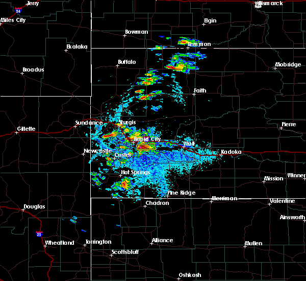 At 345 pm mdt, a severe thunderstorm was located just west of caputa, or 12 miles southeast of rapid city, moving east at 20 mph (radar indicated). Hazards include tennis ball size hail. People and animals outdoors will be injured. expect damage to roofs, siding, windows, and vehicles. Locations impacted include, caputa, farmingdale and rapid city airport. At 345 pm mdt, a severe thunderstorm was located just west of caputa, or 12 miles southeast of rapid city, moving east at 20 mph (radar indicated). Hazards include tennis ball size hail. People and animals outdoors will be injured. expect damage to roofs, siding, windows, and vehicles. Locations impacted include, caputa, farmingdale and rapid city airport.
|
| 7/3/2016 3:26 PM MDT |
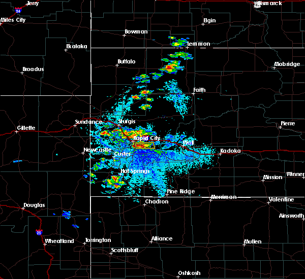 At 325 pm mdt, a severe thunderstorm was located just south of rapid city airport, or 10 miles southeast of rapid city, moving east at 15 mph (radar indicated). Hazards include golf ball size hail. People and animals outdoors will be injured. Expect damage to roofs, siding, windows, and vehicles. At 325 pm mdt, a severe thunderstorm was located just south of rapid city airport, or 10 miles southeast of rapid city, moving east at 15 mph (radar indicated). Hazards include golf ball size hail. People and animals outdoors will be injured. Expect damage to roofs, siding, windows, and vehicles.
|
| 7/3/2016 2:55 PM MDT |
 At 253 pm mdt, a severe thunderstorm was located over northeastern rapid valley, or near rapid city, moving east at 15 mph (trained weather spotters. at 240 pm mdt...quarter sized hail fell 1 mile east-southeast of rapid city at the national weather service office). Hazards include quarter size hail. Damage to vehicles is expected. Locations impacted include, rapid valley, southern box elder and rapid city airport. At 253 pm mdt, a severe thunderstorm was located over northeastern rapid valley, or near rapid city, moving east at 15 mph (trained weather spotters. at 240 pm mdt...quarter sized hail fell 1 mile east-southeast of rapid city at the national weather service office). Hazards include quarter size hail. Damage to vehicles is expected. Locations impacted include, rapid valley, southern box elder and rapid city airport.
|
| 7/3/2016 2:40 PM MDT | Quarter sized hail reported 1 miles S of Rapid City, SD |
| 7/3/2016 2:38 PM MDT |
 At 238 pm mdt, a severe thunderstorm was located over southeastern rapid city, moving east at 15 mph (radar indicated). Hazards include half dollar size hail. damage to vehicles is expected At 238 pm mdt, a severe thunderstorm was located over southeastern rapid city, moving east at 15 mph (radar indicated). Hazards include half dollar size hail. damage to vehicles is expected
|
| 7/3/2016 1:23 PM MDT |
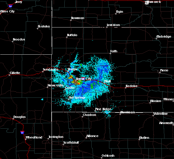 At 120 pm mdt, a severe thunderstorm was located over southern rapid city, moving southeast at 10 mph (radar indicated). Hazards include ping pong ball size hail. People and animals outdoors will be injured. expect damage to roofs, siding, windows, and vehicles. This severe thunderstorm will move over areas southeast of rapid city, near along highway 79 between rapid city and hermosa. At 120 pm mdt, a severe thunderstorm was located over southern rapid city, moving southeast at 10 mph (radar indicated). Hazards include ping pong ball size hail. People and animals outdoors will be injured. expect damage to roofs, siding, windows, and vehicles. This severe thunderstorm will move over areas southeast of rapid city, near along highway 79 between rapid city and hermosa.
|
| 7/3/2016 1:16 PM MDT |
 At 115 pm mdt, a severe thunderstorm was located near rapid city, moving southeast at 5 mph (trained weather spotters. at 104 pm mdt...golf ball sized hail was reported 4 miles south of downtown rapid city). Hazards include ping pong ball size hail. People and animals outdoors will be injured. expect damage to roofs, siding, windows, and vehicles. Locations impacted include, southern rapid city. At 115 pm mdt, a severe thunderstorm was located near rapid city, moving southeast at 5 mph (trained weather spotters. at 104 pm mdt...golf ball sized hail was reported 4 miles south of downtown rapid city). Hazards include ping pong ball size hail. People and animals outdoors will be injured. expect damage to roofs, siding, windows, and vehicles. Locations impacted include, southern rapid city.
|
| 7/3/2016 1:11 PM MDT |
 The severe thunderstorm warning for central pennington county will expire at 115 pm mdt, the storm which prompted the warning for northern and western portions of rapid city has moved out of the area. therefore the warning will be allowed to expire. however, a severe thunderstorm warning remains in effect for southern portions of rapid city until 145 pm mdt. The severe thunderstorm warning for central pennington county will expire at 115 pm mdt, the storm which prompted the warning for northern and western portions of rapid city has moved out of the area. therefore the warning will be allowed to expire. however, a severe thunderstorm warning remains in effect for southern portions of rapid city until 145 pm mdt.
|
| 7/3/2016 1:07 PM MDT |
 At 106 pm mdt, a severe thunderstorm was located near rapid city, moving southeast at 5 mph (trained weather spotters. at 101 pm mdt...golf ball sized hail was reported 5 miles southwest of downtown rapid city). Hazards include golf ball size hail. People and animals outdoors will be injured. expect damage to roofs, siding, windows, and vehicles. Locations impacted include, southern rapid city. At 106 pm mdt, a severe thunderstorm was located near rapid city, moving southeast at 5 mph (trained weather spotters. at 101 pm mdt...golf ball sized hail was reported 5 miles southwest of downtown rapid city). Hazards include golf ball size hail. People and animals outdoors will be injured. expect damage to roofs, siding, windows, and vehicles. Locations impacted include, southern rapid city.
|
| 7/3/2016 1:04 PM MDT | Golf Ball sized hail reported 3.5 miles NNE of Rapid City, SD |
| 7/3/2016 1:03 PM MDT | Half Dollar sized hail reported 5.2 miles ENE of Rapid City, SD |
| 7/3/2016 1:01 PM MDT | Golf Ball sized hail reported 5.1 miles NE of Rapid City, SD |
| 7/3/2016 12:52 PM MDT |
 At 1249 pm mdt, a severe thunderstorm was located near rapid city, moving southeast at 5 mph (radar indicated. at 1220 pm mdt...golf ball size hail was reported 4 miles west of downtown rapid city). Hazards include golf ball size hail. People and animals outdoors will be injured. Expect damage to roofs, siding, windows, and vehicles. At 1249 pm mdt, a severe thunderstorm was located near rapid city, moving southeast at 5 mph (radar indicated. at 1220 pm mdt...golf ball size hail was reported 4 miles west of downtown rapid city). Hazards include golf ball size hail. People and animals outdoors will be injured. Expect damage to roofs, siding, windows, and vehicles.
|
| 7/3/2016 12:39 PM MDT |
 At 1238 pm mdt, a severe thunderstorm was located over western rapid city, moving southeast at 10 mph (radar indicated). Hazards include golf ball size hail. People and animals outdoors will be injured. expect damage to roofs, siding, windows, and vehicles. Locations impacted include, rapid city and southwestern rapid valley. At 1238 pm mdt, a severe thunderstorm was located over western rapid city, moving southeast at 10 mph (radar indicated). Hazards include golf ball size hail. People and animals outdoors will be injured. expect damage to roofs, siding, windows, and vehicles. Locations impacted include, rapid city and southwestern rapid valley.
|
| 7/3/2016 12:18 PM MDT |
 At 1217 pm mdt, a severe thunderstorm was located over northwestern rapid city, moving southeast at 10 mph (radar indicated). Hazards include half dollar size hail. damage to vehicles is expected At 1217 pm mdt, a severe thunderstorm was located over northwestern rapid city, moving southeast at 10 mph (radar indicated). Hazards include half dollar size hail. damage to vehicles is expected
|
| 7/3/2016 12:17 PM MDT | Golf Ball sized hail reported 4.9 miles ESE of Rapid City, SD |
| 6/28/2016 4:36 PM MDT |
 The severe thunderstorm warning for south central meade, northeastern custer and south central pennington counties will expire at 445 pm mdt, the storms which prompted the warning have weakened below severe limits, and no longer pose an immediate threat to life or property. therefore the warning will be allowed to expire. however gusty winds are still possible with these thunderstorms. a severe thunderstorm watch remains in effect until 900 pm mdt for west central and southwestern south dakota. The severe thunderstorm warning for south central meade, northeastern custer and south central pennington counties will expire at 445 pm mdt, the storms which prompted the warning have weakened below severe limits, and no longer pose an immediate threat to life or property. therefore the warning will be allowed to expire. however gusty winds are still possible with these thunderstorms. a severe thunderstorm watch remains in effect until 900 pm mdt for west central and southwestern south dakota.
|
| 6/28/2016 4:30 PM MDT | Entire tree snapped in half from thunderstorm winds in pennington county SD, 3.2 miles ENE of Rapid City, SD |
| 6/28/2016 4:16 PM MDT |
 At 415 pm mdt, severe thunderstorms were located along a line extending from near black hawk to rapid city to near hayward, moving east at 50 mph (radar indicated). Hazards include 60 mph wind gusts. Expect damage to roofs. siding. and trees. Locations impacted include, rapid city, rapid valley, ellsworth air force base, box elder, summerset, black hawk, hermosa, caputa, folsom, farmingdale and rapid city airport. At 415 pm mdt, severe thunderstorms were located along a line extending from near black hawk to rapid city to near hayward, moving east at 50 mph (radar indicated). Hazards include 60 mph wind gusts. Expect damage to roofs. siding. and trees. Locations impacted include, rapid city, rapid valley, ellsworth air force base, box elder, summerset, black hawk, hermosa, caputa, folsom, farmingdale and rapid city airport.
|
| 6/28/2016 4:01 PM MDT |
 At 401 pm mdt, severe thunderstorms were located along a line extending from nemo to johnson siding to near hill city, moving southeast at 50 mph (radar indicated). Hazards include 60 mph wind gusts. Expect damage to roofs. siding. And trees. At 401 pm mdt, severe thunderstorms were located along a line extending from nemo to johnson siding to near hill city, moving southeast at 50 mph (radar indicated). Hazards include 60 mph wind gusts. Expect damage to roofs. siding. And trees.
|
| 6/13/2016 5:06 PM MDT |
 At 506 pm mdt, a severe thunderstorm was located near new underwood, or 27 miles east of rapid city, moving northeast at 40 mph. this is a very dangerous storm (radar indicated). Hazards include 100 mph wind gusts and quarter size hail. You are in a life-threatening situation. flying debris may be deadly to those caught without shelter. mobile homes will be destroyed. expect considerable damage to homes and businesses. expect extensive tree damage and power outages. Locations impacted include, rapid valley, southeastern ellsworth air force base, southeastern box elder, new underwood, elm springs, caputa, farmingdale, wicksville and rapid city airport. At 506 pm mdt, a severe thunderstorm was located near new underwood, or 27 miles east of rapid city, moving northeast at 40 mph. this is a very dangerous storm (radar indicated). Hazards include 100 mph wind gusts and quarter size hail. You are in a life-threatening situation. flying debris may be deadly to those caught without shelter. mobile homes will be destroyed. expect considerable damage to homes and businesses. expect extensive tree damage and power outages. Locations impacted include, rapid valley, southeastern ellsworth air force base, southeastern box elder, new underwood, elm springs, caputa, farmingdale, wicksville and rapid city airport.
|
| 6/13/2016 5:03 PM MDT | Storm damage reported in pennington county SD, 7.5 miles W of Rapid City, SD |
| 6/13/2016 4:56 PM MDT |
 At 455 pm mdt, a severe thunderstorm was located near new underwood, or 17 miles east of rapid city, moving northeast at 45 mph. this is a very dangerous storm (radar indicated). Hazards include 100 mph wind gusts and tennis ball size hail. You are in a life-threatening situation. flying debris may be deadly to those caught without shelter. mobile homes will be destroyed. expect considerable damage to homes and businesses. expect extensive tree damage and power outages. Locations impacted include, rapid valley, ellsworth air force base, box elder, new underwood, elm springs, caputa, hereford, farmingdale, wicksville and rapid city airport. At 455 pm mdt, a severe thunderstorm was located near new underwood, or 17 miles east of rapid city, moving northeast at 45 mph. this is a very dangerous storm (radar indicated). Hazards include 100 mph wind gusts and tennis ball size hail. You are in a life-threatening situation. flying debris may be deadly to those caught without shelter. mobile homes will be destroyed. expect considerable damage to homes and businesses. expect extensive tree damage and power outages. Locations impacted include, rapid valley, ellsworth air force base, box elder, new underwood, elm springs, caputa, hereford, farmingdale, wicksville and rapid city airport.
|
| 6/13/2016 4:42 PM MDT | Ping Pong Ball sized hail reported 6.2 miles NNW of Rapid City, SD |
| 6/13/2016 4:41 PM MDT |
 At 441 pm mdt, a severe thunderstorm was located over rapid city airport, or 10 miles southeast of rapid city, moving northeast at 35 mph (radar indicated). Hazards include tennis ball size hail and 70 mph wind gusts. People and animals outdoors will be injured. expect hail damage to roofs, siding, windows, and vehicles. expect considerable tree damage. Wind damage is also likely to mobile homes, roofs, and outbuildings. At 441 pm mdt, a severe thunderstorm was located over rapid city airport, or 10 miles southeast of rapid city, moving northeast at 35 mph (radar indicated). Hazards include tennis ball size hail and 70 mph wind gusts. People and animals outdoors will be injured. expect hail damage to roofs, siding, windows, and vehicles. expect considerable tree damage. Wind damage is also likely to mobile homes, roofs, and outbuildings.
|
| 6/13/2016 4:40 PM MDT | Golf Ball sized hail reported 6.2 miles NNW of Rapid City, SD |
| 6/13/2016 4:34 PM MDT |
 At 433 pm mdt, a severe thunderstorm capable of producing a tornado was located near hermosa, or 13 miles southeast of rapid city, moving northeast at 35 mph (radar indicated rotation). Hazards include tornado and half dollar size hail. Flying debris will be dangerous to those caught without shelter. mobile homes will be damaged or destroyed. damage to roofs, windows, and vehicles will occur. tree damage is likely. This tornadic thunderstorm will cross 5 to 7 miles northeast of hermosa. At 433 pm mdt, a severe thunderstorm capable of producing a tornado was located near hermosa, or 13 miles southeast of rapid city, moving northeast at 35 mph (radar indicated rotation). Hazards include tornado and half dollar size hail. Flying debris will be dangerous to those caught without shelter. mobile homes will be damaged or destroyed. damage to roofs, windows, and vehicles will occur. tree damage is likely. This tornadic thunderstorm will cross 5 to 7 miles northeast of hermosa.
|
| 6/13/2016 4:33 PM MDT | Golf Ball sized hail reported 3.3 miles NNE of Rapid City, SD |
| 6/13/2016 4:26 PM MDT |
 At 424 pm mdt, a severe thunderstorm capable of producing a tornado was located over hermosa, or 14 miles south of rapid city, moving northeast at 25 mph (radar indicated rotation). Hazards include tornado and ping pong ball size hail. Flying debris will be dangerous to those caught without shelter. mobile homes will be damaged or destroyed. damage to roofs, windows, and vehicles will occur. tree damage is likely. This tornadic thunderstorm will be over highway 79 north of hermosa. At 424 pm mdt, a severe thunderstorm capable of producing a tornado was located over hermosa, or 14 miles south of rapid city, moving northeast at 25 mph (radar indicated rotation). Hazards include tornado and ping pong ball size hail. Flying debris will be dangerous to those caught without shelter. mobile homes will be damaged or destroyed. damage to roofs, windows, and vehicles will occur. tree damage is likely. This tornadic thunderstorm will be over highway 79 north of hermosa.
|
| 6/13/2016 4:25 PM MDT | Quarter sized hail reported 3.6 miles WNW of Rapid City, SD |
| 6/9/2016 9:52 PM MDT |
 At 949 pm mdt, severe thunderstorms were located along a line extending from 6 miles east of bear butte state park to near black hawk, moving northeast at 40 mph (trained weather spotters. a nws employee reported 60 mph winds 1 mile southwest of downtown rapid city off skyline drive). Hazards include 60 mph wind gusts and penny size hail. Expect damage to roofs. siding. and trees. Locations impacted include, rapid city, rapid valley, ellsworth air force base, box elder, summerset, black hawk, new underwood, piedmont, hisega, tilford, hereford, rapid city airport and bear butte state park. At 949 pm mdt, severe thunderstorms were located along a line extending from 6 miles east of bear butte state park to near black hawk, moving northeast at 40 mph (trained weather spotters. a nws employee reported 60 mph winds 1 mile southwest of downtown rapid city off skyline drive). Hazards include 60 mph wind gusts and penny size hail. Expect damage to roofs. siding. and trees. Locations impacted include, rapid city, rapid valley, ellsworth air force base, box elder, summerset, black hawk, new underwood, piedmont, hisega, tilford, hereford, rapid city airport and bear butte state park.
|
| 6/9/2016 9:42 PM MDT | From skyline blv in pennington county SD, 1.6 miles ESE of Rapid City, SD |
| 6/9/2016 9:32 PM MDT |
 At 932 pm mdt, severe thunderstorms were located along a line extending from near tilford to mount rushmore national memorial, moving east at 25 mph (radar indicated). Hazards include 60 mph wind gusts and penny size hail. Expect damage to roofs. siding. And trees. At 932 pm mdt, severe thunderstorms were located along a line extending from near tilford to mount rushmore national memorial, moving east at 25 mph (radar indicated). Hazards include 60 mph wind gusts and penny size hail. Expect damage to roofs. siding. And trees.
|
| 5/20/2016 4:04 PM MDT |
 At 404 pm mdt, a severe thunderstorm was located over rockerville, or 9 miles east of hill city, and is nearly stationary (radar indicated). Hazards include quarter size hail. Damage to vehicles is expected. Locations impacted include, southwestern rapid city, keystone, rockerville and mount rushmore national memorial. At 404 pm mdt, a severe thunderstorm was located over rockerville, or 9 miles east of hill city, and is nearly stationary (radar indicated). Hazards include quarter size hail. Damage to vehicles is expected. Locations impacted include, southwestern rapid city, keystone, rockerville and mount rushmore national memorial.
|
| 5/20/2016 3:46 PM MDT | The national weather service in rapid city has issued a * severe thunderstorm warning for. south central pennington county in west central south dakota. until 445 pm mdt * at 346 pm mdt. a severe thunderstorm was located over keystone. or 8 miles east of hill city. Moving east at 15 mph. |
| 8/8/2015 5:30 PM MDT |
 At 530 pm mdt, a severe thunderstorm was located near new underwood, or 16 miles east of rapid city, moving east at 25 mph. another storm was located near the rapid city airport, moving east at 25 mph (radar indicated). Hazards include 60 mph wind gusts and quarter size hail. Hail damage to vehicles is expected. Expect wind damage to roofs, siding and trees. At 530 pm mdt, a severe thunderstorm was located near new underwood, or 16 miles east of rapid city, moving east at 25 mph. another storm was located near the rapid city airport, moving east at 25 mph (radar indicated). Hazards include 60 mph wind gusts and quarter size hail. Hail damage to vehicles is expected. Expect wind damage to roofs, siding and trees.
|
| 8/5/2015 7:52 PM MDT |
 The severe thunderstorm warning for southern lawrence, southwestern meade, southwestern pennington, north central fall river and central custer counties will expire at 800 pm mdt, the storms which prompted the warning have weakened below severe limits, and no longer pose an immediate threat to life or property. therefore the warning will be allowed to expire. however gusty winds are still possible with these thunderstorms. The severe thunderstorm warning for southern lawrence, southwestern meade, southwestern pennington, north central fall river and central custer counties will expire at 800 pm mdt, the storms which prompted the warning have weakened below severe limits, and no longer pose an immediate threat to life or property. therefore the warning will be allowed to expire. however gusty winds are still possible with these thunderstorms.
|
| 8/5/2015 7:27 PM MDT |
 At 726 pm mdt, severe thunderstorms were located along a line extending from near rochford to custer state park, moving northeast at 35 mph (radar indicated). Hazards include 60 mph wind gusts. Expect damage to roofs. siding and trees. these severe storms will be near, rochford around 730 pm mdt. custer park game lodge around 735 pm mdt. fairburn and roubaix lake around 740 pm mdt. lead, deadwood and brownsville around 745 pm mdt. Hermosa and galena around 750 pm mdt. At 726 pm mdt, severe thunderstorms were located along a line extending from near rochford to custer state park, moving northeast at 35 mph (radar indicated). Hazards include 60 mph wind gusts. Expect damage to roofs. siding and trees. these severe storms will be near, rochford around 730 pm mdt. custer park game lodge around 735 pm mdt. fairburn and roubaix lake around 740 pm mdt. lead, deadwood and brownsville around 745 pm mdt. Hermosa and galena around 750 pm mdt.
|
| 8/5/2015 7:00 PM MDT |
 At 700 pm mdt, severe thunderstorms were located along a line extending from near moon to near argyle, moving northeast at 35 mph (radar indicated). Hazards include 60 mph wind gusts and penny size hail. Expect damage to roofs. siding and trees. severe thunderstorms will be near, pringle, wind cave national park and cold brook reservoir around 705 pm mdt. wind cave visitors center around 710 pm mdt. deerfield and deerfield reservoir around 715 pm mdt. blue bell around 720 pm mdt. rochford and custer park game lodge around 730 pm mdt. fairburn around 735 pm mdt. brownsville and roubaix lake around 740 pm mdt. Nemo, hermosa and galena around 750 pm mdt. At 700 pm mdt, severe thunderstorms were located along a line extending from near moon to near argyle, moving northeast at 35 mph (radar indicated). Hazards include 60 mph wind gusts and penny size hail. Expect damage to roofs. siding and trees. severe thunderstorms will be near, pringle, wind cave national park and cold brook reservoir around 705 pm mdt. wind cave visitors center around 710 pm mdt. deerfield and deerfield reservoir around 715 pm mdt. blue bell around 720 pm mdt. rochford and custer park game lodge around 730 pm mdt. fairburn around 735 pm mdt. brownsville and roubaix lake around 740 pm mdt. Nemo, hermosa and galena around 750 pm mdt.
|
| 7/27/2015 5:55 PM MDT | Storm damage reported in pennington county SD, 7.5 miles W of Rapid City, SD |
| 7/27/2015 5:55 PM MDT |
 At 555 pm mdt, severe thunderstorms were located along a line extending from 13 miles southwest of fairpoint to near new underwood, moving northeast at 45 mph (radar indicated). Hazards include 70 mph wind gusts and half dollar size hail. Hail damage to vehicles is expected. expect considerable tree damage. Wind damage is also likely to mobile homes, roofs and outbuildings. At 555 pm mdt, severe thunderstorms were located along a line extending from 13 miles southwest of fairpoint to near new underwood, moving northeast at 45 mph (radar indicated). Hazards include 70 mph wind gusts and half dollar size hail. Hail damage to vehicles is expected. expect considerable tree damage. Wind damage is also likely to mobile homes, roofs and outbuildings.
|
| 7/27/2015 5:48 PM MDT | Storm damage reported in pennington county SD, 3.5 miles NNE of Rapid City, SD |
| 7/27/2015 5:48 PM MDT |
 At 547 pm mdt, severe thunderstorms were located along a line extending from near ellsworth air force base to 6 miles east of hermosa, moving northeast at 30 mph (radar indicated). Hazards include 70 mph wind gusts and half dollar size hail. Hail damage to vehicles is expected. expect considerable tree damage. wind damage is also likely to mobile homes, roofs and outbuildings. locations impacted include, rapid city, rapid valley, ellsworth air force base, box elder, new underwood, hermosa, caputa, farmingdale and rapid city airport. This includes interstate 90 in south dakota between mile markers 58 and 87. At 547 pm mdt, severe thunderstorms were located along a line extending from near ellsworth air force base to 6 miles east of hermosa, moving northeast at 30 mph (radar indicated). Hazards include 70 mph wind gusts and half dollar size hail. Hail damage to vehicles is expected. expect considerable tree damage. wind damage is also likely to mobile homes, roofs and outbuildings. locations impacted include, rapid city, rapid valley, ellsworth air force base, box elder, new underwood, hermosa, caputa, farmingdale and rapid city airport. This includes interstate 90 in south dakota between mile markers 58 and 87.
|
| 7/27/2015 5:45 PM MDT | Half Dollar sized hail reported 3.5 miles NNE of Rapid City, SD |
| 7/27/2015 5:42 PM MDT | Storm damage reported in pennington county SD, 2.6 miles E of Rapid City, SD |
| 7/27/2015 5:25 PM MDT |
 At 524 pm mdt, severe thunderstorms were located along a line extending from near rockerville to near blue bell, moving east at 35 mph. these are very dangerous storms (radar indicated). Hazards include baseball size hail and 60 mph wind gusts. People and animals outdoors will be severely injured. Expect shattered windows, extensive damage to roofs, siding and vehicles. At 524 pm mdt, severe thunderstorms were located along a line extending from near rockerville to near blue bell, moving east at 35 mph. these are very dangerous storms (radar indicated). Hazards include baseball size hail and 60 mph wind gusts. People and animals outdoors will be severely injured. Expect shattered windows, extensive damage to roofs, siding and vehicles.
|
| 7/27/2015 5:23 PM MDT | Quarter sized hail reported 10.5 miles NE of Rapid City, SD |
| 7/27/2015 5:15 PM MDT |
 At 514 pm mdt, severe thunderstorms were located along a line extending from near keystone to near sanator, moving northeast at 25 mph (radar indicated). Hazards include tennis ball size hail and 70 mph wind gusts. People and animals outdoors will be injured. expect hail damage to roofs, siding, windows and vehicles. expect considerable tree damage. wind damage is also likely to mobile homes, roofs and outbuildings. locations impacted include, rapid city, custer, hill city, rapid valley, ellsworth air force base, southwestern box elder, hermosa, keystone, hisega, sanator, hayward, rockerville, folsom, caputa, custer state park, sheridan lake, custer park game lodge, blue bell, jewell cave national monument and rapid city airport. This includes interstate 90 in south dakota between mile markers 57 and 65. At 514 pm mdt, severe thunderstorms were located along a line extending from near keystone to near sanator, moving northeast at 25 mph (radar indicated). Hazards include tennis ball size hail and 70 mph wind gusts. People and animals outdoors will be injured. expect hail damage to roofs, siding, windows and vehicles. expect considerable tree damage. wind damage is also likely to mobile homes, roofs and outbuildings. locations impacted include, rapid city, custer, hill city, rapid valley, ellsworth air force base, southwestern box elder, hermosa, keystone, hisega, sanator, hayward, rockerville, folsom, caputa, custer state park, sheridan lake, custer park game lodge, blue bell, jewell cave national monument and rapid city airport. This includes interstate 90 in south dakota between mile markers 57 and 65.
|
| 7/27/2015 4:53 PM MDT |
 At 450 pm mdt, a severe thunderstorm was located over harney peak, or near hill city, moving east at 25 mph (radar indicated). Hazards include two inch hail and 70 mph wind gusts. People and animals outdoors will be injured. expect hail damage to roofs, siding, windows and vehicles. expect considerable tree damage. wind damage is also likely to mobile homes, roofs and outbuildings. Locations impacted include, custer, hill city, hermosa, keystone, hisega, sanator, hayward, rockerville, folsom, caputa, custer state park, sheridan lake, custer park game lodge, blue bell, jewell cave national monument. At 450 pm mdt, a severe thunderstorm was located over harney peak, or near hill city, moving east at 25 mph (radar indicated). Hazards include two inch hail and 70 mph wind gusts. People and animals outdoors will be injured. expect hail damage to roofs, siding, windows and vehicles. expect considerable tree damage. wind damage is also likely to mobile homes, roofs and outbuildings. Locations impacted include, custer, hill city, hermosa, keystone, hisega, sanator, hayward, rockerville, folsom, caputa, custer state park, sheridan lake, custer park game lodge, blue bell, jewell cave national monument.
|
| 7/27/2015 4:25 PM MDT |
 At 425 pm mdt, a severe thunderstorm was located near crazy horse memorial, or near custer, moving east at 45 mph (radar indicated). Hazards include two inch hail and 70 mph wind gusts. People and animals outdoors will be injured. expect hail damage to roofs, siding, windows and vehicles. expect considerable tree damage. wind damage is also likely to mobile homes, roofs and outbuildings. this severe thunderstorm will be near, custer and crazy horse memorial around 430 pm mdt. northern custer state park, sylvan lake and stockade lake around 435 pm mdt. hill city and harney peak around 440 pm mdt. keystone, mount rushmore national memorial, sheridan lake and center lake around 445 pm mdt. hayward around 450 pm mdt. rockerville around 455 pm mdt. rapid city and hermosa around 500 pm mdt. rapid valley around 510 pm mdt. This includes interstate 90 in south dakota between mile markers 57 and 65. At 425 pm mdt, a severe thunderstorm was located near crazy horse memorial, or near custer, moving east at 45 mph (radar indicated). Hazards include two inch hail and 70 mph wind gusts. People and animals outdoors will be injured. expect hail damage to roofs, siding, windows and vehicles. expect considerable tree damage. wind damage is also likely to mobile homes, roofs and outbuildings. this severe thunderstorm will be near, custer and crazy horse memorial around 430 pm mdt. northern custer state park, sylvan lake and stockade lake around 435 pm mdt. hill city and harney peak around 440 pm mdt. keystone, mount rushmore national memorial, sheridan lake and center lake around 445 pm mdt. hayward around 450 pm mdt. rockerville around 455 pm mdt. rapid city and hermosa around 500 pm mdt. rapid valley around 510 pm mdt. This includes interstate 90 in south dakota between mile markers 57 and 65.
|
| 7/25/2015 3:54 PM MDT | Golf Ball sized hail reported 10.7 miles N of Rapid City, SD, motorist reported hail on highway 79 between hermosa and rapid city. time estimated by radar. |
| 7/25/2015 3:53 PM MDT |
 At 352 pm mdt, a severe thunderstorm was located near hermosa, or 11 miles south of rapid city, moving east at 20 mph (radar indicated). Hazards include ping pong ball size hail and 60 mph wind gusts. People and animals outdoors will be injured. expect hail damage to roofs, siding, windows and vehicles. expect wind damage to roofs, siding and trees. Locations impacted include, hermosa and hayward. At 352 pm mdt, a severe thunderstorm was located near hermosa, or 11 miles south of rapid city, moving east at 20 mph (radar indicated). Hazards include ping pong ball size hail and 60 mph wind gusts. People and animals outdoors will be injured. expect hail damage to roofs, siding, windows and vehicles. expect wind damage to roofs, siding and trees. Locations impacted include, hermosa and hayward.
|
| 7/25/2015 3:45 PM MDT | Ping Pong Ball sized hail reported 9.4 miles NE of Rapid City, SD |
| 7/25/2015 3:36 PM MDT |
 At 336 pm mdt, a severe thunderstorm was located over rockerville, or 9 miles south of rapid city, moving east at 20 mph (radar indicated). Hazards include ping pong ball size hail and 60 mph wind gusts. People and animals outdoors will be injured. expect hail damage to roofs, siding, windows and vehicles. Expect wind damage to roofs, siding and trees. At 336 pm mdt, a severe thunderstorm was located over rockerville, or 9 miles south of rapid city, moving east at 20 mph (radar indicated). Hazards include ping pong ball size hail and 60 mph wind gusts. People and animals outdoors will be injured. expect hail damage to roofs, siding, windows and vehicles. Expect wind damage to roofs, siding and trees.
|
| 7/24/2015 8:56 PM MDT | Quarter sized hail reported 9.5 miles N of Rapid City, SD, ground completely covered in hail |
| 7/14/2015 7:25 PM MDT | Half Dollar sized hail reported 13.3 miles NE of Rapid City, SD, mostly pea size 3-5 inches deep. a few larger stones to half dollar size. fog forming over hail path. |
| 7/14/2015 7:20 PM MDT | Half Dollar sized hail reported 13.3 miles NE of Rapid City, SD, mostly pea size 3-5 inches deep. a few larger stones to half dollar size. fog forming over hail path. |
| 7/14/2015 7:15 PM MDT | Quarter sized hail reported 13.2 miles NE of Rapid City, SD, 3-4 inches of pea size hail accumulated with a few quarters near intersection of highway 16 and beretta road. |
| 6/25/2015 1:18 PM MDT |
 At 116 pm mdt, a severe thunderstorm was located over sheridan lake, or near hill city, moving southeast at 25 mph (radar indicated). Hazards include 60 mph wind gusts and quarter size hail. Hail damage to vehicles is expected. Expect wind damage to roofs, siding and trees. At 116 pm mdt, a severe thunderstorm was located over sheridan lake, or near hill city, moving southeast at 25 mph (radar indicated). Hazards include 60 mph wind gusts and quarter size hail. Hail damage to vehicles is expected. Expect wind damage to roofs, siding and trees.
|
| 6/24/2015 1:53 AM MDT | Quarter sized hail reported 7 miles NNW of Rapid City, SD |
| 6/24/2015 1:53 AM MDT |
 At 153 am mdt, a severe thunderstorm was located over rapid city airport, or 9 miles southeast of rapid city, moving east at 30 mph (radar indicated). Hazards include quarter size hail. damage to vehicles is expected At 153 am mdt, a severe thunderstorm was located over rapid city airport, or 9 miles southeast of rapid city, moving east at 30 mph (radar indicated). Hazards include quarter size hail. damage to vehicles is expected
|
| 6/24/2015 1:51 AM MDT |
 At 150 am mdt, a severe thunderstorm was located over black hawk, or near rapid city, moving east at 25 mph (radar indicated). Hazards include quarter size hail. Damage to vehicles is expected. locations impacted include, rapid city, rapid valley, ellsworth air force base, box elder, black hawk, johnson siding and hisega. This includes interstate 90 in south dakota between mile markers 52 and 73. At 150 am mdt, a severe thunderstorm was located over black hawk, or near rapid city, moving east at 25 mph (radar indicated). Hazards include quarter size hail. Damage to vehicles is expected. locations impacted include, rapid city, rapid valley, ellsworth air force base, box elder, black hawk, johnson siding and hisega. This includes interstate 90 in south dakota between mile markers 52 and 73.
|
| 6/24/2015 1:28 AM MDT |
 At 127 am mdt, a severe thunderstorm was located over hisega, or near rapid city, moving northeast at 20 mph (radar indicated. at 126 am golf ball sized hail was reported in hisega). Hazards include golf ball size hail and 60 mph wind gusts. People and animals outdoors will be injured. expect hail damage to roofs, siding, windows and vehicles. Expect wind damage to roofs, siding and trees. At 127 am mdt, a severe thunderstorm was located over hisega, or near rapid city, moving northeast at 20 mph (radar indicated. at 126 am golf ball sized hail was reported in hisega). Hazards include golf ball size hail and 60 mph wind gusts. People and animals outdoors will be injured. expect hail damage to roofs, siding, windows and vehicles. Expect wind damage to roofs, siding and trees.
|
| 6/24/2015 1:26 AM MDT | Golf Ball sized hail reported 9.6 miles E of Rapid City, SD |
| 6/24/2015 1:06 AM MDT |
 At 105 am mdt, severe thunderstorms were located along a line extending from near new underwood to near rapid city, moving northeast at 15 mph (radar indicated. at 1255 am quarter sized hail was reported on the south side of rapid city). Hazards include 60 mph wind gusts and half dollar size hail. Hail damage to vehicles is expected. expect wind damage to roofs, siding and trees. locations impacted include, rapid city, rapid valley, southern ellsworth air force base, box elder, black hawk, new underwood, johnson siding, hisega, caputa, rockerville, pactola reservoir, rapid city airport and sheridan lake. This includes interstate 90 in south dakota between mile markers 54 and 82. At 105 am mdt, severe thunderstorms were located along a line extending from near new underwood to near rapid city, moving northeast at 15 mph (radar indicated. at 1255 am quarter sized hail was reported on the south side of rapid city). Hazards include 60 mph wind gusts and half dollar size hail. Hail damage to vehicles is expected. expect wind damage to roofs, siding and trees. locations impacted include, rapid city, rapid valley, southern ellsworth air force base, box elder, black hawk, new underwood, johnson siding, hisega, caputa, rockerville, pactola reservoir, rapid city airport and sheridan lake. This includes interstate 90 in south dakota between mile markers 54 and 82.
|
| 6/24/2015 12:55 AM MDT | Quarter sized hail reported 3.3 miles NNE of Rapid City, SD |
| 6/24/2015 12:37 AM MDT |
 At 1236 am mdt, severe thunderstorms were located along a line extending from caputa to near sheridan lake, moving east at 15 mph (radar indicated). Hazards include two inch hail and 60 mph wind gusts. People and animals outdoors will be injured. expect hail damage to roofs, siding, windows and vehicles. Expect wind damage to roofs, siding and trees. At 1236 am mdt, severe thunderstorms were located along a line extending from caputa to near sheridan lake, moving east at 15 mph (radar indicated). Hazards include two inch hail and 60 mph wind gusts. People and animals outdoors will be injured. expect hail damage to roofs, siding, windows and vehicles. Expect wind damage to roofs, siding and trees.
|
| 6/22/2015 12:19 AM MDT | Storm damage reported in pennington county SD, 0.3 miles SSE of Rapid City, SD |
| 6/22/2015 12:10 AM MDT | Storm damage reported in pennington county SD, 7.6 miles WNW of Rapid City, SD |
| 6/22/2015 12:10 AM MDT |
 At 1209 am mdt, a severe thunderstorm was located 8 miles west of hereford, or 23 miles east of sturgis, moving east at 55 mph (a 59 mph wind gust was reported in downtown rapid city at 1207 am). Hazards include 60 mph wind gusts and quarter size hail. Hail damage to vehicles is expected. expect wind damage to roofs, siding and trees. locations impacted include, rapid city, rapid valley, ellsworth air force base, box elder, black hawk, summerset, new underwood, union center, wasta, enning, owanka, elm springs, white owl, farmingdale, wicksville, caputa, hereford, rapid city airport and bear butte state park. This includes interstate 90 in south dakota between mile markers 52 and 100. At 1209 am mdt, a severe thunderstorm was located 8 miles west of hereford, or 23 miles east of sturgis, moving east at 55 mph (a 59 mph wind gust was reported in downtown rapid city at 1207 am). Hazards include 60 mph wind gusts and quarter size hail. Hail damage to vehicles is expected. expect wind damage to roofs, siding and trees. locations impacted include, rapid city, rapid valley, ellsworth air force base, box elder, black hawk, summerset, new underwood, union center, wasta, enning, owanka, elm springs, white owl, farmingdale, wicksville, caputa, hereford, rapid city airport and bear butte state park. This includes interstate 90 in south dakota between mile markers 52 and 100.
|
| 6/22/2015 12:08 AM MDT |
 At 1207 am mdt, severe thunderstorms were located along a line extending from near galena to near mystic, moving east at 60 mph (radar indicated). Hazards include quarter size hail. damage to vehicles is expected At 1207 am mdt, severe thunderstorms were located along a line extending from near galena to near mystic, moving east at 60 mph (radar indicated). Hazards include quarter size hail. damage to vehicles is expected
|
| 6/21/2015 11:56 PM MDT |
 At 1155 pm mdt, a severe thunderstorm was located near bear butte state park, or 11 miles east of sturgis, moving east at 55 mph. * another severe storm was located east of newell, moving east at 55 mph (radar indicated). Hazards include 60 mph wind gusts and quarter size hail. Hail damage to vehicles is expected. Expect wind damage to roofs, siding and trees. At 1155 pm mdt, a severe thunderstorm was located near bear butte state park, or 11 miles east of sturgis, moving east at 55 mph. * another severe storm was located east of newell, moving east at 55 mph (radar indicated). Hazards include 60 mph wind gusts and quarter size hail. Hail damage to vehicles is expected. Expect wind damage to roofs, siding and trees.
|
| 6/21/2015 12:23 AM MDT |
 At 1221 am mdt, severe thunderstorms were located along a line extending from near hisega to hayward to sanator, moving southeast at 30 mph (radar indicated). Hazards include tennis ball size hail. golf ball size hail was reported near deerfield and in hill city. People and animals outdoors will be injured. expect damage to roofs, siding, windows and vehicles. Locations impacted include, southwestern rapid city, custer, hill city, johnson siding, keystone, hisega, sanator, hayward, rockerville, pactola reservoir, sylvan lake, custer state park, center lake, stockade lake, sheridan lake, crazy horse memorial, mount rushmore national memorial, harney peak, custer park game lodge and wind cave visitors center. At 1221 am mdt, severe thunderstorms were located along a line extending from near hisega to hayward to sanator, moving southeast at 30 mph (radar indicated). Hazards include tennis ball size hail. golf ball size hail was reported near deerfield and in hill city. People and animals outdoors will be injured. expect damage to roofs, siding, windows and vehicles. Locations impacted include, southwestern rapid city, custer, hill city, johnson siding, keystone, hisega, sanator, hayward, rockerville, pactola reservoir, sylvan lake, custer state park, center lake, stockade lake, sheridan lake, crazy horse memorial, mount rushmore national memorial, harney peak, custer park game lodge and wind cave visitors center.
|
| 6/20/2015 11:49 PM MDT |
 At 1148 pm mdt, severe thunderstorms were located along a line extending from nemo to 8 miles west of crazy horse memorial, moving southeast at 30 mph (radar indicated). Hazards include ping pong ball size hail. People and animals outdoors will be injured. Expect damage to roofs, siding, windows and vehicles. At 1148 pm mdt, severe thunderstorms were located along a line extending from nemo to 8 miles west of crazy horse memorial, moving southeast at 30 mph (radar indicated). Hazards include ping pong ball size hail. People and animals outdoors will be injured. Expect damage to roofs, siding, windows and vehicles.
|
| 6/20/2015 6:11 PM MDT | Half Dollar sized hail reported 16.3 miles E of Rapid City, SD |
| 6/20/2015 6:08 PM MDT |
 At 607 pm mdt, a severe thunderstorm was located over pactola reservoir, or 12 miles north of hill city, moving southeast at 20 mph (radar indicated). Hazards include golf ball size hail. People and animals outdoors will be injured. Expect damage to roofs, siding, windows and vehicles. At 607 pm mdt, a severe thunderstorm was located over pactola reservoir, or 12 miles north of hill city, moving southeast at 20 mph (radar indicated). Hazards include golf ball size hail. People and animals outdoors will be injured. Expect damage to roofs, siding, windows and vehicles.
|
| 6/19/2015 10:37 PM MDT |
 At 1036 pm mdt, severe thunderstorms were located along a line extending from near rapid valley to near hayward to custer state park, moving southeast at 50 mph (radar indicated). Hazards include tennis ball size hail and 70 mph wind gusts. People and animals outdoors will be injured. expect hail damage to roofs, siding, windows and vehicles. expect considerable tree damage. wind damage is also likely to mobile homes, roofs and outbuildings. Locations impacted include, southern rapid city, hermosa, keystone, fairburn, hayward, rockerville, folsom, farmingdale, custer state park, center lake, mount rushmore national memorial, harney peak, custer park game lodge and northeastern wind cave national park. At 1036 pm mdt, severe thunderstorms were located along a line extending from near rapid valley to near hayward to custer state park, moving southeast at 50 mph (radar indicated). Hazards include tennis ball size hail and 70 mph wind gusts. People and animals outdoors will be injured. expect hail damage to roofs, siding, windows and vehicles. expect considerable tree damage. wind damage is also likely to mobile homes, roofs and outbuildings. Locations impacted include, southern rapid city, hermosa, keystone, fairburn, hayward, rockerville, folsom, farmingdale, custer state park, center lake, mount rushmore national memorial, harney peak, custer park game lodge and northeastern wind cave national park.
|
| 6/19/2015 10:27 PM MDT |
 At 1025 pm mdt, severe thunderstorms were located along a line extending from rapid city to near mount rushmore national memorial, moving southeast at 45 mph. these are very dangerous storms (radar indicated. at 1020 pm...two inch hail was reported in hill city). Hazards include baseball size hail and 70 mph wind gusts. People and animals outdoors will be severely injured. expect shattered windows, extensive damage to roofs, siding and vehicles. locations impacted include, rapid city, hill city, rapid valley, ellsworth air force base, box elder, summerset, black hawk, new underwood, johnson siding, hermosa, keystone, hisega, fairburn, farmingdale, wicksville, hayward, rockerville, folsom, caputa and custer state park. This includes interstate 90 in south dakota between mile markers 50 and 91. At 1025 pm mdt, severe thunderstorms were located along a line extending from rapid city to near mount rushmore national memorial, moving southeast at 45 mph. these are very dangerous storms (radar indicated. at 1020 pm...two inch hail was reported in hill city). Hazards include baseball size hail and 70 mph wind gusts. People and animals outdoors will be severely injured. expect shattered windows, extensive damage to roofs, siding and vehicles. locations impacted include, rapid city, hill city, rapid valley, ellsworth air force base, box elder, summerset, black hawk, new underwood, johnson siding, hermosa, keystone, hisega, fairburn, farmingdale, wicksville, hayward, rockerville, folsom, caputa and custer state park. This includes interstate 90 in south dakota between mile markers 50 and 91.
|
| 6/19/2015 10:07 PM MDT |
 At 1007 pm mdt, severe thunderstorms were located along a line extending from nemo to 7 miles west of hill city, moving southeast at 45 mph. these are very dangerous storms (radar indicated). Hazards include baseball size hail and 70 mph wind gusts. People and animals outdoors will be severely injured. Expect shattered windows, extensive damage to roofs, siding and vehicles. At 1007 pm mdt, severe thunderstorms were located along a line extending from nemo to 7 miles west of hill city, moving southeast at 45 mph. these are very dangerous storms (radar indicated). Hazards include baseball size hail and 70 mph wind gusts. People and animals outdoors will be severely injured. Expect shattered windows, extensive damage to roofs, siding and vehicles.
|
| 6/17/2015 11:11 PM MDT |
 The severe thunderstorm warning for southwestern pennington county will expire at 1115 pm mdt, the storm which prompted the warning has moved out of the area. therefore the warning will be allowed to expire. a severe thunderstorm watch remains in effect until 100 am mdt for west central south dakota. The severe thunderstorm warning for southwestern pennington county will expire at 1115 pm mdt, the storm which prompted the warning has moved out of the area. therefore the warning will be allowed to expire. a severe thunderstorm watch remains in effect until 100 am mdt for west central south dakota.
|
| 6/17/2015 10:53 PM MDT |
 At 1052 pm mdt, severe thunderstorms were located along a line extending from 9 miles northeast of ellsworth air force base to hayward, moving east at 45 mph (public reported half dollar sized hail in eastern rapid city at 1050 pm). Hazards include half dollar size hail. Damage to vehicles is expected. locations impacted include, rapid city, rapid valley, ellsworth air force base, box elder, new underwood, hermosa, keystone, wasta, scenic, owanka, farmingdale, wicksville, hayward, rockerville, caputa, folsom, rapid city airport, center lake, northern badlands national park and mount rushmore national memorial. This includes interstate 90 in south dakota between mile markers 58 and 110. At 1052 pm mdt, severe thunderstorms were located along a line extending from 9 miles northeast of ellsworth air force base to hayward, moving east at 45 mph (public reported half dollar sized hail in eastern rapid city at 1050 pm). Hazards include half dollar size hail. Damage to vehicles is expected. locations impacted include, rapid city, rapid valley, ellsworth air force base, box elder, new underwood, hermosa, keystone, wasta, scenic, owanka, farmingdale, wicksville, hayward, rockerville, caputa, folsom, rapid city airport, center lake, northern badlands national park and mount rushmore national memorial. This includes interstate 90 in south dakota between mile markers 58 and 110.
|
| 6/17/2015 10:52 PM MDT | Ping Pong Ball sized hail reported 1 miles WSW of Rapid City, SD |
| 6/17/2015 10:50 PM MDT | Half Dollar sized hail reported 1.4 miles SW of Rapid City, SD |
| 6/17/2015 10:49 PM MDT | Storm damage reported in pennington county SD, 3.3 miles NNE of Rapid City, SD |
| 6/17/2015 10:44 PM MDT |
 At 1044 pm mdt, severe thunderstorms were located along a line extending from 7 miles northeast of ellsworth air force base to keystone, moving east at 45 mph (radar indicated). Hazards include 60 mph wind gusts and quarter size hail. Hail damage to vehicles is expected. Expect wind damage to roofs, siding and trees. At 1044 pm mdt, severe thunderstorms were located along a line extending from 7 miles northeast of ellsworth air force base to keystone, moving east at 45 mph (radar indicated). Hazards include 60 mph wind gusts and quarter size hail. Hail damage to vehicles is expected. Expect wind damage to roofs, siding and trees.
|
| 6/17/2015 10:37 PM MDT |
 At 1036 pm mdt, a severe thunderstorm was located over sheridan lake, or near hill city, moving southeast at 30 mph (trained weather spotters). Hazards include quarter size hail. Damage to vehicles is expected. Locations impacted include, southwestern rapid city, hill city, johnson siding, keystone, silver city, hisega, rochford, hayward, rockerville, mystic, deerfield, pactola reservoir, deerfield reservoir, sheridan lake, mount rushmore national memorial and harney peak. At 1036 pm mdt, a severe thunderstorm was located over sheridan lake, or near hill city, moving southeast at 30 mph (trained weather spotters). Hazards include quarter size hail. Damage to vehicles is expected. Locations impacted include, southwestern rapid city, hill city, johnson siding, keystone, silver city, hisega, rochford, hayward, rockerville, mystic, deerfield, pactola reservoir, deerfield reservoir, sheridan lake, mount rushmore national memorial and harney peak.
|
| 6/17/2015 10:35 PM MDT | Quarter sized hail reported 13.9 miles ENE of Rapid City, SD |
| 6/17/2015 10:23 PM MDT |
 At 1023 pm mdt, a severe thunderstorm was located over silver city, or 9 miles north of hill city, moving southeast at 30 mph (radar indicated). Hazards include quarter size hail. damage to vehicles is expected At 1023 pm mdt, a severe thunderstorm was located over silver city, or 9 miles north of hill city, moving southeast at 30 mph (radar indicated). Hazards include quarter size hail. damage to vehicles is expected
|
| 6/17/2015 10:18 PM MDT |
 At 1017 pm mdt, a severe thunderstorm was located over piedmont, or 11 miles northwest of rapid city, moving east at 30 mph (radar indicated). Hazards include 60 mph wind gusts and quarter size hail. Hail damage to vehicles is expected. expect wind damage to roofs, siding and trees. locations impacted include, rapid city, sturgis, rapid valley, ellsworth air force base, box elder, summerset, black hawk, johnson siding, nemo, piedmont, tilford, galena, caputa, hereford, roubaix lake, rapid city airport, bear butte state park, fort meade and pactola reservoir. This includes interstate 90 in south dakota between mile markers 25 and 75. At 1017 pm mdt, a severe thunderstorm was located over piedmont, or 11 miles northwest of rapid city, moving east at 30 mph (radar indicated). Hazards include 60 mph wind gusts and quarter size hail. Hail damage to vehicles is expected. expect wind damage to roofs, siding and trees. locations impacted include, rapid city, sturgis, rapid valley, ellsworth air force base, box elder, summerset, black hawk, johnson siding, nemo, piedmont, tilford, galena, caputa, hereford, roubaix lake, rapid city airport, bear butte state park, fort meade and pactola reservoir. This includes interstate 90 in south dakota between mile markers 25 and 75.
|
| 6/17/2015 9:41 PM MDT |
 At 941 pm mdt, a severe thunderstorm was located near sturgis, moving east at 40 mph (radar indicated). Hazards include 70 mph wind gusts and quarter size hail. Hail damage to vehicles is expected. expect considerable tree damage. Wind damage is also likely to mobile homes, roofs and outbuildings. At 941 pm mdt, a severe thunderstorm was located near sturgis, moving east at 40 mph (radar indicated). Hazards include 70 mph wind gusts and quarter size hail. Hail damage to vehicles is expected. expect considerable tree damage. Wind damage is also likely to mobile homes, roofs and outbuildings.
|
| 6/17/2015 6:20 PM MDT | Golf Ball sized hail reported 5.5 miles NNW of Rapid City, SD, hail lasted 10-15 minutes. mainly quarters with a few golf balls. |
| 6/17/2015 6:18 PM MDT |
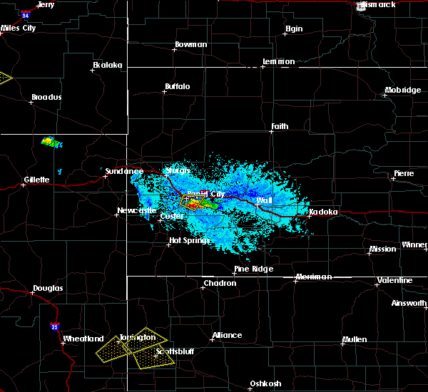 At 617 pm mdt, a severe thunderstorm was located near rapid city airport, or 8 miles southeast of rapid city, moving southeast at 25 mph (radar indicated). Hazards include golf ball size hail and 60 mph wind gusts. People and animals outdoors will be injured. expect hail damage to roofs, siding, windows and vehicles. Expect wind damage to roofs, siding and trees. At 617 pm mdt, a severe thunderstorm was located near rapid city airport, or 8 miles southeast of rapid city, moving southeast at 25 mph (radar indicated). Hazards include golf ball size hail and 60 mph wind gusts. People and animals outdoors will be injured. expect hail damage to roofs, siding, windows and vehicles. Expect wind damage to roofs, siding and trees.
|
| 6/17/2015 6:17 PM MDT | Quarter sized hail reported 5.4 miles NNW of Rapid City, SD, hail covering roads |
| 6/17/2015 6:17 PM MDT | Golf Ball sized hail reported 5.5 miles NNW of Rapid City, SD |
| 6/17/2015 6:02 PM MDT |
 At 600 pm mdt, a severe thunderstorm was located over southern rapid city, moving southeast at 15 mph (at 545 pm 1 inch hail was reported in western rapid city). Hazards include golf ball size hail and 60 mph wind gusts. People and animals outdoors will be injured. expect hail damage to roofs, siding, windows and vehicles. expect wind damage to roofs, siding and trees. locations impacted include, rapid city, rapid valley, southern ellsworth air force base, box elder and rapid city airport. This includes interstate 90 in south dakota between mile markers 57 and 71. At 600 pm mdt, a severe thunderstorm was located over southern rapid city, moving southeast at 15 mph (at 545 pm 1 inch hail was reported in western rapid city). Hazards include golf ball size hail and 60 mph wind gusts. People and animals outdoors will be injured. expect hail damage to roofs, siding, windows and vehicles. expect wind damage to roofs, siding and trees. locations impacted include, rapid city, rapid valley, southern ellsworth air force base, box elder and rapid city airport. This includes interstate 90 in south dakota between mile markers 57 and 71.
|
| 6/17/2015 5:50 PM MDT | Ping Pong Ball sized hail reported 5.1 miles E of Rapid City, SD, report from nssl shave project |
| 6/17/2015 5:47 PM MDT |
 At 546 pm mdt, a severe thunderstorm was located near rapid city, moving southeast at 15 mph (radar indicated). Hazards include golf ball size hail and 60 mph wind gusts. People and animals outdoors will be injured. expect hail damage to roofs, siding, windows and vehicles. expect wind damage to roofs, siding and trees. locations impacted include, rapid city, rapid valley, southern ellsworth air force base, box elder, black hawk and rapid city airport. This includes interstate 90 in south dakota between mile markers 54 and 71. At 546 pm mdt, a severe thunderstorm was located near rapid city, moving southeast at 15 mph (radar indicated). Hazards include golf ball size hail and 60 mph wind gusts. People and animals outdoors will be injured. expect hail damage to roofs, siding, windows and vehicles. expect wind damage to roofs, siding and trees. locations impacted include, rapid city, rapid valley, southern ellsworth air force base, box elder, black hawk and rapid city airport. This includes interstate 90 in south dakota between mile markers 54 and 71.
|
| 6/17/2015 5:45 PM MDT | Quarter sized hail reported 1.9 miles ESE of Rapid City, SD |
| 6/17/2015 5:45 PM MDT | Quarter sized hail reported 2.1 miles E of Rapid City, SD |
| 6/17/2015 5:31 PM MDT |
 At 530 pm mdt, a severe thunderstorm was located over johnson siding, or 7 miles west of rapid city, moving southeast at 15 mph (radar indicated). Hazards include 60 mph wind gusts and quarter size hail. Hail damage to vehicles is expected. Expect wind damage to roofs, siding and trees. At 530 pm mdt, a severe thunderstorm was located over johnson siding, or 7 miles west of rapid city, moving southeast at 15 mph (radar indicated). Hazards include 60 mph wind gusts and quarter size hail. Hail damage to vehicles is expected. Expect wind damage to roofs, siding and trees.
|
| 6/9/2015 4:54 PM MDT |
 The severe thunderstorm warning for south central pennington county will expire at 500 pm mdt, the storm which prompted the warning has weakened below severe limits, and no longer pose an immediate threat to life or property. therefore the warning will be allowed to expire. however small hail and heavy rain are still possible with this thunderstorm. The severe thunderstorm warning for south central pennington county will expire at 500 pm mdt, the storm which prompted the warning has weakened below severe limits, and no longer pose an immediate threat to life or property. therefore the warning will be allowed to expire. however small hail and heavy rain are still possible with this thunderstorm.
|
| 6/9/2015 4:38 PM MDT |
 At 437 pm mdt, a severe thunderstorm was located over rockerville, or 9 miles east of hill city, and is nearly stationary (radar indicated). Hazards include half dollar size hail. Damage to vehicles is expected. Locations impacted include, keystone, hayward, rockerville, and sheridan lake. At 437 pm mdt, a severe thunderstorm was located over rockerville, or 9 miles east of hill city, and is nearly stationary (radar indicated). Hazards include half dollar size hail. Damage to vehicles is expected. Locations impacted include, keystone, hayward, rockerville, and sheridan lake.
|
| 6/9/2015 4:15 PM MDT | Quarter sized hail reported 12.9 miles ENE of Rapid City, SD, ping report |
| 6/9/2015 4:08 PM MDT |
 At 406 pm mdt, a severe thunderstorm was located over rockerville, or 9 miles east of hill city, moving southeast at 15 mph (radar indicated). Hazards include golf ball size hail. People and animals outdoors will be injured. expect damage to roofs, siding, windows and vehicles. Locations impacted include, keystone, hayward, rockerville, mount rushmore national memorial and sheridan lake. At 406 pm mdt, a severe thunderstorm was located over rockerville, or 9 miles east of hill city, moving southeast at 15 mph (radar indicated). Hazards include golf ball size hail. People and animals outdoors will be injured. expect damage to roofs, siding, windows and vehicles. Locations impacted include, keystone, hayward, rockerville, mount rushmore national memorial and sheridan lake.
|
| 6/9/2015 3:56 PM MDT |
 At 355 pm mdt, a severe thunderstorm was located over sheridan lake, or 7 miles northeast of hill city, moving southeast at 15 mph (radar indicated). Hazards include half dollar size hail. damage to vehicles is expected At 355 pm mdt, a severe thunderstorm was located over sheridan lake, or 7 miles northeast of hill city, moving southeast at 15 mph (radar indicated). Hazards include half dollar size hail. damage to vehicles is expected
|
| 6/9/2015 3:28 PM MDT | Half Dollar sized hail reported 6.8 miles NE of Rapid City, SD |
| 6/9/2015 3:25 PM MDT | Quarter sized hail reported 6.4 miles NE of Rapid City, SD |
| 6/2/2015 10:12 PM MDT | At 1011 pm mdt, severe thunderstorms were located along a line extending from 9 miles south of hereford to near hermosa, moving east at 35 mph (radar indicated). Hazards include 60 mph wind gusts. Expect damage to roofs. Siding and trees. |
| 6/2/2015 10:08 PM MDT | Storm damage reported in pennington county SD, 0.3 miles SSE of Rapid City, SD |
| 6/2/2015 4:54 PM MDT | At 454 pm mdt, a severe thunderstorm was located near rapid valley, or 7 miles southeast of rapid city, moving east at 20 mph (radar indicated). Hazards include 60 mph wind gusts and half dollar size hail. Hail damage to vehicles is expected. expect wind damage to roofs, siding and trees. Locations impacted include, southeastern rapid city, southern rapid valley, caputa and rapid city airport. |
| 6/2/2015 4:41 PM MDT | At 441 pm mdt, a severe thunderstorm was located near rockerville, or just south of rapid city, moving east at 20 mph (trained weather spotters). Hazards include golf ball size hail and 60 mph wind gusts. People and animals outdoors will be injured. expect hail damage to roofs, siding, windows and vehicles. Expect wind damage to roofs, siding and trees. |
| 6/2/2015 4:36 PM MDT | Quarter sized hail reported 3.5 miles NNE of Rapid City, SD |
| 6/2/2015 4:35 PM MDT | At 434 pm mdt, a severe thunderstorm was located near rapid city, moving east at 30 mph (trained weather spotters. at 432 pm mdt..golf ball size hail was reported at the intersection of sheridan lake road and victoria lake road). Hazards include golf ball size hail and 60 mph wind gusts. People and animals outdoors will be injured. expect hail damage to roofs, siding, windows and vehicles. expect wind damage to roofs, siding and trees. Locations impacted include, rapid city, southwestern rapid valley, hisega, rockerville and sheridan lake. |
| 6/2/2015 4:32 PM MDT | Golf Ball sized hail reported 8 miles ENE of Rapid City, SD |
| 6/2/2015 4:30 PM MDT | Half Dollar sized hail reported 6.8 miles NE of Rapid City, SD |
| 6/2/2015 4:30 PM MDT | Golf Ball sized hail reported 6.8 miles NE of Rapid City, SD |
| 6/2/2015 4:29 PM MDT | At 428 pm mdt, a severe thunderstorm was located over northwestern rapid city, moving east at 25 mph (radar indicated). Hazards include 60 mph wind gusts and half dollar size hail. Hail damage to vehicles is expected. expect wind damage to roofs, siding and trees. locations impacted include, rapid city, rapid valley, black hawk, hisega, rockerville and sheridan lake. This includes interstate 90 in south dakota between mile markers 54 and 62. |
| 6/2/2015 4:17 PM MDT | At 416 pm mdt, a severe thunderstorm was located over hisega, or 7 miles west of rapid city, moving east at 30 mph (radar indicated). Hazards include 60 mph wind gusts and half dollar size hail. Hail damage to vehicles is expected. Expect wind damage to roofs, siding and trees. |
| 6/1/2015 8:23 PM MDT | The severe thunderstorm warning for southeastern lawrence, southwestern meade and west central pennington counties will expire at 830 pm mdt, the severe thunderstorm which prompted the warning has weakened. therefore the warning will be allowed to expire. however small hail and heavy rain are still possible with this thunderstorm. remember, a severe thunderstorm warning still remains in effect for south central meade and central pennington counties. |
| 6/1/2015 7:55 PM MDT | At 754 pm mdt, a severe thunderstorm was located near johnson siding, or 7 miles west of rapid city, moving south at 5 mph (radar indicated). Hazards include tennis ball size hail. People and animals outdoors will be injured. expect damage to roofs, siding, windows and vehicles. locations impacted include, rapid city, rapid valley, summerset, black hawk, johnson siding, nemo, piedmont, silver city, hisega and pactola reservoir. This includes interstate 90 in south dakota between mile markers 44 and 62. |
| 6/1/2015 7:47 PM MDT | At 747 pm mdt, severe thunderstorms were located along a line extending from 10 miles northeast of new underwood to near rapid valley, moving east at 20 mph (radar indicated). Hazards include golf ball size hail. People and animals outdoors will be injured. Expect damage to roofs, siding, windows and vehicles. |
| 6/1/2015 7:47 PM MDT | At 747 pm mdt, severe thunderstorms were located along a line extending from 10 miles northeast of new underwood to near rapid valley, moving east at 20 mph (radar indicated). Hazards include golf ball size hail. People and animals outdoors will be injured. Expect damage to roofs, siding, windows and vehicles. |
| 6/1/2015 7:47 PM MDT | At 747 pm mdt, severe thunderstorms were located along a line extending from 10 miles northeast of new underwood to near rapid valley, moving east at 20 mph (radar indicated). Hazards include golf ball size hail. People and animals outdoors will be injured. Expect damage to roofs, siding, windows and vehicles. |
| 6/1/2015 7:28 PM MDT | At 727 pm mdt, a severe thunderstorm was located near summerset, or 8 miles northwest of rapid city, and is moving south at 5 mph (radar indicated). Hazards include tennis ball size hail. this storm has a long history of producing golf ball to tennis ball size hail. People and animals outdoors will be injured. Expect damage to roofs, siding, windows and vehicles. |
| 8/30/2014 6:13 PM MDT | Storm damage reported in pennington county SD, 5.2 miles SE of Rapid City, SD |
| 7/10/2014 2:08 PM MDT | Ping Pong Ball sized hail reported 9.6 miles E of Rapid City, SD |
| 7/10/2014 2:00 PM MDT | Quarter sized hail reported 11.6 miles E of Rapid City, SD |
| 7/10/2014 2:00 PM MDT | Golf Ball sized hail reported 13.6 miles E of Rapid City, SD |
| 6/16/2014 7:05 PM MDT | Quarter sized hail reported 1.1 miles ESE of Rapid City, SD |
| 6/16/2014 7:05 PM MDT | Half Dollar sized hail reported 1.8 miles NW of Rapid City, SD |
| 6/16/2014 7:00 PM MDT | Quarter sized hail reported 1.5 miles SE of Rapid City, SD |
| 6/16/2014 6:51 PM MDT | Quarter sized hail reported 1.5 miles NE of Rapid City, SD |
| 6/16/2014 6:47 PM MDT | Hen Egg sized hail reported 3.3 miles NNE of Rapid City, SD |
| 6/16/2014 6:39 PM MDT | Hen Egg sized hail reported 7.1 miles ENE of Rapid City, SD |
| 6/16/2014 6:27 PM MDT | Tea Cup sized hail reported 5.9 miles ENE of Rapid City, SD |
| 6/13/2014 7:03 PM MDT | Storm damage reported in pennington county SD, 7.6 miles WNW of Rapid City, SD |
| 5/27/2014 2:11 PM MDT | Quarter sized hail reported 14.6 miles ENE of Rapid City, SD |
| 5/27/2014 1:50 PM MDT | Quarter sized hail reported 14.5 miles E of Rapid City, SD |
| 9/8/2013 5:15 PM MDT | Ping Pong Ball sized hail reported 3.3 miles SSE of Rapid City, SD |
| 9/8/2013 4:34 PM MDT | Half Dollar sized hail reported 11.9 miles ESE of Rapid City, SD |
| 8/30/2013 2:35 PM MDT | Hen Egg sized hail reported 1.8 miles NW of Rapid City, SD |
| 8/30/2013 2:33 PM MDT | Storm damage reported in pennington county SD, 3.3 miles NNE of Rapid City, SD |
| 8/30/2013 2:30 PM MDT | Ping Pong Ball sized hail reported 1.8 miles NW of Rapid City, SD |
| 8/30/2013 2:30 PM MDT | Golf Ball sized hail reported 1 miles S of Rapid City, SD |
| 8/30/2013 2:30 PM MDT | Hen Egg sized hail reported 1 miles N of Rapid City, SD |
| 8/30/2013 2:10 PM MDT | Golf Ball sized hail reported 3.1 miles E of Rapid City, SD |
| 8/30/2013 2:10 PM MDT | Golf Ball sized hail reported 4.2 miles ESE of Rapid City, SD |
| 8/30/2013 2:10 PM MDT | Ping Pong Ball sized hail reported 1 miles S of Rapid City, SD |
| 8/30/2013 2:05 PM MDT | Ping Pong Ball sized hail reported 3.6 miles E of Rapid City, SD |
| 8/30/2013 2:05 PM MDT | Ping Pong Ball sized hail reported 3.9 miles NE of Rapid City, SD |
| 8/30/2013 2:01 PM MDT | Ping Pong Ball sized hail reported 2.1 miles E of Rapid City, SD |
| 8/30/2013 2:00 PM MDT | Quarter sized hail reported 4.4 miles ESE of Rapid City, SD, mostly hail with some rain. |
| 8/30/2013 1:45 PM MDT | Baseball sized hail reported 8.2 miles ESE of Rapid City, SD, dented car and damaged shingles |
| 8/20/2013 2:43 PM MDT | Half Dollar sized hail reported 16.5 miles E of Rapid City, SD |
| 8/11/2013 1:19 PM MDT | Ping Pong Ball sized hail reported 18.1 miles E of Rapid City, SD |
| 8/9/2013 4:30 PM MDT | Quarter sized hail reported 14.6 miles ENE of Rapid City, SD |
| 8/5/2013 11:17 PM MDT | Flag ripped from flagpole and pole slightly bent in pennington county SD, 4.3 miles SSE of Rapid City, SD |
| 7/25/2013 3:32 AM MDT | Outflow winds from thunderstorm complex to the north in pennington county SD, 0.3 miles SSE of Rapid City, SD |
| 7/25/2013 3:32 AM MDT | Outflow winds from thunderstorm complex to the north in pennington county SD, 0.3 miles SSE of Rapid City, SD |
| 7/23/2013 3:50 PM MDT | Quarter sized hail reported 3.3 miles NNE of Rapid City, SD, catron blvd and 5th st. |
| 7/23/2013 3:42 PM MDT | Tennis Ball sized hail reported 17 miles ENE of Rapid City, SD |
| 7/23/2013 3:35 PM MDT | Golf Ball sized hail reported 14.3 miles ENE of Rapid City, SD |
| 7/20/2013 3:51 PM MDT | Golf Ball sized hail reported 0.3 miles SSE of Rapid City, SD |
| 7/20/2013 3:47 PM MDT | Ping Pong Ball sized hail reported 2.1 miles E of Rapid City, SD |
| 7/20/2013 3:45 PM MDT | Hen Egg sized hail reported 3.3 miles SSE of Rapid City, SD, cracked window at residence. |
| 7/20/2013 3:45 PM MDT | Ping Pong Ball sized hail reported 3.2 miles ESE of Rapid City, SD, at least 1.5 inch size hail on ground at canyon lake park |
| 7/20/2013 3:45 PM MDT | Hen Egg sized hail reported 3.2 miles SE of Rapid City, SD |
| 7/20/2013 3:44 PM MDT | Quarter sized hail reported 4.6 miles E of Rapid City, SD |
| 7/20/2013 3:43 PM MDT | Half Dollar sized hail reported 2.1 miles E of Rapid City, SD |
| 7/20/2013 3:43 PM MDT | Quarter sized hail reported 0.3 miles SSE of Rapid City, SD |
| 7/20/2013 3:31 PM MDT | Golf Ball sized hail reported 9.6 miles E of Rapid City, SD |
| 7/20/2013 3:26 PM MDT | Quarter sized hail reported 3.6 miles E of Rapid City, SD, lasted 326 pm to 336 pm |
| 7/20/2013 3:20 PM MDT | Quarter sized hail reported 9.5 miles E of Rapid City, SD |
| 7/20/2013 2:11 PM MDT | Quarter sized hail reported 7.1 miles ENE of Rapid City, SD |
| 7/19/2013 4:17 PM MDT | Quarter sized hail reported 1 miles S of Rapid City, SD |
| 7/19/2013 4:15 PM MDT | Quarter sized hail reported 1.5 miles SE of Rapid City, SD |
| 7/19/2013 4:14 PM MDT | Half Dollar sized hail reported 1 miles S of Rapid City, SD |
| 7/19/2013 4:13 PM MDT | Quarter sized hail reported 0.3 miles SSE of Rapid City, SD |
| 7/10/2013 4:25 PM MDT | Quarter sized hail reported 3.3 miles NNE of Rapid City, SD |
| 7/8/2013 5:40 PM MDT | Quarter sized hail reported 8.4 miles NE of Rapid City, SD |
| 7/8/2013 5:20 PM MDT | Quarter sized hail reported 9.4 miles ENE of Rapid City, SD |
| 6/21/2013 9:30 AM MDT | Quarter sized hail reported 7.6 miles WNW of Rapid City, SD |
| 6/19/2013 11:39 PM MDT | Storm damage reported in pennington county SD, 7.6 miles WNW of Rapid City, SD |
| 6/17/2013 3:35 PM MDT | Golf Ball sized hail reported 17 miles ENE of Rapid City, SD |
| 6/17/2013 3:30 PM MDT | Ping Pong Ball sized hail reported 15.7 miles ENE of Rapid City, SD, hail up to 1.5 inches. lasted about 5 minutes. |
| 6/17/2013 2:59 PM MDT | Quarter sized hail reported 2.4 miles N of Rapid City, SD, hail covered the walmart parking lot on the south side of rapid city. |
| 6/17/2013 2:50 PM MDT | Quarter sized hail reported 2.6 miles E of Rapid City, SD, numerous reports of nickel size hail in rapid city. largest hailstones were 1 inch. |
| 5/18/2013 5:45 PM MDT | Ping Pong Ball sized hail reported 1.5 miles SE of Rapid City, SD |
| 5/18/2013 5:43 PM MDT | Ping Pong Ball sized hail reported 3.3 miles NNE of Rapid City, SD |
| 5/18/2013 5:40 PM MDT | Quarter sized hail reported 4 miles NE of Rapid City, SD |
| 5/18/2013 5:35 PM MDT | Quarter sized hail reported 7.5 miles NE of Rapid City, SD |
| 5/18/2013 5:35 PM MDT | Ping Pong Ball sized hail reported 5.3 miles NNE of Rapid City, SD |
| 5/18/2013 5:30 PM MDT | Quarter sized hail reported 7.5 miles NE of Rapid City, SD |
| 5/18/2013 5:27 PM MDT | Ping Pong Ball sized hail reported 5.9 miles ENE of Rapid City, SD |
| 9/1/2012 5:26 PM MDT | Storm damage reported in pennington county SD, 7.6 miles WNW of Rapid City, SD |
| 8/10/2012 4:16 PM MDT | Quarter sized hail reported 10.5 miles NE of Rapid City, SD |
| 8/10/2012 3:37 PM MDT | Quarter sized hail reported 16.9 miles ESE of Rapid City, SD |
| 8/10/2012 2:10 PM MDT | Quarter sized hail reported 3.9 miles NE of Rapid City, SD |
| 8/2/2012 7:47 PM MDT | Storm damage reported in pennington county SD, 7.5 miles W of Rapid City, SD |
| 7/27/2012 5:53 PM MDT | Storm damage reported in pennington county SD, 7.5 miles W of Rapid City, SD |
| 7/27/2012 5:45 PM MDT | Storm damage reported in pennington county SD, 3.5 miles NNE of Rapid City, SD |
| 7/25/2012 1:15 PM MDT | Quarter sized hail reported 4.7 miles ENE of Rapid City, SD |
| 7/25/2012 1:15 PM MDT | Half Dollar sized hail reported 6.8 miles NE of Rapid City, SD, hail lasted 5 minutes. most of it was from half inch to three quarter inch in diameter. |
| 7/17/2012 11:00 PM MDT | Storm damage reported in pennington county SD, 3.9 miles SSE of Rapid City, SD |
| 7/17/2012 2:41 PM MDT | Quarter sized hail reported 16.3 miles E of Rapid City, SD |
| 7/17/2012 2:25 PM MDT | Quarter sized hail reported 18.7 miles ESE of Rapid City, SD, lots of heavy rain also |
| 6/22/2012 8:12 PM MDT | Storm damage reported in pennington county SD, 7.6 miles WNW of Rapid City, SD |
| 6/9/2012 10:40 PM MDT | Storm damage reported in pennington county SD, 12.5 miles WNW of Rapid City, SD |
| 6/9/2012 10:30 PM MDT | Quarter sized hail reported 5.2 miles NNE of Rapid City, SD, quarter size hail covering the road from catron and highway 16 to bear country on highway 16. |
| 6/7/2012 3:30 PM MDT | Quarter sized hail reported 9.7 miles NE of Rapid City, SD |
| 3/26/2012 6:31 PM MDT | Storm damage reported in pennington county SD, 7.6 miles WNW of Rapid City, SD |
| 10/6/2011 3:32 PM MDT | Quarter sized hail reported 3.6 miles WNW of Rapid City, SD |
| 9/1/2011 8:11 PM MDT | Quarter sized hail reported 2 miles NNW of Rapid City, SD |
| 9/1/2011 8:10 PM MDT | Quarter sized hail reported 1.5 miles SE of Rapid City, SD |
| 8/27/2011 4:22 PM MDT | Quarter sized hail reported 14.5 miles E of Rapid City, SD, large hail fell from approximately 422 to 427 pm mdt. |
| 1/1/0001 12:00 AM | Quarter sized hail reported 15 miles ENE of Rapid City, SD |
| 1/1/0001 12:00 AM | Quarter sized hail reported 9.5 miles SSE of Rapid City, SD |
| 1/1/0001 12:00 AM | Baseball sized hail reported 8.1 miles NNE of Rapid City, SD |
| 1/1/0001 12:00 AM | Quarter sized hail reported 6.7 miles NE of Rapid City, SD |
| 1/1/0001 12:00 AM | Half Dollar sized hail reported 6.7 miles NE of Rapid City, SD |
| 1/1/0001 12:00 AM | Quarter sized hail reported 1.7 miles N of Rapid City, SD |
| 1/1/0001 12:00 AM | Ping Pong Ball sized hail reported 3.3 miles NNE of Rapid City, SD |
| 1/1/0001 12:00 AM | Golf Ball sized hail reported 4.7 miles ENE of Rapid City, SD |
| 1/1/0001 12:00 AM | Golf Ball sized hail reported 4 miles ENE of Rapid City, SD |
| 1/1/0001 12:00 AM | Quarter sized hail reported 4.7 miles ENE of Rapid City, SD |
| 1/1/0001 12:00 AM | Ping Pong Ball sized hail reported 5.1 miles ESE of Rapid City, SD |
| 1/1/0001 12:00 AM | Quarter sized hail reported 9.3 miles ESE of Rapid City, SD, hailed from 115 pm to 135 pm. hail covered the ground. |
| 1/1/0001 12:00 AM | Storm damage reported in pennington county SD, 15.3 miles WNW of Rapid City, SD |
| 1/1/0001 12:00 AM | Storm damage reported in pennington county SD, 15.3 miles WNW of Rapid City, SD |
| 1/1/0001 12:00 AM | Storm damage reported in pennington county SD, 15.3 miles WNW of Rapid City, SD |
| 1/1/0001 12:00 AM | Quarter sized hail reported 18 miles E of Rapid City, SD |
| 1/1/0001 12:00 AM | Quarter sized hail reported 18 miles E of Rapid City, SD, very heavy rainfall. |
| 1/1/0001 12:00 AM | Ping Pong Ball sized hail reported 3.3 miles NNE of Rapid City, SD, max hail size 1.5 inches. hail 3 inches deep. vegetation shredded. |
| 1/1/0001 12:00 AM | Storm damage reported in pennington county SD, 3.3 miles NNE of Rapid City, SD |
| 1/1/0001 12:00 AM | Ping Pong Ball sized hail reported 3.3 miles NNE of Rapid City, SD |
| 1/1/0001 12:00 AM | Quarter sized hail reported 1.8 miles NNW of Rapid City, SD |
| 1/1/0001 12:00 AM | Ping Pong Ball sized hail reported 9.5 miles E of Rapid City, SD |
| 1/1/0001 12:00 AM | Golf Ball sized hail reported 9.5 miles E of Rapid City, SD, much 1/2 inch hail. some 1 3/4 inch. |
| 1/1/0001 12:00 AM | Baseball sized hail reported 13.5 miles E of Rapid City, SD |
| 1/1/0001 12:00 AM | Golf Ball sized hail reported 13.5 miles E of Rapid City, SD |
| 1/1/0001 12:00 AM | Quarter sized hail reported 11.6 miles E of Rapid City, SD |
| 1/1/0001 12:00 AM | Golf Ball sized hail reported 3.9 miles W of Rapid City, SD |
| 1/1/0001 12:00 AM | Quarter sized hail reported 4 miles ENE of Rapid City, SD |
| 1/1/0001 12:00 AM | Quarter sized hail reported 14.9 miles ENE of Rapid City, SD |
| 1/1/0001 12:00 AM | Golf Ball sized hail reported 1.2 miles NNE of Rapid City, SD |
| 1/1/0001 12:00 AM | Hen Egg sized hail reported 1.1 miles NNW of Rapid City, SD |
| 1/1/0001 12:00 AM | Tea Cup sized hail reported 3.3 miles NNE of Rapid City, SD |
| 6/24/2011 7:14 PM MDT | Quarter sized hail reported 1.5 miles SE of Rapid City, SD, at wfo unr...which took a direct lightning strike |
| 6/24/2011 7:11 PM MDT | Ping Pong Ball sized hail reported 1.5 miles SE of Rapid City, SD |
| 1/1/0001 12:00 AM | Hen Egg sized hail reported 3.2 miles ESE of Rapid City, SD |
| 1/1/0001 12:00 AM | Tennis Ball sized hail reported 1.5 miles NE of Rapid City, SD |
| 1/1/0001 12:00 AM | Storm damage reported in pennington county SD, 3.2 miles ESE of Rapid City, SD |
| 1/1/0001 12:00 AM | 18 inch tree uprooted. laying across power in pennington county SD, 3.2 miles ESE of Rapid City, SD |
| 1/1/0001 12:00 AM | Storm damage reported in pennington county SD, 1.5 miles SE of Rapid City, SD |
| 1/1/0001 12:00 AM | Hen Egg sized hail reported 1.8 miles NNW of Rapid City, SD |
| 1/1/0001 12:00 AM | Quarter sized hail reported 3.9 miles NE of Rapid City, SD, dime to quarter size hail. lasted 15 minutes. |
| 1/1/0001 12:00 AM | Golf Ball sized hail reported 11.9 miles ESE of Rapid City, SD |
| 1/1/0001 12:00 AM | Golf Ball sized hail reported 15 miles ESE of Rapid City, SD |
| 1/1/0001 12:00 AM | A little small hail in pennington county SD, 3.9 miles NW of Rapid City, SD |
Hail Maps for Rapid City, SD
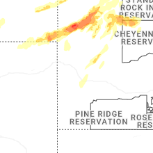
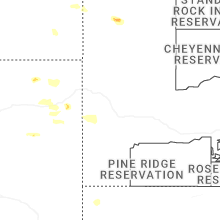
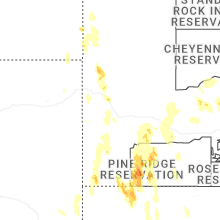
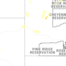
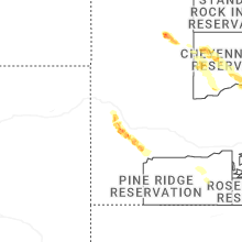
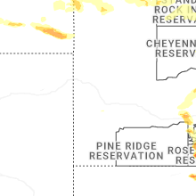
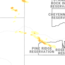
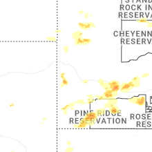
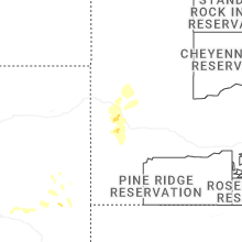
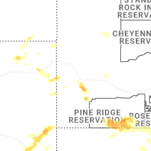
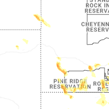
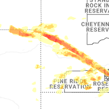
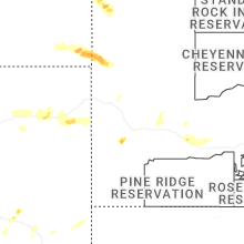
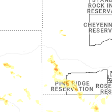
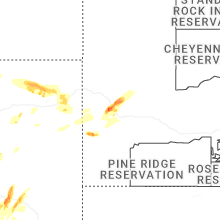
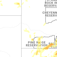


Connect with Interactive Hail Maps